

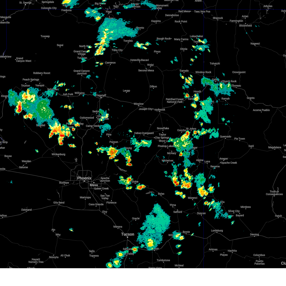
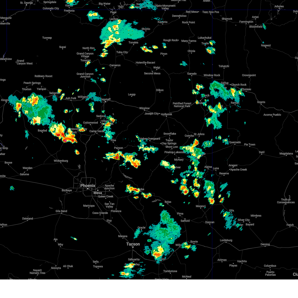
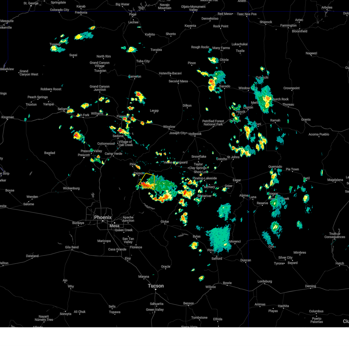
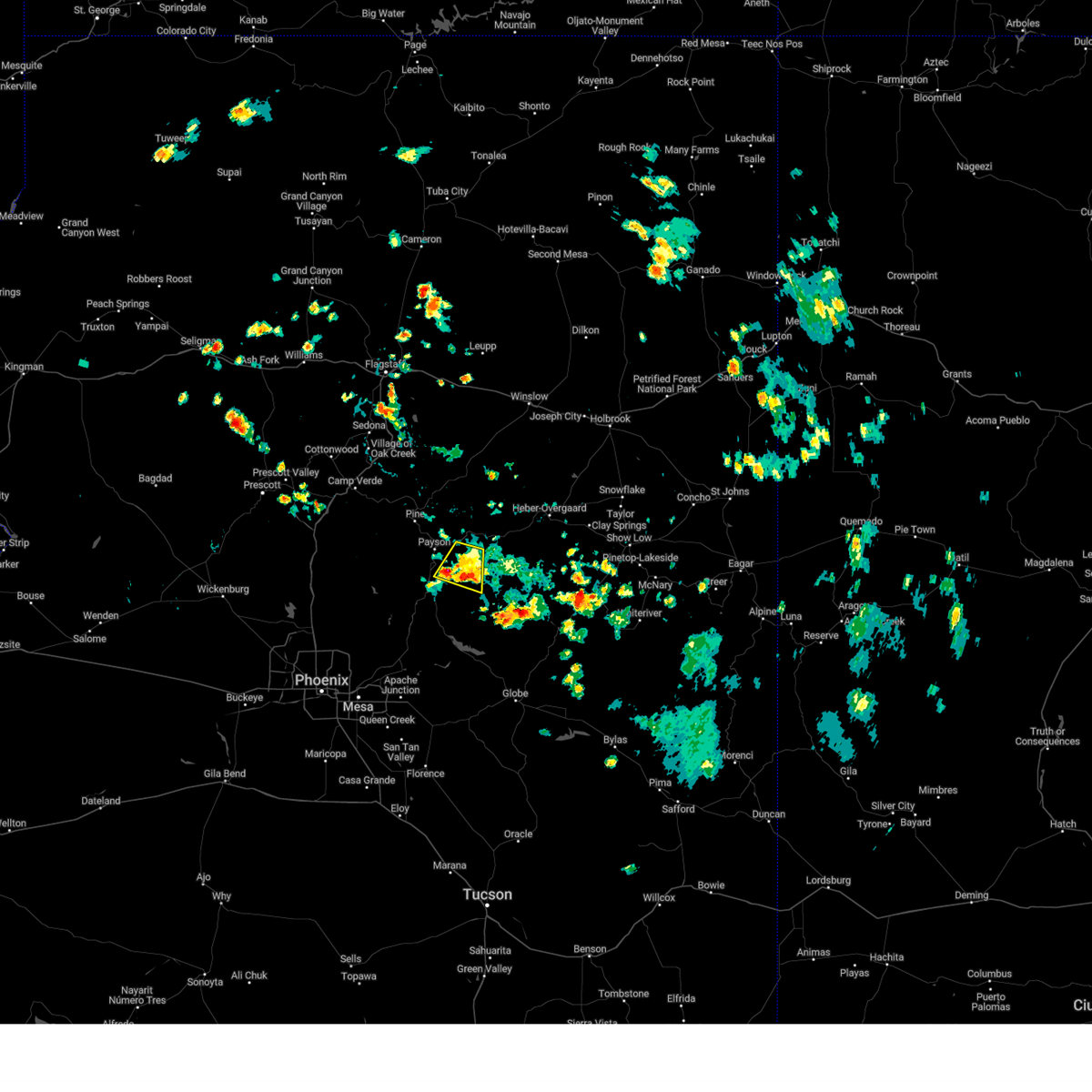
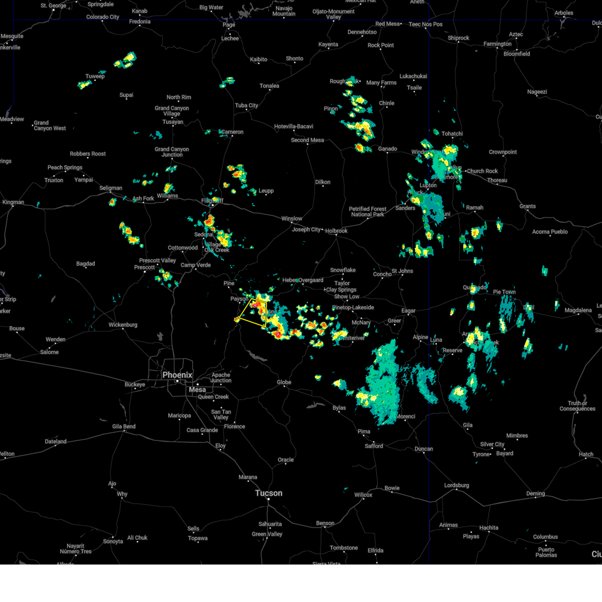
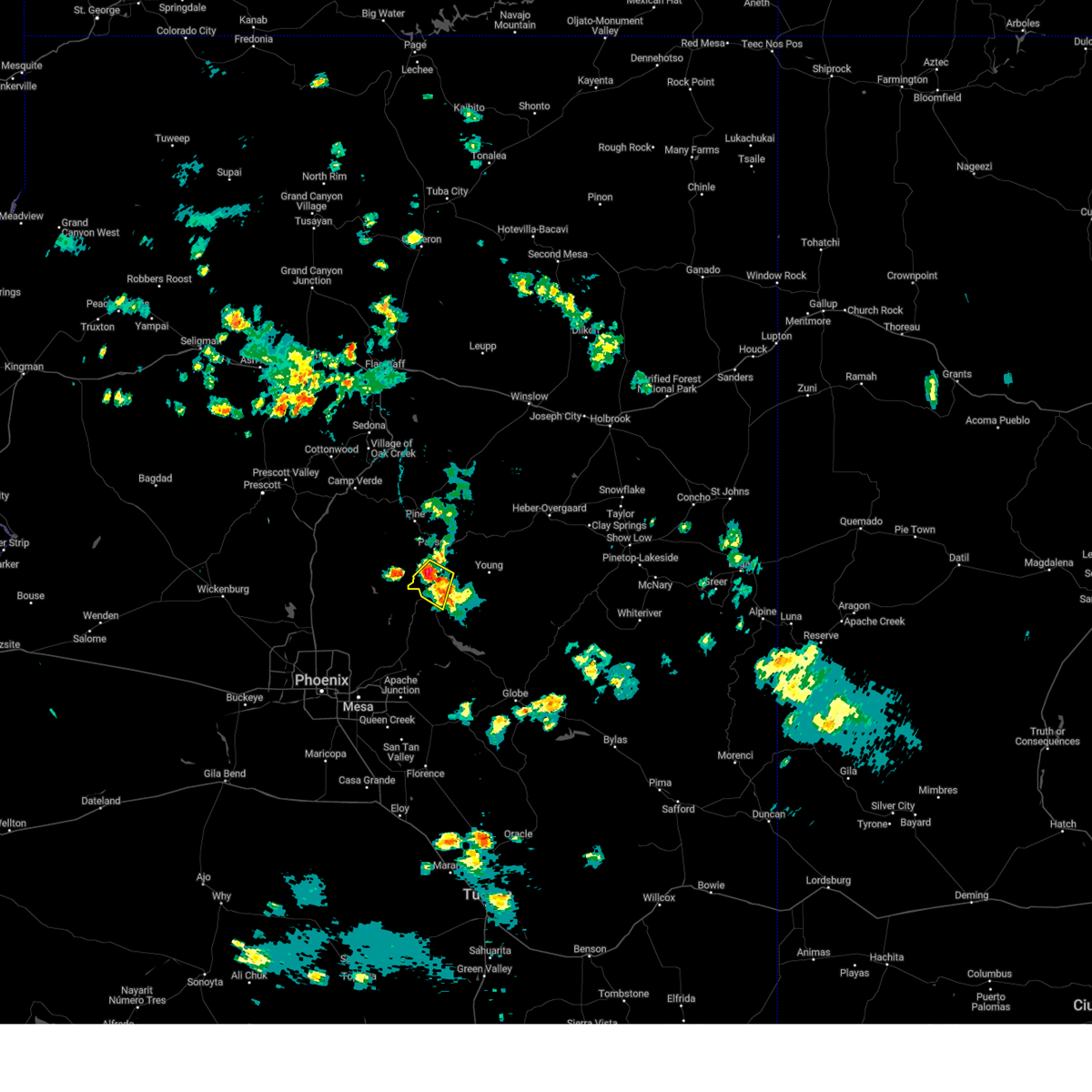
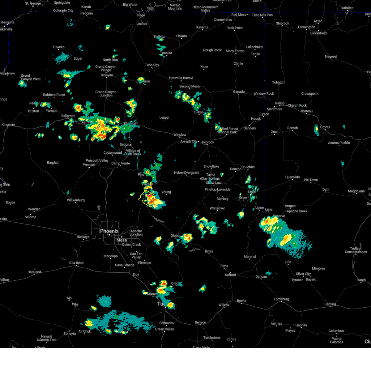
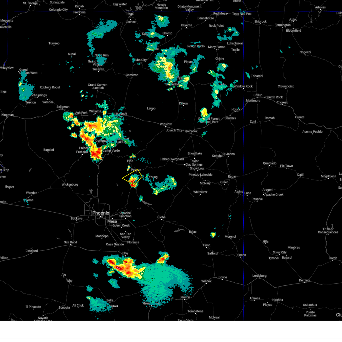
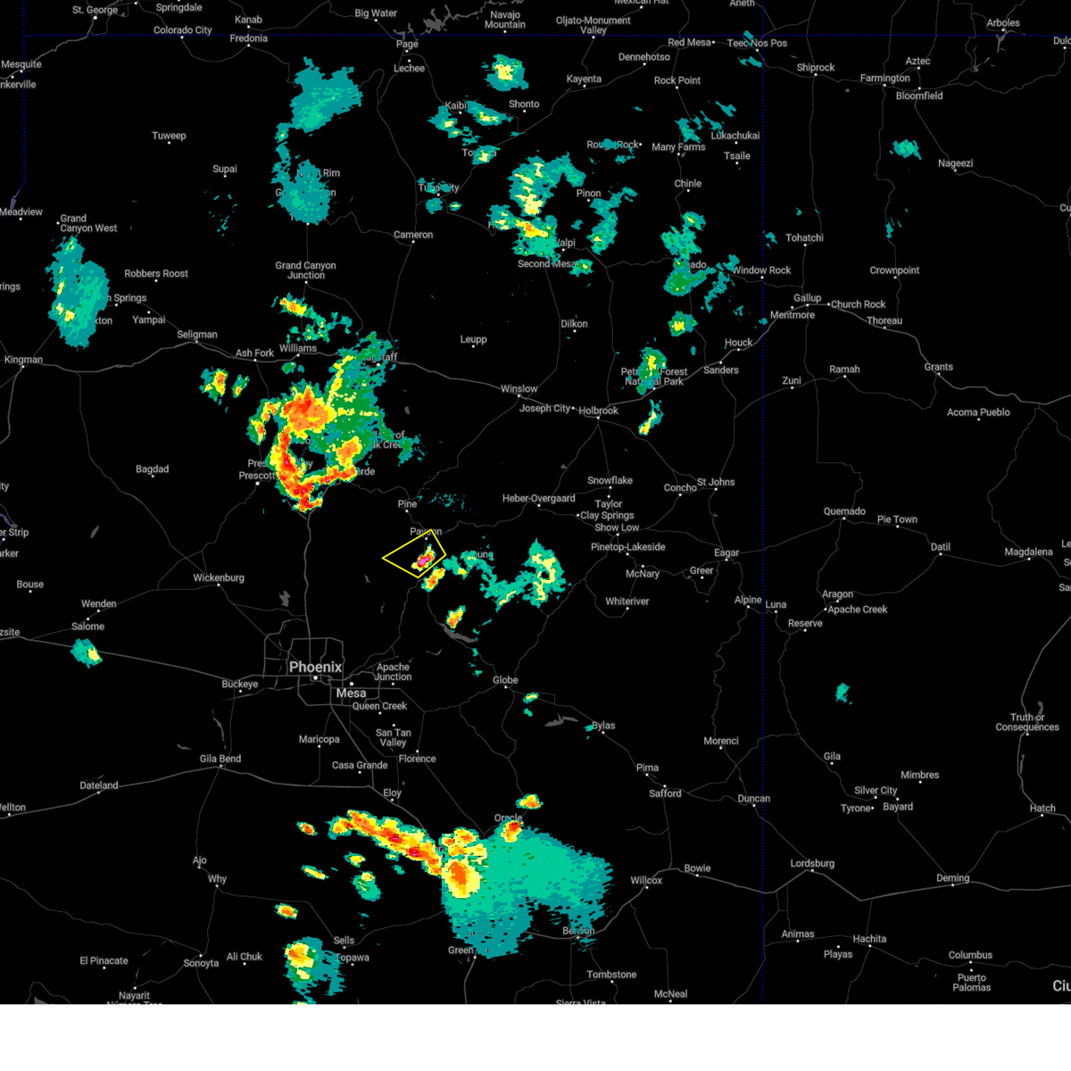
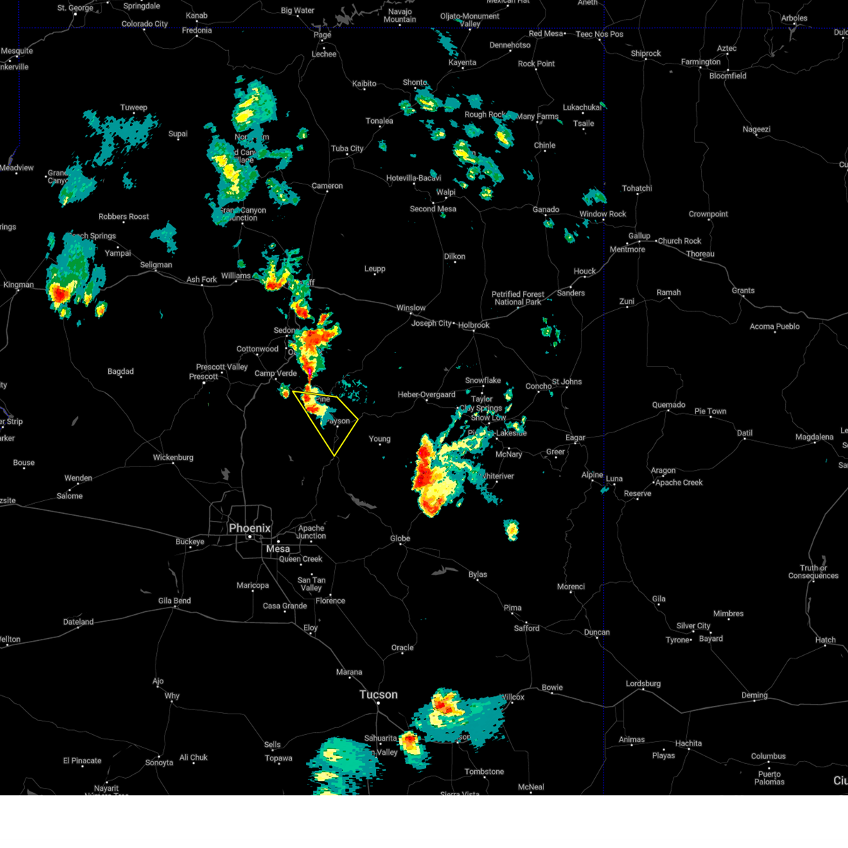
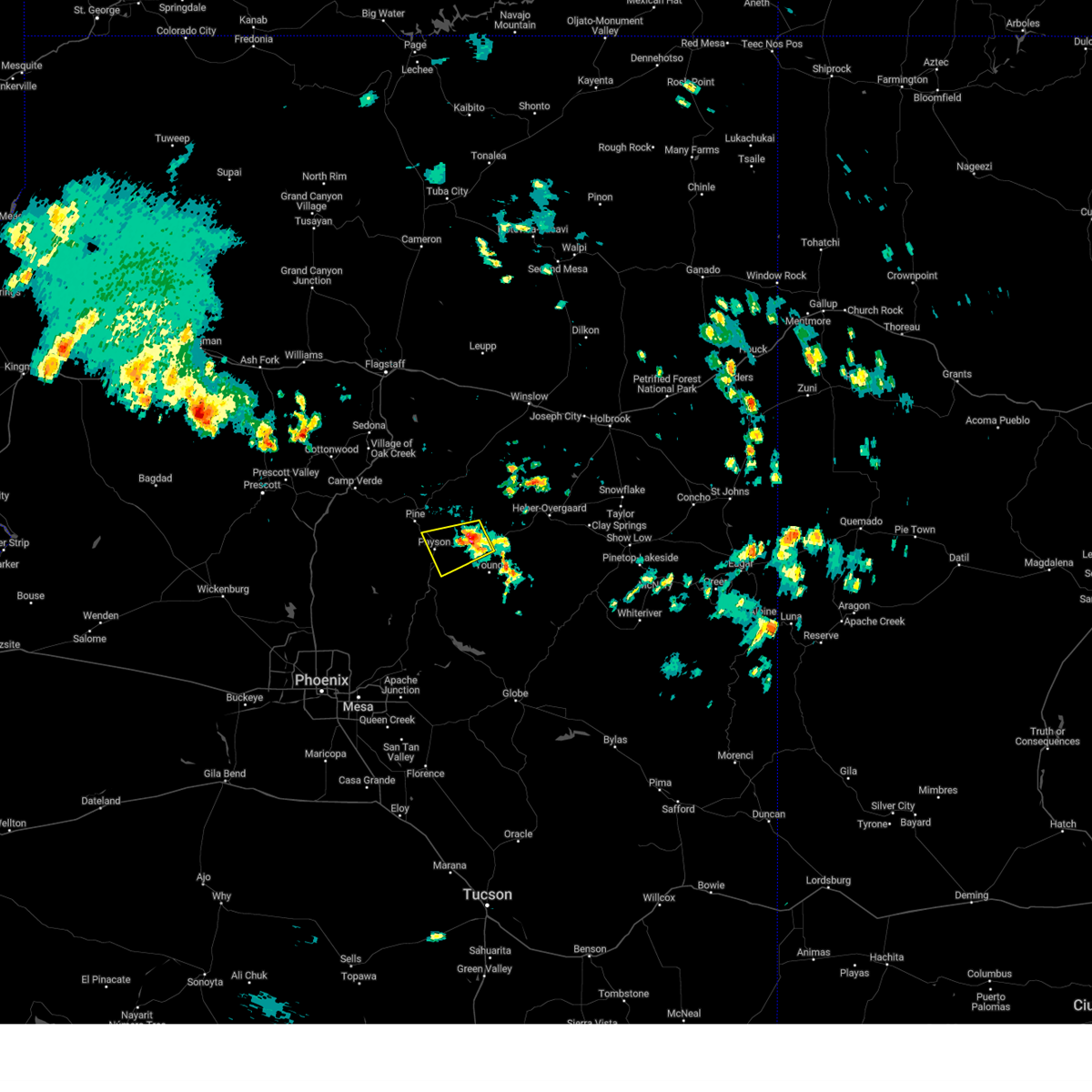
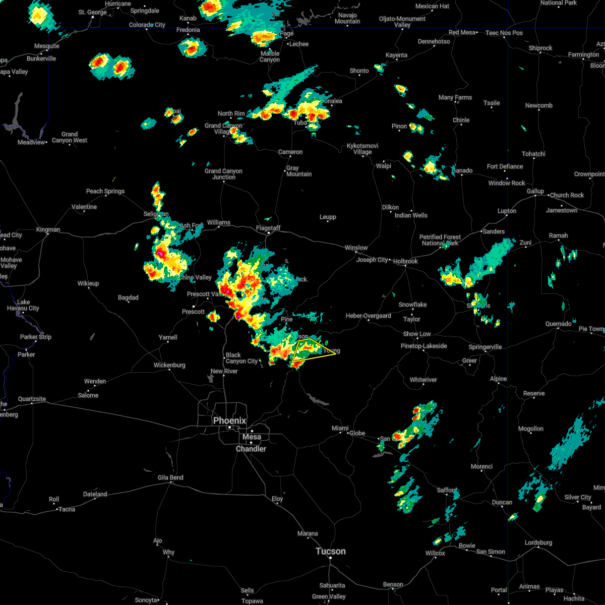
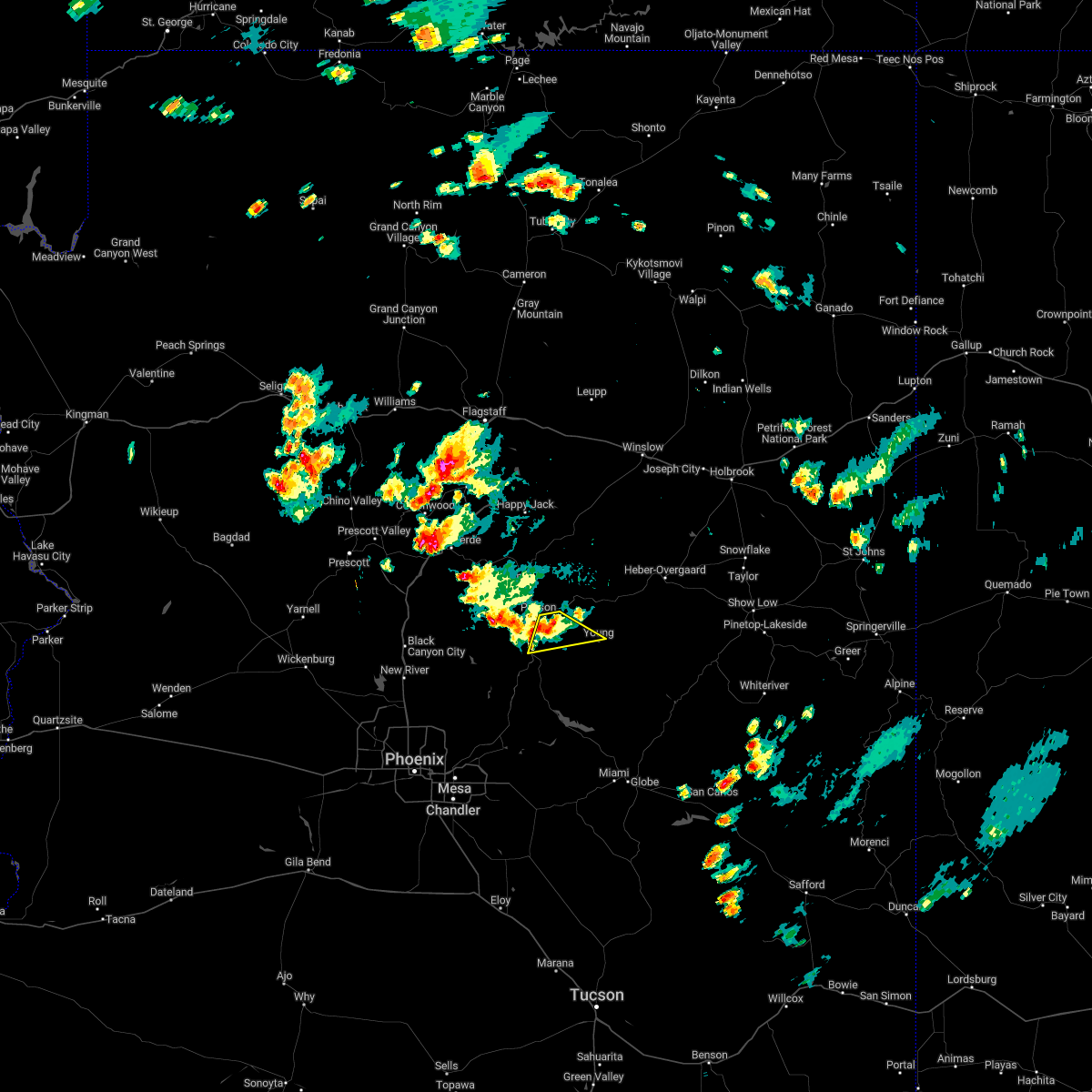
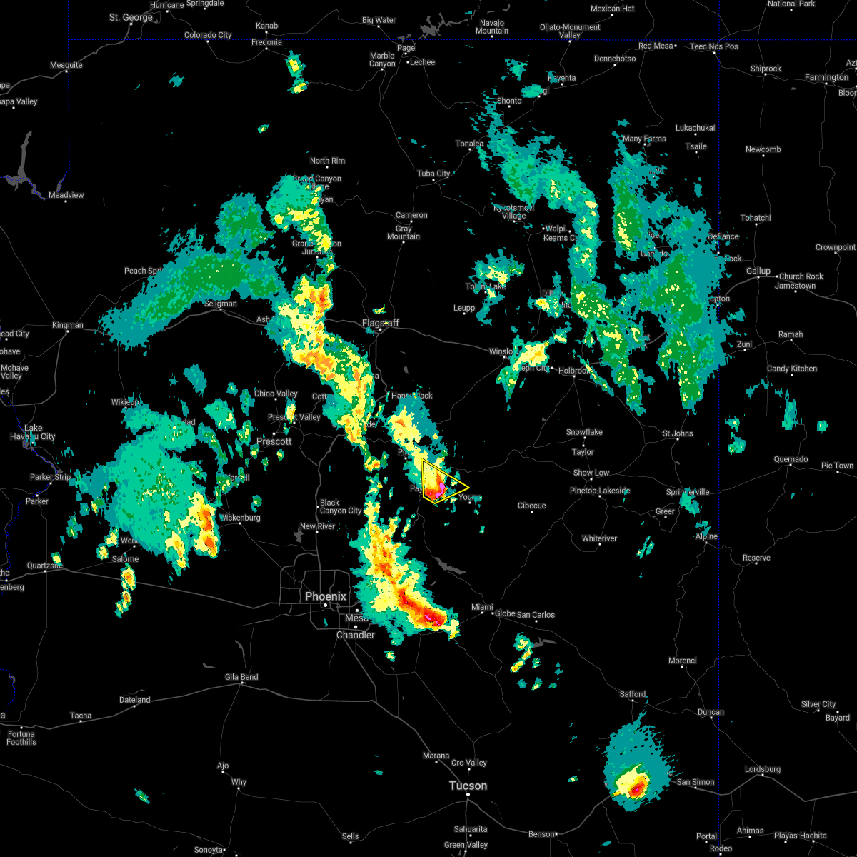
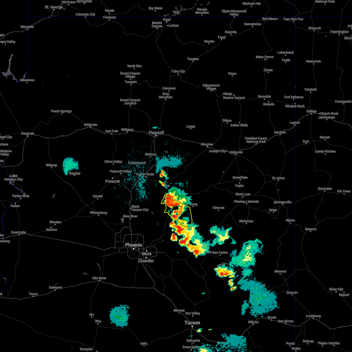
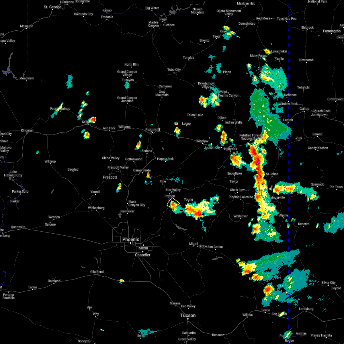
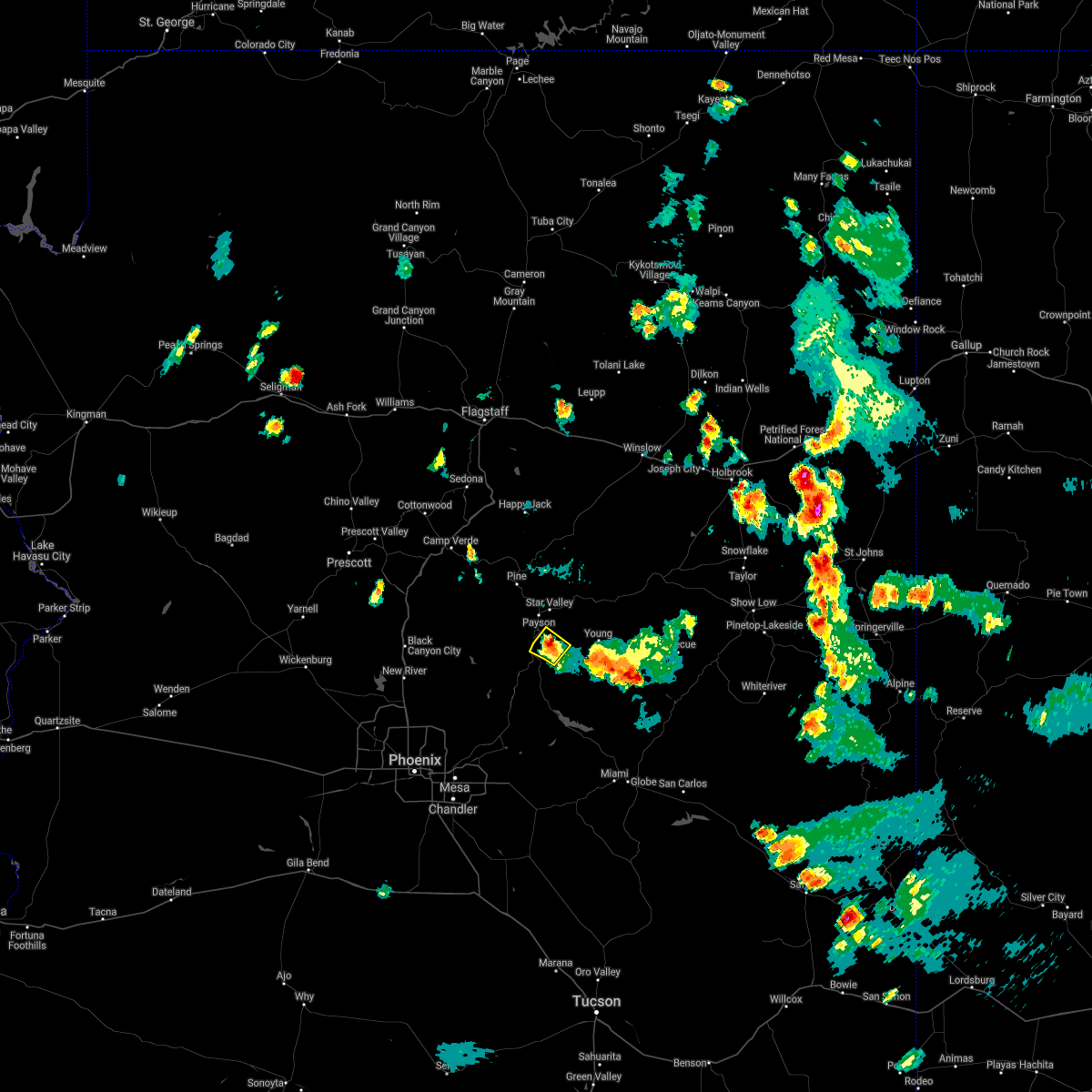
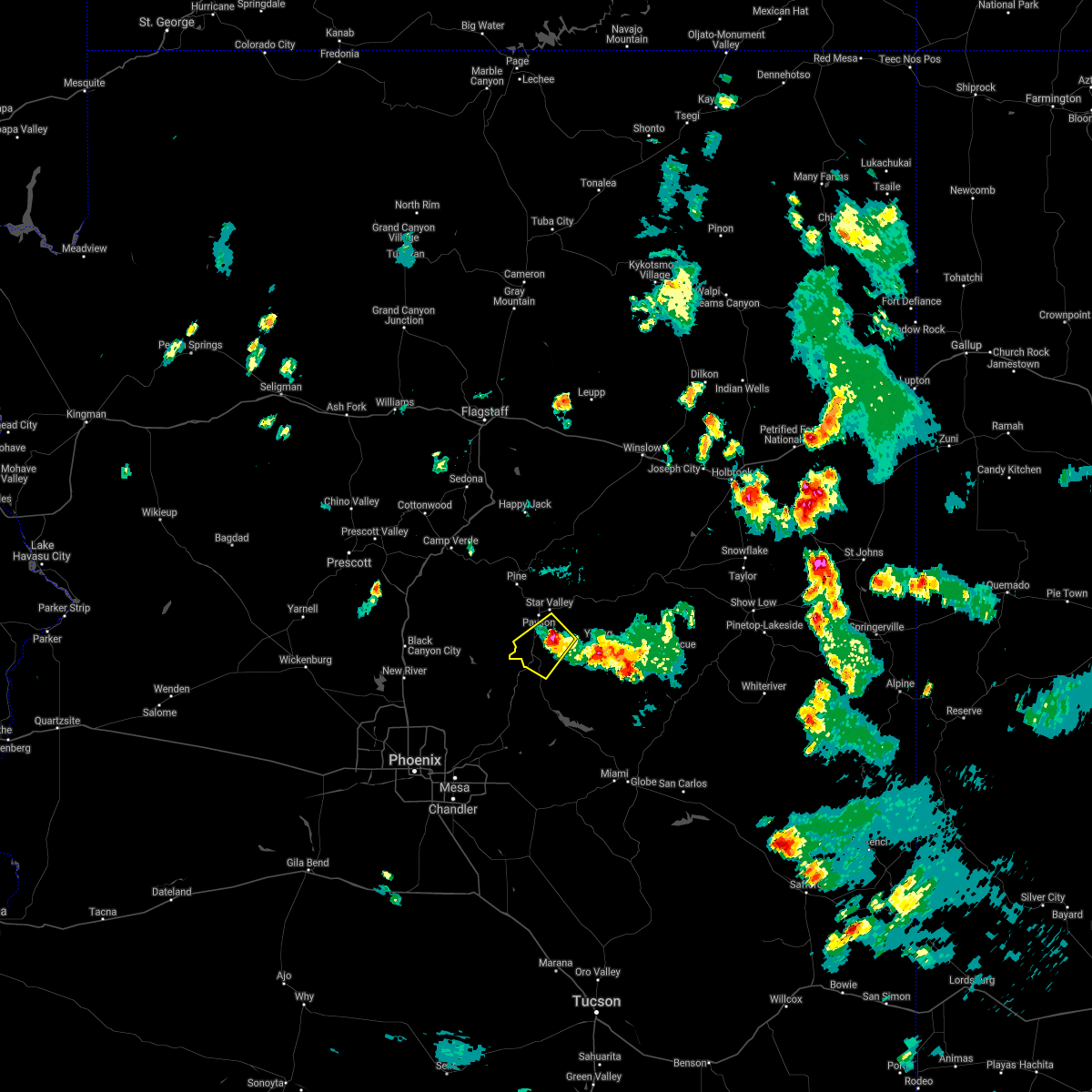
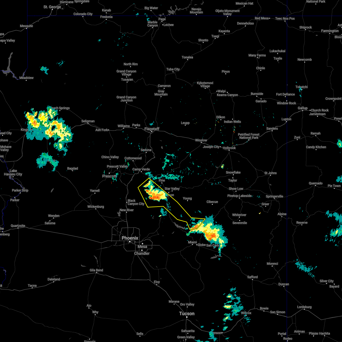
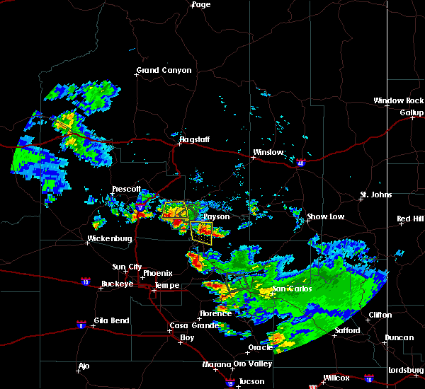
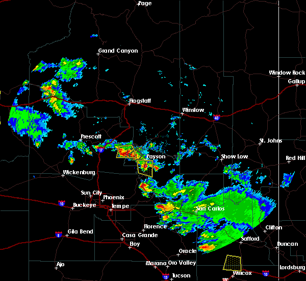
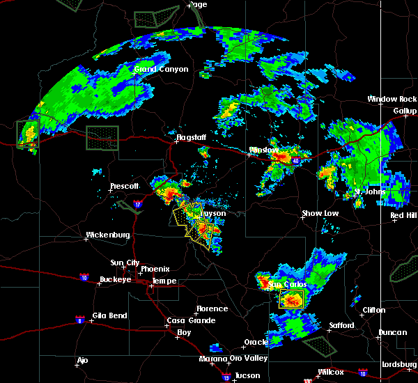
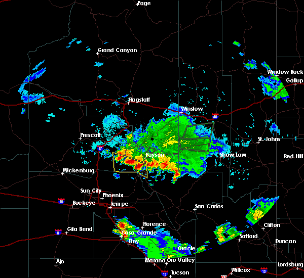
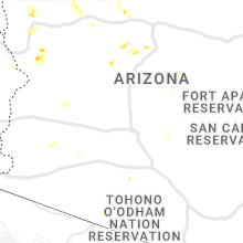
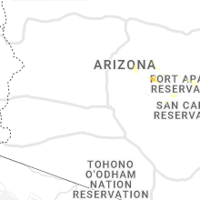
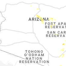
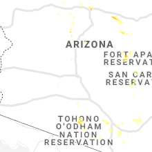
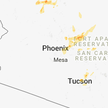
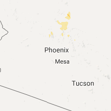
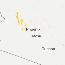
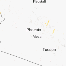
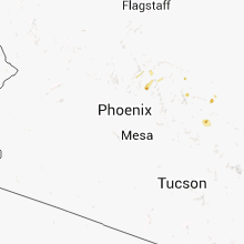
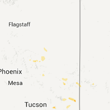
Hail Map for Gisela, AZ
The Gisela, AZ area has had 0 reports of on-the-ground hail by trained spotters, and has been under severe weather warnings 17 times during the past 12 months. Doppler radar has detected hail at or near Gisela, AZ on 52 occasions, including 5 occasions during the past year.
| Name: | Gisela, AZ |
| Where Located: | 64.2 miles NE of Phoenix, AZ |
| Map: | Google Map for Gisela, AZ |
| Population: | 570 |
| Housing Units: | 331 |
| More Info: | Search Google for Gisela, AZ |
3
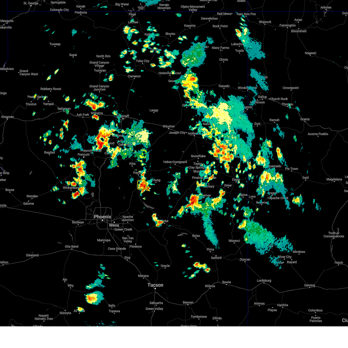
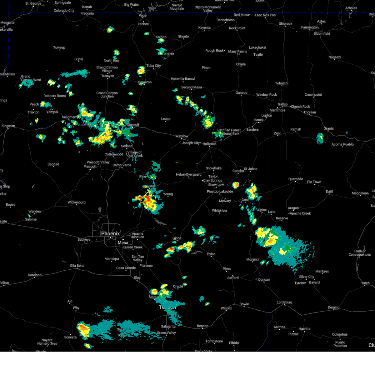
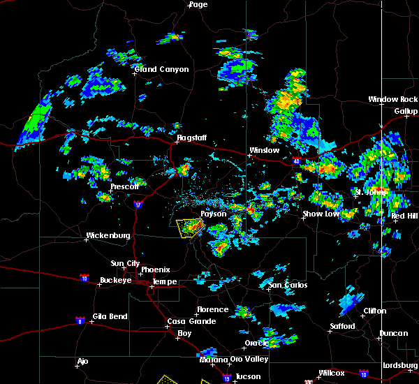
The Top Recent Hail Date for Gisela, AZ is Thursday, August 8, 2024 (4th out of 52)

Hail and Wind Damage Spotted near Gisela, AZ
| Date / Time | Report Details |
|---|---|
| 8/8/2024 3:35 PM MST |
 the severe thunderstorm warning has been cancelled and is no longer in effect the severe thunderstorm warning has been cancelled and is no longer in effect
|
| 8/8/2024 3:12 PM MST |
 Svrfgz the national weather service in flagstaff has issued a * severe thunderstorm warning for, gila county in east central arizona, * until 345 pm mst. * at 312 pm mst, a severe thunderstorm was located over rye, or 11 miles northeast of sycamore creek, and is nearly stationary (radar indicated). Hazards include 60 mph wind gusts and quarter size hail. Hail damage to vehicles is expected. Expect wind damage to roofs, siding, and trees. Svrfgz the national weather service in flagstaff has issued a * severe thunderstorm warning for, gila county in east central arizona, * until 345 pm mst. * at 312 pm mst, a severe thunderstorm was located over rye, or 11 miles northeast of sycamore creek, and is nearly stationary (radar indicated). Hazards include 60 mph wind gusts and quarter size hail. Hail damage to vehicles is expected. Expect wind damage to roofs, siding, and trees.
|
| 7/26/2024 2:31 PM MST |
 The storm which prompted the warning has moved out of the area. therefore, the warning has been allowed to expire. The storm which prompted the warning has moved out of the area. therefore, the warning has been allowed to expire.
|
| 7/26/2024 2:21 PM MST |
 At 221 pm mst, a severe thunderstorm was located over gisela, or 12 miles south of payson, moving southwest at 10 mph (radar indicated). Hazards include 60 mph wind gusts and nickel size hail. Expect damage to roofs, siding, and trees. Locations impacted include, hellsgate wilderness, gisela, young, and star valley. At 221 pm mst, a severe thunderstorm was located over gisela, or 12 miles south of payson, moving southwest at 10 mph (radar indicated). Hazards include 60 mph wind gusts and nickel size hail. Expect damage to roofs, siding, and trees. Locations impacted include, hellsgate wilderness, gisela, young, and star valley.
|
| 7/26/2024 2:01 PM MST |
 Svrfgz the national weather service in flagstaff has issued a * severe thunderstorm warning for, gila county in east central arizona, * until 230 pm mst. * at 201 pm mst, a severe thunderstorm was located 8 miles southeast of star valley, or 11 miles east of payson, moving south at 10 mph (radar indicated). Hazards include 60 mph wind gusts and nickel size hail. expect damage to roofs, siding, and trees Svrfgz the national weather service in flagstaff has issued a * severe thunderstorm warning for, gila county in east central arizona, * until 230 pm mst. * at 201 pm mst, a severe thunderstorm was located 8 miles southeast of star valley, or 11 miles east of payson, moving south at 10 mph (radar indicated). Hazards include 60 mph wind gusts and nickel size hail. expect damage to roofs, siding, and trees
|
| 7/25/2024 3:45 PM MST |
 The thunderstorm near gisela which prompted the warning has weakened below severe limits and no longer poses an immediate threat to life or property. therefore, the warning will be allowed to expire. however, pea sized hail, gusty winds to 40 mph and very heavy rain are still possible with this thunderstorm. The thunderstorm near gisela which prompted the warning has weakened below severe limits and no longer poses an immediate threat to life or property. therefore, the warning will be allowed to expire. however, pea sized hail, gusty winds to 40 mph and very heavy rain are still possible with this thunderstorm.
|
| 7/25/2024 3:20 PM MST |
 Svrfgz the national weather service in flagstaff has issued a * severe thunderstorm warning for, gila county in east central arizona, * until 345 pm mst. * at 320 pm mst, a severe thunderstorm was located near gisela, or 13 miles south of payson, moving south at 10 mph (radar indicated). Hazards include 60 mph wind gusts and nickel size hail. expect damage to roofs, siding, and trees Svrfgz the national weather service in flagstaff has issued a * severe thunderstorm warning for, gila county in east central arizona, * until 345 pm mst. * at 320 pm mst, a severe thunderstorm was located near gisela, or 13 miles south of payson, moving south at 10 mph (radar indicated). Hazards include 60 mph wind gusts and nickel size hail. expect damage to roofs, siding, and trees
|
| 7/24/2024 4:44 PM MST |
 The storm which prompted the warning has weakened below severe limits, and no longer poses an immediate threat to life or property. therefore, the warning will be allowed to expire. however, small hail, gusty winds and heavy rain are still possible with this thunderstorm. a severe thunderstorm watch remains in effect until 900 pm mst for east central arizona. The storm which prompted the warning has weakened below severe limits, and no longer poses an immediate threat to life or property. therefore, the warning will be allowed to expire. however, small hail, gusty winds and heavy rain are still possible with this thunderstorm. a severe thunderstorm watch remains in effect until 900 pm mst for east central arizona.
|
| 7/24/2024 4:33 PM MST |
 At 433 pm mst, a severe thunderstorm was located over rye, or 10 miles south of payson, moving south at 10 mph (radar indicated). Hazards include 60 mph wind gusts and quarter size hail. Hail damage to vehicles is expected. expect wind damage to roofs, siding, and trees. locations impacted include, jakes corner, gisela, deer creek, oak spring canyon, rye, and mazatzal peak. this includes the following highways, state route 188 between mile markers 267 and 276. state route 87 southbound between mile markers 241 and 245. State route 87 between mile markers 229 and 244. At 433 pm mst, a severe thunderstorm was located over rye, or 10 miles south of payson, moving south at 10 mph (radar indicated). Hazards include 60 mph wind gusts and quarter size hail. Hail damage to vehicles is expected. expect wind damage to roofs, siding, and trees. locations impacted include, jakes corner, gisela, deer creek, oak spring canyon, rye, and mazatzal peak. this includes the following highways, state route 188 between mile markers 267 and 276. state route 87 southbound between mile markers 241 and 245. State route 87 between mile markers 229 and 244.
|
| 7/24/2024 4:19 PM MST |
 Svrfgz the national weather service in flagstaff has issued a * severe thunderstorm warning for, gila county in east central arizona, * until 445 pm mst. * at 418 pm mst, a severe thunderstorm was located over rye, or 11 miles south of payson, and is nearly stationary (radar indicated). Hazards include 60 mph wind gusts and quarter size hail. Hail damage to vehicles is expected. Expect wind damage to roofs, siding, and trees. Svrfgz the national weather service in flagstaff has issued a * severe thunderstorm warning for, gila county in east central arizona, * until 445 pm mst. * at 418 pm mst, a severe thunderstorm was located over rye, or 11 miles south of payson, and is nearly stationary (radar indicated). Hazards include 60 mph wind gusts and quarter size hail. Hail damage to vehicles is expected. Expect wind damage to roofs, siding, and trees.
|
| 7/14/2024 7:05 PM MST |
 The storm which prompted the warning has weakened below severe limits, and no longer poses an immediate threat to life or property. therefore, the warning will be allowed to expire. however, gusty winds and heavy rain are still possible with this thunderstorm. The storm which prompted the warning has weakened below severe limits, and no longer poses an immediate threat to life or property. therefore, the warning will be allowed to expire. however, gusty winds and heavy rain are still possible with this thunderstorm.
|
| 7/14/2024 6:39 PM MST |
 Svrfgz the national weather service in flagstaff has issued a * severe thunderstorm warning for, gila county in east central arizona, yavapai county in west central arizona, * until 715 pm mst. * at 639 pm mst, a severe thunderstorm was located over rye, or 8 miles south of payson, moving northwest at 25 mph (radar indicated). Hazards include 60 mph wind gusts and nickel size hail. expect damage to roofs, siding, and trees Svrfgz the national weather service in flagstaff has issued a * severe thunderstorm warning for, gila county in east central arizona, yavapai county in west central arizona, * until 715 pm mst. * at 639 pm mst, a severe thunderstorm was located over rye, or 8 miles south of payson, moving northwest at 25 mph (radar indicated). Hazards include 60 mph wind gusts and nickel size hail. expect damage to roofs, siding, and trees
|
| 7/14/2024 4:51 PM MST |
 The storm which prompted the warning has weakened below severe limits, and no longer poses an immediate threat to life or property. therefore, the warning will be allowed to expire. however, areas of gusty winds and moderate rain are still possible with this thunderstorm. The storm which prompted the warning has weakened below severe limits, and no longer poses an immediate threat to life or property. therefore, the warning will be allowed to expire. however, areas of gusty winds and moderate rain are still possible with this thunderstorm.
|
| 7/14/2024 4:13 PM MST |
 The storm which prompted the warning has moved out of the area. therefore, the warning will be allowed to expire. remember, a severe thunderstorm warning still remains in effect for areas near pine and payson through 5 pm mst. The storm which prompted the warning has moved out of the area. therefore, the warning will be allowed to expire. remember, a severe thunderstorm warning still remains in effect for areas near pine and payson through 5 pm mst.
|
| 7/14/2024 4:10 PM MST |
 Svrfgz the national weather service in flagstaff has issued a * severe thunderstorm warning for, gila county in east central arizona, yavapai county in west central arizona, coconino county in north central arizona, * until 500 pm mst. * at 409 pm mst, a severe thunderstorm was located near oxbow estates, or near payson, moving southwest at 20 mph (radar indicated). Hazards include 60 mph wind gusts and quarter size hail. Hail damage to vehicles is expected. Expect wind damage to roofs, siding, and trees. Svrfgz the national weather service in flagstaff has issued a * severe thunderstorm warning for, gila county in east central arizona, yavapai county in west central arizona, coconino county in north central arizona, * until 500 pm mst. * at 409 pm mst, a severe thunderstorm was located near oxbow estates, or near payson, moving southwest at 20 mph (radar indicated). Hazards include 60 mph wind gusts and quarter size hail. Hail damage to vehicles is expected. Expect wind damage to roofs, siding, and trees.
|
| 7/14/2024 3:39 PM MST |
 Svrfgz the national weather service in flagstaff has issued a * severe thunderstorm warning for, gila county in east central arizona, coconino county in north central arizona, * until 415 pm mst. * at 339 pm mst, a severe thunderstorm was located near mesa del caballo, or near payson, moving southwest at 20 mph (radar indicated). Hazards include 60 mph wind gusts and quarter size hail. Hail damage to vehicles is expected. Expect wind damage to roofs, siding, and trees. Svrfgz the national weather service in flagstaff has issued a * severe thunderstorm warning for, gila county in east central arizona, coconino county in north central arizona, * until 415 pm mst. * at 339 pm mst, a severe thunderstorm was located near mesa del caballo, or near payson, moving southwest at 20 mph (radar indicated). Hazards include 60 mph wind gusts and quarter size hail. Hail damage to vehicles is expected. Expect wind damage to roofs, siding, and trees.
|
| 7/12/2024 5:02 PM MST |
 Svrfgz the national weather service in flagstaff has issued a * severe thunderstorm warning for, gila county in east central arizona, coconino county in north central arizona, * until 545 pm mst. * at 501 pm mst, a severe thunderstorm was located over kohls ranch, or 12 miles east of payson, moving west at 25 mph (radar indicated). Hazards include 60 mph wind gusts and quarter size hail. Hail damage to vehicles is expected. Expect wind damage to roofs, siding, and trees. Svrfgz the national weather service in flagstaff has issued a * severe thunderstorm warning for, gila county in east central arizona, coconino county in north central arizona, * until 545 pm mst. * at 501 pm mst, a severe thunderstorm was located over kohls ranch, or 12 miles east of payson, moving west at 25 mph (radar indicated). Hazards include 60 mph wind gusts and quarter size hail. Hail damage to vehicles is expected. Expect wind damage to roofs, siding, and trees.
|
| 6/20/2024 4:49 PM MST |
 The storm which prompted the warning has weakened below severe limits, and no longer poses an immediate threat to life or property. therefore, the warning has been allowed to expire. The storm which prompted the warning has weakened below severe limits, and no longer poses an immediate threat to life or property. therefore, the warning has been allowed to expire.
|
| 6/20/2024 4:33 PM MST |
 At 432 pm mst, a severe thunderstorm was located over ellison creek cascades, or near payson, moving north at 45 mph (radar indicated). Hazards include quarter size hail. Damage to vehicles is expected. locations impacted include, payson, star valley, oxbow estates, round valley, flowing springs, mcdonald mountain, mesa del caballo, gisela, east verde estates, jakes corner, mesa del caba, rye, payson airport, robbers roost mtn, oak spring canyon, diamond butte, ponderosa campground, houston mesa campground, and deer creek. this includes the following highways, state route 260 between mile markers 252 and 266. state route 188 between mile markers 269 and 276. state route 87 southbound between mile markers 241 and 251. State route 87 between mile markers 232 and 259. At 432 pm mst, a severe thunderstorm was located over ellison creek cascades, or near payson, moving north at 45 mph (radar indicated). Hazards include quarter size hail. Damage to vehicles is expected. locations impacted include, payson, star valley, oxbow estates, round valley, flowing springs, mcdonald mountain, mesa del caballo, gisela, east verde estates, jakes corner, mesa del caba, rye, payson airport, robbers roost mtn, oak spring canyon, diamond butte, ponderosa campground, houston mesa campground, and deer creek. this includes the following highways, state route 260 between mile markers 252 and 266. state route 188 between mile markers 269 and 276. state route 87 southbound between mile markers 241 and 251. State route 87 between mile markers 232 and 259.
|
| 6/20/2024 4:08 PM MST |
 Svrfgz the national weather service in flagstaff has issued a * severe thunderstorm warning for, gila county in east central arizona, * until 445 pm mst. * at 407 pm mst, a severe thunderstorm was located near jakes corner, or 13 miles northeast of sycamore creek, moving north at 45 mph (radar indicated). Hazards include 60 mph wind gusts and quarter size hail. Hail damage to vehicles is expected. Expect wind damage to roofs, siding, and trees. Svrfgz the national weather service in flagstaff has issued a * severe thunderstorm warning for, gila county in east central arizona, * until 445 pm mst. * at 407 pm mst, a severe thunderstorm was located near jakes corner, or 13 miles northeast of sycamore creek, moving north at 45 mph (radar indicated). Hazards include 60 mph wind gusts and quarter size hail. Hail damage to vehicles is expected. Expect wind damage to roofs, siding, and trees.
|
| 8/21/2022 4:38 PM MST |
 The severe thunderstorm warning for gila county will expire at 445 pm mst, the storm which prompted the warning has weakened below severe limits, and no longer poses an immediate threat to life or property. therefore, the warning will be allowed to expire. however, gusty winds and heavy rain are still possible with this thunderstorm. be cautious if driving. if encountering flooded roadways, turn around, don`t drown. The severe thunderstorm warning for gila county will expire at 445 pm mst, the storm which prompted the warning has weakened below severe limits, and no longer poses an immediate threat to life or property. therefore, the warning will be allowed to expire. however, gusty winds and heavy rain are still possible with this thunderstorm. be cautious if driving. if encountering flooded roadways, turn around, don`t drown.
|
| 8/21/2022 4:21 PM MST |
 At 419 pm mst, the severe thunderstorm was located near gisela, or 10 miles southeast of payson, moving south at 10 mph. the thunderstorm has begun to weaken, but remains very strong as it pushes southward (radar indicated). Hazards include up to 60 mph wind gusts, quarter size hail, and heavy rainfall. Hail damage to vehicles is expected. expect wind damage to roofs, siding, and trees. locations impacted include, payson, round valley, gisela, rye and deer creek. hail threat, radar indicated max hail size, 1. 00 in wind threat, radar indicated max wind gust, 60 mph. At 419 pm mst, the severe thunderstorm was located near gisela, or 10 miles southeast of payson, moving south at 10 mph. the thunderstorm has begun to weaken, but remains very strong as it pushes southward (radar indicated). Hazards include up to 60 mph wind gusts, quarter size hail, and heavy rainfall. Hail damage to vehicles is expected. expect wind damage to roofs, siding, and trees. locations impacted include, payson, round valley, gisela, rye and deer creek. hail threat, radar indicated max hail size, 1. 00 in wind threat, radar indicated max wind gust, 60 mph.
|
| 8/21/2022 3:56 PM MST |
 At 355 pm mst, a severe thunderstorm was located near star valley, or 7 miles southeast of payson, moving south at 5 to 10 mph (radar indicated). Hazards include up to 50 mph wind gusts, quarter size hail, and heavy rainfall. Hail damage to vehicles is expected. Expect wind damage to roofs, siding, and trees. At 355 pm mst, a severe thunderstorm was located near star valley, or 7 miles southeast of payson, moving south at 5 to 10 mph (radar indicated). Hazards include up to 50 mph wind gusts, quarter size hail, and heavy rainfall. Hail damage to vehicles is expected. Expect wind damage to roofs, siding, and trees.
|
| 10/11/2021 11:25 PM MST |
 At 1125 pm mst, severe thunderstorms were located along a line extending from near childs power plant to near horseshoe reservoir, moving east at 45 mph (radar indicated). Hazards include 60 mph wind gusts. expect damage to roofs, siding, and trees At 1125 pm mst, severe thunderstorms were located along a line extending from near childs power plant to near horseshoe reservoir, moving east at 45 mph (radar indicated). Hazards include 60 mph wind gusts. expect damage to roofs, siding, and trees
|
| 10/5/2021 1:55 PM MST |
 At 155 pm mst, a severe thunderstorm was located near tonto village, or 12 miles east of payson, moving northeast at 25 mph (radar indicated). Hazards include quarter size hail. Damage to vehicles is expected. locations impacted include, payson, star valley, round valley, freedom acres, mesa del caballo, alderwood campground, houston mesa campground, water wheel burn at houston mesa rd- s, beaver valley and water wheel burn at houston mesa rd-n. hail threat, radar indicated max hail size, 1. 00 in wind threat, radar indicated max wind gust, <50 mph. At 155 pm mst, a severe thunderstorm was located near tonto village, or 12 miles east of payson, moving northeast at 25 mph (radar indicated). Hazards include quarter size hail. Damage to vehicles is expected. locations impacted include, payson, star valley, round valley, freedom acres, mesa del caballo, alderwood campground, houston mesa campground, water wheel burn at houston mesa rd- s, beaver valley and water wheel burn at houston mesa rd-n. hail threat, radar indicated max hail size, 1. 00 in wind threat, radar indicated max wind gust, <50 mph.
|
| 10/5/2021 1:38 PM MST |
 At 135 pm mst, a severe thunderstorm was located near gisela, or 9 miles southeast of payson, moving northeast at 20 mph (radar indicated). Hazards include quarter size hail. Damage to vehicles is expected. locations impacted include, payson, star valley, oxbow estates, round valley, flowing springs, mesa del caballo, gisela, freedom acres, rye, houston mesa campground, water wheel burn at houston mesa rd- s, beaver valley, water wheel burn at houston mesa rd- n and alderwood campground. hail threat, radar indicated max hail size, 1. 00 in wind threat, radar indicated max wind gust, <50 mph. At 135 pm mst, a severe thunderstorm was located near gisela, or 9 miles southeast of payson, moving northeast at 20 mph (radar indicated). Hazards include quarter size hail. Damage to vehicles is expected. locations impacted include, payson, star valley, oxbow estates, round valley, flowing springs, mesa del caballo, gisela, freedom acres, rye, houston mesa campground, water wheel burn at houston mesa rd- s, beaver valley, water wheel burn at houston mesa rd- n and alderwood campground. hail threat, radar indicated max hail size, 1. 00 in wind threat, radar indicated max wind gust, <50 mph.
|
| 10/5/2021 1:24 PM MST |
 At 123 pm mst, a severe thunderstorm was located near gisela, or 13 miles south of payson, moving northeast at 20 mph (radar indicated). Hazards include quarter size hail. damage to vehicles is expected At 123 pm mst, a severe thunderstorm was located near gisela, or 13 miles south of payson, moving northeast at 20 mph (radar indicated). Hazards include quarter size hail. damage to vehicles is expected
|
| 8/16/2021 9:41 PM MST |
 At 940 pm mst, severe thunderstorms were located along a line extending from 9 miles west of oxbow estates to 9 miles southwest of young, moving south at 30 mph (radar indicated). Hazards include 60 mph wind gusts and penny size hail. Expect damage to roofs, siding, and trees. locations impacted include, oxbow estates, round valley, jakes corner, gisela, rye and deer creek. hail threat, radar indicated max hail size, 0. 75 in wind threat, radar indicated max wind gust, 60 mph. At 940 pm mst, severe thunderstorms were located along a line extending from 9 miles west of oxbow estates to 9 miles southwest of young, moving south at 30 mph (radar indicated). Hazards include 60 mph wind gusts and penny size hail. Expect damage to roofs, siding, and trees. locations impacted include, oxbow estates, round valley, jakes corner, gisela, rye and deer creek. hail threat, radar indicated max hail size, 0. 75 in wind threat, radar indicated max wind gust, 60 mph.
|
| 8/16/2021 9:18 PM MST |
 At 917 pm mst, severe thunderstorms were located along a line extending from pine to near haigler creek, moving south at 25 mph (radar indicated). Hazards include 60 mph wind gusts and quarter size hail. Hail damage to vehicles is expected. Expect wind damage to roofs, siding, and trees. At 917 pm mst, severe thunderstorms were located along a line extending from pine to near haigler creek, moving south at 25 mph (radar indicated). Hazards include 60 mph wind gusts and quarter size hail. Hail damage to vehicles is expected. Expect wind damage to roofs, siding, and trees.
|
| 8/16/2021 4:50 PM MST |
 The severe thunderstorm warning for gila county will expire at 500 pm mst, the storm which prompted the warning has weakened below severe limits, and no longer poses an immediate threat to life or property. therefore, the warning will be allowed to expire. however heavy rain is still possible with this thunderstorm. a severe thunderstorm watch remains in effect until midnight mst for east central arizona. The severe thunderstorm warning for gila county will expire at 500 pm mst, the storm which prompted the warning has weakened below severe limits, and no longer poses an immediate threat to life or property. therefore, the warning will be allowed to expire. however heavy rain is still possible with this thunderstorm. a severe thunderstorm watch remains in effect until midnight mst for east central arizona.
|
| 8/16/2021 4:46 PM MST |
 At 446 pm mst, a severe thunderstorm was located over gisela, or 11 miles south of payson, moving southwest at 15 mph (radar indicated). Hazards include 60 mph wind gusts and quarter size hail. Hail damage to vehicles is expected. expect wind damage to roofs, siding, and trees. locations impacted include, gisela and deer creek. hail threat, radar indicated max hail size, 1. 00 in wind threat, radar indicated max wind gust, 60 mph. At 446 pm mst, a severe thunderstorm was located over gisela, or 11 miles south of payson, moving southwest at 15 mph (radar indicated). Hazards include 60 mph wind gusts and quarter size hail. Hail damage to vehicles is expected. expect wind damage to roofs, siding, and trees. locations impacted include, gisela and deer creek. hail threat, radar indicated max hail size, 1. 00 in wind threat, radar indicated max wind gust, 60 mph.
|
| 8/16/2021 4:34 PM MST |
 At 434 pm mst, a severe thunderstorm was located near gisela, or 9 miles southeast of payson, moving southwest at 15 mph (radar indicated). Hazards include 60 mph wind gusts and quarter size hail. Hail damage to vehicles is expected. Expect wind damage to roofs, siding, and trees. At 434 pm mst, a severe thunderstorm was located near gisela, or 9 miles southeast of payson, moving southwest at 15 mph (radar indicated). Hazards include 60 mph wind gusts and quarter size hail. Hail damage to vehicles is expected. Expect wind damage to roofs, siding, and trees.
|
| 7/10/2021 6:31 PM MST |
 At 630 pm mst, severe thunderstorms were located along a line extending from 8 miles west of childs power plant to near jakes corner to 14 miles northeast of claypool, moving southwest at 35 mph (radar indicated). Hazards include 60 mph wind gusts and quarter size hail. Hail damage to vehicles is expected. expect wind damage to roofs, siding, and trees. Locations impacted include, oxbow estates, jakes corner, gisela, horseshoe reservoir, childs power plant, rye, deer creek, rose creek campground and reynolds creek group campground. At 630 pm mst, severe thunderstorms were located along a line extending from 8 miles west of childs power plant to near jakes corner to 14 miles northeast of claypool, moving southwest at 35 mph (radar indicated). Hazards include 60 mph wind gusts and quarter size hail. Hail damage to vehicles is expected. expect wind damage to roofs, siding, and trees. Locations impacted include, oxbow estates, jakes corner, gisela, horseshoe reservoir, childs power plant, rye, deer creek, rose creek campground and reynolds creek group campground.
|
| 7/10/2021 6:12 PM MST |
 At 612 pm mst, severe thunderstorms were located along a line extending from 8 miles southeast of camp verde to near gisela to 11 miles northwest of hilltop, moving southwest at 35 mph (radar indicated). Hazards include 60 mph wind gusts and quarter size hail. Hail damage to vehicles is expected. expect wind damage to roofs, siding, and trees. Locations impacted include, payson, star valley, oxbow estates, round valley, young, flowing springs, mesa del caballo, gisela, horseshoe reservoir, east verde estates, jakes corner, childs power plant, rye, houston mesa campground, tonto natural bridge state park, deer creek, rose creek campground and reynolds creek group campground. At 612 pm mst, severe thunderstorms were located along a line extending from 8 miles southeast of camp verde to near gisela to 11 miles northwest of hilltop, moving southwest at 35 mph (radar indicated). Hazards include 60 mph wind gusts and quarter size hail. Hail damage to vehicles is expected. expect wind damage to roofs, siding, and trees. Locations impacted include, payson, star valley, oxbow estates, round valley, young, flowing springs, mesa del caballo, gisela, horseshoe reservoir, east verde estates, jakes corner, childs power plant, rye, houston mesa campground, tonto natural bridge state park, deer creek, rose creek campground and reynolds creek group campground.
|
| 7/10/2021 5:56 PM MST |
 At 555 pm mst, severe thunderstorms were located along a line extending from 7 miles southeast of rimrock to 7 miles east of gisela to 12 miles northwest of hilltop, moving southwest at 20 mph (radar indicated). Hazards include 60 mph wind gusts. expect damage to roofs, siding, and trees At 555 pm mst, severe thunderstorms were located along a line extending from 7 miles southeast of rimrock to 7 miles east of gisela to 12 miles northwest of hilltop, moving southwest at 20 mph (radar indicated). Hazards include 60 mph wind gusts. expect damage to roofs, siding, and trees
|
| 7/9/2021 4:48 PM MST |
 At 448 pm mst, severe thunderstorms were located along a line extending from near christopher creek to just north of young, moving west at 10 mph (radar indicated). Hazards include 60 mph wind gusts and quarter size hail. Hail damage to vehicles is expected. Expect wind damage to roofs, siding, and trees. At 448 pm mst, severe thunderstorms were located along a line extending from near christopher creek to just north of young, moving west at 10 mph (radar indicated). Hazards include 60 mph wind gusts and quarter size hail. Hail damage to vehicles is expected. Expect wind damage to roofs, siding, and trees.
|
| 9/8/2020 4:08 PM MST |
 At 408 pm mst, a severe thunderstorm was located near gisela, or 14 miles southeast of payson, moving east at 35 mph (radar indicated). Hazards include ping pong ball size hail and 60 mph wind gusts. People and animals outdoors will be injured. expect hail damage to roofs, siding, windows, and vehicles. expect wind damage to roofs, siding, and trees. Locations impacted include, young. At 408 pm mst, a severe thunderstorm was located near gisela, or 14 miles southeast of payson, moving east at 35 mph (radar indicated). Hazards include ping pong ball size hail and 60 mph wind gusts. People and animals outdoors will be injured. expect hail damage to roofs, siding, windows, and vehicles. expect wind damage to roofs, siding, and trees. Locations impacted include, young.
|
| 9/8/2020 3:58 PM MST |
 At 358 pm mst, a severe thunderstorm was located over gisela, or 11 miles south of payson, moving east at 40 mph (radar indicated). Hazards include 60 mph wind gusts and quarter size hail. Hail damage to vehicles is expected. Expect wind damage to roofs, siding, and trees. At 358 pm mst, a severe thunderstorm was located over gisela, or 11 miles south of payson, moving east at 40 mph (radar indicated). Hazards include 60 mph wind gusts and quarter size hail. Hail damage to vehicles is expected. Expect wind damage to roofs, siding, and trees.
|
| 8/10/2018 1:27 PM MST |
 At 127 pm mst, a severe thunderstorm was located over hunter creek, or 13 miles west of forest lakes, moving west at 15 mph (radar indicated). Hazards include 60 mph wind gusts and quarter size hail. Hail damage to vehicles is expected. Expect wind damage to roofs, siding, and trees. At 127 pm mst, a severe thunderstorm was located over hunter creek, or 13 miles west of forest lakes, moving west at 15 mph (radar indicated). Hazards include 60 mph wind gusts and quarter size hail. Hail damage to vehicles is expected. Expect wind damage to roofs, siding, and trees.
|
| 7/30/2018 5:34 PM MST |
 At 533 pm mst, a severe thunderstorm was located near gisela, or 7 miles south of payson, and is nearly stationary (radar indicated). Hazards include 70 mph wind gusts and quarter size hail. Hail damage to vehicles is expected. expect considerable tree damage. wind damage is also likely to mobile homes, roofs, and outbuildings. locations impacted include, payson, oxbow estates, round valley, jakes corner, gisela, rye and deer creek. this includes the following highways, state route 188 between mile markers 272 and 276. state route 87 southbound between mile markers 241 and 251. State route 87 between mile markers 233 and 252. At 533 pm mst, a severe thunderstorm was located near gisela, or 7 miles south of payson, and is nearly stationary (radar indicated). Hazards include 70 mph wind gusts and quarter size hail. Hail damage to vehicles is expected. expect considerable tree damage. wind damage is also likely to mobile homes, roofs, and outbuildings. locations impacted include, payson, oxbow estates, round valley, jakes corner, gisela, rye and deer creek. this includes the following highways, state route 188 between mile markers 272 and 276. state route 87 southbound between mile markers 241 and 251. State route 87 between mile markers 233 and 252.
|
| 7/30/2018 5:16 PM MST |
 At 515 pm mst, a severe thunderstorm was located over rye, or 7 miles south of payson, and is nearly stationary (radar indicated). Hazards include 70 mph wind gusts and quarter size hail. Hail damage to vehicles is expected. expect considerable tree damage. Wind damage is also likely to mobile homes, roofs, and outbuildings. At 515 pm mst, a severe thunderstorm was located over rye, or 7 miles south of payson, and is nearly stationary (radar indicated). Hazards include 70 mph wind gusts and quarter size hail. Hail damage to vehicles is expected. expect considerable tree damage. Wind damage is also likely to mobile homes, roofs, and outbuildings.
|
| 7/27/2018 4:43 PM MST |
 The severe thunderstorm warning for gila county will expire at 445 pm mst, the storm which prompted the warning has weakened below severe limits, and no longer pose an immediate threat to life or property. therefore the warning will be allowed to expire. The severe thunderstorm warning for gila county will expire at 445 pm mst, the storm which prompted the warning has weakened below severe limits, and no longer pose an immediate threat to life or property. therefore the warning will be allowed to expire.
|
| 7/27/2018 4:03 PM MST |
 At 402 pm mst, a severe thunderstorm was located over round valley, or near payson, moving southeast at 15 mph (radar indicated). Hazards include 60 mph wind gusts and quarter size hail. Hail damage to vehicles is expected. Expect wind damage to roofs, siding, and trees. At 402 pm mst, a severe thunderstorm was located over round valley, or near payson, moving southeast at 15 mph (radar indicated). Hazards include 60 mph wind gusts and quarter size hail. Hail damage to vehicles is expected. Expect wind damage to roofs, siding, and trees.
|
| 7/26/2018 3:08 PM MST |
 At 307 pm mst, a severe thunderstorm was located 8 miles west of young, or 15 miles southeast of payson, moving southwest at 20 mph (radar indicated). Hazards include 60 mph wind gusts and quarter size hail. Hail damage to vehicles is expected. Expect wind damage to roofs, siding, and trees. At 307 pm mst, a severe thunderstorm was located 8 miles west of young, or 15 miles southeast of payson, moving southwest at 20 mph (radar indicated). Hazards include 60 mph wind gusts and quarter size hail. Hail damage to vehicles is expected. Expect wind damage to roofs, siding, and trees.
|
| 7/19/2018 5:56 PM MST |
 At 555 pm mst, a severe thunderstorm was located over gisela, or 8 miles south of payson, and is nearly stationary (radar indicated). Hazards include 60 mph wind gusts and quarter size hail. Hail damage to vehicles is expected. Expect wind damage to roofs, siding, and trees. At 555 pm mst, a severe thunderstorm was located over gisela, or 8 miles south of payson, and is nearly stationary (radar indicated). Hazards include 60 mph wind gusts and quarter size hail. Hail damage to vehicles is expected. Expect wind damage to roofs, siding, and trees.
|
| 7/19/2018 5:13 PM MST |
 At 512 pm mst, severe thunderstorms were located along a line extending from geronimo estates to near gisela, moving southwest at 10 mph (radar indicated). Hazards include 60 mph wind gusts and quarter size hail. Hail damage to vehicles is expected. Expect wind damage to roofs, siding, and trees. At 512 pm mst, severe thunderstorms were located along a line extending from geronimo estates to near gisela, moving southwest at 10 mph (radar indicated). Hazards include 60 mph wind gusts and quarter size hail. Hail damage to vehicles is expected. Expect wind damage to roofs, siding, and trees.
|
| 7/16/2017 8:41 PM MST |
 The national weather service in flagstaff has issued a * severe thunderstorm warning for. gila county in east central arizona. yavapai county in west central arizona. Until 915 pm mst * at 840 pm mst, severe thunderstorms were located along a line. The national weather service in flagstaff has issued a * severe thunderstorm warning for. gila county in east central arizona. yavapai county in west central arizona. Until 915 pm mst * at 840 pm mst, severe thunderstorms were located along a line.
|
| 7/15/2017 2:34 PM MST |
 At 233 pm mst, a severe thunderstorm was located near oxbow estates, or near payson, moving southwest at 25 mph (radar indicated). Hazards include 60 mph wind gusts and quarter size hail. Hail damage to vehicles is expected. expect wind damage to roofs, siding, and trees. locations impacted include, payson, star valley, oxbow estates, round valley, freedom acres, flowing springs, east verde estates, mesa del caballo, rye, deer creek and houston mesa campground. this includes the following highways, state route 260 between mile markers 252 and 260. state route 87 southbound between mile markers 241 and 251. State route 87 between mile markers 237 and 263. At 233 pm mst, a severe thunderstorm was located near oxbow estates, or near payson, moving southwest at 25 mph (radar indicated). Hazards include 60 mph wind gusts and quarter size hail. Hail damage to vehicles is expected. expect wind damage to roofs, siding, and trees. locations impacted include, payson, star valley, oxbow estates, round valley, freedom acres, flowing springs, east verde estates, mesa del caballo, rye, deer creek and houston mesa campground. this includes the following highways, state route 260 between mile markers 252 and 260. state route 87 southbound between mile markers 241 and 251. State route 87 between mile markers 237 and 263.
|
| 7/15/2017 2:23 PM MST |
 At 222 pm mst, a severe thunderstorm was located over payson, moving southwest at 10 mph (radar indicated). Hazards include 60 mph wind gusts and quarter size hail. Hail damage to vehicles is expected. Expect wind damage to roofs, siding, and trees. At 222 pm mst, a severe thunderstorm was located over payson, moving southwest at 10 mph (radar indicated). Hazards include 60 mph wind gusts and quarter size hail. Hail damage to vehicles is expected. Expect wind damage to roofs, siding, and trees.
|
| 7/29/2016 4:35 PM MST |
 At 434 pm mst, doppler radar indicated severe thunderstorms capable of producing quarter size hail and damaging winds in excess of 60 mph. these storms were located along a line extending from freedom acres to 9 miles east of gisela, moving west at 10 mph. locations impacted include, payson, star valley, flowing springs, east verde estates, round valley, gisela, mesa del caba, oxbow estates, freedom acres, whispering pines, beaver valley, houston mesa campground. At 434 pm mst, doppler radar indicated severe thunderstorms capable of producing quarter size hail and damaging winds in excess of 60 mph. these storms were located along a line extending from freedom acres to 9 miles east of gisela, moving west at 10 mph. locations impacted include, payson, star valley, flowing springs, east verde estates, round valley, gisela, mesa del caba, oxbow estates, freedom acres, whispering pines, beaver valley, houston mesa campground.
|
| 7/29/2016 4:16 PM MST |
 At 414 pm mst, doppler radar indicated a line of severe thunderstorms capable of producing quarter size hail and damaging winds in excess of 60 mph. these storms were located along a line extending from near whispering pines to 7 miles west of young, and moving west at 10 mph. At 414 pm mst, doppler radar indicated a line of severe thunderstorms capable of producing quarter size hail and damaging winds in excess of 60 mph. these storms were located along a line extending from near whispering pines to 7 miles west of young, and moving west at 10 mph.
|
| 6/28/2016 5:21 PM MST |
 At 520 pm mst, doppler radar indicated a severe thunderstorm capable of producing damaging winds in excess of 60 mph. this storm was located near rye, or 11 miles northeast of sycamore creek, and is nearly stationary. nickel size hail may also accompany the damaging winds. At 520 pm mst, doppler radar indicated a severe thunderstorm capable of producing damaging winds in excess of 60 mph. this storm was located near rye, or 11 miles northeast of sycamore creek, and is nearly stationary. nickel size hail may also accompany the damaging winds.
|
| 8/27/2015 1:35 PM MST |
 At 134 pm mst, doppler radar indicated a severe thunderstorm capable of producing quarter size hail and damaging winds in excess of 60 mph. this storm was located over rye, or 9 miles south of payson, moving east at 10 mph. locations impacted include, gisela, jakes corner, rye, oxbow estates and deer creek. At 134 pm mst, doppler radar indicated a severe thunderstorm capable of producing quarter size hail and damaging winds in excess of 60 mph. this storm was located over rye, or 9 miles south of payson, moving east at 10 mph. locations impacted include, gisela, jakes corner, rye, oxbow estates and deer creek.
|
| 8/27/2015 1:22 PM MST |
 At 121 pm mst, doppler radar indicated a severe thunderstorm capable of producing half dollar size hail and damaging winds in excess of 60 mph. this storm was located over rye, or 9 miles southwest of payson, and moving east at 10 mph. At 121 pm mst, doppler radar indicated a severe thunderstorm capable of producing half dollar size hail and damaging winds in excess of 60 mph. this storm was located over rye, or 9 miles southwest of payson, and moving east at 10 mph.
|
| 8/23/2015 1:58 PM MST |
 At 157 pm mst, doppler radar indicated a severe thunderstorm capable of producing quarter size hail and damaging winds in excess of 60 mph. this storm was located over rye, or 11 miles south of payson, and moving south at 10 mph. At 157 pm mst, doppler radar indicated a severe thunderstorm capable of producing quarter size hail and damaging winds in excess of 60 mph. this storm was located over rye, or 11 miles south of payson, and moving south at 10 mph.
|
| 6/29/2015 4:22 PM MST |
 The severe thunderstorm warning for west central gila and southeastern yavapai counties will expire at 430 pm mst, the storm which prompted the warning has weakened below severe limits, and no longer poses an immediate threat to life or property. therefore the warning will be allowed to expire. however gusty winds to 50 mph and small hail are still possible with this thunderstorm. The severe thunderstorm warning for west central gila and southeastern yavapai counties will expire at 430 pm mst, the storm which prompted the warning has weakened below severe limits, and no longer poses an immediate threat to life or property. therefore the warning will be allowed to expire. however gusty winds to 50 mph and small hail are still possible with this thunderstorm.
|
| 6/29/2015 3:58 PM MST |
 At 357 pm mst, doppler radar indicated a severe thunderstorm capable of producing quarter size hail and damaging winds in excess of 60 mph. this storm was located near rye, or 11 miles southwest of payson, moving west at 20 mph. other thunderstorms were stretched northeastward toward payson. locations impacted include, payson, rye, round valley, oxbow estates and deer creek. At 357 pm mst, doppler radar indicated a severe thunderstorm capable of producing quarter size hail and damaging winds in excess of 60 mph. this storm was located near rye, or 11 miles southwest of payson, moving west at 20 mph. other thunderstorms were stretched northeastward toward payson. locations impacted include, payson, rye, round valley, oxbow estates and deer creek.
|
| 6/29/2015 3:39 PM MST |
 At 337 pm mst, doppler radar indicated a severe thunderstorm capable of producing quarter size hail and damaging winds in excess of 60 mph. this storm was located over rye, or 7 miles south of payson, and moving west at 10 mph. other storms were located south of payson and star valley. At 337 pm mst, doppler radar indicated a severe thunderstorm capable of producing quarter size hail and damaging winds in excess of 60 mph. this storm was located over rye, or 7 miles south of payson, and moving west at 10 mph. other storms were located south of payson and star valley.
|
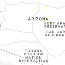
Hail Maps for Gisela, AZ


Connect with Interactive Hail Maps