

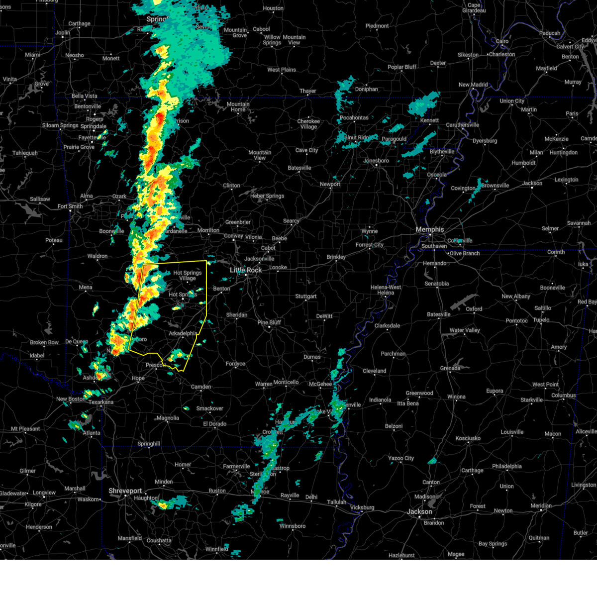
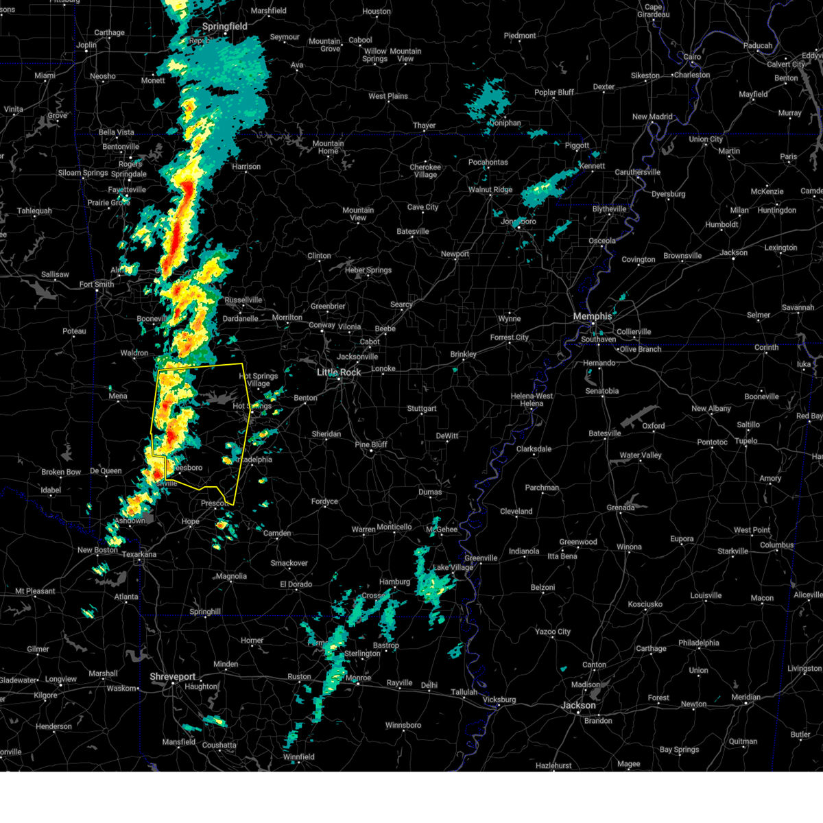
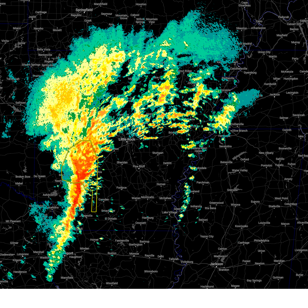
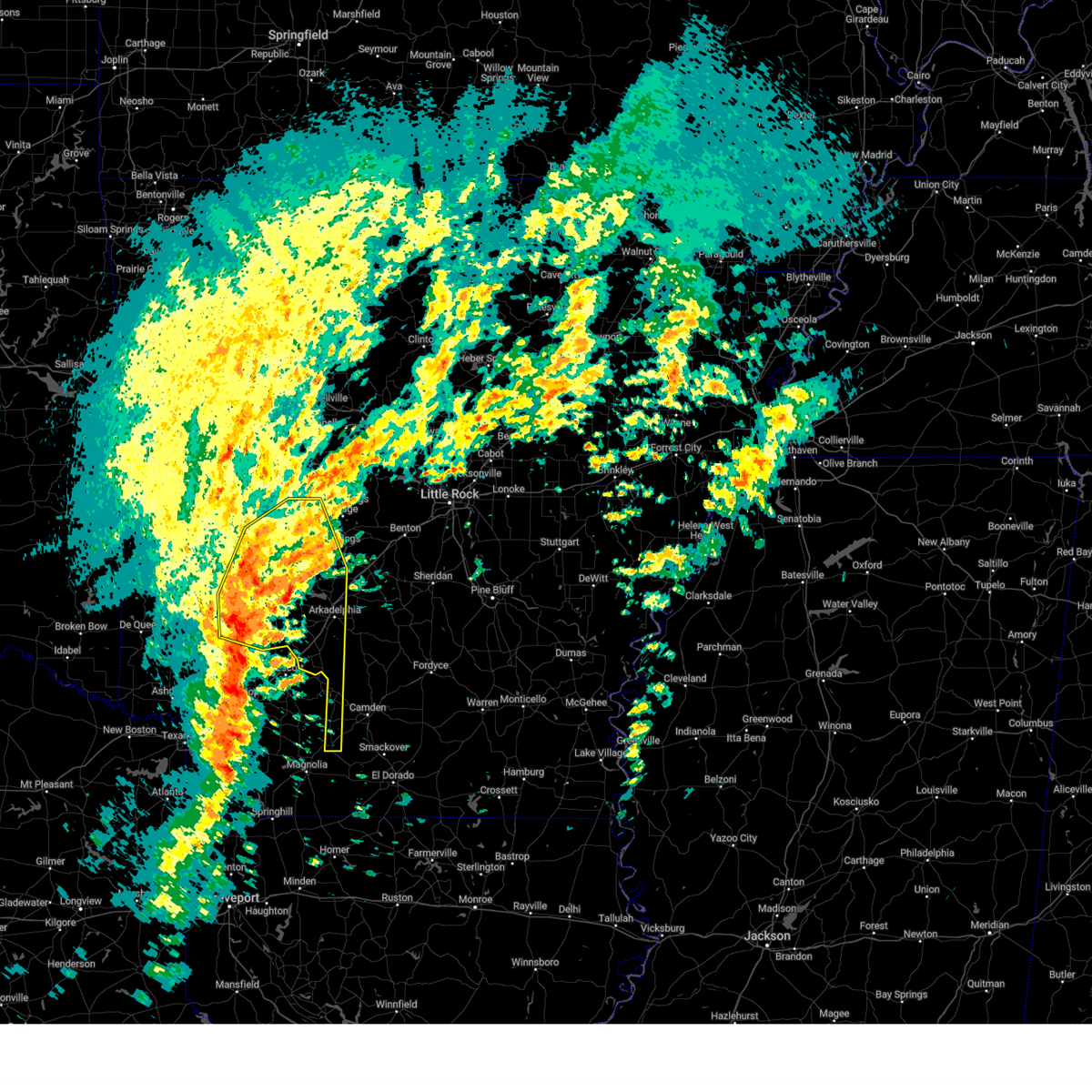
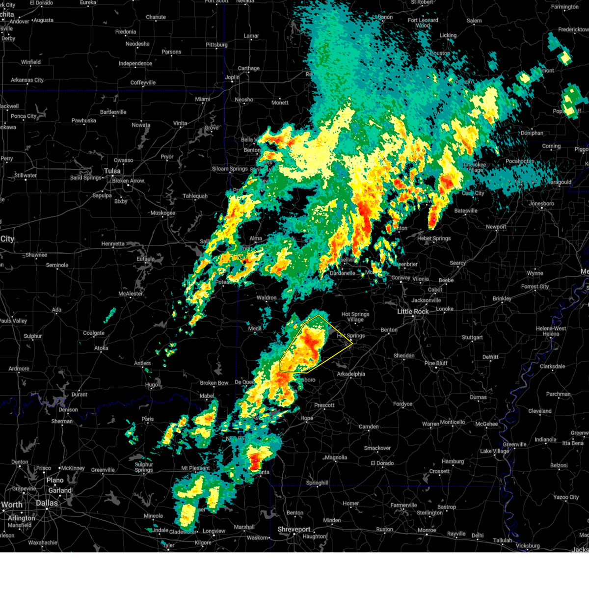
Hail Map for Glenwood, AR
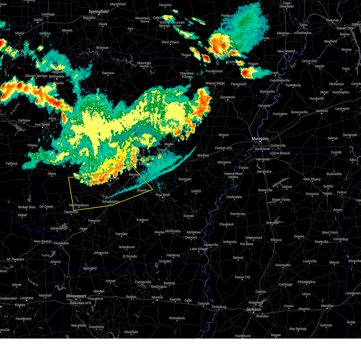
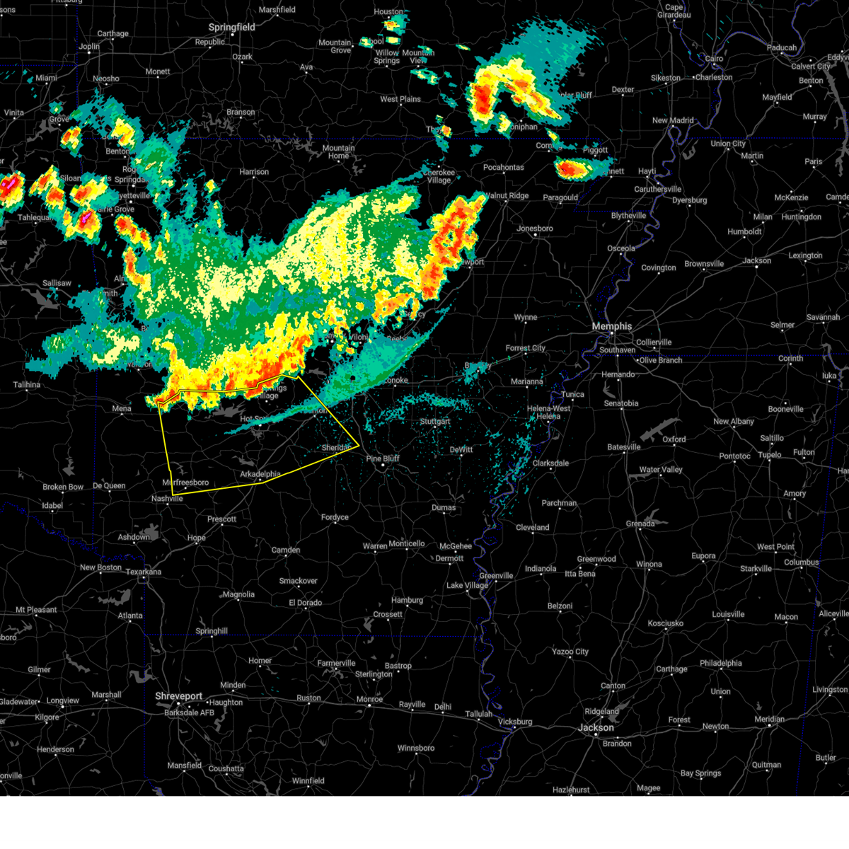
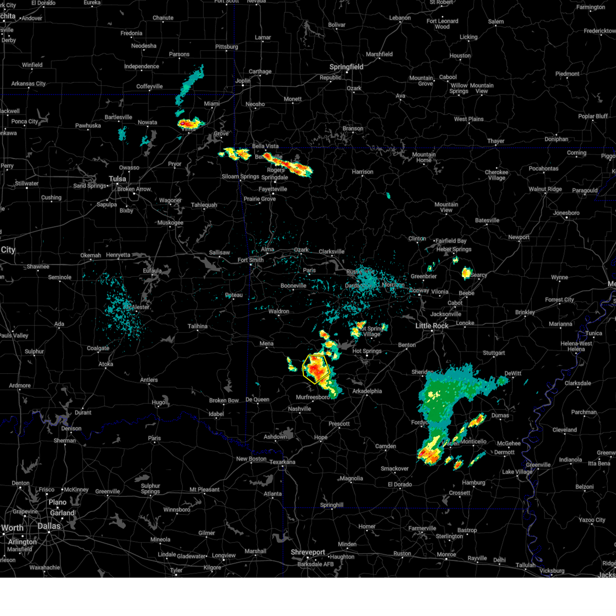
The Glenwood, AR area has had 11 reports of on-the-ground hail by trained spotters, and has been under severe weather warnings 40 times during the past 12 months. Doppler radar has detected hail at or near Glenwood, AR on 95 occasions, including 4 occasions during the past year.
| Name: | Glenwood, AR |
| Where Located: | 31.8 miles NE of Nashville, AR |
| Map: | Google Map for Glenwood, AR |
| Population: | 2228 |
| Housing Units: | 992 |
| More Info: | Search Google for Glenwood, AR |
0
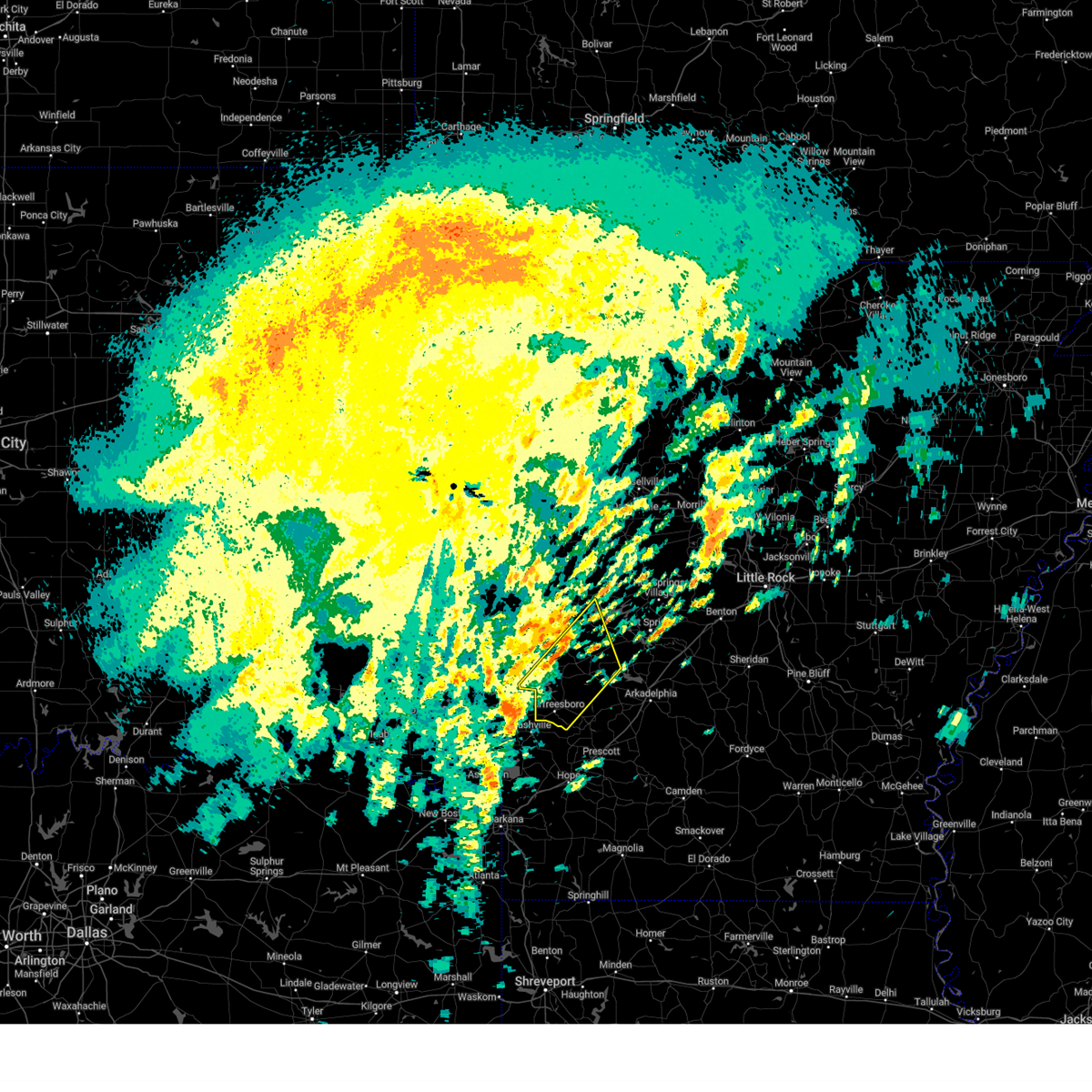
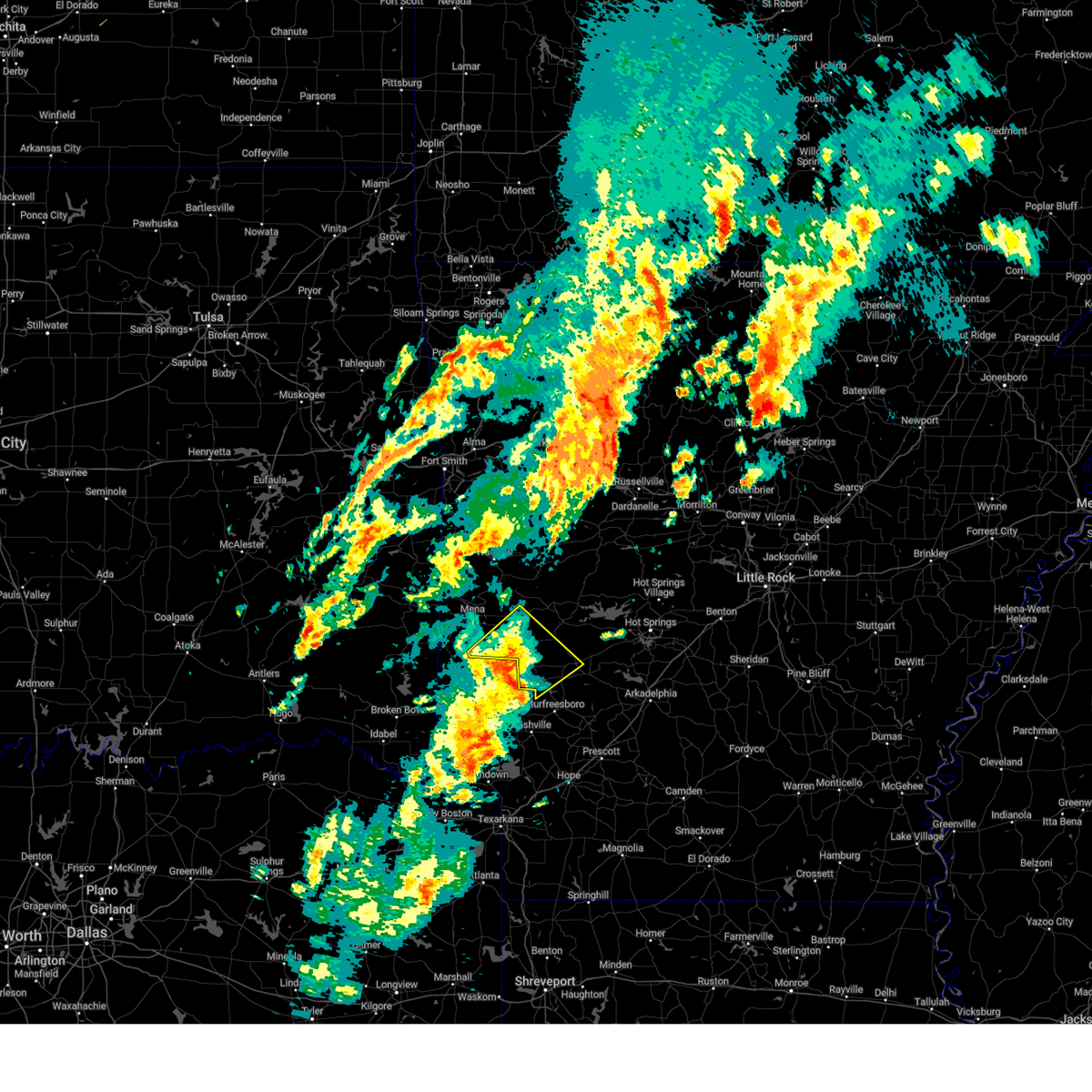
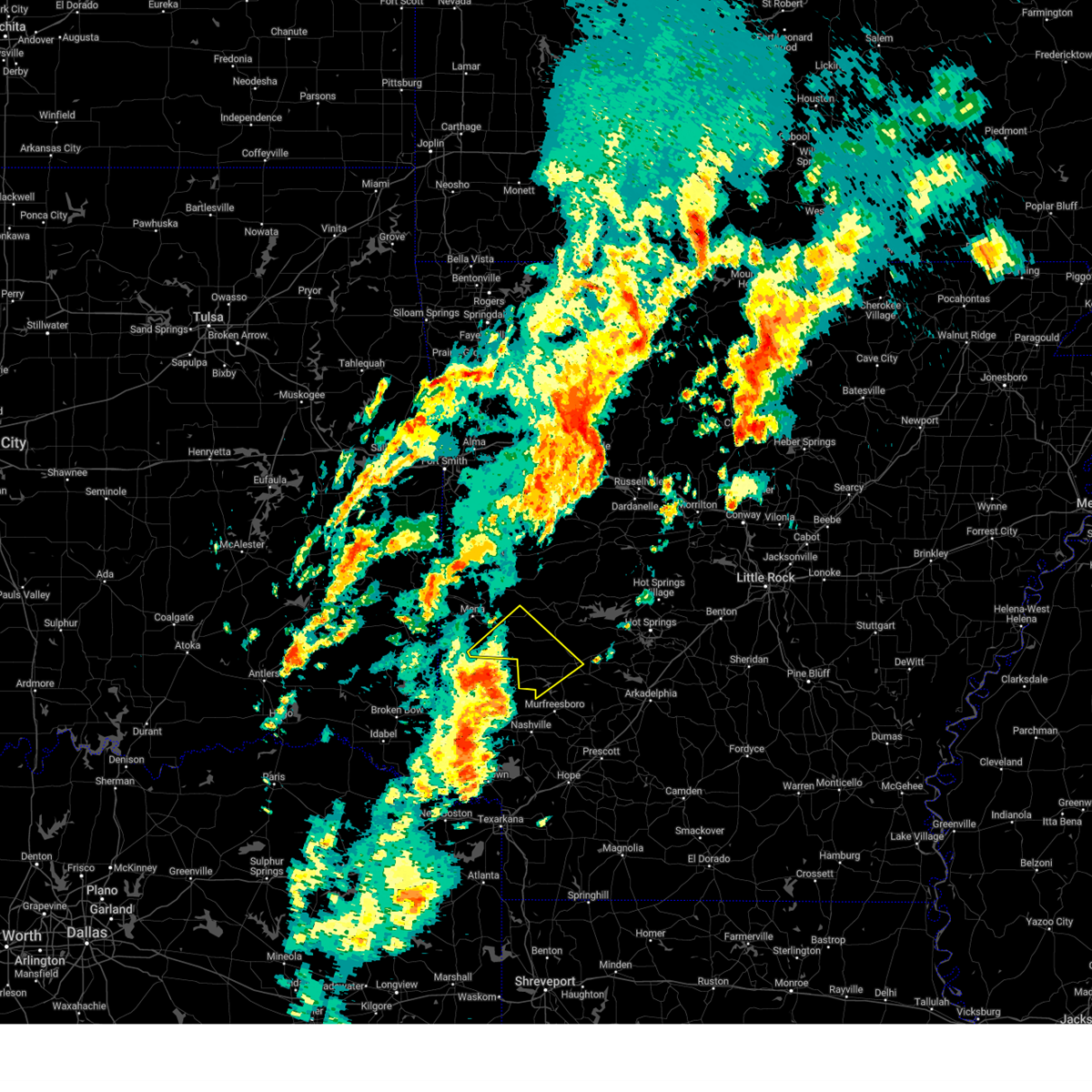
The Top Recent Hail Date for Glenwood, AR is Thursday, June 19, 2025 (49th out of 95)
Hail and Wind Damage Spotted near Glenwood, AR
| Date / Time | Report Details |
|---|---|
| 6/19/2025 4:29 PM CDT | the severe thunderstorm warning has been cancelled and is no longer in effect |
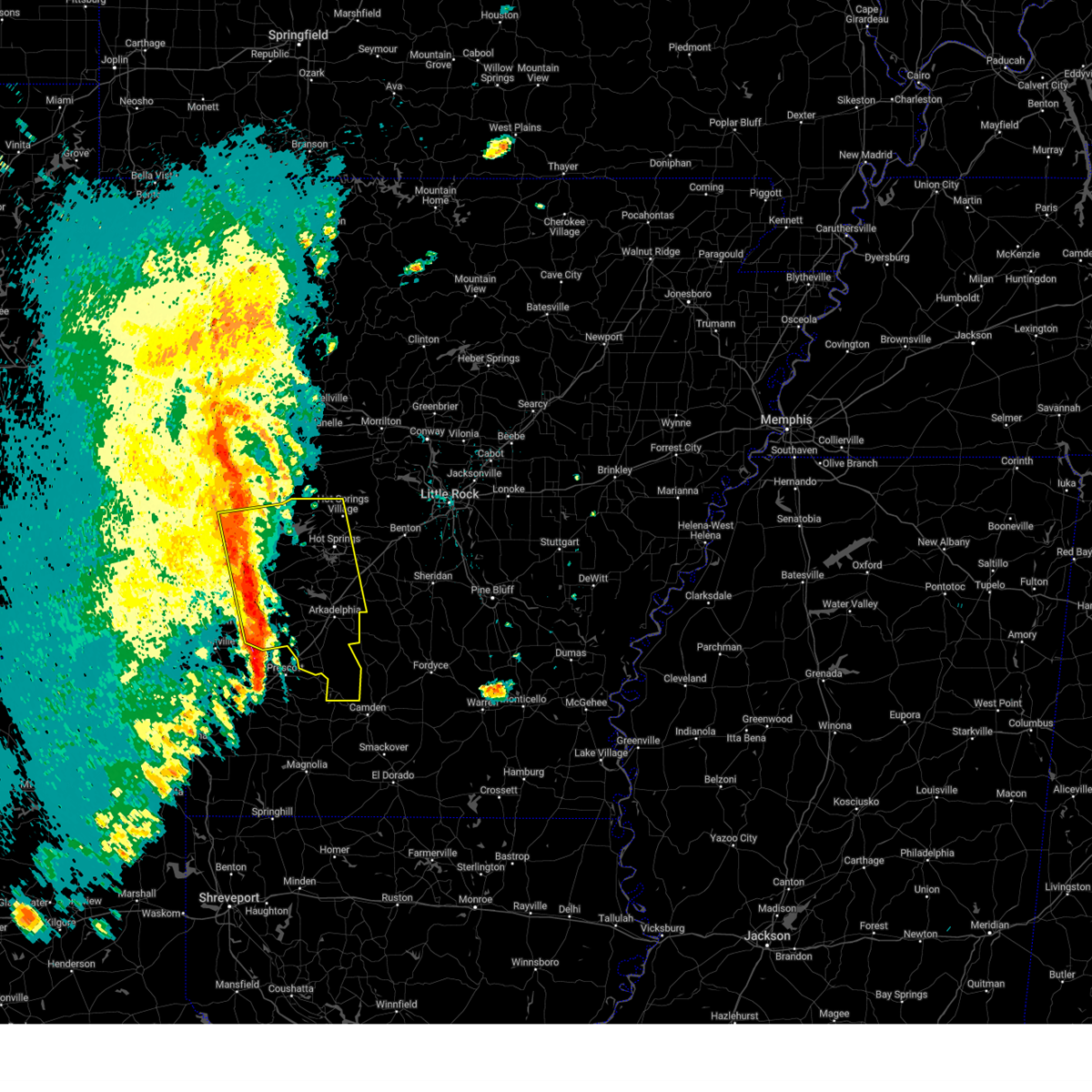
| 6/19/2025 3:52 PM CDT | Svrlzk the national weather service in little rock has issued a * severe thunderstorm warning for, northwestern clark county in southwestern arkansas, pike county in southwestern arkansas, southeastern polk county in western arkansas, southwestern montgomery county in western arkansas, * until 500 pm cdt. * at 352 pm cdt, a severe thunderstorm was located near daisy, or 16 miles north of murfreesboro, moving southeast at 15 mph (radar indicated). Hazards include 60 mph wind gusts and quarter size hail. Hail damage to vehicles is expected. Expect wind damage to roofs, siding, and trees. |
| 6/19/2025 2:58 PM CDT |
 the severe thunderstorm warning has been cancelled and is no longer in effect the severe thunderstorm warning has been cancelled and is no longer in effect
|
| 6/19/2025 2:20 PM CDT |
 Svrlzk the national weather service in little rock has issued a * severe thunderstorm warning for, north central clark county in southwestern arkansas, southwestern garland county in central arkansas, west central hot spring county in southwestern arkansas, southeastern montgomery county in western arkansas, * until 315 pm cdt. * at 220 pm cdt, a severe thunderstorm was located 8 miles west of meyers, or 9 miles southeast of mount ida, moving southeast at 10 mph (radar indicated). Hazards include 60 mph wind gusts and quarter size hail. Hail damage to vehicles is expected. Expect wind damage to roofs, siding, and trees. Svrlzk the national weather service in little rock has issued a * severe thunderstorm warning for, north central clark county in southwestern arkansas, southwestern garland county in central arkansas, west central hot spring county in southwestern arkansas, southeastern montgomery county in western arkansas, * until 315 pm cdt. * at 220 pm cdt, a severe thunderstorm was located 8 miles west of meyers, or 9 miles southeast of mount ida, moving southeast at 10 mph (radar indicated). Hazards include 60 mph wind gusts and quarter size hail. Hail damage to vehicles is expected. Expect wind damage to roofs, siding, and trees.
|
| 6/7/2025 8:35 AM CDT |
 At 835 am cdt, severe thunderstorms were located along a line extending from near houston to near albert pike recreation area, moving east at 40 mph (radar indicated). Hazards include 60 mph wind gusts and quarter size hail. Hail damage to vehicles is expected. expect wind damage to roofs, siding, and trees. Locations impacted include, sequoya park, nimrod, little italy, mt tabor, oak grove in perry county, little missouri falls recreatio, lena landing rec area, perry, oppelo, thornburg, pleasant valley in perry county, story, cherry hill in perry county, fourche, bear creek public use area, wye, perryville, deberrie, glenwood, crystal springs landing,. At 835 am cdt, severe thunderstorms were located along a line extending from near houston to near albert pike recreation area, moving east at 40 mph (radar indicated). Hazards include 60 mph wind gusts and quarter size hail. Hail damage to vehicles is expected. expect wind damage to roofs, siding, and trees. Locations impacted include, sequoya park, nimrod, little italy, mt tabor, oak grove in perry county, little missouri falls recreatio, lena landing rec area, perry, oppelo, thornburg, pleasant valley in perry county, story, cherry hill in perry county, fourche, bear creek public use area, wye, perryville, deberrie, glenwood, crystal springs landing,.
|
| 6/7/2025 8:17 AM CDT |
 Svrlzk the national weather service in little rock has issued a * severe thunderstorm warning for, perry county in central arkansas, northwestern pike county in southwestern arkansas, southern conway county in central arkansas, southern faulkner county in central arkansas, western garland county in central arkansas, northwestern saline county in central arkansas, southeastern yell county in central arkansas, west central hot spring county in southwestern arkansas, montgomery county in western arkansas, northwestern pulaski county in central arkansas, * until 900 am cdt. * at 816 am cdt, severe thunderstorms were located along a line extending from petit jean state park to near caney creek wilderness, moving east at 30 mph (radar indicated). Hazards include 60 mph wind gusts and quarter size hail. Hail damage to vehicles is expected. Expect wind damage to roofs, siding, and trees. Svrlzk the national weather service in little rock has issued a * severe thunderstorm warning for, perry county in central arkansas, northwestern pike county in southwestern arkansas, southern conway county in central arkansas, southern faulkner county in central arkansas, western garland county in central arkansas, northwestern saline county in central arkansas, southeastern yell county in central arkansas, west central hot spring county in southwestern arkansas, montgomery county in western arkansas, northwestern pulaski county in central arkansas, * until 900 am cdt. * at 816 am cdt, severe thunderstorms were located along a line extending from petit jean state park to near caney creek wilderness, moving east at 30 mph (radar indicated). Hazards include 60 mph wind gusts and quarter size hail. Hail damage to vehicles is expected. Expect wind damage to roofs, siding, and trees.
|
| 5/19/2025 10:38 PM CDT | Svrlzk the national weather service in little rock has issued a * severe thunderstorm warning for, northwestern clark county in southwestern arkansas, southwestern perry county in central arkansas, northern pike county in southwestern arkansas, garland county in central arkansas, southeastern scott county in western arkansas, east central polk county in western arkansas, southwestern yell county in central arkansas, west central hot spring county in southwestern arkansas, montgomery county in western arkansas, * until 1130 pm cdt. * at 1038 pm cdt, severe thunderstorms were located along a line extending from near gravelly to near mimosa to near dierks, moving east at 55 mph (radar indicated). Hazards include 60 mph wind gusts and quarter size hail. Hail damage to vehicles is expected. Expect wind damage to roofs, siding, and trees. |
| 5/18/2025 5:44 AM CDT |
 At 544 am cdt, severe thunderstorms were located along a line extending from 10 miles northeast of mauldin to mimosa to near bard springs recreation area, moving southeast at 55 mph (radar indicated). Hazards include 60 mph wind gusts and nickel size hail. Expect damage to roofs, siding, and trees. Locations impacted include, board camp, big fork, mount ida, mountain pine, bonnerdale, opal, sunshine, fannie, mimosa, langley, lodi, little missouri falls recreatio, royal, pine ridge, lena landing rec area, shady lake recreation area, fancyhill, story, norman, shady,. At 544 am cdt, severe thunderstorms were located along a line extending from 10 miles northeast of mauldin to mimosa to near bard springs recreation area, moving southeast at 55 mph (radar indicated). Hazards include 60 mph wind gusts and nickel size hail. Expect damage to roofs, siding, and trees. Locations impacted include, board camp, big fork, mount ida, mountain pine, bonnerdale, opal, sunshine, fannie, mimosa, langley, lodi, little missouri falls recreatio, royal, pine ridge, lena landing rec area, shady lake recreation area, fancyhill, story, norman, shady,.
|
| 5/18/2025 5:33 AM CDT |
 At 533 am cdt, severe thunderstorms were located along a line extending from near muddy creek wma to 6 miles east of opal to shady, moving east at 50 mph (radar indicated). Hazards include 60 mph wind gusts and nickel size hail. Expect damage to roofs, siding, and trees. Locations impacted include, big fork, bonnerdale, hatfield, little missouri falls recreatio, pine ridge, lena landing rec area, shady lake recreation area, hatton, potter, cove, story, rocky, cedar creek, pencil bluff, glenwood, crystal springs landing, meyers, acorn, lake ouachita state park, y city,. At 533 am cdt, severe thunderstorms were located along a line extending from near muddy creek wma to 6 miles east of opal to shady, moving east at 50 mph (radar indicated). Hazards include 60 mph wind gusts and nickel size hail. Expect damage to roofs, siding, and trees. Locations impacted include, big fork, bonnerdale, hatfield, little missouri falls recreatio, pine ridge, lena landing rec area, shady lake recreation area, hatton, potter, cove, story, rocky, cedar creek, pencil bluff, glenwood, crystal springs landing, meyers, acorn, lake ouachita state park, y city,.
|
| 5/18/2025 5:23 AM CDT |
 At 522 am cdt, severe thunderstorms were located along a line extending from 6 miles southwest of muddy creek wma to opal to near mena intermountain airport, moving southeast at 55 mph (radar indicated). Hazards include 60 mph wind gusts and quarter size hail. Hail damage to vehicles is expected. expect wind damage to roofs, siding, and trees. Locations impacted include, big fork, bonnerdale, hatfield, little missouri falls recreatio, pine ridge, lena landing rec area, shady lake recreation area, hatton, mountain fork, potter, cove, story, rocky, black fork mountain wilderness, cedar creek, pencil bluff, glenwood, crystal springs landing, meyers, acorn,. At 522 am cdt, severe thunderstorms were located along a line extending from 6 miles southwest of muddy creek wma to opal to near mena intermountain airport, moving southeast at 55 mph (radar indicated). Hazards include 60 mph wind gusts and quarter size hail. Hail damage to vehicles is expected. expect wind damage to roofs, siding, and trees. Locations impacted include, big fork, bonnerdale, hatfield, little missouri falls recreatio, pine ridge, lena landing rec area, shady lake recreation area, hatton, mountain fork, potter, cove, story, rocky, black fork mountain wilderness, cedar creek, pencil bluff, glenwood, crystal springs landing, meyers, acorn,.
|
| 5/18/2025 5:06 AM CDT |
 Svrlzk the national weather service in little rock has issued a * severe thunderstorm warning for, northwestern clark county in southwestern arkansas, northwestern pike county in southwestern arkansas, southwestern garland county in central arkansas, scott county in western arkansas, polk county in western arkansas, southwestern yell county in central arkansas, western hot spring county in southwestern arkansas, montgomery county in western arkansas, * until 600 am cdt. * at 506 am cdt, severe thunderstorms were located along a line extending from 8 miles south of cardiff to near mena to near mountain fork, moving southeast at 55 mph (radar indicated). Hazards include 60 mph wind gusts and quarter size hail. Hail damage to vehicles is expected. Expect wind damage to roofs, siding, and trees. Svrlzk the national weather service in little rock has issued a * severe thunderstorm warning for, northwestern clark county in southwestern arkansas, northwestern pike county in southwestern arkansas, southwestern garland county in central arkansas, scott county in western arkansas, polk county in western arkansas, southwestern yell county in central arkansas, western hot spring county in southwestern arkansas, montgomery county in western arkansas, * until 600 am cdt. * at 506 am cdt, severe thunderstorms were located along a line extending from 8 miles south of cardiff to near mena to near mountain fork, moving southeast at 55 mph (radar indicated). Hazards include 60 mph wind gusts and quarter size hail. Hail damage to vehicles is expected. Expect wind damage to roofs, siding, and trees.
|
| 4/30/2025 3:25 PM CDT |
 Svrlzk the national weather service in little rock has issued a * severe thunderstorm warning for, clark county in southwestern arkansas, pike county in southwestern arkansas, northwestern ouachita county in southwestern arkansas, garland county in central arkansas, central hot spring county in southwestern arkansas, montgomery county in western arkansas, * until 430 pm cdt. * at 324 pm cdt, severe thunderstorms were located along a line extending from near mauldin to 9 miles northeast of crater of diamonds state park to near perrytown, moving east at 40 mph (radar indicated). Hazards include 60 mph wind gusts and quarter size hail. Hail damage to vehicles is expected. Expect wind damage to roofs, siding, and trees. Svrlzk the national weather service in little rock has issued a * severe thunderstorm warning for, clark county in southwestern arkansas, pike county in southwestern arkansas, northwestern ouachita county in southwestern arkansas, garland county in central arkansas, central hot spring county in southwestern arkansas, montgomery county in western arkansas, * until 430 pm cdt. * at 324 pm cdt, severe thunderstorms were located along a line extending from near mauldin to 9 miles northeast of crater of diamonds state park to near perrytown, moving east at 40 mph (radar indicated). Hazards include 60 mph wind gusts and quarter size hail. Hail damage to vehicles is expected. Expect wind damage to roofs, siding, and trees.
|
| 4/30/2025 2:39 PM CDT |
 Svrlzk the national weather service in little rock has issued a * severe thunderstorm warning for, pike county in southwestern arkansas, northeastern polk county in western arkansas, montgomery county in western arkansas, * until 330 pm cdt. * at 239 pm cdt, severe thunderstorms were located along a line extending from 6 miles east of mena intermountain airport to near umpire to near ben lomond, moving east at 30 mph (radar indicated). Hazards include 60 mph wind gusts. expect damage to roofs, siding, and trees Svrlzk the national weather service in little rock has issued a * severe thunderstorm warning for, pike county in southwestern arkansas, northeastern polk county in western arkansas, montgomery county in western arkansas, * until 330 pm cdt. * at 239 pm cdt, severe thunderstorms were located along a line extending from 6 miles east of mena intermountain airport to near umpire to near ben lomond, moving east at 30 mph (radar indicated). Hazards include 60 mph wind gusts. expect damage to roofs, siding, and trees
|
| 4/20/2025 4:41 PM CDT |
 Svrlzk the national weather service in little rock has issued a * severe thunderstorm warning for, clark county in southwestern arkansas, southern perry county in central arkansas, eastern pike county in southwestern arkansas, northwestern dallas county in southwestern arkansas, garland county in central arkansas, saline county in central arkansas, hot spring county in southwestern arkansas, southeastern montgomery county in western arkansas, northwestern pulaski county in central arkansas, * until 530 pm cdt. * at 441 pm cdt, severe thunderstorms were located along a line extending from 11 miles north of jessieville to rockwell to near blevins, moving east at 55 mph (radar indicated). Hazards include 60 mph wind gusts and penny size hail. expect damage to roofs, siding, and trees Svrlzk the national weather service in little rock has issued a * severe thunderstorm warning for, clark county in southwestern arkansas, southern perry county in central arkansas, eastern pike county in southwestern arkansas, northwestern dallas county in southwestern arkansas, garland county in central arkansas, saline county in central arkansas, hot spring county in southwestern arkansas, southeastern montgomery county in western arkansas, northwestern pulaski county in central arkansas, * until 530 pm cdt. * at 441 pm cdt, severe thunderstorms were located along a line extending from 11 miles north of jessieville to rockwell to near blevins, moving east at 55 mph (radar indicated). Hazards include 60 mph wind gusts and penny size hail. expect damage to roofs, siding, and trees
|
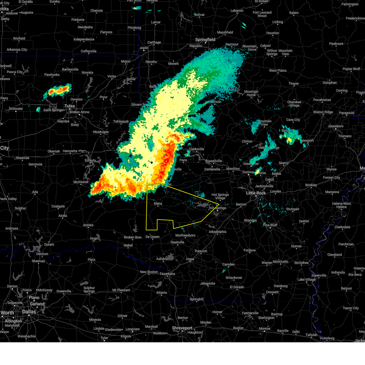
| 4/20/2025 4:16 PM CDT | Torlzk the national weather service in little rock has issued a * tornado warning for, northwestern clark county in southwestern arkansas, northeastern pike county in southwestern arkansas, central garland county in central arkansas, west central hot spring county in southwestern arkansas, southeastern montgomery county in western arkansas, * until 500 pm cdt. * at 415 pm cdt, a severe thunderstorm capable of producing a tornado was located near glenwood, or 15 miles southeast of mount ida, moving northeast at 50 mph (radar indicated rotation). Hazards include tornado. Flying debris will be dangerous to those caught without shelter. mobile homes will be damaged or destroyed. damage to roofs, windows, and vehicles will occur. Tree damage is likely. |
| 4/20/2025 4:01 PM CDT |
 Svrlzk the national weather service in little rock has issued a * severe thunderstorm warning for, clark county in southwestern arkansas, southwestern perry county in central arkansas, eastern pike county in southwestern arkansas, garland county in central arkansas, western saline county in central arkansas, south central yell county in central arkansas, hot spring county in southwestern arkansas, eastern montgomery county in western arkansas, * until 445 pm cdt. * at 401 pm cdt, severe thunderstorms were located along a line extending from 9 miles southeast of fourche valley to near amity to near crater of diamonds state park, moving northeast at 65 mph (radar indicated). Hazards include 60 mph wind gusts and quarter size hail. Hail damage to vehicles is expected. Expect wind damage to roofs, siding, and trees. Svrlzk the national weather service in little rock has issued a * severe thunderstorm warning for, clark county in southwestern arkansas, southwestern perry county in central arkansas, eastern pike county in southwestern arkansas, garland county in central arkansas, western saline county in central arkansas, south central yell county in central arkansas, hot spring county in southwestern arkansas, eastern montgomery county in western arkansas, * until 445 pm cdt. * at 401 pm cdt, severe thunderstorms were located along a line extending from 9 miles southeast of fourche valley to near amity to near crater of diamonds state park, moving northeast at 65 mph (radar indicated). Hazards include 60 mph wind gusts and quarter size hail. Hail damage to vehicles is expected. Expect wind damage to roofs, siding, and trees.
|
| 4/20/2025 3:34 PM CDT |
 Svrlzk the national weather service in little rock has issued a * severe thunderstorm warning for, western clark county in southwestern arkansas, southwestern perry county in central arkansas, pike county in southwestern arkansas, garland county in central arkansas, southeastern scott county in western arkansas, east central polk county in western arkansas, southwestern yell county in central arkansas, west central hot spring county in southwestern arkansas, montgomery county in western arkansas, * until 415 pm cdt. * at 334 pm cdt, severe thunderstorms were located along a line extending from near fourche valley to near mount ida to near corinth, moving northeast at 55 mph (radar indicated). Hazards include 60 mph wind gusts and nickel size hail. expect damage to roofs, siding, and trees Svrlzk the national weather service in little rock has issued a * severe thunderstorm warning for, western clark county in southwestern arkansas, southwestern perry county in central arkansas, pike county in southwestern arkansas, garland county in central arkansas, southeastern scott county in western arkansas, east central polk county in western arkansas, southwestern yell county in central arkansas, west central hot spring county in southwestern arkansas, montgomery county in western arkansas, * until 415 pm cdt. * at 334 pm cdt, severe thunderstorms were located along a line extending from near fourche valley to near mount ida to near corinth, moving northeast at 55 mph (radar indicated). Hazards include 60 mph wind gusts and nickel size hail. expect damage to roofs, siding, and trees
|
| 4/5/2025 10:05 AM CDT |
 At 1005 am cdt, severe thunderstorms were located along a line extending from near lofton to near bodcaw, moving northeast at 50 mph (radar indicated). Hazards include 60 mph wind gusts and penny size hail. Expect damage to roofs, siding, and trees. Locations impacted include, gum springs in clark county, murfreesboro, oaklawn racetrack, curtis, bonnerdale, mt tabor, caddo valley, lena landing rec area, white oak lake state park, de roche, pisgah, okolona, antoine, daisy state park, crater of diamonds state park, bear creek public use area, burtsell, narrows dam, red oak, amity,. At 1005 am cdt, severe thunderstorms were located along a line extending from near lofton to near bodcaw, moving northeast at 50 mph (radar indicated). Hazards include 60 mph wind gusts and penny size hail. Expect damage to roofs, siding, and trees. Locations impacted include, gum springs in clark county, murfreesboro, oaklawn racetrack, curtis, bonnerdale, mt tabor, caddo valley, lena landing rec area, white oak lake state park, de roche, pisgah, okolona, antoine, daisy state park, crater of diamonds state park, bear creek public use area, burtsell, narrows dam, red oak, amity,.
|
| 4/5/2025 9:43 AM CDT |
 Svrlzk the national weather service in little rock has issued a * severe thunderstorm warning for, clark county in southwestern arkansas, pike county in southwestern arkansas, western ouachita county in southwestern arkansas, garland county in central arkansas, southwestern hot spring county in southwestern arkansas, eastern montgomery county in western arkansas, * until 1045 am cdt. * at 942 am cdt, severe thunderstorms were located along a line extending from 6 miles southeast of mount ida to near washington, moving northeast at 45 mph (radar indicated). Hazards include 60 mph wind gusts and quarter size hail. Hail damage to vehicles is expected. Expect wind damage to roofs, siding, and trees. Svrlzk the national weather service in little rock has issued a * severe thunderstorm warning for, clark county in southwestern arkansas, pike county in southwestern arkansas, western ouachita county in southwestern arkansas, garland county in central arkansas, southwestern hot spring county in southwestern arkansas, eastern montgomery county in western arkansas, * until 1045 am cdt. * at 942 am cdt, severe thunderstorms were located along a line extending from 6 miles southeast of mount ida to near washington, moving northeast at 45 mph (radar indicated). Hazards include 60 mph wind gusts and quarter size hail. Hail damage to vehicles is expected. Expect wind damage to roofs, siding, and trees.
|
| 4/5/2025 9:01 AM CDT |
 Svrlzk the national weather service in little rock has issued a * severe thunderstorm warning for, northwestern clark county in southwestern arkansas, pike county in southwestern arkansas, southwestern garland county in central arkansas, west central hot spring county in southwestern arkansas, southeastern montgomery county in western arkansas, * until 945 am cdt. * at 900 am cdt, a severe thunderstorm was located over center point, or 7 miles north of nashville, moving northeast at 55 mph (radar indicated). Hazards include 60 mph wind gusts and quarter size hail. Hail damage to vehicles is expected. Expect wind damage to roofs, siding, and trees. Svrlzk the national weather service in little rock has issued a * severe thunderstorm warning for, northwestern clark county in southwestern arkansas, pike county in southwestern arkansas, southwestern garland county in central arkansas, west central hot spring county in southwestern arkansas, southeastern montgomery county in western arkansas, * until 945 am cdt. * at 900 am cdt, a severe thunderstorm was located over center point, or 7 miles north of nashville, moving northeast at 55 mph (radar indicated). Hazards include 60 mph wind gusts and quarter size hail. Hail damage to vehicles is expected. Expect wind damage to roofs, siding, and trees.
|
| 4/4/2025 7:33 PM CDT |
 the tornado warning has been cancelled and is no longer in effect the tornado warning has been cancelled and is no longer in effect
|
| 4/4/2025 7:17 PM CDT |
 Torlzk the national weather service in little rock has issued a * tornado warning for, northwestern clark county in southwestern arkansas, northeastern pike county in southwestern arkansas, southwestern garland county in central arkansas, west central hot spring county in southwestern arkansas, southeastern montgomery county in western arkansas, * until 800 pm cdt. * at 717 pm cdt, a severe thunderstorm capable of producing a tornado was located over amity, or 18 miles northeast of murfreesboro, moving northeast at 40 mph (radar indicated rotation). Hazards include tornado and quarter size hail. Flying debris will be dangerous to those caught without shelter. mobile homes will be damaged or destroyed. damage to roofs, windows, and vehicles will occur. Tree damage is likely. Torlzk the national weather service in little rock has issued a * tornado warning for, northwestern clark county in southwestern arkansas, northeastern pike county in southwestern arkansas, southwestern garland county in central arkansas, west central hot spring county in southwestern arkansas, southeastern montgomery county in western arkansas, * until 800 pm cdt. * at 717 pm cdt, a severe thunderstorm capable of producing a tornado was located over amity, or 18 miles northeast of murfreesboro, moving northeast at 40 mph (radar indicated rotation). Hazards include tornado and quarter size hail. Flying debris will be dangerous to those caught without shelter. mobile homes will be damaged or destroyed. damage to roofs, windows, and vehicles will occur. Tree damage is likely.
|
| 4/4/2025 7:10 PM CDT |
 Svrlzk the national weather service in little rock has issued a * severe thunderstorm warning for, northwestern clark county in southwestern arkansas, eastern pike county in southwestern arkansas, southwestern garland county in central arkansas, southwestern hot spring county in southwestern arkansas, southeastern montgomery county in western arkansas, * until 800 pm cdt. * at 710 pm cdt, severe thunderstorms were located along a line extending from glenwood to 8 miles east of crater of diamonds state park, moving northeast at 45 mph (radar indicated). Hazards include 60 mph wind gusts and quarter size hail. Hail damage to vehicles is expected. Expect wind damage to roofs, siding, and trees. Svrlzk the national weather service in little rock has issued a * severe thunderstorm warning for, northwestern clark county in southwestern arkansas, eastern pike county in southwestern arkansas, southwestern garland county in central arkansas, southwestern hot spring county in southwestern arkansas, southeastern montgomery county in western arkansas, * until 800 pm cdt. * at 710 pm cdt, severe thunderstorms were located along a line extending from glenwood to 8 miles east of crater of diamonds state park, moving northeast at 45 mph (radar indicated). Hazards include 60 mph wind gusts and quarter size hail. Hail damage to vehicles is expected. Expect wind damage to roofs, siding, and trees.
|
| 4/4/2025 6:55 PM CDT |
 At 655 pm cdt, severe thunderstorms were located along a line extending from 6 miles southwest of glenwood to near crater of diamonds state park, moving northeast at 35 mph (radar indicated). Hazards include 60 mph wind gusts and quarter size hail. Hail damage to vehicles is expected. expect wind damage to roofs, siding, and trees. Locations impacted include, bear creek public use area, narrows dam, murfreesboro, amity, billstown, shawmut, rosboro, pike city, delight, nathan, pisgah, antoine, kirby, daisy, daisy state park, highland in pike county, crater of diamonds state park, roy,. At 655 pm cdt, severe thunderstorms were located along a line extending from 6 miles southwest of glenwood to near crater of diamonds state park, moving northeast at 35 mph (radar indicated). Hazards include 60 mph wind gusts and quarter size hail. Hail damage to vehicles is expected. expect wind damage to roofs, siding, and trees. Locations impacted include, bear creek public use area, narrows dam, murfreesboro, amity, billstown, shawmut, rosboro, pike city, delight, nathan, pisgah, antoine, kirby, daisy, daisy state park, highland in pike county, crater of diamonds state park, roy,.
|
| 4/4/2025 6:42 PM CDT |
 At 642 pm cdt, a severe thunderstorm was located over meyers, or 15 miles southeast of mount ida, moving northeast at 40 mph (radar indicated). Hazards include ping pong ball size hail and 60 mph wind gusts. People and animals outdoors will be injured. expect hail damage to roofs, siding, windows, and vehicles. expect wind damage to roofs, siding, and trees. Locations impacted include, hot springs memorial field, oaklawn racetrack, mount ida, bonnerdale, sunshine, fannie, mimosa, langley, lodi, royal, point cedar, fancyhill, kirby, hempwallace, daisy state park, story, bear creek public use area, norman, amity, black springs,. At 642 pm cdt, a severe thunderstorm was located over meyers, or 15 miles southeast of mount ida, moving northeast at 40 mph (radar indicated). Hazards include ping pong ball size hail and 60 mph wind gusts. People and animals outdoors will be injured. expect hail damage to roofs, siding, windows, and vehicles. expect wind damage to roofs, siding, and trees. Locations impacted include, hot springs memorial field, oaklawn racetrack, mount ida, bonnerdale, sunshine, fannie, mimosa, langley, lodi, royal, point cedar, fancyhill, kirby, hempwallace, daisy state park, story, bear creek public use area, norman, amity, black springs,.
|
| 4/4/2025 6:29 PM CDT |
 Svrlzk the national weather service in little rock has issued a * severe thunderstorm warning for, northwestern clark county in southwestern arkansas, pike county in southwestern arkansas, * until 715 pm cdt. * at 628 pm cdt, severe thunderstorms were located along a line extending from 6 miles north of corinth to near nashville, moving northeast at 35 mph (radar indicated). Hazards include 60 mph wind gusts and quarter size hail. Hail damage to vehicles is expected. Expect wind damage to roofs, siding, and trees. Svrlzk the national weather service in little rock has issued a * severe thunderstorm warning for, northwestern clark county in southwestern arkansas, pike county in southwestern arkansas, * until 715 pm cdt. * at 628 pm cdt, severe thunderstorms were located along a line extending from 6 miles north of corinth to near nashville, moving northeast at 35 mph (radar indicated). Hazards include 60 mph wind gusts and quarter size hail. Hail damage to vehicles is expected. Expect wind damage to roofs, siding, and trees.
|
| 4/4/2025 6:22 PM CDT | At 622 pm cdt, a severe thunderstorm was located near glenwood, or 10 miles south of mount ida, moving northeast at 45 mph (radar indicated). Hazards include ping pong ball size hail and 60 mph wind gusts. People and animals outdoors will be injured. expect hail damage to roofs, siding, windows, and vehicles. expect wind damage to roofs, siding, and trees. Locations impacted include, hot springs memorial field, oaklawn racetrack, mount ida, bonnerdale, sunshine, fannie, mimosa, langley, lodi, little missouri falls recreatio, royal, point cedar, fancyhill, kirby, hempwallace, daisy state park, story, bear creek public use area, norman, amity,. |
| 4/4/2025 6:15 PM CDT |
 Svrlzk the national weather service in little rock has issued a * severe thunderstorm warning for, northwestern clark county in southwestern arkansas, northern pike county in southwestern arkansas, southwestern garland county in central arkansas, southern yell county in central arkansas, west central hot spring county in southwestern arkansas, montgomery county in western arkansas, * until 700 pm cdt. * at 614 pm cdt, a severe thunderstorm was located 7 miles south of norman, or 14 miles south of mount ida, moving northeast at 45 mph (radar indicated). Hazards include 60 mph wind gusts and quarter size hail. Hail damage to vehicles is expected. Expect wind damage to roofs, siding, and trees. Svrlzk the national weather service in little rock has issued a * severe thunderstorm warning for, northwestern clark county in southwestern arkansas, northern pike county in southwestern arkansas, southwestern garland county in central arkansas, southern yell county in central arkansas, west central hot spring county in southwestern arkansas, montgomery county in western arkansas, * until 700 pm cdt. * at 614 pm cdt, a severe thunderstorm was located 7 miles south of norman, or 14 miles south of mount ida, moving northeast at 45 mph (radar indicated). Hazards include 60 mph wind gusts and quarter size hail. Hail damage to vehicles is expected. Expect wind damage to roofs, siding, and trees.
|
| 4/4/2025 6:11 PM CDT |
 At 611 pm cdt, a severe thunderstorm was located near albert pike recreation area, or 16 miles southwest of mount ida, moving northeast at 45 mph (radar indicated). Hazards include 60 mph wind gusts and half dollar size hail. Hail damage to vehicles is expected. expect wind damage to roofs, siding, and trees. Locations impacted include, bear creek public use area, black springs, salem in pike county, glenwood, mimosa, langley, lodi, little missouri falls recreatio, pine ridge, fancyhill, hopper, kirby, daisy, daisy state park, albert pike recreation area, new hope in pike county, caddo gap, norman,. At 611 pm cdt, a severe thunderstorm was located near albert pike recreation area, or 16 miles southwest of mount ida, moving northeast at 45 mph (radar indicated). Hazards include 60 mph wind gusts and half dollar size hail. Hail damage to vehicles is expected. expect wind damage to roofs, siding, and trees. Locations impacted include, bear creek public use area, black springs, salem in pike county, glenwood, mimosa, langley, lodi, little missouri falls recreatio, pine ridge, fancyhill, hopper, kirby, daisy, daisy state park, albert pike recreation area, new hope in pike county, caddo gap, norman,.
|
| 4/4/2025 6:11 PM CDT |
 the severe thunderstorm warning has been cancelled and is no longer in effect the severe thunderstorm warning has been cancelled and is no longer in effect
|
| 4/4/2025 5:53 PM CDT |
 At 553 pm cdt, a severe thunderstorm was located near umpire, moving northeast at 40 mph (radar indicated). Hazards include 60 mph wind gusts and half dollar size hail. Hail damage to vehicles is expected. expect wind damage to roofs, siding, and trees. Locations impacted include, big fork, opal, mimosa, langley, lodi, little missouri falls recreatio, pine ridge, shady lake recreation area, cossatot river state park, fancyhill, kirby, daisy state park, bear creek public use area, shady, hartley, black springs, salem in pike county, glenwood, bard springs recreation area, caney creek wilderness,. At 553 pm cdt, a severe thunderstorm was located near umpire, moving northeast at 40 mph (radar indicated). Hazards include 60 mph wind gusts and half dollar size hail. Hail damage to vehicles is expected. expect wind damage to roofs, siding, and trees. Locations impacted include, big fork, opal, mimosa, langley, lodi, little missouri falls recreatio, pine ridge, shady lake recreation area, cossatot river state park, fancyhill, kirby, daisy state park, bear creek public use area, shady, hartley, black springs, salem in pike county, glenwood, bard springs recreation area, caney creek wilderness,.
|
| 4/4/2025 5:41 PM CDT |
 Svrlzk the national weather service in little rock has issued a * severe thunderstorm warning for, northwestern pike county in southwestern arkansas, east central polk county in western arkansas, southwestern montgomery county in western arkansas, * until 630 pm cdt. * at 540 pm cdt, a severe thunderstorm was located near umpire, moving northeast at 40 mph (radar indicated). Hazards include 60 mph wind gusts and half dollar size hail. Hail damage to vehicles is expected. Expect wind damage to roofs, siding, and trees. Svrlzk the national weather service in little rock has issued a * severe thunderstorm warning for, northwestern pike county in southwestern arkansas, east central polk county in western arkansas, southwestern montgomery county in western arkansas, * until 630 pm cdt. * at 540 pm cdt, a severe thunderstorm was located near umpire, moving northeast at 40 mph (radar indicated). Hazards include 60 mph wind gusts and half dollar size hail. Hail damage to vehicles is expected. Expect wind damage to roofs, siding, and trees.
|
| 4/2/2025 4:10 PM CDT |
 Svrlzk the national weather service in little rock has issued a * severe thunderstorm warning for, northwestern clark county in southwestern arkansas, northwestern pike county in southwestern arkansas, western garland county in central arkansas, west central hot spring county in southwestern arkansas, southeastern montgomery county in western arkansas, * until 500 pm cdt. * at 410 pm cdt, a severe thunderstorm was located near daisy, or 16 miles east of umpire, moving northeast at 50 mph (radar indicated). Hazards include 60 mph wind gusts and quarter size hail. Hail damage to vehicles is expected. Expect wind damage to roofs, siding, and trees. Svrlzk the national weather service in little rock has issued a * severe thunderstorm warning for, northwestern clark county in southwestern arkansas, northwestern pike county in southwestern arkansas, western garland county in central arkansas, west central hot spring county in southwestern arkansas, southeastern montgomery county in western arkansas, * until 500 pm cdt. * at 410 pm cdt, a severe thunderstorm was located near daisy, or 16 miles east of umpire, moving northeast at 50 mph (radar indicated). Hazards include 60 mph wind gusts and quarter size hail. Hail damage to vehicles is expected. Expect wind damage to roofs, siding, and trees.
|
| 8/17/2024 1:18 AM CDT |
 the severe thunderstorm warning has been cancelled and is no longer in effect the severe thunderstorm warning has been cancelled and is no longer in effect
|
| 8/17/2024 1:05 AM CDT |
 At 105 am cdt, severe thunderstorms were located along a line extending from near cane creek to near degray lake state park to near narrows dam, moving south at 45 mph (radar indicated). Hazards include 60 mph wind gusts. Expect damage to roofs, siding, and trees. Locations impacted include, hot springs, benton, bryant, hot springs village, arkadelphia, malvern, sheridan, murfreesboro, mount ida, haskell, glenwood, mountain pine, rockport, amity, caddo valley, traskwood, tull, norman, prattsville, poyen,. At 105 am cdt, severe thunderstorms were located along a line extending from near cane creek to near degray lake state park to near narrows dam, moving south at 45 mph (radar indicated). Hazards include 60 mph wind gusts. Expect damage to roofs, siding, and trees. Locations impacted include, hot springs, benton, bryant, hot springs village, arkadelphia, malvern, sheridan, murfreesboro, mount ida, haskell, glenwood, mountain pine, rockport, amity, caddo valley, traskwood, tull, norman, prattsville, poyen,.
|
| 8/17/2024 12:44 AM CDT |
 Svrlzk the national weather service in little rock has issued a * severe thunderstorm warning for, northern clark county in southwestern arkansas, pike county in southwestern arkansas, northern grant county in central arkansas, garland county in central arkansas, saline county in central arkansas, hot spring county in southwestern arkansas, montgomery county in western arkansas, * until 130 am cdt. * at 1244 am cdt, severe thunderstorms were located along a line extending from near benton to near lofton to near little missouri falls recreation area, moving southeast at 50 mph (radar indicated). Hazards include 60 mph wind gusts. expect damage to roofs, siding, and trees Svrlzk the national weather service in little rock has issued a * severe thunderstorm warning for, northern clark county in southwestern arkansas, pike county in southwestern arkansas, northern grant county in central arkansas, garland county in central arkansas, saline county in central arkansas, hot spring county in southwestern arkansas, montgomery county in western arkansas, * until 130 am cdt. * at 1244 am cdt, severe thunderstorms were located along a line extending from near benton to near lofton to near little missouri falls recreation area, moving southeast at 50 mph (radar indicated). Hazards include 60 mph wind gusts. expect damage to roofs, siding, and trees
|
| 8/17/2024 12:30 AM CDT |
 At 1230 am cdt, severe thunderstorms were located along a line extending from near lake ouachita state park to mount ida to near mena intermountain airport, moving south at 45 mph (radar indicated). Hazards include 60 mph wind gusts. Expect damage to roofs, siding, and trees. Locations impacted include, mena, waldron, mount ida, norman, oden, little missouri falls recreatio, meyers, lofton, bard springs recreation area, mauldin, albert pike recreation area, muddy creek wma, opal, mimosa, gravelly, fourche valley, mena intermountain airport, shady, hartley, caney creek wilderness,. At 1230 am cdt, severe thunderstorms were located along a line extending from near lake ouachita state park to mount ida to near mena intermountain airport, moving south at 45 mph (radar indicated). Hazards include 60 mph wind gusts. Expect damage to roofs, siding, and trees. Locations impacted include, mena, waldron, mount ida, norman, oden, little missouri falls recreatio, meyers, lofton, bard springs recreation area, mauldin, albert pike recreation area, muddy creek wma, opal, mimosa, gravelly, fourche valley, mena intermountain airport, shady, hartley, caney creek wilderness,.
|
| 8/17/2024 12:12 AM CDT |
 Svrlzk the national weather service in little rock has issued a * severe thunderstorm warning for, western garland county in central arkansas, scott county in western arkansas, northeastern polk county in western arkansas, southwestern yell county in central arkansas, montgomery county in western arkansas, * until 1245 am cdt. * at 1211 am cdt, severe thunderstorms were located along a line extending from 8 miles south of plainview in yell county to muddy creek wma to 6 miles east of beauchamp, moving south at 50 mph (radar indicated). Hazards include 60 mph wind gusts. expect damage to roofs, siding, and trees Svrlzk the national weather service in little rock has issued a * severe thunderstorm warning for, western garland county in central arkansas, scott county in western arkansas, northeastern polk county in western arkansas, southwestern yell county in central arkansas, montgomery county in western arkansas, * until 1245 am cdt. * at 1211 am cdt, severe thunderstorms were located along a line extending from 8 miles south of plainview in yell county to muddy creek wma to 6 miles east of beauchamp, moving south at 50 mph (radar indicated). Hazards include 60 mph wind gusts. expect damage to roofs, siding, and trees
|
| 8/16/2024 5:00 PM CDT |
 Svrlzk the national weather service in little rock has issued a * severe thunderstorm warning for, north central pike county in southwestern arkansas, south central montgomery county in western arkansas, * until 530 pm cdt. * at 500 pm cdt, a severe thunderstorm was located near norman, or 13 miles south of mount ida, moving southwest at 10 mph (radar indicated). Hazards include 60 mph wind gusts. expect damage to roofs, siding, and trees Svrlzk the national weather service in little rock has issued a * severe thunderstorm warning for, north central pike county in southwestern arkansas, south central montgomery county in western arkansas, * until 530 pm cdt. * at 500 pm cdt, a severe thunderstorm was located near norman, or 13 miles south of mount ida, moving southwest at 10 mph (radar indicated). Hazards include 60 mph wind gusts. expect damage to roofs, siding, and trees
|
| 8/16/2024 4:31 PM CDT |
 Svrlzk the national weather service in little rock has issued a * severe thunderstorm warning for, northwestern clark county in southwestern arkansas, northeastern pike county in southwestern arkansas, south central montgomery county in western arkansas, * until 500 pm cdt. * at 431 pm cdt, a severe thunderstorm was located near amity, or 13 miles northeast of murfreesboro, moving southwest at 10 mph (radar indicated). Hazards include 60 mph wind gusts. expect damage to roofs, siding, and trees Svrlzk the national weather service in little rock has issued a * severe thunderstorm warning for, northwestern clark county in southwestern arkansas, northeastern pike county in southwestern arkansas, south central montgomery county in western arkansas, * until 500 pm cdt. * at 431 pm cdt, a severe thunderstorm was located near amity, or 13 miles northeast of murfreesboro, moving southwest at 10 mph (radar indicated). Hazards include 60 mph wind gusts. expect damage to roofs, siding, and trees
|
| 5/24/2024 8:28 PM CDT |
 The storm which prompted the warning has moved out of the area. therefore, the warning will be allowed to expire. however small hail is still possible with this thunderstorm. a severe thunderstorm watch remains in effect until 1000 pm cdt for southwestern arkansas. The storm which prompted the warning has moved out of the area. therefore, the warning will be allowed to expire. however small hail is still possible with this thunderstorm. a severe thunderstorm watch remains in effect until 1000 pm cdt for southwestern arkansas.
|
| 5/24/2024 8:08 PM CDT |
 At 808 pm cdt, a severe thunderstorm was located 8 miles southwest of amity, or 10 miles northeast of murfreesboro, moving east at 35 mph (radar indicated). Hazards include 60 mph wind gusts and quarter size hail. Hail damage to vehicles is expected. expect wind damage to roofs, siding, and trees. Locations impacted include, glenwood, amity, halfway, alpine, bear creek public use area, salem in pike county, kirby, shawmut, rosboro, pike city,. At 808 pm cdt, a severe thunderstorm was located 8 miles southwest of amity, or 10 miles northeast of murfreesboro, moving east at 35 mph (radar indicated). Hazards include 60 mph wind gusts and quarter size hail. Hail damage to vehicles is expected. expect wind damage to roofs, siding, and trees. Locations impacted include, glenwood, amity, halfway, alpine, bear creek public use area, salem in pike county, kirby, shawmut, rosboro, pike city,.
|
| 5/24/2024 7:50 PM CDT |
 Svrlzk the national weather service in little rock has issued a * severe thunderstorm warning for, northwestern clark county in southwestern arkansas, pike county in southwestern arkansas, * until 830 pm cdt. * at 749 pm cdt, a severe thunderstorm was located over narrows dam, or near murfreesboro, moving east at 35 mph (radar indicated). Hazards include 60 mph wind gusts and quarter size hail. Hail damage to vehicles is expected. Expect wind damage to roofs, siding, and trees. Svrlzk the national weather service in little rock has issued a * severe thunderstorm warning for, northwestern clark county in southwestern arkansas, pike county in southwestern arkansas, * until 830 pm cdt. * at 749 pm cdt, a severe thunderstorm was located over narrows dam, or near murfreesboro, moving east at 35 mph (radar indicated). Hazards include 60 mph wind gusts and quarter size hail. Hail damage to vehicles is expected. Expect wind damage to roofs, siding, and trees.
|
| 5/24/2024 4:06 AM CDT |
 Svrlzk the national weather service in little rock has issued a * severe thunderstorm warning for, northwestern clark county in southwestern arkansas, northeastern pike county in southwestern arkansas, southwestern garland county in central arkansas, southwestern hot spring county in southwestern arkansas, southeastern montgomery county in western arkansas, * until 445 am cdt. * at 406 am cdt, a severe thunderstorm was located over amity, or 18 miles northeast of murfreesboro, moving northeast at 30 mph (radar indicated). Hazards include 60 mph wind gusts and quarter size hail. Hail damage to vehicles is expected. Expect wind damage to roofs, siding, and trees. Svrlzk the national weather service in little rock has issued a * severe thunderstorm warning for, northwestern clark county in southwestern arkansas, northeastern pike county in southwestern arkansas, southwestern garland county in central arkansas, southwestern hot spring county in southwestern arkansas, southeastern montgomery county in western arkansas, * until 445 am cdt. * at 406 am cdt, a severe thunderstorm was located over amity, or 18 miles northeast of murfreesboro, moving northeast at 30 mph (radar indicated). Hazards include 60 mph wind gusts and quarter size hail. Hail damage to vehicles is expected. Expect wind damage to roofs, siding, and trees.
|
| 5/23/2024 6:50 AM CDT |
 Svrlzk the national weather service in little rock has issued a * severe thunderstorm warning for, northwestern clark county in southwestern arkansas, pike county in southwestern arkansas, * until 730 am cdt. * at 650 am cdt, severe thunderstorms were located along a line extending from 7 miles southwest of umpire to near lockesburg to near winthrop, moving east at 55 mph (radar indicated). Hazards include 60 mph wind gusts and quarter size hail. Hail damage to vehicles is expected. Expect wind damage to roofs, siding, and trees. Svrlzk the national weather service in little rock has issued a * severe thunderstorm warning for, northwestern clark county in southwestern arkansas, pike county in southwestern arkansas, * until 730 am cdt. * at 650 am cdt, severe thunderstorms were located along a line extending from 7 miles southwest of umpire to near lockesburg to near winthrop, moving east at 55 mph (radar indicated). Hazards include 60 mph wind gusts and quarter size hail. Hail damage to vehicles is expected. Expect wind damage to roofs, siding, and trees.
|
| 4/26/2024 5:53 PM CDT |
 Svrlzk the national weather service in little rock has issued a * severe thunderstorm warning for, clark county in southwestern arkansas, eastern pike county in southwestern arkansas, western dallas county in southwestern arkansas, northwestern ouachita county in southwestern arkansas, hot spring county in southwestern arkansas, * until 645 pm cdt. * at 553 pm cdt, severe thunderstorms were located along a line extending from 6 miles northwest of halfway to near prescott, moving northeast at 55 mph (radar indicated). Hazards include 60 mph wind gusts and nickel size hail. expect damage to roofs, siding, and trees Svrlzk the national weather service in little rock has issued a * severe thunderstorm warning for, clark county in southwestern arkansas, eastern pike county in southwestern arkansas, western dallas county in southwestern arkansas, northwestern ouachita county in southwestern arkansas, hot spring county in southwestern arkansas, * until 645 pm cdt. * at 553 pm cdt, severe thunderstorms were located along a line extending from 6 miles northwest of halfway to near prescott, moving northeast at 55 mph (radar indicated). Hazards include 60 mph wind gusts and nickel size hail. expect damage to roofs, siding, and trees
|
| 4/8/2024 7:48 PM CDT |
 Svrlzk the national weather service in little rock has issued a * severe thunderstorm warning for, pike county in southwestern arkansas, * until 815 pm cdt. * at 748 pm cdt, a severe thunderstorm was located over murfreesboro, moving north at 55 mph (radar indicated). Hazards include 60 mph wind gusts and half dollar size hail. Hail damage to vehicles is expected. Expect wind damage to roofs, siding, and trees. Svrlzk the national weather service in little rock has issued a * severe thunderstorm warning for, pike county in southwestern arkansas, * until 815 pm cdt. * at 748 pm cdt, a severe thunderstorm was located over murfreesboro, moving north at 55 mph (radar indicated). Hazards include 60 mph wind gusts and half dollar size hail. Hail damage to vehicles is expected. Expect wind damage to roofs, siding, and trees.
|
| 4/8/2024 7:31 PM CDT |
 Svrlzk the national weather service in little rock has issued a * severe thunderstorm warning for, northwestern clark county in southwestern arkansas, northeastern pike county in southwestern arkansas, southwestern garland county in central arkansas, west central hot spring county in southwestern arkansas, southeastern montgomery county in western arkansas, * until 800 pm cdt. * at 731 pm cdt, a severe thunderstorm was located near halfway, or 17 miles west of arkadelphia, moving north at 55 mph (radar indicated). Hazards include ping pong ball size hail and 60 mph wind gusts. People and animals outdoors will be injured. expect hail damage to roofs, siding, windows, and vehicles. Expect wind damage to roofs, siding, and trees. Svrlzk the national weather service in little rock has issued a * severe thunderstorm warning for, northwestern clark county in southwestern arkansas, northeastern pike county in southwestern arkansas, southwestern garland county in central arkansas, west central hot spring county in southwestern arkansas, southeastern montgomery county in western arkansas, * until 800 pm cdt. * at 731 pm cdt, a severe thunderstorm was located near halfway, or 17 miles west of arkadelphia, moving north at 55 mph (radar indicated). Hazards include ping pong ball size hail and 60 mph wind gusts. People and animals outdoors will be injured. expect hail damage to roofs, siding, windows, and vehicles. Expect wind damage to roofs, siding, and trees.
|
| 1/11/2024 10:31 PM CST |
 At 1031 pm cst, a severe thunderstorm was located near meyers, or 13 miles southeast of mount ida, moving east at 45 mph (radar indicated). Hazards include 60 mph wind gusts and quarter size hail. Hail damage to vehicles is expected. expect wind damage to roofs, siding, and trees. locations impacted include, hot springs, hot springs village, mountain pine, hot springs memorial field, meyers, jessieville, lake ouachita state park, lofton, rockwell, hot springs national park, oaklawn racetrack, bonnerdale, sunshine, royal, point cedar, gulpha gorge, hempwallace, red oak, crystal springs landing, welsh, hail threat, radar indicated max hail size, 1. 00 in wind threat, radar indicated max wind gust, 60 mph. At 1031 pm cst, a severe thunderstorm was located near meyers, or 13 miles southeast of mount ida, moving east at 45 mph (radar indicated). Hazards include 60 mph wind gusts and quarter size hail. Hail damage to vehicles is expected. expect wind damage to roofs, siding, and trees. locations impacted include, hot springs, hot springs village, mountain pine, hot springs memorial field, meyers, jessieville, lake ouachita state park, lofton, rockwell, hot springs national park, oaklawn racetrack, bonnerdale, sunshine, royal, point cedar, gulpha gorge, hempwallace, red oak, crystal springs landing, welsh, hail threat, radar indicated max hail size, 1. 00 in wind threat, radar indicated max wind gust, 60 mph.
|
| 1/11/2024 10:15 PM CST |
 At 1014 pm cst, a severe thunderstorm was located near glenwood, or 12 miles south of mount ida, moving east at 45 mph (radar indicated). Hazards include 60 mph wind gusts and quarter size hail. Hail damage to vehicles is expected. Expect wind damage to roofs, siding, and trees. At 1014 pm cst, a severe thunderstorm was located near glenwood, or 12 miles south of mount ida, moving east at 45 mph (radar indicated). Hazards include 60 mph wind gusts and quarter size hail. Hail damage to vehicles is expected. Expect wind damage to roofs, siding, and trees.
|
| 1/11/2024 9:36 PM CST |
 At 936 pm cst, a severe thunderstorm was located near albert pike recreation area, or 15 miles southwest of mount ida, moving east at 45 mph (radar indicated). Hazards include 60 mph wind gusts. Expect damage to roofs, siding, and trees. locations impacted include, mount ida, glenwood, norman, oden, mimosa, little missouri falls recreatio, mauldin, albert pike recreation area, black springs, gibbs, pencil bluff, langley, pine ridge, silver, fancyhill, hopper, sims, hurricane grove, caddo gap, hail threat, radar indicated max hail size, <. 75 in wind threat, radar indicated max wind gust, 60 mph. At 936 pm cst, a severe thunderstorm was located near albert pike recreation area, or 15 miles southwest of mount ida, moving east at 45 mph (radar indicated). Hazards include 60 mph wind gusts. Expect damage to roofs, siding, and trees. locations impacted include, mount ida, glenwood, norman, oden, mimosa, little missouri falls recreatio, mauldin, albert pike recreation area, black springs, gibbs, pencil bluff, langley, pine ridge, silver, fancyhill, hopper, sims, hurricane grove, caddo gap, hail threat, radar indicated max hail size, <. 75 in wind threat, radar indicated max wind gust, 60 mph.
|
| 1/11/2024 9:19 PM CST |
 At 919 pm cst, a severe thunderstorm was located over bard springs recreation area, or 7 miles north of umpire, moving northeast at 40 mph (radar indicated). Hazards include 60 mph wind gusts and nickel size hail. expect damage to roofs, siding, and trees At 919 pm cst, a severe thunderstorm was located over bard springs recreation area, or 7 miles north of umpire, moving northeast at 40 mph (radar indicated). Hazards include 60 mph wind gusts and nickel size hail. expect damage to roofs, siding, and trees
|
| 9/8/2023 8:13 AM CDT |
 At 813 am cdt, a severe thunderstorm was located 9 miles northeast of murfreesboro, moving southeast at 50 mph (radar indicated). Hazards include 60 mph wind gusts and quarter size hail. Hail damage to vehicles is expected. expect wind damage to roofs, siding, and trees. locations impacted include, murfreesboro, glenwood, amity, okolona, daisy, gum springs in clark county, halfway, daisy state park, crater of diamonds state park, narrows dam, richwoods, delight, antoine, billstown, alpine, lodi, langley, pisgah, kirby, highland in pike county, hail threat, radar indicated max hail size, 1. 00 in wind threat, radar indicated max wind gust, 60 mph. At 813 am cdt, a severe thunderstorm was located 9 miles northeast of murfreesboro, moving southeast at 50 mph (radar indicated). Hazards include 60 mph wind gusts and quarter size hail. Hail damage to vehicles is expected. expect wind damage to roofs, siding, and trees. locations impacted include, murfreesboro, glenwood, amity, okolona, daisy, gum springs in clark county, halfway, daisy state park, crater of diamonds state park, narrows dam, richwoods, delight, antoine, billstown, alpine, lodi, langley, pisgah, kirby, highland in pike county, hail threat, radar indicated max hail size, 1. 00 in wind threat, radar indicated max wind gust, 60 mph.
|
| 9/8/2023 7:55 AM CDT | A tree was blown down in this are in pike county AR, 5.1 miles ENE of Glenwood, AR |
| 9/8/2023 7:52 AM CDT | Numerous trees and power lines blown down along highway 8 between caddo gap and glenwoo in montgomery county AR, 4.8 miles SE of Glenwood, AR |
| 9/8/2023 7:48 AM CDT |
 At 747 am cdt, a severe thunderstorm was located near mimosa, or 10 miles southwest of mount ida, moving southeast at 50 mph (radar indicated). Hazards include 60 mph wind gusts and quarter size hail. Hail damage to vehicles is expected. Expect wind damage to roofs, siding, and trees. At 747 am cdt, a severe thunderstorm was located near mimosa, or 10 miles southwest of mount ida, moving southeast at 50 mph (radar indicated). Hazards include 60 mph wind gusts and quarter size hail. Hail damage to vehicles is expected. Expect wind damage to roofs, siding, and trees.
|
| 8/8/2023 2:16 AM CDT |
 At 215 am cdt, severe thunderstorms were located 6 miles west of daisy and near kirby, moving southeast at 25 mph (radar indicated). Hazards include golf ball size hail and 60 mph wind gusts. People and animals outdoors will be injured. expect hail damage to roofs, siding, windows, and vehicles. expect wind damage to roofs, siding, and trees. locations impacted include, murfreesboro, daisy, narrows dam, daisy state park, crater of diamonds state park, bear creek public use area, nathan, kirby, rosboro, new hope in pike county, langley, pike city, thunderstorm damage threat, considerable hail threat, radar indicated max hail size, 1. 75 in wind threat, radar indicated max wind gust, 60 mph. At 215 am cdt, severe thunderstorms were located 6 miles west of daisy and near kirby, moving southeast at 25 mph (radar indicated). Hazards include golf ball size hail and 60 mph wind gusts. People and animals outdoors will be injured. expect hail damage to roofs, siding, windows, and vehicles. expect wind damage to roofs, siding, and trees. locations impacted include, murfreesboro, daisy, narrows dam, daisy state park, crater of diamonds state park, bear creek public use area, nathan, kirby, rosboro, new hope in pike county, langley, pike city, thunderstorm damage threat, considerable hail threat, radar indicated max hail size, 1. 75 in wind threat, radar indicated max wind gust, 60 mph.
|
| 8/8/2023 2:04 AM CDT |
 At 203 am cdt, severe thunderstorms were located near the albert pike recreation area and 7 miles northeast of narrows dam, moving southeast at 25 mph (radar indicated). Hazards include golf ball size hail and 60 mph wind gusts. People and animals outdoors will be injured. expect hail damage to roofs, siding, windows, and vehicles. expect wind damage to roofs, siding, and trees. locations impacted include, murfreesboro, glenwood, daisy, narrows dam, little missouri falls recreatio, bard springs recreation area, daisy state park, albert pike recreation area, crater of diamonds state park, delight, bear creek public use area, salem in pike county, rosboro, lodi, langley, pike city, nathan, roaring branch natural area, kirby, highland in pike county, thunderstorm damage threat, considerable hail threat, radar indicated max hail size, 1. 75 in wind threat, radar indicated max wind gust, 60 mph. At 203 am cdt, severe thunderstorms were located near the albert pike recreation area and 7 miles northeast of narrows dam, moving southeast at 25 mph (radar indicated). Hazards include golf ball size hail and 60 mph wind gusts. People and animals outdoors will be injured. expect hail damage to roofs, siding, windows, and vehicles. expect wind damage to roofs, siding, and trees. locations impacted include, murfreesboro, glenwood, daisy, narrows dam, little missouri falls recreatio, bard springs recreation area, daisy state park, albert pike recreation area, crater of diamonds state park, delight, bear creek public use area, salem in pike county, rosboro, lodi, langley, pike city, nathan, roaring branch natural area, kirby, highland in pike county, thunderstorm damage threat, considerable hail threat, radar indicated max hail size, 1. 75 in wind threat, radar indicated max wind gust, 60 mph.
|
| 8/8/2023 1:38 AM CDT |
 At 137 am cdt, a severe thunderstorm was located over caney creek wilderness, or 12 miles north of umpire, moving southeast at 25 mph (radar indicated). Hazards include tennis ball size hail and 60 mph wind gusts. People and animals outdoors will be injured. expect hail damage to roofs, siding, windows, and vehicles. expect wind damage to roofs, siding, and trees. locations impacted include, murfreesboro, glenwood, daisy, opal, little missouri falls recreatio, daisy state park, crater of diamonds state park, narrows dam, shady, hartley, bard springs recreation area, caney creek wilderness, albert pike recreation area, delight, big fork, board camp, lodi, langley, shady lake recreation area, nathan, thunderstorm damage threat, considerable hail threat, radar indicated max hail size, 2. 50 in wind threat, radar indicated max wind gust, 60 mph. At 137 am cdt, a severe thunderstorm was located over caney creek wilderness, or 12 miles north of umpire, moving southeast at 25 mph (radar indicated). Hazards include tennis ball size hail and 60 mph wind gusts. People and animals outdoors will be injured. expect hail damage to roofs, siding, windows, and vehicles. expect wind damage to roofs, siding, and trees. locations impacted include, murfreesboro, glenwood, daisy, opal, little missouri falls recreatio, daisy state park, crater of diamonds state park, narrows dam, shady, hartley, bard springs recreation area, caney creek wilderness, albert pike recreation area, delight, big fork, board camp, lodi, langley, shady lake recreation area, nathan, thunderstorm damage threat, considerable hail threat, radar indicated max hail size, 2. 50 in wind threat, radar indicated max wind gust, 60 mph.
|
| 8/8/2023 1:34 AM CDT |
 At 134 am cdt, a severe thunderstorm was located over shady, or 12 miles southeast of mena, moving southeast at 25 mph (radar indicated). Hazards include two inch hail and 60 mph wind gusts. People and animals outdoors will be injured. expect hail damage to roofs, siding, windows, and vehicles. Expect wind damage to roofs, siding, and trees. At 134 am cdt, a severe thunderstorm was located over shady, or 12 miles southeast of mena, moving southeast at 25 mph (radar indicated). Hazards include two inch hail and 60 mph wind gusts. People and animals outdoors will be injured. expect hail damage to roofs, siding, windows, and vehicles. Expect wind damage to roofs, siding, and trees.
|
| 7/5/2023 3:15 PM CDT |
 At 315 pm cdt, a severe thunderstorm was located near amity, or 21 miles northwest of arkadelphia, moving east at 15 mph (radar indicated). Hazards include 60 mph wind gusts and penny size hail. Expect damage to roofs, siding, and trees. locations impacted include, glenwood, amity, lofton, degray lake state park, bismarck, alpine, point cedar, pettyview, bonnerdale, welsh, rosboro, hail threat, radar indicated max hail size, 0. 75 in wind threat, radar indicated max wind gust, 60 mph. At 315 pm cdt, a severe thunderstorm was located near amity, or 21 miles northwest of arkadelphia, moving east at 15 mph (radar indicated). Hazards include 60 mph wind gusts and penny size hail. Expect damage to roofs, siding, and trees. locations impacted include, glenwood, amity, lofton, degray lake state park, bismarck, alpine, point cedar, pettyview, bonnerdale, welsh, rosboro, hail threat, radar indicated max hail size, 0. 75 in wind threat, radar indicated max wind gust, 60 mph.
|
| 7/5/2023 3:02 PM CDT |
 At 302 pm cdt, a severe thunderstorm was located over amity, or 20 miles southeast of mount ida, moving east at 15 mph (radar indicated). Hazards include 60 mph wind gusts and penny size hail. expect damage to roofs, siding, and trees At 302 pm cdt, a severe thunderstorm was located over amity, or 20 miles southeast of mount ida, moving east at 15 mph (radar indicated). Hazards include 60 mph wind gusts and penny size hail. expect damage to roofs, siding, and trees
|
| 6/26/2023 1:11 AM CDT |
 At 111 am cdt, a severe thunderstorm was located 7 miles east of narrows dam, or 10 miles northeast of murfreesboro, moving southeast at 35 mph (radar indicated). Hazards include 60 mph wind gusts and quarter size hail. Hail damage to vehicles is expected. Expect wind damage to roofs, siding, and trees. At 111 am cdt, a severe thunderstorm was located 7 miles east of narrows dam, or 10 miles northeast of murfreesboro, moving southeast at 35 mph (radar indicated). Hazards include 60 mph wind gusts and quarter size hail. Hail damage to vehicles is expected. Expect wind damage to roofs, siding, and trees.
|
| 6/18/2023 1:56 AM CDT |
 At 155 am cdt, severe thunderstorms were located along a line extending from glenwood to okolona to 7 miles northwest of rosston, moving east at 50 mph (radar indicated). Hazards include 70 mph wind gusts and penny size hail. Expect considerable tree damage. damage is likely to mobile homes, roofs, and outbuildings. locations impacted include, arkadelphia, glenwood, gurdon, amity, caddo valley, chidester, okolona, whelen springs, beirne, gum springs in clark county, poison springs state park, white oak lake state park, halfway, richwoods, degray lake state park, delight, friendship, bismarck, antoine, alpine, thunderstorm damage threat, considerable hail threat, radar indicated max hail size, 0. 75 in wind threat, radar indicated max wind gust, 70 mph. At 155 am cdt, severe thunderstorms were located along a line extending from glenwood to okolona to 7 miles northwest of rosston, moving east at 50 mph (radar indicated). Hazards include 70 mph wind gusts and penny size hail. Expect considerable tree damage. damage is likely to mobile homes, roofs, and outbuildings. locations impacted include, arkadelphia, glenwood, gurdon, amity, caddo valley, chidester, okolona, whelen springs, beirne, gum springs in clark county, poison springs state park, white oak lake state park, halfway, richwoods, degray lake state park, delight, friendship, bismarck, antoine, alpine, thunderstorm damage threat, considerable hail threat, radar indicated max hail size, 0. 75 in wind threat, radar indicated max wind gust, 70 mph.
|
| 6/18/2023 1:39 AM CDT |
 At 138 am cdt, severe thunderstorms were located along a line extending from near albert pike recreation area to 7 miles north of blevins to near hope, moving east at 50 mph (radar indicated). Hazards include 70 mph wind gusts and penny size hail. Expect considerable tree damage. Damage is likely to mobile homes, roofs, and outbuildings. At 138 am cdt, severe thunderstorms were located along a line extending from near albert pike recreation area to 7 miles north of blevins to near hope, moving east at 50 mph (radar indicated). Hazards include 70 mph wind gusts and penny size hail. Expect considerable tree damage. Damage is likely to mobile homes, roofs, and outbuildings.
|
| 6/14/2023 8:46 PM CDT |
 At 845 pm cdt, a severe thunderstorm was located over amity, or 21 miles southeast of mount ida, moving east at 30 mph (radar indicated). Hazards include 60 mph wind gusts and half dollar size hail. Hail damage to vehicles is expected. expect wind damage to roofs, siding, and trees. locations impacted include, arkadelphia, glenwood, amity, caddo valley, gum springs in clark county, degray lake state park, friendship, bismarck, alpine, lower lake recreation area, welsh, rosboro, de roche, point cedar, hail threat, radar indicated max hail size, 1. 25 in wind threat, radar indicated max wind gust, 60 mph. At 845 pm cdt, a severe thunderstorm was located over amity, or 21 miles southeast of mount ida, moving east at 30 mph (radar indicated). Hazards include 60 mph wind gusts and half dollar size hail. Hail damage to vehicles is expected. expect wind damage to roofs, siding, and trees. locations impacted include, arkadelphia, glenwood, amity, caddo valley, gum springs in clark county, degray lake state park, friendship, bismarck, alpine, lower lake recreation area, welsh, rosboro, de roche, point cedar, hail threat, radar indicated max hail size, 1. 25 in wind threat, radar indicated max wind gust, 60 mph.
|
| 6/14/2023 8:30 PM CDT |
 At 830 pm cdt, a severe thunderstorm was located over glenwood, or 15 miles southeast of mount ida, moving east at 35 mph (radar indicated). Hazards include 60 mph wind gusts and half dollar size hail. Hail damage to vehicles is expected. Expect wind damage to roofs, siding, and trees. At 830 pm cdt, a severe thunderstorm was located over glenwood, or 15 miles southeast of mount ida, moving east at 35 mph (radar indicated). Hazards include 60 mph wind gusts and half dollar size hail. Hail damage to vehicles is expected. Expect wind damage to roofs, siding, and trees.
|
| 6/14/2023 8:12 PM CDT |
 At 812 pm cdt, a severe thunderstorm was located over little missouri falls recreation area, or 14 miles northeast of umpire, moving east at 30 mph (radar indicated). Hazards include 60 mph wind gusts and quarter size hail. Hail damage to vehicles is expected. expect wind damage to roofs, siding, and trees. locations impacted include, glenwood, amity, norman, mimosa, black springs, salem in pike county, welsh, rosboro, lodi, langley, fancyhill, hopper, kirby, caddo gap, hail threat, radar indicated max hail size, 1. 00 in wind threat, radar indicated max wind gust, 60 mph. At 812 pm cdt, a severe thunderstorm was located over little missouri falls recreation area, or 14 miles northeast of umpire, moving east at 30 mph (radar indicated). Hazards include 60 mph wind gusts and quarter size hail. Hail damage to vehicles is expected. expect wind damage to roofs, siding, and trees. locations impacted include, glenwood, amity, norman, mimosa, black springs, salem in pike county, welsh, rosboro, lodi, langley, fancyhill, hopper, kirby, caddo gap, hail threat, radar indicated max hail size, 1. 00 in wind threat, radar indicated max wind gust, 60 mph.
|
| 6/14/2023 7:48 PM CDT |
 At 748 pm cdt, a severe thunderstorm was located over little missouri falls recreation area, or 14 miles northeast of umpire, moving east at 35 mph (radar indicated). Hazards include 60 mph wind gusts and quarter size hail. Hail damage to vehicles is expected. Expect wind damage to roofs, siding, and trees. At 748 pm cdt, a severe thunderstorm was located over little missouri falls recreation area, or 14 miles northeast of umpire, moving east at 35 mph (radar indicated). Hazards include 60 mph wind gusts and quarter size hail. Hail damage to vehicles is expected. Expect wind damage to roofs, siding, and trees.
|
| 6/13/2023 11:41 PM CDT |
 At 1141 pm cdt, a severe thunderstorm was located near glenwood, or 9 miles southeast of mount ida, moving east at 50 mph (radar indicated). Hazards include ping pong ball size hail. People and animals outdoors will be injured. expect damage to roofs, siding, windows, and vehicles. locations impacted include, hot springs, mountain pine, meyers, lake ouachita state park, lofton, rockwell, hot springs memorial field, avant, bonnerdale, crystal springs landing, sunshine, welsh, royal, lena landing rec area, silver, pettyview, hempwallace, pearcy, crystal springs, hurricane grove, hail threat, radar indicated max hail size, 1. 50 in wind threat, radar indicated max wind gust, <50 mph. At 1141 pm cdt, a severe thunderstorm was located near glenwood, or 9 miles southeast of mount ida, moving east at 50 mph (radar indicated). Hazards include ping pong ball size hail. People and animals outdoors will be injured. expect damage to roofs, siding, windows, and vehicles. locations impacted include, hot springs, mountain pine, meyers, lake ouachita state park, lofton, rockwell, hot springs memorial field, avant, bonnerdale, crystal springs landing, sunshine, welsh, royal, lena landing rec area, silver, pettyview, hempwallace, pearcy, crystal springs, hurricane grove, hail threat, radar indicated max hail size, 1. 50 in wind threat, radar indicated max wind gust, <50 mph.
|
| 6/13/2023 11:35 PM CDT |
 At 1135 pm cdt, a severe thunderstorm was located near norman, or 10 miles south of mount ida, moving northeast at 40 mph (radar indicated). Hazards include two inch hail. People and animals outdoors will be injured. expect damage to roofs, siding, windows, and vehicles. locations impacted include, glenwood, norman, black springs, salem in pike county, hopper, lodi, caddo gap, thunderstorm damage threat, considerable hail threat, radar indicated max hail size, 2. 00 in wind threat, radar indicated max wind gust, <50 mph. At 1135 pm cdt, a severe thunderstorm was located near norman, or 10 miles south of mount ida, moving northeast at 40 mph (radar indicated). Hazards include two inch hail. People and animals outdoors will be injured. expect damage to roofs, siding, windows, and vehicles. locations impacted include, glenwood, norman, black springs, salem in pike county, hopper, lodi, caddo gap, thunderstorm damage threat, considerable hail threat, radar indicated max hail size, 2. 00 in wind threat, radar indicated max wind gust, <50 mph.
|
| 6/13/2023 11:33 PM CDT |
 At 1133 pm cdt, a severe thunderstorm was located near norman, or 11 miles south of mount ida, moving northeast at 40 mph (radar indicated). Hazards include two inch hail. People and animals outdoors will be injured. expect damage to roofs, siding, windows, and vehicles. locations impacted include, glenwood, norman, daisy, black springs, fancyhill, salem in pike county, hopper, lodi, caddo gap, thunderstorm damage threat, considerable hail threat, radar indicated max hail size, 2. 00 in wind threat, radar indicated max wind gust, <50 mph. At 1133 pm cdt, a severe thunderstorm was located near norman, or 11 miles south of mount ida, moving northeast at 40 mph (radar indicated). Hazards include two inch hail. People and animals outdoors will be injured. expect damage to roofs, siding, windows, and vehicles. locations impacted include, glenwood, norman, daisy, black springs, fancyhill, salem in pike county, hopper, lodi, caddo gap, thunderstorm damage threat, considerable hail threat, radar indicated max hail size, 2. 00 in wind threat, radar indicated max wind gust, <50 mph.
|
| 6/13/2023 11:31 PM CDT |
 At 1131 pm cdt, a severe thunderstorm was located near norman, or 12 miles south of mount ida, moving east at 50 mph (radar indicated). Hazards include two inch hail. People and animals outdoors will be injured. Expect damage to roofs, siding, windows, and vehicles. At 1131 pm cdt, a severe thunderstorm was located near norman, or 12 miles south of mount ida, moving east at 50 mph (radar indicated). Hazards include two inch hail. People and animals outdoors will be injured. Expect damage to roofs, siding, windows, and vehicles.
|
| 6/13/2023 11:28 PM CDT |
 At 1127 pm cdt, a severe thunderstorm was located near albert pike recreation area, or 14 miles southwest of mount ida, moving northeast at 40 mph (radar indicated). Hazards include golf ball size hail. People and animals outdoors will be injured. expect damage to roofs, siding, windows, and vehicles. locations impacted include, glenwood, norman, daisy, black springs, fancyhill, salem in pike county, hopper, lodi, caddo gap, thunderstorm damage threat, considerable hail threat, radar indicated max hail size, 1. 75 in wind threat, radar indicated max wind gust, <50 mph. At 1127 pm cdt, a severe thunderstorm was located near albert pike recreation area, or 14 miles southwest of mount ida, moving northeast at 40 mph (radar indicated). Hazards include golf ball size hail. People and animals outdoors will be injured. expect damage to roofs, siding, windows, and vehicles. locations impacted include, glenwood, norman, daisy, black springs, fancyhill, salem in pike county, hopper, lodi, caddo gap, thunderstorm damage threat, considerable hail threat, radar indicated max hail size, 1. 75 in wind threat, radar indicated max wind gust, <50 mph.
|
| 6/13/2023 11:23 PM CDT |
 At 1122 pm cdt, a severe thunderstorm was located near albert pike recreation area, or 14 miles northeast of umpire, moving northeast at 40 mph (radar indicated). Hazards include golf ball size hail. People and animals outdoors will be injured. expect damage to roofs, siding, windows, and vehicles. locations impacted include, glenwood, norman, daisy, albert pike recreation area, black springs, fancyhill, salem in pike county, hopper, new hope in pike county, lodi, langley, caddo gap, thunderstorm damage threat, considerable hail threat, radar indicated max hail size, 1. 75 in wind threat, radar indicated max wind gust, <50 mph. At 1122 pm cdt, a severe thunderstorm was located near albert pike recreation area, or 14 miles northeast of umpire, moving northeast at 40 mph (radar indicated). Hazards include golf ball size hail. People and animals outdoors will be injured. expect damage to roofs, siding, windows, and vehicles. locations impacted include, glenwood, norman, daisy, albert pike recreation area, black springs, fancyhill, salem in pike county, hopper, new hope in pike county, lodi, langley, caddo gap, thunderstorm damage threat, considerable hail threat, radar indicated max hail size, 1. 75 in wind threat, radar indicated max wind gust, <50 mph.
|
| 6/13/2023 11:10 PM CDT |
 At 1109 pm cdt, a severe thunderstorm was located near umpire, moving northeast at 40 mph (radar indicated). Hazards include golf ball size hail. People and animals outdoors will be injured. expect damage to roofs, siding, windows, and vehicles. locations impacted include, glenwood, norman, daisy, albert pike recreation area, black springs, salem in pike county, lodi, langley, shady lake recreation area, fancyhill, roaring branch natural area, hopper, new hope in pike county, caddo gap, thunderstorm damage threat, considerable hail threat, radar indicated max hail size, 1. 75 in wind threat, radar indicated max wind gust, <50 mph. At 1109 pm cdt, a severe thunderstorm was located near umpire, moving northeast at 40 mph (radar indicated). Hazards include golf ball size hail. People and animals outdoors will be injured. expect damage to roofs, siding, windows, and vehicles. locations impacted include, glenwood, norman, daisy, albert pike recreation area, black springs, salem in pike county, lodi, langley, shady lake recreation area, fancyhill, roaring branch natural area, hopper, new hope in pike county, caddo gap, thunderstorm damage threat, considerable hail threat, radar indicated max hail size, 1. 75 in wind threat, radar indicated max wind gust, <50 mph.
|
| 6/13/2023 11:03 PM CDT |
 At 1103 pm cdt, a severe thunderstorm was located over umpire, moving east at 40 mph (radar indicated). Hazards include quarter size hail. damage to vehicles is expected At 1103 pm cdt, a severe thunderstorm was located over umpire, moving east at 40 mph (radar indicated). Hazards include quarter size hail. damage to vehicles is expected
|
| 5/19/2023 5:56 PM CDT |
 At 556 pm cdt, a severe thunderstorm was located near norman, or 10 miles south of mount ida, moving east at 20 mph (radar indicated). Hazards include 60 mph wind gusts and quarter size hail. Hail damage to vehicles is expected. Expect wind damage to roofs, siding, and trees. At 556 pm cdt, a severe thunderstorm was located near norman, or 10 miles south of mount ida, moving east at 20 mph (radar indicated). Hazards include 60 mph wind gusts and quarter size hail. Hail damage to vehicles is expected. Expect wind damage to roofs, siding, and trees.
|
| 3/11/2023 10:32 PM CDT |
 At 931 pm cst, a severe thunderstorm was located near glenwood, or 16 miles southeast of mount ida, moving east at 30 mph (radar indicated). Hazards include quarter size hail. Damage to vehicles is expected. locations impacted include, glenwood, amity, lofton, degray lake state park, bismarck, alpine, point cedar, salem in pike county, bonnerdale, welsh, rosboro, pearcy, hail threat, radar indicated max hail size, 1. 00 in wind threat, radar indicated max wind gust, <50 mph. At 931 pm cst, a severe thunderstorm was located near glenwood, or 16 miles southeast of mount ida, moving east at 30 mph (radar indicated). Hazards include quarter size hail. Damage to vehicles is expected. locations impacted include, glenwood, amity, lofton, degray lake state park, bismarck, alpine, point cedar, salem in pike county, bonnerdale, welsh, rosboro, pearcy, hail threat, radar indicated max hail size, 1. 00 in wind threat, radar indicated max wind gust, <50 mph.
|
| 3/11/2023 10:14 PM CDT |
 At 913 pm cst, a severe thunderstorm was located near norman, or 9 miles south of mount ida, moving east at 30 mph (radar indicated). Hazards include quarter size hail. damage to vehicles is expected At 913 pm cst, a severe thunderstorm was located near norman, or 9 miles south of mount ida, moving east at 30 mph (radar indicated). Hazards include quarter size hail. damage to vehicles is expected
|
| 3/2/2023 11:08 PM CST |
 At 1107 pm cst, severe thunderstorms were located along a line extending from 10 miles southeast of muddy creek wma to amity to near blevins, moving east at 40 mph (radar indicated). Hazards include 60 mph wind gusts and penny size hail. Expect damage to roofs, siding, and trees. Locations impacted include, hot springs, hot springs village, arkadelphia, glenwood, gurdon, mountain pine, amity, caddo valley, okolona, whelen springs, beirne, gum springs in clark county, meyers, jessieville, lake ouachita state park, lofton, rockwell, degray lake state park, hot springs memorial field, halfway,. At 1107 pm cst, severe thunderstorms were located along a line extending from 10 miles southeast of muddy creek wma to amity to near blevins, moving east at 40 mph (radar indicated). Hazards include 60 mph wind gusts and penny size hail. Expect damage to roofs, siding, and trees. Locations impacted include, hot springs, hot springs village, arkadelphia, glenwood, gurdon, mountain pine, amity, caddo valley, okolona, whelen springs, beirne, gum springs in clark county, meyers, jessieville, lake ouachita state park, lofton, rockwell, degray lake state park, hot springs memorial field, halfway,.
|
| 3/2/2023 10:46 PM CST |
 At 1045 pm cst, severe thunderstorms were located along a line extending from near oden to near daisy state park to near washington, moving east at 40 mph (radar indicated). Hazards include 60 mph wind gusts and penny size hail. expect damage to roofs, siding, and trees At 1045 pm cst, severe thunderstorms were located along a line extending from near oden to near daisy state park to near washington, moving east at 40 mph (radar indicated). Hazards include 60 mph wind gusts and penny size hail. expect damage to roofs, siding, and trees
|
| 3/1/2023 6:25 PM CST |
 At 625 pm cst, a severe thunderstorm was located near murfreesboro, moving northeast at 65 mph (radar indicated). Hazards include 60 mph wind gusts and quarter size hail. Hail damage to vehicles is expected. Expect wind damage to roofs, siding, and trees. At 625 pm cst, a severe thunderstorm was located near murfreesboro, moving northeast at 65 mph (radar indicated). Hazards include 60 mph wind gusts and quarter size hail. Hail damage to vehicles is expected. Expect wind damage to roofs, siding, and trees.
|
| 3/1/2023 5:42 PM CST |
 At 541 pm cst, a severe thunderstorm was located over mimosa, or 7 miles southwest of mount ida, moving east at 55 mph (radar indicated). Hazards include golf ball size hail and 60 mph wind gusts. People and animals outdoors will be injured. expect hail damage to roofs, siding, windows, and vehicles. expect wind damage to roofs, siding, and trees. locations impacted include, mount ida, norman, mimosa, mauldin, black springs, fannie, welsh, silver, fancyhill, hopper, hurricane grove, caddo gap, washita, thunderstorm damage threat, considerable hail threat, radar indicated max hail size, 1. 75 in wind threat, radar indicated max wind gust, 60 mph. At 541 pm cst, a severe thunderstorm was located over mimosa, or 7 miles southwest of mount ida, moving east at 55 mph (radar indicated). Hazards include golf ball size hail and 60 mph wind gusts. People and animals outdoors will be injured. expect hail damage to roofs, siding, windows, and vehicles. expect wind damage to roofs, siding, and trees. locations impacted include, mount ida, norman, mimosa, mauldin, black springs, fannie, welsh, silver, fancyhill, hopper, hurricane grove, caddo gap, washita, thunderstorm damage threat, considerable hail threat, radar indicated max hail size, 1. 75 in wind threat, radar indicated max wind gust, 60 mph.
|
| 3/1/2023 5:31 PM CST |
 At 531 pm cst, a severe thunderstorm was located over little missouri falls recreation area, or 14 miles northeast of umpire, moving east at 55 mph (radar indicated). Hazards include 60 mph wind gusts and quarter size hail. Hail damage to vehicles is expected. Expect wind damage to roofs, siding, and trees. At 531 pm cst, a severe thunderstorm was located over little missouri falls recreation area, or 14 miles northeast of umpire, moving east at 55 mph (radar indicated). Hazards include 60 mph wind gusts and quarter size hail. Hail damage to vehicles is expected. Expect wind damage to roofs, siding, and trees.
|
| 1/11/2023 9:54 PM CST |
 At 954 pm cst, a severe thunderstorm was located near norman, or 11 miles south of mount ida, moving east at 65 mph (radar indicated). Hazards include 60 mph wind gusts and quarter size hail. Hail damage to vehicles is expected. expect wind damage to roofs, siding, and trees. locations impacted include, mount ida, glenwood, norman, mimosa, black springs, salem in pike county, welsh, lodi, silver, fancyhill, hopper, hurricane grove, caddo gap, hail threat, radar indicated max hail size, 1. 00 in wind threat, radar indicated max wind gust, 60 mph. At 954 pm cst, a severe thunderstorm was located near norman, or 11 miles south of mount ida, moving east at 65 mph (radar indicated). Hazards include 60 mph wind gusts and quarter size hail. Hail damage to vehicles is expected. expect wind damage to roofs, siding, and trees. locations impacted include, mount ida, glenwood, norman, mimosa, black springs, salem in pike county, welsh, lodi, silver, fancyhill, hopper, hurricane grove, caddo gap, hail threat, radar indicated max hail size, 1. 00 in wind threat, radar indicated max wind gust, 60 mph.
|
| 1/11/2023 9:41 PM CST |
 At 941 pm cst, a severe thunderstorm was located near albert pike recreation area, or 9 miles northeast of umpire, moving northeast at 65 mph (radar indicated). Hazards include 60 mph wind gusts and quarter size hail. Hail damage to vehicles is expected. Expect wind damage to roofs, siding, and trees. At 941 pm cst, a severe thunderstorm was located near albert pike recreation area, or 9 miles northeast of umpire, moving northeast at 65 mph (radar indicated). Hazards include 60 mph wind gusts and quarter size hail. Hail damage to vehicles is expected. Expect wind damage to roofs, siding, and trees.
|
| 1/2/2023 3:39 PM CST |
 The severe thunderstorm warning for northwestern clark, northern pike and southeastern montgomery counties will expire at 345 pm cst, the storm which prompted the warning has weakened below severe limits, and no longer poses an immediate threat to life or property. therefore, the warning will be allowed to expire. a tornado watch remains in effect until 900 pm cst for western and southwestern arkansas. The severe thunderstorm warning for northwestern clark, northern pike and southeastern montgomery counties will expire at 345 pm cst, the storm which prompted the warning has weakened below severe limits, and no longer poses an immediate threat to life or property. therefore, the warning will be allowed to expire. a tornado watch remains in effect until 900 pm cst for western and southwestern arkansas.
|
| 1/2/2023 3:19 PM CST |
 At 319 pm cst, a severe thunderstorm was located near corinth, or 8 miles northwest of murfreesboro, moving northeast at 50 mph (radar indicated). Hazards include 60 mph wind gusts and quarter size hail. Hail damage to vehicles is expected. Expect wind damage to roofs, siding, and trees. At 319 pm cst, a severe thunderstorm was located near corinth, or 8 miles northwest of murfreesboro, moving northeast at 50 mph (radar indicated). Hazards include 60 mph wind gusts and quarter size hail. Hail damage to vehicles is expected. Expect wind damage to roofs, siding, and trees.
|
| 11/4/2022 9:02 PM CDT |
 At 902 pm cdt, a severe thunderstorm capable of producing a tornado was located over center point, or 7 miles southeast of dierks, moving northeast at 60 mph (radar indicated rotation). Hazards include tornado. Flying debris will be dangerous to those caught without shelter. mobile homes will be damaged or destroyed. damage to roofs, windows, and vehicles will occur. Tree damage is likely. At 902 pm cdt, a severe thunderstorm capable of producing a tornado was located over center point, or 7 miles southeast of dierks, moving northeast at 60 mph (radar indicated rotation). Hazards include tornado. Flying debris will be dangerous to those caught without shelter. mobile homes will be damaged or destroyed. damage to roofs, windows, and vehicles will occur. Tree damage is likely.
|
| 8/8/2022 2:45 PM CDT |
 At 244 pm cdt, a severe thunderstorm was located near norman, or 9 miles south of mount ida, drifting southwest around 10 mph (radar indicated). Hazards include 60 mph wind gusts and quarter size hail. Hail damage to vehicles is expected. Expect wind damage to roofs, siding, and trees. At 244 pm cdt, a severe thunderstorm was located near norman, or 9 miles south of mount ida, drifting southwest around 10 mph (radar indicated). Hazards include 60 mph wind gusts and quarter size hail. Hail damage to vehicles is expected. Expect wind damage to roofs, siding, and trees.
|
| 7/21/2022 4:40 PM CDT |
 The severe thunderstorm warning for northwestern clark, north central pike and southeastern montgomery counties will expire at 445 pm cdt, the severe thunderstorm which prompted the warning has weakened. therefore, the warning will be allowed to expire. a severe thunderstorm watch remains in effect until 1000 pm cdt for southwestern arkansas. The severe thunderstorm warning for northwestern clark, north central pike and southeastern montgomery counties will expire at 445 pm cdt, the severe thunderstorm which prompted the warning has weakened. therefore, the warning will be allowed to expire. a severe thunderstorm watch remains in effect until 1000 pm cdt for southwestern arkansas.
|
| 7/21/2022 4:02 PM CDT |
 At 359 pm cdt, a severe thunderstorm was located near glenwood, or 12 miles southeast of mount ida, and is nearly stationary (radar indicated). Hazards include 60 mph wind gusts and quarter size hail. Hail damage to vehicles is expected. Expect wind damage to roofs, siding, and trees. At 359 pm cdt, a severe thunderstorm was located near glenwood, or 12 miles southeast of mount ida, and is nearly stationary (radar indicated). Hazards include 60 mph wind gusts and quarter size hail. Hail damage to vehicles is expected. Expect wind damage to roofs, siding, and trees.
|
| 7/21/2022 3:51 PM CDT |
 The severe thunderstorm warning for north central pike and southeastern montgomery counties will expire at 400 pm cdt, the storm which prompted the warning has weakened below severe limits, and has exited the warned area. therefore, the warning will be allowed to expire. however small hail, gusty winds and heavy rain are still possible with this thunderstorm. The severe thunderstorm warning for north central pike and southeastern montgomery counties will expire at 400 pm cdt, the storm which prompted the warning has weakened below severe limits, and has exited the warned area. therefore, the warning will be allowed to expire. however small hail, gusty winds and heavy rain are still possible with this thunderstorm.
|
| 7/21/2022 3:45 PM CDT | Trees and powerlines down along indian valley road in caddo ga in montgomery county AR, 5.6 miles SSE of Glenwood, AR |
| 7/21/2022 3:40 PM CDT |
 At 340 pm cdt, a severe thunderstorm was located near amity, or 13 miles northeast of murfreesboro, moving southeast at 5 mph (radar indicated). Hazards include 60 mph wind gusts and quarter size hail. Hail damage to vehicles is expected. Expect wind damage to roofs, siding, and trees. At 340 pm cdt, a severe thunderstorm was located near amity, or 13 miles northeast of murfreesboro, moving southeast at 5 mph (radar indicated). Hazards include 60 mph wind gusts and quarter size hail. Hail damage to vehicles is expected. Expect wind damage to roofs, siding, and trees.
|
| 7/21/2022 3:39 PM CDT | Multiple trees down across the county in montgomery county AR, 3 miles SE of Glenwood, AR |
| 7/21/2022 3:14 PM CDT |
 At 313 pm cdt, a severe thunderstorm was located near glenwood, or 11 miles south of mount ida, moving southeast at 10 mph (radar indicated). Hazards include 60 mph wind gusts and quarter size hail. Hail damage to vehicles is expected. Expect wind damage to roofs, siding, and trees. At 313 pm cdt, a severe thunderstorm was located near glenwood, or 11 miles south of mount ida, moving southeast at 10 mph (radar indicated). Hazards include 60 mph wind gusts and quarter size hail. Hail damage to vehicles is expected. Expect wind damage to roofs, siding, and trees.
|
| 6/10/2022 7:20 AM CDT |
 At 720 am cdt, severe thunderstorms were located along a line extending from meyers to 7 miles west of degray lake state park to 7 miles south of amity, moving southeast at 60 mph (radar indicated). Hazards include 60 mph wind gusts. Expect damage to roofs, siding, and trees. locations impacted include, hot springs, arkadelphia, mount ida, glenwood, mountain pine, amity, caddo valley, okolona, daisy, gum springs in clark county, daisy state park, narrows dam, meyers, lofton, rockwell, degray lake state park, hot springs memorial field, halfway, hot springs national park, friendship, this includes interstate 30 between mile markers 63 and 87. hail threat, radar indicated max hail size, <. 75 in wind threat, radar indicated max wind gust, 60 mph. At 720 am cdt, severe thunderstorms were located along a line extending from meyers to 7 miles west of degray lake state park to 7 miles south of amity, moving southeast at 60 mph (radar indicated). Hazards include 60 mph wind gusts. Expect damage to roofs, siding, and trees. locations impacted include, hot springs, arkadelphia, mount ida, glenwood, mountain pine, amity, caddo valley, okolona, daisy, gum springs in clark county, daisy state park, narrows dam, meyers, lofton, rockwell, degray lake state park, hot springs memorial field, halfway, hot springs national park, friendship, this includes interstate 30 between mile markers 63 and 87. hail threat, radar indicated max hail size, <. 75 in wind threat, radar indicated max wind gust, 60 mph.
|
| 6/10/2022 6:56 AM CDT |
 The severe thunderstorm warning for northwestern pike, southeastern scott, east central polk and montgomery counties will expire at 700 am cdt, the storms which prompted the warning have moved out of the area. therefore, the warning will be allowed to expire. remember, a severe thunderstorm warning still remains in effect for montgomery county. The severe thunderstorm warning for northwestern pike, southeastern scott, east central polk and montgomery counties will expire at 700 am cdt, the storms which prompted the warning have moved out of the area. therefore, the warning will be allowed to expire. remember, a severe thunderstorm warning still remains in effect for montgomery county.
|
| 6/10/2022 6:54 AM CDT |
 At 652 am cdt, severe thunderstorms were located along a line extending from near oden to near norman to near albert pike recreation area, moving southeast at 60 mph (radar indicated). Hazards include 60 mph wind gusts. expect damage to roofs, siding, and trees At 652 am cdt, severe thunderstorms were located along a line extending from near oden to near norman to near albert pike recreation area, moving southeast at 60 mph (radar indicated). Hazards include 60 mph wind gusts. expect damage to roofs, siding, and trees
|
| 6/10/2022 6:47 AM CDT |
 At 646 am cdt, severe thunderstorms were located along a line extending from oden to near norman to near albert pike recreation area, moving southeast at 65 mph (radar indicated). Hazards include 60 mph wind gusts. Expect damage to roofs, siding, and trees. locations impacted include, mount ida, glenwood, norman, oden, daisy, mimosa, little missouri falls recreatio, daisy state park, bard springs recreation area, mauldin, albert pike recreation area, black springs, big fork, lodi, langley, pine ridge, shady lake recreation area, fancyhill, salem in pike county, gibbs, hail threat, radar indicated max hail size, <. 75 in wind threat, radar indicated max wind gust, 60 mph. At 646 am cdt, severe thunderstorms were located along a line extending from oden to near norman to near albert pike recreation area, moving southeast at 65 mph (radar indicated). Hazards include 60 mph wind gusts. Expect damage to roofs, siding, and trees. locations impacted include, mount ida, glenwood, norman, oden, daisy, mimosa, little missouri falls recreatio, daisy state park, bard springs recreation area, mauldin, albert pike recreation area, black springs, big fork, lodi, langley, pine ridge, shady lake recreation area, fancyhill, salem in pike county, gibbs, hail threat, radar indicated max hail size, <. 75 in wind threat, radar indicated max wind gust, 60 mph.
|
| 6/10/2022 6:31 AM CDT |
 At 631 am cdt, severe thunderstorms were located along a line extending from 13 miles southeast of waldron to near opal to near cossatot river state park, moving east at 55 mph (radar indicated). Hazards include 60 mph wind gusts. expect damage to roofs, siding, and trees At 631 am cdt, severe thunderstorms were located along a line extending from 13 miles southeast of waldron to near opal to near cossatot river state park, moving east at 55 mph (radar indicated). Hazards include 60 mph wind gusts. expect damage to roofs, siding, and trees
|
| 5/21/2022 9:29 PM CDT |
 At 928 pm cdt, severe thunderstorms were located along a line extending from near perla to near okolona, moving southeast at 45 mph (radar indicated). Hazards include 60 mph wind gusts and quarter size hail. Hail damage to vehicles is expected. Expect wind damage to roofs, siding, and trees. At 928 pm cdt, severe thunderstorms were located along a line extending from near perla to near okolona, moving southeast at 45 mph (radar indicated). Hazards include 60 mph wind gusts and quarter size hail. Hail damage to vehicles is expected. Expect wind damage to roofs, siding, and trees.
|
| 5/21/2022 8:15 PM CDT |
 At 814 pm cdt, severe thunderstorms were located along a line extending from pinnacle mountain state park to near hot springs village to near lofton, moving east at 55 mph (radar indicated). Hazards include 60 mph wind gusts and quarter size hail. Hail damage to vehicles is expected. Expect wind damage to roofs, siding, and trees. At 814 pm cdt, severe thunderstorms were located along a line extending from pinnacle mountain state park to near hot springs village to near lofton, moving east at 55 mph (radar indicated). Hazards include 60 mph wind gusts and quarter size hail. Hail damage to vehicles is expected. Expect wind damage to roofs, siding, and trees.
|
| 5/2/2022 3:40 PM CDT |
 At 339 pm cdt, severe thunderstorms were located from 7 miles north of glenwood to near lofton, moving northeast at 20 to 25 mph (radar indicated). Hazards include 60 mph wind gusts and quarter size hail. Hail damage to vehicles is expected. expect wind damage to roofs, siding, and trees. locations impacted include, hot springs, mountain pine, hot springs memorial field, meyers, lake ouachita state park, lofton, rockwell, hot springs national park, oaklawn racetrack, bonnerdale, crystal springs landing, welsh, sunshine, royal, lena landing rec area, gulpha gorge, hempwallace, pearcy, crystal springs, hail threat, radar indicated max hail size, 1. 00 in wind threat, radar indicated max wind gust, 60 mph. At 339 pm cdt, severe thunderstorms were located from 7 miles north of glenwood to near lofton, moving northeast at 20 to 25 mph (radar indicated). Hazards include 60 mph wind gusts and quarter size hail. Hail damage to vehicles is expected. expect wind damage to roofs, siding, and trees. locations impacted include, hot springs, mountain pine, hot springs memorial field, meyers, lake ouachita state park, lofton, rockwell, hot springs national park, oaklawn racetrack, bonnerdale, crystal springs landing, welsh, sunshine, royal, lena landing rec area, gulpha gorge, hempwallace, pearcy, crystal springs, hail threat, radar indicated max hail size, 1. 00 in wind threat, radar indicated max wind gust, 60 mph.
|
| 5/2/2022 3:23 PM CDT |
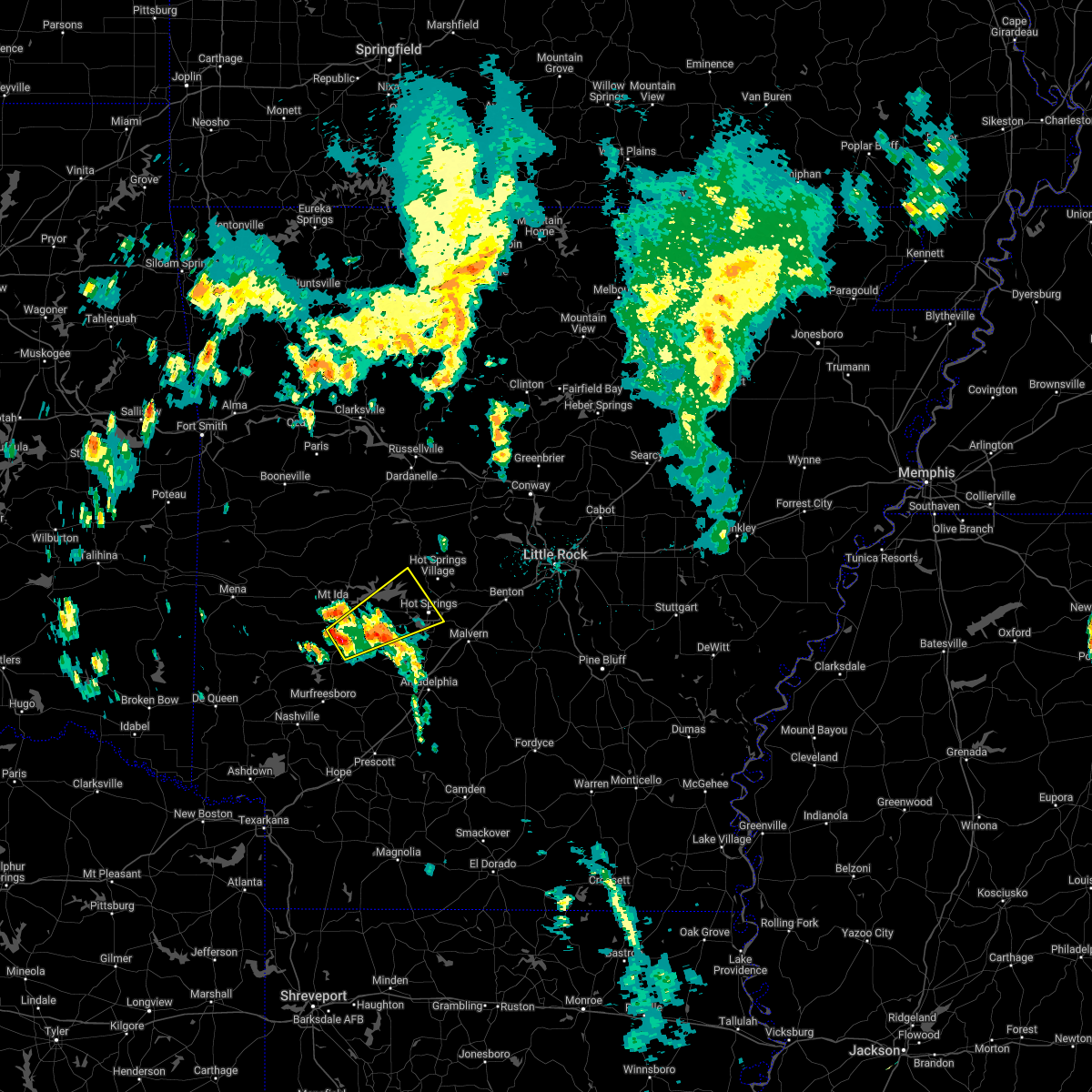 At 323 pm cdt, a severe thunderstorm was located near glenwood, or 12 miles southeast of mount ida, moving northeast at 30 mph (radar indicated). Hazards include 60 mph wind gusts and quarter size hail. Hail damage to vehicles is expected. Expect wind damage to roofs, siding, and trees. At 323 pm cdt, a severe thunderstorm was located near glenwood, or 12 miles southeast of mount ida, moving northeast at 30 mph (radar indicated). Hazards include 60 mph wind gusts and quarter size hail. Hail damage to vehicles is expected. Expect wind damage to roofs, siding, and trees.
|
| 4/16/2022 6:18 AM CDT |
 At 618 am cdt, severe thunderstorms were located along a line extending from near mountain pine to rockwell to 6 miles southeast of lofton to near degray lake state park to amity, moving east at 40 mph (radar indicated). Hazards include golf ball size hail and 60 mph wind gusts. People and animals outdoors will be injured. expect hail damage to roofs, siding, windows, and vehicles. expect wind damage to roofs, siding, and trees. locations impacted include, hot springs, hot springs village, arkadelphia, malvern, glenwood, mountain pine, rockport, amity, caddo valley, perla, lonsdale, gum springs in clark county, meyers, lake ouachita state park, lofton, rockwell, degray lake state park, hot springs memorial field, halfway, richwoods, this includes interstate 30 between mile markers 62 and 106. thunderstorm damage threat, considerable hail threat, radar indicated max hail size, 1. 75 in wind threat, radar indicated max wind gust, 60 mph. At 618 am cdt, severe thunderstorms were located along a line extending from near mountain pine to rockwell to 6 miles southeast of lofton to near degray lake state park to amity, moving east at 40 mph (radar indicated). Hazards include golf ball size hail and 60 mph wind gusts. People and animals outdoors will be injured. expect hail damage to roofs, siding, windows, and vehicles. expect wind damage to roofs, siding, and trees. locations impacted include, hot springs, hot springs village, arkadelphia, malvern, glenwood, mountain pine, rockport, amity, caddo valley, perla, lonsdale, gum springs in clark county, meyers, lake ouachita state park, lofton, rockwell, degray lake state park, hot springs memorial field, halfway, richwoods, this includes interstate 30 between mile markers 62 and 106. thunderstorm damage threat, considerable hail threat, radar indicated max hail size, 1. 75 in wind threat, radar indicated max wind gust, 60 mph.
|
| 4/16/2022 6:14 AM CDT |
 At 611 am cdt, severe thunderstorms were located along a line extending from lake ouachita state park to piney in garland county to near lofton to 8 miles northwest of degray lake state park to near amity, moving southeast at 25 mph (radar indicated). Hazards include ping pong ball size hail and 60 mph wind gusts. People and animals outdoors will be injured. expect hail damage to roofs, siding, windows, and vehicles. expect wind damage to roofs, siding, and trees. locations impacted include, hot springs, hot springs village, arkadelphia, malvern, glenwood, mountain pine, rockport, amity, caddo valley, perla, lonsdale, gum springs in clark county, meyers, jessieville, lake ouachita state park, lofton, rockwell, degray lake state park, hot springs memorial field, halfway, this includes interstate 30 between mile markers 62 and 106. hail threat, radar indicated max hail size, 1. 50 in wind threat, radar indicated max wind gust, 60 mph. At 611 am cdt, severe thunderstorms were located along a line extending from lake ouachita state park to piney in garland county to near lofton to 8 miles northwest of degray lake state park to near amity, moving southeast at 25 mph (radar indicated). Hazards include ping pong ball size hail and 60 mph wind gusts. People and animals outdoors will be injured. expect hail damage to roofs, siding, windows, and vehicles. expect wind damage to roofs, siding, and trees. locations impacted include, hot springs, hot springs village, arkadelphia, malvern, glenwood, mountain pine, rockport, amity, caddo valley, perla, lonsdale, gum springs in clark county, meyers, jessieville, lake ouachita state park, lofton, rockwell, degray lake state park, hot springs memorial field, halfway, this includes interstate 30 between mile markers 62 and 106. hail threat, radar indicated max hail size, 1. 50 in wind threat, radar indicated max wind gust, 60 mph.
|
| 4/16/2022 5:58 AM CDT |
 At 558 am cdt, severe thunderstorms were located along a line extending from near lake ouachita state park to near piney in garland county to lofton to 7 miles southeast of meyers to near glenwood, moving southeast at 35 mph (radar indicated). Hazards include 60 mph wind gusts and quarter size hail. Hail damage to vehicles is expected. expect wind damage to roofs, siding, and trees. locations impacted include, hot springs, hot springs village, arkadelphia, malvern, glenwood, mountain pine, rockport, amity, caddo valley, norman, perla, lonsdale, gum springs in clark county, meyers, jessieville, lake ouachita state park, lofton, rockwell, degray lake state park, hot springs memorial field, this includes interstate 30 between mile markers 62 and 106. hail threat, radar indicated max hail size, 1. 00 in wind threat, radar indicated max wind gust, 60 mph. At 558 am cdt, severe thunderstorms were located along a line extending from near lake ouachita state park to near piney in garland county to lofton to 7 miles southeast of meyers to near glenwood, moving southeast at 35 mph (radar indicated). Hazards include 60 mph wind gusts and quarter size hail. Hail damage to vehicles is expected. expect wind damage to roofs, siding, and trees. locations impacted include, hot springs, hot springs village, arkadelphia, malvern, glenwood, mountain pine, rockport, amity, caddo valley, norman, perla, lonsdale, gum springs in clark county, meyers, jessieville, lake ouachita state park, lofton, rockwell, degray lake state park, hot springs memorial field, this includes interstate 30 between mile markers 62 and 106. hail threat, radar indicated max hail size, 1. 00 in wind threat, radar indicated max wind gust, 60 mph.
|
| 4/16/2022 5:40 AM CDT |
 At 539 am cdt, severe thunderstorms were located along a line extending from 13 miles northwest of mountain pine to near lake ouachita state park to near meyers to 9 miles west of lofton to near glenwood, moving southeast at 40 mph (radar indicated). Hazards include 60 mph wind gusts and half dollar size hail. Hail damage to vehicles is expected. Expect wind damage to roofs, siding, and trees. At 539 am cdt, severe thunderstorms were located along a line extending from 13 miles northwest of mountain pine to near lake ouachita state park to near meyers to 9 miles west of lofton to near glenwood, moving southeast at 40 mph (radar indicated). Hazards include 60 mph wind gusts and half dollar size hail. Hail damage to vehicles is expected. Expect wind damage to roofs, siding, and trees.
|
| 4/13/2022 11:41 AM CDT |
 At 1140 am cdt, severe thunderstorms were located along a line extending from 5 mile northeast of mount ida to near meyers to 8 miles east of crater of diamonds state park, moving northeast at 65 mph (radar indicated). Hazards include 60 mph wind gusts and nickel size hail. expect damage to roofs, siding, and trees At 1140 am cdt, severe thunderstorms were located along a line extending from 5 mile northeast of mount ida to near meyers to 8 miles east of crater of diamonds state park, moving northeast at 65 mph (radar indicated). Hazards include 60 mph wind gusts and nickel size hail. expect damage to roofs, siding, and trees
|
| 3/30/2022 8:23 AM CDT |
 At 823 am cdt, severe thunderstorms were located along a line extending from near stonehouse recreation area to near mimosa, moving northeast at 65 mph (radar indicated). Hazards include 60 mph wind gusts. Expect damage to roofs, siding, and trees. locations impacted include, mount ida, norman, oden, blue mountain, stonehouse recreation area, mimosa, gravelly, fourche valley, mount magazine, mauldin, albert pike recreation area, muddy creek wma, belleville, havana, black springs, wing, fannie, bluffton, rover, fancyhill, hail threat, radar indicated max hail size, <. 75 in wind threat, radar indicated max wind gust, 60 mph. At 823 am cdt, severe thunderstorms were located along a line extending from near stonehouse recreation area to near mimosa, moving northeast at 65 mph (radar indicated). Hazards include 60 mph wind gusts. Expect damage to roofs, siding, and trees. locations impacted include, mount ida, norman, oden, blue mountain, stonehouse recreation area, mimosa, gravelly, fourche valley, mount magazine, mauldin, albert pike recreation area, muddy creek wma, belleville, havana, black springs, wing, fannie, bluffton, rover, fancyhill, hail threat, radar indicated max hail size, <. 75 in wind threat, radar indicated max wind gust, 60 mph.
|
| 3/30/2022 8:01 AM CDT |
 At 800 am cdt, severe thunderstorms were located along a line extending from near cardiff to near opal, moving northeast at 55 mph (radar indicated). Hazards include 60 mph wind gusts and quarter size hail. Hail damage to vehicles is expected. Expect wind damage to roofs, siding, and trees. At 800 am cdt, severe thunderstorms were located along a line extending from near cardiff to near opal, moving northeast at 55 mph (radar indicated). Hazards include 60 mph wind gusts and quarter size hail. Hail damage to vehicles is expected. Expect wind damage to roofs, siding, and trees.
|
| 3/21/2022 3:34 PM CDT |
 At 333 pm cdt, a severe thunderstorm was located near narrows dam, or near murfreesboro, moving north at 75 mph (radar indicated). Hazards include 60 mph wind gusts and quarter size hail. Hail damage to vehicles is expected. Expect wind damage to roofs, siding, and trees. At 333 pm cdt, a severe thunderstorm was located near narrows dam, or near murfreesboro, moving north at 75 mph (radar indicated). Hazards include 60 mph wind gusts and quarter size hail. Hail damage to vehicles is expected. Expect wind damage to roofs, siding, and trees.
|
| 12/16/2021 2:30 PM CST |
 At 230 pm cst, a severe thunderstorm was located near amity, or 14 miles northeast of murfreesboro, moving east at 35 mph (radar indicated). Hazards include 60 mph wind gusts and quarter size hail. Hail damage to vehicles is expected. expect wind damage to roofs, siding, and trees. locations impacted include, murfreesboro, amity, halfway, bismarck, antoine, alpine, hollywood, point cedar, shawmut, rosboro, pike city, kirby, this includes interstate 30 between mile markers 64 and 66. hail threat, radar indicated max hail size, 1. 00 in wind threat, radar indicated max wind gust, 60 mph. At 230 pm cst, a severe thunderstorm was located near amity, or 14 miles northeast of murfreesboro, moving east at 35 mph (radar indicated). Hazards include 60 mph wind gusts and quarter size hail. Hail damage to vehicles is expected. expect wind damage to roofs, siding, and trees. locations impacted include, murfreesboro, amity, halfway, bismarck, antoine, alpine, hollywood, point cedar, shawmut, rosboro, pike city, kirby, this includes interstate 30 between mile markers 64 and 66. hail threat, radar indicated max hail size, 1. 00 in wind threat, radar indicated max wind gust, 60 mph.
|
| 12/16/2021 2:04 PM CST |
 At 203 pm cst, a severe thunderstorm was located near daisy state park, or 9 miles north of murfreesboro, moving east at 40 mph (radar indicated). Hazards include 60 mph wind gusts and quarter size hail. Hail damage to vehicles is expected. Expect wind damage to roofs, siding, and trees. At 203 pm cst, a severe thunderstorm was located near daisy state park, or 9 miles north of murfreesboro, moving east at 40 mph (radar indicated). Hazards include 60 mph wind gusts and quarter size hail. Hail damage to vehicles is expected. Expect wind damage to roofs, siding, and trees.
|
| 12/10/2021 7:49 PM CST |
 At 749 pm cst, a severe thunderstorm was located over ben lomond, or 10 miles west of mineral springs, moving northeast at 60 mph (radar indicated). Hazards include 60 mph wind gusts and quarter size hail. Hail damage to vehicles is expected. Expect wind damage to roofs, siding, and trees. At 749 pm cst, a severe thunderstorm was located over ben lomond, or 10 miles west of mineral springs, moving northeast at 60 mph (radar indicated). Hazards include 60 mph wind gusts and quarter size hail. Hail damage to vehicles is expected. Expect wind damage to roofs, siding, and trees.
|
| 10/11/2021 2:49 AM CDT |
 At 248 am cdt, a severe thunderstorm was located near meyers, or 10 miles southeast of mount ida, moving northeast at 60 mph (radar indicated). Hazards include 60 mph wind gusts and penny size hail. expect damage to roofs, siding, and trees At 248 am cdt, a severe thunderstorm was located near meyers, or 10 miles southeast of mount ida, moving northeast at 60 mph (radar indicated). Hazards include 60 mph wind gusts and penny size hail. expect damage to roofs, siding, and trees
|
| 10/11/2021 2:19 AM CDT |
 At 218 am cdt, strong to severe thunderstorms were located along a line extending from 4 miles northeast of mount ida to 6 miles west of glenwood to 7 miles west of murfreesboro, moving northeast at 40 mph (radar indicated). Hazards include 60 mph wind gusts and penny size hail. Expect damage to roofs, siding, and trees. Locations impacted include, murfreesboro, mount ida, glenwood, norman, daisy, daisy state park, crater of diamonds state park, narrows dam, mauldin, black springs, lodi, nathan, fancyhill, kirby, highland in pike county, bear creek public use area, salem in pike county, welsh, rosboro, pike city,. At 218 am cdt, strong to severe thunderstorms were located along a line extending from 4 miles northeast of mount ida to 6 miles west of glenwood to 7 miles west of murfreesboro, moving northeast at 40 mph (radar indicated). Hazards include 60 mph wind gusts and penny size hail. Expect damage to roofs, siding, and trees. Locations impacted include, murfreesboro, mount ida, glenwood, norman, daisy, daisy state park, crater of diamonds state park, narrows dam, mauldin, black springs, lodi, nathan, fancyhill, kirby, highland in pike county, bear creek public use area, salem in pike county, welsh, rosboro, pike city,.
|
| 10/11/2021 1:51 AM CDT |
 At 150 am cdt, strong to severe thunderstorms were located along a line extending from near oden to near albert pike recreation area to 7 miles east of dierks, moving northeast at 40 mph (radar indicated). Hazards include 60 mph wind gusts and penny size hail. Expect damage to roofs, siding, and trees. Locations impacted include, murfreesboro, mount ida, glenwood, norman, oden, daisy, mimosa, little missouri falls recreatio, daisy state park, crater of diamonds state park, narrows dam, mauldin, albert pike recreation area, black springs, lodi, langley, pine ridge, nathan, fancyhill, kirby,. At 150 am cdt, strong to severe thunderstorms were located along a line extending from near oden to near albert pike recreation area to 7 miles east of dierks, moving northeast at 40 mph (radar indicated). Hazards include 60 mph wind gusts and penny size hail. Expect damage to roofs, siding, and trees. Locations impacted include, murfreesboro, mount ida, glenwood, norman, oden, daisy, mimosa, little missouri falls recreatio, daisy state park, crater of diamonds state park, narrows dam, mauldin, albert pike recreation area, black springs, lodi, langley, pine ridge, nathan, fancyhill, kirby,.
|
| 10/11/2021 1:25 AM CDT |
 At 123 am cdt, strong to severe thunderstorms were located along a line extending from near opal to umpire to near lockesburg, moving northeast at 40 mph (radar indicated). Hazards include 60 mph wind gusts and penny size hail. expect damage to roofs, siding, and trees At 123 am cdt, strong to severe thunderstorms were located along a line extending from near opal to umpire to near lockesburg, moving northeast at 40 mph (radar indicated). Hazards include 60 mph wind gusts and penny size hail. expect damage to roofs, siding, and trees
|
| 6/7/2021 2:49 PM CDT |
 At 249 pm cdt, a severe thunderstorm capable of producing a tornado was located near amity, or 13 miles northeast of murfreesboro, moving northeast at 20 mph (radar indicated rotation). Hazards include tornado and quarter size hail. Flying debris will be dangerous to those caught without shelter. mobile homes will be damaged or destroyed. damage to roofs, windows, and vehicles will occur. Tree damage is likely. At 249 pm cdt, a severe thunderstorm capable of producing a tornado was located near amity, or 13 miles northeast of murfreesboro, moving northeast at 20 mph (radar indicated rotation). Hazards include tornado and quarter size hail. Flying debris will be dangerous to those caught without shelter. mobile homes will be damaged or destroyed. damage to roofs, windows, and vehicles will occur. Tree damage is likely.
|
| 6/7/2021 2:30 PM CDT |
 At 230 pm cdt, a severe thunderstorm capable of producing a tornado was located 7 miles east of narrows dam, or 8 miles northeast of murfreesboro, moving northeast at 20 mph (radar indicated rotation). Hazards include tornado and quarter size hail. Flying debris will be dangerous to those caught without shelter. mobile homes will be damaged or destroyed. damage to roofs, windows, and vehicles will occur. tree damage is likely. Locations impacted include, amity, alpine, welsh, shawmut, rosboro, pike city,. At 230 pm cdt, a severe thunderstorm capable of producing a tornado was located 7 miles east of narrows dam, or 8 miles northeast of murfreesboro, moving northeast at 20 mph (radar indicated rotation). Hazards include tornado and quarter size hail. Flying debris will be dangerous to those caught without shelter. mobile homes will be damaged or destroyed. damage to roofs, windows, and vehicles will occur. tree damage is likely. Locations impacted include, amity, alpine, welsh, shawmut, rosboro, pike city,.
|
| 6/7/2021 2:21 PM CDT |
 At 221 pm cdt, a severe thunderstorm capable of producing a tornado was located near murfreesboro, moving east at 20 mph (radar indicated rotation). Hazards include tornado. Flying debris will be dangerous to those caught without shelter. mobile homes will be damaged or destroyed. damage to roofs, windows, and vehicles will occur. tree damage is likely. Locations impacted include, amity, alpine, welsh, shawmut, rosboro, pike city,. At 221 pm cdt, a severe thunderstorm capable of producing a tornado was located near murfreesboro, moving east at 20 mph (radar indicated rotation). Hazards include tornado. Flying debris will be dangerous to those caught without shelter. mobile homes will be damaged or destroyed. damage to roofs, windows, and vehicles will occur. tree damage is likely. Locations impacted include, amity, alpine, welsh, shawmut, rosboro, pike city,.
|
| 6/7/2021 2:13 PM CDT |
 At 213 pm cdt, a severe thunderstorm capable of producing a tornado was located near murfreesboro, moving northeast at 20 mph (radar indicated rotation). Hazards include tornado. Flying debris will be dangerous to those caught without shelter. mobile homes will be damaged or destroyed. damage to roofs, windows, and vehicles will occur. Tree damage is likely. At 213 pm cdt, a severe thunderstorm capable of producing a tornado was located near murfreesboro, moving northeast at 20 mph (radar indicated rotation). Hazards include tornado. Flying debris will be dangerous to those caught without shelter. mobile homes will be damaged or destroyed. damage to roofs, windows, and vehicles will occur. Tree damage is likely.
|
| 6/7/2021 2:08 PM CDT |
 At 208 pm cdt, a severe thunderstorm was located over murfreesboro, moving northeast at 20 mph (radar indicated). Hazards include 60 mph wind gusts and quarter size hail. Hail damage to vehicles is expected. expect wind damage to roofs, siding, and trees. Locations impacted include, murfreesboro, glenwood, amity, narrows dam, crater of diamonds state park, kirby, shawmut, rosboro, pike city,. At 208 pm cdt, a severe thunderstorm was located over murfreesboro, moving northeast at 20 mph (radar indicated). Hazards include 60 mph wind gusts and quarter size hail. Hail damage to vehicles is expected. expect wind damage to roofs, siding, and trees. Locations impacted include, murfreesboro, glenwood, amity, narrows dam, crater of diamonds state park, kirby, shawmut, rosboro, pike city,.
|
| 6/7/2021 1:59 PM CDT |
 At 159 pm cdt, a severe thunderstorm was located over murfreesboro, moving northeast at 20 mph (radar indicated). Hazards include 60 mph wind gusts and quarter size hail. Hail damage to vehicles is expected. expect wind damage to roofs, siding, and trees. Locations impacted include, murfreesboro, glenwood, amity, narrows dam, crater of diamonds state park, bear creek public use area, kirby, shawmut, rosboro, pike city,. At 159 pm cdt, a severe thunderstorm was located over murfreesboro, moving northeast at 20 mph (radar indicated). Hazards include 60 mph wind gusts and quarter size hail. Hail damage to vehicles is expected. expect wind damage to roofs, siding, and trees. Locations impacted include, murfreesboro, glenwood, amity, narrows dam, crater of diamonds state park, bear creek public use area, kirby, shawmut, rosboro, pike city,.
|
| 6/7/2021 1:46 PM CDT |
 At 146 pm cdt, a severe thunderstorm was located near corinth, or near murfreesboro, moving northeast at 25 mph (radar indicated). Hazards include 60 mph wind gusts and quarter size hail. Hail damage to vehicles is expected. Expect wind damage to roofs, siding, and trees. At 146 pm cdt, a severe thunderstorm was located near corinth, or near murfreesboro, moving northeast at 25 mph (radar indicated). Hazards include 60 mph wind gusts and quarter size hail. Hail damage to vehicles is expected. Expect wind damage to roofs, siding, and trees.
|
| 5/27/2021 11:10 PM CDT |
 At 1109 pm cdt, severe thunderstorms were located along a line extending from near glenwood to 8 miles west of amity to near daisy state park, moving southeast at 30 mph (radar indicated). Hazards include 60 mph wind gusts and quarter size hail. Hail damage to vehicles is expected. Expect wind damage to roofs, siding, and trees. At 1109 pm cdt, severe thunderstorms were located along a line extending from near glenwood to 8 miles west of amity to near daisy state park, moving southeast at 30 mph (radar indicated). Hazards include 60 mph wind gusts and quarter size hail. Hail damage to vehicles is expected. Expect wind damage to roofs, siding, and trees.
|
| 5/27/2021 11:00 PM CDT |
 At 1100 pm cdt, severe thunderstorms were located along a line extending from near norman to 7 miles northwest of glenwood to 8 miles northeast of daisy state park to near daisy, moving east at 35 mph (radar indicated). Hazards include 60 mph wind gusts and quarter size hail. Hail damage to vehicles is expected. expect wind damage to roofs, siding, and trees. Locations impacted include, mount ida, glenwood, amity, norman, daisy, daisy state park, narrows dam, meyers, albert pike recreation area, black springs, alpine, bonnerdale, lodi, langley, point cedar, fancyhill, kirby, bear creek public use area, salem in pike county, crystal springs landing,. At 1100 pm cdt, severe thunderstorms were located along a line extending from near norman to 7 miles northwest of glenwood to 8 miles northeast of daisy state park to near daisy, moving east at 35 mph (radar indicated). Hazards include 60 mph wind gusts and quarter size hail. Hail damage to vehicles is expected. expect wind damage to roofs, siding, and trees. Locations impacted include, mount ida, glenwood, amity, norman, daisy, daisy state park, narrows dam, meyers, albert pike recreation area, black springs, alpine, bonnerdale, lodi, langley, point cedar, fancyhill, kirby, bear creek public use area, salem in pike county, crystal springs landing,.
|
| 5/27/2021 10:46 PM CDT |
 At 1045 pm cdt, severe thunderstorms were located along a line extending from mimosa to near norman to near albert pike recreation area, moving east at 30 mph (radar indicated). Hazards include 60 mph wind gusts and quarter size hail. Hail damage to vehicles is expected. expect wind damage to roofs, siding, and trees. Locations impacted include, mount ida, glenwood, amity, norman, daisy, mimosa, daisy state park, narrows dam, meyers, albert pike recreation area, black springs, alpine, bonnerdale, lodi, langley, point cedar, fancyhill, kirby, bear creek public use area, salem in pike county,. At 1045 pm cdt, severe thunderstorms were located along a line extending from mimosa to near norman to near albert pike recreation area, moving east at 30 mph (radar indicated). Hazards include 60 mph wind gusts and quarter size hail. Hail damage to vehicles is expected. expect wind damage to roofs, siding, and trees. Locations impacted include, mount ida, glenwood, amity, norman, daisy, mimosa, daisy state park, narrows dam, meyers, albert pike recreation area, black springs, alpine, bonnerdale, lodi, langley, point cedar, fancyhill, kirby, bear creek public use area, salem in pike county,.
|
| 5/27/2021 10:30 PM CDT |
 At 1029 pm cdt, severe thunderstorms were located along a line extending from near opal to near little missouri falls recreation area to near albert pike recreation area to near bard springs recreation area, moving east at 35 mph (radar indicated). Hazards include 60 mph wind gusts and penny size hail. expect damage to roofs, siding, and trees At 1029 pm cdt, severe thunderstorms were located along a line extending from near opal to near little missouri falls recreation area to near albert pike recreation area to near bard springs recreation area, moving east at 35 mph (radar indicated). Hazards include 60 mph wind gusts and penny size hail. expect damage to roofs, siding, and trees
|
| 5/18/2021 6:03 PM CDT |
 At 602 pm cdt, severe thunderstorms were located along a line extending from 8 miles southeast of fourche valley to 11 miles north of meyers to near glenwood to 9 miles east of murfreesboro, moving east at 30 mph. wind damage has been reported with these storms! (public). Hazards include 60 mph wind gusts and quarter size hail. Hail damage to vehicles is expected. expect wind damage to roofs, siding, and trees. Locations impacted include, murfreesboro, mount ida, glenwood, amity, narrows dam, meyers, avant, bear creek public use area, chula, salem in pike county, crystal springs landing, welsh, fannie, shawmut, rosboro, pike city, silver, kirby, onyx, hurricane grove,. At 602 pm cdt, severe thunderstorms were located along a line extending from 8 miles southeast of fourche valley to 11 miles north of meyers to near glenwood to 9 miles east of murfreesboro, moving east at 30 mph. wind damage has been reported with these storms! (public). Hazards include 60 mph wind gusts and quarter size hail. Hail damage to vehicles is expected. expect wind damage to roofs, siding, and trees. Locations impacted include, murfreesboro, mount ida, glenwood, amity, narrows dam, meyers, avant, bear creek public use area, chula, salem in pike county, crystal springs landing, welsh, fannie, shawmut, rosboro, pike city, silver, kirby, onyx, hurricane grove,.
|
| 5/18/2021 5:43 PM CDT |
 At 543 pm cdt, severe thunderstorms were located along a line extending from muddy creek wma to mount ida to near narrows dam, moving east at 25 mph (radar indicated). Hazards include 60 mph wind gusts and quarter size hail. Hail damage to vehicles is expected. Expect wind damage to roofs, siding, and trees. At 543 pm cdt, severe thunderstorms were located along a line extending from muddy creek wma to mount ida to near narrows dam, moving east at 25 mph (radar indicated). Hazards include 60 mph wind gusts and quarter size hail. Hail damage to vehicles is expected. Expect wind damage to roofs, siding, and trees.
|
| 5/9/2021 3:27 PM CDT |
 At 327 pm cdt, a severe thunderstorm was located near corinth, or 9 miles east of dierks, moving northeast at 30 mph (radar indicated). Hazards include 60 mph wind gusts and quarter size hail. Hail damage to vehicles is expected. Expect wind damage to roofs, siding, and trees. At 327 pm cdt, a severe thunderstorm was located near corinth, or 9 miles east of dierks, moving northeast at 30 mph (radar indicated). Hazards include 60 mph wind gusts and quarter size hail. Hail damage to vehicles is expected. Expect wind damage to roofs, siding, and trees.
|
| 5/4/2021 1:34 AM CDT |
 At 129 am cdt, severe thunderstorms were located along a line extending from near norman to near amity to 8 miles east of crater of diamonds state park, moving northeast at 50 mph (radar indicated). Hazards include 60 mph wind gusts and quarter size hail. Hail damage to vehicles is expected. expect wind damage to roofs, siding, and trees. Locations impacted include, murfreesboro, glenwood, amity, meyers, lofton, crater of diamonds state park, alpine, bear creek public use area, salem in pike county, bonnerdale, welsh, sunshine, shawmut, rosboro, pike city, point cedar, kirby, pearcy, crystal springs, caddo gap,. At 129 am cdt, severe thunderstorms were located along a line extending from near norman to near amity to 8 miles east of crater of diamonds state park, moving northeast at 50 mph (radar indicated). Hazards include 60 mph wind gusts and quarter size hail. Hail damage to vehicles is expected. expect wind damage to roofs, siding, and trees. Locations impacted include, murfreesboro, glenwood, amity, meyers, lofton, crater of diamonds state park, alpine, bear creek public use area, salem in pike county, bonnerdale, welsh, sunshine, shawmut, rosboro, pike city, point cedar, kirby, pearcy, crystal springs, caddo gap,.
|
| 5/4/2021 1:29 AM CDT |
 At 129 am cdt, severe thunderstorms were located along a line extending from near norman to near amity to 8 miles east of crater of diamonds state park, moving northeast at 50 mph (radar indicated). Hazards include 60 mph wind gusts and quarter size hail. Hail damage to vehicles is expected. expect wind damage to roofs, siding, and trees. Locations impacted include, murfreesboro, glenwood, amity, meyers, lofton, crater of diamonds state park, alpine, bear creek public use area, salem in pike county, bonnerdale, welsh, sunshine, shawmut, rosboro, pike city, point cedar, kirby, pearcy, crystal springs, caddo gap,. At 129 am cdt, severe thunderstorms were located along a line extending from near norman to near amity to 8 miles east of crater of diamonds state park, moving northeast at 50 mph (radar indicated). Hazards include 60 mph wind gusts and quarter size hail. Hail damage to vehicles is expected. expect wind damage to roofs, siding, and trees. Locations impacted include, murfreesboro, glenwood, amity, meyers, lofton, crater of diamonds state park, alpine, bear creek public use area, salem in pike county, bonnerdale, welsh, sunshine, shawmut, rosboro, pike city, point cedar, kirby, pearcy, crystal springs, caddo gap,.
|
| 5/4/2021 1:08 AM CDT |
 At 108 am cdt, severe thunderstorms were located along a line extending from near albert pike recreation area to near narrows dam to near nashville, moving northeast at 50 mph (radar indicated). Hazards include 60 mph wind gusts and quarter size hail. Hail damage to vehicles is expected. Expect wind damage to roofs, siding, and trees. At 108 am cdt, severe thunderstorms were located along a line extending from near albert pike recreation area to near narrows dam to near nashville, moving northeast at 50 mph (radar indicated). Hazards include 60 mph wind gusts and quarter size hail. Hail damage to vehicles is expected. Expect wind damage to roofs, siding, and trees.
|
| 4/14/2021 6:46 AM CDT |
 At 646 am cdt, a severe thunderstorm was located near daisy, or 13 miles east of umpire, moving northeast at 50 mph (radar indicated). Hazards include quarter size hail. Damage to vehicles is expected. Locations impacted include, glenwood, daisy, daisy state park, bear creek public use area, salem in pike county, kirby, rosboro, lodi, new hope in pike county,. At 646 am cdt, a severe thunderstorm was located near daisy, or 13 miles east of umpire, moving northeast at 50 mph (radar indicated). Hazards include quarter size hail. Damage to vehicles is expected. Locations impacted include, glenwood, daisy, daisy state park, bear creek public use area, salem in pike county, kirby, rosboro, lodi, new hope in pike county,.
|
| 4/14/2021 6:27 AM CDT |
 At 626 am cdt, a severe thunderstorm was located near dierks, moving northeast at 50 mph (radar indicated. quarter size hail has already been reported with this storm). Hazards include quarter size hail. damage to vehicles is expected At 626 am cdt, a severe thunderstorm was located near dierks, moving northeast at 50 mph (radar indicated. quarter size hail has already been reported with this storm). Hazards include quarter size hail. damage to vehicles is expected
|
| 4/14/2021 4:42 AM CDT |
 The severe thunderstorm warning for northeastern pike county will expire at 445 am cdt, the storm which prompted the warning has weakened below severe limits, and no longer poses an immediate threat to life or property. therefore, the warning will be allowed to expire. however small hail and heavy rain are still possible with this thunderstorm. The severe thunderstorm warning for northeastern pike county will expire at 445 am cdt, the storm which prompted the warning has weakened below severe limits, and no longer poses an immediate threat to life or property. therefore, the warning will be allowed to expire. however small hail and heavy rain are still possible with this thunderstorm.
|
| 4/14/2021 4:33 AM CDT |
 At 433 am cdt, a severe thunderstorm was located near amity, or 14 miles northeast of murfreesboro, moving east at 45 mph (radar indicated). Hazards include quarter size hail. Damage to vehicles is expected. Locations impacted include, glenwood, narrows dam, bear creek public use area, kirby, salem in pike county,. At 433 am cdt, a severe thunderstorm was located near amity, or 14 miles northeast of murfreesboro, moving east at 45 mph (radar indicated). Hazards include quarter size hail. Damage to vehicles is expected. Locations impacted include, glenwood, narrows dam, bear creek public use area, kirby, salem in pike county,.
|
| 4/14/2021 4:23 AM CDT |
 At 423 am cdt, a severe thunderstorm was located over daisy state park, or 12 miles north of murfreesboro, moving east at 45 mph (radar indicated). Hazards include quarter size hail. Damage to vehicles is expected. Locations impacted include, glenwood, daisy, narrows dam, daisy state park, bear creek public use area, fancyhill, salem in pike county, hopper, kirby, lodi, caddo gap,. At 423 am cdt, a severe thunderstorm was located over daisy state park, or 12 miles north of murfreesboro, moving east at 45 mph (radar indicated). Hazards include quarter size hail. Damage to vehicles is expected. Locations impacted include, glenwood, daisy, narrows dam, daisy state park, bear creek public use area, fancyhill, salem in pike county, hopper, kirby, lodi, caddo gap,.
|
| 4/14/2021 4:15 AM CDT |
 At 414 am cdt, a severe thunderstorm was located near daisy, or 12 miles east of umpire, moving east at 45 mph (radar indicated). Hazards include quarter size hail. Damage to vehicles is expected. Locations impacted include, glenwood, daisy, narrows dam, daisy state park, albert pike recreation area, bear creek public use area, salem in pike county, lodi, langley, fancyhill, hopper, kirby, new hope in pike county, caddo gap,. At 414 am cdt, a severe thunderstorm was located near daisy, or 12 miles east of umpire, moving east at 45 mph (radar indicated). Hazards include quarter size hail. Damage to vehicles is expected. Locations impacted include, glenwood, daisy, narrows dam, daisy state park, albert pike recreation area, bear creek public use area, salem in pike county, lodi, langley, fancyhill, hopper, kirby, new hope in pike county, caddo gap,.
|
| 4/14/2021 3:59 AM CDT |
 At 359 am cdt, a severe thunderstorm was located near umpire, moving east at 45 mph (radar indicated). Hazards include quarter size hail. damage to vehicles is expected At 359 am cdt, a severe thunderstorm was located near umpire, moving east at 45 mph (radar indicated). Hazards include quarter size hail. damage to vehicles is expected
|
| 3/24/2021 11:26 PM CDT |
 At 1126 pm cdt, a severe thunderstorm was located near norman, or 7 miles southeast of mount ida, moving northeast at 35 mph (radar indicated). Hazards include half dollar size hail. damage to vehicles is expected At 1126 pm cdt, a severe thunderstorm was located near norman, or 7 miles southeast of mount ida, moving northeast at 35 mph (radar indicated). Hazards include half dollar size hail. damage to vehicles is expected
|
| 3/24/2021 11:21 PM CDT |
 At 1120 pm cdt, a severe thunderstorm was located near norman, or 9 miles south of mount ida, moving northeast at 35 mph (radar indicated). Hazards include 60 mph wind gusts and half dollar size hail. Hail damage to vehicles is expected. expect wind damage to roofs, siding, and trees. Locations impacted include, glenwood, norman, black springs, hopper, caddo gap, fancyhill,. At 1120 pm cdt, a severe thunderstorm was located near norman, or 9 miles south of mount ida, moving northeast at 35 mph (radar indicated). Hazards include 60 mph wind gusts and half dollar size hail. Hail damage to vehicles is expected. expect wind damage to roofs, siding, and trees. Locations impacted include, glenwood, norman, black springs, hopper, caddo gap, fancyhill,.
|
| 3/24/2021 10:52 PM CDT |
 At 1051 pm cdt, a severe thunderstorm was located near daisy, or 11 miles east of umpire, moving northeast at 35 mph (radar indicated). Hazards include 60 mph wind gusts and half dollar size hail. Hail damage to vehicles is expected. Expect wind damage to roofs, siding, and trees. At 1051 pm cdt, a severe thunderstorm was located near daisy, or 11 miles east of umpire, moving northeast at 35 mph (radar indicated). Hazards include 60 mph wind gusts and half dollar size hail. Hail damage to vehicles is expected. Expect wind damage to roofs, siding, and trees.
|
| 9/1/2020 1:52 PM CDT |
 At 152 pm cdt, a severe thunderstorm was located near mimosa, or 11 miles southwest of mount ida, moving northeast at 35 mph (radar indicated). Hazards include 60 mph wind gusts and penny size hail. Expect damage to roofs, siding, and trees. Locations impacted include, mount ida, glenwood, norman, mimosa, black springs, fancyhill, salem in pike county, hopper, rosboro, hurricane grove, caddo gap,. At 152 pm cdt, a severe thunderstorm was located near mimosa, or 11 miles southwest of mount ida, moving northeast at 35 mph (radar indicated). Hazards include 60 mph wind gusts and penny size hail. Expect damage to roofs, siding, and trees. Locations impacted include, mount ida, glenwood, norman, mimosa, black springs, fancyhill, salem in pike county, hopper, rosboro, hurricane grove, caddo gap,.
|
| 9/1/2020 1:36 PM CDT |
 At 136 pm cdt, a severe thunderstorm was located over albert pike recreation area, or 10 miles northeast of umpire, moving east at 25 mph (radar indicated). Hazards include 60 mph wind gusts and quarter size hail. Hail damage to vehicles is expected. Expect wind damage to roofs, siding, and trees. At 136 pm cdt, a severe thunderstorm was located over albert pike recreation area, or 10 miles northeast of umpire, moving east at 25 mph (radar indicated). Hazards include 60 mph wind gusts and quarter size hail. Hail damage to vehicles is expected. Expect wind damage to roofs, siding, and trees.
|
| 8/29/2020 9:07 PM CDT |
 At 906 pm cdt, severe thunderstorms were located along a line extending from near mountain pine to near meyers to near norman, moving south at 30 mph (radar indicated). Hazards include 60 mph wind gusts and penny size hail. Expect damage to roofs, siding, and trees. Locations impacted include, hot springs, hot springs village, mount ida, mountain pine, hot springs memorial field, meyers, jessieville, lake ouachita state park, lofton, rockwell, hot springs national park, mauldin, avant, bismarck, oaklawn racetrack, bonnerdale, mt tabor, sunshine, royal, lena landing rec area,. At 906 pm cdt, severe thunderstorms were located along a line extending from near mountain pine to near meyers to near norman, moving south at 30 mph (radar indicated). Hazards include 60 mph wind gusts and penny size hail. Expect damage to roofs, siding, and trees. Locations impacted include, hot springs, hot springs village, mount ida, mountain pine, hot springs memorial field, meyers, jessieville, lake ouachita state park, lofton, rockwell, hot springs national park, mauldin, avant, bismarck, oaklawn racetrack, bonnerdale, mt tabor, sunshine, royal, lena landing rec area,.
|
| 8/29/2020 9:04 PM CDT |
 At 904 pm cdt, severe thunderstorms were located along a line extending from opal to near shady to near hatfield, moving south at 30 mph (radar indicated). Hazards include 70 mph wind gusts and nickel size hail. Expect considerable tree damage. damage is likely to mobile homes, roofs, and outbuildings. Locations impacted include, mena, glenwood, wickes, amity, grannis, hatfield, norman, oden, daisy, vandervoort, little missouri falls recreatio, mountain fork, daisy state park, bard springs recreation area, albert pike recreation area, opal, mimosa, cossatot river state park, polk county fairgrounds, mena intermountain airport,. At 904 pm cdt, severe thunderstorms were located along a line extending from opal to near shady to near hatfield, moving south at 30 mph (radar indicated). Hazards include 70 mph wind gusts and nickel size hail. Expect considerable tree damage. damage is likely to mobile homes, roofs, and outbuildings. Locations impacted include, mena, glenwood, wickes, amity, grannis, hatfield, norman, oden, daisy, vandervoort, little missouri falls recreatio, mountain fork, daisy state park, bard springs recreation area, albert pike recreation area, opal, mimosa, cossatot river state park, polk county fairgrounds, mena intermountain airport,.
|
| 8/29/2020 8:48 PM CDT |
 At 848 pm cdt, severe thunderstorms were located along a line extending from near oden to near mena to near mountain fork, moving south at 40 mph (radar indicated). Hazards include 70 mph wind gusts and nickel size hail. Expect considerable tree damage. Damage is likely to mobile homes, roofs, and outbuildings. At 848 pm cdt, severe thunderstorms were located along a line extending from near oden to near mena to near mountain fork, moving south at 40 mph (radar indicated). Hazards include 70 mph wind gusts and nickel size hail. Expect considerable tree damage. Damage is likely to mobile homes, roofs, and outbuildings.
|
| 8/29/2020 8:43 PM CDT |
 At 842 pm cdt, severe thunderstorms were located along a line extending from 13 miles northwest of mountain pine to 10 miles west of lake ouachita state park to 7 miles east of mount ida to near mauldin, moving southeast at 25 mph (radar indicated). Hazards include 60 mph wind gusts and nickel size hail. expect damage to roofs, siding, and trees At 842 pm cdt, severe thunderstorms were located along a line extending from 13 miles northwest of mountain pine to 10 miles west of lake ouachita state park to 7 miles east of mount ida to near mauldin, moving southeast at 25 mph (radar indicated). Hazards include 60 mph wind gusts and nickel size hail. expect damage to roofs, siding, and trees
|
| 8/14/2020 6:13 AM CDT |
 At 613 am cdt, severe thunderstorms were located along a line extending from near hot springs to near degray lake state park to 8 miles south of amity, moving southeast at 35 mph (radar indicated). Hazards include 60 mph wind gusts. Expect damage to roofs, siding, and trees. Locations impacted include, hot springs, hot springs village, arkadelphia, malvern, murfreesboro, glenwood, gurdon, mountain pine, rockport, amity, caddo valley, perla, okolona, daisy, lonsdale, whelen springs, beirne, gum springs in clark county, daisy state park, crater of diamonds state park, this includes interstate 30 between mile markers 53 and 106. At 613 am cdt, severe thunderstorms were located along a line extending from near hot springs to near degray lake state park to 8 miles south of amity, moving southeast at 35 mph (radar indicated). Hazards include 60 mph wind gusts. Expect damage to roofs, siding, and trees. Locations impacted include, hot springs, hot springs village, arkadelphia, malvern, murfreesboro, glenwood, gurdon, mountain pine, rockport, amity, caddo valley, perla, okolona, daisy, lonsdale, whelen springs, beirne, gum springs in clark county, daisy state park, crater of diamonds state park, this includes interstate 30 between mile markers 53 and 106.
|
| 8/14/2020 5:57 AM CDT |
 A severe thunderstorm warning remains in effect until 630 am cdt for clark. pike. northwestern dallas. garland. southwestern saline. hot spring and montgomery counties. At 556 am cdt, severe thunderstorms were located along a line extending from near piney in garland county to near lofton to near glenwood, moving south at 35 mph. A severe thunderstorm warning remains in effect until 630 am cdt for clark. pike. northwestern dallas. garland. southwestern saline. hot spring and montgomery counties. At 556 am cdt, severe thunderstorms were located along a line extending from near piney in garland county to near lofton to near glenwood, moving south at 35 mph.
|
| 8/14/2020 5:29 AM CDT |
 At 528 am cdt, severe thunderstorms were located along a line extending from 9 miles northwest of lake ouachita state park to 9 miles northwest of meyers to near norman, moving south at 35 mph (radar indicated). Hazards include 60 mph wind gusts. expect damage to roofs, siding, and trees At 528 am cdt, severe thunderstorms were located along a line extending from 9 miles northwest of lake ouachita state park to 9 miles northwest of meyers to near norman, moving south at 35 mph (radar indicated). Hazards include 60 mph wind gusts. expect damage to roofs, siding, and trees
|
| 5/16/2020 7:55 PM CDT |
 At 754 pm cdt, severe thunderstorms were located along a line extending from near norman to 8 miles southeast of mount ida to near gum springs in clark county, moving north at 30 mph (radar indicated). Hazards include 60 mph wind gusts and penny size hail. Expect damage to roofs, siding, and trees. Locations impacted include, arkadelphia, mount ida, glenwood, amity, caddo valley, meyers, lofton, degray lake state park, friendship, bismarck, alpine, bonnerdale, sunshine, royal, de roche, point cedar, hempwallace, midway in hot spring county, lower lake recreation area, salem in pike county, this includes interstate 30 between mile markers 71 and 87. At 754 pm cdt, severe thunderstorms were located along a line extending from near norman to 8 miles southeast of mount ida to near gum springs in clark county, moving north at 30 mph (radar indicated). Hazards include 60 mph wind gusts and penny size hail. Expect damage to roofs, siding, and trees. Locations impacted include, arkadelphia, mount ida, glenwood, amity, caddo valley, meyers, lofton, degray lake state park, friendship, bismarck, alpine, bonnerdale, sunshine, royal, de roche, point cedar, hempwallace, midway in hot spring county, lower lake recreation area, salem in pike county, this includes interstate 30 between mile markers 71 and 87.
|
| 5/16/2020 7:30 PM CDT |
 The national weather service in little rock has issued a * severe thunderstorm warning for. northern clark county in southwestern arkansas. northeastern pike county in southwestern arkansas. southwestern garland county in central arkansas. Southwestern hot spring county in southwestern arkansas. The national weather service in little rock has issued a * severe thunderstorm warning for. northern clark county in southwestern arkansas. northeastern pike county in southwestern arkansas. southwestern garland county in central arkansas. Southwestern hot spring county in southwestern arkansas.
|
| 5/16/2020 7:19 PM CDT |
 At 718 pm cdt, severe thunderstorms were located along a line extending from near daisy state park to 7 miles southeast of amity to richwoods, moving north at 35 mph (radar indicated). Hazards include 60 mph wind gusts and penny size hail. Expect damage to roofs, siding, and trees. Locations impacted include, arkadelphia, murfreesboro, glenwood, gurdon, amity, caddo valley, okolona, daisy, whelen springs, beirne, gum springs in clark county, halfway, daisy state park, narrows dam, richwoods, degray lake state park, antoine, alpine, curtis, lodi, this includes interstate 30 between mile markers 58 and 80. At 718 pm cdt, severe thunderstorms were located along a line extending from near daisy state park to 7 miles southeast of amity to richwoods, moving north at 35 mph (radar indicated). Hazards include 60 mph wind gusts and penny size hail. Expect damage to roofs, siding, and trees. Locations impacted include, arkadelphia, murfreesboro, glenwood, gurdon, amity, caddo valley, okolona, daisy, whelen springs, beirne, gum springs in clark county, halfway, daisy state park, narrows dam, richwoods, degray lake state park, antoine, alpine, curtis, lodi, this includes interstate 30 between mile markers 58 and 80.
|
| 5/16/2020 6:47 PM CDT |
 At 647 pm cdt, severe thunderstorms were located along a line extending from near crater of diamonds state park to near okolona to near whelen springs, moving north at 35 mph (radar indicated). Hazards include 60 mph wind gusts and quarter size hail. Hail damage to vehicles is expected. Expect wind damage to roofs, siding, and trees. At 647 pm cdt, severe thunderstorms were located along a line extending from near crater of diamonds state park to near okolona to near whelen springs, moving north at 35 mph (radar indicated). Hazards include 60 mph wind gusts and quarter size hail. Hail damage to vehicles is expected. Expect wind damage to roofs, siding, and trees.
|
| 5/8/2020 5:12 AM CDT |
 At 511 am cdt, severe thunderstorms were located along a line extending from 9 miles northeast of mount ida to 6 miles northwest of meyers to near glenwood to narrows dam, moving southeast at 65 mph (radar indicated). Hazards include 60 mph wind gusts. expect damage to roofs, siding, and trees At 511 am cdt, severe thunderstorms were located along a line extending from 9 miles northeast of mount ida to 6 miles northwest of meyers to near glenwood to narrows dam, moving southeast at 65 mph (radar indicated). Hazards include 60 mph wind gusts. expect damage to roofs, siding, and trees
|
| 5/8/2020 5:04 AM CDT |
 At 503 am cdt, severe thunderstorms were located along a line extending from near mauldin to near mount ida to near norman to near albert pike recreation area, moving east at 55 mph (radar indicated). Hazards include 60 mph wind gusts. Expect damage to roofs, siding, and trees. Locations impacted include, mount ida, mountain pine, norman, oden, mimosa, little missouri falls recreatio, meyers, jessieville, lake ouachita state park, mauldin, albert pike recreation area, avant, black springs, bonnerdale, mt tabor, fannie, royal, lena landing rec area, fancyhill, hamilton,. At 503 am cdt, severe thunderstorms were located along a line extending from near mauldin to near mount ida to near norman to near albert pike recreation area, moving east at 55 mph (radar indicated). Hazards include 60 mph wind gusts. Expect damage to roofs, siding, and trees. Locations impacted include, mount ida, mountain pine, norman, oden, mimosa, little missouri falls recreatio, meyers, jessieville, lake ouachita state park, mauldin, albert pike recreation area, avant, black springs, bonnerdale, mt tabor, fannie, royal, lena landing rec area, fancyhill, hamilton,.
|
| 5/8/2020 4:54 AM CDT |
 At 454 am cdt, severe thunderstorms were located along a line extending from near glenwood to murfreesboro to washington, moving east at 65 mph (radar indicated). Hazards include 60 mph wind gusts. Expect damage to roofs, siding, and trees. Locations impacted include, arkadelphia, murfreesboro, glenwood, gurdon, amity, caddo valley, okolona, daisy, whelen springs, beirne, gum springs in clark county, halfway, daisy state park, crater of diamonds state park, narrows dam, richwoods, degray lake state park, lofton, delight, friendship, this includes interstate 30 between mile markers 53 and 86. At 454 am cdt, severe thunderstorms were located along a line extending from near glenwood to murfreesboro to washington, moving east at 65 mph (radar indicated). Hazards include 60 mph wind gusts. Expect damage to roofs, siding, and trees. Locations impacted include, arkadelphia, murfreesboro, glenwood, gurdon, amity, caddo valley, okolona, daisy, whelen springs, beirne, gum springs in clark county, halfway, daisy state park, crater of diamonds state park, narrows dam, richwoods, degray lake state park, lofton, delight, friendship, this includes interstate 30 between mile markers 53 and 86.
|
| 5/8/2020 4:53 AM CDT |
 At 453 am cdt, severe thunderstorms were located along a line extending from near oden to near mimosa to near little missouri falls recreation area to near bard springs recreation area, moving southeast at 55 mph (radar indicated). Hazards include 70 mph wind gusts. Expect considerable tree damage. damage is likely to mobile homes, roofs, and outbuildings. Locations impacted include, mount ida, mountain pine, norman, oden, opal, mimosa, little missouri falls recreatio, meyers, jessieville, lake ouachita state park, bard springs recreation area, mauldin, albert pike recreation area, muddy creek wma, avant, black springs, big fork, bonnerdale, mt tabor, fannie,. At 453 am cdt, severe thunderstorms were located along a line extending from near oden to near mimosa to near little missouri falls recreation area to near bard springs recreation area, moving southeast at 55 mph (radar indicated). Hazards include 70 mph wind gusts. Expect considerable tree damage. damage is likely to mobile homes, roofs, and outbuildings. Locations impacted include, mount ida, mountain pine, norman, oden, opal, mimosa, little missouri falls recreatio, meyers, jessieville, lake ouachita state park, bard springs recreation area, mauldin, albert pike recreation area, muddy creek wma, avant, black springs, big fork, bonnerdale, mt tabor, fannie,.
|
| 5/8/2020 4:34 AM CDT |
 At 434 am cdt, severe thunderstorms were located along a line extending from 6 miles southeast of cardiff to 10 miles northwest of oden to 6 miles northwest of opal, moving southeast at 60 mph (radar indicated). Hazards include 70 mph wind gusts. Expect considerable tree damage. damage is likely to mobile homes, roofs, and outbuildings. Locations impacted include, mount ida, mountain pine, norman, oden, cardiff, little missouri falls recreatio, meyers, jessieville, lake ouachita state park, bard springs recreation area, mauldin, albert pike recreation area, muddy creek wma, opal, mimosa, gravelly, shady, caney creek wilderness, avant, black springs,. At 434 am cdt, severe thunderstorms were located along a line extending from 6 miles southeast of cardiff to 10 miles northwest of oden to 6 miles northwest of opal, moving southeast at 60 mph (radar indicated). Hazards include 70 mph wind gusts. Expect considerable tree damage. damage is likely to mobile homes, roofs, and outbuildings. Locations impacted include, mount ida, mountain pine, norman, oden, cardiff, little missouri falls recreatio, meyers, jessieville, lake ouachita state park, bard springs recreation area, mauldin, albert pike recreation area, muddy creek wma, opal, mimosa, gravelly, shady, caney creek wilderness, avant, black springs,.
|
| 5/8/2020 4:33 AM CDT |
 At 433 am cdt, severe thunderstorms were located along a line extending from near athens to near dierks to near ben lomond, moving east at 65 mph (radar indicated). Hazards include 60 mph wind gusts. expect damage to roofs, siding, and trees At 433 am cdt, severe thunderstorms were located along a line extending from near athens to near dierks to near ben lomond, moving east at 65 mph (radar indicated). Hazards include 60 mph wind gusts. expect damage to roofs, siding, and trees
|
| 5/8/2020 4:24 AM CDT |
 At 424 am cdt, severe thunderstorms were located along a line extending from near cardiff to 8 miles south of waldron to near mena, moving southeast at 60 mph (radar indicated). Hazards include 60 mph wind gusts. expect damage to roofs, siding, and trees At 424 am cdt, severe thunderstorms were located along a line extending from near cardiff to 8 miles south of waldron to near mena, moving southeast at 60 mph (radar indicated). Hazards include 60 mph wind gusts. expect damage to roofs, siding, and trees
|
| 4/28/2020 10:32 PM CDT |
 At 1031 pm cdt, severe thunderstorms were located along a line extending from near jessieville to meyers to near norman, moving southeast at 40 mph (radar indicated). Hazards include 60 mph wind gusts and quarter size hail. Hail damage to vehicles is expected. Expect wind damage to roofs, siding, and trees. At 1031 pm cdt, severe thunderstorms were located along a line extending from near jessieville to meyers to near norman, moving southeast at 40 mph (radar indicated). Hazards include 60 mph wind gusts and quarter size hail. Hail damage to vehicles is expected. Expect wind damage to roofs, siding, and trees.
|
| 4/28/2020 10:13 PM CDT |
 At 1012 pm cdt, severe thunderstorms were located along a line extending from 9 miles northwest of lake ouachita state park to 9 miles northeast of mount ida to mimosa, moving southeast at 45 mph (radar indicated). Hazards include 60 mph wind gusts and quarter size hail. Hail damage to vehicles is expected. expect wind damage to roofs, siding, and trees. Locations impacted include, hot springs village, mount ida, mountain pine, norman, oden, mimosa, little missouri falls recreatio, meyers, jessieville, lake ouachita state park, mauldin, albert pike recreation area, avant, black springs, bonnerdale, mt tabor, sunshine, fannie, royal, pine ridge,. At 1012 pm cdt, severe thunderstorms were located along a line extending from 9 miles northwest of lake ouachita state park to 9 miles northeast of mount ida to mimosa, moving southeast at 45 mph (radar indicated). Hazards include 60 mph wind gusts and quarter size hail. Hail damage to vehicles is expected. expect wind damage to roofs, siding, and trees. Locations impacted include, hot springs village, mount ida, mountain pine, norman, oden, mimosa, little missouri falls recreatio, meyers, jessieville, lake ouachita state park, mauldin, albert pike recreation area, avant, black springs, bonnerdale, mt tabor, sunshine, fannie, royal, pine ridge,.
|
| 4/28/2020 9:48 PM CDT |
 At 947 pm cdt, severe thunderstorms were located along a line extending from fourche valley to near muddy creek wma to 9 miles northwest of oden, moving southeast at 40 mph (radar indicated). Hazards include 60 mph wind gusts and quarter size hail. Hail damage to vehicles is expected. Expect wind damage to roofs, siding, and trees. At 947 pm cdt, severe thunderstorms were located along a line extending from fourche valley to near muddy creek wma to 9 miles northwest of oden, moving southeast at 40 mph (radar indicated). Hazards include 60 mph wind gusts and quarter size hail. Hail damage to vehicles is expected. Expect wind damage to roofs, siding, and trees.
|
| 4/22/2020 3:50 PM CDT |
 The severe thunderstorm warning for northwestern clark, southwestern garland, west central hot spring and southeastern montgomery counties will expire at 400 pm cdt, the storm which prompted the warning has weakened below severe limits, and no longer poses an immediate threat to life or property. therefore, the warning will be allowed to expire. however gusty winds are still possible with this thunderstorm. The severe thunderstorm warning for northwestern clark, southwestern garland, west central hot spring and southeastern montgomery counties will expire at 400 pm cdt, the storm which prompted the warning has weakened below severe limits, and no longer poses an immediate threat to life or property. therefore, the warning will be allowed to expire. however gusty winds are still possible with this thunderstorm.
|
| 4/22/2020 3:46 PM CDT |
 At 346 pm cdt, a severe thunderstorm was located over amity, or 20 miles northeast of murfreesboro, moving northeast at 65 mph (radar indicated). Hazards include 60 mph wind gusts and quarter size hail. Hail damage to vehicles is expected. expect wind damage to roofs, siding, and trees. Locations impacted include, hot springs, amity, hot springs memorial field, lofton, rockwell, hot springs national park, bismarck, alpine, bonnerdale, welsh, sunshine, de roche, point cedar, pettyview, hempwallace, pearcy,. At 346 pm cdt, a severe thunderstorm was located over amity, or 20 miles northeast of murfreesboro, moving northeast at 65 mph (radar indicated). Hazards include 60 mph wind gusts and quarter size hail. Hail damage to vehicles is expected. expect wind damage to roofs, siding, and trees. Locations impacted include, hot springs, amity, hot springs memorial field, lofton, rockwell, hot springs national park, bismarck, alpine, bonnerdale, welsh, sunshine, de roche, point cedar, pettyview, hempwallace, pearcy,.
|
| 4/22/2020 3:37 PM CDT |
 At 336 pm cdt, a severe thunderstorm was located 7 miles northeast of narrows dam, or 10 miles northeast of murfreesboro, moving northeast at 65 mph (radar indicated). Hazards include 60 mph wind gusts and quarter size hail. Hail damage to vehicles is expected. Expect wind damage to roofs, siding, and trees. At 336 pm cdt, a severe thunderstorm was located 7 miles northeast of narrows dam, or 10 miles northeast of murfreesboro, moving northeast at 65 mph (radar indicated). Hazards include 60 mph wind gusts and quarter size hail. Hail damage to vehicles is expected. Expect wind damage to roofs, siding, and trees.
|
| 4/12/2020 7:26 PM CDT |
 The severe thunderstorm warning for northwestern clark, northern pike, southwestern garland, east central polk, southeastern scott, west central hot spring and montgomery counties will expire at 730 pm cdt, the storm which prompted the warning has moved out of the area. therefore, the warning will be allowed to expire. a severe thunderstorm watch remains in effect until 1100 pm cdt for central, western and southwestern arkansas. The severe thunderstorm warning for northwestern clark, northern pike, southwestern garland, east central polk, southeastern scott, west central hot spring and montgomery counties will expire at 730 pm cdt, the storm which prompted the warning has moved out of the area. therefore, the warning will be allowed to expire. a severe thunderstorm watch remains in effect until 1100 pm cdt for central, western and southwestern arkansas.
|
| 4/12/2020 6:38 PM CDT |
 At 637 pm cdt, a severe thunderstorm was located over mimosa, or 7 miles west of mount ida, moving east at 35 mph (radar indicated). Hazards include 60 mph wind gusts and quarter size hail. Hail damage to vehicles is expected. Expect wind damage to roofs, siding, and trees. At 637 pm cdt, a severe thunderstorm was located over mimosa, or 7 miles west of mount ida, moving east at 35 mph (radar indicated). Hazards include 60 mph wind gusts and quarter size hail. Hail damage to vehicles is expected. Expect wind damage to roofs, siding, and trees.
|
| 3/12/2020 8:30 PM CDT |
 At 829 pm cdt, a severe thunderstorm was located near daisy, or 15 miles north of murfreesboro, moving east at 35 mph (radar indicated). Hazards include 60 mph wind gusts and quarter size hail. Hail damage to vehicles is expected. expect wind damage to roofs, siding, and trees. Locations impacted include, glenwood, daisy, little missouri falls recreatio, daisy state park, albert pike recreation area, narrows dam, bear creek public use area, salem in pike county, lodi, langley, fancyhill, hopper, kirby, new hope in pike county, rosboro,. At 829 pm cdt, a severe thunderstorm was located near daisy, or 15 miles north of murfreesboro, moving east at 35 mph (radar indicated). Hazards include 60 mph wind gusts and quarter size hail. Hail damage to vehicles is expected. expect wind damage to roofs, siding, and trees. Locations impacted include, glenwood, daisy, little missouri falls recreatio, daisy state park, albert pike recreation area, narrows dam, bear creek public use area, salem in pike county, lodi, langley, fancyhill, hopper, kirby, new hope in pike county, rosboro,.
|
| 3/12/2020 8:23 PM CDT |
 At 823 pm cdt, a severe thunderstorm was located near daisy, or 15 miles east of umpire, moving east at 35 mph (radar indicated). Hazards include 60 mph wind gusts and quarter size hail. Hail damage to vehicles is expected. expect wind damage to roofs, siding, and trees. Locations impacted include, glenwood, daisy, little missouri falls recreatio, bard springs recreation area, caney creek wilderness, daisy state park, albert pike recreation area, narrows dam, shady, bear creek public use area, salem in pike county, lodi, langley, shady lake recreation area, fancyhill, roaring branch natural area, hopper, kirby, new hope in pike county, rosboro,. At 823 pm cdt, a severe thunderstorm was located near daisy, or 15 miles east of umpire, moving east at 35 mph (radar indicated). Hazards include 60 mph wind gusts and quarter size hail. Hail damage to vehicles is expected. expect wind damage to roofs, siding, and trees. Locations impacted include, glenwood, daisy, little missouri falls recreatio, bard springs recreation area, caney creek wilderness, daisy state park, albert pike recreation area, narrows dam, shady, bear creek public use area, salem in pike county, lodi, langley, shady lake recreation area, fancyhill, roaring branch natural area, hopper, kirby, new hope in pike county, rosboro,.
|
| 3/12/2020 7:57 PM CDT |
 At 756 pm cdt, a severe thunderstorm was located over caney creek wilderness, or 8 miles north of umpire, moving southeast at 35 mph (radar indicated). Hazards include 60 mph wind gusts and quarter size hail. Hail damage to vehicles is expected. Expect wind damage to roofs, siding, and trees. At 756 pm cdt, a severe thunderstorm was located over caney creek wilderness, or 8 miles north of umpire, moving southeast at 35 mph (radar indicated). Hazards include 60 mph wind gusts and quarter size hail. Hail damage to vehicles is expected. Expect wind damage to roofs, siding, and trees.
|
| 1/10/2020 10:54 PM CST |
 At 1053 pm cst, severe thunderstorms were located along a line extending from 7 miles northeast of amity to near halfway to 7 miles west of okolona, moving east at 30 mph (radar indicated). Hazards include 60 mph wind gusts. Expect damage to roofs, siding, and trees. Locations impacted include, amity, halfway, delight, bismarck, antoine, billstown, alpine, pisgah, shawmut, rosboro, point cedar,. At 1053 pm cst, severe thunderstorms were located along a line extending from 7 miles northeast of amity to near halfway to 7 miles west of okolona, moving east at 30 mph (radar indicated). Hazards include 60 mph wind gusts. Expect damage to roofs, siding, and trees. Locations impacted include, amity, halfway, delight, bismarck, antoine, billstown, alpine, pisgah, shawmut, rosboro, point cedar,.
|
| 1/10/2020 10:44 PM CST |
 At 1044 pm cst, severe thunderstorms were located along a line extending from 8 miles west of williams junction to near hot springs village to piney in garland county to near lofton, moving east at 30 mph (radar indicated). Hazards include 60 mph wind gusts. expect damage to roofs, siding, and trees At 1044 pm cst, severe thunderstorms were located along a line extending from 8 miles west of williams junction to near hot springs village to piney in garland county to near lofton, moving east at 30 mph (radar indicated). Hazards include 60 mph wind gusts. expect damage to roofs, siding, and trees
|
| 1/10/2020 10:31 PM CST |
 At 1031 pm cst, severe thunderstorms were located along a line extending from 11 miles southwest of adona to lake ouachita state park to near meyers to near amity, moving east at 30 mph (radar indicated). Hazards include 60 mph wind gusts. Expect damage to roofs, siding, and trees. Locations impacted include, hot springs, hot springs village, glenwood, mountain pine, lonsdale, hot springs memorial field, meyers, jessieville, lake ouachita state park, lofton, rockwell, hot springs national park, williams junction, avant, bismarck, oaklawn racetrack, bonnerdale, mt tabor, sunshine, royal,. At 1031 pm cst, severe thunderstorms were located along a line extending from 11 miles southwest of adona to lake ouachita state park to near meyers to near amity, moving east at 30 mph (radar indicated). Hazards include 60 mph wind gusts. Expect damage to roofs, siding, and trees. Locations impacted include, hot springs, hot springs village, glenwood, mountain pine, lonsdale, hot springs memorial field, meyers, jessieville, lake ouachita state park, lofton, rockwell, hot springs national park, williams junction, avant, bismarck, oaklawn racetrack, bonnerdale, mt tabor, sunshine, royal,.
|
| 1/10/2020 10:10 PM CST |
 At 1010 pm cst, severe thunderstorms were located along a line extending from near glenwood to near narrows dam to near nashville, moving east at 30 mph (radar indicated). Hazards include 60 mph wind gusts. expect damage to roofs, siding, and trees At 1010 pm cst, severe thunderstorms were located along a line extending from near glenwood to near narrows dam to near nashville, moving east at 30 mph (radar indicated). Hazards include 60 mph wind gusts. expect damage to roofs, siding, and trees
|
| 1/10/2020 9:40 PM CST |
 At 940 pm cst, severe thunderstorms were located along a line extending from near plainview in yell county to 14 miles northwest of lake ouachita state park to near mount ida to 7 miles east of albert pike recreation area, moving east at 35 mph (radar indicated). Hazards include 60 mph wind gusts and quarter size hail. Hail damage to vehicles is expected. Expect wind damage to roofs, siding, and trees. At 940 pm cst, severe thunderstorms were located along a line extending from near plainview in yell county to 14 miles northwest of lake ouachita state park to near mount ida to 7 miles east of albert pike recreation area, moving east at 35 mph (radar indicated). Hazards include 60 mph wind gusts and quarter size hail. Hail damage to vehicles is expected. Expect wind damage to roofs, siding, and trees.
|
| 1/10/2020 9:32 PM CST |
 At 932 pm cst, severe thunderstorms were located along a line extending from near fourche valley to 6 miles southeast of muddy creek wma to near mount ida to near albert pike recreation area, moving east at 30 mph (radar indicated). Hazards include 60 mph wind gusts. Expect damage to roofs, siding, and trees. Locations impacted include, mount ida, norman, oden, mimosa, little missouri falls recreatio, gravelly, fourche valley, meyers, bard springs recreation area, mauldin, albert pike recreation area, muddy creek wma, avant, black springs, mt tabor, fannie, bluffton, lena landing rec area, shady lake recreation area, fancyhill,. At 932 pm cst, severe thunderstorms were located along a line extending from near fourche valley to 6 miles southeast of muddy creek wma to near mount ida to near albert pike recreation area, moving east at 30 mph (radar indicated). Hazards include 60 mph wind gusts. Expect damage to roofs, siding, and trees. Locations impacted include, mount ida, norman, oden, mimosa, little missouri falls recreatio, gravelly, fourche valley, meyers, bard springs recreation area, mauldin, albert pike recreation area, muddy creek wma, avant, black springs, mt tabor, fannie, bluffton, lena landing rec area, shady lake recreation area, fancyhill,.
|
| 1/10/2020 8:53 PM CST |
 At 853 pm cst, severe thunderstorms were located along a line extending from near gravelly to 7 miles northwest of oden to near opal to near hartley, moving east at 45 mph (radar indicated). Hazards include 60 mph wind gusts and quarter size hail. Hail damage to vehicles is expected. Expect wind damage to roofs, siding, and trees. At 853 pm cst, severe thunderstorms were located along a line extending from near gravelly to 7 miles northwest of oden to near opal to near hartley, moving east at 45 mph (radar indicated). Hazards include 60 mph wind gusts and quarter size hail. Hail damage to vehicles is expected. Expect wind damage to roofs, siding, and trees.
|
| 10/21/2019 3:18 AM CDT |
 At 317 am cdt, a severe thunderstorm was located 7 miles northeast of amity, or 20 miles southwest of hot springs, moving northeast at 65 mph (radar indicated). Hazards include 60 mph wind gusts and quarter size hail. Hail damage to vehicles is expected. expect wind damage to roofs, siding, and trees. Locations impacted include, murfreesboro, amity, meyers, lofton, halfway, crater of diamonds state park, delight, antoine, billstown, alpine, bonnerdale, sunshine, shawmut, rosboro, pike city, royal, point cedar, pisgah, hempwallace, pearcy,. At 317 am cdt, a severe thunderstorm was located 7 miles northeast of amity, or 20 miles southwest of hot springs, moving northeast at 65 mph (radar indicated). Hazards include 60 mph wind gusts and quarter size hail. Hail damage to vehicles is expected. expect wind damage to roofs, siding, and trees. Locations impacted include, murfreesboro, amity, meyers, lofton, halfway, crater of diamonds state park, delight, antoine, billstown, alpine, bonnerdale, sunshine, shawmut, rosboro, pike city, royal, point cedar, pisgah, hempwallace, pearcy,.
|
| 10/21/2019 3:12 AM CDT |
 At 312 am cdt, a severe thunderstorm was located over amity, or 19 miles southeast of mount ida, moving northeast at 65 mph (radar indicated). Hazards include 60 mph wind gusts and quarter size hail. Hail damage to vehicles is expected. expect wind damage to roofs, siding, and trees. Locations impacted include, murfreesboro, glenwood, amity, halfway, crater of diamonds state park, narrows dam, meyers, lofton, delight, antoine, billstown, alpine, bonnerdale, sunshine, royal, point cedar, pisgah, kirby, hempwallace, highland in pike county,. At 312 am cdt, a severe thunderstorm was located over amity, or 19 miles southeast of mount ida, moving northeast at 65 mph (radar indicated). Hazards include 60 mph wind gusts and quarter size hail. Hail damage to vehicles is expected. expect wind damage to roofs, siding, and trees. Locations impacted include, murfreesboro, glenwood, amity, halfway, crater of diamonds state park, narrows dam, meyers, lofton, delight, antoine, billstown, alpine, bonnerdale, sunshine, royal, point cedar, pisgah, kirby, hempwallace, highland in pike county,.
|
| 10/21/2019 3:08 AM CDT |
 At 308 am cdt, severe thunderstorms were located along a line extending from near mountain pine to 6 miles southwest of crater of diamonds state park, moving east at 65 mph (radar indicated). Hazards include 60 mph wind gusts and quarter size hail. Hail damage to vehicles is expected. Expect wind damage to roofs, siding, and trees. At 308 am cdt, severe thunderstorms were located along a line extending from near mountain pine to 6 miles southwest of crater of diamonds state park, moving east at 65 mph (radar indicated). Hazards include 60 mph wind gusts and quarter size hail. Hail damage to vehicles is expected. Expect wind damage to roofs, siding, and trees.
|
| 10/21/2019 2:41 AM CDT |
 At 241 am cdt, a severe thunderstorm was located over dierks, moving northeast at 65 mph (radar indicated). Hazards include 60 mph wind gusts and quarter size hail. Hail damage to vehicles is expected. Expect wind damage to roofs, siding, and trees. At 241 am cdt, a severe thunderstorm was located over dierks, moving northeast at 65 mph (radar indicated). Hazards include 60 mph wind gusts and quarter size hail. Hail damage to vehicles is expected. Expect wind damage to roofs, siding, and trees.
|
| 10/21/2019 1:42 AM CDT |
 At 142 am cdt, a severe thunderstorm was located near amity, or 21 miles northwest of arkadelphia, moving east at 65 mph (radar indicated). Hazards include 60 mph wind gusts and quarter size hail. Hail damage to vehicles is expected. expect wind damage to roofs, siding, and trees. Locations impacted include, hot springs, arkadelphia, malvern, glenwood, amity, caddo valley, traskwood, tull, perla, hot springs memorial field, lofton, rockwell, degray lake state park, hot springs national park, donaldson, friendship, bismarck, alpine, oaklawn racetrack, bonnerdale, this includes interstate 30 between mile markers 75 and 90. At 142 am cdt, a severe thunderstorm was located near amity, or 21 miles northwest of arkadelphia, moving east at 65 mph (radar indicated). Hazards include 60 mph wind gusts and quarter size hail. Hail damage to vehicles is expected. expect wind damage to roofs, siding, and trees. Locations impacted include, hot springs, arkadelphia, malvern, glenwood, amity, caddo valley, traskwood, tull, perla, hot springs memorial field, lofton, rockwell, degray lake state park, hot springs national park, donaldson, friendship, bismarck, alpine, oaklawn racetrack, bonnerdale, this includes interstate 30 between mile markers 75 and 90.
|
| 10/21/2019 1:30 AM CDT |
 At 130 am cdt, a severe thunderstorm was located 7 miles east of daisy state park, or 12 miles north of murfreesboro, moving east at 65 mph (radar indicated). Hazards include 60 mph wind gusts and quarter size hail. Hail damage to vehicles is expected. Expect wind damage to roofs, siding, and trees. At 130 am cdt, a severe thunderstorm was located 7 miles east of daisy state park, or 12 miles north of murfreesboro, moving east at 65 mph (radar indicated). Hazards include 60 mph wind gusts and quarter size hail. Hail damage to vehicles is expected. Expect wind damage to roofs, siding, and trees.
|
| 10/21/2019 12:51 AM CDT |
 At 1251 am cdt, severe thunderstorms were located along a line extending from near meyers to 6 miles south of amity to crater of diamonds state park, moving east at 45 mph (radar indicated). Hazards include 60 mph wind gusts and quarter size hail. Hail damage to vehicles is expected. expect wind damage to roofs, siding, and trees. Locations impacted include, murfreesboro, glenwood, amity, narrows dam, crater of diamonds state park, delight, billstown, salem in pike county, welsh, rosboro, pike city, nathan, pisgah, kirby, highland in pike county, caddo gap, roy, bear creek public use area,. At 1251 am cdt, severe thunderstorms were located along a line extending from near meyers to 6 miles south of amity to crater of diamonds state park, moving east at 45 mph (radar indicated). Hazards include 60 mph wind gusts and quarter size hail. Hail damage to vehicles is expected. expect wind damage to roofs, siding, and trees. Locations impacted include, murfreesboro, glenwood, amity, narrows dam, crater of diamonds state park, delight, billstown, salem in pike county, welsh, rosboro, pike city, nathan, pisgah, kirby, highland in pike county, caddo gap, roy, bear creek public use area,.
|
| 10/21/2019 12:46 AM CDT |
 At 1246 am cdt, severe thunderstorms were located along a line extending from 12 miles northwest of lake ouachita state park to amity to crater of diamonds state park, moving east at 50 mph (radar indicated). Hazards include 60 mph wind gusts and quarter size hail. Hail damage to vehicles is expected. Expect wind damage to roofs, siding, and trees. At 1246 am cdt, severe thunderstorms were located along a line extending from 12 miles northwest of lake ouachita state park to amity to crater of diamonds state park, moving east at 50 mph (radar indicated). Hazards include 60 mph wind gusts and quarter size hail. Hail damage to vehicles is expected. Expect wind damage to roofs, siding, and trees.
|
| 10/21/2019 12:37 AM CDT |
 At 1236 am cdt, severe thunderstorms were located along a line extending from near norman to near narrows dam to near nashville, moving east at 50 mph (radar indicated). Hazards include 60 mph wind gusts and quarter size hail. Hail damage to vehicles is expected. expect wind damage to roofs, siding, and trees. Locations impacted include, murfreesboro, glenwood, amity, daisy, narrows dam, daisy state park, crater of diamonds state park, delight, billstown, bear creek public use area, salem in pike county, welsh, rosboro, lodi, langley, pike city, nathan, pisgah, fancyhill, hopper,. At 1236 am cdt, severe thunderstorms were located along a line extending from near norman to near narrows dam to near nashville, moving east at 50 mph (radar indicated). Hazards include 60 mph wind gusts and quarter size hail. Hail damage to vehicles is expected. expect wind damage to roofs, siding, and trees. Locations impacted include, murfreesboro, glenwood, amity, daisy, narrows dam, daisy state park, crater of diamonds state park, delight, billstown, bear creek public use area, salem in pike county, welsh, rosboro, lodi, langley, pike city, nathan, pisgah, fancyhill, hopper,.
|
| 10/21/2019 12:12 AM CDT |
 At 1212 am cdt, severe thunderstorms were located along a line extending from near umpire to 7 miles east of lockesburg to near ben lomond, moving east at 40 mph (radar indicated). Hazards include 60 mph wind gusts and quarter size hail. Hail damage to vehicles is expected. Expect wind damage to roofs, siding, and trees. At 1212 am cdt, severe thunderstorms were located along a line extending from near umpire to 7 miles east of lockesburg to near ben lomond, moving east at 40 mph (radar indicated). Hazards include 60 mph wind gusts and quarter size hail. Hail damage to vehicles is expected. Expect wind damage to roofs, siding, and trees.
|
| 7/10/2019 5:56 PM CDT |
 At 555 pm cdt, severe thunderstorms were located along a line extending from arkinda to 6 miles east of tollette to 6 miles southwest of degray lake state park, moving south at 30 mph (radar indicated). Hazards include 60 mph wind gusts and quarter size hail. Hail damage to vehicles is expected. expect wind damage to roofs, siding, and trees. Locations impacted include, murfreesboro, glenwood, wickes, amity, grannis, norman, okolona, daisy, vandervoort, little missouri falls recreatio, daisy state park, crater of diamonds state park, narrows dam, lofton, bard springs recreation area, albert pike recreation area, cossatot river state park, halfway, hartley, caney creek wilderness,. At 555 pm cdt, severe thunderstorms were located along a line extending from arkinda to 6 miles east of tollette to 6 miles southwest of degray lake state park, moving south at 30 mph (radar indicated). Hazards include 60 mph wind gusts and quarter size hail. Hail damage to vehicles is expected. expect wind damage to roofs, siding, and trees. Locations impacted include, murfreesboro, glenwood, wickes, amity, grannis, norman, okolona, daisy, vandervoort, little missouri falls recreatio, daisy state park, crater of diamonds state park, narrows dam, lofton, bard springs recreation area, albert pike recreation area, cossatot river state park, halfway, hartley, caney creek wilderness,.
|
| 7/10/2019 5:23 PM CDT |
 At 523 pm cdt, severe thunderstorms were located along a line extending from near grannis to near narrows dam to near lofton, moving southeast at 10 mph (radar indicated). Hazards include 60 mph wind gusts and quarter size hail. Hail damage to vehicles is expected. Expect wind damage to roofs, siding, and trees. At 523 pm cdt, severe thunderstorms were located along a line extending from near grannis to near narrows dam to near lofton, moving southeast at 10 mph (radar indicated). Hazards include 60 mph wind gusts and quarter size hail. Hail damage to vehicles is expected. Expect wind damage to roofs, siding, and trees.
|
| 7/10/2019 5:10 PM CDT |
 At 510 pm cdt, severe thunderstorms were located along a line extending from near hatfield to bard springs recreation area to near norman, moving south at 25 mph (radar indicated). Hazards include 60 mph wind gusts and quarter size hail. Hail damage to vehicles is expected. expect wind damage to roofs, siding, and trees. Locations impacted include, arkadelphia, mena, murfreesboro, mount ida, glenwood, wickes, amity, grannis, hatfield, norman, oden, daisy, vandervoort, gum springs in clark county, little missouri falls recreation area, mountain fork, daisy state park, narrows dam, meyers, lofton, this includes interstate 30 between mile markers 68 and 71. At 510 pm cdt, severe thunderstorms were located along a line extending from near hatfield to bard springs recreation area to near norman, moving south at 25 mph (radar indicated). Hazards include 60 mph wind gusts and quarter size hail. Hail damage to vehicles is expected. expect wind damage to roofs, siding, and trees. Locations impacted include, arkadelphia, mena, murfreesboro, mount ida, glenwood, wickes, amity, grannis, hatfield, norman, oden, daisy, vandervoort, gum springs in clark county, little missouri falls recreation area, mountain fork, daisy state park, narrows dam, meyers, lofton, this includes interstate 30 between mile markers 68 and 71.
|
| 7/10/2019 4:40 PM CDT |
 At 440 pm cdt, severe thunderstorms were located along a line extending from near hatfield to near oden to near meyers, moving south at 15 mph (radar indicated). Hazards include 60 mph wind gusts and quarter size hail. Hail damage to vehicles is expected. Expect wind damage to roofs, siding, and trees. At 440 pm cdt, severe thunderstorms were located along a line extending from near hatfield to near oden to near meyers, moving south at 15 mph (radar indicated). Hazards include 60 mph wind gusts and quarter size hail. Hail damage to vehicles is expected. Expect wind damage to roofs, siding, and trees.
|
| 6/19/2019 7:13 PM CDT |
 At 711 pm cdt, severe thunderstorms were located along a line extending from caney creek wilderness to near umpire, moving east at 35 mph (radar indicated). Hazards include 60 mph wind gusts and half dollar size hail. Hail damage to vehicles is expected. Expect wind damage to roofs, siding, and trees. At 711 pm cdt, severe thunderstorms were located along a line extending from caney creek wilderness to near umpire, moving east at 35 mph (radar indicated). Hazards include 60 mph wind gusts and half dollar size hail. Hail damage to vehicles is expected. Expect wind damage to roofs, siding, and trees.
|
| 4/4/2019 12:59 PM CDT |
 At 1258 pm cdt, a severe thunderstorm was located near norman, or 13 miles southwest of mount ida, moving northeast at 55 mph (radar indicated). Hazards include quarter size hail. Damage to vehicles is expected. Locations impacted include, mount ida, glenwood, norman, mimosa, mauldin, black springs, salem in pike county, pencil bluff, bonnerdale, welsh, lodi, silver, fancyhill, hopper, hurricane grove, caddo gap, kirby, sims,. At 1258 pm cdt, a severe thunderstorm was located near norman, or 13 miles southwest of mount ida, moving northeast at 55 mph (radar indicated). Hazards include quarter size hail. Damage to vehicles is expected. Locations impacted include, mount ida, glenwood, norman, mimosa, mauldin, black springs, salem in pike county, pencil bluff, bonnerdale, welsh, lodi, silver, fancyhill, hopper, hurricane grove, caddo gap, kirby, sims,.
|
| 4/4/2019 12:48 PM CDT |
 At 1248 pm cdt, a severe thunderstorm was located near daisy, or 11 miles east of umpire, moving northeast at 55 mph (radar indicated). Hazards include quarter size hail. damage to vehicles is expected At 1248 pm cdt, a severe thunderstorm was located near daisy, or 11 miles east of umpire, moving northeast at 55 mph (radar indicated). Hazards include quarter size hail. damage to vehicles is expected
|
| 3/9/2019 9:01 AM CST |
 At 901 am cst, a severe thunderstorm was located near amity, or 21 miles northwest of arkadelphia, moving east at 50 mph (radar indicated). Hazards include 60 mph wind gusts and quarter size hail. Hail damage to vehicles is expected. Expect wind damage to roofs, siding, and trees. At 901 am cst, a severe thunderstorm was located near amity, or 21 miles northwest of arkadelphia, moving east at 50 mph (radar indicated). Hazards include 60 mph wind gusts and quarter size hail. Hail damage to vehicles is expected. Expect wind damage to roofs, siding, and trees.
|
| 3/9/2019 8:40 AM CST |
 The severe thunderstorm warning for pike and montgomery counties will expire at 845 am cst, the storms which prompted the warning have weakened. therefore, the warning will be allowed to expire. however gusty winds and heavy rain are still possible with these thunderstorms. a severe thunderstorm watch remains in effect until 300 pm cst for western and southwestern arkansas. The severe thunderstorm warning for pike and montgomery counties will expire at 845 am cst, the storms which prompted the warning have weakened. therefore, the warning will be allowed to expire. however gusty winds and heavy rain are still possible with these thunderstorms. a severe thunderstorm watch remains in effect until 300 pm cst for western and southwestern arkansas.
|
| 3/9/2019 8:07 AM CST |
 At 806 am cst, severe thunderstorms were located along a line extending from near oden to near albert pike recreation area to near dierks, moving northeast at 60 mph (radar indicated). Hazards include 60 mph wind gusts. Expect damage to roofs, siding, and trees. Locations impacted include, murfreesboro, mount ida, glenwood, norman, daisy, mimosa, daisy state park, narrows dam, mauldin, black springs, lodi, langley, nathan, fancyhill, kirby, bear creek public use area, salem in pike county, welsh, rosboro, pike city,. At 806 am cst, severe thunderstorms were located along a line extending from near oden to near albert pike recreation area to near dierks, moving northeast at 60 mph (radar indicated). Hazards include 60 mph wind gusts. Expect damage to roofs, siding, and trees. Locations impacted include, murfreesboro, mount ida, glenwood, norman, daisy, mimosa, daisy state park, narrows dam, mauldin, black springs, lodi, langley, nathan, fancyhill, kirby, bear creek public use area, salem in pike county, welsh, rosboro, pike city,.
|
| 3/9/2019 7:44 AM CST |
 At 743 am cst, severe thunderstorms were located along a line extending from near hartley to 8 miles southwest of umpire to near de queen, moving northeast at 55 mph (radar indicated). Hazards include 60 mph wind gusts. expect damage to roofs, siding, and trees At 743 am cst, severe thunderstorms were located along a line extending from near hartley to 8 miles southwest of umpire to near de queen, moving northeast at 55 mph (radar indicated). Hazards include 60 mph wind gusts. expect damage to roofs, siding, and trees
|
| 10/31/2018 4:08 PM CDT |
 At 407 pm cdt, severe thunderstorms were located along a line extending from near oden to near norman to near daisy, moving northeast at 35 mph (radar indicated). Hazards include 60 mph wind gusts. Expect damage to roofs, siding, and trees. Locations impacted include, mount ida, glenwood, norman, oden, daisy, mimosa, mauldin, daisy state park, albert pike recreation area, black springs, salem in pike county, pencil bluff, welsh, lodi, langley, fancyhill, hopper, sims, hurricane grove, caddo gap,. At 407 pm cdt, severe thunderstorms were located along a line extending from near oden to near norman to near daisy, moving northeast at 35 mph (radar indicated). Hazards include 60 mph wind gusts. Expect damage to roofs, siding, and trees. Locations impacted include, mount ida, glenwood, norman, oden, daisy, mimosa, mauldin, daisy state park, albert pike recreation area, black springs, salem in pike county, pencil bluff, welsh, lodi, langley, fancyhill, hopper, sims, hurricane grove, caddo gap,.
|
| 10/31/2018 3:47 PM CDT |
 At 347 pm cdt, a severe thunderstorm was located near albert pike recreation area, or 7 miles northeast of umpire, moving northeast at 35 mph (radar indicated). Hazards include 60 mph wind gusts. expect damage to roofs, siding, and trees At 347 pm cdt, a severe thunderstorm was located near albert pike recreation area, or 7 miles northeast of umpire, moving northeast at 35 mph (radar indicated). Hazards include 60 mph wind gusts. expect damage to roofs, siding, and trees
|
| 8/30/2018 9:29 PM CDT |
 At 929 pm cdt, a severe thunderstorm was located near norman, or 11 miles south of mount ida, moving south at 25 mph (radar indicated). Hazards include 60 mph wind gusts and quarter size hail. Hail damage to vehicles is expected. expect wind damage to roofs, siding, and trees. Locations impacted include, glenwood, norman, black springs, salem in pike county, hopper, welsh, lodi, caddo gap,. At 929 pm cdt, a severe thunderstorm was located near norman, or 11 miles south of mount ida, moving south at 25 mph (radar indicated). Hazards include 60 mph wind gusts and quarter size hail. Hail damage to vehicles is expected. expect wind damage to roofs, siding, and trees. Locations impacted include, glenwood, norman, black springs, salem in pike county, hopper, welsh, lodi, caddo gap,.
|
| 8/30/2018 9:14 PM CDT |
 At 913 pm cdt, a severe thunderstorm was located near norman, or near mount ida, moving south at 20 mph (radar indicated). Hazards include 60 mph wind gusts and quarter size hail. Hail damage to vehicles is expected. expect wind damage to roofs, siding, and trees. Locations impacted include, mount ida, glenwood, norman, mimosa, black springs, silver, salem in pike county, hopper, welsh, lodi, caddo gap, hurricane grove,. At 913 pm cdt, a severe thunderstorm was located near norman, or near mount ida, moving south at 20 mph (radar indicated). Hazards include 60 mph wind gusts and quarter size hail. Hail damage to vehicles is expected. expect wind damage to roofs, siding, and trees. Locations impacted include, mount ida, glenwood, norman, mimosa, black springs, silver, salem in pike county, hopper, welsh, lodi, caddo gap, hurricane grove,.
|
| 8/30/2018 9:00 PM CDT |
 At 900 pm cdt, a severe thunderstorm was located over mount ida, moving south at 15 mph (radar indicated). Hazards include 60 mph wind gusts and quarter size hail. Hail damage to vehicles is expected. Expect wind damage to roofs, siding, and trees. At 900 pm cdt, a severe thunderstorm was located over mount ida, moving south at 15 mph (radar indicated). Hazards include 60 mph wind gusts and quarter size hail. Hail damage to vehicles is expected. Expect wind damage to roofs, siding, and trees.
|
| 7/11/2018 5:58 PM CDT |
 At 558 pm cdt, a severe thunderstorm was located 7 miles southwest of glenwood, or 12 miles northeast of murfreesboro, moving west at 15 mph (radar indicated). Hazards include 60 mph wind gusts and quarter size hail. Hail damage to vehicles is expected. expect wind damage to roofs, siding, and trees. Locations impacted include, murfreesboro, glenwood, daisy, narrows dam, daisy state park, bear creek public use area, salem in pike county, kirby, lodi, pike city,. At 558 pm cdt, a severe thunderstorm was located 7 miles southwest of glenwood, or 12 miles northeast of murfreesboro, moving west at 15 mph (radar indicated). Hazards include 60 mph wind gusts and quarter size hail. Hail damage to vehicles is expected. expect wind damage to roofs, siding, and trees. Locations impacted include, murfreesboro, glenwood, daisy, narrows dam, daisy state park, bear creek public use area, salem in pike county, kirby, lodi, pike city,.
|
| 7/11/2018 5:49 PM CDT |
 At 549 pm cdt, a severe thunderstorm was located near amity, or 14 miles northeast of murfreesboro, moving west at 15 mph (radar indicated). Hazards include 60 mph wind gusts and quarter size hail. Hail damage to vehicles is expected. Expect wind damage to roofs, siding, and trees. At 549 pm cdt, a severe thunderstorm was located near amity, or 14 miles northeast of murfreesboro, moving west at 15 mph (radar indicated). Hazards include 60 mph wind gusts and quarter size hail. Hail damage to vehicles is expected. Expect wind damage to roofs, siding, and trees.
|
| 6/24/2018 8:05 AM CDT |
 At 805 am cdt, severe thunderstorms were located along a line extending from 9 miles northwest of oden to near opal to near shady, moving east at 35 mph (radar indicated). Hazards include 60 mph wind gusts. expect damage to roofs, siding, and trees At 805 am cdt, severe thunderstorms were located along a line extending from 9 miles northwest of oden to near opal to near shady, moving east at 35 mph (radar indicated). Hazards include 60 mph wind gusts. expect damage to roofs, siding, and trees
|
| 6/23/2018 4:25 AM CDT |
 The severe thunderstorm warning for south central yell and eastern montgomery counties will expire at 430 am cdt, the storms which prompted the warning have moved out of the area. therefore the warning will be allowed to expire. however gusty winds are still possible with these thunderstorms. a severe thunderstorm watch remains in effect until 700 am cdt for central, western and southwestern arkansas. remember, a severe thunderstorm warning still remains in effect for southeastern yell county through 5 am cdt. The severe thunderstorm warning for south central yell and eastern montgomery counties will expire at 430 am cdt, the storms which prompted the warning have moved out of the area. therefore the warning will be allowed to expire. however gusty winds are still possible with these thunderstorms. a severe thunderstorm watch remains in effect until 700 am cdt for central, western and southwestern arkansas. remember, a severe thunderstorm warning still remains in effect for southeastern yell county through 5 am cdt.
|
| 6/23/2018 4:20 AM CDT |
 At 420 am cdt, severe thunderstorms were located along a line extending from near plainview in yell county to near glenwood, moving east at 50 mph (radar indicated). Hazards include 60 mph wind gusts and penny size hail. Expect damage to roofs, siding, and trees. Locations impacted include, danville, mount ida, glenwood, norman, plainview in yell county, black springs, corinth, wing, macedonia in yell county, kingston, fannie, rover, silver, hopper, onyx, fourche mountain recreation are, caddo gap, story, hurricane grove, washita,. At 420 am cdt, severe thunderstorms were located along a line extending from near plainview in yell county to near glenwood, moving east at 50 mph (radar indicated). Hazards include 60 mph wind gusts and penny size hail. Expect damage to roofs, siding, and trees. Locations impacted include, danville, mount ida, glenwood, norman, plainview in yell county, black springs, corinth, wing, macedonia in yell county, kingston, fannie, rover, silver, hopper, onyx, fourche mountain recreation are, caddo gap, story, hurricane grove, washita,.
|
| 6/23/2018 3:56 AM CDT |
 At 356 am cdt, severe thunderstorms were located along a line extending from near fourche valley to albert pike recreation area, moving east at 55 mph (radar indicated). Hazards include 60 mph wind gusts and penny size hail. Expect damage to roofs, siding, and trees. Locations impacted include, danville, mount ida, glenwood, norman, oden, mimosa, fourche valley, mauldin, albert pike recreation area, muddy creek wma, plainview in yell county, black springs, corinth, wing, kingston, fannie, bluffton, rover, fancyhill, story,. At 356 am cdt, severe thunderstorms were located along a line extending from near fourche valley to albert pike recreation area, moving east at 55 mph (radar indicated). Hazards include 60 mph wind gusts and penny size hail. Expect damage to roofs, siding, and trees. Locations impacted include, danville, mount ida, glenwood, norman, oden, mimosa, fourche valley, mauldin, albert pike recreation area, muddy creek wma, plainview in yell county, black springs, corinth, wing, kingston, fannie, bluffton, rover, fancyhill, story,.
|
| 6/23/2018 3:38 AM CDT |
 At 338 am cdt, severe thunderstorms were located along a line extending from near cardiff to cossatot river state park, moving east at 50 mph (radar indicated). Hazards include 60 mph wind gusts and penny size hail. expect damage to roofs, siding, and trees At 338 am cdt, severe thunderstorms were located along a line extending from near cardiff to cossatot river state park, moving east at 50 mph (radar indicated). Hazards include 60 mph wind gusts and penny size hail. expect damage to roofs, siding, and trees
|
| 6/8/2018 4:06 PM CDT |
 At 404 pm cdt, a severe thunderstorm was located near meyers, or 14 miles east of mount ida. damaging winds are rapidly accelerating ahead of this storm with the strongest winds moving southwest at 40 mph. widespread power outages have been reported as this storm moved through garland county. take shelter now! (radar indicated). Hazards include 60 mph wind gusts and quarter size hail. Hail damage to vehicles is expected. Expect wind damage to roofs, siding, and trees. At 404 pm cdt, a severe thunderstorm was located near meyers, or 14 miles east of mount ida. damaging winds are rapidly accelerating ahead of this storm with the strongest winds moving southwest at 40 mph. widespread power outages have been reported as this storm moved through garland county. take shelter now! (radar indicated). Hazards include 60 mph wind gusts and quarter size hail. Hail damage to vehicles is expected. Expect wind damage to roofs, siding, and trees.
|
| 4/13/2018 9:17 PM CDT |
 The national weather service in little rock has issued a * tornado warning for. central garland county in central arkansas. southeastern montgomery county in western arkansas. Until 1000 pm cdt * at 916 pm cdt, a severe thunderstorm capable of producing a tornado. The national weather service in little rock has issued a * tornado warning for. central garland county in central arkansas. southeastern montgomery county in western arkansas. Until 1000 pm cdt * at 916 pm cdt, a severe thunderstorm capable of producing a tornado.
|
| 4/13/2018 9:13 PM CDT |
 At 912 pm cdt, severe thunderstorms were located along a line extending from near hattieville to 6 miles southwest of perryville to 7 miles north of meyers to narrows dam, moving east at 45 mph (radar indicated). Hazards include 60 mph wind gusts and penny size hail. expect damage to roofs, siding, and trees At 912 pm cdt, severe thunderstorms were located along a line extending from near hattieville to 6 miles southwest of perryville to 7 miles north of meyers to narrows dam, moving east at 45 mph (radar indicated). Hazards include 60 mph wind gusts and penny size hail. expect damage to roofs, siding, and trees
|
| 4/13/2018 8:48 PM CDT |
 At 846 pm cdt, severe thunderstorms were located along a line extending from near dover to ola to mount ida to 5 miles northwest of murfreesboro, moving east at 45 mph (radar indicated). Hazards include 60 mph wind gusts and penny size hail. Expect damage to roofs, siding, and trees. Locations impacted include, hot springs, russellville, hot springs village, morrilton, murfreesboro, perryville, mount ida, dardanelle, atkins, pottsville, glenwood, ola, oppelo, mountain pine, amity, caddo valley, norman, perry, adona, houston, a tornado watch remains in effect until 1000 pm cdt for central, western and southwestern arkansas. At 846 pm cdt, severe thunderstorms were located along a line extending from near dover to ola to mount ida to 5 miles northwest of murfreesboro, moving east at 45 mph (radar indicated). Hazards include 60 mph wind gusts and penny size hail. Expect damage to roofs, siding, and trees. Locations impacted include, hot springs, russellville, hot springs village, morrilton, murfreesboro, perryville, mount ida, dardanelle, atkins, pottsville, glenwood, ola, oppelo, mountain pine, amity, caddo valley, norman, perry, adona, houston, a tornado watch remains in effect until 1000 pm cdt for central, western and southwestern arkansas.
|
| 4/13/2018 8:13 PM CDT |
 At 813 pm cdt, severe thunderstorms were located along a line extending from near lamar to near fourche valley to 7 miles southeast of muddy creek wma to 6 miles north of daisy to near center point, moving east at 35 mph (radar indicated). Hazards include 60 mph wind gusts and quarter size hail. Hail damage to vehicles is expected. Expect wind damage to roofs, siding, and trees. At 813 pm cdt, severe thunderstorms were located along a line extending from near lamar to near fourche valley to 7 miles southeast of muddy creek wma to 6 miles north of daisy to near center point, moving east at 35 mph (radar indicated). Hazards include 60 mph wind gusts and quarter size hail. Hail damage to vehicles is expected. Expect wind damage to roofs, siding, and trees.
|
| 4/3/2018 4:48 PM CDT | A tree was blown into an outbuilding. the roof of a barn was lifted... but not blown off. the tops of several trees were snapped. the damage survey was performed by mon in montgomery county AR, 4.4 miles WSW of Glenwood, AR |
| 4/3/2018 4:28 PM CDT |
 At 427 pm cdt, a severe thunderstorm was located near albert pike recreation area, or 13 miles southwest of mount ida, moving east at 35 mph (radar indicated). Hazards include 60 mph wind gusts and quarter size hail. Hail damage to vehicles is expected. expect wind damage to roofs, siding, and trees. Locations impacted include, glenwood, norman, black springs, hopper, caddo gap, fancyhill, a tornado watch remains in effect until 800 pm cdt for western and southwestern arkansas. At 427 pm cdt, a severe thunderstorm was located near albert pike recreation area, or 13 miles southwest of mount ida, moving east at 35 mph (radar indicated). Hazards include 60 mph wind gusts and quarter size hail. Hail damage to vehicles is expected. expect wind damage to roofs, siding, and trees. Locations impacted include, glenwood, norman, black springs, hopper, caddo gap, fancyhill, a tornado watch remains in effect until 800 pm cdt for western and southwestern arkansas.
|
| 4/3/2018 4:13 PM CDT |
 At 411 pm cdt, a severe thunderstorm was located near albert pike recreation area, or 9 miles northeast of umpire, moving east at 35 mph (radar indicated). Hazards include 60 mph wind gusts and quarter size hail. Hail damage to vehicles is expected. Expect wind damage to roofs, siding, and trees. At 411 pm cdt, a severe thunderstorm was located near albert pike recreation area, or 9 miles northeast of umpire, moving east at 35 mph (radar indicated). Hazards include 60 mph wind gusts and quarter size hail. Hail damage to vehicles is expected. Expect wind damage to roofs, siding, and trees.
|
| 2/24/2018 2:42 PM CST |
 At 242 pm cst, severe thunderstorms were located along a line extending from 7 miles southeast of ola to lofton to near crater of diamonds state park, moving east at 50 mph (radar indicated). Hazards include 60 mph wind gusts. expect damage to roofs, siding, and trees At 242 pm cst, severe thunderstorms were located along a line extending from 7 miles southeast of ola to lofton to near crater of diamonds state park, moving east at 50 mph (radar indicated). Hazards include 60 mph wind gusts. expect damage to roofs, siding, and trees
|
| 2/24/2018 2:36 PM CST |
 At 236 pm cst, severe thunderstorms were located along a line extending from 12 miles southeast of ola to near piney in garland county to 9 miles northeast of murfreesboro, moving east at 35 mph (radar indicated). Hazards include 60 mph wind gusts. Expect damage to roofs, siding, and trees. Locations impacted include, hot springs, hot springs village, murfreesboro, perryville, glenwood, mountain pine, amity, houston, okolona, crater of diamonds state park, narrows dam, jessieville, meyers, lake ouachita state park, lofton, rockwell, degray lake state park, piney in garland county, williams junction, hot springs memorial field, a tornado watch remains in effect until 600 pm cst for central, western and southwestern arkansas. At 236 pm cst, severe thunderstorms were located along a line extending from 12 miles southeast of ola to near piney in garland county to 9 miles northeast of murfreesboro, moving east at 35 mph (radar indicated). Hazards include 60 mph wind gusts. Expect damage to roofs, siding, and trees. Locations impacted include, hot springs, hot springs village, murfreesboro, perryville, glenwood, mountain pine, amity, houston, okolona, crater of diamonds state park, narrows dam, jessieville, meyers, lake ouachita state park, lofton, rockwell, degray lake state park, piney in garland county, williams junction, hot springs memorial field, a tornado watch remains in effect until 600 pm cst for central, western and southwestern arkansas.
|
| 2/24/2018 2:06 PM CST |
 At 205 pm cst, severe thunderstorms were located along a line extending from 9 miles southwest of plainview in yell county to 7 miles southeast of mount ida to near corinth, moving east at 35 mph (radar indicated). Hazards include 60 mph wind gusts. expect damage to roofs, siding, and trees At 205 pm cst, severe thunderstorms were located along a line extending from 9 miles southwest of plainview in yell county to 7 miles southeast of mount ida to near corinth, moving east at 35 mph (radar indicated). Hazards include 60 mph wind gusts. expect damage to roofs, siding, and trees
|
| 2/24/2018 1:52 PM CST |
 At 152 pm cst, severe thunderstorms were located along a line extending from 9 miles southeast of cardiff to near oden to 7 miles northwest of mimosa to 7 miles east of umpire, moving east at 45 mph (radar indicated). Hazards include 60 mph wind gusts. Expect damage to roofs, siding, and trees. Locations impacted include, murfreesboro, mount ida, glenwood, norman, oden, daisy, little missouri falls recreatio, daisy state park, narrows dam, mauldin, albert pike recreation area, muddy creek wma, opal, mimosa, gravelly, fourche valley, black springs, big fork, wing, bluffton, a tornado watch remains in effect until 600 pm cst for central, western and southwestern arkansas. At 152 pm cst, severe thunderstorms were located along a line extending from 9 miles southeast of cardiff to near oden to 7 miles northwest of mimosa to 7 miles east of umpire, moving east at 45 mph (radar indicated). Hazards include 60 mph wind gusts. Expect damage to roofs, siding, and trees. Locations impacted include, murfreesboro, mount ida, glenwood, norman, oden, daisy, little missouri falls recreatio, daisy state park, narrows dam, mauldin, albert pike recreation area, muddy creek wma, opal, mimosa, gravelly, fourche valley, black springs, big fork, wing, bluffton, a tornado watch remains in effect until 600 pm cst for central, western and southwestern arkansas.
|
| 2/24/2018 1:32 PM CST |
 At 131 pm cst, severe thunderstorms were located along a line extending from near waldron to 8 miles northeast of mena to near mena intermountain airport to near hartley, moving east at 45 mph (radar indicated). Hazards include 60 mph wind gusts. expect damage to roofs, siding, and trees At 131 pm cst, severe thunderstorms were located along a line extending from near waldron to 8 miles northeast of mena to near mena intermountain airport to near hartley, moving east at 45 mph (radar indicated). Hazards include 60 mph wind gusts. expect damage to roofs, siding, and trees
|
| 1/21/2018 11:02 PM CST |
 At 1101 pm cst, a severe thunderstorm was located 6 miles southwest of glenwood, or 14 miles north of murfreesboro, moving northeast at 50 mph (radar indicated). Hazards include 60 mph wind gusts and penny size hail. expect damage to roofs, siding, and trees At 1101 pm cst, a severe thunderstorm was located 6 miles southwest of glenwood, or 14 miles north of murfreesboro, moving northeast at 50 mph (radar indicated). Hazards include 60 mph wind gusts and penny size hail. expect damage to roofs, siding, and trees
|
| 8/6/2017 8:53 AM CDT |
 The severe thunderstorm warning for northwestern pike and southern montgomery counties will expire at 900 am cdt, the storms which prompted the warning have weakened below severe limits, and no longer pose an immediate threat to life or property. therefore, the warning will be allowed to expire. however gusty winds are still possible with these thunderstorms. The severe thunderstorm warning for northwestern pike and southern montgomery counties will expire at 900 am cdt, the storms which prompted the warning have weakened below severe limits, and no longer pose an immediate threat to life or property. therefore, the warning will be allowed to expire. however gusty winds are still possible with these thunderstorms.
|
| 8/6/2017 8:32 AM CDT |
 At 832 am cdt, severe thunderstorms were located along a line extending from 6 miles southwest of mimosa to 6 miles southeast of little missouri falls recreation area to near albert pike recreation area, moving east at 35 mph (radar indicated). Hazards include 60 mph wind gusts. expect damage to roofs, siding, and trees At 832 am cdt, severe thunderstorms were located along a line extending from 6 miles southwest of mimosa to 6 miles southeast of little missouri falls recreation area to near albert pike recreation area, moving east at 35 mph (radar indicated). Hazards include 60 mph wind gusts. expect damage to roofs, siding, and trees
|
| 6/18/2017 10:56 AM CDT |
 At 1055 am cdt, severe thunderstorms were located along a line extending from 13 miles southeast of muddy creek wma to near meyers to near glenwood, moving east at 40 mph (radar indicated). Hazards include 60 mph wind gusts and nickel size hail. Expect damage to roofs, siding, and trees. Locations impacted include, glenwood, meyers, avant, chula, salem in pike county, crystal springs landing, mt tabor, sunshine, fannie, welsh, rosboro, lodi, royal, silver, hopper, kirby, hempwallace, pearcy, crystal springs, story,. At 1055 am cdt, severe thunderstorms were located along a line extending from 13 miles southeast of muddy creek wma to near meyers to near glenwood, moving east at 40 mph (radar indicated). Hazards include 60 mph wind gusts and nickel size hail. Expect damage to roofs, siding, and trees. Locations impacted include, glenwood, meyers, avant, chula, salem in pike county, crystal springs landing, mt tabor, sunshine, fannie, welsh, rosboro, lodi, royal, silver, hopper, kirby, hempwallace, pearcy, crystal springs, story,.
|
| 6/18/2017 10:35 AM CDT |
 At 1034 am cdt, severe thunderstorms were located along a line extending from muddy creek wma to mount ida to near albert pike recreation area, moving east at 45 mph (radar indicated). Hazards include 60 mph wind gusts and nickel size hail. Expect damage to roofs, siding, and trees. Locations impacted include, mount ida, glenwood, norman, oden, mimosa, little missouri falls recreatio, meyers, mauldin, albert pike recreation area, muddy creek wma, avant, black springs, mt tabor, sunshine, fannie, langley, lodi, royal, fancyhill, hempwallace,. At 1034 am cdt, severe thunderstorms were located along a line extending from muddy creek wma to mount ida to near albert pike recreation area, moving east at 45 mph (radar indicated). Hazards include 60 mph wind gusts and nickel size hail. Expect damage to roofs, siding, and trees. Locations impacted include, mount ida, glenwood, norman, oden, mimosa, little missouri falls recreatio, meyers, mauldin, albert pike recreation area, muddy creek wma, avant, black springs, mt tabor, sunshine, fannie, langley, lodi, royal, fancyhill, hempwallace,.
|
| 6/18/2017 10:11 AM CDT |
 At 1009 am cdt, severe thunderstorms were located along a line extending from near cardiff to 6 miles north of opal to near mena intermountain airport, moving southeast at 45 mph (radar indicated). Hazards include 70 mph wind gusts and nickel size hail. Expect considerable tree damage. Damage is likely to mobile homes, roofs, and outbuildings. At 1009 am cdt, severe thunderstorms were located along a line extending from near cardiff to 6 miles north of opal to near mena intermountain airport, moving southeast at 45 mph (radar indicated). Hazards include 70 mph wind gusts and nickel size hail. Expect considerable tree damage. Damage is likely to mobile homes, roofs, and outbuildings.
|
| 5/28/2017 2:07 AM CDT |
 At 206 am cdt, severe thunderstorms were located along a line extending from fourche valley to 9 miles northeast of mount ida to near daisy to 6 miles west of center point, moving east at 50 mph (radar indicated). Hazards include 60 mph wind gusts and nickel size hail. expect damage to roofs, siding, and trees At 206 am cdt, severe thunderstorms were located along a line extending from fourche valley to 9 miles northeast of mount ida to near daisy to 6 miles west of center point, moving east at 50 mph (radar indicated). Hazards include 60 mph wind gusts and nickel size hail. expect damage to roofs, siding, and trees
|
| 5/28/2017 1:52 AM CDT |
 At 152 am cdt, severe thunderstorms were located along a line extending from 6 miles east of cardiff to mauldin to near albert pike recreation area, moving east at 55 mph (radar indicated). Hazards include 70 mph wind gusts and nickel size hail. Expect considerable tree damage. damage is likely to mobile homes, roofs, and outbuildings. Locations impacted include, mount ida, glenwood, norman, oden, mimosa, little missouri falls recreatio, gravelly, fourche valley, mauldin, albert pike recreation area, muddy creek wma, meyers, avant, black springs, wing, olio, mt tabor, fannie, bluffton, langley,. At 152 am cdt, severe thunderstorms were located along a line extending from 6 miles east of cardiff to mauldin to near albert pike recreation area, moving east at 55 mph (radar indicated). Hazards include 70 mph wind gusts and nickel size hail. Expect considerable tree damage. damage is likely to mobile homes, roofs, and outbuildings. Locations impacted include, mount ida, glenwood, norman, oden, mimosa, little missouri falls recreatio, gravelly, fourche valley, mauldin, albert pike recreation area, muddy creek wma, meyers, avant, black springs, wing, olio, mt tabor, fannie, bluffton, langley,.
|
| 5/28/2017 1:40 AM CDT |
 At 139 am cdt, severe thunderstorms were located along a line extending from near cardiff to 6 miles west of oden to near athens, moving east at 50 mph (radar indicated). Hazards include 70 mph wind gusts and nickel size hail. Expect considerable tree damage. Damage is likely to mobile homes, roofs, and outbuildings. At 139 am cdt, severe thunderstorms were located along a line extending from near cardiff to 6 miles west of oden to near athens, moving east at 50 mph (radar indicated). Hazards include 70 mph wind gusts and nickel size hail. Expect considerable tree damage. Damage is likely to mobile homes, roofs, and outbuildings.
|
| 4/29/2017 10:17 PM CDT |
 At 1017 pm cdt, severe thunderstorms were located along a line extending from 7 miles south of fourche valley to 8 miles west of lake ouachita state park to 7 miles northeast of amity, moving northeast at 50 mph (radar indicated). Hazards include 60 mph wind gusts and penny size hail. Expect damage to roofs, siding, and trees. Locations impacted include, murfreesboro, glenwood, mountain pine, amity, meyers, lake ouachita state park, lofton, crater of diamonds state park, rockwell, piney in garland county, avant, bismarck, alpine, bonnerdale, mt tabor, sunshine, fannie, royal, lena landing rec area, point cedar,. At 1017 pm cdt, severe thunderstorms were located along a line extending from 7 miles south of fourche valley to 8 miles west of lake ouachita state park to 7 miles northeast of amity, moving northeast at 50 mph (radar indicated). Hazards include 60 mph wind gusts and penny size hail. Expect damage to roofs, siding, and trees. Locations impacted include, murfreesboro, glenwood, mountain pine, amity, meyers, lake ouachita state park, lofton, crater of diamonds state park, rockwell, piney in garland county, avant, bismarck, alpine, bonnerdale, mt tabor, sunshine, fannie, royal, lena landing rec area, point cedar,.
|
| 4/29/2017 9:41 PM CDT |
 At 941 pm cdt, severe thunderstorms were located along a line extending from near caney creek wilderness to 7 miles west of daisy to near nashville, moving northeast at 55 mph (radar indicated). Hazards include 60 mph wind gusts and penny size hail. expect damage to roofs, siding, and trees At 941 pm cdt, severe thunderstorms were located along a line extending from near caney creek wilderness to 7 miles west of daisy to near nashville, moving northeast at 55 mph (radar indicated). Hazards include 60 mph wind gusts and penny size hail. expect damage to roofs, siding, and trees
|
| 4/29/2017 8:36 PM CDT |
 At 835 pm cdt, severe thunderstorms were located along a line extending from 5 miles north of story to 12 miles east of mount ida to 6 miles southwest of meyers, moving northeast at 50 mph (radar indicated). Hazards include 70 mph wind gusts and penny size hail. Expect considerable tree damage. damage is likely to mobile homes, roofs, and outbuildings. Locations impacted include, hot springs village, glenwood, ola, mountain pine, plainview in yell county, jessieville, meyers, petit jean river wma, lake ouachita state park, avant, birta, nimrod, wing, kingston, mt tabor, fannie, lena landing rec area, rover, hamilton, story,. At 835 pm cdt, severe thunderstorms were located along a line extending from 5 miles north of story to 12 miles east of mount ida to 6 miles southwest of meyers, moving northeast at 50 mph (radar indicated). Hazards include 70 mph wind gusts and penny size hail. Expect considerable tree damage. damage is likely to mobile homes, roofs, and outbuildings. Locations impacted include, hot springs village, glenwood, ola, mountain pine, plainview in yell county, jessieville, meyers, petit jean river wma, lake ouachita state park, avant, birta, nimrod, wing, kingston, mt tabor, fannie, lena landing rec area, rover, hamilton, story,.
|
| 4/29/2017 7:45 PM CDT |
 At 744 pm cdt, a severe thunderstorm was located 3 miles north of murfreesboro, moving north at 40 mph (radar indicated). Hazards include 60 mph wind gusts and nickel size hail. expect damage to roofs, siding, and trees At 744 pm cdt, a severe thunderstorm was located 3 miles north of murfreesboro, moving north at 40 mph (radar indicated). Hazards include 60 mph wind gusts and nickel size hail. expect damage to roofs, siding, and trees
|
| 4/21/2017 11:59 PM CDT |
 At 1159 pm cdt, a severe thunderstorm was located near norman, or near mount ida, moving east at 35 mph (radar indicated). Hazards include 60 mph wind gusts and penny size hail. Expect damage to roofs, siding, and trees. Locations impacted include, hot springs, mount ida, glenwood, mountain pine, norman, hot springs memorial field, mimosa, meyers, lake ouachita state park, lofton, rockwell, degray lake state park, piney in garland county, hot springs national park, bismarck, black springs, bonnerdale, sunshine, royal, point cedar, a tornado watch remains in effect until 100 am cdt for western and southwestern arkansas. At 1159 pm cdt, a severe thunderstorm was located near norman, or near mount ida, moving east at 35 mph (radar indicated). Hazards include 60 mph wind gusts and penny size hail. Expect damage to roofs, siding, and trees. Locations impacted include, hot springs, mount ida, glenwood, mountain pine, norman, hot springs memorial field, mimosa, meyers, lake ouachita state park, lofton, rockwell, degray lake state park, piney in garland county, hot springs national park, bismarck, black springs, bonnerdale, sunshine, royal, point cedar, a tornado watch remains in effect until 100 am cdt for western and southwestern arkansas.
|
| 4/21/2017 11:47 PM CDT |
 At 1146 pm cdt, a severe thunderstorm was located over norman, or 7 miles southwest of mount ida, moving east at 40 mph (radar indicated). Hazards include 60 mph wind gusts and penny size hail. expect damage to roofs, siding, and trees At 1146 pm cdt, a severe thunderstorm was located over norman, or 7 miles southwest of mount ida, moving east at 40 mph (radar indicated). Hazards include 60 mph wind gusts and penny size hail. expect damage to roofs, siding, and trees
|
| 1/21/2017 5:43 PM CST |
 At 542 pm cst, a severe thunderstorm was located near meyers, or 15 miles southeast of mount ida, moving northeast at 20 mph (radar indicated). Hazards include quarter size hail. Damage to vehicles is expected. Locations impacted include, hot springs, mountain pine, piney in garland county, hot springs national park, lake ouachita state park, meyers, rockwell, avant, sunshine, bonnerdale, royal, hempwallace, crystal springs, welsh, pearcy, crystal springs landing, lena landing rec area, a tornado watch remains in effect until 900 pm cst for western, central and southwestern arkansas. At 542 pm cst, a severe thunderstorm was located near meyers, or 15 miles southeast of mount ida, moving northeast at 20 mph (radar indicated). Hazards include quarter size hail. Damage to vehicles is expected. Locations impacted include, hot springs, mountain pine, piney in garland county, hot springs national park, lake ouachita state park, meyers, rockwell, avant, sunshine, bonnerdale, royal, hempwallace, crystal springs, welsh, pearcy, crystal springs landing, lena landing rec area, a tornado watch remains in effect until 900 pm cst for western, central and southwestern arkansas.
|
| 1/21/2017 5:33 PM CST | Quarter sized hail reported 5.2 miles WSW of Glenwood, AR, estimated hail size of 1 inch reported by public near highway 70 northeast of glenwood. |
| 1/21/2017 5:31 PM CST |
 At 531 pm cst, a severe thunderstorm was located near glenwood, or 15 miles southeast of mount ida, moving northeast at 25 mph (radar indicated). Hazards include quarter size hail. damage to vehicles is expected At 531 pm cst, a severe thunderstorm was located near glenwood, or 15 miles southeast of mount ida, moving northeast at 25 mph (radar indicated). Hazards include quarter size hail. damage to vehicles is expected
|
| 7/30/2016 2:44 PM CDT |
 At 243 pm cdt, a severe thunderstorm was located near norman, or 11 miles south of mount ida, moving east at 15 mph (radar indicated). Hazards include 60 mph wind gusts and penny size hail. Expect damage to roofs. siding. And trees. At 243 pm cdt, a severe thunderstorm was located near norman, or 11 miles south of mount ida, moving east at 15 mph (radar indicated). Hazards include 60 mph wind gusts and penny size hail. Expect damage to roofs. siding. And trees.
|
| 7/29/2016 7:35 PM CDT |
 At 734 pm cdt, a severe thunderstorm was located near degray lake state park, or 11 miles northwest of arkadelphia, moving southeast at 10 mph (radar indicated). Hazards include 60 mph wind gusts and quarter size hail. Hail damage to vehicles is expected. Expect wind damage to roofs, siding, and trees. At 734 pm cdt, a severe thunderstorm was located near degray lake state park, or 11 miles northwest of arkadelphia, moving southeast at 10 mph (radar indicated). Hazards include 60 mph wind gusts and quarter size hail. Hail damage to vehicles is expected. Expect wind damage to roofs, siding, and trees.
|
| 7/14/2016 5:00 PM CDT | Trees were blown down...and some were on house in pike county AR, 1 miles E of Glenwood, AR |
| 7/14/2016 4:59 PM CDT |
 At 458 pm cdt, severe thunderstorms were located along a line extending from near lake ouachita state park to 7 miles southwest of meyers to near umpire, moving east at 45 mph (radar indicated). Hazards include 60 mph wind gusts and quarter size hail. Hail damage to vehicles is expected. Expect wind damage to roofs, siding, and trees. At 458 pm cdt, severe thunderstorms were located along a line extending from near lake ouachita state park to 7 miles southwest of meyers to near umpire, moving east at 45 mph (radar indicated). Hazards include 60 mph wind gusts and quarter size hail. Hail damage to vehicles is expected. Expect wind damage to roofs, siding, and trees.
|
| 7/14/2016 4:58 PM CDT |
 At 457 pm cdt, severe thunderstorms were located along a line extending from near petit jean state park to near jessieville to near glenwood, moving southeast at 55 mph (trained weather spotters). Hazards include 60 mph wind gusts and quarter size hail. Hail damage to vehicles is expected. expect wind damage to roofs, siding, and trees. Locations impacted include, hot springs, hot springs village, morrilton, perryville, mount ida, ola, oppelo, mountain pine, norman, menifee, perry, adona, houston, hartley, piney in garland county, mimosa, hot springs national park, petit jean river wma, petit jean state park, lake ouachita state park,. At 457 pm cdt, severe thunderstorms were located along a line extending from near petit jean state park to near jessieville to near glenwood, moving southeast at 55 mph (trained weather spotters). Hazards include 60 mph wind gusts and quarter size hail. Hail damage to vehicles is expected. expect wind damage to roofs, siding, and trees. Locations impacted include, hot springs, hot springs village, morrilton, perryville, mount ida, ola, oppelo, mountain pine, norman, menifee, perry, adona, houston, hartley, piney in garland county, mimosa, hot springs national park, petit jean river wma, petit jean state park, lake ouachita state park,.
|
| 7/14/2016 4:29 PM CDT |
 At 427 pm cdt, severe thunderstorms were located along a line extending from 7 miles north of holman to danville to near caney creek wilderness, moving east at 60 mph (spotters and emergency management officials have reported wind damage with this line of storms across much of western arkansas). Hazards include 60 mph wind gusts and quarter size hail. Hail damage to vehicles is expected. Expect wind damage to roofs, siding, and trees. At 427 pm cdt, severe thunderstorms were located along a line extending from 7 miles north of holman to danville to near caney creek wilderness, moving east at 60 mph (spotters and emergency management officials have reported wind damage with this line of storms across much of western arkansas). Hazards include 60 mph wind gusts and quarter size hail. Hail damage to vehicles is expected. Expect wind damage to roofs, siding, and trees.
|
| 6/29/2016 6:44 PM CDT |
 At 644 pm cdt, a severe thunderstorm was located near glenwood, or 10 miles south of mount ida, moving south at 15 mph (radar indicated). Hazards include 60 mph wind gusts and quarter size hail. Hail damage to vehicles is expected. expect wind damage to roofs, siding, and trees. Locations impacted include, glenwood, norman, hopper, caddo gap,. At 644 pm cdt, a severe thunderstorm was located near glenwood, or 10 miles south of mount ida, moving south at 15 mph (radar indicated). Hazards include 60 mph wind gusts and quarter size hail. Hail damage to vehicles is expected. expect wind damage to roofs, siding, and trees. Locations impacted include, glenwood, norman, hopper, caddo gap,.
|
| 6/29/2016 6:28 PM CDT |
 At 628 pm cdt, a severe thunderstorm was located near norman, or near mount ida, moving south at 15 mph (radar indicated). Hazards include 60 mph wind gusts and quarter size hail. Hail damage to vehicles is expected. Expect wind damage to roofs, siding, and trees. At 628 pm cdt, a severe thunderstorm was located near norman, or near mount ida, moving south at 15 mph (radar indicated). Hazards include 60 mph wind gusts and quarter size hail. Hail damage to vehicles is expected. Expect wind damage to roofs, siding, and trees.
|
| 5/12/2016 5:28 AM CDT |
 At 528 am cdt, severe thunderstorms were located along a line extending from near muddy creek wma to 7 miles northeast of mauldin to near norman to 6 miles east of albert pike recreation area, moving east at 55 mph (radar indicated). Hazards include 70 mph wind gusts and quarter size hail. Hail damage to vehicles is expected. expect considerable tree damage. wind damage is also likely to mobile homes, roofs, and outbuildings. Locations impacted include, mount ida, glenwood, amity, norman, oden, daisy, muddy creek wma, mauldin, bard springs recreat, mimosa, little missouri fall, meyers, albert pike recreati, caney creek wilderne, avant, black springs, big fork, harvey, sims, bonnerdale,. At 528 am cdt, severe thunderstorms were located along a line extending from near muddy creek wma to 7 miles northeast of mauldin to near norman to 6 miles east of albert pike recreation area, moving east at 55 mph (radar indicated). Hazards include 70 mph wind gusts and quarter size hail. Hail damage to vehicles is expected. expect considerable tree damage. wind damage is also likely to mobile homes, roofs, and outbuildings. Locations impacted include, mount ida, glenwood, amity, norman, oden, daisy, muddy creek wma, mauldin, bard springs recreat, mimosa, little missouri fall, meyers, albert pike recreati, caney creek wilderne, avant, black springs, big fork, harvey, sims, bonnerdale,.
|
| 5/12/2016 5:15 AM CDT |
 At 514 am cdt, severe thunderstorms were located along a line extending from near oden to 6 miles northwest of mimosa to near little missouri falls recreation area, moving east at 50 mph (radar indicated). Hazards include 70 mph wind gusts and quarter size hail. Hail damage to vehicles is expected. expect considerable tree damage. wind damage is also likely to mobile homes, roofs, and outbuildings. Locations impacted include, mena, waldron, mount ida, glenwood, amity, norman, oden, daisy, muddy creek wma, mimosa, little missouri fall, mena intermountain a, meyers, opal, caney creek wilderne, mauldin, shady, bard springs recreat, polk county fairgrou, albert pike recreati,. At 514 am cdt, severe thunderstorms were located along a line extending from near oden to 6 miles northwest of mimosa to near little missouri falls recreation area, moving east at 50 mph (radar indicated). Hazards include 70 mph wind gusts and quarter size hail. Hail damage to vehicles is expected. expect considerable tree damage. wind damage is also likely to mobile homes, roofs, and outbuildings. Locations impacted include, mena, waldron, mount ida, glenwood, amity, norman, oden, daisy, muddy creek wma, mimosa, little missouri fall, mena intermountain a, meyers, opal, caney creek wilderne, mauldin, shady, bard springs recreat, polk county fairgrou, albert pike recreati,.
|
| 5/12/2016 5:08 AM CDT |
 At 508 am cdt, severe thunderstorms were located along a line extending from 7 miles northwest of oden to near opal to near little missouri falls recreation area, moving southeast at 50 mph (radar indicated). Hazards include 60 mph wind gusts and quarter size hail. Hail damage to vehicles is expected. expect wind damage to roofs, siding, and trees. Locations impacted include, mena, waldron, mount ida, glenwood, amity, norman, oden, daisy, muddy creek wma, mimosa, little missouri fall, mena intermountain a, meyers, opal, caney creek wilderne, mauldin, shady, bard springs recreat, polk county fairgrou, albert pike recreati,. At 508 am cdt, severe thunderstorms were located along a line extending from 7 miles northwest of oden to near opal to near little missouri falls recreation area, moving southeast at 50 mph (radar indicated). Hazards include 60 mph wind gusts and quarter size hail. Hail damage to vehicles is expected. expect wind damage to roofs, siding, and trees. Locations impacted include, mena, waldron, mount ida, glenwood, amity, norman, oden, daisy, muddy creek wma, mimosa, little missouri fall, mena intermountain a, meyers, opal, caney creek wilderne, mauldin, shady, bard springs recreat, polk county fairgrou, albert pike recreati,.
|
| 5/12/2016 4:58 AM CDT |
 At 457 am cdt, severe thunderstorms were located along a line extending from near waldron to 9 miles northwest of opal to mena intermountain airport, moving east at 50 mph (radar indicated). Hazards include 60 mph wind gusts and quarter size hail. Hail damage to vehicles is expected. Expect wind damage to roofs, siding, and trees. At 457 am cdt, severe thunderstorms were located along a line extending from near waldron to 9 miles northwest of opal to mena intermountain airport, moving east at 50 mph (radar indicated). Hazards include 60 mph wind gusts and quarter size hail. Hail damage to vehicles is expected. Expect wind damage to roofs, siding, and trees.
|
| 5/1/2016 1:27 AM CDT |
 At 127 am cdt, a severe thunderstorm was located near glenwood, or 15 miles northeast of murfreesboro, moving east at 30 mph (radar indicated). Hazards include half dollar size hail. damage to vehicles is expected At 127 am cdt, a severe thunderstorm was located near glenwood, or 15 miles northeast of murfreesboro, moving east at 30 mph (radar indicated). Hazards include half dollar size hail. damage to vehicles is expected
|
| 4/29/2016 6:26 AM CDT |
 At 625 am cdt, a severe thunderstorm was located near meyers, or 11 miles southeast of mount ida, moving northeast at 35 mph (radar indicated). Hazards include ping pong ball size hail. People and animals outdoors will be injured. expect damage to roofs, siding, windows, and vehicles. Locations impacted include, hot springs, mountain pine, hot springs memorial, piney in garland cou, hot springs national, lake ouachita state , meyers, rockwell, lofton, sunshine, royal, hempwallace, crystal springs, welsh, pearcy, crystal springs land, gulpha gorge, oaklawn racetrack,. At 625 am cdt, a severe thunderstorm was located near meyers, or 11 miles southeast of mount ida, moving northeast at 35 mph (radar indicated). Hazards include ping pong ball size hail. People and animals outdoors will be injured. expect damage to roofs, siding, windows, and vehicles. Locations impacted include, hot springs, mountain pine, hot springs memorial, piney in garland cou, hot springs national, lake ouachita state , meyers, rockwell, lofton, sunshine, royal, hempwallace, crystal springs, welsh, pearcy, crystal springs land, gulpha gorge, oaklawn racetrack,.
|
| 4/29/2016 6:06 AM CDT |
 At 606 am cdt, a severe thunderstorm was located 3 miles west of glenwood, or 15 miles south of mount ida, moving northeast at 35 mph (radar indicated). Hazards include ping pong ball size hail. People and animals outdoors will be injured. Expect damage to roofs, siding, windows, and vehicles. At 606 am cdt, a severe thunderstorm was located 3 miles west of glenwood, or 15 miles south of mount ida, moving northeast at 35 mph (radar indicated). Hazards include ping pong ball size hail. People and animals outdoors will be injured. Expect damage to roofs, siding, windows, and vehicles.
|
| 3/13/2016 8:09 PM CDT |
 The severe thunderstorm warning for northeastern pike, northern clark, south central garland and southwestern hot spring counties will expire at 815 pm cdt, the storm which prompted the warning has weakened below severe limits, and will be allowed to expire. however hail, gusty winds and heavy rain are still possible with this thunderstorm. a tornado watch remains in effect until 200 am cdt for southwestern arkansas. The severe thunderstorm warning for northeastern pike, northern clark, south central garland and southwestern hot spring counties will expire at 815 pm cdt, the storm which prompted the warning has weakened below severe limits, and will be allowed to expire. however hail, gusty winds and heavy rain are still possible with this thunderstorm. a tornado watch remains in effect until 200 am cdt for southwestern arkansas.
|
| 3/13/2016 7:26 PM CDT | The severe thunderstorm warning for southeastern montgomery and pike counties will expire at 730 pm cdt, the storm which prompted the warning has moved out of the area. therefore the warning will be allowed to expire. a tornado watch remains in effect until 200 am cdt for southwestern arkansas. |
| 3/13/2016 7:16 PM CDT |
 At 716 pm cdt, a severe thunderstorm was located near amity, or 14 miles northeast of murfreesboro, moving east at 35 mph (radar indicated). Hazards include 60 mph wind gusts and quarter size hail. Hail damage to vehicles is expected. Expect wind damage to roofs, siding, and trees. At 716 pm cdt, a severe thunderstorm was located near amity, or 14 miles northeast of murfreesboro, moving east at 35 mph (radar indicated). Hazards include 60 mph wind gusts and quarter size hail. Hail damage to vehicles is expected. Expect wind damage to roofs, siding, and trees.
|
| 3/13/2016 6:42 PM CDT |
 At 642 pm cdt, a severe thunderstorm was located near dierks, moving east at 35 mph (radar indicated). Hazards include 70 mph wind gusts and quarter size hail. Hail damage to vehicles is expected. expect considerable tree damage. Wind damage is also likely to mobile homes, roofs, and outbuildings. At 642 pm cdt, a severe thunderstorm was located near dierks, moving east at 35 mph (radar indicated). Hazards include 70 mph wind gusts and quarter size hail. Hail damage to vehicles is expected. expect considerable tree damage. Wind damage is also likely to mobile homes, roofs, and outbuildings.
|
| 12/27/2015 2:05 PM CST |
 A severe thunderstorm warning remains in effect until 230 pm cst for southeastern montgomery and north central pike counties. at 204 pm cst. a severe thunderstorm was located near daisy state park. or 11 miles north of murfreesboro. moving north at 40 mph. hazard. 60 mph wind gusts. source. Radar indicated. A severe thunderstorm warning remains in effect until 230 pm cst for southeastern montgomery and north central pike counties. at 204 pm cst. a severe thunderstorm was located near daisy state park. or 11 miles north of murfreesboro. moving north at 40 mph. hazard. 60 mph wind gusts. source. Radar indicated.
|
| 12/27/2015 1:49 PM CST |
 The national weather service in little rock has issued a * severe thunderstorm warning for. southeastern montgomery county in western arkansas. pike county in southwestern arkansas. until 230 pm cst * at 148 pm cst. A severe thunderstorm was located over. The national weather service in little rock has issued a * severe thunderstorm warning for. southeastern montgomery county in western arkansas. pike county in southwestern arkansas. until 230 pm cst * at 148 pm cst. A severe thunderstorm was located over.
|
| 12/27/2015 1:49 PM CST |
 At 148 pm cst, a severe thunderstorm was located over murfreesboro, moving north at 35 mph (radar indicated). Hazards include 70 mph wind gusts. Expect considerable tree damage. Damage is likely to mobile homes, roofs, and outbuildings. At 148 pm cst, a severe thunderstorm was located over murfreesboro, moving north at 35 mph (radar indicated). Hazards include 70 mph wind gusts. Expect considerable tree damage. Damage is likely to mobile homes, roofs, and outbuildings.
|
| 6/29/2015 8:07 PM CDT |
 At 804 pm cdt, a severe thunderstorm was located 6 miles south of norman, and moving southeast at 10 mph. another storm was near bonnerdale, and may become severe during the warning period (radar indicated). Hazards include 60 mph wind gusts and quarter size hail. Hail damage to vehicles is expected. Expect wind damage to roofs, siding and trees. At 804 pm cdt, a severe thunderstorm was located 6 miles south of norman, and moving southeast at 10 mph. another storm was near bonnerdale, and may become severe during the warning period (radar indicated). Hazards include 60 mph wind gusts and quarter size hail. Hail damage to vehicles is expected. Expect wind damage to roofs, siding and trees.
|
| 6/17/2015 4:34 PM CDT |
 At 431 pm cdt, severe thunderstorms were located along a line extending from amity to 8 miles west of degray lake to degray lake to caddo valley, and moving north at 45 mph (radar indicated). Hazards include 60 mph wind gusts. Expect damage to roofs. Siding and trees. At 431 pm cdt, severe thunderstorms were located along a line extending from amity to 8 miles west of degray lake to degray lake to caddo valley, and moving north at 45 mph (radar indicated). Hazards include 60 mph wind gusts. Expect damage to roofs. Siding and trees.
|
| 6/17/2015 4:15 PM CDT |
 At 414 pm cdt, severe thunderstorms were located along a line extending from 6 miles west of halfway to halfway to 5 miles east of halfway to richwoods, and moving north at 45 mph (radar indicated). Hazards include 60 mph wind gusts. Expect damage to roofs. Siding and trees. At 414 pm cdt, severe thunderstorms were located along a line extending from 6 miles west of halfway to halfway to 5 miles east of halfway to richwoods, and moving north at 45 mph (radar indicated). Hazards include 60 mph wind gusts. Expect damage to roofs. Siding and trees.
|
| 5/29/2015 5:39 PM CDT | At 537 pm cdt, a severe thunderstorm was located near halfway, and moving north at 30 mph (radar indicated). Hazards include 60 mph wind gusts and quarter size hail. Hail damage to vehicles is expected. Expect wind damage to roofs, siding and trees. |
| 5/29/2015 5:02 PM CDT | At 501 pm cdt, a severe thunderstorm was located 8 miles east of lake greeson, and moving north at 45 mph (radar indicated). Hazards include 60 mph wind gusts and penny size hail. Expect damage to roofs. Siding and trees. |
| 5/25/2015 6:55 PM CDT | At 654 pm cdt, severe thunderstorms were located along a line extending from magazine to 7 miles south of muddy creek wma to glenwood to crater of diamonds state park, and moving east at 50 mph (radar indicated). Hazards include 70 mph wind gusts and nickel size hail. Expect considerable tree damage. Damage is likely to mobile homes, roofs and outbuildings. |
| 5/25/2015 6:50 PM CDT | At 648 pm cdt, severe thunderstorms were located along a line extending from sims to glenwood to 5 miles west of blevins, and moving east at 50 mph (radar indicated). Hazards include 70 mph wind gusts and nickel size hail. Expect considerable tree damage. Damage is likely to mobile homes, roofs and outbuildings. |
| 5/25/2015 6:29 PM CDT | At 627 pm cdt, severe thunderstorms were located along a line extending from mansfield to 8 miles northeast of opal to 7 miles northwest of highland, and moving east at 50 mph (radar indicated). Hazards include 70 mph wind gusts and quarter size hail. Hail damage to vehicles is expected. expect considerable tree damage. Wind damage is also likely to mobile homes, roofs and outbuildings. |
| 5/25/2015 6:17 PM CDT | At 614 pm cdt, severe thunderstorms were located along a line extending from hackett to 5 miles north of lake mena to lockesburg, and moving east at 50 mph (radar indicated). Hazards include 70 mph wind gusts and quarter size hail. Hail damage to vehicles is expected. expect considerable tree damage. Wind damage is also likely to mobile homes, roofs and outbuildings. |
| 5/24/2015 2:39 PM CDT | At 238 pm cdt, severe thunderstorms were located along a line extending from mimosa to 8 miles southwest of lofton, and moving north at 60 mph (radar indicated). Hazards include 60 mph wind gusts. Expect damage to roofs. Siding and trees. |
| 4/19/2015 4:44 PM CDT | Baseball sized hail reported 3 miles SSE of Glenwood, AR |
| 4/19/2015 4:43 PM CDT | The national weather service in little rock has issued a * severe thunderstorm warning for. garland county in central arkansas. southeastern montgomery county in western arkansas. until 530 pm cdt * at 441 pm cdt. A severe thunderstorm was located near glenwood. |
| 4/19/2015 4:35 PM CDT | Golf Ball sized hail reported 6.1 miles SE of Glenwood, AR, golf ball sized hail covering ground on twin bridges road. numerous reports of damage to roofs and vehicles. |
| 4/19/2015 4:23 PM CDT | At 404 pm cdt, a severe thunderstorm was located 7 miles south of albert pike recreation area, and moving northeast at 30 mph (radar indicated). Hazards include quarter size hail. damage to vehicles is expected |
| 4/19/2015 4:07 PM CDT | this alert has expired |
| 4/9/2015 5:42 PM CDT | The national weather service in little rock has issued a * severe thunderstorm warning for. northwestern clark county in southwest arkansas. garland county in central arkansas. northwestern hot spring county in southwest arkansas. Southeastern montgomery county in western arkansas. |
| 4/9/2015 5:34 PM CDT | A severe thunderstorm warning remains in effect for eastern pike. southeastern montgomery. west central hot spring. southwestern garland and northwestern clark counties until 545 pm cdt. at 531 pm cdt. a severe thunderstorm was located near amity. And moving northeast at 50 mph. |
| 4/9/2015 5:25 PM CDT | A severe thunderstorm warning remains in effect for eastern pike. southeastern montgomery. west central hot spring. southwestern garland and northwestern clark counties until 545 pm cdt. at 523 pm cdt. Severe thunderstorms were located along a line extending from 6 miles southwest of amity to 7 miles west of. |
| 4/9/2015 5:12 PM CDT | The national weather service in little rock has issued a * severe thunderstorm warning for. western clark county in southwest arkansas. southwestern garland county in central arkansas. west central hot spring county in southwest arkansas. Southeastern montgomery county in western arkansas. |
| 10/2/2014 7:02 PM CDT | Power lines down on highway 7 in hot spring county AR, 9.4 miles WSW of Glenwood, AR |
| 10/2/2014 7:00 PM CDT | Power lines down on highway 7 in montgomery county AR, 6.9 miles WSW of Glenwood, AR |
| 10/2/2014 6:45 PM CDT | Trees and power lines were blown dow in pike county AR, 1 miles E of Glenwood, AR |
| 5/15/2014 2:51 PM CDT | Golf Ball sized hail reported 7.4 miles SW of Glenwood, AR |
| 4/24/2014 5:48 PM CDT | Half Dollar sized hail reported 7.4 miles SW of Glenwood, AR |
| 4/3/2014 11:20 PM CDT | Numerous trees reported down on highway 70 east as well as powerlines down in the are in montgomery county AR, 8.1 miles SW of Glenwood, AR |
| 5/30/2013 7:50 PM CDT | Half Dollar sized hail reported 6 miles W of Glenwood, AR |
| 5/30/2013 7:47 PM CDT | Quarter sized hail reported 0.2 miles WSW of Glenwood, AR |
| 4/10/2013 4:15 PM CDT | Chicken houses were damaged. trees and power lines were blown dow in montgomery county AR, 3.9 miles WSW of Glenwood, AR |
| 2/18/2013 4:10 PM CST | Quarter sized hail reported 4.3 miles SSE of Glenwood, AR, hail was reported on pigeon roost road. |
| 8/5/2012 3:20 PM CDT | Several trees reported dow in pike county AR, 1.1 miles ENE of Glenwood, AR |
| 7/8/2012 3:33 PM CDT | Quarter sized hail reported 1 miles E of Glenwood, AR, hail estimated to be the size of quarters on the northwest side of glenwood. |
| 1/1/0001 12:00 AM | Quarter sized hail reported 1 miles E of Glenwood, AR, hail ranging from dime sized to quarter sized are currently falling. |
| 1/1/0001 12:00 AM | Estimated 50-60 mph winds have blown down several small tree in hot spring county AR, 9.4 miles WSW of Glenwood, AR |
| 1/1/0001 12:00 AM | Quarter sized hail reported 5.6 miles SE of Glenwood, AR |
| 1/1/0001 12:00 AM | A tree was blown down...and is blocking highway 7 in hot spring county AR, 9.4 miles WSW of Glenwood, AR |
| 1/1/0001 12:00 AM | Trees were blown down on the bonnerdale fire statio in hot spring county AR, 9.4 miles WSW of Glenwood, AR |
| 1/1/0001 12:00 AM | Trees were blown down on highway 18 in clark county AR, 4.3 miles W of Glenwood, AR |
| 1/1/0001 12:00 AM | A tree was blown down on a ca in montgomery county AR, 4.4 miles WSW of Glenwood, AR |
Hail Maps for Glenwood, AR


Connect with Interactive Hail Maps