

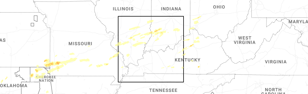
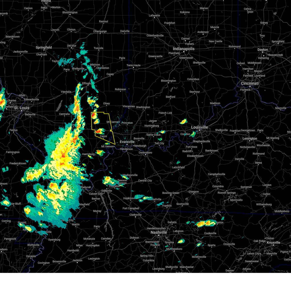
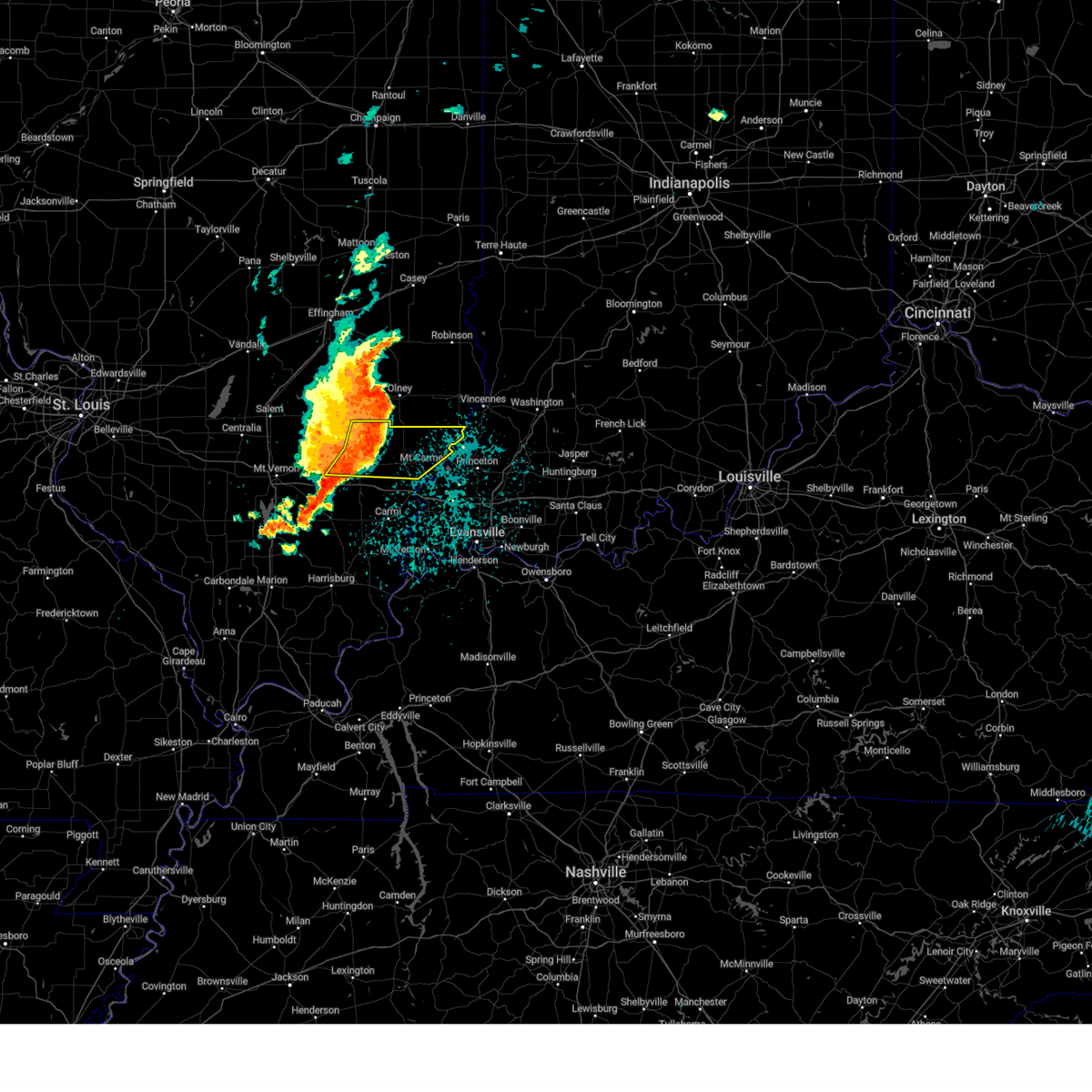
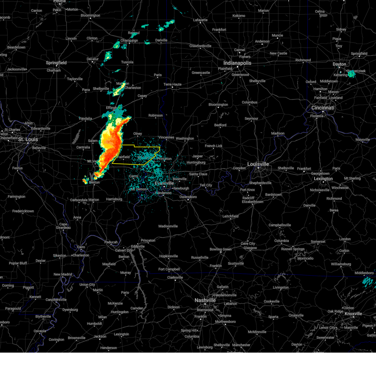
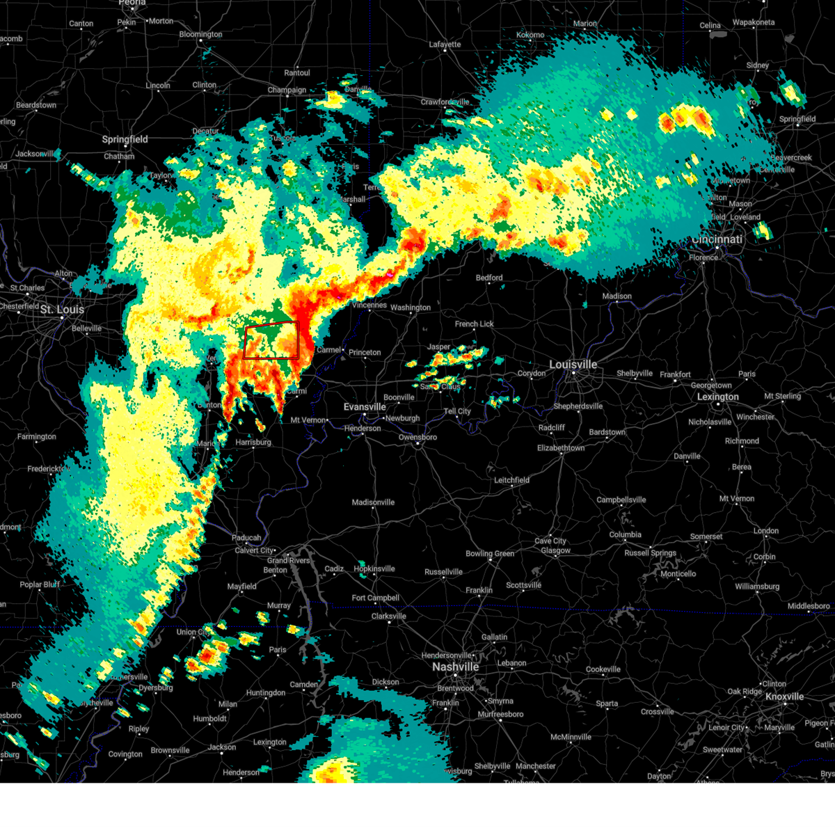
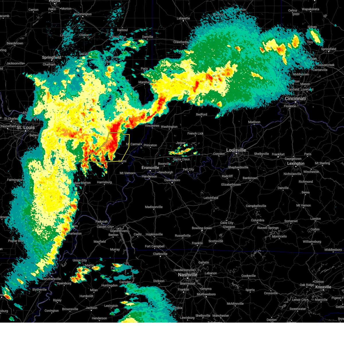
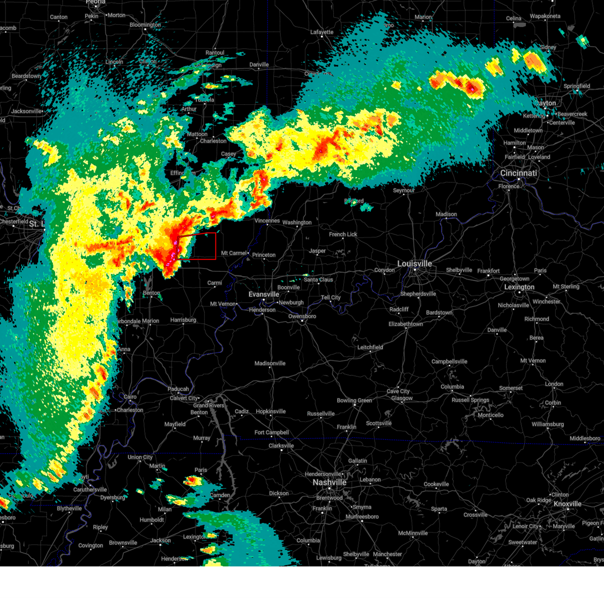
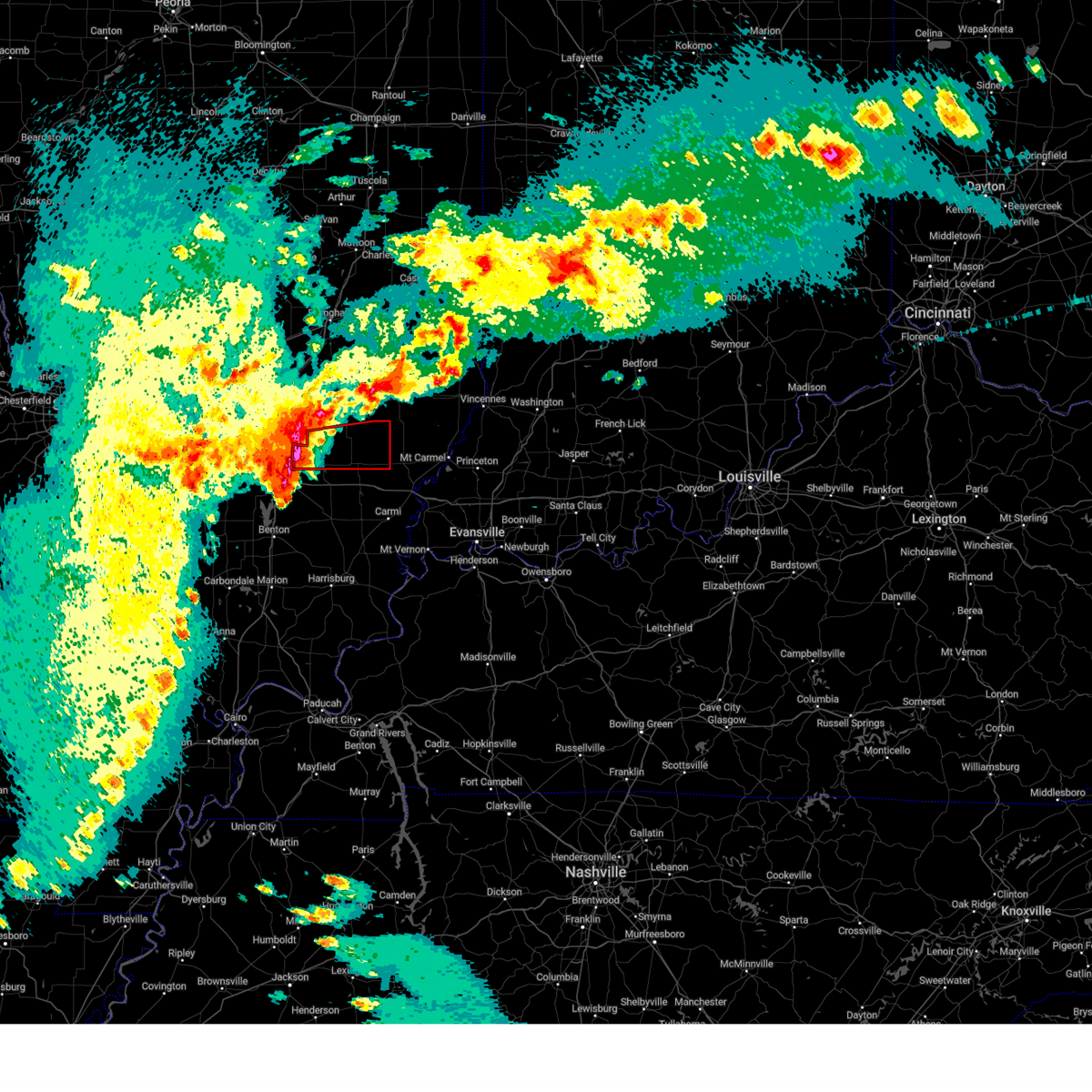
Hail Map for Golden Gate, IL
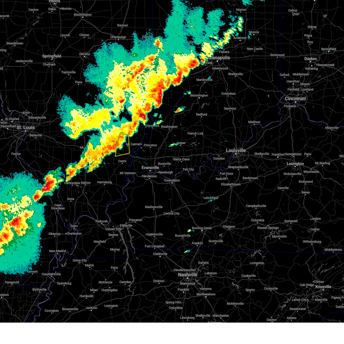
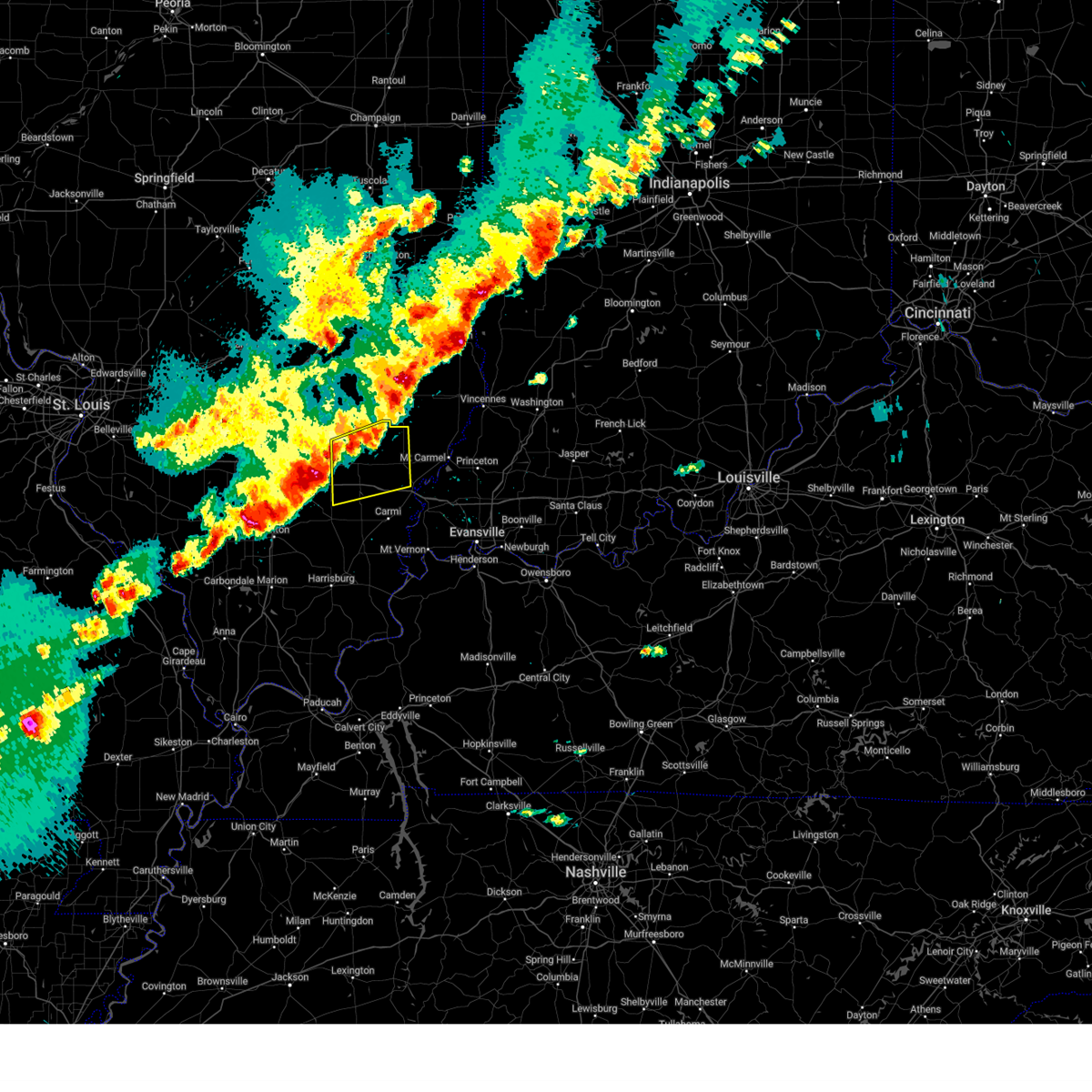
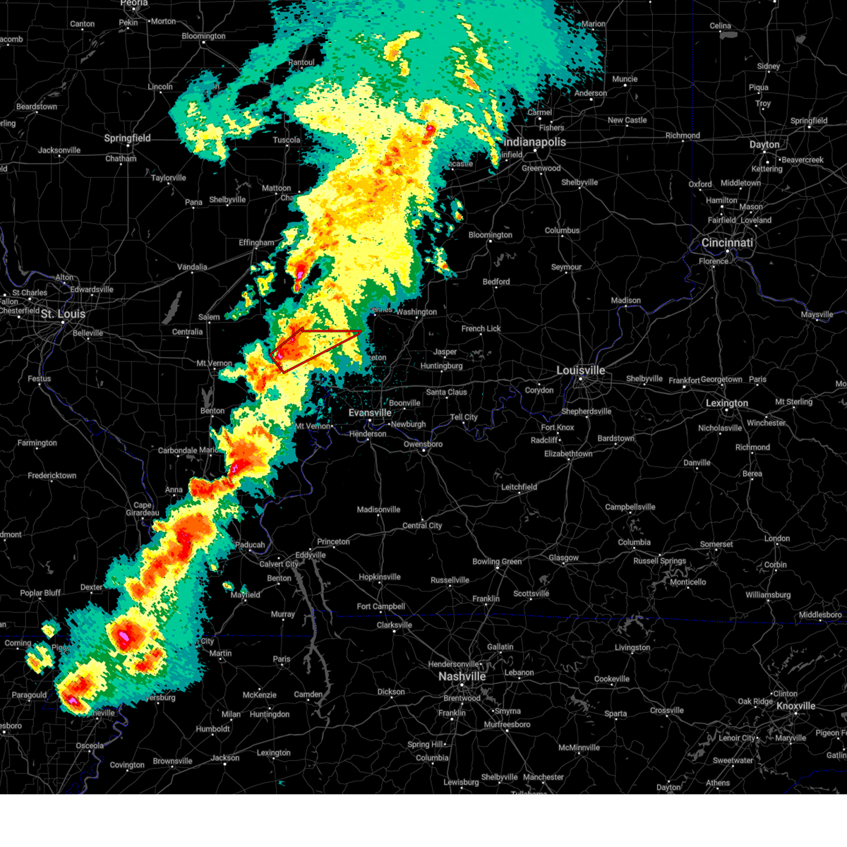
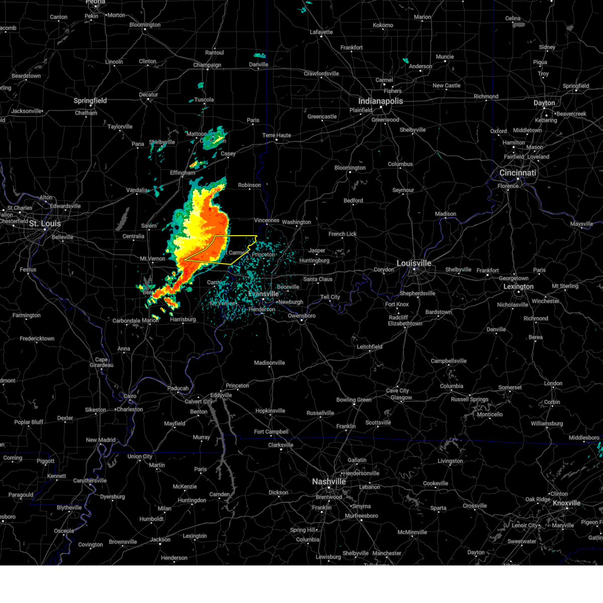
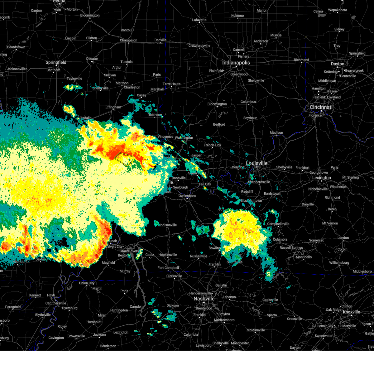
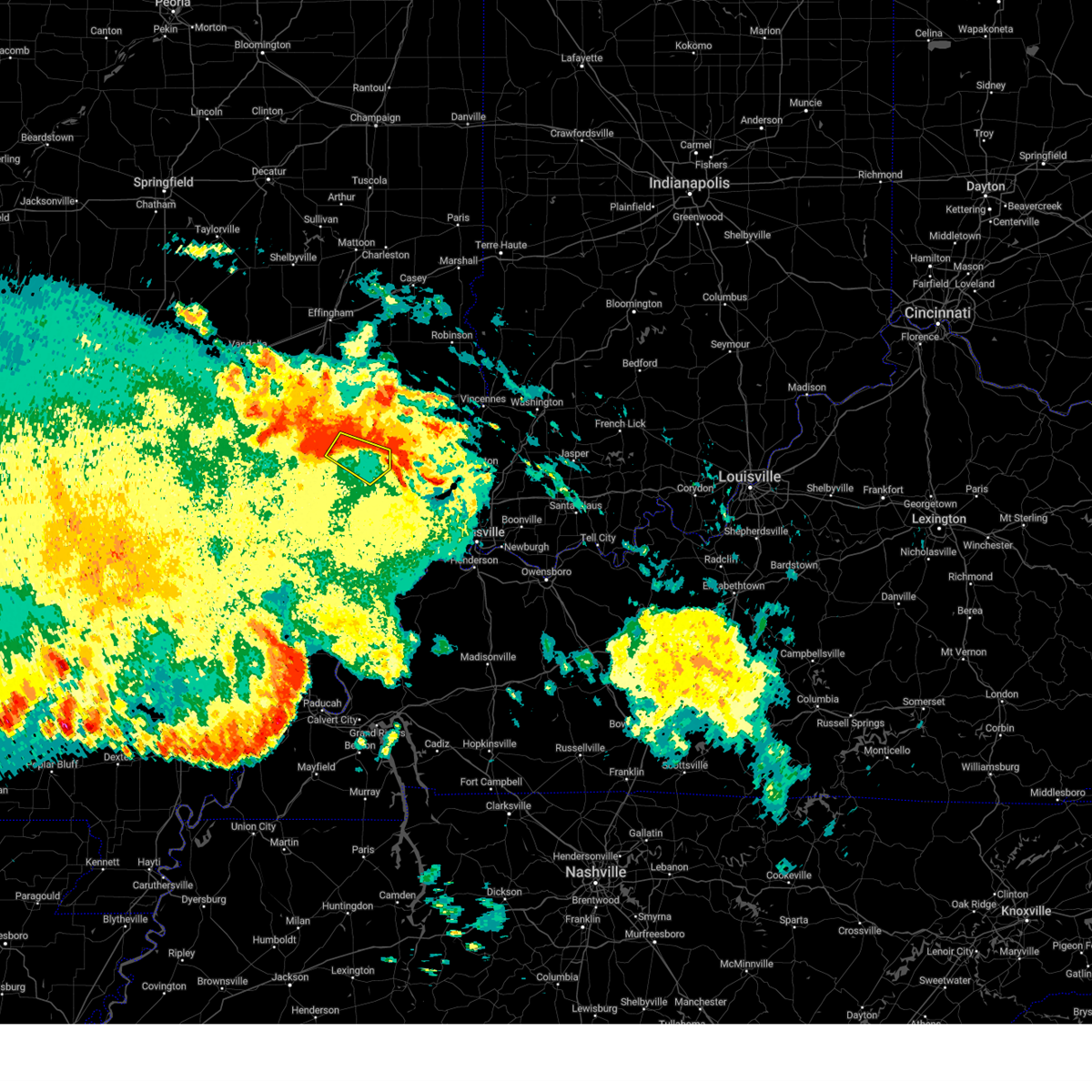
The Golden Gate, IL area has had 0 reports of on-the-ground hail by trained spotters, and has been under severe weather warnings 27 times during the past 12 months. Doppler radar has detected hail at or near Golden Gate, IL on 79 occasions, including 5 occasions during the past year.
| Name: | Golden Gate, IL |
| Where Located: | 43.7 miles NW of Evansville, IN |
| Map: | Google Map for Golden Gate, IL |
| Population: | 68 |
| Housing Units: | 43 |
| More Info: | Search Google for Golden Gate, IL |
2
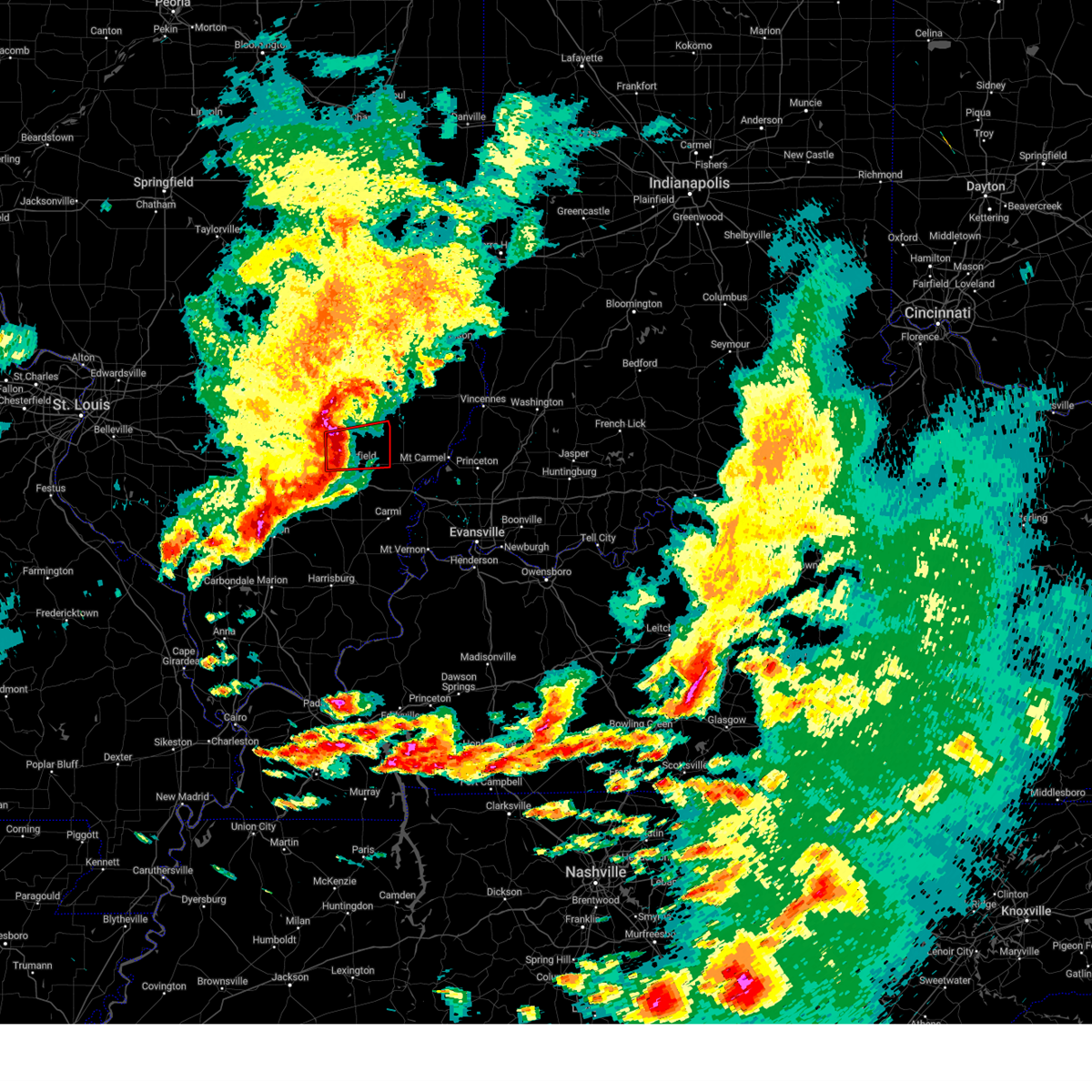
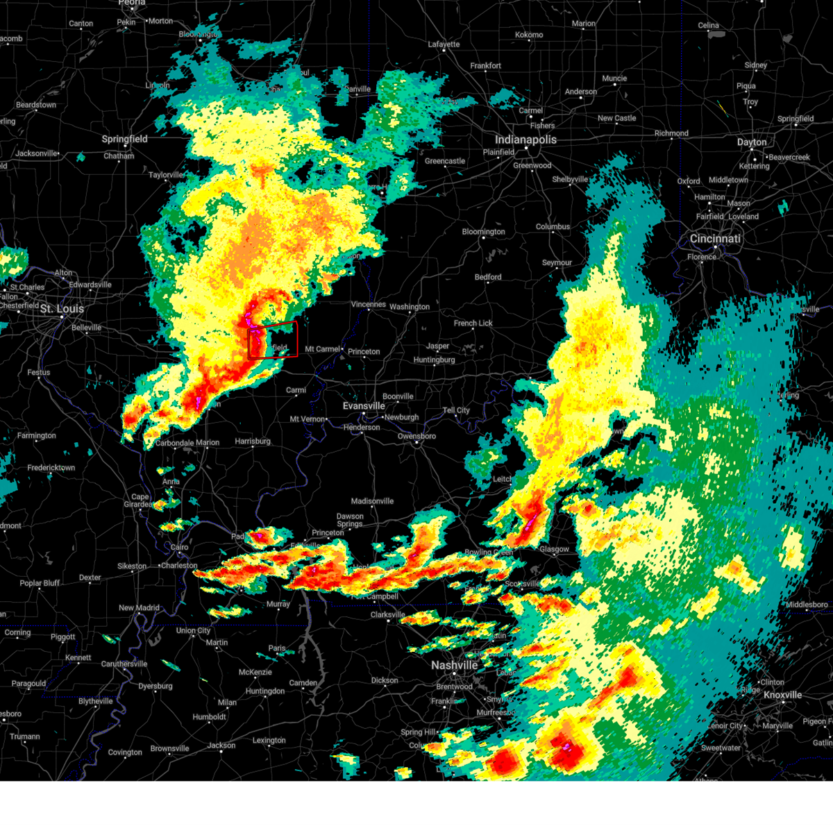
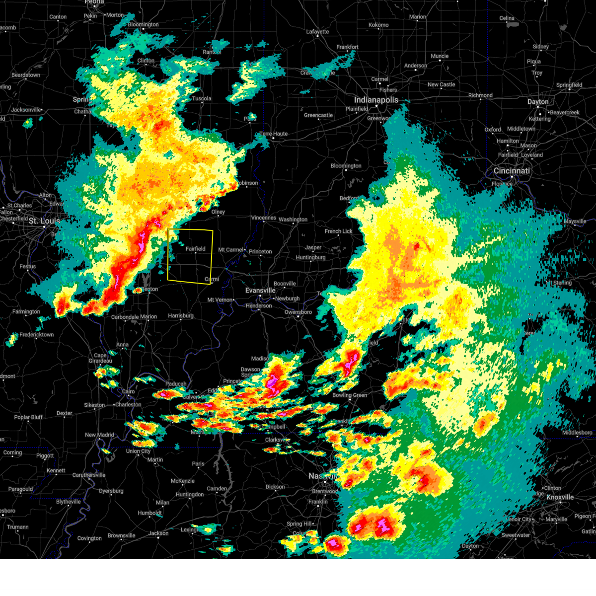
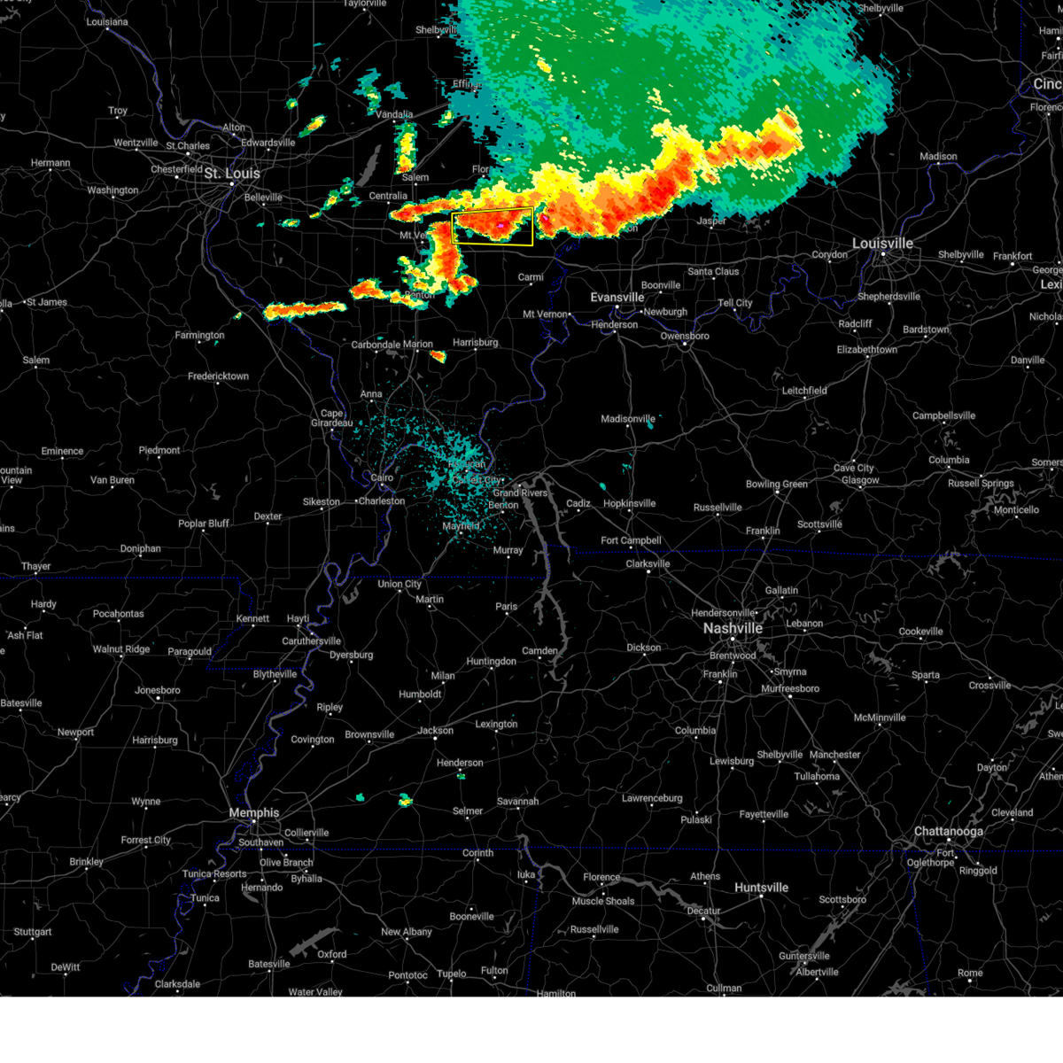
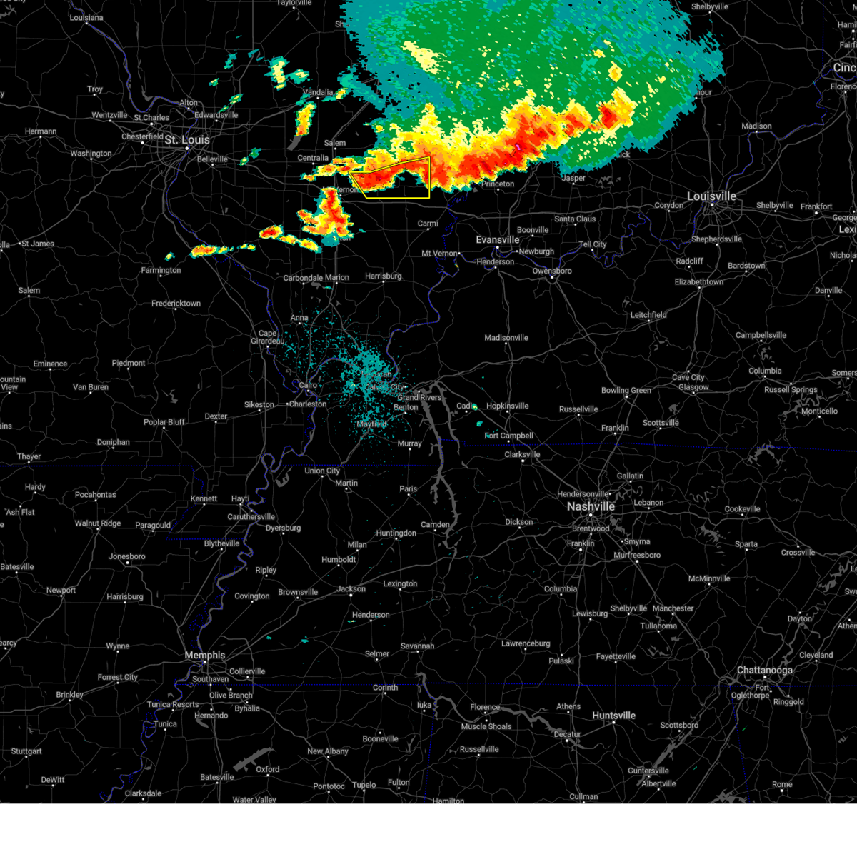
The Top Recent Hail Date for Golden Gate, IL is Tuesday, April 29, 2025 (26th out of 79)
Hail and Wind Damage Spotted near Golden Gate, IL
| Date / Time | Report Details |
|---|---|
| 4/29/2025 3:30 PM CDT | the tornado warning has been cancelled and is no longer in effect |
| 4/29/2025 3:27 PM CDT | the severe thunderstorm warning has been cancelled and is no longer in effect |
| 4/29/2025 3:27 PM CDT | At 327 pm cdt, severe thunderstorms were located along a line extending from near fairfield to 6 miles southwest of albion to near grayville, moving northeast at 50 mph (radar indicated). Hazards include 60 mph wind gusts. Expect damage to roofs, siding, and trees. locations impacted include, mount erie, jeffersonville, burnt prairie, mount carmel, browns, keensburg, grayville, lancaster, golden gate, mill shoals, bone gap, allendale, bellmont, albion, fairfield, and west salem. This includes interstate 64 in illinois between mile markers 107 and 121. |
| 4/29/2025 3:21 PM CDT | At 321 pm cdt, a severe thunderstorm capable of producing a tornado was located near fairfield, moving northeast at 45 mph (radar indicated rotation). Hazards include tornado. Flying debris will be dangerous to those caught without shelter. mobile homes will be damaged or destroyed. damage to roofs, windows, and vehicles will occur. tree damage is likely. This tornadic thunderstorm will remain over mainly rural areas of southeastern wayne county, including the following locations, mount erie and golden gate. |
| 4/29/2025 3:13 PM CDT |
 Torpah the national weather service in paducah has issued a * tornado warning for, southeastern wayne county in south central illinois, * until 345 pm cdt. * at 312 pm cdt, a severe thunderstorm capable of producing a tornado was located 7 miles southwest of fairfield, moving northeast at 45 mph (radar indicated rotation). Hazards include tornado. Flying debris will be dangerous to those caught without shelter. mobile homes will be damaged or destroyed. damage to roofs, windows, and vehicles will occur. tree damage is likely. this dangerous storm will be near, fairfield around 320 pm cdt. other locations impacted by this tornadic thunderstorm include mount erie and golden gate. This includes interstate 64 in illinois between mile markers 103 and 105. Torpah the national weather service in paducah has issued a * tornado warning for, southeastern wayne county in south central illinois, * until 345 pm cdt. * at 312 pm cdt, a severe thunderstorm capable of producing a tornado was located 7 miles southwest of fairfield, moving northeast at 45 mph (radar indicated rotation). Hazards include tornado. Flying debris will be dangerous to those caught without shelter. mobile homes will be damaged or destroyed. damage to roofs, windows, and vehicles will occur. tree damage is likely. this dangerous storm will be near, fairfield around 320 pm cdt. other locations impacted by this tornadic thunderstorm include mount erie and golden gate. This includes interstate 64 in illinois between mile markers 103 and 105.
|
| 4/29/2025 3:11 PM CDT |
 Svrpah the national weather service in paducah has issued a * severe thunderstorm warning for, northwestern white county in southeastern illinois, southern wayne county in south central illinois, wabash county in southeastern illinois, edwards county in southeastern illinois, northeastern hamilton county in south central illinois, * until 400 pm cdt. * at 311 pm cdt, severe thunderstorms were located along a line extending from near wayne city to 9 miles south of fairfield to near enfield, moving northeast at 50 mph (radar indicated). Hazards include 60 mph wind gusts. expect damage to roofs, siding, and trees Svrpah the national weather service in paducah has issued a * severe thunderstorm warning for, northwestern white county in southeastern illinois, southern wayne county in south central illinois, wabash county in southeastern illinois, edwards county in southeastern illinois, northeastern hamilton county in south central illinois, * until 400 pm cdt. * at 311 pm cdt, severe thunderstorms were located along a line extending from near wayne city to 9 miles south of fairfield to near enfield, moving northeast at 50 mph (radar indicated). Hazards include 60 mph wind gusts. expect damage to roofs, siding, and trees
|
| 4/10/2025 2:44 PM CDT |
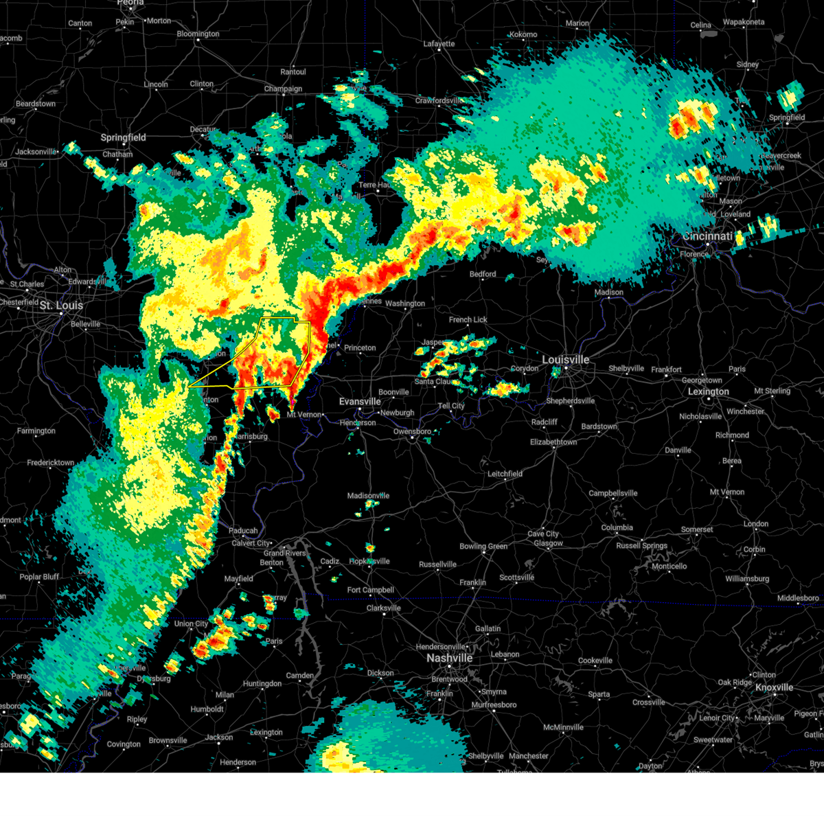
 At 244 pm cdt, severe thunderstorms were located along a line extending from 10 miles northwest of albion to 7 miles northwest of mount vernon, moving southeast at 15 mph (radar indicated). Hazards include 60 mph wind gusts and quarter size hail. Hail damage to vehicles is expected. expect wind damage to roofs, siding, and trees. locations impacted include, burnt prairie, browns, grayville, albion, maunie, golden gate, new harmony, phillipstown, crossville, and carmi. this includes the following highways, interstate 64 in indiana between mile markers 1 and 3. Interstate 64 in illinois between mile markers 114 and 130. At 244 pm cdt, severe thunderstorms were located along a line extending from 10 miles northwest of albion to 7 miles northwest of mount vernon, moving southeast at 15 mph (radar indicated). Hazards include 60 mph wind gusts and quarter size hail. Hail damage to vehicles is expected. expect wind damage to roofs, siding, and trees. locations impacted include, burnt prairie, browns, grayville, albion, maunie, golden gate, new harmony, phillipstown, crossville, and carmi. this includes the following highways, interstate 64 in indiana between mile markers 1 and 3. Interstate 64 in illinois between mile markers 114 and 130.
|
| 4/10/2025 2:30 PM CDT |
 At 229 pm cdt, severe thunderstorms were located along a line extending from near noble to near albion to near crossville, moving southeast at 30 mph (radar indicated). Hazards include 60 mph wind gusts and quarter size hail. Hail damage to vehicles is expected. expect wind damage to roofs, siding, and trees. locations impacted include, burnt prairie, browns, grayville, golden gate, phillipstown, carmi, albion, maunie, new harmony, crossville, bone gap, mount erie, and west salem. this includes the following highways, interstate 64 in indiana between mile markers 1 and 3. Interstate 64 in illinois between mile markers 114 and 130. At 229 pm cdt, severe thunderstorms were located along a line extending from near noble to near albion to near crossville, moving southeast at 30 mph (radar indicated). Hazards include 60 mph wind gusts and quarter size hail. Hail damage to vehicles is expected. expect wind damage to roofs, siding, and trees. locations impacted include, burnt prairie, browns, grayville, golden gate, phillipstown, carmi, albion, maunie, new harmony, crossville, bone gap, mount erie, and west salem. this includes the following highways, interstate 64 in indiana between mile markers 1 and 3. Interstate 64 in illinois between mile markers 114 and 130.
|
| 4/10/2025 2:12 PM CDT |
 Svrpah the national weather service in paducah has issued a * severe thunderstorm warning for, northern white county in southeastern illinois, eastern wayne county in south central illinois, southwestern wabash county in southeastern illinois, edwards county in southeastern illinois, northwestern posey county in southwestern indiana, * until 300 pm cdt. * at 212 pm cdt, severe thunderstorms were located along a line extending from near clay city to 6 miles northeast of fairfield to near carmi, moving southeast at 30 mph (radar indicated). Hazards include 60 mph wind gusts and quarter size hail. Hail damage to vehicles is expected. Expect wind damage to roofs, siding, and trees. Svrpah the national weather service in paducah has issued a * severe thunderstorm warning for, northern white county in southeastern illinois, eastern wayne county in south central illinois, southwestern wabash county in southeastern illinois, edwards county in southeastern illinois, northwestern posey county in southwestern indiana, * until 300 pm cdt. * at 212 pm cdt, severe thunderstorms were located along a line extending from near clay city to 6 miles northeast of fairfield to near carmi, moving southeast at 30 mph (radar indicated). Hazards include 60 mph wind gusts and quarter size hail. Hail damage to vehicles is expected. Expect wind damage to roofs, siding, and trees.
|
| 4/2/2025 7:39 PM CDT | Torpah the national weather service in paducah has issued a * tornado warning for, northern white county in southeastern illinois, eastern wayne county in south central illinois, wabash county in southeastern illinois, edwards county in southeastern illinois, central gibson county in southwestern indiana, north central posey county in southwestern indiana, * until 830 pm cdt. * at 739 pm cdt, severe thunderstorms capable of producing a tornado were located along a line extending from near parkersburg to 6 miles southwest of west salem to 9 miles southeast of fairfield, moving east at 40 mph (radar indicated rotation). Hazards include tornado. Flying debris will be dangerous to those caught without shelter. mobile homes will be damaged or destroyed. damage to roofs, windows, and vehicles will occur. tree damage is likely. these dangerous storms will be near, west salem and albion around 745 pm cdt. grayville and lancaster around 750 pm cdt. mount carmel around 800 pm cdt. patoka around 815 pm cdt. owensville around 820 pm cdt. other locations impacted by these tornadic storms include burnt prairie, allendale, browns, hazleton, keensburg, springerton, bellmont, griffin, golden gate, and phillipstown. this includes the following highways, interstate 64 in indiana between mile markers 1 and 13. Interstate 64 in illinois between mile markers 113 and 130. |
| 4/2/2025 7:31 PM CDT |
 At 731 pm cdt, severe thunderstorms were located along a line extending from 7 miles south of noble to 8 miles north of mcleansboro to near energy, moving east at 40 mph (radar indicated). Hazards include 60 mph wind gusts and quarter size hail. Hail damage to vehicles is expected. expect wind damage to roofs, siding, and trees. locations impacted include, enfield, whiteash, mount erie, jeffersonville, burnt prairie, spillertown, eldorado, cisne, browns, pittsburg, hanaford, golden gate, crainville, bone gap, energy, norris city, thompsonville, west salem, raleigh, and springerton. this includes the following highways, interstate 57 in illinois between mile markers 54 and 63. Interstate 64 in illinois between mile markers 94 and 126. At 731 pm cdt, severe thunderstorms were located along a line extending from 7 miles south of noble to 8 miles north of mcleansboro to near energy, moving east at 40 mph (radar indicated). Hazards include 60 mph wind gusts and quarter size hail. Hail damage to vehicles is expected. expect wind damage to roofs, siding, and trees. locations impacted include, enfield, whiteash, mount erie, jeffersonville, burnt prairie, spillertown, eldorado, cisne, browns, pittsburg, hanaford, golden gate, crainville, bone gap, energy, norris city, thompsonville, west salem, raleigh, and springerton. this includes the following highways, interstate 57 in illinois between mile markers 54 and 63. Interstate 64 in illinois between mile markers 94 and 126.
|
| 4/2/2025 7:31 PM CDT |
 the severe thunderstorm warning has been cancelled and is no longer in effect the severe thunderstorm warning has been cancelled and is no longer in effect
|
| 4/2/2025 7:25 PM CDT | At 725 pm cdt, a severe thunderstorm capable of producing a tornado was located near fairfield, moving east at 50 mph (radar indicated rotation). Hazards include tornado. Flying debris will be dangerous to those caught without shelter. mobile homes will be damaged or destroyed. damage to roofs, windows, and vehicles will occur. tree damage is likely. this tornadic thunderstorm will remain over mainly rural areas of northwestern white, wayne and northern hamilton counties, including the following locations, mount erie, jeffersonville, burnt prairie, belle prairie city, golden gate, sims, and mill shoals. This includes interstate 64 in illinois between mile markers 94 and 116. |
| 4/2/2025 7:25 PM CDT | the tornado warning has been cancelled and is no longer in effect |
| 4/2/2025 7:14 PM CDT | Svrpah the national weather service in paducah has issued a * severe thunderstorm warning for, western white county in southeastern illinois, wayne county in south central illinois, northwestern wabash county in southeastern illinois, southeastern jefferson county in south central illinois, edwards county in southeastern illinois, northern williamson county in southern illinois, northern saline county in southern illinois, hamilton county in south central illinois, eastern franklin county in south central illinois, * until 800 pm cdt. * at 714 pm cdt, severe thunderstorms were located along a line extending from near xenia to 7 miles south of bluford to carterville, moving east at 50 mph (radar indicated). Hazards include 70 mph wind gusts and quarter size hail. Hail damage to vehicles is expected. expect considerable tree damage. Wind damage is also likely to mobile homes, roofs, and outbuildings. |
| 4/2/2025 7:03 PM CDT |
 Torpah the national weather service in paducah has issued a * tornado warning for, northwestern white county in southeastern illinois, wayne county in south central illinois, northeastern jefferson county in south central illinois, northern hamilton county in south central illinois, * until 745 pm cdt. * at 702 pm cdt, a severe thunderstorm capable of producing a tornado was located over bluford, or 10 miles east of mount vernon, moving east at 50 mph (radar indicated rotation). Hazards include tornado. Flying debris will be dangerous to those caught without shelter. mobile homes will be damaged or destroyed. damage to roofs, windows, and vehicles will occur. tree damage is likely. this dangerous storm will be near, wayne city around 710 pm cdt. fairfield around 715 pm cdt. cisne around 720 pm cdt. other locations impacted by this tornadic thunderstorm include mount erie, jeffersonville, burnt prairie, belle rive, johnsonville, keenes, belle prairie city, golden gate, sims, and mill shoals. This includes interstate 64 in illinois between mile markers 85 and 116. Torpah the national weather service in paducah has issued a * tornado warning for, northwestern white county in southeastern illinois, wayne county in south central illinois, northeastern jefferson county in south central illinois, northern hamilton county in south central illinois, * until 745 pm cdt. * at 702 pm cdt, a severe thunderstorm capable of producing a tornado was located over bluford, or 10 miles east of mount vernon, moving east at 50 mph (radar indicated rotation). Hazards include tornado. Flying debris will be dangerous to those caught without shelter. mobile homes will be damaged or destroyed. damage to roofs, windows, and vehicles will occur. tree damage is likely. this dangerous storm will be near, wayne city around 710 pm cdt. fairfield around 715 pm cdt. cisne around 720 pm cdt. other locations impacted by this tornadic thunderstorm include mount erie, jeffersonville, burnt prairie, belle rive, johnsonville, keenes, belle prairie city, golden gate, sims, and mill shoals. This includes interstate 64 in illinois between mile markers 85 and 116.
|
| 3/30/2025 5:05 PM CDT |
 The storm which prompted the warning has weakened below severe limits, and no longer poses an immediate threat to life or property. therefore, the warning will be allowed to expire. a tornado watch remains in effect until 1100 pm cdt for south central and southeastern illinois. The storm which prompted the warning has weakened below severe limits, and no longer poses an immediate threat to life or property. therefore, the warning will be allowed to expire. a tornado watch remains in effect until 1100 pm cdt for south central and southeastern illinois.
|
| 3/30/2025 4:52 PM CDT |
 At 451 pm cdt, a severe thunderstorm was located 7 miles southwest of west salem, or 8 miles northwest of albion, moving northeast at 65 mph (radar indicated). Hazards include 60 mph wind gusts. Expect damage to roofs, siding, and trees. locations impacted include, mount erie, burnt prairie, albion, and golden gate. This includes interstate 64 in illinois between mile markers 114 and 122. At 451 pm cdt, a severe thunderstorm was located 7 miles southwest of west salem, or 8 miles northwest of albion, moving northeast at 65 mph (radar indicated). Hazards include 60 mph wind gusts. Expect damage to roofs, siding, and trees. locations impacted include, mount erie, burnt prairie, albion, and golden gate. This includes interstate 64 in illinois between mile markers 114 and 122.
|
| 3/30/2025 4:52 PM CDT |
 the severe thunderstorm warning has been cancelled and is no longer in effect the severe thunderstorm warning has been cancelled and is no longer in effect
|
| 3/30/2025 4:27 PM CDT |
 Svrpah the national weather service in paducah has issued a * severe thunderstorm warning for, northwestern white county in southeastern illinois, wayne county in south central illinois, edwards county in southeastern illinois, northeastern hamilton county in south central illinois, * until 515 pm cdt. * at 427 pm cdt, a severe thunderstorm was located over wayne city, or 12 miles west of fairfield, moving northeast at 65 mph (radar indicated). Hazards include golf ball size hail and 60 mph wind gusts. People and animals outdoors will be injured. expect hail damage to roofs, siding, windows, and vehicles. Expect wind damage to roofs, siding, and trees. Svrpah the national weather service in paducah has issued a * severe thunderstorm warning for, northwestern white county in southeastern illinois, wayne county in south central illinois, edwards county in southeastern illinois, northeastern hamilton county in south central illinois, * until 515 pm cdt. * at 427 pm cdt, a severe thunderstorm was located over wayne city, or 12 miles west of fairfield, moving northeast at 65 mph (radar indicated). Hazards include golf ball size hail and 60 mph wind gusts. People and animals outdoors will be injured. expect hail damage to roofs, siding, windows, and vehicles. Expect wind damage to roofs, siding, and trees.
|
| 3/15/2025 1:35 AM CDT |
 Torpah the national weather service in paducah has issued a * tornado warning for, southeastern wayne county in south central illinois, northwestern wabash county in southeastern illinois, northern edwards county in southeastern illinois, * until 215 am cdt. * at 135 am cdt, a severe thunderstorm capable of producing a tornado was located near fairfield, moving northeast at 65 mph (radar indicated rotation). Hazards include tornado and quarter size hail. Flying debris will be dangerous to those caught without shelter. mobile homes will be damaged or destroyed. damage to roofs, windows, and vehicles will occur. tree damage is likely. this dangerous storm will be near, west salem around 145 am cdt. lancaster around 150 am cdt. Other locations impacted by this tornadic thunderstorm include mount erie, bone gap, and golden gate. Torpah the national weather service in paducah has issued a * tornado warning for, southeastern wayne county in south central illinois, northwestern wabash county in southeastern illinois, northern edwards county in southeastern illinois, * until 215 am cdt. * at 135 am cdt, a severe thunderstorm capable of producing a tornado was located near fairfield, moving northeast at 65 mph (radar indicated rotation). Hazards include tornado and quarter size hail. Flying debris will be dangerous to those caught without shelter. mobile homes will be damaged or destroyed. damage to roofs, windows, and vehicles will occur. tree damage is likely. this dangerous storm will be near, west salem around 145 am cdt. lancaster around 150 am cdt. Other locations impacted by this tornadic thunderstorm include mount erie, bone gap, and golden gate.
|
| 3/15/2025 1:31 AM CDT | the severe thunderstorm warning has been cancelled and is no longer in effect |
| 3/15/2025 1:31 AM CDT | At 131 am cdt, a severe thunderstorm was located near fairfield, moving northeast at 65 mph (radar indicated). Hazards include 60 mph wind gusts. Expect damage to roofs, siding, and trees. locations impacted include, burnt prairie, browns, keensburg, bellmont, grayville, albion, golden gate, fairfield, west salem, mill shoals, and bone gap. This includes interstate 64 in illinois between mile markers 105 and 125. |
| 3/15/2025 1:18 AM CDT | Svrpah the national weather service in paducah has issued a * severe thunderstorm warning for, northwestern white county in southeastern illinois, southeastern wayne county in south central illinois, southwestern wabash county in southeastern illinois, edwards county in southeastern illinois, northeastern hamilton county in south central illinois, * until 215 am cdt. * at 117 am cdt, a severe thunderstorm was located 7 miles north of mcleansboro, moving northeast at 65 mph (radar indicated). Hazards include 60 mph wind gusts. expect damage to roofs, siding, and trees |
| 8/1/2024 1:04 PM CDT |
 At 104 pm cdt, severe thunderstorms were located along a line extending from lancaster to 6 miles southeast of west salem to near grayville, moving east at 40 mph (law enforcement). Hazards include 60 mph wind gusts. Expect damage to roofs, siding, and trees. Locations impacted include, mount carmel, fairfield, albion, lancaster, west salem, allendale, bellmont, bone gap, browns, and golden gate. At 104 pm cdt, severe thunderstorms were located along a line extending from lancaster to 6 miles southeast of west salem to near grayville, moving east at 40 mph (law enforcement). Hazards include 60 mph wind gusts. Expect damage to roofs, siding, and trees. Locations impacted include, mount carmel, fairfield, albion, lancaster, west salem, allendale, bellmont, bone gap, browns, and golden gate.
|
| 8/1/2024 12:42 PM CDT |
 At 1242 pm cdt, severe thunderstorms were located along a line extending from near parkersburg to 7 miles northwest of albion to 6 miles southeast of fairfield, moving east at 45 mph (law enforcement). Hazards include 60 mph wind gusts. Expect damage to roofs, siding, and trees. Locations impacted include, mount carmel, fairfield, albion, lancaster, west salem, cisne, allendale, jeffersonville, bellmont, sims, bone gap, browns, mount erie, and golden gate. At 1242 pm cdt, severe thunderstorms were located along a line extending from near parkersburg to 7 miles northwest of albion to 6 miles southeast of fairfield, moving east at 45 mph (law enforcement). Hazards include 60 mph wind gusts. Expect damage to roofs, siding, and trees. Locations impacted include, mount carmel, fairfield, albion, lancaster, west salem, cisne, allendale, jeffersonville, bellmont, sims, bone gap, browns, mount erie, and golden gate.
|
| 8/1/2024 12:26 PM CDT |
 Svrpah the national weather service in paducah has issued a * severe thunderstorm warning for, eastern wayne county in south central illinois, wabash county in southeastern illinois, edwards county in southeastern illinois, * until 115 pm cdt. * at 1225 pm cdt, severe thunderstorms were located along a line extending from 6 miles south of clay city to near cisne to near wayne city, moving east at 40 mph (radar indicated). Hazards include 60 mph wind gusts. expect damage to roofs, siding, and trees Svrpah the national weather service in paducah has issued a * severe thunderstorm warning for, eastern wayne county in south central illinois, wabash county in southeastern illinois, edwards county in southeastern illinois, * until 115 pm cdt. * at 1225 pm cdt, severe thunderstorms were located along a line extending from 6 miles south of clay city to near cisne to near wayne city, moving east at 40 mph (radar indicated). Hazards include 60 mph wind gusts. expect damage to roofs, siding, and trees
|
| 5/26/2024 8:30 PM CDT |
 the severe thunderstorm warning has been cancelled and is no longer in effect the severe thunderstorm warning has been cancelled and is no longer in effect
|
| 5/26/2024 8:21 PM CDT |
 the severe thunderstorm warning has been cancelled and is no longer in effect the severe thunderstorm warning has been cancelled and is no longer in effect
|
| 5/26/2024 8:21 PM CDT |
 At 821 pm cdt, severe thunderstorms were located along a line extending from 8 miles northeast of fairfield to near mcleansboro to near pittsburg, moving east at 45 mph (radar indicated). Hazards include 70 mph wind gusts and quarter size hail. Hail damage to vehicles is expected. expect considerable tree damage. wind damage is also likely to mobile homes, roofs, and outbuildings. locations impacted include, fairfield, mcleansboro, norris city, enfield, mill shoals, broughton, springerton, mount erie, golden gate, and burnt prairie. This includes interstate 64 in illinois between mile markers 105 and 120. At 821 pm cdt, severe thunderstorms were located along a line extending from 8 miles northeast of fairfield to near mcleansboro to near pittsburg, moving east at 45 mph (radar indicated). Hazards include 70 mph wind gusts and quarter size hail. Hail damage to vehicles is expected. expect considerable tree damage. wind damage is also likely to mobile homes, roofs, and outbuildings. locations impacted include, fairfield, mcleansboro, norris city, enfield, mill shoals, broughton, springerton, mount erie, golden gate, and burnt prairie. This includes interstate 64 in illinois between mile markers 105 and 120.
|
| 5/26/2024 7:59 PM CDT |
 At 759 pm cdt, severe thunderstorms were located along a line extending from near cisne to 10 miles west of mcleansboro to near zeigler, moving southeast at 45 mph (radar indicated). Hazards include 70 mph wind gusts and quarter size hail. Hail damage to vehicles is expected. expect considerable tree damage. wind damage is also likely to mobile homes, roofs, and outbuildings. locations impacted include, west frankfort, benton, fairfield, mcleansboro, zeigler, norris city, wayne city, cisne, enfield, thompsonville, dahlgren, jeffersonville, orient, hanaford, freeman spur, sims, mill shoals, broughton, springerton, and mount erie. this includes the following highways, interstate 57 in illinois between mile markers 62 and 71. Interstate 64 in illinois between mile markers 92 and 120. At 759 pm cdt, severe thunderstorms were located along a line extending from near cisne to 10 miles west of mcleansboro to near zeigler, moving southeast at 45 mph (radar indicated). Hazards include 70 mph wind gusts and quarter size hail. Hail damage to vehicles is expected. expect considerable tree damage. wind damage is also likely to mobile homes, roofs, and outbuildings. locations impacted include, west frankfort, benton, fairfield, mcleansboro, zeigler, norris city, wayne city, cisne, enfield, thompsonville, dahlgren, jeffersonville, orient, hanaford, freeman spur, sims, mill shoals, broughton, springerton, and mount erie. this includes the following highways, interstate 57 in illinois between mile markers 62 and 71. Interstate 64 in illinois between mile markers 92 and 120.
|
| 5/26/2024 7:39 PM CDT |
 Svrpah the national weather service in paducah has issued a * severe thunderstorm warning for, northwestern white county in southeastern illinois, wayne county in south central illinois, hamilton county in south central illinois, eastern franklin county in south central illinois, * until 900 pm cdt. * at 738 pm cdt, severe thunderstorms were located along a line extending from 7 miles west of helm to 7 miles south of woodlawn to elkville, moving southeast at 45 mph (radar indicated). Hazards include 60 mph wind gusts and quarter size hail. Hail damage to vehicles is expected. Expect wind damage to roofs, siding, and trees. Svrpah the national weather service in paducah has issued a * severe thunderstorm warning for, northwestern white county in southeastern illinois, wayne county in south central illinois, hamilton county in south central illinois, eastern franklin county in south central illinois, * until 900 pm cdt. * at 738 pm cdt, severe thunderstorms were located along a line extending from 7 miles west of helm to 7 miles south of woodlawn to elkville, moving southeast at 45 mph (radar indicated). Hazards include 60 mph wind gusts and quarter size hail. Hail damage to vehicles is expected. Expect wind damage to roofs, siding, and trees.
|
| 5/8/2024 8:06 PM CDT |
 The storms which prompted the warning have weakened below severe limits, and have exited the warned area. therefore, the warning will be allowed to expire. a tornado watch remains in effect until midnight cdt for south central illinois. remember, a severe thunderstorm warning still remains in effect for parts of the area. The storms which prompted the warning have weakened below severe limits, and have exited the warned area. therefore, the warning will be allowed to expire. a tornado watch remains in effect until midnight cdt for south central illinois. remember, a severe thunderstorm warning still remains in effect for parts of the area.
|
| 5/8/2024 8:01 PM CDT |
 At 801 pm cdt, severe thunderstorms capable of producing tornadoes were located along a line extending from 8 miles west of parkersburg to 7 miles southwest of albion, moving east at 45 mph (radar indicated rotation). Hazards include tornado and ping pong ball size hail. Flying debris will be dangerous to those caught without shelter. mobile homes will be damaged or destroyed. damage to roofs, windows, and vehicles will occur. tree damage is likely. These tornadic storms will remain over mainly rural areas of northeastern wayne county, including the following locations, mount erie and golden gate. At 801 pm cdt, severe thunderstorms capable of producing tornadoes were located along a line extending from 8 miles west of parkersburg to 7 miles southwest of albion, moving east at 45 mph (radar indicated rotation). Hazards include tornado and ping pong ball size hail. Flying debris will be dangerous to those caught without shelter. mobile homes will be damaged or destroyed. damage to roofs, windows, and vehicles will occur. tree damage is likely. These tornadic storms will remain over mainly rural areas of northeastern wayne county, including the following locations, mount erie and golden gate.
|
| 5/8/2024 7:50 PM CDT |
 At 749 pm cdt, severe thunderstorms were located along a line extending from 7 miles east of cisne to 9 miles northwest of enfield, moving east at 65 mph (trained weather spotters). Hazards include 70 mph wind gusts. Expect considerable tree damage. damage is likely to mobile homes, roofs, and outbuildings. locations impacted include, carmi, fairfield, wayne city, cisne, enfield, dahlgren, jeffersonville, sims, mill shoals, springerton, mount erie, johnsonville, golden gate, belle prairie city, and burnt prairie. This includes interstate 64 in illinois between mile markers 94 and 120. At 749 pm cdt, severe thunderstorms were located along a line extending from 7 miles east of cisne to 9 miles northwest of enfield, moving east at 65 mph (trained weather spotters). Hazards include 70 mph wind gusts. Expect considerable tree damage. damage is likely to mobile homes, roofs, and outbuildings. locations impacted include, carmi, fairfield, wayne city, cisne, enfield, dahlgren, jeffersonville, sims, mill shoals, springerton, mount erie, johnsonville, golden gate, belle prairie city, and burnt prairie. This includes interstate 64 in illinois between mile markers 94 and 120.
|
| 5/8/2024 7:43 PM CDT |
 the tornado warning has been cancelled and is no longer in effect the tornado warning has been cancelled and is no longer in effect
|
| 5/8/2024 7:43 PM CDT |
 At 743 pm cdt, severe thunderstorms capable of producing tornadoes were located along a line extending from near cisne to near fairfield, moving east at 60 mph (radar indicated rotation). Hazards include tornado and ping pong ball size hail. Flying debris will be dangerous to those caught without shelter. mobile homes will be damaged or destroyed. damage to roofs, windows, and vehicles will occur. tree damage is likely. these dangerous storms will be near, fairfield around 750 pm cdt. Other locations impacted by these tornadic storms include mount erie, jeffersonville, johnsonville, golden gate, and sims. At 743 pm cdt, severe thunderstorms capable of producing tornadoes were located along a line extending from near cisne to near fairfield, moving east at 60 mph (radar indicated rotation). Hazards include tornado and ping pong ball size hail. Flying debris will be dangerous to those caught without shelter. mobile homes will be damaged or destroyed. damage to roofs, windows, and vehicles will occur. tree damage is likely. these dangerous storms will be near, fairfield around 750 pm cdt. Other locations impacted by these tornadic storms include mount erie, jeffersonville, johnsonville, golden gate, and sims.
|
| 5/8/2024 7:27 PM CDT |
 Torpah the national weather service in paducah has issued a * tornado warning for, wayne county in south central illinois, northeastern jefferson county in south central illinois, * until 815 pm cdt. * at 727 pm cdt, a severe thunderstorm capable of producing a tornado was located near helm, or 14 miles northeast of mount vernon, moving east at 55 mph (radar indicated rotation). Hazards include tornado. Flying debris will be dangerous to those caught without shelter. mobile homes will be damaged or destroyed. damage to roofs, windows, and vehicles will occur. tree damage is likely. this dangerous storm will be near, wayne city around 730 pm cdt. fairfield and cisne around 735 pm cdt. Other locations impacted by this tornadic thunderstorm include mount erie, jeffersonville, johnsonville, keenes, golden gate, and sims. Torpah the national weather service in paducah has issued a * tornado warning for, wayne county in south central illinois, northeastern jefferson county in south central illinois, * until 815 pm cdt. * at 727 pm cdt, a severe thunderstorm capable of producing a tornado was located near helm, or 14 miles northeast of mount vernon, moving east at 55 mph (radar indicated rotation). Hazards include tornado. Flying debris will be dangerous to those caught without shelter. mobile homes will be damaged or destroyed. damage to roofs, windows, and vehicles will occur. tree damage is likely. this dangerous storm will be near, wayne city around 730 pm cdt. fairfield and cisne around 735 pm cdt. Other locations impacted by this tornadic thunderstorm include mount erie, jeffersonville, johnsonville, keenes, golden gate, and sims.
|
| 5/8/2024 7:15 PM CDT |
 Svrpah the national weather service in paducah has issued a * severe thunderstorm warning for, northwestern white county in southeastern illinois, wayne county in south central illinois, northern hamilton county in south central illinois, * until 815 pm cdt. * at 715 pm cdt, severe thunderstorms were located along a line extending from near salem to near woodlawn, moving east at 55 mph (radar indicated). Hazards include 70 mph wind gusts. Expect considerable tree damage. Damage is likely to mobile homes, roofs, and outbuildings. Svrpah the national weather service in paducah has issued a * severe thunderstorm warning for, northwestern white county in southeastern illinois, wayne county in south central illinois, northern hamilton county in south central illinois, * until 815 pm cdt. * at 715 pm cdt, severe thunderstorms were located along a line extending from near salem to near woodlawn, moving east at 55 mph (radar indicated). Hazards include 70 mph wind gusts. Expect considerable tree damage. Damage is likely to mobile homes, roofs, and outbuildings.
|
| 4/18/2024 8:22 PM CDT |
 At 822 pm cdt, severe thunderstorms were located along a line extending from 9 miles southwest of parkersburg to near thompsonville, moving east at 50 mph (radar indicated). Hazards include 60 mph wind gusts. Expect damage to roofs, siding, and trees. locations impacted include, west frankfort, fairfield, mcleansboro, wayne city, cisne, thompsonville, dahlgren, jeffersonville, hanaford, freeman spur, sims, mill shoals, broughton, mount erie, golden gate, macedonia, and belle prairie city. this includes the following highways, interstate 57 in illinois between mile markers 62 and 66. Interstate 64 in illinois between mile markers 94 and 116. At 822 pm cdt, severe thunderstorms were located along a line extending from 9 miles southwest of parkersburg to near thompsonville, moving east at 50 mph (radar indicated). Hazards include 60 mph wind gusts. Expect damage to roofs, siding, and trees. locations impacted include, west frankfort, fairfield, mcleansboro, wayne city, cisne, thompsonville, dahlgren, jeffersonville, hanaford, freeman spur, sims, mill shoals, broughton, mount erie, golden gate, macedonia, and belle prairie city. this includes the following highways, interstate 57 in illinois between mile markers 62 and 66. Interstate 64 in illinois between mile markers 94 and 116.
|
| 4/18/2024 8:22 PM CDT |
 the severe thunderstorm warning has been cancelled and is no longer in effect the severe thunderstorm warning has been cancelled and is no longer in effect
|
| 4/18/2024 8:13 PM CDT |
 At 813 pm cdt, severe thunderstorms were located along a line extending from near cisne to near benton, moving east at 45 mph (radar indicated). Hazards include 70 mph wind gusts. Expect considerable tree damage. damage is likely to mobile homes, roofs, and outbuildings. locations impacted include, west frankfort, benton, du quoin, fairfield, mcleansboro, christopher, rend lake area, sesser, zeigler, royalton, wayne city, elkville, bluford, cisne, valier, west city, ava, thompsonville, ina, and north city. this includes the following highways, interstate 57 in illinois between mile markers 62 and 86. Interstate 64 in illinois between mile markers 83 and 116. At 813 pm cdt, severe thunderstorms were located along a line extending from near cisne to near benton, moving east at 45 mph (radar indicated). Hazards include 70 mph wind gusts. Expect considerable tree damage. damage is likely to mobile homes, roofs, and outbuildings. locations impacted include, west frankfort, benton, du quoin, fairfield, mcleansboro, christopher, rend lake area, sesser, zeigler, royalton, wayne city, elkville, bluford, cisne, valier, west city, ava, thompsonville, ina, and north city. this includes the following highways, interstate 57 in illinois between mile markers 62 and 86. Interstate 64 in illinois between mile markers 83 and 116.
|
| 4/18/2024 7:52 PM CDT |
 At 751 pm cdt, severe thunderstorms were located along a line extending from 6 miles north of wayne city to near christopher, moving east at 55 mph (radar indicated). Hazards include 70 mph wind gusts. Expect considerable tree damage. damage is likely to mobile homes, roofs, and outbuildings. locations impacted include, mount vernon, west frankfort, benton, du quoin, pinckneyville, fairfield, mcleansboro, christopher, rend lake area, sesser, zeigler, royalton, wayne city, elkville, woodlawn, bluford, cisne, valier, west city, and ava. this includes the following highways, interstate 57 in illinois between mile markers 62 and 105. Interstate 64 in illinois between mile markers 63 and 116. At 751 pm cdt, severe thunderstorms were located along a line extending from 6 miles north of wayne city to near christopher, moving east at 55 mph (radar indicated). Hazards include 70 mph wind gusts. Expect considerable tree damage. damage is likely to mobile homes, roofs, and outbuildings. locations impacted include, mount vernon, west frankfort, benton, du quoin, pinckneyville, fairfield, mcleansboro, christopher, rend lake area, sesser, zeigler, royalton, wayne city, elkville, woodlawn, bluford, cisne, valier, west city, and ava. this includes the following highways, interstate 57 in illinois between mile markers 62 and 105. Interstate 64 in illinois between mile markers 63 and 116.
|
| 4/18/2024 7:28 PM CDT |
 Svrpah the national weather service in paducah has issued a * severe thunderstorm warning for, perry county in south central illinois, wayne county in south central illinois, jefferson county in south central illinois, northern jackson county in southern illinois, hamilton county in south central illinois, franklin county in south central illinois, * until 845 pm cdt. * at 727 pm cdt, severe thunderstorms were located along a line extending from near centralia to near willisville, moving east at 50 mph (trained weather spotters. these storms have a history of widespread wind damage). Hazards include 70 mph wind gusts. Expect considerable tree damage. Damage is likely to mobile homes, roofs, and outbuildings. Svrpah the national weather service in paducah has issued a * severe thunderstorm warning for, perry county in south central illinois, wayne county in south central illinois, jefferson county in south central illinois, northern jackson county in southern illinois, hamilton county in south central illinois, franklin county in south central illinois, * until 845 pm cdt. * at 727 pm cdt, severe thunderstorms were located along a line extending from near centralia to near willisville, moving east at 50 mph (trained weather spotters. these storms have a history of widespread wind damage). Hazards include 70 mph wind gusts. Expect considerable tree damage. Damage is likely to mobile homes, roofs, and outbuildings.
|
| 4/2/2024 5:14 AM CDT |
 At 513 am cdt, severe thunderstorms were located along a line from fairfield to broughton, moving east at 60 mph (radar indicated). Hazards include 60 mph wind gusts. Expect damage to roofs, siding, and trees. locations impacted include, mount vernon, carmi, fairfield, albion, grayville, norris city, new harmony, crossville, enfield, bellmont, bone gap, mill shoals, keensburg, broughton, griffin, maunie, browns, springerton, golden gate, and burnt prairie. this includes the following highways, interstate 64 in indiana between mile markers 1 and 10. Interstate 64 in illinois between mile markers 108 and 130. At 513 am cdt, severe thunderstorms were located along a line from fairfield to broughton, moving east at 60 mph (radar indicated). Hazards include 60 mph wind gusts. Expect damage to roofs, siding, and trees. locations impacted include, mount vernon, carmi, fairfield, albion, grayville, norris city, new harmony, crossville, enfield, bellmont, bone gap, mill shoals, keensburg, broughton, griffin, maunie, browns, springerton, golden gate, and burnt prairie. this includes the following highways, interstate 64 in indiana between mile markers 1 and 10. Interstate 64 in illinois between mile markers 108 and 130.
|
| 4/2/2024 4:57 AM CDT |
 Svrpah the national weather service in paducah has issued a * severe thunderstorm warning for, white county in southeastern illinois, southern wayne county in south central illinois, southwestern wabash county in southeastern illinois, edwards county in southeastern illinois, hamilton county in south central illinois, southwestern gibson county in southwestern indiana, northwestern posey county in southwestern indiana, * until 545 am cdt. * at 457 am cdt, severe thunderstorms were located along a line extending from near cisne to near galatia, moving east at 60 mph (radar indicated). Hazards include 60 mph wind gusts. expect damage to roofs, siding, and trees Svrpah the national weather service in paducah has issued a * severe thunderstorm warning for, white county in southeastern illinois, southern wayne county in south central illinois, southwestern wabash county in southeastern illinois, edwards county in southeastern illinois, hamilton county in south central illinois, southwestern gibson county in southwestern indiana, northwestern posey county in southwestern indiana, * until 545 am cdt. * at 457 am cdt, severe thunderstorms were located along a line extending from near cisne to near galatia, moving east at 60 mph (radar indicated). Hazards include 60 mph wind gusts. expect damage to roofs, siding, and trees
|
| 4/2/2024 4:20 AM CDT |
 At 419 am cdt, a severe thunderstorm was located near albion, moving east at 35 mph (radar indicated). Hazards include 60 mph wind gusts and nickel size hail. Expect damage to roofs, siding, and trees. locations impacted include, albion, grayville, lancaster, west salem, bellmont, bone gap, keensburg, browns, and golden gate. This includes interstate 64 in illinois between mile markers 108 and 115. At 419 am cdt, a severe thunderstorm was located near albion, moving east at 35 mph (radar indicated). Hazards include 60 mph wind gusts and nickel size hail. Expect damage to roofs, siding, and trees. locations impacted include, albion, grayville, lancaster, west salem, bellmont, bone gap, keensburg, browns, and golden gate. This includes interstate 64 in illinois between mile markers 108 and 115.
|
| 4/2/2024 4:18 AM CDT |
 Torpah the national weather service in paducah has issued a * tornado warning for, southeastern wayne county in south central illinois, southwestern wabash county in southeastern illinois, edwards county in southeastern illinois, southwestern gibson county in southwestern indiana, * until 500 am cdt. * at 418 am cdt, a severe thunderstorm capable of producing a tornado was located near albion, moving east at 55 mph (radar indicated rotation). Hazards include tornado and quarter size hail. Flying debris will be dangerous to those caught without shelter. mobile homes will be damaged or destroyed. damage to roofs, windows, and vehicles will occur. tree damage is likely. this dangerous storm will be near, albion and grayville around 425 am cdt. mount carmel around 430 am cdt. Other locations impacted by this tornadic thunderstorm include keensburg, bellmont, golden gate, browns, and bone gap. Torpah the national weather service in paducah has issued a * tornado warning for, southeastern wayne county in south central illinois, southwestern wabash county in southeastern illinois, edwards county in southeastern illinois, southwestern gibson county in southwestern indiana, * until 500 am cdt. * at 418 am cdt, a severe thunderstorm capable of producing a tornado was located near albion, moving east at 55 mph (radar indicated rotation). Hazards include tornado and quarter size hail. Flying debris will be dangerous to those caught without shelter. mobile homes will be damaged or destroyed. damage to roofs, windows, and vehicles will occur. tree damage is likely. this dangerous storm will be near, albion and grayville around 425 am cdt. mount carmel around 430 am cdt. Other locations impacted by this tornadic thunderstorm include keensburg, bellmont, golden gate, browns, and bone gap.
|
| 4/2/2024 4:07 AM CDT |
 Svrpah the national weather service in paducah has issued a * severe thunderstorm warning for, southeastern wayne county in south central illinois, western wabash county in southeastern illinois, edwards county in southeastern illinois, western gibson county in southwestern indiana, * until 445 am cdt. * at 407 am cdt, a severe thunderstorm was located near fairfield, moving east at 35 mph (radar indicated). Hazards include 60 mph wind gusts and nickel size hail. expect damage to roofs, siding, and trees Svrpah the national weather service in paducah has issued a * severe thunderstorm warning for, southeastern wayne county in south central illinois, western wabash county in southeastern illinois, edwards county in southeastern illinois, western gibson county in southwestern indiana, * until 445 am cdt. * at 407 am cdt, a severe thunderstorm was located near fairfield, moving east at 35 mph (radar indicated). Hazards include 60 mph wind gusts and nickel size hail. expect damage to roofs, siding, and trees
|
| 3/14/2024 8:38 PM CDT |
 The storms which prompted the warning have moved out of the warned area. therefore, the warning will be allowed to expire. a tornado watch remains in effect until 900 pm cdt for south central and southeastern illinois. a tornado watch also remains in effect until midnight cdt for south central and southeastern illinois. The storms which prompted the warning have moved out of the warned area. therefore, the warning will be allowed to expire. a tornado watch remains in effect until 900 pm cdt for south central and southeastern illinois. a tornado watch also remains in effect until midnight cdt for south central and southeastern illinois.
|
| 3/14/2024 8:28 PM CDT |
 The storm which prompted the warning has moved out of the area. therefore, the warning will be allowed to expire. a tornado watch remains in effect until 900 pm cdt for south central illinois. The storm which prompted the warning has moved out of the area. therefore, the warning will be allowed to expire. a tornado watch remains in effect until 900 pm cdt for south central illinois.
|
| 3/14/2024 8:25 PM CDT |
 Svrpah the national weather service in paducah has issued a * severe thunderstorm warning for, white county in southeastern illinois, southeastern wayne county in south central illinois, wabash county in southeastern illinois, edwards county in southeastern illinois, southeastern hamilton county in south central illinois, central gibson county in southwestern indiana, posey county in southwestern indiana, * until 900 pm cdt. * at 822 pm cdt, severe thunderstorms were located near mount erie to golden gate to near norris city illinois, moving east at 50 mph (radar indicated). Hazards include 60 mph wind gusts and quarter size hail. Hail damage to vehicles is expected. Expect wind damage to roofs, siding, and trees. Svrpah the national weather service in paducah has issued a * severe thunderstorm warning for, white county in southeastern illinois, southeastern wayne county in south central illinois, wabash county in southeastern illinois, edwards county in southeastern illinois, southeastern hamilton county in south central illinois, central gibson county in southwestern indiana, posey county in southwestern indiana, * until 900 pm cdt. * at 822 pm cdt, severe thunderstorms were located near mount erie to golden gate to near norris city illinois, moving east at 50 mph (radar indicated). Hazards include 60 mph wind gusts and quarter size hail. Hail damage to vehicles is expected. Expect wind damage to roofs, siding, and trees.
|
| 3/14/2024 8:16 PM CDT |
 At 816 pm cdt, severe thunderstorms were located along a line extending from 6 miles south of noble to near fairfield to near mcleansboro, moving east at 45 mph (radar indicated). Hazards include 60 mph wind gusts and quarter size hail. Hail damage to vehicles is expected. expect wind damage to roofs, siding, and trees. locations impacted include, fairfield, albion, rend lake area, wayne city, west salem, cisne, ina, dahlgren, bonnie, jeffersonville, belle rive, sims, nason, mill shoals, springerton, mount erie, keenes, golden gate, belle prairie city, and burnt prairie. this includes the following highways, interstate 57 in illinois between mile markers 81 and 86. Interstate 64 in illinois between mile markers 88 and 124. At 816 pm cdt, severe thunderstorms were located along a line extending from 6 miles south of noble to near fairfield to near mcleansboro, moving east at 45 mph (radar indicated). Hazards include 60 mph wind gusts and quarter size hail. Hail damage to vehicles is expected. expect wind damage to roofs, siding, and trees. locations impacted include, fairfield, albion, rend lake area, wayne city, west salem, cisne, ina, dahlgren, bonnie, jeffersonville, belle rive, sims, nason, mill shoals, springerton, mount erie, keenes, golden gate, belle prairie city, and burnt prairie. this includes the following highways, interstate 57 in illinois between mile markers 81 and 86. Interstate 64 in illinois between mile markers 88 and 124.
|
| 3/14/2024 8:13 PM CDT |
 At 811 pm cdt, a severe thunderstorm capable of producing a tornado was located to the southwest of mount erie, illinois, moving east at 40 mph (radar indicated rotation). Hazards include tornado and quarter size hail. Flying debris will be dangerous to those caught without shelter. mobile homes will be damaged or destroyed. damage to roofs, windows, and vehicles will occur. tree damage is likely. Locations impacted include, fairfield, wayne city, cisne, jeffersonville, sims, mount erie, johnsonville, and golden gate. At 811 pm cdt, a severe thunderstorm capable of producing a tornado was located to the southwest of mount erie, illinois, moving east at 40 mph (radar indicated rotation). Hazards include tornado and quarter size hail. Flying debris will be dangerous to those caught without shelter. mobile homes will be damaged or destroyed. damage to roofs, windows, and vehicles will occur. tree damage is likely. Locations impacted include, fairfield, wayne city, cisne, jeffersonville, sims, mount erie, johnsonville, and golden gate.
|
| 3/14/2024 7:57 PM CDT |
 the tornado warning has been cancelled and is no longer in effect the tornado warning has been cancelled and is no longer in effect
|
| 3/14/2024 7:57 PM CDT |
 At 757 pm cdt, a severe thunderstorm capable of producing a tornado was located near cisne, or 9 miles northwest of fairfield, moving east at 45 mph (radar indicated rotation). Hazards include tornado and quarter size hail. Flying debris will be dangerous to those caught without shelter. mobile homes will be damaged or destroyed. damage to roofs, windows, and vehicles will occur. tree damage is likely. Locations impacted include, fairfield, wayne city, cisne, jeffersonville, sims, mount erie, johnsonville, and golden gate. At 757 pm cdt, a severe thunderstorm capable of producing a tornado was located near cisne, or 9 miles northwest of fairfield, moving east at 45 mph (radar indicated rotation). Hazards include tornado and quarter size hail. Flying debris will be dangerous to those caught without shelter. mobile homes will be damaged or destroyed. damage to roofs, windows, and vehicles will occur. tree damage is likely. Locations impacted include, fairfield, wayne city, cisne, jeffersonville, sims, mount erie, johnsonville, and golden gate.
|
| 3/14/2024 7:48 PM CDT |
 Torpah the national weather service in paducah has issued a * tornado warning for, wayne county in south central illinois, northeastern jefferson county in south central illinois, * until 830 pm cdt. * at 748 pm cdt, a severe thunderstorm capable of producing a tornado was located near helm, or 16 miles northeast of mount vernon, moving east at 40 mph (radar indicated rotation). Hazards include tornado and quarter size hail. Flying debris will be dangerous to those caught without shelter. mobile homes will be damaged or destroyed. damage to roofs, windows, and vehicles will occur. Tree damage is likely. Torpah the national weather service in paducah has issued a * tornado warning for, wayne county in south central illinois, northeastern jefferson county in south central illinois, * until 830 pm cdt. * at 748 pm cdt, a severe thunderstorm capable of producing a tornado was located near helm, or 16 miles northeast of mount vernon, moving east at 40 mph (radar indicated rotation). Hazards include tornado and quarter size hail. Flying debris will be dangerous to those caught without shelter. mobile homes will be damaged or destroyed. damage to roofs, windows, and vehicles will occur. Tree damage is likely.
|
| 3/14/2024 7:42 PM CDT |
 Svrpah the national weather service in paducah has issued a * severe thunderstorm warning for, northwestern white county in southeastern illinois, wayne county in south central illinois, eastern jefferson county in south central illinois, edwards county in southeastern illinois, northern hamilton county in south central illinois, * until 845 pm cdt. * at 742 pm cdt, severe thunderstorms were located along a line extending from near xenia to near bluford to near rend lake area, moving east at 40 mph (radar indicated). Hazards include 60 mph wind gusts and quarter size hail. Hail damage to vehicles is expected. Expect wind damage to roofs, siding, and trees. Svrpah the national weather service in paducah has issued a * severe thunderstorm warning for, northwestern white county in southeastern illinois, wayne county in south central illinois, eastern jefferson county in south central illinois, edwards county in southeastern illinois, northern hamilton county in south central illinois, * until 845 pm cdt. * at 742 pm cdt, severe thunderstorms were located along a line extending from near xenia to near bluford to near rend lake area, moving east at 40 mph (radar indicated). Hazards include 60 mph wind gusts and quarter size hail. Hail damage to vehicles is expected. Expect wind damage to roofs, siding, and trees.
|
| 8/6/2023 11:24 PM CDT |
 At 1124 pm cdt, a severe thunderstorm was located near albion, moving east at 45 mph (trained weather spotters). Hazards include 60 mph wind gusts. Expect damage to roofs, siding, and trees. locations impacted include, mount carmel, albion, grayville, owensville, bellmont, bone gap, keensburg, browns and golden gate. hail threat, radar indicated max hail size, <. 75 in wind threat, observed max wind gust, 60 mph. At 1124 pm cdt, a severe thunderstorm was located near albion, moving east at 45 mph (trained weather spotters). Hazards include 60 mph wind gusts. Expect damage to roofs, siding, and trees. locations impacted include, mount carmel, albion, grayville, owensville, bellmont, bone gap, keensburg, browns and golden gate. hail threat, radar indicated max hail size, <. 75 in wind threat, observed max wind gust, 60 mph.
|
| 8/6/2023 11:12 PM CDT |
 At 1111 pm cdt, a severe thunderstorm was located 7 miles west of albion, moving east at 45 mph (trained weather spotters). Hazards include 60 mph wind gusts. expect damage to roofs, siding, and trees At 1111 pm cdt, a severe thunderstorm was located 7 miles west of albion, moving east at 45 mph (trained weather spotters). Hazards include 60 mph wind gusts. expect damage to roofs, siding, and trees
|
| 8/6/2023 11:08 PM CDT |
 At 1107 pm cdt, severe thunderstorms were located along a line extending from near albion to near fairfield to near wayne city, moving southeast at 30 mph (trained weather spotters). Hazards include 60 mph wind gusts. Expect damage to roofs, siding, and trees. locations impacted include, fairfield, wayne city, jeffersonville, sims, keenes and golden gate. hail threat, radar indicated max hail size, <. 75 in wind threat, observed max wind gust, 60 mph. At 1107 pm cdt, severe thunderstorms were located along a line extending from near albion to near fairfield to near wayne city, moving southeast at 30 mph (trained weather spotters). Hazards include 60 mph wind gusts. Expect damage to roofs, siding, and trees. locations impacted include, fairfield, wayne city, jeffersonville, sims, keenes and golden gate. hail threat, radar indicated max hail size, <. 75 in wind threat, observed max wind gust, 60 mph.
|
| 8/6/2023 10:53 PM CDT |
 At 1053 pm cdt, severe thunderstorms were located along a line extending from albion to fairfield to near bluford, moving southeast at 30 mph (radar indicated). Hazards include 60 mph wind gusts. Expect damage to roofs, siding, and trees. locations impacted include, fairfield, wayne city, cisne, jeffersonville, sims, mount erie, keenes and golden gate. hail threat, radar indicated max hail size, <. 75 in wind threat, radar indicated max wind gust, 60 mph. At 1053 pm cdt, severe thunderstorms were located along a line extending from albion to fairfield to near bluford, moving southeast at 30 mph (radar indicated). Hazards include 60 mph wind gusts. Expect damage to roofs, siding, and trees. locations impacted include, fairfield, wayne city, cisne, jeffersonville, sims, mount erie, keenes and golden gate. hail threat, radar indicated max hail size, <. 75 in wind threat, radar indicated max wind gust, 60 mph.
|
| 8/6/2023 10:37 PM CDT |
 At 1036 pm cdt, severe thunderstorms were located along a line extending from 6 miles northwest of albion to 6 miles northeast of wayne city to near mount vernon, moving southeast at 30 mph (radar indicated). Hazards include 60 mph wind gusts. expect damage to roofs, siding, and trees At 1036 pm cdt, severe thunderstorms were located along a line extending from 6 miles northwest of albion to 6 miles northeast of wayne city to near mount vernon, moving southeast at 30 mph (radar indicated). Hazards include 60 mph wind gusts. expect damage to roofs, siding, and trees
|
| 8/3/2023 1:27 AM CDT |
 At 127 am cdt, a severe thunderstorm was located near fairfield, moving southeast at 25 mph (radar indicated). Hazards include 60 mph wind gusts. Expect damage to roofs, siding, and trees. locations impacted include, fairfield, jeffersonville and golden gate. hail threat, radar indicated max hail size, <. 75 in wind threat, radar indicated max wind gust, 60 mph. At 127 am cdt, a severe thunderstorm was located near fairfield, moving southeast at 25 mph (radar indicated). Hazards include 60 mph wind gusts. Expect damage to roofs, siding, and trees. locations impacted include, fairfield, jeffersonville and golden gate. hail threat, radar indicated max hail size, <. 75 in wind threat, radar indicated max wind gust, 60 mph.
|
| 8/3/2023 1:14 AM CDT |
 At 114 am cdt, a severe thunderstorm was located near cisne, or 8 miles northwest of fairfield, moving southeast at 25 mph (radar indicated). Hazards include 70 mph wind gusts. Expect considerable tree damage. Damage is likely to mobile homes, roofs, and outbuildings. At 114 am cdt, a severe thunderstorm was located near cisne, or 8 miles northwest of fairfield, moving southeast at 25 mph (radar indicated). Hazards include 70 mph wind gusts. Expect considerable tree damage. Damage is likely to mobile homes, roofs, and outbuildings.
|
| 7/29/2023 6:40 PM CDT |
 At 640 pm cdt, severe thunderstorms were located along a line extending from 8 miles east of fairfield to 6 miles south of carmi to near equality, moving east at 45 mph (radar indicated). Hazards include 70 mph wind gusts. Expect considerable tree damage. damage is likely to mobile homes, roofs, and outbuildings. locations impacted include, mount carmel, mount vernon, carmi, morganfield, albion, sturgis, shawneetown, breckinridge center, grayville, lancaster, owensville, norris city, poseyville, uniontown, west salem, ridgway, new harmony, crossville, enfield and equality. this includes the following highways, interstate 64 in indiana between mile markers 1 and 17. interstate 64 in illinois between mile markers 110 and 130. thunderstorm damage threat, considerable hail threat, radar indicated max hail size, <. 75 in wind threat, radar indicated max wind gust, 70 mph. At 640 pm cdt, severe thunderstorms were located along a line extending from 8 miles east of fairfield to 6 miles south of carmi to near equality, moving east at 45 mph (radar indicated). Hazards include 70 mph wind gusts. Expect considerable tree damage. damage is likely to mobile homes, roofs, and outbuildings. locations impacted include, mount carmel, mount vernon, carmi, morganfield, albion, sturgis, shawneetown, breckinridge center, grayville, lancaster, owensville, norris city, poseyville, uniontown, west salem, ridgway, new harmony, crossville, enfield and equality. this includes the following highways, interstate 64 in indiana between mile markers 1 and 17. interstate 64 in illinois between mile markers 110 and 130. thunderstorm damage threat, considerable hail threat, radar indicated max hail size, <. 75 in wind threat, radar indicated max wind gust, 70 mph.
|
| 7/29/2023 6:22 PM CDT |
 At 622 pm cdt, severe thunderstorms were located along a line extending from near cisne to near norris city to harrisburg, moving east at 45 mph (radar indicated). Hazards include 60 mph wind gusts. expect damage to roofs, siding, and trees At 622 pm cdt, severe thunderstorms were located along a line extending from near cisne to near norris city to harrisburg, moving east at 45 mph (radar indicated). Hazards include 60 mph wind gusts. expect damage to roofs, siding, and trees
|
| 7/2/2023 4:18 PM CDT |
 At 418 pm cdt, a severe thunderstorm was located 10 miles southeast of fairfield, moving northeast at 30 mph (radar indicated). Hazards include 70 mph wind gusts and half dollar size hail. Hail damage to vehicles is expected. expect considerable tree damage. wind damage is also likely to mobile homes, roofs, and outbuildings. locations impacted include, albion, grayville, bone gap, browns, golden gate and burnt prairie. this includes interstate 64 in illinois between mile markers 113 and 130. thunderstorm damage threat, considerable hail threat, radar indicated max hail size, 1. 25 in wind threat, radar indicated max wind gust, 70 mph. At 418 pm cdt, a severe thunderstorm was located 10 miles southeast of fairfield, moving northeast at 30 mph (radar indicated). Hazards include 70 mph wind gusts and half dollar size hail. Hail damage to vehicles is expected. expect considerable tree damage. wind damage is also likely to mobile homes, roofs, and outbuildings. locations impacted include, albion, grayville, bone gap, browns, golden gate and burnt prairie. this includes interstate 64 in illinois between mile markers 113 and 130. thunderstorm damage threat, considerable hail threat, radar indicated max hail size, 1. 25 in wind threat, radar indicated max wind gust, 70 mph.
|
| 7/2/2023 4:02 PM CDT |
 At 401 pm cdt, a severe thunderstorm was located 9 miles north of enfield, or 10 miles south of fairfield, moving northeast at 30 mph (radar indicated). Hazards include 60 mph wind gusts and quarter size hail. Hail damage to vehicles is expected. Expect wind damage to roofs, siding, and trees. At 401 pm cdt, a severe thunderstorm was located 9 miles north of enfield, or 10 miles south of fairfield, moving northeast at 30 mph (radar indicated). Hazards include 60 mph wind gusts and quarter size hail. Hail damage to vehicles is expected. Expect wind damage to roofs, siding, and trees.
|
| 7/1/2023 6:22 PM CDT |
 At 622 pm cdt/722 pm edt/, severe thunderstorms were located along a line extending from near west salem to near carmi to near ridgway, moving east at 70 mph (trained weather spotters). Hazards include 70 mph wind gusts. Expect considerable tree damage. damage is likely to mobile homes, roofs, and outbuildings. locations impacted include, evansville, henderson, princeton, mount carmel, mount vernon, carmi, newburgh, chandler, fort branch, albion, melody hill, grayville, haubstadt, darmstadt, owensville, poseyville, new harmony, crossville, patoka and cynthiana. this includes the following highways, interstate 69 in indiana between mile markers 1 and 35. interstate 64 in indiana between mile markers 1 and 34. interstate 64 in illinois between mile markers 118 and 130. thunderstorm damage threat, considerable hail threat, radar indicated max hail size, <. 75 in wind threat, observed max wind gust, 70 mph. At 622 pm cdt/722 pm edt/, severe thunderstorms were located along a line extending from near west salem to near carmi to near ridgway, moving east at 70 mph (trained weather spotters). Hazards include 70 mph wind gusts. Expect considerable tree damage. damage is likely to mobile homes, roofs, and outbuildings. locations impacted include, evansville, henderson, princeton, mount carmel, mount vernon, carmi, newburgh, chandler, fort branch, albion, melody hill, grayville, haubstadt, darmstadt, owensville, poseyville, new harmony, crossville, patoka and cynthiana. this includes the following highways, interstate 69 in indiana between mile markers 1 and 35. interstate 64 in indiana between mile markers 1 and 34. interstate 64 in illinois between mile markers 118 and 130. thunderstorm damage threat, considerable hail threat, radar indicated max hail size, <. 75 in wind threat, observed max wind gust, 70 mph.
|
| 7/1/2023 6:16 PM CDT |
 At 616 pm cdt/716 pm edt/, severe thunderstorms were located along a line extending from 9 miles west of west salem to near carmi to near ridgway, moving east at 70 mph (radar indicated). Hazards include 60 mph wind gusts. expect damage to roofs, siding, and trees At 616 pm cdt/716 pm edt/, severe thunderstorms were located along a line extending from 9 miles west of west salem to near carmi to near ridgway, moving east at 70 mph (radar indicated). Hazards include 60 mph wind gusts. expect damage to roofs, siding, and trees
|
| 7/1/2023 6:08 PM CDT |
 At 607 pm cdt, severe thunderstorms were located along a line extending from near cisne to near mcleansboro to near galatia, moving east at 35 mph (radar indicated). Hazards include 60 mph wind gusts. Expect damage to roofs, siding, and trees. locations impacted include, fairfield, mcleansboro, norris city, enfield, jeffersonville, omaha, sims, mill shoals, broughton, springerton, golden gate and burnt prairie. this includes interstate 64 in illinois between mile markers 101 and 119. hail threat, radar indicated max hail size, <. 75 in wind threat, radar indicated max wind gust, 60 mph. At 607 pm cdt, severe thunderstorms were located along a line extending from near cisne to near mcleansboro to near galatia, moving east at 35 mph (radar indicated). Hazards include 60 mph wind gusts. Expect damage to roofs, siding, and trees. locations impacted include, fairfield, mcleansboro, norris city, enfield, jeffersonville, omaha, sims, mill shoals, broughton, springerton, golden gate and burnt prairie. this includes interstate 64 in illinois between mile markers 101 and 119. hail threat, radar indicated max hail size, <. 75 in wind threat, radar indicated max wind gust, 60 mph.
|
| 7/1/2023 5:39 PM CDT |
 At 538 pm cdt, severe thunderstorms were located along a line extending from near omega to 11 miles east of rend lake area to near johnston city, moving east at 35 mph (radar indicated). Hazards include 70 mph wind gusts. Expect considerable tree damage. Damage is likely to mobile homes, roofs, and outbuildings. At 538 pm cdt, severe thunderstorms were located along a line extending from near omega to 11 miles east of rend lake area to near johnston city, moving east at 35 mph (radar indicated). Hazards include 70 mph wind gusts. Expect considerable tree damage. Damage is likely to mobile homes, roofs, and outbuildings.
|
| 7/1/2023 5:28 PM CDT |
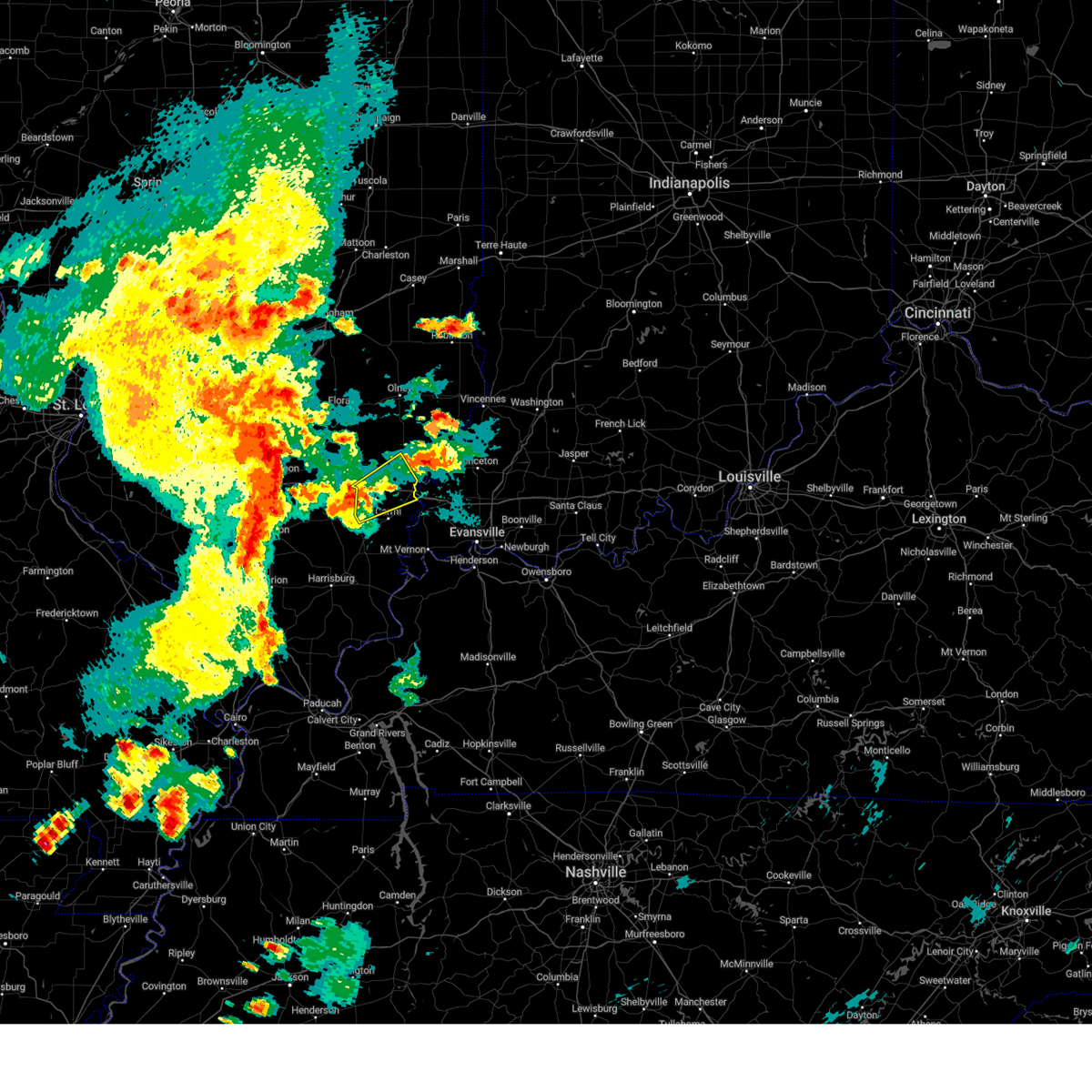 At 527 pm cdt, a severe thunderstorm was located near enfield, or 10 miles northwest of carmi, moving northeast at 45 mph (radar indicated). Hazards include 60 mph wind gusts and penny size hail. expect damage to roofs, siding, and trees At 527 pm cdt, a severe thunderstorm was located near enfield, or 10 miles northwest of carmi, moving northeast at 45 mph (radar indicated). Hazards include 60 mph wind gusts and penny size hail. expect damage to roofs, siding, and trees
|
| 6/30/2023 9:28 PM CDT |
 At 928 pm cdt, severe thunderstorms were located along a line extending from near cisne to near fairfield, moving east at 35 mph (radar indicated). Hazards include 60 mph wind gusts and quarter size hail. Hail damage to vehicles is expected. expect wind damage to roofs, siding, and trees. locations impacted include, fairfield, albion, grayville, west salem, cisne, jeffersonville, bone gap, browns, mount erie and golden gate. this includes interstate 64 in illinois between mile markers 109 and 115. hail threat, radar indicated max hail size, 1. 00 in wind threat, radar indicated max wind gust, 60 mph. At 928 pm cdt, severe thunderstorms were located along a line extending from near cisne to near fairfield, moving east at 35 mph (radar indicated). Hazards include 60 mph wind gusts and quarter size hail. Hail damage to vehicles is expected. expect wind damage to roofs, siding, and trees. locations impacted include, fairfield, albion, grayville, west salem, cisne, jeffersonville, bone gap, browns, mount erie and golden gate. this includes interstate 64 in illinois between mile markers 109 and 115. hail threat, radar indicated max hail size, 1. 00 in wind threat, radar indicated max wind gust, 60 mph.
|
| 6/30/2023 9:15 PM CDT |
 At 914 pm cdt, severe thunderstorms were located along a line extending from 6 miles west of cisne to 6 miles southwest of fairfield, moving east at 30 mph (radar indicated). Hazards include 60 mph wind gusts and quarter size hail. Hail damage to vehicles is expected. Expect wind damage to roofs, siding, and trees. At 914 pm cdt, severe thunderstorms were located along a line extending from 6 miles west of cisne to 6 miles southwest of fairfield, moving east at 30 mph (radar indicated). Hazards include 60 mph wind gusts and quarter size hail. Hail damage to vehicles is expected. Expect wind damage to roofs, siding, and trees.
|
| 6/29/2023 3:29 PM CDT |
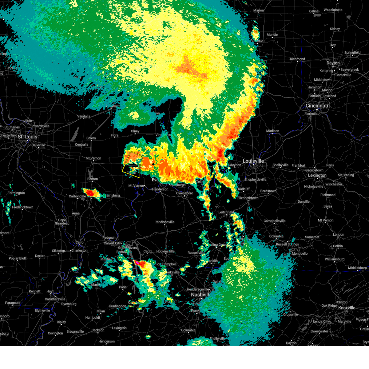 At 328 pm cdt, a severe thunderstorm was located 8 miles southwest of albion, moving southeast at 40 mph (radar indicated). Hazards include 60 mph wind gusts and quarter size hail. Hail damage to vehicles is expected. expect wind damage to roofs, siding, and trees. locations impacted include, carmi, albion, grayville, crossville, browns, golden gate, burnt prairie and phillipstown. this includes interstate 64 in illinois between mile markers 115 and 130. hail threat, radar indicated max hail size, 1. 00 in wind threat, radar indicated max wind gust, 60 mph. At 328 pm cdt, a severe thunderstorm was located 8 miles southwest of albion, moving southeast at 40 mph (radar indicated). Hazards include 60 mph wind gusts and quarter size hail. Hail damage to vehicles is expected. expect wind damage to roofs, siding, and trees. locations impacted include, carmi, albion, grayville, crossville, browns, golden gate, burnt prairie and phillipstown. this includes interstate 64 in illinois between mile markers 115 and 130. hail threat, radar indicated max hail size, 1. 00 in wind threat, radar indicated max wind gust, 60 mph.
|
| 6/29/2023 3:14 PM CDT |
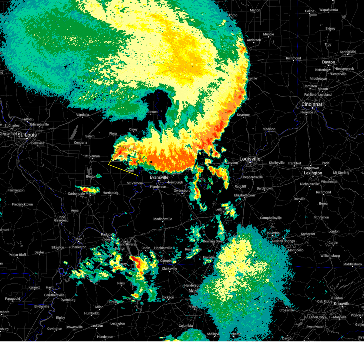 At 314 pm cdt, a severe thunderstorm was located near fairfield, moving east at 40 mph (radar indicated). Hazards include 60 mph wind gusts and quarter size hail. Hail damage to vehicles is expected. expect wind damage to roofs, siding, and trees. locations impacted include, carmi, fairfield, albion, grayville, crossville, jeffersonville, mill shoals, browns, springerton, golden gate, belle prairie city, burnt prairie and phillipstown. this includes interstate 64 in illinois between mile markers 100 and 130. hail threat, radar indicated max hail size, 1. 00 in wind threat, radar indicated max wind gust, 60 mph. At 314 pm cdt, a severe thunderstorm was located near fairfield, moving east at 40 mph (radar indicated). Hazards include 60 mph wind gusts and quarter size hail. Hail damage to vehicles is expected. expect wind damage to roofs, siding, and trees. locations impacted include, carmi, fairfield, albion, grayville, crossville, jeffersonville, mill shoals, browns, springerton, golden gate, belle prairie city, burnt prairie and phillipstown. this includes interstate 64 in illinois between mile markers 100 and 130. hail threat, radar indicated max hail size, 1. 00 in wind threat, radar indicated max wind gust, 60 mph.
|
| 6/29/2023 2:55 PM CDT |
 At 254 pm cdt, a severe thunderstorm was located near cisne, or 9 miles northwest of fairfield, moving east at 45 mph (radar indicated). Hazards include 70 mph wind gusts and half dollar size hail. Hail damage to vehicles is expected. expect considerable tree damage. Wind damage is also likely to mobile homes, roofs, and outbuildings. At 254 pm cdt, a severe thunderstorm was located near cisne, or 9 miles northwest of fairfield, moving east at 45 mph (radar indicated). Hazards include 70 mph wind gusts and half dollar size hail. Hail damage to vehicles is expected. expect considerable tree damage. Wind damage is also likely to mobile homes, roofs, and outbuildings.
|
| 6/29/2023 2:35 PM CDT |
 At 234 pm cdt, severe thunderstorms were located along a line extending from near west salem to 6 miles north of mount vernon, moving southeast at 45 mph (radar indicated). Hazards include 70 mph wind gusts and quarter size hail. Hail damage to vehicles is expected. expect considerable tree damage. wind damage is also likely to mobile homes, roofs, and outbuildings. locations impacted include, mount vernon, fairfield, albion, grayville, wayne city, west salem, bluford, cisne, dix, jeffersonville, sims, bone gap, browns, mount erie, keenes, johnsonville and golden gate. This includes interstate 57 in illinois between mile markers 99 and 105. At 234 pm cdt, severe thunderstorms were located along a line extending from near west salem to 6 miles north of mount vernon, moving southeast at 45 mph (radar indicated). Hazards include 70 mph wind gusts and quarter size hail. Hail damage to vehicles is expected. expect considerable tree damage. wind damage is also likely to mobile homes, roofs, and outbuildings. locations impacted include, mount vernon, fairfield, albion, grayville, wayne city, west salem, bluford, cisne, dix, jeffersonville, sims, bone gap, browns, mount erie, keenes, johnsonville and golden gate. This includes interstate 57 in illinois between mile markers 99 and 105.
|
| 6/29/2023 2:14 PM CDT |
 At 214 pm cdt, severe thunderstorms were located along a line extending from near cisne to 6 miles southeast of centralia, moving southeast at 45 mph (radar indicated). Hazards include 70 mph wind gusts and half dollar size hail. Hail damage to vehicles is expected. expect considerable tree damage. wind damage is also likely to mobile homes, roofs, and outbuildings. locations impacted include, mount vernon, fairfield, albion, grayville, wayne city, west salem, woodlawn, bluford, cisne, dix, jeffersonville, sims, bone gap, browns, mount erie, keenes, johnsonville and golden gate. this includes the following highways, interstate 57 in illinois between mile markers 93 and 105. Interstate 64 in illinois between mile markers 63 and 76. At 214 pm cdt, severe thunderstorms were located along a line extending from near cisne to 6 miles southeast of centralia, moving southeast at 45 mph (radar indicated). Hazards include 70 mph wind gusts and half dollar size hail. Hail damage to vehicles is expected. expect considerable tree damage. wind damage is also likely to mobile homes, roofs, and outbuildings. locations impacted include, mount vernon, fairfield, albion, grayville, wayne city, west salem, woodlawn, bluford, cisne, dix, jeffersonville, sims, bone gap, browns, mount erie, keenes, johnsonville and golden gate. this includes the following highways, interstate 57 in illinois between mile markers 93 and 105. Interstate 64 in illinois between mile markers 63 and 76.
|
| 6/29/2023 1:57 PM CDT |
 At 156 pm cdt, severe thunderstorms were located along a line extending from near ingraham to near shattuc, moving east at 35 mph (radar indicated). Hazards include 70 mph wind gusts and half dollar size hail. Hail damage to vehicles is expected. expect considerable tree damage. Wind damage is also likely to mobile homes, roofs, and outbuildings. At 156 pm cdt, severe thunderstorms were located along a line extending from near ingraham to near shattuc, moving east at 35 mph (radar indicated). Hazards include 70 mph wind gusts and half dollar size hail. Hail damage to vehicles is expected. expect considerable tree damage. Wind damage is also likely to mobile homes, roofs, and outbuildings.
|
| 2/22/2023 3:26 PM CST |
 At 325 pm cst, severe thunderstorms were located along a line extending from omega to near rend lake area, moving east at 50 mph (radar indicated). Hazards include 60 mph wind gusts. Expect damage to roofs, siding, and trees. severe thunderstorms will be near, wayne city around 340 pm cst. other locations in the path of these severe thunderstorms include cisne. this includes interstate 64 in illinois between mile markers 92 and 116. hail threat, radar indicated max hail size, <. 75 in wind threat, radar indicated max wind gust, 60 mph. At 325 pm cst, severe thunderstorms were located along a line extending from omega to near rend lake area, moving east at 50 mph (radar indicated). Hazards include 60 mph wind gusts. Expect damage to roofs, siding, and trees. severe thunderstorms will be near, wayne city around 340 pm cst. other locations in the path of these severe thunderstorms include cisne. this includes interstate 64 in illinois between mile markers 92 and 116. hail threat, radar indicated max hail size, <. 75 in wind threat, radar indicated max wind gust, 60 mph.
|
| 8/2/2022 12:34 AM CDT |
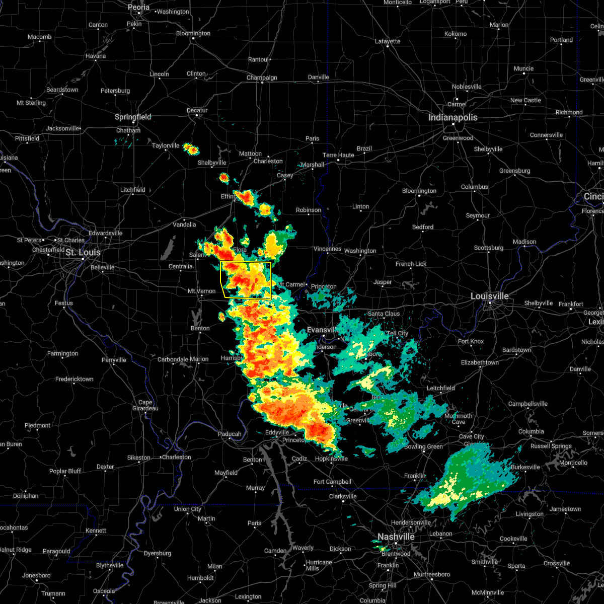 At 1233 am cdt, a severe thunderstorm was located near xenia, or 8 miles southwest of flora, moving southeast at 20 mph (radar indicated). Hazards include 60 mph wind gusts and quarter size hail. Hail damage to vehicles is expected. expect wind damage to roofs, siding, and trees. this severe thunderstorm will be near, cisne around 1245 am cdt. other locations in the path of this severe thunderstorm include fairfield. hail threat, radar indicated max hail size, 1. 00 in wind threat, radar indicated max wind gust, 60 mph. At 1233 am cdt, a severe thunderstorm was located near xenia, or 8 miles southwest of flora, moving southeast at 20 mph (radar indicated). Hazards include 60 mph wind gusts and quarter size hail. Hail damage to vehicles is expected. expect wind damage to roofs, siding, and trees. this severe thunderstorm will be near, cisne around 1245 am cdt. other locations in the path of this severe thunderstorm include fairfield. hail threat, radar indicated max hail size, 1. 00 in wind threat, radar indicated max wind gust, 60 mph.
|
| 8/1/2022 10:39 PM CDT |
 The severe thunderstorm warning for northeastern wayne and northwestern edwards counties will expire at 1045 pm cdt, the storm which prompted the warning has weakened below severe limits, and no longer poses an immediate threat to life or property. therefore, the warning will be allowed to expire. a severe thunderstorm watch remains in effect until midnight cdt for south central and southeastern illinois. The severe thunderstorm warning for northeastern wayne and northwestern edwards counties will expire at 1045 pm cdt, the storm which prompted the warning has weakened below severe limits, and no longer poses an immediate threat to life or property. therefore, the warning will be allowed to expire. a severe thunderstorm watch remains in effect until midnight cdt for south central and southeastern illinois.
|
| 8/1/2022 10:27 PM CDT |
 At 1026 pm cdt, a severe thunderstorm was located 9 miles south of schnell, or 11 miles northeast of fairfield, moving southeast at 25 mph (radar indicated). Hazards include ping pong ball size hail and 60 mph wind gusts. People and animals outdoors will be injured. expect hail damage to roofs, siding, windows, and vehicles. expect wind damage to roofs, siding, and trees. locations impacted include, west salem, mount erie and golden gate. hail threat, radar indicated max hail size, 1. 50 in wind threat, radar indicated max wind gust, 60 mph. At 1026 pm cdt, a severe thunderstorm was located 9 miles south of schnell, or 11 miles northeast of fairfield, moving southeast at 25 mph (radar indicated). Hazards include ping pong ball size hail and 60 mph wind gusts. People and animals outdoors will be injured. expect hail damage to roofs, siding, windows, and vehicles. expect wind damage to roofs, siding, and trees. locations impacted include, west salem, mount erie and golden gate. hail threat, radar indicated max hail size, 1. 50 in wind threat, radar indicated max wind gust, 60 mph.
|
| 8/1/2022 10:13 PM CDT |
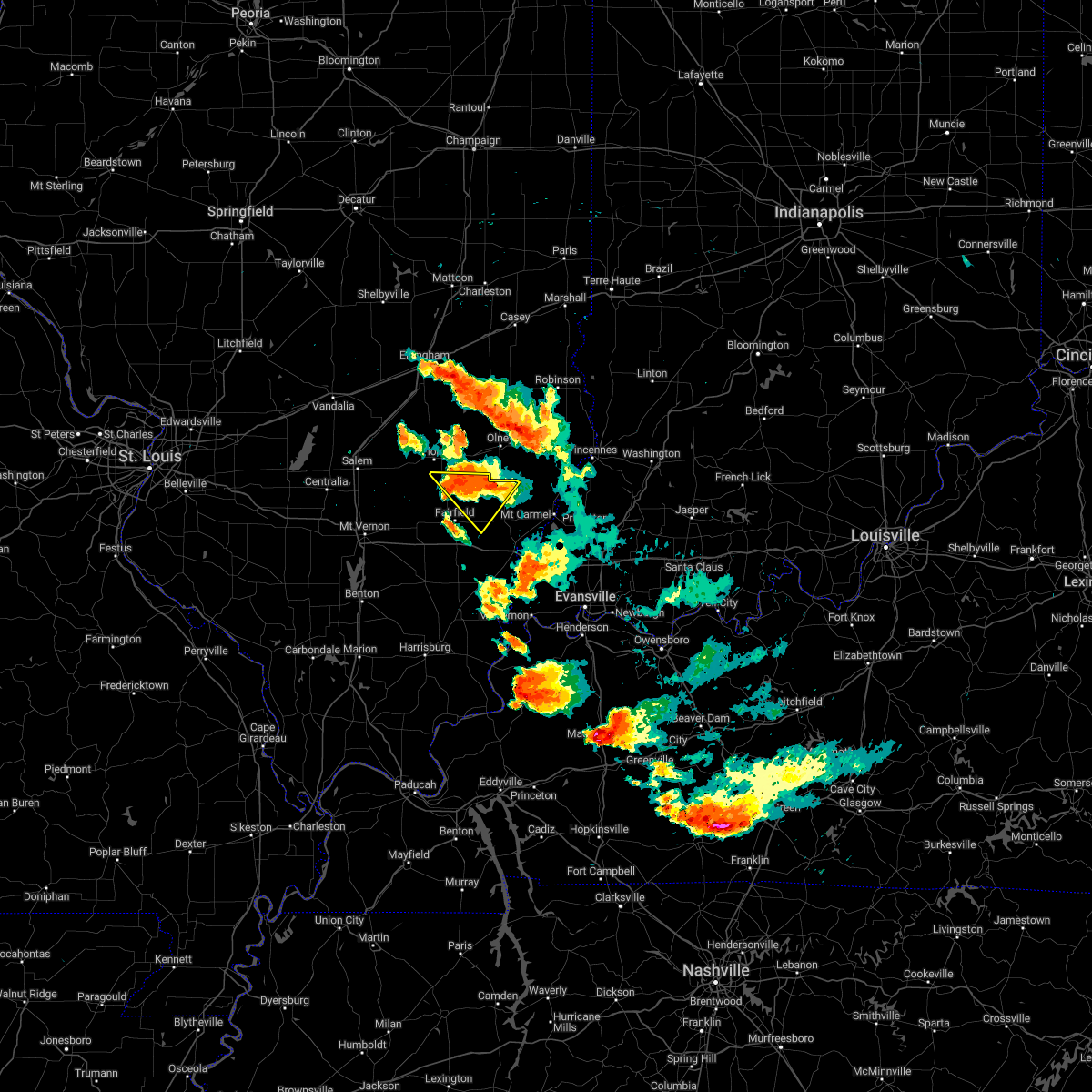 At 1012 pm cdt, a severe thunderstorm was located near schnell, or 12 miles north of fairfield, moving southeast at 25 mph (radar indicated). Hazards include ping pong ball size hail and 60 mph wind gusts. People and animals outdoors will be injured. expect hail damage to roofs, siding, windows, and vehicles. expect wind damage to roofs, siding, and trees. locations impacted include, west salem, mount erie and golden gate. hail threat, radar indicated max hail size, 1. 50 in wind threat, radar indicated max wind gust, 60 mph. At 1012 pm cdt, a severe thunderstorm was located near schnell, or 12 miles north of fairfield, moving southeast at 25 mph (radar indicated). Hazards include ping pong ball size hail and 60 mph wind gusts. People and animals outdoors will be injured. expect hail damage to roofs, siding, windows, and vehicles. expect wind damage to roofs, siding, and trees. locations impacted include, west salem, mount erie and golden gate. hail threat, radar indicated max hail size, 1. 50 in wind threat, radar indicated max wind gust, 60 mph.
|
| 8/1/2022 9:56 PM CDT |
 At 955 pm cdt, a severe thunderstorm was located near clay city, or 7 miles southeast of flora, moving southeast at 25 mph (radar indicated). Hazards include 60 mph wind gusts and half dollar size hail. Hail damage to vehicles is expected. Expect wind damage to roofs, siding, and trees. At 955 pm cdt, a severe thunderstorm was located near clay city, or 7 miles southeast of flora, moving southeast at 25 mph (radar indicated). Hazards include 60 mph wind gusts and half dollar size hail. Hail damage to vehicles is expected. Expect wind damage to roofs, siding, and trees.
|
| 8/1/2022 9:29 PM CDT |
 At 929 pm cdt, a severe thunderstorm was located near albion, moving southeast at 25 mph (radar indicated). Hazards include golf ball size hail and 60 mph wind gusts. People and animals outdoors will be injured. expect hail damage to roofs, siding, windows, and vehicles. expect wind damage to roofs, siding, and trees. this severe storm will be near, grayville around 950 pm cdt. Other locations impacted by this severe thunderstorm include bellmont, keensburg, golden gate, browns and bone gap. At 929 pm cdt, a severe thunderstorm was located near albion, moving southeast at 25 mph (radar indicated). Hazards include golf ball size hail and 60 mph wind gusts. People and animals outdoors will be injured. expect hail damage to roofs, siding, windows, and vehicles. expect wind damage to roofs, siding, and trees. this severe storm will be near, grayville around 950 pm cdt. Other locations impacted by this severe thunderstorm include bellmont, keensburg, golden gate, browns and bone gap.
|
| 8/1/2022 9:05 PM CDT |
 At 905 pm cdt, a severe thunderstorm was located 10 miles south of schnell, or 10 miles northeast of fairfield, moving southeast at 25 mph (radar indicated). Hazards include 60 mph wind gusts and half dollar size hail. Hail damage to vehicles is expected. Expect wind damage to roofs, siding, and trees. At 905 pm cdt, a severe thunderstorm was located 10 miles south of schnell, or 10 miles northeast of fairfield, moving southeast at 25 mph (radar indicated). Hazards include 60 mph wind gusts and half dollar size hail. Hail damage to vehicles is expected. Expect wind damage to roofs, siding, and trees.
|
| 7/24/2022 9:07 PM CDT |
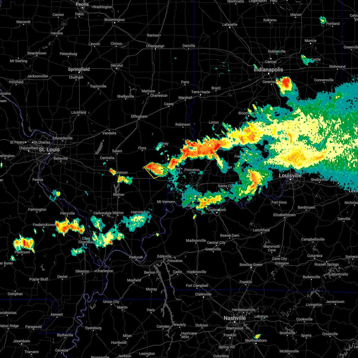 At 907 pm cdt, a severe thunderstorm was located near fairfield, moving southeast at 25 mph (radar indicated). Hazards include 60 mph wind gusts and quarter size hail. Hail damage to vehicles is expected. expect wind damage to roofs, siding, and trees. locations impacted include, fairfield, albion, jeffersonville and golden gate. hail threat, radar indicated max hail size, 1. 00 in wind threat, radar indicated max wind gust, 60 mph. At 907 pm cdt, a severe thunderstorm was located near fairfield, moving southeast at 25 mph (radar indicated). Hazards include 60 mph wind gusts and quarter size hail. Hail damage to vehicles is expected. expect wind damage to roofs, siding, and trees. locations impacted include, fairfield, albion, jeffersonville and golden gate. hail threat, radar indicated max hail size, 1. 00 in wind threat, radar indicated max wind gust, 60 mph.
|
| 7/24/2022 8:53 PM CDT |
 At 853 pm cdt, a severe thunderstorm was located near fairfield, moving southeast at 15 mph (radar indicated). Hazards include 60 mph wind gusts and half dollar size hail. Hail damage to vehicles is expected. expect wind damage to roofs, siding, and trees. locations impacted include, fairfield, albion, jeffersonville and golden gate. hail threat, radar indicated max hail size, 1. 25 in wind threat, radar indicated max wind gust, 60 mph. At 853 pm cdt, a severe thunderstorm was located near fairfield, moving southeast at 15 mph (radar indicated). Hazards include 60 mph wind gusts and half dollar size hail. Hail damage to vehicles is expected. expect wind damage to roofs, siding, and trees. locations impacted include, fairfield, albion, jeffersonville and golden gate. hail threat, radar indicated max hail size, 1. 25 in wind threat, radar indicated max wind gust, 60 mph.
|
| 7/24/2022 8:40 PM CDT |
 At 839 pm cdt, severe thunderstorms were located along a line extending from 9 miles south of schnell to near cisne, moving east southeast at 25 mph (radar indicated). Hazards include 60 mph wind gusts and half dollar size hail. Hail damage to vehicles is expected. Expect wind damage to roofs, siding, and trees. At 839 pm cdt, severe thunderstorms were located along a line extending from 9 miles south of schnell to near cisne, moving east southeast at 25 mph (radar indicated). Hazards include 60 mph wind gusts and half dollar size hail. Hail damage to vehicles is expected. Expect wind damage to roofs, siding, and trees.
|
| 6/17/2022 7:24 AM CDT |
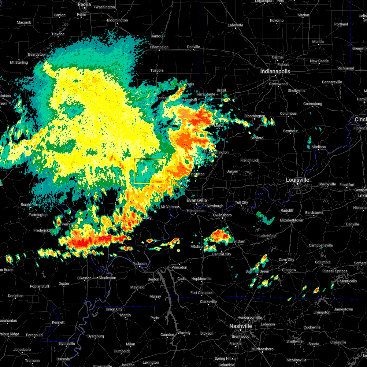 The severe thunderstorm warning for wayne county will expire at 730 am cdt, the storms which prompted the warning continue their move out of the area. therefore, the warning will be allowed to expire. a severe thunderstorm watch remains in effect until 1100 am cdt for south central and southeastern illinois. The severe thunderstorm warning for wayne county will expire at 730 am cdt, the storms which prompted the warning continue their move out of the area. therefore, the warning will be allowed to expire. a severe thunderstorm watch remains in effect until 1100 am cdt for south central and southeastern illinois.
|
| 6/17/2022 6:53 AM CDT |
 At 653 am cdt, severe thunderstorms were located along a line extending from near parkersburg to 8 miles northeast of mcleansboro, moving east at 40 mph (radar indicated). Hazards include 70 mph wind gusts and quarter size hail. Hail damage to vehicles is expected. expect considerable tree damage. wind damage is also likely to mobile homes, roofs, and outbuildings. these severe thunderstorms will remain over mainly rural areas of wayne county, including the following locations, jeffersonville, mount erie, johnsonville, sims, keenes and golden gate. this includes interstate 64 in illinois between mile markers 92 and 115. thunderstorm damage threat, considerable hail threat, radar indicated max hail size, 1. 00 in wind threat, radar indicated max wind gust, 70 mph. At 653 am cdt, severe thunderstorms were located along a line extending from near parkersburg to 8 miles northeast of mcleansboro, moving east at 40 mph (radar indicated). Hazards include 70 mph wind gusts and quarter size hail. Hail damage to vehicles is expected. expect considerable tree damage. wind damage is also likely to mobile homes, roofs, and outbuildings. these severe thunderstorms will remain over mainly rural areas of wayne county, including the following locations, jeffersonville, mount erie, johnsonville, sims, keenes and golden gate. this includes interstate 64 in illinois between mile markers 92 and 115. thunderstorm damage threat, considerable hail threat, radar indicated max hail size, 1. 00 in wind threat, radar indicated max wind gust, 70 mph.
|
| 6/17/2022 6:34 AM CDT |
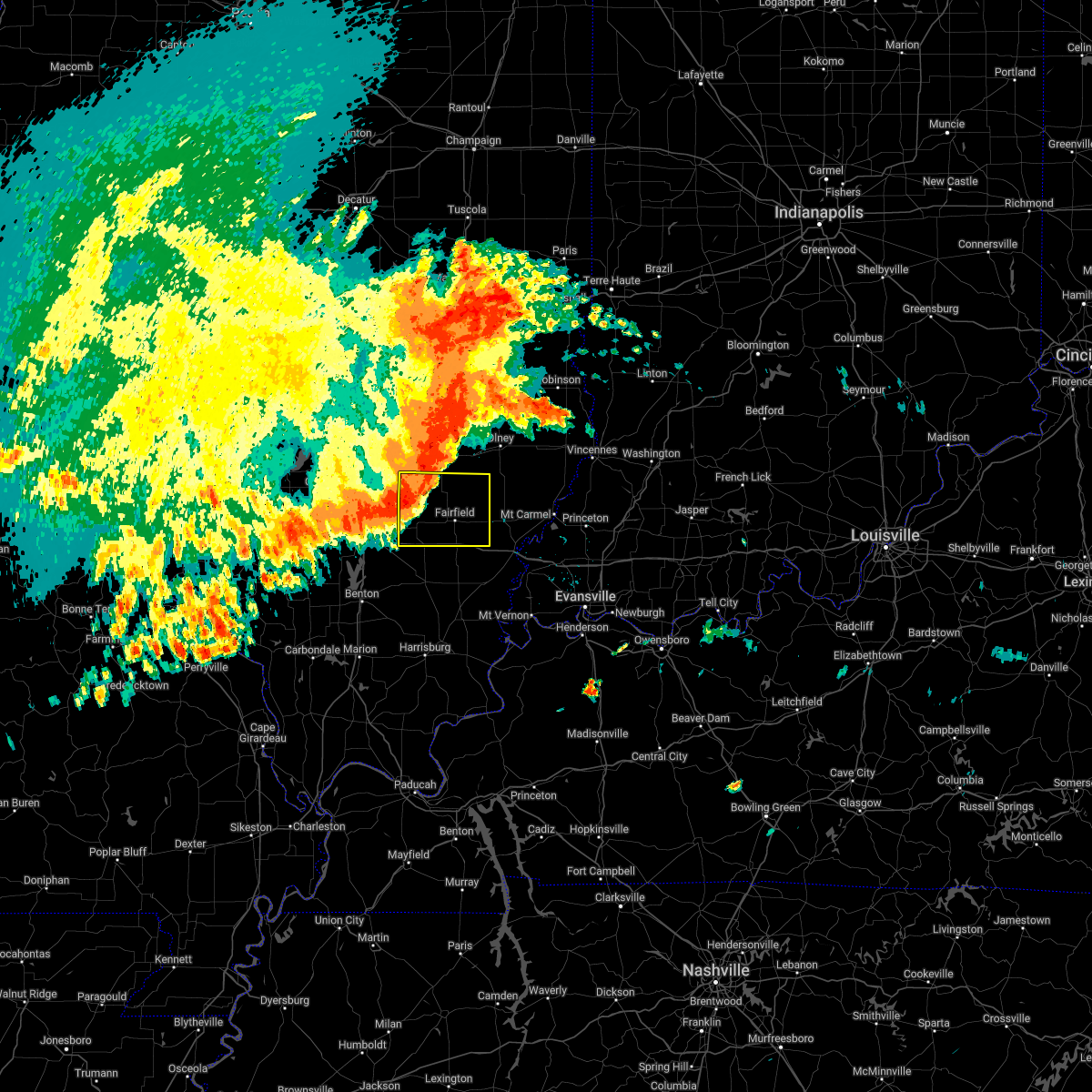 At 633 am cdt, severe thunderstorms were located along a line extending from clay city to near bluford, moving southeast at 45 mph (radar indicated). Hazards include 70 mph wind gusts and quarter size hail. Hail damage to vehicles is expected. expect considerable tree damage. wind damage is also likely to mobile homes, roofs, and outbuildings. locations impacted include, fairfield, wayne city, cisne, jeffersonville, sims, mount erie, keenes, johnsonville and golden gate. this includes interstate 64 in illinois between mile markers 92 and 115. thunderstorm damage threat, considerable hail threat, radar indicated max hail size, 1. 00 in wind threat, radar indicated max wind gust, 70 mph. At 633 am cdt, severe thunderstorms were located along a line extending from clay city to near bluford, moving southeast at 45 mph (radar indicated). Hazards include 70 mph wind gusts and quarter size hail. Hail damage to vehicles is expected. expect considerable tree damage. wind damage is also likely to mobile homes, roofs, and outbuildings. locations impacted include, fairfield, wayne city, cisne, jeffersonville, sims, mount erie, keenes, johnsonville and golden gate. this includes interstate 64 in illinois between mile markers 92 and 115. thunderstorm damage threat, considerable hail threat, radar indicated max hail size, 1. 00 in wind threat, radar indicated max wind gust, 70 mph.
|
| 6/17/2022 6:17 AM CDT |
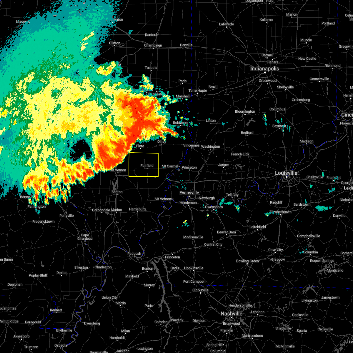 At 617 am cdt, severe thunderstorms were located along a line extending from near bible grove to 10 miles south of salem, moving southeast at 45 mph (radar indicated). Hazards include 70 mph wind gusts and quarter size hail. Hail damage to vehicles is expected. expect considerable tree damage. wind damage is also likely to mobile homes, roofs, and outbuildings. these severe thunderstorms will remain over mainly rural areas of wayne county, including the following locations, jeffersonville, mount erie, johnsonville, sims, keenes and golden gate. this includes interstate 64 in illinois between mile markers 92 and 115. thunderstorm damage threat, considerable hail threat, radar indicated max hail size, 1. 00 in wind threat, radar indicated max wind gust, 70 mph. At 617 am cdt, severe thunderstorms were located along a line extending from near bible grove to 10 miles south of salem, moving southeast at 45 mph (radar indicated). Hazards include 70 mph wind gusts and quarter size hail. Hail damage to vehicles is expected. expect considerable tree damage. wind damage is also likely to mobile homes, roofs, and outbuildings. these severe thunderstorms will remain over mainly rural areas of wayne county, including the following locations, jeffersonville, mount erie, johnsonville, sims, keenes and golden gate. this includes interstate 64 in illinois between mile markers 92 and 115. thunderstorm damage threat, considerable hail threat, radar indicated max hail size, 1. 00 in wind threat, radar indicated max wind gust, 70 mph.
|
| 5/21/2022 12:40 PM CDT |
 At 1239 pm cdt, severe thunderstorms were located along a line extending from 7 miles northeast of fairfield to 9 miles southwest of albion, moving east at 40 mph (radar indicated). Hazards include 70 mph wind gusts and quarter size hail. Hail damage to vehicles is expected. expect considerable tree damage. wind damage is also likely to mobile homes, roofs, and outbuildings. locations impacted include, albion, west salem, mount carmel and lancaster. thunderstorm damage threat, considerable hail threat, radar indicated max hail size, 1. 00 in wind threat, radar indicated max wind gust, 70 mph. At 1239 pm cdt, severe thunderstorms were located along a line extending from 7 miles northeast of fairfield to 9 miles southwest of albion, moving east at 40 mph (radar indicated). Hazards include 70 mph wind gusts and quarter size hail. Hail damage to vehicles is expected. expect considerable tree damage. wind damage is also likely to mobile homes, roofs, and outbuildings. locations impacted include, albion, west salem, mount carmel and lancaster. thunderstorm damage threat, considerable hail threat, radar indicated max hail size, 1. 00 in wind threat, radar indicated max wind gust, 70 mph.
|
| 5/21/2022 12:32 PM CDT |
 At 1232 pm cdt, a severe thunderstorm capable of producing a tornado was located 9 miles southwest of albion, moving northeast at 45 mph (radar indicated rotation). Hazards include tornado and quarter size hail. Flying debris will be dangerous to those caught without shelter. mobile homes will be damaged or destroyed. damage to roofs, windows, and vehicles will occur. tree damage is likely. this dangerous storm will be near, albion around 1245 pm cdt. This includes interstate 64 in illinois between mile markers 114 and 124. At 1232 pm cdt, a severe thunderstorm capable of producing a tornado was located 9 miles southwest of albion, moving northeast at 45 mph (radar indicated rotation). Hazards include tornado and quarter size hail. Flying debris will be dangerous to those caught without shelter. mobile homes will be damaged or destroyed. damage to roofs, windows, and vehicles will occur. tree damage is likely. this dangerous storm will be near, albion around 1245 pm cdt. This includes interstate 64 in illinois between mile markers 114 and 124.
|
| 5/21/2022 12:26 PM CDT |
 At 1226 pm cdt, a severe thunderstorm was located over fairfield, moving northeast at 50 mph (radar indicated). Hazards include 70 mph wind gusts and quarter size hail. Hail damage to vehicles is expected. expect considerable tree damage. wind damage is also likely to mobile homes, roofs, and outbuildings. this severe thunderstorm will be near, albion around 1245 pm cdt. other locations in the path of this severe thunderstorm include west salem and lancaster. this includes interstate 64 in illinois between mile markers 108 and 112. thunderstorm damage threat, considerable hail threat, radar indicated max hail size, 1. 00 in wind threat, radar indicated max wind gust, 70 mph. At 1226 pm cdt, a severe thunderstorm was located over fairfield, moving northeast at 50 mph (radar indicated). Hazards include 70 mph wind gusts and quarter size hail. Hail damage to vehicles is expected. expect considerable tree damage. wind damage is also likely to mobile homes, roofs, and outbuildings. this severe thunderstorm will be near, albion around 1245 pm cdt. other locations in the path of this severe thunderstorm include west salem and lancaster. this includes interstate 64 in illinois between mile markers 108 and 112. thunderstorm damage threat, considerable hail threat, radar indicated max hail size, 1. 00 in wind threat, radar indicated max wind gust, 70 mph.
|
| 3/30/2022 6:05 PM CDT |
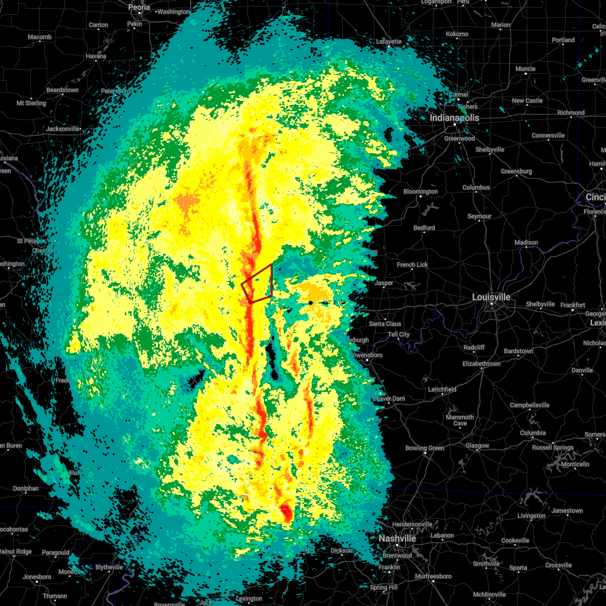 At 605 pm cdt, a severe thunderstorm capable of producing a tornado was located over fairfield, moving northeast at 30 mph (radar indicated rotation). Hazards include tornado. Flying debris will be dangerous to those caught without shelter. mobile homes will be damaged or destroyed. damage to roofs, windows, and vehicles will occur. tree damage is likely. this tornadic thunderstorm will remain over mainly rural areas of southeastern wayne county, including the following locations, jeffersonville, mount erie and golden gate. This includes interstate 64 in illinois near mile marker 109. At 605 pm cdt, a severe thunderstorm capable of producing a tornado was located over fairfield, moving northeast at 30 mph (radar indicated rotation). Hazards include tornado. Flying debris will be dangerous to those caught without shelter. mobile homes will be damaged or destroyed. damage to roofs, windows, and vehicles will occur. tree damage is likely. this tornadic thunderstorm will remain over mainly rural areas of southeastern wayne county, including the following locations, jeffersonville, mount erie and golden gate. This includes interstate 64 in illinois near mile marker 109.
|
| 3/30/2022 5:53 PM CDT |
 At 553 pm cdt, a severe thunderstorm was located near wayne city, or 7 miles west of fairfield, moving east at 20 mph (radar indicated). Hazards include 60 mph wind gusts. Expect damage to roofs, siding, and trees. locations impacted include, cisne and fairfield. This includes interstate 64 in illinois between mile markers 95 and 115. At 553 pm cdt, a severe thunderstorm was located near wayne city, or 7 miles west of fairfield, moving east at 20 mph (radar indicated). Hazards include 60 mph wind gusts. Expect damage to roofs, siding, and trees. locations impacted include, cisne and fairfield. This includes interstate 64 in illinois between mile markers 95 and 115.
|
| 3/30/2022 5:23 PM CDT |
 At 523 pm cdt, severe thunderstorms were located along a line extending from near xenia to near bluford, moving east at 35 mph (radar indicated). Hazards include 60 mph wind gusts. Expect damage to roofs, siding, and trees. severe thunderstorms will be near, wayne city around 535 pm cdt. other locations in the path of these severe thunderstorms include fairfield. This includes interstate 64 in illinois between mile markers 92 and 115. At 523 pm cdt, severe thunderstorms were located along a line extending from near xenia to near bluford, moving east at 35 mph (radar indicated). Hazards include 60 mph wind gusts. Expect damage to roofs, siding, and trees. severe thunderstorms will be near, wayne city around 535 pm cdt. other locations in the path of these severe thunderstorms include fairfield. This includes interstate 64 in illinois between mile markers 92 and 115.
|
| 5/27/2021 3:35 PM CDT |
 At 333 pm cdt, a severe thunderstorm was located near xenia, or 8 miles southwest of flora, moving east at 25 mph (radar indicated. the best area for wind damage is along the wayne/clay county border. other storms have developed over central wayne county and are moving north). Hazards include 60 mph wind gusts and penny size hail. Expect damage to roofs, siding, and trees. Locations impacted include, fairfield, cisne, jeffersonville, mount erie, johnsonville and golden gate. At 333 pm cdt, a severe thunderstorm was located near xenia, or 8 miles southwest of flora, moving east at 25 mph (radar indicated. the best area for wind damage is along the wayne/clay county border. other storms have developed over central wayne county and are moving north). Hazards include 60 mph wind gusts and penny size hail. Expect damage to roofs, siding, and trees. Locations impacted include, fairfield, cisne, jeffersonville, mount erie, johnsonville and golden gate.
|
| 5/27/2021 3:18 PM CDT |
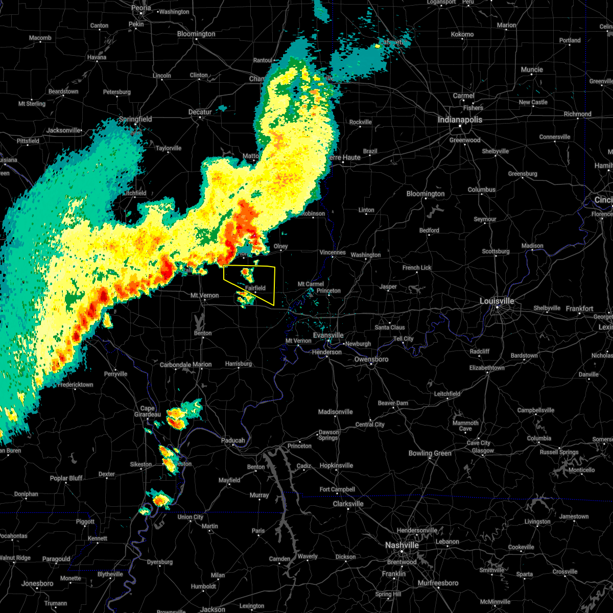 At 317 pm cdt, a severe thunderstorm was located near xenia, or 9 miles southwest of flora, moving east at 30 mph (radar indicated. the main wind damage from this storm will likely be along the wayne/clay county border. however, other thunderstorms are quickly developing over wayne county and may become severe). Hazards include 60 mph wind gusts and penny size hail. Expect damage to roofs, siding, and trees. Locations impacted include, fairfield, cisne, jeffersonville, mount erie, johnsonville and golden gate. At 317 pm cdt, a severe thunderstorm was located near xenia, or 9 miles southwest of flora, moving east at 30 mph (radar indicated. the main wind damage from this storm will likely be along the wayne/clay county border. however, other thunderstorms are quickly developing over wayne county and may become severe). Hazards include 60 mph wind gusts and penny size hail. Expect damage to roofs, siding, and trees. Locations impacted include, fairfield, cisne, jeffersonville, mount erie, johnsonville and golden gate.
|
| 5/27/2021 3:03 PM CDT |
 At 302 pm cdt, a severe thunderstorm was located near omega, or 10 miles east of salem, moving east at 30 mph (radar indicated). Hazards include 60 mph wind gusts and penny size hail. expect damage to roofs, siding, and trees At 302 pm cdt, a severe thunderstorm was located near omega, or 10 miles east of salem, moving east at 30 mph (radar indicated). Hazards include 60 mph wind gusts and penny size hail. expect damage to roofs, siding, and trees
|
| 5/17/2020 4:45 PM CDT |
 At 444 pm cdt, a severe thunderstorm was located 7 miles southwest of albion, moving northeast at 35 mph (radar indicated). Hazards include 60 mph wind gusts and quarter size hail. Hail damage to vehicles is expected. expect wind damage to roofs, siding, and trees. Locations impacted include, albion, west salem, bone gap, browns and golden gate. At 444 pm cdt, a severe thunderstorm was located 7 miles southwest of albion, moving northeast at 35 mph (radar indicated). Hazards include 60 mph wind gusts and quarter size hail. Hail damage to vehicles is expected. expect wind damage to roofs, siding, and trees. Locations impacted include, albion, west salem, bone gap, browns and golden gate.
|
| 5/17/2020 4:30 PM CDT |
 At 430 pm cdt, a severe thunderstorm was located 9 miles northeast of enfield, or 10 miles northwest of carmi, moving northeast at 35 mph (radar indicated). Hazards include 60 mph wind gusts and quarter size hail. Hail damage to vehicles is expected. Expect wind damage to roofs, siding, and trees. At 430 pm cdt, a severe thunderstorm was located 9 miles northeast of enfield, or 10 miles northwest of carmi, moving northeast at 35 mph (radar indicated). Hazards include 60 mph wind gusts and quarter size hail. Hail damage to vehicles is expected. Expect wind damage to roofs, siding, and trees.
|
| 4/8/2020 7:35 PM CDT |
 At 734 pm cdt, a severe thunderstorm was located near louisville, or 11 miles north of flora, moving southeast at 50 mph (radar indicated). Hazards include 70 mph wind gusts and quarter size hail. Hail damage to vehicles is expected. expect considerable tree damage. Wind damage is also likely to mobile homes, roofs, and outbuildings. At 734 pm cdt, a severe thunderstorm was located near louisville, or 11 miles north of flora, moving southeast at 50 mph (radar indicated). Hazards include 70 mph wind gusts and quarter size hail. Hail damage to vehicles is expected. expect considerable tree damage. Wind damage is also likely to mobile homes, roofs, and outbuildings.
|
| 3/19/2020 4:46 PM CDT |
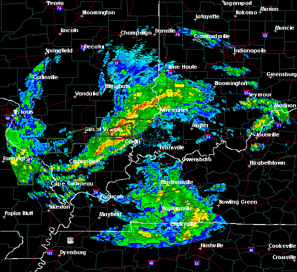 At 446 pm cdt, a severe thunderstorm capable of producing a tornado was located near fairfield, moving east at 55 mph (radar indicated rotation). Hazards include tornado and quarter size hail. Flying debris will be dangerous to those caught without shelter. mobile homes will be damaged or destroyed. damage to roofs, windows, and vehicles will occur. tree damage is likely. Locations impacted include, fairfield, albion, mill shoals, golden gate and burnt prairie. At 446 pm cdt, a severe thunderstorm capable of producing a tornado was located near fairfield, moving east at 55 mph (radar indicated rotation). Hazards include tornado and quarter size hail. Flying debris will be dangerous to those caught without shelter. mobile homes will be damaged or destroyed. damage to roofs, windows, and vehicles will occur. tree damage is likely. Locations impacted include, fairfield, albion, mill shoals, golden gate and burnt prairie.
|
| 3/19/2020 4:26 PM CDT |
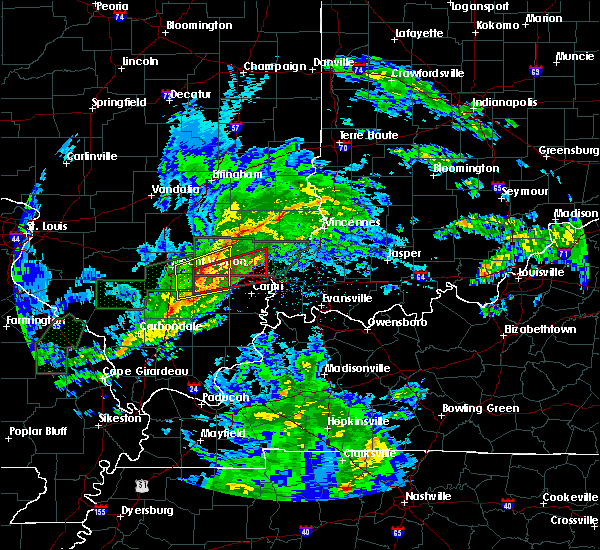 At 426 pm cdt, a severe thunderstorm capable of producing a tornado was located 9 miles south of wayne city, or 9 miles northwest of mcleansboro, moving east at 55 mph (radar indicated rotation). Hazards include tornado and quarter size hail. Flying debris will be dangerous to those caught without shelter. mobile homes will be damaged or destroyed. damage to roofs, windows, and vehicles will occur. Tree damage is likely. At 426 pm cdt, a severe thunderstorm capable of producing a tornado was located 9 miles south of wayne city, or 9 miles northwest of mcleansboro, moving east at 55 mph (radar indicated rotation). Hazards include tornado and quarter size hail. Flying debris will be dangerous to those caught without shelter. mobile homes will be damaged or destroyed. damage to roofs, windows, and vehicles will occur. Tree damage is likely.
|
| 8/18/2019 3:13 PM CDT |
 At 313 pm cdt, a severe thunderstorm was located near albion, moving east at 25 mph (radar indicated). Hazards include 60 mph wind gusts and quarter size hail. Hail damage to vehicles is expected. Expect wind damage to roofs, siding, and trees. At 313 pm cdt, a severe thunderstorm was located near albion, moving east at 25 mph (radar indicated). Hazards include 60 mph wind gusts and quarter size hail. Hail damage to vehicles is expected. Expect wind damage to roofs, siding, and trees.
|
| 8/6/2019 3:30 PM CDT |
 At 328 pm cdt, a severe thunderstorm was located near fairfield, moving southeast at 25 mph (emergency management reported golf ball sized hail 7 miles north of mcleansboro at 3:24 pm). Hazards include golf ball size hail and 60 mph wind gusts. People and animals outdoors will be injured. expect hail damage to roofs, siding, windows, and vehicles. expect wind damage to roofs, siding, and trees. Locations impacted include, fairfield, albion, cisne, enfield, jeffersonville, sims, mill shoals, springerton, mount erie, golden gate, belle prairie city and burnt prairie. At 328 pm cdt, a severe thunderstorm was located near fairfield, moving southeast at 25 mph (emergency management reported golf ball sized hail 7 miles north of mcleansboro at 3:24 pm). Hazards include golf ball size hail and 60 mph wind gusts. People and animals outdoors will be injured. expect hail damage to roofs, siding, windows, and vehicles. expect wind damage to roofs, siding, and trees. Locations impacted include, fairfield, albion, cisne, enfield, jeffersonville, sims, mill shoals, springerton, mount erie, golden gate, belle prairie city and burnt prairie.
|
| 8/6/2019 3:24 PM CDT |
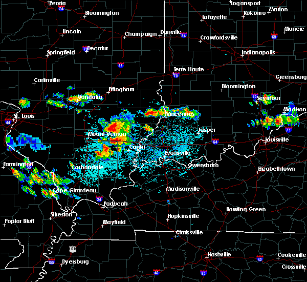 At 323 pm cdt, a severe thunderstorm was located over fairfield, moving southeast at 25 mph (radar indicated. trained spotters also reported penny sized hail eight miles south of fairfield at 3:22 pm). Hazards include 60 mph wind gusts and quarter size hail. Hail damage to vehicles is expected. expect wind damage to roofs, siding, and trees. Locations impacted include, fairfield, albion, wayne city, cisne, enfield, jeffersonville, sims, mill shoals, springerton, mount erie, keenes, johnsonville, golden gate, belle prairie city and burnt prairie. At 323 pm cdt, a severe thunderstorm was located over fairfield, moving southeast at 25 mph (radar indicated. trained spotters also reported penny sized hail eight miles south of fairfield at 3:22 pm). Hazards include 60 mph wind gusts and quarter size hail. Hail damage to vehicles is expected. expect wind damage to roofs, siding, and trees. Locations impacted include, fairfield, albion, wayne city, cisne, enfield, jeffersonville, sims, mill shoals, springerton, mount erie, keenes, johnsonville, golden gate, belle prairie city and burnt prairie.
|
| 8/6/2019 3:13 PM CDT |
 At 312 pm cdt, a cluster of severe thunderstorm was located near cisne, or near fairfield, moving southeast at 25 mph (radar indicated). Hazards include ping pong ball size hail and 60 mph wind gusts. People and animals outdoors will be injured. expect hail damage to roofs, siding, windows, and vehicles. expect wind damage to roofs, siding, and trees. Locations impacted include, fairfield, albion, wayne city, cisne, enfield, jeffersonville, sims, mill shoals, springerton, mount erie, keenes, johnsonville, golden gate, belle prairie city and burnt prairie. At 312 pm cdt, a cluster of severe thunderstorm was located near cisne, or near fairfield, moving southeast at 25 mph (radar indicated). Hazards include ping pong ball size hail and 60 mph wind gusts. People and animals outdoors will be injured. expect hail damage to roofs, siding, windows, and vehicles. expect wind damage to roofs, siding, and trees. Locations impacted include, fairfield, albion, wayne city, cisne, enfield, jeffersonville, sims, mill shoals, springerton, mount erie, keenes, johnsonville, golden gate, belle prairie city and burnt prairie.
|
| 8/6/2019 2:58 PM CDT |
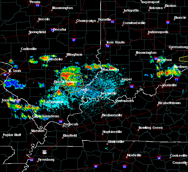 The national weather service in paducah has issued a * severe thunderstorm warning for. northwestern white county in southeastern illinois. wayne county in south central illinois. western edwards county in southeastern illinois. Northeastern hamilton county in south central illinois. The national weather service in paducah has issued a * severe thunderstorm warning for. northwestern white county in southeastern illinois. wayne county in south central illinois. western edwards county in southeastern illinois. Northeastern hamilton county in south central illinois.
|
| 7/17/2019 8:57 PM CDT |
 The severe thunderstorm warning for western white, wayne and hamilton counties will expire at 900 pm cdt, the storms which prompted the warning have weakened below severe limits, and will continue exiting the warned area. therefore, the warning will be allowed to expire. a severe thunderstorm watch remains in effect until 900 pm cdt for south central and southeastern illinois. The severe thunderstorm warning for western white, wayne and hamilton counties will expire at 900 pm cdt, the storms which prompted the warning have weakened below severe limits, and will continue exiting the warned area. therefore, the warning will be allowed to expire. a severe thunderstorm watch remains in effect until 900 pm cdt for south central and southeastern illinois.
|
| 7/17/2019 8:28 PM CDT |
 At 827 pm cdt, severe thunderstorms were located along a line extending from near wayne city to 7 miles north of eldorado, moving southeast at 45 mph. these storms downed trees and power lines as they moved across jefferson county illinois (law enforcement). Hazards include 60 mph wind gusts. Expect damage to roofs, siding, and trees. Locations impacted include, carmi, fairfield, mcleansboro, norris city, wayne city, cisne, enfield, dahlgren, jeffersonville, sims, mill shoals, broughton, springerton, mount erie, keenes, johnsonville, golden gate, macedonia, belle prairie city and burnt prairie. At 827 pm cdt, severe thunderstorms were located along a line extending from near wayne city to 7 miles north of eldorado, moving southeast at 45 mph. these storms downed trees and power lines as they moved across jefferson county illinois (law enforcement). Hazards include 60 mph wind gusts. Expect damage to roofs, siding, and trees. Locations impacted include, carmi, fairfield, mcleansboro, norris city, wayne city, cisne, enfield, dahlgren, jeffersonville, sims, mill shoals, broughton, springerton, mount erie, keenes, johnsonville, golden gate, macedonia, belle prairie city and burnt prairie.
|
| 7/17/2019 8:06 PM CDT |
 At 806 pm cdt, severe thunderstorms were located along a line extending from 6 miles southwest of helm to near thompsonville, moving east at 35 mph. law enforcement reports numerous trees and power lines downed throughout jefferson county with these storms, so take cover now! (law enforcement). Hazards include 60 mph wind gusts. expect damage to roofs, siding, and trees At 806 pm cdt, severe thunderstorms were located along a line extending from 6 miles southwest of helm to near thompsonville, moving east at 35 mph. law enforcement reports numerous trees and power lines downed throughout jefferson county with these storms, so take cover now! (law enforcement). Hazards include 60 mph wind gusts. expect damage to roofs, siding, and trees
|
| 7/4/2019 3:06 PM CDT |
 At 306 pm cdt, a severe thunderstorm was located near fairfield, moving east at 15 mph (radar indicated). Hazards include 60 mph wind gusts. Expect damage to roofs, siding, and trees. Locations impacted include, fairfield and golden gate. At 306 pm cdt, a severe thunderstorm was located near fairfield, moving east at 15 mph (radar indicated). Hazards include 60 mph wind gusts. Expect damage to roofs, siding, and trees. Locations impacted include, fairfield and golden gate.
|
| 7/4/2019 2:50 PM CDT |
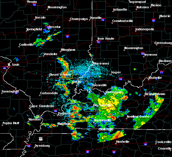 At 250 pm cdt, a severe thunderstorm was located over fairfield, moving east at 15 mph (radar indicated). Hazards include 60 mph wind gusts and quarter size hail. Hail damage to vehicles is expected. Expect wind damage to roofs, siding, and trees. At 250 pm cdt, a severe thunderstorm was located over fairfield, moving east at 15 mph (radar indicated). Hazards include 60 mph wind gusts and quarter size hail. Hail damage to vehicles is expected. Expect wind damage to roofs, siding, and trees.
|
| 6/21/2019 2:40 PM CDT |
 At 239 pm cdt, severe thunderstorms were located along a line extending from near cisne to near wayne city to sesser, moving east at 40 mph (radar indicated). Hazards include 60 mph wind gusts and nickel size hail. the strongest winds estimated by radar are over northern wayne county. Expect damage to roofs, siding, and trees. Locations impacted include, benton, carmi, fairfield, mcleansboro, christopher, albion, rend lake area, sesser, norris city, wayne city, west salem, cisne, valier, west city, enfield, thompsonville, ina, dahlgren, buckner and bonnie. At 239 pm cdt, severe thunderstorms were located along a line extending from near cisne to near wayne city to sesser, moving east at 40 mph (radar indicated). Hazards include 60 mph wind gusts and nickel size hail. the strongest winds estimated by radar are over northern wayne county. Expect damage to roofs, siding, and trees. Locations impacted include, benton, carmi, fairfield, mcleansboro, christopher, albion, rend lake area, sesser, norris city, wayne city, west salem, cisne, valier, west city, enfield, thompsonville, ina, dahlgren, buckner and bonnie.
|
| 6/21/2019 2:21 PM CDT |
 At 221 pm cdt, severe thunderstorms were located along a line extending from near xenia to bluford to near tamaroa, moving east at 40 mph (trained weather spotters). Hazards include 60 mph wind gusts and nickel size hail. reported on the south side of mount vernon. expect damage to roofs, siding, and trees At 221 pm cdt, severe thunderstorms were located along a line extending from near xenia to bluford to near tamaroa, moving east at 40 mph (trained weather spotters). Hazards include 60 mph wind gusts and nickel size hail. reported on the south side of mount vernon. expect damage to roofs, siding, and trees
|
| 6/16/2019 4:39 PM CDT |
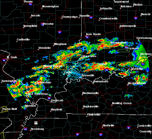 At 439 pm cdt, a severe thunderstorm was located near fairfield, moving east at 25 mph (radar indicated). Hazards include 60 mph wind gusts and quarter size hail. Hail damage to vehicles is expected. Expect wind damage to roofs, siding, and trees. At 439 pm cdt, a severe thunderstorm was located near fairfield, moving east at 25 mph (radar indicated). Hazards include 60 mph wind gusts and quarter size hail. Hail damage to vehicles is expected. Expect wind damage to roofs, siding, and trees.
|
| 6/5/2019 6:03 PM CDT | Report of approximately 30 trees damaged southeast of golden gat in wayne county IL, 1.9 miles NW of Golden Gate, IL |
| 6/5/2019 6:01 PM CDT |
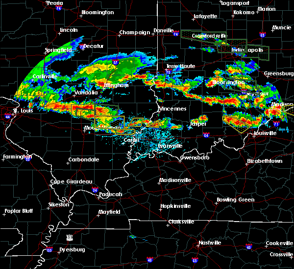 At 601 pm cdt, a severe thunderstorm was located near albion, moving southeast at 25 mph (radar indicated). Hazards include 60 mph wind gusts and quarter size hail. Hail damage to vehicles is expected. Expect wind damage to roofs, siding, and trees. At 601 pm cdt, a severe thunderstorm was located near albion, moving southeast at 25 mph (radar indicated). Hazards include 60 mph wind gusts and quarter size hail. Hail damage to vehicles is expected. Expect wind damage to roofs, siding, and trees.
|
| 6/5/2019 5:18 PM CDT |
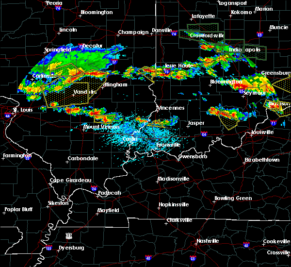 At 517 pm cdt, a severe thunderstorm was located over xenia, or 9 miles southwest of flora, moving southeast at 25 mph.this storm has a history of producing 60 mph winds and hail (radar indicated). Hazards include 60 mph wind gusts and quarter size hail. Hail damage to vehicles is expected. Expect wind damage to roofs, siding, and trees. At 517 pm cdt, a severe thunderstorm was located over xenia, or 9 miles southwest of flora, moving southeast at 25 mph.this storm has a history of producing 60 mph winds and hail (radar indicated). Hazards include 60 mph wind gusts and quarter size hail. Hail damage to vehicles is expected. Expect wind damage to roofs, siding, and trees.
|
| 5/26/2019 1:12 PM CDT |
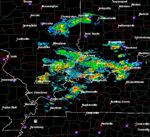 At 112 pm cdt, a severe thunderstorm was located 9 miles northeast of enfield, or 10 miles northwest of carmi, moving east at 35 mph (radar indicated). Hazards include 60 mph wind gusts and nickel size hail. Expect damage to roofs, siding, and trees. Locations impacted include, mill shoals, springerton, golden gate and burnt prairie. At 112 pm cdt, a severe thunderstorm was located 9 miles northeast of enfield, or 10 miles northwest of carmi, moving east at 35 mph (radar indicated). Hazards include 60 mph wind gusts and nickel size hail. Expect damage to roofs, siding, and trees. Locations impacted include, mill shoals, springerton, golden gate and burnt prairie.
|
| 5/26/2019 12:56 PM CDT |
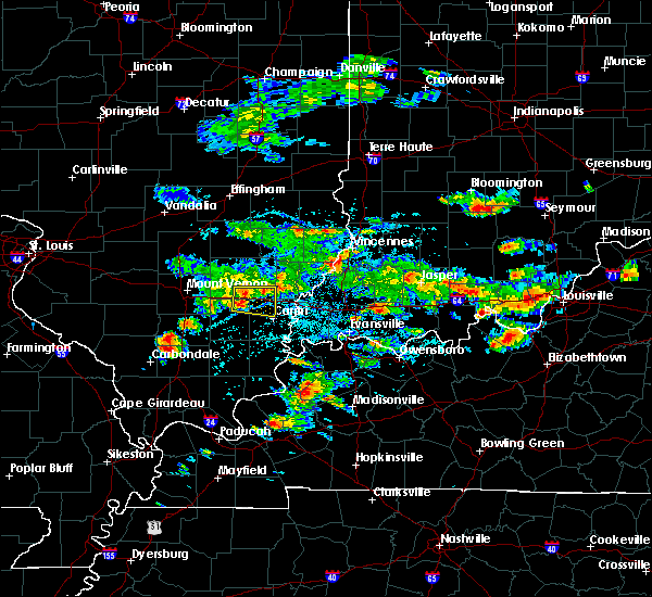 At 1256 pm cdt, a severe thunderstorm was located 8 miles south of fairfield, moving east at 40 mph (radar indicated). Hazards include 60 mph wind gusts and nickel size hail. expect damage to roofs, siding, and trees At 1256 pm cdt, a severe thunderstorm was located 8 miles south of fairfield, moving east at 40 mph (radar indicated). Hazards include 60 mph wind gusts and nickel size hail. expect damage to roofs, siding, and trees
|
| 6/28/2018 7:09 PM CDT |
 At 708 pm cdt, severe thunderstorms were located along a line extending from 6 miles south of schnell to 8 miles northeast of mcleansboro to near johnston city to near ava, moving southeast at 55 mph (trained weather spotters. numerous reports of 60 to 70 mph winds with this line of storms. more damage is likely). Hazards include 70 mph wind gusts and quarter size hail. Hail damage to vehicles is expected. expect considerable tree damage. wind damage is also likely to mobile homes, roofs, and outbuildings. Locations impacted include, west frankfort, murphysboro, mount carmel, benton, du quoin, pinckneyville, carmi, fairfield, mcleansboro, christopher, albion, mount vernon, rend lake area, sesser, zeigler, grayville, de soto, lancaster, norris city and royalton. At 708 pm cdt, severe thunderstorms were located along a line extending from 6 miles south of schnell to 8 miles northeast of mcleansboro to near johnston city to near ava, moving southeast at 55 mph (trained weather spotters. numerous reports of 60 to 70 mph winds with this line of storms. more damage is likely). Hazards include 70 mph wind gusts and quarter size hail. Hail damage to vehicles is expected. expect considerable tree damage. wind damage is also likely to mobile homes, roofs, and outbuildings. Locations impacted include, west frankfort, murphysboro, mount carmel, benton, du quoin, pinckneyville, carmi, fairfield, mcleansboro, christopher, albion, mount vernon, rend lake area, sesser, zeigler, grayville, de soto, lancaster, norris city and royalton.
|
| 6/28/2018 6:25 PM CDT |
 At 624 pm cdt, severe thunderstorms were located along a line extending from near bible grove to near omega to near lively grove to near smithton, moving southeast at 65 mph (radar indicated). Hazards include 60 mph wind gusts and nickel size hail. expect damage to roofs, siding, and trees At 624 pm cdt, severe thunderstorms were located along a line extending from near bible grove to near omega to near lively grove to near smithton, moving southeast at 65 mph (radar indicated). Hazards include 60 mph wind gusts and nickel size hail. expect damage to roofs, siding, and trees
|
| 6/12/2018 3:03 PM CDT |
 At 303 pm cdt, a severe thunderstorm was located 8 miles southwest of albion, moving east at 25 mph (radar indicated). Hazards include 60 mph wind gusts and penny size hail. expect damage to roofs, siding, and trees At 303 pm cdt, a severe thunderstorm was located 8 miles southwest of albion, moving east at 25 mph (radar indicated). Hazards include 60 mph wind gusts and penny size hail. expect damage to roofs, siding, and trees
|
| 6/2/2018 11:15 PM CDT |
 At 1115 pm cdt, severe thunderstorms were located along a line extending from near fairfield to 13 miles east of wayne city to 7 miles northwest of enfield, moving east at 45 mph (radar indicated). Hazards include 60 mph wind gusts. Expect damage to roofs, siding, and trees. Locations impacted include, fairfield, jeffersonville, mill shoals, springerton, golden gate and burnt prairie. At 1115 pm cdt, severe thunderstorms were located along a line extending from near fairfield to 13 miles east of wayne city to 7 miles northwest of enfield, moving east at 45 mph (radar indicated). Hazards include 60 mph wind gusts. Expect damage to roofs, siding, and trees. Locations impacted include, fairfield, jeffersonville, mill shoals, springerton, golden gate and burnt prairie.
|
| 6/2/2018 11:01 PM CDT |
 At 1101 pm cdt, severe thunderstorms were located along a line extending from near wayne city to 11 miles east of bluford to near mcleansboro, moving east at 40 mph (radar indicated). Hazards include 60 mph wind gusts. expect damage to roofs, siding, and trees At 1101 pm cdt, severe thunderstorms were located along a line extending from near wayne city to 11 miles east of bluford to near mcleansboro, moving east at 40 mph (radar indicated). Hazards include 60 mph wind gusts. expect damage to roofs, siding, and trees
|
| 5/31/2018 10:38 AM CDT |
 At 1037 am cdt, severe thunderstorms were located along a line extending from 7 miles north of mount vernon to wayne city to near mcleansboro, moving east at 45 mph. what these storms are doing is producing winds gusting in the 40 to 60 mph range. but with the wet ground conditions, these gusts were resulting in widespread reports of trees and power lines down (radar indicated). Hazards include 60 mph wind gusts. expect damage to roofs, siding, and trees At 1037 am cdt, severe thunderstorms were located along a line extending from 7 miles north of mount vernon to wayne city to near mcleansboro, moving east at 45 mph. what these storms are doing is producing winds gusting in the 40 to 60 mph range. but with the wet ground conditions, these gusts were resulting in widespread reports of trees and power lines down (radar indicated). Hazards include 60 mph wind gusts. expect damage to roofs, siding, and trees
|
| 5/3/2018 7:01 AM CDT | Trampoline blown over home and damaged side of home. time of damage is radar estimated. report relayed via social medi in wayne county IL, 3.3 miles WNW of Golden Gate, IL |
| 11/18/2017 1:01 PM CST |
 At 1259 pm cst, severe thunderstorms were located along a line extending from near claremont to near mcleansboro to near thompsonville, moving east at 55 mph. reports of pea to dime size hail, a few power outages, and some small tree limbs down were reported with the line of storms (radar indicated). Hazards include 60 mph wind gusts and penny size hail. Expect damage to roofs, siding, and trees. Locations impacted include, mcleansboro, mill shoals, broughton and golden gate. At 1259 pm cst, severe thunderstorms were located along a line extending from near claremont to near mcleansboro to near thompsonville, moving east at 55 mph. reports of pea to dime size hail, a few power outages, and some small tree limbs down were reported with the line of storms (radar indicated). Hazards include 60 mph wind gusts and penny size hail. Expect damage to roofs, siding, and trees. Locations impacted include, mcleansboro, mill shoals, broughton and golden gate.
|
| 11/18/2017 12:27 PM CST |
 At 1226 pm cst, severe thunderstorms were located along a line extending from flora to near valier to near murphysboro, moving east at 45 mph (radar indicated). Hazards include 60 mph wind gusts and nickel size hail. expect damage to roofs, siding, and trees At 1226 pm cst, severe thunderstorms were located along a line extending from flora to near valier to near murphysboro, moving east at 45 mph (radar indicated). Hazards include 60 mph wind gusts and nickel size hail. expect damage to roofs, siding, and trees
|
| 7/23/2017 5:00 AM CDT |
 At 459 am cdt, severe thunderstorms were located along a line extending from near flora to near wayne city, moving east at 45 mph (radar indicated). Hazards include 60 mph wind gusts. expect damage to roofs, siding, and trees At 459 am cdt, severe thunderstorms were located along a line extending from near flora to near wayne city, moving east at 45 mph (radar indicated). Hazards include 60 mph wind gusts. expect damage to roofs, siding, and trees
|
| 4/5/2017 4:04 PM CDT |
 At 403 pm cdt, a severe thunderstorm was located over albion, moving northeast at 45 mph (radar indicated). Hazards include 60 mph wind gusts and quarter size hail. Hail damage to vehicles is expected. expect wind damage to roofs, siding, and trees. Locations impacted include, albion, west salem, bone gap, browns and golden gate. At 403 pm cdt, a severe thunderstorm was located over albion, moving northeast at 45 mph (radar indicated). Hazards include 60 mph wind gusts and quarter size hail. Hail damage to vehicles is expected. expect wind damage to roofs, siding, and trees. Locations impacted include, albion, west salem, bone gap, browns and golden gate.
|
| 4/5/2017 3:46 PM CDT |
 At 345 pm cdt, a severe thunderstorm was located 10 miles north of enfield, or 10 miles south of fairfield, moving northeast at 45 mph (radar indicated. this storm produced half dollar size hail as it moved through mcleansboro). Hazards include 60 mph wind gusts and quarter size hail. Hail damage to vehicles is expected. Expect wind damage to roofs, siding, and trees. At 345 pm cdt, a severe thunderstorm was located 10 miles north of enfield, or 10 miles south of fairfield, moving northeast at 45 mph (radar indicated. this storm produced half dollar size hail as it moved through mcleansboro). Hazards include 60 mph wind gusts and quarter size hail. Hail damage to vehicles is expected. Expect wind damage to roofs, siding, and trees.
|
| 10/19/2016 5:39 PM CDT |
 At 538 pm cdt, a severe thunderstorm was located 7 miles southwest of albion, moving east at 30 mph (radar indicated). Hazards include 60 mph wind gusts and quarter size hail. Hail damage to vehicles is expected. expect wind damage to roofs, siding, and trees. Locations impacted include, golden gate. At 538 pm cdt, a severe thunderstorm was located 7 miles southwest of albion, moving east at 30 mph (radar indicated). Hazards include 60 mph wind gusts and quarter size hail. Hail damage to vehicles is expected. expect wind damage to roofs, siding, and trees. Locations impacted include, golden gate.
|
| 10/19/2016 5:10 PM CDT |
 At 509 pm cdt, a severe thunderstorm was located near southwest of fairfield, moving east at 35 mph (radar indicated). Hazards include 60 mph wind gusts and quarter size hail. Hail damage to vehicles is expected. Expect wind damage to roofs, siding, and trees. At 509 pm cdt, a severe thunderstorm was located near southwest of fairfield, moving east at 35 mph (radar indicated). Hazards include 60 mph wind gusts and quarter size hail. Hail damage to vehicles is expected. Expect wind damage to roofs, siding, and trees.
|
| 7/13/2016 5:56 PM CDT |
 The severe thunderstorm warning for eastern wayne and western white counties will expire at 600 pm cdt, the storms which prompted the warning have moved out of the area. therefore, the warning will be allowed to expire. a severe thunderstorm watch remains in effect until 900 pm cdt for south central and southeastern illinois. The severe thunderstorm warning for eastern wayne and western white counties will expire at 600 pm cdt, the storms which prompted the warning have moved out of the area. therefore, the warning will be allowed to expire. a severe thunderstorm watch remains in effect until 900 pm cdt for south central and southeastern illinois.
|
| 7/13/2016 5:42 PM CDT |
 At 541 pm cdt, severe thunderstorms were located along a line extending from 7 miles northwest of albion to near carmi to near norris city, moving east at 50 to 55 mph. these storms continue to produce widespread wind damage (radar indicated). Hazards include 60 mph wind gusts and penny size hail. Expect damage to roofs. siding. and trees. Locations impacted include, carmi, fairfield, norris city, enfield, mill shoals, springerton, mount erie, golden gate and burnt prairie. At 541 pm cdt, severe thunderstorms were located along a line extending from 7 miles northwest of albion to near carmi to near norris city, moving east at 50 to 55 mph. these storms continue to produce widespread wind damage (radar indicated). Hazards include 60 mph wind gusts and penny size hail. Expect damage to roofs. siding. and trees. Locations impacted include, carmi, fairfield, norris city, enfield, mill shoals, springerton, mount erie, golden gate and burnt prairie.
|
| 7/13/2016 5:05 PM CDT |
 At 504 pm cdt, the lead edge of wind damaging severe thunderstorms was located near mcleansboro, moving east at 60 mph. these storms have a history of producing damaging winds so take cover now! (radar indicated). Hazards include 60 mph wind gusts and penny size hail. Expect damage to roofs. siding. And trees. At 504 pm cdt, the lead edge of wind damaging severe thunderstorms was located near mcleansboro, moving east at 60 mph. these storms have a history of producing damaging winds so take cover now! (radar indicated). Hazards include 60 mph wind gusts and penny size hail. Expect damage to roofs. siding. And trees.
|
| 5/11/2016 4:52 PM CDT |
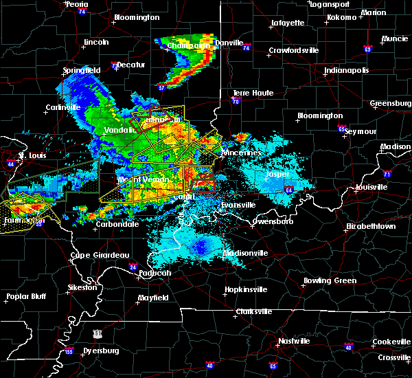 The severe thunderstorm warning for wayne, northwestern white, northern hamilton and edwards counties will expire at 500 pm cdt, the storms which prompted the warning were weakening as they were moving out of the area. therefore the warning will be allowed to expire. however small hail and gusty winds are still possible with these thunderstorms. a severe thunderstorm watch remains in effect until 700 pm cdt for southeastern illinois. The severe thunderstorm warning for wayne, northwestern white, northern hamilton and edwards counties will expire at 500 pm cdt, the storms which prompted the warning were weakening as they were moving out of the area. therefore the warning will be allowed to expire. however small hail and gusty winds are still possible with these thunderstorms. a severe thunderstorm watch remains in effect until 700 pm cdt for southeastern illinois.
|
| 5/11/2016 4:16 PM CDT |
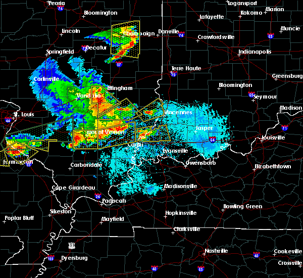 At 415 pm cdt, severe thunderstorms were located along a line extending from 9 miles northwest of albion to near wayne city, moving east at 35 mph. this storm is producing golf ball hail near grayville right now (radar indicated). Hazards include golf ball size hail and 60 mph wind gusts. People and animals outdoors will be injured. expect hail damage to roofs, siding, windows, and vehicles. Expect wind damage to roofs, siding, and trees. At 415 pm cdt, severe thunderstorms were located along a line extending from 9 miles northwest of albion to near wayne city, moving east at 35 mph. this storm is producing golf ball hail near grayville right now (radar indicated). Hazards include golf ball size hail and 60 mph wind gusts. People and animals outdoors will be injured. expect hail damage to roofs, siding, windows, and vehicles. Expect wind damage to roofs, siding, and trees.
|
| 5/11/2016 3:50 PM CDT |
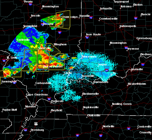 At 349 pm cdt, a severe thunderstorm was located near cisne, or 7 miles northwest of fairfield, moving east at 30 mph. numerous reports of ping pong to golf ball sized hail in and around fairfield have occurred with this storm (radar indicated). Hazards include golf ball size hail and 60 mph wind gusts. People and animals outdoors will be injured. expect hail damage to roofs, siding, windows, and vehicles. expect wind damage to roofs, siding, and trees. Locations impacted include, fairfield, wayne city, cisne, jeffersonville, sims, mill shoals, mount erie, keenes, johnsonville and golden gate. At 349 pm cdt, a severe thunderstorm was located near cisne, or 7 miles northwest of fairfield, moving east at 30 mph. numerous reports of ping pong to golf ball sized hail in and around fairfield have occurred with this storm (radar indicated). Hazards include golf ball size hail and 60 mph wind gusts. People and animals outdoors will be injured. expect hail damage to roofs, siding, windows, and vehicles. expect wind damage to roofs, siding, and trees. Locations impacted include, fairfield, wayne city, cisne, jeffersonville, sims, mill shoals, mount erie, keenes, johnsonville and golden gate.
|
| 5/11/2016 3:40 PM CDT |
 At 339 pm cdt, a severe thunderstorm was located near and just west of fairfield, moving east at 25 mph. this storm just produced ping pong sized hail in fairfield (radar indicated). Hazards include ping pong ball size hail and 60 mph wind gusts. People and animals outdoors will be injured. expect hail damage to roofs, siding, windows, and vehicles. expect wind damage to roofs, siding, and trees. Locations impacted include, fairfield, wayne city, cisne, jeffersonville, sims, mill shoals, mount erie, keenes, johnsonville and golden gate. At 339 pm cdt, a severe thunderstorm was located near and just west of fairfield, moving east at 25 mph. this storm just produced ping pong sized hail in fairfield (radar indicated). Hazards include ping pong ball size hail and 60 mph wind gusts. People and animals outdoors will be injured. expect hail damage to roofs, siding, windows, and vehicles. expect wind damage to roofs, siding, and trees. Locations impacted include, fairfield, wayne city, cisne, jeffersonville, sims, mill shoals, mount erie, keenes, johnsonville and golden gate.
|
| 5/11/2016 3:28 PM CDT |
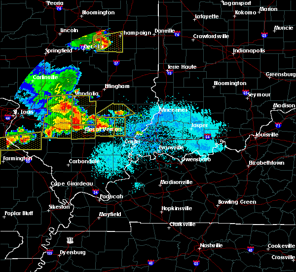 At 327 pm cdt, a severe thunderstorm was located 7 miles southeast of helm, or 13 miles northwest of fairfield, moving northeast at 25 mph. this storm is producing hail to the size of ping pongs near wayne city (radar indicated). Hazards include ping pong ball size hail and 60 mph wind gusts. People and animals outdoors will be injured. expect hail damage to roofs, siding, windows, and vehicles. Expect wind damage to roofs, siding, and trees. At 327 pm cdt, a severe thunderstorm was located 7 miles southeast of helm, or 13 miles northwest of fairfield, moving northeast at 25 mph. this storm is producing hail to the size of ping pongs near wayne city (radar indicated). Hazards include ping pong ball size hail and 60 mph wind gusts. People and animals outdoors will be injured. expect hail damage to roofs, siding, windows, and vehicles. Expect wind damage to roofs, siding, and trees.
|
| 5/7/2016 6:15 PM CDT |
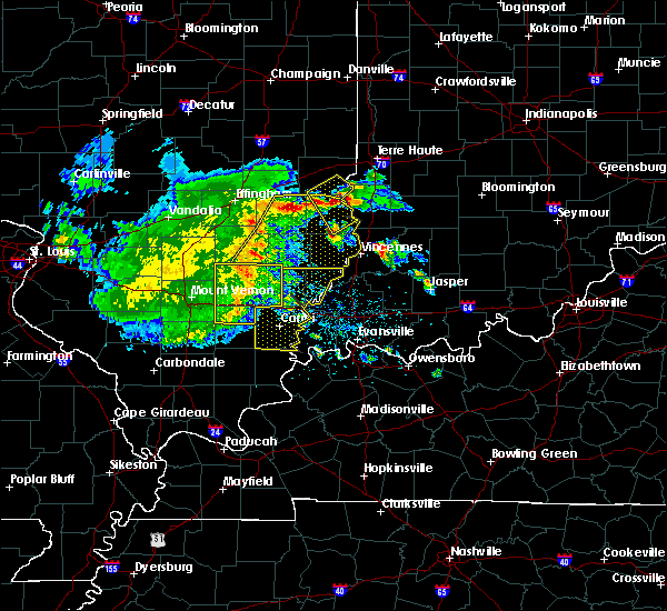 At 614 pm cdt, a severe thunderstorm was located over fairfield, moving east at 65 mph. this storm has a history of producing wind damage with winds in excess of 60 mph (radar indicated). Hazards include 60 mph wind gusts. Expect damage to roofs. siding. and trees. Locations impacted include, fairfield, wayne city, cisne, dahlgren, jeffersonville, sims, mill shoals, mount erie, keenes, johnsonville, golden gate and belle prairie city. At 614 pm cdt, a severe thunderstorm was located over fairfield, moving east at 65 mph. this storm has a history of producing wind damage with winds in excess of 60 mph (radar indicated). Hazards include 60 mph wind gusts. Expect damage to roofs. siding. and trees. Locations impacted include, fairfield, wayne city, cisne, dahlgren, jeffersonville, sims, mill shoals, mount erie, keenes, johnsonville, golden gate and belle prairie city.
|
| 5/7/2016 5:51 PM CDT |
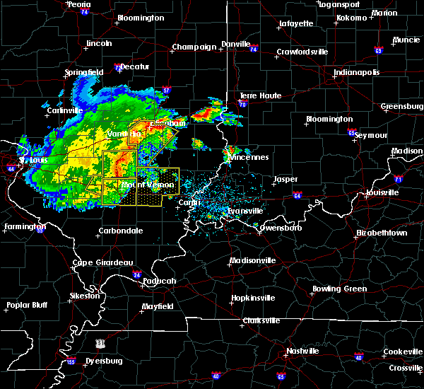 At 549 pm cdt, a severe thunderstorm was located near bluford, or 7 miles southeast of mount vernon, moving east at 65 mph. a trained spotter estimated winds gusting to 75 mph as this storm moved through boyd in northern jefferson county. and tree limbs were downed as the storm moved through woodlawn in jefferson county (radar indicated). Hazards include 70 mph wind gusts. Expect considerable tree damage. Damage is likely to mobile homes, roofs, and outbuildings. At 549 pm cdt, a severe thunderstorm was located near bluford, or 7 miles southeast of mount vernon, moving east at 65 mph. a trained spotter estimated winds gusting to 75 mph as this storm moved through boyd in northern jefferson county. and tree limbs were downed as the storm moved through woodlawn in jefferson county (radar indicated). Hazards include 70 mph wind gusts. Expect considerable tree damage. Damage is likely to mobile homes, roofs, and outbuildings.
|
| 5/1/2016 7:25 PM CDT |
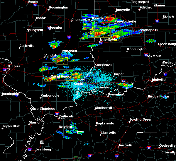 The severe thunderstorm warning for southeastern wayne county will expire at 730 pm cdt, the storm which prompted the warning has weakened below severe limits, and have exited the warned area. therefore the warning will be allowed to expire. The severe thunderstorm warning for southeastern wayne county will expire at 730 pm cdt, the storm which prompted the warning has weakened below severe limits, and have exited the warned area. therefore the warning will be allowed to expire.
|
| 5/1/2016 7:04 PM CDT |
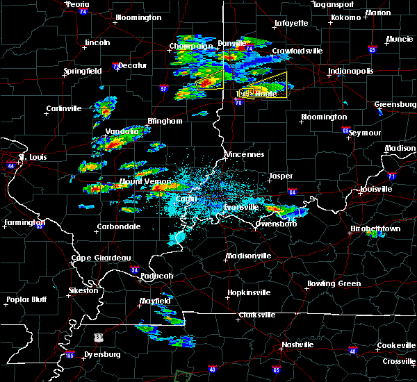 At 704 pm cdt, a severe thunderstorm was located near fairfield, moving east at 30 mph (radar indicated). Hazards include 60 mph wind gusts and quarter size hail. Hail damage to vehicles is expected. Expect wind damage to roofs, siding, and trees. At 704 pm cdt, a severe thunderstorm was located near fairfield, moving east at 30 mph (radar indicated). Hazards include 60 mph wind gusts and quarter size hail. Hail damage to vehicles is expected. Expect wind damage to roofs, siding, and trees.
|
| 4/26/2016 4:46 PM CDT |
 At 445 pm cdt, severe thunderstorms were located along a line extending from near schnell to near fairfield, moving east at 50 mph (radar indicated). Hazards include 60 mph wind gusts and quarter size hail. Hail damage to vehicles is expected. expect wind damage to roofs, siding, and trees. Locations impacted include, fairfield, wayne city, cisne, jeffersonville, sims, mill shoals, mount erie, johnsonville and golden gate. At 445 pm cdt, severe thunderstorms were located along a line extending from near schnell to near fairfield, moving east at 50 mph (radar indicated). Hazards include 60 mph wind gusts and quarter size hail. Hail damage to vehicles is expected. expect wind damage to roofs, siding, and trees. Locations impacted include, fairfield, wayne city, cisne, jeffersonville, sims, mill shoals, mount erie, johnsonville and golden gate.
|
| 4/26/2016 4:32 PM CDT |
 At 431 pm cdt, severe thunderstorms were located along a line extending from near cisne to near mcleansboro, moving east at 40 mph (radar indicated). Hazards include 60 mph wind gusts and quarter size hail. Hail damage to vehicles is expected. expect wind damage to roofs, siding, and trees. Locations impacted include, fairfield, mcleansboro, wayne city, cisne, dahlgren, jeffersonville, sims, mill shoals, broughton, mount erie, keenes, johnsonville, golden gate, macedonia and belle prairie city. At 431 pm cdt, severe thunderstorms were located along a line extending from near cisne to near mcleansboro, moving east at 40 mph (radar indicated). Hazards include 60 mph wind gusts and quarter size hail. Hail damage to vehicles is expected. expect wind damage to roofs, siding, and trees. Locations impacted include, fairfield, mcleansboro, wayne city, cisne, dahlgren, jeffersonville, sims, mill shoals, broughton, mount erie, keenes, johnsonville, golden gate, macedonia and belle prairie city.
|
| 4/26/2016 4:14 PM CDT |
 At 412 pm cdt, severe thunderstorms were located along a line extending from helm to 8 miles northeast of rend lake area, moving east at 40 mph (law enforcement). Hazards include 60 mph wind gusts and quarter size hail. other storms ahead of the line produced quarter size hail in northern hamilton county. Hail damage to vehicles is expected. Expect wind damage to roofs, siding, and trees. At 412 pm cdt, severe thunderstorms were located along a line extending from helm to 8 miles northeast of rend lake area, moving east at 40 mph (law enforcement). Hazards include 60 mph wind gusts and quarter size hail. other storms ahead of the line produced quarter size hail in northern hamilton county. Hail damage to vehicles is expected. Expect wind damage to roofs, siding, and trees.
|
| 4/21/2016 7:20 PM CDT |
 At 719 pm cdt, a severe thunderstorm was located near fairfield, moving east at 40 mph (radar indicated). Hazards include 60 mph wind gusts and quarter size hail. Hail damage to vehicles is expected. Expect wind damage to roofs, siding, and trees. At 719 pm cdt, a severe thunderstorm was located near fairfield, moving east at 40 mph (radar indicated). Hazards include 60 mph wind gusts and quarter size hail. Hail damage to vehicles is expected. Expect wind damage to roofs, siding, and trees.
|
| 4/6/2016 3:53 PM CDT |
 At 352 pm cdt, a severe thunderstorm was located near grayville, or 9 miles south of albion, moving northeast at 45 mph (radar indicated). Hazards include 60 mph wind gusts. no additional reports have been received in the warned area. however, doppler radar continues to show the potential for damaging winds in that area. Expect damage to roofs. siding. and trees. Locations impacted include, mount vernon, carmi, fairfield, albion, grayville, norris city, poseyville, west salem, new harmony, crossville, enfield, blairsville, new haven, omaha, bone gap, mill shoals, griffin, maunie, browns and springerton. At 352 pm cdt, a severe thunderstorm was located near grayville, or 9 miles south of albion, moving northeast at 45 mph (radar indicated). Hazards include 60 mph wind gusts. no additional reports have been received in the warned area. however, doppler radar continues to show the potential for damaging winds in that area. Expect damage to roofs. siding. and trees. Locations impacted include, mount vernon, carmi, fairfield, albion, grayville, norris city, poseyville, west salem, new harmony, crossville, enfield, blairsville, new haven, omaha, bone gap, mill shoals, griffin, maunie, browns and springerton.
|
| 4/6/2016 3:38 PM CDT |
 At 337 pm cdt, a severe thunderstorm was located near carmi, moving northeast at 55 mph (law enforcement). Hazards include 70 mph wind gusts. 911 in harrisburg reported numerous power lines and power poles down. power lines were reported down in ridgeway illinois. little if any lightning is associated with this band of showers. Expect considerable tree damage. Damage is likely to mobile homes, roofs, and outbuildings. At 337 pm cdt, a severe thunderstorm was located near carmi, moving northeast at 55 mph (law enforcement). Hazards include 70 mph wind gusts. 911 in harrisburg reported numerous power lines and power poles down. power lines were reported down in ridgeway illinois. little if any lightning is associated with this band of showers. Expect considerable tree damage. Damage is likely to mobile homes, roofs, and outbuildings.
|
| 12/23/2015 12:25 PM CST | At 1224 pm cst, a severe thunderstorm capable of producing a tornado was located 8 miles southeast of fairfield, moving east at 45 mph (radar indicated rotation). Hazards include tornado. Flying debris will be dangerous to those caught without shelter. mobile homes will be damaged or destroyed. damage to roofs, windows and vehicles will occur. tree damage is likely. this dangerous storm will be near, albion and grayville around 1240 pm cst. Other locations impacted by this tornadic thunderstorm include browns, golden gate and bone gap. |
| 12/23/2015 12:14 PM CST | At 1214 pm cst, severe thunderstorms were located along a line extending from near cisne to near mcleansboro to near harrisburg, moving east at 55 mph (trained weather spotters). Hazards include 70 mph wind gusts. Expect considerable tree damage. Damage is likely to mobile homes, roofs and outbuildings. |
| 6/25/2015 10:06 PM CDT |
 At 1006 pm cdt, severe thunderstorms were located along a line extending from 9 miles south of schnell to 9 miles southwest of albion to near enfield, moving east at 50 mph (radar indicated). Hazards include 60 mph wind gusts. Expect damage to roofs. Siding and trees. At 1006 pm cdt, severe thunderstorms were located along a line extending from 9 miles south of schnell to 9 miles southwest of albion to near enfield, moving east at 50 mph (radar indicated). Hazards include 60 mph wind gusts. Expect damage to roofs. Siding and trees.
|
| 4/9/2015 10:47 PM CDT | The national weather service in paducah has issued a * severe thunderstorm warning for. wabash county in southeastern illinois. edwards county in southeastern illinois. southeastern wayne county in south central illinois. Until 1145 pm cdt. |
| 4/9/2015 10:40 PM CDT | A severe thunderstorm warning remains in effect until 1045 pm cdt for edwards and southeastern wayne counties. at 1039 pm cdt. severe thunderstorms were located along a line extending from 7 miles east of cisne to near fairfield. moving east at 40 mph. This storm still has the potential for damaging winds over southeast wayne county. |
| 4/9/2015 9:58 PM CDT | The national weather service in paducah has issued a * severe thunderstorm warning for. edwards county in southeastern illinois. wayne county in south central illinois. until 1045 pm cdt * at 958 pm cdt. Severe thunderstorms were located along a line. |
| 4/7/2015 1:38 PM CDT | The severe thunderstorm warning for eastern wayne county will expire at 145 pm cdt. the storm which prompted the warning has moving out of the area. therefore the warning will be allowed to expire. to report severe weather. contact your nearest law enforcement agency. They will relay your report to the national weather service. |
| 4/7/2015 1:27 PM CDT | A severe thunderstorm warning remains in effect until 145 pm cdt for eastern wayne county. at 127 pm cdt. a severe thunderstorm was located near albion. moving east at 40 mph. hazard. 60 mph wind gusts and penny size hail. source. Radar indicated. |
| 4/7/2015 1:12 PM CDT | A severe thunderstorm warning remains in effect until 145 pm cdt for eastern wayne county. at 112 pm cdt. a severe thunderstorm was located near fairfield. moving east at 40 mph. hazard. 60 mph wind gusts and penny size hail. source. Radar indicated. |
| 4/7/2015 12:59 PM CDT | The national weather service in paducah has issued a * severe thunderstorm warning for. wayne county in south central illinois. until 145 pm cdt * at 1259 pm cdt. a severe thunderstorm was located near cisne. or 8 miles northwest of fairfield. Moving east at 40 mph. |
Hail Maps for Golden Gate, IL
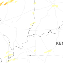


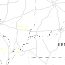


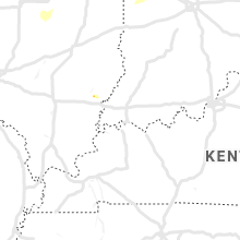


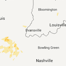


Connect with Interactive Hail Maps