

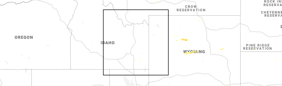
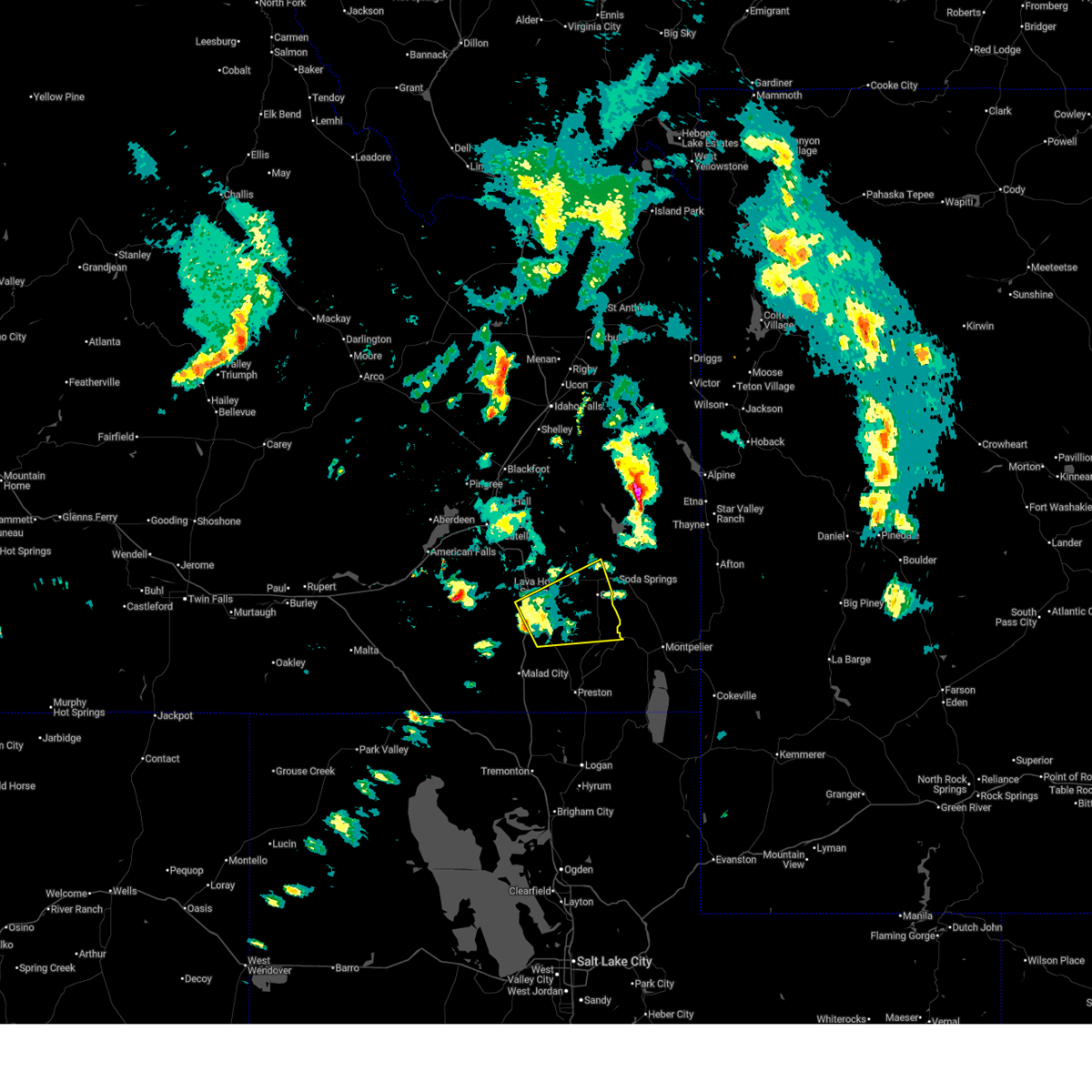
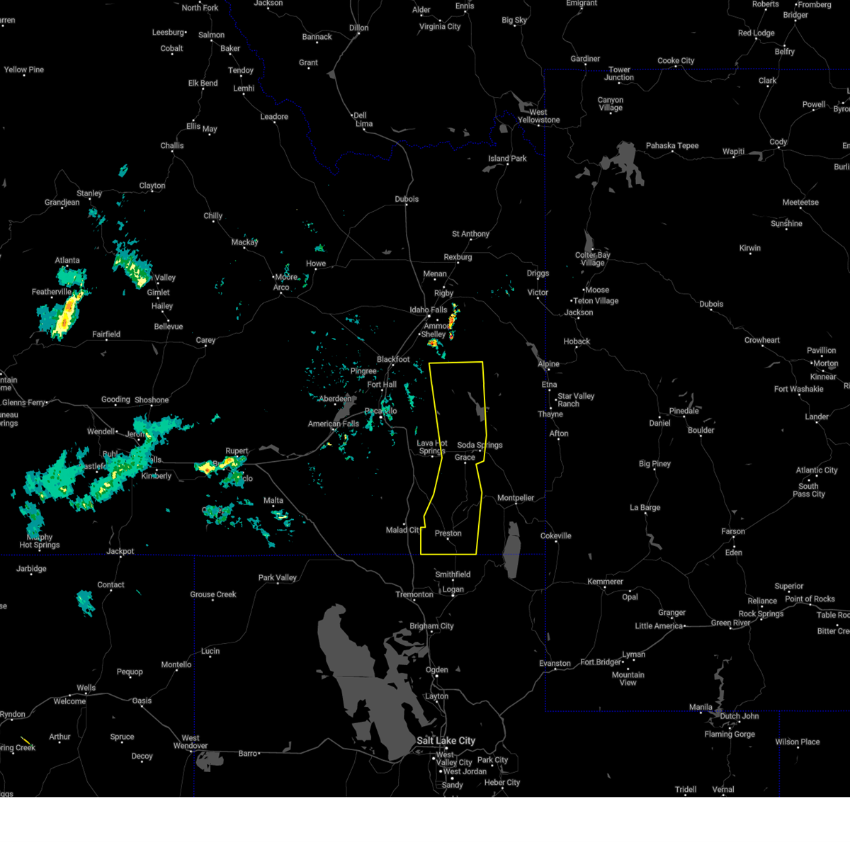
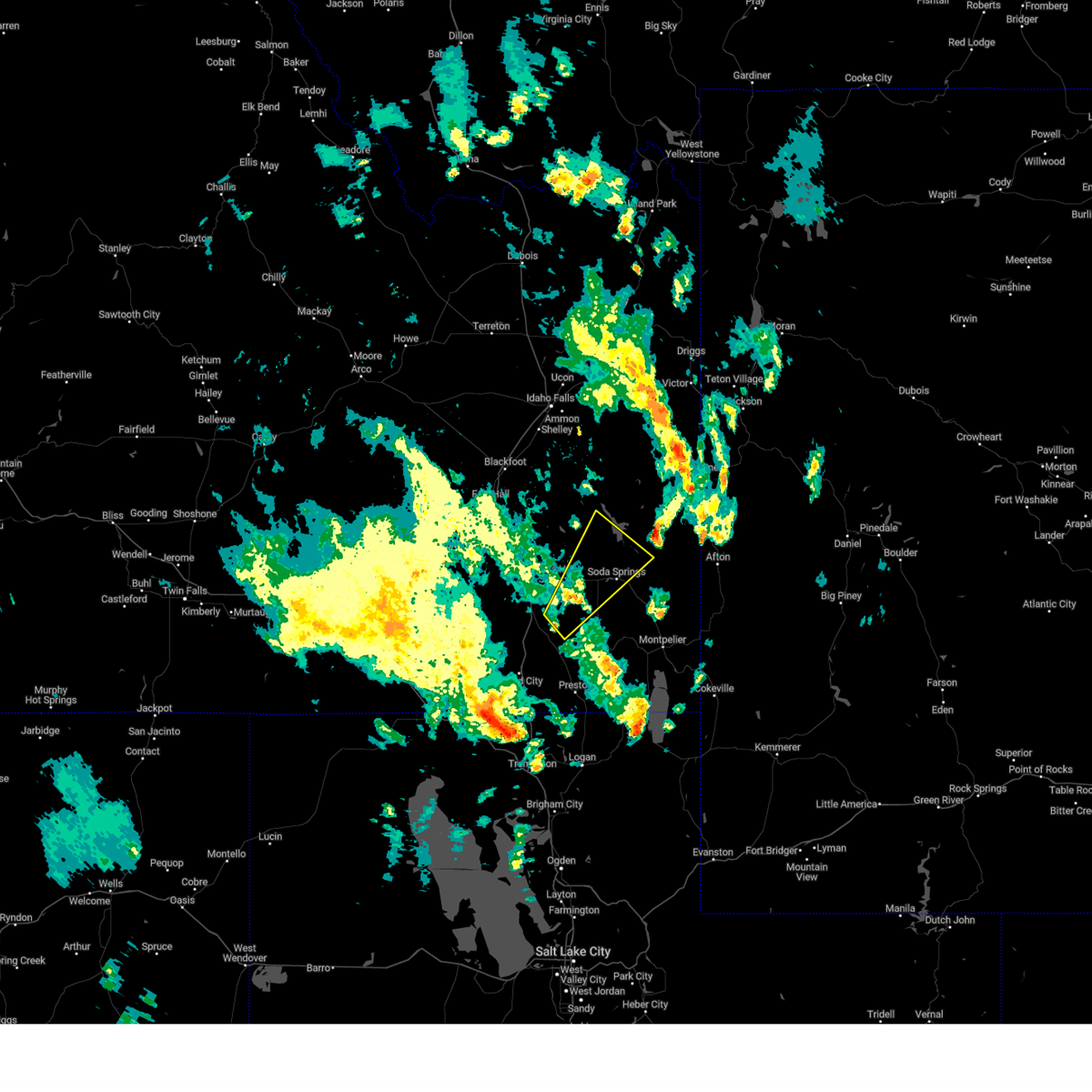
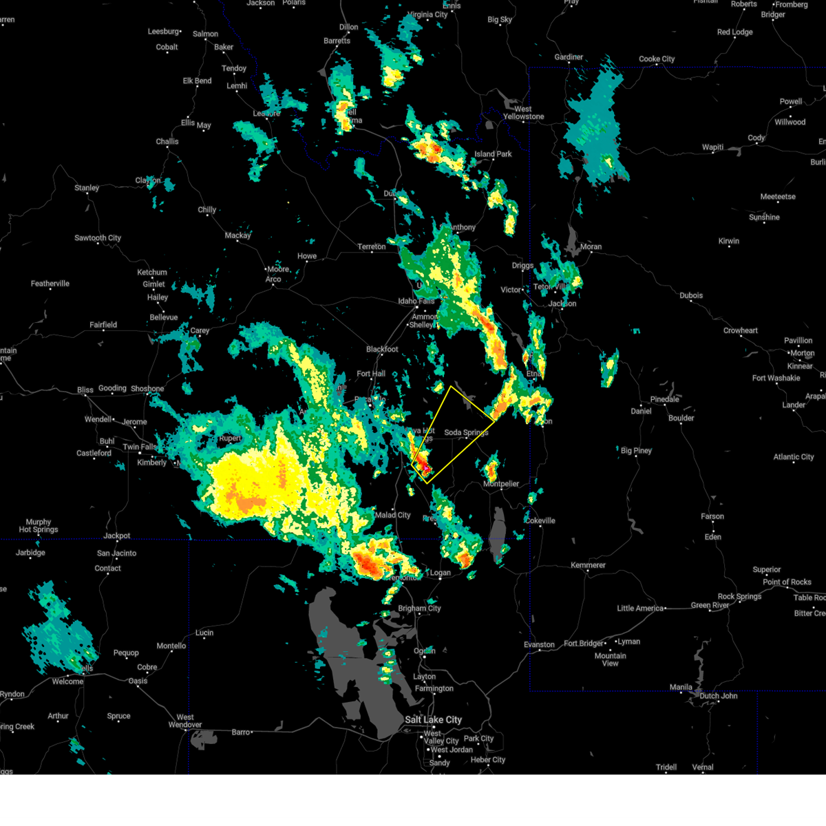
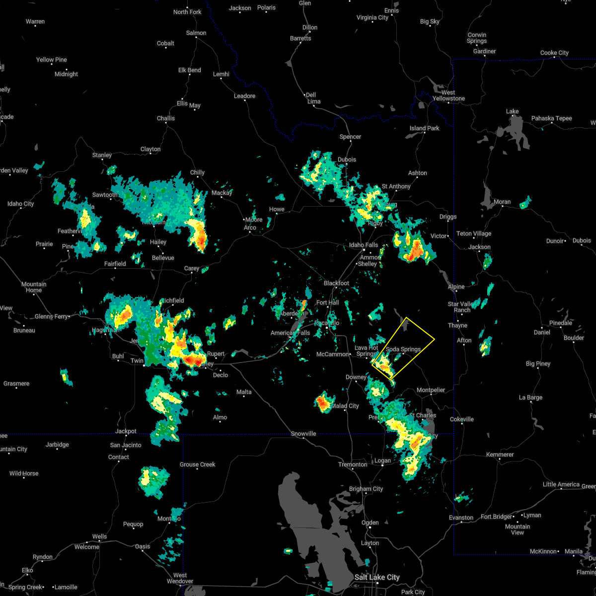
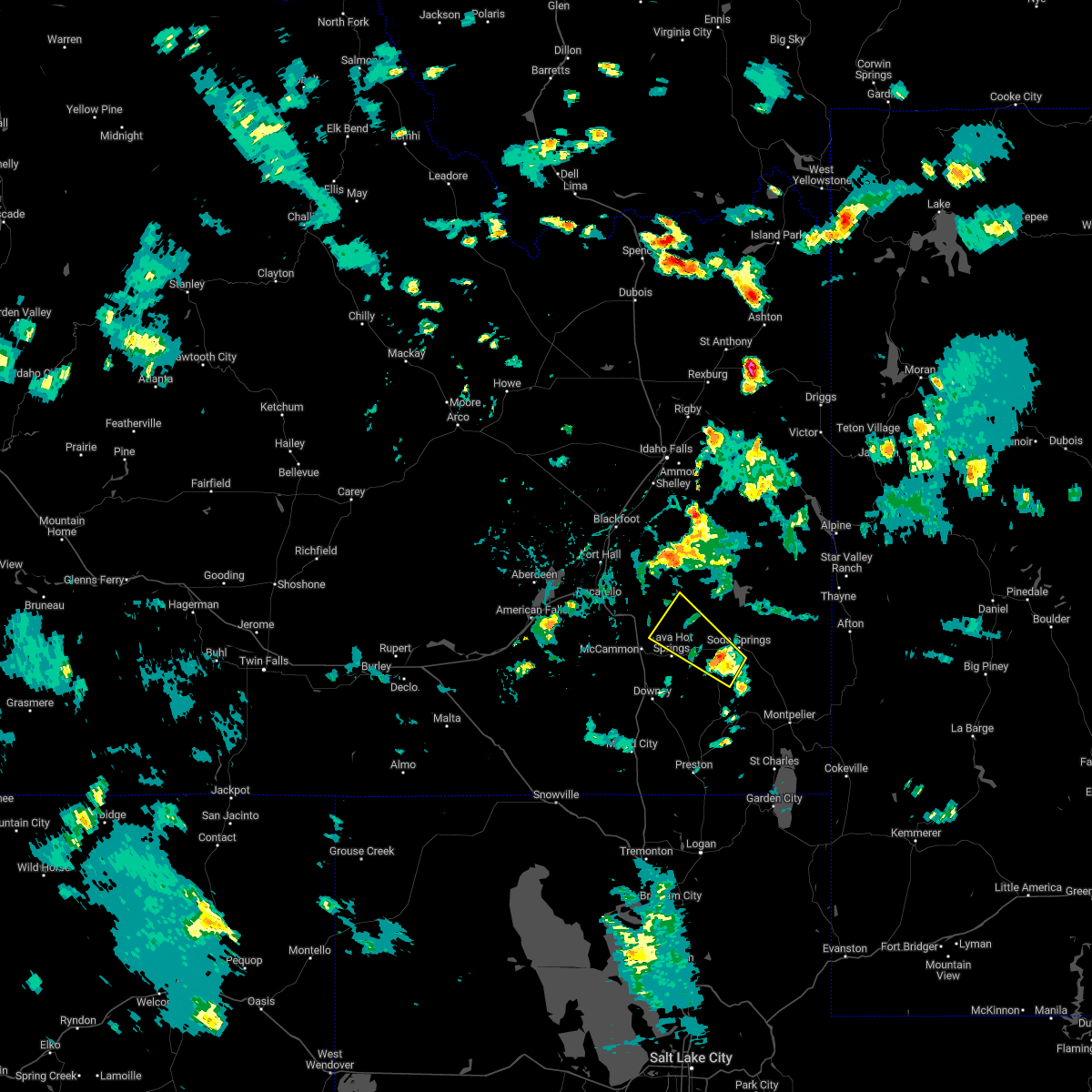
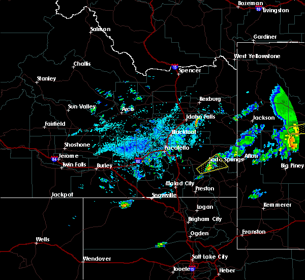
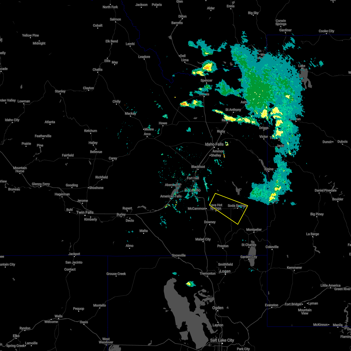
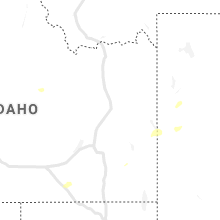
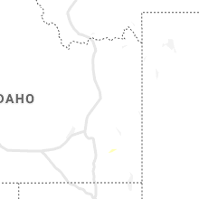
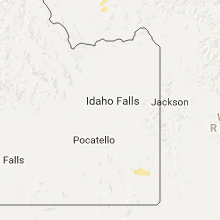
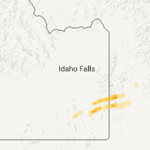
Hail Map for Grace, ID
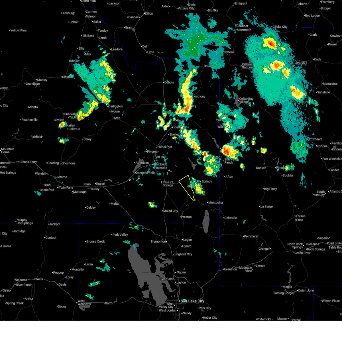
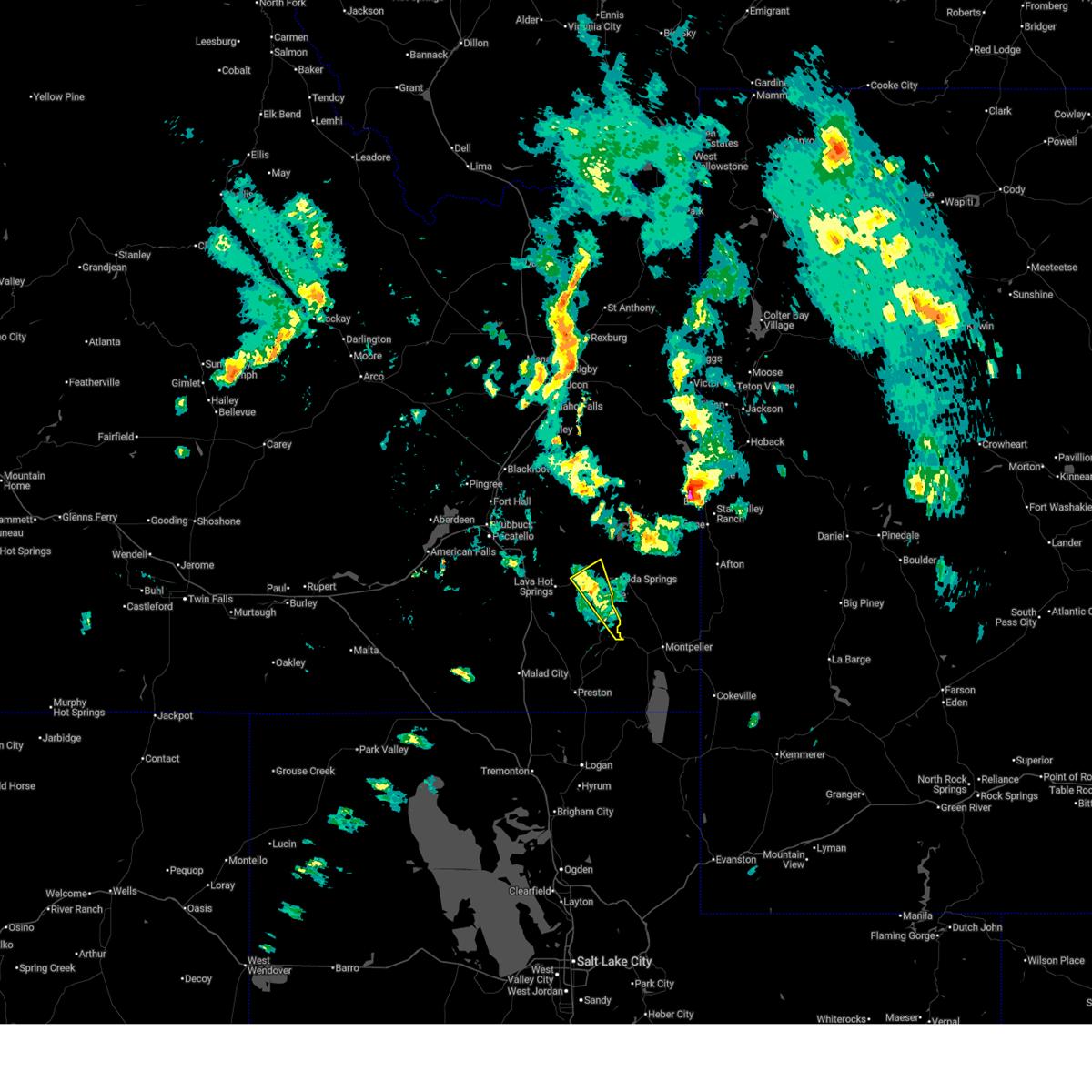
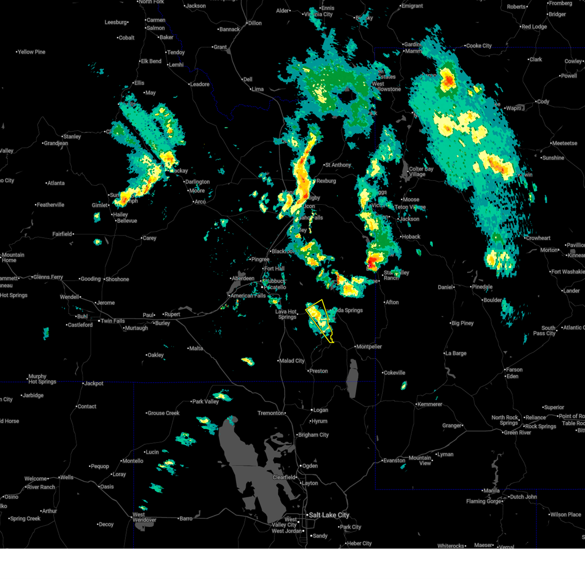
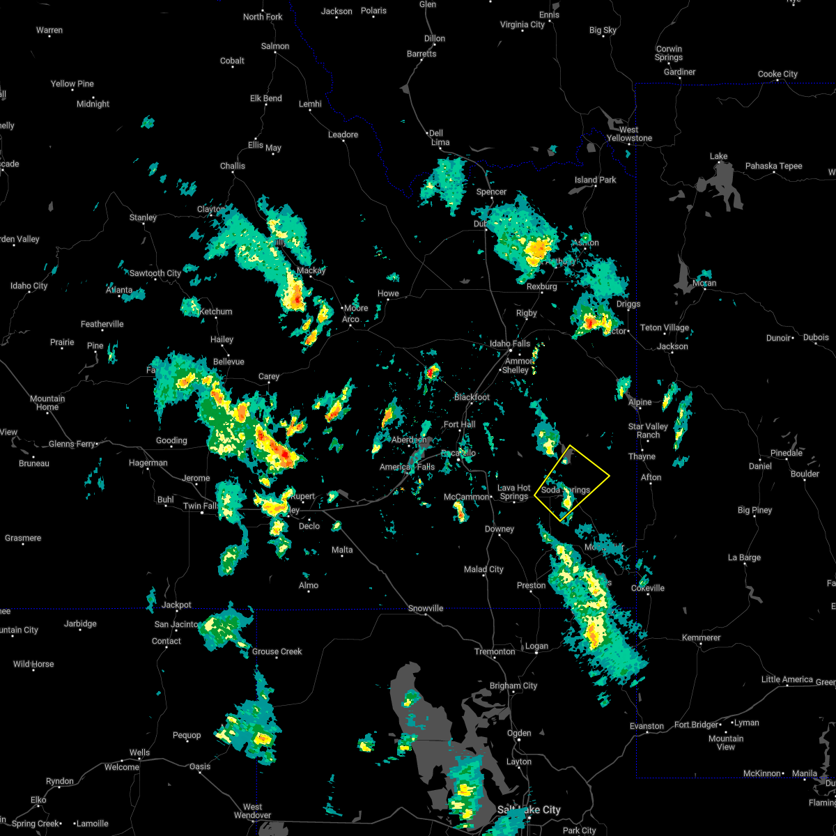
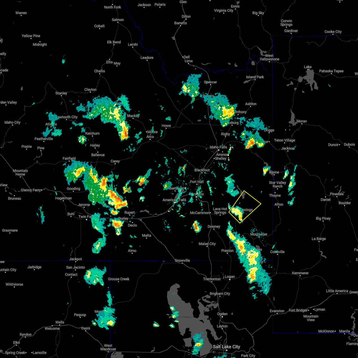
The Grace, ID area has had 1 report of on-the-ground hail by trained spotters, and has been under severe weather warnings 4 times during the past 12 months. Doppler radar has detected hail at or near Grace, ID on 12 occasions.
| Name: | Grace, ID |
| Where Located: | 65.3 miles SSE of Idaho Falls, ID |
| Map: | Google Map for Grace, ID |
| Population: | 915 |
| Housing Units: | 400 |
| More Info: | Search Google for Grace, ID |
5
The Top Recent Hail Date for Grace, ID is Monday, July 15, 2019 (1st out of 12)
Hail and Wind Damage Spotted near Grace, ID
| Date / Time | Report Details |
|---|---|
| 6/11/2025 4:23 PM MDT |
 The storm which prompted the warning has weakened below severe limits, and has exited the warned area. therefore, the warning will be allowed to expire. however, small hail and gusty winds are still possible with this thunderstorm. a severe thunderstorm watch remains in effect until 900 pm mdt for southeastern idaho. The storm which prompted the warning has weakened below severe limits, and has exited the warned area. therefore, the warning will be allowed to expire. however, small hail and gusty winds are still possible with this thunderstorm. a severe thunderstorm watch remains in effect until 900 pm mdt for southeastern idaho.
|
| 6/11/2025 4:10 PM MDT |
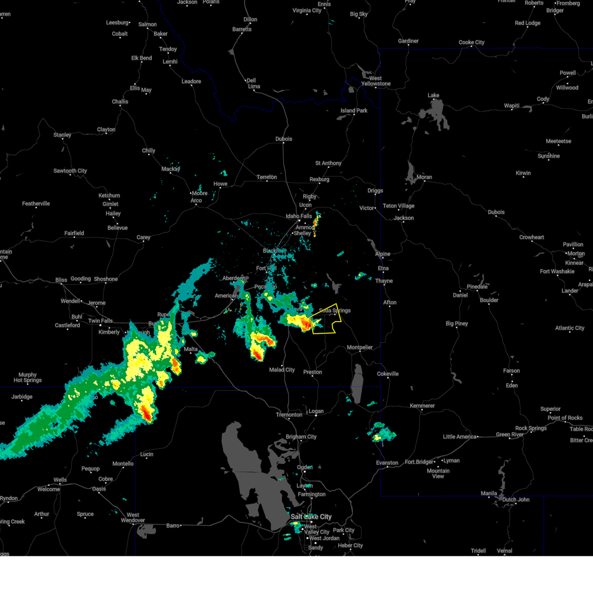
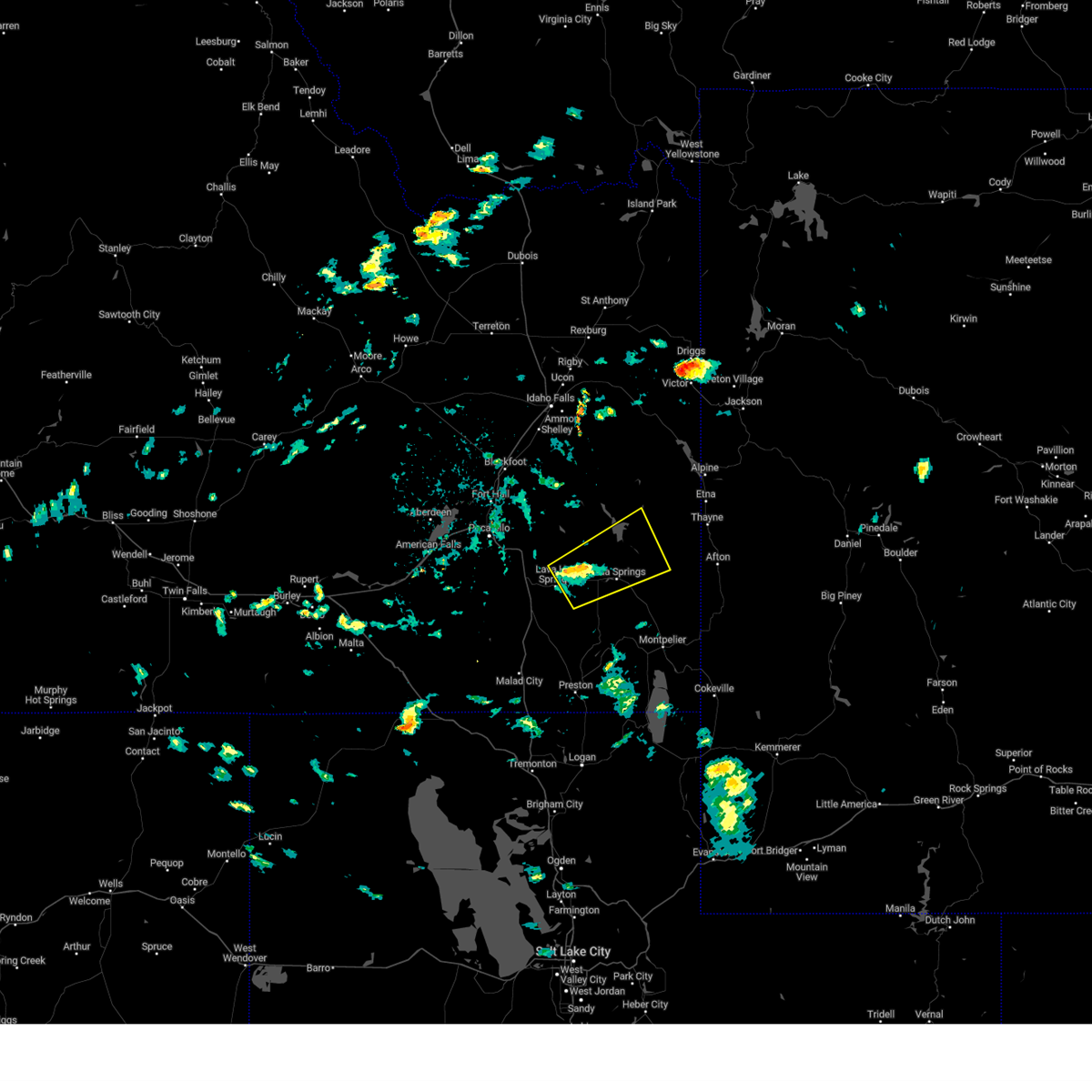
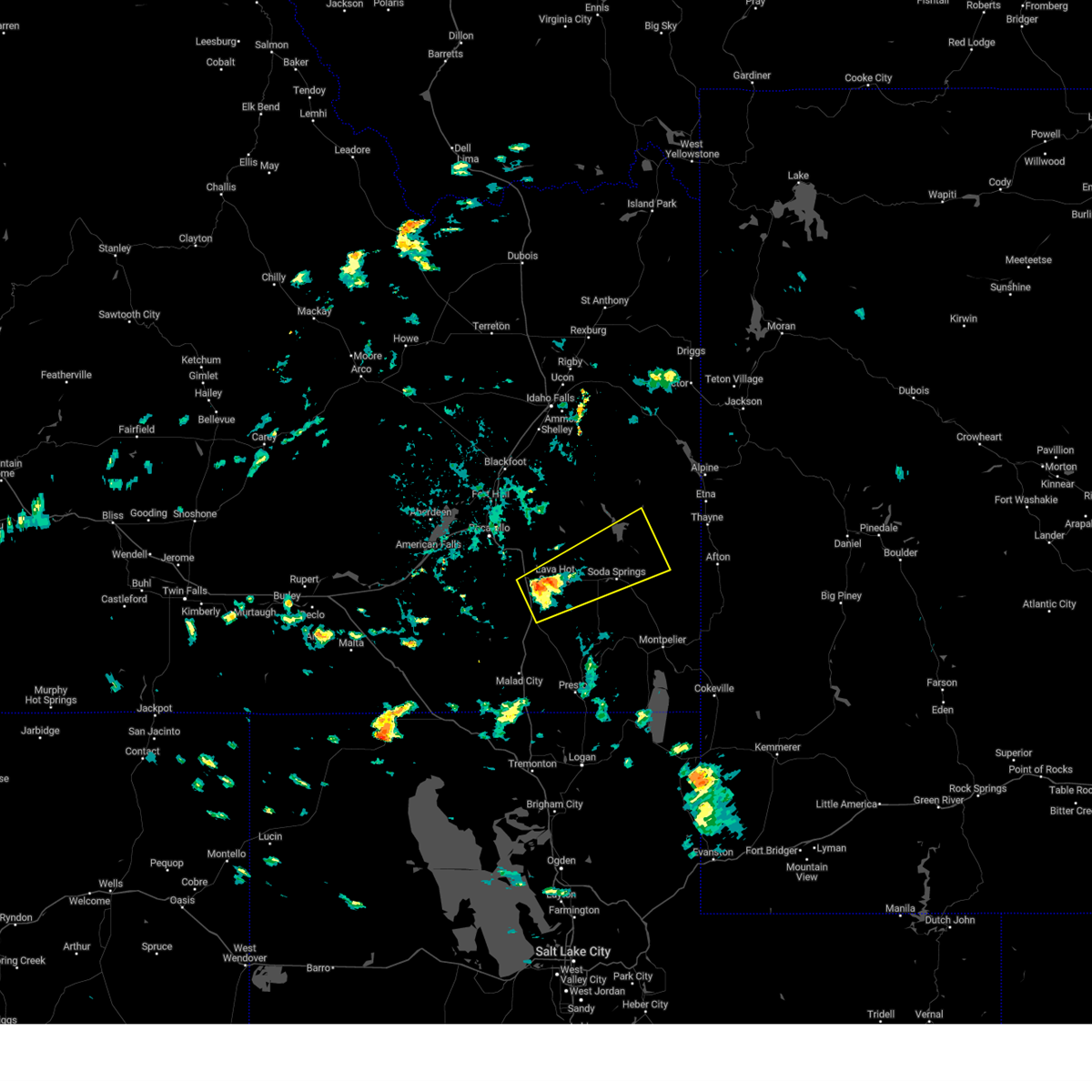
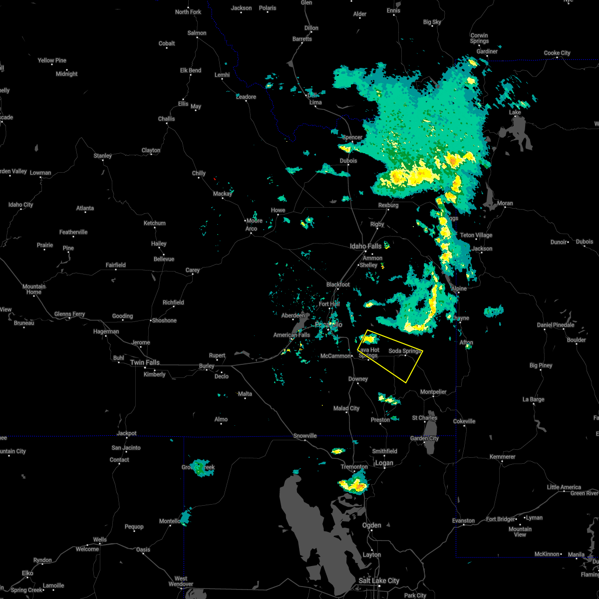
 At 410 pm mdt, a severe thunderstorm was located near grace, or near soda springs, moving east at 50 mph (radar indicated). Hazards include 60 mph wind gusts and quarter size hail. Hail damage to vehicles is expected. expect wind damage to roofs, siding, and trees. Locations impacted include, grace and niter. At 410 pm mdt, a severe thunderstorm was located near grace, or near soda springs, moving east at 50 mph (radar indicated). Hazards include 60 mph wind gusts and quarter size hail. Hail damage to vehicles is expected. expect wind damage to roofs, siding, and trees. Locations impacted include, grace and niter.
|
| 6/11/2025 4:10 PM MDT |
 the severe thunderstorm warning has been cancelled and is no longer in effect the severe thunderstorm warning has been cancelled and is no longer in effect
|
| 6/11/2025 3:45 PM MDT | Fish creek summit itd mesone in caribou county ID, 9.8 miles ESE of Grace, ID |
| 6/11/2025 3:43 PM MDT |
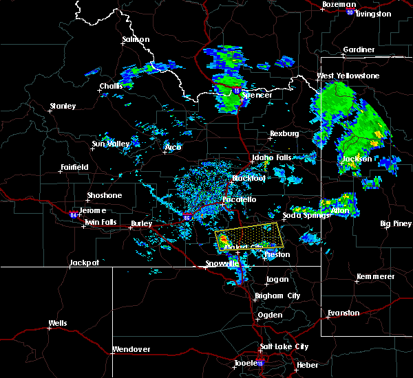
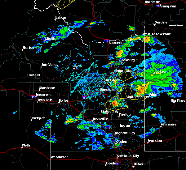
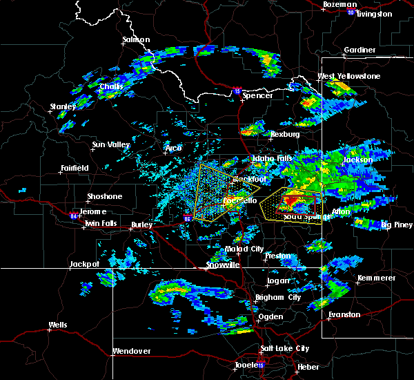
 Svrpih the national weather service in pocatello has issued a * severe thunderstorm warning for, southwestern caribou county in southeastern idaho, southeastern bannock county in southeastern idaho, northeastern franklin county in southeastern idaho, * until 430 pm mdt. * at 343 pm mdt, a severe thunderstorm was located over downey, or 9 miles northwest of swanlake, moving east at 40 mph (radar indicated). Hazards include ping pong ball size hail and 60 mph wind gusts. People and animals outdoors will be injured. expect hail damage to roofs, siding, windows, and vehicles. Expect wind damage to roofs, siding, and trees. Svrpih the national weather service in pocatello has issued a * severe thunderstorm warning for, southwestern caribou county in southeastern idaho, southeastern bannock county in southeastern idaho, northeastern franklin county in southeastern idaho, * until 430 pm mdt. * at 343 pm mdt, a severe thunderstorm was located over downey, or 9 miles northwest of swanlake, moving east at 40 mph (radar indicated). Hazards include ping pong ball size hail and 60 mph wind gusts. People and animals outdoors will be injured. expect hail damage to roofs, siding, windows, and vehicles. Expect wind damage to roofs, siding, and trees.
|
| 5/4/2025 3:20 PM MDT | Multiple public reports of wind damage to roofs... structures... and power lines. rocky mountain power reports 366 customers without power in grace. time estimated base in caribou county ID, 0.4 miles SSE of Grace, ID |
| 8/10/2024 3:48 PM MDT | Mesonet station grai in caribou county ID, 7.1 miles ENE of Grace, ID |
| 5/13/2024 7:06 PM MDT |
 The storms which prompted the warning have weakened. therefore, the warning will be allowed to expire. however, gusty winds are still possible with these thunderstorms as they move east. The storms which prompted the warning have weakened. therefore, the warning will be allowed to expire. however, gusty winds are still possible with these thunderstorms as they move east.
|
| 5/13/2024 6:54 PM MDT |
 the severe thunderstorm warning has been cancelled and is no longer in effect the severe thunderstorm warning has been cancelled and is no longer in effect
|
| 5/13/2024 6:54 PM MDT |
 At 653 pm mdt, severe thunderstorms were located along a line extending from 8 miles east of fort hall lincoln creek lodge to 6 miles south of chesterfield to near trenton, moving east at 35 mph (radar indicated). Hazards include 60 mph wind gusts. Expect damage to roofs, siding, and trees. Locations impacted include, preston, soda springs, blackfoot reservoir, swanlake, chesterfield reservoir, grace, franklin, oneida narrows reservoir, thatcher, chesterfield, dayton, weston, clifton, oxford, cutthroat trout campground, trail creek campground, mapleton, mink creek, whitney, and riverdale. At 653 pm mdt, severe thunderstorms were located along a line extending from 8 miles east of fort hall lincoln creek lodge to 6 miles south of chesterfield to near trenton, moving east at 35 mph (radar indicated). Hazards include 60 mph wind gusts. Expect damage to roofs, siding, and trees. Locations impacted include, preston, soda springs, blackfoot reservoir, swanlake, chesterfield reservoir, grace, franklin, oneida narrows reservoir, thatcher, chesterfield, dayton, weston, clifton, oxford, cutthroat trout campground, trail creek campground, mapleton, mink creek, whitney, and riverdale.
|
| 5/13/2024 6:05 PM MDT |
 Svrpih the national weather service in pocatello has issued a * severe thunderstorm warning for, western caribou county in southeastern idaho, eastern oneida county in southeastern idaho, bannock county in southeastern idaho, central bonneville county in southeastern idaho, franklin county in southeastern idaho, southeastern bingham county in southeastern idaho, * until 715 pm mdt. * at 604 pm mdt, severe thunderstorms were located along a line extending from rockford to near portneuf gap to 12 miles southwest of pleasantview, moving east at 35 mph (radar indicated). Hazards include 60 mph wind gusts. expect damage to roofs, siding, and trees Svrpih the national weather service in pocatello has issued a * severe thunderstorm warning for, western caribou county in southeastern idaho, eastern oneida county in southeastern idaho, bannock county in southeastern idaho, central bonneville county in southeastern idaho, franklin county in southeastern idaho, southeastern bingham county in southeastern idaho, * until 715 pm mdt. * at 604 pm mdt, severe thunderstorms were located along a line extending from rockford to near portneuf gap to 12 miles southwest of pleasantview, moving east at 35 mph (radar indicated). Hazards include 60 mph wind gusts. expect damage to roofs, siding, and trees
|
| 9/3/2023 6:07 PM MDT |
 The severe thunderstorm warning for central caribou, east central bannock and northern franklin counties will expire at 615 pm mdt, the storm which prompted the warning has weakened below severe limits, and no longer poses an immediate threat to life or property. therefore, the warning will be allowed to expire. however, small hail, gusty winds and heavy rain are still possible with this thunderstorm. a severe thunderstorm watch remains in effect until 1000 pm mdt for southeastern idaho. The severe thunderstorm warning for central caribou, east central bannock and northern franklin counties will expire at 615 pm mdt, the storm which prompted the warning has weakened below severe limits, and no longer poses an immediate threat to life or property. therefore, the warning will be allowed to expire. however, small hail, gusty winds and heavy rain are still possible with this thunderstorm. a severe thunderstorm watch remains in effect until 1000 pm mdt for southeastern idaho.
|
| 9/3/2023 5:43 PM MDT |
 At 542 pm mdt, a severe thunderstorm was located 8 miles southeast of lava hot springs, moving northeast at 35 mph (radar indicated). Hazards include quarter size hail. damage to vehicles is expected At 542 pm mdt, a severe thunderstorm was located 8 miles southeast of lava hot springs, moving northeast at 35 mph (radar indicated). Hazards include quarter size hail. damage to vehicles is expected
|
| 8/8/2023 1:32 AM MDT |
 At 131 am mdt, a severe thunderstorm was located near grace, or 8 miles southeast of lava hot springs, moving east at 20 mph (radar indicated). Hazards include 60 mph wind gusts and quarter size hail. Hail damage to vehicles is expected. Expect wind damage to roofs, siding, and trees. At 131 am mdt, a severe thunderstorm was located near grace, or 8 miles southeast of lava hot springs, moving east at 20 mph (radar indicated). Hazards include 60 mph wind gusts and quarter size hail. Hail damage to vehicles is expected. Expect wind damage to roofs, siding, and trees.
|
| 7/27/2023 4:41 PM MDT |
 At 440 pm mdt, a severe thunderstorm was located over soda springs, moving northeast at 25 to 35 mph (radar indicated). Hazards include 60 mph wind gusts and half dollar size hail. Hail damage to vehicles is expected. Expect wind damage to roofs, siding, and trees. At 440 pm mdt, a severe thunderstorm was located over soda springs, moving northeast at 25 to 35 mph (radar indicated). Hazards include 60 mph wind gusts and half dollar size hail. Hail damage to vehicles is expected. Expect wind damage to roofs, siding, and trees.
|
| 7/27/2023 4:19 PM MDT |
 At 419 pm mdt, a severe thunderstorm was located near grace, or 9 miles east of lava hot springs, moving northeast at 20 to 30 mph (radar indicated). Hazards include 60 mph wind gusts and quarter size hail. Hail damage to vehicles is expected. Expect wind damage to roofs, siding, and trees. At 419 pm mdt, a severe thunderstorm was located near grace, or 9 miles east of lava hot springs, moving northeast at 20 to 30 mph (radar indicated). Hazards include 60 mph wind gusts and quarter size hail. Hail damage to vehicles is expected. Expect wind damage to roofs, siding, and trees.
|
| 7/3/2023 2:07 PM MDT |
 The severe thunderstorm warning for central caribou and east central bannock counties will expire at 215 pm mdt, the storm which prompted the warning has moved out of the warning area. therefore, the warning will be allowed to expire. a new severe thunderstorm warning has replaced this one and is in effect until 230 pm mdt. The severe thunderstorm warning for central caribou and east central bannock counties will expire at 215 pm mdt, the storm which prompted the warning has moved out of the warning area. therefore, the warning will be allowed to expire. a new severe thunderstorm warning has replaced this one and is in effect until 230 pm mdt.
|
| 7/3/2023 1:46 PM MDT |
 At 145 pm mdt, a severe thunderstorm was located 8 miles northwest of soda springs, moving northeast at 45 mph (radar indicated. nickel size hail has been reported just north-northwest of lava hot springs). Hazards include 60 mph wind gusts and quarter size hail. Hail damage to vehicles is expected. expect wind damage to roofs, siding, and trees. locations impacted include, soda springs, blackfoot reservoir, grace, henry and bancroft. hail threat, observed max hail size, 1. 00 in wind threat, radar indicated max wind gust, 60 mph. At 145 pm mdt, a severe thunderstorm was located 8 miles northwest of soda springs, moving northeast at 45 mph (radar indicated. nickel size hail has been reported just north-northwest of lava hot springs). Hazards include 60 mph wind gusts and quarter size hail. Hail damage to vehicles is expected. expect wind damage to roofs, siding, and trees. locations impacted include, soda springs, blackfoot reservoir, grace, henry and bancroft. hail threat, observed max hail size, 1. 00 in wind threat, radar indicated max wind gust, 60 mph.
|
| 7/3/2023 1:32 PM MDT |
 At 130 pm mdt, a severe thunderstorm was located over lava hot springs, moving northeast at 35 mph (radar indicated). Hazards include 60 mph wind gusts and quarter size hail. Hail damage to vehicles is expected. Expect wind damage to roofs, siding, and trees. At 130 pm mdt, a severe thunderstorm was located over lava hot springs, moving northeast at 35 mph (radar indicated). Hazards include 60 mph wind gusts and quarter size hail. Hail damage to vehicles is expected. Expect wind damage to roofs, siding, and trees.
|
| 9/21/2022 2:54 PM MDT |
 The severe thunderstorm warning for central caribou and northwestern bear lake counties will expire at 300 pm mdt, the severe thunderstorm which prompted the warning has weakened. therefore, the warning will be allowed to expire. a severe thunderstorm watch remains in effect until 800 pm mdt for southeastern idaho. The severe thunderstorm warning for central caribou and northwestern bear lake counties will expire at 300 pm mdt, the severe thunderstorm which prompted the warning has weakened. therefore, the warning will be allowed to expire. a severe thunderstorm watch remains in effect until 800 pm mdt for southeastern idaho.
|
| 9/21/2022 2:44 PM MDT |
 At 243 pm mdt, a severe thunderstorm was located over soda springs, moving northeast at 35 mph (radar indicated). Hazards include quarter size hail. Damage to vehicles is expected. locations impacted include, soda springs, blackfoot reservoir, grace and henry. hail threat, radar indicated max hail size, 1. 00 in wind threat, radar indicated max wind gust, <50 mph. At 243 pm mdt, a severe thunderstorm was located over soda springs, moving northeast at 35 mph (radar indicated). Hazards include quarter size hail. Damage to vehicles is expected. locations impacted include, soda springs, blackfoot reservoir, grace and henry. hail threat, radar indicated max hail size, 1. 00 in wind threat, radar indicated max wind gust, <50 mph.
|
| 9/21/2022 2:26 PM MDT |
 At 226 pm mdt, a severe thunderstorm was located over grace, or 10 miles southwest of soda springs, moving northeast at 35 mph (radar indicated). Hazards include quarter size hail. damage to vehicles is expected At 226 pm mdt, a severe thunderstorm was located over grace, or 10 miles southwest of soda springs, moving northeast at 35 mph (radar indicated). Hazards include quarter size hail. damage to vehicles is expected
|
| 8/26/2022 3:27 PM MDT | The severe thunderstorm warning for southeastern caribou, northern franklin and northwestern bear lake counties will expire at 330 pm mdt, the storm which prompted the warning has weakened below severe limits, and no longer poses an immediate threat to life or property. therefore, the warning will be allowed to expire. however small hail is still possible with this thunderstorm. |
| 8/26/2022 3:12 PM MDT | The severe thunderstorm warning for southwestern caribou and east central bannock counties will expire at 315 pm mdt, the storm which prompted the warning has weakened below severe limits, and no longer poses an immediate threat to life or property. therefore, the warning will be allowed to expire. however small hail remains possible with this thunderstorm. |
| 8/26/2022 3:00 PM MDT | At 300 pm mdt, a severe thunderstorm was located 8 miles northeast of thatcher, or 11 miles south of soda springs, moving east at 15 mph (radar indicated). Hazards include ping pong ball size hail. People and animals outdoors will be injured. Expect damage to roofs, siding, windows, and vehicles. |
| 8/26/2022 2:52 PM MDT | At 252 pm mdt, a severe thunderstorm was located 7 miles northeast of lava hot springs, moving east at 10 mph (radar indicated). Hazards include quarter size hail. damage to vehicles is expected |
| 8/19/2022 5:42 PM MDT | Wind gusts estimated 40mph. lots of lightning. caused loss of power to the entire communit in caribou county ID, 0.5 miles NW of Grace, ID |
| 8/19/2022 5:39 PM MDT |
 At 539 pm mdt, a severe thunderstorm was located near grace, or 8 miles west of soda springs, moving northwest at 20 mph (radar indicated). Hazards include quarter size hail. damage to vehicles is expected At 539 pm mdt, a severe thunderstorm was located near grace, or 8 miles west of soda springs, moving northwest at 20 mph (radar indicated). Hazards include quarter size hail. damage to vehicles is expected
|
| 8/5/2019 5:15 PM MDT | Three branches down from a cottonwood tree. largest branch was 4 inch diamete in caribou county ID, 5.7 miles NNW of Grace, ID |
| 7/20/2017 4:20 PM MDT |
 At 418 pm mdt, a severe thunderstorm was located near grace or southwest of soda springs, moving northeast at 25 mph (radar indicated). Hazards include 60 mph wind gusts and quarter size hail. Hail damage to vehicles is expected. expect wind damage to roofs, siding, and trees. Locations possibly impacted include, soda springs, grace and niter. At 418 pm mdt, a severe thunderstorm was located near grace or southwest of soda springs, moving northeast at 25 mph (radar indicated). Hazards include 60 mph wind gusts and quarter size hail. Hail damage to vehicles is expected. expect wind damage to roofs, siding, and trees. Locations possibly impacted include, soda springs, grace and niter.
|
| 4/2/2017 6:23 PM MDT |
 The severe thunderstorm warning for southwestern caribou, east central bannock and northwestern bear lake counties will expire at 630 pm mdt, the storm which prompted the warning has weakened below severe limits, and no longer poses an immediate threat to life or property. therefore the warning will be allowed to expire. The severe thunderstorm warning for southwestern caribou, east central bannock and northwestern bear lake counties will expire at 630 pm mdt, the storm which prompted the warning has weakened below severe limits, and no longer poses an immediate threat to life or property. therefore the warning will be allowed to expire.
|
| 4/2/2017 6:09 PM MDT |
 At 608 pm mdt, doppler radar indicated a severe thunderstorm capable of producing quarter size hail. this storm was located 9 miles north of grace, or 11 miles west of soda springs, moving southeast at 25 mph. locations impacted include, soda springs, grace, bancroft and niter. At 608 pm mdt, doppler radar indicated a severe thunderstorm capable of producing quarter size hail. this storm was located 9 miles north of grace, or 11 miles west of soda springs, moving southeast at 25 mph. locations impacted include, soda springs, grace, bancroft and niter.
|
| 4/2/2017 5:43 PM MDT |
 At 542 pm mdt, doppler radar indicated a severe thunderstorm capable of producing quarter size hail. this storm was located 9 miles north of lava hot springs, and moving southeast at 30 mph. At 542 pm mdt, doppler radar indicated a severe thunderstorm capable of producing quarter size hail. this storm was located 9 miles north of lava hot springs, and moving southeast at 30 mph.
|
| 7/26/2016 3:50 PM MDT | 4 to 5 inch diameter tree limbs broken during high wind in caribou county ID, 5.7 miles NNW of Grace, ID |
| 9/3/2015 6:17 PM MDT | Spotter reported numerous small branches down as a result of earlier outflow wind gust in caribou county ID, 5.7 miles NNW of Grace, ID |
| 7/15/2015 6:30 PM MDT |
 At 630 pm mdt, doppler radar indicated a severe thunderstorm capable of producing quarter size hail. this storm was located 14 miles north of pleasantview, or 16 miles northwest of malad, and moving east at 35 mph. At 630 pm mdt, doppler radar indicated a severe thunderstorm capable of producing quarter size hail. this storm was located 14 miles north of pleasantview, or 16 miles northwest of malad, and moving east at 35 mph.
|
| 6/15/2015 8:00 PM MDT |
 At 759 pm mdt, doppler radar indicated a line of severe thunderstorms capable of producing quarter size hail. these storms were located along a line extending from 6 miles north of henry to near thatcher, and moving east at 45 mph. At 759 pm mdt, doppler radar indicated a line of severe thunderstorms capable of producing quarter size hail. these storms were located along a line extending from 6 miles north of henry to near thatcher, and moving east at 45 mph.
|
| 6/15/2015 7:38 PM MDT |
 At 738 pm mdt, trained weather spotters reported a severe thunderstorm producing quarter size hail. this storm was located 7 miles southeast of lava hot springs. this storm was nearly stationary. locations impacted include, lava hot springs, swanlake, grace, downey, arimo, virginia, thatcher, niter and bancroft. At 738 pm mdt, trained weather spotters reported a severe thunderstorm producing quarter size hail. this storm was located 7 miles southeast of lava hot springs. this storm was nearly stationary. locations impacted include, lava hot springs, swanlake, grace, downey, arimo, virginia, thatcher, niter and bancroft.
|
| 6/15/2015 7:09 PM MDT |
 At 709 pm mdt, doppler radar indicated a severe thunderstorm capable of producing quarter size hail. this storm was located over downey, or 11 miles northwest of swanlake, and moving northeast at 30 mph. At 709 pm mdt, doppler radar indicated a severe thunderstorm capable of producing quarter size hail. this storm was located over downey, or 11 miles northwest of swanlake, and moving northeast at 30 mph.
|
| 6/1/2015 6:28 PM MDT | The severe thunderstorm warning for southeastern caribou, northeastern franklin and northern bear lake counties will expire at 630 pm mdt, the storm which prompted the warning has weakened below severe limits, and no longer poses an immediate threat to life or property. therefore the warning will be allowed to expire. |
| 6/1/2015 5:47 PM MDT | At 547 pm mdt, doppler radar indicated a severe thunderstorm capable of producing quarter size hail and damaging winds in excess of 60 mph. this storm was located near georgetown, or 12 miles northwest of montpelier, and moving northeast at 45 mph. |
| 9/18/2014 4:24 PM MDT | Quarter sized hail reported 5.2 miles SE of Grace, ID, hail was accompanied by wind gusts to 45 mph. hail briefly covered the roadway at fish creek pass. |
| 7/14/2014 4:18 PM MDT | 4 to 6 inch diameter branches broken off trees from strong wind in caribou county ID, 5.7 miles NNW of Grace, ID |
| 7/5/2013 7:11 PM MDT | Numerous tree branches broken with tstms in caribou county ID, 5.7 miles NNW of Grace, ID |
| 1/1/0001 12:00 AM | Accumulated 0.30 inch of rainfall during past hour resulting from thunderstorm activit in caribou county ID, 5.7 miles NNW of Grace, ID |
| 1/1/0001 12:00 AM | Accumulated 0.30 inch of rainfall from passing thunderstor in caribou county ID, 5.7 miles NNW of Grace, ID |
Hail Maps for Grace, ID


Connect with Interactive Hail Maps