

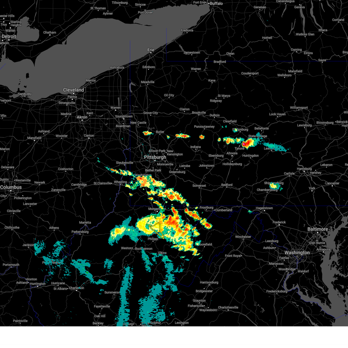
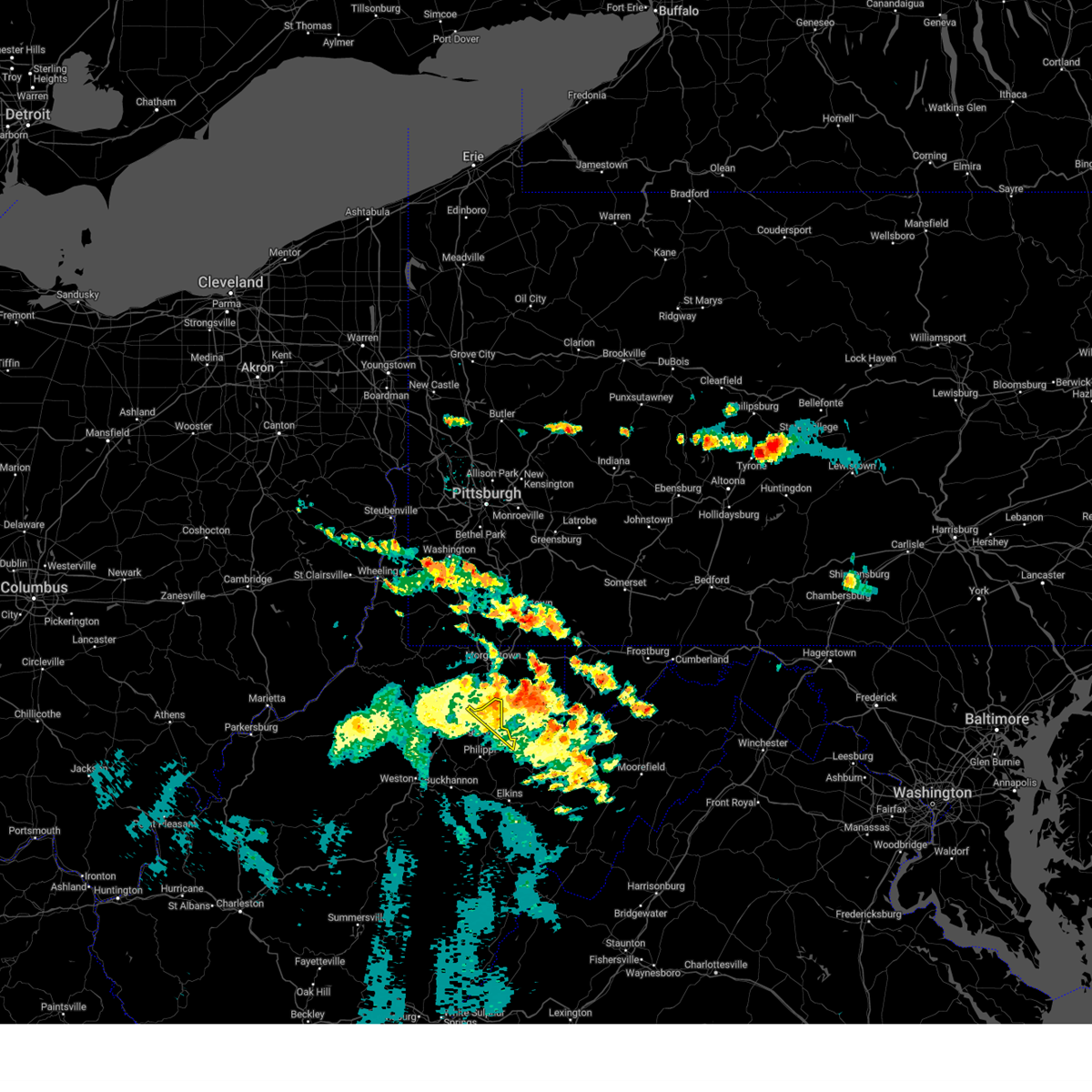
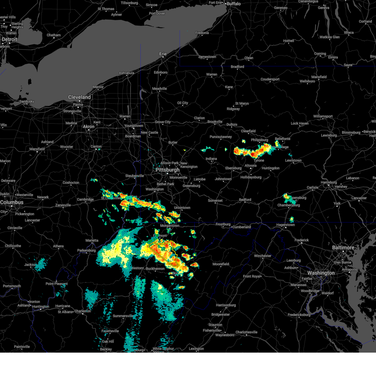
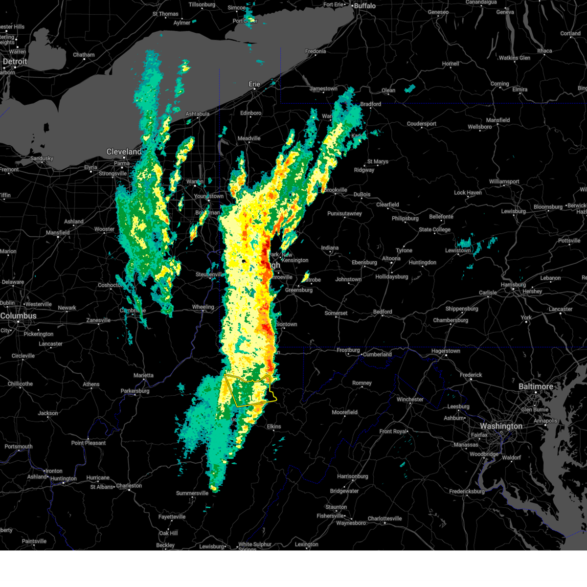
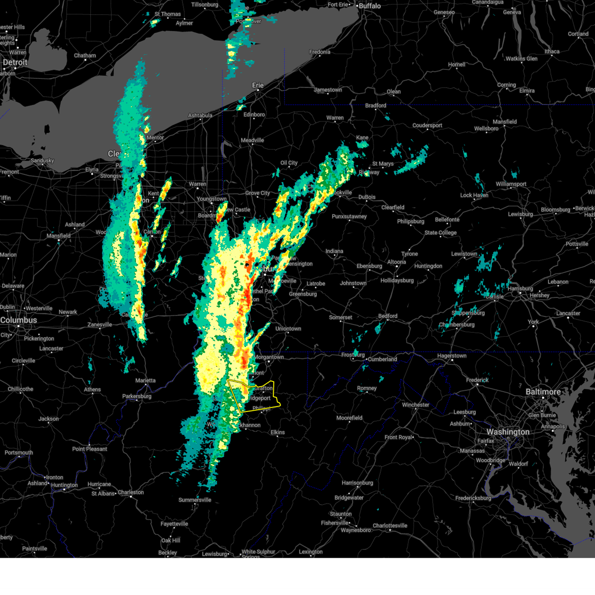
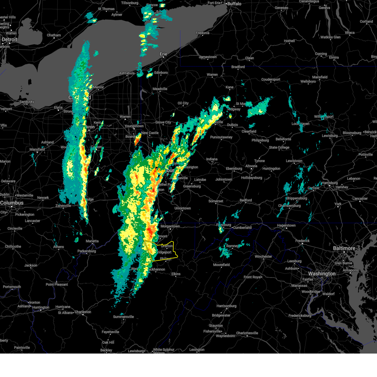
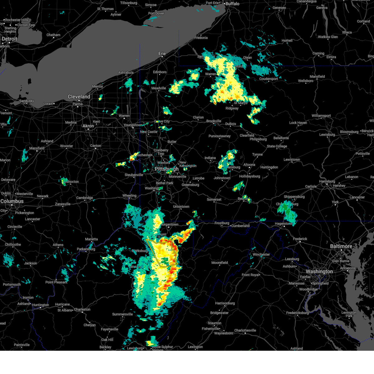
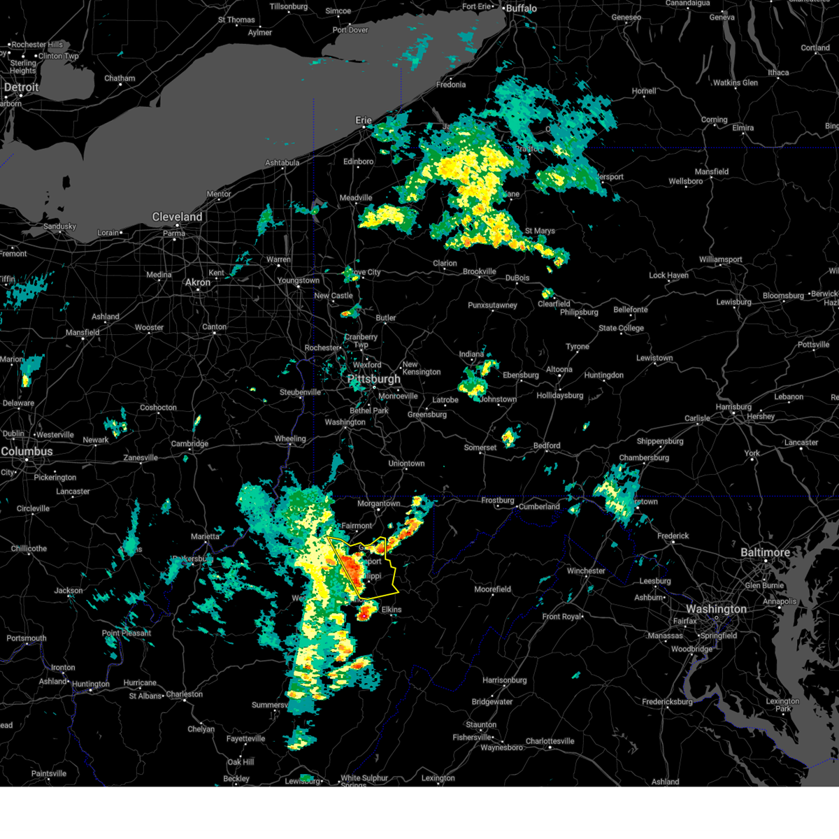
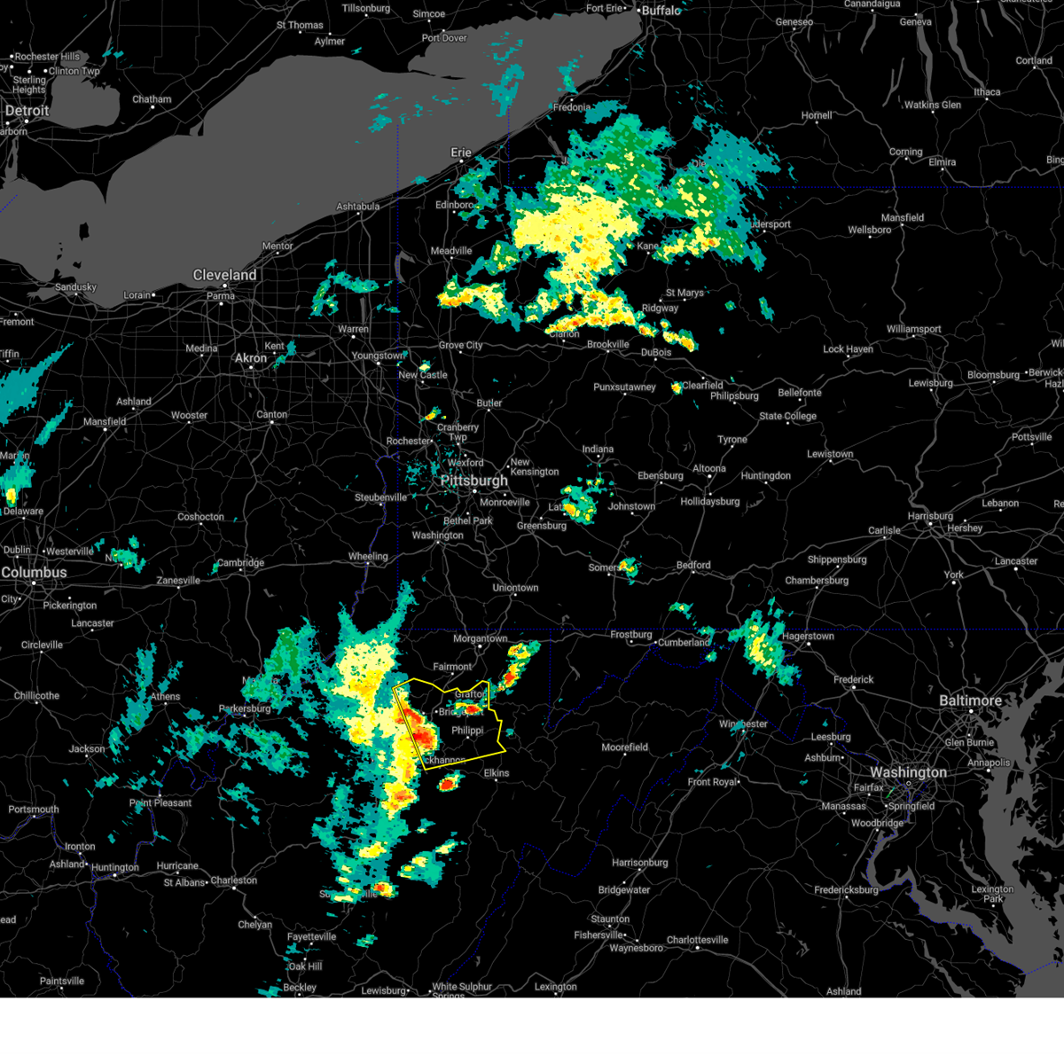
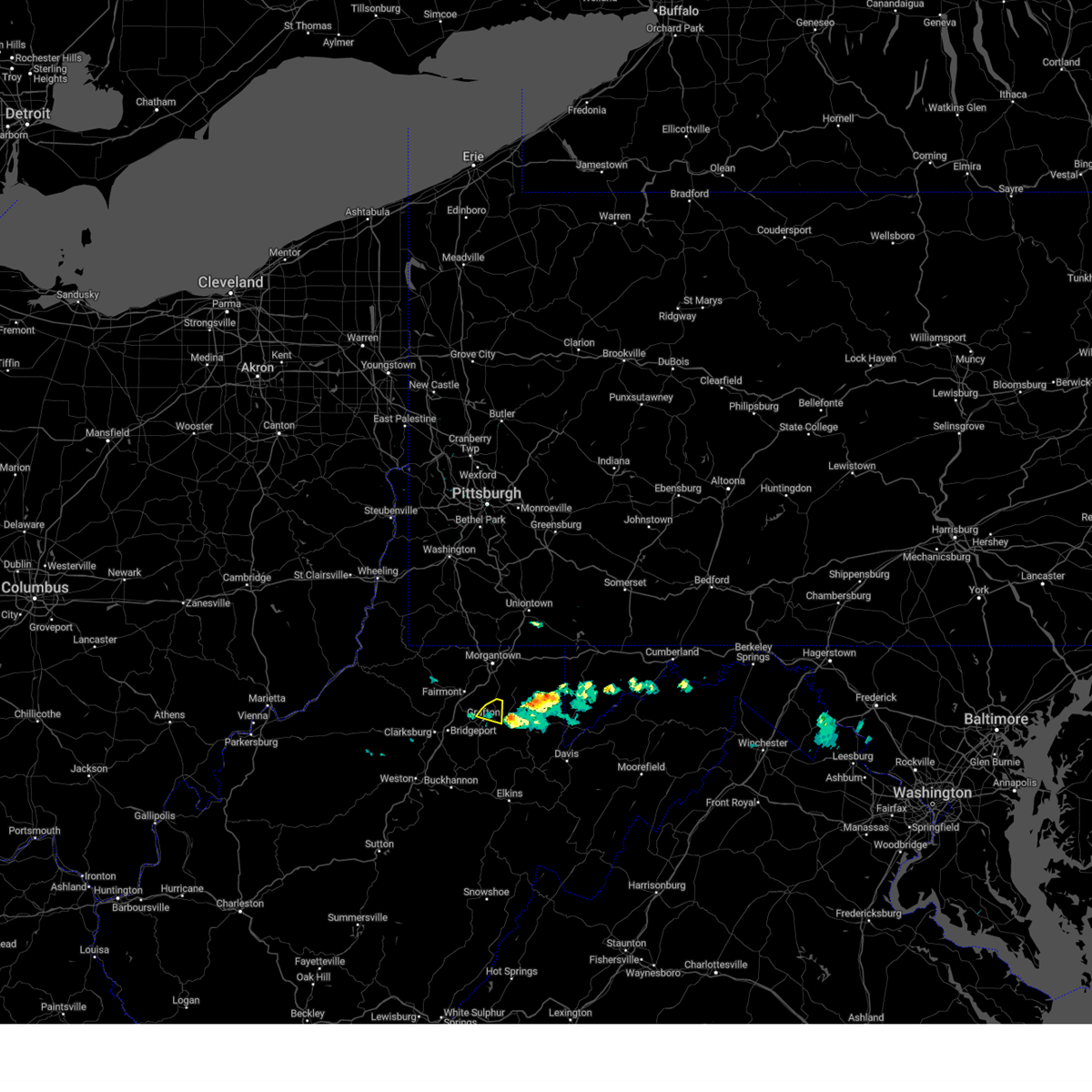
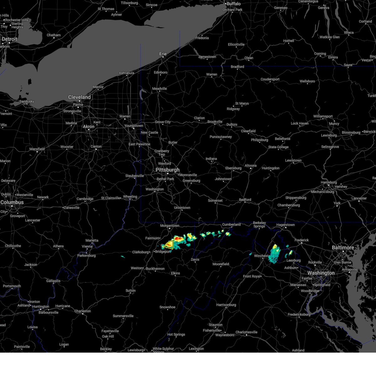
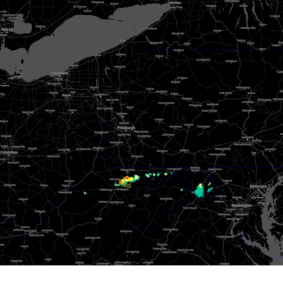
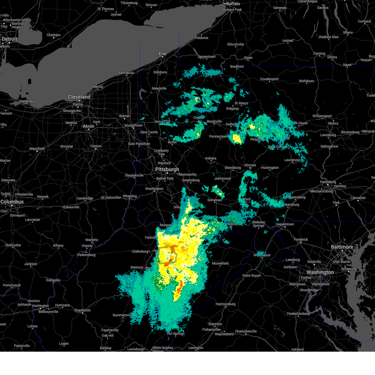
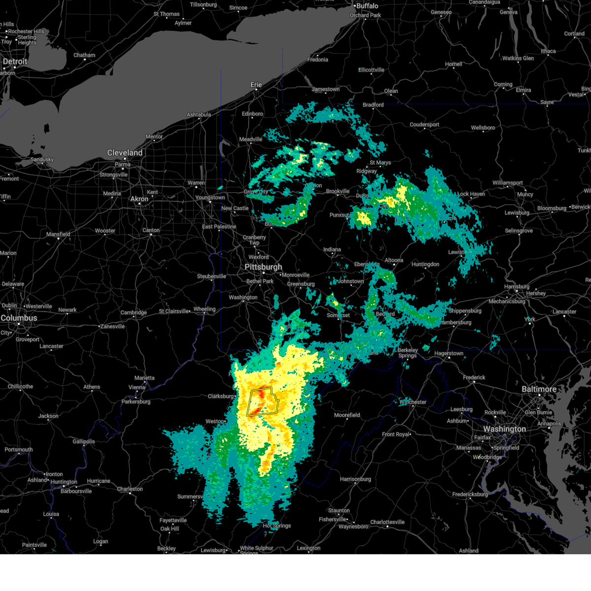
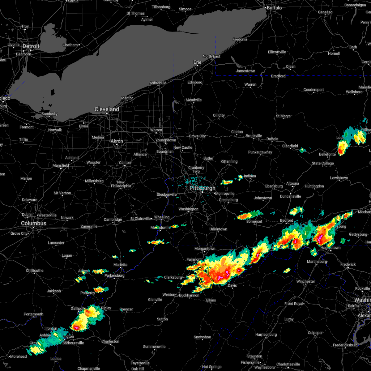
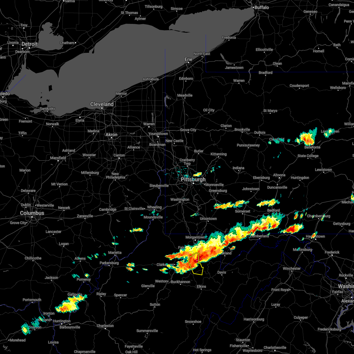
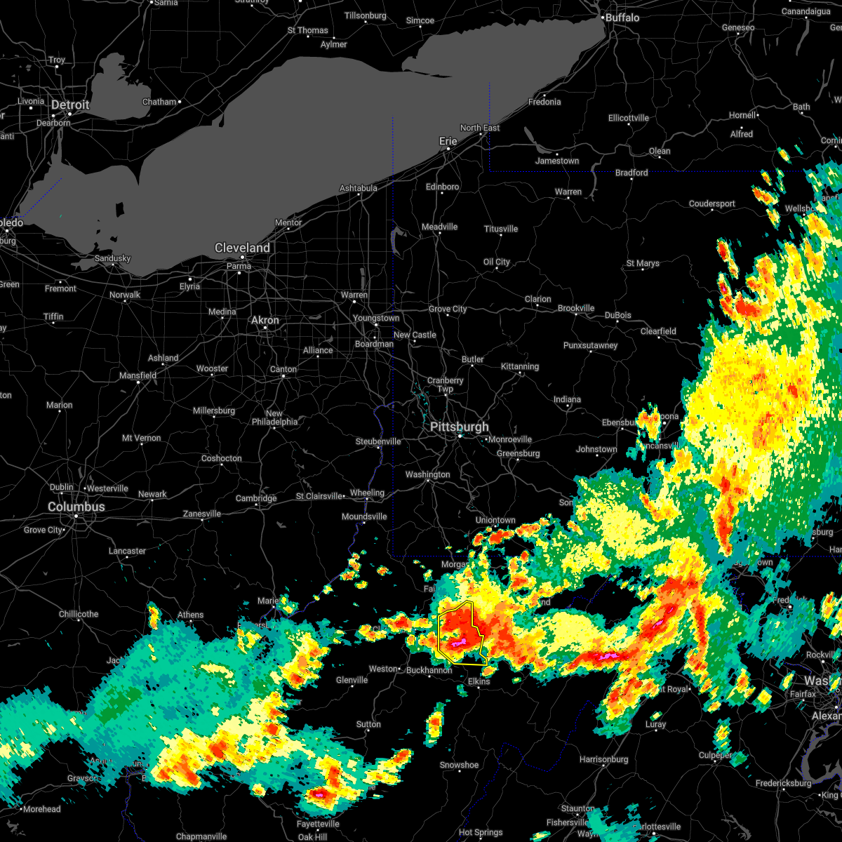
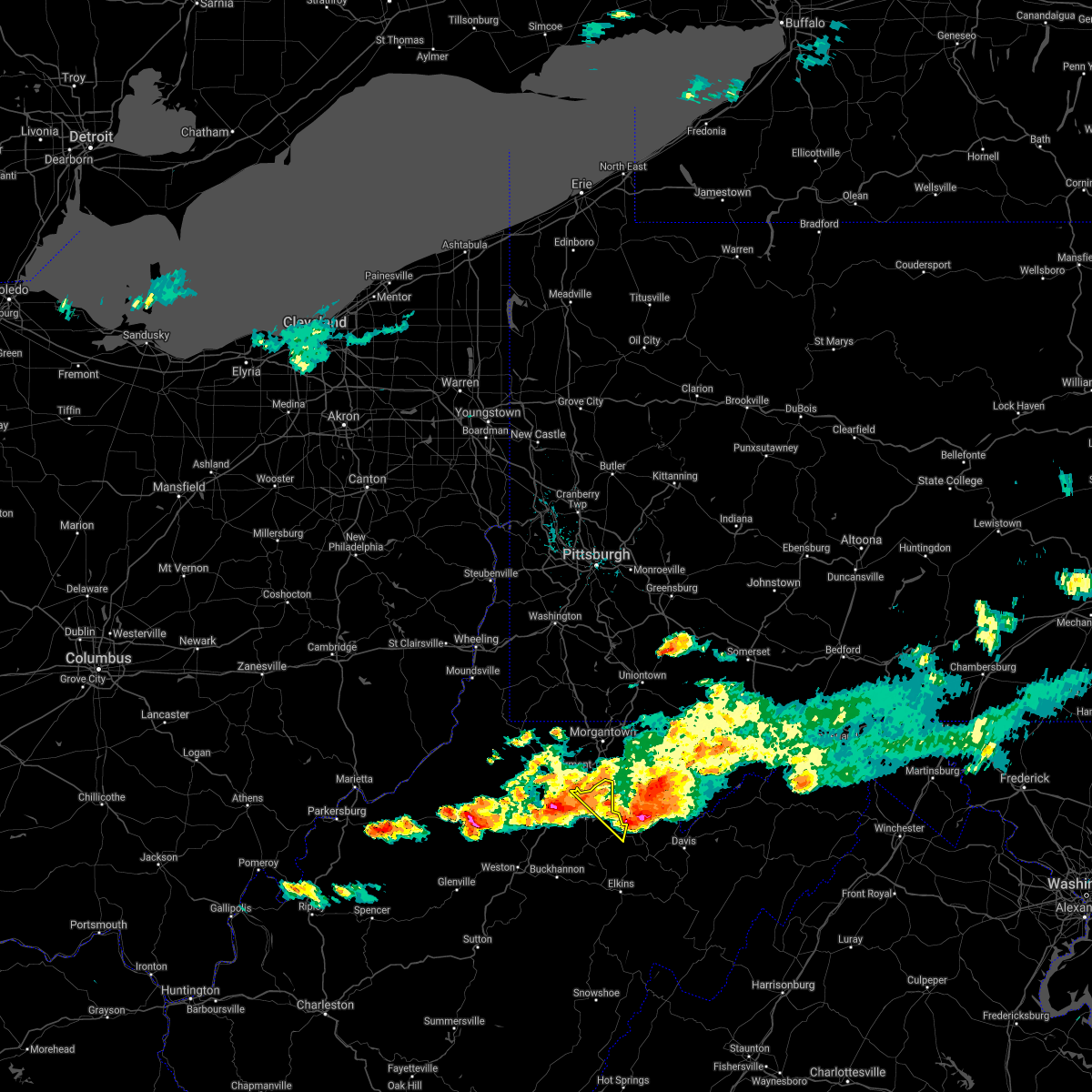
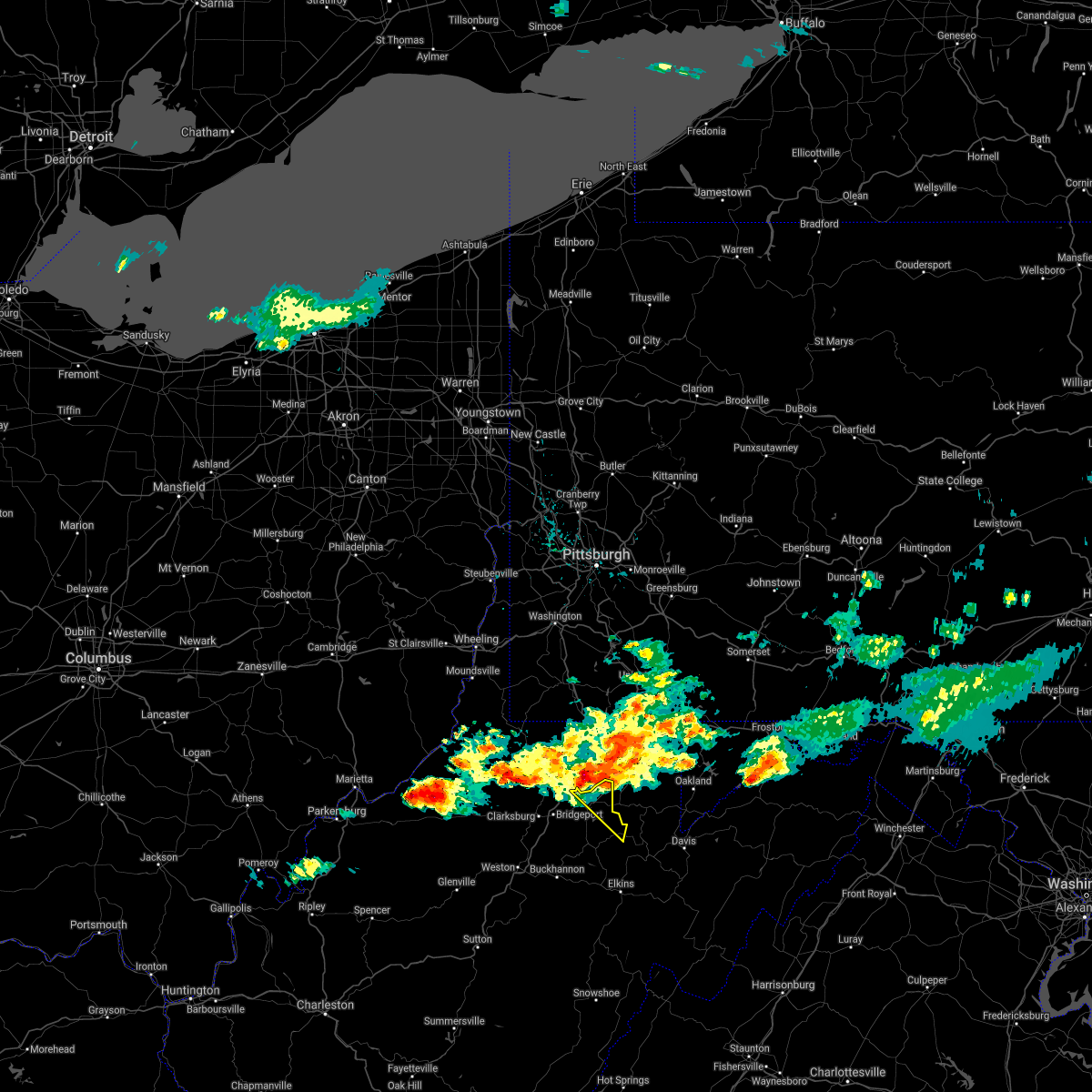
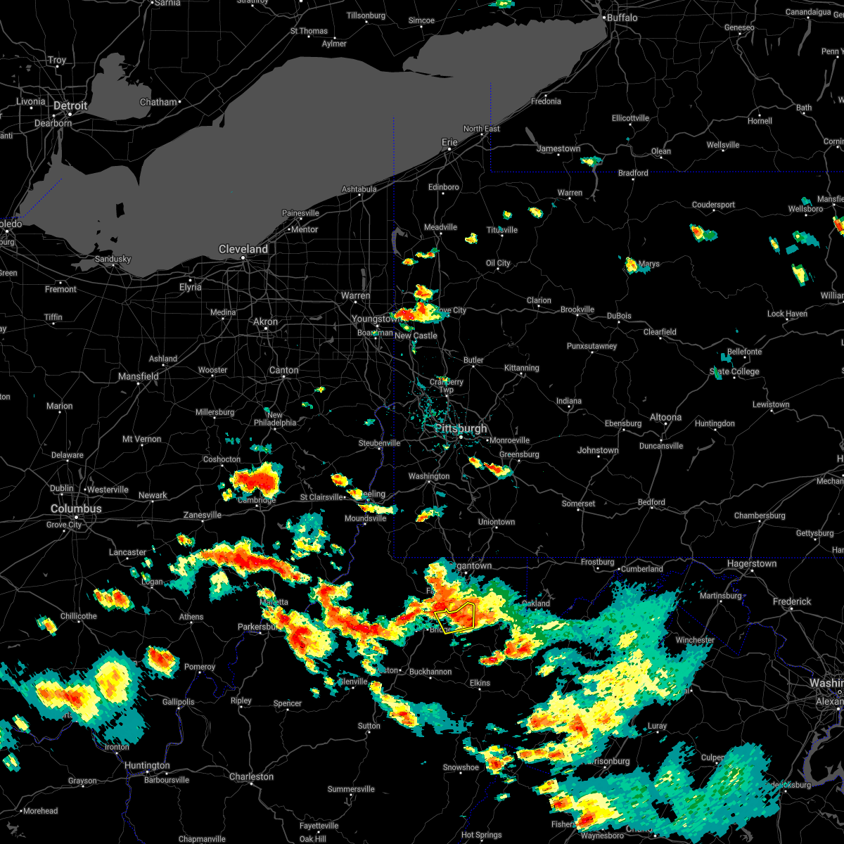
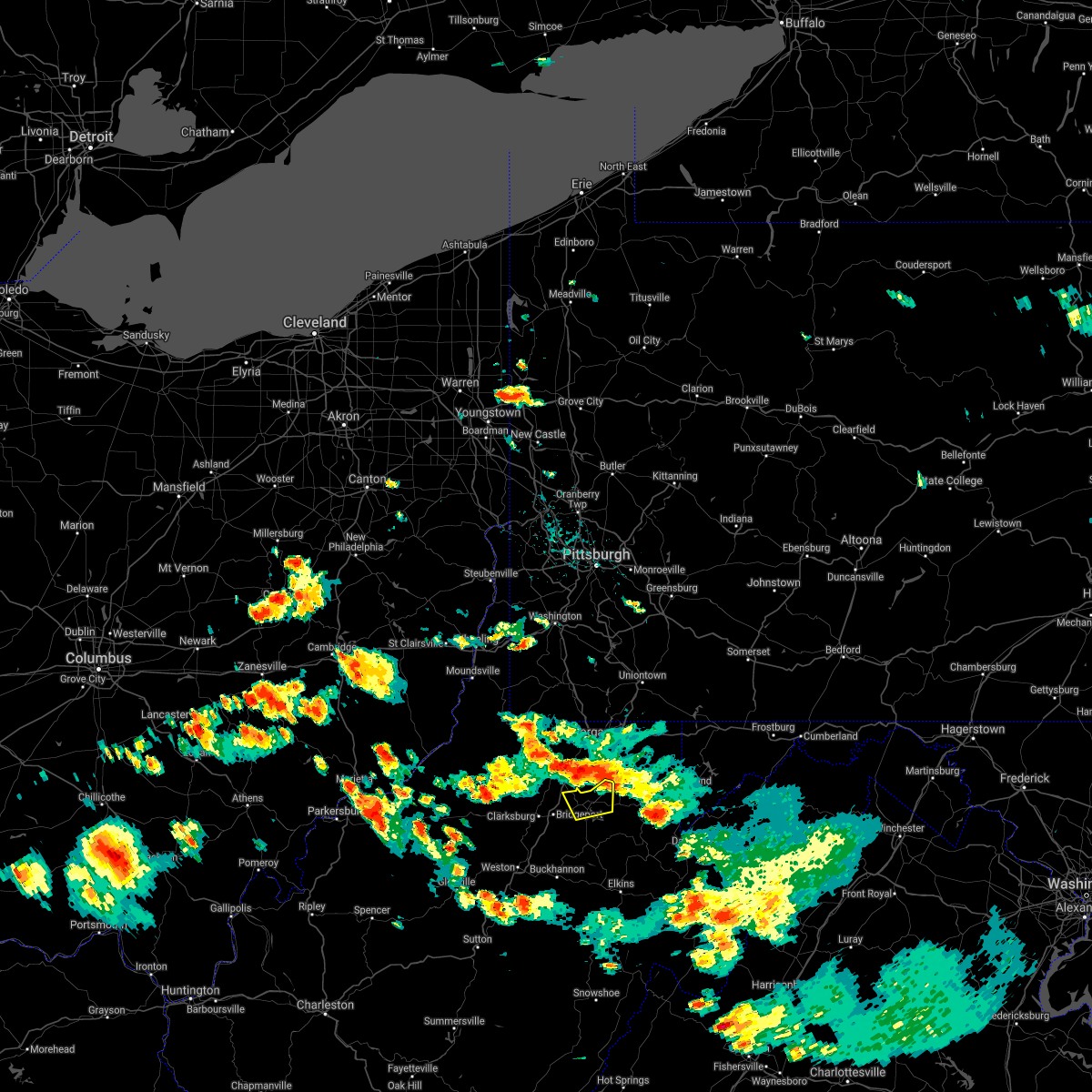
Hail Map for Grafton, WV
The Grafton, WV area has had 11 reports of on-the-ground hail by trained spotters, and has been under severe weather warnings 17 times during the past 12 months. Doppler radar has detected hail at or near Grafton, WV on 22 occasions.
| Name: | Grafton, WV |
| Where Located: | 30.2 miles NNW of Elkins, WV |
| Map: | Google Map for Grafton, WV |
| Population: | 5164 |
| Housing Units: | 2512 |
| More Info: | Search Google for Grafton, WV |
5
The Top Recent Hail Date for Grafton, WV is Thursday, April 28, 2016 (1st out of 22)

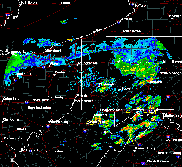
Hail and Wind Damage Spotted near Grafton, WV
| Date / Time | Report Details |
|---|---|
| 6/25/2025 4:20 PM EDT | Tree down covering the road on route 9 in barbour county WV, 9.2 miles NW of Grafton, WV |
| 5/30/2025 4:12 PM EDT | 5600 webster pike southern taylor county trees and lines down across roadwa in taylor county WV, 3.3 miles NNE of Grafton, WV |
| 5/16/2025 3:01 PM EDT |
 the severe thunderstorm warning has been cancelled and is no longer in effect the severe thunderstorm warning has been cancelled and is no longer in effect
|
| 5/16/2025 2:51 PM EDT |
 the severe thunderstorm warning has been cancelled and is no longer in effect the severe thunderstorm warning has been cancelled and is no longer in effect
|
| 5/16/2025 2:51 PM EDT |
 At 250 pm edt, severe thunderstorms were located along a line extending from near grafton to 6 miles north of parsons, moving east at 40 mph (radar indicated). Hazards include 60 mph wind gusts and penny size hail. Expect damage to roofs, siding, and trees. Locations impacted include, grafton, knottsville, and thornton. At 250 pm edt, severe thunderstorms were located along a line extending from near grafton to 6 miles north of parsons, moving east at 40 mph (radar indicated). Hazards include 60 mph wind gusts and penny size hail. Expect damage to roofs, siding, and trees. Locations impacted include, grafton, knottsville, and thornton.
|
| 5/16/2025 2:42 PM EDT | Tree reported down near the intersection of country club road and turner road. time is estimated by rada in taylor county WV, 2.8 miles SSE of Grafton, WV |
| 5/16/2025 2:38 PM EDT | Tree reported down with live lines. time is estimated by rada in taylor county WV, 2.8 miles NE of Grafton, WV |
| 5/16/2025 2:32 PM EDT |
 Svrrlx the national weather service in charleston west virginia has issued a * severe thunderstorm warning for, north central randolph county in northeastern west virginia, taylor county in northern west virginia, northern barbour county in northeastern west virginia, northeastern harrison county in northern west virginia, * until 315 pm edt. * at 232 pm edt, severe thunderstorms were located along a line extending from near bridgeport to 8 miles northeast of belington, moving east at 40 mph (radar indicated). Hazards include 60 mph wind gusts and penny size hail. expect damage to roofs, siding, and trees Svrrlx the national weather service in charleston west virginia has issued a * severe thunderstorm warning for, north central randolph county in northeastern west virginia, taylor county in northern west virginia, northern barbour county in northeastern west virginia, northeastern harrison county in northern west virginia, * until 315 pm edt. * at 232 pm edt, severe thunderstorms were located along a line extending from near bridgeport to 8 miles northeast of belington, moving east at 40 mph (radar indicated). Hazards include 60 mph wind gusts and penny size hail. expect damage to roofs, siding, and trees
|
| 4/3/2025 6:42 AM EDT | The storms which prompted the warning have moved out of the area. therefore, the warning will be allowed to expire. however, small hail, gusty winds and heavy rain are still possible with these thunderstorms. |
| 4/3/2025 6:32 AM EDT | At 631 am edt, severe thunderstorms were located along a line extending from newburg to near philippi to 7 miles southeast of buckhannon to 6 miles southeast of sutton, moving east at 65 mph (radar indicated). Hazards include 60 mph wind gusts. Expect damage to roofs, siding, and trees. Locations impacted include, alexander, knottsville, eden, flatwoods, grafton, cleveland, little birch, tygart lake state park, thornton, hacker valley, kanawha head, ireland, overhill, belington, french creek, diana, moatsville, volga, junior, and sutton. |
| 4/3/2025 6:32 AM EDT | the severe thunderstorm warning has been cancelled and is no longer in effect |
| 4/3/2025 6:18 AM EDT | At 617 am edt, severe thunderstorms were located along a line extending from 6 miles west of grafton to near buckhannon to near rock cave to 7 miles west of birch river, moving east at 60 mph (radar indicated). Hazards include 60 mph wind gusts. Expect damage to roofs, siding, and trees. Locations impacted include, flemington, knottsville, eden, grafton, jane lew, anmoore, meadland, bridgeport, little birch, jackson mill, hacker valley, french creek, moatsville, frametown, volga, junior, clarksburg, rosemont, wilsie, and gassaway. |
| 4/3/2025 6:18 AM EDT | the severe thunderstorm warning has been cancelled and is no longer in effect |
| 4/3/2025 5:57 AM EDT | Svrrlx the national weather service in charleston west virginia has issued a * severe thunderstorm warning for, southeastern calhoun county in north central west virginia, northwestern randolph county in northeastern west virginia, northeastern kanawha county in central west virginia, upshur county in northeastern west virginia, southeastern roane county in central west virginia, northwestern webster county in northeastern west virginia, barbour county in northeastern west virginia, harrison county in northern west virginia, southeastern doddridge county in northern west virginia, taylor county in northern west virginia, north central nicholas county in southeastern west virginia, central gilmer county in north central west virginia, lewis county in northern west virginia, braxton county in north central west virginia, northern clay county in north central west virginia, * until 645 am edt. * at 557 am edt, severe thunderstorms were located along a line extending from near salem to 7 miles northwest of gassaway to near amma, moving east at 65 mph (radar indicated). Hazards include 60 mph wind gusts. expect damage to roofs, siding, and trees |
| 3/16/2025 12:41 PM EDT |
 The storm which prompted the warning has weakened below severe limits, and has exited the warned area. therefore, the warning will be allowed to expire. however, gusty winds are still possible with this thunderstorm. a tornado watch remains in effect until 400 pm edt for northern and northeastern west virginia. The storm which prompted the warning has weakened below severe limits, and has exited the warned area. therefore, the warning will be allowed to expire. however, gusty winds are still possible with this thunderstorm. a tornado watch remains in effect until 400 pm edt for northern and northeastern west virginia.
|
| 3/16/2025 12:30 PM EDT | Multiple trees and lines down in and around grafton and countywid in taylor county WV, 0.2 miles E of Grafton, WV |
| 3/16/2025 12:20 PM EDT |
 At 1220 pm edt, a severe thunderstorm was located near bridgeport, or 7 miles west of grafton, moving east at 65 mph (radar indicated). Hazards include 70 mph wind gusts. Expect considerable tree damage. damage is likely to mobile homes, roofs, and outbuildings. Locations impacted include, moatsville, flemington, clarksburg, rosemont, shinnston, lumberport, knottsville, grafton, anmoore, meadland, bridgeport, tygart lake state park, thornton, enterprise, mcgee, stonewood, nutter fort, galloway, meadowbrook, and despard. At 1220 pm edt, a severe thunderstorm was located near bridgeport, or 7 miles west of grafton, moving east at 65 mph (radar indicated). Hazards include 70 mph wind gusts. Expect considerable tree damage. damage is likely to mobile homes, roofs, and outbuildings. Locations impacted include, moatsville, flemington, clarksburg, rosemont, shinnston, lumberport, knottsville, grafton, anmoore, meadland, bridgeport, tygart lake state park, thornton, enterprise, mcgee, stonewood, nutter fort, galloway, meadowbrook, and despard.
|
| 3/16/2025 12:14 PM EDT |
 Svrrlx the national weather service in charleston west virginia has issued a * severe thunderstorm warning for, taylor county in northern west virginia, northern barbour county in northeastern west virginia, eastern harrison county in northern west virginia, * until 1245 pm edt. * at 1214 pm edt, a severe thunderstorm was located over bridgeport, or near clarksburg, moving northeast at 65 mph (radar indicated). Hazards include 60 mph wind gusts. expect damage to roofs, siding, and trees Svrrlx the national weather service in charleston west virginia has issued a * severe thunderstorm warning for, taylor county in northern west virginia, northern barbour county in northeastern west virginia, eastern harrison county in northern west virginia, * until 1245 pm edt. * at 1214 pm edt, a severe thunderstorm was located over bridgeport, or near clarksburg, moving northeast at 65 mph (radar indicated). Hazards include 60 mph wind gusts. expect damage to roofs, siding, and trees
|
| 9/24/2024 2:41 PM EDT |
 The storm which prompted the warning has moved out of the area. therefore, the warning will be allowed to expire. however, gusty winds are still possible with this thunderstorm. The storm which prompted the warning has moved out of the area. therefore, the warning will be allowed to expire. however, gusty winds are still possible with this thunderstorm.
|
| 9/24/2024 2:28 PM EDT | Power lines down along cofran street. time estimated from rada in taylor county WV, 1.5 miles ESE of Grafton, WV |
| 9/24/2024 2:28 PM EDT | Tree down along thornton pike. time estimated from rada in taylor county WV, 2.3 miles SW of Grafton, WV |
| 9/24/2024 2:16 PM EDT |
 At 215 pm edt, a severe thunderstorm was located near bridgeport, or 8 miles southwest of grafton, moving northeast at 35 mph (radar indicated). Hazards include 60 mph wind gusts and quarter size hail. Hail damage to vehicles is expected. expect wind damage to roofs, siding, and trees. Locations impacted include, clarksburg, grafton, philippi, audra state park, bridgeport, shinnston, lumberport, anmoore, enterprise, flemington, montrose, moatsville, volga, rosemont, knottsville, nestorville, meadland, tygart lake state park, thornton, and mcgee. At 215 pm edt, a severe thunderstorm was located near bridgeport, or 8 miles southwest of grafton, moving northeast at 35 mph (radar indicated). Hazards include 60 mph wind gusts and quarter size hail. Hail damage to vehicles is expected. expect wind damage to roofs, siding, and trees. Locations impacted include, clarksburg, grafton, philippi, audra state park, bridgeport, shinnston, lumberport, anmoore, enterprise, flemington, montrose, moatsville, volga, rosemont, knottsville, nestorville, meadland, tygart lake state park, thornton, and mcgee.
|
| 9/24/2024 2:16 PM EDT |
 the severe thunderstorm warning has been cancelled and is no longer in effect the severe thunderstorm warning has been cancelled and is no longer in effect
|
| 9/24/2024 1:56 PM EDT |
 Svrrlx the national weather service in charleston west virginia has issued a * severe thunderstorm warning for, north central randolph county in northeastern west virginia, taylor county in northern west virginia, northeastern lewis county in northern west virginia, northern upshur county in northeastern west virginia, barbour county in northeastern west virginia, harrison county in northern west virginia, * until 245 pm edt. * at 156 pm edt, a severe thunderstorm was located near stonewood, or 8 miles south of clarksburg, moving northeast at 25 mph (radar indicated). Hazards include 60 mph wind gusts and quarter size hail. Hail damage to vehicles is expected. Expect wind damage to roofs, siding, and trees. Svrrlx the national weather service in charleston west virginia has issued a * severe thunderstorm warning for, north central randolph county in northeastern west virginia, taylor county in northern west virginia, northeastern lewis county in northern west virginia, northern upshur county in northeastern west virginia, barbour county in northeastern west virginia, harrison county in northern west virginia, * until 245 pm edt. * at 156 pm edt, a severe thunderstorm was located near stonewood, or 8 miles south of clarksburg, moving northeast at 25 mph (radar indicated). Hazards include 60 mph wind gusts and quarter size hail. Hail damage to vehicles is expected. Expect wind damage to roofs, siding, and trees.
|
| 5/26/2024 6:57 PM EDT |
 At 657 pm edt, a severe thunderstorm was located near elkins, moving northeast at 55 mph (radar indicated). Hazards include 60 mph wind gusts and penny size hail. Expect damage to roofs, siding, and trees. Locations impacted include, clarksburg, elkins, buckhannon, grafton, philippi, audra state park, bridgeport, belington, stonewood, nutter fort, anmoore, mill creek, dailey, beverly, west milford, junior, lost creek, flemington, durbin, and womelsdorf (coalton). At 657 pm edt, a severe thunderstorm was located near elkins, moving northeast at 55 mph (radar indicated). Hazards include 60 mph wind gusts and penny size hail. Expect damage to roofs, siding, and trees. Locations impacted include, clarksburg, elkins, buckhannon, grafton, philippi, audra state park, bridgeport, belington, stonewood, nutter fort, anmoore, mill creek, dailey, beverly, west milford, junior, lost creek, flemington, durbin, and womelsdorf (coalton).
|
| 5/26/2024 6:39 PM EDT |
 Svrrlx the national weather service in charleston west virginia has issued a * severe thunderstorm warning for, randolph county in northeastern west virginia, northeastern pocahontas county in northeastern west virginia, taylor county in northern west virginia, northeastern lewis county in northern west virginia, northeastern upshur county in northeastern west virginia, barbour county in northeastern west virginia, southeastern harrison county in northern west virginia, * until 730 pm edt. * at 638 pm edt, a severe thunderstorm was located 8 miles southeast of rock cave, or 14 miles south of buckhannon, moving northeast at 45 mph (radar indicated). Hazards include 60 mph wind gusts and penny size hail. expect damage to roofs, siding, and trees Svrrlx the national weather service in charleston west virginia has issued a * severe thunderstorm warning for, randolph county in northeastern west virginia, northeastern pocahontas county in northeastern west virginia, taylor county in northern west virginia, northeastern lewis county in northern west virginia, northeastern upshur county in northeastern west virginia, barbour county in northeastern west virginia, southeastern harrison county in northern west virginia, * until 730 pm edt. * at 638 pm edt, a severe thunderstorm was located 8 miles southeast of rock cave, or 14 miles south of buckhannon, moving northeast at 45 mph (radar indicated). Hazards include 60 mph wind gusts and penny size hail. expect damage to roofs, siding, and trees
|
| 5/25/2024 11:30 PM EDT | Tree down on mcvicker rd. time estimated from rada in taylor county WV, 5 miles NNE of Grafton, WV |
| 5/25/2024 11:25 PM EDT | Tree down on webster pike. time estimated from rada in taylor county WV, 0.8 miles E of Grafton, WV |
| 5/25/2024 11:25 PM EDT | Tree down on lost run rd. time estimated from rada in taylor county WV, 4.2 miles ESE of Grafton, WV |
| 4/15/2024 11:53 AM EDT |
 The storm which prompted the warning has moved out of the area. therefore, the warning will be allowed to expire. The storm which prompted the warning has moved out of the area. therefore, the warning will be allowed to expire.
|
| 4/15/2024 11:41 AM EDT |
 At 1141 am edt, a severe thunderstorm was located near grafton, moving east at 40 mph (radar indicated). Hazards include 60 mph wind gusts and quarter size hail. Hail damage to vehicles is expected. expect wind damage to roofs, siding, and trees. Locations impacted include, grafton and thornton. At 1141 am edt, a severe thunderstorm was located near grafton, moving east at 40 mph (radar indicated). Hazards include 60 mph wind gusts and quarter size hail. Hail damage to vehicles is expected. expect wind damage to roofs, siding, and trees. Locations impacted include, grafton and thornton.
|
| 4/15/2024 11:30 AM EDT |
 Svrrlx the national weather service in charleston west virginia has issued a * severe thunderstorm warning for, northern taylor county in northern west virginia, * until noon edt. * at 1129 am edt, a severe thunderstorm was located over pleasant valley, or near fairmont, moving east at 40 mph (radar indicated). Hazards include 60 mph wind gusts and quarter size hail. Hail damage to vehicles is expected. Expect wind damage to roofs, siding, and trees. Svrrlx the national weather service in charleston west virginia has issued a * severe thunderstorm warning for, northern taylor county in northern west virginia, * until noon edt. * at 1129 am edt, a severe thunderstorm was located over pleasant valley, or near fairmont, moving east at 40 mph (radar indicated). Hazards include 60 mph wind gusts and quarter size hail. Hail damage to vehicles is expected. Expect wind damage to roofs, siding, and trees.
|
| 4/2/2024 12:47 PM EDT |
 The severe thunderstorm which prompted the warning has weakened. therefore, the warning has been allowed to expire. however, gusty winds are still possible with this thunderstorm. a tornado watch remains in effect until 100 pm edt for northeastern west virginia. The severe thunderstorm which prompted the warning has weakened. therefore, the warning has been allowed to expire. however, gusty winds are still possible with this thunderstorm. a tornado watch remains in effect until 100 pm edt for northeastern west virginia.
|
| 4/2/2024 12:36 PM EDT |
 At 1235 pm edt, a severe thunderstorm was located 10 miles northeast of philippi, moving east at 60 mph (radar indicated). Hazards include 60 mph wind gusts. Expect damage to roofs, siding, and trees. Locations impacted include, grafton, philippi, flemington, moatsville, tygart lake state park, thornton, knottsville, century, galloway, and nestorville. At 1235 pm edt, a severe thunderstorm was located 10 miles northeast of philippi, moving east at 60 mph (radar indicated). Hazards include 60 mph wind gusts. Expect damage to roofs, siding, and trees. Locations impacted include, grafton, philippi, flemington, moatsville, tygart lake state park, thornton, knottsville, century, galloway, and nestorville.
|
| 4/2/2024 12:36 PM EDT |
 the severe thunderstorm warning has been cancelled and is no longer in effect the severe thunderstorm warning has been cancelled and is no longer in effect
|
| 4/2/2024 12:06 PM EDT |
 Svrrlx the national weather service in charleston west virginia has issued a * severe thunderstorm warning for, southern taylor county in northern west virginia, northeastern lewis county in northern west virginia, barbour county in northeastern west virginia, southern harrison county in northern west virginia, * until 1245 pm edt. * at 1206 pm edt, a severe thunderstorm was located 7 miles north of jackson mill, or 10 miles north of weston, moving east at 65 mph (radar indicated). Hazards include 60 mph wind gusts. expect damage to roofs, siding, and trees Svrrlx the national weather service in charleston west virginia has issued a * severe thunderstorm warning for, southern taylor county in northern west virginia, northeastern lewis county in northern west virginia, barbour county in northeastern west virginia, southern harrison county in northern west virginia, * until 1245 pm edt. * at 1206 pm edt, a severe thunderstorm was located 7 miles north of jackson mill, or 10 miles north of weston, moving east at 65 mph (radar indicated). Hazards include 60 mph wind gusts. expect damage to roofs, siding, and trees
|
| 3/30/2024 8:50 PM EDT | County 911 center reports tree down on shilo rd near moatsvill in barbour county WV, 10.9 miles NW of Grafton, WV |
| 8/25/2023 4:00 AM EDT | Tree down across the roadway on trap springs r in taylor county WV, 3 miles ENE of Grafton, WV |
| 8/25/2023 3:45 AM EDT |
 At 345 am edt, severe thunderstorms were located along a line extending from near winfield to 7 miles north of belmont, moving southeast at 45 mph (radar indicated). Hazards include 60 mph wind gusts and penny size hail. Expect damage to roofs, siding, and trees. locations impacted include, clarksburg, grafton, st. marys, middlebourne, bridgeport, shinnston, stonewood, nutter fort, salem, sistersville, lumberport, west union, anmoore, enterprise, matamoras, flemington, friendly, alma, knottsville, and wolf summit. hail threat, radar indicated max hail size, 0. 75 in wind threat, radar indicated max wind gust, 60 mph. At 345 am edt, severe thunderstorms were located along a line extending from near winfield to 7 miles north of belmont, moving southeast at 45 mph (radar indicated). Hazards include 60 mph wind gusts and penny size hail. Expect damage to roofs, siding, and trees. locations impacted include, clarksburg, grafton, st. marys, middlebourne, bridgeport, shinnston, stonewood, nutter fort, salem, sistersville, lumberport, west union, anmoore, enterprise, matamoras, flemington, friendly, alma, knottsville, and wolf summit. hail threat, radar indicated max hail size, 0. 75 in wind threat, radar indicated max wind gust, 60 mph.
|
| 8/25/2023 3:23 AM EDT |
 At 323 am edt, severe thunderstorms were located along a line extending from near mannington to near beverly, moving southeast at 60 mph (radar indicated). Hazards include 60 mph wind gusts and penny size hail. expect damage to roofs, siding, and trees At 323 am edt, severe thunderstorms were located along a line extending from near mannington to near beverly, moving southeast at 60 mph (radar indicated). Hazards include 60 mph wind gusts and penny size hail. expect damage to roofs, siding, and trees
|
| 7/28/2023 4:52 PM EDT |
 At 451 pm edt, severe thunderstorms were located along a line extending from near winfield to near newburg to near philippi, moving east at 40 mph (radar indicated). Hazards include 60 mph wind gusts and penny size hail. Expect damage to roofs, siding, and trees. locations impacted include, elkins, grafton, philippi, audra state park, belington, junior, flemington, womelsdorf (coalton), montrose, moatsville, rosemont, knottsville, nestorville, meadland, tygart lake state park, kerens, thornton, ellamore, mcgee, and galloway. hail threat, radar indicated max hail size, 0. 75 in wind threat, radar indicated max wind gust, 60 mph. At 451 pm edt, severe thunderstorms were located along a line extending from near winfield to near newburg to near philippi, moving east at 40 mph (radar indicated). Hazards include 60 mph wind gusts and penny size hail. Expect damage to roofs, siding, and trees. locations impacted include, elkins, grafton, philippi, audra state park, belington, junior, flemington, womelsdorf (coalton), montrose, moatsville, rosemont, knottsville, nestorville, meadland, tygart lake state park, kerens, thornton, ellamore, mcgee, and galloway. hail threat, radar indicated max hail size, 0. 75 in wind threat, radar indicated max wind gust, 60 mph.
|
| 7/28/2023 4:14 PM EDT |
 At 414 pm edt, severe thunderstorms were located along a line extending from 6 miles northwest of lumberport to near nutter fort to near weston, moving east at 40 mph (radar indicated). Hazards include 60 mph wind gusts and nickel size hail. expect damage to roofs, siding, and trees At 414 pm edt, severe thunderstorms were located along a line extending from 6 miles northwest of lumberport to near nutter fort to near weston, moving east at 40 mph (radar indicated). Hazards include 60 mph wind gusts and nickel size hail. expect damage to roofs, siding, and trees
|
| 4/5/2023 9:28 PM EDT | Tree down across roa in taylor county WV, 0.2 miles E of Grafton, WV |
| 4/5/2023 9:09 PM EDT | Tree down across roa in taylor county WV, 0.2 miles E of Grafton, WV |
| 7/23/2022 4:18 PM EDT |
 At 417 pm edt, a severe thunderstorm was located over buckhannon, moving southeast at 30 mph (radar indicated). Hazards include 60 mph wind gusts and penny size hail. Expect damage to roofs, siding, and trees. locations impacted include, elkins, buckhannon, grafton, philippi, audra state park, belington, mill creek, dailey, rock cave, beverly, junior, flemington, womelsdorf (coalton), huttonsville, montrose, alexander, knottsville, eden, glady and helvetia. hail threat, radar indicated max hail size, 0. 75 in wind threat, radar indicated max wind gust, 60 mph. At 417 pm edt, a severe thunderstorm was located over buckhannon, moving southeast at 30 mph (radar indicated). Hazards include 60 mph wind gusts and penny size hail. Expect damage to roofs, siding, and trees. locations impacted include, elkins, buckhannon, grafton, philippi, audra state park, belington, mill creek, dailey, rock cave, beverly, junior, flemington, womelsdorf (coalton), huttonsville, montrose, alexander, knottsville, eden, glady and helvetia. hail threat, radar indicated max hail size, 0. 75 in wind threat, radar indicated max wind gust, 60 mph.
|
| 7/23/2022 4:00 PM EDT |
 At 400 pm edt, a severe thunderstorm was located near weston, moving southeast at 30 mph (radar indicated). Hazards include 60 mph wind gusts and penny size hail. expect damage to roofs, siding, and trees At 400 pm edt, a severe thunderstorm was located near weston, moving southeast at 30 mph (radar indicated). Hazards include 60 mph wind gusts and penny size hail. expect damage to roofs, siding, and trees
|
| 7/23/2022 3:42 PM EDT | Tree dow in taylor county WV, 1.9 miles W of Grafton, WV |
| 7/12/2022 2:52 PM EDT |
 The severe thunderstorm warning for eastern taylor and northeastern barbour counties will expire at 300 pm edt, the storm which prompted the warning has moved out of the area. therefore, the warning will be allowed to expire. however gusty winds are still possible with this thunderstorm. a severe thunderstorm watch remains in effect until 1000 pm edt for northern and northeastern west virginia. The severe thunderstorm warning for eastern taylor and northeastern barbour counties will expire at 300 pm edt, the storm which prompted the warning has moved out of the area. therefore, the warning will be allowed to expire. however gusty winds are still possible with this thunderstorm. a severe thunderstorm watch remains in effect until 1000 pm edt for northern and northeastern west virginia.
|
| 7/12/2022 2:46 PM EDT | Tree down on webster pike. time is radar estimat in taylor county WV, 0.2 miles E of Grafton, WV |
| 7/12/2022 2:37 PM EDT | Tree down on iron town road in thornto in taylor county WV, 4.1 miles W of Grafton, WV |
| 7/12/2022 2:28 PM EDT |
 At 228 pm edt, a severe thunderstorm was located near grafton, moving east at 35 mph (radar indicated). Hazards include 60 mph wind gusts and half dollar size hail. Hail damage to vehicles is expected. Expect wind damage to roofs, siding, and trees. At 228 pm edt, a severe thunderstorm was located near grafton, moving east at 35 mph (radar indicated). Hazards include 60 mph wind gusts and half dollar size hail. Hail damage to vehicles is expected. Expect wind damage to roofs, siding, and trees.
|
| 7/12/2022 2:18 PM EDT | Tree down knottsville roa in taylor county WV, 0.3 miles W of Grafton, WV |
| 7/12/2022 2:05 PM EDT | Tree down on beverly pik in taylor county WV, 5.1 miles E of Grafton, WV |
| 7/12/2022 2:02 PM EDT |
 At 202 pm edt, a severe thunderstorm was located near shinnston, or 8 miles northeast of clarksburg, moving east at 35 mph (radar indicated). Hazards include 60 mph wind gusts and quarter size hail. Hail damage to vehicles is expected. Expect wind damage to roofs, siding, and trees. At 202 pm edt, a severe thunderstorm was located near shinnston, or 8 miles northeast of clarksburg, moving east at 35 mph (radar indicated). Hazards include 60 mph wind gusts and quarter size hail. Hail damage to vehicles is expected. Expect wind damage to roofs, siding, and trees.
|
| 6/22/2022 8:23 PM EDT |
 At 823 pm edt, a severe thunderstorm was located over audra state park, moving south at 70 mph (radar indicated). Hazards include 70 mph wind gusts and quarter size hail. Hail damage to vehicles is expected. expect considerable tree damage. wind damage is also likely to mobile homes, roofs, and outbuildings. locations impacted include, grafton, philippi, audra state park, belington, flemington, montrose, moatsville, volga, knottsville, nestorville, tygart lake state park, kerens, galloway and thornton. thunderstorm damage threat, considerable hail threat, radar indicated max hail size, 1. 00 in wind threat, radar indicated max wind gust, 70 mph. At 823 pm edt, a severe thunderstorm was located over audra state park, moving south at 70 mph (radar indicated). Hazards include 70 mph wind gusts and quarter size hail. Hail damage to vehicles is expected. expect considerable tree damage. wind damage is also likely to mobile homes, roofs, and outbuildings. locations impacted include, grafton, philippi, audra state park, belington, flemington, montrose, moatsville, volga, knottsville, nestorville, tygart lake state park, kerens, galloway and thornton. thunderstorm damage threat, considerable hail threat, radar indicated max hail size, 1. 00 in wind threat, radar indicated max wind gust, 70 mph.
|
| 6/22/2022 8:16 PM EDT |
 At 816 pm edt, a severe thunderstorm was located over philippi, moving south at 70 mph (radar indicated). Hazards include 60 mph wind gusts and quarter size hail. Hail damage to vehicles is expected. Expect wind damage to roofs, siding, and trees. At 816 pm edt, a severe thunderstorm was located over philippi, moving south at 70 mph (radar indicated). Hazards include 60 mph wind gusts and quarter size hail. Hail damage to vehicles is expected. Expect wind damage to roofs, siding, and trees.
|
| 6/22/2022 8:09 PM EDT |
 At 809 pm edt, a severe thunderstorm was located near philippi, moving south at 50 mph (radar indicated). Hazards include 60 mph wind gusts and quarter size hail. Hail damage to vehicles is expected. expect wind damage to roofs, siding, and trees. locations impacted include, grafton, philippi, flemington, montrose, moatsville, tygart lake state park, thornton, knottsville, mcgee, galloway and nestorville. hail threat, radar indicated max hail size, 1. 00 in wind threat, radar indicated max wind gust, 60 mph. At 809 pm edt, a severe thunderstorm was located near philippi, moving south at 50 mph (radar indicated). Hazards include 60 mph wind gusts and quarter size hail. Hail damage to vehicles is expected. expect wind damage to roofs, siding, and trees. locations impacted include, grafton, philippi, flemington, montrose, moatsville, tygart lake state park, thornton, knottsville, mcgee, galloway and nestorville. hail threat, radar indicated max hail size, 1. 00 in wind threat, radar indicated max wind gust, 60 mph.
|
| 6/22/2022 8:05 PM EDT | Multiple trees down in grafton along sandy creek road... haymond road... plum run road... yates avenue... and victory avenu in taylor county WV, 0.8 miles E of Grafton, WV |
| 6/22/2022 8:00 PM EDT | Tree blown down along irontown road in independenc in taylor county WV, 4.8 miles WSW of Grafton, WV |
| 6/22/2022 7:49 PM EDT |
 At 749 pm edt, a severe thunderstorm was located near grafton, moving south at 50 mph (radar indicated). Hazards include 60 mph wind gusts and quarter size hail. Hail damage to vehicles is expected. Expect wind damage to roofs, siding, and trees. At 749 pm edt, a severe thunderstorm was located near grafton, moving south at 50 mph (radar indicated). Hazards include 60 mph wind gusts and quarter size hail. Hail damage to vehicles is expected. Expect wind damage to roofs, siding, and trees.
|
| 6/8/2022 11:14 PM EDT |
 The severe thunderstorm warning for southeastern taylor and northeastern barbour counties will expire at 1115 pm edt. the storm which prompted the warning has moved out of the area. therefore, the warning will be allowed to expire. however gusty winds are still possible with this thunderstorm. A tornado watch remains in effect until 100 am edt for northern and. The severe thunderstorm warning for southeastern taylor and northeastern barbour counties will expire at 1115 pm edt. the storm which prompted the warning has moved out of the area. therefore, the warning will be allowed to expire. however gusty winds are still possible with this thunderstorm. A tornado watch remains in effect until 100 am edt for northern and.
|
| 6/8/2022 11:04 PM EDT |
 At 1104 pm edt, a severe thunderstorm was located 8 miles south of newburg, or 9 miles southwest of rowlesburg, moving east at 50 mph (radar indicated). Hazards include 60 mph wind gusts. Expect damage to roofs, siding, and trees. locations impacted include, grafton, philippi, moatsville, tygart lake state park, thornton, knottsville and nestorville. hail threat, radar indicated max hail size, <. 75 in wind threat, radar indicated max wind gust, 60 mph. At 1104 pm edt, a severe thunderstorm was located 8 miles south of newburg, or 9 miles southwest of rowlesburg, moving east at 50 mph (radar indicated). Hazards include 60 mph wind gusts. Expect damage to roofs, siding, and trees. locations impacted include, grafton, philippi, moatsville, tygart lake state park, thornton, knottsville and nestorville. hail threat, radar indicated max hail size, <. 75 in wind threat, radar indicated max wind gust, 60 mph.
|
| 6/8/2022 10:50 PM EDT |
 At 1050 pm edt, a severe thunderstorm was located near grafton, moving east at 50 mph (radar indicated). Hazards include 60 mph wind gusts. expect damage to roofs, siding, and trees At 1050 pm edt, a severe thunderstorm was located near grafton, moving east at 50 mph (radar indicated). Hazards include 60 mph wind gusts. expect damage to roofs, siding, and trees
|
| 6/21/2021 1:55 PM EDT | Trees down in the thornton are in taylor county WV, 4.1 miles W of Grafton, WV |
| 6/14/2021 7:43 PM EDT |
 At 743 pm edt, a severe thunderstorm was located near philippi, moving southeast at 45 mph (radar indicated). Hazards include 60 mph wind gusts and quarter size hail. Hail damage to vehicles is expected. Expect wind damage to roofs, siding, and trees. At 743 pm edt, a severe thunderstorm was located near philippi, moving southeast at 45 mph (radar indicated). Hazards include 60 mph wind gusts and quarter size hail. Hail damage to vehicles is expected. Expect wind damage to roofs, siding, and trees.
|
| 6/14/2021 7:24 PM EDT |
 The severe thunderstorm warning for northeastern taylor and northeastern barbour counties will expire at 730 pm edt, the storm which prompted the warning has moved out of the area. therefore, the warning will be allowed to expire. a severe thunderstorm watch remains in effect until 900 pm edt for northern and northeastern west virginia. The severe thunderstorm warning for northeastern taylor and northeastern barbour counties will expire at 730 pm edt, the storm which prompted the warning has moved out of the area. therefore, the warning will be allowed to expire. a severe thunderstorm watch remains in effect until 900 pm edt for northern and northeastern west virginia.
|
| 6/14/2021 7:10 PM EDT |
 At 710 pm edt, a severe thunderstorm was located over lumberport, or near clarksburg, moving southeast at 30 mph (radar indicated). Hazards include 60 mph wind gusts and quarter size hail. Hail damage to vehicles is expected. Expect wind damage to roofs, siding, and trees. At 710 pm edt, a severe thunderstorm was located over lumberport, or near clarksburg, moving southeast at 30 mph (radar indicated). Hazards include 60 mph wind gusts and quarter size hail. Hail damage to vehicles is expected. Expect wind damage to roofs, siding, and trees.
|
| 6/14/2021 7:00 PM EDT | Tree down across pruntytown pike. time estimated from rada in taylor county WV, 2 miles ESE of Grafton, WV |
| 6/14/2021 6:58 PM EDT | Tree in power lines along route 119... locally known as victory avenue... near mike moser lane. road closed. time estimated from rada in taylor county WV, 1.9 miles SW of Grafton, WV |
| 6/14/2021 6:54 PM EDT |
 At 653 pm edt, a severe thunderstorm was located near winfield, or near fairmont, moving east at 40 mph (radar indicated). Hazards include 60 mph wind gusts and quarter size hail. Hail damage to vehicles is expected. Expect wind damage to roofs, siding, and trees. At 653 pm edt, a severe thunderstorm was located near winfield, or near fairmont, moving east at 40 mph (radar indicated). Hazards include 60 mph wind gusts and quarter size hail. Hail damage to vehicles is expected. Expect wind damage to roofs, siding, and trees.
|
| 6/13/2021 3:50 PM EDT |
 The severe thunderstorm warning for taylor county will expire at 400 pm edt, the storm which prompted the warning has weakened below severe limits, and no longer poses an immediate threat to life or property. therefore, the warning will be allowed to expire. a severe thunderstorm watch remains in effect until 700 pm edt for northern and northeastern west virginia. The severe thunderstorm warning for taylor county will expire at 400 pm edt, the storm which prompted the warning has weakened below severe limits, and no longer poses an immediate threat to life or property. therefore, the warning will be allowed to expire. a severe thunderstorm watch remains in effect until 700 pm edt for northern and northeastern west virginia.
|
| 6/13/2021 3:22 PM EDT |
 At 322 pm edt, a severe thunderstorm was located over winfield, or near fairmont, moving southeast at 20 mph (radar indicated). Hazards include 60 mph wind gusts and quarter size hail. Hail damage to vehicles is expected. Expect wind damage to roofs, siding, and trees. At 322 pm edt, a severe thunderstorm was located over winfield, or near fairmont, moving southeast at 20 mph (radar indicated). Hazards include 60 mph wind gusts and quarter size hail. Hail damage to vehicles is expected. Expect wind damage to roofs, siding, and trees.
|
| 8/25/2020 5:22 PM EDT |
 The severe thunderstorm warning for north central randolph, taylor, northern barbour and east central harrison counties will expire at 530 pm edt, the storm which prompted the warning has moved out of the area. therefore, the warning will be allowed to expire. however gusty winds are still possible with this thunderstorm. a severe thunderstorm watch remains in effect until 1100 pm edt for northern west virginia. a severe thunderstorm watch also remains in effect until 1100 pm edt for northeastern west virginia. The severe thunderstorm warning for north central randolph, taylor, northern barbour and east central harrison counties will expire at 530 pm edt, the storm which prompted the warning has moved out of the area. therefore, the warning will be allowed to expire. however gusty winds are still possible with this thunderstorm. a severe thunderstorm watch remains in effect until 1100 pm edt for northern west virginia. a severe thunderstorm watch also remains in effect until 1100 pm edt for northeastern west virginia.
|
| 8/25/2020 5:10 PM EDT |
 At 510 pm edt, a severe thunderstorm was located near shinnston, or near clarksburg, moving southeast at 15 mph (radar indicated). Hazards include 60 mph wind gusts and penny size hail. Expect damage to roofs, siding, and trees. Locations impacted include, clarksburg, grafton, philippi, bridgeport, anmoore, flemington, montrose, moatsville, rosemont, knottsville, nestorville, meadland, tygart lake state park, thornton, mcgee, galloway, despard and meadowbrook. At 510 pm edt, a severe thunderstorm was located near shinnston, or near clarksburg, moving southeast at 15 mph (radar indicated). Hazards include 60 mph wind gusts and penny size hail. Expect damage to roofs, siding, and trees. Locations impacted include, clarksburg, grafton, philippi, bridgeport, anmoore, flemington, montrose, moatsville, rosemont, knottsville, nestorville, meadland, tygart lake state park, thornton, mcgee, galloway, despard and meadowbrook.
|
| 8/25/2020 4:54 PM EDT |
 At 454 pm edt, a severe thunderstorm was located over lumberport, or near clarksburg, moving southeast at 15 mph (radar indicated). Hazards include 60 mph wind gusts and penny size hail. expect damage to roofs, siding, and trees At 454 pm edt, a severe thunderstorm was located over lumberport, or near clarksburg, moving southeast at 15 mph (radar indicated). Hazards include 60 mph wind gusts and penny size hail. expect damage to roofs, siding, and trees
|
| 7/7/2020 7:53 PM EDT |
 At 738 pm edt, a severe thunderstorm was located near grafton, and is nearly stationary (radar indicated). Hazards include 60 mph wind gusts and penny size hail. Expect damage to roofs, siding, and trees. Locations impacted include, grafton, mcgee and meadland. At 738 pm edt, a severe thunderstorm was located near grafton, and is nearly stationary (radar indicated). Hazards include 60 mph wind gusts and penny size hail. Expect damage to roofs, siding, and trees. Locations impacted include, grafton, mcgee and meadland.
|
| 7/7/2020 7:39 PM EDT |
 At 738 pm edt, a severe thunderstorm was located near grafton, and is nearly stationary (radar indicated). Hazards include 60 mph wind gusts and penny size hail. Expect damage to roofs, siding, and trees. Locations impacted include, grafton, mcgee and meadland. At 738 pm edt, a severe thunderstorm was located near grafton, and is nearly stationary (radar indicated). Hazards include 60 mph wind gusts and penny size hail. Expect damage to roofs, siding, and trees. Locations impacted include, grafton, mcgee and meadland.
|
| 7/7/2020 7:27 PM EDT | Trees blown down across george washington highway in belgium in taylor county WV, 5.8 miles ENE of Grafton, WV |
| 7/7/2020 7:22 PM EDT |
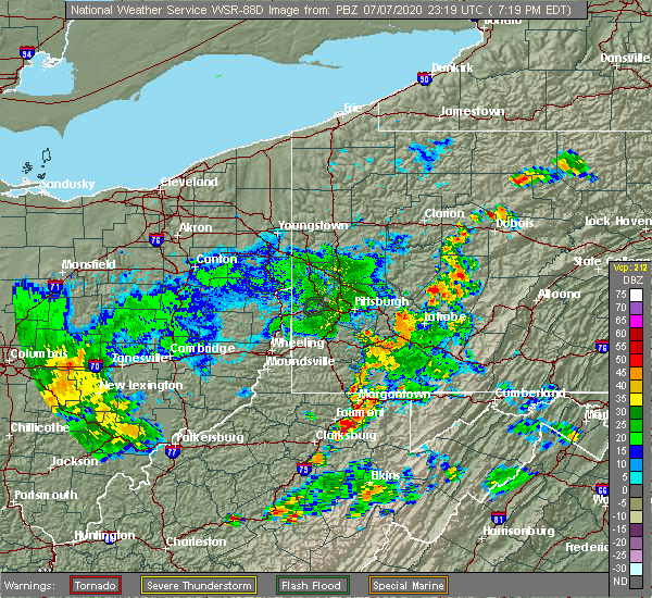 At 722 pm edt, a severe thunderstorm was located near grafton, and is nearly stationary (radar indicated). Hazards include 60 mph wind gusts and penny size hail. expect damage to roofs, siding, and trees At 722 pm edt, a severe thunderstorm was located near grafton, and is nearly stationary (radar indicated). Hazards include 60 mph wind gusts and penny size hail. expect damage to roofs, siding, and trees
|
| 6/3/2020 5:01 PM EDT |
 At 501 pm edt, a severe thunderstorm was located near lumberport, or 9 miles northwest of clarksburg, moving southeast at 40 mph (radar indicated). Hazards include 60 mph wind gusts and quarter size hail. Hail damage to vehicles is expected. Expect wind damage to roofs, siding, and trees. At 501 pm edt, a severe thunderstorm was located near lumberport, or 9 miles northwest of clarksburg, moving southeast at 40 mph (radar indicated). Hazards include 60 mph wind gusts and quarter size hail. Hail damage to vehicles is expected. Expect wind damage to roofs, siding, and trees.
|
| 10/31/2019 3:29 PM EDT |
 At 328 pm edt, severe thunderstorms were located along a line extending from near newburg to 9 miles northwest of snowshoe, moving northeast at 60 mph (radar indicated). Hazards include 60 mph wind gusts. Expect damage to roofs, siding, and trees. Locations impacted include, clarksburg, elkins, buckhannon, grafton, philippi, audra state park, cass scenic railroad, greenbank, bridgeport, belington, stonewood, addison (webster springs), anmoore, mill creek, snowshoe, dailey, rock cave, holly river state, mingo and beverly. At 328 pm edt, severe thunderstorms were located along a line extending from near newburg to 9 miles northwest of snowshoe, moving northeast at 60 mph (radar indicated). Hazards include 60 mph wind gusts. Expect damage to roofs, siding, and trees. Locations impacted include, clarksburg, elkins, buckhannon, grafton, philippi, audra state park, cass scenic railroad, greenbank, bridgeport, belington, stonewood, addison (webster springs), anmoore, mill creek, snowshoe, dailey, rock cave, holly river state, mingo and beverly.
|
| 10/31/2019 3:19 PM EDT |
 At 318 pm edt, severe thunderstorms were located along a line extending from fairmont to 8 miles east of addison (webster springs), moving northeast at 60 mph (radar indicated). Hazards include 60 mph wind gusts. Expect damage to roofs, siding, and trees. Locations impacted include, clarksburg, elkins, buckhannon, grafton, weston, philippi, richwood, audra state park, webster springs, cass scenic railroad, greenbank, bridgeport, shinnston, belington, stonewood, nutter fort, lumberport, addison (webster springs), anmoore and mill creek. At 318 pm edt, severe thunderstorms were located along a line extending from fairmont to 8 miles east of addison (webster springs), moving northeast at 60 mph (radar indicated). Hazards include 60 mph wind gusts. Expect damage to roofs, siding, and trees. Locations impacted include, clarksburg, elkins, buckhannon, grafton, weston, philippi, richwood, audra state park, webster springs, cass scenic railroad, greenbank, bridgeport, shinnston, belington, stonewood, nutter fort, lumberport, addison (webster springs), anmoore and mill creek.
|
| 10/31/2019 3:06 PM EDT |
 At 305 pm edt, severe thunderstorms were located along a line extending from lumberport to 8 miles northeast of richwood, moving northeast at 60 mph (radar indicated). Hazards include 60 mph wind gusts. Expect damage to roofs, siding, and trees. Locations impacted include, clarksburg, elkins, buckhannon, grafton, weston, philippi, richwood, audra state park, webster springs, cass scenic railroad, greenbank, bridgeport, shinnston, belington, stonewood, nutter fort, lumberport, addison (webster springs), anmoore and mill creek. At 305 pm edt, severe thunderstorms were located along a line extending from lumberport to 8 miles northeast of richwood, moving northeast at 60 mph (radar indicated). Hazards include 60 mph wind gusts. Expect damage to roofs, siding, and trees. Locations impacted include, clarksburg, elkins, buckhannon, grafton, weston, philippi, richwood, audra state park, webster springs, cass scenic railroad, greenbank, bridgeport, shinnston, belington, stonewood, nutter fort, lumberport, addison (webster springs), anmoore and mill creek.
|
| 10/31/2019 2:43 PM EDT |
 At 242 pm edt, severe thunderstorms were located along a line extending from 7 miles southwest of salem to 6 miles north of quinwood, moving northeast at 60 mph (radar indicated). Hazards include 60 mph wind gusts. expect damage to roofs, siding, and trees At 242 pm edt, severe thunderstorms were located along a line extending from 7 miles southwest of salem to 6 miles north of quinwood, moving northeast at 60 mph (radar indicated). Hazards include 60 mph wind gusts. expect damage to roofs, siding, and trees
|
| 8/20/2019 10:26 PM EDT |
 The severe thunderstorm warning for eastern doddridge, taylor, north central lewis and harrison counties will expire at 1030 pm edt, the storm which prompted the warning has weakened below severe limits, and no longer poses an immediate threat to life or property. therefore, the warning will be allowed to expire. The severe thunderstorm warning for eastern doddridge, taylor, north central lewis and harrison counties will expire at 1030 pm edt, the storm which prompted the warning has weakened below severe limits, and no longer poses an immediate threat to life or property. therefore, the warning will be allowed to expire.
|
| 8/20/2019 10:10 PM EDT |
 At 946 pm edt, a severe thunderstorm was located 8 miles south of salem, or 11 miles northwest of weston, moving northeast at 30 mph (radar indicated). Hazards include 60 mph wind gusts and quarter size hail. Hail damage to vehicles is expected. Expect wind damage to roofs, siding, and trees. At 946 pm edt, a severe thunderstorm was located 8 miles south of salem, or 11 miles northwest of weston, moving northeast at 30 mph (radar indicated). Hazards include 60 mph wind gusts and quarter size hail. Hail damage to vehicles is expected. Expect wind damage to roofs, siding, and trees.
|
| 8/20/2019 9:46 PM EDT |
 At 946 pm edt, a severe thunderstorm was located 8 miles south of salem, or 11 miles northwest of weston, moving northeast at 30 mph (radar indicated). Hazards include 60 mph wind gusts and quarter size hail. Hail damage to vehicles is expected. Expect wind damage to roofs, siding, and trees. At 946 pm edt, a severe thunderstorm was located 8 miles south of salem, or 11 miles northwest of weston, moving northeast at 30 mph (radar indicated). Hazards include 60 mph wind gusts and quarter size hail. Hail damage to vehicles is expected. Expect wind damage to roofs, siding, and trees.
|
| 7/14/2019 3:52 PM EDT |
 The severe thunderstorm warning for north central randolph, southeastern taylor and eastern barbour counties will expire at 400 pm edt, the storm which prompted the warning has moved out of the area. therefore, the warning will be allowed to expire. The severe thunderstorm warning for north central randolph, southeastern taylor and eastern barbour counties will expire at 400 pm edt, the storm which prompted the warning has moved out of the area. therefore, the warning will be allowed to expire.
|
| 7/14/2019 3:27 PM EDT |
 At 327 pm edt, a severe thunderstorm was located near grafton, moving southeast at 25 mph (radar indicated). Hazards include 60 mph wind gusts. expect damage to roofs, siding, and trees At 327 pm edt, a severe thunderstorm was located near grafton, moving southeast at 25 mph (radar indicated). Hazards include 60 mph wind gusts. expect damage to roofs, siding, and trees
|
| 6/24/2019 10:11 PM EDT |
 The severe thunderstorm warning for northeastern randolph, taylor and barbour counties will expire at 1015 pm edt, the storms which prompted the warning have weakened below severe limits, and have exited the warned area. therefore, the warning will be allowed to expire. The severe thunderstorm warning for northeastern randolph, taylor and barbour counties will expire at 1015 pm edt, the storms which prompted the warning have weakened below severe limits, and have exited the warned area. therefore, the warning will be allowed to expire.
|
| 6/24/2019 10:05 PM EDT |
 At 1004 pm edt, severe thunderstorms were located along a line extending from loch lynn heights to 9 miles south of davis to 10 miles west of upper tract to 6 miles west of franklin, moving northeast at 40 mph (radar indicated). Hazards include 60 mph wind gusts. Expect damage to roofs, siding, and trees. Locations impacted include, elkins, grafton, philippi, belington, beverly, junior, flemington, montrose, harman, moatsville, rosemont, dryfork, knottsville, glady, nestorville, bowden, tygart lake state park, kerens, thornton and galloway. At 1004 pm edt, severe thunderstorms were located along a line extending from loch lynn heights to 9 miles south of davis to 10 miles west of upper tract to 6 miles west of franklin, moving northeast at 40 mph (radar indicated). Hazards include 60 mph wind gusts. Expect damage to roofs, siding, and trees. Locations impacted include, elkins, grafton, philippi, belington, beverly, junior, flemington, montrose, harman, moatsville, rosemont, dryfork, knottsville, glady, nestorville, bowden, tygart lake state park, kerens, thornton and galloway.
|
| 6/24/2019 9:51 PM EDT |
 At 951 pm edt, severe thunderstorms were located along a line extending from 8 miles east of rowlesburg to 10 miles southeast of hendricks to 16 miles east of dailey to 11 miles north of monterey, moving northeast at 40 mph (radar indicated). Hazards include 60 mph wind gusts. Expect damage to roofs, siding, and trees. Locations impacted include, elkins, grafton, philippi, audra state park, belington, dailey, beverly, junior, flemington, durbin, womelsdorf (coalton), montrose, harman, cheat bridge, dryfork, knottsville, glady, boyer, bowden and tygart lake state park. At 951 pm edt, severe thunderstorms were located along a line extending from 8 miles east of rowlesburg to 10 miles southeast of hendricks to 16 miles east of dailey to 11 miles north of monterey, moving northeast at 40 mph (radar indicated). Hazards include 60 mph wind gusts. Expect damage to roofs, siding, and trees. Locations impacted include, elkins, grafton, philippi, audra state park, belington, dailey, beverly, junior, flemington, durbin, womelsdorf (coalton), montrose, harman, cheat bridge, dryfork, knottsville, glady, boyer, bowden and tygart lake state park.
|
| 6/24/2019 9:11 PM EDT |
 At 911 pm edt, severe thunderstorms were located along a line extending from near philippi to mill creek to 9 miles northwest of cass scenic railroad to snowshoe, moving northeast at 40 mph (radar indicated). Hazards include 60 mph wind gusts. expect damage to roofs, siding, and trees At 911 pm edt, severe thunderstorms were located along a line extending from near philippi to mill creek to 9 miles northwest of cass scenic railroad to snowshoe, moving northeast at 40 mph (radar indicated). Hazards include 60 mph wind gusts. expect damage to roofs, siding, and trees
|
| 5/25/2019 2:41 PM EDT |
 The severe thunderstorm warning for taylor and northeastern harrison counties will expire at 245 pm edt, the storm which prompted the warning has moved out of the area. therefore, the warning will be allowed to expire. however gusty winds and heavy rain are still possible with this thunderstorm. remember, a severe thunderstorm warning still remains in effect for central and eastern taylor county as this storm tracks eastward. The severe thunderstorm warning for taylor and northeastern harrison counties will expire at 245 pm edt, the storm which prompted the warning has moved out of the area. therefore, the warning will be allowed to expire. however gusty winds and heavy rain are still possible with this thunderstorm. remember, a severe thunderstorm warning still remains in effect for central and eastern taylor county as this storm tracks eastward.
|
| 5/25/2019 2:39 PM EDT |
 At 239 pm edt, a severe thunderstorm was located over grafton, moving east at 30 mph (radar indicated). Hazards include 60 mph wind gusts and quarter size hail. Hail damage to vehicles is expected. Expect wind damage to roofs, siding, and trees. At 239 pm edt, a severe thunderstorm was located over grafton, moving east at 30 mph (radar indicated). Hazards include 60 mph wind gusts and quarter size hail. Hail damage to vehicles is expected. Expect wind damage to roofs, siding, and trees.
|
| 5/25/2019 2:37 PM EDT | Corrected to elaborate on damage. multiple reports of trees and powerlines down in the cit in taylor county WV, 0.2 miles E of Grafton, WV |
| 5/25/2019 2:37 PM EDT | Corrected to elaborate on damage. multiple reports of trees and powerlines down in the cit in taylor county WV, 0.2 miles E of Grafton, WV |
| 5/25/2019 2:32 PM EDT |
 At 232 pm edt, a severe thunderstorm was located near grafton, moving east at 35 mph (radar indicated). Hazards include 70 mph wind gusts and ping pong ball size hail. People and animals outdoors will be injured. expect hail damage to roofs, siding, windows, and vehicles. expect considerable tree damage. wind damage is also likely to mobile homes, roofs, and outbuildings. Locations impacted include, clarksburg, grafton, bridgeport, thornton, knottsville, mcgee, meadowbrook, meadland and despard. At 232 pm edt, a severe thunderstorm was located near grafton, moving east at 35 mph (radar indicated). Hazards include 70 mph wind gusts and ping pong ball size hail. People and animals outdoors will be injured. expect hail damage to roofs, siding, windows, and vehicles. expect considerable tree damage. wind damage is also likely to mobile homes, roofs, and outbuildings. Locations impacted include, clarksburg, grafton, bridgeport, thornton, knottsville, mcgee, meadowbrook, meadland and despard.
|
| 5/25/2019 2:30 PM EDT | Trees and powerlines dow in taylor county WV, 0.2 miles E of Grafton, WV |
| 5/25/2019 2:00 PM EDT |
 At 200 pm edt, a severe thunderstorm was located near shinnston, or near clarksburg, moving east at 35 mph (radar indicated). Hazards include 70 mph wind gusts and ping pong ball size hail. People and animals outdoors will be injured. expect hail damage to roofs, siding, windows, and vehicles. expect considerable tree damage. Wind damage is also likely to mobile homes, roofs, and outbuildings. At 200 pm edt, a severe thunderstorm was located near shinnston, or near clarksburg, moving east at 35 mph (radar indicated). Hazards include 70 mph wind gusts and ping pong ball size hail. People and animals outdoors will be injured. expect hail damage to roofs, siding, windows, and vehicles. expect considerable tree damage. Wind damage is also likely to mobile homes, roofs, and outbuildings.
|
| 4/14/2019 9:17 PM EDT |
 At 917 pm edt, severe thunderstorms were located along a line extending from near winfield to 7 miles west of dailey, moving northeast at 50 mph (radar indicated). Hazards include 70 mph wind gusts. Expect considerable tree damage. Damage is likely to mobile homes, roofs, and outbuildings. At 917 pm edt, severe thunderstorms were located along a line extending from near winfield to 7 miles west of dailey, moving northeast at 50 mph (radar indicated). Hazards include 70 mph wind gusts. Expect considerable tree damage. Damage is likely to mobile homes, roofs, and outbuildings.
|
| 4/14/2019 8:52 PM EDT |
 At 852 pm edt, a severe thunderstorm was located near buckhannon, moving northeast at 65 mph (radar indicated). Hazards include 70 mph wind gusts. Expect considerable tree damage. Damage is likely to mobile homes, roofs, and outbuildings. At 852 pm edt, a severe thunderstorm was located near buckhannon, moving northeast at 65 mph (radar indicated). Hazards include 70 mph wind gusts. Expect considerable tree damage. Damage is likely to mobile homes, roofs, and outbuildings.
|
| 8/13/2018 4:26 PM EDT |
 The severe thunderstorm warning for taylor and northeastern barbour counties will expire at 430 pm edt, the storm which prompted the warning has weakened below severe limits, and no longer poses an immediate threat to life or property. therefore, the warning will be allowed to expire. however heavy rain is still possible with this thunderstorm. The severe thunderstorm warning for taylor and northeastern barbour counties will expire at 430 pm edt, the storm which prompted the warning has weakened below severe limits, and no longer poses an immediate threat to life or property. therefore, the warning will be allowed to expire. however heavy rain is still possible with this thunderstorm.
|
| 8/13/2018 4:08 PM EDT |
 At 408 pm edt, a severe thunderstorm was located near newburg, or 8 miles southeast of grafton, moving south at 25 mph (radar indicated). Hazards include 60 mph wind gusts and quarter size hail. Hail damage to vehicles is expected. expect wind damage to roofs, siding, and trees. Locations impacted include, grafton, philippi, moatsville, tygart lake state park, thornton, knottsville and nestorville. At 408 pm edt, a severe thunderstorm was located near newburg, or 8 miles southeast of grafton, moving south at 25 mph (radar indicated). Hazards include 60 mph wind gusts and quarter size hail. Hail damage to vehicles is expected. expect wind damage to roofs, siding, and trees. Locations impacted include, grafton, philippi, moatsville, tygart lake state park, thornton, knottsville and nestorville.
|
| 8/13/2018 3:49 PM EDT |
 At 348 pm edt, a severe thunderstorm was located near newburg, or 9 miles northeast of grafton, moving south at 25 mph (radar indicated). Hazards include 60 mph wind gusts and quarter size hail. Hail damage to vehicles is expected. Expect wind damage to roofs, siding, and trees. At 348 pm edt, a severe thunderstorm was located near newburg, or 9 miles northeast of grafton, moving south at 25 mph (radar indicated). Hazards include 60 mph wind gusts and quarter size hail. Hail damage to vehicles is expected. Expect wind damage to roofs, siding, and trees.
|
| 7/4/2018 6:42 PM EDT | Numerous trees and powerlines dow in taylor county WV, 0.2 miles E of Grafton, WV |
| 7/4/2018 6:36 PM EDT |
 The severe thunderstorm warning for east central taylor county will expire at 645 pm edt, the storm which prompted the warning has weakened below severe limits, and no longer poses an immediate threat to life or property. therefore, the warning will be allowed to expire. however gusty winds and heavy rain are still possible with this thunderstorm. to report severe weather, contact your nearest law enforcement agency. they will relay your report to the national weather service charleston west virginia. The severe thunderstorm warning for east central taylor county will expire at 645 pm edt, the storm which prompted the warning has weakened below severe limits, and no longer poses an immediate threat to life or property. therefore, the warning will be allowed to expire. however gusty winds and heavy rain are still possible with this thunderstorm. to report severe weather, contact your nearest law enforcement agency. they will relay your report to the national weather service charleston west virginia.
|
| 7/4/2018 6:22 PM EDT |
 At 622 pm edt, a severe thunderstorm was located over grafton, moving southwest at 5 mph (radar indicated). Hazards include 60 mph wind gusts. expect damage to roofs, siding, and trees At 622 pm edt, a severe thunderstorm was located over grafton, moving southwest at 5 mph (radar indicated). Hazards include 60 mph wind gusts. expect damage to roofs, siding, and trees
|
| 5/15/2018 8:32 PM EDT |
 At 832 pm edt, severe thunderstorms were located along a line extending from near grafton to 7 miles east of bridgeport, moving east at 30 mph (radar indicated). Hazards include 60 mph wind gusts and quarter size hail. Hail damage to vehicles is expected. expect wind damage to roofs, siding, and trees. locations impacted include, grafton, valley falls, knottsville, tygart lake state park and thornton. At 832 pm edt, severe thunderstorms were located along a line extending from near grafton to 7 miles east of bridgeport, moving east at 30 mph (radar indicated). Hazards include 60 mph wind gusts and quarter size hail. Hail damage to vehicles is expected. expect wind damage to roofs, siding, and trees. locations impacted include, grafton, valley falls, knottsville, tygart lake state park and thornton.
|
| 5/15/2018 8:30 PM EDT | Downed trees reported in the are in taylor county WV, 3.5 miles ENE of Grafton, WV |
| 5/15/2018 8:21 PM EDT |
 At 821 pm edt, severe thunderstorms were located along a line extending from near pleasant valley to near bridgeport, moving east at 30 mph (radar indicated). Hazards include 60 mph wind gusts and quarter size hail. Hail damage to vehicles is expected. expect wind damage to roofs, siding, and trees. locations impacted include, clarksburg, grafton, bridgeport, valley falls, tygart lake state park, thornton, knottsville, mcgee and meadland. This includes interstate 79 between mile markers 123 and 129. At 821 pm edt, severe thunderstorms were located along a line extending from near pleasant valley to near bridgeport, moving east at 30 mph (radar indicated). Hazards include 60 mph wind gusts and quarter size hail. Hail damage to vehicles is expected. expect wind damage to roofs, siding, and trees. locations impacted include, clarksburg, grafton, bridgeport, valley falls, tygart lake state park, thornton, knottsville, mcgee and meadland. This includes interstate 79 between mile markers 123 and 129.
|
| 5/15/2018 7:59 PM EDT |
 At 759 pm edt, severe thunderstorms were located along a line extending from enterprise to near lumberport, moving east at 35 mph (radar indicated). Hazards include 60 mph wind gusts and quarter size hail. Hail damage to vehicles is expected. Expect wind damage to roofs, siding, and trees. At 759 pm edt, severe thunderstorms were located along a line extending from enterprise to near lumberport, moving east at 35 mph (radar indicated). Hazards include 60 mph wind gusts and quarter size hail. Hail damage to vehicles is expected. Expect wind damage to roofs, siding, and trees.
|
| 5/10/2018 2:45 PM EDT |
 At 245 pm edt, a severe thunderstorm was located near grafton, moving east at 30 mph (radar indicated). Hazards include 60 mph wind gusts and quarter size hail. Hail damage to vehicles is expected. Expect wind damage to roofs, siding, and trees. At 245 pm edt, a severe thunderstorm was located near grafton, moving east at 30 mph (radar indicated). Hazards include 60 mph wind gusts and quarter size hail. Hail damage to vehicles is expected. Expect wind damage to roofs, siding, and trees.
|
| 5/5/2017 5:20 PM EDT | Quarter sized hail reported 3.6 miles W of Grafton, WV, reported high winds as well... but no estimate of speed given. |
| 5/5/2017 5:05 PM EDT |
 At 504 pm edt, a severe thunderstorm was located near grafton, moving northeast at 30 mph. Hazards include 60 mph wind gusts and quarter size hail. Hail damage to vehicles is expected. Expect wind damage to roofs, siding, and trees. At 504 pm edt, a severe thunderstorm was located near grafton, moving northeast at 30 mph. Hazards include 60 mph wind gusts and quarter size hail. Hail damage to vehicles is expected. Expect wind damage to roofs, siding, and trees.
|
| 5/1/2017 2:44 PM EDT |
 At 244 pm edt, a severe thunderstorm was located over salem, or 9 miles west of clarksburg, moving northeast at 65 mph (radar indicated). Hazards include 70 mph wind gusts. Expect considerable tree damage. Damage is likely to mobile homes, roofs, and outbuildings. At 244 pm edt, a severe thunderstorm was located over salem, or 9 miles west of clarksburg, moving northeast at 65 mph (radar indicated). Hazards include 70 mph wind gusts. Expect considerable tree damage. Damage is likely to mobile homes, roofs, and outbuildings.
|
| 10/20/2016 7:53 PM EDT |
 The severe thunderstorm warning for western taylor county will expire at 800 pm edt, the storm which prompted the warning has weakened below severe limits, and no longer pose an immediate threat to life or property. therefore, the warning will be allowed to expire. however small. The severe thunderstorm warning for western taylor county will expire at 800 pm edt, the storm which prompted the warning has weakened below severe limits, and no longer pose an immediate threat to life or property. therefore, the warning will be allowed to expire. however small.
|
| 10/20/2016 7:49 PM EDT |
 At 748 pm edt, a severe thunderstorm was located near grafton, moving northeast at 30 mph (trained weather spotters have reported large hail with this storm!). Hazards include 60 mph wind gusts and quarter size hail. Hail damage to vehicles is expected. expect wind damage to roofs, siding, and trees. Locations impacted include, grafton, flemington, valley falls, tygart lake state park, rosemont, meadland and mcgee. At 748 pm edt, a severe thunderstorm was located near grafton, moving northeast at 30 mph (trained weather spotters have reported large hail with this storm!). Hazards include 60 mph wind gusts and quarter size hail. Hail damage to vehicles is expected. expect wind damage to roofs, siding, and trees. Locations impacted include, grafton, flemington, valley falls, tygart lake state park, rosemont, meadland and mcgee.
|
| 10/20/2016 7:35 PM EDT |
 At 735 pm edt, a severe thunderstorm was located over anmoore, or near clarksburg, moving northeast at 30 mph (trained weather spotters have reported large hail with this storm!). Hazards include 60 mph wind gusts and quarter size hail. Hail damage to vehicles is expected. expect wind damage to roofs, siding, and trees. Locations impacted include, clarksburg, grafton, philippi, bridgeport, stonewood, nutter fort, anmoore, flemington, valley falls, despard, galloway, mcgee, tygart lake state park, moatsville, rosemont and meadland. At 735 pm edt, a severe thunderstorm was located over anmoore, or near clarksburg, moving northeast at 30 mph (trained weather spotters have reported large hail with this storm!). Hazards include 60 mph wind gusts and quarter size hail. Hail damage to vehicles is expected. expect wind damage to roofs, siding, and trees. Locations impacted include, clarksburg, grafton, philippi, bridgeport, stonewood, nutter fort, anmoore, flemington, valley falls, despard, galloway, mcgee, tygart lake state park, moatsville, rosemont and meadland.
|
| 10/20/2016 7:28 PM EDT |
 At 728 pm edt, a severe thunderstorm was located over stonewood, or near clarksburg, moving northeast at 30 mph (radar indicated). Hazards include 60 mph wind gusts and quarter size hail. Hail damage to vehicles is expected. Expect wind damage to roofs, siding, and trees. At 728 pm edt, a severe thunderstorm was located over stonewood, or near clarksburg, moving northeast at 30 mph (radar indicated). Hazards include 60 mph wind gusts and quarter size hail. Hail damage to vehicles is expected. Expect wind damage to roofs, siding, and trees.
|
| 8/15/2016 3:07 PM EDT |
 The severe thunderstorm warning for eastern taylor county will expire at 315 pm edt, the storm which prompted the warning has moved out of the area. therefore, the warning will be allowed to expire. The severe thunderstorm warning for eastern taylor county will expire at 315 pm edt, the storm which prompted the warning has moved out of the area. therefore, the warning will be allowed to expire.
|
| 8/15/2016 2:56 PM EDT |
 The severe thunderstorm warning for northeastern harrison and western taylor counties will expire at 300 pm edt, the storm which prompted the warning has moved out of the area. therefore, the warning will be allowed to expire. The severe thunderstorm warning for northeastern harrison and western taylor counties will expire at 300 pm edt, the storm which prompted the warning has moved out of the area. therefore, the warning will be allowed to expire.
|
| 8/15/2016 2:52 PM EDT |
 At 251 pm edt, a severe thunderstorm was located over grafton, moving northeast at 25 mph (radar indicated). Hazards include 60 mph wind gusts and quarter size hail. Hail damage to vehicles is expected. Expect wind damage to roofs, siding, and trees. At 251 pm edt, a severe thunderstorm was located over grafton, moving northeast at 25 mph (radar indicated). Hazards include 60 mph wind gusts and quarter size hail. Hail damage to vehicles is expected. Expect wind damage to roofs, siding, and trees.
|
| 8/15/2016 2:40 PM EDT | Trees reported down along us 250. time estimated from rada in taylor county WV, 5.2 miles ESE of Grafton, WV |
| 8/15/2016 2:11 PM EDT |
 At 211 pm edt, a severe thunderstorm was located near clarksburg, moving east northeast at 25 mph (radar indicated). Hazards include 60 mph wind gusts and quarter size hail. Hail damage to vehicles is expected. Expect wind damage to roofs, siding, and trees. At 211 pm edt, a severe thunderstorm was located near clarksburg, moving east northeast at 25 mph (radar indicated). Hazards include 60 mph wind gusts and quarter size hail. Hail damage to vehicles is expected. Expect wind damage to roofs, siding, and trees.
|
| 7/4/2016 8:03 PM EDT |
 At 802 pm edt, a severe thunderstorm was located near philippi, moving east at 50 mph (radar indicated). Hazards include 60 mph wind gusts. Expect damage to roofs. siding. and trees. Locations impacted include, grafton, philippi, flemington, galloway, knottsville, tygart lake state park, century, moatsville, rosemont, thornton, nestorville, meadland and volga. At 802 pm edt, a severe thunderstorm was located near philippi, moving east at 50 mph (radar indicated). Hazards include 60 mph wind gusts. Expect damage to roofs. siding. and trees. Locations impacted include, grafton, philippi, flemington, galloway, knottsville, tygart lake state park, century, moatsville, rosemont, thornton, nestorville, meadland and volga.
|
| 7/4/2016 7:53 PM EDT |
 At 752 pm edt, a severe thunderstorm was located near anmoore, or 7 miles southeast of clarksburg, moving east at 50 mph (radar indicated). Hazards include 60 mph wind gusts. Expect damage to roofs. siding. and trees. Locations impacted include, clarksburg, grafton, philippi, bridgeport, stonewood, nutter fort, anmoore, lost creek, flemington, despard, galloway, knottsville, tygart lake state park, century, moatsville, rosemont, thornton, nestorville, meadland and volga. At 752 pm edt, a severe thunderstorm was located near anmoore, or 7 miles southeast of clarksburg, moving east at 50 mph (radar indicated). Hazards include 60 mph wind gusts. Expect damage to roofs. siding. and trees. Locations impacted include, clarksburg, grafton, philippi, bridgeport, stonewood, nutter fort, anmoore, lost creek, flemington, despard, galloway, knottsville, tygart lake state park, century, moatsville, rosemont, thornton, nestorville, meadland and volga.
|
| 7/4/2016 7:34 PM EDT |
 At 733 pm edt, a severe thunderstorm was located near jackson mill, or 9 miles north of weston, moving east at 50 mph (radar indicated). Hazards include 60 mph wind gusts. Expect damage to roofs. siding. And trees. At 733 pm edt, a severe thunderstorm was located near jackson mill, or 9 miles north of weston, moving east at 50 mph (radar indicated). Hazards include 60 mph wind gusts. Expect damage to roofs. siding. And trees.
|
| 6/23/2016 3:31 AM EDT |
 At 331 am edt, severe thunderstorms were located along a line extending from near lumberport to 11 miles north of glenville, moving east at 45 mph (radar indicated). Hazards include 60 mph wind gusts and penny size hail. Expect damage to roofs. siding. and trees. Locations impacted include, clarksburg, grafton, weston, bridgeport, shinnston, stonewood, nutter fort, salem, lumberport, anmoore, jackson mill, west milford, lost creek, jane lew, flemington, auburn, coxs mills, despard, galloway and wolf summit. At 331 am edt, severe thunderstorms were located along a line extending from near lumberport to 11 miles north of glenville, moving east at 45 mph (radar indicated). Hazards include 60 mph wind gusts and penny size hail. Expect damage to roofs. siding. and trees. Locations impacted include, clarksburg, grafton, weston, bridgeport, shinnston, stonewood, nutter fort, salem, lumberport, anmoore, jackson mill, west milford, lost creek, jane lew, flemington, auburn, coxs mills, despard, galloway and wolf summit.
|
| 6/23/2016 3:14 AM EDT |
 At 314 am edt, severe thunderstorms were located along a line extending from 6 miles north of salem to near harrisville, moving east at 40 mph (radar indicated). Hazards include 60 mph wind gusts and quarter size hail. Hail damage to vehicles is expected. Expect wind damage to roofs, siding, and trees. At 314 am edt, severe thunderstorms were located along a line extending from 6 miles north of salem to near harrisville, moving east at 40 mph (radar indicated). Hazards include 60 mph wind gusts and quarter size hail. Hail damage to vehicles is expected. Expect wind damage to roofs, siding, and trees.
|
| 4/28/2016 6:15 PM EDT | Golf Ball sized hail reported 6.5 miles WNW of Grafton, WV |
| 4/28/2016 6:10 PM EDT | Ping Pong Ball sized hail reported 4.1 miles W of Grafton, WV, most of the hail was dize size but some up to ping pong ball size |
| 4/28/2016 6:10 PM EDT | Golf Ball sized hail reported 2.5 miles WNW of Grafton, WV, golf ball sized hail reported at golf course |
| 4/28/2016 6:02 PM EDT |
 At 601 pm edt, a severe thunderstorm was located near grafton, moving east at 35 mph (radar indicated). Hazards include two inch hail and 60 mph wind gusts. People and animals outdoors will be injured. expect hail damage to roofs, siding, windows, and vehicles. expect wind damage to roofs, siding, and trees. locations impacted include, grafton, thornton, tygart lake state park and knottsville. This storm has had a history of large hail up to the size of tennis balls. At 601 pm edt, a severe thunderstorm was located near grafton, moving east at 35 mph (radar indicated). Hazards include two inch hail and 60 mph wind gusts. People and animals outdoors will be injured. expect hail damage to roofs, siding, windows, and vehicles. expect wind damage to roofs, siding, and trees. locations impacted include, grafton, thornton, tygart lake state park and knottsville. This storm has had a history of large hail up to the size of tennis balls.
|
| 4/28/2016 6:01 PM EDT | Tennis Ball sized hail reported 0.2 miles E of Grafton, WV, harrison/taylor 911 called in reporting golfballs up to tennis balls in grafton per sheriff |
| 4/28/2016 5:58 PM EDT | Half Dollar sized hail reported 0.2 miles E of Grafton, WV, quarter to half dollar size hail ongoing |
| 4/28/2016 5:58 PM EDT | Tennis Ball sized hail reported 0.2 miles E of Grafton, WV, harrison/taylor 911 called in reporting golfballs up to tennis balls in grafton per sheriff |
| 4/28/2016 5:53 PM EDT | Ping Pong Ball sized hail reported 2.5 miles ESE of Grafton, WV, viewer photo... estimated size based on hailstones in hand |
| 4/28/2016 5:52 PM EDT | Tennis Ball sized hail reported 1.3 miles E of Grafton, WV, numerous reports of vehicle damage... school windows broken |
| 4/28/2016 5:52 PM EDT | Telephones and trees down in taylor county WV, 0.2 miles E of Grafton, WV |
| 4/28/2016 5:50 PM EDT | Ping Pong Ball sized hail reported 2.5 miles WNW of Grafton, WV |
| 4/28/2016 5:49 PM EDT |
 At 548 pm edt, a severe thunderstorm was located over grafton, moving east at 25 mph (radar indicated). Hazards include 60 mph wind gusts and half dollar size hail. Hail damage to vehicles is expected. Expect wind damage to roofs, siding, and trees. At 548 pm edt, a severe thunderstorm was located over grafton, moving east at 25 mph (radar indicated). Hazards include 60 mph wind gusts and half dollar size hail. Hail damage to vehicles is expected. Expect wind damage to roofs, siding, and trees.
|
| 6/20/2015 3:10 PM EDT | A few trees blown down in grafton in taylor county WV, 0.2 miles E of Grafton, WV |
| 4/9/2015 7:40 PM EDT | The severe thunderstorm warning for southeastern harrison. taylor and northern barbour counties will expire at 745 pm edt. the storm which prompted the warning has moved out of the warned area. A severe thunderstorm watch remains in effect until 1000 pm edt thursday evening for central kentucky and southeast ohio and central. |
| 4/9/2015 7:22 PM EDT | A severe thunderstorm warning remains in effect until 745 pm edt for southeastern harrison. taylor and northern barbour counties. at 719 pm edt. national weather service doppler radar continued to indicate a severe thunderstorm capable of producing quarter size hail. and damaging winds in excess of 60 mph. this storm was located near rosemont. or 6 miles southeast of clarksburg. Moving. |
| 4/9/2015 6:54 PM EDT | The national weather service in charleston has issued a * severe thunderstorm warning for. northern barbour county in west virginia. east central doddridge county in west virginia. southern harrison county in west virginia. This includes the city of clarksburg. |
| 4/9/2015 6:10 PM EDT | A severe thunderstorm warning remains in effect until 615 pm edt for taylor and extreme northeastern barbour counties. at 607 pm edt. national weather service doppler radar continued to indicate a severe thunderstorm capable of producing golf ball size hail. and damaging winds in excess of 60 mph. this storm was located near thornton. or near grafton. Moving east at 40 mph. |
| 4/9/2015 6:00 PM EDT | The national weather service in charleston has issued a * severe thunderstorm warning for. northeastern barbour county in west virginia. taylor county in west virginia. this includes the city of grafton. Until 615 pm edt. |
| 7/8/2014 4:00 PM EDT | Damage to a chicken coop. power out in taylor county WV, 5.1 miles E of Grafton, WV |
| 7/8/2014 4:00 PM EDT | Multiple trees down around town. tree down on callers hous in taylor county WV, 0.2 miles E of Grafton, WV |
| 7/8/2014 3:53 PM EDT | Several trees down in town. time estimated from rada in taylor county WV, 0.2 miles E of Grafton, WV |
| 7/7/2013 12:12 PM EDT | Numerous trees and powerlines down. also a few power poles were reported dow in taylor county WV, 4.1 miles W of Grafton, WV |
| 7/7/2013 12:05 PM EDT | Several trees down in the par in taylor county WV, 2.9 miles NNE of Grafton, WV |
| 6/28/2013 5:21 PM EDT | Tree approx 3 feet in diameter down across shelby run road. time est by radar in taylor county WV, 2.4 miles E of Grafton, WV |
| 7/26/2012 7:20 PM EDT | Trees down into power lines on route 119 in grafton in taylor county WV, 0.2 miles E of Grafton, WV |
| 1/1/0001 12:00 AM | Tree down on west main street in taylor county WV, 0.2 miles E of Grafton, WV |
| 1/1/0001 12:00 AM | Trees down on rt 310 - haymond road and wickwire roa in taylor county WV, 0.2 miles E of Grafton, WV |
| 1/1/0001 12:00 AM | Trees down... wilson r in taylor county WV, 0.2 miles E of Grafton, WV |
| 1/1/0001 12:00 AM | Quarter sized hail reported 1.9 miles SW of Grafton, WV |
Hail Maps for Grafton, WV


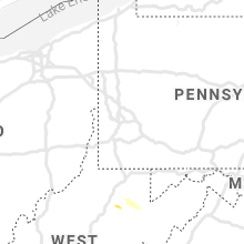


Connect with Interactive Hail Maps