

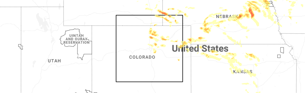
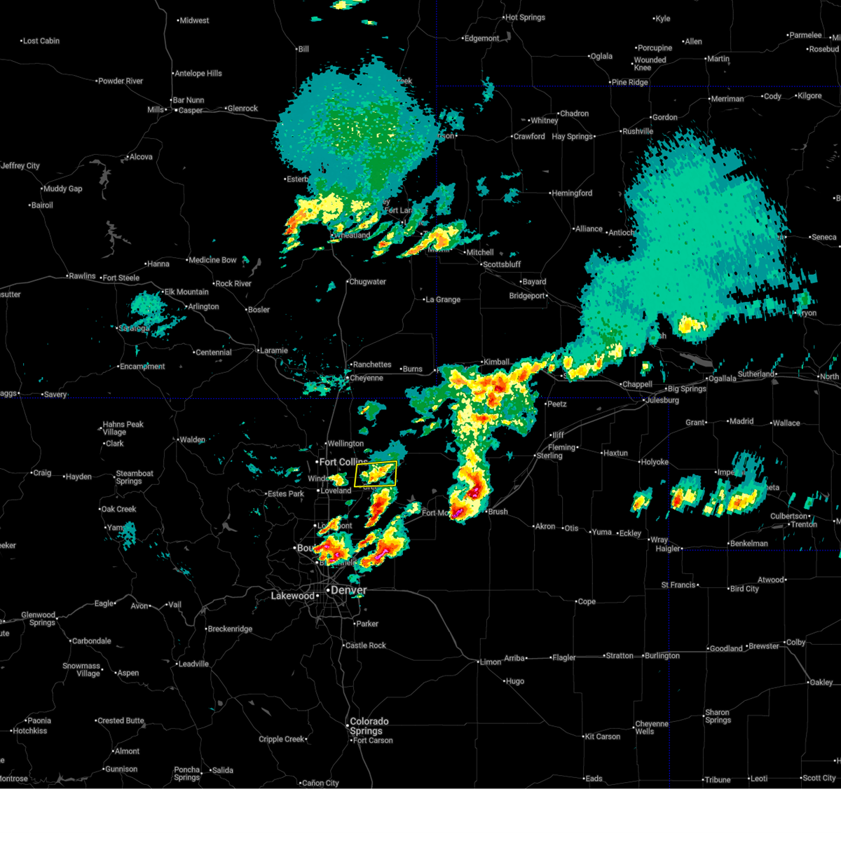
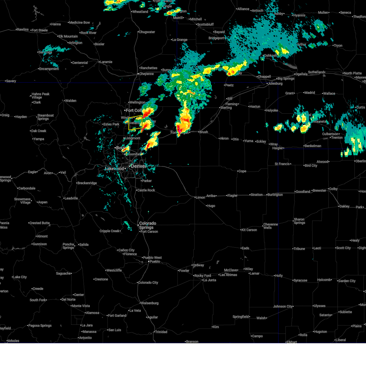
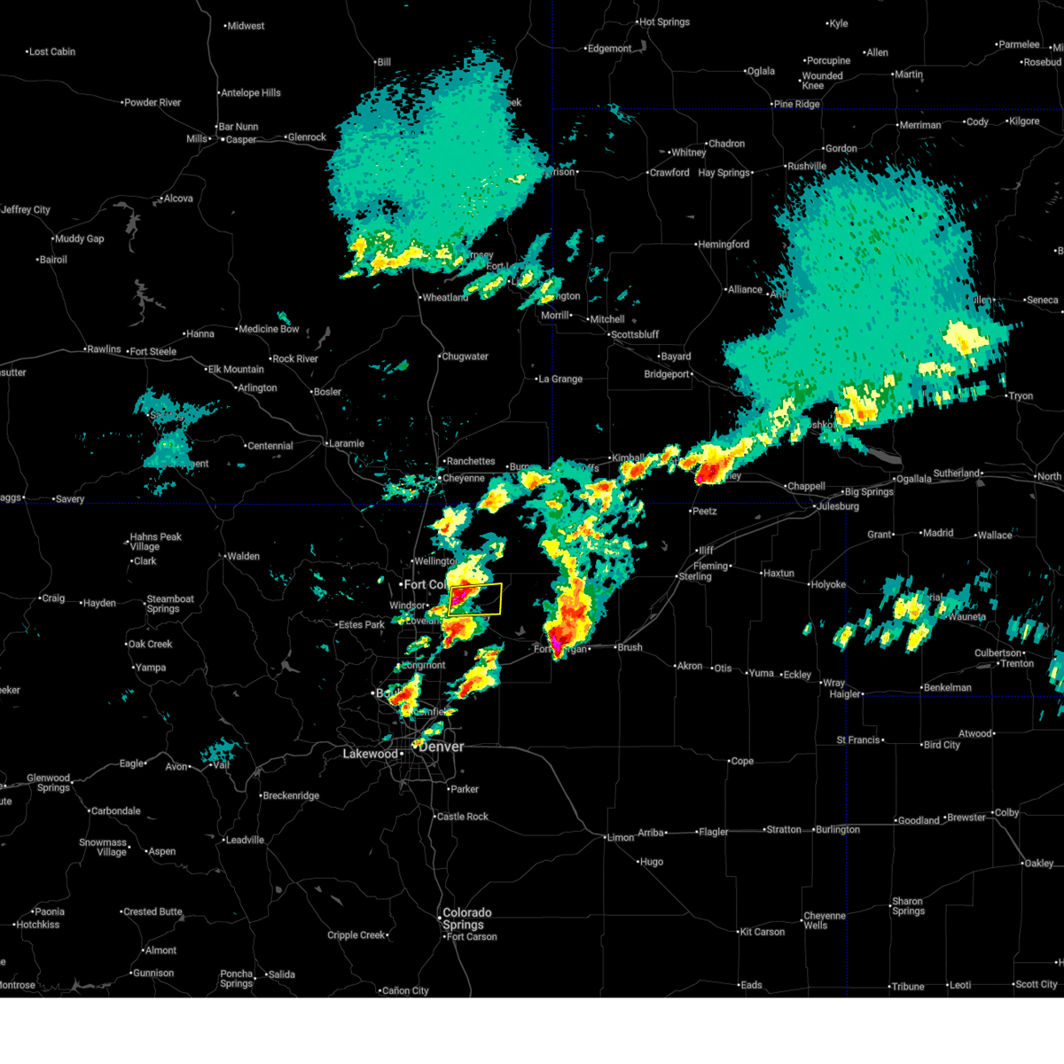
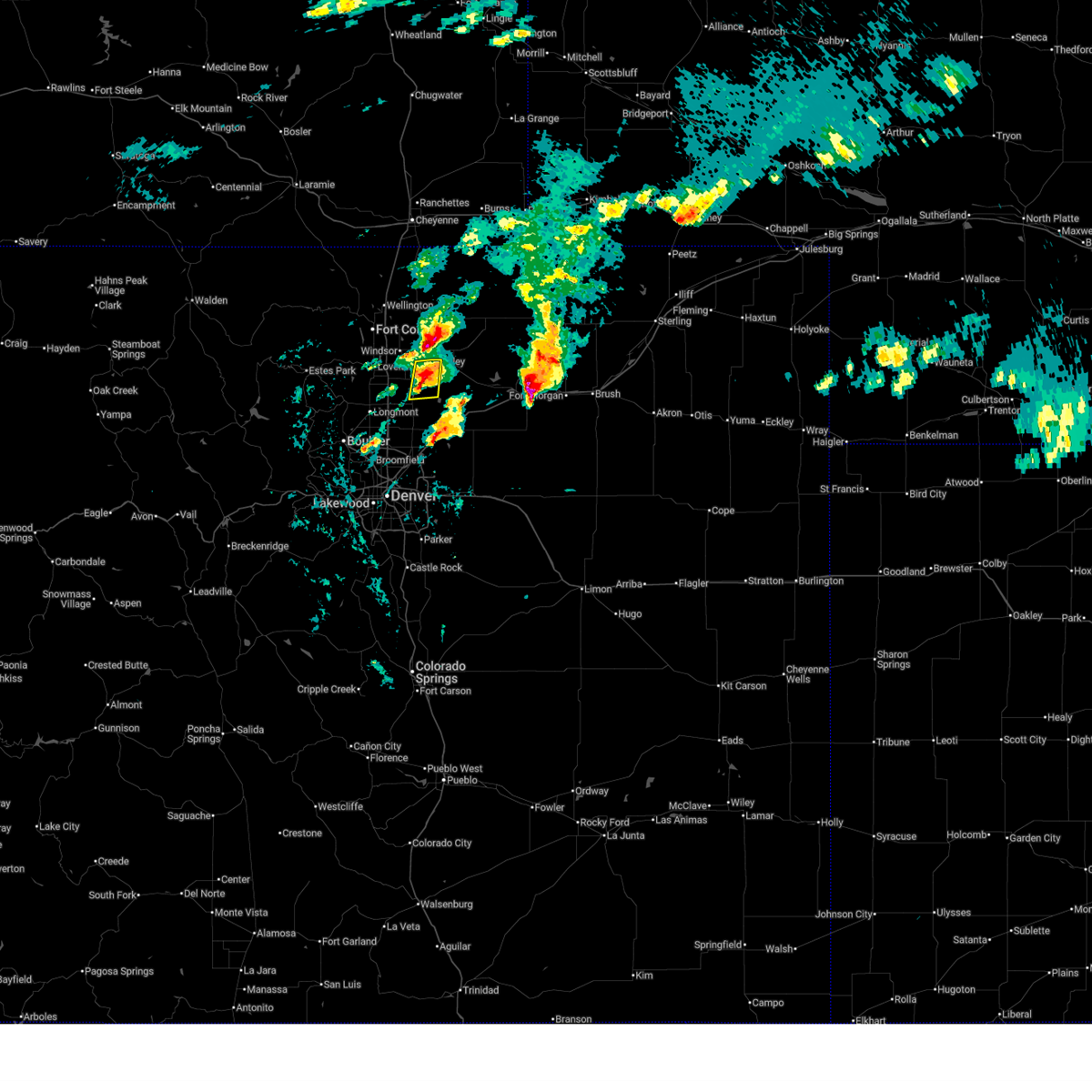
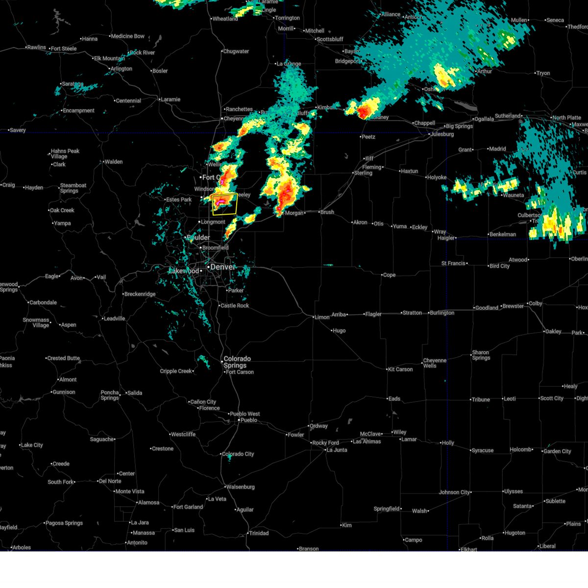
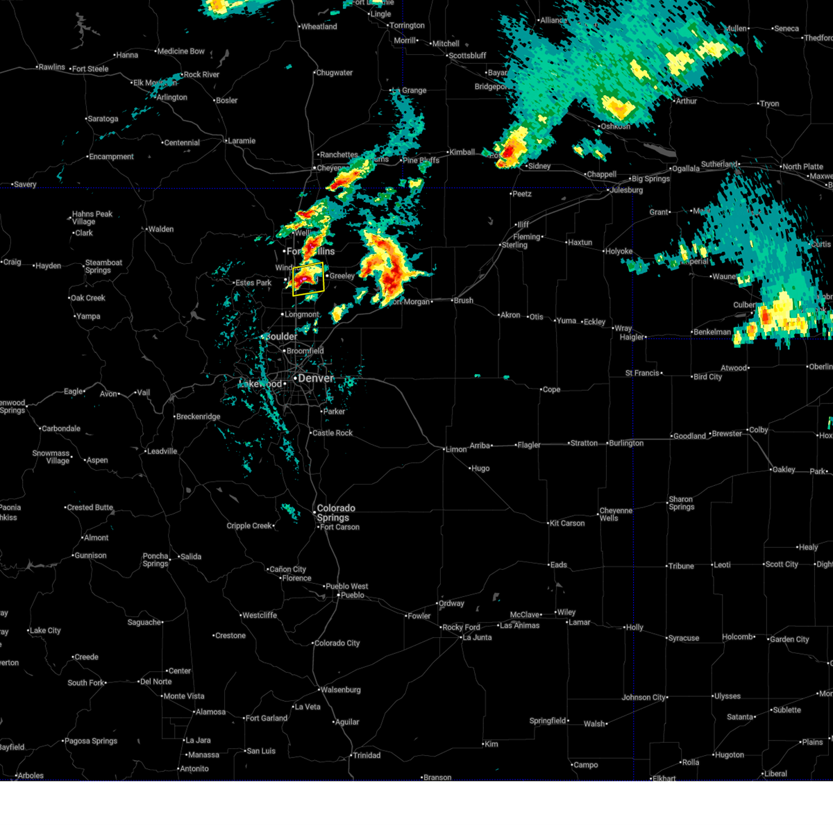
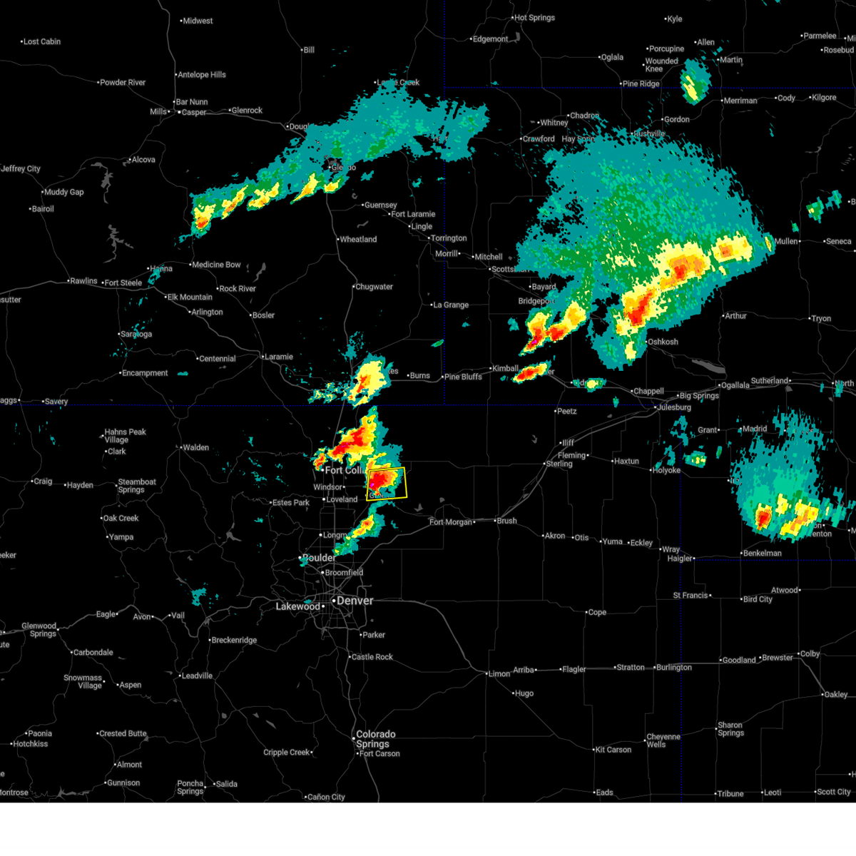
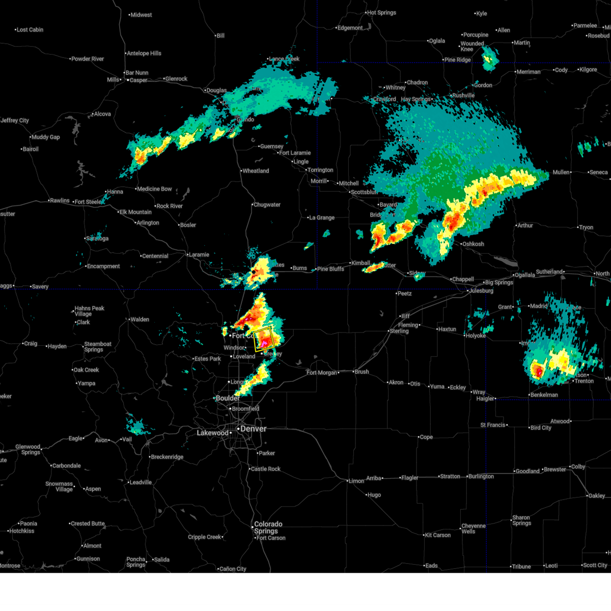
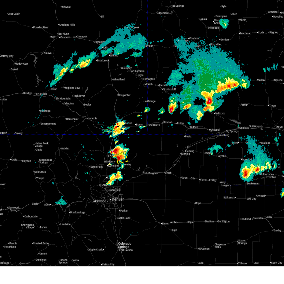
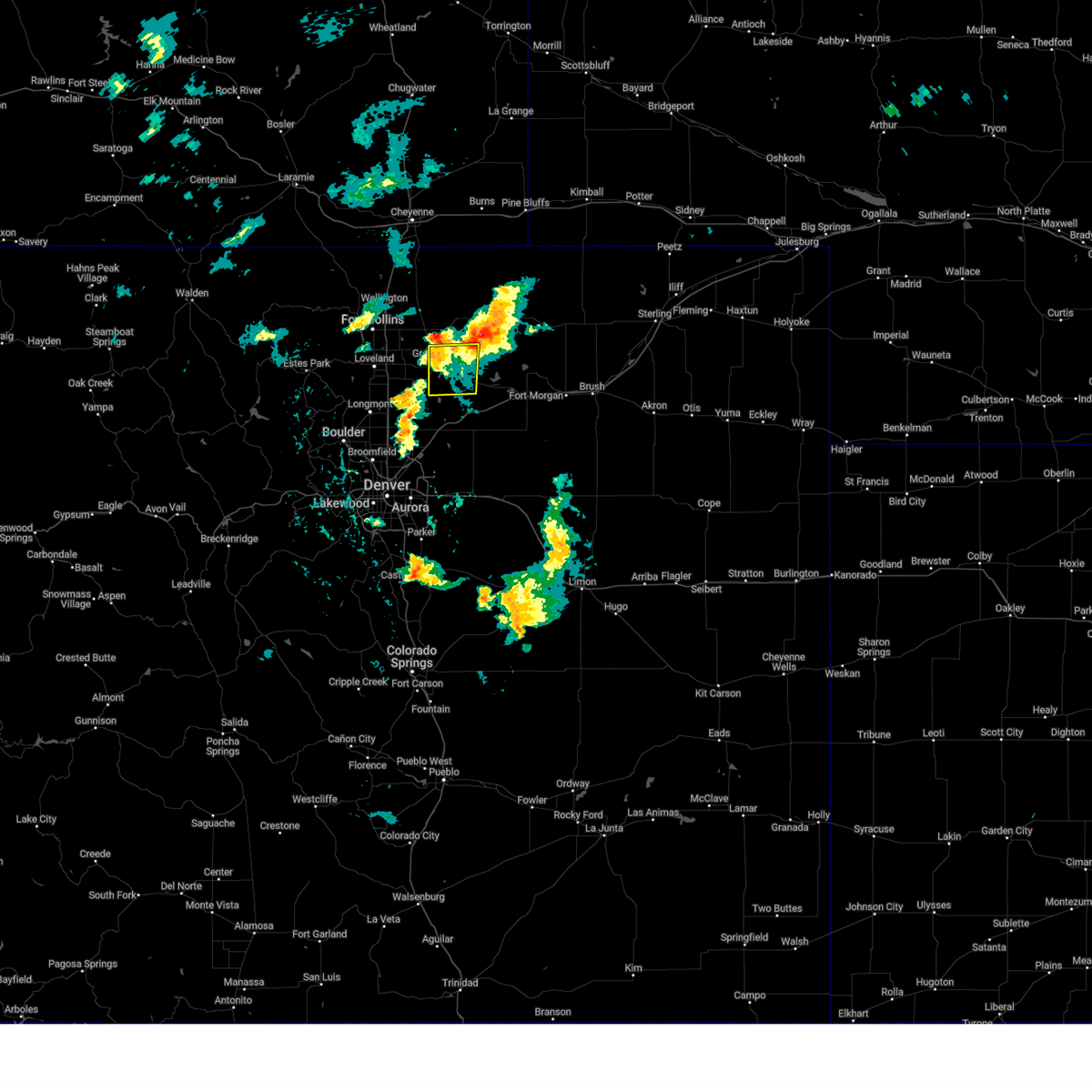
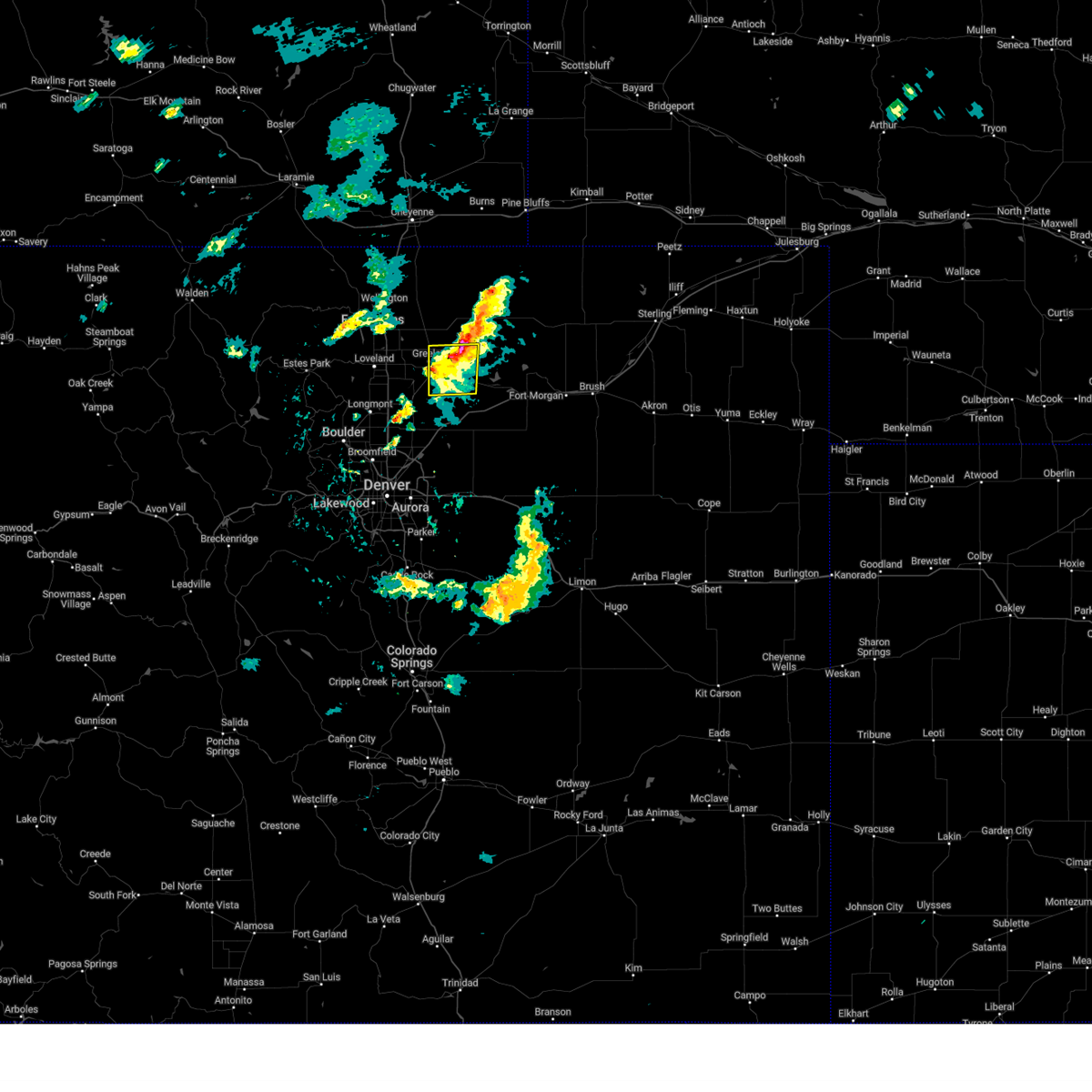
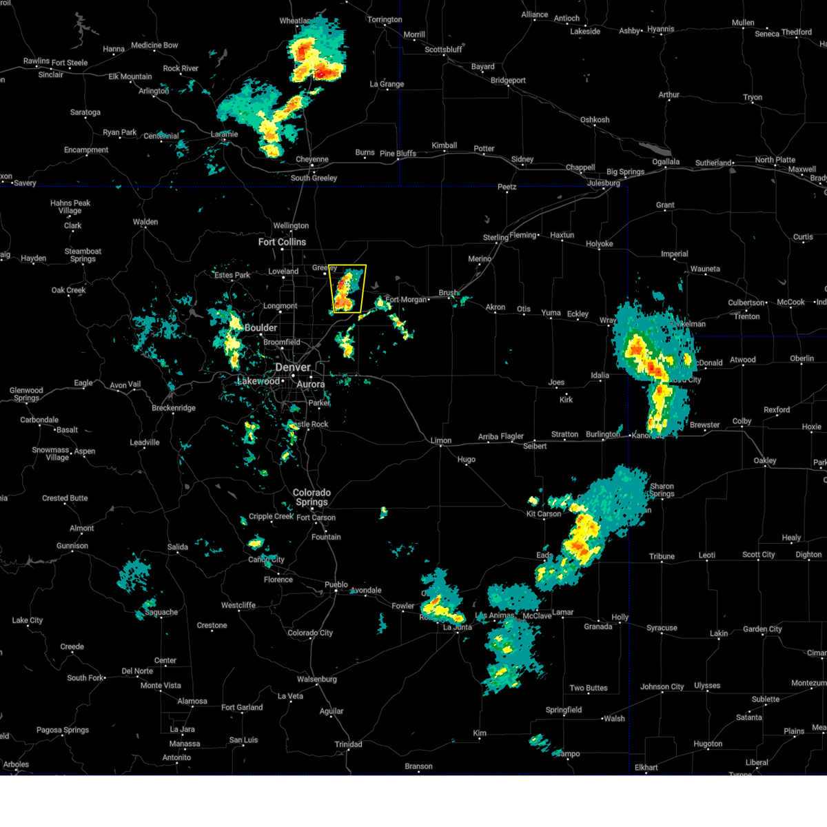
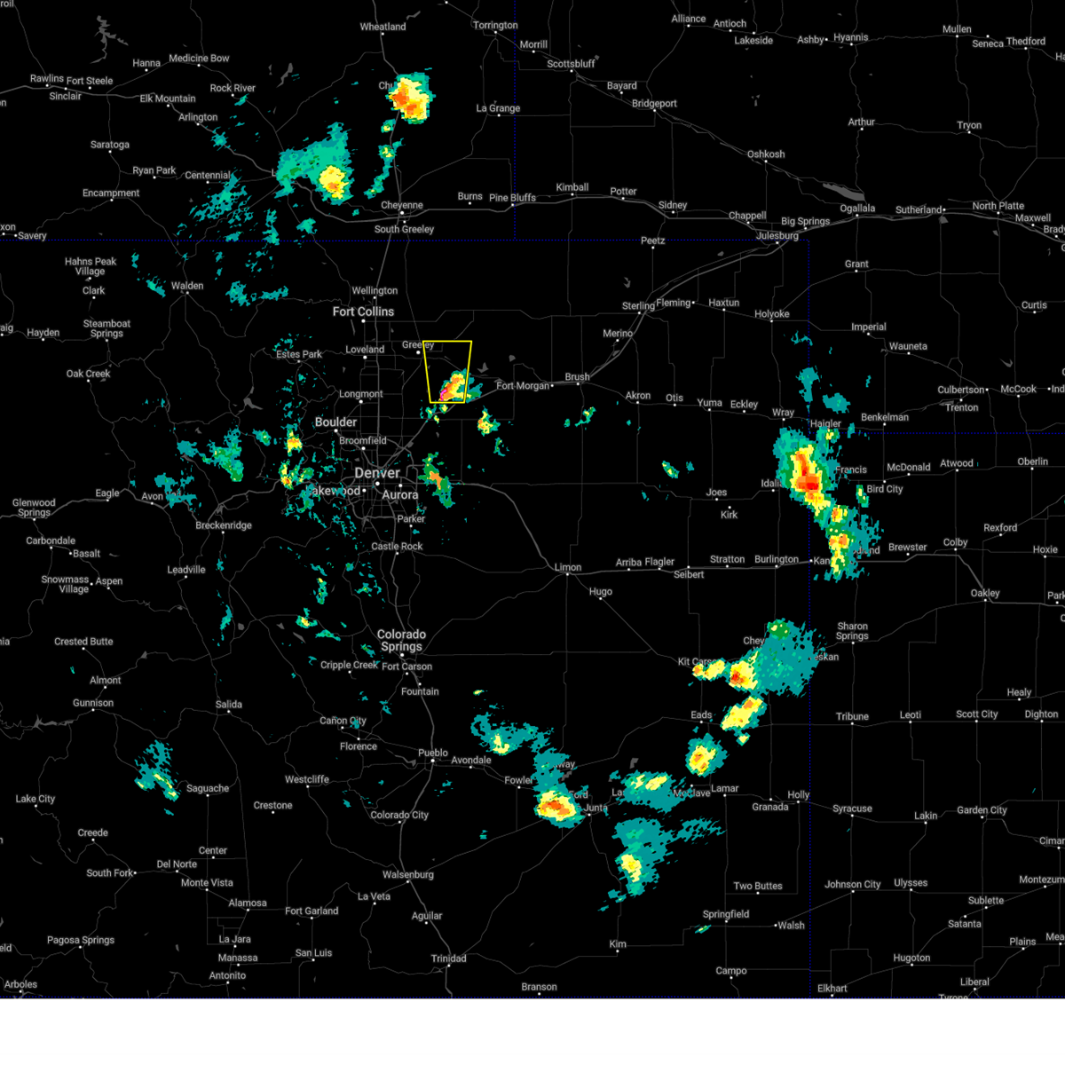
Hail Map for Greeley, CO
The Greeley, CO area has had 74 reports of on-the-ground hail by trained spotters, and has been under severe weather warnings 31 times during the past 12 months. Doppler radar has detected hail at or near Greeley, CO on 112 occasions, including 8 occasions during the past year.
| Name: | Greeley, CO |
| Where Located: | 49 miles NNE of Denver, CO |
| Map: | Google Map for Greeley, CO |
| Population: | 92889 |
| Housing Units: | 36323 |
| More Info: | Search Google for Greeley, CO |
1
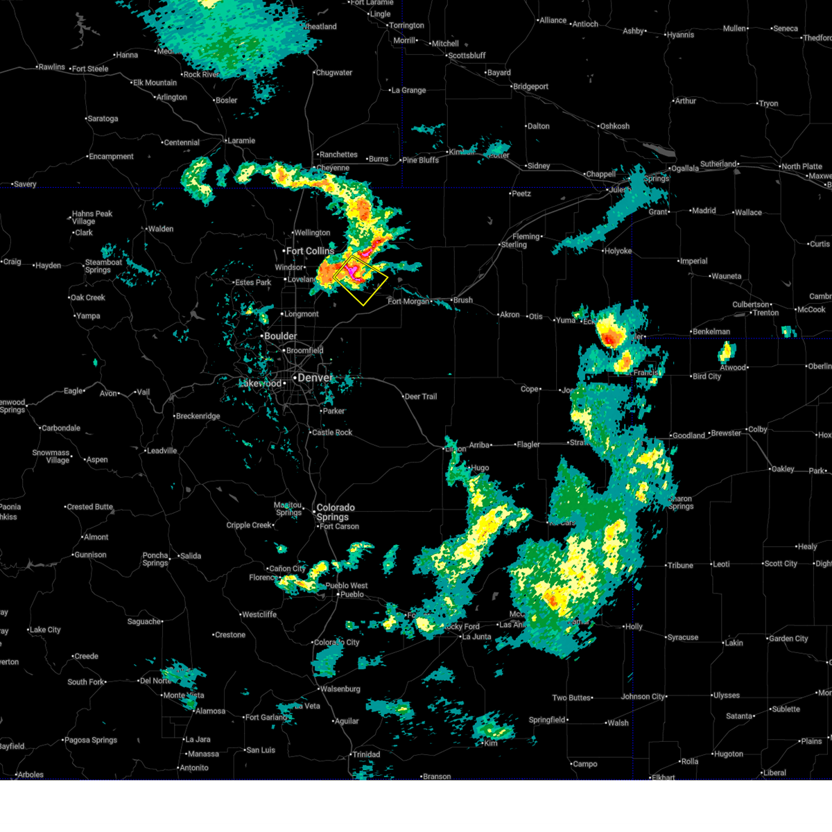
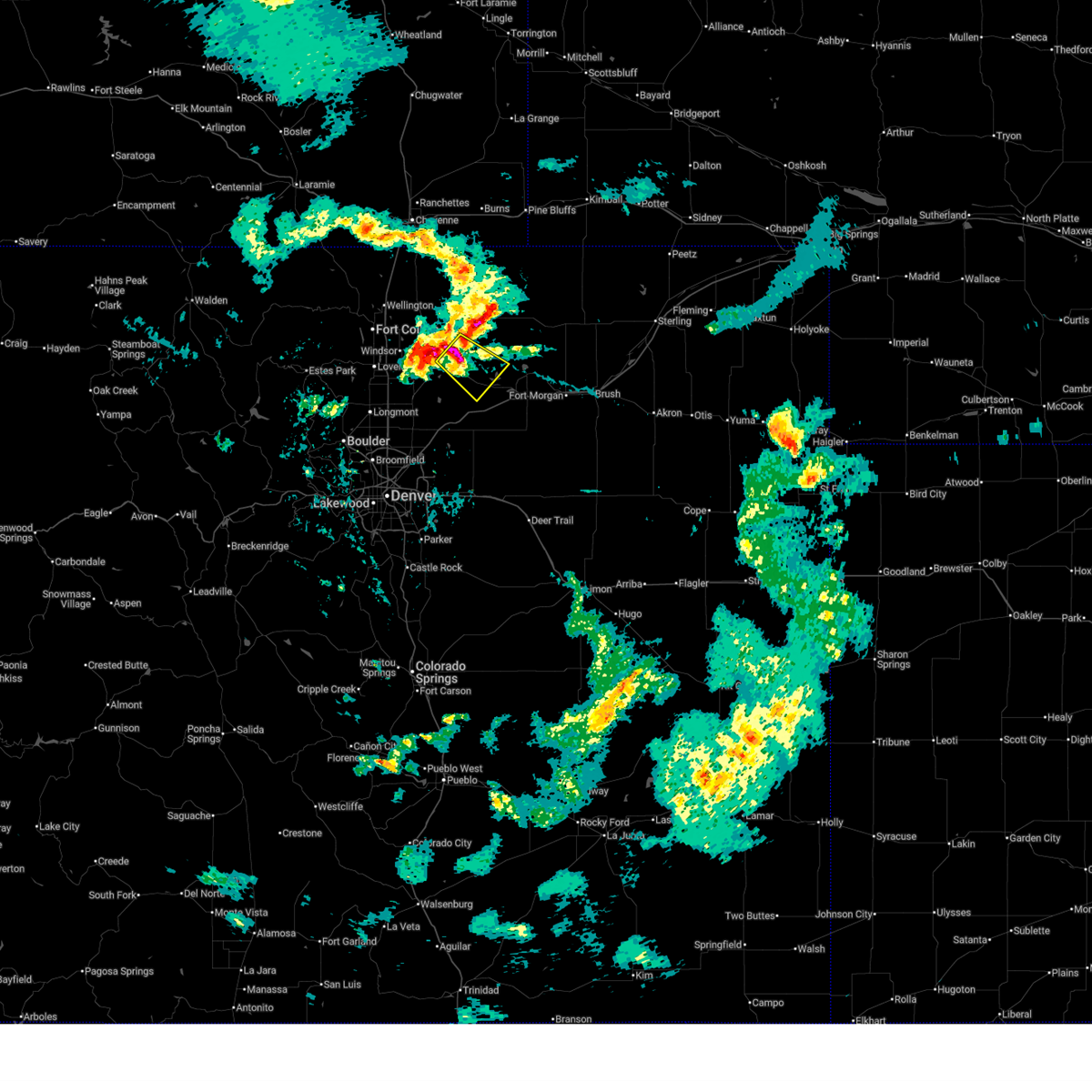
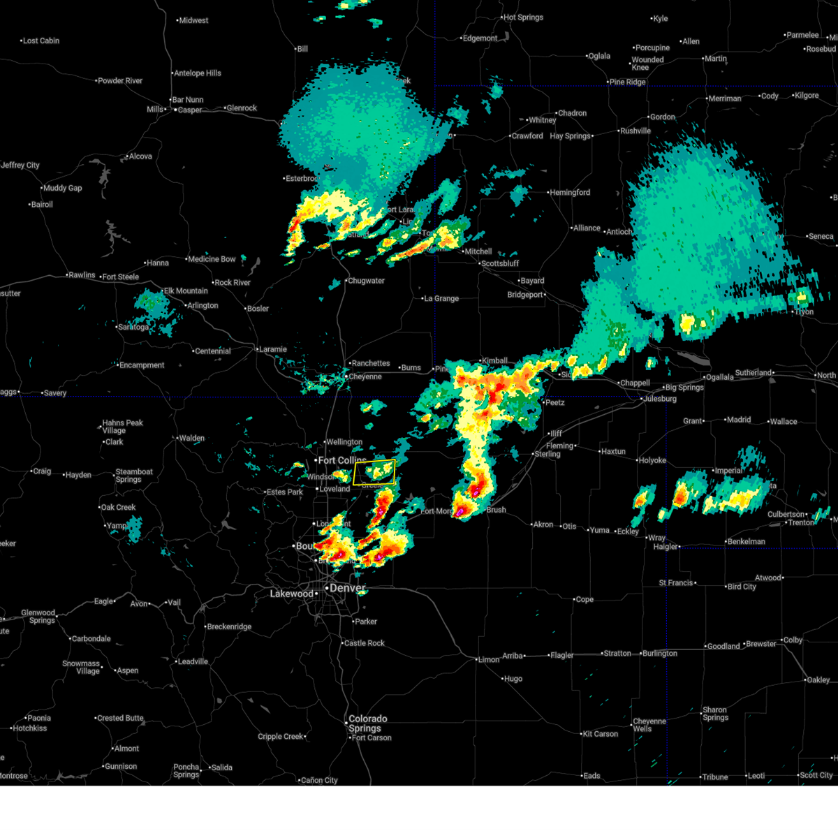
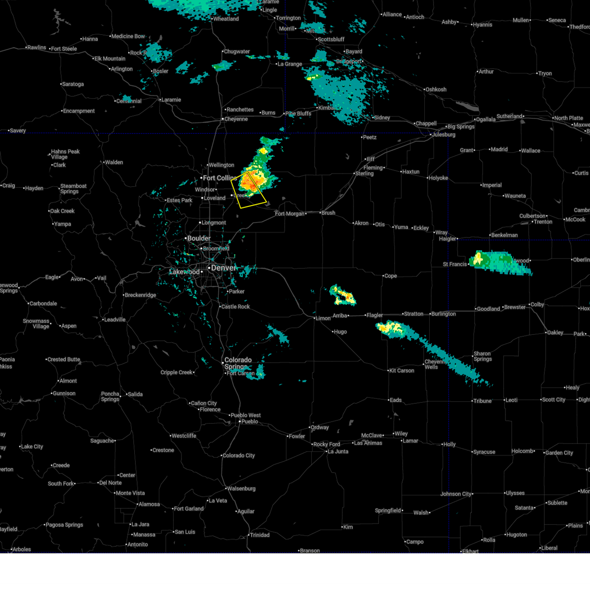
The Top Recent Hail Date for Greeley, CO is Monday, June 16, 2025 (10th out of 112)
Hail and Wind Damage Spotted near Greeley, CO
| Date / Time | Report Details |
|---|---|
| 7/10/2025 5:28 PM MDT | The storm which prompted the warning has weakened below severe limits, and no longer poses an immediate threat to life or property. therefore, the warning will be allowed to expire. however, heavy rain is still possible with this thunderstorm. |
| 7/10/2025 5:05 PM MDT |
 At 505 pm mdt, a severe thunderstorm was located near barnesville, or 15 miles east of greeley, moving southeast at 20 mph (radar indicated). Hazards include golf ball size hail. People and animals outdoors will be injured. expect damage to roofs, siding, windows, and vehicles. Locations impacted include, kersey, barnesville, gill and hardin. At 505 pm mdt, a severe thunderstorm was located near barnesville, or 15 miles east of greeley, moving southeast at 20 mph (radar indicated). Hazards include golf ball size hail. People and animals outdoors will be injured. expect damage to roofs, siding, windows, and vehicles. Locations impacted include, kersey, barnesville, gill and hardin.
|
| 7/10/2025 4:56 PM MDT |
 Svrbou the national weather service in denver has issued a * severe thunderstorm warning for, central weld county in northeastern colorado, * until 530 pm mdt. * at 456 pm mdt, a severe thunderstorm was located over gill, or 13 miles east of greeley, moving southeast at 20 mph (radar indicated). Hazards include quarter size hail. damage to vehicles is expected Svrbou the national weather service in denver has issued a * severe thunderstorm warning for, central weld county in northeastern colorado, * until 530 pm mdt. * at 456 pm mdt, a severe thunderstorm was located over gill, or 13 miles east of greeley, moving southeast at 20 mph (radar indicated). Hazards include quarter size hail. damage to vehicles is expected
|
| 6/17/2025 2:06 PM MDT | The storm which prompted the warning has weakened below severe limits, and no longer poses an immediate threat to life or property. therefore, the warning will be allowed to expire. however, small hail is still possible with this thunderstorm. a severe thunderstorm watch remains in effect until 500 pm mdt tuesday for a portion of northeast colorado. |
| 6/17/2025 1:43 PM MDT | Svrbou the national weather service in denver has issued a * severe thunderstorm warning for, west central weld county in northeastern colorado, * until 215 pm mdt. * at 143 pm mdt, a severe thunderstorm was located over windsor, or 7 miles southeast of fort collins, moving east at 10 mph (radar indicated). Hazards include quarter size hail. damage to vehicles is expected |
| 6/17/2025 4:19 AM MDT |
 the severe thunderstorm warning has been cancelled and is no longer in effect the severe thunderstorm warning has been cancelled and is no longer in effect
|
| 6/17/2025 4:11 AM MDT |
 At 411 am mdt, a severe thunderstorm was located near barnesville, or 14 miles northeast of greeley, moving east at 20 mph (radar indicated). Hazards include quarter size hail. Damage to vehicles is expected. Locations impacted include, greeley, eaton, galeton, gill, barnesville, lucerne and cornish. At 411 am mdt, a severe thunderstorm was located near barnesville, or 14 miles northeast of greeley, moving east at 20 mph (radar indicated). Hazards include quarter size hail. Damage to vehicles is expected. Locations impacted include, greeley, eaton, galeton, gill, barnesville, lucerne and cornish.
|
| 6/17/2025 4:01 AM MDT | Half Dollar sized hail reported 3.6 miles SSW of Greeley, CO, report from mping: half dollar (1.25 in.). |
| 6/17/2025 3:55 AM MDT |
 The storm which prompted the warning has moved out of the area. therefore, the warning will be allowed to expire. The storm which prompted the warning has moved out of the area. therefore, the warning will be allowed to expire.
|
| 6/17/2025 3:52 AM MDT |
 Svrbou the national weather service in denver has issued a * severe thunderstorm warning for, west central weld county in northeastern colorado, * until 430 am mdt. * at 352 am mdt, a severe thunderstorm was located over galeton, or 9 miles northeast of greeley, moving east at 20 mph (radar indicated). Hazards include two inch hail. People and animals outdoors will be injured. Expect damage to roofs, siding, windows, and vehicles. Svrbou the national weather service in denver has issued a * severe thunderstorm warning for, west central weld county in northeastern colorado, * until 430 am mdt. * at 352 am mdt, a severe thunderstorm was located over galeton, or 9 miles northeast of greeley, moving east at 20 mph (radar indicated). Hazards include two inch hail. People and animals outdoors will be injured. Expect damage to roofs, siding, windows, and vehicles.
|
| 6/17/2025 3:50 AM MDT |
 At 350 am mdt, a severe thunderstorm was located over lasalle, or 7 miles south of greeley, moving east at 20 mph (radar indicated). Hazards include golf ball size hail. People and animals outdoors will be injured. expect damage to roofs, siding, windows, and vehicles. Locations impacted include, southern greeley, evans, platteville, lasalle, gilcrest, garden city, peckham and lower latham reservoir. At 350 am mdt, a severe thunderstorm was located over lasalle, or 7 miles south of greeley, moving east at 20 mph (radar indicated). Hazards include golf ball size hail. People and animals outdoors will be injured. expect damage to roofs, siding, windows, and vehicles. Locations impacted include, southern greeley, evans, platteville, lasalle, gilcrest, garden city, peckham and lower latham reservoir.
|
| 6/17/2025 3:32 AM MDT |
 Svrbou the national weather service in denver has issued a * severe thunderstorm warning for, west central weld county in northeastern colorado, * until 400 am mdt. * at 332 am mdt, a severe thunderstorm was located over milliken, or 9 miles southwest of greeley, moving east at 15 mph. this is a destructive storm for johnstown and milliken (radar indicated). Hazards include baseball size hail. People and animals outdoors will be severely injured. Expect shattered windows, extensive damage to roofs, siding, and vehicles. Svrbou the national weather service in denver has issued a * severe thunderstorm warning for, west central weld county in northeastern colorado, * until 400 am mdt. * at 332 am mdt, a severe thunderstorm was located over milliken, or 9 miles southwest of greeley, moving east at 15 mph. this is a destructive storm for johnstown and milliken (radar indicated). Hazards include baseball size hail. People and animals outdoors will be severely injured. Expect shattered windows, extensive damage to roofs, siding, and vehicles.
|
| 6/17/2025 3:24 AM MDT |
 At 324 am mdt, a severe thunderstorm was located near johnstown, or 8 miles west of greeley, moving east at 15 mph (radar indicated). Hazards include two inch hail. People and animals outdoors will be injured. expect damage to roofs, siding, windows, and vehicles. Locations impacted include, greeley, northeastern loveland, windsor, evans, johnstown, milliken, berthoud and kelim. At 324 am mdt, a severe thunderstorm was located near johnstown, or 8 miles west of greeley, moving east at 15 mph (radar indicated). Hazards include two inch hail. People and animals outdoors will be injured. expect damage to roofs, siding, windows, and vehicles. Locations impacted include, greeley, northeastern loveland, windsor, evans, johnstown, milliken, berthoud and kelim.
|
| 6/17/2025 3:17 AM MDT |
 Svrbou the national weather service in denver has issued a * severe thunderstorm warning for, eastern larimer county in north central colorado, southwestern weld county in northeastern colorado, * until 400 am mdt. * at 317 am mdt, a severe thunderstorm was located near johnstown, or 10 miles west of greeley, moving east at 15 mph (radar indicated). Hazards include ping pong ball size hail. People and animals outdoors will be injured. Expect damage to roofs, siding, windows, and vehicles. Svrbou the national weather service in denver has issued a * severe thunderstorm warning for, eastern larimer county in north central colorado, southwestern weld county in northeastern colorado, * until 400 am mdt. * at 317 am mdt, a severe thunderstorm was located near johnstown, or 10 miles west of greeley, moving east at 15 mph (radar indicated). Hazards include ping pong ball size hail. People and animals outdoors will be injured. Expect damage to roofs, siding, windows, and vehicles.
|
| 6/17/2025 2:48 AM MDT |
 At 248 am mdt, a severe thunderstorm was located over gill, or 12 miles northeast of greeley, moving east at 20 mph (radar indicated). Hazards include two inch hail and 60 mph wind gusts. People and animals outdoors will be injured. expect hail damage to roofs, siding, windows, and vehicles. expect wind damage to roofs, siding, and trees. Locations impacted include, southeastern greeley, barnesville, gill, galeton and cornish. At 248 am mdt, a severe thunderstorm was located over gill, or 12 miles northeast of greeley, moving east at 20 mph (radar indicated). Hazards include two inch hail and 60 mph wind gusts. People and animals outdoors will be injured. expect hail damage to roofs, siding, windows, and vehicles. expect wind damage to roofs, siding, and trees. Locations impacted include, southeastern greeley, barnesville, gill, galeton and cornish.
|
| 6/17/2025 2:38 AM MDT | Half Dollar sized hail reported 3.6 miles SSW of Greeley, CO, report from mping: half dollar (1.25 in.). |
| 6/17/2025 2:38 AM MDT |
 Svrbou the national weather service in denver has issued a * severe thunderstorm warning for, central weld county in northeastern colorado, * until 315 am mdt. * at 238 am mdt, a severe thunderstorm was located over galeton, or 9 miles northeast of greeley, moving east at 15 mph (radar indicated). Hazards include golf ball size hail and 60 mph wind gusts. People and animals outdoors will be injured. expect hail damage to roofs, siding, windows, and vehicles. Expect wind damage to roofs, siding, and trees. Svrbou the national weather service in denver has issued a * severe thunderstorm warning for, central weld county in northeastern colorado, * until 315 am mdt. * at 238 am mdt, a severe thunderstorm was located over galeton, or 9 miles northeast of greeley, moving east at 15 mph (radar indicated). Hazards include golf ball size hail and 60 mph wind gusts. People and animals outdoors will be injured. expect hail damage to roofs, siding, windows, and vehicles. Expect wind damage to roofs, siding, and trees.
|
| 6/17/2025 2:28 AM MDT |
 At 228 am mdt, a severe thunderstorm was located over eaton, or 9 miles north of greeley, moving east at 20 mph (radar indicated). Hazards include half dollar size hail. Damage to vehicles is expected. Locations impacted include, northern greeley, eaton, ault, pierce, lucerne and galeton. At 228 am mdt, a severe thunderstorm was located over eaton, or 9 miles north of greeley, moving east at 20 mph (radar indicated). Hazards include half dollar size hail. Damage to vehicles is expected. Locations impacted include, northern greeley, eaton, ault, pierce, lucerne and galeton.
|
| 6/17/2025 2:19 AM MDT |
 Svrbou the national weather service in denver has issued a * severe thunderstorm warning for, west central weld county in northeastern colorado, * until 245 am mdt. * at 219 am mdt, a severe thunderstorm was located over eaton, or 8 miles north of greeley, moving east at 15 mph (radar indicated). Hazards include quarter size hail. damage to vehicles is expected Svrbou the national weather service in denver has issued a * severe thunderstorm warning for, west central weld county in northeastern colorado, * until 245 am mdt. * at 219 am mdt, a severe thunderstorm was located over eaton, or 8 miles north of greeley, moving east at 15 mph (radar indicated). Hazards include quarter size hail. damage to vehicles is expected
|
| 6/16/2025 5:15 PM MDT |
 the severe thunderstorm warning has been cancelled and is no longer in effect the severe thunderstorm warning has been cancelled and is no longer in effect
|
| 6/16/2025 5:01 PM MDT |
 At 501 pm mdt, a severe thunderstorm was located over barnesville, or 13 miles northeast of greeley, moving southeast at 20 mph (radar indicated). Hazards include half dollar size hail. Damage to vehicles is expected. hail may accumulate on roadways causing hazardous travel. Locations impacted include, eastern greeley, eaton, kersey, gill, barnesville, galeton and hardin. At 501 pm mdt, a severe thunderstorm was located over barnesville, or 13 miles northeast of greeley, moving southeast at 20 mph (radar indicated). Hazards include half dollar size hail. Damage to vehicles is expected. hail may accumulate on roadways causing hazardous travel. Locations impacted include, eastern greeley, eaton, kersey, gill, barnesville, galeton and hardin.
|
| 6/16/2025 4:47 PM MDT |
 Svrbou the national weather service in denver has issued a * severe thunderstorm warning for, central weld county in northeastern colorado, * until 530 pm mdt. * at 447 pm mdt, a severe thunderstorm was located over galeton, or 13 miles northeast of greeley, moving southeast at 20 mph (radar indicated). Hazards include quarter size hail. Damage to vehicles is expected. Hail may accumulate on roadways causing hazardous travel. Svrbou the national weather service in denver has issued a * severe thunderstorm warning for, central weld county in northeastern colorado, * until 530 pm mdt. * at 447 pm mdt, a severe thunderstorm was located over galeton, or 13 miles northeast of greeley, moving southeast at 20 mph (radar indicated). Hazards include quarter size hail. Damage to vehicles is expected. Hail may accumulate on roadways causing hazardous travel.
|
| 4/24/2025 4:55 PM MDT |
 The storm which prompted the warning has moved out of the area. therefore, the warning will be allowed to expire. The storm which prompted the warning has moved out of the area. therefore, the warning will be allowed to expire.
|
| 4/24/2025 4:34 PM MDT |
 At 434 pm mdt, a severe thunderstorm was located over gill, or 11 miles east of greeley, moving northeast at 20 mph (radar indicated). Hazards include half dollar size hail. Damage to vehicles is expected. Locations impacted include, eastern greeley, evans, lasalle, kersey, gill, barnesville, lucerne, garden city, lower latham reservoir and hardin. At 434 pm mdt, a severe thunderstorm was located over gill, or 11 miles east of greeley, moving northeast at 20 mph (radar indicated). Hazards include half dollar size hail. Damage to vehicles is expected. Locations impacted include, eastern greeley, evans, lasalle, kersey, gill, barnesville, lucerne, garden city, lower latham reservoir and hardin.
|
| 4/24/2025 4:19 PM MDT | Svrbou the national weather service in denver has issued a * severe thunderstorm warning for, west central weld county in northeastern colorado, * until 500 pm mdt. * at 419 pm mdt, a severe thunderstorm was located near kersey, or 9 miles southeast of greeley, moving east at 15 mph (radar indicated). Hazards include half dollar size hail. damage to vehicles is expected |
| 9/15/2024 3:56 PM MDT |
 The storm which prompted the warning has weakened below severe limits, and no longer poses an immediate threat to life or property. therefore, the warning will be allowed to expire. however, gusty winds are still possible with this thunderstorm. The storm which prompted the warning has weakened below severe limits, and no longer poses an immediate threat to life or property. therefore, the warning will be allowed to expire. however, gusty winds are still possible with this thunderstorm.
|
| 9/15/2024 3:28 PM MDT |
 Svrbou the national weather service in denver colorado has issued a * severe thunderstorm warning for, south central weld county in northeastern colorado, * until 400 pm mdt. * at 327 pm mdt, a severe thunderstorm was located 5 miles east of milton reservoir, or 17 miles southeast of greeley, moving north at 20 mph (radar indicated). Hazards include 60 mph wind gusts and quarter size hail. Expect damage to roofs, siding, and trees. Hail damage to vehicles is expected. Svrbou the national weather service in denver colorado has issued a * severe thunderstorm warning for, south central weld county in northeastern colorado, * until 400 pm mdt. * at 327 pm mdt, a severe thunderstorm was located 5 miles east of milton reservoir, or 17 miles southeast of greeley, moving north at 20 mph (radar indicated). Hazards include 60 mph wind gusts and quarter size hail. Expect damage to roofs, siding, and trees. Hail damage to vehicles is expected.
|
| 8/13/2024 4:25 PM MDT |
 Svrbou the national weather service in denver colorado has issued a * severe thunderstorm warning for, south central weld county in northeastern colorado, * until 515 pm mdt. * at 424 pm mdt, a severe thunderstorm was located 6 miles south of kersey, or 14 miles southeast of greeley, moving northeast at 25 mph. additional storms over southeast weld county may produce 60 mph wind gusts as well (radar indicated). Hazards include 60 mph wind gusts and quarter size hail. Expect damage to roofs, siding, and trees. Hail damage to vehicles is expected. Svrbou the national weather service in denver colorado has issued a * severe thunderstorm warning for, south central weld county in northeastern colorado, * until 515 pm mdt. * at 424 pm mdt, a severe thunderstorm was located 6 miles south of kersey, or 14 miles southeast of greeley, moving northeast at 25 mph. additional storms over southeast weld county may produce 60 mph wind gusts as well (radar indicated). Hazards include 60 mph wind gusts and quarter size hail. Expect damage to roofs, siding, and trees. Hail damage to vehicles is expected.
|
| 8/13/2024 4:15 PM MDT | Storm damage reported in weld county CO, 16 miles WSW of Greeley, CO |
| 8/7/2024 3:25 PM MDT |
 The storm which prompted the warning has weakened below severe limits, and no longer poses an immediate threat to life or property. therefore, the warning will be allowed to expire. a severe thunderstorm watch remains in effect until 1000 pm mdt for northeastern colorado. The storm which prompted the warning has weakened below severe limits, and no longer poses an immediate threat to life or property. therefore, the warning will be allowed to expire. a severe thunderstorm watch remains in effect until 1000 pm mdt for northeastern colorado.
|
| 8/7/2024 2:57 PM MDT |
 Svrbou the national weather service in denver colorado has issued a * severe thunderstorm warning for, west central weld county in northeastern colorado, east central larimer county in north central colorado, * until 330 pm mdt. * at 257 pm mdt, a severe thunderstorm was located over southeastern fort collins, moving east at 20 mph (radar indicated). Hazards include 60 mph wind gusts and quarter size hail. Expect damage to roofs, siding, and trees. Hail damage to vehicles is expected. Svrbou the national weather service in denver colorado has issued a * severe thunderstorm warning for, west central weld county in northeastern colorado, east central larimer county in north central colorado, * until 330 pm mdt. * at 257 pm mdt, a severe thunderstorm was located over southeastern fort collins, moving east at 20 mph (radar indicated). Hazards include 60 mph wind gusts and quarter size hail. Expect damage to roofs, siding, and trees. Hail damage to vehicles is expected.
|
| 7/20/2024 7:52 PM MDT |
 At 751 pm mdt, a severe thunderstorm was located near berthoud, or 19 miles south of fort collins, moving south at 25 mph (radar indicated). Hazards include ping pong ball size hail and 60 mph wind gusts. Expect damage to roofs, siding, and trees. people and animals outdoors will be injured. expect hail damage to roofs, siding, windows, and vehicles. Locations impacted include, northern boulder, longmont, southern loveland, erie, firestone, johnstown, frederick, milliken, berthoud, dacono, mead, lyons, carter lake, and niwot. At 751 pm mdt, a severe thunderstorm was located near berthoud, or 19 miles south of fort collins, moving south at 25 mph (radar indicated). Hazards include ping pong ball size hail and 60 mph wind gusts. Expect damage to roofs, siding, and trees. people and animals outdoors will be injured. expect hail damage to roofs, siding, windows, and vehicles. Locations impacted include, northern boulder, longmont, southern loveland, erie, firestone, johnstown, frederick, milliken, berthoud, dacono, mead, lyons, carter lake, and niwot.
|
| 7/20/2024 7:43 PM MDT |
 Svrbou the national weather service in denver colorado has issued a * severe thunderstorm warning for, southwestern weld county in northeastern colorado, southeastern larimer county in north central colorado, northeastern boulder county in northeastern colorado, * until 830 pm mdt. * at 743 pm mdt, a severe thunderstorm was located 4 miles northwest of berthoud, or 15 miles south of fort collins, moving south at 25 mph (radar indicated). Hazards include 60 mph wind gusts and half dollar size hail. Expect damage to roofs, siding, and trees. Hail damage to vehicles is expected. Svrbou the national weather service in denver colorado has issued a * severe thunderstorm warning for, southwestern weld county in northeastern colorado, southeastern larimer county in north central colorado, northeastern boulder county in northeastern colorado, * until 830 pm mdt. * at 743 pm mdt, a severe thunderstorm was located 4 miles northwest of berthoud, or 15 miles south of fort collins, moving south at 25 mph (radar indicated). Hazards include 60 mph wind gusts and half dollar size hail. Expect damage to roofs, siding, and trees. Hail damage to vehicles is expected.
|
| 7/20/2024 7:22 PM MDT |
 Svrbou the national weather service in denver colorado has issued a * severe thunderstorm warning for, west central weld county in northeastern colorado, southeastern larimer county in north central colorado, * until 745 pm mdt. * at 722 pm mdt, a severe thunderstorm was located over northwestern loveland, or 8 miles south of fort collins, moving south at 30 mph (radar indicated). Hazards include 60 mph wind gusts and quarter size hail. Expect damage to roofs, siding, and trees. Hail damage to vehicles is expected. Svrbou the national weather service in denver colorado has issued a * severe thunderstorm warning for, west central weld county in northeastern colorado, southeastern larimer county in north central colorado, * until 745 pm mdt. * at 722 pm mdt, a severe thunderstorm was located over northwestern loveland, or 8 miles south of fort collins, moving south at 30 mph (radar indicated). Hazards include 60 mph wind gusts and quarter size hail. Expect damage to roofs, siding, and trees. Hail damage to vehicles is expected.
|
| 6/20/2024 4:11 PM MDT |
 The tornadic thunderstorm which prompted the warning has weakened. therefore, the warning will be allowed to expire. however, hail is still possible with this thunderstorm. a severe thunderstorm watch remains in effect until 700 pm mdt for northeastern colorado. The tornadic thunderstorm which prompted the warning has weakened. therefore, the warning will be allowed to expire. however, hail is still possible with this thunderstorm. a severe thunderstorm watch remains in effect until 700 pm mdt for northeastern colorado.
|
| 6/20/2024 3:58 PM MDT |
 At 358 pm mdt, a severe thunderstorm capable of producing a tornado was located near eaton, or 8 miles north of greeley, moving northeast at 15 mph (radar indicated rotation). Hazards include tornado and quarter size hail. Flying debris will be dangerous to those caught without shelter. mobile homes will be damaged or destroyed. damage to roofs, windows, and vehicles will occur. tree damage is likely. Locations impacted include, northwestern greeley, windsor, eaton, severance, ault, pierce, nunn, purcell, and lucerne. At 358 pm mdt, a severe thunderstorm capable of producing a tornado was located near eaton, or 8 miles north of greeley, moving northeast at 15 mph (radar indicated rotation). Hazards include tornado and quarter size hail. Flying debris will be dangerous to those caught without shelter. mobile homes will be damaged or destroyed. damage to roofs, windows, and vehicles will occur. tree damage is likely. Locations impacted include, northwestern greeley, windsor, eaton, severance, ault, pierce, nunn, purcell, and lucerne.
|
| 6/20/2024 3:56 PM MDT |
 The storm which prompted the warning has moved out of the area. therefore, the warning will be allowed to expire. a severe thunderstorm watch remains in effect until 700 pm mdt for northeastern colorado. The storm which prompted the warning has moved out of the area. therefore, the warning will be allowed to expire. a severe thunderstorm watch remains in effect until 700 pm mdt for northeastern colorado.
|
| 6/20/2024 3:51 PM MDT |
 Torbou the national weather service in denver colorado has issued a * tornado warning for, west central weld county in northeastern colorado, * until 415 pm mdt. * at 351 pm mdt, a severe thunderstorm capable of producing a tornado was located near eaton, or 7 miles north of greeley, moving northeast at 15 mph (radar indicated rotation). Hazards include tornado. Flying debris will be dangerous to those caught without shelter. mobile homes will be damaged or destroyed. damage to roofs, windows, and vehicles will occur. Tree damage is likely. Torbou the national weather service in denver colorado has issued a * tornado warning for, west central weld county in northeastern colorado, * until 415 pm mdt. * at 351 pm mdt, a severe thunderstorm capable of producing a tornado was located near eaton, or 7 miles north of greeley, moving northeast at 15 mph (radar indicated rotation). Hazards include tornado. Flying debris will be dangerous to those caught without shelter. mobile homes will be damaged or destroyed. damage to roofs, windows, and vehicles will occur. Tree damage is likely.
|
| 6/20/2024 3:33 PM MDT |
 Svrbou the national weather service in denver colorado has issued a * severe thunderstorm warning for, west central weld county in northeastern colorado, southeastern larimer county in north central colorado, * until 400 pm mdt. * at 333 pm mdt, a severe thunderstorm was located near mead, or 16 miles southwest of greeley, moving northeast at 20 mph (radar indicated). Hazards include quarter size hail. damage to vehicles is expected Svrbou the national weather service in denver colorado has issued a * severe thunderstorm warning for, west central weld county in northeastern colorado, southeastern larimer county in north central colorado, * until 400 pm mdt. * at 333 pm mdt, a severe thunderstorm was located near mead, or 16 miles southwest of greeley, moving northeast at 20 mph (radar indicated). Hazards include quarter size hail. damage to vehicles is expected
|
| 6/15/2024 4:49 PM MDT |
 the severe thunderstorm warning has been cancelled and is no longer in effect the severe thunderstorm warning has been cancelled and is no longer in effect
|
| 6/15/2024 4:34 PM MDT |
 Svrbou the national weather service in denver colorado has issued a * severe thunderstorm warning for, west central weld county in northeastern colorado, * until 515 pm mdt. * at 434 pm mdt, a severe thunderstorm was located 4 miles northeast of milliken, or 4 miles southwest of greeley, moving east at 20 mph (radar indicated). Hazards include 60 mph wind gusts and quarter size hail. Expect damage to roofs, siding, and trees. Hail damage to vehicles is expected. Svrbou the national weather service in denver colorado has issued a * severe thunderstorm warning for, west central weld county in northeastern colorado, * until 515 pm mdt. * at 434 pm mdt, a severe thunderstorm was located 4 miles northeast of milliken, or 4 miles southwest of greeley, moving east at 20 mph (radar indicated). Hazards include 60 mph wind gusts and quarter size hail. Expect damage to roofs, siding, and trees. Hail damage to vehicles is expected.
|
| 6/10/2024 3:52 PM MDT |
 Svrbou the national weather service in denver colorado has issued a * severe thunderstorm warning for, west central weld county in northeastern colorado, * until 430 pm mdt. * at 352 pm mdt, a severe thunderstorm was located over ault, or 9 miles north of greeley, moving southeast at 15 mph (radar indicated). Hazards include quarter size hail. damage to vehicles is expected Svrbou the national weather service in denver colorado has issued a * severe thunderstorm warning for, west central weld county in northeastern colorado, * until 430 pm mdt. * at 352 pm mdt, a severe thunderstorm was located over ault, or 9 miles north of greeley, moving southeast at 15 mph (radar indicated). Hazards include quarter size hail. damage to vehicles is expected
|
| 5/28/2024 11:20 PM MDT |
 the severe thunderstorm warning has been cancelled and is no longer in effect the severe thunderstorm warning has been cancelled and is no longer in effect
|
| 5/28/2024 11:17 PM MDT |
 The storm which prompted the warning has weakened below severe limits, and no longer poses an immediate threat to life or property. therefore, the warning has been allowed to expire. street and field flooding continues from eastern greeley north into the lucerne and gill areas. avoid flooded roads and give the rain time to run off. a flood advisory is in effect in those areas until midnight. The storm which prompted the warning has weakened below severe limits, and no longer poses an immediate threat to life or property. therefore, the warning has been allowed to expire. street and field flooding continues from eastern greeley north into the lucerne and gill areas. avoid flooded roads and give the rain time to run off. a flood advisory is in effect in those areas until midnight.
|
| 5/28/2024 11:03 PM MDT |
 At 1102 pm mdt, a severe thunderstorm was located over lasalle, or 6 miles southeast of greeley, moving south at 5 mph (radar indicated). Hazards include 60 mph wind gusts and quarter size hail. Expect damage to roofs, siding, and trees. hail damage to vehicles is expected. Locations impacted include, greeley, evans, milliken, lasalle, and gilcrest. At 1102 pm mdt, a severe thunderstorm was located over lasalle, or 6 miles southeast of greeley, moving south at 5 mph (radar indicated). Hazards include 60 mph wind gusts and quarter size hail. Expect damage to roofs, siding, and trees. hail damage to vehicles is expected. Locations impacted include, greeley, evans, milliken, lasalle, and gilcrest.
|
| 5/28/2024 11:00 PM MDT |
 Svrbou the national weather service in denver colorado has issued a * severe thunderstorm warning for, west central weld county in northeastern colorado, southeastern larimer county in north central colorado, northeastern boulder county in northeastern colorado, * until 1145 pm mdt. * at 1100 pm mdt, a severe thunderstorm was located 4 miles northwest of berthoud, or 14 miles south of fort collins, moving east at 10 mph (radar indicated). Hazards include quarter size hail. damage to vehicles is expected Svrbou the national weather service in denver colorado has issued a * severe thunderstorm warning for, west central weld county in northeastern colorado, southeastern larimer county in north central colorado, northeastern boulder county in northeastern colorado, * until 1145 pm mdt. * at 1100 pm mdt, a severe thunderstorm was located 4 miles northwest of berthoud, or 14 miles south of fort collins, moving east at 10 mph (radar indicated). Hazards include quarter size hail. damage to vehicles is expected
|
| 5/28/2024 10:29 PM MDT |
 Svrbou the national weather service in denver colorado has issued a * severe thunderstorm warning for, west central weld county in northeastern colorado, * until 1115 pm mdt. * at 1028 pm mdt, a severe thunderstorm was located over evans, or 4 miles southeast of greeley, moving south at 5 mph. another severe thunderstorm was located over johnstown (trained weather spotters. at 1028 pm, golf ball size hail was reported in johnstown. large quantities of hail have fallen in southeast greeley and on us 34 north of johnstown). Hazards include golf ball size hail and 60 mph wind gusts. Expect damage to roofs, siding, and trees. people and animals outdoors will be injured. expect hail damage to roofs, siding, windows, and vehicles. Hail may accumulate on roadways causing hazardous travel. Svrbou the national weather service in denver colorado has issued a * severe thunderstorm warning for, west central weld county in northeastern colorado, * until 1115 pm mdt. * at 1028 pm mdt, a severe thunderstorm was located over evans, or 4 miles southeast of greeley, moving south at 5 mph. another severe thunderstorm was located over johnstown (trained weather spotters. at 1028 pm, golf ball size hail was reported in johnstown. large quantities of hail have fallen in southeast greeley and on us 34 north of johnstown). Hazards include golf ball size hail and 60 mph wind gusts. Expect damage to roofs, siding, and trees. people and animals outdoors will be injured. expect hail damage to roofs, siding, windows, and vehicles. Hail may accumulate on roadways causing hazardous travel.
|
| 5/28/2024 10:17 PM MDT |
 At 1014 pm mdt, a severe thunderstorm was located over southeastern greeley, moving southwest at 5 mph. another severe thunderstorm was located 2 miles northwest of johnstown (trained weather spotters). Hazards include golf ball size hail and 60 mph wind gusts. large quantities of hail have fallen in southeast greeley and on us 34 south of windsor. Expect damage to roofs, siding, and trees. people and animals outdoors will be injured. expect hail damage to roofs, siding, windows, and vehicles. hail may accumulate on roadways causing hazardous travel. Locations impacted include, greeley, evans, johnstown, milliken, platteville, lasalle, kersey, gilcrest, and milton reservoir. At 1014 pm mdt, a severe thunderstorm was located over southeastern greeley, moving southwest at 5 mph. another severe thunderstorm was located 2 miles northwest of johnstown (trained weather spotters). Hazards include golf ball size hail and 60 mph wind gusts. large quantities of hail have fallen in southeast greeley and on us 34 south of windsor. Expect damage to roofs, siding, and trees. people and animals outdoors will be injured. expect hail damage to roofs, siding, windows, and vehicles. hail may accumulate on roadways causing hazardous travel. Locations impacted include, greeley, evans, johnstown, milliken, platteville, lasalle, kersey, gilcrest, and milton reservoir.
|
| 5/28/2024 10:10 PM MDT | Half Dollar sized hail reported 2.9 miles WNW of Greeley, CO |
| 5/28/2024 10:02 PM MDT | Quarter sized hail reported 2.6 miles NW of Greeley, CO, report from mping: quarter (1.00 in.). |
| 5/28/2024 9:59 PM MDT | Quarter sized hail reported 2 miles W of Greeley, CO |
| 5/28/2024 9:53 PM MDT |
 Svrbou the national weather service in denver colorado has issued a * severe thunderstorm warning for, southwestern weld county in northeastern colorado, * until 1030 pm mdt. * at 951 pm mdt, a severe thunderstorm was located 4 miles northeast of evans, or 5 miles east of greeley, moving south at 10 mph. additional severe thunderstorms were developing from 5 miles south of windsor to 5 miles east of windsor (radar indicated). Hazards include golf ball size hail and 60 mph wind gusts. Expect damage to roofs, siding, and trees. people and animals outdoors will be injured. Expect hail damage to roofs, siding, windows, and vehicles. Svrbou the national weather service in denver colorado has issued a * severe thunderstorm warning for, southwestern weld county in northeastern colorado, * until 1030 pm mdt. * at 951 pm mdt, a severe thunderstorm was located 4 miles northeast of evans, or 5 miles east of greeley, moving south at 10 mph. additional severe thunderstorms were developing from 5 miles south of windsor to 5 miles east of windsor (radar indicated). Hazards include golf ball size hail and 60 mph wind gusts. Expect damage to roofs, siding, and trees. people and animals outdoors will be injured. Expect hail damage to roofs, siding, windows, and vehicles.
|
| 5/28/2024 9:47 PM MDT | Quarter sized hail reported 1.5 miles W of Greeley, CO |
| 5/28/2024 9:45 PM MDT | Quarter sized hail reported 2.1 miles WNW of Greeley, CO |
| 5/28/2024 9:45 PM MDT | Hen Egg sized hail reported 3.7 miles NW of Greeley, CO |
| 5/28/2024 9:44 PM MDT |
 At 943 pm mdt, severe thunderstorms were located along a line extending from 6 miles east of briggsdale to 3 miles northeast of evans, or along a line extending from 35 miles northwest of fort morgan to 5 miles east of greeley, moving southeast at 10 mph. the strongest storm with large hail is along us 34 just east of greeley (radar indicated). Hazards include golf ball size hail and 60 mph wind gusts. Expect damage to roofs, siding, and trees. people and animals outdoors will be injured. expect hail damage to roofs, siding, windows, and vehicles. hail may accumulate on roadways causing hazardous travel. Locations impacted include, northeastern greeley, kersey, galeton, gill, briggsdale, lucerne, and barnesville. At 943 pm mdt, severe thunderstorms were located along a line extending from 6 miles east of briggsdale to 3 miles northeast of evans, or along a line extending from 35 miles northwest of fort morgan to 5 miles east of greeley, moving southeast at 10 mph. the strongest storm with large hail is along us 34 just east of greeley (radar indicated). Hazards include golf ball size hail and 60 mph wind gusts. Expect damage to roofs, siding, and trees. people and animals outdoors will be injured. expect hail damage to roofs, siding, windows, and vehicles. hail may accumulate on roadways causing hazardous travel. Locations impacted include, northeastern greeley, kersey, galeton, gill, briggsdale, lucerne, and barnesville.
|
| 5/28/2024 9:21 PM MDT |
 Svrbou the national weather service in denver colorado has issued a * severe thunderstorm warning for, central weld county in northeastern colorado, * until 1000 pm mdt. * at 921 pm mdt, severe thunderstorms were located along a line extending from 3 miles northeast of briggsdale to 4 miles east of lucerne, or along a line extending from 37 miles northwest of fort morgan to 7 miles northeast of greeley, moving east at 15 mph (radar indicated). Hazards include ping pong ball size hail and 60 mph wind gusts. Expect damage to roofs, siding, and trees. people and animals outdoors will be injured. expect hail damage to roofs, siding, windows, and vehicles. Hail may accumulate on roadways causing hazardous travel. Svrbou the national weather service in denver colorado has issued a * severe thunderstorm warning for, central weld county in northeastern colorado, * until 1000 pm mdt. * at 921 pm mdt, severe thunderstorms were located along a line extending from 3 miles northeast of briggsdale to 4 miles east of lucerne, or along a line extending from 37 miles northwest of fort morgan to 7 miles northeast of greeley, moving east at 15 mph (radar indicated). Hazards include ping pong ball size hail and 60 mph wind gusts. Expect damage to roofs, siding, and trees. people and animals outdoors will be injured. expect hail damage to roofs, siding, windows, and vehicles. Hail may accumulate on roadways causing hazardous travel.
|
| 8/5/2023 3:31 PM MDT |
 At 331 pm mdt, a severe thunderstorm was located near masonville, or 7 miles southwest of fort collins, moving southeast at 25 mph (radar indicated). Hazards include half dollar size hail. Damage to vehicles is expected. this severe thunderstorm will be near, loveland around 340 pm mdt. other locations in the path of this severe thunderstorm include berthoud, johnstown, milliken and mead. hail threat, radar indicated max hail size, 1. 25 in wind threat, radar indicated max wind gust, <50 mph. At 331 pm mdt, a severe thunderstorm was located near masonville, or 7 miles southwest of fort collins, moving southeast at 25 mph (radar indicated). Hazards include half dollar size hail. Damage to vehicles is expected. this severe thunderstorm will be near, loveland around 340 pm mdt. other locations in the path of this severe thunderstorm include berthoud, johnstown, milliken and mead. hail threat, radar indicated max hail size, 1. 25 in wind threat, radar indicated max wind gust, <50 mph.
|
| 8/3/2023 7:07 PM MDT |
 The severe thunderstorm warning for west central weld county will expire at 715 pm mdt, the storm which prompted the warning has moved out of the area. therefore, the warning will be allowed to expire. a severe thunderstorm watch remains in effect until 900 pm mdt for northeastern colorado. to report severe weather, contact your nearest law enforcement agency. they will relay your report to the national weather service denver colorado. remember, a severe thunderstorm warning still remains in effect for southeastern weld county until 745 pm mdt. The severe thunderstorm warning for west central weld county will expire at 715 pm mdt, the storm which prompted the warning has moved out of the area. therefore, the warning will be allowed to expire. a severe thunderstorm watch remains in effect until 900 pm mdt for northeastern colorado. to report severe weather, contact your nearest law enforcement agency. they will relay your report to the national weather service denver colorado. remember, a severe thunderstorm warning still remains in effect for southeastern weld county until 745 pm mdt.
|
| 8/3/2023 6:50 PM MDT |
 At 650 pm mdt, a severe thunderstorm was located near lucerne, or 4 miles northeast of greeley, moving east at 20 mph (trained weather spotters). Hazards include 60 mph wind gusts and quarter size hail. Expect damage to roofs, siding, and trees. hail damage to vehicles is expected. locations impacted include, galeton, kersey and gill. hail threat, observed max hail size, 1. 00 in wind threat, radar indicated max wind gust, 60 mph. At 650 pm mdt, a severe thunderstorm was located near lucerne, or 4 miles northeast of greeley, moving east at 20 mph (trained weather spotters). Hazards include 60 mph wind gusts and quarter size hail. Expect damage to roofs, siding, and trees. hail damage to vehicles is expected. locations impacted include, galeton, kersey and gill. hail threat, observed max hail size, 1. 00 in wind threat, radar indicated max wind gust, 60 mph.
|
| 8/3/2023 6:44 PM MDT | Half Dollar sized hail reported 1.6 miles WSW of Greeley, CO |
| 8/3/2023 6:41 PM MDT | Quarter sized hail reported 3.6 miles SSW of Greeley, CO |
| 8/3/2023 6:39 PM MDT | Quarter sized hail reported 1.4 miles SSW of Greeley, CO |
| 8/3/2023 6:36 PM MDT | Quarter sized hail reported 3.4 miles S of Greeley, CO |
| 8/3/2023 6:30 PM MDT |
 At 630 pm mdt, a severe thunderstorm was located over northern greeley, moving east at 10 mph (radar indicated). Hazards include 60 mph wind gusts and quarter size hail. Expect damage to roofs, siding, and trees. hail damage to vehicles is expected. this severe thunderstorm will be near, greeley around 635 pm mdt. eaton around 640 pm mdt. lucerne around 645 pm mdt. other locations in the path of this severe thunderstorm include evans, lasalle, kersey, gill and galeton. hail threat, radar indicated max hail size, 1. 00 in wind threat, radar indicated max wind gust, 60 mph. At 630 pm mdt, a severe thunderstorm was located over northern greeley, moving east at 10 mph (radar indicated). Hazards include 60 mph wind gusts and quarter size hail. Expect damage to roofs, siding, and trees. hail damage to vehicles is expected. this severe thunderstorm will be near, greeley around 635 pm mdt. eaton around 640 pm mdt. lucerne around 645 pm mdt. other locations in the path of this severe thunderstorm include evans, lasalle, kersey, gill and galeton. hail threat, radar indicated max hail size, 1. 00 in wind threat, radar indicated max wind gust, 60 mph.
|
| 8/3/2023 6:04 PM MDT |
 At 604 pm mdt, a severe thunderstorm was located over windsor, or 7 miles southeast of fort collins, moving east at 20 mph (radar indicated. at 554 pm mdt, a trained spotter reported quarter size hail just south of fort collins). Hazards include 60 mph wind gusts and quarter size hail. Expect damage to roofs, siding, and trees. hail damage to vehicles is expected. locations impacted include, severance, greeley and evans. hail threat, observed max hail size, 1. 00 in wind threat, radar indicated max wind gust, 60 mph. At 604 pm mdt, a severe thunderstorm was located over windsor, or 7 miles southeast of fort collins, moving east at 20 mph (radar indicated. at 554 pm mdt, a trained spotter reported quarter size hail just south of fort collins). Hazards include 60 mph wind gusts and quarter size hail. Expect damage to roofs, siding, and trees. hail damage to vehicles is expected. locations impacted include, severance, greeley and evans. hail threat, observed max hail size, 1. 00 in wind threat, radar indicated max wind gust, 60 mph.
|
| 8/3/2023 5:43 PM MDT |
 At 543 pm mdt, a severe thunderstorm was located 4 miles southwest of fort collins, moving east at 20 mph (radar indicated). Hazards include 60 mph wind gusts and quarter size hail. Expect damage to roofs, siding, and trees. hail damage to vehicles is expected. this severe thunderstorm will be near, fort collins around 555 pm mdt. loveland around 600 pm mdt. other locations in the path of this severe thunderstorm include timnath, windsor, greeley and severance. hail threat, radar indicated max hail size, 1. 00 in wind threat, radar indicated max wind gust, 60 mph. At 543 pm mdt, a severe thunderstorm was located 4 miles southwest of fort collins, moving east at 20 mph (radar indicated). Hazards include 60 mph wind gusts and quarter size hail. Expect damage to roofs, siding, and trees. hail damage to vehicles is expected. this severe thunderstorm will be near, fort collins around 555 pm mdt. loveland around 600 pm mdt. other locations in the path of this severe thunderstorm include timnath, windsor, greeley and severance. hail threat, radar indicated max hail size, 1. 00 in wind threat, radar indicated max wind gust, 60 mph.
|
| 7/24/2023 5:56 PM MDT | Storm damage reported in weld county CO, 5.7 miles W of Greeley, CO |
| 7/21/2023 7:54 PM MDT | Quarter sized hail reported 8.1 miles WSW of Greeley, CO |
| 7/21/2023 7:52 PM MDT | Ping Pong Ball sized hail reported 7.9 miles W of Greeley, CO, report from mping: ping pong ball (1.50 in.). |
| 7/21/2023 7:50 PM MDT |
 At 750 pm mdt, a severe thunderstorm was located near gill, or 9 miles east of greeley, moving east at 20 mph (radar indicated). Hazards include 60 mph wind gusts and half dollar size hail. Expect damage to roofs, siding, and trees. hail damage to vehicles is expected. this severe thunderstorm will be near, gill around 755 pm mdt. barnesville around 805 pm mdt. hail threat, radar indicated max hail size, 1. 25 in wind threat, radar indicated max wind gust, 60 mph. At 750 pm mdt, a severe thunderstorm was located near gill, or 9 miles east of greeley, moving east at 20 mph (radar indicated). Hazards include 60 mph wind gusts and half dollar size hail. Expect damage to roofs, siding, and trees. hail damage to vehicles is expected. this severe thunderstorm will be near, gill around 755 pm mdt. barnesville around 805 pm mdt. hail threat, radar indicated max hail size, 1. 25 in wind threat, radar indicated max wind gust, 60 mph.
|
| 7/8/2023 2:20 PM MDT |
 At 220 pm mdt, a severe thunderstorm was located over barnesville, or 14 miles northeast of greeley, moving east at 35 mph (radar indicated). Hazards include 60 mph wind gusts and half dollar size hail. Expect damage to roofs, siding, and trees. hail damage to vehicles is expected. this severe thunderstorm will remain over mainly rural areas of central weld county, including the following locations, cornish. hail threat, radar indicated max hail size, 1. 25 in wind threat, radar indicated max wind gust, 60 mph. At 220 pm mdt, a severe thunderstorm was located over barnesville, or 14 miles northeast of greeley, moving east at 35 mph (radar indicated). Hazards include 60 mph wind gusts and half dollar size hail. Expect damage to roofs, siding, and trees. hail damage to vehicles is expected. this severe thunderstorm will remain over mainly rural areas of central weld county, including the following locations, cornish. hail threat, radar indicated max hail size, 1. 25 in wind threat, radar indicated max wind gust, 60 mph.
|
| 7/8/2023 1:54 PM MDT |
 At 153 pm mdt, a severe thunderstorm was located over eaton, or 7 miles northeast of greeley, moving east at 50 mph (radar indicated). Hazards include 60 mph wind gusts and half dollar size hail. Expect damage to roofs, siding, and trees. hail damage to vehicles is expected. this severe thunderstorm will be near, galeton around 200 pm mdt. barnesville and gill around 205 pm mdt. hail threat, radar indicated max hail size, 1. 25 in wind threat, radar indicated max wind gust, 60 mph. At 153 pm mdt, a severe thunderstorm was located over eaton, or 7 miles northeast of greeley, moving east at 50 mph (radar indicated). Hazards include 60 mph wind gusts and half dollar size hail. Expect damage to roofs, siding, and trees. hail damage to vehicles is expected. this severe thunderstorm will be near, galeton around 200 pm mdt. barnesville and gill around 205 pm mdt. hail threat, radar indicated max hail size, 1. 25 in wind threat, radar indicated max wind gust, 60 mph.
|
| 7/4/2023 6:55 PM MDT |
 The severe thunderstorm warning for southwestern weld county will expire at 700 pm mdt, the storm which prompted the warning has weakened below severe limits, and no longer poses an immediate threat to life or property. therefore, the warning will be allowed to expire. a severe thunderstorm watch remains in effect until 1100 pm mdt for northeastern colorado. The severe thunderstorm warning for southwestern weld county will expire at 700 pm mdt, the storm which prompted the warning has weakened below severe limits, and no longer poses an immediate threat to life or property. therefore, the warning will be allowed to expire. a severe thunderstorm watch remains in effect until 1100 pm mdt for northeastern colorado.
|
| 7/4/2023 6:40 PM MDT |
 At 640 pm mdt, a severe thunderstorm was located over milton reservoir, or 13 miles south of greeley, moving east at 30 mph (radar indicated). Hazards include 60 mph wind gusts and quarter size hail. Expect damage to roofs, siding, and trees. hail damage to vehicles is expected. locations impacted include, keenesburg. hail threat, radar indicated max hail size, 1. 00 in wind threat, radar indicated max wind gust, 60 mph. At 640 pm mdt, a severe thunderstorm was located over milton reservoir, or 13 miles south of greeley, moving east at 30 mph (radar indicated). Hazards include 60 mph wind gusts and quarter size hail. Expect damage to roofs, siding, and trees. hail damage to vehicles is expected. locations impacted include, keenesburg. hail threat, radar indicated max hail size, 1. 00 in wind threat, radar indicated max wind gust, 60 mph.
|
| 7/4/2023 6:26 PM MDT |
 At 626 pm mdt, a severe thunderstorm was located over platteville, or 13 miles south of greeley, moving east at 30 mph (radar indicated). Hazards include golf ball size hail and 60 mph wind gusts. Expect damage to roofs, siding, and trees. people and animals outdoors will be injured. expect hail damage to roofs, siding, windows, and vehicles. this severe thunderstorm will be near, milton reservoir around 645 pm mdt. other locations in the path of this severe thunderstorm include keenesburg. thunderstorm damage threat, considerable hail threat, radar indicated max hail size, 1. 75 in wind threat, radar indicated max wind gust, 60 mph. At 626 pm mdt, a severe thunderstorm was located over platteville, or 13 miles south of greeley, moving east at 30 mph (radar indicated). Hazards include golf ball size hail and 60 mph wind gusts. Expect damage to roofs, siding, and trees. people and animals outdoors will be injured. expect hail damage to roofs, siding, windows, and vehicles. this severe thunderstorm will be near, milton reservoir around 645 pm mdt. other locations in the path of this severe thunderstorm include keenesburg. thunderstorm damage threat, considerable hail threat, radar indicated max hail size, 1. 75 in wind threat, radar indicated max wind gust, 60 mph.
|
| 7/4/2023 6:15 PM MDT |
 At 615 pm mdt, a severe thunderstorm was located near johnstown, or 11 miles southwest of greeley, moving east at 30 mph (radar indicated). Hazards include half dollar size hail. Damage to vehicles is expected. this severe storm will be near, milliken around 620 pm mdt. other locations in the path of this severe thunderstorm include platteville and gilcrest. hail threat, radar indicated max hail size, 1. 25 in wind threat, radar indicated max wind gust, <50 mph. At 615 pm mdt, a severe thunderstorm was located near johnstown, or 11 miles southwest of greeley, moving east at 30 mph (radar indicated). Hazards include half dollar size hail. Damage to vehicles is expected. this severe storm will be near, milliken around 620 pm mdt. other locations in the path of this severe thunderstorm include platteville and gilcrest. hail threat, radar indicated max hail size, 1. 25 in wind threat, radar indicated max wind gust, <50 mph.
|
| 7/4/2023 6:04 PM MDT |
 At 604 pm mdt, a severe thunderstorm was located over berthoud, or 16 miles southwest of greeley, moving east at 30 mph (radar indicated). Hazards include half dollar size hail. Damage to vehicles is expected. this severe thunderstorm will be near, johnstown around 615 pm mdt. milliken around 620 pm mdt. other locations in the path of this severe thunderstorm include platteville and gilcrest. hail threat, radar indicated max hail size, 1. 25 in wind threat, radar indicated max wind gust, <50 mph. At 604 pm mdt, a severe thunderstorm was located over berthoud, or 16 miles southwest of greeley, moving east at 30 mph (radar indicated). Hazards include half dollar size hail. Damage to vehicles is expected. this severe thunderstorm will be near, johnstown around 615 pm mdt. milliken around 620 pm mdt. other locations in the path of this severe thunderstorm include platteville and gilcrest. hail threat, radar indicated max hail size, 1. 25 in wind threat, radar indicated max wind gust, <50 mph.
|
| 6/21/2023 8:27 PM MDT |
 The severe thunderstorm warning for southwestern weld county will expire at 830 pm mdt, the storm which prompted the warning has weakened below severe limits, and no longer poses an immediate threat to life or property. therefore, the warning will be allowed to expire. a severe thunderstorm watch remains in effect until 1000 pm mdt for northeastern colorado. The severe thunderstorm warning for southwestern weld county will expire at 830 pm mdt, the storm which prompted the warning has weakened below severe limits, and no longer poses an immediate threat to life or property. therefore, the warning will be allowed to expire. a severe thunderstorm watch remains in effect until 1000 pm mdt for northeastern colorado.
|
| 6/21/2023 8:02 PM MDT |
 At 802 pm mdt, a severe thunderstorm was located near mead, or 15 miles southwest of greeley, moving northeast at 20 mph (radar indicated). Hazards include quarter size hail. Damage to vehicles is expected. this severe thunderstorm will be near, johnstown and platteville around 815 pm mdt. other locations in the path of this severe thunderstorm include milliken and gilcrest. hail threat, radar indicated max hail size, 1. 00 in wind threat, radar indicated max wind gust, <50 mph. At 802 pm mdt, a severe thunderstorm was located near mead, or 15 miles southwest of greeley, moving northeast at 20 mph (radar indicated). Hazards include quarter size hail. Damage to vehicles is expected. this severe thunderstorm will be near, johnstown and platteville around 815 pm mdt. other locations in the path of this severe thunderstorm include milliken and gilcrest. hail threat, radar indicated max hail size, 1. 00 in wind threat, radar indicated max wind gust, <50 mph.
|
| 5/31/2023 4:43 PM MDT |
 The severe thunderstorm warning for west central weld and southeastern larimer counties will expire at 445 pm mdt, the storm which prompted the warning has weakened below severe limits, and has exited the warned area. therefore, the warning will be allowed to expire. The severe thunderstorm warning for west central weld and southeastern larimer counties will expire at 445 pm mdt, the storm which prompted the warning has weakened below severe limits, and has exited the warned area. therefore, the warning will be allowed to expire.
|
| 5/31/2023 4:38 PM MDT |
 At 438 pm mdt, a severe thunderstorm was located near milton reservoir, or 16 miles south of greeley, moving north at 25 mph (radar indicated). Hazards include 60 mph wind gusts and quarter size hail. Expect damage to roofs, siding, and trees. Hail damage to vehicles is expected. At 438 pm mdt, a severe thunderstorm was located near milton reservoir, or 16 miles south of greeley, moving north at 25 mph (radar indicated). Hazards include 60 mph wind gusts and quarter size hail. Expect damage to roofs, siding, and trees. Hail damage to vehicles is expected.
|
| 5/31/2023 4:32 PM MDT |
 At 431 pm mdt, a severe thunderstorm was located near timnath, or 5 miles southeast of fort collins, moving north at 35 mph (radar indicated). Hazards include 60 mph wind gusts and penny size hail. Expect damage to roofs, siding, and trees. locations impacted include, fort collins, western greeley, loveland, windsor, severance and timnath. hail threat, radar indicated max hail size, 0. 75 in wind threat, observed max wind gust, 60 mph. At 431 pm mdt, a severe thunderstorm was located near timnath, or 5 miles southeast of fort collins, moving north at 35 mph (radar indicated). Hazards include 60 mph wind gusts and penny size hail. Expect damage to roofs, siding, and trees. locations impacted include, fort collins, western greeley, loveland, windsor, severance and timnath. hail threat, radar indicated max hail size, 0. 75 in wind threat, observed max wind gust, 60 mph.
|
| 5/31/2023 4:19 PM MDT |
 At 416 pm mdt, a severe thunderstorm was located near johnstown, or 12 miles west of greeley, moving north at 25 mph (media reported large tree limb down and winds around 64 mph in milliken before 4 pm). Hazards include 60 mph wind gusts and quarter size hail. Expect damage to roofs, siding, and trees. hail damage to vehicles is expected. locations impacted include, fort collins, western greeley, loveland, windsor, johnstown, milliken, berthoud, mead, severance and timnath. hail threat, radar indicated max hail size, 1. 00 in wind threat, observed max wind gust, 60 mph. At 416 pm mdt, a severe thunderstorm was located near johnstown, or 12 miles west of greeley, moving north at 25 mph (media reported large tree limb down and winds around 64 mph in milliken before 4 pm). Hazards include 60 mph wind gusts and quarter size hail. Expect damage to roofs, siding, and trees. hail damage to vehicles is expected. locations impacted include, fort collins, western greeley, loveland, windsor, johnstown, milliken, berthoud, mead, severance and timnath. hail threat, radar indicated max hail size, 1. 00 in wind threat, observed max wind gust, 60 mph.
|
| 5/31/2023 4:04 PM MDT |
 At 404 pm mdt, a severe thunderstorm was located near johnstown, or 14 miles southwest of greeley, moving north at 35 mph (radar indicated). Hazards include quarter size hail. damage to vehicles is expected At 404 pm mdt, a severe thunderstorm was located near johnstown, or 14 miles southwest of greeley, moving north at 35 mph (radar indicated). Hazards include quarter size hail. damage to vehicles is expected
|
| 5/28/2023 4:26 PM MDT |
 The severe thunderstorm warning for southwestern weld county will expire at 430 pm mdt, the storm which prompted the warning is weakening below severe limits, and no longer poses an immediate threat to life or property. therefore, the warning will be allowed to expire. The severe thunderstorm warning for southwestern weld county will expire at 430 pm mdt, the storm which prompted the warning is weakening below severe limits, and no longer poses an immediate threat to life or property. therefore, the warning will be allowed to expire.
|
| 5/28/2023 4:23 PM MDT | Half Dollar sized hail reported 1.5 miles W of Greeley, CO |
| 5/28/2023 4:18 PM MDT | Ping Pong Ball sized hail reported 1.8 miles ESE of Greeley, CO, corrects previous hail report from 1 wnw greeley. |
| 5/28/2023 4:15 PM MDT |
 At 414 pm mdt, a severe thunderstorm was located over greeley, moving east at 20 mph (trained weather spotters). Hazards include half dollar size hail. Damage to vehicles is expected. this severe thunderstorm will remain over mainly rural areas of southwestern weld county, including the following locations, lower latham reservoir and garden city. hail threat, radar indicated max hail size, 1. 25 in wind threat, radar indicated max wind gust, <50 mph. At 414 pm mdt, a severe thunderstorm was located over greeley, moving east at 20 mph (trained weather spotters). Hazards include half dollar size hail. Damage to vehicles is expected. this severe thunderstorm will remain over mainly rural areas of southwestern weld county, including the following locations, lower latham reservoir and garden city. hail threat, radar indicated max hail size, 1. 25 in wind threat, radar indicated max wind gust, <50 mph.
|
| 5/28/2023 4:10 PM MDT | Half Dollar sized hail reported 0.9 miles SE of Greeley, CO |
| 5/28/2023 4:04 PM MDT | Half Dollar sized hail reported 1.8 miles ESE of Greeley, CO |
| 5/28/2023 3:58 PM MDT |
 At 357 pm mdt, a severe thunderstorm was located near greeley, moving east at 20 mph (radar indicated). Hazards include quarter size hail. Damage to vehicles is expected. this severe thunderstorm will be near, greeley around 405 pm mdt. lucerne around 410 pm mdt. evans around 415 pm mdt. hail threat, radar indicated max hail size, 1. 00 in wind threat, radar indicated max wind gust, <50 mph. At 357 pm mdt, a severe thunderstorm was located near greeley, moving east at 20 mph (radar indicated). Hazards include quarter size hail. Damage to vehicles is expected. this severe thunderstorm will be near, greeley around 405 pm mdt. lucerne around 410 pm mdt. evans around 415 pm mdt. hail threat, radar indicated max hail size, 1. 00 in wind threat, radar indicated max wind gust, <50 mph.
|
| 5/28/2023 3:45 PM MDT |
 At 344 pm mdt, a severe thunderstorm was located near windsor, or 6 miles northwest of greeley, moving east at 15 mph (trained weather spotters). Hazards include quarter size hail reported near windsor. Damage to vehicles is expected. locations impacted include, western greeley. hail threat, radar indicated max hail size, 1. 00 in wind threat, radar indicated max wind gust, <50 mph. At 344 pm mdt, a severe thunderstorm was located near windsor, or 6 miles northwest of greeley, moving east at 15 mph (trained weather spotters). Hazards include quarter size hail reported near windsor. Damage to vehicles is expected. locations impacted include, western greeley. hail threat, radar indicated max hail size, 1. 00 in wind threat, radar indicated max wind gust, <50 mph.
|
| 5/28/2023 3:27 PM MDT |
 At 326 pm mdt, a severe thunderstorm was located over windsor, or 9 miles northwest of greeley, moving east at 20 mph (radar indicated). Hazards include quarter size hail. Damage to vehicles is expected. this severe thunderstorm will be near, severance around 335 pm mdt. other locations in the path of this severe thunderstorm include western greeley. hail threat, radar indicated max hail size, 1. 00 in wind threat, radar indicated max wind gust, <50 mph. At 326 pm mdt, a severe thunderstorm was located over windsor, or 9 miles northwest of greeley, moving east at 20 mph (radar indicated). Hazards include quarter size hail. Damage to vehicles is expected. this severe thunderstorm will be near, severance around 335 pm mdt. other locations in the path of this severe thunderstorm include western greeley. hail threat, radar indicated max hail size, 1. 00 in wind threat, radar indicated max wind gust, <50 mph.
|
| 5/27/2023 3:27 PM MDT |
 At 327 pm mdt, a severe thunderstorm was located over firestone, or 22 miles southwest of greeley, moving northeast at 25 mph (radar indicated). Hazards include quarter size hail. Damage to vehicles is expected. this severe thunderstorm will be near, fort lupton around 345 pm mdt. Other locations in the path of this severe thunderstorm include platteville, gilcrest, milton reservoir and lasalle. At 327 pm mdt, a severe thunderstorm was located over firestone, or 22 miles southwest of greeley, moving northeast at 25 mph (radar indicated). Hazards include quarter size hail. Damage to vehicles is expected. this severe thunderstorm will be near, fort lupton around 345 pm mdt. Other locations in the path of this severe thunderstorm include platteville, gilcrest, milton reservoir and lasalle.
|
| 5/27/2023 3:26 PM MDT |
 At 326 pm mdt, a severe thunderstorm was located near windsor, or 8 miles east of fort collins, moving northeast at 25 mph (radar indicated). Hazards include 60 mph wind gusts and half dollar size hail. Expect damage to roofs, siding, and trees. hail damage to vehicles is expected. this severe thunderstorm will be near, severance around 345 pm mdt. other locations in the path of this severe thunderstorm include eaton, ault and pierce. hail threat, radar indicated max hail size, 1. 25 in wind threat, radar indicated max wind gust, 60 mph. At 326 pm mdt, a severe thunderstorm was located near windsor, or 8 miles east of fort collins, moving northeast at 25 mph (radar indicated). Hazards include 60 mph wind gusts and half dollar size hail. Expect damage to roofs, siding, and trees. hail damage to vehicles is expected. this severe thunderstorm will be near, severance around 345 pm mdt. other locations in the path of this severe thunderstorm include eaton, ault and pierce. hail threat, radar indicated max hail size, 1. 25 in wind threat, radar indicated max wind gust, 60 mph.
|
| 5/26/2023 3:23 PM MDT |
 At 323 pm mdt, a severe thunderstorm was located over lasalle, or 5 miles south of greeley, moving north at 15 mph (radar indicated). Hazards include ping pong ball size hail. People and animals outdoors will be injured. expect damage to roofs, siding, windows, and vehicles. locations impacted include, evans, greeley, lucerne, eaton, ault and purcell. hail threat, radar indicated max hail size, 1. 50 in wind threat, radar indicated max wind gust, <50 mph. At 323 pm mdt, a severe thunderstorm was located over lasalle, or 5 miles south of greeley, moving north at 15 mph (radar indicated). Hazards include ping pong ball size hail. People and animals outdoors will be injured. expect damage to roofs, siding, windows, and vehicles. locations impacted include, evans, greeley, lucerne, eaton, ault and purcell. hail threat, radar indicated max hail size, 1. 50 in wind threat, radar indicated max wind gust, <50 mph.
|
| 5/26/2023 3:16 PM MDT | Ping Pong Ball sized hail reported 2.5 miles SW of Greeley, CO |
| 5/26/2023 3:16 PM MDT | Half Dollar sized hail reported 2.5 miles SW of Greeley, CO |
| 5/26/2023 3:15 PM MDT | Quarter sized hail reported 1.4 miles SSW of Greeley, CO |
| 5/26/2023 3:12 PM MDT | Quarter sized hail reported 1 miles NE of Greeley, CO |
| 5/26/2023 2:58 PM MDT |
 At 257 pm mdt, a severe thunderstorm was located near gilcrest, or 11 miles south of greeley, moving north at 15 mph (radar indicated). Hazards include half dollar size hail. Damage to vehicles is expected. this severe thunderstorm will be near, gilcrest around 310 pm mdt. other locations in the path of this severe thunderstorm include johnstown, milliken, lasalle, evans, greeley and lucerne. hail threat, radar indicated max hail size, 1. 25 in wind threat, radar indicated max wind gust, <50 mph. At 257 pm mdt, a severe thunderstorm was located near gilcrest, or 11 miles south of greeley, moving north at 15 mph (radar indicated). Hazards include half dollar size hail. Damage to vehicles is expected. this severe thunderstorm will be near, gilcrest around 310 pm mdt. other locations in the path of this severe thunderstorm include johnstown, milliken, lasalle, evans, greeley and lucerne. hail threat, radar indicated max hail size, 1. 25 in wind threat, radar indicated max wind gust, <50 mph.
|
| 5/10/2023 1:40 AM MDT |
 The severe thunderstorm warning for south central weld county will expire at 145 am mdt, the storms which prompted the warning have moved out of the area. therefore, the warning will be allowed to expire. however small hail is still possible with these thunderstorms. remember, a severe thunderstorm warning still remains in effect for central weld and northwest morgan counties. The severe thunderstorm warning for south central weld county will expire at 145 am mdt, the storms which prompted the warning have moved out of the area. therefore, the warning will be allowed to expire. however small hail is still possible with these thunderstorms. remember, a severe thunderstorm warning still remains in effect for central weld and northwest morgan counties.
|
| 5/10/2023 1:24 AM MDT |
 At 123 am mdt, severe thunderstorms were located along a line extending from near barnesville to near hudson, or along a line extending from 14 miles northeast of greeley to 30 miles northeast of denver, moving east at 20 mph (radar indicated). Hazards include 60 mph wind gusts and quarter size hail. Expect damage to roofs, siding, and trees. hail damage to vehicles is expected. locations impacted include, eastern greeley, kersey, gill, milton reservoir and barnesville. hail threat, radar indicated max hail size, 1. 00 in wind threat, radar indicated max wind gust, 60 mph. At 123 am mdt, severe thunderstorms were located along a line extending from near barnesville to near hudson, or along a line extending from 14 miles northeast of greeley to 30 miles northeast of denver, moving east at 20 mph (radar indicated). Hazards include 60 mph wind gusts and quarter size hail. Expect damage to roofs, siding, and trees. hail damage to vehicles is expected. locations impacted include, eastern greeley, kersey, gill, milton reservoir and barnesville. hail threat, radar indicated max hail size, 1. 00 in wind threat, radar indicated max wind gust, 60 mph.
|
| 5/10/2023 1:21 AM MDT |
 At 120 am mdt, severe thunderstorms were located along a line extending from 4 miles east of purcell to 3 miles west of keenesburg, or along a line extending from 18 miles northeast of greeley to 33 miles northeast of denver, moving northeast at 40 mph (radar indicated). Hazards include 60 mph wind gusts and quarter size hail. Expect damage to roofs, siding, and trees. hail damage to vehicles is expected. severe thunderstorms will be near, briggsdale around 135 am mdt. other locations in the path of these severe thunderstorms include riverside reservoir, keota and orchard. hail threat, radar indicated max hail size, 1. 00 in wind threat, radar indicated max wind gust, 60 mph. At 120 am mdt, severe thunderstorms were located along a line extending from 4 miles east of purcell to 3 miles west of keenesburg, or along a line extending from 18 miles northeast of greeley to 33 miles northeast of denver, moving northeast at 40 mph (radar indicated). Hazards include 60 mph wind gusts and quarter size hail. Expect damage to roofs, siding, and trees. hail damage to vehicles is expected. severe thunderstorms will be near, briggsdale around 135 am mdt. other locations in the path of these severe thunderstorms include riverside reservoir, keota and orchard. hail threat, radar indicated max hail size, 1. 00 in wind threat, radar indicated max wind gust, 60 mph.
|
| 5/10/2023 1:04 AM MDT |
 At 104 am mdt, severe thunderstorms were located along a line extending from near galeton to near hudson, or along a line extending from 9 miles northeast of greeley to 27 miles northeast of denver, moving east at 20 mph (radar indicated). Hazards include 60 mph wind gusts and quarter size hail. Expect damage to roofs, siding, and trees. hail damage to vehicles is expected. locations impacted include, kersey, gill, barnesville and keenesburg. hail threat, radar indicated max hail size, 1. 00 in wind threat, radar indicated max wind gust, 60 mph. At 104 am mdt, severe thunderstorms were located along a line extending from near galeton to near hudson, or along a line extending from 9 miles northeast of greeley to 27 miles northeast of denver, moving east at 20 mph (radar indicated). Hazards include 60 mph wind gusts and quarter size hail. Expect damage to roofs, siding, and trees. hail damage to vehicles is expected. locations impacted include, kersey, gill, barnesville and keenesburg. hail threat, radar indicated max hail size, 1. 00 in wind threat, radar indicated max wind gust, 60 mph.
|
| 5/10/2023 12:42 AM MDT |
 The severe thunderstorm warning for southwestern weld county will expire at 1245 am mdt, the storms which prompted the warning have moved out of the area. therefore, the warning will be allowed to expire. however small hail is still possible with these thunderstorms. remember, a severe thunderstorm warning still remains in effect for southern and central weld county. The severe thunderstorm warning for southwestern weld county will expire at 1245 am mdt, the storms which prompted the warning have moved out of the area. therefore, the warning will be allowed to expire. however small hail is still possible with these thunderstorms. remember, a severe thunderstorm warning still remains in effect for southern and central weld county.
|
| 5/10/2023 12:41 AM MDT |
 At 1239 am mdt, severe thunderstorms were located along a line extending from near lucerne to near fort lupton, or along a line extending from 4 miles north of greeley to 23 miles north of denver, moving east at 20 mph (radar indicated). Hazards include 60 mph wind gusts and quarter size hail. Expect damage to roofs, siding, and trees. hail damage to vehicles is expected. severe thunderstorms will be near, greeley, evans and lucerne around 1245 am mdt. other locations in the path of these severe thunderstorms include kersey, galeton, gill, hudson, barnesville and keenesburg. hail threat, radar indicated max hail size, 1. 00 in wind threat, radar indicated max wind gust, 60 mph. At 1239 am mdt, severe thunderstorms were located along a line extending from near lucerne to near fort lupton, or along a line extending from 4 miles north of greeley to 23 miles north of denver, moving east at 20 mph (radar indicated). Hazards include 60 mph wind gusts and quarter size hail. Expect damage to roofs, siding, and trees. hail damage to vehicles is expected. severe thunderstorms will be near, greeley, evans and lucerne around 1245 am mdt. other locations in the path of these severe thunderstorms include kersey, galeton, gill, hudson, barnesville and keenesburg. hail threat, radar indicated max hail size, 1. 00 in wind threat, radar indicated max wind gust, 60 mph.
|
| 5/10/2023 12:27 AM MDT |
 At 1227 am mdt, severe thunderstorms were located along a line extending from 3 miles northeast of lucerne to near hudson, or along a line extending from 7 miles northeast of greeley to 27 miles northeast of denver, moving east at 25 mph (trained weather spotters). Hazards include 60 mph wind gusts and half dollar size hail. Expect damage to roofs, siding, and trees. hail damage to vehicles is expected. hail may accumulate on roadways causing hazardous travel. locations impacted include, galeton, gill, keenesburg, barnesville, prospect valley and roggen. hail threat, observed max hail size, 1. 25 in wind threat, radar indicated max wind gust, 60 mph. At 1227 am mdt, severe thunderstorms were located along a line extending from 3 miles northeast of lucerne to near hudson, or along a line extending from 7 miles northeast of greeley to 27 miles northeast of denver, moving east at 25 mph (trained weather spotters). Hazards include 60 mph wind gusts and half dollar size hail. Expect damage to roofs, siding, and trees. hail damage to vehicles is expected. hail may accumulate on roadways causing hazardous travel. locations impacted include, galeton, gill, keenesburg, barnesville, prospect valley and roggen. hail threat, observed max hail size, 1. 25 in wind threat, radar indicated max wind gust, 60 mph.
|
| 5/9/2023 11:52 PM MDT |
 At 1150 pm mdt, severe thunderstorms were located along a line extending from near windsor to near todd creek, or along a line extending from 9 miles west of greeley to 19 miles north of denver, moving east at 25 mph (trained weather spotters). Hazards include 60 mph wind gusts and half dollar size hail. Expect damage to roofs, siding, and trees. hail damage to vehicles is expected. hail may accumulate on roadways causing hazardous travel. severe thunderstorms will be near, windsor and milliken around 1155 pm mdt. brighton around 1200 am mdt. greeley and severance around 1210 am mdt. other locations in the path of these severe thunderstorms include evans, fort lupton, lochbuie, eaton, lucerne, hudson, galeton, gill, keenesburg, barnesville and prospect valley. hail threat, observed max hail size, 1. 25 in wind threat, radar indicated max wind gust, 60 mph. At 1150 pm mdt, severe thunderstorms were located along a line extending from near windsor to near todd creek, or along a line extending from 9 miles west of greeley to 19 miles north of denver, moving east at 25 mph (trained weather spotters). Hazards include 60 mph wind gusts and half dollar size hail. Expect damage to roofs, siding, and trees. hail damage to vehicles is expected. hail may accumulate on roadways causing hazardous travel. severe thunderstorms will be near, windsor and milliken around 1155 pm mdt. brighton around 1200 am mdt. greeley and severance around 1210 am mdt. other locations in the path of these severe thunderstorms include evans, fort lupton, lochbuie, eaton, lucerne, hudson, galeton, gill, keenesburg, barnesville and prospect valley. hail threat, observed max hail size, 1. 25 in wind threat, radar indicated max wind gust, 60 mph.
|
| 5/9/2023 11:34 PM MDT |
 At 1133 pm mdt, a severe thunderstorm was located over berthoud, or 16 miles southwest of greeley, moving north at 15 mph (trained weather spotters). Hazards include two inch hail and 60 mph wind gusts. Expect damage to roofs, siding, and trees. people and animals outdoors will be injured. expect hail damage to roofs, siding, windows, and vehicles. locations impacted include, johnstown, milliken, loveland, windsor and southern fort collins. thunderstorm damage threat, considerable hail threat, observed max hail size, 2. 00 in wind threat, radar indicated max wind gust, 60 mph. At 1133 pm mdt, a severe thunderstorm was located over berthoud, or 16 miles southwest of greeley, moving north at 15 mph (trained weather spotters). Hazards include two inch hail and 60 mph wind gusts. Expect damage to roofs, siding, and trees. people and animals outdoors will be injured. expect hail damage to roofs, siding, windows, and vehicles. locations impacted include, johnstown, milliken, loveland, windsor and southern fort collins. thunderstorm damage threat, considerable hail threat, observed max hail size, 2. 00 in wind threat, radar indicated max wind gust, 60 mph.
|
| 5/9/2023 11:11 PM MDT |
 At 1110 pm mdt, a severe thunderstorm was located near longmont, or 21 miles southwest of greeley, moving north at 20 mph (radar indicated). Hazards include 60 mph wind gusts and half dollar size hail. Expect damage to roofs, siding, and trees. hail damage to vehicles is expected. this severe thunderstorm will be near, mead around 1120 pm mdt. berthoud around 1130 pm mdt. other locations in the path of this severe thunderstorm include johnstown, milliken, loveland and windsor. hail threat, radar indicated max hail size, 1. 25 in wind threat, radar indicated max wind gust, 60 mph. At 1110 pm mdt, a severe thunderstorm was located near longmont, or 21 miles southwest of greeley, moving north at 20 mph (radar indicated). Hazards include 60 mph wind gusts and half dollar size hail. Expect damage to roofs, siding, and trees. hail damage to vehicles is expected. this severe thunderstorm will be near, mead around 1120 pm mdt. berthoud around 1130 pm mdt. other locations in the path of this severe thunderstorm include johnstown, milliken, loveland and windsor. hail threat, radar indicated max hail size, 1. 25 in wind threat, radar indicated max wind gust, 60 mph.
|
| 5/9/2023 8:06 PM MDT |
 At 806 pm mdt, a severe thunderstorm was located 6 miles north of timnath, or 7 miles northeast of fort collins, moving northeast at 25 mph (radar indicated). Hazards include quarter size hail. Damage to vehicles is expected. locations impacted include, fort collins, greeley, northern loveland, windsor, wellington, eaton, severance, ault, pierce, timnath, nunn and lucerne. hail threat, radar indicated max hail size, 1. 00 in wind threat, radar indicated max wind gust, <50 mph. At 806 pm mdt, a severe thunderstorm was located 6 miles north of timnath, or 7 miles northeast of fort collins, moving northeast at 25 mph (radar indicated). Hazards include quarter size hail. Damage to vehicles is expected. locations impacted include, fort collins, greeley, northern loveland, windsor, wellington, eaton, severance, ault, pierce, timnath, nunn and lucerne. hail threat, radar indicated max hail size, 1. 00 in wind threat, radar indicated max wind gust, <50 mph.
|
| 5/9/2023 7:31 PM MDT |
 At 731 pm mdt, a severe thunderstorm was located near windsor, or 7 miles northwest of greeley, moving north at 25 mph (radar indicated). Hazards include 60 mph wind gusts and half dollar size hail. Expect damage to roofs, siding, and trees. Hail damage to vehicles is expected. At 731 pm mdt, a severe thunderstorm was located near windsor, or 7 miles northwest of greeley, moving north at 25 mph (radar indicated). Hazards include 60 mph wind gusts and half dollar size hail. Expect damage to roofs, siding, and trees. Hail damage to vehicles is expected.
|
| 7/27/2022 8:39 PM MDT |
 At 839 pm mdt, a severe thunderstorm was located over milliken, or 8 miles southwest of greeley, moving south at 25 mph (radar indicated). Hazards include 60 mph wind gusts and half dollar size hail. Expect damage to roofs, siding, and trees. hail damage to vehicles is expected. Locations impacted include, northwestern greeley, windsor and severance. At 839 pm mdt, a severe thunderstorm was located over milliken, or 8 miles southwest of greeley, moving south at 25 mph (radar indicated). Hazards include 60 mph wind gusts and half dollar size hail. Expect damage to roofs, siding, and trees. hail damage to vehicles is expected. Locations impacted include, northwestern greeley, windsor and severance.
|
| 7/27/2022 8:19 PM MDT |
 At 819 pm mdt, a severe thunderstorm was located over windsor, or 8 miles northwest of greeley, moving south at 25 mph (radar indicated). Hazards include tennis ball size hail and 60 mph wind gusts. Expect damage to roofs, siding, and trees. people and animals outdoors will be injured. expect hail damage to roofs, siding, windows, and vehicles. Locations impacted include, greeley. At 819 pm mdt, a severe thunderstorm was located over windsor, or 8 miles northwest of greeley, moving south at 25 mph (radar indicated). Hazards include tennis ball size hail and 60 mph wind gusts. Expect damage to roofs, siding, and trees. people and animals outdoors will be injured. expect hail damage to roofs, siding, windows, and vehicles. Locations impacted include, greeley.
|
| 7/27/2022 8:02 PM MDT |
 At 801 pm mdt, a severe thunderstorm was located 4 miles northwest of severance, or 8 miles east of fort collins, moving south at 25 mph. this is a destructive storm for severance, windsor, timnath (radar indicated). Hazards include three inch hail and 60 mph wind gusts. People and animals outdoors will be severely injured. expect shattered windows, extensive damage to roofs, siding, and vehicles. this severe thunderstorm will be near, severance around 805 pm mdt. windsor and timnath around 810 pm mdt. greeley and northeastern loveland around 820 pm mdt. Other locations in the path of this severe thunderstorm include milliken and johnstown. At 801 pm mdt, a severe thunderstorm was located 4 miles northwest of severance, or 8 miles east of fort collins, moving south at 25 mph. this is a destructive storm for severance, windsor, timnath (radar indicated). Hazards include three inch hail and 60 mph wind gusts. People and animals outdoors will be severely injured. expect shattered windows, extensive damage to roofs, siding, and vehicles. this severe thunderstorm will be near, severance around 805 pm mdt. windsor and timnath around 810 pm mdt. greeley and northeastern loveland around 820 pm mdt. Other locations in the path of this severe thunderstorm include milliken and johnstown.
|
| 7/27/2022 7:56 PM MDT |
 At 756 pm mdt, a severe thunderstorm was located near galeton, or 11 miles northeast of greeley, moving south at 25 mph (radar indicated). Hazards include 60 mph wind gusts and half dollar size hail. Expect damage to roofs, siding, and trees. hail damage to vehicles is expected. this severe storm will be near, eaton around 800 pm mdt. other locations in the path of this severe thunderstorm include galeton, lucerne, gill and barnesville. hail threat, radar indicated max hail size, 1. 25 in wind threat, radar indicated max wind gust, 60 mph. At 756 pm mdt, a severe thunderstorm was located near galeton, or 11 miles northeast of greeley, moving south at 25 mph (radar indicated). Hazards include 60 mph wind gusts and half dollar size hail. Expect damage to roofs, siding, and trees. hail damage to vehicles is expected. this severe storm will be near, eaton around 800 pm mdt. other locations in the path of this severe thunderstorm include galeton, lucerne, gill and barnesville. hail threat, radar indicated max hail size, 1. 25 in wind threat, radar indicated max wind gust, 60 mph.
|
| 7/27/2022 7:43 PM MDT |
 At 743 pm mdt, a severe thunderstorm was located over purcell, or 16 miles north of greeley, moving south at 25 mph (radar indicated). Hazards include 60 mph wind gusts and half dollar size hail. Expect damage to roofs, siding, and trees. hail damage to vehicles is expected. this severe thunderstorm will be near, ault around 750 pm mdt. eaton around 800 pm mdt. other locations in the path of this severe thunderstorm include galeton, eastern greeley, lucerne, barnesville, gill, evans and kersey. hail threat, radar indicated max hail size, 1. 25 in wind threat, radar indicated max wind gust, 60 mph. At 743 pm mdt, a severe thunderstorm was located over purcell, or 16 miles north of greeley, moving south at 25 mph (radar indicated). Hazards include 60 mph wind gusts and half dollar size hail. Expect damage to roofs, siding, and trees. hail damage to vehicles is expected. this severe thunderstorm will be near, ault around 750 pm mdt. eaton around 800 pm mdt. other locations in the path of this severe thunderstorm include galeton, eastern greeley, lucerne, barnesville, gill, evans and kersey. hail threat, radar indicated max hail size, 1. 25 in wind threat, radar indicated max wind gust, 60 mph.
|
| 7/27/2022 5:58 PM MDT |
 At 558 pm mdt, a severe thunderstorm was located near purcell, or 15 miles northeast of greeley, moving southeast at 25 mph (radar indicated). Hazards include golf ball size hail. People and animals outdoors will be injured. expect damage to roofs, siding, windows, and vehicles. this severe thunderstorm will be near, galeton around 605 pm mdt. other locations in the path of this severe thunderstorm include barnesville, gill and kersey. thunderstorm damage threat, considerable hail threat, radar indicated max hail size, 1. 75 in wind threat, radar indicated max wind gust, <50 mph. At 558 pm mdt, a severe thunderstorm was located near purcell, or 15 miles northeast of greeley, moving southeast at 25 mph (radar indicated). Hazards include golf ball size hail. People and animals outdoors will be injured. expect damage to roofs, siding, windows, and vehicles. this severe thunderstorm will be near, galeton around 605 pm mdt. other locations in the path of this severe thunderstorm include barnesville, gill and kersey. thunderstorm damage threat, considerable hail threat, radar indicated max hail size, 1. 75 in wind threat, radar indicated max wind gust, <50 mph.
|
| 7/1/2021 2:02 PM MDT | Quarter sized hail reported 0.6 miles E of Greeley, CO |
| 7/1/2021 1:39 PM MDT | Half Dollar sized hail reported 4.9 miles E of Greeley, CO, report from mping: half dollar (1.25 in.). |
| 6/13/2021 7:50 PM MDT |
 The severe thunderstorm warning for west central weld and eastern larimer counties will expire at 800 pm mdt, the storm which prompted the warning has weakened below severe limits, and no longer poses an immediate threat to life or property. therefore, the warning will be allowed to expire. however small hail is still possible with this thunderstorm. The severe thunderstorm warning for west central weld and eastern larimer counties will expire at 800 pm mdt, the storm which prompted the warning has weakened below severe limits, and no longer poses an immediate threat to life or property. therefore, the warning will be allowed to expire. however small hail is still possible with this thunderstorm.
|
| 6/13/2021 7:26 PM MDT |
 At 726 pm mdt, a severe thunderstorm was located over milliken, or 8 miles southwest of greeley, moving northwest at 5 mph (radar indicated). Hazards include half dollar size hail. damage to vehicles is expected At 726 pm mdt, a severe thunderstorm was located over milliken, or 8 miles southwest of greeley, moving northwest at 5 mph (radar indicated). Hazards include half dollar size hail. damage to vehicles is expected
|
| 6/13/2021 6:58 PM MDT |
 At 658 pm mdt, a severe thunderstorm was located near lasalle, or 7 miles south of greeley, moving north at 10 mph (radar indicated). Hazards include quarter size hail. damage to vehicles is expected At 658 pm mdt, a severe thunderstorm was located near lasalle, or 7 miles south of greeley, moving north at 10 mph (radar indicated). Hazards include quarter size hail. damage to vehicles is expected
|
| 6/7/2021 6:55 PM MDT |
 At 654 pm mdt, a severe thunderstorm was located 4 miles northwest of severance, or 8 miles east of fort collins, moving north at 15 mph. the largest hail reported with the storm so far has been one half inch (radar indicated). Hazards include 60 mph wind gusts and quarter size hail. Expect damage to roofs, siding, and trees. hail damage to vehicles is expected. Locations impacted include, eastern fort collins, northern greeley, windsor, severance, ault and timnath. At 654 pm mdt, a severe thunderstorm was located 4 miles northwest of severance, or 8 miles east of fort collins, moving north at 15 mph. the largest hail reported with the storm so far has been one half inch (radar indicated). Hazards include 60 mph wind gusts and quarter size hail. Expect damage to roofs, siding, and trees. hail damage to vehicles is expected. Locations impacted include, eastern fort collins, northern greeley, windsor, severance, ault and timnath.
|
| 6/7/2021 6:25 PM MDT |
 At 625 pm mdt, a severe thunderstorm was located over windsor, or 9 miles southeast of fort collins, moving north at 15 mph (radar indicated). Hazards include 60 mph wind gusts and quarter size hail. Expect damage to roofs, siding, and trees. Hail damage to vehicles is expected. At 625 pm mdt, a severe thunderstorm was located over windsor, or 9 miles southeast of fort collins, moving north at 15 mph (radar indicated). Hazards include 60 mph wind gusts and quarter size hail. Expect damage to roofs, siding, and trees. Hail damage to vehicles is expected.
|
| 8/4/2020 4:35 PM MDT | Hen Egg sized hail reported 7.1 miles WNW of Greeley, CO, delayed report of up to two inch diameter hail with vehicle hoods damaged at highway 34 and county road 49. |
| 8/4/2020 4:35 PM MDT | Ping Pong Ball sized hail reported 5.4 miles WNW of Greeley, CO, measured at the intersection of county roads 54 and 45. time estimated by radar. |
| 8/4/2020 4:30 PM MDT |
 At 429 pm mdt, a severe thunderstorm was located near kersey, or 7 miles east of greeley, moving southeast at 30 mph (trained weather spotters reported hail up to two inches in diameter in eaton and northeast greeley). Hazards include two inch hail and 60 mph wind gusts. Expect damage to roofs, siding, and trees. people and animals outdoors will be injured. Expect hail damage to roofs, siding, windows, and vehicles. At 429 pm mdt, a severe thunderstorm was located near kersey, or 7 miles east of greeley, moving southeast at 30 mph (trained weather spotters reported hail up to two inches in diameter in eaton and northeast greeley). Hazards include two inch hail and 60 mph wind gusts. Expect damage to roofs, siding, and trees. people and animals outdoors will be injured. Expect hail damage to roofs, siding, windows, and vehicles.
|
| 8/4/2020 4:28 PM MDT | Ping Pong Ball sized hail reported 3.3 miles SW of Greeley, CO, delayed report of ping pong ball sized hail at the intersection of county road 41 and 64. |
| 8/4/2020 4:22 PM MDT | Ping Pong Ball sized hail reported 2.5 miles SW of Greeley, CO, minor damage to trees and vehicles. |
| 8/4/2020 4:21 PM MDT | Hen Egg sized hail reported 3.1 miles SSW of Greeley, CO, time estimated by radar. |
| 8/4/2020 4:18 PM MDT |
 At 417 pm mdt, a severe thunderstorm was located over lucerne, or 4 miles northeast of greeley, moving southeast at 30 mph. another storm was between hardin and riverside reservoir (trained weather spotters reported golf ball size hail near ault at 401 pm). Hazards include golf ball size hail and 60 mph wind gusts. Expect damage to roofs, siding, and trees. people and animals outdoors will be injured. expect hail damage to roofs, siding, windows, and vehicles. Locations impacted include, greeley, evans, eaton, severance, ault, kersey, pierce, galeton, gill, barnesville, riverside reservoir, lucerne and roggen. At 417 pm mdt, a severe thunderstorm was located over lucerne, or 4 miles northeast of greeley, moving southeast at 30 mph. another storm was between hardin and riverside reservoir (trained weather spotters reported golf ball size hail near ault at 401 pm). Hazards include golf ball size hail and 60 mph wind gusts. Expect damage to roofs, siding, and trees. people and animals outdoors will be injured. expect hail damage to roofs, siding, windows, and vehicles. Locations impacted include, greeley, evans, eaton, severance, ault, kersey, pierce, galeton, gill, barnesville, riverside reservoir, lucerne and roggen.
|
| 8/4/2020 3:47 PM MDT |
 At 346 pm mdt, a severe thunderstorm was located near kersey, or 10 miles east of greeley, moving southeast at 30 mph. another severe storm was near pierce, moving southeast at 20 mph (radar indicated). Hazards include ping pong ball size hail and 60 mph wind gusts. Expect damage to roofs, siding, and trees. people and animals outdoors will be injured. expect hail damage to roofs, siding, windows, and vehicles. Hail may accumulate on roadways causing hazardous travel. At 346 pm mdt, a severe thunderstorm was located near kersey, or 10 miles east of greeley, moving southeast at 30 mph. another severe storm was near pierce, moving southeast at 20 mph (radar indicated). Hazards include ping pong ball size hail and 60 mph wind gusts. Expect damage to roofs, siding, and trees. people and animals outdoors will be injured. expect hail damage to roofs, siding, windows, and vehicles. Hail may accumulate on roadways causing hazardous travel.
|
| 7/30/2020 4:30 PM MDT |
 At 429 pm mdt, a severe thunderstorm was located near lasalle, or 4 miles south of greeley, moving southeast at 25 mph (radar indicated). Hazards include quarter size hail and torrential rainfall. damage to vehicles is expected At 429 pm mdt, a severe thunderstorm was located near lasalle, or 4 miles south of greeley, moving southeast at 25 mph (radar indicated). Hazards include quarter size hail and torrential rainfall. damage to vehicles is expected
|
| 7/13/2020 4:34 PM MDT |
 At 433 pm mdt, severe thunderstorms were located along a line extending from 8 miles west of carpenter to milliken, or along a line extending from 16 miles southeast of cheyenne to 8 miles southwest of greeley, moving east at 45 mph (radar indicated). Hazards include 70 mph wind gusts. up to 80 mph gust and possible landspout tornado in the rockport and grover areas of far northern weld county. Expect considerable tree damage. damage is likely to mobile homes, roofs, and outbuildings. Locations impacted include, eastern fort collins, greeley, eastern loveland, windsor, evans, johnstown, milliken, berthoud, eaton, mead, severance, lasalle, ault, kersey, gilcrest, pierce, timnath, nunn, grover and purcell. At 433 pm mdt, severe thunderstorms were located along a line extending from 8 miles west of carpenter to milliken, or along a line extending from 16 miles southeast of cheyenne to 8 miles southwest of greeley, moving east at 45 mph (radar indicated). Hazards include 70 mph wind gusts. up to 80 mph gust and possible landspout tornado in the rockport and grover areas of far northern weld county. Expect considerable tree damage. damage is likely to mobile homes, roofs, and outbuildings. Locations impacted include, eastern fort collins, greeley, eastern loveland, windsor, evans, johnstown, milliken, berthoud, eaton, mead, severance, lasalle, ault, kersey, gilcrest, pierce, timnath, nunn, grover and purcell.
|
| 7/13/2020 4:16 PM MDT |
 At 416 pm mdt, severe thunderstorms were located along a line extending from 6 miles southeast of south greeley to near berthoud, or along a line extending from 8 miles southeast of cheyenne to 18 miles south of fort collins, moving east at 45 mph (radar indicated). Hazards include 60 mph wind gusts. expect damage to roofs, siding, and trees At 416 pm mdt, severe thunderstorms were located along a line extending from 6 miles southeast of south greeley to near berthoud, or along a line extending from 8 miles southeast of cheyenne to 18 miles south of fort collins, moving east at 45 mph (radar indicated). Hazards include 60 mph wind gusts. expect damage to roofs, siding, and trees
|
| 7/13/2020 4:08 PM MDT |
 At 407 pm mdt, severe thunderstorms were located along a line extending from 5 miles east of pumpkin vine to fort collins to 4 miles south of carter lake, or along a line extending from 22 miles southeast of laramie to 21 miles northwest of greeley to 40 miles north of denver, moving east at 45 mph (radar indicated). Hazards include 60 mph wind gusts. Expect damage to roofs, siding, and trees. Locations impacted include, fort collins, greeley, loveland, windsor, evans, johnstown, wellington, milliken, berthoud, eaton, mead, severance, platteville, lyons, lasalle, ault, gilcrest, pierce, timnath and nunn. At 407 pm mdt, severe thunderstorms were located along a line extending from 5 miles east of pumpkin vine to fort collins to 4 miles south of carter lake, or along a line extending from 22 miles southeast of laramie to 21 miles northwest of greeley to 40 miles north of denver, moving east at 45 mph (radar indicated). Hazards include 60 mph wind gusts. Expect damage to roofs, siding, and trees. Locations impacted include, fort collins, greeley, loveland, windsor, evans, johnstown, wellington, milliken, berthoud, eaton, mead, severance, platteville, lyons, lasalle, ault, gilcrest, pierce, timnath and nunn.
|
| 7/13/2020 3:36 PM MDT |
 At 335 pm mdt, severe thunderstorms were located along a line extending from 11 miles south of hutton lake to 6 miles west of buckhorn mountain to near allenspark, or along a line extending from 22 miles south of laramie to 20 miles west of fort collins to 43 miles northwest of denver, moving east at 45 mph (radar indicated). Hazards include 60 mph wind gusts. expect damage to roofs, siding, and trees At 335 pm mdt, severe thunderstorms were located along a line extending from 11 miles south of hutton lake to 6 miles west of buckhorn mountain to near allenspark, or along a line extending from 22 miles south of laramie to 20 miles west of fort collins to 43 miles northwest of denver, moving east at 45 mph (radar indicated). Hazards include 60 mph wind gusts. expect damage to roofs, siding, and trees
|
| 6/6/2020 4:44 PM MDT |
 At 444 pm mdt, severe thunderstorms were located along a line extending from 8 miles south of grover to near orchard to 5 miles southwest of leader to 3 miles east of elbert, or along a line extending from 40 miles southeast of cheyenne to 20 miles west of fort morgan to 43 miles east of denver to 27 miles northeast of colorado springs, moving east at 35 mph. these are very dangerous storms (radar indicated). Hazards include 80 mph wind gusts. Flying debris will be dangerous to those caught without shelter. mobile homes will be heavily damaged. expect considerable damage to roofs, windows, and vehicles. extensive tree damage and power outages are likely. locations impacted include, eastern denver, southeastern greeley, aurora, eastern centennial, southeastern highlands ranch, castle rock, eastern commerce city, parker, elbert, greenwood village, lone tree, denver international airport, d. i. A terminal and concourses, lochbuie, hudson, bennett, kersey, elizabeth, keenesburg and kiowa. At 444 pm mdt, severe thunderstorms were located along a line extending from 8 miles south of grover to near orchard to 5 miles southwest of leader to 3 miles east of elbert, or along a line extending from 40 miles southeast of cheyenne to 20 miles west of fort morgan to 43 miles east of denver to 27 miles northeast of colorado springs, moving east at 35 mph. these are very dangerous storms (radar indicated). Hazards include 80 mph wind gusts. Flying debris will be dangerous to those caught without shelter. mobile homes will be heavily damaged. expect considerable damage to roofs, windows, and vehicles. extensive tree damage and power outages are likely. locations impacted include, eastern denver, southeastern greeley, aurora, eastern centennial, southeastern highlands ranch, castle rock, eastern commerce city, parker, elbert, greenwood village, lone tree, denver international airport, d. i. A terminal and concourses, lochbuie, hudson, bennett, kersey, elizabeth, keenesburg and kiowa.
|
| 6/6/2020 4:36 PM MDT |
 At 433 pm mdt, severe thunderstorms were located along a line extending from 4 miles northwest of briggsdale to near bennett, or along a line extending from 25 miles northeast of greeley to 26 miles east of denver, moving northeast at 60 mph (radar indicated). Hazards include 80 mph wind gusts. Expect considerable tree damage. Damage is likely to mobile homes, roofs, and outbuildings. At 433 pm mdt, severe thunderstorms were located along a line extending from 4 miles northwest of briggsdale to near bennett, or along a line extending from 25 miles northeast of greeley to 26 miles east of denver, moving northeast at 60 mph (radar indicated). Hazards include 80 mph wind gusts. Expect considerable tree damage. Damage is likely to mobile homes, roofs, and outbuildings.
|
| 6/6/2020 3:56 PM MDT |
 At 355 pm mdt, severe thunderstorms were located along a line extending from 6 miles south of carr to 3 miles east of dacono to aurora to 5 miles east of greenland, or along a line extending from 21 miles northeast of fort collins to 24 miles south of greeley to 10 miles east of denver to 22 miles north of colorado springs, moving northeast at 60 mph. these are very dangerous storms (radar indicated). Hazards include 80 mph wind gusts. Flying debris will be dangerous to those caught without shelter. mobile homes will be heavily damaged. expect considerable damage to roofs, windows, and vehicles. Extensive tree damage and power outages are likely. At 355 pm mdt, severe thunderstorms were located along a line extending from 6 miles south of carr to 3 miles east of dacono to aurora to 5 miles east of greenland, or along a line extending from 21 miles northeast of fort collins to 24 miles south of greeley to 10 miles east of denver to 22 miles north of colorado springs, moving northeast at 60 mph. these are very dangerous storms (radar indicated). Hazards include 80 mph wind gusts. Flying debris will be dangerous to those caught without shelter. mobile homes will be heavily damaged. expect considerable damage to roofs, windows, and vehicles. Extensive tree damage and power outages are likely.
|
| 6/6/2020 3:46 PM MDT |
 At 342 pm mdt, severe thunderstorms were located along a line extending from 3 miles north of drake to near aspen springs to 7 miles west of elevenmile canyon reservoir, or along a line extending from 15 miles west of fort collins to 28 miles west of denver to 39 miles north of hayden pass burn scar, the storms are moving northeast at 60 mph. these are very dangerous storms (an automated weather station in lakewood recorded a peak wind gust to 70 mph at bear creek golf club in southwest lakewood). Hazards include 75 mph wind gusts. Flying debris will be dangerous to those caught without shelter. mobile homes will be heavily damaged. expect considerable damage to roofs, windows, and vehicles. extensive tree damage and power outages are likely. Locations impacted include, denver, fort collins, greeley, aurora, lakewood, thornton, arvada, westminster, centennial, boulder, longmont, loveland, broomfield, highlands ranch, castle rock, commerce city, parker, littleton, northglenn and brighton. At 342 pm mdt, severe thunderstorms were located along a line extending from 3 miles north of drake to near aspen springs to 7 miles west of elevenmile canyon reservoir, or along a line extending from 15 miles west of fort collins to 28 miles west of denver to 39 miles north of hayden pass burn scar, the storms are moving northeast at 60 mph. these are very dangerous storms (an automated weather station in lakewood recorded a peak wind gust to 70 mph at bear creek golf club in southwest lakewood). Hazards include 75 mph wind gusts. Flying debris will be dangerous to those caught without shelter. mobile homes will be heavily damaged. expect considerable damage to roofs, windows, and vehicles. extensive tree damage and power outages are likely. Locations impacted include, denver, fort collins, greeley, aurora, lakewood, thornton, arvada, westminster, centennial, boulder, longmont, loveland, broomfield, highlands ranch, castle rock, commerce city, parker, littleton, northglenn and brighton.
|
| 6/6/2020 3:03 PM MDT |
 At 303 pm mdt, severe thunderstorms were located along a line extending from 3 miles north of drake to near aspen springs to 8 miles west of elevenmile canyon reservoir, or along a line extending from 15 miles west of fort collins to 28 miles west of denver to 39 miles north of hayden pass burn scar, moving northeast at 65 mph. these are very dangerous storms (radar indicated). Hazards include 80 mph wind gusts. Flying debris will be dangerous to those caught without shelter. mobile homes will be heavily damaged. expect considerable damage to roofs, windows, and vehicles. Extensive tree damage and power outages are likely. At 303 pm mdt, severe thunderstorms were located along a line extending from 3 miles north of drake to near aspen springs to 8 miles west of elevenmile canyon reservoir, or along a line extending from 15 miles west of fort collins to 28 miles west of denver to 39 miles north of hayden pass burn scar, moving northeast at 65 mph. these are very dangerous storms (radar indicated). Hazards include 80 mph wind gusts. Flying debris will be dangerous to those caught without shelter. mobile homes will be heavily damaged. expect considerable damage to roofs, windows, and vehicles. Extensive tree damage and power outages are likely.
|
| 9/11/2019 5:58 PM MDT |
 At 557 pm mdt, a severe thunderstorm was located near firestone, or 22 miles southwest of greeley, moving northeast at 40 mph (radar indicated). Hazards include half dollar size hail. damage to vehicles is expected At 557 pm mdt, a severe thunderstorm was located near firestone, or 22 miles southwest of greeley, moving northeast at 40 mph (radar indicated). Hazards include half dollar size hail. damage to vehicles is expected
|
| 9/11/2019 5:49 PM MDT |
 At 549 pm mdt, a severe thunderstorm was located near milliken, or 7 miles southwest of greeley, moving northeast at 40 mph (radar indicated). Hazards include quarter size hail. Damage to vehicles is expected. Locations impacted include, johnstown, milliken, platteville and gilcrest. At 549 pm mdt, a severe thunderstorm was located near milliken, or 7 miles southwest of greeley, moving northeast at 40 mph (radar indicated). Hazards include quarter size hail. Damage to vehicles is expected. Locations impacted include, johnstown, milliken, platteville and gilcrest.
|
| 9/11/2019 5:32 PM MDT |
 A severe thunderstorm warning remains in effect until 600 pm mdt for southwestern weld county. at 532 pm mdt, a severe thunderstorm was located near mead, or 19 miles southwest of greeley, moving northeast at 40 mph. hazard. quarter size hail. source. Radar indicated. A severe thunderstorm warning remains in effect until 600 pm mdt for southwestern weld county. at 532 pm mdt, a severe thunderstorm was located near mead, or 19 miles southwest of greeley, moving northeast at 40 mph. hazard. quarter size hail. source. Radar indicated.
|
| 9/11/2019 5:26 PM MDT | Ping Pong Ball sized hail reported 0.8 miles NNW of Greeley, CO |
| 9/11/2019 5:25 PM MDT |
 At 525 pm mdt, a severe thunderstorm was located near galeton, or 12 miles northeast of greeley, moving northeast at 40 mph (trained weather spotters). Hazards include golf ball size hail. People and animals outdoors will be injured. expect damage to roofs, siding, windows, and vehicles. Locations impacted include, greeley, windsor, evans, eaton, ault, purcell, galeton, gill, lucerne and barnesville. At 525 pm mdt, a severe thunderstorm was located near galeton, or 12 miles northeast of greeley, moving northeast at 40 mph (trained weather spotters). Hazards include golf ball size hail. People and animals outdoors will be injured. expect damage to roofs, siding, windows, and vehicles. Locations impacted include, greeley, windsor, evans, eaton, ault, purcell, galeton, gill, lucerne and barnesville.
|
| 9/11/2019 5:24 PM MDT |
 At 524 pm mdt, a severe thunderstorm was located near longmont, or 25 miles southwest of greeley, moving northeast at 40 mph (radar indicated). Hazards include quarter size hail. damage to vehicles is expected At 524 pm mdt, a severe thunderstorm was located near longmont, or 25 miles southwest of greeley, moving northeast at 40 mph (radar indicated). Hazards include quarter size hail. damage to vehicles is expected
|
| 9/11/2019 5:22 PM MDT | Golf Ball sized hail reported 0.7 miles S of Greeley, CO |
| 9/11/2019 5:20 PM MDT | Half Dollar sized hail reported 1.8 miles ESE of Greeley, CO |
| 9/11/2019 5:17 PM MDT | Quarter sized hail reported 2.5 miles NW of Greeley, CO |
| 9/11/2019 5:12 PM MDT | Quarter sized hail reported 1.8 miles ESE of Greeley, CO |
| 9/11/2019 5:10 PM MDT | Quarter sized hail reported 1.8 miles ESE of Greeley, CO |
| 9/11/2019 5:06 PM MDT | Half Dollar sized hail reported 3.3 miles ENE of Greeley, CO, report from mping: half dollar (1.25 in.). |
| 9/11/2019 4:58 PM MDT |
 At 458 pm mdt, a severe thunderstorm was located near johnstown, or 7 miles southwest of greeley, moving northeast at 40 mph (radar indicated). Hazards include half dollar size hail. damage to vehicles is expected At 458 pm mdt, a severe thunderstorm was located near johnstown, or 7 miles southwest of greeley, moving northeast at 40 mph (radar indicated). Hazards include half dollar size hail. damage to vehicles is expected
|
| 9/11/2019 4:44 PM MDT |
 At 443 pm mdt, a severe thunderstorm was located 4 miles north of mead, or 15 miles southwest of greeley, moving northeast at 45 mph (radar indicated). Hazards include half dollar size hail. Damage to vehicles is expected. Locations impacted include, southwestern greeley, windsor, johnstown, milliken, berthoud, mead, lasalle and gilcrest. At 443 pm mdt, a severe thunderstorm was located 4 miles north of mead, or 15 miles southwest of greeley, moving northeast at 45 mph (radar indicated). Hazards include half dollar size hail. Damage to vehicles is expected. Locations impacted include, southwestern greeley, windsor, johnstown, milliken, berthoud, mead, lasalle and gilcrest.
|
| 9/11/2019 4:29 PM MDT |
 At 429 pm mdt, a severe thunderstorm was located over northwestern longmont, or 24 miles south of fort collins, moving northeast at 45 mph (radar indicated). Hazards include quarter size hail. damage to vehicles is expected At 429 pm mdt, a severe thunderstorm was located over northwestern longmont, or 24 miles south of fort collins, moving northeast at 45 mph (radar indicated). Hazards include quarter size hail. damage to vehicles is expected
|
| 9/10/2019 6:36 PM MDT | Quarter sized hail reported 12.9 miles WSW of Greeley, CO, report from mping: quarter (1.00 in.). |
| 9/10/2019 6:30 PM MDT | Golf Ball sized hail reported 9.6 miles WSW of Greeley, CO |
| 9/10/2019 6:26 PM MDT | Quarter sized hail reported 10.7 miles WSW of Greeley, CO |
| 9/10/2019 6:25 PM MDT |
 At 613 pm mdt, a severe thunderstorm was located over lucerne, or 5 miles northeast of greeley, moving northeast at 30 mph (trained weather spotters). Hazards include quarter size hail. Damage to vehicles is expected. Locations impacted include, eastern greeley and lucerne. At 613 pm mdt, a severe thunderstorm was located over lucerne, or 5 miles northeast of greeley, moving northeast at 30 mph (trained weather spotters). Hazards include quarter size hail. Damage to vehicles is expected. Locations impacted include, eastern greeley and lucerne.
|
| 9/10/2019 6:24 PM MDT | Golf Ball sized hail reported 7.9 miles W of Greeley, CO |
| 9/10/2019 6:24 PM MDT |
 At 624 pm mdt, a severe thunderstorm was located near gill, or 9 miles east of greeley, moving east at 25 mph (trained weather spotters). Hazards include quarter size hail. damage to vehicles is expected At 624 pm mdt, a severe thunderstorm was located near gill, or 9 miles east of greeley, moving east at 25 mph (trained weather spotters). Hazards include quarter size hail. damage to vehicles is expected
|
| 9/10/2019 6:13 PM MDT |
 At 613 pm mdt, a severe thunderstorm was located over lucerne, or 5 miles northeast of greeley, moving northeast at 30 mph (trained weather spotters). Hazards include quarter size hail. Damage to vehicles is expected. Locations impacted include, eastern greeley and lucerne. At 613 pm mdt, a severe thunderstorm was located over lucerne, or 5 miles northeast of greeley, moving northeast at 30 mph (trained weather spotters). Hazards include quarter size hail. Damage to vehicles is expected. Locations impacted include, eastern greeley and lucerne.
|
| 9/10/2019 6:08 PM MDT | Quarter sized hail reported 3.6 miles NE of Greeley, CO |
| 9/10/2019 6:07 PM MDT | Quarter sized hail reported 0.8 miles SSW of Greeley, CO |
| 9/10/2019 6:00 PM MDT | Quarter sized hail reported 3 miles NE of Greeley, CO, report from mping: quarter (1.00 in.). |
| 9/10/2019 6:00 PM MDT |
 At 559 pm mdt, a severe thunderstorm was located over southern greeley, moving northeast at 30 mph (radar indicated). Hazards include 60 mph wind gusts and quarter size hail. Expect damage to roofs, siding, and trees. hail damage to vehicles is expected. Locations impacted include, greeley, evans, eaton, lasalle and lucerne. At 559 pm mdt, a severe thunderstorm was located over southern greeley, moving northeast at 30 mph (radar indicated). Hazards include 60 mph wind gusts and quarter size hail. Expect damage to roofs, siding, and trees. hail damage to vehicles is expected. Locations impacted include, greeley, evans, eaton, lasalle and lucerne.
|
| 9/10/2019 5:40 PM MDT |
 The national weather service in denver colorado has issued a * severe thunderstorm warning for. southwestern weld county in northeastern colorado. until 630 pm mdt. At 540 pm mdt, a severe thunderstorm was located 4 miles east of longmont, or 24 miles southwest of greeley, moving northeast at 20. The national weather service in denver colorado has issued a * severe thunderstorm warning for. southwestern weld county in northeastern colorado. until 630 pm mdt. At 540 pm mdt, a severe thunderstorm was located 4 miles east of longmont, or 24 miles southwest of greeley, moving northeast at 20.
|
| 8/23/2019 6:17 PM MDT |
 At 616 pm mdt, a severe thunderstorm was located over purcell, or 16 miles northeast of greeley, moving east at 10 mph (trained weather spotters. a spotter in the town of ault reported nickel sized hail at about 6 pm). Hazards include 60 mph wind gusts and half dollar size hail. Expect damage to roofs, siding, and trees. hail damage to vehicles is expected. Locations impacted include, northeastern greeley, windsor, eaton, severance, ault, pierce, nunn, purcell, lucerne and hereford. At 616 pm mdt, a severe thunderstorm was located over purcell, or 16 miles northeast of greeley, moving east at 10 mph (trained weather spotters. a spotter in the town of ault reported nickel sized hail at about 6 pm). Hazards include 60 mph wind gusts and half dollar size hail. Expect damage to roofs, siding, and trees. hail damage to vehicles is expected. Locations impacted include, northeastern greeley, windsor, eaton, severance, ault, pierce, nunn, purcell, lucerne and hereford.
|
| 8/23/2019 5:47 PM MDT |
 At 546 pm mdt, a severe thunderstorm was located near pierce, or 16 miles north of greeley, moving east at 5 mph (radar indicated). Hazards include 60 mph wind gusts and half dollar size hail. Expect damage to roofs, siding, and trees. Hail damage to vehicles is expected. At 546 pm mdt, a severe thunderstorm was located near pierce, or 16 miles north of greeley, moving east at 5 mph (radar indicated). Hazards include 60 mph wind gusts and half dollar size hail. Expect damage to roofs, siding, and trees. Hail damage to vehicles is expected.
|
| 8/20/2019 4:40 PM MDT | Ping Pong Ball sized hail reported 12.1 miles SW of Greeley, CO, report via twitter. |
| 8/20/2019 4:18 PM MDT | Golf Ball sized hail reported 14.3 miles WSW of Greeley, CO |
| 8/20/2019 4:10 PM MDT | Ping Pong Ball sized hail reported 12.1 miles SW of Greeley, CO, corrects previous hail report from 2 e galeton. report via twitter. |
| 7/15/2019 4:35 PM MDT |
 The severe thunderstorm warning for west central weld and southeastern larimer counties will expire at 445 pm mdt, the severe thunderstorm which prompted the warning has weakened below severe limits. therefore, the warning will be allowed to expire. The severe thunderstorm warning for west central weld and southeastern larimer counties will expire at 445 pm mdt, the severe thunderstorm which prompted the warning has weakened below severe limits. therefore, the warning will be allowed to expire.
|
| 7/15/2019 3:56 PM MDT |
 At 356 pm mdt, a severe thunderstorm was located near carter lake, or 18 miles south of fort collins, moving east at 10 mph (radar indicated). Hazards include half dollar size hail. damage to vehicles is expected At 356 pm mdt, a severe thunderstorm was located near carter lake, or 18 miles south of fort collins, moving east at 10 mph (radar indicated). Hazards include half dollar size hail. damage to vehicles is expected
|
| 7/5/2019 9:18 PM MDT |
 At 918 pm mdt, a severe thunderstorm was located near severance, or 6 miles northwest of greeley, moving northeast at 20 mph (trained weather spotters). Hazards include quarter size hail. Damage to vehicles is expected. Locations impacted include, windsor and severance. At 918 pm mdt, a severe thunderstorm was located near severance, or 6 miles northwest of greeley, moving northeast at 20 mph (trained weather spotters). Hazards include quarter size hail. Damage to vehicles is expected. Locations impacted include, windsor and severance.
|
| 7/5/2019 8:52 PM MDT |
 At 851 pm mdt, a severe thunderstorm was located near johnstown, or 14 miles southwest of greeley, moving northeast at 20 mph (radar indicated). Hazards include half dollar size hail. Damage to vehicles is expected. Locations impacted include, northeastern longmont, southeastern loveland, windsor, johnstown, berthoud and mead. At 851 pm mdt, a severe thunderstorm was located near johnstown, or 14 miles southwest of greeley, moving northeast at 20 mph (radar indicated). Hazards include half dollar size hail. Damage to vehicles is expected. Locations impacted include, northeastern longmont, southeastern loveland, windsor, johnstown, berthoud and mead.
|
| 7/5/2019 8:48 PM MDT |
 At 848 pm mdt, a severe thunderstorm was located 4 miles south of windsor, or 8 miles west of greeley, moving northeast at 20 mph (trained weather spotters). Hazards include ping pong ball size hail. People and animals outdoors will be injured. Expect damage to roofs, siding, windows, and vehicles. At 848 pm mdt, a severe thunderstorm was located 4 miles south of windsor, or 8 miles west of greeley, moving northeast at 20 mph (trained weather spotters). Hazards include ping pong ball size hail. People and animals outdoors will be injured. Expect damage to roofs, siding, windows, and vehicles.
|
| 7/5/2019 8:18 PM MDT |
 At 816 pm mdt, a severe thunderstorm was located 4 miles northwest of firestone, or 23 miles southwest of greeley, moving north at 25 mph. another severe storm was centered 4 miles southeast of loveland, moving north at 15 mph (radar indicated and trained spotters). Hazards include half dollar size hail. damage to vehicles is expected At 816 pm mdt, a severe thunderstorm was located 4 miles northwest of firestone, or 23 miles southwest of greeley, moving north at 25 mph. another severe storm was centered 4 miles southeast of loveland, moving north at 15 mph (radar indicated and trained spotters). Hazards include half dollar size hail. damage to vehicles is expected
|
| 6/16/2019 8:50 PM MDT |
 At 849 pm mdt, a severe thunderstorm was located near milliken, or 12 miles southwest of greeley, moving south at 15 mph (radar indicated). Hazards include 60 mph wind gusts and quarter size hail. Expect damage to roofs, siding, and trees. Hail damage to vehicles is expected. At 849 pm mdt, a severe thunderstorm was located near milliken, or 12 miles southwest of greeley, moving south at 15 mph (radar indicated). Hazards include 60 mph wind gusts and quarter size hail. Expect damage to roofs, siding, and trees. Hail damage to vehicles is expected.
|
| 6/8/2019 9:09 PM MDT |
 At 859 pm mdt, a severe thunderstorm was located near milton reservoir, or 13 miles southeast of greeley, moving east at 45 mph (radar indicated). Hazards include quarter size hail. Damage to vehicles is expected. Locations impacted include, southeastern greeley, evans, milliken, platteville, lasalle, kersey, gilcrest, gill and milton reservoir. At 859 pm mdt, a severe thunderstorm was located near milton reservoir, or 13 miles southeast of greeley, moving east at 45 mph (radar indicated). Hazards include quarter size hail. Damage to vehicles is expected. Locations impacted include, southeastern greeley, evans, milliken, platteville, lasalle, kersey, gilcrest, gill and milton reservoir.
|
| 6/8/2019 8:59 PM MDT |
 At 859 pm mdt, a severe thunderstorm was located near milton reservoir, or 13 miles southeast of greeley, moving east at 45 mph (radar indicated). Hazards include quarter size hail. Damage to vehicles is expected. Locations impacted include, southeastern greeley, evans, milliken, platteville, lasalle, kersey, gilcrest, gill and milton reservoir. At 859 pm mdt, a severe thunderstorm was located near milton reservoir, or 13 miles southeast of greeley, moving east at 45 mph (radar indicated). Hazards include quarter size hail. Damage to vehicles is expected. Locations impacted include, southeastern greeley, evans, milliken, platteville, lasalle, kersey, gilcrest, gill and milton reservoir.
|
| 6/8/2019 8:43 PM MDT |
 At 842 pm mdt, a severe thunderstorm was located near platteville, or 12 miles southwest of greeley, moving east at 40 mph (radar indicated). Hazards include quarter size hail. damage to vehicles is expected At 842 pm mdt, a severe thunderstorm was located near platteville, or 12 miles southwest of greeley, moving east at 40 mph (radar indicated). Hazards include quarter size hail. damage to vehicles is expected
|
| 5/27/2019 5:40 PM MDT |
 At 458 pm mdt, severe thunderstorms were located along a line extending from 6 miles north of purcell to near milton reservoir, or along a line extending from 26 miles northeast of fort collins to 16 miles southeast of greeley, moving northeast at 15 mph (radar indicated). Hazards include quarter size hail. damage to vehicles is expected At 458 pm mdt, severe thunderstorms were located along a line extending from 6 miles north of purcell to near milton reservoir, or along a line extending from 26 miles northeast of fort collins to 16 miles southeast of greeley, moving northeast at 15 mph (radar indicated). Hazards include quarter size hail. damage to vehicles is expected
|
| 5/27/2019 5:27 PM MDT | Quarter sized hail reported 3.7 miles WNW of Greeley, CO |
| 5/27/2019 4:58 PM MDT |
 At 458 pm mdt, severe thunderstorms were located along a line extending from 6 miles north of purcell to near milton reservoir, or along a line extending from 26 miles northeast of fort collins to 16 miles southeast of greeley, moving northeast at 15 mph (radar indicated). Hazards include quarter size hail. damage to vehicles is expected At 458 pm mdt, severe thunderstorms were located along a line extending from 6 miles north of purcell to near milton reservoir, or along a line extending from 26 miles northeast of fort collins to 16 miles southeast of greeley, moving northeast at 15 mph (radar indicated). Hazards include quarter size hail. damage to vehicles is expected
|
| 5/17/2019 2:55 PM MDT |
 At 254 pm mdt, severe thunderstorms were located along a line extending from 5 miles west of pawnee buttes to 3 miles south of kersey, or along a line extending from 34 miles southwest of kimball to 11 miles southeast of greeley, moving northeast at 25 mph (radar indicated). Hazards include 70 mph wind gusts and quarter size hail. Expect considerable tree damage. damage is likely to mobile homes, roofs, and outbuildings. hail damage to vehicles is expected. Locations impacted include, southeastern greeley, evans, lasalle, kersey, galeton, gill, jackson reservoir, barnesville, keota, orchard, riverside reservoir, milton reservoir, briggsdale, pawnee buttes and roggen. At 254 pm mdt, severe thunderstorms were located along a line extending from 5 miles west of pawnee buttes to 3 miles south of kersey, or along a line extending from 34 miles southwest of kimball to 11 miles southeast of greeley, moving northeast at 25 mph (radar indicated). Hazards include 70 mph wind gusts and quarter size hail. Expect considerable tree damage. damage is likely to mobile homes, roofs, and outbuildings. hail damage to vehicles is expected. Locations impacted include, southeastern greeley, evans, lasalle, kersey, galeton, gill, jackson reservoir, barnesville, keota, orchard, riverside reservoir, milton reservoir, briggsdale, pawnee buttes and roggen.
|
| 5/17/2019 2:41 PM MDT |
 At 240 pm mdt, severe thunderstorms were located along a line extending from 7 miles south of keota to 3 miles north of roggen, or along a line extending from 28 miles northwest of fort morgan to 23 miles southeast of greeley, moving northeast at 35 mph (radar indicated). Hazards include 70 mph wind gusts and quarter size hail. Expect considerable tree damage. damage is likely to mobile homes, roofs, and outbuildings. Hail damage to vehicles is expected. At 240 pm mdt, severe thunderstorms were located along a line extending from 7 miles south of keota to 3 miles north of roggen, or along a line extending from 28 miles northwest of fort morgan to 23 miles southeast of greeley, moving northeast at 35 mph (radar indicated). Hazards include 70 mph wind gusts and quarter size hail. Expect considerable tree damage. damage is likely to mobile homes, roofs, and outbuildings. Hail damage to vehicles is expected.
|
| 5/17/2019 2:21 PM MDT |
 At 204 pm mdt, a severe thunderstorm was located over western greeley, moving northeast at 25 mph (trained weather spotters). Hazards include half dollar size hail. damage to vehicles is expected At 204 pm mdt, a severe thunderstorm was located over western greeley, moving northeast at 25 mph (trained weather spotters). Hazards include half dollar size hail. damage to vehicles is expected
|
| 5/17/2019 2:05 PM MDT |
 At 204 pm mdt, a severe thunderstorm was located over western greeley, moving northeast at 25 mph (trained weather spotters). Hazards include half dollar size hail. damage to vehicles is expected At 204 pm mdt, a severe thunderstorm was located over western greeley, moving northeast at 25 mph (trained weather spotters). Hazards include half dollar size hail. damage to vehicles is expected
|
| 3/22/2019 6:17 PM MDT |
 At 616 pm mdt, a confirmed tornado was located 5 miles east of eaton or 8 miles northeast of greeley, nearly stationary (law enforcement confirmed tornado). Hazards include tornado. expect damage to mobile homes, roofs, and vehicles At 616 pm mdt, a confirmed tornado was located 5 miles east of eaton or 8 miles northeast of greeley, nearly stationary (law enforcement confirmed tornado). Hazards include tornado. expect damage to mobile homes, roofs, and vehicles
|
| 11/2/2018 11:36 PM MDT |
 The severe thunderstorm warning for west central weld and southeastern larimer counties will expire at 1145 pm mdt, the storm which prompted the warning has weakened below severe limits, and no longer poses an immediate threat to life or property. therefore, the warning will be allowed to expire. however gusty winds up to 45 mph are still possible with these weakening showers. The severe thunderstorm warning for west central weld and southeastern larimer counties will expire at 1145 pm mdt, the storm which prompted the warning has weakened below severe limits, and no longer poses an immediate threat to life or property. therefore, the warning will be allowed to expire. however gusty winds up to 45 mph are still possible with these weakening showers.
|
| 11/2/2018 11:02 PM MDT |
 At 1101 pm mdt, a strong storm was located over eastern loveland, or 10 miles south of fort collins, moving southeast at 35 mph (radar indicated). Hazards include 60 mph wind gusts. expect damage to roofs, siding, and trees At 1101 pm mdt, a strong storm was located over eastern loveland, or 10 miles south of fort collins, moving southeast at 35 mph (radar indicated). Hazards include 60 mph wind gusts. expect damage to roofs, siding, and trees
|
| 8/7/2018 4:05 PM MDT | Quarter sized hail reported 2.7 miles NE of Greeley, CO, mix of dimes... nickles and quarters. |
| 7/29/2018 7:23 PM MDT |
 At 703 pm mdt, a severe thunderstorm was located 4 miles north of severance, or 10 miles east of fort collins, moving southeast at 40 mph (radar indicated). Hazards include two inch hail and 70 mph wind gusts. Expect considerable tree damage. damage is likely to mobile homes, roofs, and outbuildings. people and animals outdoors will be injured. Expect hail damage to roofs, siding, windows, and vehicles. At 703 pm mdt, a severe thunderstorm was located 4 miles north of severance, or 10 miles east of fort collins, moving southeast at 40 mph (radar indicated). Hazards include two inch hail and 70 mph wind gusts. Expect considerable tree damage. damage is likely to mobile homes, roofs, and outbuildings. people and animals outdoors will be injured. Expect hail damage to roofs, siding, windows, and vehicles.
|
| 7/29/2018 7:22 PM MDT | Golf Ball sized hail reported 1.8 miles ESE of Greeley, CO |
| 7/29/2018 7:21 PM MDT | Quarter sized hail reported 3.9 miles E of Greeley, CO |
| 7/29/2018 7:18 PM MDT | Ping Pong Ball sized hail reported 0.9 miles SE of Greeley, CO |
| 7/29/2018 7:15 PM MDT | Half Dollar sized hail reported 2.3 miles NNW of Greeley, CO |
| 7/29/2018 7:04 PM MDT |
 At 703 pm mdt, a severe thunderstorm was located 4 miles north of severance, or 10 miles east of fort collins, moving southeast at 40 mph (radar indicated). Hazards include two inch hail and 70 mph wind gusts. Expect considerable tree damage. damage is likely to mobile homes, roofs, and outbuildings. people and animals outdoors will be injured. Expect hail damage to roofs, siding, windows, and vehicles. At 703 pm mdt, a severe thunderstorm was located 4 miles north of severance, or 10 miles east of fort collins, moving southeast at 40 mph (radar indicated). Hazards include two inch hail and 70 mph wind gusts. Expect considerable tree damage. damage is likely to mobile homes, roofs, and outbuildings. people and animals outdoors will be injured. Expect hail damage to roofs, siding, windows, and vehicles.
|
| 7/29/2018 7:00 PM MDT |
 At 659 pm mdt, a severe thunderstorm was located over western fort collins, moving southeast at 50 mph (radar indicated). Hazards include two inch hail and 70 mph wind gusts. Expect considerable tree damage. damage is likely to mobile homes, roofs, and outbuildings. people and animals outdoors will be injured. expect hail damage to roofs, siding, windows, and vehicles. locations impacted include, fort collins, loveland, windsor, johnstown, wellington, milliken, berthoud, timnath, masonville and bellvue. A tornado watch remains in effect until 900 pm mdt for northeastern colorado. At 659 pm mdt, a severe thunderstorm was located over western fort collins, moving southeast at 50 mph (radar indicated). Hazards include two inch hail and 70 mph wind gusts. Expect considerable tree damage. damage is likely to mobile homes, roofs, and outbuildings. people and animals outdoors will be injured. expect hail damage to roofs, siding, windows, and vehicles. locations impacted include, fort collins, loveland, windsor, johnstown, wellington, milliken, berthoud, timnath, masonville and bellvue. A tornado watch remains in effect until 900 pm mdt for northeastern colorado.
|
| 7/29/2018 6:43 PM MDT |
 At 643 pm mdt, a severe thunderstorm was located over poudre park, or 15 miles northwest of fort collins, moving southeast at 50 mph (radar indicated). Hazards include two inch hail and 70 mph wind gusts. Expect considerable tree damage. damage is likely to mobile homes, roofs, and outbuildings. people and animals outdoors will be injured. Expect hail damage to roofs, siding, windows, and vehicles. At 643 pm mdt, a severe thunderstorm was located over poudre park, or 15 miles northwest of fort collins, moving southeast at 50 mph (radar indicated). Hazards include two inch hail and 70 mph wind gusts. Expect considerable tree damage. damage is likely to mobile homes, roofs, and outbuildings. people and animals outdoors will be injured. Expect hail damage to roofs, siding, windows, and vehicles.
|
| 7/26/2018 8:51 PM MDT |
 The severe thunderstorm warning for southwestern weld county will expire at 900 pm mdt, the storm which prompted the warning has weakened below severe limits, and has exited the warned area. therefore, the warning will be allowed to expire. a severe thunderstorm watch remains in effect until 900 pm mdt for northeastern colorado. The severe thunderstorm warning for southwestern weld county will expire at 900 pm mdt, the storm which prompted the warning has weakened below severe limits, and has exited the warned area. therefore, the warning will be allowed to expire. a severe thunderstorm watch remains in effect until 900 pm mdt for northeastern colorado.
|
| 7/26/2018 8:44 PM MDT |
 At 844 pm mdt, a severe thunderstorm was located near gilcrest, or 10 miles south of greeley, moving south at 40 mph (radar indicated). Hazards include 60 mph wind gusts and quarter size hail. Expect damage to roofs, siding, and trees. hail damage to vehicles is expected. Locations impacted include, southeastern greeley, evans, milliken, platteville, la salle and gilcrest. At 844 pm mdt, a severe thunderstorm was located near gilcrest, or 10 miles south of greeley, moving south at 40 mph (radar indicated). Hazards include 60 mph wind gusts and quarter size hail. Expect damage to roofs, siding, and trees. hail damage to vehicles is expected. Locations impacted include, southeastern greeley, evans, milliken, platteville, la salle and gilcrest.
|
| 7/26/2018 8:25 PM MDT |
 At 759 pm mdt, a severe thunderstorm was located near severance, or 8 miles east of fort collins, moving southeast at 35 mph (radar indicated). Hazards include 60 mph wind gusts and quarter size hail. Expect damage to roofs, siding, and trees. Hail damage to vehicles is expected. At 759 pm mdt, a severe thunderstorm was located near severance, or 8 miles east of fort collins, moving southeast at 35 mph (radar indicated). Hazards include 60 mph wind gusts and quarter size hail. Expect damage to roofs, siding, and trees. Hail damage to vehicles is expected.
|
| 7/26/2018 8:24 PM MDT |
 The national weather service in denver colorado has issued a * severe thunderstorm warning for. southwestern weld county in northeastern colorado. until 900 pm mdt. At 823 pm mdt, a severe thunderstorm was located near greeley, moving southeast at 30 mph. The national weather service in denver colorado has issued a * severe thunderstorm warning for. southwestern weld county in northeastern colorado. until 900 pm mdt. At 823 pm mdt, a severe thunderstorm was located near greeley, moving southeast at 30 mph.
|
| 7/26/2018 8:00 PM MDT |
 The national weather service in denver colorado has issued a * severe thunderstorm warning for. west central weld county in northeastern colorado. east central larimer county in north central colorado. until 830 pm mdt. At 759 pm mdt, a severe thunderstorm was located near severance, or. The national weather service in denver colorado has issued a * severe thunderstorm warning for. west central weld county in northeastern colorado. east central larimer county in north central colorado. until 830 pm mdt. At 759 pm mdt, a severe thunderstorm was located near severance, or.
|
| 6/30/2018 4:42 PM MDT |
 The national weather service in denver colorado has issued a * severe thunderstorm warning for. northwestern weld county in northeastern colorado. until 530 pm mdt. At 441 pm mdt, a severe thunderstorm was located over eaton, or 8 miles north of greeley, moving northeast at 40 mph. The national weather service in denver colorado has issued a * severe thunderstorm warning for. northwestern weld county in northeastern colorado. until 530 pm mdt. At 441 pm mdt, a severe thunderstorm was located over eaton, or 8 miles north of greeley, moving northeast at 40 mph.
|
| 6/30/2018 4:18 PM MDT |
 At 416 pm mdt, a severe thunderstorm was located over southern fort collins, moving northeast at 40 mph. a spotter 6 northwest of lovelan reported marble sized hail as this storm passed over (trained weather spotters). Hazards include quarter size hail. Damage to vehicles is expected. Locations impacted include, fort collins, western greeley, loveland, windsor, johnstown, milliken, berthoud, timnath and masonville. At 416 pm mdt, a severe thunderstorm was located over southern fort collins, moving northeast at 40 mph. a spotter 6 northwest of lovelan reported marble sized hail as this storm passed over (trained weather spotters). Hazards include quarter size hail. Damage to vehicles is expected. Locations impacted include, fort collins, western greeley, loveland, windsor, johnstown, milliken, berthoud, timnath and masonville.
|
| 6/30/2018 3:59 PM MDT |
 At 359 pm mdt, a severe thunderstorm was located near drake, or 13 miles southwest of fort collins, moving northeast at 40 mph (radar indicated). Hazards include half dollar size hail. damage to vehicles is expected At 359 pm mdt, a severe thunderstorm was located near drake, or 13 miles southwest of fort collins, moving northeast at 40 mph (radar indicated). Hazards include half dollar size hail. damage to vehicles is expected
|
| 6/19/2018 5:03 PM MDT |
 At 449 pm mdt, a severe thunderstorm was located near ault, or 11 miles north of greeley, moving east at 35 mph (radar indicated). Hazards include golf ball size hail. People and animals outdoors will be injured. expect damage to roofs, siding, windows, and vehicles. locations impacted include, windsor, eaton, severance, ault, pierce, nunn, purcell, galeton, gill and lucerne. A tornado watch remains in effect until 700 pm mdt for northeastern colorado. At 449 pm mdt, a severe thunderstorm was located near ault, or 11 miles north of greeley, moving east at 35 mph (radar indicated). Hazards include golf ball size hail. People and animals outdoors will be injured. expect damage to roofs, siding, windows, and vehicles. locations impacted include, windsor, eaton, severance, ault, pierce, nunn, purcell, galeton, gill and lucerne. A tornado watch remains in effect until 700 pm mdt for northeastern colorado.
|
| 6/19/2018 4:49 PM MDT |
 At 449 pm mdt, a severe thunderstorm was located near ault, or 11 miles north of greeley, moving east at 35 mph (radar indicated). Hazards include golf ball size hail. People and animals outdoors will be injured. expect damage to roofs, siding, windows, and vehicles. locations impacted include, windsor, eaton, severance, ault, pierce, nunn, purcell, galeton, gill and lucerne. A tornado watch remains in effect until 700 pm mdt for northeastern colorado. At 449 pm mdt, a severe thunderstorm was located near ault, or 11 miles north of greeley, moving east at 35 mph (radar indicated). Hazards include golf ball size hail. People and animals outdoors will be injured. expect damage to roofs, siding, windows, and vehicles. locations impacted include, windsor, eaton, severance, ault, pierce, nunn, purcell, galeton, gill and lucerne. A tornado watch remains in effect until 700 pm mdt for northeastern colorado.
|
| 6/19/2018 4:34 PM MDT |
 At 433 pm mdt, a severe thunderstorm was located 5 miles northeast of timnath, or 6 miles northeast of fort collins, moving east at 35 mph. a second severe storm is located northeast of wellington and is also moving east at 35 mph (trained weather spotters). Hazards include golf ball size hail. People and animals outdoors will be injured. Expect damage to roofs, siding, windows, and vehicles. At 433 pm mdt, a severe thunderstorm was located 5 miles northeast of timnath, or 6 miles northeast of fort collins, moving east at 35 mph. a second severe storm is located northeast of wellington and is also moving east at 35 mph (trained weather spotters). Hazards include golf ball size hail. People and animals outdoors will be injured. Expect damage to roofs, siding, windows, and vehicles.
|
| 6/19/2018 1:21 PM MDT |
 At 120 pm mdt, a severe thunderstorm was located near kersey, or 7 miles east of greeley, moving east at 15 mph (trained weather spotters). Hazards include golf ball size hail and 60 mph wind gusts. Expect damage to roofs, siding, and trees. people and animals outdoors will be injured. expect hail damage to roofs, siding, windows, and vehicles. locations impacted include, kersey, barnesville and gill. A tornado watch remains in effect until 700 pm mdt for northeastern colorado. At 120 pm mdt, a severe thunderstorm was located near kersey, or 7 miles east of greeley, moving east at 15 mph (trained weather spotters). Hazards include golf ball size hail and 60 mph wind gusts. Expect damage to roofs, siding, and trees. people and animals outdoors will be injured. expect hail damage to roofs, siding, windows, and vehicles. locations impacted include, kersey, barnesville and gill. A tornado watch remains in effect until 700 pm mdt for northeastern colorado.
|
| 6/19/2018 1:12 PM MDT | Golf Ball sized hail reported 0.6 miles E of Greeley, CO |
| 6/19/2018 1:00 PM MDT | Quarter sized hail reported 0.6 miles E of Greeley, CO |
| 6/19/2018 12:56 PM MDT |
 At 1256 pm mdt, a severe thunderstorm was located over southeastern greeley, moving east at 15 mph (trained weather spotters). Hazards include ping pong ball size hail and 60 mph wind gusts. Expect damage to roofs, siding, and trees. people and animals outdoors will be injured. Expect hail damage to roofs, siding, windows, and vehicles. At 1256 pm mdt, a severe thunderstorm was located over southeastern greeley, moving east at 15 mph (trained weather spotters). Hazards include ping pong ball size hail and 60 mph wind gusts. Expect damage to roofs, siding, and trees. people and animals outdoors will be injured. Expect hail damage to roofs, siding, windows, and vehicles.
|
| 6/19/2018 12:55 PM MDT | Ping Pong Ball sized hail reported 3.8 miles E of Greeley, CO |
| 6/18/2018 6:48 PM MDT |
 At 647 pm mdt, a severe thunderstorm was located near la salle, or 8 miles south of greeley, moving east at 25 mph (trained weather spotters). Hazards include golf ball size hail. People and animals outdoors will be injured. Expect damage to roofs, siding, windows, and vehicles. At 647 pm mdt, a severe thunderstorm was located near la salle, or 8 miles south of greeley, moving east at 25 mph (trained weather spotters). Hazards include golf ball size hail. People and animals outdoors will be injured. Expect damage to roofs, siding, windows, and vehicles.
|
| 6/18/2018 6:33 PM MDT |
 At 632 pm mdt, a severe thunderstorm was located 4 miles north of erie, or 25 miles north of denver, moving east at 30 mph. a second severe thunderstorm was located 2 miles north of platteville, moving east at 30 mph. trained weather spotters reported quarter size hail just north of platteville (trained weather spotters). Hazards include quarter size hail. Damage to vehicles is expected. Locations impacted include, southwestern greeley, northeastern boulder, longmont, lafayette, windsor, erie, firestone, johnstown, frederick, fort lupton, milliken, berthoud, dacono, mead, platteville, hudson, keenesburg, gilcrest and niwot. At 632 pm mdt, a severe thunderstorm was located 4 miles north of erie, or 25 miles north of denver, moving east at 30 mph. a second severe thunderstorm was located 2 miles north of platteville, moving east at 30 mph. trained weather spotters reported quarter size hail just north of platteville (trained weather spotters). Hazards include quarter size hail. Damage to vehicles is expected. Locations impacted include, southwestern greeley, northeastern boulder, longmont, lafayette, windsor, erie, firestone, johnstown, frederick, fort lupton, milliken, berthoud, dacono, mead, platteville, hudson, keenesburg, gilcrest and niwot.
|
| 6/18/2018 6:12 PM MDT |
 At 611 pm mdt, a severe thunderstorm was located near boulder, or 24 miles northwest of denver, moving east at 30 mph. another servere thunderstorm was located over mead, moving east at 30 mph (trained weather spotters). Hazards include half dollar size hail. damage to vehicles is expected At 611 pm mdt, a severe thunderstorm was located near boulder, or 24 miles northwest of denver, moving east at 30 mph. another servere thunderstorm was located over mead, moving east at 30 mph (trained weather spotters). Hazards include half dollar size hail. damage to vehicles is expected
|
| 5/28/2018 5:17 PM MDT | Small tree damage and branches snapped. winds estimated at 50 mp in weld county CO, 6.2 miles SW of Greeley, CO |
| 8/10/2017 3:26 PM MDT |
 At 324 pm mdt, a severe thunderstorm was located near windsor, or 8 miles east of fort collins, moving southeast at 35 mph (radar indicated). Hazards include half dollar size hail. this storm produced quarter size hail and extensive street flooding in fort collins. Damage to vehicles is expected. Locations impacted include, greeley, windsor, evans, milliken, eaton, severance, la salle, ault, gilcrest, galeton and lucerne. At 324 pm mdt, a severe thunderstorm was located near windsor, or 8 miles east of fort collins, moving southeast at 35 mph (radar indicated). Hazards include half dollar size hail. this storm produced quarter size hail and extensive street flooding in fort collins. Damage to vehicles is expected. Locations impacted include, greeley, windsor, evans, milliken, eaton, severance, la salle, ault, gilcrest, galeton and lucerne.
|
| 8/10/2017 3:02 PM MDT |
 At 301 pm mdt, a severe thunderstorm was located near bellvue, or 5 miles northwest of fort collins, moving southeast at 35 mph (radar indicated). Hazards include half dollar size hail. damage to vehicles is expected At 301 pm mdt, a severe thunderstorm was located near bellvue, or 5 miles northwest of fort collins, moving southeast at 35 mph (radar indicated). Hazards include half dollar size hail. damage to vehicles is expected
|
| 7/6/2017 3:28 PM MDT |
 At 327 pm mdt, a severe thunderstorm was located near ault, or 12 miles north of greeley, moving southeast at 10 mph (radar indicated). Hazards include 60 mph wind gusts and quarter size hail. Hail damage to vehicles is expected. Expect wind damage to roofs, siding, and trees. At 327 pm mdt, a severe thunderstorm was located near ault, or 12 miles north of greeley, moving southeast at 10 mph (radar indicated). Hazards include 60 mph wind gusts and quarter size hail. Hail damage to vehicles is expected. Expect wind damage to roofs, siding, and trees.
|
| 6/12/2017 2:51 PM MDT |
 At 248 pm mdt, a severe thunderstorm was located near timnath, or 6 miles east of fort collins, moving northeast at 25 mph (radar indicated and storm spotter reports). Hazards include up to two inch hail. People and animals outdoors will be injured. expect damage to roofs, siding, windows, and vehicles. locations impacted include, eastern fort collins, northeastern loveland, windsor, eaton, severance, ault, pierce and timnath. spotter reported 2 inch diameter hail with this storm near windsor in west central weld county. A tornado watch remains in effect until 800 pm mdt for north central and northeastern colorado. At 248 pm mdt, a severe thunderstorm was located near timnath, or 6 miles east of fort collins, moving northeast at 25 mph (radar indicated and storm spotter reports). Hazards include up to two inch hail. People and animals outdoors will be injured. expect damage to roofs, siding, windows, and vehicles. locations impacted include, eastern fort collins, northeastern loveland, windsor, eaton, severance, ault, pierce and timnath. spotter reported 2 inch diameter hail with this storm near windsor in west central weld county. A tornado watch remains in effect until 800 pm mdt for north central and northeastern colorado.
|
| 6/12/2017 2:29 PM MDT |
 At 228 pm mdt, a severe thunderstorm was located over northwestern loveland, or 8 miles south of fort collins, moving northeast at 25 mph (radar indicated). Hazards include quarter size hail. damage to vehicles is expected At 228 pm mdt, a severe thunderstorm was located over northwestern loveland, or 8 miles south of fort collins, moving northeast at 25 mph (radar indicated). Hazards include quarter size hail. damage to vehicles is expected
|
| 5/8/2017 5:11 PM MDT |
 The severe thunderstorm warning for west central weld county will expire at 515 pm mdt, the storm which prompted the warning has weakened below severe limits, and no longer poses an immediate threat to life or property. therefore the warning will be allowed to expire. however heavy rain is still possible with this thunderstorm. a severe thunderstorm watch remains in effect until 800 pm mdt for northeastern colorado. The severe thunderstorm warning for west central weld county will expire at 515 pm mdt, the storm which prompted the warning has weakened below severe limits, and no longer poses an immediate threat to life or property. therefore the warning will be allowed to expire. however heavy rain is still possible with this thunderstorm. a severe thunderstorm watch remains in effect until 800 pm mdt for northeastern colorado.
|
| 5/8/2017 4:28 PM MDT |
 At 428 pm mdt, a severe thunderstorm was located near lucerne, or 5 miles east of greeley, moving northeast at 15 mph (radar indicated). Hazards include quarter size hail. damage to vehicles is expected At 428 pm mdt, a severe thunderstorm was located near lucerne, or 5 miles east of greeley, moving northeast at 15 mph (radar indicated). Hazards include quarter size hail. damage to vehicles is expected
|
| 5/8/2017 4:14 PM MDT |
 At 413 pm mdt, a severe thunderstorm was located near kersey, or 6 miles east of greeley, moving east at 20 mph (trained weather spotters). Hazards include quarter size hail. Damage to vehicles is expected. Locations impacted include, greeley, windsor, evans, eaton, la salle, ault, kersey, purcell, galeton, gill, lucerne and barnesville. At 413 pm mdt, a severe thunderstorm was located near kersey, or 6 miles east of greeley, moving east at 20 mph (trained weather spotters). Hazards include quarter size hail. Damage to vehicles is expected. Locations impacted include, greeley, windsor, evans, eaton, la salle, ault, kersey, purcell, galeton, gill, lucerne and barnesville.
|
| 5/8/2017 3:51 PM MDT |
 At 350 pm mdt, a severe thunderstorm was located over southern greeley, moving east at 20 mph (radar indicated). Hazards include quarter size hail. damage to vehicles is expected At 350 pm mdt, a severe thunderstorm was located over southern greeley, moving east at 20 mph (radar indicated). Hazards include quarter size hail. damage to vehicles is expected
|
| 5/8/2017 3:47 PM MDT | Quarter sized hail reported 4.5 miles ENE of Greeley, CO |
| 5/8/2017 3:30 PM MDT | Quarter sized hail reported 4.8 miles E of Greeley, CO |
| 5/8/2017 3:04 PM MDT |
 At 242 pm mdt, a severe thunderstorm was located 4 miles southwest of johnstown, or 15 miles southwest of greeley, moving north at 15 mph (public has reported quarter sized hail in mead at 240 pm mdt). Hazards include half dollar size hail. damage to vehicles is expected At 242 pm mdt, a severe thunderstorm was located 4 miles southwest of johnstown, or 15 miles southwest of greeley, moving north at 15 mph (public has reported quarter sized hail in mead at 240 pm mdt). Hazards include half dollar size hail. damage to vehicles is expected
|
| 5/8/2017 2:44 PM MDT |
 At 242 pm mdt, a severe thunderstorm was located 4 miles southwest of johnstown, or 15 miles southwest of greeley, moving north at 15 mph (public has reported quarter sized hail in mead at 240 pm mdt). Hazards include half dollar size hail. damage to vehicles is expected At 242 pm mdt, a severe thunderstorm was located 4 miles southwest of johnstown, or 15 miles southwest of greeley, moving north at 15 mph (public has reported quarter sized hail in mead at 240 pm mdt). Hazards include half dollar size hail. damage to vehicles is expected
|
| 8/19/2016 3:41 PM MDT |
 At 339 pm mdt, a severe thunderstorm was located over kersey, or 8 miles east of greeley, moving southeast at 25 mph. this is a very dangerous storm (radar indicated hail size. greeley airport observed 81 mph wind). Hazards include 80 mph wind gusts and ping pong ball size hail. Flying debris will be dangerous to those caught without shelter. mobile homes will be heavily damaged. expect considerable damage to roofs, windows, and vehicles. extensive tree damage and power outages are likely. Locations impacted include, southeastern greeley, evans, la salle and kersey. At 339 pm mdt, a severe thunderstorm was located over kersey, or 8 miles east of greeley, moving southeast at 25 mph. this is a very dangerous storm (radar indicated hail size. greeley airport observed 81 mph wind). Hazards include 80 mph wind gusts and ping pong ball size hail. Flying debris will be dangerous to those caught without shelter. mobile homes will be heavily damaged. expect considerable damage to roofs, windows, and vehicles. extensive tree damage and power outages are likely. Locations impacted include, southeastern greeley, evans, la salle and kersey.
|
| 8/19/2016 3:35 PM MDT | Greeley weld county airport in weld county CO, 4.1 miles WSW of Greeley, CO |
| 8/19/2016 3:19 PM MDT |
 At 318 pm mdt, a severe thunderstorm was located near lucerne, or 4 miles north of greeley, moving southeast at 25 mph (radar indicated). Hazards include ping pong ball size hail and 60 mph wind gusts. People and animals outdoors will be injured. expect hail damage to roofs, siding, windows, and vehicles. expect wind damage to roofs, siding, and trees. Locations impacted include, greeley, evans, eaton, la salle, kersey, gilcrest and lucerne. At 318 pm mdt, a severe thunderstorm was located near lucerne, or 4 miles north of greeley, moving southeast at 25 mph (radar indicated). Hazards include ping pong ball size hail and 60 mph wind gusts. People and animals outdoors will be injured. expect hail damage to roofs, siding, windows, and vehicles. expect wind damage to roofs, siding, and trees. Locations impacted include, greeley, evans, eaton, la salle, kersey, gilcrest and lucerne.
|
| 8/19/2016 2:59 PM MDT |
 At 259 pm mdt, a severe thunderstorm was located 4 miles northwest of severance, or 9 miles east of fort collins, moving southeast at 25 mph (radar indicated). Hazards include 60 mph wind gusts and quarter size hail. Hail damage to vehicles is expected. Expect wind damage to roofs, siding, and trees. At 259 pm mdt, a severe thunderstorm was located 4 miles northwest of severance, or 9 miles east of fort collins, moving southeast at 25 mph (radar indicated). Hazards include 60 mph wind gusts and quarter size hail. Hail damage to vehicles is expected. Expect wind damage to roofs, siding, and trees.
|
| 8/19/2016 2:54 PM MDT |
 At 254 pm mdt, a severe thunderstorm was located 7 miles southeast of wellington, or 9 miles northeast of fort collins, moving southeast at 20 mph (radar indicated). Hazards include 60 mph wind gusts and quarter size hail. Hail damage to vehicles is expected. expect wind damage to roofs, siding, and trees. Locations impacted include, eaton, severance, ault and pierce. At 254 pm mdt, a severe thunderstorm was located 7 miles southeast of wellington, or 9 miles northeast of fort collins, moving southeast at 20 mph (radar indicated). Hazards include 60 mph wind gusts and quarter size hail. Hail damage to vehicles is expected. expect wind damage to roofs, siding, and trees. Locations impacted include, eaton, severance, ault and pierce.
|
| 8/19/2016 2:37 PM MDT |
 At 237 pm mdt, a severe thunderstorm was located over wellington, or 12 miles northeast of fort collins, moving southeast at 15 mph (trained weather spotters). Hazards include 60 mph wind gusts and quarter size hail. Hail damage to vehicles is expected. Expect wind damage to roofs, siding, and trees. At 237 pm mdt, a severe thunderstorm was located over wellington, or 12 miles northeast of fort collins, moving southeast at 15 mph (trained weather spotters). Hazards include 60 mph wind gusts and quarter size hail. Hail damage to vehicles is expected. Expect wind damage to roofs, siding, and trees.
|
| 8/2/2016 4:57 PM MDT | The severe thunderstorm warning for southwestern weld county will expire at 500 pm mdt, the storm which prompted the warning has weakened below severe limits, and no longer poses an immediate threat to life or property. therefore the warning will be allowed to expire. however, heavy rain is still possible with this thunderstorm. localized street flooding will continue through 6 pm, especially in the towns of lasalle and evans. |
| 8/2/2016 4:42 PM MDT |
 At 440 pm mdt, a severe thunderstorm was located near la salle, or 8 miles southeast of greeley, moving east at 5 mph. this storm has produced quarter-sized hail in lasalle along with very heavy rainfall. localized street flooding is occurring. the storm will continue producing heavy rainfall through 5 pm mdt (trained weather spotters). Hazards include ping pong ball size hail. People and animals outdoors will be injured. expect damage to roofs, siding, windows, and vehicles. Locations impacted include, southeastern greeley, evans, la salle, kersey and gilcrest. At 440 pm mdt, a severe thunderstorm was located near la salle, or 8 miles southeast of greeley, moving east at 5 mph. this storm has produced quarter-sized hail in lasalle along with very heavy rainfall. localized street flooding is occurring. the storm will continue producing heavy rainfall through 5 pm mdt (trained weather spotters). Hazards include ping pong ball size hail. People and animals outdoors will be injured. expect damage to roofs, siding, windows, and vehicles. Locations impacted include, southeastern greeley, evans, la salle, kersey and gilcrest.
|
| 8/2/2016 4:16 PM MDT |
 At 414 pm mdt, a severe thunderstorm was located near gilcrest, or 7 miles south of greeley, and is nearly stationary (radar indicated). Hazards include ping pong ball size hail. People and animals outdoors will be injured. Expect damage to roofs, siding, windows, and vehicles. At 414 pm mdt, a severe thunderstorm was located near gilcrest, or 7 miles south of greeley, and is nearly stationary (radar indicated). Hazards include ping pong ball size hail. People and animals outdoors will be injured. Expect damage to roofs, siding, windows, and vehicles.
|
| 7/29/2016 10:40 PM MDT |
 The severe thunderstorm warning for west central weld county will expire at 1045 pm mdt, the storm which prompted the warning has weakened below severe limits, and no longer poses an immediate threat to life or property. therefore the warning will be allowed to expire. however small hail, gusty winds and heavy rain are still possible with this thunderstorm. The severe thunderstorm warning for west central weld county will expire at 1045 pm mdt, the storm which prompted the warning has weakened below severe limits, and no longer poses an immediate threat to life or property. therefore the warning will be allowed to expire. however small hail, gusty winds and heavy rain are still possible with this thunderstorm.
|
| 7/29/2016 10:26 PM MDT |
 At 1025 pm mdt, a severe thunderstorm was located over galeton, or 11 miles northeast of greeley, moving southeast at 20 mph. another severe thunderstorm was located ast of gill and was moving southeast at 20 mph (radar indicated). Hazards include half dollar size hail. Damage to vehicles is expected. Locations impacted include, northeastern greeley, eaton, severance, ault, kersey, pierce, purcell, gill, barnesville, lucerne and galeton. At 1025 pm mdt, a severe thunderstorm was located over galeton, or 11 miles northeast of greeley, moving southeast at 20 mph. another severe thunderstorm was located ast of gill and was moving southeast at 20 mph (radar indicated). Hazards include half dollar size hail. Damage to vehicles is expected. Locations impacted include, northeastern greeley, eaton, severance, ault, kersey, pierce, purcell, gill, barnesville, lucerne and galeton.
|
| 7/29/2016 10:06 PM MDT |
 At 1005 pm mdt, a severe thunderstorm was located over ault, or 11 miles north of greeley, moving southeast at 20 mph. another severe thunderstorm was located just east of gill and was also moving southeast at 20 mph (radar indicated). Hazards include half dollar size hail. damage to vehicles is expected At 1005 pm mdt, a severe thunderstorm was located over ault, or 11 miles north of greeley, moving southeast at 20 mph. another severe thunderstorm was located just east of gill and was also moving southeast at 20 mph (radar indicated). Hazards include half dollar size hail. damage to vehicles is expected
|
| 7/29/2016 7:28 PM MDT |
 At 727 pm mdt, a severe thunderstorm was located 5 miles northeast of milton reservoir, or 12 miles southeast of greeley, moving south at 35 mph. this is a very dangerous storm (trained weather spotters). Hazards include baseball size hail and 60 mph wind gusts. People and animals outdoors will be severely injured. expect shattered windows, extensive damage to roofs, siding, and vehicles. Locations impacted include, hudson, kersey, keenesburg, prospect valley, roggen and milton reservoir. At 727 pm mdt, a severe thunderstorm was located 5 miles northeast of milton reservoir, or 12 miles southeast of greeley, moving south at 35 mph. this is a very dangerous storm (trained weather spotters). Hazards include baseball size hail and 60 mph wind gusts. People and animals outdoors will be severely injured. expect shattered windows, extensive damage to roofs, siding, and vehicles. Locations impacted include, hudson, kersey, keenesburg, prospect valley, roggen and milton reservoir.
|
| 7/29/2016 7:25 PM MDT | Quarter sized hail reported 0.4 miles W of Greeley, CO |
| 7/29/2016 7:20 PM MDT | Large tree limb down on unc greeley. power lines down in ne greele in weld county CO, 0.6 miles E of Greeley, CO |
| 7/29/2016 7:18 PM MDT |
 At 717 pm mdt, a severe thunderstorm was located near kersey, or 6 miles east of greeley, moving southeast at 25 mph (trained weather spotters). Hazards include two inch hail and 60 mph wind gusts. People and animals outdoors will be injured. expect hail damage to roofs, siding, windows, and vehicles. Expect wind damage to roofs, siding, and trees. At 717 pm mdt, a severe thunderstorm was located near kersey, or 6 miles east of greeley, moving southeast at 25 mph (trained weather spotters). Hazards include two inch hail and 60 mph wind gusts. People and animals outdoors will be injured. expect hail damage to roofs, siding, windows, and vehicles. Expect wind damage to roofs, siding, and trees.
|
| 7/29/2016 7:15 PM MDT | Hen Egg sized hail reported 0.8 miles SSW of Greeley, CO |
| 7/29/2016 7:15 PM MDT | Hen Egg sized hail reported 5.3 miles WSW of Greeley, CO |
| 7/29/2016 7:13 PM MDT | Golf Ball sized hail reported 5.3 miles WSW of Greeley, CO, at the greeley airport |
| 7/29/2016 7:13 PM MDT | Golf Ball sized hail reported 1.2 miles SW of Greeley, CO, at the greeley airport |
| 7/29/2016 7:05 PM MDT | Golf Ball sized hail reported 2.8 miles SSE of Greeley, CO |
| 7/29/2016 7:02 PM MDT |
 At 700 pm mdt, a severe thunderstorm was located near lucerne, or 7 miles northeast of greeley, moving southeast at 25 mph. another severe thunderstorm was located near pierce, and following the same path as the first severe storm (trained weather spotters). Hazards include golf ball size hail and 60 mph wind gusts. People and animals outdoors will be injured. expect hail damage to roofs, siding, windows, and vehicles. expect wind damage to roofs, siding, and trees. Locations impacted include, greeley, evans, eaton, la salle, ault, kersey, pierce, gill, lucerne and galeton. At 700 pm mdt, a severe thunderstorm was located near lucerne, or 7 miles northeast of greeley, moving southeast at 25 mph. another severe thunderstorm was located near pierce, and following the same path as the first severe storm (trained weather spotters). Hazards include golf ball size hail and 60 mph wind gusts. People and animals outdoors will be injured. expect hail damage to roofs, siding, windows, and vehicles. expect wind damage to roofs, siding, and trees. Locations impacted include, greeley, evans, eaton, la salle, ault, kersey, pierce, gill, lucerne and galeton.
|
| 7/29/2016 6:41 PM MDT |
 At 641 pm mdt, a severe thunderstorm was located over pierce, or 13 miles north of greeley, moving southeast at 25 mph (trained weather spotters). Hazards include tennis ball size hail and 60 mph wind gusts. People and animals outdoors will be injured. expect hail damage to roofs, siding, windows, and vehicles. Expect wind damage to roofs, siding, and trees. At 641 pm mdt, a severe thunderstorm was located over pierce, or 13 miles north of greeley, moving southeast at 25 mph (trained weather spotters). Hazards include tennis ball size hail and 60 mph wind gusts. People and animals outdoors will be injured. expect hail damage to roofs, siding, windows, and vehicles. Expect wind damage to roofs, siding, and trees.
|
| 7/27/2016 6:07 PM MDT |
 The severe thunderstorm warning for central weld county will expire at 615 pm mdt, the storm which prompted the warning has moved out of the area. therefore the warning will be allowed to expire. The severe thunderstorm warning for central weld county will expire at 615 pm mdt, the storm which prompted the warning has moved out of the area. therefore the warning will be allowed to expire.
|
| 7/27/2016 5:57 PM MDT |
 At 556 pm mdt, a severe thunderstorm was located over gill, or 10 miles east of greeley, moving southeast at 30 mph (trained weather spotters). Hazards include golf ball size hail and 60 mph wind gusts. People and animals outdoors will be injured. expect hail damage to roofs, siding, windows, and vehicles. expect wind damage to roofs, siding, and trees. Locations impacted include, southeastern greeley, eaton, kersey, gill, barnesville and galeton. At 556 pm mdt, a severe thunderstorm was located over gill, or 10 miles east of greeley, moving southeast at 30 mph (trained weather spotters). Hazards include golf ball size hail and 60 mph wind gusts. People and animals outdoors will be injured. expect hail damage to roofs, siding, windows, and vehicles. expect wind damage to roofs, siding, and trees. Locations impacted include, southeastern greeley, eaton, kersey, gill, barnesville and galeton.
|
| 7/27/2016 5:39 PM MDT |
 The severe thunderstorm warning for northwestern weld county will expire at 545 pm mdt, the storm which prompted the warning has moved out of the area. therefore the warning will be allowed to expire. The severe thunderstorm warning for northwestern weld county will expire at 545 pm mdt, the storm which prompted the warning has moved out of the area. therefore the warning will be allowed to expire.
|
| 7/27/2016 5:38 PM MDT |
 At 538 pm mdt, a severe thunderstorm was located near galeton, or 12 miles northeast of greeley, moving southeast at 25 mph (radar indicated). Hazards include golf ball size hail and 60 mph wind gusts. People and animals outdoors will be injured. expect hail damage to roofs, siding, windows, and vehicles. Expect wind damage to roofs, siding, and trees. At 538 pm mdt, a severe thunderstorm was located near galeton, or 12 miles northeast of greeley, moving southeast at 25 mph (radar indicated). Hazards include golf ball size hail and 60 mph wind gusts. People and animals outdoors will be injured. expect hail damage to roofs, siding, windows, and vehicles. Expect wind damage to roofs, siding, and trees.
|
| 7/27/2016 5:08 PM MDT |
 At 508 pm mdt, a severe thunderstorm was located near nunn, or 20 miles northeast of fort collins, moving south at 25 mph (trained weather spotters). Hazards include golf ball size hail and 60 mph wind gusts. People and animals outdoors will be injured. expect hail damage to roofs, siding, windows, and vehicles. expect wind damage to roofs, siding, and trees. Locations impacted include, northern greeley, eaton, severance, ault, pierce, nunn, purcell, galeton and lucerne. At 508 pm mdt, a severe thunderstorm was located near nunn, or 20 miles northeast of fort collins, moving south at 25 mph (trained weather spotters). Hazards include golf ball size hail and 60 mph wind gusts. People and animals outdoors will be injured. expect hail damage to roofs, siding, windows, and vehicles. expect wind damage to roofs, siding, and trees. Locations impacted include, northern greeley, eaton, severance, ault, pierce, nunn, purcell, galeton and lucerne.
|
| 7/27/2016 4:54 PM MDT |
 At 454 pm mdt, a severe thunderstorm was located 6 miles north of nunn, or 21 miles northeast of fort collins, moving south at 25 mph (radar indicated). Hazards include two inch hail and 60 mph wind gusts. People and animals outdoors will be injured. expect hail damage to roofs, siding, windows, and vehicles. Expect wind damage to roofs, siding, and trees. At 454 pm mdt, a severe thunderstorm was located 6 miles north of nunn, or 21 miles northeast of fort collins, moving south at 25 mph (radar indicated). Hazards include two inch hail and 60 mph wind gusts. People and animals outdoors will be injured. expect hail damage to roofs, siding, windows, and vehicles. Expect wind damage to roofs, siding, and trees.
|
| 7/24/2016 3:51 PM MDT |
 At 350 pm mdt, a severe thunderstorm was located over milliken, or 9 miles southwest of greeley, moving east at 30 mph (radar indicated). Hazards include 60 mph wind gusts and quarter size hail. Hail damage to vehicles is expected. Expect wind damage to roofs, siding, and trees. At 350 pm mdt, a severe thunderstorm was located over milliken, or 9 miles southwest of greeley, moving east at 30 mph (radar indicated). Hazards include 60 mph wind gusts and quarter size hail. Hail damage to vehicles is expected. Expect wind damage to roofs, siding, and trees.
|
| 7/18/2016 5:05 PM MDT | Golf Ball sized hail reported 2 miles S of Greeley, CO |
| 7/18/2016 5:05 PM MDT | Large tree branches down along 10th street. tree down on numerous cars at 10th and 33rd intersectio in weld county CO, 2 miles S of Greeley, CO |
| 7/18/2016 5:02 PM MDT |
 At 502 pm mdt, a severe thunderstorm was located over greeley, moving north at 25 mph (radar indicated). Hazards include 60 mph wind gusts and half dollar size hail. Hail damage to vehicles is expected. Expect wind damage to roofs, siding, and trees. At 502 pm mdt, a severe thunderstorm was located over greeley, moving north at 25 mph (radar indicated). Hazards include 60 mph wind gusts and half dollar size hail. Hail damage to vehicles is expected. Expect wind damage to roofs, siding, and trees.
|
| 7/18/2016 5:00 PM MDT | Half Dollar sized hail reported 1.5 miles SSE of Greeley, CO |
| 7/17/2016 10:24 PM MDT |
 At 1024 pm mdt, a severe thunderstorm was located 4 miles south of milton reservoir, or 17 miles south of greeley, moving east at 15 mph (radar indicated). Hazards include quarter size hail. Damage to vehicles is expected. Locations impacted include, southeastern greeley, evans, la salle, kersey, keenesburg, roggen and milton reservoir. At 1024 pm mdt, a severe thunderstorm was located 4 miles south of milton reservoir, or 17 miles south of greeley, moving east at 15 mph (radar indicated). Hazards include quarter size hail. Damage to vehicles is expected. Locations impacted include, southeastern greeley, evans, la salle, kersey, keenesburg, roggen and milton reservoir.
|
| 7/17/2016 10:04 PM MDT |
 At 1004 pm mdt, a severe thunderstorm was located 4 miles south of milton reservoir, or 17 miles south of greeley, moving east at 15 mph (radar indicated). Hazards include ping pong ball size hail. People and animals outdoors will be injured. Expect damage to roofs, siding, windows, and vehicles. At 1004 pm mdt, a severe thunderstorm was located 4 miles south of milton reservoir, or 17 miles south of greeley, moving east at 15 mph (radar indicated). Hazards include ping pong ball size hail. People and animals outdoors will be injured. Expect damage to roofs, siding, windows, and vehicles.
|
| 6/29/2016 3:04 PM MDT |
 At 302 pm mdt, a severe thunderstorm was located over grover, or 35 miles southeast of cheyenne, moving east at 30 mph (radar indicated). Hazards include ping pong ball size hail and 60 mph wind gusts. People and animals outdoors will be injured. expect hail damage to roofs, siding, windows, and vehicles. expect wind damage to roofs, siding, and trees. Locations impacted include, northern greeley, windsor, eaton, severance, ault, pierce, nunn, grover, purcell, pawnee buttes, lucerne, briggsdale, galeton, hereford and keota. At 302 pm mdt, a severe thunderstorm was located over grover, or 35 miles southeast of cheyenne, moving east at 30 mph (radar indicated). Hazards include ping pong ball size hail and 60 mph wind gusts. People and animals outdoors will be injured. expect hail damage to roofs, siding, windows, and vehicles. expect wind damage to roofs, siding, and trees. Locations impacted include, northern greeley, windsor, eaton, severance, ault, pierce, nunn, grover, purcell, pawnee buttes, lucerne, briggsdale, galeton, hereford and keota.
|
| 6/29/2016 2:53 PM MDT |
 At 252 pm mdt, a severe thunderstorm was located near grover, or 32 miles southeast of cheyenne, moving east at 35 mph (radar indicated). Hazards include 60 mph wind gusts and quarter size hail. Hail damage to vehicles is expected. Expect wind damage to roofs, siding, and trees. At 252 pm mdt, a severe thunderstorm was located near grover, or 32 miles southeast of cheyenne, moving east at 35 mph (radar indicated). Hazards include 60 mph wind gusts and quarter size hail. Hail damage to vehicles is expected. Expect wind damage to roofs, siding, and trees.
|
| 6/27/2016 7:47 PM MDT |
 At 747 pm mdt, a severe thunderstorm was located over lucerne, or 7 miles northeast of greeley, moving southeast at 20 mph (radar indicated). Hazards include quarter size hail. damage to vehicles is expected At 747 pm mdt, a severe thunderstorm was located over lucerne, or 7 miles northeast of greeley, moving southeast at 20 mph (radar indicated). Hazards include quarter size hail. damage to vehicles is expected
|
| 6/6/2016 5:07 PM MDT |
 The severe thunderstorm warning for west central weld county will expire at 515 pm mdt, the storm which prompted the warning has weakened below severe limits, and no longer pose an immediate threat to life or property. therefore the warning will be allowed to expire. however small hail, gusty winds and heavy rain are still possible with this thunderstorm. The severe thunderstorm warning for west central weld county will expire at 515 pm mdt, the storm which prompted the warning has weakened below severe limits, and no longer pose an immediate threat to life or property. therefore the warning will be allowed to expire. however small hail, gusty winds and heavy rain are still possible with this thunderstorm.
|
| 6/6/2016 4:29 PM MDT |
 At 429 pm mdt, a severe thunderstorm was located 5 miles northwest of severance, or 9 miles east of fort collins, moving southeast at 10 mph (radar indicated). Hazards include ping pong ball size hail. People and animals outdoors will be injured. Expect damage to roofs, siding, windows, and vehicles. At 429 pm mdt, a severe thunderstorm was located 5 miles northwest of severance, or 9 miles east of fort collins, moving southeast at 10 mph (radar indicated). Hazards include ping pong ball size hail. People and animals outdoors will be injured. Expect damage to roofs, siding, windows, and vehicles.
|
| 5/24/2016 3:16 PM MDT |
 At 314 pm mdt, a severe thunderstorm was located near milton reservoir, or 13 miles south of greeley, moving northeast at 5 mph (radar indicated). Hazards include quarter size hail. this storm will also produce a period of heavy rainfall, up to a half inch in 15 minutes. brief funnel clouds may also develop. Damage to vehicles is expected. locations impacted include, evans, platteville, la salle, kersey, gilcrest, gill, barnesville and milton reservoir. A tornado watch remains in effect until 800 pm mdt for northeastern colorado. At 314 pm mdt, a severe thunderstorm was located near milton reservoir, or 13 miles south of greeley, moving northeast at 5 mph (radar indicated). Hazards include quarter size hail. this storm will also produce a period of heavy rainfall, up to a half inch in 15 minutes. brief funnel clouds may also develop. Damage to vehicles is expected. locations impacted include, evans, platteville, la salle, kersey, gilcrest, gill, barnesville and milton reservoir. A tornado watch remains in effect until 800 pm mdt for northeastern colorado.
|
| 5/7/2016 2:40 PM MDT |
 The severe thunderstorm warning for southwestern weld county will expire at 245 pm mdt, the storm which prompted the warning has weakened below severe limits, and no longer poses an immediate threat to life or property. therefore the warning will be allowed to expire. however small. The severe thunderstorm warning for southwestern weld county will expire at 245 pm mdt, the storm which prompted the warning has weakened below severe limits, and no longer poses an immediate threat to life or property. therefore the warning will be allowed to expire. however small.
|
| 5/7/2016 2:21 PM MDT |
 At 221 pm mdt, a severe thunderstorm was located over kersey, or 11 miles east of greeley, moving northeast at 35 mph (radar indicated). Hazards include half dollar size hail and 60 mph wind gusts. Hail damage to vehicles is expected. expect wind damage to roofs, siding and trees. locations impacted include, southeastern greeley, evans, la salle, kersey, gill, barnesville and galeton. A tornado watch remains in effect until 700 pm mdt for northeastern colorado. At 221 pm mdt, a severe thunderstorm was located over kersey, or 11 miles east of greeley, moving northeast at 35 mph (radar indicated). Hazards include half dollar size hail and 60 mph wind gusts. Hail damage to vehicles is expected. expect wind damage to roofs, siding and trees. locations impacted include, southeastern greeley, evans, la salle, kersey, gill, barnesville and galeton. A tornado watch remains in effect until 700 pm mdt for northeastern colorado.
|
| 5/7/2016 2:10 PM MDT |
 At 210 pm mdt, a severe thunderstorm was located 5 miles south of kersey, or 11 miles southeast of greeley, moving northeast at 35 mph (radar indicated). Hazards include 60 mph wind gusts and half dollar size hail. Hail damage to vehicles is expected. Expect wind damage to roofs, siding and trees. At 210 pm mdt, a severe thunderstorm was located 5 miles south of kersey, or 11 miles southeast of greeley, moving northeast at 35 mph (radar indicated). Hazards include 60 mph wind gusts and half dollar size hail. Hail damage to vehicles is expected. Expect wind damage to roofs, siding and trees.
|
| 11/18/2015 3:54 PM MST | Winds measured at 55mph. nine inch branch snapped with billboards blown down in vicinit in weld county CO, 1 miles W of Greeley, CO |
| 8/16/2015 3:49 PM MDT |
 At 349 pm mdt, a severe thunderstorm capable of producing a tornado was located over gill, or 10 miles east of greeley, moving southeast at 15 mph (radar indicated rotation). Hazards include tornado and quarter size hail. Flying debris will be dangerous to those caught without shelter. mobile homes will be damaged or destroyed. damage to roofs, windows and vehicles will occur. Tree damage is likely. At 349 pm mdt, a severe thunderstorm capable of producing a tornado was located over gill, or 10 miles east of greeley, moving southeast at 15 mph (radar indicated rotation). Hazards include tornado and quarter size hail. Flying debris will be dangerous to those caught without shelter. mobile homes will be damaged or destroyed. damage to roofs, windows and vehicles will occur. Tree damage is likely.
|
| 7/4/2015 5:13 PM MDT |
 At 512 pm mdt, a severe thunderstorm was located near ault, or 10 miles north of greeley, moving east at 20 mph (radar indicated). Hazards include quarter size hail. damage to vehicles is expected At 512 pm mdt, a severe thunderstorm was located near ault, or 10 miles north of greeley, moving east at 20 mph (radar indicated). Hazards include quarter size hail. damage to vehicles is expected
|
| 6/25/2015 11:21 PM MDT |
 The severe thunderstorm warning for west central weld and southeastern larimer counties will expire at 1130 pm mdt, the storm which prompted the warning has weakened below severe limits, and no longer poses an immediate threat to life or property. therefore the warning will be allowed to expire. however small hail and heavy rain are still possible with this thunderstorm. The severe thunderstorm warning for west central weld and southeastern larimer counties will expire at 1130 pm mdt, the storm which prompted the warning has weakened below severe limits, and no longer poses an immediate threat to life or property. therefore the warning will be allowed to expire. however small hail and heavy rain are still possible with this thunderstorm.
|
| 6/25/2015 10:58 PM MDT |
 At 1058 pm mdt, a severe thunderstorm was located near berthoud, or 15 miles south of fort collins, moving southeast at 40 mph (radar indicated). Hazards include half dollar size hail. damage to vehicles is expected At 1058 pm mdt, a severe thunderstorm was located near berthoud, or 15 miles south of fort collins, moving southeast at 40 mph (radar indicated). Hazards include half dollar size hail. damage to vehicles is expected
|
| 6/16/2015 3:13 PM MDT |
 At 312 pm mdt, a severe thunderstorm was located over severance, or 7 miles northwest of greeley, moving east at 30 mph (trained weather spotters in the fort collins and wellington areas have been reporting one inch diameter hail with this thunderstorm). Hazards include quarter size hail and 60 mph wind gusts. Hail damage to vehicles is expected. expect wind damage to roofs, siding and trees. Locations impacted include, greeley, windsor, eaton, severance, ault, gill, barnesville, lucerne and galeton. At 312 pm mdt, a severe thunderstorm was located over severance, or 7 miles northwest of greeley, moving east at 30 mph (trained weather spotters in the fort collins and wellington areas have been reporting one inch diameter hail with this thunderstorm). Hazards include quarter size hail and 60 mph wind gusts. Hail damage to vehicles is expected. expect wind damage to roofs, siding and trees. Locations impacted include, greeley, windsor, eaton, severance, ault, gill, barnesville, lucerne and galeton.
|
| 6/16/2015 2:58 PM MDT |
 At 257 pm mdt, a severe thunderstorm was located near timnath, or 6 miles southeast of fort collins, moving east at 30 mph (trained spotters 4 miles south of fort collins were reporting nickel to quarter size hail at 356 pm mdt). Hazards include 60 mph wind gusts and quarter size hail. Hail damage to vehicles is expected. Expect wind damage to roofs, siding and trees. At 257 pm mdt, a severe thunderstorm was located near timnath, or 6 miles southeast of fort collins, moving east at 30 mph (trained spotters 4 miles south of fort collins were reporting nickel to quarter size hail at 356 pm mdt). Hazards include 60 mph wind gusts and quarter size hail. Hail damage to vehicles is expected. Expect wind damage to roofs, siding and trees.
|
| 6/4/2015 6:29 PM MDT | At 627 pm mdt, a severe thunderstorm was located 4 miles east of berthoud, or 15 miles southwest of greeley, moving south at 5 mph (trained weather spotters have reported large hail at several locations in northeast boulder, southeast larimer and south weld counties. some brief funnel clouds have also been reported). Hazards include half dollar size hail. Damage to vehicles is expected. heavy rain may also cause localized flooding or standing water, especially along the i-25 corridor between berthoud and loveland. locations impacted include, longmont, loveland, lafayette, windsor, erie, firestone, johnstown, frederick, milliken, berthoud, dacono and mead. A tornado watch remains in effect until 1000 pm mdt for northeastern colorado. |
| 6/4/2015 6:11 PM MDT | At 609 pm mdt, a severe thunderstorm was located near berthoud, or 15 miles south of fort collins, moving north at 20 mph. an additional thunderstorm was located between erie and dacono, alslo moving north at 20 mph (radar indicated. spotter reports from loveland indicate half-inch to one-inch diamater hail has fallen). Hazards include half dollar size hail. damage to vehicles is expected |
| 6/3/2015 11:48 PM MDT | At 1147 pm mdt, a severe thunderstorm was located near milliken, or 6 miles southwest of greeley, moving northeast at 25 mph (radar indicated). Hazards include ping pong ball size hail. People and animals outdoors will be injured. Expect damage to roofs, siding, windows and vehicles. |
| 6/3/2015 7:18 PM MDT | At 718 pm mdt, a severe thunderstorm was located over loveland, or 8 miles south of fort collins, moving north at 35 mph (radar indicated). Hazards include ping pong ball size hail and 60 mph wind gusts. People and animals outdoors will be injured. expect hail damage to roofs, siding, windows and vehicles. Expect wind damage to roofs, siding and trees. |
| 8/29/2014 2:37 PM MDT | No damage. 1/2 inch diameter hail als in weld county CO, 9.1 miles E of Greeley, CO |
| 5/7/2014 3:55 PM MDT | Greeley airport in weld county CO, 0.6 miles E of Greeley, CO |
| 8/3/2013 4:53 PM MDT | Quarter sized hail reported 1.7 miles E of Greeley, CO |
| 8/3/2013 4:48 PM MDT | Quarter sized hail reported 4.8 miles E of Greeley, CO |
| 8/3/2013 4:43 PM MDT | Half Dollar sized hail reported 0.6 miles E of Greeley, CO, street and sidewalk flooding. |
| 5/11/2013 3:40 PM MDT | Half Dollar sized hail reported 3.8 miles E of Greeley, CO |
| 5/11/2013 3:35 PM MDT | Quarter sized hail reported 0.8 miles SSW of Greeley, CO |
| 6/7/2012 10:47 PM MDT | Golf Ball sized hail reported 3.4 miles NE of Greeley, CO |
| 6/7/2012 10:45 PM MDT | Half Dollar sized hail reported 1.5 miles SSE of Greeley, CO |
| 6/7/2012 10:34 PM MDT | Quarter sized hail reported 0.6 miles E of Greeley, CO |
| 6/6/2012 5:28 PM MDT | Quarter sized hail reported 23.3 miles SW of Greeley, CO |
| 1/1/0001 12:00 AM | Storm damage reported in weld county CO, 5.2 miles W of Greeley, CO |
| 1/1/0001 12:00 AM | Three power poles and fences down in western greeley in weld county CO, 8 miles E of Greeley, CO |
| 1/1/0001 12:00 AM | Greeley airport in weld county CO, 7 miles E of Greeley, CO |
Hail Maps for Greeley, CO
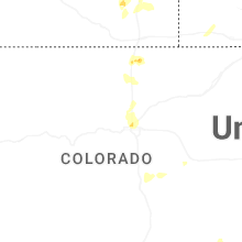

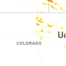
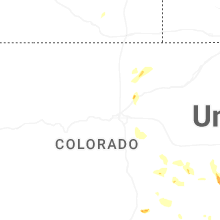


Connect with Interactive Hail Maps