

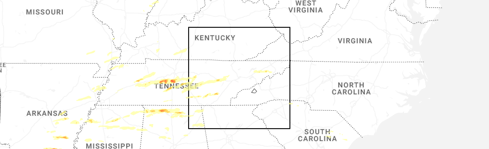
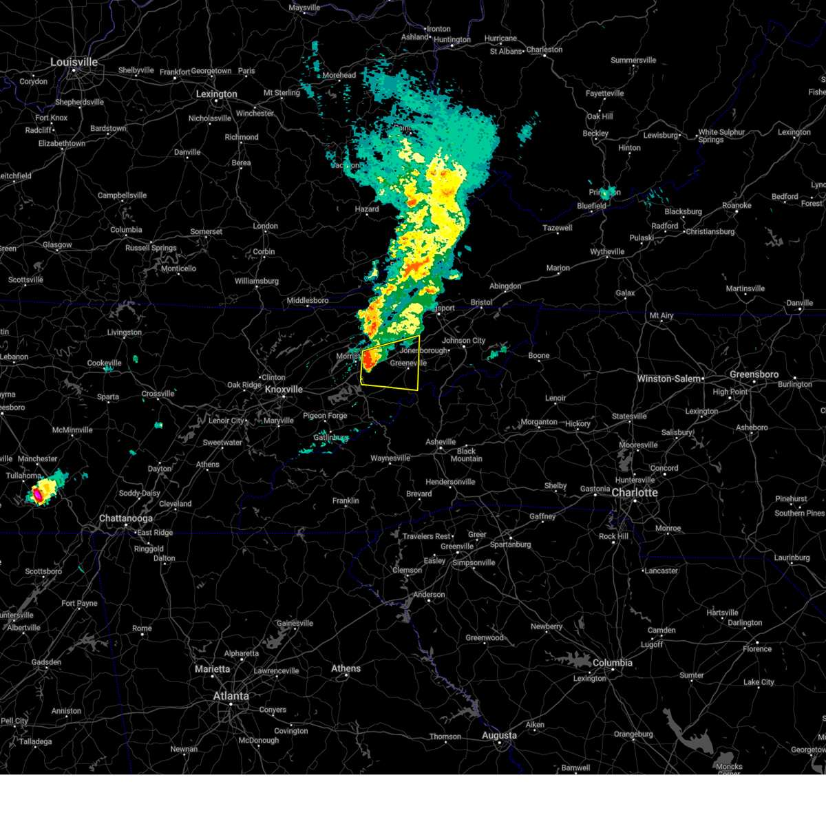
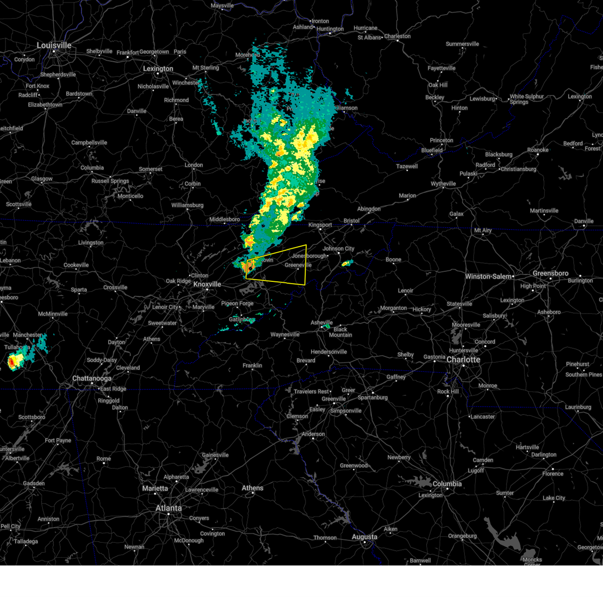
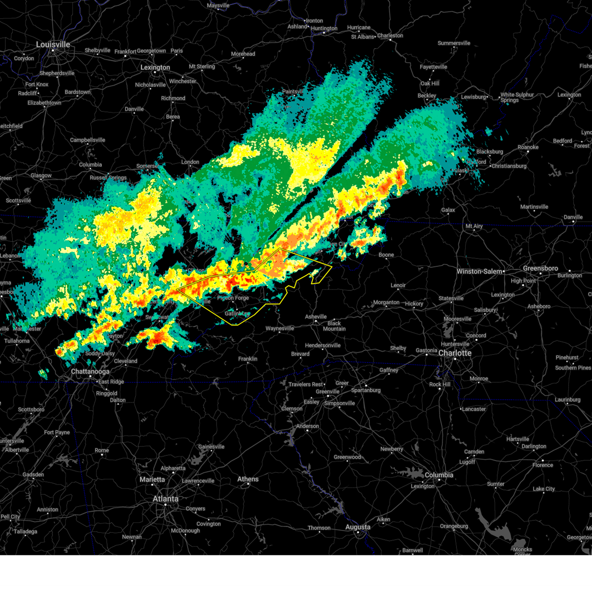
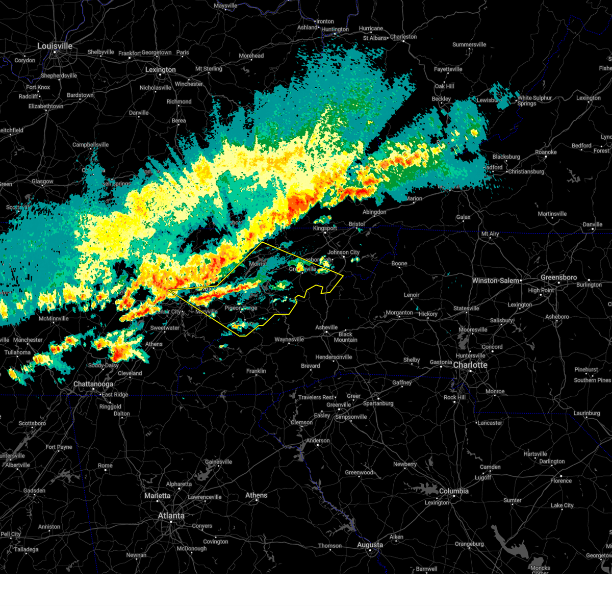
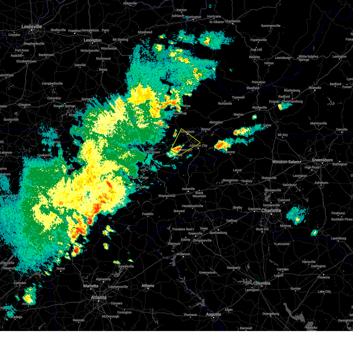
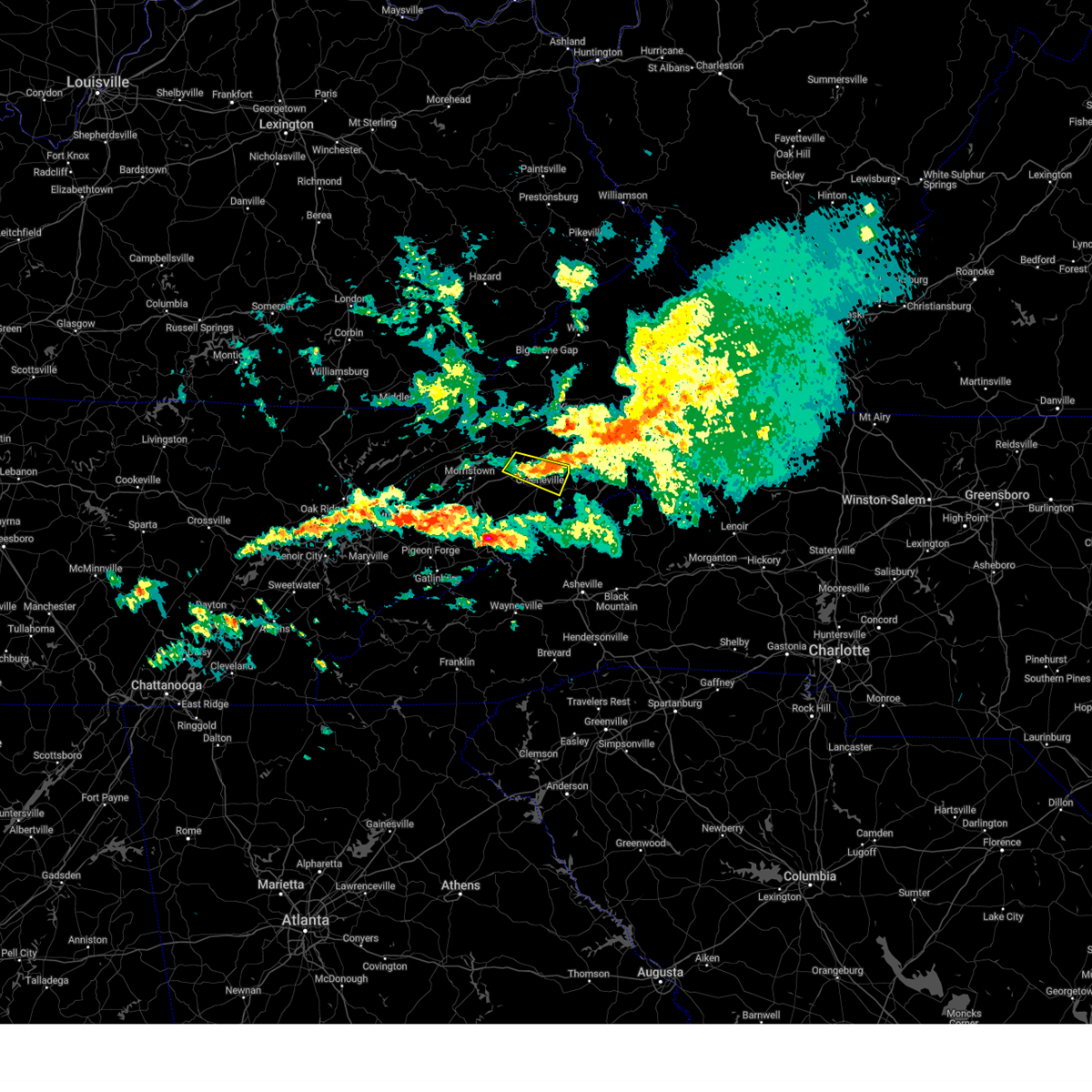
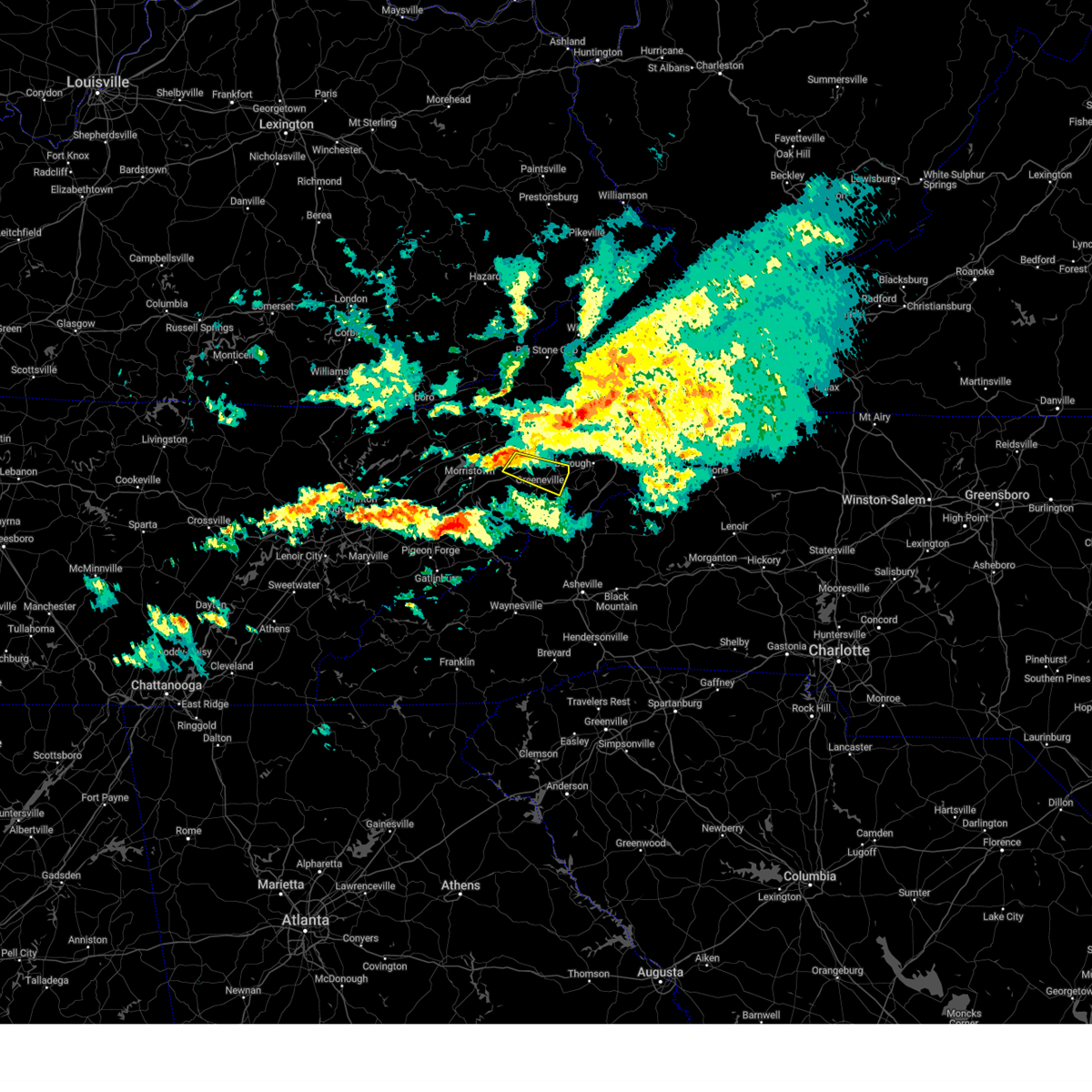
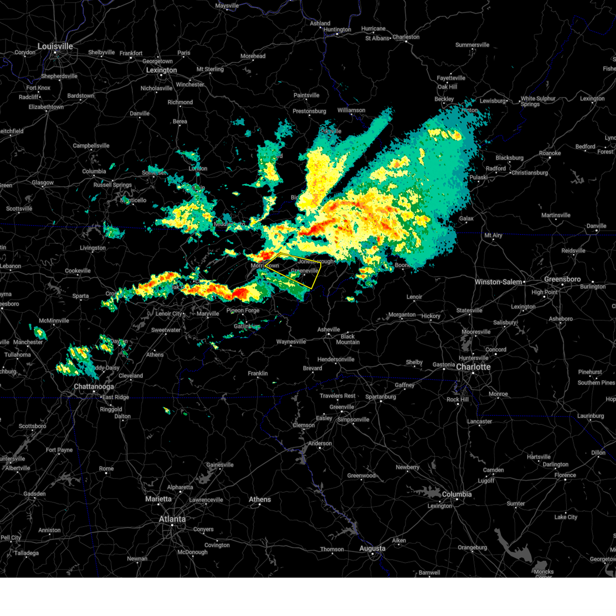
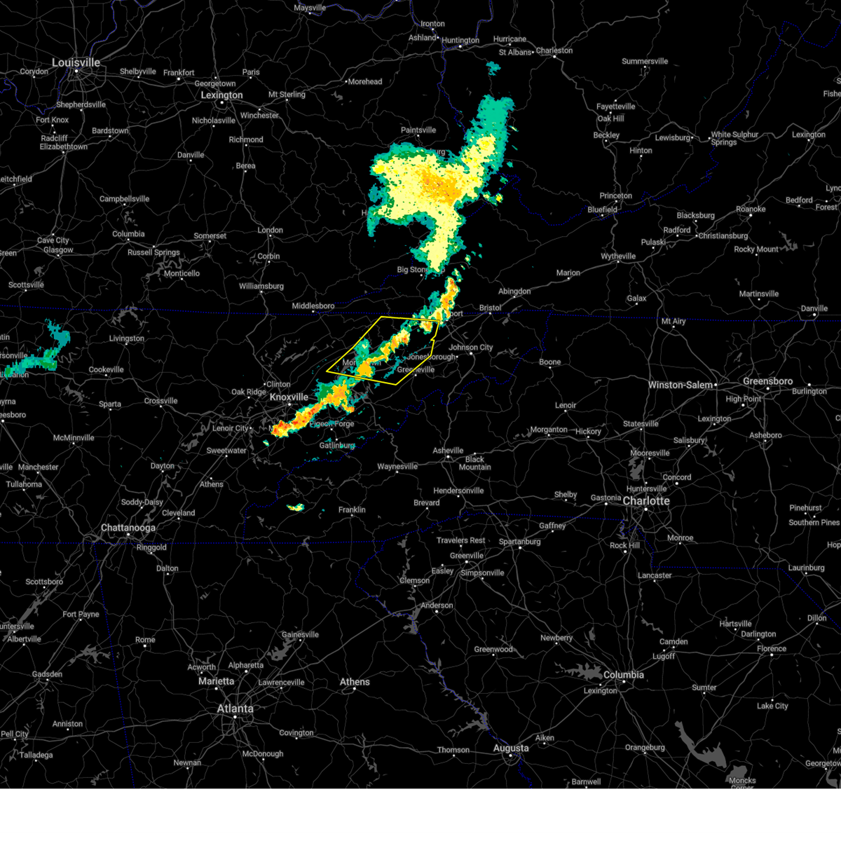
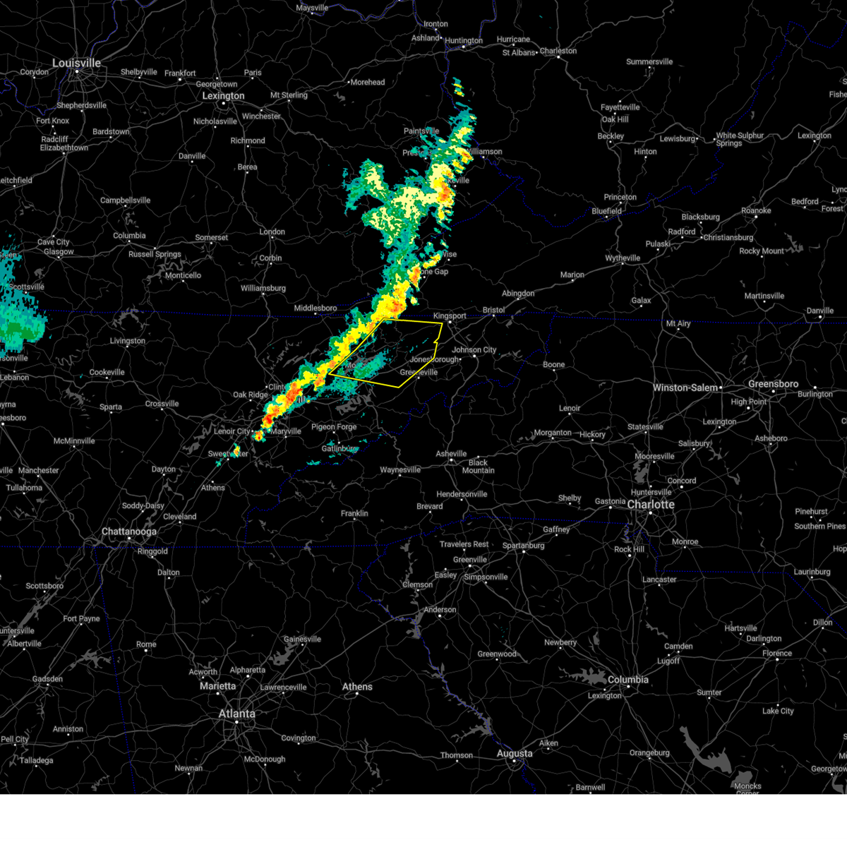
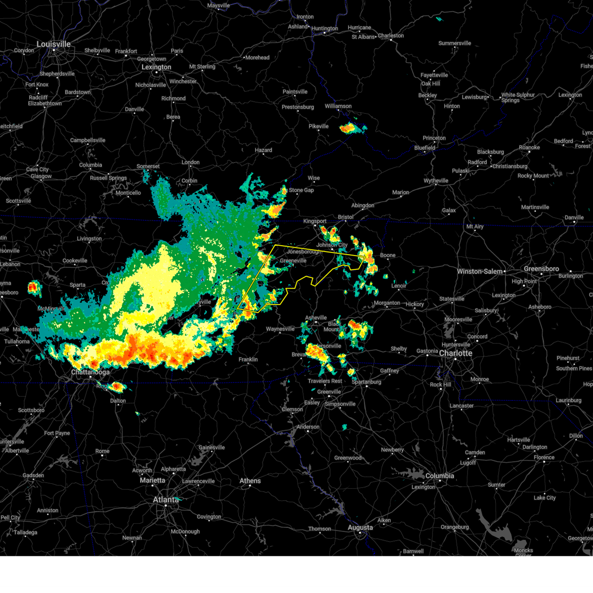
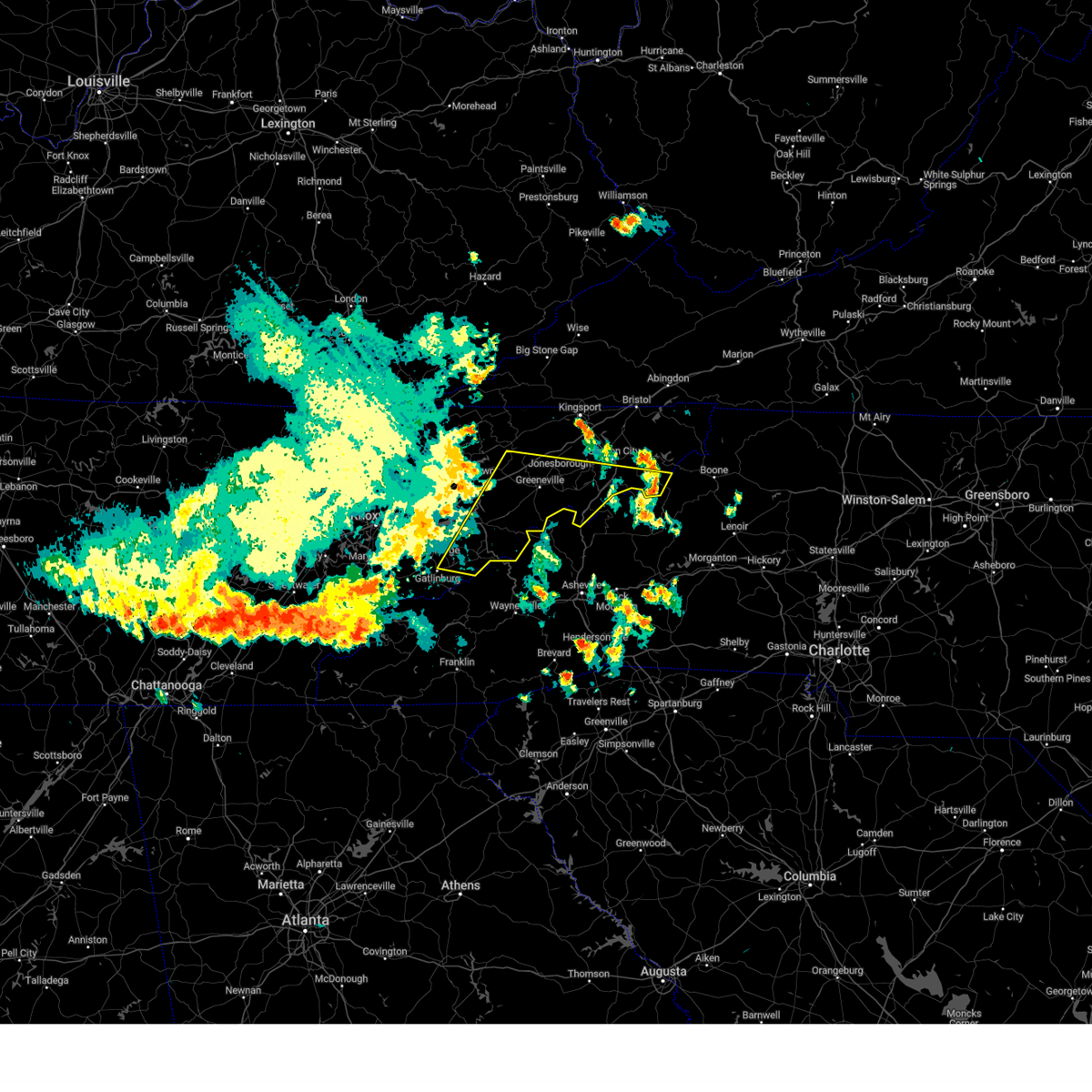
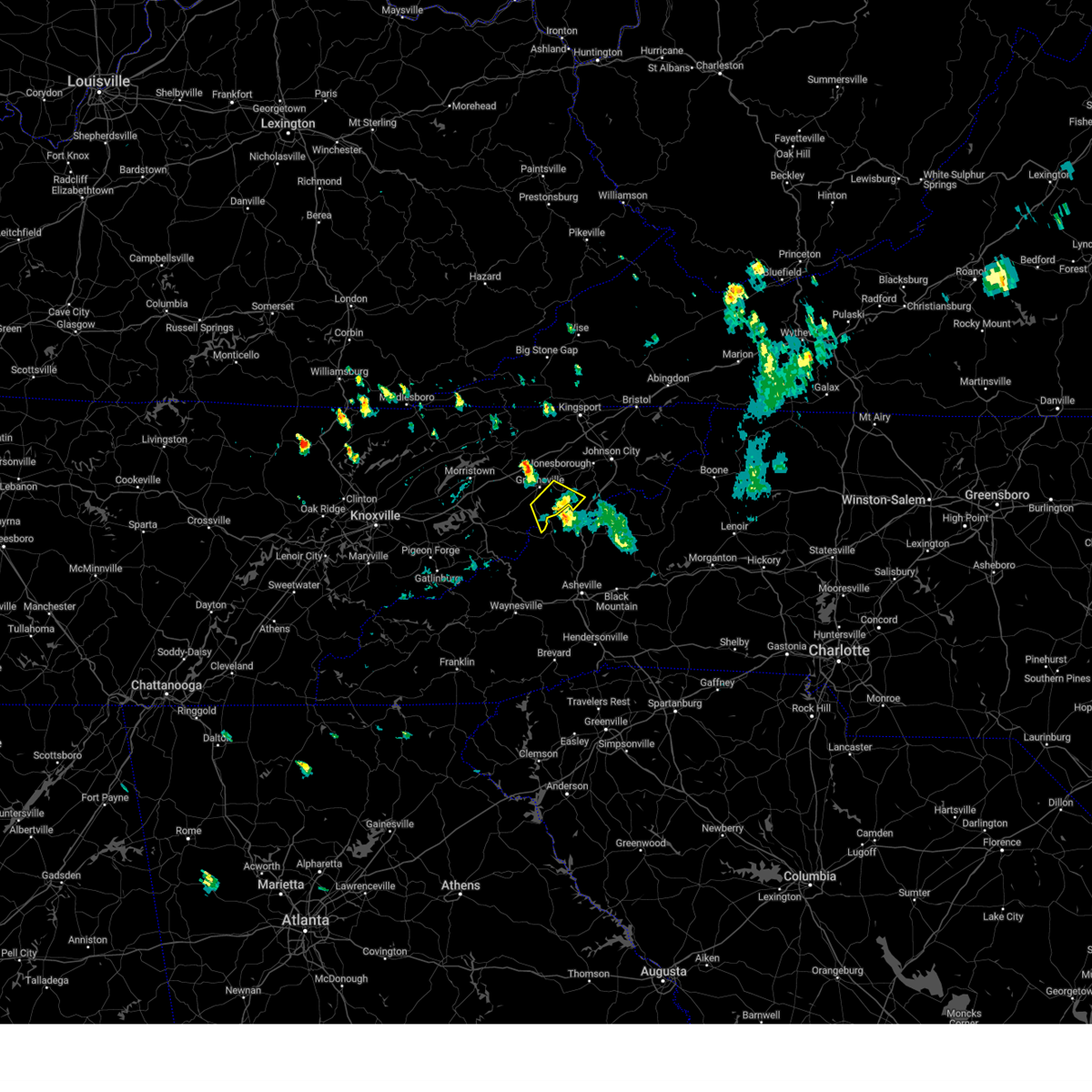
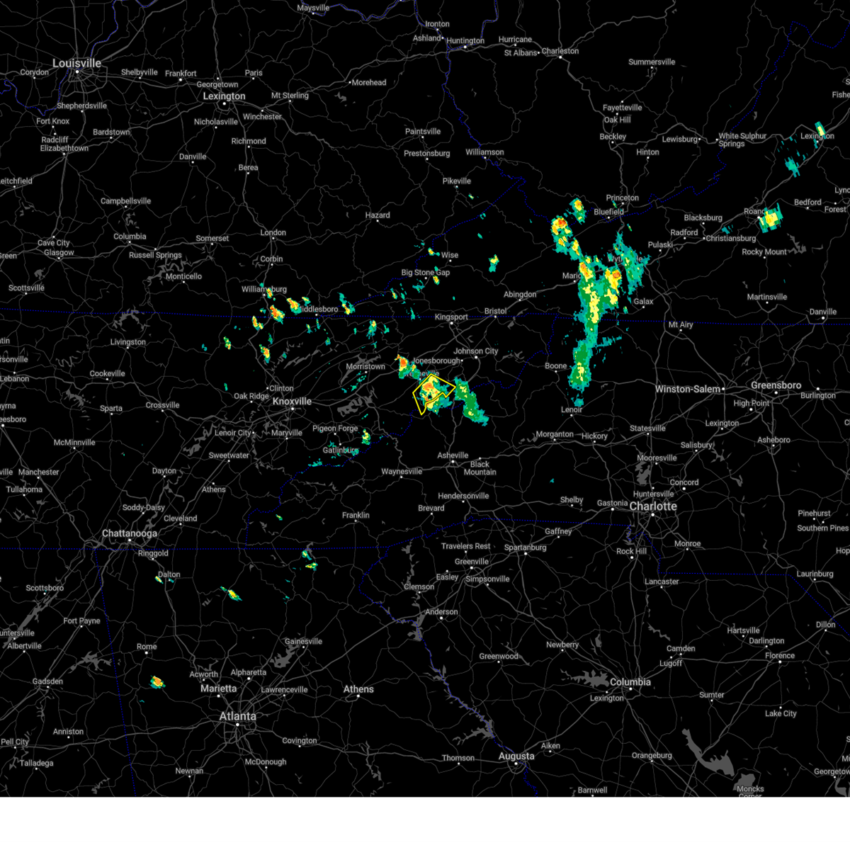
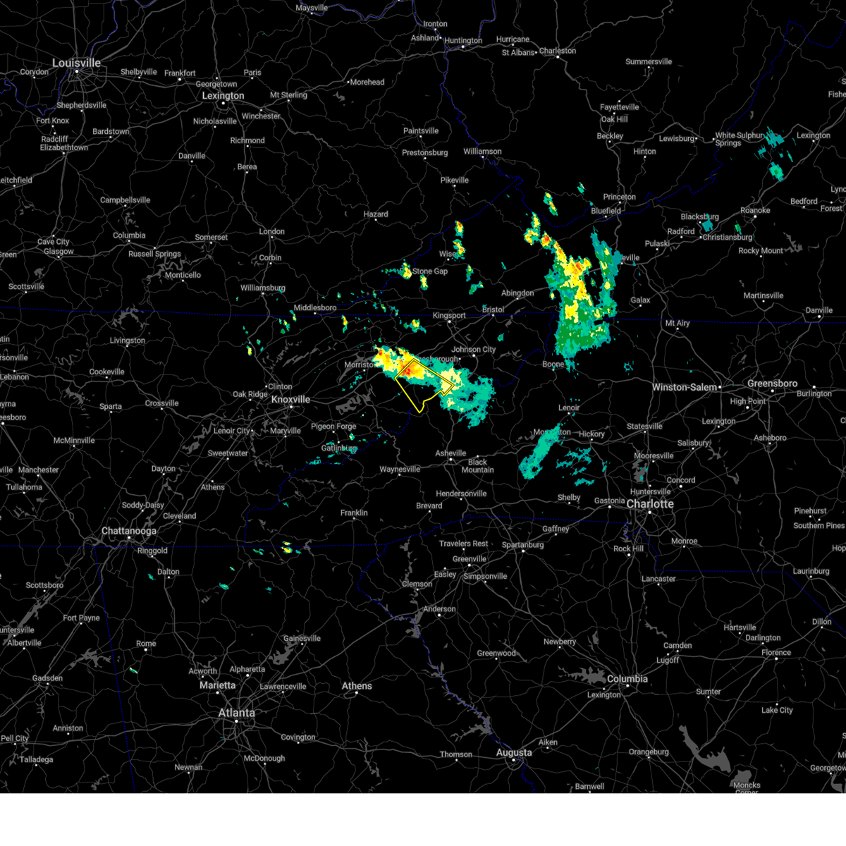
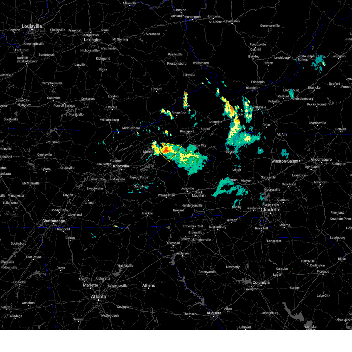
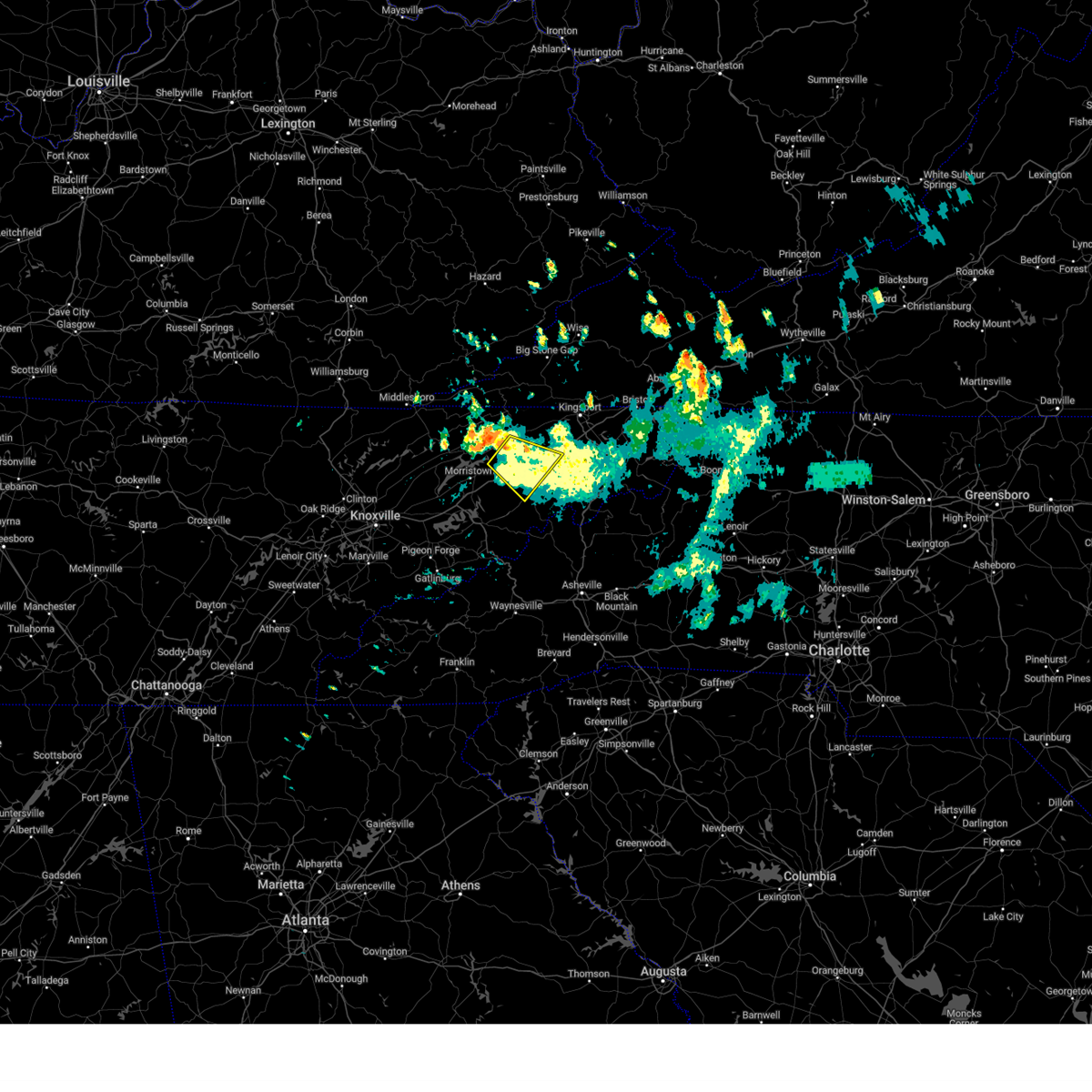
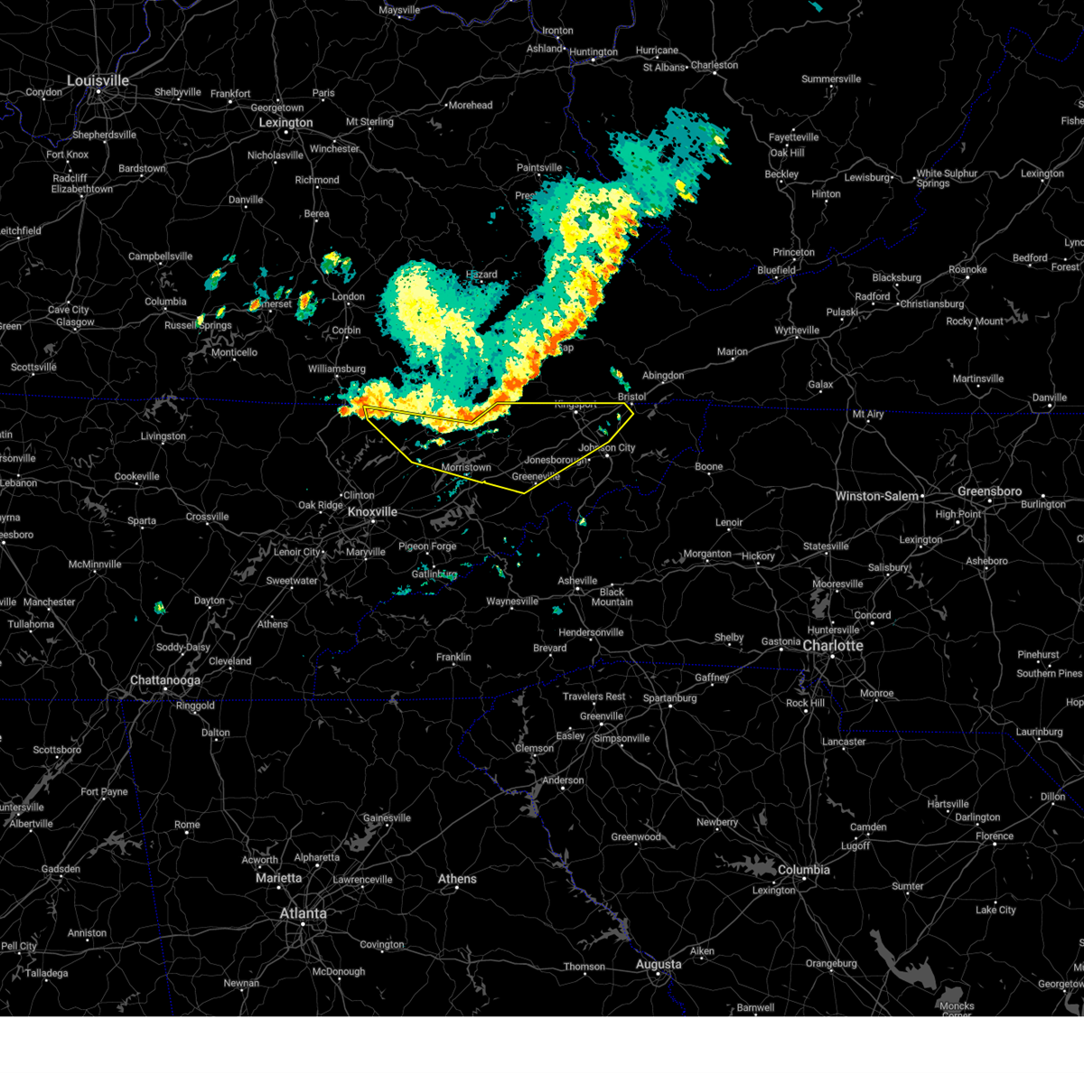
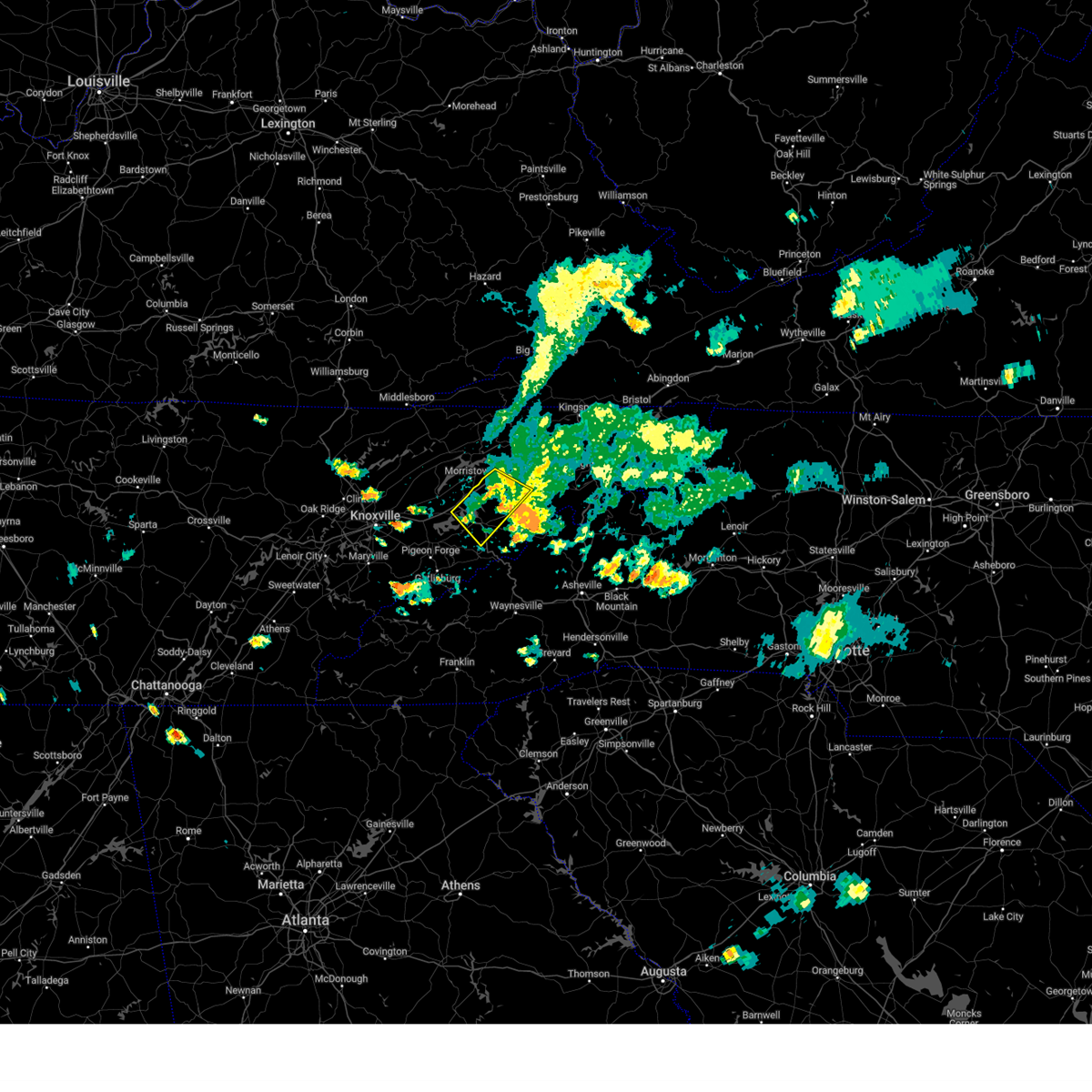
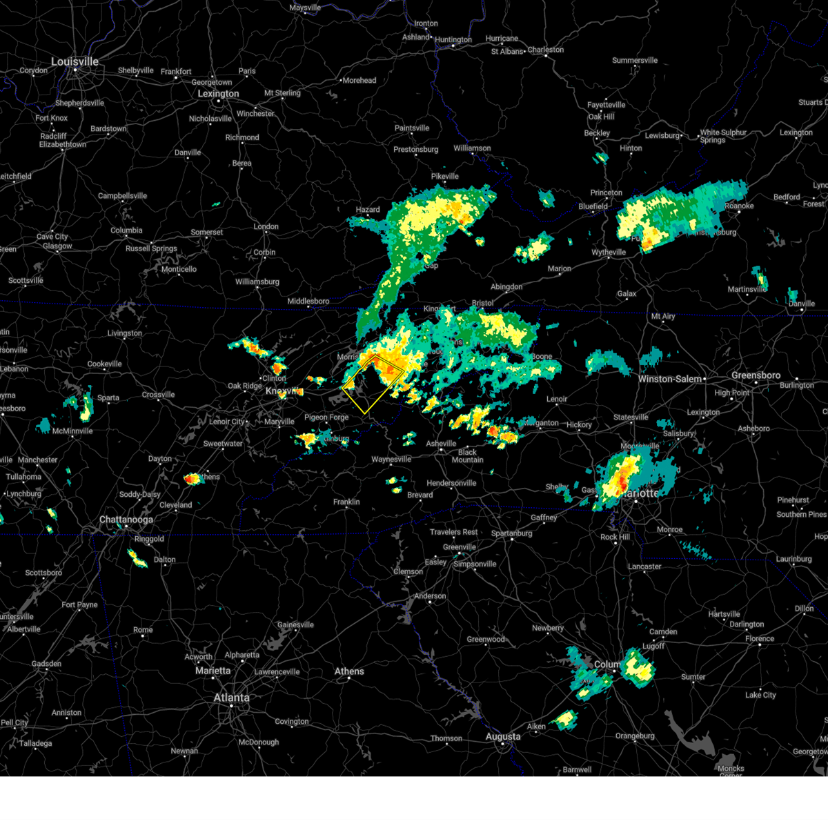
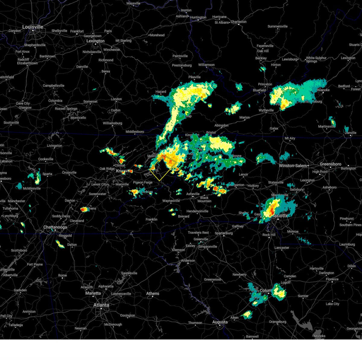
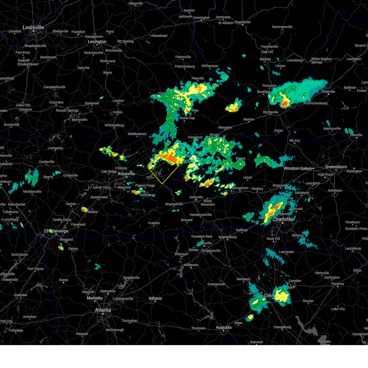
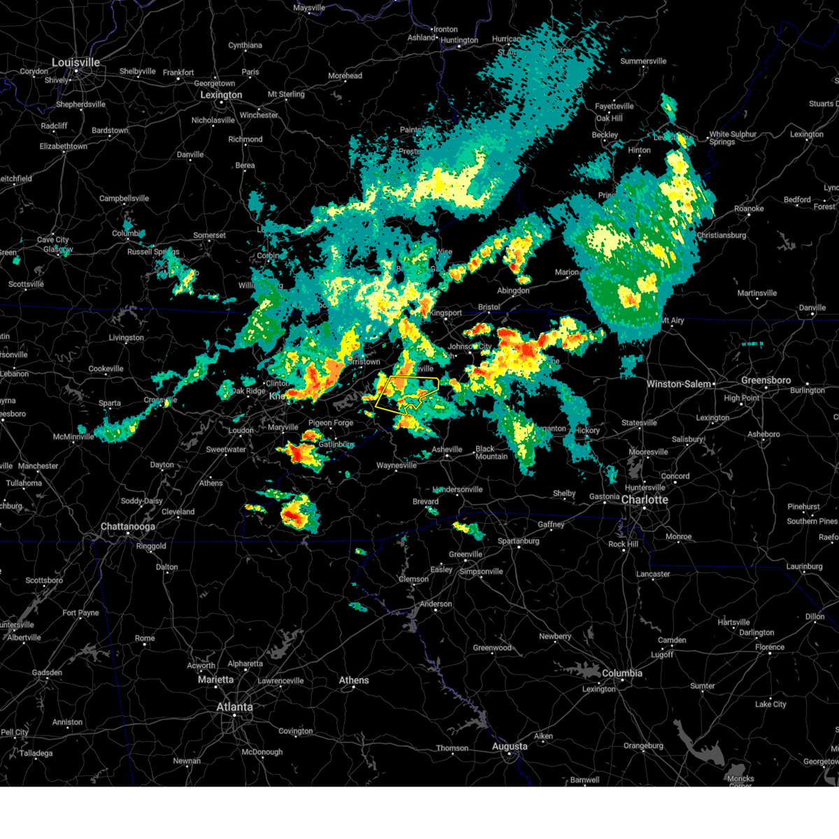
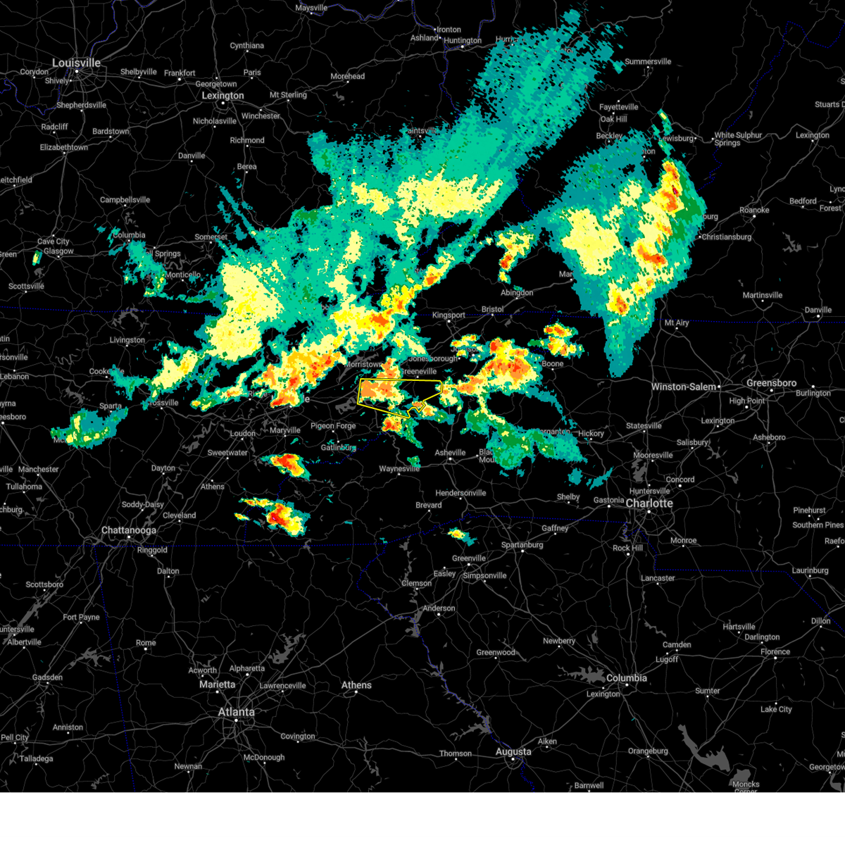
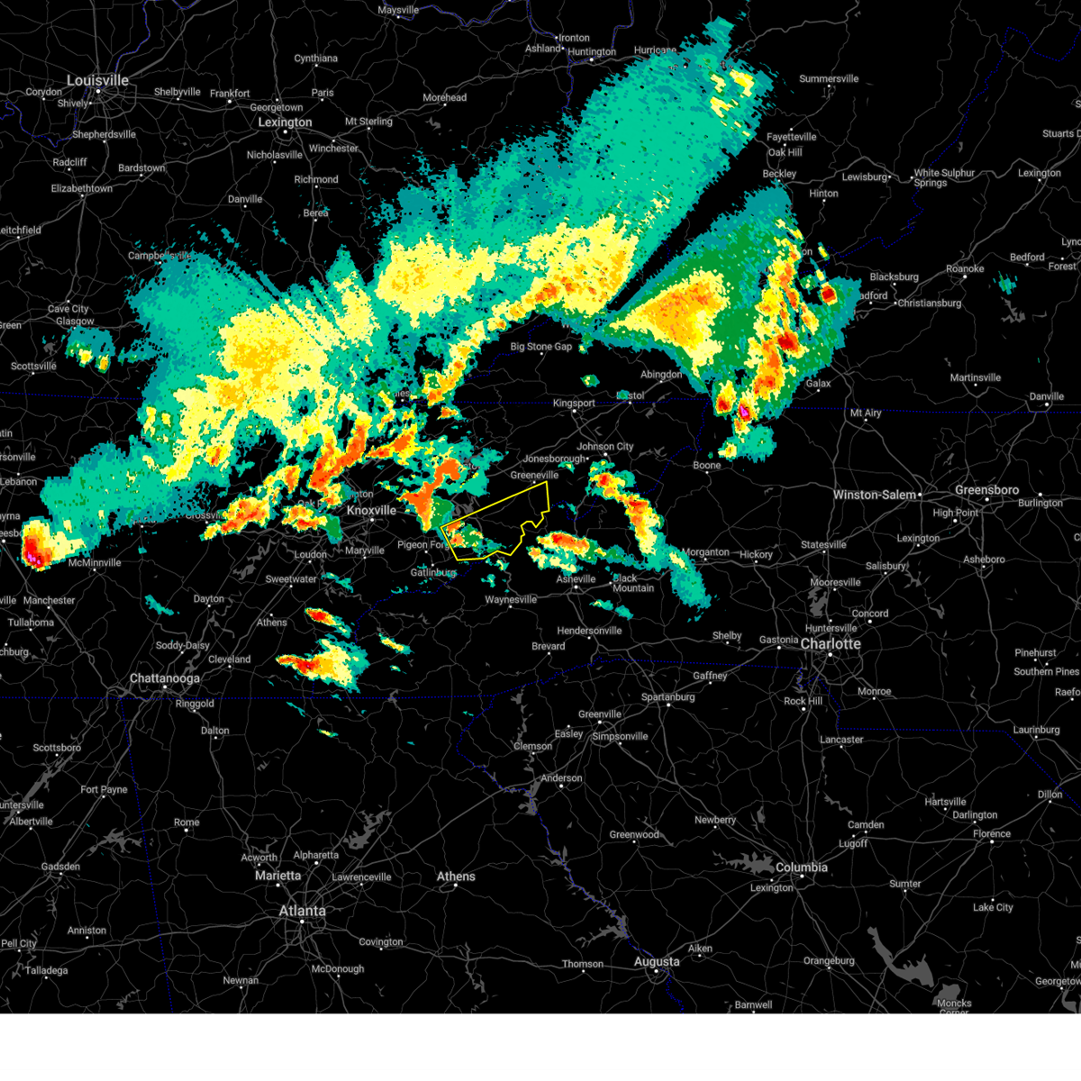
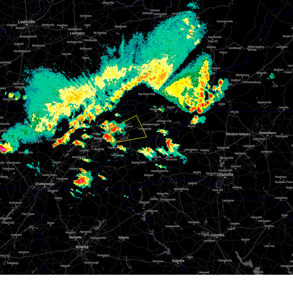
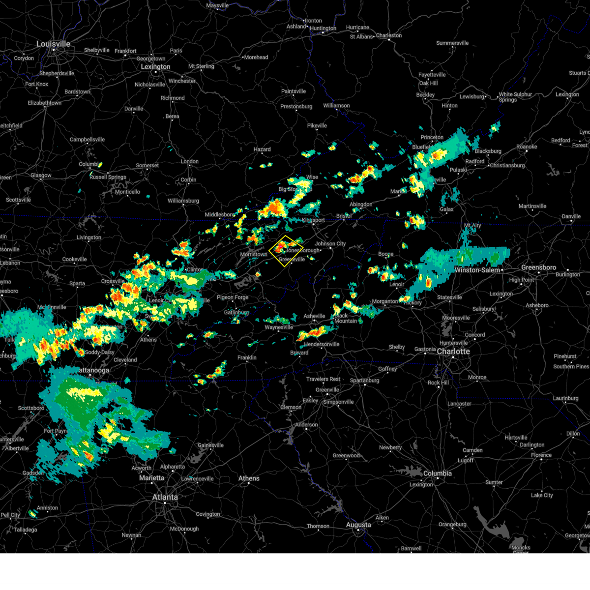
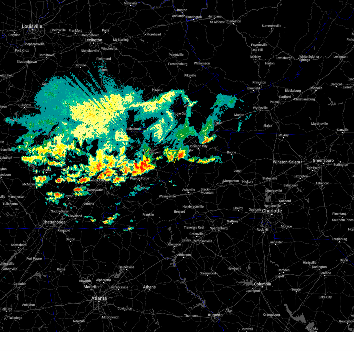
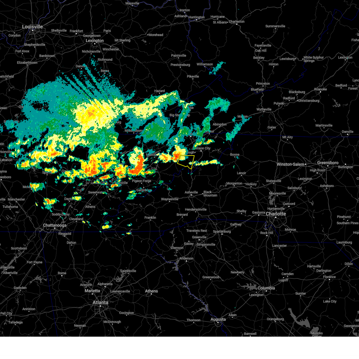
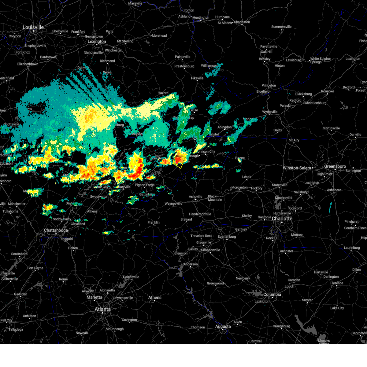
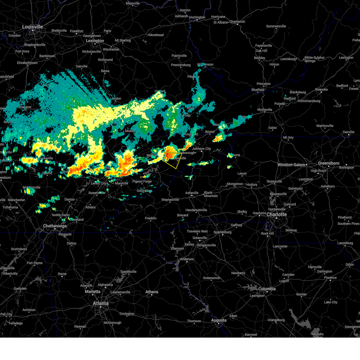
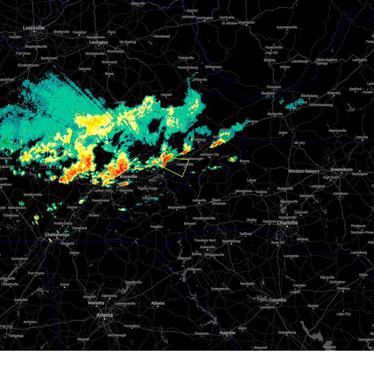
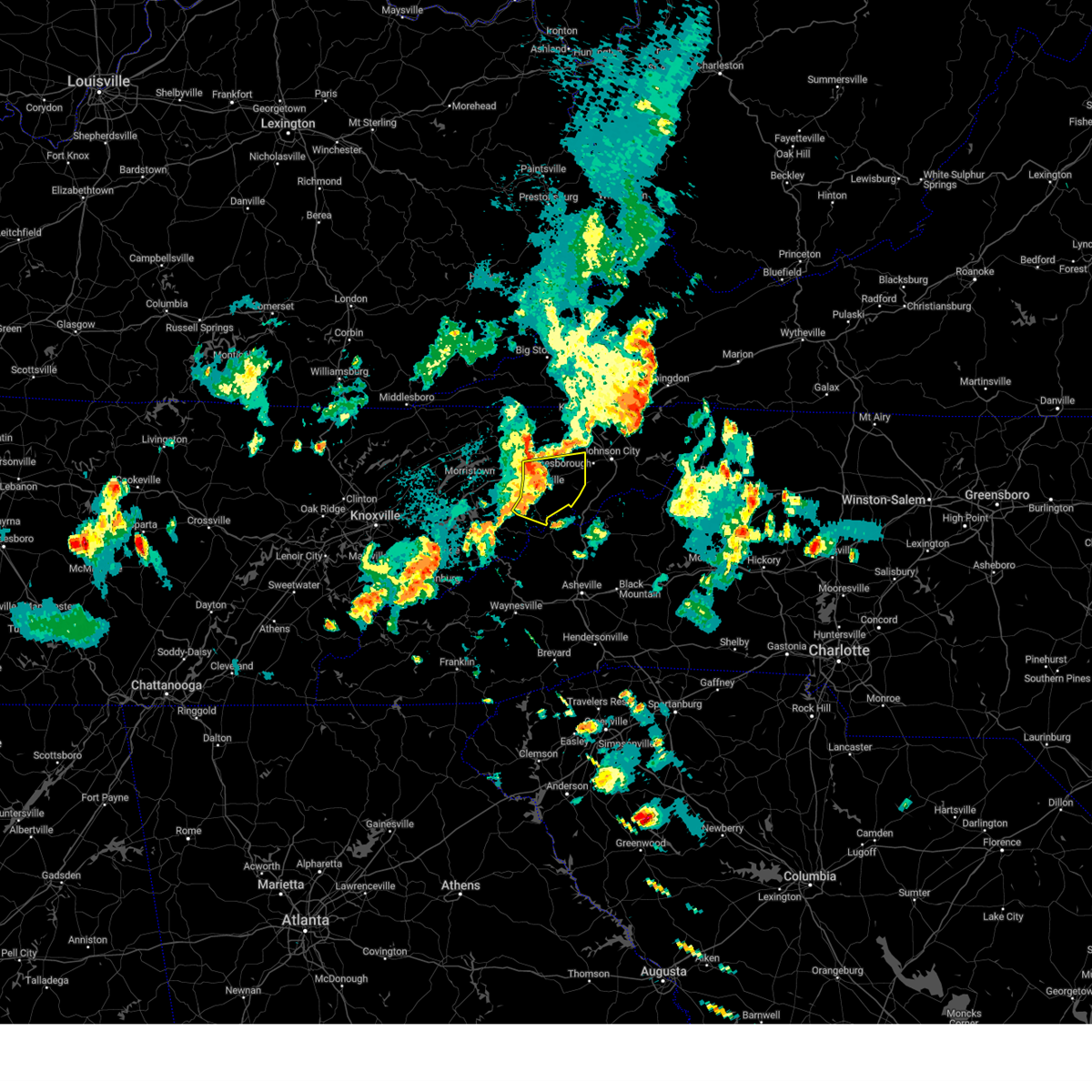
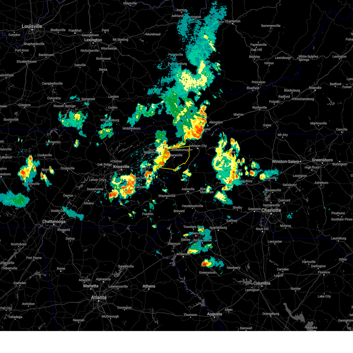
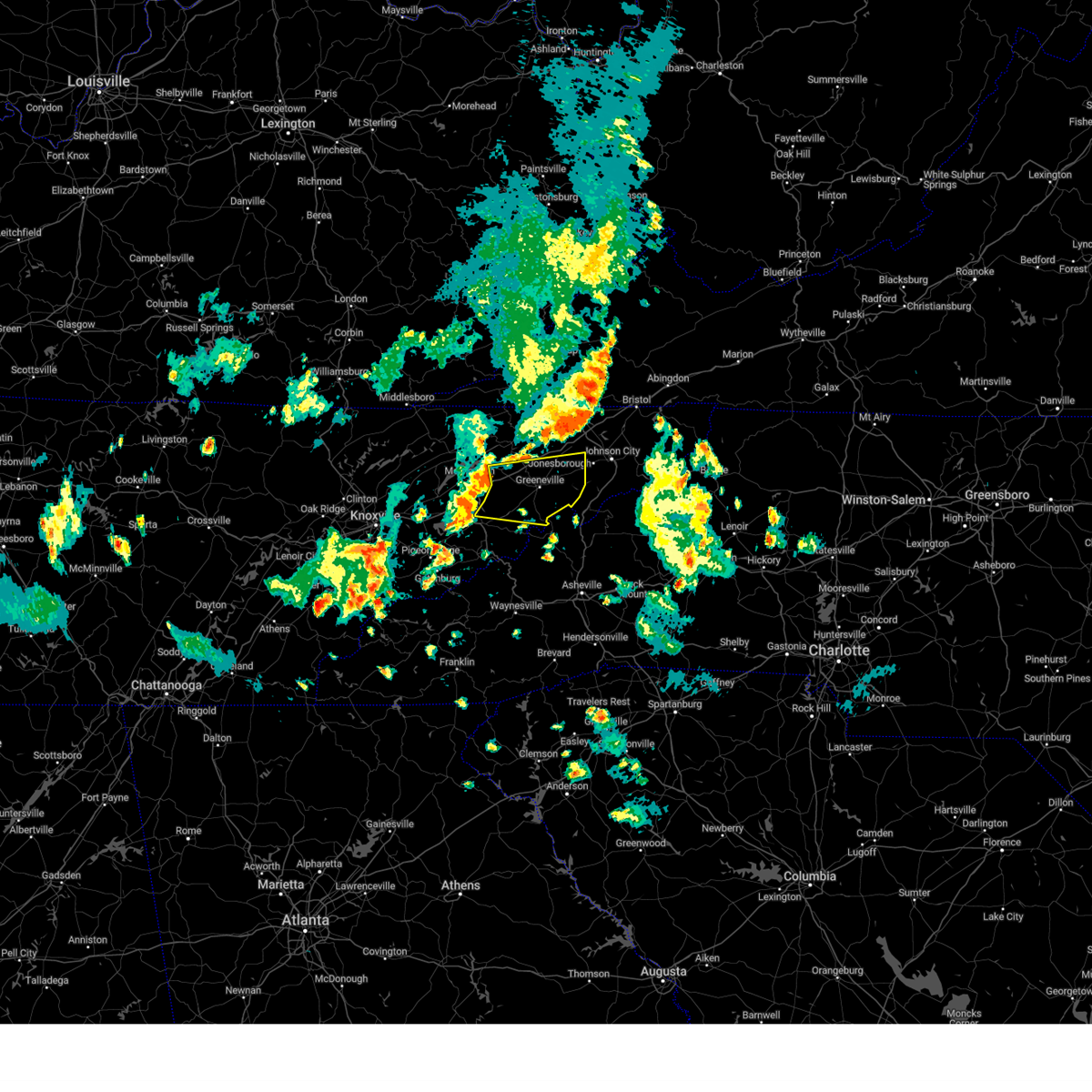
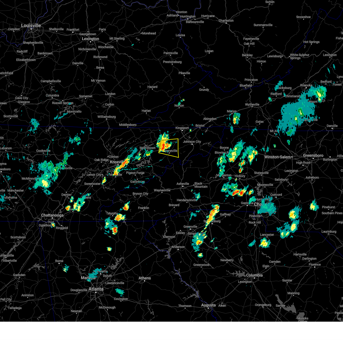
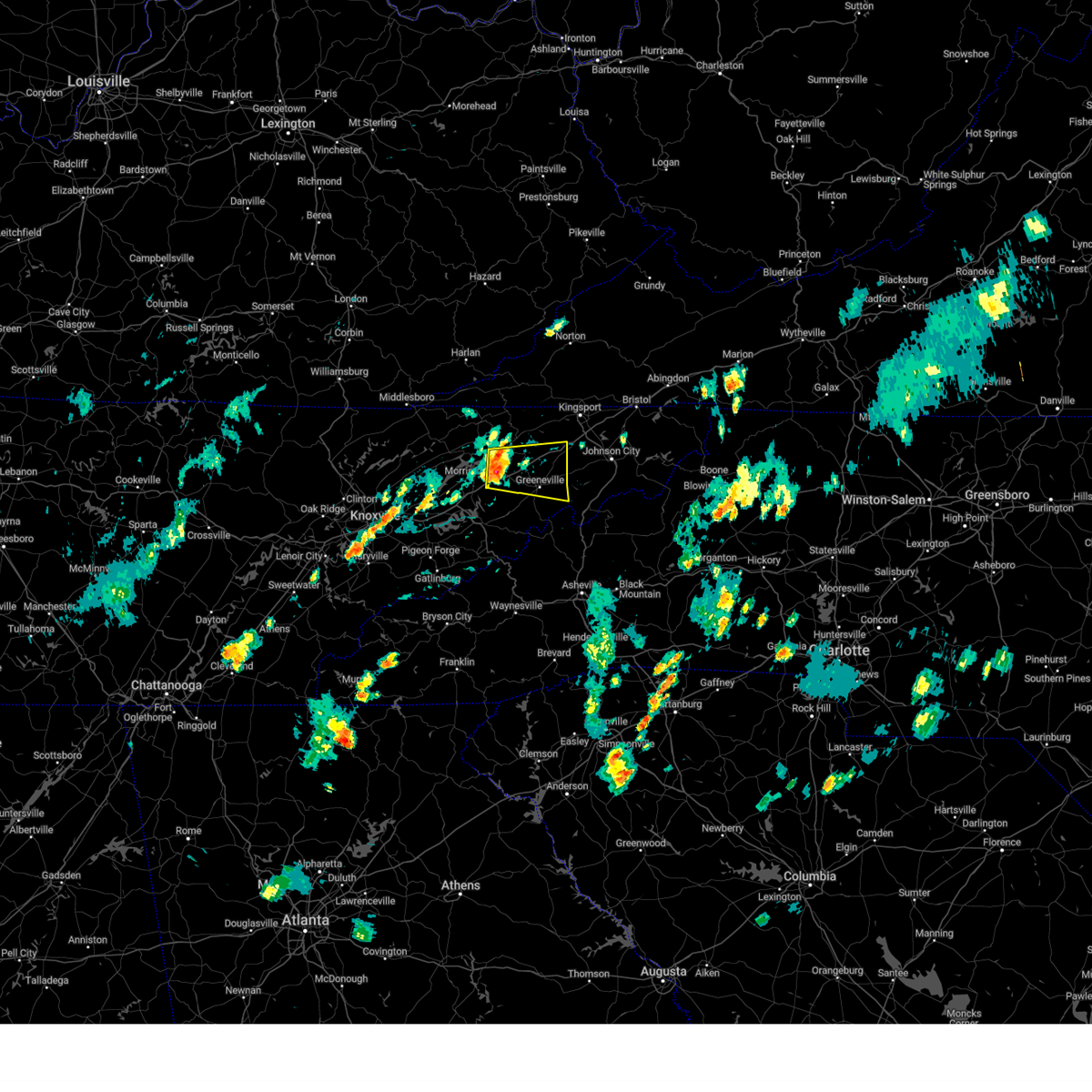
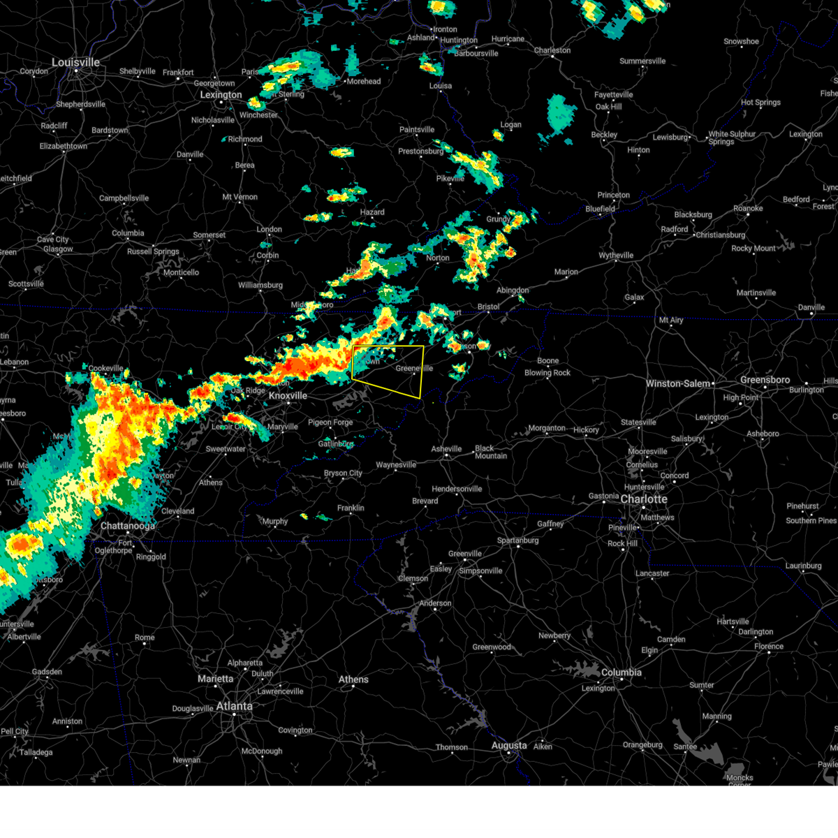
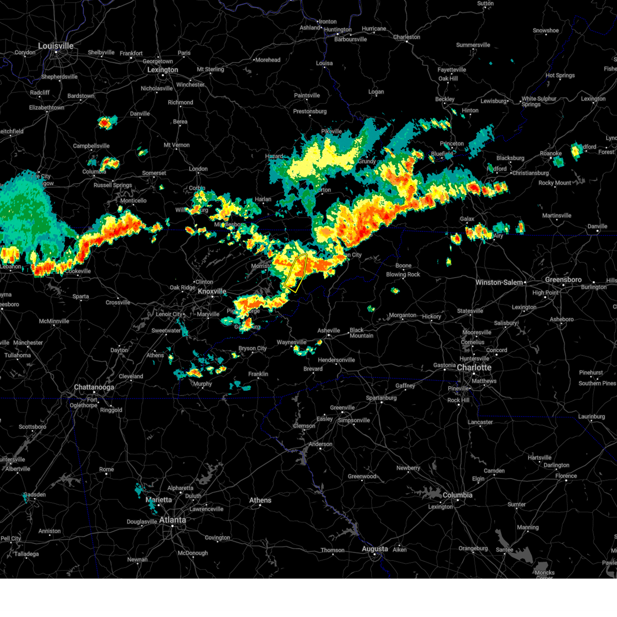
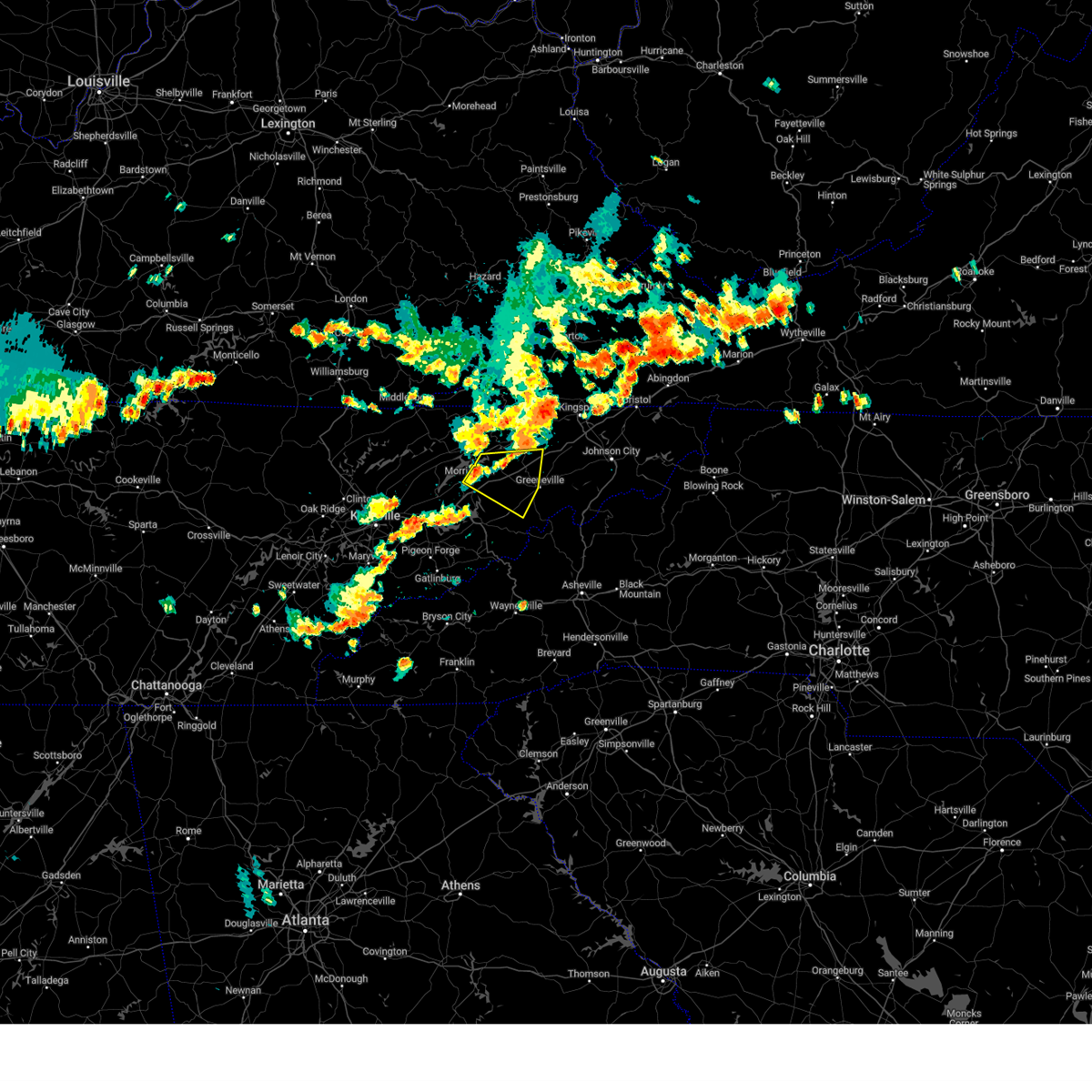
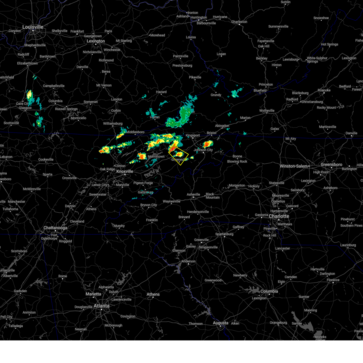
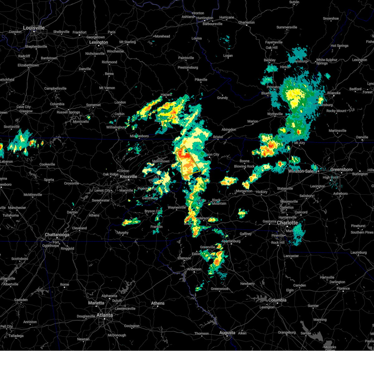
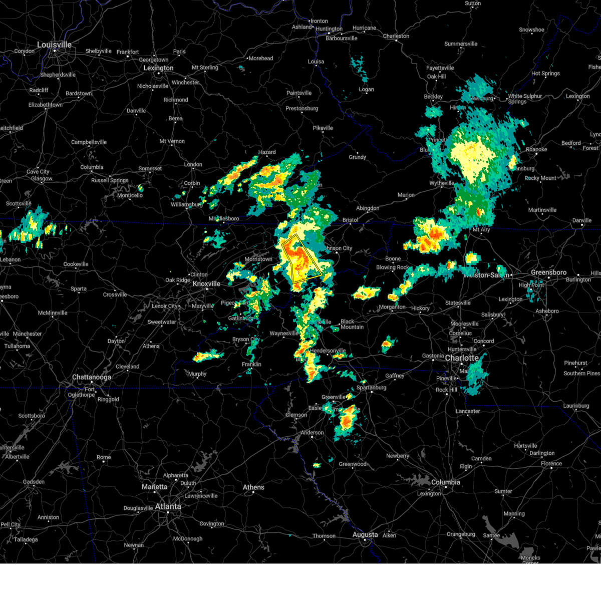
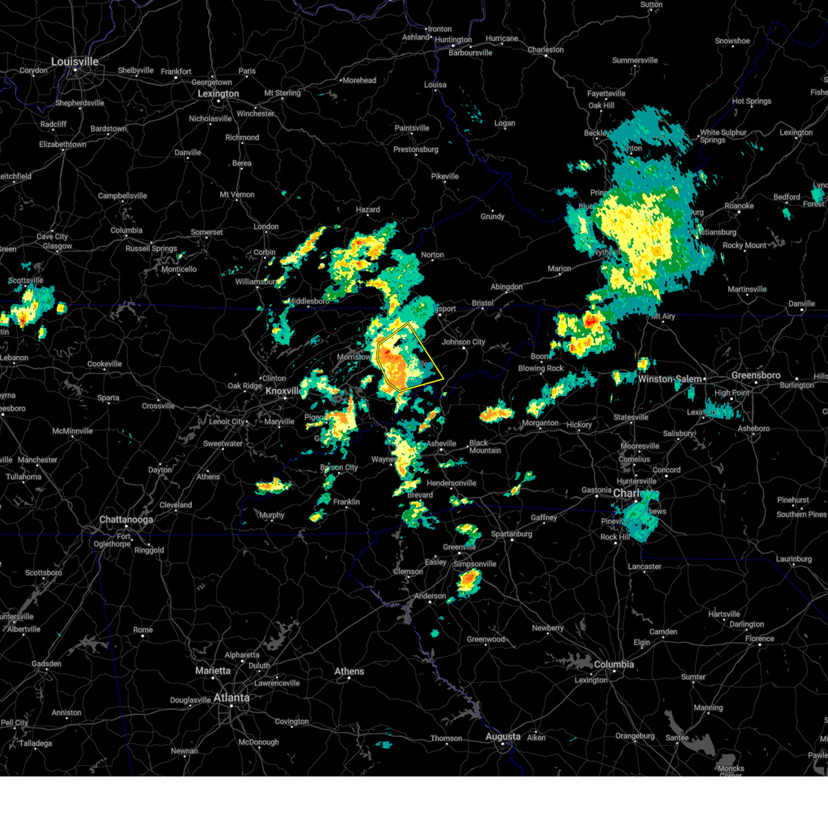
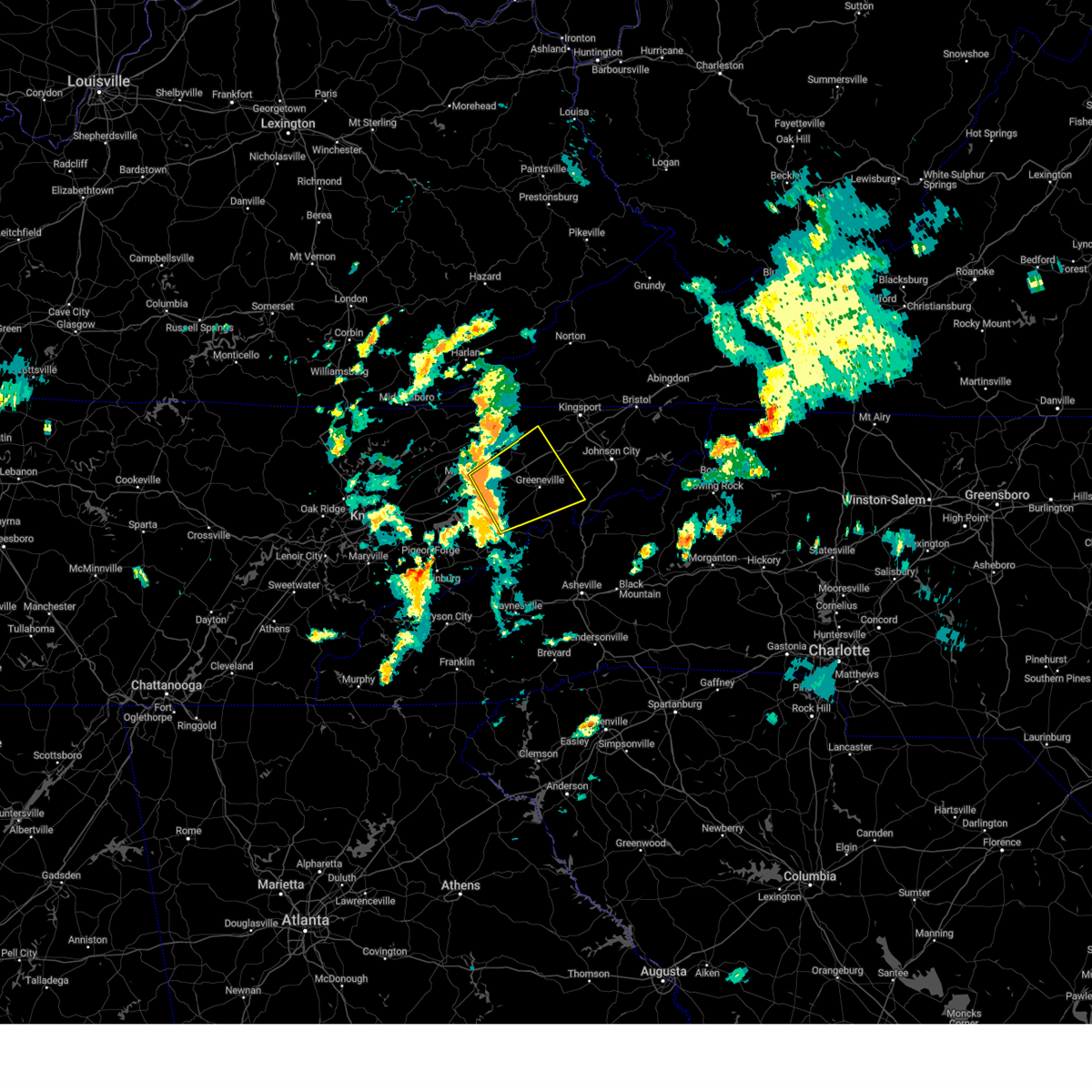
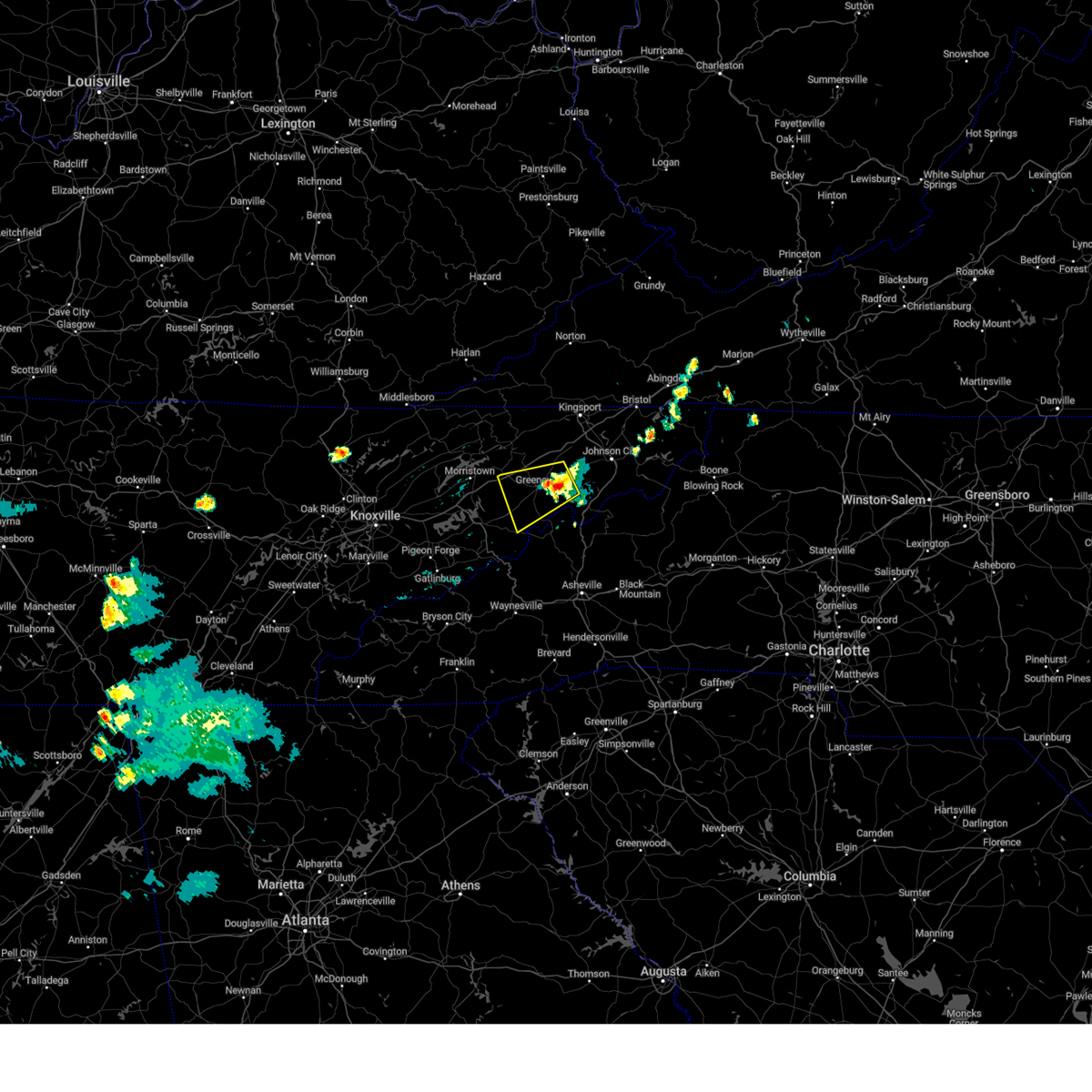
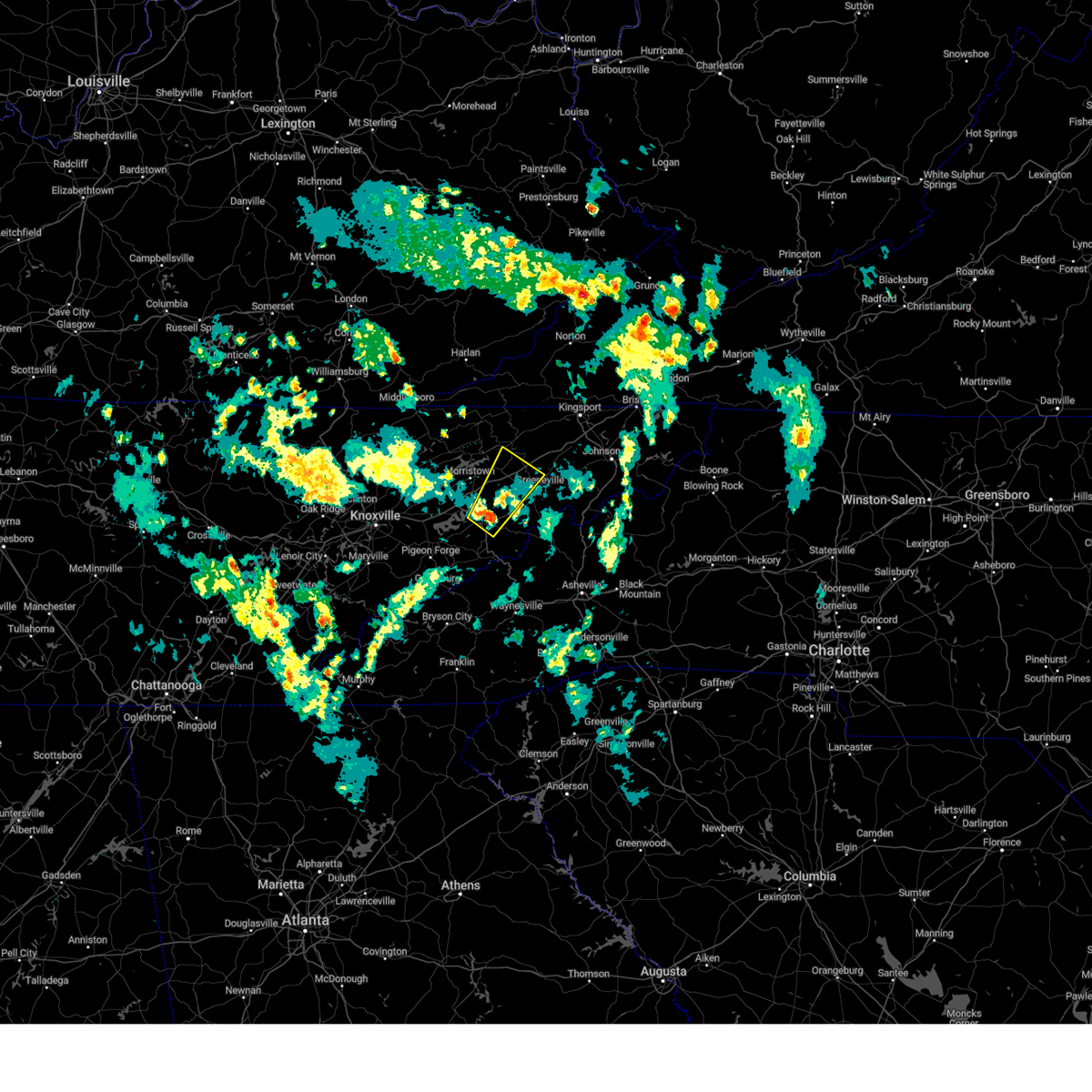
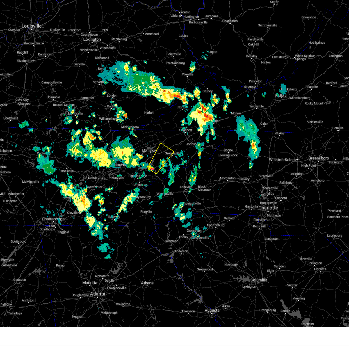
Hail Map for Greeneville, TN
The Greeneville, TN area has had 15 reports of on-the-ground hail by trained spotters, and has been under severe weather warnings 30 times during the past 12 months. Doppler radar has detected hail at or near Greeneville, TN on 40 occasions, including 2 occasions during the past year.
| Name: | Greeneville, TN |
| Where Located: | 44.3 miles SW of Bristol, TN |
| Map: | Google Map for Greeneville, TN |
| Population: | 15062 |
| Housing Units: | 7399 |
| More Info: | Search Google for Greeneville, TN |
1
The Top Recent Hail Date for Greeneville, TN is Tuesday, May 20, 2025 (10th out of 40)
Hail and Wind Damage Spotted near Greeneville, TN
| Date / Time | Report Details |
|---|---|
| 5/20/2025 5:18 PM EDT |
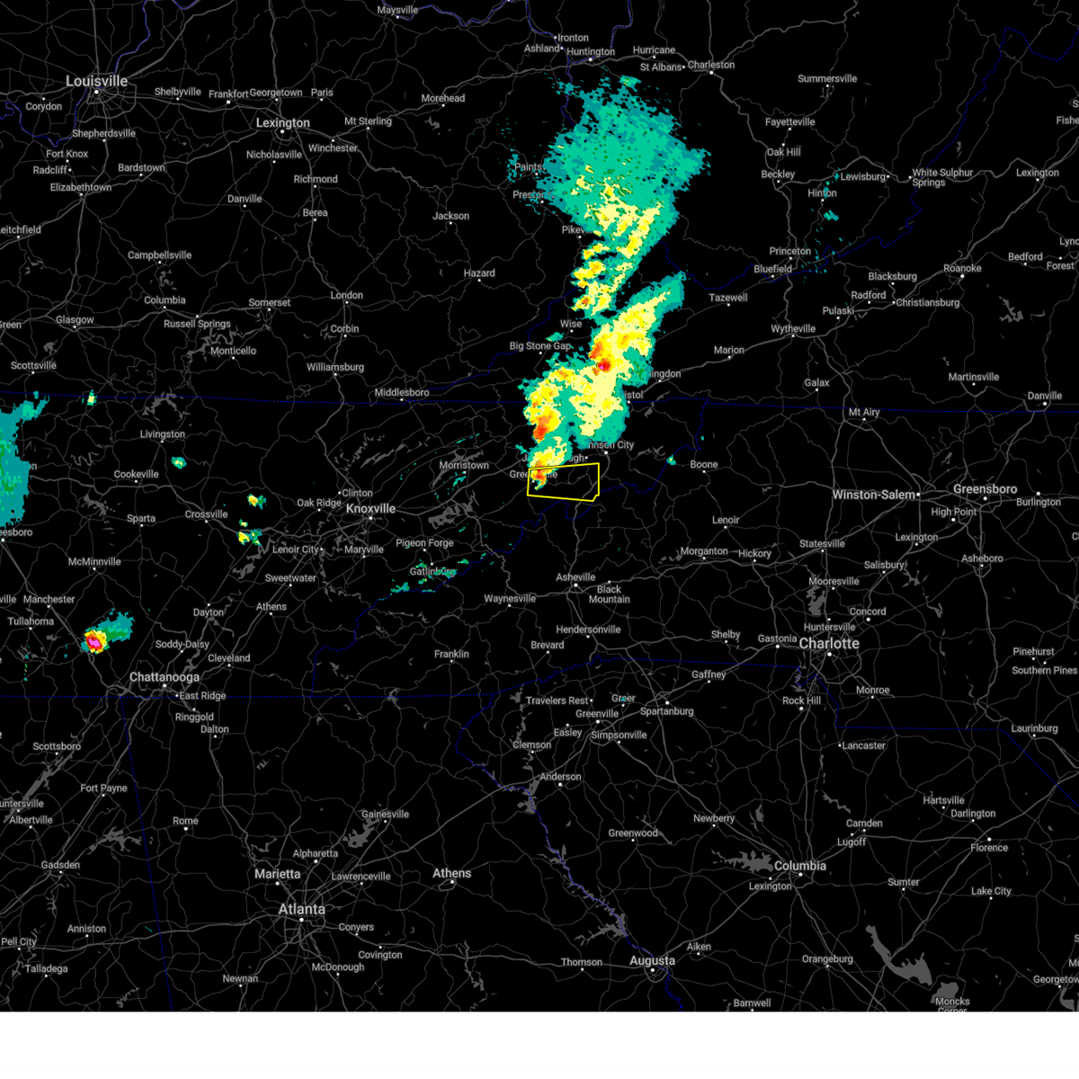 At 518 pm edt, a severe thunderstorm was located over tusculum, or near greeneville, moving east at 45 mph (radar indicated). Hazards include 70 mph wind gusts and nickel size hail. Expect considerable tree damage. damage is likely to mobile homes, roofs, and outbuildings. locations impacted include, banner hill, tusculum, chucky, limestone, embreeville, camp creek, davy crockett birthplace, erwin, greeneville, and telford. This includes interstate 26 in tennessee between mile markers 36 and 45. At 518 pm edt, a severe thunderstorm was located over tusculum, or near greeneville, moving east at 45 mph (radar indicated). Hazards include 70 mph wind gusts and nickel size hail. Expect considerable tree damage. damage is likely to mobile homes, roofs, and outbuildings. locations impacted include, banner hill, tusculum, chucky, limestone, embreeville, camp creek, davy crockett birthplace, erwin, greeneville, and telford. This includes interstate 26 in tennessee between mile markers 36 and 45.
|
| 5/20/2025 5:13 PM EDT | Tractor trailer knocked over on snapps ferry rd. time estimated by rada in greene county TN, 2.2 miles SW of Greeneville, TN |
| 5/20/2025 5:10 PM EDT | Numerous trees and powerlines down across the city. time estimated by rada in greene county TN, 0.1 miles NW of Greeneville, TN |
| 5/20/2025 5:09 PM EDT |
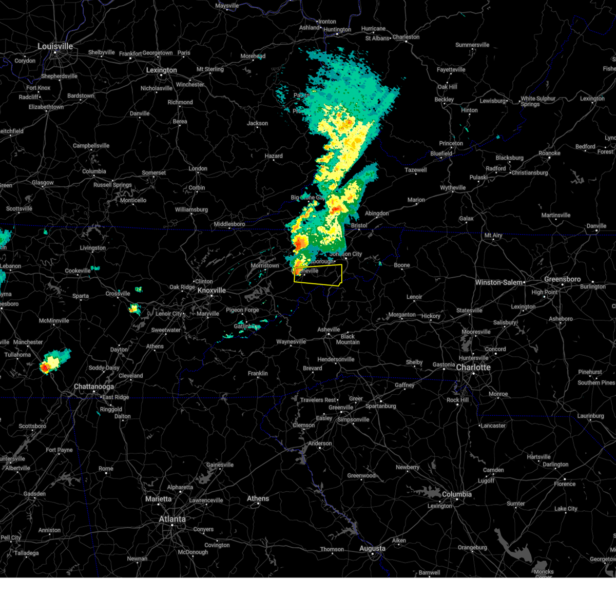 Svrmrx the national weather service in morristown has issued a * severe thunderstorm warning for, southern washington county in east tennessee, east central greene county in east tennessee, northwestern unicoi county in east tennessee, * until 600 pm edt. * at 508 pm edt, a severe thunderstorm was located near greeneville, moving east at 45 mph (radar indicated). Hazards include 70 mph wind gusts and nickel size hail. Expect considerable tree damage. Damage is likely to mobile homes, roofs, and outbuildings. Svrmrx the national weather service in morristown has issued a * severe thunderstorm warning for, southern washington county in east tennessee, east central greene county in east tennessee, northwestern unicoi county in east tennessee, * until 600 pm edt. * at 508 pm edt, a severe thunderstorm was located near greeneville, moving east at 45 mph (radar indicated). Hazards include 70 mph wind gusts and nickel size hail. Expect considerable tree damage. Damage is likely to mobile homes, roofs, and outbuildings.
|
| 5/20/2025 4:59 PM EDT |
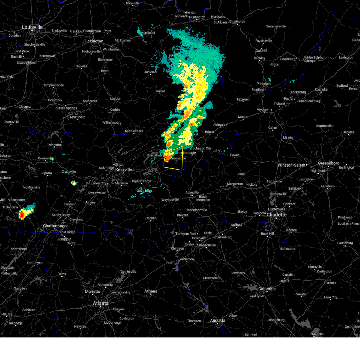 At 459 pm edt, a severe thunderstorm was located 7 miles west of greeneville, moving east at 40 mph (radar indicated). Hazards include 60 mph wind gusts and penny size hail. Expect damage to roofs, siding, and trees. locations impacted include, caney branch, tusculum, baileyton, bulls gap, camp creek, romeo, mohawk, mosheim, jearoldstown, and greeneville. This includes interstate 81 in tennessee between mile markers 20 and 42. At 459 pm edt, a severe thunderstorm was located 7 miles west of greeneville, moving east at 40 mph (radar indicated). Hazards include 60 mph wind gusts and penny size hail. Expect damage to roofs, siding, and trees. locations impacted include, caney branch, tusculum, baileyton, bulls gap, camp creek, romeo, mohawk, mosheim, jearoldstown, and greeneville. This includes interstate 81 in tennessee between mile markers 20 and 42.
|
| 5/20/2025 4:59 PM EDT |
 the severe thunderstorm warning has been cancelled and is no longer in effect the severe thunderstorm warning has been cancelled and is no longer in effect
|
| 5/20/2025 4:48 PM EDT |
 the severe thunderstorm warning has been cancelled and is no longer in effect the severe thunderstorm warning has been cancelled and is no longer in effect
|
| 5/20/2025 4:48 PM EDT |
 At 447 pm edt, a severe thunderstorm was located 7 miles southeast of russellville, or 11 miles east of morristown, moving east at 40 mph (radar indicated). Hazards include 60 mph wind gusts and penny size hail. Expect damage to roofs, siding, and trees. locations impacted include, caney branch, tusculum, baileyton, bulls gap, russellville, romeo, lowland, camp creek, mohawk, and mosheim. This includes interstate 81 in tennessee between mile markers 11 and 42. At 447 pm edt, a severe thunderstorm was located 7 miles southeast of russellville, or 11 miles east of morristown, moving east at 40 mph (radar indicated). Hazards include 60 mph wind gusts and penny size hail. Expect damage to roofs, siding, and trees. locations impacted include, caney branch, tusculum, baileyton, bulls gap, russellville, romeo, lowland, camp creek, mohawk, and mosheim. This includes interstate 81 in tennessee between mile markers 11 and 42.
|
| 5/20/2025 4:30 PM EDT |
 Svrmrx the national weather service in morristown has issued a * severe thunderstorm warning for, southern hawkins county in east tennessee, northeastern jefferson county in east tennessee, northwestern cocke county in east tennessee, greene county in east tennessee, east central grainger county in east tennessee, hamblen county in east tennessee, * until 515 pm edt. * at 429 pm edt, a severe thunderstorm was located over morristown, moving east at 40 mph (radar indicated). Hazards include 60 mph wind gusts. expect damage to roofs, siding, and trees Svrmrx the national weather service in morristown has issued a * severe thunderstorm warning for, southern hawkins county in east tennessee, northeastern jefferson county in east tennessee, northwestern cocke county in east tennessee, greene county in east tennessee, east central grainger county in east tennessee, hamblen county in east tennessee, * until 515 pm edt. * at 429 pm edt, a severe thunderstorm was located over morristown, moving east at 40 mph (radar indicated). Hazards include 60 mph wind gusts. expect damage to roofs, siding, and trees
|
| 5/17/2025 3:01 AM EDT |
 the severe thunderstorm warning has been cancelled and is no longer in effect the severe thunderstorm warning has been cancelled and is no longer in effect
|
| 5/17/2025 3:01 AM EDT |
 At 301 am edt, severe thunderstorms were located along a line extending from near pine crest to near hot springs to 6 miles east of gatlinburg, moving east at 70 mph (radar indicated). Hazards include 70 mph wind gusts and quarter size hail. Hail damage to vehicles is expected. expect considerable tree damage. wind damage is also likely to mobile homes, roofs, and outbuildings. locations impacted include, caney branch, gatlinburg, smoky mountains-newfound gap, banner hill, bird crossing, alcoa, rocky fork, kimberlin heights, sevierville, and pittman center. this includes the following highways, interstate 26 in tennessee between mile markers 37 and 52. interstate 40 in tennessee between mile markers 371 and 451. Interstate 81 in tennessee between mile markers 1 and 2, and between mile markers 16 and 32. At 301 am edt, severe thunderstorms were located along a line extending from near pine crest to near hot springs to 6 miles east of gatlinburg, moving east at 70 mph (radar indicated). Hazards include 70 mph wind gusts and quarter size hail. Hail damage to vehicles is expected. expect considerable tree damage. wind damage is also likely to mobile homes, roofs, and outbuildings. locations impacted include, caney branch, gatlinburg, smoky mountains-newfound gap, banner hill, bird crossing, alcoa, rocky fork, kimberlin heights, sevierville, and pittman center. this includes the following highways, interstate 26 in tennessee between mile markers 37 and 52. interstate 40 in tennessee between mile markers 371 and 451. Interstate 81 in tennessee between mile markers 1 and 2, and between mile markers 16 and 32.
|
| 5/17/2025 2:15 AM EDT |
 Svrmrx the national weather service in morristown has issued a * severe thunderstorm warning for, southwestern hawkins county in east tennessee, south central anderson county in east tennessee, knox county in east tennessee, jefferson county in east tennessee, cocke county in east tennessee, greene county in east tennessee, grainger county in east tennessee, southwestern unicoi county in east tennessee, sevier county in east tennessee, northeastern blount county in east tennessee, southwestern washington county in east tennessee, southwestern hancock county in east tennessee, northeastern roane county in east tennessee, hamblen county in east tennessee, * until 315 am edt. * at 214 am edt, severe thunderstorms were located along a line extending from 6 miles south of sneedville to 10 miles northeast of knoxville to near oak ridge, moving east at 70 mph (radar indicated). Hazards include 70 mph wind gusts and nickel size hail. Expect considerable tree damage. Damage is likely to mobile homes, roofs, and outbuildings. Svrmrx the national weather service in morristown has issued a * severe thunderstorm warning for, southwestern hawkins county in east tennessee, south central anderson county in east tennessee, knox county in east tennessee, jefferson county in east tennessee, cocke county in east tennessee, greene county in east tennessee, grainger county in east tennessee, southwestern unicoi county in east tennessee, sevier county in east tennessee, northeastern blount county in east tennessee, southwestern washington county in east tennessee, southwestern hancock county in east tennessee, northeastern roane county in east tennessee, hamblen county in east tennessee, * until 315 am edt. * at 214 am edt, severe thunderstorms were located along a line extending from 6 miles south of sneedville to 10 miles northeast of knoxville to near oak ridge, moving east at 70 mph (radar indicated). Hazards include 70 mph wind gusts and nickel size hail. Expect considerable tree damage. Damage is likely to mobile homes, roofs, and outbuildings.
|
| 5/2/2025 7:37 PM EDT | the severe thunderstorm warning has been cancelled and is no longer in effect |
| 5/2/2025 7:23 PM EDT |
 Svrmrx the national weather service in morristown has issued a * severe thunderstorm warning for, southwestern sullivan county in east tennessee, northeastern hawkins county in east tennessee, northern washington county in east tennessee, northeastern greene county in east tennessee, south central scott county in southwestern virginia, * until 815 pm edt. * at 723 pm edt, a severe thunderstorm was located 8 miles north of tusculum, or 9 miles north of greeneville, moving northeast at 25 mph (radar indicated). Hazards include 60 mph wind gusts and quarter size hail. Hail damage to vehicles is expected. Expect wind damage to roofs, siding, and trees. Svrmrx the national weather service in morristown has issued a * severe thunderstorm warning for, southwestern sullivan county in east tennessee, northeastern hawkins county in east tennessee, northern washington county in east tennessee, northeastern greene county in east tennessee, south central scott county in southwestern virginia, * until 815 pm edt. * at 723 pm edt, a severe thunderstorm was located 8 miles north of tusculum, or 9 miles north of greeneville, moving northeast at 25 mph (radar indicated). Hazards include 60 mph wind gusts and quarter size hail. Hail damage to vehicles is expected. Expect wind damage to roofs, siding, and trees.
|
| 5/2/2025 7:01 PM EDT | the severe thunderstorm warning has been cancelled and is no longer in effect |
| 5/2/2025 7:01 PM EDT | At 701 pm edt, a severe thunderstorm was located near greeneville, moving northeast at 25 mph (radar indicated). Hazards include 60 mph wind gusts and quarter size hail. Hail damage to vehicles is expected. expect wind damage to roofs, siding, and trees. locations impacted include, tusculum, romeo, baileyton, mosheim, greeneville, and chucky. This includes interstate 81 in tennessee between mile markers 25 and 38. |
| 5/2/2025 7:00 PM EDT | Quarter sized hail reported 1.6 miles E of Greeneville, TN, reported via social media. |
| 5/2/2025 6:37 PM EDT | Svrmrx the national weather service in morristown has issued a * severe thunderstorm warning for, south central hawkins county in east tennessee, northeastern cocke county in east tennessee, central greene county in east tennessee, * until 730 pm edt. * at 637 pm edt, a severe thunderstorm was located 9 miles southwest of greeneville, moving northeast at 25 mph (radar indicated). Hazards include 60 mph wind gusts and quarter size hail. Hail damage to vehicles is expected. Expect wind damage to roofs, siding, and trees. |
| 2/6/2025 10:17 PM EST |
 the severe thunderstorm warning has been cancelled and is no longer in effect the severe thunderstorm warning has been cancelled and is no longer in effect
|
| 2/6/2025 10:04 PM EST |
 At 1003 pm est, a severe thunderstorm was located 9 miles northwest of greeneville, moving east at 45 mph (radar indicated). Hazards include 60 mph wind gusts. Expect damage to roofs, siding, and trees. locations impacted include, greeneville, tusculum, mosheim, bulls gap, baileyton, chucky, davy crockett birthplace, and romeo. This includes interstate 81 in tennessee between mile markers 24 and 36. At 1003 pm est, a severe thunderstorm was located 9 miles northwest of greeneville, moving east at 45 mph (radar indicated). Hazards include 60 mph wind gusts. Expect damage to roofs, siding, and trees. locations impacted include, greeneville, tusculum, mosheim, bulls gap, baileyton, chucky, davy crockett birthplace, and romeo. This includes interstate 81 in tennessee between mile markers 24 and 36.
|
| 2/6/2025 10:04 PM EST |
 the severe thunderstorm warning has been cancelled and is no longer in effect the severe thunderstorm warning has been cancelled and is no longer in effect
|
| 2/6/2025 9:45 PM EST |
 Svrmrx the national weather service in morristown has issued a * severe thunderstorm warning for, southwestern hawkins county in east tennessee, central greene county in east tennessee, northeastern hamblen county in east tennessee, * until 1030 pm est. * at 945 pm est, a severe thunderstorm was located over russellville, or 8 miles northeast of morristown, moving east at 50 mph (radar indicated). Hazards include 60 mph wind gusts. expect damage to roofs, siding, and trees Svrmrx the national weather service in morristown has issued a * severe thunderstorm warning for, southwestern hawkins county in east tennessee, central greene county in east tennessee, northeastern hamblen county in east tennessee, * until 1030 pm est. * at 945 pm est, a severe thunderstorm was located over russellville, or 8 miles northeast of morristown, moving east at 50 mph (radar indicated). Hazards include 60 mph wind gusts. expect damage to roofs, siding, and trees
|
| 8/1/2024 10:25 PM EDT |
 The storms which prompted the warning have weakened below severe limits, and no longer pose an immediate threat to life or property. therefore, the warning will be allowed to expire. however, gusty winds are still possible with these thunderstorms. The storms which prompted the warning have weakened below severe limits, and no longer pose an immediate threat to life or property. therefore, the warning will be allowed to expire. however, gusty winds are still possible with these thunderstorms.
|
| 8/1/2024 9:43 PM EDT |
 Svrmrx the national weather service in morristown has issued a * severe thunderstorm warning for, western sullivan county in east tennessee, hawkins county in east tennessee, central hancock county in east tennessee, north central cocke county in east tennessee, northern greene county in east tennessee, northeastern grainger county in east tennessee, hamblen county in east tennessee, * until 1030 pm edt. * at 940 pm edt, severe thunderstorms were located along a line extending from 7 miles east of sneedville to near bean station to near rutledge, moving east at 40 mph (radar indicated). Hazards include 60 mph wind gusts. expect damage to roofs, siding, and trees Svrmrx the national weather service in morristown has issued a * severe thunderstorm warning for, western sullivan county in east tennessee, hawkins county in east tennessee, central hancock county in east tennessee, north central cocke county in east tennessee, northern greene county in east tennessee, northeastern grainger county in east tennessee, hamblen county in east tennessee, * until 1030 pm edt. * at 940 pm edt, severe thunderstorms were located along a line extending from 7 miles east of sneedville to near bean station to near rutledge, moving east at 40 mph (radar indicated). Hazards include 60 mph wind gusts. expect damage to roofs, siding, and trees
|
| 8/1/2024 9:41 PM EDT |
 Svrmrx the national weather service in morristown has issued a * severe thunderstorm warning for, western sullivan county in east tennessee, hawkins county in east tennessee, central hancock county in east tennessee, north central cocke county in east tennessee, northern greene county in east tennessee, northeastern grainger county in east tennessee, hamblen county in east tennessee, * until 1030 pm edt. * at 940 pm edt, severe thunderstorms were located along a line extending from 7 miles east of sneedville to near bean station to near rutledge, moving east at 40 mph (radar indicated). Hazards include 60 mph wind gusts. expect damage to roofs, siding, and trees Svrmrx the national weather service in morristown has issued a * severe thunderstorm warning for, western sullivan county in east tennessee, hawkins county in east tennessee, central hancock county in east tennessee, north central cocke county in east tennessee, northern greene county in east tennessee, northeastern grainger county in east tennessee, hamblen county in east tennessee, * until 1030 pm edt. * at 940 pm edt, severe thunderstorms were located along a line extending from 7 miles east of sneedville to near bean station to near rutledge, moving east at 40 mph (radar indicated). Hazards include 60 mph wind gusts. expect damage to roofs, siding, and trees
|
| 7/30/2024 6:12 PM EDT |
 the severe thunderstorm warning has been cancelled and is no longer in effect the severe thunderstorm warning has been cancelled and is no longer in effect
|
| 7/30/2024 5:49 PM EDT |
 Svrmrx the national weather service in morristown has issued a * severe thunderstorm warning for, south central hawkins county in east tennessee, southern washington county in east tennessee, southeastern jefferson county in east tennessee, cocke county in east tennessee, greene county in east tennessee, unicoi county in east tennessee, east central sevier county in east tennessee, southern carter county in east tennessee, southeastern hamblen county in east tennessee, * until 630 pm edt. * at 548 pm edt, severe thunderstorms winds were located along a line extending from 8 miles south of rogersville to gatlinburg, moving east at 70 mph (radar indicated). Hazards include 60 mph wind gusts. expect damage to roofs, siding, and trees Svrmrx the national weather service in morristown has issued a * severe thunderstorm warning for, south central hawkins county in east tennessee, southern washington county in east tennessee, southeastern jefferson county in east tennessee, cocke county in east tennessee, greene county in east tennessee, unicoi county in east tennessee, east central sevier county in east tennessee, southern carter county in east tennessee, southeastern hamblen county in east tennessee, * until 630 pm edt. * at 548 pm edt, severe thunderstorms winds were located along a line extending from 8 miles south of rogersville to gatlinburg, moving east at 70 mph (radar indicated). Hazards include 60 mph wind gusts. expect damage to roofs, siding, and trees
|
| 7/30/2024 12:20 PM EDT |
 The storm which prompted the warning has weakened below severe limits, and no longer poses an immediate threat to life or property. therefore, the warning will be allowed to expire. however, gusty winds and heavy rain are still possible with this thunderstorm. The storm which prompted the warning has weakened below severe limits, and no longer poses an immediate threat to life or property. therefore, the warning will be allowed to expire. however, gusty winds and heavy rain are still possible with this thunderstorm.
|
| 7/30/2024 12:08 PM EDT |
 At 1207 pm edt, a severe thunderstorm was located 7 miles south of tusculum, or 8 miles southeast of greeneville, moving southeast at 25 mph (radar indicated). Hazards include 60 mph wind gusts and penny size hail. Expect damage to roofs, siding, and trees. Locations impacted include, greeneville, tusculum, and camp creek. At 1207 pm edt, a severe thunderstorm was located 7 miles south of tusculum, or 8 miles southeast of greeneville, moving southeast at 25 mph (radar indicated). Hazards include 60 mph wind gusts and penny size hail. Expect damage to roofs, siding, and trees. Locations impacted include, greeneville, tusculum, and camp creek.
|
| 7/30/2024 11:44 AM EDT |
 Svrmrx the national weather service in morristown has issued a * severe thunderstorm warning for, southwestern washington county in east tennessee, central greene county in east tennessee, west central unicoi county in east tennessee, * until 1230 pm edt. * at 1144 am edt, a severe thunderstorm was located over greeneville, moving southeast at 25 mph (radar indicated). Hazards include 60 mph wind gusts and penny size hail. expect damage to roofs, siding, and trees Svrmrx the national weather service in morristown has issued a * severe thunderstorm warning for, southwestern washington county in east tennessee, central greene county in east tennessee, west central unicoi county in east tennessee, * until 1230 pm edt. * at 1144 am edt, a severe thunderstorm was located over greeneville, moving southeast at 25 mph (radar indicated). Hazards include 60 mph wind gusts and penny size hail. expect damage to roofs, siding, and trees
|
| 7/30/2024 11:29 AM EDT |
 At 1129 am edt, a severe thunderstorm was located near greeneville, moving southeast at 25 mph (radar indicated). Hazards include 60 mph wind gusts and penny size hail. Expect damage to roofs, siding, and trees. locations impacted include, greeneville, mosheim, bulls gap, baileyton, mccloud, romeo, mohawk, and jearoldstown. This includes interstate 81 in tennessee between mile markers 21 and 41. At 1129 am edt, a severe thunderstorm was located near greeneville, moving southeast at 25 mph (radar indicated). Hazards include 60 mph wind gusts and penny size hail. Expect damage to roofs, siding, and trees. locations impacted include, greeneville, mosheim, bulls gap, baileyton, mccloud, romeo, mohawk, and jearoldstown. This includes interstate 81 in tennessee between mile markers 21 and 41.
|
| 7/30/2024 11:01 AM EDT |
 Svrmrx the national weather service in morristown has issued a * severe thunderstorm warning for, southwestern hawkins county in east tennessee, northern greene county in east tennessee, northeastern hamblen county in east tennessee, * until 1145 am edt. * at 1101 am edt, a severe thunderstorm was located near rogersville, moving southeast at 25 mph (radar indicated). Hazards include 60 mph wind gusts and penny size hail. expect damage to roofs, siding, and trees Svrmrx the national weather service in morristown has issued a * severe thunderstorm warning for, southwestern hawkins county in east tennessee, northern greene county in east tennessee, northeastern hamblen county in east tennessee, * until 1145 am edt. * at 1101 am edt, a severe thunderstorm was located near rogersville, moving southeast at 25 mph (radar indicated). Hazards include 60 mph wind gusts and penny size hail. expect damage to roofs, siding, and trees
|
| 7/30/2024 7:19 AM EDT |
 Svrmrx the national weather service in morristown has issued a * severe thunderstorm warning for, sullivan county in east tennessee, claiborne county in east tennessee, hawkins county in east tennessee, northern washington county in east tennessee, central hancock county in east tennessee, northern greene county in east tennessee, northeastern union county in east tennessee, grainger county in east tennessee, hamblen county in east tennessee, * until 815 am edt. * at 719 am edt, severe thunderstorms were located along a line extending from 10 miles southeast of pennington gap to 8 miles east of sneedville to 8 miles northwest of bean station to wilkerson, moving southeast at 30 mph (radar indicated). Hazards include 60 mph wind gusts. expect damage to roofs, siding, and trees Svrmrx the national weather service in morristown has issued a * severe thunderstorm warning for, sullivan county in east tennessee, claiborne county in east tennessee, hawkins county in east tennessee, northern washington county in east tennessee, central hancock county in east tennessee, northern greene county in east tennessee, northeastern union county in east tennessee, grainger county in east tennessee, hamblen county in east tennessee, * until 815 am edt. * at 719 am edt, severe thunderstorms were located along a line extending from 10 miles southeast of pennington gap to 8 miles east of sneedville to 8 miles northwest of bean station to wilkerson, moving southeast at 30 mph (radar indicated). Hazards include 60 mph wind gusts. expect damage to roofs, siding, and trees
|
| 6/30/2024 6:56 PM EDT |
 the severe thunderstorm warning has been cancelled and is no longer in effect the severe thunderstorm warning has been cancelled and is no longer in effect
|
| 6/30/2024 6:45 PM EDT |
 the severe thunderstorm warning has been cancelled and is no longer in effect the severe thunderstorm warning has been cancelled and is no longer in effect
|
| 6/30/2024 6:45 PM EDT |
 At 644 pm edt, a severe thunderstorm was located over baneberry, or 8 miles northwest of newport, moving southeast at 20 mph (radar indicated). Hazards include 60 mph wind gusts and penny size hail. Expect damage to roofs, siding, and trees. locations impacted include, morristown, greeneville, newport, dandridge, white pine, baneberry, parrottsville, mosheim, bybee, and lowland. this includes the following highways, interstate 40 in tennessee between mile markers 422 and 440. Interstate 81 in tennessee between mile markers 8 and 22. At 644 pm edt, a severe thunderstorm was located over baneberry, or 8 miles northwest of newport, moving southeast at 20 mph (radar indicated). Hazards include 60 mph wind gusts and penny size hail. Expect damage to roofs, siding, and trees. locations impacted include, morristown, greeneville, newport, dandridge, white pine, baneberry, parrottsville, mosheim, bybee, and lowland. this includes the following highways, interstate 40 in tennessee between mile markers 422 and 440. Interstate 81 in tennessee between mile markers 8 and 22.
|
| 6/30/2024 6:25 PM EDT |
 Svrmrx the national weather service in morristown has issued a * severe thunderstorm warning for, eastern jefferson county in east tennessee, northwestern cocke county in east tennessee, southwestern greene county in east tennessee, eastern grainger county in east tennessee, hamblen county in east tennessee, * until 715 pm edt. * at 625 pm edt, a severe thunderstorm was located near white pine, or near morristown, moving southeast at 20 mph (radar indicated). Hazards include 60 mph wind gusts and penny size hail. expect damage to roofs, siding, and trees Svrmrx the national weather service in morristown has issued a * severe thunderstorm warning for, eastern jefferson county in east tennessee, northwestern cocke county in east tennessee, southwestern greene county in east tennessee, eastern grainger county in east tennessee, hamblen county in east tennessee, * until 715 pm edt. * at 625 pm edt, a severe thunderstorm was located near white pine, or near morristown, moving southeast at 20 mph (radar indicated). Hazards include 60 mph wind gusts and penny size hail. expect damage to roofs, siding, and trees
|
| 5/27/2024 4:36 AM EDT |
 The storms which prompted the warning have weakened below severe limits, and no longer pose an immediate threat to life or property. therefore, the warning will be allowed to expire. however, gusty winds are still possible with these thunderstorms. a tornado watch remains in effect until 600 am edt for east tennessee. The storms which prompted the warning have weakened below severe limits, and no longer pose an immediate threat to life or property. therefore, the warning will be allowed to expire. however, gusty winds are still possible with these thunderstorms. a tornado watch remains in effect until 600 am edt for east tennessee.
|
| 5/27/2024 4:23 AM EDT |
 the severe thunderstorm warning has been cancelled and is no longer in effect the severe thunderstorm warning has been cancelled and is no longer in effect
|
| 5/27/2024 4:23 AM EDT |
 At 422 am edt, severe thunderstorms were located along a line extending from 7 miles north of tusculum to 6 miles northeast of smoky mountains-big creek, moving east at 60 mph (radar indicated). Hazards include 60 mph wind gusts and penny size hail. Expect damage to roofs, siding, and trees. locations impacted include, johnson city, greeneville, erwin, jonesborough, tusculum, banner hill, midway, pine crest, central, and smoky mountains-balsam mountain. this includes the following highways, interstate 26 in tennessee between mile markers 21 and 25, and between mile markers 30 and 54. interstate 40 in tennessee between mile markers 441 and 451. Interstate 81 in tennessee between mile markers 32 and 45. At 422 am edt, severe thunderstorms were located along a line extending from 7 miles north of tusculum to 6 miles northeast of smoky mountains-big creek, moving east at 60 mph (radar indicated). Hazards include 60 mph wind gusts and penny size hail. Expect damage to roofs, siding, and trees. locations impacted include, johnson city, greeneville, erwin, jonesborough, tusculum, banner hill, midway, pine crest, central, and smoky mountains-balsam mountain. this includes the following highways, interstate 26 in tennessee between mile markers 21 and 25, and between mile markers 30 and 54. interstate 40 in tennessee between mile markers 441 and 451. Interstate 81 in tennessee between mile markers 32 and 45.
|
| 5/27/2024 3:56 AM EDT |
 Svrmrx the national weather service in morristown has issued a * severe thunderstorm warning for, south central hawkins county in east tennessee, washington county in east tennessee, cocke county in east tennessee, greene county in east tennessee, unicoi county in east tennessee, east central sevier county in east tennessee, * until 445 am edt. * at 356 am edt, severe thunderstorms were located along a line extending from near bean station to near sevierville, moving east at 60 mph (radar indicated). Hazards include 60 mph wind gusts and penny size hail. expect damage to roofs, siding, and trees Svrmrx the national weather service in morristown has issued a * severe thunderstorm warning for, south central hawkins county in east tennessee, washington county in east tennessee, cocke county in east tennessee, greene county in east tennessee, unicoi county in east tennessee, east central sevier county in east tennessee, * until 445 am edt. * at 356 am edt, severe thunderstorms were located along a line extending from near bean station to near sevierville, moving east at 60 mph (radar indicated). Hazards include 60 mph wind gusts and penny size hail. expect damage to roofs, siding, and trees
|
| 5/26/2024 6:44 PM EDT |
 The storm which prompted the warning has weakened below severe limits, and no longer poses an immediate threat to life or property. therefore, the warning will be allowed to expire. however, gusty winds and heavy rain are still possible with this thunderstorm. a severe thunderstorm watch remains in effect until 900 pm edt for east tennessee. The storm which prompted the warning has weakened below severe limits, and no longer poses an immediate threat to life or property. therefore, the warning will be allowed to expire. however, gusty winds and heavy rain are still possible with this thunderstorm. a severe thunderstorm watch remains in effect until 900 pm edt for east tennessee.
|
| 5/26/2024 6:23 PM EDT |
 At 623 pm edt, a severe thunderstorm was located 9 miles southeast of tusculum, or 10 miles west of erwin, moving east at 55 mph (radar indicated). Hazards include 60 mph wind gusts and quarter size hail. Hail damage to vehicles is expected. expect wind damage to roofs, siding, and trees. locations impacted include, greeneville, erwin, tusculum, banner hill, unicoi, chucky, embreeville, limestone cove, davy crockett birthplace, and rocky fork. This includes interstate 26 in tennessee between mile markers 32 and 51. At 623 pm edt, a severe thunderstorm was located 9 miles southeast of tusculum, or 10 miles west of erwin, moving east at 55 mph (radar indicated). Hazards include 60 mph wind gusts and quarter size hail. Hail damage to vehicles is expected. expect wind damage to roofs, siding, and trees. locations impacted include, greeneville, erwin, tusculum, banner hill, unicoi, chucky, embreeville, limestone cove, davy crockett birthplace, and rocky fork. This includes interstate 26 in tennessee between mile markers 32 and 51.
|
| 5/26/2024 6:19 PM EDT |
 Svrmrx the national weather service in morristown has issued a * severe thunderstorm warning for, southern washington county in east tennessee, southeastern greene county in east tennessee, unicoi county in east tennessee, southwestern carter county in east tennessee, * until 645 pm edt. * at 619 pm edt, a severe thunderstorm was located 8 miles southeast of tusculum, or 11 miles east of greeneville, moving east at 55 mph (radar indicated). Hazards include 60 mph wind gusts and quarter size hail. Hail damage to vehicles is expected. Expect wind damage to roofs, siding, and trees. Svrmrx the national weather service in morristown has issued a * severe thunderstorm warning for, southern washington county in east tennessee, southeastern greene county in east tennessee, unicoi county in east tennessee, southwestern carter county in east tennessee, * until 645 pm edt. * at 619 pm edt, a severe thunderstorm was located 8 miles southeast of tusculum, or 11 miles east of greeneville, moving east at 55 mph (radar indicated). Hazards include 60 mph wind gusts and quarter size hail. Hail damage to vehicles is expected. Expect wind damage to roofs, siding, and trees.
|
| 5/26/2024 6:04 PM EDT |
 the severe thunderstorm warning has been cancelled and is no longer in effect the severe thunderstorm warning has been cancelled and is no longer in effect
|
| 5/26/2024 6:04 PM EDT |
 At 604 pm edt, a severe thunderstorm was located 8 miles east of parrottsville, or 12 miles southwest of greeneville, moving east at 40 mph (radar indicated). Hazards include 70 mph wind gusts and quarter size hail. Hail damage to vehicles is expected. expect considerable tree damage. wind damage is also likely to mobile homes, roofs, and outbuildings. Locations impacted include, greeneville, parrottsville, caney branch, del rio, camp creek, and cedar creek. At 604 pm edt, a severe thunderstorm was located 8 miles east of parrottsville, or 12 miles southwest of greeneville, moving east at 40 mph (radar indicated). Hazards include 70 mph wind gusts and quarter size hail. Hail damage to vehicles is expected. expect considerable tree damage. wind damage is also likely to mobile homes, roofs, and outbuildings. Locations impacted include, greeneville, parrottsville, caney branch, del rio, camp creek, and cedar creek.
|
| 5/26/2024 5:45 PM EDT |
 The storm which prompted the warning has moved out of the area. therefore, the warning will be allowed to expire. a tornado watch remains in effect until 700 pm edt for east tennessee. a severe thunderstorm watch remains in effect until 900 pm edt for east tennessee. remember, a severe thunderstorm warning still remains in effect for portions of jefferson, cocke, hamblen, and greene counties until 630 pm edt. The storm which prompted the warning has moved out of the area. therefore, the warning will be allowed to expire. a tornado watch remains in effect until 700 pm edt for east tennessee. a severe thunderstorm watch remains in effect until 900 pm edt for east tennessee. remember, a severe thunderstorm warning still remains in effect for portions of jefferson, cocke, hamblen, and greene counties until 630 pm edt.
|
| 5/26/2024 5:42 PM EDT |
 Svrmrx the national weather service in morristown has issued a * severe thunderstorm warning for, northeastern jefferson county in east tennessee, central cocke county in east tennessee, southern greene county in east tennessee, south central hamblen county in east tennessee, * until 630 pm edt. * at 542 pm edt, a severe thunderstorm was located near baneberry, or near newport, moving east at 40 mph (radar indicated). Hazards include 70 mph wind gusts and quarter size hail. Hail damage to vehicles is expected. expect considerable tree damage. Wind damage is also likely to mobile homes, roofs, and outbuildings. Svrmrx the national weather service in morristown has issued a * severe thunderstorm warning for, northeastern jefferson county in east tennessee, central cocke county in east tennessee, southern greene county in east tennessee, south central hamblen county in east tennessee, * until 630 pm edt. * at 542 pm edt, a severe thunderstorm was located near baneberry, or near newport, moving east at 40 mph (radar indicated). Hazards include 70 mph wind gusts and quarter size hail. Hail damage to vehicles is expected. expect considerable tree damage. Wind damage is also likely to mobile homes, roofs, and outbuildings.
|
| 5/26/2024 5:09 PM EDT |
 Svrmrx the national weather service in morristown has issued a * severe thunderstorm warning for, southeastern jefferson county in east tennessee, cocke county in east tennessee, south central greene county in east tennessee, northeastern sevier county in east tennessee, * until 600 pm edt. * at 508 pm edt, a severe thunderstorm was located near newport, moving east at 40 mph (radar indicated). Hazards include 60 mph wind gusts and quarter size hail. Hail damage to vehicles is expected. Expect wind damage to roofs, siding, and trees. Svrmrx the national weather service in morristown has issued a * severe thunderstorm warning for, southeastern jefferson county in east tennessee, cocke county in east tennessee, south central greene county in east tennessee, northeastern sevier county in east tennessee, * until 600 pm edt. * at 508 pm edt, a severe thunderstorm was located near newport, moving east at 40 mph (radar indicated). Hazards include 60 mph wind gusts and quarter size hail. Hail damage to vehicles is expected. Expect wind damage to roofs, siding, and trees.
|
| 5/26/2024 5:06 PM EDT |
 Svrmrx the national weather service in morristown has issued a * severe thunderstorm warning for, southwestern hawkins county in east tennessee, jefferson county in east tennessee, northern cocke county in east tennessee, western greene county in east tennessee, north central sevier county in east tennessee, central grainger county in east tennessee, hamblen county in east tennessee, * until 545 pm edt. * at 506 pm edt, a severe thunderstorm was located over jefferson city, moving east at 45 mph (trained weather spotters). Hazards include golf ball size hail and 70 mph wind gusts. People and animals outdoors will be injured. expect hail damage to roofs, siding, windows, and vehicles. expect considerable tree damage. Wind damage is also likely to mobile homes, roofs, and outbuildings. Svrmrx the national weather service in morristown has issued a * severe thunderstorm warning for, southwestern hawkins county in east tennessee, jefferson county in east tennessee, northern cocke county in east tennessee, western greene county in east tennessee, north central sevier county in east tennessee, central grainger county in east tennessee, hamblen county in east tennessee, * until 545 pm edt. * at 506 pm edt, a severe thunderstorm was located over jefferson city, moving east at 45 mph (trained weather spotters). Hazards include golf ball size hail and 70 mph wind gusts. People and animals outdoors will be injured. expect hail damage to roofs, siding, windows, and vehicles. expect considerable tree damage. Wind damage is also likely to mobile homes, roofs, and outbuildings.
|
| 5/18/2024 6:12 PM EDT | Tree dow in greene county TN, 11.9 miles SSE of Greeneville, TN |
| 5/18/2024 5:45 PM EDT |
 Svrmrx the national weather service in morristown has issued a * severe thunderstorm warning for, south central hawkins county in east tennessee, northern greene county in east tennessee, * until 630 pm edt. * at 545 pm edt, a severe thunderstorm was located near rogersville, moving southeast at 5 mph (radar indicated). Hazards include 60 mph wind gusts and quarter size hail. Hail damage to vehicles is expected. Expect wind damage to roofs, siding, and trees. Svrmrx the national weather service in morristown has issued a * severe thunderstorm warning for, south central hawkins county in east tennessee, northern greene county in east tennessee, * until 630 pm edt. * at 545 pm edt, a severe thunderstorm was located near rogersville, moving southeast at 5 mph (radar indicated). Hazards include 60 mph wind gusts and quarter size hail. Hail damage to vehicles is expected. Expect wind damage to roofs, siding, and trees.
|
| 5/8/2024 11:42 AM EDT |
 The storm which prompted the warning has moved out of the area. therefore, the warning will be allowed to expire. a severe thunderstorm watch remains in effect until 400 pm edt for east tennessee. to report severe weather, contact your nearest law enforcement agency. they will relay your report to the national weather service morristown. remember, a severe thunderstorm warning still remains in effect for southwestern washington county, east central greene county, and west central unicoi county. The storm which prompted the warning has moved out of the area. therefore, the warning will be allowed to expire. a severe thunderstorm watch remains in effect until 400 pm edt for east tennessee. to report severe weather, contact your nearest law enforcement agency. they will relay your report to the national weather service morristown. remember, a severe thunderstorm warning still remains in effect for southwestern washington county, east central greene county, and west central unicoi county.
|
| 5/8/2024 11:33 AM EDT |
 Svrmrx the national weather service in morristown has issued a * severe thunderstorm warning for, southwestern washington county in east tennessee, east central greene county in east tennessee, west central unicoi county in east tennessee, * until 1215 pm edt. * at 1132 am edt, a severe thunderstorm was located over greeneville, moving east at 30 mph (radar indicated). Hazards include golf ball size hail and 60 mph wind gusts. People and animals outdoors will be injured. expect hail damage to roofs, siding, windows, and vehicles. Expect wind damage to roofs, siding, and trees. Svrmrx the national weather service in morristown has issued a * severe thunderstorm warning for, southwestern washington county in east tennessee, east central greene county in east tennessee, west central unicoi county in east tennessee, * until 1215 pm edt. * at 1132 am edt, a severe thunderstorm was located over greeneville, moving east at 30 mph (radar indicated). Hazards include golf ball size hail and 60 mph wind gusts. People and animals outdoors will be injured. expect hail damage to roofs, siding, windows, and vehicles. Expect wind damage to roofs, siding, and trees.
|
| 5/8/2024 11:28 AM EDT |
 the severe thunderstorm warning has been cancelled and is no longer in effect the severe thunderstorm warning has been cancelled and is no longer in effect
|
| 5/8/2024 11:28 AM EDT |
 At 1127 am edt, a severe thunderstorm was located near greeneville, moving east at 30 mph (public). Hazards include golf ball size hail and 60 mph wind gusts. People and animals outdoors will be injured. expect hail damage to roofs, siding, windows, and vehicles. expect wind damage to roofs, siding, and trees. locations impacted include, greeneville and mosheim. This includes interstate 81 in tennessee between mile markers 28 and 32. At 1127 am edt, a severe thunderstorm was located near greeneville, moving east at 30 mph (public). Hazards include golf ball size hail and 60 mph wind gusts. People and animals outdoors will be injured. expect hail damage to roofs, siding, windows, and vehicles. expect wind damage to roofs, siding, and trees. locations impacted include, greeneville and mosheim. This includes interstate 81 in tennessee between mile markers 28 and 32.
|
| 5/8/2024 11:12 AM EDT |
 the severe thunderstorm warning has been cancelled and is no longer in effect the severe thunderstorm warning has been cancelled and is no longer in effect
|
| 5/8/2024 11:12 AM EDT |
 At 1111 am edt, a severe thunderstorm was located 11 miles southeast of russellville, or 11 miles west of greeneville, moving east at 30 mph (public). Hazards include golf ball size hail and 60 mph wind gusts. People and animals outdoors will be injured. expect hail damage to roofs, siding, windows, and vehicles. expect wind damage to roofs, siding, and trees. locations impacted include, greeneville, mosheim, bulls gap, romeo, and mohawk. This includes interstate 81 in tennessee between mile markers 19 and 32. At 1111 am edt, a severe thunderstorm was located 11 miles southeast of russellville, or 11 miles west of greeneville, moving east at 30 mph (public). Hazards include golf ball size hail and 60 mph wind gusts. People and animals outdoors will be injured. expect hail damage to roofs, siding, windows, and vehicles. expect wind damage to roofs, siding, and trees. locations impacted include, greeneville, mosheim, bulls gap, romeo, and mohawk. This includes interstate 81 in tennessee between mile markers 19 and 32.
|
| 5/8/2024 10:53 AM EDT |
 Svrmrx the national weather service in morristown has issued a * severe thunderstorm warning for, south central hawkins county in east tennessee, north central cocke county in east tennessee, southwestern greene county in east tennessee, southeastern hamblen county in east tennessee, * until 1145 am edt. * at 1053 am edt, a severe thunderstorm was located near russellville, or near morristown, moving east at 30 mph (radar indicated). Hazards include 60 mph wind gusts and quarter size hail. Hail damage to vehicles is expected. Expect wind damage to roofs, siding, and trees. Svrmrx the national weather service in morristown has issued a * severe thunderstorm warning for, south central hawkins county in east tennessee, north central cocke county in east tennessee, southwestern greene county in east tennessee, southeastern hamblen county in east tennessee, * until 1145 am edt. * at 1053 am edt, a severe thunderstorm was located near russellville, or near morristown, moving east at 30 mph (radar indicated). Hazards include 60 mph wind gusts and quarter size hail. Hail damage to vehicles is expected. Expect wind damage to roofs, siding, and trees.
|
| 5/6/2024 9:21 PM EDT |
 the severe thunderstorm warning has been cancelled and is no longer in effect the severe thunderstorm warning has been cancelled and is no longer in effect
|
| 5/6/2024 9:21 PM EDT |
 At 920 pm edt, severe thunderstorms were located along a line extending from 6 miles northwest of tusculum to greeneville to 8 miles east of parrottsville, moving east at 40 mph (radar indicated). Hazards include 60 mph wind gusts. Expect damage to roofs, siding, and trees. locations impacted include, greeneville, tusculum, mosheim, telford, caney branch, leesburg, chucky, cedar creek, limestone, and camp creek. This includes interstate 81 in tennessee between mile markers 30 and 34. At 920 pm edt, severe thunderstorms were located along a line extending from 6 miles northwest of tusculum to greeneville to 8 miles east of parrottsville, moving east at 40 mph (radar indicated). Hazards include 60 mph wind gusts. Expect damage to roofs, siding, and trees. locations impacted include, greeneville, tusculum, mosheim, telford, caney branch, leesburg, chucky, cedar creek, limestone, and camp creek. This includes interstate 81 in tennessee between mile markers 30 and 34.
|
| 5/6/2024 9:07 PM EDT |
 the severe thunderstorm warning has been cancelled and is no longer in effect the severe thunderstorm warning has been cancelled and is no longer in effect
|
| 5/6/2024 9:07 PM EDT |
 At 906 pm edt, severe thunderstorms were located along a line extending from 10 miles south of rogersville to 6 miles west of greeneville to parrottsville, moving east at 40 mph (radar indicated). Hazards include 60 mph wind gusts. Expect damage to roofs, siding, and trees. locations impacted include, greeneville, tusculum, parrottsville, mosheim, baileyton, caney branch, leesburg, chucky, cedar creek, and limestone. This includes interstate 81 in tennessee between mile markers 23 and 35. At 906 pm edt, severe thunderstorms were located along a line extending from 10 miles south of rogersville to 6 miles west of greeneville to parrottsville, moving east at 40 mph (radar indicated). Hazards include 60 mph wind gusts. Expect damage to roofs, siding, and trees. locations impacted include, greeneville, tusculum, parrottsville, mosheim, baileyton, caney branch, leesburg, chucky, cedar creek, and limestone. This includes interstate 81 in tennessee between mile markers 23 and 35.
|
| 5/6/2024 8:53 PM EDT |
 Svrmrx the national weather service in morristown has issued a * severe thunderstorm warning for, south central hawkins county in east tennessee, southwestern washington county in east tennessee, northern cocke county in east tennessee, greene county in east tennessee, southeastern hamblen county in east tennessee, * until 945 pm edt. * at 853 pm edt, severe thunderstorms were located along a line extending from 6 miles east of russellville to 12 miles east of morristown to near parrottsville to near baneberry, moving east at 40 mph (radar indicated). Hazards include 60 mph wind gusts. expect damage to roofs, siding, and trees Svrmrx the national weather service in morristown has issued a * severe thunderstorm warning for, south central hawkins county in east tennessee, southwestern washington county in east tennessee, northern cocke county in east tennessee, greene county in east tennessee, southeastern hamblen county in east tennessee, * until 945 pm edt. * at 853 pm edt, severe thunderstorms were located along a line extending from 6 miles east of russellville to 12 miles east of morristown to near parrottsville to near baneberry, moving east at 40 mph (radar indicated). Hazards include 60 mph wind gusts. expect damage to roofs, siding, and trees
|
| 2/28/2024 1:08 PM EST |
 At 107 pm est, severe thunderstorms were located along a line extending from near walnut hill to 6 miles east of russellville, moving east at 40 mph (radar indicated). Hazards include 60 mph wind gusts. Expect damage to roofs, siding, and trees. locations impacted include, johnson city, kingsport, bristol tn, bristol va, greeneville, abingdon, rogersville, jonesborough, surgoinsville, and weber city. this includes the following highways, interstate 26 in tennessee between mile markers 1 and 21. interstate 81 in tennessee between mile markers 21 and 75. Interstate 81 in virginia between mile markers 1 and 22. At 107 pm est, severe thunderstorms were located along a line extending from near walnut hill to 6 miles east of russellville, moving east at 40 mph (radar indicated). Hazards include 60 mph wind gusts. Expect damage to roofs, siding, and trees. locations impacted include, johnson city, kingsport, bristol tn, bristol va, greeneville, abingdon, rogersville, jonesborough, surgoinsville, and weber city. this includes the following highways, interstate 26 in tennessee between mile markers 1 and 21. interstate 81 in tennessee between mile markers 21 and 75. Interstate 81 in virginia between mile markers 1 and 22.
|
| 2/28/2024 12:39 PM EST |
 Svrmrx the national weather service in morristown has issued a * severe thunderstorm warning for, sullivan county in east tennessee, hawkins county in east tennessee, northern washington county in east tennessee, central hancock county in east tennessee, northern greene county in east tennessee, northeastern grainger county in east tennessee, west central carter county in east tennessee, northeastern hamblen county in east tennessee, southern russell county in southwestern virginia, the city of bristol in southwestern virginia, southeastern scott county in southwestern virginia, southwestern washington county in southwestern virginia, * until 130 pm est. * at 1238 pm est, severe thunderstorms were located along a line extending from 6 miles northwest of kingsport to near rutledge, moving east at 40 mph (radar indicated). Hazards include 60 mph wind gusts. expect damage to roofs, siding, and trees Svrmrx the national weather service in morristown has issued a * severe thunderstorm warning for, sullivan county in east tennessee, hawkins county in east tennessee, northern washington county in east tennessee, central hancock county in east tennessee, northern greene county in east tennessee, northeastern grainger county in east tennessee, west central carter county in east tennessee, northeastern hamblen county in east tennessee, southern russell county in southwestern virginia, the city of bristol in southwestern virginia, southeastern scott county in southwestern virginia, southwestern washington county in southwestern virginia, * until 130 pm est. * at 1238 pm est, severe thunderstorms were located along a line extending from 6 miles northwest of kingsport to near rutledge, moving east at 40 mph (radar indicated). Hazards include 60 mph wind gusts. expect damage to roofs, siding, and trees
|
| 2/12/2024 9:38 PM EST | A few trees down reported so far between tusculum and mosheim. time estimated by rada in greene county TN, 4.1 miles SW of Greeneville, TN |
| 9/12/2023 4:44 PM EDT |
 At 444 pm edt, a severe thunderstorm was located near tusculum, or 8 miles northeast of greeneville, moving east at 35 mph (radar indicated). Hazards include ping pong ball size hail and 60 mph wind gusts. People and animals outdoors will be injured. expect hail damage to roofs, siding, windows, and vehicles. expect wind damage to roofs, siding, and trees. locations impacted include, johnson city, greeneville, elizabethton, erwin, jonesborough, tusculum, banner hill, central, midway, and pine crest. this includes the following highways, interstate 26 in tennessee between mile markers 18 and 42. Interstate 81 in tennessee between mile markers 36 and 41. At 444 pm edt, a severe thunderstorm was located near tusculum, or 8 miles northeast of greeneville, moving east at 35 mph (radar indicated). Hazards include ping pong ball size hail and 60 mph wind gusts. People and animals outdoors will be injured. expect hail damage to roofs, siding, windows, and vehicles. expect wind damage to roofs, siding, and trees. locations impacted include, johnson city, greeneville, elizabethton, erwin, jonesborough, tusculum, banner hill, central, midway, and pine crest. this includes the following highways, interstate 26 in tennessee between mile markers 18 and 42. Interstate 81 in tennessee between mile markers 36 and 41.
|
| 9/12/2023 4:40 PM EDT | Trees down north and northeast of greeneville. time estimated from rada in greene county TN, 6.4 miles SSW of Greeneville, TN |
| 9/12/2023 4:40 PM EDT |
 At 439 pm edt, a severe thunderstorm was located near tusculum, or 7 miles north of greeneville, moving east at 25 mph (radar indicated). Hazards include ping pong ball size hail and 60 mph wind gusts. People and animals outdoors will be injured. expect hail damage to roofs, siding, windows, and vehicles. expect wind damage to roofs, siding, and trees. locations impacted include, greeneville, tusculum, baileyton, davy crockett birthplace, and chucky. this includes interstate 81 in tennessee between mile markers 37 and 45. hail threat, radar indicated max hail size, 1. 50 in wind threat, observed max wind gust, 60 mph. At 439 pm edt, a severe thunderstorm was located near tusculum, or 7 miles north of greeneville, moving east at 25 mph (radar indicated). Hazards include ping pong ball size hail and 60 mph wind gusts. People and animals outdoors will be injured. expect hail damage to roofs, siding, windows, and vehicles. expect wind damage to roofs, siding, and trees. locations impacted include, greeneville, tusculum, baileyton, davy crockett birthplace, and chucky. this includes interstate 81 in tennessee between mile markers 37 and 45. hail threat, radar indicated max hail size, 1. 50 in wind threat, observed max wind gust, 60 mph.
|
| 9/12/2023 4:36 PM EDT |
 At 435 pm edt, a severe thunderstorm was located near tusculum, or near greeneville, moving east at 40 mph (radar indicated). Hazards include 60 mph wind gusts and quarter size hail. Hail damage to vehicles is expected. Expect wind damage to roofs, siding, and trees. At 435 pm edt, a severe thunderstorm was located near tusculum, or near greeneville, moving east at 40 mph (radar indicated). Hazards include 60 mph wind gusts and quarter size hail. Hail damage to vehicles is expected. Expect wind damage to roofs, siding, and trees.
|
| 9/12/2023 4:30 PM EDT | Several trees dow in greene county TN, 2.9 miles SSE of Greeneville, TN |
| 9/12/2023 4:23 PM EDT |
 At 423 pm edt, a severe thunderstorm was located 7 miles northwest of greeneville, moving east at 25 mph (radar indicated). Hazards include 60 mph wind gusts and quarter size hail. Hail damage to vehicles is expected. expect wind damage to roofs, siding, and trees. locations impacted include, greeneville, tusculum, mosheim, baileyton, chucky, mccloud, davy crockett birthplace, romeo, jearoldstown, and fall branch. this includes interstate 81 in tennessee between mile markers 23 and 48. hail threat, radar indicated max hail size, 1. 00 in wind threat, radar indicated max wind gust, 60 mph. At 423 pm edt, a severe thunderstorm was located 7 miles northwest of greeneville, moving east at 25 mph (radar indicated). Hazards include 60 mph wind gusts and quarter size hail. Hail damage to vehicles is expected. expect wind damage to roofs, siding, and trees. locations impacted include, greeneville, tusculum, mosheim, baileyton, chucky, mccloud, davy crockett birthplace, romeo, jearoldstown, and fall branch. this includes interstate 81 in tennessee between mile markers 23 and 48. hail threat, radar indicated max hail size, 1. 00 in wind threat, radar indicated max wind gust, 60 mph.
|
| 9/12/2023 4:04 PM EDT |
 At 403 pm edt, a severe thunderstorm was located 7 miles east of russellville, or 11 miles south of rogersville, moving east at 30 mph (radar indicated). Hazards include 60 mph wind gusts and quarter size hail. Hail damage to vehicles is expected. Expect wind damage to roofs, siding, and trees. At 403 pm edt, a severe thunderstorm was located 7 miles east of russellville, or 11 miles south of rogersville, moving east at 30 mph (radar indicated). Hazards include 60 mph wind gusts and quarter size hail. Hail damage to vehicles is expected. Expect wind damage to roofs, siding, and trees.
|
| 8/15/2023 12:29 AM EDT | At 1228 am edt, a severe thunderstorm was located near banner hill, or near erwin, moving east at 50 mph (radar indicated). Hazards include 60 mph wind gusts and penny size hail. Expect damage to roofs, siding, and trees. locations impacted include, johnson city, elizabethton, erwin, jonesborough, tusculum, banner hill, central, midway, pine crest, and hampton. this includes interstate 26 in tennessee between mile markers 19 and 54. hail threat, radar indicated max hail size, 0. 75 in wind threat, radar indicated max wind gust, 60 mph. |
| 8/15/2023 12:05 AM EDT | Dispatch reports numerous trees down across the county. time estimated by rada in greene county TN, 1.4 miles WNW of Greeneville, TN |
| 8/14/2023 11:56 PM EDT |
 At 1155 pm edt, a severe thunderstorm was located 8 miles west of greeneville, moving east at 50 mph (radar indicated). Hazards include 60 mph wind gusts and penny size hail. expect damage to roofs, siding, and trees At 1155 pm edt, a severe thunderstorm was located 8 miles west of greeneville, moving east at 50 mph (radar indicated). Hazards include 60 mph wind gusts and penny size hail. expect damage to roofs, siding, and trees
|
| 8/12/2023 4:50 PM EDT |
 At 449 pm edt, severe thunderstorms were located along a line extending from near tusculum to 7 miles south of greeneville to near hot springs, moving east at 35 mph (radar indicated). Hazards include 60 mph wind gusts and penny size hail. Expect damage to roofs, siding, and trees. locations impacted include, greeneville, tusculum, mosheim, caney branch, del rio, chucky, cedar creek, camp creek, and davy crockett birthplace. hail threat, radar indicated max hail size, 0. 75 in wind threat, radar indicated max wind gust, 60 mph. At 449 pm edt, severe thunderstorms were located along a line extending from near tusculum to 7 miles south of greeneville to near hot springs, moving east at 35 mph (radar indicated). Hazards include 60 mph wind gusts and penny size hail. Expect damage to roofs, siding, and trees. locations impacted include, greeneville, tusculum, mosheim, caney branch, del rio, chucky, cedar creek, camp creek, and davy crockett birthplace. hail threat, radar indicated max hail size, 0. 75 in wind threat, radar indicated max wind gust, 60 mph.
|
| 8/12/2023 4:27 PM EDT |
 At 427 pm edt, severe thunderstorms were located along a line extending from white pine to near newport to 10 miles northwest of smoky mountains-big creek, moving east northeast at 30 mph (radar indicated). Hazards include 60 mph wind gusts and penny size hail. expect damage to roofs, siding, and trees At 427 pm edt, severe thunderstorms were located along a line extending from white pine to near newport to 10 miles northwest of smoky mountains-big creek, moving east northeast at 30 mph (radar indicated). Hazards include 60 mph wind gusts and penny size hail. expect damage to roofs, siding, and trees
|
| 8/7/2023 3:29 PM EDT |
 At 329 pm edt, a severe thunderstorm was located over erwin, moving east at 50 mph (radar indicated). Hazards include 60 mph wind gusts. Expect damage to roofs, siding, and trees. locations impacted include, johnson city, greeneville, elizabethton, erwin, jonesborough, tusculum, banner hill, central, midway and pine crest. this includes interstate 26 in tennessee between mile markers 18 and 54. hail threat, radar indicated max hail size, <. 75 in wind threat, radar indicated max wind gust, 60 mph. At 329 pm edt, a severe thunderstorm was located over erwin, moving east at 50 mph (radar indicated). Hazards include 60 mph wind gusts. Expect damage to roofs, siding, and trees. locations impacted include, johnson city, greeneville, elizabethton, erwin, jonesborough, tusculum, banner hill, central, midway and pine crest. this includes interstate 26 in tennessee between mile markers 18 and 54. hail threat, radar indicated max hail size, <. 75 in wind threat, radar indicated max wind gust, 60 mph.
|
| 8/7/2023 3:04 PM EDT |
 At 304 pm edt, a severe thunderstorm was located over parrottsville, or 8 miles northeast of newport, moving east at 50 mph (radar indicated). Hazards include 60 mph wind gusts. expect damage to roofs, siding, and trees At 304 pm edt, a severe thunderstorm was located over parrottsville, or 8 miles northeast of newport, moving east at 50 mph (radar indicated). Hazards include 60 mph wind gusts. expect damage to roofs, siding, and trees
|
| 8/7/2023 2:30 PM EDT | Multiple trees and powerlines down across the county. time estimated from rada in greene county TN, 0.8 miles SE of Greeneville, TN |
| 8/7/2023 2:16 PM EDT |
 At 216 pm edt, a severe thunderstorm capable of producing a tornado was located near greeneville, moving east at 25 mph (radar indicated rotation). Hazards include tornado. Flying debris will be dangerous to those caught without shelter. mobile homes will be damaged or destroyed. damage to roofs, windows, and vehicles will occur. tree damage is likely. this dangerous storm will be near, tusculum around 225 pm edt. Other locations impacted by this tornadic thunderstorm include limestone, davy crockett birthplace and chucky. At 216 pm edt, a severe thunderstorm capable of producing a tornado was located near greeneville, moving east at 25 mph (radar indicated rotation). Hazards include tornado. Flying debris will be dangerous to those caught without shelter. mobile homes will be damaged or destroyed. damage to roofs, windows, and vehicles will occur. tree damage is likely. this dangerous storm will be near, tusculum around 225 pm edt. Other locations impacted by this tornadic thunderstorm include limestone, davy crockett birthplace and chucky.
|
| 8/7/2023 2:09 PM EDT |
 At 208 pm edt, a severe thunderstorm was located 7 miles southwest of greeneville, moving east at 45 mph (radar indicated). Hazards include 60 mph wind gusts and quarter size hail. Hail damage to vehicles is expected. Expect wind damage to roofs, siding, and trees. At 208 pm edt, a severe thunderstorm was located 7 miles southwest of greeneville, moving east at 45 mph (radar indicated). Hazards include 60 mph wind gusts and quarter size hail. Hail damage to vehicles is expected. Expect wind damage to roofs, siding, and trees.
|
| 8/7/2023 1:22 PM EDT |
 At 121 pm edt, a severe thunderstorm was located near morristown, moving east at 45 mph (radar indicated). Hazards include 60 mph wind gusts and quarter size hail. Hail damage to vehicles is expected. Expect wind damage to roofs, siding, and trees. At 121 pm edt, a severe thunderstorm was located near morristown, moving east at 45 mph (radar indicated). Hazards include 60 mph wind gusts and quarter size hail. Hail damage to vehicles is expected. Expect wind damage to roofs, siding, and trees.
|
| 7/29/2023 5:20 PM EDT | Dispatch reported numerous trees down across the county. time estimated from rada in greene county TN, 11.5 miles NE of Greeneville, TN |
| 7/29/2023 5:20 PM EDT |
 At 520 pm edt, a severe thunderstorm was located near greeneville, moving east at 30 mph (radar indicated). Hazards include 60 mph wind gusts and quarter size hail. Hail damage to vehicles is expected. expect wind damage to roofs, siding, and trees. locations impacted include, greeneville, mosheim, baileyton, caney branch, romeo and jearoldstown. this includes interstate 81 in tennessee between mile markers 27 and 37. hail threat, radar indicated max hail size, 1. 00 in wind threat, radar indicated max wind gust, 60 mph. At 520 pm edt, a severe thunderstorm was located near greeneville, moving east at 30 mph (radar indicated). Hazards include 60 mph wind gusts and quarter size hail. Hail damage to vehicles is expected. expect wind damage to roofs, siding, and trees. locations impacted include, greeneville, mosheim, baileyton, caney branch, romeo and jearoldstown. this includes interstate 81 in tennessee between mile markers 27 and 37. hail threat, radar indicated max hail size, 1. 00 in wind threat, radar indicated max wind gust, 60 mph.
|
| 7/29/2023 5:10 PM EDT |
 At 509 pm edt, a severe thunderstorm was located near greeneville, moving east at 25 mph (radar indicated). Hazards include 60 mph wind gusts and quarter size hail. Hail damage to vehicles is expected. Expect wind damage to roofs, siding, and trees. At 509 pm edt, a severe thunderstorm was located near greeneville, moving east at 25 mph (radar indicated). Hazards include 60 mph wind gusts and quarter size hail. Hail damage to vehicles is expected. Expect wind damage to roofs, siding, and trees.
|
| 7/29/2023 4:48 PM EDT |
 At 448 pm edt, a severe thunderstorm was located over russellville, or near morristown, moving east at 20 mph (radar indicated). Hazards include 60 mph wind gusts and quarter size hail. Hail damage to vehicles is expected. Expect wind damage to roofs, siding, and trees. At 448 pm edt, a severe thunderstorm was located over russellville, or near morristown, moving east at 20 mph (radar indicated). Hazards include 60 mph wind gusts and quarter size hail. Hail damage to vehicles is expected. Expect wind damage to roofs, siding, and trees.
|
| 7/18/2023 6:56 AM EDT |
 At 656 am edt, a severe thunderstorm was located near rogersville, moving southeast at 30 mph (radar indicated). Hazards include 60 mph wind gusts and quarter size hail. Hail damage to vehicles is expected. Expect wind damage to roofs, siding, and trees. At 656 am edt, a severe thunderstorm was located near rogersville, moving southeast at 30 mph (radar indicated). Hazards include 60 mph wind gusts and quarter size hail. Hail damage to vehicles is expected. Expect wind damage to roofs, siding, and trees.
|
| 7/15/2023 6:50 PM EDT |
 The severe thunderstorm warning for central hawkins, southwestern washington, eastern greene and west central unicoi counties will expire at 700 pm edt, the storm which prompted the warning has weakened below severe limits, and has exited the warned area. therefore, the warning will be allowed to expire. however gusty winds and heavy rain are still possible with this thunderstorm. The severe thunderstorm warning for central hawkins, southwestern washington, eastern greene and west central unicoi counties will expire at 700 pm edt, the storm which prompted the warning has weakened below severe limits, and has exited the warned area. therefore, the warning will be allowed to expire. however gusty winds and heavy rain are still possible with this thunderstorm.
|
| 7/15/2023 6:44 PM EDT |
 At 643 pm edt, a severe thunderstorm was located 7 miles north of tusculum, or 8 miles northeast of greeneville, moving northeast at 30 mph (trained weather spotters). Hazards include 60 mph wind gusts. Expect damage to roofs, siding, and trees. locations impacted include, greeneville, tusculum, surgoinsville, mosheim, baileyton, chucky, limestone, mccloud, romeo and kepler. this includes interstate 81 in tennessee between mile markers 30 and 42. hail threat, radar indicated max hail size, <. 75 in wind threat, radar indicated max wind gust, 60 mph. At 643 pm edt, a severe thunderstorm was located 7 miles north of tusculum, or 8 miles northeast of greeneville, moving northeast at 30 mph (trained weather spotters). Hazards include 60 mph wind gusts. Expect damage to roofs, siding, and trees. locations impacted include, greeneville, tusculum, surgoinsville, mosheim, baileyton, chucky, limestone, mccloud, romeo and kepler. this includes interstate 81 in tennessee between mile markers 30 and 42. hail threat, radar indicated max hail size, <. 75 in wind threat, radar indicated max wind gust, 60 mph.
|
| 7/15/2023 6:30 PM EDT | Trees down across the county. time estimated by rada in greene county TN, 2 miles SSE of Greeneville, TN |
| 7/15/2023 6:27 PM EDT |
 At 627 pm edt, a severe thunderstorm was located near greeneville, moving northeast at 30 mph (trained weather spotters). Hazards include 60 mph wind gusts. Expect damage to roofs, siding, and trees. locations impacted include, greeneville, rogersville, tusculum, surgoinsville, mosheim, bulls gap, baileyton, chucky, cedar creek and limestone. this includes interstate 81 in tennessee between mile markers 20 and 42. hail threat, radar indicated max hail size, <. 75 in wind threat, radar indicated max wind gust, 60 mph. At 627 pm edt, a severe thunderstorm was located near greeneville, moving northeast at 30 mph (trained weather spotters). Hazards include 60 mph wind gusts. Expect damage to roofs, siding, and trees. locations impacted include, greeneville, rogersville, tusculum, surgoinsville, mosheim, bulls gap, baileyton, chucky, cedar creek and limestone. this includes interstate 81 in tennessee between mile markers 20 and 42. hail threat, radar indicated max hail size, <. 75 in wind threat, radar indicated max wind gust, 60 mph.
|
| 7/15/2023 5:59 PM EDT |
 At 558 pm edt, a severe thunderstorm was located near parrottsville, or 10 miles northeast of newport, moving northeast at 30 mph (trained weather spotters have reported wind damage and radar continues to indicate localized damaging winds are likely). Hazards include 60 mph wind gusts. expect damage to roofs, siding, and trees At 558 pm edt, a severe thunderstorm was located near parrottsville, or 10 miles northeast of newport, moving northeast at 30 mph (trained weather spotters have reported wind damage and radar continues to indicate localized damaging winds are likely). Hazards include 60 mph wind gusts. expect damage to roofs, siding, and trees
|
| 6/4/2023 8:50 PM EDT | Half Dollar sized hail reported 0.1 miles NW of Greeneville, TN, social media video of quarter to ping pong sized hail. |
| 6/4/2023 8:31 PM EDT |
 At 831 pm edt, a severe thunderstorm was located over greeneville, moving southwest at 25 mph (radar indicated). Hazards include 60 mph wind gusts and quarter size hail. Hail damage to vehicles is expected. Expect wind damage to roofs, siding, and trees. At 831 pm edt, a severe thunderstorm was located over greeneville, moving southwest at 25 mph (radar indicated). Hazards include 60 mph wind gusts and quarter size hail. Hail damage to vehicles is expected. Expect wind damage to roofs, siding, and trees.
|
| 5/16/2023 7:06 PM EDT |
 At 706 pm edt, a severe thunderstorm was located over tusculum, or near greeneville, moving east at 55 mph (radar indicated). Hazards include 60 mph wind gusts and penny size hail. expect damage to roofs, siding, and trees At 706 pm edt, a severe thunderstorm was located over tusculum, or near greeneville, moving east at 55 mph (radar indicated). Hazards include 60 mph wind gusts and penny size hail. expect damage to roofs, siding, and trees
|
| 5/16/2023 6:31 PM EDT |
 At 631 pm edt, a severe thunderstorm was located near morristown, moving east at 50 mph (radar indicated). Hazards include 60 mph wind gusts. expect damage to roofs, siding, and trees At 631 pm edt, a severe thunderstorm was located near morristown, moving east at 50 mph (radar indicated). Hazards include 60 mph wind gusts. expect damage to roofs, siding, and trees
|
| 5/7/2023 4:47 PM EDT |
 At 446 pm edt, a severe thunderstorm was located 7 miles southwest of greeneville, moving southeast at 35 mph (radar indicated). Hazards include 60 mph wind gusts and nickel size hail. Expect damage to roofs, siding, and trees. locations impacted include, greeneville, mosheim and caney branch. hail threat, radar indicated max hail size, 0. 88 in wind threat, radar indicated max wind gust, 60 mph. At 446 pm edt, a severe thunderstorm was located 7 miles southwest of greeneville, moving southeast at 35 mph (radar indicated). Hazards include 60 mph wind gusts and nickel size hail. Expect damage to roofs, siding, and trees. locations impacted include, greeneville, mosheim and caney branch. hail threat, radar indicated max hail size, 0. 88 in wind threat, radar indicated max wind gust, 60 mph.
|
| 5/7/2023 4:24 PM EDT |
 At 424 pm edt, a severe thunderstorm was located over russellville, or near morristown, moving southeast at 25 mph (radar indicated). Hazards include 60 mph wind gusts and quarter size hail. Hail damage to vehicles is expected. Expect wind damage to roofs, siding, and trees. At 424 pm edt, a severe thunderstorm was located over russellville, or near morristown, moving southeast at 25 mph (radar indicated). Hazards include 60 mph wind gusts and quarter size hail. Hail damage to vehicles is expected. Expect wind damage to roofs, siding, and trees.
|
| 4/14/2023 3:38 PM EDT |
 At 337 pm edt, a severe thunderstorm was located near newport, moving northeast at 30 mph (radar indicated). Hazards include 60 mph wind gusts and quarter size hail. Hail damage to vehicles is expected. expect wind damage to roofs, siding, and trees. locations impacted include, morristown, greeneville, newport, baneberry, parrottsville, mosheim, bulls gap, bybee, st. clair and lowland. this includes the following highways, interstate 40 in tennessee between mile markers 428 and 430, and between mile markers 432 and 436. interstate 81 in tennessee between mile markers 14 and 31. hail threat, radar indicated max hail size, 1. 00 in wind threat, radar indicated max wind gust, 60 mph. At 337 pm edt, a severe thunderstorm was located near newport, moving northeast at 30 mph (radar indicated). Hazards include 60 mph wind gusts and quarter size hail. Hail damage to vehicles is expected. expect wind damage to roofs, siding, and trees. locations impacted include, morristown, greeneville, newport, baneberry, parrottsville, mosheim, bulls gap, bybee, st. clair and lowland. this includes the following highways, interstate 40 in tennessee between mile markers 428 and 430, and between mile markers 432 and 436. interstate 81 in tennessee between mile markers 14 and 31. hail threat, radar indicated max hail size, 1. 00 in wind threat, radar indicated max wind gust, 60 mph.
|
| 4/14/2023 3:23 PM EDT |
 At 323 pm edt, a severe thunderstorm was located over newport, moving northeast at 25 mph (radar indicated). Hazards include 60 mph wind gusts and quarter size hail. Hail damage to vehicles is expected. Expect wind damage to roofs, siding, and trees. At 323 pm edt, a severe thunderstorm was located over newport, moving northeast at 25 mph (radar indicated). Hazards include 60 mph wind gusts and quarter size hail. Hail damage to vehicles is expected. Expect wind damage to roofs, siding, and trees.
|
| 3/25/2023 4:21 AM EDT |
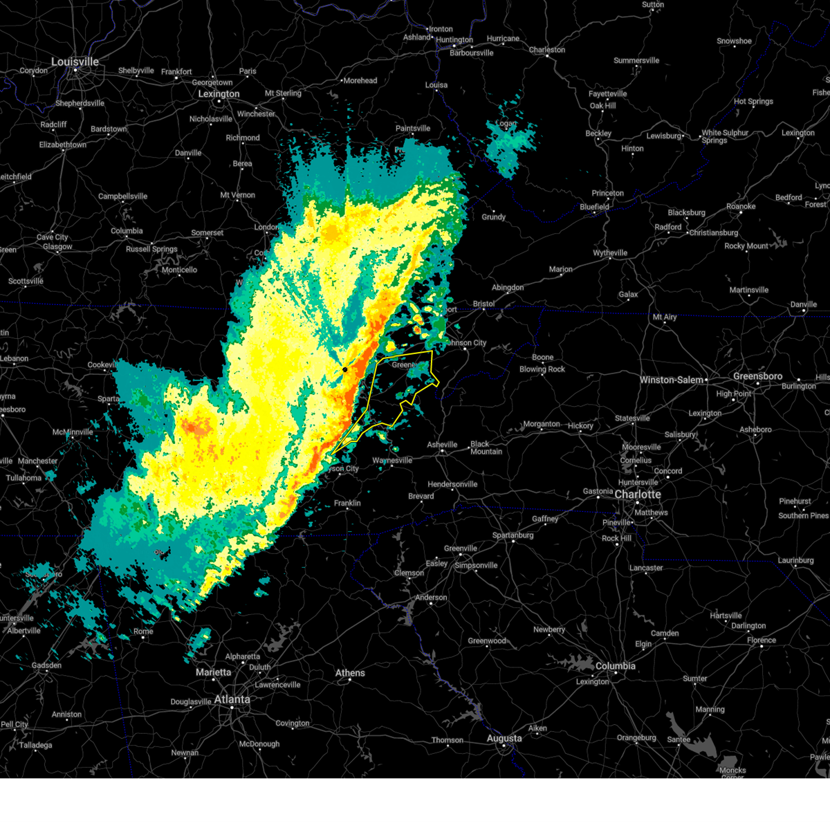 At 420 am edt, severe thunderstorms were located along a line extending from near morristown to 7 miles northeast of gatlinburg to smoky mountains-fontana area, moving east at 55 mph (radar indicated). Hazards include 60 mph wind gusts. expect damage to roofs, siding, and trees At 420 am edt, severe thunderstorms were located along a line extending from near morristown to 7 miles northeast of gatlinburg to smoky mountains-fontana area, moving east at 55 mph (radar indicated). Hazards include 60 mph wind gusts. expect damage to roofs, siding, and trees
|
| 1/12/2023 1:54 PM EST | Shingles were blown off houses and trees knocked down in the tusculum are in greene county TN, 3.5 miles W of Greeneville, TN |
| 1/12/2023 1:51 PM EST |
 At 151 pm est, severe thunderstorms were located along a line extending from 7 miles south of surgoinsville to near greeneville to 8 miles south of tusculum to near hot springs, moving east at 60 mph (radar indicated and public damage reports). Hazards include 70 mph wind gusts. Expect considerable tree damage. damage is likely to mobile homes, roofs, and outbuildings. locations impacted include, johnson city, kingsport, greeneville, erwin, rogersville, jonesborough, tusculum, banner hill, midway and gray. this includes the following highways, interstate 26 in tennessee between mile markers 12 and 23, and between mile markers 29 and 54. Interstate 81 in tennessee between mile markers 27 and 53. At 151 pm est, severe thunderstorms were located along a line extending from 7 miles south of surgoinsville to near greeneville to 8 miles south of tusculum to near hot springs, moving east at 60 mph (radar indicated and public damage reports). Hazards include 70 mph wind gusts. Expect considerable tree damage. damage is likely to mobile homes, roofs, and outbuildings. locations impacted include, johnson city, kingsport, greeneville, erwin, rogersville, jonesborough, tusculum, banner hill, midway and gray. this includes the following highways, interstate 26 in tennessee between mile markers 12 and 23, and between mile markers 29 and 54. Interstate 81 in tennessee between mile markers 27 and 53.
|
| 1/12/2023 1:40 PM EST |
 At 139 pm est, severe thunderstorms were located along a line extending from near rogersville to 10 miles southeast of russellville to near parrottsville to 6 miles north of smoky mountains-big creek, moving east at 65 mph (radar indicated and public observed damage). Hazards include 70 mph wind gusts. Expect considerable tree damage. damage is likely to mobile homes, roofs, and outbuildings. locations impacted include, johnson city, kingsport, greeneville, erwin, rogersville, jonesborough, tusculum, parrottsville, banner hill and midway. this includes the following highways, interstate 26 in tennessee between mile markers 13 and 23, and between mile markers 29 and 54. interstate 40 in tennessee between mile markers 450 and 451. Interstate 81 in tennessee between mile markers 18 and 52. At 139 pm est, severe thunderstorms were located along a line extending from near rogersville to 10 miles southeast of russellville to near parrottsville to 6 miles north of smoky mountains-big creek, moving east at 65 mph (radar indicated and public observed damage). Hazards include 70 mph wind gusts. Expect considerable tree damage. damage is likely to mobile homes, roofs, and outbuildings. locations impacted include, johnson city, kingsport, greeneville, erwin, rogersville, jonesborough, tusculum, parrottsville, banner hill and midway. this includes the following highways, interstate 26 in tennessee between mile markers 13 and 23, and between mile markers 29 and 54. interstate 40 in tennessee between mile markers 450 and 451. Interstate 81 in tennessee between mile markers 18 and 52.
|
| 1/12/2023 1:34 PM EST |
 At 134 pm est, severe thunderstorms were located along a line extending from 6 miles northeast of russellville to 11 miles east of morristown to parrottsville to 6 miles north of smoky mountains-big creek, moving east at 60 mph (radar indicated). Hazards include 60 mph wind gusts. expect damage to roofs, siding, and trees At 134 pm est, severe thunderstorms were located along a line extending from 6 miles northeast of russellville to 11 miles east of morristown to parrottsville to 6 miles north of smoky mountains-big creek, moving east at 60 mph (radar indicated). Hazards include 60 mph wind gusts. expect damage to roofs, siding, and trees
|
| 8/4/2022 6:22 PM EDT |
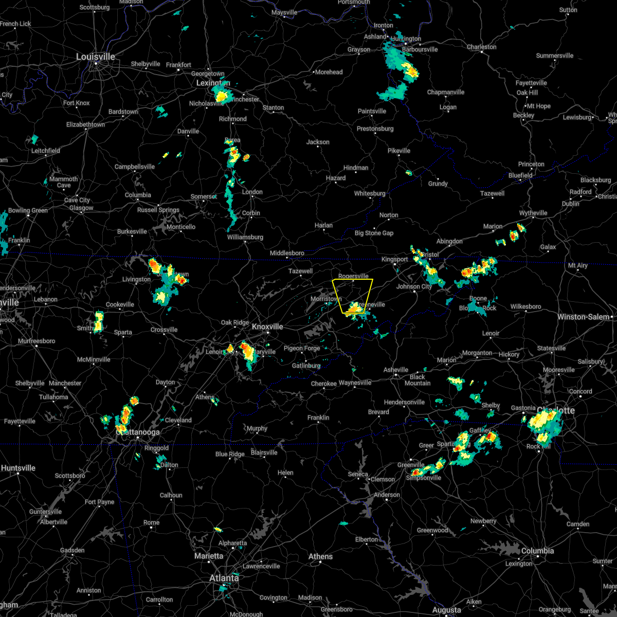 At 622 pm edt, a severe thunderstorm was located 10 miles east of russellville, or 11 miles west of greeneville, moving north at 15 mph (radar indicated). Hazards include 60 mph wind gusts and penny size hail. expect damage to roofs, siding, and trees At 622 pm edt, a severe thunderstorm was located 10 miles east of russellville, or 11 miles west of greeneville, moving north at 15 mph (radar indicated). Hazards include 60 mph wind gusts and penny size hail. expect damage to roofs, siding, and trees
|
| 5/21/2022 5:06 PM EDT |
 At 506 pm edt, a severe thunderstorm was located 9 miles north of tusculum, or 11 miles northeast of greeneville, moving north at 10 mph (radar indicated). Hazards include 60 mph wind gusts and quarter size hail. Hail damage to vehicles is expected. expect wind damage to roofs, siding, and trees. locations impacted include, jonesborough, telford, leesburg, chucky, avondale, limestone and davy crockett birthplace. this includes interstate 81 in tennessee between mile markers 39 and 45. hail threat, radar indicated max hail size, 1. 00 in wind threat, radar indicated max wind gust, 60 mph. At 506 pm edt, a severe thunderstorm was located 9 miles north of tusculum, or 11 miles northeast of greeneville, moving north at 10 mph (radar indicated). Hazards include 60 mph wind gusts and quarter size hail. Hail damage to vehicles is expected. expect wind damage to roofs, siding, and trees. locations impacted include, jonesborough, telford, leesburg, chucky, avondale, limestone and davy crockett birthplace. this includes interstate 81 in tennessee between mile markers 39 and 45. hail threat, radar indicated max hail size, 1. 00 in wind threat, radar indicated max wind gust, 60 mph.
|
| 5/21/2022 4:38 PM EDT |
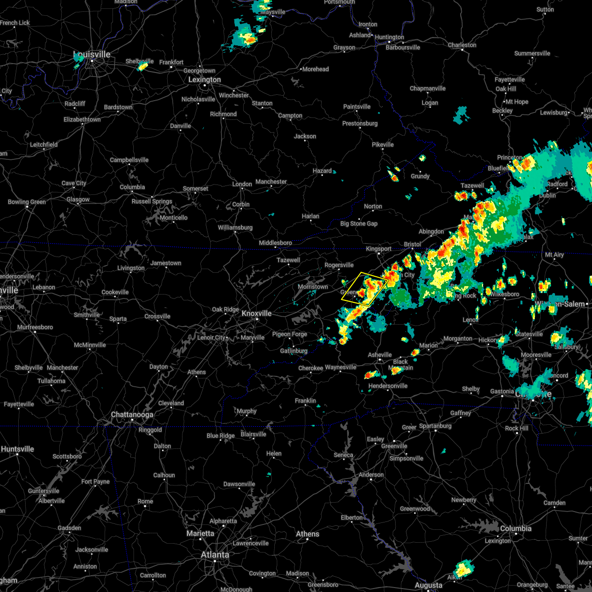 At 438 pm edt, a severe thunderstorm was located over tusculum, or near greeneville, moving west at 10 mph (radar indicated). Hazards include 60 mph wind gusts and quarter size hail. Hail damage to vehicles is expected. Expect wind damage to roofs, siding, and trees. At 438 pm edt, a severe thunderstorm was located over tusculum, or near greeneville, moving west at 10 mph (radar indicated). Hazards include 60 mph wind gusts and quarter size hail. Hail damage to vehicles is expected. Expect wind damage to roofs, siding, and trees.
|
| 5/21/2022 4:18 PM EDT |
 At 417 pm edt, a severe thunderstorm was located near tusculum, or 8 miles east of greeneville, moving northeast at 35 mph (radar indicated). Hazards include 60 mph wind gusts and quarter size hail. Hail damage to vehicles is expected. Expect wind damage to roofs, siding, and trees. At 417 pm edt, a severe thunderstorm was located near tusculum, or 8 miles east of greeneville, moving northeast at 35 mph (radar indicated). Hazards include 60 mph wind gusts and quarter size hail. Hail damage to vehicles is expected. Expect wind damage to roofs, siding, and trees.
|
| 5/6/2022 5:43 PM EDT |
 At 543 pm edt, severe thunderstorms were located along a line extending from 8 miles southeast of surgoinsville to near tusculum to 11 miles northeast of hot springs, moving northeast at 50 mph (radar indicated). Hazards include 60 mph wind gusts and quarter size hail. Hail damage to vehicles is expected. expect wind damage to roofs, siding, and trees. locations impacted include, johnson city, greeneville, erwin, jonesborough, tusculum, gray, banner hill, oak grove, spurgeon and midway. this includes the following highways, interstate 26 in tennessee between mile markers 10 and 23, and between mile markers 29 and 48. interstate 81 in tennessee between mile markers 44 and 46, and between mile markers 51 and 52. hail threat, radar indicated max hail size, 1. 00 in wind threat, radar indicated max wind gust, 60 mph. At 543 pm edt, severe thunderstorms were located along a line extending from 8 miles southeast of surgoinsville to near tusculum to 11 miles northeast of hot springs, moving northeast at 50 mph (radar indicated). Hazards include 60 mph wind gusts and quarter size hail. Hail damage to vehicles is expected. expect wind damage to roofs, siding, and trees. locations impacted include, johnson city, greeneville, erwin, jonesborough, tusculum, gray, banner hill, oak grove, spurgeon and midway. this includes the following highways, interstate 26 in tennessee between mile markers 10 and 23, and between mile markers 29 and 48. interstate 81 in tennessee between mile markers 44 and 46, and between mile markers 51 and 52. hail threat, radar indicated max hail size, 1. 00 in wind threat, radar indicated max wind gust, 60 mph.
|
| 5/6/2022 5:42 PM EDT | Quarter sized hail reported 0.8 miles N of Greeneville, TN, quarter size hail reported 1 mile south of greenville. |
| 5/6/2022 5:22 PM EDT |
 At 521 pm edt, severe thunderstorms were located along a line extending from 7 miles southeast of russellville to near parrottsville to 9 miles northeast of smoky mountains-big creek, moving northeast at 50 mph (radar indicated). Hazards include 60 mph wind gusts and quarter size hail. Hail damage to vehicles is expected. Expect wind damage to roofs, siding, and trees. At 521 pm edt, severe thunderstorms were located along a line extending from 7 miles southeast of russellville to near parrottsville to 9 miles northeast of smoky mountains-big creek, moving northeast at 50 mph (radar indicated). Hazards include 60 mph wind gusts and quarter size hail. Hail damage to vehicles is expected. Expect wind damage to roofs, siding, and trees.
|
| 5/6/2022 4:48 PM EDT | Half Dollar sized hail reported 2.2 miles SSE of Greeneville, TN |
| 5/6/2022 4:28 PM EDT |
 At 427 pm edt, a severe thunderstorm was located near greeneville, moving northeast at 35 mph (radar indicated). Hazards include 60 mph wind gusts and half dollar size hail. Hail damage to vehicles is expected. Expect wind damage to roofs, siding, and trees. At 427 pm edt, a severe thunderstorm was located near greeneville, moving northeast at 35 mph (radar indicated). Hazards include 60 mph wind gusts and half dollar size hail. Hail damage to vehicles is expected. Expect wind damage to roofs, siding, and trees.
|
| 5/6/2022 4:20 PM EDT |
 At 420 pm edt, a severe thunderstorm was located near greeneville, moving east at 30 mph (radar indicated). Hazards include ping pong ball size hail and 60 mph wind gusts. People and animals outdoors will be injured. expect hail damage to roofs, siding, windows, and vehicles. expect wind damage to roofs, siding, and trees. locations impacted include, greeneville, mosheim, romeo and mohawk. this includes interstate 81 in tennessee between mile markers 20 and 35. hail threat, radar indicated max hail size, 1. 50 in wind threat, radar indicated max wind gust, 60 mph. At 420 pm edt, a severe thunderstorm was located near greeneville, moving east at 30 mph (radar indicated). Hazards include ping pong ball size hail and 60 mph wind gusts. People and animals outdoors will be injured. expect hail damage to roofs, siding, windows, and vehicles. expect wind damage to roofs, siding, and trees. locations impacted include, greeneville, mosheim, romeo and mohawk. this includes interstate 81 in tennessee between mile markers 20 and 35. hail threat, radar indicated max hail size, 1. 50 in wind threat, radar indicated max wind gust, 60 mph.
|
| 5/6/2022 3:57 PM EDT |
 At 356 pm edt, a severe thunderstorm was located 8 miles east of white pine, or 9 miles southeast of morristown, moving east at 35 mph (radar indicated). Hazards include 60 mph wind gusts and quarter size hail. Hail damage to vehicles is expected. Expect wind damage to roofs, siding, and trees. At 356 pm edt, a severe thunderstorm was located 8 miles east of white pine, or 9 miles southeast of morristown, moving east at 35 mph (radar indicated). Hazards include 60 mph wind gusts and quarter size hail. Hail damage to vehicles is expected. Expect wind damage to roofs, siding, and trees.
|
| 12/11/2021 10:53 AM EST |
 At 1052 am est, severe thunderstorms were located along a line extending from near rutledge to near dandridge, moving east at 55 mph (radar indicated). Hazards include 60 mph wind gusts. expect damage to roofs, siding, and trees At 1052 am est, severe thunderstorms were located along a line extending from near rutledge to near dandridge, moving east at 55 mph (radar indicated). Hazards include 60 mph wind gusts. expect damage to roofs, siding, and trees
|
| 8/25/2021 7:09 PM EDT |
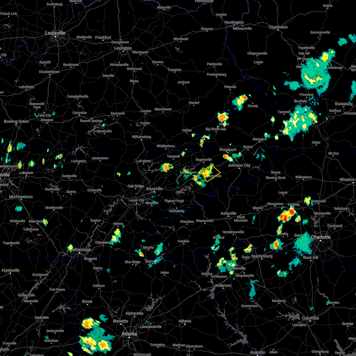 The severe thunderstorm warning for central greene county will expire at 715 pm edt, the storm which prompted the warning has weakened below severe limits, and no longer poses an immediate threat to life or property. therefore, the warning will be allowed to expire. however gusty winds and heavy rain are still possible with this thunderstorm. The severe thunderstorm warning for central greene county will expire at 715 pm edt, the storm which prompted the warning has weakened below severe limits, and no longer poses an immediate threat to life or property. therefore, the warning will be allowed to expire. however gusty winds and heavy rain are still possible with this thunderstorm.
|
| 8/25/2021 7:00 PM EDT |
 At 700 pm edt, a severe thunderstorm was located near greeneville, moving southeast at 10 mph (radar indicated). Hazards include 60 mph wind gusts. Expect damage to roofs, siding, and trees. locations impacted include, greeneville, mosheim, baileyton and romeo. this includes interstate 81 in tennessee between mile markers 24 and 37. hail threat, radar indicated max hail size, <. 75 in wind threat, radar indicated max wind gust, 60 mph. At 700 pm edt, a severe thunderstorm was located near greeneville, moving southeast at 10 mph (radar indicated). Hazards include 60 mph wind gusts. Expect damage to roofs, siding, and trees. locations impacted include, greeneville, mosheim, baileyton and romeo. this includes interstate 81 in tennessee between mile markers 24 and 37. hail threat, radar indicated max hail size, <. 75 in wind threat, radar indicated max wind gust, 60 mph.
|
| 8/25/2021 6:41 PM EDT |
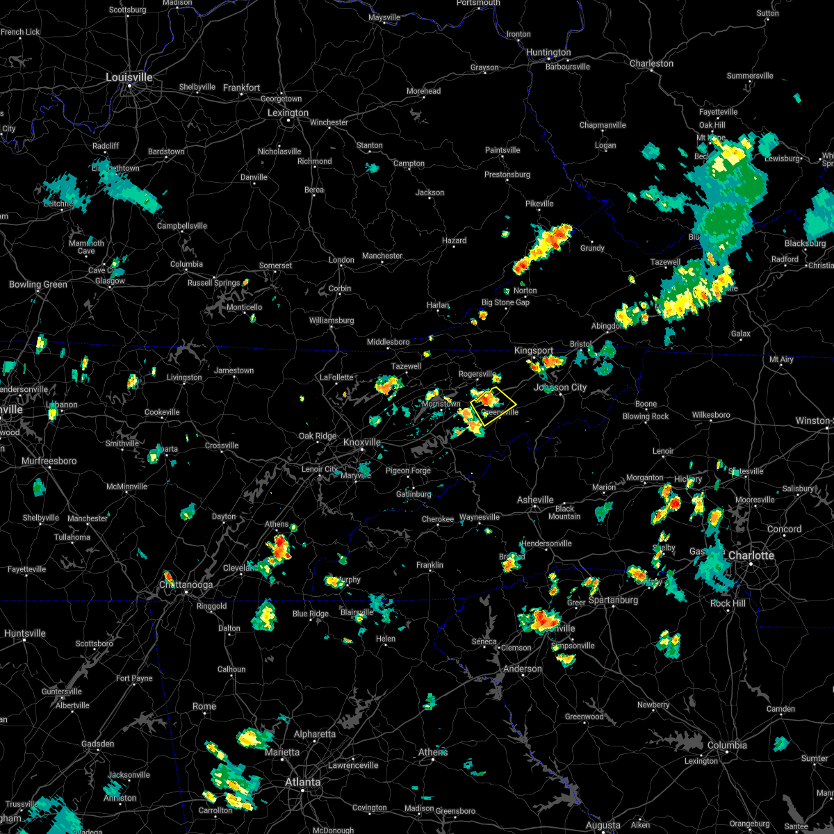 At 641 pm edt, a severe thunderstorm was located 9 miles northwest of greeneville, moving southeast at 10 mph (radar indicated). Hazards include 60 mph wind gusts and penny size hail. expect damage to roofs, siding, and trees At 641 pm edt, a severe thunderstorm was located 9 miles northwest of greeneville, moving southeast at 10 mph (radar indicated). Hazards include 60 mph wind gusts and penny size hail. expect damage to roofs, siding, and trees
|
| 6/21/2021 6:41 PM EDT |
 At 641 pm edt, severe thunderstorms were located along a line extending from 8 miles north of bean station to russellville to 8 miles east of morristown to near white pine to baneberry, moving east at 45 mph (radar indicated). Hazards include 60 mph wind gusts. Expect damage to roofs, siding, and trees. locations impacted include, morristown, greeneville, rogersville, bean station, white pine, russellville, mosheim, bulls gap, mccloud and romeo. This includes interstate 81 in tennessee between mile markers 7 and 34. At 641 pm edt, severe thunderstorms were located along a line extending from 8 miles north of bean station to russellville to 8 miles east of morristown to near white pine to baneberry, moving east at 45 mph (radar indicated). Hazards include 60 mph wind gusts. Expect damage to roofs, siding, and trees. locations impacted include, morristown, greeneville, rogersville, bean station, white pine, russellville, mosheim, bulls gap, mccloud and romeo. This includes interstate 81 in tennessee between mile markers 7 and 34.
|
| 6/21/2021 6:27 PM EDT |
 At 627 pm edt, severe thunderstorms were located along a line extending from 7 miles east of tazewell to near morristown to 7 miles southwest of russellville to near white pine to near dandridge, moving east at 45 mph (radar indicated). Hazards include 60 mph wind gusts. Expect damage to roofs, siding, and trees. locations impacted include, morristown, greeneville, jefferson city, rogersville, dandridge, bean station, white pine, russellville, mosheim and bulls gap. this includes the following highways, interstate 40 in tennessee between mile markers 420 and 422. Interstate 81 in tennessee between mile markers 1 and 34. At 627 pm edt, severe thunderstorms were located along a line extending from 7 miles east of tazewell to near morristown to 7 miles southwest of russellville to near white pine to near dandridge, moving east at 45 mph (radar indicated). Hazards include 60 mph wind gusts. Expect damage to roofs, siding, and trees. locations impacted include, morristown, greeneville, jefferson city, rogersville, dandridge, bean station, white pine, russellville, mosheim and bulls gap. this includes the following highways, interstate 40 in tennessee between mile markers 420 and 422. Interstate 81 in tennessee between mile markers 1 and 34.
|
| 6/21/2021 6:02 PM EDT |
 At 601 pm edt, severe thunderstorms were located along a line extending from 7 miles west of new tazewell to 6 miles southwest of rutledge to new market to 9 miles north of sevierville to 8 miles east of knoxville, moving east at 45 mph (radar indicated). Hazards include 60 mph wind gusts and penny size hail. expect damage to roofs, siding, and trees At 601 pm edt, severe thunderstorms were located along a line extending from 7 miles west of new tazewell to 6 miles southwest of rutledge to new market to 9 miles north of sevierville to 8 miles east of knoxville, moving east at 45 mph (radar indicated). Hazards include 60 mph wind gusts and penny size hail. expect damage to roofs, siding, and trees
|
| 5/3/2021 2:38 PM EDT |
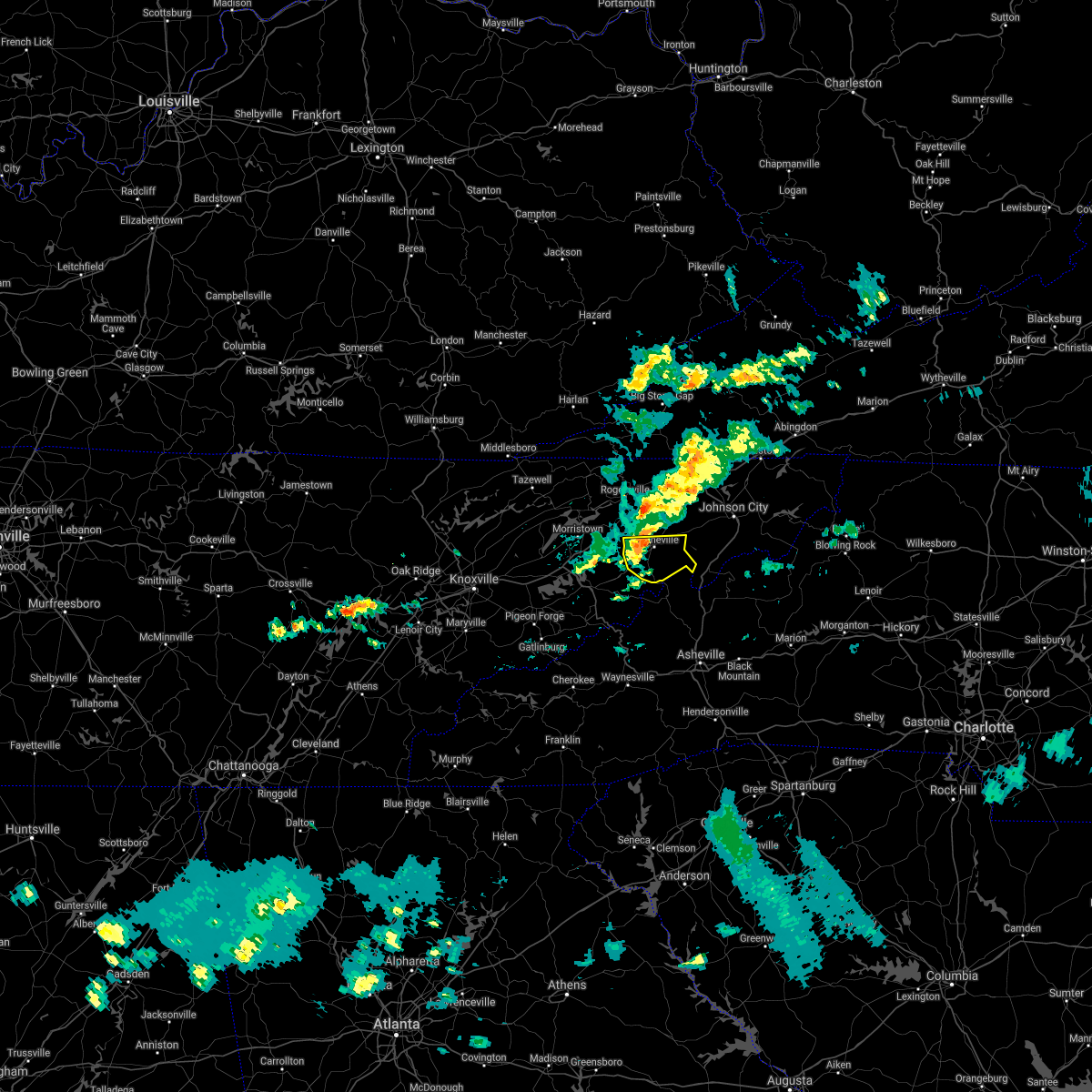 At 238 pm edt, a severe thunderstorm was located near greeneville, moving east at 40 mph (radar indicated). Hazards include 60 mph wind gusts and penny size hail. Expect damage to roofs, siding, and trees. Locations impacted include, greeneville, tusculum, mosheim, chucky, cedar creek, camp creek and davy crockett birthplace. At 238 pm edt, a severe thunderstorm was located near greeneville, moving east at 40 mph (radar indicated). Hazards include 60 mph wind gusts and penny size hail. Expect damage to roofs, siding, and trees. Locations impacted include, greeneville, tusculum, mosheim, chucky, cedar creek, camp creek and davy crockett birthplace.
|
| 5/3/2021 2:25 PM EDT | Couple trees down along warrensburg roa in greene county TN, 4.4 miles NE of Greeneville, TN |
| 5/3/2021 2:15 PM EDT |
 At 214 pm edt, a severe thunderstorm was located 8 miles east of white pine, or 9 miles southeast of morristown, moving east at 45 mph (radar indicated). Hazards include 60 mph wind gusts and penny size hail. expect damage to roofs, siding, and trees At 214 pm edt, a severe thunderstorm was located 8 miles east of white pine, or 9 miles southeast of morristown, moving east at 45 mph (radar indicated). Hazards include 60 mph wind gusts and penny size hail. expect damage to roofs, siding, and trees
|
| 3/27/2021 9:55 PM EDT |
 The severe thunderstorm warning for central hawkins, northwestern washington and northeastern greene counties will expire at 1000 pm edt, the storm which prompted the warning has moved out of the area. therefore, the warning will be allowed to expire. however small hail and gusty winds are still possible with this thunderstorm. The severe thunderstorm warning for central hawkins, northwestern washington and northeastern greene counties will expire at 1000 pm edt, the storm which prompted the warning has moved out of the area. therefore, the warning will be allowed to expire. however small hail and gusty winds are still possible with this thunderstorm.
|
| 3/27/2021 9:48 PM EDT |
 At 948 pm edt, a severe thunderstorm was located 8 miles northeast of tusculum, or 11 miles northeast of greeneville, moving east at 55 mph (radar indicated). Hazards include 60 mph wind gusts and quarter size hail. Hail damage to vehicles is expected. Expect wind damage to roofs, siding, and trees. At 948 pm edt, a severe thunderstorm was located 8 miles northeast of tusculum, or 11 miles northeast of greeneville, moving east at 55 mph (radar indicated). Hazards include 60 mph wind gusts and quarter size hail. Hail damage to vehicles is expected. Expect wind damage to roofs, siding, and trees.
|
| 3/27/2021 9:39 PM EDT |
 At 939 pm edt, a severe thunderstorm was located 8 miles north of greeneville, moving east at 45 mph (radar indicated). Hazards include 60 mph wind gusts and quarter size hail. Hail damage to vehicles is expected. expect wind damage to roofs, siding, and trees. locations impacted include, greeneville, tusculum, baileyton, chucky, limestone, kepler, davy crockett birthplace, romeo and jearoldstown. This includes interstate 81 in tennessee between mile markers 27 and 47. At 939 pm edt, a severe thunderstorm was located 8 miles north of greeneville, moving east at 45 mph (radar indicated). Hazards include 60 mph wind gusts and quarter size hail. Hail damage to vehicles is expected. expect wind damage to roofs, siding, and trees. locations impacted include, greeneville, tusculum, baileyton, chucky, limestone, kepler, davy crockett birthplace, romeo and jearoldstown. This includes interstate 81 in tennessee between mile markers 27 and 47.
|
| 3/27/2021 9:21 PM EDT |
 At 921 pm edt, a severe thunderstorm was located 7 miles northeast of russellville, or 7 miles southwest of rogersville, moving east at 40 mph (radar indicated). Hazards include 60 mph wind gusts and quarter size hail. Hail damage to vehicles is expected. Expect wind damage to roofs, siding, and trees. At 921 pm edt, a severe thunderstorm was located 7 miles northeast of russellville, or 7 miles southwest of rogersville, moving east at 40 mph (radar indicated). Hazards include 60 mph wind gusts and quarter size hail. Hail damage to vehicles is expected. Expect wind damage to roofs, siding, and trees.
|
| 3/27/2021 11:00 AM EDT |
 At 1059 am edt, a severe thunderstorm was located over tusculum, or near greeneville, moving east at 40 mph (public). Hazards include half dollar size hail. Damage to vehicles is expected. locations impacted include, greeneville, tusculum, baileyton, davy crockett birthplace, chucky and fall branch. This includes interstate 81 in tennessee between mile markers 42 and 49. At 1059 am edt, a severe thunderstorm was located over tusculum, or near greeneville, moving east at 40 mph (public). Hazards include half dollar size hail. Damage to vehicles is expected. locations impacted include, greeneville, tusculum, baileyton, davy crockett birthplace, chucky and fall branch. This includes interstate 81 in tennessee between mile markers 42 and 49.
|
| 3/27/2021 10:55 AM EDT | Half Dollar sized hail reported 1.2 miles W of Greeneville, TN, report from mping: half dollar (1.25 in.). |
| 3/27/2021 10:53 AM EDT |
 At 1052 am edt, a severe thunderstorm was located over greeneville, moving east at 55 mph (radar indicated). Hazards include quarter size hail. Damage to vehicles is expected. locations impacted include, greeneville, tusculum, mosheim, baileyton, chucky, davy crockett birthplace and fall branch. This includes interstate 81 in tennessee between mile markers 42 and 49. At 1052 am edt, a severe thunderstorm was located over greeneville, moving east at 55 mph (radar indicated). Hazards include quarter size hail. Damage to vehicles is expected. locations impacted include, greeneville, tusculum, mosheim, baileyton, chucky, davy crockett birthplace and fall branch. This includes interstate 81 in tennessee between mile markers 42 and 49.
|
| 3/27/2021 10:33 AM EDT |
 At 1033 am edt, a severe thunderstorm was located near parrottsville, or 9 miles north of newport, moving east at 45 mph (radar indicated). Hazards include quarter size hail. damage to vehicles is expected At 1033 am edt, a severe thunderstorm was located near parrottsville, or 9 miles north of newport, moving east at 45 mph (radar indicated). Hazards include quarter size hail. damage to vehicles is expected
|
| 7/31/2020 7:26 PM EDT |
 At 726 pm edt, severe thunderstorms were located along a line extending from 11 miles northeast of greeneville to near tusculum to near hot springs, moving northeast at 50 mph (radar indicated). Hazards include 60 mph wind gusts. expect damage to roofs, siding, and trees At 726 pm edt, severe thunderstorms were located along a line extending from 11 miles northeast of greeneville to near tusculum to near hot springs, moving northeast at 50 mph (radar indicated). Hazards include 60 mph wind gusts. expect damage to roofs, siding, and trees
|
| 7/31/2020 7:14 PM EDT | Numerous trees down county wid in greene county TN, 1.7 miles ESE of Greeneville, TN |
| 7/31/2020 7:00 PM EDT |
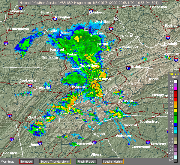 At 700 pm edt, severe thunderstorms were located along a line extending from 11 miles east of baneberry to near parrottsville to 11 miles east of newport to 10 miles west of hot springs, moving northeast at 35 mph (radar indicated). Hazards include 60 mph wind gusts. expect damage to roofs, siding, and trees At 700 pm edt, severe thunderstorms were located along a line extending from 11 miles east of baneberry to near parrottsville to 11 miles east of newport to 10 miles west of hot springs, moving northeast at 35 mph (radar indicated). Hazards include 60 mph wind gusts. expect damage to roofs, siding, and trees
|
| 7/24/2020 5:53 PM EDT |
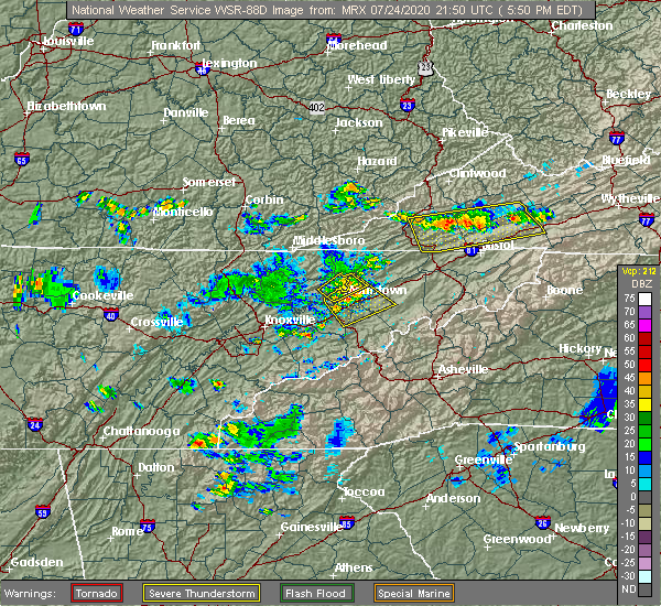 At 552 pm edt, a severe thunderstorm was located near russellville, or near morristown, moving southeast at 20 mph (radar indicated). Hazards include 60 mph wind gusts. Expect damage to roofs, siding, and trees. locations impacted include, morristown, greeneville, bean station, white pine, baneberry, russellville, mosheim, bulls gap, panther creek state park and bybee. this includes the following highways, interstate 40 in tennessee between mile markers 424 and 429. Interstate 81 in tennessee between mile markers 2 and 25. At 552 pm edt, a severe thunderstorm was located near russellville, or near morristown, moving southeast at 20 mph (radar indicated). Hazards include 60 mph wind gusts. Expect damage to roofs, siding, and trees. locations impacted include, morristown, greeneville, bean station, white pine, baneberry, russellville, mosheim, bulls gap, panther creek state park and bybee. this includes the following highways, interstate 40 in tennessee between mile markers 424 and 429. Interstate 81 in tennessee between mile markers 2 and 25.
|
| 7/24/2020 5:35 PM EDT |
 At 535 pm edt, a severe thunderstorm was located near russellville, or near morristown, moving southeast at 10 mph (radar indicated). Hazards include 60 mph wind gusts and penny size hail. expect damage to roofs, siding, and trees At 535 pm edt, a severe thunderstorm was located near russellville, or near morristown, moving southeast at 10 mph (radar indicated). Hazards include 60 mph wind gusts and penny size hail. expect damage to roofs, siding, and trees
|
| 7/23/2020 4:46 PM EDT |
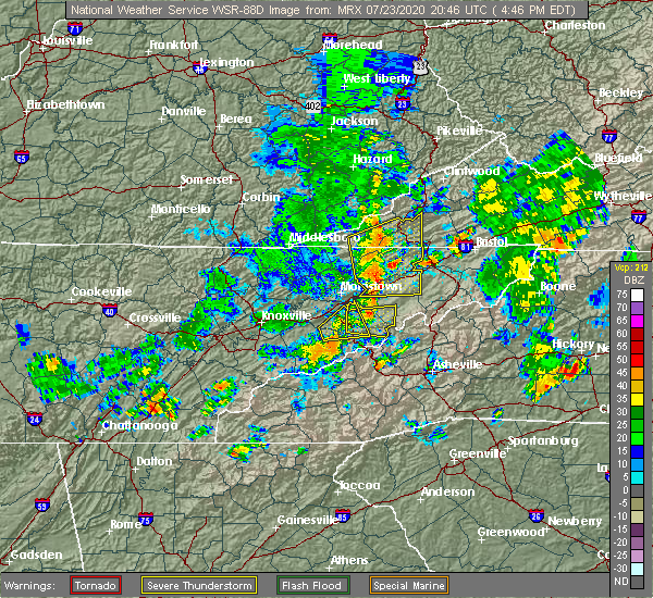 At 446 pm edt, severe thunderstorms were located along a line extending from 6 miles south of clover fork to 7 miles west of greeneville, moving east at 20 mph (radar indicated). Hazards include 60 mph wind gusts and penny size hail. Expect damage to roofs, siding, and trees. locations impacted include, kingsport, greeneville, rogersville, surgoinsville, pennington gap, church hill, mount carmel, mosheim, bulls gap and baileyton. This includes interstate 81 in tennessee between mile markers 18 and 49. At 446 pm edt, severe thunderstorms were located along a line extending from 6 miles south of clover fork to 7 miles west of greeneville, moving east at 20 mph (radar indicated). Hazards include 60 mph wind gusts and penny size hail. Expect damage to roofs, siding, and trees. locations impacted include, kingsport, greeneville, rogersville, surgoinsville, pennington gap, church hill, mount carmel, mosheim, bulls gap and baileyton. This includes interstate 81 in tennessee between mile markers 18 and 49.
|
| 7/23/2020 4:32 PM EDT |
 At 432 pm edt, severe thunderstorms were located along a line extending from 6 miles southeast of pennington gap to 9 miles south of rogersville, moving east at 15 mph (radar indicated). Hazards include 60 mph wind gusts and penny size hail. expect damage to roofs, siding, and trees At 432 pm edt, severe thunderstorms were located along a line extending from 6 miles southeast of pennington gap to 9 miles south of rogersville, moving east at 15 mph (radar indicated). Hazards include 60 mph wind gusts and penny size hail. expect damage to roofs, siding, and trees
|
| 7/23/2020 4:32 PM EDT |
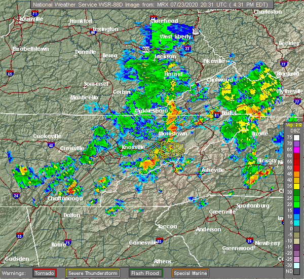 At 432 pm edt, severe thunderstorms were located along a line extending from 6 miles southeast of pennington gap to 9 miles south of rogersville, moving east at 15 mph (radar indicated). Hazards include 60 mph wind gusts and penny size hail. expect damage to roofs, siding, and trees At 432 pm edt, severe thunderstorms were located along a line extending from 6 miles southeast of pennington gap to 9 miles south of rogersville, moving east at 15 mph (radar indicated). Hazards include 60 mph wind gusts and penny size hail. expect damage to roofs, siding, and trees
|
| 6/21/2020 7:06 PM EDT |
 The severe thunderstorm warning for northeastern cocke and southern greene counties will expire at 715 pm edt, the storm which prompted the warning has weakened below severe limits, and has exited the warned area. therefore, the warning will be allowed to expire. The severe thunderstorm warning for northeastern cocke and southern greene counties will expire at 715 pm edt, the storm which prompted the warning has weakened below severe limits, and has exited the warned area. therefore, the warning will be allowed to expire.
|
| 6/21/2020 6:47 PM EDT |
 At 647 pm edt, a severe thunderstorm was located 8 miles southwest of greeneville, moving north at 30 mph (radar indicated). Hazards include 60 mph wind gusts and quarter size hail. Hail damage to vehicles is expected. expect wind damage to roofs, siding, and trees. Locations impacted include, greeneville, mosheim, caney branch, camp creek and cedar creek. At 647 pm edt, a severe thunderstorm was located 8 miles southwest of greeneville, moving north at 30 mph (radar indicated). Hazards include 60 mph wind gusts and quarter size hail. Hail damage to vehicles is expected. expect wind damage to roofs, siding, and trees. Locations impacted include, greeneville, mosheim, caney branch, camp creek and cedar creek.
|
| 6/21/2020 6:28 PM EDT |
 At 628 pm edt, a severe thunderstorm was located 8 miles southeast of parrottsville, or 12 miles east of newport, moving north at 25 mph (radar indicated). Hazards include 60 mph wind gusts and quarter size hail. Hail damage to vehicles is expected. Expect wind damage to roofs, siding, and trees. At 628 pm edt, a severe thunderstorm was located 8 miles southeast of parrottsville, or 12 miles east of newport, moving north at 25 mph (radar indicated). Hazards include 60 mph wind gusts and quarter size hail. Hail damage to vehicles is expected. Expect wind damage to roofs, siding, and trees.
|
| 6/21/2020 4:57 PM EDT |
 At 456 pm edt, severe thunderstorms were located along a line extending from 7 miles northeast of russellville to near greeneville, moving east at 45 mph (radar indicated). Hazards include 60 mph wind gusts and penny size hail. Expect damage to roofs, siding, and trees. locations impacted include, morristown, greeneville, rogersville, bean station, tusculum, surgoinsville, parrottsville, russellville, mosheim and bulls gap. This includes interstate 81 in tennessee between mile markers 12 and 40. At 456 pm edt, severe thunderstorms were located along a line extending from 7 miles northeast of russellville to near greeneville, moving east at 45 mph (radar indicated). Hazards include 60 mph wind gusts and penny size hail. Expect damage to roofs, siding, and trees. locations impacted include, morristown, greeneville, rogersville, bean station, tusculum, surgoinsville, parrottsville, russellville, mosheim and bulls gap. This includes interstate 81 in tennessee between mile markers 12 and 40.
|
| 6/21/2020 4:28 PM EDT |
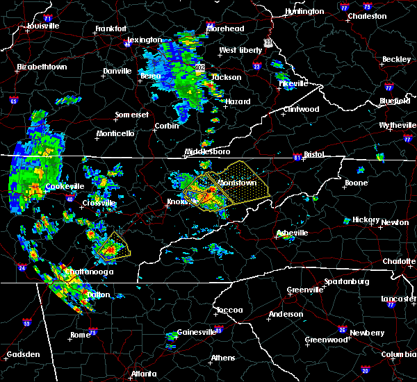 At 427 pm edt, severe thunderstorms were located along a line extending from near rutledge to near newport, moving east at 45 mph (radar indicated). Hazards include 60 mph wind gusts and penny size hail. expect damage to roofs, siding, and trees At 427 pm edt, severe thunderstorms were located along a line extending from near rutledge to near newport, moving east at 45 mph (radar indicated). Hazards include 60 mph wind gusts and penny size hail. expect damage to roofs, siding, and trees
|
| 6/19/2020 5:27 PM EDT |
 At 526 pm edt, a severe thunderstorm was located 9 miles west of greeneville, moving southeast at 25 mph (radar indicated). Hazards include 60 mph wind gusts and quarter size hail. Hail damage to vehicles is expected. expect wind damage to roofs, siding, and trees. Locations impacted include, greeneville, tusculum, mosheim and mohawk. At 526 pm edt, a severe thunderstorm was located 9 miles west of greeneville, moving southeast at 25 mph (radar indicated). Hazards include 60 mph wind gusts and quarter size hail. Hail damage to vehicles is expected. expect wind damage to roofs, siding, and trees. Locations impacted include, greeneville, tusculum, mosheim and mohawk.
|
| 6/19/2020 5:12 PM EDT |
 At 512 pm edt, a severe thunderstorm was located 9 miles west of greeneville, moving northeast at 10 mph (radar indicated). Hazards include 60 mph wind gusts and quarter size hail. Hail damage to vehicles is expected. Expect wind damage to roofs, siding, and trees. At 512 pm edt, a severe thunderstorm was located 9 miles west of greeneville, moving northeast at 10 mph (radar indicated). Hazards include 60 mph wind gusts and quarter size hail. Hail damage to vehicles is expected. Expect wind damage to roofs, siding, and trees.
|
| 6/14/2020 2:37 PM EDT | Quarter sized hail reported 7.7 miles N of Greeneville, TN, dime to quarter size hail. |
| 6/14/2020 2:18 PM EDT |
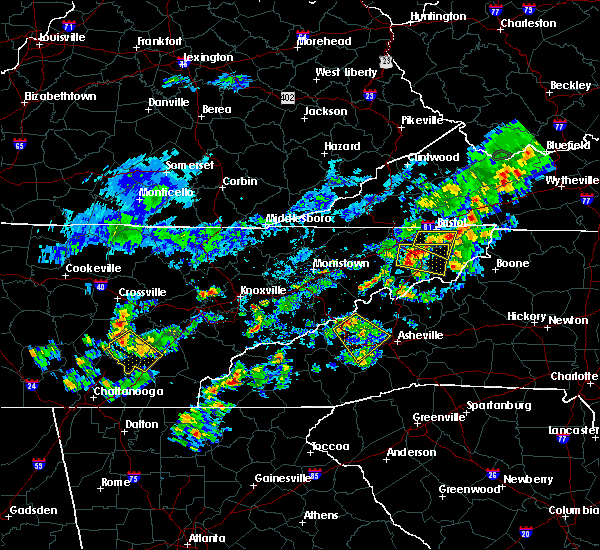 At 218 pm edt, a severe thunderstorm was located near tusculum, or 8 miles southeast of greeneville, moving east at 15 mph (radar indicated). Hazards include 60 mph wind gusts and quarter size hail. Hail damage to vehicles is expected. Expect wind damage to roofs, siding, and trees. At 218 pm edt, a severe thunderstorm was located near tusculum, or 8 miles southeast of greeneville, moving east at 15 mph (radar indicated). Hazards include 60 mph wind gusts and quarter size hail. Hail damage to vehicles is expected. Expect wind damage to roofs, siding, and trees.
|
| 6/4/2020 5:06 PM EDT |
 The severe thunderstorm warning for southeastern greene county will expire at 515 pm edt, the storm which prompted the warning has weakened below severe limits, and has exited the warned area. therefore, the warning will be allowed to expire. The severe thunderstorm warning for southeastern greene county will expire at 515 pm edt, the storm which prompted the warning has weakened below severe limits, and has exited the warned area. therefore, the warning will be allowed to expire.
|
| 6/4/2020 4:47 PM EDT | Quarter sized hail reported 2.2 miles N of Greeneville, TN |
| 6/4/2020 4:31 PM EDT |
 At 430 pm edt, a severe thunderstorm was located 9 miles northwest of hot springs, or 11 miles southwest of greeneville, moving northeast at 15 mph (radar indicated). Hazards include 60 mph wind gusts and quarter size hail. Hail damage to vehicles is expected. Expect wind damage to roofs, siding, and trees. At 430 pm edt, a severe thunderstorm was located 9 miles northwest of hot springs, or 11 miles southwest of greeneville, moving northeast at 15 mph (radar indicated). Hazards include 60 mph wind gusts and quarter size hail. Hail damage to vehicles is expected. Expect wind damage to roofs, siding, and trees.
|
| 3/29/2020 7:13 AM EDT |
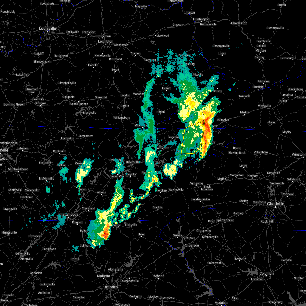 The severe thunderstorm warning for western sullivan, northeastern hawkins, western washington, northeastern greene and southeastern scott counties will expire at 715 am edt, the storms which prompted the warning have moved out of the area. therefore, the warning will be allowed to expire. remember, a severe thunderstorm warning still remains in effect for eastern greene county, central and eastern sullivan county, and southeastern scott county. The severe thunderstorm warning for western sullivan, northeastern hawkins, western washington, northeastern greene and southeastern scott counties will expire at 715 am edt, the storms which prompted the warning have moved out of the area. therefore, the warning will be allowed to expire. remember, a severe thunderstorm warning still remains in effect for eastern greene county, central and eastern sullivan county, and southeastern scott county.
|
| 3/29/2020 6:55 AM EDT |
 At 654 am edt, severe thunderstorms were located along a line extending from 7 miles southwest of gate city to tusculum, moving northeast at 75 mph (radar indicated). Hazards include 60 mph wind gusts. Expect damage to roofs, siding, and trees. locations impacted include, johnson city, kingsport, greeneville, gate city, jonesborough, tusculum, surgoinsville, weber city, spurgeon and colonial heights. this includes the following highways, interstate 26 in tennessee between mile markers 1 and 17. Interstate 81 in tennessee between mile markers 36 and 65. At 654 am edt, severe thunderstorms were located along a line extending from 7 miles southwest of gate city to tusculum, moving northeast at 75 mph (radar indicated). Hazards include 60 mph wind gusts. Expect damage to roofs, siding, and trees. locations impacted include, johnson city, kingsport, greeneville, gate city, jonesborough, tusculum, surgoinsville, weber city, spurgeon and colonial heights. this includes the following highways, interstate 26 in tennessee between mile markers 1 and 17. Interstate 81 in tennessee between mile markers 36 and 65.
|
| 3/29/2020 6:55 AM EDT |
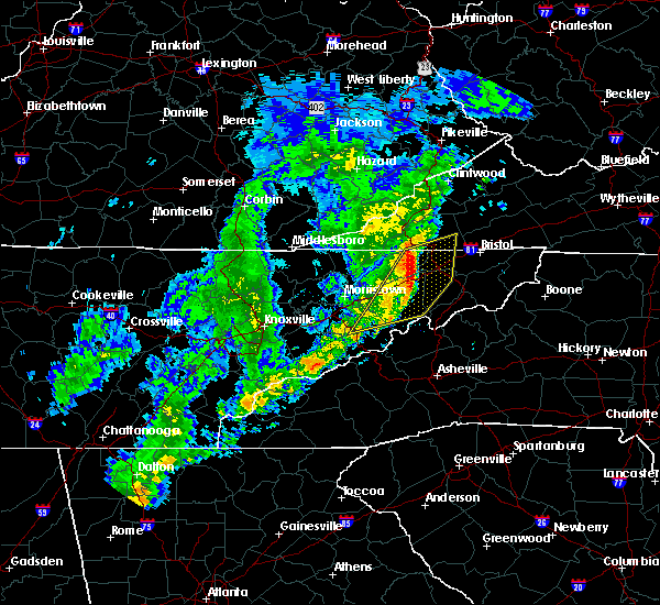 At 654 am edt, severe thunderstorms were located along a line extending from 7 miles southwest of gate city to tusculum, moving northeast at 75 mph (radar indicated). Hazards include 60 mph wind gusts. Expect damage to roofs, siding, and trees. locations impacted include, johnson city, kingsport, greeneville, gate city, jonesborough, tusculum, surgoinsville, weber city, spurgeon and colonial heights. this includes the following highways, interstate 26 in tennessee between mile markers 1 and 17. Interstate 81 in tennessee between mile markers 36 and 65. At 654 am edt, severe thunderstorms were located along a line extending from 7 miles southwest of gate city to tusculum, moving northeast at 75 mph (radar indicated). Hazards include 60 mph wind gusts. Expect damage to roofs, siding, and trees. locations impacted include, johnson city, kingsport, greeneville, gate city, jonesborough, tusculum, surgoinsville, weber city, spurgeon and colonial heights. this includes the following highways, interstate 26 in tennessee between mile markers 1 and 17. Interstate 81 in tennessee between mile markers 36 and 65.
|
| 3/29/2020 6:38 AM EDT |
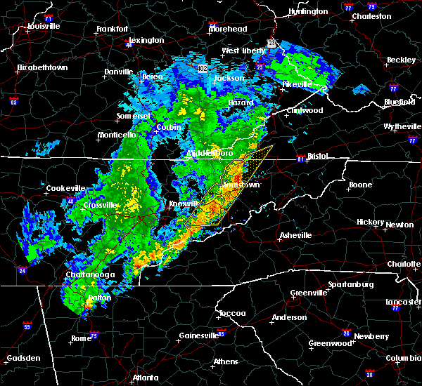 At 638 am edt, severe thunderstorms were located along a line extending from near rogersville to 10 miles southeast of russellville to near newport, moving east at 75 mph (radar indicated). Hazards include 60 mph wind gusts. expect damage to roofs, siding, and trees At 638 am edt, severe thunderstorms were located along a line extending from near rogersville to 10 miles southeast of russellville to near newport, moving east at 75 mph (radar indicated). Hazards include 60 mph wind gusts. expect damage to roofs, siding, and trees
|
| 1/11/2020 6:39 PM EST |
 At 638 pm est, severe thunderstorms were located along a line extending from near surgoinsville to 7 miles south of tusculum, moving east at 55 mph (radar indicated). Hazards include 70 mph wind gusts. Expect considerable tree damage. Damage is likely to mobile homes, roofs, and outbuildings. At 638 pm est, severe thunderstorms were located along a line extending from near surgoinsville to 7 miles south of tusculum, moving east at 55 mph (radar indicated). Hazards include 70 mph wind gusts. Expect considerable tree damage. Damage is likely to mobile homes, roofs, and outbuildings.
|
| 1/11/2020 6:26 PM EST |
 At 625 pm est, severe thunderstorms were located along a line extending from near rogersville to 8 miles northeast of parrottsville, moving northeast at 55 mph (radar indicated). Hazards include 70 mph wind gusts. Expect considerable tree damage. damage is likely to mobile homes, roofs, and outbuildings. Locations impacted include, kingsport, greeneville, rogersville, tusculum, surgoinsville, colonial heights, church hill, mount carmel, mosheim and bulls gap. At 625 pm est, severe thunderstorms were located along a line extending from near rogersville to 8 miles northeast of parrottsville, moving northeast at 55 mph (radar indicated). Hazards include 70 mph wind gusts. Expect considerable tree damage. damage is likely to mobile homes, roofs, and outbuildings. Locations impacted include, kingsport, greeneville, rogersville, tusculum, surgoinsville, colonial heights, church hill, mount carmel, mosheim and bulls gap.
|
| 1/11/2020 6:02 PM EST |
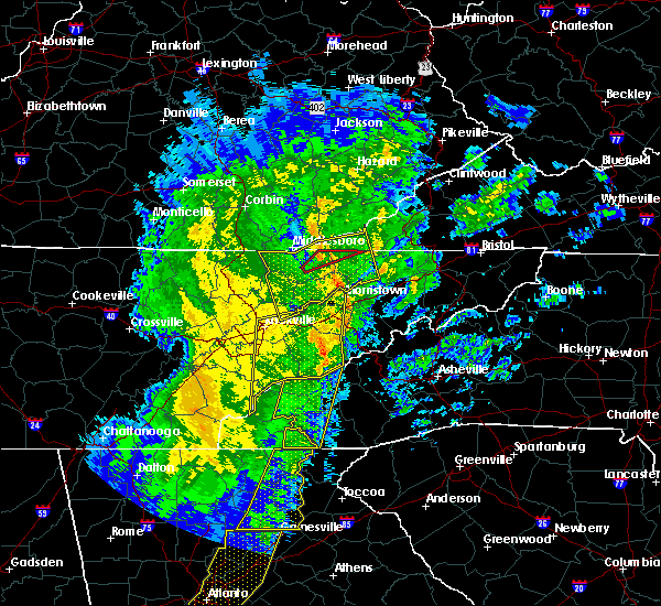 At 602 pm est, severe thunderstorms were located along a line extending from near bean station to 7 miles west of newport, moving northeast at 55 mph (radar indicated). Hazards include 60 mph wind gusts. expect damage to roofs, siding, and trees At 602 pm est, severe thunderstorms were located along a line extending from near bean station to 7 miles west of newport, moving northeast at 55 mph (radar indicated). Hazards include 60 mph wind gusts. expect damage to roofs, siding, and trees
|
| 10/31/2019 1:10 PM EDT |
 The severe thunderstorm warning for northeastern greene county will expire at 115 pm edt, the storms which prompted the warning have moved out of the area. therefore, the warning will be allowed to expire. however gusty winds are still possible as a strong cold front crosses the area. a tornado watch remains in effect until 700 pm edt for east tennessee. The severe thunderstorm warning for northeastern greene county will expire at 115 pm edt, the storms which prompted the warning have moved out of the area. therefore, the warning will be allowed to expire. however gusty winds are still possible as a strong cold front crosses the area. a tornado watch remains in effect until 700 pm edt for east tennessee.
|
| 10/31/2019 12:43 PM EDT |
 At 1242 pm edt, severe thunderstorms were located along a line extending from 7 miles east of rogersville to 9 miles northeast of parrottsville, moving east at 40 mph (radar indicated). Hazards include 60 mph wind gusts. Expect damage to roofs, siding, and trees. Locations impacted include, greeneville, tusculum, mosheim, baileyton, chucky, davy crockett birthplace, romeo, jearoldstown and fall branch. At 1242 pm edt, severe thunderstorms were located along a line extending from 7 miles east of rogersville to 9 miles northeast of parrottsville, moving east at 40 mph (radar indicated). Hazards include 60 mph wind gusts. Expect damage to roofs, siding, and trees. Locations impacted include, greeneville, tusculum, mosheim, baileyton, chucky, davy crockett birthplace, romeo, jearoldstown and fall branch.
|
| 10/31/2019 12:30 PM EDT | Tree down on asheville hw in greene county TN, 7.5 miles NNE of Greeneville, TN |
| 10/31/2019 12:30 PM EDT | Tree down on reed r in greene county TN, 6.6 miles SE of Greeneville, TN |
| 10/31/2019 12:30 PM EDT | Tree down on warrensburg r in greene county TN, 6.2 miles ENE of Greeneville, TN |
| 10/31/2019 12:27 PM EDT |
 At 1227 pm edt, severe thunderstorms were located along a line extending from 6 miles southwest of rogersville to near parrottsville, moving east at 45 mph (radar indicated). Hazards include 60 mph wind gusts. expect damage to roofs, siding, and trees At 1227 pm edt, severe thunderstorms were located along a line extending from 6 miles southwest of rogersville to near parrottsville, moving east at 45 mph (radar indicated). Hazards include 60 mph wind gusts. expect damage to roofs, siding, and trees
|
| 6/22/2019 1:00 AM EDT | Several trees dow in greene county TN, 8.1 miles WSW of Greeneville, TN |
| 6/22/2019 12:47 AM EDT |
 At 1247 am edt, severe thunderstorms were located along a line extending from 9 miles west of gray to near hot springs, moving east at 55 mph (radar indicated). Hazards include 60 mph wind gusts. Expect damage to roofs, siding, and trees. Locations impacted include, johnson city, greeneville, erwin, jonesborough, tusculum, gray, banner hill, oak grove, midway, spurgeon, unicoi, baileyton, leesburg, chucky, cedar creek, limestone, rocky fork, telford, fall branch and avondale. At 1247 am edt, severe thunderstorms were located along a line extending from 9 miles west of gray to near hot springs, moving east at 55 mph (radar indicated). Hazards include 60 mph wind gusts. Expect damage to roofs, siding, and trees. Locations impacted include, johnson city, greeneville, erwin, jonesborough, tusculum, gray, banner hill, oak grove, midway, spurgeon, unicoi, baileyton, leesburg, chucky, cedar creek, limestone, rocky fork, telford, fall branch and avondale.
|
| 6/22/2019 12:26 AM EDT |
 The national weather service in morristown has issued a * severe thunderstorm warning for. washington county in east tennessee. southeastern cocke county in east tennessee. greene county in east tennessee. Unicoi county in east tennessee. The national weather service in morristown has issued a * severe thunderstorm warning for. washington county in east tennessee. southeastern cocke county in east tennessee. greene county in east tennessee. Unicoi county in east tennessee.
|
| 6/20/2019 5:41 PM EDT |
 At 541 pm edt, a severe thunderstorm was located 8 miles north of tusculum, or 10 miles northeast of greeneville, moving east at 30 mph (radar indicated). Hazards include 60 mph wind gusts and quarter size hail. Hail damage to vehicles is expected. Expect wind damage to roofs, siding, and trees. At 541 pm edt, a severe thunderstorm was located 8 miles north of tusculum, or 10 miles northeast of greeneville, moving east at 30 mph (radar indicated). Hazards include 60 mph wind gusts and quarter size hail. Hail damage to vehicles is expected. Expect wind damage to roofs, siding, and trees.
|
| 5/4/2019 3:12 PM EDT |
 At 312 pm edt, a severe thunderstorm was located near tusculum, or 10 miles east of greeneville, moving northeast at 35 mph (radar indicated). Hazards include 60 mph wind gusts and quarter size hail. Hail damage to vehicles is expected. Expect wind damage to roofs, siding, and trees. At 312 pm edt, a severe thunderstorm was located near tusculum, or 10 miles east of greeneville, moving northeast at 35 mph (radar indicated). Hazards include 60 mph wind gusts and quarter size hail. Hail damage to vehicles is expected. Expect wind damage to roofs, siding, and trees.
|
| 5/3/2019 1:55 PM EDT |
 At 155 pm edt, a severe thunderstorm was located near tusculum, or 8 miles northeast of greeneville, moving northeast at 30 mph (radar indicated). Hazards include 60 mph wind gusts and quarter size hail. Hail damage to vehicles is expected. expect wind damage to roofs, siding, and trees. Locations impacted include, johnson city, greeneville, jonesborough, tusculum, gray, oak grove, midway, spurgeon, watauga, leesburg, chucky, limestone, telford, fall branch, avondale and davy crockett birthplace. At 155 pm edt, a severe thunderstorm was located near tusculum, or 8 miles northeast of greeneville, moving northeast at 30 mph (radar indicated). Hazards include 60 mph wind gusts and quarter size hail. Hail damage to vehicles is expected. expect wind damage to roofs, siding, and trees. Locations impacted include, johnson city, greeneville, jonesborough, tusculum, gray, oak grove, midway, spurgeon, watauga, leesburg, chucky, limestone, telford, fall branch, avondale and davy crockett birthplace.
|
| 5/3/2019 1:45 PM EDT | Trees and powerlines down along eastview lan in greene county TN, 1.2 miles W of Greeneville, TN |
| 5/3/2019 1:43 PM EDT | Quarter sized hail reported 0.9 miles NNE of Greeneville, TN |
| 5/3/2019 1:37 PM EDT |
 The national weather service in morristown has issued a * severe thunderstorm warning for. washington county in east tennessee. northeastern greene county in east tennessee. until 230 pm edt. At 137 pm edt, a severe thunderstorm was located over greeneville,. The national weather service in morristown has issued a * severe thunderstorm warning for. washington county in east tennessee. northeastern greene county in east tennessee. until 230 pm edt. At 137 pm edt, a severe thunderstorm was located over greeneville,.
|
| 4/7/2019 7:01 PM EDT |
 At 701 pm edt, a severe thunderstorm was located 9 miles southeast of rogersville, moving northeast at 35 mph (radar indicated). Hazards include 60 mph wind gusts and half dollar size hail. Hail damage to vehicles is expected. expect wind damage to roofs, siding, and trees. Locations impacted include, greeneville, rogersville, mosheim, bulls gap, baileyton, kepler, romeo, mccloud and jearoldstown. At 701 pm edt, a severe thunderstorm was located 9 miles southeast of rogersville, moving northeast at 35 mph (radar indicated). Hazards include 60 mph wind gusts and half dollar size hail. Hail damage to vehicles is expected. expect wind damage to roofs, siding, and trees. Locations impacted include, greeneville, rogersville, mosheim, bulls gap, baileyton, kepler, romeo, mccloud and jearoldstown.
|
| 4/7/2019 6:46 PM EDT |
 At 646 pm edt, a severe thunderstorm was located 10 miles east of russellville, or 11 miles west of greeneville, moving northeast at 35 mph (radar indicated). Hazards include 60 mph wind gusts and half dollar size hail. Hail damage to vehicles is expected. expect wind damage to roofs, siding, and trees. locations impacted include, morristown, greeneville, rogersville, tusculum, mosheim, bulls gap, baileyton, romeo, mccloud, st. Clair, kepler, mohawk and jearoldstown. At 646 pm edt, a severe thunderstorm was located 10 miles east of russellville, or 11 miles west of greeneville, moving northeast at 35 mph (radar indicated). Hazards include 60 mph wind gusts and half dollar size hail. Hail damage to vehicles is expected. expect wind damage to roofs, siding, and trees. locations impacted include, morristown, greeneville, rogersville, tusculum, mosheim, bulls gap, baileyton, romeo, mccloud, st. Clair, kepler, mohawk and jearoldstown.
|
| 4/7/2019 6:23 PM EDT |
 At 623 pm edt, a severe thunderstorm was located near parrottsville, or 7 miles north of newport, moving northeast at 35 mph (radar indicated). Hazards include 60 mph wind gusts and half dollar size hail. Hail damage to vehicles is expected. Expect wind damage to roofs, siding, and trees. At 623 pm edt, a severe thunderstorm was located near parrottsville, or 7 miles north of newport, moving northeast at 35 mph (radar indicated). Hazards include 60 mph wind gusts and half dollar size hail. Hail damage to vehicles is expected. Expect wind damage to roofs, siding, and trees.
|
| 11/6/2018 5:58 AM EST |
 At 556 am est, severe thunderstorms were located along a line extending from near tusculum to near hot springs, moving northeast at 65 mph (radar indicated). Hazards include 60 mph wind gusts. expect damage to roofs, siding, and trees At 556 am est, severe thunderstorms were located along a line extending from near tusculum to near hot springs, moving northeast at 65 mph (radar indicated). Hazards include 60 mph wind gusts. expect damage to roofs, siding, and trees
|
| 11/6/2018 5:44 AM EST |
 At 544 am est, severe thunderstorms were located along a line extending from 7 miles northwest of greeneville to 9 miles southeast of parrottsville, moving east at 50 mph (radar indicated). Hazards include 60 mph wind gusts. Expect damage to roofs, siding, and trees. Locations impacted include, greeneville, tusculum, mosheim, baileyton, caney branch, del rio, chucky, cedar creek, romeo, camp creek, davy crockett birthplace, jearoldstown and fall branch. At 544 am est, severe thunderstorms were located along a line extending from 7 miles northwest of greeneville to 9 miles southeast of parrottsville, moving east at 50 mph (radar indicated). Hazards include 60 mph wind gusts. Expect damage to roofs, siding, and trees. Locations impacted include, greeneville, tusculum, mosheim, baileyton, caney branch, del rio, chucky, cedar creek, romeo, camp creek, davy crockett birthplace, jearoldstown and fall branch.
|
| 11/6/2018 5:21 AM EST |
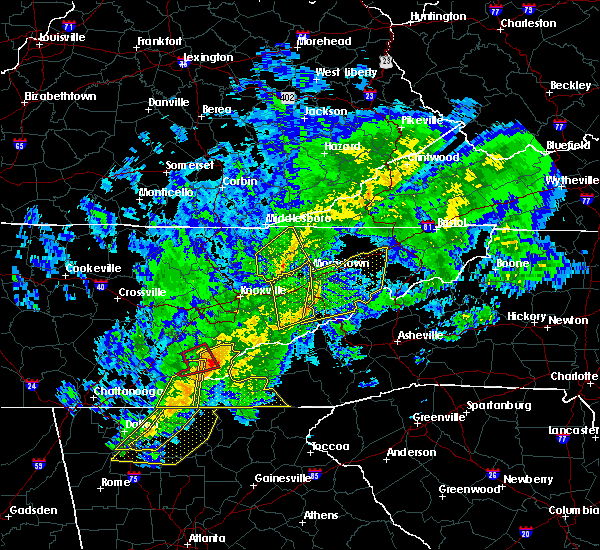 At 519 am est, severe thunderstorms were located along a line extending from near morristown to 9 miles northeast of gatlinburg, moving east at 65 mph (radar indicated). Hazards include 60 mph wind gusts. expect damage to roofs, siding, and trees At 519 am est, severe thunderstorms were located along a line extending from near morristown to 9 miles northeast of gatlinburg, moving east at 65 mph (radar indicated). Hazards include 60 mph wind gusts. expect damage to roofs, siding, and trees
|
| 9/9/2018 6:27 PM EDT |
 At 627 pm edt, a severe thunderstorm was located near tusculum, or near greeneville, moving northeast at 25 mph (radar indicated). Hazards include 60 mph wind gusts and penny size hail. Expect damage to roofs, siding, and trees. Locations impacted include, johnson city, greeneville, jonesborough, tusculum, surgoinsville, midway, church hill, baileyton, leesburg, chucky, limestone, romeo, telford, fall branch, avondale, kepler, davy crockett birthplace, jearoldstown and bays mountain state park. At 627 pm edt, a severe thunderstorm was located near tusculum, or near greeneville, moving northeast at 25 mph (radar indicated). Hazards include 60 mph wind gusts and penny size hail. Expect damage to roofs, siding, and trees. Locations impacted include, johnson city, greeneville, jonesborough, tusculum, surgoinsville, midway, church hill, baileyton, leesburg, chucky, limestone, romeo, telford, fall branch, avondale, kepler, davy crockett birthplace, jearoldstown and bays mountain state park.
|
| 9/9/2018 6:25 PM EDT | A few trees down just west of the greeneville... tn are in greene county TN, 1.6 miles E of Greeneville, TN |
| 9/9/2018 6:08 PM EDT |
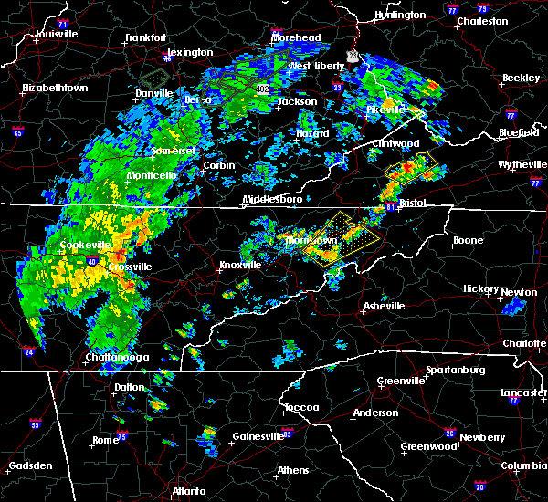 At 608 pm edt, a severe thunderstorm was located near greeneville, moving northeast at 25 mph (radar indicated). Hazards include 60 mph wind gusts and penny size hail. expect damage to roofs, siding, and trees At 608 pm edt, a severe thunderstorm was located near greeneville, moving northeast at 25 mph (radar indicated). Hazards include 60 mph wind gusts and penny size hail. expect damage to roofs, siding, and trees
|
| 8/8/2018 4:06 PM EDT |
 At 406 pm edt, a severe thunderstorm was located 9 miles northwest of hot springs, or 11 miles south of greeneville, moving northeast at 30 mph (radar indicated). Hazards include 60 mph wind gusts. expect damage to roofs, siding, and trees At 406 pm edt, a severe thunderstorm was located 9 miles northwest of hot springs, or 11 miles south of greeneville, moving northeast at 30 mph (radar indicated). Hazards include 60 mph wind gusts. expect damage to roofs, siding, and trees
|
| 7/20/2018 10:10 PM EDT |
 The national weather service in morristown has issued a * severe thunderstorm warning for. sullivan county in east tennessee. washington county in east tennessee. jefferson county in east tennessee. Cocke county in east tennessee. The national weather service in morristown has issued a * severe thunderstorm warning for. sullivan county in east tennessee. washington county in east tennessee. jefferson county in east tennessee. Cocke county in east tennessee.
|
| 7/20/2018 10:10 PM EDT |
 At 1009 pm edt, severe thunderstorms were located along a line extending from 7 miles northeast of gate city to near kingsport to 10 miles southwest of colonial heights to 9 miles north of greeneville to near russellville to 6 miles northeast of jefferson city, moving southeast at 55 mph (radar indicated). Hazards include 60 mph wind gusts and penny size hail. expect damage to roofs, siding, and trees At 1009 pm edt, severe thunderstorms were located along a line extending from 7 miles northeast of gate city to near kingsport to 10 miles southwest of colonial heights to 9 miles north of greeneville to near russellville to 6 miles northeast of jefferson city, moving southeast at 55 mph (radar indicated). Hazards include 60 mph wind gusts and penny size hail. expect damage to roofs, siding, and trees
|
| 6/26/2018 5:30 PM EDT | Few trees dow in greene county TN, 11.3 miles NNE of Greeneville, TN |
| 6/26/2018 4:53 PM EDT |
 At 453 pm edt, a severe thunderstorm was located 9 miles north of parrottsville, or 13 miles west of greeneville, moving southeast at 20 mph (radar indicated). Hazards include 60 mph wind gusts and quarter size hail. Hail damage to vehicles is expected. expect wind damage to roofs, siding, and trees. Locations impacted include, greeneville, parrottsville, mosheim, caney branch, bybee, del rio, cedar creek, round mountain, camp creek and mohawk. At 453 pm edt, a severe thunderstorm was located 9 miles north of parrottsville, or 13 miles west of greeneville, moving southeast at 20 mph (radar indicated). Hazards include 60 mph wind gusts and quarter size hail. Hail damage to vehicles is expected. expect wind damage to roofs, siding, and trees. Locations impacted include, greeneville, parrottsville, mosheim, caney branch, bybee, del rio, cedar creek, round mountain, camp creek and mohawk.
|
| 6/26/2018 4:30 PM EDT |
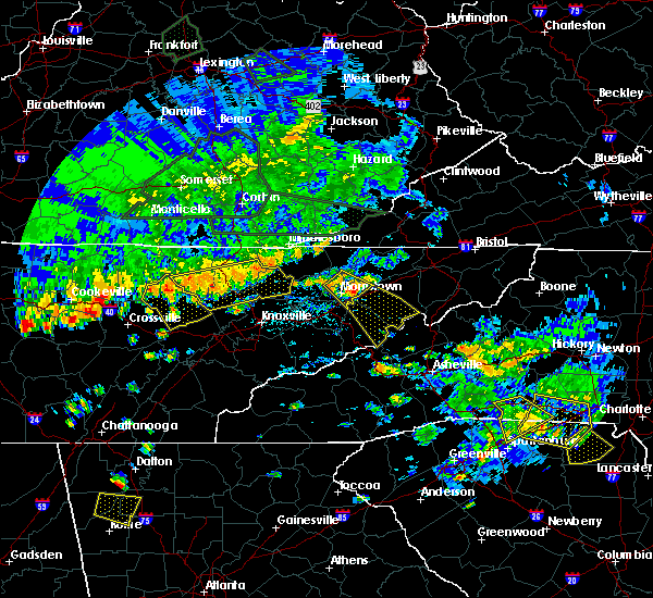 At 430 pm edt, a severe thunderstorm was located near russellville, or 8 miles east of morristown, moving southeast at 25 mph (radar indicated). Hazards include 60 mph wind gusts and quarter size hail. Hail damage to vehicles is expected. Expect wind damage to roofs, siding, and trees. At 430 pm edt, a severe thunderstorm was located near russellville, or 8 miles east of morristown, moving southeast at 25 mph (radar indicated). Hazards include 60 mph wind gusts and quarter size hail. Hail damage to vehicles is expected. Expect wind damage to roofs, siding, and trees.
|
| 5/31/2018 7:53 PM EDT |
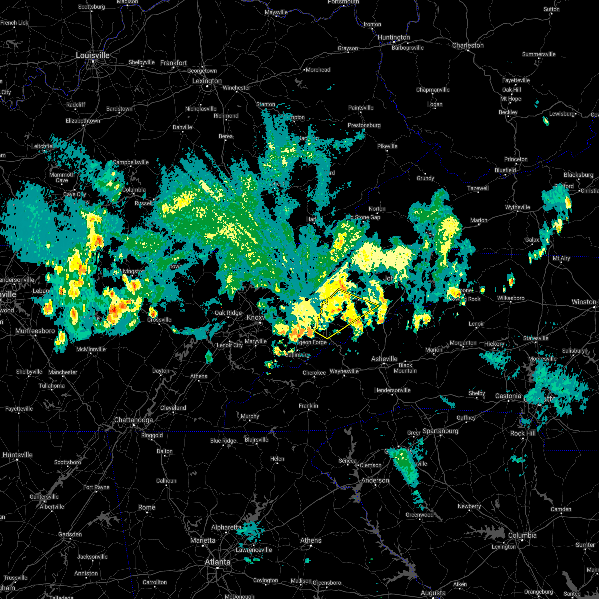 At 753 pm edt, severe thunderstorms were located along a line extending from 6 miles west of greeneville to near newport, moving southeast at 40 mph (law enforcement). Hazards include 60 mph wind gusts. Expect damage to roofs, siding, and trees. Locations impacted include, greeneville, newport, tusculum, parrottsville, mosheim, caney branch, bybee, del rio, cedar creek, camp creek and mohawk. At 753 pm edt, severe thunderstorms were located along a line extending from 6 miles west of greeneville to near newport, moving southeast at 40 mph (law enforcement). Hazards include 60 mph wind gusts. Expect damage to roofs, siding, and trees. Locations impacted include, greeneville, newport, tusculum, parrottsville, mosheim, caney branch, bybee, del rio, cedar creek, camp creek and mohawk.
|
| 5/31/2018 7:27 PM EDT |
 At 726 pm edt, severe thunderstorms were located along a line extending from russellville to near new market, moving southeast at 40 mph (law enforcement). Hazards include 60 mph wind gusts. expect damage to roofs, siding, and trees At 726 pm edt, severe thunderstorms were located along a line extending from russellville to near new market, moving southeast at 40 mph (law enforcement). Hazards include 60 mph wind gusts. expect damage to roofs, siding, and trees
|
| 5/31/2018 6:36 PM EDT |
 At 636 pm edt, a severe thunderstorm was located 10 miles north of tusculum, or 13 miles northeast of greeneville, moving southeast at 30 mph (radar indicated). Hazards include 60 mph wind gusts and penny size hail. expect damage to roofs, siding, and trees At 636 pm edt, a severe thunderstorm was located 10 miles north of tusculum, or 13 miles northeast of greeneville, moving southeast at 30 mph (radar indicated). Hazards include 60 mph wind gusts and penny size hail. expect damage to roofs, siding, and trees
|
| 5/10/2018 7:59 PM EDT |
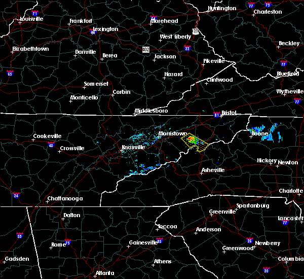 The national weather service in morristown has issued a * severe thunderstorm warning for. southwestern washington county in east tennessee. southeastern greene county in east tennessee. southwestern unicoi county in east tennessee. Until 900 pm edt. The national weather service in morristown has issued a * severe thunderstorm warning for. southwestern washington county in east tennessee. southeastern greene county in east tennessee. southwestern unicoi county in east tennessee. Until 900 pm edt.
|
| 3/17/2018 9:58 PM EDT |
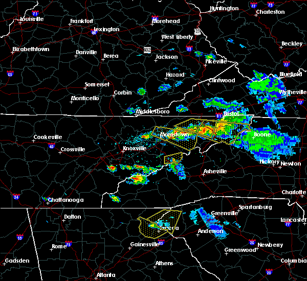 At 958 pm edt, a severe thunderstorm was located near russellville, or 11 miles south of rogersville, moving east at 45 mph (radar indicated). Hazards include 60 mph wind gusts and quarter size hail. Hail damage to vehicles is expected. expect wind damage to roofs, siding, and trees. locations impacted include, morristown, greeneville, tusculum, russellville, mosheim, bulls gap, baileyton, chucky, romeo, st. Clair, camp creek, davy crockett birthplace and mohawk. At 958 pm edt, a severe thunderstorm was located near russellville, or 11 miles south of rogersville, moving east at 45 mph (radar indicated). Hazards include 60 mph wind gusts and quarter size hail. Hail damage to vehicles is expected. expect wind damage to roofs, siding, and trees. locations impacted include, morristown, greeneville, tusculum, russellville, mosheim, bulls gap, baileyton, chucky, romeo, st. Clair, camp creek, davy crockett birthplace and mohawk.
|
| 3/17/2018 9:44 PM EDT |
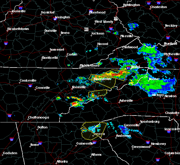 At 944 pm edt, a severe thunderstorm was located over russellville, or near morristown, moving east at 55 mph (radar indicated). Hazards include 60 mph wind gusts and quarter size hail. Hail damage to vehicles is expected. Expect wind damage to roofs, siding, and trees. At 944 pm edt, a severe thunderstorm was located over russellville, or near morristown, moving east at 55 mph (radar indicated). Hazards include 60 mph wind gusts and quarter size hail. Hail damage to vehicles is expected. Expect wind damage to roofs, siding, and trees.
|
| 3/17/2018 9:05 PM EDT | Half Dollar sized hail reported 11 miles S of Greeneville, TN, half dollar size hail and few trees down near baileyton... tn. |
| 3/17/2018 9:00 PM EDT |
 A severe thunderstorm warning remains in effect until 930 pm edt for western washington and northeastern greene counties. at 859 pm edt, a severe thunderstorm was located 9 miles north of tusculum, or 11 miles northeast of greeneville, moving east at 40 mph. hazard. 60 mph wind gusts and quarter size hail. A severe thunderstorm warning remains in effect until 930 pm edt for western washington and northeastern greene counties. at 859 pm edt, a severe thunderstorm was located 9 miles north of tusculum, or 11 miles northeast of greeneville, moving east at 40 mph. hazard. 60 mph wind gusts and quarter size hail.
|
| 3/17/2018 8:37 PM EDT |
 The national weather service in morristown has issued a * severe thunderstorm warning for. central hawkins county in east tennessee. western washington county in east tennessee. northeastern greene county in east tennessee. Until 930 pm edt. The national weather service in morristown has issued a * severe thunderstorm warning for. central hawkins county in east tennessee. western washington county in east tennessee. northeastern greene county in east tennessee. Until 930 pm edt.
|
| 5/27/2017 11:53 PM EDT | Several trees down across the western part of the count in greene county TN, 3.5 miles NE of Greeneville, TN |
| 5/27/2017 11:09 PM EDT |
 At 1108 pm edt, severe thunderstorms were located along a line extending from near bean station to near morristown to near dandridge to near gatlinburg, moving east at 55 mph (radar indicated). Hazards include 70 mph wind gusts. Expect considerable tree damage. Damage is likely to mobile homes, roofs, and outbuildings. At 1108 pm edt, severe thunderstorms were located along a line extending from near bean station to near morristown to near dandridge to near gatlinburg, moving east at 55 mph (radar indicated). Hazards include 70 mph wind gusts. Expect considerable tree damage. Damage is likely to mobile homes, roofs, and outbuildings.
|
| 5/24/2017 1:03 PM EDT |
 At 102 pm edt, severe thunderstorms were located along a line extending from 9 miles southeast of surgoinsville to 10 miles west of jonesborough to 8 miles southeast of tusculum, moving northeast at 45 mph (radar indicated). Hazards include 60 mph wind gusts. Expect damage to roofs, siding, and trees. Locations impacted include, greeneville, tusculum, baileyton, chucky, camp creek, davy crockett birthplace, jearoldstown and fall branch. At 102 pm edt, severe thunderstorms were located along a line extending from 9 miles southeast of surgoinsville to 10 miles west of jonesborough to 8 miles southeast of tusculum, moving northeast at 45 mph (radar indicated). Hazards include 60 mph wind gusts. Expect damage to roofs, siding, and trees. Locations impacted include, greeneville, tusculum, baileyton, chucky, camp creek, davy crockett birthplace, jearoldstown and fall branch.
|
| 5/24/2017 12:40 PM EDT | Few trees down along the western portions of the county...east of caney branc in greene county TN, 12.6 miles NE of Greeneville, TN |
| 5/24/2017 12:33 PM EDT |
 At 1232 pm edt, severe thunderstorms were located along a line extending from 8 miles east of white pine to 12 miles northeast of newport to near parrottsville, moving northeast at 55 mph (radar indicated). Hazards include 60 mph wind gusts. expect damage to roofs, siding, and trees At 1232 pm edt, severe thunderstorms were located along a line extending from 8 miles east of white pine to 12 miles northeast of newport to near parrottsville, moving northeast at 55 mph (radar indicated). Hazards include 60 mph wind gusts. expect damage to roofs, siding, and trees
|
| 5/24/2017 12:30 PM EDT | Few trees down along the western edge of the count in greene county TN, 12.6 miles NE of Greeneville, TN |
| 5/12/2017 4:17 PM EDT |
 At 417 pm edt, a severe thunderstorm was located near parrottsville, or 8 miles northeast of newport, moving northeast at 25 mph (radar indicated). Hazards include 60 mph wind gusts and quarter size hail. Hail damage to vehicles is expected. Expect wind damage to roofs, siding, and trees. At 417 pm edt, a severe thunderstorm was located near parrottsville, or 8 miles northeast of newport, moving northeast at 25 mph (radar indicated). Hazards include 60 mph wind gusts and quarter size hail. Hail damage to vehicles is expected. Expect wind damage to roofs, siding, and trees.
|
| 4/29/2017 4:15 PM EDT | Golf Ball sized hail reported 10.1 miles WSW of Greeneville, TN |
| 4/29/2017 4:08 PM EDT |
 At 408 pm edt, a severe thunderstorm was located near tusculum, or 7 miles northeast of greeneville, moving northeast at 20 mph (radar indicated). Hazards include 60 mph wind gusts and quarter size hail. Hail damage to vehicles is expected. Expect wind damage to roofs, siding, and trees. At 408 pm edt, a severe thunderstorm was located near tusculum, or 7 miles northeast of greeneville, moving northeast at 20 mph (radar indicated). Hazards include 60 mph wind gusts and quarter size hail. Hail damage to vehicles is expected. Expect wind damage to roofs, siding, and trees.
|
| 4/29/2017 3:58 PM EDT | Ping Pong Ball sized hail reported 0.1 miles NW of Greeneville, TN, pea sized to ping pong ball sized hail. |
| 4/5/2017 10:36 PM EDT |
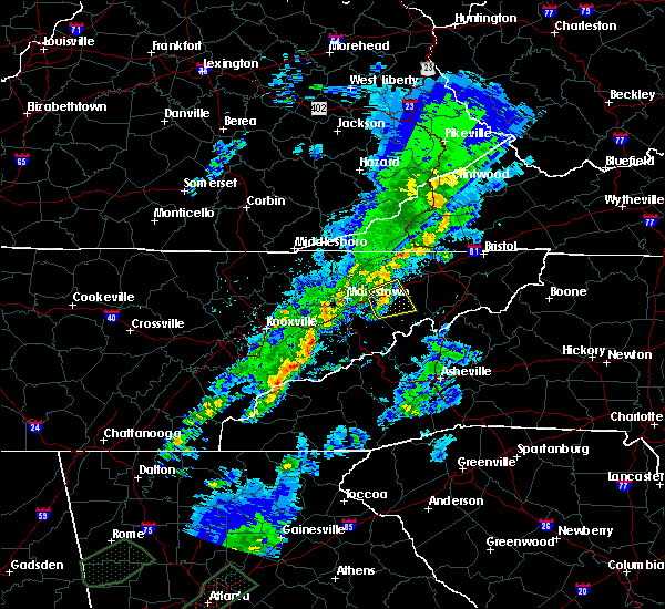 At 1036 pm edt, a severe thunderstorm was located 10 miles northwest of greeneville, moving east at 50 mph (radar indicated). Hazards include 60 mph wind gusts and nickel size hail. Expect damage to roofs, siding, and trees. Locations impacted include, greeneville, tusculum, mosheim, bulls gap, romeo and mohawk. At 1036 pm edt, a severe thunderstorm was located 10 miles northwest of greeneville, moving east at 50 mph (radar indicated). Hazards include 60 mph wind gusts and nickel size hail. Expect damage to roofs, siding, and trees. Locations impacted include, greeneville, tusculum, mosheim, bulls gap, romeo and mohawk.
|
| 4/5/2017 10:15 PM EDT |
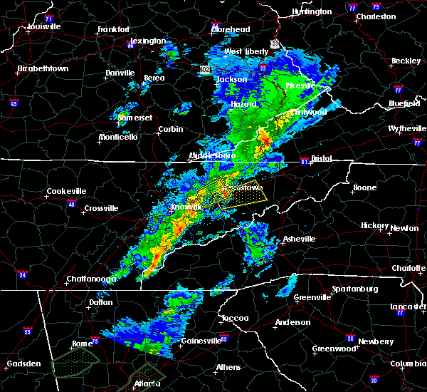 At 1014 pm edt, a severe thunderstorm was located near dandridge, moving east at 50 mph (radar indicated). Hazards include 60 mph wind gusts and nickel size hail. expect damage to roofs, siding, and trees At 1014 pm edt, a severe thunderstorm was located near dandridge, moving east at 50 mph (radar indicated). Hazards include 60 mph wind gusts and nickel size hail. expect damage to roofs, siding, and trees
|
| 11/30/2016 6:47 AM EST |
 At 646 am est, severe thunderstorms were located along a line extending from 11 miles southeast of norton to near kingsport to near tusculum, moving east at 50 mph (radar indicated). Hazards include 60 mph wind gusts. Expect damage to roofs. siding. And trees. At 646 am est, severe thunderstorms were located along a line extending from 11 miles southeast of norton to near kingsport to near tusculum, moving east at 50 mph (radar indicated). Hazards include 60 mph wind gusts. Expect damage to roofs. siding. And trees.
|
| 8/29/2016 7:45 PM EDT |
 At 745 pm edt, a severe thunderstorm was located 7 miles southeast of rogersville, moving southwest at 15 mph (radar indicated). Hazards include 60 mph wind gusts. Expect damage to roofs. siding. and trees. locations impacted include, greeneville, rogersville, mosheim, bulls gap, baileyton, st. Clair, mccloud and romeo. At 745 pm edt, a severe thunderstorm was located 7 miles southeast of rogersville, moving southwest at 15 mph (radar indicated). Hazards include 60 mph wind gusts. Expect damage to roofs. siding. and trees. locations impacted include, greeneville, rogersville, mosheim, bulls gap, baileyton, st. Clair, mccloud and romeo.
|
| 8/29/2016 7:30 PM EDT |
 At 730 pm edt, a severe thunderstorm was located 8 miles southeast of rogersville, moving southwest at 20 mph (radar indicated). Hazards include 60 mph wind gusts and penny size hail. Expect damage to roofs. siding. And trees. At 730 pm edt, a severe thunderstorm was located 8 miles southeast of rogersville, moving southwest at 20 mph (radar indicated). Hazards include 60 mph wind gusts and penny size hail. Expect damage to roofs. siding. And trees.
|
| 8/16/2016 6:10 PM EDT |
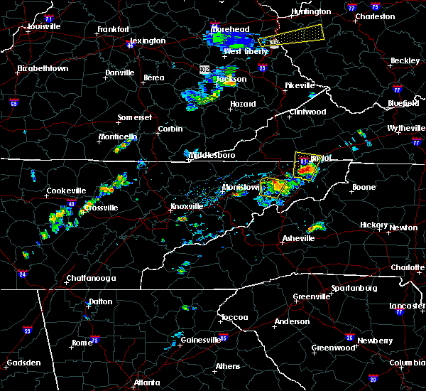 At 609 pm edt, a severe thunderstorm was located 8 miles northeast of tusculum, or 10 miles northeast of greeneville, moving north at 5 mph (radar indicated). Hazards include 60 mph wind gusts and quarter size hail. Hail damage to vehicles is expected. expect wind damage to roofs, siding, and trees. Locations impacted include, greeneville, jonesborough, tusculum, davy crockett birthplace, limestone, chucky, leesburg and telford. At 609 pm edt, a severe thunderstorm was located 8 miles northeast of tusculum, or 10 miles northeast of greeneville, moving north at 5 mph (radar indicated). Hazards include 60 mph wind gusts and quarter size hail. Hail damage to vehicles is expected. expect wind damage to roofs, siding, and trees. Locations impacted include, greeneville, jonesborough, tusculum, davy crockett birthplace, limestone, chucky, leesburg and telford.
|
| 8/16/2016 5:57 PM EDT |
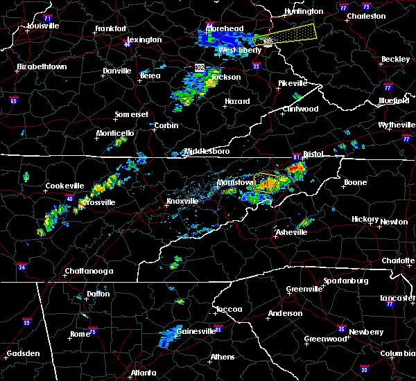 At 556 pm edt, a severe thunderstorm was located near tusculum, or 8 miles northeast of greeneville, and is moving at 5 mph to the northeast (radar indicated). Hazards include 60 mph wind gusts and quarter size hail. Hail damage to vehicles is expected. Expect wind damage to roofs, siding, and trees. At 556 pm edt, a severe thunderstorm was located near tusculum, or 8 miles northeast of greeneville, and is moving at 5 mph to the northeast (radar indicated). Hazards include 60 mph wind gusts and quarter size hail. Hail damage to vehicles is expected. Expect wind damage to roofs, siding, and trees.
|
| 8/14/2016 4:10 PM EDT | 2 trees down along kingsport hwy in greene county TN, 10.3 miles S of Greeneville, TN |
| 7/14/2016 7:05 PM EDT | A tree down near tusculu in greene county TN, 4.1 miles W of Greeneville, TN |
| 7/14/2016 7:03 PM EDT |
 At 659 pm edt, a severe thunderstorm was located near chucky, moving east at 35 mph (radar indicated). Hazards include 60 mph wind gusts and quarter size hail. Hail damage to vehicles is possible. expect wind damage to roofs, siding, and trees. Locations impacted include, johnson city, greeneville, jonesborough, tusculum, gray, mosheim, baileyton, limestone, chucky, avondale, davy crockett birthplace, jearoldstown, leesburg, telford and fall branch. At 659 pm edt, a severe thunderstorm was located near chucky, moving east at 35 mph (radar indicated). Hazards include 60 mph wind gusts and quarter size hail. Hail damage to vehicles is possible. expect wind damage to roofs, siding, and trees. Locations impacted include, johnson city, greeneville, jonesborough, tusculum, gray, mosheim, baileyton, limestone, chucky, avondale, davy crockett birthplace, jearoldstown, leesburg, telford and fall branch.
|
| 7/14/2016 6:54 PM EDT | One tree down in greeneville in greene county TN, 0.1 miles NW of Greeneville, TN |
| 7/14/2016 6:45 PM EDT |
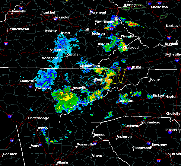 At 643 pm edt, severe thunderstorms were located along a line extending from 7 miles northeast of surgoinsville to near greeneville, moving east at 35 mph. the strongest storm was just west of greeneville (radar indicated). Hazards include 60 mph wind gusts and half dollar size hail. Hail damage to vehicles is possible. expect wind damage to roofs, siding, and trees. locations impacted include, johnson city, kingsport, greeneville, rogersville, jonesborough, tusculum, surgoinsville, colonial heights, oak grove, spurgeon, gray, church hill, mount carmel, mosheim, baileyton, limestone, kepler, chucky, warriors path s. p. And fall branch. At 643 pm edt, severe thunderstorms were located along a line extending from 7 miles northeast of surgoinsville to near greeneville, moving east at 35 mph. the strongest storm was just west of greeneville (radar indicated). Hazards include 60 mph wind gusts and half dollar size hail. Hail damage to vehicles is possible. expect wind damage to roofs, siding, and trees. locations impacted include, johnson city, kingsport, greeneville, rogersville, jonesborough, tusculum, surgoinsville, colonial heights, oak grove, spurgeon, gray, church hill, mount carmel, mosheim, baileyton, limestone, kepler, chucky, warriors path s. p. And fall branch.
|
| 7/14/2016 6:25 PM EDT |
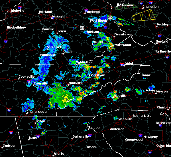 At 625 pm edt, severe thunderstorms were located along a line extending from near surgoinsville to 9 miles north of parrottsville, moving east at 35 mph (radar indicated). Hazards include 60 mph wind gusts and quarter size hail. Hail damage to vehicles is expected. Expect wind damage to roofs, siding, and trees. At 625 pm edt, severe thunderstorms were located along a line extending from near surgoinsville to 9 miles north of parrottsville, moving east at 35 mph (radar indicated). Hazards include 60 mph wind gusts and quarter size hail. Hail damage to vehicles is expected. Expect wind damage to roofs, siding, and trees.
|
| 7/12/2016 5:25 PM EDT |
 At 524 pm edt, a severe thunderstorm was located near greeneville, moving east at 35 mph (law enforcement). Hazards include 60 mph wind gusts. Expect damage to roofs. siding. and trees. Locations impacted include, greeneville, tusculum, mosheim, camp creek, davy crockett birthplace, cedar creek and caney branch. At 524 pm edt, a severe thunderstorm was located near greeneville, moving east at 35 mph (law enforcement). Hazards include 60 mph wind gusts. Expect damage to roofs. siding. and trees. Locations impacted include, greeneville, tusculum, mosheim, camp creek, davy crockett birthplace, cedar creek and caney branch.
|
| 7/12/2016 5:07 PM EDT |
 At 506 pm edt, a severe thunderstorm was located 8 miles northeast of parrottsville, or 10 miles southwest of greeneville, moving east at 35 mph (law enforcement). Hazards include 60 mph wind gusts. Expect damage to roofs. siding. And trees. At 506 pm edt, a severe thunderstorm was located 8 miles northeast of parrottsville, or 10 miles southwest of greeneville, moving east at 35 mph (law enforcement). Hazards include 60 mph wind gusts. Expect damage to roofs. siding. And trees.
|
| 7/8/2016 6:30 PM EDT |
 At 629 pm edt, severe thunderstorms were located along a line extending from 7 miles south of walnut hill to johnson city to 8 miles east of tusculum to near greeneville, moving southeast at 50 mph (radar indicated). Hazards include 70 mph wind gusts. Expect considerable tree damage. damage is likely to mobile homes, roofs, and outbuildings. Locations impacted include, johnson city, kingsport, bristol tn, bristol va, greeneville, jonesborough, tusculum, walnut hill, midway, oak grove, spurgeon, gray, mosheim, bluff city, cedar creek, limestone, chucky, south holston dam, avondale and camp creek. At 629 pm edt, severe thunderstorms were located along a line extending from 7 miles south of walnut hill to johnson city to 8 miles east of tusculum to near greeneville, moving southeast at 50 mph (radar indicated). Hazards include 70 mph wind gusts. Expect considerable tree damage. damage is likely to mobile homes, roofs, and outbuildings. Locations impacted include, johnson city, kingsport, bristol tn, bristol va, greeneville, jonesborough, tusculum, walnut hill, midway, oak grove, spurgeon, gray, mosheim, bluff city, cedar creek, limestone, chucky, south holston dam, avondale and camp creek.
|
| 7/8/2016 6:19 PM EDT |
 At 618 pm edt, severe thunderstorms were located along a line extending from 6 miles northeast of oak grove to near gray to near tusculum to 7 miles west of greeneville, moving southeast at 45 mph (radar indicated). Hazards include 60 mph wind gusts. Expect damage to roofs. siding. and trees. Locations impacted include, johnson city, kingsport, bristol tn, bristol va, greeneville, jonesborough, tusculum, colonial heights, walnut hill, midway, oak grove, spurgeon, gray, mosheim, bluff city, baileyton, cedar creek, limestone, chucky and south holston dam. At 618 pm edt, severe thunderstorms were located along a line extending from 6 miles northeast of oak grove to near gray to near tusculum to 7 miles west of greeneville, moving southeast at 45 mph (radar indicated). Hazards include 60 mph wind gusts. Expect damage to roofs. siding. and trees. Locations impacted include, johnson city, kingsport, bristol tn, bristol va, greeneville, jonesborough, tusculum, colonial heights, walnut hill, midway, oak grove, spurgeon, gray, mosheim, bluff city, baileyton, cedar creek, limestone, chucky and south holston dam.
|
| 7/8/2016 6:06 PM EDT |
 At 605 pm edt, severe thunderstorms were located along a line extending from near kingsport to near colonial heights to 6 miles north of greeneville to 7 miles southeast of russellville, moving east at 45 mph (radar indicated). Hazards include 60 mph wind gusts. Expect damage to roofs. siding. and trees. Locations impacted include, johnson city, kingsport, morristown, bristol tn, greeneville, rogersville, jonesborough, tusculum, surgoinsville, colonial heights, oak grove, spurgeon, gray, walnut hill, midway, russellville, church hill, mount carmel, mosheim and bluff city. At 605 pm edt, severe thunderstorms were located along a line extending from near kingsport to near colonial heights to 6 miles north of greeneville to 7 miles southeast of russellville, moving east at 45 mph (radar indicated). Hazards include 60 mph wind gusts. Expect damage to roofs. siding. and trees. Locations impacted include, johnson city, kingsport, morristown, bristol tn, greeneville, rogersville, jonesborough, tusculum, surgoinsville, colonial heights, oak grove, spurgeon, gray, walnut hill, midway, russellville, church hill, mount carmel, mosheim and bluff city.
|
| 7/8/2016 5:52 PM EDT |
 At 551 pm edt, severe thunderstorms were located along a line extending from 10 miles west of gate city to surgoinsville to near rogersville to russellville, moving southeast at 45 mph (radar indicated). Hazards include 60 mph wind gusts. Expect damage to roofs. siding. And trees. At 551 pm edt, severe thunderstorms were located along a line extending from 10 miles west of gate city to surgoinsville to near rogersville to russellville, moving southeast at 45 mph (radar indicated). Hazards include 60 mph wind gusts. Expect damage to roofs. siding. And trees.
|
| 7/7/2016 8:06 PM EDT |
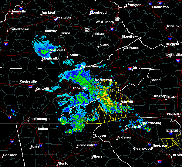 At 804 pm edt, a severe thunderstorm was located 7 miles east of parrottsville, or 11 miles southwest of greeneville, moving east at 45 mph (radar indicated). Hazards include 60 mph wind gusts. Expect damage to roofs. siding. and trees. Locations impacted include, greeneville, parrottsville, camp creek, cedar creek and caney branch. At 804 pm edt, a severe thunderstorm was located 7 miles east of parrottsville, or 11 miles southwest of greeneville, moving east at 45 mph (radar indicated). Hazards include 60 mph wind gusts. Expect damage to roofs. siding. and trees. Locations impacted include, greeneville, parrottsville, camp creek, cedar creek and caney branch.
|
| 7/7/2016 7:53 PM EDT |
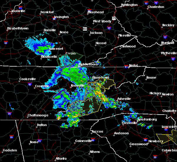 At 752 pm edt, a severe thunderstorm was located near parrottsville, or 10 miles northeast of newport, moving east at 40 mph (radar indicated). Hazards include 60 mph wind gusts. Expect damage to roofs. siding. and trees. Locations impacted include, greeneville, tusculum, parrottsville, mosheim, camp creek, cedar creek, mohawk, caney branch and bybee. At 752 pm edt, a severe thunderstorm was located near parrottsville, or 10 miles northeast of newport, moving east at 40 mph (radar indicated). Hazards include 60 mph wind gusts. Expect damage to roofs. siding. and trees. Locations impacted include, greeneville, tusculum, parrottsville, mosheim, camp creek, cedar creek, mohawk, caney branch and bybee.
|
| 7/7/2016 7:32 PM EDT |
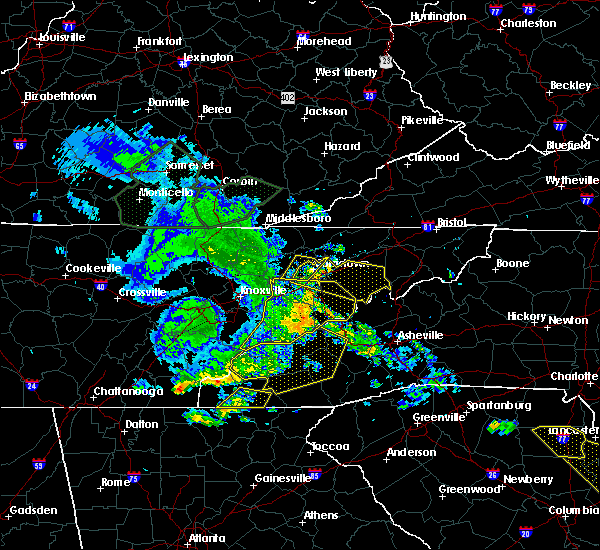 At 732 pm edt, a severe thunderstorm was located near white pine, or near morristown, moving east at 50 mph (radar indicated). Hazards include 60 mph wind gusts. Expect damage to roofs. siding. And trees. At 732 pm edt, a severe thunderstorm was located near white pine, or near morristown, moving east at 50 mph (radar indicated). Hazards include 60 mph wind gusts. Expect damage to roofs. siding. And trees.
|
| 7/6/2016 8:04 PM EDT |
 At 802 pm edt, severe thunderstorms were located along a line extending from 8 miles northwest of tusculum to near greeneville to near hot springs, moving east at 55 mph (radar indicated). Hazards include 70 mph wind gusts and penny size hail. Expect considerable tree damage. damage is likely to mobile homes, roofs, and outbuildings. Locations impacted include, johnson city, greeneville, erwin, jonesborough, tusculum, banner hill, midway, unicoi, mosheim, cedar creek, limestone, chucky, caney branch, romeo, camp creek, davy crockett birthplace, limestone cove, embreeville, leesburg and rocky fork. At 802 pm edt, severe thunderstorms were located along a line extending from 8 miles northwest of tusculum to near greeneville to near hot springs, moving east at 55 mph (radar indicated). Hazards include 70 mph wind gusts and penny size hail. Expect considerable tree damage. damage is likely to mobile homes, roofs, and outbuildings. Locations impacted include, johnson city, greeneville, erwin, jonesborough, tusculum, banner hill, midway, unicoi, mosheim, cedar creek, limestone, chucky, caney branch, romeo, camp creek, davy crockett birthplace, limestone cove, embreeville, leesburg and rocky fork.
|
| 7/6/2016 8:01 PM EDT | Several trees down across the city of greenevill in greene county TN, 0.1 miles NW of Greeneville, TN |
| 7/6/2016 7:52 PM EDT |
 At 749 pm edt, severe thunderstorms were located along a line extending from 10 miles east of russellville to 6 miles east of parrottsville to 8 miles southeast of newport, moving east at 55 mph (radar indicated). Hazards include 70 mph wind gusts and penny size hail. Expect considerable tree damage. damage is likely to mobile homes, roofs, and outbuildings. Locations impacted include, johnson city, morristown, greeneville, newport, erwin, jonesborough, tusculum, parrottsville, banner hill, midway, unicoi, mosheim, bulls gap, cedar creek, limestone, chucky, bybee, camp creek, davy crockett birthplace and embreeville. At 749 pm edt, severe thunderstorms were located along a line extending from 10 miles east of russellville to 6 miles east of parrottsville to 8 miles southeast of newport, moving east at 55 mph (radar indicated). Hazards include 70 mph wind gusts and penny size hail. Expect considerable tree damage. damage is likely to mobile homes, roofs, and outbuildings. Locations impacted include, johnson city, morristown, greeneville, newport, erwin, jonesborough, tusculum, parrottsville, banner hill, midway, unicoi, mosheim, bulls gap, cedar creek, limestone, chucky, bybee, camp creek, davy crockett birthplace and embreeville.
|
| 7/6/2016 7:31 PM EDT |
 At 730 pm edt, severe thunderstorms were located along a line extending from near bean station to 8 miles southwest of newport, moving east at 40 mph (radar indicated). Hazards include 60 mph wind gusts and penny size hail. Expect damage to roofs. siding. And trees. At 730 pm edt, severe thunderstorms were located along a line extending from near bean station to 8 miles southwest of newport, moving east at 40 mph (radar indicated). Hazards include 60 mph wind gusts and penny size hail. Expect damage to roofs. siding. And trees.
|
| 7/6/2016 7:30 PM EDT | Several trees and power lines dow in greene county TN, 11 miles S of Greeneville, TN |
| 7/5/2016 6:03 PM EDT |
 At 602 pm edt, a severe thunderstorm was located 7 miles north of greeneville, moving east at 35 mph (radar indicated). Hazards include 60 mph wind gusts. Expect damage to roofs. siding. and trees. Locations impacted include, greeneville, tusculum, mosheim, baileyton, chucky, jearoldstown and romeo. At 602 pm edt, a severe thunderstorm was located 7 miles north of greeneville, moving east at 35 mph (radar indicated). Hazards include 60 mph wind gusts. Expect damage to roofs. siding. and trees. Locations impacted include, greeneville, tusculum, mosheim, baileyton, chucky, jearoldstown and romeo.
|
| 7/5/2016 5:51 PM EDT |
 At 551 pm edt, a severe thunderstorm was located 10 miles south of rogersville, moving east at 35 mph (radar indicated). Hazards include 60 mph wind gusts. Expect damage to roofs. siding. And trees. At 551 pm edt, a severe thunderstorm was located 10 miles south of rogersville, moving east at 35 mph (radar indicated). Hazards include 60 mph wind gusts. Expect damage to roofs. siding. And trees.
|
| 6/23/2016 10:12 PM EDT |
 At 1011 pm edt, severe thunderstorms were located along a line extending from 6 miles west of walnut hill to 8 miles northwest of greeneville, moving southeast at 25 mph (radar indicated). Hazards include 60 mph wind gusts and quarter size hail. Hail damage to vehicles is expected. expect wind damage to roofs, siding, and trees. Locations impacted include, johnson city, kingsport, bristol tn, greeneville, jonesborough, tusculum, weber city, colonial heights, walnut hill, midway, oak grove, spurgeon, gray, church hill, mount carmel, mosheim, bluff city, watauga, baileyton and limestone. At 1011 pm edt, severe thunderstorms were located along a line extending from 6 miles west of walnut hill to 8 miles northwest of greeneville, moving southeast at 25 mph (radar indicated). Hazards include 60 mph wind gusts and quarter size hail. Hail damage to vehicles is expected. expect wind damage to roofs, siding, and trees. Locations impacted include, johnson city, kingsport, bristol tn, greeneville, jonesborough, tusculum, weber city, colonial heights, walnut hill, midway, oak grove, spurgeon, gray, church hill, mount carmel, mosheim, bluff city, watauga, baileyton and limestone.
|
| 6/23/2016 9:49 PM EDT |
 At 949 pm edt, severe thunderstorms were located along a line extending from 8 miles northeast of weber city to near rogersville, moving southeast at 45 mph (radar indicated). Hazards include 60 mph wind gusts. Expect damage to roofs. siding. And trees. At 949 pm edt, severe thunderstorms were located along a line extending from 8 miles northeast of weber city to near rogersville, moving southeast at 45 mph (radar indicated). Hazards include 60 mph wind gusts. Expect damage to roofs. siding. And trees.
|
| 5/12/2016 4:44 PM EDT |
 At 443 pm edt, a severe thunderstorm was located over russellville, or near morristown, moving east at 30 mph (radar indicated). Hazards include 60 mph wind gusts. Expect damage to roofs. siding. And trees. At 443 pm edt, a severe thunderstorm was located over russellville, or near morristown, moving east at 30 mph (radar indicated). Hazards include 60 mph wind gusts. Expect damage to roofs. siding. And trees.
|
| 5/2/2016 6:54 PM EDT |
 At 654 pm edt, a severe thunderstorm was located near tusculum, or 7 miles east of greeneville, moving east at 35 mph (radar indicated). Hazards include 60 mph wind gusts and quarter size hail. Hail damage to vehicles is expected. Expect wind damage to roofs, siding, and trees. At 654 pm edt, a severe thunderstorm was located near tusculum, or 7 miles east of greeneville, moving east at 35 mph (radar indicated). Hazards include 60 mph wind gusts and quarter size hail. Hail damage to vehicles is expected. Expect wind damage to roofs, siding, and trees.
|
| 5/2/2016 6:21 PM EDT |
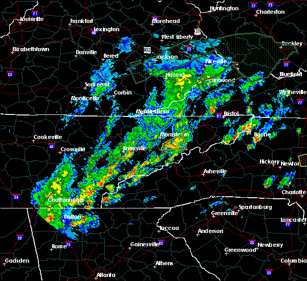 The severe thunderstorm warning for southwestern greene and northern cocke counties will expire at 630 pm edt, the storm which prompted the warning has weakened below severe limits, and no longer pose an immediate threat to life or property. therefore the warning will be allowed to expire. a severe thunderstorm watch remains in effect until 1000 pm edt for eastern tennessee. The severe thunderstorm warning for southwestern greene and northern cocke counties will expire at 630 pm edt, the storm which prompted the warning has weakened below severe limits, and no longer pose an immediate threat to life or property. therefore the warning will be allowed to expire. a severe thunderstorm watch remains in effect until 1000 pm edt for eastern tennessee.
|
| 5/2/2016 6:06 PM EDT |
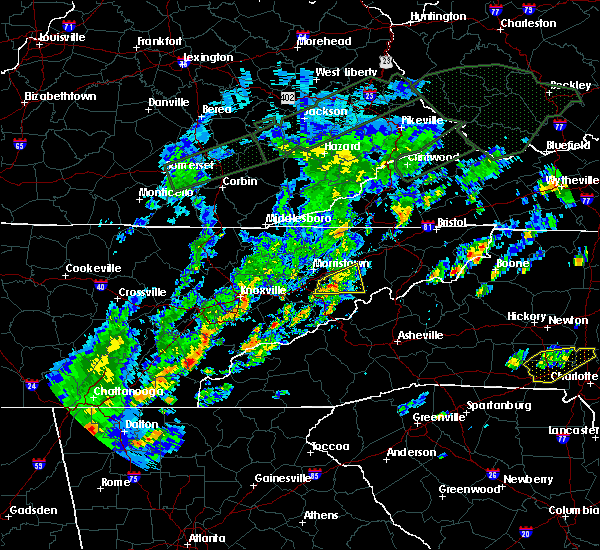 At 606 pm edt, a severe thunderstorm was located near parrottsville, or 11 miles northeast of newport, moving east at 40 mph (radar indicated). Hazards include 60 mph wind gusts and quarter size hail. Hail damage to vehicles is expected. expect wind damage to roofs, siding, and trees. Locations impacted include, greeneville, parrottsville, mosheim, caney branch, cedar creek, bybee and mohawk. At 606 pm edt, a severe thunderstorm was located near parrottsville, or 11 miles northeast of newport, moving east at 40 mph (radar indicated). Hazards include 60 mph wind gusts and quarter size hail. Hail damage to vehicles is expected. expect wind damage to roofs, siding, and trees. Locations impacted include, greeneville, parrottsville, mosheim, caney branch, cedar creek, bybee and mohawk.
|
| 5/2/2016 5:53 PM EDT |
 At 553 pm edt, a severe thunderstorm was located near baneberry, or 8 miles north of newport, moving east at 40 mph (radar indicated). Hazards include 60 mph wind gusts and quarter size hail. Hail damage to vehicles is expected. Expect wind damage to roofs, siding, and trees. At 553 pm edt, a severe thunderstorm was located near baneberry, or 8 miles north of newport, moving east at 40 mph (radar indicated). Hazards include 60 mph wind gusts and quarter size hail. Hail damage to vehicles is expected. Expect wind damage to roofs, siding, and trees.
|
| 7/14/2015 2:27 PM EDT | The severe thunderstorm warning for central greene county will expire at 230 pm edt, the storm which prompted the warning has moved out of the area. therefore the warning will be allowed to expire. |
| 7/14/2015 2:06 PM EDT |
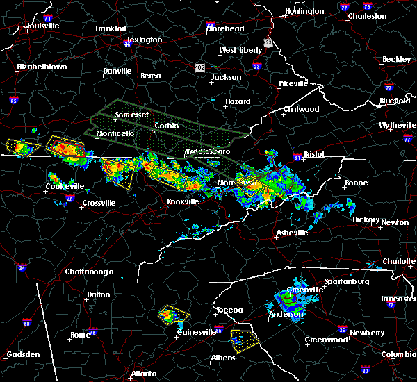 At 206 pm edt, a severe thunderstorm was located near greeneville, moving southeast at 35 mph (radar indicated). Hazards include 60 mph wind gusts and half dollar size hail. Hail damage to vehicles is expected. Expect wind damage to roofs, siding and trees. At 206 pm edt, a severe thunderstorm was located near greeneville, moving southeast at 35 mph (radar indicated). Hazards include 60 mph wind gusts and half dollar size hail. Hail damage to vehicles is expected. Expect wind damage to roofs, siding and trees.
|
| 7/14/2015 2:02 PM EDT |
 At 202 pm edt, a severe thunderstorm was located 7 miles northwest of greeneville, moving southeast at 40 mph (radar indicated). Hazards include 60 mph wind gusts and half dollar size hail. Hail damage to vehicles is expected. expect wind damage to roofs, siding and trees. Locations impacted include, greeneville, tusculum, mosheim, baileyton, romeo and chucky. At 202 pm edt, a severe thunderstorm was located 7 miles northwest of greeneville, moving southeast at 40 mph (radar indicated). Hazards include 60 mph wind gusts and half dollar size hail. Hail damage to vehicles is expected. expect wind damage to roofs, siding and trees. Locations impacted include, greeneville, tusculum, mosheim, baileyton, romeo and chucky.
|
| 7/14/2015 1:50 PM EDT | Tree down on baileyton r in greene county TN, 0.1 miles NW of Greeneville, TN |
| 7/14/2015 1:44 PM EDT |
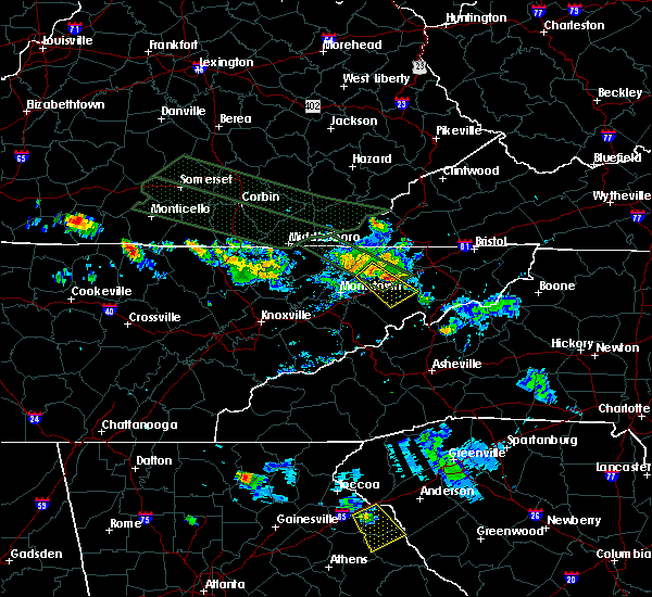 At 144 pm edt, a severe thunderstorm was located near rogersville, moving southeast at 35 mph (radar indicated). Hazards include 60 mph wind gusts and quarter size hail. Hail damage to vehicles is expected. Expect wind damage to roofs, siding and trees. At 144 pm edt, a severe thunderstorm was located near rogersville, moving southeast at 35 mph (radar indicated). Hazards include 60 mph wind gusts and quarter size hail. Hail damage to vehicles is expected. Expect wind damage to roofs, siding and trees.
|
| 7/13/2015 7:13 PM EDT |
 At 713 pm edt, severe thunderstorms were located along a line extending from greeneville to 6 miles east of white pine, moving south at 30 mph (radar indicated). Hazards include 60 mph wind gusts and quarter size hail. Hail damage to vehicles is expected. expect wind damage to roofs, siding and trees. Locations impacted include, greeneville, newport, tusculum, parrottsville, mosheim, caney branch, cedar creek, camp creek, del rio and bybee. At 713 pm edt, severe thunderstorms were located along a line extending from greeneville to 6 miles east of white pine, moving south at 30 mph (radar indicated). Hazards include 60 mph wind gusts and quarter size hail. Hail damage to vehicles is expected. expect wind damage to roofs, siding and trees. Locations impacted include, greeneville, newport, tusculum, parrottsville, mosheim, caney branch, cedar creek, camp creek, del rio and bybee.
|
| 7/13/2015 7:01 PM EDT |
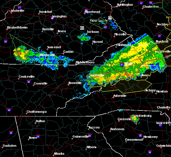 At 701 pm edt, severe thunderstorms were located along a line extending from near greeneville to 6 miles south of russellville, moving southeast at 30 mph (radar indicated). Hazards include 60 mph wind gusts and quarter size hail. Hail damage to vehicles is expected. expect wind damage to roofs, siding and trees. Locations impacted include, morristown, greeneville, newport, tusculum, white pine, baneberry, parrottsville, russellville, mosheim, bulls gap, baileyton, lowland, cedar creek, camp creek, caney branch, romeo, del rio, bybee and mohawk. At 701 pm edt, severe thunderstorms were located along a line extending from near greeneville to 6 miles south of russellville, moving southeast at 30 mph (radar indicated). Hazards include 60 mph wind gusts and quarter size hail. Hail damage to vehicles is expected. expect wind damage to roofs, siding and trees. Locations impacted include, morristown, greeneville, newport, tusculum, white pine, baneberry, parrottsville, russellville, mosheim, bulls gap, baileyton, lowland, cedar creek, camp creek, caney branch, romeo, del rio, bybee and mohawk.
|
| 7/13/2015 7:00 PM EDT | Numerous trees down countywid in greene county TN, 0.1 miles NW of Greeneville, TN |
| 7/13/2015 6:56 PM EDT |
 At 655 pm edt, severe thunderstorms were located along a line extending from 6 miles northeast of elizabethton to 6 miles north of tusculum, moving southeast at 30 mph (radar indicated). Hazards include 60 mph wind gusts and quarter size hail. Hail damage to vehicles is expected. Expect wind damage to roofs, siding and trees. At 655 pm edt, severe thunderstorms were located along a line extending from 6 miles northeast of elizabethton to 6 miles north of tusculum, moving southeast at 30 mph (radar indicated). Hazards include 60 mph wind gusts and quarter size hail. Hail damage to vehicles is expected. Expect wind damage to roofs, siding and trees.
|
| 7/13/2015 6:52 PM EDT |
 At 651 pm edt, severe thunderstorms were located along a line extending from near hampton to 6 miles east of tusculum, moving southeast at 45 mph (radar indicated). Hazards include 60 mph wind gusts and quarter size hail. Hail damage to vehicles is expected. expect wind damage to roofs, siding and trees. Locations impacted include, johnson city, kingsport, greeneville, elizabethton, erwin, bristol, jonesborough, tusculum, midway, spurgeon, oak grove, colonial heights, central, hampton, banner hill, pine crest, gray, unicoi, bluff city and watauga. At 651 pm edt, severe thunderstorms were located along a line extending from near hampton to 6 miles east of tusculum, moving southeast at 45 mph (radar indicated). Hazards include 60 mph wind gusts and quarter size hail. Hail damage to vehicles is expected. expect wind damage to roofs, siding and trees. Locations impacted include, johnson city, kingsport, greeneville, elizabethton, erwin, bristol, jonesborough, tusculum, midway, spurgeon, oak grove, colonial heights, central, hampton, banner hill, pine crest, gray, unicoi, bluff city and watauga.
|
| 7/13/2015 6:49 PM EDT |
 A severe thunderstorm warning remains in effect until 730 pm edt for east central grainger. greene. hamblen. southwestern hawkins. jefferson and central cocke counties. at 649 pm edt. severe thunderstorms were located along a line extending from 10 miles north of greeneville to near rutledge. Moving south at 30 mph. A severe thunderstorm warning remains in effect until 730 pm edt for east central grainger. greene. hamblen. southwestern hawkins. jefferson and central cocke counties. at 649 pm edt. severe thunderstorms were located along a line extending from 10 miles north of greeneville to near rutledge. Moving south at 30 mph.
|
| 7/13/2015 6:43 PM EDT |
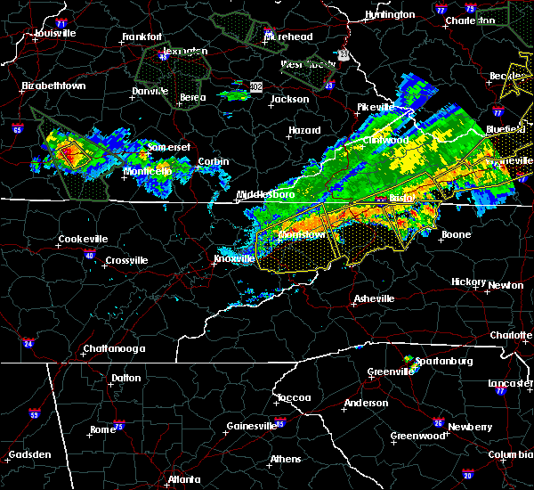 A severe thunderstorm warning remains in effect until 730 pm edt for northeastern grainger. greene. hamblen. hawkins. jefferson and central cocke counties. at 643 pm edt. severe thunderstorms were located along a line extending from 8 miles north of greeneville to near rutledge. Moving south at 30 mph. A severe thunderstorm warning remains in effect until 730 pm edt for northeastern grainger. greene. hamblen. hawkins. jefferson and central cocke counties. at 643 pm edt. severe thunderstorms were located along a line extending from 8 miles north of greeneville to near rutledge. Moving south at 30 mph.
|
| 7/13/2015 6:40 PM EDT |
 At 640 pm edt, severe thunderstorms were located along a line extending from 7 miles northeast of elizabethton to 8 miles northeast of tusculum, moving southeast at 45 mph (radar indicated). Hazards include 60 mph wind gusts and quarter size hail. Hail damage to vehicles is expected. expect wind damage to roofs, siding and trees. Locations impacted include, johnson city, kingsport, greeneville, elizabethton, erwin, bristol tn, bristol, jonesborough, tusculum, surgoinsville, midway, spurgeon, oak grove, colonial heights, walnut hill, central, hampton, banner hill, pine crest and gray. At 640 pm edt, severe thunderstorms were located along a line extending from 7 miles northeast of elizabethton to 8 miles northeast of tusculum, moving southeast at 45 mph (radar indicated). Hazards include 60 mph wind gusts and quarter size hail. Hail damage to vehicles is expected. expect wind damage to roofs, siding and trees. Locations impacted include, johnson city, kingsport, greeneville, elizabethton, erwin, bristol tn, bristol, jonesborough, tusculum, surgoinsville, midway, spurgeon, oak grove, colonial heights, walnut hill, central, hampton, banner hill, pine crest and gray.
|
| 7/13/2015 6:26 PM EDT |
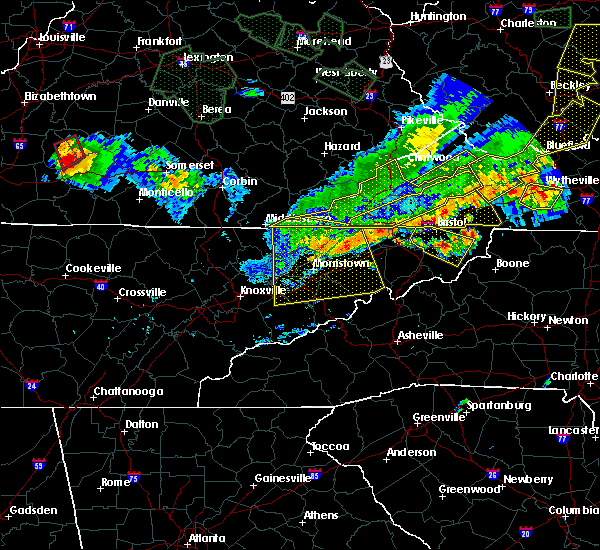 At 625 pm edt, severe thunderstorms were located along a line extending from near surgoinsville to near new tazewell, moving south at 30 mph (radar indicated). Hazards include 60 mph wind gusts and quarter size hail. Hail damage to vehicles is expected. Expect wind damage to roofs, siding and trees. At 625 pm edt, severe thunderstorms were located along a line extending from near surgoinsville to near new tazewell, moving south at 30 mph (radar indicated). Hazards include 60 mph wind gusts and quarter size hail. Hail damage to vehicles is expected. Expect wind damage to roofs, siding and trees.
|
| 7/13/2015 6:19 PM EDT |
 At 618 pm edt, severe thunderstorms were located along a line extending from near walnut hill to near surgoinsville, moving southeast at 45 mph (radar indicated). Hazards include 60 mph wind gusts and quarter size hail. Hail damage to vehicles is expected. Expect wind damage to roofs, siding and trees. At 618 pm edt, severe thunderstorms were located along a line extending from near walnut hill to near surgoinsville, moving southeast at 45 mph (radar indicated). Hazards include 60 mph wind gusts and quarter size hail. Hail damage to vehicles is expected. Expect wind damage to roofs, siding and trees.
|
| 7/13/2015 6:13 PM EDT |
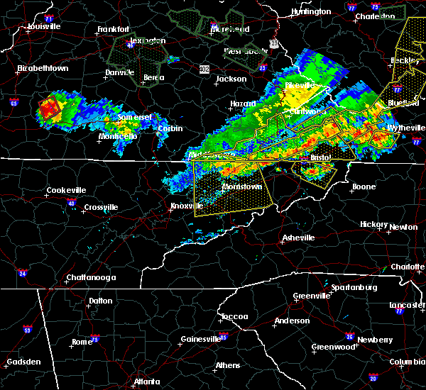 A severe thunderstorm warning remains in effect until 630 pm edt for grainger. greene. hamblen. north central sevier. eastern claiborne. hawkins. jefferson. northern cocke and hancock counties. at 611 pm edt. severe thunderstorms were located along a line extending from near surgoinsville to near tazewell. Moving south at. A severe thunderstorm warning remains in effect until 630 pm edt for grainger. greene. hamblen. north central sevier. eastern claiborne. hawkins. jefferson. northern cocke and hancock counties. at 611 pm edt. severe thunderstorms were located along a line extending from near surgoinsville to near tazewell. Moving south at.
|
| 7/13/2015 5:52 PM EDT |
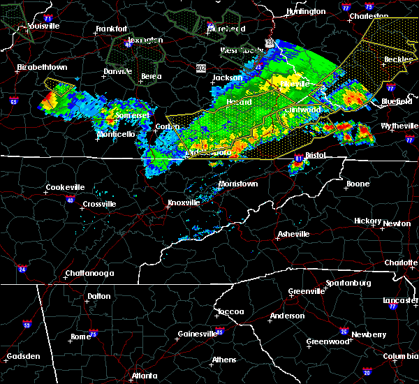 The national weather service in morristown has issued a * severe thunderstorm warning for. grainger county in east tennessee. greene county in east tennessee. hamblen county in east tennessee. North central sevier county in east tennessee. The national weather service in morristown has issued a * severe thunderstorm warning for. grainger county in east tennessee. greene county in east tennessee. hamblen county in east tennessee. North central sevier county in east tennessee.
|
| 6/19/2015 6:12 PM EDT |
 At 611 pm edt, a severe thunderstorm was located near greeneville, moving northeast at 15 mph (radar indicated). Hazards include 60 mph wind gusts and quarter size hail. Hail damage to vehicles is expected. expect wind damage to roofs, siding and trees. Locations impacted include, greeneville, tusculum, baileyton and chucky. At 611 pm edt, a severe thunderstorm was located near greeneville, moving northeast at 15 mph (radar indicated). Hazards include 60 mph wind gusts and quarter size hail. Hail damage to vehicles is expected. expect wind damage to roofs, siding and trees. Locations impacted include, greeneville, tusculum, baileyton and chucky.
|
| 6/19/2015 6:01 PM EDT |
 At 600 pm edt, a severe thunderstorm was located over greeneville, moving northeast at 15 mph (radar indicated). Hazards include 60 mph wind gusts and quarter size hail. Hail damage to vehicles is expected. expect wind damage to roofs, siding and trees. Locations impacted include, greeneville, tusculum, mosheim, baileyton and chucky. At 600 pm edt, a severe thunderstorm was located over greeneville, moving northeast at 15 mph (radar indicated). Hazards include 60 mph wind gusts and quarter size hail. Hail damage to vehicles is expected. expect wind damage to roofs, siding and trees. Locations impacted include, greeneville, tusculum, mosheim, baileyton and chucky.
|
| 6/19/2015 6:00 PM EDT | Quarter sized hail reported 1 miles E of Greeneville, TN |
| 6/19/2015 5:57 PM EDT |
 At 557 pm edt, a severe thunderstorm was located over greeneville, moving northeast at 15 mph (radar indicated). Hazards include 60 mph wind gusts and quarter size hail. Hail damage to vehicles is expected. expect wind damage to roofs, siding and trees. Locations impacted include, greeneville, tusculum, mosheim, baileyton and chucky. At 557 pm edt, a severe thunderstorm was located over greeneville, moving northeast at 15 mph (radar indicated). Hazards include 60 mph wind gusts and quarter size hail. Hail damage to vehicles is expected. expect wind damage to roofs, siding and trees. Locations impacted include, greeneville, tusculum, mosheim, baileyton and chucky.
|
| 6/19/2015 5:49 PM EDT |
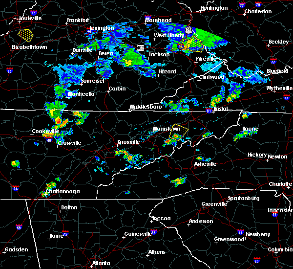 At 548 pm edt, a severe thunderstorm was located near greeneville, moving northeast at 15 mph (radar indicated). Hazards include 60 mph wind gusts and penny size hail. Expect damage to roofs. Siding and trees. At 548 pm edt, a severe thunderstorm was located near greeneville, moving northeast at 15 mph (radar indicated). Hazards include 60 mph wind gusts and penny size hail. Expect damage to roofs. Siding and trees.
|
| 6/18/2015 9:39 PM EDT | At 939 pm edt, a severe thunderstorm was located near russellville, or 11 miles east of morristown, moving east at 30 mph (radar indicated). Hazards include 60 mph wind gusts and quarter size hail. Hail damage to vehicles is expected. Expect wind damage to roofs, siding and trees. |
| 4/19/2015 10:21 PM EDT | At 1021 pm edt, severe thunderstorms were located along a line extending from 9 miles northwest of surgoinsville to near greeneville, moving east at 40 mph (radar indicated). Hazards include 60 mph wind gusts. Expect damage to roofs. Siding and trees. |
| 4/19/2015 10:12 PM EDT | At 1011 pm edt, severe thunderstorms were located along a line extending from 6 miles south of jonesville to 9 miles southeast of russellville, moving east at 30 mph (radar indicated). Hazards include 60 mph wind gusts. Expect damage to roofs. siding and trees. locations impacted include, morristown, greeneville, rogersville, sneedville, surgoinsville, russellville, mosheim, bulls gap, kyles ford, mccloud, kepler, treadway, romeo, st. clair, klondike, mooresburg and mohawk. 75in. |
| 4/19/2015 10:03 PM EDT | At 1003 pm edt, severe thunderstorms were located along a line extending from 6 miles west of bean station to 20 miles south of newport, moving east at 30 mph (radar indicated). Hazards include 60 mph wind gusts. Expect damage to roofs. siding and trees. locations impacted include, greeneville, newport, parrottsville, mosheim, bulls gap, caney branch, cedar creek, hartford, del rio, round mountain, cosby, bybee and mohawk. 75in. |
| 4/19/2015 9:56 PM EDT | At 956 pm edt, severe thunderstorms were located along a line extending from near sneedville to russellville, moving northeast at 35 mph (radar indicated). Hazards include 60 mph wind gusts. Expect damage to roofs. Siding and trees. |
| 4/19/2015 9:41 PM EDT | At 940 pm edt, severe thunderstorms were located along a line extending from rutledge to 14 miles southeast of gatlinburg, moving east at 35 mph (radar indicated). Hazards include 60 mph wind gusts. Expect damage to roofs. Siding and trees. |
| 4/3/2015 8:02 PM EDT | A severe thunderstorm warning remains in effect until 815 pm edt for western washington. hawkins. central hancock. northeastern hamblen. northern greene and southwestern sullivan counties. at 801 pm edt. a severe thunderstorm was located 7 miles south of surgoinsville. or 7 miles east of rogersville. Moving east at 45 mph. |
| 4/3/2015 7:51 PM EDT | A severe thunderstorm warning remains in effect until 815 pm edt for western washington. hawkins. central hancock. east central grainger. northeastern hamblen. northern greene and southwestern sullivan counties. at 751 pm edt. a severe thunderstorm was located near rogersville. Moving east at 45 mph. |
| 4/3/2015 7:35 PM EDT | The national weather service in morristown has issued a * severe thunderstorm warning for. western washington county in eastern tennessee. hawkins county in eastern tennessee. central hancock county in eastern tennessee. East central grainger county in eastern tennessee. |
| 10/14/2014 8:15 AM EDT | Wind gust of 65 mph at the noaa wind tower at camp creek elementary schoo in greene county TN, 6.3 miles NNW of Greeneville, TN |
| 8/20/2014 5:10 PM EDT | A few trees dow in greene county TN, 2.2 miles N of Greeneville, TN |
| 6/10/2014 7:15 PM EDT | Sporadic tree damage across count in greene county TN, 0.1 miles NW of Greeneville, TN |
| 2/21/2014 3:30 AM EST | A few trees down near baileyton...tennessee in greene county TN, 11 miles S of Greeneville, TN |
| 2/21/2014 3:25 AM EST | Trees down in greene county TN, 11 miles S of Greeneville, TN |
| 5/22/2013 4:18 PM EDT | Several trees down across count in greene county TN, 0.1 miles NW of Greeneville, TN |
| 5/22/2013 3:18 PM EDT | Quarter sized hail reported 6.3 miles NNW of Greeneville, TN |
| 5/21/2013 8:24 PM EDT | Trees down countywide in greene county TN, 0.1 miles NW of Greeneville, TN |
| 5/21/2013 8:20 PM EDT | Trees down countywide in greene county TN, 0.1 miles NW of Greeneville, TN |
| 5/21/2013 6:00 PM EDT | Trees down countywide in greene county TN, 0.1 miles NW of Greeneville, TN |
| 8/3/2012 3:10 PM EDT | 2 barns destroye in greene county TN, 2.7 miles S of Greeneville, TN |
| 8/3/2012 2:50 PM EDT | A couple trees and several large tree limbs dow in greene county TN, 0.1 miles NW of Greeneville, TN |
| 7/5/2012 4:40 PM EDT | Several trees down across the count in greene county TN, 0.1 miles NW of Greeneville, TN |
| 7/2/2012 12:18 AM EDT | Trees down county wide in greene county TN, 0.1 miles NW of Greeneville, TN |
| 4/3/2012 5:50 PM EDT | One tree down on west main s in greene county TN, 0.1 miles NW of Greeneville, TN |
| 1/1/0001 12:00 AM | A few trees dow in greene county TN, 1.5 miles N of Greeneville, TN |
| 1/1/0001 12:00 AM | About 20 trees down on and along highway 321. reported by dispatc in greene county TN, 10.5 miles NE of Greeneville, TN |
| 1/1/0001 12:00 AM | Few trees dow in greene county TN, 0.1 miles NW of Greeneville, TN |
| 4/27/2011 6:30 PM EDT | Quarter sized hail reported 11 miles S of Greeneville, TN |
| 1/1/0001 12:00 AM | Trees down county wide...reported by dispatc in greene county TN, 0.1 miles NW of Greeneville, TN |
| 1/1/0001 12:00 AM | Golf Ball sized hail reported 4.1 miles W of Greeneville, TN, golf ball size hail...reported by dispatch. |
Hail Maps for Greeneville, TN


Connect with Interactive Hail Maps