

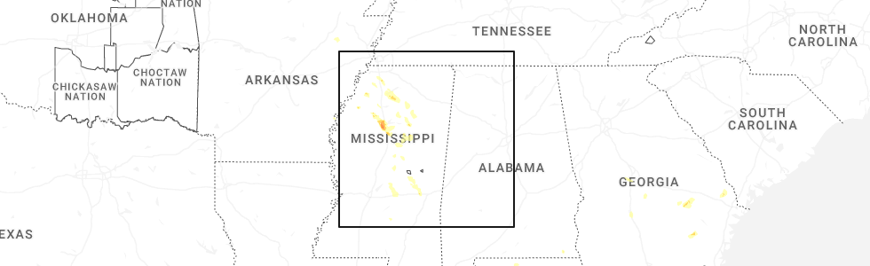
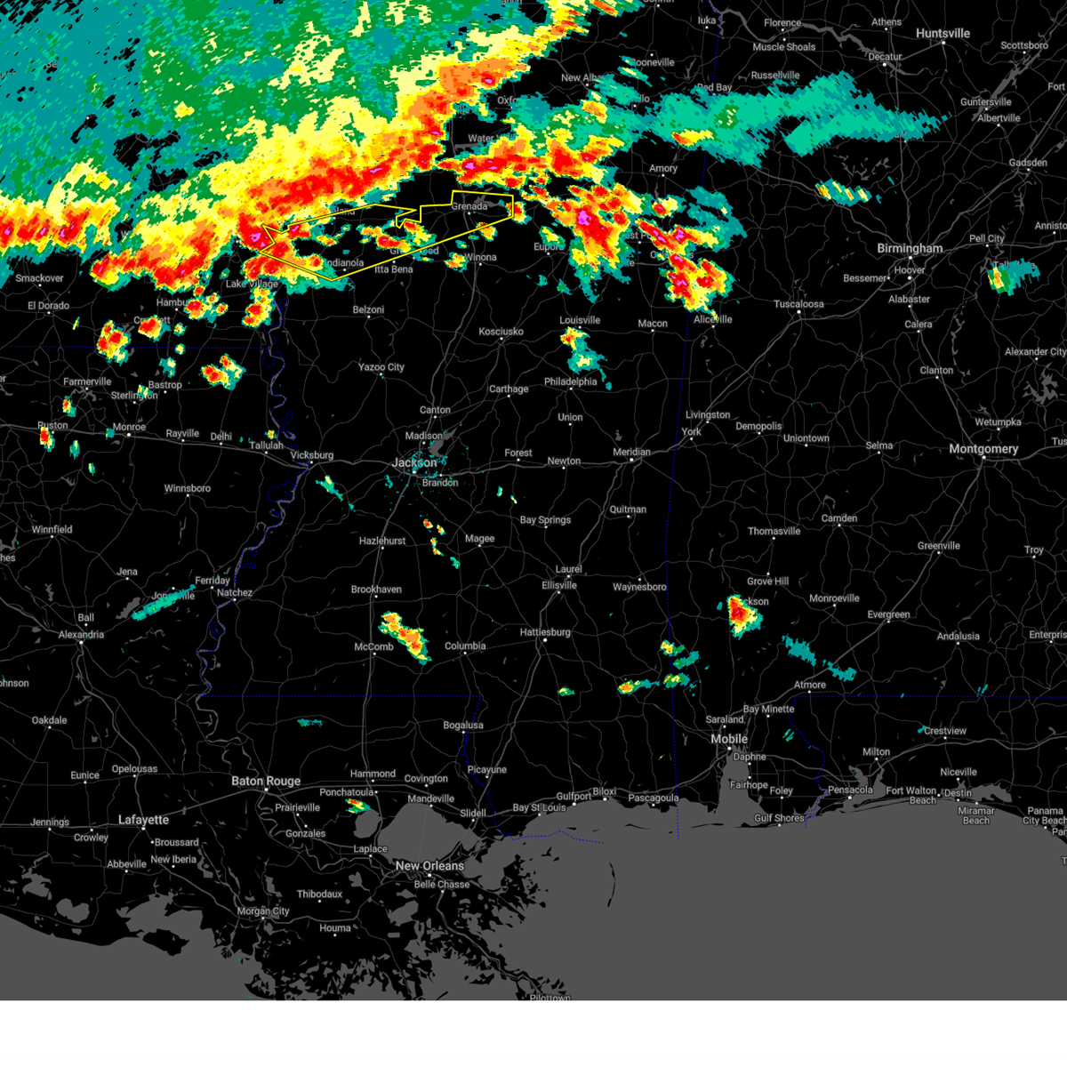
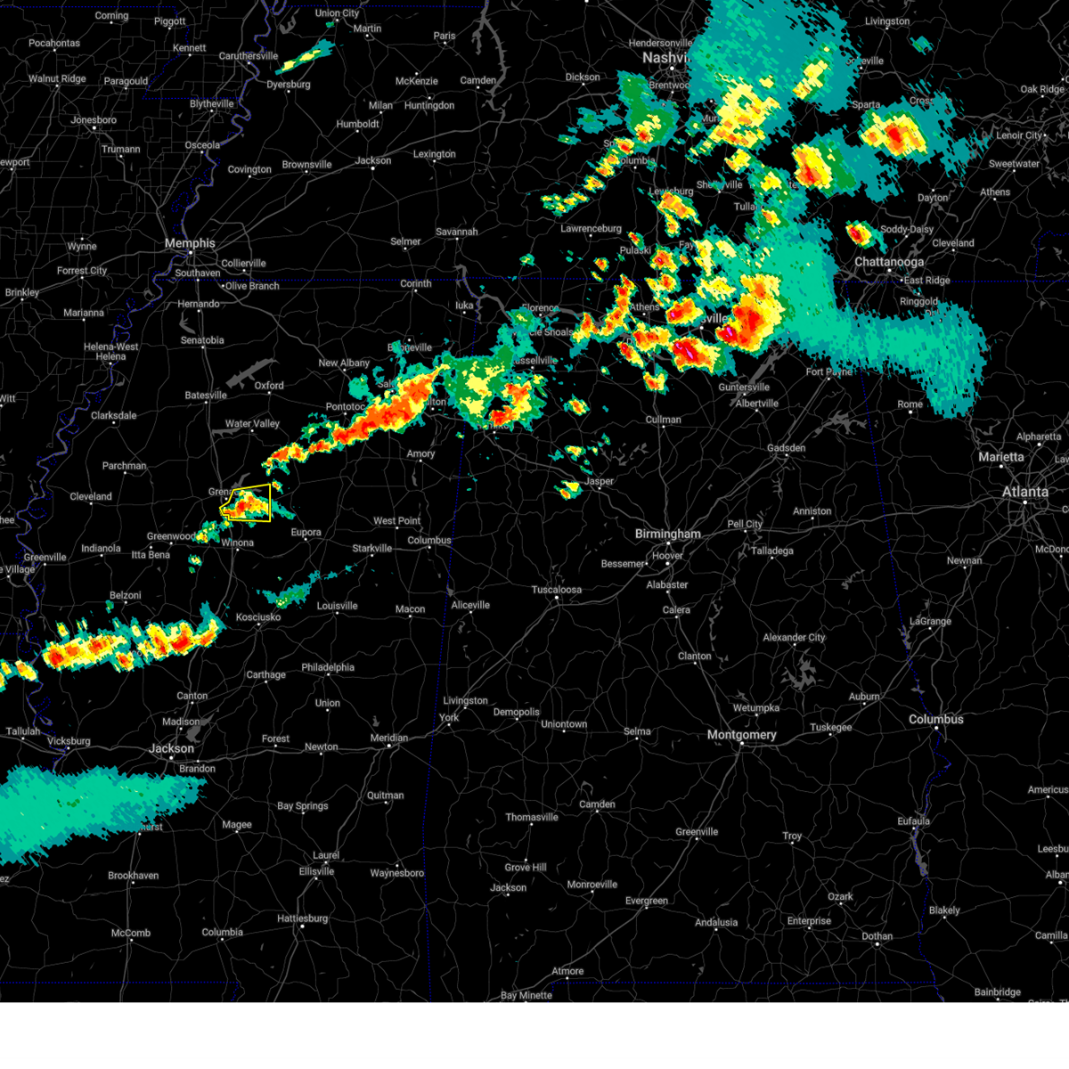
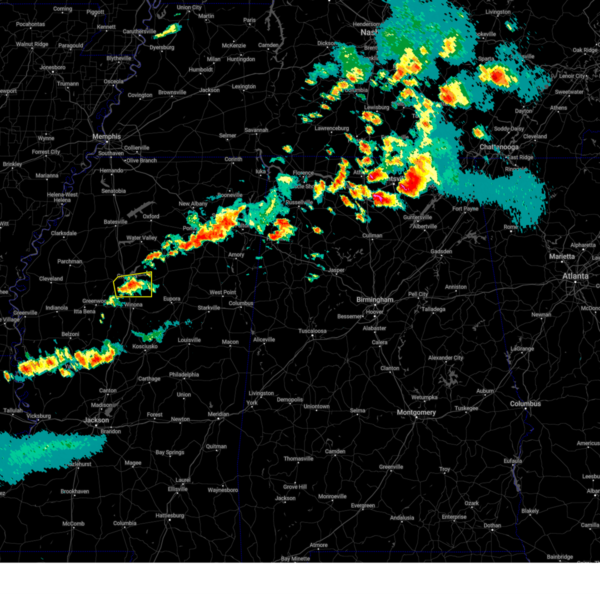
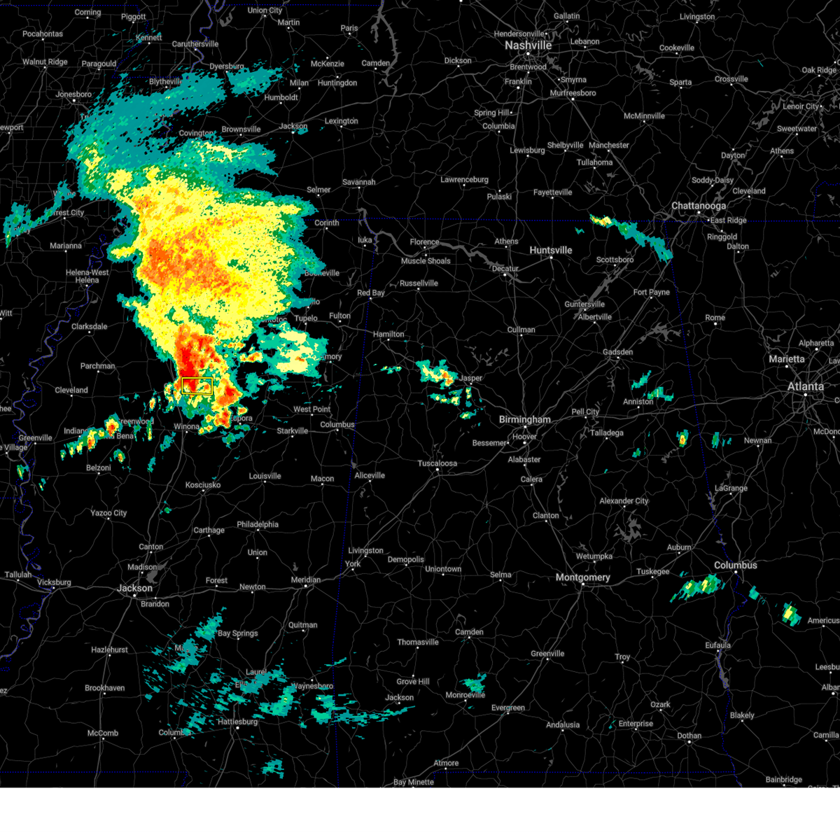
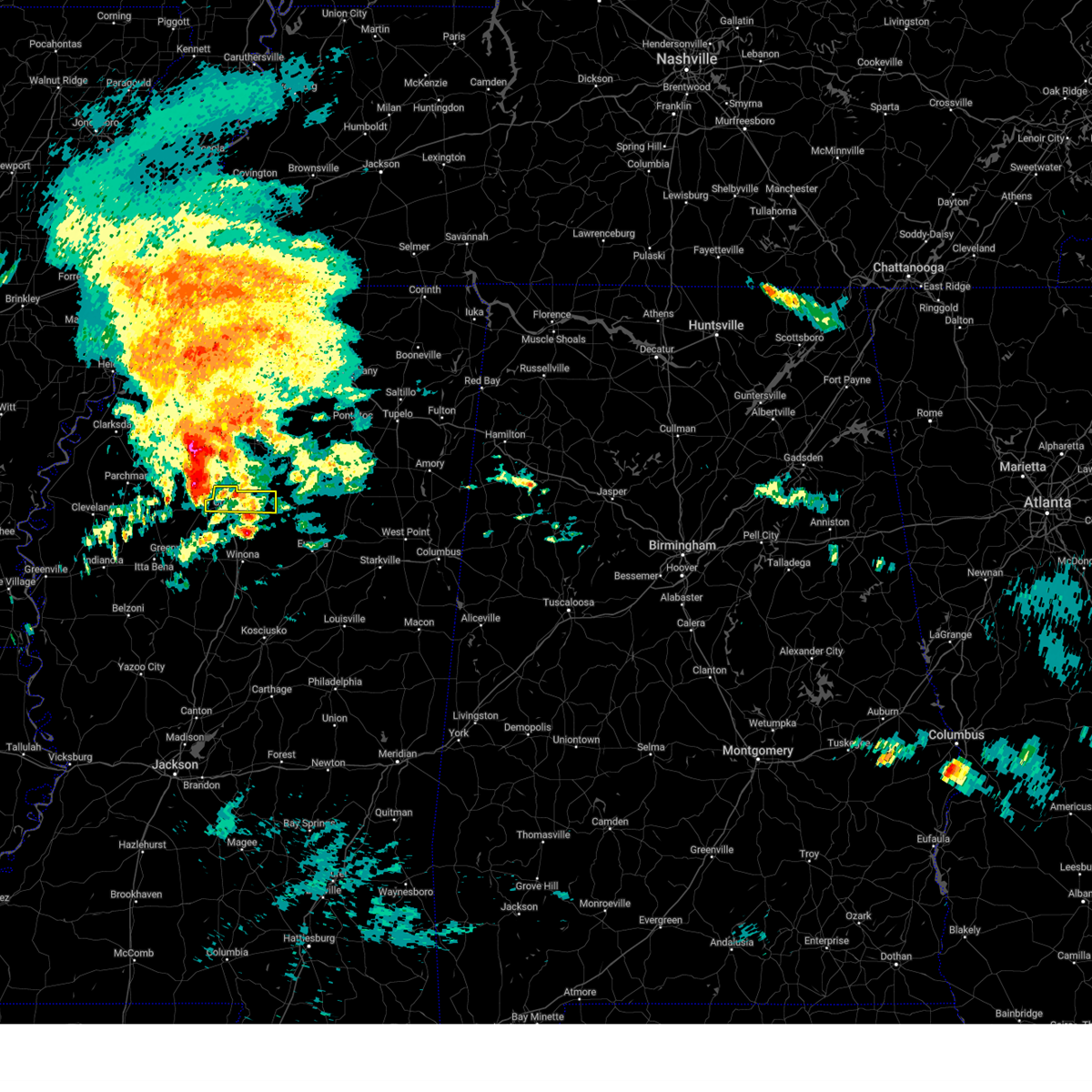
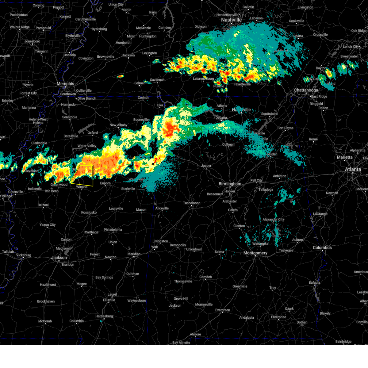
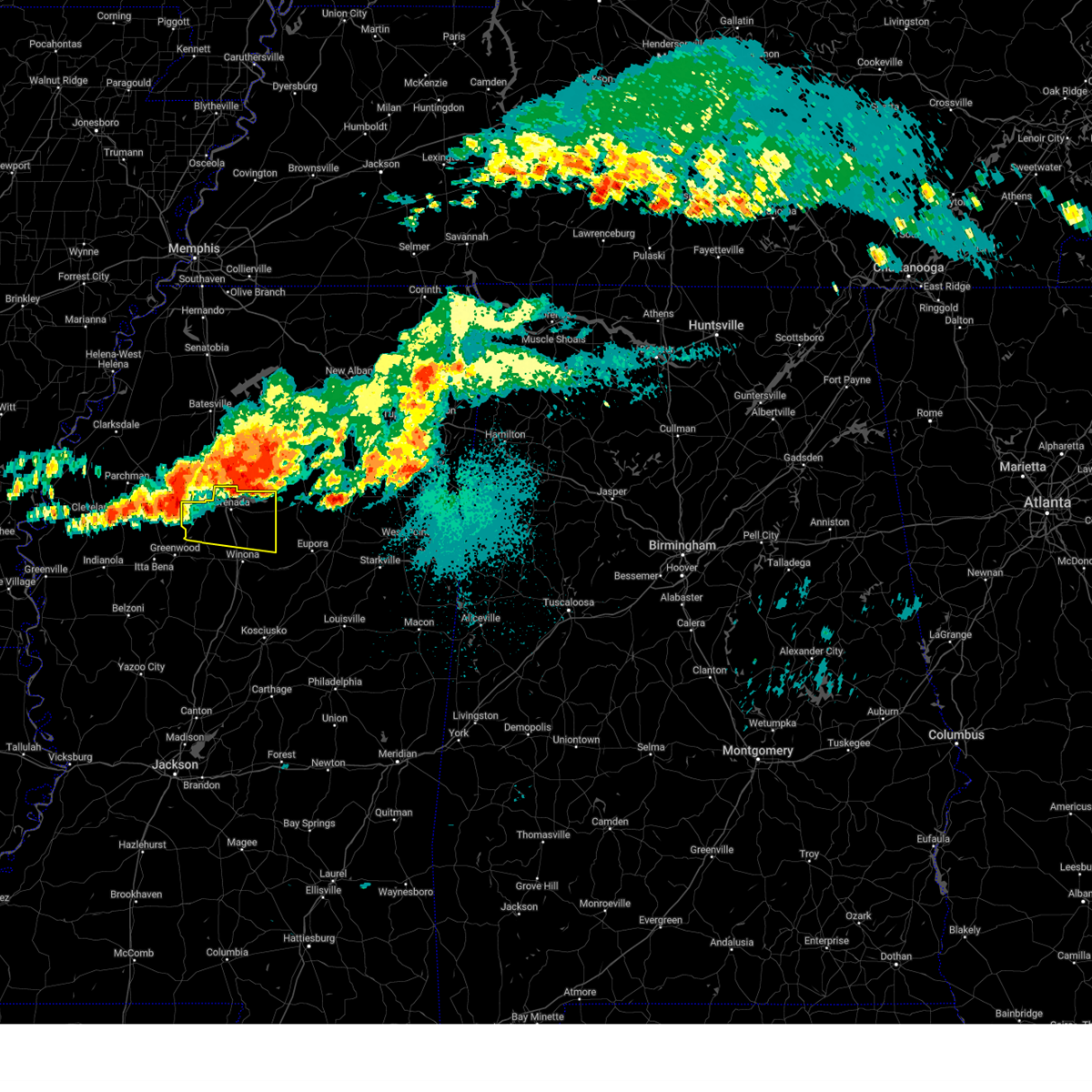
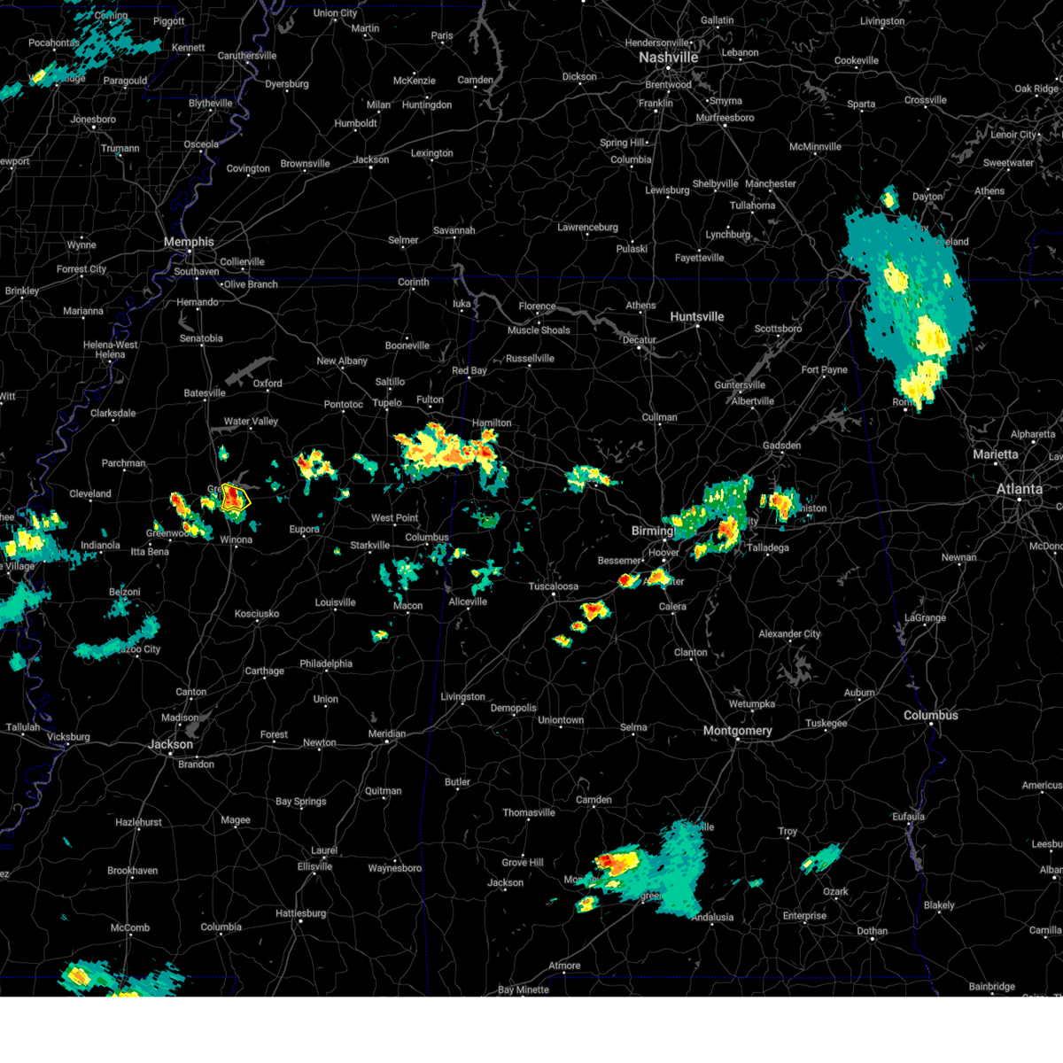
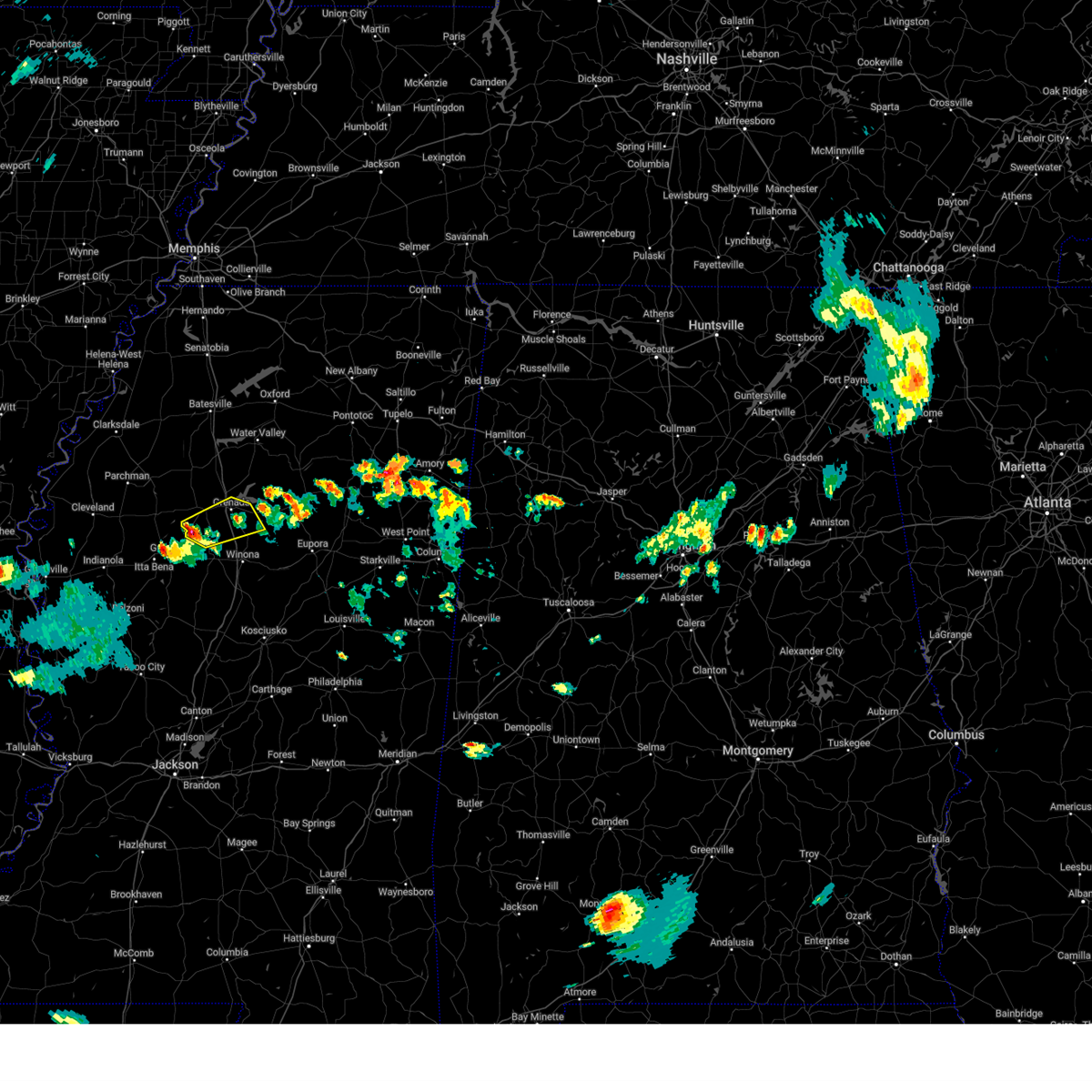
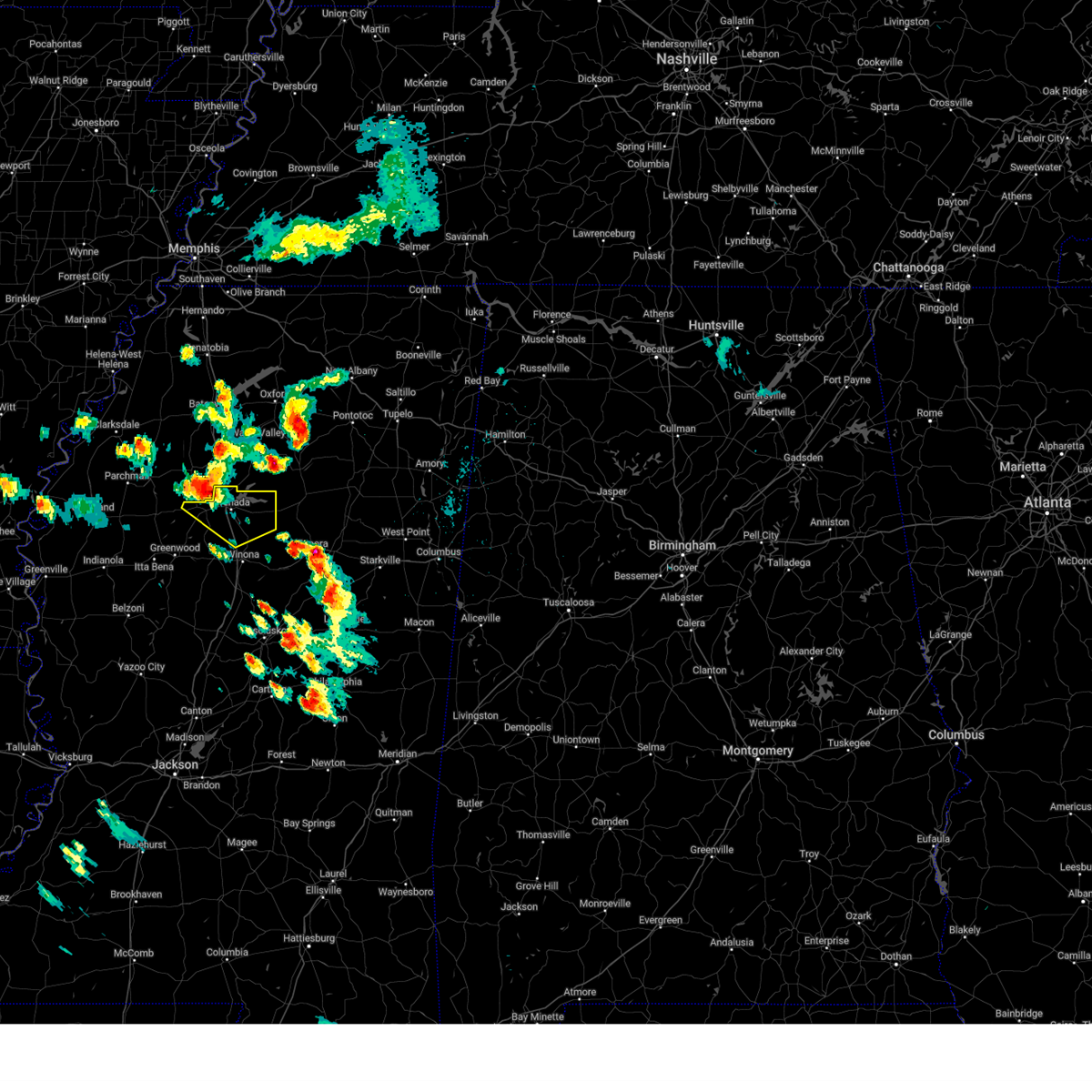
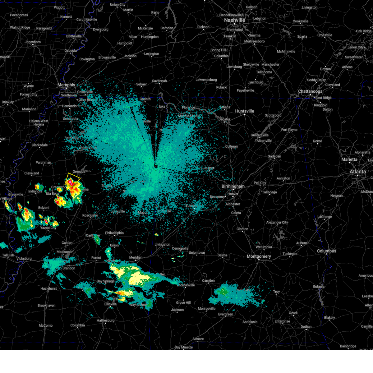
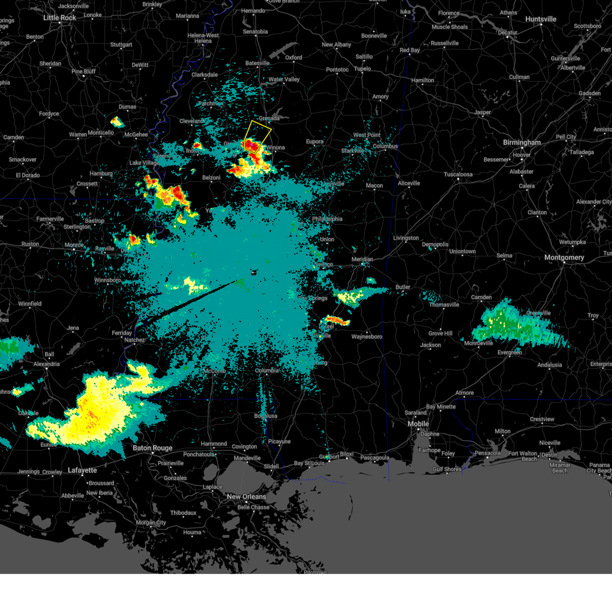
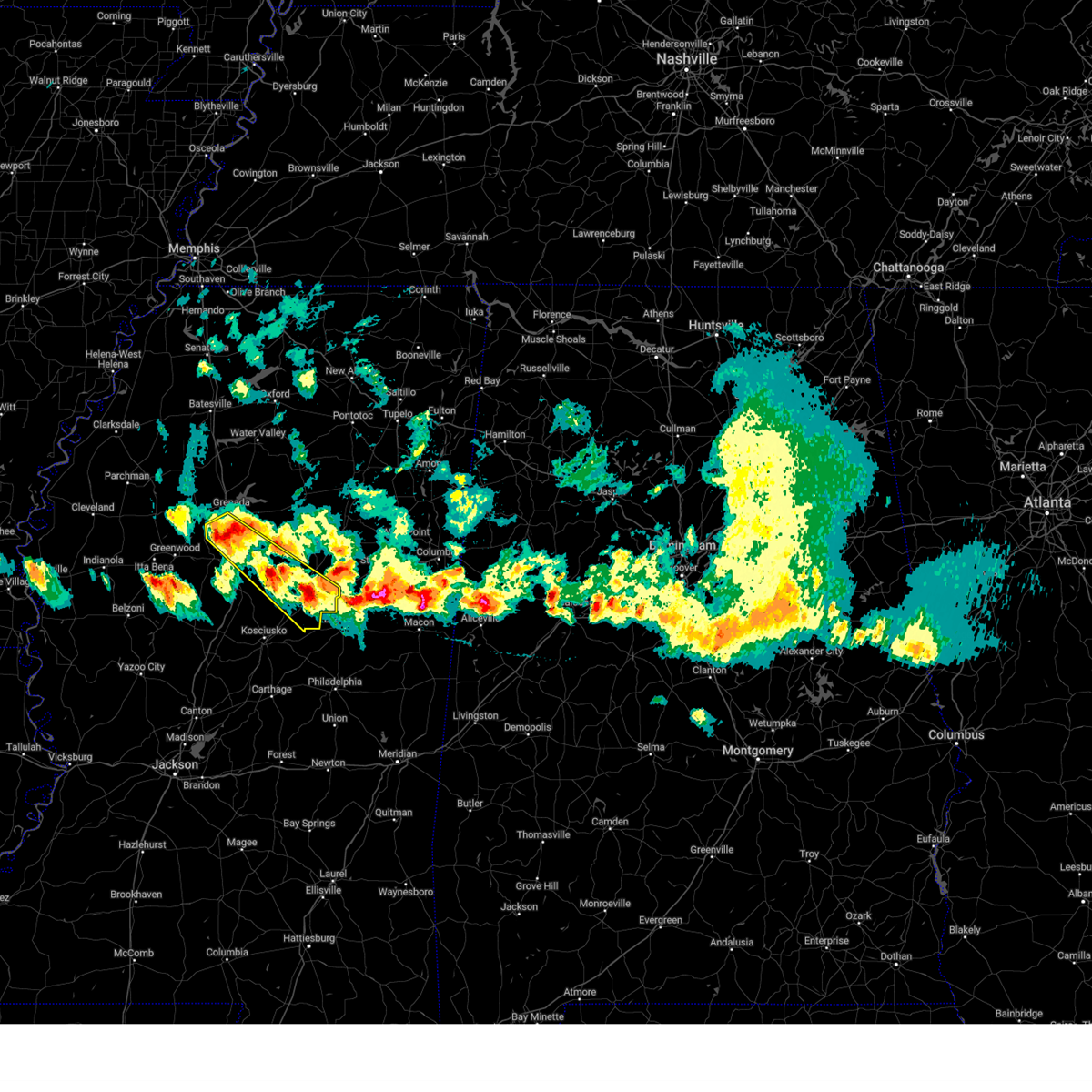
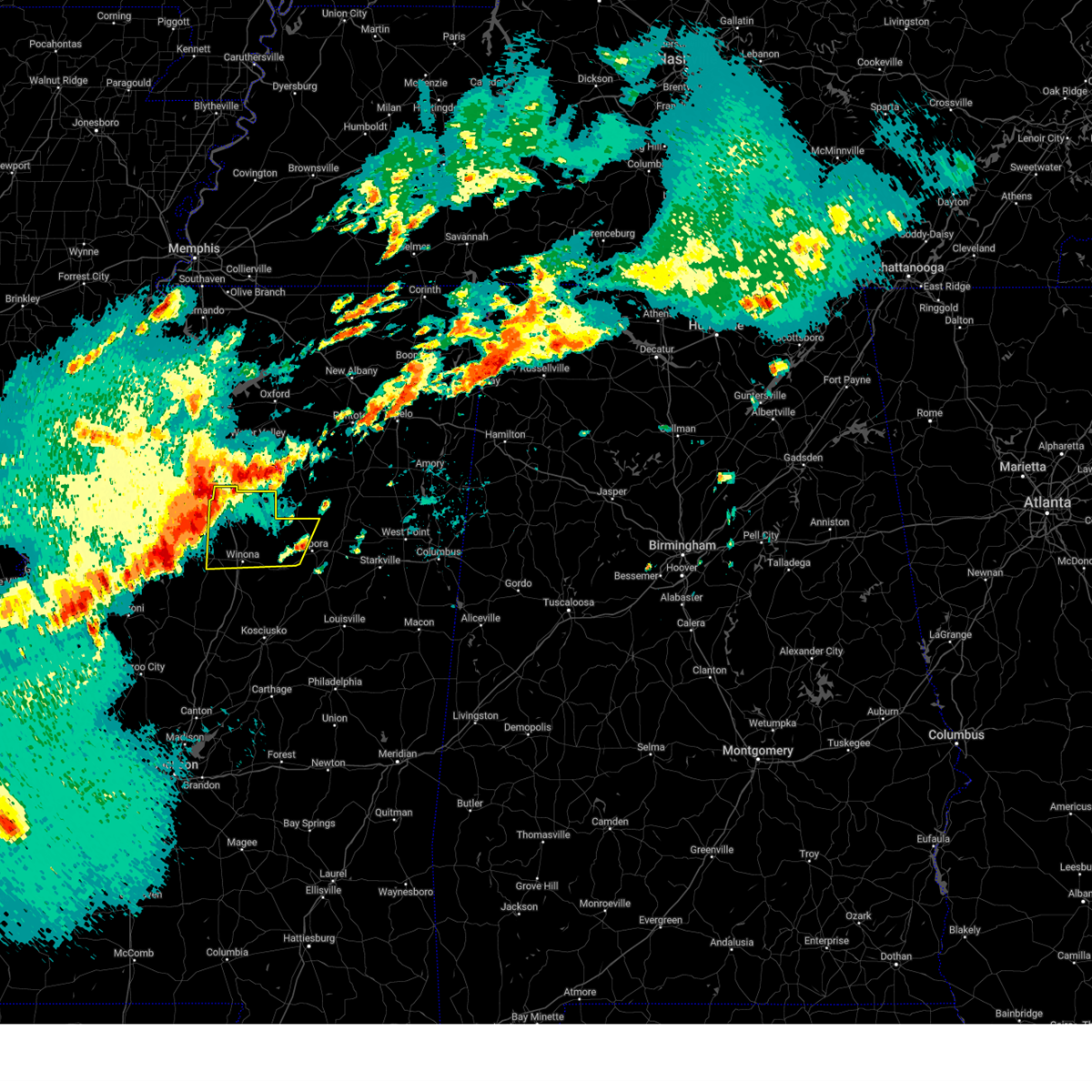
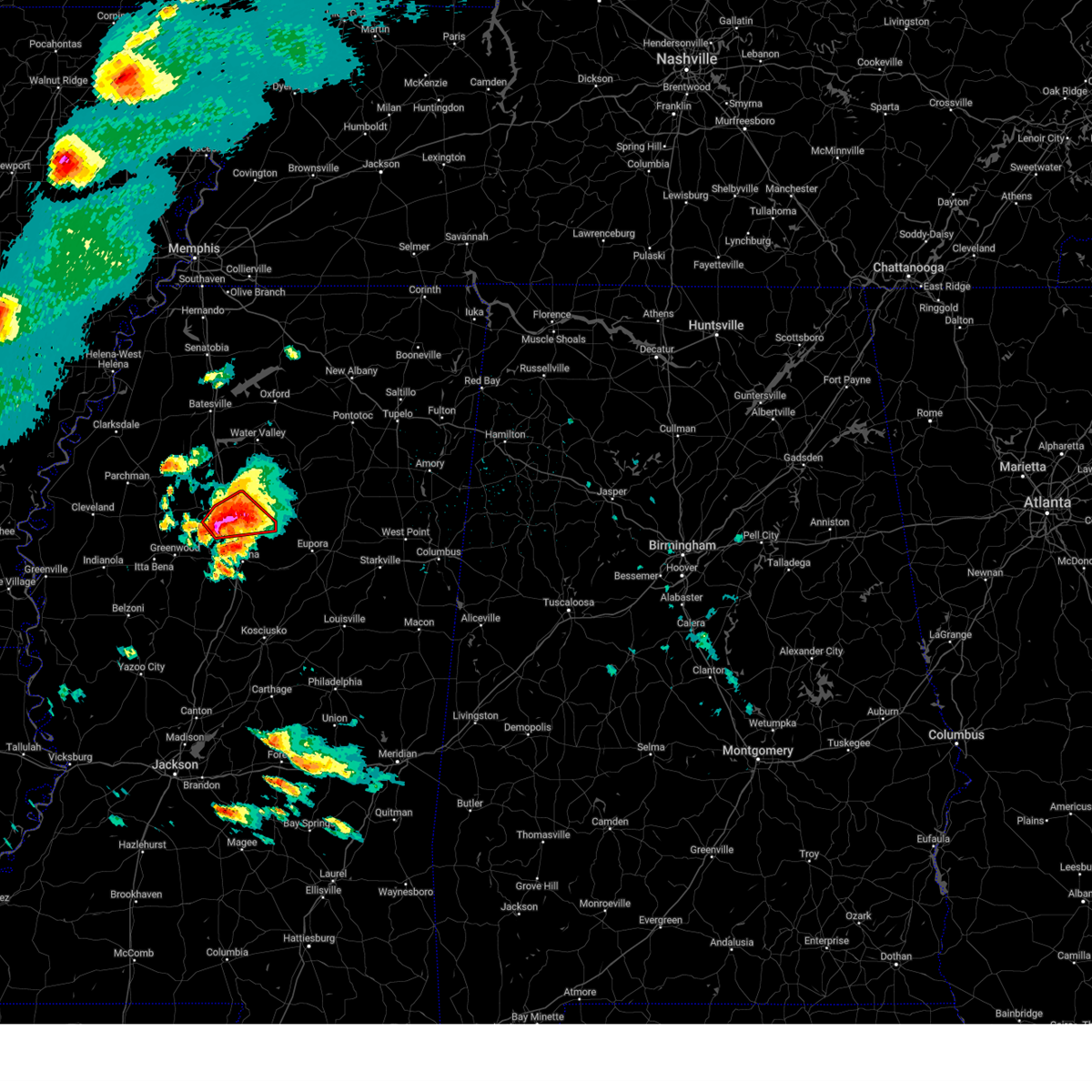
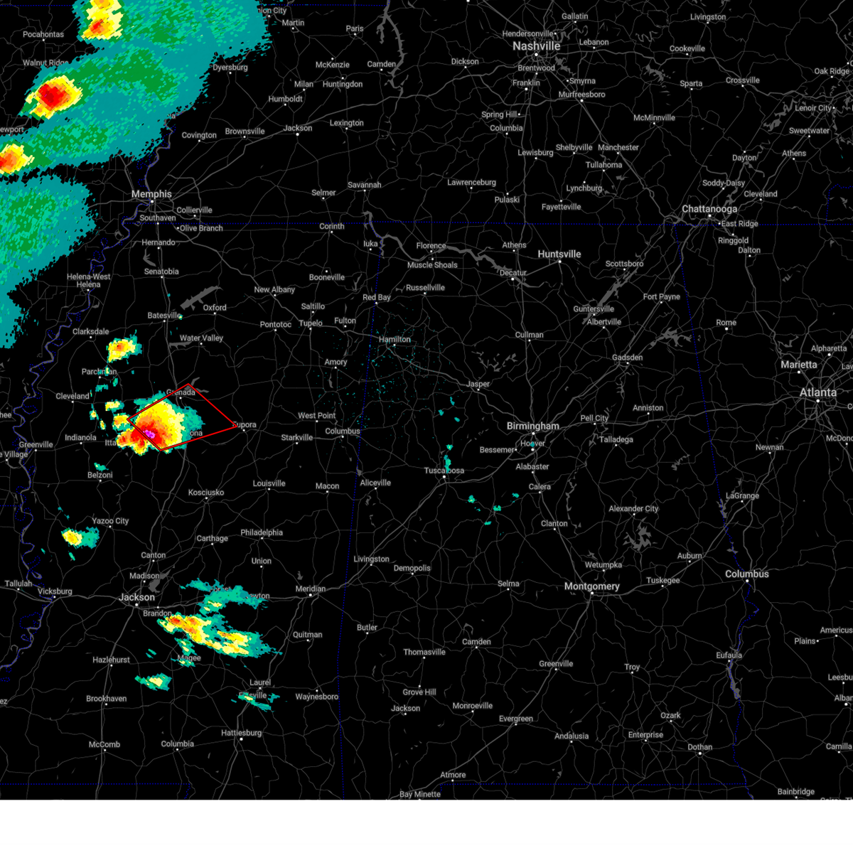
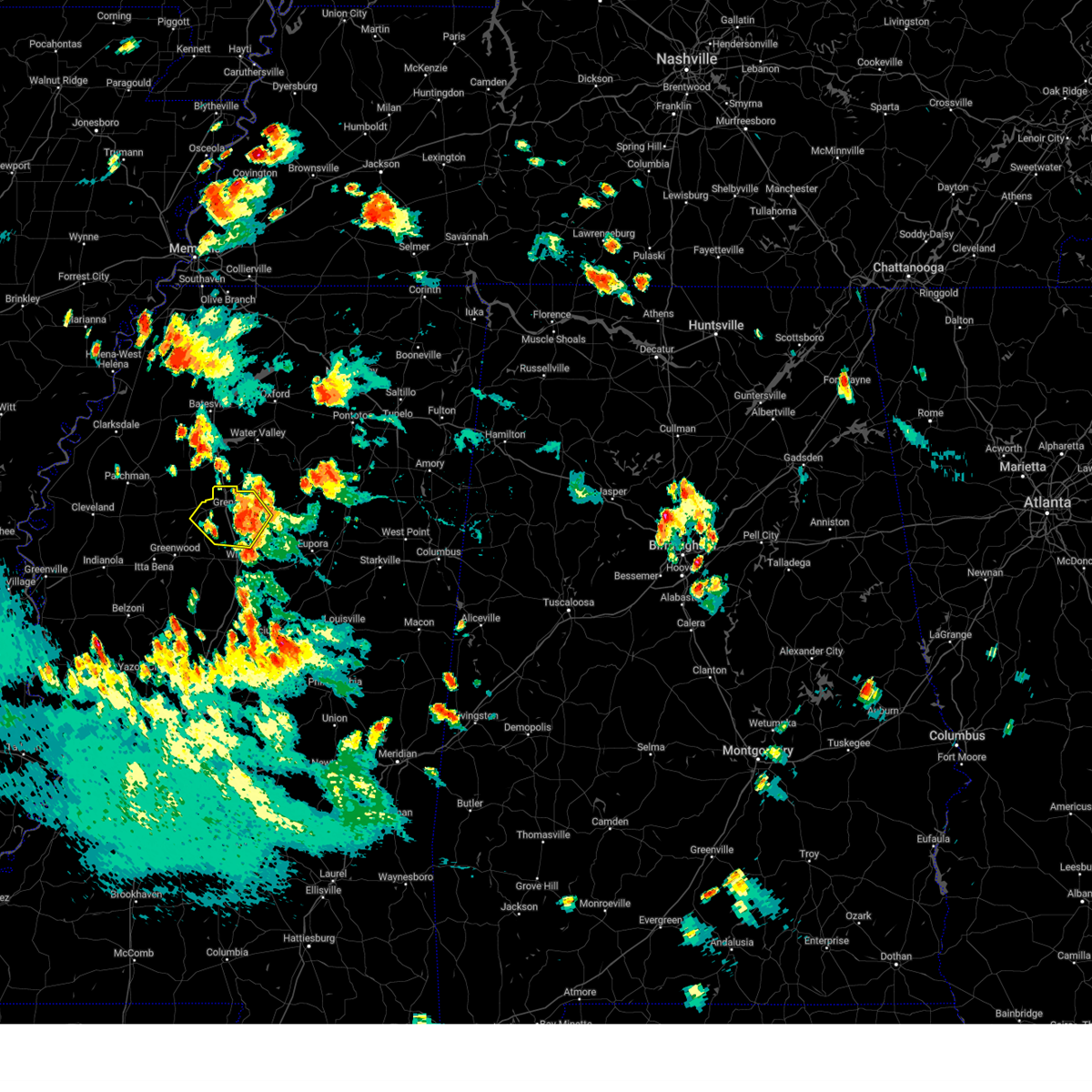
Hail Map for Grenada, MS
The Grenada, MS area has had 17 reports of on-the-ground hail by trained spotters, and has been under severe weather warnings 47 times during the past 12 months. Doppler radar has detected hail at or near Grenada, MS on 78 occasions, including 11 occasions during the past year.
| Name: | Grenada, MS |
| Where Located: | 60.4 miles WNW of Starkville, MS |
| Map: | Google Map for Grenada, MS |
| Population: | 13092 |
| Housing Units: | 6016 |
| More Info: | Search Google for Grenada, MS |
1
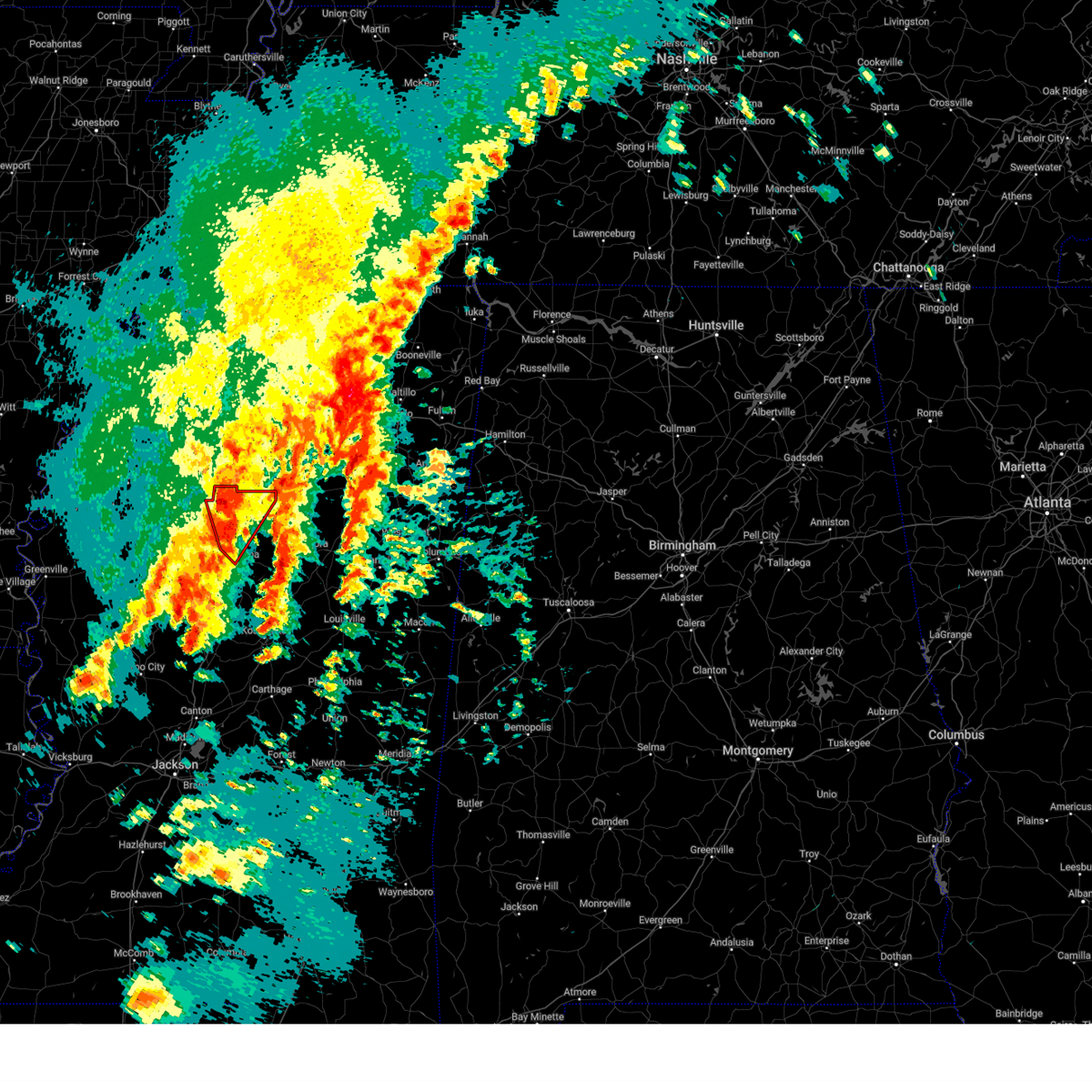
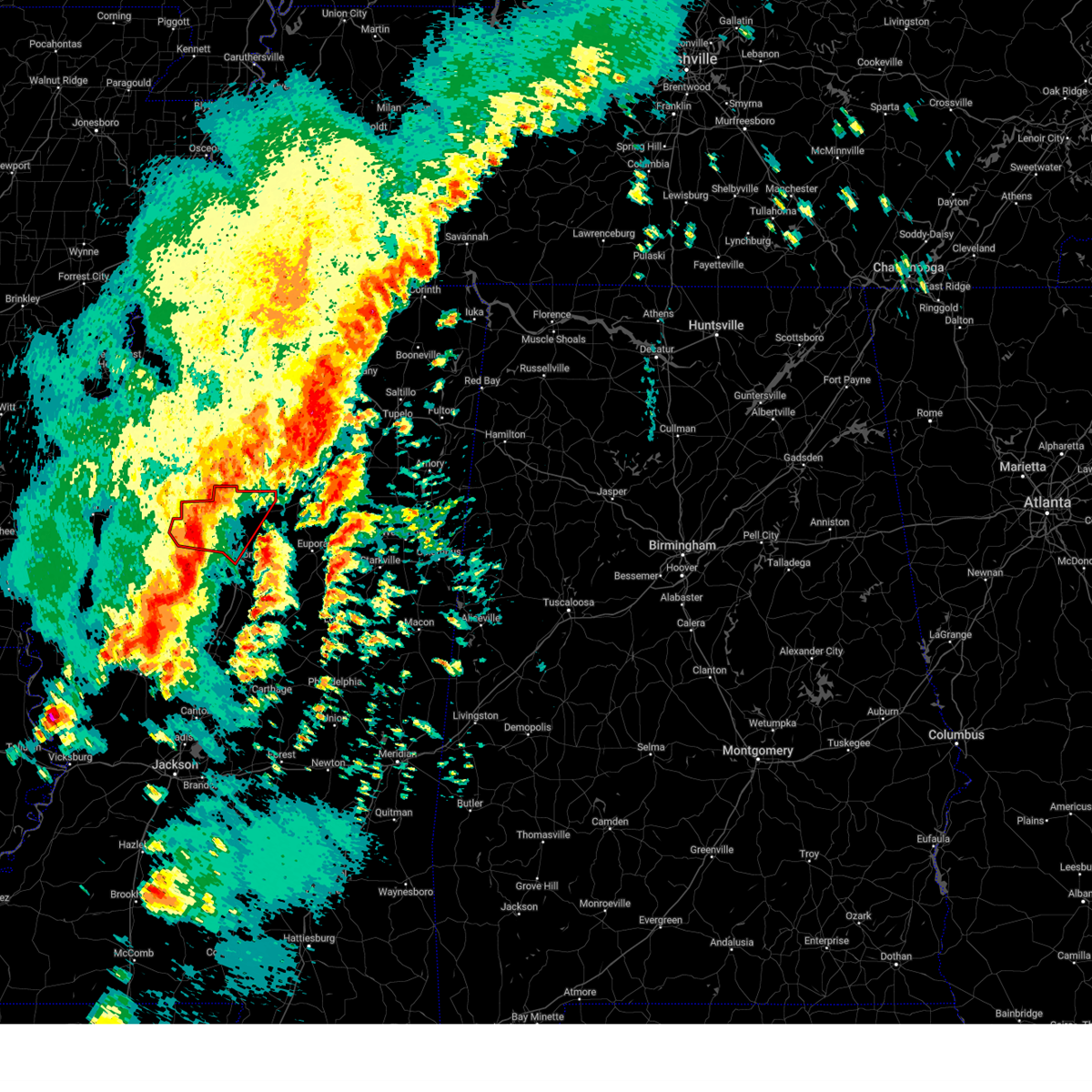
The Top Recent Hail Date for Grenada, MS is Sunday, April 27, 2025 (6th out of 78)
Hail and Wind Damage Spotted near Grenada, MS
| Date / Time | Report Details |
|---|---|
| 5/25/2025 7:47 PM CDT |
 the severe thunderstorm warning has been cancelled and is no longer in effect the severe thunderstorm warning has been cancelled and is no longer in effect
|
| 5/25/2025 7:31 PM CDT |
 At 731 pm cdt, severe thunderstorms were located along a line extending from 7 miles west of pittsboro to near winona to near tribbett, moving southeast at 50 mph (nws observations. at 710 pm, a 59 mph wind gust was reported at the greenville airport). Hazards include 60 mph wind gusts and quarter size hail. Hail damage to vehicles is expected. expect wind damage to roofs, siding, and trees. Locations impacted include, grenada, indianola, moorhead, itta bena, sunflower, elliott, holcomb, schlater, winterville, leflore, gore springs, avalon, money, holly ridge, blaine, and bew springs. At 731 pm cdt, severe thunderstorms were located along a line extending from 7 miles west of pittsboro to near winona to near tribbett, moving southeast at 50 mph (nws observations. at 710 pm, a 59 mph wind gust was reported at the greenville airport). Hazards include 60 mph wind gusts and quarter size hail. Hail damage to vehicles is expected. expect wind damage to roofs, siding, and trees. Locations impacted include, grenada, indianola, moorhead, itta bena, sunflower, elliott, holcomb, schlater, winterville, leflore, gore springs, avalon, money, holly ridge, blaine, and bew springs.
|
| 5/25/2025 7:31 PM CDT |
 the severe thunderstorm warning has been cancelled and is no longer in effect the severe thunderstorm warning has been cancelled and is no longer in effect
|
| 5/25/2025 7:20 PM CDT | Power lines down on girls scout rd and rolling oaks r in grenada county MS, 3 miles WSW of Grenada, MS |
| 5/25/2025 7:15 PM CDT | Tree down across highway in grenada county MS, 6.6 miles E of Grenada, MS |
| 5/25/2025 7:07 PM CDT | Large tree uprooted along hwy 5 in grenada county MS, 8.8 miles SSE of Grenada, MS |
| 5/25/2025 7:07 PM CDT | At 707 pm cdt, severe thunderstorms were located along a line extending from near coffeeville to near avalon to near benoit, moving southeast at 45 mph (radar indicated). Hazards include 60 mph wind gusts and quarter size hail. Hail damage to vehicles is expected. expect wind damage to roofs, siding, and trees. Locations impacted include, grenada, cleveland, indianola, ruleville, moorhead, itta bena, shaw, sunflower, elliott, boyle, holcomb, benoit, schlater, doddsville, winterville, scott, gore springs, minter city, lamont, and avalon. |
| 5/25/2025 6:40 PM CDT |
 Svrjan the national weather service in jackson has issued a * severe thunderstorm warning for, central sunflower county in northwestern mississippi, northwestern carroll county in north central mississippi, grenada county in north central mississippi, northern leflore county in north central mississippi, northeastern washington county in northwestern mississippi, southern bolivar county in northwestern mississippi, * until 800 pm cdt. * at 640 pm cdt, severe thunderstorms were located along a line extending from pope to sumner to near tillar, moving east at 50 mph (radar indicated). Hazards include 60 mph wind gusts and nickel size hail. expect damage to roofs, siding, and trees Svrjan the national weather service in jackson has issued a * severe thunderstorm warning for, central sunflower county in northwestern mississippi, northwestern carroll county in north central mississippi, grenada county in north central mississippi, northern leflore county in north central mississippi, northeastern washington county in northwestern mississippi, southern bolivar county in northwestern mississippi, * until 800 pm cdt. * at 640 pm cdt, severe thunderstorms were located along a line extending from pope to sumner to near tillar, moving east at 50 mph (radar indicated). Hazards include 60 mph wind gusts and nickel size hail. expect damage to roofs, siding, and trees
|
| 5/20/2025 7:15 PM CDT |
 the severe thunderstorm warning has been cancelled and is no longer in effect the severe thunderstorm warning has been cancelled and is no longer in effect
|
| 5/20/2025 7:15 PM CDT |
 At 714 pm cdt, a severe thunderstorm was located near gore springs, or 7 miles east of grenada, moving east at 40 mph (radar indicated). Hazards include 60 mph wind gusts and penny size hail. Expect damage to roofs, siding, and trees. This severe storm will be near, gore springs and misterton around 720 pm cdt. At 714 pm cdt, a severe thunderstorm was located near gore springs, or 7 miles east of grenada, moving east at 40 mph (radar indicated). Hazards include 60 mph wind gusts and penny size hail. Expect damage to roofs, siding, and trees. This severe storm will be near, gore springs and misterton around 720 pm cdt.
|
| 5/20/2025 7:07 PM CDT |
 At 706 pm cdt, a severe thunderstorm was located near gore springs, or 8 miles east of grenada, moving east at 40 mph (radar indicated). Hazards include 60 mph wind gusts and penny size hail. Expect damage to roofs, siding, and trees. This severe storm will be near, gore springs, misterton, and sweatman around 710 pm cdt. At 706 pm cdt, a severe thunderstorm was located near gore springs, or 8 miles east of grenada, moving east at 40 mph (radar indicated). Hazards include 60 mph wind gusts and penny size hail. Expect damage to roofs, siding, and trees. This severe storm will be near, gore springs, misterton, and sweatman around 710 pm cdt.
|
| 5/20/2025 6:39 PM CDT | Svrjan the national weather service in jackson has issued a * severe thunderstorm warning for, north central carroll county in north central mississippi, grenada county in north central mississippi, northwestern montgomery county in north central mississippi, * until 730 pm cdt. * at 639 pm cdt, a severe thunderstorm was located near holcomb, or 9 miles southwest of grenada, moving east at 40 mph (radar indicated). Hazards include 60 mph wind gusts and quarter size hail. Hail damage to vehicles is expected. expect wind damage to roofs, siding, and trees. this severe thunderstorm will be near, grenada, jefferson, elliott, and bew springs around 645 pm cdt. duck hill around 650 pm cdt. gore springs and misterton around 700 pm cdt. Sweatman around 705 pm cdt. |
| 5/18/2025 10:09 AM CDT |
 At 1009 am cdt, a severe thunderstorm was located 7 miles northwest of gore springs, or 9 miles northeast of grenada, moving east at 45 mph (radar indicated). Hazards include 60 mph wind gusts and quarter size hail. Hail damage to vehicles is expected. expect wind damage to roofs, siding, and trees. This severe storm will be near, gore springs around 1015 am cdt. At 1009 am cdt, a severe thunderstorm was located 7 miles northwest of gore springs, or 9 miles northeast of grenada, moving east at 45 mph (radar indicated). Hazards include 60 mph wind gusts and quarter size hail. Hail damage to vehicles is expected. expect wind damage to roofs, siding, and trees. This severe storm will be near, gore springs around 1015 am cdt.
|
| 5/18/2025 10:00 AM CDT | 2 trees blew over highway 51 around taylor auction and north of highway in grenada county MS, 8.6 miles SSE of Grenada, MS |
| 5/18/2025 9:48 AM CDT |
 Svrjan the national weather service in jackson has issued a * severe thunderstorm warning for, central grenada county in north central mississippi, * until 1030 am cdt. * at 948 am cdt, a severe thunderstorm was located near bew springs, or 9 miles northwest of grenada, moving east at 45 mph (radar indicated). Hazards include 60 mph wind gusts and quarter size hail. Hail damage to vehicles is expected. expect wind damage to roofs, siding, and trees. this severe thunderstorm will be near, grenada around 955 am cdt. Gore springs around 1005 am cdt. Svrjan the national weather service in jackson has issued a * severe thunderstorm warning for, central grenada county in north central mississippi, * until 1030 am cdt. * at 948 am cdt, a severe thunderstorm was located near bew springs, or 9 miles northwest of grenada, moving east at 45 mph (radar indicated). Hazards include 60 mph wind gusts and quarter size hail. Hail damage to vehicles is expected. expect wind damage to roofs, siding, and trees. this severe thunderstorm will be near, grenada around 955 am cdt. Gore springs around 1005 am cdt.
|
| 5/18/2025 3:34 AM CDT |
 At 334 am cdt, severe thunderstorms were located along a line extending from sweatman to near lodi to near winona, moving east at 50 mph (radar indicated). Hazards include 60 mph wind gusts and penny size hail. Expect damage to roofs, siding, and trees. These severe storms will be near, winona, kilmichael, and lodi around 340 am cdt. At 334 am cdt, severe thunderstorms were located along a line extending from sweatman to near lodi to near winona, moving east at 50 mph (radar indicated). Hazards include 60 mph wind gusts and penny size hail. Expect damage to roofs, siding, and trees. These severe storms will be near, winona, kilmichael, and lodi around 340 am cdt.
|
| 5/18/2025 3:34 AM CDT |
 the severe thunderstorm warning has been cancelled and is no longer in effect the severe thunderstorm warning has been cancelled and is no longer in effect
|
| 5/18/2025 2:55 AM CDT |
 At 255 am cdt, severe thunderstorms were located along a line extending from near money to near greenwood to itta bena, moving east at 35 mph (radar indicated). Hazards include 60 mph wind gusts and half dollar size hail. Hail damage to vehicles is expected. expect wind damage to roofs, siding, and trees. these severe storms will be near, greenwood, avalon, teoc, and leflore around 300 am cdt. malmaison around 305 am cdt. carrollton, jefferson, and north carrollton around 315 am cdt. elliott around 330 am cdt. winona and duck hill around 335 am cdt. Sweatman around 345 am cdt. At 255 am cdt, severe thunderstorms were located along a line extending from near money to near greenwood to itta bena, moving east at 35 mph (radar indicated). Hazards include 60 mph wind gusts and half dollar size hail. Hail damage to vehicles is expected. expect wind damage to roofs, siding, and trees. these severe storms will be near, greenwood, avalon, teoc, and leflore around 300 am cdt. malmaison around 305 am cdt. carrollton, jefferson, and north carrollton around 315 am cdt. elliott around 330 am cdt. winona and duck hill around 335 am cdt. Sweatman around 345 am cdt.
|
| 5/18/2025 2:39 AM CDT |
 Svrjan the national weather service in jackson has issued a * severe thunderstorm warning for, central sunflower county in northwestern mississippi, northwestern carroll county in north central mississippi, grenada county in north central mississippi, central leflore county in north central mississippi, montgomery county in north central mississippi, * until 345 am cdt. * at 238 am cdt, severe thunderstorms were located along a line extending from 6 miles east of minter city to near money to sunflower, moving east at 50 mph (radar indicated). Hazards include 60 mph wind gusts and half dollar size hail. Hail damage to vehicles is expected. expect wind damage to roofs, siding, and trees. severe thunderstorms will be near, greenwood, itta bena, holcomb, avalon, money, teoc, and leflore around 245 am cdt. grenada, jefferson, malmaison, and bew springs around 255 am cdt. north carrollton around 300 am cdt. carrollton, elliott, and duck hill around 305 am cdt. gore springs around 310 am cdt. winona, misterton, and sweatman around 315 am cdt. Lodi around 320 am cdt. Svrjan the national weather service in jackson has issued a * severe thunderstorm warning for, central sunflower county in northwestern mississippi, northwestern carroll county in north central mississippi, grenada county in north central mississippi, central leflore county in north central mississippi, montgomery county in north central mississippi, * until 345 am cdt. * at 238 am cdt, severe thunderstorms were located along a line extending from 6 miles east of minter city to near money to sunflower, moving east at 50 mph (radar indicated). Hazards include 60 mph wind gusts and half dollar size hail. Hail damage to vehicles is expected. expect wind damage to roofs, siding, and trees. severe thunderstorms will be near, greenwood, itta bena, holcomb, avalon, money, teoc, and leflore around 245 am cdt. grenada, jefferson, malmaison, and bew springs around 255 am cdt. north carrollton around 300 am cdt. carrollton, elliott, and duck hill around 305 am cdt. gore springs around 310 am cdt. winona, misterton, and sweatman around 315 am cdt. Lodi around 320 am cdt.
|
| 5/17/2025 2:49 AM CDT |
 At 249 am cdt, severe thunderstorms were located along a line extending from near coffeeville to near gore springs to near jefferson, moving east at 55 mph (radar indicated). Hazards include 60 mph wind gusts and quarter size hail. Hail damage to vehicles is expected. expect wind damage to roofs, siding, and trees. these severe storms will be near, elliott, duck hill, gore springs, and misterton around 255 am cdt. sweatman around 300 am cdt. Lodi around 310 am cdt. At 249 am cdt, severe thunderstorms were located along a line extending from near coffeeville to near gore springs to near jefferson, moving east at 55 mph (radar indicated). Hazards include 60 mph wind gusts and quarter size hail. Hail damage to vehicles is expected. expect wind damage to roofs, siding, and trees. these severe storms will be near, elliott, duck hill, gore springs, and misterton around 255 am cdt. sweatman around 300 am cdt. Lodi around 310 am cdt.
|
| 5/17/2025 2:16 AM CDT |
 Svrjan the national weather service in jackson has issued a * severe thunderstorm warning for, northwestern carroll county in north central mississippi, grenada county in north central mississippi, northwestern montgomery county in north central mississippi, * until 300 am cdt. * at 216 am cdt, severe thunderstorms were located along a line extending from near paynes to 9 miles northwest of leflore to near sunnyside, moving east at 55 mph (radar indicated). Hazards include 60 mph wind gusts and quarter size hail. Hail damage to vehicles is expected. expect wind damage to roofs, siding, and trees. severe thunderstorms will be near, leflore around 220 am cdt. holcomb, avalon, and bew springs around 225 am cdt. grenada around 230 am cdt. jefferson around 235 am cdt. elliott around 240 am cdt. gore springs around 245 am cdt. Duck hill and misterton around 250 am cdt. Svrjan the national weather service in jackson has issued a * severe thunderstorm warning for, northwestern carroll county in north central mississippi, grenada county in north central mississippi, northwestern montgomery county in north central mississippi, * until 300 am cdt. * at 216 am cdt, severe thunderstorms were located along a line extending from near paynes to 9 miles northwest of leflore to near sunnyside, moving east at 55 mph (radar indicated). Hazards include 60 mph wind gusts and quarter size hail. Hail damage to vehicles is expected. expect wind damage to roofs, siding, and trees. severe thunderstorms will be near, leflore around 220 am cdt. holcomb, avalon, and bew springs around 225 am cdt. grenada around 230 am cdt. jefferson around 235 am cdt. elliott around 240 am cdt. gore springs around 245 am cdt. Duck hill and misterton around 250 am cdt.
|
| 5/1/2025 6:23 PM CDT |
 At 622 pm cdt, a severe thunderstorm was located near grenada, moving east at 25 mph (radar indicated). Hazards include 60 mph wind gusts and quarter size hail. Hail damage to vehicles is expected. expect wind damage to roofs, siding, and trees. This severe storm will be near, grenada around 630 pm cdt. At 622 pm cdt, a severe thunderstorm was located near grenada, moving east at 25 mph (radar indicated). Hazards include 60 mph wind gusts and quarter size hail. Hail damage to vehicles is expected. expect wind damage to roofs, siding, and trees. This severe storm will be near, grenada around 630 pm cdt.
|
| 5/1/2025 6:23 PM CDT |
 the severe thunderstorm warning has been cancelled and is no longer in effect the severe thunderstorm warning has been cancelled and is no longer in effect
|
| 5/1/2025 6:07 PM CDT | At 607 pm cdt, a severe thunderstorm was located near jefferson, or 7 miles southwest of grenada, moving east at 30 mph (radar indicated). Hazards include 60 mph wind gusts and quarter size hail. Hail damage to vehicles is expected. expect wind damage to roofs, siding, and trees. this severe storm will be near, grenada, elliott, and bew springs around 610 pm cdt. Duck hill around 615 pm cdt. |
| 5/1/2025 5:54 PM CDT |
 Svrjan the national weather service in jackson has issued a * severe thunderstorm warning for, northwestern carroll county in north central mississippi, southern grenada county in north central mississippi, northwestern montgomery county in north central mississippi, * until 700 pm cdt. * at 553 pm cdt, a severe thunderstorm was located over avalon, or 11 miles northwest of carrollton, moving east at 25 mph (radar indicated). Hazards include 60 mph wind gusts and quarter size hail. Hail damage to vehicles is expected. expect wind damage to roofs, siding, and trees. this severe thunderstorm will be near, holcomb and jefferson around 600 pm cdt. grenada around 605 pm cdt. bew springs around 610 pm cdt. elliott around 620 pm cdt. Duck hill around 630 pm cdt. Svrjan the national weather service in jackson has issued a * severe thunderstorm warning for, northwestern carroll county in north central mississippi, southern grenada county in north central mississippi, northwestern montgomery county in north central mississippi, * until 700 pm cdt. * at 553 pm cdt, a severe thunderstorm was located over avalon, or 11 miles northwest of carrollton, moving east at 25 mph (radar indicated). Hazards include 60 mph wind gusts and quarter size hail. Hail damage to vehicles is expected. expect wind damage to roofs, siding, and trees. this severe thunderstorm will be near, holcomb and jefferson around 600 pm cdt. grenada around 605 pm cdt. bew springs around 610 pm cdt. elliott around 620 pm cdt. Duck hill around 630 pm cdt.
|
| 4/27/2025 5:22 PM CDT |
 Svrjan the national weather service in jackson has issued a * severe thunderstorm warning for, north central carroll county in north central mississippi, grenada county in north central mississippi, northwestern montgomery county in north central mississippi, * until 615 pm cdt. * at 522 pm cdt, a severe thunderstorm was located near paynes, or 11 miles southeast of charleston, moving southeast at 25 mph (radar indicated). Hazards include 60 mph wind gusts and quarter size hail. Hail damage to vehicles is expected. expect wind damage to roofs, siding, and trees. this severe thunderstorm will be near, grenada, bew springs, and holcomb around 525 pm cdt. elliott around 545 pm cdt. gore springs around 555 pm cdt. Duck hill around 600 pm cdt. Svrjan the national weather service in jackson has issued a * severe thunderstorm warning for, north central carroll county in north central mississippi, grenada county in north central mississippi, northwestern montgomery county in north central mississippi, * until 615 pm cdt. * at 522 pm cdt, a severe thunderstorm was located near paynes, or 11 miles southeast of charleston, moving southeast at 25 mph (radar indicated). Hazards include 60 mph wind gusts and quarter size hail. Hail damage to vehicles is expected. expect wind damage to roofs, siding, and trees. this severe thunderstorm will be near, grenada, bew springs, and holcomb around 525 pm cdt. elliott around 545 pm cdt. gore springs around 555 pm cdt. Duck hill around 600 pm cdt.
|
| 4/23/2025 12:22 AM CDT |
 the severe thunderstorm warning has been cancelled and is no longer in effect the severe thunderstorm warning has been cancelled and is no longer in effect
|
| 4/23/2025 12:15 AM CDT |
 At 1215 am cdt, a severe thunderstorm was located near grenada, moving northeast at 20 mph (radar indicated). Hazards include 60 mph wind gusts and nickel size hail. Expect damage to roofs, siding, and trees. This severe thunderstorm will remain over mainly rural areas of north central grenada county. At 1215 am cdt, a severe thunderstorm was located near grenada, moving northeast at 20 mph (radar indicated). Hazards include 60 mph wind gusts and nickel size hail. Expect damage to roofs, siding, and trees. This severe thunderstorm will remain over mainly rural areas of north central grenada county.
|
| 4/22/2025 11:55 PM CDT |
 Svrjan the national weather service in jackson has issued a * severe thunderstorm warning for, central grenada county in north central mississippi, * until 1245 am cdt. * at 1155 pm cdt, a severe thunderstorm was located over bew springs, or near grenada, moving northeast at 20 mph (radar indicated). Hazards include 60 mph wind gusts and quarter size hail. Hail damage to vehicles is expected. expect wind damage to roofs, siding, and trees. This severe thunderstorm will be near, grenada and bew springs around 1200 am cdt. Svrjan the national weather service in jackson has issued a * severe thunderstorm warning for, central grenada county in north central mississippi, * until 1245 am cdt. * at 1155 pm cdt, a severe thunderstorm was located over bew springs, or near grenada, moving northeast at 20 mph (radar indicated). Hazards include 60 mph wind gusts and quarter size hail. Hail damage to vehicles is expected. expect wind damage to roofs, siding, and trees. This severe thunderstorm will be near, grenada and bew springs around 1200 am cdt.
|
| 4/22/2025 11:34 PM CDT |
 At 1134 pm cdt, a severe thunderstorm was located near jefferson, or 9 miles north of carrollton, moving northeast at 20 mph (radar indicated). Hazards include 60 mph wind gusts and half dollar size hail. Hail damage to vehicles is expected. expect wind damage to roofs, siding, and trees. This severe storm will be near, holcomb and jefferson around 1140 pm cdt. At 1134 pm cdt, a severe thunderstorm was located near jefferson, or 9 miles north of carrollton, moving northeast at 20 mph (radar indicated). Hazards include 60 mph wind gusts and half dollar size hail. Hail damage to vehicles is expected. expect wind damage to roofs, siding, and trees. This severe storm will be near, holcomb and jefferson around 1140 pm cdt.
|
| 4/22/2025 11:19 PM CDT |
 Svrjan the national weather service in jackson has issued a * severe thunderstorm warning for, northwestern carroll county in north central mississippi, southwestern grenada county in north central mississippi, * until midnight cdt. * at 1119 pm cdt, a severe thunderstorm was located over teoc, or 7 miles northwest of carrollton, moving northeast at 20 mph (radar indicated). Hazards include 60 mph wind gusts and half dollar size hail. Hail damage to vehicles is expected. expect wind damage to roofs, siding, and trees. this severe thunderstorm will be near, jefferson and leflore around 1125 pm cdt. Holcomb around 1135 pm cdt. Svrjan the national weather service in jackson has issued a * severe thunderstorm warning for, northwestern carroll county in north central mississippi, southwestern grenada county in north central mississippi, * until midnight cdt. * at 1119 pm cdt, a severe thunderstorm was located over teoc, or 7 miles northwest of carrollton, moving northeast at 20 mph (radar indicated). Hazards include 60 mph wind gusts and half dollar size hail. Hail damage to vehicles is expected. expect wind damage to roofs, siding, and trees. this severe thunderstorm will be near, jefferson and leflore around 1125 pm cdt. Holcomb around 1135 pm cdt.
|
| 4/10/2025 9:30 PM CDT |
 Svrjan the national weather service in jackson has issued a * severe thunderstorm warning for, choctaw county in central mississippi, northeastern carroll county in north central mississippi, south central grenada county in north central mississippi, northeastern attala county in central mississippi, southwestern webster county in north central mississippi, montgomery county in north central mississippi, * until 1030 pm cdt. * at 929 pm cdt, a severe thunderstorm was located near jefferson, or 8 miles south of grenada, moving southeast at 55 mph (radar indicated). Hazards include 60 mph wind gusts and quarter size hail. Hail damage to vehicles is expected. expect wind damage to roofs, siding, and trees. this severe thunderstorm will be near, winona, elliott, and duck hill around 935 pm cdt. kilmichael around 945 pm cdt. poplar creek around 955 pm cdt. french camp around 1000 pm cdt. chester around 1005 pm cdt. weir around 1010 pm cdt. Ackerman and mccool around 1015 pm cdt. Svrjan the national weather service in jackson has issued a * severe thunderstorm warning for, choctaw county in central mississippi, northeastern carroll county in north central mississippi, south central grenada county in north central mississippi, northeastern attala county in central mississippi, southwestern webster county in north central mississippi, montgomery county in north central mississippi, * until 1030 pm cdt. * at 929 pm cdt, a severe thunderstorm was located near jefferson, or 8 miles south of grenada, moving southeast at 55 mph (radar indicated). Hazards include 60 mph wind gusts and quarter size hail. Hail damage to vehicles is expected. expect wind damage to roofs, siding, and trees. this severe thunderstorm will be near, winona, elliott, and duck hill around 935 pm cdt. kilmichael around 945 pm cdt. poplar creek around 955 pm cdt. french camp around 1000 pm cdt. chester around 1005 pm cdt. weir around 1010 pm cdt. Ackerman and mccool around 1015 pm cdt.
|
| 3/31/2025 3:51 AM CDT |
 Svrjan the national weather service in jackson has issued a * severe thunderstorm warning for, north central carroll county in north central mississippi, grenada county in north central mississippi, western webster county in north central mississippi, montgomery county in north central mississippi, * until 445 am cdt. * at 351 am cdt, a severe thunderstorm was located over bew springs, or near grenada, moving east at 45 mph (radar indicated). Hazards include 60 mph wind gusts and quarter size hail. Hail damage to vehicles is expected. expect wind damage to roofs, siding, and trees. this severe thunderstorm will be near, grenada around 355 am cdt. gore springs around 405 am cdt. Misterton around 415 am cdt. Svrjan the national weather service in jackson has issued a * severe thunderstorm warning for, north central carroll county in north central mississippi, grenada county in north central mississippi, western webster county in north central mississippi, montgomery county in north central mississippi, * until 445 am cdt. * at 351 am cdt, a severe thunderstorm was located over bew springs, or near grenada, moving east at 45 mph (radar indicated). Hazards include 60 mph wind gusts and quarter size hail. Hail damage to vehicles is expected. expect wind damage to roofs, siding, and trees. this severe thunderstorm will be near, grenada around 355 am cdt. gore springs around 405 am cdt. Misterton around 415 am cdt.
|
| 3/15/2025 12:20 PM CDT |
 At 1220 pm cdt, a severe thunderstorm capable of producing a tornado was located over bew springs, or near grenada, moving northeast at 45 mph (radar indicated rotation). Hazards include tornado. Flying debris will be dangerous to those caught without shelter. mobile homes will be damaged or destroyed. damage to roofs, windows, and vehicles will occur. tree damage is likely. This dangerous storm will be near, grenada around 1225 pm cdt. At 1220 pm cdt, a severe thunderstorm capable of producing a tornado was located over bew springs, or near grenada, moving northeast at 45 mph (radar indicated rotation). Hazards include tornado. Flying debris will be dangerous to those caught without shelter. mobile homes will be damaged or destroyed. damage to roofs, windows, and vehicles will occur. tree damage is likely. This dangerous storm will be near, grenada around 1225 pm cdt.
|
| 3/15/2025 12:20 PM CDT |
 the tornado warning has been cancelled and is no longer in effect the tornado warning has been cancelled and is no longer in effect
|
| 3/15/2025 11:56 AM CDT |
 Torjan the national weather service in jackson has issued a * tornado warning for, northwestern carroll county in north central mississippi, grenada county in north central mississippi, northeastern leflore county in north central mississippi, northwestern montgomery county in north central mississippi, * until 1245 pm cdt. * at 1156 am cdt, a severe thunderstorm capable of producing a tornado was located over teoc, or 8 miles northeast of greenwood, moving northeast at 50 mph (radar indicated rotation). Hazards include tornado. Flying debris will be dangerous to those caught without shelter. mobile homes will be damaged or destroyed. damage to roofs, windows, and vehicles will occur. tree damage is likely. this dangerous storm will be near, avalon, jefferson, and leflore around 1200 pm cdt. grenada, bew springs, and holcomb around 1205 pm cdt. Elliott around 1215 pm cdt. Torjan the national weather service in jackson has issued a * tornado warning for, northwestern carroll county in north central mississippi, grenada county in north central mississippi, northeastern leflore county in north central mississippi, northwestern montgomery county in north central mississippi, * until 1245 pm cdt. * at 1156 am cdt, a severe thunderstorm capable of producing a tornado was located over teoc, or 8 miles northeast of greenwood, moving northeast at 50 mph (radar indicated rotation). Hazards include tornado. Flying debris will be dangerous to those caught without shelter. mobile homes will be damaged or destroyed. damage to roofs, windows, and vehicles will occur. tree damage is likely. this dangerous storm will be near, avalon, jefferson, and leflore around 1200 pm cdt. grenada, bew springs, and holcomb around 1205 pm cdt. Elliott around 1215 pm cdt.
|
| 3/15/2025 10:30 AM CDT |
 At 1030 am cdt, a severe thunderstorm was located near holcomb, or 14 miles west of grenada, moving northeast at 45 mph (radar indicated). Hazards include 70 mph wind gusts. Expect considerable tree damage. damage is likely to mobile homes, roofs, and outbuildings. This severe storm will be near, grenada, bew springs, and holcomb around 1035 am cdt. At 1030 am cdt, a severe thunderstorm was located near holcomb, or 14 miles west of grenada, moving northeast at 45 mph (radar indicated). Hazards include 70 mph wind gusts. Expect considerable tree damage. damage is likely to mobile homes, roofs, and outbuildings. This severe storm will be near, grenada, bew springs, and holcomb around 1035 am cdt.
|
| 3/15/2025 10:07 AM CDT |
 Svrjan the national weather service in jackson has issued a * severe thunderstorm warning for, southern sunflower county in northwestern mississippi, northwestern carroll county in north central mississippi, grenada county in north central mississippi, leflore county in north central mississippi, * until 1100 am cdt. * at 1007 am cdt, a severe thunderstorm was located near sunnyside, or 11 miles east of ruleville, moving northeast at 70 mph (radar indicated). Hazards include 60 mph wind gusts. Expect damage to roofs, siding, and trees. this severe thunderstorm will be near, sunnyside, money, and minter city around 1010 am cdt. holcomb around 1020 am cdt. Bew springs around 1025 am cdt. Svrjan the national weather service in jackson has issued a * severe thunderstorm warning for, southern sunflower county in northwestern mississippi, northwestern carroll county in north central mississippi, grenada county in north central mississippi, leflore county in north central mississippi, * until 1100 am cdt. * at 1007 am cdt, a severe thunderstorm was located near sunnyside, or 11 miles east of ruleville, moving northeast at 70 mph (radar indicated). Hazards include 60 mph wind gusts. Expect damage to roofs, siding, and trees. this severe thunderstorm will be near, sunnyside, money, and minter city around 1010 am cdt. holcomb around 1020 am cdt. Bew springs around 1025 am cdt.
|
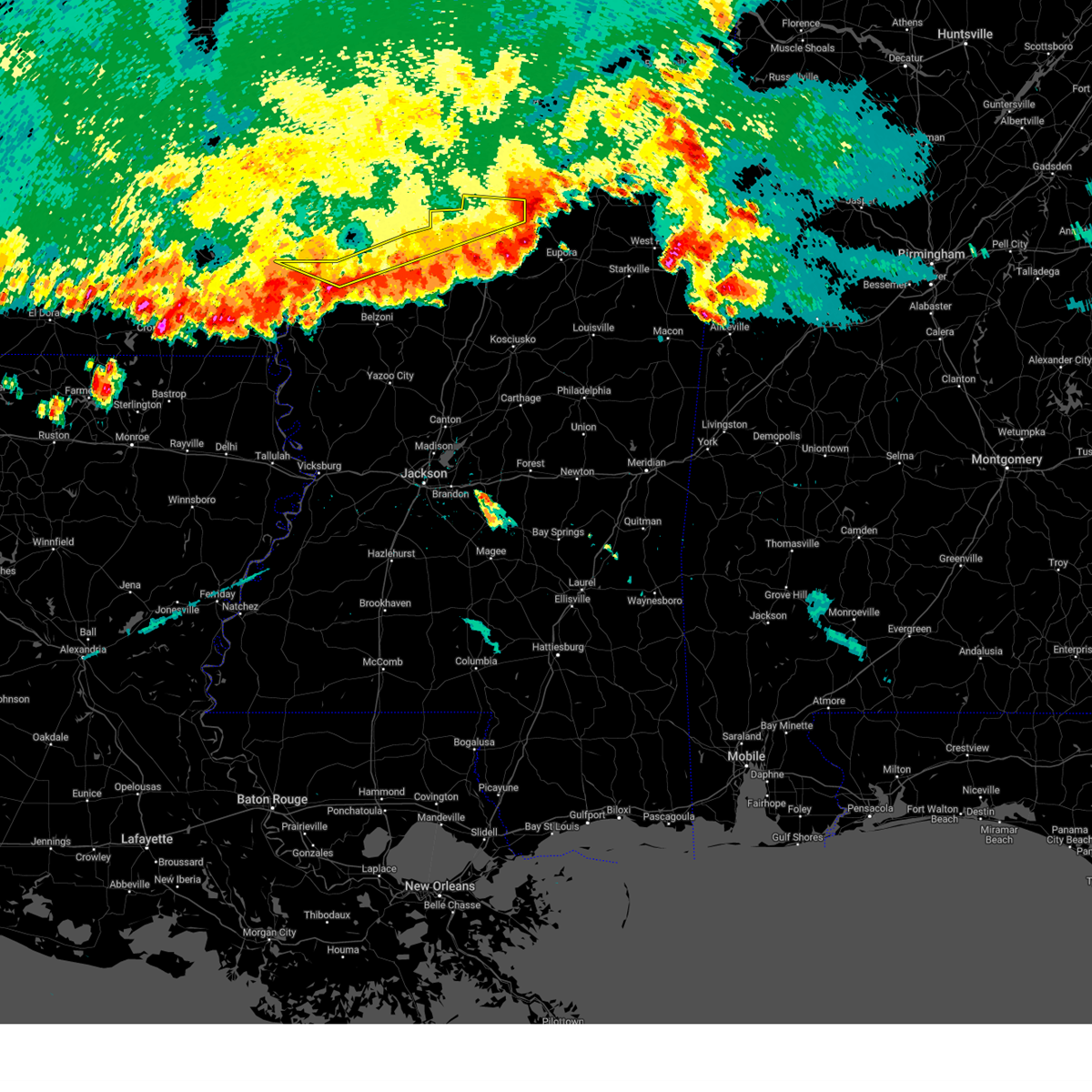
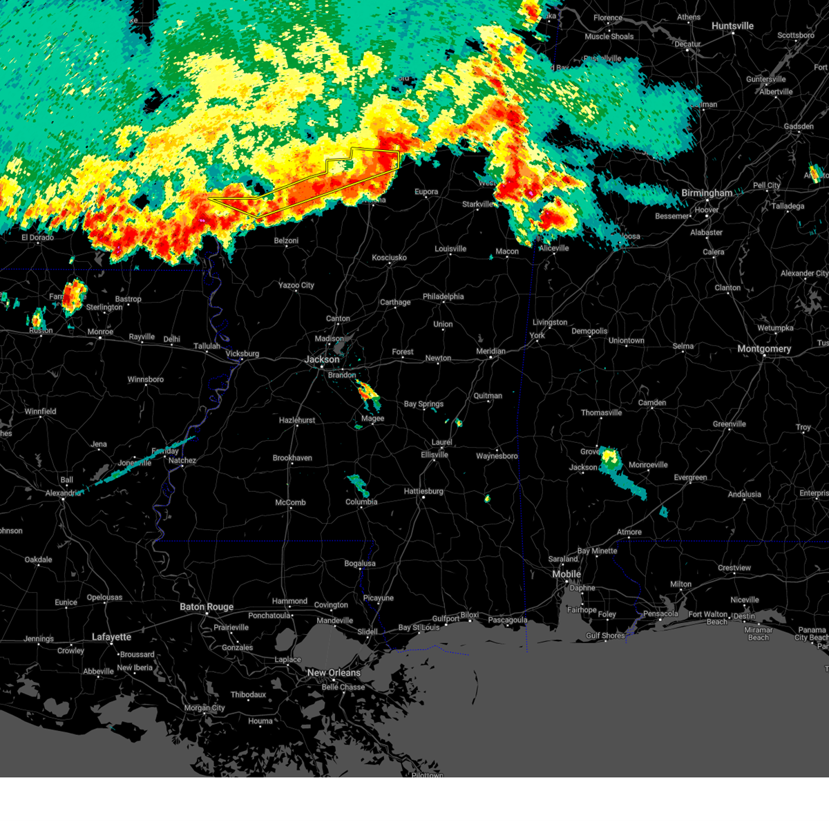
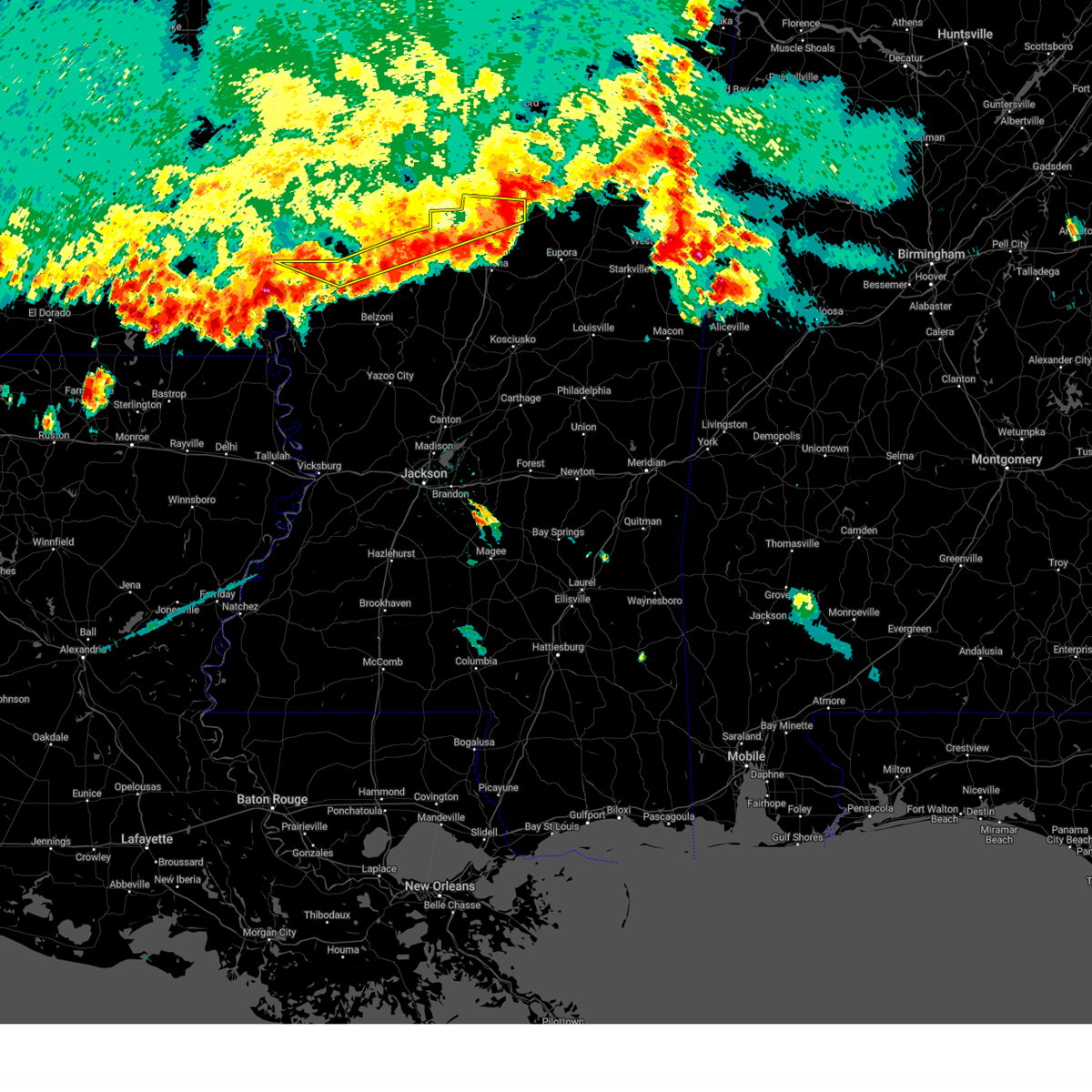
| 3/15/2025 12:47 AM CDT | At 1246 am cdt, a confirmed large and extremely dangerous tornado was located over gore springs, or 8 miles east of grenada, moving northeast at 40 mph. this is a particularly dangerous situation. take cover now! (emergency management confirmed tornado). Hazards include damaging tornado. You are in a life-threatening situation. flying debris may be deadly to those caught without shelter. mobile homes will be destroyed. considerable damage to homes, businesses, and vehicles is likely and complete destruction is possible. The tornado will be near, gore springs and misterton around 1250 am cdt. |
| 3/15/2025 12:40 AM CDT | Report of extensive damage to elliott community; downed power lines and multiple residences destroye in grenada county MS, 5.7 miles NNW of Grenada, MS |
| 3/15/2025 12:38 AM CDT | the tornado warning has been cancelled and is no longer in effect |
| 3/15/2025 12:38 AM CDT | At 1237 am cdt, a confirmed large and extremely dangerous tornado was located over elliott, or near grenada, moving northeast at 40 mph. this is a particularly dangerous situation. take cover now! (emergency management confirmed tornado). Hazards include damaging tornado. You are in a life-threatening situation. flying debris may be deadly to those caught without shelter. mobile homes will be destroyed. considerable damage to homes, businesses, and vehicles is likely and complete destruction is possible. emergency manager reports tornado on the ground in elliot. tornado has produced damage to a residence. The tornado will be near, grenada, gore springs, and misterton around 1240 am cdt. |
| 3/15/2025 12:32 AM CDT |
 At 1232 am cdt, a confirmed large and extremely dangerous tornado was located over elliott, or near grenada, moving northeast at 40 mph. this is a particularly dangerous situation. take cover now! (radar confirmed tornado). Hazards include damaging tornado. You are in a life-threatening situation. flying debris may be deadly to those caught without shelter. mobile homes will be destroyed. considerable damage to homes, businesses, and vehicles is likely and complete destruction is possible. the tornado will be near, grenada, gore springs, elliott, and duck hill around 1235 am cdt. Misterton around 1240 am cdt. At 1232 am cdt, a confirmed large and extremely dangerous tornado was located over elliott, or near grenada, moving northeast at 40 mph. this is a particularly dangerous situation. take cover now! (radar confirmed tornado). Hazards include damaging tornado. You are in a life-threatening situation. flying debris may be deadly to those caught without shelter. mobile homes will be destroyed. considerable damage to homes, businesses, and vehicles is likely and complete destruction is possible. the tornado will be near, grenada, gore springs, elliott, and duck hill around 1235 am cdt. Misterton around 1240 am cdt.
|
| 3/15/2025 12:30 AM CDT |
 At 1229 am cdt, a confirmed tornado was located near elliott, or near grenada, moving northeast at 45 mph (radar confirmed tornado). Hazards include damaging tornado and ping pong ball size hail. Flying debris will be dangerous to those caught without shelter. mobile homes will be damaged or destroyed. damage to roofs, windows, and vehicles will occur. tree damage is likely. this tornado will be near, grenada, gore springs, elliott, and duck hill around 1235 am cdt. Misterton around 1240 am cdt. At 1229 am cdt, a confirmed tornado was located near elliott, or near grenada, moving northeast at 45 mph (radar confirmed tornado). Hazards include damaging tornado and ping pong ball size hail. Flying debris will be dangerous to those caught without shelter. mobile homes will be damaged or destroyed. damage to roofs, windows, and vehicles will occur. tree damage is likely. this tornado will be near, grenada, gore springs, elliott, and duck hill around 1235 am cdt. Misterton around 1240 am cdt.
|
| 3/15/2025 12:24 AM CDT |
 the tornado warning has been cancelled and is no longer in effect the tornado warning has been cancelled and is no longer in effect
|
| 3/15/2025 12:24 AM CDT |
 At 1223 am cdt, a severe thunderstorm capable of producing a tornado was located near jefferson, or 8 miles south of grenada, moving northeast at 40 mph (radar indicated rotation). Hazards include tornado and ping pong ball size hail. Flying debris will be dangerous to those caught without shelter. mobile homes will be damaged or destroyed. damage to roofs, windows, and vehicles will occur. tree damage is likely. this dangerous storm will be near, grenada, elliott, and duck hill around 1230 am cdt. Gore springs and misterton around 1235 am cdt. At 1223 am cdt, a severe thunderstorm capable of producing a tornado was located near jefferson, or 8 miles south of grenada, moving northeast at 40 mph (radar indicated rotation). Hazards include tornado and ping pong ball size hail. Flying debris will be dangerous to those caught without shelter. mobile homes will be damaged or destroyed. damage to roofs, windows, and vehicles will occur. tree damage is likely. this dangerous storm will be near, grenada, elliott, and duck hill around 1230 am cdt. Gore springs and misterton around 1235 am cdt.
|
| 3/15/2025 12:15 AM CDT |
 At 1214 am cdt, a severe thunderstorm capable of producing a tornado was located near jefferson, or near carrollton, moving northeast at 40 mph (radar indicated rotation). Hazards include tornado and ping pong ball size hail. Flying debris will be dangerous to those caught without shelter. mobile homes will be damaged or destroyed. damage to roofs, windows, and vehicles will occur. tree damage is likely. this dangerous storm will be near, grenada, elliott, and jefferson around 1220 am cdt. duck hill around 1225 am cdt. Gore springs and misterton around 1235 am cdt. At 1214 am cdt, a severe thunderstorm capable of producing a tornado was located near jefferson, or near carrollton, moving northeast at 40 mph (radar indicated rotation). Hazards include tornado and ping pong ball size hail. Flying debris will be dangerous to those caught without shelter. mobile homes will be damaged or destroyed. damage to roofs, windows, and vehicles will occur. tree damage is likely. this dangerous storm will be near, grenada, elliott, and jefferson around 1220 am cdt. duck hill around 1225 am cdt. Gore springs and misterton around 1235 am cdt.
|
| 3/14/2025 11:58 PM CDT |
 Torjan the national weather service in jackson has issued a * tornado warning for, northwestern carroll county in north central mississippi, southeastern grenada county in north central mississippi, east central leflore county in north central mississippi, west central webster county in north central mississippi, northwestern montgomery county in north central mississippi, * until 100 am cdt. * at 1158 pm cdt, a confirmed tornado was located near greenwood, moving northeast at 40 mph (weather spotters confirmed tornado). Hazards include damaging tornado and ping pong ball size hail. Flying debris will be dangerous to those caught without shelter. mobile homes will be damaged or destroyed. damage to roofs, windows, and vehicles will occur. tree damage is likely. the tornado will be near, malmaison, north carrollton, carrollton, and teoc around 1205 am cdt. jefferson around 1210 am cdt. grenada and elliott around 1220 am cdt. duck hill around 1225 am cdt. Gore springs and misterton around 1235 am cdt. Torjan the national weather service in jackson has issued a * tornado warning for, northwestern carroll county in north central mississippi, southeastern grenada county in north central mississippi, east central leflore county in north central mississippi, west central webster county in north central mississippi, northwestern montgomery county in north central mississippi, * until 100 am cdt. * at 1158 pm cdt, a confirmed tornado was located near greenwood, moving northeast at 40 mph (weather spotters confirmed tornado). Hazards include damaging tornado and ping pong ball size hail. Flying debris will be dangerous to those caught without shelter. mobile homes will be damaged or destroyed. damage to roofs, windows, and vehicles will occur. tree damage is likely. the tornado will be near, malmaison, north carrollton, carrollton, and teoc around 1205 am cdt. jefferson around 1210 am cdt. grenada and elliott around 1220 am cdt. duck hill around 1225 am cdt. Gore springs and misterton around 1235 am cdt.
|
| 1/5/2025 5:20 PM CST |
 Svrjan the national weather service in jackson has issued a * severe thunderstorm warning for, central carroll county in north central mississippi, southeastern grenada county in north central mississippi, western webster county in north central mississippi, montgomery county in north central mississippi, * until 615 pm cst. * at 520 pm cst, a severe thunderstorm was located near carrollton, moving east at 55 mph (radar indicated). Hazards include 60 mph wind gusts. Expect damage to roofs, siding, and trees. this severe thunderstorm will be near, winona, north carrollton, and carrollton around 525 pm cst. duck hill around 535 pm cst. kilmichael, lodi, and sweatman around 540 pm cst. Embry around 555 pm cst. Svrjan the national weather service in jackson has issued a * severe thunderstorm warning for, central carroll county in north central mississippi, southeastern grenada county in north central mississippi, western webster county in north central mississippi, montgomery county in north central mississippi, * until 615 pm cst. * at 520 pm cst, a severe thunderstorm was located near carrollton, moving east at 55 mph (radar indicated). Hazards include 60 mph wind gusts. Expect damage to roofs, siding, and trees. this severe thunderstorm will be near, winona, north carrollton, and carrollton around 525 pm cst. duck hill around 535 pm cst. kilmichael, lodi, and sweatman around 540 pm cst. Embry around 555 pm cst.
|
| 12/28/2024 7:31 PM CST |
 Svrjan the national weather service in jackson has issued a * severe thunderstorm warning for, northwestern choctaw county in central mississippi, northeastern carroll county in north central mississippi, eastern grenada county in north central mississippi, webster county in north central mississippi, montgomery county in north central mississippi, * until 830 pm cst. * at 731 pm cst, a severe thunderstorm was located over winona, moving northeast at 60 mph (radar indicated). Hazards include 60 mph wind gusts and penny size hail. Expect damage to roofs, siding, and trees. this severe thunderstorm will be near, winona, sweatman, and duck hill around 735 pm cst. misterton and lodi around 740 pm cst. embry around 750 pm cst. Bellefontaine around 755 pm cst. Svrjan the national weather service in jackson has issued a * severe thunderstorm warning for, northwestern choctaw county in central mississippi, northeastern carroll county in north central mississippi, eastern grenada county in north central mississippi, webster county in north central mississippi, montgomery county in north central mississippi, * until 830 pm cst. * at 731 pm cst, a severe thunderstorm was located over winona, moving northeast at 60 mph (radar indicated). Hazards include 60 mph wind gusts and penny size hail. Expect damage to roofs, siding, and trees. this severe thunderstorm will be near, winona, sweatman, and duck hill around 735 pm cst. misterton and lodi around 740 pm cst. embry around 750 pm cst. Bellefontaine around 755 pm cst.
|
| 8/29/2024 6:00 PM CDT |
 The storm which prompted the warning has weakened below severe limits, and no longer poses an immediate threat to life or property. therefore, the warning has been allowed to expire. however, gusty winds and heavy rain are still possible with this thunderstorm. to report severe weather, contact your nearest law enforcement agency. they will relay your report to the national weather service jackson. The storm which prompted the warning has weakened below severe limits, and no longer poses an immediate threat to life or property. therefore, the warning has been allowed to expire. however, gusty winds and heavy rain are still possible with this thunderstorm. to report severe weather, contact your nearest law enforcement agency. they will relay your report to the national weather service jackson.
|
| 8/29/2024 5:25 PM CDT | Law enforcement reported multiple trees down across grenada count in grenada county MS, 0.9 miles SE of Grenada, MS |
| 8/29/2024 5:20 PM CDT |
 Svrjan the national weather service in jackson has issued a * severe thunderstorm warning for, north central carroll county in north central mississippi, grenada county in north central mississippi, northwestern montgomery county in north central mississippi, * until 600 pm cdt. * at 520 pm cdt, a severe thunderstorm was located near elliott, or near grenada, moving northwest at 10 mph (radar indicated). Hazards include 60 mph wind gusts and nickel size hail. expect damage to roofs, siding, and trees Svrjan the national weather service in jackson has issued a * severe thunderstorm warning for, north central carroll county in north central mississippi, grenada county in north central mississippi, northwestern montgomery county in north central mississippi, * until 600 pm cdt. * at 520 pm cdt, a severe thunderstorm was located near elliott, or near grenada, moving northwest at 10 mph (radar indicated). Hazards include 60 mph wind gusts and nickel size hail. expect damage to roofs, siding, and trees
|
| 6/26/2024 3:15 PM CDT | Tree down across white roa in grenada county MS, 4.7 miles WSW of Grenada, MS |
| 6/26/2024 2:55 PM CDT |
 At 254 pm cdt, severe thunderstorms were located along a line extending from 6 miles east of scobey to near itta bena, moving east at 45 mph (radar indicated). Hazards include 60 mph wind gusts. Expect damage to roofs, siding, and trees. these severe storms will be near, greenwood, grenada, jefferson, avalon, bew springs, and teoc around 300 pm cdt. Malmaison around 305 pm cdt. At 254 pm cdt, severe thunderstorms were located along a line extending from 6 miles east of scobey to near itta bena, moving east at 45 mph (radar indicated). Hazards include 60 mph wind gusts. Expect damage to roofs, siding, and trees. these severe storms will be near, greenwood, grenada, jefferson, avalon, bew springs, and teoc around 300 pm cdt. Malmaison around 305 pm cdt.
|
| 6/26/2024 2:39 PM CDT |
 Svrjan the national weather service in jackson has issued a * severe thunderstorm warning for, southern sunflower county in northwestern mississippi, northwestern carroll county in north central mississippi, grenada county in north central mississippi, leflore county in north central mississippi, * until 400 pm cdt. * at 239 pm cdt, severe thunderstorms were located along a line extending from near scobey to near moorhead, moving east at 30 mph (radar indicated). Hazards include 60 mph wind gusts. Expect damage to roofs, siding, and trees. severe thunderstorms will be near, itta bena, holcomb, avalon, money, bew springs, and leflore around 245 pm cdt. greenwood and grenada around 250 pm cdt. quito around 255 pm cdt. teoc around 300 pm cdt. jefferson around 310 pm cdt. Malmaison around 315 pm cdt. Svrjan the national weather service in jackson has issued a * severe thunderstorm warning for, southern sunflower county in northwestern mississippi, northwestern carroll county in north central mississippi, grenada county in north central mississippi, leflore county in north central mississippi, * until 400 pm cdt. * at 239 pm cdt, severe thunderstorms were located along a line extending from near scobey to near moorhead, moving east at 30 mph (radar indicated). Hazards include 60 mph wind gusts. Expect damage to roofs, siding, and trees. severe thunderstorms will be near, itta bena, holcomb, avalon, money, bew springs, and leflore around 245 pm cdt. greenwood and grenada around 250 pm cdt. quito around 255 pm cdt. teoc around 300 pm cdt. jefferson around 310 pm cdt. Malmaison around 315 pm cdt.
|
| 1/12/2024 8:15 AM CST | Several trees down around the cit in grenada county MS, 0.9 miles SE of Grenada, MS |
| 1/12/2024 8:12 AM CST | A few trees dow in grenada county MS, 8.2 miles S of Grenada, MS |
| 1/12/2024 8:12 AM CST |
 At 811 am cst, severe thunderstorms were located along a line extending from near bew springs to near coila, moving east at 55 mph (radar indicated). Hazards include 60 mph wind gusts. Expect damage to roofs, siding, and trees. these severe storms will be near, grenada, carrollton, jefferson, north carrollton, malmaison, coila, and bew springs around 815 am cst. elliott around 820 am cst. winona, duck hill, and gore springs around 825 am cst. misterton and sweatman around 830 am cst. lodi around 840 am cst. hail threat, radar indicated max hail size, <. 75 in wind threat, radar indicated max wind gust, 60 mph. At 811 am cst, severe thunderstorms were located along a line extending from near bew springs to near coila, moving east at 55 mph (radar indicated). Hazards include 60 mph wind gusts. Expect damage to roofs, siding, and trees. these severe storms will be near, grenada, carrollton, jefferson, north carrollton, malmaison, coila, and bew springs around 815 am cst. elliott around 820 am cst. winona, duck hill, and gore springs around 825 am cst. misterton and sweatman around 830 am cst. lodi around 840 am cst. hail threat, radar indicated max hail size, <. 75 in wind threat, radar indicated max wind gust, 60 mph.
|
| 1/12/2024 7:53 AM CST |
 At 752 am cst, severe thunderstorms were located along a line extending from near money to near quito, moving east at 55 mph (radar indicated). Hazards include 60 mph wind gusts. Expect damage to roofs, siding, and trees. these severe storms will be near, greenwood, holcomb, sidon, avalon, seven pines, teoc, and leflore around 800 am cst. malmaison and bew springs around 805 am cst. grenada, carrollton, jefferson, north carrollton, and coila around 810 am cst. elliott around 815 am cst. winona and duck hill around 820 am cst. gore springs around 825 am cst. misterton and sweatman around 830 am cst. lodi around 835 am cst. hail threat, radar indicated max hail size, <. 75 in wind threat, radar indicated max wind gust, 60 mph. At 752 am cst, severe thunderstorms were located along a line extending from near money to near quito, moving east at 55 mph (radar indicated). Hazards include 60 mph wind gusts. Expect damage to roofs, siding, and trees. these severe storms will be near, greenwood, holcomb, sidon, avalon, seven pines, teoc, and leflore around 800 am cst. malmaison and bew springs around 805 am cst. grenada, carrollton, jefferson, north carrollton, and coila around 810 am cst. elliott around 815 am cst. winona and duck hill around 820 am cst. gore springs around 825 am cst. misterton and sweatman around 830 am cst. lodi around 835 am cst. hail threat, radar indicated max hail size, <. 75 in wind threat, radar indicated max wind gust, 60 mph.
|
| 1/12/2024 7:37 AM CST |
 At 737 am cst, severe thunderstorms were located along a line extending from near schlater to near inverness, moving east at 55 mph (radar indicated). Hazards include 60 mph wind gusts. Expect damage to roofs, siding, and trees. severe thunderstorms will be near, itta bena, schlater, morgan city, sunnyside, money, quito, and minter city around 745 am cst. greenwood and sidon around 750 am cst. avalon and leflore around 755 am cst. holcomb, malmaison, seven pines, and teoc around 800 am cst. jefferson and bew springs around 805 am cst. grenada, carrollton, north carrollton, and coila around 810 am cst. elliott around 815 am cst. winona and duck hill around 820 am cst. hail threat, radar indicated max hail size, <. 75 in wind threat, radar indicated max wind gust, 60 mph. At 737 am cst, severe thunderstorms were located along a line extending from near schlater to near inverness, moving east at 55 mph (radar indicated). Hazards include 60 mph wind gusts. Expect damage to roofs, siding, and trees. severe thunderstorms will be near, itta bena, schlater, morgan city, sunnyside, money, quito, and minter city around 745 am cst. greenwood and sidon around 750 am cst. avalon and leflore around 755 am cst. holcomb, malmaison, seven pines, and teoc around 800 am cst. jefferson and bew springs around 805 am cst. grenada, carrollton, north carrollton, and coila around 810 am cst. elliott around 815 am cst. winona and duck hill around 820 am cst. hail threat, radar indicated max hail size, <. 75 in wind threat, radar indicated max wind gust, 60 mph.
|
| 12/9/2023 5:56 PM CST |
 At 556 pm cst, a severe thunderstorm was located near grenada, moving east at 55 mph (radar indicated). Hazards include 60 mph wind gusts and quarter size hail. Hail damage to vehicles is expected. expect wind damage to roofs, siding, and trees. this severe storm will be near, gore springs around 600 pm cst. hail threat, radar indicated max hail size, 1. 00 in wind threat, radar indicated max wind gust, 60 mph. At 556 pm cst, a severe thunderstorm was located near grenada, moving east at 55 mph (radar indicated). Hazards include 60 mph wind gusts and quarter size hail. Hail damage to vehicles is expected. expect wind damage to roofs, siding, and trees. this severe storm will be near, gore springs around 600 pm cst. hail threat, radar indicated max hail size, 1. 00 in wind threat, radar indicated max wind gust, 60 mph.
|
| 12/9/2023 5:39 PM CST |
 At 539 pm cst, a severe thunderstorm was located near holcomb, or 10 miles west of grenada, moving east at 55 mph (radar indicated). Hazards include 60 mph wind gusts and quarter size hail. Hail damage to vehicles is expected. expect wind damage to roofs, siding, and trees. this severe storm will be near, grenada, elliott, and bew springs around 545 pm cst. gore springs around 555 pm cst. hail threat, radar indicated max hail size, 1. 00 in wind threat, radar indicated max wind gust, 60 mph. At 539 pm cst, a severe thunderstorm was located near holcomb, or 10 miles west of grenada, moving east at 55 mph (radar indicated). Hazards include 60 mph wind gusts and quarter size hail. Hail damage to vehicles is expected. expect wind damage to roofs, siding, and trees. this severe storm will be near, grenada, elliott, and bew springs around 545 pm cst. gore springs around 555 pm cst. hail threat, radar indicated max hail size, 1. 00 in wind threat, radar indicated max wind gust, 60 mph.
|
| 12/9/2023 5:32 PM CST |
 At 531 pm cst, a severe thunderstorm was located over avalon, or 12 miles northeast of greenwood, moving east at 55 mph (radar indicated). Hazards include 60 mph wind gusts and quarter size hail. Hail damage to vehicles is expected. expect wind damage to roofs, siding, and trees. this severe thunderstorm will be near, holcomb and leflore around 535 pm cst. grenada, jefferson, and bew springs around 540 pm cst. elliott around 550 pm cst. gore springs around 555 pm cst. hail threat, radar indicated max hail size, 1. 00 in wind threat, radar indicated max wind gust, 60 mph. At 531 pm cst, a severe thunderstorm was located over avalon, or 12 miles northeast of greenwood, moving east at 55 mph (radar indicated). Hazards include 60 mph wind gusts and quarter size hail. Hail damage to vehicles is expected. expect wind damage to roofs, siding, and trees. this severe thunderstorm will be near, holcomb and leflore around 535 pm cst. grenada, jefferson, and bew springs around 540 pm cst. elliott around 550 pm cst. gore springs around 555 pm cst. hail threat, radar indicated max hail size, 1. 00 in wind threat, radar indicated max wind gust, 60 mph.
|
| 9/6/2023 9:09 PM CDT |
 The severe thunderstorm warning for eastern grenada and northwestern webster counties will expire at 915 pm cdt, the storm which prompted the warning has weakened below severe limits, and no longer poses an immediate threat to life or property. therefore, the warning will be allowed to expire. a severe thunderstorm watch remains in effect until 1100 pm cdt for north central mississippi. The severe thunderstorm warning for eastern grenada and northwestern webster counties will expire at 915 pm cdt, the storm which prompted the warning has weakened below severe limits, and no longer poses an immediate threat to life or property. therefore, the warning will be allowed to expire. a severe thunderstorm watch remains in effect until 1100 pm cdt for north central mississippi.
|
| 9/6/2023 8:26 PM CDT |
 At 826 pm cdt, a severe thunderstorm was located 7 miles south of coffeeville, or 9 miles northeast of grenada, moving southeast at 25 mph (radar indicated). Hazards include 60 mph wind gusts and nickel size hail. Expect damage to roofs, siding, and trees. this severe thunderstorm will be near, grenada and gore springs around 830 pm cdt. misterton around 840 pm cdt. hail threat, radar indicated max hail size, 0. 88 in wind threat, radar indicated max wind gust, 60 mph. At 826 pm cdt, a severe thunderstorm was located 7 miles south of coffeeville, or 9 miles northeast of grenada, moving southeast at 25 mph (radar indicated). Hazards include 60 mph wind gusts and nickel size hail. Expect damage to roofs, siding, and trees. this severe thunderstorm will be near, grenada and gore springs around 830 pm cdt. misterton around 840 pm cdt. hail threat, radar indicated max hail size, 0. 88 in wind threat, radar indicated max wind gust, 60 mph.
|
| 7/2/2023 2:19 PM CDT |
 At 219 pm cdt, severe thunderstorms were located along a line extending from near gore springs to near embry, moving northeast at 20 mph (radar indicated). Hazards include 60 mph wind gusts and nickel size hail. Expect damage to roofs, siding, and trees. these severe storms will be near, embry around 235 pm cdt. walthall and bellefontaine around 240 pm cdt. hail threat, radar indicated max hail size, 0. 88 in wind threat, radar indicated max wind gust, 60 mph. At 219 pm cdt, severe thunderstorms were located along a line extending from near gore springs to near embry, moving northeast at 20 mph (radar indicated). Hazards include 60 mph wind gusts and nickel size hail. Expect damage to roofs, siding, and trees. these severe storms will be near, embry around 235 pm cdt. walthall and bellefontaine around 240 pm cdt. hail threat, radar indicated max hail size, 0. 88 in wind threat, radar indicated max wind gust, 60 mph.
|
| 7/2/2023 2:16 PM CDT | Tree downed on providence r in grenada county MS, 10.9 miles WNW of Grenada, MS |
| 7/2/2023 1:54 PM CDT |
 At 154 pm cdt, severe thunderstorms were located along a line extending from near elliott to near sweatman, moving northeast at 25 mph (radar indicated). Hazards include 60 mph wind gusts and nickel size hail. Expect damage to roofs, siding, and trees. these severe storms will be near, sweatman and lodi around 200 pm cdt. gore springs and misterton around 210 pm cdt. embry around 230 pm cdt. bellefontaine around 235 pm cdt. hail threat, radar indicated max hail size, 0. 88 in wind threat, radar indicated max wind gust, 60 mph. At 154 pm cdt, severe thunderstorms were located along a line extending from near elliott to near sweatman, moving northeast at 25 mph (radar indicated). Hazards include 60 mph wind gusts and nickel size hail. Expect damage to roofs, siding, and trees. these severe storms will be near, sweatman and lodi around 200 pm cdt. gore springs and misterton around 210 pm cdt. embry around 230 pm cdt. bellefontaine around 235 pm cdt. hail threat, radar indicated max hail size, 0. 88 in wind threat, radar indicated max wind gust, 60 mph.
|
| 7/2/2023 1:36 PM CDT |
 At 134 pm cdt, a severe thunderstorm was located near duck hill, or 8 miles north of winona, moving northeast at 20 mph (radar indicated). Hazards include 60 mph wind gusts and nickel size hail. Expect damage to roofs, siding, and trees. this severe thunderstorm will be near, elliott around 140 pm cdt. duck hill around 145 pm cdt. sweatman around 200 pm cdt. misterton and gore springs around 205 pm cdt. embry around 230 pm cdt. hail threat, radar indicated max hail size, 0. 88 in wind threat, radar indicated max wind gust, 60 mph. At 134 pm cdt, a severe thunderstorm was located near duck hill, or 8 miles north of winona, moving northeast at 20 mph (radar indicated). Hazards include 60 mph wind gusts and nickel size hail. Expect damage to roofs, siding, and trees. this severe thunderstorm will be near, elliott around 140 pm cdt. duck hill around 145 pm cdt. sweatman around 200 pm cdt. misterton and gore springs around 205 pm cdt. embry around 230 pm cdt. hail threat, radar indicated max hail size, 0. 88 in wind threat, radar indicated max wind gust, 60 mph.
|
| 6/25/2023 9:09 PM CDT |
 At 908 pm cdt, severe thunderstorms were located along a line extending from near misterton to near emory to near tchula, moving southeast at 35 mph (radar indicated). Hazards include 70 mph wind gusts and penny size hail. Expect considerable tree damage. damage is likely to mobile homes, roofs, and outbuildings. these severe storms will be near, misterton around 915 pm cdt. vaiden around 920 pm cdt. thunderstorm damage threat, considerable hail threat, radar indicated max hail size, 0. 75 in wind threat, radar indicated max wind gust, 70 mph. At 908 pm cdt, severe thunderstorms were located along a line extending from near misterton to near emory to near tchula, moving southeast at 35 mph (radar indicated). Hazards include 70 mph wind gusts and penny size hail. Expect considerable tree damage. damage is likely to mobile homes, roofs, and outbuildings. these severe storms will be near, misterton around 915 pm cdt. vaiden around 920 pm cdt. thunderstorm damage threat, considerable hail threat, radar indicated max hail size, 0. 75 in wind threat, radar indicated max wind gust, 70 mph.
|
| 6/25/2023 8:55 PM CDT |
 At 854 pm cdt, severe thunderstorms were located along a line extending from near winona to black hawk to near tchula, moving southeast at 55 mph (radar indicated). Hazards include 70 mph wind gusts and penny size hail. Expect considerable tree damage. damage is likely to mobile homes, roofs, and outbuildings. these severe storms will be near, vaiden around 900 pm cdt. poplar creek around 910 pm cdt. thunderstorm damage threat, considerable hail threat, radar indicated max hail size, 0. 75 in wind threat, radar indicated max wind gust, 70 mph. At 854 pm cdt, severe thunderstorms were located along a line extending from near winona to black hawk to near tchula, moving southeast at 55 mph (radar indicated). Hazards include 70 mph wind gusts and penny size hail. Expect considerable tree damage. damage is likely to mobile homes, roofs, and outbuildings. these severe storms will be near, vaiden around 900 pm cdt. poplar creek around 910 pm cdt. thunderstorm damage threat, considerable hail threat, radar indicated max hail size, 0. 75 in wind threat, radar indicated max wind gust, 70 mph.
|
| 6/25/2023 8:15 PM CDT |
 At 815 pm cdt, severe thunderstorms were located along a line extending from near lambert to 6 miles east of webb to minter city to near shaw, moving southeast at 55 mph (radar indicated). Hazards include 60 mph wind gusts. Expect damage to roofs, siding, and trees. severe thunderstorms will be near, avalon and leflore around 830 pm cdt. teoc around 835 pm cdt. holcomb, bew springs and malmaison around 840 pm cdt. grenada, carrollton, and north carrollton around 845 pm cdt. elliott around 855 pm cdt. winona and duck hill around 900 pm cdt. vaiden and sweatman around 905 pm cdt. kilmichael, lodi, gore springs and misterton around 910 pm cdt. hail threat, radar indicated max hail size, <. 75 in wind threat, radar indicated max wind gust, 60 mph. At 815 pm cdt, severe thunderstorms were located along a line extending from near lambert to 6 miles east of webb to minter city to near shaw, moving southeast at 55 mph (radar indicated). Hazards include 60 mph wind gusts. Expect damage to roofs, siding, and trees. severe thunderstorms will be near, avalon and leflore around 830 pm cdt. teoc around 835 pm cdt. holcomb, bew springs and malmaison around 840 pm cdt. grenada, carrollton, and north carrollton around 845 pm cdt. elliott around 855 pm cdt. winona and duck hill around 900 pm cdt. vaiden and sweatman around 905 pm cdt. kilmichael, lodi, gore springs and misterton around 910 pm cdt. hail threat, radar indicated max hail size, <. 75 in wind threat, radar indicated max wind gust, 60 mph.
|
| 6/18/2023 8:05 PM CDT |
 At 804 pm cdt, a severe thunderstorm was located over elliott, or near grenada, moving east at 30 mph (radar indicated). Hazards include ping pong ball size hail and 60 mph wind gusts. People and animals outdoors will be injured. expect hail damage to roofs, siding, windows, and vehicles. expect wind damage to roofs, siding, and trees. this severe thunderstorm will be near, gore springs around 820 pm cdt. misterton and sweatman around 825 pm cdt. embry around 850 pm cdt. bellefontaine around 900 pm cdt. walthall around 905 pm cdt. hail threat, radar indicated max hail size, 1. 50 in wind threat, radar indicated max wind gust, 60 mph. At 804 pm cdt, a severe thunderstorm was located over elliott, or near grenada, moving east at 30 mph (radar indicated). Hazards include ping pong ball size hail and 60 mph wind gusts. People and animals outdoors will be injured. expect hail damage to roofs, siding, windows, and vehicles. expect wind damage to roofs, siding, and trees. this severe thunderstorm will be near, gore springs around 820 pm cdt. misterton and sweatman around 825 pm cdt. embry around 850 pm cdt. bellefontaine around 900 pm cdt. walthall around 905 pm cdt. hail threat, radar indicated max hail size, 1. 50 in wind threat, radar indicated max wind gust, 60 mph.
|
| 6/15/2023 3:10 AM CDT |
 The severe thunderstorm warning for north central carroll, southeastern grenada and northwestern montgomery counties will expire at 315 am cdt, the storm which prompted the warning has weakened below severe limits, and has exited the warned area. therefore, the warning will be allowed to expire. a severe thunderstorm watch remains in effect until 400 am cdt for north central mississippi. The severe thunderstorm warning for north central carroll, southeastern grenada and northwestern montgomery counties will expire at 315 am cdt, the storm which prompted the warning has weakened below severe limits, and has exited the warned area. therefore, the warning will be allowed to expire. a severe thunderstorm watch remains in effect until 400 am cdt for north central mississippi.
|
| 6/15/2023 2:43 AM CDT |
 At 242 am cdt, a severe thunderstorm was located over jefferson, or 7 miles southwest of grenada, moving east at 40 mph (radar indicated). Hazards include 60 mph wind gusts and quarter size hail. Hail damage to vehicles is expected. expect wind damage to roofs, siding, and trees. this severe storm will be near, elliott around 255 am cdt. duck hill around 300 am cdt. hail threat, radar indicated max hail size, 1. 00 in wind threat, radar indicated max wind gust, 60 mph. At 242 am cdt, a severe thunderstorm was located over jefferson, or 7 miles southwest of grenada, moving east at 40 mph (radar indicated). Hazards include 60 mph wind gusts and quarter size hail. Hail damage to vehicles is expected. expect wind damage to roofs, siding, and trees. this severe storm will be near, elliott around 255 am cdt. duck hill around 300 am cdt. hail threat, radar indicated max hail size, 1. 00 in wind threat, radar indicated max wind gust, 60 mph.
|
| 6/15/2023 2:31 AM CDT |
 At 231 am cdt, a severe thunderstorm was located near leflore, or 12 miles southwest of grenada, moving east at 35 mph (radar indicated). Hazards include 60 mph wind gusts and quarter size hail. Hail damage to vehicles is expected. expect wind damage to roofs, siding, and trees. this severe thunderstorm will be near, jefferson around 240 am cdt. elliott around 255 am cdt. duck hill around 300 am cdt. hail threat, radar indicated max hail size, 1. 00 in wind threat, radar indicated max wind gust, 60 mph. At 231 am cdt, a severe thunderstorm was located near leflore, or 12 miles southwest of grenada, moving east at 35 mph (radar indicated). Hazards include 60 mph wind gusts and quarter size hail. Hail damage to vehicles is expected. expect wind damage to roofs, siding, and trees. this severe thunderstorm will be near, jefferson around 240 am cdt. elliott around 255 am cdt. duck hill around 300 am cdt. hail threat, radar indicated max hail size, 1. 00 in wind threat, radar indicated max wind gust, 60 mph.
|
| 6/14/2023 11:02 AM CDT | A couple trees down around the golf cours in grenada county MS, 4.7 miles WSW of Grenada, MS |
| 6/14/2023 10:28 AM CDT |
 At 1027 am cdt, a severe thunderstorm was located near bew springs, or near grenada, moving east at 55 mph (radar indicated). Hazards include 60 mph wind gusts and half dollar size hail. Hail damage to vehicles is expected. expect wind damage to roofs, siding, and trees. this severe storm will be near, gore springs and misterton around 1045 am cdt. embry around 1100 am cdt. bellefontaine around 1105 am cdt. hail threat, radar indicated max hail size, 1. 25 in wind threat, radar indicated max wind gust, 60 mph. At 1027 am cdt, a severe thunderstorm was located near bew springs, or near grenada, moving east at 55 mph (radar indicated). Hazards include 60 mph wind gusts and half dollar size hail. Hail damage to vehicles is expected. expect wind damage to roofs, siding, and trees. this severe storm will be near, gore springs and misterton around 1045 am cdt. embry around 1100 am cdt. bellefontaine around 1105 am cdt. hail threat, radar indicated max hail size, 1. 25 in wind threat, radar indicated max wind gust, 60 mph.
|
| 6/14/2023 10:16 AM CDT |
 At 1015 am cdt, a severe thunderstorm was located over paynes, or 7 miles south of charleston, moving east at 55 mph (radar indicated). Hazards include 60 mph wind gusts and quarter size hail. Hail damage to vehicles is expected. expect wind damage to roofs, siding, and trees. this severe thunderstorm will be near, holcomb and bew springs around 1025 am cdt. grenada around 1030 am cdt. gore springs around 1045 am cdt. misterton around 1050 am cdt. embry around 1100 am cdt. bellefontaine around 1105 am cdt. hail threat, radar indicated max hail size, 1. 00 in wind threat, radar indicated max wind gust, 60 mph. At 1015 am cdt, a severe thunderstorm was located over paynes, or 7 miles south of charleston, moving east at 55 mph (radar indicated). Hazards include 60 mph wind gusts and quarter size hail. Hail damage to vehicles is expected. expect wind damage to roofs, siding, and trees. this severe thunderstorm will be near, holcomb and bew springs around 1025 am cdt. grenada around 1030 am cdt. gore springs around 1045 am cdt. misterton around 1050 am cdt. embry around 1100 am cdt. bellefontaine around 1105 am cdt. hail threat, radar indicated max hail size, 1. 00 in wind threat, radar indicated max wind gust, 60 mph.
|
| 5/11/2023 3:44 PM CDT |
 At 344 pm cdt, severe thunderstorms were located along a line extending from near scobey to near chester to near stallo, moving east at 55 mph (radar indicated). Hazards include 60 mph wind gusts. Expect damage to roofs, siding, and trees. these severe storms will be near, ackerman, noxapater, reform and chester around 350 pm cdt. hail threat, radar indicated max hail size, <. 75 in wind threat, observed max wind gust, 60 mph. At 344 pm cdt, severe thunderstorms were located along a line extending from near scobey to near chester to near stallo, moving east at 55 mph (radar indicated). Hazards include 60 mph wind gusts. Expect damage to roofs, siding, and trees. these severe storms will be near, ackerman, noxapater, reform and chester around 350 pm cdt. hail threat, radar indicated max hail size, <. 75 in wind threat, observed max wind gust, 60 mph.
|
| 5/11/2023 3:22 PM CDT |
 At 322 pm cdt, severe thunderstorms were located along a line extending from leflore to near kilmichael to zama, moving northeast at 45 mph (radar indicated). Hazards include 60 mph wind gusts. Expect damage to roofs, siding, and trees. severe thunderstorms will be near, kilmichael around 325 pm cdt. bew springs and lodi around 335 pm cdt. grenada around 340 pm cdt. eupora and embry around 350 pm cdt. louisville, walthall, bellefontaine and mcmillan around 355 pm cdt. millcreek around 400 pm cdt. clarkson around 405 pm cdt. mantee around 415 pm cdt. hail threat, radar indicated max hail size, <. 75 in wind threat, radar indicated max wind gust, 60 mph. At 322 pm cdt, severe thunderstorms were located along a line extending from leflore to near kilmichael to zama, moving northeast at 45 mph (radar indicated). Hazards include 60 mph wind gusts. Expect damage to roofs, siding, and trees. severe thunderstorms will be near, kilmichael around 325 pm cdt. bew springs and lodi around 335 pm cdt. grenada around 340 pm cdt. eupora and embry around 350 pm cdt. louisville, walthall, bellefontaine and mcmillan around 355 pm cdt. millcreek around 400 pm cdt. clarkson around 405 pm cdt. mantee around 415 pm cdt. hail threat, radar indicated max hail size, <. 75 in wind threat, radar indicated max wind gust, 60 mph.
|
| 1/18/2023 7:55 PM CST |
 At 755 pm cst, severe thunderstorms were located along a line extending from velma to 7 miles east of coffeeville to 8 miles north of gore springs, moving northeast at 55 mph (radar indicated). Hazards include 60 mph wind gusts. Expect damage to roofs, siding, and trees. locations impacted include, gore springs. hail threat, radar indicated max hail size, <. 75 in wind threat, radar indicated max wind gust, 60 mph. At 755 pm cst, severe thunderstorms were located along a line extending from velma to 7 miles east of coffeeville to 8 miles north of gore springs, moving northeast at 55 mph (radar indicated). Hazards include 60 mph wind gusts. Expect damage to roofs, siding, and trees. locations impacted include, gore springs. hail threat, radar indicated max hail size, <. 75 in wind threat, radar indicated max wind gust, 60 mph.
|
| 1/18/2023 7:11 PM CST |
 At 711 pm cst, severe thunderstorms were located along a line extending from near minter city to near avalon to near greenwood, moving northeast at 55 mph (radar indicated). Hazards include 60 mph wind gusts. expect damage to roofs, siding, and trees At 711 pm cst, severe thunderstorms were located along a line extending from near minter city to near avalon to near greenwood, moving northeast at 55 mph (radar indicated). Hazards include 60 mph wind gusts. expect damage to roofs, siding, and trees
|
| 12/22/2022 6:15 PM CST | Report from mping: 1-inch tree limbs broke in grenada county MS, 9.7 miles W of Grenada, MS |
| 12/14/2022 12:35 AM CST |
 At 1235 am cst, a severe thunderstorm capable of producing a tornado was located over greenwood, moving northeast at 45 mph (radar indicated rotation). Hazards include tornado. Flying debris will be dangerous to those caught without shelter. mobile homes will be damaged or destroyed. damage to roofs, windows, and vehicles will occur. tree damage is likely. this dangerous storm will be near, teoc and malmaison around 1245 am cst. leflore and avalon around 1250 am cst. jefferson around 1255 am cst. Holcomb around 100 am cst. At 1235 am cst, a severe thunderstorm capable of producing a tornado was located over greenwood, moving northeast at 45 mph (radar indicated rotation). Hazards include tornado. Flying debris will be dangerous to those caught without shelter. mobile homes will be damaged or destroyed. damage to roofs, windows, and vehicles will occur. tree damage is likely. this dangerous storm will be near, teoc and malmaison around 1245 am cst. leflore and avalon around 1250 am cst. jefferson around 1255 am cst. Holcomb around 100 am cst.
|
| 12/14/2022 12:13 AM CST |
 At 1213 am cst, a severe thunderstorm capable of producing a tornado was located near swiftown, or 9 miles south of itta bena, moving northeast at 45 mph (radar indicated rotation). Hazards include tornado. Flying debris will be dangerous to those caught without shelter. mobile homes will be damaged or destroyed. damage to roofs, windows, and vehicles will occur. tree damage is likely. this dangerous storm will be near, itta bena, sidon and quito around 1225 am cst. greenwood around 1235 am cst. teoc and malmaison around 1245 am cst. avalon around 1250 am cst. leflore around 1255 am cst. jefferson and holcomb around 100 am cst. Other locations impacted by this tornadic thunderstorm include morgan city. At 1213 am cst, a severe thunderstorm capable of producing a tornado was located near swiftown, or 9 miles south of itta bena, moving northeast at 45 mph (radar indicated rotation). Hazards include tornado. Flying debris will be dangerous to those caught without shelter. mobile homes will be damaged or destroyed. damage to roofs, windows, and vehicles will occur. tree damage is likely. this dangerous storm will be near, itta bena, sidon and quito around 1225 am cst. greenwood around 1235 am cst. teoc and malmaison around 1245 am cst. avalon around 1250 am cst. leflore around 1255 am cst. jefferson and holcomb around 100 am cst. Other locations impacted by this tornadic thunderstorm include morgan city.
|
| 7/13/2022 2:08 PM CDT |
 The severe thunderstorm warning for southwestern grenada county will expire at 215 pm cdt, the storm which prompted the warning has moved out of the area. therefore, the warning will be allowed to expire. however, gusty winds are still possible with this thunderstorm. a severe thunderstorm watch remains in effect until 900 pm cdt for north central mississippi. The severe thunderstorm warning for southwestern grenada county will expire at 215 pm cdt, the storm which prompted the warning has moved out of the area. therefore, the warning will be allowed to expire. however, gusty winds are still possible with this thunderstorm. a severe thunderstorm watch remains in effect until 900 pm cdt for north central mississippi.
|
| 7/13/2022 1:50 PM CDT |
 At 149 pm cdt, a severe thunderstorm was located near jefferson, or 9 miles southwest of grenada, moving south at 20 mph (radar indicated). Hazards include 60 mph wind gusts. Expect damage to roofs, siding, and trees. this severe thunderstorm will remain over mainly rural areas of southwestern grenada county. hail threat, radar indicated max hail size, <. 75 in wind threat, radar indicated max wind gust, 60 mph. At 149 pm cdt, a severe thunderstorm was located near jefferson, or 9 miles southwest of grenada, moving south at 20 mph (radar indicated). Hazards include 60 mph wind gusts. Expect damage to roofs, siding, and trees. this severe thunderstorm will remain over mainly rural areas of southwestern grenada county. hail threat, radar indicated max hail size, <. 75 in wind threat, radar indicated max wind gust, 60 mph.
|
| 7/13/2022 1:32 PM CDT |
 At 131 pm cdt, a severe thunderstorm was located over holcomb, or 8 miles west of grenada, moving south at 25 mph (radar indicated). Hazards include 70 mph wind gusts. Expect considerable tree damage. damage is likely to mobile homes, roofs, and outbuildings. this severe storm will be near, leflore around 145 pm cdt. thunderstorm damage threat, considerable hail threat, radar indicated max hail size, <. 75 in wind threat, radar indicated max wind gust, 70 mph. At 131 pm cdt, a severe thunderstorm was located over holcomb, or 8 miles west of grenada, moving south at 25 mph (radar indicated). Hazards include 70 mph wind gusts. Expect considerable tree damage. damage is likely to mobile homes, roofs, and outbuildings. this severe storm will be near, leflore around 145 pm cdt. thunderstorm damage threat, considerable hail threat, radar indicated max hail size, <. 75 in wind threat, radar indicated max wind gust, 70 mph.
|
| 7/13/2022 1:24 PM CDT |
 At 123 pm cdt, a severe thunderstorm was located near bew springs, or 8 miles northwest of grenada, moving south at 20 mph (radar indicated). Hazards include 60 mph wind gusts. Expect damage to roofs, siding, and trees. this severe thunderstorm will be near, grenada and bew springs around 130 pm cdt. holcomb around 135 pm cdt. hail threat, radar indicated max hail size, <. 75 in wind threat, radar indicated max wind gust, 60 mph. At 123 pm cdt, a severe thunderstorm was located near bew springs, or 8 miles northwest of grenada, moving south at 20 mph (radar indicated). Hazards include 60 mph wind gusts. Expect damage to roofs, siding, and trees. this severe thunderstorm will be near, grenada and bew springs around 130 pm cdt. holcomb around 135 pm cdt. hail threat, radar indicated max hail size, <. 75 in wind threat, radar indicated max wind gust, 60 mph.
|
| 5/15/2022 7:52 PM CDT |
 At 752 pm cdt, severe thunderstorms were located along a line extending from sweatman to coxburg to 7 miles northwest of phoenix, moving southeast at 35 mph (radar indicated). Hazards include 60 mph wind gusts. Expect damage to roofs, siding, and trees. these severe storms will be near, lodi around 805 pm cdt. kilmichael around 810 pm cdt. other locations impacted by these severe thunderstorms include silver city, louise, carrollton and cruger. hail threat, radar indicated max hail size, <. 75 in wind threat, radar indicated max wind gust, 60 mph. At 752 pm cdt, severe thunderstorms were located along a line extending from sweatman to coxburg to 7 miles northwest of phoenix, moving southeast at 35 mph (radar indicated). Hazards include 60 mph wind gusts. Expect damage to roofs, siding, and trees. these severe storms will be near, lodi around 805 pm cdt. kilmichael around 810 pm cdt. other locations impacted by these severe thunderstorms include silver city, louise, carrollton and cruger. hail threat, radar indicated max hail size, <. 75 in wind threat, radar indicated max wind gust, 60 mph.
|
| 5/15/2022 7:14 PM CDT |
 At 714 pm cdt, severe thunderstorms were located along a line extending from near bew springs to near itta bena to near avon, moving southeast at 45 mph (radar indicated). Hazards include 60 mph wind gusts and quarter size hail. Hail damage to vehicles is expected. expect wind damage to roofs, siding, and trees. severe thunderstorms will be near, grenada and bew springs around 720 pm cdt. elliott around 725 pm cdt. duck hill and gore springs around 730 pm cdt. misterton and murphy around 735 pm cdt. sweatman and seven pines around 740 pm cdt. black hawk, lodi and coila around 745 pm cdt. midnight around 750 pm cdt. emory around 755 pm cdt. other locations impacted by these severe thunderstorms include silver city, louise, carrollton and cruger. hail threat, radar indicated max hail size, 1. 00 in wind threat, radar indicated max wind gust, 60 mph. At 714 pm cdt, severe thunderstorms were located along a line extending from near bew springs to near itta bena to near avon, moving southeast at 45 mph (radar indicated). Hazards include 60 mph wind gusts and quarter size hail. Hail damage to vehicles is expected. expect wind damage to roofs, siding, and trees. severe thunderstorms will be near, grenada and bew springs around 720 pm cdt. elliott around 725 pm cdt. duck hill and gore springs around 730 pm cdt. misterton and murphy around 735 pm cdt. sweatman and seven pines around 740 pm cdt. black hawk, lodi and coila around 745 pm cdt. midnight around 750 pm cdt. emory around 755 pm cdt. other locations impacted by these severe thunderstorms include silver city, louise, carrollton and cruger. hail threat, radar indicated max hail size, 1. 00 in wind threat, radar indicated max wind gust, 60 mph.
|
| 4/13/2022 7:25 PM CDT |
 At 724 pm cdt, severe thunderstorms were located along a line extending from 7 miles north of sabougla to near vaiden, moving east at 50 mph (radar indicated). Hazards include 60 mph wind gusts. Expect damage to roofs, siding, and trees. severe thunderstorms will be near, poplar creek around 740 pm cdt. chester around 805 pm cdt. ackerman around 810 pm cdt. other locations impacted by these severe thunderstorms include french camp, mantee and walthall. hail threat, radar indicated max hail size, <. 75 in wind threat, radar indicated max wind gust, 60 mph. At 724 pm cdt, severe thunderstorms were located along a line extending from 7 miles north of sabougla to near vaiden, moving east at 50 mph (radar indicated). Hazards include 60 mph wind gusts. Expect damage to roofs, siding, and trees. severe thunderstorms will be near, poplar creek around 740 pm cdt. chester around 805 pm cdt. ackerman around 810 pm cdt. other locations impacted by these severe thunderstorms include french camp, mantee and walthall. hail threat, radar indicated max hail size, <. 75 in wind threat, radar indicated max wind gust, 60 mph.
|
| 4/13/2022 6:52 PM CDT |
 At 652 pm cdt, severe thunderstorms were located along a line extending from near holcomb to sidon, moving northeast at 35 mph (radar indicated). Hazards include 60 mph wind gusts. Expect damage to roofs, siding, and trees. severe thunderstorms will be near, holcomb around 655 pm cdt. bew springs around 700 pm cdt. grenada around 705 pm cdt. malmaison, teoc and coila around 715 pm cdt. north carrollton around 725 pm cdt. jefferson around 730 pm cdt. other locations impacted by these severe thunderstorms include carrollton. hail threat, radar indicated max hail size, <. 75 in wind threat, radar indicated max wind gust, 60 mph. At 652 pm cdt, severe thunderstorms were located along a line extending from near holcomb to sidon, moving northeast at 35 mph (radar indicated). Hazards include 60 mph wind gusts. Expect damage to roofs, siding, and trees. severe thunderstorms will be near, holcomb around 655 pm cdt. bew springs around 700 pm cdt. grenada around 705 pm cdt. malmaison, teoc and coila around 715 pm cdt. north carrollton around 725 pm cdt. jefferson around 730 pm cdt. other locations impacted by these severe thunderstorms include carrollton. hail threat, radar indicated max hail size, <. 75 in wind threat, radar indicated max wind gust, 60 mph.
|
| 3/30/2022 4:54 PM CDT | A few trees downed in grenad in grenada county MS, 1.4 miles SSE of Grenada, MS |
| 3/30/2022 4:38 PM CDT |
 At 438 pm cdt, severe thunderstorms were located along a line extending from near scobey to near coila, moving northeast at 45 mph (radar indicated). Hazards include 60 mph wind gusts. Expect damage to roofs, siding, and trees. severe thunderstorms will be near, duck hill around 505 pm cdt. Misterton around 515 pm cdt. At 438 pm cdt, severe thunderstorms were located along a line extending from near scobey to near coila, moving northeast at 45 mph (radar indicated). Hazards include 60 mph wind gusts. Expect damage to roofs, siding, and trees. severe thunderstorms will be near, duck hill around 505 pm cdt. Misterton around 515 pm cdt.
|
| 3/30/2022 4:35 PM CDT |
 At 435 pm cdt, severe thunderstorms were located along a line extending from near holcomb to black hawk, moving northeast at 45 mph (radar indicated). Hazards include 60 mph wind gusts. Expect damage to roofs, siding, and trees. these severe storms will be near, holcomb and bew springs around 440 pm cdt. grenada around 445 pm cdt. north carrollton around 450 pm cdt. Other locations impacted by these severe thunderstorms include carrollton. At 435 pm cdt, severe thunderstorms were located along a line extending from near holcomb to black hawk, moving northeast at 45 mph (radar indicated). Hazards include 60 mph wind gusts. Expect damage to roofs, siding, and trees. these severe storms will be near, holcomb and bew springs around 440 pm cdt. grenada around 445 pm cdt. north carrollton around 450 pm cdt. Other locations impacted by these severe thunderstorms include carrollton.
|
| 3/30/2022 4:19 PM CDT |
 At 419 pm cdt, severe thunderstorms were located along a line extending from near money to near tchula, moving northeast at 45 mph (radar indicated). Hazards include 60 mph wind gusts. Expect damage to roofs, siding, and trees. these severe storms will be near, leflore and avalon around 425 pm cdt. holcomb around 435 pm cdt. coila and bew springs around 440 pm cdt. grenada around 445 pm cdt. north carrollton around 450 pm cdt. Other locations impacted by these severe thunderstorms include cruger and carrollton. At 419 pm cdt, severe thunderstorms were located along a line extending from near money to near tchula, moving northeast at 45 mph (radar indicated). Hazards include 60 mph wind gusts. Expect damage to roofs, siding, and trees. these severe storms will be near, leflore and avalon around 425 pm cdt. holcomb around 435 pm cdt. coila and bew springs around 440 pm cdt. grenada around 445 pm cdt. north carrollton around 450 pm cdt. Other locations impacted by these severe thunderstorms include cruger and carrollton.
|
| 3/30/2022 4:11 PM CDT |
 At 411 pm cdt, severe thunderstorms were located along a line extending from near money to near tchula, moving northeast at 50 mph (radar indicated). Hazards include 60 mph wind gusts. Expect damage to roofs, siding, and trees. these severe storms will be near, money around 415 pm cdt. avalon around 420 pm cdt. leflore and seven pines around 425 pm cdt. black hawk around 430 pm cdt. holcomb and coila around 435 pm cdt. bew springs around 440 pm cdt. grenada around 445 pm cdt. Other locations impacted by these severe thunderstorms include morgan city, cruger and carrollton. At 411 pm cdt, severe thunderstorms were located along a line extending from near money to near tchula, moving northeast at 50 mph (radar indicated). Hazards include 60 mph wind gusts. Expect damage to roofs, siding, and trees. these severe storms will be near, money around 415 pm cdt. avalon around 420 pm cdt. leflore and seven pines around 425 pm cdt. black hawk around 430 pm cdt. holcomb and coila around 435 pm cdt. bew springs around 440 pm cdt. grenada around 445 pm cdt. Other locations impacted by these severe thunderstorms include morgan city, cruger and carrollton.
|
| 3/30/2022 3:47 PM CDT |
 At 347 pm cdt, severe thunderstorms were located along a line extending from sunflower to near midnight, moving northeast at 45 mph (radar indicated). Hazards include 60 mph wind gusts. Expect damage to roofs, siding, and trees. severe thunderstorms will be near, swiftown around 405 pm cdt. tchula around 410 pm cdt. money around 415 pm cdt. sidon around 425 pm cdt. black hawk and seven pines around 430 pm cdt. coila around 440 pm cdt. malmaison around 445 pm cdt. north carrollton around 450 pm cdt. Other locations impacted by these severe thunderstorms include morgan city, cruger and carrollton. At 347 pm cdt, severe thunderstorms were located along a line extending from sunflower to near midnight, moving northeast at 45 mph (radar indicated). Hazards include 60 mph wind gusts. Expect damage to roofs, siding, and trees. severe thunderstorms will be near, swiftown around 405 pm cdt. tchula around 410 pm cdt. money around 415 pm cdt. sidon around 425 pm cdt. black hawk and seven pines around 430 pm cdt. coila around 440 pm cdt. malmaison around 445 pm cdt. north carrollton around 450 pm cdt. Other locations impacted by these severe thunderstorms include morgan city, cruger and carrollton.
|
| 3/22/2022 1:47 PM CDT |
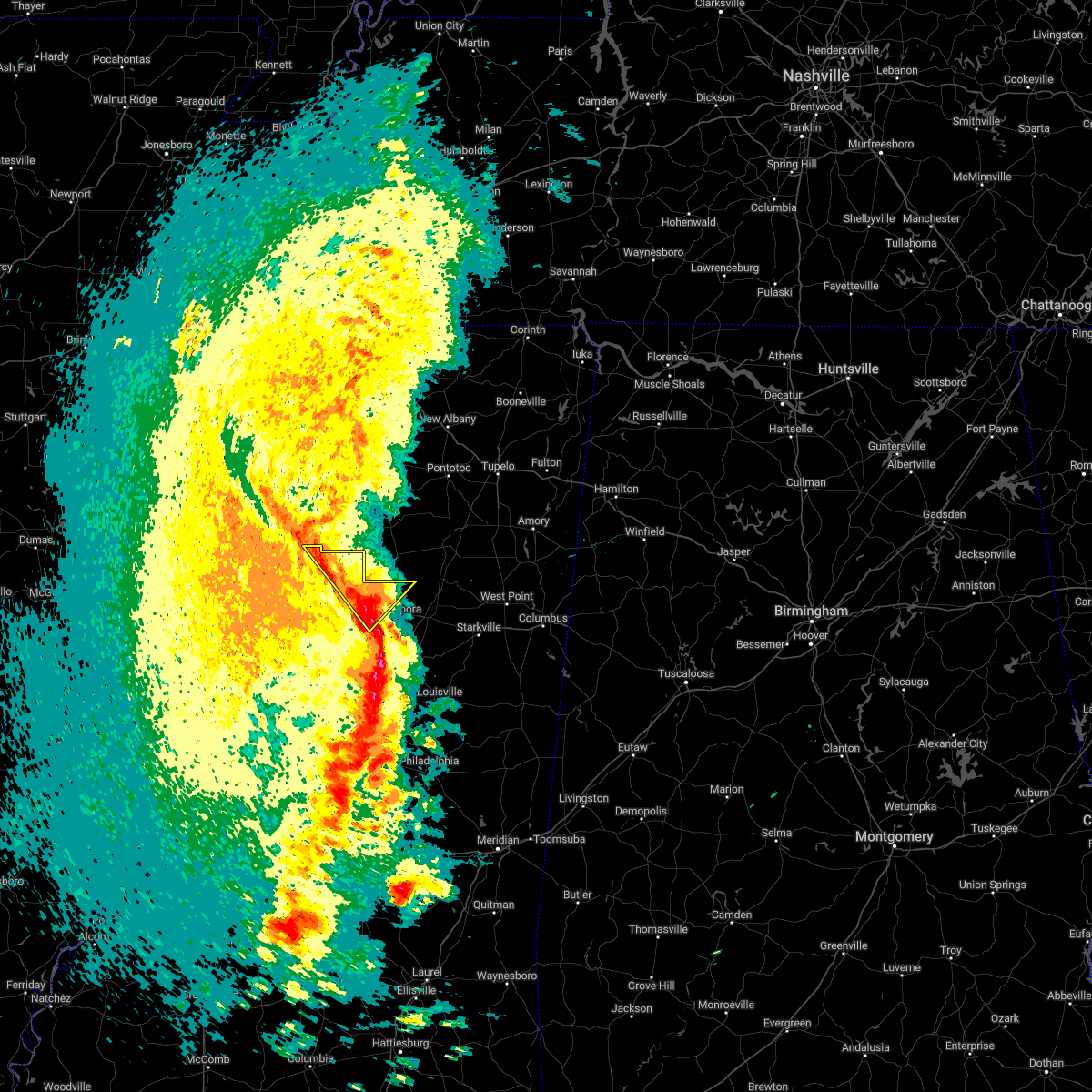 At 147 pm cdt, severe thunderstorms were located along a line extending from near coffeeville to near lodi, moving northeast at 55 mph (radar indicated). Hazards include 60 mph wind gusts. Expect damage to roofs, siding, and trees. These severe storms will be near, bellefontaine and embry around 200 pm cdt. At 147 pm cdt, severe thunderstorms were located along a line extending from near coffeeville to near lodi, moving northeast at 55 mph (radar indicated). Hazards include 60 mph wind gusts. Expect damage to roofs, siding, and trees. These severe storms will be near, bellefontaine and embry around 200 pm cdt.
|
| 3/22/2022 1:47 PM CDT |
 At 147 pm cdt, severe thunderstorms capable of producing tornadoes were located along a line extending from 6 miles east of scobey to misterton to near lodi, moving northeast at 50 mph (radar indicated rotation). Hazards include tornado. Flying debris will be dangerous to those caught without shelter. mobile homes will be damaged or destroyed. damage to roofs, windows, and vehicles will occur. tree damage is likely. These dangerous storms will be near, bellefontaine and embry around 200 pm cdt. At 147 pm cdt, severe thunderstorms capable of producing tornadoes were located along a line extending from 6 miles east of scobey to misterton to near lodi, moving northeast at 50 mph (radar indicated rotation). Hazards include tornado. Flying debris will be dangerous to those caught without shelter. mobile homes will be damaged or destroyed. damage to roofs, windows, and vehicles will occur. tree damage is likely. These dangerous storms will be near, bellefontaine and embry around 200 pm cdt.
|
| 3/22/2022 1:42 PM CDT |
 At 142 pm cdt, severe thunderstorms were located along a line extending from near scobey to near kilmichael, moving northeast at 55 mph (radar indicated). Hazards include 60 mph wind gusts. Expect damage to roofs, siding, and trees. these severe storms will be near, embry around 155 pm cdt. Bellefontaine around 200 pm cdt. At 142 pm cdt, severe thunderstorms were located along a line extending from near scobey to near kilmichael, moving northeast at 55 mph (radar indicated). Hazards include 60 mph wind gusts. Expect damage to roofs, siding, and trees. these severe storms will be near, embry around 155 pm cdt. Bellefontaine around 200 pm cdt.
|
| 3/22/2022 1:37 PM CDT | Trees down across southern grenada count in grenada county MS, 8 miles NW of Grenada, MS |
| 3/22/2022 1:25 PM CDT |
 At 125 pm cdt, severe thunderstorms were located along a line extending from holcomb to near vaiden, moving northeast at 55 mph (radar indicated). Hazards include 60 mph wind gusts. Expect damage to roofs, siding, and trees. these severe storms will be near, bew springs around 130 pm cdt. grenada and kilmichael around 135 pm cdt. lodi around 145 pm cdt. embry around 155 pm cdt. bellefontaine around 200 pm cdt. Other locations impacted by these severe thunderstorms include carrollton. At 125 pm cdt, severe thunderstorms were located along a line extending from holcomb to near vaiden, moving northeast at 55 mph (radar indicated). Hazards include 60 mph wind gusts. Expect damage to roofs, siding, and trees. these severe storms will be near, bew springs around 130 pm cdt. grenada and kilmichael around 135 pm cdt. lodi around 145 pm cdt. embry around 155 pm cdt. bellefontaine around 200 pm cdt. Other locations impacted by these severe thunderstorms include carrollton.
|
| 3/22/2022 1:20 PM CDT |
 At 120 pm cdt, severe thunderstorms capable of producing a tornado were located along a line extending from near leflore to near north carrollton to 6 miles south of vaiden, moving northeast at 50 mph (radar indicated rotation). Hazards include tornado. Flying debris will be dangerous to those caught without shelter. mobile homes will be damaged or destroyed. damage to roofs, windows, and vehicles will occur. tree damage is likely. these dangerous storms will be near, winona and jefferson around 125 pm cdt. grenada, duck hill, bew springs and elliott around 135 pm cdt. kilmichael around 140 pm cdt. sweatman around 145 pm cdt. misterton, gore springs and lodi around 150 pm cdt. bellefontaine and embry around 205 pm cdt. Other locations impacted by these tornadic storms include carrollton. At 120 pm cdt, severe thunderstorms capable of producing a tornado were located along a line extending from near leflore to near north carrollton to 6 miles south of vaiden, moving northeast at 50 mph (radar indicated rotation). Hazards include tornado. Flying debris will be dangerous to those caught without shelter. mobile homes will be damaged or destroyed. damage to roofs, windows, and vehicles will occur. tree damage is likely. these dangerous storms will be near, winona and jefferson around 125 pm cdt. grenada, duck hill, bew springs and elliott around 135 pm cdt. kilmichael around 140 pm cdt. sweatman around 145 pm cdt. misterton, gore springs and lodi around 150 pm cdt. bellefontaine and embry around 205 pm cdt. Other locations impacted by these tornadic storms include carrollton.
|
| 3/22/2022 1:09 PM CDT |
 At 109 pm cdt, severe thunderstorms were located along a line extending from near avalon to near emory, moving northeast at 55 mph (radar indicated). Hazards include 60 mph wind gusts. Expect damage to roofs, siding, and trees. severe thunderstorms will be near, leflore and avalon around 115 pm cdt. vaiden around 120 pm cdt. winona and holcomb around 125 pm cdt. grenada and bew springs around 130 pm cdt. kilmichael around 135 pm cdt. lodi around 140 pm cdt. sweatman and misterton around 145 pm cdt. embry and bellefontaine around 155 pm cdt. Other locations impacted by these severe thunderstorms include carrollton. At 109 pm cdt, severe thunderstorms were located along a line extending from near avalon to near emory, moving northeast at 55 mph (radar indicated). Hazards include 60 mph wind gusts. Expect damage to roofs, siding, and trees. severe thunderstorms will be near, leflore and avalon around 115 pm cdt. vaiden around 120 pm cdt. winona and holcomb around 125 pm cdt. grenada and bew springs around 130 pm cdt. kilmichael around 135 pm cdt. lodi around 140 pm cdt. sweatman and misterton around 145 pm cdt. embry and bellefontaine around 155 pm cdt. Other locations impacted by these severe thunderstorms include carrollton.
|
| 3/22/2022 12:13 PM CDT |
 At 1213 pm cdt, severe thunderstorms were located along a line extending from near avalon to near malmaison to near black hawk, moving northeast at 45 mph (radar indicated). Hazards include 60 mph wind gusts. Expect damage to roofs, siding, and trees. these severe storms will be near, leflore, north carrollton and avalon around 1220 pm cdt. jefferson and holcomb around 1230 pm cdt. bew springs around 1235 pm cdt. grenada, winona, duck hill and elliott around 1240 pm cdt. gore springs and misterton around 1255 pm cdt. sweatman and lodi around 100 pm cdt. embry around 115 pm cdt. other locations impacted by these severe thunderstorms include carrollton. hail threat, radar indicated max hail size, <. 75 in wind threat, radar indicated max wind gust, 60 mph. At 1213 pm cdt, severe thunderstorms were located along a line extending from near avalon to near malmaison to near black hawk, moving northeast at 45 mph (radar indicated). Hazards include 60 mph wind gusts. Expect damage to roofs, siding, and trees. these severe storms will be near, leflore, north carrollton and avalon around 1220 pm cdt. jefferson and holcomb around 1230 pm cdt. bew springs around 1235 pm cdt. grenada, winona, duck hill and elliott around 1240 pm cdt. gore springs and misterton around 1255 pm cdt. sweatman and lodi around 100 pm cdt. embry around 115 pm cdt. other locations impacted by these severe thunderstorms include carrollton. hail threat, radar indicated max hail size, <. 75 in wind threat, radar indicated max wind gust, 60 mph.
|
| 3/22/2022 11:51 AM CDT |
 At 1151 am cdt, severe thunderstorms were located along a line extending from itta bena to tchula, moving northeast at 45 mph (radar indicated). Hazards include 60 mph wind gusts. Expect damage to roofs, siding, and trees. severe thunderstorms will be near, greenwood and money around 1205 pm cdt. black hawk and seven pines around 1210 pm cdt. avalon and teoc around 1215 pm cdt. leflore and coila around 1220 pm cdt. jefferson around 1225 pm cdt. holcomb around 1230 pm cdt. bew springs around 1235 pm cdt. grenada and winona around 1240 pm cdt. other locations impacted by these severe thunderstorms include carrollton. hail threat, radar indicated max hail size, <. 75 in wind threat, radar indicated max wind gust, 60 mph. At 1151 am cdt, severe thunderstorms were located along a line extending from itta bena to tchula, moving northeast at 45 mph (radar indicated). Hazards include 60 mph wind gusts. Expect damage to roofs, siding, and trees. severe thunderstorms will be near, greenwood and money around 1205 pm cdt. black hawk and seven pines around 1210 pm cdt. avalon and teoc around 1215 pm cdt. leflore and coila around 1220 pm cdt. jefferson around 1225 pm cdt. holcomb around 1230 pm cdt. bew springs around 1235 pm cdt. grenada and winona around 1240 pm cdt. other locations impacted by these severe thunderstorms include carrollton. hail threat, radar indicated max hail size, <. 75 in wind threat, radar indicated max wind gust, 60 mph.
|
| 6/13/2021 4:45 PM CDT |
 At 444 pm cdt, severe thunderstorms were located along a line extending from near grenada to near blaine, moving southeast at 15 mph (radar indicated). Hazards include 60 mph wind gusts and quarter size hail. Hail damage to vehicles is expected. expect wind damage to roofs, siding, and trees. severe thunderstorms will be near, grenada and bew springs around 450 pm cdt. moorhead and elliott around 525 pm cdt. itta bena around 530 pm cdt. swiftown and quito around 545 pm cdt. Other locations impacted by these severe thunderstorms include doddsville, carrollton, schlater and morgan city. At 444 pm cdt, severe thunderstorms were located along a line extending from near grenada to near blaine, moving southeast at 15 mph (radar indicated). Hazards include 60 mph wind gusts and quarter size hail. Hail damage to vehicles is expected. expect wind damage to roofs, siding, and trees. severe thunderstorms will be near, grenada and bew springs around 450 pm cdt. moorhead and elliott around 525 pm cdt. itta bena around 530 pm cdt. swiftown and quito around 545 pm cdt. Other locations impacted by these severe thunderstorms include doddsville, carrollton, schlater and morgan city.
|
| 5/4/2021 2:27 PM CDT |
 At 227 pm cdt, a severe thunderstorm was located near elliott, or 10 miles southeast of grenada, moving east at 55 mph (radar indicated). Hazards include 70 mph wind gusts. Expect considerable tree damage. damage is likely to mobile homes, roofs, and outbuildings. this severe thunderstorm will remain over mainly rural areas of central carroll, grenada and montgomery counties, including the following locations, carrollton. a tornado watch remains in effect until 400 pm cdt for central and north central mississippi. A tornado watch also remains in effect until 600 pm cdt for north central mississippi. At 227 pm cdt, a severe thunderstorm was located near elliott, or 10 miles southeast of grenada, moving east at 55 mph (radar indicated). Hazards include 70 mph wind gusts. Expect considerable tree damage. damage is likely to mobile homes, roofs, and outbuildings. this severe thunderstorm will remain over mainly rural areas of central carroll, grenada and montgomery counties, including the following locations, carrollton. a tornado watch remains in effect until 400 pm cdt for central and north central mississippi. A tornado watch also remains in effect until 600 pm cdt for north central mississippi.
|
| 5/4/2021 2:21 PM CDT | Trees and power lines downed in grenada and across the western portion of grenada count in grenada county MS, 1.4 miles SSE of Grenada, MS |
| 5/4/2021 2:17 PM CDT |
 At 217 pm cdt, a severe thunderstorm was located near jefferson, or 8 miles northwest of winona, moving east at 50 mph (radar indicated). Hazards include 70 mph wind gusts. Expect considerable tree damage. damage is likely to mobile homes, roofs, and outbuildings. this severe storm will be near, duck hill and elliott around 225 pm cdt. sweatman, lodi and misterton around 235 pm cdt. other locations impacted by this severe thunderstorm include carrollton. a tornado watch remains in effect until 400 pm cdt for central and north central mississippi. A tornado watch also remains in effect until 600 pm cdt for north central mississippi. At 217 pm cdt, a severe thunderstorm was located near jefferson, or 8 miles northwest of winona, moving east at 50 mph (radar indicated). Hazards include 70 mph wind gusts. Expect considerable tree damage. damage is likely to mobile homes, roofs, and outbuildings. this severe storm will be near, duck hill and elliott around 225 pm cdt. sweatman, lodi and misterton around 235 pm cdt. other locations impacted by this severe thunderstorm include carrollton. a tornado watch remains in effect until 400 pm cdt for central and north central mississippi. A tornado watch also remains in effect until 600 pm cdt for north central mississippi.
|
| 5/4/2021 1:44 PM CDT |
 At 144 pm cdt, a severe thunderstorm was located near winona, moving north at 30 mph (radar indicated). Hazards include 60 mph wind gusts and quarter size hail. Hail damage to vehicles is expected. expect wind damage to roofs, siding, and trees. this severe thunderstorm will be near, jefferson and duck hill around 155 pm cdt. elliott around 200 pm cdt. grenada and bew springs around 215 pm cdt. other locations impacted by this severe thunderstorm include carrollton. a tornado watch remains in effect until 400 pm cdt for central and north central mississippi. A tornado watch also remains in effect until 600 pm cdt for north central mississippi. At 144 pm cdt, a severe thunderstorm was located near winona, moving north at 30 mph (radar indicated). Hazards include 60 mph wind gusts and quarter size hail. Hail damage to vehicles is expected. expect wind damage to roofs, siding, and trees. this severe thunderstorm will be near, jefferson and duck hill around 155 pm cdt. elliott around 200 pm cdt. grenada and bew springs around 215 pm cdt. other locations impacted by this severe thunderstorm include carrollton. a tornado watch remains in effect until 400 pm cdt for central and north central mississippi. A tornado watch also remains in effect until 600 pm cdt for north central mississippi.
|
| 7/21/2020 3:38 PM CDT |
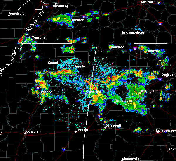 At 337 pm cdt, a severe thunderstorm was located near grenada, moving north at 15 mph (radar indicated). Hazards include 60 mph wind gusts and quarter size hail. Hail damage to vehicles is expected. expect wind damage to roofs, siding, and trees. This severe thunderstorm will remain over mainly rural areas of northeastern grenada county. At 337 pm cdt, a severe thunderstorm was located near grenada, moving north at 15 mph (radar indicated). Hazards include 60 mph wind gusts and quarter size hail. Hail damage to vehicles is expected. expect wind damage to roofs, siding, and trees. This severe thunderstorm will remain over mainly rural areas of northeastern grenada county.
|
| 7/21/2020 3:22 PM CDT |
 At 322 pm cdt, severe thunderstorms were located along a line extending from near gore springs to near duck hill, moving northwest at 20 mph (radar indicated). Hazards include 60 mph wind gusts and quarter size hail. Hail damage to vehicles is expected. expect wind damage to roofs, siding, and trees. These severe storms will be near, grenada around 355 pm cdt. At 322 pm cdt, severe thunderstorms were located along a line extending from near gore springs to near duck hill, moving northwest at 20 mph (radar indicated). Hazards include 60 mph wind gusts and quarter size hail. Hail damage to vehicles is expected. expect wind damage to roofs, siding, and trees. These severe storms will be near, grenada around 355 pm cdt.
|
| 7/21/2020 3:10 PM CDT |
 At 309 pm cdt, severe thunderstorms were located along a line extending from gore springs to near duck hill, moving north at 15 mph (radar indicated). Hazards include 60 mph wind gusts and quarter size hail. Hail damage to vehicles is expected. expect wind damage to roofs, siding, and trees. severe thunderstorms will be near, gore springs around 320 pm cdt. elliott around 330 pm cdt. Grenada around 415 pm cdt. At 309 pm cdt, severe thunderstorms were located along a line extending from gore springs to near duck hill, moving north at 15 mph (radar indicated). Hazards include 60 mph wind gusts and quarter size hail. Hail damage to vehicles is expected. expect wind damage to roofs, siding, and trees. severe thunderstorms will be near, gore springs around 320 pm cdt. elliott around 330 pm cdt. Grenada around 415 pm cdt.
|
| 6/5/2020 4:02 PM CDT | Multiple trees dow in carroll county MS, 9.8 miles N of Grenada, MS |
| 6/5/2020 4:02 PM CDT |
 At 402 pm cdt, severe thunderstorms were located along a line extending from money to duck hill, moving south at 35 mph (radar indicated). Hazards include 70 mph wind gusts. Expect considerable tree damage. damage is likely to mobile homes, roofs, and outbuildings. these severe storms will be near, greenwood and itta bena around 420 pm cdt. winona around 425 pm cdt. kilmichael and quito around 430 pm cdt. sidon around 435 pm cdt. vaiden, poplar creek and seven pines around 440 pm cdt. Other locations impacted by these severe thunderstorms include schlater, morgan city and carrollton. At 402 pm cdt, severe thunderstorms were located along a line extending from money to duck hill, moving south at 35 mph (radar indicated). Hazards include 70 mph wind gusts. Expect considerable tree damage. damage is likely to mobile homes, roofs, and outbuildings. these severe storms will be near, greenwood and itta bena around 420 pm cdt. winona around 425 pm cdt. kilmichael and quito around 430 pm cdt. sidon around 435 pm cdt. vaiden, poplar creek and seven pines around 440 pm cdt. Other locations impacted by these severe thunderstorms include schlater, morgan city and carrollton.
|
| 6/5/2020 3:50 PM CDT | Multiple trees and power lines dow in grenada county MS, 2 miles SSW of Grenada, MS |
| 6/5/2020 3:42 PM CDT |
 At 341 pm cdt, severe thunderstorms were located along a line extending from near minter city to near grenada, moving south at 45 mph (radar indicated). Hazards include 70 mph wind gusts and quarter size hail. Hail damage to vehicles is expected. expect considerable tree damage. wind damage is also likely to mobile homes, roofs, and outbuildings. these severe storms will be near, grenada around 345 pm cdt. sunnyside around 350 pm cdt. jefferson, elliott and money around 355 pm cdt. duck hill around 400 pm cdt. winona and itta bena around 410 pm cdt. quito around 415 pm cdt. sidon around 420 pm cdt. vaiden around 425 pm cdt. Other locations impacted by these severe thunderstorms include schlater, morgan city and carrollton. At 341 pm cdt, severe thunderstorms were located along a line extending from near minter city to near grenada, moving south at 45 mph (radar indicated). Hazards include 70 mph wind gusts and quarter size hail. Hail damage to vehicles is expected. expect considerable tree damage. wind damage is also likely to mobile homes, roofs, and outbuildings. these severe storms will be near, grenada around 345 pm cdt. sunnyside around 350 pm cdt. jefferson, elliott and money around 355 pm cdt. duck hill around 400 pm cdt. winona and itta bena around 410 pm cdt. quito around 415 pm cdt. sidon around 420 pm cdt. vaiden around 425 pm cdt. Other locations impacted by these severe thunderstorms include schlater, morgan city and carrollton.
|
| 6/5/2020 3:39 PM CDT | Multiple power lines and trees dow in grenada county MS, 6.1 miles S of Grenada, MS |
| 6/5/2020 3:23 PM CDT |
 At 322 pm cdt, severe thunderstorms were located along a line extending from near sumner to 8 miles northeast of scobey, moving south at 50 mph (radar indicated). Hazards include 70 mph wind gusts and quarter size hail. Hail damage to vehicles is expected. expect considerable tree damage. wind damage is also likely to mobile homes, roofs, and outbuildings. severe thunderstorms will be near, grenada, minter city and bew springs around 345 pm cdt. sunnyside around 350 pm cdt. jefferson, duck hill, elliott and money around 355 pm cdt. itta bena around 405 pm cdt. winona around 410 pm cdt. sidon and quito around 415 pm cdt. vaiden around 425 pm cdt. Other locations impacted by these severe thunderstorms include schlater, morgan city and carrollton. At 322 pm cdt, severe thunderstorms were located along a line extending from near sumner to 8 miles northeast of scobey, moving south at 50 mph (radar indicated). Hazards include 70 mph wind gusts and quarter size hail. Hail damage to vehicles is expected. expect considerable tree damage. wind damage is also likely to mobile homes, roofs, and outbuildings. severe thunderstorms will be near, grenada, minter city and bew springs around 345 pm cdt. sunnyside around 350 pm cdt. jefferson, duck hill, elliott and money around 355 pm cdt. itta bena around 405 pm cdt. winona around 410 pm cdt. sidon and quito around 415 pm cdt. vaiden around 425 pm cdt. Other locations impacted by these severe thunderstorms include schlater, morgan city and carrollton.
|
| 6/3/2020 6:22 PM CDT |
 At 621 pm cdt, a severe thunderstorm was located over jefferson, or 9 miles south of grenada, moving east at 20 mph (radar indicated). Hazards include golf ball size hail and 60 mph wind gusts. People and animals outdoors will be injured. expect hail damage to roofs, siding, windows, and vehicles. expect wind damage to roofs, siding, and trees. this severe storm will be near, elliott around 635 pm cdt. duck hill around 645 pm cdt. Other locations impacted by this severe thunderstorm include carrollton. At 621 pm cdt, a severe thunderstorm was located over jefferson, or 9 miles south of grenada, moving east at 20 mph (radar indicated). Hazards include golf ball size hail and 60 mph wind gusts. People and animals outdoors will be injured. expect hail damage to roofs, siding, windows, and vehicles. expect wind damage to roofs, siding, and trees. this severe storm will be near, elliott around 635 pm cdt. duck hill around 645 pm cdt. Other locations impacted by this severe thunderstorm include carrollton.
|
| 6/3/2020 6:17 PM CDT |
 At 616 pm cdt, a severe thunderstorm was located over jefferson, or 9 miles southwest of grenada, moving east at 20 mph (radar indicated). Hazards include 60 mph wind gusts and quarter size hail. Hail damage to vehicles is expected. expect wind damage to roofs, siding, and trees. this severe storm will be near, elliott around 640 pm cdt. duck hill around 645 pm cdt. Other locations impacted by this severe thunderstorm include carrollton. At 616 pm cdt, a severe thunderstorm was located over jefferson, or 9 miles southwest of grenada, moving east at 20 mph (radar indicated). Hazards include 60 mph wind gusts and quarter size hail. Hail damage to vehicles is expected. expect wind damage to roofs, siding, and trees. this severe storm will be near, elliott around 640 pm cdt. duck hill around 645 pm cdt. Other locations impacted by this severe thunderstorm include carrollton.
|
| 6/3/2020 6:03 PM CDT |
 At 603 pm cdt, a severe thunderstorm was located near jefferson, or 10 miles southwest of grenada, moving east at 20 mph (radar indicated). Hazards include 60 mph wind gusts and quarter size hail. Hail damage to vehicles is expected. expect wind damage to roofs, siding, and trees. this severe thunderstorm will be near, jefferson around 615 pm cdt. elliott around 635 pm cdt. duck hill around 645 pm cdt. Other locations impacted by this severe thunderstorm include carrollton. At 603 pm cdt, a severe thunderstorm was located near jefferson, or 10 miles southwest of grenada, moving east at 20 mph (radar indicated). Hazards include 60 mph wind gusts and quarter size hail. Hail damage to vehicles is expected. expect wind damage to roofs, siding, and trees. this severe thunderstorm will be near, jefferson around 615 pm cdt. elliott around 635 pm cdt. duck hill around 645 pm cdt. Other locations impacted by this severe thunderstorm include carrollton.
|
| 4/23/2020 12:04 AM CDT |
 At 1204 am cdt, a severe thunderstorm was located near leflore, or 15 miles north of greenwood, moving northeast at 80 mph (radar indicated). Hazards include quarter size hail. Damage to vehicles is expected. this severe storm will be near, holcomb around 1210 am cdt. Grenada and bew springs around 1215 am cdt. At 1204 am cdt, a severe thunderstorm was located near leflore, or 15 miles north of greenwood, moving northeast at 80 mph (radar indicated). Hazards include quarter size hail. Damage to vehicles is expected. this severe storm will be near, holcomb around 1210 am cdt. Grenada and bew springs around 1215 am cdt.
|
| 4/22/2020 11:49 PM CDT |
 At 1149 pm cdt, a severe thunderstorm was located near itta bena, moving northeast at 85 mph (radar indicated). Hazards include quarter size hail. Damage to vehicles is expected. this severe thunderstorm will be near, money, sunnyside and minter city around 1200 am cdt. leflore around 1205 am cdt. holcomb around 1210 am cdt. grenada and bew springs around 1215 am cdt. Other locations impacted by this severe thunderstorm include schlater. At 1149 pm cdt, a severe thunderstorm was located near itta bena, moving northeast at 85 mph (radar indicated). Hazards include quarter size hail. Damage to vehicles is expected. this severe thunderstorm will be near, money, sunnyside and minter city around 1200 am cdt. leflore around 1205 am cdt. holcomb around 1210 am cdt. grenada and bew springs around 1215 am cdt. Other locations impacted by this severe thunderstorm include schlater.
|
| 4/12/2020 10:14 PM CDT |
 At 1014 pm cdt, severe thunderstorms were located along a line extending from near coffeeville to near duck hill to near black hawk, moving east at 70 mph (radar indicated). Hazards include 60 mph wind gusts. Expect damage to roofs, siding, and trees. These severe thunderstorms will remain over mainly rural areas of carroll and central grenada counties, including the following locations, carrollton. At 1014 pm cdt, severe thunderstorms were located along a line extending from near coffeeville to near duck hill to near black hawk, moving east at 70 mph (radar indicated). Hazards include 60 mph wind gusts. Expect damage to roofs, siding, and trees. These severe thunderstorms will remain over mainly rural areas of carroll and central grenada counties, including the following locations, carrollton.
|
| 4/12/2020 10:05 PM CDT | Widespread trees down...many roads including major roads blocked by downed trees...reported by grenada s in grenada county MS, 1.4 miles SSE of Grenada, MS |
| 4/12/2020 10:05 PM CDT | At least 15 homes across the county were damaged by falling tree in grenada county MS, 1.1 miles NE of Grenada, MS |
| 4/12/2020 10:05 PM CDT |
 At 1004 pm cdt, severe thunderstorms were located along a line extending from near george payne state park to near jefferson to near sidon, moving east at 70 mph (radar indicated). Hazards include 60 mph wind gusts. Expect damage to roofs, siding, and trees. severe thunderstorms will be near, winona, duck hill and elliott around 1015 pm cdt. sweatman around 1020 pm cdt. vaiden and lodi around 1025 pm cdt. embry around 1030 pm cdt. eupora, kilmichael, poplar creek and bellefontaine around 1035 pm cdt. mathiston, cumberland, clarkson and sherwood around 1045 pm cdt. chester around 1050 pm cdt. reform around 1055 pm cdt. Other locations impacted by these severe thunderstorms include french camp, mantee and walthall. At 1004 pm cdt, severe thunderstorms were located along a line extending from near george payne state park to near jefferson to near sidon, moving east at 70 mph (radar indicated). Hazards include 60 mph wind gusts. Expect damage to roofs, siding, and trees. severe thunderstorms will be near, winona, duck hill and elliott around 1015 pm cdt. sweatman around 1020 pm cdt. vaiden and lodi around 1025 pm cdt. embry around 1030 pm cdt. eupora, kilmichael, poplar creek and bellefontaine around 1035 pm cdt. mathiston, cumberland, clarkson and sherwood around 1045 pm cdt. chester around 1050 pm cdt. reform around 1055 pm cdt. Other locations impacted by these severe thunderstorms include french camp, mantee and walthall.
|
| 4/12/2020 9:53 PM CDT |
 At 953 pm cdt, severe thunderstorms were located along a line extending from near paynes to near greenwood to near swiftown, moving east at 70 mph (radar indicated). Hazards include 70 mph wind gusts. Expect considerable tree damage. damage is likely to mobile homes, roofs, and outbuildings. these severe storms will be near, teoc, avalon and holcomb around 1000 pm cdt. grenada, sidon, north carrollton, malmaison and bew springs around 1005 pm cdt. jefferson and seven pines around 1010 pm cdt. black hawk around 1015 pm cdt. coila around 1020 pm cdt. Other locations impacted by these severe thunderstorms include schlater, morgan city and carrollton. At 953 pm cdt, severe thunderstorms were located along a line extending from near paynes to near greenwood to near swiftown, moving east at 70 mph (radar indicated). Hazards include 70 mph wind gusts. Expect considerable tree damage. damage is likely to mobile homes, roofs, and outbuildings. these severe storms will be near, teoc, avalon and holcomb around 1000 pm cdt. grenada, sidon, north carrollton, malmaison and bew springs around 1005 pm cdt. jefferson and seven pines around 1010 pm cdt. black hawk around 1015 pm cdt. coila around 1020 pm cdt. Other locations impacted by these severe thunderstorms include schlater, morgan city and carrollton.
|
| 4/12/2020 9:36 PM CDT |
 At 936 pm cdt, severe thunderstorms were located along a line extending from tutwiler to near ruleville to holly ridge, moving east at 70 mph (radar indicated). Hazards include 70 mph wind gusts. Expect considerable tree damage. damage is likely to mobile homes, roofs, and outbuildings. severe thunderstorms will be near, sunnyside and minter city around 945 pm cdt. money around 950 pm cdt. avalon around 955 pm cdt. itta bena, leflore, quito and holcomb around 1000 pm cdt. greenwood, jefferson, sidon and bew springs around 1005 pm cdt. grenada and seven pines around 1010 pm cdt. malmaison and coila around 1015 pm cdt. north carrollton around 1020 pm cdt. Other locations impacted by these severe thunderstorms include schlater, morgan city and carrollton. At 936 pm cdt, severe thunderstorms were located along a line extending from tutwiler to near ruleville to holly ridge, moving east at 70 mph (radar indicated). Hazards include 70 mph wind gusts. Expect considerable tree damage. damage is likely to mobile homes, roofs, and outbuildings. severe thunderstorms will be near, sunnyside and minter city around 945 pm cdt. money around 950 pm cdt. avalon around 955 pm cdt. itta bena, leflore, quito and holcomb around 1000 pm cdt. greenwood, jefferson, sidon and bew springs around 1005 pm cdt. grenada and seven pines around 1010 pm cdt. malmaison and coila around 1015 pm cdt. north carrollton around 1020 pm cdt. Other locations impacted by these severe thunderstorms include schlater, morgan city and carrollton.
|
| 3/23/2020 2:25 AM CDT |
 At 224 am cdt, a severe thunderstorm was located near duck hill, or 10 miles southeast of grenada, moving east at 50 mph (radar indicated). Hazards include 60 mph wind gusts and quarter size hail. Hail damage to vehicles is expected. expect wind damage to roofs, siding, and trees. this severe storm will be near, misterton and sweatman around 230 am cdt. embry around 245 am cdt. Bellefontaine around 250 am cdt. At 224 am cdt, a severe thunderstorm was located near duck hill, or 10 miles southeast of grenada, moving east at 50 mph (radar indicated). Hazards include 60 mph wind gusts and quarter size hail. Hail damage to vehicles is expected. expect wind damage to roofs, siding, and trees. this severe storm will be near, misterton and sweatman around 230 am cdt. embry around 245 am cdt. Bellefontaine around 250 am cdt.
|
| 3/23/2020 2:10 AM CDT |
 At 209 am cdt, a severe thunderstorm was located over jefferson, or 9 miles south of grenada, moving east at 50 mph (radar indicated). Hazards include 60 mph wind gusts and quarter size hail. Hail damage to vehicles is expected. expect wind damage to roofs, siding, and trees. this severe thunderstorm will be near, elliott around 215 am cdt. duck hill around 220 am cdt. gore springs around 225 am cdt. misterton and sweatman around 230 am cdt. embry around 240 am cdt. Bellefontaine around 245 am cdt. At 209 am cdt, a severe thunderstorm was located over jefferson, or 9 miles south of grenada, moving east at 50 mph (radar indicated). Hazards include 60 mph wind gusts and quarter size hail. Hail damage to vehicles is expected. expect wind damage to roofs, siding, and trees. this severe thunderstorm will be near, elliott around 215 am cdt. duck hill around 220 am cdt. gore springs around 225 am cdt. misterton and sweatman around 230 am cdt. embry around 240 am cdt. Bellefontaine around 245 am cdt.
|
| 1/11/2020 5:33 AM CST |
 At 533 am cst, severe thunderstorms were located along a line extending from 6 miles northwest of gore springs to near duck hill, moving east at 55 mph (radar indicated). Hazards include 60 mph wind gusts. Expect damage to roofs, siding, and trees. these severe storms will be near, gore springs around 540 am cst. sweatman around 545 am cst. lodi around 550 am cst. embry around 600 am cst. A tornado watch remains in effect until 900 am cst for north central mississippi. At 533 am cst, severe thunderstorms were located along a line extending from 6 miles northwest of gore springs to near duck hill, moving east at 55 mph (radar indicated). Hazards include 60 mph wind gusts. Expect damage to roofs, siding, and trees. these severe storms will be near, gore springs around 540 am cst. sweatman around 545 am cst. lodi around 550 am cst. embry around 600 am cst. A tornado watch remains in effect until 900 am cst for north central mississippi.
|
| 1/11/2020 5:14 AM CST |
 At 513 am cst, severe thunderstorms were located along a line extending from near holcomb to near malmaison, moving east at 55 mph (radar indicated). Hazards include 60 mph wind gusts. Expect damage to roofs, siding, and trees. severe thunderstorms will be near, grenada and bew springs around 520 am cst. jefferson and elliott around 525 am cst. winona around 530 am cst. duck hill and gore springs around 535 am cst. sweatman, misterton and lodi around 545 am cst. embry around 555 am cst. bellefontaine around 600 am cst. other locations impacted by these severe thunderstorms include carrollton. A tornado watch remains in effect until 900 am cst for central and north central mississippi. At 513 am cst, severe thunderstorms were located along a line extending from near holcomb to near malmaison, moving east at 55 mph (radar indicated). Hazards include 60 mph wind gusts. Expect damage to roofs, siding, and trees. severe thunderstorms will be near, grenada and bew springs around 520 am cst. jefferson and elliott around 525 am cst. winona around 530 am cst. duck hill and gore springs around 535 am cst. sweatman, misterton and lodi around 545 am cst. embry around 555 am cst. bellefontaine around 600 am cst. other locations impacted by these severe thunderstorms include carrollton. A tornado watch remains in effect until 900 am cst for central and north central mississippi.
|
| 1/11/2020 4:57 AM CST |
 At 456 am cst, severe thunderstorms were located along a line extending from 7 miles south of paynes to near teoc, moving east at 50 mph (radar indicated). Hazards include 70 mph wind gusts. Expect considerable tree damage. damage is likely to mobile homes, roofs, and outbuildings. these severe storms will be near, leflore, malmaison and holcomb around 505 am cst. north carrollton and bew springs around 510 am cst. grenada and jefferson around 515 am cst. other locations impacted by these severe thunderstorms include carrollton. a tornado watch remains in effect until 700 am cst for north central mississippi. A tornado watch also remains in effect until 900 am cst for north central mississippi. At 456 am cst, severe thunderstorms were located along a line extending from 7 miles south of paynes to near teoc, moving east at 50 mph (radar indicated). Hazards include 70 mph wind gusts. Expect considerable tree damage. damage is likely to mobile homes, roofs, and outbuildings. these severe storms will be near, leflore, malmaison and holcomb around 505 am cst. north carrollton and bew springs around 510 am cst. grenada and jefferson around 515 am cst. other locations impacted by these severe thunderstorms include carrollton. a tornado watch remains in effect until 700 am cst for north central mississippi. A tornado watch also remains in effect until 900 am cst for north central mississippi.
|
| 1/11/2020 4:42 AM CST |
 At 442 am cst, severe thunderstorms were located along a line extending from near minter city to near itta bena, moving east at 55 mph (radar indicated). Hazards include 70 mph wind gusts. Expect considerable tree damage. damage is likely to mobile homes, roofs, and outbuildings. these severe storms will be near, teoc and avalon around 455 am cst. leflore and malmaison around 500 am cst. holcomb around 505 am cst. jefferson and bew springs around 510 am cst. grenada around 515 am cst. other locations impacted by these severe thunderstorms include schlater, morgan city and carrollton. a tornado watch remains in effect until 700 am cst for north central mississippi. A tornado watch also remains in effect until 900 am cst for central and north central mississippi. At 442 am cst, severe thunderstorms were located along a line extending from near minter city to near itta bena, moving east at 55 mph (radar indicated). Hazards include 70 mph wind gusts. Expect considerable tree damage. damage is likely to mobile homes, roofs, and outbuildings. these severe storms will be near, teoc and avalon around 455 am cst. leflore and malmaison around 500 am cst. holcomb around 505 am cst. jefferson and bew springs around 510 am cst. grenada around 515 am cst. other locations impacted by these severe thunderstorms include schlater, morgan city and carrollton. a tornado watch remains in effect until 700 am cst for north central mississippi. A tornado watch also remains in effect until 900 am cst for central and north central mississippi.
|
| 1/11/2020 4:18 AM CST |
 At 418 am cst, severe thunderstorms were located along a line extending from near ruleville to near indianola, moving northeast at 60 mph (radar indicated). Hazards include 70 mph wind gusts. Expect considerable tree damage. damage is likely to mobile homes, roofs, and outbuildings. severe thunderstorms will be near, ruleville and drew around 425 am cst. itta bena, quito and minter city around 435 am cst. greenwood and money around 445 am cst. teoc around 450 am cst. leflore, avalon and malmaison around 455 am cst. jefferson and holcomb around 500 am cst. bew springs around 505 am cst. grenada around 510 am cst. other locations impacted by these severe thunderstorms include doddsville, carrollton, schlater and morgan city. a tornado watch remains in effect until 700 am cst for north central and northwestern mississippi. A tornado watch also remains in effect until 900 am cst for central and north central mississippi. At 418 am cst, severe thunderstorms were located along a line extending from near ruleville to near indianola, moving northeast at 60 mph (radar indicated). Hazards include 70 mph wind gusts. Expect considerable tree damage. damage is likely to mobile homes, roofs, and outbuildings. severe thunderstorms will be near, ruleville and drew around 425 am cst. itta bena, quito and minter city around 435 am cst. greenwood and money around 445 am cst. teoc around 450 am cst. leflore, avalon and malmaison around 455 am cst. jefferson and holcomb around 500 am cst. bew springs around 505 am cst. grenada around 510 am cst. other locations impacted by these severe thunderstorms include doddsville, carrollton, schlater and morgan city. a tornado watch remains in effect until 700 am cst for north central and northwestern mississippi. A tornado watch also remains in effect until 900 am cst for central and north central mississippi.
|
| 12/16/2019 3:12 PM CST |
 At 312 pm cst, a severe thunderstorm was located near gore springs, or 7 miles east of grenada, moving east at 50 mph (radar indicated). Hazards include 60 mph wind gusts. Expect damage to roofs, siding, and trees. this severe thunderstorm will remain over mainly rural areas of eastern grenada and northwestern montgomery counties. A tornado watch remains in effect until 600 pm cst for north central mississippi. At 312 pm cst, a severe thunderstorm was located near gore springs, or 7 miles east of grenada, moving east at 50 mph (radar indicated). Hazards include 60 mph wind gusts. Expect damage to roofs, siding, and trees. this severe thunderstorm will remain over mainly rural areas of eastern grenada and northwestern montgomery counties. A tornado watch remains in effect until 600 pm cst for north central mississippi.
|
| 12/16/2019 2:58 PM CST |
 At 258 pm cst, a severe thunderstorm was located near jefferson, or near grenada, moving east at 50 mph (radar indicated). Hazards include 60 mph wind gusts. Expect damage to roofs, siding, and trees. this severe storm will be near, duck hill and elliott around 305 pm cst. gore springs around 315 pm cst. misterton around 320 pm cst. other locations impacted by this severe thunderstorm include carrollton. A tornado watch remains in effect until 600 pm cst for north central mississippi. At 258 pm cst, a severe thunderstorm was located near jefferson, or near grenada, moving east at 50 mph (radar indicated). Hazards include 60 mph wind gusts. Expect damage to roofs, siding, and trees. this severe storm will be near, duck hill and elliott around 305 pm cst. gore springs around 315 pm cst. misterton around 320 pm cst. other locations impacted by this severe thunderstorm include carrollton. A tornado watch remains in effect until 600 pm cst for north central mississippi.
|
| 12/16/2019 2:30 PM CST |
 At 230 pm cst, a severe thunderstorm was located near money, or 7 miles northwest of greenwood, moving east at 50 mph (radar indicated). Hazards include 60 mph wind gusts. Expect damage to roofs, siding, and trees. this severe thunderstorm will be near, leflore, avalon and teoc around 245 pm cst. jefferson and holcomb around 255 pm cst. bew springs around 300 pm cst. grenada and elliott around 305 pm cst. duck hill around 310 pm cst. gore springs around 315 pm cst. misterton around 320 pm cst. other locations impacted by this severe thunderstorm include schlater, morgan city and carrollton. a tornado watch remains in effect until 600 pm cst for central and north central mississippi. A tornado watch also remains in effect until 900 pm cst for central and north central mississippi. At 230 pm cst, a severe thunderstorm was located near money, or 7 miles northwest of greenwood, moving east at 50 mph (radar indicated). Hazards include 60 mph wind gusts. Expect damage to roofs, siding, and trees. this severe thunderstorm will be near, leflore, avalon and teoc around 245 pm cst. jefferson and holcomb around 255 pm cst. bew springs around 300 pm cst. grenada and elliott around 305 pm cst. duck hill around 310 pm cst. gore springs around 315 pm cst. misterton around 320 pm cst. other locations impacted by this severe thunderstorm include schlater, morgan city and carrollton. a tornado watch remains in effect until 600 pm cst for central and north central mississippi. A tornado watch also remains in effect until 900 pm cst for central and north central mississippi.
|
| 10/21/2019 8:56 AM CDT |
 At 855 am cdt, severe thunderstorms were located along a line extending from near grenada to 6 miles east of coila, moving east at 45 mph (radar indicated). Hazards include 60 mph wind gusts. Expect damage to roofs, siding, and trees. these severe storms will be near, grenada around 900 am cdt. winona around 905 am cdt. lodi around 915 am cdt. Other locations impacted by these severe thunderstorms include carrollton. At 855 am cdt, severe thunderstorms were located along a line extending from near grenada to 6 miles east of coila, moving east at 45 mph (radar indicated). Hazards include 60 mph wind gusts. Expect damage to roofs, siding, and trees. these severe storms will be near, grenada around 900 am cdt. winona around 905 am cdt. lodi around 915 am cdt. Other locations impacted by these severe thunderstorms include carrollton.
|
| 10/21/2019 8:32 AM CDT |
 At 832 am cdt, severe thunderstorms were located along a line extending from 7 miles northwest of leflore to near seven pines, moving east at 45 mph (radar indicated). Hazards include 60 mph wind gusts. Expect damage to roofs, siding, and trees. severe thunderstorms will be near, leflore around 835 am cdt. holcomb around 840 am cdt. coila around 845 am cdt. grenada and bew springs around 850 am cdt. north carrollton around 855 am cdt. winona around 905 am cdt. lodi around 915 am cdt. Other locations impacted by these severe thunderstorms include carrollton. At 832 am cdt, severe thunderstorms were located along a line extending from 7 miles northwest of leflore to near seven pines, moving east at 45 mph (radar indicated). Hazards include 60 mph wind gusts. Expect damage to roofs, siding, and trees. severe thunderstorms will be near, leflore around 835 am cdt. holcomb around 840 am cdt. coila around 845 am cdt. grenada and bew springs around 850 am cdt. north carrollton around 855 am cdt. winona around 905 am cdt. lodi around 915 am cdt. Other locations impacted by these severe thunderstorms include carrollton.
|
| 6/27/2019 12:55 PM CDT | Several trees were blown down in the south and east side of the county and some trees were blown down in grenad in grenada county MS, 2 miles SSE of Grenada, MS |
| 6/24/2019 4:30 AM CDT |
 At 430 am cdt, severe thunderstorms were located along a line extending from 6 miles northwest of gore springs to near winona to near vaiden, moving east at 30 mph (radar indicated). Hazards include 60 mph wind gusts. Expect damage to roofs, siding, and trees. these severe storms will be near, gore springs around 435 am cdt. sweatman around 445 am cdt. lodi around 450 am cdt. Kilmichael and poplar creek around 455 am cdt. At 430 am cdt, severe thunderstorms were located along a line extending from 6 miles northwest of gore springs to near winona to near vaiden, moving east at 30 mph (radar indicated). Hazards include 60 mph wind gusts. Expect damage to roofs, siding, and trees. these severe storms will be near, gore springs around 435 am cdt. sweatman around 445 am cdt. lodi around 450 am cdt. Kilmichael and poplar creek around 455 am cdt.
|
| 6/24/2019 3:57 AM CDT |
 At 356 am cdt, severe thunderstorms were located along a line extending from near holcomb to malmaison to near seven pines, moving east at 35 mph (radar indicated). Hazards include 60 mph wind gusts. Expect damage to roofs, siding, and trees. severe thunderstorms will be near, holcomb around 400 am cdt. north carrollton and bew springs around 405 am cdt. jefferson and coila around 410 am cdt. grenada around 415 am cdt. winona around 425 am cdt. duck hill around 430 am cdt. vaiden and gore springs around 435 am cdt. sweatman around 445 am cdt. Other locations impacted by these severe thunderstorms include carrollton. At 356 am cdt, severe thunderstorms were located along a line extending from near holcomb to malmaison to near seven pines, moving east at 35 mph (radar indicated). Hazards include 60 mph wind gusts. Expect damage to roofs, siding, and trees. severe thunderstorms will be near, holcomb around 400 am cdt. north carrollton and bew springs around 405 am cdt. jefferson and coila around 410 am cdt. grenada around 415 am cdt. winona around 425 am cdt. duck hill around 430 am cdt. vaiden and gore springs around 435 am cdt. sweatman around 445 am cdt. Other locations impacted by these severe thunderstorms include carrollton.
|
| 6/19/2019 11:55 PM CDT |
 At 1154 pm cdt, severe thunderstorms were located along a line extending from near gore springs to near kilmichael to lexington, moving east at 50 mph (radar indicated). Hazards include 60 mph wind gusts and quarter size hail. Hail damage to vehicles is expected. expect wind damage to roofs, siding, and trees. these severe storms will be near, kilmichael, gore springs and poplar creek around 1200 am cdt. misterton and lodi around 1205 am cdt. possumneck, mcadams and hesterville around 1215 am cdt. Other locations impacted by these severe thunderstorms include west, walthall and sallis. At 1154 pm cdt, severe thunderstorms were located along a line extending from near gore springs to near kilmichael to lexington, moving east at 50 mph (radar indicated). Hazards include 60 mph wind gusts and quarter size hail. Hail damage to vehicles is expected. expect wind damage to roofs, siding, and trees. these severe storms will be near, kilmichael, gore springs and poplar creek around 1200 am cdt. misterton and lodi around 1205 am cdt. possumneck, mcadams and hesterville around 1215 am cdt. Other locations impacted by these severe thunderstorms include west, walthall and sallis.
|
| 6/19/2019 11:40 PM CDT | Report of downed trees across the count in grenada county MS, 1.4 miles SSE of Grenada, MS |
| 6/19/2019 11:35 PM CDT | Powerline downed on county road 286 near the grenada county lin in carroll county MS, 7 miles NNE of Grenada, MS |
| 6/19/2019 11:16 PM CDT |
 At 1115 pm cdt, severe thunderstorms were located along a line extending from 6 miles northeast of minter city to near sidon to near midnight, moving east at 50 mph (radar indicated). Hazards include 70 mph wind gusts and quarter size hail. Hail damage to vehicles is expected. expect considerable tree damage. wind damage is also likely to mobile homes, roofs, and outbuildings. severe thunderstorms will be near, greenwood and seven pines around 1120 pm cdt. leflore and malmaison around 1125 pm cdt. thornton, holcomb and coila around 1130 pm cdt. north carrollton around 1135 pm cdt. grenada, tchula, howard, bew springs and tolarville around 1140 pm cdt. winona, vaiden and brozville around 1145 pm cdt. lexington and elliott around 1150 pm cdt. franklin around 1155 pm cdt. Other locations impacted by these severe thunderstorms include walthall, carrollton, sallis and west. At 1115 pm cdt, severe thunderstorms were located along a line extending from 6 miles northeast of minter city to near sidon to near midnight, moving east at 50 mph (radar indicated). Hazards include 70 mph wind gusts and quarter size hail. Hail damage to vehicles is expected. expect considerable tree damage. wind damage is also likely to mobile homes, roofs, and outbuildings. severe thunderstorms will be near, greenwood and seven pines around 1120 pm cdt. leflore and malmaison around 1125 pm cdt. thornton, holcomb and coila around 1130 pm cdt. north carrollton around 1135 pm cdt. grenada, tchula, howard, bew springs and tolarville around 1140 pm cdt. winona, vaiden and brozville around 1145 pm cdt. lexington and elliott around 1150 pm cdt. franklin around 1155 pm cdt. Other locations impacted by these severe thunderstorms include walthall, carrollton, sallis and west.
|
| 5/8/2019 9:37 PM CDT |
 At 937 pm cdt, severe thunderstorms were located along a line extending from 6 miles south of coffeeville, to near misterton, to near winona, to near bowling green, moving east at 45 mph (radar indicated). Hazards include 60 mph wind gusts. Expect damage to roofs, siding, and trees. these severe storms will be near, misterton, gore springs and sweatman around 940 pm cdt. vaiden around 950 pm cdt. other locations impacted by these severe thunderstorms include west and carrollton. A tornado watch remains in effect until midnight cdt for central and north central mississippi. At 937 pm cdt, severe thunderstorms were located along a line extending from 6 miles south of coffeeville, to near misterton, to near winona, to near bowling green, moving east at 45 mph (radar indicated). Hazards include 60 mph wind gusts. Expect damage to roofs, siding, and trees. these severe storms will be near, misterton, gore springs and sweatman around 940 pm cdt. vaiden around 950 pm cdt. other locations impacted by these severe thunderstorms include west and carrollton. A tornado watch remains in effect until midnight cdt for central and north central mississippi.
|
| 5/8/2019 9:23 PM CDT | Trees down in grenada. one fell very close to a house off of carroll s in grenada county MS, 0.7 miles ENE of Grenada, MS |
| 5/8/2019 9:16 PM CDT |
 At 916 pm cdt, severe thunderstorms were located along a line extending from bew springs, to near jefferson, to near north carrollton, to brozville, moving northeast at 55 mph (radar indicated). Hazards include 60 mph wind gusts. Expect damage to roofs, siding, and trees. these severe storms will be near, grenada, jefferson, north carrollton, bew springs and holcomb around 920 pm cdt. winona and elliott around 925 pm cdt. bowling green around 930 pm cdt. duck hill, gore springs and emory around 935 pm cdt. sweatman around 940 pm cdt. misterton around 945 pm cdt. vaiden around 950 pm cdt. other locations impacted by these severe thunderstorms include west and carrollton. A tornado watch remains in effect until midnight cdt for central and north central mississippi. At 916 pm cdt, severe thunderstorms were located along a line extending from bew springs, to near jefferson, to near north carrollton, to brozville, moving northeast at 55 mph (radar indicated). Hazards include 60 mph wind gusts. Expect damage to roofs, siding, and trees. these severe storms will be near, grenada, jefferson, north carrollton, bew springs and holcomb around 920 pm cdt. winona and elliott around 925 pm cdt. bowling green around 930 pm cdt. duck hill, gore springs and emory around 935 pm cdt. sweatman around 940 pm cdt. misterton around 945 pm cdt. vaiden around 950 pm cdt. other locations impacted by these severe thunderstorms include west and carrollton. A tornado watch remains in effect until midnight cdt for central and north central mississippi.
|
| 5/8/2019 8:56 PM CDT |
 At 856 pm cdt, severe thunderstorms were located along a line extending from near avalon to near teoc to near sidon to thornton, moving northeast at 60 mph (radar indicated). Hazards include 60 mph wind gusts. Expect damage to roofs, siding, and trees. severe thunderstorms will be near, leflore, avalon, teoc, seven pines and malmaison around 900 pm cdt. coila and brozville around 905 pm cdt. jefferson and holcomb around 910 pm cdt. grenada, lexington, north carrollton and bew springs around 915 pm cdt. winona, elliott and bowling green around 920 pm cdt. emory around 925 pm cdt. duck hill, gore springs and misterton around 930 pm cdt. vaiden and sweatman around 935 pm cdt. other locations impacted by these severe thunderstorms include west and carrollton. A tornado watch remains in effect until midnight cdt for central and north central mississippi. At 856 pm cdt, severe thunderstorms were located along a line extending from near avalon to near teoc to near sidon to thornton, moving northeast at 60 mph (radar indicated). Hazards include 60 mph wind gusts. Expect damage to roofs, siding, and trees. severe thunderstorms will be near, leflore, avalon, teoc, seven pines and malmaison around 900 pm cdt. coila and brozville around 905 pm cdt. jefferson and holcomb around 910 pm cdt. grenada, lexington, north carrollton and bew springs around 915 pm cdt. winona, elliott and bowling green around 920 pm cdt. emory around 925 pm cdt. duck hill, gore springs and misterton around 930 pm cdt. vaiden and sweatman around 935 pm cdt. other locations impacted by these severe thunderstorms include west and carrollton. A tornado watch remains in effect until midnight cdt for central and north central mississippi.
|
| 4/25/2019 5:14 AM CDT |
 At 513 am cdt, severe thunderstorms were located along a line extending from near greenwood to near seven pines to 6 miles north of lexington, moving northeast at 45 mph (radar indicated). Hazards include 60 mph wind gusts. Expect damage to roofs, siding, and trees. severe thunderstorms will be near, coila around 520 am cdt. malmaison around 525 am cdt. north carrollton around 530 am cdt. winona and jefferson around 535 am cdt. vaiden around 540 am cdt. duck hill and elliott around 550 am cdt. sweatman and poplar creek around 555 am cdt. kilmichael, misterton and gore springs around 600 am cdt. Other locations impacted by these severe thunderstorms include carrollton. At 513 am cdt, severe thunderstorms were located along a line extending from near greenwood to near seven pines to 6 miles north of lexington, moving northeast at 45 mph (radar indicated). Hazards include 60 mph wind gusts. Expect damage to roofs, siding, and trees. severe thunderstorms will be near, coila around 520 am cdt. malmaison around 525 am cdt. north carrollton around 530 am cdt. winona and jefferson around 535 am cdt. vaiden around 540 am cdt. duck hill and elliott around 550 am cdt. sweatman and poplar creek around 555 am cdt. kilmichael, misterton and gore springs around 600 am cdt. Other locations impacted by these severe thunderstorms include carrollton.
|
| 3/9/2019 3:56 PM CST |
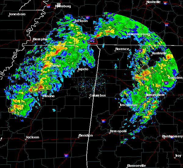 At 356 pm cst, a severe thunderstorm was located near grenada, moving east at 55 mph (radar indicated). Hazards include 60 mph wind gusts and quarter size hail. Hail damage to vehicles is expected. expect wind damage to roofs, siding, and trees. locations impacted include, grenada and gore springs. A tornado watch remains in effect until 900 pm cst for north central mississippi. At 356 pm cst, a severe thunderstorm was located near grenada, moving east at 55 mph (radar indicated). Hazards include 60 mph wind gusts and quarter size hail. Hail damage to vehicles is expected. expect wind damage to roofs, siding, and trees. locations impacted include, grenada and gore springs. A tornado watch remains in effect until 900 pm cst for north central mississippi.
|
| 3/9/2019 3:44 PM CST |
 At 344 pm cst, a severe thunderstorm was located over holcomb, or 8 miles west of grenada, moving east at 55 mph (radar indicated). Hazards include 60 mph wind gusts and quarter size hail. Hail damage to vehicles is expected. Expect wind damage to roofs, siding, and trees. At 344 pm cst, a severe thunderstorm was located over holcomb, or 8 miles west of grenada, moving east at 55 mph (radar indicated). Hazards include 60 mph wind gusts and quarter size hail. Hail damage to vehicles is expected. Expect wind damage to roofs, siding, and trees.
|
| 12/31/2018 11:51 AM CST |
 The severe thunderstorm warning for grenada county will expire at noon cst, the storm which prompted the warning has moved out of the area. therefore, the warning will be allowed to expire. The severe thunderstorm warning for grenada county will expire at noon cst, the storm which prompted the warning has moved out of the area. therefore, the warning will be allowed to expire.
|
| 12/31/2018 11:28 AM CST | Tree down along carroll s in grenada county MS, 0.7 miles ENE of Grenada, MS |
| 12/31/2018 11:22 AM CST |
 At 1122 am cst, a severe thunderstorm was located near bew springs, or near grenada, moving northeast at 70 mph (radar indicated). Hazards include 60 mph wind gusts. Expect damage to roofs, siding, and trees. This severe thunderstorm will remain over mainly rural areas of grenada county. At 1122 am cst, a severe thunderstorm was located near bew springs, or near grenada, moving northeast at 70 mph (radar indicated). Hazards include 60 mph wind gusts. Expect damage to roofs, siding, and trees. This severe thunderstorm will remain over mainly rural areas of grenada county.
|
| 11/1/2018 3:48 AM CDT |
 At 348 am cdt, a severe thunderstorm was located over misterton, or 14 miles southeast of grenada, moving northeast at 55 mph (radar indicated). Hazards include 60 mph wind gusts. Expect damage to roofs, siding, and trees. this severe thunderstorm will remain over mainly rural areas of northwestern choctaw, southeastern carroll, eastern grenada, western webster and montgomery counties, including the following locations, french camp. A tornado watch remains in effect until 700 am cdt for central and north central mississippi. At 348 am cdt, a severe thunderstorm was located over misterton, or 14 miles southeast of grenada, moving northeast at 55 mph (radar indicated). Hazards include 60 mph wind gusts. Expect damage to roofs, siding, and trees. this severe thunderstorm will remain over mainly rural areas of northwestern choctaw, southeastern carroll, eastern grenada, western webster and montgomery counties, including the following locations, french camp. A tornado watch remains in effect until 700 am cdt for central and north central mississippi.
|
| 11/1/2018 3:24 AM CDT |
 At 324 am cdt, a severe thunderstorm was located near north carrollton, or 8 miles west of winona, moving northeast at 55 mph (radar indicated). Hazards include 60 mph wind gusts. Expect damage to roofs, siding, and trees. this severe thunderstorm will be near, winona around 330 am cdt. duck hill and elliott around 340 am cdt. sweatman around 345 am cdt. misterton and gore springs around 350 am cdt. other locations impacted by this severe thunderstorm include french camp. A tornado watch remains in effect until 700 am cdt for central and north central mississippi. At 324 am cdt, a severe thunderstorm was located near north carrollton, or 8 miles west of winona, moving northeast at 55 mph (radar indicated). Hazards include 60 mph wind gusts. Expect damage to roofs, siding, and trees. this severe thunderstorm will be near, winona around 330 am cdt. duck hill and elliott around 340 am cdt. sweatman around 345 am cdt. misterton and gore springs around 350 am cdt. other locations impacted by this severe thunderstorm include french camp. A tornado watch remains in effect until 700 am cdt for central and north central mississippi.
|
| 11/1/2018 3:16 AM CDT |
 At 316 am cdt, severe thunderstorms were located along a line extending from near holcomb to black hawk, moving northeast at 45 mph (radar indicated). Hazards include 60 mph wind gusts. Expect damage to roofs, siding, and trees. these severe storms will be near, holcomb around 320 am cdt. bew springs around 325 am cdt. grenada and north carrollton around 330 am cdt. other locations impacted by these severe thunderstorms include carrollton. A tornado watch remains in effect until 700 am cdt for central and north central mississippi. At 316 am cdt, severe thunderstorms were located along a line extending from near holcomb to black hawk, moving northeast at 45 mph (radar indicated). Hazards include 60 mph wind gusts. Expect damage to roofs, siding, and trees. these severe storms will be near, holcomb around 320 am cdt. bew springs around 325 am cdt. grenada and north carrollton around 330 am cdt. other locations impacted by these severe thunderstorms include carrollton. A tornado watch remains in effect until 700 am cdt for central and north central mississippi.
|
| 11/1/2018 3:01 AM CDT |
 At 301 am cdt, severe thunderstorms were located along a line extending from near money to near tchula, moving northeast at 45 mph (radar indicated). Hazards include 60 mph wind gusts. Expect damage to roofs, siding, and trees. these severe storms will be near, avalon and money around 305 am cdt. leflore around 310 am cdt. black hawk, holcomb and seven pines around 315 am cdt. emory around 320 am cdt. grenada, coila and bew springs around 325 am cdt. north carrollton around 330 am cdt. other locations impacted by these severe thunderstorms include cruger and carrollton. A tornado watch remains in effect until 700 am cdt for central and north central mississippi. At 301 am cdt, severe thunderstorms were located along a line extending from near money to near tchula, moving northeast at 45 mph (radar indicated). Hazards include 60 mph wind gusts. Expect damage to roofs, siding, and trees. these severe storms will be near, avalon and money around 305 am cdt. leflore around 310 am cdt. black hawk, holcomb and seven pines around 315 am cdt. emory around 320 am cdt. grenada, coila and bew springs around 325 am cdt. north carrollton around 330 am cdt. other locations impacted by these severe thunderstorms include cruger and carrollton. A tornado watch remains in effect until 700 am cdt for central and north central mississippi.
|
| 11/1/2018 2:37 AM CDT |
 At 237 am cdt, severe thunderstorms were located along a line extending from near itta bena to near thornton, moving northeast at 45 mph (radar indicated). Hazards include 60 mph wind gusts. Expect damage to roofs, siding, and trees. severe thunderstorms will be near, itta bena around 240 am cdt. howard around 250 am cdt. tchula and money around 255 am cdt. avalon around 300 am cdt. leflore around 305 am cdt. seven pines around 310 am cdt. black hawk, holcomb and emory around 315 am cdt. coila and bew springs around 320 am cdt. other locations impacted by these severe thunderstorms include carrollton, schlater, morgan city and cruger. A tornado watch remains in effect until 700 am cdt for central and north central mississippi. At 237 am cdt, severe thunderstorms were located along a line extending from near itta bena to near thornton, moving northeast at 45 mph (radar indicated). Hazards include 60 mph wind gusts. Expect damage to roofs, siding, and trees. severe thunderstorms will be near, itta bena around 240 am cdt. howard around 250 am cdt. tchula and money around 255 am cdt. avalon around 300 am cdt. leflore around 305 am cdt. seven pines around 310 am cdt. black hawk, holcomb and emory around 315 am cdt. coila and bew springs around 320 am cdt. other locations impacted by these severe thunderstorms include carrollton, schlater, morgan city and cruger. A tornado watch remains in effect until 700 am cdt for central and north central mississippi.
|
| 8/20/2018 6:35 PM CDT | One tree downed across a road in the northern portion of grenada c in grenada county MS, 6.7 miles S of Grenada, MS |
| 7/21/2018 4:59 AM CDT |
 At 459 am cdt, severe thunderstorms were located along a line extending from leflore to itta bena, moving southeast at 55 mph (radar indicated). Hazards include 60 mph wind gusts. Expect damage to roofs, siding, and trees. these severe storms will be near, teoc around 505 am cdt. jefferson, sidon and malmaison around 510 am cdt. north carrollton and seven pines around 515 am cdt. Other locations impacted by these severe thunderstorms include schlater, morgan city and carrollton. At 459 am cdt, severe thunderstorms were located along a line extending from leflore to itta bena, moving southeast at 55 mph (radar indicated). Hazards include 60 mph wind gusts. Expect damage to roofs, siding, and trees. these severe storms will be near, teoc around 505 am cdt. jefferson, sidon and malmaison around 510 am cdt. north carrollton and seven pines around 515 am cdt. Other locations impacted by these severe thunderstorms include schlater, morgan city and carrollton.
|
| 7/21/2018 4:47 AM CDT |
 At 447 am cdt, severe thunderstorms were located along a line extending from 8 miles east of minter city to near blaine, moving southeast at 50 mph (radar indicated). Hazards include 60 mph wind gusts. Expect damage to roofs, siding, and trees. these severe storms will be near, leflore, holcomb and money around 455 am cdt. itta bena and avalon around 500 am cdt. quito and teoc around 505 am cdt. jefferson, sidon and malmaison around 510 am cdt. north carrollton around 515 am cdt. seven pines and coila around 520 am cdt. Other locations impacted by these severe thunderstorms include schlater, morgan city and carrollton. At 447 am cdt, severe thunderstorms were located along a line extending from 8 miles east of minter city to near blaine, moving southeast at 50 mph (radar indicated). Hazards include 60 mph wind gusts. Expect damage to roofs, siding, and trees. these severe storms will be near, leflore, holcomb and money around 455 am cdt. itta bena and avalon around 500 am cdt. quito and teoc around 505 am cdt. jefferson, sidon and malmaison around 510 am cdt. north carrollton around 515 am cdt. seven pines and coila around 520 am cdt. Other locations impacted by these severe thunderstorms include schlater, morgan city and carrollton.
|
| 7/21/2018 4:39 AM CDT |
 At 428 am cdt, severe thunderstorms were located along a line extending from near webb to near renova, moving southeast at 55 mph (radar indicated). Hazards include 60 mph wind gusts. Expect damage to roofs, siding, and trees. severe thunderstorms will be near, leflore, holcomb and avalon around 455 am cdt. itta bena and jefferson around 505 am cdt. north carrollton and quito around 510 am cdt. sidon around 515 am cdt. seven pines around 520 am cdt. Other locations impacted by these severe thunderstorms include schlater, morgan city and carrollton. At 428 am cdt, severe thunderstorms were located along a line extending from near webb to near renova, moving southeast at 55 mph (radar indicated). Hazards include 60 mph wind gusts. Expect damage to roofs, siding, and trees. severe thunderstorms will be near, leflore, holcomb and avalon around 455 am cdt. itta bena and jefferson around 505 am cdt. north carrollton and quito around 510 am cdt. sidon around 515 am cdt. seven pines around 520 am cdt. Other locations impacted by these severe thunderstorms include schlater, morgan city and carrollton.
|
| 7/21/2018 4:28 AM CDT |
 At 428 am cdt, severe thunderstorms were located along a line extending from near webb to near renova, moving southeast at 55 mph (radar indicated). Hazards include 60 mph wind gusts. Expect damage to roofs, siding, and trees. severe thunderstorms will be near, leflore, holcomb and avalon around 455 am cdt. itta bena and jefferson around 505 am cdt. north carrollton and quito around 510 am cdt. sidon around 515 am cdt. seven pines around 520 am cdt. Other locations impacted by these severe thunderstorms include schlater, morgan city and carrollton. At 428 am cdt, severe thunderstorms were located along a line extending from near webb to near renova, moving southeast at 55 mph (radar indicated). Hazards include 60 mph wind gusts. Expect damage to roofs, siding, and trees. severe thunderstorms will be near, leflore, holcomb and avalon around 455 am cdt. itta bena and jefferson around 505 am cdt. north carrollton and quito around 510 am cdt. sidon around 515 am cdt. seven pines around 520 am cdt. Other locations impacted by these severe thunderstorms include schlater, morgan city and carrollton.
|
| 7/19/2018 11:48 PM CDT |
 At 1147 pm cdt, a severe thunderstorm was located near grenada, moving south at 35 mph (radar indicated). Hazards include 60 mph wind gusts and quarter size hail. Hail damage to vehicles is expected. expect wind damage to roofs, siding, and trees. this severe thunderstorm will be near, elliott around 1205 am cdt. jefferson and duck hill around 1210 am cdt. North carrollton around 1220 am cdt. At 1147 pm cdt, a severe thunderstorm was located near grenada, moving south at 35 mph (radar indicated). Hazards include 60 mph wind gusts and quarter size hail. Hail damage to vehicles is expected. expect wind damage to roofs, siding, and trees. this severe thunderstorm will be near, elliott around 1205 am cdt. jefferson and duck hill around 1210 am cdt. North carrollton around 1220 am cdt.
|
| 7/6/2018 5:23 PM CDT | Tree down on robinson road reported by grenada s in grenada county MS, 0.7 miles ENE of Grenada, MS |
| 7/6/2018 5:19 PM CDT |
 At 519 pm cdt, severe thunderstorms were located along a line extending from bew springs to winona, moving southwest at 30 mph (radar indicated). Hazards include 60 mph wind gusts. Expect damage to roofs, siding, and trees. these severe storms will be near, holcomb around 525 pm cdt. leflore around 540 pm cdt. north carrollton and avalon around 545 pm cdt. Other locations impacted by these severe thunderstorms include carrollton. At 519 pm cdt, severe thunderstorms were located along a line extending from bew springs to winona, moving southwest at 30 mph (radar indicated). Hazards include 60 mph wind gusts. Expect damage to roofs, siding, and trees. these severe storms will be near, holcomb around 525 pm cdt. leflore around 540 pm cdt. north carrollton and avalon around 545 pm cdt. Other locations impacted by these severe thunderstorms include carrollton.
|
| 7/6/2018 5:09 PM CDT |
 At 509 pm cdt, severe thunderstorms were located along a line extending from near bew springs to near winona, moving southwest at 25 mph (radar indicated). Hazards include 60 mph wind gusts. Expect damage to roofs, siding, and trees. these severe storms will be near, bew springs around 515 pm cdt. winona and holcomb around 525 pm cdt. leflore around 540 pm cdt. north carrollton and avalon around 545 pm cdt. malmaison around 555 pm cdt. Other locations impacted by these severe thunderstorms include carrollton. At 509 pm cdt, severe thunderstorms were located along a line extending from near bew springs to near winona, moving southwest at 25 mph (radar indicated). Hazards include 60 mph wind gusts. Expect damage to roofs, siding, and trees. these severe storms will be near, bew springs around 515 pm cdt. winona and holcomb around 525 pm cdt. leflore around 540 pm cdt. north carrollton and avalon around 545 pm cdt. malmaison around 555 pm cdt. Other locations impacted by these severe thunderstorms include carrollton.
|
| 7/6/2018 4:53 PM CDT |
 At 453 pm cdt, severe thunderstorms were located along a line extending from near grenada to near lodi, moving southwest at 30 mph (radar indicated). Hazards include 60 mph wind gusts. Expect damage to roofs, siding, and trees. severe thunderstorms will be near, grenada around 500 pm cdt. bew springs around 505 pm cdt. duck hill around 510 pm cdt. holcomb around 515 pm cdt. winona around 525 pm cdt. leflore around 530 pm cdt. avalon around 535 pm cdt. north carrollton and teoc around 540 pm cdt. Other locations impacted by these severe thunderstorms include carrollton. At 453 pm cdt, severe thunderstorms were located along a line extending from near grenada to near lodi, moving southwest at 30 mph (radar indicated). Hazards include 60 mph wind gusts. Expect damage to roofs, siding, and trees. severe thunderstorms will be near, grenada around 500 pm cdt. bew springs around 505 pm cdt. duck hill around 510 pm cdt. holcomb around 515 pm cdt. winona around 525 pm cdt. leflore around 530 pm cdt. avalon around 535 pm cdt. north carrollton and teoc around 540 pm cdt. Other locations impacted by these severe thunderstorms include carrollton.
|
| 6/22/2018 9:24 AM CDT |
 At 924 am cdt, a severe thunderstorm was located near bew springs, or near grenada, moving east at 35 mph (radar indicated). Hazards include 60 mph wind gusts and nickel size hail. Expect damage to roofs, siding, and trees. this severe thunderstorm will be near, grenada around 930 am cdt. Gore springs around 950 am cdt. At 924 am cdt, a severe thunderstorm was located near bew springs, or near grenada, moving east at 35 mph (radar indicated). Hazards include 60 mph wind gusts and nickel size hail. Expect damage to roofs, siding, and trees. this severe thunderstorm will be near, grenada around 930 am cdt. Gore springs around 950 am cdt.
|
| 4/14/2018 6:15 AM CDT |
 At 614 am cdt, severe thunderstorms were located along a line extending from 6 miles northeast of grenada to duck hill, moving northeast at 35 mph (radar indicated). Hazards include 60 mph wind gusts. Expect damage to roofs, siding, and trees. these severe storms will be near, misterton, sweatman and gore springs around 630 am cdt. A tornado watch remains in effect until 800 am cdt for north central mississippi. At 614 am cdt, severe thunderstorms were located along a line extending from 6 miles northeast of grenada to duck hill, moving northeast at 35 mph (radar indicated). Hazards include 60 mph wind gusts. Expect damage to roofs, siding, and trees. these severe storms will be near, misterton, sweatman and gore springs around 630 am cdt. A tornado watch remains in effect until 800 am cdt for north central mississippi.
|
| 4/14/2018 5:59 AM CDT |
 At 558 am cdt, severe thunderstorms were located along a line extending from near bew springs to jefferson, moving northeast at 40 mph (radar indicated). Hazards include 60 mph wind gusts. Expect damage to roofs, siding, and trees. these severe storms will be near, duck hill and elliott around 610 am cdt. sweatman around 620 am cdt. gore springs and misterton around 625 am cdt. A tornado watch remains in effect until 800 am cdt for north central mississippi. At 558 am cdt, severe thunderstorms were located along a line extending from near bew springs to jefferson, moving northeast at 40 mph (radar indicated). Hazards include 60 mph wind gusts. Expect damage to roofs, siding, and trees. these severe storms will be near, duck hill and elliott around 610 am cdt. sweatman around 620 am cdt. gore springs and misterton around 625 am cdt. A tornado watch remains in effect until 800 am cdt for north central mississippi.
|
| 4/14/2018 5:37 AM CDT |
 At 536 am cdt, severe thunderstorms were located along a line extending from near leflore to near teoc, moving northeast at 35 mph (radar indicated). Hazards include 60 mph wind gusts. Expect damage to roofs, siding, and trees. these severe storms will be near, leflore around 540 am cdt. holcomb around 545 am cdt. north carrollton around 550 am cdt. bew springs around 555 am cdt. grenada and jefferson around 600 am cdt. duck hill and elliott around 615 am cdt. sweatman around 625 am cdt. misterton and gore springs around 630 am cdt. other locations impacted by these severe thunderstorms include carrollton. A tornado watch remains in effect until 600 am cdt for north central mississippi. At 536 am cdt, severe thunderstorms were located along a line extending from near leflore to near teoc, moving northeast at 35 mph (radar indicated). Hazards include 60 mph wind gusts. Expect damage to roofs, siding, and trees. these severe storms will be near, leflore around 540 am cdt. holcomb around 545 am cdt. north carrollton around 550 am cdt. bew springs around 555 am cdt. grenada and jefferson around 600 am cdt. duck hill and elliott around 615 am cdt. sweatman around 625 am cdt. misterton and gore springs around 630 am cdt. other locations impacted by these severe thunderstorms include carrollton. A tornado watch remains in effect until 600 am cdt for north central mississippi.
|
| 4/14/2018 5:13 AM CDT |
 At 513 am cdt, severe thunderstorms were located along a line extending from near minter city to near greenwood, moving northeast at 40 mph (radar indicated). Hazards include 60 mph wind gusts. Expect damage to roofs, siding, and trees. severe thunderstorms will be near, avalon, teoc and malmaison around 530 am cdt. leflore around 535 am cdt. jefferson and holcomb around 545 am cdt. bew springs around 555 am cdt. grenada and elliott around 600 am cdt. gore springs around 615 am cdt. other locations impacted by these severe thunderstorms include carrollton. A tornado watch remains in effect until 600 am cdt for north central mississippi. At 513 am cdt, severe thunderstorms were located along a line extending from near minter city to near greenwood, moving northeast at 40 mph (radar indicated). Hazards include 60 mph wind gusts. Expect damage to roofs, siding, and trees. severe thunderstorms will be near, avalon, teoc and malmaison around 530 am cdt. leflore around 535 am cdt. jefferson and holcomb around 545 am cdt. bew springs around 555 am cdt. grenada and elliott around 600 am cdt. gore springs around 615 am cdt. other locations impacted by these severe thunderstorms include carrollton. A tornado watch remains in effect until 600 am cdt for north central mississippi.
|
| 4/3/2018 8:26 PM CDT |
 At 825 pm cdt, severe thunderstorms were located along a line extending from near gore springs to near west, moving east at 50 mph (radar indicated). Hazards include 60 mph wind gusts. Expect damage to roofs, siding, and trees. Locations impacted include, grenada, winona, vaiden, duck hill, kilmichael, gore springs, elliott, sweatman, lodi, misterton and poplar creek. At 825 pm cdt, severe thunderstorms were located along a line extending from near gore springs to near west, moving east at 50 mph (radar indicated). Hazards include 60 mph wind gusts. Expect damage to roofs, siding, and trees. Locations impacted include, grenada, winona, vaiden, duck hill, kilmichael, gore springs, elliott, sweatman, lodi, misterton and poplar creek.
|
| 4/3/2018 8:09 PM CDT | Tree limbs and power lines down along with power outage in grenada county MS, 1.2 miles S of Grenada, MS |
| 4/3/2018 7:47 PM CDT |
 At 747 pm cdt, severe thunderstorms were located along a line extending from near minter city to near swiftown, moving east at 55 mph (radar indicated). Hazards include 70 mph wind gusts. Expect considerable tree damage. Damage is likely to mobile homes, roofs, and outbuildings. At 747 pm cdt, severe thunderstorms were located along a line extending from near minter city to near swiftown, moving east at 55 mph (radar indicated). Hazards include 70 mph wind gusts. Expect considerable tree damage. Damage is likely to mobile homes, roofs, and outbuildings.
|
| 3/5/2018 5:51 PM CST |
 At 550 pm cst, a severe thunderstorm was located over avalon, or 10 miles northeast of greenwood, moving east at 40 mph (radar indicated). Hazards include 60 mph wind gusts and quarter size hail. Hail damage to vehicles is expected. expect wind damage to roofs, siding, and trees. this severe thunderstorm will be near, malmaison around 555 pm cst. jefferson and north carrollton around 605 pm cst. elliott around 615 pm cst. winona and duck hill around 620 pm cst. kilmichael, lodi and sweatman around 630 pm cst. Other locations impacted by this severe thunderstorm include carrollton. At 550 pm cst, a severe thunderstorm was located over avalon, or 10 miles northeast of greenwood, moving east at 40 mph (radar indicated). Hazards include 60 mph wind gusts and quarter size hail. Hail damage to vehicles is expected. expect wind damage to roofs, siding, and trees. this severe thunderstorm will be near, malmaison around 555 pm cst. jefferson and north carrollton around 605 pm cst. elliott around 615 pm cst. winona and duck hill around 620 pm cst. kilmichael, lodi and sweatman around 630 pm cst. Other locations impacted by this severe thunderstorm include carrollton.
|
| 8/14/2017 9:14 AM CDT | A couple of trees were blown down... 30-40 mph wind in grenada county MS, 6.2 miles W of Grenada, MS |
| 5/12/2017 5:32 PM CDT |
 At 532 pm cdt, a severe thunderstorm was located over elliott, or 7 miles southeast of grenada, moving east at 10 mph (radar indicated). Hazards include 60 mph wind gusts and half dollar size hail. Hail damage to vehicles is expected. expect wind damage to roofs, siding, and trees. this severe thunderstorm will be near, duck hill around 550 pm cdt. Gore springs around 610 pm cdt. At 532 pm cdt, a severe thunderstorm was located over elliott, or 7 miles southeast of grenada, moving east at 10 mph (radar indicated). Hazards include 60 mph wind gusts and half dollar size hail. Hail damage to vehicles is expected. expect wind damage to roofs, siding, and trees. this severe thunderstorm will be near, duck hill around 550 pm cdt. Gore springs around 610 pm cdt.
|
| 4/30/2017 10:13 AM CDT | Trees down in the city of grenad in grenada county MS, 0.9 miles SE of Grenada, MS |
| 4/30/2017 10:10 AM CDT |
 At 1009 am cdt, severe thunderstorms were located along a line extending from vance to near paynes, moving north at 60 mph (radar indicated). Hazards include 60 mph wind gusts. Expect damage to roofs, siding, and trees. locations impacted include, grenada, bew springs and elliott. A tornado watch remains in effect until 300 pm cdt for north central mississippi. At 1009 am cdt, severe thunderstorms were located along a line extending from vance to near paynes, moving north at 60 mph (radar indicated). Hazards include 60 mph wind gusts. Expect damage to roofs, siding, and trees. locations impacted include, grenada, bew springs and elliott. A tornado watch remains in effect until 300 pm cdt for north central mississippi.
|
| 4/30/2017 9:50 AM CDT |
 At 950 am cdt, severe thunderstorms were located along a line extending from minter city to near jefferson, moving north at 60 mph (radar indicated). Hazards include 60 mph wind gusts. expect damage to roofs, siding, and trees At 950 am cdt, severe thunderstorms were located along a line extending from minter city to near jefferson, moving north at 60 mph (radar indicated). Hazards include 60 mph wind gusts. expect damage to roofs, siding, and trees
|
| 4/26/2017 9:03 PM CDT |
 At 903 pm cdt, a severe thunderstorm was located near grenada, moving northeast at 40 mph (radar indicated). Hazards include 60 mph wind gusts and quarter size hail. Hail damage to vehicles is expected. expect wind damage to roofs, siding, and trees. A tornado watch remains in effect until 1100 pm cdt for north central mississippi. At 903 pm cdt, a severe thunderstorm was located near grenada, moving northeast at 40 mph (radar indicated). Hazards include 60 mph wind gusts and quarter size hail. Hail damage to vehicles is expected. expect wind damage to roofs, siding, and trees. A tornado watch remains in effect until 1100 pm cdt for north central mississippi.
|
| 4/26/2017 8:30 PM CDT |
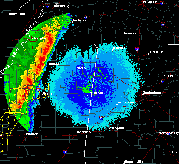 At 829 pm cdt, a severe thunderstorm was located over greenwood, moving northeast at 40 mph (radar indicated). Hazards include 60 mph wind gusts and quarter size hail. Hail damage to vehicles is expected. expect wind damage to roofs, siding, and trees. this severe thunderstorm will be near, teoc, avalon and malmaison around 840 pm cdt. leflore around 845 pm cdt. jefferson and holcomb around 855 pm cdt. bew springs around 905 pm cdt. grenada and elliott around 910 pm cdt. gore springs around 920 pm cdt. other locations impacted by this severe thunderstorm include carrollton. A tornado watch remains in effect until 1100 pm cdt for north central mississippi. At 829 pm cdt, a severe thunderstorm was located over greenwood, moving northeast at 40 mph (radar indicated). Hazards include 60 mph wind gusts and quarter size hail. Hail damage to vehicles is expected. expect wind damage to roofs, siding, and trees. this severe thunderstorm will be near, teoc, avalon and malmaison around 840 pm cdt. leflore around 845 pm cdt. jefferson and holcomb around 855 pm cdt. bew springs around 905 pm cdt. grenada and elliott around 910 pm cdt. gore springs around 920 pm cdt. other locations impacted by this severe thunderstorm include carrollton. A tornado watch remains in effect until 1100 pm cdt for north central mississippi.
|
| 4/2/2017 6:02 PM CDT |
 At 602 pm cdt, a severe thunderstorm was located near blaine, or 8 miles southeast of ruleville, moving east at 70 mph (radar indicated). Hazards include 60 mph wind gusts. Expect damage to roofs, siding, and trees. this severe thunderstorm will be near, leflore around 620 pm cdt. holcomb around 625 pm cdt. bew springs around 630 pm cdt. a tornado watch remains in effect until 900 pm cdt for north central mississippi. A tornado watch also remains in effect until 200 am cdt for north central mississippi. At 602 pm cdt, a severe thunderstorm was located near blaine, or 8 miles southeast of ruleville, moving east at 70 mph (radar indicated). Hazards include 60 mph wind gusts. Expect damage to roofs, siding, and trees. this severe thunderstorm will be near, leflore around 620 pm cdt. holcomb around 625 pm cdt. bew springs around 630 pm cdt. a tornado watch remains in effect until 900 pm cdt for north central mississippi. A tornado watch also remains in effect until 200 am cdt for north central mississippi.
|
| 11/29/2016 5:55 PM CST | Quarter sized hail reported 1.4 miles SSE of Grenada, MS |
| 11/29/2016 5:44 PM CST |
 At 543 pm cst, a severe thunderstorm was located over grenada, moving east at 45 mph (radar indicated). Hazards include 60 mph wind gusts and half dollar size hail. Hail damage to vehicles is expected. expect wind damage to roofs, siding, and trees. this severe thunderstorm will be near, gore springs around 555 pm cst. A tornado watch remains in effect until 900 pm cst for north central mississippi. At 543 pm cst, a severe thunderstorm was located over grenada, moving east at 45 mph (radar indicated). Hazards include 60 mph wind gusts and half dollar size hail. Hail damage to vehicles is expected. expect wind damage to roofs, siding, and trees. this severe thunderstorm will be near, gore springs around 555 pm cst. A tornado watch remains in effect until 900 pm cst for north central mississippi.
|
| 11/29/2016 5:21 PM CST |
 At 520 pm cst, a severe thunderstorm was located near money, or 12 miles north of greenwood, moving east at 45 mph (radar indicated). Hazards include 60 mph wind gusts and half dollar size hail. Hail damage to vehicles is expected. expect wind damage to roofs, siding, and trees. this severe thunderstorm will be near, avalon around 525 pm cst. leflore around 530 pm cst. holcomb around 535 pm cst. bew springs around 545 pm cst. grenada around 550 pm cst. A tornado watch remains in effect until 900 pm cst for north central mississippi. At 520 pm cst, a severe thunderstorm was located near money, or 12 miles north of greenwood, moving east at 45 mph (radar indicated). Hazards include 60 mph wind gusts and half dollar size hail. Hail damage to vehicles is expected. expect wind damage to roofs, siding, and trees. this severe thunderstorm will be near, avalon around 525 pm cst. leflore around 530 pm cst. holcomb around 535 pm cst. bew springs around 545 pm cst. grenada around 550 pm cst. A tornado watch remains in effect until 900 pm cst for north central mississippi.
|
| 11/29/2016 5:00 PM CST | On mcswine road 3 homes were damage with one roof damag in grenada county MS, 1.4 miles SSE of Grenada, MS |
| 11/29/2016 4:54 PM CST |
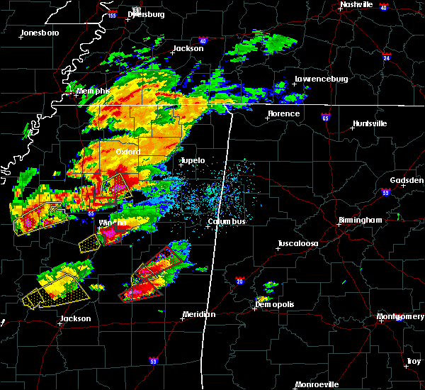 The tornado warning for northeastern grenada county will expire at 500 pm cst, the storm which prompted the warning has moved out of the area. therefore the warning will be allowed to expire. a tornado watch remains in effect until 900 pm cst for north central mississippi. The tornado warning for northeastern grenada county will expire at 500 pm cst, the storm which prompted the warning has moved out of the area. therefore the warning will be allowed to expire. a tornado watch remains in effect until 900 pm cst for north central mississippi.
|
| 11/29/2016 4:35 PM CST |
 At 434 pm cst, a severe thunderstorm capable of producing a tornado was located over grenada lake, or 9 miles northeast of grenada, moving east at 50 mph (radar indicated rotation). Hazards include tornado and quarter size hail. Flying debris will be dangerous to those caught without shelter. mobile homes will be damaged or destroyed. damage to roofs, windows, and vehicles will occur. tree damage is likely. This tornadic thunderstorm will remain over mainly rural areas of northeastern grenada county. At 434 pm cst, a severe thunderstorm capable of producing a tornado was located over grenada lake, or 9 miles northeast of grenada, moving east at 50 mph (radar indicated rotation). Hazards include tornado and quarter size hail. Flying debris will be dangerous to those caught without shelter. mobile homes will be damaged or destroyed. damage to roofs, windows, and vehicles will occur. tree damage is likely. This tornadic thunderstorm will remain over mainly rural areas of northeastern grenada county.
|
| 11/29/2016 4:24 PM CST | Quarter sized hail reported 1.4 miles SSE of Grenada, MS |
| 11/29/2016 4:23 PM CST | Quarter sized hail reported 6.1 miles S of Grenada, MS |
| 11/29/2016 4:22 PM CST | Scattered trees were blown down across the north west and east portions of the county. city of grenada had some trees blown down. a house received some major damage on in grenada county MS, 1.4 miles SSE of Grenada, MS |
| 11/29/2016 4:22 PM CST |
 At 422 pm cst, a severe thunderstorm capable of producing a tornado was located over bew springs, or over grenada, moving east at 55 mph (radar indicated rotation). Hazards include tornado and quarter size hail. Flying debris will be dangerous to those caught without shelter. mobile homes will be damaged or destroyed. damage to roofs, windows, and vehicles will occur. tree damage is likely. This dangerous storm will be near, gore springs around 435 pm cst. At 422 pm cst, a severe thunderstorm capable of producing a tornado was located over bew springs, or over grenada, moving east at 55 mph (radar indicated rotation). Hazards include tornado and quarter size hail. Flying debris will be dangerous to those caught without shelter. mobile homes will be damaged or destroyed. damage to roofs, windows, and vehicles will occur. tree damage is likely. This dangerous storm will be near, gore springs around 435 pm cst.
|
| 11/29/2016 3:58 PM CST |
 At 358 pm cst, a severe thunderstorm was located near money, or 14 miles north of greenwood, moving northeast at 45 mph (radar indicated). Hazards include 60 mph wind gusts and half dollar size hail. Hail damage to vehicles is expected. expect wind damage to roofs, siding, and trees. this severe thunderstorm will be near, holcomb around 410 pm cst. bew springs around 420 pm cst. grenada around 425 pm cst. A tornado watch remains in effect until 900 pm cst for north central mississippi. At 358 pm cst, a severe thunderstorm was located near money, or 14 miles north of greenwood, moving northeast at 45 mph (radar indicated). Hazards include 60 mph wind gusts and half dollar size hail. Hail damage to vehicles is expected. expect wind damage to roofs, siding, and trees. this severe thunderstorm will be near, holcomb around 410 pm cst. bew springs around 420 pm cst. grenada around 425 pm cst. A tornado watch remains in effect until 900 pm cst for north central mississippi.
|
| 8/5/2016 4:07 PM CDT | A utility wire was downed off perry rd in grenada county MS, 3 miles N of Grenada, MS |
| 8/5/2016 4:03 PM CDT | Tree down on grant rd along with several large limbs in grenada county MS, 4.6 miles NW of Grenada, MS |
| 8/5/2016 3:59 PM CDT |
 At 358 pm cdt, a severe thunderstorm was located over elliott, or near grenada, moving south at 20 mph (radar indicated). Hazards include 60 mph wind gusts and quarter size hail. Hail damage to vehicles is expected. expect wind damage to roofs, siding, and trees. this severe thunderstorm will be near, jefferson and duck hill around 410 pm cdt. winona around 440 pm cdt. Other locations impacted by this severe thunderstorm include carrollton. At 358 pm cdt, a severe thunderstorm was located over elliott, or near grenada, moving south at 20 mph (radar indicated). Hazards include 60 mph wind gusts and quarter size hail. Hail damage to vehicles is expected. expect wind damage to roofs, siding, and trees. this severe thunderstorm will be near, jefferson and duck hill around 410 pm cdt. winona around 440 pm cdt. Other locations impacted by this severe thunderstorm include carrollton.
|
| 7/14/2016 9:55 PM CDT |
 The severe thunderstorm warning for grenada, carroll, leflore and holmes counties will expire at 1000 pm cdt, the storms which prompted the warning have weakened below severe limits, and no longer pose an immediate threat to life or property. a severe thunderstorm watch remains in effect until 100 am cdt for north central and central mississippi. The severe thunderstorm warning for grenada, carroll, leflore and holmes counties will expire at 1000 pm cdt, the storms which prompted the warning have weakened below severe limits, and no longer pose an immediate threat to life or property. a severe thunderstorm watch remains in effect until 100 am cdt for north central and central mississippi.
|
| 7/14/2016 9:01 PM CDT |
 At 901 pm cdt, severe thunderstorms were located along a line extending from near dublin to near murphy, moving east at 40 mph (radar indicated). Hazards include 70 mph wind gusts. Expect considerable tree damage. damage is likely to mobile homes, roofs, and outbuildings. severe thunderstorms will be near, thornton around 925 pm cdt. tolarville, coxburg and howard around 935 pm cdt. brozville around 940 pm cdt. lexington and ebenezer around 945 pm cdt. franklin around 950 pm cdt. goodman around 955 pm cdt. durant around 1000 pm cdt. Other locations impacted by these severe thunderstorms include schlater, cruger, carrollton, morgan city and west. At 901 pm cdt, severe thunderstorms were located along a line extending from near dublin to near murphy, moving east at 40 mph (radar indicated). Hazards include 70 mph wind gusts. Expect considerable tree damage. damage is likely to mobile homes, roofs, and outbuildings. severe thunderstorms will be near, thornton around 925 pm cdt. tolarville, coxburg and howard around 935 pm cdt. brozville around 940 pm cdt. lexington and ebenezer around 945 pm cdt. franklin around 950 pm cdt. goodman around 955 pm cdt. durant around 1000 pm cdt. Other locations impacted by these severe thunderstorms include schlater, cruger, carrollton, morgan city and west.
|
| 7/5/2016 6:32 PM CDT |
 At 632 pm cdt, a severe thunderstorm was located over duck hill, or 10 miles north of winona, moving east at 15 mph (radar indicated). Hazards include 60 mph wind gusts and penny size hail. Expect damage to roofs. siding. and trees. this severe thunderstorm will be near, sweatman around 650 pm cdt. Misterton around 655 pm cdt. At 632 pm cdt, a severe thunderstorm was located over duck hill, or 10 miles north of winona, moving east at 15 mph (radar indicated). Hazards include 60 mph wind gusts and penny size hail. Expect damage to roofs. siding. and trees. this severe thunderstorm will be near, sweatman around 650 pm cdt. Misterton around 655 pm cdt.
|
| 6/17/2016 2:20 PM CDT | A few trees down in the city and also in the east end of the count in grenada county MS, 1.4 miles SSE of Grenada, MS |
| 4/29/2016 1:51 PM CDT |
 At 151 pm cdt, a severe thunderstorm was located over grenada, moving east at 20 mph (radar indicated). Hazards include 60 mph wind gusts. Expect damage to roofs. siding. and trees. This severe storm will be near, elliott around 200 pm cdt. At 151 pm cdt, a severe thunderstorm was located over grenada, moving east at 20 mph (radar indicated). Hazards include 60 mph wind gusts. Expect damage to roofs. siding. and trees. This severe storm will be near, elliott around 200 pm cdt.
|
| 4/29/2016 1:48 PM CDT | Quarter sized hail reported 7.4 miles SSE of Grenada, MS |
| 4/29/2016 1:36 PM CDT |
 At 135 pm cdt, a severe thunderstorm was located over bew springs, or near grenada, moving east at 35 mph (radar indicated). Hazards include 60 mph wind gusts. Expect damage to roofs. siding. and trees. this severe storm will be near, grenada around 140 pm cdt. Gore springs around 200 pm cdt. At 135 pm cdt, a severe thunderstorm was located over bew springs, or near grenada, moving east at 35 mph (radar indicated). Hazards include 60 mph wind gusts. Expect damage to roofs. siding. and trees. this severe storm will be near, grenada around 140 pm cdt. Gore springs around 200 pm cdt.
|
| 4/29/2016 1:17 PM CDT |
 At 117 pm cdt, a severe thunderstorm was located near holcomb, or 14 miles south of charleston, moving east at 25 mph (radar indicated). Hazards include 70 mph wind gusts and quarter size hail. Hail damage to vehicles is expected. expect considerable tree damage. wind damage is also likely to mobile homes, roofs, and outbuildings. this severe storm will be near, holcomb around 130 pm cdt. bew springs around 140 pm cdt. Grenada around 150 pm cdt. At 117 pm cdt, a severe thunderstorm was located near holcomb, or 14 miles south of charleston, moving east at 25 mph (radar indicated). Hazards include 70 mph wind gusts and quarter size hail. Hail damage to vehicles is expected. expect considerable tree damage. wind damage is also likely to mobile homes, roofs, and outbuildings. this severe storm will be near, holcomb around 130 pm cdt. bew springs around 140 pm cdt. Grenada around 150 pm cdt.
|
| 4/29/2016 1:02 PM CDT |
 At 102 pm cdt, a severe thunderstorm was located 7 miles east of minter city, or 16 miles southwest of charleston, moving east at 35 mph (radar indicated). Hazards include 60 mph wind gusts and quarter size hail. Hail damage to vehicles is expected. expect wind damage to roofs, siding, and trees. this severe thunderstorm will be near, leflore around 115 pm cdt. holcomb around 125 pm cdt. bew springs around 130 pm cdt. grenada around 135 pm cdt. Gore springs around 200 pm cdt. At 102 pm cdt, a severe thunderstorm was located 7 miles east of minter city, or 16 miles southwest of charleston, moving east at 35 mph (radar indicated). Hazards include 60 mph wind gusts and quarter size hail. Hail damage to vehicles is expected. expect wind damage to roofs, siding, and trees. this severe thunderstorm will be near, leflore around 115 pm cdt. holcomb around 125 pm cdt. bew springs around 130 pm cdt. grenada around 135 pm cdt. Gore springs around 200 pm cdt.
|
| 4/6/2016 6:23 PM CDT |
 At 623 pm cdt, a severe thunderstorm was located near holcomb, or 14 miles west of grenada, moving southeast at 40 mph (radar indicated). Hazards include 60 mph wind gusts and quarter size hail. Hail damage to vehicles is expected. expect wind damage to roofs, siding, and trees. This severe thunderstorm will be near, holcomb around 630 pm cdt. At 623 pm cdt, a severe thunderstorm was located near holcomb, or 14 miles west of grenada, moving southeast at 40 mph (radar indicated). Hazards include 60 mph wind gusts and quarter size hail. Hail damage to vehicles is expected. expect wind damage to roofs, siding, and trees. This severe thunderstorm will be near, holcomb around 630 pm cdt.
|
| 2/23/2016 6:10 PM CST |
 At 610 pm cst, severe thunderstorms were located along a line extending from near grenada to elliott to near duck hill, moving northeast at 35 mph (radar indicated). Hazards include 60 mph wind gusts. Expect damage to roofs. siding and trees. these severe storms will be near, gore springs around 620 pm cst. sweatman around 625 pm cst. misterton around 630 pm cst. A tornado watch remains in effect until 1000 pm cst for north central mississippi. At 610 pm cst, severe thunderstorms were located along a line extending from near grenada to elliott to near duck hill, moving northeast at 35 mph (radar indicated). Hazards include 60 mph wind gusts. Expect damage to roofs. siding and trees. these severe storms will be near, gore springs around 620 pm cst. sweatman around 625 pm cst. misterton around 630 pm cst. A tornado watch remains in effect until 1000 pm cst for north central mississippi.
|
| 2/23/2016 5:44 PM CST |
 At 544 pm cst, severe thunderstorms were located along a line extending from near holcomb to north carrollton to near coila, moving northeast at 40 mph (radar indicated). Hazards include 60 mph wind gusts. Expect damage to roofs. siding and trees. severe thunderstorms will be near, bew springs and holcomb around 550 pm cst. grenada and jefferson around 555 pm cst. winona around 600 pm cst. elliott around 605 pm cst. duck hill around 615 pm cst. sweatman around 620 pm cst. misterton around 625 pm cst. gore springs around 630 pm cst. other locations impacted by these severe thunderstorms include carrollton. A tornado watch remains in effect until 1000 pm cst for north central mississippi. At 544 pm cst, severe thunderstorms were located along a line extending from near holcomb to north carrollton to near coila, moving northeast at 40 mph (radar indicated). Hazards include 60 mph wind gusts. Expect damage to roofs. siding and trees. severe thunderstorms will be near, bew springs and holcomb around 550 pm cst. grenada and jefferson around 555 pm cst. winona around 600 pm cst. elliott around 605 pm cst. duck hill around 615 pm cst. sweatman around 620 pm cst. misterton around 625 pm cst. gore springs around 630 pm cst. other locations impacted by these severe thunderstorms include carrollton. A tornado watch remains in effect until 1000 pm cst for north central mississippi.
|
| 12/28/2015 6:26 AM CST |
 At 625 am cst, severe thunderstorms were located along a line extending from near grenada to 6 miles south of poplar creek, moving northeast at 35 mph (radar indicated). Hazards include 60 mph wind gusts. Expect damage to roofs. siding and trees. these severe thunderstorms will remain over mainly rural areas of montgomery, grenada and northeastern carroll counties. A tornado watch remains in effect until 800 am cst for north central mississippi. At 625 am cst, severe thunderstorms were located along a line extending from near grenada to 6 miles south of poplar creek, moving northeast at 35 mph (radar indicated). Hazards include 60 mph wind gusts. Expect damage to roofs. siding and trees. these severe thunderstorms will remain over mainly rural areas of montgomery, grenada and northeastern carroll counties. A tornado watch remains in effect until 800 am cst for north central mississippi.
|
| 12/28/2015 6:22 AM CST | Tree down on i-55...a couple other threes were down on sparta rd and pea ridge r in grenada county MS, 3 miles NNE of Grenada, MS |
| 12/28/2015 5:45 AM CST |
 At 545 am cst, severe thunderstorms were located along a line extending from 7 miles east of minter city to near emory, moving east at 35 mph (radar indicated). Hazards include 60 mph wind gusts. Expect damage to roofs. siding and trees. severe thunderstorms will be near, holcomb around 600 am cst. bew springs around 610 am cst. grenada and vaiden around 615 am cst. kilmichael and poplar creek around 635 am cst. other locations impacted by these severe thunderstorms include carrollton. A tornado watch remains in effect until 800 am cst for north central mississippi. At 545 am cst, severe thunderstorms were located along a line extending from 7 miles east of minter city to near emory, moving east at 35 mph (radar indicated). Hazards include 60 mph wind gusts. Expect damage to roofs. siding and trees. severe thunderstorms will be near, holcomb around 600 am cst. bew springs around 610 am cst. grenada and vaiden around 615 am cst. kilmichael and poplar creek around 635 am cst. other locations impacted by these severe thunderstorms include carrollton. A tornado watch remains in effect until 800 am cst for north central mississippi.
|
| 7/23/2015 5:44 PM CDT |
 At 544 pm cdt, a severe thunderstorm was located over elliott, or 7 miles south of grenada, moving southeast at 20 mph (radar indicated). Hazards include 60 mph wind gusts and nickel size hail. Expect damage to roofs. Siding and trees. At 544 pm cdt, a severe thunderstorm was located over elliott, or 7 miles south of grenada, moving southeast at 20 mph (radar indicated). Hazards include 60 mph wind gusts and nickel size hail. Expect damage to roofs. Siding and trees.
|
| 7/15/2015 7:05 PM CDT |
 The severe thunderstorm warning for western grenada county will expire at 715 pm cdt, the storm which prompted the warning has weakened below severe limits and exited the warned area. therefore the warning will be allowed to expire. The severe thunderstorm warning for western grenada county will expire at 715 pm cdt, the storm which prompted the warning has weakened below severe limits and exited the warned area. therefore the warning will be allowed to expire.
|
| 7/15/2015 6:49 PM CDT |
 At 649 pm cdt, a severe thunderstorm was located over bew springs, or near grenada, moving southeast at 15 mph (radar indicated). Hazards include 60 mph wind gusts and nickel size hail. Expect damage to roofs. siding and trees. This severe thunderstorm will remain over mainly rural areas of western grenada county. At 649 pm cdt, a severe thunderstorm was located over bew springs, or near grenada, moving southeast at 15 mph (radar indicated). Hazards include 60 mph wind gusts and nickel size hail. Expect damage to roofs. siding and trees. This severe thunderstorm will remain over mainly rural areas of western grenada county.
|
| 7/15/2015 6:27 PM CDT |
 At 627 pm cdt, a severe thunderstorm was located near bew springs, or near grenada, moving southeast at 20 mph (radar indicated). Hazards include 60 mph wind gusts and nickel size hail. Expect damage to roofs. siding and trees. this severe thunderstorm will be near, holcomb around 635 pm cdt. bew springs around 640 pm cdt. grenada around 645 pm cdt. Elliott around 715 pm cdt. At 627 pm cdt, a severe thunderstorm was located near bew springs, or near grenada, moving southeast at 20 mph (radar indicated). Hazards include 60 mph wind gusts and nickel size hail. Expect damage to roofs. siding and trees. this severe thunderstorm will be near, holcomb around 635 pm cdt. bew springs around 640 pm cdt. grenada around 645 pm cdt. Elliott around 715 pm cdt.
|
| 7/15/2015 5:28 PM CDT |
 At 528 pm cdt, a severe thunderstorm was located near gore springs, or 9 miles southeast of grenada, moving south at 35 mph (emergency management). Hazards include 60 mph wind gusts. Expect damage to roofs. siding and trees. this severe thunderstorm will be near, sweatman around 540 pm cdt. lodi around 545 pm cdt. Kilmichael around 555 pm cdt. At 528 pm cdt, a severe thunderstorm was located near gore springs, or 9 miles southeast of grenada, moving south at 35 mph (emergency management). Hazards include 60 mph wind gusts. Expect damage to roofs. siding and trees. this severe thunderstorm will be near, sweatman around 540 pm cdt. lodi around 545 pm cdt. Kilmichael around 555 pm cdt.
|
| 7/15/2015 5:15 PM CDT | Trees down on numerous roads including highway 8...girlscout road...hugh white state park road and marina road. one tree fell on a house and a power line is also dow in grenada county MS, 4.7 miles WSW of Grenada, MS |
| 6/30/2015 5:28 AM CDT | Quarter sized hail reported 1.4 miles SSE of Grenada, MS, social media report. |
| 6/24/2015 2:47 PM CDT |
 At 245 pm cdt, a severe thunderstorm was located 5 miles northeast of winona, moving southwest at 15 mph (radar indicated). Hazards include 60 mph wind gusts and quarter size hail. Hail damage to vehicles is expected. expect wind damage to roofs, siding and trees. Locations impacted include, grenada, winona, jefferson, duck hill, north carrollton, elliott and carrollton. At 245 pm cdt, a severe thunderstorm was located 5 miles northeast of winona, moving southwest at 15 mph (radar indicated). Hazards include 60 mph wind gusts and quarter size hail. Hail damage to vehicles is expected. expect wind damage to roofs, siding and trees. Locations impacted include, grenada, winona, jefferson, duck hill, north carrollton, elliott and carrollton.
|
| 6/24/2015 2:28 PM CDT |
 At 228 pm cdt, a severe thunderstorm was located over elliott, or 9 miles south of grenada, moving southwest at 15 mph (radar indicated). Hazards include 60 mph wind gusts and quarter size hail. Hail damage to vehicles is expected. Expect wind damage to roofs, siding and trees. At 228 pm cdt, a severe thunderstorm was located over elliott, or 9 miles south of grenada, moving southwest at 15 mph (radar indicated). Hazards include 60 mph wind gusts and quarter size hail. Hail damage to vehicles is expected. Expect wind damage to roofs, siding and trees.
|
| 5/24/2015 9:40 PM CDT | At 939 pm cdt, a severe thunderstorm was located over leflore, or 13 miles northeast of greenwood, moving northeast at 50 mph (radar indicated). Hazards include 60 mph wind gusts. Expect damage to roofs. siding and trees. this severe storm will be near, holcomb around 950 pm cdt. Grenada and bew springs around 955 pm cdt. |
| 5/24/2015 9:14 PM CDT | At 914 pm cdt, a severe thunderstorm was located over sidon, or near greenwood, moving northeast at 50 mph (radar indicated). Hazards include 60 mph wind gusts. Expect damage to roofs. siding and trees. this severe thunderstorm will be near, teoc and money around 930 pm cdt. leflore and avalon around 935 pm cdt. holcomb around 945 pm cdt. Bew springs around 950 pm cdt. |
| 5/15/2015 5:46 PM CDT | At 546 pm cdt, severe thunderstorms were located along a line extending from near paynes to near misterton, moving north at 30 mph (radar indicated). Hazards include 60 mph wind gusts and quarter size hail. Hail damage to vehicles is expected. expect wind damage to roofs, siding and trees. these severe thunderstorms will remain over mainly rural areas of north central carroll, northwestern montgomery and grenada counties. 1. 00in. |
| 5/15/2015 5:21 PM CDT | At 520 pm cdt, severe thunderstorms were located along a line extending from avalon to lodi, moving north at 30 mph (radar indicated). Hazards include 60 mph wind gusts and quarter size hail. Hail damage to vehicles is expected. expect wind damage to roofs, siding and trees. severe thunderstorms will be near, leflore and avalon around 525 pm cdt. sweatman and holcomb around 535 pm cdt. misterton around 545 pm cdt. gore springs around 550 pm cdt. 1. 00in. |
| 4/25/2015 1:07 AM CDT | The severe thunderstorm warning for northwestern carroll and western grenada counties will expire at 115 am cdt, the storms which prompted the warning have weakened below severe limits, and no longer pose an immediate threat to life or property. therefore the warning will be allowed to expire. a tornado watch remains in effect until 800 am cdt for north central mississippi. |
| 4/25/2015 12:52 AM CDT | At 1251 am cdt, severe thunderstorms were located along a line extending from 8 miles northwest of coffeeville to near malmaison, moving east at 55 mph (radar indicated). Hazards include 60 mph wind gusts and quarter size hail. Hail damage to vehicles is expected. expect wind damage to roofs, siding and trees. these severe thunderstorms will remain over mainly rural areas of northwestern carroll and western grenada counties, including the following locations, carrollton. a tornado watch remains in effect until 800 am cdt for north central mississippi. 1. 00in. |
| 4/25/2015 12:24 AM CDT | At 1223 am cdt, severe thunderstorms were located along a line extending from 7 miles southeast of vance to near itta bena, moving east at 55 mph (radar indicated). Hazards include 60 mph wind gusts and quarter size hail. Hail damage to vehicles is expected. expect wind damage to roofs, siding and trees. severe thunderstorms will be near, money around 1235 am cdt. teoc and avalon around 1245 am cdt. malmaison around 1250 am cdt. jefferson and north carrollton around 1255 am cdt. other locations impacted by these severe thunderstorms include carrollton and schlater. 1. 00in. |
| 4/19/2015 10:59 PM CDT | At 1059 pm cdt, a severe thunderstorm was located over duck hill, or 10 miles southeast of grenada, moving east at 55 mph (radar indicated). Hazards include 60 mph wind gusts and quarter size hail. Hail damage to vehicles is expected. expect wind damage to roofs, siding and trees. this severe storm will be near, misterton, sweatman and gore springs around 1110 pm cdt. a tornado watch remains in effect until 300 am cdt for north central mississippi. Possible. |
| 4/19/2015 10:52 PM CDT | Quarter sized hail reported 10.3 miles NE of Grenada, MS, mping report |
| 4/19/2015 10:51 PM CDT | Trees dow in carroll county MS, 10.6 miles NNE of Grenada, MS |
| 4/19/2015 10:47 PM CDT | At 1047 pm cdt, a severe thunderstorm was located over jefferson, or 13 miles northwest of winona, moving east at 45 mph (radar indicated). Hazards include 60 mph wind gusts and quarter size hail. Hail damage to vehicles is expected. expect wind damage to roofs, siding and trees. locations impacted include, grenada, winona, jefferson, duck hill, north carrollton, sweatman, lodi, teoc, misterton, malmaison, gore springs, elliott and carrollton. a tornado watch remains in effect until 300 am cdt for north central mississippi. 1. 00in. |
| 4/19/2015 10:38 PM CDT | Quarter sized hail reported 7.2 miles ESE of Grenada, MS, near the county line |
| 4/19/2015 10:35 PM CDT | At 1035 pm cdt, a severe thunderstorm was located over teoc, or 8 miles northeast of greenwood, moving east at 50 mph (radar indicated). Hazards include golf ball size hail and 60 mph wind gusts. People and animals outdoors will be injured. expect hail damage to roofs, siding, windows and vehicles. expect wind damage to roofs, siding and trees. locations impacted include, grenada, winona, leflore, jefferson, duck hill, north carrollton, sweatman, holcomb, coila, teoc, lodi, misterton, malmaison, bew springs, avalon, seven pines, gore springs, elliott and carrollton. a tornado watch remains in effect until 300 am cdt for north central mississippi. 1. 75in. |
| 4/19/2015 10:25 PM CDT | At 1025 pm cdt, a severe thunderstorm was located over greenwood, moving east at 45 mph (radar indicated). Hazards include 60 mph wind gusts and half dollar size hail. Hail damage to vehicles is expected. Expect wind damage to roofs, siding and trees. |
| 4/3/2015 6:48 PM CDT | A severe thunderstorm warning remains in effect until 700 pm cdt for grenada county. at 647 pm cdt. a severe thunderstorm was located near grenada. moving east at 45 mph. hazard. 60 mph wind gusts and penny size hail. source. Radar indicated. |
| 4/3/2015 6:24 PM CDT | A severe thunderstorm warning remains in effect until 700 pm cdt for grenada and northern leflore counties. at 624 pm cdt. a severe thunderstorm was located near holcomb. or 14 miles west of grenada. moving east at 45 mph. hazard. 70 mph wind gusts and quarter size hail. source. Radar indicated. |
| 4/3/2015 6:07 PM CDT | The national weather service in jackson has issued a * severe thunderstorm warning for. grenada county in north central mississippi. northern leflore county in north central mississippi. until 700 pm cdt * at 606 pm cdt. A severe thunderstorm was located near minter. |
| 10/13/2014 3:10 PM CDT | Tree down in grenada county MS, 1.6 miles SW of Grenada, MS |
| 7/2/2014 3:50 PM CDT | Numerous trees down across the county especially in the northern and eastern part in grenada county MS, 1.4 miles SSE of Grenada, MS |
| 6/9/2014 5:38 PM CDT | Multiple trees down all across the count in grenada county MS, 1.4 miles SSE of Grenada, MS |
| 6/8/2014 6:55 PM CDT | Golf Ball sized hail reported 7.1 miles N of Grenada, MS |
| 4/4/2014 3:20 AM CDT | Trees and power lines downed in the city of grenada in grenada county MS, 1.4 miles SSE of Grenada, MS |
| 6/5/2013 1:42 PM CDT | Several trees were down on homes and across road in grenada county MS, 1.4 miles SSE of Grenada, MS |
| 5/21/2013 10:43 PM CDT | Several trees down in carroll county MS, 10.6 miles NNE of Grenada, MS |
| 5/21/2013 10:40 PM CDT | Reports of trees and powerlines down in the city of grenada and throughout the count in grenada county MS, 1.4 miles SSE of Grenada, MS |
| 3/23/2013 7:10 PM CDT | Quarter sized hail reported 1.4 miles SSE of Grenada, MS, reported in the city of grenada |
| 3/23/2013 7:10 PM CDT | Golf Ball sized hail reported 3.3 miles SSE of Grenada, MS, golfball size hail north of the city of grenada. |
| 3/23/2013 7:08 PM CDT | Power lines downed along pea ridge road in grenada county MS, 5.3 miles SE of Grenada, MS |
| 3/18/2013 12:47 PM CDT | Reported by weather station in grenada county MS, 3.2 miles ESE of Grenada, MS |
| 3/18/2013 12:45 PM CDT | Multiple reports of trees down across grenada county beginning at 1245 pm. also roof blown off a shop building in northern part of count in grenada county MS, 1.4 miles SSE of Grenada, MS |
| 1/30/2013 1:45 AM CST | Roof blown off apartments near hwy 8 eas in grenada county MS, 1.6 miles SW of Grenada, MS |
| 1/30/2013 1:25 AM CST | Trees down along pearidge road north of grenada in grenada county MS, 5.3 miles SE of Grenada, MS |
| 12/8/2012 8:05 PM CST | Quarter sized hail reported 6.2 miles SE of Grenada, MS |
| 12/4/2012 3:30 PM CST | Two trees down in grenad in grenada county MS, 1.4 miles SSE of Grenada, MS |
| 10/17/2012 10:13 PM CDT | Power lines down and half a roof blown off a home along country meadows rd...possible tornad in grenada county MS, 7.1 miles SSE of Grenada, MS |
| 10/17/2012 10:09 PM CDT | Trees down along carpenter and pearidge...likely tornado in grenada county MS, 8.8 miles SE of Grenada, MS |
| 6/11/2012 6:25 PM CDT | Couple trees down on the east side of the count in grenada county MS, 11.5 miles W of Grenada, MS |
| 5/31/2012 2:45 PM CDT | Reports of tree down at the intersection of sweethome road and hillside roa in grenada county MS, 3.8 miles ESE of Grenada, MS |
| 5/2/2012 4:30 PM CDT | One tree was down across pea ridge roa in grenada county MS, 6.2 miles SE of Grenada, MS |
| 1/1/0001 12:00 AM | Powerlines down in grenada county MS, 1.4 miles SSE of Grenada, MS |
| 1/1/0001 12:00 AM | Quarter sized hail reported 0.7 miles ENE of Grenada, MS, quarter size hail south of grenada |
| 1/1/0001 12:00 AM | Trees downed along cr 106 near the grenada county line in carroll county MS, 8.2 miles NNE of Grenada, MS |
| 1/1/0001 12:00 AM | Tree down on house on pegg street and another tree down near gore springs community in grenada county MS, 3.6 miles WSW of Grenada, MS |
| 1/1/0001 12:00 AM | Numerous reports of trees down in the ce in grenada county MS, 1.4 miles SSE of Grenada, MS |
| 1/1/0001 12:00 AM | Tree fell on a house on kershaw street. house sustained bad damag in grenada county MS, 1.4 miles SSE of Grenada, MS |
| 1/1/0001 12:00 AM | A power pole and some power lines dow in grenada county MS, 1.4 miles SSE of Grenada, MS |
| 1/1/0001 12:00 AM | Numerous trees downed in the grenada area in grenada county MS, 1.4 miles SSE of Grenada, MS |
| 1/1/0001 12:00 AM | Numerous trees and power lines downed in the city of grenada and north of the city in grenada county. one tree fell on a moving vehicl in grenada county MS, 1.4 miles SSE of Grenada, MS |
| 1/1/0001 12:00 AM | Power outages and numerous trees down around the city in grenada county MS, 1.4 miles SSE of Grenada, MS |
| 1/1/0001 12:00 AM | Multiple reports of trees and powerlines down in the city of grenad in grenada county MS, 1.4 miles SSE of Grenada, MS |
| 1/1/0001 12:00 AM | Several trees and power lines downed across the city of grenada...and in grenada county east of the cit in grenada county MS, 2.5 miles WSW of Grenada, MS |
| 1/1/0001 12:00 AM | Power poles snapped...trees downed...and a porch blown off a house in grenada county MS, 1.4 miles SSE of Grenada, MS |
| 1/1/0001 12:00 AM | Tree knocked down on to a mobile home in grenada county MS, 4.3 miles NNE of Grenada, MS |
| 1/1/0001 12:00 AM | Quarter sized hail reported 5.3 miles E of Grenada, MS, reported along gillon rd |
| 1/1/0001 12:00 AM | Golf Ball sized hail reported 10.6 miles NNE of Grenada, MS |
| 1/1/0001 12:00 AM | Quarter sized hail reported 1.4 miles SSE of Grenada, MS |
| 1/1/0001 12:00 AM | A tree was downed along jackson ave...and a light pole was partially leaning in grenada county MS, 1.4 miles SSE of Grenada, MS |
| 1/1/0001 12:00 AM | A tree was downed along koppers dr in grenada county MS, 2.3 miles NNW of Grenada, MS |
| 1/1/0001 12:00 AM | 5 trees down in the city of grenada...reports also starting to come in from the county in grenada county MS, 1.4 miles SSE of Grenada, MS |
| 1/1/0001 12:00 AM | Quarter sized hail reported 4.6 miles SSE of Grenada, MS, fell along us 51 near geeslin corner |
| 1/1/0001 12:00 AM | Quarter sized hail reported 5.3 miles E of Grenada, MS |
| 1/1/0001 12:00 AM | Recorded at grenada municipal airport in grenada county MS, 4.7 miles S of Grenada, MS |
| 1/1/0001 12:00 AM | Several trees down in multiple locations in grenada county MS, 1.4 miles SSE of Grenada, MS |
Hail Maps for Grenada, MS

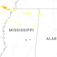
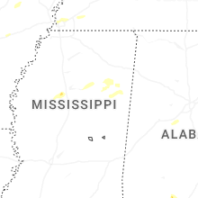
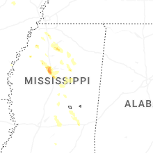
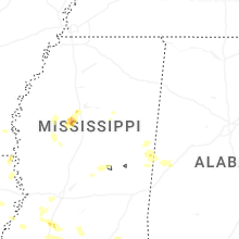


Connect with Interactive Hail Maps