

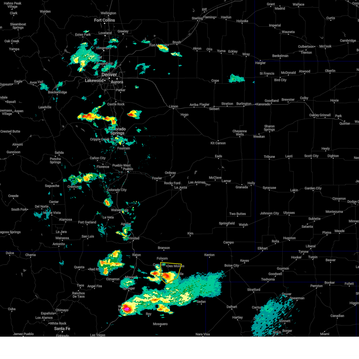
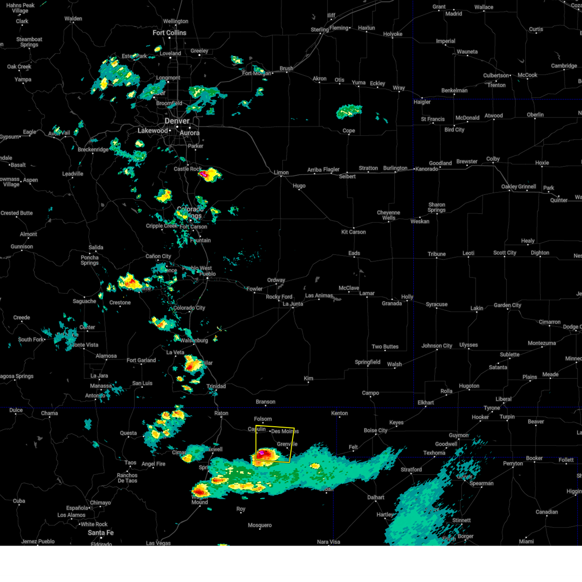
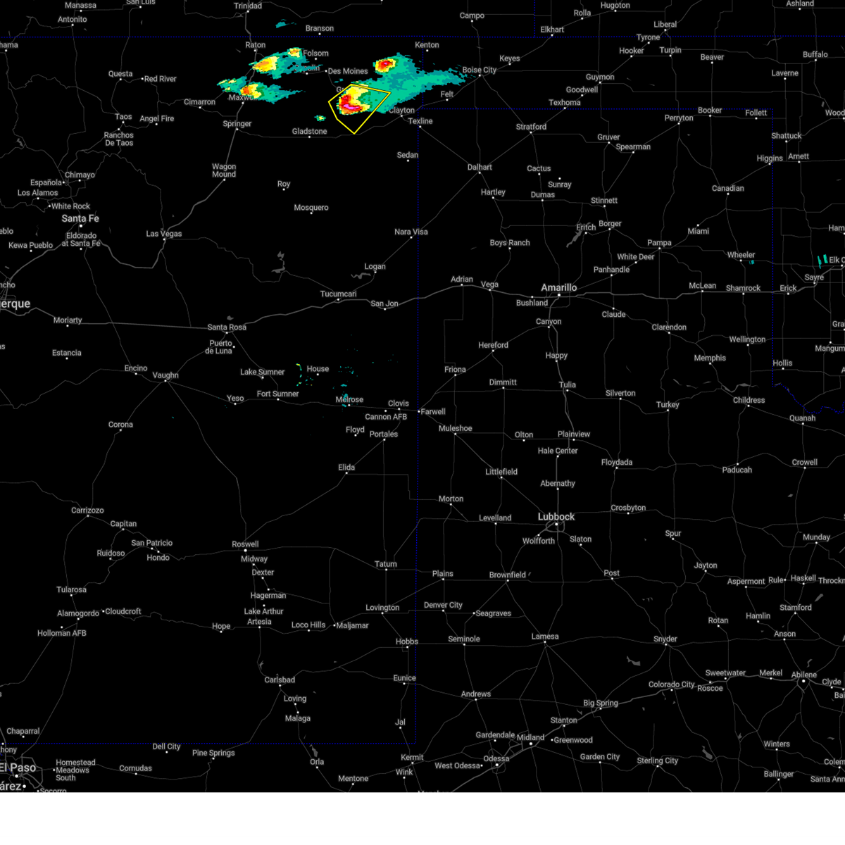
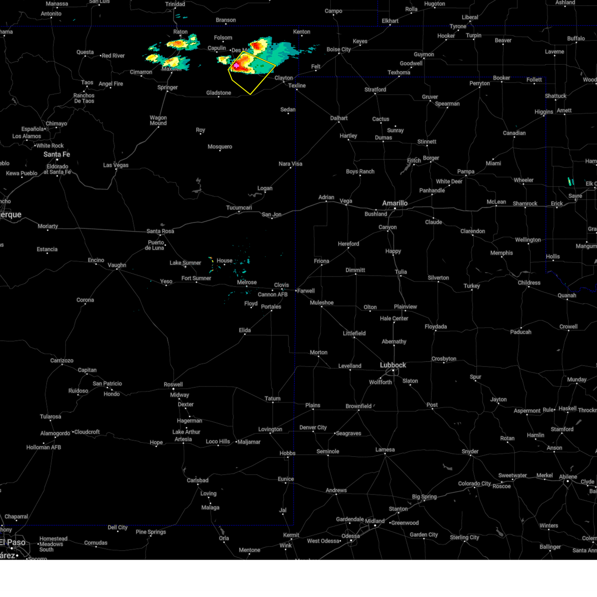
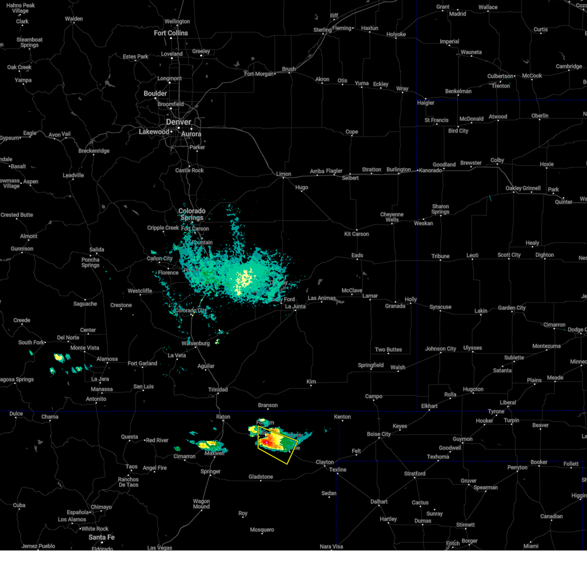
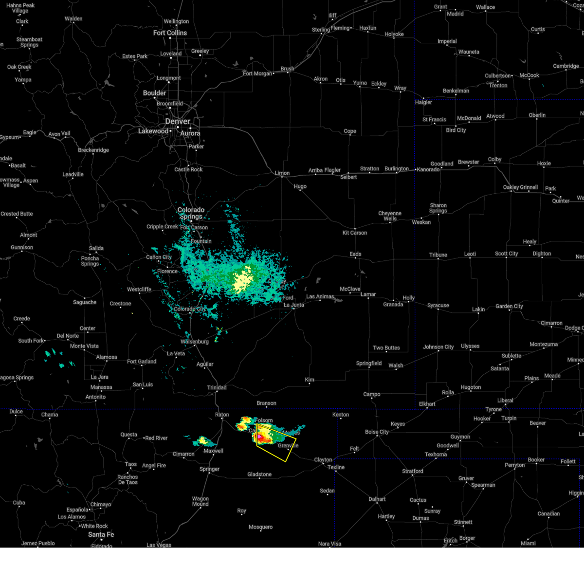
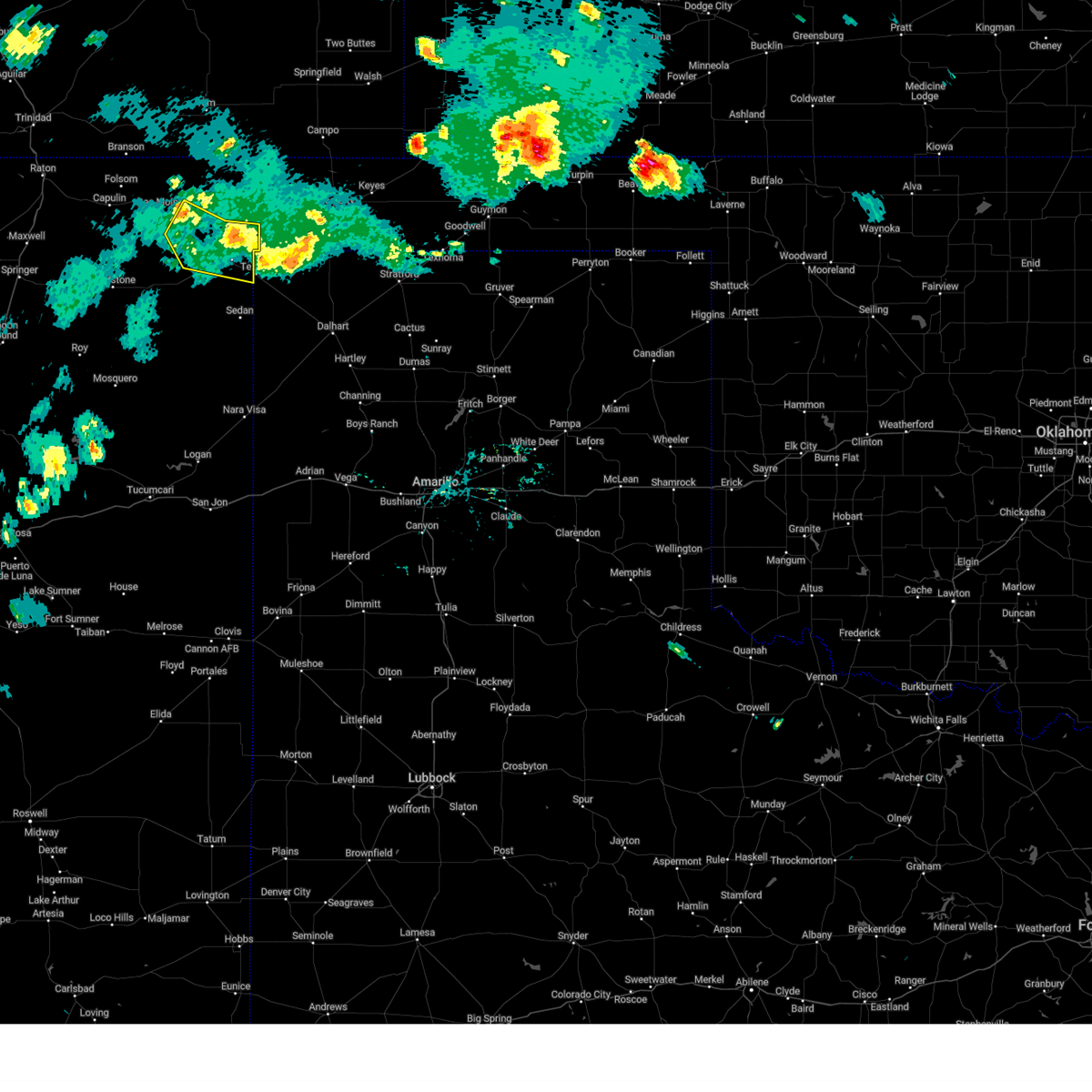
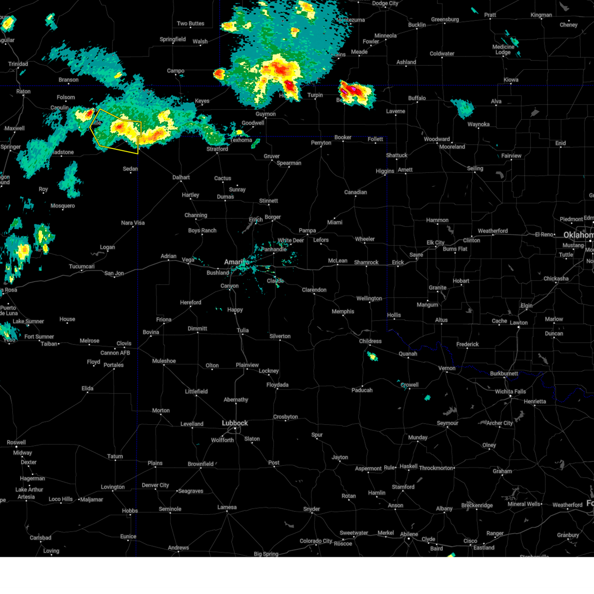
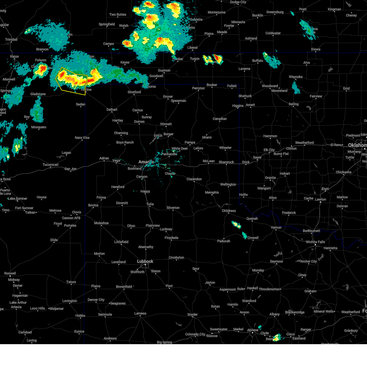
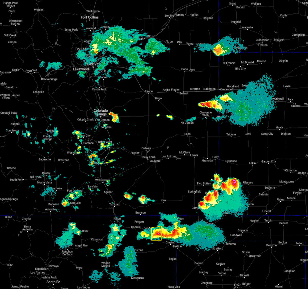
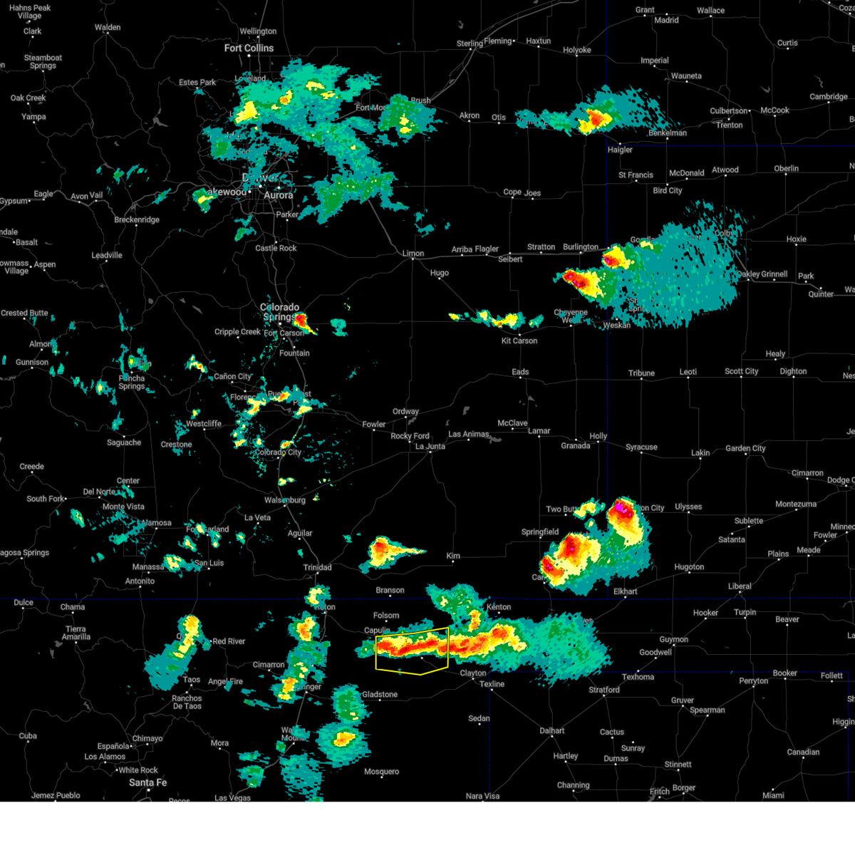
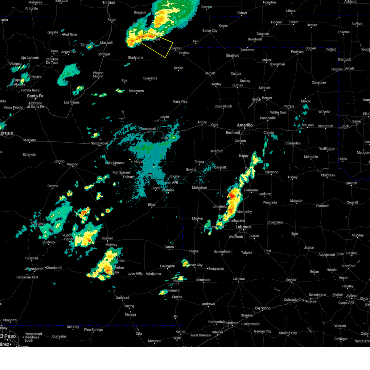
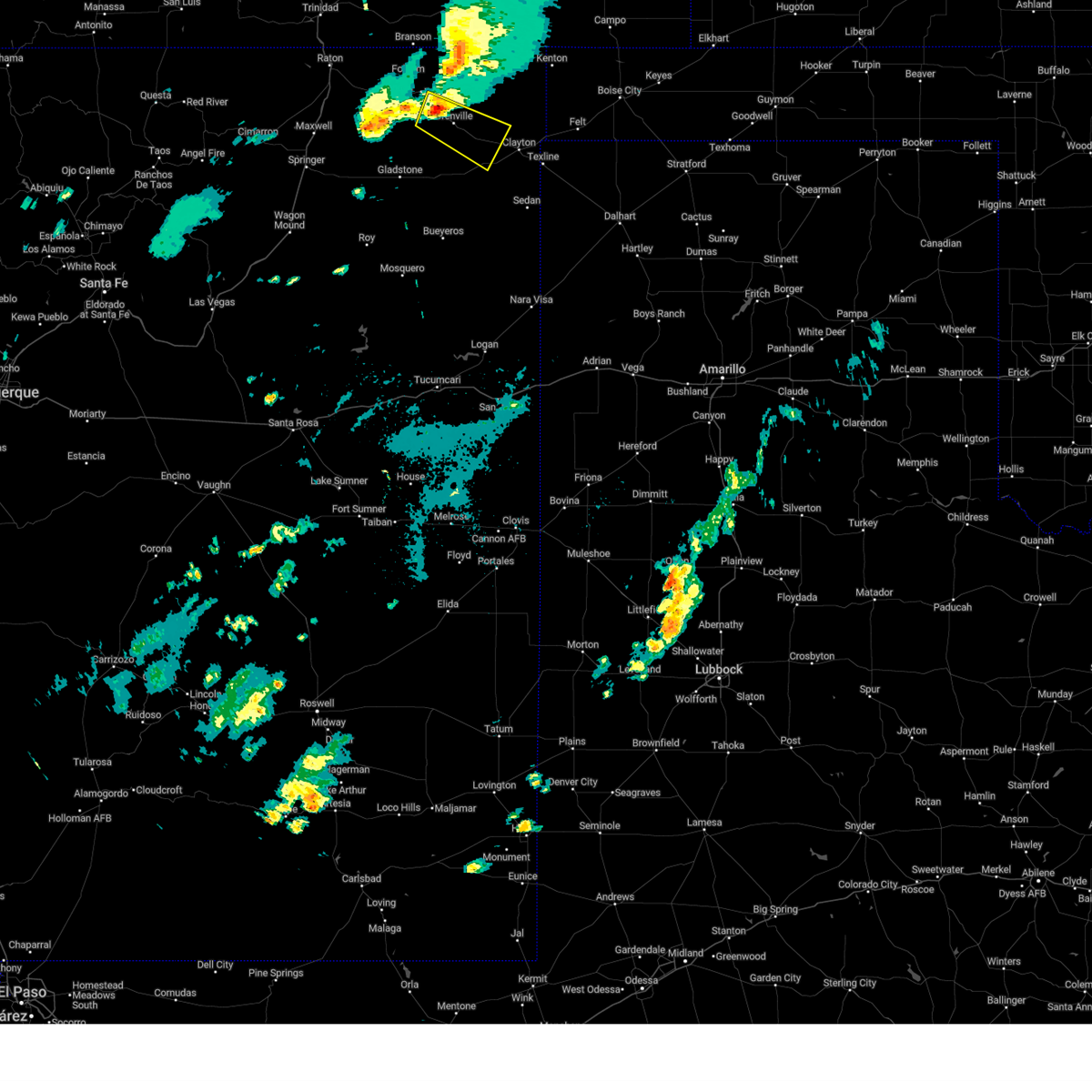
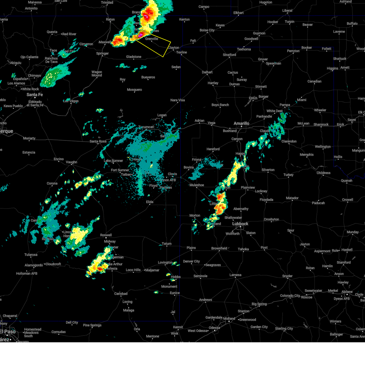
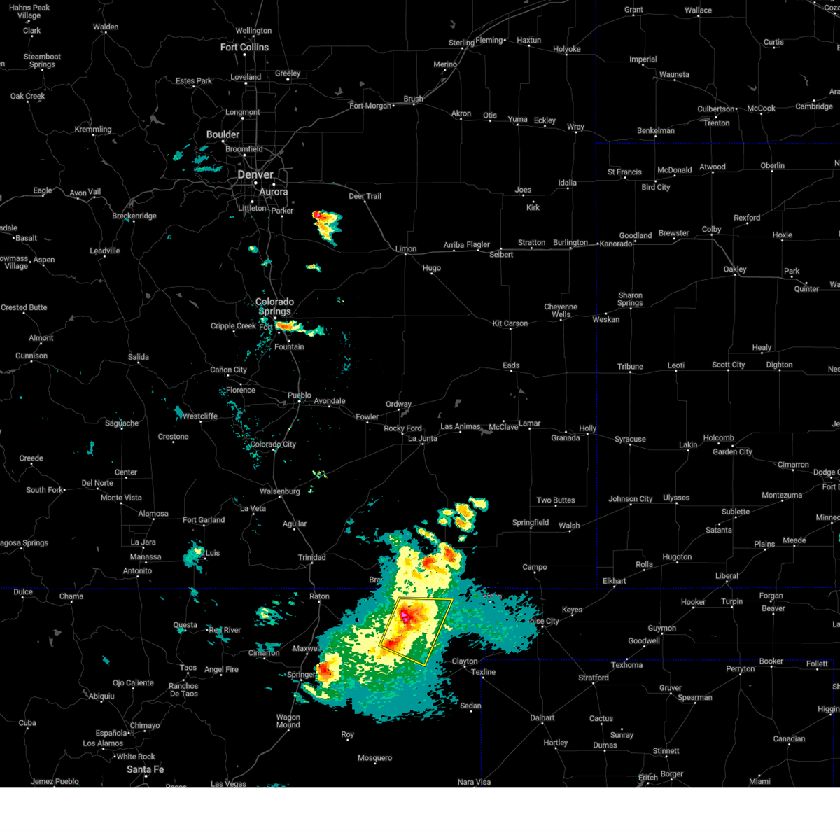
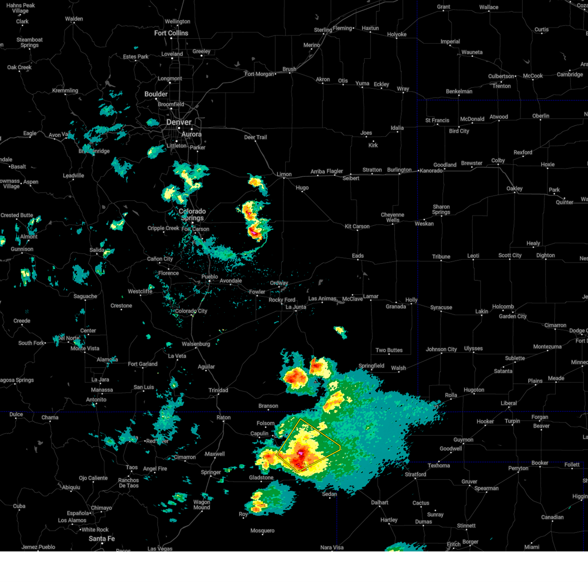
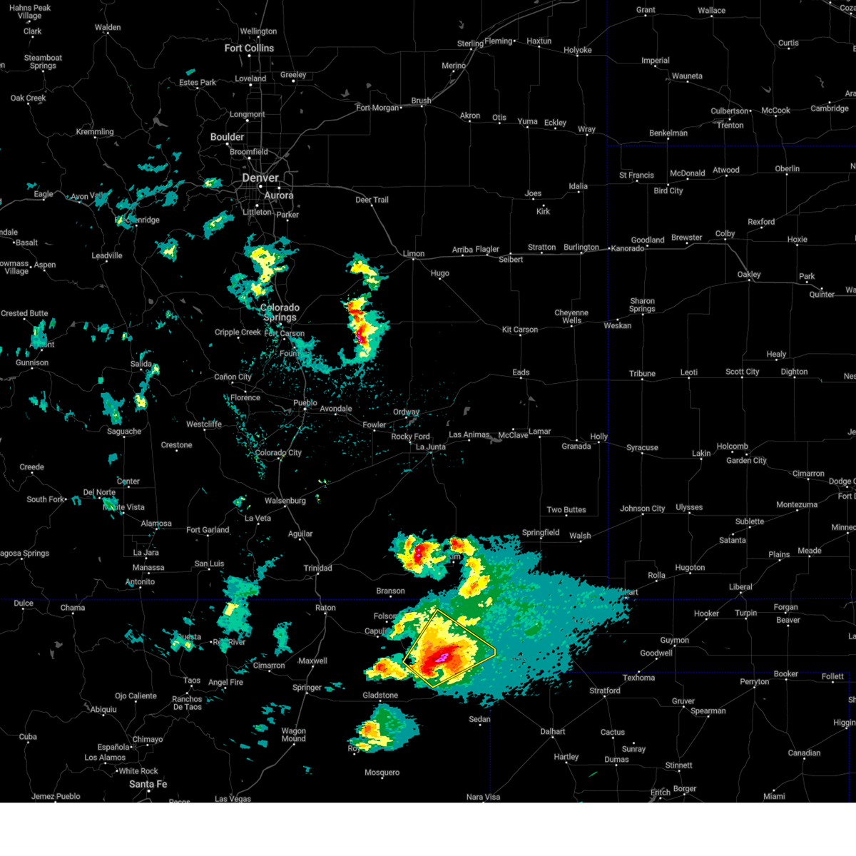
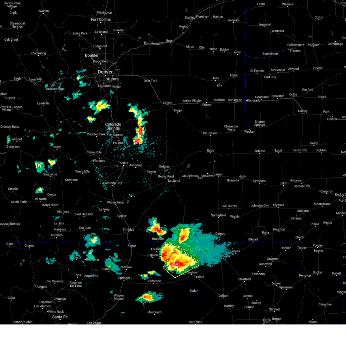
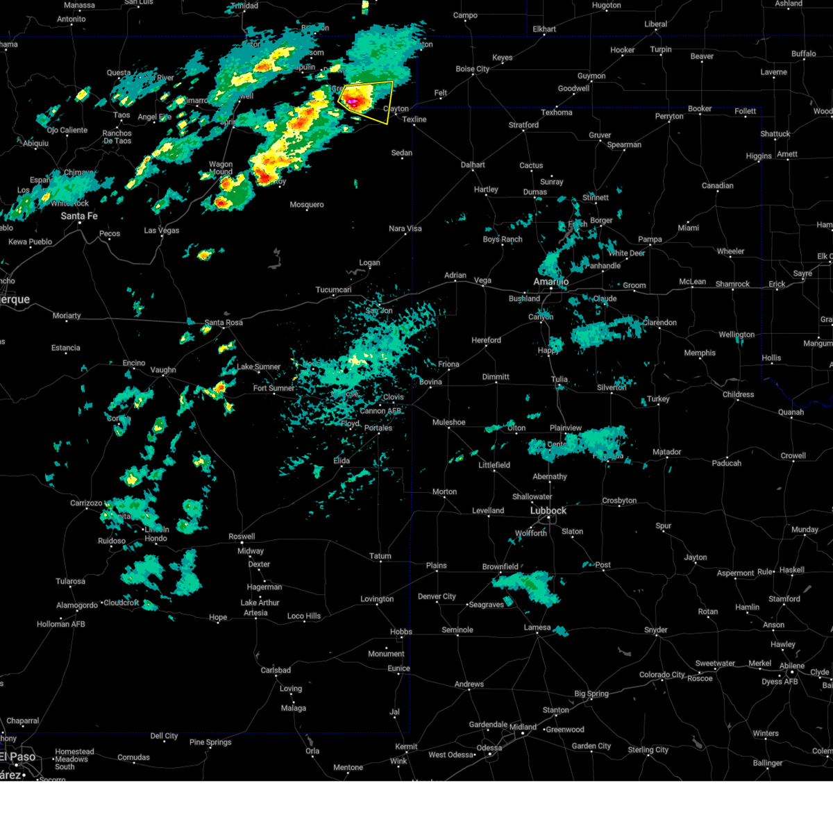
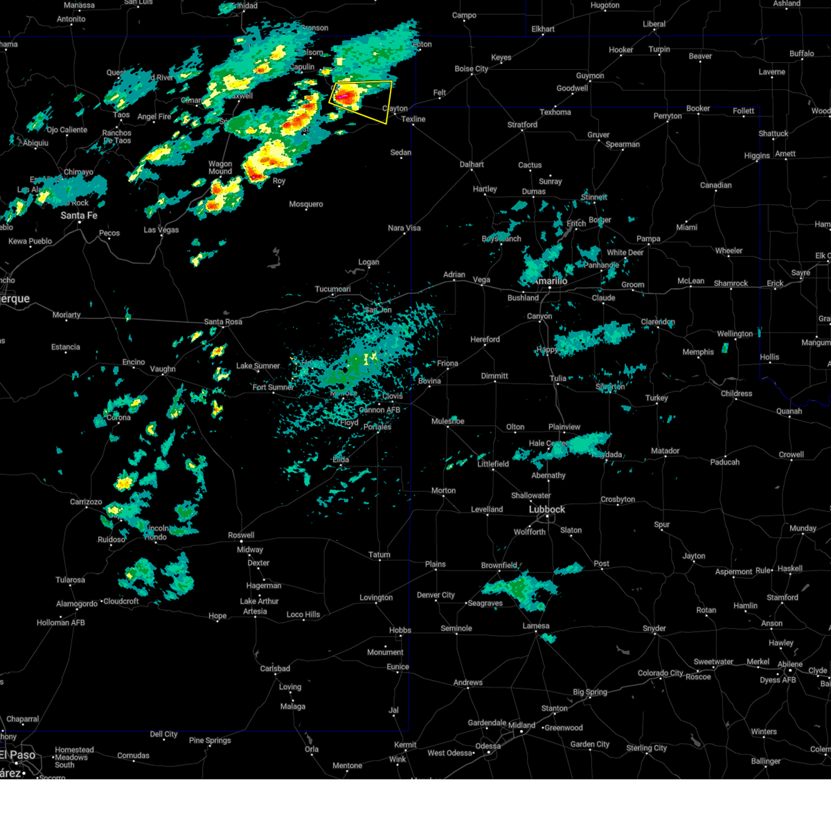
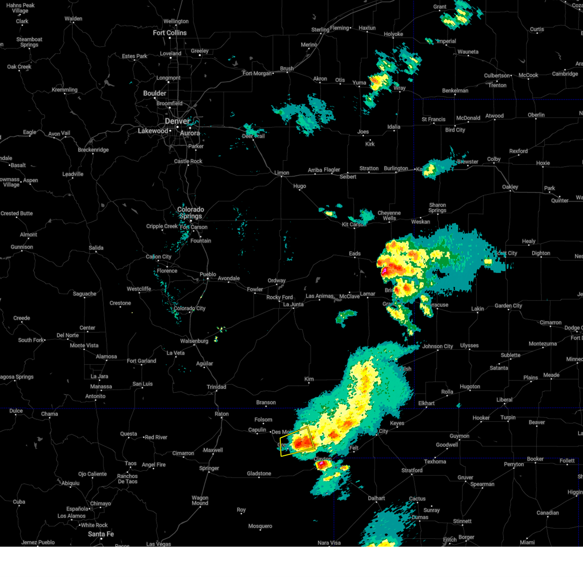
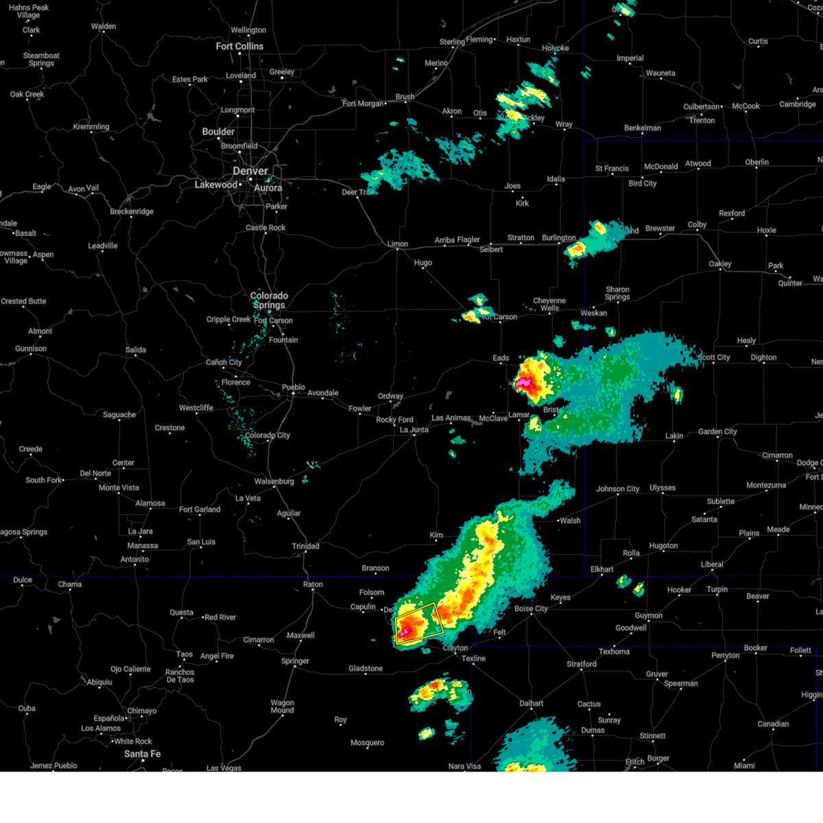
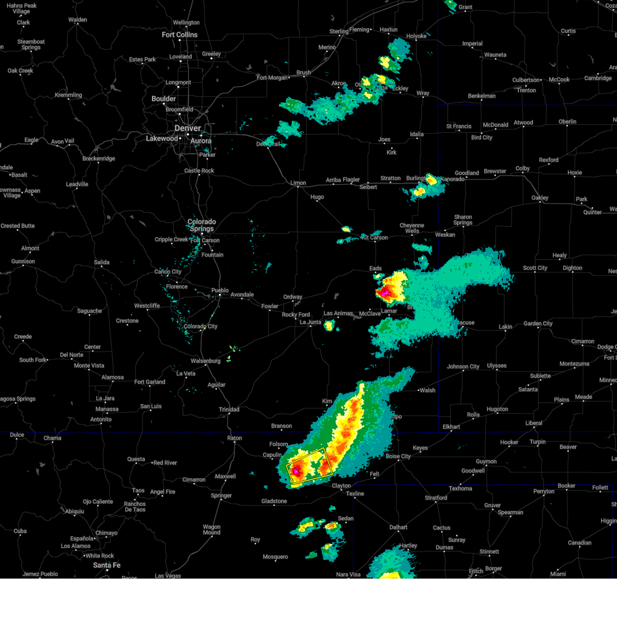
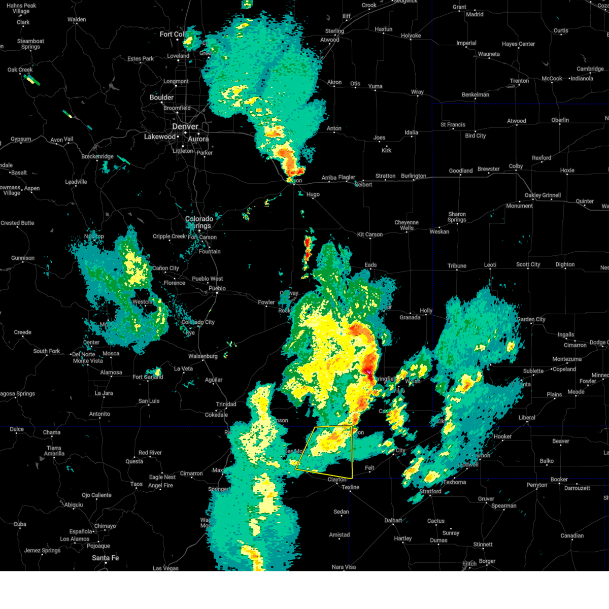
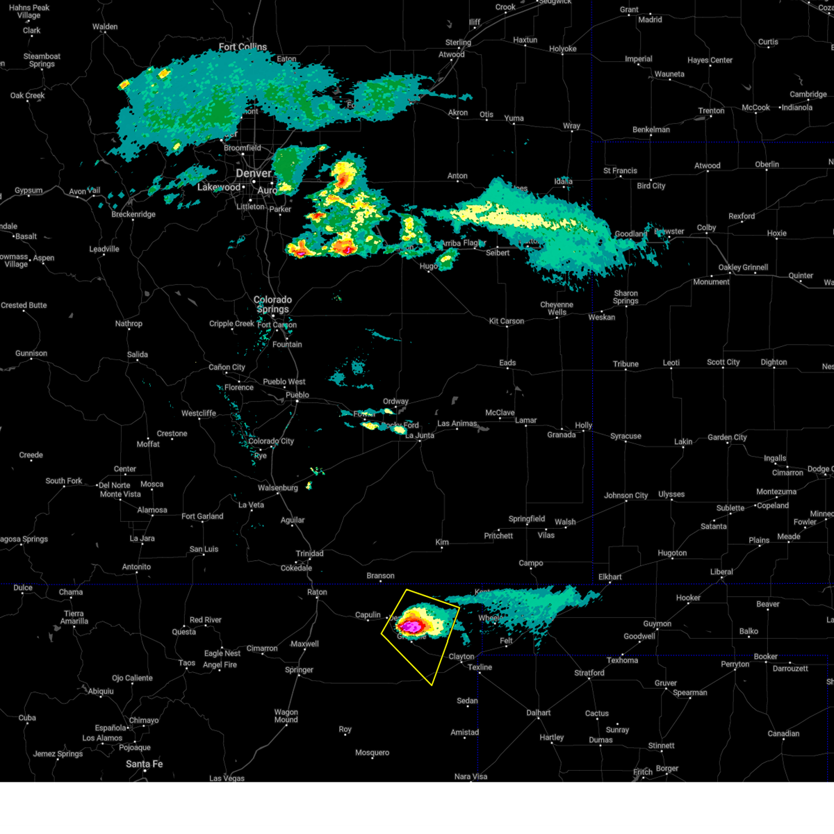
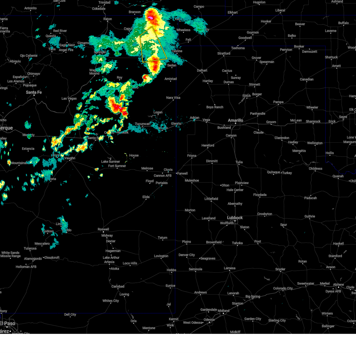
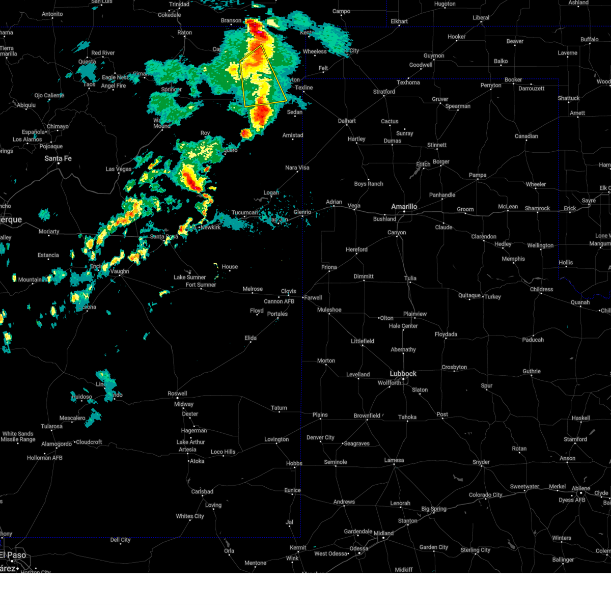
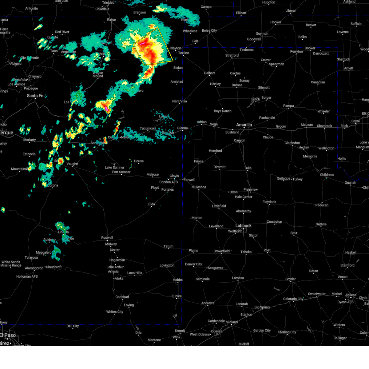
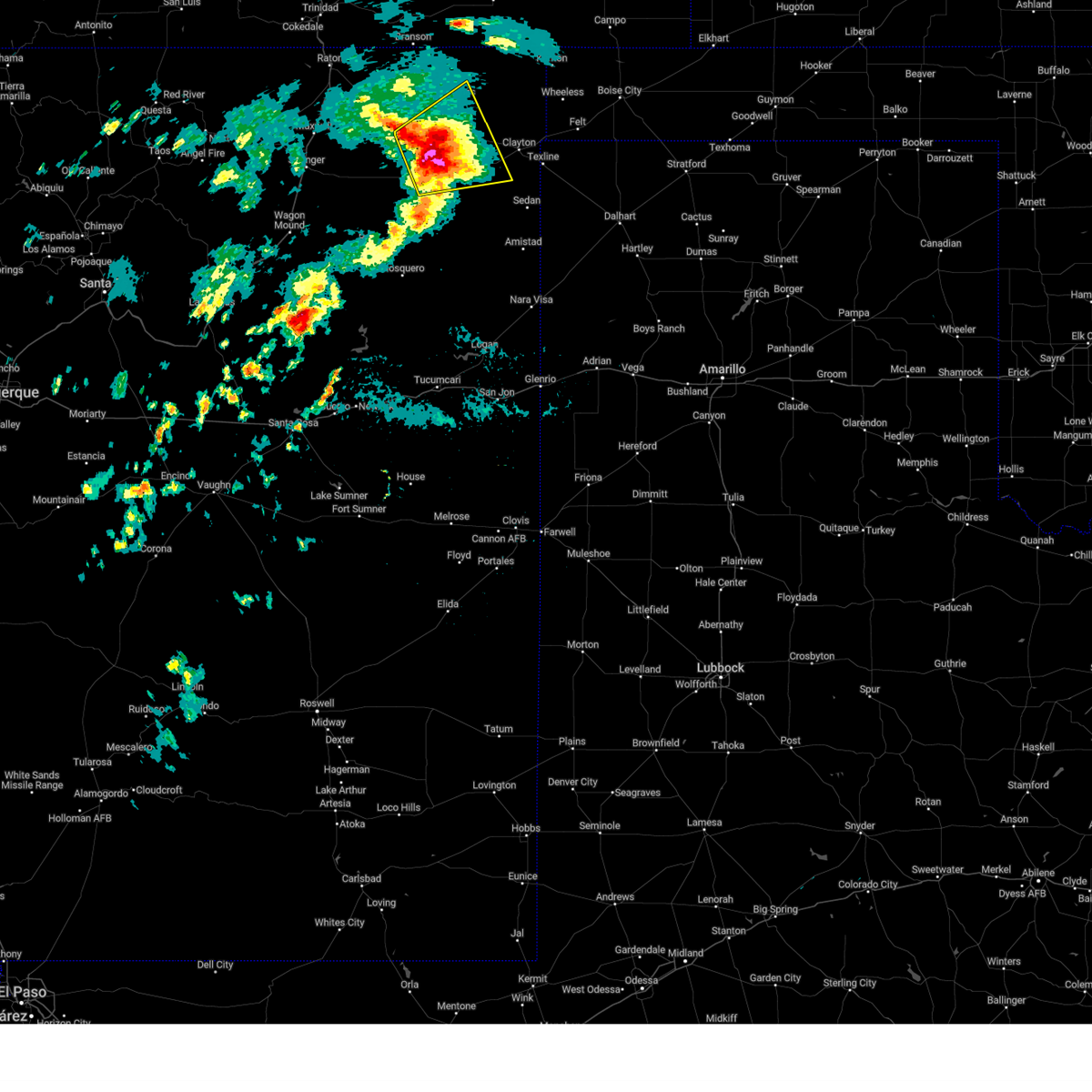
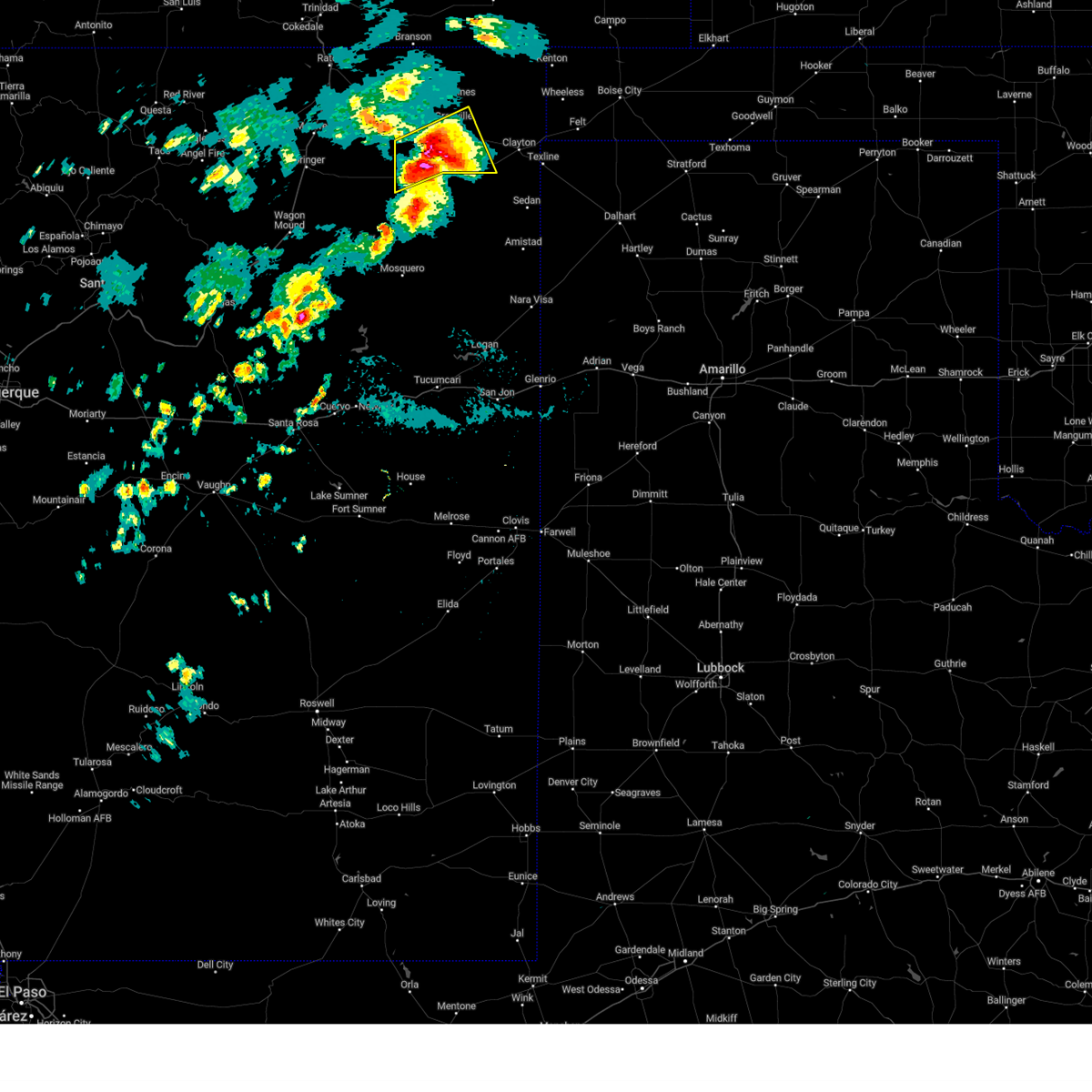
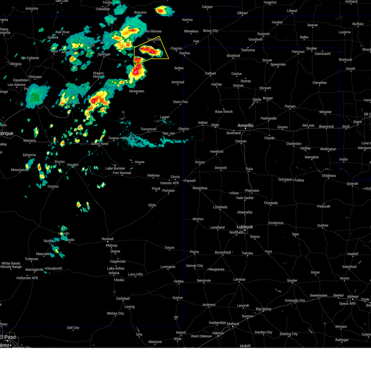
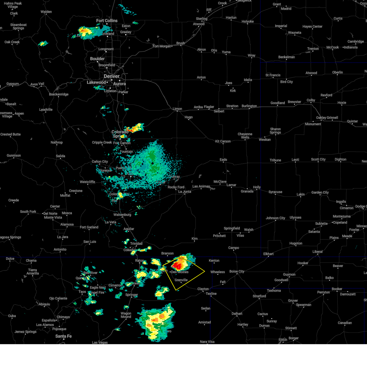
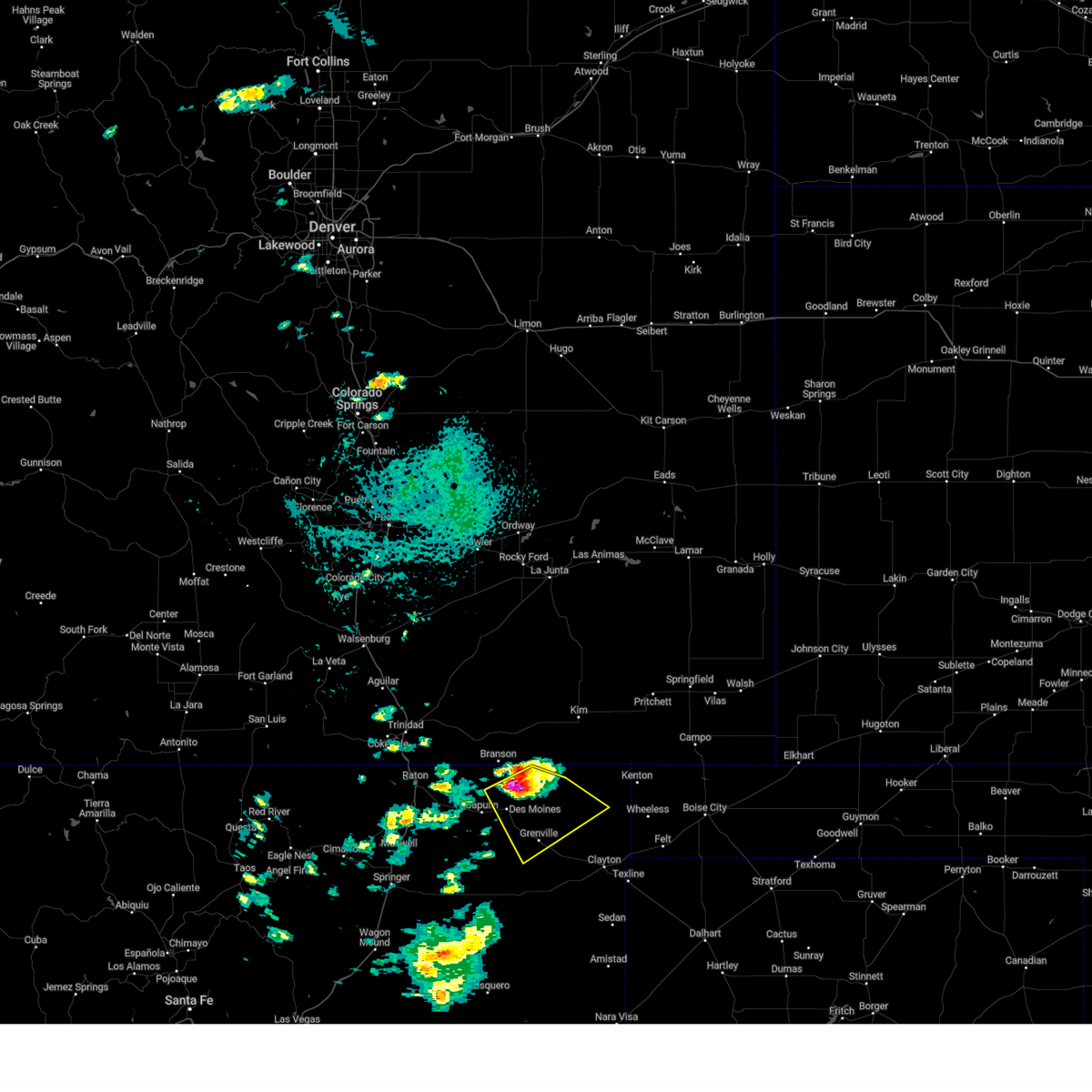
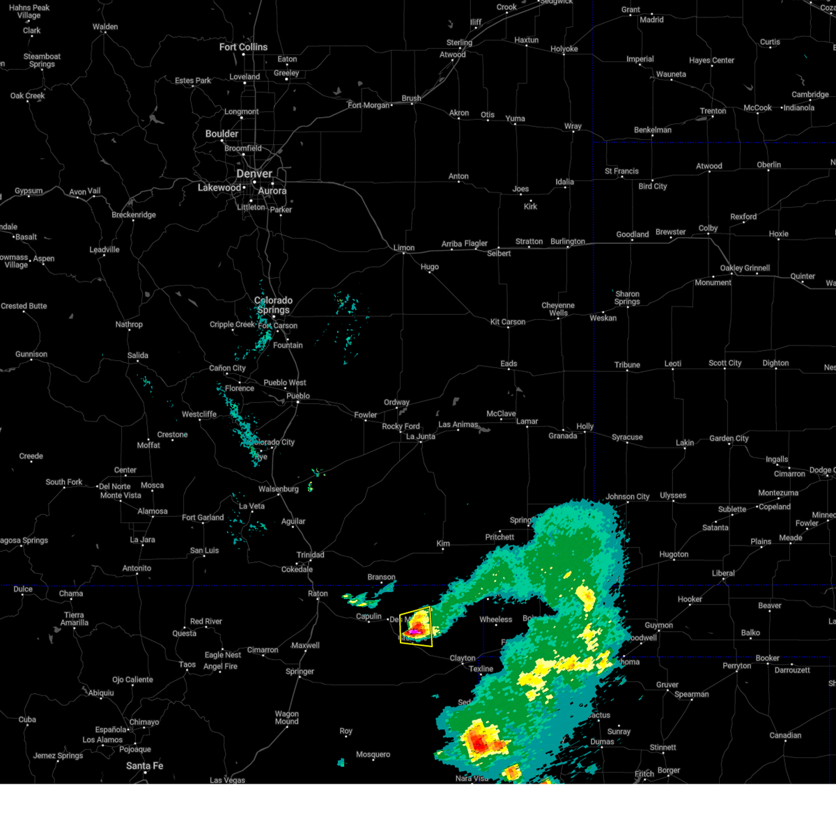
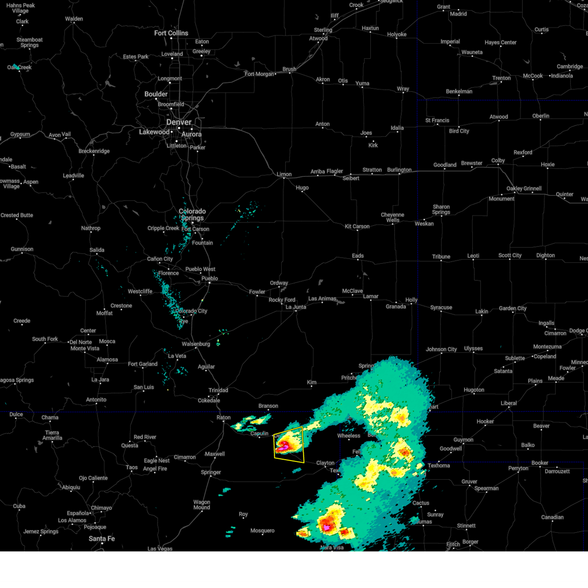
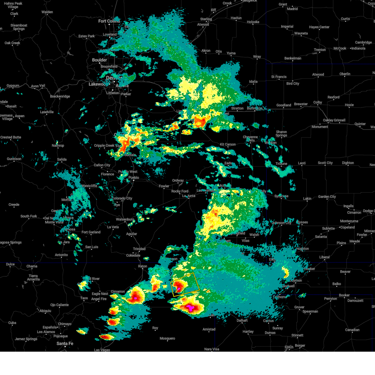
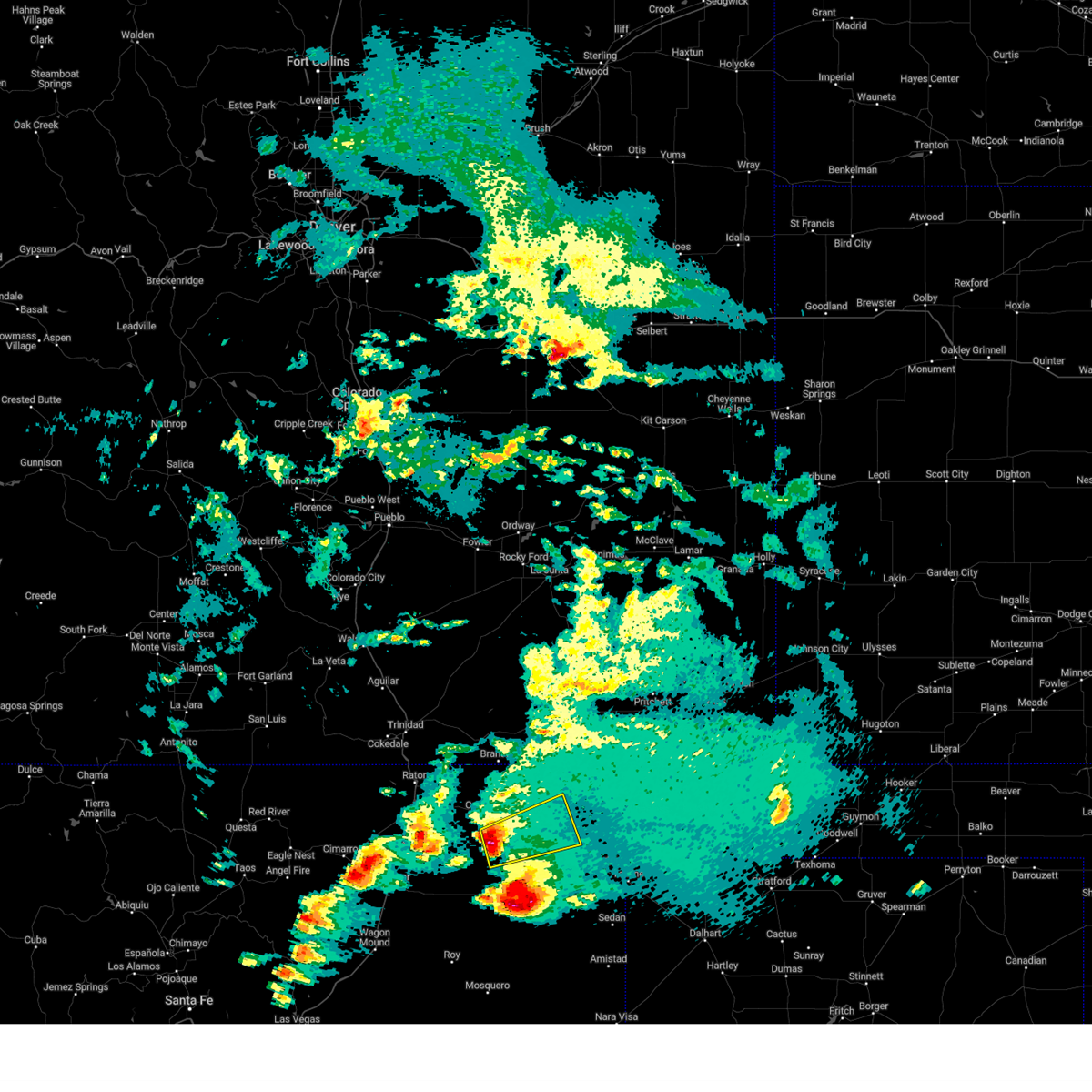
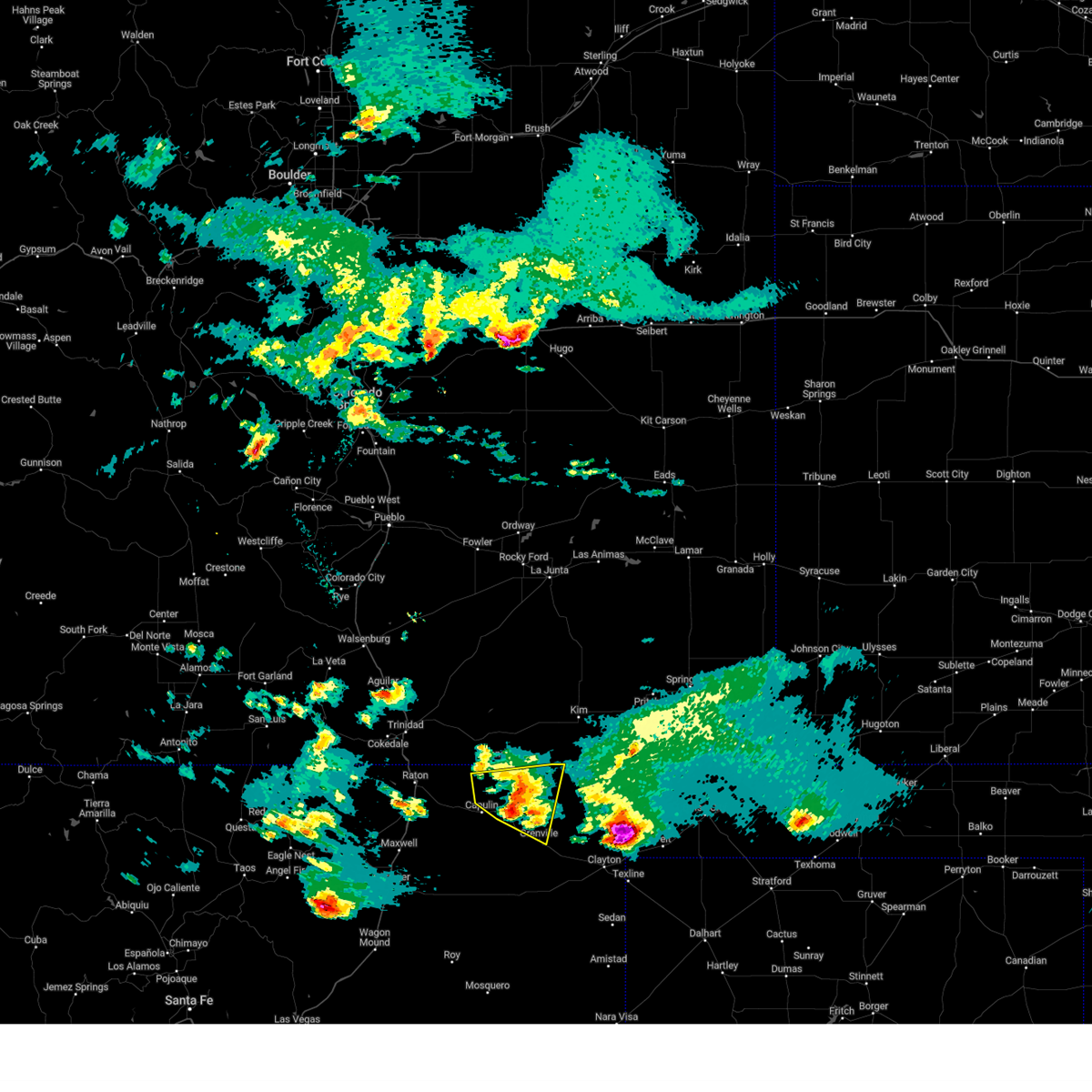
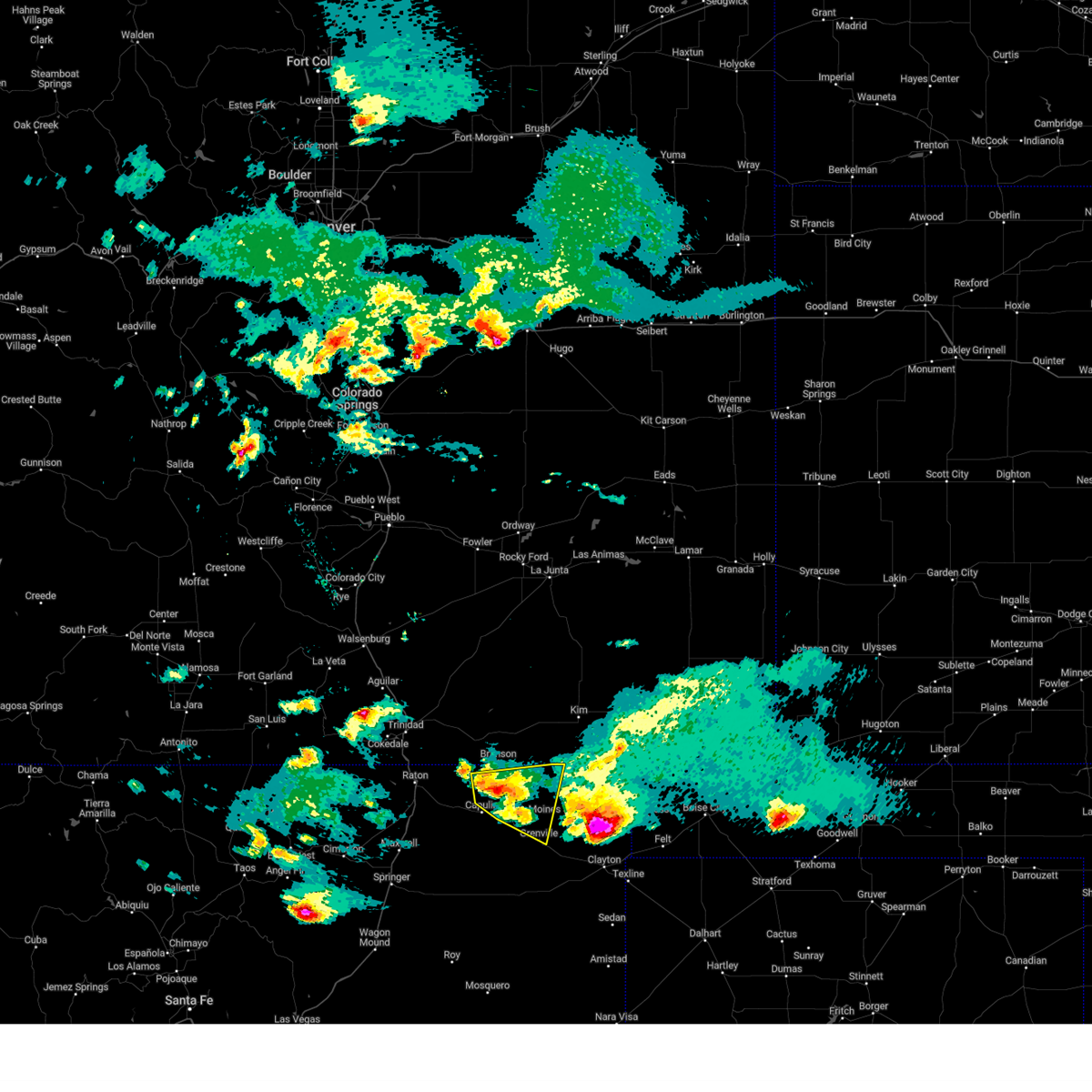
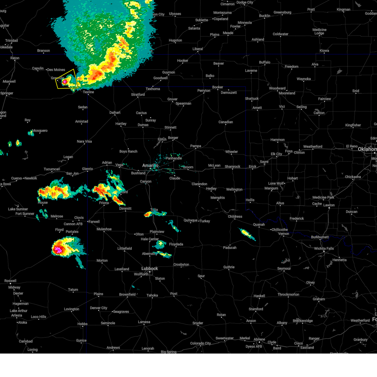
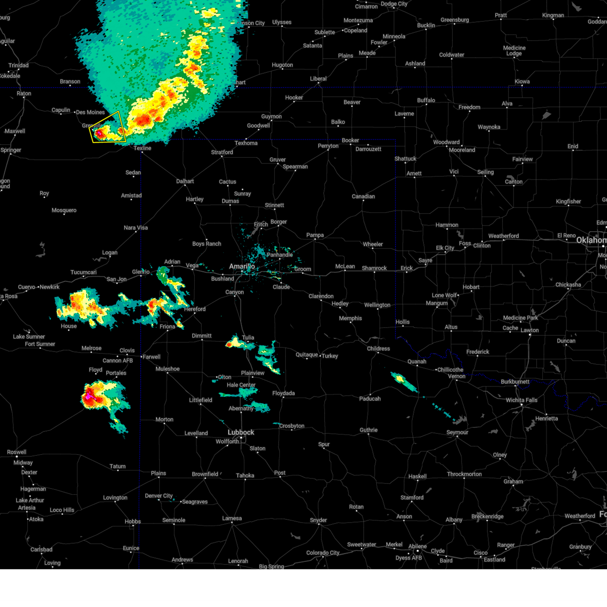
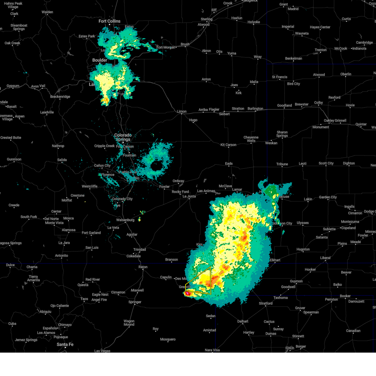
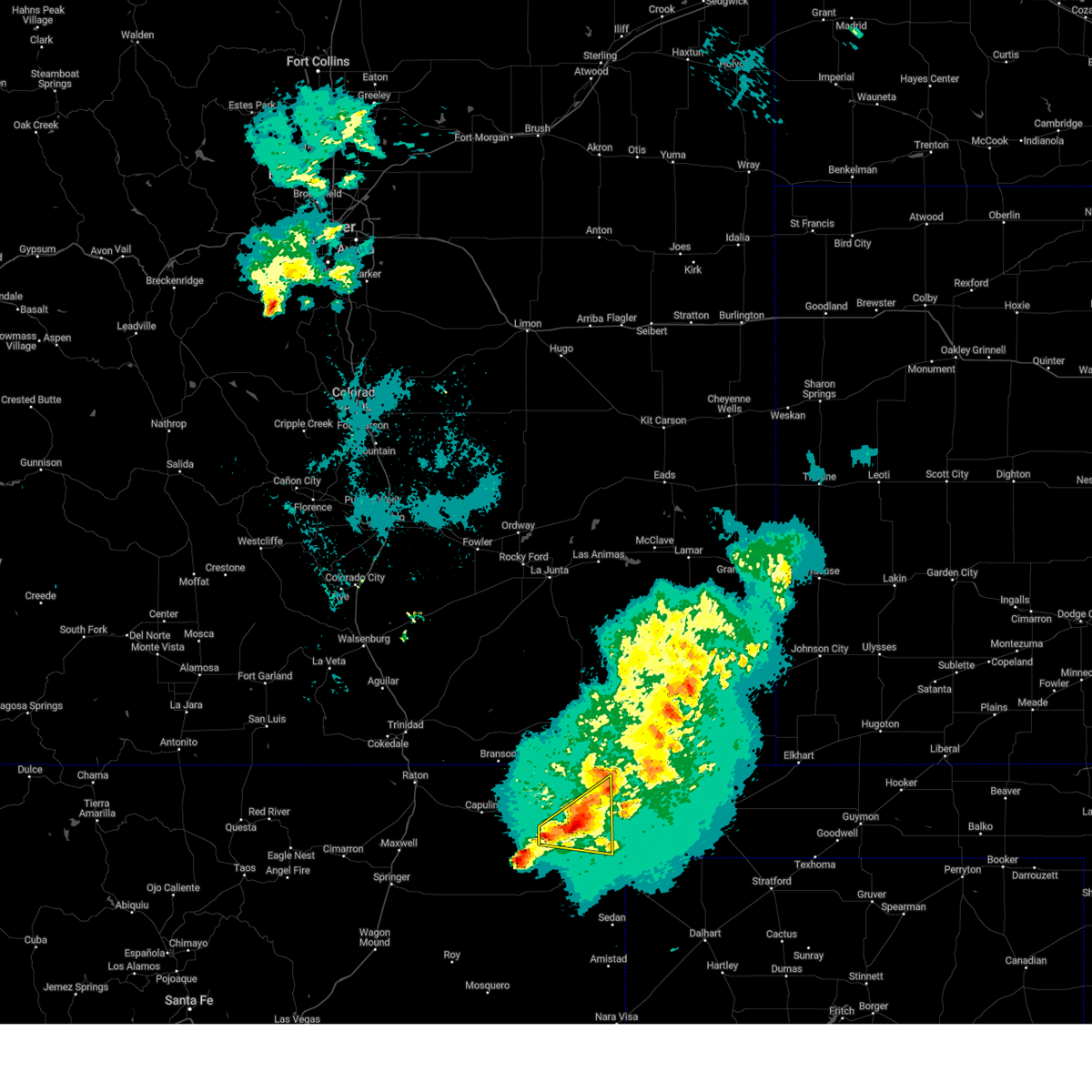
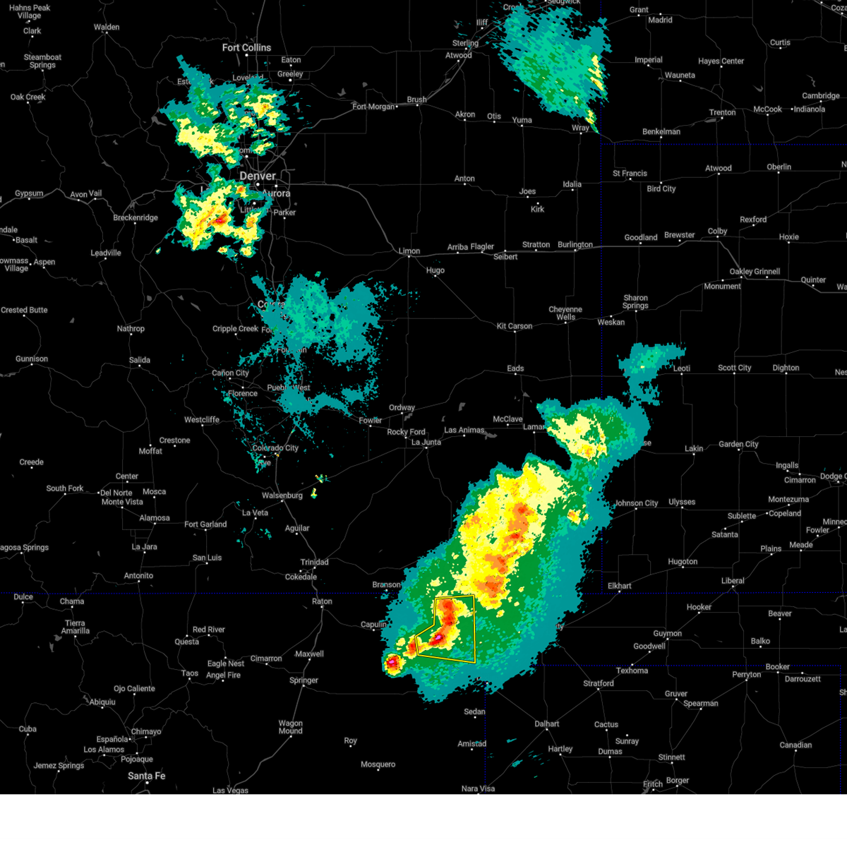
Hail Map for Grenville, NM
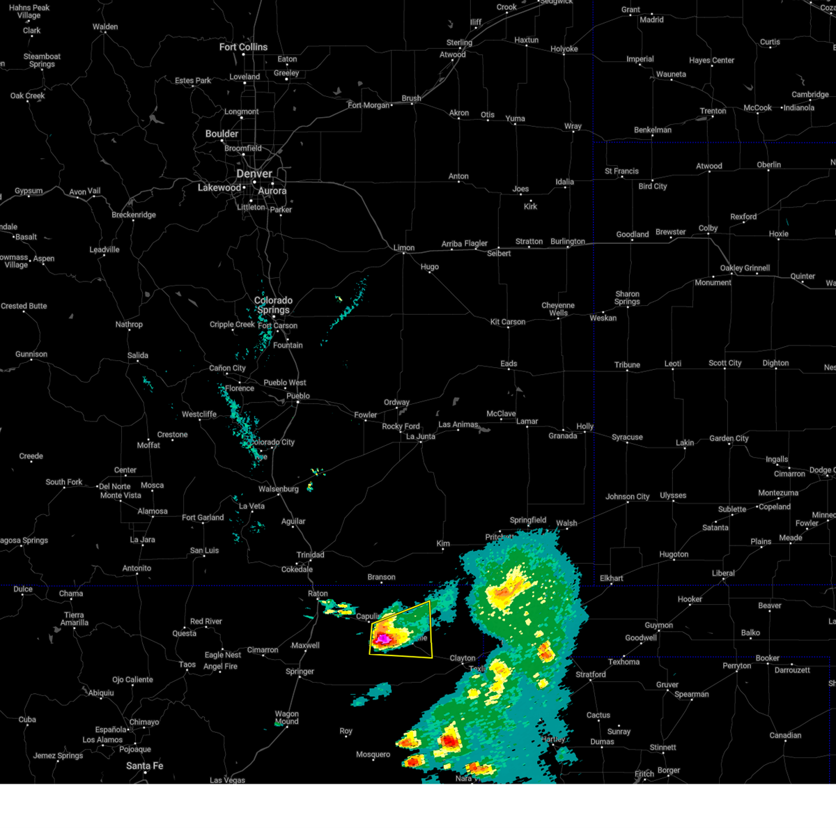
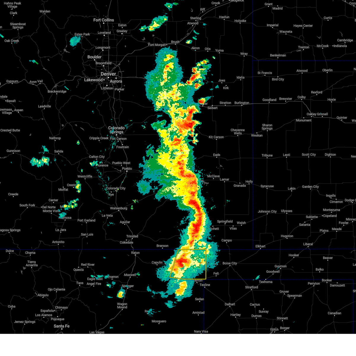
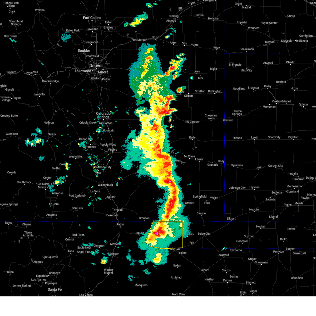
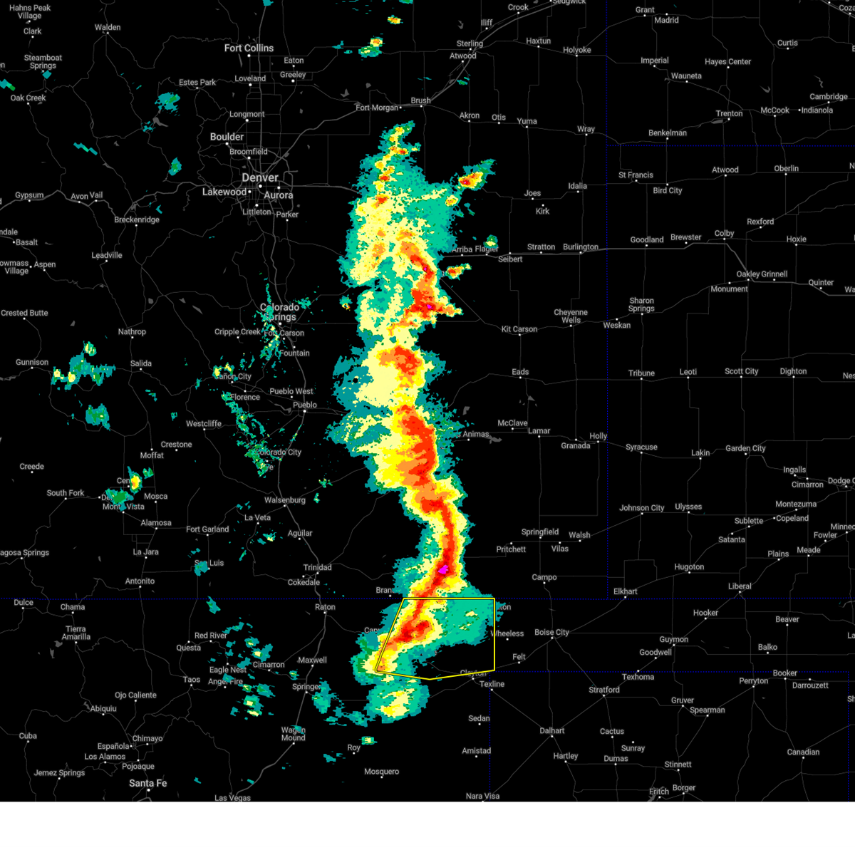
The Grenville, NM area has had 18 reports of on-the-ground hail by trained spotters, and has been under severe weather warnings 25 times during the past 12 months. Doppler radar has detected hail at or near Grenville, NM on 74 occasions, including 8 occasions during the past year.
| Name: | Grenville, NM |
| Where Located: | 97.7 miles N of Tucumcari, NM |
| Map: | Google Map for Grenville, NM |
| Population: | 38 |
| Housing Units: | 15 |
| More Info: | Search Google for Grenville, NM |
0
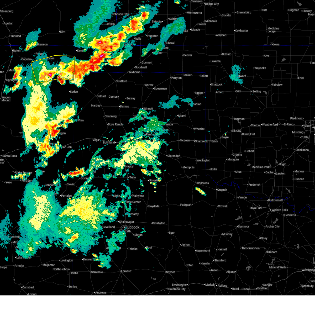
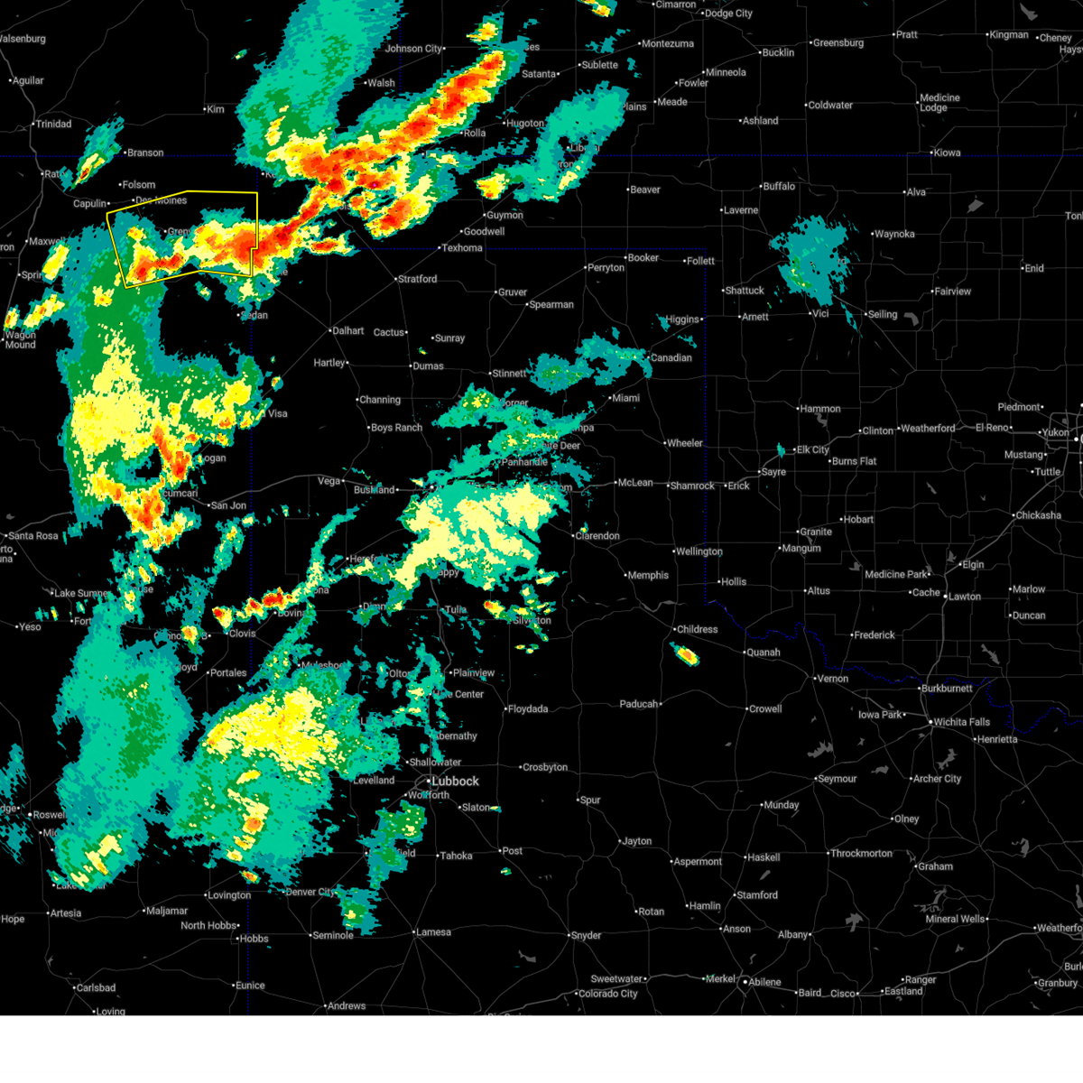
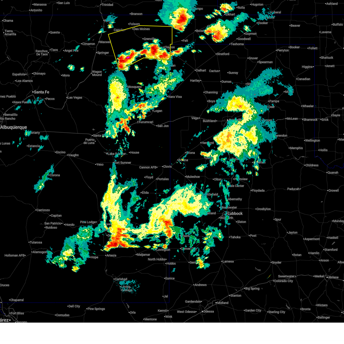
The Top Recent Hail Date for Grenville, NM is Saturday, June 7, 2025 (74th out of 74)
Hail and Wind Damage Spotted near Grenville, NM
| Date / Time | Report Details |
|---|---|
| 6/23/2025 7:00 PM MDT |
 The storms which prompted the warning have moved out of the area. therefore, the warning has been allowed to expire. to report severe weather, contact the national weather service office in albuquerque at 1.888.386.7637. The storms which prompted the warning have moved out of the area. therefore, the warning has been allowed to expire. to report severe weather, contact the national weather service office in albuquerque at 1.888.386.7637.
|
| 6/23/2025 6:59 PM MDT |
 Svrabq the national weather service in albuquerque has issued a * severe thunderstorm warning for, central union county in northeastern new mexico, * until 745 pm mdt. * at 659 pm mdt, severe thunderstorms were located along a line from 8 miles southwest of grenville to 6 miles south of clayton, moving north at 15 mph (radar indicated). Hazards include 60 mph wind gusts and small hail. expect damage to roofs, siding, and trees Svrabq the national weather service in albuquerque has issued a * severe thunderstorm warning for, central union county in northeastern new mexico, * until 745 pm mdt. * at 659 pm mdt, severe thunderstorms were located along a line from 8 miles southwest of grenville to 6 miles south of clayton, moving north at 15 mph (radar indicated). Hazards include 60 mph wind gusts and small hail. expect damage to roofs, siding, and trees
|
| 6/23/2025 6:42 PM MDT |
 the severe thunderstorm warning has been cancelled and is no longer in effect the severe thunderstorm warning has been cancelled and is no longer in effect
|
| 6/23/2025 6:42 PM MDT |
 At 642 pm mdt, severe thunderstorms were located along a line from 10 miles northeast of gladstone to 10 miles southeast of seneca, moving north at 25 mph (radar indicated). Hazards include 60 mph wind gusts and quarter size hail. Hail damage to vehicles is expected. expect wind damage to roofs, siding, and trees. locations impacted include, clayton, grenville, mount dora, clayton lake state park, seneca and moses. This includes highway 64 between mile markers 388 and 429. At 642 pm mdt, severe thunderstorms were located along a line from 10 miles northeast of gladstone to 10 miles southeast of seneca, moving north at 25 mph (radar indicated). Hazards include 60 mph wind gusts and quarter size hail. Hail damage to vehicles is expected. expect wind damage to roofs, siding, and trees. locations impacted include, clayton, grenville, mount dora, clayton lake state park, seneca and moses. This includes highway 64 between mile markers 388 and 429.
|
| 6/23/2025 6:13 PM MDT |
 Svrabq the national weather service in albuquerque has issued a * severe thunderstorm warning for, southeastern colfax county in northeastern new mexico, north central harding county in northeastern new mexico, central union county in northeastern new mexico, * until 700 pm mdt. * at 613 pm mdt, severe thunderstorms were located along a line from 8 miles southwest of gladstone to 7 miles south of clayton, moving north at 30 mph (radar indicated). Hazards include 60 mph wind gusts and quarter size hail. Hail damage to vehicles is expected. Expect wind damage to roofs, siding, and trees. Svrabq the national weather service in albuquerque has issued a * severe thunderstorm warning for, southeastern colfax county in northeastern new mexico, north central harding county in northeastern new mexico, central union county in northeastern new mexico, * until 700 pm mdt. * at 613 pm mdt, severe thunderstorms were located along a line from 8 miles southwest of gladstone to 7 miles south of clayton, moving north at 30 mph (radar indicated). Hazards include 60 mph wind gusts and quarter size hail. Hail damage to vehicles is expected. Expect wind damage to roofs, siding, and trees.
|
| 6/8/2025 6:34 PM MDT | the severe thunderstorm warning has been cancelled and is no longer in effect |
| 6/8/2025 6:22 PM MDT |
 At 622 pm mdt, a severe thunderstorm was located 8 miles south of des moines, moving northeast at 20 mph (radar indicated). Hazards include 60 mph wind gusts and quarter size hail. Hail damage to vehicles is expected. expect wind damage to roofs, siding, and trees. locations impacted include, des moines and grenville. This includes highway 64 between mile markers 380 and 404. At 622 pm mdt, a severe thunderstorm was located 8 miles south of des moines, moving northeast at 20 mph (radar indicated). Hazards include 60 mph wind gusts and quarter size hail. Hail damage to vehicles is expected. expect wind damage to roofs, siding, and trees. locations impacted include, des moines and grenville. This includes highway 64 between mile markers 380 and 404.
|
| 6/8/2025 5:57 PM MDT |
 Svrabq the national weather service in albuquerque has issued a * severe thunderstorm warning for, northwestern union county in northeastern new mexico, * until 645 pm mdt. * at 557 pm mdt, a severe thunderstorm was located 13 miles south of capulin, or 15 miles south of des moines, moving northeast at 20 mph (radar indicated). Hazards include golf ball size hail and 60 mph wind gusts. People and animals outdoors will be injured. expect hail damage to roofs, siding, windows, and vehicles. Expect wind damage to roofs, siding, and trees. Svrabq the national weather service in albuquerque has issued a * severe thunderstorm warning for, northwestern union county in northeastern new mexico, * until 645 pm mdt. * at 557 pm mdt, a severe thunderstorm was located 13 miles south of capulin, or 15 miles south of des moines, moving northeast at 20 mph (radar indicated). Hazards include golf ball size hail and 60 mph wind gusts. People and animals outdoors will be injured. expect hail damage to roofs, siding, windows, and vehicles. Expect wind damage to roofs, siding, and trees.
|
| 6/7/2025 6:40 PM MDT | Golf Ball sized hail reported 21.4 miles NNE of Grenville, NM, golf ball sized hail reported at pasamonte ranch. |
| 6/7/2025 4:32 PM MDT | Ping Pong Ball sized hail reported 6.7 miles NNE of Grenville, NM, a storm chaser shared video of estimated ping-pong ball size hail. |
| 6/7/2025 4:28 PM MDT |
 At 428 pm mdt, a severe thunderstorm was located 5 miles southwest of grenville, or 19 miles southeast of des moines, moving southeast at 20 mph (radar indicated). Hazards include ping pong ball size hail and 60 mph wind gusts. People and animals outdoors will be injured. expect hail damage to roofs, siding, windows, and vehicles. expect wind damage to roofs, siding, and trees. locations impacted include, grenville and mount dora. This includes highway 64 between mile markers 399 and 417. At 428 pm mdt, a severe thunderstorm was located 5 miles southwest of grenville, or 19 miles southeast of des moines, moving southeast at 20 mph (radar indicated). Hazards include ping pong ball size hail and 60 mph wind gusts. People and animals outdoors will be injured. expect hail damage to roofs, siding, windows, and vehicles. expect wind damage to roofs, siding, and trees. locations impacted include, grenville and mount dora. This includes highway 64 between mile markers 399 and 417.
|
| 6/7/2025 4:11 PM MDT |
 Svrabq the national weather service in albuquerque has issued a * severe thunderstorm warning for, central union county in northeastern new mexico, * until 500 pm mdt. * at 411 pm mdt, a severe thunderstorm was located 7 miles west of grenville, or 13 miles southeast of des moines, moving southeast at 20 mph (radar indicated). Hazards include 60 mph wind gusts and quarter size hail. Hail damage to vehicles is expected. Expect wind damage to roofs, siding, and trees. Svrabq the national weather service in albuquerque has issued a * severe thunderstorm warning for, central union county in northeastern new mexico, * until 500 pm mdt. * at 411 pm mdt, a severe thunderstorm was located 7 miles west of grenville, or 13 miles southeast of des moines, moving southeast at 20 mph (radar indicated). Hazards include 60 mph wind gusts and quarter size hail. Hail damage to vehicles is expected. Expect wind damage to roofs, siding, and trees.
|
| 6/7/2025 3:37 PM MDT |
 The storm which prompted the warning has weakened below severe limits, and no longer poses an immediate threat to life or property. therefore, the warning will be allowed to expire. however, small hail and gusty winds are still possible with this thunderstorm. a severe thunderstorm watch remains in effect until 900 pm mdt for a portion of northeast new mexico. The storm which prompted the warning has weakened below severe limits, and no longer poses an immediate threat to life or property. therefore, the warning will be allowed to expire. however, small hail and gusty winds are still possible with this thunderstorm. a severe thunderstorm watch remains in effect until 900 pm mdt for a portion of northeast new mexico.
|
| 6/7/2025 3:18 PM MDT |
 the severe thunderstorm warning has been cancelled and is no longer in effect the severe thunderstorm warning has been cancelled and is no longer in effect
|
| 6/7/2025 3:18 PM MDT |
 At 318 pm mdt, a severe thunderstorm was located near capulin, or 7 miles southwest of des moines, moving southeast at 25 mph (radar indicated). Hazards include 60 mph wind gusts and quarter size hail. Hail damage to vehicles is expected. expect wind damage to roofs, siding, and trees. locations impacted include, des moines, grenville and capulin. This includes highway 64 between mile markers 376 and 405. At 318 pm mdt, a severe thunderstorm was located near capulin, or 7 miles southwest of des moines, moving southeast at 25 mph (radar indicated). Hazards include 60 mph wind gusts and quarter size hail. Hail damage to vehicles is expected. expect wind damage to roofs, siding, and trees. locations impacted include, des moines, grenville and capulin. This includes highway 64 between mile markers 376 and 405.
|
| 6/7/2025 2:56 PM MDT |
 Svrabq the national weather service in albuquerque has issued a * severe thunderstorm warning for, northeastern colfax county in northeastern new mexico, northwestern union county in northeastern new mexico, * until 345 pm mdt. * at 256 pm mdt, a severe thunderstorm was located near capulin, or 12 miles west of des moines, moving southeast at 30 mph (radar indicated). Hazards include 60 mph wind gusts and quarter size hail. Hail damage to vehicles is expected. Expect wind damage to roofs, siding, and trees. Svrabq the national weather service in albuquerque has issued a * severe thunderstorm warning for, northeastern colfax county in northeastern new mexico, northwestern union county in northeastern new mexico, * until 345 pm mdt. * at 256 pm mdt, a severe thunderstorm was located near capulin, or 12 miles west of des moines, moving southeast at 30 mph (radar indicated). Hazards include 60 mph wind gusts and quarter size hail. Hail damage to vehicles is expected. Expect wind damage to roofs, siding, and trees.
|
| 6/6/2025 6:14 PM MDT | Quarter sized hail reported 21.4 miles NNE of Grenville, NM, observer at pasamonte ranch reports quarter size hail. |
| 5/28/2025 4:38 PM MDT |
 the severe thunderstorm warning has been cancelled and is no longer in effect the severe thunderstorm warning has been cancelled and is no longer in effect
|
| 5/28/2025 4:22 PM MDT |
 At 422 pm mdt, severe thunderstorms were located along a line from 18 miles southeast of seneca to near clayton lake state park, moving southeast at 20 mph (radar indicated). Hazards include 60 mph wind gusts and small hail. Expect damage to roofs, siding, and trees. locations impacted include, clayton, grenville, clayton lake state park, mount dora and seneca. This includes highway 64 between mile markers 403 and 429. At 422 pm mdt, severe thunderstorms were located along a line from 18 miles southeast of seneca to near clayton lake state park, moving southeast at 20 mph (radar indicated). Hazards include 60 mph wind gusts and small hail. Expect damage to roofs, siding, and trees. locations impacted include, clayton, grenville, clayton lake state park, mount dora and seneca. This includes highway 64 between mile markers 403 and 429.
|
| 5/28/2025 4:01 PM MDT |
 Svrabq the national weather service in albuquerque has issued a * severe thunderstorm warning for, northeastern union county in northeastern new mexico, * until 445 pm mdt. * at 401 pm mdt, severe thunderstorms were located along a line from 11 miles southeast of seneca to 7 miles north of mount dora, moving southeast at 20 mph (radar indicated). Hazards include 60 mph wind gusts and quarter size hail. Hail damage to vehicles is expected. Expect wind damage to roofs, siding, and trees. Svrabq the national weather service in albuquerque has issued a * severe thunderstorm warning for, northeastern union county in northeastern new mexico, * until 445 pm mdt. * at 401 pm mdt, severe thunderstorms were located along a line from 11 miles southeast of seneca to 7 miles north of mount dora, moving southeast at 20 mph (radar indicated). Hazards include 60 mph wind gusts and quarter size hail. Hail damage to vehicles is expected. Expect wind damage to roofs, siding, and trees.
|
| 5/28/2025 3:18 PM MDT |
 At 318 pm mdt, severe thunderstorms were located along a line from 6 miles northwest of clayton lake state park to near grenville, moving southeast at 10 mph (radar indicated). Hazards include 60 mph wind gusts and quarter size hail. Hail damage to vehicles is expected. expect wind damage to roofs, siding, and trees. locations impacted include, grenville. This includes highway 64 between mile markers 403 and 411. At 318 pm mdt, severe thunderstorms were located along a line from 6 miles northwest of clayton lake state park to near grenville, moving southeast at 10 mph (radar indicated). Hazards include 60 mph wind gusts and quarter size hail. Hail damage to vehicles is expected. expect wind damage to roofs, siding, and trees. locations impacted include, grenville. This includes highway 64 between mile markers 403 and 411.
|
| 5/28/2025 2:54 PM MDT |
 Svrabq the national weather service in albuquerque has issued a * severe thunderstorm warning for, northwestern union county in northeastern new mexico, * until 400 pm mdt. * at 254 pm mdt, severe thunderstorms were located along a line from 11 miles northwest of clayton lake state park to 7 miles south of capulin, moving southeast at 15 mph (radar indicated). Hazards include 60 mph wind gusts and quarter size hail. Hail damage to vehicles is expected. Expect wind damage to roofs, siding, and trees. Svrabq the national weather service in albuquerque has issued a * severe thunderstorm warning for, northwestern union county in northeastern new mexico, * until 400 pm mdt. * at 254 pm mdt, severe thunderstorms were located along a line from 11 miles northwest of clayton lake state park to 7 miles south of capulin, moving southeast at 15 mph (radar indicated). Hazards include 60 mph wind gusts and quarter size hail. Hail damage to vehicles is expected. Expect wind damage to roofs, siding, and trees.
|
| 5/25/2025 6:36 PM MDT | The storm which prompted the warning has weakened below severe limits, and no longer poses an immediate threat to life or property. therefore, the warning will be allowed to expire. however, small hail and gusty winds are still possible with this thunderstorm. a severe thunderstorm watch remains in effect until 1200 am mdt monday for a portion of northeast new mexico. |
| 5/25/2025 6:09 PM MDT | At 609 pm mdt, a severe thunderstorm was located 9 miles southwest of grenville, or 20 miles south of des moines, moving east at 35 mph (radar indicated). Hazards include 60 mph wind gusts and half dollar size hail. Hail damage to vehicles is expected. expect wind damage to roofs, siding, and trees. locations impacted include, grenville and mount dora. This includes highway 64 between mile markers 402 and 413. |
| 5/25/2025 5:53 PM MDT | Svrabq the national weather service in albuquerque has issued a * severe thunderstorm warning for, west central union county in northeastern new mexico, * until 645 pm mdt. * at 553 pm mdt, a severe thunderstorm was located 12 miles northeast of gladstone, or 22 miles south of des moines, moving east at 30 mph (radar indicated). Hazards include golf ball size hail and 60 mph wind gusts. People and animals outdoors will be injured. expect hail damage to roofs, siding, windows, and vehicles. Expect wind damage to roofs, siding, and trees. |
| 8/1/2024 2:55 PM MDT | Quarter sized hail reported 21.4 miles NNE of Grenville, NM |
| 7/3/2024 3:53 PM MDT |
 the severe thunderstorm warning has been cancelled and is no longer in effect the severe thunderstorm warning has been cancelled and is no longer in effect
|
| 7/3/2024 3:42 PM MDT |
 At 341 pm mdt, a severe thunderstorm was located 8 miles southeast of des moines, moving east at 20 mph (radar indicated). Hazards include 60 mph wind gusts and quarter size hail. Hail damage to vehicles is expected. expect wind damage to roofs, siding, and trees. Locations impacted include, grenville, clayton lake state park, and mount dora. At 341 pm mdt, a severe thunderstorm was located 8 miles southeast of des moines, moving east at 20 mph (radar indicated). Hazards include 60 mph wind gusts and quarter size hail. Hail damage to vehicles is expected. expect wind damage to roofs, siding, and trees. Locations impacted include, grenville, clayton lake state park, and mount dora.
|
| 7/3/2024 3:30 PM MDT |
 Svrabq the national weather service in albuquerque has issued a * severe thunderstorm warning for, central union county in northeastern new mexico, * until 430 pm mdt. * at 330 pm mdt, a severe thunderstorm was located near des moines, moving southeast at 25 mph (radar indicated). Hazards include 60 mph wind gusts and quarter size hail. Hail damage to vehicles is expected. Expect wind damage to roofs, siding, and trees. Svrabq the national weather service in albuquerque has issued a * severe thunderstorm warning for, central union county in northeastern new mexico, * until 430 pm mdt. * at 330 pm mdt, a severe thunderstorm was located near des moines, moving southeast at 25 mph (radar indicated). Hazards include 60 mph wind gusts and quarter size hail. Hail damage to vehicles is expected. Expect wind damage to roofs, siding, and trees.
|
| 6/14/2024 4:07 PM MDT |
 At 406 pm mdt, a severe thunderstorm was located 14 miles southwest of mount dora, or 27 miles south of des moines, moving northeast at 35 mph (radar indicated). Hazards include 60 mph wind gusts and quarter size hail. Hail damage to vehicles is expected. expect wind damage to roofs, siding, and trees. Locations impacted include, clayton, grenville, clayton lake state park, seneca, mount dora, and moses. At 406 pm mdt, a severe thunderstorm was located 14 miles southwest of mount dora, or 27 miles south of des moines, moving northeast at 35 mph (radar indicated). Hazards include 60 mph wind gusts and quarter size hail. Hail damage to vehicles is expected. expect wind damage to roofs, siding, and trees. Locations impacted include, clayton, grenville, clayton lake state park, seneca, mount dora, and moses.
|
| 6/14/2024 3:42 PM MDT |
 Svrabq the national weather service in albuquerque has issued a * severe thunderstorm warning for, union county in northeastern new mexico, * until 445 pm mdt. * at 341 pm mdt, a severe thunderstorm was located 12 miles southwest of grenville, or 23 miles south of des moines, moving northeast at 25 mph (radar indicated). Hazards include 60 mph wind gusts and half dollar size hail. Hail damage to vehicles is expected. Expect wind damage to roofs, siding, and trees. Svrabq the national weather service in albuquerque has issued a * severe thunderstorm warning for, union county in northeastern new mexico, * until 445 pm mdt. * at 341 pm mdt, a severe thunderstorm was located 12 miles southwest of grenville, or 23 miles south of des moines, moving northeast at 25 mph (radar indicated). Hazards include 60 mph wind gusts and half dollar size hail. Hail damage to vehicles is expected. Expect wind damage to roofs, siding, and trees.
|
| 6/14/2024 3:29 PM MDT |
 At 328 pm mdt, severe thunderstorms were located along a line extending from near grenville to 10 miles east of gladstone, moving northeast at 25 mph (radar indicated). Hazards include 60 mph wind gusts and penny size hail. Expect damage to roofs, siding, and trees. Locations impacted include, clayton, grenville, clayton lake state park, seneca, gladstone, mount dora, and moses. At 328 pm mdt, severe thunderstorms were located along a line extending from near grenville to 10 miles east of gladstone, moving northeast at 25 mph (radar indicated). Hazards include 60 mph wind gusts and penny size hail. Expect damage to roofs, siding, and trees. Locations impacted include, clayton, grenville, clayton lake state park, seneca, gladstone, mount dora, and moses.
|
| 6/14/2024 3:29 PM MDT |
 the severe thunderstorm warning has been cancelled and is no longer in effect the severe thunderstorm warning has been cancelled and is no longer in effect
|
| 6/14/2024 3:01 PM MDT |
 Svrabq the national weather service in albuquerque has issued a * severe thunderstorm warning for, union county in northeastern new mexico, east central colfax county in northeastern new mexico, * until 345 pm mdt. * at 301 pm mdt, severe thunderstorms were located along a line extending from 9 miles east of branson to 7 miles east of gladstone, moving northeast at 35 mph (radar indicated). Hazards include 60 mph wind gusts and penny size hail. expect damage to roofs, siding, and trees Svrabq the national weather service in albuquerque has issued a * severe thunderstorm warning for, union county in northeastern new mexico, east central colfax county in northeastern new mexico, * until 345 pm mdt. * at 301 pm mdt, severe thunderstorms were located along a line extending from 9 miles east of branson to 7 miles east of gladstone, moving northeast at 35 mph (radar indicated). Hazards include 60 mph wind gusts and penny size hail. expect damage to roofs, siding, and trees
|
| 6/14/2024 2:47 PM MDT |
 At 247 pm mdt, severe thunderstorms were located along a line extending from near des moines to 19 miles northwest of ute lake state park, moving northeast at 30 mph (radar indicated). Hazards include 60 mph wind gusts and penny size hail. Expect damage to roofs, siding, and trees. Locations impacted include, clayton, des moines, mosquero, amistad, nara visa, folsom, grenville, bueyeros, hayden, and clayton lake state park. At 247 pm mdt, severe thunderstorms were located along a line extending from near des moines to 19 miles northwest of ute lake state park, moving northeast at 30 mph (radar indicated). Hazards include 60 mph wind gusts and penny size hail. Expect damage to roofs, siding, and trees. Locations impacted include, clayton, des moines, mosquero, amistad, nara visa, folsom, grenville, bueyeros, hayden, and clayton lake state park.
|
| 6/14/2024 1:57 PM MDT |
 Svrabq the national weather service in albuquerque has issued a * severe thunderstorm warning for, northeastern san miguel county in northeastern new mexico, harding county in northeastern new mexico, northeastern quay county in east central new mexico, union county in northeastern new mexico, eastern colfax county in northeastern new mexico, * until 300 pm mdt. * at 156 pm mdt, severe thunderstorms were located along a line extending from near folsom to 9 miles southeast of mosquero, moving east at 30 mph (radar indicated). Hazards include 60 mph wind gusts and quarter size hail. Hail damage to vehicles is expected. Expect wind damage to roofs, siding, and trees. Svrabq the national weather service in albuquerque has issued a * severe thunderstorm warning for, northeastern san miguel county in northeastern new mexico, harding county in northeastern new mexico, northeastern quay county in east central new mexico, union county in northeastern new mexico, eastern colfax county in northeastern new mexico, * until 300 pm mdt. * at 156 pm mdt, severe thunderstorms were located along a line extending from near folsom to 9 miles southeast of mosquero, moving east at 30 mph (radar indicated). Hazards include 60 mph wind gusts and quarter size hail. Hail damage to vehicles is expected. Expect wind damage to roofs, siding, and trees.
|
| 5/31/2024 5:06 PM MDT |
 The severe thunderstorm which prompted the warning has weakened. therefore, the warning will be allowed to expire. however, gusty winds and heavy rain are still possible with this thunderstorm. a severe thunderstorm watch remains in effect until 1000 pm mdt for northeastern new mexico. to report severe weather, contact your local law enforcement and the national weather service in albuquerque. The severe thunderstorm which prompted the warning has weakened. therefore, the warning will be allowed to expire. however, gusty winds and heavy rain are still possible with this thunderstorm. a severe thunderstorm watch remains in effect until 1000 pm mdt for northeastern new mexico. to report severe weather, contact your local law enforcement and the national weather service in albuquerque.
|
| 5/31/2024 4:46 PM MDT |
 At 446 pm mdt, a severe thunderstorm was located 8 miles north of mount dora, or 20 miles northwest of clayton, moving southeast at 20 mph (radar indicated). Hazards include 60 mph wind gusts and nickel size hail. Expect damage to roofs, siding, and trees. Locations impacted include, grenville. At 446 pm mdt, a severe thunderstorm was located 8 miles north of mount dora, or 20 miles northwest of clayton, moving southeast at 20 mph (radar indicated). Hazards include 60 mph wind gusts and nickel size hail. Expect damage to roofs, siding, and trees. Locations impacted include, grenville.
|
| 5/31/2024 4:12 PM MDT |
 Svrabq the national weather service in albuquerque has issued a * severe thunderstorm warning for, northwestern union county in northeastern new mexico, * until 515 pm mdt. * at 412 pm mdt, a severe thunderstorm was located 8 miles east of des moines, moving east at 10 mph (radar indicated). Hazards include 60 mph wind gusts and half dollar size hail. Hail damage to vehicles is expected. Expect wind damage to roofs, siding, and trees. Svrabq the national weather service in albuquerque has issued a * severe thunderstorm warning for, northwestern union county in northeastern new mexico, * until 515 pm mdt. * at 412 pm mdt, a severe thunderstorm was located 8 miles east of des moines, moving east at 10 mph (radar indicated). Hazards include 60 mph wind gusts and half dollar size hail. Hail damage to vehicles is expected. Expect wind damage to roofs, siding, and trees.
|
| 5/28/2024 3:28 PM MDT |
 At 328 pm mdt, a severe thunderstorm was located 7 miles northeast of grenville, or 20 miles southeast of des moines, and is nearly stationary (trained weather spotters). Hazards include 60 mph wind gusts and quarter size hail. Hail damage to vehicles is expected. expect wind damage to roofs, siding, and trees. Locations impacted include, grenville, clayton lake state park, seneca, and mount dora. At 328 pm mdt, a severe thunderstorm was located 7 miles northeast of grenville, or 20 miles southeast of des moines, and is nearly stationary (trained weather spotters). Hazards include 60 mph wind gusts and quarter size hail. Hail damage to vehicles is expected. expect wind damage to roofs, siding, and trees. Locations impacted include, grenville, clayton lake state park, seneca, and mount dora.
|
| 5/28/2024 3:12 PM MDT |
 At 311 pm mdt, a severe thunderstorm was located 7 miles northeast of grenville, or 20 miles southeast of des moines, and is nearly stationary (radar indicated). Hazards include 60 mph wind gusts and quarter size hail. Hail damage to vehicles is expected. expect wind damage to roofs, siding, and trees. Locations impacted include, grenville, clayton lake state park, seneca, and mount dora. At 311 pm mdt, a severe thunderstorm was located 7 miles northeast of grenville, or 20 miles southeast of des moines, and is nearly stationary (radar indicated). Hazards include 60 mph wind gusts and quarter size hail. Hail damage to vehicles is expected. expect wind damage to roofs, siding, and trees. Locations impacted include, grenville, clayton lake state park, seneca, and mount dora.
|
| 5/28/2024 2:38 PM MDT |
 Svrabq the national weather service in albuquerque has issued a * severe thunderstorm warning for, northeastern union county in northeastern new mexico, * until 345 pm mdt. * at 237 pm mdt, a severe thunderstorm was located 7 miles east of grenville, or 21 miles southeast of des moines, and is nearly stationary (radar indicated). Hazards include 60 mph wind gusts and quarter size hail. Hail damage to vehicles is expected. Expect wind damage to roofs, siding, and trees. Svrabq the national weather service in albuquerque has issued a * severe thunderstorm warning for, northeastern union county in northeastern new mexico, * until 345 pm mdt. * at 237 pm mdt, a severe thunderstorm was located 7 miles east of grenville, or 21 miles southeast of des moines, and is nearly stationary (radar indicated). Hazards include 60 mph wind gusts and quarter size hail. Hail damage to vehicles is expected. Expect wind damage to roofs, siding, and trees.
|
| 5/15/2024 1:48 PM MDT |
 At 147 pm mdt, a severe thunderstorm was located over mount dora, or 20 miles west of clayton, moving southeast at 25 mph (radar indicated). Hazards include ping pong ball size hail and 60 mph wind gusts. People and animals outdoors will be injured. expect hail damage to roofs, siding, windows, and vehicles. expect wind damage to roofs, siding, and trees. Locations impacted include, grenville, clayton lake state park, and mount dora. At 147 pm mdt, a severe thunderstorm was located over mount dora, or 20 miles west of clayton, moving southeast at 25 mph (radar indicated). Hazards include ping pong ball size hail and 60 mph wind gusts. People and animals outdoors will be injured. expect hail damage to roofs, siding, windows, and vehicles. expect wind damage to roofs, siding, and trees. Locations impacted include, grenville, clayton lake state park, and mount dora.
|
| 5/15/2024 1:33 PM MDT |
 Svrabq the national weather service in albuquerque has issued a * severe thunderstorm warning for, central union county in northeastern new mexico, * until 230 pm mdt. * at 132 pm mdt, a severe thunderstorm was located over grenville, or 17 miles southeast of des moines, moving east at 20 mph (radar indicated). Hazards include 60 mph wind gusts and quarter size hail. Hail damage to vehicles is expected. Expect wind damage to roofs, siding, and trees. Svrabq the national weather service in albuquerque has issued a * severe thunderstorm warning for, central union county in northeastern new mexico, * until 230 pm mdt. * at 132 pm mdt, a severe thunderstorm was located over grenville, or 17 miles southeast of des moines, moving east at 20 mph (radar indicated). Hazards include 60 mph wind gusts and quarter size hail. Hail damage to vehicles is expected. Expect wind damage to roofs, siding, and trees.
|
| 5/3/2024 4:44 PM MDT |
 The storm which prompted the warning has weakened below severe limits, and no longer poses an immediate threat to life or property. therefore, the warning will be allowed to expire. however, small hail, gusty winds and heavy rain are still possible with this thunderstorm. a severe thunderstorm watch remains in effect until 1000 pm mdt for northeastern new mexico. The storm which prompted the warning has weakened below severe limits, and no longer poses an immediate threat to life or property. therefore, the warning will be allowed to expire. however, small hail, gusty winds and heavy rain are still possible with this thunderstorm. a severe thunderstorm watch remains in effect until 1000 pm mdt for northeastern new mexico.
|
| 5/3/2024 4:25 PM MDT | Quarter sized hail reported 0.3 miles NW of Grenville, NM |
| 5/3/2024 4:23 PM MDT |
 At 422 pm mdt, a severe thunderstorm was located over grenville, or 17 miles southeast of des moines, moving east at 20 mph (trained weather spotters). Hazards include 60 mph wind gusts and quarter size hail. Hail damage to vehicles is expected. expect wind damage to roofs, siding, and trees. Locations impacted include, grenville. At 422 pm mdt, a severe thunderstorm was located over grenville, or 17 miles southeast of des moines, moving east at 20 mph (trained weather spotters). Hazards include 60 mph wind gusts and quarter size hail. Hail damage to vehicles is expected. expect wind damage to roofs, siding, and trees. Locations impacted include, grenville.
|
| 5/3/2024 4:04 PM MDT |
 Svrabq the national weather service in albuquerque has issued a * severe thunderstorm warning for, northwestern union county in northeastern new mexico, * until 445 pm mdt. * at 404 pm mdt, a severe thunderstorm was located near grenville, or 11 miles southeast of des moines, moving east at 25 mph (radar indicated). Hazards include 60 mph wind gusts and half dollar size hail. Hail damage to vehicles is expected. Expect wind damage to roofs, siding, and trees. Svrabq the national weather service in albuquerque has issued a * severe thunderstorm warning for, northwestern union county in northeastern new mexico, * until 445 pm mdt. * at 404 pm mdt, a severe thunderstorm was located near grenville, or 11 miles southeast of des moines, moving east at 25 mph (radar indicated). Hazards include 60 mph wind gusts and half dollar size hail. Hail damage to vehicles is expected. Expect wind damage to roofs, siding, and trees.
|
| 10/2/2023 7:23 PM MDT |
 At 723 pm mdt, a severe thunderstorm was located 15 miles west of kenton, or 27 miles north of clayton, moving northeast at 40 mph (radar indicated). Hazards include 60 mph wind gusts. Expect damage to roofs, siding, and trees. locations impacted include, grenville, clayton lake state park, seneca, and moses. this includes highway 64 between mile markers 401 and 405. hail threat, radar indicated max hail size, <. 75 in wind threat, radar indicated max wind gust, 60 mph. At 723 pm mdt, a severe thunderstorm was located 15 miles west of kenton, or 27 miles north of clayton, moving northeast at 40 mph (radar indicated). Hazards include 60 mph wind gusts. Expect damage to roofs, siding, and trees. locations impacted include, grenville, clayton lake state park, seneca, and moses. this includes highway 64 between mile markers 401 and 405. hail threat, radar indicated max hail size, <. 75 in wind threat, radar indicated max wind gust, 60 mph.
|
| 10/2/2023 6:58 PM MDT |
 At 657 pm mdt, a severe thunderstorm was located near mount dora, or 19 miles northwest of clayton, moving northeast at 40 mph (radar indicated). Hazards include 60 mph wind gusts and penny size hail. expect damage to roofs, siding, and trees At 657 pm mdt, a severe thunderstorm was located near mount dora, or 19 miles northwest of clayton, moving northeast at 40 mph (radar indicated). Hazards include 60 mph wind gusts and penny size hail. expect damage to roofs, siding, and trees
|
| 10/2/2023 6:44 PM MDT |
 At 642 pm mdt, severe thunderstorms were located along a line extending from 19 miles south of kim to 13 miles east of gladstone, moving northeast at speeds from 25 35 mph (radar indicated). Hazards include 60 mph wind gusts and quarter size hail. Hail damage to vehicles is expected. expect wind damage to roofs, siding, and trees. locations impacted include, clayton, grenville, clayton lake state park, seneca, mount dora, and moses. this includes highway 64 between mile markers 399 and 429. hail threat, radar indicated max hail size, 1. 00 in wind threat, radar indicated max wind gust, 60 mph. At 642 pm mdt, severe thunderstorms were located along a line extending from 19 miles south of kim to 13 miles east of gladstone, moving northeast at speeds from 25 35 mph (radar indicated). Hazards include 60 mph wind gusts and quarter size hail. Hail damage to vehicles is expected. expect wind damage to roofs, siding, and trees. locations impacted include, clayton, grenville, clayton lake state park, seneca, mount dora, and moses. this includes highway 64 between mile markers 399 and 429. hail threat, radar indicated max hail size, 1. 00 in wind threat, radar indicated max wind gust, 60 mph.
|
| 10/2/2023 6:16 PM MDT |
 At 615 pm mdt, severe thunderstorms were located along a line extending from 18 miles south of kim to near solano, moving northeast and north at speeds from 30 to 50 mph (radar indicated). Hazards include 60 mph wind gusts and quarter size hail. Hail damage to vehicles is expected. expect wind damage to roofs, siding, and trees. locations impacted include, clayton, grenville, amistad, bueyeros, hayden, clayton lake state park, seneca, sedan, mount dora, and yates. this includes highway 64 between mile markers 390 and 429. hail threat, radar indicated max hail size, 1. 00 in wind threat, radar indicated max wind gust, 60 mph. At 615 pm mdt, severe thunderstorms were located along a line extending from 18 miles south of kim to near solano, moving northeast and north at speeds from 30 to 50 mph (radar indicated). Hazards include 60 mph wind gusts and quarter size hail. Hail damage to vehicles is expected. expect wind damage to roofs, siding, and trees. locations impacted include, clayton, grenville, amistad, bueyeros, hayden, clayton lake state park, seneca, sedan, mount dora, and yates. this includes highway 64 between mile markers 390 and 429. hail threat, radar indicated max hail size, 1. 00 in wind threat, radar indicated max wind gust, 60 mph.
|
| 10/2/2023 5:58 PM MDT |
 At 558 pm mdt, severe thunderstorms were located along a line extending from 15 miles east of branson to near mosquero, moving north and northeast at speeds from 35 mph to 50 mph (radar indicated). Hazards include 60 mph wind gusts and quarter size hail. Hail damage to vehicles is expected. Expect wind damage to roofs, siding, and trees. At 558 pm mdt, severe thunderstorms were located along a line extending from 15 miles east of branson to near mosquero, moving north and northeast at speeds from 35 mph to 50 mph (radar indicated). Hazards include 60 mph wind gusts and quarter size hail. Hail damage to vehicles is expected. Expect wind damage to roofs, siding, and trees.
|
| 8/6/2023 7:06 PM MDT |
 At 705 pm mdt, a severe thunderstorm was located near grenville, or 13 miles southeast of des moines, moving southeast at 35 mph (radar indicated). Hazards include 60 mph wind gusts and half dollar size hail. Hail damage to vehicles is expected. expect wind damage to roofs, siding, and trees. locations impacted include, grenville and mount dora. this includes highway 64 between mile markers 388 and 420. hail threat, radar indicated max hail size, 1. 25 in wind threat, radar indicated max wind gust, 60 mph. At 705 pm mdt, a severe thunderstorm was located near grenville, or 13 miles southeast of des moines, moving southeast at 35 mph (radar indicated). Hazards include 60 mph wind gusts and half dollar size hail. Hail damage to vehicles is expected. expect wind damage to roofs, siding, and trees. locations impacted include, grenville and mount dora. this includes highway 64 between mile markers 388 and 420. hail threat, radar indicated max hail size, 1. 25 in wind threat, radar indicated max wind gust, 60 mph.
|
| 8/6/2023 6:41 PM MDT |
 At 641 pm mdt, a severe thunderstorm was located over des moines, moving southeast at 35 mph (radar indicated). Hazards include two inch hail and 60 mph wind gusts. People and animals outdoors will be injured. expect hail damage to roofs, siding, windows, and vehicles. Expect wind damage to roofs, siding, and trees. At 641 pm mdt, a severe thunderstorm was located over des moines, moving southeast at 35 mph (radar indicated). Hazards include two inch hail and 60 mph wind gusts. People and animals outdoors will be injured. expect hail damage to roofs, siding, windows, and vehicles. Expect wind damage to roofs, siding, and trees.
|
| 7/19/2023 4:37 PM MDT |
 The severe thunderstorm warning for central union county will expire at 445 pm mdt, the storm which prompted the warning has weakened below severe limits, and no longer poses an immediate threat to life or property. therefore, the warning will be allowed to expire. however gusty winds are still possible with this thunderstorm. a severe thunderstorm watch remains in effect until 1000 pm mdt for northeastern new mexico. The severe thunderstorm warning for central union county will expire at 445 pm mdt, the storm which prompted the warning has weakened below severe limits, and no longer poses an immediate threat to life or property. therefore, the warning will be allowed to expire. however gusty winds are still possible with this thunderstorm. a severe thunderstorm watch remains in effect until 1000 pm mdt for northeastern new mexico.
|
| 7/19/2023 4:30 PM MDT |
 At 429 pm mdt, a severe thunderstorm was located near mount dora, or 21 miles west of clayton, moving northeast at 15 mph (radar indicated). Hazards include 60 mph wind gusts. Expect damage to roofs, siding, and trees. locations impacted include, grenville and mount dora. this includes highway 64 between mile markers 393 and 420. hail threat, radar indicated max hail size, <. 75 in wind threat, radar indicated max wind gust, 60 mph. At 429 pm mdt, a severe thunderstorm was located near mount dora, or 21 miles west of clayton, moving northeast at 15 mph (radar indicated). Hazards include 60 mph wind gusts. Expect damage to roofs, siding, and trees. locations impacted include, grenville and mount dora. this includes highway 64 between mile markers 393 and 420. hail threat, radar indicated max hail size, <. 75 in wind threat, radar indicated max wind gust, 60 mph.
|
| 7/19/2023 4:06 PM MDT |
 At 406 pm mdt, a severe thunderstorm was located 9 miles south of grenville, or 23 miles southeast of des moines, moving northeast at 15 mph (radar indicated). Hazards include 70 mph wind gusts and quarter size hail. Hail damage to vehicles is expected. expect considerable tree damage. wind damage is also likely to mobile homes, roofs, and outbuildings. locations impacted include, grenville and mount dora. this includes highway 64 between mile markers 393 and 420. thunderstorm damage threat, considerable hail threat, radar indicated max hail size, 1. 00 in wind threat, radar indicated max wind gust, 70 mph. At 406 pm mdt, a severe thunderstorm was located 9 miles south of grenville, or 23 miles southeast of des moines, moving northeast at 15 mph (radar indicated). Hazards include 70 mph wind gusts and quarter size hail. Hail damage to vehicles is expected. expect considerable tree damage. wind damage is also likely to mobile homes, roofs, and outbuildings. locations impacted include, grenville and mount dora. this includes highway 64 between mile markers 393 and 420. thunderstorm damage threat, considerable hail threat, radar indicated max hail size, 1. 00 in wind threat, radar indicated max wind gust, 70 mph.
|
| 7/19/2023 3:57 PM MDT | Also with some pea size hai in union county NM, 21.4 miles NNE of Grenville, NM |
| 7/19/2023 3:56 PM MDT |
 At 356 pm mdt, a severe thunderstorm was located 10 miles southwest of grenville, or 23 miles south of des moines, moving northeast at 15 mph (radar indicated). Hazards include 60 mph wind gusts and quarter size hail. Hail damage to vehicles is expected. expect wind damage to roofs, siding, and trees. locations impacted include, grenville and mount dora. this includes highway 64 between mile markers 393 and 420. hail threat, radar indicated max hail size, 1. 00 in wind threat, radar indicated max wind gust, 60 mph. At 356 pm mdt, a severe thunderstorm was located 10 miles southwest of grenville, or 23 miles south of des moines, moving northeast at 15 mph (radar indicated). Hazards include 60 mph wind gusts and quarter size hail. Hail damage to vehicles is expected. expect wind damage to roofs, siding, and trees. locations impacted include, grenville and mount dora. this includes highway 64 between mile markers 393 and 420. hail threat, radar indicated max hail size, 1. 00 in wind threat, radar indicated max wind gust, 60 mph.
|
| 7/19/2023 3:43 PM MDT |
 At 343 pm mdt, a severe thunderstorm was located 13 miles southwest of grenville, or 23 miles south of des moines, moving northeast at 15 mph (radar indicated). Hazards include golf ball size hail and 60 mph wind gusts. People and animals outdoors will be injured. expect hail damage to roofs, siding, windows, and vehicles. Expect wind damage to roofs, siding, and trees. At 343 pm mdt, a severe thunderstorm was located 13 miles southwest of grenville, or 23 miles south of des moines, moving northeast at 15 mph (radar indicated). Hazards include golf ball size hail and 60 mph wind gusts. People and animals outdoors will be injured. expect hail damage to roofs, siding, windows, and vehicles. Expect wind damage to roofs, siding, and trees.
|
| 7/19/2023 3:31 PM MDT |
 At 330 pm mdt, a severe thunderstorm was located 13 miles southwest of grenville, or 23 miles south of des moines, and is nearly stationary (radar indicated). Hazards include 60 mph wind gusts and quarter size hail. Hail damage to vehicles is expected. expect wind damage to roofs, siding, and trees. locations impacted include, grenville, gladstone and mount dora. this includes highway 64 between mile markers 399 and 416. hail threat, radar indicated max hail size, 1. 00 in wind threat, radar indicated max wind gust, 60 mph. At 330 pm mdt, a severe thunderstorm was located 13 miles southwest of grenville, or 23 miles south of des moines, and is nearly stationary (radar indicated). Hazards include 60 mph wind gusts and quarter size hail. Hail damage to vehicles is expected. expect wind damage to roofs, siding, and trees. locations impacted include, grenville, gladstone and mount dora. this includes highway 64 between mile markers 399 and 416. hail threat, radar indicated max hail size, 1. 00 in wind threat, radar indicated max wind gust, 60 mph.
|
| 7/19/2023 3:12 PM MDT |
 At 311 pm mdt, a severe thunderstorm was located 11 miles southwest of grenville, or 22 miles south of des moines, moving east at 15 mph (radar indicated). Hazards include 60 mph wind gusts and quarter size hail. Hail damage to vehicles is expected. Expect wind damage to roofs, siding, and trees. At 311 pm mdt, a severe thunderstorm was located 11 miles southwest of grenville, or 22 miles south of des moines, moving east at 15 mph (radar indicated). Hazards include 60 mph wind gusts and quarter size hail. Hail damage to vehicles is expected. Expect wind damage to roofs, siding, and trees.
|
| 7/15/2023 8:35 PM MDT |
 At 835 pm mdt, a severe thunderstorm was located near mount dora, or 21 miles west of clayton, moving south at 30 mph (radar indicated). Hazards include 60 mph wind gusts and nickel size hail. Expect damage to roofs, siding, and trees. locations impacted include, grenville and mount dora. this includes highway 64 between mile markers 404 and 412. hail threat, radar indicated max hail size, 0. 88 in wind threat, radar indicated max wind gust, 60 mph. At 835 pm mdt, a severe thunderstorm was located near mount dora, or 21 miles west of clayton, moving south at 30 mph (radar indicated). Hazards include 60 mph wind gusts and nickel size hail. Expect damage to roofs, siding, and trees. locations impacted include, grenville and mount dora. this includes highway 64 between mile markers 404 and 412. hail threat, radar indicated max hail size, 0. 88 in wind threat, radar indicated max wind gust, 60 mph.
|
| 7/15/2023 8:25 PM MDT |
 At 825 pm mdt, a severe thunderstorm was located near grenville, or 20 miles southeast of des moines, moving south at 30 mph (radar indicated). Hazards include two inch hail and 60 mph wind gusts. People and animals outdoors will be injured. expect hail damage to roofs, siding, windows, and vehicles. Expect wind damage to roofs, siding, and trees. At 825 pm mdt, a severe thunderstorm was located near grenville, or 20 miles southeast of des moines, moving south at 30 mph (radar indicated). Hazards include two inch hail and 60 mph wind gusts. People and animals outdoors will be injured. expect hail damage to roofs, siding, windows, and vehicles. Expect wind damage to roofs, siding, and trees.
|
| 7/14/2023 12:06 AM MDT | The severe thunderstorm warning for northwestern harding, northwestern union, northeastern mora and southeastern colfax counties will expire at 1215 am mdt, the storms which prompted the warning have weakened below severe limits, and no longer pose an immediate threat to life or property. therefore, the warning will be allowed to expire. however small hail, gusty winds and heavy rain are still possible with these thunderstorms. |
| 7/13/2023 11:41 PM MDT |
 At 1141 pm mdt, severe thunderstorms were located along a line extending from near mount dora to 9 miles south of springer, moving south at 20 mph (radar indicated). Hazards include 60 mph wind gusts and quarter size hail. Hail damage to vehicles is expected. expect wind damage to roofs, siding, and trees. locations impacted include, springer, grenville, abbott, farley, gladstone, mills, mount dora and miami. this includes the following highways, interstate 25 between mile markers 396 and 418. highway 64 between mile markers 392 and 415. hail threat, radar indicated max hail size, 1. 00 in wind threat, radar indicated max wind gust, 60 mph. At 1141 pm mdt, severe thunderstorms were located along a line extending from near mount dora to 9 miles south of springer, moving south at 20 mph (radar indicated). Hazards include 60 mph wind gusts and quarter size hail. Hail damage to vehicles is expected. expect wind damage to roofs, siding, and trees. locations impacted include, springer, grenville, abbott, farley, gladstone, mills, mount dora and miami. this includes the following highways, interstate 25 between mile markers 396 and 418. highway 64 between mile markers 392 and 415. hail threat, radar indicated max hail size, 1. 00 in wind threat, radar indicated max wind gust, 60 mph.
|
| 7/13/2023 11:15 PM MDT |
 At 1115 pm mdt, severe thunderstorms were located along a line extending from 6 miles north of grenville to near springer, moving southeast at 30 mph (radar indicated). Hazards include ping pong ball size hail and 60 mph wind gusts. People and animals outdoors will be injured. expect hail damage to roofs, siding, windows, and vehicles. Expect wind damage to roofs, siding, and trees. At 1115 pm mdt, severe thunderstorms were located along a line extending from 6 miles north of grenville to near springer, moving southeast at 30 mph (radar indicated). Hazards include ping pong ball size hail and 60 mph wind gusts. People and animals outdoors will be injured. expect hail damage to roofs, siding, windows, and vehicles. Expect wind damage to roofs, siding, and trees.
|
| 7/7/2023 2:26 PM MDT |
 At 226 pm mdt, a severe thunderstorm was located near clayton lake state park, or 16 miles northwest of clayton, moving southeast at 30 mph (radar indicated). Hazards include golf ball size hail and 60 mph wind gusts. People and animals outdoors will be injured. expect hail damage to roofs, siding, windows, and vehicles. expect wind damage to roofs, siding, and trees. locations impacted include, clayton, grenville, clayton lake state park, seneca and mount dora. this includes highway 64 between mile markers 396 and 429. thunderstorm damage threat, considerable hail threat, radar indicated max hail size, 1. 75 in wind threat, radar indicated max wind gust, 60 mph. At 226 pm mdt, a severe thunderstorm was located near clayton lake state park, or 16 miles northwest of clayton, moving southeast at 30 mph (radar indicated). Hazards include golf ball size hail and 60 mph wind gusts. People and animals outdoors will be injured. expect hail damage to roofs, siding, windows, and vehicles. expect wind damage to roofs, siding, and trees. locations impacted include, clayton, grenville, clayton lake state park, seneca and mount dora. this includes highway 64 between mile markers 396 and 429. thunderstorm damage threat, considerable hail threat, radar indicated max hail size, 1. 75 in wind threat, radar indicated max wind gust, 60 mph.
|
| 7/7/2023 2:13 PM MDT |
 At 213 pm mdt, a severe thunderstorm was located 9 miles northeast of grenville, or 20 miles east of des moines, moving southeast at 30 mph (radar indicated). Hazards include 60 mph wind gusts and quarter size hail. Hail damage to vehicles is expected. Expect wind damage to roofs, siding, and trees. At 213 pm mdt, a severe thunderstorm was located 9 miles northeast of grenville, or 20 miles east of des moines, moving southeast at 30 mph (radar indicated). Hazards include 60 mph wind gusts and quarter size hail. Hail damage to vehicles is expected. Expect wind damage to roofs, siding, and trees.
|
| 7/7/2023 1:32 PM MDT |
 At 132 pm mdt, a severe thunderstorm was located 12 miles east of des moines, moving southeast at 30 mph (radar indicated). Hazards include 60 mph wind gusts and quarter size hail. Hail damage to vehicles is expected. expect wind damage to roofs, siding, and trees. locations impacted include, des moines, folsom and grenville. this includes highway 64 between mile markers 382 and 408. hail threat, radar indicated max hail size, 1. 00 in wind threat, radar indicated max wind gust, 60 mph. At 132 pm mdt, a severe thunderstorm was located 12 miles east of des moines, moving southeast at 30 mph (radar indicated). Hazards include 60 mph wind gusts and quarter size hail. Hail damage to vehicles is expected. expect wind damage to roofs, siding, and trees. locations impacted include, des moines, folsom and grenville. this includes highway 64 between mile markers 382 and 408. hail threat, radar indicated max hail size, 1. 00 in wind threat, radar indicated max wind gust, 60 mph.
|
| 7/7/2023 1:20 PM MDT |
 At 120 pm mdt, a severe thunderstorm was located 10 miles northeast of des moines, moving southeast at 30 mph (radar indicated). Hazards include 60 mph wind gusts and quarter size hail. Hail damage to vehicles is expected. Expect wind damage to roofs, siding, and trees. At 120 pm mdt, a severe thunderstorm was located 10 miles northeast of des moines, moving southeast at 30 mph (radar indicated). Hazards include 60 mph wind gusts and quarter size hail. Hail damage to vehicles is expected. Expect wind damage to roofs, siding, and trees.
|
| 7/2/2023 2:49 PM MDT |
 At 249 pm mdt, a severe thunderstorm was located 8 miles northwest of clayton lake state park, or 20 miles northwest of clayton, moving southeast at 15 mph (radar indicated). Hazards include 60 mph wind gusts and quarter size hail. Hail damage to vehicles is expected. Expect wind damage to roofs, siding, and trees. At 249 pm mdt, a severe thunderstorm was located 8 miles northwest of clayton lake state park, or 20 miles northwest of clayton, moving southeast at 15 mph (radar indicated). Hazards include 60 mph wind gusts and quarter size hail. Hail damage to vehicles is expected. Expect wind damage to roofs, siding, and trees.
|
| 6/23/2023 4:10 AM MDT |
 At 409 am mdt, a severe thunderstorm was located near grenville, or 14 miles southeast of des moines, moving northeast at 25 mph (radar indicated). Hazards include ping pong ball size hail and 60 mph wind gusts. People and animals outdoors will be injured. expect hail damage to roofs, siding, windows, and vehicles. expect wind damage to roofs, siding, and trees. locations impacted include, grenville. this includes highway 64 between mile markers 397 and 404. hail threat, radar indicated max hail size, 1. 50 in wind threat, radar indicated max wind gust, 60 mph. At 409 am mdt, a severe thunderstorm was located near grenville, or 14 miles southeast of des moines, moving northeast at 25 mph (radar indicated). Hazards include ping pong ball size hail and 60 mph wind gusts. People and animals outdoors will be injured. expect hail damage to roofs, siding, windows, and vehicles. expect wind damage to roofs, siding, and trees. locations impacted include, grenville. this includes highway 64 between mile markers 397 and 404. hail threat, radar indicated max hail size, 1. 50 in wind threat, radar indicated max wind gust, 60 mph.
|
| 6/23/2023 3:55 AM MDT |
 At 355 am mdt, a severe thunderstorm was located near grenville, or 12 miles southeast of des moines, moving east at 20 mph (radar indicated). Hazards include golf ball size hail and 60 mph wind gusts. People and animals outdoors will be injured. expect hail damage to roofs, siding, windows, and vehicles. expect wind damage to roofs, siding, and trees. locations impacted include, grenville and mount dora. this includes highway 64 between mile markers 387 and 414. thunderstorm damage threat, considerable hail threat, radar indicated max hail size, 1. 75 in wind threat, radar indicated max wind gust, 60 mph. At 355 am mdt, a severe thunderstorm was located near grenville, or 12 miles southeast of des moines, moving east at 20 mph (radar indicated). Hazards include golf ball size hail and 60 mph wind gusts. People and animals outdoors will be injured. expect hail damage to roofs, siding, windows, and vehicles. expect wind damage to roofs, siding, and trees. locations impacted include, grenville and mount dora. this includes highway 64 between mile markers 387 and 414. thunderstorm damage threat, considerable hail threat, radar indicated max hail size, 1. 75 in wind threat, radar indicated max wind gust, 60 mph.
|
| 6/23/2023 3:29 AM MDT |
 At 329 am mdt, a severe thunderstorm was located 9 miles south of des moines, moving east at 25 mph (radar indicated). Hazards include golf ball size hail and 60 mph wind gusts. People and animals outdoors will be injured. expect hail damage to roofs, siding, windows, and vehicles. Expect wind damage to roofs, siding, and trees. At 329 am mdt, a severe thunderstorm was located 9 miles south of des moines, moving east at 25 mph (radar indicated). Hazards include golf ball size hail and 60 mph wind gusts. People and animals outdoors will be injured. expect hail damage to roofs, siding, windows, and vehicles. Expect wind damage to roofs, siding, and trees.
|
| 6/17/2023 3:34 PM MDT |
 At 333 pm mdt, severe thunderstorms were located along a line extending from 20 miles south of kim to grenville, moving east at 50 mph (radar indicated). Hazards include 60 mph wind gusts and quarter size hail. Hail damage to vehicles is expected. expect wind damage to roofs, siding, and trees. locations impacted include, grenville, clayton lake state park, seneca, mount dora and moses. This includes highway 64 between mile markers 398 and 412. At 333 pm mdt, severe thunderstorms were located along a line extending from 20 miles south of kim to grenville, moving east at 50 mph (radar indicated). Hazards include 60 mph wind gusts and quarter size hail. Hail damage to vehicles is expected. expect wind damage to roofs, siding, and trees. locations impacted include, grenville, clayton lake state park, seneca, mount dora and moses. This includes highway 64 between mile markers 398 and 412.
|
| 6/17/2023 3:26 PM MDT |
 At 326 pm mdt, severe thunderstorms were located along a line extending from 19 miles south of kim to near grenville, moving east at 45 mph (radar indicated). Hazards include golf ball size hail and 60 mph wind gusts. People and animals outdoors will be injured. expect hail damage to roofs, siding, windows, and vehicles. expect wind damage to roofs, siding, and trees. locations impacted include, grenville, clayton lake state park, seneca, mount dora and moses. This includes highway 64 between mile markers 389 and 418. At 326 pm mdt, severe thunderstorms were located along a line extending from 19 miles south of kim to near grenville, moving east at 45 mph (radar indicated). Hazards include golf ball size hail and 60 mph wind gusts. People and animals outdoors will be injured. expect hail damage to roofs, siding, windows, and vehicles. expect wind damage to roofs, siding, and trees. locations impacted include, grenville, clayton lake state park, seneca, mount dora and moses. This includes highway 64 between mile markers 389 and 418.
|
| 6/17/2023 3:11 PM MDT |
 At 311 pm mdt, severe thunderstorms were located along a line extending from 17 miles east of branson to 14 miles southeast of capulin, moving east at 45 mph (radar indicated). Hazards include golf ball size hail and 60 mph wind gusts. People and animals outdoors will be injured. expect hail damage to roofs, siding, windows, and vehicles. expect wind damage to roofs, siding, and trees. locations impacted include, des moines, grenville, clayton lake state park, seneca, mount dora and moses. this includes highway 64 between mile markers 383 and 424. thunderstorm damage threat, considerable hail threat, radar indicated max hail size, 1. 75 in wind threat, radar indicated max wind gust, 60 mph. At 311 pm mdt, severe thunderstorms were located along a line extending from 17 miles east of branson to 14 miles southeast of capulin, moving east at 45 mph (radar indicated). Hazards include golf ball size hail and 60 mph wind gusts. People and animals outdoors will be injured. expect hail damage to roofs, siding, windows, and vehicles. expect wind damage to roofs, siding, and trees. locations impacted include, des moines, grenville, clayton lake state park, seneca, mount dora and moses. this includes highway 64 between mile markers 383 and 424. thunderstorm damage threat, considerable hail threat, radar indicated max hail size, 1. 75 in wind threat, radar indicated max wind gust, 60 mph.
|
| 6/17/2023 2:58 PM MDT |
 At 257 pm mdt, severe thunderstorms were located along a line extending from 13 miles east of branson to 10 miles north of farley, moving east at 50 mph (radar indicated). Hazards include 60 mph wind gusts and quarter size hail. Hail damage to vehicles is expected. Expect wind damage to roofs, siding, and trees. At 257 pm mdt, severe thunderstorms were located along a line extending from 13 miles east of branson to 10 miles north of farley, moving east at 50 mph (radar indicated). Hazards include 60 mph wind gusts and quarter size hail. Hail damage to vehicles is expected. Expect wind damage to roofs, siding, and trees.
|
| 6/12/2023 3:15 PM MDT |
 At 315 pm mdt, a severe thunderstorm was located near des moines, moving east at 25 mph (radar indicated). Hazards include quarter size hail. Damage to vehicles is expected. locations impacted include, des moines, folsom, grenville and capulin. this includes highway 64 between mile markers 367 and 410. hail threat, radar indicated max hail size, 1. 00 in wind threat, radar indicated max wind gust, <50 mph. At 315 pm mdt, a severe thunderstorm was located near des moines, moving east at 25 mph (radar indicated). Hazards include quarter size hail. Damage to vehicles is expected. locations impacted include, des moines, folsom, grenville and capulin. this includes highway 64 between mile markers 367 and 410. hail threat, radar indicated max hail size, 1. 00 in wind threat, radar indicated max wind gust, <50 mph.
|
| 6/12/2023 2:47 PM MDT |
 At 246 pm mdt, a severe thunderstorm was located 8 miles southwest of capulin, or 15 miles southwest of des moines, moving east at 25 mph (radar indicated). Hazards include 60 mph wind gusts and quarter size hail. Hail damage to vehicles is expected. Expect wind damage to roofs, siding, and trees. At 246 pm mdt, a severe thunderstorm was located 8 miles southwest of capulin, or 15 miles southwest of des moines, moving east at 25 mph (radar indicated). Hazards include 60 mph wind gusts and quarter size hail. Hail damage to vehicles is expected. Expect wind damage to roofs, siding, and trees.
|
| 6/12/2023 12:17 AM MDT |
 At 1217 am mdt, a severe thunderstorm was located near grenville, or 11 miles southeast of des moines, moving east at 20 mph (radar indicated). Hazards include 60 mph wind gusts and half dollar size hail. Hail damage to vehicles is expected. expect wind damage to roofs, siding, and trees. locations impacted include, grenville. this includes highway 64 between mile markers 389 and 410. hail threat, radar indicated max hail size, 1. 25 in wind threat, radar indicated max wind gust, 60 mph. At 1217 am mdt, a severe thunderstorm was located near grenville, or 11 miles southeast of des moines, moving east at 20 mph (radar indicated). Hazards include 60 mph wind gusts and half dollar size hail. Hail damage to vehicles is expected. expect wind damage to roofs, siding, and trees. locations impacted include, grenville. this includes highway 64 between mile markers 389 and 410. hail threat, radar indicated max hail size, 1. 25 in wind threat, radar indicated max wind gust, 60 mph.
|
| 6/11/2023 11:53 PM MDT |
 At 1152 pm mdt, a severe thunderstorm was located 11 miles southeast of capulin, or 12 miles south of des moines, moving east at 20 mph (radar indicated). Hazards include 60 mph wind gusts and half quarter size hail. Hail damage to vehicles is expected. Expect wind damage to roofs, siding, and trees. At 1152 pm mdt, a severe thunderstorm was located 11 miles southeast of capulin, or 12 miles south of des moines, moving east at 20 mph (radar indicated). Hazards include 60 mph wind gusts and half quarter size hail. Hail damage to vehicles is expected. Expect wind damage to roofs, siding, and trees.
|
| 6/11/2023 11:45 PM MDT | Golf Ball sized hail reported 21.4 miles NNE of Grenville, NM |
| 6/11/2023 8:52 PM MDT |
 The severe thunderstorm warning for northwestern union and eastern colfax counties will expire at 900 pm mdt, the storm that prompted the warning has weakened below severe limits, and no longer poses an immediate threat to life or property. therefore, the warning will be allowed to expire. however small hail is still possible with this thunderstorm. a severe thunderstorm watch also remains in effect until 400 am mdt for northeastern new mexico. also, a severe thunderstorm warning remains in effect for northeastern union county, including seneca until 915 pm mdt. The severe thunderstorm warning for northwestern union and eastern colfax counties will expire at 900 pm mdt, the storm that prompted the warning has weakened below severe limits, and no longer poses an immediate threat to life or property. therefore, the warning will be allowed to expire. however small hail is still possible with this thunderstorm. a severe thunderstorm watch also remains in effect until 400 am mdt for northeastern new mexico. also, a severe thunderstorm warning remains in effect for northeastern union county, including seneca until 915 pm mdt.
|
| 6/11/2023 8:33 PM MDT |
 At 832 pm mdt, a severe thunderstorm was located near folsom, or 7 miles north of des moines, moving east at 20 mph (radar indicated). Hazards include 60 mph wind gusts and quarter size hail. Hail damage to vehicles is expected. expect wind damage to roofs, siding, and trees. locations impacted include, des moines, folsom and grenville. this includes highway 64 between mile markers 379 and 396, and between mile markers 401 and 404. hail threat, radar indicated max hail size, 1. 00 in wind threat, radar indicated max wind gust, 60 mph. At 832 pm mdt, a severe thunderstorm was located near folsom, or 7 miles north of des moines, moving east at 20 mph (radar indicated). Hazards include 60 mph wind gusts and quarter size hail. Hail damage to vehicles is expected. expect wind damage to roofs, siding, and trees. locations impacted include, des moines, folsom and grenville. this includes highway 64 between mile markers 379 and 396, and between mile markers 401 and 404. hail threat, radar indicated max hail size, 1. 00 in wind threat, radar indicated max wind gust, 60 mph.
|
| 6/11/2023 8:01 PM MDT |
 At 801 pm mdt, a severe thunderstorm was located near capulin, or 12 miles west of des moines, moving east at 25 mph (radar indicated). Hazards include 60 mph wind gusts and quarter size hail. Hail damage to vehicles is expected. Expect wind damage to roofs, siding, and trees. At 801 pm mdt, a severe thunderstorm was located near capulin, or 12 miles west of des moines, moving east at 25 mph (radar indicated). Hazards include 60 mph wind gusts and quarter size hail. Hail damage to vehicles is expected. Expect wind damage to roofs, siding, and trees.
|
| 5/26/2023 11:01 PM MDT |
 At 1101 pm mdt, a severe thunderstorm was located near mount dora, or 17 miles northwest of clayton, moving east at 10 mph (radar indicated). Hazards include 60 mph wind gusts and quarter size hail. Hail damage to vehicles is expected. expect wind damage to roofs, siding, and trees. locations impacted include, grenville, clayton lake state park and mount dora. this includes highway 64 between mile markers 401 and 424. hail threat, radar indicated max hail size, 1. 00 in wind threat, radar indicated max wind gust, 60 mph. At 1101 pm mdt, a severe thunderstorm was located near mount dora, or 17 miles northwest of clayton, moving east at 10 mph (radar indicated). Hazards include 60 mph wind gusts and quarter size hail. Hail damage to vehicles is expected. expect wind damage to roofs, siding, and trees. locations impacted include, grenville, clayton lake state park and mount dora. this includes highway 64 between mile markers 401 and 424. hail threat, radar indicated max hail size, 1. 00 in wind threat, radar indicated max wind gust, 60 mph.
|
| 5/26/2023 10:40 PM MDT |
 At 1040 pm mdt, a severe thunderstorm was located near mount dora, or 21 miles northwest of clayton, moving east at 10 mph (radar indicated). Hazards include 60 mph wind gusts and half dollar size hail. Hail damage to vehicles is expected. Expect wind damage to roofs, siding, and trees. At 1040 pm mdt, a severe thunderstorm was located near mount dora, or 21 miles northwest of clayton, moving east at 10 mph (radar indicated). Hazards include 60 mph wind gusts and half dollar size hail. Hail damage to vehicles is expected. Expect wind damage to roofs, siding, and trees.
|
| 5/26/2023 10:23 PM MDT |
 The severe thunderstorm warning for northeastern union county will expire at 1030 pm mdt, the storm which prompted the warning has weakened below severe limits, and no longer poses an immediate threat to life or property. therefore, the warning will be allowed to expire. however small hail, gusty winds and heavy rain are still possible with this thunderstorm. The severe thunderstorm warning for northeastern union county will expire at 1030 pm mdt, the storm which prompted the warning has weakened below severe limits, and no longer poses an immediate threat to life or property. therefore, the warning will be allowed to expire. however small hail, gusty winds and heavy rain are still possible with this thunderstorm.
|
| 5/26/2023 9:49 PM MDT |
 At 949 pm mdt, a severe thunderstorm was located near clayton lake state park, or 17 miles northwest of clayton, moving east at 20 mph (radar indicated). Hazards include 70 mph wind gusts and half dollar size hail. Hail damage to vehicles is expected. expect considerable tree damage. wind damage is also likely to mobile homes, roofs, and outbuildings. locations impacted include, grenville and clayton lake state park. this includes highway 64 between mile markers 403 and 405. thunderstorm damage threat, considerable hail threat, radar indicated max hail size, 1. 25 in wind threat, radar indicated max wind gust, 70 mph. At 949 pm mdt, a severe thunderstorm was located near clayton lake state park, or 17 miles northwest of clayton, moving east at 20 mph (radar indicated). Hazards include 70 mph wind gusts and half dollar size hail. Hail damage to vehicles is expected. expect considerable tree damage. wind damage is also likely to mobile homes, roofs, and outbuildings. locations impacted include, grenville and clayton lake state park. this includes highway 64 between mile markers 403 and 405. thunderstorm damage threat, considerable hail threat, radar indicated max hail size, 1. 25 in wind threat, radar indicated max wind gust, 70 mph.
|
| 5/26/2023 9:28 PM MDT |
 At 927 pm mdt, a severe thunderstorm was located 10 miles northwest of clayton lake state park, or 21 miles northwest of clayton, moving east at 25 mph (radar indicated). Hazards include 70 mph wind gusts and ping pong ball size hail. People and animals outdoors will be injured. expect hail damage to roofs, siding, windows, and vehicles. expect considerable tree damage. Wind damage is also likely to mobile homes, roofs, and outbuildings. At 927 pm mdt, a severe thunderstorm was located 10 miles northwest of clayton lake state park, or 21 miles northwest of clayton, moving east at 25 mph (radar indicated). Hazards include 70 mph wind gusts and ping pong ball size hail. People and animals outdoors will be injured. expect hail damage to roofs, siding, windows, and vehicles. expect considerable tree damage. Wind damage is also likely to mobile homes, roofs, and outbuildings.
|
| 5/10/2023 7:36 PM MDT |
 The severe thunderstorm warning for union county will expire at 745 pm mdt, the storm which prompted the warning has weakened below severe limits, and no longer poses an immediate threat to life or property. therefore, the warning will be allowed to expire. however small hail and gusty winds are still possible with this thunderstorm. a severe thunderstorm watch remains in effect until 1000 pm mdt for northeastern new mexico. The severe thunderstorm warning for union county will expire at 745 pm mdt, the storm which prompted the warning has weakened below severe limits, and no longer poses an immediate threat to life or property. therefore, the warning will be allowed to expire. however small hail and gusty winds are still possible with this thunderstorm. a severe thunderstorm watch remains in effect until 1000 pm mdt for northeastern new mexico.
|
| 5/10/2023 7:24 PM MDT |
 At 722 pm mdt, a severe thunderstorm was located near clayton lake state park, or 15 miles northwest of clayton, moving north at 40 mph (radar indicated). Hazards include 60 mph wind gusts and nickel size hail. Expect damage to roofs, siding, and trees. locations impacted include, clayton, grenville, clayton lake state park, seneca, mount dora and moses. this includes highway 64 between mile markers 390 and 429. hail threat, radar indicated max hail size, 0. 88 in wind threat, radar indicated max wind gust, 60 mph. At 722 pm mdt, a severe thunderstorm was located near clayton lake state park, or 15 miles northwest of clayton, moving north at 40 mph (radar indicated). Hazards include 60 mph wind gusts and nickel size hail. Expect damage to roofs, siding, and trees. locations impacted include, clayton, grenville, clayton lake state park, seneca, mount dora and moses. this includes highway 64 between mile markers 390 and 429. hail threat, radar indicated max hail size, 0. 88 in wind threat, radar indicated max wind gust, 60 mph.
|
| 5/10/2023 6:59 PM MDT |
 At 658 pm mdt, a severe thunderstorm was located 11 miles southeast of mount dora, or 13 miles west of clayton, moving north at 40 mph (radar indicated). Hazards include 60 mph wind gusts and nickel size hail. expect damage to roofs, siding, and trees At 658 pm mdt, a severe thunderstorm was located 11 miles southeast of mount dora, or 13 miles west of clayton, moving north at 40 mph (radar indicated). Hazards include 60 mph wind gusts and nickel size hail. expect damage to roofs, siding, and trees
|
| 5/10/2023 6:44 PM MDT |
 At 643 pm mdt, severe thunderstorms were located along a line extending from 15 miles southwest of pritchett to near amistad, moving north at 25 mph. individual storm cells are moving north at 50 mph (radar indicated). Hazards include 60 mph wind gusts and nickel size hail. Expect damage to roofs, siding, and trees. locations impacted include, clayton, grenville, amistad, nara visa, bueyeros, hayden, clayton lake state park, seneca, mount dora and sedan. this includes highway 64 between mile markers 396 and 429. hail threat, radar indicated max hail size, 0. 88 in wind threat, radar indicated max wind gust, 60 mph. At 643 pm mdt, severe thunderstorms were located along a line extending from 15 miles southwest of pritchett to near amistad, moving north at 25 mph. individual storm cells are moving north at 50 mph (radar indicated). Hazards include 60 mph wind gusts and nickel size hail. Expect damage to roofs, siding, and trees. locations impacted include, clayton, grenville, amistad, nara visa, bueyeros, hayden, clayton lake state park, seneca, mount dora and sedan. this includes highway 64 between mile markers 396 and 429. hail threat, radar indicated max hail size, 0. 88 in wind threat, radar indicated max wind gust, 60 mph.
|
| 5/10/2023 6:15 PM MDT |
 At 614 pm mdt, severe thunderstorms were located along a line extending from 9 miles northwest of kenton to 9 miles northwest of nara visa, moving northeast at 25 mph. individual storms are moving north at 50 mph (radar indicated). Hazards include 60 mph wind gusts and nickel size hail. expect damage to roofs, siding, and trees At 614 pm mdt, severe thunderstorms were located along a line extending from 9 miles northwest of kenton to 9 miles northwest of nara visa, moving northeast at 25 mph. individual storms are moving north at 50 mph (radar indicated). Hazards include 60 mph wind gusts and nickel size hail. expect damage to roofs, siding, and trees
|
| 7/11/2022 8:45 PM MDT |
 At 845 pm mdt, severe thunderstorms were located along a line extending from 10 miles northwest of clayton lake state park to 11 miles southwest of clayton to 11 miles northeast of bueyeros, moving northeast at 10 mph (radar indicated). Hazards include 60 mph wind gusts and quarter size hail. Hail damage to vehicles is expected. Expect wind damage to roofs, siding, and trees. At 845 pm mdt, severe thunderstorms were located along a line extending from 10 miles northwest of clayton lake state park to 11 miles southwest of clayton to 11 miles northeast of bueyeros, moving northeast at 10 mph (radar indicated). Hazards include 60 mph wind gusts and quarter size hail. Hail damage to vehicles is expected. Expect wind damage to roofs, siding, and trees.
|
| 5/18/2022 3:35 PM MDT |
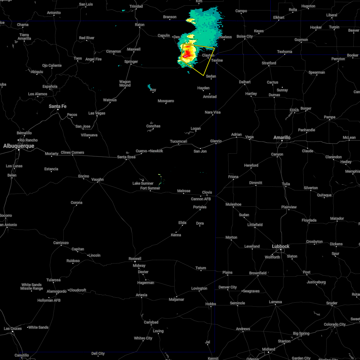 At 335 pm mdt, a severe thunderstorm was located near mount dora, or 20 miles west of clayton, moving east at 20 mph (radar indicated). Hazards include 60 mph wind gusts and quarter size hail. Hail damage to vehicles is expected. Expect wind damage to roofs, siding, and trees. At 335 pm mdt, a severe thunderstorm was located near mount dora, or 20 miles west of clayton, moving east at 20 mph (radar indicated). Hazards include 60 mph wind gusts and quarter size hail. Hail damage to vehicles is expected. Expect wind damage to roofs, siding, and trees.
|
| 7/12/2021 5:16 PM MDT |
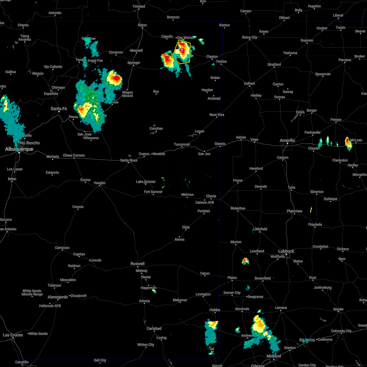 At 515 pm mdt, severe thunderstorms were located along a line extending from 7 miles southeast of des moines to near grenville, moving south at 10 mph (radar indicated). Hazards include 60 mph wind gusts and quarter size hail. Hail damage to vehicles is expected. Expect wind damage to roofs, siding, and trees. At 515 pm mdt, severe thunderstorms were located along a line extending from 7 miles southeast of des moines to near grenville, moving south at 10 mph (radar indicated). Hazards include 60 mph wind gusts and quarter size hail. Hail damage to vehicles is expected. Expect wind damage to roofs, siding, and trees.
|
| 5/17/2021 6:27 PM MDT |
 At 557 pm mdt, severe thunderstorms were located along a line extending from 6 miles west of capulin to 11 miles northwest of sedan, moving northeast at 45 mph (radar indicated). Hazards include 60 mph wind gusts and penny size hail. Expect damage to roofs, siding, and trees. locations impacted include, clayton, des moines, folsom, grenville, clayton lake state park, seneca, capulin and mount dora. This includes highway 64 between mile markers 360 and 429. At 557 pm mdt, severe thunderstorms were located along a line extending from 6 miles west of capulin to 11 miles northwest of sedan, moving northeast at 45 mph (radar indicated). Hazards include 60 mph wind gusts and penny size hail. Expect damage to roofs, siding, and trees. locations impacted include, clayton, des moines, folsom, grenville, clayton lake state park, seneca, capulin and mount dora. This includes highway 64 between mile markers 360 and 429.
|
| 5/17/2021 5:58 PM MDT |
 At 557 pm mdt, severe thunderstorms were located along a line extending from 6 miles west of capulin to 11 miles northwest of sedan, moving northeast at 45 mph (radar indicated). Hazards include 60 mph wind gusts and penny size hail. Expect damage to roofs, siding, and trees. locations impacted include, clayton, des moines, folsom, grenville, clayton lake state park, seneca, capulin and mount dora. This includes highway 64 between mile markers 360 and 429. At 557 pm mdt, severe thunderstorms were located along a line extending from 6 miles west of capulin to 11 miles northwest of sedan, moving northeast at 45 mph (radar indicated). Hazards include 60 mph wind gusts and penny size hail. Expect damage to roofs, siding, and trees. locations impacted include, clayton, des moines, folsom, grenville, clayton lake state park, seneca, capulin and mount dora. This includes highway 64 between mile markers 360 and 429.
|
| 5/17/2021 5:30 PM MDT |
 At 530 pm mdt, severe thunderstorms were located along a line extending from 9 miles west of abbott to 7 miles east of bueyeros, moving northeast at 45 mph (radar indicated). Hazards include 60 mph wind gusts and penny size hail. expect damage to roofs, siding, and trees At 530 pm mdt, severe thunderstorms were located along a line extending from 9 miles west of abbott to 7 miles east of bueyeros, moving northeast at 45 mph (radar indicated). Hazards include 60 mph wind gusts and penny size hail. expect damage to roofs, siding, and trees
|
| 5/16/2021 4:21 PM MDT |
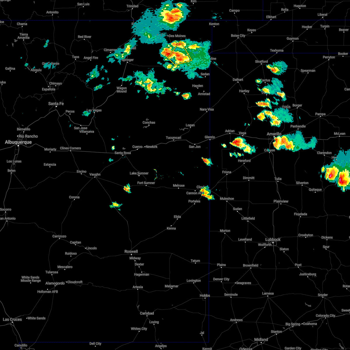 At 420 pm mdt, a severe thunderstorm was located 9 miles south of grenville, or 22 miles southeast of des moines, moving northeast at 10 mph (radar indicated). Hazards include 60 mph wind gusts and quarter size hail. Hail damage to vehicles is expected. expect wind damage to roofs, siding, and trees. locations impacted include, grenville and mount dora. This includes highway 64 between mile markers 401 and 413. At 420 pm mdt, a severe thunderstorm was located 9 miles south of grenville, or 22 miles southeast of des moines, moving northeast at 10 mph (radar indicated). Hazards include 60 mph wind gusts and quarter size hail. Hail damage to vehicles is expected. expect wind damage to roofs, siding, and trees. locations impacted include, grenville and mount dora. This includes highway 64 between mile markers 401 and 413.
|
| 5/16/2021 3:54 PM MDT |
 At 353 pm mdt, a severe thunderstorm was located 14 miles east of gladstone, or 27 miles south of des moines, moving northeast at 10 mph (radar indicated). Hazards include 60 mph wind gusts and quarter size hail. Hail damage to vehicles is expected. Expect wind damage to roofs, siding, and trees. At 353 pm mdt, a severe thunderstorm was located 14 miles east of gladstone, or 27 miles south of des moines, moving northeast at 10 mph (radar indicated). Hazards include 60 mph wind gusts and quarter size hail. Hail damage to vehicles is expected. Expect wind damage to roofs, siding, and trees.
|
| 3/13/2021 11:38 AM MST |
 The severe thunderstorm warning for central union county will expire at 1145 am mst, the storm which prompted the warning has weakened below severe limits, and no longer poses an immediate threat to life or property. therefore, the warning will be allowed to expire. however, gusty winds are still possible with this thunderstorm. The severe thunderstorm warning for central union county will expire at 1145 am mst, the storm which prompted the warning has weakened below severe limits, and no longer poses an immediate threat to life or property. therefore, the warning will be allowed to expire. however, gusty winds are still possible with this thunderstorm.
|
| 3/13/2021 11:16 AM MST |
 At 1116 am mst, a severe thunderstorm was located 16 miles south of mount dora, or 24 miles southwest of clayton, moving north at 55 mph (radar indicated). Hazards include 60 mph wind gusts and penny size hail. Expect damage to roofs, siding, and trees. locations impacted include, grenville, clayton lake state park and mount dora. This includes highway 64 between mile markers 396 and 423. At 1116 am mst, a severe thunderstorm was located 16 miles south of mount dora, or 24 miles southwest of clayton, moving north at 55 mph (radar indicated). Hazards include 60 mph wind gusts and penny size hail. Expect damage to roofs, siding, and trees. locations impacted include, grenville, clayton lake state park and mount dora. This includes highway 64 between mile markers 396 and 423.
|
| 3/13/2021 11:05 AM MST |
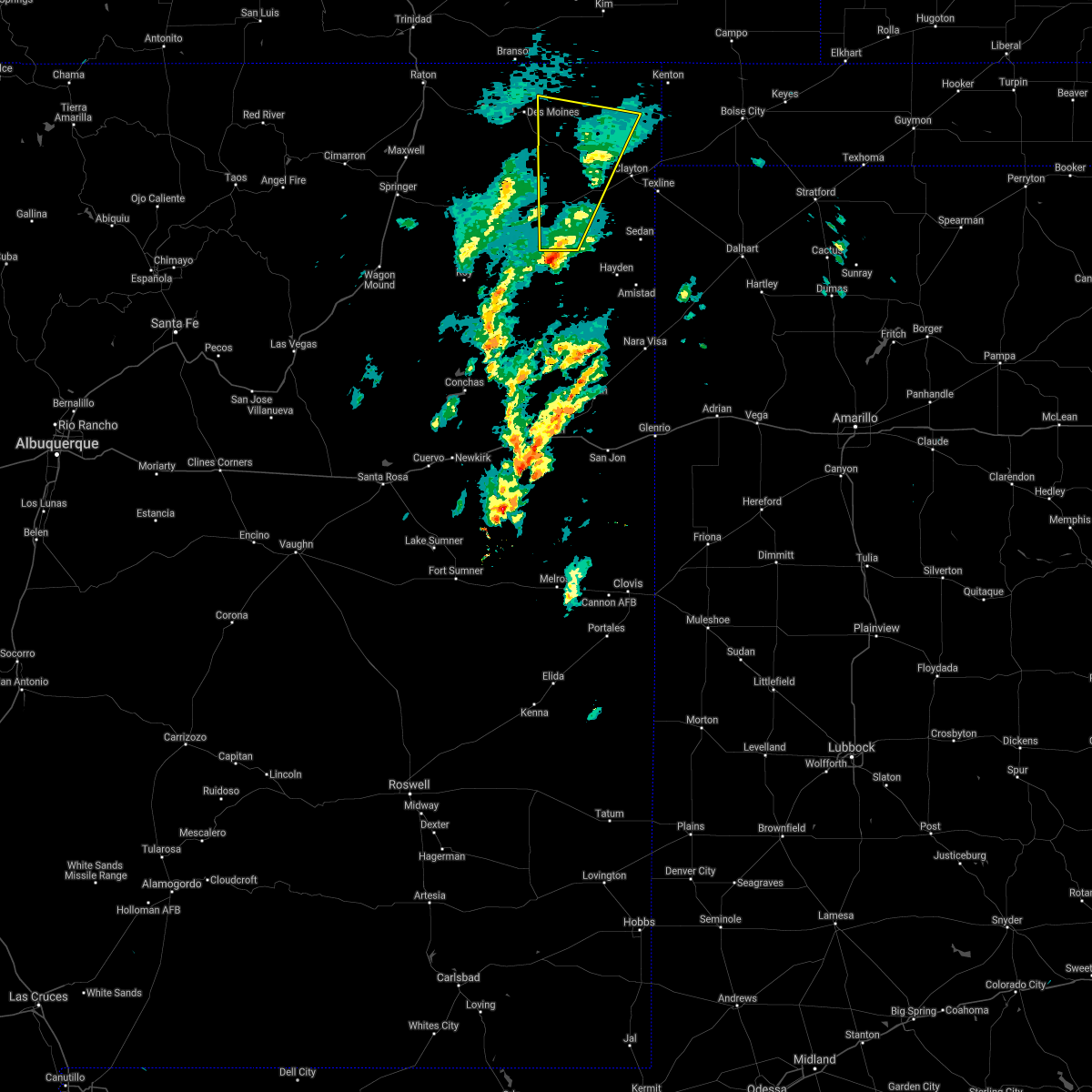 At 1104 am mst, a severe thunderstorm was located 10 miles north of bueyeros, or 30 miles northeast of mosquero, moving north at 50 mph (radar indicated). Hazards include 70 mph wind gusts and nickel size hail. Expect considerable tree damage. Damage is likely to mobile homes, roofs, and outbuildings. At 1104 am mst, a severe thunderstorm was located 10 miles north of bueyeros, or 30 miles northeast of mosquero, moving north at 50 mph (radar indicated). Hazards include 70 mph wind gusts and nickel size hail. Expect considerable tree damage. Damage is likely to mobile homes, roofs, and outbuildings.
|
| 3/13/2021 10:51 AM MST |
 The severe thunderstorm warning for central union county will expire at 1100 am mst, the storm which prompted the warning has weakened below severe limits, and no longer poses an immediate threat to life or property. therefore, the warning will be allowed to expire. however, gusty winds are still possible with this thunderstorm. The severe thunderstorm warning for central union county will expire at 1100 am mst, the storm which prompted the warning has weakened below severe limits, and no longer poses an immediate threat to life or property. therefore, the warning will be allowed to expire. however, gusty winds are still possible with this thunderstorm.
|
| 3/13/2021 10:34 AM MST |
 At 1034 am mst, a severe thunderstorm was located 16 miles northeast of bueyeros, or 27 miles southwest of clayton, moving north at 55 mph (radar indicated). Hazards include 60 mph wind gusts and penny size hail. Expect damage to roofs, siding, and trees. locations impacted include, clayton, grenville, clayton lake state park and mount dora. This includes highway 64 between mile markers 404 and 429. At 1034 am mst, a severe thunderstorm was located 16 miles northeast of bueyeros, or 27 miles southwest of clayton, moving north at 55 mph (radar indicated). Hazards include 60 mph wind gusts and penny size hail. Expect damage to roofs, siding, and trees. locations impacted include, clayton, grenville, clayton lake state park and mount dora. This includes highway 64 between mile markers 404 and 429.
|
| 3/13/2021 10:21 AM MST |
 At 1020 am mst, a severe thunderstorm was located near bueyeros, or 24 miles northeast of mosquero, moving north at 55 mph (radar indicated). Hazards include 60 mph wind gusts and penny size hail. expect damage to roofs, siding, and trees At 1020 am mst, a severe thunderstorm was located near bueyeros, or 24 miles northeast of mosquero, moving north at 55 mph (radar indicated). Hazards include 60 mph wind gusts and penny size hail. expect damage to roofs, siding, and trees
|
| 8/28/2020 4:59 PM MDT |
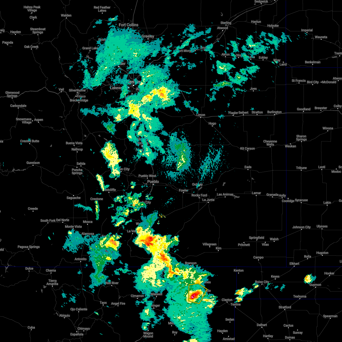 At 444 pm mdt, a severe thunderstorm was located 13 miles southwest of grenville, or 17 miles south of des moines, moving north at 15 mph (radar indicated). Hazards include 60 mph wind gusts and quarter size hail. Hail damage to vehicles is expected. Expect wind damage to roofs, siding, and trees. At 444 pm mdt, a severe thunderstorm was located 13 miles southwest of grenville, or 17 miles south of des moines, moving north at 15 mph (radar indicated). Hazards include 60 mph wind gusts and quarter size hail. Hail damage to vehicles is expected. Expect wind damage to roofs, siding, and trees.
|
| 8/28/2020 4:44 PM MDT |
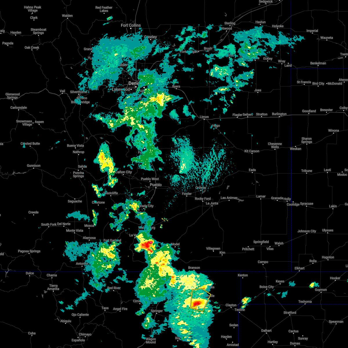 At 444 pm mdt, a severe thunderstorm was located 13 miles southwest of grenville, or 17 miles south of des moines, moving north at 15 mph (radar indicated). Hazards include 60 mph wind gusts and quarter size hail. Hail damage to vehicles is expected. Expect wind damage to roofs, siding, and trees. At 444 pm mdt, a severe thunderstorm was located 13 miles southwest of grenville, or 17 miles south of des moines, moving north at 15 mph (radar indicated). Hazards include 60 mph wind gusts and quarter size hail. Hail damage to vehicles is expected. Expect wind damage to roofs, siding, and trees.
|
| 8/2/2020 6:43 PM MDT |
 The severe thunderstorm warning for northwestern union county will expire at 645 pm mdt, the storm which prompted the warning has weakened below severe limits, and no longer poses an immediate threat to life or property. therefore, the warning will be allowed to expire. however small hail, gusty winds and heavy rain are still possible with this thunderstorm. a severe thunderstorm watch remains in effect until 900 pm mdt for northeastern new mexico. The severe thunderstorm warning for northwestern union county will expire at 645 pm mdt, the storm which prompted the warning has weakened below severe limits, and no longer poses an immediate threat to life or property. therefore, the warning will be allowed to expire. however small hail, gusty winds and heavy rain are still possible with this thunderstorm. a severe thunderstorm watch remains in effect until 900 pm mdt for northeastern new mexico.
|
| 8/2/2020 6:43 PM MDT |
 The severe thunderstorm warning for east central union county will expire at 645 pm mdt, the storm which prompted the warning has weakened below severe limits, and no longer poses an immediate threat to life or property. therefore, the warning will be allowed to expire. however small hail, gusty winds and heavy rain are still possible with this thunderstorm. a severe thunderstorm watch remains in effect until 900 pm mdt for northeastern new mexico. The severe thunderstorm warning for east central union county will expire at 645 pm mdt, the storm which prompted the warning has weakened below severe limits, and no longer poses an immediate threat to life or property. therefore, the warning will be allowed to expire. however small hail, gusty winds and heavy rain are still possible with this thunderstorm. a severe thunderstorm watch remains in effect until 900 pm mdt for northeastern new mexico.
|
| 8/2/2020 6:10 PM MDT |
 At 609 pm mdt, a severe thunderstorm was located 7 miles east of des moines, moving southeast at 15 mph (radar indicated). Hazards include 60 mph wind gusts and quarter size hail. Hail damage to vehicles is expected. expect wind damage to roofs, siding, and trees. locations impacted include, des moines and grenville. This includes highway 64 between mile markers 384 and 403. At 609 pm mdt, a severe thunderstorm was located 7 miles east of des moines, moving southeast at 15 mph (radar indicated). Hazards include 60 mph wind gusts and quarter size hail. Hail damage to vehicles is expected. expect wind damage to roofs, siding, and trees. locations impacted include, des moines and grenville. This includes highway 64 between mile markers 384 and 403.
|
| 8/2/2020 6:10 PM MDT |
 At 610 pm mdt, a severe thunderstorm was located 9 miles southeast of mount dora, or 12 miles west of clayton, moving southeast at 20 mph (radar indicated). Hazards include 60 mph wind gusts and quarter size hail. Hail damage to vehicles is expected. expect wind damage to roofs, siding, and trees. locations impacted include, clayton, grenville, clayton lake state park and mount dora. This includes highway 64 between mile markers 404 and 429. At 610 pm mdt, a severe thunderstorm was located 9 miles southeast of mount dora, or 12 miles west of clayton, moving southeast at 20 mph (radar indicated). Hazards include 60 mph wind gusts and quarter size hail. Hail damage to vehicles is expected. expect wind damage to roofs, siding, and trees. locations impacted include, clayton, grenville, clayton lake state park and mount dora. This includes highway 64 between mile markers 404 and 429.
|
| 8/2/2020 5:46 PM MDT |
 At 546 pm mdt, a severe thunderstorm was located over des moines, moving southeast at 15 mph (radar indicated). Hazards include 60 mph wind gusts and quarter size hail. Hail damage to vehicles is expected. Expect wind damage to roofs, siding, and trees. At 546 pm mdt, a severe thunderstorm was located over des moines, moving southeast at 15 mph (radar indicated). Hazards include 60 mph wind gusts and quarter size hail. Hail damage to vehicles is expected. Expect wind damage to roofs, siding, and trees.
|
| 8/2/2020 5:42 PM MDT |
 At 541 pm mdt, a severe thunderstorm was located over mount dora, or 19 miles west of clayton, moving southeast at 20 mph (radar indicated). Hazards include 60 mph wind gusts and quarter size hail. Hail damage to vehicles is expected. Expect wind damage to roofs, siding, and trees. At 541 pm mdt, a severe thunderstorm was located over mount dora, or 19 miles west of clayton, moving southeast at 20 mph (radar indicated). Hazards include 60 mph wind gusts and quarter size hail. Hail damage to vehicles is expected. Expect wind damage to roofs, siding, and trees.
|
| 7/15/2020 8:19 PM MDT |
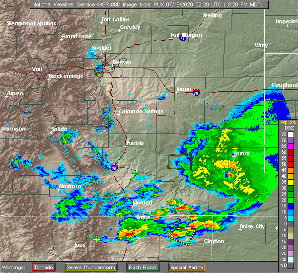 At 818 pm mdt, a severe thunderstorm was located near grenville, or 12 miles southeast of des moines, moving east southeast at 10 mph (radar indicated). Hazards include 60 mph wind gusts and quarter size hail. Hail damage to vehicles is expected. expect wind damage to roofs, siding, and trees. locations impacted include, grenville and mount dora. This includes highway 64 between mile markers 393 and 415. At 818 pm mdt, a severe thunderstorm was located near grenville, or 12 miles southeast of des moines, moving east southeast at 10 mph (radar indicated). Hazards include 60 mph wind gusts and quarter size hail. Hail damage to vehicles is expected. expect wind damage to roofs, siding, and trees. locations impacted include, grenville and mount dora. This includes highway 64 between mile markers 393 and 415.
|
| 7/15/2020 8:00 PM MDT |
 The national weather service in albuquerque has issued a * severe thunderstorm warning for. northwestern union county in northeastern new mexico. until 900 pm mdt. At 800 pm mdt, a severe thunderstorm was located 7 miles northwest of grenville, or 8 miles southeast of des moines, moving east at 10. The national weather service in albuquerque has issued a * severe thunderstorm warning for. northwestern union county in northeastern new mexico. until 900 pm mdt. At 800 pm mdt, a severe thunderstorm was located 7 miles northwest of grenville, or 8 miles southeast of des moines, moving east at 10.
|
| 7/11/2020 5:57 PM MDT |
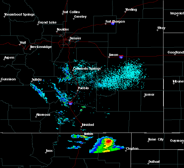 The national weather service in albuquerque has issued a * severe thunderstorm warning for. northwestern union county in northeastern new mexico. until 630 pm mdt. At 556 pm mdt, a severe thunderstorm was located near des moines, moving east at 10 mph. The national weather service in albuquerque has issued a * severe thunderstorm warning for. northwestern union county in northeastern new mexico. until 630 pm mdt. At 556 pm mdt, a severe thunderstorm was located near des moines, moving east at 10 mph.
|
| 6/26/2020 4:24 PM MDT |
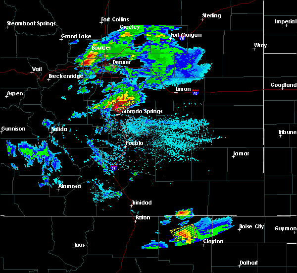 At 423 pm mdt, a severe thunderstorm was located near grenville, or 17 miles southeast of des moines, and is nearly stationary (radar indicated). Hazards include 60 mph wind gusts and quarter size hail. Hail damage to vehicles is expected. expect wind damage to roofs, siding, and trees. locations impacted include, areas near and north of grenville, including wetherly lake. This includes highway 64 between mile markers 397 and 408. At 423 pm mdt, a severe thunderstorm was located near grenville, or 17 miles southeast of des moines, and is nearly stationary (radar indicated). Hazards include 60 mph wind gusts and quarter size hail. Hail damage to vehicles is expected. expect wind damage to roofs, siding, and trees. locations impacted include, areas near and north of grenville, including wetherly lake. This includes highway 64 between mile markers 397 and 408.
|
| 6/26/2020 4:00 PM MDT |
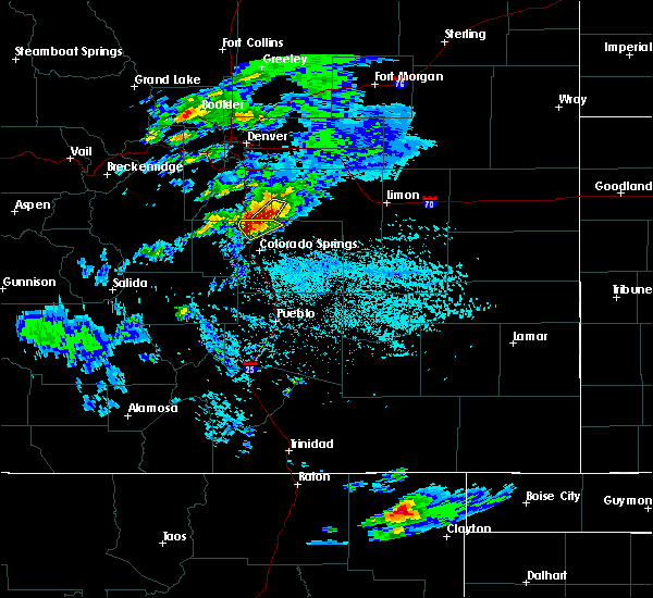 At 359 pm mdt, a severe thunderstorm was located near grenville, or 16 miles southeast of des moines, and is nearly stationary (radar indicated). Hazards include ping pong ball size hail and 60 mph wind gusts. People and animals outdoors will be injured. expect hail damage to roofs, siding, windows, and vehicles. Expect wind damage to roofs, siding, and trees. At 359 pm mdt, a severe thunderstorm was located near grenville, or 16 miles southeast of des moines, and is nearly stationary (radar indicated). Hazards include ping pong ball size hail and 60 mph wind gusts. People and animals outdoors will be injured. expect hail damage to roofs, siding, windows, and vehicles. Expect wind damage to roofs, siding, and trees.
|
| 5/19/2020 6:31 PM MDT |
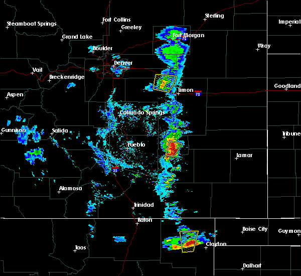 At 631 pm mdt, a severe thunderstorm was located near mount dora, or 19 miles northwest of clayton, moving north at 30 mph (radar indicated). Hazards include 60 mph wind gusts and penny size hail. Expect damage to roofs, siding, and trees. locations impacted include, grenville and mount dora. This includes highway 64 between mile markers 403 and 419. At 631 pm mdt, a severe thunderstorm was located near mount dora, or 19 miles northwest of clayton, moving north at 30 mph (radar indicated). Hazards include 60 mph wind gusts and penny size hail. Expect damage to roofs, siding, and trees. locations impacted include, grenville and mount dora. This includes highway 64 between mile markers 403 and 419.
|
| 5/19/2020 6:21 PM MDT |
 At 621 pm mdt, a severe thunderstorm was located over mount dora, or 17 miles west of clayton, moving north at 30 mph (radar indicated). Hazards include two inch hail and 60 mph wind gusts. People and animals outdoors will be injured. expect hail damage to roofs, siding, windows, and vehicles. expect wind damage to roofs, siding, and trees. locations impacted include, grenville and mount dora. This includes highway 64 between mile markers 403 and 419. At 621 pm mdt, a severe thunderstorm was located over mount dora, or 17 miles west of clayton, moving north at 30 mph (radar indicated). Hazards include two inch hail and 60 mph wind gusts. People and animals outdoors will be injured. expect hail damage to roofs, siding, windows, and vehicles. expect wind damage to roofs, siding, and trees. locations impacted include, grenville and mount dora. This includes highway 64 between mile markers 403 and 419.
|
| 5/19/2020 6:12 PM MDT |
 At 612 pm mdt, a severe thunderstorm was located near mount dora, or 18 miles west of clayton, moving north at 30 mph (radar indicated). Hazards include ping pong ball size hail and 60 mph wind gusts. People and animals outdoors will be injured. expect hail damage to roofs, siding, windows, and vehicles. Expect wind damage to roofs, siding, and trees. At 612 pm mdt, a severe thunderstorm was located near mount dora, or 18 miles west of clayton, moving north at 30 mph (radar indicated). Hazards include ping pong ball size hail and 60 mph wind gusts. People and animals outdoors will be injured. expect hail damage to roofs, siding, windows, and vehicles. Expect wind damage to roofs, siding, and trees.
|
| 9/10/2019 6:25 PM MDT |
 At 614 pm mdt, a severe thunderstorm was located 8 miles south of des moines, moving northeast at 25 mph (radar indicated). Hazards include 60 mph wind gusts and quarter size hail. Hail damage to vehicles is expected. Expect wind damage to roofs, siding, and trees. At 614 pm mdt, a severe thunderstorm was located 8 miles south of des moines, moving northeast at 25 mph (radar indicated). Hazards include 60 mph wind gusts and quarter size hail. Hail damage to vehicles is expected. Expect wind damage to roofs, siding, and trees.
|
| 9/10/2019 6:14 PM MDT |
 The national weather service in albuquerque has issued a * severe thunderstorm warning for. northwestern union county in northeastern new mexico. until 700 pm mdt. At 614 pm mdt, a severe thunderstorm was located 8 miles south of des moines, moving northeast at 25 mph. The national weather service in albuquerque has issued a * severe thunderstorm warning for. northwestern union county in northeastern new mexico. until 700 pm mdt. At 614 pm mdt, a severe thunderstorm was located 8 miles south of des moines, moving northeast at 25 mph.
|
| 9/10/2019 4:19 PM MDT |
 A severe thunderstorm warning remains in effect until 445 pm mdt for north central union county. at 418 pm mdt, a severe thunderstorm was located over grenville, or 14 miles southeast of des moines, moving northeast at 25 mph. hazard. 60 mph wind gusts and quarter size hail. source. Radar indicated. A severe thunderstorm warning remains in effect until 445 pm mdt for north central union county. at 418 pm mdt, a severe thunderstorm was located over grenville, or 14 miles southeast of des moines, moving northeast at 25 mph. hazard. 60 mph wind gusts and quarter size hail. source. Radar indicated.
|
| 9/10/2019 4:01 PM MDT |
 At 401 pm mdt, a severe thunderstorm was located over grenville, or 15 miles southeast of des moines, moving northeast at 20 mph (radar indicated). Hazards include 60 mph wind gusts and quarter size hail. Hail damage to vehicles is expected. Expect wind damage to roofs, siding, and trees. At 401 pm mdt, a severe thunderstorm was located over grenville, or 15 miles southeast of des moines, moving northeast at 20 mph (radar indicated). Hazards include 60 mph wind gusts and quarter size hail. Hail damage to vehicles is expected. Expect wind damage to roofs, siding, and trees.
|
| 7/5/2019 4:12 PM MDT | Golf Ball sized hail reported 8.6 miles NNW of Grenville, NM |
| 7/5/2019 3:26 PM MDT |
 The severe thunderstorm warning for west central union county will expire at 330 pm mdt, the storm which prompted the warning has weakened below severe limits, and no longer poses an immediate threat to life or property. therefore the warning will be allowed to expire. however small hail is still possible with this thunderstorm. The severe thunderstorm warning for west central union county will expire at 330 pm mdt, the storm which prompted the warning has weakened below severe limits, and no longer poses an immediate threat to life or property. therefore the warning will be allowed to expire. however small hail is still possible with this thunderstorm.
|
| 7/5/2019 3:16 PM MDT |
 At 316 pm mdt, a severe thunderstorm was located 10 miles southwest of grenville, or 20 miles south of des moines, moving east at 20 mph (radar indicated). Hazards include 60 mph wind gusts and half dollar size hail. Hail damage to vehicles is expected. expect wind damage to roofs, siding, and trees. Locations impacted include, grenville and mount dora. At 316 pm mdt, a severe thunderstorm was located 10 miles southwest of grenville, or 20 miles south of des moines, moving east at 20 mph (radar indicated). Hazards include 60 mph wind gusts and half dollar size hail. Hail damage to vehicles is expected. expect wind damage to roofs, siding, and trees. Locations impacted include, grenville and mount dora.
|
| 7/5/2019 2:59 PM MDT |
 At 259 pm mdt, a severe thunderstorm was located 11 miles southwest of grenville, or 17 miles south of des moines, moving east at 20 mph (radar indicated). Hazards include golf ball size hail and 60 mph wind gusts. People and animals outdoors will be injured. expect hail damage to roofs, siding, windows, and vehicles. expect wind damage to roofs, siding, and trees. Locations impacted include, grenville and mount dora. At 259 pm mdt, a severe thunderstorm was located 11 miles southwest of grenville, or 17 miles south of des moines, moving east at 20 mph (radar indicated). Hazards include golf ball size hail and 60 mph wind gusts. People and animals outdoors will be injured. expect hail damage to roofs, siding, windows, and vehicles. expect wind damage to roofs, siding, and trees. Locations impacted include, grenville and mount dora.
|
| 7/5/2019 2:54 PM MDT |
 At 254 pm mdt, a severe thunderstorm was located 13 miles southwest of grenville, or 17 miles south of des moines, moving east at 20 mph (radar indicated). Hazards include 60 mph wind gusts and half dollar size hail. Hail damage to vehicles is expected. Expect wind damage to roofs, siding, and trees. At 254 pm mdt, a severe thunderstorm was located 13 miles southwest of grenville, or 17 miles south of des moines, moving east at 20 mph (radar indicated). Hazards include 60 mph wind gusts and half dollar size hail. Hail damage to vehicles is expected. Expect wind damage to roofs, siding, and trees.
|
| 6/17/2019 5:21 PM MDT |
 The severe thunderstorm warning for central union county will expire at 530 pm mdt, the storm which prompted the warning has weakened below severe limits, and no longer poses an immediate threat to life or property. therefore the warning will be allowed to expire. however heavy rain is still possible with this thunderstorm. a severe thunderstorm watch remains in effect until 900 pm mdt for northeastern new mexico. The severe thunderstorm warning for central union county will expire at 530 pm mdt, the storm which prompted the warning has weakened below severe limits, and no longer poses an immediate threat to life or property. therefore the warning will be allowed to expire. however heavy rain is still possible with this thunderstorm. a severe thunderstorm watch remains in effect until 900 pm mdt for northeastern new mexico.
|
| 6/17/2019 4:59 PM MDT |
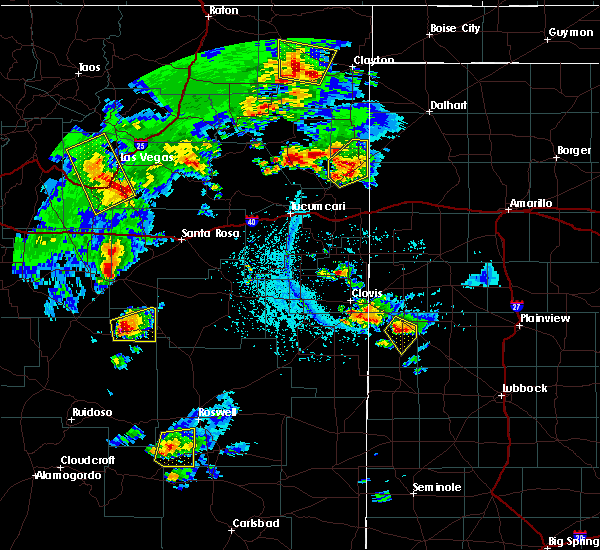 At 458 pm mdt, a severe thunderstorm was located 12 miles south of grenville, or 24 miles south of des moines, moving north at 30 mph (radar indicated). Hazards include 60 mph wind gusts and quarter size hail. Hail damage to vehicles is expected. Expect wind damage to roofs, siding, and trees. At 458 pm mdt, a severe thunderstorm was located 12 miles south of grenville, or 24 miles south of des moines, moving north at 30 mph (radar indicated). Hazards include 60 mph wind gusts and quarter size hail. Hail damage to vehicles is expected. Expect wind damage to roofs, siding, and trees.
|
| 6/7/2019 9:29 PM MDT |
 At 918 pm mdt, a severe thunderstorm was located near grenville, or 12 miles southeast of des moines, moving east at 25 mph (radar indicated). Hazards include 60 mph wind gusts and quarter size hail. Hail damage to vehicles is expected. Expect wind damage to roofs, siding, and trees. At 918 pm mdt, a severe thunderstorm was located near grenville, or 12 miles southeast of des moines, moving east at 25 mph (radar indicated). Hazards include 60 mph wind gusts and quarter size hail. Hail damage to vehicles is expected. Expect wind damage to roofs, siding, and trees.
|
| 6/7/2019 9:18 PM MDT |
 At 918 pm mdt, a severe thunderstorm was located near grenville, or 12 miles southeast of des moines, moving east at 25 mph (radar indicated). Hazards include 60 mph wind gusts and quarter size hail. Hail damage to vehicles is expected. Expect wind damage to roofs, siding, and trees. At 918 pm mdt, a severe thunderstorm was located near grenville, or 12 miles southeast of des moines, moving east at 25 mph (radar indicated). Hazards include 60 mph wind gusts and quarter size hail. Hail damage to vehicles is expected. Expect wind damage to roofs, siding, and trees.
|
| 6/3/2019 4:57 PM MDT |
 The severe thunderstorm warning for west central union and east central colfax counties will expire at 500 pm mdt, the storm which prompted the warning has moved out of the area. therefore the warning will be allowed to expire. a severe thunderstorm watch remains in effect until 900 pm mdt for northeastern new mexico. remember, a severe thunderstorm warning remains in effect for colfax and union counties until 6pm. The severe thunderstorm warning for west central union and east central colfax counties will expire at 500 pm mdt, the storm which prompted the warning has moved out of the area. therefore the warning will be allowed to expire. a severe thunderstorm watch remains in effect until 900 pm mdt for northeastern new mexico. remember, a severe thunderstorm warning remains in effect for colfax and union counties until 6pm.
|
| 6/3/2019 4:32 PM MDT |
 At 431 pm mdt, a severe thunderstorm was located near farley, or 25 miles south of des moines, moving east at 20 mph (radar indicated). Hazards include 60 mph wind gusts and half dollar size hail. Hail damage to vehicles is expected. expect wind damage to roofs, siding, and trees. Locations impacted include, grenville, gladstone, mount dora and farley. At 431 pm mdt, a severe thunderstorm was located near farley, or 25 miles south of des moines, moving east at 20 mph (radar indicated). Hazards include 60 mph wind gusts and half dollar size hail. Hail damage to vehicles is expected. expect wind damage to roofs, siding, and trees. Locations impacted include, grenville, gladstone, mount dora and farley.
|
| 6/3/2019 3:59 PM MDT |
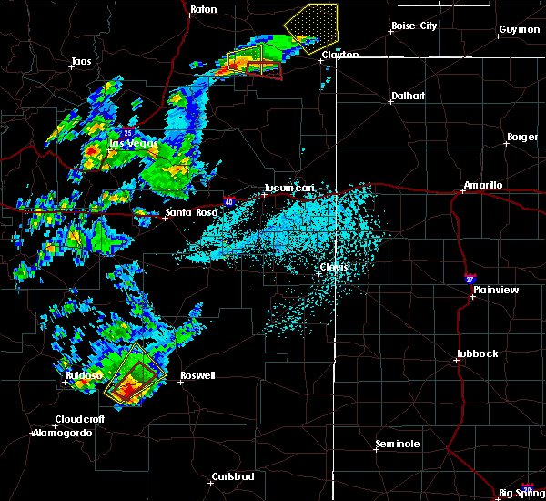 At 357 pm mdt, a severe thunderstorm was located 11 miles southwest of grenville, or 23 miles south of des moines, moving east at 25 mph (radar indicated). Hazards include ping pong ball size hail and 60 mph wind gusts. People and animals outdoors will be injured. expect hail damage to roofs, siding, windows, and vehicles. Expect wind damage to roofs, siding, and trees. At 357 pm mdt, a severe thunderstorm was located 11 miles southwest of grenville, or 23 miles south of des moines, moving east at 25 mph (radar indicated). Hazards include ping pong ball size hail and 60 mph wind gusts. People and animals outdoors will be injured. expect hail damage to roofs, siding, windows, and vehicles. Expect wind damage to roofs, siding, and trees.
|
| 5/26/2019 5:22 PM MDT | Tennis Ball sized hail reported 18.8 miles NNW of Grenville, NM |
| 5/26/2019 5:22 PM MDT | Tennis Ball sized hail reported 18.1 miles NNW of Grenville, NM |
| 8/15/2018 4:43 PM MDT |
 At 443 pm mdt, a severe thunderstorm was located near grenville, or 13 miles southeast of des moines, moving southeast at 10 mph (radar indicated). Hazards include 60 mph wind gusts and quarter size hail. Hail damage to vehicles is expected. expect wind damage to roofs, siding, and trees. Locations impacted include, grenville. At 443 pm mdt, a severe thunderstorm was located near grenville, or 13 miles southeast of des moines, moving southeast at 10 mph (radar indicated). Hazards include 60 mph wind gusts and quarter size hail. Hail damage to vehicles is expected. expect wind damage to roofs, siding, and trees. Locations impacted include, grenville.
|
| 8/15/2018 4:30 PM MDT |
 At 430 pm mdt, a severe thunderstorm was located near grenville, or 12 miles southeast of des moines, moving southeast at 10 mph (radar indicated). Hazards include 60 mph wind gusts and quarter size hail. Hail damage to vehicles is expected. Expect wind damage to roofs, siding, and trees. At 430 pm mdt, a severe thunderstorm was located near grenville, or 12 miles southeast of des moines, moving southeast at 10 mph (radar indicated). Hazards include 60 mph wind gusts and quarter size hail. Hail damage to vehicles is expected. Expect wind damage to roofs, siding, and trees.
|
| 8/7/2018 6:42 PM MDT |
 At 641 pm mdt, a severe thunderstorm was located over mount dora, or 20 miles west of clayton, moving southeast at 20 mph (radar indicated). Hazards include ping pong ball size hail and 60 mph wind gusts. People and animals outdoors will be injured. expect hail damage to roofs, siding, windows, and vehicles. Expect wind damage to roofs, siding, and trees. At 641 pm mdt, a severe thunderstorm was located over mount dora, or 20 miles west of clayton, moving southeast at 20 mph (radar indicated). Hazards include ping pong ball size hail and 60 mph wind gusts. People and animals outdoors will be injured. expect hail damage to roofs, siding, windows, and vehicles. Expect wind damage to roofs, siding, and trees.
|
| 8/7/2018 6:11 PM MDT |
 At 611 pm mdt, a severe thunderstorm was located 7 miles northeast of grenville, or 16 miles east of des moines, moving east at 20 mph (radar indicated). Hazards include ping pong ball size hail and 60 mph wind gusts. People and animals outdoors will be injured. expect hail damage to roofs, siding, windows, and vehicles. Expect wind damage to roofs, siding, and trees. At 611 pm mdt, a severe thunderstorm was located 7 miles northeast of grenville, or 16 miles east of des moines, moving east at 20 mph (radar indicated). Hazards include ping pong ball size hail and 60 mph wind gusts. People and animals outdoors will be injured. expect hail damage to roofs, siding, windows, and vehicles. Expect wind damage to roofs, siding, and trees.
|
| 8/1/2018 6:39 PM MDT |
 At 630 pm mdt, a severe thunderstorm was located near grenville, or 21 miles southeast of des moines, moving southeast at 10 mph (radar indicated). Hazards include 60 mph wind gusts and quarter size hail. Hail damage to vehicles is expected. expect wind damage to roofs, siding, and trees. Locations impacted include, grenville and mount dora. At 630 pm mdt, a severe thunderstorm was located near grenville, or 21 miles southeast of des moines, moving southeast at 10 mph (radar indicated). Hazards include 60 mph wind gusts and quarter size hail. Hail damage to vehicles is expected. expect wind damage to roofs, siding, and trees. Locations impacted include, grenville and mount dora.
|
| 8/1/2018 6:30 PM MDT |
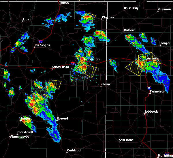 At 630 pm mdt, a severe thunderstorm was located near grenville, or 21 miles southeast of des moines, moving southeast at 10 mph (radar indicated). Hazards include 60 mph wind gusts and quarter size hail. Hail damage to vehicles is expected. expect wind damage to roofs, siding, and trees. Locations impacted include, grenville and mount dora. At 630 pm mdt, a severe thunderstorm was located near grenville, or 21 miles southeast of des moines, moving southeast at 10 mph (radar indicated). Hazards include 60 mph wind gusts and quarter size hail. Hail damage to vehicles is expected. expect wind damage to roofs, siding, and trees. Locations impacted include, grenville and mount dora.
|
| 8/1/2018 6:00 PM MDT |
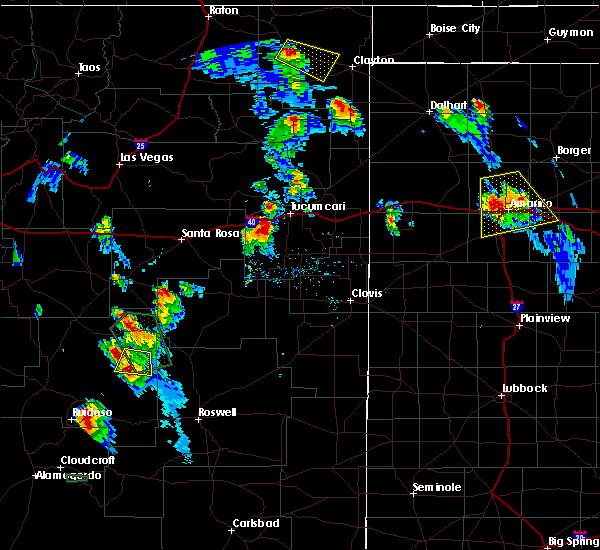 At 600 pm mdt, a severe thunderstorm was located near grenville, or 16 miles southeast of des moines, moving southeast at 20 mph (radar indicated). Hazards include 60 mph wind gusts and half dollar size hail. Hail damage to vehicles is expected. Expect wind damage to roofs, siding, and trees. At 600 pm mdt, a severe thunderstorm was located near grenville, or 16 miles southeast of des moines, moving southeast at 20 mph (radar indicated). Hazards include 60 mph wind gusts and half dollar size hail. Hail damage to vehicles is expected. Expect wind damage to roofs, siding, and trees.
|
| 7/23/2018 4:35 PM MDT |
 At 435 pm mdt, a severe thunderstorm was located 7 miles west of capulin, or 15 miles west of des moines, moving east at 55 mph (radar indicated). Hazards include ping pong ball size hail and 60 mph wind gusts. People and animals outdoors will be injured. expect hail damage to roofs, siding, windows, and vehicles. Expect wind damage to roofs, siding, and trees. At 435 pm mdt, a severe thunderstorm was located 7 miles west of capulin, or 15 miles west of des moines, moving east at 55 mph (radar indicated). Hazards include ping pong ball size hail and 60 mph wind gusts. People and animals outdoors will be injured. expect hail damage to roofs, siding, windows, and vehicles. Expect wind damage to roofs, siding, and trees.
|
| 6/22/2018 4:39 PM MDT |
 At 438 pm mdt, a severe thunderstorm was located 14 miles east of des moines, moving southeast at 45 mph (radar indicated). Hazards include 60 mph wind gusts and quarter size hail. Hail damage to vehicles is expected. expect wind damage to roofs, siding, and trees. Locations impacted include, grenville, clayton lake state park, seneca, mount dora and moses. At 438 pm mdt, a severe thunderstorm was located 14 miles east of des moines, moving southeast at 45 mph (radar indicated). Hazards include 60 mph wind gusts and quarter size hail. Hail damage to vehicles is expected. expect wind damage to roofs, siding, and trees. Locations impacted include, grenville, clayton lake state park, seneca, mount dora and moses.
|
| 6/22/2018 4:37 PM MDT |
 At 437 pm mdt, a severe thunderstorm capable of producing a tornado was located 11 miles north of grenville, or 13 miles east of des moines, moving southeast at 45 mph (radar indicated rotation). Hazards include tornado and quarter size hail. Flying debris will be dangerous to those caught without shelter. mobile homes will be damaged or destroyed. damage to roofs, windows, and vehicles will occur. tree damage is likely. Locations impacted include, grenville and mount dora. At 437 pm mdt, a severe thunderstorm capable of producing a tornado was located 11 miles north of grenville, or 13 miles east of des moines, moving southeast at 45 mph (radar indicated rotation). Hazards include tornado and quarter size hail. Flying debris will be dangerous to those caught without shelter. mobile homes will be damaged or destroyed. damage to roofs, windows, and vehicles will occur. tree damage is likely. Locations impacted include, grenville and mount dora.
|
| 6/22/2018 4:27 PM MDT |
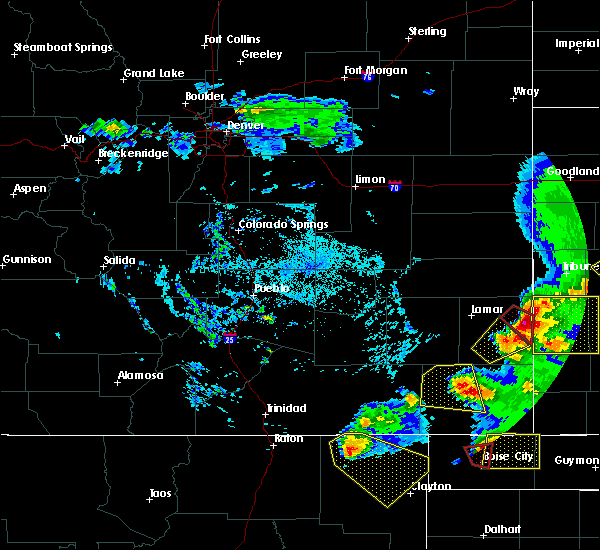 At 426 pm mdt, a severe thunderstorm capable of producing a tornado was located 8 miles northeast of des moines, moving southeast at 45 mph (radar indicated rotation). Hazards include tornado and quarter size hail. Flying debris will be dangerous to those caught without shelter. mobile homes will be damaged or destroyed. damage to roofs, windows, and vehicles will occur. tree damage is likely. This tornadic thunderstorm will remain over mainly rural areas of north central union county. At 426 pm mdt, a severe thunderstorm capable of producing a tornado was located 8 miles northeast of des moines, moving southeast at 45 mph (radar indicated rotation). Hazards include tornado and quarter size hail. Flying debris will be dangerous to those caught without shelter. mobile homes will be damaged or destroyed. damage to roofs, windows, and vehicles will occur. tree damage is likely. This tornadic thunderstorm will remain over mainly rural areas of north central union county.
|
| 6/22/2018 4:22 PM MDT |
 At 421 pm mdt, a severe thunderstorm was located 10 miles northeast of des moines, moving southeast at 40 mph (radar indicated). Hazards include 60 mph wind gusts and quarter size hail. Hail damage to vehicles is expected. Expect wind damage to roofs, siding, and trees. At 421 pm mdt, a severe thunderstorm was located 10 miles northeast of des moines, moving southeast at 40 mph (radar indicated). Hazards include 60 mph wind gusts and quarter size hail. Hail damage to vehicles is expected. Expect wind damage to roofs, siding, and trees.
|
| 6/21/2018 12:48 AM MDT |
 At 1247 am mdt, a severe thunderstorm was located near mount dora, or 20 miles northwest of clayton, moving south at 20 mph. this storm will cross u.s. highway 64 87 near mount dora (radar indicated). Hazards include ping pong ball size hail and 60 mph wind gusts. People and animals outdoors will be injured. expect hail damage to roofs, siding, windows, and vehicles. expect wind damage to roofs, siding, and trees. Locations impacted include, grenville, clayton lake state park and mount dora. At 1247 am mdt, a severe thunderstorm was located near mount dora, or 20 miles northwest of clayton, moving south at 20 mph. this storm will cross u.s. highway 64 87 near mount dora (radar indicated). Hazards include ping pong ball size hail and 60 mph wind gusts. People and animals outdoors will be injured. expect hail damage to roofs, siding, windows, and vehicles. expect wind damage to roofs, siding, and trees. Locations impacted include, grenville, clayton lake state park and mount dora.
|
| 6/21/2018 12:34 AM MDT |
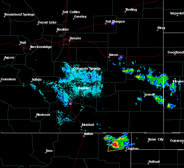 At 1233 am mdt, a severe thunderstorm was located near grenville, or 18 miles southeast of des moines, moving south at 20 mph. this storm is likely to cross u.s. highway 87 64 near mount dora (radar indicated). Hazards include tennis ball size hail and 60 mph wind gusts. People and animals outdoors will be injured. expect hail damage to roofs, siding, windows, and vehicles. expect wind damage to roofs, siding, and trees. Locations impacted include, grenville, clayton lake state park and mount dora. At 1233 am mdt, a severe thunderstorm was located near grenville, or 18 miles southeast of des moines, moving south at 20 mph. this storm is likely to cross u.s. highway 87 64 near mount dora (radar indicated). Hazards include tennis ball size hail and 60 mph wind gusts. People and animals outdoors will be injured. expect hail damage to roofs, siding, windows, and vehicles. expect wind damage to roofs, siding, and trees. Locations impacted include, grenville, clayton lake state park and mount dora.
|
| 6/21/2018 12:10 AM MDT |
 At 1210 am mdt, a severe thunderstorm was located 12 miles north of grenville, or 13 miles east of des moines, moving south at 20 mph (radar indicated). Hazards include tennis ball size hail and 60 mph wind gusts. People and animals outdoors will be injured. expect hail damage to roofs, siding, windows, and vehicles. Expect wind damage to roofs, siding, and trees. At 1210 am mdt, a severe thunderstorm was located 12 miles north of grenville, or 13 miles east of des moines, moving south at 20 mph (radar indicated). Hazards include tennis ball size hail and 60 mph wind gusts. People and animals outdoors will be injured. expect hail damage to roofs, siding, windows, and vehicles. Expect wind damage to roofs, siding, and trees.
|
| 6/12/2018 6:16 PM MDT |
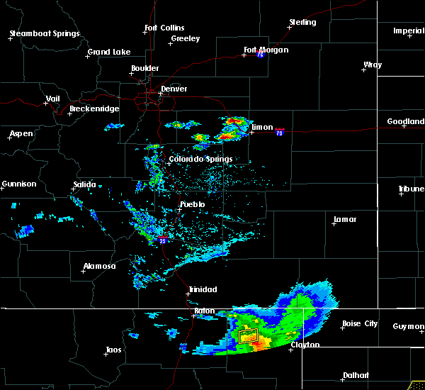 At 616 pm mdt, a severe thunderstorm was located over grenville, or 14 miles southeast of des moines, moving east at 15 mph (radar indicated). Hazards include 60 mph wind gusts. Expect damage to roofs, siding, and trees. Locations impacted include, grenville. At 616 pm mdt, a severe thunderstorm was located over grenville, or 14 miles southeast of des moines, moving east at 15 mph (radar indicated). Hazards include 60 mph wind gusts. Expect damage to roofs, siding, and trees. Locations impacted include, grenville.
|
| 6/12/2018 6:02 PM MDT |
 At 602 pm mdt, a severe thunderstorm was located 7 miles west of grenville, or 12 miles southeast of des moines, moving east at 10 mph (radar indicated). Hazards include 60 mph wind gusts and quarter size hail. Hail damage to vehicles is expected. expect wind damage to roofs, siding, and trees. Locations impacted include, grenville. At 602 pm mdt, a severe thunderstorm was located 7 miles west of grenville, or 12 miles southeast of des moines, moving east at 10 mph (radar indicated). Hazards include 60 mph wind gusts and quarter size hail. Hail damage to vehicles is expected. expect wind damage to roofs, siding, and trees. Locations impacted include, grenville.
|
| 6/12/2018 5:46 PM MDT |
 At 546 pm mdt, a severe thunderstorm was located 8 miles south of des moines, moving east at 10 mph (radar indicated). Hazards include 60 mph wind gusts and penny size hail. expect damage to roofs, siding, and trees At 546 pm mdt, a severe thunderstorm was located 8 miles south of des moines, moving east at 10 mph (radar indicated). Hazards include 60 mph wind gusts and penny size hail. expect damage to roofs, siding, and trees
|
| 6/8/2018 6:57 PM MDT |
 The severe thunderstorm warning for north central union county will expire at 700 pm mdt, the storm which prompted the warning has weakened below severe limits, and no longer poses an immediate threat to life or property. therefore the warning will be allowed to expire. however small hail, gusty winds and heavy rain are still possible with this thunderstorm. The severe thunderstorm warning for north central union county will expire at 700 pm mdt, the storm which prompted the warning has weakened below severe limits, and no longer poses an immediate threat to life or property. therefore the warning will be allowed to expire. however small hail, gusty winds and heavy rain are still possible with this thunderstorm.
|
| 6/8/2018 6:36 PM MDT |
 At 633 pm mdt, a severe thunderstorm was located 11 miles northwest of clayton lake state park, or 22 miles northwest of clayton, moving east at 5 mph. a second severe storm was located 10 miles northeast of grenville, or 19 miles northwest of clayton, moving east at 5 mph. these storms will cross route 370 north of clayton lake state park (radar indicated). Hazards include 60 mph wind gusts and quarter size hail. Hail damage to vehicles is expected. expect wind damage to roofs, siding, and trees. Locations impacted include, grenville and clayton lake state park. At 633 pm mdt, a severe thunderstorm was located 11 miles northwest of clayton lake state park, or 22 miles northwest of clayton, moving east at 5 mph. a second severe storm was located 10 miles northeast of grenville, or 19 miles northwest of clayton, moving east at 5 mph. these storms will cross route 370 north of clayton lake state park (radar indicated). Hazards include 60 mph wind gusts and quarter size hail. Hail damage to vehicles is expected. expect wind damage to roofs, siding, and trees. Locations impacted include, grenville and clayton lake state park.
|
| 6/8/2018 6:06 PM MDT |
 At 605 pm mdt, a severe thunderstorm was located 10 miles northeast of grenville, or 20 miles east of des moines, and is nearly stationary (radar indicated). Hazards include 60 mph wind gusts and quarter size hail. Hail damage to vehicles is expected. Expect wind damage to roofs, siding, and trees. At 605 pm mdt, a severe thunderstorm was located 10 miles northeast of grenville, or 20 miles east of des moines, and is nearly stationary (radar indicated). Hazards include 60 mph wind gusts and quarter size hail. Hail damage to vehicles is expected. Expect wind damage to roofs, siding, and trees.
|
| 6/7/2018 4:57 PM MDT |
 At 457 pm mdt, a severe thunderstorm was located near capulin, or near des moines, and is nearly stationary (radar indicated). Hazards include 60 mph wind gusts and quarter size hail. Hail damage to vehicles is expected. expect wind damage to roofs, siding, and trees. Locations impacted include, des moines, grenville and capulin. At 457 pm mdt, a severe thunderstorm was located near capulin, or near des moines, and is nearly stationary (radar indicated). Hazards include 60 mph wind gusts and quarter size hail. Hail damage to vehicles is expected. expect wind damage to roofs, siding, and trees. Locations impacted include, des moines, grenville and capulin.
|
| 6/7/2018 4:27 PM MDT |
 At 427 pm mdt, a severe thunderstorm was located over des moines, moving southeast at 25 mph (radar indicated). Hazards include 60 mph wind gusts and quarter size hail. Hail damage to vehicles is expected. Expect wind damage to roofs, siding, and trees. At 427 pm mdt, a severe thunderstorm was located over des moines, moving southeast at 25 mph (radar indicated). Hazards include 60 mph wind gusts and quarter size hail. Hail damage to vehicles is expected. Expect wind damage to roofs, siding, and trees.
|
| 5/19/2018 5:01 PM MDT |
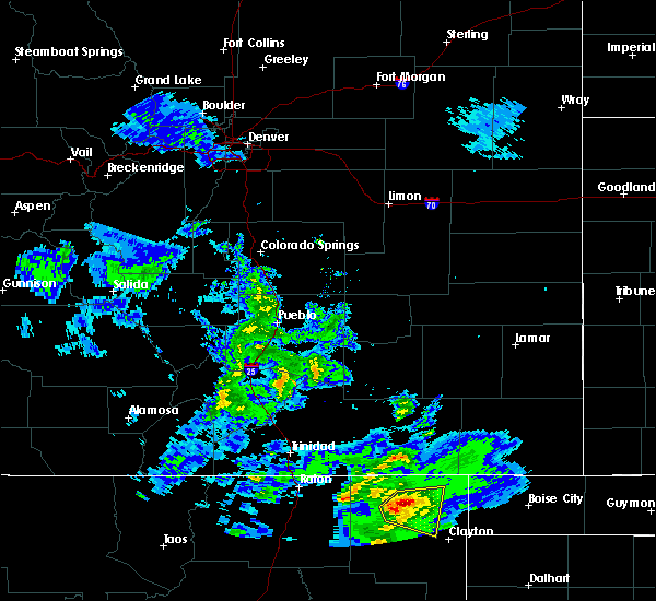 At 500 pm mdt, a severe thunderstorm was located 12 miles northeast of grenville, or 17 miles east of des moines, moving east at 15 mph (radar indicated). Hazards include 60 mph wind gusts and quarter size hail. Hail damage to vehicles is expected. Expect wind damage to roofs, siding, and trees. At 500 pm mdt, a severe thunderstorm was located 12 miles northeast of grenville, or 17 miles east of des moines, moving east at 15 mph (radar indicated). Hazards include 60 mph wind gusts and quarter size hail. Hail damage to vehicles is expected. Expect wind damage to roofs, siding, and trees.
|
| 8/14/2017 4:01 PM MDT |
 At 400 pm mdt, severe thunderstorms were located along a line extending from near clayton lake state park to near grenville, moving south at 15 mph (radar indicated). Hazards include 60 mph wind gusts and quarter size hail. Hail damage to vehicles is expected. expect wind damage to roofs, siding, and trees. Locations impacted include, clayton, grenville, clayton lake state park and mount dora. At 400 pm mdt, severe thunderstorms were located along a line extending from near clayton lake state park to near grenville, moving south at 15 mph (radar indicated). Hazards include 60 mph wind gusts and quarter size hail. Hail damage to vehicles is expected. expect wind damage to roofs, siding, and trees. Locations impacted include, clayton, grenville, clayton lake state park and mount dora.
|
| 8/14/2017 3:43 PM MDT |
 At 343 pm mdt, severe thunderstorms were located along a line extending from near clayton lake state park to near grenville, moving south at 10 mph (radar indicated). Hazards include 60 mph wind gusts and quarter size hail. Hail damage to vehicles is expected. Expect wind damage to roofs, siding, and trees. At 343 pm mdt, severe thunderstorms were located along a line extending from near clayton lake state park to near grenville, moving south at 10 mph (radar indicated). Hazards include 60 mph wind gusts and quarter size hail. Hail damage to vehicles is expected. Expect wind damage to roofs, siding, and trees.
|
| 8/14/2017 3:26 PM MDT |
 At 326 pm mdt, a severe thunderstorm was located near mount dora, or 18 miles northwest of clayton, and is nearly stationary (radar indicated). Hazards include 60 mph wind gusts and quarter size hail. Hail damage to vehicles is expected. expect wind damage to roofs, siding, and trees. Locations impacted include, grenville and mount dora. At 326 pm mdt, a severe thunderstorm was located near mount dora, or 18 miles northwest of clayton, and is nearly stationary (radar indicated). Hazards include 60 mph wind gusts and quarter size hail. Hail damage to vehicles is expected. expect wind damage to roofs, siding, and trees. Locations impacted include, grenville and mount dora.
|
| 8/14/2017 3:14 PM MDT |
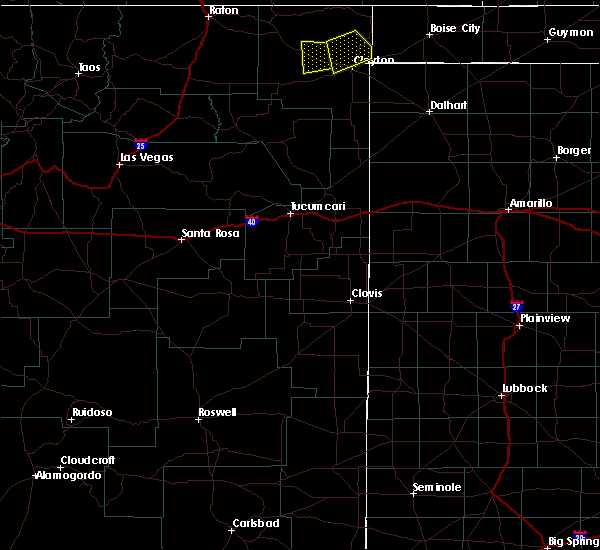 At 314 pm mdt, a severe thunderstorm was located near mount dora, or 17 miles northwest of clayton, moving south at 5 mph (radar indicated). Hazards include 60 mph wind gusts and quarter size hail. Hail damage to vehicles is expected. Expect wind damage to roofs, siding, and trees. At 314 pm mdt, a severe thunderstorm was located near mount dora, or 17 miles northwest of clayton, moving south at 5 mph (radar indicated). Hazards include 60 mph wind gusts and quarter size hail. Hail damage to vehicles is expected. Expect wind damage to roofs, siding, and trees.
|
| 7/4/2017 6:27 PM MDT |
 At 627 pm mdt, a severe thunderstorm was located 20 miles west of kenton, or 29 miles northeast of des moines, moving southeast at 20 mph (radar indicated). Hazards include 60 mph wind gusts and quarter size hail. Hail damage to vehicles is expected. expect wind damage to roofs, siding, and trees. Locations impacted include, clayton, grenville, clayton lake state park, seneca, mount dora and moses. At 627 pm mdt, a severe thunderstorm was located 20 miles west of kenton, or 29 miles northeast of des moines, moving southeast at 20 mph (radar indicated). Hazards include 60 mph wind gusts and quarter size hail. Hail damage to vehicles is expected. expect wind damage to roofs, siding, and trees. Locations impacted include, clayton, grenville, clayton lake state park, seneca, mount dora and moses.
|
| 7/4/2017 6:14 PM MDT |
 At 614 pm mdt, a severe thunderstorm was located 22 miles south of kim, or 26 miles northeast of des moines, moving southeast at 30 mph (radar indicated). Hazards include 60 mph wind gusts and quarter size hail. Hail damage to vehicles is expected. Expect wind damage to roofs, siding, and trees. At 614 pm mdt, a severe thunderstorm was located 22 miles south of kim, or 26 miles northeast of des moines, moving southeast at 30 mph (radar indicated). Hazards include 60 mph wind gusts and quarter size hail. Hail damage to vehicles is expected. Expect wind damage to roofs, siding, and trees.
|
| 6/30/2017 5:54 PM MDT | Quarter sized hail reported 18.4 miles NNW of Grenville, NM |
| 6/30/2017 4:35 PM MDT |
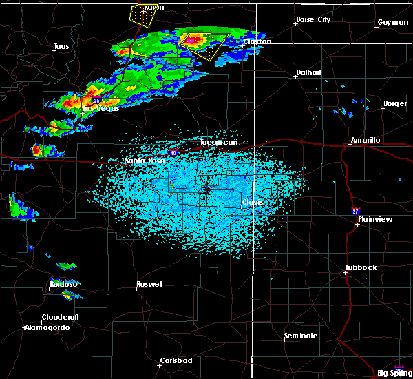 At 434 pm mdt, a severe thunderstorm was located 12 miles southwest of grenville, or 17 miles south of des moines, moving southeast at 20 mph (radar indicated). Hazards include 60 mph wind gusts and half dollar size hail. Hail damage to vehicles is expected. Expect wind damage to roofs, siding, and trees. At 434 pm mdt, a severe thunderstorm was located 12 miles southwest of grenville, or 17 miles south of des moines, moving southeast at 20 mph (radar indicated). Hazards include 60 mph wind gusts and half dollar size hail. Hail damage to vehicles is expected. Expect wind damage to roofs, siding, and trees.
|
| 6/26/2017 8:36 PM MDT | Half Dollar sized hail reported 7.8 miles SW of Grenville, NM |
| 5/27/2017 5:46 PM MDT | Quarter sized hail reported 7.8 miles SW of Grenville, NM |
| 5/27/2017 4:50 PM MDT | Quarter sized hail reported 7.8 miles SW of Grenville, NM |
| 8/18/2015 7:23 PM MDT |
 The severe thunderstorm warning for northwestern union county will expire at 730 pm mdt, the storm which prompted the warning has weakened below severe limits and exited the warned area. therefore the warning will be allowed to expire. however gusty winds and heavy rain are still possible with this thunderstorm. The severe thunderstorm warning for northwestern union county will expire at 730 pm mdt, the storm which prompted the warning has weakened below severe limits and exited the warned area. therefore the warning will be allowed to expire. however gusty winds and heavy rain are still possible with this thunderstorm.
|
| 8/18/2015 7:02 PM MDT |
 At 702 pm mdt, a severe thunderstorm was located 6 miles east of des moines, moving southeast at 25 mph (radar indicated). Hazards include 60 mph wind gusts and quarter size hail. Hail damage to vehicles is expected. expect wind damage to roofs, siding and trees. Locations impacted include, des moines and grenville. At 702 pm mdt, a severe thunderstorm was located 6 miles east of des moines, moving southeast at 25 mph (radar indicated). Hazards include 60 mph wind gusts and quarter size hail. Hail damage to vehicles is expected. expect wind damage to roofs, siding and trees. Locations impacted include, des moines and grenville.
|
| 8/18/2015 6:40 PM MDT |
 At 640 pm mdt, a severe thunderstorm was located near folsom, or near des moines, moving southeast at 25 mph (radar indicated). Hazards include quarter size hail and 70 mph wind gusts. Hail damage to vehicles is expected. expect considerable tree damage. Wind damage is also likely to mobile homes, roofs and outbuildings. At 640 pm mdt, a severe thunderstorm was located near folsom, or near des moines, moving southeast at 25 mph (radar indicated). Hazards include quarter size hail and 70 mph wind gusts. Hail damage to vehicles is expected. expect considerable tree damage. Wind damage is also likely to mobile homes, roofs and outbuildings.
|
| 8/18/2015 6:10 PM MDT |
 At 609 pm mdt, a severe thunderstorm was located 11 miles southwest of mount dora, or 26 miles west of clayton, moving southeast at 35 mph (radar indicated). Hazards include 60 mph wind gusts and half dollar size hail. Hail damage to vehicles is expected. expect wind damage to roofs, siding and trees. Locations impacted include, highway 56 between gladstone and clayton. At 609 pm mdt, a severe thunderstorm was located 11 miles southwest of mount dora, or 26 miles west of clayton, moving southeast at 35 mph (radar indicated). Hazards include 60 mph wind gusts and half dollar size hail. Hail damage to vehicles is expected. expect wind damage to roofs, siding and trees. Locations impacted include, highway 56 between gladstone and clayton.
|
| 8/18/2015 5:58 PM MDT | Storm damage reported in union county NM, 14.7 miles NE of Grenville, NM |
| 8/18/2015 5:42 PM MDT |
 At 541 pm mdt, a severe thunderstorm was located 9 miles west of grenville, or 14 miles south of des moines, moving south at 40 mph (radar indicated). Hazards include half dollar size hail and 60 mph wind gusts. Hail damage to vehicles is expected. Expect wind damage to roofs, siding and trees. At 541 pm mdt, a severe thunderstorm was located 9 miles west of grenville, or 14 miles south of des moines, moving south at 40 mph (radar indicated). Hazards include half dollar size hail and 60 mph wind gusts. Hail damage to vehicles is expected. Expect wind damage to roofs, siding and trees.
|
| 8/17/2015 5:40 PM MDT |
 At 540 pm mdt, a severe thunderstorm was located over mount dora, or 18 miles west of clayton, moving south at 15 mph (radar indicated). Hazards include 60 mph wind gusts and quarter size hail. Hail damage to vehicles is expected. expect wind damage to roofs, siding and trees. Locations impacted include, grenville and mount dora. At 540 pm mdt, a severe thunderstorm was located over mount dora, or 18 miles west of clayton, moving south at 15 mph (radar indicated). Hazards include 60 mph wind gusts and quarter size hail. Hail damage to vehicles is expected. expect wind damage to roofs, siding and trees. Locations impacted include, grenville and mount dora.
|
| 8/17/2015 5:11 PM MDT |
 At 510 pm mdt, a severe thunderstorm was located near grenville, or 11 miles southeast of des moines, moving south at 15 mph (radar indicated). Hazards include half dollar size hail and 60 mph wind gusts. Hail damage to vehicles is expected. Expect wind damage to roofs, siding and trees. At 510 pm mdt, a severe thunderstorm was located near grenville, or 11 miles southeast of des moines, moving south at 15 mph (radar indicated). Hazards include half dollar size hail and 60 mph wind gusts. Hail damage to vehicles is expected. Expect wind damage to roofs, siding and trees.
|
| 8/17/2015 4:53 PM MDT |
 At 453 pm mdt, a severe thunderstorm was located 6 miles northwest of grenville, or 11 miles southeast of des moines, moving southeast at 15 mph (radar indicated). Hazards include ping pong ball size hail and 60 mph wind gusts. People and animals outdoors will be injured. expect hail damage to roofs, siding, windows and vehicles. expect wind damage to roofs, siding and trees. Locations impacted include, grenville. At 453 pm mdt, a severe thunderstorm was located 6 miles northwest of grenville, or 11 miles southeast of des moines, moving southeast at 15 mph (radar indicated). Hazards include ping pong ball size hail and 60 mph wind gusts. People and animals outdoors will be injured. expect hail damage to roofs, siding, windows and vehicles. expect wind damage to roofs, siding and trees. Locations impacted include, grenville.
|
| 8/17/2015 4:28 PM MDT |
 At 427 pm mdt, a severe thunderstorm was located 6 miles east of des moines, moving southeast at 10 mph (radar indicated). Hazards include ping pong size hail and 60 mph wind gusts. People and animals outdoors will be injured. expect hail damage to roofs, siding, windows and vehicles. Expect wind damage to roofs, siding and trees. At 427 pm mdt, a severe thunderstorm was located 6 miles east of des moines, moving southeast at 10 mph (radar indicated). Hazards include ping pong size hail and 60 mph wind gusts. People and animals outdoors will be injured. expect hail damage to roofs, siding, windows and vehicles. Expect wind damage to roofs, siding and trees.
|
| 8/9/2015 6:59 PM MDT |
 At 659 pm mdt, a severe thunderstorm was located near grenville, or 19 miles southeast of des moines, moving north at 15 mph (radar indicated). Hazards include quarter size hail and 60 mph wind gusts. Hail damage to vehicles is expected. Expect wind damage to roofs, siding and trees. At 659 pm mdt, a severe thunderstorm was located near grenville, or 19 miles southeast of des moines, moving north at 15 mph (radar indicated). Hazards include quarter size hail and 60 mph wind gusts. Hail damage to vehicles is expected. Expect wind damage to roofs, siding and trees.
|
| 8/3/2015 6:41 PM MDT |
 The severe thunderstorm warning for central union county will expire at 645 pm mdt, the storm which prompted the warning has weakened below severe limits, and no longer pose an immediate threat to life or property. therefore the warning will be allowed to expire. however periods of moderate to occasionally heavy rain are still possible with this thunderstorm along with some small hail. standing water and runoff will also continue for the next hour or two. The severe thunderstorm warning for central union county will expire at 645 pm mdt, the storm which prompted the warning has weakened below severe limits, and no longer pose an immediate threat to life or property. therefore the warning will be allowed to expire. however periods of moderate to occasionally heavy rain are still possible with this thunderstorm along with some small hail. standing water and runoff will also continue for the next hour or two.
|
| 8/3/2015 6:23 PM MDT |
 At 622 pm mdt, a severe thunderstorm was located over grenville, or 18 miles southeast of des moines, moving southeast at 5 mph (radar indicated). Hazards include 60 mph wind gusts and quarter size hail. Hail damage to vehicles is expected. expect wind damage to roofs, siding and trees. Locations impacted include, grenville and mount dora. At 622 pm mdt, a severe thunderstorm was located over grenville, or 18 miles southeast of des moines, moving southeast at 5 mph (radar indicated). Hazards include 60 mph wind gusts and quarter size hail. Hail damage to vehicles is expected. expect wind damage to roofs, siding and trees. Locations impacted include, grenville and mount dora.
|
| 8/3/2015 5:56 PM MDT |
 At 555 pm mdt, a severe thunderstorm was located over grenville, or 15 miles southeast of des moines, moving southeast at 5 mph (radar indicated). Hazards include half dollar size hail and 60 mph wind gusts. Hail damage to vehicles is expected. Expect wind damage to roofs, siding and trees. At 555 pm mdt, a severe thunderstorm was located over grenville, or 15 miles southeast of des moines, moving southeast at 5 mph (radar indicated). Hazards include half dollar size hail and 60 mph wind gusts. Hail damage to vehicles is expected. Expect wind damage to roofs, siding and trees.
|
| 6/8/2015 6:51 PM MDT | Ping Pong Ball sized hail reported 22.2 miles NNE of Grenville, NM |
| 6/8/2015 6:38 PM MDT | Quarter sized hail reported 21.4 miles NNE of Grenville, NM |
| 6/8/2015 5:47 PM MDT | At 544 pm mdt, a severe thunderstorm was located 5 miles south of grenville, or 24 miles southeast of des moines, moving southeast at 15 mph (radar indicated and public reported). Hazards include 60 mph wind gusts and quarter size hail. at 519 pm quarter size hail was observed from this storm. Hail damage to vehicles is expected. expect wind damage to roofs, siding and trees. Locations impacted include, grenville and mount dora. |
| 6/8/2015 5:19 PM MDT | Quarter sized hail reported 0.3 miles NW of Grenville, NM |
| 6/8/2015 5:12 PM MDT | At 511 pm mdt, a severe thunderstorm was located 6 miles west of grenville, or 11 miles southeast of des moines, moving southeast at 15 mph (radar indicated. at 430 pm this storm produced ping pong ball sized hail in des moines). Hazards include ping pong size hail and 60 mph wind gusts. People and animals outdoors will be injured. expect hail damage to roofs, siding, windows and vehicles. Expect wind damage to roofs, siding and trees. |
| 6/8/2015 5:04 PM MDT | At 504 pm mdt, a severe thunderstorm was located 8 miles west of grenville, or 9 miles southeast of des moines, moving southeast at 15 mph (radar indicated). Hazards include golf ball size hail and 60 mph wind gusts. People and animals outdoors will be injured. expect hail damage to roofs, siding, windows and vehicles. expect wind damage to roofs, siding and trees. Locations impacted include, des moines and grenville. |
| 6/8/2015 4:37 PM MDT | At 436 pm mdt, a severe thunderstorm was located over des moines, moving southeast at 10 mph (radar indicated). Hazards include quarter size hail and 60 mph wind gusts. Hail damage to vehicles is expected. Expect wind damage to roofs, siding and trees. |
| 6/5/2015 4:53 PM MDT | The severe thunderstorm warning for northwestern union county will expire at 500 pm mdt, the storm which prompted the warning has weakened below severe limits, and no longer pose an immediate threat to life or property. therefore the warning will be allowed to expire. however small hail and gusty winds are still possible with this thunderstorm. |
| 6/5/2015 4:38 PM MDT | At 438 pm mdt, a severe thunderstorm was located 8 miles southeast of des moines, moving east at 30 mph (radar indicated). Hazards include 60 mph wind gusts and quarter size hail. Hail damage to vehicles is expected. expect wind damage to roofs, siding and trees. Locations impacted include, grenville. |
| 6/5/2015 4:17 PM MDT | At 416 pm mdt, a severe thunderstorm was located 7 miles south of des moines, moving east at 30 mph (radar indicated). Hazards include quarter size hail and 60 mph wind gusts. Hail damage to vehicles is expected. Expect wind damage to roofs, siding and trees. |
| 6/18/2013 8:20 PM MDT | Ping Pong Ball sized hail reported 0.3 miles NW of Grenville, NM |
| 6/18/2013 7:58 PM MDT | Quarter sized hail reported 0.3 miles NW of Grenville, NM |
| 6/3/2013 8:03 PM MDT | Semi blown over on highway 64 three miles to the east of grenvill in union county NM, 3.2 miles WNW of Grenville, NM |
Hail Maps for Grenville, NM
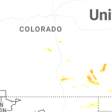


Connect with Interactive Hail Maps