

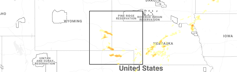
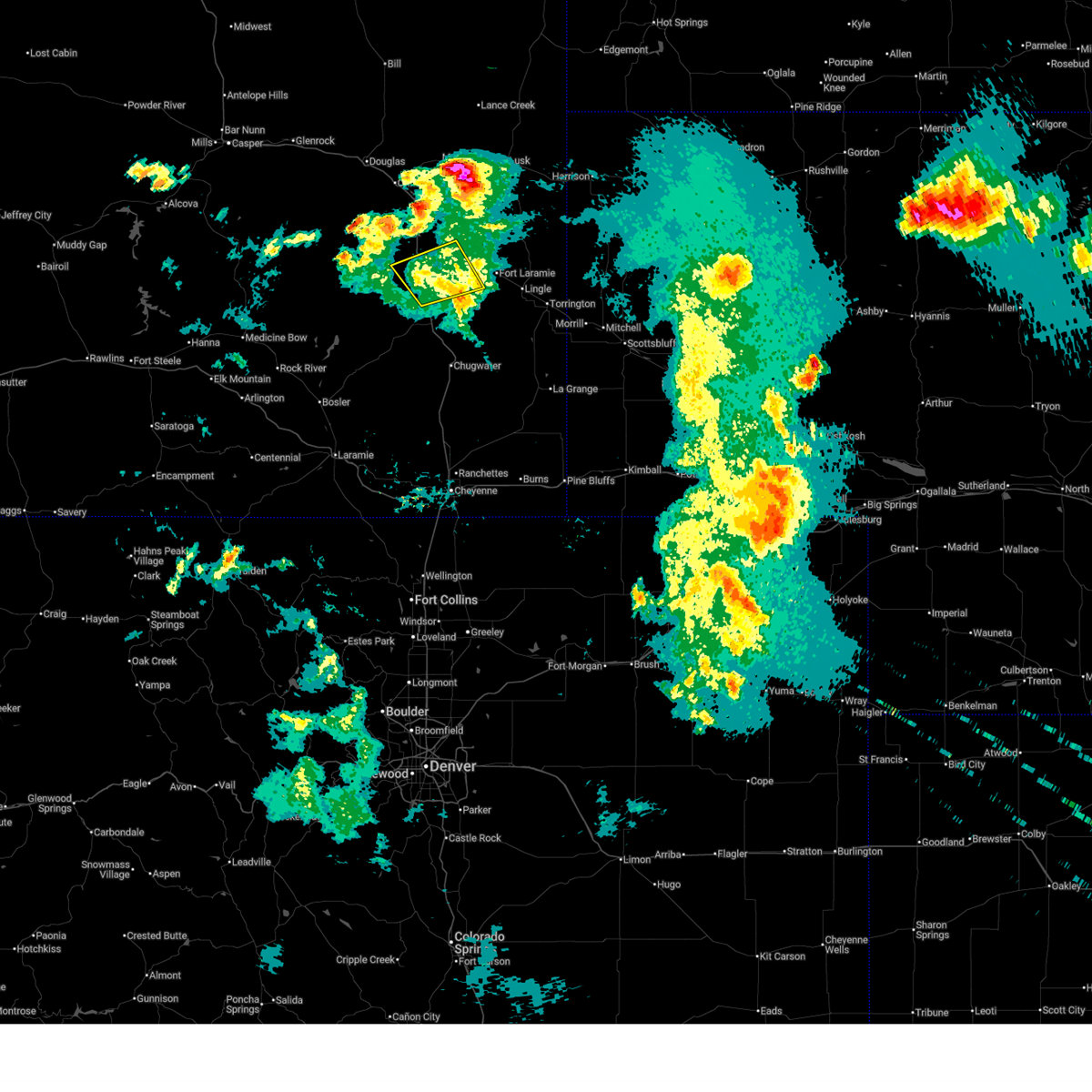
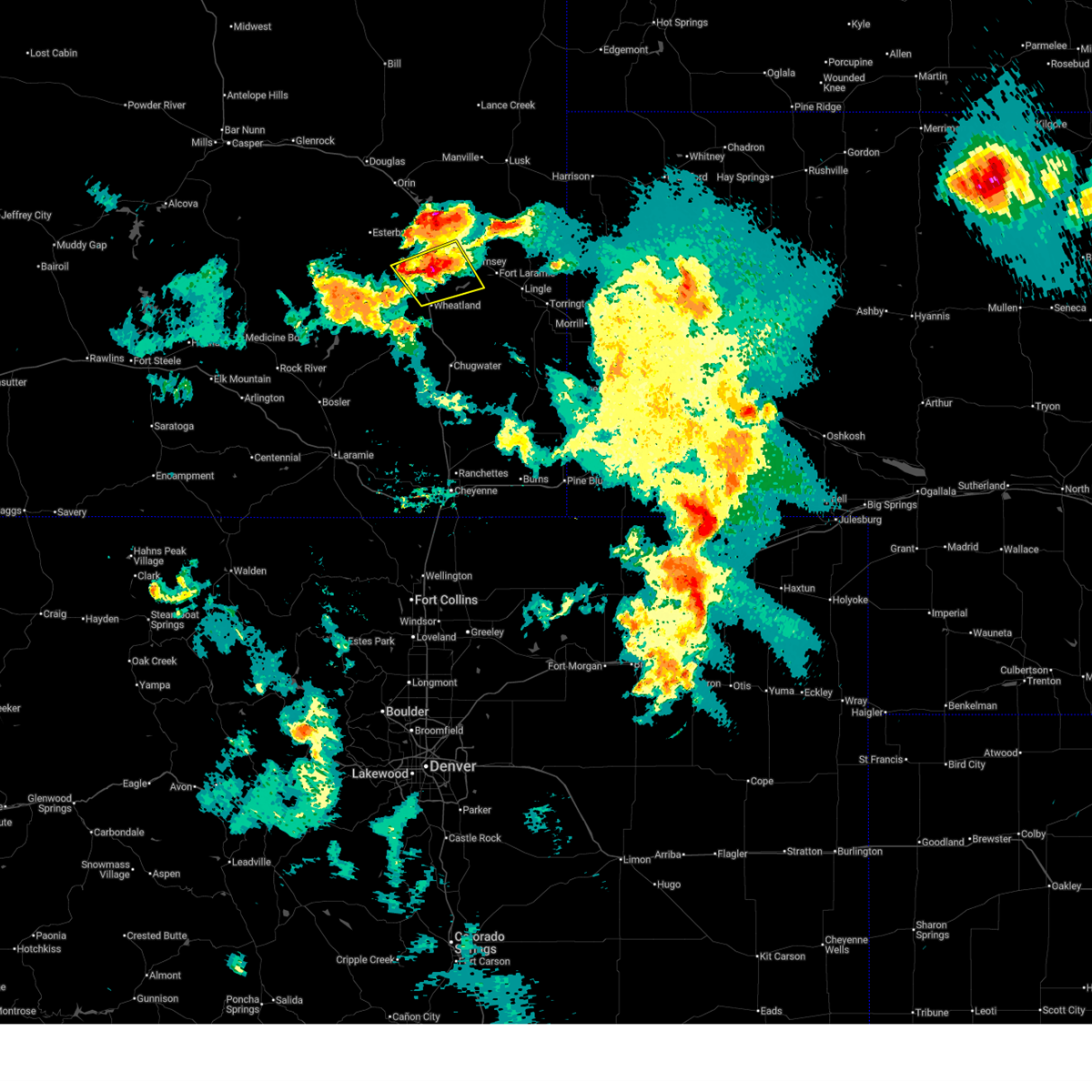
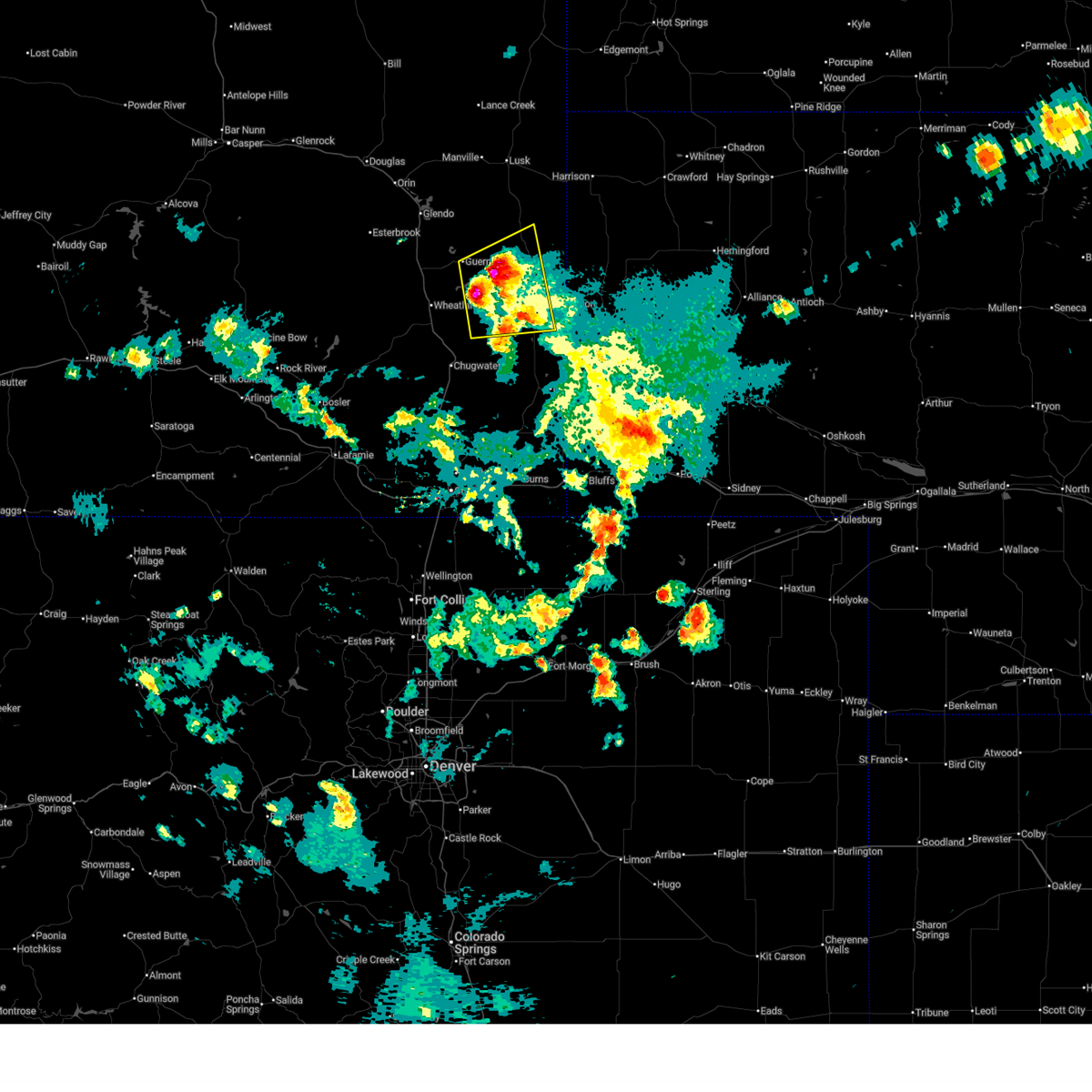
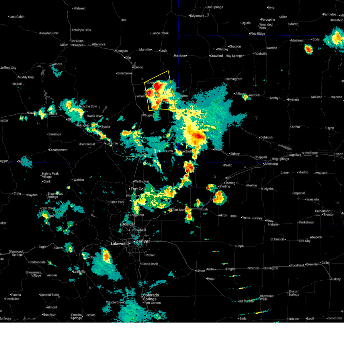
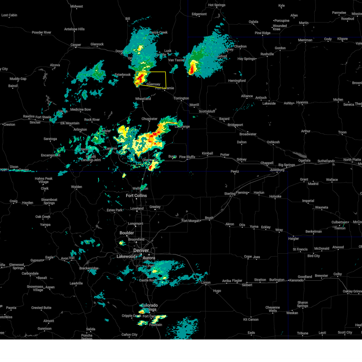
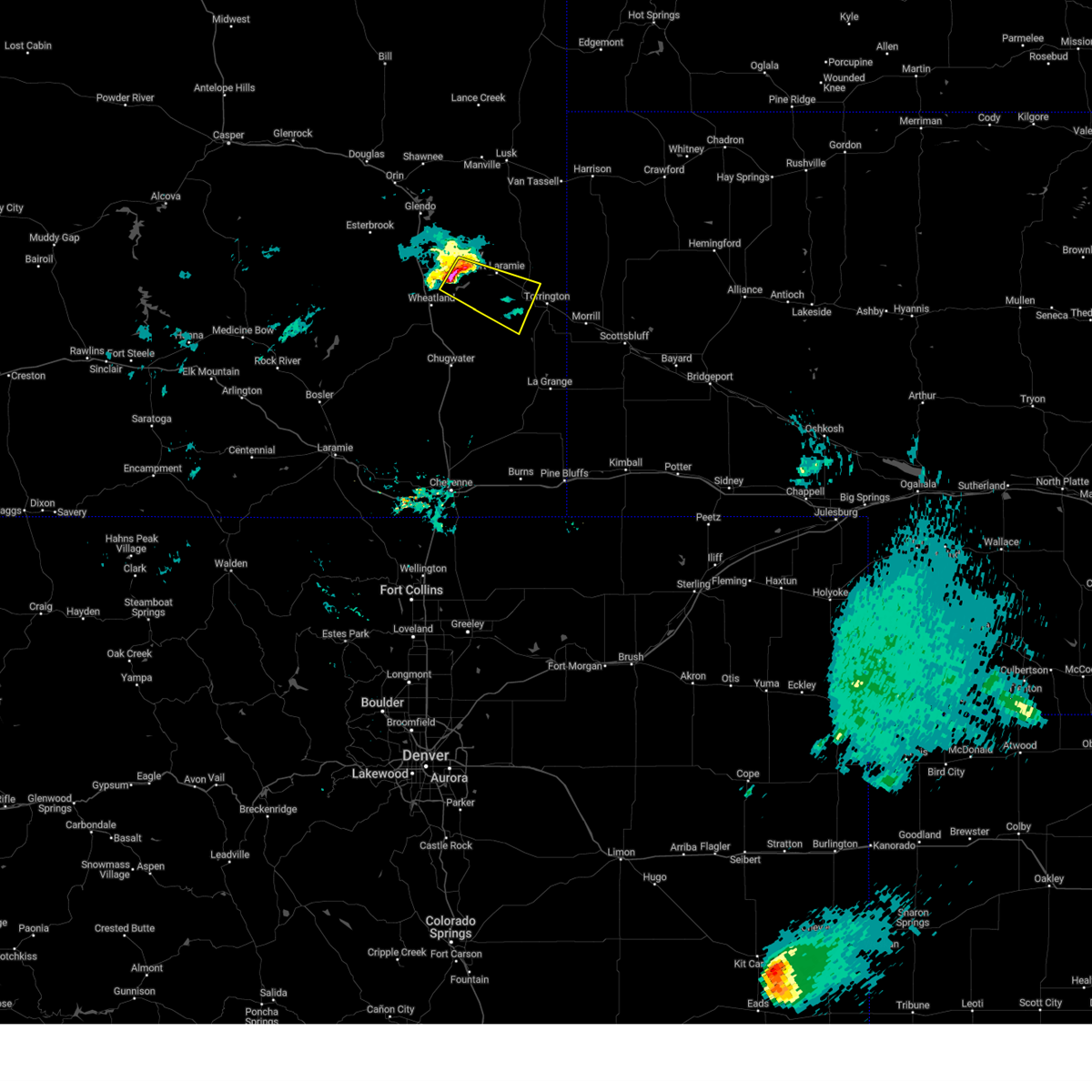
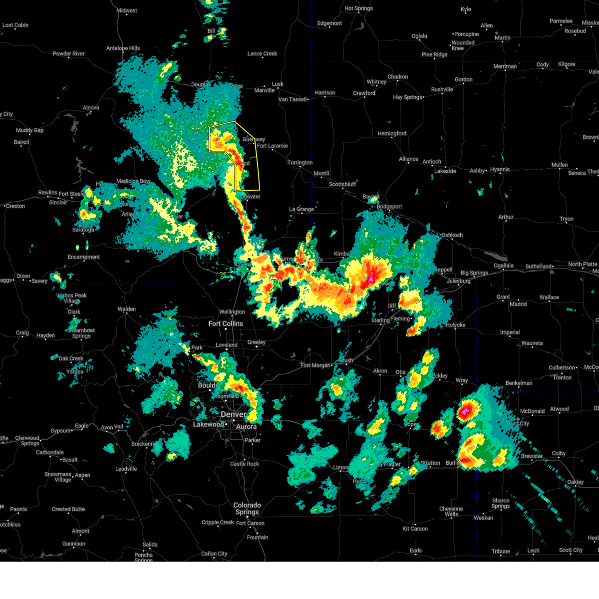
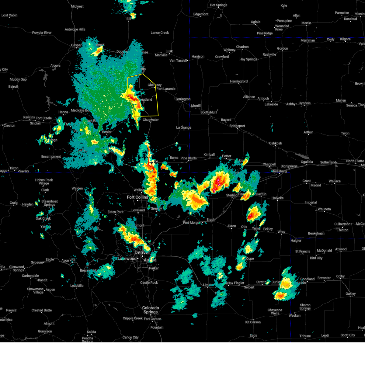
Hail Map for Guernsey, WY
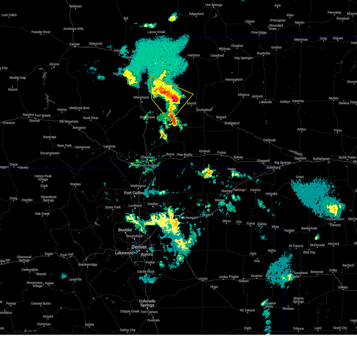
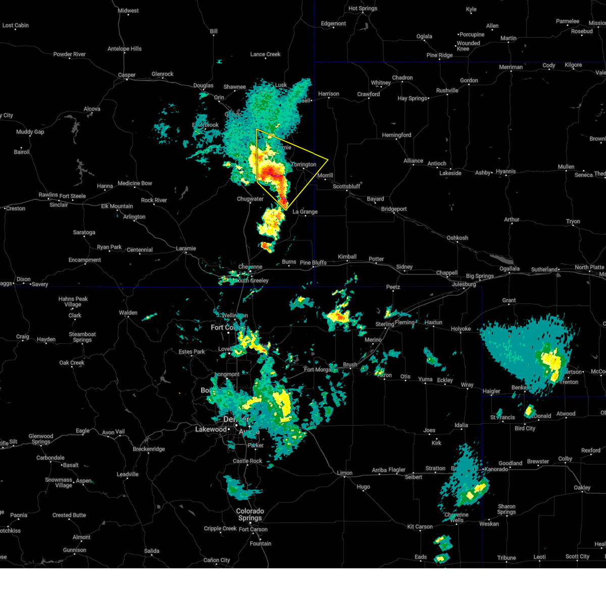
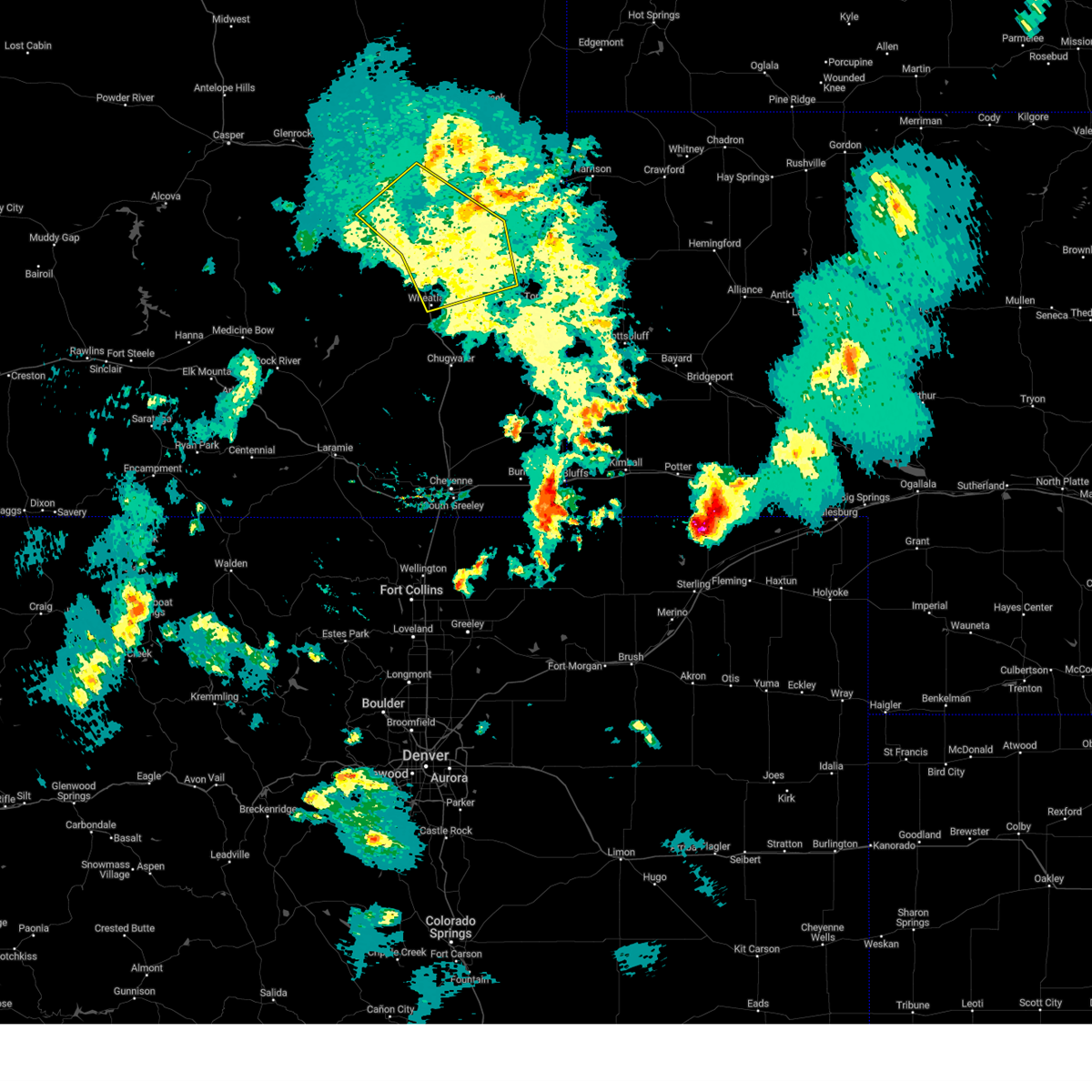
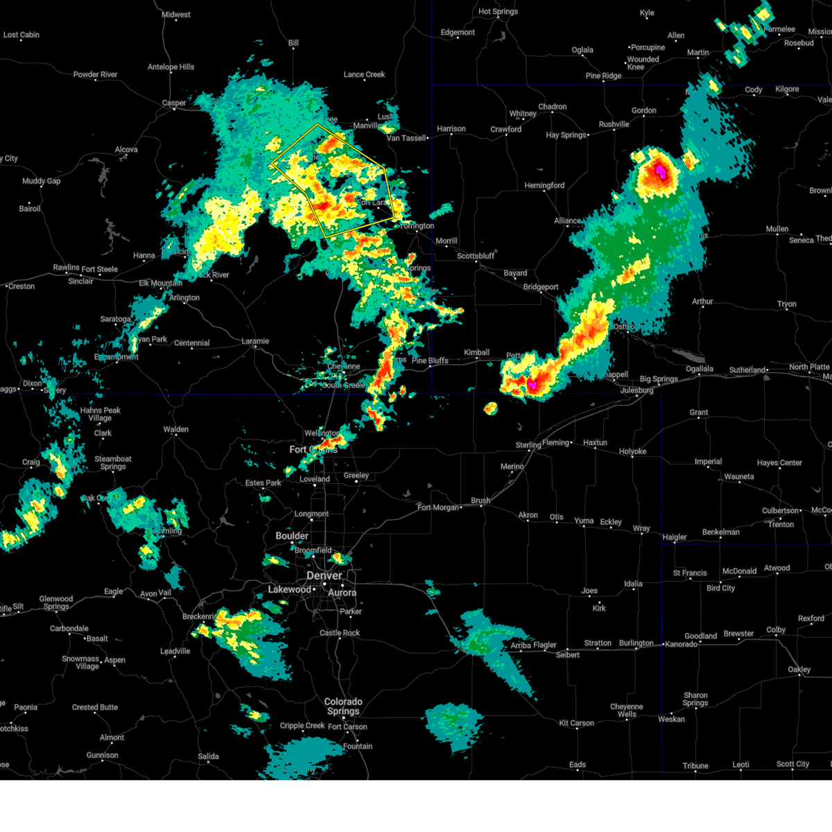
The Guernsey, WY area has had 12 reports of on-the-ground hail by trained spotters, and has been under severe weather warnings 26 times during the past 12 months. Doppler radar has detected hail at or near Guernsey, WY on 59 occasions, including 6 occasions during the past year.
| Name: | Guernsey, WY |
| Where Located: | 62 miles WNW of Scottsbluff, NE |
| Map: | Google Map for Guernsey, WY |
| Population: | 1147 |
| Housing Units: | 581 |
| More Info: | Search Google for Guernsey, WY |
3
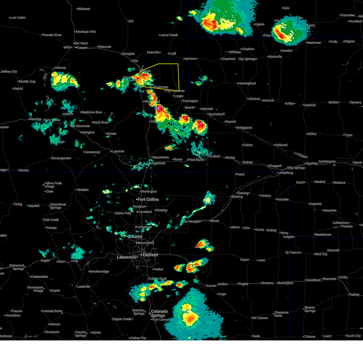
The Top Recent Hail Date for Guernsey, WY is Monday, June 2, 2025 (7th out of 59)
Hail and Wind Damage Spotted near Guernsey, WY
| Date / Time | Report Details |
|---|---|
| 7/6/2025 5:30 PM MDT |
 The severe thunderstorm has been reissued for northern portions of goshen county. check that bulletin for more details. a severe thunderstorm watch remains in effect until 800 pm mdt for southeastern wyoming. The severe thunderstorm has been reissued for northern portions of goshen county. check that bulletin for more details. a severe thunderstorm watch remains in effect until 800 pm mdt for southeastern wyoming.
|
| 7/6/2025 5:17 PM MDT |
 At 517 pm mdt, a severe thunderstorm was located 7 miles northeast of hartville, or 25 miles southwest of lusk, moving east at 15 mph (radar indicated). Hazards include 60 mph wind gusts and quarter size hail. Hail damage to vehicles is expected. expect wind damage to roofs, siding, and trees. Locations impacted include, hartville, pine ridge estates, sandy cove campground, and guernsey state park. At 517 pm mdt, a severe thunderstorm was located 7 miles northeast of hartville, or 25 miles southwest of lusk, moving east at 15 mph (radar indicated). Hazards include 60 mph wind gusts and quarter size hail. Hail damage to vehicles is expected. expect wind damage to roofs, siding, and trees. Locations impacted include, hartville, pine ridge estates, sandy cove campground, and guernsey state park.
|
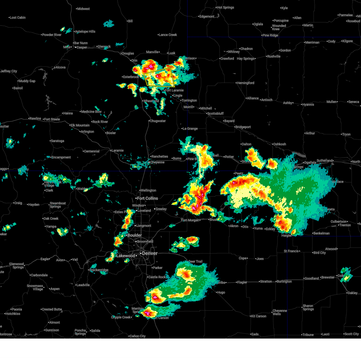
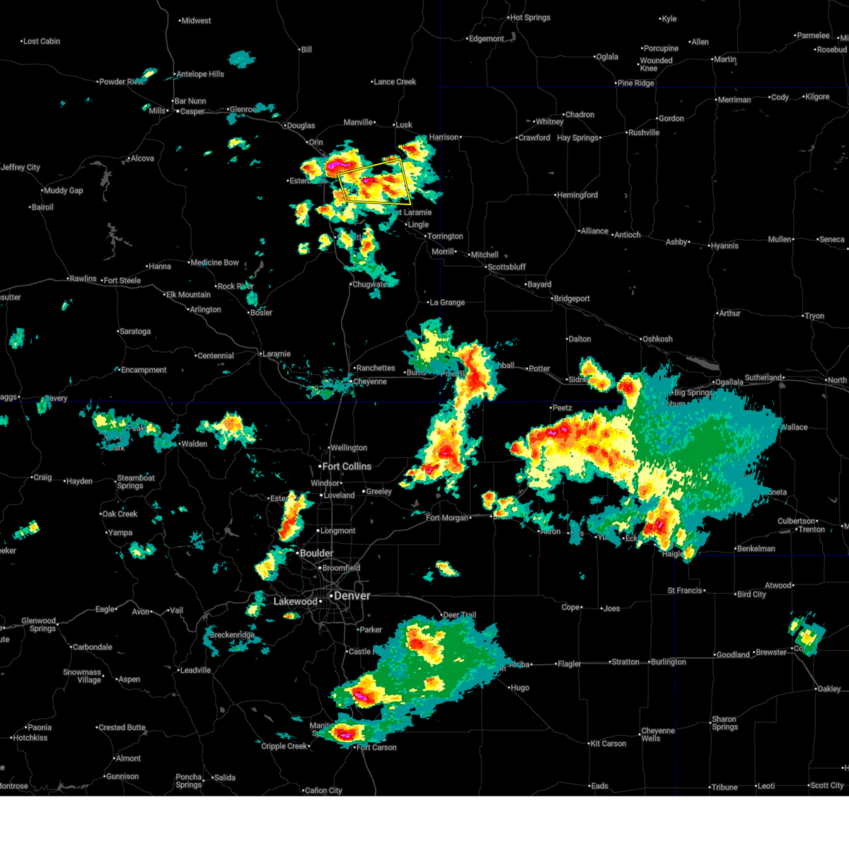
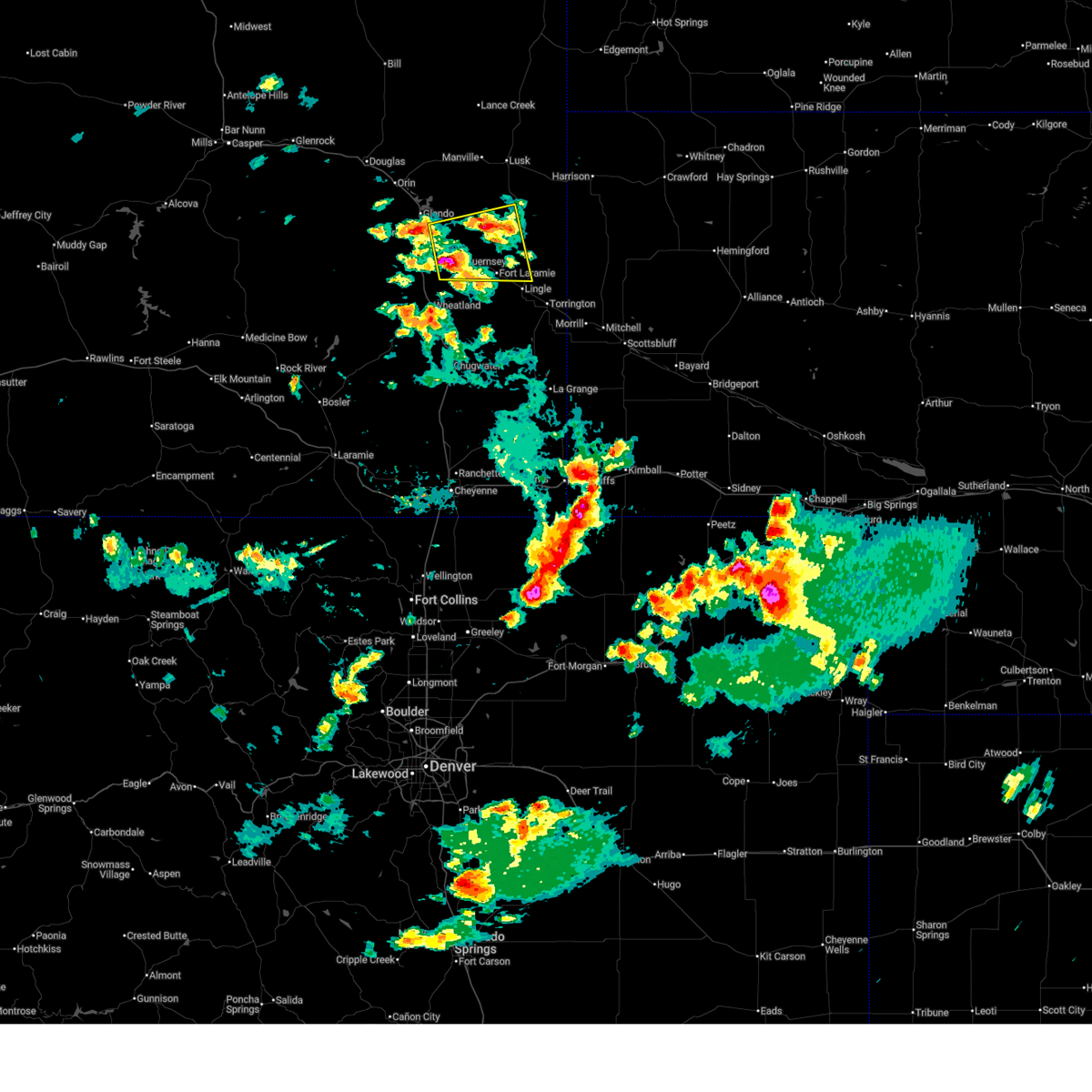
| 7/6/2025 5:00 PM MDT | Ping Pong Ball sized hail reported 4.4 miles SSE of Guernsey, WY, picture from social media showing ping pong ball size hail at guernsey state park. |
| 7/6/2025 4:52 PM MDT |
 Svrcys the national weather service in cheyenne has issued a * severe thunderstorm warning for, northwestern goshen county in southeastern wyoming, northeastern platte county in southeastern wyoming, * until 530 pm mdt. * at 451 pm mdt, a cluster severe thunderstorm were located northeast platte and northwest goshen counties, moving east at 25 mph (radar indicated). Hazards include 60 mph wind gusts and quarter size hail. Hail damage to vehicles is expected. Expect wind damage to roofs, siding, and trees. Svrcys the national weather service in cheyenne has issued a * severe thunderstorm warning for, northwestern goshen county in southeastern wyoming, northeastern platte county in southeastern wyoming, * until 530 pm mdt. * at 451 pm mdt, a cluster severe thunderstorm were located northeast platte and northwest goshen counties, moving east at 25 mph (radar indicated). Hazards include 60 mph wind gusts and quarter size hail. Hail damage to vehicles is expected. Expect wind damage to roofs, siding, and trees.
|
| 6/29/2025 8:39 PM MDT |
 Svrcys the national weather service in cheyenne has issued a * severe thunderstorm warning for, northwestern goshen county in southeastern wyoming, northeastern platte county in southeastern wyoming, * until 930 pm mdt. * at 839 pm mdt, a severe thunderstorm was located near hartville, or 25 miles northeast of wheatland, moving east at 30 mph (radar indicated). Hazards include 60 mph wind gusts and quarter size hail. Hail damage to vehicles is expected. Expect wind damage to roofs, siding, and trees. Svrcys the national weather service in cheyenne has issued a * severe thunderstorm warning for, northwestern goshen county in southeastern wyoming, northeastern platte county in southeastern wyoming, * until 930 pm mdt. * at 839 pm mdt, a severe thunderstorm was located near hartville, or 25 miles northeast of wheatland, moving east at 30 mph (radar indicated). Hazards include 60 mph wind gusts and quarter size hail. Hail damage to vehicles is expected. Expect wind damage to roofs, siding, and trees.
|
| 6/29/2025 5:48 PM MDT |
 Svrcys the national weather service in cheyenne has issued a * severe thunderstorm warning for, northwestern goshen county in southeastern wyoming, northeastern platte county in southeastern wyoming, * until 645 pm mdt. * at 548 pm mdt, a severe thunderstorm was located over two moon campground, or 27 miles north of wheatland, moving east at 35 mph (radar indicated). Hazards include 60 mph wind gusts and half dollar size hail. Hail damage to vehicles is expected. Expect wind damage to roofs, siding, and trees. Svrcys the national weather service in cheyenne has issued a * severe thunderstorm warning for, northwestern goshen county in southeastern wyoming, northeastern platte county in southeastern wyoming, * until 645 pm mdt. * at 548 pm mdt, a severe thunderstorm was located over two moon campground, or 27 miles north of wheatland, moving east at 35 mph (radar indicated). Hazards include 60 mph wind gusts and half dollar size hail. Hail damage to vehicles is expected. Expect wind damage to roofs, siding, and trees.
|
| 6/13/2025 3:24 PM MDT |
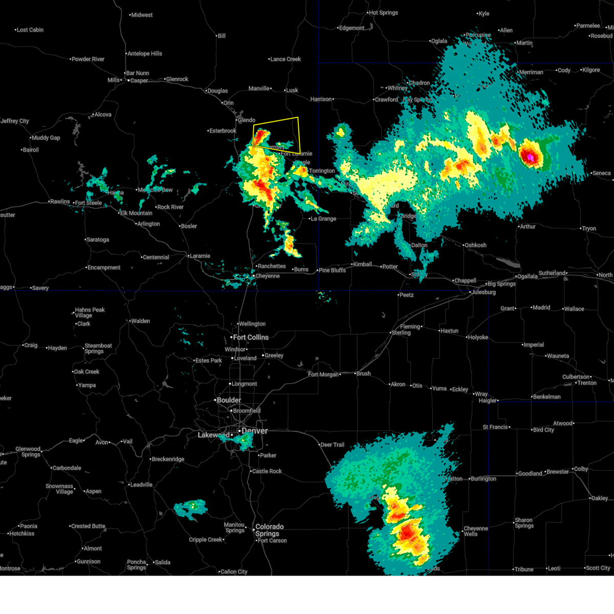
 At 324 pm mdt, severe thunderstorms were located along a line extending from near orin to near glendo to near dwyer junction, moving east at 20 mph (radar indicated). Hazards include golf ball size hail and 60 mph wind gusts. People and animals outdoors will be injured. expect hail damage to roofs, siding, windows, and vehicles. expect wind damage to roofs, siding, and trees. Locations impacted include, guernsey, glendo, hartville, orin, sibley peak, glendo state park, register cliff state historic site, sandy beach campground, reno cove campground, sandy cove campground, two moon campground, guernsey state park, oregon trail ruts state historic site, dwyer junction, bennett hill campground, grayrocks reservoir, shawnee, and cassa. At 324 pm mdt, severe thunderstorms were located along a line extending from near orin to near glendo to near dwyer junction, moving east at 20 mph (radar indicated). Hazards include golf ball size hail and 60 mph wind gusts. People and animals outdoors will be injured. expect hail damage to roofs, siding, windows, and vehicles. expect wind damage to roofs, siding, and trees. Locations impacted include, guernsey, glendo, hartville, orin, sibley peak, glendo state park, register cliff state historic site, sandy beach campground, reno cove campground, sandy cove campground, two moon campground, guernsey state park, oregon trail ruts state historic site, dwyer junction, bennett hill campground, grayrocks reservoir, shawnee, and cassa.
|
| 6/13/2025 3:05 PM MDT |
 Svrcys the national weather service in cheyenne has issued a * severe thunderstorm warning for, southwestern niobrara county in east central wyoming, northern platte county in southeastern wyoming, southeastern converse county in east central wyoming, * until 400 pm mdt. * at 305 pm mdt, severe thunderstorms were located along a line extending from 10 miles southwest of orin to 7 miles east of esterbrook campground to near dwyer junction, moving northeast at 25 mph (radar indicated). Hazards include 60 mph wind gusts and quarter size hail. Hail damage to vehicles is expected. Expect wind damage to roofs, siding, and trees. Svrcys the national weather service in cheyenne has issued a * severe thunderstorm warning for, southwestern niobrara county in east central wyoming, northern platte county in southeastern wyoming, southeastern converse county in east central wyoming, * until 400 pm mdt. * at 305 pm mdt, severe thunderstorms were located along a line extending from 10 miles southwest of orin to 7 miles east of esterbrook campground to near dwyer junction, moving northeast at 25 mph (radar indicated). Hazards include 60 mph wind gusts and quarter size hail. Hail damage to vehicles is expected. Expect wind damage to roofs, siding, and trees.
|
| 6/12/2025 7:06 PM MDT |
 The storm which prompted the warning has weakened below severe limits, and no longer poses an immediate threat to life or property. therefore, the warning will be allowed to expire. a severe thunderstorm watch remains in effect until 1100 pm mdt for southeastern wyoming. The storm which prompted the warning has weakened below severe limits, and no longer poses an immediate threat to life or property. therefore, the warning will be allowed to expire. a severe thunderstorm watch remains in effect until 1100 pm mdt for southeastern wyoming.
|
| 6/12/2025 6:29 PM MDT |
 Svrcys the national weather service in cheyenne has issued a * severe thunderstorm warning for, northwestern goshen county in southeastern wyoming, central platte county in southeastern wyoming, * until 715 pm mdt. * at 629 pm mdt, a severe thunderstorm was located near dwyer junction, or 12 miles north of wheatland, moving southeast at 15 mph (radar indicated). Hazards include 60 mph wind gusts and quarter size hail. Hail damage to vehicles is expected. Expect wind damage to roofs, siding, and trees. Svrcys the national weather service in cheyenne has issued a * severe thunderstorm warning for, northwestern goshen county in southeastern wyoming, central platte county in southeastern wyoming, * until 715 pm mdt. * at 629 pm mdt, a severe thunderstorm was located near dwyer junction, or 12 miles north of wheatland, moving southeast at 15 mph (radar indicated). Hazards include 60 mph wind gusts and quarter size hail. Hail damage to vehicles is expected. Expect wind damage to roofs, siding, and trees.
|
| 6/12/2025 5:14 PM MDT |
 At 514 pm mdt, a severe thunderstorm was located near veteran, or 14 miles west of torrington, moving east at 25 mph (radar indicated). Hazards include ping pong ball size hail. People and animals outdoors will be injured. expect damage to roofs, siding, windows, and vehicles. Locations impacted include, torrington, guernsey, lingle, fort laramie, yoder, huntley, register cliff state historic site, southern hills estates, pine ridge estates, oregon trail ruts state historic site, fort laramie national historic site, grayrocks reservoir, veteran, hwy 85 at dry rawhide creek, and goshen county fairgrounds. At 514 pm mdt, a severe thunderstorm was located near veteran, or 14 miles west of torrington, moving east at 25 mph (radar indicated). Hazards include ping pong ball size hail. People and animals outdoors will be injured. expect damage to roofs, siding, windows, and vehicles. Locations impacted include, torrington, guernsey, lingle, fort laramie, yoder, huntley, register cliff state historic site, southern hills estates, pine ridge estates, oregon trail ruts state historic site, fort laramie national historic site, grayrocks reservoir, veteran, hwy 85 at dry rawhide creek, and goshen county fairgrounds.
|
| 6/12/2025 5:04 PM MDT |
 Svrcys the national weather service in cheyenne has issued a * severe thunderstorm warning for, central goshen county in southeastern wyoming, east central platte county in southeastern wyoming, * until 545 pm mdt. * at 504 pm mdt, a severe thunderstorm was located 8 miles northwest of veteran, or 17 miles west of torrington, moving east at 25 mph (radar indicated). Hazards include half dollar size hail. damage to vehicles is expected Svrcys the national weather service in cheyenne has issued a * severe thunderstorm warning for, central goshen county in southeastern wyoming, east central platte county in southeastern wyoming, * until 545 pm mdt. * at 504 pm mdt, a severe thunderstorm was located 8 miles northwest of veteran, or 17 miles west of torrington, moving east at 25 mph (radar indicated). Hazards include half dollar size hail. damage to vehicles is expected
|
| 6/2/2025 4:27 PM MDT | Quarter sized hail reported 2.7 miles W of Guernsey, WY, picture on social media showing quarter size hail. |
| 6/2/2025 4:09 PM MDT | Camp guernsey airport gust 64 mp in platte county WY, 0.7 miles WNW of Guernsey, WY |
| 6/2/2025 3:49 PM MDT |
 Svrcys the national weather service in cheyenne has issued a * severe thunderstorm warning for, northwestern goshen county in southeastern wyoming, northeastern platte county in southeastern wyoming, * until 430 pm mdt. * at 349 pm mdt, a severe thunderstorm was located near sibley peak, or 24 miles north of wheatland, moving east at 35 mph (radar indicated). Hazards include 60 mph wind gusts and quarter size hail. Hail damage to vehicles is expected. Expect wind damage to roofs, siding, and trees. Svrcys the national weather service in cheyenne has issued a * severe thunderstorm warning for, northwestern goshen county in southeastern wyoming, northeastern platte county in southeastern wyoming, * until 430 pm mdt. * at 349 pm mdt, a severe thunderstorm was located near sibley peak, or 24 miles north of wheatland, moving east at 35 mph (radar indicated). Hazards include 60 mph wind gusts and quarter size hail. Hail damage to vehicles is expected. Expect wind damage to roofs, siding, and trees.
|
| 5/23/2025 7:58 PM MDT |
 Svrcys the national weather service in cheyenne has issued a * severe thunderstorm warning for, west central goshen county in southeastern wyoming, east central platte county in southeastern wyoming, * until 845 pm mdt. * at 757 pm mdt, a severe thunderstorm was located over grayrocks reservoir, or 15 miles northeast of wheatland, moving east at 35 mph (radar indicated). Hazards include 60 mph wind gusts and quarter size hail. Hail damage to vehicles is expected. Expect wind damage to roofs, siding, and trees. Svrcys the national weather service in cheyenne has issued a * severe thunderstorm warning for, west central goshen county in southeastern wyoming, east central platte county in southeastern wyoming, * until 845 pm mdt. * at 757 pm mdt, a severe thunderstorm was located over grayrocks reservoir, or 15 miles northeast of wheatland, moving east at 35 mph (radar indicated). Hazards include 60 mph wind gusts and quarter size hail. Hail damage to vehicles is expected. Expect wind damage to roofs, siding, and trees.
|
| 5/18/2025 4:12 PM MDT | The storms which prompted the warning have weakened below severe limits, and no longer pose an immediate threat to life or property. therefore, the warning will be allowed to expire. however, small hail and gusty winds are still possible with these thunderstorms. |
| 5/18/2025 3:54 PM MDT |
 At 354 pm mdt, severe thunderstorms were located along a line extending from near dwyer junction to near lakeview north to near bordeaux, moving northeast at 25 mph (radar indicated). Hazards include 60 mph wind gusts and quarter size hail. Hail damage to vehicles is expected. expect wind damage to roofs, siding, and trees. Locations impacted include, wheatland, guernsey, chugcreek, lakeview north, sibley peak, bordeaux, y-o ranch, sandy cove campground, guernsey state park, phifer airfield, oregon trail ruts state historic site, dwyer junction, slater, grayrocks reservoir, platte county fairgrounds, antelope gap, and cassa. At 354 pm mdt, severe thunderstorms were located along a line extending from near dwyer junction to near lakeview north to near bordeaux, moving northeast at 25 mph (radar indicated). Hazards include 60 mph wind gusts and quarter size hail. Hail damage to vehicles is expected. expect wind damage to roofs, siding, and trees. Locations impacted include, wheatland, guernsey, chugcreek, lakeview north, sibley peak, bordeaux, y-o ranch, sandy cove campground, guernsey state park, phifer airfield, oregon trail ruts state historic site, dwyer junction, slater, grayrocks reservoir, platte county fairgrounds, antelope gap, and cassa.
|
| 5/18/2025 3:28 PM MDT |
 Svrcys the national weather service in cheyenne has issued a * severe thunderstorm warning for, central platte county in southeastern wyoming, * until 415 pm mdt. * at 328 pm mdt, severe thunderstorms were located along a line extending from 9 miles west of dwyer junction to westview circle to 10 miles southwest of bordeaux, moving northeast at 30 mph (radar indicated). Hazards include 60 mph wind gusts and quarter size hail. Hail damage to vehicles is expected. Expect wind damage to roofs, siding, and trees. Svrcys the national weather service in cheyenne has issued a * severe thunderstorm warning for, central platte county in southeastern wyoming, * until 415 pm mdt. * at 328 pm mdt, severe thunderstorms were located along a line extending from 9 miles west of dwyer junction to westview circle to 10 miles southwest of bordeaux, moving northeast at 30 mph (radar indicated). Hazards include 60 mph wind gusts and quarter size hail. Hail damage to vehicles is expected. Expect wind damage to roofs, siding, and trees.
|
| 9/15/2024 6:15 PM MDT |
 At 615 pm mdt, a severe thunderstorm was located near fort laramie, or 16 miles northwest of torrington, moving north at 25 mph (radar indicated). Hazards include golf ball size hail and 60 mph wind gusts. People and animals outdoors will be injured. expect hail damage to roofs, siding, windows, and vehicles. expect wind damage to roofs, siding, and trees. Locations impacted include, torrington, guernsey, lingle, fort laramie, yoder, henry, hartville, huntley, register cliff state historic site, southern hills estates, torrington municipal airport, pine ridge estates, fort laramie national historic site, grayrocks reservoir, veteran, hawk springs, and goshen county fairgrounds. At 615 pm mdt, a severe thunderstorm was located near fort laramie, or 16 miles northwest of torrington, moving north at 25 mph (radar indicated). Hazards include golf ball size hail and 60 mph wind gusts. People and animals outdoors will be injured. expect hail damage to roofs, siding, windows, and vehicles. expect wind damage to roofs, siding, and trees. Locations impacted include, torrington, guernsey, lingle, fort laramie, yoder, henry, hartville, huntley, register cliff state historic site, southern hills estates, torrington municipal airport, pine ridge estates, fort laramie national historic site, grayrocks reservoir, veteran, hawk springs, and goshen county fairgrounds.
|
| 9/15/2024 5:45 PM MDT |
 Svrcys the national weather service in cheyenne has issued a * severe thunderstorm warning for, northwestern scotts bluff county in the panhandle of nebraska, southwestern sioux county in the panhandle of nebraska, central goshen county in southeastern wyoming, east central platte county in southeastern wyoming, * until 630 pm mdt. * at 545 pm mdt, a severe thunderstorm was located 7 miles northwest of veteran, or 18 miles west of torrington, moving north at 25 mph (radar indicated). Hazards include 60 mph wind gusts and quarter size hail. Hail damage to vehicles is expected. Expect wind damage to roofs, siding, and trees. Svrcys the national weather service in cheyenne has issued a * severe thunderstorm warning for, northwestern scotts bluff county in the panhandle of nebraska, southwestern sioux county in the panhandle of nebraska, central goshen county in southeastern wyoming, east central platte county in southeastern wyoming, * until 630 pm mdt. * at 545 pm mdt, a severe thunderstorm was located 7 miles northwest of veteran, or 18 miles west of torrington, moving north at 25 mph (radar indicated). Hazards include 60 mph wind gusts and quarter size hail. Hail damage to vehicles is expected. Expect wind damage to roofs, siding, and trees.
|
| 7/27/2024 6:15 PM MDT |
 The storms which prompted the warning have moved out of the area. therefore, the warning will be allowed to expire. however, gusty winds and heavy rain are still possible with these thunderstorms. remember, a severe thunderstorm warning still remains in effect for converse, niobrara, goshen, sioux, and scotts bluff counties until 645 pm. The storms which prompted the warning have moved out of the area. therefore, the warning will be allowed to expire. however, gusty winds and heavy rain are still possible with these thunderstorms. remember, a severe thunderstorm warning still remains in effect for converse, niobrara, goshen, sioux, and scotts bluff counties until 645 pm.
|
| 7/27/2024 5:43 PM MDT |
 At 542 pm mdt, severe thunderstorms were located along a line extending from near esterbrook campground to 7 miles south of sibley peak to near chugcreek, moving east at 45 mph (public. at 536pm, a wind gust of 70 mph was reported at coleman along interstate 25). Hazards include 70 mph wind gusts and penny size hail. Expect considerable tree damage. damage is likely to mobile homes, roofs, and outbuildings. Locations impacted include, wheatland, guernsey, fort laramie, glendo, hartville, orin, chugcreek, lakeview north, sibley peak, guernsey state park, pine ridge estates, phifer airfield, oregon trail ruts state historic site, dwyer junction, fort laramie national historic site, bennett hill campground, y-o ranch, glendo state park, register cliff state historic site, and reno cove campground. At 542 pm mdt, severe thunderstorms were located along a line extending from near esterbrook campground to 7 miles south of sibley peak to near chugcreek, moving east at 45 mph (public. at 536pm, a wind gust of 70 mph was reported at coleman along interstate 25). Hazards include 70 mph wind gusts and penny size hail. Expect considerable tree damage. damage is likely to mobile homes, roofs, and outbuildings. Locations impacted include, wheatland, guernsey, fort laramie, glendo, hartville, orin, chugcreek, lakeview north, sibley peak, guernsey state park, pine ridge estates, phifer airfield, oregon trail ruts state historic site, dwyer junction, fort laramie national historic site, bennett hill campground, y-o ranch, glendo state park, register cliff state historic site, and reno cove campground.
|
| 7/27/2024 5:23 PM MDT |
 Svrcys the national weather service in cheyenne has issued a * severe thunderstorm warning for, southwestern niobrara county in east central wyoming, northeastern albany county in southeastern wyoming, northwestern goshen county in southeastern wyoming, northern platte county in southeastern wyoming, southeastern converse county in east central wyoming, * until 615 pm mdt. * at 523 pm mdt, severe thunderstorms were located along a line extending from near esterbrook to near harris park to westview circle, moving east at 45 mph (radar indicated). Hazards include 60 mph wind gusts and penny size hail. expect damage to roofs, siding, and trees Svrcys the national weather service in cheyenne has issued a * severe thunderstorm warning for, southwestern niobrara county in east central wyoming, northeastern albany county in southeastern wyoming, northwestern goshen county in southeastern wyoming, northern platte county in southeastern wyoming, southeastern converse county in east central wyoming, * until 615 pm mdt. * at 523 pm mdt, severe thunderstorms were located along a line extending from near esterbrook to near harris park to westview circle, moving east at 45 mph (radar indicated). Hazards include 60 mph wind gusts and penny size hail. expect damage to roofs, siding, and trees
|
| 7/20/2024 3:39 PM MDT |
 At 339 pm mdt, a severe thunderstorm was located near fort laramie national historic site, or 20 miles east of wheatland, moving southeast at 40 mph (radar indicated). Hazards include 60 mph wind gusts and quarter size hail. Hail damage to vehicles is expected. expect wind damage to roofs, siding, and trees. Locations impacted include, guernsey, lingle, fort laramie, pine ridge estates, fort laramie national historic site, grayrocks reservoir, and register cliff state historic site. At 339 pm mdt, a severe thunderstorm was located near fort laramie national historic site, or 20 miles east of wheatland, moving southeast at 40 mph (radar indicated). Hazards include 60 mph wind gusts and quarter size hail. Hail damage to vehicles is expected. expect wind damage to roofs, siding, and trees. Locations impacted include, guernsey, lingle, fort laramie, pine ridge estates, fort laramie national historic site, grayrocks reservoir, and register cliff state historic site.
|
| 7/20/2024 3:27 PM MDT |
 Svrcys the national weather service in cheyenne has issued a * severe thunderstorm warning for, central goshen county in southeastern wyoming, east central platte county in southeastern wyoming, * until 400 pm mdt. * at 326 pm mdt, a severe thunderstorm was located over register cliff state historic site, or 18 miles northeast of wheatland, moving southeast at 25 mph (radar indicated). Hazards include 60 mph wind gusts and quarter size hail. Hail damage to vehicles is expected. Expect wind damage to roofs, siding, and trees. Svrcys the national weather service in cheyenne has issued a * severe thunderstorm warning for, central goshen county in southeastern wyoming, east central platte county in southeastern wyoming, * until 400 pm mdt. * at 326 pm mdt, a severe thunderstorm was located over register cliff state historic site, or 18 miles northeast of wheatland, moving southeast at 25 mph (radar indicated). Hazards include 60 mph wind gusts and quarter size hail. Hail damage to vehicles is expected. Expect wind damage to roofs, siding, and trees.
|
| 7/15/2024 3:58 PM MDT | the severe thunderstorm warning has been cancelled and is no longer in effect |
| 7/15/2024 3:52 PM MDT | At 352 pm mdt, a severe thunderstorm was located over oregon trail ruts state historic site, or 16 miles northeast of wheatland, moving east at 35 mph (radar indicated). Hazards include 60 mph wind gusts. Expect damage to roofs, siding, and trees. Locations impacted include, guernsey, fort laramie, hartville, pine ridge estates, oregon trail ruts state historic site, fort laramie national historic site, grayrocks reservoir, register cliff state historic site, sandy cove campground, and guernsey state park. |
| 7/15/2024 3:32 PM MDT |
 Svrcys the national weather service in cheyenne has issued a * severe thunderstorm warning for, northwestern goshen county in southeastern wyoming, northeastern platte county in southeastern wyoming, * until 415 pm mdt. * at 332 pm mdt, a severe thunderstorm was located over dwyer junction, or 12 miles north of wheatland, moving east at 35 mph (radar and road weather observations indicated wind speeds near 60 mph). Hazards include 60 mph wind gusts. expect damage to roofs, siding, and trees Svrcys the national weather service in cheyenne has issued a * severe thunderstorm warning for, northwestern goshen county in southeastern wyoming, northeastern platte county in southeastern wyoming, * until 415 pm mdt. * at 332 pm mdt, a severe thunderstorm was located over dwyer junction, or 12 miles north of wheatland, moving east at 35 mph (radar and road weather observations indicated wind speeds near 60 mph). Hazards include 60 mph wind gusts. expect damage to roofs, siding, and trees
|
| 6/30/2024 3:17 PM MDT |
 Svrcys the national weather service in cheyenne has issued a * severe thunderstorm warning for, northwestern goshen county in southeastern wyoming, east central platte county in southeastern wyoming, * until 345 pm mdt. * at 316 pm mdt, a severe thunderstorm was located over guernsey, or 20 miles northeast of wheatland, moving northeast at 35 mph (radar indicated). Hazards include 60 mph wind gusts and quarter size hail. Hail damage to vehicles is expected. Expect wind damage to roofs, siding, and trees. Svrcys the national weather service in cheyenne has issued a * severe thunderstorm warning for, northwestern goshen county in southeastern wyoming, east central platte county in southeastern wyoming, * until 345 pm mdt. * at 316 pm mdt, a severe thunderstorm was located over guernsey, or 20 miles northeast of wheatland, moving northeast at 35 mph (radar indicated). Hazards include 60 mph wind gusts and quarter size hail. Hail damage to vehicles is expected. Expect wind damage to roofs, siding, and trees.
|
| 6/10/2024 6:30 PM MDT |
 the severe thunderstorm warning has been cancelled and is no longer in effect the severe thunderstorm warning has been cancelled and is no longer in effect
|
| 6/10/2024 6:10 PM MDT |
 Svrcys the national weather service in cheyenne has issued a * severe thunderstorm warning for, southwestern sioux county in the panhandle of nebraska, central goshen county in southeastern wyoming, east central platte county in southeastern wyoming, * until 700 pm mdt. * at 610 pm mdt, a severe thunderstorm was located near register cliff state historic site, or 15 miles northeast of wheatland, moving southeast at 40 mph (radar indicated). Hazards include 60 mph wind gusts and quarter size hail. Hail damage to vehicles is expected. Expect wind damage to roofs, siding, and trees. Svrcys the national weather service in cheyenne has issued a * severe thunderstorm warning for, southwestern sioux county in the panhandle of nebraska, central goshen county in southeastern wyoming, east central platte county in southeastern wyoming, * until 700 pm mdt. * at 610 pm mdt, a severe thunderstorm was located near register cliff state historic site, or 15 miles northeast of wheatland, moving southeast at 40 mph (radar indicated). Hazards include 60 mph wind gusts and quarter size hail. Hail damage to vehicles is expected. Expect wind damage to roofs, siding, and trees.
|
| 10/11/2023 2:23 PM MDT |
 At 223 pm mdt, a severe thunderstorm was located 7 miles west of guernsey campground, or 19 miles north of wheatland, moving east at 15 mph (radar indicated). Hazards include 60 mph wind gusts. Expect damage to roofs, siding, and trees. locations impacted include, guernsey, guernsey campground and hartville. hail threat, radar indicated max hail size, <. 75 in wind threat, radar indicated max wind gust, 60 mph. At 223 pm mdt, a severe thunderstorm was located 7 miles west of guernsey campground, or 19 miles north of wheatland, moving east at 15 mph (radar indicated). Hazards include 60 mph wind gusts. Expect damage to roofs, siding, and trees. locations impacted include, guernsey, guernsey campground and hartville. hail threat, radar indicated max hail size, <. 75 in wind threat, radar indicated max wind gust, 60 mph.
|
| 10/11/2023 1:53 PM MDT |
 At 153 pm mdt, a severe thunderstorm was located 9 miles south of sibley peak, or 18 miles north of wheatland, moving northeast at 20 mph (radar indicated). Hazards include 60 mph wind gusts. expect damage to roofs, siding, and trees At 153 pm mdt, a severe thunderstorm was located 9 miles south of sibley peak, or 18 miles north of wheatland, moving northeast at 20 mph (radar indicated). Hazards include 60 mph wind gusts. expect damage to roofs, siding, and trees
|
| 9/22/2023 9:40 PM MDT |
 At 940 pm mdt, severe thunderstorms were located along a line extending from 8 miles southwest of rawhide buttes to near grayrocks reservoir, moving east at 55 mph (radar indicated). Hazards include 60 mph wind gusts and quarter size hail. Hail damage to vehicles is expected. Expect wind damage to roofs, siding, and trees. At 940 pm mdt, severe thunderstorms were located along a line extending from 8 miles southwest of rawhide buttes to near grayrocks reservoir, moving east at 55 mph (radar indicated). Hazards include 60 mph wind gusts and quarter size hail. Hail damage to vehicles is expected. Expect wind damage to roofs, siding, and trees.
|
| 9/9/2023 11:01 PM MDT |
 At 1101 pm mdt, a severe thunderstorm was located near grayrocks reservoir, or 17 miles northeast of wheatland, moving southeast at 25 mph (radar indicated). Hazards include ping pong ball size hail and 60 mph wind gusts. People and animals outdoors will be injured. expect hail damage to roofs, siding, windows, and vehicles. expect wind damage to roofs, siding, and trees. this severe thunderstorm will remain over mainly rural areas of northwestern goshen and east central platte counties, including the following locations, hartville. hail threat, radar indicated max hail size, 1. 50 in wind threat, radar indicated max wind gust, 60 mph. At 1101 pm mdt, a severe thunderstorm was located near grayrocks reservoir, or 17 miles northeast of wheatland, moving southeast at 25 mph (radar indicated). Hazards include ping pong ball size hail and 60 mph wind gusts. People and animals outdoors will be injured. expect hail damage to roofs, siding, windows, and vehicles. expect wind damage to roofs, siding, and trees. this severe thunderstorm will remain over mainly rural areas of northwestern goshen and east central platte counties, including the following locations, hartville. hail threat, radar indicated max hail size, 1. 50 in wind threat, radar indicated max wind gust, 60 mph.
|
| 9/9/2023 10:43 PM MDT | Quarter sized hail reported 4 miles E of Guernsey, WY, spotter found 1" hail on the ground accumulated several inches deep at 10:56pm. estimated time hail fell based on radar. |
| 9/9/2023 10:40 PM MDT |
 At 1040 pm mdt, a severe thunderstorm was located over guernsey campground, or 17 miles northeast of wheatland, moving southeast at 25 mph (radar indicated). Hazards include ping pong ball size hail and 60 mph wind gusts. People and animals outdoors will be injured. expect hail damage to roofs, siding, windows, and vehicles. expect wind damage to roofs, siding, and trees. this severe thunderstorm will be near, guernsey around 1045 pm mdt. grayrocks reservoir around 1100 pm mdt. other locations impacted by this severe thunderstorm include hartville. hail threat, radar indicated max hail size, 1. 50 in wind threat, radar indicated max wind gust, 60 mph. At 1040 pm mdt, a severe thunderstorm was located over guernsey campground, or 17 miles northeast of wheatland, moving southeast at 25 mph (radar indicated). Hazards include ping pong ball size hail and 60 mph wind gusts. People and animals outdoors will be injured. expect hail damage to roofs, siding, windows, and vehicles. expect wind damage to roofs, siding, and trees. this severe thunderstorm will be near, guernsey around 1045 pm mdt. grayrocks reservoir around 1100 pm mdt. other locations impacted by this severe thunderstorm include hartville. hail threat, radar indicated max hail size, 1. 50 in wind threat, radar indicated max wind gust, 60 mph.
|
| 9/9/2023 8:14 PM MDT |
 At 814 pm mdt, a severe thunderstorm was located 7 miles northeast of guernsey campground, or 27 miles southwest of lusk, moving southeast at 25 mph (radar indicated). Hazards include 60 mph wind gusts and half dollar size hail. Hail damage to vehicles is expected. expect wind damage to roofs, siding, and trees. this severe thunderstorm will remain over mainly rural areas of northern goshen and northeastern platte counties, including the following locations, hwy 85 at dry rawhide creek and hartville. hail threat, radar indicated max hail size, 1. 25 in wind threat, radar indicated max wind gust, 60 mph. At 814 pm mdt, a severe thunderstorm was located 7 miles northeast of guernsey campground, or 27 miles southwest of lusk, moving southeast at 25 mph (radar indicated). Hazards include 60 mph wind gusts and half dollar size hail. Hail damage to vehicles is expected. expect wind damage to roofs, siding, and trees. this severe thunderstorm will remain over mainly rural areas of northern goshen and northeastern platte counties, including the following locations, hwy 85 at dry rawhide creek and hartville. hail threat, radar indicated max hail size, 1. 25 in wind threat, radar indicated max wind gust, 60 mph.
|
| 9/9/2023 7:57 PM MDT |
 At 756 pm mdt, a severe thunderstorm was located near two moon campground, or 27 miles southwest of lusk, moving southeast at 30 mph (radar indicated). Hazards include golf ball size hail and 60 mph wind gusts. People and animals outdoors will be injured. expect hail damage to roofs, siding, windows, and vehicles. expect wind damage to roofs, siding, and trees. this severe thunderstorm will be near, fort laramie around 835 pm mdt. other locations impacted by this severe thunderstorm include hwy 85 at dry rawhide creek and hartville. thunderstorm damage threat, considerable hail threat, radar indicated max hail size, 1. 75 in wind threat, radar indicated max wind gust, 60 mph. At 756 pm mdt, a severe thunderstorm was located near two moon campground, or 27 miles southwest of lusk, moving southeast at 30 mph (radar indicated). Hazards include golf ball size hail and 60 mph wind gusts. People and animals outdoors will be injured. expect hail damage to roofs, siding, windows, and vehicles. expect wind damage to roofs, siding, and trees. this severe thunderstorm will be near, fort laramie around 835 pm mdt. other locations impacted by this severe thunderstorm include hwy 85 at dry rawhide creek and hartville. thunderstorm damage threat, considerable hail threat, radar indicated max hail size, 1. 75 in wind threat, radar indicated max wind gust, 60 mph.
|
| 7/26/2023 6:50 PM MDT |
 At 648 pm mdt, outflow winds from severe thunderstorms were located along a line extending from 9 miles southwest of veteran to 11 miles northwest of meriden rest area to 12 miles west of gun barrel to north cheyenne, moving east at 50 mph (weather stations along i-25 reported 60 to 70 mph winds with these storms). Hazards include 60 mph wind gusts. Expect damage to roofs, siding, and trees. locations impacted include, wheatland, guernsey, fort laramie, chugwater, chugcreek, lakeview north, bordeaux, y-o ranch, fort laramie national historic site, whitaker, slater, grayrocks reservoir, guernsey campground, meriden rest area, veteran, ranchettes and hartville. this includes interstate 25 in wyoming between mile markers 19 and 101. hail threat, radar indicated max hail size, <. 75 in wind threat, observed max wind gust, 60 mph. At 648 pm mdt, outflow winds from severe thunderstorms were located along a line extending from 9 miles southwest of veteran to 11 miles northwest of meriden rest area to 12 miles west of gun barrel to north cheyenne, moving east at 50 mph (weather stations along i-25 reported 60 to 70 mph winds with these storms). Hazards include 60 mph wind gusts. Expect damage to roofs, siding, and trees. locations impacted include, wheatland, guernsey, fort laramie, chugwater, chugcreek, lakeview north, bordeaux, y-o ranch, fort laramie national historic site, whitaker, slater, grayrocks reservoir, guernsey campground, meriden rest area, veteran, ranchettes and hartville. this includes interstate 25 in wyoming between mile markers 19 and 101. hail threat, radar indicated max hail size, <. 75 in wind threat, observed max wind gust, 60 mph.
|
| 7/26/2023 6:42 PM MDT | Awos station kgur guernse in platte county WY, 0.7 miles WNW of Guernsey, WY |
| 7/26/2023 6:26 PM MDT |
 At 625 pm mdt, severe thunderstorms were located along a line extending from near bordeaux to near chugwater to 9 miles north of whitaker to near federal, moving east at 50 mph (60 mph wind gusts have been reported along i-25). Hazards include 60 mph wind gusts. expect damage to roofs, siding, and trees At 625 pm mdt, severe thunderstorms were located along a line extending from near bordeaux to near chugwater to 9 miles north of whitaker to near federal, moving east at 50 mph (60 mph wind gusts have been reported along i-25). Hazards include 60 mph wind gusts. expect damage to roofs, siding, and trees
|
| 7/19/2023 5:37 PM MDT |
 The severe thunderstorm warning for west central goshen and east central platte counties will expire at 545 pm mdt, the storm which prompted the warning has moved out of the area. therefore, the warning will be allowed to expire. The severe thunderstorm warning for west central goshen and east central platte counties will expire at 545 pm mdt, the storm which prompted the warning has moved out of the area. therefore, the warning will be allowed to expire.
|
| 7/19/2023 5:23 PM MDT |
 At 523 pm mdt, a severe thunderstorm was located over grayrocks reservoir, or 14 miles east of wheatland, moving south at 35 mph (radar indicated). Hazards include 60 mph wind gusts and half dollar size hail. Hail damage to vehicles is expected. expect wind damage to roofs, siding, and trees. locations impacted include, guernsey, grayrocks reservoir, guernsey campground, fort laramie national historic site and hartville. hail threat, radar indicated max hail size, 1. 25 in wind threat, radar indicated max wind gust, 60 mph. At 523 pm mdt, a severe thunderstorm was located over grayrocks reservoir, or 14 miles east of wheatland, moving south at 35 mph (radar indicated). Hazards include 60 mph wind gusts and half dollar size hail. Hail damage to vehicles is expected. expect wind damage to roofs, siding, and trees. locations impacted include, guernsey, grayrocks reservoir, guernsey campground, fort laramie national historic site and hartville. hail threat, radar indicated max hail size, 1. 25 in wind threat, radar indicated max wind gust, 60 mph.
|
| 7/19/2023 5:03 PM MDT |
 At 503 pm mdt, a severe thunderstorm was located over guernsey campground, or 17 miles northeast of wheatland, moving south at 40 mph (radar indicated). Hazards include ping pong ball size hail and 60 mph wind gusts. People and animals outdoors will be injured. expect hail damage to roofs, siding, windows, and vehicles. Expect wind damage to roofs, siding, and trees. At 503 pm mdt, a severe thunderstorm was located over guernsey campground, or 17 miles northeast of wheatland, moving south at 40 mph (radar indicated). Hazards include ping pong ball size hail and 60 mph wind gusts. People and animals outdoors will be injured. expect hail damage to roofs, siding, windows, and vehicles. Expect wind damage to roofs, siding, and trees.
|
| 7/4/2023 2:05 PM MDT |
 At 205 pm mdt, a severe thunderstorm was located near grayrocks reservoir, or 10 miles northeast of wheatland, moving east at 40 mph (radar indicated). Hazards include 60 mph wind gusts and half dollar size hail. Hail damage to vehicles is expected. Expect wind damage to roofs, siding, and trees. At 205 pm mdt, a severe thunderstorm was located near grayrocks reservoir, or 10 miles northeast of wheatland, moving east at 40 mph (radar indicated). Hazards include 60 mph wind gusts and half dollar size hail. Hail damage to vehicles is expected. Expect wind damage to roofs, siding, and trees.
|
| 7/3/2023 8:10 PM MDT |
 The severe thunderstorm warning for southern niobrara, goshen, northeastern platte and east central converse counties will expire at 815 pm mdt, the storms which prompted the warning have weakened below severe limits, and no longer pose an immediate threat to life or property. therefore, the warning will be allowed to expire. however gusty winds to 55 mph are still possible with these thunderstorms. a severe thunderstorm watch remains in effect until 1100 pm mdt for east central wyoming. to report severe weather, contact your nearest law enforcement agency. they will relay your report to the national weather service cheyenne. remember, a severe thunderstorm warning still remains in effect for niobrara and eastern converse counties. The severe thunderstorm warning for southern niobrara, goshen, northeastern platte and east central converse counties will expire at 815 pm mdt, the storms which prompted the warning have weakened below severe limits, and no longer pose an immediate threat to life or property. therefore, the warning will be allowed to expire. however gusty winds to 55 mph are still possible with these thunderstorms. a severe thunderstorm watch remains in effect until 1100 pm mdt for east central wyoming. to report severe weather, contact your nearest law enforcement agency. they will relay your report to the national weather service cheyenne. remember, a severe thunderstorm warning still remains in effect for niobrara and eastern converse counties.
|
| 7/3/2023 7:49 PM MDT |
 At 749 pm mdt, severe thunderstorms were located along a line extending from 9 miles west of keeline to 8 miles west of rawhide buttes to near fort laramie to 6 miles west of hawk springs, moving northeast at 30 mph (radar indicated). Hazards include 60 mph wind gusts and quarter size hail. Hail damage to vehicles is expected. expect wind damage to roofs, siding, and trees. locations impacted include, torrington, lusk, guernsey, lingle, fort laramie, glendo, yoder, manville, huntley, prairie center, keeline, jay em, fort laramie national historic site, guernsey campground, rawhide buttes, veteran, hawk springs, hartville, van tassell and lost springs. this includes interstate 25 in wyoming between mile markers 112 and 132. hail threat, radar indicated max hail size, 1. 00 in wind threat, radar indicated max wind gust, 60 mph. At 749 pm mdt, severe thunderstorms were located along a line extending from 9 miles west of keeline to 8 miles west of rawhide buttes to near fort laramie to 6 miles west of hawk springs, moving northeast at 30 mph (radar indicated). Hazards include 60 mph wind gusts and quarter size hail. Hail damage to vehicles is expected. expect wind damage to roofs, siding, and trees. locations impacted include, torrington, lusk, guernsey, lingle, fort laramie, glendo, yoder, manville, huntley, prairie center, keeline, jay em, fort laramie national historic site, guernsey campground, rawhide buttes, veteran, hawk springs, hartville, van tassell and lost springs. this includes interstate 25 in wyoming between mile markers 112 and 132. hail threat, radar indicated max hail size, 1. 00 in wind threat, radar indicated max wind gust, 60 mph.
|
| 7/3/2023 7:15 PM MDT |
 At 715 pm mdt, severe thunderstorms were located along a line extending from 11 miles northwest of glendo to near two moon campground to near grayrocks reservoir to 9 miles east of slater, moving northeast at 30 mph (trained weather spotters. these storms have a history of producing 60 to 70 mph wind gusts). Hazards include 70 mph wind gusts and quarter size hail. Hail damage to vehicles is expected. expect considerable tree damage. Wind damage is also likely to mobile homes, roofs, and outbuildings. At 715 pm mdt, severe thunderstorms were located along a line extending from 11 miles northwest of glendo to near two moon campground to near grayrocks reservoir to 9 miles east of slater, moving northeast at 30 mph (trained weather spotters. these storms have a history of producing 60 to 70 mph wind gusts). Hazards include 70 mph wind gusts and quarter size hail. Hail damage to vehicles is expected. expect considerable tree damage. Wind damage is also likely to mobile homes, roofs, and outbuildings.
|
| 7/3/2023 6:49 PM MDT |
 At 649 pm mdt, severe thunderstorms were located along a line extending from near esterbrook to y-o ranch to 6 miles south of chugwater, moving east at 40 mph (trained weather spotters. a highway observation at bordeaux along interstate 25 between chugwater and wheatland recorded a wind gust to 59 mph at 642 pm mdt). Hazards include 70 mph wind gusts and quarter size hail. Hail damage to vehicles is expected. expect considerable tree damage. wind damage is also likely to mobile homes, roofs, and outbuildings. locations impacted include, wheatland, guernsey, rock river, chugwater, glendo, bosler, chugcreek, esterbrook, lakeview north, sibley peak, bordeaux, friend park campground, iron mountain, slater, guernsey campground, westview circle, y-o ranch, curtis gulch campground, two moon campground and laramie peak. this includes the following highways, interstate 25 in wyoming between mile markers 37 and 131. interstate 80 in wyoming between mile markers 282 and 284. thunderstorm damage threat, considerable hail threat, radar indicated max hail size, 1. 00 in wind threat, radar indicated max wind gust, 70 mph. At 649 pm mdt, severe thunderstorms were located along a line extending from near esterbrook to y-o ranch to 6 miles south of chugwater, moving east at 40 mph (trained weather spotters. a highway observation at bordeaux along interstate 25 between chugwater and wheatland recorded a wind gust to 59 mph at 642 pm mdt). Hazards include 70 mph wind gusts and quarter size hail. Hail damage to vehicles is expected. expect considerable tree damage. wind damage is also likely to mobile homes, roofs, and outbuildings. locations impacted include, wheatland, guernsey, rock river, chugwater, glendo, bosler, chugcreek, esterbrook, lakeview north, sibley peak, bordeaux, friend park campground, iron mountain, slater, guernsey campground, westview circle, y-o ranch, curtis gulch campground, two moon campground and laramie peak. this includes the following highways, interstate 25 in wyoming between mile markers 37 and 131. interstate 80 in wyoming between mile markers 282 and 284. thunderstorm damage threat, considerable hail threat, radar indicated max hail size, 1. 00 in wind threat, radar indicated max wind gust, 70 mph.
|
| 7/3/2023 6:21 PM MDT |
 At 621 pm mdt, severe thunderstorms were located along a line extending from near campbell creek campground to 8 miles southwest of westview circle to 11 miles southwest of chugwater, moving east at 40 mph (radar indicated). Hazards include 70 mph wind gusts. Expect considerable tree damage. Damage is likely to mobile homes, roofs, and outbuildings. At 621 pm mdt, severe thunderstorms were located along a line extending from near campbell creek campground to 8 miles southwest of westview circle to 11 miles southwest of chugwater, moving east at 40 mph (radar indicated). Hazards include 70 mph wind gusts. Expect considerable tree damage. Damage is likely to mobile homes, roofs, and outbuildings.
|
| 6/29/2023 3:44 PM MDT |
 At 344 pm mdt, severe thunderstorms were located along a line extending from 6 miles southeast of lusk to 10 miles southwest of jay em to near guernsey, moving east at 30 mph (radar indicated). Hazards include 60 mph wind gusts and quarter size hail. Hail damage to vehicles is expected. Expect wind damage to roofs, siding, and trees. At 344 pm mdt, severe thunderstorms were located along a line extending from 6 miles southeast of lusk to 10 miles southwest of jay em to near guernsey, moving east at 30 mph (radar indicated). Hazards include 60 mph wind gusts and quarter size hail. Hail damage to vehicles is expected. Expect wind damage to roofs, siding, and trees.
|
| 6/29/2023 3:16 PM MDT |
 At 316 pm mdt, a severe thunderstorm was located near guernsey, or 21 miles northeast of wheatland, moving east at 25 mph (radar indicated). Hazards include 60 mph wind gusts and quarter size hail. Hail damage to vehicles is expected. Expect wind damage to roofs, siding, and trees. At 316 pm mdt, a severe thunderstorm was located near guernsey, or 21 miles northeast of wheatland, moving east at 25 mph (radar indicated). Hazards include 60 mph wind gusts and quarter size hail. Hail damage to vehicles is expected. Expect wind damage to roofs, siding, and trees.
|
| 6/23/2023 4:48 PM MDT |
 At 448 pm mdt, a severe thunderstorm was located near guernsey campground, or 24 miles northeast of wheatland, moving northeast at 45 mph (radar indicated). Hazards include golf ball size hail and 60 mph wind gusts. People and animals outdoors will be injured. expect hail damage to roofs, siding, windows, and vehicles. expect wind damage to roofs, siding, and trees. Locations impacted include, guernsey, fort laramie, grayrocks reservoir, guernsey campground, fort laramie national historic site and hartville. At 448 pm mdt, a severe thunderstorm was located near guernsey campground, or 24 miles northeast of wheatland, moving northeast at 45 mph (radar indicated). Hazards include golf ball size hail and 60 mph wind gusts. People and animals outdoors will be injured. expect hail damage to roofs, siding, windows, and vehicles. expect wind damage to roofs, siding, and trees. Locations impacted include, guernsey, fort laramie, grayrocks reservoir, guernsey campground, fort laramie national historic site and hartville.
|
| 6/23/2023 4:34 PM MDT |
 At 434 pm mdt, a severe thunderstorm was located near guernsey, or 14 miles northeast of wheatland, moving northeast at 45 mph (radar indicated). Hazards include golf ball size hail and 60 mph wind gusts. People and animals outdoors will be injured. expect hail damage to roofs, siding, windows, and vehicles. expect wind damage to roofs, siding, and trees. locations impacted include, wheatland, guernsey, fort laramie, glendo, chugcreek, lakeview north, sibley peak, y-o ranch, two moon campground, fort laramie national historic site, grayrocks reservoir, guernsey campground, glendo reservoir and hartville. This includes interstate 25 in wyoming between mile markers 80 and 113. At 434 pm mdt, a severe thunderstorm was located near guernsey, or 14 miles northeast of wheatland, moving northeast at 45 mph (radar indicated). Hazards include golf ball size hail and 60 mph wind gusts. People and animals outdoors will be injured. expect hail damage to roofs, siding, windows, and vehicles. expect wind damage to roofs, siding, and trees. locations impacted include, wheatland, guernsey, fort laramie, glendo, chugcreek, lakeview north, sibley peak, y-o ranch, two moon campground, fort laramie national historic site, grayrocks reservoir, guernsey campground, glendo reservoir and hartville. This includes interstate 25 in wyoming between mile markers 80 and 113.
|
| 6/23/2023 4:13 PM MDT |
 At 413 pm mdt, a severe thunderstorm was located over wheatland, moving northeast at 45 mph (radar indicated). Hazards include golf ball size hail and 60 mph wind gusts. People and animals outdoors will be injured. expect hail damage to roofs, siding, windows, and vehicles. Expect wind damage to roofs, siding, and trees. At 413 pm mdt, a severe thunderstorm was located over wheatland, moving northeast at 45 mph (radar indicated). Hazards include golf ball size hail and 60 mph wind gusts. People and animals outdoors will be injured. expect hail damage to roofs, siding, windows, and vehicles. Expect wind damage to roofs, siding, and trees.
|
| 6/23/2023 4:02 PM MDT |
 At 402 pm mdt, a severe thunderstorm was located over chugcreek, or near wheatland, moving northeast at 65 mph (radar indicated). Hazards include ping pong ball size hail and 60 mph wind gusts. People and animals outdoors will be injured. expect hail damage to roofs, siding, windows, and vehicles. expect wind damage to roofs, siding, and trees. locations impacted include, wheatland, guernsey, lingle, fort laramie, chugcreek, lakeview north, bordeaux, westview circle, y-o ranch, fort laramie national historic site, slater, grayrocks reservoir and guernsey campground. This includes interstate 25 in wyoming between mile markers 63 and 106. At 402 pm mdt, a severe thunderstorm was located over chugcreek, or near wheatland, moving northeast at 65 mph (radar indicated). Hazards include ping pong ball size hail and 60 mph wind gusts. People and animals outdoors will be injured. expect hail damage to roofs, siding, windows, and vehicles. expect wind damage to roofs, siding, and trees. locations impacted include, wheatland, guernsey, lingle, fort laramie, chugcreek, lakeview north, bordeaux, westview circle, y-o ranch, fort laramie national historic site, slater, grayrocks reservoir and guernsey campground. This includes interstate 25 in wyoming between mile markers 63 and 106.
|
| 6/23/2023 3:52 PM MDT |
 At 352 pm mdt, a severe thunderstorm was located over bordeaux, or 7 miles south of wheatland, moving northeast at 65 mph (radar indicated). Hazards include ping pong ball size hail and 60 mph wind gusts. People and animals outdoors will be injured. expect hail damage to roofs, siding, windows, and vehicles. Expect wind damage to roofs, siding, and trees. At 352 pm mdt, a severe thunderstorm was located over bordeaux, or 7 miles south of wheatland, moving northeast at 65 mph (radar indicated). Hazards include ping pong ball size hail and 60 mph wind gusts. People and animals outdoors will be injured. expect hail damage to roofs, siding, windows, and vehicles. Expect wind damage to roofs, siding, and trees.
|
| 7/29/2022 9:26 PM MDT |
 The severe thunderstorm warning for northwestern goshen and northeastern platte counties will expire at 930 pm mdt, the storm which prompted the warning has weakened below severe limits, and no longer poses an immediate threat to life or property. therefore, the warning will be allowed to expire. however small hail and gusty winds are still possible with this thunderstorm. The severe thunderstorm warning for northwestern goshen and northeastern platte counties will expire at 930 pm mdt, the storm which prompted the warning has weakened below severe limits, and no longer poses an immediate threat to life or property. therefore, the warning will be allowed to expire. however small hail and gusty winds are still possible with this thunderstorm.
|
| 7/29/2022 9:13 PM MDT |
 At 913 pm mdt, a severe thunderstorm was located over guernsey campground, or 20 miles northeast of wheatland, moving southwest at 10 mph (radar indicated). Hazards include half dollar size hail. Damage to vehicles is expected. locations impacted include, guernsey, guernsey campground and hartville. hail threat, radar indicated max hail size, 1. 25 in wind threat, radar indicated max wind gust, <50 mph. At 913 pm mdt, a severe thunderstorm was located over guernsey campground, or 20 miles northeast of wheatland, moving southwest at 10 mph (radar indicated). Hazards include half dollar size hail. Damage to vehicles is expected. locations impacted include, guernsey, guernsey campground and hartville. hail threat, radar indicated max hail size, 1. 25 in wind threat, radar indicated max wind gust, <50 mph.
|
| 7/29/2022 8:59 PM MDT |
 At 858 pm mdt, a severe thunderstorm was located near guernsey campground, or 23 miles northeast of wheatland, moving southwest at 10 mph (radar indicated). Hazards include ping pong ball size hail. People and animals outdoors will be injured. expect damage to roofs, siding, windows, and vehicles. locations impacted include, guernsey, guernsey campground and hartville. hail threat, radar indicated max hail size, 1. 50 in wind threat, radar indicated max wind gust, <50 mph. At 858 pm mdt, a severe thunderstorm was located near guernsey campground, or 23 miles northeast of wheatland, moving southwest at 10 mph (radar indicated). Hazards include ping pong ball size hail. People and animals outdoors will be injured. expect damage to roofs, siding, windows, and vehicles. locations impacted include, guernsey, guernsey campground and hartville. hail threat, radar indicated max hail size, 1. 50 in wind threat, radar indicated max wind gust, <50 mph.
|
| 7/29/2022 8:45 PM MDT |
 At 844 pm mdt, a severe thunderstorm was located near guernsey campground, or 26 miles northeast of wheatland, moving southwest at 10 mph (radar indicated). Hazards include two inch hail. People and animals outdoors will be injured. Expect damage to roofs, siding, windows, and vehicles. At 844 pm mdt, a severe thunderstorm was located near guernsey campground, or 26 miles northeast of wheatland, moving southwest at 10 mph (radar indicated). Hazards include two inch hail. People and animals outdoors will be injured. Expect damage to roofs, siding, windows, and vehicles.
|
| 7/29/2022 8:33 PM MDT |
 At 832 pm mdt, a severe thunderstorm was located near guernsey campground, or 26 miles northeast of wheatland, moving southwest at 10 mph (radar indicated). Hazards include tennis ball size hail. People and animals outdoors will be injured. expect damage to roofs, siding, windows, and vehicles. locations impacted include, guernsey, guernsey campground and hartville. thunderstorm damage threat, considerable hail threat, radar indicated max hail size, 2. 50 in wind threat, radar indicated max wind gust, <50 mph. At 832 pm mdt, a severe thunderstorm was located near guernsey campground, or 26 miles northeast of wheatland, moving southwest at 10 mph (radar indicated). Hazards include tennis ball size hail. People and animals outdoors will be injured. expect damage to roofs, siding, windows, and vehicles. locations impacted include, guernsey, guernsey campground and hartville. thunderstorm damage threat, considerable hail threat, radar indicated max hail size, 2. 50 in wind threat, radar indicated max wind gust, <50 mph.
|
| 7/29/2022 8:11 PM MDT |
 At 810 pm mdt, a severe thunderstorm was located 9 miles northeast of guernsey campground, or 25 miles south of lusk, moving southwest at 10 mph (radar indicated). Hazards include golf ball size hail. People and animals outdoors will be injured. expect damage to roofs, siding, windows, and vehicles. locations impacted include, guernsey, guernsey campground and hartville. thunderstorm damage threat, considerable hail threat, radar indicated max hail size, 1. 75 in wind threat, radar indicated max wind gust, <50 mph. At 810 pm mdt, a severe thunderstorm was located 9 miles northeast of guernsey campground, or 25 miles south of lusk, moving southwest at 10 mph (radar indicated). Hazards include golf ball size hail. People and animals outdoors will be injured. expect damage to roofs, siding, windows, and vehicles. locations impacted include, guernsey, guernsey campground and hartville. thunderstorm damage threat, considerable hail threat, radar indicated max hail size, 1. 75 in wind threat, radar indicated max wind gust, <50 mph.
|
| 7/29/2022 8:00 PM MDT |
 At 759 pm mdt, a severe thunderstorm was located 11 miles southwest of rawhide buttes, or 24 miles south of lusk, moving southwest at 10 mph (radar indicated). Hazards include quarter size hail. damage to vehicles is expected At 759 pm mdt, a severe thunderstorm was located 11 miles southwest of rawhide buttes, or 24 miles south of lusk, moving southwest at 10 mph (radar indicated). Hazards include quarter size hail. damage to vehicles is expected
|
| 7/1/2022 5:20 PM MDT |
 The severe thunderstorm warning for northwestern goshen and northeastern platte counties will expire at 530 pm mdt, the storm which prompted the warning has weakened below severe limits, and no longer poses an immediate threat to life or property. therefore, the warning will be allowed to expire. however gusty winds are still possible with this thunderstorm. a severe thunderstorm watch remains in effect until 1000 pm mdt for southeastern wyoming. The severe thunderstorm warning for northwestern goshen and northeastern platte counties will expire at 530 pm mdt, the storm which prompted the warning has weakened below severe limits, and no longer poses an immediate threat to life or property. therefore, the warning will be allowed to expire. however gusty winds are still possible with this thunderstorm. a severe thunderstorm watch remains in effect until 1000 pm mdt for southeastern wyoming.
|
| 7/1/2022 4:58 PM MDT | Guernsey awo in platte county WY, 0.7 miles WNW of Guernsey, WY |
| 7/1/2022 4:46 PM MDT |
 At 445 pm mdt, a severe thunderstorm was located near guernsey campground, or 24 miles north of wheatland, moving east at 20 mph (radar indicated). Hazards include golf ball size hail and 60 mph wind gusts. People and animals outdoors will be injured. expect hail damage to roofs, siding, windows, and vehicles. expect wind damage to roofs, siding, and trees. Locations impacted include, guernsey, guernsey campground, fort laramie national historic site and hartville. At 445 pm mdt, a severe thunderstorm was located near guernsey campground, or 24 miles north of wheatland, moving east at 20 mph (radar indicated). Hazards include golf ball size hail and 60 mph wind gusts. People and animals outdoors will be injured. expect hail damage to roofs, siding, windows, and vehicles. expect wind damage to roofs, siding, and trees. Locations impacted include, guernsey, guernsey campground, fort laramie national historic site and hartville.
|
| 7/1/2022 4:42 PM MDT |
 At 442 pm mdt, a severe thunderstorm was located near guernsey campground, or 24 miles north of wheatland, moving east at 20 mph (radar indicated). Hazards include golf ball size hail and 60 mph wind gusts. People and animals outdoors will be injured. expect hail damage to roofs, siding, windows, and vehicles. expect wind damage to roofs, siding, and trees. locations impacted include, guernsey, guernsey campground, fort laramie national historic site and hartville. thunderstorm damage threat, considerable hail threat, radar indicated max hail size, 1. 75 in wind threat, radar indicated max wind gust, 60 mph. At 442 pm mdt, a severe thunderstorm was located near guernsey campground, or 24 miles north of wheatland, moving east at 20 mph (radar indicated). Hazards include golf ball size hail and 60 mph wind gusts. People and animals outdoors will be injured. expect hail damage to roofs, siding, windows, and vehicles. expect wind damage to roofs, siding, and trees. locations impacted include, guernsey, guernsey campground, fort laramie national historic site and hartville. thunderstorm damage threat, considerable hail threat, radar indicated max hail size, 1. 75 in wind threat, radar indicated max wind gust, 60 mph.
|
| 7/1/2022 4:31 PM MDT |
 At 431 pm mdt, a severe thunderstorm was located near two moon campground, or 24 miles north of wheatland, moving east at 20 mph (radar indicated). Hazards include 60 mph wind gusts and half dollar size hail. Hail damage to vehicles is expected. Expect wind damage to roofs, siding, and trees. At 431 pm mdt, a severe thunderstorm was located near two moon campground, or 24 miles north of wheatland, moving east at 20 mph (radar indicated). Hazards include 60 mph wind gusts and half dollar size hail. Hail damage to vehicles is expected. Expect wind damage to roofs, siding, and trees.
|
| 6/4/2022 8:05 PM MDT |
 At 805 pm mdt, severe thunderstorms were located along a line extending from 6 miles west of keeline to 7 miles west of guernsey campground, moving east at 20 mph (radar indicated). Hazards include 60 mph wind gusts and quarter size hail. Hail damage to vehicles is expected. expect wind damage to roofs, siding, and trees. locations impacted include, guernsey, glendo, manville, keeline, sibley peak, guernsey campground, glendo reservoir, two moon campground and hartville. this includes interstate 25 in wyoming between mile markers 98 and 110. hail threat, radar indicated max hail size, 1. 00 in wind threat, radar indicated max wind gust, 60 mph. At 805 pm mdt, severe thunderstorms were located along a line extending from 6 miles west of keeline to 7 miles west of guernsey campground, moving east at 20 mph (radar indicated). Hazards include 60 mph wind gusts and quarter size hail. Hail damage to vehicles is expected. expect wind damage to roofs, siding, and trees. locations impacted include, guernsey, glendo, manville, keeline, sibley peak, guernsey campground, glendo reservoir, two moon campground and hartville. this includes interstate 25 in wyoming between mile markers 98 and 110. hail threat, radar indicated max hail size, 1. 00 in wind threat, radar indicated max wind gust, 60 mph.
|
| 6/4/2022 7:44 PM MDT |
 At 743 pm mdt, severe thunderstorms were located along a line extending from 6 miles north of glendo to near sibley peak, moving east at 20 mph (radar indicated). Hazards include 60 mph wind gusts and quarter size hail. Hail damage to vehicles is expected. Expect wind damage to roofs, siding, and trees. At 743 pm mdt, severe thunderstorms were located along a line extending from 6 miles north of glendo to near sibley peak, moving east at 20 mph (radar indicated). Hazards include 60 mph wind gusts and quarter size hail. Hail damage to vehicles is expected. Expect wind damage to roofs, siding, and trees.
|
| 6/5/2021 7:29 PM MDT |
 At 728 pm mdt, a severe thunderstorm was located 8 miles southwest of rawhide buttes, or 20 miles southwest of lusk, moving northeast at 35 mph (radar indicated). Hazards include 60 mph wind gusts and nickel size hail. Expect damage to roofs, siding, and trees. Locations impacted include, guernsey, guernsey campground, rawhide buttes, jay em and hartville. At 728 pm mdt, a severe thunderstorm was located 8 miles southwest of rawhide buttes, or 20 miles southwest of lusk, moving northeast at 35 mph (radar indicated). Hazards include 60 mph wind gusts and nickel size hail. Expect damage to roofs, siding, and trees. Locations impacted include, guernsey, guernsey campground, rawhide buttes, jay em and hartville.
|
| 6/5/2021 7:16 PM MDT |
 At 716 pm mdt, a severe thunderstorm was located 7 miles southeast of two moon campground, or 27 miles north of wheatland, moving northeast at 35 mph (radar indicated). Hazards include 60 mph wind gusts and nickel size hail. expect damage to roofs, siding, and trees At 716 pm mdt, a severe thunderstorm was located 7 miles southeast of two moon campground, or 27 miles north of wheatland, moving northeast at 35 mph (radar indicated). Hazards include 60 mph wind gusts and nickel size hail. expect damage to roofs, siding, and trees
|
| 5/23/2021 1:35 PM MDT |
 At 134 pm mdt, a severe thunderstorm was located near guernsey campground, or 17 miles northeast of wheatland, moving north at 20 mph (radar indicated). Hazards include 60 mph wind gusts and quarter size hail. Hail damage to vehicles is expected. Expect wind damage to roofs, siding, and trees. At 134 pm mdt, a severe thunderstorm was located near guernsey campground, or 17 miles northeast of wheatland, moving north at 20 mph (radar indicated). Hazards include 60 mph wind gusts and quarter size hail. Hail damage to vehicles is expected. Expect wind damage to roofs, siding, and trees.
|
| 7/9/2020 5:26 PM MDT |
 At 526 pm mdt, a severe thunderstorm was located near fort laramie national historic site, or 20 miles northeast of wheatland, moving east at 20 mph (radar indicated). Hazards include 60 mph wind gusts and quarter size hail. Hail damage to vehicles is expected. expect wind damage to roofs, siding, and trees. Locations impacted include, guernsey, fort laramie, guernsey campground, fort laramie national historic site and hartville. At 526 pm mdt, a severe thunderstorm was located near fort laramie national historic site, or 20 miles northeast of wheatland, moving east at 20 mph (radar indicated). Hazards include 60 mph wind gusts and quarter size hail. Hail damage to vehicles is expected. expect wind damage to roofs, siding, and trees. Locations impacted include, guernsey, fort laramie, guernsey campground, fort laramie national historic site and hartville.
|
| 7/9/2020 5:08 PM MDT |
 At 508 pm mdt, a severe thunderstorm was located near guernsey, or 16 miles northeast of wheatland, moving east at 20 mph (radar indicated). Hazards include ping pong ball size hail and 60 mph wind gusts. People and animals outdoors will be injured. expect hail damage to roofs, siding, windows, and vehicles. expect wind damage to roofs, siding, and trees. Locations impacted include, guernsey, fort laramie, grayrocks reservoir, guernsey campground, fort laramie national historic site and hartville. At 508 pm mdt, a severe thunderstorm was located near guernsey, or 16 miles northeast of wheatland, moving east at 20 mph (radar indicated). Hazards include ping pong ball size hail and 60 mph wind gusts. People and animals outdoors will be injured. expect hail damage to roofs, siding, windows, and vehicles. expect wind damage to roofs, siding, and trees. Locations impacted include, guernsey, fort laramie, grayrocks reservoir, guernsey campground, fort laramie national historic site and hartville.
|
| 7/9/2020 4:54 PM MDT |
 At 454 pm mdt, a severe thunderstorm was located 8 miles west of guernsey campground, or 15 miles north of wheatland, moving east at 20 mph (radar indicated). Hazards include ping pong ball size hail and 60 mph wind gusts. People and animals outdoors will be injured. expect hail damage to roofs, siding, windows, and vehicles. Expect wind damage to roofs, siding, and trees. At 454 pm mdt, a severe thunderstorm was located 8 miles west of guernsey campground, or 15 miles north of wheatland, moving east at 20 mph (radar indicated). Hazards include ping pong ball size hail and 60 mph wind gusts. People and animals outdoors will be injured. expect hail damage to roofs, siding, windows, and vehicles. Expect wind damage to roofs, siding, and trees.
|
| 6/6/2020 5:06 PM MDT |
 At 505 pm mdt, severe thunderstorms were located along a line extending from 14 miles southeast of dull center to 8 miles northeast of fort laramie, moving northeast at 70 mph (radar indicated). Hazards include 70 mph wind gusts. Expect considerable tree damage. damage is likely to mobile homes, roofs, and outbuildings. locations impacted include, lusk, guernsey, lingle, fort laramie, glendo, manville, sibley peak, dull center, two moon campground, keeline, jay em, fort laramie national historic site, bill, grayrocks reservoir, guernsey campground, rawhide buttes, glendo reservoir, lance creek, manning ranch and chugcreek. This includes interstate 25 in wyoming between mile markers 103 and 124. At 505 pm mdt, severe thunderstorms were located along a line extending from 14 miles southeast of dull center to 8 miles northeast of fort laramie, moving northeast at 70 mph (radar indicated). Hazards include 70 mph wind gusts. Expect considerable tree damage. damage is likely to mobile homes, roofs, and outbuildings. locations impacted include, lusk, guernsey, lingle, fort laramie, glendo, manville, sibley peak, dull center, two moon campground, keeline, jay em, fort laramie national historic site, bill, grayrocks reservoir, guernsey campground, rawhide buttes, glendo reservoir, lance creek, manning ranch and chugcreek. This includes interstate 25 in wyoming between mile markers 103 and 124.
|
| 6/6/2020 4:57 PM MDT |
 At 456 pm mdt, severe thunderstorms were located along a line extending from 13 miles north of manning ranch to near fort laramie national historic site, moving northeast at 60 mph. these are very dangerous storms (radar indicated). Hazards include 80 mph wind gusts. Flying debris will be dangerous to those caught without shelter. mobile homes will be heavily damaged. expect considerable damage to roofs, windows, and vehicles. extensive tree damage and power outages are likely. locations impacted include, lusk, guernsey, lingle, fort laramie, glendo, manville, sibley peak, dull center, two moon campground, keeline, jay em, fort laramie national historic site, bill, grayrocks reservoir, guernsey campground, rawhide buttes, glendo reservoir, lance creek, manning ranch and chugcreek. This includes interstate 25 in wyoming between mile markers 103 and 124. At 456 pm mdt, severe thunderstorms were located along a line extending from 13 miles north of manning ranch to near fort laramie national historic site, moving northeast at 60 mph. these are very dangerous storms (radar indicated). Hazards include 80 mph wind gusts. Flying debris will be dangerous to those caught without shelter. mobile homes will be heavily damaged. expect considerable damage to roofs, windows, and vehicles. extensive tree damage and power outages are likely. locations impacted include, lusk, guernsey, lingle, fort laramie, glendo, manville, sibley peak, dull center, two moon campground, keeline, jay em, fort laramie national historic site, bill, grayrocks reservoir, guernsey campground, rawhide buttes, glendo reservoir, lance creek, manning ranch and chugcreek. This includes interstate 25 in wyoming between mile markers 103 and 124.
|
| 6/6/2020 4:39 PM MDT |
 At 439 pm mdt, severe thunderstorms were located along a line extending from 16 miles north of douglas to lakeview north, moving northeast at 60 mph. these are very dangerous storms (radar indicated). Hazards include 80 mph wind gusts. Flying debris will be dangerous to those caught without shelter. mobile homes will be heavily damaged. expect considerable damage to roofs, windows, and vehicles. Extensive tree damage and power outages are likely. At 439 pm mdt, severe thunderstorms were located along a line extending from 16 miles north of douglas to lakeview north, moving northeast at 60 mph. these are very dangerous storms (radar indicated). Hazards include 80 mph wind gusts. Flying debris will be dangerous to those caught without shelter. mobile homes will be heavily damaged. expect considerable damage to roofs, windows, and vehicles. Extensive tree damage and power outages are likely.
|
| 9/10/2019 3:14 PM MDT | Golf Ball sized hail reported 2.2 miles SSW of Guernsey, WY, golf ball hail measured over hail core area. this is a corrected location |
| 9/10/2019 3:05 PM MDT | Golf Ball sized hail reported 2.8 miles SSW of Guernsey, WY |
| 9/10/2019 3:01 PM MDT |
 The national weather service in cheyenne has issued a * severe thunderstorm warning for. northwestern goshen county in southeastern wyoming. northeastern platte county in southeastern wyoming. until 330 pm mdt. At 301 pm mdt, a severe thunderstorm was located near guernsey. The national weather service in cheyenne has issued a * severe thunderstorm warning for. northwestern goshen county in southeastern wyoming. northeastern platte county in southeastern wyoming. until 330 pm mdt. At 301 pm mdt, a severe thunderstorm was located near guernsey.
|
| 8/16/2019 12:07 AM MDT |
 A severe thunderstorm warning remains in effect until 1215 am mdt for northwestern goshen and east central platte counties. at 1205 am mdt, a severe thunderstorm was located near grayrocks reservoir, or 18 miles northeast of wheatland, moving southeast at 45 mph. At 1206 am members of the public reported quarter sized hail in guernsey. A severe thunderstorm warning remains in effect until 1215 am mdt for northwestern goshen and east central platte counties. at 1205 am mdt, a severe thunderstorm was located near grayrocks reservoir, or 18 miles northeast of wheatland, moving southeast at 45 mph. At 1206 am members of the public reported quarter sized hail in guernsey.
|
| 8/16/2019 12:06 AM MDT | Quarter sized hail reported 0.5 miles SSW of Guernsey, WY |
| 8/16/2019 12:05 AM MDT | Baseball sized hail reported 5.1 miles N of Guernsey, WY, received photo via facebook. time and location estimated off of radar. |
| 8/16/2019 12:01 AM MDT | Half Dollar sized hail reported 5.1 miles N of Guernsey, WY |
| 8/15/2019 11:32 PM MDT |
 At 1130 pm mdt, a severe thunderstorm was located near sibley peak, or 26 miles north of wheatland, moving southeast at 45 mph. this storm is producing frequent large hail. move to shelter away from windows (radar indicated). Hazards include ping pong ball size hail and 60 mph wind gusts. People and animals outdoors will be injured. expect hail damage to roofs, siding, windows, and vehicles. Expect wind damage to roofs, siding, and trees. At 1130 pm mdt, a severe thunderstorm was located near sibley peak, or 26 miles north of wheatland, moving southeast at 45 mph. this storm is producing frequent large hail. move to shelter away from windows (radar indicated). Hazards include ping pong ball size hail and 60 mph wind gusts. People and animals outdoors will be injured. expect hail damage to roofs, siding, windows, and vehicles. Expect wind damage to roofs, siding, and trees.
|
| 7/5/2019 5:15 PM MDT |
 At 514 pm mdt, a severe thunderstorm was located over guernsey campground, or 19 miles northeast of wheatland, moving east at 20 mph (radar indicated). Hazards include 60 mph wind gusts and quarter size hail. Hail damage to vehicles is expected. Expect wind damage to roofs, siding, and trees. At 514 pm mdt, a severe thunderstorm was located over guernsey campground, or 19 miles northeast of wheatland, moving east at 20 mph (radar indicated). Hazards include 60 mph wind gusts and quarter size hail. Hail damage to vehicles is expected. Expect wind damage to roofs, siding, and trees.
|
| 7/5/2019 5:02 PM MDT |
 At 500 pm mdt, a severe thunderstorm was located over guernsey campground, or 20 miles north of wheatland, moving east at 15 mph. a second severe thunderstorm was located just southeast of guernsey. a severe thunderstorm warning is also in effect for this storm until 545 pm mdt (radar indicated). Hazards include 60 mph wind gusts and quarter size hail. Hail damage to vehicles is expected. expect wind damage to roofs, siding, and trees. Locations impacted include, guernsey, grayrocks reservoir, guernsey campground and hartville. At 500 pm mdt, a severe thunderstorm was located over guernsey campground, or 20 miles north of wheatland, moving east at 15 mph. a second severe thunderstorm was located just southeast of guernsey. a severe thunderstorm warning is also in effect for this storm until 545 pm mdt (radar indicated). Hazards include 60 mph wind gusts and quarter size hail. Hail damage to vehicles is expected. expect wind damage to roofs, siding, and trees. Locations impacted include, guernsey, grayrocks reservoir, guernsey campground and hartville.
|
| 7/5/2019 4:55 PM MDT |
 At 454 pm mdt, a severe thunderstorm was located near guernsey, or 20 miles northeast of wheatland, moving east at 20 mph (trained weather spotters. this storm has a history of producing very large destructive hail up to golf ball size). Hazards include golf ball size hail and 60 mph wind gusts. People and animals outdoors will be injured. expect hail damage to roofs, siding, windows, and vehicles. Expect wind damage to roofs, siding, and trees. At 454 pm mdt, a severe thunderstorm was located near guernsey, or 20 miles northeast of wheatland, moving east at 20 mph (trained weather spotters. this storm has a history of producing very large destructive hail up to golf ball size). Hazards include golf ball size hail and 60 mph wind gusts. People and animals outdoors will be injured. expect hail damage to roofs, siding, windows, and vehicles. Expect wind damage to roofs, siding, and trees.
|
| 7/5/2019 4:46 PM MDT |
 At 445 pm mdt, a severe thunderstorm was located over guernsey, or 18 miles northeast of wheatland, moving east at 15 mph (law enforcement. multiple reports of hail up to the size of golf balls have been received in the guernsey area with this storm). Hazards include golf ball size hail and 60 mph wind gusts. People and animals outdoors will be injured. expect hail damage to roofs, siding, windows, and vehicles. expect wind damage to roofs, siding, and trees. Locations impacted include, guernsey, grayrocks reservoir, guernsey campground and hartville. At 445 pm mdt, a severe thunderstorm was located over guernsey, or 18 miles northeast of wheatland, moving east at 15 mph (law enforcement. multiple reports of hail up to the size of golf balls have been received in the guernsey area with this storm). Hazards include golf ball size hail and 60 mph wind gusts. People and animals outdoors will be injured. expect hail damage to roofs, siding, windows, and vehicles. expect wind damage to roofs, siding, and trees. Locations impacted include, guernsey, grayrocks reservoir, guernsey campground and hartville.
|
| 7/5/2019 4:42 PM MDT | Golf Ball sized hail reported 0.5 miles SSW of Guernsey, WY, dispatch reported golfball sized hail in guernsey. |
| 7/5/2019 4:41 PM MDT |
 At 441 pm mdt, a severe thunderstorm was located over guernsey, or 18 miles northeast of wheatland, moving southeast at 25 mph (radar indicated). Hazards include ping pong ball size hail and 60 mph wind gusts. People and animals outdoors will be injured. expect hail damage to roofs, siding, windows, and vehicles. expect wind damage to roofs, siding, and trees. Locations impacted include, guernsey, grayrocks reservoir, guernsey campground and hartville. At 441 pm mdt, a severe thunderstorm was located over guernsey, or 18 miles northeast of wheatland, moving southeast at 25 mph (radar indicated). Hazards include ping pong ball size hail and 60 mph wind gusts. People and animals outdoors will be injured. expect hail damage to roofs, siding, windows, and vehicles. expect wind damage to roofs, siding, and trees. Locations impacted include, guernsey, grayrocks reservoir, guernsey campground and hartville.
|
| 7/5/2019 4:29 PM MDT |
 At 427 pm mdt, a severe thunderstorm was located near guernsey campground, or 18 miles north of wheatland, moving east at 15 mph. this is a very dangerous storm. those in the guernsey area should seek shelter immediately (radar indicated). Hazards include baseball size hail and 60 mph wind gusts. People and animals outdoors will be severely injured. Expect shattered windows, extensive damage to roofs, siding, and vehicles. At 427 pm mdt, a severe thunderstorm was located near guernsey campground, or 18 miles north of wheatland, moving east at 15 mph. this is a very dangerous storm. those in the guernsey area should seek shelter immediately (radar indicated). Hazards include baseball size hail and 60 mph wind gusts. People and animals outdoors will be severely injured. Expect shattered windows, extensive damage to roofs, siding, and vehicles.
|
| 6/30/2019 6:53 PM MDT |
 At 653 pm mdt, a severe thunderstorm was located near guernsey, or 13 miles northeast of wheatland, moving north at 35 mph (radar indicated). Hazards include 60 mph wind gusts and quarter size hail. Hail damage to vehicles is expected. Expect wind damage to roofs, siding, and trees. At 653 pm mdt, a severe thunderstorm was located near guernsey, or 13 miles northeast of wheatland, moving north at 35 mph (radar indicated). Hazards include 60 mph wind gusts and quarter size hail. Hail damage to vehicles is expected. Expect wind damage to roofs, siding, and trees.
|
| 5/26/2019 4:26 PM MDT |
 At 426 pm mdt, a severe thunderstorm was located near guernsey campground, or 25 miles northeast of wheatland, moving northeast at 35 mph (radar indicated). Hazards include 60 mph wind gusts and half dollar size hail. Hail damage to vehicles is expected. expect wind damage to roofs, siding, and trees. locations impacted include, guernsey. This includes interstate 25 in wyoming between mile markers 87 and 93. At 426 pm mdt, a severe thunderstorm was located near guernsey campground, or 25 miles northeast of wheatland, moving northeast at 35 mph (radar indicated). Hazards include 60 mph wind gusts and half dollar size hail. Hail damage to vehicles is expected. expect wind damage to roofs, siding, and trees. locations impacted include, guernsey. This includes interstate 25 in wyoming between mile markers 87 and 93.
|
| 5/26/2019 4:19 PM MDT |
 At 419 pm mdt, a severe thunderstorm was located over guernsey campground, or 22 miles northeast of wheatland, moving northeast at 35 mph (radar indicated). Hazards include 60 mph wind gusts and half dollar size hail. Hail damage to vehicles is expected. expect wind damage to roofs, siding, and trees. this severe thunderstorm will remain over mainly rural areas of northwestern goshen and east central platte counties, including the following locations, hartville. This includes interstate 25 in wyoming between mile markers 87 and 94. At 419 pm mdt, a severe thunderstorm was located over guernsey campground, or 22 miles northeast of wheatland, moving northeast at 35 mph (radar indicated). Hazards include 60 mph wind gusts and half dollar size hail. Hail damage to vehicles is expected. expect wind damage to roofs, siding, and trees. this severe thunderstorm will remain over mainly rural areas of northwestern goshen and east central platte counties, including the following locations, hartville. This includes interstate 25 in wyoming between mile markers 87 and 94.
|
| 5/26/2019 3:56 PM MDT |
 At 356 pm mdt, a severe thunderstorm was located 9 miles north of lakeview north, or 12 miles north of wheatland, moving east at 15 mph (radar indicated). Hazards include ping pong ball size hail and 60 mph wind gusts. People and animals outdoors will be injured. expect hail damage to roofs, siding, windows, and vehicles. expect wind damage to roofs, siding, and trees. this severe storm will be near, guernsey and guernsey campground around 445 pm mdt. other locations impacted by this severe thunderstorm include hartville. This includes interstate 25 in wyoming between mile markers 87 and 101. At 356 pm mdt, a severe thunderstorm was located 9 miles north of lakeview north, or 12 miles north of wheatland, moving east at 15 mph (radar indicated). Hazards include ping pong ball size hail and 60 mph wind gusts. People and animals outdoors will be injured. expect hail damage to roofs, siding, windows, and vehicles. expect wind damage to roofs, siding, and trees. this severe storm will be near, guernsey and guernsey campground around 445 pm mdt. other locations impacted by this severe thunderstorm include hartville. This includes interstate 25 in wyoming between mile markers 87 and 101.
|
| 5/26/2019 3:41 PM MDT |
 At 339 pm mdt, a severe thunderstorm was located 11 miles north of lakeview north, or 14 miles north of wheatland, moving northeast at 35 mph (radar indicated. at 338 pm mdt, a spotter 15 miles north northwest of wheatland reported quarter size hail). Hazards include ping pong ball size hail and 60 mph wind gusts. People and animals outdoors will be injured. expect hail damage to roofs, siding, windows, and vehicles. expect wind damage to roofs, siding, and trees. this severe thunderstorm will be near, guernsey campground around 405 pm mdt. rawhide buttes around 445 pm mdt. other locations impacted by this severe thunderstorm include hartville. This includes interstate 25 in wyoming between mile markers 87 and 102. At 339 pm mdt, a severe thunderstorm was located 11 miles north of lakeview north, or 14 miles north of wheatland, moving northeast at 35 mph (radar indicated. at 338 pm mdt, a spotter 15 miles north northwest of wheatland reported quarter size hail). Hazards include ping pong ball size hail and 60 mph wind gusts. People and animals outdoors will be injured. expect hail damage to roofs, siding, windows, and vehicles. expect wind damage to roofs, siding, and trees. this severe thunderstorm will be near, guernsey campground around 405 pm mdt. rawhide buttes around 445 pm mdt. other locations impacted by this severe thunderstorm include hartville. This includes interstate 25 in wyoming between mile markers 87 and 102.
|
| 4/26/2019 3:05 PM MDT |
 The severe thunderstorm warning for west central goshen and northeastern platte counties will expire at 315 pm mdt, the storm which prompted the warning has weakened below severe limits, and has exited the warned area. therefore, the warning will be allowed to expire. however gusty winds are still possible with this thunderstorm. The severe thunderstorm warning for west central goshen and northeastern platte counties will expire at 315 pm mdt, the storm which prompted the warning has weakened below severe limits, and has exited the warned area. therefore, the warning will be allowed to expire. however gusty winds are still possible with this thunderstorm.
|
| 4/26/2019 2:48 PM MDT |
 At 246 pm mdt, a severe thunderstorm was located over guernsey, or 17 miles northeast of wheatland, moving southeast at 45 mph (radar indicated. bordeaux and wheatland department of transportation observation sites reported 50 to 55 mph winds). Hazards include 60 mph wind gusts and nickel size hail. Expect damage to roofs, siding, and trees. Locations impacted include, guernsey, lingle, fort laramie, fort laramie national historic site, grayrocks reservoir, guernsey campground and hartville. At 246 pm mdt, a severe thunderstorm was located over guernsey, or 17 miles northeast of wheatland, moving southeast at 45 mph (radar indicated. bordeaux and wheatland department of transportation observation sites reported 50 to 55 mph winds). Hazards include 60 mph wind gusts and nickel size hail. Expect damage to roofs, siding, and trees. Locations impacted include, guernsey, lingle, fort laramie, fort laramie national historic site, grayrocks reservoir, guernsey campground and hartville.
|
| 4/26/2019 2:31 PM MDT |
 At 231 pm mdt, a severe thunderstorm was located near guernsey campground, or 19 miles north of wheatland, moving southeast at 45 mph (radar indicated). Hazards include 60 mph wind gusts and quarter size hail. Hail damage to vehicles is expected. Expect wind damage to roofs, siding, and trees. At 231 pm mdt, a severe thunderstorm was located near guernsey campground, or 19 miles north of wheatland, moving southeast at 45 mph (radar indicated). Hazards include 60 mph wind gusts and quarter size hail. Hail damage to vehicles is expected. Expect wind damage to roofs, siding, and trees.
|
| 4/26/2019 2:19 PM MDT |
 At 219 pm mdt, severe thunderstorms were located along a line extending from near manville to 6 miles southeast of harris park, moving east at 60 mph (radar indicated). Hazards include 60 mph wind gusts and nickel size hail. Expect damage to roofs, siding, and trees. locations impacted include, lusk, guernsey, sibley peak, guernsey campground, rawhide buttes, glendo reservoir, two moon campground and hartville. This includes interstate 25 in wyoming between mile markers 93 and 109. At 219 pm mdt, severe thunderstorms were located along a line extending from near manville to 6 miles southeast of harris park, moving east at 60 mph (radar indicated). Hazards include 60 mph wind gusts and nickel size hail. Expect damage to roofs, siding, and trees. locations impacted include, lusk, guernsey, sibley peak, guernsey campground, rawhide buttes, glendo reservoir, two moon campground and hartville. This includes interstate 25 in wyoming between mile markers 93 and 109.
|
| 4/26/2019 2:06 PM MDT |
 At 204 pm mdt, severe thunderstorms were located along a line extending from near keeline to near glendo park campground, moving east at 70 mph (radar indicated). Hazards include 60 mph wind gusts and nickel size hail. Expect damage to roofs, siding, and trees. locations impacted include, lusk, guernsey, glendo, esterbrook, sibley peak, glendo park campground, laramie peak, esterbrook campground, keeline, windy peak, guernsey campground, rawhide buttes, glendo reservoir, harris park and hartville. This includes interstate 25 in wyoming between mile markers 90 and 118. At 204 pm mdt, severe thunderstorms were located along a line extending from near keeline to near glendo park campground, moving east at 70 mph (radar indicated). Hazards include 60 mph wind gusts and nickel size hail. Expect damage to roofs, siding, and trees. locations impacted include, lusk, guernsey, glendo, esterbrook, sibley peak, glendo park campground, laramie peak, esterbrook campground, keeline, windy peak, guernsey campground, rawhide buttes, glendo reservoir, harris park and hartville. This includes interstate 25 in wyoming between mile markers 90 and 118.
|
| 4/26/2019 1:53 PM MDT |
 At 152 pm mdt, severe thunderstorms were located along a line extending from near keeline to windy peak, moving east at 65 mph (radar indicated). Hazards include 60 mph wind gusts and nickel size hail. expect damage to roofs, siding, and trees At 152 pm mdt, severe thunderstorms were located along a line extending from near keeline to windy peak, moving east at 65 mph (radar indicated). Hazards include 60 mph wind gusts and nickel size hail. expect damage to roofs, siding, and trees
|
| 8/17/2018 5:03 PM MDT |
 At 503 pm mdt, a severe thunderstorm was located near lakeview north, or 9 miles north of wheatland, moving east at 15 mph (radar indicated). Hazards include 60 mph wind gusts and quarter size hail. Hail damage to vehicles is expected. Expect wind damage to roofs, siding, and trees. At 503 pm mdt, a severe thunderstorm was located near lakeview north, or 9 miles north of wheatland, moving east at 15 mph (radar indicated). Hazards include 60 mph wind gusts and quarter size hail. Hail damage to vehicles is expected. Expect wind damage to roofs, siding, and trees.
|
| 7/28/2018 8:17 PM MDT |
 At 817 pm mdt, a severe thunderstorm was located over guernsey campground, or 18 miles northeast of wheatland, moving southeast at 30 mph (radar indicated). Hazards include 60 mph wind gusts and quarter size hail. Hail damage to vehicles is expected. expect wind damage to roofs, siding, and trees. locations impacted include, guernsey, guernsey campground and hartville. A tornado watch remains in effect until 1000 pm mdt for southeastern wyoming. At 817 pm mdt, a severe thunderstorm was located over guernsey campground, or 18 miles northeast of wheatland, moving southeast at 30 mph (radar indicated). Hazards include 60 mph wind gusts and quarter size hail. Hail damage to vehicles is expected. expect wind damage to roofs, siding, and trees. locations impacted include, guernsey, guernsey campground and hartville. A tornado watch remains in effect until 1000 pm mdt for southeastern wyoming.
|
| 7/28/2018 8:02 PM MDT |
 At 802 pm mdt, a severe thunderstorm was located near guernsey campground, or 23 miles north of wheatland, moving southeast at 30 mph (radar indicated). Hazards include 60 mph wind gusts and quarter size hail. Hail damage to vehicles is expected. expect wind damage to roofs, siding, and trees. locations impacted include, guernsey, guernsey campground and hartville. A tornado watch remains in effect until 1000 pm mdt for southeastern wyoming. At 802 pm mdt, a severe thunderstorm was located near guernsey campground, or 23 miles north of wheatland, moving southeast at 30 mph (radar indicated). Hazards include 60 mph wind gusts and quarter size hail. Hail damage to vehicles is expected. expect wind damage to roofs, siding, and trees. locations impacted include, guernsey, guernsey campground and hartville. A tornado watch remains in effect until 1000 pm mdt for southeastern wyoming.
|
| 7/28/2018 7:44 PM MDT |
 At 743 pm mdt, a severe thunderstorm was located over two moon campground, or 29 miles southeast of douglas, moving southeast at 30 mph (radar indicated). Hazards include 60 mph wind gusts and quarter size hail. Hail damage to vehicles is expected. Expect wind damage to roofs, siding, and trees. At 743 pm mdt, a severe thunderstorm was located over two moon campground, or 29 miles southeast of douglas, moving southeast at 30 mph (radar indicated). Hazards include 60 mph wind gusts and quarter size hail. Hail damage to vehicles is expected. Expect wind damage to roofs, siding, and trees.
|
| 7/28/2018 5:07 PM MDT |
 At 506 pm mdt, a severe thunderstorm capable of producing a tornado was located near lakeview north, or 8 miles north of wheatland, moving southeast at 25 mph (radar indicated rotation. this storm has a history of producing tornadoes. a new tornado may form at any time!). Hazards include tornado and quarter size hail. Flying debris will be dangerous to those caught without shelter. mobile homes will be damaged or destroyed. damage to roofs, windows, and vehicles will occur. tree damage is likely. this dangerous storm will be near, westview circle around 515 pm mdt. lakeview north around 520 pm mdt. wheatland and chugcreek around 525 pm mdt. y-o ranch around 530 pm mdt. bordeaux around 540 pm mdt. slater around 545 pm mdt. This includes interstate 25 in wyoming between mile markers 67 and 91. At 506 pm mdt, a severe thunderstorm capable of producing a tornado was located near lakeview north, or 8 miles north of wheatland, moving southeast at 25 mph (radar indicated rotation. this storm has a history of producing tornadoes. a new tornado may form at any time!). Hazards include tornado and quarter size hail. Flying debris will be dangerous to those caught without shelter. mobile homes will be damaged or destroyed. damage to roofs, windows, and vehicles will occur. tree damage is likely. this dangerous storm will be near, westview circle around 515 pm mdt. lakeview north around 520 pm mdt. wheatland and chugcreek around 525 pm mdt. y-o ranch around 530 pm mdt. bordeaux around 540 pm mdt. slater around 545 pm mdt. This includes interstate 25 in wyoming between mile markers 67 and 91.
|
| 7/28/2018 4:53 PM MDT |
 At 453 pm mdt, a severe thunderstorm capable of producing a tornado was located 10 miles northwest of lakeview north, or 12 miles northwest of wheatland, moving southeast at 25 mph (radar indicated rotation. this storm has a history of producing tornadoes. a new tornado may form at any time!). Hazards include tornado and quarter size hail. Flying debris will be dangerous to those caught without shelter. mobile homes will be damaged or destroyed. damage to roofs, windows, and vehicles will occur. tree damage is likely. this dangerous storm will be near, lakeview north and westview circle around 515 pm mdt. wheatland around 520 pm mdt. y-o ranch and chugcreek around 525 pm mdt. bordeaux around 535 pm mdt. slater around 540 pm mdt. this includes interstate 25 in wyoming between mile markers 67 and 105. This replaces the tornado warning which was previously in effect for the warned area. At 453 pm mdt, a severe thunderstorm capable of producing a tornado was located 10 miles northwest of lakeview north, or 12 miles northwest of wheatland, moving southeast at 25 mph (radar indicated rotation. this storm has a history of producing tornadoes. a new tornado may form at any time!). Hazards include tornado and quarter size hail. Flying debris will be dangerous to those caught without shelter. mobile homes will be damaged or destroyed. damage to roofs, windows, and vehicles will occur. tree damage is likely. this dangerous storm will be near, lakeview north and westview circle around 515 pm mdt. wheatland around 520 pm mdt. y-o ranch and chugcreek around 525 pm mdt. bordeaux around 535 pm mdt. slater around 540 pm mdt. this includes interstate 25 in wyoming between mile markers 67 and 105. This replaces the tornado warning which was previously in effect for the warned area.
|
| 7/17/2018 3:20 PM MDT |
 At 320 pm mdt, a severe thunderstorm was located 10 miles north of lakeview north, or 13 miles north of wheatland, moving southeast at 20 mph (radar indicated). Hazards include 60 mph wind gusts and quarter size hail. Hail damage to vehicles is expected. Expect wind damage to roofs, siding, and trees. At 320 pm mdt, a severe thunderstorm was located 10 miles north of lakeview north, or 13 miles north of wheatland, moving southeast at 20 mph (radar indicated). Hazards include 60 mph wind gusts and quarter size hail. Hail damage to vehicles is expected. Expect wind damage to roofs, siding, and trees.
|
| 6/7/2018 6:19 PM MDT |
 At 618 pm mdt, a severe thunderstorm was located over guernsey, or 21 miles northeast of wheatland, moving northeast at 25 mph (radar indicated). Hazards include 60 mph wind gusts and quarter size hail. Hail damage to vehicles is expected. Expect wind damage to roofs, siding, and trees. At 618 pm mdt, a severe thunderstorm was located over guernsey, or 21 miles northeast of wheatland, moving northeast at 25 mph (radar indicated). Hazards include 60 mph wind gusts and quarter size hail. Hail damage to vehicles is expected. Expect wind damage to roofs, siding, and trees.
|
| 5/23/2018 1:31 PM MDT |
 At 129 pm mdt, a severe thunderstorm was located near chugcreek, or near wheatland, moving northeast at 15 mph (radar indicated). Hazards include 60 mph wind gusts and half dollar size hail. Hail damage to vehicles is expected. expect wind damage to roofs, siding, and trees. locations impacted include, wheatland, guernsey, chugcreek, lakeview north, y-o ranch, guernsey campground and hartville. This includes interstate 25 in wyoming between mile markers 78 and 84. At 129 pm mdt, a severe thunderstorm was located near chugcreek, or near wheatland, moving northeast at 15 mph (radar indicated). Hazards include 60 mph wind gusts and half dollar size hail. Hail damage to vehicles is expected. expect wind damage to roofs, siding, and trees. locations impacted include, wheatland, guernsey, chugcreek, lakeview north, y-o ranch, guernsey campground and hartville. This includes interstate 25 in wyoming between mile markers 78 and 84.
|
| 5/23/2018 1:18 PM MDT |
 At 117 pm mdt, a severe thunderstorm was located over chugcreek, or near wheatland, moving north at 40 mph (radar indicated). Hazards include 60 mph wind gusts and quarter size hail. Hail damage to vehicles is expected. Expect wind damage to roofs, siding, and trees. At 117 pm mdt, a severe thunderstorm was located over chugcreek, or near wheatland, moving north at 40 mph (radar indicated). Hazards include 60 mph wind gusts and quarter size hail. Hail damage to vehicles is expected. Expect wind damage to roofs, siding, and trees.
|
| 5/21/2018 5:13 PM MDT |
 At 512 pm mdt, a severe thunderstorm was located near guernsey, or 14 miles northeast of wheatland, moving northeast at 20 mph (radar indicated). Hazards include ping pong ball size hail and 60 mph wind gusts. People and animals outdoors will be injured. expect hail damage to roofs, siding, windows, and vehicles. Expect wind damage to roofs, siding, and trees. At 512 pm mdt, a severe thunderstorm was located near guernsey, or 14 miles northeast of wheatland, moving northeast at 20 mph (radar indicated). Hazards include ping pong ball size hail and 60 mph wind gusts. People and animals outdoors will be injured. expect hail damage to roofs, siding, windows, and vehicles. Expect wind damage to roofs, siding, and trees.
|
| 5/21/2018 4:50 PM MDT |
 At 449 pm mdt, a severe thunderstorm was located near chugcreek, or near wheatland, moving northeast at 25 mph (radar indicated. quarter sized hail was reported in the city of wheatland with this storm). Hazards include golf ball size hail. People and animals outdoors will be injured. expect damage to roofs, siding, windows, and vehicles. locations impacted include, wheatland, guernsey, grayrocks reservoir, chugcreek, lakeview north and y-o ranch. This includes interstate 25 in wyoming between mile markers 79 and 83. At 449 pm mdt, a severe thunderstorm was located near chugcreek, or near wheatland, moving northeast at 25 mph (radar indicated. quarter sized hail was reported in the city of wheatland with this storm). Hazards include golf ball size hail. People and animals outdoors will be injured. expect damage to roofs, siding, windows, and vehicles. locations impacted include, wheatland, guernsey, grayrocks reservoir, chugcreek, lakeview north and y-o ranch. This includes interstate 25 in wyoming between mile markers 79 and 83.
|
| 5/21/2018 4:25 PM MDT |
 At 425 pm mdt, a severe thunderstorm was located near bordeaux, or near wheatland, moving northeast at 25 mph (radar indicated). Hazards include quarter size hail. damage to vehicles is expected At 425 pm mdt, a severe thunderstorm was located near bordeaux, or near wheatland, moving northeast at 25 mph (radar indicated). Hazards include quarter size hail. damage to vehicles is expected
|
| 8/7/2016 10:28 PM MDT |
 At 1028 pm mdt, a severe thunderstorm was located near fort laramie national historic site, or 21 miles northeast of wheatland, moving northeast at 30 mph (radar indicated). Hazards include ping pong ball size hail and 60 mph wind gusts. People and animals outdoors will be injured. expect hail damage to roofs, siding, windows, and vehicles. expect wind damage to roofs, siding, and trees. this severe thunderstorm will be near, fort laramie around 1035 pm mdt. jay em around 1110 pm mdt. prairie center around 1125 pm mdt. Other locations impacted by this severe thunderstorm include hwy 85 at dry rawhide creek. At 1028 pm mdt, a severe thunderstorm was located near fort laramie national historic site, or 21 miles northeast of wheatland, moving northeast at 30 mph (radar indicated). Hazards include ping pong ball size hail and 60 mph wind gusts. People and animals outdoors will be injured. expect hail damage to roofs, siding, windows, and vehicles. expect wind damage to roofs, siding, and trees. this severe thunderstorm will be near, fort laramie around 1035 pm mdt. jay em around 1110 pm mdt. prairie center around 1125 pm mdt. Other locations impacted by this severe thunderstorm include hwy 85 at dry rawhide creek.
|
| 8/2/2016 3:34 PM MDT |
 At 334 pm mdt, a severe thunderstorm was located over guernsey campground, or 18 miles northeast of wheatland, moving east at 30 mph (radar indicated). Hazards include ping pong ball size hail and 60 mph wind gusts. People and animals outdoors will be injured. expect hail damage to roofs, siding, windows, and vehicles. Expect wind damage to roofs, siding, and trees. At 334 pm mdt, a severe thunderstorm was located over guernsey campground, or 18 miles northeast of wheatland, moving east at 30 mph (radar indicated). Hazards include ping pong ball size hail and 60 mph wind gusts. People and animals outdoors will be injured. expect hail damage to roofs, siding, windows, and vehicles. Expect wind damage to roofs, siding, and trees.
|
| 6/18/2016 2:10 AM MDT |
 The severe thunderstorm warning for northeastern platte county will expire at 215 am mdt, the storm which prompted the warning has weakened below severe limits, and no longer pose an immediate threat to life or property. therefore the warning will be allowed to expire. The severe thunderstorm warning for northeastern platte county will expire at 215 am mdt, the storm which prompted the warning has weakened below severe limits, and no longer pose an immediate threat to life or property. therefore the warning will be allowed to expire.
|
| 6/18/2016 1:56 AM MDT |
 At 156 am mdt, a severe thunderstorm was located near guernsey campground, or 19 miles north of wheatland, moving east at 20 mph (radar indicated). Hazards include 60 mph wind gusts and quarter size hail. Hail damage to vehicles is expected. expect wind damage to roofs, siding, and trees. Locations impacted include, guernsey, guernsey campground and hartville. At 156 am mdt, a severe thunderstorm was located near guernsey campground, or 19 miles north of wheatland, moving east at 20 mph (radar indicated). Hazards include 60 mph wind gusts and quarter size hail. Hail damage to vehicles is expected. expect wind damage to roofs, siding, and trees. Locations impacted include, guernsey, guernsey campground and hartville.
|
| 6/18/2016 1:45 AM MDT |
 At 144 am mdt, a severe thunderstorm was located near guernsey campground, or 18 miles north of wheatland, moving east at 25 mph (radar indicated). Hazards include ping pong ball size hail and 60 mph wind gusts. People and animals outdoors will be injured. expect hail damage to roofs, siding, windows, and vehicles. Expect wind damage to roofs, siding, and trees. At 144 am mdt, a severe thunderstorm was located near guernsey campground, or 18 miles north of wheatland, moving east at 25 mph (radar indicated). Hazards include ping pong ball size hail and 60 mph wind gusts. People and animals outdoors will be injured. expect hail damage to roofs, siding, windows, and vehicles. Expect wind damage to roofs, siding, and trees.
|
| 6/13/2016 2:32 PM MDT |
 At 232 pm mdt, a severe thunderstorm was located over guernsey, or 19 miles northeast of wheatland, moving northeast at 25 mph (radar indicated). Hazards include 60 mph wind gusts and quarter size hail. Hail damage to vehicles is expected. expect wind damage to roofs, siding, and trees. Locations impacted include, guernsey, guernsey campground and hartville. At 232 pm mdt, a severe thunderstorm was located over guernsey, or 19 miles northeast of wheatland, moving northeast at 25 mph (radar indicated). Hazards include 60 mph wind gusts and quarter size hail. Hail damage to vehicles is expected. expect wind damage to roofs, siding, and trees. Locations impacted include, guernsey, guernsey campground and hartville.
|
| 6/13/2016 2:10 PM MDT |
 At 209 pm mdt, a severe thunderstorm was located near lakeview north, or 9 miles northeast of wheatland, moving northeast at 25 mph (radar indicated. quarter sized hail was reported on highway 320 north of wheatland with this storm). Hazards include golf ball size hail and 60 mph wind gusts. People and animals outdoors will be injured. expect hail damage to roofs, siding, windows, and vehicles. Expect wind damage to roofs, siding, and trees. At 209 pm mdt, a severe thunderstorm was located near lakeview north, or 9 miles northeast of wheatland, moving northeast at 25 mph (radar indicated. quarter sized hail was reported on highway 320 north of wheatland with this storm). Hazards include golf ball size hail and 60 mph wind gusts. People and animals outdoors will be injured. expect hail damage to roofs, siding, windows, and vehicles. Expect wind damage to roofs, siding, and trees.
|
| 6/16/2015 6:10 PM MDT |
 The severe thunderstorm warning for east central platte county will expire at 615 pm mdt, the storm which prompted the warning has weakened below severe limits, and no longer pose an immediate threat to life or property. therefore the warning will be allowed to expire. however small hail and gusty winds are still possible with this thunderstorm. a severe thunderstorm watch remains in effect until 900 pm mdt for southeastern wyoming. The severe thunderstorm warning for east central platte county will expire at 615 pm mdt, the storm which prompted the warning has weakened below severe limits, and no longer pose an immediate threat to life or property. therefore the warning will be allowed to expire. however small hail and gusty winds are still possible with this thunderstorm. a severe thunderstorm watch remains in effect until 900 pm mdt for southeastern wyoming.
|
| 6/16/2015 5:59 PM MDT | Quarter sized hail reported 5 miles E of Guernsey, WY |
| 6/16/2015 5:31 PM MDT |
 At 531 pm mdt, a severe thunderstorm was located 11 miles south of sibley peak, or 16 miles north of wheatland, moving southeast at 25 mph (radar indicated). Hazards include golf ball size hail and 60 mph wind gusts. People and animals outdoors will be injured. expect hail damage to roofs, siding, windows and vehicles. Expect wind damage to roofs, siding and trees. At 531 pm mdt, a severe thunderstorm was located 11 miles south of sibley peak, or 16 miles north of wheatland, moving southeast at 25 mph (radar indicated). Hazards include golf ball size hail and 60 mph wind gusts. People and animals outdoors will be injured. expect hail damage to roofs, siding, windows and vehicles. Expect wind damage to roofs, siding and trees.
|
| 6/16/2015 5:19 PM MDT |
 At 519 pm mdt, severe thunderstorms were located along a line extending from 7 miles northeast of guernsey to near sibley peak, moving east at 35 mph (radar indicated). Hazards include golf ball size hail and 60 mph wind gusts. People and animals outdoors will be injured. expect hail damage to roofs, siding, windows and vehicles. expect wind damage to roofs, siding and trees. locations impacted include, guernsey, sibley peak, guernsey campground and hartville. This includes interstate 25 in wyoming between mile markers 96 and 109. At 519 pm mdt, severe thunderstorms were located along a line extending from 7 miles northeast of guernsey to near sibley peak, moving east at 35 mph (radar indicated). Hazards include golf ball size hail and 60 mph wind gusts. People and animals outdoors will be injured. expect hail damage to roofs, siding, windows and vehicles. expect wind damage to roofs, siding and trees. locations impacted include, guernsey, sibley peak, guernsey campground and hartville. This includes interstate 25 in wyoming between mile markers 96 and 109.
|
| 6/16/2015 4:47 PM MDT |
 At 447 pm mdt, doppler radar indicated severe thunderstorms capable of producing quarter size hail and damaging winds in excess of 60 mph. these storms were located near two moon campground, and 7 miles west of sibley peak. both storms were moving east at 35 mph. At 447 pm mdt, doppler radar indicated severe thunderstorms capable of producing quarter size hail and damaging winds in excess of 60 mph. these storms were located near two moon campground, and 7 miles west of sibley peak. both storms were moving east at 35 mph.
|
| 6/16/2015 3:18 PM MDT |
 At 318 pm mdt, a severe thunderstorm was located near grayrocks reservoir, or 11 miles northeast of wheatland, moving southeast at 30 mph (trained weather spotters). Hazards include half dollar size hail and 60 mph wind gusts. Hail damage to vehicles is expected. Expect wind damage to roofs, siding and trees. At 318 pm mdt, a severe thunderstorm was located near grayrocks reservoir, or 11 miles northeast of wheatland, moving southeast at 30 mph (trained weather spotters). Hazards include half dollar size hail and 60 mph wind gusts. Hail damage to vehicles is expected. Expect wind damage to roofs, siding and trees.
|
| 6/4/2015 3:57 PM MDT | The severe thunderstorm warning for west central goshen and northeastern platte counties will expire at 400 pm mdt, the storm which prompted the warning has weakened below severe limits, and no longer pose an immediate threat to life or property. therefore the warning will be allowed to expire. however small hail and heavy rain are still possible with this thunderstorm. a tornado watch remains in effect until 1000 pm mdt for southeastern wyoming. |
| 6/4/2015 3:42 PM MDT | At 341 pm mdt, a severe thunderstorm was located over guernsey campground, or 21 miles north of wheatland, moving southwest at 20 mph (radar indicated). Hazards include ping pong size hail and 60 mph wind gusts. People and animals outdoors will be injured. expect hail damage to roofs, siding, windows and vehicles. expect wind damage to roofs, siding and trees. locations impacted include, guernsey, guernsey campground and hartville. A tornado watch remains in effect until 1000 pm mdt for southeastern wyoming. |
| 6/4/2015 3:12 PM MDT | At 312 pm mdt, a severe thunderstorm was located 7 miles northeast of guernsey campground, or 26 miles southwest of lusk, moving south at 20 mph (radar indicated). Hazards include two inch hail and 60 mph wind gusts. People and animals outdoors will be injured. expect hail damage to roofs, siding, windows and vehicles. Expect wind damage to roofs, siding and trees. |
| 6/3/2015 7:04 PM MDT | At 703 pm mdt, a severe thunderstorm was located near guernsey campground, or 23 miles north of wheatland, moving north at 25 mph (radar indicated). Hazards include quarter size hail and 60 mph wind gusts. Hail damage to vehicles is expected. Expect wind damage to roofs, siding and trees. |
| 5/21/2014 7:20 PM MDT | Quarter sized hail reported 0.5 miles SSW of Guernsey, WY |
| 1/1/0001 12:00 AM | Downed power line in platte county WY, 4 miles E of Guernsey, WY |
| 1/1/0001 12:00 AM | A camper was blown over in the campground. marble sized hail was reported als in platte county WY, 7.9 miles N of Guernsey, WY |
| 1/1/0001 12:00 AM | Golf Ball sized hail reported 0.7 miles WNW of Guernsey, WY |
Hail Maps for Guernsey, WY
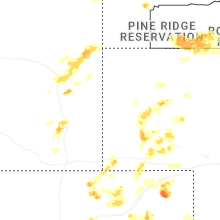
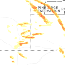
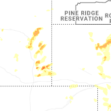
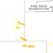
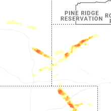


Connect with Interactive Hail Maps