

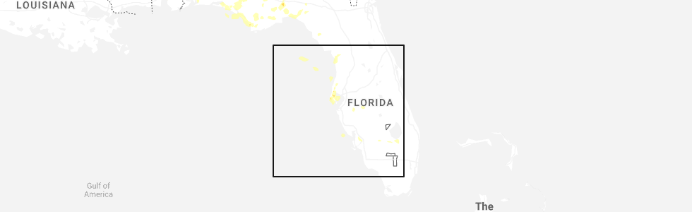
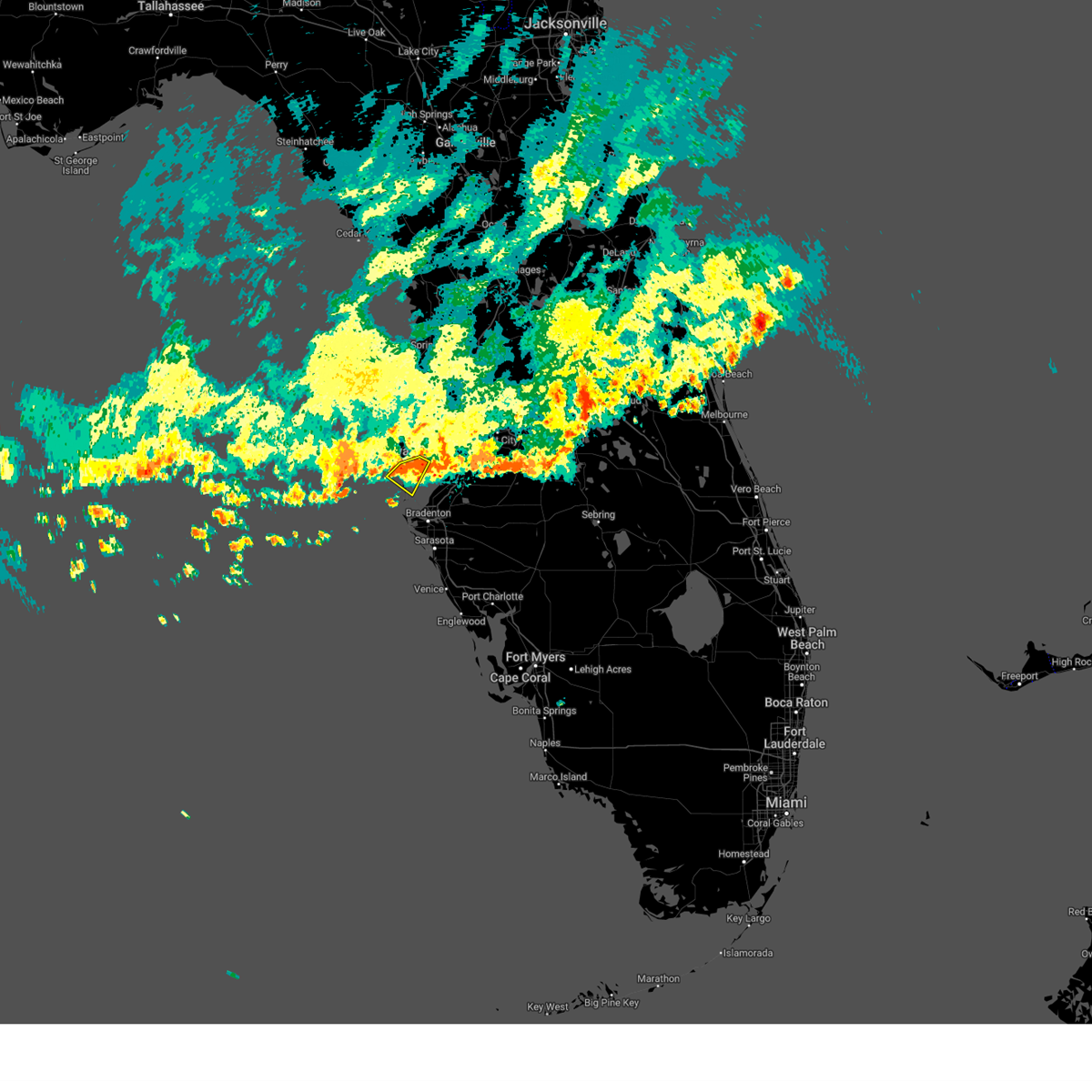
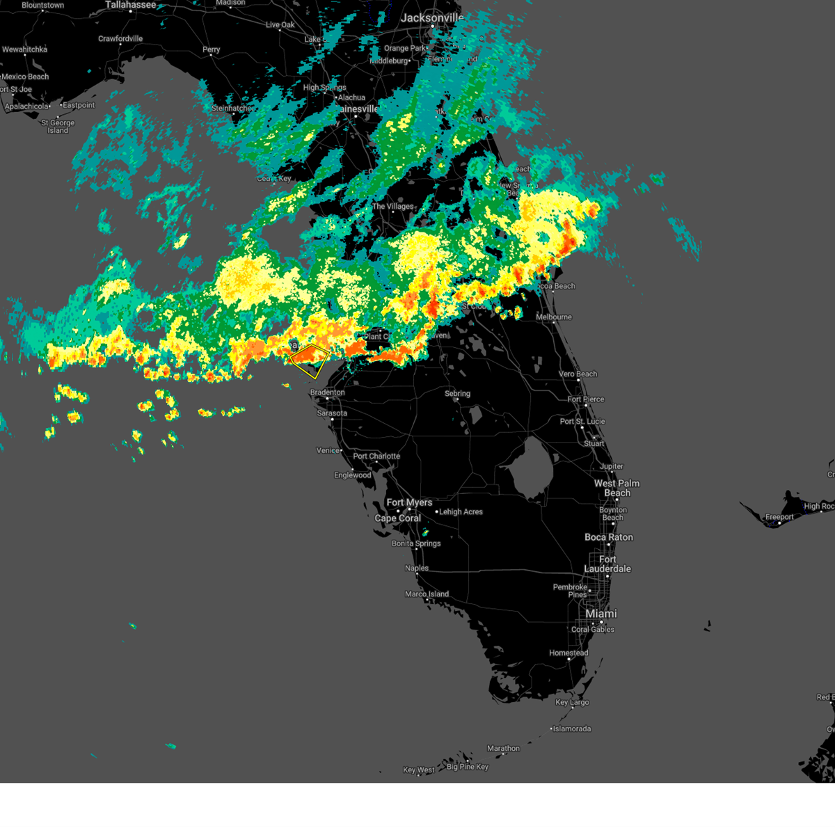
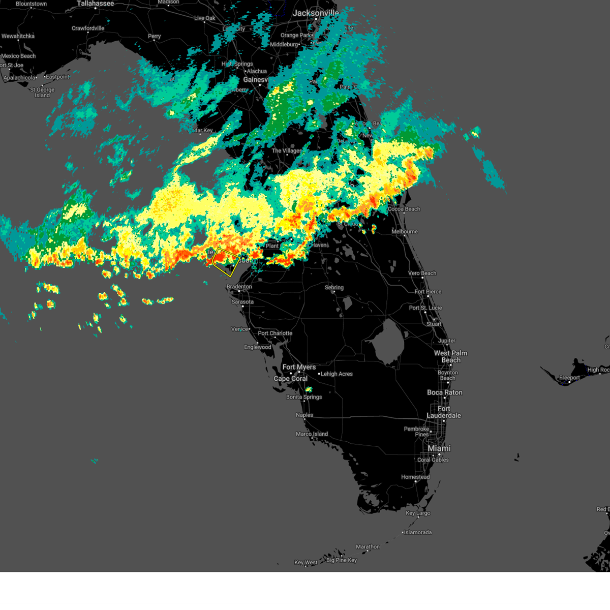
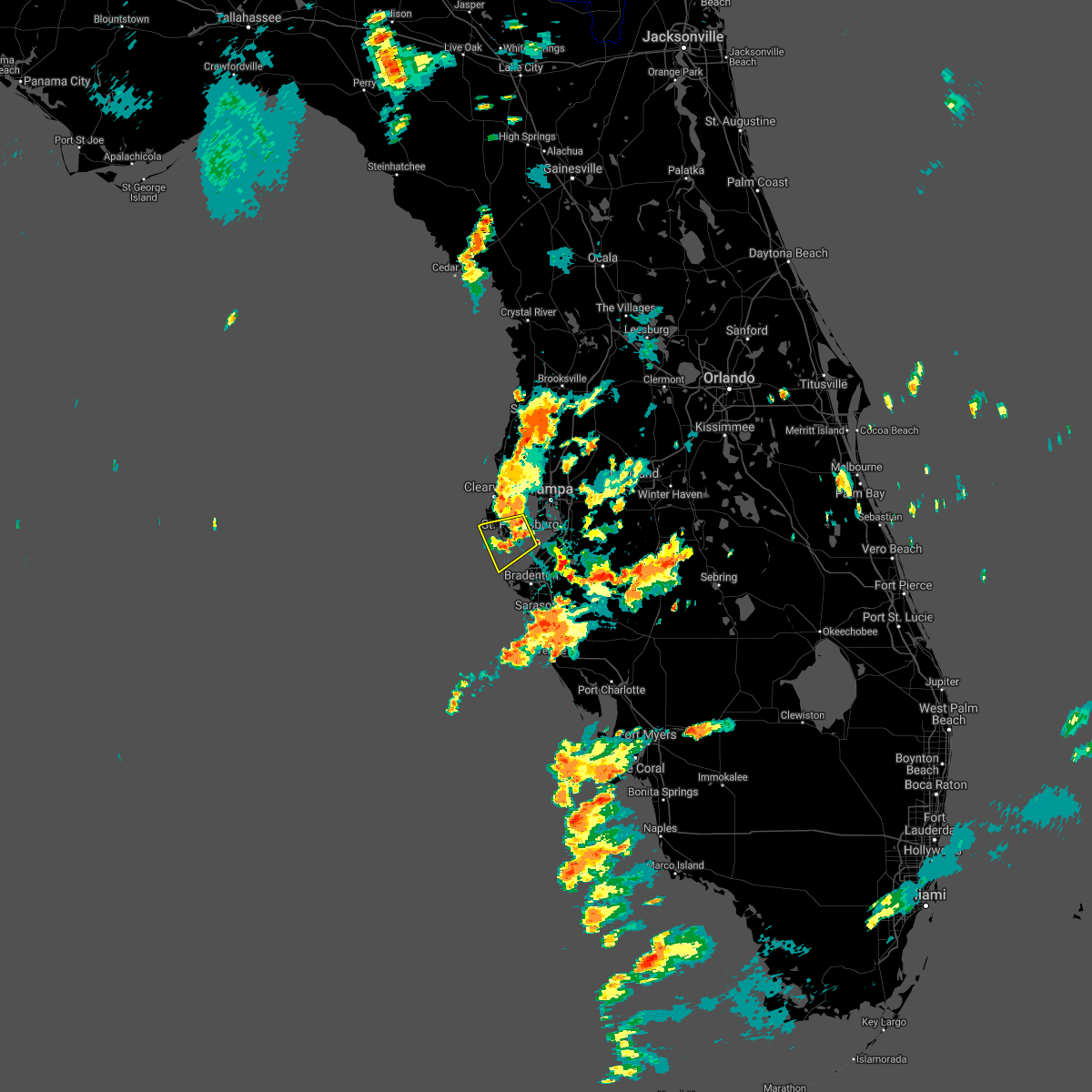
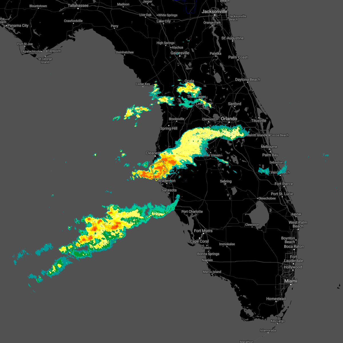
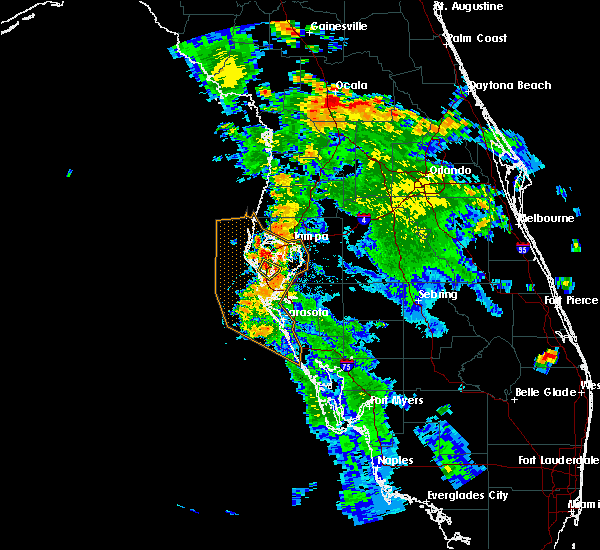
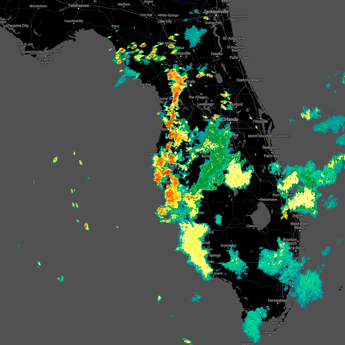
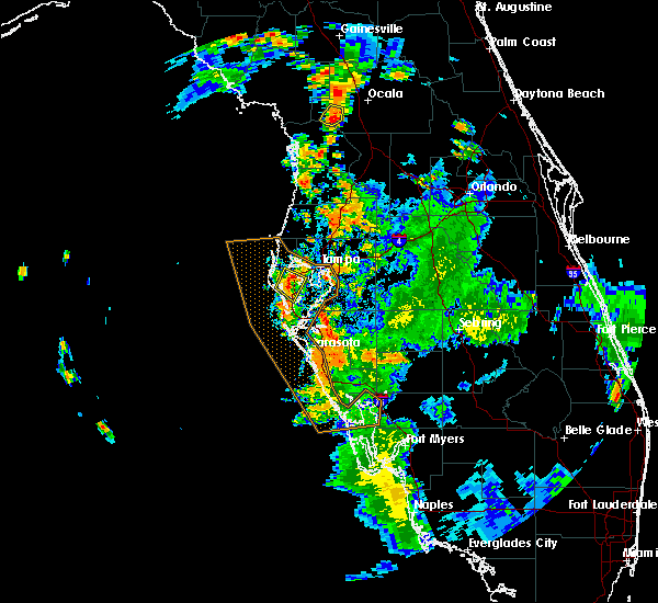
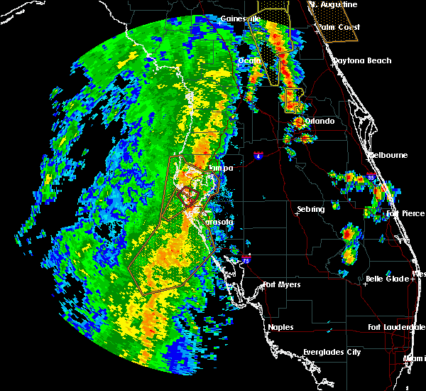
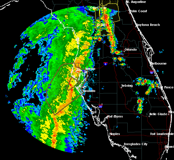
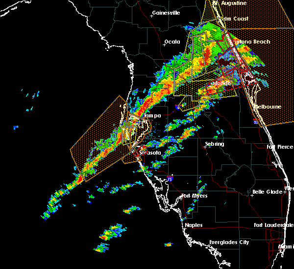
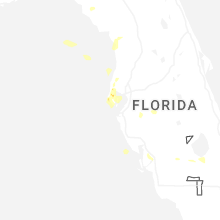
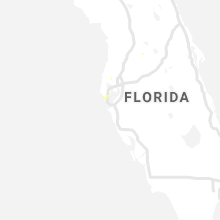
Hail Map for Gulfport, FL
The Gulfport, FL area has had 0 reports of on-the-ground hail by trained spotters, and has been under severe weather warnings 4 times during the past 12 months. Doppler radar has detected hail at or near Gulfport, FL on 34 occasions, including 2 occasions during the past year.
| Name: | Gulfport, FL |
| Where Located: | 19.5 miles NNW of Bradenton, FL |
| Map: | Google Map for Gulfport, FL |
| Population: | 12029 |
| Housing Units: | 7507 |
| More Info: | Search Google for Gulfport, FL |
4
The Top Recent Hail Date for Gulfport, FL is Wednesday, June 25, 2025 (4th out of 34)
Hail and Wind Damage Spotted near Gulfport, FL
| Date / Time | Report Details |
|---|---|
| 5/31/2025 7:31 AM EDT |
 the severe thunderstorm warning has been cancelled and is no longer in effect the severe thunderstorm warning has been cancelled and is no longer in effect
|
| 5/31/2025 7:29 AM EDT |
 At 729 am edt, a severe thunderstorm was located over west and east lealman, or near saint petersburg, moving east at 20 mph (radar indicated). Hazards include 60 mph wind gusts. Expect damage to roofs, siding, and trees. locations impacted include, gulfport, bay pines, tropicana field, sawgrass lake park, vinoy park, pass-a-grille beach, lake maggiore, boyd hill nature preserve, downtown saint petersburg, and st. Pete beach. At 729 am edt, a severe thunderstorm was located over west and east lealman, or near saint petersburg, moving east at 20 mph (radar indicated). Hazards include 60 mph wind gusts. Expect damage to roofs, siding, and trees. locations impacted include, gulfport, bay pines, tropicana field, sawgrass lake park, vinoy park, pass-a-grille beach, lake maggiore, boyd hill nature preserve, downtown saint petersburg, and st. Pete beach.
|
| 5/31/2025 7:17 AM EDT |
 At 717 am edt, a severe thunderstorm was located over bay pines, or near seminole, moving southeast at 20 mph (radar indicated). Hazards include 60 mph wind gusts. Expect damage to roofs, siding, and trees. Locations impacted include, gulfport, bay pines, south highpoint, tropicana field, sawgrass lake park, redington shores, vinoy park, pass-a-grille beach, lake maggiore, and boyd hill nature preserve. At 717 am edt, a severe thunderstorm was located over bay pines, or near seminole, moving southeast at 20 mph (radar indicated). Hazards include 60 mph wind gusts. Expect damage to roofs, siding, and trees. Locations impacted include, gulfport, bay pines, south highpoint, tropicana field, sawgrass lake park, redington shores, vinoy park, pass-a-grille beach, lake maggiore, and boyd hill nature preserve.
|
| 5/31/2025 7:08 AM EDT |
 Svrtbw the national weather service in ruskin has issued a * severe thunderstorm warning for, central pinellas county in west central florida, * until 745 am edt. * at 708 am edt, a severe thunderstorm was located over seminole, moving southeast at 20 mph (radar indicated). Hazards include 60 mph wind gusts. expect damage to roofs, siding, and trees Svrtbw the national weather service in ruskin has issued a * severe thunderstorm warning for, central pinellas county in west central florida, * until 745 am edt. * at 708 am edt, a severe thunderstorm was located over seminole, moving southeast at 20 mph (radar indicated). Hazards include 60 mph wind gusts. expect damage to roofs, siding, and trees
|
| 6/16/2024 8:26 PM EDT |
 the severe thunderstorm warning has been cancelled and is no longer in effect the severe thunderstorm warning has been cancelled and is no longer in effect
|
| 6/16/2024 8:07 PM EDT |
 Svrtbw the national weather service in ruskin has issued a * severe thunderstorm warning for, central pinellas county in west central florida, southwestern hillsborough county in west central florida, * until 845 pm edt. * at 807 pm edt, a severe thunderstorm was located over gandy, or near downtown saint petersburg, moving west at 10 mph (radar indicated). Hazards include 60 mph wind gusts. expect damage to roofs, siding, and trees Svrtbw the national weather service in ruskin has issued a * severe thunderstorm warning for, central pinellas county in west central florida, southwestern hillsborough county in west central florida, * until 845 pm edt. * at 807 pm edt, a severe thunderstorm was located over gandy, or near downtown saint petersburg, moving west at 10 mph (radar indicated). Hazards include 60 mph wind gusts. expect damage to roofs, siding, and trees
|
| 5/14/2024 11:31 AM EDT |
 Svrtbw the national weather service in ruskin has issued a * severe thunderstorm warning for, northwestern manatee county in west central florida, southeastern pinellas county in west central florida, southwestern hillsborough county in west central florida, * until 1215 pm edt. * at 1131 am edt, a severe thunderstorm was located 7 miles southeast of downtown saint petersburg, moving east at 30 mph (radar indicated). Hazards include 60 mph wind gusts and quarter size hail. Hail damage to vehicles is expected. Expect wind damage to roofs, siding, and trees. Svrtbw the national weather service in ruskin has issued a * severe thunderstorm warning for, northwestern manatee county in west central florida, southeastern pinellas county in west central florida, southwestern hillsborough county in west central florida, * until 1215 pm edt. * at 1131 am edt, a severe thunderstorm was located 7 miles southeast of downtown saint petersburg, moving east at 30 mph (radar indicated). Hazards include 60 mph wind gusts and quarter size hail. Hail damage to vehicles is expected. Expect wind damage to roofs, siding, and trees.
|
| 4/11/2024 1:04 PM EDT |
 At 104 pm edt, severe thunderstorms were located along a line extending from 7 miles southwest of bushnell to near pebble creek to near fort desoto park, moving east at 45 mph (radar indicated). Hazards include 60 mph wind gusts. Expect damage to roofs, siding, and trees. locations impacted include, tampa, st. petersburg, bradenton, plant city, temple terrace, zephyrhills, palmetto, gulfport, st. Pete beach, and wildwood. At 104 pm edt, severe thunderstorms were located along a line extending from 7 miles southwest of bushnell to near pebble creek to near fort desoto park, moving east at 45 mph (radar indicated). Hazards include 60 mph wind gusts. Expect damage to roofs, siding, and trees. locations impacted include, tampa, st. petersburg, bradenton, plant city, temple terrace, zephyrhills, palmetto, gulfport, st. Pete beach, and wildwood.
|
| 4/11/2024 12:30 PM EDT |
 Svrtbw the national weather service in ruskin has issued a * severe thunderstorm warning for, southeastern citrus county in west central florida, sumter county in central florida, pasco county in west central florida, hernando county in west central florida, northwestern manatee county in west central florida, pinellas county in west central florida, northwestern polk county in central florida, hillsborough county in west central florida, * until 115 pm edt. * at 1229 pm edt, severe thunderstorms were located along a line extending from near spring hill to 6 miles southwest of citrus park to 17 miles west of anna maria, moving east at 45 mph (radar indicated). Hazards include 60 mph wind gusts. expect damage to roofs, siding, and trees Svrtbw the national weather service in ruskin has issued a * severe thunderstorm warning for, southeastern citrus county in west central florida, sumter county in central florida, pasco county in west central florida, hernando county in west central florida, northwestern manatee county in west central florida, pinellas county in west central florida, northwestern polk county in central florida, hillsborough county in west central florida, * until 115 pm edt. * at 1229 pm edt, severe thunderstorms were located along a line extending from near spring hill to 6 miles southwest of citrus park to 17 miles west of anna maria, moving east at 45 mph (radar indicated). Hazards include 60 mph wind gusts. expect damage to roofs, siding, and trees
|
| 4/11/2024 11:47 AM EDT |
 Svrtbw the national weather service in ruskin has issued a * severe thunderstorm warning for, southern citrus county in west central florida, northwestern sumter county in central florida, pasco county in west central florida, hernando county in west central florida, pinellas county in west central florida, northwestern hillsborough county in west central florida, * until 1230 pm edt. * at 1146 am edt, severe thunderstorms were located along a line extending from 6 miles northwest of pine island to near hudson to near clearwater to 19 miles southwest of harbor bluffs, moving northeast at 50 mph (radar indicated). Hazards include 60 mph wind gusts. expect damage to roofs, siding, and trees Svrtbw the national weather service in ruskin has issued a * severe thunderstorm warning for, southern citrus county in west central florida, northwestern sumter county in central florida, pasco county in west central florida, hernando county in west central florida, pinellas county in west central florida, northwestern hillsborough county in west central florida, * until 1230 pm edt. * at 1146 am edt, severe thunderstorms were located along a line extending from 6 miles northwest of pine island to near hudson to near clearwater to 19 miles southwest of harbor bluffs, moving northeast at 50 mph (radar indicated). Hazards include 60 mph wind gusts. expect damage to roofs, siding, and trees
|
| 1/9/2024 4:22 PM EST |
 At 422 pm est, a severe thunderstorm capable of producing a tornado was located over saint petersburg, moving northeast at 45 mph (radar indicated rotation). Hazards include tornado. Flying debris will be dangerous to those caught without shelter. mobile homes will be damaged or destroyed. damage to roofs, windows, and vehicles will occur. tree damage is likely. this dangerous storm will be near, downtown saint petersburg and st. petersburg around 425 pm est. Other locations impacted by this tornadic thunderstorm include vinoy park, albert whitted airport, lake maggiore, tropicana field, boyd hill nature preserve, venetian isles, crescent lake, snell isle, and gulfport. At 422 pm est, a severe thunderstorm capable of producing a tornado was located over saint petersburg, moving northeast at 45 mph (radar indicated rotation). Hazards include tornado. Flying debris will be dangerous to those caught without shelter. mobile homes will be damaged or destroyed. damage to roofs, windows, and vehicles will occur. tree damage is likely. this dangerous storm will be near, downtown saint petersburg and st. petersburg around 425 pm est. Other locations impacted by this tornadic thunderstorm include vinoy park, albert whitted airport, lake maggiore, tropicana field, boyd hill nature preserve, venetian isles, crescent lake, snell isle, and gulfport.
|
| 1/9/2024 3:54 PM EST |
 At 354 pm est, a severe thunderstorm was located near seminole, moving east at 40 mph (radar indicated). Hazards include 60 mph wind gusts. expect damage to roofs, siding, and trees At 354 pm est, a severe thunderstorm was located near seminole, moving east at 40 mph (radar indicated). Hazards include 60 mph wind gusts. expect damage to roofs, siding, and trees
|
| 4/27/2023 9:51 PM EDT |
 The severe thunderstorm warning for northwestern manatee, southeastern pinellas and central hillsborough counties will expire at 1000 pm edt, the storms which prompted the warning have moved out of the area. therefore, the warning will be allowed to expire. however, gusty winds are still possible with these thunderstorms. The severe thunderstorm warning for northwestern manatee, southeastern pinellas and central hillsborough counties will expire at 1000 pm edt, the storms which prompted the warning have moved out of the area. therefore, the warning will be allowed to expire. however, gusty winds are still possible with these thunderstorms.
|
| 4/27/2023 9:25 PM EDT |
 At 924 pm edt, severe thunderstorms were located along a line extending from near pebble creek to st. petersburg, moving southeast at 40 mph (radar indicated). Hazards include 60 mph wind gusts. expect damage to roofs, siding, and trees At 924 pm edt, severe thunderstorms were located along a line extending from near pebble creek to st. petersburg, moving southeast at 40 mph (radar indicated). Hazards include 60 mph wind gusts. expect damage to roofs, siding, and trees
|
| 12/15/2022 12:09 PM EST |
 At 1209 pm est, a severe thunderstorm was located over st. petersburg, or over downtown saint petersburg, moving east at 45 mph (radar indicated). Hazards include 60 mph wind gusts. expect damage to roofs, siding, and trees At 1209 pm est, a severe thunderstorm was located over st. petersburg, or over downtown saint petersburg, moving east at 45 mph (radar indicated). Hazards include 60 mph wind gusts. expect damage to roofs, siding, and trees
|
| 8/8/2022 5:16 PM EDT |
 At 516 pm edt, severe thunderstorms were located along a line extending from near largo to pinellas park to saint petersburg, and are nearly stationary (radar indicated). Hazards include 60 mph wind gusts and quarter size hail. Hail damage to vehicles is expected. expect wind damage to roofs, siding, and trees. locations impacted include, st. petersburg, clearwater, largo, pinellas park, seminole, gulfport, st. pete beach, treasure island, kenneth city and south pasadena. hail threat, radar indicated max hail size, 1. 00 in wind threat, radar indicated max wind gust, 60 mph. At 516 pm edt, severe thunderstorms were located along a line extending from near largo to pinellas park to saint petersburg, and are nearly stationary (radar indicated). Hazards include 60 mph wind gusts and quarter size hail. Hail damage to vehicles is expected. expect wind damage to roofs, siding, and trees. locations impacted include, st. petersburg, clearwater, largo, pinellas park, seminole, gulfport, st. pete beach, treasure island, kenneth city and south pasadena. hail threat, radar indicated max hail size, 1. 00 in wind threat, radar indicated max wind gust, 60 mph.
|
| 8/8/2022 5:03 PM EDT |
 At 503 pm edt, severe thunderstorms were located along a line extending from harbor bluffs to near bay pines to saint petersburg, and are nearly stationary (radar indicated). Hazards include 60 mph wind gusts and quarter size hail. Hail damage to vehicles is expected. Expect wind damage to roofs, siding, and trees. At 503 pm edt, severe thunderstorms were located along a line extending from harbor bluffs to near bay pines to saint petersburg, and are nearly stationary (radar indicated). Hazards include 60 mph wind gusts and quarter size hail. Hail damage to vehicles is expected. Expect wind damage to roofs, siding, and trees.
|
| 7/22/2022 7:09 PM EDT |
 At 707 pm edt, a severe thunderstorm was located over west and east lealman, or near pinellas park, moving northwest at 25 mph (trained weather spotters. at 6:53 pm, a peak wind speed of 45 knots was reported at albert whitted airport in saint petersburg). Hazards include 60 mph wind gusts and penny size hail. Expect damage to roofs, siding, and trees. locations impacted include, st. petersburg, pinellas park, seminole, gulfport, treasure island, kenneth city, south pasadena, madeira beach, bay pines and tropicana field. hail threat, radar indicated max hail size, 0. 75 in wind threat, radar indicated max wind gust, 60 mph. At 707 pm edt, a severe thunderstorm was located over west and east lealman, or near pinellas park, moving northwest at 25 mph (trained weather spotters. at 6:53 pm, a peak wind speed of 45 knots was reported at albert whitted airport in saint petersburg). Hazards include 60 mph wind gusts and penny size hail. Expect damage to roofs, siding, and trees. locations impacted include, st. petersburg, pinellas park, seminole, gulfport, treasure island, kenneth city, south pasadena, madeira beach, bay pines and tropicana field. hail threat, radar indicated max hail size, 0. 75 in wind threat, radar indicated max wind gust, 60 mph.
|
| 7/22/2022 6:51 PM EDT |
 At 650 pm edt, a severe thunderstorm was located near macdill air force base, and will be near downtown saint petersburg, moving northwest at 25 mph (trained weather spotters). Hazards include 60 mph wind gusts and penny size hail. expect damage to roofs, siding, and trees At 650 pm edt, a severe thunderstorm was located near macdill air force base, and will be near downtown saint petersburg, moving northwest at 25 mph (trained weather spotters). Hazards include 60 mph wind gusts and penny size hail. expect damage to roofs, siding, and trees
|
| 3/12/2022 9:26 AM EST |
 At 925 am est, severe thunderstorms were located along a line extending from near groveland to near zephyrhills west to egypt lake-leto to near fort desoto park to 23 miles southwest of anna maria, moving east at 35 mph (radar indicated). Hazards include 60 mph wind gusts. expect damage to roofs, siding, and trees At 925 am est, severe thunderstorms were located along a line extending from near groveland to near zephyrhills west to egypt lake-leto to near fort desoto park to 23 miles southwest of anna maria, moving east at 35 mph (radar indicated). Hazards include 60 mph wind gusts. expect damage to roofs, siding, and trees
|
| 3/12/2022 9:16 AM EST |
 At 915 am est, severe thunderstorms were located along a line extending from near mascotte to near st. leo to near citrus park to 8 miles west of tierra verde, moving east at 35 mph (radar indicated). Hazards include 60 mph wind gusts. Expect damage to roofs, siding, and trees. locations impacted include, tampa, st. petersburg, clearwater, largo, pinellas park, temple terrace, seminole, safety harbor, west park and oldsmar. hail threat, radar indicated max hail size, <. 75 in wind threat, radar indicated max wind gust, 60 mph. At 915 am est, severe thunderstorms were located along a line extending from near mascotte to near st. leo to near citrus park to 8 miles west of tierra verde, moving east at 35 mph (radar indicated). Hazards include 60 mph wind gusts. Expect damage to roofs, siding, and trees. locations impacted include, tampa, st. petersburg, clearwater, largo, pinellas park, temple terrace, seminole, safety harbor, west park and oldsmar. hail threat, radar indicated max hail size, <. 75 in wind threat, radar indicated max wind gust, 60 mph.
|
| 3/12/2022 8:45 AM EST |
 At 843 am est, severe thunderstorms were located along a line extending from near the villages to near hill n dale to near new port richey to 30 miles west of bay pines, moving east at 45 mph (radar indicated). Hazards include 60 mph wind gusts. expect damage to roofs, siding, and trees At 843 am est, severe thunderstorms were located along a line extending from near the villages to near hill n dale to near new port richey to 30 miles west of bay pines, moving east at 45 mph (radar indicated). Hazards include 60 mph wind gusts. expect damage to roofs, siding, and trees
|
| 8/15/2021 4:09 PM EDT |
 The severe thunderstorm warning for central pinellas county will expire at 415 pm edt, the storm which prompted the warning is moving out of the area. therefore, the warning will be allowed to expire. however gusty winds are still possible with this thunderstorm. The severe thunderstorm warning for central pinellas county will expire at 415 pm edt, the storm which prompted the warning is moving out of the area. therefore, the warning will be allowed to expire. however gusty winds are still possible with this thunderstorm.
|
| 8/15/2021 3:42 PM EDT |
 At 341 pm edt, a severe thunderstorm was located over st. petersburg, or over downtown saint petersburg, moving northwest at 25 mph (radar indicated). Hazards include 60 mph wind gusts. expect damage to roofs, siding, and trees At 341 pm edt, a severe thunderstorm was located over st. petersburg, or over downtown saint petersburg, moving northwest at 25 mph (radar indicated). Hazards include 60 mph wind gusts. expect damage to roofs, siding, and trees
|
| 8/12/2021 5:36 PM EDT |
 At 536 pm edt, a severe thunderstorm was located over saint petersburg, moving southwest at 10 mph (radar indicated). Hazards include 60 mph wind gusts. expect damage to roofs, siding, and trees At 536 pm edt, a severe thunderstorm was located over saint petersburg, moving southwest at 10 mph (radar indicated). Hazards include 60 mph wind gusts. expect damage to roofs, siding, and trees
|
| 12/24/2020 7:12 PM EST |
 At 711 pm est, severe thunderstorms were located along a line extending from near largo to 9 miles west of fort desoto park, moving east at 40 mph (radar indicated). Hazards include 60 mph wind gusts. expect damage to roofs, siding, and trees At 711 pm est, severe thunderstorms were located along a line extending from near largo to 9 miles west of fort desoto park, moving east at 40 mph (radar indicated). Hazards include 60 mph wind gusts. expect damage to roofs, siding, and trees
|
| 12/20/2020 6:11 PM EST |
 At 609 pm est, a severe thunderstorm was located near st. pete beach, moving northeast at 30 mph (radar indicated). Hazards include 60 mph wind gusts. the storm has a history of producing tornados and could produce a tornado with little advance warning. expect damage to roofs, siding, and trees At 609 pm est, a severe thunderstorm was located near st. pete beach, moving northeast at 30 mph (radar indicated). Hazards include 60 mph wind gusts. the storm has a history of producing tornados and could produce a tornado with little advance warning. expect damage to roofs, siding, and trees
|
| 11/11/2020 5:27 PM EST |
 The tornado warning for northwestern manatee, southeastern pinellas, south central hillsborough and northwestern sarasota counties will expire at 530 pm est, the storm which prompted the warning has weakened below severe limits, and no longer appears capable of producing a tornado. therefore, the warning will be allowed to expire. The tornado warning for northwestern manatee, southeastern pinellas, south central hillsborough and northwestern sarasota counties will expire at 530 pm est, the storm which prompted the warning has weakened below severe limits, and no longer appears capable of producing a tornado. therefore, the warning will be allowed to expire.
|
| 11/11/2020 4:58 PM EST |
 At 458 pm est, a radar indicated waterspout was located just offshore over gulf gate estates, or near sarasota, moving north at 45 mph (radar indicated rotation). Hazards include tornado. Flying debris will be dangerous to those caught without shelter. mobile homes will be damaged or destroyed. damage to roofs, windows, and vehicles will occur. tree damage is likely. this tornado will be near, kensington park around 505 pm est. sarasota, north sarasota, sarasota bradenton airport, the meadows and lakewood ranch around 510 pm est. west samoset around 515 pm est. bradenton, ellenton, south bradenton and west bradenton around 520 pm est. palmetto and memphis around 525 pm est. parrish around 530 pm est. Other locations impacted by this tornadic thunderstorm include osprey, bayshore gardens, cortez, vamo, oscar scherer state park, bee ridge, samoset, desoto lakes, lake maggiore and palma sola. At 458 pm est, a radar indicated waterspout was located just offshore over gulf gate estates, or near sarasota, moving north at 45 mph (radar indicated rotation). Hazards include tornado. Flying debris will be dangerous to those caught without shelter. mobile homes will be damaged or destroyed. damage to roofs, windows, and vehicles will occur. tree damage is likely. this tornado will be near, kensington park around 505 pm est. sarasota, north sarasota, sarasota bradenton airport, the meadows and lakewood ranch around 510 pm est. west samoset around 515 pm est. bradenton, ellenton, south bradenton and west bradenton around 520 pm est. palmetto and memphis around 525 pm est. parrish around 530 pm est. Other locations impacted by this tornadic thunderstorm include osprey, bayshore gardens, cortez, vamo, oscar scherer state park, bee ridge, samoset, desoto lakes, lake maggiore and palma sola.
|
| 11/11/2020 12:21 PM EST |
 At 1221 pm est, a severe thunderstorm capable of producing a tornado was located near tierra verde, or near fort desoto park, moving north at 30 mph (radar indicated rotation). Hazards include tornado. Flying debris will be dangerous to those caught without shelter. mobile homes will be damaged or destroyed. damage to roofs, windows, and vehicles will occur. tree damage is likely. this dangerous storm will be near, st. petersburg around 1225 pm est. saint petersburg and downtown saint petersburg around 1235 pm est. pinellas park, seminole, west and east lealman, feather sound, gandy, bay pines and south highpoint around 1245 pm est. Other locations impacted by this tornadic thunderstorm include gulfport, albert whitted airport, tropicana field, weedon island state preserve, venetian isles, sawgrass lake park, lealman, kenneth city, south pasadena and vinoy park. At 1221 pm est, a severe thunderstorm capable of producing a tornado was located near tierra verde, or near fort desoto park, moving north at 30 mph (radar indicated rotation). Hazards include tornado. Flying debris will be dangerous to those caught without shelter. mobile homes will be damaged or destroyed. damage to roofs, windows, and vehicles will occur. tree damage is likely. this dangerous storm will be near, st. petersburg around 1225 pm est. saint petersburg and downtown saint petersburg around 1235 pm est. pinellas park, seminole, west and east lealman, feather sound, gandy, bay pines and south highpoint around 1245 pm est. Other locations impacted by this tornadic thunderstorm include gulfport, albert whitted airport, tropicana field, weedon island state preserve, venetian isles, sawgrass lake park, lealman, kenneth city, south pasadena and vinoy park.
|
| 7/21/2020 1:47 PM EDT |
 At 147 pm edt, a severe thunderstorm was located over st. petersburg, or over saint petersburg, moving west at 25 mph (radar indicated). Hazards include 60 mph wind gusts. expect damage to roofs, siding, and trees At 147 pm edt, a severe thunderstorm was located over st. petersburg, or over saint petersburg, moving west at 25 mph (radar indicated). Hazards include 60 mph wind gusts. expect damage to roofs, siding, and trees
|
| 5/22/2020 7:37 PM EDT |
 At 736 pm edt, a severe thunderstorm was located near downtown saint petersburg, moving west at 15 mph (radar indicated). Hazards include 60 mph wind gusts. expect damage to roofs, siding, and trees At 736 pm edt, a severe thunderstorm was located near downtown saint petersburg, moving west at 15 mph (radar indicated). Hazards include 60 mph wind gusts. expect damage to roofs, siding, and trees
|
| 5/18/2020 8:53 AM EDT |
 At 853 am edt, severe thunderstorms were located along a line extending from bay pines to downtown saint petersburg to 6 miles east of fort desoto park to west bradenton, moving northeast at 40 mph (radar indicated). Hazards include 60 mph wind gusts. expect damage to roofs, siding, and trees At 853 am edt, severe thunderstorms were located along a line extending from bay pines to downtown saint petersburg to 6 miles east of fort desoto park to west bradenton, moving northeast at 40 mph (radar indicated). Hazards include 60 mph wind gusts. expect damage to roofs, siding, and trees
|
| 5/18/2020 8:46 AM EDT |
 At 846 am edt, a severe thunderstorm capable of producing a tornado was located over st. pete beach, or near saint petersburg, moving east at 35 mph (radar indicated rotation). Hazards include tornado. Flying debris will be dangerous to those caught without shelter. mobile homes will be damaged or destroyed. damage to roofs, windows, and vehicles will occur. tree damage is likely. this dangerous storm will be near, saint petersburg and st. petersburg around 850 am edt. downtown saint petersburg around 855 am edt. Other locations impacted by this tornadic thunderstorm include vinoy park, gulfport, albert whitted airport, pass-a-grille beach, lake maggiore, tropicana field, boyd hill nature preserve and pinellas point. At 846 am edt, a severe thunderstorm capable of producing a tornado was located over st. pete beach, or near saint petersburg, moving east at 35 mph (radar indicated rotation). Hazards include tornado. Flying debris will be dangerous to those caught without shelter. mobile homes will be damaged or destroyed. damage to roofs, windows, and vehicles will occur. tree damage is likely. this dangerous storm will be near, saint petersburg and st. petersburg around 850 am edt. downtown saint petersburg around 855 am edt. Other locations impacted by this tornadic thunderstorm include vinoy park, gulfport, albert whitted airport, pass-a-grille beach, lake maggiore, tropicana field, boyd hill nature preserve and pinellas point.
|
| 5/18/2020 8:34 AM EDT |
 At 834 am edt, severe thunderstorms were located along a line extending from 12 miles west of bay pines to 9 miles south of anna maria, moving northeast at 40 mph (radar indicated). Hazards include 60 mph wind gusts. expect damage to roofs, siding, and trees At 834 am edt, severe thunderstorms were located along a line extending from 12 miles west of bay pines to 9 miles south of anna maria, moving northeast at 40 mph (radar indicated). Hazards include 60 mph wind gusts. expect damage to roofs, siding, and trees
|
| 4/24/2020 5:41 AM EDT |
 At 540 am edt, severe thunderstorms were located along a line extending from 6 miles southeast of hernando county airport to near harbor bluffs, moving east at 40 mph (radar indicated). Hazards include 60 mph wind gusts. expect damage to roofs, siding, and trees At 540 am edt, severe thunderstorms were located along a line extending from 6 miles southeast of hernando county airport to near harbor bluffs, moving east at 40 mph (radar indicated). Hazards include 60 mph wind gusts. expect damage to roofs, siding, and trees
|
| 4/24/2020 5:25 AM EDT |
 At 525 am edt, severe thunderstorms were located along a line extending from near wildwood to 15 miles southwest of harbor bluffs, moving east at 30 mph (radar indicated). Hazards include 60 mph wind gusts. Expect damage to roofs, siding, and trees. locations impacted include, tampa, spring hill, clearwater, largo, pinellas park, seminole, new port richey, brooksville, wildwood, dade city, bushnell, hudson, holiday, lutz, st. petersburg, st. pete beach, st. Leo, weeki wachee, palm harbor and new port richey east. At 525 am edt, severe thunderstorms were located along a line extending from near wildwood to 15 miles southwest of harbor bluffs, moving east at 30 mph (radar indicated). Hazards include 60 mph wind gusts. Expect damage to roofs, siding, and trees. locations impacted include, tampa, spring hill, clearwater, largo, pinellas park, seminole, new port richey, brooksville, wildwood, dade city, bushnell, hudson, holiday, lutz, st. petersburg, st. pete beach, st. Leo, weeki wachee, palm harbor and new port richey east.
|
| 4/24/2020 4:59 AM EDT |
 At 458 am edt, severe thunderstorms were located along a line extending from near inverness highlands north to 27 miles west of harbor bluffs, moving east at 30 mph (radar indicated). Hazards include 60 mph wind gusts. expect damage to roofs, siding, and trees At 458 am edt, severe thunderstorms were located along a line extending from near inverness highlands north to 27 miles west of harbor bluffs, moving east at 30 mph (radar indicated). Hazards include 60 mph wind gusts. expect damage to roofs, siding, and trees
|
| 4/20/2020 12:29 PM EDT |
 At 1228 pm edt, severe thunderstorms were located along a line extending from near st. pete beach to 9 miles west of fort desoto park to 22 miles west of anna maria, moving east at 55 mph (radar indicated). Hazards include 60 mph wind gusts and nickel size hail. expect damage to roofs, siding, and trees At 1228 pm edt, severe thunderstorms were located along a line extending from near st. pete beach to 9 miles west of fort desoto park to 22 miles west of anna maria, moving east at 55 mph (radar indicated). Hazards include 60 mph wind gusts and nickel size hail. expect damage to roofs, siding, and trees
|
| 2/6/2020 10:50 PM EST |
 At 1049 pm est, severe thunderstorms were located along a line extending from 9 miles northeast of inverness to near land o lakes to 25 miles southwest of anna maria, moving east at 35 mph (radar indicated). Hazards include 60 mph wind gusts. expect damage to roofs, siding, and trees At 1049 pm est, severe thunderstorms were located along a line extending from 9 miles northeast of inverness to near land o lakes to 25 miles southwest of anna maria, moving east at 35 mph (radar indicated). Hazards include 60 mph wind gusts. expect damage to roofs, siding, and trees
|
| 2/6/2020 10:28 PM EST |
 At 1026 pm est, severe thunderstorms were located along a line extending from near ocala airport to 7 miles south of homosassa springs to near new port richey to 23 miles west of anna maria, moving east at 35 mph (radar indicated). Hazards include 60 mph wind gusts. Expect damage to roofs, siding, and trees. locations impacted include, tampa, spring hill, clearwater, largo, pinellas park, seminole, new port richey, brooksville, inverness, wildwood, bushnell, downtown saint petersburg, hudson, beverly hills, holiday, homosassa springs, saint petersburg, lutz, fort desoto park and st. Petersburg. At 1026 pm est, severe thunderstorms were located along a line extending from near ocala airport to 7 miles south of homosassa springs to near new port richey to 23 miles west of anna maria, moving east at 35 mph (radar indicated). Hazards include 60 mph wind gusts. Expect damage to roofs, siding, and trees. locations impacted include, tampa, spring hill, clearwater, largo, pinellas park, seminole, new port richey, brooksville, inverness, wildwood, bushnell, downtown saint petersburg, hudson, beverly hills, holiday, homosassa springs, saint petersburg, lutz, fort desoto park and st. Petersburg.
|
| 2/6/2020 10:02 PM EST |
 At 1002 pm est, severe thunderstorms were located along a line extending from near williston to 8 miles southwest of homosassa to 36 miles southwest of harbor bluffs, moving east at 30 mph (radar indicated). Hazards include 60 mph wind gusts. expect damage to roofs, siding, and trees At 1002 pm est, severe thunderstorms were located along a line extending from near williston to 8 miles southwest of homosassa to 36 miles southwest of harbor bluffs, moving east at 30 mph (radar indicated). Hazards include 60 mph wind gusts. expect damage to roofs, siding, and trees
|
| 8/16/2019 7:24 PM EDT |
 The severe thunderstorm warning for pinellas county will expire at 730 pm edt, the storms which prompted the warning have weakened below severe limits, and no longer pose an immediate threat to life or property. therefore, the warning will be allowed to expire. however gusty winds and heavy rain are still possible with these thunderstorms. The severe thunderstorm warning for pinellas county will expire at 730 pm edt, the storms which prompted the warning have weakened below severe limits, and no longer pose an immediate threat to life or property. therefore, the warning will be allowed to expire. however gusty winds and heavy rain are still possible with these thunderstorms.
|
| 8/16/2019 6:50 PM EDT |
 The national weather service in ruskin has issued a * severe thunderstorm warning for. pinellas county in west central florida. until 730 pm edt. At 650 pm edt, severe thunderstorms were located along a line extending from 9 miles west of palm harbor to 10 miles west of fort. The national weather service in ruskin has issued a * severe thunderstorm warning for. pinellas county in west central florida. until 730 pm edt. At 650 pm edt, severe thunderstorms were located along a line extending from 9 miles west of palm harbor to 10 miles west of fort.
|
| 7/24/2019 2:05 PM EDT |
 A severe thunderstorm warning remains in effect until 215 pm edt for central pinellas county. at 204 pm edt, a severe thunderstorm was located over west and east lealman, or over kenneth city, moving northeast at 35 mph. hazard. 60 mph wind gusts. source. Radar indicated. A severe thunderstorm warning remains in effect until 215 pm edt for central pinellas county. at 204 pm edt, a severe thunderstorm was located over west and east lealman, or over kenneth city, moving northeast at 35 mph. hazard. 60 mph wind gusts. source. Radar indicated.
|
| 7/24/2019 1:48 PM EDT |
 At 147 pm edt, a severe thunderstorm was located 5 miles west of seminole, moving northeast at 35 mph (radar indicated). Hazards include 60 mph wind gusts. expect damage to roofs, siding, and trees At 147 pm edt, a severe thunderstorm was located 5 miles west of seminole, moving northeast at 35 mph (radar indicated). Hazards include 60 mph wind gusts. expect damage to roofs, siding, and trees
|
| 7/20/2019 6:26 PM EDT |
 The severe thunderstorm warning for pinellas county will expire at 630 pm edt, the storm which prompted the warning has weakened below severe limits, and no longer poses an immediate threat to life or property. therefore, the warning will be allowed to expire. however small hail and gusty winds are still possible with this thunderstorm. The severe thunderstorm warning for pinellas county will expire at 630 pm edt, the storm which prompted the warning has weakened below severe limits, and no longer poses an immediate threat to life or property. therefore, the warning will be allowed to expire. however small hail and gusty winds are still possible with this thunderstorm.
|
| 7/20/2019 6:10 PM EDT |
 At 609 pm edt, a severe thunderstorm was located over west and east lealman, or near pinellas park, moving northwest at 10 mph (radar indicated). Hazards include 60 mph wind gusts and quarter size hail. Hail damage to vehicles is expected. expect wind damage to roofs, siding, and trees. locations impacted include, clearwater, largo, pinellas park, seminole, downtown saint petersburg, saint petersburg, st. petersburg, st. Pete beach, bay pines, south highpoint, harbor bluffs, gandy, feather sound, west and east lealman, ridgecrest, safety harbor, gulfport, treasure island, kenneth city and south pasadena. At 609 pm edt, a severe thunderstorm was located over west and east lealman, or near pinellas park, moving northwest at 10 mph (radar indicated). Hazards include 60 mph wind gusts and quarter size hail. Hail damage to vehicles is expected. expect wind damage to roofs, siding, and trees. locations impacted include, clearwater, largo, pinellas park, seminole, downtown saint petersburg, saint petersburg, st. petersburg, st. Pete beach, bay pines, south highpoint, harbor bluffs, gandy, feather sound, west and east lealman, ridgecrest, safety harbor, gulfport, treasure island, kenneth city and south pasadena.
|
| 7/20/2019 6:06 PM EDT |
 At 605 pm edt, a severe thunderstorm was located over west and east lealman, or near downtown saint petersburg, moving northwest at 10 mph (radar indicated). Hazards include 60 mph wind gusts. expect damage to roofs, siding, and trees At 605 pm edt, a severe thunderstorm was located over west and east lealman, or near downtown saint petersburg, moving northwest at 10 mph (radar indicated). Hazards include 60 mph wind gusts. expect damage to roofs, siding, and trees
|
| 7/12/2019 5:10 PM EDT |
 At 509 pm edt, a severe thunderstorm was located near harbor bluffs, or near seminole, moving east at 10 mph (radar indicated). Hazards include 60 mph wind gusts. expect damage to roofs, siding, and trees At 509 pm edt, a severe thunderstorm was located near harbor bluffs, or near seminole, moving east at 10 mph (radar indicated). Hazards include 60 mph wind gusts. expect damage to roofs, siding, and trees
|
| 6/28/2019 5:50 PM EDT |
 The severe thunderstorm warning for central pinellas county will expire at 600 pm edt, the storm which prompted the warning has weakened below severe limits, and no longer poses an immediate threat to life or property. therefore, the warning will be allowed to expire. however gusty winds and heavy rain are still possible with this thunderstorm. The severe thunderstorm warning for central pinellas county will expire at 600 pm edt, the storm which prompted the warning has weakened below severe limits, and no longer poses an immediate threat to life or property. therefore, the warning will be allowed to expire. however gusty winds and heavy rain are still possible with this thunderstorm.
|
| 6/28/2019 5:33 PM EDT |
 At 533 pm edt, a severe thunderstorm was located over clearwater, moving west at 10 mph (radar indicated). Hazards include 60 mph wind gusts and quarter size hail. Hail damage to vehicles is expected. expect wind damage to roofs, siding, and trees. locations impacted include, clearwater, largo, pinellas park, seminole, st. petersburg, st. Pete beach, bay pines, south highpoint, harbor bluffs, feather sound, west and east lealman, ridgecrest, safety harbor, oldsmar, gulfport, treasure island, kenneth city, south pasadena, madeira beach and belleair. At 533 pm edt, a severe thunderstorm was located over clearwater, moving west at 10 mph (radar indicated). Hazards include 60 mph wind gusts and quarter size hail. Hail damage to vehicles is expected. expect wind damage to roofs, siding, and trees. locations impacted include, clearwater, largo, pinellas park, seminole, st. petersburg, st. Pete beach, bay pines, south highpoint, harbor bluffs, feather sound, west and east lealman, ridgecrest, safety harbor, oldsmar, gulfport, treasure island, kenneth city, south pasadena, madeira beach and belleair.
|
| 6/28/2019 5:17 PM EDT |
 At 517 pm edt, a severe thunderstorm was located over west and east lealman, or over pinellas park, moving northwest at 10 mph (radar indicated). Hazards include 60 mph wind gusts and quarter size hail. Hail damage to vehicles is expected. Expect wind damage to roofs, siding, and trees. At 517 pm edt, a severe thunderstorm was located over west and east lealman, or over pinellas park, moving northwest at 10 mph (radar indicated). Hazards include 60 mph wind gusts and quarter size hail. Hail damage to vehicles is expected. Expect wind damage to roofs, siding, and trees.
|
| 5/5/2019 12:44 PM EDT |
 At 1243 pm edt, severe thunderstorms were located along a line extending from 11 miles west of beacon square to near palm harbor to seminole to near tierra verde, moving northeast at 40 mph. at 1234 pm edt, a wind gust of 58 mph was reported at indian rocks beach (radar indicated). Hazards include 60 mph wind gusts. Expect damage to roofs, siding, and trees. locations impacted include, tampa, clearwater, largo, bradenton, pinellas park, seminole, downtown saint petersburg, saint petersburg, fort desoto park, st. petersburg, st. Pete beach, anna maria, palm harbor, south highpoint, tierra verde, west and east lealman, ridgecrest, bay pines, keystone and east lake. At 1243 pm edt, severe thunderstorms were located along a line extending from 11 miles west of beacon square to near palm harbor to seminole to near tierra verde, moving northeast at 40 mph. at 1234 pm edt, a wind gust of 58 mph was reported at indian rocks beach (radar indicated). Hazards include 60 mph wind gusts. Expect damage to roofs, siding, and trees. locations impacted include, tampa, clearwater, largo, bradenton, pinellas park, seminole, downtown saint petersburg, saint petersburg, fort desoto park, st. petersburg, st. Pete beach, anna maria, palm harbor, south highpoint, tierra verde, west and east lealman, ridgecrest, bay pines, keystone and east lake.
|
| 5/5/2019 12:22 PM EDT |
 At 1222 pm edt, severe thunderstorms were located along a line extending from 21 miles west of palm harbor to 9 miles west of harbor bluffs to 11 miles southwest of bay pines to 14 miles west of anna maria, moving northeast at 40 mph (radar indicated). Hazards include 60 mph wind gusts. expect damage to roofs, siding, and trees At 1222 pm edt, severe thunderstorms were located along a line extending from 21 miles west of palm harbor to 9 miles west of harbor bluffs to 11 miles southwest of bay pines to 14 miles west of anna maria, moving northeast at 40 mph (radar indicated). Hazards include 60 mph wind gusts. expect damage to roofs, siding, and trees
|
| 4/19/2019 1:52 PM EDT |
 At 151 pm edt, severe thunderstorms were located along a line extending from moss bluff to near hill n dale to downtown saint petersburg, moving northeast at 65 mph (radar indicated). Hazards include 60 mph wind gusts. Expect damage to roofs, siding, and trees. locations impacted include, tampa, clearwater, largo, bradenton, pinellas park, plant city, temple terrace, seminole, zephyrhills, palmetto, wildwood, dade city, bushnell, downtown saint petersburg, fort desoto park, fish hawk, saint petersburg, lutz, brandon and st. Petersburg. At 151 pm edt, severe thunderstorms were located along a line extending from moss bluff to near hill n dale to downtown saint petersburg, moving northeast at 65 mph (radar indicated). Hazards include 60 mph wind gusts. Expect damage to roofs, siding, and trees. locations impacted include, tampa, clearwater, largo, bradenton, pinellas park, plant city, temple terrace, seminole, zephyrhills, palmetto, wildwood, dade city, bushnell, downtown saint petersburg, fort desoto park, fish hawk, saint petersburg, lutz, brandon and st. Petersburg.
|
| 4/19/2019 1:18 PM EDT |
 At 118 pm edt, severe thunderstorms were located along a line extending from 6 miles west of bushnell to keystone to 18 miles southwest of anna maria, moving northeast at 65 mph (radar indicated). Hazards include 60 mph wind gusts. expect damage to roofs, siding, and trees At 118 pm edt, severe thunderstorms were located along a line extending from 6 miles west of bushnell to keystone to 18 miles southwest of anna maria, moving northeast at 65 mph (radar indicated). Hazards include 60 mph wind gusts. expect damage to roofs, siding, and trees
|
| 4/19/2019 12:31 PM EDT |
 At 1230 pm edt, severe thunderstorms were located along a line extending from near hudson to 21 miles southwest of bay pines, moving east at 30 mph (radar indicated). Hazards include 60 mph wind gusts. expect damage to roofs, siding, and trees At 1230 pm edt, severe thunderstorms were located along a line extending from near hudson to 21 miles southwest of bay pines, moving east at 30 mph (radar indicated). Hazards include 60 mph wind gusts. expect damage to roofs, siding, and trees
|
| 11/2/2018 2:42 PM EDT |
 At 242 pm edt, severe thunderstorms were located along a line extending from 15 miles northwest of beacon square to 10 miles west of palm harbor to 20 miles southwest of bay pines, moving northeast at 50 mph (radar indicated). Hazards include 60 mph wind gusts. expect damage to roofs, siding, and trees At 242 pm edt, severe thunderstorms were located along a line extending from 15 miles northwest of beacon square to 10 miles west of palm harbor to 20 miles southwest of bay pines, moving northeast at 50 mph (radar indicated). Hazards include 60 mph wind gusts. expect damage to roofs, siding, and trees
|
| 8/28/2018 5:37 PM EDT |
 At 536 pm edt, a severe thunderstorm was located over pinellas park, moving northwest at 10 mph (radar indicated). Hazards include 60 mph wind gusts and nickel size hail. expect damage to roofs, siding, and trees At 536 pm edt, a severe thunderstorm was located over pinellas park, moving northwest at 10 mph (radar indicated). Hazards include 60 mph wind gusts and nickel size hail. expect damage to roofs, siding, and trees
|
| 8/28/2018 5:29 PM EDT |
 At 528 pm edt, a severe thunderstorm was located over saint petersburg, moving west at 10 mph (radar indicated). Hazards include 60 mph wind gusts. Expect damage to roofs, siding, and trees. locations impacted include, saint petersburg, st. Petersburg, gulfport, kenneth city, south pasadena and tropicana field. At 528 pm edt, a severe thunderstorm was located over saint petersburg, moving west at 10 mph (radar indicated). Hazards include 60 mph wind gusts. Expect damage to roofs, siding, and trees. locations impacted include, saint petersburg, st. Petersburg, gulfport, kenneth city, south pasadena and tropicana field.
|
| 8/28/2018 5:19 PM EDT |
 At 519 pm edt, a severe thunderstorm was located over downtown saint petersburg, moving west at 10 mph (radar indicated). Hazards include 60 mph wind gusts. expect damage to roofs, siding, and trees At 519 pm edt, a severe thunderstorm was located over downtown saint petersburg, moving west at 10 mph (radar indicated). Hazards include 60 mph wind gusts. expect damage to roofs, siding, and trees
|
| 8/25/2018 5:41 PM EDT |
 The severe thunderstorm warning for central pinellas county will expire at 545 pm edt, the storm which prompted the warning has weakened below severe limits, and no longer poses an immediate threat to life or property. therefore, the warning will be allowed to expire. however gusty winds and heavy rain are still possible with this thunderstorm. The severe thunderstorm warning for central pinellas county will expire at 545 pm edt, the storm which prompted the warning has weakened below severe limits, and no longer poses an immediate threat to life or property. therefore, the warning will be allowed to expire. however gusty winds and heavy rain are still possible with this thunderstorm.
|
| 8/25/2018 5:24 PM EDT |
 At 524 pm edt, a severe thunderstorm was located over pinellas park, and is nearly stationary (radar indicated). Hazards include 60 mph wind gusts and quarter size hail. Hail damage to vehicles is expected. Expect wind damage to roofs, siding, and trees. At 524 pm edt, a severe thunderstorm was located over pinellas park, and is nearly stationary (radar indicated). Hazards include 60 mph wind gusts and quarter size hail. Hail damage to vehicles is expected. Expect wind damage to roofs, siding, and trees.
|
| 4/15/2018 3:09 PM EDT |
 At 308 pm edt, a confirmed waterspout was located just offshore of pass-a-grille beach and near the skyway bridge, moving northeast at 40 mph (weather spotters confirmed waterspout located near the skyway bridge). Hazards include tornado. Flying debris will be dangerous to those caught without shelter. mobile homes will be damaged or destroyed. damage to roofs, windows, and vehicles will occur. tree damage is likely. this tornado will be near, st. petersburg around 315 pm edt. saint petersburg around 320 pm edt. downtown saint petersburg around 325 pm edt. Other locations impacted by this tornado include gulfport, albert whitted airport, pass-a-grille beach, lake maggiore, tropicana field, boyd hill nature preserve, pinellas point, south pasadena and treasure island. At 308 pm edt, a confirmed waterspout was located just offshore of pass-a-grille beach and near the skyway bridge, moving northeast at 40 mph (weather spotters confirmed waterspout located near the skyway bridge). Hazards include tornado. Flying debris will be dangerous to those caught without shelter. mobile homes will be damaged or destroyed. damage to roofs, windows, and vehicles will occur. tree damage is likely. this tornado will be near, st. petersburg around 315 pm edt. saint petersburg around 320 pm edt. downtown saint petersburg around 325 pm edt. Other locations impacted by this tornado include gulfport, albert whitted airport, pass-a-grille beach, lake maggiore, tropicana field, boyd hill nature preserve, pinellas point, south pasadena and treasure island.
|
| 4/15/2018 2:51 PM EDT |
 At 251 pm edt, a radar indicated waterspout was located just offshore 7 miles west of anna maria, or 9 miles southwest of fort desoto park, moving northeast at 40 mph (radar indicated rotation). Hazards include tornado. Flying debris will be dangerous to those caught without shelter. mobile homes will be damaged or destroyed. damage to roofs, windows, and vehicles will occur. tree damage is likely. this tornado will be near, anna maria around 300 pm edt. fort desoto park around 305 pm edt. st. petersburg and tierra verde around 310 pm edt. st. pete beach around 315 pm edt. saint petersburg around 320 pm edt. downtown saint petersburg around 325 pm edt. Other locations impacted by this tornadic thunderstorm include gulfport, albert whitted airport, pass-a-grille beach, lake maggiore, tropicana field, boyd hill nature preserve, pinellas point, south pasadena and treasure island. At 251 pm edt, a radar indicated waterspout was located just offshore 7 miles west of anna maria, or 9 miles southwest of fort desoto park, moving northeast at 40 mph (radar indicated rotation). Hazards include tornado. Flying debris will be dangerous to those caught without shelter. mobile homes will be damaged or destroyed. damage to roofs, windows, and vehicles will occur. tree damage is likely. this tornado will be near, anna maria around 300 pm edt. fort desoto park around 305 pm edt. st. petersburg and tierra verde around 310 pm edt. st. pete beach around 315 pm edt. saint petersburg around 320 pm edt. downtown saint petersburg around 325 pm edt. Other locations impacted by this tornadic thunderstorm include gulfport, albert whitted airport, pass-a-grille beach, lake maggiore, tropicana field, boyd hill nature preserve, pinellas point, south pasadena and treasure island.
|
| 3/20/2018 3:14 PM EDT |
 At 314 pm edt, severe thunderstorms were located along a line extending from near gandy to near memphis, moving east at 45 mph (radar indicated). Hazards include 60 mph wind gusts and nickel size hail. expect damage to roofs, siding, and trees At 314 pm edt, severe thunderstorms were located along a line extending from near gandy to near memphis, moving east at 45 mph (radar indicated). Hazards include 60 mph wind gusts and nickel size hail. expect damage to roofs, siding, and trees
|
| 7/10/2017 5:53 PM EDT |
 At 552 pm edt, a severe thunderstorm was located over downtown saint petersburg, moving northwest at 15 mph (radar indicated). Hazards include 60 mph wind gusts and quarter size hail. Hail damage to vehicles is expected. expect wind damage to roofs, siding, and trees. locations impacted include, clearwater, largo, pinellas park, seminole, downtown saint petersburg, saint petersburg, st. petersburg, st. Pete beach, bay pines, south highpoint, harbor bluffs, gandy, feather sound, west and east lealman, ridgecrest, gulfport, treasure island, kenneth city, south pasadena and madeira beach. At 552 pm edt, a severe thunderstorm was located over downtown saint petersburg, moving northwest at 15 mph (radar indicated). Hazards include 60 mph wind gusts and quarter size hail. Hail damage to vehicles is expected. expect wind damage to roofs, siding, and trees. locations impacted include, clearwater, largo, pinellas park, seminole, downtown saint petersburg, saint petersburg, st. petersburg, st. Pete beach, bay pines, south highpoint, harbor bluffs, gandy, feather sound, west and east lealman, ridgecrest, gulfport, treasure island, kenneth city, south pasadena and madeira beach.
|
| 7/10/2017 5:36 PM EDT |
 At 534 pm edt, a severe thunderstorm was located just east of downtown saint petersburg, moving northwest at 15 mph (at 5:32 pm, middle tampa bay buoy reported a wind gust of 59 mph). Hazards include 60 mph wind gusts and quarter size hail. Hail damage to vehicles is expected. Expect wind damage to roofs, siding, and trees. At 534 pm edt, a severe thunderstorm was located just east of downtown saint petersburg, moving northwest at 15 mph (at 5:32 pm, middle tampa bay buoy reported a wind gust of 59 mph). Hazards include 60 mph wind gusts and quarter size hail. Hail damage to vehicles is expected. Expect wind damage to roofs, siding, and trees.
|
| 4/6/2017 5:42 AM EDT |
 The severe thunderstorm warning for southern pinellas and southwestern hillsborough counties will expire at 545 am edt, the storm which prompted the warning has weakened below severe limits, and no longer poses an immediate threat to life or property. therefore the warning will be allowed to expire. however small hail and gusty winds are still possible with this thunderstorm. The severe thunderstorm warning for southern pinellas and southwestern hillsborough counties will expire at 545 am edt, the storm which prompted the warning has weakened below severe limits, and no longer poses an immediate threat to life or property. therefore the warning will be allowed to expire. however small hail and gusty winds are still possible with this thunderstorm.
|
| 4/6/2017 5:13 AM EDT |
 At 512 am edt, a severe thunderstorm was located 15 miles southwest of bay pines, or 16 miles southwest of seminole, moving east at 45 mph (radar indicated). Hazards include 60 mph wind gusts and quarter size hail. Hail damage to vehicles is expected. Expect wind damage to roofs, siding, and trees. At 512 am edt, a severe thunderstorm was located 15 miles southwest of bay pines, or 16 miles southwest of seminole, moving east at 45 mph (radar indicated). Hazards include 60 mph wind gusts and quarter size hail. Hail damage to vehicles is expected. Expect wind damage to roofs, siding, and trees.
|
| 1/22/2017 7:54 PM EST |
 At 754 pm est, a severe thunderstorm was located near tierra verde, or near fort desoto park, moving northeast at 65 mph (radar indicated). Hazards include 60 mph wind gusts. expect damage to roofs, siding, and trees At 754 pm est, a severe thunderstorm was located near tierra verde, or near fort desoto park, moving northeast at 65 mph (radar indicated). Hazards include 60 mph wind gusts. expect damage to roofs, siding, and trees
|
| 8/23/2016 6:41 PM EDT |
 The severe thunderstorm warning for southern pinellas county will expire at 645 pm edt, the storm which prompted the warning has weakened below severe limits, and no longer pose an immediate threat to life or property. therefore the warning will be allowed to expire. however gusty winds and heavy rain are still possible with this thunderstorm. The severe thunderstorm warning for southern pinellas county will expire at 645 pm edt, the storm which prompted the warning has weakened below severe limits, and no longer pose an immediate threat to life or property. therefore the warning will be allowed to expire. however gusty winds and heavy rain are still possible with this thunderstorm.
|
| 8/23/2016 6:11 PM EDT |
 At 609 pm edt, a severe thunderstorm was located over gandy, or near pinellas park, moving southwest at 10 mph (macdill air force base recently reported a 56 mph wind gust with this storm). Hazards include 60 mph wind gusts. Expect damage to roofs. siding. And trees. At 609 pm edt, a severe thunderstorm was located over gandy, or near pinellas park, moving southwest at 10 mph (macdill air force base recently reported a 56 mph wind gust with this storm). Hazards include 60 mph wind gusts. Expect damage to roofs. siding. And trees.
|
| 7/19/2016 3:17 PM EDT |
 At 317 pm edt, a severe thunderstorm was located near macdill air force base, or near downtown saint petersburg, moving west at 30 mph (radar indicated). Hazards include 60 mph wind gusts and penny size hail. Expect damage to roofs. siding. And trees. At 317 pm edt, a severe thunderstorm was located near macdill air force base, or near downtown saint petersburg, moving west at 30 mph (radar indicated). Hazards include 60 mph wind gusts and penny size hail. Expect damage to roofs. siding. And trees.
|
| 5/4/2016 6:28 AM EDT |
 At 627 am edt, a severe thunderstorm was located over town `n` country, or 8 miles west of tampa, moving southeast at 40 mph (radar indicated). Hazards include 60 mph wind gusts and quarter size hail. Hail damage to vehicles is expected. Expect wind damage to roofs, siding, and trees. At 627 am edt, a severe thunderstorm was located over town `n` country, or 8 miles west of tampa, moving southeast at 40 mph (radar indicated). Hazards include 60 mph wind gusts and quarter size hail. Hail damage to vehicles is expected. Expect wind damage to roofs, siding, and trees.
|
| 4/2/2016 12:01 PM EDT |
 At 1201 pm edt, severe thunderstorms were located along a line extending from near pinellas park to 18 miles west of anna maria, moving east at 45 mph (radar indicated). Hazards include 60 mph wind gusts and quarter size hail. Expect wind damage to roofs. siding. And trees. At 1201 pm edt, severe thunderstorms were located along a line extending from near pinellas park to 18 miles west of anna maria, moving east at 45 mph (radar indicated). Hazards include 60 mph wind gusts and quarter size hail. Expect wind damage to roofs. siding. And trees.
|
| 1/22/2016 10:52 AM EST | At 1051 am est, a severe thunderstorm was located over pinellas park, moving east at 40 mph (radar indicated). Hazards include 60 mph wind gusts. Expect damage to roofs. siding and trees. locations impacted include, clearwater, largo, pinellas park, seminole, saint petersburg, st. petersburg, st. Pete beach, bay pines, south highpoint, ridgecrest, harbor bluffs, west and east lealman, gulfport, treasure island, kenneth city, south pasadena, madeira beach, belleair, redington shores and belleair bluffs. |
| 1/22/2016 10:34 AM EST | The national weather service in ruskin has issued a * severe thunderstorm warning for. central pinellas county in west central florida. until 1100 am est * at 1034 am est. a severe thunderstorm was located 9 miles west of seminole. Moving east at 40 mph. |
| 7/24/2015 8:09 PM EDT |
 The severe thunderstorm warning for northwestern hillsborough and pinellas counties will expire at 815 pm edt, the storm which prompted the warning has weakened below severe limits, and no longer poses an immediate threat to life or property. therefore the warning will be allowed to expire. however gusty winds and heavy rain are still possible with this thunderstorm. to report severe weather, contact your nearest law enforcement agency. they will relay your report to the national weather service ruskin. you can also tweet your reports to nwstampabay or share them with nws tampa bay on facebook. The severe thunderstorm warning for northwestern hillsborough and pinellas counties will expire at 815 pm edt, the storm which prompted the warning has weakened below severe limits, and no longer poses an immediate threat to life or property. therefore the warning will be allowed to expire. however gusty winds and heavy rain are still possible with this thunderstorm. to report severe weather, contact your nearest law enforcement agency. they will relay your report to the national weather service ruskin. you can also tweet your reports to nwstampabay or share them with nws tampa bay on facebook.
|
| 7/24/2015 7:50 PM EDT |
 At 749 pm edt, doppler radar indicated a severe thunderstorm capable of producing damaging winds in excess of 60 mph. this storm was located over feather sound, or near clearwater, moving southeast at 35 mph. locations impacted include, tampa, clearwater, largo, pinellas park, seminole, saint petersburg, st. petersburg, st. pete beach, tierra verde, tampa international airport, egypt lake-leto, east lake, bay pines, ridgecrest, palm harbor, town `n` country, macdill air force base, west and east lealman, citrus park and south highpoint. At 749 pm edt, doppler radar indicated a severe thunderstorm capable of producing damaging winds in excess of 60 mph. this storm was located over feather sound, or near clearwater, moving southeast at 35 mph. locations impacted include, tampa, clearwater, largo, pinellas park, seminole, saint petersburg, st. petersburg, st. pete beach, tierra verde, tampa international airport, egypt lake-leto, east lake, bay pines, ridgecrest, palm harbor, town `n` country, macdill air force base, west and east lealman, citrus park and south highpoint.
|
| 7/24/2015 7:26 PM EDT |
 At 725 pm edt, doppler radar indicated a severe thunderstorm capable of producing damaging winds in excess of 60 mph. this storm was located near palm harbor, or near holiday, and moving southeast at 30 mph. At 725 pm edt, doppler radar indicated a severe thunderstorm capable of producing damaging winds in excess of 60 mph. this storm was located near palm harbor, or near holiday, and moving southeast at 30 mph.
|
| 5/15/2015 7:22 PM EDT | The severe thunderstorm warning for central pinellas county will expire at 730 pm edt, the storm which prompted the warning has moved out of the area. therefore the warning will be allowed to expire. however gusty winds are still possible with this thunderstorm. |
| 5/15/2015 7:02 PM EDT | At 700 pm edt, doppler radar indicated a severe thunderstorm capable of producing quarter size hail and damaging winds in excess of 60 mph. this storm was located over pinellas park, moving west at 5 mph. in addition, at 657 pm edt a skywarn spotter reported nickle size hail with this storm at 30th avenue north and 66 street north in pinellas park. locations impacted include, clearwater, largo, pinellas park, seminole, saint petersburg, downtown saint petersburg, st. petersburg, feather sound, bay pines, south highpoint, ridgecrest, harbor bluffs, west and east lealman, gandy, safety harbor, gulfport, treasure island, kenneth city, madeira beach and belleair. |
| 5/15/2015 6:53 PM EDT | At 652 pm edt, doppler radar indicated a severe thunderstorm capable of producing quarter size hail and damaging winds in excess of 60 mph. this storm was located over pinellas park, and moving west at 5 mph. |
| 4/20/2015 4:50 PM EDT | The tornado warning for east central pinellas county will expire at 500 pm edt, the storm which prompted the warning has moved out of the area. therefore the warning will be allowed to expire. however gusty winds are still possible with this thunderstorm. |
| 4/20/2015 4:40 PM EDT | At 440 pm edt, doppler radar indicated a severe thunderstorm capable of producing a tornado. this dangerous storm was located near west and east lealman, or near pinellas park, moving east at 40 mph. locations impacted include, largo, pinellas park, saint petersburg, downtown saint petersburg, st. petersburg, south highpoint, feather sound, west and east lealman, gandy, gulfport, kenneth city, saint pete clearwater airport, highpoint, tropicana field, vinoy park, crescent lake, venetian isles, lealman, sawgrass lake park and albert whitted airport. |
| 4/20/2015 4:35 PM EDT | At 434 pm edt, doppler radar indicated a severe thunderstorm capable of producing a tornado. this dangerous storm was located over pinellas park, and moving east at 40 mph. |
| 4/20/2015 4:25 PM EDT | The national weather service in ruskin has issued a * severe thunderstorm warning for. manatee county in west central florida. hillsborough county in west central florida. southeastern pinellas county in west central florida. Until 515 pm edt. |
| 1/1/0001 12:00 AM | Pinellas emergency management relayed a report of numerous power wires down due to snapped branches. 1000 resisdents without powe in pinellas county FL, 0.7 miles W of Gulfport, FL |
| 1/1/0001 12:00 AM | Gulfport police department reported a large tree down and blocking roadwa in pinellas county FL, 0.8 miles SE of Gulfport, FL |
| 1/1/0001 12:00 AM | Roof ripped off building on gulf blvd. spotter claims approx. 30 feet of roof peeled of in pinellas county FL, 0.2 miles NW of Gulfport, FL |
Hail Maps for Gulfport, FL


Connect with Interactive Hail Maps