

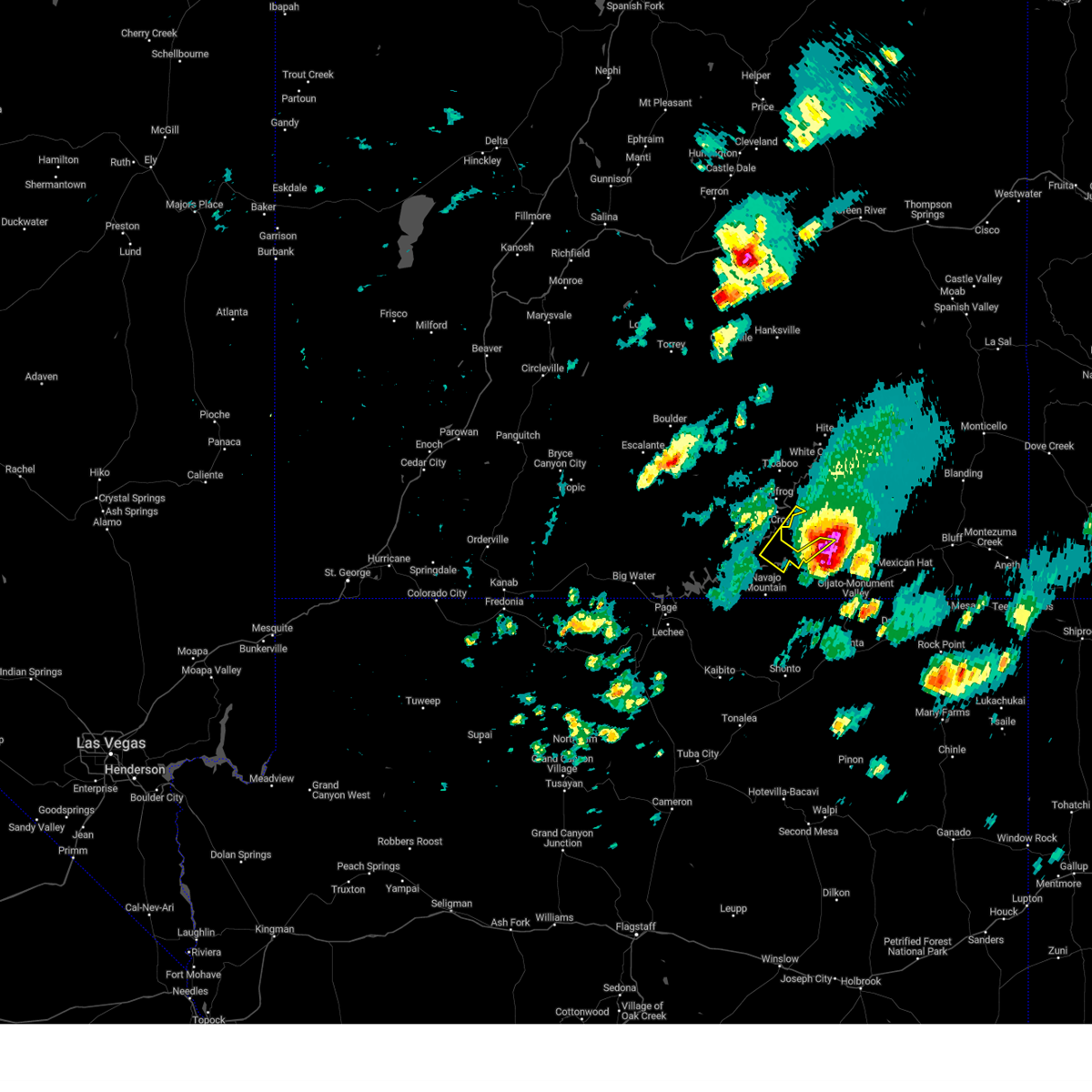
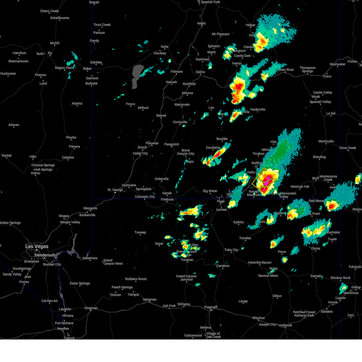
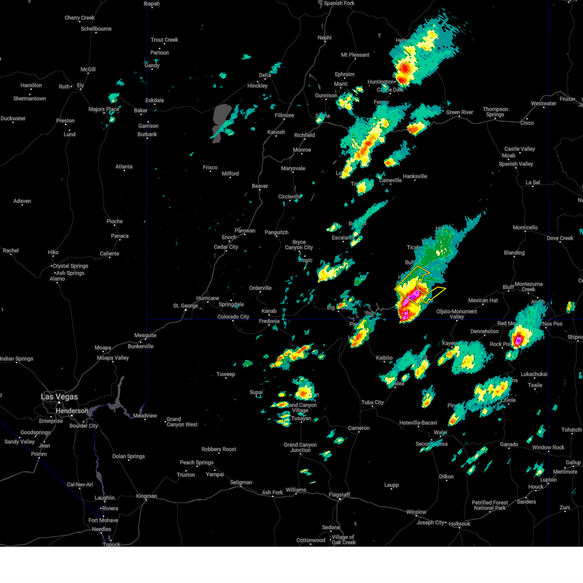
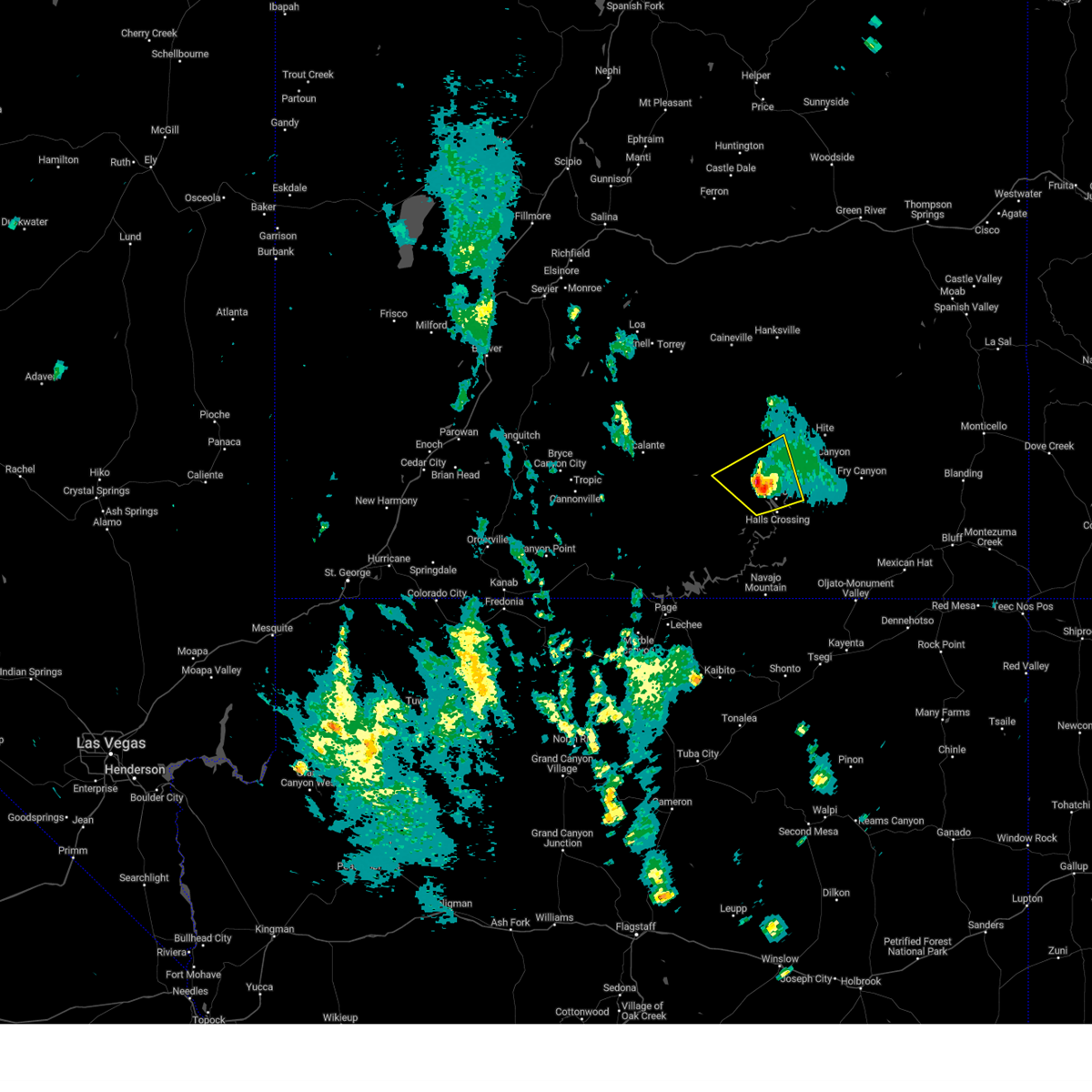
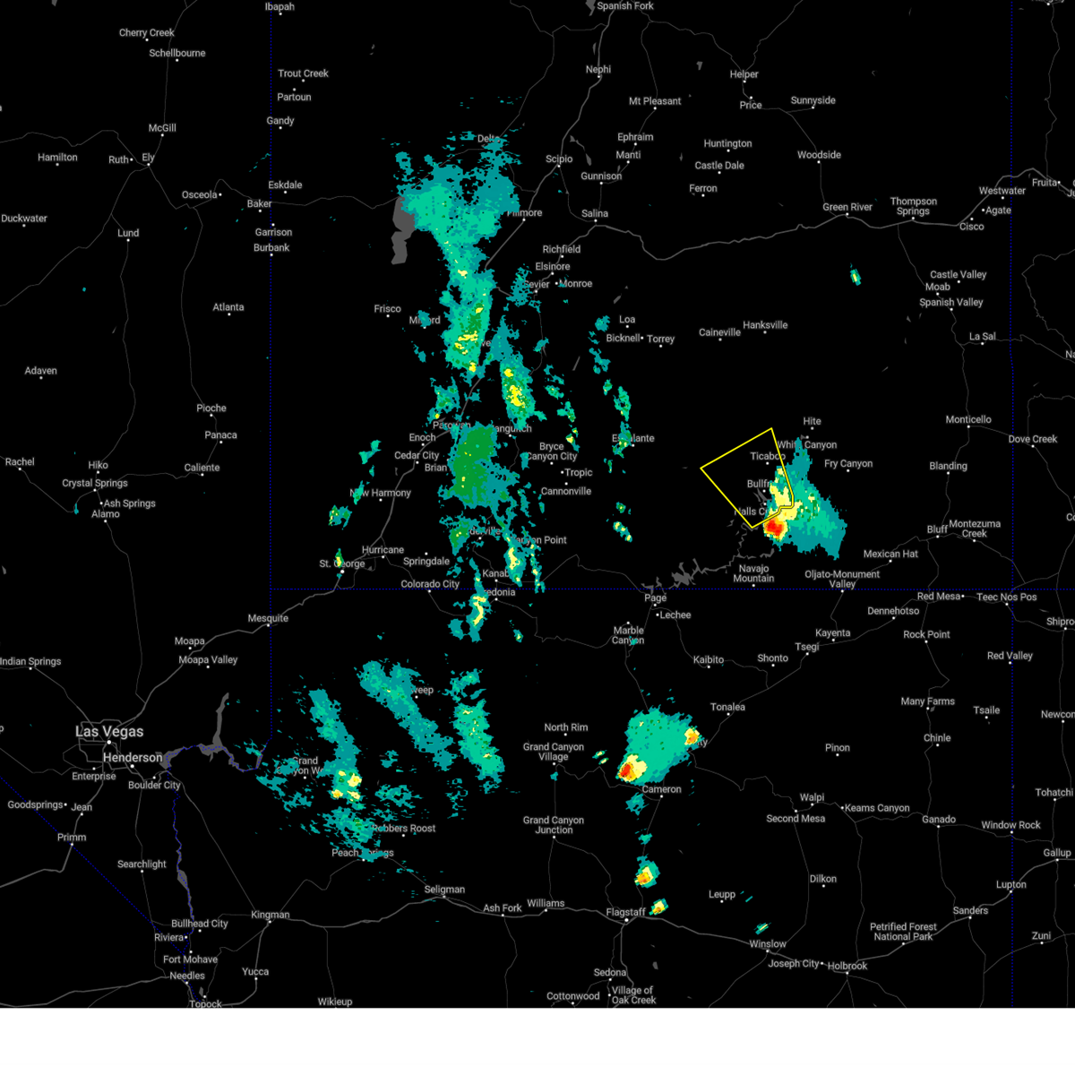
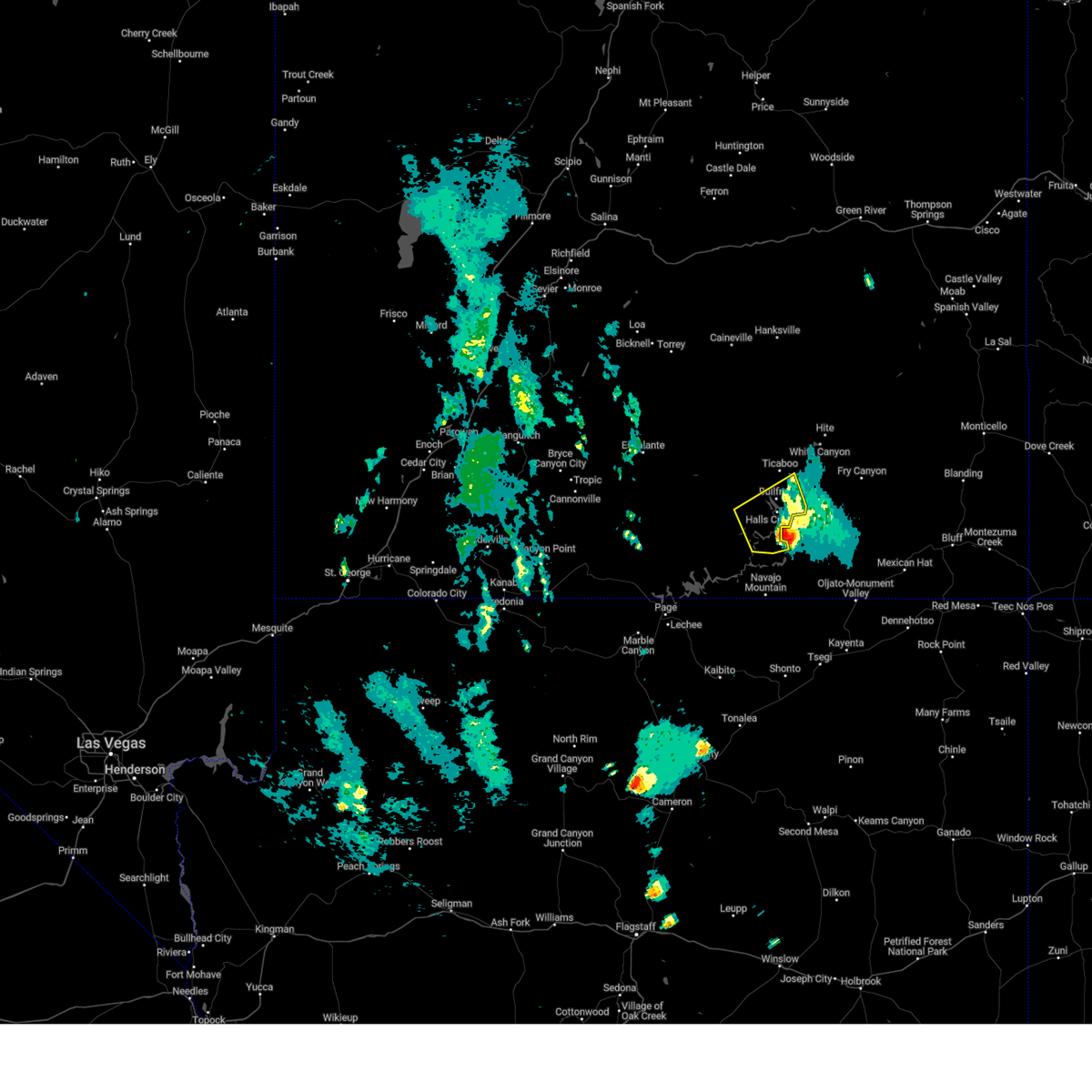
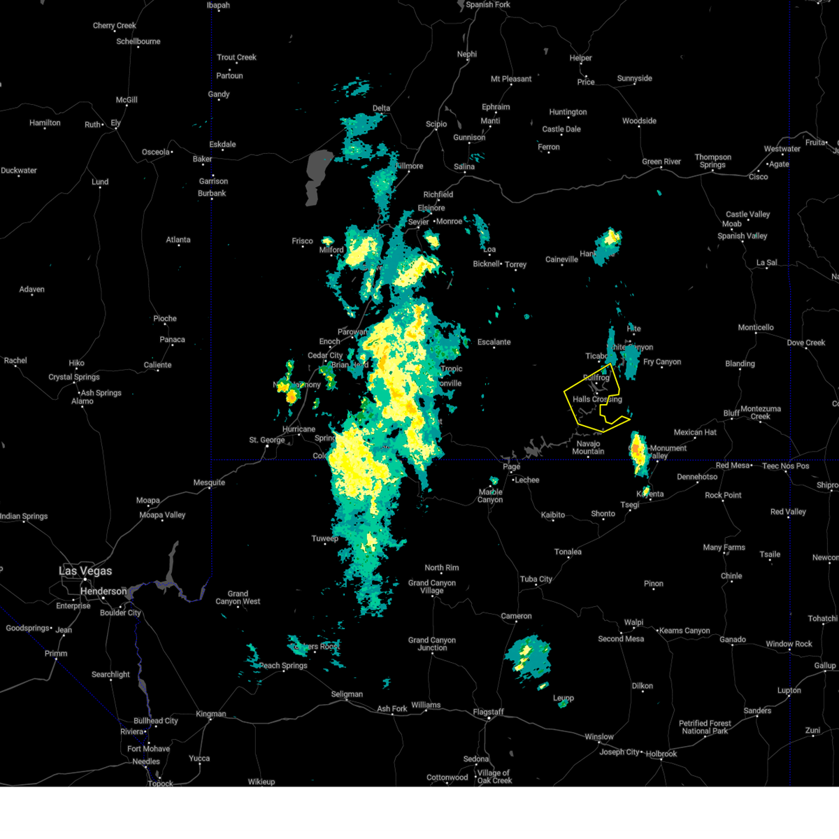
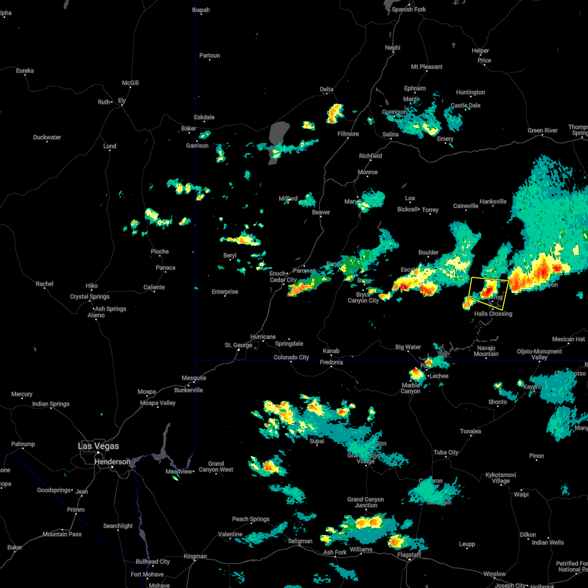
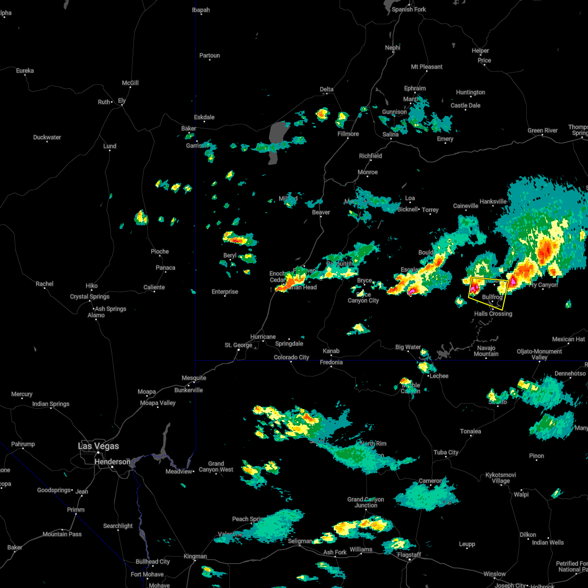
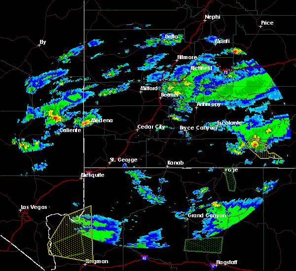
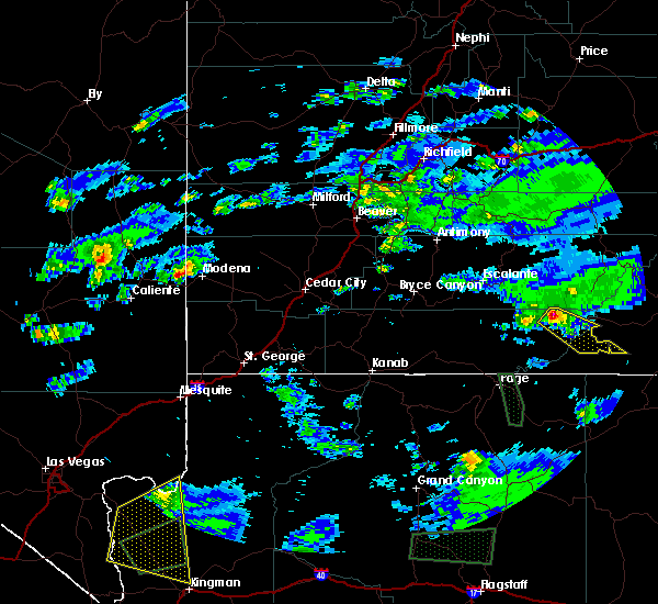
Hail Map for Halls Crossing, UT
The Halls Crossing, UT area has had 0 reports of on-the-ground hail by trained spotters, and has been under severe weather warnings 0 times during the past 12 months. Doppler radar has detected hail at or near Halls Crossing, UT on 2 occasions.
| Name: | Halls Crossing, UT |
| Where Located: | 113.3 miles SE of Monroe, UT |
| Map: | Google Map for Halls Crossing, UT |
| Population: | 6 |
| Housing Units: | 60 |
| More Info: | Search Google for Halls Crossing, UT |
0
The Top Recent Hail Date for Halls Crossing, UT is Sunday, October 2, 2022 (2nd out of 2)

Hail and Wind Damage Spotted near Halls Crossing, UT
| Date / Time | Report Details |
|---|---|
| 5/4/2025 4:45 PM MDT | Bullfrog basin senso in kane county UT, 5.6 miles SE of Halls Crossing, UT |
| 6/21/2024 3:43 PM MDT |
 The storm which prompted the warning has moved out of the area. therefore, the warning will be allowed to expire. a severe thunderstorm watch remains in effect until 700 pm mdt for southeastern utah. The storm which prompted the warning has moved out of the area. therefore, the warning will be allowed to expire. a severe thunderstorm watch remains in effect until 700 pm mdt for southeastern utah.
|
| 6/21/2024 3:31 PM MDT |
 the severe thunderstorm warning has been cancelled and is no longer in effect the severe thunderstorm warning has been cancelled and is no longer in effect
|
| 6/21/2024 3:31 PM MDT |
 At 331 pm mdt, a severe thunderstorm was located 17 miles southwest of fry canyon, or 33 miles northwest of mexican hat, moving northeast at 45 mph (radar indicated). Hazards include 60 mph wind gusts and quarter size hail. Hail damage to vehicles is expected. expect wind damage to roofs, siding, and trees. Locations impacted include, glen canyon national recreation area and lake powell. At 331 pm mdt, a severe thunderstorm was located 17 miles southwest of fry canyon, or 33 miles northwest of mexican hat, moving northeast at 45 mph (radar indicated). Hazards include 60 mph wind gusts and quarter size hail. Hail damage to vehicles is expected. expect wind damage to roofs, siding, and trees. Locations impacted include, glen canyon national recreation area and lake powell.
|
| 6/21/2024 3:03 PM MDT |
 Svrslc the national weather service in salt lake city has issued a * severe thunderstorm warning for, south central san juan county in southeastern utah, east central kane county in southern utah, * until 345 pm mdt. * at 303 pm mdt, a severe thunderstorm was located 11 miles south of halls crossing, or 44 miles west of mexican hat, moving northeast at 45 mph (radar indicated). Hazards include 60 mph wind gusts and quarter size hail. Hail damage to vehicles is expected. Expect wind damage to roofs, siding, and trees. Svrslc the national weather service in salt lake city has issued a * severe thunderstorm warning for, south central san juan county in southeastern utah, east central kane county in southern utah, * until 345 pm mdt. * at 303 pm mdt, a severe thunderstorm was located 11 miles south of halls crossing, or 44 miles west of mexican hat, moving northeast at 45 mph (radar indicated). Hazards include 60 mph wind gusts and quarter size hail. Hail damage to vehicles is expected. Expect wind damage to roofs, siding, and trees.
|
| 8/21/2023 4:40 PM MDT |
 The severe thunderstorm warning for south central garfield, central san juan and eastern kane counties will expire at 445 pm mdt, the storm which prompted the warning has weakened below severe limits, and no longer poses an immediate threat to life or property. therefore, the warning will be allowed to expire. however small hail and gusty winds are still possible with this thunderstorm. The severe thunderstorm warning for south central garfield, central san juan and eastern kane counties will expire at 445 pm mdt, the storm which prompted the warning has weakened below severe limits, and no longer poses an immediate threat to life or property. therefore, the warning will be allowed to expire. however small hail and gusty winds are still possible with this thunderstorm.
|
| 8/21/2023 4:29 PM MDT |
 At 428 pm mdt, a severe thunderstorm was located near glen canyon national recreation area, or 43 miles east of escalante, moving northwest at 35 mph (radar indicated). Hazards include 60 mph wind gusts and quarter size hail. Hail damage to vehicles is expected. expect wind damage to roofs, siding, and trees. locations impacted include, bullfrog, glen canyon national recreation area, ticaboo and halls crossing. this includes utah route 276 between mile markers 19 and 34. hail threat, radar indicated max hail size, 1. 00 in wind threat, radar indicated max wind gust, 60 mph. At 428 pm mdt, a severe thunderstorm was located near glen canyon national recreation area, or 43 miles east of escalante, moving northwest at 35 mph (radar indicated). Hazards include 60 mph wind gusts and quarter size hail. Hail damage to vehicles is expected. expect wind damage to roofs, siding, and trees. locations impacted include, bullfrog, glen canyon national recreation area, ticaboo and halls crossing. this includes utah route 276 between mile markers 19 and 34. hail threat, radar indicated max hail size, 1. 00 in wind threat, radar indicated max wind gust, 60 mph.
|
| 8/21/2023 4:13 PM MDT |
 At 412 pm mdt, a severe thunderstorm was located near bullfrog, or 50 miles southeast of escalante, moving northwest at 35 mph (radar indicated). Hazards include ping pong ball size hail and 60 mph wind gusts. People and animals outdoors will be injured. expect hail damage to roofs, siding, windows, and vehicles. Expect wind damage to roofs, siding, and trees. At 412 pm mdt, a severe thunderstorm was located near bullfrog, or 50 miles southeast of escalante, moving northwest at 35 mph (radar indicated). Hazards include ping pong ball size hail and 60 mph wind gusts. People and animals outdoors will be injured. expect hail damage to roofs, siding, windows, and vehicles. Expect wind damage to roofs, siding, and trees.
|
| 8/21/2023 4:01 PM MDT |
 At 401 pm mdt, a severe thunderstorm was located near halls crossing, or 44 miles west of mexican hat, moving northwest at 20 mph (radar indicated). Hazards include 60 mph wind gusts and quarter size hail. Hail damage to vehicles is expected. expect wind damage to roofs, siding, and trees. locations impacted include, halls crossing, bullfrog, glen canyon national recreation area, ticaboo and lake powell. this includes utah route 276 between mile markers 33 and 34. hail threat, radar indicated max hail size, 1. 00 in wind threat, radar indicated max wind gust, 60 mph. At 401 pm mdt, a severe thunderstorm was located near halls crossing, or 44 miles west of mexican hat, moving northwest at 20 mph (radar indicated). Hazards include 60 mph wind gusts and quarter size hail. Hail damage to vehicles is expected. expect wind damage to roofs, siding, and trees. locations impacted include, halls crossing, bullfrog, glen canyon national recreation area, ticaboo and lake powell. this includes utah route 276 between mile markers 33 and 34. hail threat, radar indicated max hail size, 1. 00 in wind threat, radar indicated max wind gust, 60 mph.
|
| 8/21/2023 3:47 PM MDT |
 At 347 pm mdt, a severe thunderstorm was located 11 miles south of halls crossing, or 41 miles west of mexican hat, moving northwest at 25 mph (radar indicated). Hazards include 60 mph wind gusts and quarter size hail. Hail damage to vehicles is expected. Expect wind damage to roofs, siding, and trees. At 347 pm mdt, a severe thunderstorm was located 11 miles south of halls crossing, or 41 miles west of mexican hat, moving northwest at 25 mph (radar indicated). Hazards include 60 mph wind gusts and quarter size hail. Hail damage to vehicles is expected. Expect wind damage to roofs, siding, and trees.
|
| 10/2/2022 6:47 PM MDT |
 At 647 pm mdt, a severe thunderstorm was located near ticaboo, or 44 miles southeast of capitol reef national park, moving east at 20 mph (radar indicated). Hazards include 60 mph wind gusts and half dollar size hail. Hail damage to vehicles is expected. expect wind damage to roofs, siding, and trees. locations impacted include, bullfrog, glen canyon national recreation area, ticaboo and halls crossing. this includes utah route 276 between mile markers 24 and 34. hail threat, radar indicated max hail size, 1. 25 in wind threat, radar indicated max wind gust, 60 mph. At 647 pm mdt, a severe thunderstorm was located near ticaboo, or 44 miles southeast of capitol reef national park, moving east at 20 mph (radar indicated). Hazards include 60 mph wind gusts and half dollar size hail. Hail damage to vehicles is expected. expect wind damage to roofs, siding, and trees. locations impacted include, bullfrog, glen canyon national recreation area, ticaboo and halls crossing. this includes utah route 276 between mile markers 24 and 34. hail threat, radar indicated max hail size, 1. 25 in wind threat, radar indicated max wind gust, 60 mph.
|
| 10/2/2022 6:26 PM MDT |
 At 626 pm mdt, a severe thunderstorm was located 10 miles northwest of glen canyon national recreation area, or 40 miles east of escalante, moving east at 20 mph (radar indicated). Hazards include 60 mph wind gusts and half dollar size hail. Hail damage to vehicles is expected. Expect wind damage to roofs, siding, and trees. At 626 pm mdt, a severe thunderstorm was located 10 miles northwest of glen canyon national recreation area, or 40 miles east of escalante, moving east at 20 mph (radar indicated). Hazards include 60 mph wind gusts and half dollar size hail. Hail damage to vehicles is expected. Expect wind damage to roofs, siding, and trees.
|
| 9/14/2017 3:00 PM MDT | Observation from bullfrog marina automated weather statio in kane county UT, 5.6 miles SE of Halls Crossing, UT |
| 8/12/2017 3:29 PM MDT |
 At 328 pm mdt, a severe thunderstorm was located 10 miles southwest of glen canyon national recreation area, or 45 miles northeast of page, moving southeast at 25 mph (radar indicated). Hazards include 60 mph wind gusts and penny size hail. Expect damage to roofs, siding, and trees. Locations impacted include, halls crossing and glen canyon national recreation area. At 328 pm mdt, a severe thunderstorm was located 10 miles southwest of glen canyon national recreation area, or 45 miles northeast of page, moving southeast at 25 mph (radar indicated). Hazards include 60 mph wind gusts and penny size hail. Expect damage to roofs, siding, and trees. Locations impacted include, halls crossing and glen canyon national recreation area.
|
| 8/12/2017 3:15 PM MDT |
 At 314 pm mdt, a severe thunderstorm was located 13 miles west of glen canyon national recreation area, or 39 miles southeast of escalante, moving southeast at 25 mph (radar indicated). Hazards include 60 mph wind gusts and quarter size hail. Hail damage to vehicles is expected. Expect wind damage to roofs, siding, and trees. At 314 pm mdt, a severe thunderstorm was located 13 miles west of glen canyon national recreation area, or 39 miles southeast of escalante, moving southeast at 25 mph (radar indicated). Hazards include 60 mph wind gusts and quarter size hail. Hail damage to vehicles is expected. Expect wind damage to roofs, siding, and trees.
|
| 8/3/2017 3:45 PM MDT | Bullfrog marina mesonet sit in kane county UT, 4.2 miles SE of Halls Crossing, UT |
| 8/10/2016 4:45 PM MDT | Mesonet station at bullfrog marina on lake powel in kane county UT, 5.6 miles SE of Halls Crossing, UT |
| 3/6/2016 8:00 PM MST | Bullfrog marina bullf 3700 ft in kane county UT, 5.6 miles SE of Halls Crossing, UT |
| 6/10/2015 10:45 PM MDT | Bullfrog marina sensor bullf in kane county UT, 5.6 miles SE of Halls Crossing, UT |
| 6/6/2015 3:23 PM MDT | The severe thunderstorm warning for south central san juan and east central kane counties will expire at 330 pm mdt, the storm which prompted the warning has weakened below severe limits and exited the warned area. therefore the warning will be allowed to expire. to report severe weather, contact your nearest law enforcement agency. they will relay your report to the national weather service salt lake city. |
| 6/6/2015 3:13 PM MDT | At 312 pm mdt, doppler radar indicated a severe thunderstorm capable of producing quarter size hail and damaging winds in excess of 60 mph. this storm was located 11 miles south of halls crossing, or 45 miles west of mexican hat, moving northeast at 20 mph. locations impacted include, halls crossing. |
| 6/6/2015 2:44 PM MDT | At 243 pm mdt, doppler radar indicated a severe thunderstorm capable of producing quarter size hail and damaging winds in excess of 60 mph. this storm was located 21 miles southwest of halls crossing, or 35 miles northeast of antelope canyon near sr 98, and moving northeast at 35 mph. |
| 6/6/2015 2:16 PM MDT | At 215 pm mdt, doppler radar indicated a severe thunderstorm capable of producing quarter size hail and damaging winds in excess of 60 mph. this storm was located near halls crossing, or 44 miles northwest of mexican hat, and moving northeast at 30 mph. |
| 6/6/2015 1:47 PM MDT | At 147 pm mdt, doppler radar indicated a severe thunderstorm capable of producing large hail up to ping pong ball size and damaging winds in excess of 60 mph. this storm was located near halls crossing, or 48 miles west of mexican hat, moving northeast at 35 mph. locations impacted include, halls crossing and bullfrog. |
| 6/6/2015 1:29 PM MDT | At 129 pm mdt, doppler radar indicated a severe thunderstorm capable of producing quarter size hail and damaging winds in excess of 60 mph. this storm was located 15 miles southwest of halls crossing, or 40 miles northeast of antelope canyon near sr 98, and moving northeast at 30 mph. |
| 5/23/2014 2:12 PM MDT | A houseboat was blown into a cliff on lake powel in kane county UT, 4.2 miles SE of Halls Crossing, UT |
| 7/5/2013 3:45 PM MDT | Storm damage reported in kane county UT, 5.6 miles SE of Halls Crossing, UT |
Hail Maps for Halls Crossing, UT


Connect with Interactive Hail Maps