

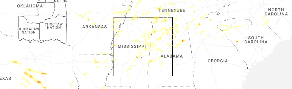
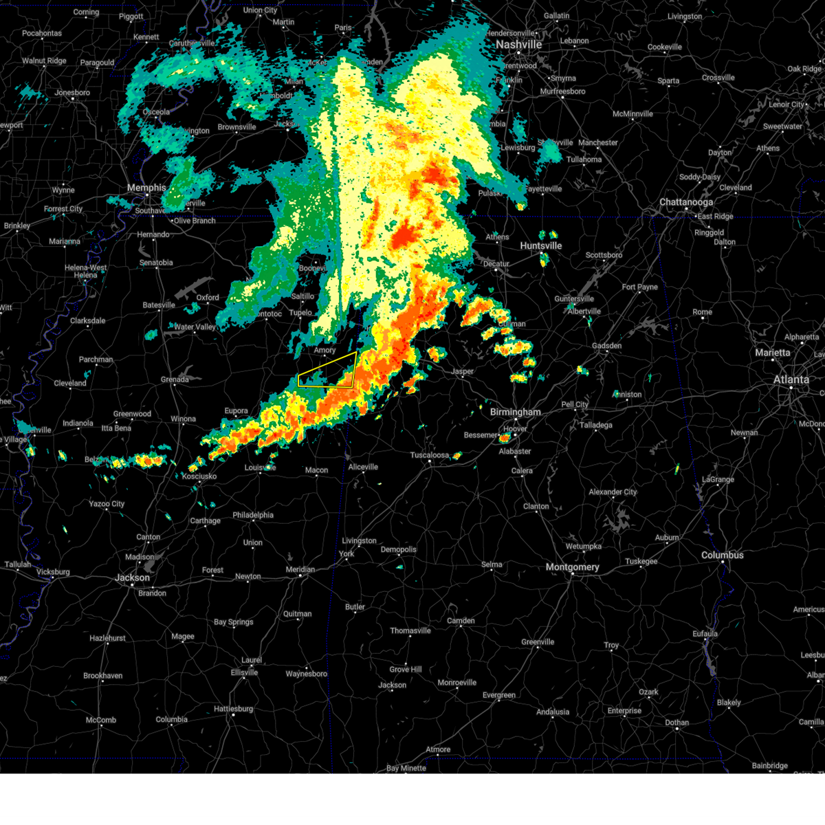
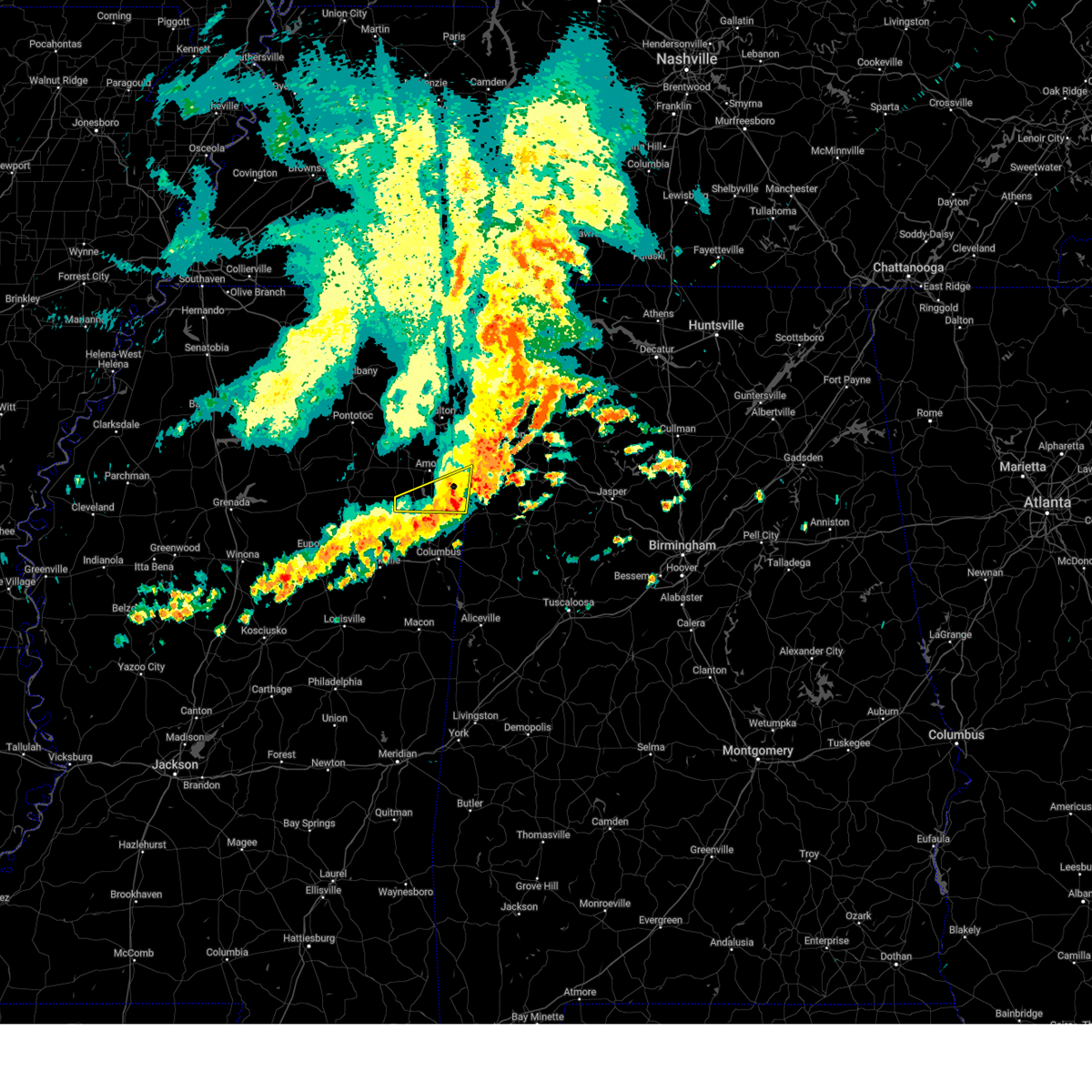
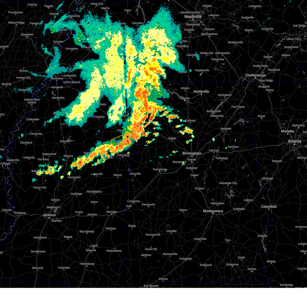
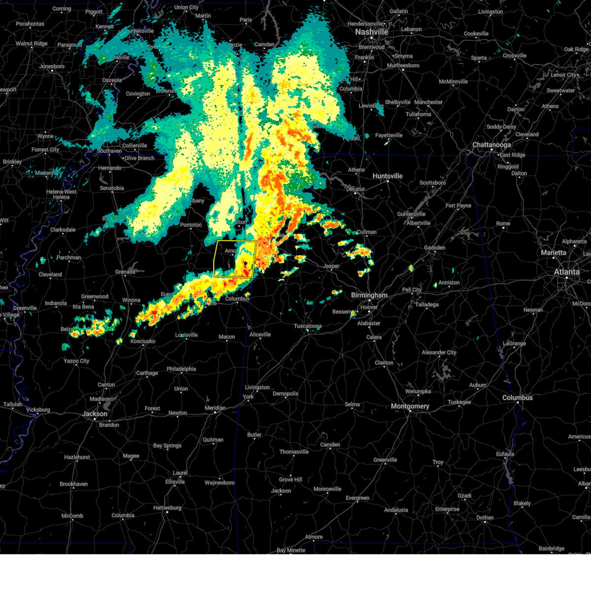
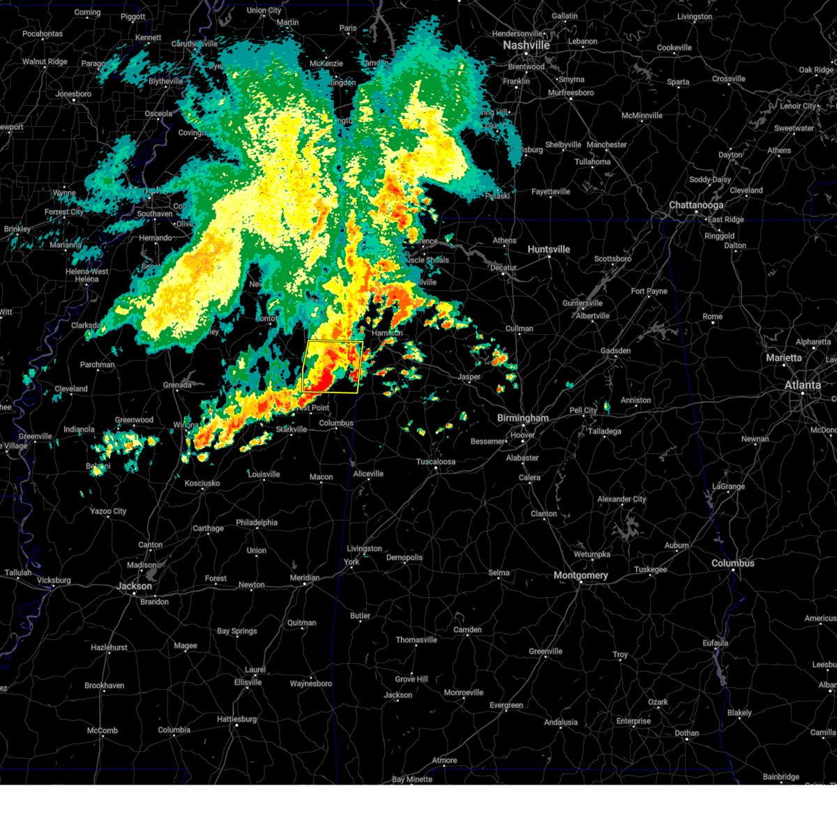
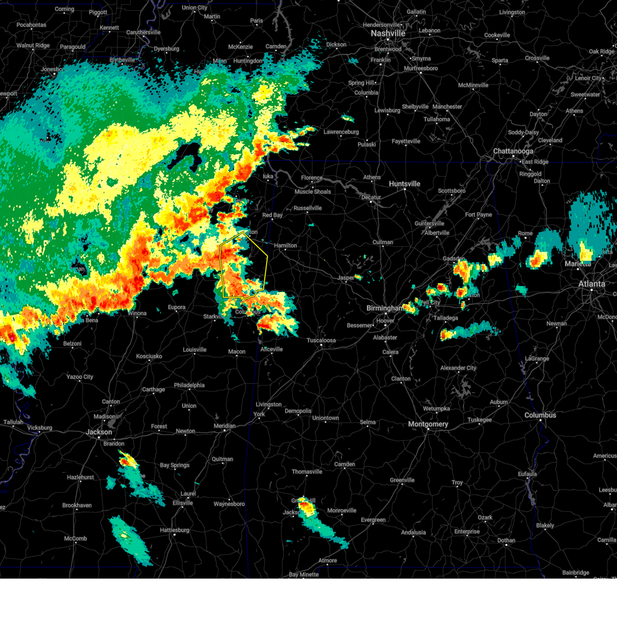
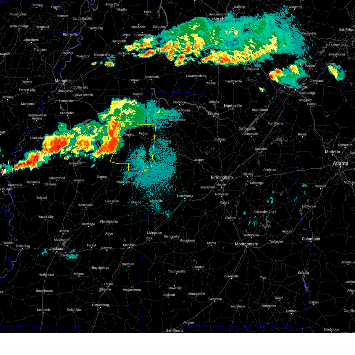
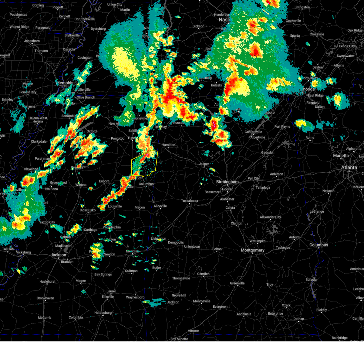
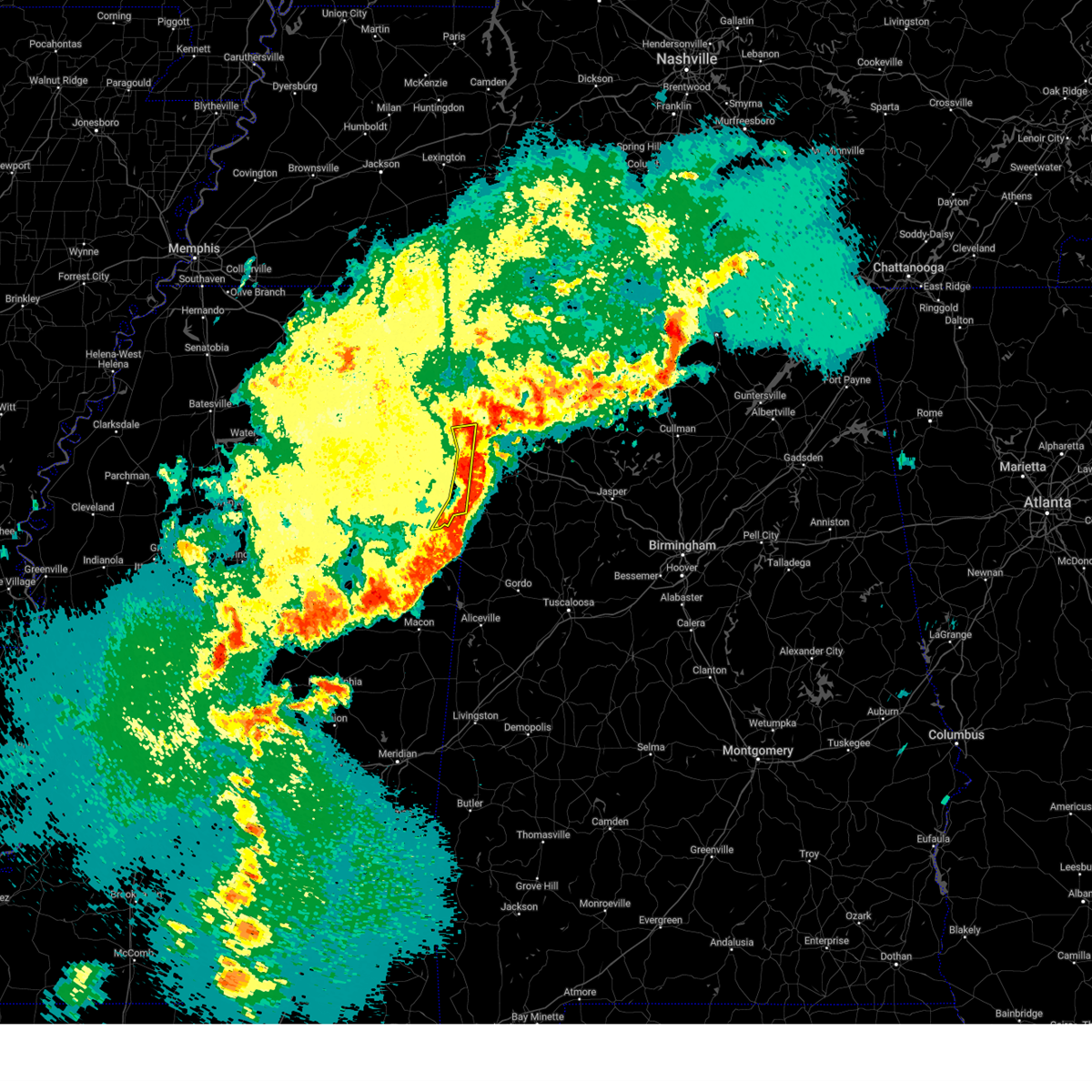
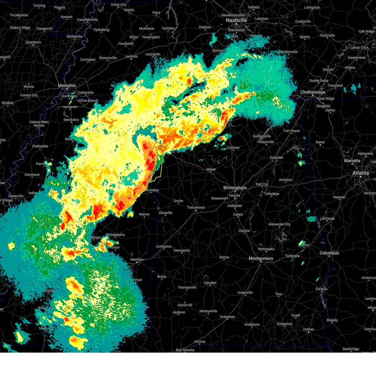
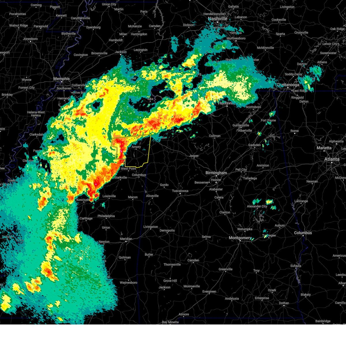
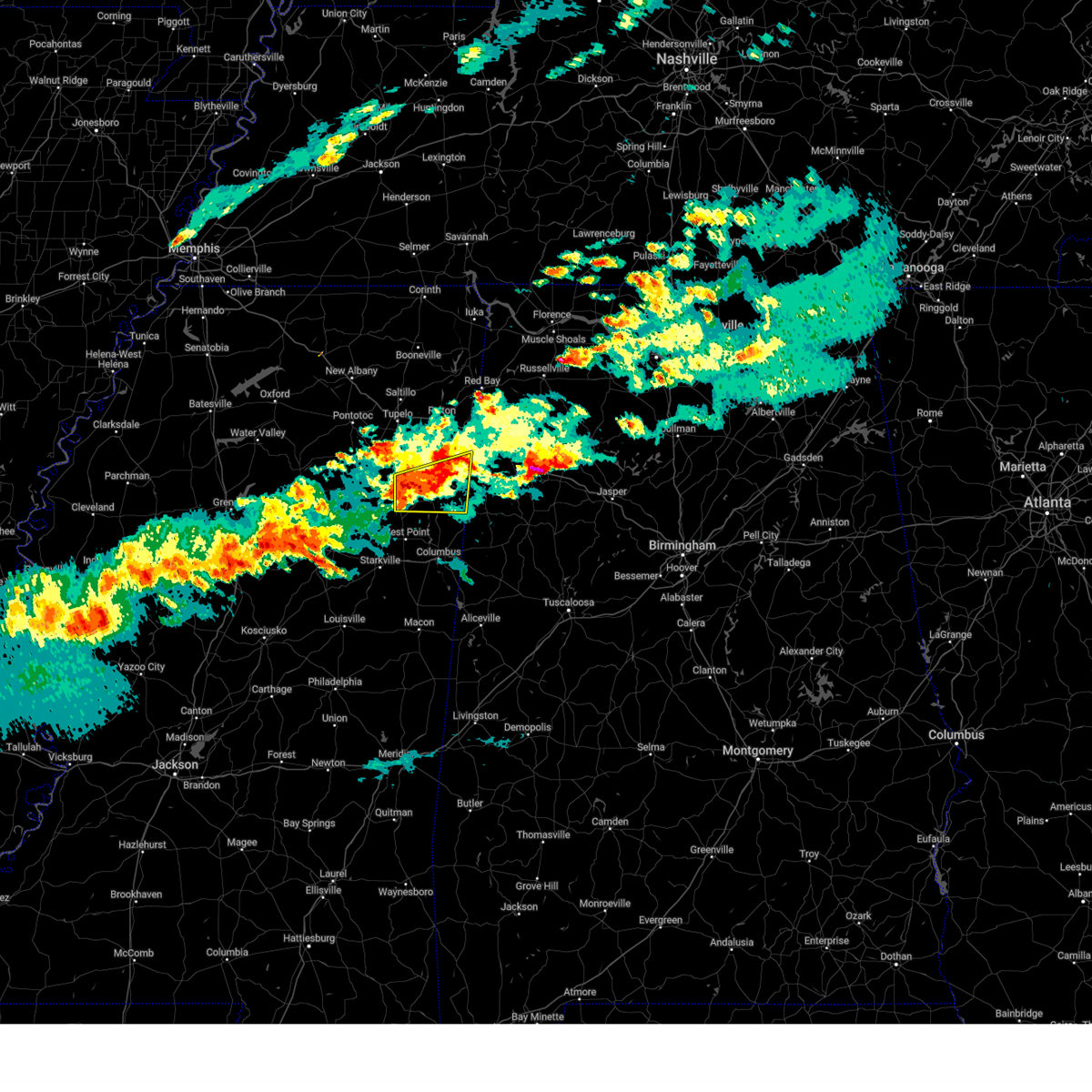
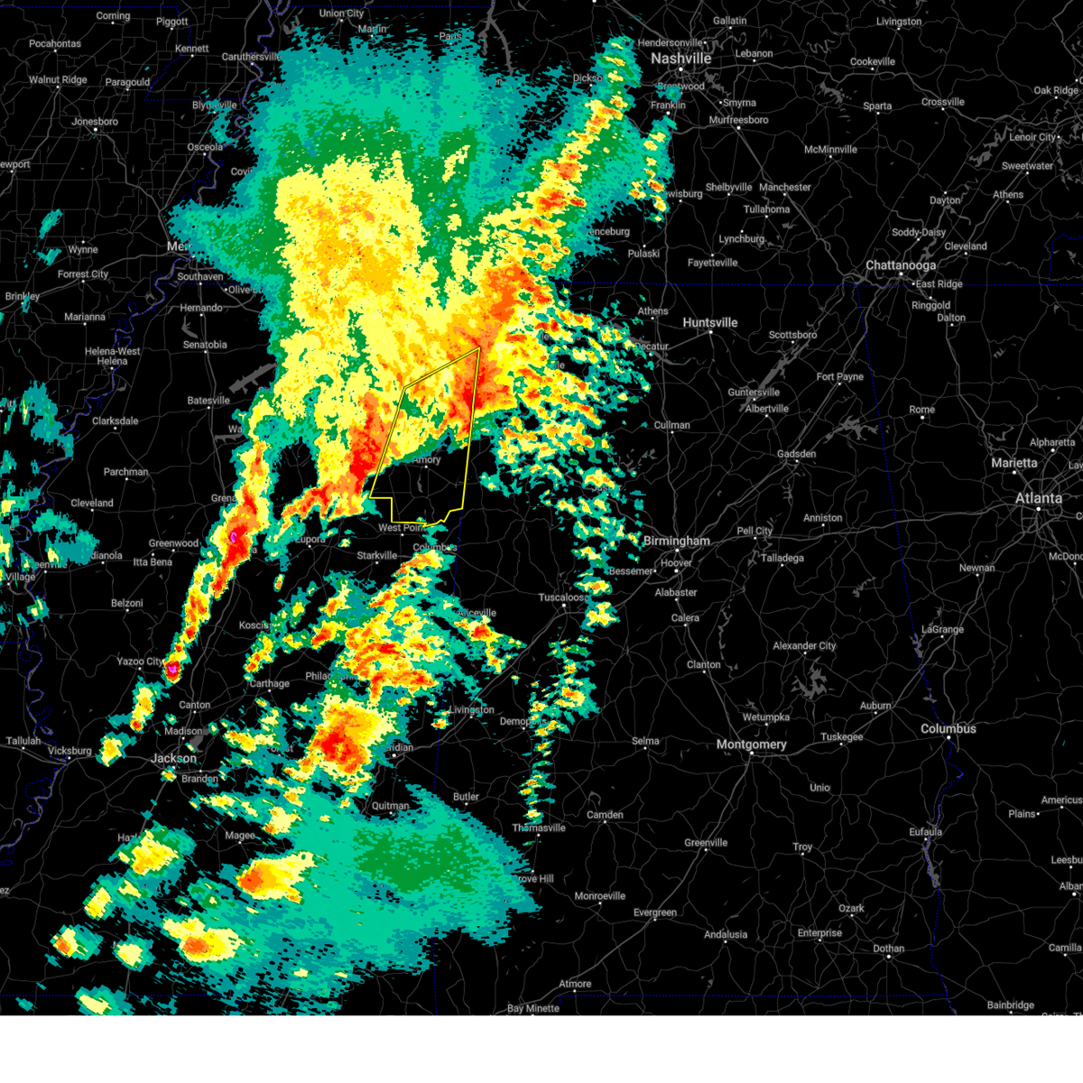
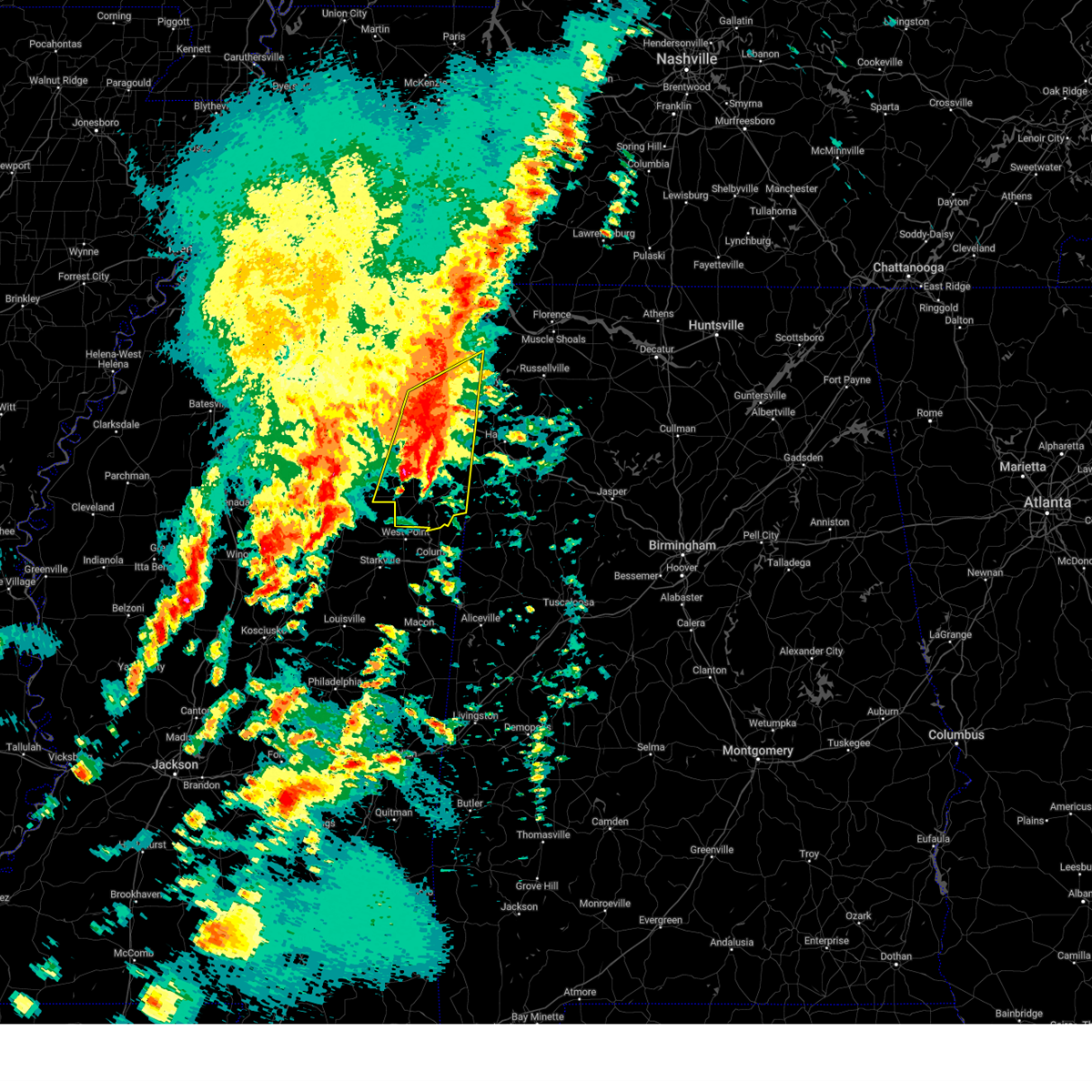
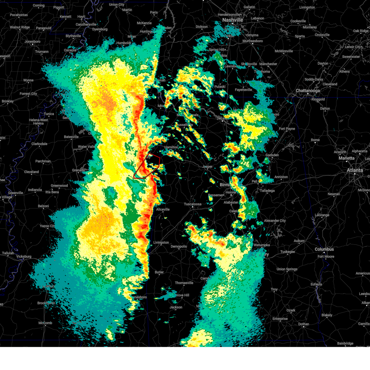
Hail Map for Hamilton, MS
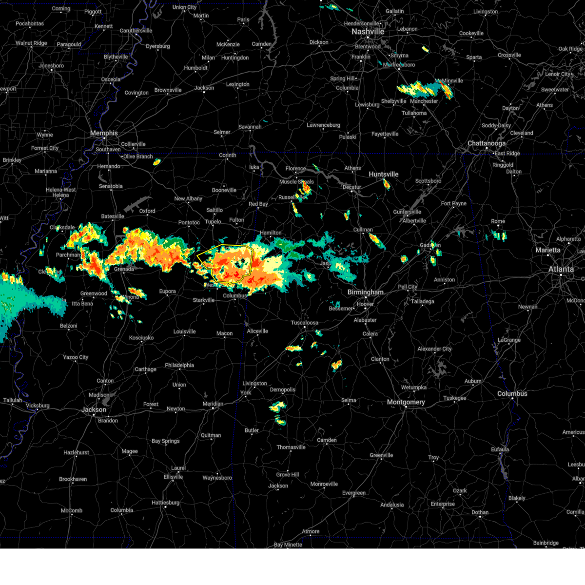
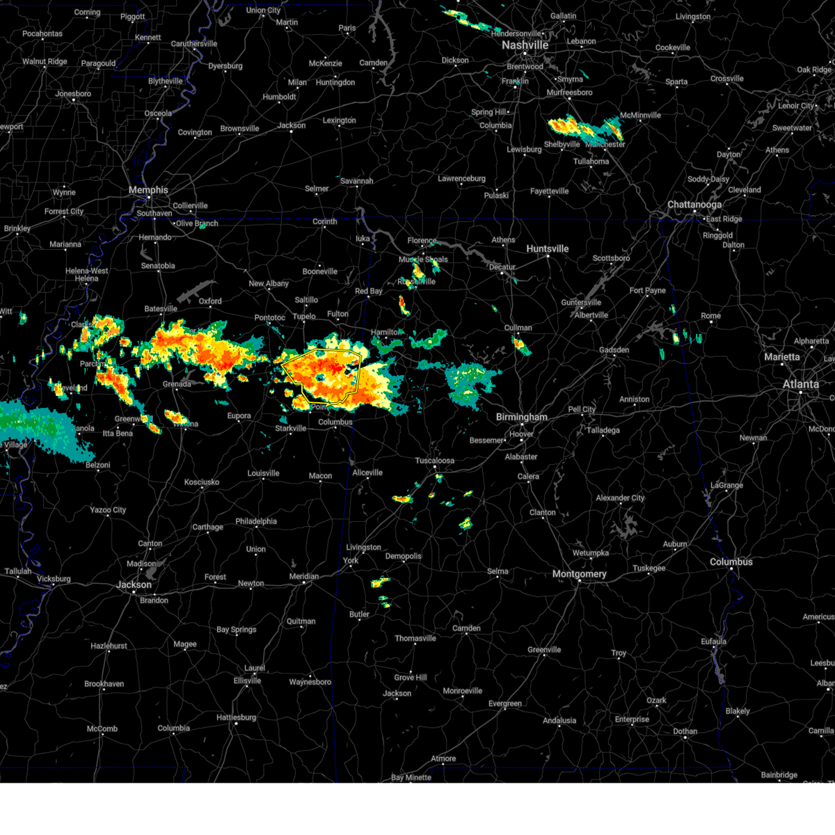
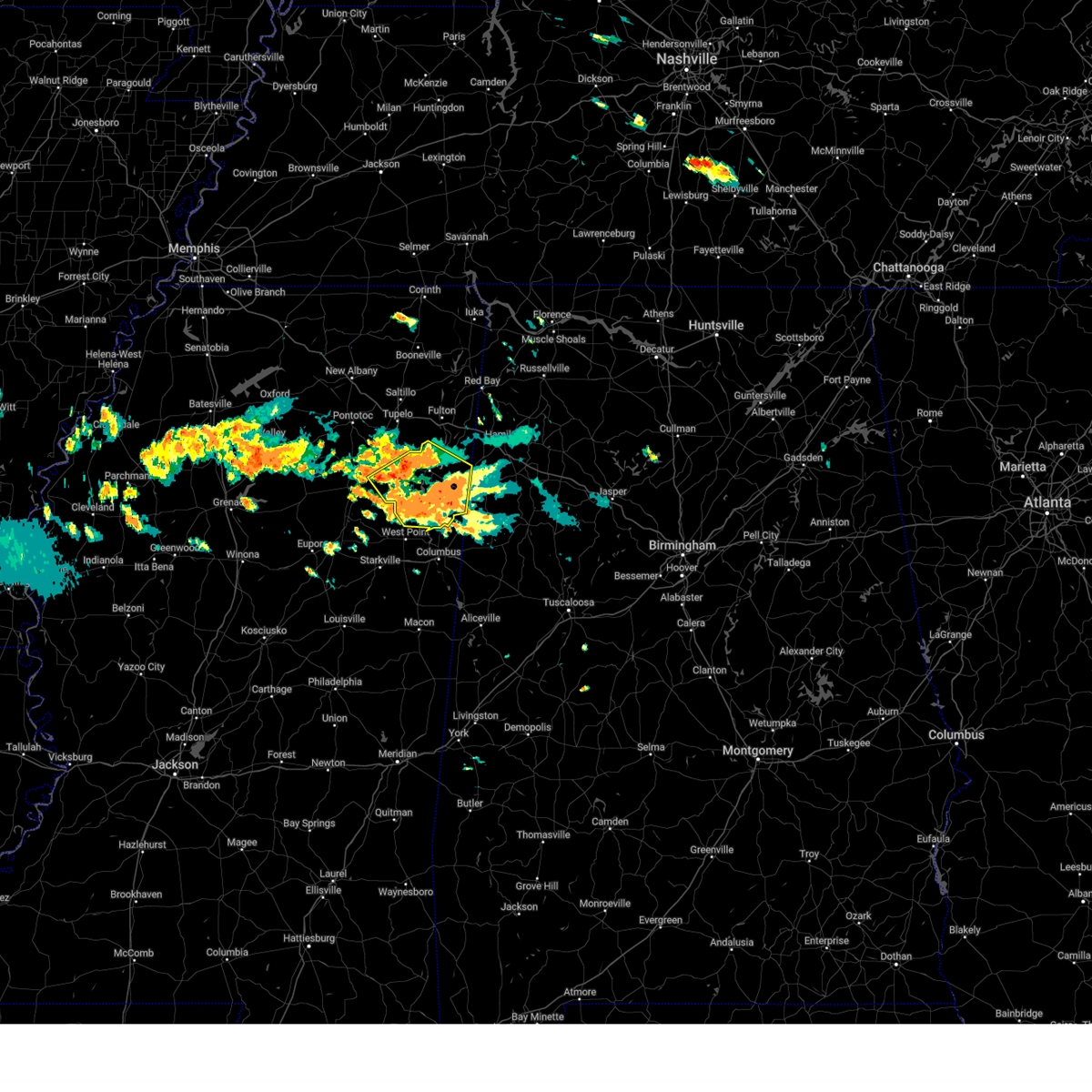
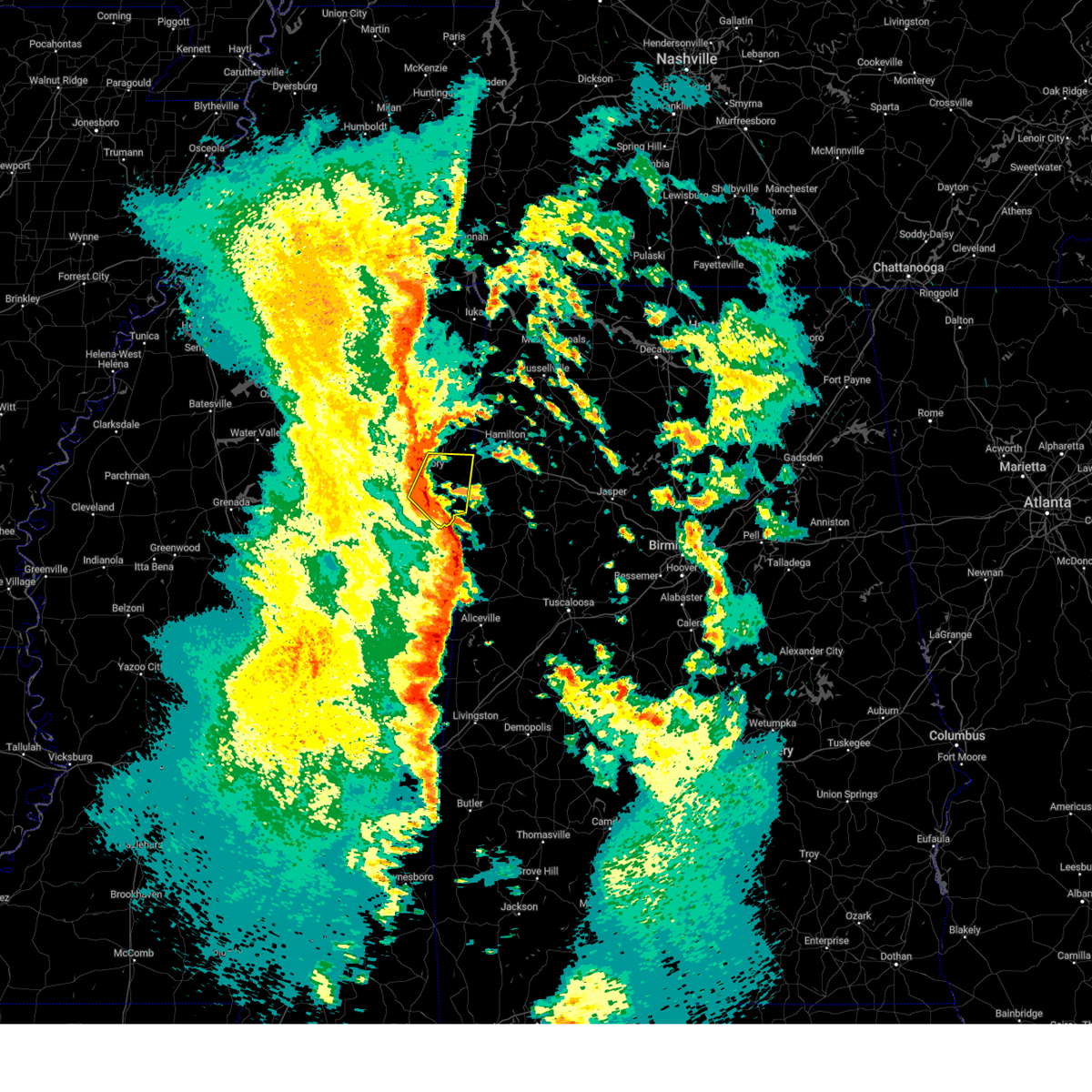
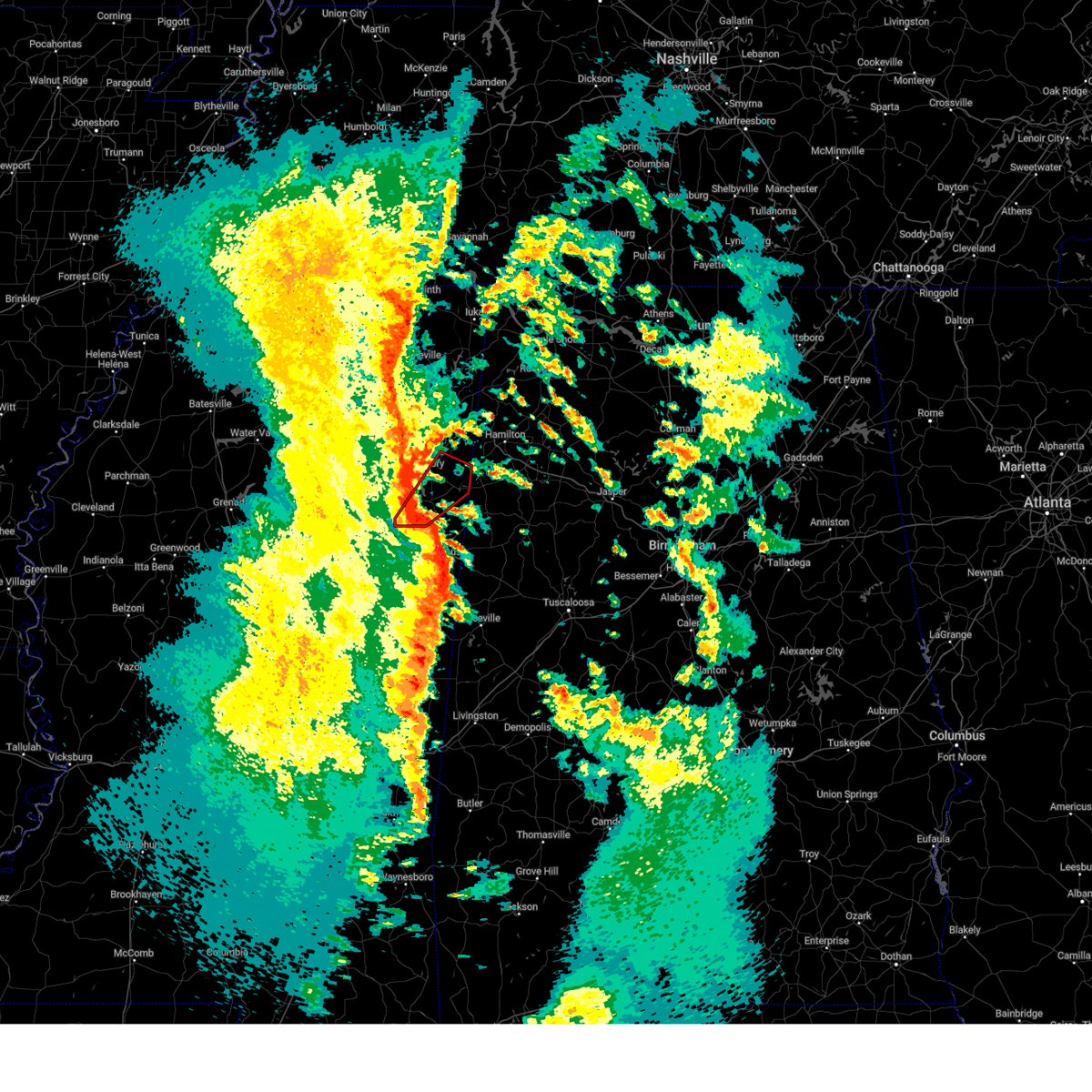
The Hamilton, MS area has had 5 reports of on-the-ground hail by trained spotters, and has been under severe weather warnings 37 times during the past 12 months. Doppler radar has detected hail at or near Hamilton, MS on 61 occasions, including 5 occasions during the past year.
| Name: | Hamilton, MS |
| Where Located: | 29.8 miles NE of Starkville, MS |
| Map: | Google Map for Hamilton, MS |
| Population: | 457 |
| Housing Units: | 179 |
| More Info: | Search Google for Hamilton, MS |
5
The Top Recent Hail Date for Hamilton, MS is Friday, May 2, 2025 (6th out of 61)
Hail and Wind Damage Spotted near Hamilton, MS
| Date / Time | Report Details |
|---|---|
| 6/8/2025 1:13 AM CDT |
 The severe thunderstorm which prompted the warning has weakened. therefore, the warning will be allowed to expire. however, gusty winds are still possible with this thunderstorm. a severe thunderstorm watch remains in effect until 200 am cdt for northeastern mississippi. The severe thunderstorm which prompted the warning has weakened. therefore, the warning will be allowed to expire. however, gusty winds are still possible with this thunderstorm. a severe thunderstorm watch remains in effect until 200 am cdt for northeastern mississippi.
|
| 6/8/2025 12:59 AM CDT |
 the severe thunderstorm warning has been cancelled and is no longer in effect the severe thunderstorm warning has been cancelled and is no longer in effect
|
| 6/8/2025 12:59 AM CDT |
 At 1259 am cdt, a severe thunderstorm was located 7 miles northeast of aberdeen, moving southeast at 30 mph (radar indicated). Hazards include 60 mph wind gusts and quarter size hail. Hail damage to vehicles is expected. expect wind damage to roofs, siding, and trees. Locations impacted include, amory, aberdeen, okolona, prairie, new wren, hatley, gattman, binford, sipsey fork, new hamilton, becker, quincy, egypt, splunge, wise gap, athens, wren, strong, east aberdeen, and bigbee. At 1259 am cdt, a severe thunderstorm was located 7 miles northeast of aberdeen, moving southeast at 30 mph (radar indicated). Hazards include 60 mph wind gusts and quarter size hail. Hail damage to vehicles is expected. expect wind damage to roofs, siding, and trees. Locations impacted include, amory, aberdeen, okolona, prairie, new wren, hatley, gattman, binford, sipsey fork, new hamilton, becker, quincy, egypt, splunge, wise gap, athens, wren, strong, east aberdeen, and bigbee.
|
| 6/8/2025 12:35 AM CDT |
 Svrmeg the national weather service in memphis has issued a * severe thunderstorm warning for, east central chickasaw county in northeastern mississippi, southwestern itawamba county in northeastern mississippi, monroe county in northeastern mississippi, * until 115 am cdt. * at 1235 am cdt, a severe thunderstorm was located over new wren, or 7 miles west of amory, moving southeast at 30 mph (radar indicated). Hazards include 60 mph wind gusts and quarter size hail. Hail damage to vehicles is expected. Expect wind damage to roofs, siding, and trees. Svrmeg the national weather service in memphis has issued a * severe thunderstorm warning for, east central chickasaw county in northeastern mississippi, southwestern itawamba county in northeastern mississippi, monroe county in northeastern mississippi, * until 115 am cdt. * at 1235 am cdt, a severe thunderstorm was located over new wren, or 7 miles west of amory, moving southeast at 30 mph (radar indicated). Hazards include 60 mph wind gusts and quarter size hail. Hail damage to vehicles is expected. Expect wind damage to roofs, siding, and trees.
|
| 6/7/2025 1:10 PM CDT |
 The storm which prompted the warning has moved out of the area. therefore, the warning will be allowed to expire. a severe thunderstorm watch remains in effect until 400 pm cdt for northeastern mississippi. The storm which prompted the warning has moved out of the area. therefore, the warning will be allowed to expire. a severe thunderstorm watch remains in effect until 400 pm cdt for northeastern mississippi.
|
| 6/7/2025 1:00 PM CDT |
 At 1259 pm cdt, a severe thunderstorm was located near bedford, or 11 miles west of sulligent, moving southeast at 35 mph (broadcast media). Hazards include 60 mph wind gusts and nickel size hail. Expect damage to roofs, siding, and trees. Locations impacted include, aberdeen, prairie, gattman, east aberdeen, sipsey fork, quincy, greenwood springs, splunge, wise gap, and athens. At 1259 pm cdt, a severe thunderstorm was located near bedford, or 11 miles west of sulligent, moving southeast at 35 mph (broadcast media). Hazards include 60 mph wind gusts and nickel size hail. Expect damage to roofs, siding, and trees. Locations impacted include, aberdeen, prairie, gattman, east aberdeen, sipsey fork, quincy, greenwood springs, splunge, wise gap, and athens.
|
| 6/7/2025 1:00 PM CDT |
 the severe thunderstorm warning has been cancelled and is no longer in effect the severe thunderstorm warning has been cancelled and is no longer in effect
|
| 6/7/2025 12:54 PM CDT |
 At 1254 pm cdt, a severe thunderstorm was located over detroit, or 11 miles northwest of sulligent, moving east at 40 mph (broadcast media. at 1230 pm, trees down on homes in amory). Hazards include 70 mph wind gusts and nickel size hail. Expect considerable tree damage. damage is likely to mobile homes, roofs, and outbuildings. Locations impacted include, amory, aberdeen, shannon, smithville, prairie, new wren, nettleton, hatley, gattman, sipsey fork, becker, quincy, turon, splunge, wise gap, athens, wren, east aberdeen, bigbee, and greenwood springs. At 1254 pm cdt, a severe thunderstorm was located over detroit, or 11 miles northwest of sulligent, moving east at 40 mph (broadcast media. at 1230 pm, trees down on homes in amory). Hazards include 70 mph wind gusts and nickel size hail. Expect considerable tree damage. damage is likely to mobile homes, roofs, and outbuildings. Locations impacted include, amory, aberdeen, shannon, smithville, prairie, new wren, nettleton, hatley, gattman, sipsey fork, becker, quincy, turon, splunge, wise gap, athens, wren, east aberdeen, bigbee, and greenwood springs.
|
| 6/7/2025 12:43 PM CDT |
 At 1243 pm cdt, a severe thunderstorm was located near smithville, or 8 miles east of amory, moving east at 40 mph (radar indicated). Hazards include 70 mph wind gusts and nickel size hail. Expect considerable tree damage. damage is likely to mobile homes, roofs, and outbuildings. Locations impacted include, amory, aberdeen, shannon, smithville, prairie, new wren, nettleton, hatley, gattman, sipsey fork, becker, quincy, turon, splunge, wise gap, athens, wren, east aberdeen, bigbee, and greenwood springs. At 1243 pm cdt, a severe thunderstorm was located near smithville, or 8 miles east of amory, moving east at 40 mph (radar indicated). Hazards include 70 mph wind gusts and nickel size hail. Expect considerable tree damage. damage is likely to mobile homes, roofs, and outbuildings. Locations impacted include, amory, aberdeen, shannon, smithville, prairie, new wren, nettleton, hatley, gattman, sipsey fork, becker, quincy, turon, splunge, wise gap, athens, wren, east aberdeen, bigbee, and greenwood springs.
|
| 6/7/2025 12:42 PM CDT | Large tree uproot and another large trunk snapped off of center hill r in monroe county MS, 3.2 miles SSE of Hamilton, MS |
| 6/7/2025 12:29 PM CDT |
 Svrmeg the national weather service in memphis has issued a * severe thunderstorm warning for, southwestern itawamba county in northeastern mississippi, southeastern lee county in northeastern mississippi, monroe county in northeastern mississippi, * until 115 pm cdt. * at 1228 pm cdt, a severe thunderstorm was located over amory, moving east at 40 mph. this is a destructive storm for new wren and amory (radar indicated). Hazards include 80 mph wind gusts and nickel size hail. Flying debris will be dangerous to those caught without shelter. mobile homes will be heavily damaged. expect considerable damage to roofs, windows, and vehicles. Extensive tree damage and power outages are likely. Svrmeg the national weather service in memphis has issued a * severe thunderstorm warning for, southwestern itawamba county in northeastern mississippi, southeastern lee county in northeastern mississippi, monroe county in northeastern mississippi, * until 115 pm cdt. * at 1228 pm cdt, a severe thunderstorm was located over amory, moving east at 40 mph. this is a destructive storm for new wren and amory (radar indicated). Hazards include 80 mph wind gusts and nickel size hail. Flying debris will be dangerous to those caught without shelter. mobile homes will be heavily damaged. expect considerable damage to roofs, windows, and vehicles. Extensive tree damage and power outages are likely.
|
| 5/25/2025 7:45 PM CDT |
 The storm which prompted the warning has weakened below severe limits, and no longer poses an immediate threat to life or property. therefore, the warning has been allowed to expire. a severe thunderstorm watch remains in effect until 900 pm cdt for northeastern mississippi. The storm which prompted the warning has weakened below severe limits, and no longer poses an immediate threat to life or property. therefore, the warning has been allowed to expire. a severe thunderstorm watch remains in effect until 900 pm cdt for northeastern mississippi.
|
| 5/25/2025 7:25 PM CDT |
 At 725 pm cdt, a severe thunderstorm was located near amory, moving northeast at 45 mph (radar indicated). Hazards include 60 mph wind gusts and quarter size hail. Hail damage to vehicles is expected. expect wind damage to roofs, siding, and trees. Locations impacted include, abney, quincy, aberdeen, smithville, turon, egypt, mooreville, prairie, wise gap, shannon, ballardsville, wren, strong, plantersville, nettleton, new salem, muldon, okolona, gattman, and leotis. At 725 pm cdt, a severe thunderstorm was located near amory, moving northeast at 45 mph (radar indicated). Hazards include 60 mph wind gusts and quarter size hail. Hail damage to vehicles is expected. expect wind damage to roofs, siding, and trees. Locations impacted include, abney, quincy, aberdeen, smithville, turon, egypt, mooreville, prairie, wise gap, shannon, ballardsville, wren, strong, plantersville, nettleton, new salem, muldon, okolona, gattman, and leotis.
|
| 5/25/2025 7:25 PM CDT |
 the severe thunderstorm warning has been cancelled and is no longer in effect the severe thunderstorm warning has been cancelled and is no longer in effect
|
| 5/25/2025 6:59 PM CDT |
 Svrmeg the national weather service in memphis has issued a * severe thunderstorm warning for, eastern chickasaw county in northeastern mississippi, southeastern pontotoc county in northeastern mississippi, southwestern itawamba county in northeastern mississippi, southern lee county in northeastern mississippi, monroe county in northeastern mississippi, * until 745 pm cdt. * at 659 pm cdt, a severe thunderstorm was located 7 miles south of okolona, moving northeast at 45 mph (radar indicated). Hazards include 60 mph wind gusts and quarter size hail. Hail damage to vehicles is expected. Expect wind damage to roofs, siding, and trees. Svrmeg the national weather service in memphis has issued a * severe thunderstorm warning for, eastern chickasaw county in northeastern mississippi, southeastern pontotoc county in northeastern mississippi, southwestern itawamba county in northeastern mississippi, southern lee county in northeastern mississippi, monroe county in northeastern mississippi, * until 745 pm cdt. * at 659 pm cdt, a severe thunderstorm was located 7 miles south of okolona, moving northeast at 45 mph (radar indicated). Hazards include 60 mph wind gusts and quarter size hail. Hail damage to vehicles is expected. Expect wind damage to roofs, siding, and trees.
|
| 5/17/2025 2:26 AM CDT |
 At 226 am cdt, severe thunderstorms were located along a line extending from near mantachie to near smithville to near aberdeen, moving east at 45 mph (radar indicated). Hazards include 60 mph wind gusts and penny size hail. Expect damage to roofs, siding, and trees. Locations impacted include, fulton, abney, eastman, quincy, aberdeen, smithville, turon, prairie, wise gap, ballardsville, wren, strong, fairview, new salem, muldon, gattman, clay, sandy springs, binford, and mantachie. At 226 am cdt, severe thunderstorms were located along a line extending from near mantachie to near smithville to near aberdeen, moving east at 45 mph (radar indicated). Hazards include 60 mph wind gusts and penny size hail. Expect damage to roofs, siding, and trees. Locations impacted include, fulton, abney, eastman, quincy, aberdeen, smithville, turon, prairie, wise gap, ballardsville, wren, strong, fairview, new salem, muldon, gattman, clay, sandy springs, binford, and mantachie.
|
| 5/17/2025 2:26 AM CDT |
 the severe thunderstorm warning has been cancelled and is no longer in effect the severe thunderstorm warning has been cancelled and is no longer in effect
|
| 5/17/2025 2:10 AM CDT |
 the severe thunderstorm warning has been cancelled and is no longer in effect the severe thunderstorm warning has been cancelled and is no longer in effect
|
| 5/17/2025 2:10 AM CDT |
 At 209 am cdt, severe thunderstorms were located along a line extending from near saltillo to 7 miles southeast of shannon to near trebloc, moving east at 50 mph (radar indicated). Hazards include 60 mph wind gusts and penny size hail. Expect damage to roofs, siding, and trees. Locations impacted include, abney, eastman, aberdeen, smithville, mooreville, prairie, wise gap, shannon, ballardsville, strong, plantersville, fairview, mccondy, nettleton, muldon, okolona, leotis, pratts friendship, buena vista, and beech springs. At 209 am cdt, severe thunderstorms were located along a line extending from near saltillo to 7 miles southeast of shannon to near trebloc, moving east at 50 mph (radar indicated). Hazards include 60 mph wind gusts and penny size hail. Expect damage to roofs, siding, and trees. Locations impacted include, abney, eastman, aberdeen, smithville, mooreville, prairie, wise gap, shannon, ballardsville, strong, plantersville, fairview, mccondy, nettleton, muldon, okolona, leotis, pratts friendship, buena vista, and beech springs.
|
| 5/17/2025 1:52 AM CDT |
 Svrmeg the national weather service in memphis has issued a * severe thunderstorm warning for, chickasaw county in northeastern mississippi, southeastern union county in northeastern mississippi, eastern pontotoc county in northeastern mississippi, itawamba county in northeastern mississippi, lee county in northeastern mississippi, monroe county in northeastern mississippi, * until 245 am cdt. * at 151 am cdt, severe thunderstorms were located along a line extending from near new harmony to near troy to houston, moving east at 60 mph (radar indicated). Hazards include 70 mph wind gusts and quarter size hail. Hail damage to vehicles is expected. expect considerable tree damage. Wind damage is also likely to mobile homes, roofs, and outbuildings. Svrmeg the national weather service in memphis has issued a * severe thunderstorm warning for, chickasaw county in northeastern mississippi, southeastern union county in northeastern mississippi, eastern pontotoc county in northeastern mississippi, itawamba county in northeastern mississippi, lee county in northeastern mississippi, monroe county in northeastern mississippi, * until 245 am cdt. * at 151 am cdt, severe thunderstorms were located along a line extending from near new harmony to near troy to houston, moving east at 60 mph (radar indicated). Hazards include 70 mph wind gusts and quarter size hail. Hail damage to vehicles is expected. expect considerable tree damage. Wind damage is also likely to mobile homes, roofs, and outbuildings.
|
| 5/2/2025 2:35 PM CDT | Multiple trees down along highway 45... about 3 miles south of aberdeen. time estimated via rada in monroe county MS, 5.3 miles SE of Hamilton, MS |
| 5/2/2025 2:31 PM CDT | At 231 pm cdt, a severe thunderstorm was located near aberdeen, moving northeast at 25 mph (radar indicated). Hazards include 60 mph wind gusts and half dollar size hail. Hail damage to vehicles is expected. expect wind damage to roofs, siding, and trees. Locations impacted include, binford, sipsey fork, new hamilton, becker, quincy, aberdeen, prairie, splunge, wise gap, athens, strong, amory, hatley, east aberdeen, muldon, greenwood springs, gattman, parham, bigbee, and smithville. |
| 5/2/2025 2:15 PM CDT |
 At 215 pm cdt, a severe thunderstorm was located 7 miles southeast of prairie, or 8 miles north of west point, moving northeast at 35 mph (radar indicated). Hazards include 60 mph wind gusts and half dollar size hail. Hail damage to vehicles is expected. expect wind damage to roofs, siding, and trees. Locations impacted include, binford, sipsey fork, new hamilton, becker, quincy, aberdeen, prairie, new wren, splunge, wise gap, athens, wren, strong, amory, hatley, east aberdeen, muldon, greenwood springs, gattman, and parham. At 215 pm cdt, a severe thunderstorm was located 7 miles southeast of prairie, or 8 miles north of west point, moving northeast at 35 mph (radar indicated). Hazards include 60 mph wind gusts and half dollar size hail. Hail damage to vehicles is expected. expect wind damage to roofs, siding, and trees. Locations impacted include, binford, sipsey fork, new hamilton, becker, quincy, aberdeen, prairie, new wren, splunge, wise gap, athens, wren, strong, amory, hatley, east aberdeen, muldon, greenwood springs, gattman, and parham.
|
| 5/2/2025 2:15 PM CDT |
 the severe thunderstorm warning has been cancelled and is no longer in effect the severe thunderstorm warning has been cancelled and is no longer in effect
|
| 5/2/2025 2:08 PM CDT | Svrmeg the national weather service in memphis has issued a * severe thunderstorm warning for, east central chickasaw county in northeastern mississippi, monroe county in northeastern mississippi, * until 315 pm cdt. * at 208 pm cdt, a severe thunderstorm was located near west point, moving northeast at 35 mph (radar indicated). Hazards include 60 mph wind gusts and quarter size hail. Hail damage to vehicles is expected. Expect wind damage to roofs, siding, and trees. |
| 3/31/2025 6:15 AM CDT |
 The storms which prompted the warning have moved out of the area. therefore, the warning will be allowed to expire. a severe thunderstorm watch remains in effect until noon cdt for northeastern mississippi. The storms which prompted the warning have moved out of the area. therefore, the warning will be allowed to expire. a severe thunderstorm watch remains in effect until noon cdt for northeastern mississippi.
|
| 3/31/2025 6:09 AM CDT |
 At 609 am cdt, severe thunderstorms were located along a line extending from near detroit to near bedford, moving east at 45 mph (radar indicated). Hazards include 60 mph wind gusts and quarter size hail. Hail damage to vehicles is expected. expect wind damage to roofs, siding, and trees. Locations impacted include, sipsey fork, greenwood springs, gattman, splunge, wise gap, athens, cadamy, and tremont. At 609 am cdt, severe thunderstorms were located along a line extending from near detroit to near bedford, moving east at 45 mph (radar indicated). Hazards include 60 mph wind gusts and quarter size hail. Hail damage to vehicles is expected. expect wind damage to roofs, siding, and trees. Locations impacted include, sipsey fork, greenwood springs, gattman, splunge, wise gap, athens, cadamy, and tremont.
|
| 3/31/2025 5:52 AM CDT | the severe thunderstorm warning has been cancelled and is no longer in effect |
| 3/31/2025 5:52 AM CDT | At 552 am cdt, severe thunderstorms were located along a line extending from smithville to near kolola springs, moving east at 45 mph (radar indicated). Hazards include 60 mph wind gusts and quarter size hail. Hail damage to vehicles is expected. expect wind damage to roofs, siding, and trees. Locations impacted include, abney, quincy, aberdeen, smithville, turon, wise gap, strong, new salem, gattman, binford, sipsey fork, new hamilton, becker, cardsville, tilden, splunge, athens, amory, hatley, and east aberdeen. |
| 3/31/2025 5:26 AM CDT |
 At 526 am cdt, severe thunderstorms were located along a line extending from near okolona to pala alto, moving east at 45 mph (radar indicated). Hazards include 60 mph wind gusts and quarter size hail. Hail damage to vehicles is expected. expect wind damage to roofs, siding, and trees. Locations impacted include, abney, quincy, aberdeen, smithville, turon, egypt, prairie, wise gap, shannon, wren, strong, mccondy, nettleton, new salem, muldon, okolona, gattman, leotis, old union, and buena vista. At 526 am cdt, severe thunderstorms were located along a line extending from near okolona to pala alto, moving east at 45 mph (radar indicated). Hazards include 60 mph wind gusts and quarter size hail. Hail damage to vehicles is expected. expect wind damage to roofs, siding, and trees. Locations impacted include, abney, quincy, aberdeen, smithville, turon, egypt, prairie, wise gap, shannon, wren, strong, mccondy, nettleton, new salem, muldon, okolona, gattman, leotis, old union, and buena vista.
|
| 3/31/2025 5:10 AM CDT |
 Svrmeg the national weather service in memphis has issued a * severe thunderstorm warning for, chickasaw county in northeastern mississippi, southeastern pontotoc county in northeastern mississippi, southern itawamba county in northeastern mississippi, southern lee county in northeastern mississippi, monroe county in northeastern mississippi, * until 615 am cdt. * at 510 am cdt, severe thunderstorms were located along a line extending from near houlka to near montpelier, moving east at 45 mph (radar indicated). Hazards include 60 mph wind gusts and quarter size hail. Hail damage to vehicles is expected. Expect wind damage to roofs, siding, and trees. Svrmeg the national weather service in memphis has issued a * severe thunderstorm warning for, chickasaw county in northeastern mississippi, southeastern pontotoc county in northeastern mississippi, southern itawamba county in northeastern mississippi, southern lee county in northeastern mississippi, monroe county in northeastern mississippi, * until 615 am cdt. * at 510 am cdt, severe thunderstorms were located along a line extending from near houlka to near montpelier, moving east at 45 mph (radar indicated). Hazards include 60 mph wind gusts and quarter size hail. Hail damage to vehicles is expected. Expect wind damage to roofs, siding, and trees.
|
| 3/23/2025 9:52 PM CDT |
 the severe thunderstorm warning has been cancelled and is no longer in effect the severe thunderstorm warning has been cancelled and is no longer in effect
|
| 3/23/2025 9:24 PM CDT |
 At 924 pm cdt, a severe thunderstorm was located 7 miles south of amory, moving east at 40 mph (radar indicated). Hazards include 60 mph wind gusts and quarter size hail. Hail damage to vehicles is expected. expect wind damage to roofs, siding, and trees. Locations impacted include, sipsey fork, becker, quincy, aberdeen, splunge, wise gap, athens, amory, hatley, east aberdeen, greenwood springs, gattman, and parham. At 924 pm cdt, a severe thunderstorm was located 7 miles south of amory, moving east at 40 mph (radar indicated). Hazards include 60 mph wind gusts and quarter size hail. Hail damage to vehicles is expected. expect wind damage to roofs, siding, and trees. Locations impacted include, sipsey fork, becker, quincy, aberdeen, splunge, wise gap, athens, amory, hatley, east aberdeen, greenwood springs, gattman, and parham.
|
| 3/23/2025 9:09 PM CDT |
 Svrmeg the national weather service in memphis has issued a * severe thunderstorm warning for, monroe county in northeastern mississippi, * until 1015 pm cdt. * at 908 pm cdt, a severe thunderstorm was located near prairie, or 7 miles northwest of aberdeen, moving east at 30 mph (radar indicated). Hazards include 60 mph wind gusts and quarter size hail. Hail damage to vehicles is expected. Expect wind damage to roofs, siding, and trees. Svrmeg the national weather service in memphis has issued a * severe thunderstorm warning for, monroe county in northeastern mississippi, * until 1015 pm cdt. * at 908 pm cdt, a severe thunderstorm was located near prairie, or 7 miles northwest of aberdeen, moving east at 30 mph (radar indicated). Hazards include 60 mph wind gusts and quarter size hail. Hail damage to vehicles is expected. Expect wind damage to roofs, siding, and trees.
|
| 3/15/2025 1:40 PM CDT |
 The storm which prompted the warning has moved out of the area. therefore, the warning will be allowed to expire. a tornado watch remains in effect until 600 pm cdt for northeastern mississippi. to report severe weather, contact your nearest law enforcement agency. they will relay your report to the national weather service memphis. remember, a tornado warning still remains in effect for itawamba county until 2 pm cdt. The storm which prompted the warning has moved out of the area. therefore, the warning will be allowed to expire. a tornado watch remains in effect until 600 pm cdt for northeastern mississippi. to report severe weather, contact your nearest law enforcement agency. they will relay your report to the national weather service memphis. remember, a tornado warning still remains in effect for itawamba county until 2 pm cdt.
|
| 3/15/2025 1:06 PM CDT |
 Svrmeg the national weather service in memphis has issued a * severe thunderstorm warning for, eastern chickasaw county in northeastern mississippi, itawamba county in northeastern mississippi, eastern lee county in northeastern mississippi, monroe county in northeastern mississippi, southern tishomingo county in northeastern mississippi, southeastern prentiss county in northeastern mississippi, * until 145 pm cdt. * at 106 pm cdt, a severe thunderstorm was located near smithville, or near amory, moving northeast at 40 mph (radar indicated). Hazards include 60 mph wind gusts and quarter size hail. Hail damage to vehicles is expected. Expect wind damage to roofs, siding, and trees. Svrmeg the national weather service in memphis has issued a * severe thunderstorm warning for, eastern chickasaw county in northeastern mississippi, itawamba county in northeastern mississippi, eastern lee county in northeastern mississippi, monroe county in northeastern mississippi, southern tishomingo county in northeastern mississippi, southeastern prentiss county in northeastern mississippi, * until 145 pm cdt. * at 106 pm cdt, a severe thunderstorm was located near smithville, or near amory, moving northeast at 40 mph (radar indicated). Hazards include 60 mph wind gusts and quarter size hail. Hail damage to vehicles is expected. Expect wind damage to roofs, siding, and trees.
|
| 12/28/2024 9:22 PM CST |
 the tornado warning has been cancelled and is no longer in effect the tornado warning has been cancelled and is no longer in effect
|
| 12/28/2024 9:20 PM CST | Carport destroyed. trees down in the hamilton and lackey are in monroe county MS, 2.8 miles ESE of Hamilton, MS |
| 12/28/2024 9:19 PM CST |
 Svrmeg the national weather service in memphis has issued a * severe thunderstorm warning for, monroe county in northeastern mississippi, * until 1000 pm cst. * at 919 pm cst, a severe thunderstorm was located 7 miles east of aberdeen, moving northeast at 55 mph (radar indicated). Hazards include 60 mph wind gusts and quarter size hail. Hail damage to vehicles is expected. Expect wind damage to roofs, siding, and trees. Svrmeg the national weather service in memphis has issued a * severe thunderstorm warning for, monroe county in northeastern mississippi, * until 1000 pm cst. * at 919 pm cst, a severe thunderstorm was located 7 miles east of aberdeen, moving northeast at 55 mph (radar indicated). Hazards include 60 mph wind gusts and quarter size hail. Hail damage to vehicles is expected. Expect wind damage to roofs, siding, and trees.
|
| 12/28/2024 9:08 PM CST |
 Tormeg the national weather service in memphis has issued a * tornado warning for, central monroe county in northeastern mississippi, * until 1000 pm cst. * at 908 pm cst, a severe thunderstorm capable of producing a tornado was located near west point, moving northeast at 40 mph (radar indicated rotation). Hazards include tornado. Flying debris will be dangerous to those caught without shelter. mobile homes will be damaged or destroyed. damage to roofs, windows, and vehicles will occur. Tree damage is likely. Tormeg the national weather service in memphis has issued a * tornado warning for, central monroe county in northeastern mississippi, * until 1000 pm cst. * at 908 pm cst, a severe thunderstorm capable of producing a tornado was located near west point, moving northeast at 40 mph (radar indicated rotation). Hazards include tornado. Flying debris will be dangerous to those caught without shelter. mobile homes will be damaged or destroyed. damage to roofs, windows, and vehicles will occur. Tree damage is likely.
|
| 6/26/2024 2:23 PM CDT |
 the severe thunderstorm warning has been cancelled and is no longer in effect the severe thunderstorm warning has been cancelled and is no longer in effect
|
| 6/26/2024 2:04 PM CDT |
 At 204 pm cdt, a severe thunderstorm was located 7 miles northwest of caledonia, or 9 miles east of aberdeen, moving northeast at 15 mph (radar indicated). Hazards include 60 mph wind gusts and quarter size hail. Hail damage to vehicles is expected. expect wind damage to roofs, siding, and trees. Locations impacted include, hatley, gattman, sipsey fork, quincy, greenwood springs, splunge, wise gap, athens, and parham. At 204 pm cdt, a severe thunderstorm was located 7 miles northwest of caledonia, or 9 miles east of aberdeen, moving northeast at 15 mph (radar indicated). Hazards include 60 mph wind gusts and quarter size hail. Hail damage to vehicles is expected. expect wind damage to roofs, siding, and trees. Locations impacted include, hatley, gattman, sipsey fork, quincy, greenwood springs, splunge, wise gap, athens, and parham.
|
| 6/26/2024 1:52 PM CDT |
 Svrmeg the national weather service in memphis has issued a * severe thunderstorm warning for, eastern monroe county in northeastern mississippi, * until 245 pm cdt. * at 152 pm cdt, a severe thunderstorm was located near kolola springs, or 9 miles southeast of aberdeen, moving northeast at 15 mph (radar indicated). Hazards include 60 mph wind gusts and quarter size hail. Hail damage to vehicles is expected. Expect wind damage to roofs, siding, and trees. Svrmeg the national weather service in memphis has issued a * severe thunderstorm warning for, eastern monroe county in northeastern mississippi, * until 245 pm cdt. * at 152 pm cdt, a severe thunderstorm was located near kolola springs, or 9 miles southeast of aberdeen, moving northeast at 15 mph (radar indicated). Hazards include 60 mph wind gusts and quarter size hail. Hail damage to vehicles is expected. Expect wind damage to roofs, siding, and trees.
|
| 5/25/2024 7:18 PM CDT |
 the severe thunderstorm warning has been cancelled and is no longer in effect the severe thunderstorm warning has been cancelled and is no longer in effect
|
| 3/14/2024 6:26 PM CDT |
 The storm which prompted the warning has moved out of the area. therefore, the warning will be allowed to expire. The storm which prompted the warning has moved out of the area. therefore, the warning will be allowed to expire.
|
| 3/14/2024 6:10 PM CDT | Quarter sized hail reported 0.2 miles WSW of Hamilton, MS, quarter inch hail reported in hamilton in monroe co. |
| 3/14/2024 5:53 PM CDT |
 Svrmeg the national weather service in memphis has issued a * severe thunderstorm warning for, southeastern monroe county in northeastern mississippi, * until 630 pm cdt. * at 552 pm cdt, a severe thunderstorm was located near columbus afb, or 9 miles east of west point, moving northeast at 35 mph (radar indicated). Hazards include 60 mph wind gusts and quarter size hail. Hail damage to vehicles is expected. Expect wind damage to roofs, siding, and trees. Svrmeg the national weather service in memphis has issued a * severe thunderstorm warning for, southeastern monroe county in northeastern mississippi, * until 630 pm cdt. * at 552 pm cdt, a severe thunderstorm was located near columbus afb, or 9 miles east of west point, moving northeast at 35 mph (radar indicated). Hazards include 60 mph wind gusts and quarter size hail. Hail damage to vehicles is expected. Expect wind damage to roofs, siding, and trees.
|
| 2/28/2024 9:18 AM CST |
 Svrmeg the national weather service in memphis has issued a * severe thunderstorm warning for, southwestern monroe county in northeastern mississippi, * until 945 am cst. * at 918 am cst, a severe thunderstorm was located over prairie, or 7 miles west of aberdeen, moving southeast at 40 mph (radar indicated). Hazards include 60 mph wind gusts. expect damage to roofs, siding, and trees Svrmeg the national weather service in memphis has issued a * severe thunderstorm warning for, southwestern monroe county in northeastern mississippi, * until 945 am cst. * at 918 am cst, a severe thunderstorm was located over prairie, or 7 miles west of aberdeen, moving southeast at 40 mph (radar indicated). Hazards include 60 mph wind gusts. expect damage to roofs, siding, and trees
|
| 12/9/2023 7:29 PM CST |
 At 729 pm cst, a severe thunderstorm was located near amory, moving east at 50 mph (radar indicated). Hazards include 60 mph wind gusts and half dollar size hail. Hail damage to vehicles is expected. Expect wind damage to roofs, siding, and trees. At 729 pm cst, a severe thunderstorm was located near amory, moving east at 50 mph (radar indicated). Hazards include 60 mph wind gusts and half dollar size hail. Hail damage to vehicles is expected. Expect wind damage to roofs, siding, and trees.
|
| 8/6/2023 1:33 PM CDT |
 At 133 pm cdt, severe thunderstorms were located along a line extending from near sandy springs to near tremont to near bedford, moving east at 35 mph (broadcast media). Hazards include 60 mph wind gusts. Expect damage to roofs, siding, and trees. locations impacted include, fulton, red bay, tishomingo state park, belmont, mantachie, smithville, tremont, tishomingo, fairview, burton, new salem, sandy springs, clay, hatley, marietta, golden, paden, gattman, abney and eastman. hail threat, radar indicated max hail size, <. 75 in wind threat, observed max wind gust, 60 mph. At 133 pm cdt, severe thunderstorms were located along a line extending from near sandy springs to near tremont to near bedford, moving east at 35 mph (broadcast media). Hazards include 60 mph wind gusts. Expect damage to roofs, siding, and trees. locations impacted include, fulton, red bay, tishomingo state park, belmont, mantachie, smithville, tremont, tishomingo, fairview, burton, new salem, sandy springs, clay, hatley, marietta, golden, paden, gattman, abney and eastman. hail threat, radar indicated max hail size, <. 75 in wind threat, observed max wind gust, 60 mph.
|
| 8/6/2023 1:11 PM CDT |
 At 111 pm cdt, severe thunderstorms were located along a line extending from pratts friendship to near smithville to near caledonia, moving east at 35 mph (broadcast media). Hazards include 60 mph wind gusts. expect damage to roofs, siding, and trees At 111 pm cdt, severe thunderstorms were located along a line extending from pratts friendship to near smithville to near caledonia, moving east at 35 mph (broadcast media). Hazards include 60 mph wind gusts. expect damage to roofs, siding, and trees
|
| 8/6/2023 1:07 PM CDT |
 At 106 pm cdt, severe thunderstorms were located along a line extending from near guntown to near evergreen to near kolola springs, moving east at 40 mph (radar indicated). Hazards include 60 mph wind gusts. Expect damage to roofs, siding, and trees. locations impacted include, tupelo, amory, aberdeen, verona, tombigbee state park, saltillo, guntown, shannon, plantersville, smithville, new salem, new wren, evergreen, nettleton, sherman, hatley, gattman, abney, mooreville and wise gap. hail threat, radar indicated max hail size, <. 75 in wind threat, radar indicated max wind gust, 60 mph. At 106 pm cdt, severe thunderstorms were located along a line extending from near guntown to near evergreen to near kolola springs, moving east at 40 mph (radar indicated). Hazards include 60 mph wind gusts. Expect damage to roofs, siding, and trees. locations impacted include, tupelo, amory, aberdeen, verona, tombigbee state park, saltillo, guntown, shannon, plantersville, smithville, new salem, new wren, evergreen, nettleton, sherman, hatley, gattman, abney, mooreville and wise gap. hail threat, radar indicated max hail size, <. 75 in wind threat, radar indicated max wind gust, 60 mph.
|
| 8/6/2023 12:42 PM CDT |
 At 1242 pm cdt, severe thunderstorms were located along a line extending from near pontotoc to okolona to 6 miles northeast of west point, moving east at 35 mph (radar indicated). Hazards include 60 mph wind gusts and quarter size hail. Hail damage to vehicles is expected. Expect wind damage to roofs, siding, and trees. At 1242 pm cdt, severe thunderstorms were located along a line extending from near pontotoc to okolona to 6 miles northeast of west point, moving east at 35 mph (radar indicated). Hazards include 60 mph wind gusts and quarter size hail. Hail damage to vehicles is expected. Expect wind damage to roofs, siding, and trees.
|
| 7/21/2023 4:28 PM CDT |
 At 428 pm cdt, a severe thunderstorm was located near aberdeen, moving east at 30 mph (radar indicated). Hazards include 60 mph wind gusts and quarter size hail. Hail damage to vehicles is expected. Expect wind damage to roofs, siding, and trees. At 428 pm cdt, a severe thunderstorm was located near aberdeen, moving east at 30 mph (radar indicated). Hazards include 60 mph wind gusts and quarter size hail. Hail damage to vehicles is expected. Expect wind damage to roofs, siding, and trees.
|
| 6/16/2023 5:43 PM CDT |
 The severe thunderstorm warning for southern monroe county will expire at 545 pm cdt, the storm which prompted the warning has weakened below severe limits, and has exited the warned area. therefore, the warning will be allowed to expire. a severe thunderstorm watch remains in effect until midnight cdt for northeastern mississippi. The severe thunderstorm warning for southern monroe county will expire at 545 pm cdt, the storm which prompted the warning has weakened below severe limits, and has exited the warned area. therefore, the warning will be allowed to expire. a severe thunderstorm watch remains in effect until midnight cdt for northeastern mississippi.
|
| 6/16/2023 5:20 PM CDT |
 At 519 pm cdt, a severe thunderstorm was located 7 miles northwest of kolola springs, or 9 miles south of aberdeen, moving east at 25 mph (radar indicated). Hazards include 60 mph wind gusts and quarter size hail. Hail damage to vehicles is expected. expect wind damage to roofs, siding, and trees. locations impacted include, aberdeen, binford, east aberdeen and new hamilton. hail threat, radar indicated max hail size, 1. 00 in wind threat, radar indicated max wind gust, 60 mph. At 519 pm cdt, a severe thunderstorm was located 7 miles northwest of kolola springs, or 9 miles south of aberdeen, moving east at 25 mph (radar indicated). Hazards include 60 mph wind gusts and quarter size hail. Hail damage to vehicles is expected. expect wind damage to roofs, siding, and trees. locations impacted include, aberdeen, binford, east aberdeen and new hamilton. hail threat, radar indicated max hail size, 1. 00 in wind threat, radar indicated max wind gust, 60 mph.
|
| 6/16/2023 4:57 PM CDT |
 At 457 pm cdt, a severe thunderstorm was located near aberdeen, moving northeast at 15 mph (radar indicated). Hazards include 60 mph wind gusts and quarter size hail. Hail damage to vehicles is expected. expect wind damage to roofs, siding, and trees. locations impacted include, gattman, wise gap, athens, quincy and greenwood springs. hail threat, radar indicated max hail size, 1. 00 in wind threat, radar indicated max wind gust, 60 mph. At 457 pm cdt, a severe thunderstorm was located near aberdeen, moving northeast at 15 mph (radar indicated). Hazards include 60 mph wind gusts and quarter size hail. Hail damage to vehicles is expected. expect wind damage to roofs, siding, and trees. locations impacted include, gattman, wise gap, athens, quincy and greenwood springs. hail threat, radar indicated max hail size, 1. 00 in wind threat, radar indicated max wind gust, 60 mph.
|
| 6/16/2023 4:56 PM CDT |
 At 456 pm cdt, a severe thunderstorm was located over prairie, or near aberdeen, moving east at 25 mph (radar indicated). Hazards include 60 mph wind gusts and half dollar size hail. Hail damage to vehicles is expected. Expect wind damage to roofs, siding, and trees. At 456 pm cdt, a severe thunderstorm was located over prairie, or near aberdeen, moving east at 25 mph (radar indicated). Hazards include 60 mph wind gusts and half dollar size hail. Hail damage to vehicles is expected. Expect wind damage to roofs, siding, and trees.
|
| 6/16/2023 4:52 PM CDT |
 At 452 pm cdt, a severe thunderstorm was located near aberdeen, moving east at 5 mph (radar indicated). Hazards include 60 mph wind gusts and quarter size hail. Hail damage to vehicles is expected. expect wind damage to roofs, siding, and trees. locations impacted include, aberdeen, gattman, east aberdeen, new hamilton, quincy, greenwood springs, wise gap and athens. hail threat, radar indicated max hail size, 1. 00 in wind threat, radar indicated max wind gust, 60 mph. At 452 pm cdt, a severe thunderstorm was located near aberdeen, moving east at 5 mph (radar indicated). Hazards include 60 mph wind gusts and quarter size hail. Hail damage to vehicles is expected. expect wind damage to roofs, siding, and trees. locations impacted include, aberdeen, gattman, east aberdeen, new hamilton, quincy, greenwood springs, wise gap and athens. hail threat, radar indicated max hail size, 1. 00 in wind threat, radar indicated max wind gust, 60 mph.
|
| 6/16/2023 4:46 PM CDT |
 At 443 pm cdt, a severe thunderstorm was located near caledonia, or 11 miles southeast of aberdeen, moving east at 15 mph (public. at 435 pm cdt, golf ball sized hail was reported 1 mile south-southwest of new hamilton). Hazards include ping pong ball size hail and 60 mph wind gusts. People and animals outdoors will be injured. expect hail damage to roofs, siding, windows, and vehicles. expect wind damage to roofs, siding, and trees. locations impacted include, aberdeen, gattman, binford, east aberdeen, new hamilton, quincy, greenwood springs, wise gap and athens. hail threat, observed max hail size, 1. 50 in wind threat, radar indicated max wind gust, 60 mph. At 443 pm cdt, a severe thunderstorm was located near caledonia, or 11 miles southeast of aberdeen, moving east at 15 mph (public. at 435 pm cdt, golf ball sized hail was reported 1 mile south-southwest of new hamilton). Hazards include ping pong ball size hail and 60 mph wind gusts. People and animals outdoors will be injured. expect hail damage to roofs, siding, windows, and vehicles. expect wind damage to roofs, siding, and trees. locations impacted include, aberdeen, gattman, binford, east aberdeen, new hamilton, quincy, greenwood springs, wise gap and athens. hail threat, observed max hail size, 1. 50 in wind threat, radar indicated max wind gust, 60 mph.
|
| 6/16/2023 4:35 PM CDT | Quarter sized hail reported 2.2 miles ENE of Hamilton, MS |
| 6/16/2023 4:35 PM CDT | Golf Ball sized hail reported 2.2 miles ENE of Hamilton, MS, corrects previous hail report from 1 ssw new hamilton. |
| 6/16/2023 4:30 PM CDT | Tea Cup sized hail reported 3 miles ENE of Hamilton, MS, photos of 3-inch hail southwest of new hamilton. time estimated by radar. |
| 6/16/2023 4:30 PM CDT |
 At 430 pm cdt, a severe thunderstorm was located near kolola springs, or 8 miles southeast of aberdeen, moving northeast at 10 mph (radar indicated). Hazards include ping pong ball size hail and 60 mph wind gusts. People and animals outdoors will be injured. expect hail damage to roofs, siding, windows, and vehicles. Expect wind damage to roofs, siding, and trees. At 430 pm cdt, a severe thunderstorm was located near kolola springs, or 8 miles southeast of aberdeen, moving northeast at 10 mph (radar indicated). Hazards include ping pong ball size hail and 60 mph wind gusts. People and animals outdoors will be injured. expect hail damage to roofs, siding, windows, and vehicles. Expect wind damage to roofs, siding, and trees.
|
| 6/16/2023 4:18 PM CDT |
 At 418 pm cdt, a severe thunderstorm was located over aberdeen, moving northeast at 15 mph (radar indicated). Hazards include 60 mph wind gusts and quarter size hail. Hail damage to vehicles is expected. expect wind damage to roofs, siding, and trees. locations impacted include, amory, aberdeen, binford, east aberdeen, new hamilton and becker. hail threat, radar indicated max hail size, 1. 00 in wind threat, radar indicated max wind gust, 60 mph. At 418 pm cdt, a severe thunderstorm was located over aberdeen, moving northeast at 15 mph (radar indicated). Hazards include 60 mph wind gusts and quarter size hail. Hail damage to vehicles is expected. expect wind damage to roofs, siding, and trees. locations impacted include, amory, aberdeen, binford, east aberdeen, new hamilton and becker. hail threat, radar indicated max hail size, 1. 00 in wind threat, radar indicated max wind gust, 60 mph.
|
| 6/16/2023 4:01 PM CDT |
 At 401 pm cdt, a severe thunderstorm was located near prairie, or near aberdeen, moving northeast at 15 mph (radar indicated). Hazards include 60 mph wind gusts and quarter size hail. Hail damage to vehicles is expected. Expect wind damage to roofs, siding, and trees. At 401 pm cdt, a severe thunderstorm was located near prairie, or near aberdeen, moving northeast at 15 mph (radar indicated). Hazards include 60 mph wind gusts and quarter size hail. Hail damage to vehicles is expected. Expect wind damage to roofs, siding, and trees.
|
| 6/11/2023 9:37 PM CDT |
 The severe thunderstorm warning for monroe county will expire at 945 pm cdt, the storm which prompted the warning has weakened below severe limits, and no longer poses an immediate threat to life or property. therefore, the warning will be allowed to expire. a severe thunderstorm watch remains in effect until 1000 pm cdt for northeastern mississippi. The severe thunderstorm warning for monroe county will expire at 945 pm cdt, the storm which prompted the warning has weakened below severe limits, and no longer poses an immediate threat to life or property. therefore, the warning will be allowed to expire. a severe thunderstorm watch remains in effect until 1000 pm cdt for northeastern mississippi.
|
| 6/11/2023 9:29 PM CDT |
 At 929 pm cdt, a severe thunderstorm was located 9 miles southeast of amory, moving southeast at 45 mph (radar indicated). Hazards include 60 mph wind gusts and quarter size hail. Hail damage to vehicles is expected. expect wind damage to roofs, siding, and trees. locations impacted include, amory, aberdeen, smithville, prairie, hatley, gattman, binford, sipsey fork, new hamilton, becker, quincy, splunge, wise gap, athens, east aberdeen, bigbee, greenwood springs and parham. hail threat, radar indicated max hail size, 1. 00 in wind threat, radar indicated max wind gust, 60 mph. At 929 pm cdt, a severe thunderstorm was located 9 miles southeast of amory, moving southeast at 45 mph (radar indicated). Hazards include 60 mph wind gusts and quarter size hail. Hail damage to vehicles is expected. expect wind damage to roofs, siding, and trees. locations impacted include, amory, aberdeen, smithville, prairie, hatley, gattman, binford, sipsey fork, new hamilton, becker, quincy, splunge, wise gap, athens, east aberdeen, bigbee, greenwood springs and parham. hail threat, radar indicated max hail size, 1. 00 in wind threat, radar indicated max wind gust, 60 mph.
|
| 6/11/2023 9:11 PM CDT |
 At 911 pm cdt, a severe thunderstorm was located over new wren, or near amory, moving southeast at 45 mph (radar indicated). Hazards include 60 mph wind gusts and nickel size hail. expect damage to roofs, siding, and trees At 911 pm cdt, a severe thunderstorm was located over new wren, or near amory, moving southeast at 45 mph (radar indicated). Hazards include 60 mph wind gusts and nickel size hail. expect damage to roofs, siding, and trees
|
| 1/12/2023 6:46 AM CST |
 At 646 am cst, a severe thunderstorm capable of producing a tornado was located near aberdeen, moving east at 40 mph (radar indicated rotation). Hazards include tornado and quarter size hail. Flying debris will be dangerous to those caught without shelter. mobile homes will be damaged or destroyed. damage to roofs, windows, and vehicles will occur. tree damage is likely. Locations impacted include, aberdeen, prairie, gattman, binford, sipsey fork, new hamilton, quincy, splunge, wise gap, athens, strong, east aberdeen, muldon and greenwood springs. At 646 am cst, a severe thunderstorm capable of producing a tornado was located near aberdeen, moving east at 40 mph (radar indicated rotation). Hazards include tornado and quarter size hail. Flying debris will be dangerous to those caught without shelter. mobile homes will be damaged or destroyed. damage to roofs, windows, and vehicles will occur. tree damage is likely. Locations impacted include, aberdeen, prairie, gattman, binford, sipsey fork, new hamilton, quincy, splunge, wise gap, athens, strong, east aberdeen, muldon and greenwood springs.
|
| 1/12/2023 6:38 AM CST |
 At 638 am cst, a severe thunderstorm capable of producing a tornado was located near aberdeen, moving east at 45 mph (radar indicated rotation). Hazards include tornado and quarter size hail. Flying debris will be dangerous to those caught without shelter. mobile homes will be damaged or destroyed. damage to roofs, windows, and vehicles will occur. Tree damage is likely. At 638 am cst, a severe thunderstorm capable of producing a tornado was located near aberdeen, moving east at 45 mph (radar indicated rotation). Hazards include tornado and quarter size hail. Flying debris will be dangerous to those caught without shelter. mobile homes will be damaged or destroyed. damage to roofs, windows, and vehicles will occur. Tree damage is likely.
|
| 11/29/2022 11:35 PM CST |
 The severe thunderstorm warning for southeastern itawamba and eastern monroe counties will expire at 1145 pm cst, the storms which prompted the warning have moved out of the area. therefore, the warning will be allowed to expire. The severe thunderstorm warning for southeastern itawamba and eastern monroe counties will expire at 1145 pm cst, the storms which prompted the warning have moved out of the area. therefore, the warning will be allowed to expire.
|
| 11/29/2022 11:27 PM CST |
 At 1126 pm cst, severe thunderstorms were located along a line extending from 7 miles north of detroit to 7 miles north of caledonia, moving east at 60 mph (radar indicated. at 1107 pm cst, a roof was blown off a home in amory). Hazards include 60 mph wind gusts. Expect damage to roofs, siding, and trees. locations impacted include, gattman, sipsey fork, new hamilton, quincy, greenwood springs, splunge, wise gap and athens. hail threat, radar indicated max hail size, <. 75 in wind threat, radar indicated max wind gust, 60 mph. At 1126 pm cst, severe thunderstorms were located along a line extending from 7 miles north of detroit to 7 miles north of caledonia, moving east at 60 mph (radar indicated. at 1107 pm cst, a roof was blown off a home in amory). Hazards include 60 mph wind gusts. Expect damage to roofs, siding, and trees. locations impacted include, gattman, sipsey fork, new hamilton, quincy, greenwood springs, splunge, wise gap and athens. hail threat, radar indicated max hail size, <. 75 in wind threat, radar indicated max wind gust, 60 mph.
|
| 11/29/2022 11:07 PM CST |
 At 1106 pm cst, severe thunderstorms were located along a line extending from near evergreen to near prairie, moving east at 65 mph (radar indicated). Hazards include 60 mph wind gusts. Expect damage to roofs, siding, and trees. locations impacted include, amory, aberdeen, smithville, prairie, new wren, hatley, gattman, binford, sipsey fork, new hamilton, becker, quincy, turon, splunge, wise gap, athens, wren, strong, east aberdeen and bigbee. hail threat, radar indicated max hail size, <. 75 in wind threat, radar indicated max wind gust, 60 mph. At 1106 pm cst, severe thunderstorms were located along a line extending from near evergreen to near prairie, moving east at 65 mph (radar indicated). Hazards include 60 mph wind gusts. Expect damage to roofs, siding, and trees. locations impacted include, amory, aberdeen, smithville, prairie, new wren, hatley, gattman, binford, sipsey fork, new hamilton, becker, quincy, turon, splunge, wise gap, athens, wren, strong, east aberdeen and bigbee. hail threat, radar indicated max hail size, <. 75 in wind threat, radar indicated max wind gust, 60 mph.
|
| 11/29/2022 10:56 PM CST |
 At 1056 pm cst, severe thunderstorms were located along a line extending from near shannon to near pala alto, moving east at 55 mph (radar indicated). Hazards include 60 mph wind gusts. expect damage to roofs, siding, and trees At 1056 pm cst, severe thunderstorms were located along a line extending from near shannon to near pala alto, moving east at 55 mph (radar indicated). Hazards include 60 mph wind gusts. expect damage to roofs, siding, and trees
|
| 5/25/2022 2:52 PM CDT |
 At 252 pm cdt, a severe thunderstorm was located near aberdeen, moving northeast at 40 mph (radar indicated). Hazards include 60 mph wind gusts. Expect damage to roofs, siding, and trees. locations impacted include, amory, aberdeen, hatley, gattman, binford, becker, quincy, wise gap, athens, wren, east aberdeen, bigbee and greenwood springs. hail threat, radar indicated max hail size, <. 75 in wind threat, radar indicated max wind gust, 60 mph. At 252 pm cdt, a severe thunderstorm was located near aberdeen, moving northeast at 40 mph (radar indicated). Hazards include 60 mph wind gusts. Expect damage to roofs, siding, and trees. locations impacted include, amory, aberdeen, hatley, gattman, binford, becker, quincy, wise gap, athens, wren, east aberdeen, bigbee and greenwood springs. hail threat, radar indicated max hail size, <. 75 in wind threat, radar indicated max wind gust, 60 mph.
|
| 5/25/2022 2:28 PM CDT |
 At 228 pm cdt, a severe thunderstorm was located near pala alto, or 9 miles northwest of west point, moving northeast at 40 mph (radar indicated). Hazards include 60 mph wind gusts. expect damage to roofs, siding, and trees At 228 pm cdt, a severe thunderstorm was located near pala alto, or 9 miles northwest of west point, moving northeast at 40 mph (radar indicated). Hazards include 60 mph wind gusts. expect damage to roofs, siding, and trees
|
| 5/15/2022 4:31 PM CDT |
 At 430 pm cdt, a severe thunderstorm was located 7 miles south of aberdeen, moving southeast at 10 mph (radar indicated). Hazards include quarter size hail. damage to vehicles is expected At 430 pm cdt, a severe thunderstorm was located 7 miles south of aberdeen, moving southeast at 10 mph (radar indicated). Hazards include quarter size hail. damage to vehicles is expected
|
| 4/13/2022 8:57 PM CDT |
 At 857 pm cdt, a severe thunderstorm was located 7 miles southeast of amory, moving northeast at 35 mph (radar indicated). Hazards include 60 mph wind gusts. Expect damage to roofs, siding, and trees. Locations impacted include, amory, aberdeen, smithville, hatley, gattman, binford, sipsey fork, new hamilton, becker, quincy, splunge, wise gap, athens, east aberdeen, greenwood springs and parham. At 857 pm cdt, a severe thunderstorm was located 7 miles southeast of amory, moving northeast at 35 mph (radar indicated). Hazards include 60 mph wind gusts. Expect damage to roofs, siding, and trees. Locations impacted include, amory, aberdeen, smithville, hatley, gattman, binford, sipsey fork, new hamilton, becker, quincy, splunge, wise gap, athens, east aberdeen, greenwood springs and parham.
|
| 4/13/2022 8:55 PM CDT |
 At 855 pm cdt, a severe thunderstorm was located 7 miles southeast of amory, moving northeast at 35 mph (radar indicated). Hazards include 60 mph wind gusts. expect damage to roofs, siding, and trees At 855 pm cdt, a severe thunderstorm was located 7 miles southeast of amory, moving northeast at 35 mph (radar indicated). Hazards include 60 mph wind gusts. expect damage to roofs, siding, and trees
|
| 4/13/2022 8:46 PM CDT |
 At 845 pm cdt, severe thunderstorms were located along a line extending from weston to near bent oak, moving southeast at 60 mph (radar indicated). Hazards include 60 mph wind gusts. Expect damage to roofs, siding, and trees. locations impacted include, amory, aberdeen, smithville, prairie, new wren, hatley, gattman, binford, sipsey fork, new hamilton, becker, quincy, splunge, wise gap, athens, wren, strong, east aberdeen, bigbee and muldon. hail threat, radar indicated max hail size, <. 75 in wind threat, radar indicated max wind gust, 60 mph. At 845 pm cdt, severe thunderstorms were located along a line extending from weston to near bent oak, moving southeast at 60 mph (radar indicated). Hazards include 60 mph wind gusts. Expect damage to roofs, siding, and trees. locations impacted include, amory, aberdeen, smithville, prairie, new wren, hatley, gattman, binford, sipsey fork, new hamilton, becker, quincy, splunge, wise gap, athens, wren, strong, east aberdeen, bigbee and muldon. hail threat, radar indicated max hail size, <. 75 in wind threat, radar indicated max wind gust, 60 mph.
|
| 4/13/2022 8:34 PM CDT |
 At 833 pm cdt, severe thunderstorms were located along a line extending from near tremont to near west point, moving southeast at 60 mph (radar indicated). Hazards include 60 mph wind gusts. Expect damage to roofs, siding, and trees. locations impacted include, amory, aberdeen, fulton, mantachie, smithville, tremont, prairie, fairview, new salem, sandy springs, new wren, evergreen, clay, nettleton, hatley, gattman, abney, eastman, quincy and turon. hail threat, radar indicated max hail size, <. 75 in wind threat, radar indicated max wind gust, 60 mph. At 833 pm cdt, severe thunderstorms were located along a line extending from near tremont to near west point, moving southeast at 60 mph (radar indicated). Hazards include 60 mph wind gusts. Expect damage to roofs, siding, and trees. locations impacted include, amory, aberdeen, fulton, mantachie, smithville, tremont, prairie, fairview, new salem, sandy springs, new wren, evergreen, clay, nettleton, hatley, gattman, abney, eastman, quincy and turon. hail threat, radar indicated max hail size, <. 75 in wind threat, radar indicated max wind gust, 60 mph.
|
| 4/13/2022 8:15 PM CDT |
 At 814 pm cdt, severe thunderstorms were located along a line extending from near sandy springs to near montpelier, moving southeast at 60 mph (radar indicated). Hazards include 60 mph wind gusts. expect damage to roofs, siding, and trees At 814 pm cdt, severe thunderstorms were located along a line extending from near sandy springs to near montpelier, moving southeast at 60 mph (radar indicated). Hazards include 60 mph wind gusts. expect damage to roofs, siding, and trees
|
| 3/30/2022 7:42 PM CDT |
 At 742 pm cdt, severe thunderstorms were located along a line extending from near red bay to near kolola springs, moving northeast at 60 mph (radar indicated). Hazards include 60 mph wind gusts. Expect damage to roofs, siding, and trees. Locations impacted include, amory, aberdeen, fulton, smithville, tremont, fairview, new salem, clay, hatley, gattman, eastman, quincy, turon, wise gap, sipsey fork, new hamilton, becker, cardsville, tilden and splunge. At 742 pm cdt, severe thunderstorms were located along a line extending from near red bay to near kolola springs, moving northeast at 60 mph (radar indicated). Hazards include 60 mph wind gusts. Expect damage to roofs, siding, and trees. Locations impacted include, amory, aberdeen, fulton, smithville, tremont, fairview, new salem, clay, hatley, gattman, eastman, quincy, turon, wise gap, sipsey fork, new hamilton, becker, cardsville, tilden and splunge.
|
| 3/30/2022 7:22 PM CDT |
 At 721 pm cdt, severe thunderstorms were located along a line extending from near new salem to sessums, moving northeast at 60 mph (radar indicated). Hazards include 60 mph wind gusts. expect damage to roofs, siding, and trees At 721 pm cdt, severe thunderstorms were located along a line extending from near new salem to sessums, moving northeast at 60 mph (radar indicated). Hazards include 60 mph wind gusts. expect damage to roofs, siding, and trees
|
| 3/30/2022 7:07 PM CDT |
 At 707 pm cdt, severe thunderstorms were located along a line extending from near sandy springs to near smithville to 6 miles north of west point, moving northeast at 45 mph (radar indicated). Hazards include 70 mph wind gusts. Expect considerable tree damage. damage is likely to mobile homes, roofs, and outbuildings. Locations impacted include, amory, aberdeen, fulton, tombigbee state park, shannon, mantachie, smithville, tremont, prairie, fairview, new salem, sandy springs, new wren, evergreen, clay, nettleton, hatley, gattman, abney and eastman. At 707 pm cdt, severe thunderstorms were located along a line extending from near sandy springs to near smithville to 6 miles north of west point, moving northeast at 45 mph (radar indicated). Hazards include 70 mph wind gusts. Expect considerable tree damage. damage is likely to mobile homes, roofs, and outbuildings. Locations impacted include, amory, aberdeen, fulton, tombigbee state park, shannon, mantachie, smithville, tremont, prairie, fairview, new salem, sandy springs, new wren, evergreen, clay, nettleton, hatley, gattman, abney and eastman.
|
| 3/30/2022 6:37 PM CDT |
 At 636 pm cdt, severe thunderstorms were located along a line extending from near saltillo to near shannon to griffith, moving northeast at 55 mph (radar indicated). Hazards include 60 mph wind gusts. expect damage to roofs, siding, and trees At 636 pm cdt, severe thunderstorms were located along a line extending from near saltillo to near shannon to griffith, moving northeast at 55 mph (radar indicated). Hazards include 60 mph wind gusts. expect damage to roofs, siding, and trees
|
| 3/22/2022 3:40 PM CDT |
 At 339 pm cdt, severe thunderstorms were located along a line extending from smithville to 9 miles northwest of bedford to near caledonia, moving northeast at 55 mph (radar indicated). Hazards include 60 mph wind gusts. expect damage to roofs, siding, and trees At 339 pm cdt, severe thunderstorms were located along a line extending from smithville to 9 miles northwest of bedford to near caledonia, moving northeast at 55 mph (radar indicated). Hazards include 60 mph wind gusts. expect damage to roofs, siding, and trees
|
| 3/22/2022 3:15 PM CDT |
 At 315 pm cdt, a tornado producing storm was located 7 miles northwest of kolola springs, or 7 miles northwest of columbus afb, moving northeast at 55 mph (radar confirmed tornado). Hazards include damaging tornado. Flying debris will be dangerous to those caught without shelter. mobile homes will be damaged or destroyed. damage to roofs, windows, and vehicles will occur. Tree damage is likely. At 315 pm cdt, a tornado producing storm was located 7 miles northwest of kolola springs, or 7 miles northwest of columbus afb, moving northeast at 55 mph (radar confirmed tornado). Hazards include damaging tornado. Flying debris will be dangerous to those caught without shelter. mobile homes will be damaged or destroyed. damage to roofs, windows, and vehicles will occur. Tree damage is likely.
|
| 3/22/2022 3:11 PM CDT |
 At 311 pm cdt, a confirmed tornado was located near west point, moving northeast at 60 mph (radar confirmed tornado). Hazards include damaging tornado and 60 mph wind gusts. Flying debris will be dangerous to those caught without shelter. mobile homes will be damaged or destroyed. damage to roofs, windows, and vehicles will occur. tree damage is likely. Locations impacted include, gattman, athens, sipsey fork, new hamilton and greenwood springs. At 311 pm cdt, a confirmed tornado was located near west point, moving northeast at 60 mph (radar confirmed tornado). Hazards include damaging tornado and 60 mph wind gusts. Flying debris will be dangerous to those caught without shelter. mobile homes will be damaged or destroyed. damage to roofs, windows, and vehicles will occur. tree damage is likely. Locations impacted include, gattman, athens, sipsey fork, new hamilton and greenwood springs.
|
| 3/22/2022 3:07 PM CDT |
 At 306 pm cdt, a severe thunderstorm producing a tornado was located near west point, moving northeast at 60 mph (radar indicated rotation). Hazards include tornado. Flying debris will be dangerous to those caught without shelter. mobile homes will be damaged or destroyed. damage to roofs, windows, and vehicles will occur. Tree damage is likely. At 306 pm cdt, a severe thunderstorm producing a tornado was located near west point, moving northeast at 60 mph (radar indicated rotation). Hazards include tornado. Flying debris will be dangerous to those caught without shelter. mobile homes will be damaged or destroyed. damage to roofs, windows, and vehicles will occur. Tree damage is likely.
|
| 3/22/2022 2:55 PM CDT |
 The severe thunderstorm warning for chickasaw, western itawamba, lee and monroe counties will expire at 300 pm cdt, the storms which prompted the warning have moved out of the area. therefore, the warning will be allowed to expire. a tornado watch remains in effect until 700 pm cdt for northeastern mississippi. The severe thunderstorm warning for chickasaw, western itawamba, lee and monroe counties will expire at 300 pm cdt, the storms which prompted the warning have moved out of the area. therefore, the warning will be allowed to expire. a tornado watch remains in effect until 700 pm cdt for northeastern mississippi.
|
| 3/22/2022 2:55 PM CDT |
 At 252 pm cdt, severe thunderstorms were located along a line extending from near okolona to near prairie to near griffith, moving northeast at 40 mph (radar indicated). Hazards include 60 mph wind gusts. expect damage to roofs, siding, and trees At 252 pm cdt, severe thunderstorms were located along a line extending from near okolona to near prairie to near griffith, moving northeast at 40 mph (radar indicated). Hazards include 60 mph wind gusts. expect damage to roofs, siding, and trees
|
| 3/22/2022 2:23 PM CDT |
 At 222 pm cdt, severe thunderstorms were located along a line extending from near pyland to near cumberland to 6 miles southeast of reform, moving northeast at 55 mph (radar indicated). Hazards include 60 mph wind gusts. expect damage to roofs, siding, and trees At 222 pm cdt, severe thunderstorms were located along a line extending from near pyland to near cumberland to 6 miles southeast of reform, moving northeast at 55 mph (radar indicated). Hazards include 60 mph wind gusts. expect damage to roofs, siding, and trees
|
| 2/22/2022 6:26 PM CST |
 At 626 pm cst, a severe thunderstorm was located near aberdeen, moving northeast at 50 mph (radar indicated). Hazards include 60 mph wind gusts and quarter size hail. Hail damage to vehicles is expected. expect wind damage to roofs, siding, and trees. Locations impacted include, aberdeen, hatley, gattman, east aberdeen, new hamilton, becker, quincy, greenwood springs, wise gap, athens and parham. At 626 pm cst, a severe thunderstorm was located near aberdeen, moving northeast at 50 mph (radar indicated). Hazards include 60 mph wind gusts and quarter size hail. Hail damage to vehicles is expected. expect wind damage to roofs, siding, and trees. Locations impacted include, aberdeen, hatley, gattman, east aberdeen, new hamilton, becker, quincy, greenwood springs, wise gap, athens and parham.
|
| 2/22/2022 6:11 PM CST |
 At 610 pm cst, a severe thunderstorm was located near west point, moving northeast at 50 mph (radar indicated). Hazards include 60 mph wind gusts and quarter size hail. Hail damage to vehicles is expected. Expect wind damage to roofs, siding, and trees. At 610 pm cst, a severe thunderstorm was located near west point, moving northeast at 50 mph (radar indicated). Hazards include 60 mph wind gusts and quarter size hail. Hail damage to vehicles is expected. Expect wind damage to roofs, siding, and trees.
|
| 12/29/2021 5:53 PM CST |
 At 552 pm cst, a severe thunderstorm was located over prairie, or near aberdeen, moving east at 55 mph (radar indicated). Hazards include 60 mph wind gusts and nickel size hail. expect damage to roofs, siding, and trees At 552 pm cst, a severe thunderstorm was located over prairie, or near aberdeen, moving east at 55 mph (radar indicated). Hazards include 60 mph wind gusts and nickel size hail. expect damage to roofs, siding, and trees
|
| 9/1/2021 1:12 PM CDT |
 At 112 pm cdt, a severe thunderstorm was located near caledonia, or 11 miles north of columbus afb, moving southeast at 25 mph (radar indicated). Hazards include 60 mph wind gusts. expect damage to roofs, siding, and trees At 112 pm cdt, a severe thunderstorm was located near caledonia, or 11 miles north of columbus afb, moving southeast at 25 mph (radar indicated). Hazards include 60 mph wind gusts. expect damage to roofs, siding, and trees
|
| 5/9/2021 8:04 PM CDT |
 At 804 pm cdt, a severe thunderstorm was located near amory, moving southeast at 65 mph (radar indicated). Hazards include 60 mph wind gusts. Expect damage to roofs, siding, and trees. Locations impacted include, tupelo, amory, aberdeen, fulton, verona, okolona, tombigbee state park, shannon, plantersville, mantachie, smithville, tremont, prairie, fairview, new salem, new wren, houlka, evergreen, clay and nettleton. At 804 pm cdt, a severe thunderstorm was located near amory, moving southeast at 65 mph (radar indicated). Hazards include 60 mph wind gusts. Expect damage to roofs, siding, and trees. Locations impacted include, tupelo, amory, aberdeen, fulton, verona, okolona, tombigbee state park, shannon, plantersville, mantachie, smithville, tremont, prairie, fairview, new salem, new wren, houlka, evergreen, clay and nettleton.
|
| 5/9/2021 7:28 PM CDT |
 At 724 pm cdt, a severe thunderstorm was located over pontotoc, moving southeast at 45 mph (radar indicated). Hazards include 60 mph wind gusts and quarter size hail. Hail damage to vehicles is expected. Expect wind damage to roofs, siding, and trees. At 724 pm cdt, a severe thunderstorm was located over pontotoc, moving southeast at 45 mph (radar indicated). Hazards include 60 mph wind gusts and quarter size hail. Hail damage to vehicles is expected. Expect wind damage to roofs, siding, and trees.
|
| 5/6/2021 7:13 PM CDT |
 The severe thunderstorm warning for chickasaw, southeastern calhoun and monroe counties will expire at 715 pm cdt, the storms which prompted the warning have moved out of the area. therefore, the warning will be allowed to expire. The severe thunderstorm warning for chickasaw, southeastern calhoun and monroe counties will expire at 715 pm cdt, the storms which prompted the warning have moved out of the area. therefore, the warning will be allowed to expire.
|
| 5/6/2021 6:55 PM CDT |
 At 654 pm cdt, severe thunderstorms were located along a line extending from 6 miles south of vardaman to bedford, moving south at 35 mph (radar indicated). Hazards include 60 mph wind gusts. Expect damage to roofs, siding, and trees. Locations impacted include, amory, aberdeen, houston, okolona, calhoun city, vardaman, derma, prairie, pyland, new wren, trebloc, houlka, new houlka, hatley, woodland, gattman, quincy, thorn, egypt and reid. At 654 pm cdt, severe thunderstorms were located along a line extending from 6 miles south of vardaman to bedford, moving south at 35 mph (radar indicated). Hazards include 60 mph wind gusts. Expect damage to roofs, siding, and trees. Locations impacted include, amory, aberdeen, houston, okolona, calhoun city, vardaman, derma, prairie, pyland, new wren, trebloc, houlka, new houlka, hatley, woodland, gattman, quincy, thorn, egypt and reid.
|
| 5/6/2021 6:25 PM CDT |
 At 624 pm cdt, severe thunderstorms were located along a line extending from 6 miles northeast of bruce to near detroit, moving south at 35 mph (radar indicated). Hazards include 60 mph wind gusts. expect damage to roofs, siding, and trees At 624 pm cdt, severe thunderstorms were located along a line extending from 6 miles northeast of bruce to near detroit, moving south at 35 mph (radar indicated). Hazards include 60 mph wind gusts. expect damage to roofs, siding, and trees
|
| 5/6/2021 6:02 PM CDT |
 At 559 pm cdt, severe thunderstorms were located along a line extending from near haleyville to near amory to 6 miles west of houlka, moving southeast at 70 mph (radar indicated). Hazards include 60 mph wind gusts. Expect damage to roofs, siding, and trees. wind gust of 60 mph reported at the tupelo airport. Locations impacted include, tupelo, oxford, amory, pontotoc, aberdeen, fulton, houston, water valley, verona, okolona, trace state park, holly springs national forest, tombigbee state park, saltillo, guntown, bruce, calhoun city, shannon, vardaman and plantersville. At 559 pm cdt, severe thunderstorms were located along a line extending from near haleyville to near amory to 6 miles west of houlka, moving southeast at 70 mph (radar indicated). Hazards include 60 mph wind gusts. Expect damage to roofs, siding, and trees. wind gust of 60 mph reported at the tupelo airport. Locations impacted include, tupelo, oxford, amory, pontotoc, aberdeen, fulton, houston, water valley, verona, okolona, trace state park, holly springs national forest, tombigbee state park, saltillo, guntown, bruce, calhoun city, shannon, vardaman and plantersville.
|
| 5/6/2021 5:24 PM CDT |
 At 523 pm cdt, severe thunderstorms were located along a line extending from near cherokee to near keownville to near harmontown, moving southeast at 70 mph (radar indicated). Hazards include 60 mph wind gusts. expect damage to roofs, siding, and trees At 523 pm cdt, severe thunderstorms were located along a line extending from near cherokee to near keownville to near harmontown, moving southeast at 70 mph (radar indicated). Hazards include 60 mph wind gusts. expect damage to roofs, siding, and trees
|
| 5/4/2021 4:12 PM CDT |
 At 412 pm cdt, a severe thunderstorm was located near detroit, or 12 miles east of amory, moving east at 40 mph (radar indicated). Hazards include 60 mph wind gusts. Expect damage to roofs, siding, and trees. Locations impacted include, amory, aberdeen, smithville, hatley, gattman, sipsey fork, becker, quincy, turon, splunge, wise gap, athens, east aberdeen, bigbee, greenwood springs and parham. At 412 pm cdt, a severe thunderstorm was located near detroit, or 12 miles east of amory, moving east at 40 mph (radar indicated). Hazards include 60 mph wind gusts. Expect damage to roofs, siding, and trees. Locations impacted include, amory, aberdeen, smithville, hatley, gattman, sipsey fork, becker, quincy, turon, splunge, wise gap, athens, east aberdeen, bigbee, greenwood springs and parham.
|
| 5/4/2021 3:33 PM CDT |
 At 332 pm cdt, a severe thunderstorm was located over okolona, moving east at 40 mph (radar indicated). Hazards include 60 mph wind gusts. expect damage to roofs, siding, and trees At 332 pm cdt, a severe thunderstorm was located over okolona, moving east at 40 mph (radar indicated). Hazards include 60 mph wind gusts. expect damage to roofs, siding, and trees
|
| 4/9/2021 9:51 PM CDT |
 The severe thunderstorm warning for itawamba, southern lee and monroe counties will expire at 1000 pm cdt, the storms which prompted the warning have moved out of the area. therefore, the warning will be allowed to expire. a severe thunderstorm watch remains in effect until 1100 pm cdt for northeastern mississippi. The severe thunderstorm warning for itawamba, southern lee and monroe counties will expire at 1000 pm cdt, the storms which prompted the warning have moved out of the area. therefore, the warning will be allowed to expire. a severe thunderstorm watch remains in effect until 1100 pm cdt for northeastern mississippi.
|
| 4/9/2021 9:09 PM CDT |
 At 909 pm cdt, severe thunderstorms were located along a line extending from near verona to near new wren to near pala alto, moving east at 50 mph. these are very dangerous storms (radar indicated). Hazards include 80 mph wind gusts. Flying debris will be dangerous to those caught without shelter. mobile homes will be heavily damaged. expect considerable damage to roofs, windows, and vehicles. Extensive tree damage and power outages are likely. At 909 pm cdt, severe thunderstorms were located along a line extending from near verona to near new wren to near pala alto, moving east at 50 mph. these are very dangerous storms (radar indicated). Hazards include 80 mph wind gusts. Flying debris will be dangerous to those caught without shelter. mobile homes will be heavily damaged. expect considerable damage to roofs, windows, and vehicles. Extensive tree damage and power outages are likely.
|
| 4/9/2021 8:58 PM CDT |
 At 858 pm cdt, a severe thunderstorm was located near prairie, or near aberdeen, moving east at 50 mph. this is a very dangerous storm (radar indicated). Hazards include 90 mph wind gusts. You are in a life-threatening situation. flying debris may be deadly to those caught without shelter. mobile homes will be heavily damaged or destroyed. homes and businesses will have substantial roof and window damage. expect extensive tree damage and power outages. Locations impacted include, amory, aberdeen, houston, okolona, smithville, prairie, pyland, new wren, trebloc, hatley, woodland, quincy, egypt, wren, strong, mccondy, muldon, buena vista, sparta and binford. At 858 pm cdt, a severe thunderstorm was located near prairie, or near aberdeen, moving east at 50 mph. this is a very dangerous storm (radar indicated). Hazards include 90 mph wind gusts. You are in a life-threatening situation. flying debris may be deadly to those caught without shelter. mobile homes will be heavily damaged or destroyed. homes and businesses will have substantial roof and window damage. expect extensive tree damage and power outages. Locations impacted include, amory, aberdeen, houston, okolona, smithville, prairie, pyland, new wren, trebloc, hatley, woodland, quincy, egypt, wren, strong, mccondy, muldon, buena vista, sparta and binford.
|
| 4/9/2021 8:46 PM CDT |
 At 845 pm cdt, a severe thunderstorm was located over trebloc, or 9 miles northeast of montpelier, moving east at 50 mph (radar indicated). Hazards include 70 mph wind gusts. Expect considerable tree damage. damage is likely to mobile homes, roofs, and outbuildings. Locations impacted include, amory, aberdeen, houston, okolona, smithville, prairie, pyland, new wren, trebloc, hatley, woodland, quincy, egypt, wren, strong, mccondy, muldon, buena vista, sparta and binford. At 845 pm cdt, a severe thunderstorm was located over trebloc, or 9 miles northeast of montpelier, moving east at 50 mph (radar indicated). Hazards include 70 mph wind gusts. Expect considerable tree damage. damage is likely to mobile homes, roofs, and outbuildings. Locations impacted include, amory, aberdeen, houston, okolona, smithville, prairie, pyland, new wren, trebloc, hatley, woodland, quincy, egypt, wren, strong, mccondy, muldon, buena vista, sparta and binford.
|
| 4/9/2021 8:38 PM CDT |
 The national weather service in memphis has issued a * severe thunderstorm warning for. central chickasaw county in northeastern mississippi. monroe county in northeastern mississippi. until 930 pm cdt. At 838 pm cdt, a severe thunderstorm was located near montpelier,. The national weather service in memphis has issued a * severe thunderstorm warning for. central chickasaw county in northeastern mississippi. monroe county in northeastern mississippi. until 930 pm cdt. At 838 pm cdt, a severe thunderstorm was located near montpelier,.
|
| 3/31/2021 1:01 AM CDT |
 The national weather service in memphis has issued a * severe thunderstorm warning for. southeastern monroe county in northeastern mississippi. until 115 am cdt. At 101 am cdt, a severe thunderstorm was located near kolola springs, or near columbus afb, moving east at 25 mph. The national weather service in memphis has issued a * severe thunderstorm warning for. southeastern monroe county in northeastern mississippi. until 115 am cdt. At 101 am cdt, a severe thunderstorm was located near kolola springs, or near columbus afb, moving east at 25 mph.
|
| 3/28/2021 4:13 AM CDT |
 The severe thunderstorm warning for southeastern monroe county will expire at 415 am cdt, the storm which prompted the warning has moved out of the area. therefore, the warning will be allowed to expire. The severe thunderstorm warning for southeastern monroe county will expire at 415 am cdt, the storm which prompted the warning has moved out of the area. therefore, the warning will be allowed to expire.
|
| 3/28/2021 4:04 AM CDT |
 At 404 am cdt, a severe thunderstorm was located near sulligent, moving east at 55 mph (radar indicated). Hazards include 60 mph wind gusts and quarter size hail. Hail damage to vehicles is expected. expect wind damage to roofs, siding, and trees. Locations impacted include, gattman, sipsey fork, quincy, greenwood springs, splunge, wise gap and athens. At 404 am cdt, a severe thunderstorm was located near sulligent, moving east at 55 mph (radar indicated). Hazards include 60 mph wind gusts and quarter size hail. Hail damage to vehicles is expected. expect wind damage to roofs, siding, and trees. Locations impacted include, gattman, sipsey fork, quincy, greenwood springs, splunge, wise gap and athens.
|
| 3/28/2021 3:33 AM CDT |
 At 333 am cdt, a severe thunderstorm was located near prairie, or 9 miles southwest of aberdeen, moving east at 55 mph (radar indicated). Hazards include ping pong ball size hail and 60 mph wind gusts. People and animals outdoors will be injured. expect hail damage to roofs, siding, windows, and vehicles. Expect wind damage to roofs, siding, and trees. At 333 am cdt, a severe thunderstorm was located near prairie, or 9 miles southwest of aberdeen, moving east at 55 mph (radar indicated). Hazards include ping pong ball size hail and 60 mph wind gusts. People and animals outdoors will be injured. expect hail damage to roofs, siding, windows, and vehicles. Expect wind damage to roofs, siding, and trees.
|
| 3/27/2021 5:21 PM CDT |
 At 521 pm cdt, a severe thunderstorm was located 7 miles southeast of amory, moving northeast at 35 mph (radar indicated). Hazards include 60 mph wind gusts and quarter size hail. Hail damage to vehicles is expected. expect wind damage to roofs, siding, and trees. Locations impacted include, amory, aberdeen, hatley, east aberdeen, becker, quincy, bigbee, greenwood springs, wise gap and athens. At 521 pm cdt, a severe thunderstorm was located 7 miles southeast of amory, moving northeast at 35 mph (radar indicated). Hazards include 60 mph wind gusts and quarter size hail. Hail damage to vehicles is expected. expect wind damage to roofs, siding, and trees. Locations impacted include, amory, aberdeen, hatley, east aberdeen, becker, quincy, bigbee, greenwood springs, wise gap and athens.
|
| 3/27/2021 5:10 PM CDT |
 At 510 pm cdt, a severe thunderstorm was located near aberdeen, moving northeast at 35 mph (radar indicated). Hazards include 60 mph wind gusts and quarter size hail. Hail damage to vehicles is expected. expect wind damage to roofs, siding, and trees. Locations impacted include, amory, aberdeen, hatley, binford, new hamilton, becker, quincy, wise gap, athens, east aberdeen, bigbee, muldon and greenwood springs. At 510 pm cdt, a severe thunderstorm was located near aberdeen, moving northeast at 35 mph (radar indicated). Hazards include 60 mph wind gusts and quarter size hail. Hail damage to vehicles is expected. expect wind damage to roofs, siding, and trees. Locations impacted include, amory, aberdeen, hatley, binford, new hamilton, becker, quincy, wise gap, athens, east aberdeen, bigbee, muldon and greenwood springs.
|
| 3/27/2021 4:57 PM CDT |
 At 457 pm cdt, a severe thunderstorm was located near aberdeen, moving northeast at 45 mph (radar indicated). Hazards include ping pong ball size hail and 60 mph wind gusts. People and animals outdoors will be injured. expect hail damage to roofs, siding, windows, and vehicles. expect wind damage to roofs, siding, and trees. Locations impacted include, amory, aberdeen, prairie, hatley, gattman, binford, new hamilton, becker, quincy, wise gap, athens, strong, east aberdeen, bigbee, muldon and greenwood springs. At 457 pm cdt, a severe thunderstorm was located near aberdeen, moving northeast at 45 mph (radar indicated). Hazards include ping pong ball size hail and 60 mph wind gusts. People and animals outdoors will be injured. expect hail damage to roofs, siding, windows, and vehicles. expect wind damage to roofs, siding, and trees. Locations impacted include, amory, aberdeen, prairie, hatley, gattman, binford, new hamilton, becker, quincy, wise gap, athens, strong, east aberdeen, bigbee, muldon and greenwood springs.
|
| 3/27/2021 4:48 PM CDT |
 At 448 pm cdt, a severe thunderstorm was located over west point, moving northeast at 35 mph (radar indicated). Hazards include 60 mph wind gusts and half dollar size hail. Hail damage to vehicles is expected. Expect wind damage to roofs, siding, and trees. At 448 pm cdt, a severe thunderstorm was located over west point, moving northeast at 35 mph (radar indicated). Hazards include 60 mph wind gusts and half dollar size hail. Hail damage to vehicles is expected. Expect wind damage to roofs, siding, and trees.
|
| 3/17/2021 7:46 PM CDT |
 At 746 pm cdt, a severe thunderstorm was located over new wren, or 8 miles southeast of okolona, moving northeast at 35 mph (radar indicated). Hazards include 60 mph wind gusts. Expect damage to roofs, siding, and trees. Locations impacted include, amory, aberdeen, fulton, verona, shannon, smithville, tremont, new salem, new wren, evergreen, nettleton, hatley, gattman, abney, quincy, turon, wise gap, wren, old union and sipsey fork. At 746 pm cdt, a severe thunderstorm was located over new wren, or 8 miles southeast of okolona, moving northeast at 35 mph (radar indicated). Hazards include 60 mph wind gusts. Expect damage to roofs, siding, and trees. Locations impacted include, amory, aberdeen, fulton, verona, shannon, smithville, tremont, new salem, new wren, evergreen, nettleton, hatley, gattman, abney, quincy, turon, wise gap, wren, old union and sipsey fork.
|
| 3/17/2021 7:17 PM CDT |
 At 717 pm cdt, a severe thunderstorm was located over trebloc, or 7 miles southeast of houston, moving northeast at 35 mph (radar indicated). Hazards include 60 mph wind gusts. expect damage to roofs, siding, and trees At 717 pm cdt, a severe thunderstorm was located over trebloc, or 7 miles southeast of houston, moving northeast at 35 mph (radar indicated). Hazards include 60 mph wind gusts. expect damage to roofs, siding, and trees
|
| 6/5/2020 4:38 PM CDT |
 The severe thunderstorm warning for southeastern chickasaw, southeastern itawamba and monroe counties will expire at 445 pm cdt, the storms which prompted the warning have weakened below severe limits, and have exited the warned area. therefore, the warning will be allowed to expire. however gusty winds and heavy rain are still possible with these thunderstorms. a severe thunderstorm watch remains in effect until 600 pm cdt for northeastern mississippi. The severe thunderstorm warning for southeastern chickasaw, southeastern itawamba and monroe counties will expire at 445 pm cdt, the storms which prompted the warning have weakened below severe limits, and have exited the warned area. therefore, the warning will be allowed to expire. however gusty winds and heavy rain are still possible with these thunderstorms. a severe thunderstorm watch remains in effect until 600 pm cdt for northeastern mississippi.
|
| 6/5/2020 4:26 PM CDT |
 At 426 pm cdt, severe thunderstorms were located along a line extending from near sulligent to near kolola springs to near griffith, moving southeast at 40 mph (radar indicated). Hazards include 60 mph wind gusts and penny size hail. Expect damage to roofs, siding, and trees. Locations impacted include, amory, aberdeen, smithville, tremont, prairie, new salem, new wren, trebloc, hatley, woodland, gattman, quincy, turon, egypt, wise gap, wren, strong, mccondy, muldon and buena vista. At 426 pm cdt, severe thunderstorms were located along a line extending from near sulligent to near kolola springs to near griffith, moving southeast at 40 mph (radar indicated). Hazards include 60 mph wind gusts and penny size hail. Expect damage to roofs, siding, and trees. Locations impacted include, amory, aberdeen, smithville, tremont, prairie, new salem, new wren, trebloc, hatley, woodland, gattman, quincy, turon, egypt, wise gap, wren, strong, mccondy, muldon and buena vista.
|
| 6/5/2020 4:01 PM CDT |
 A severe thunderstorm warning remains in effect until 445 pm cdt for chickasaw. southern itawamba. southern lee and monroe counties. At 400 pm cdt, severe thunderstorms were located along a line extending from near new salem to near new wren to near houston, moving southeast at 40 mph. A severe thunderstorm warning remains in effect until 445 pm cdt for chickasaw. southern itawamba. southern lee and monroe counties. At 400 pm cdt, severe thunderstorms were located along a line extending from near new salem to near new wren to near houston, moving southeast at 40 mph.
|
| 6/5/2020 3:45 PM CDT |
 At 345 pm cdt, severe thunderstorms were located along a line extending from near fulton to near new wren to near houston, moving southeast at 45 mph (radar indicated). Hazards include 60 mph wind gusts and penny size hail. Expect damage to roofs, siding, and trees. Locations impacted include, tupelo, amory, pontotoc, aberdeen, fulton, houston, verona, okolona, trace state park, tombigbee state park, saltillo, shannon, plantersville, mantachie, smithville, tremont, prairie, troy, new salem and new wren. At 345 pm cdt, severe thunderstorms were located along a line extending from near fulton to near new wren to near houston, moving southeast at 45 mph (radar indicated). Hazards include 60 mph wind gusts and penny size hail. Expect damage to roofs, siding, and trees. Locations impacted include, tupelo, amory, pontotoc, aberdeen, fulton, houston, verona, okolona, trace state park, tombigbee state park, saltillo, shannon, plantersville, mantachie, smithville, tremont, prairie, troy, new salem and new wren.
|
| 6/5/2020 3:24 PM CDT |
 At 324 pm cdt, severe thunderstorms were located along a line extending from near pratts friendship to near houlka, moving southeast at 40 mph (radar indicated). Hazards include 60 mph wind gusts. expect damage to roofs, siding, and trees At 324 pm cdt, severe thunderstorms were located along a line extending from near pratts friendship to near houlka, moving southeast at 40 mph (radar indicated). Hazards include 60 mph wind gusts. expect damage to roofs, siding, and trees
|
| 4/12/2020 10:58 PM CDT |
 At 1057 pm cdt, severe thunderstorms were located along a line extending from 6 miles southeast of somerville to 6 miles north of ripley to near trebloc, moving northeast at 75 mph (radar indicated). Hazards include 60 mph wind gusts. expect damage to roofs, siding, and trees At 1057 pm cdt, severe thunderstorms were located along a line extending from 6 miles southeast of somerville to 6 miles north of ripley to near trebloc, moving northeast at 75 mph (radar indicated). Hazards include 60 mph wind gusts. expect damage to roofs, siding, and trees
|
| 3/29/2020 1:50 AM CDT |
 At 150 am cdt, a severe thunderstorm was located over columbus afb, moving northeast at 55 mph (radar indicated). Hazards include 60 mph wind gusts and quarter size hail. Hail damage to vehicles is expected. Expect wind damage to roofs, siding, and trees. At 150 am cdt, a severe thunderstorm was located over columbus afb, moving northeast at 55 mph (radar indicated). Hazards include 60 mph wind gusts and quarter size hail. Hail damage to vehicles is expected. Expect wind damage to roofs, siding, and trees.
|
| 3/23/2020 4:21 AM CDT |
 At 421 am cdt, a severe thunderstorm was located near kolola springs, or 7 miles north of columbus afb, moving east at 45 mph (radar indicated). Hazards include 60 mph wind gusts and quarter size hail. Hail damage to vehicles is expected. Expect wind damage to roofs, siding, and trees. At 421 am cdt, a severe thunderstorm was located near kolola springs, or 7 miles north of columbus afb, moving east at 45 mph (radar indicated). Hazards include 60 mph wind gusts and quarter size hail. Hail damage to vehicles is expected. Expect wind damage to roofs, siding, and trees.
|
| 3/23/2020 4:13 AM CDT |
 The severe thunderstorm warning for southern monroe county will expire at 415 am cdt, the storm which prompted the warning has weakened below severe limits, and no longer poses an immediate threat to life or property. therefore, the warning will be allowed to expire. however small hail is still possible with this thunderstorm. The severe thunderstorm warning for southern monroe county will expire at 415 am cdt, the storm which prompted the warning has weakened below severe limits, and no longer poses an immediate threat to life or property. therefore, the warning will be allowed to expire. however small hail is still possible with this thunderstorm.
|
| 3/23/2020 3:37 AM CDT |
 At 337 am cdt, a severe thunderstorm was located over pala alto, or 8 miles east of montpelier, moving east at 45 mph (radar indicated). Hazards include quarter size hail. damage to vehicles is expected At 337 am cdt, a severe thunderstorm was located over pala alto, or 8 miles east of montpelier, moving east at 45 mph (radar indicated). Hazards include quarter size hail. damage to vehicles is expected
|
| 1/11/2020 10:42 AM CST |
 The severe thunderstorm warning for southern monroe county will expire at 1045 am cst, the storms which prompted the warning have weakened below severe limits, and have exited the warned area. therefore, the warning will be allowed to expire. The severe thunderstorm warning for southern monroe county will expire at 1045 am cst, the storms which prompted the warning have weakened below severe limits, and have exited the warned area. therefore, the warning will be allowed to expire.
|
| 1/11/2020 10:03 AM CST |
 At 1003 am cst, severe thunderstorms were located along a line extending from 6 miles northwest of columbus afb to near tibbee, moving east at 50 mph (radar indicated). Hazards include 60 mph wind gusts. expect damage to roofs, siding, and trees At 1003 am cst, severe thunderstorms were located along a line extending from 6 miles northwest of columbus afb to near tibbee, moving east at 50 mph (radar indicated). Hazards include 60 mph wind gusts. expect damage to roofs, siding, and trees
|
| 1/11/2020 7:37 AM CST |
 At 737 am cst, severe thunderstorms were located along a line extending from near tishomingo to near prairie, moving east at 50 mph (radar indicated). Hazards include 60 mph wind gusts. Expect damage to roofs, siding, and trees. Locations impacted include, amory, aberdeen, fulton, red bay, okolona, tishomingo state park, belmont, shannon, mantachie, smithville, tremont, tishomingo, prairie, fairview, new salem, new wren, trebloc, evergreen, clay and nettleton. At 737 am cst, severe thunderstorms were located along a line extending from near tishomingo to near prairie, moving east at 50 mph (radar indicated). Hazards include 60 mph wind gusts. Expect damage to roofs, siding, and trees. Locations impacted include, amory, aberdeen, fulton, red bay, okolona, tishomingo state park, belmont, shannon, mantachie, smithville, tremont, tishomingo, prairie, fairview, new salem, new wren, trebloc, evergreen, clay and nettleton.
|
| 1/11/2020 7:31 AM CST |
 At 731 am cst, severe thunderstorms were located along a line extending from near burton to near trebloc, moving east at 30 mph (radar indicated). Hazards include 60 mph wind gusts. Expect damage to roofs, siding, and trees. Locations impacted include, tupelo, amory, aberdeen, fulton, red bay, verona, okolona, tombigbee state park, tishomingo state park, belmont, shannon, plantersville, mantachie, smithville, tremont, prairie, fairview, new salem, sandy springs and new wren. At 731 am cst, severe thunderstorms were located along a line extending from near burton to near trebloc, moving east at 30 mph (radar indicated). Hazards include 60 mph wind gusts. Expect damage to roofs, siding, and trees. Locations impacted include, tupelo, amory, aberdeen, fulton, red bay, verona, okolona, tombigbee state park, tishomingo state park, belmont, shannon, plantersville, mantachie, smithville, tremont, prairie, fairview, new salem, sandy springs and new wren.
|
| 1/11/2020 7:21 AM CST |
 At 721 am cst, severe thunderstorms were located along a line extending from near belmont to prairie, moving east at 50 mph (radar indicated). Hazards include 60 mph wind gusts. Expect damage to roofs, siding, and trees. Locations impacted include, tupelo, amory, aberdeen, fulton, red bay, verona, okolona, tombigbee state park, tishomingo state park, belmont, shannon, plantersville, mantachie, smithville, tremont, prairie, fairview, new salem, sandy springs and new wren. At 721 am cst, severe thunderstorms were located along a line extending from near belmont to prairie, moving east at 50 mph (radar indicated). Hazards include 60 mph wind gusts. Expect damage to roofs, siding, and trees. Locations impacted include, tupelo, amory, aberdeen, fulton, red bay, verona, okolona, tombigbee state park, tishomingo state park, belmont, shannon, plantersville, mantachie, smithville, tremont, prairie, fairview, new salem, sandy springs and new wren.
|
| 1/11/2020 7:08 AM CST |
 At 707 am cst, severe thunderstorms were located along a line extending from 8 miles east of wheeler to near trebloc, moving east at 50 mph (radar indicated). Hazards include 60 mph wind gusts. expect damage to roofs, siding, and trees At 707 am cst, severe thunderstorms were located along a line extending from 8 miles east of wheeler to near trebloc, moving east at 50 mph (radar indicated). Hazards include 60 mph wind gusts. expect damage to roofs, siding, and trees
|
| 12/29/2019 5:40 PM CST |
 The severe thunderstorm warning for eastern monroe county will expire at 545 pm cst, the storm which prompted the warning has moved out of the area. therefore, the warning will be allowed to expire. a tornado watch remains in effect until 900 pm cst for northeastern mississippi. The severe thunderstorm warning for eastern monroe county will expire at 545 pm cst, the storm which prompted the warning has moved out of the area. therefore, the warning will be allowed to expire. a tornado watch remains in effect until 900 pm cst for northeastern mississippi.
|
| 12/29/2019 5:23 PM CST |
 At 523 pm cst, a severe thunderstorm was located near detroit, or 9 miles northwest of sulligent, moving northeast at 55 mph (radar indicated). Hazards include 60 mph wind gusts. Expect damage to roofs, siding, and trees. Locations impacted include, gattman, sipsey fork, new hamilton, quincy, greenwood springs, splunge, wise gap, athens and parham. At 523 pm cst, a severe thunderstorm was located near detroit, or 9 miles northwest of sulligent, moving northeast at 55 mph (radar indicated). Hazards include 60 mph wind gusts. Expect damage to roofs, siding, and trees. Locations impacted include, gattman, sipsey fork, new hamilton, quincy, greenwood springs, splunge, wise gap, athens and parham.
|
| 12/29/2019 5:15 PM CST |
 At 515 pm cst, a severe thunderstorm was located 9 miles east of aberdeen, moving northeast at 55 mph (radar indicated). Hazards include 60 mph wind gusts. Expect damage to roofs, siding, and trees. Locations impacted include, amory, aberdeen, smithville, hatley, gattman, sipsey fork, new hamilton, becker, quincy, splunge, wise gap, athens, east aberdeen, bigbee, greenwood springs and parham. At 515 pm cst, a severe thunderstorm was located 9 miles east of aberdeen, moving northeast at 55 mph (radar indicated). Hazards include 60 mph wind gusts. Expect damage to roofs, siding, and trees. Locations impacted include, amory, aberdeen, smithville, hatley, gattman, sipsey fork, new hamilton, becker, quincy, splunge, wise gap, athens, east aberdeen, bigbee, greenwood springs and parham.
|
| 12/29/2019 5:05 PM CST |
 At 505 pm cst, a severe thunderstorm was located near aberdeen, moving northeast at 70 mph (radar indicated). Hazards include 60 mph wind gusts. Expect damage to roofs, siding, and trees. Locations impacted include, amory, aberdeen, smithville, new wren, nettleton, hatley, gattman, binford, sipsey fork, new hamilton, becker, quincy, splunge, wise gap, athens, wren, strong, east aberdeen, bigbee and greenwood springs. At 505 pm cst, a severe thunderstorm was located near aberdeen, moving northeast at 70 mph (radar indicated). Hazards include 60 mph wind gusts. Expect damage to roofs, siding, and trees. Locations impacted include, amory, aberdeen, smithville, new wren, nettleton, hatley, gattman, binford, sipsey fork, new hamilton, becker, quincy, splunge, wise gap, athens, wren, strong, east aberdeen, bigbee and greenwood springs.
|
| 12/29/2019 4:59 PM CST |
 At 459 pm cst, a severe thunderstorm was located 7 miles south of aberdeen, moving northeast at 70 mph (radar indicated). Hazards include 60 mph wind gusts. Expect damage to roofs, siding, and trees. Locations impacted include, amory, aberdeen, smithville, prairie, new wren, nettleton, hatley, gattman, binford, sipsey fork, new hamilton, becker, quincy, splunge, wise gap, athens, wren, strong, east aberdeen and bigbee. At 459 pm cst, a severe thunderstorm was located 7 miles south of aberdeen, moving northeast at 70 mph (radar indicated). Hazards include 60 mph wind gusts. Expect damage to roofs, siding, and trees. Locations impacted include, amory, aberdeen, smithville, prairie, new wren, nettleton, hatley, gattman, binford, sipsey fork, new hamilton, becker, quincy, splunge, wise gap, athens, wren, strong, east aberdeen and bigbee.
|
| 12/29/2019 4:52 PM CST |
 At 451 pm cst, a severe thunderstorm was located near west point, moving northeast at 75 mph (radar indicated). Hazards include 60 mph wind gusts. expect damage to roofs, siding, and trees At 451 pm cst, a severe thunderstorm was located near west point, moving northeast at 75 mph (radar indicated). Hazards include 60 mph wind gusts. expect damage to roofs, siding, and trees
|
| 12/16/2019 5:02 PM CST |
 At 501 pm cst, a severe thunderstorm was located near detroit, or 10 miles west of hamilton, moving east at 55 mph (radar indicated). Hazards include 60 mph wind gusts. Expect damage to roofs, siding, and trees. Locations impacted include, amory, aberdeen, smithville, prairie, hatley, gattman, binford, sipsey fork, new hamilton, becker, quincy, turon, splunge, wise gap, athens, strong, east aberdeen, muldon, greenwood springs and parham. At 501 pm cst, a severe thunderstorm was located near detroit, or 10 miles west of hamilton, moving east at 55 mph (radar indicated). Hazards include 60 mph wind gusts. Expect damage to roofs, siding, and trees. Locations impacted include, amory, aberdeen, smithville, prairie, hatley, gattman, binford, sipsey fork, new hamilton, becker, quincy, turon, splunge, wise gap, athens, strong, east aberdeen, muldon, greenwood springs and parham.
|
| 12/16/2019 4:25 PM CST |
 At 424 pm cst, a severe thunderstorm was located over okolona, moving east at 55 mph (radar indicated). Hazards include 60 mph wind gusts. expect damage to roofs, siding, and trees At 424 pm cst, a severe thunderstorm was located over okolona, moving east at 55 mph (radar indicated). Hazards include 60 mph wind gusts. expect damage to roofs, siding, and trees
|
| 6/20/2019 1:21 AM CDT |
 At 121 am cdt, severe thunderstorms were located along a line extending from new salem to near caledonia, moving east at 65 mph (radar indicated). Hazards include 60 mph wind gusts. expect damage to roofs, siding, and trees At 121 am cdt, severe thunderstorms were located along a line extending from new salem to near caledonia, moving east at 65 mph (radar indicated). Hazards include 60 mph wind gusts. expect damage to roofs, siding, and trees
|
| 6/17/2019 5:31 PM CDT |
 At 531 pm cdt, a severe thunderstorm was located near west point, moving northeast at 35 mph (radar indicated). Hazards include 60 mph wind gusts. expect damage to roofs, siding, and trees At 531 pm cdt, a severe thunderstorm was located near west point, moving northeast at 35 mph (radar indicated). Hazards include 60 mph wind gusts. expect damage to roofs, siding, and trees
|
| 5/11/2019 3:17 PM CDT |
 At 317 pm cdt, doppler radar indicated a severe thunderstorm producing a tornado was located near prairie, or near aberdeen, moving northeast at 30 mph (radar indicated rotation). Hazards include tornado. Flying debris will be dangerous to those caught without shelter. mobile homes will be damaged or destroyed. damage to roofs, windows, and vehicles will occur. tree damage is likely. Locations impacted include, amory, aberdeen, prairie, hatley, gattman, binford, sipsey fork, new hamilton, becker, quincy, splunge, wise gap, athens, east aberdeen, muldon, greenwood springs and parham. At 317 pm cdt, doppler radar indicated a severe thunderstorm producing a tornado was located near prairie, or near aberdeen, moving northeast at 30 mph (radar indicated rotation). Hazards include tornado. Flying debris will be dangerous to those caught without shelter. mobile homes will be damaged or destroyed. damage to roofs, windows, and vehicles will occur. tree damage is likely. Locations impacted include, amory, aberdeen, prairie, hatley, gattman, binford, sipsey fork, new hamilton, becker, quincy, splunge, wise gap, athens, east aberdeen, muldon, greenwood springs and parham.
|
| 5/11/2019 3:09 PM CDT |
 At 302 pm cdt, doppler radar indicated a severe thunderstorm producing a tornado was located near pala alto, or 8 miles northwest of west point, moving northeast at 40 mph (radar indicated rotation). Hazards include tornado. Flying debris will be dangerous to those caught without shelter. mobile homes will be damaged or destroyed. damage to roofs, windows, and vehicles will occur. Tree damage is likely. At 302 pm cdt, doppler radar indicated a severe thunderstorm producing a tornado was located near pala alto, or 8 miles northwest of west point, moving northeast at 40 mph (radar indicated rotation). Hazards include tornado. Flying debris will be dangerous to those caught without shelter. mobile homes will be damaged or destroyed. damage to roofs, windows, and vehicles will occur. Tree damage is likely.
|
| 5/11/2019 3:02 PM CDT |
 The national weather service in memphis has issued a * tornado warning for. monroe county in northeastern mississippi. until 345 pm cdt. At 302 pm cdt, doppler radar indicated a severe thunderstorm producing a tornado was located near pala alto, or 8 miles. The national weather service in memphis has issued a * tornado warning for. monroe county in northeastern mississippi. until 345 pm cdt. At 302 pm cdt, doppler radar indicated a severe thunderstorm producing a tornado was located near pala alto, or 8 miles.
|
| 4/14/2019 12:22 AM CDT |
 The severe thunderstorm warning for south central itawamba and monroe counties will expire at 1230 am cdt, the storms which prompted the warning have moved out of the area. therefore, the warning will be allowed to expire. however gusty winds and heavy rain are still possible with these thunderstorms. a tornado watch remains in effect until 300 am cdt for northeastern mississippi. The severe thunderstorm warning for south central itawamba and monroe counties will expire at 1230 am cdt, the storms which prompted the warning have moved out of the area. therefore, the warning will be allowed to expire. however gusty winds and heavy rain are still possible with these thunderstorms. a tornado watch remains in effect until 300 am cdt for northeastern mississippi.
|
| 4/14/2019 12:10 AM CDT |
 At 1209 am cdt, severe thunderstorms were located along a line extending from near new salem to 9 miles southeast of amory to near columbus afb, moving east at 30 mph (radar indicated). Hazards include 60 mph wind gusts. Expect damage to roofs, siding, and trees. locations impacted include, amory, aberdeen, smithville, hatley, gattman, binford, sipsey fork, new hamilton, becker, quincy, turon, splunge, wise gap, athens, strong, east aberdeen, greenwood springs and parham. A tornado watch remains in effect until 300 am cdt for northeastern mississippi. At 1209 am cdt, severe thunderstorms were located along a line extending from near new salem to 9 miles southeast of amory to near columbus afb, moving east at 30 mph (radar indicated). Hazards include 60 mph wind gusts. Expect damage to roofs, siding, and trees. locations impacted include, amory, aberdeen, smithville, hatley, gattman, binford, sipsey fork, new hamilton, becker, quincy, turon, splunge, wise gap, athens, strong, east aberdeen, greenwood springs and parham. A tornado watch remains in effect until 300 am cdt for northeastern mississippi.
|
| 4/13/2019 11:48 PM CDT |
 At 1148 pm cdt, severe thunderstorms were located along a line extending from near smithville to west point, moving east at 30 mph (radar indicated). Hazards include 60 mph wind gusts. expect damage to roofs, siding, and trees At 1148 pm cdt, severe thunderstorms were located along a line extending from near smithville to west point, moving east at 30 mph (radar indicated). Hazards include 60 mph wind gusts. expect damage to roofs, siding, and trees
|
| 4/13/2019 11:14 PM CDT |
 At 1114 pm cdt, a confirmed large and extremely dangerous tornado was located 8 miles northwest of caledonia, or 8 miles east of aberdeen, moving north at 35 mph. this is a particularly dangerous situation. take cover now! (radar confirmed tornado). Hazards include damaging tornado. You are in a life-threatening situation. flying debris may be deadly to those caught without shelter. mobile homes will be destroyed. considerable damage to homes, businesses, and vehicles is likely and complete destruction is possible. Locations impacted include, amory, smithville, new salem, hatley, gattman, sipsey fork, new hamilton, quincy, cardsville, turon, splunge, wise gap, athens, greenwood springs and parham. At 1114 pm cdt, a confirmed large and extremely dangerous tornado was located 8 miles northwest of caledonia, or 8 miles east of aberdeen, moving north at 35 mph. this is a particularly dangerous situation. take cover now! (radar confirmed tornado). Hazards include damaging tornado. You are in a life-threatening situation. flying debris may be deadly to those caught without shelter. mobile homes will be destroyed. considerable damage to homes, businesses, and vehicles is likely and complete destruction is possible. Locations impacted include, amory, smithville, new salem, hatley, gattman, sipsey fork, new hamilton, quincy, cardsville, turon, splunge, wise gap, athens, greenwood springs and parham.
|
| 4/13/2019 11:09 PM CDT |
 At 1109 pm cdt, a confirmed large and extremely dangerous tornado was located 7 miles north of kolola springs, or 8 miles north of columbus afb, moving north at 50 mph. this is a particularly dangerous situation. take cover now! (radar confirmed tornado). Hazards include damaging tornado. You are in a life-threatening situation. flying debris may be deadly to those caught without shelter. mobile homes will be destroyed. considerable damage to homes, businesses, and vehicles is likely and complete destruction is possible. Locations impacted include, amory, smithville, new salem, hatley, gattman, sipsey fork, new hamilton, quincy, cardsville, turon, splunge, wise gap, athens, greenwood springs and parham. At 1109 pm cdt, a confirmed large and extremely dangerous tornado was located 7 miles north of kolola springs, or 8 miles north of columbus afb, moving north at 50 mph. this is a particularly dangerous situation. take cover now! (radar confirmed tornado). Hazards include damaging tornado. You are in a life-threatening situation. flying debris may be deadly to those caught without shelter. mobile homes will be destroyed. considerable damage to homes, businesses, and vehicles is likely and complete destruction is possible. Locations impacted include, amory, smithville, new salem, hatley, gattman, sipsey fork, new hamilton, quincy, cardsville, turon, splunge, wise gap, athens, greenwood springs and parham.
|
| 4/13/2019 10:47 PM CDT |
 At 1046 pm cdt, a severe thunderstorm was located over west point, moving northeast at 35 mph (radar indicated). Hazards include 60 mph wind gusts. expect damage to roofs, siding, and trees At 1046 pm cdt, a severe thunderstorm was located over west point, moving northeast at 35 mph (radar indicated). Hazards include 60 mph wind gusts. expect damage to roofs, siding, and trees
|
| 4/8/2019 7:56 PM CDT |
 At 756 pm cdt, a severe thunderstorm was located 7 miles west of bedford, or 12 miles east of aberdeen, moving northeast at 30 mph (radar indicated). Hazards include 60 mph wind gusts and half dollar size hail. Hail damage to vehicles is expected. expect wind damage to roofs, siding, and trees. Locations impacted include, aberdeen, prairie, gattman, binford, sipsey fork, new hamilton, quincy, wise gap, athens, strong, east aberdeen, muldon, greenwood springs and splunge. At 756 pm cdt, a severe thunderstorm was located 7 miles west of bedford, or 12 miles east of aberdeen, moving northeast at 30 mph (radar indicated). Hazards include 60 mph wind gusts and half dollar size hail. Hail damage to vehicles is expected. expect wind damage to roofs, siding, and trees. Locations impacted include, aberdeen, prairie, gattman, binford, sipsey fork, new hamilton, quincy, wise gap, athens, strong, east aberdeen, muldon, greenwood springs and splunge.
|
| 4/8/2019 7:47 PM CDT |
 At 747 pm cdt, a severe thunderstorm was located 7 miles northwest of caledonia, or 10 miles east of aberdeen, moving northeast at 30 mph (radar indicated). Hazards include ping pong ball size hail. People and animals outdoors will be injured. expect damage to roofs, siding, windows, and vehicles. Locations impacted include, aberdeen, prairie, gattman, binford, sipsey fork, new hamilton, quincy, wise gap, athens, strong, east aberdeen, muldon, greenwood springs and splunge. At 747 pm cdt, a severe thunderstorm was located 7 miles northwest of caledonia, or 10 miles east of aberdeen, moving northeast at 30 mph (radar indicated). Hazards include ping pong ball size hail. People and animals outdoors will be injured. expect damage to roofs, siding, windows, and vehicles. Locations impacted include, aberdeen, prairie, gattman, binford, sipsey fork, new hamilton, quincy, wise gap, athens, strong, east aberdeen, muldon, greenwood springs and splunge.
|
| 4/8/2019 7:46 PM CDT |
 At 745 pm cdt, a severe thunderstorm was located 7 miles northwest of caledonia, or 9 miles north of columbus afb, moving northeast at 30 mph (radar indicated). Hazards include quarter size hail. damage to vehicles is expected At 745 pm cdt, a severe thunderstorm was located 7 miles northwest of caledonia, or 9 miles north of columbus afb, moving northeast at 30 mph (radar indicated). Hazards include quarter size hail. damage to vehicles is expected
|
| 4/6/2019 7:18 PM CDT |
 At 717 pm cdt, a severe thunderstorm was located 9 miles northwest of bedford, or 10 miles southeast of amory, moving northeast at 50 mph (radar indicated). Hazards include 50 to 60 mph wind gusts. Expect damage to roofs, siding, and trees. Locations impacted include, gattman, wise gap, athens and greenwood springs. At 717 pm cdt, a severe thunderstorm was located 9 miles northwest of bedford, or 10 miles southeast of amory, moving northeast at 50 mph (radar indicated). Hazards include 50 to 60 mph wind gusts. Expect damage to roofs, siding, and trees. Locations impacted include, gattman, wise gap, athens and greenwood springs.
|
| 4/6/2019 7:07 PM CDT |
 At 707 pm cdt, a severe thunderstorm was located near aberdeen, moving northeast at 45 mph (radar indicated). Hazards include 55 to 60 mph wind gusts. Expect damage to roofs, siding, and trees. Locations impacted include, aberdeen, gattman, binford, east aberdeen, new hamilton, greenwood springs, wise gap and athens. At 707 pm cdt, a severe thunderstorm was located near aberdeen, moving northeast at 45 mph (radar indicated). Hazards include 55 to 60 mph wind gusts. Expect damage to roofs, siding, and trees. Locations impacted include, aberdeen, gattman, binford, east aberdeen, new hamilton, greenwood springs, wise gap and athens.
|
| 4/6/2019 6:40 PM CDT |
 At 639 pm cdt, a severe thunderstorm was located near pala alto, or near west point, moving northeast at 50 mph (radar indicated). Hazards include 60 mph wind gusts. expect damage to roofs, siding, and trees At 639 pm cdt, a severe thunderstorm was located near pala alto, or near west point, moving northeast at 50 mph (radar indicated). Hazards include 60 mph wind gusts. expect damage to roofs, siding, and trees
|
| 3/14/2019 12:44 PM CDT |
 At 1243 pm cdt, doppler radar indicated a severe thunderstorm producing a tornado was located near prairie, or 8 miles north of west point, moving northeast at 35 mph (radar indicated rotation. a wall cloud has been reported with this storm). Hazards include tornado and quarter size hail. Flying debris will be dangerous to those caught without shelter. mobile homes will be damaged or destroyed. damage to roofs, windows, and vehicles will occur. tree damage is likely. Locations impacted include, aberdeen, hatley, binford, east aberdeen, new hamilton, becker and muldon. At 1243 pm cdt, doppler radar indicated a severe thunderstorm producing a tornado was located near prairie, or 8 miles north of west point, moving northeast at 35 mph (radar indicated rotation. a wall cloud has been reported with this storm). Hazards include tornado and quarter size hail. Flying debris will be dangerous to those caught without shelter. mobile homes will be damaged or destroyed. damage to roofs, windows, and vehicles will occur. tree damage is likely. Locations impacted include, aberdeen, hatley, binford, east aberdeen, new hamilton, becker and muldon.
|
| 3/14/2019 12:38 PM CDT |
 At 1238 pm cdt, doppler radar indicated a severe thunderstorm producing a tornado was located near pala alto, or 7 miles north of west point, moving northeast at 35 mph (radar indicated rotation). Hazards include tornado and quarter size hail. Flying debris will be dangerous to those caught without shelter. mobile homes will be damaged or destroyed. damage to roofs, windows, and vehicles will occur. Tree damage is likely. At 1238 pm cdt, doppler radar indicated a severe thunderstorm producing a tornado was located near pala alto, or 7 miles north of west point, moving northeast at 35 mph (radar indicated rotation). Hazards include tornado and quarter size hail. Flying debris will be dangerous to those caught without shelter. mobile homes will be damaged or destroyed. damage to roofs, windows, and vehicles will occur. Tree damage is likely.
|
| 2/23/2019 4:34 PM CST |
 At 434 pm cst, a severe thunderstorm was located near amory, moving east at 60 mph (radar indicated). Hazards include 60 mph wind gusts. Expect damage to roofs, siding, and trees. locations impacted include, amory, aberdeen, smithville, prairie, new salem, new wren, nettleton, hatley, gattman, quincy, turon, wise gap, wren, strong, muldon, binford, sipsey fork, new hamilton, becker and cardsville. A tornado watch remains in effect until 800 pm cst for northeastern mississippi. At 434 pm cst, a severe thunderstorm was located near amory, moving east at 60 mph (radar indicated). Hazards include 60 mph wind gusts. Expect damage to roofs, siding, and trees. locations impacted include, amory, aberdeen, smithville, prairie, new salem, new wren, nettleton, hatley, gattman, quincy, turon, wise gap, wren, strong, muldon, binford, sipsey fork, new hamilton, becker and cardsville. A tornado watch remains in effect until 800 pm cst for northeastern mississippi.
|
| 2/23/2019 4:19 PM CST |
 At 418 pm cst, a severe thunderstorm was located over prairie, or near aberdeen, moving east at 60 mph (radar indicated). Hazards include 60 mph wind gusts. Expect damage to roofs, siding, and trees. locations impacted include, amory, aberdeen, okolona, shannon, smithville, prairie, new salem, new wren, nettleton, hatley, gattman, quincy, turon, egypt, wise gap, wren, strong, muldon, leotis and old union. A tornado watch remains in effect until 800 pm cst for northeastern mississippi. At 418 pm cst, a severe thunderstorm was located over prairie, or near aberdeen, moving east at 60 mph (radar indicated). Hazards include 60 mph wind gusts. Expect damage to roofs, siding, and trees. locations impacted include, amory, aberdeen, okolona, shannon, smithville, prairie, new salem, new wren, nettleton, hatley, gattman, quincy, turon, egypt, wise gap, wren, strong, muldon, leotis and old union. A tornado watch remains in effect until 800 pm cst for northeastern mississippi.
|
| 2/23/2019 4:13 PM CST |
 At 413 pm cst, a severe thunderstorm was located near prairie, or 10 miles west of aberdeen, moving northeast at 55 mph (radar indicated). Hazards include 60 mph wind gusts. expect damage to roofs, siding, and trees At 413 pm cst, a severe thunderstorm was located near prairie, or 10 miles west of aberdeen, moving northeast at 55 mph (radar indicated). Hazards include 60 mph wind gusts. expect damage to roofs, siding, and trees
|
| 8/20/2018 8:31 PM CDT |
 At 831 pm cdt, severe thunderstorms were located along a line extending from near amory to near aberdeen, moving east at 30 mph (radar indicated). Hazards include 60 mph wind gusts. expect damage to roofs, siding, and trees At 831 pm cdt, severe thunderstorms were located along a line extending from near amory to near aberdeen, moving east at 30 mph (radar indicated). Hazards include 60 mph wind gusts. expect damage to roofs, siding, and trees
|
| 8/20/2018 8:22 PM CDT |
 A severe thunderstorm warning remains in effect until 830 pm cdt for monroe county. at 822 pm cdt, severe thunderstorms were located along a line extending from 6 miles southeast of smithville to 6 miles west of bedford, moving east at 55 mph. hazard. 60 mph wind gusts. A severe thunderstorm warning remains in effect until 830 pm cdt for monroe county. at 822 pm cdt, severe thunderstorms were located along a line extending from 6 miles southeast of smithville to 6 miles west of bedford, moving east at 55 mph. hazard. 60 mph wind gusts.
|
| 8/20/2018 8:11 PM CDT |
 At 811 pm cdt, severe thunderstorms were located along a line extending from amory to near aberdeen, moving east at 55 mph (radar indicated). Hazards include 60 mph wind gusts. Expect damage to roofs, siding, and trees. Locations impacted include, amory, aberdeen, okolona, prairie, new wren, trebloc, hatley, gattman, quincy, egypt, wise gap, wren, strong, mccondy, muldon, buena vista, new hamilton, binford, sipsey fork and becker. At 811 pm cdt, severe thunderstorms were located along a line extending from amory to near aberdeen, moving east at 55 mph (radar indicated). Hazards include 60 mph wind gusts. Expect damage to roofs, siding, and trees. Locations impacted include, amory, aberdeen, okolona, prairie, new wren, trebloc, hatley, gattman, quincy, egypt, wise gap, wren, strong, mccondy, muldon, buena vista, new hamilton, binford, sipsey fork and becker.
|
| 8/20/2018 7:37 PM CDT |
 At 737 pm cdt, severe thunderstorms were located along a line extending from near houlka to near montpelier, moving east at 55 mph (radar indicated). Hazards include 60 mph wind gusts. expect damage to roofs, siding, and trees At 737 pm cdt, severe thunderstorms were located along a line extending from near houlka to near montpelier, moving east at 55 mph (radar indicated). Hazards include 60 mph wind gusts. expect damage to roofs, siding, and trees
|
| 6/22/2018 12:55 AM CDT |
 At 1255 am cdt, a severe thunderstorm was located 7 miles southeast of aberdeen, moving southeast at 30 mph (radar indicated). Hazards include 60 mph wind gusts. Expect damage to roofs, siding, and trees. Locations impacted include, amory, aberdeen, prairie, new wren, hatley, gattman, new hamilton, sipsey fork, becker, quincy, egypt, splunge, wise gap, athens, wren, east aberdeen, bigbee, greenwood springs and buena vista. At 1255 am cdt, a severe thunderstorm was located 7 miles southeast of aberdeen, moving southeast at 30 mph (radar indicated). Hazards include 60 mph wind gusts. Expect damage to roofs, siding, and trees. Locations impacted include, amory, aberdeen, prairie, new wren, hatley, gattman, new hamilton, sipsey fork, becker, quincy, egypt, splunge, wise gap, athens, wren, east aberdeen, bigbee, greenwood springs and buena vista.
|
| 6/22/2018 12:28 AM CDT |
 At 1227 am cdt, a severe thunderstorm was located near prairie, or 7 miles northwest of aberdeen, moving east at 45 mph (radar indicated). Hazards include 60 mph wind gusts. expect damage to roofs, siding, and trees At 1227 am cdt, a severe thunderstorm was located near prairie, or 7 miles northwest of aberdeen, moving east at 45 mph (radar indicated). Hazards include 60 mph wind gusts. expect damage to roofs, siding, and trees
|
| 6/22/2018 12:02 AM CDT |
 At 1201 am cdt, severe thunderstorms were located along a line extending from near detroit to amory to 6 miles northeast of houston, moving southeast at 40 mph (radar indicated). Hazards include 60 mph wind gusts. Expect damage to roofs, siding, and trees. Locations impacted include, amory, aberdeen, okolona, shannon, smithville, new salem, new wren, houlka, nettleton, new houlka, hatley, gattman, quincy, turon, egypt, wise gap, wren, thelma, leotis and new hamilton. At 1201 am cdt, severe thunderstorms were located along a line extending from near detroit to amory to 6 miles northeast of houston, moving southeast at 40 mph (radar indicated). Hazards include 60 mph wind gusts. Expect damage to roofs, siding, and trees. Locations impacted include, amory, aberdeen, okolona, shannon, smithville, new salem, new wren, houlka, nettleton, new houlka, hatley, gattman, quincy, turon, egypt, wise gap, wren, thelma, leotis and new hamilton.
|
| 6/21/2018 11:48 PM CDT |
 At 1148 pm cdt, severe thunderstorms were located along a line extending from near fulton, to 7 miles east of shannon, to 6 miles northeast of houston, moving southeast at 40 mph (radar indicated). Hazards include 60 mph wind gusts. Expect damage to roofs, siding, and trees. Locations impacted include, tupelo, amory, aberdeen, fulton, verona, okolona, tombigbee state park, shannon, plantersville, mantachie, smithville, tremont, prairie, fairview, new salem, new wren, houlka, evergreen, clay and nettleton. At 1148 pm cdt, severe thunderstorms were located along a line extending from near fulton, to 7 miles east of shannon, to 6 miles northeast of houston, moving southeast at 40 mph (radar indicated). Hazards include 60 mph wind gusts. Expect damage to roofs, siding, and trees. Locations impacted include, tupelo, amory, aberdeen, fulton, verona, okolona, tombigbee state park, shannon, plantersville, mantachie, smithville, tremont, prairie, fairview, new salem, new wren, houlka, evergreen, clay and nettleton.
|
| 6/21/2018 11:30 PM CDT |
 At 1129 pm cdt, severe thunderstorms were located along a line extending from near mantachie to near houlka, moving southeast at 40 mph (radar indicated). Hazards include 60 mph wind gusts. expect damage to roofs, siding, and trees At 1129 pm cdt, severe thunderstorms were located along a line extending from near mantachie to near houlka, moving southeast at 40 mph (radar indicated). Hazards include 60 mph wind gusts. expect damage to roofs, siding, and trees
|
| 5/19/2018 4:30 PM CDT |
 At 430 pm cdt, a severe thunderstorm was located over sulligent, moving east at 35 mph (radar indicated). Hazards include 60 mph wind gusts and quarter size hail. Hail damage to vehicles is expected. expect wind damage to roofs, siding, and trees. Locations impacted include, amory, smithville, hatley, gattman, new hamilton, sipsey fork, becker, quincy, splunge, wise gap, athens, greenwood springs and parham. At 430 pm cdt, a severe thunderstorm was located over sulligent, moving east at 35 mph (radar indicated). Hazards include 60 mph wind gusts and quarter size hail. Hail damage to vehicles is expected. expect wind damage to roofs, siding, and trees. Locations impacted include, amory, smithville, hatley, gattman, new hamilton, sipsey fork, becker, quincy, splunge, wise gap, athens, greenwood springs and parham.
|
| 5/19/2018 4:10 PM CDT |
 At 410 pm cdt, a severe thunderstorm was located 8 miles east of amory, moving east at 35 mph (radar indicated). Hazards include 60 mph wind gusts and quarter size hail. Hail damage to vehicles is expected. Expect wind damage to roofs, siding, and trees. At 410 pm cdt, a severe thunderstorm was located 8 miles east of amory, moving east at 35 mph (radar indicated). Hazards include 60 mph wind gusts and quarter size hail. Hail damage to vehicles is expected. Expect wind damage to roofs, siding, and trees.
|
| 4/3/2018 9:53 PM CDT |
 The severe thunderstorm warning for central monroe county will expire at 1000 pm cdt, the storms which prompted the warning have moved out of the area. therefore the warning will be allowed to expire. The severe thunderstorm warning for central monroe county will expire at 1000 pm cdt, the storms which prompted the warning have moved out of the area. therefore the warning will be allowed to expire.
|
| 4/3/2018 9:29 PM CDT |
 At 929 pm cdt, severe thunderstorms were located along a line extending from 6 miles west of weston to 6 miles south of amory to near west point, moving east at 50 mph (radar indicated). Hazards include 60 mph wind gusts. expect damage to roofs, siding, and trees At 929 pm cdt, severe thunderstorms were located along a line extending from 6 miles west of weston to 6 miles south of amory to near west point, moving east at 50 mph (radar indicated). Hazards include 60 mph wind gusts. expect damage to roofs, siding, and trees
|
| 4/3/2018 9:07 PM CDT |
 At 907 pm cdt, severe thunderstorms were located along a line extending from near evergreen to near okolona to near montpelier, moving east at 60 mph (radar indicated). Hazards include 60 mph wind gusts. Expect damage to roofs, siding, and trees. Locations impacted include, tupelo, amory, aberdeen, houston, verona, okolona, tombigbee state park, shannon, plantersville, smithville, prairie, troy, new salem, new wren, trebloc, furrs, houlka, evergreen, nettleton and new houlka. At 907 pm cdt, severe thunderstorms were located along a line extending from near evergreen to near okolona to near montpelier, moving east at 60 mph (radar indicated). Hazards include 60 mph wind gusts. Expect damage to roofs, siding, and trees. Locations impacted include, tupelo, amory, aberdeen, houston, verona, okolona, tombigbee state park, shannon, plantersville, smithville, prairie, troy, new salem, new wren, trebloc, furrs, houlka, evergreen, nettleton and new houlka.
|
| 4/3/2018 8:50 PM CDT |
 At 850 pm cdt, severe thunderstorms were located along a line extending from 6 miles south of pontotoc to near houston to near clarkson, moving east at 55 mph (radar indicated). Hazards include 60 mph wind gusts. expect damage to roofs, siding, and trees At 850 pm cdt, severe thunderstorms were located along a line extending from 6 miles south of pontotoc to near houston to near clarkson, moving east at 55 mph (radar indicated). Hazards include 60 mph wind gusts. expect damage to roofs, siding, and trees
|
| 3/28/2018 9:33 PM CDT |
 At 932 pm cdt, a severe thunderstorm was located near aberdeen, moving northeast at 60 mph (radar indicated). Hazards include 60 mph wind gusts and quarter size hail. Hail damage to vehicles is expected. expect wind damage to roofs, siding, and trees. locations impacted include, amory, aberdeen, smithville, prairie, new wren, hatley, gattman, new hamilton, binford, sipsey fork, becker, quincy, splunge, wise gap, athens, wren, strong, east aberdeen, bigbee and muldon. A tornado watch remains in effect until 1100 pm cdt for northeastern mississippi. At 932 pm cdt, a severe thunderstorm was located near aberdeen, moving northeast at 60 mph (radar indicated). Hazards include 60 mph wind gusts and quarter size hail. Hail damage to vehicles is expected. expect wind damage to roofs, siding, and trees. locations impacted include, amory, aberdeen, smithville, prairie, new wren, hatley, gattman, new hamilton, binford, sipsey fork, becker, quincy, splunge, wise gap, athens, wren, strong, east aberdeen, bigbee and muldon. A tornado watch remains in effect until 1100 pm cdt for northeastern mississippi.
|
| 3/28/2018 9:10 PM CDT |
 At 909 pm cdt, a severe thunderstorm was located over griffith, or near montpelier, moving northeast at 55 mph (radar indicated). Hazards include 70 mph wind gusts and quarter size hail. Hail damage to vehicles is expected. expect considerable tree damage. Wind damage is also likely to mobile homes, roofs, and outbuildings. At 909 pm cdt, a severe thunderstorm was located over griffith, or near montpelier, moving northeast at 55 mph (radar indicated). Hazards include 70 mph wind gusts and quarter size hail. Hail damage to vehicles is expected. expect considerable tree damage. Wind damage is also likely to mobile homes, roofs, and outbuildings.
|
| 6/23/2017 12:01 PM CDT |
 At 1201 pm cdt, a severe thunderstorm was located near prairie, or near aberdeen, moving northeast at 50 mph (radar indicated). Hazards include 60 mph wind gusts. expect damage to roofs, siding, and trees At 1201 pm cdt, a severe thunderstorm was located near prairie, or near aberdeen, moving northeast at 50 mph (radar indicated). Hazards include 60 mph wind gusts. expect damage to roofs, siding, and trees
|
| 5/28/2017 2:00 AM CDT |
 At 159 am cdt, a severe thunderstorm was located over amory, moving southeast at 25 mph (radar indicated). Hazards include 60 mph wind gusts. Expect damage to roofs, siding, and trees. Locations impacted include, amory, aberdeen, houston, okolona, prairie, pyland, new wren, trebloc, hatley, woodland, gattman, quincy, thorn, egypt, wise gap, wren, strong, mc condy, atlanta and muldon. At 159 am cdt, a severe thunderstorm was located over amory, moving southeast at 25 mph (radar indicated). Hazards include 60 mph wind gusts. Expect damage to roofs, siding, and trees. Locations impacted include, amory, aberdeen, houston, okolona, prairie, pyland, new wren, trebloc, hatley, woodland, gattman, quincy, thorn, egypt, wise gap, wren, strong, mc condy, atlanta and muldon.
|
| 5/28/2017 1:38 AM CDT |
 At 138 am cdt, a severe thunderstorm was located near evergreen, or 9 miles northwest of amory, moving southeast at 25 mph (radar indicated). Hazards include 60 mph wind gusts. expect damage to roofs, siding, and trees At 138 am cdt, a severe thunderstorm was located near evergreen, or 9 miles northwest of amory, moving southeast at 25 mph (radar indicated). Hazards include 60 mph wind gusts. expect damage to roofs, siding, and trees
|
| 5/28/2017 12:56 AM CDT |
 At 1256 am cdt, a severe thunderstorm was located near fulton, moving southeast at 65 mph (radar indicated). Hazards include 70 mph wind gusts. Expect considerable tree damage. Damage is likely to mobile homes, roofs, and outbuildings. At 1256 am cdt, a severe thunderstorm was located near fulton, moving southeast at 65 mph (radar indicated). Hazards include 70 mph wind gusts. Expect considerable tree damage. Damage is likely to mobile homes, roofs, and outbuildings.
|
| 3/1/2017 1:53 PM CST |
 The severe thunderstorm warning for southeastern monroe county will expire at 200 pm cst, the storm which prompted the warning has moved out of the area. therefore the warning will be allowed to expire. The severe thunderstorm warning for southeastern monroe county will expire at 200 pm cst, the storm which prompted the warning has moved out of the area. therefore the warning will be allowed to expire.
|
| 3/1/2017 1:28 PM CST |
 At 126 pm cst, a severe thunderstorm was located near kolola springs, or near columbus afb, moving east at 50 mph (radar indicated). Hazards include 60 mph wind gusts and quarter size hail. Hail damage to vehicles is expected. expect wind damage to roofs, siding, and trees. locations impacted include, new hamilton. A tornado watch remains in effect until 600 pm cst for northeastern mississippi. At 126 pm cst, a severe thunderstorm was located near kolola springs, or near columbus afb, moving east at 50 mph (radar indicated). Hazards include 60 mph wind gusts and quarter size hail. Hail damage to vehicles is expected. expect wind damage to roofs, siding, and trees. locations impacted include, new hamilton. A tornado watch remains in effect until 600 pm cst for northeastern mississippi.
|
| 3/1/2017 1:16 PM CST |
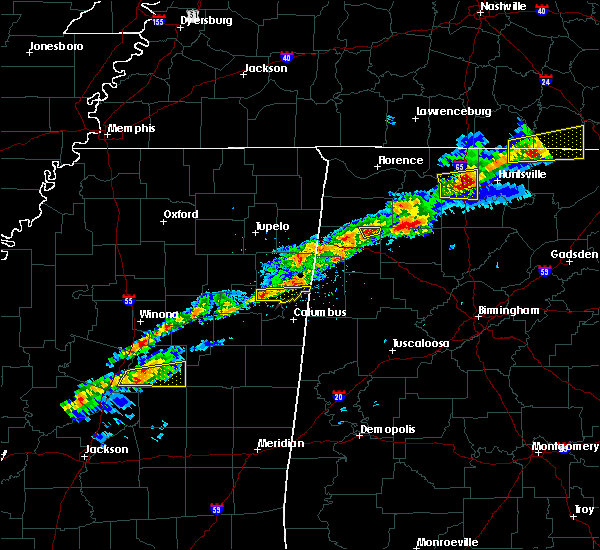 At 115 pm cst, a severe thunderstorm was located north of west point, moving east at 45 mph (radar indicated). Hazards include 60 mph wind gusts and quarter size hail. Hail damage to vehicles is expected. Expect wind damage to roofs, siding, and trees. At 115 pm cst, a severe thunderstorm was located north of west point, moving east at 45 mph (radar indicated). Hazards include 60 mph wind gusts and quarter size hail. Hail damage to vehicles is expected. Expect wind damage to roofs, siding, and trees.
|
| 12/18/2016 1:34 AM CST |
 At 134 am cst, a severe thunderstorm was located near west point, moving northeast at 60 mph (radar indicated). Hazards include 60 mph wind gusts. Expect damage to roofs, siding, and trees. locations impacted include, aberdeen, prairie, hatley, gattman, parham, athens, strong, new hamilton, quincy, becker, binford, wise gap, muldon, sipsey fork, greenwood springs, splunge and east aberdeen. A tornado watch remains in effect until 300 am cst for northeastern mississippi. At 134 am cst, a severe thunderstorm was located near west point, moving northeast at 60 mph (radar indicated). Hazards include 60 mph wind gusts. Expect damage to roofs, siding, and trees. locations impacted include, aberdeen, prairie, hatley, gattman, parham, athens, strong, new hamilton, quincy, becker, binford, wise gap, muldon, sipsey fork, greenwood springs, splunge and east aberdeen. A tornado watch remains in effect until 300 am cst for northeastern mississippi.
|
| 12/18/2016 1:25 AM CST |
 At 125 am cst, a severe thunderstorm was located near griffith, or 7 miles west of west point, moving northeast at 60 mph (radar indicated). Hazards include 60 mph wind gusts. expect damage to roofs, siding, and trees At 125 am cst, a severe thunderstorm was located near griffith, or 7 miles west of west point, moving northeast at 60 mph (radar indicated). Hazards include 60 mph wind gusts. expect damage to roofs, siding, and trees
|
| 8/3/2016 5:45 PM CDT |
 At 545 pm cdt, a severe thunderstorm was located near bedford, or near sulligent, moving south at 10 mph (radar indicated). Hazards include 60 mph wind gusts. Expect damage to roofs. siding. And trees. At 545 pm cdt, a severe thunderstorm was located near bedford, or near sulligent, moving south at 10 mph (radar indicated). Hazards include 60 mph wind gusts. Expect damage to roofs. siding. And trees.
|
| 6/17/2016 1:31 PM CDT |
 At 130 pm cdt, a severe thunderstorm was located near new salem, or 9 miles south of fulton, moving south at 40 mph (radar indicated). Hazards include 70 mph wind gusts and quarter size hail. Hail damage to vehicles is expected. expect considerable tree damage. Wind damage is also likely to mobile homes, roofs, and outbuildings. At 130 pm cdt, a severe thunderstorm was located near new salem, or 9 miles south of fulton, moving south at 40 mph (radar indicated). Hazards include 70 mph wind gusts and quarter size hail. Hail damage to vehicles is expected. expect considerable tree damage. Wind damage is also likely to mobile homes, roofs, and outbuildings.
|
| 4/29/2016 4:07 PM CDT |
 At 407 pm cdt, a severe thunderstorm was located near bedford, or 11 miles west of vernon, moving east at 15 mph (radar indicated). Hazards include 60 mph wind gusts. Expect damage to roofs. siding. and trees. This severe thunderstorm will remain over mainly rural areas of southeastern monroe county. At 407 pm cdt, a severe thunderstorm was located near bedford, or 11 miles west of vernon, moving east at 15 mph (radar indicated). Hazards include 60 mph wind gusts. Expect damage to roofs. siding. and trees. This severe thunderstorm will remain over mainly rural areas of southeastern monroe county.
|
| 3/31/2016 7:23 PM CDT |
 The severe thunderstorm warning for southeastern monroe county will expire at 730 pm cdt, the storm which prompted the warning has weakened below severe limits, and no longer poses an immediate threat to life or property. therefore the warning will be allowed to expire. a tornado watch remains in effect until 1000 pm cdt for northeastern mississippi. The severe thunderstorm warning for southeastern monroe county will expire at 730 pm cdt, the storm which prompted the warning has weakened below severe limits, and no longer poses an immediate threat to life or property. therefore the warning will be allowed to expire. a tornado watch remains in effect until 1000 pm cdt for northeastern mississippi.
|
| 3/31/2016 6:44 PM CDT |
 At 644 pm cdt, a severe thunderstorm was located near columbus afb, moving northeast at 30 mph (radar indicated). Hazards include 60 mph wind gusts and half dollar size hail. Hail damage to vehicles is expected. Expect wind damage to roofs, siding, and trees. At 644 pm cdt, a severe thunderstorm was located near columbus afb, moving northeast at 30 mph (radar indicated). Hazards include 60 mph wind gusts and half dollar size hail. Hail damage to vehicles is expected. Expect wind damage to roofs, siding, and trees.
|
| 3/31/2016 6:10 PM CDT |
 At 609 pm cdt, a severe thunderstorm was located over prairie, or near aberdeen, moving northeast at 45 mph (radar indicated). Hazards include golf ball size hail and 60 mph wind gusts. People and animals outdoors will be injured. expect hail damage to roofs, siding, windows, and vehicles. expect wind damage to roofs, siding, and trees. locations impacted include, amory, aberdeen, smithville, prairie, new wren, nettleton, hatley, gattman, parham, athens, bigbee, strong, new hamilton, quincy, becker, binford, wise gap, muldon, sipsey fork and greenwood springs. A tornado watch remains in effect until 1000 pm cdt for northeastern mississippi. At 609 pm cdt, a severe thunderstorm was located over prairie, or near aberdeen, moving northeast at 45 mph (radar indicated). Hazards include golf ball size hail and 60 mph wind gusts. People and animals outdoors will be injured. expect hail damage to roofs, siding, windows, and vehicles. expect wind damage to roofs, siding, and trees. locations impacted include, amory, aberdeen, smithville, prairie, new wren, nettleton, hatley, gattman, parham, athens, bigbee, strong, new hamilton, quincy, becker, binford, wise gap, muldon, sipsey fork and greenwood springs. A tornado watch remains in effect until 1000 pm cdt for northeastern mississippi.
|
| 3/31/2016 5:53 PM CDT |
 At 553 pm cdt, a severe thunderstorm was located over pala alto, or 9 miles northwest of west point, moving northeast at 55 mph (radar indicated). Hazards include golf ball size hail and 60 mph wind gusts. People and animals outdoors will be injured. expect hail damage to roofs, siding, windows, and vehicles. Expect wind damage to roofs, siding, and trees. At 553 pm cdt, a severe thunderstorm was located over pala alto, or 9 miles northwest of west point, moving northeast at 55 mph (radar indicated). Hazards include golf ball size hail and 60 mph wind gusts. People and animals outdoors will be injured. expect hail damage to roofs, siding, windows, and vehicles. Expect wind damage to roofs, siding, and trees.
|
| 11/18/2015 4:21 AM CST |
 The tornado warning for southeastern monroe county will expire at 430 am cst, the storm which prompted the warning has weakened below severe limits and exited the warned area. therefore the warning will be allowed to expire. The tornado warning for southeastern monroe county will expire at 430 am cst, the storm which prompted the warning has weakened below severe limits and exited the warned area. therefore the warning will be allowed to expire.
|
| 11/18/2015 4:04 AM CST |
 At 404 am cst, a severe thunderstorm producing a tornado was located over caledonia, or 7 miles northeast of columbus afb, moving northeast at 35 mph (radar indicated rotation). Hazards include tornado. Flying debris will be dangerous to those caught without shelter. mobile homes will be damaged or destroyed. damage to roofs, windows and vehicles will occur. tree damage is likely. This tornadic thunderstorm will remain over mainly rural areas of southeastern monroe county. At 404 am cst, a severe thunderstorm producing a tornado was located over caledonia, or 7 miles northeast of columbus afb, moving northeast at 35 mph (radar indicated rotation). Hazards include tornado. Flying debris will be dangerous to those caught without shelter. mobile homes will be damaged or destroyed. damage to roofs, windows and vehicles will occur. tree damage is likely. This tornadic thunderstorm will remain over mainly rural areas of southeastern monroe county.
|
| 8/7/2015 10:23 AM CDT |
 At 1022 am cdt, a severe thunderstorm was located near houlka, or 8 miles northeast of houston, moving southeast at 55 mph (emergency management. at 10 am...lafayette county emergency management reported trees down near oxford). Hazards include 60 mph wind gusts. Expect damage to roofs. Siding and trees. At 1022 am cdt, a severe thunderstorm was located near houlka, or 8 miles northeast of houston, moving southeast at 55 mph (emergency management. at 10 am...lafayette county emergency management reported trees down near oxford). Hazards include 60 mph wind gusts. Expect damage to roofs. Siding and trees.
|
| 7/14/2015 6:57 PM CDT |
 At 656 pm cdt, a severe thunderstorm was located over amory, moving southeast at 40 mph (radar indicated). Hazards include 60 mph wind gusts. Expect damage to roofs. Siding and trees. At 656 pm cdt, a severe thunderstorm was located over amory, moving southeast at 40 mph (radar indicated). Hazards include 60 mph wind gusts. Expect damage to roofs. Siding and trees.
|
| 6/24/2015 12:02 AM CDT |
 At 1202 am cdt, a severe thunderstorm was located near new salem, or 9 miles southeast of fulton, moving south at 50 mph (radar indicated). Hazards include 60 mph wind gusts. Expect damage to roofs. Siding and trees. At 1202 am cdt, a severe thunderstorm was located near new salem, or 9 miles southeast of fulton, moving south at 50 mph (radar indicated). Hazards include 60 mph wind gusts. Expect damage to roofs. Siding and trees.
|
| 5/25/2015 9:26 AM CDT | The severe thunderstorm warning for southern itawamba and eastern monroe counties will expire at 930 am cdt, the storms which prompted the warning have moved out of the area. therefore the warning will be allowed to expire. to report severe weather, contact your nearest law enforcement agency. they will relay your report to the national weather service memphis. |
| 5/25/2015 9:05 AM CDT | At 904 am cdt, severe thunderstorms were located along a line extending from near new salem to near detroit, moving northeast at 45 mph (radar indicated). Hazards include 60 mph wind gusts. Expect damage to roofs. siding and trees. Locations impacted include, amory, smithville, tremont, new salem, hatley, gattman, tilden, jacinto, parham, athens, bigbee, new hamilton, quincy, becker, wise gap, cardsville, sipsey fork, greenwood springs, turon and cadamy. |
| 5/25/2015 8:41 AM CDT | At 841 am cdt, severe thunderstorms were located along a line extending from near new wren to near amory to 8 miles northwest of caledonia, moving northeast at 50 mph (radar indicated). Hazards include 60 mph wind gusts. Expect damage to roofs. Siding and trees. |
| 5/25/2015 8:25 AM CDT | At 825 am cdt, severe thunderstorms were located along a line extending from 6 miles northeast of trebloc to near prairie to near west point, moving northeast at 50 mph (radar indicated). Hazards include 60 mph wind gusts. Expect damage to roofs. siding and trees. Locations impacted include, amory, aberdeen, columbus afb, smithville, new wren, trebloc, prairie, hatley, gattman, athens, strong, new hamilton, sparta, becker, mc condy, muldon, wren, splunge, parham and bigbee. |
| 5/25/2015 8:00 AM CDT | At 759 am cdt, severe thunderstorms were located along a line extending from near montpelier to near starkville, moving northeast at 40 mph (radar indicated). Hazards include 60 mph wind gusts. Expect damage to roofs. Siding and trees. |
| 4/20/2015 12:38 AM CDT | At 1238 am cdt, a severe thunderstorm was located over detroit, or 8 miles north of sulligent, moving northeast at 55 mph (radar indicated). Hazards include 60 mph wind gusts. Expect damage to roofs. siding and trees. locations impacted include, gattman, sipsey fork, greenwood springs, parham, athens, quincy, wise gap and splunge. a tornado watch remains in effect until 300 am cdt for northeastern mississippi. 75in. |
| 4/20/2015 12:21 AM CDT | At 1221 am cdt, a severe thunderstorm was located near amory, moving northeast at 55 mph (radar indicated). Hazards include 60 mph wind gusts. Expect damage to roofs. Siding and trees. |
| 3/18/2013 2:10 PM CDT | Ping Pong Ball sized hail reported 4.7 miles WSW of Hamilton, MS |
Hail Maps for Hamilton, MS
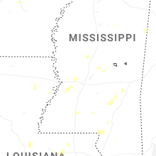

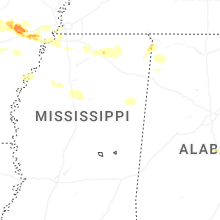

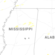


Connect with Interactive Hail Maps