

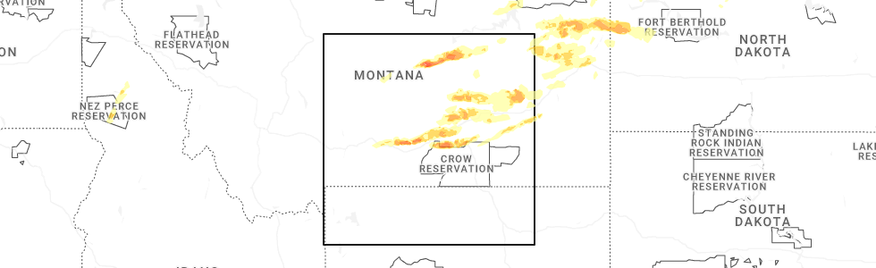
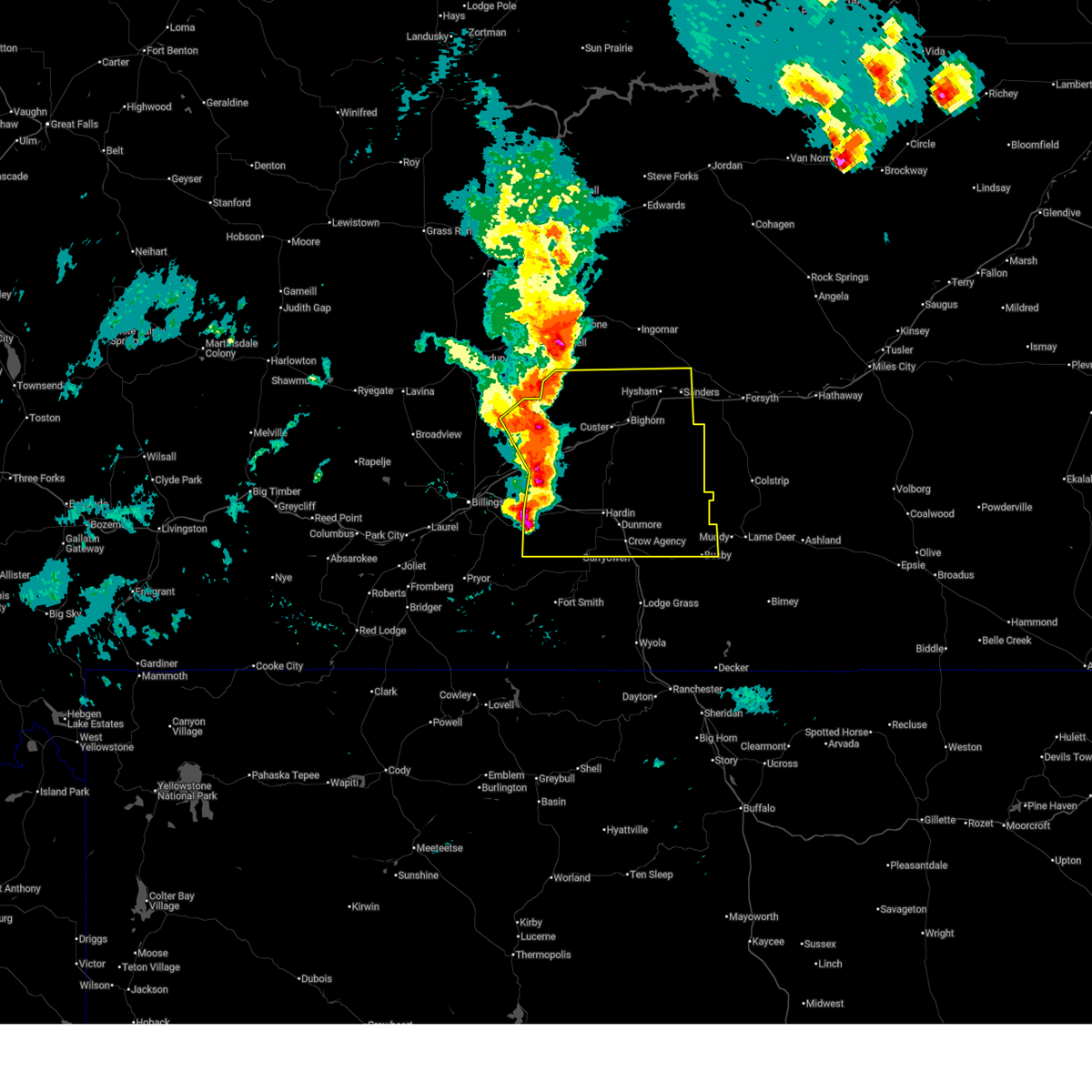
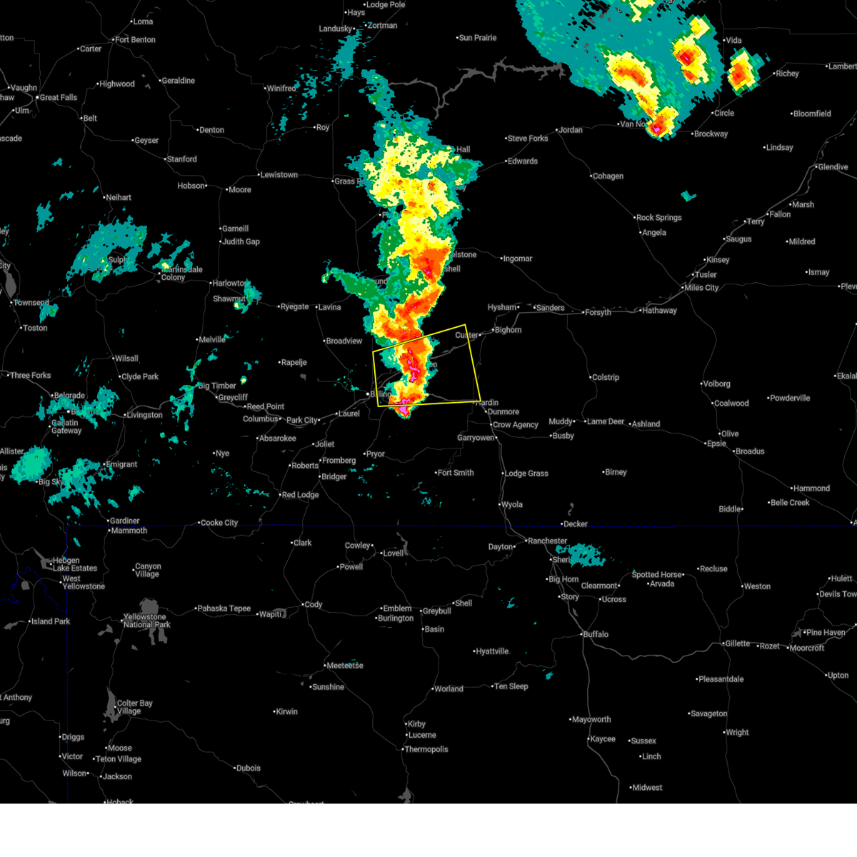
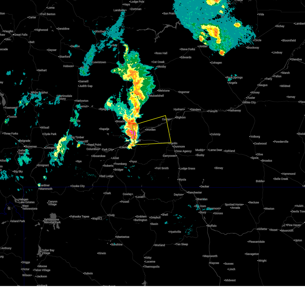
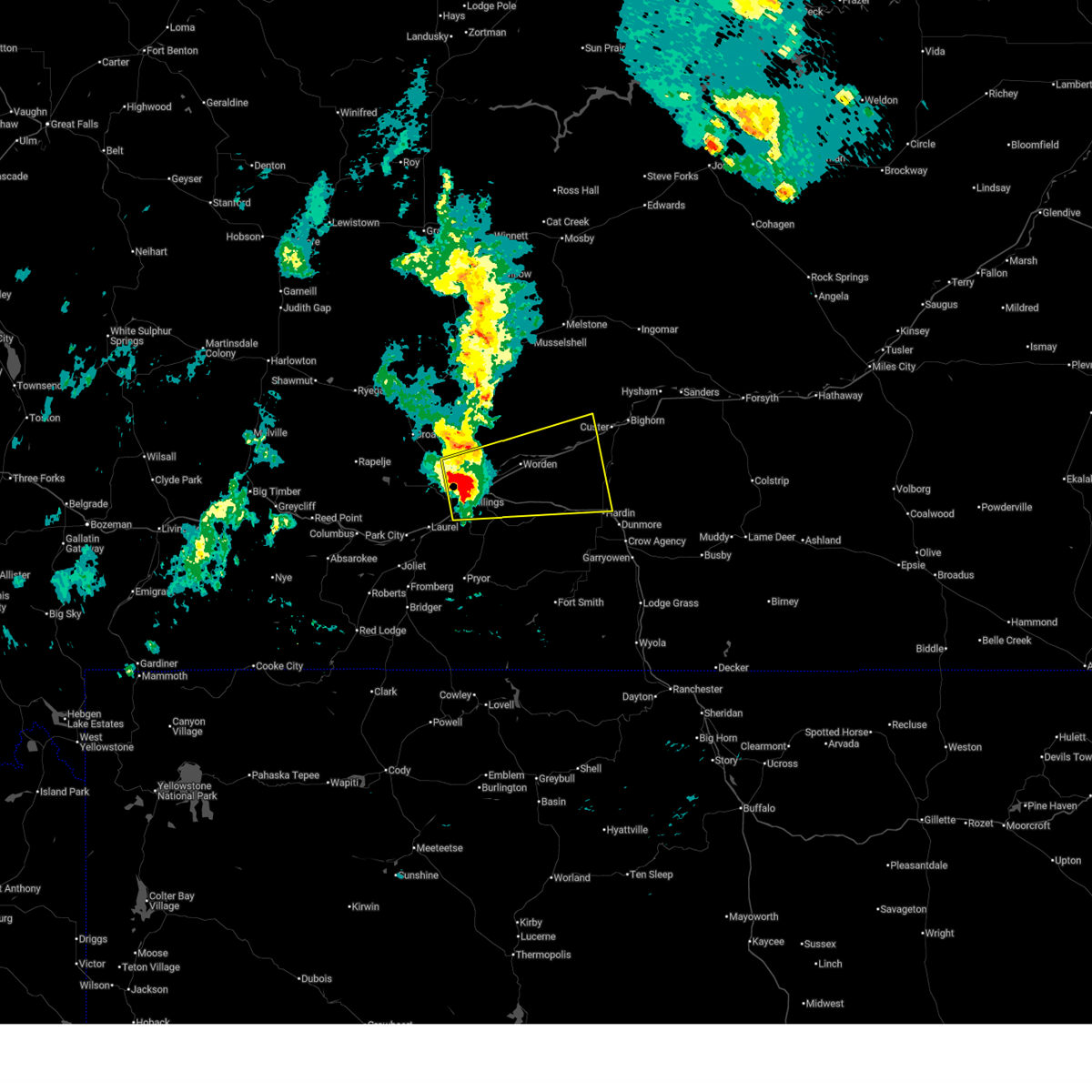
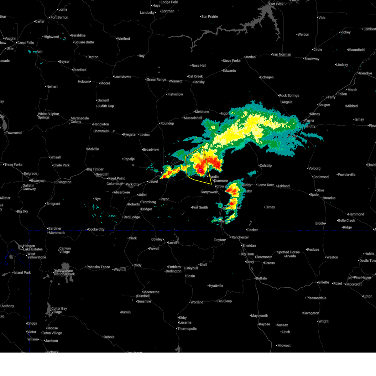
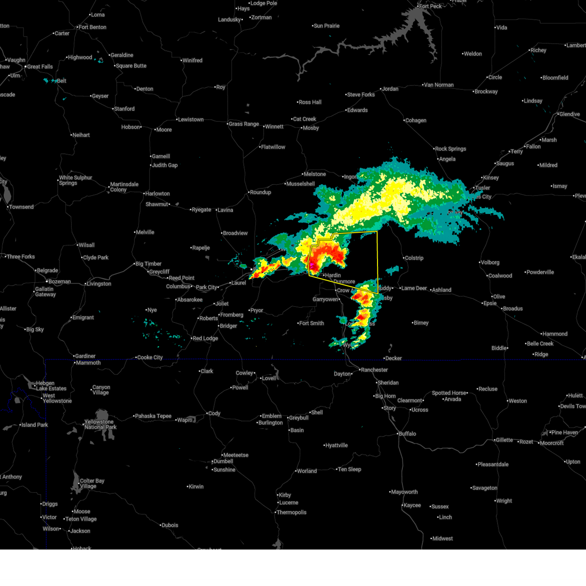
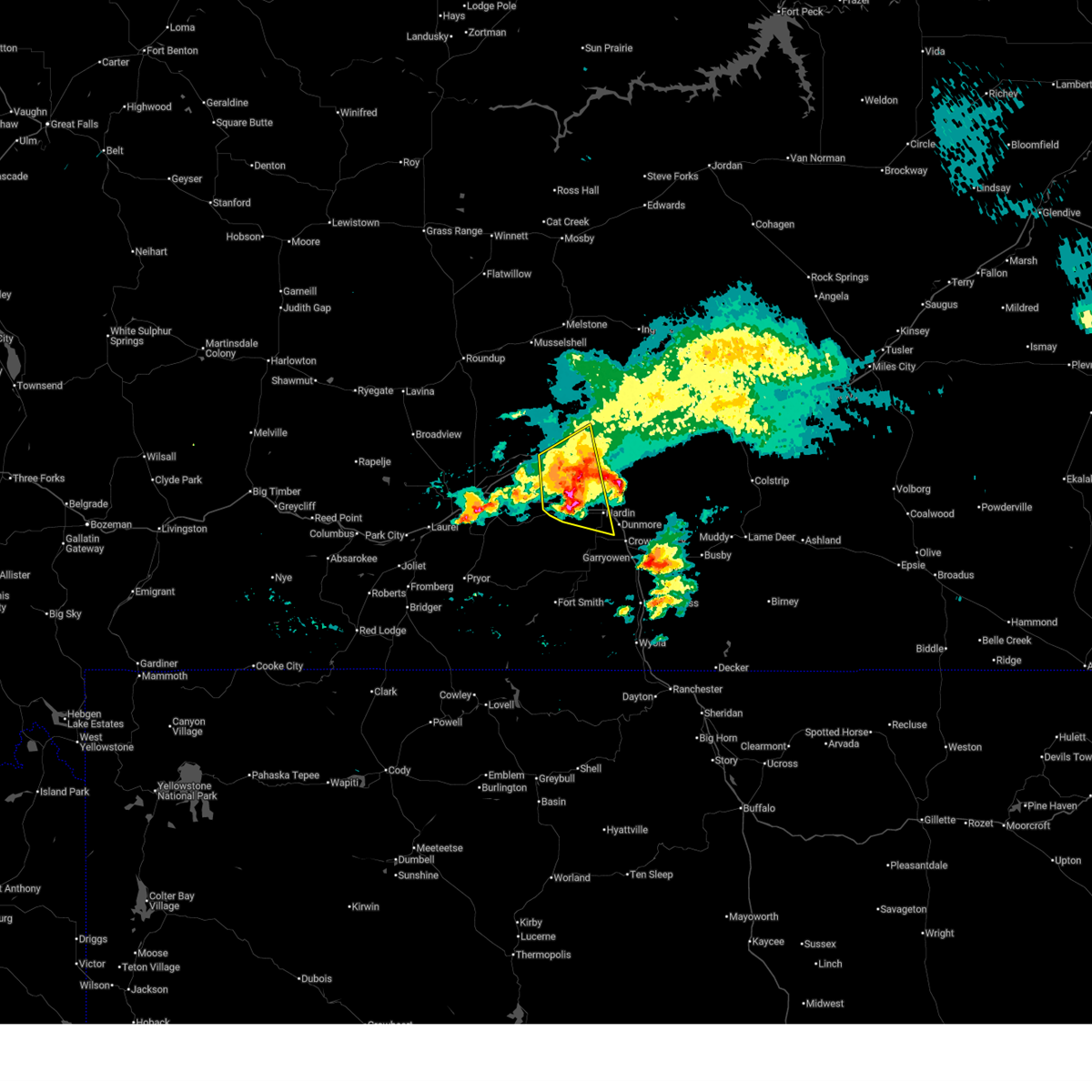
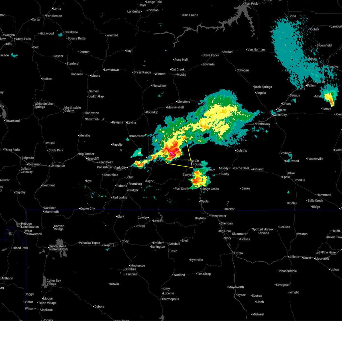
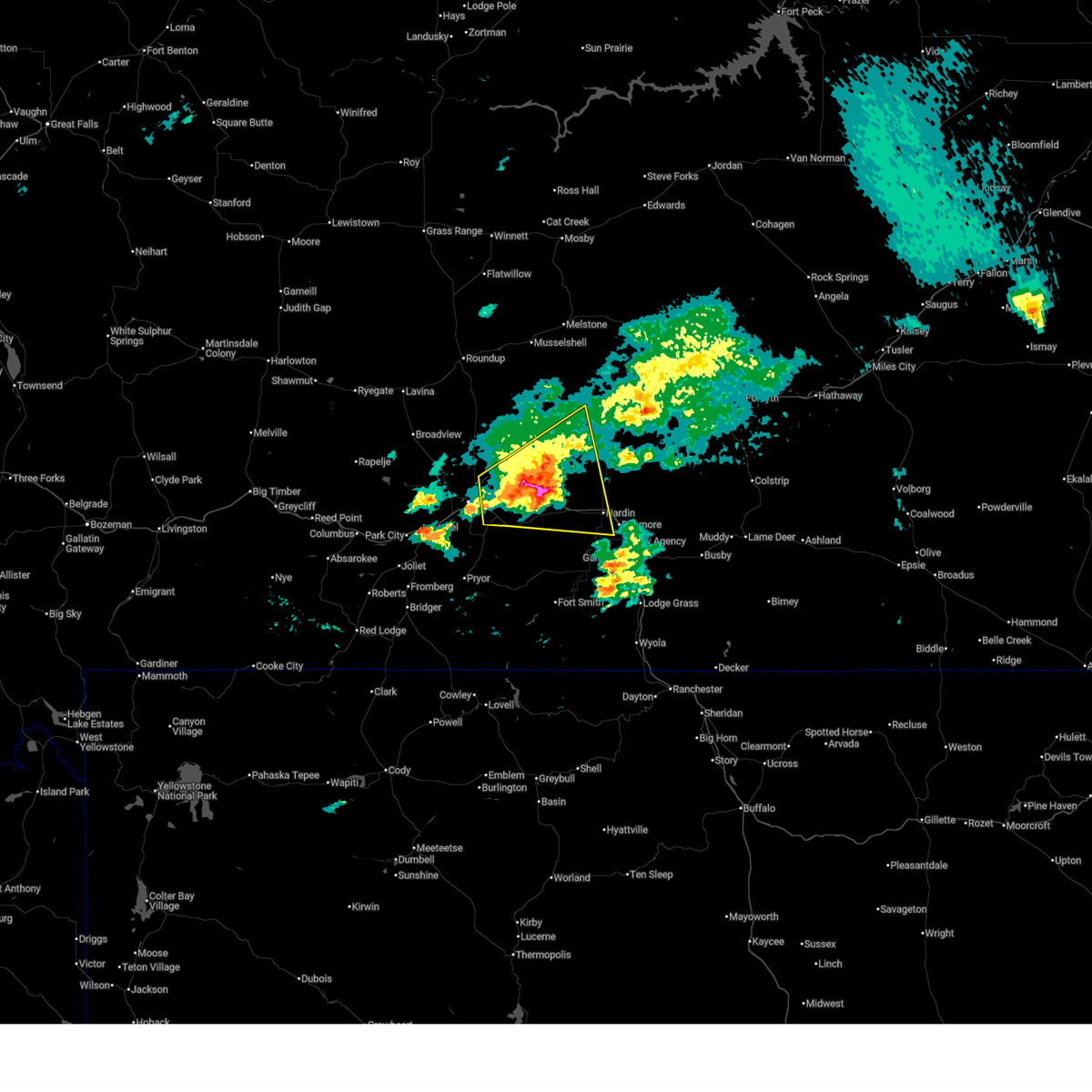
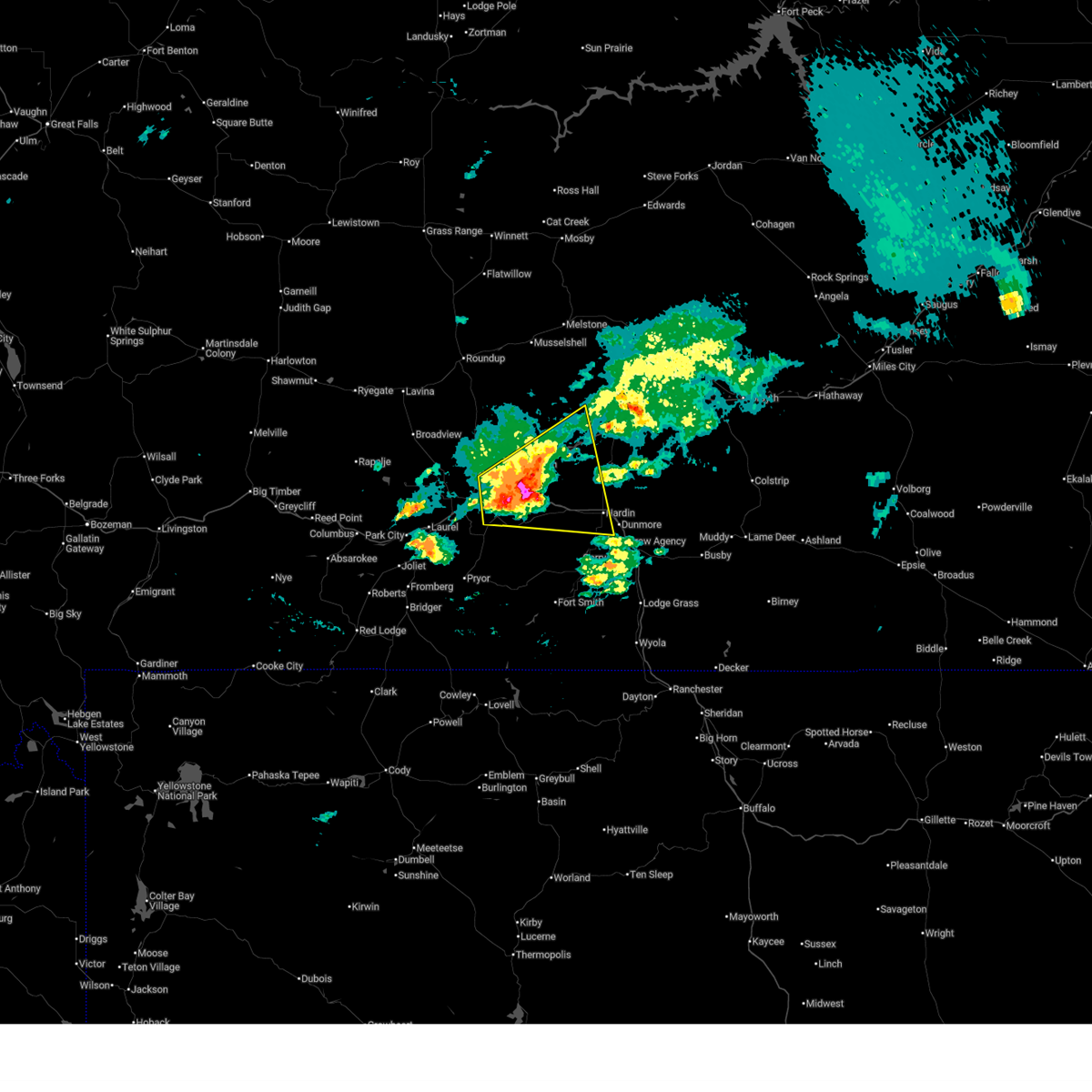
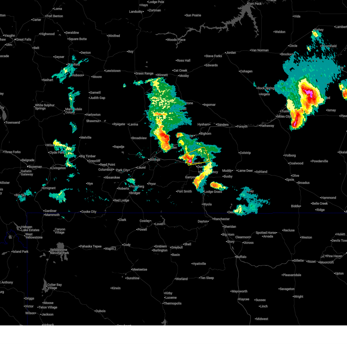
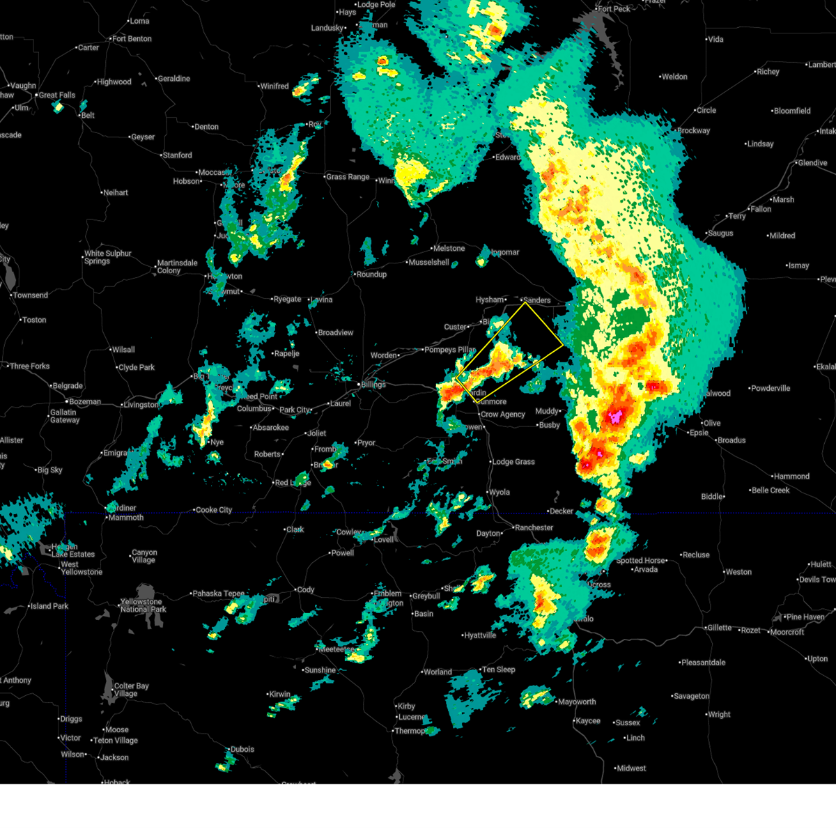
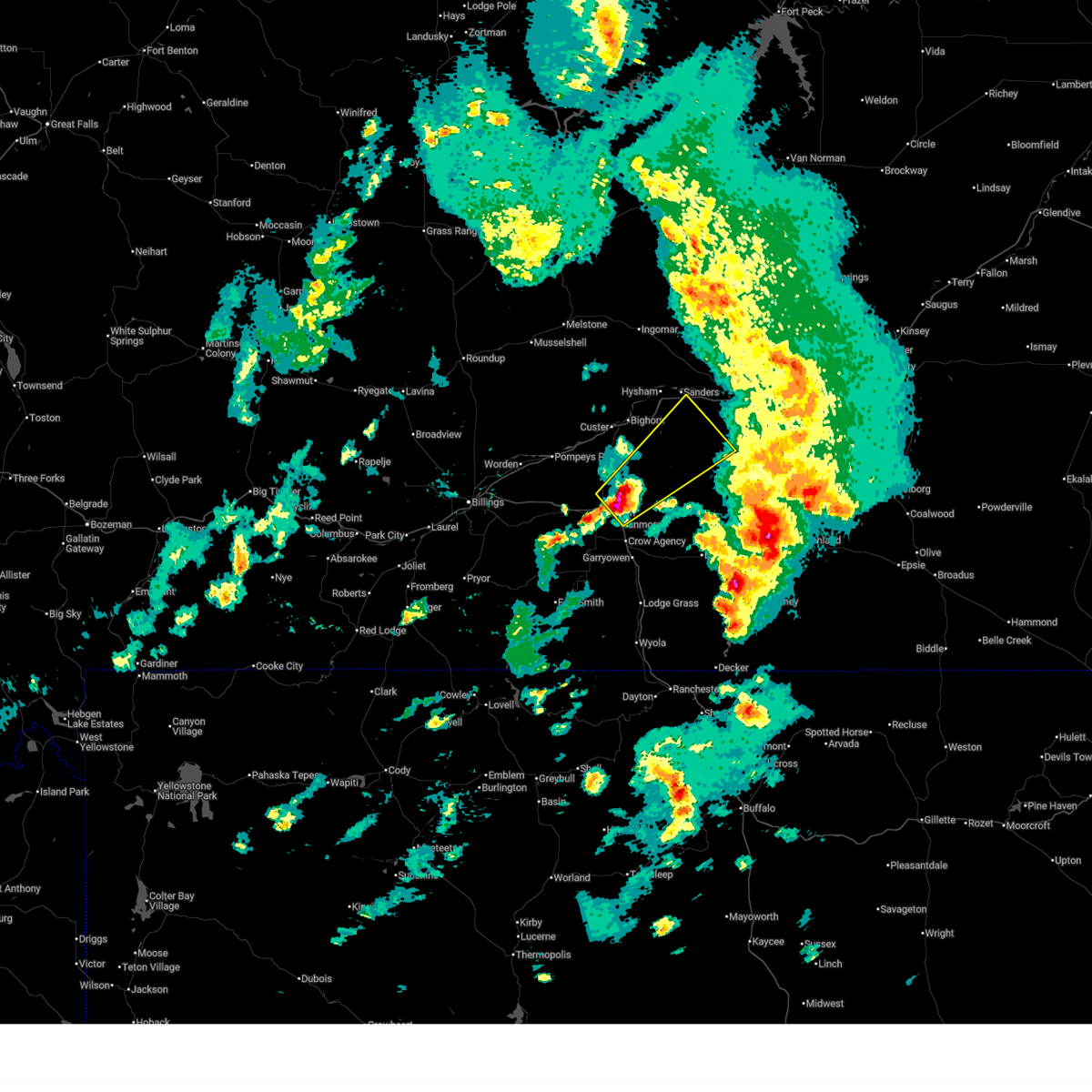
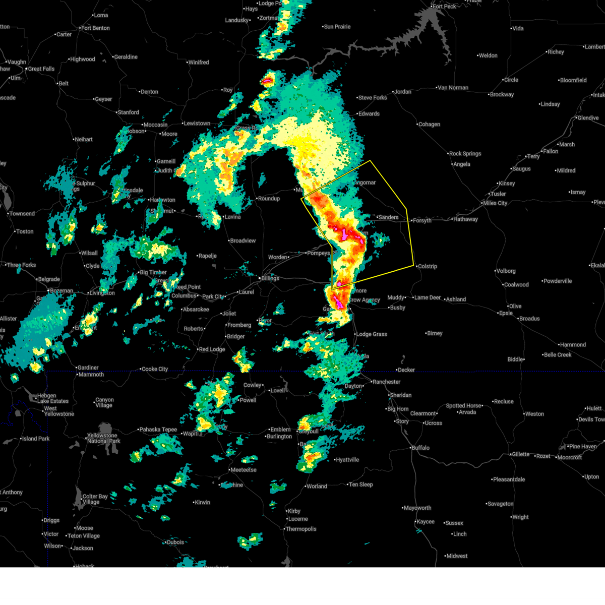
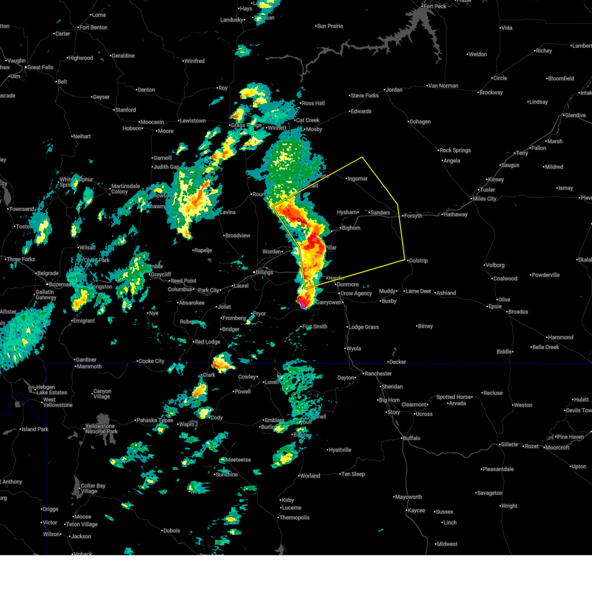
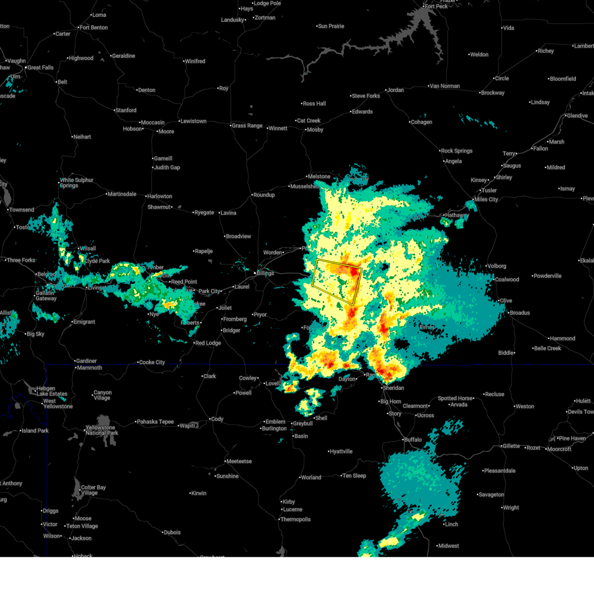
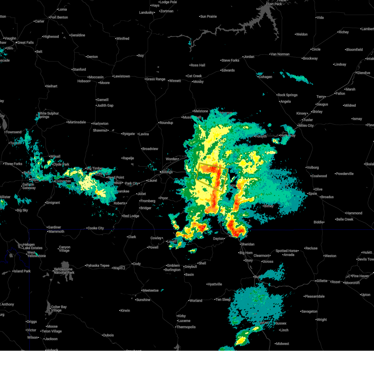
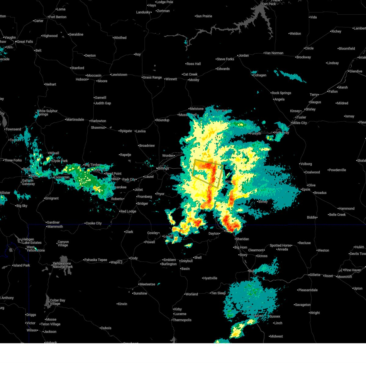
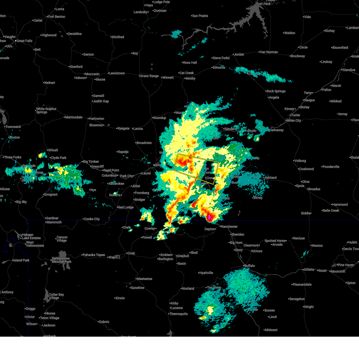
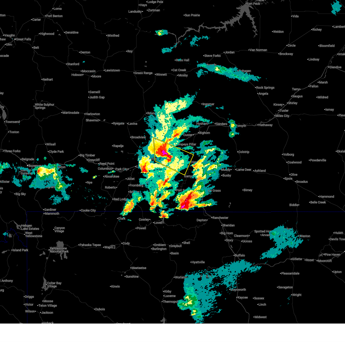
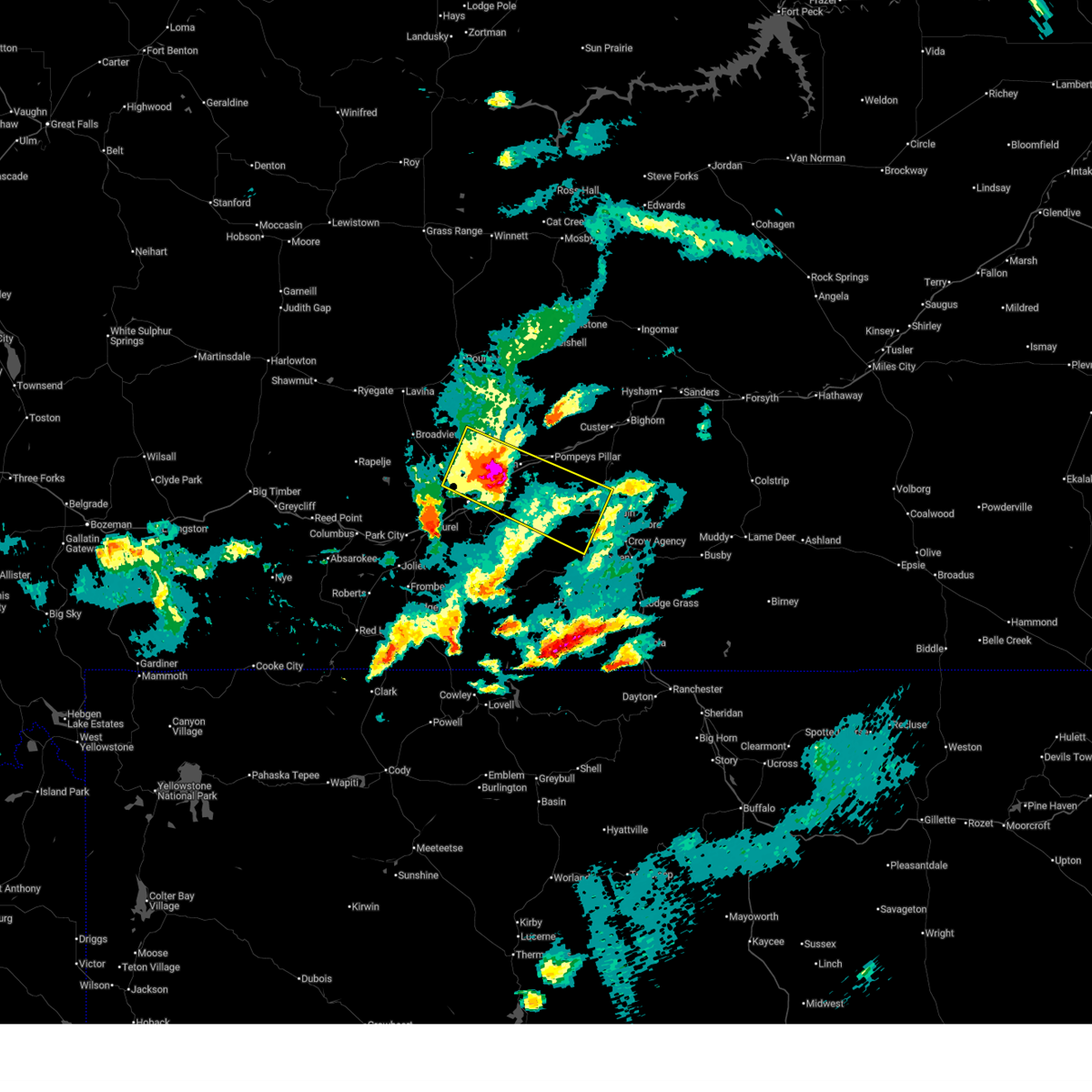
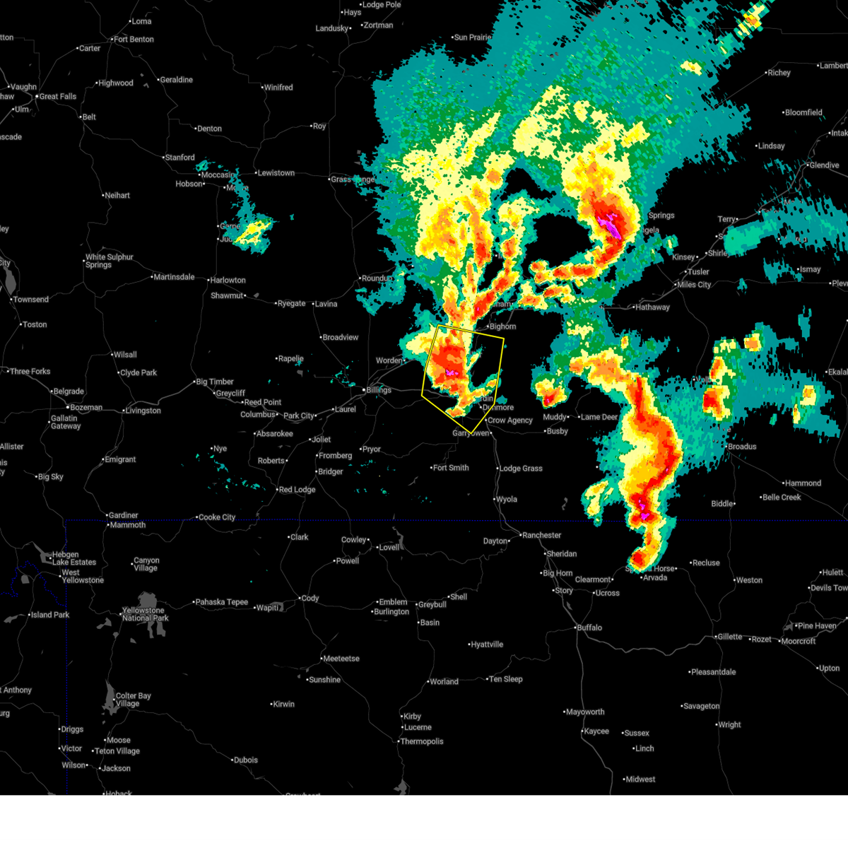
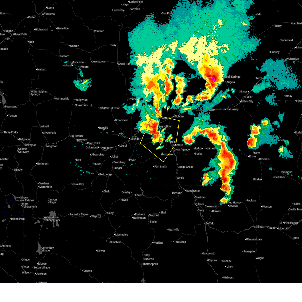
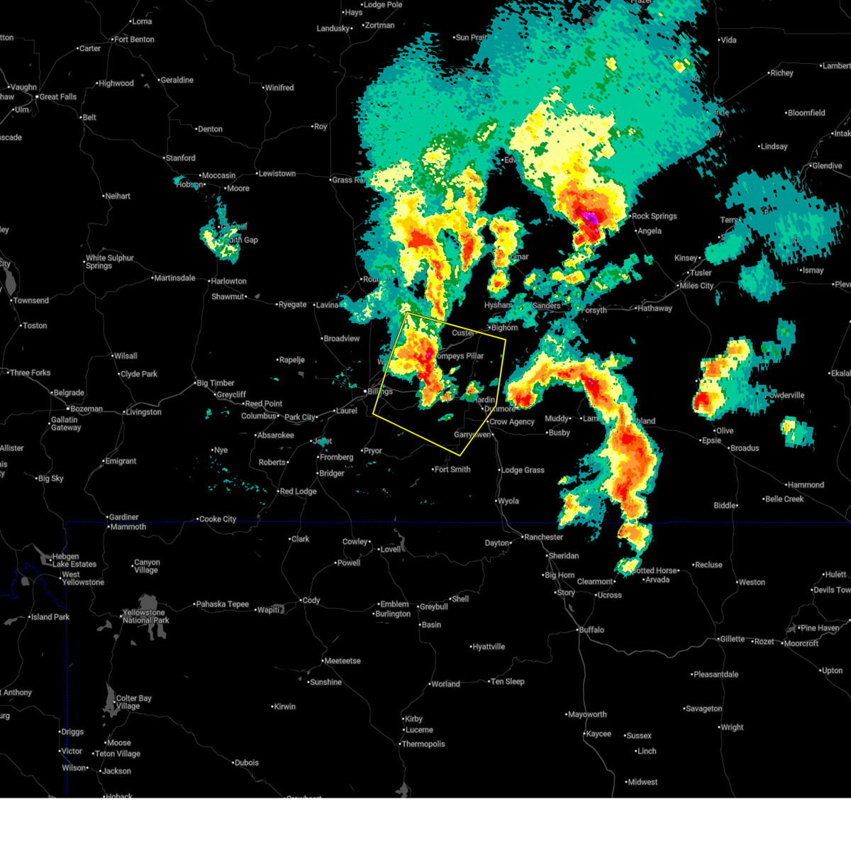
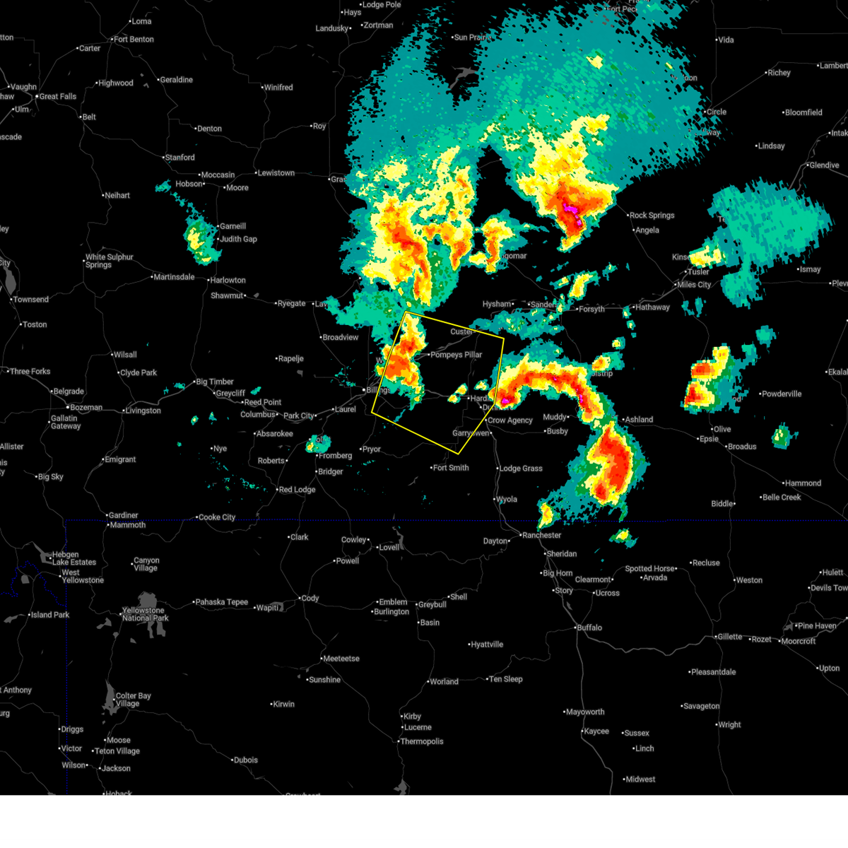
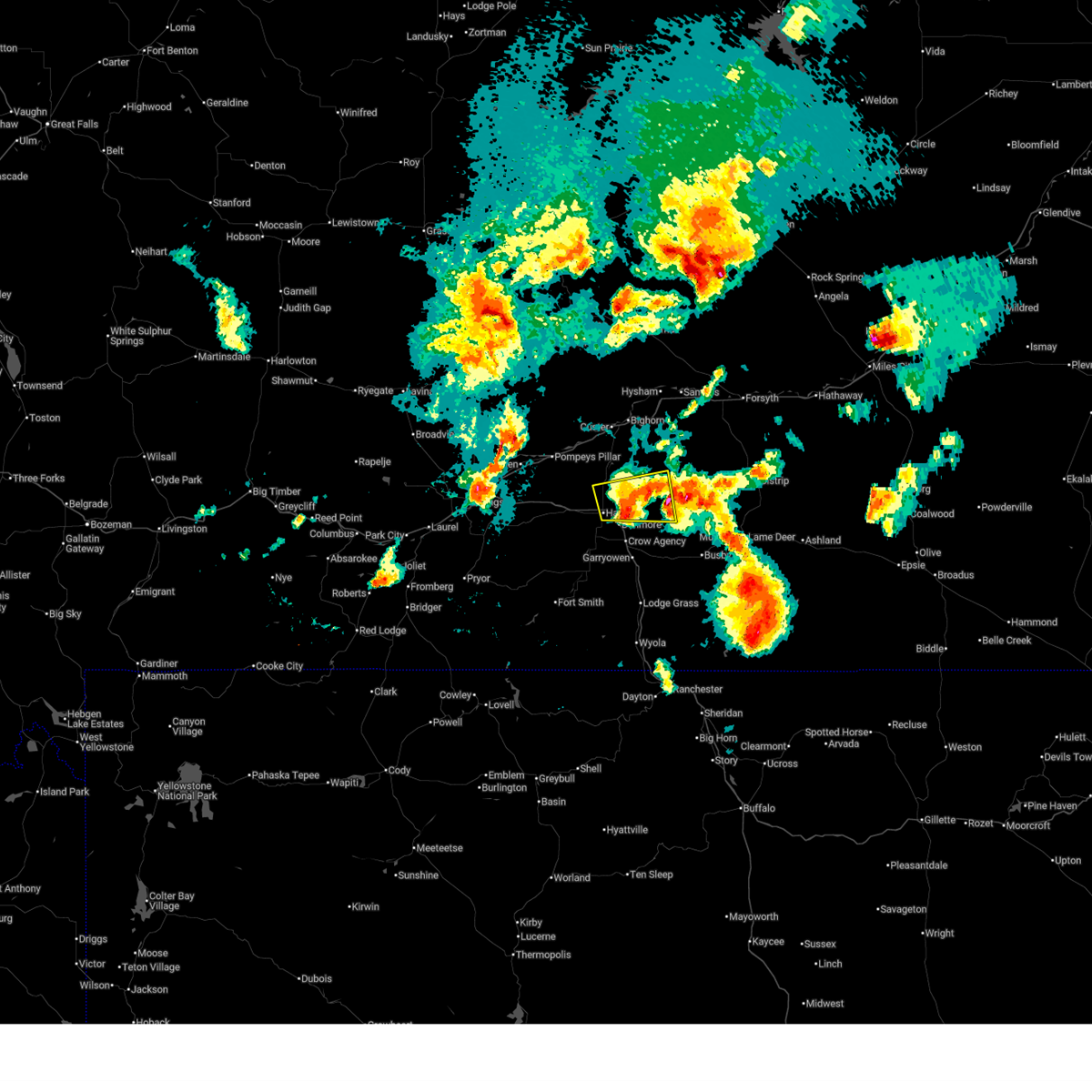
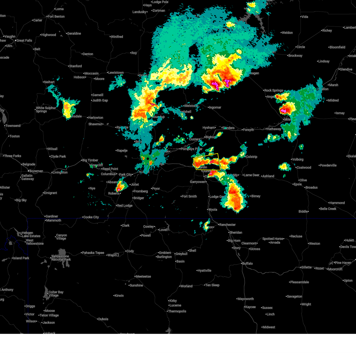
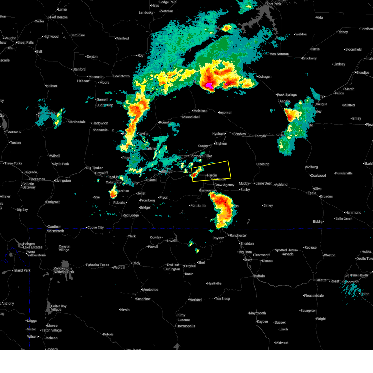
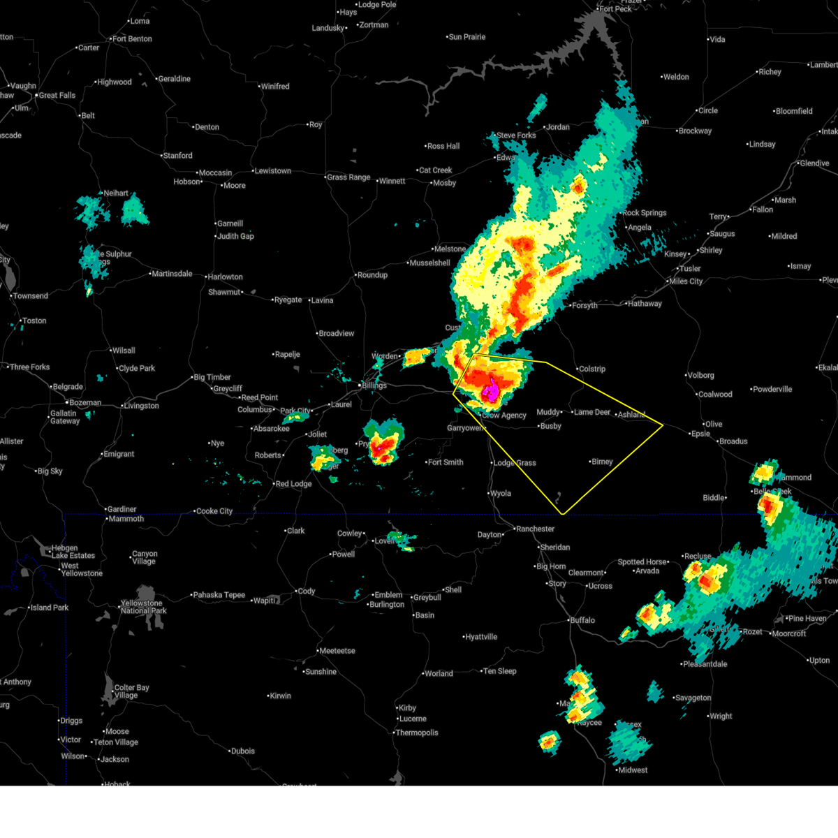
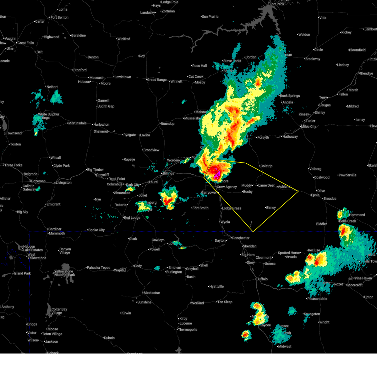
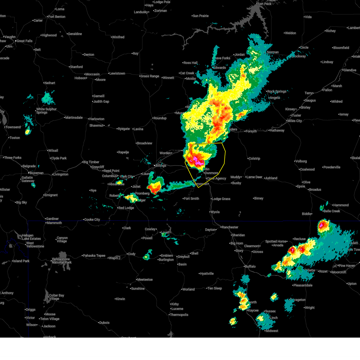
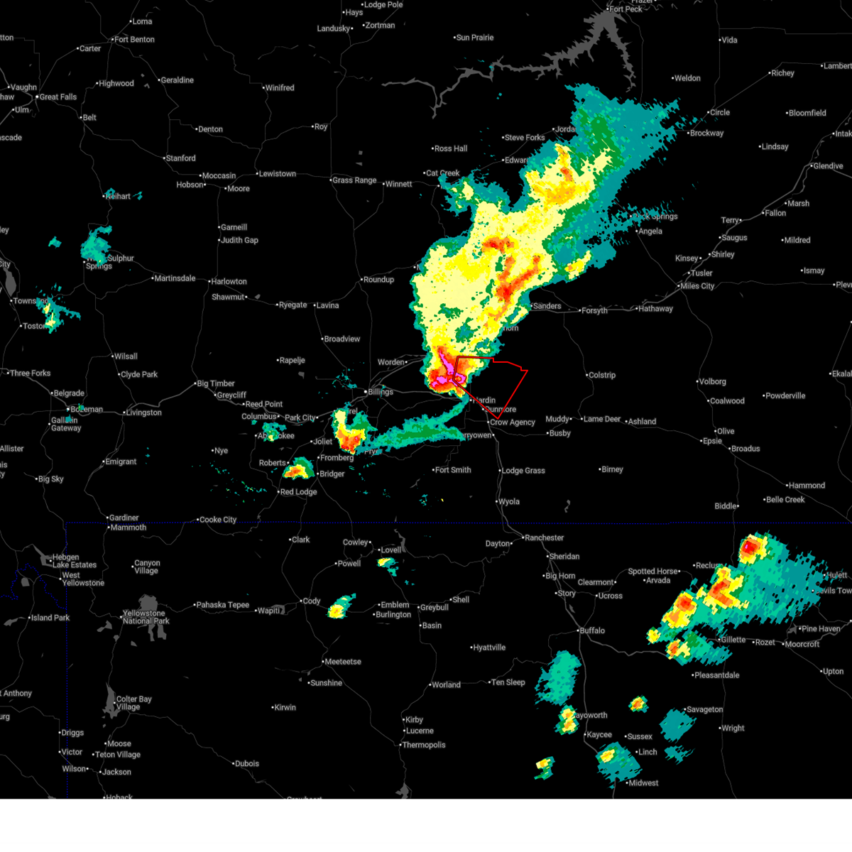
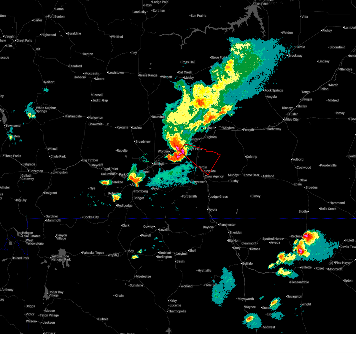
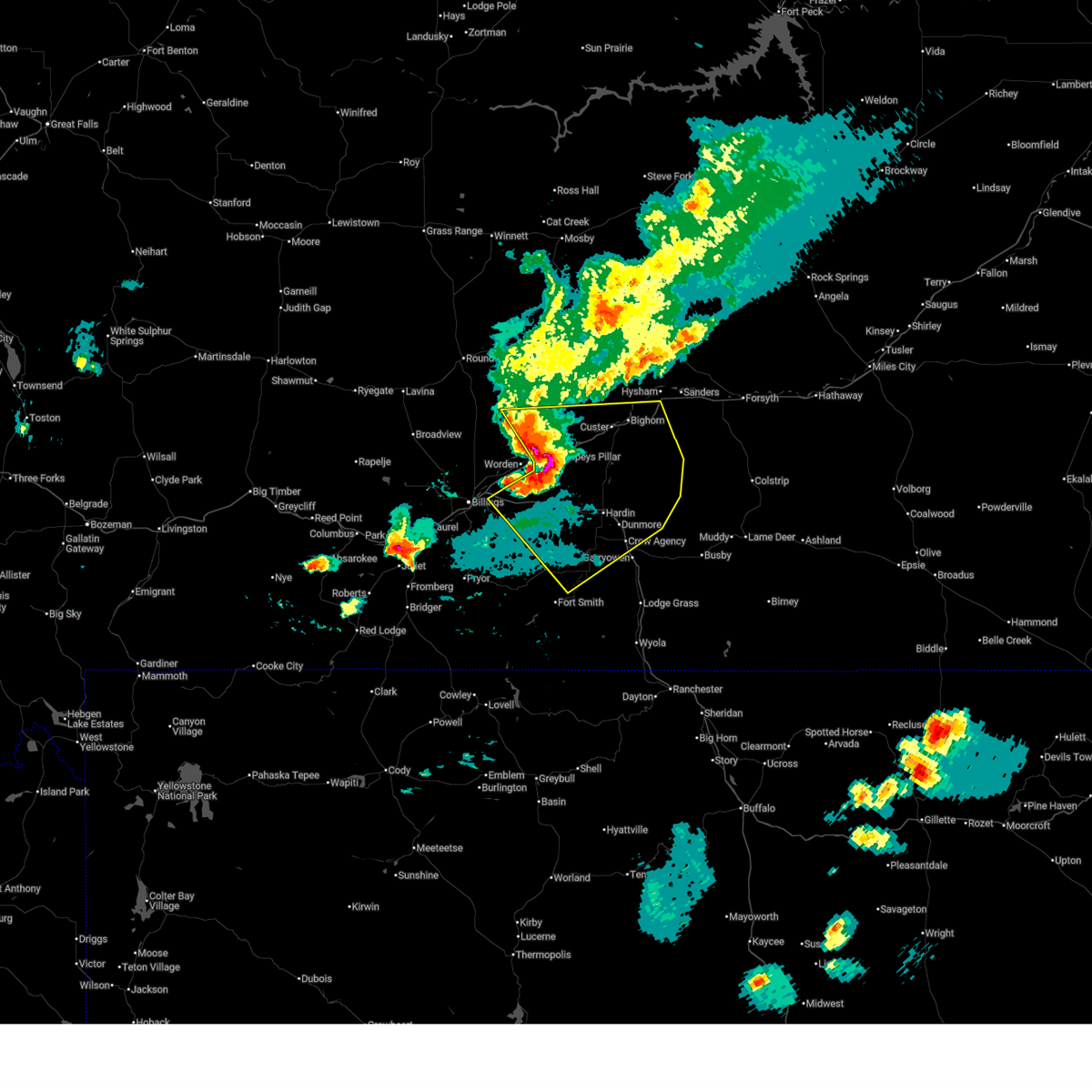
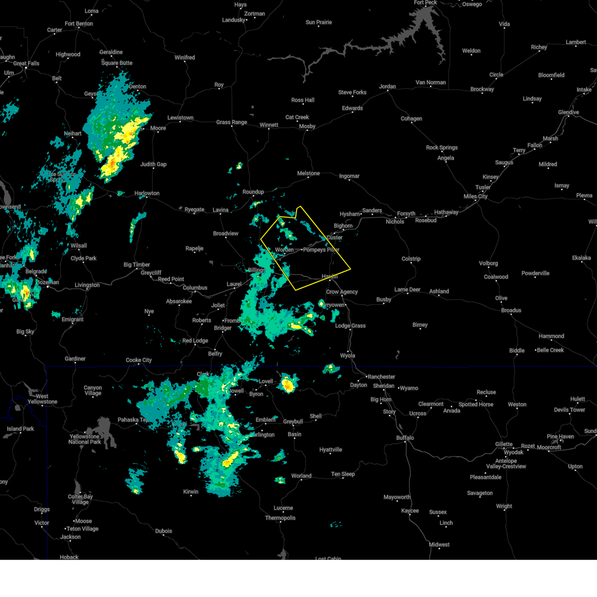
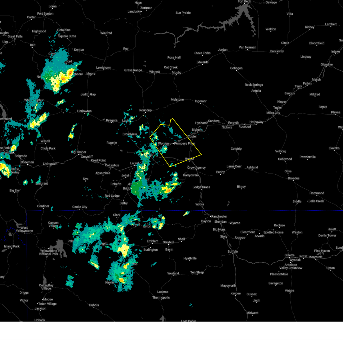
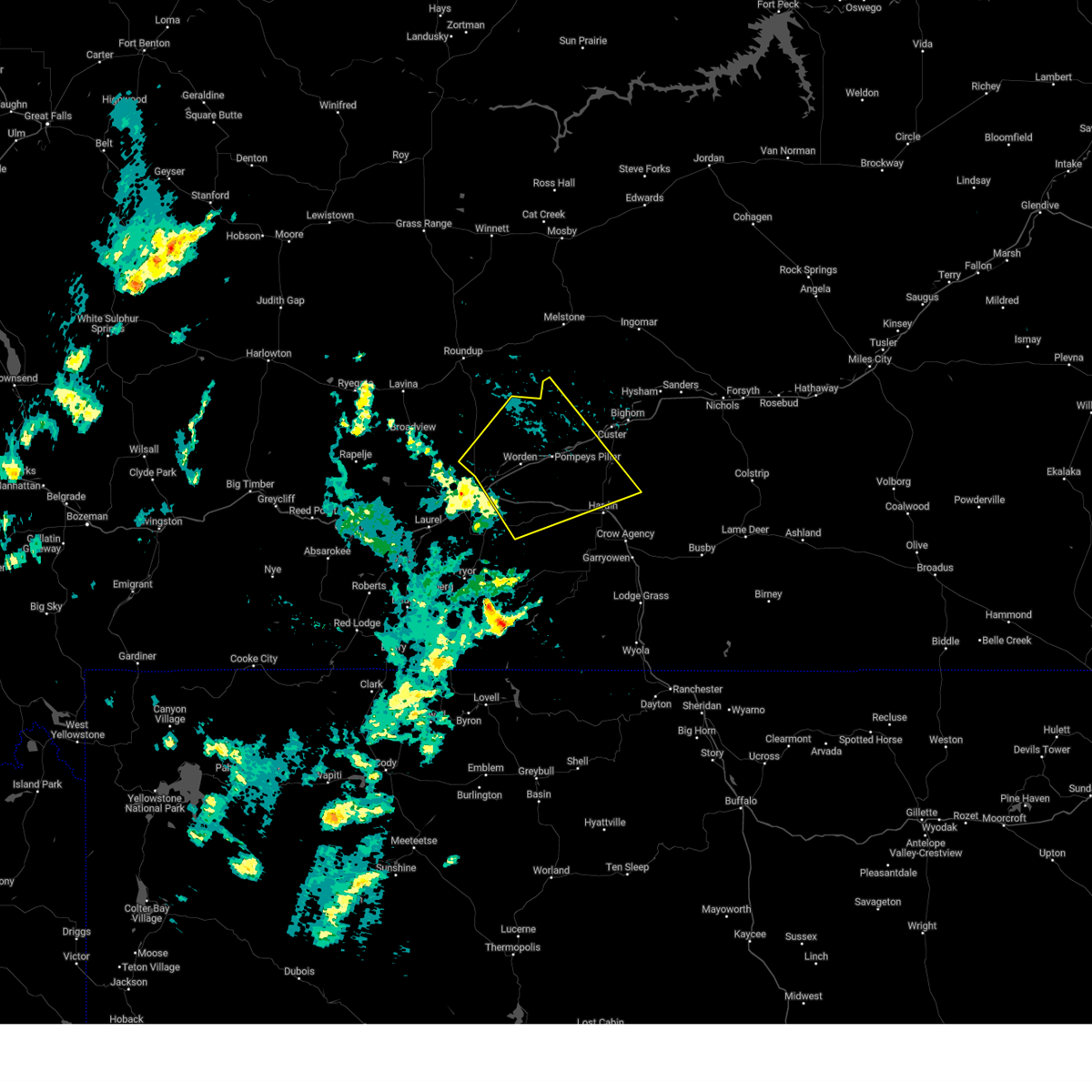
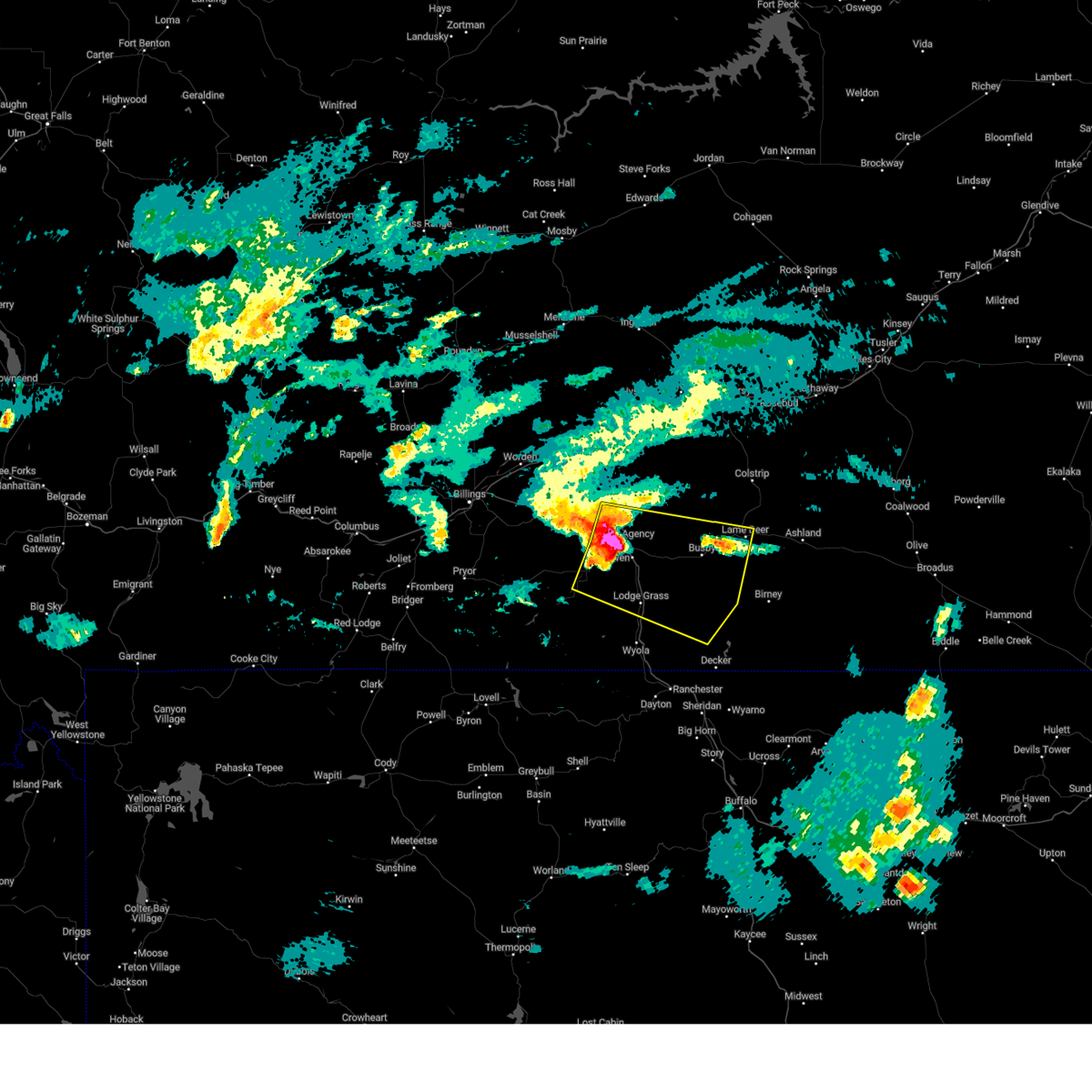
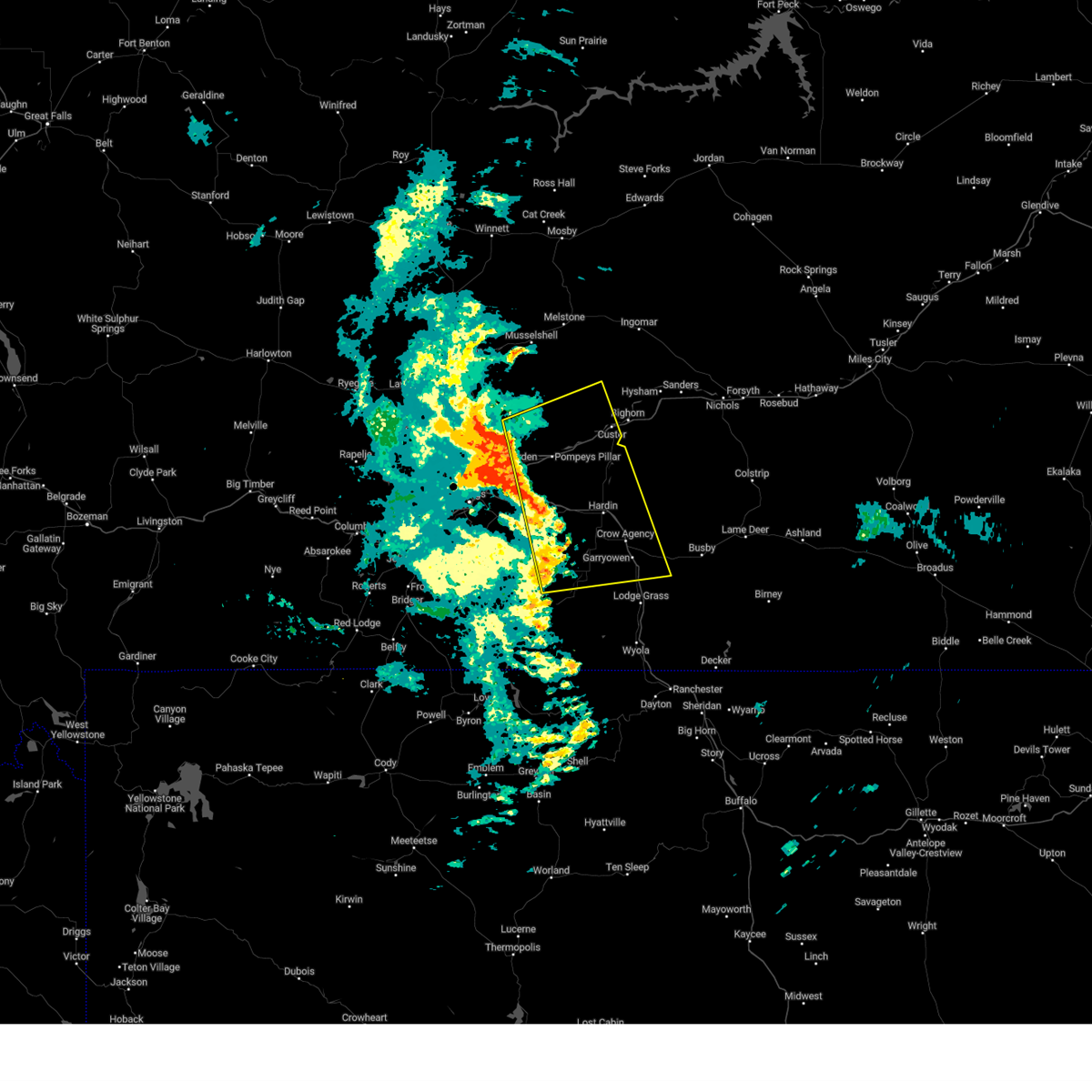
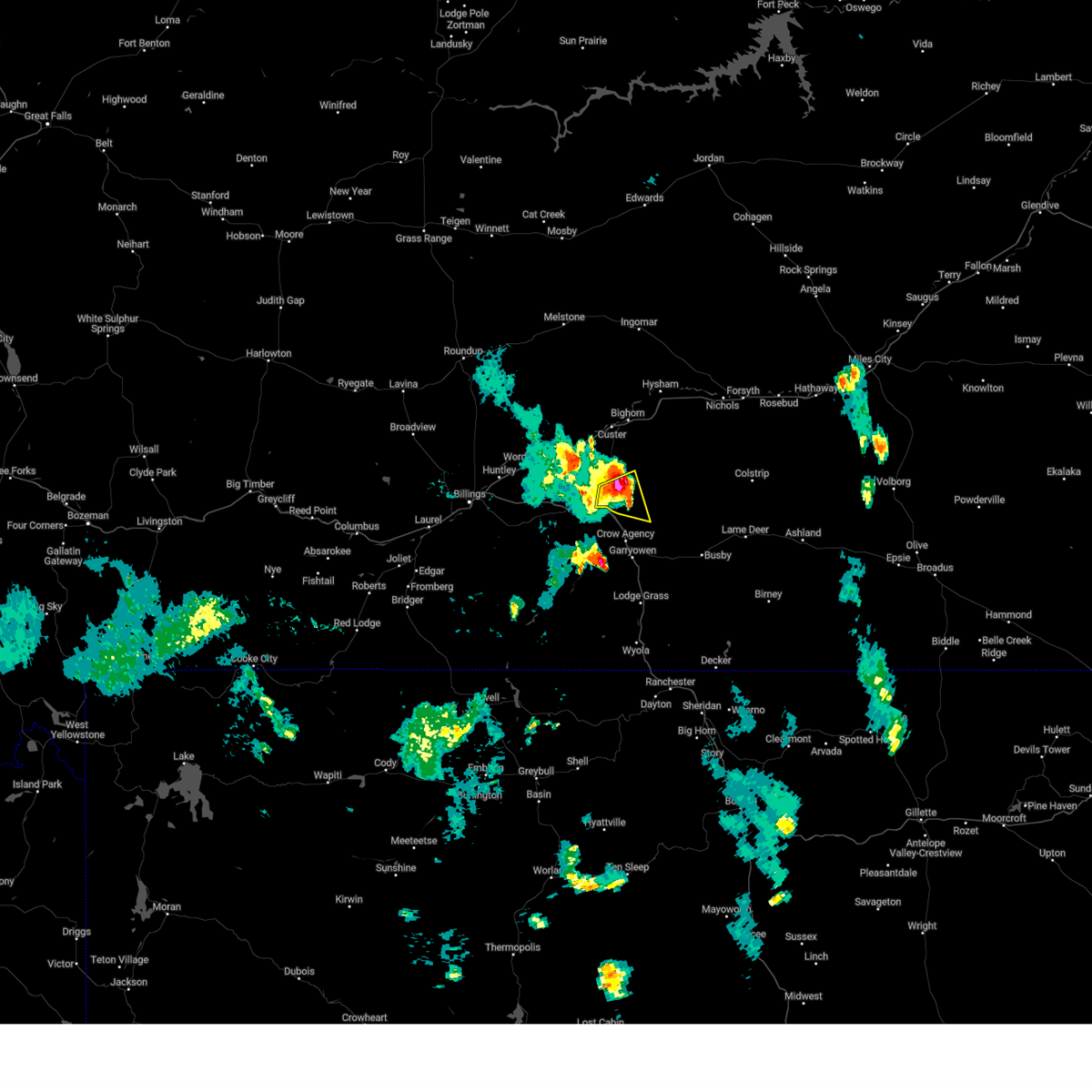
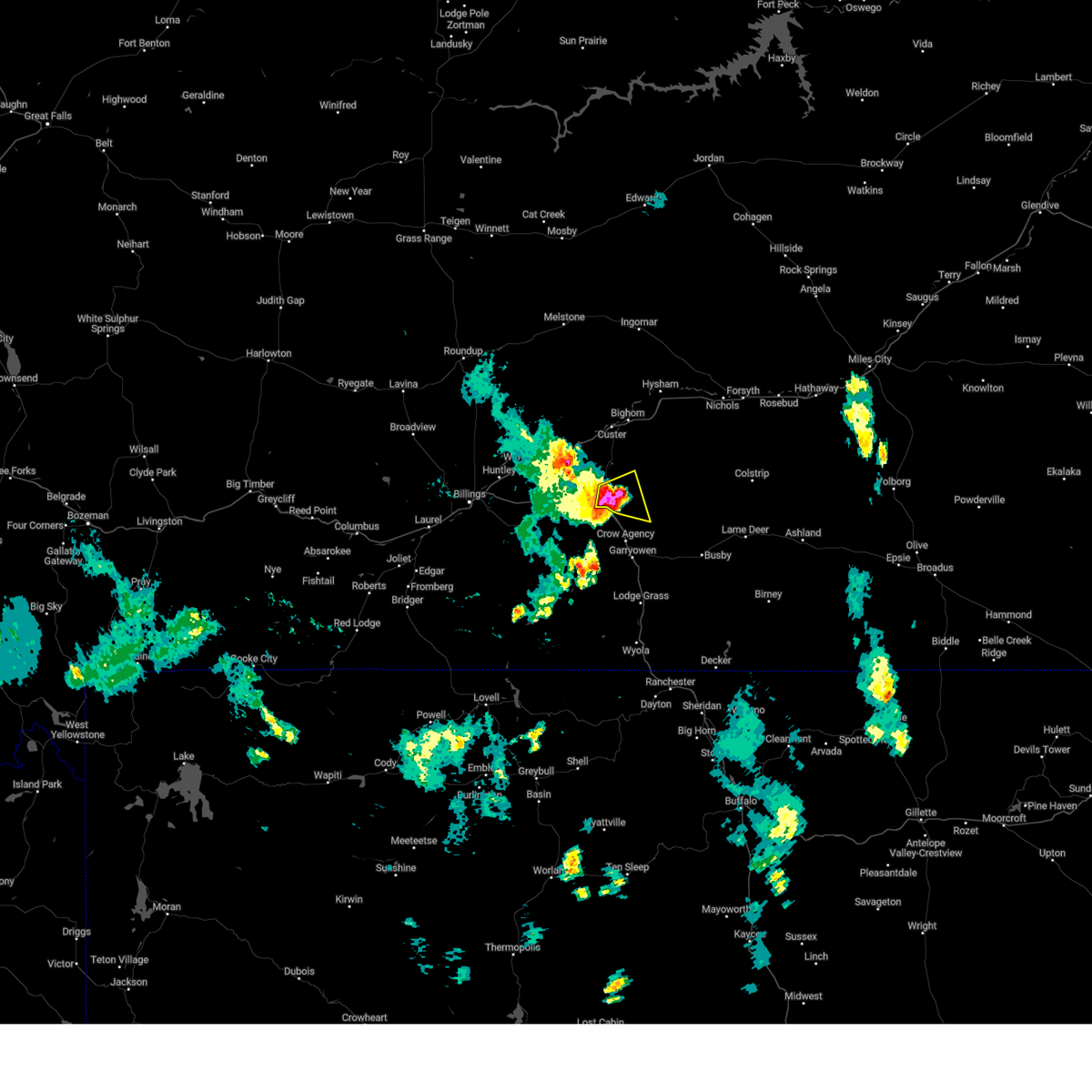
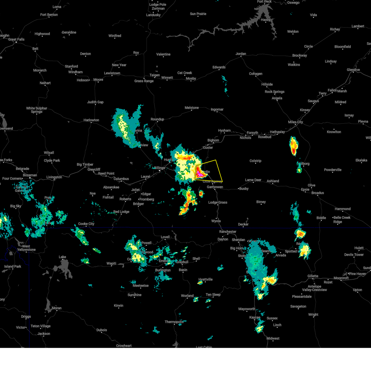
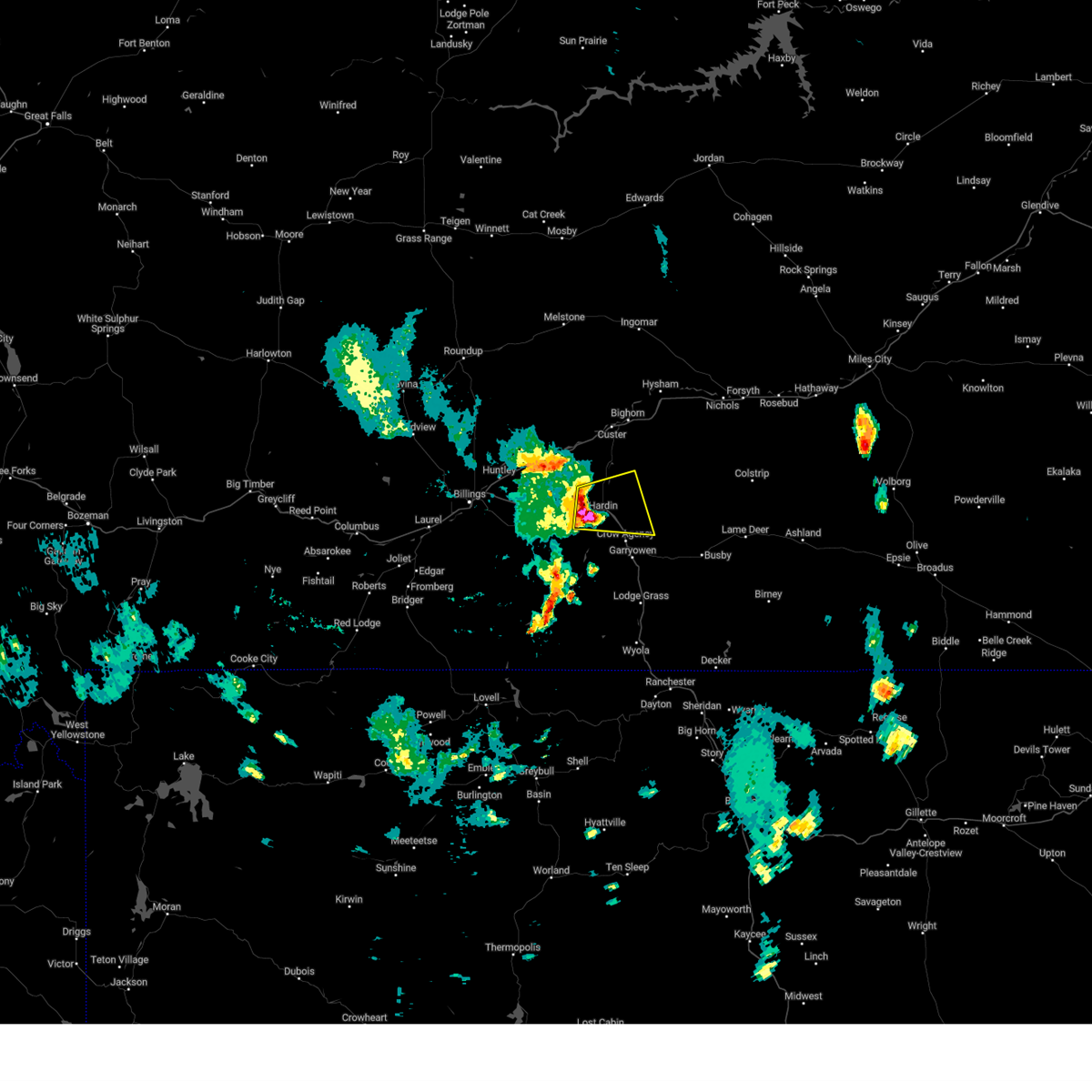
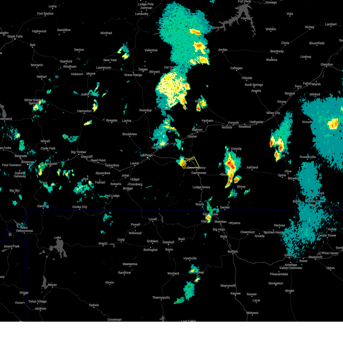
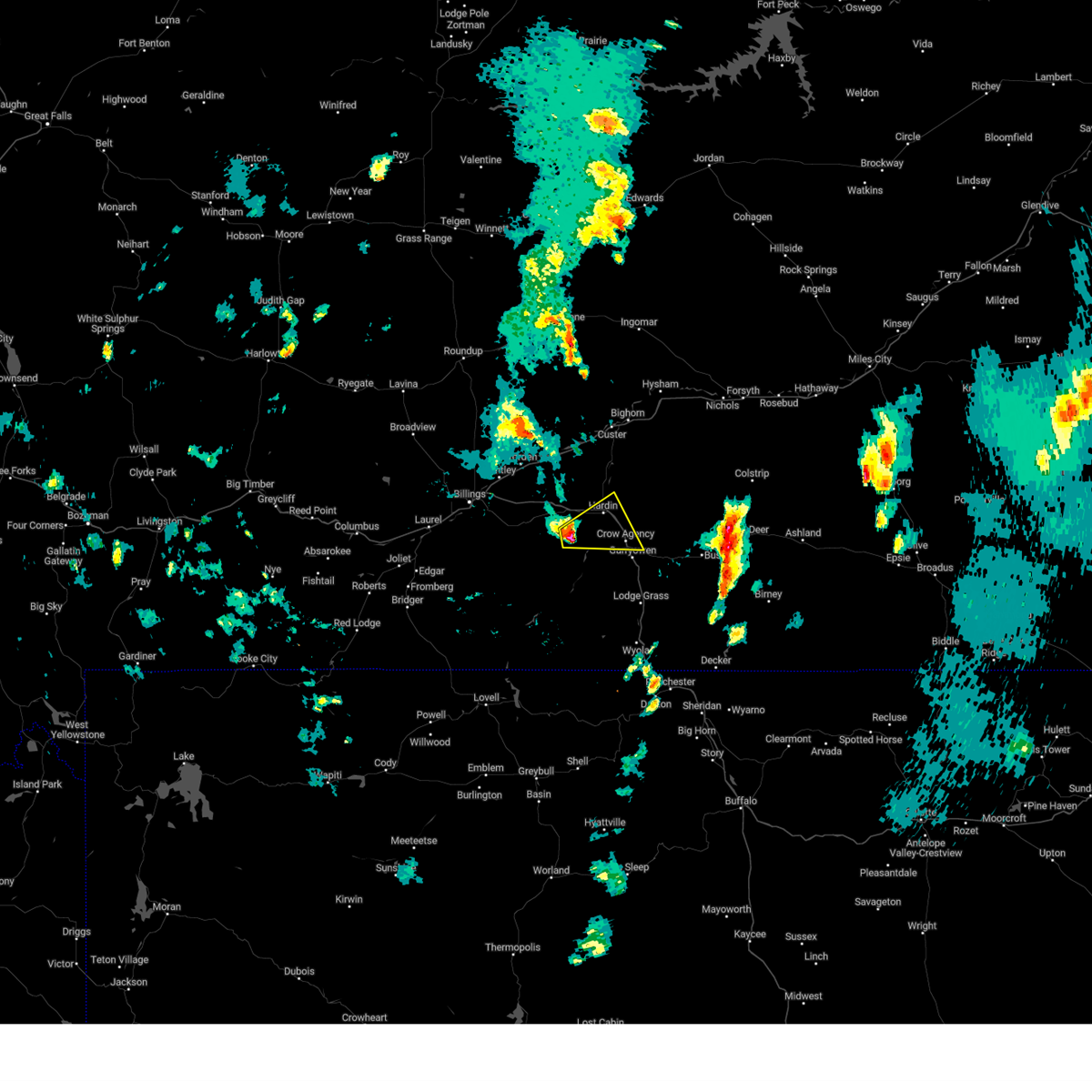
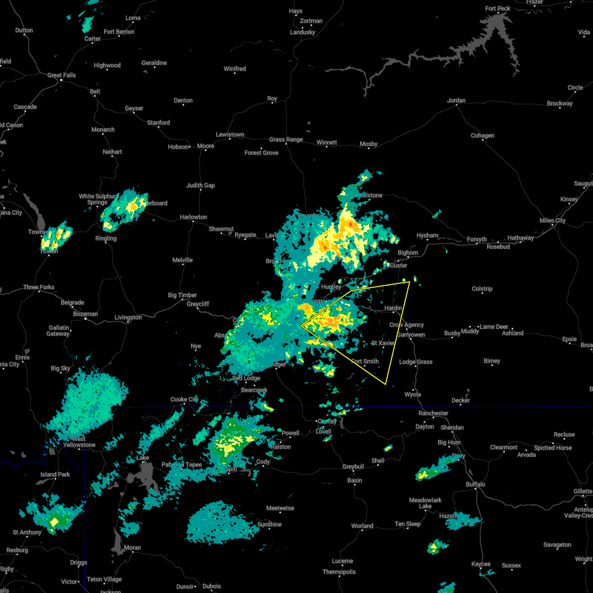
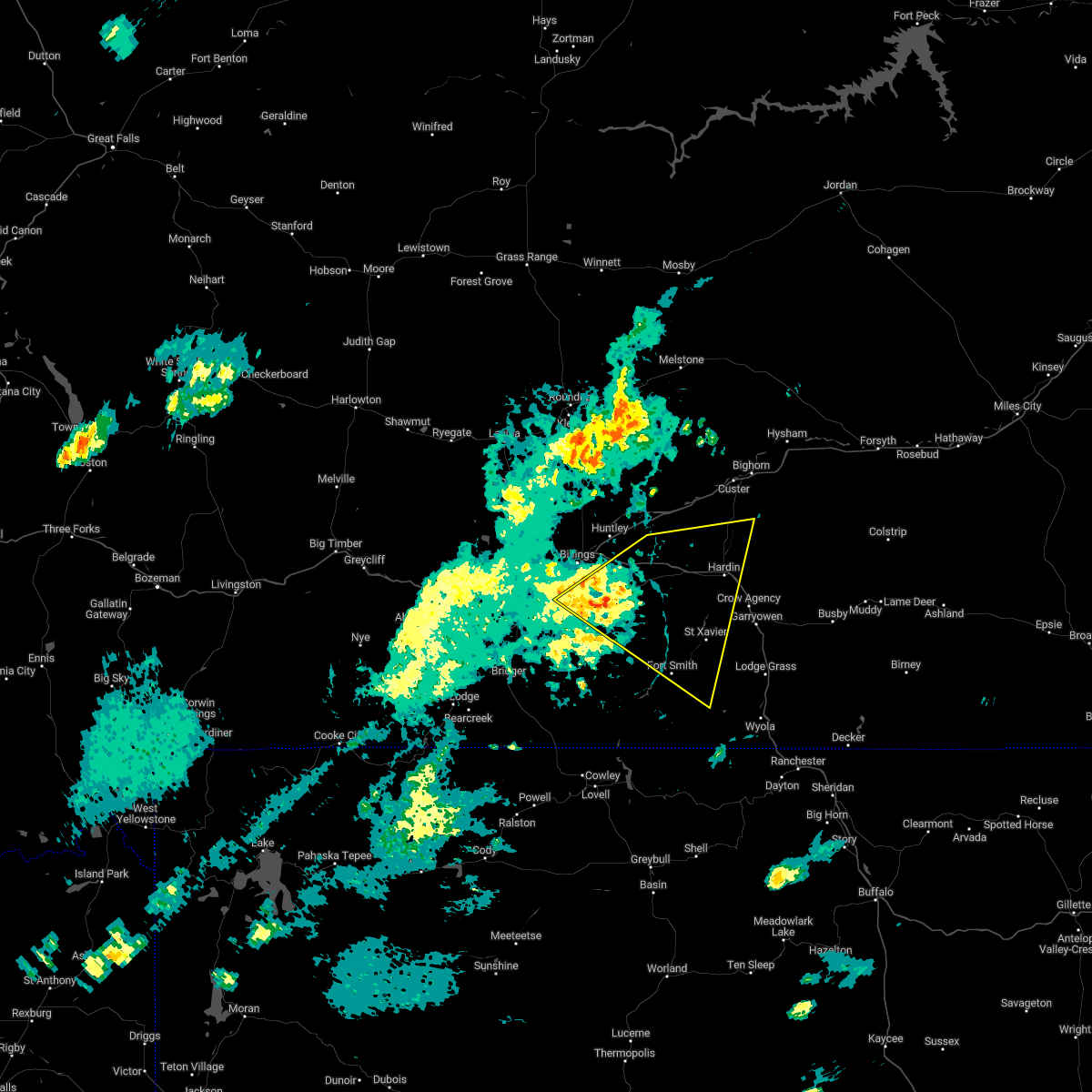
Hail Map for Hardin, MT
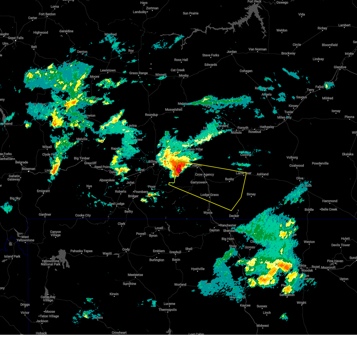
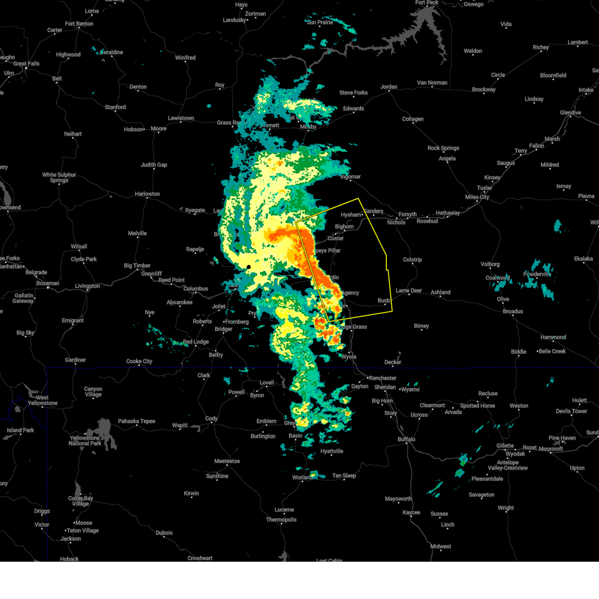
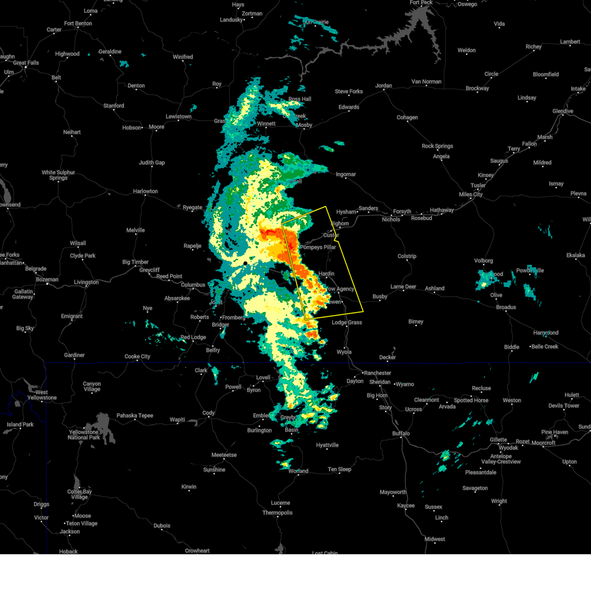
The Hardin, MT area has had 27 reports of on-the-ground hail by trained spotters, and has been under severe weather warnings 22 times during the past 12 months. Doppler radar has detected hail at or near Hardin, MT on 43 occasions, including 7 occasions during the past year.
| Name: | Hardin, MT |
| Where Located: | 43.5 miles E of Billings, MT |
| Map: | Google Map for Hardin, MT |
| Population: | 3505 |
| Housing Units: | 1401 |
| More Info: | Search Google for Hardin, MT |
2
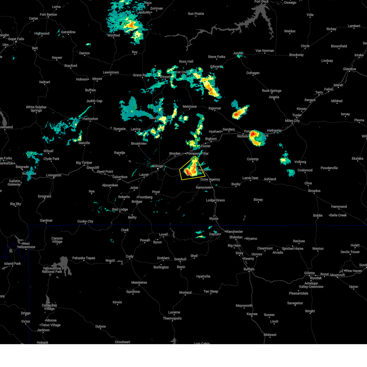
The Top Recent Hail Date for Hardin, MT is Thursday, August 7, 2025 (5th out of 43)
Hail and Wind Damage Spotted near Hardin, MT
| Date / Time | Report Details |
|---|---|
| 6/7/2026 6:03 PM MDT |
 Svrbyz the national weather service in billings has issued a * severe thunderstorm warning for, north central big horn county in south central montana, * until 645 pm mdt. * at 603 pm mdt, severe thunderstorms were located along a line from 10 miles northwest of hardin to 9 miles southwest of crow agency, or along a line from 10 miles northwest of hardin to 16 miles south of hardin, moving east at 35 mph (radar indicated). Hazards include 60 mph wind gusts and quarter size hail. hail damage to vehicles is possible along with wind damage to roofs, siding, and trees Svrbyz the national weather service in billings has issued a * severe thunderstorm warning for, north central big horn county in south central montana, * until 645 pm mdt. * at 603 pm mdt, severe thunderstorms were located along a line from 10 miles northwest of hardin to 9 miles southwest of crow agency, or along a line from 10 miles northwest of hardin to 16 miles south of hardin, moving east at 35 mph (radar indicated). Hazards include 60 mph wind gusts and quarter size hail. hail damage to vehicles is possible along with wind damage to roofs, siding, and trees
|
| 5/13/2026 5:55 PM MDT | Awos station k00u 2 wnw hardi in big horn county MT, 2.6 miles ESE of Hardin, MT |
| 8/7/2025 7:09 PM MDT |
 the severe thunderstorm warning has been cancelled and is no longer in effect the severe thunderstorm warning has been cancelled and is no longer in effect
|
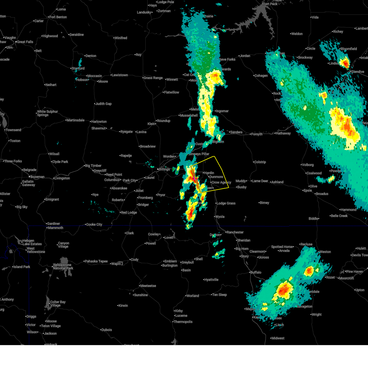
| 8/7/2025 7:05 PM MDT | Quarter sized hail reported 1 miles NE of Hardin, MT |
| 8/7/2025 7:00 PM MDT | Quarter sized hail reported 2.2 miles NE of Hardin, MT |
| 8/7/2025 6:46 PM MDT |
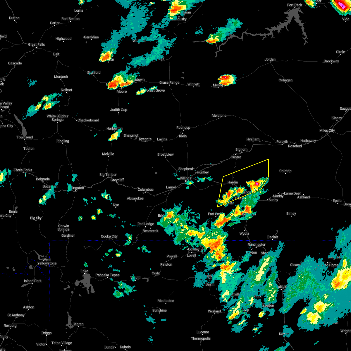
 At 646 pm mdt, severe thunderstorms were located along a line from 12 miles northwest of custer to 6 miles southwest of hardin, or along a line from 21 miles west of hysham to 6 miles southwest of hardin, moving east at 40 mph (radar indicated). Hazards include 70 mph wind gusts and ping pong ball size hail. the largest hail is located along i-90 east heading towards hardin. People and animals outdoors will be injured. expect hail damage to roofs, siding, windows, and vehicles. expect considerable tree damage. wind damage is also likely to mobile homes, roofs, and outbuildings. locations impacted include, hardin, hysham, custer, crow agency, busby, bighorn, crow indian reservation and northern cheyenne indian reservation. This does not include billings. At 646 pm mdt, severe thunderstorms were located along a line from 12 miles northwest of custer to 6 miles southwest of hardin, or along a line from 21 miles west of hysham to 6 miles southwest of hardin, moving east at 40 mph (radar indicated). Hazards include 70 mph wind gusts and ping pong ball size hail. the largest hail is located along i-90 east heading towards hardin. People and animals outdoors will be injured. expect hail damage to roofs, siding, windows, and vehicles. expect considerable tree damage. wind damage is also likely to mobile homes, roofs, and outbuildings. locations impacted include, hardin, hysham, custer, crow agency, busby, bighorn, crow indian reservation and northern cheyenne indian reservation. This does not include billings.
|
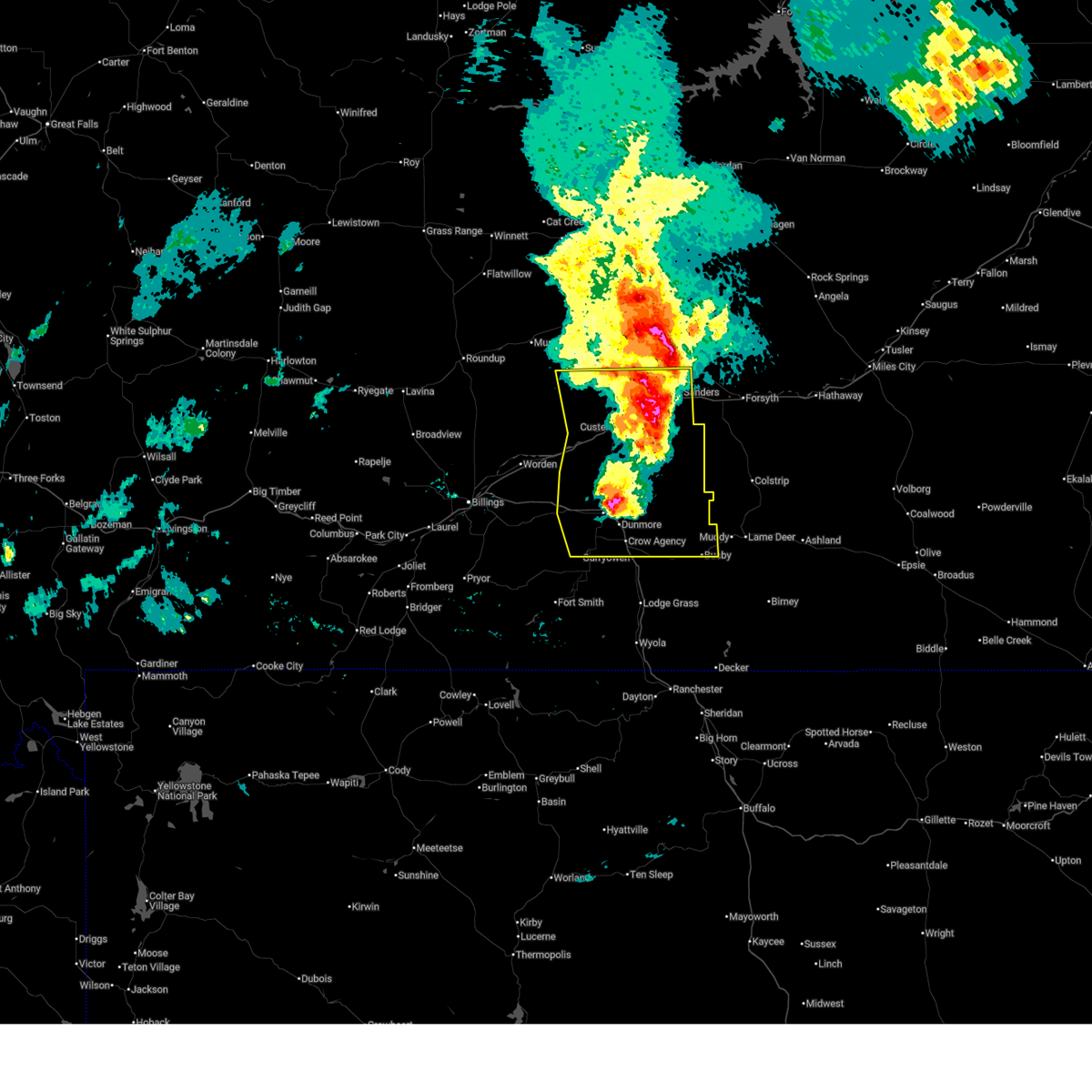
| 8/7/2025 6:28 PM MDT |
 At 628 pm mdt, severe thunderstorms were located along a line from 21 miles northeast of ballantine to 21 miles north of fort smith, or along a line from 33 miles southeast of roundup to 19 miles southwest of hardin, moving east at 40 mph (radar indicated). Hazards include two inch hail and 70 mph wind gusts. the largest hail is currently located south of i-90 and 10 miles east of lockwood. People and animals outdoors will be injured. expect hail damage to roofs, siding, windows, and vehicles. expect considerable tree damage. wind damage is also likely to mobile homes, roofs, and outbuildings. locations impacted include, hardin, hysham, custer, crow agency, busby, bighorn, pompeys pillar, crow indian reservation and northern cheyenne indian reservation. This does not include billings. At 628 pm mdt, severe thunderstorms were located along a line from 21 miles northeast of ballantine to 21 miles north of fort smith, or along a line from 33 miles southeast of roundup to 19 miles southwest of hardin, moving east at 40 mph (radar indicated). Hazards include two inch hail and 70 mph wind gusts. the largest hail is currently located south of i-90 and 10 miles east of lockwood. People and animals outdoors will be injured. expect hail damage to roofs, siding, windows, and vehicles. expect considerable tree damage. wind damage is also likely to mobile homes, roofs, and outbuildings. locations impacted include, hardin, hysham, custer, crow agency, busby, bighorn, pompeys pillar, crow indian reservation and northern cheyenne indian reservation. This does not include billings.
|
| 8/7/2025 6:21 PM MDT |
 At 621 pm mdt, severe thunderstorms were located along a line from 18 miles north of ballantine to 21 miles north of fort smith, or along a line from 30 miles southeast of roundup to 24 miles west of hardin, moving east at 40 mph (radar indicated). Hazards include 70 mph wind gusts and ping pong ball size hail. the largest hail is currently located south of i-90 east of lockwood. People and animals outdoors will be injured. expect hail damage to roofs, siding, windows, and vehicles. expect considerable tree damage. wind damage is also likely to mobile homes, roofs, and outbuildings. locations impacted include, hardin, hysham, custer, crow agency, ballantine, worden, huntley, shepherd, busby, bighorn, pompeys pillar, crow indian reservation and northern cheyenne indian reservation. This does not include billings. At 621 pm mdt, severe thunderstorms were located along a line from 18 miles north of ballantine to 21 miles north of fort smith, or along a line from 30 miles southeast of roundup to 24 miles west of hardin, moving east at 40 mph (radar indicated). Hazards include 70 mph wind gusts and ping pong ball size hail. the largest hail is currently located south of i-90 east of lockwood. People and animals outdoors will be injured. expect hail damage to roofs, siding, windows, and vehicles. expect considerable tree damage. wind damage is also likely to mobile homes, roofs, and outbuildings. locations impacted include, hardin, hysham, custer, crow agency, ballantine, worden, huntley, shepherd, busby, bighorn, pompeys pillar, crow indian reservation and northern cheyenne indian reservation. This does not include billings.
|
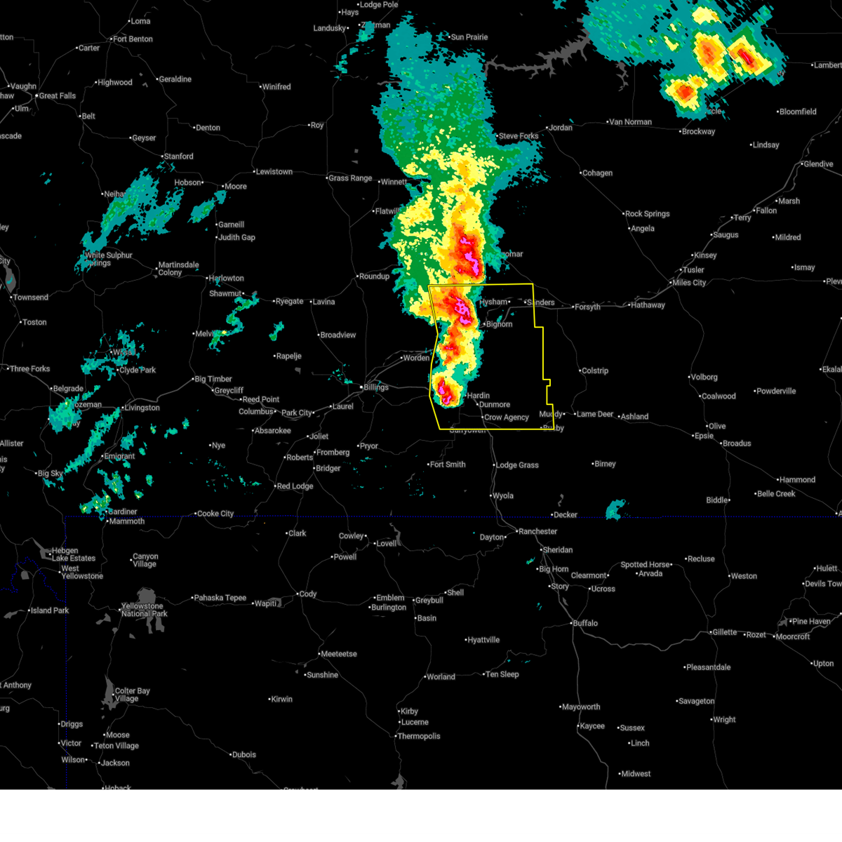
| 8/7/2025 6:17 PM MDT |
 At 617 pm mdt, severe thunderstorms were located along a line from 16 miles north of worden to 21 miles northwest of fort smith, or along a line from 28 miles southeast of roundup to 24 miles southeast of billings, moving east at 40 mph (radar indicated). Hazards include 70 mph wind gusts and quarter size hail. Hail damage to vehicles is expected. expect considerable tree damage. wind damage is also likely to mobile homes, roofs, and outbuildings. locations impacted include, hardin, hysham, custer, crow agency, ballantine, worden, huntley, shepherd, busby, bighorn, pompeys pillar, crow indian reservation and northern cheyenne indian reservation. This does not include billings. At 617 pm mdt, severe thunderstorms were located along a line from 16 miles north of worden to 21 miles northwest of fort smith, or along a line from 28 miles southeast of roundup to 24 miles southeast of billings, moving east at 40 mph (radar indicated). Hazards include 70 mph wind gusts and quarter size hail. Hail damage to vehicles is expected. expect considerable tree damage. wind damage is also likely to mobile homes, roofs, and outbuildings. locations impacted include, hardin, hysham, custer, crow agency, ballantine, worden, huntley, shepherd, busby, bighorn, pompeys pillar, crow indian reservation and northern cheyenne indian reservation. This does not include billings.
|
| 8/7/2025 6:16 PM MDT |
 the severe thunderstorm warning has been cancelled and is no longer in effect the severe thunderstorm warning has been cancelled and is no longer in effect
|
| 8/7/2025 6:16 PM MDT |
 Svrbyz the national weather service in billings has issued a * severe thunderstorm warning for, north central big horn county in south central montana, central yellowstone county in south central montana, treasure county in southeastern montana, * until 715 pm mdt. * at 616 pm mdt, severe thunderstorms were located along a line from 16 miles north of worden to 21 miles northwest of fort smith, or along a line from 28 miles southeast of roundup to 24 miles southeast of billings, moving east at 40 mph (radar indicated). Hazards include 70 mph wind gusts and quarter size hail. Hail damage to vehicles is expected. expect considerable tree damage. Wind damage is also likely to mobile homes, roofs, and outbuildings. Svrbyz the national weather service in billings has issued a * severe thunderstorm warning for, north central big horn county in south central montana, central yellowstone county in south central montana, treasure county in southeastern montana, * until 715 pm mdt. * at 616 pm mdt, severe thunderstorms were located along a line from 16 miles north of worden to 21 miles northwest of fort smith, or along a line from 28 miles southeast of roundup to 24 miles southeast of billings, moving east at 40 mph (radar indicated). Hazards include 70 mph wind gusts and quarter size hail. Hail damage to vehicles is expected. expect considerable tree damage. Wind damage is also likely to mobile homes, roofs, and outbuildings.
|
| 8/7/2025 6:04 PM MDT |
 At 604 pm mdt, a severe thunderstorm was located near huntley, or 14 miles northeast of billings, moving east at 45 mph (radar indicated). Hazards include 60 to 65 mph wind gusts and quarter size hail. Hail damage to vehicles is expected. expect wind damage to roofs, siding, and trees. this storm has a history of producing large hail. locations impacted include, hardin, ballantine, worden, huntley, shepherd, lockwood, pompeys pillar and crow indian reservation. This does not include billings!. At 604 pm mdt, a severe thunderstorm was located near huntley, or 14 miles northeast of billings, moving east at 45 mph (radar indicated). Hazards include 60 to 65 mph wind gusts and quarter size hail. Hail damage to vehicles is expected. expect wind damage to roofs, siding, and trees. this storm has a history of producing large hail. locations impacted include, hardin, ballantine, worden, huntley, shepherd, lockwood, pompeys pillar and crow indian reservation. This does not include billings!.
|
| 8/7/2025 5:54 PM MDT |
 At 554 pm mdt, a severe thunderstorm was located near lockwood, or 8 miles northeast of billings, moving east at 45 mph (public reported. at 545 pm, quarter size hail was reported along rimrock road in billings). Hazards include 70 mph wind gusts and quarter size hail. Hail damage to vehicles is expected. expect considerable tree damage. wind damage is also likely to mobile homes, roofs, and outbuildings. Locations impacted include, billings, hardin, ballantine, worden, huntley, shepherd, lockwood, billings heights, billings west end, pompeys pillar and crow indian reservation. At 554 pm mdt, a severe thunderstorm was located near lockwood, or 8 miles northeast of billings, moving east at 45 mph (public reported. at 545 pm, quarter size hail was reported along rimrock road in billings). Hazards include 70 mph wind gusts and quarter size hail. Hail damage to vehicles is expected. expect considerable tree damage. wind damage is also likely to mobile homes, roofs, and outbuildings. Locations impacted include, billings, hardin, ballantine, worden, huntley, shepherd, lockwood, billings heights, billings west end, pompeys pillar and crow indian reservation.
|
| 8/7/2025 5:50 PM MDT |
 Svrbyz the national weather service in billings has issued a * severe thunderstorm warning for, north central big horn county in south central montana, central yellowstone county in south central montana, * until 645 pm mdt. * at 550 pm mdt, a severe thunderstorm was located over billings heights, or near billings, moving east at 45 mph (public reported. at 545 pm, quarter size hail was reported along rimrock road in billings). Hazards include 70 mph wind gusts and quarter size hail. Hail damage to vehicles is expected. expect considerable tree damage. Wind damage is also likely to mobile homes, roofs, and outbuildings. Svrbyz the national weather service in billings has issued a * severe thunderstorm warning for, north central big horn county in south central montana, central yellowstone county in south central montana, * until 645 pm mdt. * at 550 pm mdt, a severe thunderstorm was located over billings heights, or near billings, moving east at 45 mph (public reported. at 545 pm, quarter size hail was reported along rimrock road in billings). Hazards include 70 mph wind gusts and quarter size hail. Hail damage to vehicles is expected. expect considerable tree damage. Wind damage is also likely to mobile homes, roofs, and outbuildings.
|
| 7/29/2025 12:09 AM MDT |
 the severe thunderstorm warning has been cancelled and is no longer in effect the severe thunderstorm warning has been cancelled and is no longer in effect
|
| 7/29/2025 12:08 AM MDT |
 Svrbyz the national weather service in billings has issued a * severe thunderstorm warning for, north central big horn county in south central montana, southeastern treasure county in southeastern montana, * until 100 am mdt. * at 1208 am mdt, a severe thunderstorm was located 7 miles northwest of hardin, moving east at 25 mph (radar indicated). Hazards include 60 mph wind gusts and quarter size hail. Hail damage to vehicles is expected. Expect wind damage to roofs, siding, and trees. Svrbyz the national weather service in billings has issued a * severe thunderstorm warning for, north central big horn county in south central montana, southeastern treasure county in southeastern montana, * until 100 am mdt. * at 1208 am mdt, a severe thunderstorm was located 7 miles northwest of hardin, moving east at 25 mph (radar indicated). Hazards include 60 mph wind gusts and quarter size hail. Hail damage to vehicles is expected. Expect wind damage to roofs, siding, and trees.
|
| 7/28/2025 11:54 PM MDT |
 At 1154 pm mdt, a severe thunderstorm was located 11 miles northwest of hardin, moving east at 25 mph (radar indicated. this storm has a history of producing large hail and damaging wind gusts). Hazards include 60 mph wind gusts and quarter size hail. Hail damage to vehicles is expected. expect wind damage to roofs, siding, and trees. locations impacted include, hardin, pompeys pillar and crow indian reservation. This includes portions of i-90 from billings to hardin, and i-94 from billings to the treasure county line. At 1154 pm mdt, a severe thunderstorm was located 11 miles northwest of hardin, moving east at 25 mph (radar indicated. this storm has a history of producing large hail and damaging wind gusts). Hazards include 60 mph wind gusts and quarter size hail. Hail damage to vehicles is expected. expect wind damage to roofs, siding, and trees. locations impacted include, hardin, pompeys pillar and crow indian reservation. This includes portions of i-90 from billings to hardin, and i-94 from billings to the treasure county line.
|
| 7/28/2025 11:37 PM MDT |
 At 1137 pm mdt, a severe thunderstorm was located 11 miles southeast of ballantine, or 19 miles northwest of hardin, moving east at 30 mph (trained spotters. this storm has a history of producing hail up to golf ball size and wind gusts to 66 mph). Hazards include 70 mph wind gusts and ping pong ball size hail. People and animals outdoors will be injured. expect hail damage to roofs, siding, windows, and vehicles. expect considerable tree damage. wind damage is also likely to mobile homes, roofs, and outbuildings. locations impacted include, hardin, ballantine, worden, pompeys pillar and crow indian reservation. This includes portions of i-90 from billings to hardin, and i-94 from billings to the treasure county line. At 1137 pm mdt, a severe thunderstorm was located 11 miles southeast of ballantine, or 19 miles northwest of hardin, moving east at 30 mph (trained spotters. this storm has a history of producing hail up to golf ball size and wind gusts to 66 mph). Hazards include 70 mph wind gusts and ping pong ball size hail. People and animals outdoors will be injured. expect hail damage to roofs, siding, windows, and vehicles. expect considerable tree damage. wind damage is also likely to mobile homes, roofs, and outbuildings. locations impacted include, hardin, ballantine, worden, pompeys pillar and crow indian reservation. This includes portions of i-90 from billings to hardin, and i-94 from billings to the treasure county line.
|
| 7/28/2025 11:23 PM MDT |
 At 1123 pm mdt, a cluster of severe thunderstorms was centered 9 miles south of ballantine, or 17 miles east of billings, moving east at 20 mph (trained spotters reported hail up to golf ball size near billings with these storms. a wind gust of 66 mph was reported on i-90 at arrow creek hill). Hazards include golf ball size hail and 70 mph wind gusts. People and animals outdoors will be injured. expect hail damage to roofs, siding, windows, and vehicles. expect considerable tree damage. wind damage is also likely to mobile homes, roofs, and outbuildings. locations impacted include, hardin, ballantine, worden, huntley, shepherd, lockwood, pompeys pillar and crow indian reservation. This includes portions of i-90 from billings to hardin, and i-94 from billings to the treasure county line. At 1123 pm mdt, a cluster of severe thunderstorms was centered 9 miles south of ballantine, or 17 miles east of billings, moving east at 20 mph (trained spotters reported hail up to golf ball size near billings with these storms. a wind gust of 66 mph was reported on i-90 at arrow creek hill). Hazards include golf ball size hail and 70 mph wind gusts. People and animals outdoors will be injured. expect hail damage to roofs, siding, windows, and vehicles. expect considerable tree damage. wind damage is also likely to mobile homes, roofs, and outbuildings. locations impacted include, hardin, ballantine, worden, huntley, shepherd, lockwood, pompeys pillar and crow indian reservation. This includes portions of i-90 from billings to hardin, and i-94 from billings to the treasure county line.
|
| 7/28/2025 11:14 PM MDT |
 Svrbyz the national weather service in billings has issued a * severe thunderstorm warning for, north central big horn county in south central montana, central yellowstone county in south central montana, * until 1215 am mdt. * at 1114 pm mdt, a cluster of severe thunderstorms was centered 9 miles south of ballantine, or 17 miles east of billings, moving east at 20 mph (trained spotters reported hail up to golf ball size near billings with these storms). Hazards include golf ball size hail. People and animals outdoors will be injured. Expect damage to roofs, siding, windows, and vehicles. Svrbyz the national weather service in billings has issued a * severe thunderstorm warning for, north central big horn county in south central montana, central yellowstone county in south central montana, * until 1215 am mdt. * at 1114 pm mdt, a cluster of severe thunderstorms was centered 9 miles south of ballantine, or 17 miles east of billings, moving east at 20 mph (trained spotters reported hail up to golf ball size near billings with these storms). Hazards include golf ball size hail. People and animals outdoors will be injured. Expect damage to roofs, siding, windows, and vehicles.
|
| 7/20/2025 6:34 PM MDT | Blowing debris caused car damage at campgroun in big horn county MT, 1.2 miles S of Hardin, MT |
| 7/20/2025 6:22 PM MDT |
 Svrbyz the national weather service in billings has issued a * severe thunderstorm warning for, north central big horn county in south central montana, * until 700 pm mdt. * at 622 pm mdt, a severe thunderstorm was located near hardin, moving east at 30 mph (radar indicated). Hazards include wind gusts up to 70 mph wind gusts and small hail. Expect considerable tree damage. Damage is likely to mobile homes, roofs, and outbuildings. Svrbyz the national weather service in billings has issued a * severe thunderstorm warning for, north central big horn county in south central montana, * until 700 pm mdt. * at 622 pm mdt, a severe thunderstorm was located near hardin, moving east at 30 mph (radar indicated). Hazards include wind gusts up to 70 mph wind gusts and small hail. Expect considerable tree damage. Damage is likely to mobile homes, roofs, and outbuildings.
|
| 7/20/2025 6:20 PM MDT | Big horn county airpor in big horn county MT, 2.5 miles E of Hardin, MT |
| 7/5/2025 4:32 PM MDT |
 the severe thunderstorm warning has been cancelled and is no longer in effect the severe thunderstorm warning has been cancelled and is no longer in effect
|
| 7/5/2025 4:13 PM MDT |
 Svrbyz the national weather service in billings has issued a * severe thunderstorm warning for, north central big horn county in south central montana, central rosebud county in southeastern montana, southeastern treasure county in southeastern montana, * until 515 pm mdt. * at 413 pm mdt, a severe thunderstorm was located 9 miles northeast of hardin, moving northeast at 30 mph (radar indicated). Hazards include 60 mph wind gusts and quarter size hail. Hail damage to vehicles is expected. Expect wind damage to roofs, siding, and trees. Svrbyz the national weather service in billings has issued a * severe thunderstorm warning for, north central big horn county in south central montana, central rosebud county in southeastern montana, southeastern treasure county in southeastern montana, * until 515 pm mdt. * at 413 pm mdt, a severe thunderstorm was located 9 miles northeast of hardin, moving northeast at 30 mph (radar indicated). Hazards include 60 mph wind gusts and quarter size hail. Hail damage to vehicles is expected. Expect wind damage to roofs, siding, and trees.
|
| 7/5/2025 2:57 PM MDT |
 At 257 pm mdt, severe thunderstorms were located along a line from 16 miles southeast of melstone to 24 miles northeast of crow agency, moving east at 45 mph (radar indicated). Hazards include 70 mph wind gusts and quarter size hail. Hail damage to vehicles is expected. expect considerable tree damage. wind damage is also likely to mobile homes, roofs, and outbuildings. locations impacted include, hardin, hysham, custer, bighorn, vananda, ingomar and crow indian reservation. Radar indicates the strongest winds are occurring near and south of custer and bighorn, montana. At 257 pm mdt, severe thunderstorms were located along a line from 16 miles southeast of melstone to 24 miles northeast of crow agency, moving east at 45 mph (radar indicated). Hazards include 70 mph wind gusts and quarter size hail. Hail damage to vehicles is expected. expect considerable tree damage. wind damage is also likely to mobile homes, roofs, and outbuildings. locations impacted include, hardin, hysham, custer, bighorn, vananda, ingomar and crow indian reservation. Radar indicates the strongest winds are occurring near and south of custer and bighorn, montana.
|
| 7/5/2025 2:46 PM MDT | Golf Ball sized hail reported 16 miles NNE of Hardin, MT, report from mping: golf ball (1.75 in.). |
| 7/5/2025 2:31 PM MDT |
 Svrbyz the national weather service in billings has issued a * severe thunderstorm warning for, southeastern musselshell county in central montana, north central big horn county in south central montana, northeastern yellowstone county in south central montana, northern rosebud county in southeastern montana, treasure county in southeastern montana, * until 330 pm mdt. * at 231 pm mdt, severe thunderstorms were located along a line from 16 miles south of melstone to near hardin, moving east at 45 mph (radar indicated). Hazards include 60 to 70 mph wind gusts and quarter size hail. Hail damage to vehicles is expected. Expect wind damage to roofs, siding, and trees. Svrbyz the national weather service in billings has issued a * severe thunderstorm warning for, southeastern musselshell county in central montana, north central big horn county in south central montana, northeastern yellowstone county in south central montana, northern rosebud county in southeastern montana, treasure county in southeastern montana, * until 330 pm mdt. * at 231 pm mdt, severe thunderstorms were located along a line from 16 miles south of melstone to near hardin, moving east at 45 mph (radar indicated). Hazards include 60 to 70 mph wind gusts and quarter size hail. Hail damage to vehicles is expected. Expect wind damage to roofs, siding, and trees.
|
| 6/16/2025 6:34 PM MDT |
 the severe thunderstorm warning has been cancelled and is no longer in effect the severe thunderstorm warning has been cancelled and is no longer in effect
|
| 6/16/2025 6:25 PM MDT |
 At 625 pm mdt, a severe thunderstorm was located over hardin, moving east at 35 mph (radar indicated). Hazards include 60 mph wind gusts and small hail. Expect damage to roofs, siding, and trees. Locations impacted include, hardin, crow agency and crow indian reservation. At 625 pm mdt, a severe thunderstorm was located over hardin, moving east at 35 mph (radar indicated). Hazards include 60 mph wind gusts and small hail. Expect damage to roofs, siding, and trees. Locations impacted include, hardin, crow agency and crow indian reservation.
|
| 6/16/2025 6:25 PM MDT |
 the severe thunderstorm warning has been cancelled and is no longer in effect the severe thunderstorm warning has been cancelled and is no longer in effect
|
| 6/16/2025 5:57 PM MDT |
 Svrbyz the national weather service in billings has issued a * severe thunderstorm warning for, north central big horn county in south central montana, southeastern yellowstone county in south central montana, * until 645 pm mdt. * at 557 pm mdt, a severe thunderstorm was located 15 miles southeast of ballantine, or 15 miles west of hardin, moving east at 35 mph (radar indicated). Hazards include 60 mph wind gusts and half dollar size hail. Hail damage to vehicles is expected. Expect wind damage to roofs, siding, and trees. Svrbyz the national weather service in billings has issued a * severe thunderstorm warning for, north central big horn county in south central montana, southeastern yellowstone county in south central montana, * until 645 pm mdt. * at 557 pm mdt, a severe thunderstorm was located 15 miles southeast of ballantine, or 15 miles west of hardin, moving east at 35 mph (radar indicated). Hazards include 60 mph wind gusts and half dollar size hail. Hail damage to vehicles is expected. Expect wind damage to roofs, siding, and trees.
|
| 6/16/2025 5:31 PM MDT |
 At 531 pm mdt, a severe thunderstorm was located 10 miles southeast of ballantine, or 22 miles west of hardin, moving southeast at 40 mph (radar indicated). Hazards include golf ball size hail and 70 mph wind gusts. People and animals outdoors will be injured. expect hail damage to roofs, siding, windows, and vehicles. expect considerable tree damage. wind damage is also likely to mobile homes, roofs, and outbuildings. Locations impacted include, hardin, ballantine, worden, huntley, shepherd and crow indian reservation. At 531 pm mdt, a severe thunderstorm was located 10 miles southeast of ballantine, or 22 miles west of hardin, moving southeast at 40 mph (radar indicated). Hazards include golf ball size hail and 70 mph wind gusts. People and animals outdoors will be injured. expect hail damage to roofs, siding, windows, and vehicles. expect considerable tree damage. wind damage is also likely to mobile homes, roofs, and outbuildings. Locations impacted include, hardin, ballantine, worden, huntley, shepherd and crow indian reservation.
|
| 6/16/2025 5:12 PM MDT |
 Svrbyz the national weather service in billings has issued a * severe thunderstorm warning for, north central big horn county in south central montana, central yellowstone county in south central montana, * until 600 pm mdt. * at 512 pm mdt, a severe thunderstorm was located over huntley, or 15 miles northeast of billings, moving southeast at 40 mph (radar indicated). Hazards include 70 mph wind gusts and ping pong ball size hail. People and animals outdoors will be injured. expect hail damage to roofs, siding, windows, and vehicles. expect considerable tree damage. Wind damage is also likely to mobile homes, roofs, and outbuildings. Svrbyz the national weather service in billings has issued a * severe thunderstorm warning for, north central big horn county in south central montana, central yellowstone county in south central montana, * until 600 pm mdt. * at 512 pm mdt, a severe thunderstorm was located over huntley, or 15 miles northeast of billings, moving southeast at 40 mph (radar indicated). Hazards include 70 mph wind gusts and ping pong ball size hail. People and animals outdoors will be injured. expect hail damage to roofs, siding, windows, and vehicles. expect considerable tree damage. Wind damage is also likely to mobile homes, roofs, and outbuildings.
|
| 6/15/2025 9:35 PM MDT | Awos station k00u 2 wnw hardi in big horn county MT, 2.6 miles ESE of Hardin, MT |
| 6/15/2025 9:22 PM MDT |
 At 922 pm mdt, severe thunderstorms were located along a line from 10 miles west of custer to 22 miles north of fort smith, or along a line from 28 miles north of hardin to 21 miles west of hardin, moving east at 30 mph (radar indicated). Hazards include 70 mph wind gusts and ping pong ball size hail. People and animals outdoors will be injured. expect hail damage to roofs, siding, windows, and vehicles. expect considerable tree damage. wind damage is also likely to mobile homes, roofs, and outbuildings. Locations impacted include, hardin, custer, crow agency and crow indian reservation. At 922 pm mdt, severe thunderstorms were located along a line from 10 miles west of custer to 22 miles north of fort smith, or along a line from 28 miles north of hardin to 21 miles west of hardin, moving east at 30 mph (radar indicated). Hazards include 70 mph wind gusts and ping pong ball size hail. People and animals outdoors will be injured. expect hail damage to roofs, siding, windows, and vehicles. expect considerable tree damage. wind damage is also likely to mobile homes, roofs, and outbuildings. Locations impacted include, hardin, custer, crow agency and crow indian reservation.
|
| 6/15/2025 9:15 PM MDT |
 At 915 pm mdt, severe thunderstorms were located along a line from 13 miles west of custer to 22 miles south of ballantine, or along a line from 30 miles north of hardin to 24 miles west of hardin, moving east at 30 mph (radar indicated). Hazards include 70 mph wind gusts and ping pong ball size hail. People and animals outdoors will be injured. expect hail damage to roofs, siding, windows, and vehicles. expect considerable tree damage. wind damage is also likely to mobile homes, roofs, and outbuildings. locations impacted include, hardin, custer, crow agency, pompeys pillar, st. Xavier and crow indian reservation. At 915 pm mdt, severe thunderstorms were located along a line from 13 miles west of custer to 22 miles south of ballantine, or along a line from 30 miles north of hardin to 24 miles west of hardin, moving east at 30 mph (radar indicated). Hazards include 70 mph wind gusts and ping pong ball size hail. People and animals outdoors will be injured. expect hail damage to roofs, siding, windows, and vehicles. expect considerable tree damage. wind damage is also likely to mobile homes, roofs, and outbuildings. locations impacted include, hardin, custer, crow agency, pompeys pillar, st. Xavier and crow indian reservation.
|
| 6/15/2025 9:07 PM MDT |
 At 907 pm mdt, severe thunderstorms were located along a line from 18 miles northeast of ballantine to 18 miles south of huntley, or along a line from 33 miles northwest of hardin to 20 miles southeast of billings, moving east at 30 mph (radar indicated). Hazards include 70 mph wind gusts and quarter size hail. Hail damage to vehicles is expected. expect considerable tree damage. wind damage is also likely to mobile homes, roofs, and outbuildings. locations impacted include, hardin, custer, ballantine, worden, huntley, crow agency, pompeys pillar, st. Xavier and crow indian reservation. At 907 pm mdt, severe thunderstorms were located along a line from 18 miles northeast of ballantine to 18 miles south of huntley, or along a line from 33 miles northwest of hardin to 20 miles southeast of billings, moving east at 30 mph (radar indicated). Hazards include 70 mph wind gusts and quarter size hail. Hail damage to vehicles is expected. expect considerable tree damage. wind damage is also likely to mobile homes, roofs, and outbuildings. locations impacted include, hardin, custer, ballantine, worden, huntley, crow agency, pompeys pillar, st. Xavier and crow indian reservation.
|
| 6/15/2025 8:59 PM MDT |
 Svrbyz the national weather service in billings has issued a * severe thunderstorm warning for, north central big horn county in south central montana, central yellowstone county in south central montana, south central treasure county in southeastern montana, * until 945 pm mdt. * at 859 pm mdt, severe thunderstorms were located along a line from 17 miles northeast of ballantine to 13 miles southeast of lockwood, or along a line from 32 miles southeast of roundup to 16 miles southeast of billings, moving east at 30 mph (radar indicated). Hazards include 60 mph wind gusts and quarter size hail. Hail damage to vehicles is expected. Expect wind damage to roofs, siding, and trees. Svrbyz the national weather service in billings has issued a * severe thunderstorm warning for, north central big horn county in south central montana, central yellowstone county in south central montana, south central treasure county in southeastern montana, * until 945 pm mdt. * at 859 pm mdt, severe thunderstorms were located along a line from 17 miles northeast of ballantine to 13 miles southeast of lockwood, or along a line from 32 miles southeast of roundup to 16 miles southeast of billings, moving east at 30 mph (radar indicated). Hazards include 60 mph wind gusts and quarter size hail. Hail damage to vehicles is expected. Expect wind damage to roofs, siding, and trees.
|
| 6/15/2025 8:44 PM MDT |
 The storm which prompted the warning has weakened below severe limits, and has exited the warned area. therefore, the warning will be allowed to expire. however, small hail, gusty winds, and heavy rain are still possible with this thunderstorm. a severe thunderstorm watch remains in effect until 1100 pm mdt sunday for a portion of south central montana. The storm which prompted the warning has weakened below severe limits, and has exited the warned area. therefore, the warning will be allowed to expire. however, small hail, gusty winds, and heavy rain are still possible with this thunderstorm. a severe thunderstorm watch remains in effect until 1100 pm mdt sunday for a portion of south central montana.
|
| 6/15/2025 8:28 PM MDT |
 At 828 pm mdt, a severe thunderstorm was located 4 miles northeast of hardin, moving east at 35 mph (radar indicated). Hazards include 60 mph wind gusts and half dollar size hail. Hail damage to vehicles is expected. expect wind damage to roofs, siding, and trees. Locations impacted include, hardin and crow indian reservation. At 828 pm mdt, a severe thunderstorm was located 4 miles northeast of hardin, moving east at 35 mph (radar indicated). Hazards include 60 mph wind gusts and half dollar size hail. Hail damage to vehicles is expected. expect wind damage to roofs, siding, and trees. Locations impacted include, hardin and crow indian reservation.
|
| 6/15/2025 8:01 PM MDT |
 Svrbyz the national weather service in billings has issued a * severe thunderstorm warning for, north central big horn county in south central montana, * until 845 pm mdt. * at 801 pm mdt, a severe thunderstorm was located 9 miles west of hardin, moving east at 30 mph (radar indicated). Hazards include 60 mph wind gusts and half dollar size hail. Hail damage to vehicles is possible. Expect wind damage to roofs, siding, and trees. Svrbyz the national weather service in billings has issued a * severe thunderstorm warning for, north central big horn county in south central montana, * until 845 pm mdt. * at 801 pm mdt, a severe thunderstorm was located 9 miles west of hardin, moving east at 30 mph (radar indicated). Hazards include 60 mph wind gusts and half dollar size hail. Hail damage to vehicles is possible. Expect wind damage to roofs, siding, and trees.
|
| 6/13/2025 7:27 PM MDT |
 At 727 pm mdt, a severe thunderstorm was located 11 miles northeast of crow agency, or 16 miles east of hardin, moving southeast at 55 mph (radar indicated). Hazards include tennis ball size hail and 70 mph wind gusts. People and animals outdoors will be injured. expect hail damage to roofs, siding, windows, and vehicles. expect considerable tree damage. wind damage is also likely to mobile homes, roofs, and outbuildings. Locations impacted include, hardin, busby, lame deer, ashland, crow agency, birney, muddy cluster, kirby, rosebud battlefield park, birney village, tongue river reservoir, northern cheyenne indian reservation and crow indian reservation. At 727 pm mdt, a severe thunderstorm was located 11 miles northeast of crow agency, or 16 miles east of hardin, moving southeast at 55 mph (radar indicated). Hazards include tennis ball size hail and 70 mph wind gusts. People and animals outdoors will be injured. expect hail damage to roofs, siding, windows, and vehicles. expect considerable tree damage. wind damage is also likely to mobile homes, roofs, and outbuildings. Locations impacted include, hardin, busby, lame deer, ashland, crow agency, birney, muddy cluster, kirby, rosebud battlefield park, birney village, tongue river reservoir, northern cheyenne indian reservation and crow indian reservation.
|
| 6/13/2025 7:25 PM MDT |
 Svrbyz the national weather service in billings has issued a * severe thunderstorm warning for, eastern big horn county in south central montana, west central powder river county in southeastern montana, southern rosebud county in southeastern montana, southeastern treasure county in southeastern montana, * until 830 pm mdt. * at 725 pm mdt, a severe thunderstorm was located 10 miles northeast of crow agency, or 14 miles east of hardin, moving southeast at 55 mph (radar indicated). Hazards include two inch hail and 70 mph wind gusts. People and animals outdoors will be injured. expect hail damage to roofs, siding, windows, and vehicles. expect considerable tree damage. Wind damage is also likely to mobile homes, roofs, and outbuildings. Svrbyz the national weather service in billings has issued a * severe thunderstorm warning for, eastern big horn county in south central montana, west central powder river county in southeastern montana, southern rosebud county in southeastern montana, southeastern treasure county in southeastern montana, * until 830 pm mdt. * at 725 pm mdt, a severe thunderstorm was located 10 miles northeast of crow agency, or 14 miles east of hardin, moving southeast at 55 mph (radar indicated). Hazards include two inch hail and 70 mph wind gusts. People and animals outdoors will be injured. expect hail damage to roofs, siding, windows, and vehicles. expect considerable tree damage. Wind damage is also likely to mobile homes, roofs, and outbuildings.
|
| 6/13/2025 7:16 PM MDT |
 At 716 pm mdt, severe thunderstorms were located along a line from near custer to over hardin, or along a line from 22 miles southwest of hysham to over hardin, moving east at 35 mph (radar indicated). Hazards include two inch hail and 70 mph wind gusts. People and animals outdoors will be injured. expect hail damage to roofs, siding, windows, and vehicles. expect considerable tree damage. wind damage is also likely to mobile homes, roofs, and outbuildings. Locations impacted include, hardin, crow agency and crow indian reservation. At 716 pm mdt, severe thunderstorms were located along a line from near custer to over hardin, or along a line from 22 miles southwest of hysham to over hardin, moving east at 35 mph (radar indicated). Hazards include two inch hail and 70 mph wind gusts. People and animals outdoors will be injured. expect hail damage to roofs, siding, windows, and vehicles. expect considerable tree damage. wind damage is also likely to mobile homes, roofs, and outbuildings. Locations impacted include, hardin, crow agency and crow indian reservation.
|
| 6/13/2025 7:10 PM MDT | Quarter sized hail reported 9.5 miles S of Hardin, MT |
| 6/13/2025 7:03 PM MDT |
 At 703 pm mdt, a severe thunderstorm capable of producing a tornado was located 13 miles north of hardin, moving southeast at 35 mph (radar indicated rotation). Hazards include tornado and two inch hail. Flying debris will be dangerous to those caught without shelter. mobile homes will be damaged or destroyed. damage to roofs, windows and vehicles will occur. tree damage is likely. Locations impacted include, crow indian reservation. At 703 pm mdt, a severe thunderstorm capable of producing a tornado was located 13 miles north of hardin, moving southeast at 35 mph (radar indicated rotation). Hazards include tornado and two inch hail. Flying debris will be dangerous to those caught without shelter. mobile homes will be damaged or destroyed. damage to roofs, windows and vehicles will occur. tree damage is likely. Locations impacted include, crow indian reservation.
|
| 6/13/2025 7:03 PM MDT |
 the tornado warning has been cancelled and is no longer in effect the tornado warning has been cancelled and is no longer in effect
|
| 6/13/2025 6:58 PM MDT |
 At 658 pm mdt, severe thunderstorms were located along a line from 11 miles west of custer to 12 miles west of hardin, or along a line from 26 miles north of hardin to 12 miles west of hardin, moving east at 35 mph (radar indicated). Hazards include two inch hail and 70 mph wind gusts. People and animals outdoors will be injured. expect hail damage to roofs, siding, windows, and vehicles. expect considerable tree damage. wind damage is also likely to mobile homes, roofs, and outbuildings. locations impacted include, hardin, custer, crow agency, pompeys pillar, bighorn, st. Xavier and crow indian reservation. At 658 pm mdt, severe thunderstorms were located along a line from 11 miles west of custer to 12 miles west of hardin, or along a line from 26 miles north of hardin to 12 miles west of hardin, moving east at 35 mph (radar indicated). Hazards include two inch hail and 70 mph wind gusts. People and animals outdoors will be injured. expect hail damage to roofs, siding, windows, and vehicles. expect considerable tree damage. wind damage is also likely to mobile homes, roofs, and outbuildings. locations impacted include, hardin, custer, crow agency, pompeys pillar, bighorn, st. Xavier and crow indian reservation.
|
| 6/13/2025 6:42 PM MDT |
 Torbyz the national weather service in billings has issued a * tornado warning for, north central big horn county in south central montana, east central yellowstone county in south central montana, * until 715 pm mdt. * at 642 pm mdt, a severe thunderstorm capable of producing a tornado was located 14 miles east of ballantine, or 20 miles northwest of hardin, moving southeast at 35 mph (radar indicated rotation). Hazards include tornado and ping pong ball size hail. Flying debris will be dangerous to those caught without shelter. mobile homes will be damaged or destroyed. damage to roofs, windows and vehicles will occur. Tree damage is likely. Torbyz the national weather service in billings has issued a * tornado warning for, north central big horn county in south central montana, east central yellowstone county in south central montana, * until 715 pm mdt. * at 642 pm mdt, a severe thunderstorm capable of producing a tornado was located 14 miles east of ballantine, or 20 miles northwest of hardin, moving southeast at 35 mph (radar indicated rotation). Hazards include tornado and ping pong ball size hail. Flying debris will be dangerous to those caught without shelter. mobile homes will be damaged or destroyed. damage to roofs, windows and vehicles will occur. Tree damage is likely.
|
| 6/13/2025 6:32 PM MDT |
 Svrbyz the national weather service in billings has issued a * severe thunderstorm warning for, north central big horn county in south central montana, southeastern yellowstone county in south central montana, southeastern treasure county in southeastern montana, * until 730 pm mdt. * at 632 pm mdt, severe thunderstorms were located along a line from 11 miles north of worden to 10 miles south of ballantine, or along a line from 31 miles southeast of roundup to 18 miles east of billings, moving east at 35 mph (radar indicated). Hazards include 70 mph wind gusts and ping pong ball size hail. People and animals outdoors will be injured. expect hail damage to roofs, siding, windows, and vehicles. expect considerable tree damage. Wind damage is also likely to mobile homes, roofs, and outbuildings. Svrbyz the national weather service in billings has issued a * severe thunderstorm warning for, north central big horn county in south central montana, southeastern yellowstone county in south central montana, southeastern treasure county in southeastern montana, * until 730 pm mdt. * at 632 pm mdt, severe thunderstorms were located along a line from 11 miles north of worden to 10 miles south of ballantine, or along a line from 31 miles southeast of roundup to 18 miles east of billings, moving east at 35 mph (radar indicated). Hazards include 70 mph wind gusts and ping pong ball size hail. People and animals outdoors will be injured. expect hail damage to roofs, siding, windows, and vehicles. expect considerable tree damage. Wind damage is also likely to mobile homes, roofs, and outbuildings.
|
| 9/3/2024 4:43 PM MDT |
 The strong gust front which prompted the warning has weakened below severe limits, and has exited the warned area. therefore, the warning will be allowed to expire. however, gusty winds are still possible over the next hour. The strong gust front which prompted the warning has weakened below severe limits, and has exited the warned area. therefore, the warning will be allowed to expire. however, gusty winds are still possible over the next hour.
|
| 9/3/2024 4:28 PM MDT |
 At 426 pm mdt, a strong gust front was located 13 miles northeast of ballantine, or 25 miles northwest of hardin, moving northeast at 45 mph (radar indicated). Hazards include 60 mph wind gusts. Expect damage to roofs, siding, and trees. locations impacted include, worden, ballantine, and pompeys pillar. This warning does not include the city of billings. At 426 pm mdt, a strong gust front was located 13 miles northeast of ballantine, or 25 miles northwest of hardin, moving northeast at 45 mph (radar indicated). Hazards include 60 mph wind gusts. Expect damage to roofs, siding, and trees. locations impacted include, worden, ballantine, and pompeys pillar. This warning does not include the city of billings.
|
| 9/3/2024 3:59 PM MDT |
 Svrbyz the national weather service in billings has issued a * severe thunderstorm warning for, north central big horn county in south central montana, central yellowstone county in south central montana, * until 445 pm mdt. * at 357 pm mdt, a gust front from a severe thunderstorm was located over huntley, or 14 miles northeast of billings, moving northeast at 45 mph (radar indicated). Hazards include 60 mph wind gusts. expect damage to roofs, siding, and trees Svrbyz the national weather service in billings has issued a * severe thunderstorm warning for, north central big horn county in south central montana, central yellowstone county in south central montana, * until 445 pm mdt. * at 357 pm mdt, a gust front from a severe thunderstorm was located over huntley, or 14 miles northeast of billings, moving northeast at 45 mph (radar indicated). Hazards include 60 mph wind gusts. expect damage to roofs, siding, and trees
|
| 8/20/2024 7:10 PM MDT |
 The storm which prompted the warning has weakened below severe limits, and no longer poses an immediate threat to life or property. therefore, the warning will be allowed to expire. however, gusty winds up to 50 mph are still possible with this thunderstorm. a severe thunderstorm watch remains in effect until 1000 pm mdt for south central montana. The storm which prompted the warning has weakened below severe limits, and no longer poses an immediate threat to life or property. therefore, the warning will be allowed to expire. however, gusty winds up to 50 mph are still possible with this thunderstorm. a severe thunderstorm watch remains in effect until 1000 pm mdt for south central montana.
|
| 8/20/2024 7:00 PM MDT |
 the severe thunderstorm warning has been cancelled and is no longer in effect the severe thunderstorm warning has been cancelled and is no longer in effect
|
| 8/20/2024 7:00 PM MDT |
 At 659 pm mdt, a severe thunderstorm was located 15 miles west of hardin, moving northeast at 35 mph (radar indicated). Hazards include 60 mph wind gusts and quarter size hail. Hail damage to vehicles is expected. expect wind damage to roofs, siding, and trees. Locations impacted include, hardin. At 659 pm mdt, a severe thunderstorm was located 15 miles west of hardin, moving northeast at 35 mph (radar indicated). Hazards include 60 mph wind gusts and quarter size hail. Hail damage to vehicles is expected. expect wind damage to roofs, siding, and trees. Locations impacted include, hardin.
|
| 8/20/2024 6:45 PM MDT |
 Svrbyz the national weather service in billings has issued a * severe thunderstorm warning for, north central big horn county in south central montana, south central yellowstone county in south central montana, * until 715 pm mdt. * at 645 pm mdt, a severe thunderstorm was located 19 miles southeast of huntley, or 22 miles west of hardin, moving northeast at 35 mph (radar indicated). Hazards include 60 mph wind gusts and quarter size hail. Hail damage to vehicles is expected. Expect wind damage to roofs, siding, and trees. Svrbyz the national weather service in billings has issued a * severe thunderstorm warning for, north central big horn county in south central montana, south central yellowstone county in south central montana, * until 715 pm mdt. * at 645 pm mdt, a severe thunderstorm was located 19 miles southeast of huntley, or 22 miles west of hardin, moving northeast at 35 mph (radar indicated). Hazards include 60 mph wind gusts and quarter size hail. Hail damage to vehicles is expected. Expect wind damage to roofs, siding, and trees.
|
| 8/12/2024 5:55 PM MDT | Large tree limbs dow in big horn county MT, 0.9 miles N of Hardin, MT |
| 8/12/2024 5:55 PM MDT | Awos station k00u 2 wnw hardin likely microburs in big horn county MT, 2.6 miles ESE of Hardin, MT |
| 8/12/2024 5:53 PM MDT | Hardin middle school weather station. likely microburs in big horn county MT, 0.9 miles N of Hardin, MT |
| 8/6/2024 6:17 PM MDT |
 At 612 pm mdt, severe thunderstorms were located along a line extending from 6 miles north of crow agency to 13 miles north of lodge grass, moving east at 55 mph (trained weather spotters reported downed power poles in billings as well as quarter size hail northeast of billings. billings airport has reported a gust of 76 mph). Hazards include 75 mph wind gusts and quarter size hail. Hail damage to vehicles is expected. expect considerable tree damage. wind damage is also likely to mobile homes, roofs, and outbuildings. locations impacted include, hardin, lodge grass, lame deer, crow agency, busby, st. Xavier, kirby, muddy cluster, rosebud battlefield park, crow indian reservation, and northern cheyenne indian reservation. At 612 pm mdt, severe thunderstorms were located along a line extending from 6 miles north of crow agency to 13 miles north of lodge grass, moving east at 55 mph (trained weather spotters reported downed power poles in billings as well as quarter size hail northeast of billings. billings airport has reported a gust of 76 mph). Hazards include 75 mph wind gusts and quarter size hail. Hail damage to vehicles is expected. expect considerable tree damage. wind damage is also likely to mobile homes, roofs, and outbuildings. locations impacted include, hardin, lodge grass, lame deer, crow agency, busby, st. Xavier, kirby, muddy cluster, rosebud battlefield park, crow indian reservation, and northern cheyenne indian reservation.
|
| 8/6/2024 5:48 PM MDT | Numerous grain bins destroyed along with other structural damage. relayed via dispatch. time estimated based on rada in big horn county MT, 16.2 miles E of Hardin, MT |
| 8/6/2024 5:48 PM MDT |
 Svrbyz the national weather service in billings has issued a * severe thunderstorm warning for, central big horn county in south central montana, south central rosebud county in southeastern montana, * until 645 pm mdt. * at 546 pm mdt, severe thunderstorms were located along a line extending from 13 miles west of hardin to 19 miles west of crow agency to 14 miles north of fort smith, moving east at 55 mph (trained weather spotters reported downed power poles in billings. billings aiport has reported a gust of 76 mph). Hazards include 75 mph wind gusts and quarter size hail. Hail damage to vehicles is expected. expect considerable tree damage. Wind damage is also likely to mobile homes, roofs, and outbuildings. Svrbyz the national weather service in billings has issued a * severe thunderstorm warning for, central big horn county in south central montana, south central rosebud county in southeastern montana, * until 645 pm mdt. * at 546 pm mdt, severe thunderstorms were located along a line extending from 13 miles west of hardin to 19 miles west of crow agency to 14 miles north of fort smith, moving east at 55 mph (trained weather spotters reported downed power poles in billings. billings aiport has reported a gust of 76 mph). Hazards include 75 mph wind gusts and quarter size hail. Hail damage to vehicles is expected. expect considerable tree damage. Wind damage is also likely to mobile homes, roofs, and outbuildings.
|
| 8/4/2024 8:41 PM MDT |
 Svrbyz the national weather service in billings has issued a * severe thunderstorm warning for, north central big horn county in south central montana, northeastern yellowstone county in south central montana, treasure county in southeastern montana, * until 930 pm mdt. * at 840 pm mdt, severe thunderstorms were located along a line extending from 17 miles west of custer to 6 miles north of hardin to 11 miles southwest of crow agency, moving east at 40 mph (radar indicated). Hazards include 60 mph wind gusts. expect damage to roofs, siding, and trees Svrbyz the national weather service in billings has issued a * severe thunderstorm warning for, north central big horn county in south central montana, northeastern yellowstone county in south central montana, treasure county in southeastern montana, * until 930 pm mdt. * at 840 pm mdt, severe thunderstorms were located along a line extending from 17 miles west of custer to 6 miles north of hardin to 11 miles southwest of crow agency, moving east at 40 mph (radar indicated). Hazards include 60 mph wind gusts. expect damage to roofs, siding, and trees
|
| 8/4/2024 8:27 PM MDT |
 At 825 pm mdt, severe thunderstorms were located along a line extending from 16 miles northeast of ballantine to 15 miles northeast of fort smith, moving east at 45 mph (radar indicated). Hazards include 60 mph wind gusts. Expect damage to roofs, siding, and trees. locations impacted include, hardin, custer, crow agency, pompeys pillar, st. Xavier, and crow indian reservation. At 825 pm mdt, severe thunderstorms were located along a line extending from 16 miles northeast of ballantine to 15 miles northeast of fort smith, moving east at 45 mph (radar indicated). Hazards include 60 mph wind gusts. Expect damage to roofs, siding, and trees. locations impacted include, hardin, custer, crow agency, pompeys pillar, st. Xavier, and crow indian reservation.
|
| 8/4/2024 8:12 PM MDT |
 Svrbyz the national weather service in billings has issued a * severe thunderstorm warning for, central big horn county in south central montana, eastern yellowstone county in south central montana, * until 845 pm mdt. * at 810 pm mdt, severe thunderstorms were located along a line extending from 10 miles north of worden to 9 miles north of fort smith, moving east at 40 mph (radar indicated). Hazards include 60 mph wind gusts. expect damage to roofs, siding, and trees Svrbyz the national weather service in billings has issued a * severe thunderstorm warning for, central big horn county in south central montana, eastern yellowstone county in south central montana, * until 845 pm mdt. * at 810 pm mdt, severe thunderstorms were located along a line extending from 10 miles north of worden to 9 miles north of fort smith, moving east at 40 mph (radar indicated). Hazards include 60 mph wind gusts. expect damage to roofs, siding, and trees
|
| 6/27/2024 2:15 PM MDT | Awos station k00u 2 wnw hardi in big horn county MT, 2.6 miles ESE of Hardin, MT |
| 6/27/2024 2:00 PM MDT |
 At 200 pm mdt, a severe thunderstorm was located near hardin, moving east at 40 mph (radar indicated). Hazards include 60 mph wind gusts and quarter size hail. Hail damage to vehicles is expected. expect wind damage to roofs, siding, and trees. Locations impacted include, hardin and crow agency. At 200 pm mdt, a severe thunderstorm was located near hardin, moving east at 40 mph (radar indicated). Hazards include 60 mph wind gusts and quarter size hail. Hail damage to vehicles is expected. expect wind damage to roofs, siding, and trees. Locations impacted include, hardin and crow agency.
|
| 6/27/2024 1:47 PM MDT |
 Svrbyz the national weather service in billings has issued a * severe thunderstorm warning for, north central big horn county in south central montana, * until 245 pm mdt. * at 147 pm mdt, a severe thunderstorm was located 14 miles west of hardin, moving east at 40 mph (radar indicated). Hazards include 60 mph wind gusts and half dollar size hail. Hail damage to vehicles is expected. Expect wind damage to roofs, siding, and trees. Svrbyz the national weather service in billings has issued a * severe thunderstorm warning for, north central big horn county in south central montana, * until 245 pm mdt. * at 147 pm mdt, a severe thunderstorm was located 14 miles west of hardin, moving east at 40 mph (radar indicated). Hazards include 60 mph wind gusts and half dollar size hail. Hail damage to vehicles is expected. Expect wind damage to roofs, siding, and trees.
|
| 6/19/2023 11:01 PM MDT |
 At 1101 pm mdt, a severe thunderstorm was located 7 miles east of hardin, moving northeast at 45 mph (radar indicated). Hazards include 60 mph wind gusts and half dollar size hail. Hail damage to vehicles is expected. expect wind damage to roofs, siding, and trees. locations impacted include, hardin and crow agency. hail threat, radar indicated max hail size, 1. 25 in wind threat, radar indicated max wind gust, 60 mph. At 1101 pm mdt, a severe thunderstorm was located 7 miles east of hardin, moving northeast at 45 mph (radar indicated). Hazards include 60 mph wind gusts and half dollar size hail. Hail damage to vehicles is expected. expect wind damage to roofs, siding, and trees. locations impacted include, hardin and crow agency. hail threat, radar indicated max hail size, 1. 25 in wind threat, radar indicated max wind gust, 60 mph.
|
| 6/19/2023 10:41 PM MDT |
 At 1041 pm mdt, a severe thunderstorm was located 10 miles southwest of hardin, moving northeast at 40 mph (radar indicated). Hazards include 60 mph wind gusts and half dollar size hail. Hail damage to vehicles is expected. Expect wind damage to roofs, siding, and trees. At 1041 pm mdt, a severe thunderstorm was located 10 miles southwest of hardin, moving northeast at 40 mph (radar indicated). Hazards include 60 mph wind gusts and half dollar size hail. Hail damage to vehicles is expected. Expect wind damage to roofs, siding, and trees.
|
| 6/6/2023 8:41 PM MDT |
 The severe thunderstorm warning for north central big horn county will expire at 845 pm mdt, the storm which prompted the warning has weakened below severe limits, and has exited the warned area. therefore, the warning will be allowed to expire. however heavy rain is still possible with this thunderstorm. stay cautious for localized flooding. The severe thunderstorm warning for north central big horn county will expire at 845 pm mdt, the storm which prompted the warning has weakened below severe limits, and has exited the warned area. therefore, the warning will be allowed to expire. however heavy rain is still possible with this thunderstorm. stay cautious for localized flooding.
|
| 6/6/2023 8:22 PM MDT |
 At 821 pm mdt, a severe thunderstorm was located 7 miles east of hardin, moving east at 15 mph (trained weather spotters). Hazards include ping pong ball size hail. at 755 pm, ping pong size hail was reported just west of hardin. People and animals outdoors will be injured. expect damage to roofs, siding, windows, and vehicles. this severe thunderstorm will remain over mainly rural areas of north central big horn county. hail threat, observed max hail size, 1. 50 in wind threat, radar indicated max wind gust, <50 mph. At 821 pm mdt, a severe thunderstorm was located 7 miles east of hardin, moving east at 15 mph (trained weather spotters). Hazards include ping pong ball size hail. at 755 pm, ping pong size hail was reported just west of hardin. People and animals outdoors will be injured. expect damage to roofs, siding, windows, and vehicles. this severe thunderstorm will remain over mainly rural areas of north central big horn county. hail threat, observed max hail size, 1. 50 in wind threat, radar indicated max wind gust, <50 mph.
|
| 6/6/2023 8:04 PM MDT | Half Dollar sized hail reported 1 miles NE of Hardin, MT |
| 6/6/2023 8:01 PM MDT |
 At 800 pm mdt, a severe thunderstorm was located over hardin, moving east at 15 mph (trained weather spotters. at 755 pm, ping pong size hail was reported just west of hardin). Hazards include ping pong ball size hail and torrential rain. People and animals outdoors will be injured. expect damage to roofs, siding, windows, and vehicles. locations impacted include, hardin. hail threat, observed max hail size, 1. 50 in wind threat, radar indicated max wind gust, <50 mph. At 800 pm mdt, a severe thunderstorm was located over hardin, moving east at 15 mph (trained weather spotters. at 755 pm, ping pong size hail was reported just west of hardin). Hazards include ping pong ball size hail and torrential rain. People and animals outdoors will be injured. expect damage to roofs, siding, windows, and vehicles. locations impacted include, hardin. hail threat, observed max hail size, 1. 50 in wind threat, radar indicated max wind gust, <50 mph.
|
| 6/6/2023 8:00 PM MDT | Quarter sized hail reported 0.4 miles WNW of Hardin, MT |
| 6/6/2023 8:00 PM MDT | Ping Pong Ball sized hail reported 2.2 miles NE of Hardin, MT, heavy rain in addition to the hail. |
| 6/6/2023 7:53 PM MDT |
 At 752 pm mdt, a severe thunderstorm was located over hardin, moving east at 15 mph (radar indicated). Hazards include quarter size hail and torrential rain. damage to vehicles is expected At 752 pm mdt, a severe thunderstorm was located over hardin, moving east at 15 mph (radar indicated). Hazards include quarter size hail and torrential rain. damage to vehicles is expected
|
| 5/27/2023 6:41 PM MDT |
 At 641 pm mdt, a severe thunderstorm was located near hardin, moving northeast at 15 mph (radar indicated). Hazards include 60 mph wind gusts and quarter size hail. Hail damage to vehicles is expected. expect wind damage to roofs, siding, and trees. locations impacted include, hardin. hail threat, radar indicated max hail size, 1. 00 in wind threat, radar indicated max wind gust, 60 mph. At 641 pm mdt, a severe thunderstorm was located near hardin, moving northeast at 15 mph (radar indicated). Hazards include 60 mph wind gusts and quarter size hail. Hail damage to vehicles is expected. expect wind damage to roofs, siding, and trees. locations impacted include, hardin. hail threat, radar indicated max hail size, 1. 00 in wind threat, radar indicated max wind gust, 60 mph.
|
| 5/27/2023 6:20 PM MDT |
 At 619 pm mdt, a severe thunderstorm was located 10 miles southwest of hardin, moving northeast at 15 mph (radar indicated). Hazards include ping pong ball size hail and 60 mph wind gusts. People and animals outdoors will be injured. expect hail damage to roofs, siding, windows, and vehicles. Expect wind damage to roofs, siding, and trees. At 619 pm mdt, a severe thunderstorm was located 10 miles southwest of hardin, moving northeast at 15 mph (radar indicated). Hazards include ping pong ball size hail and 60 mph wind gusts. People and animals outdoors will be injured. expect hail damage to roofs, siding, windows, and vehicles. Expect wind damage to roofs, siding, and trees.
|
| 9/7/2022 5:12 PM MDT |
 At 511 pm mdt, severe thunderstorms were located along a line extending from 11 miles northeast of roundup to 20 miles southeast of lockwood, moving northeast at 35 mph (radar indicated). Hazards include 60 mph wind gusts. gusts to 58 mph were reported near billings with this activity. Expect damage to roofs, siding, and trees. areas of blowing dust will reduce visibilities to under a mile at times. locations impacted include, hardin, shepherd, huntley, worden, ballantine, lockwood, musselshell and pompeys pillar. the threat of strong wind gusts has moved east of billings. hail threat, radar indicated max hail size, <. 75 in wind threat, radar indicated max wind gust, 60 mph. At 511 pm mdt, severe thunderstorms were located along a line extending from 11 miles northeast of roundup to 20 miles southeast of lockwood, moving northeast at 35 mph (radar indicated). Hazards include 60 mph wind gusts. gusts to 58 mph were reported near billings with this activity. Expect damage to roofs, siding, and trees. areas of blowing dust will reduce visibilities to under a mile at times. locations impacted include, hardin, shepherd, huntley, worden, ballantine, lockwood, musselshell and pompeys pillar. the threat of strong wind gusts has moved east of billings. hail threat, radar indicated max hail size, <. 75 in wind threat, radar indicated max wind gust, 60 mph.
|
| 9/7/2022 5:00 PM MDT |
 At 458 pm mdt, thunderstorms producing severe wind gusts were located along a line extending from near roundup to 17 miles northeast of pryor, moving east at 35 mph (radar indicated). Hazards include 60 mph wind gusts. gusts to 58 mph have been reported in the billings area with this activity. Expect damage to roofs, siding, and trees. areas of blowing dust will reduce visibility to under a mile at times. these severe thunderstorms will remain over mainly rural areas of north central big horn, musselshell and yellowstone counties, including the following locations, pompeys pillar, klein and musselshell. hail threat, radar indicated max hail size, <. 75 in wind threat, radar indicated max wind gust, 60 mph. At 458 pm mdt, thunderstorms producing severe wind gusts were located along a line extending from near roundup to 17 miles northeast of pryor, moving east at 35 mph (radar indicated). Hazards include 60 mph wind gusts. gusts to 58 mph have been reported in the billings area with this activity. Expect damage to roofs, siding, and trees. areas of blowing dust will reduce visibility to under a mile at times. these severe thunderstorms will remain over mainly rural areas of north central big horn, musselshell and yellowstone counties, including the following locations, pompeys pillar, klein and musselshell. hail threat, radar indicated max hail size, <. 75 in wind threat, radar indicated max wind gust, 60 mph.
|
| 9/7/2022 4:28 PM MDT |
 At 427 pm mdt, severe thunderstorms were located along a line extending from 10 miles northeast of ryegate to 9 miles northwest of pryor, moving northeast at 35 mph (radar indicated. gusts to 58 mph have been reported along this line). Hazards include 60 mph wind gusts. Expect damage to roofs, siding, and trees. severe thunderstorms will be near, billings around 435 pm mdt roundup around 510 pm mdt. other locations impacted by these severe thunderstorms include laurel, pompeys pillar, acton, musselshell, lavina, klein, broadview and comanche. this replaces the warning previously in effect for this area. hail threat, radar indicated max hail size, <. 75 in wind threat, radar indicated max wind gust, 60 mph. At 427 pm mdt, severe thunderstorms were located along a line extending from 10 miles northeast of ryegate to 9 miles northwest of pryor, moving northeast at 35 mph (radar indicated. gusts to 58 mph have been reported along this line). Hazards include 60 mph wind gusts. Expect damage to roofs, siding, and trees. severe thunderstorms will be near, billings around 435 pm mdt roundup around 510 pm mdt. other locations impacted by these severe thunderstorms include laurel, pompeys pillar, acton, musselshell, lavina, klein, broadview and comanche. this replaces the warning previously in effect for this area. hail threat, radar indicated max hail size, <. 75 in wind threat, radar indicated max wind gust, 60 mph.
|
| 8/13/2022 5:55 PM MDT |
 The severe thunderstorm warning for western big horn and south central yellowstone counties will expire at 600 pm mdt, the storms which prompted the warning have weakened below severe limits, and no longer pose an immediate threat to life or property. therefore, the warning will be allowed to expire. however gusty winds up to 40 mph are still possible with these thunderstorms. The severe thunderstorm warning for western big horn and south central yellowstone counties will expire at 600 pm mdt, the storms which prompted the warning have weakened below severe limits, and no longer pose an immediate threat to life or property. therefore, the warning will be allowed to expire. however gusty winds up to 40 mph are still possible with these thunderstorms.
|
| 8/13/2022 5:40 PM MDT |
 At 539 pm mdt, severe thunderstorms were located along a line extending from 10 miles southeast of ballantine to 15 miles northwest of fort smith, moving east at 35 mph. the main threat is the wind outflow ahead of the storms (public. at 505 pm, a 58 mph gust was reported at the billings airport). Hazards include 60 mph wind gusts. Expect damage to roofs, siding, and trees. locations impacted include, hardin, fort smith, st. xavier and crow indian reservation. this warning does not include the city of billings. hail threat, radar indicated max hail size, <. 75 in wind threat, observed max wind gust, 60 mph. At 539 pm mdt, severe thunderstorms were located along a line extending from 10 miles southeast of ballantine to 15 miles northwest of fort smith, moving east at 35 mph. the main threat is the wind outflow ahead of the storms (public. at 505 pm, a 58 mph gust was reported at the billings airport). Hazards include 60 mph wind gusts. Expect damage to roofs, siding, and trees. locations impacted include, hardin, fort smith, st. xavier and crow indian reservation. this warning does not include the city of billings. hail threat, radar indicated max hail size, <. 75 in wind threat, observed max wind gust, 60 mph.
|
| 8/13/2022 5:09 PM MDT |
 At 506 pm mdt, severe thunderstorms were located along a line extending from shepherd to 9 miles north of pryor, moving east at 35 mph. the main threat is the wind outflow ahead of the storms (public. at 437 pm, 64 mph wind gust was reported near molt. at 505 pm, billings airport weather station reported a wind gust of 58 mph). Hazards include 70 mph wind gusts. Expect considerable tree damage. Damage is likely to mobile homes, roofs, and outbuildings. At 506 pm mdt, severe thunderstorms were located along a line extending from shepherd to 9 miles north of pryor, moving east at 35 mph. the main threat is the wind outflow ahead of the storms (public. at 437 pm, 64 mph wind gust was reported near molt. at 505 pm, billings airport weather station reported a wind gust of 58 mph). Hazards include 70 mph wind gusts. Expect considerable tree damage. Damage is likely to mobile homes, roofs, and outbuildings.
|
| 7/24/2022 8:53 PM MDT |
 The severe thunderstorm warning for central big horn county will expire at 900 pm mdt, the storm which prompted the warning has weakened below severe limits, and has exited the warned area. therefore, the warning will be allowed to expire. however small hail, gusty winds and heavy rain are still possible with this thunderstorm. The severe thunderstorm warning for central big horn county will expire at 900 pm mdt, the storm which prompted the warning has weakened below severe limits, and has exited the warned area. therefore, the warning will be allowed to expire. however small hail, gusty winds and heavy rain are still possible with this thunderstorm.
|
| 7/24/2022 8:35 PM MDT |
 At 834 pm mdt, a severe thunderstorm was located near crow agency, or 11 miles southeast of hardin, moving east at 30 mph (radar indicated). Hazards include 60 mph wind gusts and quarter size hail. Hail damage to vehicles is expected. expect wind damage to roofs, siding, and trees. locations impacted include, hardin, lodge grass, crow agency, fort smith, st. xavier and crow indian reservation. hail threat, radar indicated max hail size, 1. 00 in wind threat, radar indicated max wind gust, 60 mph. At 834 pm mdt, a severe thunderstorm was located near crow agency, or 11 miles southeast of hardin, moving east at 30 mph (radar indicated). Hazards include 60 mph wind gusts and quarter size hail. Hail damage to vehicles is expected. expect wind damage to roofs, siding, and trees. locations impacted include, hardin, lodge grass, crow agency, fort smith, st. xavier and crow indian reservation. hail threat, radar indicated max hail size, 1. 00 in wind threat, radar indicated max wind gust, 60 mph.
|
| 7/24/2022 7:59 PM MDT |
 At 759 pm mdt, a severe thunderstorm was located 10 miles southwest of hardin, moving east at 30 mph (radar indicated). Hazards include 60 mph wind gusts and quarter size hail. Hail damage to vehicles is expected. Expect wind damage to roofs, siding, and trees. At 759 pm mdt, a severe thunderstorm was located 10 miles southwest of hardin, moving east at 30 mph (radar indicated). Hazards include 60 mph wind gusts and quarter size hail. Hail damage to vehicles is expected. Expect wind damage to roofs, siding, and trees.
|
| 7/15/2022 4:55 PM MDT | Visibility under a quarter mile in blowing dust in big horn county MT, 2.5 miles E of Hardin, MT |
| 7/15/2022 4:50 PM MDT | Mobile home lost roo in big horn county MT, 6.8 miles NW of Hardin, MT |
| 7/15/2022 4:30 PM MDT | Storm damage reported in big horn county MT, 8.8 miles S of Hardin, MT |
| 7/15/2022 4:30 PM MDT | Gusts up to 64 mph produced visibility under a quarter mile in blowing dust. major accident i-90 resulting in at least 5 fatalitie in big horn county MT, 3 miles E of Hardin, MT |
| 7/15/2022 4:05 PM MDT | Measured with handheld anemomete in big horn county MT, 4 miles S of Hardin, MT |
| 7/6/2022 5:13 PM MDT |
 At 512 pm mdt, severe thunderstorms were located along a line extending from 20 miles west of colstrip to 9 miles southwest of hardin, moving northeast at 15 mph (radar indicated). Hazards include 60 mph wind gusts and quarter size hail. Hail damage to vehicles is expected. expect wind damage to roofs, siding, and trees. locations impacted include, hardin, crow agency and crow indian reservation. hail threat, radar indicated max hail size, 1. 00 in wind threat, radar indicated max wind gust, 60 mph. At 512 pm mdt, severe thunderstorms were located along a line extending from 20 miles west of colstrip to 9 miles southwest of hardin, moving northeast at 15 mph (radar indicated). Hazards include 60 mph wind gusts and quarter size hail. Hail damage to vehicles is expected. expect wind damage to roofs, siding, and trees. locations impacted include, hardin, crow agency and crow indian reservation. hail threat, radar indicated max hail size, 1. 00 in wind threat, radar indicated max wind gust, 60 mph.
|
| 7/6/2022 4:51 PM MDT |
 At 450 pm mdt, severe thunderstorms were located along a line extending from 20 miles north of busby to 12 miles southwest of hardin, moving northeast at 15 mph (radar indicated). Hazards include 60 mph wind gusts and quarter size hail. Hail damage to vehicles is expected. Expect wind damage to roofs, siding, and trees. At 450 pm mdt, severe thunderstorms were located along a line extending from 20 miles north of busby to 12 miles southwest of hardin, moving northeast at 15 mph (radar indicated). Hazards include 60 mph wind gusts and quarter size hail. Hail damage to vehicles is expected. Expect wind damage to roofs, siding, and trees.
|
| 7/5/2022 3:03 AM MDT |
 At 302 am mdt, a severe thunderstorm was located 7 miles east of ballantine, or 23 miles northwest of hardin, moving east at 40 mph (radar indicated. this storm has a history of producing up to 2 inch diameter hail just north of billings). Hazards include ping pong ball size hail and 60 mph wind gusts. People and animals outdoors will be injured. expect hail damage to roofs, siding, windows, and vehicles. expect wind damage to roofs, siding, and trees. this severe thunderstorm will remain over mainly rural areas of north central big horn and east central yellowstone counties, including the following locations, pompeys pillar. this warning does not include the city of billings. hail threat, observed max hail size, 1. 50 in wind threat, radar indicated max wind gust, 60 mph. At 302 am mdt, a severe thunderstorm was located 7 miles east of ballantine, or 23 miles northwest of hardin, moving east at 40 mph (radar indicated. this storm has a history of producing up to 2 inch diameter hail just north of billings). Hazards include ping pong ball size hail and 60 mph wind gusts. People and animals outdoors will be injured. expect hail damage to roofs, siding, windows, and vehicles. expect wind damage to roofs, siding, and trees. this severe thunderstorm will remain over mainly rural areas of north central big horn and east central yellowstone counties, including the following locations, pompeys pillar. this warning does not include the city of billings. hail threat, observed max hail size, 1. 50 in wind threat, radar indicated max wind gust, 60 mph.
|
| 7/5/2022 2:41 AM MDT |
 At 240 am mdt, a severe thunderstorm was located over huntley, or 16 miles northeast of billings, moving east at 35 mph (radar indicated. quarter size hail was reported in the billings heights with this storm). Hazards include ping pong ball size hail and 60 mph wind gusts. People and animals outdoors will be injured. expect hail damage to roofs, siding, windows, and vehicles. expect wind damage to roofs, siding, and trees. this severe thunderstorm will be near, ballantine and worden around 250 am mdt. other locations impacted by this severe thunderstorm include pompeys pillar. this warning does not include the city of billings. this replaces the warning previously in effect for this area. hail threat, radar indicated max hail size, 1. 50 in wind threat, radar indicated max wind gust, 60 mph. At 240 am mdt, a severe thunderstorm was located over huntley, or 16 miles northeast of billings, moving east at 35 mph (radar indicated. quarter size hail was reported in the billings heights with this storm). Hazards include ping pong ball size hail and 60 mph wind gusts. People and animals outdoors will be injured. expect hail damage to roofs, siding, windows, and vehicles. expect wind damage to roofs, siding, and trees. this severe thunderstorm will be near, ballantine and worden around 250 am mdt. other locations impacted by this severe thunderstorm include pompeys pillar. this warning does not include the city of billings. this replaces the warning previously in effect for this area. hail threat, radar indicated max hail size, 1. 50 in wind threat, radar indicated max wind gust, 60 mph.
|
| 7/3/2022 7:00 PM MDT |
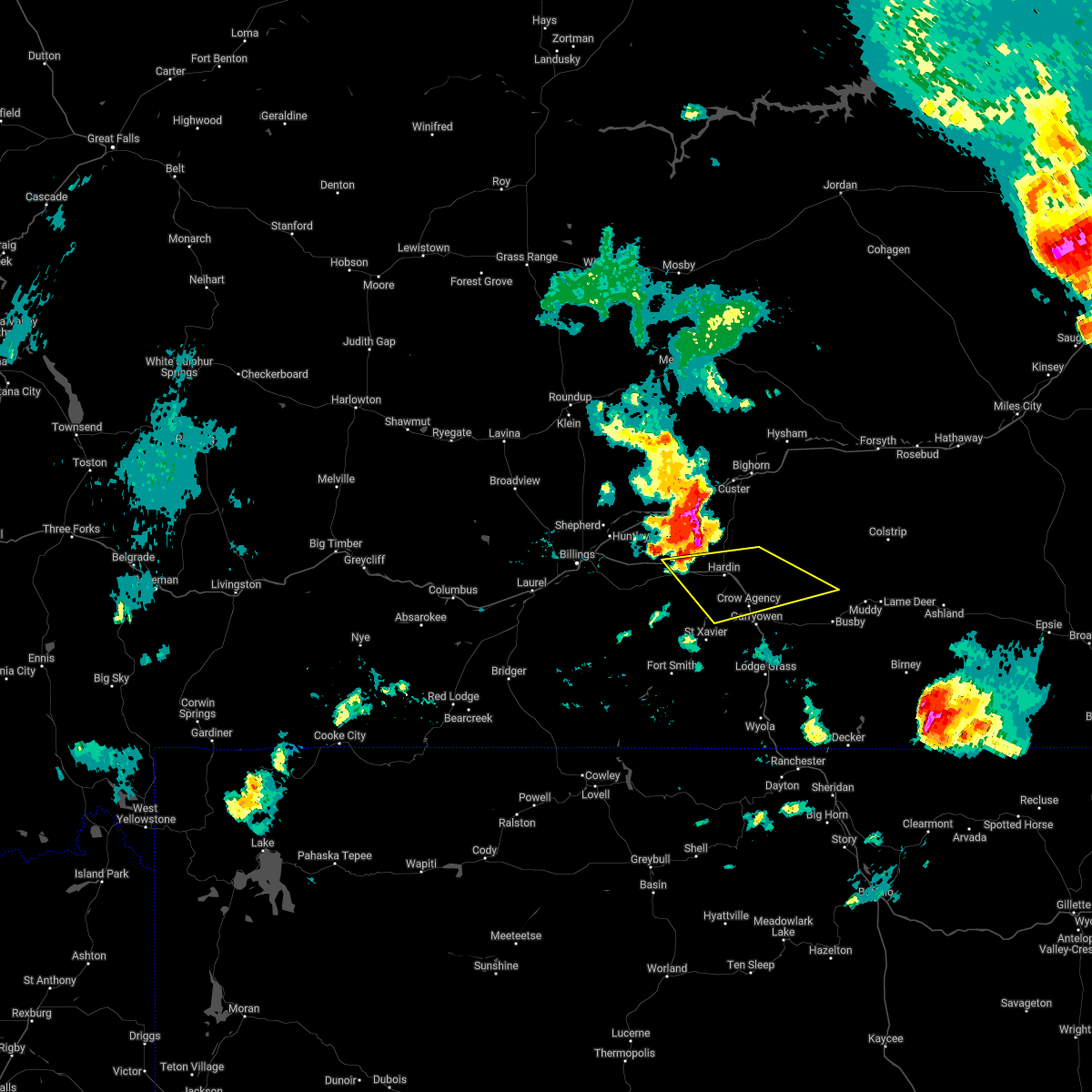 At 700 pm mdt, a severe thunderstorm was located near hardin, moving southeast at 35 mph (radar indicated). Hazards include 70 mph wind gusts and ping pong ball size hail. People and animals outdoors will be injured. expect hail damage to roofs, siding, windows, and vehicles. expect considerable tree damage. Wind damage is also likely to mobile homes, roofs, and outbuildings. At 700 pm mdt, a severe thunderstorm was located near hardin, moving southeast at 35 mph (radar indicated). Hazards include 70 mph wind gusts and ping pong ball size hail. People and animals outdoors will be injured. expect hail damage to roofs, siding, windows, and vehicles. expect considerable tree damage. Wind damage is also likely to mobile homes, roofs, and outbuildings.
|
| 6/11/2022 4:29 PM MDT | Quarter sized hail reported 2.2 miles NE of Hardin, MT |
| 6/11/2022 4:25 PM MDT | Storm damage reported in big horn county MT, 2.5 miles E of Hardin, MT |
| 6/11/2022 4:25 PM MDT | Trees blown down in yard. semi trailer flipped. time estimated based on rada in big horn county MT, 1.2 miles S of Hardin, MT |
| 6/11/2022 4:23 PM MDT |
 At 422 pm mdt, a severe thunderstorm was located just west of hardin, moving east southeast at 45 mph (radar indicated). Hazards include 60 mph wind gusts and quarter size hail, along with brief heavy rain. Hail damage to vehicles is expected. Expect wind damage to roofs, siding, and trees. At 422 pm mdt, a severe thunderstorm was located just west of hardin, moving east southeast at 45 mph (radar indicated). Hazards include 60 mph wind gusts and quarter size hail, along with brief heavy rain. Hail damage to vehicles is expected. Expect wind damage to roofs, siding, and trees.
|
| 7/7/2021 8:05 PM MDT |
 At 803 pm mdt, severe thunderstorms were located along a line extending from 18 miles south of melstone to 9 miles south of custer to hardin to near fort smith, moving east at 40 mph (radar indicated). Hazards include 70 mph wind gusts. Expect considerable tree damage. damage is likely to mobile homes, roofs, and outbuildings. locations impacted include, hardin, custer, fort smith, crow agency, pompeys pillar, st. xavier, bighorn lake, bighorn and crow indian reservation. This warning does not include the city of billings. At 803 pm mdt, severe thunderstorms were located along a line extending from 18 miles south of melstone to 9 miles south of custer to hardin to near fort smith, moving east at 40 mph (radar indicated). Hazards include 70 mph wind gusts. Expect considerable tree damage. damage is likely to mobile homes, roofs, and outbuildings. locations impacted include, hardin, custer, fort smith, crow agency, pompeys pillar, st. xavier, bighorn lake, bighorn and crow indian reservation. This warning does not include the city of billings.
|
| 7/7/2021 7:49 PM MDT |
 At 747 pm mdt, severe thunderstorms were located along a line extending from 13 miles northwest of melstone to 14 miles southwest of custer to 11 miles west of hardin to near fort smith, moving east at 50 mph (radar indicated). Hazards include 70 mph wind gusts. Expect considerable tree damage. damage is likely to mobile homes, roofs, and outbuildings. locations impacted include, hardin, custer, melstone, huntley, worden, fort smith, crow agency, ballantine, musselshell, pompeys pillar, bighorn, st. xavier, bighorn lake and crow indian reservation. This warning no longer includes the city of billings. At 747 pm mdt, severe thunderstorms were located along a line extending from 13 miles northwest of melstone to 14 miles southwest of custer to 11 miles west of hardin to near fort smith, moving east at 50 mph (radar indicated). Hazards include 70 mph wind gusts. Expect considerable tree damage. damage is likely to mobile homes, roofs, and outbuildings. locations impacted include, hardin, custer, melstone, huntley, worden, fort smith, crow agency, ballantine, musselshell, pompeys pillar, bighorn, st. xavier, bighorn lake and crow indian reservation. This warning no longer includes the city of billings.
|
| 7/7/2021 7:24 PM MDT |
 At 723 pm mdt, severe thunderstorms were located along a line extending from 12 miles southwest of flatwillow to near worden to 8 miles southeast of lockwood to 8 miles south of pryor, moving east at 40 mph (radar indicated. at 710 pm a gust of 73 mph was reported at the billings airport). Hazards include 75 mph wind gusts. Expect considerable tree damage. Damage is likely to mobile homes, roofs, and outbuildings. At 723 pm mdt, severe thunderstorms were located along a line extending from 12 miles southwest of flatwillow to near worden to 8 miles southeast of lockwood to 8 miles south of pryor, moving east at 40 mph (radar indicated. at 710 pm a gust of 73 mph was reported at the billings airport). Hazards include 75 mph wind gusts. Expect considerable tree damage. Damage is likely to mobile homes, roofs, and outbuildings.
|
| 7/7/2020 5:41 PM MDT |
 At 539 pm mdt, severe thunderstorms were located along a line extending from 18 miles south of edwards to hardin, moving east at 40 mph (radar indicated). Hazards include 70 mph wind gusts and quarter size hail. Hail damage to vehicles is expected. expect considerable tree damage. Wind damage is also likely to mobile homes, roofs, and outbuildings. At 539 pm mdt, severe thunderstorms were located along a line extending from 18 miles south of edwards to hardin, moving east at 40 mph (radar indicated). Hazards include 70 mph wind gusts and quarter size hail. Hail damage to vehicles is expected. expect considerable tree damage. Wind damage is also likely to mobile homes, roofs, and outbuildings.
|
| 7/7/2020 5:28 PM MDT |
 At 526 pm mdt, a severe thunderstorm was located 15 miles east of ballantine, or 21 miles northwest of hardin, moving east at 40 mph (radar indicated). Hazards include ping pong ball size hail and 60 mph wind gusts. People and animals outdoors will be injured. expect hail damage to roofs, siding, windows, and vehicles. expect wind damage to roofs, siding, and trees. locations impacted include, custer and pompeys pillar. the main storm will remain north of hardin, however strong wind gusts may push into the hardin area with gusts of 50 to 60 mph. This warning does not include the city of billings. At 526 pm mdt, a severe thunderstorm was located 15 miles east of ballantine, or 21 miles northwest of hardin, moving east at 40 mph (radar indicated). Hazards include ping pong ball size hail and 60 mph wind gusts. People and animals outdoors will be injured. expect hail damage to roofs, siding, windows, and vehicles. expect wind damage to roofs, siding, and trees. locations impacted include, custer and pompeys pillar. the main storm will remain north of hardin, however strong wind gusts may push into the hardin area with gusts of 50 to 60 mph. This warning does not include the city of billings.
|
| 7/7/2020 5:07 PM MDT |
 At 506 pm mdt, a severe thunderstorm was located over worden, or 21 miles northeast of billings, moving northeast at 40 mph (radar indicated. at 505 pm quarter size hail was reported near worden and shepherd). Hazards include 60 mph wind gusts and half dollar size hail. Hail damage to vehicles is expected. Expect wind damage to roofs, siding, and trees. At 506 pm mdt, a severe thunderstorm was located over worden, or 21 miles northeast of billings, moving northeast at 40 mph (radar indicated. at 505 pm quarter size hail was reported near worden and shepherd). Hazards include 60 mph wind gusts and half dollar size hail. Hail damage to vehicles is expected. Expect wind damage to roofs, siding, and trees.
|
| 7/3/2020 4:44 PM MDT |
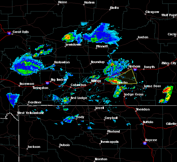 At 443 pm mdt, a severe thunderstorm was located near hardin, moving northeast at 35 mph (weather station. at 425 pm mdt, a 63 mph gust was reported at the big horn county airport). Hazards include 70 mph wind gusts and quarter size hail. Hail damage to vehicles is expected. expect considerable tree damage. wind damage is also likely to mobile homes, roofs, and outbuildings. this severe thunderstorm will remain over mainly rural areas of north central big horn and southeastern treasure counties. This replaces the warning previously in effect for this area. At 443 pm mdt, a severe thunderstorm was located near hardin, moving northeast at 35 mph (weather station. at 425 pm mdt, a 63 mph gust was reported at the big horn county airport). Hazards include 70 mph wind gusts and quarter size hail. Hail damage to vehicles is expected. expect considerable tree damage. wind damage is also likely to mobile homes, roofs, and outbuildings. this severe thunderstorm will remain over mainly rural areas of north central big horn and southeastern treasure counties. This replaces the warning previously in effect for this area.
|
| 7/3/2020 4:25 PM MDT | Storm damage reported in big horn county MT, 2.5 miles E of Hardin, MT |
| 7/3/2020 4:25 PM MDT |
 At 425 pm mdt, a severe thunderstorm was located 13 miles west of hardin, moving northeast at 35 mph (radar indicated). Hazards include 60 mph wind gusts and half dollar size hail. Hail damage to vehicles is expected. expect wind damage to roofs, siding, and trees. Locations impacted include, hardin. At 425 pm mdt, a severe thunderstorm was located 13 miles west of hardin, moving northeast at 35 mph (radar indicated). Hazards include 60 mph wind gusts and half dollar size hail. Hail damage to vehicles is expected. expect wind damage to roofs, siding, and trees. Locations impacted include, hardin.
|
| 7/3/2020 4:04 PM MDT |
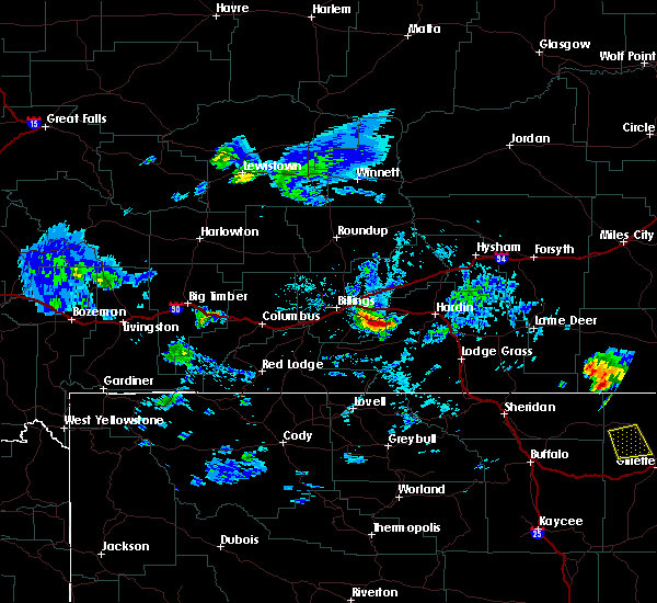 At 403 pm mdt, a severe thunderstorm was located 16 miles southeast of lockwood, or 20 miles east of billings, moving northeast at 35 mph (radar indicated). Hazards include 60 mph wind gusts and half dollar size hail. Hail damage to vehicles is expected. Expect wind damage to roofs, siding, and trees. At 403 pm mdt, a severe thunderstorm was located 16 miles southeast of lockwood, or 20 miles east of billings, moving northeast at 35 mph (radar indicated). Hazards include 60 mph wind gusts and half dollar size hail. Hail damage to vehicles is expected. Expect wind damage to roofs, siding, and trees.
|
| 8/11/2019 8:39 PM MDT |
 At 836 pm mdt, severe thunderstorms were located along a line extending from 12 miles southwest of hillside to 6 miles south of crow agency, moving east at 30 mph. another severe thunderstorm was located 5 miles east of muddy moving northeast at 20 mph (radar indicated). Hazards include ping pong ball size hail and 60 mph wind gusts. People and animals outdoors will be injured. expect hail damage to roofs, siding, windows, and vehicles. expect wind damage to roofs, siding, and trees. Locations impacted include, hardin, colstrip, forsyth, hysham, lame deer, busby, crow agency, rosebud, cartersville, birney village, vananda, muddy cluster, northern cheyenne indian reservation and crow indian reservation. At 836 pm mdt, severe thunderstorms were located along a line extending from 12 miles southwest of hillside to 6 miles south of crow agency, moving east at 30 mph. another severe thunderstorm was located 5 miles east of muddy moving northeast at 20 mph (radar indicated). Hazards include ping pong ball size hail and 60 mph wind gusts. People and animals outdoors will be injured. expect hail damage to roofs, siding, windows, and vehicles. expect wind damage to roofs, siding, and trees. Locations impacted include, hardin, colstrip, forsyth, hysham, lame deer, busby, crow agency, rosebud, cartersville, birney village, vananda, muddy cluster, northern cheyenne indian reservation and crow indian reservation.
|
| 8/11/2019 8:16 PM MDT |
 At 814 pm mdt, severe thunderstorms were located along a line extending from 17 miles southwest of cohagen to 11 miles west of crow agency, moving east at 30 mph. another severe thunderstorm was located 5 miles east of busby, moving east at 20 mph (radar indicated. these storms have a history of producing large hail and damaging winds). Hazards include 70 mph wind gusts and ping pong ball size hail. People and animals outdoors will be injured. expect hail damage to roofs, siding, windows, and vehicles. expect considerable tree damage. wind damage is also likely to mobile homes, roofs, and outbuildings. Locations impacted include, hardin, colstrip, forsyth, hysham, custer, lame deer, busby, crow agency, rosebud, bighorn, ingomar, cartersville, birney village, vananda, muddy cluster, northern cheyenne indian reservation and crow indian reservation. At 814 pm mdt, severe thunderstorms were located along a line extending from 17 miles southwest of cohagen to 11 miles west of crow agency, moving east at 30 mph. another severe thunderstorm was located 5 miles east of busby, moving east at 20 mph (radar indicated. these storms have a history of producing large hail and damaging winds). Hazards include 70 mph wind gusts and ping pong ball size hail. People and animals outdoors will be injured. expect hail damage to roofs, siding, windows, and vehicles. expect considerable tree damage. wind damage is also likely to mobile homes, roofs, and outbuildings. Locations impacted include, hardin, colstrip, forsyth, hysham, custer, lame deer, busby, crow agency, rosebud, bighorn, ingomar, cartersville, birney village, vananda, muddy cluster, northern cheyenne indian reservation and crow indian reservation.
|
| 8/11/2019 8:02 PM MDT |
 At 801 pm mdt, severe thunderstorms were located along a line extending from 20 miles southwest of cohagen to 13 miles southwest of hardin, moving east at 30 mph. another severe thunderstorm was located near busby, moving north at 25 mph (radar indicated). Hazards include golf ball size hail and 70 mph wind gusts. People and animals outdoors will be injured. expect hail damage to roofs, siding, windows, and vehicles. expect considerable tree damage. Wind damage is also likely to mobile homes, roofs, and outbuildings. At 801 pm mdt, severe thunderstorms were located along a line extending from 20 miles southwest of cohagen to 13 miles southwest of hardin, moving east at 30 mph. another severe thunderstorm was located near busby, moving north at 25 mph (radar indicated). Hazards include golf ball size hail and 70 mph wind gusts. People and animals outdoors will be injured. expect hail damage to roofs, siding, windows, and vehicles. expect considerable tree damage. Wind damage is also likely to mobile homes, roofs, and outbuildings.
|
| 8/11/2019 7:40 PM MDT |
 At 738 pm mdt, a severe thunderstorm was located near ballantine, or 23 miles east of billings, moving east at 40 mph (radar indicated. this storm has a history of producing larger than golf ball hail and wind gusts over 70 mph in the billings area). Hazards include two inch hail and 70 mph wind gusts. People and animals outdoors will be injured. expect hail damage to roofs, siding, windows, and vehicles. expect considerable tree damage. wind damage is also likely to mobile homes, roofs, and outbuildings. locations impacted include, hardin, custer, shepherd, huntley, worden, crow agency, ballantine, pompeys pillar, st. Xavier and crow indian reservation. At 738 pm mdt, a severe thunderstorm was located near ballantine, or 23 miles east of billings, moving east at 40 mph (radar indicated. this storm has a history of producing larger than golf ball hail and wind gusts over 70 mph in the billings area). Hazards include two inch hail and 70 mph wind gusts. People and animals outdoors will be injured. expect hail damage to roofs, siding, windows, and vehicles. expect considerable tree damage. wind damage is also likely to mobile homes, roofs, and outbuildings. locations impacted include, hardin, custer, shepherd, huntley, worden, crow agency, ballantine, pompeys pillar, st. Xavier and crow indian reservation.
|
| 8/11/2019 7:25 PM MDT |
 At 723 pm mdt, a severe thunderstorm was located over huntley, or 13 miles northeast of billings, moving east at 40 mph (radar indicated. this storm has a history of producing golf ball size hail and wind gusts over 70 mph in the billings area). Hazards include golf ball size hail and 70 mph wind gusts. People and animals outdoors will be injured. expect hail damage to roofs, siding, windows, and vehicles. expect considerable tree damage. Wind damage is also likely to mobile homes, roofs, and outbuildings. At 723 pm mdt, a severe thunderstorm was located over huntley, or 13 miles northeast of billings, moving east at 40 mph (radar indicated. this storm has a history of producing golf ball size hail and wind gusts over 70 mph in the billings area). Hazards include golf ball size hail and 70 mph wind gusts. People and animals outdoors will be injured. expect hail damage to roofs, siding, windows, and vehicles. expect considerable tree damage. Wind damage is also likely to mobile homes, roofs, and outbuildings.
|
| 8/4/2019 3:42 AM MDT |
 At 341 am mdt, a severe thunderstorm was located 10 miles northwest of hardin, moving east at 25 mph (radar indicated). Hazards include 60 mph wind gusts and quarter size hail. Hail damage to vehicles is expected. Expect wind damage to roofs, siding, and trees. At 341 am mdt, a severe thunderstorm was located 10 miles northwest of hardin, moving east at 25 mph (radar indicated). Hazards include 60 mph wind gusts and quarter size hail. Hail damage to vehicles is expected. Expect wind damage to roofs, siding, and trees.
|
| 6/20/2019 4:02 PM MDT |
 At 400 pm mdt, a severe thunderstorm was located 12 miles west of crow agency, or 13 miles south of hardin, moving northeast at 25 mph. storm is persisting and doesn`t look to weaken within the next half an hour (radar indicated). Hazards include 70 mph wind gusts and half dollar size hail. Hail damage to vehicles is expected. expect considerable tree damage. wind damage is also likely to mobile homes, roofs, and outbuildings. locations impacted include, hardin, crow agency and st. Xavier. At 400 pm mdt, a severe thunderstorm was located 12 miles west of crow agency, or 13 miles south of hardin, moving northeast at 25 mph. storm is persisting and doesn`t look to weaken within the next half an hour (radar indicated). Hazards include 70 mph wind gusts and half dollar size hail. Hail damage to vehicles is expected. expect considerable tree damage. wind damage is also likely to mobile homes, roofs, and outbuildings. locations impacted include, hardin, crow agency and st. Xavier.
|
| 6/20/2019 3:41 PM MDT |
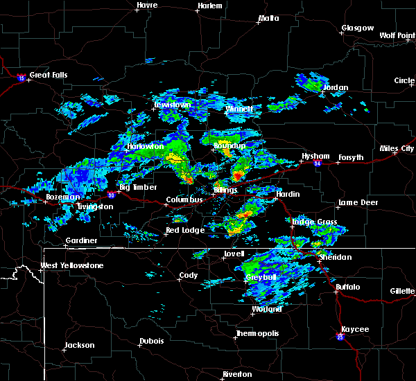 The national weather service in billings has issued a * severe thunderstorm warning for. central big horn county in south central montana. until 430 pm mdt. At 341 pm mdt, a severe thunderstorm was located 14 miles north of fort smith, or 19 miles southwest of hardin, moving east at 25 mph. The national weather service in billings has issued a * severe thunderstorm warning for. central big horn county in south central montana. until 430 pm mdt. At 341 pm mdt, a severe thunderstorm was located 14 miles north of fort smith, or 19 miles southwest of hardin, moving east at 25 mph.
|
| 8/3/2018 5:11 PM MDT |
 At 509 pm mdt, severe thunderstorms were located along a line extending from 6 miles northwest of hardin to 12 miles southeast of pryor, moving east at 50 mph (radar indicated). Hazards include 70 mph wind gusts. Expect considerable tree damage. damage is likely to mobile homes, roofs, and outbuildings. locations impacted include, hardin, crow agency, fort smith, st. xavier, bighorn lake and crow indian reservation. This warning does not include the city of billings. At 509 pm mdt, severe thunderstorms were located along a line extending from 6 miles northwest of hardin to 12 miles southeast of pryor, moving east at 50 mph (radar indicated). Hazards include 70 mph wind gusts. Expect considerable tree damage. damage is likely to mobile homes, roofs, and outbuildings. locations impacted include, hardin, crow agency, fort smith, st. xavier, bighorn lake and crow indian reservation. This warning does not include the city of billings.
|
| 8/3/2018 4:51 PM MDT |
 At 451 pm mdt, severe thunderstorms were located along a line extending from 17 miles southeast of ballantine to 14 miles south of pryor, moving east at 55 mph (radar indicated). Hazards include 70 mph wind gusts. Expect considerable tree damage. Damage is likely to mobile homes, roofs, and outbuildings. At 451 pm mdt, severe thunderstorms were located along a line extending from 17 miles southeast of ballantine to 14 miles south of pryor, moving east at 55 mph (radar indicated). Hazards include 70 mph wind gusts. Expect considerable tree damage. Damage is likely to mobile homes, roofs, and outbuildings.
|
| 7/2/2018 10:00 PM MDT | Quarter sized hail reported 1 miles NE of Hardin, MT |
| 7/2/2018 9:20 PM MDT |
 At 919 pm mdt, a severe thunderstorm was located near hardin, moving east at 40 mph (radar indicated). Hazards include golf ball size hail and 70 mph wind gusts. People and animals outdoors will be injured. expect hail damage to roofs, siding, windows, and vehicles. expect considerable tree damage. wind damage is also likely to mobile homes, roofs, and outbuildings. Locations impacted include, hardin and crow agency. At 919 pm mdt, a severe thunderstorm was located near hardin, moving east at 40 mph (radar indicated). Hazards include golf ball size hail and 70 mph wind gusts. People and animals outdoors will be injured. expect hail damage to roofs, siding, windows, and vehicles. expect considerable tree damage. wind damage is also likely to mobile homes, roofs, and outbuildings. Locations impacted include, hardin and crow agency.
|
| 7/2/2018 9:16 PM MDT | Quarter sized hail reported 7.5 miles NNE of Hardin, MT, 8 inch diameter tree limbs broken |
| 7/2/2018 9:16 PM MDT | 8 inch diameter tree limbs broken in big horn county MT, 7.5 miles NNE of Hardin, MT |
| 7/2/2018 9:05 PM MDT |
 At 904 pm mdt, a severe thunderstorm was located 7 miles southwest of hardin, moving east at 35 mph (radar indicated). Hazards include golf ball size hail and 70 mph wind gusts. People and animals outdoors will be injured. expect hail damage to roofs, siding, windows, and vehicles. expect considerable tree damage. wind damage is also likely to mobile homes, roofs, and outbuildings. this severe storm will be near, hardin around 915 pm mdt. crow agency around 925 pm mdt. other locations impacted by this severe thunderstorm include st. xavier and crow indian reservation. Severe thunderstorm wind gusts may arrive well ahead of the thunderstorm. At 904 pm mdt, a severe thunderstorm was located 7 miles southwest of hardin, moving east at 35 mph (radar indicated). Hazards include golf ball size hail and 70 mph wind gusts. People and animals outdoors will be injured. expect hail damage to roofs, siding, windows, and vehicles. expect considerable tree damage. wind damage is also likely to mobile homes, roofs, and outbuildings. this severe storm will be near, hardin around 915 pm mdt. crow agency around 925 pm mdt. other locations impacted by this severe thunderstorm include st. xavier and crow indian reservation. Severe thunderstorm wind gusts may arrive well ahead of the thunderstorm.
|
| 7/2/2018 8:44 PM MDT |
 At 843 pm mdt, a severe thunderstorm was located 20 miles west of hardin, moving east at 40 mph (radar indicated). Hazards include golf ball size hail and 70 mph wind gusts. People and animals outdoors will be injured. expect hail damage to roofs, siding, windows, and vehicles. expect considerable tree damage. Wind damage is also likely to mobile homes, roofs, and outbuildings. At 843 pm mdt, a severe thunderstorm was located 20 miles west of hardin, moving east at 40 mph (radar indicated). Hazards include golf ball size hail and 70 mph wind gusts. People and animals outdoors will be injured. expect hail damage to roofs, siding, windows, and vehicles. expect considerable tree damage. Wind damage is also likely to mobile homes, roofs, and outbuildings.
|
| 6/28/2018 8:53 PM MDT |
 At 852 pm mdt, a severe thunderstorm was located near hardin, moving northeast at 35 mph (radar indicated). Hazards include 60 mph wind gusts and quarter size hail. Hail damage to vehicles is expected. Expect wind damage to roofs, siding, and trees. At 852 pm mdt, a severe thunderstorm was located near hardin, moving northeast at 35 mph (radar indicated). Hazards include 60 mph wind gusts and quarter size hail. Hail damage to vehicles is expected. Expect wind damage to roofs, siding, and trees.
|
| 6/7/2018 4:55 PM MDT | Golf Ball sized hail reported 13 miles S of Hardin, MT, 20 ft tall aspen trees bending in half; pea to golf ball hail |
| 6/1/2018 11:00 AM MDT | Quarter sized hail reported 15.4 miles WSW of Hardin, MT |
| 6/1/2018 10:55 AM MDT |
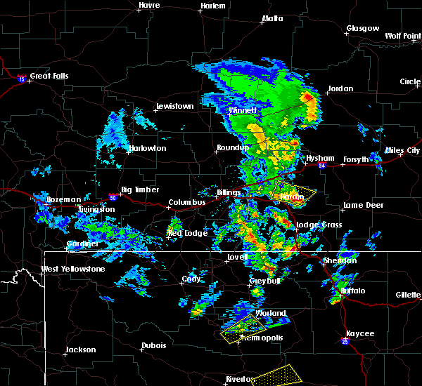 At 1054 am mdt, a severe thunderstorm was located 12 miles east of hardin, moving northeast at 40 mph (radar indicated). Hazards include 60 mph wind gusts and quarter size hail. Hail damage to vehicles is expected. expect wind damage to roofs, siding, and trees. This severe thunderstorm will remain over mainly rural areas of north central big horn county. At 1054 am mdt, a severe thunderstorm was located 12 miles east of hardin, moving northeast at 40 mph (radar indicated). Hazards include 60 mph wind gusts and quarter size hail. Hail damage to vehicles is expected. expect wind damage to roofs, siding, and trees. This severe thunderstorm will remain over mainly rural areas of north central big horn county.
|
| 6/1/2018 10:28 AM MDT |
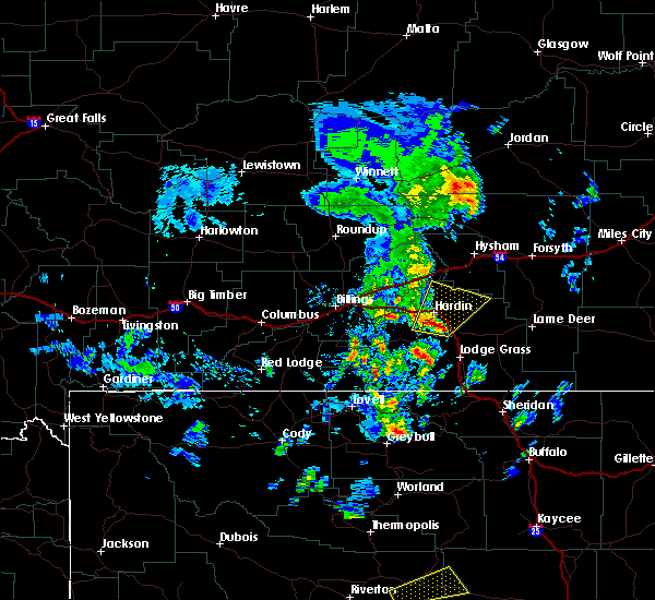 At 1027 am mdt, a severe thunderstorm was located near hardin, moving northeast at 30 mph (radar indicated). Hazards include 60 mph wind gusts and quarter size hail. Hail damage to vehicles is expected. Expect wind damage to roofs, siding, and trees. At 1027 am mdt, a severe thunderstorm was located near hardin, moving northeast at 30 mph (radar indicated). Hazards include 60 mph wind gusts and quarter size hail. Hail damage to vehicles is expected. Expect wind damage to roofs, siding, and trees.
|
| 5/26/2018 7:12 PM MDT |
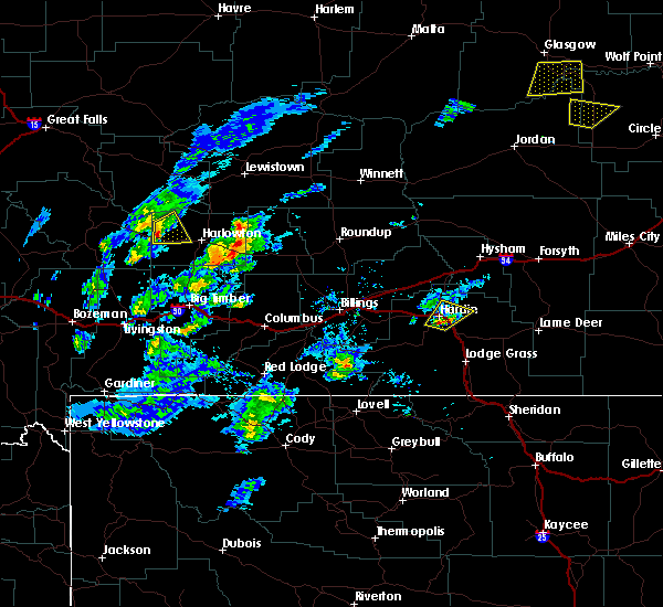 At 712 pm mdt, a severe thunderstorm was located near hardin, moving northeast at 35 mph (radar indicated). Hazards include 60 mph wind gusts and quarter size hail. Hail damage to vehicles is expected. expect wind damage to roofs, siding, and trees. Locations impacted include, hardin. At 712 pm mdt, a severe thunderstorm was located near hardin, moving northeast at 35 mph (radar indicated). Hazards include 60 mph wind gusts and quarter size hail. Hail damage to vehicles is expected. expect wind damage to roofs, siding, and trees. Locations impacted include, hardin.
|
| 5/26/2018 6:46 PM MDT |
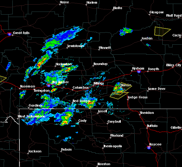 At 646 pm mdt, a severe thunderstorm was located 9 miles southwest of crow agency, or 12 miles south of hardin, moving north at 20 mph (radar indicated). Hazards include 60 mph wind gusts and quarter size hail. Hail damage to vehicles is expected. Expect wind damage to roofs, siding, and trees. At 646 pm mdt, a severe thunderstorm was located 9 miles southwest of crow agency, or 12 miles south of hardin, moving north at 20 mph (radar indicated). Hazards include 60 mph wind gusts and quarter size hail. Hail damage to vehicles is expected. Expect wind damage to roofs, siding, and trees.
|
| 5/23/2018 5:40 PM MDT |
 The severe thunderstorm warning for central big horn county will expire at 545 pm mdt, the storms which prompted the warning have weakened below severe limits, and no longer pose an immediate threat to life or property. therefore, the warning will be allowed to expire. however small hail and gusty winds are still possible with these thunderstorms. The severe thunderstorm warning for central big horn county will expire at 545 pm mdt, the storms which prompted the warning have weakened below severe limits, and no longer pose an immediate threat to life or property. therefore, the warning will be allowed to expire. however small hail and gusty winds are still possible with these thunderstorms.
|
| 5/23/2018 5:19 PM MDT |
 At 519 pm mdt, severe thunderstorms were located along a line extending from 14 miles south of custer to 8 miles east of lodge grass, moving northeast at 35 mph (radar indicated). Hazards include 60 mph wind gusts and quarter size hail. Hail damage to vehicles is expected. expect wind damage to roofs, siding, and trees. Locations impacted include, hardin, lodge grass, crow agency, wyola and rosebud battlefield park. At 519 pm mdt, severe thunderstorms were located along a line extending from 14 miles south of custer to 8 miles east of lodge grass, moving northeast at 35 mph (radar indicated). Hazards include 60 mph wind gusts and quarter size hail. Hail damage to vehicles is expected. expect wind damage to roofs, siding, and trees. Locations impacted include, hardin, lodge grass, crow agency, wyola and rosebud battlefield park.
|
| 5/23/2018 4:42 PM MDT |
 At 442 pm mdt, severe thunderstorms were located along a line extending from 7 miles southwest of hardin to 15 miles northwest of dayton, moving northeast at 40 mph (radar indicated). Hazards include 60 mph wind gusts and half dollar size hail. Hail damage to vehicles is expected. Expect wind damage to roofs, siding, and trees. At 442 pm mdt, severe thunderstorms were located along a line extending from 7 miles southwest of hardin to 15 miles northwest of dayton, moving northeast at 40 mph (radar indicated). Hazards include 60 mph wind gusts and half dollar size hail. Hail damage to vehicles is expected. Expect wind damage to roofs, siding, and trees.
|
| 5/7/2018 3:56 PM MDT |
 The severe thunderstorm warning for northeastern big horn and southeastern treasure counties will expire at 400 pm mdt, the severe thunderstorm which prompted the warning has weakened. therefore, the warning will be allowed to expire. The severe thunderstorm warning for northeastern big horn and southeastern treasure counties will expire at 400 pm mdt, the severe thunderstorm which prompted the warning has weakened. therefore, the warning will be allowed to expire.
|
| 5/7/2018 3:30 PM MDT |
 A severe thunderstorm warning remains in effect until 400 pm mdt for northeastern big horn and southeastern treasure counties. at 326 pm mdt, a line of severe thunderstorms was located from 9 miles southeast of custer to just south of hardin, moving east at 20 mph. hazard. 60 mph wind gusts and quarter size hail. There have been a. A severe thunderstorm warning remains in effect until 400 pm mdt for northeastern big horn and southeastern treasure counties. at 326 pm mdt, a line of severe thunderstorms was located from 9 miles southeast of custer to just south of hardin, moving east at 20 mph. hazard. 60 mph wind gusts and quarter size hail. There have been a.
|
| 5/7/2018 3:00 PM MDT |
 At 259 pm mdt, a severe thunderstorm was located 7 miles southwest of custer, or 20 miles north of hardin, moving east at 15 mph (radar indicated). Hazards include 60 mph wind gusts and quarter size hail. Hail damage to vehicles is expected. Expect wind damage to roofs, siding, and trees. At 259 pm mdt, a severe thunderstorm was located 7 miles southwest of custer, or 20 miles north of hardin, moving east at 15 mph (radar indicated). Hazards include 60 mph wind gusts and quarter size hail. Hail damage to vehicles is expected. Expect wind damage to roofs, siding, and trees.
|
| 8/1/2017 10:40 PM MDT |
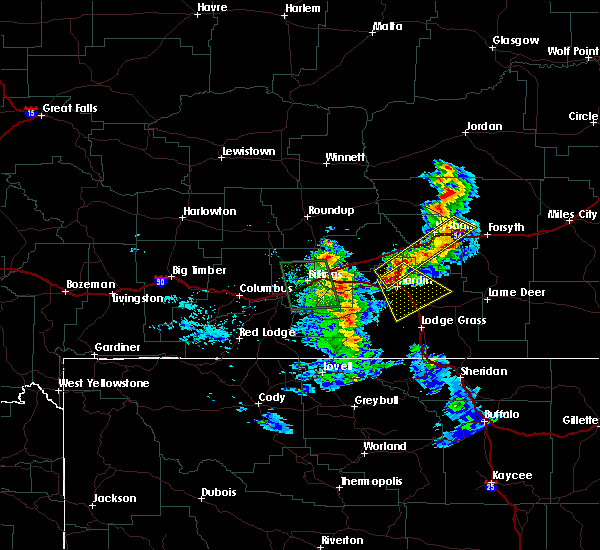 At 1039 pm mdt, a severe thunderstorm was located near hardin, moving southeast at 25 mph (radar indicated). Hazards include 60 mph wind gusts and quarter size hail. Hail damage to vehicles is expected. Expect wind damage to roofs, siding, and trees. At 1039 pm mdt, a severe thunderstorm was located near hardin, moving southeast at 25 mph (radar indicated). Hazards include 60 mph wind gusts and quarter size hail. Hail damage to vehicles is expected. Expect wind damage to roofs, siding, and trees.
|
| 7/6/2017 6:19 PM MDT |
 At 616 pm mdt, severe thunderstorm wind gusts were located along a line extending from 9 miles east of melstone to near hardin to 7 miles southwest of fort smith, moving east at 40 mph (radar indicated). Hazards include 60 mph wind gusts. Expect damage to roofs, siding, and trees. a severe thunderstorm was also located near saint xavier moving east at 20 mph. this storm was producing quarter size hail in addition to damaging wind gusts. locations impacted include, hardin, hysham, custer, melstone, fort smith, crow agency, st. Xavier, bighorn, ingomar, pompeys pillar and crow indian reservation. At 616 pm mdt, severe thunderstorm wind gusts were located along a line extending from 9 miles east of melstone to near hardin to 7 miles southwest of fort smith, moving east at 40 mph (radar indicated). Hazards include 60 mph wind gusts. Expect damage to roofs, siding, and trees. a severe thunderstorm was also located near saint xavier moving east at 20 mph. this storm was producing quarter size hail in addition to damaging wind gusts. locations impacted include, hardin, hysham, custer, melstone, fort smith, crow agency, st. Xavier, bighorn, ingomar, pompeys pillar and crow indian reservation.
|
| 7/6/2017 5:59 PM MDT |
 At 556 pm mdt, severe thunderstorm wind gusts were located along a line extending from melstone to 12 miles west of hardin to 12 miles southeast of pryor, moving east at 45 mph (radar indicated. gusts to 60 mph were reported in the billings area as this activity moved through). Hazards include 55 to 65 mph wind gusts. Expect damage to roofs, siding, and trees. locations impacted include, hardin, hysham, custer, melstone, pryor, worden, fort smith, crow agency, ballantine, musselshell, pompeys pillar, bighorn, ingomar, st. xavier and crow indian reservation. This does not include the city of billings. At 556 pm mdt, severe thunderstorm wind gusts were located along a line extending from melstone to 12 miles west of hardin to 12 miles southeast of pryor, moving east at 45 mph (radar indicated. gusts to 60 mph were reported in the billings area as this activity moved through). Hazards include 55 to 65 mph wind gusts. Expect damage to roofs, siding, and trees. locations impacted include, hardin, hysham, custer, melstone, pryor, worden, fort smith, crow agency, ballantine, musselshell, pompeys pillar, bighorn, ingomar, st. xavier and crow indian reservation. This does not include the city of billings.
|
| 7/6/2017 5:43 PM MDT |
 At 541 pm mdt, a line of severe thunderstorm winds was located from 14 miles west of melstone to 11 miles south of ballantine to 8 miles southwest of pryor, moving east at 45 mph (radar indicated. damaging wind gusts to 60 mph have been reported with these storms in the billings area). Hazards include 55 to 65 mph wind gusts. expect damage to roofs, siding, and trees At 541 pm mdt, a line of severe thunderstorm winds was located from 14 miles west of melstone to 11 miles south of ballantine to 8 miles southwest of pryor, moving east at 45 mph (radar indicated. damaging wind gusts to 60 mph have been reported with these storms in the billings area). Hazards include 55 to 65 mph wind gusts. expect damage to roofs, siding, and trees
|
| 7/27/2016 4:10 PM MDT |
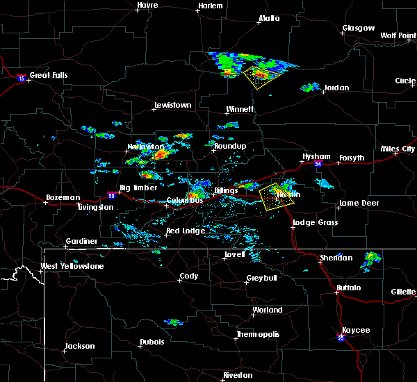 At 407 pm mdt, a severe thunderstorm was located near 5 miles north of hardin, moving southeast at 35 mph (radar indicated). Hazards include 60 mph wind gusts and quarter size hail. this storm has a history of producing hail up to 2 inches in diameter. Hail damage to vehicles is expected. expect wind damage to roofs, siding, and trees. Locations impacted include, hardin. At 407 pm mdt, a severe thunderstorm was located near 5 miles north of hardin, moving southeast at 35 mph (radar indicated). Hazards include 60 mph wind gusts and quarter size hail. this storm has a history of producing hail up to 2 inches in diameter. Hail damage to vehicles is expected. expect wind damage to roofs, siding, and trees. Locations impacted include, hardin.
|
| 7/27/2016 3:39 PM MDT |
 At 338 pm mdt, a severe thunderstorm was located 20 miles northwest of hardin, moving southeast at 30 mph (trained weather spotters. golf ball size hail has been reported with this storm). Hazards include golf ball size hail and 60 mph wind gusts. People and animals outdoors will be injured. expect hail damage to roofs, siding, windows, and vehicles. Expect wind damage to roofs, siding, and trees. At 338 pm mdt, a severe thunderstorm was located 20 miles northwest of hardin, moving southeast at 30 mph (trained weather spotters. golf ball size hail has been reported with this storm). Hazards include golf ball size hail and 60 mph wind gusts. People and animals outdoors will be injured. expect hail damage to roofs, siding, windows, and vehicles. Expect wind damage to roofs, siding, and trees.
|
| 7/15/2016 9:41 PM MDT |
 At 939 pm mdt, severe thunderstorms were located along a line extending from 9 miles southwest of custer to 8 miles west of lodge grass, moving east at 35 mph (trained weather spotters). Hazards include 60 mph wind gusts and nickel size hail. Expect frequent deadly lightning. heavy downpours and wind damage to trees and fences. locations impacted include, hardin, custer, lodge grass, worden, ballantine, lockwood, crow agency, shepherd, busby, huntley, st. Xavier, kirby, pompeys pillar, crow indian reservation and northern cheyenne indian reservation. At 939 pm mdt, severe thunderstorms were located along a line extending from 9 miles southwest of custer to 8 miles west of lodge grass, moving east at 35 mph (trained weather spotters). Hazards include 60 mph wind gusts and nickel size hail. Expect frequent deadly lightning. heavy downpours and wind damage to trees and fences. locations impacted include, hardin, custer, lodge grass, worden, ballantine, lockwood, crow agency, shepherd, busby, huntley, st. Xavier, kirby, pompeys pillar, crow indian reservation and northern cheyenne indian reservation.
|
| 7/15/2016 9:04 PM MDT |
 At 900 pm mdt, severe thunderstorms were located along a line extending from 7 miles north of worden to 9 miles northwest of fort smith, moving east at 35 mph (trained weather spotters). Hazards include 60 mph wind gusts and nickel size hail. Deadly lightning. wind damage to trees and fences. Street flooding and ponding of water on roads. At 900 pm mdt, severe thunderstorms were located along a line extending from 7 miles north of worden to 9 miles northwest of fort smith, moving east at 35 mph (trained weather spotters). Hazards include 60 mph wind gusts and nickel size hail. Deadly lightning. wind damage to trees and fences. Street flooding and ponding of water on roads.
|
| 6/13/2016 1:30 PM MDT | Quarter sized hail reported 1.6 miles NNW of Hardin, MT |
| 5/25/2016 3:34 PM MDT |
 At 334 pm mdt, a severe thunderstorm was located near hardin, moving east at 20 mph (radar indicated). Hazards include 60 mph wind gusts and quarter size hail. Hail damage to vehicles is expected. Expect wind damage to roofs, siding, and trees. At 334 pm mdt, a severe thunderstorm was located near hardin, moving east at 20 mph (radar indicated). Hazards include 60 mph wind gusts and quarter size hail. Hail damage to vehicles is expected. Expect wind damage to roofs, siding, and trees.
|
| 8/5/2015 7:57 PM MDT | The severe thunderstorm warning for east central yellowstone and north central big horn counties will expire at 800 pm mdt, the storms which prompted the warning have moved out of the area. therefore the warning will be allowed to expire. |
| 8/5/2015 7:27 PM MDT |
 At 724 pm mdt, severe thunderstorms were located along a line extending from 16 miles northwest of custer to just west of hardin, moving east at 35 mph (radar indicated). Hazards include 60 mph wind gusts and penny size hail. Expect wind damage to roofs. siding and trees. locations impacted include, hardin, custer and pompeys pillar. these storms are moving along i-94 from pompeys pillar to custer, and i-90 near hardin. These storms have a history of producing 60 to 70 mph winds. At 724 pm mdt, severe thunderstorms were located along a line extending from 16 miles northwest of custer to just west of hardin, moving east at 35 mph (radar indicated). Hazards include 60 mph wind gusts and penny size hail. Expect wind damage to roofs. siding and trees. locations impacted include, hardin, custer and pompeys pillar. these storms are moving along i-94 from pompeys pillar to custer, and i-90 near hardin. These storms have a history of producing 60 to 70 mph winds.
|
| 8/5/2015 6:58 PM MDT |
 At 655 pm mdt, severe thunderstorms were located along a line extending from 9 miles northwest of worden to 20 miles north of fort smith, moving northeast at 45 mph (radar indicated. these storms have a history of producing 60 to 70 mph winds). Hazards include 65 mph wind gusts and penny size hail. Hail damage to vehicles is expected. Expect wind damage to roofs, siding and trees. At 655 pm mdt, severe thunderstorms were located along a line extending from 9 miles northwest of worden to 20 miles north of fort smith, moving northeast at 45 mph (radar indicated. these storms have a history of producing 60 to 70 mph winds). Hazards include 65 mph wind gusts and penny size hail. Hail damage to vehicles is expected. Expect wind damage to roofs, siding and trees.
|
| 6/19/2015 5:41 PM MDT |
 At 540 pm mdt, a severe thunderstorm was located 7 miles southeast of crow agency, or 19 miles southeast of hardin, moving east at 50 mph. this is a very dangerous storm (radar indicated). Hazards include 80 mph wind gusts and golf ball size hail. Flying debris will be dangerous to those caught without shelter. mobile homes will be heavily damaged. expect considerable damage to roofs, windows and vehicles. extensive tree damage and power outages are likely. locations impacted include, hardin, crow agency, busby and northern cheyenne indian reservation. A tornado watch remains in effect until 1000 pm mdt for south central montana. At 540 pm mdt, a severe thunderstorm was located 7 miles southeast of crow agency, or 19 miles southeast of hardin, moving east at 50 mph. this is a very dangerous storm (radar indicated). Hazards include 80 mph wind gusts and golf ball size hail. Flying debris will be dangerous to those caught without shelter. mobile homes will be heavily damaged. expect considerable damage to roofs, windows and vehicles. extensive tree damage and power outages are likely. locations impacted include, hardin, crow agency, busby and northern cheyenne indian reservation. A tornado watch remains in effect until 1000 pm mdt for south central montana.
|
| 6/19/2015 5:19 PM MDT |
 At 518 pm mdt, a severe thunderstorm was located 10 miles southwest of hardin, moving east at 40 mph (radar indicated). Hazards include 70 mph wind gusts and quarter size hail. Hail damage to vehicles is expected. expect considerable tree damage. Wind damage is also likely to mobile homes, roofs and outbuildings. At 518 pm mdt, a severe thunderstorm was located 10 miles southwest of hardin, moving east at 40 mph (radar indicated). Hazards include 70 mph wind gusts and quarter size hail. Hail damage to vehicles is expected. expect considerable tree damage. Wind damage is also likely to mobile homes, roofs and outbuildings.
|
| 6/19/2015 5:13 PM MDT |
 At 512 pm mdt, a severe thunderstorm was located 14 miles west of hardin, moving east at 45 mph (radar indicated). Hazards include 70 mph wind gusts and ping pong ball size hail. People and animals outdoors will be injured. expect hail damage to roofs, siding, windows and vehicles. expect considerable tree damage. wind damage is also likely to mobile homes, roofs and outbuildings. locations impacted include, hardin and crow indian reservation. A tornado watch remains in effect until 1000 pm mdt for south central montana. At 512 pm mdt, a severe thunderstorm was located 14 miles west of hardin, moving east at 45 mph (radar indicated). Hazards include 70 mph wind gusts and ping pong ball size hail. People and animals outdoors will be injured. expect hail damage to roofs, siding, windows and vehicles. expect considerable tree damage. wind damage is also likely to mobile homes, roofs and outbuildings. locations impacted include, hardin and crow indian reservation. A tornado watch remains in effect until 1000 pm mdt for south central montana.
|
| 6/19/2015 4:57 PM MDT |
 At 455 pm mdt, a severe thunderstorm was located 13 miles southeast of lockwood, or 17 miles east of billings, moving east at 40 mph (radar indicated). Hazards include 70 mph wind gusts and ping pong ball size hail and torrential rainfall. this storm has a history of producing half dollar to golf ball size hail, wind gusts to 70 mph and torrential rainfall. People and animals outdoors will be injured. expect hail damage to roofs, siding, windows and vehicles. expect considerable tree damage. wind damage is also likely to mobile homes, roofs and outbuildings. locations impacted include, hardin and crow indian reservation. A tornado watch remains in effect until 1000 pm mdt for south central montana. At 455 pm mdt, a severe thunderstorm was located 13 miles southeast of lockwood, or 17 miles east of billings, moving east at 40 mph (radar indicated). Hazards include 70 mph wind gusts and ping pong ball size hail and torrential rainfall. this storm has a history of producing half dollar to golf ball size hail, wind gusts to 70 mph and torrential rainfall. People and animals outdoors will be injured. expect hail damage to roofs, siding, windows and vehicles. expect considerable tree damage. wind damage is also likely to mobile homes, roofs and outbuildings. locations impacted include, hardin and crow indian reservation. A tornado watch remains in effect until 1000 pm mdt for south central montana.
|
| 6/19/2015 4:37 PM MDT |
 At 435 pm mdt, a severe thunderstorm was located near billings west end, or near billings, and is nearly stationary (radar indicated). Hazards include golf ball size hail and 70 mph wind gusts and torrential rainfall. this storm produced golf ball size hail and briarwood. People and animals outdoors will be injured. expect hail damage to roofs, siding, windows and vehicles. expect considerable tree damage. wind damage is also likely to mobile homes, roofs and outbuildings. locations impacted include, billings, hardin, billings heights, lockwood, billings west end and crow indian reservation. A tornado watch remains in effect until 1000 pm mdt for south central montana. At 435 pm mdt, a severe thunderstorm was located near billings west end, or near billings, and is nearly stationary (radar indicated). Hazards include golf ball size hail and 70 mph wind gusts and torrential rainfall. this storm produced golf ball size hail and briarwood. People and animals outdoors will be injured. expect hail damage to roofs, siding, windows and vehicles. expect considerable tree damage. wind damage is also likely to mobile homes, roofs and outbuildings. locations impacted include, billings, hardin, billings heights, lockwood, billings west end and crow indian reservation. A tornado watch remains in effect until 1000 pm mdt for south central montana.
|
| 6/19/2015 4:30 PM MDT |
 At 429 pm mdt, a severe thunderstorm was located near billings, moving east at 45 mph (radar indicated). Hazards include quarter size hail and torrential rainfall. damage to vehicles is expected At 429 pm mdt, a severe thunderstorm was located near billings, moving east at 45 mph (radar indicated). Hazards include quarter size hail and torrential rainfall. damage to vehicles is expected
|
| 5/16/2015 7:31 PM MDT | Half Dollar sized hail reported 4 miles S of Hardin, MT |
| 5/18/2014 6:30 PM MDT | Half Dollar sized hail reported 0.4 miles WNW of Hardin, MT |
| 5/18/2014 6:08 PM MDT | Golf Ball sized hail reported 1.2 miles S of Hardin, MT |
| 5/18/2014 6:02 PM MDT | Golf Ball sized hail reported 1 miles NE of Hardin, MT |
| 5/18/2014 6:00 PM MDT | Golf Ball sized hail reported 0.9 miles N of Hardin, MT |
| 5/18/2014 5:58 PM MDT | Golf Ball sized hail reported 0.6 miles SW of Hardin, MT |
| 5/5/2014 5:45 PM MDT | Quarter sized hail reported 0.4 miles WNW of Hardin, MT, updated report - em reported largest hail of 1 inch with wind gusts to 44 mph |
| 5/5/2014 5:35 PM MDT | Quarter sized hail reported 1.9 miles NE of Hardin, MT, hail covering the ground...up to 1 inch in diameter |
| 8/1/2013 9:28 PM MDT | Quarter sized hail reported 1.4 miles NE of Hardin, MT |
| 8/1/2013 9:24 PM MDT | Quarter sized hail reported 1.4 miles NE of Hardin, MT |
| 7/8/2013 5:30 PM MDT | Power outage due to power pole being snapped. power also out north of hardin due to falling tree limbs taking out power line in big horn county MT, 0.9 miles N of Hardin, MT |
| 6/24/2013 4:50 PM MDT | Quarter sized hail reported 0.9 miles N of Hardin, MT |
| 6/24/2013 4:41 PM MDT | Quarter sized hail reported 0.2 miles NNE of Hardin, MT |
| 6/8/2012 10:51 PM MDT | Quarter sized hail reported 19 miles SSW of Hardin, MT |
| 1/1/0001 12:00 AM | Winds at 75 mph driving dime size hail. heavy damage to home. power poles blown down. 300 acres sugar beet crop destroyed. numerous vehicles with broken windows seen on in big horn county MT, 7.4 miles S of Hardin, MT |
| 1/1/0001 12:00 AM | Broken windows due to hail and rain. hail size unknown. crops flattened. sheds blown ove in big horn county MT, 8.1 miles S of Hardin, MT |
| 1/1/0001 12:00 AM | Large tree downed in tow in big horn county MT, 0.9 miles N of Hardin, MT |
| 1/1/0001 12:00 AM | Quarter sized hail reported 1.2 miles S of Hardin, MT, quarters and larger. |
| 1/1/0001 12:00 AM | Power lines down in hardin in big horn county MT, 0.9 miles N of Hardin, MT |
| 1/1/0001 12:00 AM | Storm damage reported in big horn county MT, 0.4 miles WNW of Hardin, MT |
| 1/1/0001 12:00 AM | Winds blew over several fences in town and broke tree limbs. roof to the western motel was blown off in addition to several large trees being uprooted and many power li in big horn county MT, 0.9 miles N of Hardin, MT |
| 1/1/0001 12:00 AM | Tops of trees and 8 inch limbs broken off in big horn county MT, 1.4 miles NE of Hardin, MT |
Hail Maps for Hardin, MT
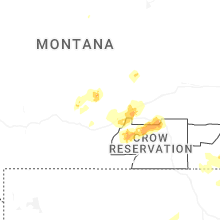
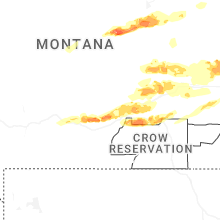
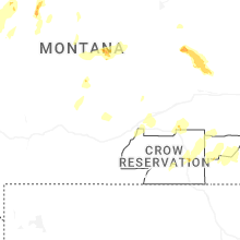
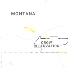
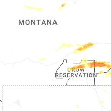
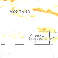


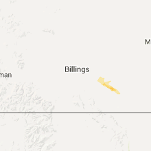


Connect with Interactive Hail Maps