

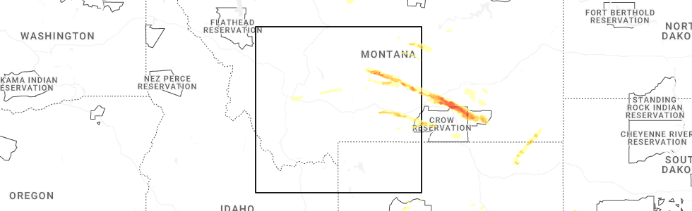
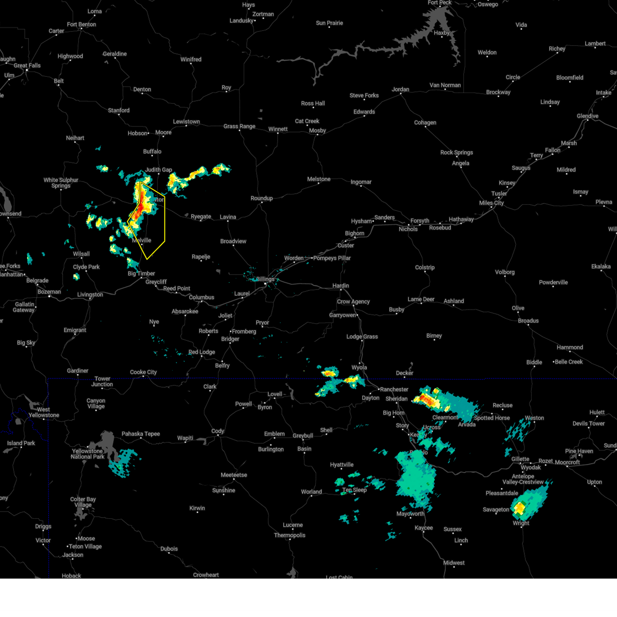
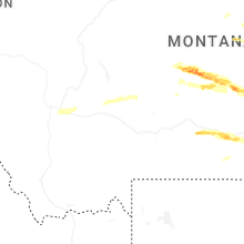
Hail Map for Harlowton, MT
The Harlowton, MT area has had 11 reports of on-the-ground hail by trained spotters, and has been under severe weather warnings 6 times during the past 12 months. Doppler radar has detected hail at or near Harlowton, MT on 38 occasions, including 2 occasions during the past year.
| Name: | Harlowton, MT |
| Where Located: | 77.8 miles NE of Bozeman, MT |
| Map: | Google Map for Harlowton, MT |
| Population: | 997 |
| Housing Units: | 585 |
| More Info: | Search Google for Harlowton, MT |
0
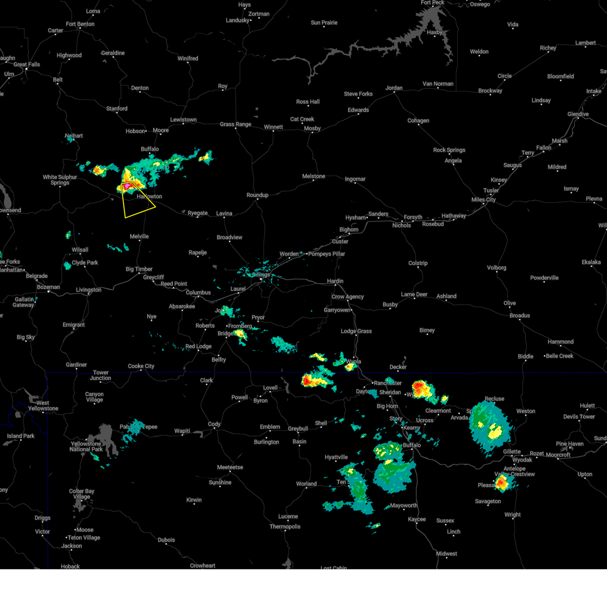
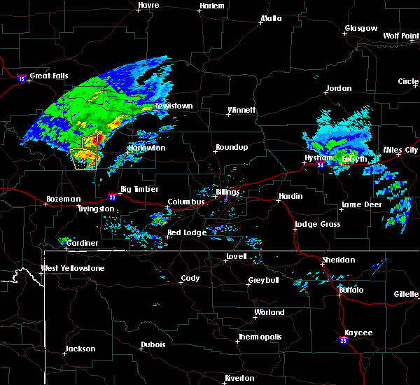
The Top Recent Hail Date for Harlowton, MT is Friday, June 13, 2025 (23rd out of 38)
Hail and Wind Damage Spotted near Harlowton, MT
| Date / Time | Report Details |
|---|---|
| 6/13/2025 3:20 PM MDT | Ping Pong Ball sized hail reported 0.7 miles WSW of Harlowton, MT |
| 6/13/2025 3:10 PM MDT | Corrects previous non-tstm wnd dmg report from harlowton. power lines down with some power outages reporte in wheatland county MT, 0.3 miles SW of Harlowton, MT |
| 6/13/2025 3:08 PM MDT |
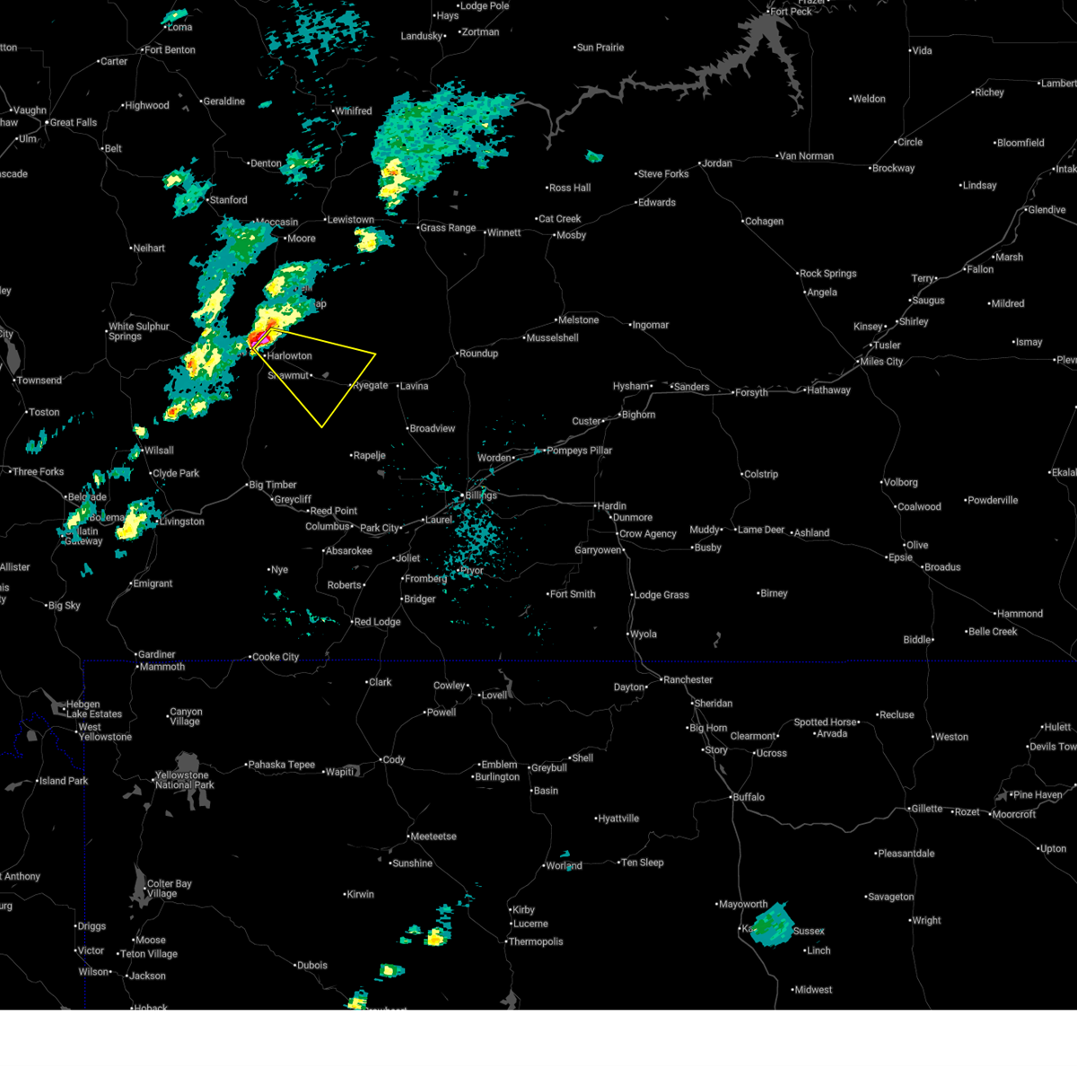 Svrbyz the national weather service in billings has issued a * severe thunderstorm warning for, southwestern golden valley county in central montana, southeastern wheatland county in central montana, * until 415 pm mdt. * at 308 pm mdt, a severe thunderstorm was located near harlowton, moving east at 30 mph (radar indicated). Hazards include tennis ball size hail and 70 mph wind gusts. People and animals outdoors will be injured. expect hail damage to roofs, siding, windows, and vehicles. expect considerable tree damage. Wind damage is also likely to mobile homes, roofs, and outbuildings. Svrbyz the national weather service in billings has issued a * severe thunderstorm warning for, southwestern golden valley county in central montana, southeastern wheatland county in central montana, * until 415 pm mdt. * at 308 pm mdt, a severe thunderstorm was located near harlowton, moving east at 30 mph (radar indicated). Hazards include tennis ball size hail and 70 mph wind gusts. People and animals outdoors will be injured. expect hail damage to roofs, siding, windows, and vehicles. expect considerable tree damage. Wind damage is also likely to mobile homes, roofs, and outbuildings.
|
| 6/13/2025 3:05 PM MDT | Hen Egg sized hail reported 3.9 miles SW of Harlowton, MT |
| 6/13/2025 3:05 PM MDT | Em report of multiple structures with lost roofs... uprooted trees as well as tree limb damag in wheatland county MT, 3.1 miles WSW of Harlowton, MT |
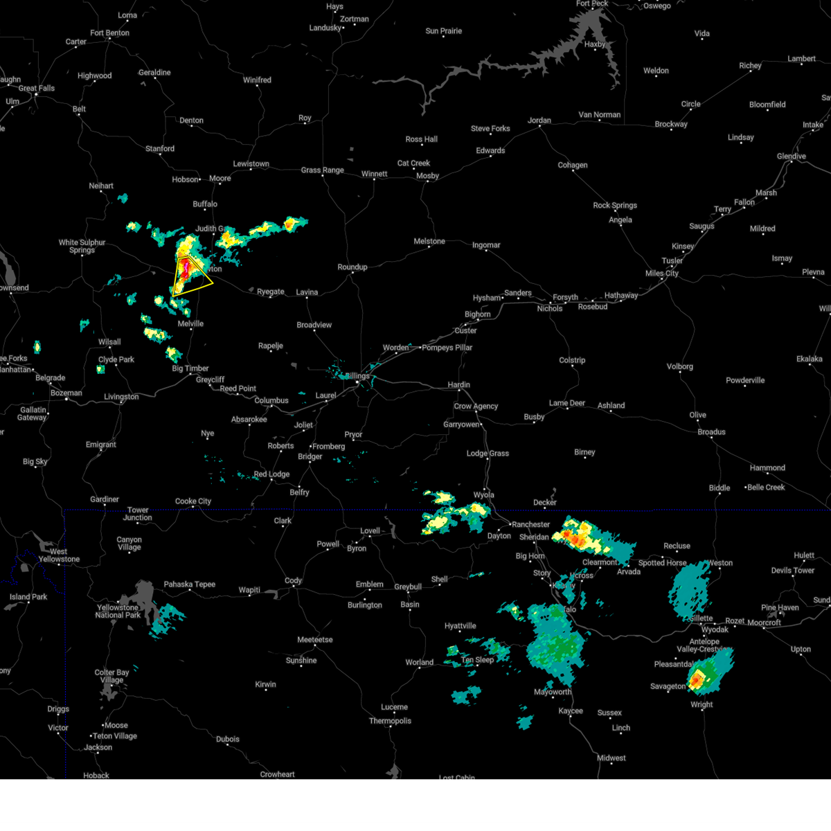
| 6/13/2025 2:42 PM MDT |
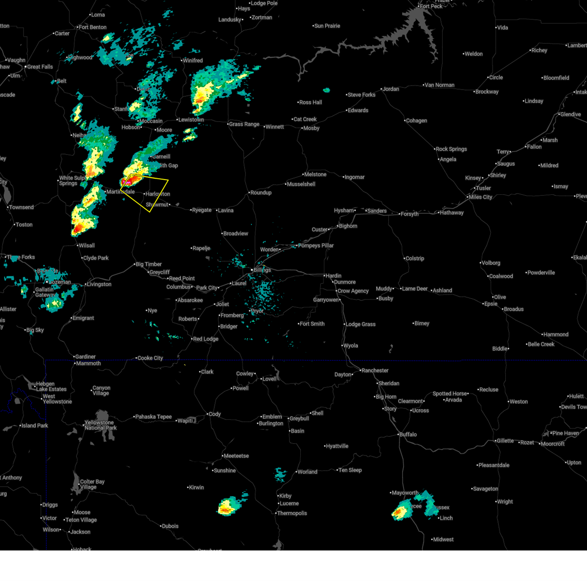 At 242 pm mdt, a severe thunderstorm was located 9 miles west of harlowton, moving southeast at 20 mph (radar indicated). Hazards include two inch hail and 60 mph wind gusts. People and animals outdoors will be injured. expect hail damage to roofs, siding, windows, and vehicles. expect wind damage to roofs, siding, and trees. Locations impacted include, harlowton. At 242 pm mdt, a severe thunderstorm was located 9 miles west of harlowton, moving southeast at 20 mph (radar indicated). Hazards include two inch hail and 60 mph wind gusts. People and animals outdoors will be injured. expect hail damage to roofs, siding, windows, and vehicles. expect wind damage to roofs, siding, and trees. Locations impacted include, harlowton.
|
| 6/13/2025 2:16 PM MDT |
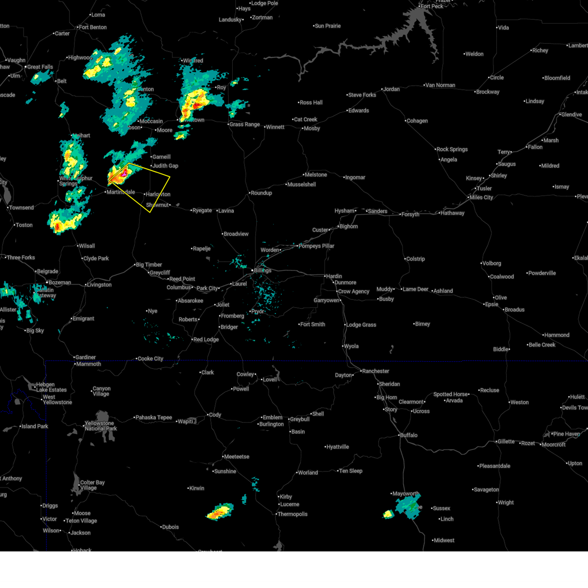 Svrbyz the national weather service in billings has issued a * severe thunderstorm warning for, central wheatland county in central montana, * until 315 pm mdt. * at 216 pm mdt, a severe thunderstorm was located 15 miles northwest of harlowton, moving east at 25 mph (radar indicated). Hazards include golf ball size hail and 60 mph wind gusts. People and animals outdoors will be injured. expect hail damage to roofs, siding, windows, and vehicles. Expect wind damage to roofs, siding, and trees. Svrbyz the national weather service in billings has issued a * severe thunderstorm warning for, central wheatland county in central montana, * until 315 pm mdt. * at 216 pm mdt, a severe thunderstorm was located 15 miles northwest of harlowton, moving east at 25 mph (radar indicated). Hazards include golf ball size hail and 60 mph wind gusts. People and animals outdoors will be injured. expect hail damage to roofs, siding, windows, and vehicles. Expect wind damage to roofs, siding, and trees.
|
| 7/17/2024 6:55 PM MDT |
 Svrbyz the national weather service in billings has issued a * severe thunderstorm warning for, south central wheatland county in central montana, north central sweet grass county in south central montana, * until 745 pm mdt. * at 654 pm mdt, severe thunderstorms were located along a line extending from 26 miles northwest of deadmans basin reservoir to near harlowton, moving southeast at 25 mph (radar indicated). Hazards include 60 mph wind gusts and quarter size hail. Hail damage to vehicles is expected. Expect wind damage to roofs, siding, and trees. Svrbyz the national weather service in billings has issued a * severe thunderstorm warning for, south central wheatland county in central montana, north central sweet grass county in south central montana, * until 745 pm mdt. * at 654 pm mdt, severe thunderstorms were located along a line extending from 26 miles northwest of deadmans basin reservoir to near harlowton, moving southeast at 25 mph (radar indicated). Hazards include 60 mph wind gusts and quarter size hail. Hail damage to vehicles is expected. Expect wind damage to roofs, siding, and trees.
|
| 7/17/2024 6:43 PM MDT |
 At 643 pm mdt, a severe thunderstorm was located near harlowton, moving southeast at 20 mph (radar indicated). Hazards include 60 mph wind gusts and half dollar size hail. Hail damage to vehicles is expected. expect wind damage to roofs, siding, and trees. Locations impacted include, harlowton and twodot. At 643 pm mdt, a severe thunderstorm was located near harlowton, moving southeast at 20 mph (radar indicated). Hazards include 60 mph wind gusts and half dollar size hail. Hail damage to vehicles is expected. expect wind damage to roofs, siding, and trees. Locations impacted include, harlowton and twodot.
|
| 7/17/2024 6:17 PM MDT |
 Svrbyz the national weather service in billings has issued a * severe thunderstorm warning for, southwestern wheatland county in central montana, * until 700 pm mdt. * at 616 pm mdt, a severe thunderstorm was located 13 miles northwest of harlowton, moving southeast at 20 mph (radar indicated). Hazards include 60 mph wind gusts and half dollar size hail. Hail damage to vehicles is expected. Expect wind damage to roofs, siding, and trees. Svrbyz the national weather service in billings has issued a * severe thunderstorm warning for, southwestern wheatland county in central montana, * until 700 pm mdt. * at 616 pm mdt, a severe thunderstorm was located 13 miles northwest of harlowton, moving southeast at 20 mph (radar indicated). Hazards include 60 mph wind gusts and half dollar size hail. Hail damage to vehicles is expected. Expect wind damage to roofs, siding, and trees.
|
| 6/30/2024 5:42 PM MDT |
 The storm which prompted the warning has weakened below severe limits, and no longer poses an immediate threat to life or property. therefore, the warning will be allowed to expire. a severe thunderstorm watch remains in effect until 800 pm mdt for central montana. The storm which prompted the warning has weakened below severe limits, and no longer poses an immediate threat to life or property. therefore, the warning will be allowed to expire. a severe thunderstorm watch remains in effect until 800 pm mdt for central montana.
|
| 6/30/2024 5:31 PM MDT |
 At 530 pm mdt, a severe thunderstorm was located 13 miles south of harlowton, moving northeast at 60 mph (radar indicated). Hazards include 60 mph wind gusts and nickel size hail. Expect damage to roofs, siding, and trees. Locations impacted include, harlowton, deadmans basin reservoir, and shawmut. At 530 pm mdt, a severe thunderstorm was located 13 miles south of harlowton, moving northeast at 60 mph (radar indicated). Hazards include 60 mph wind gusts and nickel size hail. Expect damage to roofs, siding, and trees. Locations impacted include, harlowton, deadmans basin reservoir, and shawmut.
|
| 6/30/2024 5:16 PM MDT |
 Svrbyz the national weather service in billings has issued a * severe thunderstorm warning for, southeastern wheatland county in central montana, west central golden valley county in central montana, north central sweet grass county in south central montana, * until 545 pm mdt. * at 515 pm mdt, a severe thunderstorm was located 18 miles north of big timber, moving northeast at 60 mph (radar indicated). Hazards include 60 mph wind gusts and quarter size hail. Hail damage to vehicles is expected. Expect wind damage to roofs, siding, and trees. Svrbyz the national weather service in billings has issued a * severe thunderstorm warning for, southeastern wheatland county in central montana, west central golden valley county in central montana, north central sweet grass county in south central montana, * until 545 pm mdt. * at 515 pm mdt, a severe thunderstorm was located 18 miles north of big timber, moving northeast at 60 mph (radar indicated). Hazards include 60 mph wind gusts and quarter size hail. Hail damage to vehicles is expected. Expect wind damage to roofs, siding, and trees.
|
| 9/7/2022 3:40 PM MDT | Storm damage reported in wheatland county MT, 1.9 miles WSW of Harlowton, MT |
| 7/15/2022 2:06 PM MDT |
 The severe thunderstorm warning for eastern wheatland county will expire at 215 pm mdt, the storm which prompted the warning has weakened below severe limits, and no longer poses an immediate threat to life or property. therefore, the warning will be allowed to expire. a severe thunderstorm watch remains in effect until 700 pm mdt for central montana. The severe thunderstorm warning for eastern wheatland county will expire at 215 pm mdt, the storm which prompted the warning has weakened below severe limits, and no longer poses an immediate threat to life or property. therefore, the warning will be allowed to expire. a severe thunderstorm watch remains in effect until 700 pm mdt for central montana.
|
| 7/15/2022 1:45 PM MDT |
 At 144 pm mdt, a severe thunderstorm was located 8 miles south of harlowton, moving northeast at 45 mph (trained weather spotters). Hazards include 60 mph wind gusts. Expect damage to roofs, siding, and trees. locations impacted include, harlowton, deadmans basin reservoir and shawmut. hail threat, radar indicated max hail size, <. 75 in wind threat, observed max wind gust, 60 mph. At 144 pm mdt, a severe thunderstorm was located 8 miles south of harlowton, moving northeast at 45 mph (trained weather spotters). Hazards include 60 mph wind gusts. Expect damage to roofs, siding, and trees. locations impacted include, harlowton, deadmans basin reservoir and shawmut. hail threat, radar indicated max hail size, <. 75 in wind threat, observed max wind gust, 60 mph.
|
| 7/15/2022 1:17 PM MDT |
 At 116 pm mdt, a severe thunderstorm was located 12 miles west of harlowton, moving northeast at 35 mph (trained weather spotters). Hazards include 60 mph wind gusts. expect damage to roofs, siding, and trees At 116 pm mdt, a severe thunderstorm was located 12 miles west of harlowton, moving northeast at 35 mph (trained weather spotters). Hazards include 60 mph wind gusts. expect damage to roofs, siding, and trees
|
| 7/9/2022 6:28 PM MDT | Golf Ball sized hail reported 6.4 miles W of Harlowton, MT |
| 7/9/2022 6:25 PM MDT | Quarter sized hail reported 0.5 miles NNW of Harlowton, MT, pea to quarter sized hail. |
| 7/9/2022 6:19 PM MDT | Half Dollar sized hail reported 0.4 miles SE of Harlowton, MT, pictures sent via social media. |
| 7/9/2022 6:18 PM MDT |
 At 617 pm mdt, a severe thunderstorm was located over harlowton, moving northeast at 30 mph (radar indicated). Hazards include golf ball size hail and 60 mph wind gusts. People and animals outdoors will be injured. expect hail and wind damage to roofs, siding, windows, and vehicles. This severe thunderstorm will remain over mainly rural areas of eastern wheatland county, including the following locations, shawmut. At 617 pm mdt, a severe thunderstorm was located over harlowton, moving northeast at 30 mph (radar indicated). Hazards include golf ball size hail and 60 mph wind gusts. People and animals outdoors will be injured. expect hail and wind damage to roofs, siding, windows, and vehicles. This severe thunderstorm will remain over mainly rural areas of eastern wheatland county, including the following locations, shawmut.
|
| 7/9/2022 6:16 PM MDT | Ping Pong Ball sized hail reported 0.4 miles SE of Harlowton, MT, spotter sent report and pictures via social media. |
| 7/9/2022 6:03 PM MDT |
 At 602 pm mdt, a severe thunderstorm was located near harlowton, moving northeast at 35 mph (radar indicated). Hazards include golf ball size hail and 60 mph wind gusts. People and animals outdoors will be injured. expect hail and wind damage to roofs, siding, windows, and vehicles. this severe storm will be near, harlowton around 615 pm mdt. Other locations impacted by this severe thunderstorm include shawmut. At 602 pm mdt, a severe thunderstorm was located near harlowton, moving northeast at 35 mph (radar indicated). Hazards include golf ball size hail and 60 mph wind gusts. People and animals outdoors will be injured. expect hail and wind damage to roofs, siding, windows, and vehicles. this severe storm will be near, harlowton around 615 pm mdt. Other locations impacted by this severe thunderstorm include shawmut.
|
| 7/9/2022 5:52 PM MDT |
 At 551 pm mdt, a severe thunderstorm was located 11 miles southwest of harlowton, moving northeast at 40 mph (radar indicated). Hazards include 60 mph wind gusts and half dollar size hail. Hail damage to vehicles is expected. expect wind damage to roofs, siding, and trees. this severe thunderstorm will be near, harlowton around 610 pm mdt. other locations impacted by this severe thunderstorm include shawmut and twodot. hail threat, radar indicated max hail size, 1. 25 in wind threat, radar indicated max wind gust, 60 mph. At 551 pm mdt, a severe thunderstorm was located 11 miles southwest of harlowton, moving northeast at 40 mph (radar indicated). Hazards include 60 mph wind gusts and half dollar size hail. Hail damage to vehicles is expected. expect wind damage to roofs, siding, and trees. this severe thunderstorm will be near, harlowton around 610 pm mdt. other locations impacted by this severe thunderstorm include shawmut and twodot. hail threat, radar indicated max hail size, 1. 25 in wind threat, radar indicated max wind gust, 60 mph.
|
| 7/4/2022 7:15 PM MDT | Half Dollar sized hail reported 1.8 miles N of Harlowton, MT, hail reported after storm. |
| 7/4/2022 7:13 PM MDT |
 At 711 pm mdt, a severe thunderstorm was located over harlowton, moving northeast at 30 mph. additional severe storms were located over far northeast wheatland county, moving northeast at 25 mph (radar indicated). Hazards include ping pong ball size hail and 60 mph wind gusts. People and animals outdoors will be injured. expect hail damage to roofs, siding, windows, and vehicles. expect wind damage to roofs, siding, and trees. this severe thunderstorm will remain over mainly rural areas of eastern wheatland and north central golden valley counties. this replaces the previous warning for this area. hail threat, observed max hail size, 1. 50 in wind threat, radar indicated max wind gust, 60 mph. At 711 pm mdt, a severe thunderstorm was located over harlowton, moving northeast at 30 mph. additional severe storms were located over far northeast wheatland county, moving northeast at 25 mph (radar indicated). Hazards include ping pong ball size hail and 60 mph wind gusts. People and animals outdoors will be injured. expect hail damage to roofs, siding, windows, and vehicles. expect wind damage to roofs, siding, and trees. this severe thunderstorm will remain over mainly rural areas of eastern wheatland and north central golden valley counties. this replaces the previous warning for this area. hail threat, observed max hail size, 1. 50 in wind threat, radar indicated max wind gust, 60 mph.
|
| 7/4/2022 7:03 PM MDT |
 At 702 pm mdt, a severe thunderstorm was located over harlowton, moving northeast at 30 mph (radar indicated. spotters reported golfball hail just south of harlowton with this storm). Hazards include golf ball size hail and 60 mph wind gusts. People and animals outdoors will be injured. expect hail damage to roofs, siding, windows, and vehicles. expect wind damage to roofs, siding, and trees. this severe thunderstorm will remain over mainly rural areas of central wheatland county. thunderstorm damage threat, considerable hail threat, observed max hail size, 1. 75 in wind threat, radar indicated max wind gust, 60 mph. At 702 pm mdt, a severe thunderstorm was located over harlowton, moving northeast at 30 mph (radar indicated. spotters reported golfball hail just south of harlowton with this storm). Hazards include golf ball size hail and 60 mph wind gusts. People and animals outdoors will be injured. expect hail damage to roofs, siding, windows, and vehicles. expect wind damage to roofs, siding, and trees. this severe thunderstorm will remain over mainly rural areas of central wheatland county. thunderstorm damage threat, considerable hail threat, observed max hail size, 1. 75 in wind threat, radar indicated max wind gust, 60 mph.
|
| 7/4/2022 6:55 PM MDT | Golf Ball sized hail reported 1.2 miles NNE of Harlowton, MT, mostly dime size hail with golf ball size hail reported via social media. |
| 7/4/2022 6:52 PM MDT |
 At 652 pm mdt, a severe thunderstorm was located near harlowton, moving northeast at 30 mph (radar indicated). Hazards include 60 mph wind gusts and half dollar size hail. Hail damage to vehicles is expected. expect wind damage to roofs, siding, and trees. this severe thunderstorm will be near, harlowton around 705 pm mdt. hail threat, radar indicated max hail size, 1. 25 in wind threat, radar indicated max wind gust, 60 mph. At 652 pm mdt, a severe thunderstorm was located near harlowton, moving northeast at 30 mph (radar indicated). Hazards include 60 mph wind gusts and half dollar size hail. Hail damage to vehicles is expected. expect wind damage to roofs, siding, and trees. this severe thunderstorm will be near, harlowton around 705 pm mdt. hail threat, radar indicated max hail size, 1. 25 in wind threat, radar indicated max wind gust, 60 mph.
|
| 7/7/2021 6:14 PM MDT |
 At 612 pm mdt, severe thunderstorms were located along a line extending from 9 miles northeast of harlowton to 15 miles south of deadmans basin reservoir to 15 miles northwest of columbus to 11 miles southwest of absarokee, moving east at 50 mph (radar indicated). Hazards include 60 mph wind gusts. penny size hail is possible with strongest storms along the line. Expect damage to roofs, siding, and trees. this storm has a history of producing 60 mph wind gusts. Locations impacted include, columbus, harlowton, ryegate, deadmans basin reservoir, absarokee, franklin, reed point, halfbreed lake wildlife, fishtail, shawmut, hailstone wildlife refuge, dean, cooney reservoir state park, nye, roscoe and rapelje. At 612 pm mdt, severe thunderstorms were located along a line extending from 9 miles northeast of harlowton to 15 miles south of deadmans basin reservoir to 15 miles northwest of columbus to 11 miles southwest of absarokee, moving east at 50 mph (radar indicated). Hazards include 60 mph wind gusts. penny size hail is possible with strongest storms along the line. Expect damage to roofs, siding, and trees. this storm has a history of producing 60 mph wind gusts. Locations impacted include, columbus, harlowton, ryegate, deadmans basin reservoir, absarokee, franklin, reed point, halfbreed lake wildlife, fishtail, shawmut, hailstone wildlife refuge, dean, cooney reservoir state park, nye, roscoe and rapelje.
|
| 7/7/2021 5:49 PM MDT |
 At 546 pm mdt, severe thunderstorms were located along a line extending from 17 miles west of harlowton to 6 miles southeast of big timber to 25 miles north of cooke city, moving east at 40 mph (radar indicated. at 540pm a gust of 60 mph was reported at the big timber airport). Hazards include 60 mph wind gusts. quarter size hail is possible with the stronger storms along the line. Hail damage to vehicles is expected. Expect wind damage to roofs, siding, and trees. At 546 pm mdt, severe thunderstorms were located along a line extending from 17 miles west of harlowton to 6 miles southeast of big timber to 25 miles north of cooke city, moving east at 40 mph (radar indicated. at 540pm a gust of 60 mph was reported at the big timber airport). Hazards include 60 mph wind gusts. quarter size hail is possible with the stronger storms along the line. Hail damage to vehicles is expected. Expect wind damage to roofs, siding, and trees.
|
| 12/19/2020 9:37 AM MST | Storm damage reported in wheatland county MT, 1.9 miles WSW of Harlowton, MT |
| 7/23/2020 5:10 PM MDT |
 At 508 pm mdt, severe thunderstorms were located along a line extending from near deadmans basin reservoir to near absarokee, moving east at 50 mph (radar indicated. a wind gust of 61 mph was reported at the big timber airport at 4:40 pm mdt). Hazards include 60 mph wind gusts. expect damage to roofs, siding, and trees At 508 pm mdt, severe thunderstorms were located along a line extending from near deadmans basin reservoir to near absarokee, moving east at 50 mph (radar indicated. a wind gust of 61 mph was reported at the big timber airport at 4:40 pm mdt). Hazards include 60 mph wind gusts. expect damage to roofs, siding, and trees
|
| 7/7/2020 2:44 PM MDT | Storm damage reported in wheatland county MT, 4.7 miles SSW of Harlowton, MT |
| 6/24/2020 8:29 PM MDT | Storm damage reported in wheatland county MT, 1.9 miles WSW of Harlowton, MT |
| 5/19/2020 7:24 PM MDT |
 At 723 pm mdt, a severe thunderstorm was located 11 miles southwest of deadmans basin reservoir, or 14 miles southeast of harlowton, moving northeast at 25 mph (radar indicated). Hazards include half dollar size hail. damage to vehicles is expected At 723 pm mdt, a severe thunderstorm was located 11 miles southwest of deadmans basin reservoir, or 14 miles southeast of harlowton, moving northeast at 25 mph (radar indicated). Hazards include half dollar size hail. damage to vehicles is expected
|
| 3/4/2020 11:30 AM MST | Storm damage reported in wheatland county MT, 1.9 miles WSW of Harlowton, MT |
| 8/11/2019 3:23 PM MDT |
 At 321 pm mdt, a severe thunderstorm was located 12 miles south of harlowton, moving northeast at 40 mph (trained weather spotters reported quarter size hail in melville). Hazards include 60 mph wind gusts and quarter size hail. Hail damage to vehicles is expected. expect wind damage to roofs, siding, and trees. Locations impacted include, harlowton, melville and shawmut. At 321 pm mdt, a severe thunderstorm was located 12 miles south of harlowton, moving northeast at 40 mph (trained weather spotters reported quarter size hail in melville). Hazards include 60 mph wind gusts and quarter size hail. Hail damage to vehicles is expected. expect wind damage to roofs, siding, and trees. Locations impacted include, harlowton, melville and shawmut.
|
| 8/11/2019 3:07 PM MDT |
 At 306 pm mdt, a severe thunderstorm was located 18 miles south of harlowton, moving northeast at 40 mph (trained weather spotters reported quarter size hail near melville). Hazards include 60 mph wind gusts and quarter size hail. Hail damage to vehicles is expected. expect wind damage to roofs, siding, and trees. Locations impacted include, harlowton, melville and shawmut. At 306 pm mdt, a severe thunderstorm was located 18 miles south of harlowton, moving northeast at 40 mph (trained weather spotters reported quarter size hail near melville). Hazards include 60 mph wind gusts and quarter size hail. Hail damage to vehicles is expected. expect wind damage to roofs, siding, and trees. Locations impacted include, harlowton, melville and shawmut.
|
| 8/11/2019 2:55 PM MDT |
 At 255 pm mdt, a severe thunderstorm was located 18 miles north of big timber, moving northeast at 40 mph (radar indicated). Hazards include 60 mph wind gusts and quarter size hail. Hail damage to vehicles is expected. Expect wind damage to roofs, siding, and trees. At 255 pm mdt, a severe thunderstorm was located 18 miles north of big timber, moving northeast at 40 mph (radar indicated). Hazards include 60 mph wind gusts and quarter size hail. Hail damage to vehicles is expected. Expect wind damage to roofs, siding, and trees.
|
| 8/10/2019 8:55 PM MDT |
 At 855 pm mdt, severe thunderstorms were located along a line extending from 20 miles south of hobson to 13 miles southwest of harlowton, moving east at 25 mph (radar indicated). Hazards include 60 mph wind gusts and half dollar size hail. Hail damage to vehicles is expected. Expect wind damage to roofs, siding, and trees. At 855 pm mdt, severe thunderstorms were located along a line extending from 20 miles south of hobson to 13 miles southwest of harlowton, moving east at 25 mph (radar indicated). Hazards include 60 mph wind gusts and half dollar size hail. Hail damage to vehicles is expected. Expect wind damage to roofs, siding, and trees.
|
| 8/10/2019 8:48 PM MDT |
 At 848 pm mdt, severe thunderstorms were located along a line extending from 16 miles south of moore to 11 miles southwest of harlowton, moving east at 40 mph (radar indicated). Hazards include 60 mph wind gusts and half dollar size hail. Hail damage to vehicles is expected. expect wind damage to roofs, siding, and trees. Locations impacted include, harlowton, judith gap and twodot. At 848 pm mdt, severe thunderstorms were located along a line extending from 16 miles south of moore to 11 miles southwest of harlowton, moving east at 40 mph (radar indicated). Hazards include 60 mph wind gusts and half dollar size hail. Hail damage to vehicles is expected. expect wind damage to roofs, siding, and trees. Locations impacted include, harlowton, judith gap and twodot.
|
| 8/10/2019 8:29 PM MDT |
 At 829 pm mdt, severe thunderstorms were located along a line extending from 20 miles northwest of harlowton to 31 miles northeast of clyde park, moving east at 40 mph (radar indicated). Hazards include 60 mph wind gusts and half dollar size hail. Hail damage to vehicles is expected. Expect wind damage to roofs, siding, and trees. At 829 pm mdt, severe thunderstorms were located along a line extending from 20 miles northwest of harlowton to 31 miles northeast of clyde park, moving east at 40 mph (radar indicated). Hazards include 60 mph wind gusts and half dollar size hail. Hail damage to vehicles is expected. Expect wind damage to roofs, siding, and trees.
|
| 7/14/2019 5:42 PM MDT |
 At 541 pm mdt, a severe thunderstorm was located 7 miles north of harlowton, moving east at 45 mph (radar indicated). Hazards include 70 mph wind gusts and half dollar size hail. Hail damage to vehicles is expected. expect considerable tree damage. Wind damage is also likely to mobile homes, roofs, and outbuildings. At 541 pm mdt, a severe thunderstorm was located 7 miles north of harlowton, moving east at 45 mph (radar indicated). Hazards include 70 mph wind gusts and half dollar size hail. Hail damage to vehicles is expected. expect considerable tree damage. Wind damage is also likely to mobile homes, roofs, and outbuildings.
|
| 6/12/2017 7:28 PM MDT | Power lines down in harlowton in wheatland county MT, 0.4 miles SE of Harlowton, MT |
| 6/1/2015 6:29 PM MDT | At 626 pm mdt, a severe thunderstorm was located just west of harlowton, moving northeast at 30 mph (trained weather spotters). Hazards include 70 mph wind gusts have been reported near two dot with considerable small hail. damaging wind and hail are likely. Wind damage is likely to mobile homes. roofs and outbuildings. Hail is also likely. |
| 6/1/2015 6:12 PM MDT | At 610 pm mdt, a severe thunderstorm was located 9 miles west of harlowton, moving northeast at 25 mph (radar indicated). Hazards include 60 mph wind gusts and quarter size hail with very heavy rainfall. Hail damage to vehicles is possible. Locations impacted include, harlowton and twodot. |
| 6/1/2015 5:45 PM MDT | At 544 pm mdt, a severe thunderstorm was located 19 miles west of harlowton, moving northeast at 25 mph (radar indicated). Hazards include 60 mph wind gusts and quarter size hail. hail damage to vehicles may occur |
| 7/25/2013 5:23 PM MDT | Golf Ball sized hail reported 0.3 miles SW of Harlowton, MT |
| 7/25/2013 5:18 PM MDT | Half Dollar sized hail reported 0.7 miles WSW of Harlowton, MT |
| 7/8/2013 3:00 PM MDT | Baseball sized hail reported 17.1 miles NE of Harlowton, MT |
| 5/21/2012 5:50 PM MDT | Kilo raws in wheatland county MT, 1.7 miles W of Harlowton, MT |
Hail Maps for Harlowton, MT


Connect with Interactive Hail Maps