

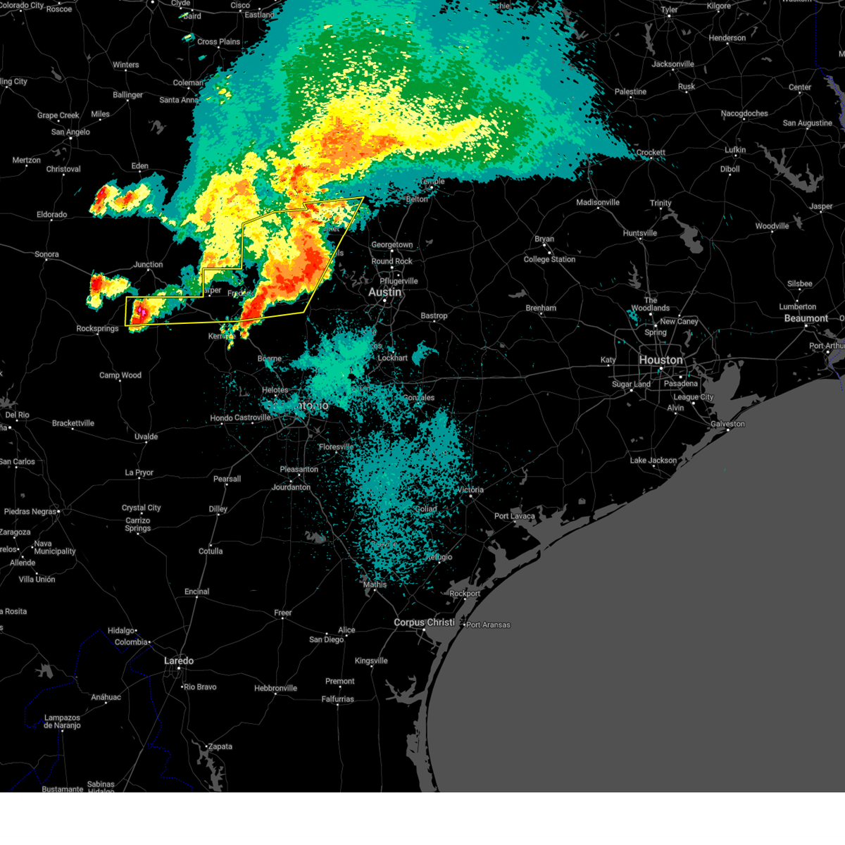
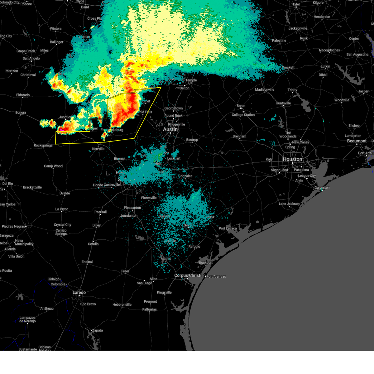
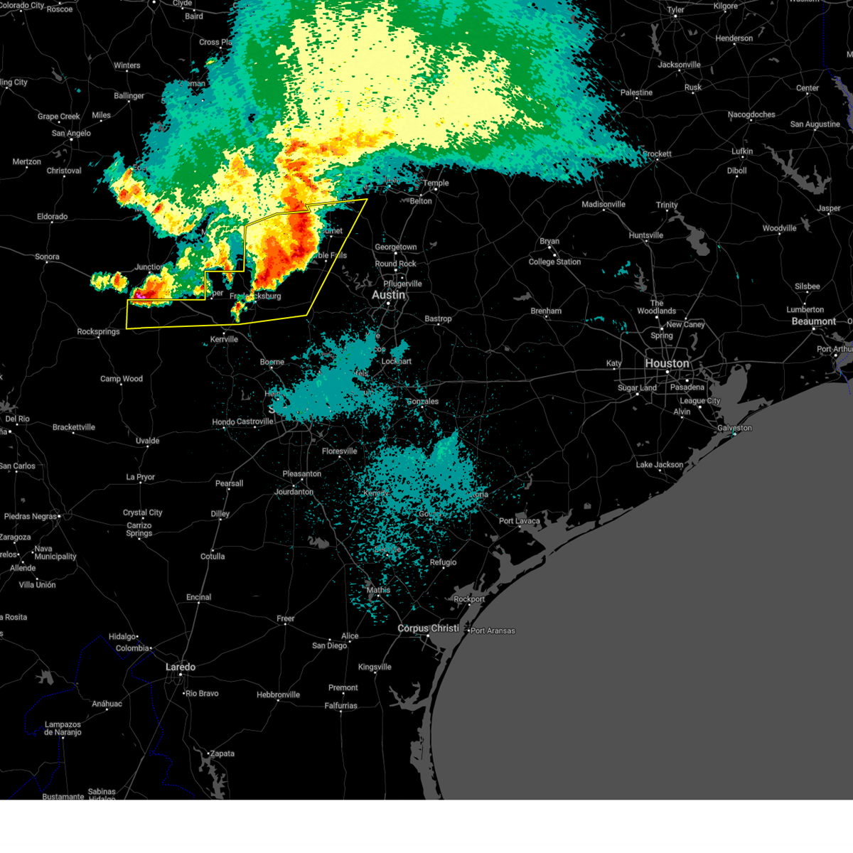
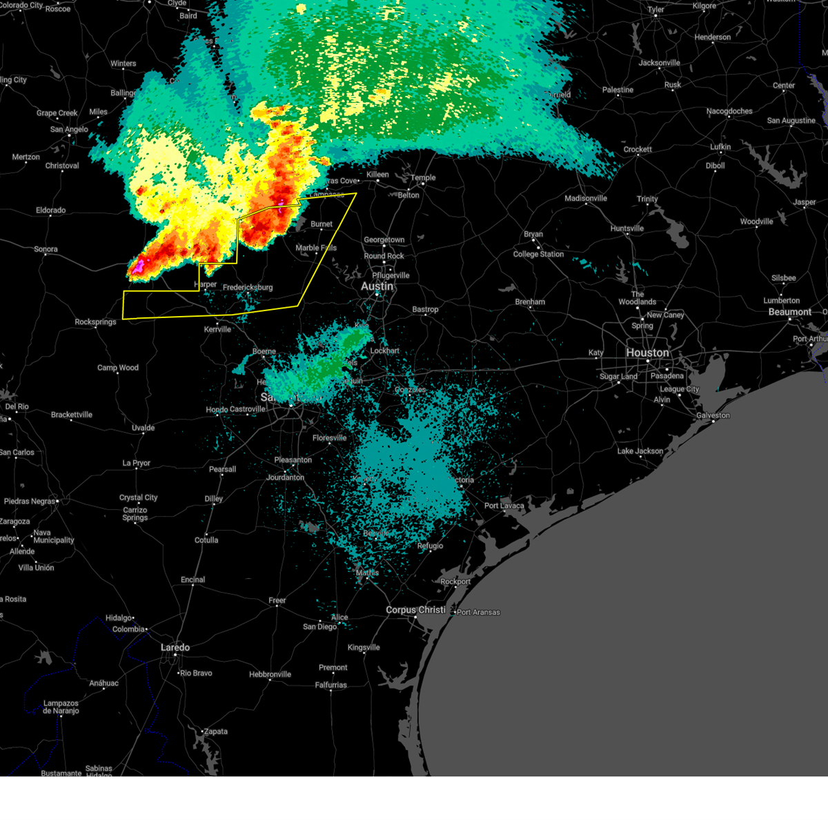
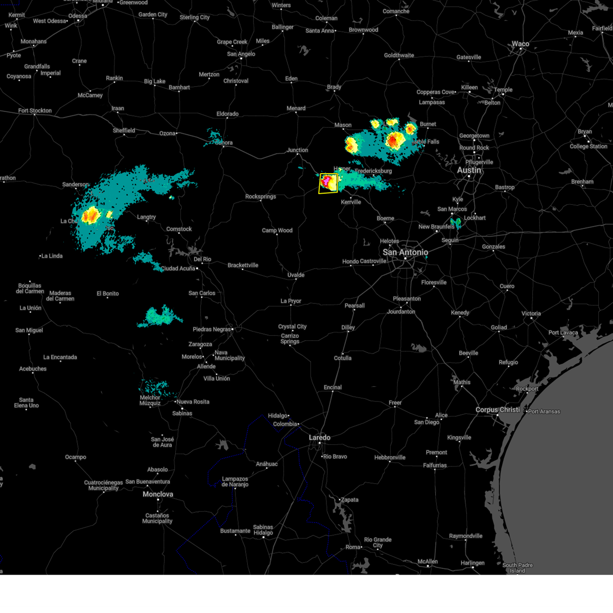
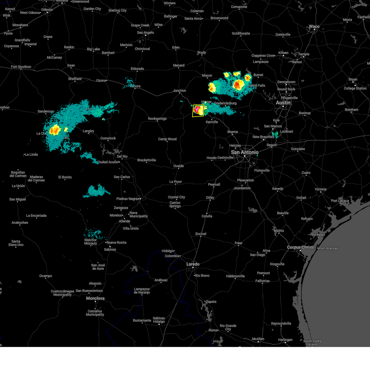
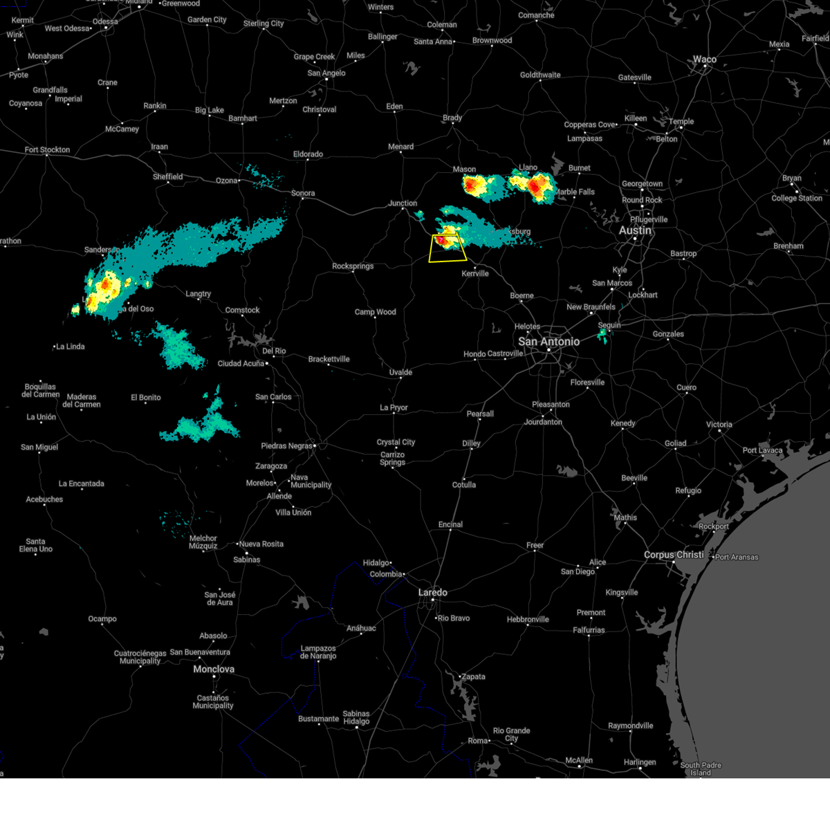
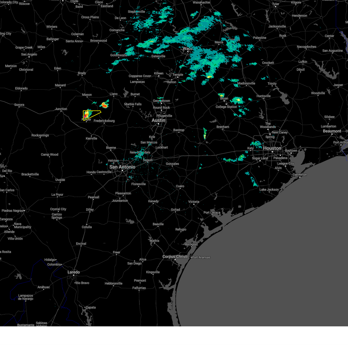
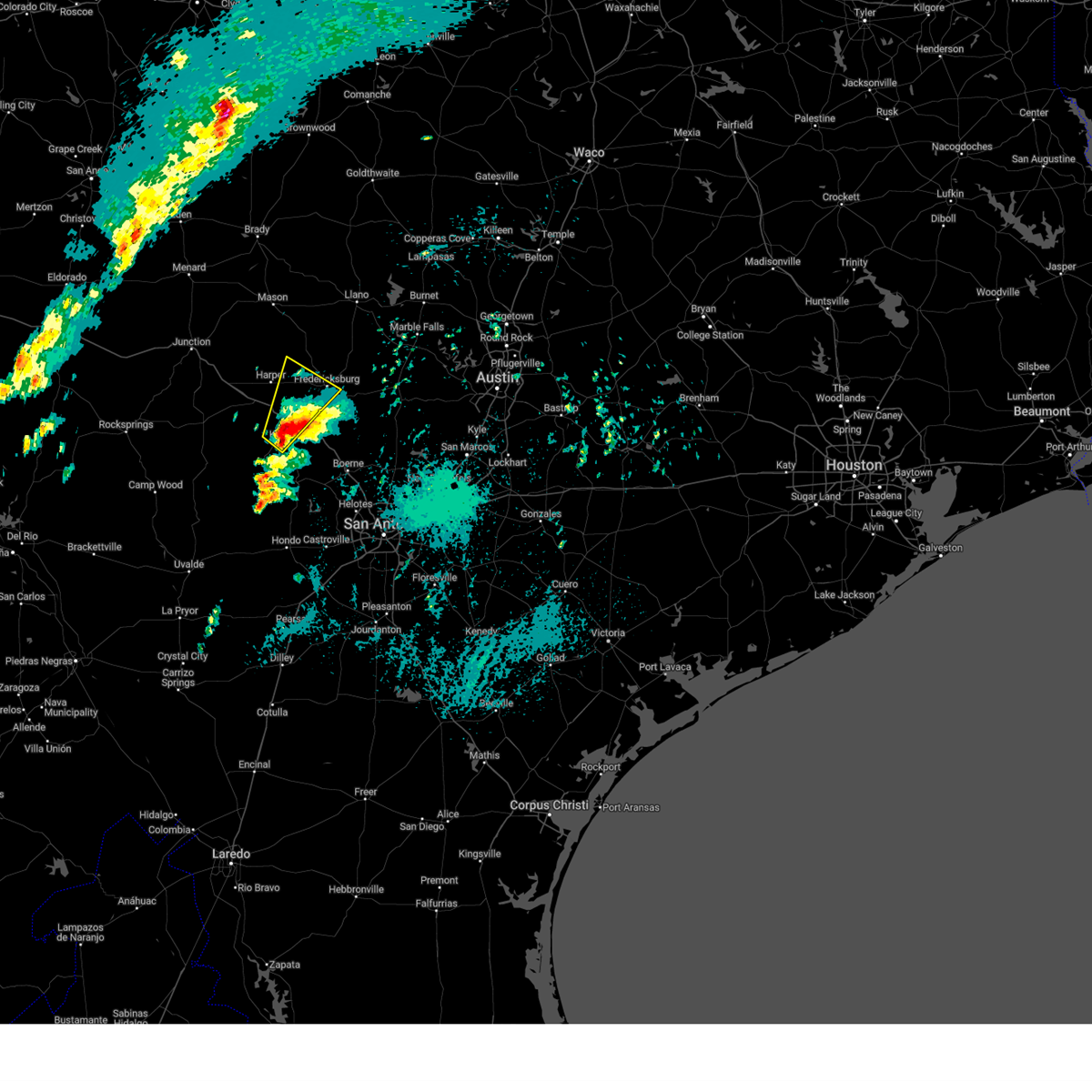
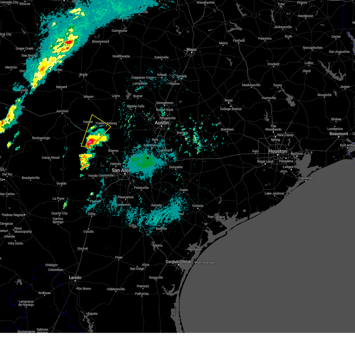
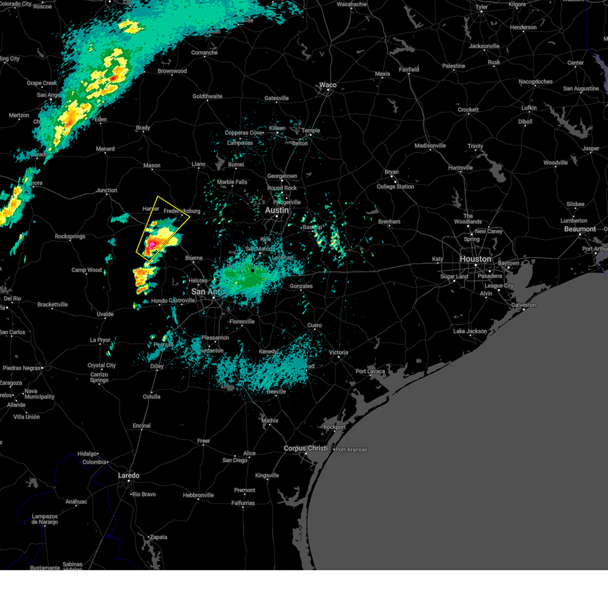
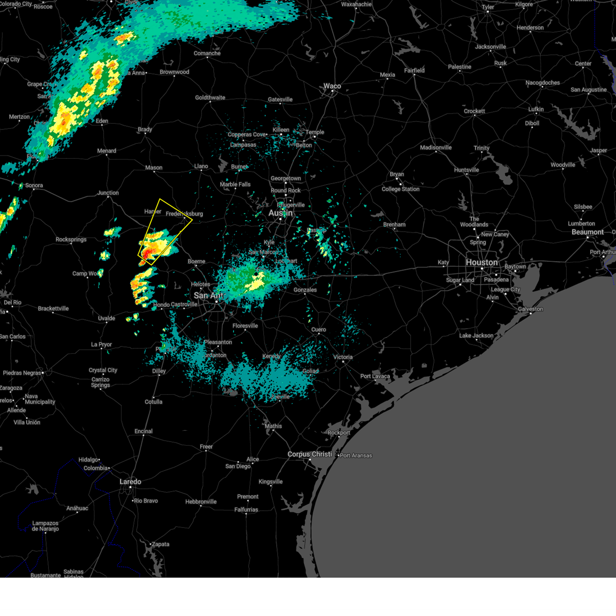
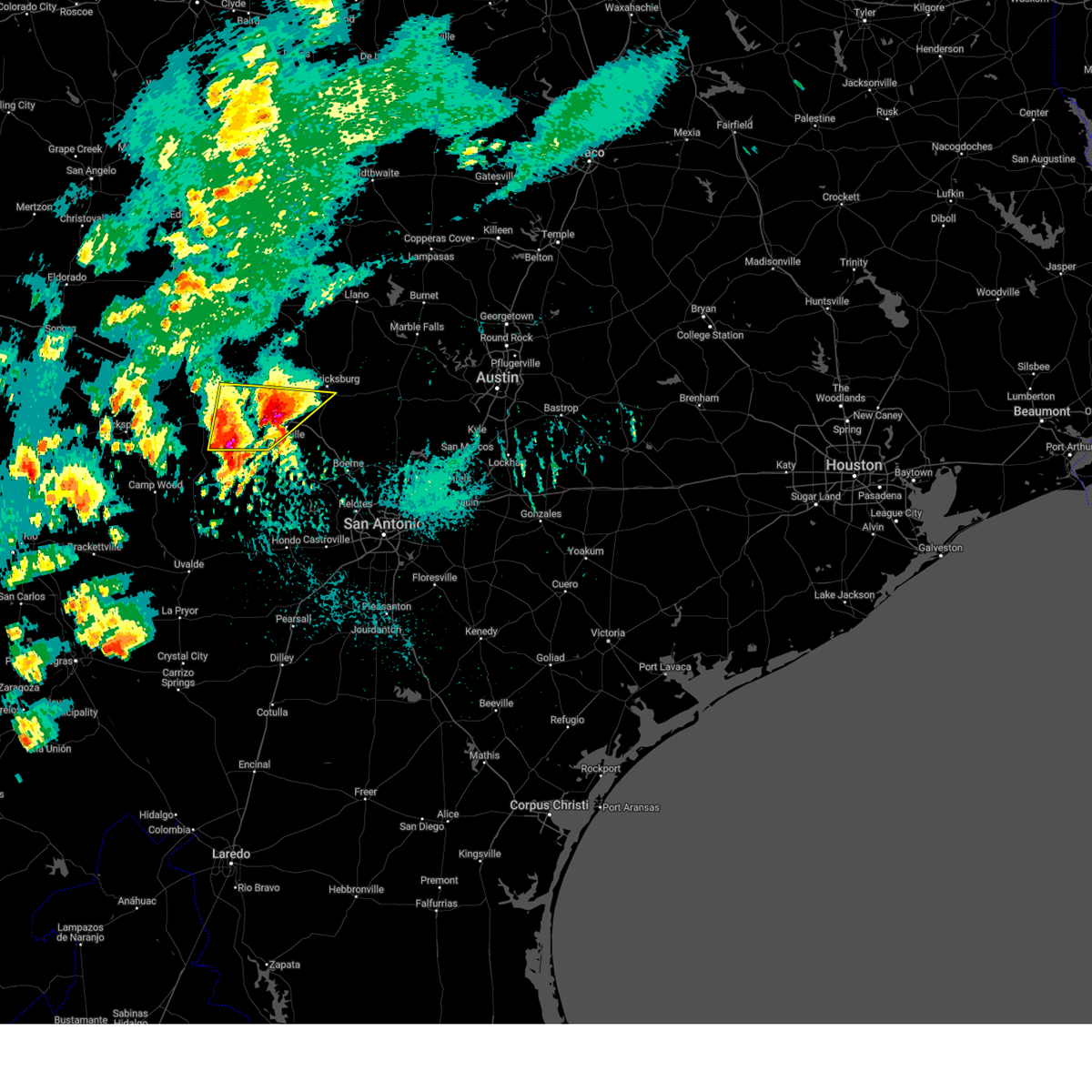
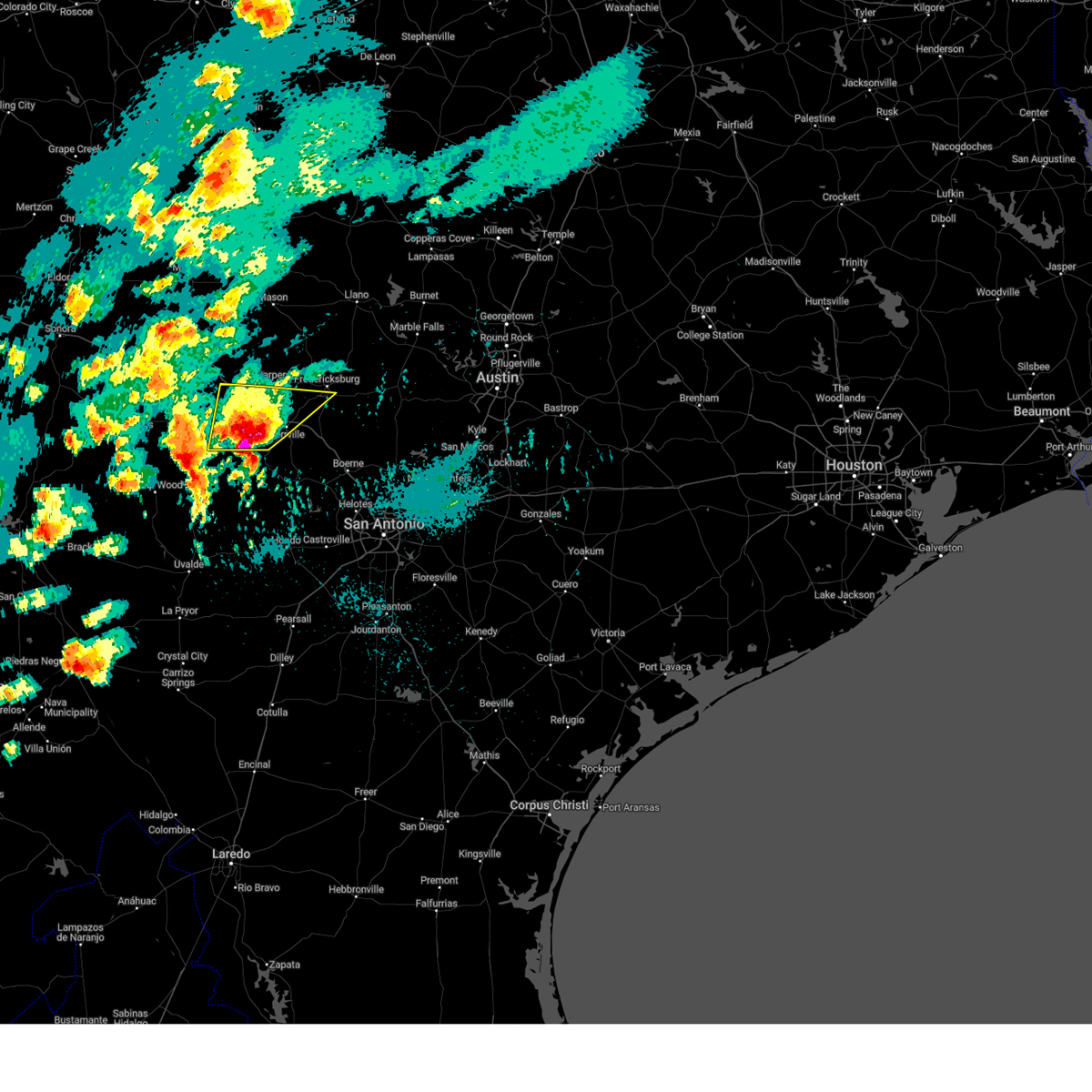
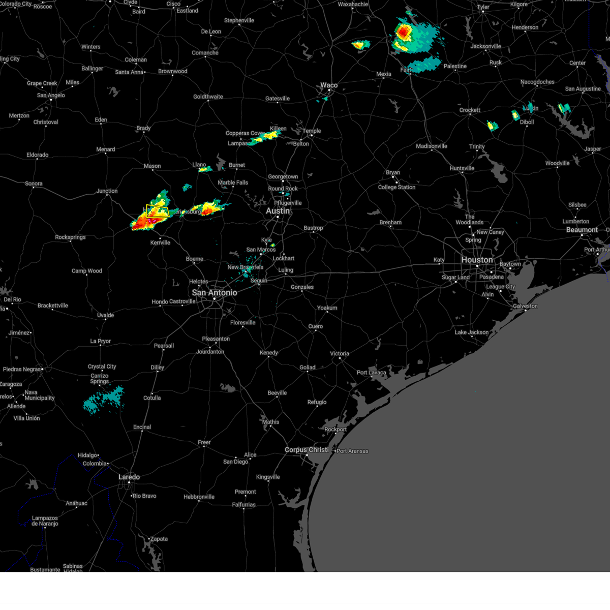
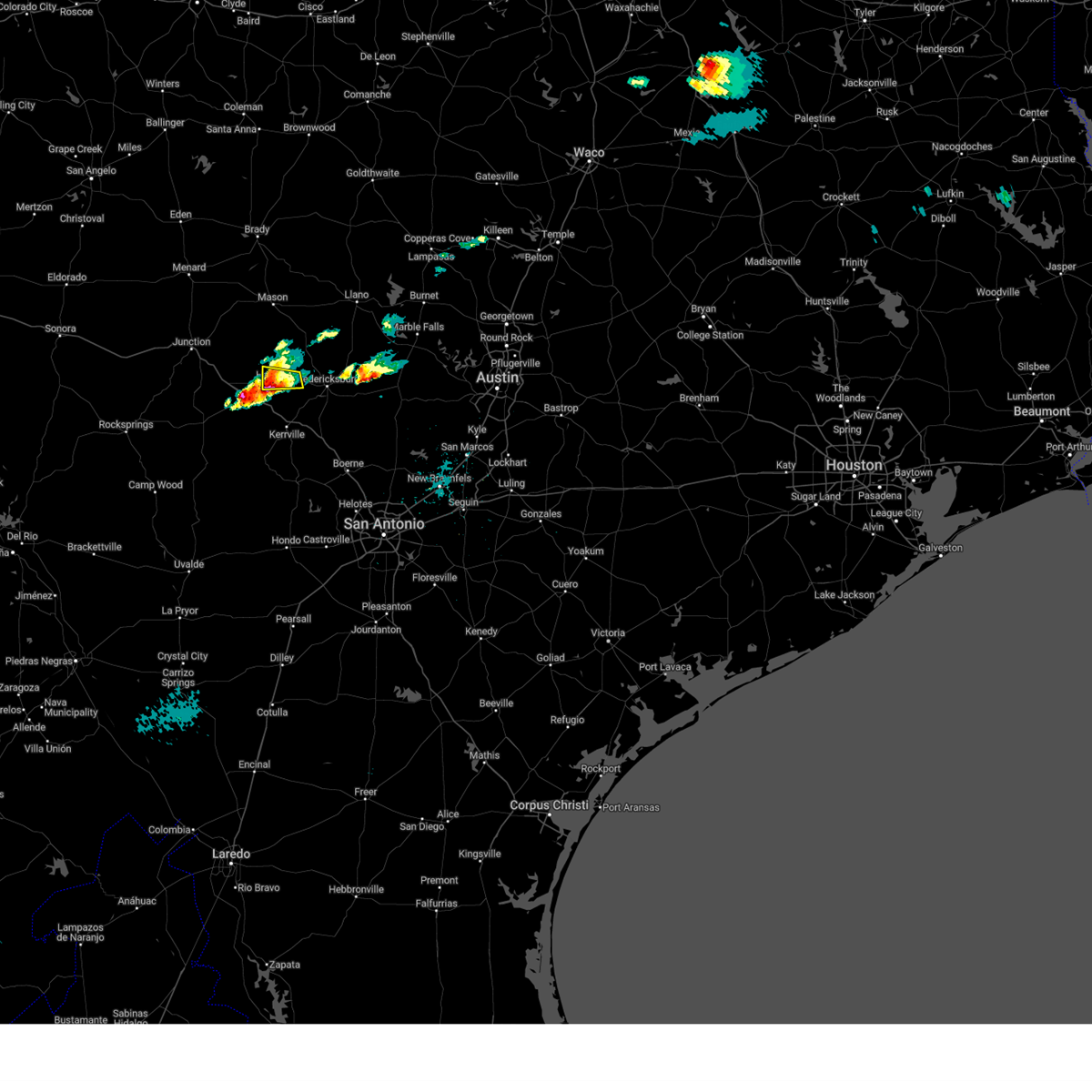
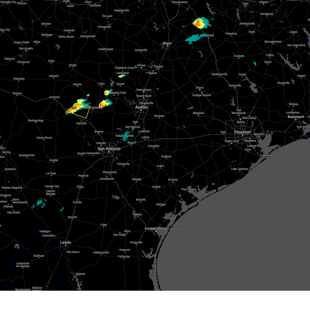
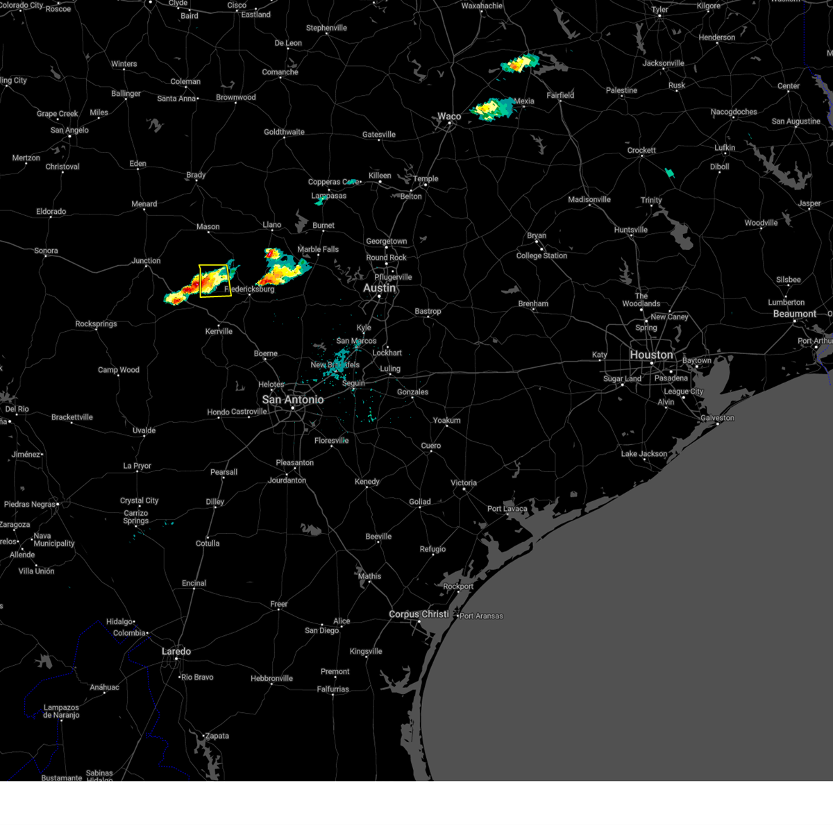
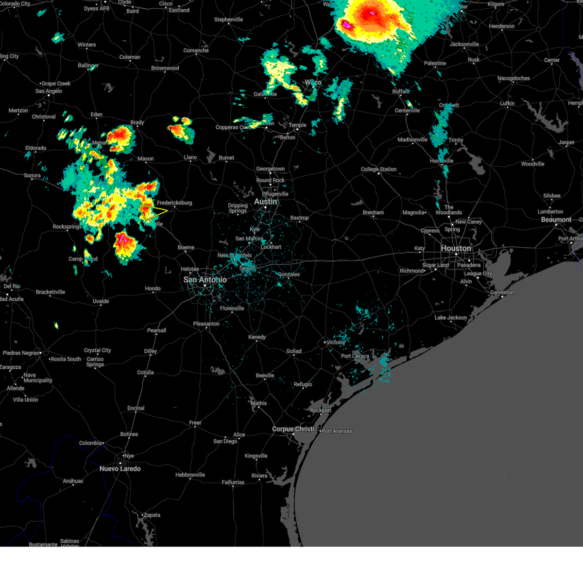
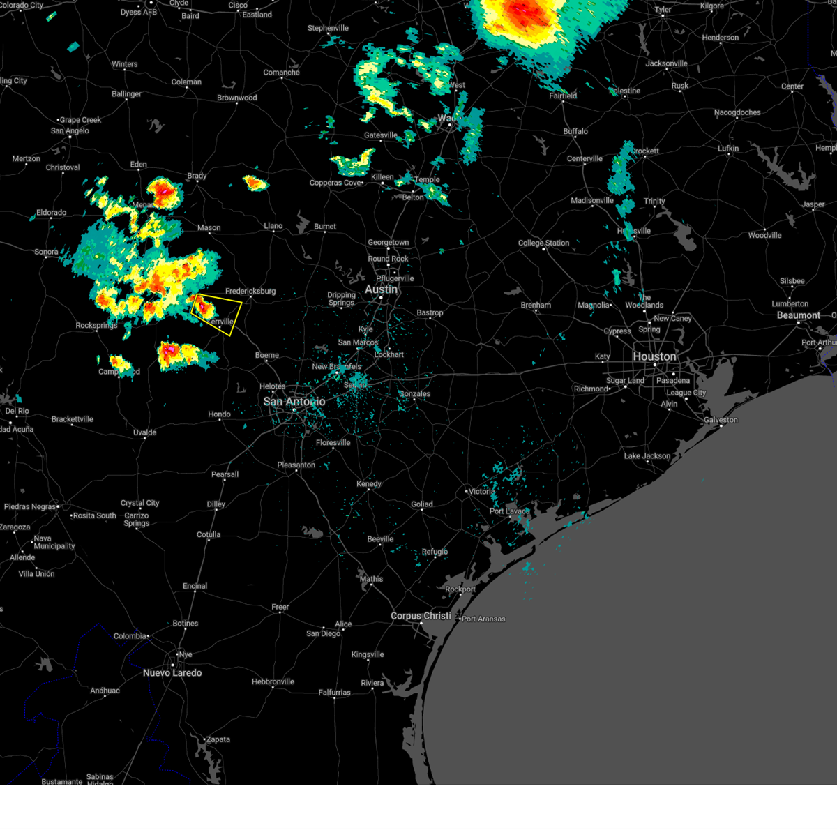
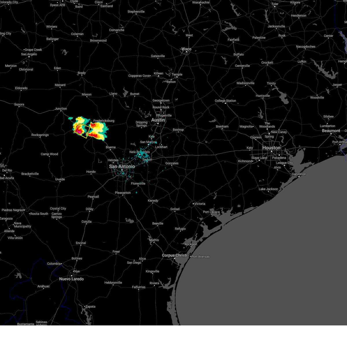
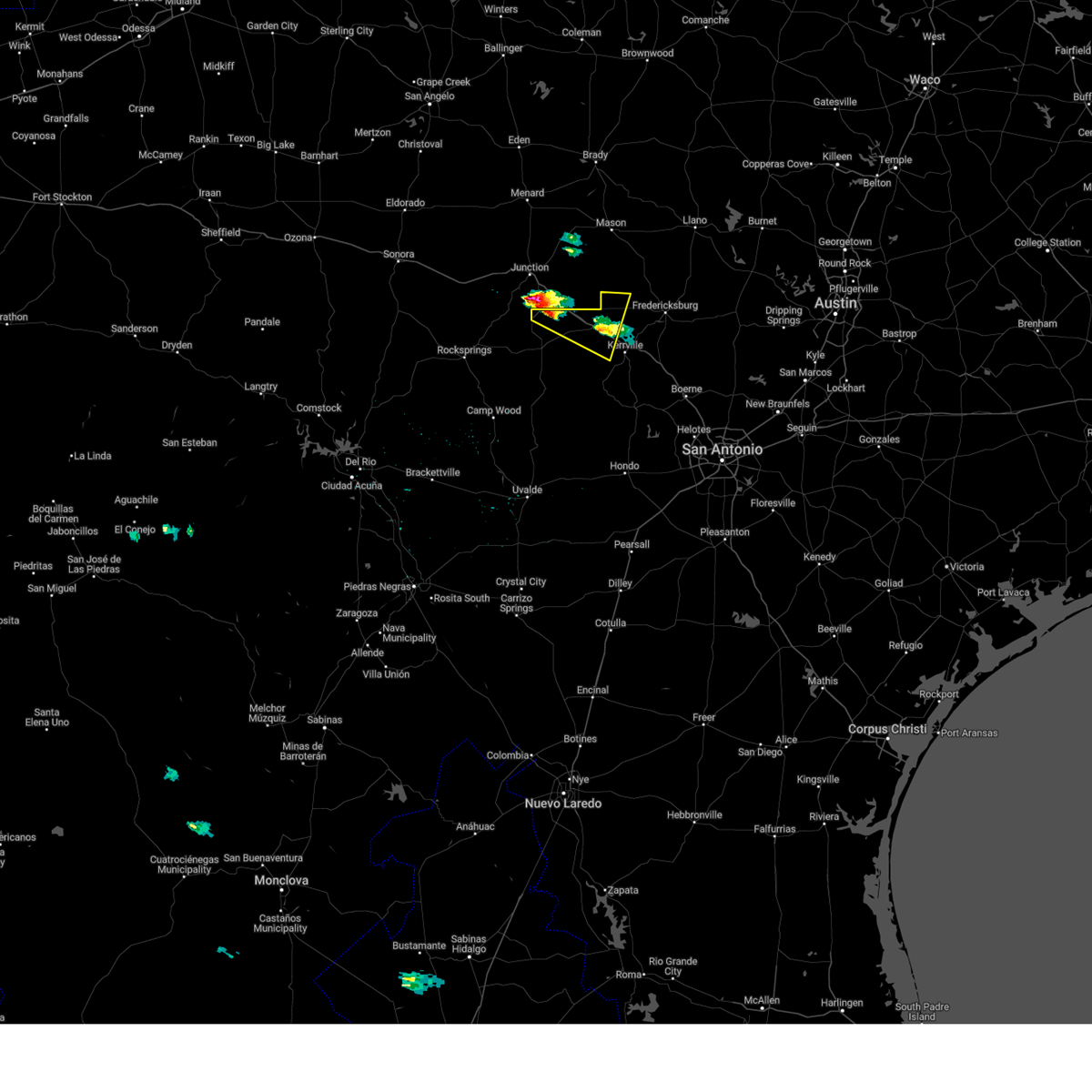
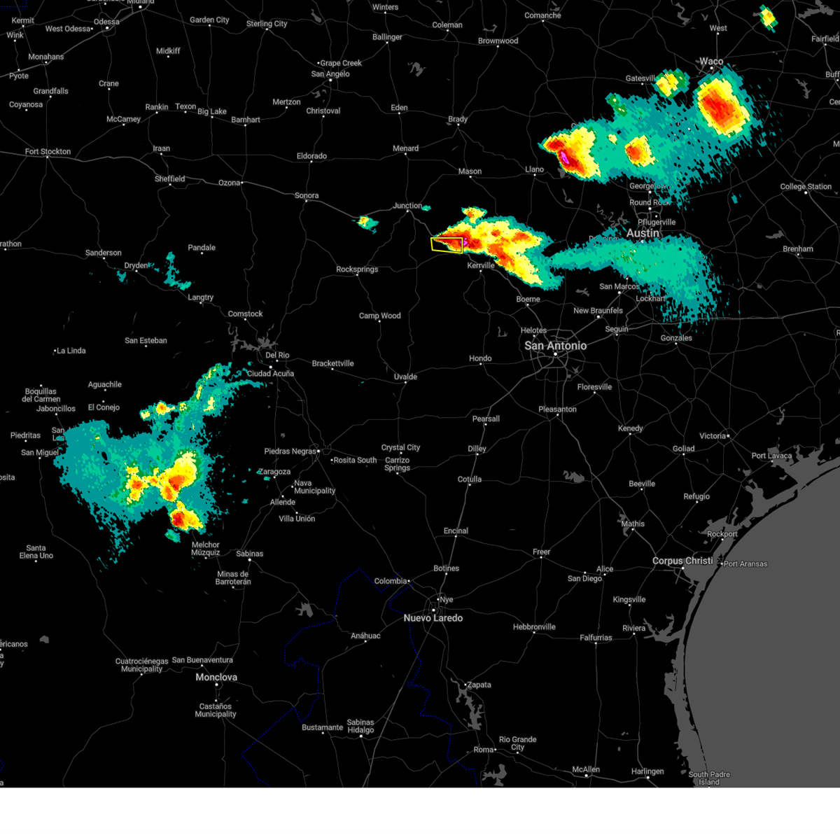
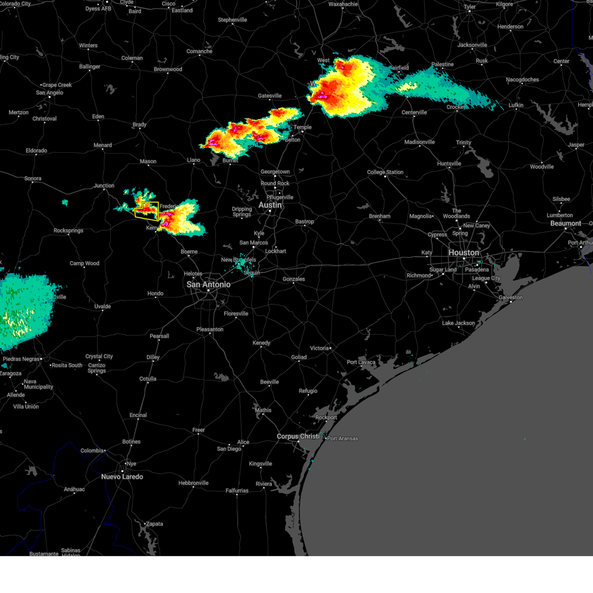
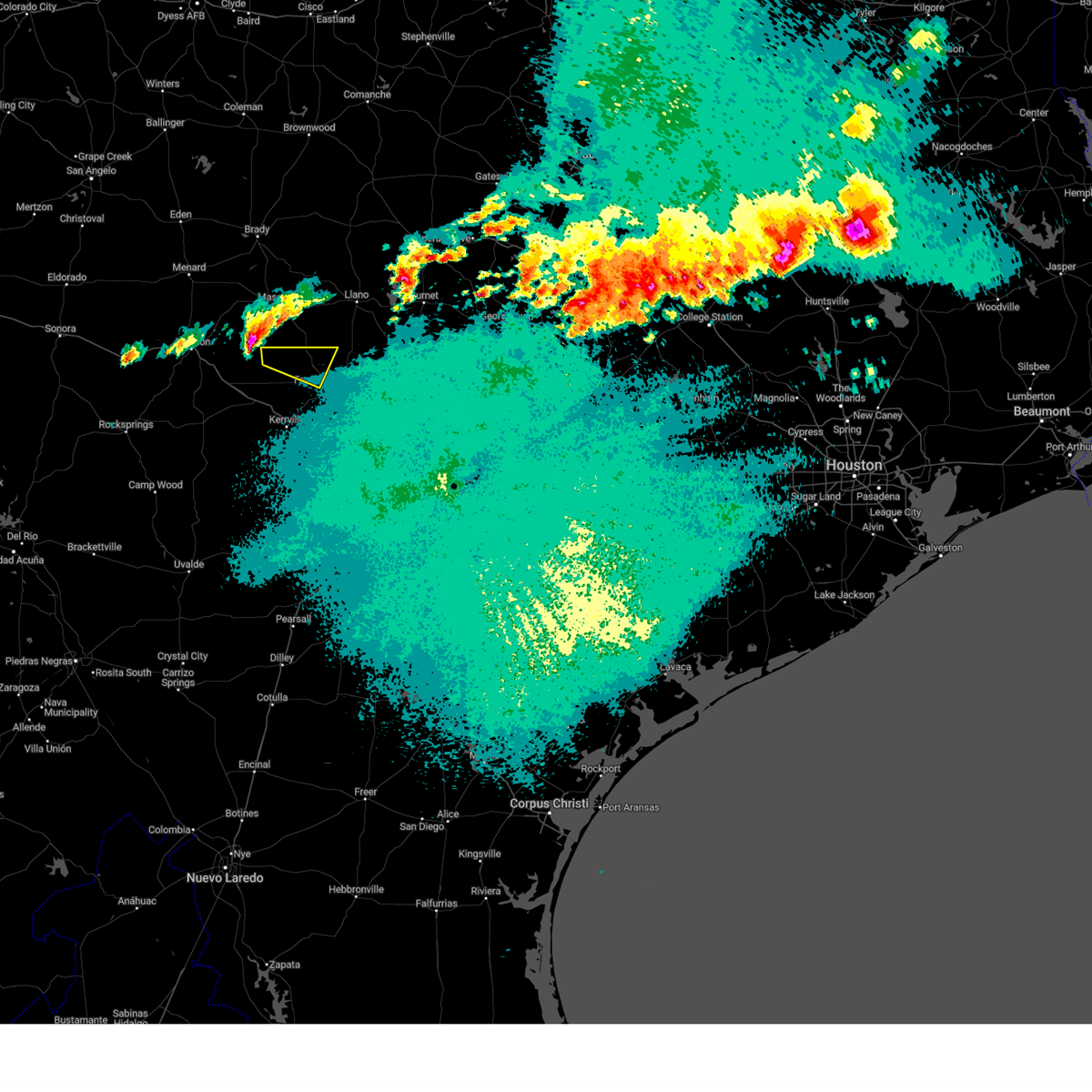
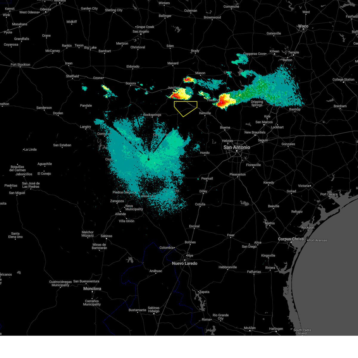
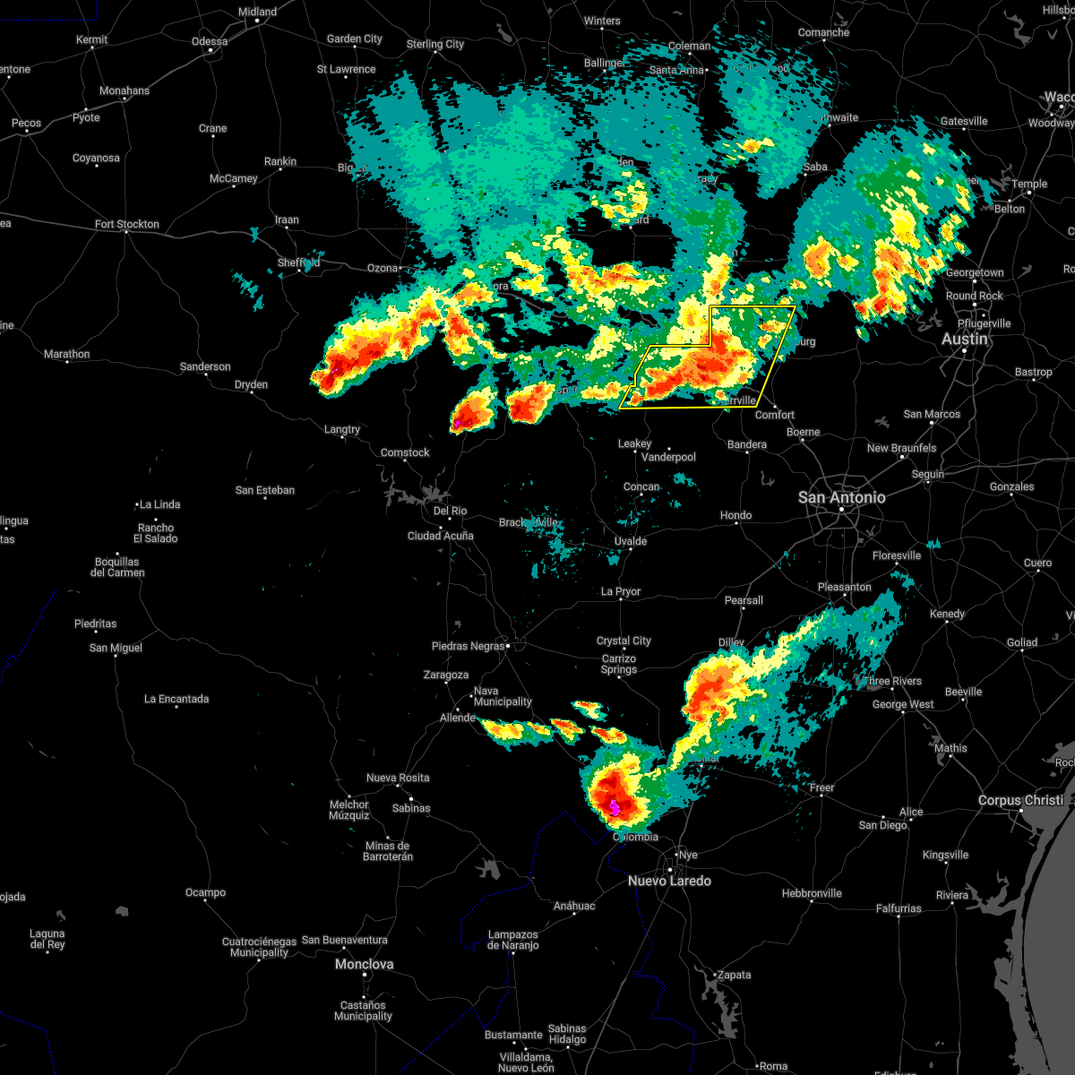
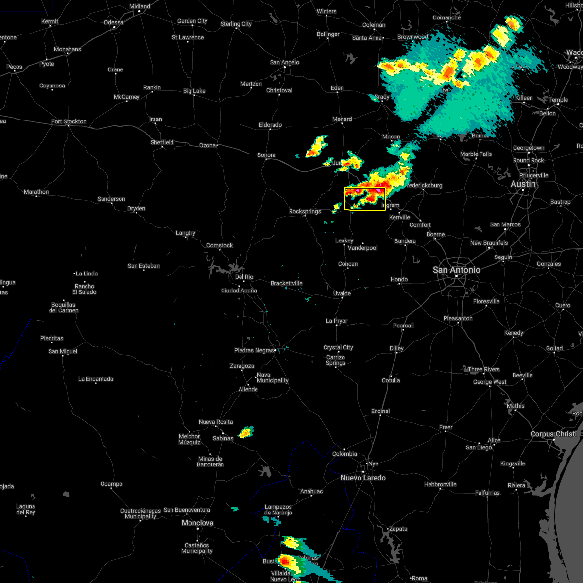
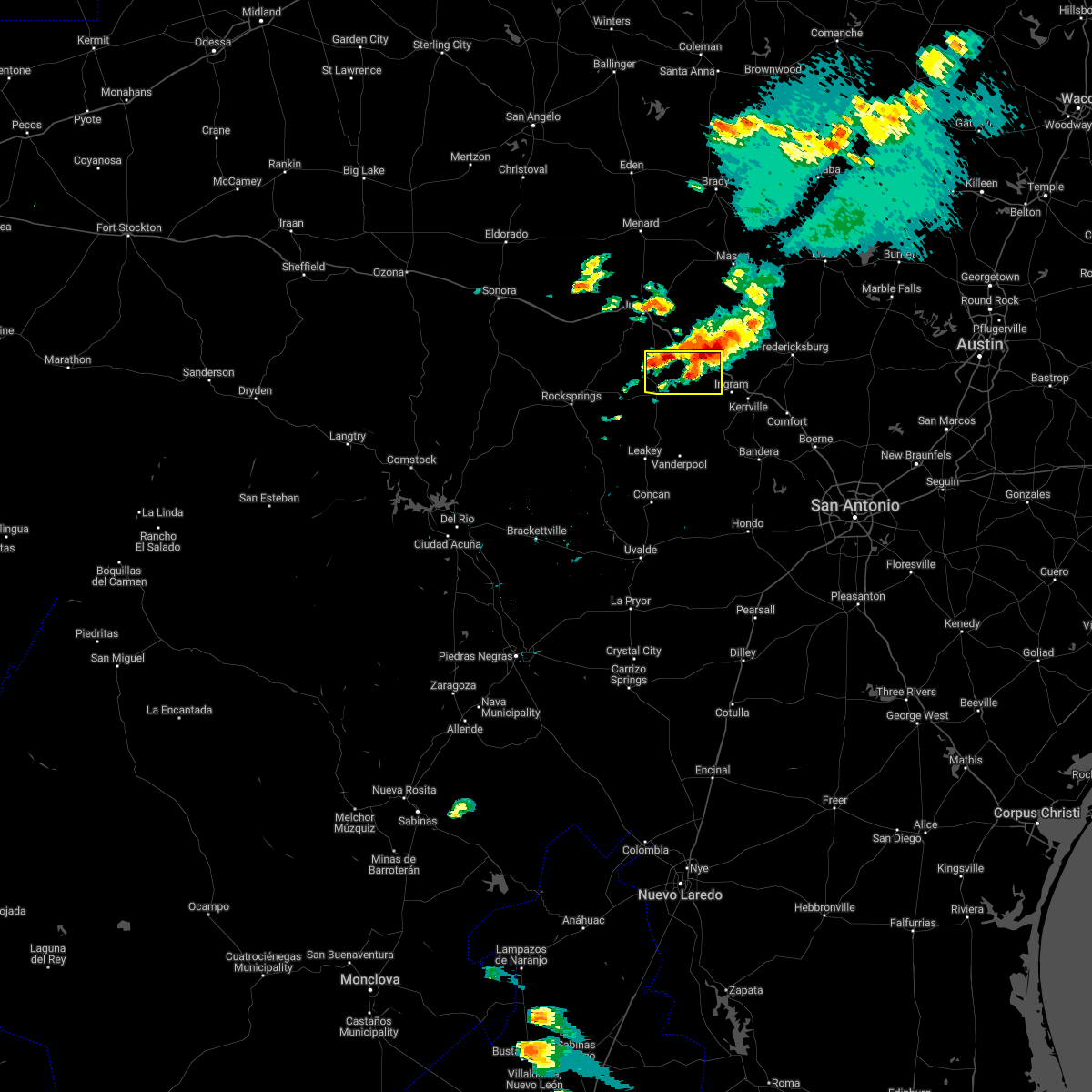
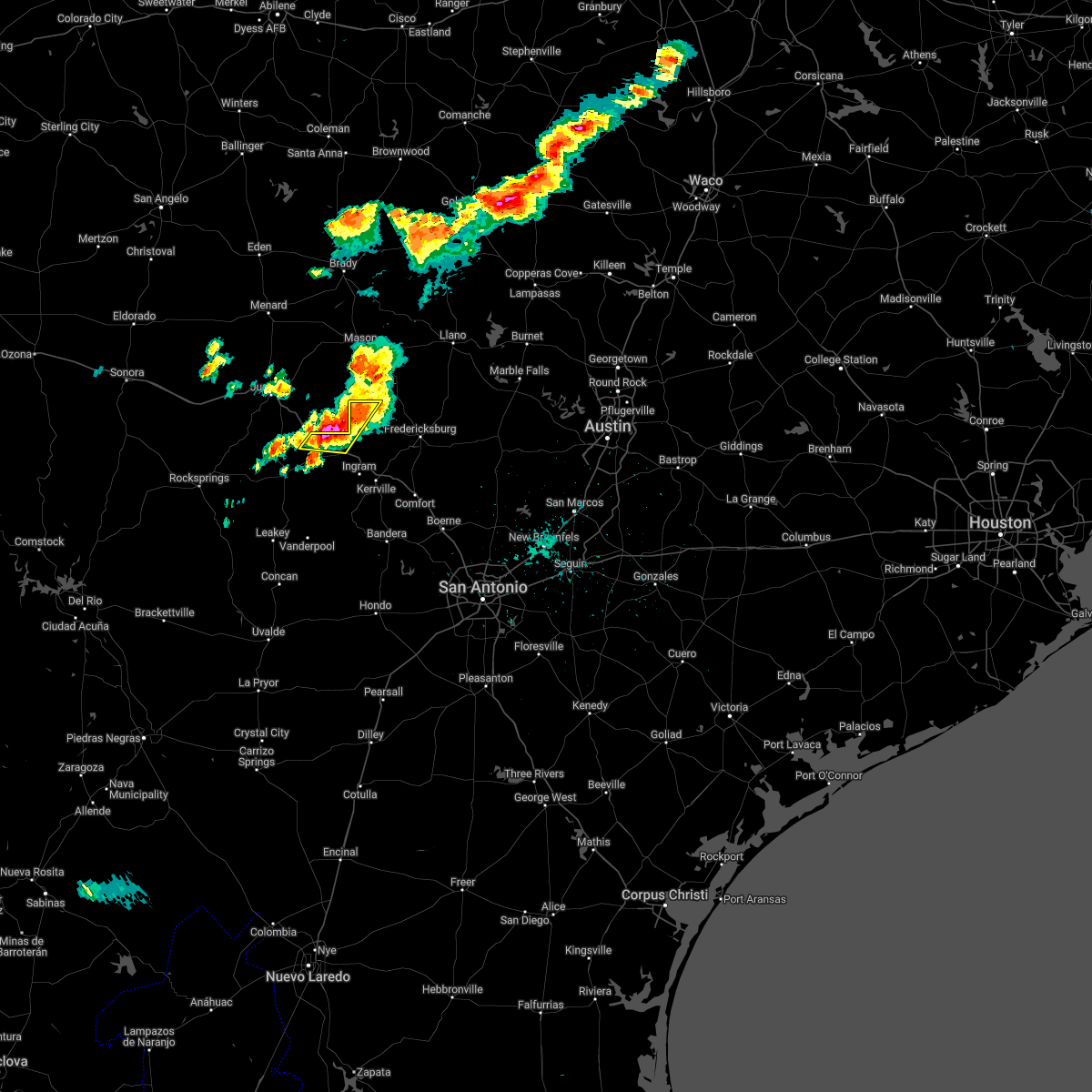
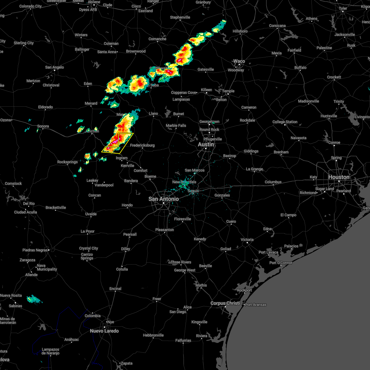
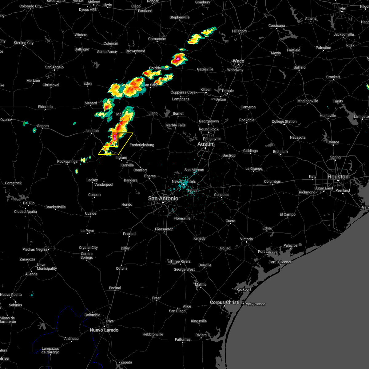
Hail Map for Harper, TX
The Harper, TX area has had 26 reports of on-the-ground hail by trained spotters, and has been under severe weather warnings 27 times during the past 12 months. Doppler radar has detected hail at or near Harper, TX on 83 occasions, including 7 occasions during the past year.
| Name: | Harper, TX |
| Where Located: | 74.6 miles NW of San Antonio, TX |
| Map: | Google Map for Harper, TX |
| Population: | 1192 |
| Housing Units: | 624 |
| More Info: | Search Google for Harper, TX |
2
The Top Recent Hail Date for Harper, TX is Sunday, March 23, 2025 (8th out of 83)

Hail and Wind Damage Spotted near Harper, TX
| Date / Time | Report Details |
|---|---|
| 5/23/2025 1:28 AM CDT |
 The storms which prompted the warning have weakened below severe limits, and no longer pose an immediate threat to life or property. therefore, the warning will be allowed to expire. however small hail, gusty winds and heavy rain are still possible with these thunderstorms. The storms which prompted the warning have weakened below severe limits, and no longer pose an immediate threat to life or property. therefore, the warning will be allowed to expire. however small hail, gusty winds and heavy rain are still possible with these thunderstorms.
|
| 5/23/2025 12:53 AM CDT |
 At 1253 am cdt, severe thunderstorms were located along a line extending from near bluffton to near gainesville to near crabapple to near doss to near telegraph, moving south at 30 mph (radar indicated). Hazards include ping pong ball size hail and 60 mph wind gusts. People and animals outdoors will be injured. expect hail damage to roofs, siding, windows, and vehicles. expect wind damage to roofs, siding, and trees. Locations impacted include, fredericksburg, burnet, marble falls, kingsland, llano, round mountain, buchanan dam, gainesville, granite shoals, horseshoe bay, johnson city, meadowlakes, buchanan lake village, stonewall, highland haven, castell, inks lake state park, watson, bluffton, and rocky hill. At 1253 am cdt, severe thunderstorms were located along a line extending from near bluffton to near gainesville to near crabapple to near doss to near telegraph, moving south at 30 mph (radar indicated). Hazards include ping pong ball size hail and 60 mph wind gusts. People and animals outdoors will be injured. expect hail damage to roofs, siding, windows, and vehicles. expect wind damage to roofs, siding, and trees. Locations impacted include, fredericksburg, burnet, marble falls, kingsland, llano, round mountain, buchanan dam, gainesville, granite shoals, horseshoe bay, johnson city, meadowlakes, buchanan lake village, stonewall, highland haven, castell, inks lake state park, watson, bluffton, and rocky hill.
|
| 5/23/2025 12:52 AM CDT |
 At 1252 am cdt, severe thunderstorms were located along a line extending from near bluffton to near gainesville to near crabapple to near doss to near telegraph, moving south at 30 mph (radar indicated). Hazards include ping pong ball size hail and 60 mph wind gusts. People and animals outdoors will be injured. expect hail damage to roofs, siding, windows, and vehicles. expect wind damage to roofs, siding, and trees. Locations impacted include, fredericksburg, burnet, marble falls, kingsland, llano, round mountain, buchanan dam, gainesville, granite shoals, horseshoe bay, johnson city, meadowlakes, buchanan lake village, stonewall, highland haven, castell, inks lake state park, watson, bluffton, and rocky hill. At 1252 am cdt, severe thunderstorms were located along a line extending from near bluffton to near gainesville to near crabapple to near doss to near telegraph, moving south at 30 mph (radar indicated). Hazards include ping pong ball size hail and 60 mph wind gusts. People and animals outdoors will be injured. expect hail damage to roofs, siding, windows, and vehicles. expect wind damage to roofs, siding, and trees. Locations impacted include, fredericksburg, burnet, marble falls, kingsland, llano, round mountain, buchanan dam, gainesville, granite shoals, horseshoe bay, johnson city, meadowlakes, buchanan lake village, stonewall, highland haven, castell, inks lake state park, watson, bluffton, and rocky hill.
|
| 5/23/2025 12:27 AM CDT |
 Svrewx the national weather service in austin san antonio has issued a * severe thunderstorm warning for, northern kerr county in south central texas, northwestern blanco county in south central texas, gillespie county in south central texas, llano county in south central texas, northeastern edwards county in south central texas, burnet county in south central texas, * until 130 am cdt. * at 1227 am cdt, severe thunderstorms were located along a line extending from near tow to near llano to near doss to near south llano river state park, moving southeast at 25 mph (radar indicated). Hazards include golf ball size hail and 60 mph wind gusts. People and animals outdoors will be injured. expect hail damage to roofs, siding, windows, and vehicles. Expect wind damage to roofs, siding, and trees. Svrewx the national weather service in austin san antonio has issued a * severe thunderstorm warning for, northern kerr county in south central texas, northwestern blanco county in south central texas, gillespie county in south central texas, llano county in south central texas, northeastern edwards county in south central texas, burnet county in south central texas, * until 130 am cdt. * at 1227 am cdt, severe thunderstorms were located along a line extending from near tow to near llano to near doss to near south llano river state park, moving southeast at 25 mph (radar indicated). Hazards include golf ball size hail and 60 mph wind gusts. People and animals outdoors will be injured. expect hail damage to roofs, siding, windows, and vehicles. Expect wind damage to roofs, siding, and trees.
|
| 5/22/2025 6:44 PM CDT |
 the severe thunderstorm warning has been cancelled and is no longer in effect the severe thunderstorm warning has been cancelled and is no longer in effect
|
| 5/22/2025 6:44 PM CDT |
 At 643 pm cdt, a severe thunderstorm was located near mountain home, or 21 miles northwest of kerrville, moving south at 5 mph (radar indicated). Hazards include ping pong ball size hail and 60 mph wind gusts. People and animals outdoors will be injured. expect hail damage to roofs, siding, windows, and vehicles. expect wind damage to roofs, siding, and trees. Locations impacted include, mountain home and kerr wildlife management area. At 643 pm cdt, a severe thunderstorm was located near mountain home, or 21 miles northwest of kerrville, moving south at 5 mph (radar indicated). Hazards include ping pong ball size hail and 60 mph wind gusts. People and animals outdoors will be injured. expect hail damage to roofs, siding, windows, and vehicles. expect wind damage to roofs, siding, and trees. Locations impacted include, mountain home and kerr wildlife management area.
|
| 5/22/2025 6:18 PM CDT |
 Svrewx the national weather service in austin san antonio has issued a * severe thunderstorm warning for, north central kerr county in south central texas, southwestern gillespie county in south central texas, * until 700 pm cdt. * at 618 pm cdt, a severe thunderstorm was located near mountain home, or 22 miles northwest of kerrville, moving south at 10 mph (radar indicated). Hazards include 60 mph wind gusts and half dollar size hail. Hail damage to vehicles is expected. Expect wind damage to roofs, siding, and trees. Svrewx the national weather service in austin san antonio has issued a * severe thunderstorm warning for, north central kerr county in south central texas, southwestern gillespie county in south central texas, * until 700 pm cdt. * at 618 pm cdt, a severe thunderstorm was located near mountain home, or 22 miles northwest of kerrville, moving south at 10 mph (radar indicated). Hazards include 60 mph wind gusts and half dollar size hail. Hail damage to vehicles is expected. Expect wind damage to roofs, siding, and trees.
|
| 5/18/2025 12:31 PM CDT |
 Svrewx the national weather service in austin san antonio has issued a * severe thunderstorm warning for, northwestern gillespie county in south central texas, * until 100 pm cdt. * at 1231 pm cdt, a severe thunderstorm was located 7 miles north of harper, or 24 miles south of mason, moving northeast at 30 mph (radar indicated). Hazards include 60 mph wind gusts and quarter size hail. Hail damage to vehicles is expected. Expect wind damage to roofs, siding, and trees. Svrewx the national weather service in austin san antonio has issued a * severe thunderstorm warning for, northwestern gillespie county in south central texas, * until 100 pm cdt. * at 1231 pm cdt, a severe thunderstorm was located 7 miles north of harper, or 24 miles south of mason, moving northeast at 30 mph (radar indicated). Hazards include 60 mph wind gusts and quarter size hail. Hail damage to vehicles is expected. Expect wind damage to roofs, siding, and trees.
|
| 5/6/2025 6:20 AM CDT |
 At 620 am cdt, a severe thunderstorm was located over kerrville, moving northeast at 35 mph (radar indicated). Hazards include ping pong ball size hail and 60 mph wind gusts. People and animals outdoors will be injured. expect hail damage to roofs, siding, windows, and vehicles. expect wind damage to roofs, siding, and trees. Locations impacted include, kerrville, fredericksburg, ingram, tivydale, kerrville-schreiner park, doss, and harper. At 620 am cdt, a severe thunderstorm was located over kerrville, moving northeast at 35 mph (radar indicated). Hazards include ping pong ball size hail and 60 mph wind gusts. People and animals outdoors will be injured. expect hail damage to roofs, siding, windows, and vehicles. expect wind damage to roofs, siding, and trees. Locations impacted include, kerrville, fredericksburg, ingram, tivydale, kerrville-schreiner park, doss, and harper.
|
| 5/6/2025 6:10 AM CDT |
 the severe thunderstorm warning has been cancelled and is no longer in effect the severe thunderstorm warning has been cancelled and is no longer in effect
|
| 5/6/2025 6:10 AM CDT |
 At 610 am cdt, a severe thunderstorm was located near kerrville-schreiner park, or near kerrville, moving northeast at 35 mph (radar indicated). Hazards include two inch hail and 60 mph wind gusts. People and animals outdoors will be injured. expect hail damage to roofs, siding, windows, and vehicles. expect wind damage to roofs, siding, and trees. Locations impacted include, kerrville, fredericksburg, ingram, tivydale, kerrville-schreiner park, doss, waltonia, and harper. At 610 am cdt, a severe thunderstorm was located near kerrville-schreiner park, or near kerrville, moving northeast at 35 mph (radar indicated). Hazards include two inch hail and 60 mph wind gusts. People and animals outdoors will be injured. expect hail damage to roofs, siding, windows, and vehicles. expect wind damage to roofs, siding, and trees. Locations impacted include, kerrville, fredericksburg, ingram, tivydale, kerrville-schreiner park, doss, waltonia, and harper.
|
| 5/6/2025 6:04 AM CDT |
 At 604 am cdt, a severe thunderstorm was located near ingram, or 7 miles southwest of kerrville, moving northeast at 35 mph (radar indicated). Hazards include ping pong ball size hail and 60 mph wind gusts. People and animals outdoors will be injured. expect hail damage to roofs, siding, windows, and vehicles. expect wind damage to roofs, siding, and trees. Locations impacted include, kerrville, fredericksburg, ingram, hunt, tivydale, kerrville-schreiner park, doss, waltonia, and harper. At 604 am cdt, a severe thunderstorm was located near ingram, or 7 miles southwest of kerrville, moving northeast at 35 mph (radar indicated). Hazards include ping pong ball size hail and 60 mph wind gusts. People and animals outdoors will be injured. expect hail damage to roofs, siding, windows, and vehicles. expect wind damage to roofs, siding, and trees. Locations impacted include, kerrville, fredericksburg, ingram, hunt, tivydale, kerrville-schreiner park, doss, waltonia, and harper.
|
| 5/6/2025 5:58 AM CDT |
 Svrewx the national weather service in austin san antonio has issued a * severe thunderstorm warning for, north central bandera county in south central texas, southeastern kerr county in south central texas, western gillespie county in south central texas, * until 700 am cdt. * at 558 am cdt, a severe thunderstorm was located 8 miles south of waltonia, or 9 miles north of medina, moving northeast at 35 mph (radar indicated). Hazards include 60 mph wind gusts and quarter size hail. Hail damage to vehicles is expected. Expect wind damage to roofs, siding, and trees. Svrewx the national weather service in austin san antonio has issued a * severe thunderstorm warning for, north central bandera county in south central texas, southeastern kerr county in south central texas, western gillespie county in south central texas, * until 700 am cdt. * at 558 am cdt, a severe thunderstorm was located 8 miles south of waltonia, or 9 miles north of medina, moving northeast at 35 mph (radar indicated). Hazards include 60 mph wind gusts and quarter size hail. Hail damage to vehicles is expected. Expect wind damage to roofs, siding, and trees.
|
| 4/5/2025 2:16 AM CDT | The storm which prompted the warning has weakened below severe limits, and no longer poses an immediate threat to life or property. therefore, the warning has been allowed to expire. however small hail is still possible with this thunderstorm. a severe thunderstorm watch remains in effect until 500 am cdt for south central texas. |
| 4/5/2025 1:53 AM CDT |
 At 152 am cdt, severe thunderstorms were located near ingram, or 8 miles northwest of kerrville, and 15 miles southwest of hunt, moving northeast at 40 mph (radar indicated). Hazards include ping pong ball size hail. People and animals outdoors will be injured. expect damage to roofs, siding, windows, and vehicles. Locations impacted include, hunt, mountain home, tivydale, kerrville-schreiner park, kerrville, ingram, kerr wildlife management area, waltonia, harper, and fredericksburg. At 152 am cdt, severe thunderstorms were located near ingram, or 8 miles northwest of kerrville, and 15 miles southwest of hunt, moving northeast at 40 mph (radar indicated). Hazards include ping pong ball size hail. People and animals outdoors will be injured. expect damage to roofs, siding, windows, and vehicles. Locations impacted include, hunt, mountain home, tivydale, kerrville-schreiner park, kerrville, ingram, kerr wildlife management area, waltonia, harper, and fredericksburg.
|
| 4/5/2025 1:31 AM CDT |
 the severe thunderstorm warning has been cancelled and is no longer in effect the severe thunderstorm warning has been cancelled and is no longer in effect
|
| 4/5/2025 1:31 AM CDT |
 At 129 am cdt, a severe thunderstorm was located 8 miles southwest of hunt, or 14 miles northwest of medina, moving northeast at 60 mph (radar indicated). Hazards include ping pong ball size hail. People and animals outdoors will be injured. expect damage to roofs, siding, windows, and vehicles. Locations impacted include, hunt, mountain home, tivydale, kerrville-schreiner park, kerrville, ingram, kerr wildlife management area, waltonia, harper, and fredericksburg. At 129 am cdt, a severe thunderstorm was located 8 miles southwest of hunt, or 14 miles northwest of medina, moving northeast at 60 mph (radar indicated). Hazards include ping pong ball size hail. People and animals outdoors will be injured. expect damage to roofs, siding, windows, and vehicles. Locations impacted include, hunt, mountain home, tivydale, kerrville-schreiner park, kerrville, ingram, kerr wildlife management area, waltonia, harper, and fredericksburg.
|
| 4/5/2025 1:18 AM CDT | Svrewx the national weather service in austin san antonio has issued a * severe thunderstorm warning for, northwestern bandera county in south central texas, kerr county in south central texas, southwestern gillespie county in south central texas, northeastern real county in south central texas, * until 215 am cdt. * at 118 am cdt, a severe thunderstorm was located over lost maples state natural area, or 7 miles north of vanderpool, moving northeast at 40 mph (radar indicated). Hazards include ping pong ball size hail. People and animals outdoors will be injured. Expect damage to roofs, siding, windows, and vehicles. |
| 3/23/2025 7:14 PM CDT | the severe thunderstorm warning has been cancelled and is no longer in effect |
| 3/23/2025 7:05 PM CDT | At 704 pm cdt, a severe thunderstorm was located over tivydale, or 14 miles north of kerrville, moving east at 15 mph (public). Hazards include two inch hail. People and animals outdoors will be injured. expect damage to roofs, siding, windows, and vehicles. Locations impacted include, harper and tivydale. |
| 3/23/2025 6:57 PM CDT | Half Dollar sized hail reported 8.1 miles NE of Harper, TX, near intersection of i-10 and fm 479. |
| 3/23/2025 6:52 PM CDT |
 The storm which prompted the warning has weakened below severe limits, and no longer poses an immediate threat to life or property. therefore, the warning will be allowed to expire. a severe thunderstorm watch remains in effect until 100 am cdt for south central texas. remember, a severe thunderstorm warning still remains in effect for southwestern gillispie county until 7:30 pm. The storm which prompted the warning has weakened below severe limits, and no longer poses an immediate threat to life or property. therefore, the warning will be allowed to expire. a severe thunderstorm watch remains in effect until 100 am cdt for south central texas. remember, a severe thunderstorm warning still remains in effect for southwestern gillispie county until 7:30 pm.
|
| 3/23/2025 6:50 PM CDT |
 At 648 pm cdt, a severe thunderstorm was located near harper, or 16 miles north of kerrville, moving east at 15 mph (radar indicated). Hazards include golf ball size hail. People and animals outdoors will be injured. expect damage to roofs, siding, windows, and vehicles. Locations impacted include, harper and tivydale. At 648 pm cdt, a severe thunderstorm was located near harper, or 16 miles north of kerrville, moving east at 15 mph (radar indicated). Hazards include golf ball size hail. People and animals outdoors will be injured. expect damage to roofs, siding, windows, and vehicles. Locations impacted include, harper and tivydale.
|
| 3/23/2025 6:50 PM CDT |
 the severe thunderstorm warning has been cancelled and is no longer in effect the severe thunderstorm warning has been cancelled and is no longer in effect
|
| 3/23/2025 6:41 PM CDT |
 At 640 pm cdt, a severe thunderstorm was located near doss, or 20 miles northwest of fredericksburg, moving east at 5 mph (radar indicated). Hazards include quarter size hail. Damage to vehicles is expected. Locations impacted include, harper. At 640 pm cdt, a severe thunderstorm was located near doss, or 20 miles northwest of fredericksburg, moving east at 5 mph (radar indicated). Hazards include quarter size hail. Damage to vehicles is expected. Locations impacted include, harper.
|
| 3/23/2025 6:28 PM CDT |
 Svrewx the national weather service in austin san antonio has issued a * severe thunderstorm warning for, northeastern kerr county in south central texas, southwestern gillespie county in south central texas, * until 730 pm cdt. * at 628 pm cdt, a severe thunderstorm was located over harper, or 19 miles northwest of kerrville, moving east at 15 mph (radar indicated). Hazards include golf ball size hail. People and animals outdoors will be injured. Expect damage to roofs, siding, windows, and vehicles. Svrewx the national weather service in austin san antonio has issued a * severe thunderstorm warning for, northeastern kerr county in south central texas, southwestern gillespie county in south central texas, * until 730 pm cdt. * at 628 pm cdt, a severe thunderstorm was located over harper, or 19 miles northwest of kerrville, moving east at 15 mph (radar indicated). Hazards include golf ball size hail. People and animals outdoors will be injured. Expect damage to roofs, siding, windows, and vehicles.
|
| 3/23/2025 6:25 PM CDT | Hen Egg sized hail reported 3.5 miles ESE of Harper, TX, time estimated via radar. |
| 3/23/2025 6:24 PM CDT |
 At 624 pm cdt, a severe thunderstorm was located near harper, or 22 miles west of fredericksburg, moving east at 5 mph (radar indicated). Hazards include quarter size hail. Damage to vehicles is expected. Locations impacted include, harper. At 624 pm cdt, a severe thunderstorm was located near harper, or 22 miles west of fredericksburg, moving east at 5 mph (radar indicated). Hazards include quarter size hail. Damage to vehicles is expected. Locations impacted include, harper.
|
| 3/23/2025 6:03 PM CDT |
 Svrewx the national weather service in austin san antonio has issued a * severe thunderstorm warning for, northwestern gillespie county in south central texas, * until 700 pm cdt. * at 603 pm cdt, a severe thunderstorm was located near harper, or 24 miles north of kerrville, moving east at 5 mph (radar indicated). Hazards include quarter size hail. damage to vehicles is expected Svrewx the national weather service in austin san antonio has issued a * severe thunderstorm warning for, northwestern gillespie county in south central texas, * until 700 pm cdt. * at 603 pm cdt, a severe thunderstorm was located near harper, or 24 miles north of kerrville, moving east at 5 mph (radar indicated). Hazards include quarter size hail. damage to vehicles is expected
|
| 10/5/2023 3:49 AM CDT |
 At 349 am cdt, a severe thunderstorm was located near doss, or 14 miles northwest of fredericksburg, moving east at 35 mph (radar indicated). Hazards include 60 mph wind gusts and penny size hail. expect damage to roofs, siding, and trees At 349 am cdt, a severe thunderstorm was located near doss, or 14 miles northwest of fredericksburg, moving east at 35 mph (radar indicated). Hazards include 60 mph wind gusts and penny size hail. expect damage to roofs, siding, and trees
|
| 9/24/2023 8:49 PM CDT |
 At 848 pm cdt, severe thunderstorms were located near harper and near tivydale, moving southwest at 15 mph (radar indicated). Hazards include 60 mph wind gusts and quarter size hail. Hail damage to vehicles is expected. expect wind damage to roofs, siding, and trees. locations impacted include, fredericksburg, harper, and tivydale. hail threat, radar indicated max hail size, 1. 00 in wind threat, radar indicated max wind gust, 60 mph. At 848 pm cdt, severe thunderstorms were located near harper and near tivydale, moving southwest at 15 mph (radar indicated). Hazards include 60 mph wind gusts and quarter size hail. Hail damage to vehicles is expected. expect wind damage to roofs, siding, and trees. locations impacted include, fredericksburg, harper, and tivydale. hail threat, radar indicated max hail size, 1. 00 in wind threat, radar indicated max wind gust, 60 mph.
|
| 9/24/2023 8:25 PM CDT |
 At 824 pm cdt, severe thunderstorms near harper and 6 miles northeast of tivydale, were moving southwest at 15 mph (radar indicated). Hazards include 60 mph wind gusts and quarter size hail. Hail damage to vehicles is expected. Expect wind damage to roofs, siding, and trees. At 824 pm cdt, severe thunderstorms near harper and 6 miles northeast of tivydale, were moving southwest at 15 mph (radar indicated). Hazards include 60 mph wind gusts and quarter size hail. Hail damage to vehicles is expected. Expect wind damage to roofs, siding, and trees.
|
| 6/21/2023 5:15 PM CDT |
 At 515 pm cdt, severe thunderstorms were located along a line extending from near doss to near tivydale, moving east at 20 mph (radar indicated). Hazards include 60 mph wind gusts and quarter size hail. Hail damage to vehicles is expected. Expect wind damage to roofs, siding, and trees. At 515 pm cdt, severe thunderstorms were located along a line extending from near doss to near tivydale, moving east at 20 mph (radar indicated). Hazards include 60 mph wind gusts and quarter size hail. Hail damage to vehicles is expected. Expect wind damage to roofs, siding, and trees.
|
| 6/21/2023 5:07 PM CDT |
 At 506 pm cdt, a severe thunderstorm was located near harper, or 15 miles north of kerrville, moving northeast at 15 mph (radar indicated). Hazards include 60 mph wind gusts and quarter size hail. Hail damage to vehicles is expected. expect wind damage to roofs, siding, and trees. locations impacted include, tivydale and harper. hail threat, radar indicated max hail size, 1. 00 in wind threat, radar indicated max wind gust, 60 mph. At 506 pm cdt, a severe thunderstorm was located near harper, or 15 miles north of kerrville, moving northeast at 15 mph (radar indicated). Hazards include 60 mph wind gusts and quarter size hail. Hail damage to vehicles is expected. expect wind damage to roofs, siding, and trees. locations impacted include, tivydale and harper. hail threat, radar indicated max hail size, 1. 00 in wind threat, radar indicated max wind gust, 60 mph.
|
| 6/21/2023 4:46 PM CDT |
 At 445 pm cdt, a severe thunderstorm was located near mountain home, or 14 miles northwest of kerrville, moving east at 15 mph (radar indicated). Hazards include 60 mph wind gusts and quarter size hail. Hail damage to vehicles is expected. Expect wind damage to roofs, siding, and trees. At 445 pm cdt, a severe thunderstorm was located near mountain home, or 14 miles northwest of kerrville, moving east at 15 mph (radar indicated). Hazards include 60 mph wind gusts and quarter size hail. Hail damage to vehicles is expected. Expect wind damage to roofs, siding, and trees.
|
| 6/21/2023 4:45 PM CDT | Quarter sized hail reported 8.7 miles NNE of Harper, TX, report from mping: quarter (1.00 in.). |
| 6/18/2023 6:34 PM CDT |
 At 634 pm cdt, a severe thunderstorm was located over hunt, or 12 miles west of kerrville, moving southeast at 25 mph (radar indicated). Hazards include tennis ball size hail and 60 mph wind gusts. People and animals outdoors will be injured. expect hail damage to roofs, siding, windows, and vehicles. expect wind damage to roofs, siding, and trees. locations impacted include, ingram, hunt, mountain home, waltonia, kerr wildlife management area and harper. thunderstorm damage threat, considerable hail threat, radar indicated max hail size, 2. 50 in wind threat, radar indicated max wind gust, 60 mph. At 634 pm cdt, a severe thunderstorm was located over hunt, or 12 miles west of kerrville, moving southeast at 25 mph (radar indicated). Hazards include tennis ball size hail and 60 mph wind gusts. People and animals outdoors will be injured. expect hail damage to roofs, siding, windows, and vehicles. expect wind damage to roofs, siding, and trees. locations impacted include, ingram, hunt, mountain home, waltonia, kerr wildlife management area and harper. thunderstorm damage threat, considerable hail threat, radar indicated max hail size, 2. 50 in wind threat, radar indicated max wind gust, 60 mph.
|
| 6/18/2023 6:28 PM CDT |
 At 628 pm cdt, a severe thunderstorm was located over hunt, or 13 miles west of kerrville, moving southeast at 50 mph (radar indicated). Hazards include two inch hail and 60 mph wind gusts. People and animals outdoors will be injured. expect hail damage to roofs, siding, windows, and vehicles. expect wind damage to roofs, siding, and trees. locations impacted include, ingram, hunt, mountain home, waltonia, kerr wildlife management area and harper. thunderstorm damage threat, considerable hail threat, radar indicated max hail size, 2. 00 in wind threat, radar indicated max wind gust, 60 mph. At 628 pm cdt, a severe thunderstorm was located over hunt, or 13 miles west of kerrville, moving southeast at 50 mph (radar indicated). Hazards include two inch hail and 60 mph wind gusts. People and animals outdoors will be injured. expect hail damage to roofs, siding, windows, and vehicles. expect wind damage to roofs, siding, and trees. locations impacted include, ingram, hunt, mountain home, waltonia, kerr wildlife management area and harper. thunderstorm damage threat, considerable hail threat, radar indicated max hail size, 2. 00 in wind threat, radar indicated max wind gust, 60 mph.
|
| 6/18/2023 6:17 PM CDT |
 At 617 pm cdt, a severe thunderstorm was located near kerr wildlife management area, or 23 miles northwest of kerrville, moving southeast at 15 mph (radar indicated). Hazards include ping pong ball size hail and 60 mph wind gusts. People and animals outdoors will be injured. expect hail damage to roofs, siding, windows, and vehicles. expect wind damage to roofs, siding, and trees. locations impacted include, ingram, hunt, mountain home, waltonia, harper, kerr wildlife management area, i-10 near the kimble-kerr county line and the intersection of i-10 and us 290. hail threat, radar indicated max hail size, 1. 50 in wind threat, radar indicated max wind gust, 60 mph. At 617 pm cdt, a severe thunderstorm was located near kerr wildlife management area, or 23 miles northwest of kerrville, moving southeast at 15 mph (radar indicated). Hazards include ping pong ball size hail and 60 mph wind gusts. People and animals outdoors will be injured. expect hail damage to roofs, siding, windows, and vehicles. expect wind damage to roofs, siding, and trees. locations impacted include, ingram, hunt, mountain home, waltonia, harper, kerr wildlife management area, i-10 near the kimble-kerr county line and the intersection of i-10 and us 290. hail threat, radar indicated max hail size, 1. 50 in wind threat, radar indicated max wind gust, 60 mph.
|
| 6/18/2023 6:03 PM CDT |
 At 603 pm cdt, a severe thunderstorm was located 9 miles southeast of segovia, or 17 miles southeast of junction, moving east at 20 mph (radar indicated). Hazards include ping pong ball size hail and 60 mph wind gusts. People and animals outdoors will be injured. expect hail damage to roofs, siding, windows, and vehicles. expect wind damage to roofs, siding, and trees. locations impacted include, ingram, hunt, mountain home, waltonia, harper, kerr wildlife management area, us-83 near the kerr-kimble county line, i- 10 near the kimble-kerr county line and the intersection of i- 10 and us 290. hail threat, radar indicated max hail size, 1. 50 in wind threat, radar indicated max wind gust, 60 mph. At 603 pm cdt, a severe thunderstorm was located 9 miles southeast of segovia, or 17 miles southeast of junction, moving east at 20 mph (radar indicated). Hazards include ping pong ball size hail and 60 mph wind gusts. People and animals outdoors will be injured. expect hail damage to roofs, siding, windows, and vehicles. expect wind damage to roofs, siding, and trees. locations impacted include, ingram, hunt, mountain home, waltonia, harper, kerr wildlife management area, us-83 near the kerr-kimble county line, i- 10 near the kimble-kerr county line and the intersection of i- 10 and us 290. hail threat, radar indicated max hail size, 1. 50 in wind threat, radar indicated max wind gust, 60 mph.
|
| 6/18/2023 5:43 PM CDT |
 At 543 pm cdt, a severe thunderstorm was located near segovia, or 12 miles southeast of junction, moving east at 25 mph (radar indicated). Hazards include golf ball size hail and 60 mph wind gusts. People and animals outdoors will be injured. expect hail damage to roofs, siding, windows, and vehicles. Expect wind damage to roofs, siding, and trees. At 543 pm cdt, a severe thunderstorm was located near segovia, or 12 miles southeast of junction, moving east at 25 mph (radar indicated). Hazards include golf ball size hail and 60 mph wind gusts. People and animals outdoors will be injured. expect hail damage to roofs, siding, windows, and vehicles. Expect wind damage to roofs, siding, and trees.
|
| 6/16/2023 9:21 PM CDT |
 At 921 pm cdt, a severe thunderstorm was located near mountain home, or 16 miles northwest of kerrville, moving east at 10 mph (radar indicated). Hazards include quarter size hail. damage to vehicles is expected At 921 pm cdt, a severe thunderstorm was located near mountain home, or 16 miles northwest of kerrville, moving east at 10 mph (radar indicated). Hazards include quarter size hail. damage to vehicles is expected
|
| 6/16/2023 8:26 PM CDT |
 At 825 pm cdt, a severe thunderstorm was located near harper, or 12 miles northwest of kerrville, moving southeast at 10 mph (radar indicated). Hazards include quarter size hail. Damage to vehicles is expected. locations impacted include, kerrville, ingram, mountain home, harper and kerrville-schreiner park. hail threat, radar indicated max hail size, 1. 00 in wind threat, radar indicated max wind gust, <50 mph. At 825 pm cdt, a severe thunderstorm was located near harper, or 12 miles northwest of kerrville, moving southeast at 10 mph (radar indicated). Hazards include quarter size hail. Damage to vehicles is expected. locations impacted include, kerrville, ingram, mountain home, harper and kerrville-schreiner park. hail threat, radar indicated max hail size, 1. 00 in wind threat, radar indicated max wind gust, <50 mph.
|
| 6/16/2023 8:11 PM CDT |
 At 811 pm cdt, a severe thunderstorm was located near harper, or 15 miles northwest of kerrville, moving southeast at 10 mph (radar indicated). Hazards include quarter size hail. damage to vehicles is expected At 811 pm cdt, a severe thunderstorm was located near harper, or 15 miles northwest of kerrville, moving southeast at 10 mph (radar indicated). Hazards include quarter size hail. damage to vehicles is expected
|
| 6/16/2023 7:51 PM CDT |
 At 750 pm cdt, a severe thunderstorm was located 9 miles northwest of mountain home, or 23 miles southeast of junction, moving east at 10 mph (radar indicated). Hazards include 60 mph wind gusts and half dollar size hail. Hail damage to vehicles is expected. Expect wind damage to roofs, siding, and trees. At 750 pm cdt, a severe thunderstorm was located 9 miles northwest of mountain home, or 23 miles southeast of junction, moving east at 10 mph (radar indicated). Hazards include 60 mph wind gusts and half dollar size hail. Hail damage to vehicles is expected. Expect wind damage to roofs, siding, and trees.
|
| 6/16/2023 7:42 PM CDT |
 The severe thunderstorm warning for east central kerr, southern gillespie and northwestern kendall counties will expire at 745 pm cdt, the severe thunderstorm which prompted the warning has weakened. therefore, the warning will be allowed to expire. a severe thunderstorm watch remains in effect until 1000 pm cdt for south central texas. The severe thunderstorm warning for east central kerr, southern gillespie and northwestern kendall counties will expire at 745 pm cdt, the severe thunderstorm which prompted the warning has weakened. therefore, the warning will be allowed to expire. a severe thunderstorm watch remains in effect until 1000 pm cdt for south central texas.
|
| 6/16/2023 7:23 PM CDT |
 At 723 pm cdt, a severe thunderstorm was located over harper, or 19 miles northwest of kerrville, moving east at 20 mph (radar indicated). Hazards include 60 mph wind gusts and quarter size hail. Hail damage to vehicles is expected. Expect wind damage to roofs, siding, and trees. At 723 pm cdt, a severe thunderstorm was located over harper, or 19 miles northwest of kerrville, moving east at 20 mph (radar indicated). Hazards include 60 mph wind gusts and quarter size hail. Hail damage to vehicles is expected. Expect wind damage to roofs, siding, and trees.
|
| 6/16/2023 7:02 PM CDT |
 At 702 pm cdt, a severe thunderstorm was located 7 miles southwest of fredericksburg, and is nearly stationary (radar indicated). Hazards include ping pong ball size hail and 60 mph wind gusts. People and animals outdoors will be injured. expect hail damage to roofs, siding, windows, and vehicles. expect wind damage to roofs, siding, and trees. locations impacted include, fredericksburg, blumenthal, luckenbach, cain city, tivydale, old tunnel state park, grapetown, rocky hill, bankersmith and harper. hail threat, radar indicated max hail size, 1. 50 in wind threat, radar indicated max wind gust, 60 mph. At 702 pm cdt, a severe thunderstorm was located 7 miles southwest of fredericksburg, and is nearly stationary (radar indicated). Hazards include ping pong ball size hail and 60 mph wind gusts. People and animals outdoors will be injured. expect hail damage to roofs, siding, windows, and vehicles. expect wind damage to roofs, siding, and trees. locations impacted include, fredericksburg, blumenthal, luckenbach, cain city, tivydale, old tunnel state park, grapetown, rocky hill, bankersmith and harper. hail threat, radar indicated max hail size, 1. 50 in wind threat, radar indicated max wind gust, 60 mph.
|
| 6/16/2023 6:52 PM CDT |
 At 652 pm cdt, a severe thunderstorm was located 7 miles southwest of fredericksburg, and is nearly stationary (radar indicated). Hazards include 60 mph wind gusts and half dollar size hail. Hail damage to vehicles is expected. Expect wind damage to roofs, siding, and trees. At 652 pm cdt, a severe thunderstorm was located 7 miles southwest of fredericksburg, and is nearly stationary (radar indicated). Hazards include 60 mph wind gusts and half dollar size hail. Hail damage to vehicles is expected. Expect wind damage to roofs, siding, and trees.
|
| 4/26/2023 9:50 PM CDT |
 At 950 pm cdt, a severe thunderstorm was located 12 miles northwest of doss, or 16 miles south of mason, moving east at 30 mph (radar indicated). Hazards include golf ball size hail. People and animals outdoors will be injured. Expect damage to roofs, siding, windows, and vehicles. At 950 pm cdt, a severe thunderstorm was located 12 miles northwest of doss, or 16 miles south of mason, moving east at 30 mph (radar indicated). Hazards include golf ball size hail. People and animals outdoors will be injured. Expect damage to roofs, siding, windows, and vehicles.
|
| 4/22/2023 10:20 PM CDT |
 At 1019 pm cdt, a severe thunderstorm was located near segovia, or 10 miles south of junction, moving southeast at 25 mph (radar indicated). Hazards include ping pong ball size hail and 60 mph wind gusts. People and animals outdoors will be injured. expect hail damage to roofs, siding, windows, and vehicles. Expect wind damage to roofs, siding, and trees. At 1019 pm cdt, a severe thunderstorm was located near segovia, or 10 miles south of junction, moving southeast at 25 mph (radar indicated). Hazards include ping pong ball size hail and 60 mph wind gusts. People and animals outdoors will be injured. expect hail damage to roofs, siding, windows, and vehicles. Expect wind damage to roofs, siding, and trees.
|
| 4/20/2023 8:53 PM CDT |
 At 853 pm cdt, severe thunderstorms were located along a line extending from near tivydale to near mountain home, moving southeast at 20 mph (radar indicated). Hazards include 60 mph wind gusts and quarter size hail. Hail damage to vehicles is expected. expect wind damage to roofs, siding, and trees. locations impacted include, kerrville, fredericksburg, ingram, mountain home, luckenbach, cain city, tivydale, grapetown, rocky hill, harper and kerrville-schreiner park. hail threat, radar indicated max hail size, 1. 00 in wind threat, radar indicated max wind gust, 60 mph. At 853 pm cdt, severe thunderstorms were located along a line extending from near tivydale to near mountain home, moving southeast at 20 mph (radar indicated). Hazards include 60 mph wind gusts and quarter size hail. Hail damage to vehicles is expected. expect wind damage to roofs, siding, and trees. locations impacted include, kerrville, fredericksburg, ingram, mountain home, luckenbach, cain city, tivydale, grapetown, rocky hill, harper and kerrville-schreiner park. hail threat, radar indicated max hail size, 1. 00 in wind threat, radar indicated max wind gust, 60 mph.
|
| 4/20/2023 8:36 PM CDT |
 At 835 pm cdt, severe thunderstorms were located along a line extending from near harper to near mountain home, moving southeast at 20 mph (radar indicated). Hazards include 60 mph wind gusts and quarter size hail. Hail damage to vehicles is expected. Expect wind damage to roofs, siding, and trees. At 835 pm cdt, severe thunderstorms were located along a line extending from near harper to near mountain home, moving southeast at 20 mph (radar indicated). Hazards include 60 mph wind gusts and quarter size hail. Hail damage to vehicles is expected. Expect wind damage to roofs, siding, and trees.
|
| 4/20/2023 8:12 PM CDT |
 At 812 pm cdt, a severe thunderstorm was located near doss, or 13 miles northwest of fredericksburg, moving east at 20 mph (radar indicated). Hazards include ping pong ball size hail and 60 mph wind gusts. People and animals outdoors will be injured. expect hail damage to roofs, siding, windows, and vehicles. expect wind damage to roofs, siding, and trees. locations impacted include, fredericksburg, tivydale, crabapple, doss, rocky hill and blumenthal. hail threat, radar indicated max hail size, 1. 50 in wind threat, radar indicated max wind gust, 60 mph. At 812 pm cdt, a severe thunderstorm was located near doss, or 13 miles northwest of fredericksburg, moving east at 20 mph (radar indicated). Hazards include ping pong ball size hail and 60 mph wind gusts. People and animals outdoors will be injured. expect hail damage to roofs, siding, windows, and vehicles. expect wind damage to roofs, siding, and trees. locations impacted include, fredericksburg, tivydale, crabapple, doss, rocky hill and blumenthal. hail threat, radar indicated max hail size, 1. 50 in wind threat, radar indicated max wind gust, 60 mph.
|
| 4/20/2023 8:03 PM CDT |
 At 803 pm cdt, a severe thunderstorm was located near doss, or 17 miles west of fredericksburg, moving east at 20 mph (radar indicated). Hazards include 60 mph wind gusts and quarter size hail. Hail damage to vehicles is expected. Expect wind damage to roofs, siding, and trees. At 803 pm cdt, a severe thunderstorm was located near doss, or 17 miles west of fredericksburg, moving east at 20 mph (radar indicated). Hazards include 60 mph wind gusts and quarter size hail. Hail damage to vehicles is expected. Expect wind damage to roofs, siding, and trees.
|
| 4/20/2023 6:39 PM CDT |
 At 638 pm cdt, a severe thunderstorm was located near doss, or 15 miles northwest of fredericksburg, moving east at 30 mph (radar indicated). Hazards include 60 mph wind gusts and quarter size hail. Hail damage to vehicles is expected. Expect wind damage to roofs, siding, and trees. At 638 pm cdt, a severe thunderstorm was located near doss, or 15 miles northwest of fredericksburg, moving east at 30 mph (radar indicated). Hazards include 60 mph wind gusts and quarter size hail. Hail damage to vehicles is expected. Expect wind damage to roofs, siding, and trees.
|
| 3/2/2023 6:14 PM CST |
 At 614 pm cst, severe thunderstorms were located along a line extending from near harper to near ingram to 6 miles northeast of vanderpool, moving east at 60 mph (radar indicated). Hazards include 60 mph wind gusts and penny size hail. Expect damage to roofs, siding, and trees. severe thunderstorms will be near, kerrville and kerrville-schreiner park around 620 pm cst. center point around 625 pm cst. comfort and cypress creek around 630 pm cst. camp verde around 635 pm cst. bandera, cain city, grapetown, waring, old tunnel state park and bankersmith around 640 pm cst. stonewall, sisterdale and luckenbach around 645 pm cst. albert and kronkosky state natural area around 650 pm cst. nelson city, kendalia, flugrath and welfare around 655 pm cst. other locations impacted by these severe thunderstorms include crown, cascade caverns and scenic oaks. hail threat, radar indicated max hail size, 0. 75 in wind threat, radar indicated max wind gust, 60 mph. At 614 pm cst, severe thunderstorms were located along a line extending from near harper to near ingram to 6 miles northeast of vanderpool, moving east at 60 mph (radar indicated). Hazards include 60 mph wind gusts and penny size hail. Expect damage to roofs, siding, and trees. severe thunderstorms will be near, kerrville and kerrville-schreiner park around 620 pm cst. center point around 625 pm cst. comfort and cypress creek around 630 pm cst. camp verde around 635 pm cst. bandera, cain city, grapetown, waring, old tunnel state park and bankersmith around 640 pm cst. stonewall, sisterdale and luckenbach around 645 pm cst. albert and kronkosky state natural area around 650 pm cst. nelson city, kendalia, flugrath and welfare around 655 pm cst. other locations impacted by these severe thunderstorms include crown, cascade caverns and scenic oaks. hail threat, radar indicated max hail size, 0. 75 in wind threat, radar indicated max wind gust, 60 mph.
|
| 3/2/2023 5:48 PM CST |
 At 548 pm cst, severe thunderstorms were located along a line extending from near hilda to near cherry spring to near tivydale, moving northeast at 70 mph (radar indicated). Hazards include 70 mph wind gusts and quarter size hail. Hail damage to vehicles is expected. expect considerable tree damage. wind damage is also likely to mobile homes, roofs, and outbuildings. locations impacted include, fredericksburg, cherry spring, tivydale, doss and harper. thunderstorm damage threat, considerable hail threat, radar indicated max hail size, 1. 00 in wind threat, radar indicated max wind gust, 70 mph. At 548 pm cst, severe thunderstorms were located along a line extending from near hilda to near cherry spring to near tivydale, moving northeast at 70 mph (radar indicated). Hazards include 70 mph wind gusts and quarter size hail. Hail damage to vehicles is expected. expect considerable tree damage. wind damage is also likely to mobile homes, roofs, and outbuildings. locations impacted include, fredericksburg, cherry spring, tivydale, doss and harper. thunderstorm damage threat, considerable hail threat, radar indicated max hail size, 1. 00 in wind threat, radar indicated max wind gust, 70 mph.
|
| 3/2/2023 5:41 PM CST |
 At 541 pm cst, severe thunderstorms were located along a line extending from 7 miles southwest of hilda to near doss to near harper, moving east at 55 mph (radar indicated). Hazards include 70 mph wind gusts and quarter size hail. Hail damage to vehicles is expected. expect considerable tree damage. wind damage is also likely to mobile homes, roofs, and outbuildings. locations impacted include, fredericksburg, cherry spring, tivydale, doss, harper, mountain home, us-83 near the kerr-kimble county line, i-10 near the kimble- kerr county line and the intersection of i-10 and us 290. thunderstorm damage threat, considerable hail threat, radar indicated max hail size, 1. 00 in wind threat, radar indicated max wind gust, 70 mph. At 541 pm cst, severe thunderstorms were located along a line extending from 7 miles southwest of hilda to near doss to near harper, moving east at 55 mph (radar indicated). Hazards include 70 mph wind gusts and quarter size hail. Hail damage to vehicles is expected. expect considerable tree damage. wind damage is also likely to mobile homes, roofs, and outbuildings. locations impacted include, fredericksburg, cherry spring, tivydale, doss, harper, mountain home, us-83 near the kerr-kimble county line, i-10 near the kimble- kerr county line and the intersection of i-10 and us 290. thunderstorm damage threat, considerable hail threat, radar indicated max hail size, 1. 00 in wind threat, radar indicated max wind gust, 70 mph.
|
| 3/2/2023 5:24 PM CST |
 At 524 pm cst, a severe thunderstorm was located 10 miles northwest of mountain home, or 22 miles southeast of junction, moving east at 70 mph (radar indicated). Hazards include 60 mph wind gusts and quarter size hail. Hail damage to vehicles is expected. expect wind damage to roofs, siding, and trees. locations impacted include, fredericksburg, cherry spring, tivydale, doss, harper, mountain home, us-83 near the kerr-kimble county line, i-10 near the kimble- kerr county line and the intersection of i-10 and us 290. hail threat, radar indicated max hail size, 1. 00 in wind threat, radar indicated max wind gust, 60 mph. At 524 pm cst, a severe thunderstorm was located 10 miles northwest of mountain home, or 22 miles southeast of junction, moving east at 70 mph (radar indicated). Hazards include 60 mph wind gusts and quarter size hail. Hail damage to vehicles is expected. expect wind damage to roofs, siding, and trees. locations impacted include, fredericksburg, cherry spring, tivydale, doss, harper, mountain home, us-83 near the kerr-kimble county line, i-10 near the kimble- kerr county line and the intersection of i-10 and us 290. hail threat, radar indicated max hail size, 1. 00 in wind threat, radar indicated max wind gust, 60 mph.
|
| 3/2/2023 5:07 PM CST |
 At 507 pm cst, a severe thunderstorm was located 11 miles southeast of telegraph, or 19 miles south of junction, moving northeast at 70 mph (radar indicated). Hazards include 60 mph wind gusts and quarter size hail. Hail damage to vehicles is expected. Expect wind damage to roofs, siding, and trees. At 507 pm cst, a severe thunderstorm was located 11 miles southeast of telegraph, or 19 miles south of junction, moving northeast at 70 mph (radar indicated). Hazards include 60 mph wind gusts and quarter size hail. Hail damage to vehicles is expected. Expect wind damage to roofs, siding, and trees.
|
| 3/2/2023 4:59 AM CST |
 At 459 am cst, a severe thunderstorm was located near tivydale, or 11 miles north of kerrville, moving east at 60 mph (radar indicated). Hazards include quarter size hail. damage to vehicles is expected At 459 am cst, a severe thunderstorm was located near tivydale, or 11 miles north of kerrville, moving east at 60 mph (radar indicated). Hazards include quarter size hail. damage to vehicles is expected
|
| 7/14/2022 5:36 PM CDT |
 At 533 pm cdt, a severe thunderstorm was located over east fredericksburg, moving southwest at 35 mph. ewx doppler radar still indicates strong to damaging winds occuring west of johnson city and stonewall. therefore, severe thunderstorm warning continues (radar indicated). Hazards include 60 mph wind gusts and penny size hail. Expect damage to roofs, siding, and trees. locations impacted include, kerrville, fredericksburg, comfort, ingram, stonewall, camp verde, tivydale, kerrville-schreiner park, rocky hill, rocky creek, hye, blumenthal, center point, albert, grapetown, luckenbach, cain city, old tunnel state park, willow city and lbj state park. hail threat, radar indicated max hail size, 0. 75 in wind threat, radar indicated max wind gust, 60 mph. At 533 pm cdt, a severe thunderstorm was located over east fredericksburg, moving southwest at 35 mph. ewx doppler radar still indicates strong to damaging winds occuring west of johnson city and stonewall. therefore, severe thunderstorm warning continues (radar indicated). Hazards include 60 mph wind gusts and penny size hail. Expect damage to roofs, siding, and trees. locations impacted include, kerrville, fredericksburg, comfort, ingram, stonewall, camp verde, tivydale, kerrville-schreiner park, rocky hill, rocky creek, hye, blumenthal, center point, albert, grapetown, luckenbach, cain city, old tunnel state park, willow city and lbj state park. hail threat, radar indicated max hail size, 0. 75 in wind threat, radar indicated max wind gust, 60 mph.
|
| 7/14/2022 5:16 PM CDT | Shingles off roof and tree limbs broke in kerr county TX, 6.6 miles ENE of Harper, TX |
| 7/14/2022 5:10 PM CDT |
 At 510 pm cdt, a severe thunderstorm was located near willow city, or 11 miles northeast of fredericksburg, moving southwest at 35 mph (radar indicated). Hazards include 60 mph wind gusts and quarter size hail. Hail damage to vehicles is expected. Expect wind damage to roofs, siding, and trees. At 510 pm cdt, a severe thunderstorm was located near willow city, or 11 miles northeast of fredericksburg, moving southwest at 35 mph (radar indicated). Hazards include 60 mph wind gusts and quarter size hail. Hail damage to vehicles is expected. Expect wind damage to roofs, siding, and trees.
|
| 5/24/2022 9:42 PM CDT |
 At 941 pm cdt, severe thunderstorms were located along a line extending from near hilda to near tivydale to 9 miles southwest of kerr wildlife management area, moving east at 35 mph. these are destructive storms for fredericksburg **! (radar indicated). Hazards include 80 mph wind gusts and quarter size hail. Flying debris will be dangerous to those caught without shelter. mobile homes will be heavily damaged. expect considerable damage to roofs, windows, and vehicles. extensive tree damage and power outages are likely. locations impacted include, kerrville, fredericksburg, ingram, hunt, cherry spring, tivydale, kerrville-schreiner park, doss, kerr wildlife management area, waltonia, harper, mountain home, crabapple, enchanted rock state natural area, i-10 near the kimble-kerr county line and the intersection of i-10 and us 290. thunderstorm damage threat, destructive hail threat, radar indicated max hail size, 1. 00 in wind threat, radar indicated max wind gust, 80 mph. At 941 pm cdt, severe thunderstorms were located along a line extending from near hilda to near tivydale to 9 miles southwest of kerr wildlife management area, moving east at 35 mph. these are destructive storms for fredericksburg **! (radar indicated). Hazards include 80 mph wind gusts and quarter size hail. Flying debris will be dangerous to those caught without shelter. mobile homes will be heavily damaged. expect considerable damage to roofs, windows, and vehicles. extensive tree damage and power outages are likely. locations impacted include, kerrville, fredericksburg, ingram, hunt, cherry spring, tivydale, kerrville-schreiner park, doss, kerr wildlife management area, waltonia, harper, mountain home, crabapple, enchanted rock state natural area, i-10 near the kimble-kerr county line and the intersection of i-10 and us 290. thunderstorm damage threat, destructive hail threat, radar indicated max hail size, 1. 00 in wind threat, radar indicated max wind gust, 80 mph.
|
| 5/24/2022 9:35 PM CDT |
 At 935 pm cdt, severe thunderstorms were located along a line extending from near doss to 6 miles southwest of tivydale to near kerr wildlife management area, moving east at 45 mph (radar indicated). Hazards include 70 mph wind gusts and quarter size hail. Hail damage to vehicles is expected. expect considerable tree damage. wind damage is also likely to mobile homes, roofs, and outbuildings. locations impacted include, kerrville, fredericksburg, ingram, hunt, cherry spring, tivydale, kerrville-schreiner park, doss, kerr wildlife management area, waltonia, harper, mountain home, crabapple, enchanted rock state natural area, i-10 near the kimble-kerr county line and the intersection of i-10 and us 290. thunderstorm damage threat, considerable hail threat, radar indicated max hail size, 1. 00 in wind threat, radar indicated max wind gust, 70 mph. At 935 pm cdt, severe thunderstorms were located along a line extending from near doss to 6 miles southwest of tivydale to near kerr wildlife management area, moving east at 45 mph (radar indicated). Hazards include 70 mph wind gusts and quarter size hail. Hail damage to vehicles is expected. expect considerable tree damage. wind damage is also likely to mobile homes, roofs, and outbuildings. locations impacted include, kerrville, fredericksburg, ingram, hunt, cherry spring, tivydale, kerrville-schreiner park, doss, kerr wildlife management area, waltonia, harper, mountain home, crabapple, enchanted rock state natural area, i-10 near the kimble-kerr county line and the intersection of i-10 and us 290. thunderstorm damage threat, considerable hail threat, radar indicated max hail size, 1. 00 in wind threat, radar indicated max wind gust, 70 mph.
|
| 5/24/2022 9:15 PM CDT |
 At 914 pm cdt, severe thunderstorms were located along a line extending from 11 miles southeast of yates crossing to near kerr wildlife management area to 17 miles northwest of lost maples state natural area, moving east at 30 mph (radar indicated). Hazards include 60 mph wind gusts and quarter size hail. Hail damage to vehicles is expected. Expect wind damage to roofs, siding, and trees. At 914 pm cdt, severe thunderstorms were located along a line extending from 11 miles southeast of yates crossing to near kerr wildlife management area to 17 miles northwest of lost maples state natural area, moving east at 30 mph (radar indicated). Hazards include 60 mph wind gusts and quarter size hail. Hail damage to vehicles is expected. Expect wind damage to roofs, siding, and trees.
|
| 5/21/2022 6:05 PM CDT |
 At 605 pm cdt, severe thunderstorms were located along a line extending from near hunt to 9 miles north of vance, moving south at 10 mph (radar indicated). Hazards include 60 mph wind gusts and half dollar size hail. Hail damage to vehicles is expected. expect wind damage to roofs, siding, and trees. locations impacted include, hunt, mountain home, kerr wildlife management area, waltonia and prade ranch. hail threat, radar indicated max hail size, 1. 25 in wind threat, radar indicated max wind gust, 60 mph. At 605 pm cdt, severe thunderstorms were located along a line extending from near hunt to 9 miles north of vance, moving south at 10 mph (radar indicated). Hazards include 60 mph wind gusts and half dollar size hail. Hail damage to vehicles is expected. expect wind damage to roofs, siding, and trees. locations impacted include, hunt, mountain home, kerr wildlife management area, waltonia and prade ranch. hail threat, radar indicated max hail size, 1. 25 in wind threat, radar indicated max wind gust, 60 mph.
|
| 5/21/2022 5:49 PM CDT |
 At 549 pm cdt, severe thunderstorms were located along a line extending from near mountain home to 15 miles northeast of vance, moving east at 10 mph (radar indicated). Hazards include 60 mph wind gusts and quarter size hail. Hail damage to vehicles is expected. expect wind damage to roofs, siding, and trees. locations impacted include, hunt, mountain home, kerr wildlife management area, waltonia and prade ranch. hail threat, radar indicated max hail size, 1. 00 in wind threat, radar indicated max wind gust, 60 mph. At 549 pm cdt, severe thunderstorms were located along a line extending from near mountain home to 15 miles northeast of vance, moving east at 10 mph (radar indicated). Hazards include 60 mph wind gusts and quarter size hail. Hail damage to vehicles is expected. expect wind damage to roofs, siding, and trees. locations impacted include, hunt, mountain home, kerr wildlife management area, waltonia and prade ranch. hail threat, radar indicated max hail size, 1. 00 in wind threat, radar indicated max wind gust, 60 mph.
|
| 5/21/2022 5:28 PM CDT |
 At 527 pm cdt, severe thunderstorms were located along a line extending from near mountain home to 17 miles south of telegraph, and are nearly stationary (radar indicated). Hazards include ping pong ball size hail and 60 mph wind gusts. People and animals outdoors will be injured. expect hail damage to roofs, siding, windows, and vehicles. Expect wind damage to roofs, siding, and trees. At 527 pm cdt, severe thunderstorms were located along a line extending from near mountain home to 17 miles south of telegraph, and are nearly stationary (radar indicated). Hazards include ping pong ball size hail and 60 mph wind gusts. People and animals outdoors will be injured. expect hail damage to roofs, siding, windows, and vehicles. Expect wind damage to roofs, siding, and trees.
|
| 5/21/2022 5:19 PM CDT | Quarter sized hail reported 6.6 miles ENE of Harper, TX, report from mping: quarter (1.00 in.). |
| 5/21/2022 5:16 PM CDT |
 At 516 pm cdt, a severe thunderstorm was located near kerr wildlife management area, or 21 miles west of kerrville, moving northeast at 10 mph (radar indicated). Hazards include golf ball size hail and 60 mph wind gusts. People and animals outdoors will be injured. expect hail damage to roofs, siding, windows, and vehicles. expect wind damage to roofs, siding, and trees. locations impacted include, hunt, mountain home, kerr wildlife management area, us- 83 near the kerr-kimble county line, i-10 near the kimble- kerr county line and the intersection of i-10 and us 290. thunderstorm damage threat, considerable hail threat, radar indicated max hail size, 1. 75 in wind threat, radar indicated max wind gust, 60 mph. At 516 pm cdt, a severe thunderstorm was located near kerr wildlife management area, or 21 miles west of kerrville, moving northeast at 10 mph (radar indicated). Hazards include golf ball size hail and 60 mph wind gusts. People and animals outdoors will be injured. expect hail damage to roofs, siding, windows, and vehicles. expect wind damage to roofs, siding, and trees. locations impacted include, hunt, mountain home, kerr wildlife management area, us- 83 near the kerr-kimble county line, i-10 near the kimble- kerr county line and the intersection of i-10 and us 290. thunderstorm damage threat, considerable hail threat, radar indicated max hail size, 1. 75 in wind threat, radar indicated max wind gust, 60 mph.
|
| 5/21/2022 5:06 PM CDT |
 At 506 pm cdt, severe thunderstorms were located along a line extending from 8 miles west of harper to 12 miles south of segovia, moving northeast at 10 mph (radar indicated). Hazards include 60 mph wind gusts and half dollar size hail. Hail damage to vehicles is expected. expect wind damage to roofs, siding, and trees. locations impacted include, hunt, mountain home, kerr wildlife management area, us- 83 near the kerr-kimble county line, i-10 near the kimble- kerr county line and the intersection of i-10 and us 290. hail threat, radar indicated max hail size, 1. 25 in wind threat, radar indicated max wind gust, 60 mph. At 506 pm cdt, severe thunderstorms were located along a line extending from 8 miles west of harper to 12 miles south of segovia, moving northeast at 10 mph (radar indicated). Hazards include 60 mph wind gusts and half dollar size hail. Hail damage to vehicles is expected. expect wind damage to roofs, siding, and trees. locations impacted include, hunt, mountain home, kerr wildlife management area, us- 83 near the kerr-kimble county line, i-10 near the kimble- kerr county line and the intersection of i-10 and us 290. hail threat, radar indicated max hail size, 1. 25 in wind threat, radar indicated max wind gust, 60 mph.
|
| 5/21/2022 4:54 PM CDT | Quarter sized hail reported 8 miles ENE of Harper, TX, cocorahs observer reports mostly dime with a few hailstones to quarter sized. |
| 5/21/2022 4:51 PM CDT |
 At 451 pm cdt, severe thunderstorms were located along a line extending from 8 miles north of mountain home to 12 miles southeast of telegraph, moving northeast at 10 mph (radar indicated). Hazards include golf ball size hail and 60 mph wind gusts. People and animals outdoors will be injured. expect hail damage to roofs, siding, windows, and vehicles. Expect wind damage to roofs, siding, and trees. At 451 pm cdt, severe thunderstorms were located along a line extending from 8 miles north of mountain home to 12 miles southeast of telegraph, moving northeast at 10 mph (radar indicated). Hazards include golf ball size hail and 60 mph wind gusts. People and animals outdoors will be injured. expect hail damage to roofs, siding, windows, and vehicles. Expect wind damage to roofs, siding, and trees.
|
| 5/21/2022 4:45 PM CDT |
 At 444 pm cdt, a severe thunderstorm was located 9 miles north of mountain home, or 24 miles southeast of junction, and is nearly stationary (radar indicated). Hazards include golf ball size hail and 60 mph wind gusts. People and animals outdoors will be injured. expect hail damage to roofs, siding, windows, and vehicles. expect wind damage to roofs, siding, and trees. locations impacted include, doss, harper, i-10 near the kimble-kerr county line and the intersection of i-10 and us 290. thunderstorm damage threat, considerable hail threat, radar indicated max hail size, 1. 75 in wind threat, radar indicated max wind gust, 60 mph. At 444 pm cdt, a severe thunderstorm was located 9 miles north of mountain home, or 24 miles southeast of junction, and is nearly stationary (radar indicated). Hazards include golf ball size hail and 60 mph wind gusts. People and animals outdoors will be injured. expect hail damage to roofs, siding, windows, and vehicles. expect wind damage to roofs, siding, and trees. locations impacted include, doss, harper, i-10 near the kimble-kerr county line and the intersection of i-10 and us 290. thunderstorm damage threat, considerable hail threat, radar indicated max hail size, 1. 75 in wind threat, radar indicated max wind gust, 60 mph.
|
| 5/21/2022 4:21 PM CDT |
 At 420 pm cdt, severe thunderstorms were located along a line extending from 8 miles west of doss to 8 miles northwest of mountain home, moving east at 15 mph (radar indicated). Hazards include golf ball size hail and 60 mph wind gusts. People and animals outdoors will be injured. expect hail damage to roofs, siding, windows, and vehicles. expect wind damage to roofs, siding, and trees. locations impacted include, doss, harper, i-10 near the kimble-kerr county line and the intersection of i-10 and us 290. thunderstorm damage threat, considerable hail threat, radar indicated max hail size, 1. 75 in wind threat, radar indicated max wind gust, 60 mph. At 420 pm cdt, severe thunderstorms were located along a line extending from 8 miles west of doss to 8 miles northwest of mountain home, moving east at 15 mph (radar indicated). Hazards include golf ball size hail and 60 mph wind gusts. People and animals outdoors will be injured. expect hail damage to roofs, siding, windows, and vehicles. expect wind damage to roofs, siding, and trees. locations impacted include, doss, harper, i-10 near the kimble-kerr county line and the intersection of i-10 and us 290. thunderstorm damage threat, considerable hail threat, radar indicated max hail size, 1. 75 in wind threat, radar indicated max wind gust, 60 mph.
|
| 5/21/2022 4:05 PM CDT |
 At 404 pm cdt, severe thunderstorms were located along a line extending from 12 miles west of doss to 9 miles northwest of mountain home, moving east at 10 mph (radar indicated). Hazards include ping pong ball size hail and 60 mph wind gusts. People and animals outdoors will be injured. expect hail damage to roofs, siding, windows, and vehicles. Expect wind damage to roofs, siding, and trees. At 404 pm cdt, severe thunderstorms were located along a line extending from 12 miles west of doss to 9 miles northwest of mountain home, moving east at 10 mph (radar indicated). Hazards include ping pong ball size hail and 60 mph wind gusts. People and animals outdoors will be injured. expect hail damage to roofs, siding, windows, and vehicles. Expect wind damage to roofs, siding, and trees.
|
| 4/25/2022 2:37 AM CDT |
 At 237 am cdt, severe thunderstorms were located along a line extending from 11 miles southwest of doss to near harper to near mountain home, moving east at 25 mph (radar indicated). Hazards include 60 mph wind gusts and quarter size hail. Hail damage to vehicles is expected. expect wind damage to roofs, siding, and trees. locations impacted include, kerrville, fredericksburg, ingram, cypress creek, mountain home, center point, tivydale, kerrville-schreiner park, waltonia and harper. hail threat, radar indicated max hail size, 1. 00 in wind threat, radar indicated max wind gust, 60 mph. At 237 am cdt, severe thunderstorms were located along a line extending from 11 miles southwest of doss to near harper to near mountain home, moving east at 25 mph (radar indicated). Hazards include 60 mph wind gusts and quarter size hail. Hail damage to vehicles is expected. expect wind damage to roofs, siding, and trees. locations impacted include, kerrville, fredericksburg, ingram, cypress creek, mountain home, center point, tivydale, kerrville-schreiner park, waltonia and harper. hail threat, radar indicated max hail size, 1. 00 in wind threat, radar indicated max wind gust, 60 mph.
|
| 4/25/2022 2:13 AM CDT |
 At 213 am cdt, a severe thunderstorm was located near mountain home, or 21 miles northwest of kerrville, moving east at 30 mph (radar indicated). Hazards include ping pong ball size hail and 60 mph wind gusts. People and animals outdoors will be injured. expect hail damage to roofs, siding, windows, and vehicles. Expect wind damage to roofs, siding, and trees. At 213 am cdt, a severe thunderstorm was located near mountain home, or 21 miles northwest of kerrville, moving east at 30 mph (radar indicated). Hazards include ping pong ball size hail and 60 mph wind gusts. People and animals outdoors will be injured. expect hail damage to roofs, siding, windows, and vehicles. Expect wind damage to roofs, siding, and trees.
|
| 4/17/2022 2:09 PM CDT |
 At 209 pm cdt, a severe thunderstorm was located near doss, or 17 miles northwest of fredericksburg, moving southeast at 30 mph (radar indicated). Hazards include 60 mph wind gusts and quarter size hail. Hail damage to vehicles is expected. Expect wind damage to roofs, siding, and trees. At 209 pm cdt, a severe thunderstorm was located near doss, or 17 miles northwest of fredericksburg, moving southeast at 30 mph (radar indicated). Hazards include 60 mph wind gusts and quarter size hail. Hail damage to vehicles is expected. Expect wind damage to roofs, siding, and trees.
|
| 10/13/2021 6:02 PM CDT |
 At 600 pm cdt, severe thunderstorms were located along a line extending from 10 miles southeast of segovia to near harper to near ingram to hill country state natural area, moving northeast at 55 mph. a report near kerr wildlife management area had 54 mph and a report from lost maples state park had 46 mph (radar indicated). Hazards include 60 mph wind gusts. Expect damage to roofs, siding, and trees. locations impacted include, medina, kerrville, bandera, tarpley, ingram, hunt, cherry spring, camp verde, tivydale, kerrville- schreiner park, doss, kerr wildlife management area, waltonia, harper, mountain home, center point, hill country state natural area, i-10 near the kimble-kerr county line, us-83 near the kerr- kimble county line and the intersection of i-10 and us 290. hail threat, radar indicated max hail size, <. 75 in wind threat, radar indicated max wind gust, 60 mph. At 600 pm cdt, severe thunderstorms were located along a line extending from 10 miles southeast of segovia to near harper to near ingram to hill country state natural area, moving northeast at 55 mph. a report near kerr wildlife management area had 54 mph and a report from lost maples state park had 46 mph (radar indicated). Hazards include 60 mph wind gusts. Expect damage to roofs, siding, and trees. locations impacted include, medina, kerrville, bandera, tarpley, ingram, hunt, cherry spring, camp verde, tivydale, kerrville- schreiner park, doss, kerr wildlife management area, waltonia, harper, mountain home, center point, hill country state natural area, i-10 near the kimble-kerr county line, us-83 near the kerr- kimble county line and the intersection of i-10 and us 290. hail threat, radar indicated max hail size, <. 75 in wind threat, radar indicated max wind gust, 60 mph.
|
| 10/13/2021 5:37 PM CDT |
 At 537 pm cdt, severe thunderstorms were located along a line extending from 19 miles north of tuff to 6 miles south of kerr wildlife management area to 10 miles northeast of lost maples state natural area to 6 miles east of utopia, moving north at 60 mph (radar indicated). Hazards include 60 mph wind gusts. expect damage to roofs, siding, and trees At 537 pm cdt, severe thunderstorms were located along a line extending from 19 miles north of tuff to 6 miles south of kerr wildlife management area to 10 miles northeast of lost maples state natural area to 6 miles east of utopia, moving north at 60 mph (radar indicated). Hazards include 60 mph wind gusts. expect damage to roofs, siding, and trees
|
| 9/29/2021 3:33 AM CDT |
 At 333 am cdt, a severe thunderstorm was located 8 miles southwest of kerr wildlife management area, or 20 miles north of vanderpool, moving east at 15 mph (radar indicated). Hazards include 60 mph wind gusts and quarter size hail. Hail damage to vehicles is expected. expect wind damage to roofs, siding, and trees. locations impacted include, ingram, hunt, mountain home, kerr wildlife management area and waltonia. hail threat, radar indicated max hail size, 1. 00 in wind threat, radar indicated max wind gust, 60 mph. At 333 am cdt, a severe thunderstorm was located 8 miles southwest of kerr wildlife management area, or 20 miles north of vanderpool, moving east at 15 mph (radar indicated). Hazards include 60 mph wind gusts and quarter size hail. Hail damage to vehicles is expected. expect wind damage to roofs, siding, and trees. locations impacted include, ingram, hunt, mountain home, kerr wildlife management area and waltonia. hail threat, radar indicated max hail size, 1. 00 in wind threat, radar indicated max wind gust, 60 mph.
|
| 9/29/2021 3:21 AM CDT |
 At 321 am cdt, a severe thunderstorm was located 9 miles west of kerr wildlife management area, or 21 miles north of vanderpool, moving east at 20 mph (radar indicated). Hazards include 60 mph wind gusts and quarter size hail. Hail damage to vehicles is expected. Expect wind damage to roofs, siding, and trees. At 321 am cdt, a severe thunderstorm was located 9 miles west of kerr wildlife management area, or 21 miles north of vanderpool, moving east at 20 mph (radar indicated). Hazards include 60 mph wind gusts and quarter size hail. Hail damage to vehicles is expected. Expect wind damage to roofs, siding, and trees.
|
| 5/28/2021 8:04 PM CDT |
 At 803 pm cdt, severe thunderstorms were located along a line extending from near camp verde to near hunt to near lost maples state natural area to 10 miles north of tuff to 8 miles northeast of vance, moving southeast at 30 mph (radar indicated). Hazards include 70 mph wind gusts and ping pong ball size hail. People and animals outdoors will be injured. expect hail damage to roofs, siding, windows, and vehicles. expect considerable tree damage. wind damage is also likely to mobile homes, roofs, and outbuildings. Locations impacted include, medina, kerrville, bandera, leakey, vanderpool, tarpley, ingram, hunt, camp wood, camp verde, barksdale, tuff, bandera falls, tivydale, kerrville-schreiner park, vance, kerr wildlife management area, waltonia, pipe creek and center point. At 803 pm cdt, severe thunderstorms were located along a line extending from near camp verde to near hunt to near lost maples state natural area to 10 miles north of tuff to 8 miles northeast of vance, moving southeast at 30 mph (radar indicated). Hazards include 70 mph wind gusts and ping pong ball size hail. People and animals outdoors will be injured. expect hail damage to roofs, siding, windows, and vehicles. expect considerable tree damage. wind damage is also likely to mobile homes, roofs, and outbuildings. Locations impacted include, medina, kerrville, bandera, leakey, vanderpool, tarpley, ingram, hunt, camp wood, camp verde, barksdale, tuff, bandera falls, tivydale, kerrville-schreiner park, vance, kerr wildlife management area, waltonia, pipe creek and center point.
|
| 5/28/2021 7:49 PM CDT |
 At 749 pm cdt, severe thunderstorms were located along a line extending from near kerrville-schreiner park to kerr wildlife management area to 12 miles north of tuff to 9 miles north of vance, moving southeast at 20 mph (radar indicated). Hazards include ping pong ball size hail and 60 mph wind gusts. People and animals outdoors will be injured. expect hail damage to roofs, siding, windows, and vehicles. Expect wind damage to roofs, siding, and trees. At 749 pm cdt, severe thunderstorms were located along a line extending from near kerrville-schreiner park to kerr wildlife management area to 12 miles north of tuff to 9 miles north of vance, moving southeast at 20 mph (radar indicated). Hazards include ping pong ball size hail and 60 mph wind gusts. People and animals outdoors will be injured. expect hail damage to roofs, siding, windows, and vehicles. Expect wind damage to roofs, siding, and trees.
|
| 5/28/2021 7:26 PM CDT |
 At 725 pm cdt, severe thunderstorms were located along a line extending from 11 miles northwest of mountain home to 7 miles northwest of kerr wildlife management area to 10 miles southwest of telegraph to 15 miles northwest of rocksprings, moving southeast at 30 mph. another severe thunderstorm was 10 mile south of hunt, moving east at 15 mph (radar indicated). Hazards include golf ball size hail and 70 mph wind gusts. People and animals outdoors will be injured. expect hail damage to roofs, siding, windows, and vehicles. expect considerable tree damage. wind damage is also likely to mobile homes, roofs, and outbuildings. Locations impacted include, rocksprings, hunt, mountain home, kerr wildlife management area, waltonia and devil`s sinkhole state natural area. At 725 pm cdt, severe thunderstorms were located along a line extending from 11 miles northwest of mountain home to 7 miles northwest of kerr wildlife management area to 10 miles southwest of telegraph to 15 miles northwest of rocksprings, moving southeast at 30 mph. another severe thunderstorm was 10 mile south of hunt, moving east at 15 mph (radar indicated). Hazards include golf ball size hail and 70 mph wind gusts. People and animals outdoors will be injured. expect hail damage to roofs, siding, windows, and vehicles. expect considerable tree damage. wind damage is also likely to mobile homes, roofs, and outbuildings. Locations impacted include, rocksprings, hunt, mountain home, kerr wildlife management area, waltonia and devil`s sinkhole state natural area.
|
| 5/28/2021 7:03 PM CDT |
 At 703 pm cdt, severe thunderstorms were located along a line extending from near segovia to 11 miles east of telegraph to 13 miles south of roosevelt, moving southeast at 30 mph (radar indicated). Hazards include golf ball size hail and 60 mph wind gusts. People and animals outdoors will be injured. expect hail damage to roofs, siding, windows, and vehicles. Expect wind damage to roofs, siding, and trees. At 703 pm cdt, severe thunderstorms were located along a line extending from near segovia to 11 miles east of telegraph to 13 miles south of roosevelt, moving southeast at 30 mph (radar indicated). Hazards include golf ball size hail and 60 mph wind gusts. People and animals outdoors will be injured. expect hail damage to roofs, siding, windows, and vehicles. Expect wind damage to roofs, siding, and trees.
|
| 4/28/2021 11:08 PM CDT |
 At 1107 pm cdt, a severe thunderstorm was located near hunt, or 15 miles west of kerrville, moving east at 50 mph (radar indicated). Hazards include quarter size hail. damage to vehicles is expected At 1107 pm cdt, a severe thunderstorm was located near hunt, or 15 miles west of kerrville, moving east at 50 mph (radar indicated). Hazards include quarter size hail. damage to vehicles is expected
|
| 3/24/2021 11:27 PM CDT |
 At 1127 pm cdt, a severe thunderstorm was located 9 miles northwest of doss, or 16 miles south of mason, moving east at 30 mph (radar indicated). Hazards include 60 mph wind gusts and quarter size hail. Hail damage to vehicles is expected. Expect wind damage to roofs, siding, and trees. At 1127 pm cdt, a severe thunderstorm was located 9 miles northwest of doss, or 16 miles south of mason, moving east at 30 mph (radar indicated). Hazards include 60 mph wind gusts and quarter size hail. Hail damage to vehicles is expected. Expect wind damage to roofs, siding, and trees.
|
| 3/22/2021 9:36 PM CDT |
 At 936 pm cdt, a severe thunderstorm was located over eckert, or 14 miles northeast of fredericksburg, moving east at 45 mph (radar indicated). Hazards include 60 mph wind gusts and half dollar size hail. Hail damage to vehicles is expected. expect wind damage to roofs, siding, and trees. Locations impacted include, fredericksburg, marble falls, kingsland, round mountain, granite shoals, horseshoe bay, johnson city, meadowlakes, stonewall, highland haven, blowout, enchanted rock state natural area, tivydale, sandy, willow city, rocky creek, eckert, crabapple, hye and pedernales falls state park. At 936 pm cdt, a severe thunderstorm was located over eckert, or 14 miles northeast of fredericksburg, moving east at 45 mph (radar indicated). Hazards include 60 mph wind gusts and half dollar size hail. Hail damage to vehicles is expected. expect wind damage to roofs, siding, and trees. Locations impacted include, fredericksburg, marble falls, kingsland, round mountain, granite shoals, horseshoe bay, johnson city, meadowlakes, stonewall, highland haven, blowout, enchanted rock state natural area, tivydale, sandy, willow city, rocky creek, eckert, crabapple, hye and pedernales falls state park.
|
| 3/22/2021 9:16 PM CDT |
 At 916 pm cdt, a severe thunderstorm was located near cherry spring, or 12 miles northwest of fredericksburg, moving east at 45 mph (radar indicated). Hazards include ping pong ball size hail and 60 mph wind gusts. People and animals outdoors will be injured. expect hail damage to roofs, siding, windows, and vehicles. Expect wind damage to roofs, siding, and trees. At 916 pm cdt, a severe thunderstorm was located near cherry spring, or 12 miles northwest of fredericksburg, moving east at 45 mph (radar indicated). Hazards include ping pong ball size hail and 60 mph wind gusts. People and animals outdoors will be injured. expect hail damage to roofs, siding, windows, and vehicles. Expect wind damage to roofs, siding, and trees.
|
| 5/28/2020 3:34 PM CDT |
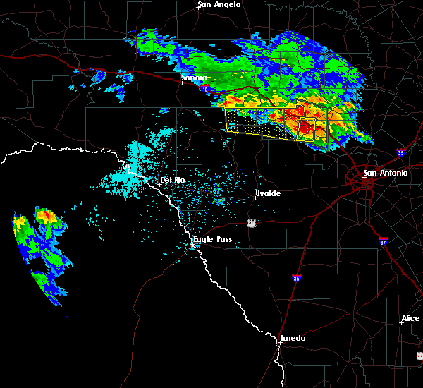 At 333 pm cdt, a severe thunderstorm was located near kerr wildlife management area, or 26 miles west of kerrville, moving south at 40 mph (radar indicated). Hazards include 60 mph wind gusts and quarter size hail. Hail damage to vehicles is expected. expect wind damage to roofs, siding, and trees. Locations impacted include, hunt, mountain home, waltonia, kerr wildlife management area, harper, i-10 near the kimble-kerr county line and the intersection of i-10 and us 290. At 333 pm cdt, a severe thunderstorm was located near kerr wildlife management area, or 26 miles west of kerrville, moving south at 40 mph (radar indicated). Hazards include 60 mph wind gusts and quarter size hail. Hail damage to vehicles is expected. expect wind damage to roofs, siding, and trees. Locations impacted include, hunt, mountain home, waltonia, kerr wildlife management area, harper, i-10 near the kimble-kerr county line and the intersection of i-10 and us 290.
|
| 5/28/2020 3:17 PM CDT |
 At 316 pm cdt, severe thunderstorms were located along a line extending from harper to 13 miles west of telegraph, moving southeast at 25 mph (radar indicated). Hazards include 60 mph wind gusts and quarter size hail. Hail damage to vehicles is expected. expect wind damage to roofs, siding, and trees. Locations impacted include, hunt, mountain home, waltonia, kerr wildlife management area, harper, us-83 near the kerr-kimble county line, i-10 near the kimble- kerr county line, the intersection of i-10 and us 290, us- 377 near the kimble- edwards county line and devil`s sinkhole state natural area. At 316 pm cdt, severe thunderstorms were located along a line extending from harper to 13 miles west of telegraph, moving southeast at 25 mph (radar indicated). Hazards include 60 mph wind gusts and quarter size hail. Hail damage to vehicles is expected. expect wind damage to roofs, siding, and trees. Locations impacted include, hunt, mountain home, waltonia, kerr wildlife management area, harper, us-83 near the kerr-kimble county line, i-10 near the kimble- kerr county line, the intersection of i-10 and us 290, us- 377 near the kimble- edwards county line and devil`s sinkhole state natural area.
|
| 5/28/2020 2:56 PM CDT |
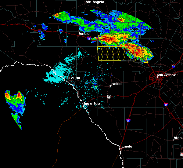 At 256 pm cdt, a severe thunderstorm was located over south llano river state park, or near junction, moving southeast at 35 mph (radar indicated). Hazards include ping pong ball size hail and 60 mph wind gusts. People and animals outdoors will be injured. expect hail damage to roofs, siding, windows, and vehicles. Expect wind damage to roofs, siding, and trees. At 256 pm cdt, a severe thunderstorm was located over south llano river state park, or near junction, moving southeast at 35 mph (radar indicated). Hazards include ping pong ball size hail and 60 mph wind gusts. People and animals outdoors will be injured. expect hail damage to roofs, siding, windows, and vehicles. Expect wind damage to roofs, siding, and trees.
|
| 5/27/2020 8:17 PM CDT | Quarter sized hail reported 9 miles NE of Harper, TX, report from mping: quarter (1.00 in.). |
| 5/27/2020 7:56 PM CDT |
 At 756 pm cdt, severe thunderstorms were located along a line extending from 6 miles northeast of kerrville to waltonia, moving south at 30 mph (radar indicated). Hazards include tennis ball size hail and 60 mph wind gusts. People and animals outdoors will be injured. expect hail damage to roofs, siding, windows, and vehicles. expect wind damage to roofs, siding, and trees. Locations impacted include, kerrville, fredericksburg, comfort, ingram, hunt, camp verde, tivydale, kerrville-schreiner park, waltonia, cypress creek, mountain home, center point, grapetown and harper. At 756 pm cdt, severe thunderstorms were located along a line extending from 6 miles northeast of kerrville to waltonia, moving south at 30 mph (radar indicated). Hazards include tennis ball size hail and 60 mph wind gusts. People and animals outdoors will be injured. expect hail damage to roofs, siding, windows, and vehicles. expect wind damage to roofs, siding, and trees. Locations impacted include, kerrville, fredericksburg, comfort, ingram, hunt, camp verde, tivydale, kerrville-schreiner park, waltonia, cypress creek, mountain home, center point, grapetown and harper.
|
| 5/27/2020 7:49 PM CDT | Ping Pong Ball sized hail reported 9 miles NE of Harper, TX, report from mping: ping pong ball (1.50 in.). |
| 5/27/2020 7:47 PM CDT |
 At 747 pm cdt, severe thunderstorms were located along a line extending from near tivydale to near mountain home, moving southeast at 30 mph (radar indicated). Hazards include two inch hail and 60 mph wind gusts. People and animals outdoors will be injured. expect hail damage to roofs, siding, windows, and vehicles. expect wind damage to roofs, siding, and trees. Locations impacted include, kerrville, fredericksburg, comfort, ingram, hunt, camp verde, tivydale, kerrville-schreiner park, waltonia, cypress creek, mountain home, center point, grapetown and harper. At 747 pm cdt, severe thunderstorms were located along a line extending from near tivydale to near mountain home, moving southeast at 30 mph (radar indicated). Hazards include two inch hail and 60 mph wind gusts. People and animals outdoors will be injured. expect hail damage to roofs, siding, windows, and vehicles. expect wind damage to roofs, siding, and trees. Locations impacted include, kerrville, fredericksburg, comfort, ingram, hunt, camp verde, tivydale, kerrville-schreiner park, waltonia, cypress creek, mountain home, center point, grapetown and harper.
|
| 5/27/2020 7:44 PM CDT | Quarter sized hail reported 9 miles NE of Harper, TX, report from mping: quarter (1.00 in.). |
| 5/27/2020 7:30 PM CDT |
 At 730 pm cdt, a severe thunderstorm was located near harper, or 17 miles north of kerrville, moving south at 25 mph (radar indicated). Hazards include ping pong ball size hail and 60 mph wind gusts. People and animals outdoors will be injured. expect hail damage to roofs, siding, windows, and vehicles. Expect wind damage to roofs, siding, and trees. At 730 pm cdt, a severe thunderstorm was located near harper, or 17 miles north of kerrville, moving south at 25 mph (radar indicated). Hazards include ping pong ball size hail and 60 mph wind gusts. People and animals outdoors will be injured. expect hail damage to roofs, siding, windows, and vehicles. Expect wind damage to roofs, siding, and trees.
|
| 5/27/2020 6:47 PM CDT |
 At 647 pm cdt, a severe thunderstorm was located near tivydale, or 9 miles west of fredericksburg, moving southeast at 40 mph. this is a very dangerous storm (radar indicated). Hazards include baseball size hail and 70 mph wind gusts. People and animals outdoors will be severely injured. expect shattered windows, extensive damage to roofs, siding, and vehicles. Locations impacted include, kerrville, fredericksburg, comfort, stonewall, cherry spring, luckenbach, cain city, tivydale, old tunnel state park, doss, rocky hill, lbj state park, harper, bankersmith, cypress creek, blumenthal, center point, albert, grapetown and lbj national historical park. At 647 pm cdt, a severe thunderstorm was located near tivydale, or 9 miles west of fredericksburg, moving southeast at 40 mph. this is a very dangerous storm (radar indicated). Hazards include baseball size hail and 70 mph wind gusts. People and animals outdoors will be severely injured. expect shattered windows, extensive damage to roofs, siding, and vehicles. Locations impacted include, kerrville, fredericksburg, comfort, stonewall, cherry spring, luckenbach, cain city, tivydale, old tunnel state park, doss, rocky hill, lbj state park, harper, bankersmith, cypress creek, blumenthal, center point, albert, grapetown and lbj national historical park.
|
| 5/27/2020 6:43 PM CDT | Golf Ball sized hail reported 5.7 miles W of Harper, TX |
| 5/27/2020 6:40 PM CDT | Storm damage reported in gillespie county TX, 5.7 miles W of Harper, TX |
| 5/27/2020 6:39 PM CDT |
 At 638 pm cdt, a severe thunderstorm was located near tivydale, or 15 miles west of fredericksburg, moving southeast at 35 mph (radar indicated). Hazards include two inch hail and 60 mph wind gusts. People and animals outdoors will be injured. expect hail damage to roofs, siding, windows, and vehicles. expect wind damage to roofs, siding, and trees. Locations impacted include, kerrville, fredericksburg, comfort, stonewall, cherry spring, luckenbach, cain city, tivydale, old tunnel state park, doss, rocky hill, lbj state park, harper, bankersmith, cypress creek, blumenthal, center point, albert, grapetown and lbj national historical park. At 638 pm cdt, a severe thunderstorm was located near tivydale, or 15 miles west of fredericksburg, moving southeast at 35 mph (radar indicated). Hazards include two inch hail and 60 mph wind gusts. People and animals outdoors will be injured. expect hail damage to roofs, siding, windows, and vehicles. expect wind damage to roofs, siding, and trees. Locations impacted include, kerrville, fredericksburg, comfort, stonewall, cherry spring, luckenbach, cain city, tivydale, old tunnel state park, doss, rocky hill, lbj state park, harper, bankersmith, cypress creek, blumenthal, center point, albert, grapetown and lbj national historical park.
|
| 5/27/2020 6:24 PM CDT |
 At 624 pm cdt, a severe thunderstorm was located near doss, or 21 miles northwest of fredericksburg, moving southeast at 35 mph (radar indicated). Hazards include golf ball size hail and 60 mph wind gusts. People and animals outdoors will be injured. expect hail damage to roofs, siding, windows, and vehicles. Expect wind damage to roofs, siding, and trees. At 624 pm cdt, a severe thunderstorm was located near doss, or 21 miles northwest of fredericksburg, moving southeast at 35 mph (radar indicated). Hazards include golf ball size hail and 60 mph wind gusts. People and animals outdoors will be injured. expect hail damage to roofs, siding, windows, and vehicles. Expect wind damage to roofs, siding, and trees.
|
| 5/27/2020 6:06 PM CDT |
 At 605 pm cdt, severe thunderstorms were located along a line extending from near castell to near loyal valley to 11 miles northwest of doss, moving southeast at 35 mph (radar indicated). Hazards include 60 mph wind gusts and quarter size hail. Hail damage to vehicles is expected. expect wind damage to roofs, siding, and trees. Locations impacted include, fredericksburg, llano, castell, field creek, cherry spring, enchanted rock state natural area, tivydale, doss, willow city, valley spring, harper, prairie mountain, eckert, crabapple and oxford. At 605 pm cdt, severe thunderstorms were located along a line extending from near castell to near loyal valley to 11 miles northwest of doss, moving southeast at 35 mph (radar indicated). Hazards include 60 mph wind gusts and quarter size hail. Hail damage to vehicles is expected. expect wind damage to roofs, siding, and trees. Locations impacted include, fredericksburg, llano, castell, field creek, cherry spring, enchanted rock state natural area, tivydale, doss, willow city, valley spring, harper, prairie mountain, eckert, crabapple and oxford.
|
| 5/27/2020 5:48 PM CDT |
 At 548 pm cdt, severe thunderstorms were located along a line extending from near pontotoc to near hedwigs hill to 11 miles south of streeter, moving southeast at 35 mph (radar indicated). Hazards include 60 mph wind gusts and quarter size hail. Hail damage to vehicles is expected. Expect wind damage to roofs, siding, and trees. At 548 pm cdt, severe thunderstorms were located along a line extending from near pontotoc to near hedwigs hill to 11 miles south of streeter, moving southeast at 35 mph (radar indicated). Hazards include 60 mph wind gusts and quarter size hail. Hail damage to vehicles is expected. Expect wind damage to roofs, siding, and trees.
|
| 5/24/2020 8:00 PM CDT |
 At 759 pm cdt, severe thunderstorms were located along a line extending from near crabapple to 6 miles east of derby, moving east at 40 mph (radar indicated). Hazards include 60 mph wind gusts and quarter size hail. Hail damage to vehicles is expected. Expect wind damage to roofs, siding, and trees. At 759 pm cdt, severe thunderstorms were located along a line extending from near crabapple to 6 miles east of derby, moving east at 40 mph (radar indicated). Hazards include 60 mph wind gusts and quarter size hail. Hail damage to vehicles is expected. Expect wind damage to roofs, siding, and trees.
|
| 4/12/2020 4:08 AM CDT |
 At 407 am cdt, a severe thunderstorm was located near fredericksburg, moving east at 45 mph (radar indicated). Hazards include 60 mph wind gusts and nickel size hail. Expect damage to roofs, siding, and trees. Locations impacted include, kerrville, fredericksburg, stonewall, luckenbach, cain city, tivydale, willow city, rocky hill, lbj state park, bankersmith, hye, blumenthal, eckert, crabapple, albert, grapetown, harper and lbj national historical park. At 407 am cdt, a severe thunderstorm was located near fredericksburg, moving east at 45 mph (radar indicated). Hazards include 60 mph wind gusts and nickel size hail. Expect damage to roofs, siding, and trees. Locations impacted include, kerrville, fredericksburg, stonewall, luckenbach, cain city, tivydale, willow city, rocky hill, lbj state park, bankersmith, hye, blumenthal, eckert, crabapple, albert, grapetown, harper and lbj national historical park.
|
| 4/12/2020 3:44 AM CDT |
 At 344 am cdt, a severe thunderstorm was located near ingram, or 7 miles northwest of kerrville, moving east at 45 mph (radar indicated). Hazards include 60 mph wind gusts and quarter size hail. Hail damage to vehicles is expected. Expect wind damage to roofs, siding, and trees. At 344 am cdt, a severe thunderstorm was located near ingram, or 7 miles northwest of kerrville, moving east at 45 mph (radar indicated). Hazards include 60 mph wind gusts and quarter size hail. Hail damage to vehicles is expected. Expect wind damage to roofs, siding, and trees.
|
| 4/12/2020 3:25 AM CDT |
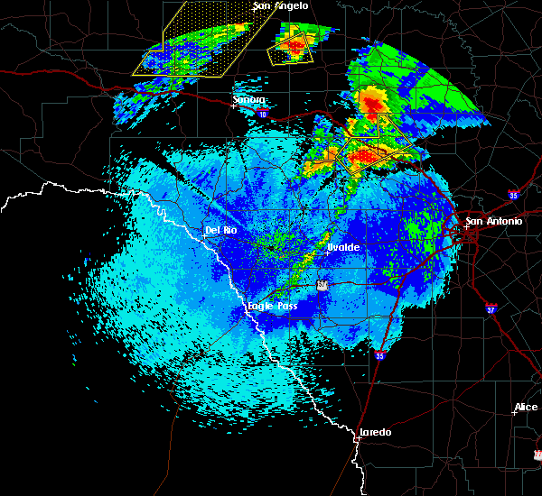 At 325 am cdt, a severe thunderstorm was located near mountain home, or 20 miles west of kerrville, moving northeast at 50 mph (radar indicated). Hazards include 60 mph wind gusts and quarter size hail. Hail damage to vehicles is expected. expect wind damage to roofs, siding, and trees. Locations impacted include, hunt, mountain home, tivydale, kerr wildlife management area, harper, i-10 near the kimble-kerr county line and the intersection of i-10 and us 290. At 325 am cdt, a severe thunderstorm was located near mountain home, or 20 miles west of kerrville, moving northeast at 50 mph (radar indicated). Hazards include 60 mph wind gusts and quarter size hail. Hail damage to vehicles is expected. expect wind damage to roofs, siding, and trees. Locations impacted include, hunt, mountain home, tivydale, kerr wildlife management area, harper, i-10 near the kimble-kerr county line and the intersection of i-10 and us 290.
|
| 4/12/2020 3:05 AM CDT |
 At 305 am cdt, a severe thunderstorm was located 12 miles west of kerr wildlife management area, or 19 miles north of leakey, moving northeast at 50 mph (radar indicated). Hazards include 60 mph wind gusts and half dollar size hail. Hail damage to vehicles is expected. Expect wind damage to roofs, siding, and trees. At 305 am cdt, a severe thunderstorm was located 12 miles west of kerr wildlife management area, or 19 miles north of leakey, moving northeast at 50 mph (radar indicated). Hazards include 60 mph wind gusts and half dollar size hail. Hail damage to vehicles is expected. Expect wind damage to roofs, siding, and trees.
|
| 3/19/2020 4:50 AM CDT |
 At 450 am cdt, a severe thunderstorm was located near cherry spring, or 13 miles northwest of fredericksburg, moving northeast at 55 mph (radar indicated). Hazards include two inch hail and 60 mph wind gusts. People and animals outdoors will be injured. expect hail damage to roofs, siding, windows, and vehicles. expect wind damage to roofs, siding, and trees. Locations impacted include, fredericksburg, cherry spring, tivydale, doss and harper. At 450 am cdt, a severe thunderstorm was located near cherry spring, or 13 miles northwest of fredericksburg, moving northeast at 55 mph (radar indicated). Hazards include two inch hail and 60 mph wind gusts. People and animals outdoors will be injured. expect hail damage to roofs, siding, windows, and vehicles. expect wind damage to roofs, siding, and trees. Locations impacted include, fredericksburg, cherry spring, tivydale, doss and harper.
|
| 3/19/2020 4:39 AM CDT |
 At 438 am cdt, a severe thunderstorm was located near harper, or 19 miles north of kerrville, moving northeast at 55 mph (radar indicated). Hazards include ping pong ball size hail and 60 mph wind gusts. People and animals outdoors will be injured. expect hail damage to roofs, siding, windows, and vehicles. expect wind damage to roofs, siding, and trees. Locations impacted include, fredericksburg, cherry spring, tivydale, doss and harper. At 438 am cdt, a severe thunderstorm was located near harper, or 19 miles north of kerrville, moving northeast at 55 mph (radar indicated). Hazards include ping pong ball size hail and 60 mph wind gusts. People and animals outdoors will be injured. expect hail damage to roofs, siding, windows, and vehicles. expect wind damage to roofs, siding, and trees. Locations impacted include, fredericksburg, cherry spring, tivydale, doss and harper.
|
| 3/19/2020 4:13 AM CDT |
 At 411 am cdt, a severe thunderstorm was located near kerr wildlife management area, or 24 miles west of kerrville, moving northeast at 55 mph (radar indicated). Hazards include 60 mph wind gusts and quarter size hail. Hail damage to vehicles is expected. Expect wind damage to roofs, siding, and trees. At 411 am cdt, a severe thunderstorm was located near kerr wildlife management area, or 24 miles west of kerrville, moving northeast at 55 mph (radar indicated). Hazards include 60 mph wind gusts and quarter size hail. Hail damage to vehicles is expected. Expect wind damage to roofs, siding, and trees.
|
| 3/4/2020 4:43 AM CST |
 At 442 am cst, severe thunderstorms were located along a line extending from near tivydale to near cypress creek to near hill country state natural area to near d`hanis, moving east at 35 mph (radar indicated). Hazards include 60 mph wind gusts and quarter size hail. Hail damage to vehicles is expected. Expect wind damage to roofs, siding, and trees. At 442 am cst, severe thunderstorms were located along a line extending from near tivydale to near cypress creek to near hill country state natural area to near d`hanis, moving east at 35 mph (radar indicated). Hazards include 60 mph wind gusts and quarter size hail. Hail damage to vehicles is expected. Expect wind damage to roofs, siding, and trees.
|
| 3/4/2020 4:28 AM CST |
 At 428 am cst, severe thunderstorms were located along a line extending from near mountain home to kerrville to medina to 7 miles southwest of tarpley, moving east at 40 mph (radar indicated). Hazards include 60 mph wind gusts and quarter size hail. Hail damage to vehicles is expected. expect wind damage to roofs, siding, and trees. Locations impacted include, medina, kerrville, hondo, bandera, tarpley, ingram, hunt, camp verde, d`hanis, kerrville-schreiner park, waltonia, harper, cypress creek, mountain home, center point and hill country state natural area. At 428 am cst, severe thunderstorms were located along a line extending from near mountain home to kerrville to medina to 7 miles southwest of tarpley, moving east at 40 mph (radar indicated). Hazards include 60 mph wind gusts and quarter size hail. Hail damage to vehicles is expected. expect wind damage to roofs, siding, and trees. Locations impacted include, medina, kerrville, hondo, bandera, tarpley, ingram, hunt, camp verde, d`hanis, kerrville-schreiner park, waltonia, harper, cypress creek, mountain home, center point and hill country state natural area.
|
| 3/4/2020 4:17 AM CST |
 At 417 am cst, severe thunderstorms were located along a line extending from near mountain home to near waltonia to 7 miles southwest of medina to near sabinal, moving east at 40 mph (radar indicated). Hazards include 60 mph wind gusts and penny size hail. Expect damage to roofs, siding, and trees. Locations impacted include, medina, kerrville, hondo, bandera, tarpley, ingram, sabinal, hunt, camp verde, d`hanis, kerrville-schreiner park, waltonia, harper, cypress creek, mountain home, center point, utopia, hill country state natural area and knippa. At 417 am cst, severe thunderstorms were located along a line extending from near mountain home to near waltonia to 7 miles southwest of medina to near sabinal, moving east at 40 mph (radar indicated). Hazards include 60 mph wind gusts and penny size hail. Expect damage to roofs, siding, and trees. Locations impacted include, medina, kerrville, hondo, bandera, tarpley, ingram, sabinal, hunt, camp verde, d`hanis, kerrville-schreiner park, waltonia, harper, cypress creek, mountain home, center point, utopia, hill country state natural area and knippa.
|
| 3/4/2020 3:56 AM CST |
 At 355 am cst, severe thunderstorms were located along a line extending from 16 miles south of segovia to near kerr wildlife management area to vanderpool to 6 miles northwest of knippa, moving east at 40 mph (radar indicated). Hazards include 60 mph wind gusts and penny size hail. expect damage to roofs, siding, and trees At 355 am cst, severe thunderstorms were located along a line extending from 16 miles south of segovia to near kerr wildlife management area to vanderpool to 6 miles northwest of knippa, moving east at 40 mph (radar indicated). Hazards include 60 mph wind gusts and penny size hail. expect damage to roofs, siding, and trees
|
| 1/10/2020 4:13 PM CST |
 At 413 pm cst, a severe thunderstorm was located over tivydale, or 11 miles west of fredericksburg, moving northeast at 45 mph (radar indicated). Hazards include ping pong ball size hail and 60 mph wind gusts. People and animals outdoors will be injured. expect hail damage to roofs, siding, windows, and vehicles. expect wind damage to roofs, siding, and trees. Locations impacted include, fredericksburg, kingsland, llano, buchanan dam, gainesville, buchanan lake village, castell, cherry spring, lone grove, enchanted rock state natural area, cain city, tivydale, bluffton, willow city, valley spring, rocky hill, prairie mountain, baby head, stolz and eckert. At 413 pm cst, a severe thunderstorm was located over tivydale, or 11 miles west of fredericksburg, moving northeast at 45 mph (radar indicated). Hazards include ping pong ball size hail and 60 mph wind gusts. People and animals outdoors will be injured. expect hail damage to roofs, siding, windows, and vehicles. expect wind damage to roofs, siding, and trees. Locations impacted include, fredericksburg, kingsland, llano, buchanan dam, gainesville, buchanan lake village, castell, cherry spring, lone grove, enchanted rock state natural area, cain city, tivydale, bluffton, willow city, valley spring, rocky hill, prairie mountain, baby head, stolz and eckert.
|
| 1/10/2020 4:00 PM CST |
 At 400 pm cst, severe thunderstorms were located along a line extending from near valley spring to near tivydale, moving northeast at 50 mph (radar indicated). Hazards include 60 mph wind gusts and quarter size hail. Hail damage to vehicles is expected. Expect wind damage to roofs, siding, and trees. At 400 pm cst, severe thunderstorms were located along a line extending from near valley spring to near tivydale, moving northeast at 50 mph (radar indicated). Hazards include 60 mph wind gusts and quarter size hail. Hail damage to vehicles is expected. Expect wind damage to roofs, siding, and trees.
|
| 6/16/2019 10:19 PM CDT |
 At 1019 pm cdt, a severe thunderstorm capable of producing a tornado was located over ingram, or near kerrville, moving southeast at 25 mph (radar indicated rotation). Hazards include tornado and tennis ball size hail. Flying debris will be dangerous to those caught without shelter. mobile homes will be damaged or destroyed. damage to roofs, windows, and vehicles will occur. tree damage is likely. Locations impacted include, kerrville, ingram, hunt, mountain home, kerrville-schreiner park, waltonia, harper, i-10 near the kimble-kerr county line and the intersection of i-10 and us 290. At 1019 pm cdt, a severe thunderstorm capable of producing a tornado was located over ingram, or near kerrville, moving southeast at 25 mph (radar indicated rotation). Hazards include tornado and tennis ball size hail. Flying debris will be dangerous to those caught without shelter. mobile homes will be damaged or destroyed. damage to roofs, windows, and vehicles will occur. tree damage is likely. Locations impacted include, kerrville, ingram, hunt, mountain home, kerrville-schreiner park, waltonia, harper, i-10 near the kimble-kerr county line and the intersection of i-10 and us 290.
|
| 6/16/2019 10:05 PM CDT |
 The national weather service in austin san antonio has issued a * tornado warning for. central kerr county in south central texas. southwestern gillespie county in south central texas. until 1045 pm cdt. At 1005 pm cdt, a severe thunderstorm capable of producing a. The national weather service in austin san antonio has issued a * tornado warning for. central kerr county in south central texas. southwestern gillespie county in south central texas. until 1045 pm cdt. At 1005 pm cdt, a severe thunderstorm capable of producing a.
|
| 6/16/2019 10:04 PM CDT |
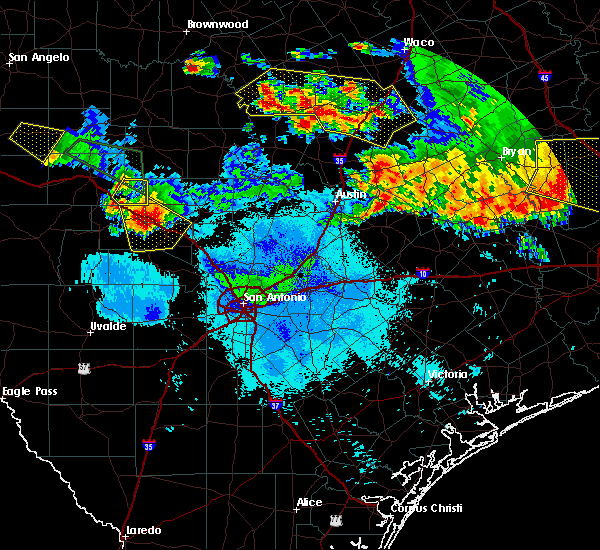 At 1003 pm cdt, a severe thunderstorm was located near mountain home, or 12 miles northwest of kerrville, moving southeast at 25 mph. this is a very dangerous storm (radar indicated). Hazards include baseball size hail and 60 mph wind gusts. People and animals outdoors will be severely injured. expect shattered windows, extensive damage to roofs, siding, and vehicles. Locations impacted include, kerrville, ingram, hunt, mountain home, kerrville-schreiner park, waltonia, harper, i-10 near the kimble-kerr county line and the intersection of i-10 and us 290. At 1003 pm cdt, a severe thunderstorm was located near mountain home, or 12 miles northwest of kerrville, moving southeast at 25 mph. this is a very dangerous storm (radar indicated). Hazards include baseball size hail and 60 mph wind gusts. People and animals outdoors will be severely injured. expect shattered windows, extensive damage to roofs, siding, and vehicles. Locations impacted include, kerrville, ingram, hunt, mountain home, kerrville-schreiner park, waltonia, harper, i-10 near the kimble-kerr county line and the intersection of i-10 and us 290.
|
| 6/16/2019 10:03 PM CDT | Hen Egg sized hail reported 8.1 miles NE of Harper, TX |
| 6/16/2019 10:03 PM CDT | Storm damage reported in kerr county TX, 8.1 miles NE of Harper, TX |
| 6/16/2019 9:52 PM CDT | Quarter sized hail reported 5.3 miles ENE of Harper, TX |
| 6/16/2019 9:47 PM CDT | Golf Ball sized hail reported 11.6 miles ENE of Harper, TX |
| 6/16/2019 9:47 PM CDT |
 At 947 pm cdt, a severe thunderstorm was located near mountain home, or 19 miles northwest of kerrville, moving southeast at 25 mph (radar indicated). Hazards include two inch hail and 60 mph wind gusts. People and animals outdoors will be injured. expect hail damage to roofs, siding, windows, and vehicles. expect wind damage to roofs, siding, and trees. Locations impacted include, kerrville, ingram, hunt, mountain home, kerrville-schreiner park, waltonia, harper, i-10 near the kimble-kerr county line and the intersection of i-10 and us 290. At 947 pm cdt, a severe thunderstorm was located near mountain home, or 19 miles northwest of kerrville, moving southeast at 25 mph (radar indicated). Hazards include two inch hail and 60 mph wind gusts. People and animals outdoors will be injured. expect hail damage to roofs, siding, windows, and vehicles. expect wind damage to roofs, siding, and trees. Locations impacted include, kerrville, ingram, hunt, mountain home, kerrville-schreiner park, waltonia, harper, i-10 near the kimble-kerr county line and the intersection of i-10 and us 290.
|
| 6/16/2019 9:38 PM CDT |
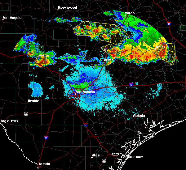 At 938 pm cdt, a severe thunderstorm was located 7 miles north of mountain home, or 22 miles northwest of kerrville, moving southeast at 25 mph (radar indicated). Hazards include two inch hail and 60 mph wind gusts. People and animals outdoors will be injured. expect hail damage to roofs, siding, windows, and vehicles. Expect wind damage to roofs, siding, and trees. At 938 pm cdt, a severe thunderstorm was located 7 miles north of mountain home, or 22 miles northwest of kerrville, moving southeast at 25 mph (radar indicated). Hazards include two inch hail and 60 mph wind gusts. People and animals outdoors will be injured. expect hail damage to roofs, siding, windows, and vehicles. Expect wind damage to roofs, siding, and trees.
|
| 6/9/2019 8:06 PM CDT |
 At 806 pm cdt, severe thunderstorms were located along a line extending from 10 miles southeast of telegraph to 6 miles south of harper to near stonewall, moving south at 20 mph (trained weather spotters). Hazards include 70 mph wind gusts and quarter size hail. Hail damage to vehicles is expected. expect considerable tree damage. wind damage is also likely to mobile homes, roofs, and outbuildings. Locations impacted include, kerrville, fredericksburg, comfort, ingram, hunt, stonewall, tivydale, kerrville-schreiner park, rocky hill, kerr wildlife management area, waltonia, sisterdale, welfare, blumenthal, center point, albert, waring, grapetown, luckenbach and cain city. At 806 pm cdt, severe thunderstorms were located along a line extending from 10 miles southeast of telegraph to 6 miles south of harper to near stonewall, moving south at 20 mph (trained weather spotters). Hazards include 70 mph wind gusts and quarter size hail. Hail damage to vehicles is expected. expect considerable tree damage. wind damage is also likely to mobile homes, roofs, and outbuildings. Locations impacted include, kerrville, fredericksburg, comfort, ingram, hunt, stonewall, tivydale, kerrville-schreiner park, rocky hill, kerr wildlife management area, waltonia, sisterdale, welfare, blumenthal, center point, albert, waring, grapetown, luckenbach and cain city.
|
| 6/9/2019 7:57 PM CDT |
 The national weather service in austin san antonio has issued a * severe thunderstorm warning for. kerr county in south central texas. gillespie county in south central texas. northeastern edwards county in south central texas. Northwestern kendall county in south central texas. The national weather service in austin san antonio has issued a * severe thunderstorm warning for. kerr county in south central texas. gillespie county in south central texas. northeastern edwards county in south central texas. Northwestern kendall county in south central texas.
|
| 6/9/2019 7:45 PM CDT |
 At 743 pm cdt, severe thunderstorms were located along a line extending from willow city to near harper, moving south at 30 mph (radar indicated). Hazards include 60 mph wind gusts and half dollar size hail. Hail damage to vehicles is expected. expect wind damage to roofs, siding, and trees. Locations impacted include, fredericksburg, stonewall, cherry spring, eckert, tivydale, crabapple, doss, willow city and harper. At 743 pm cdt, severe thunderstorms were located along a line extending from willow city to near harper, moving south at 30 mph (radar indicated). Hazards include 60 mph wind gusts and half dollar size hail. Hail damage to vehicles is expected. expect wind damage to roofs, siding, and trees. Locations impacted include, fredericksburg, stonewall, cherry spring, eckert, tivydale, crabapple, doss, willow city and harper.
|
| 6/9/2019 7:23 PM CDT |
 At 723 pm cdt, a severe thunderstorm was located near enchanted rock state natural area, or 15 miles northeast of fredericksburg, moving south at 25 mph (radar indicated). Hazards include ping pong ball size hail and 60 mph wind gusts. People and animals outdoors will be injured. expect hail damage to roofs, siding, windows, and vehicles. expect wind damage to roofs, siding, and trees. Locations impacted include, fredericksburg, stonewall, cherry spring, prairie mountain, enchanted rock state natural area, eckert, tivydale, crabapple, doss, willow city, oxford and harper. At 723 pm cdt, a severe thunderstorm was located near enchanted rock state natural area, or 15 miles northeast of fredericksburg, moving south at 25 mph (radar indicated). Hazards include ping pong ball size hail and 60 mph wind gusts. People and animals outdoors will be injured. expect hail damage to roofs, siding, windows, and vehicles. expect wind damage to roofs, siding, and trees. Locations impacted include, fredericksburg, stonewall, cherry spring, prairie mountain, enchanted rock state natural area, eckert, tivydale, crabapple, doss, willow city, oxford and harper.
|
| 6/9/2019 7:00 PM CDT |
 The national weather service in austin san antonio has issued a * severe thunderstorm warning for. gillespie county in south central texas. southwestern llano county in south central texas. until 800 pm cdt. At 659 pm cdt, a severe thunderstorm was located near prairie. The national weather service in austin san antonio has issued a * severe thunderstorm warning for. gillespie county in south central texas. southwestern llano county in south central texas. until 800 pm cdt. At 659 pm cdt, a severe thunderstorm was located near prairie.
|
| 5/14/2019 12:46 PM CDT |
 At 1245 pm cdt, a severe thunderstorm was located near ingram, or near kerrville, moving east at 25 mph (radar indicated). Hazards include quarter size hail. damage to vehicles is expected At 1245 pm cdt, a severe thunderstorm was located near ingram, or near kerrville, moving east at 25 mph (radar indicated). Hazards include quarter size hail. damage to vehicles is expected
|
| 5/9/2019 1:52 PM CDT |
 A severe thunderstorm warning remains in effect until 215 pm cdt for east central kerr. southwestern gillespie and northwestern kendall counties. at 152 pm cdt, a severe thunderstorm was located over center point, or 7 miles southeast of kerrville, moving northeast at 15 mph. hazard. 60 mph wind gusts and quarter size hail. A severe thunderstorm warning remains in effect until 215 pm cdt for east central kerr. southwestern gillespie and northwestern kendall counties. at 152 pm cdt, a severe thunderstorm was located over center point, or 7 miles southeast of kerrville, moving northeast at 15 mph. hazard. 60 mph wind gusts and quarter size hail.
|
| 5/9/2019 1:22 PM CDT |
 The national weather service in austin san antonio has issued a * severe thunderstorm warning for. northwestern bandera county in south central texas. kerr county in south central texas. southwestern gillespie county in south central texas. Northeastern edwards county in south central texas. The national weather service in austin san antonio has issued a * severe thunderstorm warning for. northwestern bandera county in south central texas. kerr county in south central texas. southwestern gillespie county in south central texas. Northeastern edwards county in south central texas.
|
| 5/8/2019 10:01 AM CDT |
 The national weather service in austin san antonio has issued a * severe thunderstorm warning for. northeastern kerr county in south central texas. western blanco county in south central texas. gillespie county in south central texas. Northern kendall county in south central texas. The national weather service in austin san antonio has issued a * severe thunderstorm warning for. northeastern kerr county in south central texas. western blanco county in south central texas. gillespie county in south central texas. Northern kendall county in south central texas.
|
| 4/24/2019 10:59 AM CDT |
 At 1059 am cdt, a severe thunderstorm was located near camp verde, or 8 miles north of medina, moving northeast at 40 mph (radar indicated). Hazards include quarter size hail. damage to vehicles is expected At 1059 am cdt, a severe thunderstorm was located near camp verde, or 8 miles north of medina, moving northeast at 40 mph (radar indicated). Hazards include quarter size hail. damage to vehicles is expected
|
| 4/17/2019 10:41 PM CDT |
 At 1041 pm cdt, severe thunderstorms were located along a line extending from near crabapple to near kerrville-schreiner park, moving east at 45 mph (radar indicated). Hazards include 60 mph wind gusts and penny size hail. expect damage to roofs, siding, and trees At 1041 pm cdt, severe thunderstorms were located along a line extending from near crabapple to near kerrville-schreiner park, moving east at 45 mph (radar indicated). Hazards include 60 mph wind gusts and penny size hail. expect damage to roofs, siding, and trees
|
| 12/26/2018 9:09 PM CST |
 At 909 pm cst, severe thunderstorms were located along a line extending from 6 miles northeast of lost maples state natural area to 8 miles southeast of laguna, moving southeast at 10 mph (radar indicated). Hazards include 60 mph wind gusts and quarter size hail. Hail damage to vehicles is expected. expect wind damage to roofs, siding, and trees. locations impacted include, leakey, vanderpool, hunt, mountain home, garner state park, tuff, rio frio, reagan wells, lost maples state natural area, waltonia and kerr wildlife management area. A tornado watch remains in effect until 200 am cst for south central texas. At 909 pm cst, severe thunderstorms were located along a line extending from 6 miles northeast of lost maples state natural area to 8 miles southeast of laguna, moving southeast at 10 mph (radar indicated). Hazards include 60 mph wind gusts and quarter size hail. Hail damage to vehicles is expected. expect wind damage to roofs, siding, and trees. locations impacted include, leakey, vanderpool, hunt, mountain home, garner state park, tuff, rio frio, reagan wells, lost maples state natural area, waltonia and kerr wildlife management area. A tornado watch remains in effect until 200 am cst for south central texas.
|
| 12/26/2018 8:53 PM CST |
 At 852 pm cst, severe thunderstorms were located along a line extending from near harper to laguna, moving northeast at 40 mph (radar indicated). Hazards include 60 mph wind gusts and quarter size hail. Hail damage to vehicles is expected. expect wind damage to roofs, siding, and trees. locations impacted include, leakey, vanderpool, hunt, camp wood, laguna, tuff, rio frio, waltonia, kerr wildlife management area, mountain home, montell, cline, garner state park, reagan wells and lost maples state natural area. A tornado watch remains in effect until 200 am cst for south central texas. At 852 pm cst, severe thunderstorms were located along a line extending from near harper to laguna, moving northeast at 40 mph (radar indicated). Hazards include 60 mph wind gusts and quarter size hail. Hail damage to vehicles is expected. expect wind damage to roofs, siding, and trees. locations impacted include, leakey, vanderpool, hunt, camp wood, laguna, tuff, rio frio, waltonia, kerr wildlife management area, mountain home, montell, cline, garner state park, reagan wells and lost maples state natural area. A tornado watch remains in effect until 200 am cst for south central texas.
|
| 12/26/2018 8:33 PM CST |
 At 832 pm cst, severe thunderstorms were located along a line extending from near mountain home to 7 miles northwest of cline, moving northeast at 40 mph. these storms have a history of producing hail up to the size of half dollars (radar indicated). Hazards include 60 mph wind gusts and quarter size hail. Hail damage to vehicles is expected. expect wind damage to roofs, siding, and trees. locations impacted include, leakey, vanderpool, hunt, camp wood, laguna, blewett, barksdale, tuff, rio frio, vance, waltonia, kerr wildlife management area, mountain home, montell, dabney, cline, garner state park, anacacho, reagan wells and alamo village. A tornado watch remains in effect until 200 am cst for south central texas. At 832 pm cst, severe thunderstorms were located along a line extending from near mountain home to 7 miles northwest of cline, moving northeast at 40 mph. these storms have a history of producing hail up to the size of half dollars (radar indicated). Hazards include 60 mph wind gusts and quarter size hail. Hail damage to vehicles is expected. expect wind damage to roofs, siding, and trees. locations impacted include, leakey, vanderpool, hunt, camp wood, laguna, blewett, barksdale, tuff, rio frio, vance, waltonia, kerr wildlife management area, mountain home, montell, dabney, cline, garner state park, anacacho, reagan wells and alamo village. A tornado watch remains in effect until 200 am cst for south central texas.
|
| 12/26/2018 8:16 PM CST |
 At 815 pm cst, severe thunderstorms were located along a line extending from near kerr wildlife management area to near brackettville, moving northeast at 60 mph. within, the line of storms, the strongest cells were located over brackettville and 5 miles southwest of barksdale at 815 pm (radar indicated). Hazards include 60 mph wind gusts and quarter size hail. Hail damage to vehicles is expected. expect wind damage to roofs, siding, and trees. locations impacted include, brackettville, leakey, spofford, vanderpool, hunt, camp wood, laguna, barksdale, tuff, vance, waltonia, kerr wildlife management area, dabney, cline, anacacho, reagan wells, alamo village, blewett, rio frio and mountain home. A tornado watch remains in effect until 200 am cst for south central texas. At 815 pm cst, severe thunderstorms were located along a line extending from near kerr wildlife management area to near brackettville, moving northeast at 60 mph. within, the line of storms, the strongest cells were located over brackettville and 5 miles southwest of barksdale at 815 pm (radar indicated). Hazards include 60 mph wind gusts and quarter size hail. Hail damage to vehicles is expected. expect wind damage to roofs, siding, and trees. locations impacted include, brackettville, leakey, spofford, vanderpool, hunt, camp wood, laguna, barksdale, tuff, vance, waltonia, kerr wildlife management area, dabney, cline, anacacho, reagan wells, alamo village, blewett, rio frio and mountain home. A tornado watch remains in effect until 200 am cst for south central texas.
|
| 12/26/2018 8:01 PM CST |
 At 801 pm cst, severe thunderstorms were located along a line extending from 7 miles northwest of barksdale to 8 miles west of spofford, moving northeast at 35 mph (radar indicated). Hazards include 60 mph wind gusts and quarter size hail. Hail damage to vehicles is expected. Expect wind damage to roofs, siding, and trees. At 801 pm cst, severe thunderstorms were located along a line extending from 7 miles northwest of barksdale to 8 miles west of spofford, moving northeast at 35 mph (radar indicated). Hazards include 60 mph wind gusts and quarter size hail. Hail damage to vehicles is expected. Expect wind damage to roofs, siding, and trees.
|
| 5/15/2018 9:32 PM CDT | Ping Pong Ball sized hail reported 14.3 miles NE of Harper, TX |
| 5/15/2018 9:31 PM CDT |
 At 931 pm cdt, a severe thunderstorm was located over mountain home, or 17 miles northwest of kerrville, moving south at 40 mph (radar indicated). Hazards include 60 mph wind gusts and quarter size hail. Hail damage to vehicles is expected. expect wind damage to roofs, siding, and trees. Locations impacted include, kerrville, ingram, hunt, mountain home, kerr wildlife management area, waltonia, kerrville-schreiner park, harper, i-10 near the kimble-kerr county line and the intersection of i-10 and us 290. At 931 pm cdt, a severe thunderstorm was located over mountain home, or 17 miles northwest of kerrville, moving south at 40 mph (radar indicated). Hazards include 60 mph wind gusts and quarter size hail. Hail damage to vehicles is expected. expect wind damage to roofs, siding, and trees. Locations impacted include, kerrville, ingram, hunt, mountain home, kerr wildlife management area, waltonia, kerrville-schreiner park, harper, i-10 near the kimble-kerr county line and the intersection of i-10 and us 290.
|
| 5/15/2018 9:17 PM CDT |
 At 917 pm cdt, a severe thunderstorm was located 10 miles northwest of mountain home, or 22 miles southeast of junction, moving southeast at 35 mph (radar indicated). Hazards include ping pong ball size hail and 60 mph wind gusts. People and animals outdoors will be injured. expect hail damage to roofs, siding, windows, and vehicles. Expect wind damage to roofs, siding, and trees. At 917 pm cdt, a severe thunderstorm was located 10 miles northwest of mountain home, or 22 miles southeast of junction, moving southeast at 35 mph (radar indicated). Hazards include ping pong ball size hail and 60 mph wind gusts. People and animals outdoors will be injured. expect hail damage to roofs, siding, windows, and vehicles. Expect wind damage to roofs, siding, and trees.
|
| 9/5/2017 4:48 PM CDT | Brief downburst winds of 45 to 50 mph broke some 2 inch diameter oak tree limb in kerr county TX, 10.6 miles NE of Harper, TX |
| 5/28/2017 4:15 PM CDT |
 At 415 pm cdt, a severe thunderstorm was located near kerr wildlife management area, or 20 miles north of vanderpool, and is nearly stationary (radar indicated). Hazards include 60 mph wind gusts and quarter size hail. Hail damage to vehicles is expected. expect wind damage to roofs, siding, and trees. Locations impacted include, hunt, mountain home, kerr wildlife management area and waltonia. At 415 pm cdt, a severe thunderstorm was located near kerr wildlife management area, or 20 miles north of vanderpool, and is nearly stationary (radar indicated). Hazards include 60 mph wind gusts and quarter size hail. Hail damage to vehicles is expected. expect wind damage to roofs, siding, and trees. Locations impacted include, hunt, mountain home, kerr wildlife management area and waltonia.
|
| 5/28/2017 3:57 PM CDT |
 At 357 pm cdt, a severe thunderstorm was located near kerr wildlife management area, or 21 miles north of vanderpool, and is nearly stationary (radar indicated). Hazards include 60 mph wind gusts and half dollar size hail. Hail damage to vehicles is expected. Expect wind damage to roofs, siding, and trees. At 357 pm cdt, a severe thunderstorm was located near kerr wildlife management area, or 21 miles north of vanderpool, and is nearly stationary (radar indicated). Hazards include 60 mph wind gusts and half dollar size hail. Hail damage to vehicles is expected. Expect wind damage to roofs, siding, and trees.
|
| 4/2/2017 7:35 AM CDT |
 At 735 am cdt, severe thunderstorms were located along a line extending from tivydale to bandera, moving northeast at 35 mph (radar indicated). Hazards include 60 mph wind gusts and quarter size hail. Hail damage to vehicles is expected. expect wind damage to roofs, siding, and trees. locations impacted include, kerrville, fredericksburg, boerne, comfort, bandera, ingram, walnut grove, camp verde, bandera falls, tivydale, rocky hill, sisterdale, pipe creek, welfare, nelson city, kerrville state park, center point, waring, crabapple and grapetown. A tornado watch remains in effect until 100 pm cdt for south central texas. At 735 am cdt, severe thunderstorms were located along a line extending from tivydale to bandera, moving northeast at 35 mph (radar indicated). Hazards include 60 mph wind gusts and quarter size hail. Hail damage to vehicles is expected. expect wind damage to roofs, siding, and trees. locations impacted include, kerrville, fredericksburg, boerne, comfort, bandera, ingram, walnut grove, camp verde, bandera falls, tivydale, rocky hill, sisterdale, pipe creek, welfare, nelson city, kerrville state park, center point, waring, crabapple and grapetown. A tornado watch remains in effect until 100 pm cdt for south central texas.
|
| 4/2/2017 7:17 AM CDT |
 At 717 am cdt, severe thunderstorms were located along a line extending from near ingram to near tarpley, moving northeast at 35 mph (radar indicated). Hazards include 60 mph wind gusts and quarter size hail. Hail damage to vehicles is expected. Expect wind damage to roofs, siding, and trees. At 717 am cdt, severe thunderstorms were located along a line extending from near ingram to near tarpley, moving northeast at 35 mph (radar indicated). Hazards include 60 mph wind gusts and quarter size hail. Hail damage to vehicles is expected. Expect wind damage to roofs, siding, and trees.
|
| 4/2/2017 7:02 AM CDT |
 At 701 am cdt, severe thunderstorms were located along a line extending from 9 miles south of hunt to near tarpley, moving east at 40 mph (radar indicated). Hazards include 60 mph wind gusts and nickel size hail. Expect damage to roofs, siding, and trees. locations impacted include, medina, kerrville, tarpley, hunt, ingram, mountain home, kerr wildlife management area and waltonia. A tornado watch remains in effect until 100 pm cdt for south central texas. At 701 am cdt, severe thunderstorms were located along a line extending from 9 miles south of hunt to near tarpley, moving east at 40 mph (radar indicated). Hazards include 60 mph wind gusts and nickel size hail. Expect damage to roofs, siding, and trees. locations impacted include, medina, kerrville, tarpley, hunt, ingram, mountain home, kerr wildlife management area and waltonia. A tornado watch remains in effect until 100 pm cdt for south central texas.
|
| 4/2/2017 6:42 AM CDT |
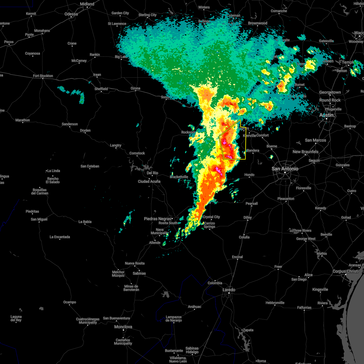 At 642 am cdt, a severe thunderstorm was located near lost maples state park, or 10 miles north of vanderpool, moving northeast at 20 mph (radar indicated). Hazards include 60 mph wind gusts and quarter size hail. Hail damage to vehicles is expected. Expect wind damage to roofs, siding, and trees. At 642 am cdt, a severe thunderstorm was located near lost maples state park, or 10 miles north of vanderpool, moving northeast at 20 mph (radar indicated). Hazards include 60 mph wind gusts and quarter size hail. Hail damage to vehicles is expected. Expect wind damage to roofs, siding, and trees.
|
| 3/29/2017 12:25 AM CDT |
 At 1225 am cdt, severe thunderstorms were located along a line extending from 6 miles northwest of cherokee to near enchanted rock station to kerrville to near tarpley, moving east at 35 mph (radar indicated). Hazards include 60 mph wind gusts. expect damage to roofs, siding, and trees At 1225 am cdt, severe thunderstorms were located along a line extending from 6 miles northwest of cherokee to near enchanted rock station to kerrville to near tarpley, moving east at 35 mph (radar indicated). Hazards include 60 mph wind gusts. expect damage to roofs, siding, and trees
|
| 3/29/2017 12:16 AM CDT |
 At 1215 am cdt, severe thunderstorms were located along a line extending from near art to near tivydale to near vanderpool, moving east at 50 mph (radar indicated). Hazards include 60 mph wind gusts and penny size hail. Expect damage to roofs, siding, and trees. Locations impacted include, medina, kerrville, fredericksburg, leakey, vanderpool, hunt, ingram, cherry spring, camp verde, tuff, tivydale, doss, kerr wildlife management area, waltonia, harper, mountain home, kerrville state park, center point, crabapple and lost maples state park. At 1215 am cdt, severe thunderstorms were located along a line extending from near art to near tivydale to near vanderpool, moving east at 50 mph (radar indicated). Hazards include 60 mph wind gusts and penny size hail. Expect damage to roofs, siding, and trees. Locations impacted include, medina, kerrville, fredericksburg, leakey, vanderpool, hunt, ingram, cherry spring, camp verde, tuff, tivydale, doss, kerr wildlife management area, waltonia, harper, mountain home, kerrville state park, center point, crabapple and lost maples state park.
|
| 3/28/2017 11:32 PM CDT |
 At 1132 pm cdt, severe thunderstorms were located along a line extending from near saline to 10 miles north of kerr wildlife management area to near camp wood, moving east at 25 mph (radar indicated). Hazards include 60 mph wind gusts and nickel size hail. expect damage to roofs, siding, and trees At 1132 pm cdt, severe thunderstorms were located along a line extending from near saline to 10 miles north of kerr wildlife management area to near camp wood, moving east at 25 mph (radar indicated). Hazards include 60 mph wind gusts and nickel size hail. expect damage to roofs, siding, and trees
|
| 5/28/2016 9:42 PM CDT |
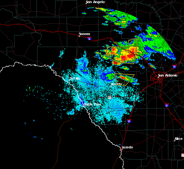 At 942 pm cdt, a severe thunderstorm was located near mountain home, or 16 miles northwest of kerrville, moving north at 15 mph (radar indicated). Hazards include 60 mph wind gusts and quarter size hail. Hail damage to vehicles is expected. expect wind damage to roofs, siding, and trees. Locations impacted include, kerrville, hunt, ingram, kerr wildlife management area, waltonia, kerrville state park, mountain home, tivydale, doss, harper, us- 83 near the kerr-kimble county line, i-10 near the kimble- kerr county line and the intersection of i-10 and us 290. At 942 pm cdt, a severe thunderstorm was located near mountain home, or 16 miles northwest of kerrville, moving north at 15 mph (radar indicated). Hazards include 60 mph wind gusts and quarter size hail. Hail damage to vehicles is expected. expect wind damage to roofs, siding, and trees. Locations impacted include, kerrville, hunt, ingram, kerr wildlife management area, waltonia, kerrville state park, mountain home, tivydale, doss, harper, us- 83 near the kerr-kimble county line, i-10 near the kimble- kerr county line and the intersection of i-10 and us 290.
|
| 5/28/2016 9:21 PM CDT |
 At 921 pm cdt, a severe thunderstorm was located near mountain home, or 13 miles northwest of kerrville, moving north at 15 mph (radar indicated). Hazards include 60 mph wind gusts and quarter size hail. Hail damage to vehicles is expected. Expect wind damage to roofs, siding, and trees. At 921 pm cdt, a severe thunderstorm was located near mountain home, or 13 miles northwest of kerrville, moving north at 15 mph (radar indicated). Hazards include 60 mph wind gusts and quarter size hail. Hail damage to vehicles is expected. Expect wind damage to roofs, siding, and trees.
|
| 5/28/2016 8:46 PM CDT |
 At 845 pm cdt, a severe thunderstorm was located near mountain home, or 11 miles northwest of kerrville, moving southeast at 25 mph (radar indicated). Hazards include golf ball size hail and 60 mph wind gusts. People and animals outdoors will be injured. expect hail damage to roofs, siding, windows, and vehicles. expect wind damage to roofs, siding, and trees. Locations impacted include, ingram, doss, waltonia, harper, mountain home and tivydale. At 845 pm cdt, a severe thunderstorm was located near mountain home, or 11 miles northwest of kerrville, moving southeast at 25 mph (radar indicated). Hazards include golf ball size hail and 60 mph wind gusts. People and animals outdoors will be injured. expect hail damage to roofs, siding, windows, and vehicles. expect wind damage to roofs, siding, and trees. Locations impacted include, ingram, doss, waltonia, harper, mountain home and tivydale.
|
| 5/28/2016 8:13 PM CDT | Hen Egg sized hail reported 9.5 miles SE of Harper, TX |
| 5/28/2016 8:07 PM CDT | Golf Ball sized hail reported 12.2 miles SE of Harper, TX, hail was ongoing |
| 5/28/2016 7:58 PM CDT |
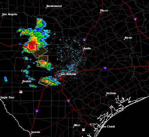 At 758 pm cdt, a severe thunderstorm was located 12 miles northwest of harper, or 21 miles east of junction, moving southeast at 25 mph. this is a very dangerous storm (radar indicated). Hazards include baseball size hail and 70 mph wind gusts. People and animals outdoors will be severely injured. Expect shattered windows, extensive damage to roofs, siding, and vehicles. At 758 pm cdt, a severe thunderstorm was located 12 miles northwest of harper, or 21 miles east of junction, moving southeast at 25 mph. this is a very dangerous storm (radar indicated). Hazards include baseball size hail and 70 mph wind gusts. People and animals outdoors will be severely injured. Expect shattered windows, extensive damage to roofs, siding, and vehicles.
|
| 5/26/2016 10:36 PM CDT |
 At 1034 pm cdt, severe thunderstorms were located along a line extending from near hilltop to 8 miles southeast of tivydale to near ingram, moving east at 55 mph. destructive winds will likely impact the city of fredericksburg (radar indicated). Hazards include 70 mph wind gusts and quarter size hail. Hail damage to vehicles is expected. expect considerable tree damage. wind damage is also likely to mobile homes, roofs, and outbuildings. Locations impacted include, kerrville, fredericksburg, comfort, ingram, stonewall, waltonia, bankersmith, kerrville state park, eckert, tivydale, crabapple, blumenthal, harper, grapetown, luckenbach, cain city, cypress creek, rocky hill, willow city and sisterdale. At 1034 pm cdt, severe thunderstorms were located along a line extending from near hilltop to 8 miles southeast of tivydale to near ingram, moving east at 55 mph. destructive winds will likely impact the city of fredericksburg (radar indicated). Hazards include 70 mph wind gusts and quarter size hail. Hail damage to vehicles is expected. expect considerable tree damage. wind damage is also likely to mobile homes, roofs, and outbuildings. Locations impacted include, kerrville, fredericksburg, comfort, ingram, stonewall, waltonia, bankersmith, kerrville state park, eckert, tivydale, crabapple, blumenthal, harper, grapetown, luckenbach, cain city, cypress creek, rocky hill, willow city and sisterdale.
|
| 5/26/2016 10:10 PM CDT |
 At 1009 pm cdt, severe thunderstorms were located along a line extending from near harper to near hunt, moving east at 45 mph (radar indicated). Hazards include 70 mph wind gusts and ping pong ball size hail. People and animals outdoors will be injured. expect hail damage to roofs, siding, windows, and vehicles. expect considerable tree damage. Wind damage is also likely to mobile homes, roofs, and outbuildings. At 1009 pm cdt, severe thunderstorms were located along a line extending from near harper to near hunt, moving east at 45 mph (radar indicated). Hazards include 70 mph wind gusts and ping pong ball size hail. People and animals outdoors will be injured. expect hail damage to roofs, siding, windows, and vehicles. expect considerable tree damage. Wind damage is also likely to mobile homes, roofs, and outbuildings.
|
| 5/26/2016 9:49 PM CDT |
 At 948 pm cdt, severe thunderstorms were located along a line extending from 10 miles northwest of kerr wildlife management area to 6 miles north of lost maples state park, moving east at 40 mph (radar indicated). Hazards include ping pong ball size hail and 60 mph wind gusts. People and animals outdoors will be injured. expect hail damage to roofs, siding, windows, and vehicles. expect wind damage to roofs, siding, and trees. Locations impacted include, hunt, ingram, waltonia, kerr wildlife management area, harper and mountain home. At 948 pm cdt, severe thunderstorms were located along a line extending from 10 miles northwest of kerr wildlife management area to 6 miles north of lost maples state park, moving east at 40 mph (radar indicated). Hazards include ping pong ball size hail and 60 mph wind gusts. People and animals outdoors will be injured. expect hail damage to roofs, siding, windows, and vehicles. expect wind damage to roofs, siding, and trees. Locations impacted include, hunt, ingram, waltonia, kerr wildlife management area, harper and mountain home.
|
| 5/26/2016 9:23 PM CDT |
 At 922 pm cdt, severe thunderstorms were located along a line extending from 16 miles south of telegraph to 8 miles north of tuff, moving east at 40 mph (radar indicated). Hazards include ping pong ball size hail. People and animals outdoors will be injured. Expect damage to roofs, siding, windows, and vehicles. At 922 pm cdt, severe thunderstorms were located along a line extending from 16 miles south of telegraph to 8 miles north of tuff, moving east at 40 mph (radar indicated). Hazards include ping pong ball size hail. People and animals outdoors will be injured. Expect damage to roofs, siding, windows, and vehicles.
|
| 5/17/2016 10:10 PM CDT |
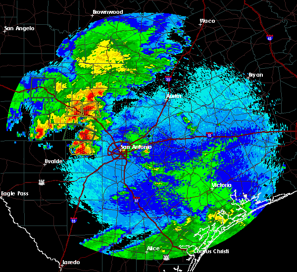 The severe thunderstorm warning for southwestern gillespie and central kerr counties will expire at 1015 pm cdt, the storms which prompted the warning has weakened below severe limits and moved east, and no longer poses an immediate threat to life or property. therefore the warning will be allowed to expire. a severe thunderstorm watch remains in effect until 100 am cdt for south central texas. The severe thunderstorm warning for southwestern gillespie and central kerr counties will expire at 1015 pm cdt, the storms which prompted the warning has weakened below severe limits and moved east, and no longer poses an immediate threat to life or property. therefore the warning will be allowed to expire. a severe thunderstorm watch remains in effect until 100 am cdt for south central texas.
|
| 5/17/2016 9:47 PM CDT |
 At 947 pm cdt, a severe thunderstorm was located near ingram, or near kerrville, moving east at 20 mph (radar indicated). Hazards include tennis ball size hail and 70 mph wind gusts. People and animals outdoors will be injured. expect hail damage to roofs, siding, windows, and vehicles. expect considerable tree damage. Wind damage is also likely to mobile homes, roofs, and outbuildings. At 947 pm cdt, a severe thunderstorm was located near ingram, or near kerrville, moving east at 20 mph (radar indicated). Hazards include tennis ball size hail and 70 mph wind gusts. People and animals outdoors will be injured. expect hail damage to roofs, siding, windows, and vehicles. expect considerable tree damage. Wind damage is also likely to mobile homes, roofs, and outbuildings.
|
| 5/17/2016 9:44 PM CDT |
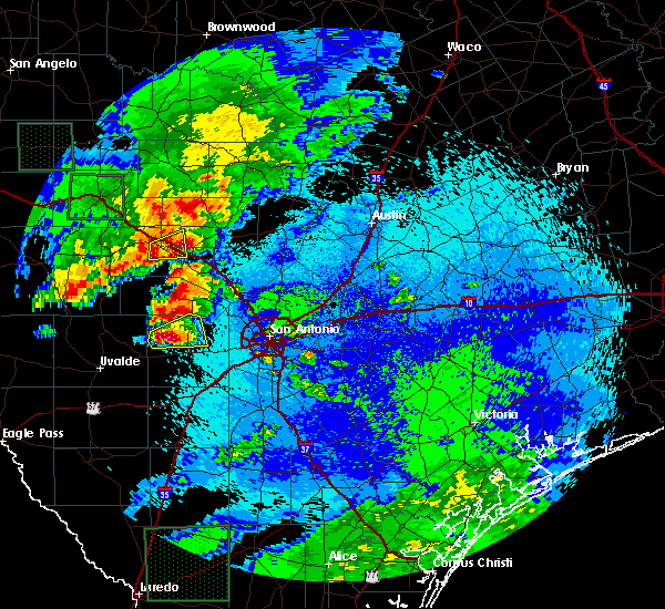 At 943 pm cdt, a severe thunderstorm was located near ingram, or near kerrville, moving east at 20 mph (radar indicated). Hazards include 60 mph wind gusts and half dollar size hail. Hail damage to vehicles is expected. expect wind damage to roofs, siding, and trees. Locations impacted include, kerrville, hunt, ingram, waltonia, mountain home and harper. At 943 pm cdt, a severe thunderstorm was located near ingram, or near kerrville, moving east at 20 mph (radar indicated). Hazards include 60 mph wind gusts and half dollar size hail. Hail damage to vehicles is expected. expect wind damage to roofs, siding, and trees. Locations impacted include, kerrville, hunt, ingram, waltonia, mountain home and harper.
|
| 5/17/2016 9:33 PM CDT |
 At 933 pm cdt, a severe thunderstorm was located over waltonia, or 9 miles west of kerrville, moving southeast at 20 mph (radar indicated). Hazards include 60 mph wind gusts and quarter size hail. Hail damage to vehicles is expected. Expect wind damage to roofs, siding, and trees. At 933 pm cdt, a severe thunderstorm was located over waltonia, or 9 miles west of kerrville, moving southeast at 20 mph (radar indicated). Hazards include 60 mph wind gusts and quarter size hail. Hail damage to vehicles is expected. Expect wind damage to roofs, siding, and trees.
|
| 5/17/2016 9:11 PM CDT |
 The severe thunderstorm warning for northwestern gillespie, northwestern kerr, northeastern edwards and northern real counties will expire at 915 pm cdt, the storms which prompted the warning have weakened below severe limits, and no longer pose an immediate threat to life or property. therefore the warning will be allowed to expire. however gusty winds to 50 mph, dime sized hail, and torrential rainfall amounts of 1 to 2 inches are still possible with these thunderstorms. a severe thunderstorm watch remains in effect until 100 am cdt for south central texas. The severe thunderstorm warning for northwestern gillespie, northwestern kerr, northeastern edwards and northern real counties will expire at 915 pm cdt, the storms which prompted the warning have weakened below severe limits, and no longer pose an immediate threat to life or property. therefore the warning will be allowed to expire. however gusty winds to 50 mph, dime sized hail, and torrential rainfall amounts of 1 to 2 inches are still possible with these thunderstorms. a severe thunderstorm watch remains in effect until 100 am cdt for south central texas.
|
| 5/17/2016 8:34 PM CDT | Ping Pong Ball sized hail reported 3.6 miles S of Harper, TX |
| 5/17/2016 8:20 PM CDT | Hen Egg sized hail reported 5.2 miles E of Harper, TX, along highway 290 approximately 5 miles west of harper. |
| 5/17/2016 8:11 PM CDT |
 At 810 pm cdt, severe thunderstorms were located along a line extending from near segovia to 11 miles northeast of rocksprings, moving southeast at 25 mph (radar indicated). Hazards include 60 mph wind gusts and half dollar size hail. Hail damage to vehicles is expected. Expect wind damage to roofs, siding, and trees. At 810 pm cdt, severe thunderstorms were located along a line extending from near segovia to 11 miles northeast of rocksprings, moving southeast at 25 mph (radar indicated). Hazards include 60 mph wind gusts and half dollar size hail. Hail damage to vehicles is expected. Expect wind damage to roofs, siding, and trees.
|
| 5/11/2016 1:26 AM CDT |
 At 126 am cdt, a severe thunderstorm was located near hunt, or 15 miles west of kerrville, moving east at 15 mph (radar indicated). Hazards include 60 mph wind gusts and quarter size hail. Hail damage to vehicles is expected. Expect wind damage to roofs, siding, and trees. At 126 am cdt, a severe thunderstorm was located near hunt, or 15 miles west of kerrville, moving east at 15 mph (radar indicated). Hazards include 60 mph wind gusts and quarter size hail. Hail damage to vehicles is expected. Expect wind damage to roofs, siding, and trees.
|
| 4/27/2016 1:12 AM CDT |
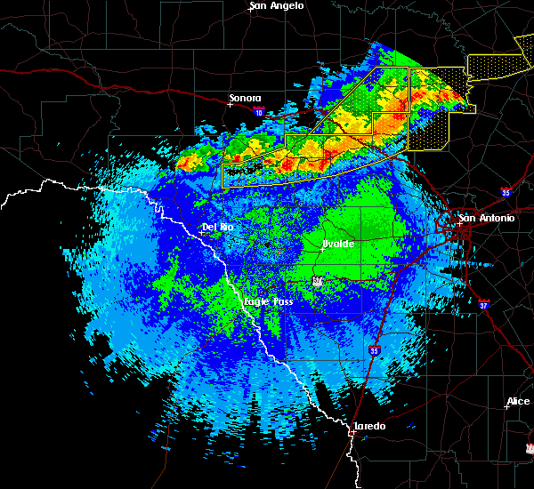 At 111 am cdt, severe thunderstorms were located along a line extending from hilltop to near mountain home to 9 miles west of kerr wildlife management area, moving east at 35 mph (radar indicated). Hazards include 60 mph wind gusts and quarter size hail. Hail damage to vehicles is expected. expect wind damage to roofs, siding, and trees. Locations impacted include, kerrville, rocksprings, hunt, ingram, waltonia, kerr wildlife management area, mountain home, tivydale, doss, harper, cherry spring, carta valley, prade ranch, us-377 near the kimble- edwards county line, us-83 near the kerr-kimble county line, i- 10 near the kimble- kerr county line, devils sinkhole state natural area and the intersection of i-10 and us 290. At 111 am cdt, severe thunderstorms were located along a line extending from hilltop to near mountain home to 9 miles west of kerr wildlife management area, moving east at 35 mph (radar indicated). Hazards include 60 mph wind gusts and quarter size hail. Hail damage to vehicles is expected. expect wind damage to roofs, siding, and trees. Locations impacted include, kerrville, rocksprings, hunt, ingram, waltonia, kerr wildlife management area, mountain home, tivydale, doss, harper, cherry spring, carta valley, prade ranch, us-377 near the kimble- edwards county line, us-83 near the kerr-kimble county line, i- 10 near the kimble- kerr county line, devils sinkhole state natural area and the intersection of i-10 and us 290.
|
| 4/27/2016 12:21 AM CDT |
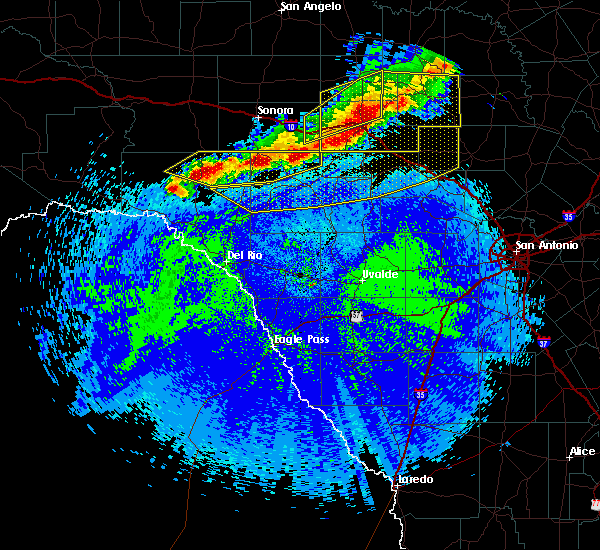 At 1221 am cdt, severe thunderstorms were located along a line extending from near yates crossing to near telegraph to 16 miles northwest of rocksprings, moving southeast at 30 mph (radar indicated). Hazards include 60 mph wind gusts and half dollar size hail. Hail damage to vehicles is expected. Expect wind damage to roofs, siding, and trees. At 1221 am cdt, severe thunderstorms were located along a line extending from near yates crossing to near telegraph to 16 miles northwest of rocksprings, moving southeast at 30 mph (radar indicated). Hazards include 60 mph wind gusts and half dollar size hail. Hail damage to vehicles is expected. Expect wind damage to roofs, siding, and trees.
|
| 3/18/2016 5:11 PM CDT |
 At 509 pm cdt, a severe thunderstorm was located over waltonia, or 8 miles west of kerrville, moving southeast at 10 mph. this storm has a history of producing ping pong to golf ball sized hail as it slowly moves to the south and southeast (public). Hazards include golf ball size hail and 60 mph wind gusts. People and animals outdoors will be injured. expect hail damage to roofs, siding, windows, and vehicles. Expect wind damage to roofs, siding, and trees. At 509 pm cdt, a severe thunderstorm was located over waltonia, or 8 miles west of kerrville, moving southeast at 10 mph. this storm has a history of producing ping pong to golf ball sized hail as it slowly moves to the south and southeast (public). Hazards include golf ball size hail and 60 mph wind gusts. People and animals outdoors will be injured. expect hail damage to roofs, siding, windows, and vehicles. Expect wind damage to roofs, siding, and trees.
|
| 3/18/2016 5:00 PM CDT |
 At 459 pm cdt, a severe thunderstorm was located 8 miles north of cypress creek, or 9 miles northeast of kerrville, moving southeast at 30 mph. ping pong size hail has been observed with this storm near tivydale in gillespie county (trained weather spotters). Hazards include ping pong ball size hail and 60 mph wind gusts. People and animals outdoors will be injured. expect hail damage to roofs, siding, windows, and vehicles. expect wind damage to roofs, siding, and trees. Locations impacted include, kerrville, fredericksburg, comfort, hunt, ingram, stonewall, waltonia, bankersmith, kerrville state park, tivydale, blumenthal, grapetown, luckenbach, cain city, cypress creek, rocky hill, center point, camp verde and harper. At 459 pm cdt, a severe thunderstorm was located 8 miles north of cypress creek, or 9 miles northeast of kerrville, moving southeast at 30 mph. ping pong size hail has been observed with this storm near tivydale in gillespie county (trained weather spotters). Hazards include ping pong ball size hail and 60 mph wind gusts. People and animals outdoors will be injured. expect hail damage to roofs, siding, windows, and vehicles. expect wind damage to roofs, siding, and trees. Locations impacted include, kerrville, fredericksburg, comfort, hunt, ingram, stonewall, waltonia, bankersmith, kerrville state park, tivydale, blumenthal, grapetown, luckenbach, cain city, cypress creek, rocky hill, center point, camp verde and harper.
|
| 3/18/2016 4:38 PM CDT |
 At 437 pm cdt, a severe thunderstorm was located near tivydale, or 12 miles west of fredericksburg, moving east at 25 mph. another severe thunderstorm was located south of hunt, moving east at 15 mph (radar indicated). Hazards include ping pong ball size hail and 60 mph wind gusts. People and animals outdoors will be injured. expect hail damage to roofs, siding, windows, and vehicles. Expect wind damage to roofs, siding, and trees. At 437 pm cdt, a severe thunderstorm was located near tivydale, or 12 miles west of fredericksburg, moving east at 25 mph. another severe thunderstorm was located south of hunt, moving east at 15 mph (radar indicated). Hazards include ping pong ball size hail and 60 mph wind gusts. People and animals outdoors will be injured. expect hail damage to roofs, siding, windows, and vehicles. Expect wind damage to roofs, siding, and trees.
|
| 3/8/2016 9:46 PM CST |
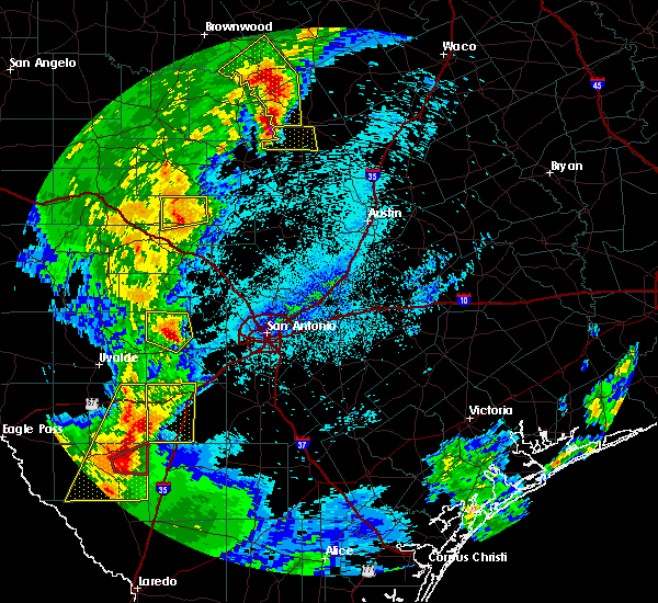 At 945 pm cst, a severe thunderstorm was located near doss, or 18 miles northwest of fredericksburg, moving northeast at 25 mph (radar indicated). Hazards include 60 mph wind gusts and quarter size hail. Hail damage to vehicles is expected. expect wind damage to roofs, siding, and trees. Locations impacted include, doss, cherry spring and harper. At 945 pm cst, a severe thunderstorm was located near doss, or 18 miles northwest of fredericksburg, moving northeast at 25 mph (radar indicated). Hazards include 60 mph wind gusts and quarter size hail. Hail damage to vehicles is expected. expect wind damage to roofs, siding, and trees. Locations impacted include, doss, cherry spring and harper.
|
| 3/8/2016 8:48 PM CST |
 At 848 pm cst, a severe thunderstorm was located 7 miles west of harper, or 24 miles northwest of kerrville, moving northeast at 20 mph (radar indicated). Hazards include 60 mph wind gusts and half dollar size hail. Hail damage to vehicles is expected. Expect wind damage to roofs, siding, and trees. At 848 pm cst, a severe thunderstorm was located 7 miles west of harper, or 24 miles northwest of kerrville, moving northeast at 20 mph (radar indicated). Hazards include 60 mph wind gusts and half dollar size hail. Hail damage to vehicles is expected. Expect wind damage to roofs, siding, and trees.
|
| 5/28/2015 11:30 PM CDT | At 1129 pm cdt, severe thunderstorms were located along a line extending from near tow to near blumenthal to near medina, moving east at 55 mph (radar indicated). Hazards include 60 to isolated 70 mph wind gusts. Expect damage to roofs. siding and trees. Locations impacted include, kerrville, fredericksburg, kingsland, llano, comfort, buchanan dam, hunt, gainesville, granite shoals, horseshoe bay, ingram, stonewall, highland haven, bluffton, valley spring, oxford, lone grove, kerrville state park, eckert and crabapple. |
| 5/28/2015 11:03 PM CDT | At 1103 pm cdt, severe thunderstorms were located along a line extending from near chappel to near hilltop to near lost maples state park, moving east at 30 mph (radar indicated). Hazards include 60 mph wind gusts and penny size hail. Expect damage to roofs. siding and trees. Locations impacted include, kerrville, fredericksburg, kingsland, llano, comfort, buchanan dam, hunt, gainesville, granite shoals, horseshoe bay, ingram, stonewall, highland haven, bluffton, valley spring, oxford, lone grove, kerrville state park, eckert and crabapple. |
| 5/28/2015 10:33 PM CDT | At 1033 pm cdt, severe thunderstorms were located along a line extending from 9 miles northwest of harper to 9 miles north of vance to 11 miles southwest of loma alta, moving southeast at 20 mph (radar indicated). Hazards include 60 mph wind gusts and penny size hail. Expect damage to roofs. siding and trees. locations impacted include, rocksprings, loma alta, kerr wildlife management area, mountain home, flour mills, us-277 near the sutton-edwards county line, vinegarone, us-377 near the kimble-edwards county line, devils sinkhole state natural area, the intersection of i-10 and u. S 290, us-83 near the kerr-kimble county line and i-10 near the kimble-kerr county line. |
| 5/28/2015 10:24 PM CDT | At 1024 pm cdt, severe thunderstorms were located along a line extending from near san saba to near loyal valley to near mountain home, moving east at 55 mph (radar indicated). Hazards include 60 mph wind gusts and penny size hail. Expect damage to roofs. Siding and trees. |
| 5/28/2015 9:37 PM CDT | At 936 pm cdt, severe thunderstorms were located along a line extending from near junction to 9 miles north of flour mills, moving southeast at 45 mph (radar indicated). Hazards include 60 mph wind gusts and nickel size hail. Expect damage to roofs. Siding and trees. |
| 5/25/2015 8:40 AM CDT | At 840 am cdt, a severe thunderstorm was located 10 miles northwest of mountain home, or 22 miles southeast of junction, moving northeast at 30 mph (radar indicated). Hazards include 60 mph wind gusts and quarter size hail. Hail damage to vehicles is expected. expect wind damage to roofs, siding and trees. This severe thunderstorm will remain over mainly rural areas of north central kerr county. |
| 5/25/2015 8:38 AM CDT | At 836 am cdt, a severe thunderstorm was located 13 miles southeast of segovia, or very near the intersection of i-10 and the kimble and kerr county line, and moving northeast at 35 mph (radar indicated). Hazards include 60 mph wind gusts and quarter size hail. Hail damage to vehicles is expected. expect wind damage to roofs, siding and trees. locations impacted include, the intersection of i-10 and us 290. This includes interstate 10 between mile markers 468 and 478. |
| 5/25/2015 8:22 AM CDT | At 819 am cdt, a severe thunderstorm was located 15 miles south of segovia, moving northeast at 35 mph (radar indicated). Hazards include 60 mph wind gusts and quarter size hail. Hail damage to vehicles is expected. expect wind damage to roofs, siding and trees. the severe thunderstorm will affect mainly rural areas of southeastern kimble county, including the following locations, the intersection of i-10 and us 290 and i-10 near the kimble-kerr county line. This also includes interstate 10 between mile markers 467 and 478. |
| 4/27/2015 12:09 AM CDT | At 1208 am cdt, severe thunderstorms were located along a line extending from near baby head to eckert to near cypress creek to 6 miles west of camp verde, moving east at 45 mph (radar indicated). Hazards include 70 mph wind gusts and quarter size hail. Hail damage to vehicles is expected. expect considerable tree damage. wind damage is also likely to mobile homes, roofs and outbuildings. locations impacted include, medina, kerrville, fredericksburg, boerne, kingsland, marble falls, burnet, llano, comfort, blanco, bertram, round mountain, buchanan dam, gainesville, granite shoals, horseshoe bay, ingram, meadowlakes, johnson city and stonewall. 1. 00in. |
| 4/26/2015 11:49 PM CDT | At 1148 pm cdt, severe thunderstorms were located along a line extending from near valley spring to near hilltop to near kerrville to 9 miles northwest of medina, moving east at 50 mph (radar indicated). Hazards include 70 mph wind gusts and quarter size hail. Hail damage to vehicles is expected. expect considerable tree damage. Wind damage is also likely to mobile homes, roofs and outbuildings. |
| 4/26/2015 11:29 PM CDT | At 1128 pm cdt, severe thunderstorms were located along a line extending from near pontotoc to 6 miles south of harper, moving east at 35 mph (radar indicated). Hazards include 60 mph wind gusts and quarter size hail. Hail damage to vehicles is expected. expect wind damage to roofs, siding and trees. locations impacted include, fredericksburg, llano, valley spring, prairie mountain, mountain home, baby head, tivydale, crabapple, doss, field creek, harper, cherry spring, castell, enchanted rock station, the intersection of i-10 and u. s 290 and i-10 near the kimble-kerr county line. 1. 00in. |
| 4/26/2015 11:04 PM CDT | At 1103 pm cdt, severe thunderstorms were located along a line extending from 20 miles north of mason to near mountain home, moving east at 35 mph (radar indicated). Hazards include 60 mph wind gusts and quarter size hail. Hail damage to vehicles is expected. Expect wind damage to roofs, siding and trees. |
| 5/12/2014 7:18 PM CDT | Quarter sized hail reported 3.4 miles E of Harper, TX, quarter size hail with very heavy rain. 1.00 inch over the last 45 minutes. |
| 4/21/2014 8:22 PM CDT | Quarter sized hail reported 0.8 miles W of Harper, TX, some quarter size hail mixed with mostly smaller pieces. |
| 5/9/2013 8:39 PM CDT | Baseball sized hail reported 14.8 miles SW of Harper, TX, baseball sized hail in cherry spring |
| 5/9/2013 8:25 PM CDT | Half Dollar sized hail reported 13.3 miles S of Harper, TX |
| 3/9/2013 8:19 PM CDT | Golf Ball sized hail reported 5.6 miles NE of Harper, TX, golfball size hail |
| 3/9/2013 7:19 PM CDT | Golf Ball sized hail reported 5.6 miles NE of Harper, TX, golfball size hail |
| 3/19/2012 6:54 PM CDT | Quarter sized hail reported 8.9 miles ENE of Harper, TX |
| 1/1/0001 12:00 AM | Reports of a farm building blown dow in gillespie county TX, 13.4 miles SW of Harper, TX |
| 1/1/0001 12:00 AM | Quarter sized hail reported 12.1 miles SW of Harper, TX, nickel to near quarter size hail. |
| 1/1/0001 12:00 AM | Golf Ball sized hail reported 13.5 miles S of Harper, TX, photos relayed through media |
Hail Maps for Harper, TX
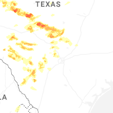

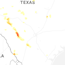
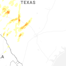


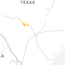


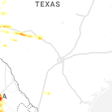


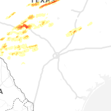


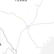


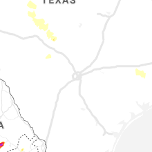


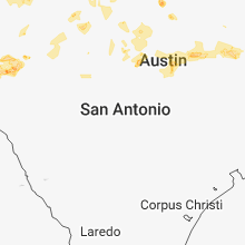


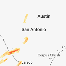


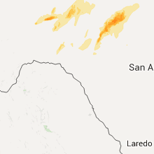


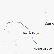
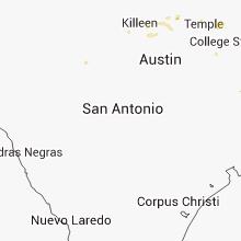


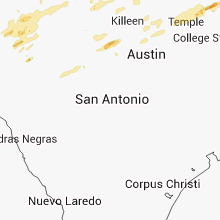


Connect with Interactive Hail Maps