

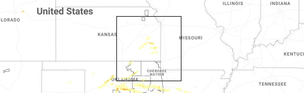
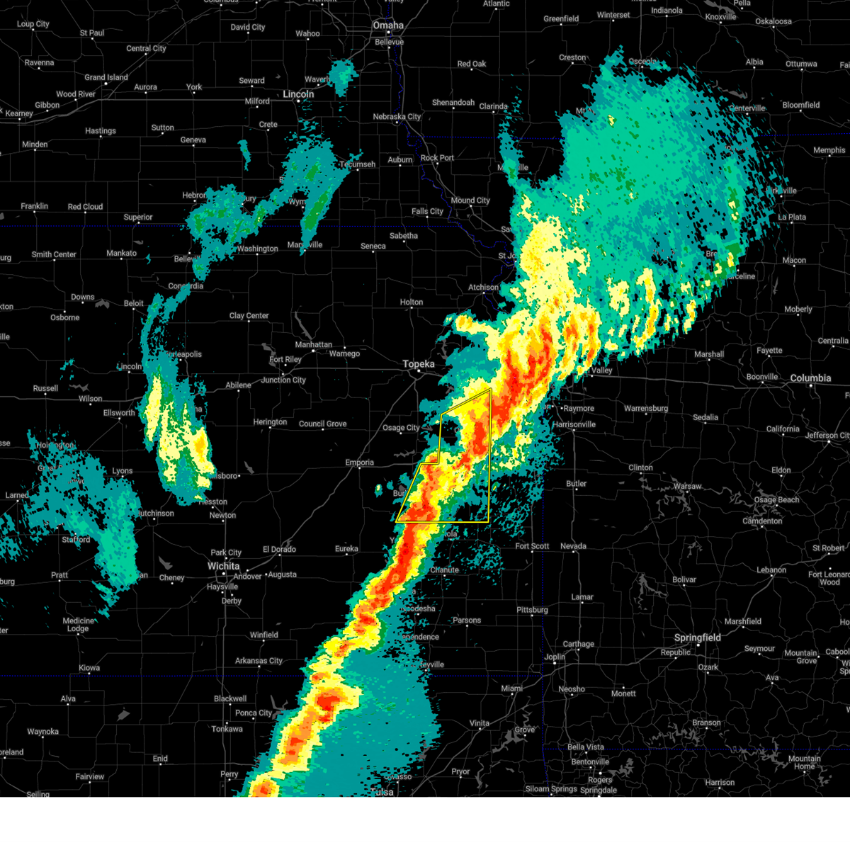
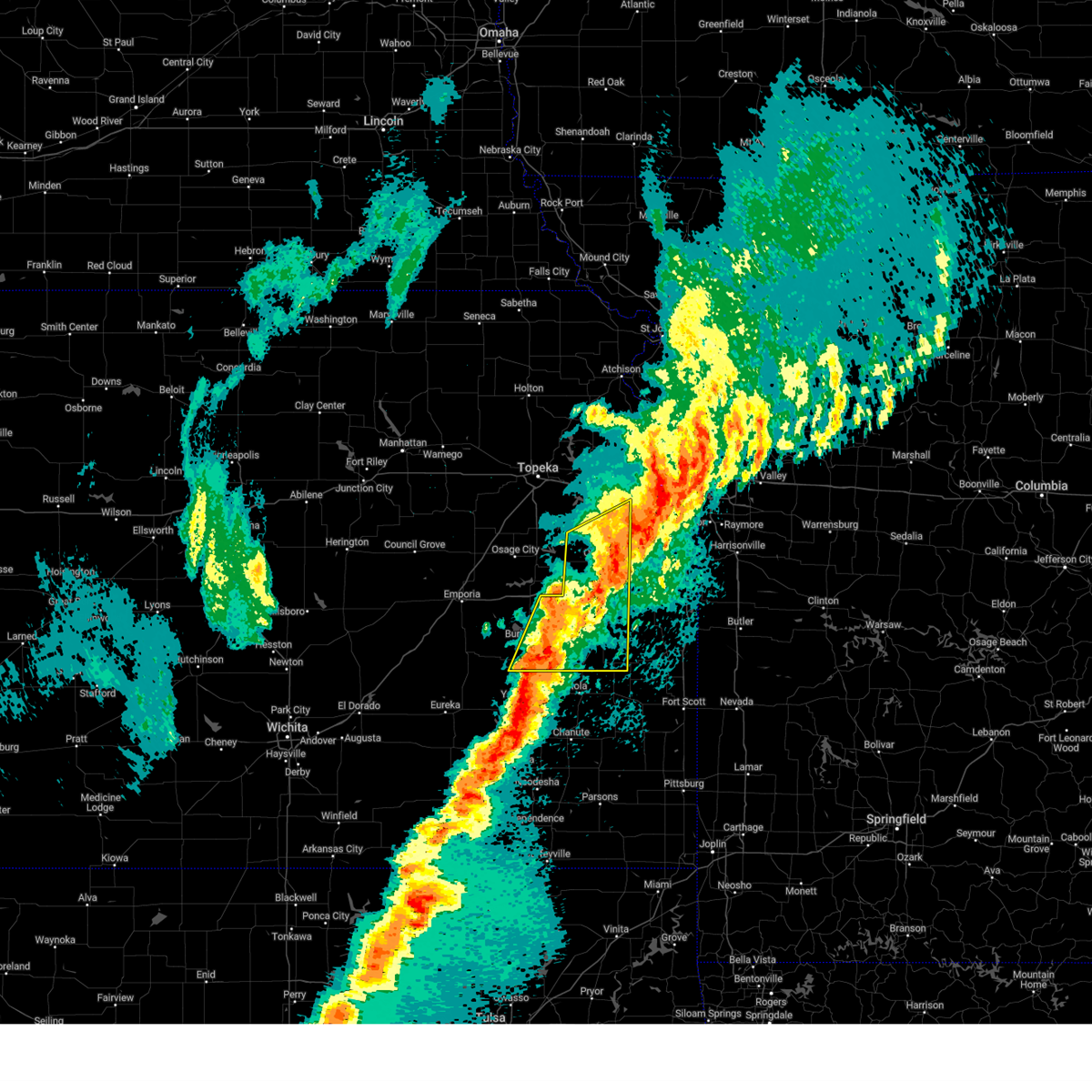
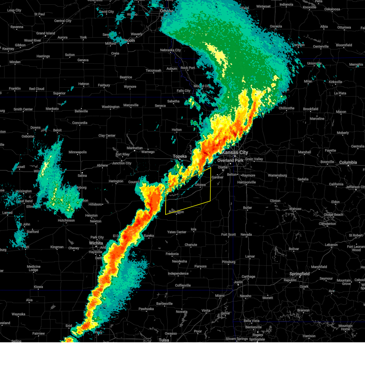
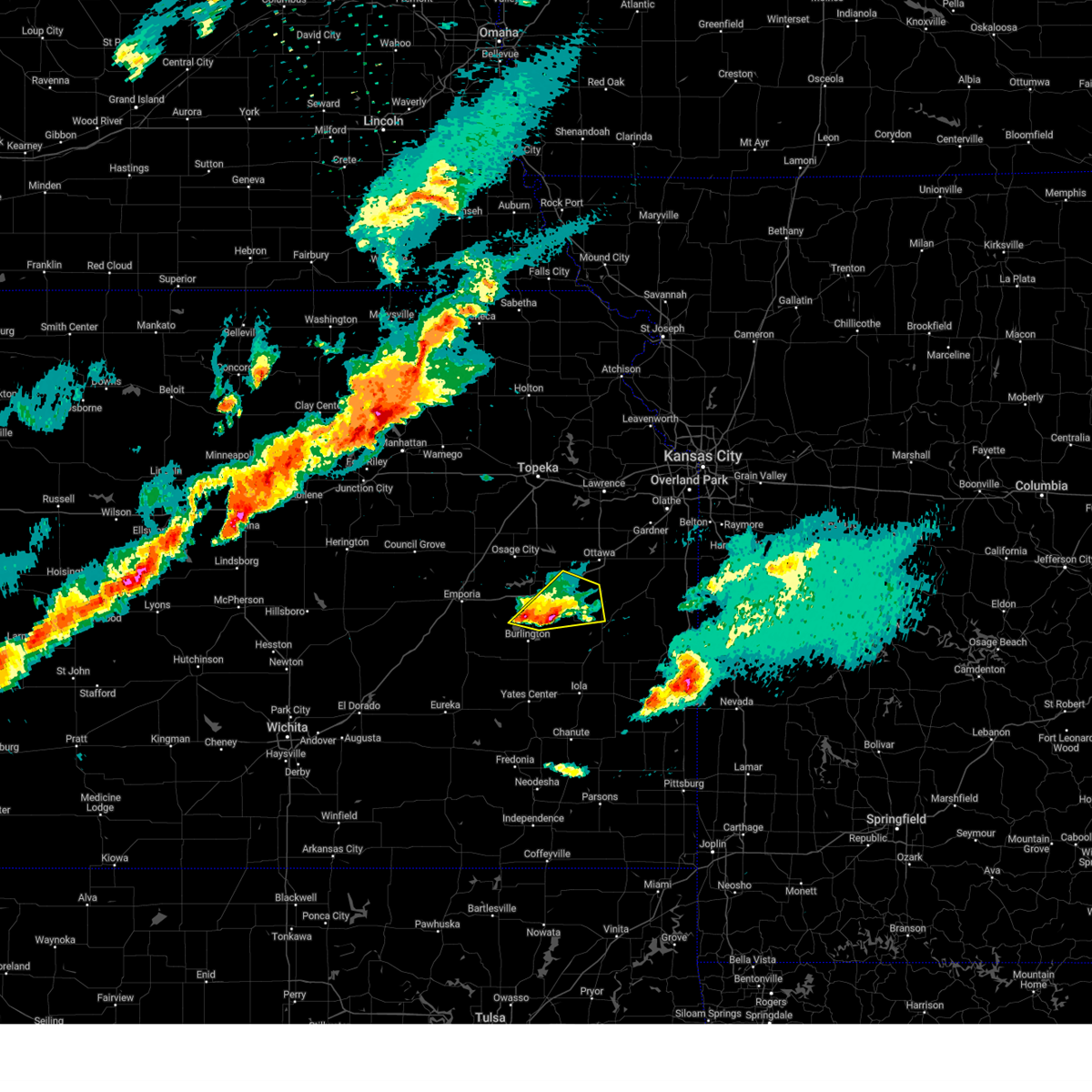
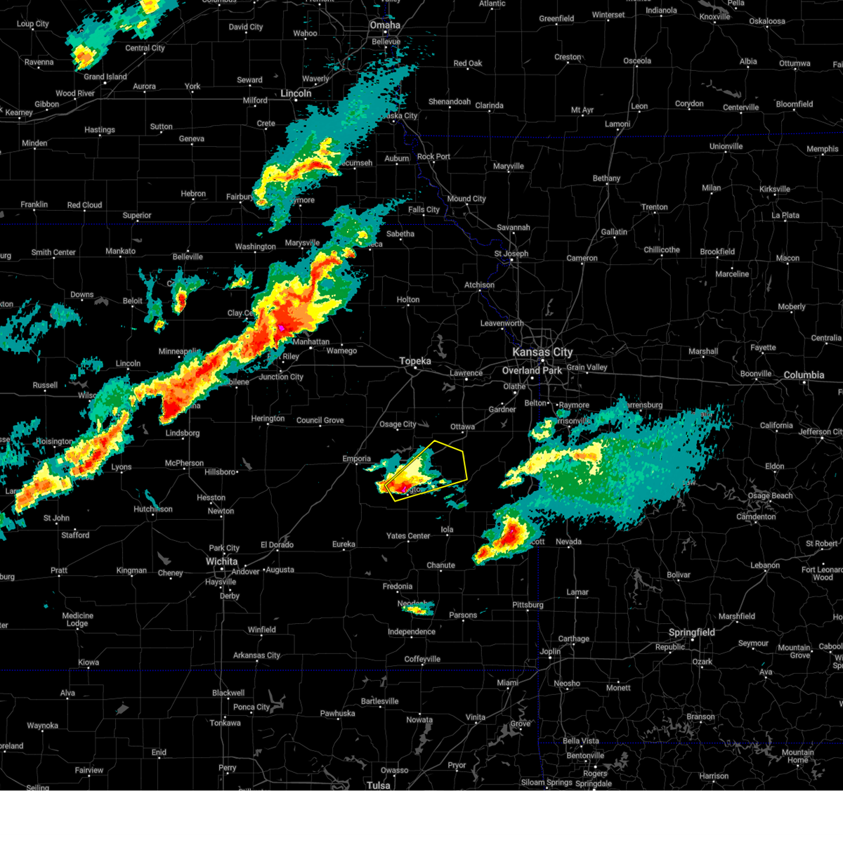
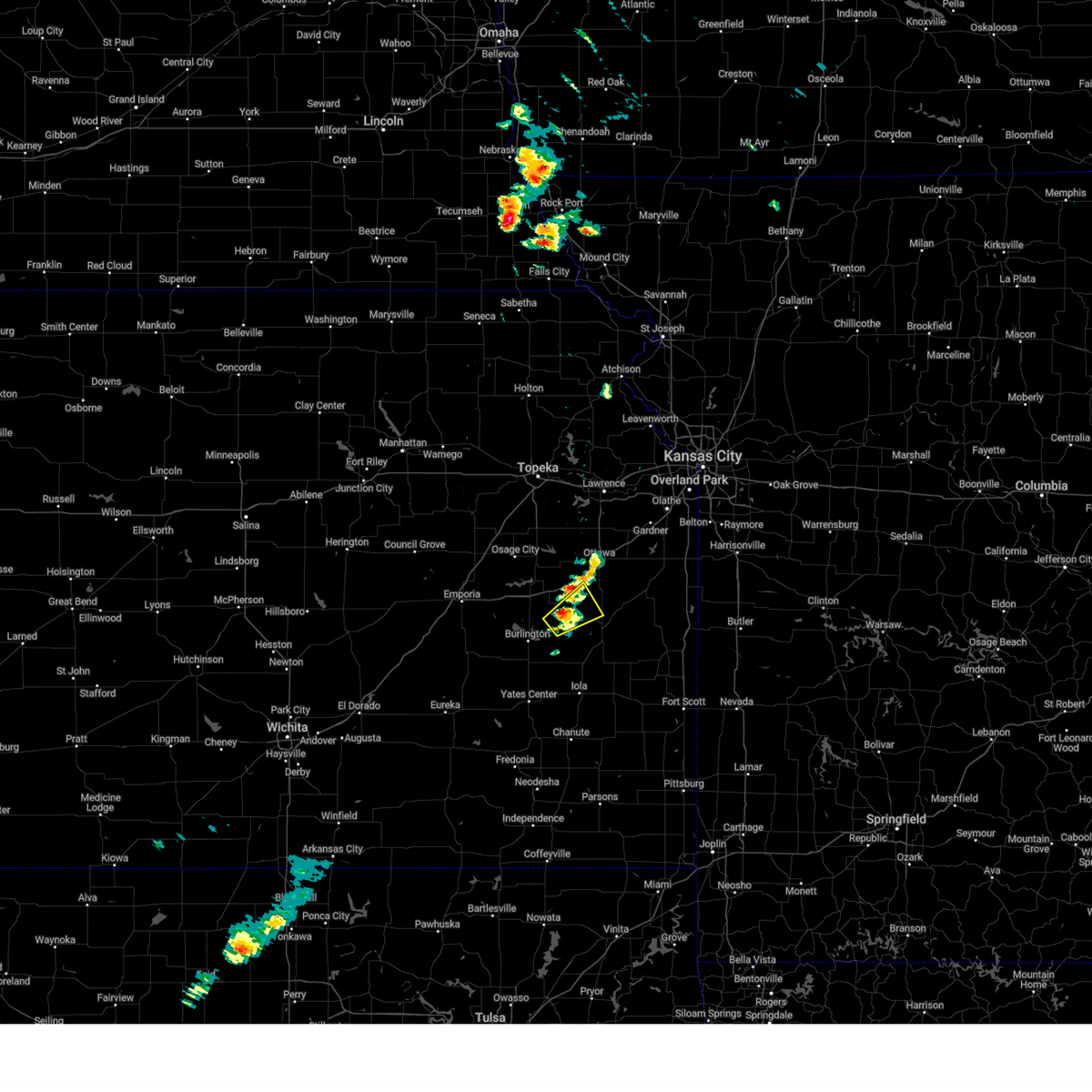
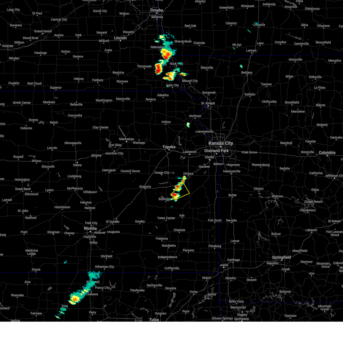
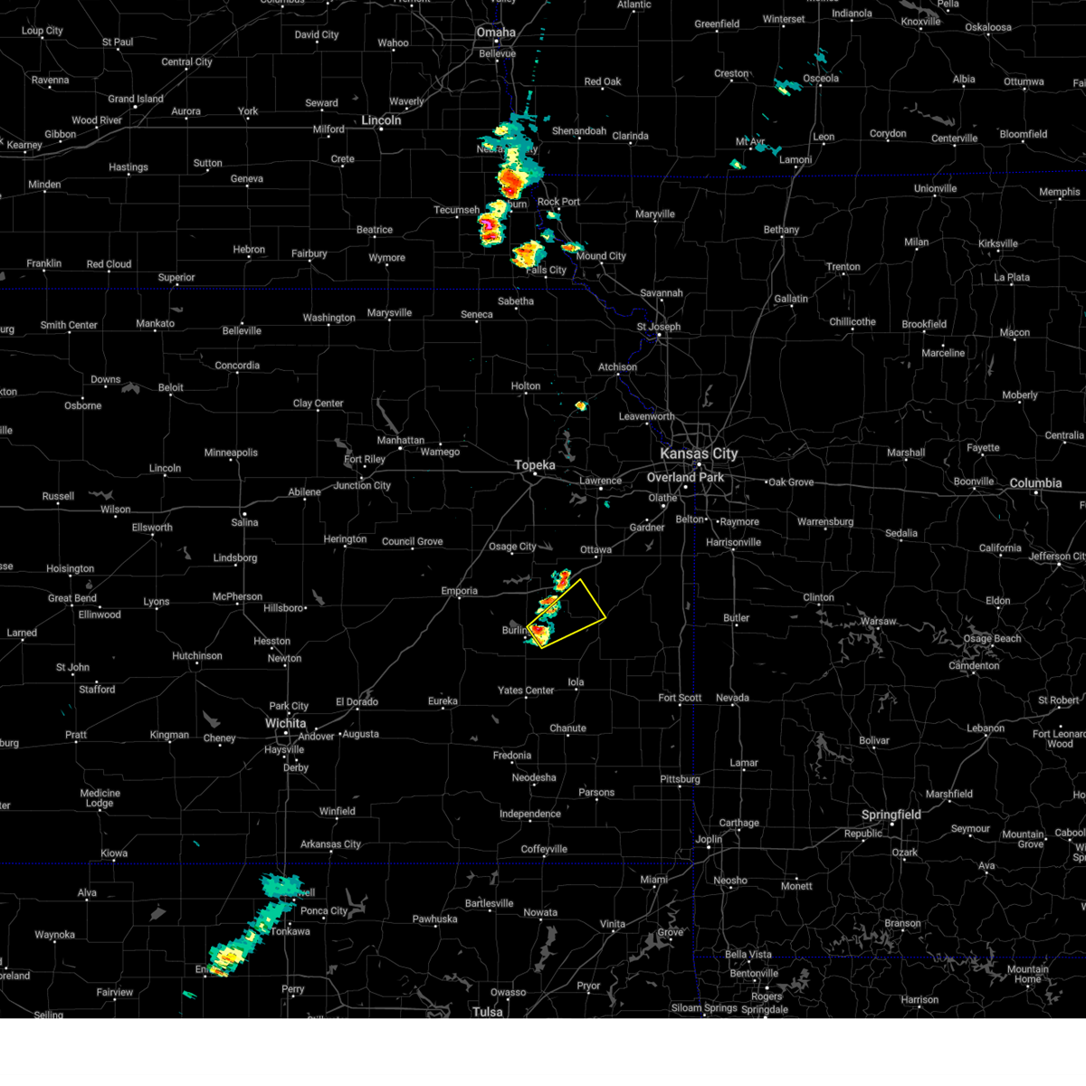
Hail Map for Harris, KS
The Harris, KS area has had 0 reports of on-the-ground hail by trained spotters, and has been under severe weather warnings 24 times during the past 12 months. Doppler radar has detected hail at or near Harris, KS on 69 occasions, including 6 occasions during the past year.
| Name: | Harris, KS |
| Where Located: | 44 miles N of Chanute, KS |
| Map: | Google Map for Harris, KS |
| Population: | 51 |
| Housing Units: | 26 |
| More Info: | Search Google for Harris, KS |
1
The Top Recent Hail Date for Harris, KS is Saturday, May 17, 2025 (23rd out of 69)
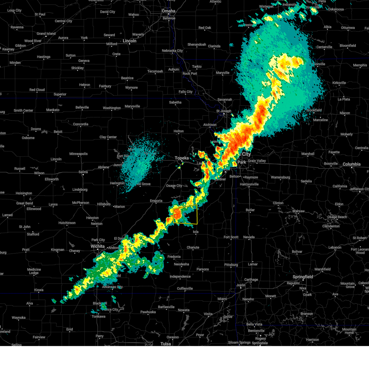
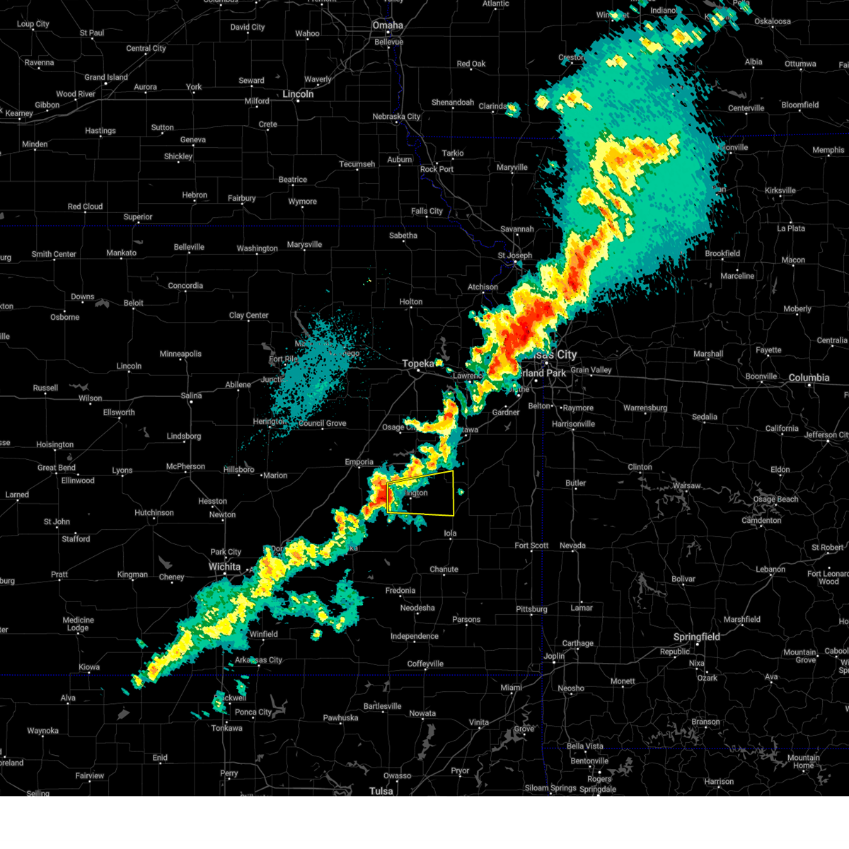
Hail and Wind Damage Spotted near Harris, KS
| Date / Time | Report Details |
|---|---|
| 5/19/2025 3:15 PM CDT |
 At 315 pm cdt, a severe thunderstorm was located near garnett, moving northeast at 35 mph (trained weather spotters. at 311 pm, quarter-sized hail was reported in garnett). Hazards include ping pong ball size hail and 60 mph wind gusts. People and animals outdoors will be injured. expect hail damage to roofs, siding, windows, and vehicles. expect wind damage to roofs, siding, and trees. Locations impacted include, garnett, colony, greeley, westphalia, kincaid, lone elm, harris, and le roy. At 315 pm cdt, a severe thunderstorm was located near garnett, moving northeast at 35 mph (trained weather spotters. at 311 pm, quarter-sized hail was reported in garnett). Hazards include ping pong ball size hail and 60 mph wind gusts. People and animals outdoors will be injured. expect hail damage to roofs, siding, windows, and vehicles. expect wind damage to roofs, siding, and trees. Locations impacted include, garnett, colony, greeley, westphalia, kincaid, lone elm, harris, and le roy.
|
| 5/19/2025 3:06 PM CDT |
 At 306 pm cdt, a severe thunderstorm was located 7 miles northwest of lone elm, moving northeast at 35 mph (emergency management. at 305 pm, quarter-sized hail was reported in lone elm). Hazards include ping pong ball size hail and 60 mph wind gusts. People and animals outdoors will be injured. expect hail damage to roofs, siding, windows, and vehicles. expect wind damage to roofs, siding, and trees. Locations impacted include, garnett, colony, greeley, westphalia, kincaid, lone elm, harris, and le roy. At 306 pm cdt, a severe thunderstorm was located 7 miles northwest of lone elm, moving northeast at 35 mph (emergency management. at 305 pm, quarter-sized hail was reported in lone elm). Hazards include ping pong ball size hail and 60 mph wind gusts. People and animals outdoors will be injured. expect hail damage to roofs, siding, windows, and vehicles. expect wind damage to roofs, siding, and trees. Locations impacted include, garnett, colony, greeley, westphalia, kincaid, lone elm, harris, and le roy.
|
| 5/19/2025 2:48 PM CDT |
 Svrtop the national weather service in topeka has issued a * severe thunderstorm warning for, anderson county in east central kansas, southeastern coffey county in east central kansas, * until 330 pm cdt. * at 248 pm cdt, a severe thunderstorm was located near colony, moving northeast at 35 mph (radar indicated). Hazards include ping pong ball size hail and 60 mph wind gusts. People and animals outdoors will be injured. expect hail damage to roofs, siding, windows, and vehicles. Expect wind damage to roofs, siding, and trees. Svrtop the national weather service in topeka has issued a * severe thunderstorm warning for, anderson county in east central kansas, southeastern coffey county in east central kansas, * until 330 pm cdt. * at 248 pm cdt, a severe thunderstorm was located near colony, moving northeast at 35 mph (radar indicated). Hazards include ping pong ball size hail and 60 mph wind gusts. People and animals outdoors will be injured. expect hail damage to roofs, siding, windows, and vehicles. Expect wind damage to roofs, siding, and trees.
|
| 4/2/2025 5:17 AM CDT |
 At 516 am cdt, severe thunderstorms were located along a line extending from countryside to near paola to near garnett, moving northeast at 55 mph (radar indicated). Hazards include 60 mph wind gusts and nickel size hail. Expect damage to roofs, siding, and trees. locations impacted include, lone elm, princeton, lane, harris, wellsville, greeley, garnett, kincaid, rantoul, colony, le roy, ottawa, westphalia, and richmond. This includes interstate 35 between mile markers 176 and 198. At 516 am cdt, severe thunderstorms were located along a line extending from countryside to near paola to near garnett, moving northeast at 55 mph (radar indicated). Hazards include 60 mph wind gusts and nickel size hail. Expect damage to roofs, siding, and trees. locations impacted include, lone elm, princeton, lane, harris, wellsville, greeley, garnett, kincaid, rantoul, colony, le roy, ottawa, westphalia, and richmond. This includes interstate 35 between mile markers 176 and 198.
|
| 4/2/2025 5:17 AM CDT |
 the severe thunderstorm warning has been cancelled and is no longer in effect the severe thunderstorm warning has been cancelled and is no longer in effect
|
| 4/2/2025 5:13 AM CDT |
 At 512 am cdt, severe thunderstorms were located along a line extending from 3 miles southwest of merriam to 4 miles west of paola to 5 miles southwest of garnett, moving northeast at 55 mph (radar indicated). Hazards include 60 mph wind gusts and nickel size hail. Expect damage to roofs, siding, and trees. locations impacted include, lone elm, centropolis, vinland, princeton, pomona, lane, harris, new strawn, wellsville, waverly, greeley, garnett, kincaid, burlington, globe, rantoul, colony, williamsburg, le roy, and baldwin city. This includes interstate 35 between mile markers 169 and 198. At 512 am cdt, severe thunderstorms were located along a line extending from 3 miles southwest of merriam to 4 miles west of paola to 5 miles southwest of garnett, moving northeast at 55 mph (radar indicated). Hazards include 60 mph wind gusts and nickel size hail. Expect damage to roofs, siding, and trees. locations impacted include, lone elm, centropolis, vinland, princeton, pomona, lane, harris, new strawn, wellsville, waverly, greeley, garnett, kincaid, burlington, globe, rantoul, colony, williamsburg, le roy, and baldwin city. This includes interstate 35 between mile markers 169 and 198.
|
| 4/2/2025 5:13 AM CDT |
 the severe thunderstorm warning has been cancelled and is no longer in effect the severe thunderstorm warning has been cancelled and is no longer in effect
|
| 4/2/2025 4:54 AM CDT |
 Svrtop the national weather service in topeka has issued a * severe thunderstorm warning for, franklin county in east central kansas, anderson county in east central kansas, southern douglas county in east central kansas, southeastern osage county in east central kansas, coffey county in east central kansas, * until 545 am cdt. * at 453 am cdt, severe thunderstorms were located along a line extending from 5 miles east of vinland to near princeton to 3 miles northwest of le roy, moving northeast at 55 mph (radar indicated). Hazards include 60 mph wind gusts and nickel size hail. expect damage to roofs, siding, and trees Svrtop the national weather service in topeka has issued a * severe thunderstorm warning for, franklin county in east central kansas, anderson county in east central kansas, southern douglas county in east central kansas, southeastern osage county in east central kansas, coffey county in east central kansas, * until 545 am cdt. * at 453 am cdt, severe thunderstorms were located along a line extending from 5 miles east of vinland to near princeton to 3 miles northwest of le roy, moving northeast at 55 mph (radar indicated). Hazards include 60 mph wind gusts and nickel size hail. expect damage to roofs, siding, and trees
|
| 4/2/2025 4:01 AM CDT |
 Svrtop the national weather service in topeka has issued a * severe thunderstorm warning for, franklin county in east central kansas, northwestern anderson county in east central kansas, southern douglas county in east central kansas, southern osage county in east central kansas, northern coffey county in east central kansas, * until 500 am cdt. * at 401 am cdt, a severe thunderstorm was located 5 miles west of neosho rapids, moving northeast at 75 mph (radar indicated). Hazards include 60 mph wind gusts and quarter size hail. Hail damage to vehicles is expected. Expect wind damage to roofs, siding, and trees. Svrtop the national weather service in topeka has issued a * severe thunderstorm warning for, franklin county in east central kansas, northwestern anderson county in east central kansas, southern douglas county in east central kansas, southern osage county in east central kansas, northern coffey county in east central kansas, * until 500 am cdt. * at 401 am cdt, a severe thunderstorm was located 5 miles west of neosho rapids, moving northeast at 75 mph (radar indicated). Hazards include 60 mph wind gusts and quarter size hail. Hail damage to vehicles is expected. Expect wind damage to roofs, siding, and trees.
|
| 4/1/2025 10:18 PM CDT |
 At 1018 pm cdt, a severe thunderstorm was located 4 miles southeast of waverly, moving northeast at 50 mph (radar indicated). Hazards include 60 mph wind gusts and quarter size hail. Hail damage to vehicles is expected. expect wind damage to roofs, siding, and trees. locations impacted include, princeton, waverly, williamsburg, harris, richmond, new strawn, and garnett. This includes interstate 35 between mile markers 159 and 175. At 1018 pm cdt, a severe thunderstorm was located 4 miles southeast of waverly, moving northeast at 50 mph (radar indicated). Hazards include 60 mph wind gusts and quarter size hail. Hail damage to vehicles is expected. expect wind damage to roofs, siding, and trees. locations impacted include, princeton, waverly, williamsburg, harris, richmond, new strawn, and garnett. This includes interstate 35 between mile markers 159 and 175.
|
| 4/1/2025 10:06 PM CDT |
 Svrtop the national weather service in topeka has issued a * severe thunderstorm warning for, southwestern franklin county in east central kansas, northwestern anderson county in east central kansas, southeastern osage county in east central kansas, northern coffey county in east central kansas, * until 1045 pm cdt. * at 1005 pm cdt, a severe thunderstorm was located over new strawn, moving northeast at 50 mph (radar indicated). Hazards include 60 mph wind gusts and quarter size hail. Hail damage to vehicles is expected. Expect wind damage to roofs, siding, and trees. Svrtop the national weather service in topeka has issued a * severe thunderstorm warning for, southwestern franklin county in east central kansas, northwestern anderson county in east central kansas, southeastern osage county in east central kansas, northern coffey county in east central kansas, * until 1045 pm cdt. * at 1005 pm cdt, a severe thunderstorm was located over new strawn, moving northeast at 50 mph (radar indicated). Hazards include 60 mph wind gusts and quarter size hail. Hail damage to vehicles is expected. Expect wind damage to roofs, siding, and trees.
|
| 3/29/2025 8:33 PM CDT |
 the severe thunderstorm warning has been cancelled and is no longer in effect the severe thunderstorm warning has been cancelled and is no longer in effect
|
| 3/29/2025 8:27 PM CDT |
 At 827 pm cdt, a severe thunderstorm was located 7 miles west of harris, moving northeast at 45 mph (radar indicated). Hazards include 60 mph wind gusts and quarter size hail. Hail damage to vehicles is expected. expect wind damage to roofs, siding, and trees. Locations impacted include, harris. At 827 pm cdt, a severe thunderstorm was located 7 miles west of harris, moving northeast at 45 mph (radar indicated). Hazards include 60 mph wind gusts and quarter size hail. Hail damage to vehicles is expected. expect wind damage to roofs, siding, and trees. Locations impacted include, harris.
|
| 3/29/2025 8:20 PM CDT |
 Svrtop the national weather service in topeka has issued a * severe thunderstorm warning for, southwestern franklin county in east central kansas, northwestern anderson county in east central kansas, east central coffey county in east central kansas, * until 845 pm cdt. * at 820 pm cdt, a severe thunderstorm was located 5 miles east of new strawn, moving northeast at 45 mph (radar indicated). Hazards include 60 mph wind gusts and quarter size hail. Hail damage to vehicles is expected. Expect wind damage to roofs, siding, and trees. Svrtop the national weather service in topeka has issued a * severe thunderstorm warning for, southwestern franklin county in east central kansas, northwestern anderson county in east central kansas, east central coffey county in east central kansas, * until 845 pm cdt. * at 820 pm cdt, a severe thunderstorm was located 5 miles east of new strawn, moving northeast at 45 mph (radar indicated). Hazards include 60 mph wind gusts and quarter size hail. Hail damage to vehicles is expected. Expect wind damage to roofs, siding, and trees.
|
| 10/24/2024 9:10 PM CDT |
 At 909 pm cdt, a severe thunderstorm was located near burlington, moving east at 50 mph (radar indicated). Hazards include 60 mph wind gusts. Expect damage to roofs, siding, and trees. Locations impacted include, burlington, new strawn, westphalia, harris, john redmond reservoir, and le roy. At 909 pm cdt, a severe thunderstorm was located near burlington, moving east at 50 mph (radar indicated). Hazards include 60 mph wind gusts. Expect damage to roofs, siding, and trees. Locations impacted include, burlington, new strawn, westphalia, harris, john redmond reservoir, and le roy.
|
| 10/24/2024 9:02 PM CDT |
 Svrtop the national weather service in topeka has issued a * severe thunderstorm warning for, western anderson county in east central kansas, central coffey county in east central kansas, * until 930 pm cdt. * at 901 pm cdt, a severe thunderstorm was located near john redmond reservoir, moving east at 50 mph (radar indicated). Hazards include 60 mph wind gusts. expect damage to roofs, siding, and trees Svrtop the national weather service in topeka has issued a * severe thunderstorm warning for, western anderson county in east central kansas, central coffey county in east central kansas, * until 930 pm cdt. * at 901 pm cdt, a severe thunderstorm was located near john redmond reservoir, moving east at 50 mph (radar indicated). Hazards include 60 mph wind gusts. expect damage to roofs, siding, and trees
|
| 7/12/2024 2:54 AM CDT |
 The storm which prompted the warning has weakened below severe limits, and no longer poses an immediate threat to life or property. therefore, the warning will be allowed to expire. however, small hail, gusty winds and heavy rain are still possible with this thunderstorm. The storm which prompted the warning has weakened below severe limits, and no longer poses an immediate threat to life or property. therefore, the warning will be allowed to expire. however, small hail, gusty winds and heavy rain are still possible with this thunderstorm.
|
| 7/12/2024 2:22 AM CDT |
 At 222 am cdt, a severe thunderstorm was located 4 miles west of richmond, moving east at 5 mph (radar indicated). Hazards include ping pong ball size hail and 60 mph wind gusts. People and animals outdoors will be injured. expect hail damage to roofs, siding, windows, and vehicles. expect wind damage to roofs, siding, and trees. Locations impacted include, garnett, richmond, princeton, and harris. At 222 am cdt, a severe thunderstorm was located 4 miles west of richmond, moving east at 5 mph (radar indicated). Hazards include ping pong ball size hail and 60 mph wind gusts. People and animals outdoors will be injured. expect hail damage to roofs, siding, windows, and vehicles. expect wind damage to roofs, siding, and trees. Locations impacted include, garnett, richmond, princeton, and harris.
|
| 7/12/2024 2:14 AM CDT |
 Svrtop the national weather service in topeka has issued a * severe thunderstorm warning for, southwestern franklin county in east central kansas, northwestern anderson county in east central kansas, * until 300 am cdt. * at 214 am cdt, a severe thunderstorm was located 5 miles west of richmond, moving east at 5 mph (radar indicated). Hazards include 60 mph wind gusts and half dollar size hail. Hail damage to vehicles is expected. Expect wind damage to roofs, siding, and trees. Svrtop the national weather service in topeka has issued a * severe thunderstorm warning for, southwestern franklin county in east central kansas, northwestern anderson county in east central kansas, * until 300 am cdt. * at 214 am cdt, a severe thunderstorm was located 5 miles west of richmond, moving east at 5 mph (radar indicated). Hazards include 60 mph wind gusts and half dollar size hail. Hail damage to vehicles is expected. Expect wind damage to roofs, siding, and trees.
|
| 7/11/2024 6:43 PM CDT |
 The storm which prompted the warning has weakened below severe limits, and no longer poses an immediate threat to life or property. therefore, the warning will be allowed to expire. however, gusty winds are still possible with this thunderstorm. The storm which prompted the warning has weakened below severe limits, and no longer poses an immediate threat to life or property. therefore, the warning will be allowed to expire. however, gusty winds are still possible with this thunderstorm.
|
| 7/11/2024 6:29 PM CDT |
 At 629 pm cdt, a severe thunderstorm was located near waverly, moving east at 10 mph (radar indicated). Hazards include 60 mph wind gusts and quarter size hail. Hail damage to vehicles is expected. expect wind damage to roofs, siding, and trees. Locations impacted include, waverly and harris. At 629 pm cdt, a severe thunderstorm was located near waverly, moving east at 10 mph (radar indicated). Hazards include 60 mph wind gusts and quarter size hail. Hail damage to vehicles is expected. expect wind damage to roofs, siding, and trees. Locations impacted include, waverly and harris.
|
| 7/11/2024 6:19 PM CDT |
 At 619 pm cdt, a severe thunderstorm was located near waverly, moving east at 10 mph (radar indicated). Hazards include 60 mph wind gusts and quarter size hail. Hail damage to vehicles is expected. expect wind damage to roofs, siding, and trees. Locations impacted include, waverly and harris. At 619 pm cdt, a severe thunderstorm was located near waverly, moving east at 10 mph (radar indicated). Hazards include 60 mph wind gusts and quarter size hail. Hail damage to vehicles is expected. expect wind damage to roofs, siding, and trees. Locations impacted include, waverly and harris.
|
| 7/11/2024 6:08 PM CDT |
 At 608 pm cdt, a severe thunderstorm was located over waverly, moving east at 15 mph (radar indicated). Hazards include 60 mph wind gusts and quarter size hail. Hail damage to vehicles is expected. expect wind damage to roofs, siding, and trees. Locations impacted include, waverly and harris. At 608 pm cdt, a severe thunderstorm was located over waverly, moving east at 15 mph (radar indicated). Hazards include 60 mph wind gusts and quarter size hail. Hail damage to vehicles is expected. expect wind damage to roofs, siding, and trees. Locations impacted include, waverly and harris.
|
| 7/11/2024 5:57 PM CDT |
 Svrtop the national weather service in topeka has issued a * severe thunderstorm warning for, southwestern franklin county in east central kansas, northwestern anderson county in east central kansas, northeastern coffey county in east central kansas, * until 645 pm cdt. * at 557 pm cdt, a severe thunderstorm was located over waverly, moving east at 15 mph (radar indicated). Hazards include 60 mph wind gusts and quarter size hail. Hail damage to vehicles is expected. Expect wind damage to roofs, siding, and trees. Svrtop the national weather service in topeka has issued a * severe thunderstorm warning for, southwestern franklin county in east central kansas, northwestern anderson county in east central kansas, northeastern coffey county in east central kansas, * until 645 pm cdt. * at 557 pm cdt, a severe thunderstorm was located over waverly, moving east at 15 mph (radar indicated). Hazards include 60 mph wind gusts and quarter size hail. Hail damage to vehicles is expected. Expect wind damage to roofs, siding, and trees.
|
| 6/28/2024 10:29 PM CDT |
 Svrtop the national weather service in topeka has issued a * severe thunderstorm warning for, northern anderson county in east central kansas, * until 1100 pm cdt. * at 1029 pm cdt, severe thunderstorms were located along a line extending from 4 miles east of greeley to 4 miles southwest of harris, moving east at 20 mph (radar indicated). Hazards include 60 mph wind gusts and penny size hail. expect damage to roofs, siding, and trees Svrtop the national weather service in topeka has issued a * severe thunderstorm warning for, northern anderson county in east central kansas, * until 1100 pm cdt. * at 1029 pm cdt, severe thunderstorms were located along a line extending from 4 miles east of greeley to 4 miles southwest of harris, moving east at 20 mph (radar indicated). Hazards include 60 mph wind gusts and penny size hail. expect damage to roofs, siding, and trees
|
| 6/28/2024 9:29 PM CDT |
 At 929 pm cdt, a severe thunderstorm was located 4 miles southwest of williamsburg, moving east at 25 mph (radar indicated). Hazards include 70 mph wind gusts and half dollar size hail. Hail damage to vehicles is expected. expect considerable tree damage. wind damage is also likely to mobile homes, roofs, and outbuildings. locations impacted include, waverly, williamsburg, and harris. This includes interstate 35 between mile markers 160 and 179. At 929 pm cdt, a severe thunderstorm was located 4 miles southwest of williamsburg, moving east at 25 mph (radar indicated). Hazards include 70 mph wind gusts and half dollar size hail. Hail damage to vehicles is expected. expect considerable tree damage. wind damage is also likely to mobile homes, roofs, and outbuildings. locations impacted include, waverly, williamsburg, and harris. This includes interstate 35 between mile markers 160 and 179.
|
| 6/28/2024 9:17 PM CDT |
 At 917 pm cdt, a severe thunderstorm was located 4 miles northeast of waverly, moving east at 25 mph (radar indicated). Hazards include 70 mph wind gusts and half dollar size hail. Hail damage to vehicles is expected. expect considerable tree damage. wind damage is also likely to mobile homes, roofs, and outbuildings. locations impacted include, waverly, williamsburg, quenemo, melvern, harris, and beto junction. This includes interstate 35 between mile markers 156 and 182. At 917 pm cdt, a severe thunderstorm was located 4 miles northeast of waverly, moving east at 25 mph (radar indicated). Hazards include 70 mph wind gusts and half dollar size hail. Hail damage to vehicles is expected. expect considerable tree damage. wind damage is also likely to mobile homes, roofs, and outbuildings. locations impacted include, waverly, williamsburg, quenemo, melvern, harris, and beto junction. This includes interstate 35 between mile markers 156 and 182.
|
| 6/28/2024 8:56 PM CDT |
 Svrtop the national weather service in topeka has issued a * severe thunderstorm warning for, southwestern franklin county in east central kansas, northwestern anderson county in east central kansas, southeastern osage county in east central kansas, northeastern coffey county in east central kansas, * until 945 pm cdt. * at 856 pm cdt, a severe thunderstorm was located near olivet, moving east at 25 mph (radar indicated). Hazards include 70 mph wind gusts and ping pong ball size hail. People and animals outdoors will be injured. expect hail damage to roofs, siding, windows, and vehicles. expect considerable tree damage. Wind damage is also likely to mobile homes, roofs, and outbuildings. Svrtop the national weather service in topeka has issued a * severe thunderstorm warning for, southwestern franklin county in east central kansas, northwestern anderson county in east central kansas, southeastern osage county in east central kansas, northeastern coffey county in east central kansas, * until 945 pm cdt. * at 856 pm cdt, a severe thunderstorm was located near olivet, moving east at 25 mph (radar indicated). Hazards include 70 mph wind gusts and ping pong ball size hail. People and animals outdoors will be injured. expect hail damage to roofs, siding, windows, and vehicles. expect considerable tree damage. Wind damage is also likely to mobile homes, roofs, and outbuildings.
|
| 6/26/2024 4:25 AM CDT |
 the severe thunderstorm warning has been cancelled and is no longer in effect the severe thunderstorm warning has been cancelled and is no longer in effect
|
| 6/26/2024 4:25 AM CDT |
 At 424 am cdt, a severe thunderstorm was located near iola, moving southeast at 60 mph (radar indicated). Hazards include 70 mph wind gusts. Expect considerable tree damage. damage is likely to mobile homes, roofs, and outbuildings. locations impacted include, garnett, burlington, lebo, waverly, colony, new strawn, hartford, gridley, westphalia, kincaid, lone elm, beto junction, harris, john redmond reservoir, and le roy. This includes interstate 35 between mile markers 144 and 155. At 424 am cdt, a severe thunderstorm was located near iola, moving southeast at 60 mph (radar indicated). Hazards include 70 mph wind gusts. Expect considerable tree damage. damage is likely to mobile homes, roofs, and outbuildings. locations impacted include, garnett, burlington, lebo, waverly, colony, new strawn, hartford, gridley, westphalia, kincaid, lone elm, beto junction, harris, john redmond reservoir, and le roy. This includes interstate 35 between mile markers 144 and 155.
|
| 6/26/2024 4:11 AM CDT |
 Svrtop the national weather service in topeka has issued a * severe thunderstorm warning for, southwestern franklin county in east central kansas, anderson county in east central kansas, southern osage county in east central kansas, coffey county in east central kansas, southeastern lyon county in east central kansas, * until 445 am cdt. * at 410 am cdt, a severe thunderstorm was located over westphalia, moving southeast at 40 mph (radar indicated). Hazards include 70 mph wind gusts. Expect considerable tree damage. Damage is likely to mobile homes, roofs, and outbuildings. Svrtop the national weather service in topeka has issued a * severe thunderstorm warning for, southwestern franklin county in east central kansas, anderson county in east central kansas, southern osage county in east central kansas, coffey county in east central kansas, southeastern lyon county in east central kansas, * until 445 am cdt. * at 410 am cdt, a severe thunderstorm was located over westphalia, moving southeast at 40 mph (radar indicated). Hazards include 70 mph wind gusts. Expect considerable tree damage. Damage is likely to mobile homes, roofs, and outbuildings.
|
| 6/26/2024 3:40 AM CDT |
 Svrtop the national weather service in topeka has issued a * severe thunderstorm warning for, southwestern franklin county in east central kansas, western anderson county in east central kansas, southern osage county in east central kansas, coffey county in east central kansas, southeastern lyon county in east central kansas, * until 415 am cdt. * at 339 am cdt, a severe thunderstorm was located near olivet, moving southeast at 50 mph. this is a destructive storm for melvern, beto junction, new strawn and westphalia areas. (trained weather spotters). Hazards include 80 mph wind gusts. Flying debris will be dangerous to those caught without shelter. mobile homes will be heavily damaged. expect considerable damage to roofs, windows, and vehicles. extensive tree damage and power outages are likely. this severe thunderstorm will be near, waverly, melvern, and beto junction around 345 am cdt. westphalia and harris around 355 am cdt. colony around 405 am cdt. This includes interstate 35 between mile markers 136 and 173. Svrtop the national weather service in topeka has issued a * severe thunderstorm warning for, southwestern franklin county in east central kansas, western anderson county in east central kansas, southern osage county in east central kansas, coffey county in east central kansas, southeastern lyon county in east central kansas, * until 415 am cdt. * at 339 am cdt, a severe thunderstorm was located near olivet, moving southeast at 50 mph. this is a destructive storm for melvern, beto junction, new strawn and westphalia areas. (trained weather spotters). Hazards include 80 mph wind gusts. Flying debris will be dangerous to those caught without shelter. mobile homes will be heavily damaged. expect considerable damage to roofs, windows, and vehicles. extensive tree damage and power outages are likely. this severe thunderstorm will be near, waverly, melvern, and beto junction around 345 am cdt. westphalia and harris around 355 am cdt. colony around 405 am cdt. This includes interstate 35 between mile markers 136 and 173.
|
| 6/8/2024 1:16 AM CDT |
 At 116 am cdt, severe thunderstorms were located along a line extending from 4 miles south of greeley to 3 miles north of lone elm to near neosho falls, moving southeast at 50 mph (radar indicated). Hazards include 60 mph wind gusts and nickel size hail. Expect damage to roofs, siding, and trees. Locations impacted include, garnett, colony, greeley, westphalia, kincaid, lone elm, and harris. At 116 am cdt, severe thunderstorms were located along a line extending from 4 miles south of greeley to 3 miles north of lone elm to near neosho falls, moving southeast at 50 mph (radar indicated). Hazards include 60 mph wind gusts and nickel size hail. Expect damage to roofs, siding, and trees. Locations impacted include, garnett, colony, greeley, westphalia, kincaid, lone elm, and harris.
|
| 6/8/2024 1:16 AM CDT |
 the severe thunderstorm warning has been cancelled and is no longer in effect the severe thunderstorm warning has been cancelled and is no longer in effect
|
| 6/8/2024 1:06 AM CDT |
 Svrtop the national weather service in topeka has issued a * severe thunderstorm warning for, anderson county in east central kansas, southeastern coffey county in east central kansas, * until 130 am cdt. * at 105 am cdt, severe thunderstorms were located along a line extending from near richmond to 5 miles east of westphalia to 7 miles northwest of yates center, moving southeast at 50 mph (radar indicated). Hazards include 60 mph wind gusts and quarter size hail. Hail damage to vehicles is expected. Expect wind damage to roofs, siding, and trees. Svrtop the national weather service in topeka has issued a * severe thunderstorm warning for, anderson county in east central kansas, southeastern coffey county in east central kansas, * until 130 am cdt. * at 105 am cdt, severe thunderstorms were located along a line extending from near richmond to 5 miles east of westphalia to 7 miles northwest of yates center, moving southeast at 50 mph (radar indicated). Hazards include 60 mph wind gusts and quarter size hail. Hail damage to vehicles is expected. Expect wind damage to roofs, siding, and trees.
|
| 5/19/2024 9:51 PM CDT |
 At 950 pm cdt, severe thunderstorms were located along a line extending from 3 miles west of overbrook to 5 miles west of princeton to 5 miles north of colony, moving east at 50 mph (radar indicated). Hazards include 70 mph wind gusts and quarter size hail. Hail damage to vehicles is expected. expect considerable tree damage. wind damage is also likely to mobile homes, roofs, and outbuildings. locations impacted include, carbondale, richland, overbrook, pomona, colony, williamsburg, quenemo, westphalia, harris, and pomona lake. This includes interstate 35 between mile markers 166 and 179. At 950 pm cdt, severe thunderstorms were located along a line extending from 3 miles west of overbrook to 5 miles west of princeton to 5 miles north of colony, moving east at 50 mph (radar indicated). Hazards include 70 mph wind gusts and quarter size hail. Hail damage to vehicles is expected. expect considerable tree damage. wind damage is also likely to mobile homes, roofs, and outbuildings. locations impacted include, carbondale, richland, overbrook, pomona, colony, williamsburg, quenemo, westphalia, harris, and pomona lake. This includes interstate 35 between mile markers 166 and 179.
|
| 5/19/2024 9:45 PM CDT |
 Svrtop the national weather service in topeka has issued a * severe thunderstorm warning for, franklin county in east central kansas, southeastern jefferson county in northeastern kansas, southeastern shawnee county in east central kansas, anderson county in east central kansas, douglas county in east central kansas, northeastern osage county in east central kansas, * until 1030 pm cdt. * at 945 pm cdt, severe thunderstorms were located along a line extending from 3 miles south of berryton to 5 miles northeast of williamsburg to 4 miles south of colony, moving northeast at 50 mph (radar indicated). Hazards include 70 mph wind gusts and quarter size hail. Hail damage to vehicles is expected. expect considerable tree damage. Wind damage is also likely to mobile homes, roofs, and outbuildings. Svrtop the national weather service in topeka has issued a * severe thunderstorm warning for, franklin county in east central kansas, southeastern jefferson county in northeastern kansas, southeastern shawnee county in east central kansas, anderson county in east central kansas, douglas county in east central kansas, northeastern osage county in east central kansas, * until 1030 pm cdt. * at 945 pm cdt, severe thunderstorms were located along a line extending from 3 miles south of berryton to 5 miles northeast of williamsburg to 4 miles south of colony, moving northeast at 50 mph (radar indicated). Hazards include 70 mph wind gusts and quarter size hail. Hail damage to vehicles is expected. expect considerable tree damage. Wind damage is also likely to mobile homes, roofs, and outbuildings.
|
| 5/19/2024 9:41 PM CDT |
 the severe thunderstorm warning has been cancelled and is no longer in effect the severe thunderstorm warning has been cancelled and is no longer in effect
|
| 5/19/2024 9:41 PM CDT |
 At 940 pm cdt, severe thunderstorms were located along a line extending from near scranton to near williamsburg to 4 miles south of westphalia, moving east at 50 mph (trained weather spotters reported 60-70mph winds in osage city at 9:39pm). Hazards include 70 mph wind gusts and quarter size hail. Hail damage to vehicles is expected. expect considerable tree damage. wind damage is also likely to mobile homes, roofs, and outbuildings. locations impacted include, osage city, burlington, carbondale, richland, overbrook, lyndon, burlingame, pomona, scranton, waverly, colony, williamsburg, quenemo, melvern, westphalia, olivet, beto junction, harris, pomona lake, and melvern lake. this includes the following highways, interstate 35 between mile markers 154 and 179. Kansas turnpike between mile markers 155 and 158. At 940 pm cdt, severe thunderstorms were located along a line extending from near scranton to near williamsburg to 4 miles south of westphalia, moving east at 50 mph (trained weather spotters reported 60-70mph winds in osage city at 9:39pm). Hazards include 70 mph wind gusts and quarter size hail. Hail damage to vehicles is expected. expect considerable tree damage. wind damage is also likely to mobile homes, roofs, and outbuildings. locations impacted include, osage city, burlington, carbondale, richland, overbrook, lyndon, burlingame, pomona, scranton, waverly, colony, williamsburg, quenemo, melvern, westphalia, olivet, beto junction, harris, pomona lake, and melvern lake. this includes the following highways, interstate 35 between mile markers 154 and 179. Kansas turnpike between mile markers 155 and 158.
|
| 5/19/2024 9:30 PM CDT |
 At 930 pm cdt, severe thunderstorms were located along a line extending from 3 miles southwest of burlingame to near waverly to le roy, moving east at 60 mph (radar indicated). Hazards include 70 mph wind gusts and quarter size hail. Hail damage to vehicles is expected. expect considerable tree damage. wind damage is also likely to mobile homes, roofs, and outbuildings. locations impacted include, osage city, burlington, carbondale, richland, overbrook, lyndon, lebo, burlingame, pomona, scranton, waverly, colony, williamsburg, new strawn, quenemo, melvern, reading, westphalia, olivet, and beto junction. this includes the following highways, interstate 35 between mile markers 148 and 179. Kansas turnpike between mile markers 146 and 158. At 930 pm cdt, severe thunderstorms were located along a line extending from 3 miles southwest of burlingame to near waverly to le roy, moving east at 60 mph (radar indicated). Hazards include 70 mph wind gusts and quarter size hail. Hail damage to vehicles is expected. expect considerable tree damage. wind damage is also likely to mobile homes, roofs, and outbuildings. locations impacted include, osage city, burlington, carbondale, richland, overbrook, lyndon, lebo, burlingame, pomona, scranton, waverly, colony, williamsburg, new strawn, quenemo, melvern, reading, westphalia, olivet, and beto junction. this includes the following highways, interstate 35 between mile markers 148 and 179. Kansas turnpike between mile markers 146 and 158.
|
| 5/19/2024 9:20 PM CDT |
 At 920 pm cdt, severe thunderstorms were located along a line extending from 3 miles northeast of admire to 4 miles southeast of lebo to 4 miles east of gridley, moving east at 60 mph (radar indicated). Hazards include 70 mph wind gusts and quarter size hail. Hail damage to vehicles is expected. expect considerable tree damage. wind damage is also likely to mobile homes, roofs, and outbuildings. locations impacted include, osage city, burlington, carbondale, richland, overbrook, lyndon, lebo, burlingame, pomona, scranton, waverly, colony, williamsburg, new strawn, quenemo, melvern, hartford, gridley, reading, and allen. this includes the following highways, interstate 35 between mile markers 141 and 179. Kansas turnpike between mile markers 140 and 158. At 920 pm cdt, severe thunderstorms were located along a line extending from 3 miles northeast of admire to 4 miles southeast of lebo to 4 miles east of gridley, moving east at 60 mph (radar indicated). Hazards include 70 mph wind gusts and quarter size hail. Hail damage to vehicles is expected. expect considerable tree damage. wind damage is also likely to mobile homes, roofs, and outbuildings. locations impacted include, osage city, burlington, carbondale, richland, overbrook, lyndon, lebo, burlingame, pomona, scranton, waverly, colony, williamsburg, new strawn, quenemo, melvern, hartford, gridley, reading, and allen. this includes the following highways, interstate 35 between mile markers 141 and 179. Kansas turnpike between mile markers 140 and 158.
|
| 5/19/2024 9:09 PM CDT |
 Svrtop the national weather service in topeka has issued a * severe thunderstorm warning for, western franklin county in east central kansas, southeastern shawnee county in east central kansas, western anderson county in east central kansas, southwestern douglas county in east central kansas, osage county in east central kansas, coffey county in east central kansas, eastern lyon county in east central kansas, * until 1000 pm cdt. * at 908 pm cdt, severe thunderstorms were located along a line extending from 4 miles southwest of admire to near neosho rapids to 5 miles southwest of gridley, moving east at 50 mph (radar indicated). Hazards include 70 mph wind gusts and quarter size hail. Hail damage to vehicles is expected. expect considerable tree damage. Wind damage is also likely to mobile homes, roofs, and outbuildings. Svrtop the national weather service in topeka has issued a * severe thunderstorm warning for, western franklin county in east central kansas, southeastern shawnee county in east central kansas, western anderson county in east central kansas, southwestern douglas county in east central kansas, osage county in east central kansas, coffey county in east central kansas, eastern lyon county in east central kansas, * until 1000 pm cdt. * at 908 pm cdt, severe thunderstorms were located along a line extending from 4 miles southwest of admire to near neosho rapids to 5 miles southwest of gridley, moving east at 50 mph (radar indicated). Hazards include 70 mph wind gusts and quarter size hail. Hail damage to vehicles is expected. expect considerable tree damage. Wind damage is also likely to mobile homes, roofs, and outbuildings.
|
| 5/6/2024 9:56 PM CDT |
 The storms which prompted the warning have moved out of the area. therefore, the warning will be allowed to expire. however, gusty winds are still possible with these thunderstorms. a tornado watch remains in effect until 1100 pm cdt for east central kansas. The storms which prompted the warning have moved out of the area. therefore, the warning will be allowed to expire. however, gusty winds are still possible with these thunderstorms. a tornado watch remains in effect until 1100 pm cdt for east central kansas.
|
| 5/6/2024 9:51 PM CDT |
 Svrtop the national weather service in topeka has issued a * severe thunderstorm warning for, franklin county in east central kansas, anderson county in east central kansas, southeastern douglas county in east central kansas, * until 1045 pm cdt. * at 950 pm cdt, severe thunderstorms were located along a line extending from 4 miles west of centropolis to 4 miles west of colony, moving northeast at 45 mph (radar indicated). Hazards include 60 mph wind gusts and penny size hail. expect damage to roofs, siding, and trees Svrtop the national weather service in topeka has issued a * severe thunderstorm warning for, franklin county in east central kansas, anderson county in east central kansas, southeastern douglas county in east central kansas, * until 1045 pm cdt. * at 950 pm cdt, severe thunderstorms were located along a line extending from 4 miles west of centropolis to 4 miles west of colony, moving northeast at 45 mph (radar indicated). Hazards include 60 mph wind gusts and penny size hail. expect damage to roofs, siding, and trees
|
| 5/6/2024 9:24 PM CDT |
 Svrtop the national weather service in topeka has issued a * severe thunderstorm warning for, southwestern franklin county in east central kansas, northwestern anderson county in east central kansas, southeastern osage county in east central kansas, coffey county in east central kansas, * until 1000 pm cdt. * at 923 pm cdt, severe thunderstorms were located along a line extending from 3 miles southeast of beto junction to 5 miles south of burlington, moving north at 55 mph (radar indicated). Hazards include 60 mph wind gusts and penny size hail. expect damage to roofs, siding, and trees Svrtop the national weather service in topeka has issued a * severe thunderstorm warning for, southwestern franklin county in east central kansas, northwestern anderson county in east central kansas, southeastern osage county in east central kansas, coffey county in east central kansas, * until 1000 pm cdt. * at 923 pm cdt, severe thunderstorms were located along a line extending from 3 miles southeast of beto junction to 5 miles south of burlington, moving north at 55 mph (radar indicated). Hazards include 60 mph wind gusts and penny size hail. expect damage to roofs, siding, and trees
|
| 3/14/2024 2:40 AM CDT |
 The storms which prompted the warning have moved out of the area. therefore, the warning will be allowed to expire. a severe thunderstorm watch remains in effect until 600 am cdt for east central kansas. The storms which prompted the warning have moved out of the area. therefore, the warning will be allowed to expire. a severe thunderstorm watch remains in effect until 600 am cdt for east central kansas.
|
| 3/14/2024 2:14 AM CDT |
 The storm which prompted the warning is moving out of coffey county. therefore, the warning will be allowed to expire. a severe thunderstorm watch remains in effect until 600 am cdt for east central kansas. remember, a severe thunderstorm warning still remains in effect for anderson and franklin counties until 245 am cdt. The storm which prompted the warning is moving out of coffey county. therefore, the warning will be allowed to expire. a severe thunderstorm watch remains in effect until 600 am cdt for east central kansas. remember, a severe thunderstorm warning still remains in effect for anderson and franklin counties until 245 am cdt.
|
| 3/14/2024 2:09 AM CDT |
 Svrtop the national weather service in topeka has issued a * severe thunderstorm warning for, franklin county in east central kansas, anderson county in east central kansas, * until 245 am cdt. * at 209 am cdt, severe thunderstorms were located along a line extending from near pomona to 3 miles southwest of westphalia, moving northeast at 50 mph (public). Hazards include 60 mph wind gusts. expect damage to roofs, siding, and trees Svrtop the national weather service in topeka has issued a * severe thunderstorm warning for, franklin county in east central kansas, anderson county in east central kansas, * until 245 am cdt. * at 209 am cdt, severe thunderstorms were located along a line extending from near pomona to 3 miles southwest of westphalia, moving northeast at 50 mph (public). Hazards include 60 mph wind gusts. expect damage to roofs, siding, and trees
|
| 3/14/2024 2:02 AM CDT |
 At 201 am cdt, a severe thunderstorm was located near le roy, moving northeast at 55 mph (radar indicated). Hazards include 60 mph wind gusts. Expect damage to roofs, siding, and trees. Locations impacted include, burlington, colony, westphalia, harris, and le roy. At 201 am cdt, a severe thunderstorm was located near le roy, moving northeast at 55 mph (radar indicated). Hazards include 60 mph wind gusts. Expect damage to roofs, siding, and trees. Locations impacted include, burlington, colony, westphalia, harris, and le roy.
|
| 3/14/2024 1:52 AM CDT |
 Svrtop the national weather service in topeka has issued a * severe thunderstorm warning for, western anderson county in east central kansas, southern coffey county in east central kansas, * until 215 am cdt. * at 151 am cdt, a severe thunderstorm was located 6 miles east of gridley, moving northeast at 55 mph (radar indicated). Hazards include 60 mph wind gusts and penny size hail. expect damage to roofs, siding, and trees Svrtop the national weather service in topeka has issued a * severe thunderstorm warning for, western anderson county in east central kansas, southern coffey county in east central kansas, * until 215 am cdt. * at 151 am cdt, a severe thunderstorm was located 6 miles east of gridley, moving northeast at 55 mph (radar indicated). Hazards include 60 mph wind gusts and penny size hail. expect damage to roofs, siding, and trees
|
| 7/30/2023 8:43 PM CDT |
 At 841 pm cdt, severe thunderstorms were located along a line extending from near parker to 3 miles south of garnett to 3 miles south of waverly, moving south at 35 mph (trained weather spotters. at 825 pm cdt, spotters measured a 63 mph wind gusts 2 miles north of richmond and estimated 60 mph gusts in greeley). Hazards include 60 mph wind gusts. Expect damage to roofs, siding, and trees. locations impacted include, garnett, waverly, richmond, colony, melvern, greeley, lane, westphalia, kincaid, olivet, lone elm, beto junction and harris. this includes interstate 35 between mile markers 155 and 168. hail threat, radar indicated max hail size, <. 75 in wind threat, observed max wind gust, 60 mph. At 841 pm cdt, severe thunderstorms were located along a line extending from near parker to 3 miles south of garnett to 3 miles south of waverly, moving south at 35 mph (trained weather spotters. at 825 pm cdt, spotters measured a 63 mph wind gusts 2 miles north of richmond and estimated 60 mph gusts in greeley). Hazards include 60 mph wind gusts. Expect damage to roofs, siding, and trees. locations impacted include, garnett, waverly, richmond, colony, melvern, greeley, lane, westphalia, kincaid, olivet, lone elm, beto junction and harris. this includes interstate 35 between mile markers 155 and 168. hail threat, radar indicated max hail size, <. 75 in wind threat, observed max wind gust, 60 mph.
|
| 7/30/2023 8:33 PM CDT |
 At 833 pm cdt, severe thunderstorms were located along a line extending from 3 miles southeast of lane to near garnett to near waverly, moving south at 40 mph (trained weather spotters. at 817 pm cdt, spotters reported a 64 mph wind gust near ottawa). Hazards include 60 mph wind gusts. Expect damage to roofs, siding, and trees. locations impacted include, garnett, lyndon, waverly, richmond, colony, williamsburg, melvern, greeley, princeton, lane, westphalia, kincaid, olivet, lone elm, beto junction and harris. this includes interstate 35 between mile markers 155 and 170. hail threat, radar indicated max hail size, <. 75 in wind threat, observed max wind gust, 60 mph. At 833 pm cdt, severe thunderstorms were located along a line extending from 3 miles southeast of lane to near garnett to near waverly, moving south at 40 mph (trained weather spotters. at 817 pm cdt, spotters reported a 64 mph wind gust near ottawa). Hazards include 60 mph wind gusts. Expect damage to roofs, siding, and trees. locations impacted include, garnett, lyndon, waverly, richmond, colony, williamsburg, melvern, greeley, princeton, lane, westphalia, kincaid, olivet, lone elm, beto junction and harris. this includes interstate 35 between mile markers 155 and 170. hail threat, radar indicated max hail size, <. 75 in wind threat, observed max wind gust, 60 mph.
|
| 7/30/2023 8:13 PM CDT |
 At 813 pm cdt, severe thunderstorms were located along a line extending from 5 miles north of rantoul to 4 miles northwest of princeton to 3 miles northwest of melvern, moving south at 35 mph (trained weather spotters. this line of storms has a history or producing damaging winds). Hazards include 60 mph wind gusts. expect damage to roofs, siding, and trees At 813 pm cdt, severe thunderstorms were located along a line extending from 5 miles north of rantoul to 4 miles northwest of princeton to 3 miles northwest of melvern, moving south at 35 mph (trained weather spotters. this line of storms has a history or producing damaging winds). Hazards include 60 mph wind gusts. expect damage to roofs, siding, and trees
|
| 7/5/2023 1:23 AM CDT |
 The severe thunderstorm warning for southern franklin, anderson and eastern coffey counties will expire at 130 am cdt, the storms which prompted the warning have weakened below severe limits, and no longer pose an immediate threat to life or property. therefore, the warning will be allowed to expire. however gusty winds are still possible with these thunderstorms. a severe thunderstorm watch remains in effect until 500 am cdt for east central kansas. The severe thunderstorm warning for southern franklin, anderson and eastern coffey counties will expire at 130 am cdt, the storms which prompted the warning have weakened below severe limits, and no longer pose an immediate threat to life or property. therefore, the warning will be allowed to expire. however gusty winds are still possible with these thunderstorms. a severe thunderstorm watch remains in effect until 500 am cdt for east central kansas.
|
| 7/5/2023 1:09 AM CDT |
 At 109 am cdt, severe thunderstorms were located along a line extending from 3 miles northwest of mound city to 5 miles south of kincaid to 5 miles east of yates center, moving southeast at 35 mph (radar indicated). Hazards include 60 mph wind gusts and penny size hail. Expect damage to roofs, siding, and trees. locations impacted include, garnett, waverly, richmond, colony, greeley, lane, westphalia, kincaid, lone elm, harris and le roy. hail threat, radar indicated max hail size, 0. 75 in wind threat, radar indicated max wind gust, 60 mph. At 109 am cdt, severe thunderstorms were located along a line extending from 3 miles northwest of mound city to 5 miles south of kincaid to 5 miles east of yates center, moving southeast at 35 mph (radar indicated). Hazards include 60 mph wind gusts and penny size hail. Expect damage to roofs, siding, and trees. locations impacted include, garnett, waverly, richmond, colony, greeley, lane, westphalia, kincaid, lone elm, harris and le roy. hail threat, radar indicated max hail size, 0. 75 in wind threat, radar indicated max wind gust, 60 mph.
|
| 7/5/2023 12:56 AM CDT |
 At 1255 am cdt, severe thunderstorms were located along a line extending from 6 miles northwest of mound city to 3 miles south of lone elm to 4 miles northeast of yates center, moving southeast at 55 mph (radar indicated). Hazards include 60 mph wind gusts and penny size hail. Expect damage to roofs, siding, and trees. locations impacted include, garnett, burlington, waverly, richmond, colony, new strawn, gridley, greeley, lane, westphalia, kincaid, lone elm, beto junction, harris, john redmond reservoir and le roy. this includes interstate 35 between mile markers 152 and 155. hail threat, radar indicated max hail size, 0. 75 in wind threat, radar indicated max wind gust, 60 mph. At 1255 am cdt, severe thunderstorms were located along a line extending from 6 miles northwest of mound city to 3 miles south of lone elm to 4 miles northeast of yates center, moving southeast at 55 mph (radar indicated). Hazards include 60 mph wind gusts and penny size hail. Expect damage to roofs, siding, and trees. locations impacted include, garnett, burlington, waverly, richmond, colony, new strawn, gridley, greeley, lane, westphalia, kincaid, lone elm, beto junction, harris, john redmond reservoir and le roy. this includes interstate 35 between mile markers 152 and 155. hail threat, radar indicated max hail size, 0. 75 in wind threat, radar indicated max wind gust, 60 mph.
|
| 7/5/2023 12:40 AM CDT |
 At 1239 am cdt, severe thunderstorms were located along a line extending from 3 miles northwest of parker to 6 miles east of westphalia to 5 miles southeast of gridley, moving southeast at 55 mph (radar indicated). Hazards include 60 mph wind gusts and penny size hail. expect damage to roofs, siding, and trees At 1239 am cdt, severe thunderstorms were located along a line extending from 3 miles northwest of parker to 6 miles east of westphalia to 5 miles southeast of gridley, moving southeast at 55 mph (radar indicated). Hazards include 60 mph wind gusts and penny size hail. expect damage to roofs, siding, and trees
|
| 7/5/2023 12:30 AM CDT |
 At 1229 am cdt, severe thunderstorms were located along a line extending from near lane to 4 miles northeast of westphalia to near gridley, moving southeast at 45 mph (radar indicated). Hazards include 60 mph wind gusts and penny size hail. Expect damage to roofs, siding, and trees. locations impacted include, ottawa, garnett, burlington, lebo, pomona, waverly, richmond, colony, williamsburg, new strawn, quenemo, melvern, hartford, gridley, greeley, princeton, lane, rantoul, westphalia and kincaid. this includes interstate 35 between mile markers 147 and 194. hail threat, radar indicated max hail size, 0. 75 in wind threat, radar indicated max wind gust, 60 mph. At 1229 am cdt, severe thunderstorms were located along a line extending from near lane to 4 miles northeast of westphalia to near gridley, moving southeast at 45 mph (radar indicated). Hazards include 60 mph wind gusts and penny size hail. Expect damage to roofs, siding, and trees. locations impacted include, ottawa, garnett, burlington, lebo, pomona, waverly, richmond, colony, williamsburg, new strawn, quenemo, melvern, hartford, gridley, greeley, princeton, lane, rantoul, westphalia and kincaid. this includes interstate 35 between mile markers 147 and 194. hail threat, radar indicated max hail size, 0. 75 in wind threat, radar indicated max wind gust, 60 mph.
|
| 7/5/2023 12:20 AM CDT |
 At 1219 am cdt, severe thunderstorms were located along a line extending from 3 miles east of princeton to 6 miles west of harris to 7 miles east of madison, moving southeast at 35 mph (radar indicated). Hazards include 60 mph wind gusts and penny size hail. Expect damage to roofs, siding, and trees. locations impacted include, emporia, ottawa, garnett, burlington, centropolis, lebo, pomona, waverly, olpe, richmond, colony, williamsburg, new strawn, quenemo, melvern, hartford, gridley, greeley, princeton and neosho rapids. this includes the following highways, interstate 35 between mile markers 128 and 194. kansas turnpike between mile markers 117 and 130. hail threat, radar indicated max hail size, 0. 75 in wind threat, radar indicated max wind gust, 60 mph. At 1219 am cdt, severe thunderstorms were located along a line extending from 3 miles east of princeton to 6 miles west of harris to 7 miles east of madison, moving southeast at 35 mph (radar indicated). Hazards include 60 mph wind gusts and penny size hail. Expect damage to roofs, siding, and trees. locations impacted include, emporia, ottawa, garnett, burlington, centropolis, lebo, pomona, waverly, olpe, richmond, colony, williamsburg, new strawn, quenemo, melvern, hartford, gridley, greeley, princeton and neosho rapids. this includes the following highways, interstate 35 between mile markers 128 and 194. kansas turnpike between mile markers 117 and 130. hail threat, radar indicated max hail size, 0. 75 in wind threat, radar indicated max wind gust, 60 mph.
|
| 7/5/2023 12:11 AM CDT |
 At 1211 am cdt, severe thunderstorms were located along a line extending from 3 miles southeast of princeton to 6 miles west of harris to 7 miles east of madison, moving southeast at 45 mph (radar indicated). Hazards include 60 mph wind gusts and penny size hail. Expect damage to roofs, siding, and trees. locations impacted include, emporia, ottawa, garnett, burlington, centropolis, lebo, pomona, waverly, olpe, richmond, colony, williamsburg, new strawn, quenemo, melvern, hartford, gridley, greeley, princeton and neosho rapids. this includes the following highways, interstate 35 between mile markers 128 and 194. kansas turnpike between mile markers 117 and 130. hail threat, radar indicated max hail size, 0. 75 in wind threat, radar indicated max wind gust, 60 mph. At 1211 am cdt, severe thunderstorms were located along a line extending from 3 miles southeast of princeton to 6 miles west of harris to 7 miles east of madison, moving southeast at 45 mph (radar indicated). Hazards include 60 mph wind gusts and penny size hail. Expect damage to roofs, siding, and trees. locations impacted include, emporia, ottawa, garnett, burlington, centropolis, lebo, pomona, waverly, olpe, richmond, colony, williamsburg, new strawn, quenemo, melvern, hartford, gridley, greeley, princeton and neosho rapids. this includes the following highways, interstate 35 between mile markers 128 and 194. kansas turnpike between mile markers 117 and 130. hail threat, radar indicated max hail size, 0. 75 in wind threat, radar indicated max wind gust, 60 mph.
|
| 7/4/2023 11:38 PM CDT |
 At 1137 pm cdt, severe thunderstorms were located along a line extending from near pomona lake to near reading to 9 miles west of emporia, moving southeast at 45 mph (radar indicated). Hazards include 60 mph wind gusts. expect damage to roofs, siding, and trees At 1137 pm cdt, severe thunderstorms were located along a line extending from near pomona lake to near reading to 9 miles west of emporia, moving southeast at 45 mph (radar indicated). Hazards include 60 mph wind gusts. expect damage to roofs, siding, and trees
|
| 5/30/2023 7:20 PM CDT |
 The severe thunderstorm warning for southeastern franklin and northwestern anderson counties will expire at 730 pm cdt, the storm which prompted the warning has weakened below severe limits, and no longer poses an immediate threat to life or property. therefore, the warning will be allowed to expire. however small hail, gusty winds and heavy rain are still possible with this thunderstorm. The severe thunderstorm warning for southeastern franklin and northwestern anderson counties will expire at 730 pm cdt, the storm which prompted the warning has weakened below severe limits, and no longer poses an immediate threat to life or property. therefore, the warning will be allowed to expire. however small hail, gusty winds and heavy rain are still possible with this thunderstorm.
|
| 5/30/2023 7:11 PM CDT |
 At 710 pm cdt, a severe thunderstorm was located 5 miles southwest of rantoul, moving northeast at 20 mph (radar indicated). Hazards include 60 mph wind gusts and quarter size hail. Hail damage to vehicles is expected. expect wind damage to roofs, siding, and trees. locations impacted include, richmond, princeton, lane and harris. hail threat, radar indicated max hail size, 1. 00 in wind threat, radar indicated max wind gust, 60 mph. At 710 pm cdt, a severe thunderstorm was located 5 miles southwest of rantoul, moving northeast at 20 mph (radar indicated). Hazards include 60 mph wind gusts and quarter size hail. Hail damage to vehicles is expected. expect wind damage to roofs, siding, and trees. locations impacted include, richmond, princeton, lane and harris. hail threat, radar indicated max hail size, 1. 00 in wind threat, radar indicated max wind gust, 60 mph.
|
| 5/30/2023 6:55 PM CDT |
 At 654 pm cdt, a severe thunderstorm was located near richmond, with another south of williamsburg moving northeast at 20 mph (radar indicated). Hazards include 60 mph wind gusts and quarter size hail. Hail damage to vehicles is expected. Expect wind damage to roofs, siding, and trees. At 654 pm cdt, a severe thunderstorm was located near richmond, with another south of williamsburg moving northeast at 20 mph (radar indicated). Hazards include 60 mph wind gusts and quarter size hail. Hail damage to vehicles is expected. Expect wind damage to roofs, siding, and trees.
|
| 5/9/2023 5:32 PM CDT |
 At 531 pm cdt, severe thunderstorms were located along a line extending from 3 miles north of edgerton to 5 miles northeast of parker to 4 miles southeast of kincaid, moving east at 30 mph (law enforcement). Hazards include 70 mph wind gusts and quarter size hail. Hail damage to vehicles is expected. expect considerable tree damage. Wind damage is also likely to mobile homes, roofs, and outbuildings. At 531 pm cdt, severe thunderstorms were located along a line extending from 3 miles north of edgerton to 5 miles northeast of parker to 4 miles southeast of kincaid, moving east at 30 mph (law enforcement). Hazards include 70 mph wind gusts and quarter size hail. Hail damage to vehicles is expected. expect considerable tree damage. Wind damage is also likely to mobile homes, roofs, and outbuildings.
|
| 5/9/2023 5:20 PM CDT |
 At 517 pm cdt, severe thunderstorms were located along a line extending from near edgerton to near parker to 3 miles southeast of colony, moving east at 40 mph (law enforcement reported winds around 70 mph 5 miles southeast of overbrook). Hazards include 70 mph wind gusts and quarter size hail. Hail damage to vehicles is expected. expect considerable tree damage. wind damage is also likely to mobile homes, roofs, and outbuildings. locations impacted include, ottawa, baldwin city, garnett, wellsville, overbrook, centropolis, pomona, richmond, colony, williamsburg, quenemo, greeley, princeton, lane, rantoul, westphalia, kincaid, lone elm, harris and globe. this includes interstate 35 between mile markers 168 and 198. thunderstorm damage threat, considerable hail threat, radar indicated max hail size, 1. 00 in wind threat, radar indicated max wind gust, 70 mph. At 517 pm cdt, severe thunderstorms were located along a line extending from near edgerton to near parker to 3 miles southeast of colony, moving east at 40 mph (law enforcement reported winds around 70 mph 5 miles southeast of overbrook). Hazards include 70 mph wind gusts and quarter size hail. Hail damage to vehicles is expected. expect considerable tree damage. wind damage is also likely to mobile homes, roofs, and outbuildings. locations impacted include, ottawa, baldwin city, garnett, wellsville, overbrook, centropolis, pomona, richmond, colony, williamsburg, quenemo, greeley, princeton, lane, rantoul, westphalia, kincaid, lone elm, harris and globe. this includes interstate 35 between mile markers 168 and 198. thunderstorm damage threat, considerable hail threat, radar indicated max hail size, 1. 00 in wind threat, radar indicated max wind gust, 70 mph.
|
| 5/9/2023 5:07 PM CDT |
 At 506 pm cdt, severe thunderstorms were located along a line extending from 3 miles north of wellsville to 3 miles south of greeley to 5 miles northeast of neosho falls, moving east at 45 mph (radar indicated). Hazards include 70 mph wind gusts and quarter size hail. Hail damage to vehicles is expected. expect considerable tree damage. wind damage is also likely to mobile homes, roofs, and outbuildings. locations impacted include, ottawa, baldwin city, garnett, burlington, wellsville, overbrook, centropolis, pomona, waverly, richmond, colony, williamsburg, quenemo, gridley, greeley, princeton, lane, rantoul, westphalia and kincaid. this includes interstate 35 between mile markers 165 and 198. thunderstorm damage threat, considerable hail threat, radar indicated max hail size, 1. 00 in wind threat, radar indicated max wind gust, 70 mph. At 506 pm cdt, severe thunderstorms were located along a line extending from 3 miles north of wellsville to 3 miles south of greeley to 5 miles northeast of neosho falls, moving east at 45 mph (radar indicated). Hazards include 70 mph wind gusts and quarter size hail. Hail damage to vehicles is expected. expect considerable tree damage. wind damage is also likely to mobile homes, roofs, and outbuildings. locations impacted include, ottawa, baldwin city, garnett, burlington, wellsville, overbrook, centropolis, pomona, waverly, richmond, colony, williamsburg, quenemo, gridley, greeley, princeton, lane, rantoul, westphalia and kincaid. this includes interstate 35 between mile markers 165 and 198. thunderstorm damage threat, considerable hail threat, radar indicated max hail size, 1. 00 in wind threat, radar indicated max wind gust, 70 mph.
|
| 5/9/2023 4:51 PM CDT |
 At 450 pm cdt, severe thunderstorms were located along a line extending from 4 miles south of pleasant grove to 5 miles east of harris to near le roy, moving east at 40 mph (radar indicated). Hazards include 70 mph wind gusts and quarter size hail. Hail damage to vehicles is expected. expect considerable tree damage. wind damage is also likely to mobile homes, roofs, and outbuildings. locations impacted include, ottawa, baldwin city, garnett, burlington, wellsville, overbrook, centropolis, pomona, waverly, richmond, colony, williamsburg, new strawn, quenemo, melvern, gridley, greeley, princeton, lane and rantoul. this includes interstate 35 between mile markers 160 and 198. thunderstorm damage threat, considerable hail threat, radar indicated max hail size, 1. 00 in wind threat, radar indicated max wind gust, 70 mph. At 450 pm cdt, severe thunderstorms were located along a line extending from 4 miles south of pleasant grove to 5 miles east of harris to near le roy, moving east at 40 mph (radar indicated). Hazards include 70 mph wind gusts and quarter size hail. Hail damage to vehicles is expected. expect considerable tree damage. wind damage is also likely to mobile homes, roofs, and outbuildings. locations impacted include, ottawa, baldwin city, garnett, burlington, wellsville, overbrook, centropolis, pomona, waverly, richmond, colony, williamsburg, new strawn, quenemo, melvern, gridley, greeley, princeton, lane and rantoul. this includes interstate 35 between mile markers 160 and 198. thunderstorm damage threat, considerable hail threat, radar indicated max hail size, 1. 00 in wind threat, radar indicated max wind gust, 70 mph.
|
| 5/9/2023 4:27 PM CDT |
 At 426 pm cdt, severe thunderstorms were located along a line extending from 3 miles northeast of overbrook to near waverly to 4 miles east of madison, moving east at 40 mph (radar indicated). Hazards include 60 mph wind gusts and quarter size hail. Hail damage to vehicles is expected. Expect wind damage to roofs, siding, and trees. At 426 pm cdt, severe thunderstorms were located along a line extending from 3 miles northeast of overbrook to near waverly to 4 miles east of madison, moving east at 40 mph (radar indicated). Hazards include 60 mph wind gusts and quarter size hail. Hail damage to vehicles is expected. Expect wind damage to roofs, siding, and trees.
|
| 5/15/2022 8:11 AM CDT |
 The severe thunderstorm warning for southwestern franklin, northwestern anderson, southeastern osage and northeastern coffey counties will expire at 815 am cdt, the storm which prompted the warning has weakened below severe limits, and no longer poses an immediate threat to life or property. therefore, the warning will be allowed to expire. however small hail and gusty winds are still possible with this thunderstorm. a severe thunderstorm watch remains in effect until 100 pm cdt for east central kansas. The severe thunderstorm warning for southwestern franklin, northwestern anderson, southeastern osage and northeastern coffey counties will expire at 815 am cdt, the storm which prompted the warning has weakened below severe limits, and no longer poses an immediate threat to life or property. therefore, the warning will be allowed to expire. however small hail and gusty winds are still possible with this thunderstorm. a severe thunderstorm watch remains in effect until 100 pm cdt for east central kansas.
|
| 5/15/2022 8:05 AM CDT |
 At 805 am cdt, a severe thunderstorm was located over quenemo, moving southeast at 45 mph (radar indicated). Hazards include 60 mph wind gusts and quarter size hail. Hail damage to vehicles is expected. expect wind damage to roofs, siding, and trees. locations impacted include, williamsburg, quenemo, melvern and harris. this includes interstate 35 between mile markers 161 and 175. hail threat, radar indicated max hail size, 1. 00 in wind threat, radar indicated max wind gust, 60 mph. At 805 am cdt, a severe thunderstorm was located over quenemo, moving southeast at 45 mph (radar indicated). Hazards include 60 mph wind gusts and quarter size hail. Hail damage to vehicles is expected. expect wind damage to roofs, siding, and trees. locations impacted include, williamsburg, quenemo, melvern and harris. this includes interstate 35 between mile markers 161 and 175. hail threat, radar indicated max hail size, 1. 00 in wind threat, radar indicated max wind gust, 60 mph.
|
| 5/15/2022 7:54 AM CDT |
 At 753 am cdt, a severe thunderstorm was located 4 miles northwest of melvern, moving southeast at 45 mph (radar indicated). Hazards include 60 mph wind gusts and half dollar size hail. Hail damage to vehicles is expected. expect wind damage to roofs, siding, and trees. locations impacted include, lyndon, waverly, williamsburg, quenemo, melvern and harris. this includes interstate 35 between mile markers 158 and 175. hail threat, radar indicated max hail size, 1. 25 in wind threat, radar indicated max wind gust, 60 mph. At 753 am cdt, a severe thunderstorm was located 4 miles northwest of melvern, moving southeast at 45 mph (radar indicated). Hazards include 60 mph wind gusts and half dollar size hail. Hail damage to vehicles is expected. expect wind damage to roofs, siding, and trees. locations impacted include, lyndon, waverly, williamsburg, quenemo, melvern and harris. this includes interstate 35 between mile markers 158 and 175. hail threat, radar indicated max hail size, 1. 25 in wind threat, radar indicated max wind gust, 60 mph.
|
| 5/15/2022 7:42 AM CDT |
 At 740 am cdt, a severe thunderstorm was located near osage city, moving southeast at 45 mph (trained weather spotters. at 738 am a trained spotter reported golf ball size hail in osage city). Hazards include golf ball size hail and 60 mph wind gusts. People and animals outdoors will be injured. expect hail damage to roofs, siding, windows, and vehicles. expect wind damage to roofs, siding, and trees. locations impacted include, osage city, lyndon, burlingame, waverly, williamsburg, quenemo, melvern, olivet, beto junction, melvern lake and harris. this includes interstate 35 between mile markers 153 and 175. thunderstorm damage threat, considerable hail threat, observed max hail size, 1. 75 in wind threat, radar indicated max wind gust, 60 mph. At 740 am cdt, a severe thunderstorm was located near osage city, moving southeast at 45 mph (trained weather spotters. at 738 am a trained spotter reported golf ball size hail in osage city). Hazards include golf ball size hail and 60 mph wind gusts. People and animals outdoors will be injured. expect hail damage to roofs, siding, windows, and vehicles. expect wind damage to roofs, siding, and trees. locations impacted include, osage city, lyndon, burlingame, waverly, williamsburg, quenemo, melvern, olivet, beto junction, melvern lake and harris. this includes interstate 35 between mile markers 153 and 175. thunderstorm damage threat, considerable hail threat, observed max hail size, 1. 75 in wind threat, radar indicated max wind gust, 60 mph.
|
| 5/15/2022 7:28 AM CDT |
 At 727 am cdt, a severe thunderstorm was located 5 miles northwest of osage city, moving southeast at 50 mph (radar indicated). Hazards include golf ball size hail and 60 mph wind gusts. People and animals outdoors will be injured. expect hail damage to roofs, siding, windows, and vehicles. Expect wind damage to roofs, siding, and trees. At 727 am cdt, a severe thunderstorm was located 5 miles northwest of osage city, moving southeast at 50 mph (radar indicated). Hazards include golf ball size hail and 60 mph wind gusts. People and animals outdoors will be injured. expect hail damage to roofs, siding, windows, and vehicles. Expect wind damage to roofs, siding, and trees.
|
| 4/29/2022 9:58 PM CDT |
 At 957 pm cdt, a severe thunderstorm was located 6 miles southwest of garnett, moving northeast at 55 mph. a second storm was located near le roy (radar indicated). Hazards include ping pong ball size hail and 60 mph wind gusts. People and animals outdoors will be injured. expect hail damage to roofs, siding, windows, and vehicles. expect wind damage to roofs, siding, and trees. locations impacted include, garnett, richmond, greeley, lane, westphalia and le roy. hail threat, radar indicated max hail size, 1. 50 in wind threat, radar indicated max wind gust, 60 mph. At 957 pm cdt, a severe thunderstorm was located 6 miles southwest of garnett, moving northeast at 55 mph. a second storm was located near le roy (radar indicated). Hazards include ping pong ball size hail and 60 mph wind gusts. People and animals outdoors will be injured. expect hail damage to roofs, siding, windows, and vehicles. expect wind damage to roofs, siding, and trees. locations impacted include, garnett, richmond, greeley, lane, westphalia and le roy. hail threat, radar indicated max hail size, 1. 50 in wind threat, radar indicated max wind gust, 60 mph.
|
| 4/29/2022 9:43 PM CDT |
 At 941 pm cdt, a severe thunderstorm was located 4 miles northeast of le roy, moving northeast at 55 mph (radar indicated). Hazards include ping pong ball size hail and 60 mph wind gusts. People and animals outdoors will be injured. expect hail damage to roofs, siding, windows, and vehicles. Expect wind damage to roofs, siding, and trees. At 941 pm cdt, a severe thunderstorm was located 4 miles northeast of le roy, moving northeast at 55 mph (radar indicated). Hazards include ping pong ball size hail and 60 mph wind gusts. People and animals outdoors will be injured. expect hail damage to roofs, siding, windows, and vehicles. Expect wind damage to roofs, siding, and trees.
|
| 4/23/2022 8:55 PM CDT |
 The severe thunderstorm warning for northwestern anderson county will expire at 900 pm cdt, the storm which prompted the warning has moved out of the area. therefore, the warning will be allowed to expire. a severe thunderstorm watch remains in effect until midnight cdt for east central kansas. The severe thunderstorm warning for northwestern anderson county will expire at 900 pm cdt, the storm which prompted the warning has moved out of the area. therefore, the warning will be allowed to expire. a severe thunderstorm watch remains in effect until midnight cdt for east central kansas.
|
| 4/23/2022 8:46 PM CDT |
 At 845 pm cdt, a severe thunderstorm was located 5 miles east of harris, moving northeast at 50 mph (trained weather spotters. at 838 pm cdt, spotters southeast of harris reported wind gusts up to 60 mph). Hazards include 60 mph wind gusts and penny size hail. Expect damage to roofs, siding, and trees. locations impacted include, garnett and harris. hail threat, radar indicated max hail size, 0. 75 in wind threat, observed max wind gust, 60 mph. At 845 pm cdt, a severe thunderstorm was located 5 miles east of harris, moving northeast at 50 mph (trained weather spotters. at 838 pm cdt, spotters southeast of harris reported wind gusts up to 60 mph). Hazards include 60 mph wind gusts and penny size hail. Expect damage to roofs, siding, and trees. locations impacted include, garnett and harris. hail threat, radar indicated max hail size, 0. 75 in wind threat, observed max wind gust, 60 mph.
|
| 4/23/2022 8:41 PM CDT |
 At 841 pm cdt, a severe thunderstorm was located near harris, moving northeast at 50 mph (radar indicated). Hazards include 60 mph wind gusts and penny size hail. Expect damage to roofs, siding, and trees. locations impacted include, garnett and harris. hail threat, radar indicated max hail size, 0. 75 in wind threat, radar indicated max wind gust, 60 mph. At 841 pm cdt, a severe thunderstorm was located near harris, moving northeast at 50 mph (radar indicated). Hazards include 60 mph wind gusts and penny size hail. Expect damage to roofs, siding, and trees. locations impacted include, garnett and harris. hail threat, radar indicated max hail size, 0. 75 in wind threat, radar indicated max wind gust, 60 mph.
|
| 4/23/2022 8:31 PM CDT |
 At 830 pm cdt, a severe thunderstorm was located near westphalia, moving northeast at 45 mph (radar indicated). Hazards include ping pong ball size hail and 60 mph wind gusts. People and animals outdoors will be injured. expect hail damage to roofs, siding, windows, and vehicles. expect wind damage to roofs, siding, and trees. locations impacted include, garnett, westphalia and harris. hail threat, radar indicated max hail size, 1. 50 in wind threat, radar indicated max wind gust, 60 mph. At 830 pm cdt, a severe thunderstorm was located near westphalia, moving northeast at 45 mph (radar indicated). Hazards include ping pong ball size hail and 60 mph wind gusts. People and animals outdoors will be injured. expect hail damage to roofs, siding, windows, and vehicles. expect wind damage to roofs, siding, and trees. locations impacted include, garnett, westphalia and harris. hail threat, radar indicated max hail size, 1. 50 in wind threat, radar indicated max wind gust, 60 mph.
|
| 4/23/2022 8:16 PM CDT |
 At 815 pm cdt, a severe thunderstorm was located near le roy, moving northeast at 50 mph (radar indicated). Hazards include 60 mph wind gusts and quarter size hail. Hail damage to vehicles is expected. Expect wind damage to roofs, siding, and trees. At 815 pm cdt, a severe thunderstorm was located near le roy, moving northeast at 50 mph (radar indicated). Hazards include 60 mph wind gusts and quarter size hail. Hail damage to vehicles is expected. Expect wind damage to roofs, siding, and trees.
|
| 10/10/2021 7:56 PM CDT |
 At 755 pm cdt, a severe thunderstorm was located near williamsburg, moving northeast at 45 mph (radar indicated). Hazards include 60 mph wind gusts and quarter size hail. Hail damage to vehicles is expected. Expect wind damage to roofs, siding, and trees. At 755 pm cdt, a severe thunderstorm was located near williamsburg, moving northeast at 45 mph (radar indicated). Hazards include 60 mph wind gusts and quarter size hail. Hail damage to vehicles is expected. Expect wind damage to roofs, siding, and trees.
|
| 10/10/2021 7:52 PM CDT |
 At 751 pm cdt, a severe thunderstorm was located 5 miles north of harris, moving northeast at 40 mph (radar indicated). Hazards include 60 mph wind gusts and quarter size hail. Hail damage to vehicles is expected. expect wind damage to roofs, siding, and trees. locations impacted include, harris. hail threat, radar indicated max hail size, 1. 00 in wind threat, radar indicated max wind gust, 60 mph. At 751 pm cdt, a severe thunderstorm was located 5 miles north of harris, moving northeast at 40 mph (radar indicated). Hazards include 60 mph wind gusts and quarter size hail. Hail damage to vehicles is expected. expect wind damage to roofs, siding, and trees. locations impacted include, harris. hail threat, radar indicated max hail size, 1. 00 in wind threat, radar indicated max wind gust, 60 mph.
|
| 10/10/2021 7:45 PM CDT |
 At 743 pm cdt, a severe thunderstorm was located 4 miles southeast of waverly, moving northeast at 40 mph (radar indicated). Hazards include 60 mph wind gusts and half dollar size hail. Hail damage to vehicles is expected. expect wind damage to roofs, siding, and trees. locations impacted include, waverly and harris. at 7:35 pm, a storm spotter reported golf ball size hail 6 miles east of new strawn. hail threat, radar indicated max hail size, 1. 25 in wind threat, radar indicated max wind gust, 60 mph. At 743 pm cdt, a severe thunderstorm was located 4 miles southeast of waverly, moving northeast at 40 mph (radar indicated). Hazards include 60 mph wind gusts and half dollar size hail. Hail damage to vehicles is expected. expect wind damage to roofs, siding, and trees. locations impacted include, waverly and harris. at 7:35 pm, a storm spotter reported golf ball size hail 6 miles east of new strawn. hail threat, radar indicated max hail size, 1. 25 in wind threat, radar indicated max wind gust, 60 mph.
|
| 10/10/2021 7:37 PM CDT |
 At 737 pm cdt, a severe thunderstorm was located 5 miles south of waverly, moving northeast at 35 mph (radar indicated). Hazards include 60 mph wind gusts and quarter size hail. Hail damage to vehicles is expected. expect wind damage to roofs, siding, and trees. locations impacted include, waverly and harris. hail threat, radar indicated max hail size, 1. 00 in wind threat, radar indicated max wind gust, 60 mph. At 737 pm cdt, a severe thunderstorm was located 5 miles south of waverly, moving northeast at 35 mph (radar indicated). Hazards include 60 mph wind gusts and quarter size hail. Hail damage to vehicles is expected. expect wind damage to roofs, siding, and trees. locations impacted include, waverly and harris. hail threat, radar indicated max hail size, 1. 00 in wind threat, radar indicated max wind gust, 60 mph.
|
| 10/10/2021 7:33 PM CDT |
 At 732 pm cdt, a severe thunderstorm was located near new strawn, moving northeast at 35 mph (radar indicated). Hazards include 60 mph wind gusts and quarter size hail. Hail damage to vehicles is expected. Expect wind damage to roofs, siding, and trees. At 732 pm cdt, a severe thunderstorm was located near new strawn, moving northeast at 35 mph (radar indicated). Hazards include 60 mph wind gusts and quarter size hail. Hail damage to vehicles is expected. Expect wind damage to roofs, siding, and trees.
|
| 6/25/2021 6:09 PM CDT |
 At 558 pm cdt, severe thunderstorms were located along a line extending from 4 miles northwest of princeton to near colony, moving east at 45 mph (radar indicated). Hazards include 60 mph wind gusts and penny size hail. expect damage to roofs, siding, and trees At 558 pm cdt, severe thunderstorms were located along a line extending from 4 miles northwest of princeton to near colony, moving east at 45 mph (radar indicated). Hazards include 60 mph wind gusts and penny size hail. expect damage to roofs, siding, and trees
|
| 6/25/2021 5:58 PM CDT |
 At 558 pm cdt, severe thunderstorms were located along a line extending from 4 miles northwest of princeton to near colony, moving east at 45 mph (radar indicated). Hazards include 60 mph wind gusts and penny size hail. expect damage to roofs, siding, and trees At 558 pm cdt, severe thunderstorms were located along a line extending from 4 miles northwest of princeton to near colony, moving east at 45 mph (radar indicated). Hazards include 60 mph wind gusts and penny size hail. expect damage to roofs, siding, and trees
|
| 6/25/2021 4:20 PM CDT |
 At 419 pm cdt, a severe thunderstorm was located near garnett, moving east at 35 mph (radar indicated). Hazards include 60 mph wind gusts and penny size hail. Expect damage to roofs, siding, and trees. Locations impacted include, harris. At 419 pm cdt, a severe thunderstorm was located near garnett, moving east at 35 mph (radar indicated). Hazards include 60 mph wind gusts and penny size hail. Expect damage to roofs, siding, and trees. Locations impacted include, harris.
|
| 6/25/2021 4:01 PM CDT |
 At 401 pm cdt, a severe thunderstorm was located near harris, moving east at 65 mph (radar indicated). Hazards include 60 mph wind gusts and penny size hail. Expect damage to roofs, siding, and trees. Locations impacted include, harris. At 401 pm cdt, a severe thunderstorm was located near harris, moving east at 65 mph (radar indicated). Hazards include 60 mph wind gusts and penny size hail. Expect damage to roofs, siding, and trees. Locations impacted include, harris.
|
| 6/25/2021 3:54 PM CDT |
 At 354 pm cdt, a severe thunderstorm was located near new strawn, moving east at 35 mph (radar indicated). Hazards include 70 mph wind gusts and penny size hail. Expect considerable tree damage. Damage is likely to mobile homes, roofs, and outbuildings. At 354 pm cdt, a severe thunderstorm was located near new strawn, moving east at 35 mph (radar indicated). Hazards include 70 mph wind gusts and penny size hail. Expect considerable tree damage. Damage is likely to mobile homes, roofs, and outbuildings.
|
| 6/11/2021 4:57 PM CDT |
 At 445 pm cdt, a severe thunderstorm was located over princeton, moving southeast at 25 mph (radar indicated). Hazards include 60 mph wind gusts and penny size hail. Expect damage to roofs, siding, and trees. this severe thunderstorm will be near, richmond around 455 pm cdt. Other locations in the path of this severe thunderstorm include greeley and lane. At 445 pm cdt, a severe thunderstorm was located over princeton, moving southeast at 25 mph (radar indicated). Hazards include 60 mph wind gusts and penny size hail. Expect damage to roofs, siding, and trees. this severe thunderstorm will be near, richmond around 455 pm cdt. Other locations in the path of this severe thunderstorm include greeley and lane.
|
| 6/11/2021 4:45 PM CDT |
 At 445 pm cdt, a severe thunderstorm was located over princeton, moving southeast at 25 mph (radar indicated). Hazards include 60 mph wind gusts and penny size hail. Expect damage to roofs, siding, and trees. this severe thunderstorm will be near, richmond around 455 pm cdt. Other locations in the path of this severe thunderstorm include greeley and lane. At 445 pm cdt, a severe thunderstorm was located over princeton, moving southeast at 25 mph (radar indicated). Hazards include 60 mph wind gusts and penny size hail. Expect damage to roofs, siding, and trees. this severe thunderstorm will be near, richmond around 455 pm cdt. Other locations in the path of this severe thunderstorm include greeley and lane.
|
| 3/10/2021 8:25 PM CST |
 At 824 pm cst, a severe thunderstorm was located 6 miles west of garnett, moving northeast at 45 mph (radar indicated). Hazards include 60 mph wind gusts and quarter size hail. Hail damage to vehicles is expected. expect wind damage to roofs, siding, and trees. Locations impacted include, garnett, westphalia and harris. At 824 pm cst, a severe thunderstorm was located 6 miles west of garnett, moving northeast at 45 mph (radar indicated). Hazards include 60 mph wind gusts and quarter size hail. Hail damage to vehicles is expected. expect wind damage to roofs, siding, and trees. Locations impacted include, garnett, westphalia and harris.
|
| 3/10/2021 8:16 PM CST |
 At 816 pm cst, a severe thunderstorm was located near westphalia, moving northeast at 45 mph (radar indicated). Hazards include 60 mph wind gusts and quarter size hail. Hail damage to vehicles is expected. expect wind damage to roofs, siding, and trees. Locations impacted include, garnett, burlington, new strawn, gridley, westphalia, john redmond reservoir, harris and le roy. At 816 pm cst, a severe thunderstorm was located near westphalia, moving northeast at 45 mph (radar indicated). Hazards include 60 mph wind gusts and quarter size hail. Hail damage to vehicles is expected. expect wind damage to roofs, siding, and trees. Locations impacted include, garnett, burlington, new strawn, gridley, westphalia, john redmond reservoir, harris and le roy.
|
| 3/10/2021 7:59 PM CST |
 The national weather service in topeka has issued a * severe thunderstorm warning for. anderson county in east central kansas. southern coffey county in east central kansas. until 845 pm cst. At 758 pm cst, a severe thunderstorm was located 4 miles southwest. The national weather service in topeka has issued a * severe thunderstorm warning for. anderson county in east central kansas. southern coffey county in east central kansas. until 845 pm cst. At 758 pm cst, a severe thunderstorm was located 4 miles southwest.
|
| 7/19/2020 7:41 PM CDT |
 At 740 pm cdt, a severe thunderstorm was located 4 miles south of harris, moving east at 20 mph (radar indicated). Hazards include 60 mph wind gusts and penny size hail. Expect damage to roofs, siding, and trees. Locations impacted include, westphalia and harris. At 740 pm cdt, a severe thunderstorm was located 4 miles south of harris, moving east at 20 mph (radar indicated). Hazards include 60 mph wind gusts and penny size hail. Expect damage to roofs, siding, and trees. Locations impacted include, westphalia and harris.
|
| 7/19/2020 7:27 PM CDT |
 At 726 pm cdt, a severe thunderstorm was located 4 miles northwest of westphalia, moving east at 20 mph (radar indicated). Hazards include 60 mph wind gusts and penny size hail. expect damage to roofs, siding, and trees At 726 pm cdt, a severe thunderstorm was located 4 miles northwest of westphalia, moving east at 20 mph (radar indicated). Hazards include 60 mph wind gusts and penny size hail. expect damage to roofs, siding, and trees
|
| 7/11/2020 3:43 PM CDT |
 At 342 pm cdt, a severe thunderstorm was located 7 miles north of colony, moving southeast at 35 mph. this is a very dangerous storm (trained weather spotters. at 337 pm cdt...trained spotter reported 3.25 diameter hail 3 miles southeast of harris). Hazards include softball size hail and 60 mph wind gusts. People and animals outdoors will be severely injured. expect shattered windows, extensive damage to roofs, siding, and vehicles. Locations impacted include, garnett, richmond, colony, greeley, princeton, westphalia, kincaid, lone elm and harris. At 342 pm cdt, a severe thunderstorm was located 7 miles north of colony, moving southeast at 35 mph. this is a very dangerous storm (trained weather spotters. at 337 pm cdt...trained spotter reported 3.25 diameter hail 3 miles southeast of harris). Hazards include softball size hail and 60 mph wind gusts. People and animals outdoors will be severely injured. expect shattered windows, extensive damage to roofs, siding, and vehicles. Locations impacted include, garnett, richmond, colony, greeley, princeton, westphalia, kincaid, lone elm and harris.
|
| 7/11/2020 3:23 PM CDT |
 At 322 pm cdt, a severe thunderstorm was located near harris, moving southeast at 40 mph. this is a very dangerous storm (trained weather spotters. at 307 pm cdt...trained spotter reported softball size hail on the west side of waverly). Hazards include softball size hail and 60 mph wind gusts. People and animals outdoors will be severely injured. Expect shattered windows, extensive damage to roofs, siding, and vehicles. At 322 pm cdt, a severe thunderstorm was located near harris, moving southeast at 40 mph. this is a very dangerous storm (trained weather spotters. at 307 pm cdt...trained spotter reported softball size hail on the west side of waverly). Hazards include softball size hail and 60 mph wind gusts. People and animals outdoors will be severely injured. Expect shattered windows, extensive damage to roofs, siding, and vehicles.
|
| 7/11/2020 3:10 PM CDT |
 At 309 pm cdt, a severe thunderstorm was located near waverly, moving southeast at 40 mph (trained weather spotters. at 307 pm cdt...trained spotter reported 2 inch size hail south of waverly). Hazards include tennis ball size hail and 60 mph wind gusts. People and animals outdoors will be injured. expect hail damage to roofs, siding, windows, and vehicles. Expect wind damage to roofs, siding, and trees. At 309 pm cdt, a severe thunderstorm was located near waverly, moving southeast at 40 mph (trained weather spotters. at 307 pm cdt...trained spotter reported 2 inch size hail south of waverly). Hazards include tennis ball size hail and 60 mph wind gusts. People and animals outdoors will be injured. expect hail damage to roofs, siding, windows, and vehicles. Expect wind damage to roofs, siding, and trees.
|
| 7/11/2020 2:53 PM CDT |
 At 252 pm cdt, a severe thunderstorm was located 4 miles south of quenemo, moving southeast at 40 mph (radar indicated). Hazards include tennis ball size hail and 60 mph wind gusts. People and animals outdoors will be injured. expect hail damage to roofs, siding, windows, and vehicles. Expect wind damage to roofs, siding, and trees. At 252 pm cdt, a severe thunderstorm was located 4 miles south of quenemo, moving southeast at 40 mph (radar indicated). Hazards include tennis ball size hail and 60 mph wind gusts. People and animals outdoors will be injured. expect hail damage to roofs, siding, windows, and vehicles. Expect wind damage to roofs, siding, and trees.
|
| 7/9/2020 5:05 AM CDT |
 The severe thunderstorm warning for anderson and southern coffey counties will expire at 515 am cdt. the storms which prompted the warning have weakened below severe limits, and no longer pose an immediate threat to life or property. therefore, the warning will be allowed to expire. However gusty winds and heavy rain are still possible with these thunderstorms. The severe thunderstorm warning for anderson and southern coffey counties will expire at 515 am cdt. the storms which prompted the warning have weakened below severe limits, and no longer pose an immediate threat to life or property. therefore, the warning will be allowed to expire. However gusty winds and heavy rain are still possible with these thunderstorms.
|
| 7/9/2020 4:41 AM CDT |
 A severe thunderstorm warning remains in effect until 515 am cdt for anderson and southern coffey counties. at 440 am cdt, severe thunderstorms were located along a line extending from 3 miles southeast of greeley to 3 miles north of colony to 8 miles southeast of gridley, moving southeast at 45 mph. hazard. 60 mph wind gusts. A severe thunderstorm warning remains in effect until 515 am cdt for anderson and southern coffey counties. at 440 am cdt, severe thunderstorms were located along a line extending from 3 miles southeast of greeley to 3 miles north of colony to 8 miles southeast of gridley, moving southeast at 45 mph. hazard. 60 mph wind gusts.
|
| 7/9/2020 4:30 AM CDT |
 A severe thunderstorm warning remains in effect until 515 am cdt for southeastern franklin. anderson and coffey counties. at 429 am cdt, severe thunderstorms were located along a line extending from 3 miles northeast of richmond to near westphalia to 6 miles west of gridley, moving southeast at 45 mph. hazard. 60 mph wind gusts. A severe thunderstorm warning remains in effect until 515 am cdt for southeastern franklin. anderson and coffey counties. at 429 am cdt, severe thunderstorms were located along a line extending from 3 miles northeast of richmond to near westphalia to 6 miles west of gridley, moving southeast at 45 mph. hazard. 60 mph wind gusts.
|
| 7/9/2020 4:13 AM CDT |
 The national weather service in topeka has issued a * severe thunderstorm warning for. southern franklin county in east central kansas. anderson county in east central kansas. coffey county in east central kansas. Southern lyon county in east central kansas. The national weather service in topeka has issued a * severe thunderstorm warning for. southern franklin county in east central kansas. anderson county in east central kansas. coffey county in east central kansas. Southern lyon county in east central kansas.
|
| 7/9/2020 3:51 AM CDT |
 A severe thunderstorm warning remains in effect until 415 am cdt for franklin. anderson. osage. coffey and lyon counties. at 349 am cdt, severe thunderstorms were located along a line extending from 5 miles southeast of overbrook to lebo to 9 miles west of olpe, moving southeast at 40 mph. hazard. 60 mph wind gusts. A severe thunderstorm warning remains in effect until 415 am cdt for franklin. anderson. osage. coffey and lyon counties. at 349 am cdt, severe thunderstorms were located along a line extending from 5 miles southeast of overbrook to lebo to 9 miles west of olpe, moving southeast at 40 mph. hazard. 60 mph wind gusts.
|
| 7/9/2020 3:20 AM CDT |
 At 319 am cdt, severe thunderstorms were located along a line extending from 6 miles southeast of overbrook to olivet to 6 miles west of olpe, moving southeast at 45 mph (radar indicated). Hazards include 60 mph wind gusts. Expect damage to roofs, siding, and trees. locations impacted include, emporia, ottawa, garnett, osage city, burlington, wellsville, lyndon, centropolis, lebo, burlingame, americus, pomona, scranton, waverly, olpe, richmond, williamsburg, new strawn, quenemo and melvern. this includes the following highways, interstate 35 between mile markers 128 and 198. Kansas turnpike between mile markers 116 and 164. At 319 am cdt, severe thunderstorms were located along a line extending from 6 miles southeast of overbrook to olivet to 6 miles west of olpe, moving southeast at 45 mph (radar indicated). Hazards include 60 mph wind gusts. Expect damage to roofs, siding, and trees. locations impacted include, emporia, ottawa, garnett, osage city, burlington, wellsville, lyndon, centropolis, lebo, burlingame, americus, pomona, scranton, waverly, olpe, richmond, williamsburg, new strawn, quenemo and melvern. this includes the following highways, interstate 35 between mile markers 128 and 198. Kansas turnpike between mile markers 116 and 164.
|
| 7/9/2020 3:15 AM CDT |
 The national weather service in topeka has issued a * severe thunderstorm warning for. franklin county in east central kansas. southeastern wabaunsee county in east central kansas. anderson county in east central kansas. Osage county in east central kansas. The national weather service in topeka has issued a * severe thunderstorm warning for. franklin county in east central kansas. southeastern wabaunsee county in east central kansas. anderson county in east central kansas. Osage county in east central kansas.
|
| 6/4/2020 3:12 AM CDT |
 The severe thunderstorm warning for southern franklin, anderson, southern osage and coffey counties will expire at 315 am cdt, the storms which prompted the warning have weakened below severe limits, and no longer pose an immediate threat to life or property. therefore, the warning will be allowed to expire. however gusty winds and heavy rain are still possible with these thunderstorms. a severe thunderstorm watch remains in effect until 400 am cdt for east central kansas. The severe thunderstorm warning for southern franklin, anderson, southern osage and coffey counties will expire at 315 am cdt, the storms which prompted the warning have weakened below severe limits, and no longer pose an immediate threat to life or property. therefore, the warning will be allowed to expire. however gusty winds and heavy rain are still possible with these thunderstorms. a severe thunderstorm watch remains in effect until 400 am cdt for east central kansas.
|
| 6/4/2020 3:04 AM CDT |
 At 303 am cdt, severe thunderstorms were located along a line extending from 8 miles northwest of blue mound to 4 miles north of colony to 4 miles east of hartford, moving southeast at 50 mph (radar indicated). Hazards include 60 mph wind gusts and penny size hail. Expect damage to roofs, siding, and trees. locations impacted include, garnett, burlington, lebo, waverly, richmond, colony, new strawn, gridley, greeley, westphalia, kincaid, olivet, lone elm, beto junction, harris, john redmond reservoir, melvern lake and le roy. This includes interstate 35 between mile markers 144 and 166. At 303 am cdt, severe thunderstorms were located along a line extending from 8 miles northwest of blue mound to 4 miles north of colony to 4 miles east of hartford, moving southeast at 50 mph (radar indicated). Hazards include 60 mph wind gusts and penny size hail. Expect damage to roofs, siding, and trees. locations impacted include, garnett, burlington, lebo, waverly, richmond, colony, new strawn, gridley, greeley, westphalia, kincaid, olivet, lone elm, beto junction, harris, john redmond reservoir, melvern lake and le roy. This includes interstate 35 between mile markers 144 and 166.
|
| 6/4/2020 2:40 AM CDT |
 At 238 am cdt, severe thunderstorms were located along a line extending from near osawatomie to near richmond to near reading, moving southeast at 50 mph (radar indicated). Hazards include 60 mph wind gusts and penny size hail. Expect damage to roofs, siding, and trees. locations impacted include, ottawa, garnett, osage city, burlington, wellsville, lyndon, lebo, pomona, waverly, richmond, colony, williamsburg, new strawn, quenemo, melvern, hartford, gridley, greeley, princeton and neosho rapids. this includes the following highways, interstate 35 between mile markers 138 and 198. Kansas turnpike between mile markers 142 and 153. At 238 am cdt, severe thunderstorms were located along a line extending from near osawatomie to near richmond to near reading, moving southeast at 50 mph (radar indicated). Hazards include 60 mph wind gusts and penny size hail. Expect damage to roofs, siding, and trees. locations impacted include, ottawa, garnett, osage city, burlington, wellsville, lyndon, lebo, pomona, waverly, richmond, colony, williamsburg, new strawn, quenemo, melvern, hartford, gridley, greeley, princeton and neosho rapids. this includes the following highways, interstate 35 between mile markers 138 and 198. Kansas turnpike between mile markers 142 and 153.
|
| 6/4/2020 2:20 AM CDT |
 At 219 am cdt, severe thunderstorms were located along a line extending from near gardner to near pomona to 3 miles east of admire, moving southeast at 50 mph (radar indicated). Hazards include 60 mph wind gusts. expect damage to roofs, siding, and trees At 219 am cdt, severe thunderstorms were located along a line extending from near gardner to near pomona to 3 miles east of admire, moving southeast at 50 mph (radar indicated). Hazards include 60 mph wind gusts. expect damage to roofs, siding, and trees
|
| 5/14/2020 11:11 PM CDT |
 At 1110 pm cdt, severe thunderstorms were located along a line extending from near princeton to 4 miles southwest of garnett to 3 miles east of le roy, moving southeast at 40 mph (trained weather spotters). Hazards include 60 mph wind gusts and nickel size hail. Expect damage to roofs, siding, and trees. locations impacted include, garnett, burlington, waverly, richmond, colony, new strawn, gridley, greeley, princeton, lane, westphalia, kincaid, lone elm, harris, john redmond reservoir, le roy and beto junction. This includes interstate 35 between mile markers 152 and 155, and between mile markers 176 and 178. At 1110 pm cdt, severe thunderstorms were located along a line extending from near princeton to 4 miles southwest of garnett to 3 miles east of le roy, moving southeast at 40 mph (trained weather spotters). Hazards include 60 mph wind gusts and nickel size hail. Expect damage to roofs, siding, and trees. locations impacted include, garnett, burlington, waverly, richmond, colony, new strawn, gridley, greeley, princeton, lane, westphalia, kincaid, lone elm, harris, john redmond reservoir, le roy and beto junction. This includes interstate 35 between mile markers 152 and 155, and between mile markers 176 and 178.
|
| 5/14/2020 10:52 PM CDT |
 At 1052 pm cdt, severe thunderstorms were located along a line extending from 3 miles north of williamsburg to near harris to 3 miles south of burlington, moving southeast at 40 mph (trained weather spotters). Hazards include 60 mph wind gusts and nickel size hail. Expect damage to roofs, siding, and trees. locations impacted include, garnett, burlington, waverly, richmond, colony, williamsburg, new strawn, quenemo, melvern, gridley, greeley, princeton, lane, westphalia, kincaid, lone elm, beto junction, harris, john redmond reservoir and le roy. This includes interstate 35 between mile markers 152 and 180. At 1052 pm cdt, severe thunderstorms were located along a line extending from 3 miles north of williamsburg to near harris to 3 miles south of burlington, moving southeast at 40 mph (trained weather spotters). Hazards include 60 mph wind gusts and nickel size hail. Expect damage to roofs, siding, and trees. locations impacted include, garnett, burlington, waverly, richmond, colony, williamsburg, new strawn, quenemo, melvern, gridley, greeley, princeton, lane, westphalia, kincaid, lone elm, beto junction, harris, john redmond reservoir and le roy. This includes interstate 35 between mile markers 152 and 180.
|
| 5/14/2020 10:30 PM CDT |
 At 1029 pm cdt, severe thunderstorms were located along a line extending from near lyndon to near beto junction to 4 miles south of hartford, moving southeast at 40 mph (trained weather spotters). Hazards include 70 mph wind gusts and quarter size hail. Hail damage to vehicles is expected. expect considerable tree damage. Wind damage is also likely to mobile homes, roofs, and outbuildings. At 1029 pm cdt, severe thunderstorms were located along a line extending from near lyndon to near beto junction to 4 miles south of hartford, moving southeast at 40 mph (trained weather spotters). Hazards include 70 mph wind gusts and quarter size hail. Hail damage to vehicles is expected. expect considerable tree damage. Wind damage is also likely to mobile homes, roofs, and outbuildings.
|
| 5/4/2020 11:24 AM CDT |
 At 1124 am cdt, severe thunderstorms were located along a line extending from near garnett to 4 miles northeast of le roy, moving east at 55 mph (radar indicated). Hazards include 60 mph wind gusts. Expect damage to roofs, siding, and trees. Locations impacted include, garnett, colony, westphalia, kincaid, lone elm and harris. At 1124 am cdt, severe thunderstorms were located along a line extending from near garnett to 4 miles northeast of le roy, moving east at 55 mph (radar indicated). Hazards include 60 mph wind gusts. Expect damage to roofs, siding, and trees. Locations impacted include, garnett, colony, westphalia, kincaid, lone elm and harris.
|
| 5/4/2020 11:17 AM CDT |
 At 1117 am cdt, severe thunderstorms were located along a line extending from 5 miles east of harris to 3 miles northwest of le roy, moving east at 45 mph (radar indicated). Hazards include 60 mph wind gusts. Expect damage to roofs, siding, and trees. Locations impacted include, garnett, burlington, colony, westphalia, kincaid, lone elm, harris and le roy. At 1117 am cdt, severe thunderstorms were located along a line extending from 5 miles east of harris to 3 miles northwest of le roy, moving east at 45 mph (radar indicated). Hazards include 60 mph wind gusts. Expect damage to roofs, siding, and trees. Locations impacted include, garnett, burlington, colony, westphalia, kincaid, lone elm, harris and le roy.
|
| 5/4/2020 10:56 AM CDT |
 At 1055 am cdt, severe thunderstorms were located along a line extending from 3 miles northwest of waverly to 6 miles east of madison, moving east at 55 mph (automated weather observations and doppler radar. a 55 mph wind gust was reported at emporia). Hazards include 70 mph wind gusts and quarter size hail. Hail damage to vehicles is expected. expect considerable tree damage. Wind damage is also likely to mobile homes, roofs, and outbuildings. At 1055 am cdt, severe thunderstorms were located along a line extending from 3 miles northwest of waverly to 6 miles east of madison, moving east at 55 mph (automated weather observations and doppler radar. a 55 mph wind gust was reported at emporia). Hazards include 70 mph wind gusts and quarter size hail. Hail damage to vehicles is expected. expect considerable tree damage. Wind damage is also likely to mobile homes, roofs, and outbuildings.
|
| 5/4/2020 9:37 AM CDT |
 At 936 am cdt, a severe thunderstorm was located near parker, moving east at 45 mph. this is a very dangerous storm (trained weather spotters. at 935 am golfball size hail was reported near greeley). Hazards include baseball size hail and 70 mph wind gusts. People and animals outdoors will be severely injured. expect shattered windows, extensive damage to roofs, siding, and vehicles. Locations impacted include, garnett, richmond, williamsburg, greeley, princeton, lane, rantoul and harris. At 936 am cdt, a severe thunderstorm was located near parker, moving east at 45 mph. this is a very dangerous storm (trained weather spotters. at 935 am golfball size hail was reported near greeley). Hazards include baseball size hail and 70 mph wind gusts. People and animals outdoors will be severely injured. expect shattered windows, extensive damage to roofs, siding, and vehicles. Locations impacted include, garnett, richmond, williamsburg, greeley, princeton, lane, rantoul and harris.
|
| 5/4/2020 9:34 AM CDT |
 At 932 am cdt, a severe thunderstorm was located over greeley, moving east at 45 mph. this is a very dangerous storm (trained weather spotters. at 927 am, quarter size hail was reported near richmond). Hazards include baseball size hail and 70 mph wind gusts. People and animals outdoors will be severely injured. expect shattered windows, extensive damage to roofs, siding, and vehicles. Locations impacted include, garnett, richmond, williamsburg, greeley, princeton, lane, rantoul and harris. At 932 am cdt, a severe thunderstorm was located over greeley, moving east at 45 mph. this is a very dangerous storm (trained weather spotters. at 927 am, quarter size hail was reported near richmond). Hazards include baseball size hail and 70 mph wind gusts. People and animals outdoors will be severely injured. expect shattered windows, extensive damage to roofs, siding, and vehicles. Locations impacted include, garnett, richmond, williamsburg, greeley, princeton, lane, rantoul and harris.
|
| 5/4/2020 9:15 AM CDT |
 A severe thunderstorm warning remains in effect until 945 am cdt for southern franklin and northern anderson counties. at 915 am cdt, a severe thunderstorm was located near richmond, moving east at 45 mph. this is a very dangerous storm. hazard. Three inch hail and 70 mph wind gusts. A severe thunderstorm warning remains in effect until 945 am cdt for southern franklin and northern anderson counties. at 915 am cdt, a severe thunderstorm was located near richmond, moving east at 45 mph. this is a very dangerous storm. hazard. Three inch hail and 70 mph wind gusts.
|
| 8/30/2019 2:40 AM CDT |
 The severe thunderstorm warning for franklin, anderson, southeastern osage and eastern coffey counties will expire at 245 am cdt, the storms which prompted the warning have weakened below severe limits, and no longer pose an immediate threat to life or property. therefore, the warning will be allowed to expire. however gusty winds to around 50 mph and heavy rain are still possible with these thunderstorms. The severe thunderstorm warning for franklin, anderson, southeastern osage and eastern coffey counties will expire at 245 am cdt, the storms which prompted the warning have weakened below severe limits, and no longer pose an immediate threat to life or property. therefore, the warning will be allowed to expire. however gusty winds to around 50 mph and heavy rain are still possible with these thunderstorms.
|
| 8/30/2019 2:26 AM CDT |
 At 226 am cdt, severe thunderstorms were located along a line extending from near richmond to 4 miles northeast of colony to 8 miles northwest of humboldt, moving southeast at 40 mph (radar indicated). Hazards include 60 mph wind gusts. Expect damage to roofs, siding, and trees. locations impacted include, ottawa, garnett, pomona, waverly, richmond, colony, williamsburg, quenemo, greeley, princeton, lane, rantoul, westphalia, kincaid, lone elm, harris and le roy. This includes interstate 35 between mile markers 162 and 192. At 226 am cdt, severe thunderstorms were located along a line extending from near richmond to 4 miles northeast of colony to 8 miles northwest of humboldt, moving southeast at 40 mph (radar indicated). Hazards include 60 mph wind gusts. Expect damage to roofs, siding, and trees. locations impacted include, ottawa, garnett, pomona, waverly, richmond, colony, williamsburg, quenemo, greeley, princeton, lane, rantoul, westphalia, kincaid, lone elm, harris and le roy. This includes interstate 35 between mile markers 162 and 192.
|
| 8/30/2019 2:04 AM CDT |
 At 204 am cdt, severe thunderstorms were located along a line extending from 3 miles southeast of quenemo to 4 miles northwest of westphalia to 8 miles north of yates center, moving southeast at 40 mph. these are very dangerous storms (radar indicated. at 201 am cdt...burlington airport reported a 63 mph wind gust). Hazards include 80 mph wind gusts. Flying debris will be dangerous to those caught without shelter. mobile homes will be heavily damaged. expect considerable damage to roofs, windows, and vehicles. Extensive tree damage and power outages are likely. At 204 am cdt, severe thunderstorms were located along a line extending from 3 miles southeast of quenemo to 4 miles northwest of westphalia to 8 miles north of yates center, moving southeast at 40 mph. these are very dangerous storms (radar indicated. at 201 am cdt...burlington airport reported a 63 mph wind gust). Hazards include 80 mph wind gusts. Flying debris will be dangerous to those caught without shelter. mobile homes will be heavily damaged. expect considerable damage to roofs, windows, and vehicles. Extensive tree damage and power outages are likely.
|
| 8/16/2019 2:12 AM CDT |
 At 211 am cdt, a severe thunderstorm was located over 4 miles northwest of garnett, moving southeast at 35 mph. a second severe thunderstorms was located southeast of williamsburg (radar indicated). Hazards include quarter size hail. Damage to vehicles is expected. Locations impacted include, garnett, richmond, greeley, princeton, kincaid, lone elm and harris. At 211 am cdt, a severe thunderstorm was located over 4 miles northwest of garnett, moving southeast at 35 mph. a second severe thunderstorms was located southeast of williamsburg (radar indicated). Hazards include quarter size hail. Damage to vehicles is expected. Locations impacted include, garnett, richmond, greeley, princeton, kincaid, lone elm and harris.
|
| 8/16/2019 1:58 AM CDT |
 At 158 am cdt, a severe thunderstorm was located 4 miles northwest of garnett, moving southeast at 35 mph (radar indicated). Hazards include quarter size hail. damage to vehicles is expected At 158 am cdt, a severe thunderstorm was located 4 miles northwest of garnett, moving southeast at 35 mph (radar indicated). Hazards include quarter size hail. damage to vehicles is expected
|
| 8/16/2019 12:24 AM CDT |
 At 1223 am cdt, severe thunderstorms were located along a line extending from 4 miles southeast of parker to near kincaid to 4 miles north of iola, moving southeast at 35 mph (radar indicated). Hazards include 70 mph wind gusts and quarter size hail. Hail damage to vehicles is expected. expect considerable tree damage. wind damage is also likely to mobile homes, roofs, and outbuildings. Locations impacted include, garnett, colony, greeley, westphalia, kincaid, lone elm and harris. At 1223 am cdt, severe thunderstorms were located along a line extending from 4 miles southeast of parker to near kincaid to 4 miles north of iola, moving southeast at 35 mph (radar indicated). Hazards include 70 mph wind gusts and quarter size hail. Hail damage to vehicles is expected. expect considerable tree damage. wind damage is also likely to mobile homes, roofs, and outbuildings. Locations impacted include, garnett, colony, greeley, westphalia, kincaid, lone elm and harris.
|
| 8/16/2019 12:18 AM CDT |
 At 1218 am cdt, severe thunderstorms were located along a line extending from 3 miles east of parker to 3 miles north of kincaid to 4 miles southwest of colony, moving southeast at 35 mph (radar indicated). Hazards include 70 mph wind gusts and quarter size hail. Hail damage to vehicles is expected. expect considerable tree damage. wind damage is also likely to mobile homes, roofs, and outbuildings. Locations impacted include, garnett, colony, greeley, lane, westphalia, kincaid, lone elm and harris. At 1218 am cdt, severe thunderstorms were located along a line extending from 3 miles east of parker to 3 miles north of kincaid to 4 miles southwest of colony, moving southeast at 35 mph (radar indicated). Hazards include 70 mph wind gusts and quarter size hail. Hail damage to vehicles is expected. expect considerable tree damage. wind damage is also likely to mobile homes, roofs, and outbuildings. Locations impacted include, garnett, colony, greeley, lane, westphalia, kincaid, lone elm and harris.
|
| 8/16/2019 12:11 AM CDT |
 A severe thunderstorm warning remains in effect until 1230 am cdt for southeastern franklin. anderson and southeastern coffey counties. At 1210 am cdt, severe thunderstorms were located along a line extending from 5 miles southeast of lane to 6 miles south of garnett to 3 miles north of neosho falls, moving east-southeast at 40 mph. A severe thunderstorm warning remains in effect until 1230 am cdt for southeastern franklin. anderson and southeastern coffey counties. At 1210 am cdt, severe thunderstorms were located along a line extending from 5 miles southeast of lane to 6 miles south of garnett to 3 miles north of neosho falls, moving east-southeast at 40 mph.
|
| 8/16/2019 12:05 AM CDT |
 A severe thunderstorm warning remains in effect until 1230 am cdt for southeastern franklin. anderson and coffey counties. at 1204 am cdt, severe thunderstorms were located along a line extending from 3 miles northwest of parker to 4 miles south of westphalia to near le roy, moving southeast at 35 mph. hazard. 70 mph wind gusts and quarter size hail. A severe thunderstorm warning remains in effect until 1230 am cdt for southeastern franklin. anderson and coffey counties. at 1204 am cdt, severe thunderstorms were located along a line extending from 3 miles northwest of parker to 4 miles south of westphalia to near le roy, moving southeast at 35 mph. hazard. 70 mph wind gusts and quarter size hail.
|
| 8/15/2019 11:54 PM CDT |
 A severe thunderstorm warning remains in effect until 1230 am cdt for southern franklin. anderson and coffey counties. at 1154 pm cdt, severe thunderstorms were located along a line extending from near lane to near westphalia to 4 miles northwest of le roy, moving southeast at 40 mph. hazard. 60 mph wind gusts and quarter size hail. A severe thunderstorm warning remains in effect until 1230 am cdt for southern franklin. anderson and coffey counties. at 1154 pm cdt, severe thunderstorms were located along a line extending from near lane to near westphalia to 4 miles northwest of le roy, moving southeast at 40 mph. hazard. 60 mph wind gusts and quarter size hail.
|
| 8/15/2019 11:41 PM CDT |
 At 1139 pm cdt, severe thunderstorms were located along a line extending from 3 miles east of princeton to 3 miles southeast of new strawn to 3 miles north of gridley, moving southeast at 35 mph (radar indicated). Hazards include 60 mph wind gusts and quarter size hail. Hail damage to vehicles is expected. Expect wind damage to roofs, siding, and trees. At 1139 pm cdt, severe thunderstorms were located along a line extending from 3 miles east of princeton to 3 miles southeast of new strawn to 3 miles north of gridley, moving southeast at 35 mph (radar indicated). Hazards include 60 mph wind gusts and quarter size hail. Hail damage to vehicles is expected. Expect wind damage to roofs, siding, and trees.
|
| 8/15/2019 11:36 PM CDT |
 A severe thunderstorm warning remains in effect until 1145 pm cdt for southwestern franklin. northwestern anderson. southeastern osage and northeastern coffey counties. at 1135 pm cdt, a severe thunderstorm was located near waverly, moving southeast at 30 mph. hazard. 60 mph wind gusts and quarter size hail. A severe thunderstorm warning remains in effect until 1145 pm cdt for southwestern franklin. northwestern anderson. southeastern osage and northeastern coffey counties. at 1135 pm cdt, a severe thunderstorm was located near waverly, moving southeast at 30 mph. hazard. 60 mph wind gusts and quarter size hail.
|
| 8/15/2019 11:17 PM CDT |
 At 1116 pm cdt, a severe thunderstorm was located 4 miles east of waverly, moving southeast at 30 mph (radar indicated). Hazards include 60 mph wind gusts and quarter size hail. Hail damage to vehicles is expected. expect wind damage to roofs, siding, and trees. locations impacted include, waverly, richmond, williamsburg, melvern and harris. This includes interstate 35 between mile markers 157 and 172. At 1116 pm cdt, a severe thunderstorm was located 4 miles east of waverly, moving southeast at 30 mph (radar indicated). Hazards include 60 mph wind gusts and quarter size hail. Hail damage to vehicles is expected. expect wind damage to roofs, siding, and trees. locations impacted include, waverly, richmond, williamsburg, melvern and harris. This includes interstate 35 between mile markers 157 and 172.
|
| 8/15/2019 11:07 PM CDT |
 At 1106 pm cdt, a severe thunderstorm was located over waverly, moving southeast at 30 mph (radar indicated). Hazards include 60 mph wind gusts and half dollar size hail. Hail damage to vehicles is expected. expect wind damage to roofs, siding, and trees. locations impacted include, waverly, richmond, williamsburg, melvern and harris. This includes interstate 35 between mile markers 157 and 172. At 1106 pm cdt, a severe thunderstorm was located over waverly, moving southeast at 30 mph (radar indicated). Hazards include 60 mph wind gusts and half dollar size hail. Hail damage to vehicles is expected. expect wind damage to roofs, siding, and trees. locations impacted include, waverly, richmond, williamsburg, melvern and harris. This includes interstate 35 between mile markers 157 and 172.
|
| 8/15/2019 11:04 PM CDT |
 At 1104 pm cdt, a severe thunderstorm was located near waverly, moving southeast at 30 mph (radar indicated). Hazards include golf ball size hail and 70 mph wind gusts. People and animals outdoors will be injured. expect hail damage to roofs, siding, windows, and vehicles. expect considerable tree damage. wind damage is also likely to mobile homes, roofs, and outbuildings. locations impacted include, waverly, richmond, williamsburg, melvern, westphalia, beto junction and harris. This includes interstate 35 between mile markers 154 and 172. At 1104 pm cdt, a severe thunderstorm was located near waverly, moving southeast at 30 mph (radar indicated). Hazards include golf ball size hail and 70 mph wind gusts. People and animals outdoors will be injured. expect hail damage to roofs, siding, windows, and vehicles. expect considerable tree damage. wind damage is also likely to mobile homes, roofs, and outbuildings. locations impacted include, waverly, richmond, williamsburg, melvern, westphalia, beto junction and harris. This includes interstate 35 between mile markers 154 and 172.
|
| 8/15/2019 10:54 PM CDT |
 At 1054 pm cdt, a severe thunderstorm was located over beto junction, moving southeast at 35 mph (radar indicated). Hazards include golf ball size hail and 60 mph wind gusts. People and animals outdoors will be injured. expect hail damage to roofs, siding, windows, and vehicles. Expect wind damage to roofs, siding, and trees. At 1054 pm cdt, a severe thunderstorm was located over beto junction, moving southeast at 35 mph (radar indicated). Hazards include golf ball size hail and 60 mph wind gusts. People and animals outdoors will be injured. expect hail damage to roofs, siding, windows, and vehicles. Expect wind damage to roofs, siding, and trees.
|
| 8/12/2019 10:12 PM CDT |
 At 1012 pm cdt, a severe thunderstorm was located 5 miles northwest of westphalia, moving east at 30 mph (radar indicated). Hazards include half dollar size hail. Damage to vehicles is expected. Locations impacted include, burlington, new strawn, westphalia and harris. At 1012 pm cdt, a severe thunderstorm was located 5 miles northwest of westphalia, moving east at 30 mph (radar indicated). Hazards include half dollar size hail. Damage to vehicles is expected. Locations impacted include, burlington, new strawn, westphalia and harris.
|
| 8/12/2019 9:46 PM CDT |
 At 946 pm cdt, a severe thunderstorm was located near john redmond reservoir, moving east at 30 mph (radar indicated). Hazards include half dollar size hail. damage to vehicles is expected At 946 pm cdt, a severe thunderstorm was located near john redmond reservoir, moving east at 30 mph (radar indicated). Hazards include half dollar size hail. damage to vehicles is expected
|
| 8/7/2019 7:53 AM CDT |
 The severe thunderstorm warning for franklin. northern anderson. eastern douglas. southeastern osage and northeastern coffey counties will expire at 800 am cdt. the storms which prompted the warning have weakened below severe limits, and no longer pose an immediate threat to life or property. therefore, the warning will be allowed to expire. However small. The severe thunderstorm warning for franklin. northern anderson. eastern douglas. southeastern osage and northeastern coffey counties will expire at 800 am cdt. the storms which prompted the warning have weakened below severe limits, and no longer pose an immediate threat to life or property. therefore, the warning will be allowed to expire. However small.
|
| 8/7/2019 7:47 AM CDT |
 A severe thunderstorm warning remains in effect until 800 am cdt for franklin. northern anderson. eastern douglas. southeastern osage and northeastern coffey counties. At 746 am cdt, severe thunderstorms were located along a line extending from 5 miles southeast of eudora to near rantoul to 3 miles northwest of westphalia, moving southeast at 50 mph. A severe thunderstorm warning remains in effect until 800 am cdt for franklin. northern anderson. eastern douglas. southeastern osage and northeastern coffey counties. At 746 am cdt, severe thunderstorms were located along a line extending from 5 miles southeast of eudora to near rantoul to 3 miles northwest of westphalia, moving southeast at 50 mph.
|
| 8/7/2019 7:43 AM CDT |
 A severe thunderstorm warning remains in effect until 800 am cdt for franklin. northern anderson. eastern douglas. southeastern osage and northeastern coffey counties. At 743 am cdt, severe thunderstorms were located along a line extending from near eudora to near rantoul to 5 miles northwest of westphalia, moving east at 50 mph. A severe thunderstorm warning remains in effect until 800 am cdt for franklin. northern anderson. eastern douglas. southeastern osage and northeastern coffey counties. At 743 am cdt, severe thunderstorms were located along a line extending from near eudora to near rantoul to 5 miles northwest of westphalia, moving east at 50 mph.
|
| 8/7/2019 7:26 AM CDT |
 At 725 am cdt, severe thunderstorms were located along a line extending from 5 miles east of vinland to 3 miles northeast of williamsburg to near hartford, moving southeast at 50 mph (radar indicated). Hazards include 60 mph wind gusts. Expect damage to roofs, siding, and trees. locations impacted include, lawrence, ottawa, baldwin city, garnett, osage city, burlington, eudora, wellsville, overbrook, lyndon, centropolis, lebo, perry, pomona, lecompton, waverly, clinton, richmond, williamsburg and new strawn. this includes the following highways, interstate 35 between mile markers 142 and 198. Kansas turnpike between mile markers 140 and 146, and between mile markers 192 and 205. At 725 am cdt, severe thunderstorms were located along a line extending from 5 miles east of vinland to 3 miles northeast of williamsburg to near hartford, moving southeast at 50 mph (radar indicated). Hazards include 60 mph wind gusts. Expect damage to roofs, siding, and trees. locations impacted include, lawrence, ottawa, baldwin city, garnett, osage city, burlington, eudora, wellsville, overbrook, lyndon, centropolis, lebo, perry, pomona, lecompton, waverly, clinton, richmond, williamsburg and new strawn. this includes the following highways, interstate 35 between mile markers 142 and 198. Kansas turnpike between mile markers 140 and 146, and between mile markers 192 and 205.
|
| 8/7/2019 7:09 AM CDT |
 At 706 am cdt, severe thunderstorms were located along a line extending from 4 miles north of lawrence to near pomona lake to 5 miles northeast of emporia, moving southeast at 50 mph (the asos at forbes field measured a 61 mph wind gust at 700 am). Hazards include 60 mph wind gusts and penny size hail. Expect damage to roofs, siding, and trees. locations impacted include, topeka, lawrence, emporia, ottawa, baldwin city, garnett, osage city, burlington, carbondale, tecumseh, eudora, richland, wellsville, auburn, overbrook, lyndon, centropolis, lebo, burlingame and perry. this includes the following highways, interstate 35 between mile markers 129 and 198. Kansas turnpike between mile markers 129 and 205. At 706 am cdt, severe thunderstorms were located along a line extending from 4 miles north of lawrence to near pomona lake to 5 miles northeast of emporia, moving southeast at 50 mph (the asos at forbes field measured a 61 mph wind gust at 700 am). Hazards include 60 mph wind gusts and penny size hail. Expect damage to roofs, siding, and trees. locations impacted include, topeka, lawrence, emporia, ottawa, baldwin city, garnett, osage city, burlington, carbondale, tecumseh, eudora, richland, wellsville, auburn, overbrook, lyndon, centropolis, lebo, burlingame and perry. this includes the following highways, interstate 35 between mile markers 129 and 198. Kansas turnpike between mile markers 129 and 205.
|
| 8/7/2019 7:04 AM CDT |
 At 702 am cdt, severe thunderstorms were located along a line extending from near williamstown to 4 miles southeast of scranton to 5 miles east of americus, moving southeast at 50 mph (asos at forbes field, measured a wind gust of 59 mph at 653 am). Hazards include 60 mph wind gusts and penny size hail. Expect damage to roofs, siding, and trees. locations impacted include, topeka, lawrence, emporia, ottawa, baldwin city, garnett, osage city, burlington, carbondale, eskridge, tecumseh, eudora, richland, wellsville, auburn, overbrook, lyndon, centropolis, lebo and burlingame. this includes the following highways, interstate 35 between mile markers 128 and 198. Kansas turnpike between mile markers 128 and 205. At 702 am cdt, severe thunderstorms were located along a line extending from near williamstown to 4 miles southeast of scranton to 5 miles east of americus, moving southeast at 50 mph (asos at forbes field, measured a wind gust of 59 mph at 653 am). Hazards include 60 mph wind gusts and penny size hail. Expect damage to roofs, siding, and trees. locations impacted include, topeka, lawrence, emporia, ottawa, baldwin city, garnett, osage city, burlington, carbondale, eskridge, tecumseh, eudora, richland, wellsville, auburn, overbrook, lyndon, centropolis, lebo and burlingame. this includes the following highways, interstate 35 between mile markers 128 and 198. Kansas turnpike between mile markers 128 and 205.
|
| 8/7/2019 6:54 AM CDT |
 At 653 am cdt, severe thunderstorms were located along a line extending from 4 miles north of perry to near scranton to 4 miles northeast of americus, moving southeast at 50 mph (radar indicated). Hazards include 60 mph wind gusts and penny size hail. expect damage to roofs, siding, and trees At 653 am cdt, severe thunderstorms were located along a line extending from 4 miles north of perry to near scranton to 4 miles northeast of americus, moving southeast at 50 mph (radar indicated). Hazards include 60 mph wind gusts and penny size hail. expect damage to roofs, siding, and trees
|
| 8/1/2019 12:18 AM CDT |
 At 1217 am cdt, severe thunderstorms were located along a line extending from 5 miles west of richmond to 5 miles south of beto junction, moving south at 25 mph (radar indicated. at 1211 am the coffey county airport measured a 60 mph wind gust). Hazards include 60 mph wind gusts and quarter size hail. Hail damage to vehicles is expected. expect wind damage to roofs, siding, and trees. locations impacted include, garnett, burlington, waverly, colony, new strawn, gridley, greeley, westphalia, kincaid, lone elm, beto junction, harris, john redmond reservoir and le roy. This includes interstate 35 between mile markers 150 and 155. At 1217 am cdt, severe thunderstorms were located along a line extending from 5 miles west of richmond to 5 miles south of beto junction, moving south at 25 mph (radar indicated. at 1211 am the coffey county airport measured a 60 mph wind gust). Hazards include 60 mph wind gusts and quarter size hail. Hail damage to vehicles is expected. expect wind damage to roofs, siding, and trees. locations impacted include, garnett, burlington, waverly, colony, new strawn, gridley, greeley, westphalia, kincaid, lone elm, beto junction, harris, john redmond reservoir and le roy. This includes interstate 35 between mile markers 150 and 155.
|
| 8/1/2019 12:10 AM CDT |
 At 1210 am cdt, severe thunderstorms were located along a line extending from 5 miles west of richmond to 3 miles south of beto junction, moving south at 25 mph (radar indicated). Hazards include 60 mph wind gusts and quarter size hail. Hail damage to vehicles is expected. Expect wind damage to roofs, siding, and trees. At 1210 am cdt, severe thunderstorms were located along a line extending from 5 miles west of richmond to 3 miles south of beto junction, moving south at 25 mph (radar indicated). Hazards include 60 mph wind gusts and quarter size hail. Hail damage to vehicles is expected. Expect wind damage to roofs, siding, and trees.
|
| 7/31/2019 10:32 PM CDT |
 At 1031 pm cdt, a severe thunderstorm was located 5 miles southeast of williamsburg, moving south at 35 mph (radar indicated). Hazards include golf ball size hail and 60 mph wind gusts. People and animals outdoors will be injured. expect hail damage to roofs, siding, windows, and vehicles. expect wind damage to roofs, siding, and trees. Locations impacted include, garnett, richmond, greeley, princeton and harris. At 1031 pm cdt, a severe thunderstorm was located 5 miles southeast of williamsburg, moving south at 35 mph (radar indicated). Hazards include golf ball size hail and 60 mph wind gusts. People and animals outdoors will be injured. expect hail damage to roofs, siding, windows, and vehicles. expect wind damage to roofs, siding, and trees. Locations impacted include, garnett, richmond, greeley, princeton and harris.
|
| 7/31/2019 10:17 PM CDT |
 At 1017 pm cdt, a severe thunderstorm was located 5 miles northwest of richmond, moving south at 40 mph (radar indicated). Hazards include golf ball size hail and 60 mph wind gusts. People and animals outdoors will be injured. expect hail damage to roofs, siding, windows, and vehicles. expect wind damage to roofs, siding, and trees. locations impacted include, ottawa, garnett, richmond, williamsburg, greeley, princeton and harris. This includes interstate 35 between mile markers 168 and 184. At 1017 pm cdt, a severe thunderstorm was located 5 miles northwest of richmond, moving south at 40 mph (radar indicated). Hazards include golf ball size hail and 60 mph wind gusts. People and animals outdoors will be injured. expect hail damage to roofs, siding, windows, and vehicles. expect wind damage to roofs, siding, and trees. locations impacted include, ottawa, garnett, richmond, williamsburg, greeley, princeton and harris. This includes interstate 35 between mile markers 168 and 184.
|
| 7/31/2019 10:03 PM CDT |
 At 1002 pm cdt, a severe thunderstorm was located 4 miles southeast of pomona, moving south at 40 mph (radar indicated). Hazards include 60 mph wind gusts and half dollar size hail. Hail damage to vehicles is expected. Expect wind damage to roofs, siding, and trees. At 1002 pm cdt, a severe thunderstorm was located 4 miles southeast of pomona, moving south at 40 mph (radar indicated). Hazards include 60 mph wind gusts and half dollar size hail. Hail damage to vehicles is expected. Expect wind damage to roofs, siding, and trees.
|
| 7/21/2019 6:47 PM CDT |
 At 646 pm cdt, a severe thunderstorm was located near westphalia, moving southeast at 20 mph (emergency management reported quarter size hail 5 miles north of waverly at 638 pm cdt. spotter reported 12 inch trees down 3 miles northwest of waverly at 632 pm cdt). Hazards include 70 mph wind gusts and quarter size hail. Hail damage to vehicles is expected. expect considerable tree damage. wind damage is also likely to mobile homes, roofs, and outbuildings. Locations impacted include, westphalia and harris. At 646 pm cdt, a severe thunderstorm was located near westphalia, moving southeast at 20 mph (emergency management reported quarter size hail 5 miles north of waverly at 638 pm cdt. spotter reported 12 inch trees down 3 miles northwest of waverly at 632 pm cdt). Hazards include 70 mph wind gusts and quarter size hail. Hail damage to vehicles is expected. expect considerable tree damage. wind damage is also likely to mobile homes, roofs, and outbuildings. Locations impacted include, westphalia and harris.
|
| 7/21/2019 6:37 PM CDT |
 At 636 pm cdt, a severe thunderstorm was located 3 miles northwest of westphalia, moving southeast at 20 mph (radar indicated). Hazards include 70 mph wind gusts and half dollar size hail. Hail damage to vehicles is expected. expect considerable tree damage. wind damage is also likely to mobile homes, roofs, and outbuildings. Locations impacted include, burlington, westphalia and harris. At 636 pm cdt, a severe thunderstorm was located 3 miles northwest of westphalia, moving southeast at 20 mph (radar indicated). Hazards include 70 mph wind gusts and half dollar size hail. Hail damage to vehicles is expected. expect considerable tree damage. wind damage is also likely to mobile homes, roofs, and outbuildings. Locations impacted include, burlington, westphalia and harris.
|
| 7/21/2019 6:23 PM CDT |
 At 623 pm cdt, a severe thunderstorm was located 7 miles northwest of westphalia, moving southeast at 20 mph (radar indicated). Hazards include 70 mph wind gusts and quarter size hail. Hail damage to vehicles is expected. expect considerable tree damage. Wind damage is also likely to mobile homes, roofs, and outbuildings. At 623 pm cdt, a severe thunderstorm was located 7 miles northwest of westphalia, moving southeast at 20 mph (radar indicated). Hazards include 70 mph wind gusts and quarter size hail. Hail damage to vehicles is expected. expect considerable tree damage. Wind damage is also likely to mobile homes, roofs, and outbuildings.
|
| 7/21/2019 6:21 PM CDT |
 At 619 pm cdt, a severe thunderstorm was located 6 miles southwest of harris, moving southeast at 25 mph (trained weather spotter estimated a 70 mph wind gust 7 miles south of waverly at 616 pm cdt). Hazards include 70 mph wind gusts and quarter size hail. Hail damage to vehicles is expected. expect considerable tree damage. wind damage is also likely to mobile homes, roofs, and outbuildings. Locations impacted include, waverly and harris. At 619 pm cdt, a severe thunderstorm was located 6 miles southwest of harris, moving southeast at 25 mph (trained weather spotter estimated a 70 mph wind gust 7 miles south of waverly at 616 pm cdt). Hazards include 70 mph wind gusts and quarter size hail. Hail damage to vehicles is expected. expect considerable tree damage. wind damage is also likely to mobile homes, roofs, and outbuildings. Locations impacted include, waverly and harris.
|
| 7/21/2019 6:10 PM CDT |
 At 610 pm cdt, a severe thunderstorm was located 4 miles south of waverly, moving southeast at 25 mph (radar indicated). Hazards include 70 mph wind gusts and quarter size hail. Hail damage to vehicles is expected. expect considerable tree damage. wind damage is also likely to mobile homes, roofs, and outbuildings. Locations impacted include, waverly and harris. At 610 pm cdt, a severe thunderstorm was located 4 miles south of waverly, moving southeast at 25 mph (radar indicated). Hazards include 70 mph wind gusts and quarter size hail. Hail damage to vehicles is expected. expect considerable tree damage. wind damage is also likely to mobile homes, roofs, and outbuildings. Locations impacted include, waverly and harris.
|
| 7/21/2019 6:08 PM CDT |
 At 607 pm cdt, a severe thunderstorm was located 5 miles south of waverly, moving southeast at 20 mph (trained weather spotters). Hazards include 70 mph wind gusts and quarter size hail. Hail damage to vehicles is expected. expect considerable tree damage. wind damage is also likely to mobile homes, roofs, and outbuildings. Locations impacted include, waverly and harris. At 607 pm cdt, a severe thunderstorm was located 5 miles south of waverly, moving southeast at 20 mph (trained weather spotters). Hazards include 70 mph wind gusts and quarter size hail. Hail damage to vehicles is expected. expect considerable tree damage. wind damage is also likely to mobile homes, roofs, and outbuildings. Locations impacted include, waverly and harris.
|
| 7/21/2019 6:00 PM CDT |
 At 559 pm cdt, a severe thunderstorm was located near waverly, moving southeast at 25 mph (trained weather spotter measured a 70 mph wind gust, 2 miles west of beto junction at 555 pm cdt). Hazards include 70 mph wind gusts and quarter size hail. Hail damage to vehicles is expected. expect considerable tree damage. wind damage is also likely to mobile homes, roofs, and outbuildings. locations impacted include, waverly, beto junction and harris. This includes interstate 35 between mile markers 154 and 165. At 559 pm cdt, a severe thunderstorm was located near waverly, moving southeast at 25 mph (trained weather spotter measured a 70 mph wind gust, 2 miles west of beto junction at 555 pm cdt). Hazards include 70 mph wind gusts and quarter size hail. Hail damage to vehicles is expected. expect considerable tree damage. wind damage is also likely to mobile homes, roofs, and outbuildings. locations impacted include, waverly, beto junction and harris. This includes interstate 35 between mile markers 154 and 165.
|
| 7/21/2019 5:49 PM CDT |
 At 548 pm cdt, a severe thunderstorm was located near beto junction, moving southeast at 25 mph (radar indicated). Hazards include 60 mph wind gusts and quarter size hail. Hail damage to vehicles is expected. Expect wind damage to roofs, siding, and trees. At 548 pm cdt, a severe thunderstorm was located near beto junction, moving southeast at 25 mph (radar indicated). Hazards include 60 mph wind gusts and quarter size hail. Hail damage to vehicles is expected. Expect wind damage to roofs, siding, and trees.
|
| 6/22/2019 10:00 PM CDT |
 At 959 pm cdt, severe thunderstorms were located along a line extending from 4 miles northwest of paola to 5 miles southwest of gridley, moving southeast at 20 mph (radar indicated). Hazards include 60 mph wind gusts. Expect damage to roofs, siding, and trees. Locations impacted include, richmond, princeton, lane, rantoul, westphalia and harris. At 959 pm cdt, severe thunderstorms were located along a line extending from 4 miles northwest of paola to 5 miles southwest of gridley, moving southeast at 20 mph (radar indicated). Hazards include 60 mph wind gusts. Expect damage to roofs, siding, and trees. Locations impacted include, richmond, princeton, lane, rantoul, westphalia and harris.
|
| 6/22/2019 9:44 PM CDT |
 At 943 pm cdt, severe thunderstorms were located along a line extending from 4 miles south of edgerton to 6 miles west of gridley, moving southeast at 25 mph (radar indicated). Hazards include 60 mph wind gusts. Expect damage to roofs, siding, and trees. locations impacted include, ottawa, burlington, wellsville, waverly, richmond, williamsburg, new strawn, gridley, princeton, lane, rantoul, westphalia, harris and john redmond reservoir. This includes interstate 35 between mile markers 162 and 198. At 943 pm cdt, severe thunderstorms were located along a line extending from 4 miles south of edgerton to 6 miles west of gridley, moving southeast at 25 mph (radar indicated). Hazards include 60 mph wind gusts. Expect damage to roofs, siding, and trees. locations impacted include, ottawa, burlington, wellsville, waverly, richmond, williamsburg, new strawn, gridley, princeton, lane, rantoul, westphalia, harris and john redmond reservoir. This includes interstate 35 between mile markers 162 and 198.
|
| 6/22/2019 9:31 PM CDT |
 The national weather service in topeka has issued a * severe thunderstorm warning for. franklin county in east central kansas. northwestern anderson county in east central kansas. southeastern osage county in east central kansas. Coffey county in east central kansas. The national weather service in topeka has issued a * severe thunderstorm warning for. franklin county in east central kansas. northwestern anderson county in east central kansas. southeastern osage county in east central kansas. Coffey county in east central kansas.
|
| 6/21/2019 11:01 AM CDT |
 At 1059 am cdt, severe thunderstorms were located along a line extending from 4 miles east of princeton to 3 miles southwest of lone elm, moving east-northeast at 50 mph (radar indicated). Hazards include 60 mph wind gusts. expect damage to roofs, siding, and trees At 1059 am cdt, severe thunderstorms were located along a line extending from 4 miles east of princeton to 3 miles southwest of lone elm, moving east-northeast at 50 mph (radar indicated). Hazards include 60 mph wind gusts. expect damage to roofs, siding, and trees
|
| 5/24/2019 7:46 PM CDT |
 At 746 pm cdt, severe thunderstorms were located along a line extending from 7 miles northeast of rantoul to near greeley to near colony, moving northeast at 45 mph (radar indicated). Hazards include 70 mph wind gusts. Expect considerable tree damage. damage is likely to mobile homes, roofs, and outbuildings. Locations impacted include, garnett, burlington, richmond, colony, gridley, greeley, princeton, lane, rantoul, westphalia, kincaid, lone elm, harris and le roy. At 746 pm cdt, severe thunderstorms were located along a line extending from 7 miles northeast of rantoul to near greeley to near colony, moving northeast at 45 mph (radar indicated). Hazards include 70 mph wind gusts. Expect considerable tree damage. damage is likely to mobile homes, roofs, and outbuildings. Locations impacted include, garnett, burlington, richmond, colony, gridley, greeley, princeton, lane, rantoul, westphalia, kincaid, lone elm, harris and le roy.
|
| 5/24/2019 7:18 PM CDT |
 At 718 pm cdt, severe thunderstorms were located along a line extending from 4 miles west of rantoul to 4 miles southwest of garnett to 6 miles northeast of yates center, moving east at 30 mph (radar indicated). Hazards include 70 mph wind gusts. Expect considerable tree damage. Damage is likely to mobile homes, roofs, and outbuildings. At 718 pm cdt, severe thunderstorms were located along a line extending from 4 miles west of rantoul to 4 miles southwest of garnett to 6 miles northeast of yates center, moving east at 30 mph (radar indicated). Hazards include 70 mph wind gusts. Expect considerable tree damage. Damage is likely to mobile homes, roofs, and outbuildings.
|
| 5/6/2019 8:54 PM CDT |
 At 827 pm cdt, a severe thunderstorm was located 5 miles east of new strawn, moving southeast at 30 mph (radar indicated). Hazards include ping pong ball size hail and 60 mph wind gusts. People and animals outdoors will be injured. expect hail damage to roofs, siding, windows, and vehicles. Expect wind damage to roofs, siding, and trees. At 827 pm cdt, a severe thunderstorm was located 5 miles east of new strawn, moving southeast at 30 mph (radar indicated). Hazards include ping pong ball size hail and 60 mph wind gusts. People and animals outdoors will be injured. expect hail damage to roofs, siding, windows, and vehicles. Expect wind damage to roofs, siding, and trees.
|
| 5/6/2019 8:28 PM CDT |
 At 827 pm cdt, a severe thunderstorm was located 5 miles east of new strawn, moving southeast at 30 mph (radar indicated). Hazards include ping pong ball size hail and 60 mph wind gusts. People and animals outdoors will be injured. expect hail damage to roofs, siding, windows, and vehicles. Expect wind damage to roofs, siding, and trees. At 827 pm cdt, a severe thunderstorm was located 5 miles east of new strawn, moving southeast at 30 mph (radar indicated). Hazards include ping pong ball size hail and 60 mph wind gusts. People and animals outdoors will be injured. expect hail damage to roofs, siding, windows, and vehicles. Expect wind damage to roofs, siding, and trees.
|
| 5/6/2019 7:40 PM CDT |
 The severe thunderstorm warning for southwestern franklin, northwestern anderson, osage, northeastern coffey and northeastern lyon counties will expire at 745 pm cdt, a new warning is in effect for franklin county. please reference this warning for more information. a tornado watch remains in effect until 100 am cdt for east central kansas. The severe thunderstorm warning for southwestern franklin, northwestern anderson, osage, northeastern coffey and northeastern lyon counties will expire at 745 pm cdt, a new warning is in effect for franklin county. please reference this warning for more information. a tornado watch remains in effect until 100 am cdt for east central kansas.
|
| 5/6/2019 6:57 PM CDT |
 At 657 pm cdt, a severe thunderstorm was located 5 miles north of melvern lake, moving southeast at 40 mph. this is a very dangerous storm (emergency management). Hazards include 80 mph wind gusts and golf ball size hail. Flying debris will be dangerous to those caught without shelter. mobile homes will be heavily damaged. expect considerable damage to roofs, windows, and vehicles. extensive tree damage and power outages are likely. locations impacted include, osage city, lyndon, lebo, burlingame, pomona, scranton, waverly, williamsburg, new strawn, quenemo, melvern, reading, olivet, beto junction, pomona lake and melvern lake. This includes interstate 35 between mile markers 146 and 181. At 657 pm cdt, a severe thunderstorm was located 5 miles north of melvern lake, moving southeast at 40 mph. this is a very dangerous storm (emergency management). Hazards include 80 mph wind gusts and golf ball size hail. Flying debris will be dangerous to those caught without shelter. mobile homes will be heavily damaged. expect considerable damage to roofs, windows, and vehicles. extensive tree damage and power outages are likely. locations impacted include, osage city, lyndon, lebo, burlingame, pomona, scranton, waverly, williamsburg, new strawn, quenemo, melvern, reading, olivet, beto junction, pomona lake and melvern lake. This includes interstate 35 between mile markers 146 and 181.
|
| 5/6/2019 6:53 PM CDT |
 At 652 pm cdt, a severe thunderstorm was located 4 miles south of osage city, moving southeast at 35 mph (trained weather spotters). Hazards include golf ball size hail and 70 mph wind gusts. People and animals outdoors will be injured. expect hail damage to roofs, siding, windows, and vehicles. expect considerable tree damage. Wind damage is also likely to mobile homes, roofs, and outbuildings. At 652 pm cdt, a severe thunderstorm was located 4 miles south of osage city, moving southeast at 35 mph (trained weather spotters). Hazards include golf ball size hail and 70 mph wind gusts. People and animals outdoors will be injured. expect hail damage to roofs, siding, windows, and vehicles. expect considerable tree damage. Wind damage is also likely to mobile homes, roofs, and outbuildings.
|
| 4/29/2019 3:39 AM CDT |
 At 338 am cdt, severe thunderstorms were located along a line extending from 5 miles east of harris to near neosho falls, moving east at 60 mph (radar indicated. a measured wind gust of 60 mph was reported earlier with this storm). Hazards include 70 mph wind gusts and penny size hail. Expect considerable tree damage. damage is likely to mobile homes, roofs, and outbuildings. these severe storms will be near, garnett around 345 am cdt. kincaid and lone elm around 355 am cdt. Other locations impacted by these severe thunderstorms include garnett airport. At 338 am cdt, severe thunderstorms were located along a line extending from 5 miles east of harris to near neosho falls, moving east at 60 mph (radar indicated. a measured wind gust of 60 mph was reported earlier with this storm). Hazards include 70 mph wind gusts and penny size hail. Expect considerable tree damage. damage is likely to mobile homes, roofs, and outbuildings. these severe storms will be near, garnett around 345 am cdt. kincaid and lone elm around 355 am cdt. Other locations impacted by these severe thunderstorms include garnett airport.
|
| 4/29/2019 3:31 AM CDT |
 At 330 am cdt, severe thunderstorms were located along a line extending from near harris to near le roy, moving east at 65 mph (automated weather stations reported winds of 60 mph). Hazards include 70 mph wind gusts and penny size hail. Expect considerable tree damage. damage is likely to mobile homes, roofs, and outbuildings. these severe storms will be near, harris around 335 am cdt. garnett and colony around 345 am cdt. lone elm around 350 am cdt. kincaid around 355 am cdt. Other locations impacted by these severe thunderstorms include garnett airport. At 330 am cdt, severe thunderstorms were located along a line extending from near harris to near le roy, moving east at 65 mph (automated weather stations reported winds of 60 mph). Hazards include 70 mph wind gusts and penny size hail. Expect considerable tree damage. damage is likely to mobile homes, roofs, and outbuildings. these severe storms will be near, harris around 335 am cdt. garnett and colony around 345 am cdt. lone elm around 350 am cdt. kincaid around 355 am cdt. Other locations impacted by these severe thunderstorms include garnett airport.
|
| 4/29/2019 3:18 AM CDT |
 At 318 am cdt, severe thunderstorms were located along a line extending from 3 miles north of new strawn to 3 miles south of gridley, moving east at 60 mph (radar indicated). Hazards include 70 mph wind gusts and penny size hail. Expect considerable tree damage. damage is likely to mobile homes, roofs, and outbuildings. these severe storms will be near, le roy around 330 am cdt. westphalia and harris around 335 am cdt. garnett and colony around 345 am cdt. Other locations impacted by these severe thunderstorms include garnett airport. At 318 am cdt, severe thunderstorms were located along a line extending from 3 miles north of new strawn to 3 miles south of gridley, moving east at 60 mph (radar indicated). Hazards include 70 mph wind gusts and penny size hail. Expect considerable tree damage. damage is likely to mobile homes, roofs, and outbuildings. these severe storms will be near, le roy around 330 am cdt. westphalia and harris around 335 am cdt. garnett and colony around 345 am cdt. Other locations impacted by these severe thunderstorms include garnett airport.
|
| 4/29/2019 3:14 AM CDT |
 At 314 am cdt, severe thunderstorms were located along a line extending from 4 miles northwest of new strawn to 3 miles southwest of gridley, moving east at 60 mph (radar indicated). Hazards include 60 mph wind gusts and penny size hail. Expect damage to roofs, siding, and trees. severe thunderstorms will be near, new strawn around 320 am cdt. westphalia and le roy around 330 am cdt. harris around 335 am cdt. garnett and colony around 345 am cdt. Other locations impacted by these severe thunderstorms include garnett airport. At 314 am cdt, severe thunderstorms were located along a line extending from 4 miles northwest of new strawn to 3 miles southwest of gridley, moving east at 60 mph (radar indicated). Hazards include 60 mph wind gusts and penny size hail. Expect damage to roofs, siding, and trees. severe thunderstorms will be near, new strawn around 320 am cdt. westphalia and le roy around 330 am cdt. harris around 335 am cdt. garnett and colony around 345 am cdt. Other locations impacted by these severe thunderstorms include garnett airport.
|
| 4/17/2019 9:18 PM CDT |
 At 918 pm cdt, severe thunderstorms capable of producing tornadoes were located along a line extending from 4 miles southwest of princeton to 4 miles east of harris, moving northeast at 20 mph (radar indicated rotation). Hazards include tornado and quarter size hail. Flying debris will be dangerous to those caught without shelter. mobile homes will be damaged or destroyed. damage to roofs, windows, and vehicles will occur. tree damage is likely. these dangerous storms will be near, princeton around 935 pm cdt. richmond around 945 pm cdt. Greeley, lane and rantoul around 1000 pm cdt. At 918 pm cdt, severe thunderstorms capable of producing tornadoes were located along a line extending from 4 miles southwest of princeton to 4 miles east of harris, moving northeast at 20 mph (radar indicated rotation). Hazards include tornado and quarter size hail. Flying debris will be dangerous to those caught without shelter. mobile homes will be damaged or destroyed. damage to roofs, windows, and vehicles will occur. tree damage is likely. these dangerous storms will be near, princeton around 935 pm cdt. richmond around 945 pm cdt. Greeley, lane and rantoul around 1000 pm cdt.
|
| 4/17/2019 9:14 PM CDT |
 At 913 pm cdt, severe thunderstorms were located along a line extending from 5 miles northwest of harris to burlington, moving northeast at 25 mph. a tornado warning is also in effect for northern anderson and southern franklin counties until 10 pm (radar indicated). Hazards include 60 mph wind gusts and quarter size hail. Hail damage to vehicles is expected. Expect wind damage to roofs, siding, and trees. At 913 pm cdt, severe thunderstorms were located along a line extending from 5 miles northwest of harris to burlington, moving northeast at 25 mph. a tornado warning is also in effect for northern anderson and southern franklin counties until 10 pm (radar indicated). Hazards include 60 mph wind gusts and quarter size hail. Hail damage to vehicles is expected. Expect wind damage to roofs, siding, and trees.
|
| 4/17/2019 9:08 PM CDT |
 At 908 pm cdt, a severe thunderstorm capable of producing a tornado was located over harris, moving northeast at 30 mph (radar indicated rotation). Hazards include tornado and half dollar size hail. Flying debris will be dangerous to those caught without shelter. mobile homes will be damaged or destroyed. damage to roofs, windows, and vehicles will occur. tree damage is likely. this dangerous storm will be near, richmond around 930 pm cdt. princeton around 935 pm cdt. greeley around 940 pm cdt. Lane and rantoul around 950 pm cdt. At 908 pm cdt, a severe thunderstorm capable of producing a tornado was located over harris, moving northeast at 30 mph (radar indicated rotation). Hazards include tornado and half dollar size hail. Flying debris will be dangerous to those caught without shelter. mobile homes will be damaged or destroyed. damage to roofs, windows, and vehicles will occur. tree damage is likely. this dangerous storm will be near, richmond around 930 pm cdt. princeton around 935 pm cdt. greeley around 940 pm cdt. Lane and rantoul around 950 pm cdt.
|
| 4/17/2019 8:44 PM CDT |
 At 844 pm cdt, a severe thunderstorm was located over burlington, moving northeast at 25 mph (trained weather spotters. at 842 pm golf ball size hail was reported in burlington). Hazards include two inch hail and 60 mph wind gusts. People and animals outdoors will be injured. expect hail damage to roofs, siding, windows, and vehicles. expect wind damage to roofs, siding, and trees. Locations impacted include, garnett, burlington, waverly, williamsburg, new strawn, westphalia and harris. At 844 pm cdt, a severe thunderstorm was located over burlington, moving northeast at 25 mph (trained weather spotters. at 842 pm golf ball size hail was reported in burlington). Hazards include two inch hail and 60 mph wind gusts. People and animals outdoors will be injured. expect hail damage to roofs, siding, windows, and vehicles. expect wind damage to roofs, siding, and trees. Locations impacted include, garnett, burlington, waverly, williamsburg, new strawn, westphalia and harris.
|
| 4/17/2019 8:31 PM CDT |
 At 831 pm cdt, a severe thunderstorm was located near burlington, moving northeast at 25 mph (radar indicated). Hazards include two inch hail and 60 mph wind gusts. People and animals outdoors will be injured. expect hail damage to roofs, siding, windows, and vehicles. expect wind damage to roofs, siding, and trees. Locations impacted include, garnett, burlington, waverly, williamsburg, new strawn, westphalia and harris. At 831 pm cdt, a severe thunderstorm was located near burlington, moving northeast at 25 mph (radar indicated). Hazards include two inch hail and 60 mph wind gusts. People and animals outdoors will be injured. expect hail damage to roofs, siding, windows, and vehicles. expect wind damage to roofs, siding, and trees. Locations impacted include, garnett, burlington, waverly, williamsburg, new strawn, westphalia and harris.
|
| 4/17/2019 8:25 PM CDT |
 At 824 pm cdt, a severe thunderstorm was located near burlington, moving northeast at 30 mph (trained weather spotters. at 824 pm golf ball size hail was reported in burlington). Hazards include golf ball size hail and 60 mph wind gusts. People and animals outdoors will be injured. expect hail damage to roofs, siding, windows, and vehicles. expect wind damage to roofs, siding, and trees. Locations impacted include, garnett, burlington, waverly, williamsburg, new strawn, westphalia and harris. At 824 pm cdt, a severe thunderstorm was located near burlington, moving northeast at 30 mph (trained weather spotters. at 824 pm golf ball size hail was reported in burlington). Hazards include golf ball size hail and 60 mph wind gusts. People and animals outdoors will be injured. expect hail damage to roofs, siding, windows, and vehicles. expect wind damage to roofs, siding, and trees. Locations impacted include, garnett, burlington, waverly, williamsburg, new strawn, westphalia and harris.
|
| 4/17/2019 8:19 PM CDT |
 At 818 pm cdt, a severe thunderstorm was located over burlington, moving east at 20 mph (radar indicated). Hazards include ping pong ball size hail and 60 mph wind gusts. People and animals outdoors will be injured. expect hail damage to roofs, siding, windows, and vehicles. expect wind damage to roofs, siding, and trees. Locations impacted include, garnett, burlington, waverly, williamsburg, new strawn, westphalia and harris. At 818 pm cdt, a severe thunderstorm was located over burlington, moving east at 20 mph (radar indicated). Hazards include ping pong ball size hail and 60 mph wind gusts. People and animals outdoors will be injured. expect hail damage to roofs, siding, windows, and vehicles. expect wind damage to roofs, siding, and trees. Locations impacted include, garnett, burlington, waverly, williamsburg, new strawn, westphalia and harris.
|
| 4/17/2019 8:10 PM CDT |
 At 808 pm cdt, a severe thunderstorm was located over burlington, moving northeast at 40 mph (radar indicated). Hazards include 60 mph wind gusts and quarter size hail. Hail damage to vehicles is expected. Expect wind damage to roofs, siding, and trees. At 808 pm cdt, a severe thunderstorm was located over burlington, moving northeast at 40 mph (radar indicated). Hazards include 60 mph wind gusts and quarter size hail. Hail damage to vehicles is expected. Expect wind damage to roofs, siding, and trees.
|
| 4/17/2019 5:02 PM CDT |
 At 502 pm cdt, severe thunderstorms were located along a line extending from 4 miles southeast of princeton to 4 miles northeast of harris, moving northeast at 45 mph (radar indicated). Hazards include 60 mph wind gusts and half dollar size hail. Hail damage to vehicles is expected. expect wind damage to roofs, siding, and trees. Locations impacted include, richmond, princeton, lane and rantoul. At 502 pm cdt, severe thunderstorms were located along a line extending from 4 miles southeast of princeton to 4 miles northeast of harris, moving northeast at 45 mph (radar indicated). Hazards include 60 mph wind gusts and half dollar size hail. Hail damage to vehicles is expected. expect wind damage to roofs, siding, and trees. Locations impacted include, richmond, princeton, lane and rantoul.
|
| 4/17/2019 4:51 PM CDT |
 At 450 pm cdt, a severe thunderstorm was located near harris, moving northeast at 50 mph (radar indicated). Hazards include 60 mph wind gusts and quarter size hail. Hail damage to vehicles is expected. Expect wind damage to roofs, siding, and trees. At 450 pm cdt, a severe thunderstorm was located near harris, moving northeast at 50 mph (radar indicated). Hazards include 60 mph wind gusts and quarter size hail. Hail damage to vehicles is expected. Expect wind damage to roofs, siding, and trees.
|
| 8/16/2018 6:13 PM CDT |
 At 612 pm cdt, a severe thunderstorm was located 4 miles southeast of new strawn, moving southeast at 15 mph (radar indicated). Hazards include 60 mph wind gusts and quarter size hail. Hail damage to vehicles is expected. Expect wind damage to roofs, siding, and trees. At 612 pm cdt, a severe thunderstorm was located 4 miles southeast of new strawn, moving southeast at 15 mph (radar indicated). Hazards include 60 mph wind gusts and quarter size hail. Hail damage to vehicles is expected. Expect wind damage to roofs, siding, and trees.
|
| 8/16/2018 5:49 PM CDT |
 At 549 pm cdt, severe thunderstorms were located along a line extending from 3 miles northeast of westphalia to 3 miles southeast of burlington to 3 miles northwest of gridley, moving southeast at 25 mph (radar indicated). Hazards include 60 mph wind gusts and quarter size hail. Hail damage to vehicles is expected. expect wind damage to roofs, siding, and trees. Locations impacted include, burlington, waverly, colony, new strawn, gridley, westphalia, lone elm, john redmond reservoir and le roy. At 549 pm cdt, severe thunderstorms were located along a line extending from 3 miles northeast of westphalia to 3 miles southeast of burlington to 3 miles northwest of gridley, moving southeast at 25 mph (radar indicated). Hazards include 60 mph wind gusts and quarter size hail. Hail damage to vehicles is expected. expect wind damage to roofs, siding, and trees. Locations impacted include, burlington, waverly, colony, new strawn, gridley, westphalia, lone elm, john redmond reservoir and le roy.
|
| 8/16/2018 5:19 PM CDT |
 At 519 pm cdt, severe thunderstorms were located along a line extending from 5 miles southeast of waverly to 3 miles northwest of john redmond reservoir to 5 miles southwest of hartford, moving southeast at 25 mph (radar indicated). Hazards include 60 mph wind gusts and quarter size hail. Hail damage to vehicles is expected. Expect wind damage to roofs, siding, and trees. At 519 pm cdt, severe thunderstorms were located along a line extending from 5 miles southeast of waverly to 3 miles northwest of john redmond reservoir to 5 miles southwest of hartford, moving southeast at 25 mph (radar indicated). Hazards include 60 mph wind gusts and quarter size hail. Hail damage to vehicles is expected. Expect wind damage to roofs, siding, and trees.
|
| 8/16/2018 4:52 PM CDT |
 At 451 pm cdt, a severe thunderstorm was located near williamsburg, moving east at 15 mph (the public reported quarter size hail with this storm 1 mile south of williamsburg). Hazards include 60 mph wind gusts and quarter size hail. Hail damage to vehicles is expected. expect wind damage to roofs, siding, and trees. locations impacted include, garnett, richmond, williamsburg, greeley, princeton, lane and harris. This includes interstate 35 between mile markers 168 and 171. At 451 pm cdt, a severe thunderstorm was located near williamsburg, moving east at 15 mph (the public reported quarter size hail with this storm 1 mile south of williamsburg). Hazards include 60 mph wind gusts and quarter size hail. Hail damage to vehicles is expected. expect wind damage to roofs, siding, and trees. locations impacted include, garnett, richmond, williamsburg, greeley, princeton, lane and harris. This includes interstate 35 between mile markers 168 and 171.
|
| 8/16/2018 4:48 PM CDT |
 At 447 pm cdt, a severe thunderstorm was located near new strawn, moving northeast at 30 mph (radar indicated). Hazards include 60 mph wind gusts and quarter size hail. Hail damage to vehicles is expected. Expect wind damage to roofs, siding, and trees. At 447 pm cdt, a severe thunderstorm was located near new strawn, moving northeast at 30 mph (radar indicated). Hazards include 60 mph wind gusts and quarter size hail. Hail damage to vehicles is expected. Expect wind damage to roofs, siding, and trees.
|
| 8/16/2018 4:38 PM CDT |
 At 438 pm cdt, a severe thunderstorm was located near williamsburg, moving east at 25 mph (radar indicated). Hazards include 60 mph wind gusts and quarter size hail. Hail damage to vehicles is expected. Expect wind damage to roofs, siding, and trees. At 438 pm cdt, a severe thunderstorm was located near williamsburg, moving east at 25 mph (radar indicated). Hazards include 60 mph wind gusts and quarter size hail. Hail damage to vehicles is expected. Expect wind damage to roofs, siding, and trees.
|
| 7/19/2018 4:40 PM CDT |
 The severe thunderstorm warning for southeastern franklin, anderson and southeastern coffey counties will expire at 445 pm cdt, the storms which prompted the warning have moved out of the area. therefore, the warning will be allowed to expire. a severe thunderstorm watch remains in effect until 900 pm cdt for east central kansas. The severe thunderstorm warning for southeastern franklin, anderson and southeastern coffey counties will expire at 445 pm cdt, the storms which prompted the warning have moved out of the area. therefore, the warning will be allowed to expire. a severe thunderstorm watch remains in effect until 900 pm cdt for east central kansas.
|
| 7/19/2018 4:12 PM CDT |
 At 411 pm cdt, severe thunderstorms were located along a line extending from 6 miles southeast of pomona to 3 miles north of harris to 8 miles southwest of le roy, moving east at 30 mph (radar indicated). Hazards include 70 mph wind gusts and penny size hail. Expect considerable tree damage. damage is likely to mobile homes, roofs, and outbuildings. locations impacted include, ottawa, pomona, williamsburg, princeton, westphalia, harris and le roy. This includes interstate 35 between mile markers 169 and 184. At 411 pm cdt, severe thunderstorms were located along a line extending from 6 miles southeast of pomona to 3 miles north of harris to 8 miles southwest of le roy, moving east at 30 mph (radar indicated). Hazards include 70 mph wind gusts and penny size hail. Expect considerable tree damage. damage is likely to mobile homes, roofs, and outbuildings. locations impacted include, ottawa, pomona, williamsburg, princeton, westphalia, harris and le roy. This includes interstate 35 between mile markers 169 and 184.
|
| 7/19/2018 4:08 PM CDT |
 At 404 pm cdt, severe thunderstorms were located along a line extending from 3 miles northeast of princeton to 4 miles southwest of richmond to 3 miles southwest of neosho falls, moving east at 45 mph. these are very dangerous storms (trained weather spotters. emergency management reported tree and building damage near harris at 4 pm. also spotters reported 70 mph wind gusts 5 miles south southwest of richmond). Hazards include 80 mph wind gusts and quarter size hail. Flying debris will be dangerous to those caught without shelter. mobile homes will be heavily damaged. expect considerable damage to roofs, windows, and vehicles. extensive tree damage and power outages are likely. locations impacted include, ottawa, garnett, richmond, colony, greeley, princeton, lane, rantoul, westphalia, kincaid, lone elm, harris and le roy. This includes interstate 35 between mile markers 178 and 185. At 404 pm cdt, severe thunderstorms were located along a line extending from 3 miles northeast of princeton to 4 miles southwest of richmond to 3 miles southwest of neosho falls, moving east at 45 mph. these are very dangerous storms (trained weather spotters. emergency management reported tree and building damage near harris at 4 pm. also spotters reported 70 mph wind gusts 5 miles south southwest of richmond). Hazards include 80 mph wind gusts and quarter size hail. Flying debris will be dangerous to those caught without shelter. mobile homes will be heavily damaged. expect considerable damage to roofs, windows, and vehicles. extensive tree damage and power outages are likely. locations impacted include, ottawa, garnett, richmond, colony, greeley, princeton, lane, rantoul, westphalia, kincaid, lone elm, harris and le roy. This includes interstate 35 between mile markers 178 and 185.
|
| 7/19/2018 3:48 PM CDT |
 The national weather service in topeka has issued a * severe thunderstorm warning for. southeastern franklin county in east central kansas. anderson county in east central kansas. southeastern coffey county in east central kansas. Until 445 pm cdt. The national weather service in topeka has issued a * severe thunderstorm warning for. southeastern franklin county in east central kansas. anderson county in east central kansas. southeastern coffey county in east central kansas. Until 445 pm cdt.
|
| 7/19/2018 3:39 PM CDT |
 At 337 pm cdt, severe thunderstorms were located along a line extending from near lyndon to near olivet to 4 miles southeast of madison, moving east at 40 mph. these are very dangerous storms (radar indicated). Hazards include 80 mph wind gusts and quarter size hail. emergency management and spotters reported 70 mph winds, tree damage and a roof blown off near lebo at 335 pm. Flying debris will be dangerous to those caught without shelter. mobile homes will be heavily damaged. expect considerable damage to roofs, windows, and vehicles. extensive tree damage and power outages are likely. locations impacted include, ottawa, osage city, burlington, lyndon, lebo, pomona, waverly, williamsburg, new strawn, quenemo, melvern, hartford, gridley, princeton, westphalia, olivet, beto junction, harris, john redmond reservoir and melvern lake. This includes interstate 35 between mile markers 144 and 184. At 337 pm cdt, severe thunderstorms were located along a line extending from near lyndon to near olivet to 4 miles southeast of madison, moving east at 40 mph. these are very dangerous storms (radar indicated). Hazards include 80 mph wind gusts and quarter size hail. emergency management and spotters reported 70 mph winds, tree damage and a roof blown off near lebo at 335 pm. Flying debris will be dangerous to those caught without shelter. mobile homes will be heavily damaged. expect considerable damage to roofs, windows, and vehicles. extensive tree damage and power outages are likely. locations impacted include, ottawa, osage city, burlington, lyndon, lebo, pomona, waverly, williamsburg, new strawn, quenemo, melvern, hartford, gridley, princeton, westphalia, olivet, beto junction, harris, john redmond reservoir and melvern lake. This includes interstate 35 between mile markers 144 and 184.
|
| 7/19/2018 3:24 PM CDT |
 At 324 pm cdt, severe thunderstorms were located along a line extending from 6 miles south of harveyville to 3 miles west of reading to 10 miles west of madison, moving southeast at 30 mph. these are very dangerous storms (radar indicated). Hazards include 80 mph wind gusts and quarter size hail. Flying debris will be dangerous to those caught without shelter. mobile homes will be heavily damaged. expect considerable damage to roofs, windows, and vehicles. Extensive tree damage and power outages are likely. At 324 pm cdt, severe thunderstorms were located along a line extending from 6 miles south of harveyville to 3 miles west of reading to 10 miles west of madison, moving southeast at 30 mph. these are very dangerous storms (radar indicated). Hazards include 80 mph wind gusts and quarter size hail. Flying debris will be dangerous to those caught without shelter. mobile homes will be heavily damaged. expect considerable damage to roofs, windows, and vehicles. Extensive tree damage and power outages are likely.
|
| 6/12/2018 1:30 AM CDT |
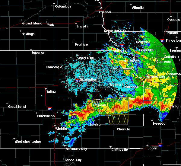 At 112 am cdt, severe thunderstorms were located along a line extending from 7 miles southwest of parker to 3 miles west of madison, moving south at 40 mph (law enforcement. damaging winds have been reported with these storms). Hazards include 60 mph wind gusts and quarter size hail. Hail damage to vehicles is expected. expect wind damage to roofs, siding, and trees. locations impacted include, emporia, ottawa, garnett, burlington, wellsville, lyndon, lebo, pomona, waverly, olpe, richmond, colony, williamsburg, new strawn, quenemo, melvern, hartford, gridley, greeley and princeton. this includes the following highways, interstate 35 between mile markers 128 and 198. Kansas turnpike between mile markers 116 and 126. At 112 am cdt, severe thunderstorms were located along a line extending from 7 miles southwest of parker to 3 miles west of madison, moving south at 40 mph (law enforcement. damaging winds have been reported with these storms). Hazards include 60 mph wind gusts and quarter size hail. Hail damage to vehicles is expected. expect wind damage to roofs, siding, and trees. locations impacted include, emporia, ottawa, garnett, burlington, wellsville, lyndon, lebo, pomona, waverly, olpe, richmond, colony, williamsburg, new strawn, quenemo, melvern, hartford, gridley, greeley and princeton. this includes the following highways, interstate 35 between mile markers 128 and 198. Kansas turnpike between mile markers 116 and 126.
|
| 6/12/2018 1:13 AM CDT |
 At 112 am cdt, severe thunderstorms were located along a line extending from 7 miles southwest of parker to 3 miles west of madison, moving south at 40 mph (law enforcement. damaging winds have been reported with these storms). Hazards include 60 mph wind gusts and quarter size hail. Hail damage to vehicles is expected. expect wind damage to roofs, siding, and trees. locations impacted include, emporia, ottawa, garnett, burlington, wellsville, lyndon, lebo, pomona, waverly, olpe, richmond, colony, williamsburg, new strawn, quenemo, melvern, hartford, gridley, greeley and princeton. this includes the following highways, interstate 35 between mile markers 128 and 198. Kansas turnpike between mile markers 116 and 126. At 112 am cdt, severe thunderstorms were located along a line extending from 7 miles southwest of parker to 3 miles west of madison, moving south at 40 mph (law enforcement. damaging winds have been reported with these storms). Hazards include 60 mph wind gusts and quarter size hail. Hail damage to vehicles is expected. expect wind damage to roofs, siding, and trees. locations impacted include, emporia, ottawa, garnett, burlington, wellsville, lyndon, lebo, pomona, waverly, olpe, richmond, colony, williamsburg, new strawn, quenemo, melvern, hartford, gridley, greeley and princeton. this includes the following highways, interstate 35 between mile markers 128 and 198. Kansas turnpike between mile markers 116 and 126.
|
| 6/12/2018 1:08 AM CDT |
 At 108 am cdt, severe thunderstorms were located along a line extending from 5 miles southwest of parker to 4 miles northwest of madison, moving south at 35 mph (radar indicated). Hazards include 60 mph wind gusts and quarter size hail. Hail damage to vehicles is expected. expect wind damage to roofs, siding, and trees. locations impacted include, emporia, ottawa, garnett, burlington, wellsville, lyndon, lebo, pomona, waverly, olpe, richmond, colony, williamsburg, new strawn, quenemo, melvern, hartford, gridley, greeley and princeton. this includes the following highways, interstate 35 between mile markers 128 and 198. Kansas turnpike between mile markers 116 and 126. At 108 am cdt, severe thunderstorms were located along a line extending from 5 miles southwest of parker to 4 miles northwest of madison, moving south at 35 mph (radar indicated). Hazards include 60 mph wind gusts and quarter size hail. Hail damage to vehicles is expected. expect wind damage to roofs, siding, and trees. locations impacted include, emporia, ottawa, garnett, burlington, wellsville, lyndon, lebo, pomona, waverly, olpe, richmond, colony, williamsburg, new strawn, quenemo, melvern, hartford, gridley, greeley and princeton. this includes the following highways, interstate 35 between mile markers 128 and 198. Kansas turnpike between mile markers 116 and 126.
|
| 6/12/2018 12:57 AM CDT |
 At 1256 am cdt, severe thunderstorms were located along a line extending from greeley to 9 miles west of olpe, moving south at 40 mph (trained weather spotters. measured severe winds have been reported with these storms). Hazards include 60 mph wind gusts and quarter size hail. Hail damage to vehicles is expected. expect wind damage to roofs, siding, and trees. locations impacted include, emporia, ottawa, garnett, burlington, wellsville, lyndon, lebo, pomona, waverly, olpe, richmond, colony, williamsburg, new strawn, quenemo, melvern, hartford, gridley, greeley and princeton. this includes the following highways, interstate 35 between mile markers 128 and 198. Kansas turnpike between mile markers 116 and 126. At 1256 am cdt, severe thunderstorms were located along a line extending from greeley to 9 miles west of olpe, moving south at 40 mph (trained weather spotters. measured severe winds have been reported with these storms). Hazards include 60 mph wind gusts and quarter size hail. Hail damage to vehicles is expected. expect wind damage to roofs, siding, and trees. locations impacted include, emporia, ottawa, garnett, burlington, wellsville, lyndon, lebo, pomona, waverly, olpe, richmond, colony, williamsburg, new strawn, quenemo, melvern, hartford, gridley, greeley and princeton. this includes the following highways, interstate 35 between mile markers 128 and 198. Kansas turnpike between mile markers 116 and 126.
|
| 6/12/2018 12:47 AM CDT |
 At 1246 am cdt, severe thunderstorms were located along a line extending from near lane to 7 miles west of olpe, moving south at 40 mph (radar indicated). Hazards include 60 mph wind gusts and quarter size hail. Hail damage to vehicles is expected. Expect wind damage to roofs, siding, and trees. At 1246 am cdt, severe thunderstorms were located along a line extending from near lane to 7 miles west of olpe, moving south at 40 mph (radar indicated). Hazards include 60 mph wind gusts and quarter size hail. Hail damage to vehicles is expected. Expect wind damage to roofs, siding, and trees.
|
| 6/12/2018 12:43 AM CDT |
 At 1241 am cdt, severe thunderstorms were located along a line extending from near paola to 3 miles northeast of harris to near neosho rapids, moving south at 40 mph (trained weather spotters. at 1245 am cdt...the ottawa asos site measured a 61 mph wind gust). Hazards include 70 mph wind gusts and half dollar size hail. Hail damage to vehicles is expected. expect considerable tree damage. wind damage is also likely to mobile homes, roofs, and outbuildings. locations impacted include, southern lawrence, emporia, ottawa, baldwin city, garnett, osage city, burlington, carbondale, eskridge, eudora, richland, wellsville, overbrook, lyndon, centropolis, lebo, burlingame, pomona, scranton and waverly. this includes the following highways, interstate 35 between mile markers 130 and 198. Kansas turnpike between mile markers 133 and 167. At 1241 am cdt, severe thunderstorms were located along a line extending from near paola to 3 miles northeast of harris to near neosho rapids, moving south at 40 mph (trained weather spotters. at 1245 am cdt...the ottawa asos site measured a 61 mph wind gust). Hazards include 70 mph wind gusts and half dollar size hail. Hail damage to vehicles is expected. expect considerable tree damage. wind damage is also likely to mobile homes, roofs, and outbuildings. locations impacted include, southern lawrence, emporia, ottawa, baldwin city, garnett, osage city, burlington, carbondale, eskridge, eudora, richland, wellsville, overbrook, lyndon, centropolis, lebo, burlingame, pomona, scranton and waverly. this includes the following highways, interstate 35 between mile markers 130 and 198. Kansas turnpike between mile markers 133 and 167.
|
| 6/12/2018 12:21 AM CDT |
 At 1221 am cdt, severe thunderstorms were located along a line extending from near edgerton to 3 miles southeast of quenemo to 5 miles west of reading, moving south at 40 mph (trained weather spotters. at 1208 am cdt...trained spotter reported ping pong ball size hail 2 miles northeast of pleasant grove). Hazards include 70 mph wind gusts and ping pong ball size hail. People and animals outdoors will be injured. expect hail damage to roofs, siding, windows, and vehicles. expect considerable tree damage. wind damage is also likely to mobile homes, roofs, and outbuildings. locations impacted include, southern lawrence, emporia, ottawa, baldwin city, garnett, osage city, burlington, carbondale, eskridge, eudora, richland, wellsville, overbrook, lyndon, centropolis, lebo, burlingame, pomona, scranton and waverly. this includes the following highways, interstate 35 between mile markers 130 and 198. Kansas turnpike between mile markers 133 and 167. At 1221 am cdt, severe thunderstorms were located along a line extending from near edgerton to 3 miles southeast of quenemo to 5 miles west of reading, moving south at 40 mph (trained weather spotters. at 1208 am cdt...trained spotter reported ping pong ball size hail 2 miles northeast of pleasant grove). Hazards include 70 mph wind gusts and ping pong ball size hail. People and animals outdoors will be injured. expect hail damage to roofs, siding, windows, and vehicles. expect considerable tree damage. wind damage is also likely to mobile homes, roofs, and outbuildings. locations impacted include, southern lawrence, emporia, ottawa, baldwin city, garnett, osage city, burlington, carbondale, eskridge, eudora, richland, wellsville, overbrook, lyndon, centropolis, lebo, burlingame, pomona, scranton and waverly. this includes the following highways, interstate 35 between mile markers 130 and 198. Kansas turnpike between mile markers 133 and 167.
|
| 6/12/2018 12:09 AM CDT |
 At 1208 am cdt, severe thunderstorms were located along a line extending from 6 miles southeast of eudora to near pomona lake to near admire, moving south at 40 mph (trained weather spotters. at 1202 am cdt...trained spotters reported quarter size hail and estimated 60 mph wind gusts in lawrence). Hazards include 70 mph wind gusts and half dollar size hail. Hail damage to vehicles is expected. expect considerable tree damage. wind damage is also likely to mobile homes, roofs, and outbuildings. locations impacted include, southern lawrence, emporia, ottawa, baldwin city, garnett, osage city, burlington, carbondale, eskridge, eudora, richland, wellsville, overbrook, lyndon, centropolis, lebo, burlingame, pomona, scranton and waverly. this includes the following highways, interstate 35 between mile markers 130 and 198. Kansas turnpike between mile markers 133 and 167. At 1208 am cdt, severe thunderstorms were located along a line extending from 6 miles southeast of eudora to near pomona lake to near admire, moving south at 40 mph (trained weather spotters. at 1202 am cdt...trained spotters reported quarter size hail and estimated 60 mph wind gusts in lawrence). Hazards include 70 mph wind gusts and half dollar size hail. Hail damage to vehicles is expected. expect considerable tree damage. wind damage is also likely to mobile homes, roofs, and outbuildings. locations impacted include, southern lawrence, emporia, ottawa, baldwin city, garnett, osage city, burlington, carbondale, eskridge, eudora, richland, wellsville, overbrook, lyndon, centropolis, lebo, burlingame, pomona, scranton and waverly. this includes the following highways, interstate 35 between mile markers 130 and 198. Kansas turnpike between mile markers 133 and 167.
|
| 6/12/2018 12:05 AM CDT |
 At 1204 am cdt, severe thunderstorms were located along a line extending from 3 miles southeast of eudora to near pomona lake to 3 miles northeast of allen, moving south at 40 mph (trained weather spotters). Hazards include 70 mph wind gusts and half dollar size hail. Hail damage to vehicles is expected. expect considerable tree damage. Wind damage is also likely to mobile homes, roofs, and outbuildings. At 1204 am cdt, severe thunderstorms were located along a line extending from 3 miles southeast of eudora to near pomona lake to 3 miles northeast of allen, moving south at 40 mph (trained weather spotters). Hazards include 70 mph wind gusts and half dollar size hail. Hail damage to vehicles is expected. expect considerable tree damage. Wind damage is also likely to mobile homes, roofs, and outbuildings.
|
| 5/14/2018 6:24 PM CDT |
 At 624 pm cdt, a severe thunderstorm was located 8 miles northwest of yates center, moving northeast at 30 mph (radar indicated). Hazards include ping pong ball size hail and 60 mph wind gusts. People and animals outdoors will be injured. expect hail damage to roofs, siding, windows, and vehicles. Expect wind damage to roofs, siding, and trees. At 624 pm cdt, a severe thunderstorm was located 8 miles northwest of yates center, moving northeast at 30 mph (radar indicated). Hazards include ping pong ball size hail and 60 mph wind gusts. People and animals outdoors will be injured. expect hail damage to roofs, siding, windows, and vehicles. Expect wind damage to roofs, siding, and trees.
|
| 5/3/2018 8:36 PM CDT |
 At 836 pm cdt, a severe thunderstorm was located near harris, moving east at 35 mph (radar indicated). Hazards include 60 mph wind gusts and quarter size hail. Hail damage to vehicles is expected. expect wind damage to roofs, siding, and trees. this severe thunderstorm will be near, harris around 845 pm cdt. garnett and richmond around 900 pm cdt. greeley around 910 pm cdt. Lane around 915 pm cdt. At 836 pm cdt, a severe thunderstorm was located near harris, moving east at 35 mph (radar indicated). Hazards include 60 mph wind gusts and quarter size hail. Hail damage to vehicles is expected. expect wind damage to roofs, siding, and trees. this severe thunderstorm will be near, harris around 845 pm cdt. garnett and richmond around 900 pm cdt. greeley around 910 pm cdt. Lane around 915 pm cdt.
|
| 5/2/2018 8:24 PM CDT |
 At 824 pm cdt, a severe squall line capable of producing both tornadoes and extensive straight line wind damage was located along a line extending from near quenemo to harris, moving east at 35 mph (radar indicated rotation). Hazards include tornado and quarter size hail. Flying debris will be dangerous to those caught without shelter. mobile homes will be damaged or destroyed. damage to roofs, windows, and vehicles will occur. tree damage is likely. these dangerous storms will be near, richmond around 840 pm cdt. ottawa, greeley and princeton around 845 pm cdt. This includes interstate 35 between mile markers 169 and 190. At 824 pm cdt, a severe squall line capable of producing both tornadoes and extensive straight line wind damage was located along a line extending from near quenemo to harris, moving east at 35 mph (radar indicated rotation). Hazards include tornado and quarter size hail. Flying debris will be dangerous to those caught without shelter. mobile homes will be damaged or destroyed. damage to roofs, windows, and vehicles will occur. tree damage is likely. these dangerous storms will be near, richmond around 840 pm cdt. ottawa, greeley and princeton around 845 pm cdt. This includes interstate 35 between mile markers 169 and 190.
|
| 5/2/2018 8:12 PM CDT |
 At 812 pm cdt, severe thunderstorms capable of producing both tornadoes and extensive straight line wind damage were located along a line extending from near melvern to 7 miles west of harris, moving east at 35 mph (radar indicated rotation). Hazards include tornado and quarter size hail. Flying debris will be dangerous to those caught without shelter. mobile homes will be damaged or destroyed. damage to roofs, windows, and vehicles will occur. tree damage is likely. these dangerous storms will be near, williamsburg, quenemo and harris around 825 pm cdt. pomona around 830 pm cdt. richmond around 840 pm cdt. ottawa, greeley and princeton around 845 pm cdt. This includes interstate 35 between mile markers 162 and 190. At 812 pm cdt, severe thunderstorms capable of producing both tornadoes and extensive straight line wind damage were located along a line extending from near melvern to 7 miles west of harris, moving east at 35 mph (radar indicated rotation). Hazards include tornado and quarter size hail. Flying debris will be dangerous to those caught without shelter. mobile homes will be damaged or destroyed. damage to roofs, windows, and vehicles will occur. tree damage is likely. these dangerous storms will be near, williamsburg, quenemo and harris around 825 pm cdt. pomona around 830 pm cdt. richmond around 840 pm cdt. ottawa, greeley and princeton around 845 pm cdt. This includes interstate 35 between mile markers 162 and 190.
|
| 4/13/2018 5:12 PM CDT |
 At 511 pm cdt, a severe thunderstorm was located 4 miles southwest of rantoul, moving northeast at 50 mph (radar indicated). Hazards include golf ball size hail and 60 mph wind gusts. People and animals outdoors will be injured. expect hail damage to roofs, siding, windows, and vehicles. expect wind damage to roofs, siding, and trees. locations impacted include, wellsville, richmond, princeton, lane, rantoul and harris. this includes interstate 35 between mile markers 184 and 185, and between mile markers 196 and 198. A tornado watch remains in effect until 900 pm cdt for east central kansas. At 511 pm cdt, a severe thunderstorm was located 4 miles southwest of rantoul, moving northeast at 50 mph (radar indicated). Hazards include golf ball size hail and 60 mph wind gusts. People and animals outdoors will be injured. expect hail damage to roofs, siding, windows, and vehicles. expect wind damage to roofs, siding, and trees. locations impacted include, wellsville, richmond, princeton, lane, rantoul and harris. this includes interstate 35 between mile markers 184 and 185, and between mile markers 196 and 198. A tornado watch remains in effect until 900 pm cdt for east central kansas.
|
| 4/13/2018 4:32 PM CDT |
 At 432 pm cdt, a severe thunderstorm was located 6 miles west of westphalia, moving northeast at 55 mph (radar indicated). Hazards include ping pong ball size hail and 60 mph wind gusts. People and animals outdoors will be injured. expect hail damage to roofs, siding, windows, and vehicles. Expect wind damage to roofs, siding, and trees. At 432 pm cdt, a severe thunderstorm was located 6 miles west of westphalia, moving northeast at 55 mph (radar indicated). Hazards include ping pong ball size hail and 60 mph wind gusts. People and animals outdoors will be injured. expect hail damage to roofs, siding, windows, and vehicles. Expect wind damage to roofs, siding, and trees.
|
| 4/13/2018 3:49 PM CDT |
 At 348 pm cdt, a severe thunderstorm was located over new strawn, moving northeast at 60 mph (radar indicated). Hazards include golf ball size hail and 60 mph wind gusts. People and animals outdoors will be injured. expect hail damage to roofs, siding, windows, and vehicles. Expect wind damage to roofs, siding, and trees. At 348 pm cdt, a severe thunderstorm was located over new strawn, moving northeast at 60 mph (radar indicated). Hazards include golf ball size hail and 60 mph wind gusts. People and animals outdoors will be injured. expect hail damage to roofs, siding, windows, and vehicles. Expect wind damage to roofs, siding, and trees.
|
| 3/26/2018 5:27 AM CDT |
 The severe thunderstorm warning for southwestern franklin, northwestern anderson and northeastern coffey counties will expire at 530 am cdt, the storm which prompted the warning has weakened below severe limits, and no longer poses an immediate threat to life or property. therefore the warning will be allowed to expire. The severe thunderstorm warning for southwestern franklin, northwestern anderson and northeastern coffey counties will expire at 530 am cdt, the storm which prompted the warning has weakened below severe limits, and no longer poses an immediate threat to life or property. therefore the warning will be allowed to expire.
|
| 3/26/2018 5:11 AM CDT |
 At 509 am cdt, a severe thunderstorm was located near waverly, moving northeast at 30 mph. quarter size hail was reported 4 miles south of waverly (trained weather spotters). Hazards include half dollar size hail. Damage to vehicles is expected. locations impacted include, waverly and harris. This includes interstate 35 between mile markers 168 and 169. At 509 am cdt, a severe thunderstorm was located near waverly, moving northeast at 30 mph. quarter size hail was reported 4 miles south of waverly (trained weather spotters). Hazards include half dollar size hail. Damage to vehicles is expected. locations impacted include, waverly and harris. This includes interstate 35 between mile markers 168 and 169.
|
| 3/26/2018 5:04 AM CDT |
 At 504 am cdt, a severe thunderstorm was located 6 miles south of waverly, moving northeast at 30 mph (radar indicated). Hazards include ping pong ball size hail. People and animals outdoors will be injured. expect damage to roofs, siding, windows, and vehicles. locations impacted include, waverly, williamsburg and harris. This includes interstate 35 between mile markers 163 and 169. At 504 am cdt, a severe thunderstorm was located 6 miles south of waverly, moving northeast at 30 mph (radar indicated). Hazards include ping pong ball size hail. People and animals outdoors will be injured. expect damage to roofs, siding, windows, and vehicles. locations impacted include, waverly, williamsburg and harris. This includes interstate 35 between mile markers 163 and 169.
|
| 3/26/2018 4:56 AM CDT |
 At 455 am cdt, a severe thunderstorm was located near new strawn, moving northeast at 30 mph (radar indicated). Hazards include ping pong ball size hail. People and animals outdoors will be injured. Expect damage to roofs, siding, windows, and vehicles. At 455 am cdt, a severe thunderstorm was located near new strawn, moving northeast at 30 mph (radar indicated). Hazards include ping pong ball size hail. People and animals outdoors will be injured. Expect damage to roofs, siding, windows, and vehicles.
|
| 10/14/2017 6:34 PM CDT |
 At 633 pm cdt, a severe thunderstorm was located 4 miles west of garnett, moving northeast at 55 mph (emergency management. at 632 pm, hail up to the size of quarters was reported 4 miles west of garnett). Hazards include 60 mph wind gusts and quarter size hail. Hail damage to vehicles is expected. expect wind damage to roofs, siding, and trees. Locations impacted include, garnett, richmond, greeley, lane, westphalia and harris. At 633 pm cdt, a severe thunderstorm was located 4 miles west of garnett, moving northeast at 55 mph (emergency management. at 632 pm, hail up to the size of quarters was reported 4 miles west of garnett). Hazards include 60 mph wind gusts and quarter size hail. Hail damage to vehicles is expected. expect wind damage to roofs, siding, and trees. Locations impacted include, garnett, richmond, greeley, lane, westphalia and harris.
|
| 10/14/2017 6:23 PM CDT |
 At 623 pm cdt, a severe thunderstorm was located near westphalia, moving northeast at 60 mph (emergency management). Hazards include 60 mph wind gusts and penny size hail. expect damage to roofs, siding, and trees At 623 pm cdt, a severe thunderstorm was located near westphalia, moving northeast at 60 mph (emergency management). Hazards include 60 mph wind gusts and penny size hail. expect damage to roofs, siding, and trees
|
| 10/14/2017 5:07 PM CDT |
 At 505 pm cdt, a severe thunderstorm was located near waverly, moving east at 55 mph (emergency management. at 5 pm, there are several reports of tree damaging and small out building blown apart near the john redmond reservoir). Hazards include 70 mph wind gusts and penny size hail. Expect considerable tree damage. Damage is likely to mobile homes, roofs, and outbuildings. At 505 pm cdt, a severe thunderstorm was located near waverly, moving east at 55 mph (emergency management. at 5 pm, there are several reports of tree damaging and small out building blown apart near the john redmond reservoir). Hazards include 70 mph wind gusts and penny size hail. Expect considerable tree damage. Damage is likely to mobile homes, roofs, and outbuildings.
|
| 6/17/2017 4:29 AM CDT |
 At 428 am cdt, a severe thunderstorm was located 6 miles northeast of westphalia, moving southeast at 35 mph (radar indicated). Hazards include ping pong ball size hail. People and animals outdoors will be injured. expect damage to roofs, siding, windows, and vehicles. Locations impacted include, garnett, colony, westphalia, kincaid, lone elm and harris. At 428 am cdt, a severe thunderstorm was located 6 miles northeast of westphalia, moving southeast at 35 mph (radar indicated). Hazards include ping pong ball size hail. People and animals outdoors will be injured. expect damage to roofs, siding, windows, and vehicles. Locations impacted include, garnett, colony, westphalia, kincaid, lone elm and harris.
|
| 6/17/2017 4:12 AM CDT |
 At 411 am cdt, a severe thunderstorm was located near harris, moving southeast at 35 mph (radar indicated). Hazards include ping pong ball size hail. People and animals outdoors will be injured. Expect damage to roofs, siding, windows, and vehicles. At 411 am cdt, a severe thunderstorm was located near harris, moving southeast at 35 mph (radar indicated). Hazards include ping pong ball size hail. People and animals outdoors will be injured. Expect damage to roofs, siding, windows, and vehicles.
|
| 6/17/2017 4:05 AM CDT |
 At 405 am cdt, a severe thunderstorm was located near waverly, moving southeast at 30 mph (trained weather spotters). Hazards include golf ball size hail. People and animals outdoors will be injured. expect damage to roofs, siding, windows, and vehicles. locations impacted include, waverly, williamsburg and beto junction. This includes interstate 35 between mile markers 155 and 173. At 405 am cdt, a severe thunderstorm was located near waverly, moving southeast at 30 mph (trained weather spotters). Hazards include golf ball size hail. People and animals outdoors will be injured. expect damage to roofs, siding, windows, and vehicles. locations impacted include, waverly, williamsburg and beto junction. This includes interstate 35 between mile markers 155 and 173.
|
| 6/17/2017 3:46 AM CDT |
 At 346 am cdt, a severe thunderstorm was located over melvern, moving southeast at 40 mph (radar indicated). Hazards include golf ball size hail. People and animals outdoors will be injured. expect damage to roofs, siding, windows, and vehicles. locations impacted include, lyndon, waverly, williamsburg, quenemo, melvern, olivet, beto junction and pomona lake. This includes interstate 35 between mile markers 155 and 173. At 346 am cdt, a severe thunderstorm was located over melvern, moving southeast at 40 mph (radar indicated). Hazards include golf ball size hail. People and animals outdoors will be injured. expect damage to roofs, siding, windows, and vehicles. locations impacted include, lyndon, waverly, williamsburg, quenemo, melvern, olivet, beto junction and pomona lake. This includes interstate 35 between mile markers 155 and 173.
|
| 6/17/2017 3:29 AM CDT |
 At 329 am cdt, a severe thunderstorm was located near lyndon, moving southeast at 40 mph (radar indicated). Hazards include two inch hail. People and animals outdoors will be injured. Expect damage to roofs, siding, windows, and vehicles. At 329 am cdt, a severe thunderstorm was located near lyndon, moving southeast at 40 mph (radar indicated). Hazards include two inch hail. People and animals outdoors will be injured. Expect damage to roofs, siding, windows, and vehicles.
|
| 5/31/2017 1:48 PM CDT |
 At 148 pm cdt, a severe thunderstorm was located 7 miles east of new strawn, moving east at 20 mph (trained weather spotters). Hazards include quarter size hail. damage to vehicles is expected At 148 pm cdt, a severe thunderstorm was located 7 miles east of new strawn, moving east at 20 mph (trained weather spotters). Hazards include quarter size hail. damage to vehicles is expected
|
| 3/6/2017 7:54 PM CST |
 At 753 pm cst, severe thunderstorms were located along a line extending from 6 miles north of osawatomie to near le roy, moving east at 50 mph (radar indicated). Hazards include 60 mph wind gusts and quarter size hail. Hail damage to vehicles is expected. Expect wind damage to roofs, siding, and trees. At 753 pm cst, severe thunderstorms were located along a line extending from 6 miles north of osawatomie to near le roy, moving east at 50 mph (radar indicated). Hazards include 60 mph wind gusts and quarter size hail. Hail damage to vehicles is expected. Expect wind damage to roofs, siding, and trees.
|
| 3/6/2017 7:50 PM CST |
 At 748 pm cst, severe thunderstorms were located along a line extending from 4 miles southwest of rantoul to 3 miles southwest of le roy, moving east at 45 mph (radar indicated). Hazards include 60 mph wind gusts and quarter size hail. Hail damage to vehicles is expected. expect wind damage to roofs, siding, and trees. locations impacted include, garnett, burlington, richmond, greeley, princeton, lane, westphalia, le roy and harris. A tornado watch remains in effect until 1000 pm cst for east central kansas. At 748 pm cst, severe thunderstorms were located along a line extending from 4 miles southwest of rantoul to 3 miles southwest of le roy, moving east at 45 mph (radar indicated). Hazards include 60 mph wind gusts and quarter size hail. Hail damage to vehicles is expected. expect wind damage to roofs, siding, and trees. locations impacted include, garnett, burlington, richmond, greeley, princeton, lane, westphalia, le roy and harris. A tornado watch remains in effect until 1000 pm cst for east central kansas.
|
| 3/6/2017 7:35 PM CST |
 At 734 pm cst, severe thunderstorms were located along a line extending from 3 miles northwest of princeton to near gridley, moving east at 40 mph (radar indicated). Hazards include 60 mph wind gusts and quarter size hail. Hail damage to vehicles is expected. expect wind damage to roofs, siding, and trees. locations impacted include, garnett, burlington, waverly, richmond, williamsburg, new strawn, melvern, gridley, greeley, princeton, lane, westphalia, beto junction, harris, john redmond reservoir and le roy. this includes interstate 35 between mile markers 152 and 175. A tornado watch remains in effect until 1000 pm cst for east central kansas. At 734 pm cst, severe thunderstorms were located along a line extending from 3 miles northwest of princeton to near gridley, moving east at 40 mph (radar indicated). Hazards include 60 mph wind gusts and quarter size hail. Hail damage to vehicles is expected. expect wind damage to roofs, siding, and trees. locations impacted include, garnett, burlington, waverly, richmond, williamsburg, new strawn, melvern, gridley, greeley, princeton, lane, westphalia, beto junction, harris, john redmond reservoir and le roy. this includes interstate 35 between mile markers 152 and 175. A tornado watch remains in effect until 1000 pm cst for east central kansas.
|
| 3/6/2017 7:26 PM CST |
 At 726 pm cst, severe thunderstorms were located along a line extending from williamsburg to 3 miles southwest of burlington, moving east at 50 mph (radar indicated). Hazards include 60 mph wind gusts and quarter size hail. Hail damage to vehicles is expected. expect wind damage to roofs, siding, and trees. locations impacted include, garnett, burlington, lebo, waverly, olpe, richmond, williamsburg, new strawn, melvern, hartford, gridley, greeley, princeton, neosho rapids, lane, westphalia, olivet, beto junction, harris and john redmond reservoir. this includes interstate 35 between mile markers 140 and 175. A tornado watch remains in effect until 1000 pm cst for east central kansas. At 726 pm cst, severe thunderstorms were located along a line extending from williamsburg to 3 miles southwest of burlington, moving east at 50 mph (radar indicated). Hazards include 60 mph wind gusts and quarter size hail. Hail damage to vehicles is expected. expect wind damage to roofs, siding, and trees. locations impacted include, garnett, burlington, lebo, waverly, olpe, richmond, williamsburg, new strawn, melvern, hartford, gridley, greeley, princeton, neosho rapids, lane, westphalia, olivet, beto junction, harris and john redmond reservoir. this includes interstate 35 between mile markers 140 and 175. A tornado watch remains in effect until 1000 pm cst for east central kansas.
|
| 3/6/2017 7:12 PM CST |
 At 711 pm cst, severe thunderstorms were located along a line extending from melvern lake to 3 miles northeast of madison, moving east at 45 mph (radar indicated). Hazards include 60 mph wind gusts and quarter size hail. Hail damage to vehicles is expected. expect wind damage to roofs, siding, and trees. locations impacted include, emporia, garnett, burlington, lebo, waverly, olpe, richmond, williamsburg, new strawn, melvern, hartford, gridley, greeley, princeton, neosho rapids, reading, lane, westphalia, olivet and beto junction. this includes the following highways, interstate 35 between mile markers 128 and 176. kansas turnpike between mile markers 116 and 135. A tornado watch remains in effect until 1000 pm cst for east central kansas. At 711 pm cst, severe thunderstorms were located along a line extending from melvern lake to 3 miles northeast of madison, moving east at 45 mph (radar indicated). Hazards include 60 mph wind gusts and quarter size hail. Hail damage to vehicles is expected. expect wind damage to roofs, siding, and trees. locations impacted include, emporia, garnett, burlington, lebo, waverly, olpe, richmond, williamsburg, new strawn, melvern, hartford, gridley, greeley, princeton, neosho rapids, reading, lane, westphalia, olivet and beto junction. this includes the following highways, interstate 35 between mile markers 128 and 176. kansas turnpike between mile markers 116 and 135. A tornado watch remains in effect until 1000 pm cst for east central kansas.
|
| 3/6/2017 6:56 PM CST |
 At 655 pm cst, severe thunderstorms were located along a line extending from near reading to 8 miles west of madison, moving east at 45 mph (radar indicated). Hazards include 60 mph wind gusts and quarter size hail. Hail damage to vehicles is expected. Expect wind damage to roofs, siding, and trees. At 655 pm cst, severe thunderstorms were located along a line extending from near reading to 8 miles west of madison, moving east at 45 mph (radar indicated). Hazards include 60 mph wind gusts and quarter size hail. Hail damage to vehicles is expected. Expect wind damage to roofs, siding, and trees.
|
| 10/6/2016 7:25 PM CDT |
 At 725 pm cdt, severe thunderstorms were located along a line extending from 4 miles southwest of overbrook to 5 miles southwest of hartford, moving east at 45 mph (radar indicated). Hazards include 60 mph wind gusts and quarter size hail. Hail damage to vehicles is expected. expect wind damage to roofs, siding, and trees. locations impacted include, emporia, ottawa, baldwin city, osage city, lyndon, centropolis, lebo, pomona, waverly, williamsburg, quenemo, melvern, neosho rapids, reading, olivet, melvern lake, globe, beto junction and pomona lake. this includes interstate 35 between mile markers 132 and 181. A tornado watch remains in effect until 900 pm cdt for east central kansas. At 725 pm cdt, severe thunderstorms were located along a line extending from 4 miles southwest of overbrook to 5 miles southwest of hartford, moving east at 45 mph (radar indicated). Hazards include 60 mph wind gusts and quarter size hail. Hail damage to vehicles is expected. expect wind damage to roofs, siding, and trees. locations impacted include, emporia, ottawa, baldwin city, osage city, lyndon, centropolis, lebo, pomona, waverly, williamsburg, quenemo, melvern, neosho rapids, reading, olivet, melvern lake, globe, beto junction and pomona lake. this includes interstate 35 between mile markers 132 and 181. A tornado watch remains in effect until 900 pm cdt for east central kansas.
|
| 10/6/2016 7:18 PM CDT |
 At 718 pm cdt, severe thunderstorms were located along a line extending from near scranton to 5 miles southeast of olpe, moving east at 45 mph (radar indicated). Hazards include 60 mph wind gusts and quarter size hail. Hail damage to vehicles is expected. Expect wind damage to roofs, siding, and trees. At 718 pm cdt, severe thunderstorms were located along a line extending from near scranton to 5 miles southeast of olpe, moving east at 45 mph (radar indicated). Hazards include 60 mph wind gusts and quarter size hail. Hail damage to vehicles is expected. Expect wind damage to roofs, siding, and trees.
|
| 8/24/2016 8:15 PM CDT |
 At 813 pm cdt, a severe thunderstorm was located 6 miles southeast of williamsburg, moving east at 35 mph. this is a very dangerous storm (trained weather spotters. at 8:03 pm 80 to 90 mph winds were estimated 3 miles north of harris with multiple powerlines down. significant wind damage being reported in the area). Hazards include 80 mph wind gusts and two inch hail. Flying debris will be dangerous to those caught without shelter. mobile homes will be heavily damaged. expect considerable damage to roofs, windows, and vehicles. extensive tree damage and power outages are likely. locations impacted include, garnett, richmond, williamsburg, princeton and harris. This includes interstate 35 between mile markers 168 and 176. At 813 pm cdt, a severe thunderstorm was located 6 miles southeast of williamsburg, moving east at 35 mph. this is a very dangerous storm (trained weather spotters. at 8:03 pm 80 to 90 mph winds were estimated 3 miles north of harris with multiple powerlines down. significant wind damage being reported in the area). Hazards include 80 mph wind gusts and two inch hail. Flying debris will be dangerous to those caught without shelter. mobile homes will be heavily damaged. expect considerable damage to roofs, windows, and vehicles. extensive tree damage and power outages are likely. locations impacted include, garnett, richmond, williamsburg, princeton and harris. This includes interstate 35 between mile markers 168 and 176.
|
| 8/24/2016 7:53 PM CDT |
 At 752 pm cdt, a severe thunderstorm was located near waverly, moving east at 35 mph. this is a very dangerous storm (trained weather spotters. at 740 pm 80 mph wind gusts were measured at coffey county airport. ping pong ball size hail is also being reported with this storm). Hazards include 80 mph wind gusts and two inch hail. Flying debris will be dangerous to those caught without shelter. mobile homes will be heavily damaged. expect considerable damage to roofs, windows, and vehicles. extensive tree damage and power outages are likely. locations impacted include, garnett, waverly, richmond, williamsburg, princeton, harris and beto junction. This includes interstate 35 between mile markers 155 and 176. At 752 pm cdt, a severe thunderstorm was located near waverly, moving east at 35 mph. this is a very dangerous storm (trained weather spotters. at 740 pm 80 mph wind gusts were measured at coffey county airport. ping pong ball size hail is also being reported with this storm). Hazards include 80 mph wind gusts and two inch hail. Flying debris will be dangerous to those caught without shelter. mobile homes will be heavily damaged. expect considerable damage to roofs, windows, and vehicles. extensive tree damage and power outages are likely. locations impacted include, garnett, waverly, richmond, williamsburg, princeton, harris and beto junction. This includes interstate 35 between mile markers 155 and 176.
|
| 8/24/2016 7:48 PM CDT |
 At 748 pm cdt, a severe thunderstorm was located 4 miles southwest of waverly, moving east at 35 mph (radar indicated). Hazards include two inch hail and 70 mph wind gusts. People and animals outdoors will be injured. expect hail damage to roofs, siding, windows, and vehicles. expect considerable tree damage. Wind damage is also likely to mobile homes, roofs, and outbuildings. At 748 pm cdt, a severe thunderstorm was located 4 miles southwest of waverly, moving east at 35 mph (radar indicated). Hazards include two inch hail and 70 mph wind gusts. People and animals outdoors will be injured. expect hail damage to roofs, siding, windows, and vehicles. expect considerable tree damage. Wind damage is also likely to mobile homes, roofs, and outbuildings.
|
| 8/19/2016 7:45 PM CDT |
 At 745 pm cdt, severe thunderstorms were located along a line extending from 4 miles east of harris to 4 miles south of westphalia, moving east at 45 mph (radar indicated). Hazards include 60 mph wind gusts. Expect damage to roofs. siding. and trees. locations impacted include, garnett, richmond, colony, williamsburg, greeley, princeton, lane, westphalia, kincaid, lone elm, harris and le roy. This includes interstate 35 between mile markers 169 and 180. At 745 pm cdt, severe thunderstorms were located along a line extending from 4 miles east of harris to 4 miles south of westphalia, moving east at 45 mph (radar indicated). Hazards include 60 mph wind gusts. Expect damage to roofs. siding. and trees. locations impacted include, garnett, richmond, colony, williamsburg, greeley, princeton, lane, westphalia, kincaid, lone elm, harris and le roy. This includes interstate 35 between mile markers 169 and 180.
|
| 8/19/2016 7:30 PM CDT |
 At 730 pm cdt, severe thunderstorms were located along a line extending from 6 miles south of waverly to 4 miles west of le roy, moving east at 45 mph (radar indicated). Hazards include 60 mph wind gusts. Expect damage to roofs. siding. And trees. At 730 pm cdt, severe thunderstorms were located along a line extending from 6 miles south of waverly to 4 miles west of le roy, moving east at 45 mph (radar indicated). Hazards include 60 mph wind gusts. Expect damage to roofs. siding. And trees.
|
| 7/7/2016 9:51 PM CDT |
 The severe thunderstorm warning for northeastern coffey and northwestern anderson counties will expire at 1000 pm cdt, the storm which prompted the warning has weakened below severe limits, and no longer pose an immediate threat to life or property. therefore the warning will be allowed to expire. however heavy rain is still possible with this thunderstorm. a severe thunderstorm watch remains in effect until 200 am cdt for east central kansas. The severe thunderstorm warning for northeastern coffey and northwestern anderson counties will expire at 1000 pm cdt, the storm which prompted the warning has weakened below severe limits, and no longer pose an immediate threat to life or property. therefore the warning will be allowed to expire. however heavy rain is still possible with this thunderstorm. a severe thunderstorm watch remains in effect until 200 am cdt for east central kansas.
|
| 7/7/2016 9:35 PM CDT |
 At 934 pm cdt, a severe thunderstorm was located 6 miles southeast of waverly, moving southeast at 10 mph (radar indicated). Hazards include 60 mph wind gusts and quarter size hail. Hail damage to vehicles is expected. expect wind damage to roofs, siding, and trees. This severe thunderstorm will remain over mainly rural areas of northeastern coffey and northwestern anderson counties. At 934 pm cdt, a severe thunderstorm was located 6 miles southeast of waverly, moving southeast at 10 mph (radar indicated). Hazards include 60 mph wind gusts and quarter size hail. Hail damage to vehicles is expected. expect wind damage to roofs, siding, and trees. This severe thunderstorm will remain over mainly rural areas of northeastern coffey and northwestern anderson counties.
|
| 7/7/2016 9:20 PM CDT |
 At 919 pm cdt, a severe thunderstorm was located near waverly, moving east at 10 mph (radar indicated). Hazards include 60 mph wind gusts and quarter size hail. Hail damage to vehicles is expected. expect wind damage to roofs, siding, and trees. This severe thunderstorm will remain over mainly rural areas of northeastern coffey and northwestern anderson counties. At 919 pm cdt, a severe thunderstorm was located near waverly, moving east at 10 mph (radar indicated). Hazards include 60 mph wind gusts and quarter size hail. Hail damage to vehicles is expected. expect wind damage to roofs, siding, and trees. This severe thunderstorm will remain over mainly rural areas of northeastern coffey and northwestern anderson counties.
|
| 4/26/2016 9:24 PM CDT |
 At 923 pm cdt, severe thunderstorms were located along a line extending from 5 miles northwest of princeton to 5 miles west of garnett, moving east at 40 mph (radar indicated). Hazards include 60 mph wind gusts and quarter size hail. Hail damage to vehicles is expected. expect wind damage to roofs, siding, and trees. locations impacted include, garnett, richmond, williamsburg, greeley, princeton, westphalia and harris. This includes interstate 35 between mile markers 168 and 173. At 923 pm cdt, severe thunderstorms were located along a line extending from 5 miles northwest of princeton to 5 miles west of garnett, moving east at 40 mph (radar indicated). Hazards include 60 mph wind gusts and quarter size hail. Hail damage to vehicles is expected. expect wind damage to roofs, siding, and trees. locations impacted include, garnett, richmond, williamsburg, greeley, princeton, westphalia and harris. This includes interstate 35 between mile markers 168 and 173.
|
| 4/26/2016 9:14 PM CDT |
 At 913 pm cdt, severe thunderstorms were located along a line extending from near williamsburg to 5 miles southwest of harris, moving northeast at 40 mph (trained weather spotters reported 61 mph winds at the coffey county airport at 858 pm and quarter size hail was reported southwest of williamsburg). Hazards include 60 mph wind gusts and quarter size hail. Hail damage to vehicles is expected. expect wind damage to roofs, siding, and trees. locations impacted include, garnett, richmond, williamsburg, greeley, princeton, westphalia and harris. This includes interstate 35 between mile markers 168 and 173. At 913 pm cdt, severe thunderstorms were located along a line extending from near williamsburg to 5 miles southwest of harris, moving northeast at 40 mph (trained weather spotters reported 61 mph winds at the coffey county airport at 858 pm and quarter size hail was reported southwest of williamsburg). Hazards include 60 mph wind gusts and quarter size hail. Hail damage to vehicles is expected. expect wind damage to roofs, siding, and trees. locations impacted include, garnett, richmond, williamsburg, greeley, princeton, westphalia and harris. This includes interstate 35 between mile markers 168 and 173.
|
| 4/26/2016 9:03 PM CDT |
 At 903 pm cdt, severe thunderstorms were located along a line extending from near melvern to 5 miles northwest of westphalia, moving northeast at 40 mph (radar indicated). Hazards include 60 mph wind gusts and quarter size hail. Hail damage to vehicles is expected. Expect wind damage to roofs, siding, and trees. At 903 pm cdt, severe thunderstorms were located along a line extending from near melvern to 5 miles northwest of westphalia, moving northeast at 40 mph (radar indicated). Hazards include 60 mph wind gusts and quarter size hail. Hail damage to vehicles is expected. Expect wind damage to roofs, siding, and trees.
|
| 4/26/2016 3:33 PM CDT |
 At 333 pm cdt, a severe thunderstorm was located near new strawn, moving north at 35 mph (radar indicated). Hazards include 60 mph wind gusts and quarter size hail. Hail damage to vehicles is expected. expect wind damage to roofs, siding, and trees. locations impacted include, waverly, williamsburg, melvern and harris. this includes interstate 35 between mile markers 157 and 171. A tornado watch remains in effect until 900 pm cdt for east central kansas. At 333 pm cdt, a severe thunderstorm was located near new strawn, moving north at 35 mph (radar indicated). Hazards include 60 mph wind gusts and quarter size hail. Hail damage to vehicles is expected. expect wind damage to roofs, siding, and trees. locations impacted include, waverly, williamsburg, melvern and harris. this includes interstate 35 between mile markers 157 and 171. A tornado watch remains in effect until 900 pm cdt for east central kansas.
|
| 4/26/2016 3:25 PM CDT |
 At 324 pm cdt, a severe thunderstorm was located 7 miles northwest of westphalia, moving north at 35 mph (radar indicated). Hazards include 60 mph wind gusts and quarter size hail. Hail damage to vehicles is expected. expect wind damage to roofs, siding, and trees. locations impacted include, burlington, waverly, williamsburg, melvern, westphalia and harris. this includes interstate 35 between mile markers 157 and 171. A tornado watch remains in effect until 900 pm cdt for east central kansas. At 324 pm cdt, a severe thunderstorm was located 7 miles northwest of westphalia, moving north at 35 mph (radar indicated). Hazards include 60 mph wind gusts and quarter size hail. Hail damage to vehicles is expected. expect wind damage to roofs, siding, and trees. locations impacted include, burlington, waverly, williamsburg, melvern, westphalia and harris. this includes interstate 35 between mile markers 157 and 171. A tornado watch remains in effect until 900 pm cdt for east central kansas.
|
| 4/26/2016 3:15 PM CDT |
 At 315 pm cdt, a severe thunderstorm was located near le roy, moving north at 35 mph (radar indicated). Hazards include ping pong ball size hail and 60 mph wind gusts. People and animals outdoors will be injured. expect hail damage to roofs, siding, windows, and vehicles. Expect wind damage to roofs, siding, and trees. At 315 pm cdt, a severe thunderstorm was located near le roy, moving north at 35 mph (radar indicated). Hazards include ping pong ball size hail and 60 mph wind gusts. People and animals outdoors will be injured. expect hail damage to roofs, siding, windows, and vehicles. Expect wind damage to roofs, siding, and trees.
|
| 9/18/2015 6:56 AM CDT |
 At 655 am cdt, a severe thunderstorm was located 5 miles west of garnett, moving east at 25 mph (radar indicated). Hazards include 60 mph wind gusts and penny size hail. Expect damage to roofs. siding and trees. Locations impacted include, garnett, richmond, greeley, lane and harris. At 655 am cdt, a severe thunderstorm was located 5 miles west of garnett, moving east at 25 mph (radar indicated). Hazards include 60 mph wind gusts and penny size hail. Expect damage to roofs. siding and trees. Locations impacted include, garnett, richmond, greeley, lane and harris.
|
| 9/18/2015 6:44 AM CDT |
 At 644 am cdt, a severe thunderstorm was located over harris, moving northeast at 35 mph (radar indicated). Hazards include 60 mph wind gusts and penny size hail. Expect damage to roofs. Siding and trees. At 644 am cdt, a severe thunderstorm was located over harris, moving northeast at 35 mph (radar indicated). Hazards include 60 mph wind gusts and penny size hail. Expect damage to roofs. Siding and trees.
|
| 9/18/2015 6:38 AM CDT |
 At 638 am cdt, a severe thunderstorm was located over harris, moving northeast at 35 mph (radar indicated). Hazards include 60 mph wind gusts and penny size hail. Expect damage to roofs. siding and trees. Locations impacted include, waverly and harris. At 638 am cdt, a severe thunderstorm was located over harris, moving northeast at 35 mph (radar indicated). Hazards include 60 mph wind gusts and penny size hail. Expect damage to roofs. siding and trees. Locations impacted include, waverly and harris.
|
| 9/18/2015 6:25 AM CDT |
 At 624 am cdt, a severe thunderstorm was located 7 miles south of waverly, moving northeast at 40 mph (radar indicated). Hazards include 60 mph wind gusts and penny size hail. Expect damage to roofs. Siding and trees. At 624 am cdt, a severe thunderstorm was located 7 miles south of waverly, moving northeast at 40 mph (radar indicated). Hazards include 60 mph wind gusts and penny size hail. Expect damage to roofs. Siding and trees.
|
| 9/10/2015 9:08 PM CDT |
 At 907 pm cdt, severe thunderstorms were located along a line extending from near lyndon to lebo to near emporia, moving southeast at 50 mph (trained weather spotters reported 75 mph wind gusts and tree limb damage near allen at 855 pm). Hazards include 70 mph wind gusts. Expect considerable tree damage. Damage is likely to mobile homes, roofs and outbuildings. At 907 pm cdt, severe thunderstorms were located along a line extending from near lyndon to lebo to near emporia, moving southeast at 50 mph (trained weather spotters reported 75 mph wind gusts and tree limb damage near allen at 855 pm). Hazards include 70 mph wind gusts. Expect considerable tree damage. Damage is likely to mobile homes, roofs and outbuildings.
|
| 6/7/2015 11:11 PM CDT | At 1108 pm cdt, a severe thunderstorm was located near westphalia, and moving east at 30 mph. a second developing thunderstorm was located 6 miles northeast of burlington, moving east at 25 mph (trained weather spotters). Hazards include 60 mph wind gusts and penny size hail. Expect damage to roofs. siding and trees. Locations impacted include, garnett, colony and lone elm. |
| 6/7/2015 10:57 PM CDT | At 1052 pm cdt, a severe thunderstorm was located 6 miles east of burlington, and moving east at 30 mph (trained weather spotters. spotter reported 5 inch diameter tree branch down 1 mile west of burlington). Hazards include 70 mph wind gusts. Expect considerable tree damage. Damage is likely to mobile homes, roofs and outbuildings. |
| 4/8/2015 4:03 PM CDT | A severe thunderstorm warning remains in effect for northern anderson county until 415 pm cdt. at 400 pm cdt. a severe thunderstorm was located 8 miles northeast of westphalia. and moving northeast at 45 mph. hazard. 60 mph wind gusts. source. radar indicated. Winds gusted over 50 mph 8 miles west of. |
| 4/8/2015 3:51 PM CDT | A severe thunderstorm warning remains in effect for northwestern anderson county until 415 pm cdt. at 349 pm cdt. a severe thunderstorm was located near westphalia. and moving northeast at 45 mph. hazard. 60 mph wind gusts and quarter size hail. source. Radar indicated. |
| 4/8/2015 3:28 PM CDT | The national weather service in topeka has issued a * severe thunderstorm warning for. western anderson county in east central kansas. eastern coffey county in east central kansas. until 415 pm cdt * at 327 pm cdt. A severe thunderstorm was located near neosho. |
Hail Maps for Harris, KS
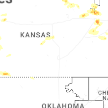
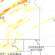
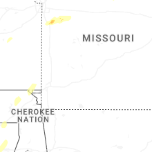


Connect with Interactive Hail Maps