

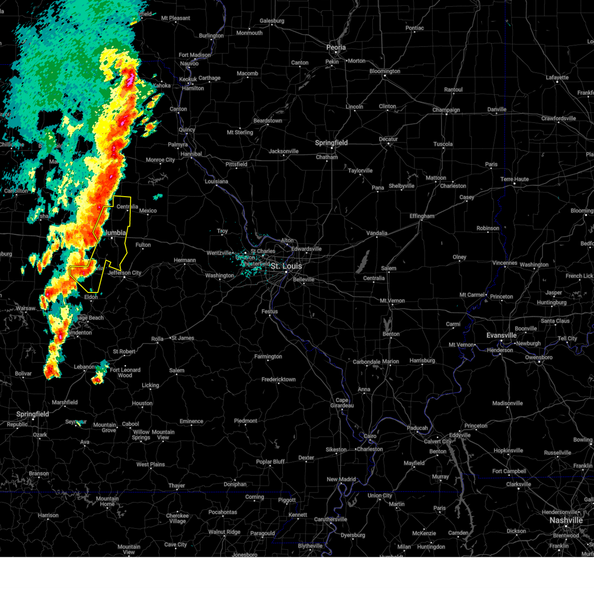
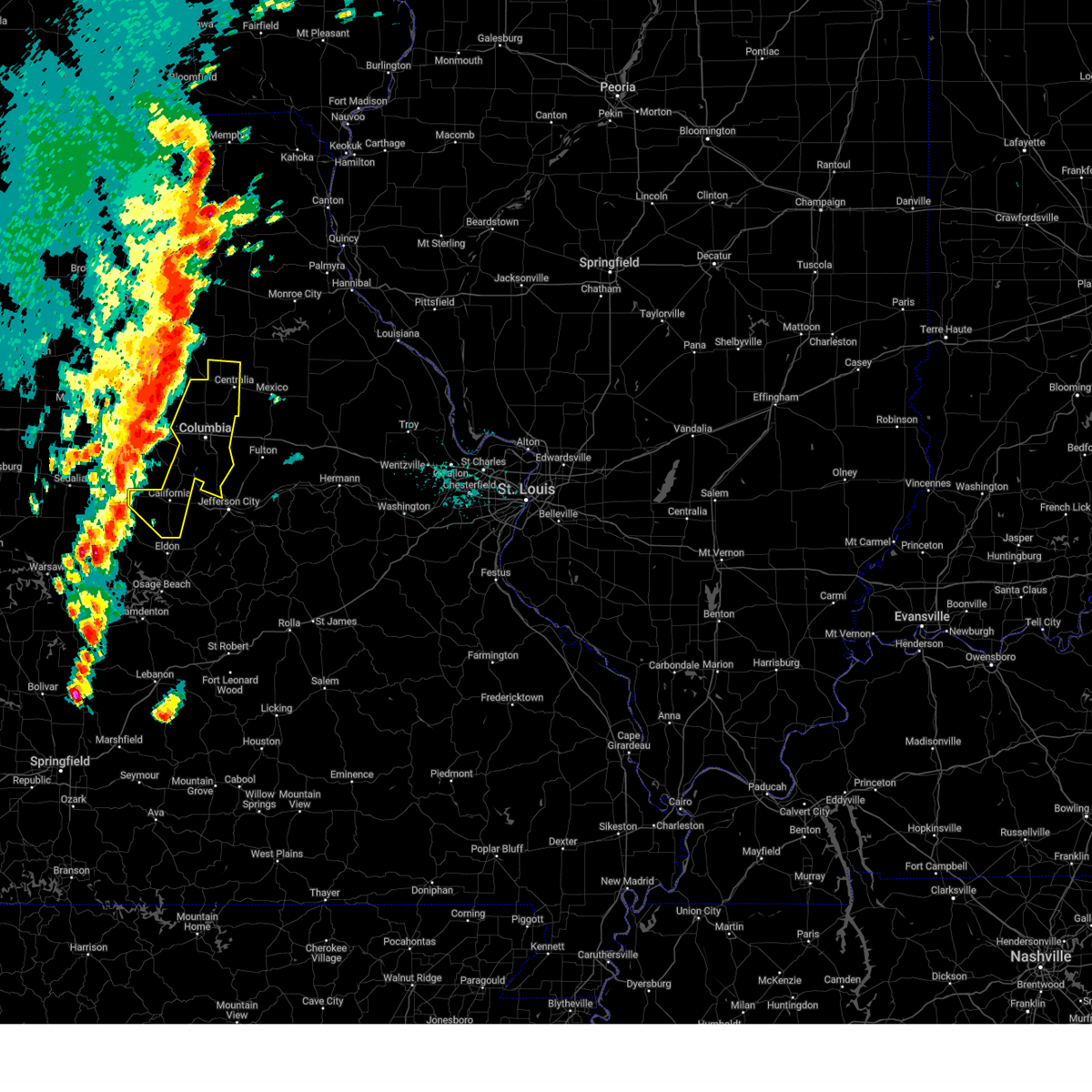
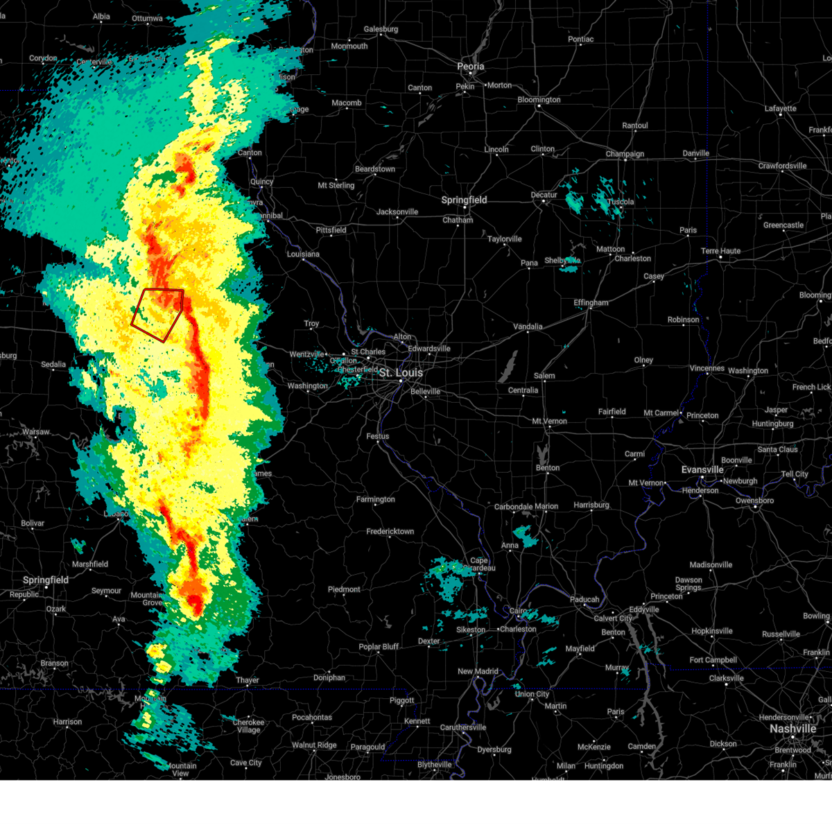
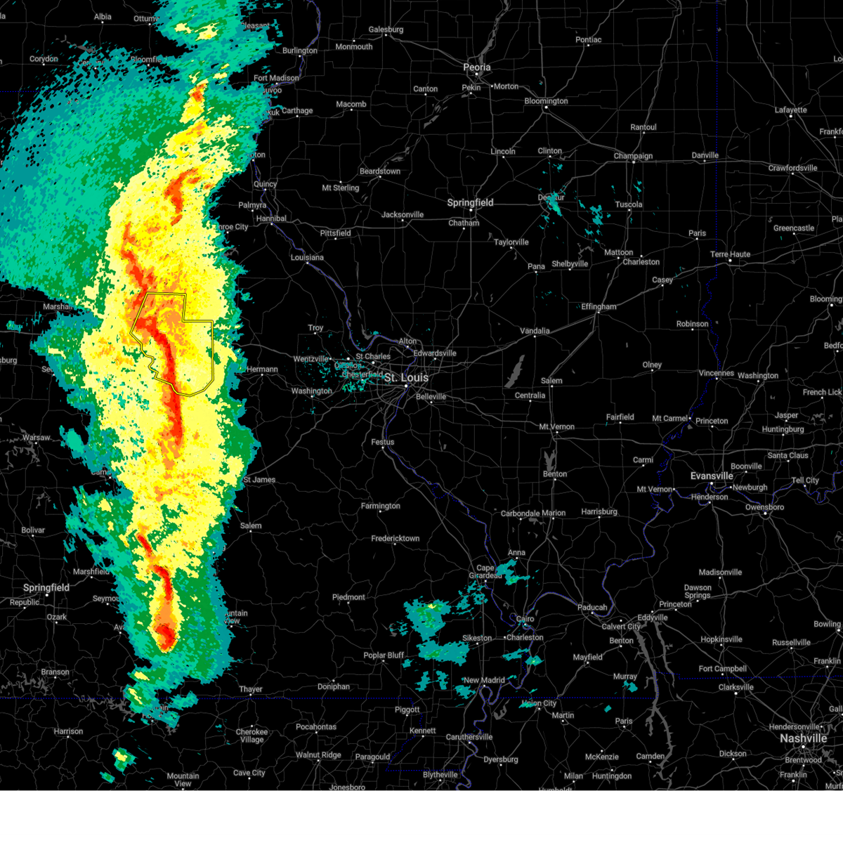
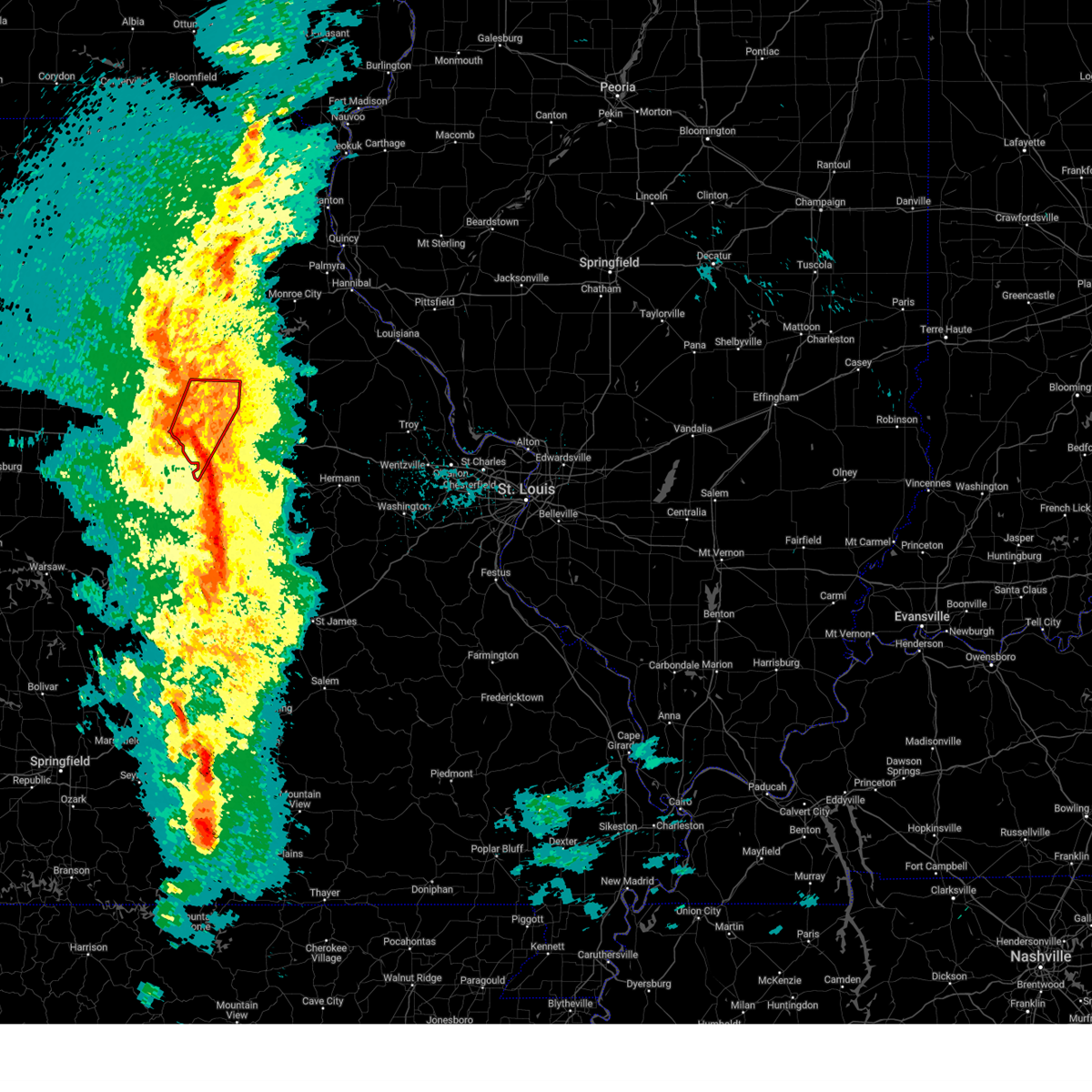
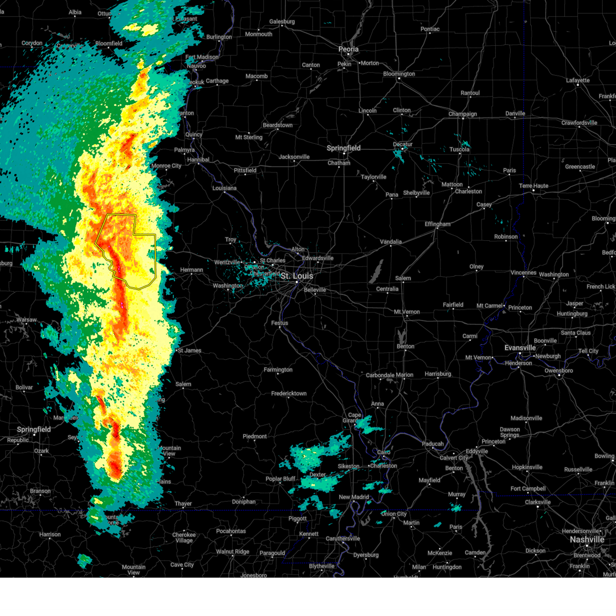
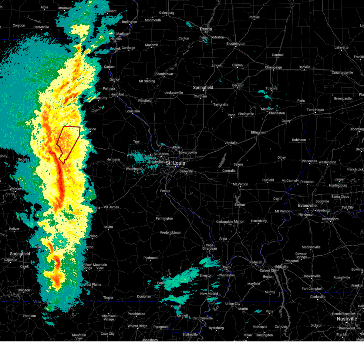
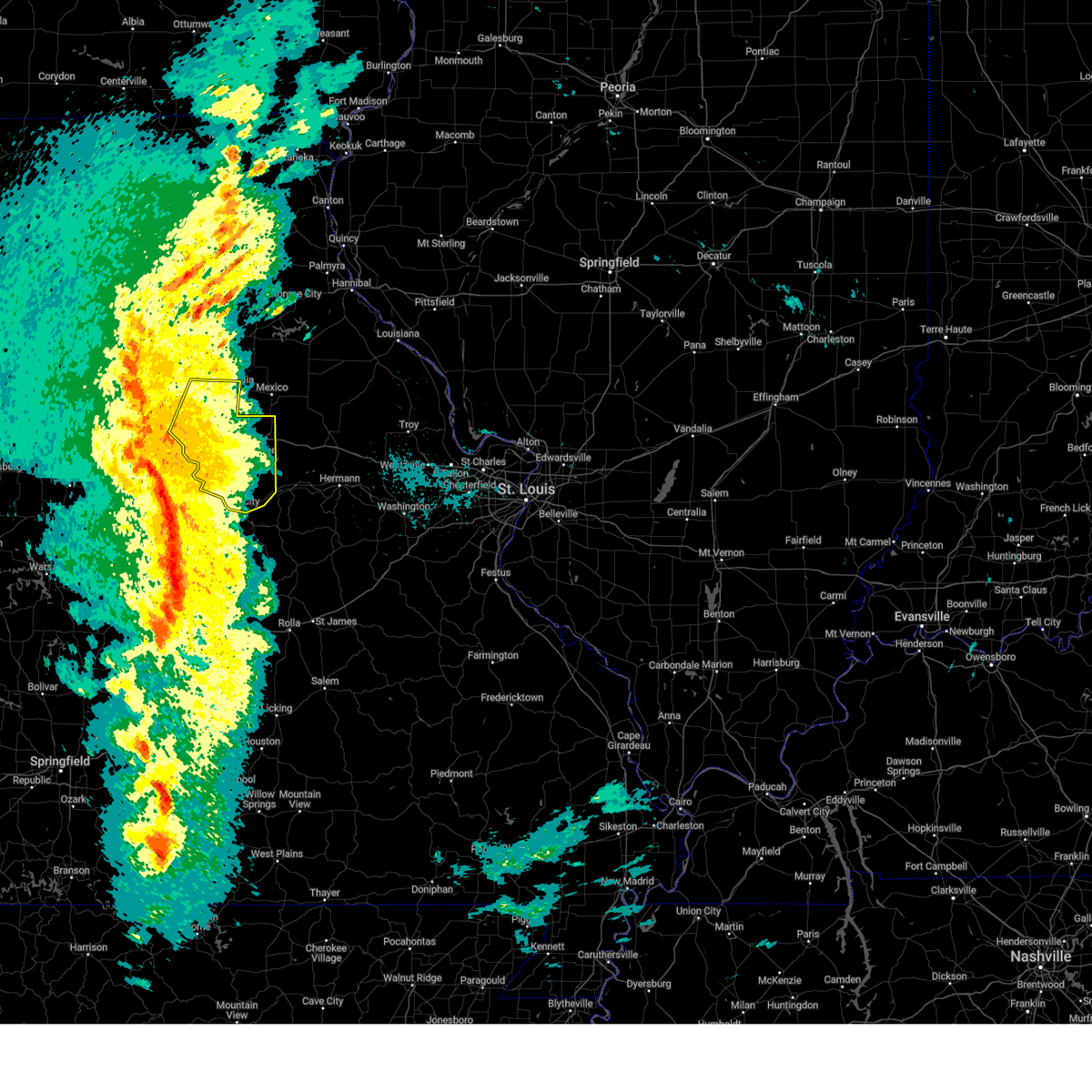
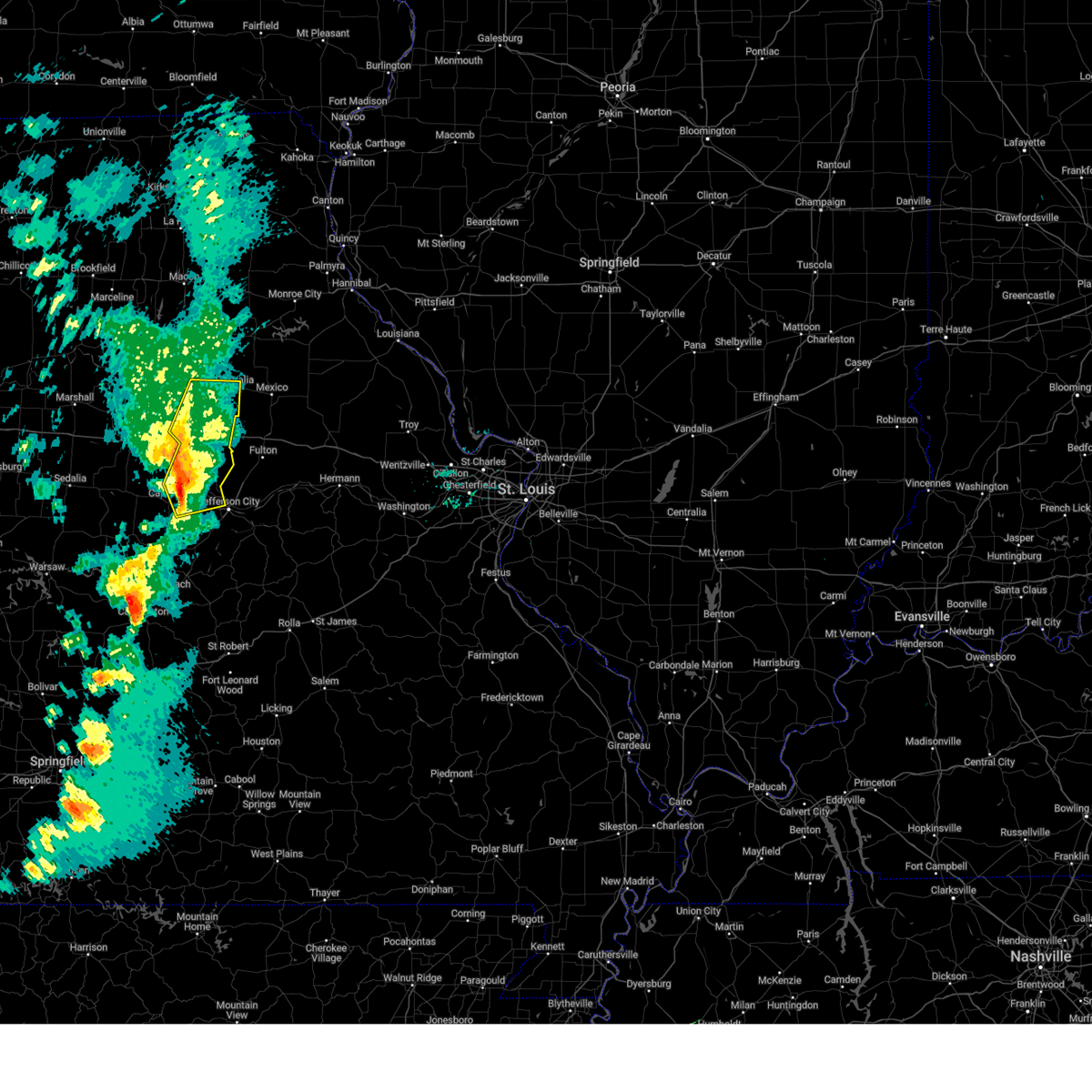
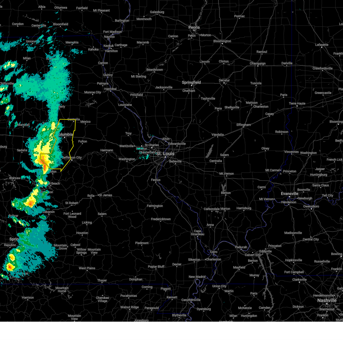
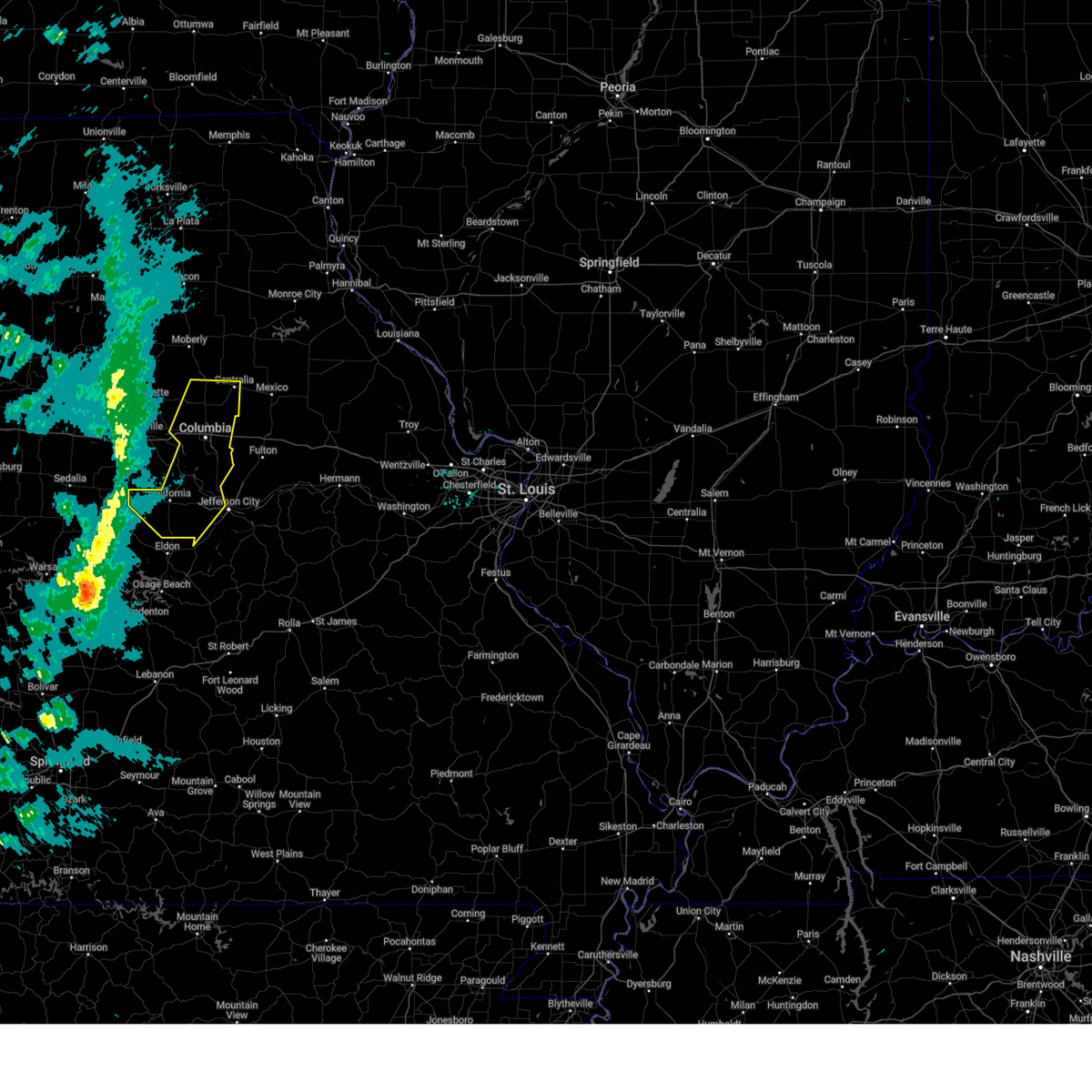
Hail Map for Harrisburg, MO
The Harrisburg, MO area has had 3 reports of on-the-ground hail by trained spotters, and has been under severe weather warnings 14 times during the past 12 months. Doppler radar has detected hail at or near Harrisburg, MO on 55 occasions, including 4 occasions during the past year.
| Name: | Harrisburg, MO |
| Where Located: | 14.6 miles NNW of Columbia, MO |
| Map: | Google Map for Harrisburg, MO |
| Population: | 266 |
| Housing Units: | 121 |
| More Info: | Search Google for Harrisburg, MO |
2
The Top Recent Hail Date for Harrisburg, MO is Wednesday, August 14, 2024 (14th out of 55)

Hail and Wind Damage Spotted near Harrisburg, MO
| Date / Time | Report Details |
|---|---|
| 6/3/2025 5:09 PM CDT |
 At 509 pm cdt, severe thunderstorms were located along a line from 9 miles north of sturgeon to 9 miles south of clarksburg, or along a line from 14 miles northwest of centralia to 9 miles southeast of tipton, moving northeast at 50 mph (radar indicated). Hazards include 60 mph wind gusts and quarter size hail. Hail damage to vehicles is expected. expect wind damage to roofs, siding, and trees. this severe thunderstorm will be near, tipton around 455 pm cdt. other locations impacted by the severe thunderstorm include harrisburg, latham, mcbaine, lupus, kliever, sandy hook, wilton and hartsburg. this includes the following state parks, rock bridge state park, finger lakes state park and jewell cemetery historic site. This includes interstate 70 in missouri between exits 115 and 133. At 509 pm cdt, severe thunderstorms were located along a line from 9 miles north of sturgeon to 9 miles south of clarksburg, or along a line from 14 miles northwest of centralia to 9 miles southeast of tipton, moving northeast at 50 mph (radar indicated). Hazards include 60 mph wind gusts and quarter size hail. Hail damage to vehicles is expected. expect wind damage to roofs, siding, and trees. this severe thunderstorm will be near, tipton around 455 pm cdt. other locations impacted by the severe thunderstorm include harrisburg, latham, mcbaine, lupus, kliever, sandy hook, wilton and hartsburg. this includes the following state parks, rock bridge state park, finger lakes state park and jewell cemetery historic site. This includes interstate 70 in missouri between exits 115 and 133.
|
| 6/3/2025 4:48 PM CDT |
 Svrlsx the national weather service in st louis has issued a * severe thunderstorm warning for, western audrain county in central missouri, boone county in central missouri, moniteau county in central missouri, * until 545 pm cdt. * at 448 pm cdt, severe thunderstorms were located along a line from 18 miles west of sturgeon to 5 miles west of tipton, or along a line from 26 miles west of centralia to 5 miles west of tipton, moving northeast at 40 mph (radar indicated). Hazards include 60 mph wind gusts and quarter size hail. Hail damage to vehicles is expected. expect wind damage to roofs, siding, and trees. this severe thunderstorm will be near, tipton around 455 pm cdt. other locations impacted by the severe thunderstorm include harrisburg, kliever, mcbaine, sandy hook and lupus. this includes the following state parks, rock bridge state park, finger lakes state park and jewell cemetery historic site. This includes interstate 70 in missouri between exits 115 and 133. Svrlsx the national weather service in st louis has issued a * severe thunderstorm warning for, western audrain county in central missouri, boone county in central missouri, moniteau county in central missouri, * until 545 pm cdt. * at 448 pm cdt, severe thunderstorms were located along a line from 18 miles west of sturgeon to 5 miles west of tipton, or along a line from 26 miles west of centralia to 5 miles west of tipton, moving northeast at 40 mph (radar indicated). Hazards include 60 mph wind gusts and quarter size hail. Hail damage to vehicles is expected. expect wind damage to roofs, siding, and trees. this severe thunderstorm will be near, tipton around 455 pm cdt. other locations impacted by the severe thunderstorm include harrisburg, kliever, mcbaine, sandy hook and lupus. this includes the following state parks, rock bridge state park, finger lakes state park and jewell cemetery historic site. This includes interstate 70 in missouri between exits 115 and 133.
|
| 4/20/2025 5:36 PM CDT |
 the tornado warning has been cancelled and is no longer in effect the tornado warning has been cancelled and is no longer in effect
|
| 4/20/2025 5:20 PM CDT |
 At 520 pm cdt, a severe thunderstorm capable of producing a tornado was located near columbia, moving northeast at 65 mph (radar indicated rotation). Hazards include tornado. Flying debris will be dangerous to those caught without shelter. mobile homes will be damaged or destroyed. damage to roofs, windows and vehicles will occur. tree damage is likely. this tornado will be near, columbia around 515 pm cdt. this includes the following state parks, finger lakes state park and jewell cemetery historic site. This includes interstate 70 in missouri between exits 121 and 131. At 520 pm cdt, a severe thunderstorm capable of producing a tornado was located near columbia, moving northeast at 65 mph (radar indicated rotation). Hazards include tornado. Flying debris will be dangerous to those caught without shelter. mobile homes will be damaged or destroyed. damage to roofs, windows and vehicles will occur. tree damage is likely. this tornado will be near, columbia around 515 pm cdt. this includes the following state parks, finger lakes state park and jewell cemetery historic site. This includes interstate 70 in missouri between exits 121 and 131.
|
| 4/20/2025 5:15 PM CDT |
 At 515 pm cdt, severe thunderstorms were located along a line from near midway to 5 miles northwest of holts summit, or along a line from 9 miles northwest of columbia to 5 miles northwest of holts summit, moving northeast at 50 mph (trained spotters reported. at 4:50 pm a 61 mph wind gust was reported near california, mo). Hazards include 70 mph wind gusts. Expect considerable tree damage. damage is likely to mobile homes, roofs, and outbuildings. this severe thunderstorm will be near, easley and rocheport around 505 pm cdt. other locations impacted by the severe thunderstorm include wilton, mcbaine, lupus, hartsburg, harrisburg, guthrie, carrington, hatton and kingdom city. this includes the following state parks, rock bridge state park, finger lakes state park and jewell cemetery historic site. This includes interstate 70 in missouri between exits 115 and 148. At 515 pm cdt, severe thunderstorms were located along a line from near midway to 5 miles northwest of holts summit, or along a line from 9 miles northwest of columbia to 5 miles northwest of holts summit, moving northeast at 50 mph (trained spotters reported. at 4:50 pm a 61 mph wind gust was reported near california, mo). Hazards include 70 mph wind gusts. Expect considerable tree damage. damage is likely to mobile homes, roofs, and outbuildings. this severe thunderstorm will be near, easley and rocheport around 505 pm cdt. other locations impacted by the severe thunderstorm include wilton, mcbaine, lupus, hartsburg, harrisburg, guthrie, carrington, hatton and kingdom city. this includes the following state parks, rock bridge state park, finger lakes state park and jewell cemetery historic site. This includes interstate 70 in missouri between exits 115 and 148.
|
| 4/20/2025 5:14 PM CDT |
 At 514 pm cdt, a severe thunderstorm capable of producing a tornado was located over columbia, moving north at 75 mph (radar indicated rotation). Hazards include tornado. Flying debris will be dangerous to those caught without shelter. mobile homes will be damaged or destroyed. damage to roofs, windows and vehicles will occur. tree damage is likely. this tornado will be near, easley around 505 pm cdt. columbia around 515 pm cdt. other locations impacted by the tornado include lupus and mcbaine. this includes the following state parks, rock bridge state park, finger lakes state park and jewell cemetery historic site. This includes interstate 70 in missouri between exits 115 and 131. At 514 pm cdt, a severe thunderstorm capable of producing a tornado was located over columbia, moving north at 75 mph (radar indicated rotation). Hazards include tornado. Flying debris will be dangerous to those caught without shelter. mobile homes will be damaged or destroyed. damage to roofs, windows and vehicles will occur. tree damage is likely. this tornado will be near, easley around 505 pm cdt. columbia around 515 pm cdt. other locations impacted by the tornado include lupus and mcbaine. this includes the following state parks, rock bridge state park, finger lakes state park and jewell cemetery historic site. This includes interstate 70 in missouri between exits 115 and 131.
|
| 4/20/2025 5:11 PM CDT |
 At 511 pm cdt, severe thunderstorms were located along a line from near midway to 7 miles northwest of jefferson city, or along a line from 10 miles northwest of columbia to 7 miles northwest of jefferson city, moving northeast at 50 mph (trained spotters reported. at 4:50 pm a 61 mph wind gust was reported near california, mo). Hazards include 60 mph wind gusts. Expect damage to roofs, siding, and trees. this severe thunderstorm will be near, easley and rocheport around 505 pm cdt. other locations impacted by the severe thunderstorm include wilton, mcbaine, lupus, hartsburg, harrisburg, guthrie, carrington, hatton and kingdom city. this includes the following state parks, rock bridge state park, finger lakes state park and jewell cemetery historic site. This includes interstate 70 in missouri between exits 115 and 148. At 511 pm cdt, severe thunderstorms were located along a line from near midway to 7 miles northwest of jefferson city, or along a line from 10 miles northwest of columbia to 7 miles northwest of jefferson city, moving northeast at 50 mph (trained spotters reported. at 4:50 pm a 61 mph wind gust was reported near california, mo). Hazards include 60 mph wind gusts. Expect damage to roofs, siding, and trees. this severe thunderstorm will be near, easley and rocheport around 505 pm cdt. other locations impacted by the severe thunderstorm include wilton, mcbaine, lupus, hartsburg, harrisburg, guthrie, carrington, hatton and kingdom city. this includes the following state parks, rock bridge state park, finger lakes state park and jewell cemetery historic site. This includes interstate 70 in missouri between exits 115 and 148.
|
| 4/20/2025 5:10 PM CDT | the tornado warning has been cancelled and is no longer in effect |
| 4/20/2025 5:10 PM CDT | At 510 pm cdt, a severe thunderstorm capable of producing a tornado was located near midway, or near columbia, moving northeast at 60 mph (radar indicated rotation). Hazards include tornado. Flying debris will be dangerous to those caught without shelter. mobile homes will be damaged or destroyed. damage to roofs, windows and vehicles will occur. tree damage is likely. this tornado will be near, easley around 505 pm cdt. columbia and midway around 510 pm cdt. other locations impacted by the tornado include mcbaine and lupus. this includes the following state parks, rock bridge state park, finger lakes state park and jewell cemetery historic site. This includes interstate 70 in missouri between exits 115 and 131. |
| 4/20/2025 5:01 PM CDT |
 Torlsx the national weather service in st louis has issued a * tornado warning for, boone county in central missouri, northeastern moniteau county in central missouri, * until 545 pm cdt. * at 501 pm cdt, a severe thunderstorm capable of producing a tornado was located near jamestown, or 12 miles southwest of columbia, moving northeast at 60 mph (radar indicated rotation). Hazards include tornado. Flying debris will be dangerous to those caught without shelter. mobile homes will be damaged or destroyed. damage to roofs, windows and vehicles will occur. tree damage is likely. this tornado will be near, easley and jamestown around 505 pm cdt. columbia and midway around 510 pm cdt. other locations impacted by the tornado include mcbaine and lupus. this includes the following state parks, rock bridge state park, finger lakes state park and jewell cemetery historic site. This includes interstate 70 in missouri between exits 115 and 131. Torlsx the national weather service in st louis has issued a * tornado warning for, boone county in central missouri, northeastern moniteau county in central missouri, * until 545 pm cdt. * at 501 pm cdt, a severe thunderstorm capable of producing a tornado was located near jamestown, or 12 miles southwest of columbia, moving northeast at 60 mph (radar indicated rotation). Hazards include tornado. Flying debris will be dangerous to those caught without shelter. mobile homes will be damaged or destroyed. damage to roofs, windows and vehicles will occur. tree damage is likely. this tornado will be near, easley and jamestown around 505 pm cdt. columbia and midway around 510 pm cdt. other locations impacted by the tornado include mcbaine and lupus. this includes the following state parks, rock bridge state park, finger lakes state park and jewell cemetery historic site. This includes interstate 70 in missouri between exits 115 and 131.
|
| 4/20/2025 4:51 PM CDT |
 Svrlsx the national weather service in st louis has issued a * severe thunderstorm warning for, boone county in central missouri, callaway county in central missouri, * until 545 pm cdt. * at 451 pm cdt, severe thunderstorms were located along a line from 14 miles north of tipton to 22 miles south of hickory hill, or along a line from 14 miles north of tipton to 37 miles southwest of jefferson city, moving northeast at 50 mph (radar indicated). Hazards include 60 mph wind gusts. Expect damage to roofs, siding, and trees. this severe thunderstorm will be near, rocheport around 505 pm cdt. other locations impacted by the severe thunderstorm include lupus, wilton, mcbaine, hartsburg, harrisburg, guthrie, wainwright, carrington, tebbetts and hatton. this includes the following state parks, rock bridge state park, finger lakes state park and jewell cemetery historic site. This includes interstate 70 in missouri between exits 115 and 148. Svrlsx the national weather service in st louis has issued a * severe thunderstorm warning for, boone county in central missouri, callaway county in central missouri, * until 545 pm cdt. * at 451 pm cdt, severe thunderstorms were located along a line from 14 miles north of tipton to 22 miles south of hickory hill, or along a line from 14 miles north of tipton to 37 miles southwest of jefferson city, moving northeast at 50 mph (radar indicated). Hazards include 60 mph wind gusts. Expect damage to roofs, siding, and trees. this severe thunderstorm will be near, rocheport around 505 pm cdt. other locations impacted by the severe thunderstorm include lupus, wilton, mcbaine, hartsburg, harrisburg, guthrie, wainwright, carrington, tebbetts and hatton. this includes the following state parks, rock bridge state park, finger lakes state park and jewell cemetery historic site. This includes interstate 70 in missouri between exits 115 and 148.
|
| 3/14/2025 6:14 PM CDT |
 At 614 pm cdt, severe thunderstorms were located along a line from near sturgeon to near russellville, or along a line from near centralia to 10 miles southeast of california, moving northeast at 65 mph (radar indicated). Hazards include 70 mph wind gusts and quarter size hail. Hail damage to vehicles is expected. expect considerable tree damage. wind damage is also likely to mobile homes, roofs, and outbuildings. other locations impacted by the severe thunderstorm include mcbaine, harrisburg, lupus, kliever, sandy hook, wilton, marion, elston and hartsburg. this includes the following state parks, rock bridge state park, finger lakes state park and jewell cemetery historic site. This includes interstate 70 in missouri between exits 115 and 133. At 614 pm cdt, severe thunderstorms were located along a line from near sturgeon to near russellville, or along a line from near centralia to 10 miles southeast of california, moving northeast at 65 mph (radar indicated). Hazards include 70 mph wind gusts and quarter size hail. Hail damage to vehicles is expected. expect considerable tree damage. wind damage is also likely to mobile homes, roofs, and outbuildings. other locations impacted by the severe thunderstorm include mcbaine, harrisburg, lupus, kliever, sandy hook, wilton, marion, elston and hartsburg. this includes the following state parks, rock bridge state park, finger lakes state park and jewell cemetery historic site. This includes interstate 70 in missouri between exits 115 and 133.
|
| 3/14/2025 5:51 PM CDT |
 At 551 pm cdt, severe thunderstorms were located along a line from over rocheport to 20 miles southwest of high point, or along a line from 12 miles west of columbia to 27 miles south of tipton, moving northeast at 60 mph (radar indicated). Hazards include 70 mph wind gusts and quarter size hail. Hail damage to vehicles is expected. expect considerable tree damage. wind damage is also likely to mobile homes, roofs, and outbuildings. this severe thunderstorm will be near, tipton around 535 pm cdt. other locations impacted by the severe thunderstorm include latham, harrisburg, lupus, kliever, mcbaine, sandy hook, enon, marion, wilton and lohman. this includes the following state parks, rock bridge state park, finger lakes state park and jewell cemetery historic site. This includes interstate 70 in missouri between exits 115 and 133. At 551 pm cdt, severe thunderstorms were located along a line from over rocheport to 20 miles southwest of high point, or along a line from 12 miles west of columbia to 27 miles south of tipton, moving northeast at 60 mph (radar indicated). Hazards include 70 mph wind gusts and quarter size hail. Hail damage to vehicles is expected. expect considerable tree damage. wind damage is also likely to mobile homes, roofs, and outbuildings. this severe thunderstorm will be near, tipton around 535 pm cdt. other locations impacted by the severe thunderstorm include latham, harrisburg, lupus, kliever, mcbaine, sandy hook, enon, marion, wilton and lohman. this includes the following state parks, rock bridge state park, finger lakes state park and jewell cemetery historic site. This includes interstate 70 in missouri between exits 115 and 133.
|
| 3/14/2025 5:27 PM CDT |
 Svrlsx the national weather service in st louis has issued a * severe thunderstorm warning for, boone county in central missouri, western cole county in central missouri, moniteau county in central missouri, * until 630 pm cdt. * at 527 pm cdt, severe thunderstorms were located along a line from 9 miles north of tipton to 43 miles southwest of high point, or along a line from 9 miles north of tipton to 47 miles southwest of tipton, moving northeast at 75 mph (radar indicated). Hazards include 70 mph wind gusts and quarter size hail. Hail damage to vehicles is expected. expect considerable tree damage. wind damage is also likely to mobile homes, roofs, and outbuildings. this severe thunderstorm will be near, tipton around 535 pm cdt. other locations impacted by the severe thunderstorm include latham, harrisburg, lupus, kliever, mcbaine, sandy hook, marion, wilton and hartsburg. this includes the following state parks, rock bridge state park, finger lakes state park and jewell cemetery historic site. This includes interstate 70 in missouri between exits 115 and 133. Svrlsx the national weather service in st louis has issued a * severe thunderstorm warning for, boone county in central missouri, western cole county in central missouri, moniteau county in central missouri, * until 630 pm cdt. * at 527 pm cdt, severe thunderstorms were located along a line from 9 miles north of tipton to 43 miles southwest of high point, or along a line from 9 miles north of tipton to 47 miles southwest of tipton, moving northeast at 75 mph (radar indicated). Hazards include 70 mph wind gusts and quarter size hail. Hail damage to vehicles is expected. expect considerable tree damage. wind damage is also likely to mobile homes, roofs, and outbuildings. this severe thunderstorm will be near, tipton around 535 pm cdt. other locations impacted by the severe thunderstorm include latham, harrisburg, lupus, kliever, mcbaine, sandy hook, marion, wilton and hartsburg. this includes the following state parks, rock bridge state park, finger lakes state park and jewell cemetery historic site. This includes interstate 70 in missouri between exits 115 and 133.
|
| 6/25/2024 5:46 PM CDT |
 The severe thunderstorm which prompted the warning has weakened. therefore, the warning has been allowed to expire. The severe thunderstorm which prompted the warning has weakened. therefore, the warning has been allowed to expire.
|
| 6/25/2024 5:18 PM CDT |
 At 518 pm cdt, a severe thunderstorm was located 8 miles south of higbee, moving east at 20 mph (radar indicated). Hazards include 70 mph wind gusts and half dollar size hail. Hail damage to vehicles is expected. expect considerable tree damage. wind damage is also likely to mobile homes, roofs, and outbuildings. locations impacted include, columbia, rocheport, midway, and harrisburg. This includes interstate 70 in missouri between exits 115 and 121. At 518 pm cdt, a severe thunderstorm was located 8 miles south of higbee, moving east at 20 mph (radar indicated). Hazards include 70 mph wind gusts and half dollar size hail. Hail damage to vehicles is expected. expect considerable tree damage. wind damage is also likely to mobile homes, roofs, and outbuildings. locations impacted include, columbia, rocheport, midway, and harrisburg. This includes interstate 70 in missouri between exits 115 and 121.
|
| 6/25/2024 5:01 PM CDT |
 Svrlsx the national weather service in st louis has issued a * severe thunderstorm warning for, northwestern boone county in central missouri, * until 545 pm cdt. * at 500 pm cdt, a severe thunderstorm was located near fayette, moving east at 20 mph (radar indicated). Hazards include 60 mph wind gusts and quarter size hail. Hail damage to vehicles is expected. expect wind damage to roofs, siding, and trees. this severe thunderstorm will remain over mainly rural areas of northwestern boone county, including the following locations, harrisburg. This includes interstate 70 in missouri between exits 115 and 121. Svrlsx the national weather service in st louis has issued a * severe thunderstorm warning for, northwestern boone county in central missouri, * until 545 pm cdt. * at 500 pm cdt, a severe thunderstorm was located near fayette, moving east at 20 mph (radar indicated). Hazards include 60 mph wind gusts and quarter size hail. Hail damage to vehicles is expected. expect wind damage to roofs, siding, and trees. this severe thunderstorm will remain over mainly rural areas of northwestern boone county, including the following locations, harrisburg. This includes interstate 70 in missouri between exits 115 and 121.
|
| 6/13/2024 9:14 PM CDT |
 At 913 pm cdt, a severe thunderstorm was located over sturgeon, moving southeast at 30 mph (trained weather spotters). Hazards include 70 mph wind gusts and penny size hail. Expect considerable tree damage. damage is likely to mobile homes, roofs, and outbuildings. locations impacted include, columbia, centralia, hallsville, sturgeon, murry, and harrisburg. This also includes finger lakes state park. At 913 pm cdt, a severe thunderstorm was located over sturgeon, moving southeast at 30 mph (trained weather spotters). Hazards include 70 mph wind gusts and penny size hail. Expect considerable tree damage. damage is likely to mobile homes, roofs, and outbuildings. locations impacted include, columbia, centralia, hallsville, sturgeon, murry, and harrisburg. This also includes finger lakes state park.
|
| 6/13/2024 8:58 PM CDT |
 Svrlsx the national weather service in st louis has issued a * severe thunderstorm warning for, northern boone county in central missouri, western audrain county in central missouri, * until 1000 pm cdt. * at 858 pm cdt, a severe thunderstorm was located near clark, moving southeast at 30 mph (trained weather spotters). Hazards include 60 mph wind gusts and half dollar size hail. Hail damage to vehicles is expected. Expect wind damage to roofs, siding, and trees. Svrlsx the national weather service in st louis has issued a * severe thunderstorm warning for, northern boone county in central missouri, western audrain county in central missouri, * until 1000 pm cdt. * at 858 pm cdt, a severe thunderstorm was located near clark, moving southeast at 30 mph (trained weather spotters). Hazards include 60 mph wind gusts and half dollar size hail. Hail damage to vehicles is expected. Expect wind damage to roofs, siding, and trees.
|
| 5/7/2024 1:57 AM CDT |
 At 156 am cdt, severe thunderstorms were located along a line extending from near cairo to clark to columbia to near russellville, moving east at 45 mph (radar indicated). Hazards include 60 mph wind gusts. Expect damage to roofs, siding, and trees. locations impacted include, columbia, jefferson city, fulton, centralia, ashland, holts summit, columbia regional airport, hallsville, sturgeon, new bloomfield, madison, lake mykee town, rocheport, easley, murry, midway, woodlawn, lake mykee, granville, and harrisburg. this also includes rock bridge state park, finger lakes state park, union covered bridge historic site, and jewell cemetery historic site. This includes interstate 70 in missouri between exits 115 and 148. At 156 am cdt, severe thunderstorms were located along a line extending from near cairo to clark to columbia to near russellville, moving east at 45 mph (radar indicated). Hazards include 60 mph wind gusts. Expect damage to roofs, siding, and trees. locations impacted include, columbia, jefferson city, fulton, centralia, ashland, holts summit, columbia regional airport, hallsville, sturgeon, new bloomfield, madison, lake mykee town, rocheport, easley, murry, midway, woodlawn, lake mykee, granville, and harrisburg. this also includes rock bridge state park, finger lakes state park, union covered bridge historic site, and jewell cemetery historic site. This includes interstate 70 in missouri between exits 115 and 148.
|
| 5/7/2024 1:25 AM CDT |
 Svrlsx the national weather service in st louis has issued a * severe thunderstorm warning for, boone county in central missouri, western audrain county in central missouri, western callaway county in central missouri, western monroe county in northeastern missouri, * until 245 am cdt. * at 124 am cdt, severe thunderstorms were located along a line extending from near brookfield to 6 miles north of glasgow to new franklin to near tipton, moving east at 45 mph (radar indicated). Hazards include 60 mph wind gusts. expect damage to roofs, siding, and trees Svrlsx the national weather service in st louis has issued a * severe thunderstorm warning for, boone county in central missouri, western audrain county in central missouri, western callaway county in central missouri, western monroe county in northeastern missouri, * until 245 am cdt. * at 124 am cdt, severe thunderstorms were located along a line extending from near brookfield to 6 miles north of glasgow to new franklin to near tipton, moving east at 45 mph (radar indicated). Hazards include 60 mph wind gusts. expect damage to roofs, siding, and trees
|
| 8/12/2023 2:56 AM CDT |
 At 256 am cdt, severe thunderstorms were located along a line extending from 7 miles south of paris to near centralia to near murry to near midway, moving southeast at 40 mph (radar indicated). Hazards include 60 mph wind gusts and quarter size hail. Hail damage to vehicles is expected. expect wind damage to roofs, siding, and trees. locations impacted include, columbia, mexico, centralia, paris, hallsville, sturgeon, madison, murry, woodlawn, granville, midway, harrisburg, holliday, hatton, duncans bridge, and thompson. this also includes rock bridge state park, finger lakes state park, union covered bridge historic site, and jewell cemetery historic site. this includes interstate 70 in missouri between exits 115 and 144. hail threat, radar indicated max hail size, 1. 00 in wind threat, radar indicated max wind gust, 60 mph. At 256 am cdt, severe thunderstorms were located along a line extending from 7 miles south of paris to near centralia to near murry to near midway, moving southeast at 40 mph (radar indicated). Hazards include 60 mph wind gusts and quarter size hail. Hail damage to vehicles is expected. expect wind damage to roofs, siding, and trees. locations impacted include, columbia, mexico, centralia, paris, hallsville, sturgeon, madison, murry, woodlawn, granville, midway, harrisburg, holliday, hatton, duncans bridge, and thompson. this also includes rock bridge state park, finger lakes state park, union covered bridge historic site, and jewell cemetery historic site. this includes interstate 70 in missouri between exits 115 and 144. hail threat, radar indicated max hail size, 1. 00 in wind threat, radar indicated max wind gust, 60 mph.
|
| 8/12/2023 2:41 AM CDT |
 At 241 am cdt, severe thunderstorms were located along a line extending from madison to near centralia to 6 miles southwest of sturgeon to 9 miles east of fayette, moving southeast at 40 mph (radar indicated). Hazards include 60 mph wind gusts and quarter size hail. Hail damage to vehicles is expected. expect wind damage to roofs, siding, and trees. locations impacted include, columbia, mexico, centralia, paris, hallsville, sturgeon, madison, murry, woodlawn, granville, midway, harrisburg, holliday, hatton, duncans bridge, and thompson. this also includes rock bridge state park, finger lakes state park, union covered bridge historic site, and jewell cemetery historic site. this includes interstate 70 in missouri between exits 115 and 144. hail threat, radar indicated max hail size, 1. 00 in wind threat, radar indicated max wind gust, 60 mph. At 241 am cdt, severe thunderstorms were located along a line extending from madison to near centralia to 6 miles southwest of sturgeon to 9 miles east of fayette, moving southeast at 40 mph (radar indicated). Hazards include 60 mph wind gusts and quarter size hail. Hail damage to vehicles is expected. expect wind damage to roofs, siding, and trees. locations impacted include, columbia, mexico, centralia, paris, hallsville, sturgeon, madison, murry, woodlawn, granville, midway, harrisburg, holliday, hatton, duncans bridge, and thompson. this also includes rock bridge state park, finger lakes state park, union covered bridge historic site, and jewell cemetery historic site. this includes interstate 70 in missouri between exits 115 and 144. hail threat, radar indicated max hail size, 1. 00 in wind threat, radar indicated max wind gust, 60 mph.
|
| 8/12/2023 2:17 AM CDT |
 At 217 am cdt, severe thunderstorms were located along a line extending from 6 miles north of cairo to moberly to higbee to near glasgow, moving southeast at 40 mph (radar indicated). Hazards include 60 mph wind gusts. expect damage to roofs, siding, and trees At 217 am cdt, severe thunderstorms were located along a line extending from 6 miles north of cairo to moberly to higbee to near glasgow, moving southeast at 40 mph (radar indicated). Hazards include 60 mph wind gusts. expect damage to roofs, siding, and trees
|
| 8/2/2023 3:28 AM CDT |
 The severe thunderstorm warning for northern boone and southwestern audrain counties will expire at 330 am cdt, the storms which prompted the warning have weakened below severe limits, and no longer pose an immediate threat to life or property. therefore, the warning will be allowed to expire. however, heavy rain is still ongoing with these thunderstorms. The severe thunderstorm warning for northern boone and southwestern audrain counties will expire at 330 am cdt, the storms which prompted the warning have weakened below severe limits, and no longer pose an immediate threat to life or property. therefore, the warning will be allowed to expire. however, heavy rain is still ongoing with these thunderstorms.
|
| 8/2/2023 3:08 AM CDT |
 At 307 am cdt, severe thunderstorms were located along a line extending from near sturgeon to 7 miles west of hallsville to 10 miles south of higbee, moving southeast at 30 mph (radar indicated). Hazards include 60 mph wind gusts and quarter size hail. Hail damage to vehicles is expected. expect wind damage to roofs, siding, and trees. locations impacted include, centralia, hallsville, murry. this also includes finger lakes state park. hail threat, radar indicated max hail size, 1. 00 in wind threat, radar indicated max wind gust, 60 mph. At 307 am cdt, severe thunderstorms were located along a line extending from near sturgeon to 7 miles west of hallsville to 10 miles south of higbee, moving southeast at 30 mph (radar indicated). Hazards include 60 mph wind gusts and quarter size hail. Hail damage to vehicles is expected. expect wind damage to roofs, siding, and trees. locations impacted include, centralia, hallsville, murry. this also includes finger lakes state park. hail threat, radar indicated max hail size, 1. 00 in wind threat, radar indicated max wind gust, 60 mph.
|
| 8/2/2023 2:42 AM CDT |
 At 241 am cdt, severe thunderstorms were located along a line extending from near madison to near higbee to near salisbury, moving south at 30 mph (radar indicated). Hazards include 60 mph wind gusts and quarter size hail. Hail damage to vehicles is expected. expect wind damage to roofs, siding, and trees. severe thunderstorms will be near, sturgeon around 250 am cdt. other locations in the path of these severe thunderstorms include centralia, hallsville and columbia. this also includes finger lakes state park. hail threat, radar indicated max hail size, 1. 00 in wind threat, radar indicated max wind gust, 60 mph. At 241 am cdt, severe thunderstorms were located along a line extending from near madison to near higbee to near salisbury, moving south at 30 mph (radar indicated). Hazards include 60 mph wind gusts and quarter size hail. Hail damage to vehicles is expected. expect wind damage to roofs, siding, and trees. severe thunderstorms will be near, sturgeon around 250 am cdt. other locations in the path of these severe thunderstorms include centralia, hallsville and columbia. this also includes finger lakes state park. hail threat, radar indicated max hail size, 1. 00 in wind threat, radar indicated max wind gust, 60 mph.
|
| 7/29/2023 1:15 PM CDT |
 At 113 pm cdt, severe thunderstorms were located along a line extending from cairo to near rocheport, moving east at 45 mph (radar indicated. this complex has a history of producing 60 to 70 mph winds along with downed trees). Hazards include 70 mph wind gusts. Expect considerable tree damage. damage is likely to mobile homes, roofs, and outbuildings. locations impacted include, columbia, sturgeon, midway, hallsville, madison, centralia, murry, paris, mexico and auxvasse. this also includes rock bridge state park, finger lakes state park, union covered bridge historic site, and jewell cemetery historic site. this includes interstate 70 in missouri between exits 115 and 148. thunderstorm damage threat, considerable hail threat, radar indicated max hail size, <. 75 in wind threat, radar indicated max wind gust, 70 mph. At 113 pm cdt, severe thunderstorms were located along a line extending from cairo to near rocheport, moving east at 45 mph (radar indicated. this complex has a history of producing 60 to 70 mph winds along with downed trees). Hazards include 70 mph wind gusts. Expect considerable tree damage. damage is likely to mobile homes, roofs, and outbuildings. locations impacted include, columbia, sturgeon, midway, hallsville, madison, centralia, murry, paris, mexico and auxvasse. this also includes rock bridge state park, finger lakes state park, union covered bridge historic site, and jewell cemetery historic site. this includes interstate 70 in missouri between exits 115 and 148. thunderstorm damage threat, considerable hail threat, radar indicated max hail size, <. 75 in wind threat, radar indicated max wind gust, 70 mph.
|
| 7/29/2023 12:46 PM CDT |
 At 1246 pm cdt, severe thunderstorms were located along a line extending from 9 miles north of salisbury to 7 miles west of new franklin, moving east at 45 mph (radar indicated). Hazards include 60 mph wind gusts. Expect damage to roofs, siding, and trees. severe thunderstorms will be near, rocheport around 105 pm cdt. other locations in the path of these severe thunderstorms include midway, columbia, sturgeon, madison, hallsville, centralia and murry. this includes interstate 70 in missouri between exits 115 and 148. this also includes rock bridge state park, finger lakes state park, union covered bridge historic site, and jewell cemetery historic site. hail threat, radar indicated max hail size, <. 75 in wind threat, radar indicated max wind gust, 60 mph. At 1246 pm cdt, severe thunderstorms were located along a line extending from 9 miles north of salisbury to 7 miles west of new franklin, moving east at 45 mph (radar indicated). Hazards include 60 mph wind gusts. Expect damage to roofs, siding, and trees. severe thunderstorms will be near, rocheport around 105 pm cdt. other locations in the path of these severe thunderstorms include midway, columbia, sturgeon, madison, hallsville, centralia and murry. this includes interstate 70 in missouri between exits 115 and 148. this also includes rock bridge state park, finger lakes state park, union covered bridge historic site, and jewell cemetery historic site. hail threat, radar indicated max hail size, <. 75 in wind threat, radar indicated max wind gust, 60 mph.
|
| 7/12/2023 6:15 PM CDT |
 At 615 pm cdt, a severe thunderstorm was located near hallsville, moving southeast at 40 mph (radar indicated). Hazards include 60 mph wind gusts and quarter size hail. Hail damage to vehicles is expected. expect wind damage to roofs, siding, and trees. locations impacted include, columbia, centralia, columbia regional airport, hallsville, sturgeon, murry, and harrisburg. this also includes finger lakes state park and jewell cemetery historic site. this includes interstate 70 in missouri between exits 124 and 133. hail threat, radar indicated max hail size, 1. 00 in wind threat, radar indicated max wind gust, 60 mph. At 615 pm cdt, a severe thunderstorm was located near hallsville, moving southeast at 40 mph (radar indicated). Hazards include 60 mph wind gusts and quarter size hail. Hail damage to vehicles is expected. expect wind damage to roofs, siding, and trees. locations impacted include, columbia, centralia, columbia regional airport, hallsville, sturgeon, murry, and harrisburg. this also includes finger lakes state park and jewell cemetery historic site. this includes interstate 70 in missouri between exits 124 and 133. hail threat, radar indicated max hail size, 1. 00 in wind threat, radar indicated max wind gust, 60 mph.
|
| 7/12/2023 5:59 PM CDT |
 At 559 pm cdt, a severe thunderstorm was located 9 miles south of higbee, moving southeast at 45 mph (radar indicated). Hazards include 60 mph wind gusts and quarter size hail. Hail damage to vehicles is expected. Expect wind damage to roofs, siding, and trees. At 559 pm cdt, a severe thunderstorm was located 9 miles south of higbee, moving southeast at 45 mph (radar indicated). Hazards include 60 mph wind gusts and quarter size hail. Hail damage to vehicles is expected. Expect wind damage to roofs, siding, and trees.
|
| 4/5/2023 3:02 AM CDT |
 At 301 am cdt, a severe thunderstorm was located near higbee, moving northeast at 65 mph (radar indicated). Hazards include 60 mph wind gusts and half dollar size hail. Hail damage to vehicles is expected. expect wind damage to roofs, siding, and trees. this severe thunderstorm will be near, sturgeon around 310 am cdt. madison around 320 am cdt. other locations in the path of this severe thunderstorm include paris and granville. this also includes union covered bridge historic site and mark twain lake recreational area. hail threat, radar indicated max hail size, 1. 25 in wind threat, radar indicated max wind gust, 60 mph. At 301 am cdt, a severe thunderstorm was located near higbee, moving northeast at 65 mph (radar indicated). Hazards include 60 mph wind gusts and half dollar size hail. Hail damage to vehicles is expected. expect wind damage to roofs, siding, and trees. this severe thunderstorm will be near, sturgeon around 310 am cdt. madison around 320 am cdt. other locations in the path of this severe thunderstorm include paris and granville. this also includes union covered bridge historic site and mark twain lake recreational area. hail threat, radar indicated max hail size, 1. 25 in wind threat, radar indicated max wind gust, 60 mph.
|
| 4/4/2023 3:30 PM CDT | Hen Egg sized hail reported 0 miles ESE of Harrisburg, MO, largest hailstones just a bit smaller than tennis ball size. also... tweeted a picture of it to us. |
| 4/4/2023 3:27 PM CDT |
 At 326 pm cdt, a severe thunderstorm was located 7 miles north of rocheport, moving northeast at 50 mph (radar indicated. at 310 pm, two inch hail was reported in new franklin). Hazards include tennis ball size hail and 60 mph wind gusts. People and animals outdoors will be injured. expect hail damage to roofs, siding, windows, and vehicles. expect wind damage to roofs, siding, and trees. locations impacted include, hallsville, sturgeon and centralia. this also includes finger lakes state park. thunderstorm damage threat, considerable hail threat, radar indicated max hail size, 2. 50 in wind threat, radar indicated max wind gust, 60 mph. At 326 pm cdt, a severe thunderstorm was located 7 miles north of rocheport, moving northeast at 50 mph (radar indicated. at 310 pm, two inch hail was reported in new franklin). Hazards include tennis ball size hail and 60 mph wind gusts. People and animals outdoors will be injured. expect hail damage to roofs, siding, windows, and vehicles. expect wind damage to roofs, siding, and trees. locations impacted include, hallsville, sturgeon and centralia. this also includes finger lakes state park. thunderstorm damage threat, considerable hail threat, radar indicated max hail size, 2. 50 in wind threat, radar indicated max wind gust, 60 mph.
|
| 4/4/2023 3:17 PM CDT |
 At 316 pm cdt, a severe thunderstorm was located near new franklin, moving northeast at 50 mph (radar indicated. at 310 pm, two inch hail was reported in new franklin). Hazards include two inch hail and 60 mph wind gusts. People and animals outdoors will be injured. expect hail damage to roofs, siding, windows, and vehicles. expect wind damage to roofs, siding, and trees. this severe storm will be near, rocheport around 320 pm cdt. other locations in the path of this severe thunderstorm include hallsville, sturgeon and centralia. this also includes finger lakes state park. thunderstorm damage threat, considerable hail threat, radar indicated max hail size, 2. 00 in wind threat, radar indicated max wind gust, 60 mph. At 316 pm cdt, a severe thunderstorm was located near new franklin, moving northeast at 50 mph (radar indicated. at 310 pm, two inch hail was reported in new franklin). Hazards include two inch hail and 60 mph wind gusts. People and animals outdoors will be injured. expect hail damage to roofs, siding, windows, and vehicles. expect wind damage to roofs, siding, and trees. this severe storm will be near, rocheport around 320 pm cdt. other locations in the path of this severe thunderstorm include hallsville, sturgeon and centralia. this also includes finger lakes state park. thunderstorm damage threat, considerable hail threat, radar indicated max hail size, 2. 00 in wind threat, radar indicated max wind gust, 60 mph.
|
| 4/4/2023 3:07 PM CDT |
 At 306 pm cdt, a severe thunderstorm was located over new franklin, moving northeast at 55 mph (radar indicated). Hazards include 60 mph wind gusts and half dollar size hail. Hail damage to vehicles is expected. expect wind damage to roofs, siding, and trees. this severe thunderstorm will be near, rocheport around 315 pm cdt. other locations in the path of this severe thunderstorm include hallsville, sturgeon and centralia. this includes interstate 70 in missouri between exits 115 and 127. this also includes finger lakes state park. hail threat, radar indicated max hail size, 1. 25 in wind threat, radar indicated max wind gust, 60 mph. At 306 pm cdt, a severe thunderstorm was located over new franklin, moving northeast at 55 mph (radar indicated). Hazards include 60 mph wind gusts and half dollar size hail. Hail damage to vehicles is expected. expect wind damage to roofs, siding, and trees. this severe thunderstorm will be near, rocheport around 315 pm cdt. other locations in the path of this severe thunderstorm include hallsville, sturgeon and centralia. this includes interstate 70 in missouri between exits 115 and 127. this also includes finger lakes state park. hail threat, radar indicated max hail size, 1. 25 in wind threat, radar indicated max wind gust, 60 mph.
|
| 3/23/2023 12:18 AM CDT |
 At 1217 am cdt, a severe thunderstorm was located 7 miles south of higbee, moving east at 55 mph (radar indicated). Hazards include quarter size hail. Damage to vehicles is expected. this severe thunderstorm will be near, sturgeon around 1230 am cdt. other locations in the path of this severe thunderstorm include centralia. hail threat, radar indicated max hail size, 1. 00 in wind threat, radar indicated max wind gust, <50 mph. At 1217 am cdt, a severe thunderstorm was located 7 miles south of higbee, moving east at 55 mph (radar indicated). Hazards include quarter size hail. Damage to vehicles is expected. this severe thunderstorm will be near, sturgeon around 1230 am cdt. other locations in the path of this severe thunderstorm include centralia. hail threat, radar indicated max hail size, 1. 00 in wind threat, radar indicated max wind gust, <50 mph.
|
| 6/8/2022 2:51 AM CDT |
 At 251 am cdt, a severe thunderstorm was located near hallsville, moving northeast at 40 mph (radar indicated). Hazards include 60 mph wind gusts and quarter size hail. Hail damage to vehicles is expected. expect wind damage to roofs, siding, and trees. locations impacted include, centralia. this also includes finger lakes state park. hail threat, radar indicated max hail size, 1. 00 in wind threat, radar indicated max wind gust, 60 mph. At 251 am cdt, a severe thunderstorm was located near hallsville, moving northeast at 40 mph (radar indicated). Hazards include 60 mph wind gusts and quarter size hail. Hail damage to vehicles is expected. expect wind damage to roofs, siding, and trees. locations impacted include, centralia. this also includes finger lakes state park. hail threat, radar indicated max hail size, 1. 00 in wind threat, radar indicated max wind gust, 60 mph.
|
| 6/8/2022 2:39 AM CDT |
 At 239 am cdt, a severe thunderstorm was located 7 miles northeast of midway, moving northeast at 40 mph (radar indicated). Hazards include 60 mph wind gusts and quarter size hail. Hail damage to vehicles is expected. expect wind damage to roofs, siding, and trees. this severe thunderstorm will be near, hallsville around 250 am cdt. other locations in the path of this severe thunderstorm include sturgeon and centralia. this also includes finger lakes state park. hail threat, radar indicated max hail size, 1. 00 in wind threat, radar indicated max wind gust, 60 mph. At 239 am cdt, a severe thunderstorm was located 7 miles northeast of midway, moving northeast at 40 mph (radar indicated). Hazards include 60 mph wind gusts and quarter size hail. Hail damage to vehicles is expected. expect wind damage to roofs, siding, and trees. this severe thunderstorm will be near, hallsville around 250 am cdt. other locations in the path of this severe thunderstorm include sturgeon and centralia. this also includes finger lakes state park. hail threat, radar indicated max hail size, 1. 00 in wind threat, radar indicated max wind gust, 60 mph.
|
| 4/30/2022 1:22 AM CDT |
 At 121 am cdt, severe thunderstorms were located along a line extending from near sturgeon to centertown to near village of four seasons, moving east at 50 mph (radar indicated). Hazards include 60 mph wind gusts and penny size hail. Expect damage to roofs, siding, and trees. locations impacted include, hallsville, st. martins, sturgeon, centralia and jefferson city. this also includes rock bridge state park, finger lakes state park, and jewell cemetery historic site. this includes interstate 70 in missouri between exits 115 and 133. hail threat, radar indicated max hail size, 0. 75 in wind threat, radar indicated max wind gust, 60 mph. At 121 am cdt, severe thunderstorms were located along a line extending from near sturgeon to centertown to near village of four seasons, moving east at 50 mph (radar indicated). Hazards include 60 mph wind gusts and penny size hail. Expect damage to roofs, siding, and trees. locations impacted include, hallsville, st. martins, sturgeon, centralia and jefferson city. this also includes rock bridge state park, finger lakes state park, and jewell cemetery historic site. this includes interstate 70 in missouri between exits 115 and 133. hail threat, radar indicated max hail size, 0. 75 in wind threat, radar indicated max wind gust, 60 mph.
|
| 4/30/2022 12:48 AM CDT |
 At 1248 am cdt, severe thunderstorms were located along a line extending from near fayette to near otterville to 8 miles southeast of warsaw, moving east at 45 mph (radar indicated). Hazards include 60 mph wind gusts and quarter size hail. Hail damage to vehicles is expected. expect wind damage to roofs, siding, and trees. severe thunderstorms will be near, tipton around 100 am cdt. other locations in the path of these severe thunderstorms include clarksburg, columbia, california, hallsville, sturgeon, jamestown, mcgirk, murry, centralia, centertown, st. martins, jefferson city and ashland. this includes interstate 70 in missouri between exits 115 and 133. this also includes rock bridge state park, finger lakes state park, and jewell cemetery historic site. hail threat, radar indicated max hail size, 1. 00 in wind threat, radar indicated max wind gust, 60 mph. At 1248 am cdt, severe thunderstorms were located along a line extending from near fayette to near otterville to 8 miles southeast of warsaw, moving east at 45 mph (radar indicated). Hazards include 60 mph wind gusts and quarter size hail. Hail damage to vehicles is expected. expect wind damage to roofs, siding, and trees. severe thunderstorms will be near, tipton around 100 am cdt. other locations in the path of these severe thunderstorms include clarksburg, columbia, california, hallsville, sturgeon, jamestown, mcgirk, murry, centralia, centertown, st. martins, jefferson city and ashland. this includes interstate 70 in missouri between exits 115 and 133. this also includes rock bridge state park, finger lakes state park, and jewell cemetery historic site. hail threat, radar indicated max hail size, 1. 00 in wind threat, radar indicated max wind gust, 60 mph.
|
| 12/15/2021 8:44 PM CST | Tree blown down onto route f at intersection with stidham roa in boone county MO, 0.9 miles SW of Harrisburg, MO |
| 6/20/2021 10:22 PM CDT |
 At 1021 pm cdt, severe thunderstorms were located along a line extending from near centralia to near midway, moving east at 45 mph (radar indicated). Hazards include 70 mph wind gusts and quarter size hail. Hail damage to vehicles is expected. expect considerable tree damage. wind damage is also likely to mobile homes, roofs, and outbuildings. severe thunderstorms will be near, hallsville around 1025 pm cdt. columbia regional airport around 1040 pm cdt. other locations in the path of these severe thunderstorms include mexico, fulton and shamrock. this includes interstate 70 in missouri between exits 115 and 161. This also includes rock bridge state park, finger lakes state park, and jewell cemetery historic site. At 1021 pm cdt, severe thunderstorms were located along a line extending from near centralia to near midway, moving east at 45 mph (radar indicated). Hazards include 70 mph wind gusts and quarter size hail. Hail damage to vehicles is expected. expect considerable tree damage. wind damage is also likely to mobile homes, roofs, and outbuildings. severe thunderstorms will be near, hallsville around 1025 pm cdt. columbia regional airport around 1040 pm cdt. other locations in the path of these severe thunderstorms include mexico, fulton and shamrock. this includes interstate 70 in missouri between exits 115 and 161. This also includes rock bridge state park, finger lakes state park, and jewell cemetery historic site.
|
| 3/17/2021 8:28 AM CDT |
 The severe thunderstorm warning for central boone county will expire at 830 am cdt, the storm which prompted the warning has weakened below severe limits, and no longer poses an immediate threat to life or property. therefore, the warning will be allowed to expire. however small hail is still possible with this thunderstorm. to report severe weather, contact your nearest law enforcement agency. they will relay your report to the national weather service st louis. The severe thunderstorm warning for central boone county will expire at 830 am cdt, the storm which prompted the warning has weakened below severe limits, and no longer poses an immediate threat to life or property. therefore, the warning will be allowed to expire. however small hail is still possible with this thunderstorm. to report severe weather, contact your nearest law enforcement agency. they will relay your report to the national weather service st louis.
|
| 3/17/2021 8:18 AM CDT |
 At 817 am cdt, a severe thunderstorm was located near easley, moving northeast at 45 mph (radar indicated). Hazards include quarter size hail. Damage to vehicles is expected. locations impacted include, columbia, rocheport, midway, harrisburg, mcbaine and wilton. this also includes rock bridge state park and jewell cemetery historic site. This includes interstate 70 in missouri between exits 115 and 133. At 817 am cdt, a severe thunderstorm was located near easley, moving northeast at 45 mph (radar indicated). Hazards include quarter size hail. Damage to vehicles is expected. locations impacted include, columbia, rocheport, midway, harrisburg, mcbaine and wilton. this also includes rock bridge state park and jewell cemetery historic site. This includes interstate 70 in missouri between exits 115 and 133.
|
| 3/17/2021 8:06 AM CDT |
 At 806 am cdt, a severe thunderstorm was located over jamestown, moving northeast at 45 mph (trained weather spotters quarter sized hail in kliever). Hazards include quarter size hail. Damage to vehicles is expected. locations impacted include, columbia, jamestown, rocheport, easley, midway, harrisburg, lupus, mcbaine, kliever, sandy hook and wilton. this also includes rock bridge state park and jewell cemetery historic site. This includes interstate 70 in missouri between exits 115 and 133. At 806 am cdt, a severe thunderstorm was located over jamestown, moving northeast at 45 mph (trained weather spotters quarter sized hail in kliever). Hazards include quarter size hail. Damage to vehicles is expected. locations impacted include, columbia, jamestown, rocheport, easley, midway, harrisburg, lupus, mcbaine, kliever, sandy hook and wilton. this also includes rock bridge state park and jewell cemetery historic site. This includes interstate 70 in missouri between exits 115 and 133.
|
| 3/17/2021 7:52 AM CDT |
 At 751 am cdt, a severe thunderstorm was located over california, moving northeast at 40 mph (radar indicated). Hazards include quarter size hail. damage to vehicles is expected At 751 am cdt, a severe thunderstorm was located over california, moving northeast at 40 mph (radar indicated). Hazards include quarter size hail. damage to vehicles is expected
|
| 11/10/2020 12:16 PM CST |
 At 1215 pm cst, severe thunderstorms were located along a line extending from 7 miles north of clarence to 6 miles north of midway, moving northeast at 65 mph (trained weather spotters estimate 60 mph winds in renick). Hazards include 60 mph wind gusts. Expect damage to roofs, siding, and trees. locations impacted include, columbia, mexico, centralia, shelbina, paris, hallsville, auxvasse, sturgeon, clarence, madison, shelbyville, rocheport, murry, midway, maud, woodlawn, granville, emden, harrisburg and hunnewell. this also includes finger lakes state park, union covered bridge historic site, and jewell cemetery historic site. This includes interstate 70 in missouri between exits 115 and 148. At 1215 pm cst, severe thunderstorms were located along a line extending from 7 miles north of clarence to 6 miles north of midway, moving northeast at 65 mph (trained weather spotters estimate 60 mph winds in renick). Hazards include 60 mph wind gusts. Expect damage to roofs, siding, and trees. locations impacted include, columbia, mexico, centralia, shelbina, paris, hallsville, auxvasse, sturgeon, clarence, madison, shelbyville, rocheport, murry, midway, maud, woodlawn, granville, emden, harrisburg and hunnewell. this also includes finger lakes state park, union covered bridge historic site, and jewell cemetery historic site. This includes interstate 70 in missouri between exits 115 and 148.
|
| 11/10/2020 11:55 AM CST |
 At 1155 am cst, severe thunderstorms were located along a line extending from 8 miles south of macon to near bunceton, moving northeast at 65 mph (radar indicated). Hazards include 60 mph wind gusts. expect damage to roofs, siding, and trees At 1155 am cst, severe thunderstorms were located along a line extending from 8 miles south of macon to near bunceton, moving northeast at 65 mph (radar indicated). Hazards include 60 mph wind gusts. expect damage to roofs, siding, and trees
|
| 6/3/2020 11:05 PM CDT |
 At 1104 pm cdt, a severe thunderstorm was located near columbia regional airport, moving south at 30 mph (radar indicated). Hazards include 60 mph wind gusts and penny size hail. Expect damage to roofs, siding, and trees. locations impacted include, columbia, ashland, columbia regional airport, rocheport, midway, easley, harrisburg, hartsburg, lupus, mcbaine and wilton. this also includes rock bridge state park, finger lakes state park, and jewell cemetery historic site. This includes interstate 70 in missouri between exits 115 and 133. At 1104 pm cdt, a severe thunderstorm was located near columbia regional airport, moving south at 30 mph (radar indicated). Hazards include 60 mph wind gusts and penny size hail. Expect damage to roofs, siding, and trees. locations impacted include, columbia, ashland, columbia regional airport, rocheport, midway, easley, harrisburg, hartsburg, lupus, mcbaine and wilton. this also includes rock bridge state park, finger lakes state park, and jewell cemetery historic site. This includes interstate 70 in missouri between exits 115 and 133.
|
| 6/3/2020 10:52 PM CDT |
 At 1052 pm cdt, a severe thunderstorm was located near columbia, moving south at 30 mph (radar indicated). Hazards include 60 mph wind gusts and penny size hail. Expect damage to roofs, siding, and trees. locations impacted include, columbia, jefferson city, centralia, ashland, holts summit, columbia regional airport, hallsville, sturgeon, new bloomfield, lake mykee town, rocheport, murry, midway, lake mykee, easley, harrisburg, hartsburg, lupus, mcbaine and hatton. this also includes rock bridge state park, finger lakes state park, and jewell cemetery historic site. This includes interstate 70 in missouri between exits 115 and 144. At 1052 pm cdt, a severe thunderstorm was located near columbia, moving south at 30 mph (radar indicated). Hazards include 60 mph wind gusts and penny size hail. Expect damage to roofs, siding, and trees. locations impacted include, columbia, jefferson city, centralia, ashland, holts summit, columbia regional airport, hallsville, sturgeon, new bloomfield, lake mykee town, rocheport, murry, midway, lake mykee, easley, harrisburg, hartsburg, lupus, mcbaine and hatton. this also includes rock bridge state park, finger lakes state park, and jewell cemetery historic site. This includes interstate 70 in missouri between exits 115 and 144.
|
| 6/3/2020 10:39 PM CDT |
 At 1038 pm cdt, a severe thunderstorm was located near murry, moving south at 25 mph (radar indicated). Hazards include 60 mph wind gusts and penny size hail. expect damage to roofs, siding, and trees At 1038 pm cdt, a severe thunderstorm was located near murry, moving south at 25 mph (radar indicated). Hazards include 60 mph wind gusts and penny size hail. expect damage to roofs, siding, and trees
|
| 6/3/2020 8:00 PM CDT |
 At 800 pm cdt, a severe thunderstorm was located near murry, moving east at 25 mph (radar indicated). Hazards include 60 mph wind gusts and quarter size hail. Hail damage to vehicles is expected. expect wind damage to roofs, siding, and trees. locations impacted include, columbia, hallsville, murry and harrisburg. this also includes finger lakes state park. This includes interstate 70 in missouri between exits 133 and 137. At 800 pm cdt, a severe thunderstorm was located near murry, moving east at 25 mph (radar indicated). Hazards include 60 mph wind gusts and quarter size hail. Hail damage to vehicles is expected. expect wind damage to roofs, siding, and trees. locations impacted include, columbia, hallsville, murry and harrisburg. this also includes finger lakes state park. This includes interstate 70 in missouri between exits 133 and 137.
|
| 6/3/2020 7:44 PM CDT |
 At 744 pm cdt, a severe thunderstorm was located over hallsville, moving east at 25 mph (radar indicated). Hazards include 60 mph wind gusts and quarter size hail. Hail damage to vehicles is expected. Expect wind damage to roofs, siding, and trees. At 744 pm cdt, a severe thunderstorm was located over hallsville, moving east at 25 mph (radar indicated). Hazards include 60 mph wind gusts and quarter size hail. Hail damage to vehicles is expected. Expect wind damage to roofs, siding, and trees.
|
| 8/29/2019 7:11 PM CDT |
 The severe thunderstorm warning for central boone and northeastern moniteau counties will expire at 715 pm cdt, the storm which prompted the warning has weakened below severe limits, and no longer poses an immediate threat to life or property. therefore, the warning will be allowed to expire. however gusty winds and heavy rain are still possible with this thunderstorm. a severe thunderstorm watch remains in effect until 1100 pm cdt for central missouri. The severe thunderstorm warning for central boone and northeastern moniteau counties will expire at 715 pm cdt, the storm which prompted the warning has weakened below severe limits, and no longer poses an immediate threat to life or property. therefore, the warning will be allowed to expire. however gusty winds and heavy rain are still possible with this thunderstorm. a severe thunderstorm watch remains in effect until 1100 pm cdt for central missouri.
|
| 8/29/2019 6:51 PM CDT |
 At 651 pm cdt, a severe thunderstorm was located near rocheport, moving southeast at 30 mph (radar indicated). Hazards include 60 mph wind gusts and penny size hail. Expect damage to roofs, siding, and trees. locations impacted include, columbia, rocheport, midway, harrisburg, lupus and mcbaine. this also includes rock bridge state park, finger lakes state park, and jewell cemetery historic site. This includes interstate 70 in missouri between exits 115 and 133. At 651 pm cdt, a severe thunderstorm was located near rocheport, moving southeast at 30 mph (radar indicated). Hazards include 60 mph wind gusts and penny size hail. Expect damage to roofs, siding, and trees. locations impacted include, columbia, rocheport, midway, harrisburg, lupus and mcbaine. this also includes rock bridge state park, finger lakes state park, and jewell cemetery historic site. This includes interstate 70 in missouri between exits 115 and 133.
|
| 8/29/2019 6:24 PM CDT |
 At 624 pm cdt, a severe thunderstorm was located near armstrong, moving southeast at 25 mph (radar indicated). Hazards include 60 mph wind gusts and penny size hail. expect damage to roofs, siding, and trees At 624 pm cdt, a severe thunderstorm was located near armstrong, moving southeast at 25 mph (radar indicated). Hazards include 60 mph wind gusts and penny size hail. expect damage to roofs, siding, and trees
|
| 6/21/2019 9:25 AM CDT |
 At 924 am cdt, severe thunderstorms were located along a line extending from 7 miles east of la plata to near midway, moving east at 45 mph (radar indicated hail up to the size of half dollars in western monroe and audrain counties and spotters continue to report wind gusts of 60 mph with the severe line of the thunderstorms). Hazards include 60 mph wind gusts and half dollar size hail. Hail damage to vehicles is expected. expect wind damage to roofs, siding, and trees. locations impacted include, columbia, fulton, mexico, centralia, monroe city, shelbina, paris, edina, santa fe, warren, hallsville, auxvasse, sturgeon, clarence, la belle, madison, shelbyville, lewistown, knox city and murry. this also includes finger lakes state park, union covered bridge historic site, jewell cemetery historic site, and mark twain lake recreational area. This includes interstate 70 in missouri between exits 117 and 148. At 924 am cdt, severe thunderstorms were located along a line extending from 7 miles east of la plata to near midway, moving east at 45 mph (radar indicated hail up to the size of half dollars in western monroe and audrain counties and spotters continue to report wind gusts of 60 mph with the severe line of the thunderstorms). Hazards include 60 mph wind gusts and half dollar size hail. Hail damage to vehicles is expected. expect wind damage to roofs, siding, and trees. locations impacted include, columbia, fulton, mexico, centralia, monroe city, shelbina, paris, edina, santa fe, warren, hallsville, auxvasse, sturgeon, clarence, la belle, madison, shelbyville, lewistown, knox city and murry. this also includes finger lakes state park, union covered bridge historic site, jewell cemetery historic site, and mark twain lake recreational area. This includes interstate 70 in missouri between exits 117 and 148.
|
| 6/21/2019 9:20 AM CDT |
 At 919 am cdt, severe thunderstorms were located along a line extending from near la plata to near rocheport, moving east at 55 mph (spotters in randolph county have estimated wind gusts of 60 mph with this line of thunderstorms). Hazards include 60 mph wind gusts. Expect damage to roofs, siding, and trees. locations impacted include, columbia, fulton, mexico, centralia, monroe city, shelbina, paris, edina, santa fe, warren, hallsville, auxvasse, sturgeon, clarence, la belle, madison, shelbyville, lewistown, knox city and murry. this also includes finger lakes state park, union covered bridge historic site, jewell cemetery historic site, and mark twain lake recreational area. This includes interstate 70 in missouri between exits 117 and 148. At 919 am cdt, severe thunderstorms were located along a line extending from near la plata to near rocheport, moving east at 55 mph (spotters in randolph county have estimated wind gusts of 60 mph with this line of thunderstorms). Hazards include 60 mph wind gusts. Expect damage to roofs, siding, and trees. locations impacted include, columbia, fulton, mexico, centralia, monroe city, shelbina, paris, edina, santa fe, warren, hallsville, auxvasse, sturgeon, clarence, la belle, madison, shelbyville, lewistown, knox city and murry. this also includes finger lakes state park, union covered bridge historic site, jewell cemetery historic site, and mark twain lake recreational area. This includes interstate 70 in missouri between exits 117 and 148.
|
| 6/21/2019 8:51 AM CDT |
 At 850 am cdt, severe thunderstorms were located along a line extending from near kirksville to moberly to marshall, moving east at 55 mph (radar indicated). Hazards include 60 mph wind gusts. expect damage to roofs, siding, and trees At 850 am cdt, severe thunderstorms were located along a line extending from near kirksville to moberly to marshall, moving east at 55 mph (radar indicated). Hazards include 60 mph wind gusts. expect damage to roofs, siding, and trees
|
| 5/22/2019 9:31 PM CDT |
 At 931 pm cdt, a confirmed tornado was located 7 miles north of midway, moving east at 45 mph (weather spotters confirmed tornado). Hazards include damaging tornado and quarter size hail. Flying debris will be dangerous to those caught without shelter. mobile homes will be damaged or destroyed. damage to roofs, windows, and vehicles will occur. tree damage is likely. this tornado will be near, columbia around 940 pm cdt. hallsville and murry around 945 pm cdt. centralia around 955 pm cdt. other locations impacted by this tornadic thunderstorm include harrisburg. this also includes finger lakes state park. This includes interstate 70 in missouri between exits 115 and 128. At 931 pm cdt, a confirmed tornado was located 7 miles north of midway, moving east at 45 mph (weather spotters confirmed tornado). Hazards include damaging tornado and quarter size hail. Flying debris will be dangerous to those caught without shelter. mobile homes will be damaged or destroyed. damage to roofs, windows, and vehicles will occur. tree damage is likely. this tornado will be near, columbia around 940 pm cdt. hallsville and murry around 945 pm cdt. centralia around 955 pm cdt. other locations impacted by this tornadic thunderstorm include harrisburg. this also includes finger lakes state park. This includes interstate 70 in missouri between exits 115 and 128.
|
| 5/22/2019 9:22 PM CDT |
 At 922 pm cdt, a severe squall line capable of producing both tornadoes and extensive straight line wind damage was located near rocheport, moving east at 50 mph (radar indicated rotation). Hazards include tornado and quarter size hail. Flying debris will be dangerous to those caught without shelter. mobile homes will be damaged or destroyed. damage to roofs, windows, and vehicles will occur. tree damage is likely. these dangerous storms will be near, midway around 925 pm cdt. columbia around 940 pm cdt. hallsville and murry around 945 pm cdt. centralia around 955 pm cdt. other locations impacted by this tornadic thunderstorm include harrisburg. this also includes finger lakes state park. This includes interstate 70 in missouri between exits 115 and 128. At 922 pm cdt, a severe squall line capable of producing both tornadoes and extensive straight line wind damage was located near rocheport, moving east at 50 mph (radar indicated rotation). Hazards include tornado and quarter size hail. Flying debris will be dangerous to those caught without shelter. mobile homes will be damaged or destroyed. damage to roofs, windows, and vehicles will occur. tree damage is likely. these dangerous storms will be near, midway around 925 pm cdt. columbia around 940 pm cdt. hallsville and murry around 945 pm cdt. centralia around 955 pm cdt. other locations impacted by this tornadic thunderstorm include harrisburg. this also includes finger lakes state park. This includes interstate 70 in missouri between exits 115 and 128.
|
| 5/22/2019 9:10 PM CDT |
 At 910 pm cdt, severe thunderstorms capable of producing both tornadoes and extensive straight line wind damage were located near new franklin, moving east at 45 mph (radar indicated rotation). Hazards include tornado and quarter size hail. Flying debris will be dangerous to those caught without shelter. mobile homes will be damaged or destroyed. damage to roofs, windows, and vehicles will occur. tree damage is likely. these dangerous storms will be near, rocheport around 915 pm cdt. midway around 925 pm cdt. columbia and hallsville around 940 pm cdt. murry around 945 pm cdt. other locations impacted by this tornadic thunderstorm include harrisburg. this also includes finger lakes state park. This includes interstate 70 in missouri between exits 115 and 128. At 910 pm cdt, severe thunderstorms capable of producing both tornadoes and extensive straight line wind damage were located near new franklin, moving east at 45 mph (radar indicated rotation). Hazards include tornado and quarter size hail. Flying debris will be dangerous to those caught without shelter. mobile homes will be damaged or destroyed. damage to roofs, windows, and vehicles will occur. tree damage is likely. these dangerous storms will be near, rocheport around 915 pm cdt. midway around 925 pm cdt. columbia and hallsville around 940 pm cdt. murry around 945 pm cdt. other locations impacted by this tornadic thunderstorm include harrisburg. this also includes finger lakes state park. This includes interstate 70 in missouri between exits 115 and 128.
|
| 5/22/2019 8:55 PM CDT |
 At 854 pm cdt, severe thunderstorms were located along a line extending from 7 miles northwest of new franklin to near boonville to pilot grove, moving east at 55 mph (radar indicated). Hazards include 70 mph wind gusts and quarter size hail. Hail damage to vehicles is expected. expect considerable tree damage. Wind damage is also likely to mobile homes, roofs, and outbuildings. At 854 pm cdt, severe thunderstorms were located along a line extending from 7 miles northwest of new franklin to near boonville to pilot grove, moving east at 55 mph (radar indicated). Hazards include 70 mph wind gusts and quarter size hail. Hail damage to vehicles is expected. expect considerable tree damage. Wind damage is also likely to mobile homes, roofs, and outbuildings.
|
| 5/14/2018 3:39 PM CDT |
 At 339 pm cdt, a severe thunderstorm was located near hallsville, moving east at 50 mph (radar indicated). Hazards include 60 mph wind gusts and quarter size hail. Hail damage to vehicles is expected. expect wind damage to roofs, siding, and trees. locations impacted include, centralia, hallsville, sturgeon and harrisburg. This also includes finger lakes state park. At 339 pm cdt, a severe thunderstorm was located near hallsville, moving east at 50 mph (radar indicated). Hazards include 60 mph wind gusts and quarter size hail. Hail damage to vehicles is expected. expect wind damage to roofs, siding, and trees. locations impacted include, centralia, hallsville, sturgeon and harrisburg. This also includes finger lakes state park.
|
| 5/14/2018 3:24 PM CDT |
 At 324 pm cdt, a severe thunderstorm was located near sturgeon, moving northeast at 25 mph (radar indicated). Hazards include quarter size hail. damage to vehicles is expected At 324 pm cdt, a severe thunderstorm was located near sturgeon, moving northeast at 25 mph (radar indicated). Hazards include quarter size hail. damage to vehicles is expected
|
| 10/14/2017 9:49 PM CDT |
 At 947 pm cdt, severe thunderstorms were located along a line extending from near centralia to 6 miles east of hallsville to ashland, moving northeast at 60 mph (radar indicated). Hazards include 60 mph wind gusts. Expect damage to roofs, siding, and trees. locations impacted include, columbia, mexico, california, centralia, ashland, tipton, columbia regional airport, hallsville, st. martins, sturgeon, russellville, jamestown, clarksburg, centertown, rocheport, easley, murry, mcgirk, midway and harrisburg. this also includes rock bridge state park, finger lakes state park, and jewell cemetery historic site. this includes interstate 70 in missouri between exits 115 and 144. A tornado watch remains in effect until 100 am cdt for central and northeastern missouri. At 947 pm cdt, severe thunderstorms were located along a line extending from near centralia to 6 miles east of hallsville to ashland, moving northeast at 60 mph (radar indicated). Hazards include 60 mph wind gusts. Expect damage to roofs, siding, and trees. locations impacted include, columbia, mexico, california, centralia, ashland, tipton, columbia regional airport, hallsville, st. martins, sturgeon, russellville, jamestown, clarksburg, centertown, rocheport, easley, murry, mcgirk, midway and harrisburg. this also includes rock bridge state park, finger lakes state park, and jewell cemetery historic site. this includes interstate 70 in missouri between exits 115 and 144. A tornado watch remains in effect until 100 am cdt for central and northeastern missouri.
|
| 10/14/2017 9:21 PM CDT |
 At 921 pm cdt, severe thunderstorms were located along a line extending from near fayette to near rocheport to 6 miles west of tipton, moving east at 65 mph (radar indicated). Hazards include 60 mph wind gusts. expect damage to roofs, siding, and trees At 921 pm cdt, severe thunderstorms were located along a line extending from near fayette to near rocheport to 6 miles west of tipton, moving east at 65 mph (radar indicated). Hazards include 60 mph wind gusts. expect damage to roofs, siding, and trees
|
| 7/23/2017 1:08 AM CDT |
 At 107 am cdt, severe thunderstorms were located along a line extending from 7 miles northwest of cairo to 6 miles east of moberly to near midway, moving east at 40 mph (radar indicated). Hazards include 60 mph wind gusts and quarter size hail. Hail damage to vehicles is expected. Expect wind damage to roofs, siding, and trees. At 107 am cdt, severe thunderstorms were located along a line extending from 7 miles northwest of cairo to 6 miles east of moberly to near midway, moving east at 40 mph (radar indicated). Hazards include 60 mph wind gusts and quarter size hail. Hail damage to vehicles is expected. Expect wind damage to roofs, siding, and trees.
|
| 7/23/2017 12:47 AM CDT |
 At 1245 am cdt, severe thunderstorms were located along a line extending from near salisbury to near rocheport to clarksburg, moving east at 40 mph. additional severe thunderstorms extend east from the line across central boone county (radar indicated). Hazards include 60 mph wind gusts and quarter size hail. Hail damage to vehicles is expected. expect wind damage to roofs, siding, and trees. locations impacted include, columbia, california, centralia, ashland, tipton, columbia regional airport, hallsville, sturgeon, jamestown, clarksburg, centertown, easley, murry, midway, harrisburg, marion, hartsburg, lupus, mcbaine and elston. this also includes rock bridge state park, finger lakes state park, and jewell cemetery historic site. This includes interstate 70 in missouri between exits 115 and 133. At 1245 am cdt, severe thunderstorms were located along a line extending from near salisbury to near rocheport to clarksburg, moving east at 40 mph. additional severe thunderstorms extend east from the line across central boone county (radar indicated). Hazards include 60 mph wind gusts and quarter size hail. Hail damage to vehicles is expected. expect wind damage to roofs, siding, and trees. locations impacted include, columbia, california, centralia, ashland, tipton, columbia regional airport, hallsville, sturgeon, jamestown, clarksburg, centertown, easley, murry, midway, harrisburg, marion, hartsburg, lupus, mcbaine and elston. this also includes rock bridge state park, finger lakes state park, and jewell cemetery historic site. This includes interstate 70 in missouri between exits 115 and 133.
|
| 7/23/2017 12:21 AM CDT |
 At 1219 am cdt, severe thunderstorms were located along a line extending from near keytesville to near new franklin to near otterville, moving east at 40 mph. severe thunderstorms were also preceding the line into central boone county and moving east around 25 mph (radar indicated). Hazards include 60 mph wind gusts and quarter size hail. Hail damage to vehicles is expected. Expect wind damage to roofs, siding, and trees. At 1219 am cdt, severe thunderstorms were located along a line extending from near keytesville to near new franklin to near otterville, moving east at 40 mph. severe thunderstorms were also preceding the line into central boone county and moving east around 25 mph (radar indicated). Hazards include 60 mph wind gusts and quarter size hail. Hail damage to vehicles is expected. Expect wind damage to roofs, siding, and trees.
|
| 6/17/2017 11:04 PM CDT |
 At 1101 pm cdt, severe thunderstorms were located along a line extending from near armstrong to near boonville to otterville, moving east at 55 mph (radar indicated). Hazards include 70 mph wind gusts and penny size hail. Expect considerable tree damage. Damage is likely to mobile homes, roofs, and outbuildings. At 1101 pm cdt, severe thunderstorms were located along a line extending from near armstrong to near boonville to otterville, moving east at 55 mph (radar indicated). Hazards include 70 mph wind gusts and penny size hail. Expect considerable tree damage. Damage is likely to mobile homes, roofs, and outbuildings.
|
| 3/6/2017 10:20 PM CST |
 At 1020 pm cst, severe thunderstorms were located along a line extending from 7 miles north of centralia to near columbia to 7 miles south of clarksburg, moving east at 45 mph (radar indicated). Hazards include 60 mph wind gusts and quarter size hail. Hail damage to vehicles is expected. expect wind damage to roofs, siding, and trees. locations impacted include, columbia, jefferson city, fulton, mexico, california, centralia, vandalia, ashland, tipton, holts summit, columbia regional airport, wardsville, hallsville, st. martins, auxvasse, taos, sturgeon, russellville, new bloomfield and laddonia. this also includes rock bridge state park, finger lakes state park, clarks hill/norton historic site, jewell cemetery historic site, and jefferson landing historic site. this includes interstate 70 in missouri between exits 117 and 161. A tornado watch remains in effect until 400 am cst for central, northeastern and east central missouri. At 1020 pm cst, severe thunderstorms were located along a line extending from 7 miles north of centralia to near columbia to 7 miles south of clarksburg, moving east at 45 mph (radar indicated). Hazards include 60 mph wind gusts and quarter size hail. Hail damage to vehicles is expected. expect wind damage to roofs, siding, and trees. locations impacted include, columbia, jefferson city, fulton, mexico, california, centralia, vandalia, ashland, tipton, holts summit, columbia regional airport, wardsville, hallsville, st. martins, auxvasse, taos, sturgeon, russellville, new bloomfield and laddonia. this also includes rock bridge state park, finger lakes state park, clarks hill/norton historic site, jewell cemetery historic site, and jefferson landing historic site. this includes interstate 70 in missouri between exits 117 and 161. A tornado watch remains in effect until 400 am cst for central, northeastern and east central missouri.
|
| 3/6/2017 9:54 PM CST |
 At 953 pm cst, severe thunderstorms were located along a line extending from near huntsville to near otterville, moving east at 55 mph (radar indicated). Hazards include 60 mph wind gusts and nickel size hail. expect damage to roofs, siding, and trees At 953 pm cst, severe thunderstorms were located along a line extending from near huntsville to near otterville, moving east at 55 mph (radar indicated). Hazards include 60 mph wind gusts and nickel size hail. expect damage to roofs, siding, and trees
|
| 7/13/2016 1:18 PM CDT |
 At 118 pm cdt, severe thunderstorms were located along a line extending from paris to russellville, moving east at 45 mph (radar indicated). Hazards include 60 mph wind gusts and penny size hail. Expect damage to roofs. siding. and trees. locations impacted include, columbia, jefferson city, fulton, mexico, california, centralia, ashland, tipton, holts summit, linn, paris, santa fe, belle, wardsville, hallsville, st. martins, auxvasse, taos, sturgeon and russellville. this also includes rock bridge state park, finger lakes state park, clarks hill/norton historic site, union covered bridge historic site, jewell cemetery historic site, jefferson landing historic site, and mark twain lake recreational area. This includes interstate 70 in missouri between exits 115 and 161. At 118 pm cdt, severe thunderstorms were located along a line extending from paris to russellville, moving east at 45 mph (radar indicated). Hazards include 60 mph wind gusts and penny size hail. Expect damage to roofs. siding. and trees. locations impacted include, columbia, jefferson city, fulton, mexico, california, centralia, ashland, tipton, holts summit, linn, paris, santa fe, belle, wardsville, hallsville, st. martins, auxvasse, taos, sturgeon and russellville. this also includes rock bridge state park, finger lakes state park, clarks hill/norton historic site, union covered bridge historic site, jewell cemetery historic site, jefferson landing historic site, and mark twain lake recreational area. This includes interstate 70 in missouri between exits 115 and 161.
|
| 7/7/2016 7:08 AM CDT |
 The severe thunderstorm warning for cole, monroe, western callaway, southern shelby, audrain, moniteau and boone counties will expire at 715 am cdt, the storms which prompted the warning have moved out of the area. therefore the warning will be allowed to expire. a severe thunderstorm watch remains in effect until 100 pm cdt for northeastern missouri. The severe thunderstorm warning for cole, monroe, western callaway, southern shelby, audrain, moniteau and boone counties will expire at 715 am cdt, the storms which prompted the warning have moved out of the area. therefore the warning will be allowed to expire. a severe thunderstorm watch remains in effect until 100 pm cdt for northeastern missouri.
|
| 7/7/2016 6:09 AM CDT |
 At 609 am cdt, severe thunderstorms were located along a line extending from near keytesville to green ridge, moving southeast at 60 mph (radar indicated). Hazards include 60 mph wind gusts. Expect damage to roofs. siding. And trees. At 609 am cdt, severe thunderstorms were located along a line extending from near keytesville to green ridge, moving southeast at 60 mph (radar indicated). Hazards include 60 mph wind gusts. Expect damage to roofs. siding. And trees.
|
| 4/26/2016 11:23 AM CDT |
 At 1123 am cdt, a severe thunderstorm was located over sturgeon, moving east at 35 mph (radar indicated). Hazards include 60 mph wind gusts. Expect damage to roofs. siding. And trees. At 1123 am cdt, a severe thunderstorm was located over sturgeon, moving east at 35 mph (radar indicated). Hazards include 60 mph wind gusts. Expect damage to roofs. siding. And trees.
|
| 6/7/2015 10:58 PM CDT | At 1056 pm cdt, severe thunderstorms were located along a line extending from 6 miles northeast of centralia to midway, and moving southeast at 45 mph (radar indicated). Hazards include 60 mph wind gusts and penny size hail. Expect damage to roofs. siding and trees. locations impacted include, centralia, midway, hallsville and thompson. this warning includes finger lakes state park. This warning also includes, interstate 70 in missouri near exit 121. |
| 6/7/2015 10:15 PM CDT | At 1013 pm cdt, severe thunderstorms were located along a line extending from madison to glasgow, and moving southeast at 35 mph (radar indicated). Hazards include 60 mph wind gusts and nickel size hail. Expect damage to roofs. Siding and trees. |
| 4/9/2015 3:56 PM CDT | The severe thunderstorm warning for northwestern boone county is being reissued. please refer to that bulletin for the latest severe weather information. additional strong thunderstorms are still possible. And a tornado watch remains in effect until 8 pm. |
| 4/9/2015 3:42 PM CDT | A severe thunderstorm warning remains in effect for northwestern boone county until 400 pm cdt. at 338 pm cdt. a severe thunderstorm was located 7 miles north of midway. and moving northeast at 55 mph. hazard. 60 mph wind gusts and quarter size hail. source. Radar indicated. |
| 4/9/2015 3:20 PM CDT | The national weather service in st louis has issued a * severe thunderstorm warning for. northwestern boone county in central missouri. until 400 pm cdt * at 320 pm cdt. a severe thunderstorm was located 5 miles southeast of fayette. And moving east at 50 mph. |
| 4/8/2015 6:56 PM CDT | The national weather service in st louis has issued a * severe thunderstorm warning for. western audrain county in central missouri. northern boone county in central missouri. monroe county in northeast missouri. Southwestern shelby county in northeast missouri. |
| 4/8/2015 6:52 PM CDT | A severe thunderstorm warning remains in effect for western audrain. western monroe. northeastern moniteau. northern callaway and boone counties until 700 pm cdt. at 650 pm cdt. severe thunderstorms were located along a line extending from higbee to 6 miles north of easley. and moving east at 35 mph. The greatest threat of high winds and hail will be over. |
| 4/8/2015 6:27 PM CDT | The national weather service in st louis has issued a * severe thunderstorm warning for. western audrain county in central missouri. boone county in central missouri. northern callaway county in central missouri. Northern moniteau county in central missouri. |
| 4/7/2015 5:18 AM CDT | A severe thunderstorm warning remains in effect for northern boone county until 545 am cdt. at 515 am cdt. a severe thunderstorm was located 7 miles southwest of hallsville. and moving east at 35 mph. hazard. 60 mph wind gusts and half dollar size hail. source. Radar indicated. |
| 4/7/2015 4:59 AM CDT | The national weather service in st louis has issued a * severe thunderstorm warning for. northern boone county in central missouri. until 545 am cdt * at 457 am cdt. a severe thunderstorm was located near rocheport. And moving east at 30 mph. |
| 3/27/2014 5:06 PM CDT | Quarter sized hail reported 0 miles ESE of Harrisburg, MO |
| 4/17/2013 6:21 PM CDT | Quarter sized hail reported 3 miles NE of Harrisburg, MO |
| 1/1/0001 12:00 AM | Several trees blown down in northwestern portions of count in boone county MO, 0 miles ESE of Harrisburg, MO |
Hail Maps for Harrisburg, MO


Connect with Interactive Hail Maps