

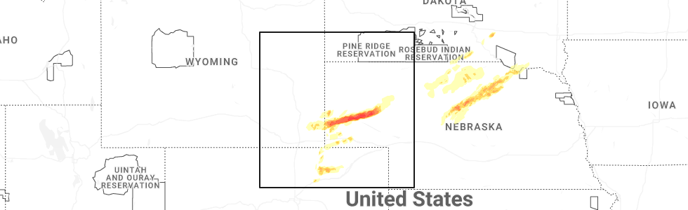
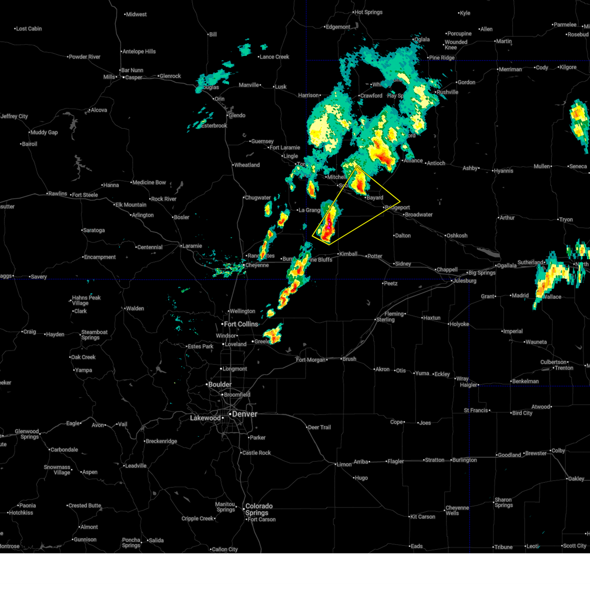
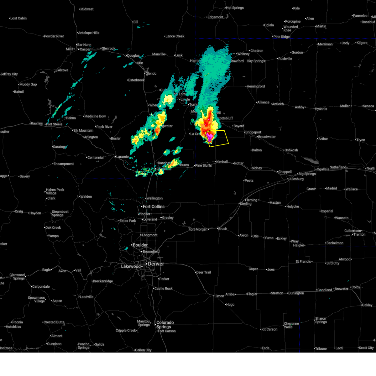
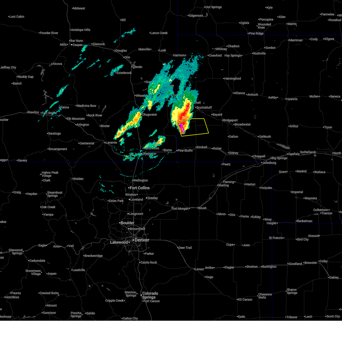
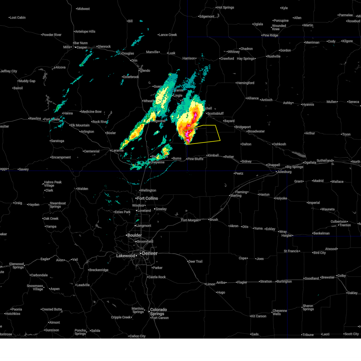
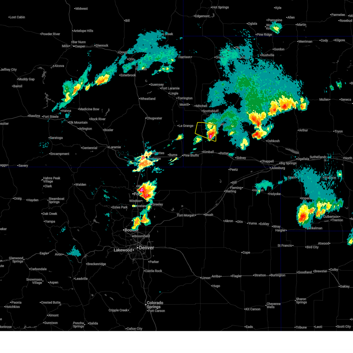
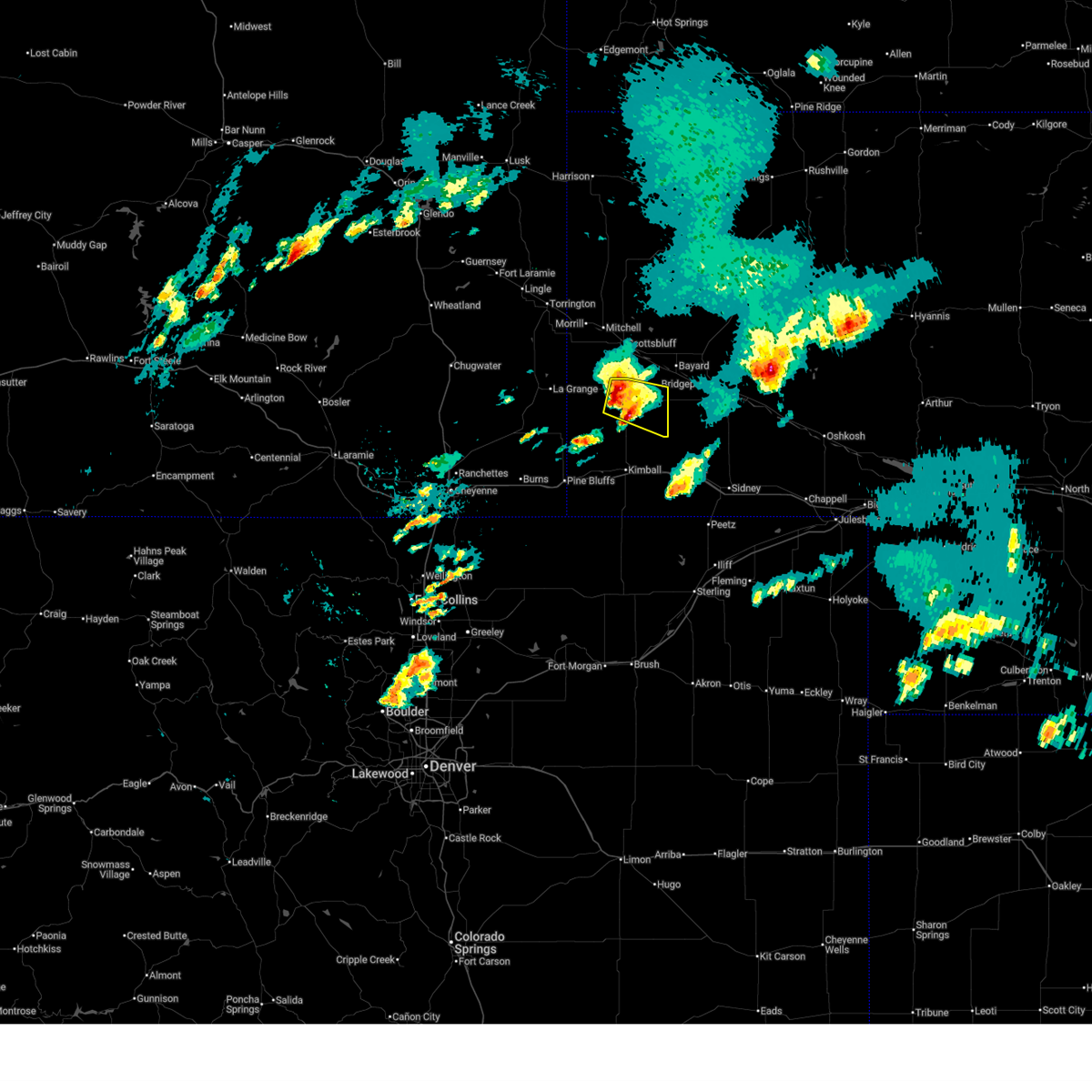
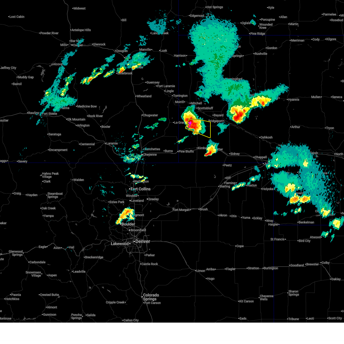
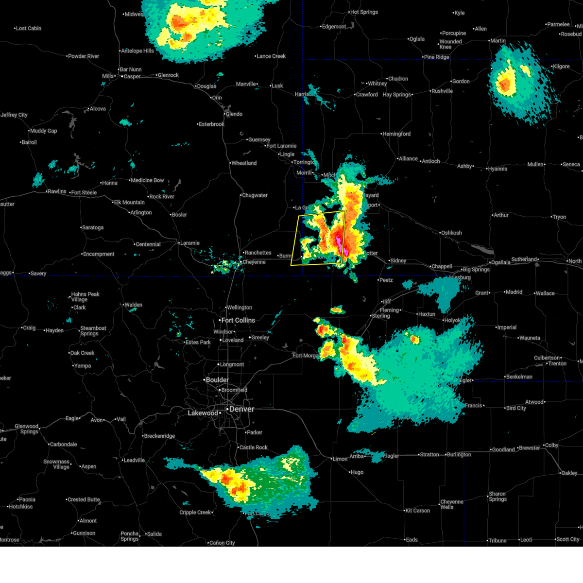
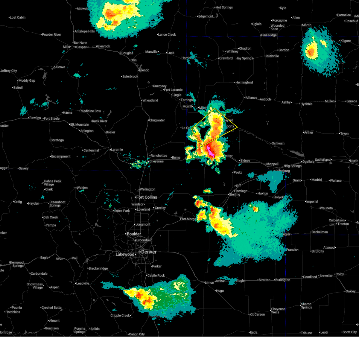
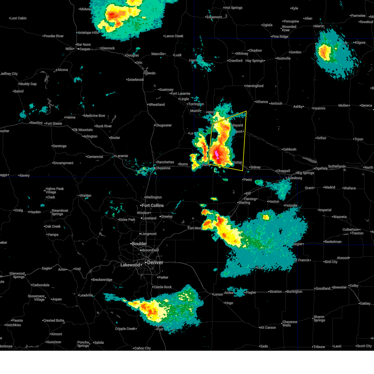
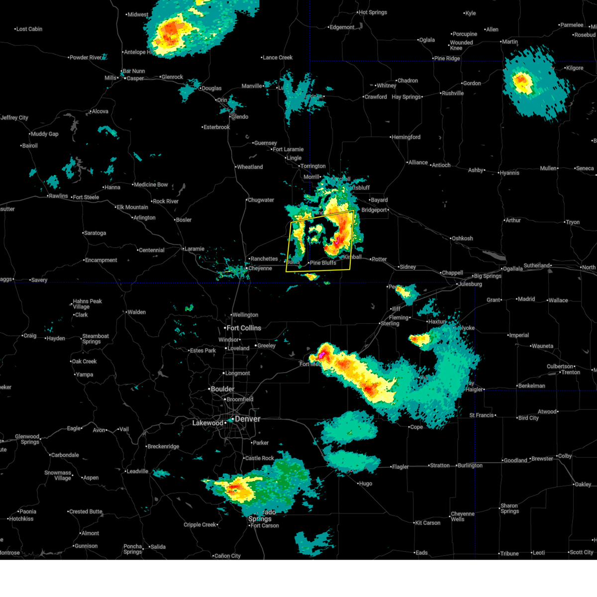
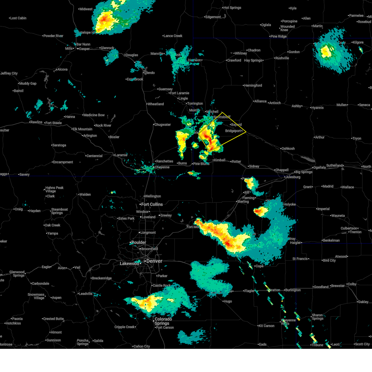
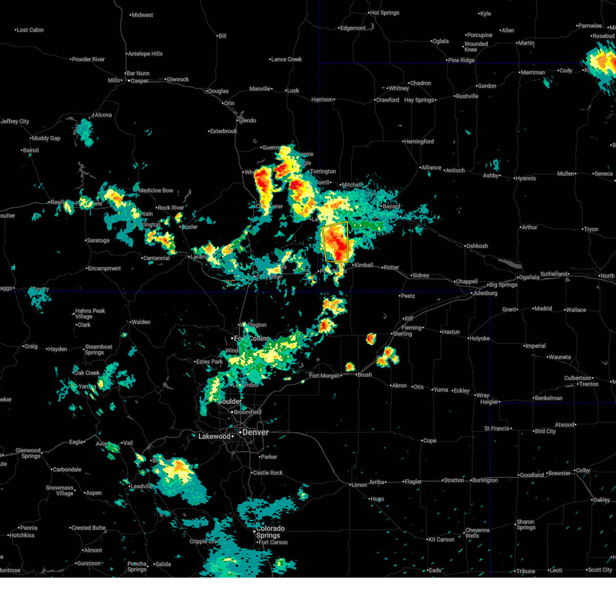
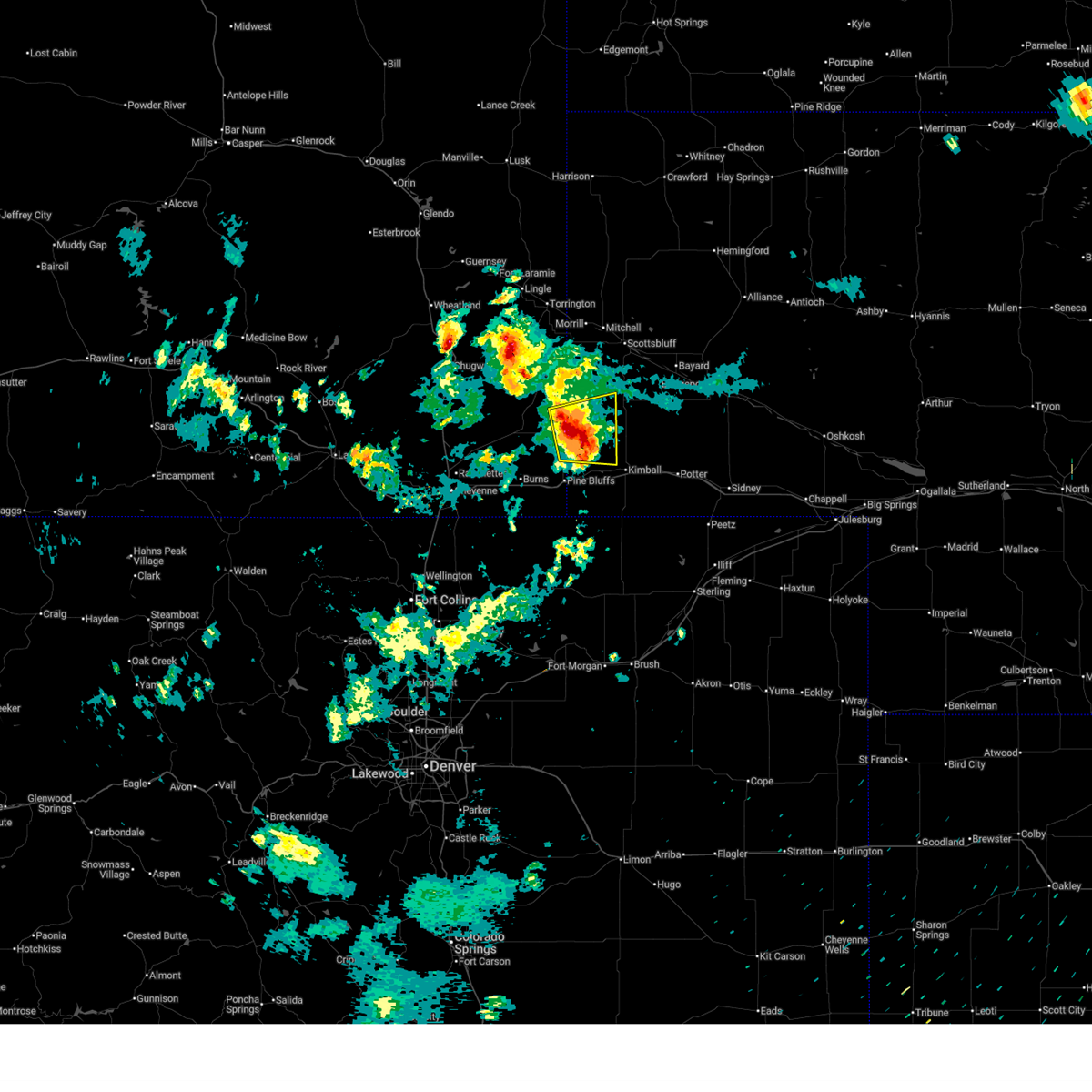
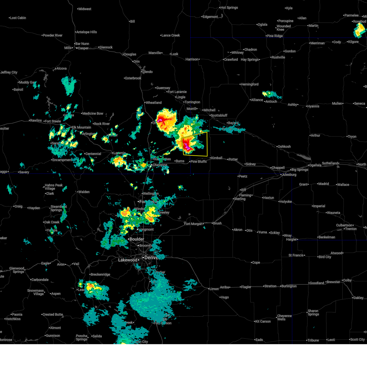
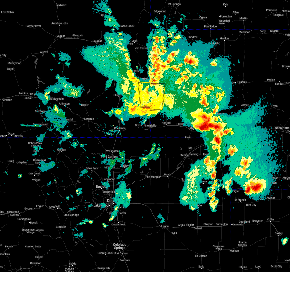
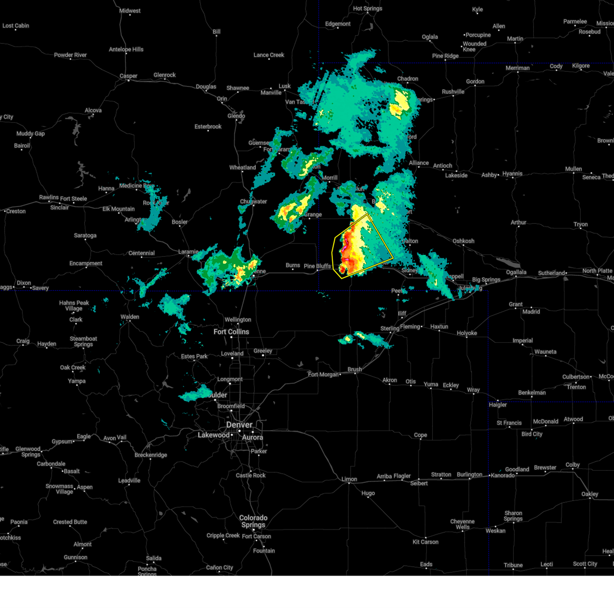
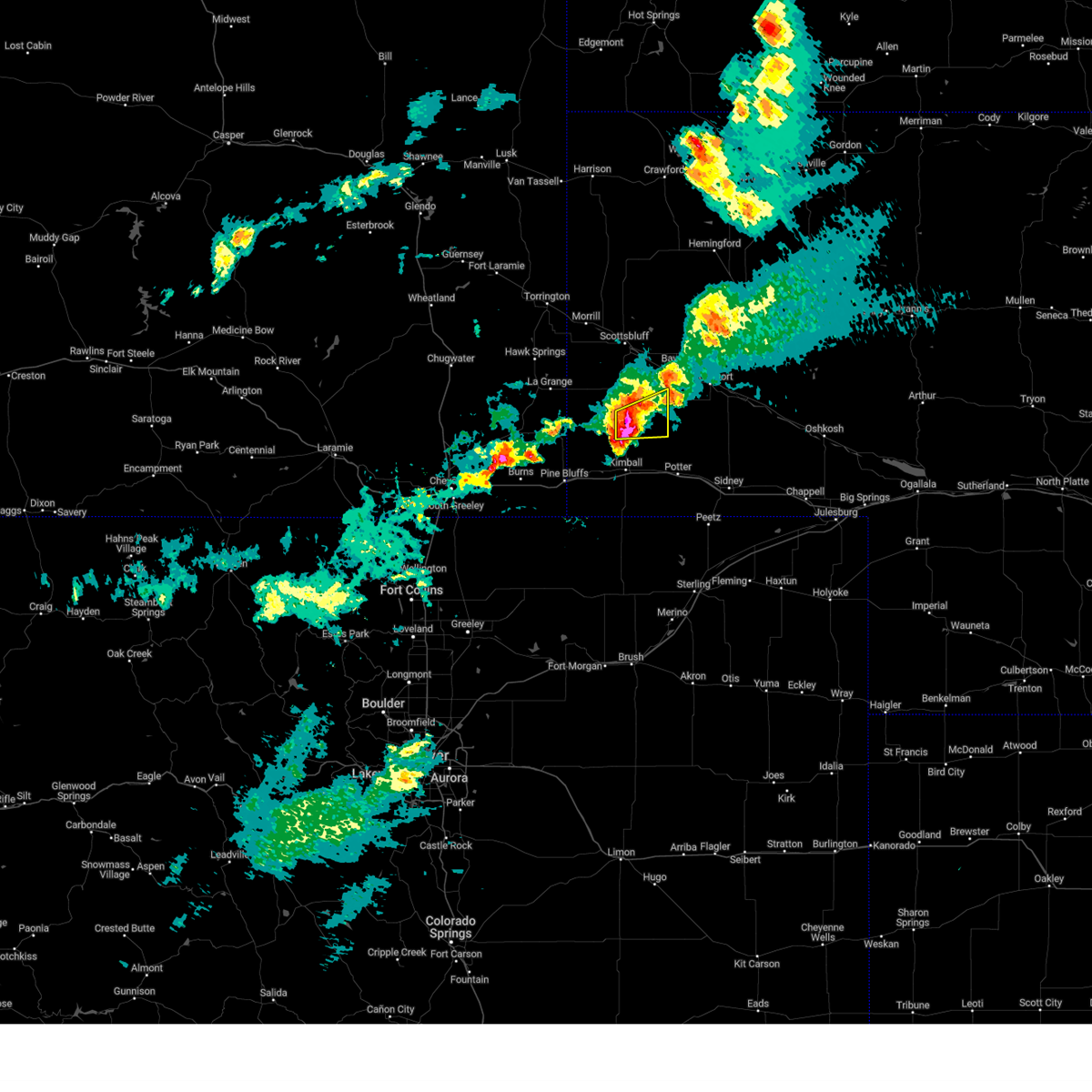
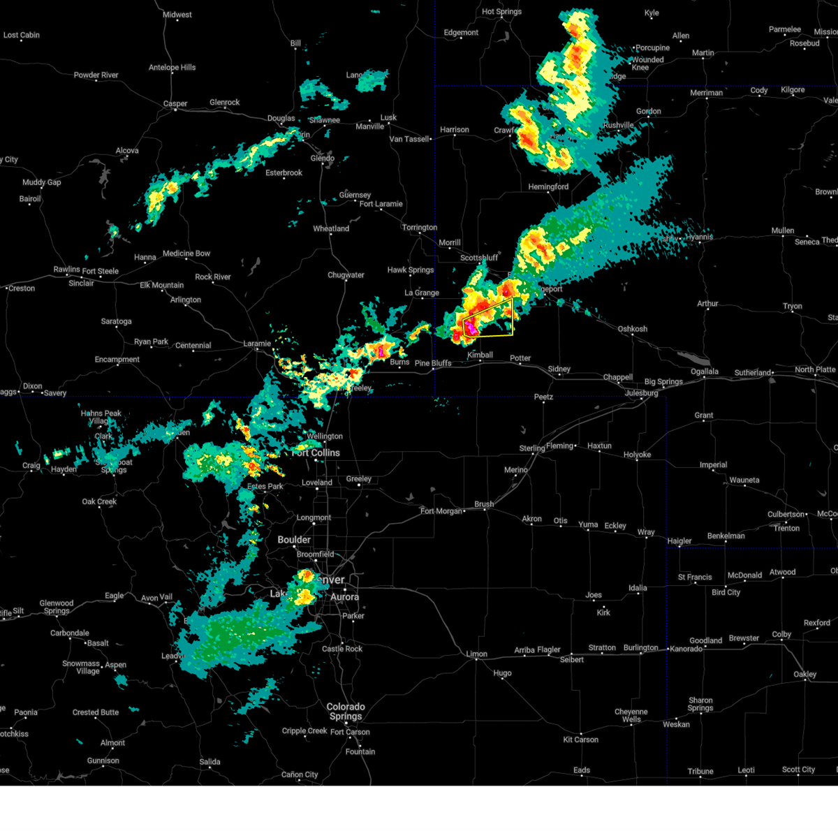
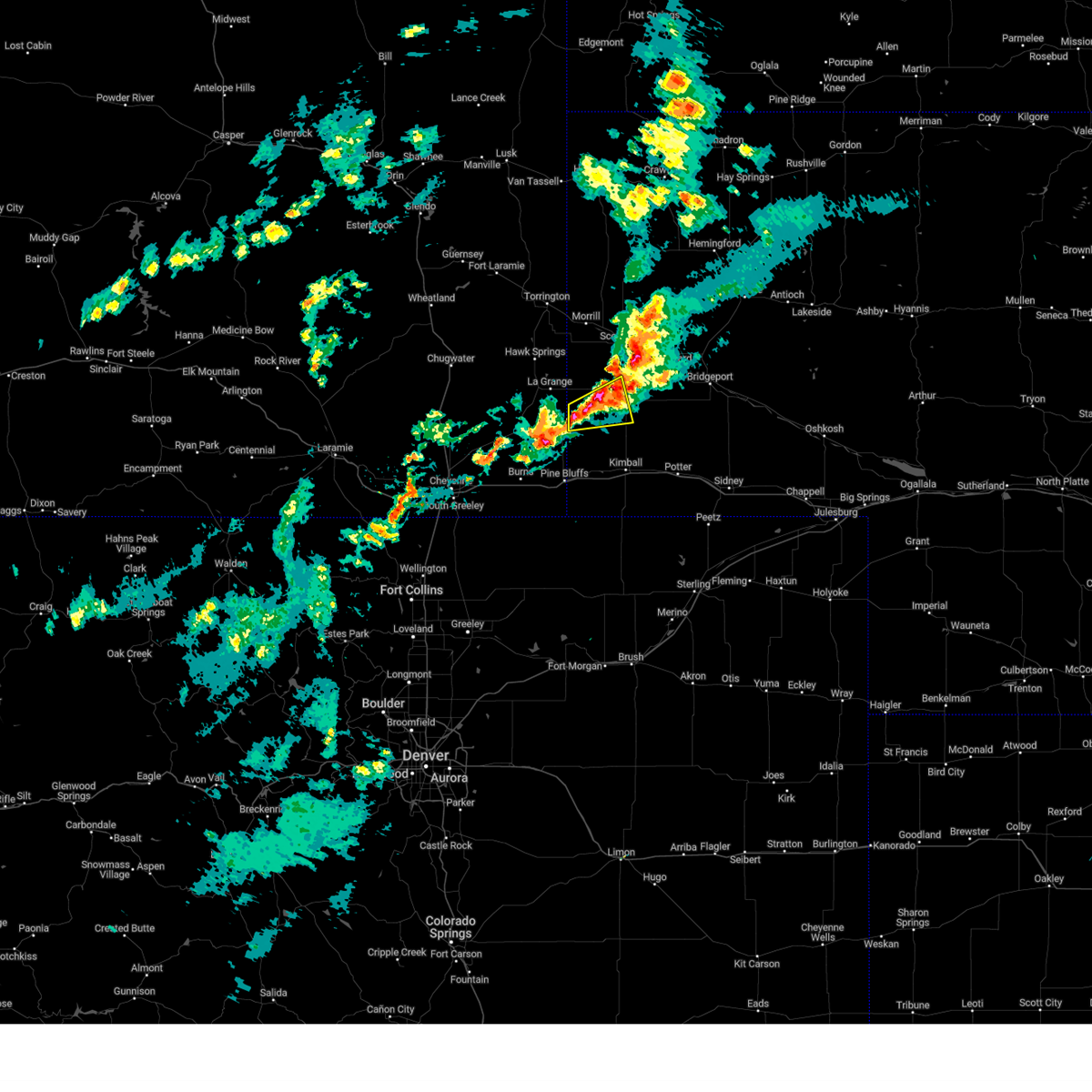
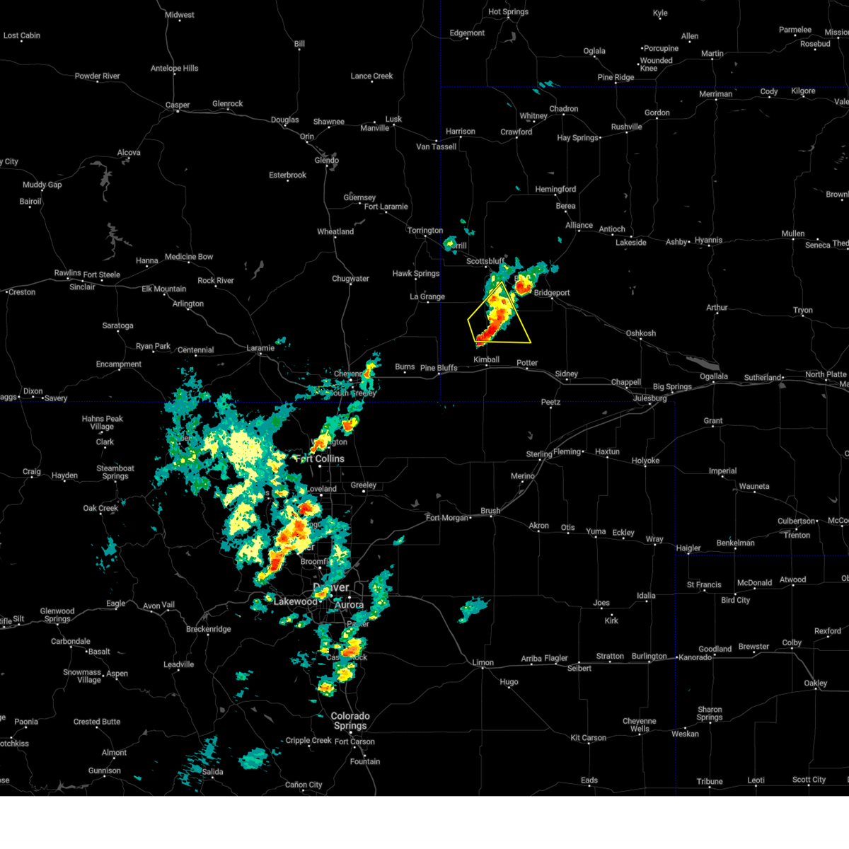
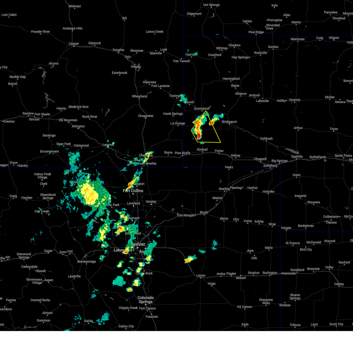
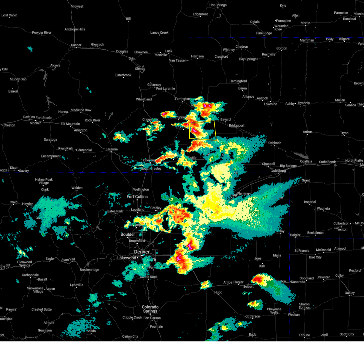
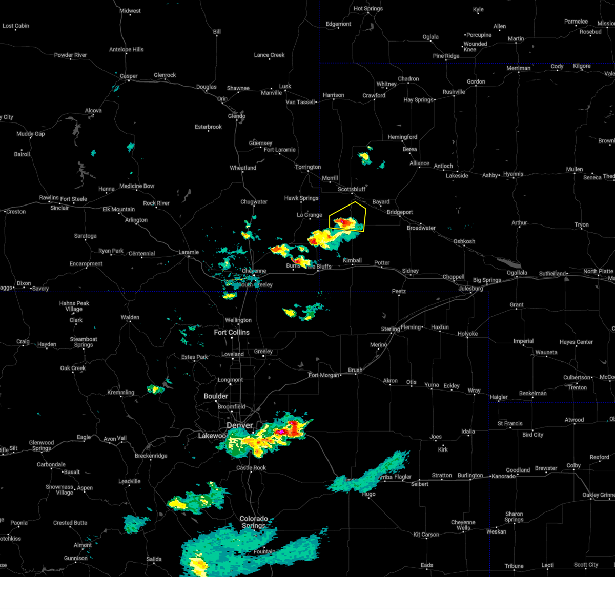
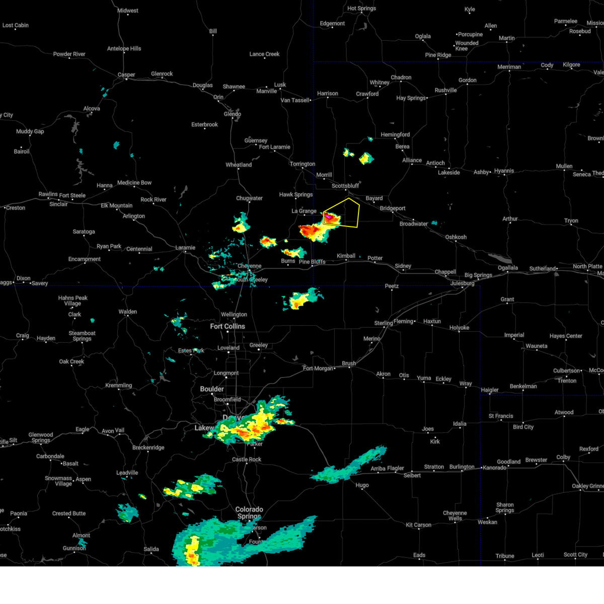
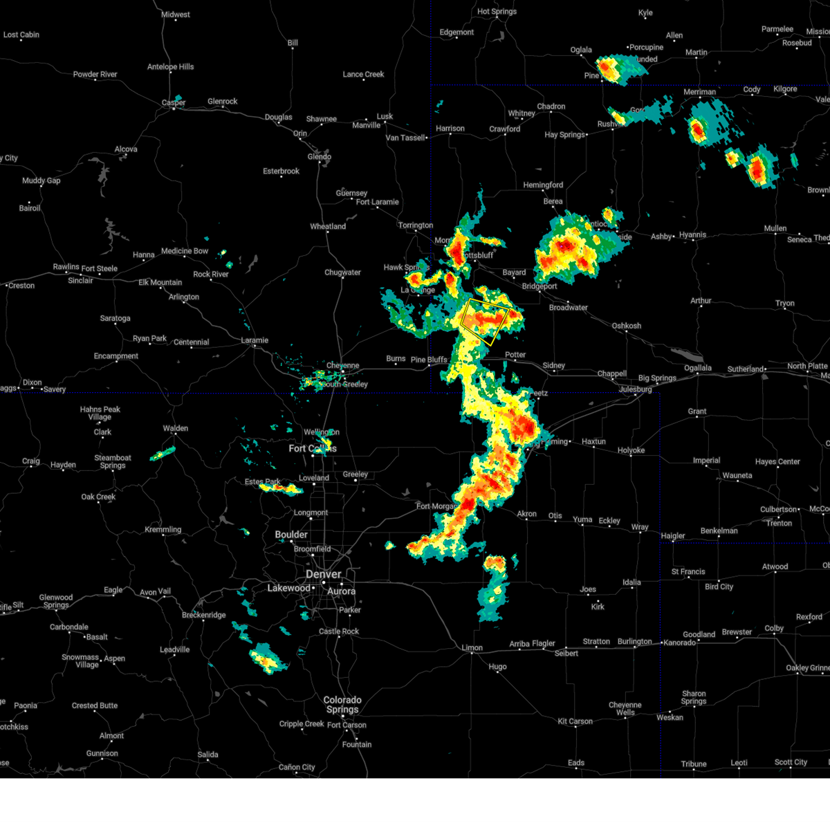
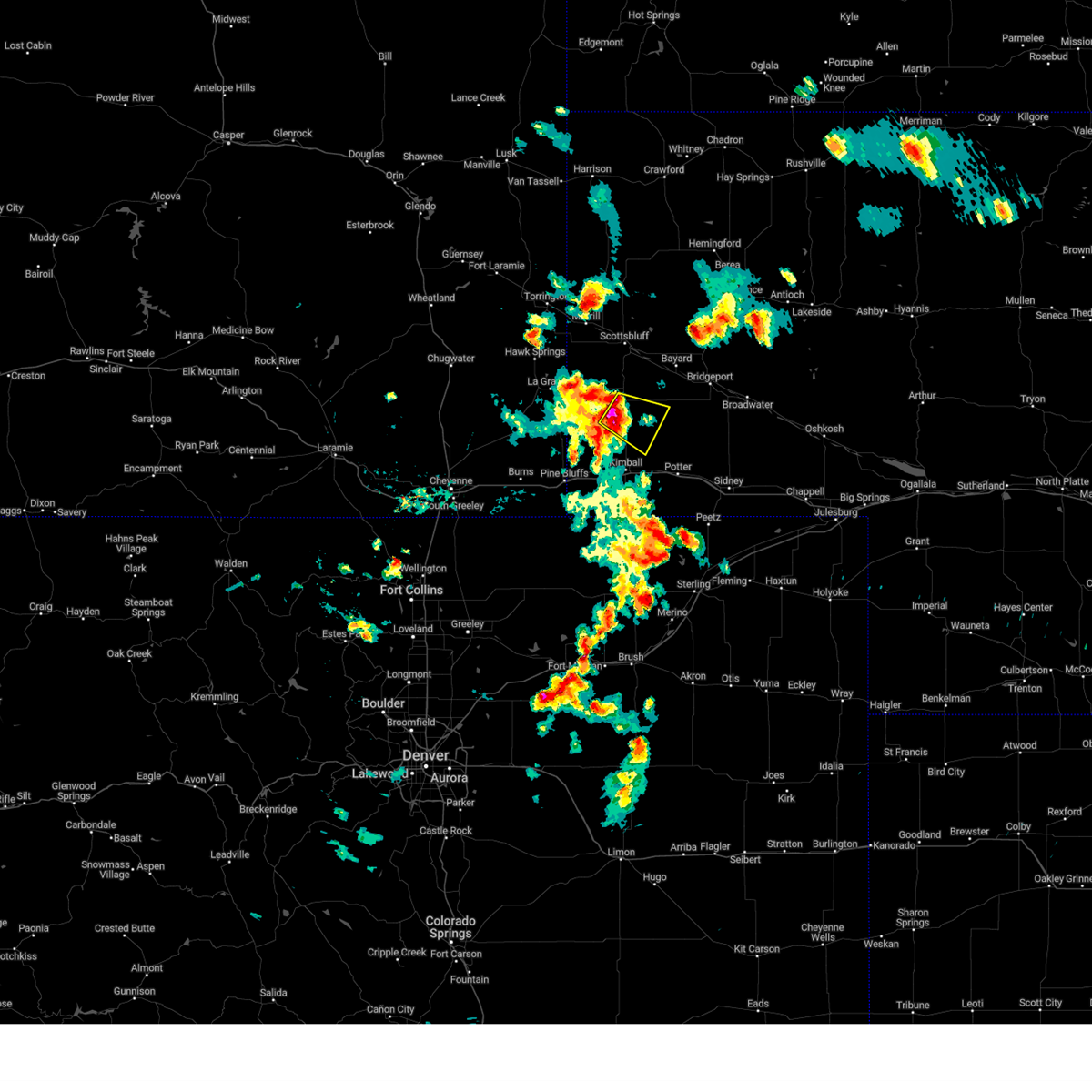
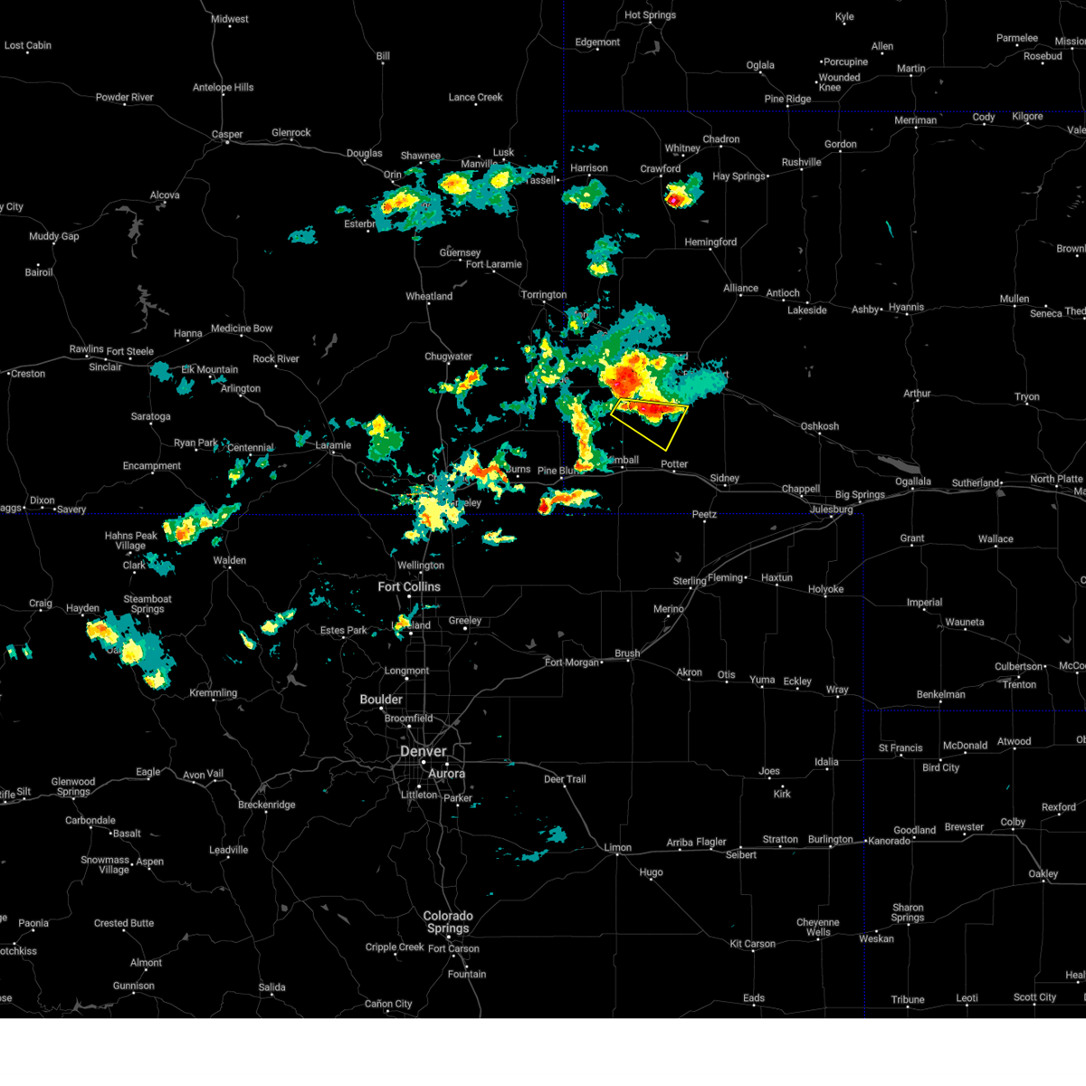
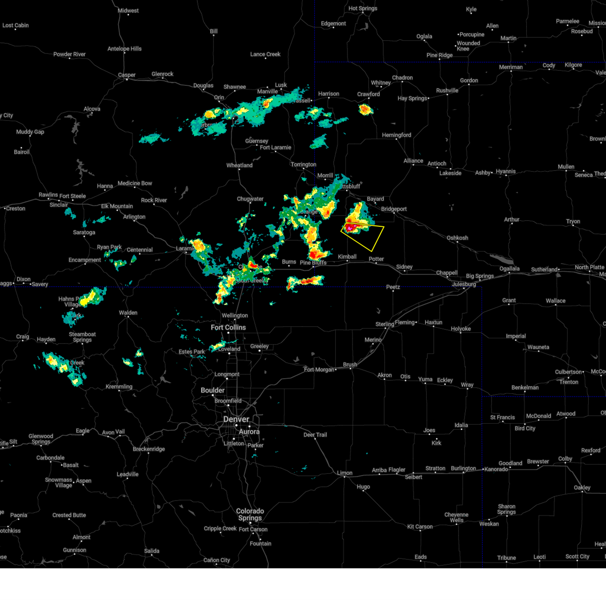
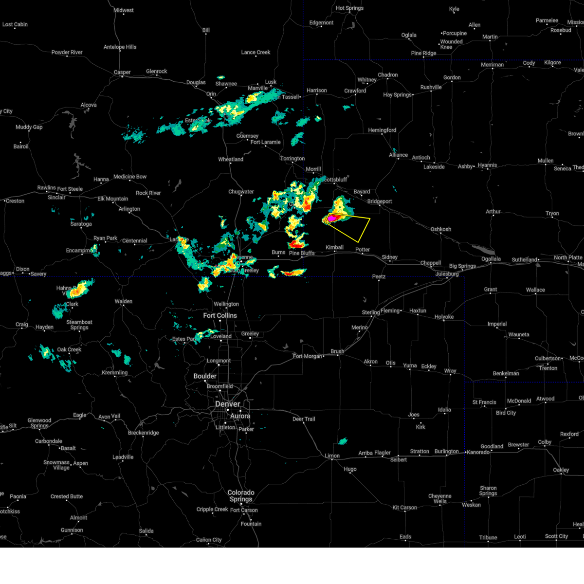
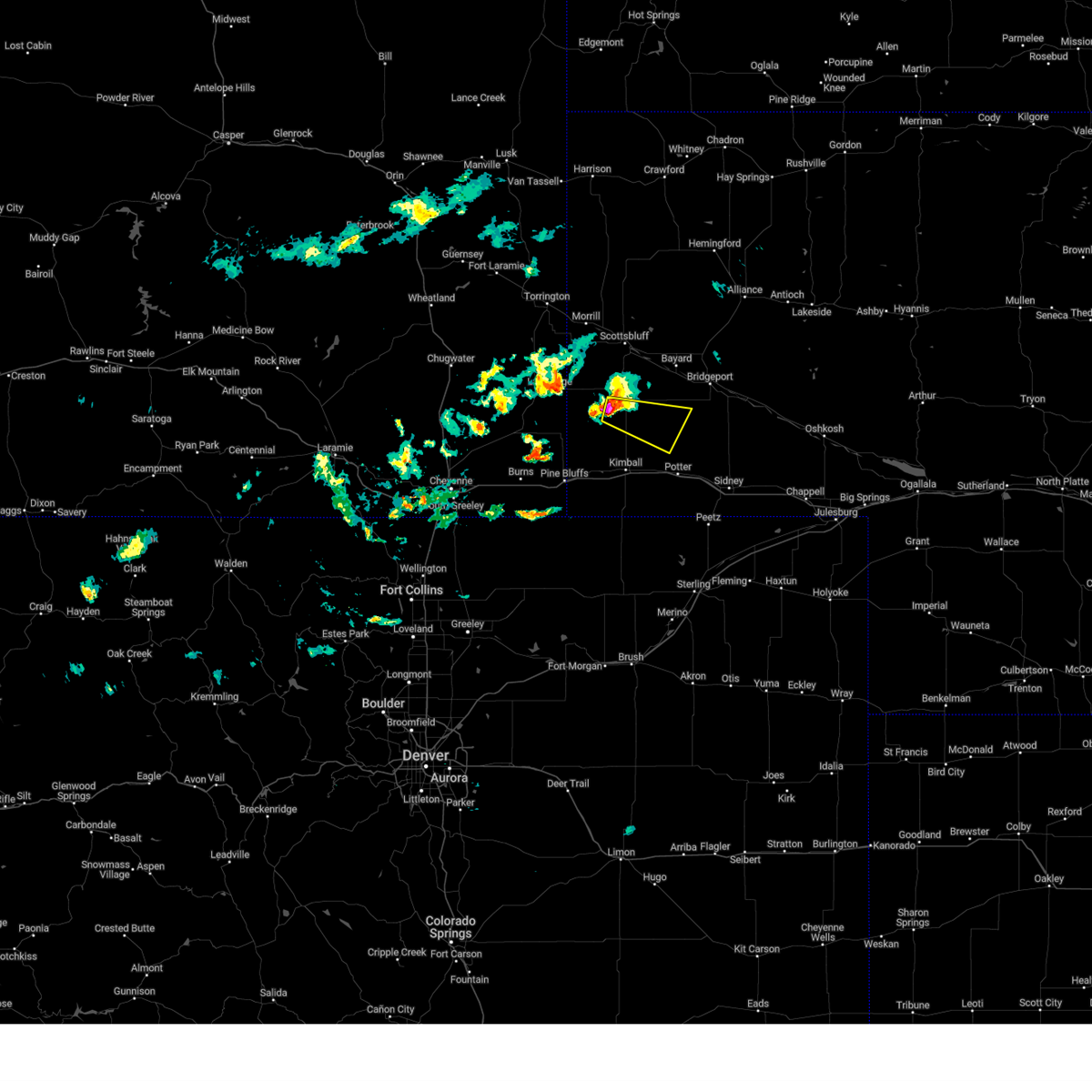
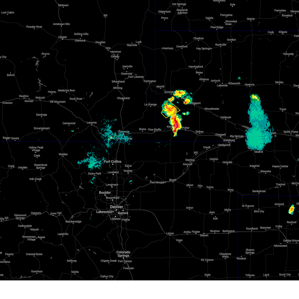
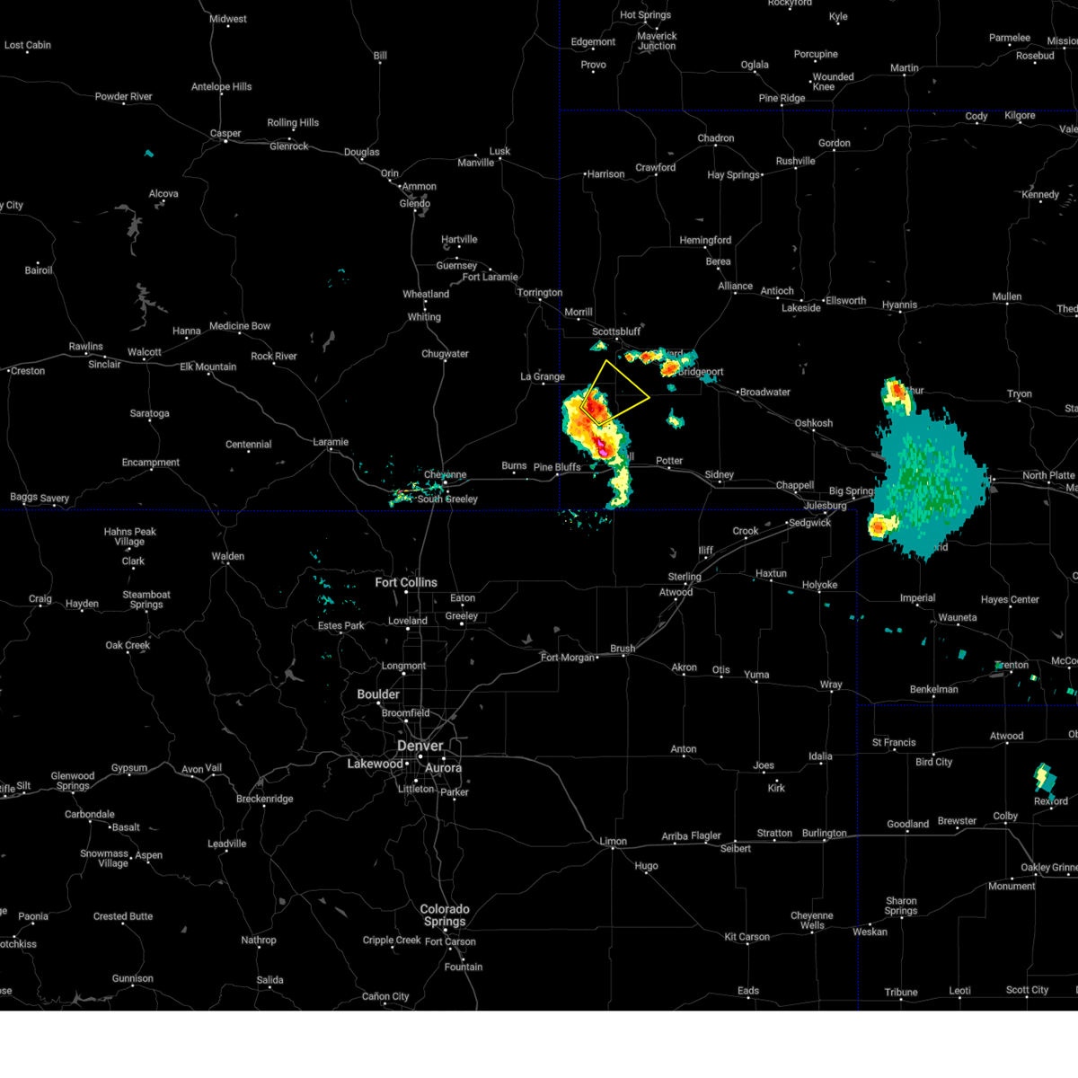
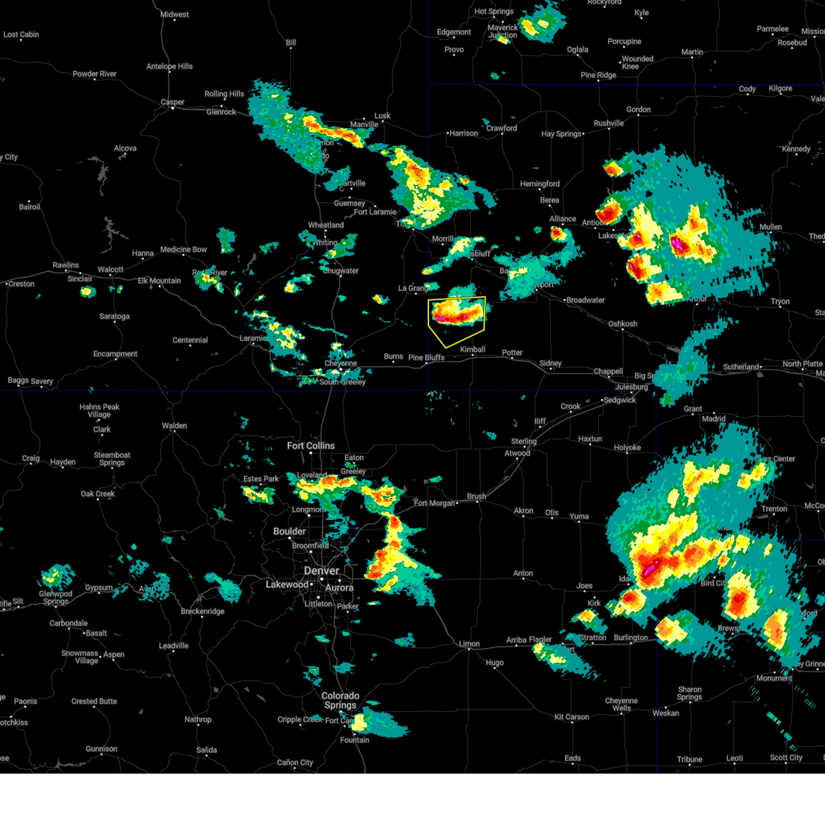
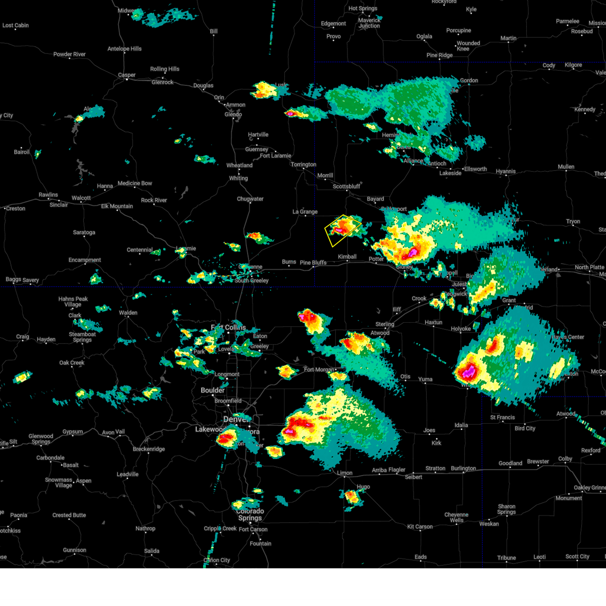
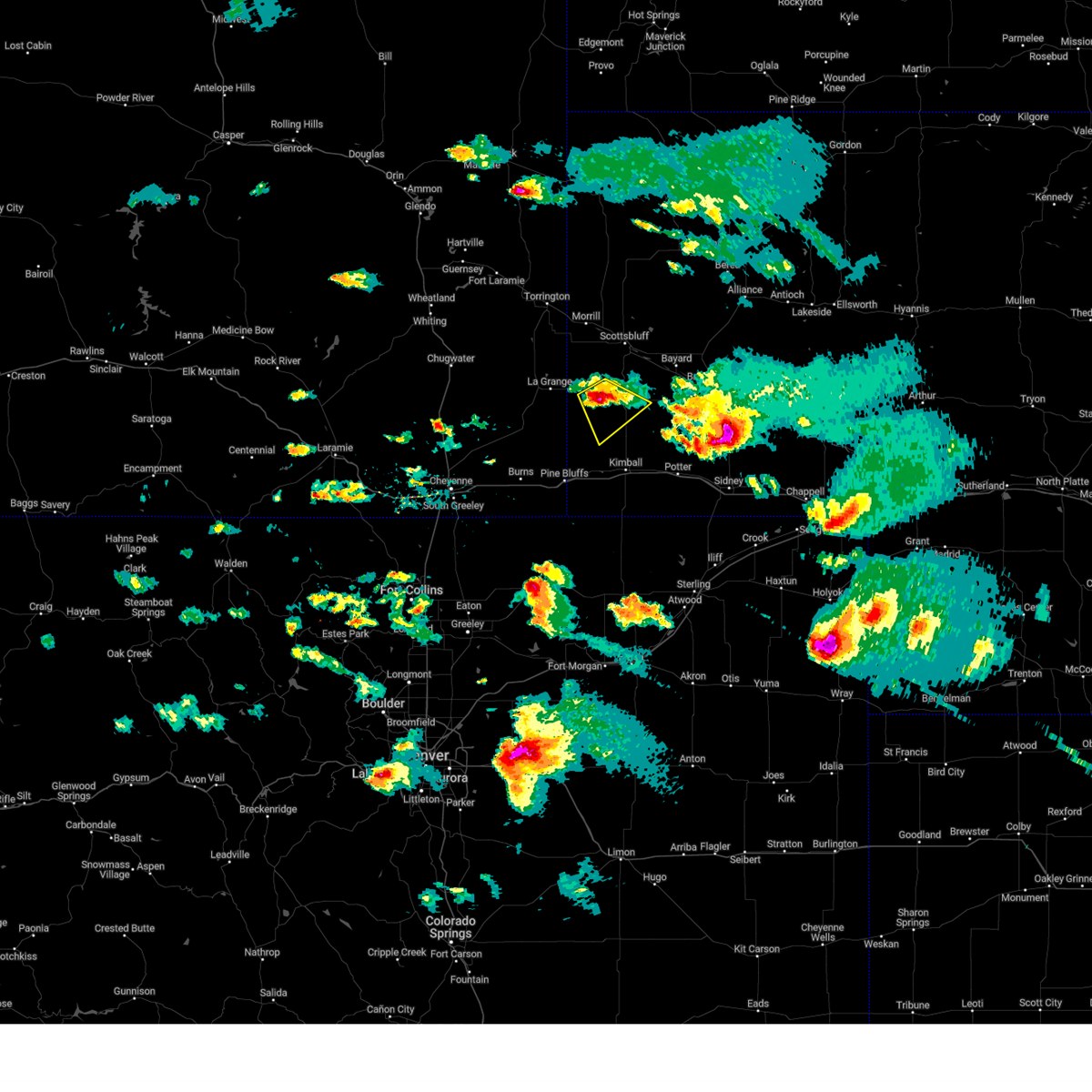
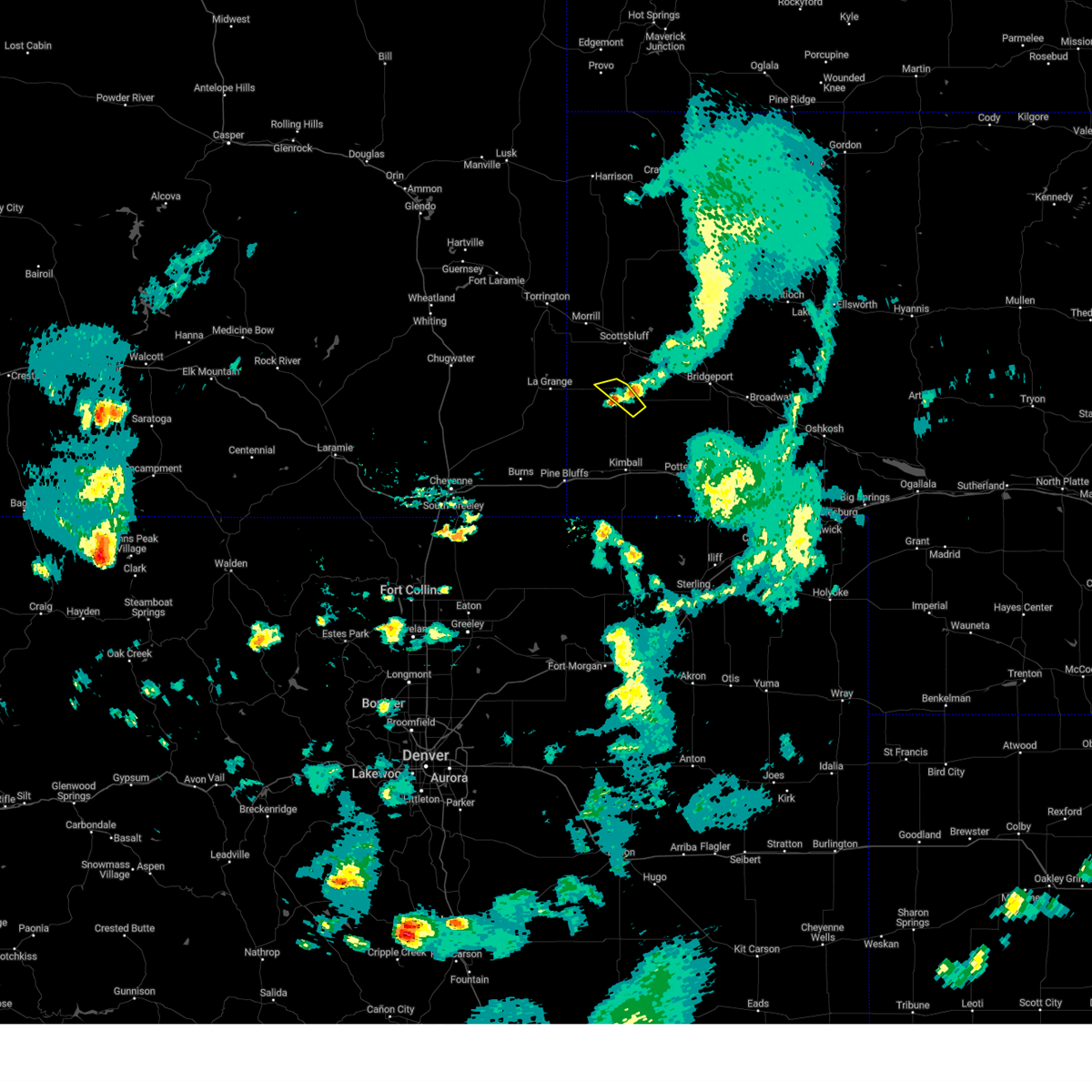
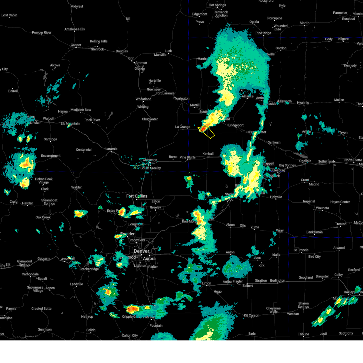
Hail Map for Harrisburg, NE
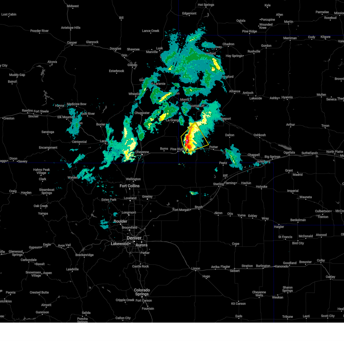
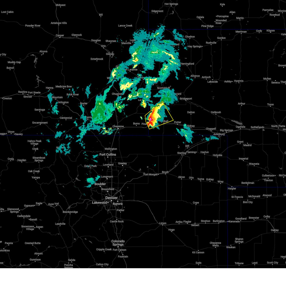
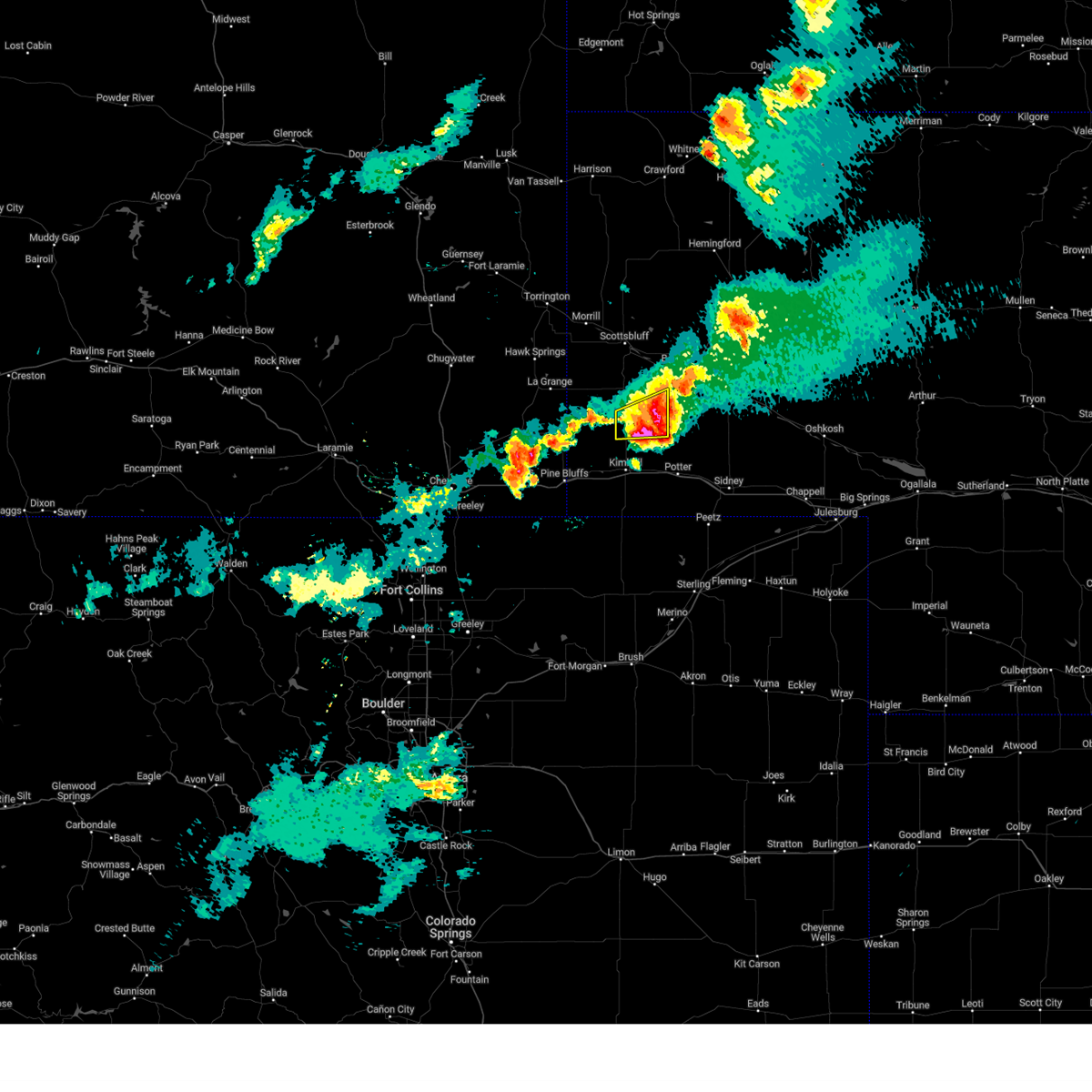
The Harrisburg, NE area has had 24 reports of on-the-ground hail by trained spotters, and has been under severe weather warnings 45 times during the past 12 months. Doppler radar has detected hail at or near Harrisburg, NE on 94 occasions, including 10 occasions during the past year.
| Name: | Harrisburg, NE |
| Where Located: | 21.9 miles S of Scottsbluff, NE |
| Map: | Google Map for Harrisburg, NE |
| Population: | 100 |
| Housing Units: | 50 |
| More Info: | Search Google for Harrisburg, NE |
4
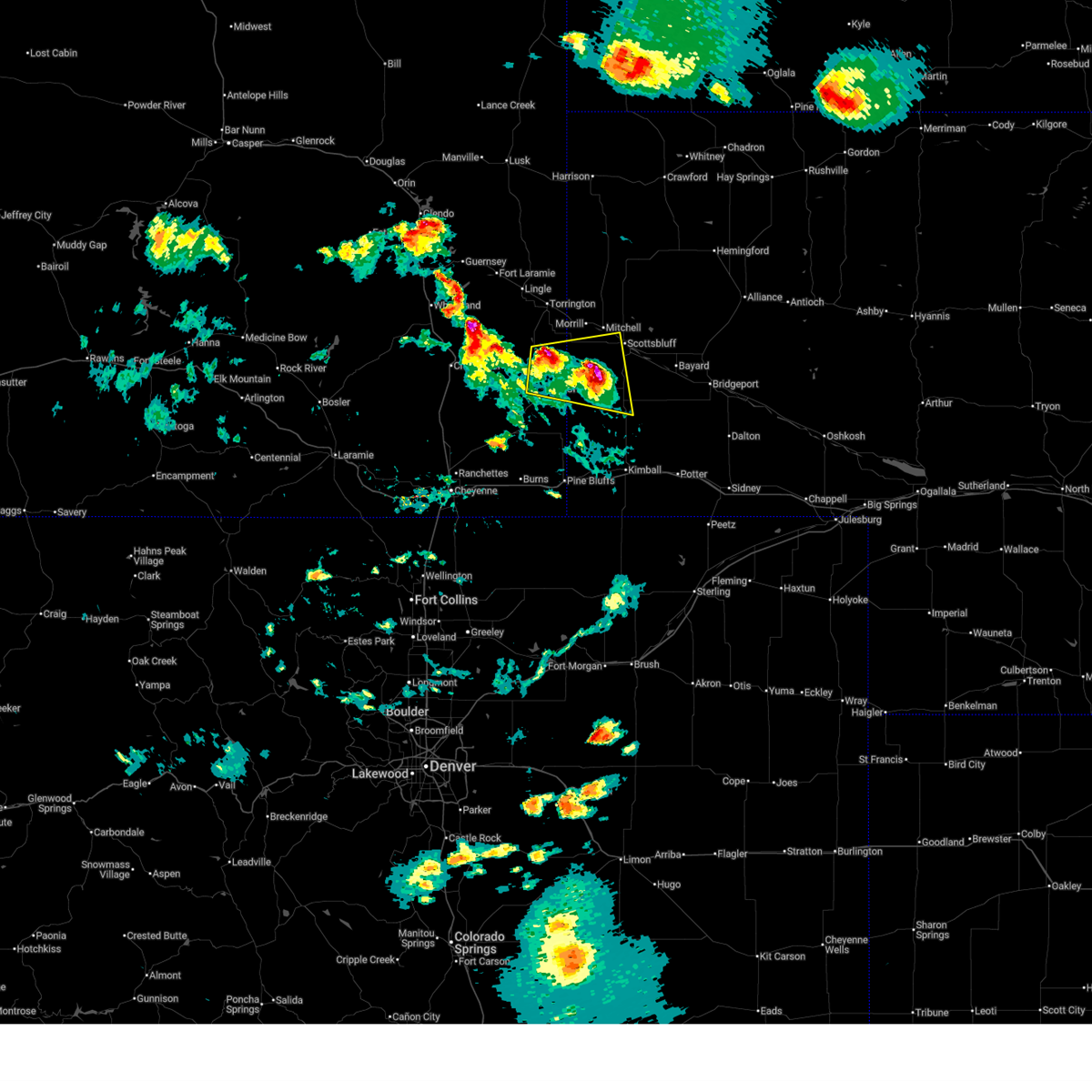
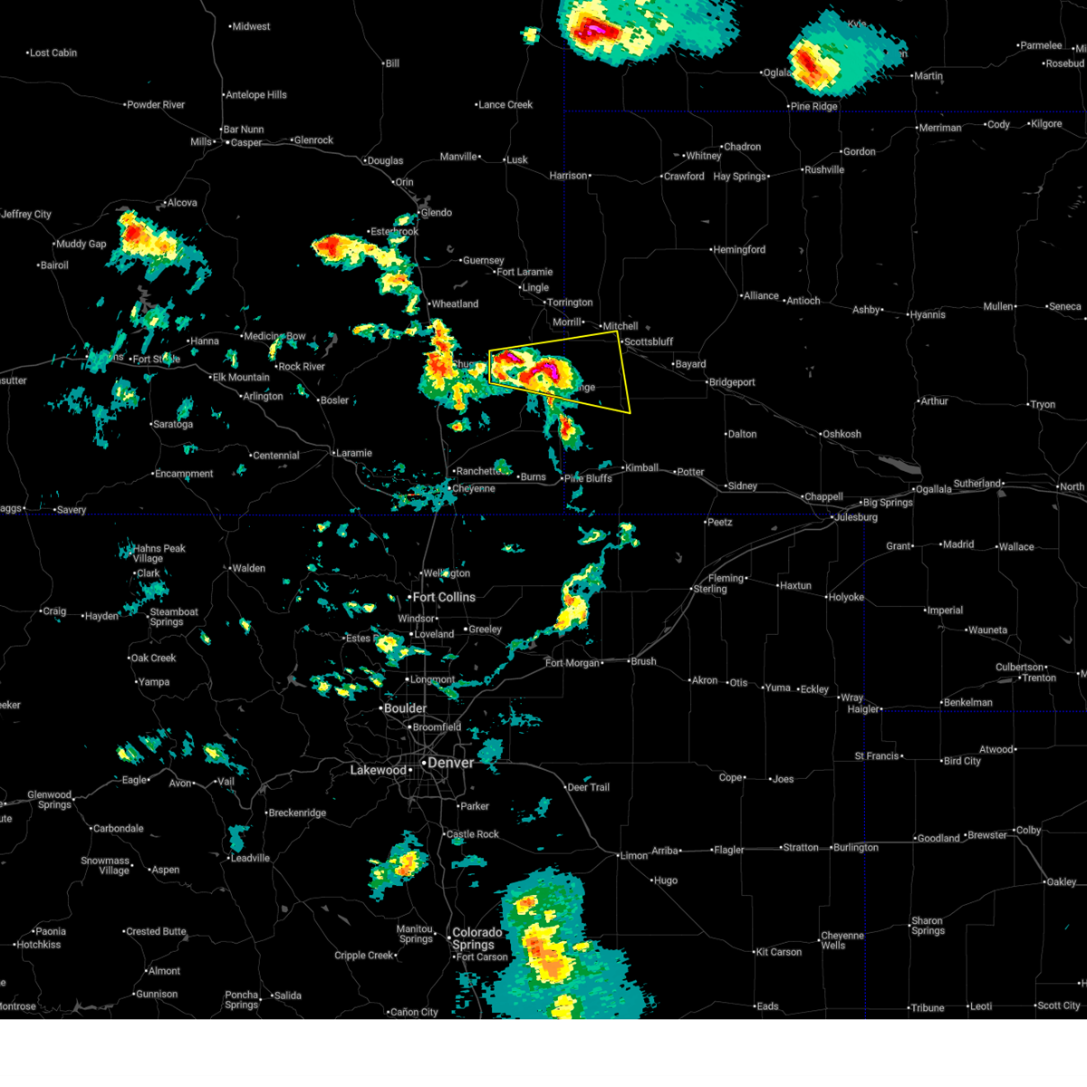
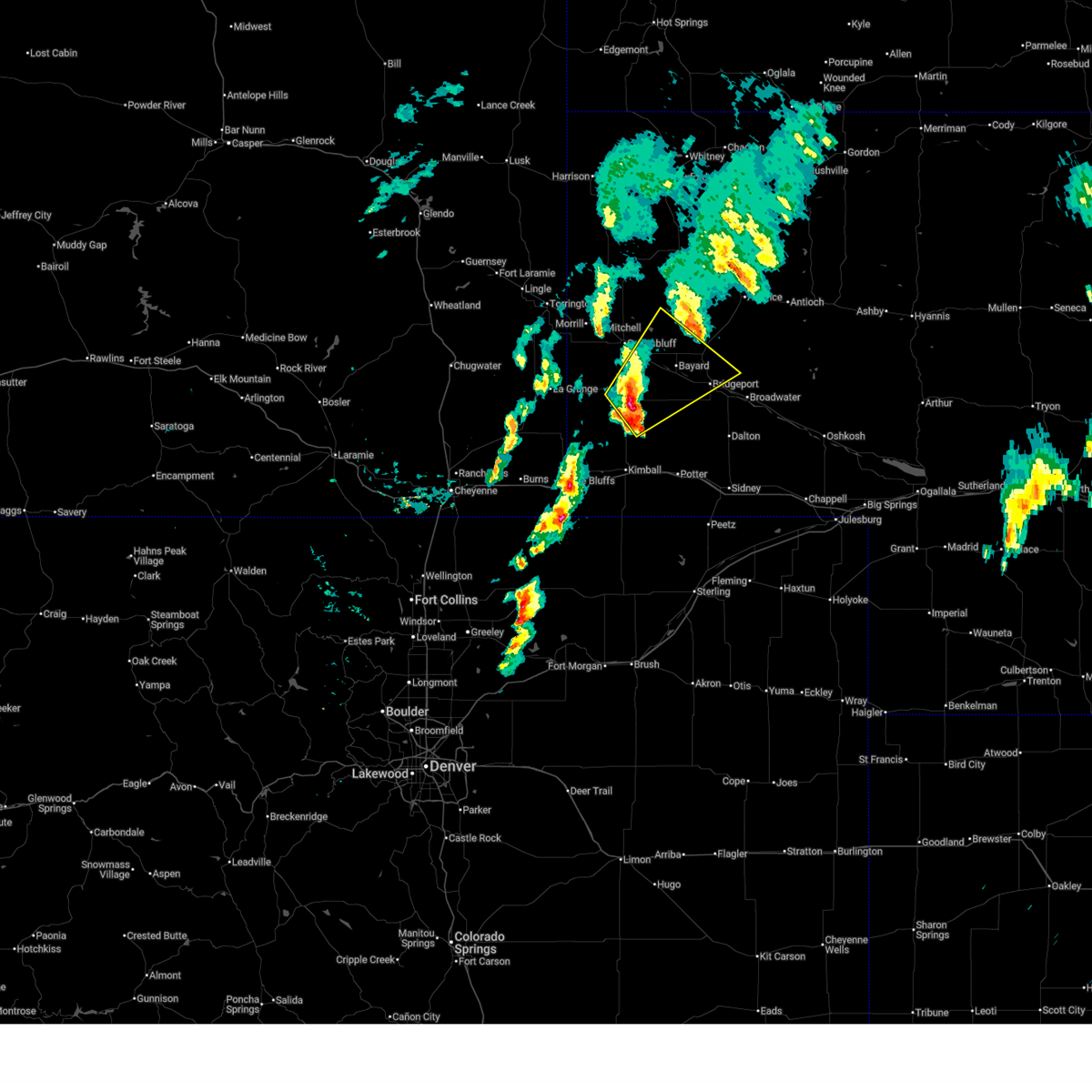
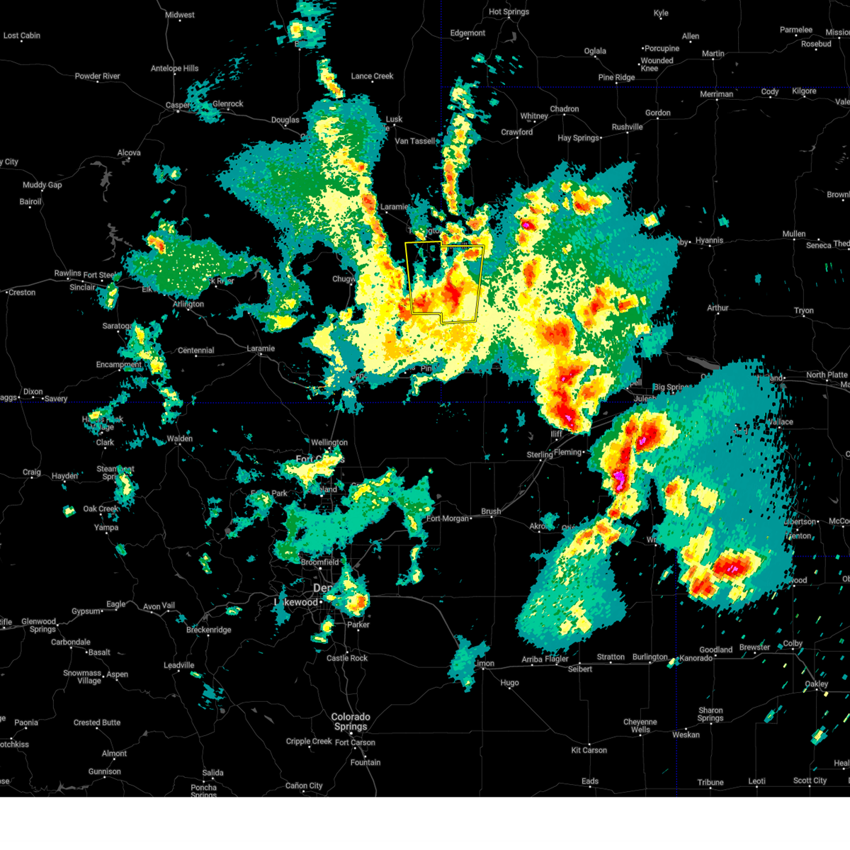
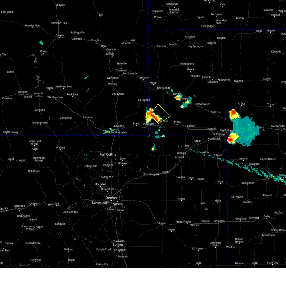
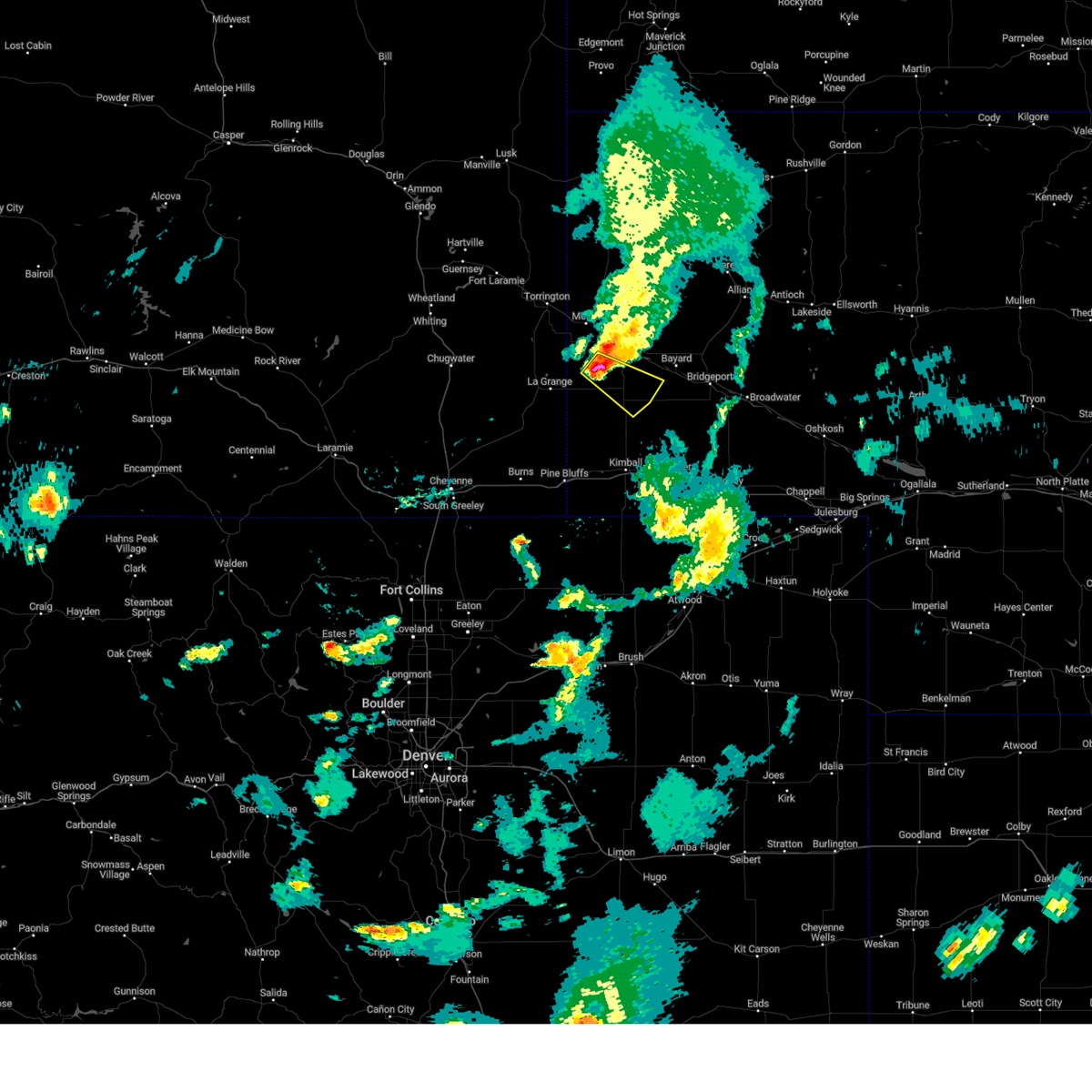
The Top Recent Hail Date for Harrisburg, NE is Sunday, June 22, 2025 (3rd out of 94)
Hail and Wind Damage Spotted near Harrisburg, NE
| Date / Time | Report Details |
|---|---|
| 6/29/2025 5:45 PM MDT |
 At 544 pm mdt, a severe thunderstorm was located 8 miles south of hubbard hill, or 14 miles southwest of scottsbluff, moving east at 30 mph (radar indicated). Hazards include tennis ball size hail and 60 mph wind gusts. People and animals outdoors will be injured. expect hail damage to roofs, siding, windows, and vehicles. expect wind damage to roofs, siding, and trees. Locations impacted include, scottsbluff, gering, terrytown, la grange, wildcat hills state recreation area, hawk springs reservoir, stegall, hawk springs state recreation area, hawk springs, scotts bluff national monument, hubbard hill, harrisburg, wycross, and hawk springs campground. At 544 pm mdt, a severe thunderstorm was located 8 miles south of hubbard hill, or 14 miles southwest of scottsbluff, moving east at 30 mph (radar indicated). Hazards include tennis ball size hail and 60 mph wind gusts. People and animals outdoors will be injured. expect hail damage to roofs, siding, windows, and vehicles. expect wind damage to roofs, siding, and trees. Locations impacted include, scottsbluff, gering, terrytown, la grange, wildcat hills state recreation area, hawk springs reservoir, stegall, hawk springs state recreation area, hawk springs, scotts bluff national monument, hubbard hill, harrisburg, wycross, and hawk springs campground.
|
| 6/29/2025 5:18 PM MDT |
 Svrcys the national weather service in cheyenne has issued a * severe thunderstorm warning for, southwestern scotts bluff county in the panhandle of nebraska, northwestern banner county in the panhandle of nebraska, southern goshen county in southeastern wyoming, * until 615 pm mdt. * at 517 pm mdt, a severe thunderstorm was located over hawk springs reservoir, or 23 miles south of torrington, moving east at 30 mph (radar indicated). Hazards include golf ball size hail and 60 mph wind gusts. People and animals outdoors will be injured. expect hail damage to roofs, siding, windows, and vehicles. Expect wind damage to roofs, siding, and trees. Svrcys the national weather service in cheyenne has issued a * severe thunderstorm warning for, southwestern scotts bluff county in the panhandle of nebraska, northwestern banner county in the panhandle of nebraska, southern goshen county in southeastern wyoming, * until 615 pm mdt. * at 517 pm mdt, a severe thunderstorm was located over hawk springs reservoir, or 23 miles south of torrington, moving east at 30 mph (radar indicated). Hazards include golf ball size hail and 60 mph wind gusts. People and animals outdoors will be injured. expect hail damage to roofs, siding, windows, and vehicles. Expect wind damage to roofs, siding, and trees.
|
| 6/22/2025 9:00 PM MDT |
 At 859 pm mdt, a severe thunderstorm was located 7 miles east of harrisburg, or 21 miles south of scottsbluff, moving northeast at 40 mph (radar indicated). Hazards include 60 mph wind gusts and quarter size hail. Hail damage to vehicles is expected. expect wind damage to roofs, siding, and trees. Locations impacted include, bridgeport, bayard, minatare, melbeta, mcgrew, wildcat hills state recreation area, northport, lake minatare state recreation area, bridgeport state recreation area, angora, morrill county fairgrounds, chimney rock national historic site, harrisburg, redington, scottsbluff airport, wrights gap, moomaw corner, the intersection of highway 385 and l62, and south bayard junction. At 859 pm mdt, a severe thunderstorm was located 7 miles east of harrisburg, or 21 miles south of scottsbluff, moving northeast at 40 mph (radar indicated). Hazards include 60 mph wind gusts and quarter size hail. Hail damage to vehicles is expected. expect wind damage to roofs, siding, and trees. Locations impacted include, bridgeport, bayard, minatare, melbeta, mcgrew, wildcat hills state recreation area, northport, lake minatare state recreation area, bridgeport state recreation area, angora, morrill county fairgrounds, chimney rock national historic site, harrisburg, redington, scottsbluff airport, wrights gap, moomaw corner, the intersection of highway 385 and l62, and south bayard junction.
|
| 6/22/2025 9:00 PM MDT |
 the severe thunderstorm warning has been cancelled and is no longer in effect the severe thunderstorm warning has been cancelled and is no longer in effect
|
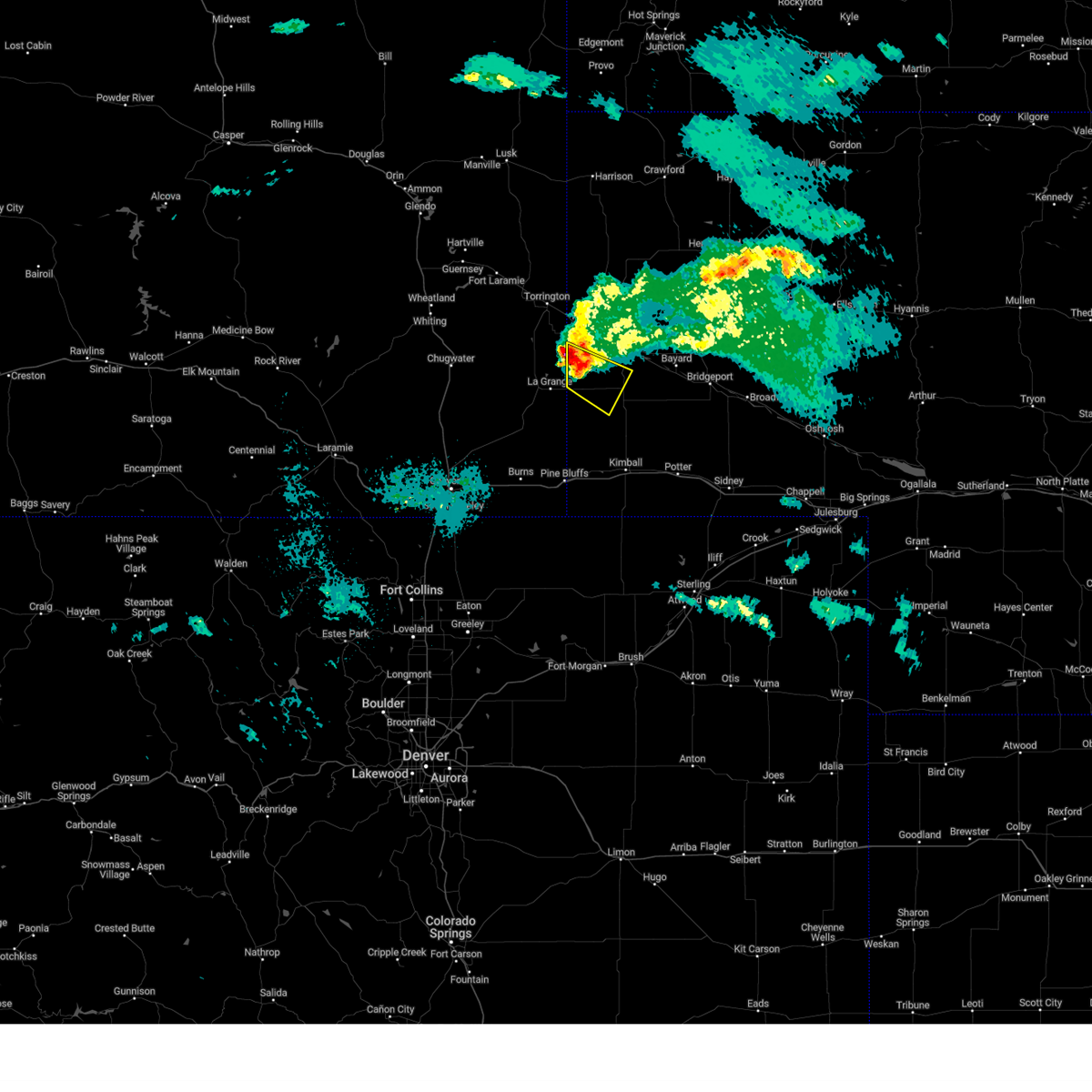
| 6/22/2025 8:42 PM MDT |
 Svrcys the national weather service in cheyenne has issued a * severe thunderstorm warning for, southwestern box butte county in the panhandle of nebraska, eastern scotts bluff county in the panhandle of nebraska, north central kimball county in the panhandle of nebraska, northwestern morrill county in the panhandle of nebraska, banner county in the panhandle of nebraska, southeastern sioux county in the panhandle of nebraska, * until 930 pm mdt. * at 841 pm mdt, a severe thunderstorm was located over harrisburg, or 19 miles north of kimball, moving northeast at 55 mph (radar indicated). Hazards include 60 mph wind gusts and quarter size hail. Hail damage to vehicles is expected. Expect wind damage to roofs, siding, and trees. Svrcys the national weather service in cheyenne has issued a * severe thunderstorm warning for, southwestern box butte county in the panhandle of nebraska, eastern scotts bluff county in the panhandle of nebraska, north central kimball county in the panhandle of nebraska, northwestern morrill county in the panhandle of nebraska, banner county in the panhandle of nebraska, southeastern sioux county in the panhandle of nebraska, * until 930 pm mdt. * at 841 pm mdt, a severe thunderstorm was located over harrisburg, or 19 miles north of kimball, moving northeast at 55 mph (radar indicated). Hazards include 60 mph wind gusts and quarter size hail. Hail damage to vehicles is expected. Expect wind damage to roofs, siding, and trees.
|
| 6/22/2025 5:05 PM MDT | Ping Pong Ball sized hail reported 15.5 miles W of Harrisburg, NE, estimated wind gusts 60 to 70 mph. |
| 6/22/2025 4:46 PM MDT |
 At 445 pm mdt, a severe thunderstorm was located over harrisburg, or 20 miles north of kimball, moving east at 30 mph (radar indicated). Hazards include golf ball size hail and 60 mph wind gusts. People and animals outdoors will be injured. expect hail damage to roofs, siding, windows, and vehicles. expect wind damage to roofs, siding, and trees. Locations impacted include, harrisburg, wildcat hills state recreation area, and wrights gap. At 445 pm mdt, a severe thunderstorm was located over harrisburg, or 20 miles north of kimball, moving east at 30 mph (radar indicated). Hazards include golf ball size hail and 60 mph wind gusts. People and animals outdoors will be injured. expect hail damage to roofs, siding, windows, and vehicles. expect wind damage to roofs, siding, and trees. Locations impacted include, harrisburg, wildcat hills state recreation area, and wrights gap.
|
| 6/22/2025 4:44 PM MDT | Hen Egg sized hail reported 0.8 miles SSE of Harrisburg, NE |
| 6/22/2025 4:41 PM MDT | Golf Ball sized hail reported 0.8 miles E of Harrisburg, NE |
| 6/22/2025 4:38 PM MDT | Golf Ball sized hail reported 6.1 miles E of Harrisburg, NE, video nw of harrisburg. |
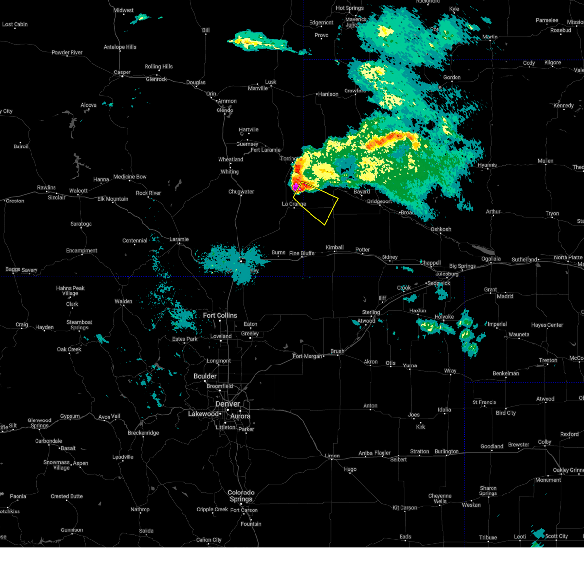
| 6/22/2025 4:28 PM MDT |
 At 427 pm mdt, a severe thunderstorm was located 9 miles southwest of harrisburg, or 20 miles northwest of kimball, moving east at 30 mph (radar indicated). Hazards include golf ball size hail and 60 mph wind gusts. People and animals outdoors will be injured. expect hail damage to roofs, siding, windows, and vehicles. expect wind damage to roofs, siding, and trees. Locations impacted include, harrisburg, wildcat hills state recreation area, and wrights gap. At 427 pm mdt, a severe thunderstorm was located 9 miles southwest of harrisburg, or 20 miles northwest of kimball, moving east at 30 mph (radar indicated). Hazards include golf ball size hail and 60 mph wind gusts. People and animals outdoors will be injured. expect hail damage to roofs, siding, windows, and vehicles. expect wind damage to roofs, siding, and trees. Locations impacted include, harrisburg, wildcat hills state recreation area, and wrights gap.
|
| 6/22/2025 4:28 PM MDT |
 the severe thunderstorm warning has been cancelled and is no longer in effect the severe thunderstorm warning has been cancelled and is no longer in effect
|
| 6/22/2025 4:15 PM MDT |
 Svrcys the national weather service in cheyenne has issued a * severe thunderstorm warning for, banner county in the panhandle of nebraska, southeastern goshen county in southeastern wyoming, eastern laramie county in southeastern wyoming, * until 500 pm mdt. * at 415 pm mdt, a severe thunderstorm was located near albin, or 23 miles northwest of kimball, moving east at 30 mph (radar indicated). Hazards include 60 mph wind gusts and half dollar size hail. Hail damage to vehicles is expected. Expect wind damage to roofs, siding, and trees. Svrcys the national weather service in cheyenne has issued a * severe thunderstorm warning for, banner county in the panhandle of nebraska, southeastern goshen county in southeastern wyoming, eastern laramie county in southeastern wyoming, * until 500 pm mdt. * at 415 pm mdt, a severe thunderstorm was located near albin, or 23 miles northwest of kimball, moving east at 30 mph (radar indicated). Hazards include 60 mph wind gusts and half dollar size hail. Hail damage to vehicles is expected. Expect wind damage to roofs, siding, and trees.
|
| 6/17/2025 2:12 AM MDT |
 The warning will be allowed to expire. however, small hail, gusty winds and heavy rain are still possible with this thunderstorm. a severe thunderstorm warning has been re-issued for the area. The warning will be allowed to expire. however, small hail, gusty winds and heavy rain are still possible with this thunderstorm. a severe thunderstorm warning has been re-issued for the area.
|
| 6/17/2025 1:46 AM MDT |
 At 145 am mdt, a severe thunderstorm was located near harrisburg, or 20 miles south of scottsbluff, moving east at 35 mph (radar indicated). Hazards include 60 mph wind gusts and quarter size hail. Hail damage to vehicles is expected. expect wind damage to roofs, siding, and trees. Locations impacted include, harrisburg, wildcat hills state recreation area, and wrights gap. At 145 am mdt, a severe thunderstorm was located near harrisburg, or 20 miles south of scottsbluff, moving east at 35 mph (radar indicated). Hazards include 60 mph wind gusts and quarter size hail. Hail damage to vehicles is expected. expect wind damage to roofs, siding, and trees. Locations impacted include, harrisburg, wildcat hills state recreation area, and wrights gap.
|
| 6/17/2025 1:33 AM MDT |
 Svrcys the national weather service in cheyenne has issued a * severe thunderstorm warning for, eastern banner county in the panhandle of nebraska, * until 215 am mdt. * at 132 am mdt, a severe thunderstorm was located near harrisburg, or 18 miles south of scottsbluff, moving east at 35 mph (radar indicated). Hazards include golf ball size hail and 60 mph wind gusts. People and animals outdoors will be injured. expect hail damage to roofs, siding, windows, and vehicles. Expect wind damage to roofs, siding, and trees. Svrcys the national weather service in cheyenne has issued a * severe thunderstorm warning for, eastern banner county in the panhandle of nebraska, * until 215 am mdt. * at 132 am mdt, a severe thunderstorm was located near harrisburg, or 18 miles south of scottsbluff, moving east at 35 mph (radar indicated). Hazards include golf ball size hail and 60 mph wind gusts. People and animals outdoors will be injured. expect hail damage to roofs, siding, windows, and vehicles. Expect wind damage to roofs, siding, and trees.
|
| 6/15/2025 6:07 PM MDT |
 The storm which prompted the warning has moved out of east laramie county. severe thunderstorm warning still active for banner and kimball county. a severe thunderstorm watch remains in effect until 1100 pm mdt for the panhandle of nebraska. to report severe weather, contact your nearest law enforcement agency. they will relay your report to the national weather service cheyenne. The storm which prompted the warning has moved out of east laramie county. severe thunderstorm warning still active for banner and kimball county. a severe thunderstorm watch remains in effect until 1100 pm mdt for the panhandle of nebraska. to report severe weather, contact your nearest law enforcement agency. they will relay your report to the national weather service cheyenne.
|
| 6/15/2025 5:58 PM MDT |
 Severe thunderstorm warning is still in effect and has been reissued for damaging winds and large hail. a severe thunderstorm watch remains in effect until 1100 pm mdt for the panhandle of nebraska. Severe thunderstorm warning is still in effect and has been reissued for damaging winds and large hail. a severe thunderstorm watch remains in effect until 1100 pm mdt for the panhandle of nebraska.
|
| 6/15/2025 5:55 PM MDT |
 Svrcys the national weather service in cheyenne has issued a * severe thunderstorm warning for, southeastern scotts bluff county in the panhandle of nebraska, western cheyenne county in the panhandle of nebraska, northeastern kimball county in the panhandle of nebraska, western morrill county in the panhandle of nebraska, eastern banner county in the panhandle of nebraska, * until 645 pm mdt. * at 555 pm mdt, severe thunderstorms were located along a line extending from mcgrew to dix, moving east at 25 mph (radar indicated). Hazards include 60 mph wind gusts and half dollar size hail. Hail damage to vehicles is expected. Expect wind damage to roofs, siding, and trees. Svrcys the national weather service in cheyenne has issued a * severe thunderstorm warning for, southeastern scotts bluff county in the panhandle of nebraska, western cheyenne county in the panhandle of nebraska, northeastern kimball county in the panhandle of nebraska, western morrill county in the panhandle of nebraska, eastern banner county in the panhandle of nebraska, * until 645 pm mdt. * at 555 pm mdt, severe thunderstorms were located along a line extending from mcgrew to dix, moving east at 25 mph (radar indicated). Hazards include 60 mph wind gusts and half dollar size hail. Hail damage to vehicles is expected. Expect wind damage to roofs, siding, and trees.
|
| 6/15/2025 5:44 PM MDT | At 543 pm mdt, a severe thunderstorm was located 7 miles northeast of albin, or 23 miles northwest of kimball, moving east at 45 mph (radar indicated). Hazards include 60 mph wind gusts and half dollar size hail. Hail damage to vehicles is expected. expect wind damage to roofs, siding, and trees. Locations impacted include, kimball, pine bluffs, albin, bushnell, oliver reservoir, pine bluffs municipal airport, harrisburg, kimball municipal airport, oliver reservoir campground, and kimball county fairgrounds. |
| 6/15/2025 5:44 PM MDT | the severe thunderstorm warning has been cancelled and is no longer in effect |
| 6/15/2025 5:32 PM MDT |
 Svrcys the national weather service in cheyenne has issued a * severe thunderstorm warning for, northwestern kimball county in the panhandle of nebraska, banner county in the panhandle of nebraska, southeastern goshen county in southeastern wyoming, eastern laramie county in southeastern wyoming, * until 615 pm mdt. * at 532 pm mdt, a severe thunderstorm was located near albin, or 29 miles northwest of kimball, moving east at 40 mph (radar indicated). Hazards include 60 mph wind gusts. expect damage to roofs, siding, and trees Svrcys the national weather service in cheyenne has issued a * severe thunderstorm warning for, northwestern kimball county in the panhandle of nebraska, banner county in the panhandle of nebraska, southeastern goshen county in southeastern wyoming, eastern laramie county in southeastern wyoming, * until 615 pm mdt. * at 532 pm mdt, a severe thunderstorm was located near albin, or 29 miles northwest of kimball, moving east at 40 mph (radar indicated). Hazards include 60 mph wind gusts. expect damage to roofs, siding, and trees
|
| 6/15/2025 5:17 PM MDT |
 Svrcys the national weather service in cheyenne has issued a * severe thunderstorm warning for, southeastern scotts bluff county in the panhandle of nebraska, north central kimball county in the panhandle of nebraska, west central morrill county in the panhandle of nebraska, banner county in the panhandle of nebraska, * until 600 pm mdt. * at 517 pm mdt, a severe thunderstorm was located over harrisburg, or 21 miles north of kimball, moving northeast at 35 mph (radar indicated). Hazards include 60 mph wind gusts and quarter size hail. Hail damage to vehicles is expected. Expect wind damage to roofs, siding, and trees. Svrcys the national weather service in cheyenne has issued a * severe thunderstorm warning for, southeastern scotts bluff county in the panhandle of nebraska, north central kimball county in the panhandle of nebraska, west central morrill county in the panhandle of nebraska, banner county in the panhandle of nebraska, * until 600 pm mdt. * at 517 pm mdt, a severe thunderstorm was located over harrisburg, or 21 miles north of kimball, moving northeast at 35 mph (radar indicated). Hazards include 60 mph wind gusts and quarter size hail. Hail damage to vehicles is expected. Expect wind damage to roofs, siding, and trees.
|
| 6/14/2025 5:55 PM MDT | Mesonet station reported wind gust of 61mph from nearby thunderstor in banner county NE, 14.4 miles E of Harrisburg, NE |
| 6/12/2025 4:48 PM MDT |
 the severe thunderstorm warning has been cancelled and is no longer in effect the severe thunderstorm warning has been cancelled and is no longer in effect
|
| 6/12/2025 4:48 PM MDT |
 At 448 pm mdt, a severe thunderstorm was located 12 miles southwest of harrisburg, or 16 miles northwest of kimball, moving east at 20 mph (radar indicated). Hazards include quarter size hail. Damage to vehicles is expected. Locations impacted include, harrisburg. At 448 pm mdt, a severe thunderstorm was located 12 miles southwest of harrisburg, or 16 miles northwest of kimball, moving east at 20 mph (radar indicated). Hazards include quarter size hail. Damage to vehicles is expected. Locations impacted include, harrisburg.
|
| 6/12/2025 4:32 PM MDT |
 At 431 pm mdt, a severe thunderstorm was located 8 miles east of albin, or 19 miles northwest of kimball, moving east at 20 mph (radar indicated). Hazards include 60 mph wind gusts and quarter size hail. Hail damage to vehicles is expected. expect wind damage to roofs, siding, and trees. Locations impacted include, albin and harrisburg. At 431 pm mdt, a severe thunderstorm was located 8 miles east of albin, or 19 miles northwest of kimball, moving east at 20 mph (radar indicated). Hazards include 60 mph wind gusts and quarter size hail. Hail damage to vehicles is expected. expect wind damage to roofs, siding, and trees. Locations impacted include, albin and harrisburg.
|
| 6/12/2025 4:12 PM MDT |
 Svrcys the national weather service in cheyenne has issued a * severe thunderstorm warning for, northwestern kimball county in the panhandle of nebraska, southwestern banner county in the panhandle of nebraska, east central laramie county in southeastern wyoming, * until 500 pm mdt. * at 412 pm mdt, a severe thunderstorm was located over albin, or 25 miles northwest of kimball, moving east at 20 mph (radar indicated). Hazards include 60 mph wind gusts and quarter size hail. Hail damage to vehicles is expected. Expect wind damage to roofs, siding, and trees. Svrcys the national weather service in cheyenne has issued a * severe thunderstorm warning for, northwestern kimball county in the panhandle of nebraska, southwestern banner county in the panhandle of nebraska, east central laramie county in southeastern wyoming, * until 500 pm mdt. * at 412 pm mdt, a severe thunderstorm was located over albin, or 25 miles northwest of kimball, moving east at 20 mph (radar indicated). Hazards include 60 mph wind gusts and quarter size hail. Hail damage to vehicles is expected. Expect wind damage to roofs, siding, and trees.
|
| 5/18/2025 5:35 PM MDT |
 The storms which prompted the warning have weakened below severe limits, and no longer pose an immediate threat to life or property. therefore, the warning will be allowed to expire. however, gusty winds are still possible with these thunderstorms. a tornado watch remains in effect until 800 pm mdt for the panhandle of nebraska. The storms which prompted the warning have weakened below severe limits, and no longer pose an immediate threat to life or property. therefore, the warning will be allowed to expire. however, gusty winds are still possible with these thunderstorms. a tornado watch remains in effect until 800 pm mdt for the panhandle of nebraska.
|
| 5/18/2025 4:57 PM MDT |
 Svrcys the national weather service in cheyenne has issued a * severe thunderstorm warning for, western scotts bluff county in the panhandle of nebraska, northwestern banner county in the panhandle of nebraska, southeastern goshen county in southeastern wyoming, * until 545 pm mdt. * at 457 pm mdt, severe thunderstorms were located along a line extending from near wycross to 10 miles northwest of harrisburg, moving north at 35 mph (radar indicated). Hazards include 60 mph wind gusts and quarter size hail. Hail damage to vehicles is expected. Expect wind damage to roofs, siding, and trees. Svrcys the national weather service in cheyenne has issued a * severe thunderstorm warning for, western scotts bluff county in the panhandle of nebraska, northwestern banner county in the panhandle of nebraska, southeastern goshen county in southeastern wyoming, * until 545 pm mdt. * at 457 pm mdt, severe thunderstorms were located along a line extending from near wycross to 10 miles northwest of harrisburg, moving north at 35 mph (radar indicated). Hazards include 60 mph wind gusts and quarter size hail. Hail damage to vehicles is expected. Expect wind damage to roofs, siding, and trees.
|
| 3/31/2025 8:14 PM MDT |
 The severe thunderstorm which prompted the warning has moved out of the warned area. therefore, the warning will be allowed to expire. remember, a severe thunderstorm warning still remains in effect for banner, kimball, and cheyenne counties. The severe thunderstorm which prompted the warning has moved out of the warned area. therefore, the warning will be allowed to expire. remember, a severe thunderstorm warning still remains in effect for banner, kimball, and cheyenne counties.
|
| 3/31/2025 7:56 PM MDT |
 At 755 pm mdt, a severe thunderstorm was located 9 miles southeast of harrisburg, or 17 miles north of kimball, moving northeast at 30 mph (trained weather spotters reported half dollar sized hail 11 miles northwest of dix). Hazards include half dollar size hail. Damage to vehicles is expected. Locations impacted include, kimball, dix, kimball municipal airport, kimball county fairgrounds, and harrisburg. At 755 pm mdt, a severe thunderstorm was located 9 miles southeast of harrisburg, or 17 miles north of kimball, moving northeast at 30 mph (trained weather spotters reported half dollar sized hail 11 miles northwest of dix). Hazards include half dollar size hail. Damage to vehicles is expected. Locations impacted include, kimball, dix, kimball municipal airport, kimball county fairgrounds, and harrisburg.
|
| 3/31/2025 7:44 PM MDT |
 The severe thunderstorm which prompted the warning has moved out of the warned area. therefore, the warning will be allowed to expire. remember, a severe thunderstorm warning still remains in effect for kimball and banner counties!. The severe thunderstorm which prompted the warning has moved out of the warned area. therefore, the warning will be allowed to expire. remember, a severe thunderstorm warning still remains in effect for kimball and banner counties!.
|
| 3/31/2025 7:43 PM MDT |
 Svrcys the national weather service in cheyenne has issued a * severe thunderstorm warning for, northwestern cheyenne county in the panhandle of nebraska, northeastern kimball county in the panhandle of nebraska, southwestern morrill county in the panhandle of nebraska, eastern banner county in the panhandle of nebraska, * until 815 pm mdt. * at 743 pm mdt, a severe thunderstorm was located 8 miles south of harrisburg, or 13 miles north of kimball, moving northeast at 30 mph (radar indicated). Hazards include quarter size hail. damage to vehicles is expected Svrcys the national weather service in cheyenne has issued a * severe thunderstorm warning for, northwestern cheyenne county in the panhandle of nebraska, northeastern kimball county in the panhandle of nebraska, southwestern morrill county in the panhandle of nebraska, eastern banner county in the panhandle of nebraska, * until 815 pm mdt. * at 743 pm mdt, a severe thunderstorm was located 8 miles south of harrisburg, or 13 miles north of kimball, moving northeast at 30 mph (radar indicated). Hazards include quarter size hail. damage to vehicles is expected
|
| 3/31/2025 7:28 PM MDT |
 At 728 pm mdt, a severe thunderstorm was located 10 miles north of kimball, moving northeast at 35 mph (radar indicated). Hazards include quarter size hail. Damage to vehicles is expected. Locations impacted include, kimball, harrisburg, oliver reservoir, oliver reservoir campground, bushnell, and kimball county fairgrounds. At 728 pm mdt, a severe thunderstorm was located 10 miles north of kimball, moving northeast at 35 mph (radar indicated). Hazards include quarter size hail. Damage to vehicles is expected. Locations impacted include, kimball, harrisburg, oliver reservoir, oliver reservoir campground, bushnell, and kimball county fairgrounds.
|
| 3/31/2025 7:28 PM MDT |
 the severe thunderstorm warning has been cancelled and is no longer in effect the severe thunderstorm warning has been cancelled and is no longer in effect
|
| 3/31/2025 7:13 PM MDT |
 Svrcys the national weather service in cheyenne has issued a * severe thunderstorm warning for, northern kimball county in the panhandle of nebraska, western banner county in the panhandle of nebraska, east central laramie county in southeastern wyoming, * until 745 pm mdt. * at 712 pm mdt, a severe thunderstorm was located near bushnell, or 13 miles northwest of kimball, moving northeast at 35 mph (radar indicated). Hazards include quarter size hail. damage to vehicles is expected Svrcys the national weather service in cheyenne has issued a * severe thunderstorm warning for, northern kimball county in the panhandle of nebraska, western banner county in the panhandle of nebraska, east central laramie county in southeastern wyoming, * until 745 pm mdt. * at 712 pm mdt, a severe thunderstorm was located near bushnell, or 13 miles northwest of kimball, moving northeast at 35 mph (radar indicated). Hazards include quarter size hail. damage to vehicles is expected
|
| 8/21/2024 6:52 PM MDT |
 The storm which prompted the warning has moved out of the area. therefore, the warning will be allowed to expire. however, small hail, gusty winds and heavy rain are still possible with this thunderstorm. to report severe weather, contact your nearest law enforcement agency. they will relay your report to the national weather service cheyenne. The storm which prompted the warning has moved out of the area. therefore, the warning will be allowed to expire. however, small hail, gusty winds and heavy rain are still possible with this thunderstorm. to report severe weather, contact your nearest law enforcement agency. they will relay your report to the national weather service cheyenne.
|
| 8/21/2024 6:31 PM MDT |
 At 631 pm mdt, a severe thunderstorm was located 11 miles east of harrisburg, or 19 miles northeast of kimball, moving east-southeast at 30 mph (radar indicated). Hazards include golf ball size hail and 60 mph wind gusts. People and animals outdoors will be injured. expect hail damage to roofs, siding, windows, and vehicles. expect wind damage to roofs, siding, and trees. Locations impacted include, harrisburg. At 631 pm mdt, a severe thunderstorm was located 11 miles east of harrisburg, or 19 miles northeast of kimball, moving east-southeast at 30 mph (radar indicated). Hazards include golf ball size hail and 60 mph wind gusts. People and animals outdoors will be injured. expect hail damage to roofs, siding, windows, and vehicles. expect wind damage to roofs, siding, and trees. Locations impacted include, harrisburg.
|
| 8/21/2024 6:12 PM MDT |
 Svrcys the national weather service in cheyenne has issued a * severe thunderstorm warning for, southeastern banner county in the panhandle of nebraska, * until 700 pm mdt. * at 611 pm mdt, a severe thunderstorm was located near harrisburg, or 15 miles north of kimball, moving east at 35 mph (radar indicated). Hazards include 60 mph wind gusts and quarter size hail. Hail damage to vehicles is expected. expect wind damage to roofs, siding, and trees. This severe thunderstorm will remain over mainly rural areas of southeastern banner county. Svrcys the national weather service in cheyenne has issued a * severe thunderstorm warning for, southeastern banner county in the panhandle of nebraska, * until 700 pm mdt. * at 611 pm mdt, a severe thunderstorm was located near harrisburg, or 15 miles north of kimball, moving east at 35 mph (radar indicated). Hazards include 60 mph wind gusts and quarter size hail. Hail damage to vehicles is expected. expect wind damage to roofs, siding, and trees. This severe thunderstorm will remain over mainly rural areas of southeastern banner county.
|
| 8/21/2024 5:31 PM MDT |
 Svrcys the national weather service in cheyenne has issued a * severe thunderstorm warning for, southern scotts bluff county in the panhandle of nebraska, western banner county in the panhandle of nebraska, * until 615 pm mdt. * at 531 pm mdt, a severe thunderstorm was located 9 miles northeast of albin, or 24 miles northwest of kimball, moving east-northeast at 25 mph (radar indicated). Hazards include 60 mph wind gusts and half dollar size hail. Hail damage to vehicles is expected. Expect wind damage to roofs, siding, and trees. Svrcys the national weather service in cheyenne has issued a * severe thunderstorm warning for, southern scotts bluff county in the panhandle of nebraska, western banner county in the panhandle of nebraska, * until 615 pm mdt. * at 531 pm mdt, a severe thunderstorm was located 9 miles northeast of albin, or 24 miles northwest of kimball, moving east-northeast at 25 mph (radar indicated). Hazards include 60 mph wind gusts and half dollar size hail. Hail damage to vehicles is expected. Expect wind damage to roofs, siding, and trees.
|
| 8/13/2024 3:01 PM MDT |
 The storm which prompted the warning has weakened below severe limits, and no longer poses an immediate threat to life or property. therefore, the warning has been allowed to expire. however, small hail and gusty winds are still possible with this thunderstorm. The storm which prompted the warning has weakened below severe limits, and no longer poses an immediate threat to life or property. therefore, the warning has been allowed to expire. however, small hail and gusty winds are still possible with this thunderstorm.
|
| 8/13/2024 2:47 PM MDT |
 At 246 pm mdt, a severe thunderstorm was located near harrisburg, or 20 miles north of kimball, moving northeast at 25 mph (radar indicated). Hazards include 60 mph wind gusts and quarter size hail. Hail damage to vehicles is expected. expect wind damage to roofs, siding, and trees. Locations impacted include, harrisburg and wrights gap. At 246 pm mdt, a severe thunderstorm was located near harrisburg, or 20 miles north of kimball, moving northeast at 25 mph (radar indicated). Hazards include 60 mph wind gusts and quarter size hail. Hail damage to vehicles is expected. expect wind damage to roofs, siding, and trees. Locations impacted include, harrisburg and wrights gap.
|
| 8/13/2024 2:35 PM MDT |
 Svrcys the national weather service in cheyenne has issued a * severe thunderstorm warning for, south central scotts bluff county in the panhandle of nebraska, northwestern cheyenne county in the panhandle of nebraska, northeastern kimball county in the panhandle of nebraska, southwestern morrill county in the panhandle of nebraska, banner county in the panhandle of nebraska, * until 300 pm mdt. * at 235 pm mdt, a severe thunderstorm was located near harrisburg, or 18 miles north of kimball, moving northeast at 25 mph (radar indicated). Hazards include 60 mph wind gusts and quarter size hail. Hail damage to vehicles is expected. Expect wind damage to roofs, siding, and trees. Svrcys the national weather service in cheyenne has issued a * severe thunderstorm warning for, south central scotts bluff county in the panhandle of nebraska, northwestern cheyenne county in the panhandle of nebraska, northeastern kimball county in the panhandle of nebraska, southwestern morrill county in the panhandle of nebraska, banner county in the panhandle of nebraska, * until 300 pm mdt. * at 235 pm mdt, a severe thunderstorm was located near harrisburg, or 18 miles north of kimball, moving northeast at 25 mph (radar indicated). Hazards include 60 mph wind gusts and quarter size hail. Hail damage to vehicles is expected. Expect wind damage to roofs, siding, and trees.
|
| 8/7/2024 5:18 PM MDT | Quarter sized hail reported 10.7 miles SE of Harrisburg, NE, trained spotter measures quarter-size hail. |
| 8/7/2024 5:10 PM MDT |
 Svrcys the national weather service in cheyenne has issued a * severe thunderstorm warning for, southwestern scotts bluff county in the panhandle of nebraska, northern banner county in the panhandle of nebraska, * until 545 pm mdt. * at 510 pm mdt, a severe thunderstorm was located 11 miles east of la grange, or 22 miles southwest of scottsbluff, moving east at 30 mph (radar indicated). Hazards include ping pong ball size hail and 60 mph wind gusts. People and animals outdoors will be injured. expect hail damage to roofs, siding, windows, and vehicles. Expect wind damage to roofs, siding, and trees. Svrcys the national weather service in cheyenne has issued a * severe thunderstorm warning for, southwestern scotts bluff county in the panhandle of nebraska, northern banner county in the panhandle of nebraska, * until 545 pm mdt. * at 510 pm mdt, a severe thunderstorm was located 11 miles east of la grange, or 22 miles southwest of scottsbluff, moving east at 30 mph (radar indicated). Hazards include ping pong ball size hail and 60 mph wind gusts. People and animals outdoors will be injured. expect hail damage to roofs, siding, windows, and vehicles. Expect wind damage to roofs, siding, and trees.
|
| 8/6/2024 5:40 PM MDT |
 the severe thunderstorm warning has been cancelled and is no longer in effect the severe thunderstorm warning has been cancelled and is no longer in effect
|
| 8/6/2024 5:31 PM MDT | Quarter sized hail reported 6.3 miles SSE of Harrisburg, NE, delayed mping report for 1.2 in hail nw of harrisburg. |
| 8/6/2024 5:25 PM MDT |
 Svrcys the national weather service in cheyenne has issued a * severe thunderstorm warning for, south central scotts bluff county in the panhandle of nebraska, northern banner county in the panhandle of nebraska, * until 615 pm mdt. * at 525 pm mdt, a severe thunderstorm was located 8 miles northwest of harrisburg, or 18 miles southwest of scottsbluff, moving east at 20 mph (radar indicated). Hazards include 60 mph wind gusts and quarter size hail. Hail damage to vehicles is expected. Expect wind damage to roofs, siding, and trees. Svrcys the national weather service in cheyenne has issued a * severe thunderstorm warning for, south central scotts bluff county in the panhandle of nebraska, northern banner county in the panhandle of nebraska, * until 615 pm mdt. * at 525 pm mdt, a severe thunderstorm was located 8 miles northwest of harrisburg, or 18 miles southwest of scottsbluff, moving east at 20 mph (radar indicated). Hazards include 60 mph wind gusts and quarter size hail. Hail damage to vehicles is expected. Expect wind damage to roofs, siding, and trees.
|
| 8/2/2024 6:06 PM MDT |
 The storm which prompted the warning has weakened below severe limits, and no longer poses an immediate threat to life or property. therefore, the warning will be allowed to expire. however, heavy rain is still possible with this thunderstorm. to report severe weather, contact your nearest law enforcement agency. they will relay your report to the national weather service cheyenne. The storm which prompted the warning has weakened below severe limits, and no longer poses an immediate threat to life or property. therefore, the warning will be allowed to expire. however, heavy rain is still possible with this thunderstorm. to report severe weather, contact your nearest law enforcement agency. they will relay your report to the national weather service cheyenne.
|
| 8/2/2024 5:55 PM MDT |
 At 555 pm mdt, a severe thunderstorm was located near harrisburg, or 18 miles north of kimball, moving east at 25 mph (trained weather spotters). Hazards include 60 mph wind gusts and quarter size hail. Hail damage to vehicles is expected. expect wind damage to roofs, siding, and trees. Locations impacted include, harrisburg. At 555 pm mdt, a severe thunderstorm was located near harrisburg, or 18 miles north of kimball, moving east at 25 mph (trained weather spotters). Hazards include 60 mph wind gusts and quarter size hail. Hail damage to vehicles is expected. expect wind damage to roofs, siding, and trees. Locations impacted include, harrisburg.
|
| 8/2/2024 5:35 PM MDT | Trained spotter reports 65mph wind gusts and pea sized hai in banner county NE, 0.8 miles E of Harrisburg, NE |
| 8/2/2024 5:26 PM MDT |
 Svrcys the national weather service in cheyenne has issued a * severe thunderstorm warning for, north central kimball county in the panhandle of nebraska, southeastern banner county in the panhandle of nebraska, * until 615 pm mdt. * at 526 pm mdt, a severe thunderstorm was located over harrisburg, or 19 miles north of kimball, moving east at 20 mph (radar indicated). Hazards include 60 mph wind gusts and quarter size hail. Hail damage to vehicles is expected. Expect wind damage to roofs, siding, and trees. Svrcys the national weather service in cheyenne has issued a * severe thunderstorm warning for, north central kimball county in the panhandle of nebraska, southeastern banner county in the panhandle of nebraska, * until 615 pm mdt. * at 526 pm mdt, a severe thunderstorm was located over harrisburg, or 19 miles north of kimball, moving east at 20 mph (radar indicated). Hazards include 60 mph wind gusts and quarter size hail. Hail damage to vehicles is expected. Expect wind damage to roofs, siding, and trees.
|
| 6/20/2024 4:11 PM MDT |
 Svrcys the national weather service in cheyenne has issued a * severe thunderstorm warning for, southwestern box butte county in the panhandle of nebraska, eastern scotts bluff county in the panhandle of nebraska, western morrill county in the panhandle of nebraska, northeastern banner county in the panhandle of nebraska, southeastern sioux county in the panhandle of nebraska, * until 500 pm mdt. * at 409 pm mdt, severe thunderstorms were located along a line extending from 10 miles west of kilpatrick lake to 8 miles northeast of lake minatare state recreation area to near mcgrew to 7 miles east of harrisburg, moving east at 40 mph. these are destructive storms (broadcast media. these storms have a history of producing widespread signfiicant wind damage with observed gusts in excess of 80 mph). Hazards include 80 mph wind gusts and quarter size hail. Flying debris will be dangerous to those caught without shelter. mobile homes will be heavily damaged. expect considerable damage to roofs, windows, and vehicles. Extensive tree damage and power outages are likely. Svrcys the national weather service in cheyenne has issued a * severe thunderstorm warning for, southwestern box butte county in the panhandle of nebraska, eastern scotts bluff county in the panhandle of nebraska, western morrill county in the panhandle of nebraska, northeastern banner county in the panhandle of nebraska, southeastern sioux county in the panhandle of nebraska, * until 500 pm mdt. * at 409 pm mdt, severe thunderstorms were located along a line extending from 10 miles west of kilpatrick lake to 8 miles northeast of lake minatare state recreation area to near mcgrew to 7 miles east of harrisburg, moving east at 40 mph. these are destructive storms (broadcast media. these storms have a history of producing widespread signfiicant wind damage with observed gusts in excess of 80 mph). Hazards include 80 mph wind gusts and quarter size hail. Flying debris will be dangerous to those caught without shelter. mobile homes will be heavily damaged. expect considerable damage to roofs, windows, and vehicles. Extensive tree damage and power outages are likely.
|
| 6/2/2024 1:57 PM MDT |
 The severe thunderstorm which prompted the warning has moved out of the warned area. therefore, the warning will be allowed to expire. remember, a severe thunderstorm warning still remains in effect for eastern banner, southwestern morrill, and northwestern cheyenne counties. The severe thunderstorm which prompted the warning has moved out of the warned area. therefore, the warning will be allowed to expire. remember, a severe thunderstorm warning still remains in effect for eastern banner, southwestern morrill, and northwestern cheyenne counties.
|
| 6/2/2024 1:40 PM MDT | Hen Egg sized hail reported 3.4 miles W of Harrisburg, NE, storm chaser report of two inch diameter hail near the hilltop cafe off highway 71 in banner county. |
| 6/2/2024 1:38 PM MDT |
 At 137 pm mdt, a severe thunderstorm was located 11 miles southeast of harrisburg, or 18 miles northeast of kimball, moving east at 25 mph (trained weather spotters reported ping pong ball sized hail). Hazards include two inch hail and 60 mph wind gusts. People and animals outdoors will be injured. expect hail damage to roofs, siding, windows, and vehicles. expect wind damage to roofs, siding, and trees. This severe thunderstorm will remain over mainly rural areas of northwestern cheyenne, northeastern kimball, southwestern morrill and southeastern banner counties. At 137 pm mdt, a severe thunderstorm was located 11 miles southeast of harrisburg, or 18 miles northeast of kimball, moving east at 25 mph (trained weather spotters reported ping pong ball sized hail). Hazards include two inch hail and 60 mph wind gusts. People and animals outdoors will be injured. expect hail damage to roofs, siding, windows, and vehicles. expect wind damage to roofs, siding, and trees. This severe thunderstorm will remain over mainly rural areas of northwestern cheyenne, northeastern kimball, southwestern morrill and southeastern banner counties.
|
| 6/2/2024 1:35 PM MDT | Ping Pong Ball sized hail reported 3.9 miles WNW of Harrisburg, NE, trained spotter reports ping pong size hail stones near the south bound weigh station off highway 71 in banner county... ne. |
| 6/2/2024 1:30 PM MDT | Quarter sized hail reported 0.8 miles E of Harrisburg, NE, trained weather spotter reports quarter sized hail in harrisburg... ne. |
| 6/2/2024 1:28 PM MDT |
 At 127 pm mdt, a severe thunderstorm was located near harrisburg, or 18 miles north of kimball, moving east at 25 mph (radar indicated). Hazards include golf ball size hail and 60 mph wind gusts. People and animals outdoors will be injured. expect hail damage to roofs, siding, windows, and vehicles. expect wind damage to roofs, siding, and trees. Locations impacted include, harrisburg. At 127 pm mdt, a severe thunderstorm was located near harrisburg, or 18 miles north of kimball, moving east at 25 mph (radar indicated). Hazards include golf ball size hail and 60 mph wind gusts. People and animals outdoors will be injured. expect hail damage to roofs, siding, windows, and vehicles. expect wind damage to roofs, siding, and trees. Locations impacted include, harrisburg.
|
| 6/2/2024 1:16 PM MDT |
 Svrcys the national weather service in cheyenne has issued a * severe thunderstorm warning for, northwestern cheyenne county in the panhandle of nebraska, northeastern kimball county in the panhandle of nebraska, southwestern morrill county in the panhandle of nebraska, southeastern banner county in the panhandle of nebraska, * until 200 pm mdt. * at 115 pm mdt, a severe thunderstorm was located over harrisburg, or 19 miles north of kimball, moving east at 25 mph (radar indicated). Hazards include ping pong ball size hail and 60 mph wind gusts. People and animals outdoors will be injured. expect hail damage to roofs, siding, windows, and vehicles. Expect wind damage to roofs, siding, and trees. Svrcys the national weather service in cheyenne has issued a * severe thunderstorm warning for, northwestern cheyenne county in the panhandle of nebraska, northeastern kimball county in the panhandle of nebraska, southwestern morrill county in the panhandle of nebraska, southeastern banner county in the panhandle of nebraska, * until 200 pm mdt. * at 115 pm mdt, a severe thunderstorm was located over harrisburg, or 19 miles north of kimball, moving east at 25 mph (radar indicated). Hazards include ping pong ball size hail and 60 mph wind gusts. People and animals outdoors will be injured. expect hail damage to roofs, siding, windows, and vehicles. Expect wind damage to roofs, siding, and trees.
|
| 9/21/2023 7:58 PM MDT |
 The severe thunderstorm warning for south central scotts bluff and central banner counties will expire at 800 pm mdt, the storm which prompted the warning has weakened below severe limits, and no longer poses an immediate threat to life or property. therefore, the warning will be allowed to expire. however gusty winds and heavy rain are still possible with this thunderstorm. The severe thunderstorm warning for south central scotts bluff and central banner counties will expire at 800 pm mdt, the storm which prompted the warning has weakened below severe limits, and no longer poses an immediate threat to life or property. therefore, the warning will be allowed to expire. however gusty winds and heavy rain are still possible with this thunderstorm.
|
| 9/21/2023 7:17 PM MDT |
 At 717 pm mdt, a severe thunderstorm was located near harrisburg, or 20 miles north of kimball, moving northeast at 20 mph (radar indicated). Hazards include 60 mph wind gusts and quarter size hail. Hail damage to vehicles is expected. Expect wind damage to roofs, siding, and trees. At 717 pm mdt, a severe thunderstorm was located near harrisburg, or 20 miles north of kimball, moving northeast at 20 mph (radar indicated). Hazards include 60 mph wind gusts and quarter size hail. Hail damage to vehicles is expected. Expect wind damage to roofs, siding, and trees.
|
| 9/21/2023 6:53 PM MDT |
 At 653 pm mdt, a severe thunderstorm was located near oliver campground, or 10 miles northwest of kimball, moving northeast at 15 mph (radar indicated). Hazards include 60 mph wind gusts and quarter size hail. Hail damage to vehicles is expected. Expect wind damage to roofs, siding, and trees. At 653 pm mdt, a severe thunderstorm was located near oliver campground, or 10 miles northwest of kimball, moving northeast at 15 mph (radar indicated). Hazards include 60 mph wind gusts and quarter size hail. Hail damage to vehicles is expected. Expect wind damage to roofs, siding, and trees.
|
| 9/10/2023 12:37 AM MDT |
 At 1236 am mdt, a severe thunderstorm was located 8 miles east of hawk springs campground, or 20 miles southwest of scottsbluff, moving southeast at 25 mph (radar indicated). Hazards include 60 mph wind gusts and quarter size hail. Hail damage to vehicles is expected. expect wind damage to roofs, siding, and trees. locations impacted include, wildcat hills campground, wildcat hills state recreation area and harrisburg. hail threat, radar indicated max hail size, 1. 00 in wind threat, radar indicated max wind gust, 60 mph. At 1236 am mdt, a severe thunderstorm was located 8 miles east of hawk springs campground, or 20 miles southwest of scottsbluff, moving southeast at 25 mph (radar indicated). Hazards include 60 mph wind gusts and quarter size hail. Hail damage to vehicles is expected. expect wind damage to roofs, siding, and trees. locations impacted include, wildcat hills campground, wildcat hills state recreation area and harrisburg. hail threat, radar indicated max hail size, 1. 00 in wind threat, radar indicated max wind gust, 60 mph.
|
| 9/10/2023 12:24 AM MDT |
 At 1222 am mdt, a severe thunderstorm was located 7 miles northeast of hawk springs recreation area, or 18 miles south of torrington, moving southeast at 25 mph. this storm has a history of producing ping pong ball sized hail in veteran and yoder wyoming (radar indicated). Hazards include ping pong ball size hail and 60 mph wind gusts. People and animals outdoors will be injured. expect hail damage to roofs, siding, windows, and vehicles. Expect wind damage to roofs, siding, and trees. At 1222 am mdt, a severe thunderstorm was located 7 miles northeast of hawk springs recreation area, or 18 miles south of torrington, moving southeast at 25 mph. this storm has a history of producing ping pong ball sized hail in veteran and yoder wyoming (radar indicated). Hazards include ping pong ball size hail and 60 mph wind gusts. People and animals outdoors will be injured. expect hail damage to roofs, siding, windows, and vehicles. Expect wind damage to roofs, siding, and trees.
|
| 8/7/2023 5:04 PM MDT |
 At 504 pm mdt, a severe thunderstorm was located near harrisburg, or 17 miles north of kimball, moving east at 45 mph (radar indicated). Hazards include 60 mph wind gusts and quarter size hail. Hail damage to vehicles is expected. expect wind damage to roofs, siding, and trees. locations impacted include, harrisburg. hail threat, radar indicated max hail size, 1. 00 in wind threat, radar indicated max wind gust, 60 mph. At 504 pm mdt, a severe thunderstorm was located near harrisburg, or 17 miles north of kimball, moving east at 45 mph (radar indicated). Hazards include 60 mph wind gusts and quarter size hail. Hail damage to vehicles is expected. expect wind damage to roofs, siding, and trees. locations impacted include, harrisburg. hail threat, radar indicated max hail size, 1. 00 in wind threat, radar indicated max wind gust, 60 mph.
|
| 8/7/2023 4:47 PM MDT |
 At 446 pm mdt, a severe thunderstorm was located 10 miles northeast of albin, or 27 miles northwest of kimball, moving east at 45 mph (radar indicated). Hazards include golf ball size hail and 60 mph wind gusts. People and animals outdoors will be injured. expect hail damage to roofs, siding, windows, and vehicles. expect wind damage to roofs, siding, and trees. locations impacted include, la grange, albin and harrisburg. thunderstorm damage threat, considerable hail threat, radar indicated max hail size, 1. 75 in wind threat, radar indicated max wind gust, 60 mph. At 446 pm mdt, a severe thunderstorm was located 10 miles northeast of albin, or 27 miles northwest of kimball, moving east at 45 mph (radar indicated). Hazards include golf ball size hail and 60 mph wind gusts. People and animals outdoors will be injured. expect hail damage to roofs, siding, windows, and vehicles. expect wind damage to roofs, siding, and trees. locations impacted include, la grange, albin and harrisburg. thunderstorm damage threat, considerable hail threat, radar indicated max hail size, 1. 75 in wind threat, radar indicated max wind gust, 60 mph.
|
| 8/7/2023 4:31 PM MDT |
 At 430 pm mdt, a severe thunderstorm was located over la grange, or 30 miles southwest of scottsbluff, moving east at 50 mph (radar indicated). Hazards include golf ball size hail and 60 mph wind gusts. People and animals outdoors will be injured. expect hail damage to roofs, siding, windows, and vehicles. Expect wind damage to roofs, siding, and trees. At 430 pm mdt, a severe thunderstorm was located over la grange, or 30 miles southwest of scottsbluff, moving east at 50 mph (radar indicated). Hazards include golf ball size hail and 60 mph wind gusts. People and animals outdoors will be injured. expect hail damage to roofs, siding, windows, and vehicles. Expect wind damage to roofs, siding, and trees.
|
| 8/7/2023 2:32 PM MDT |
 At 231 pm mdt, a severe thunderstorm was located near albin, or 32 miles northwest of kimball, moving east at 35 mph (radar indicated). Hazards include 60 mph wind gusts and half dollar size hail. Hail damage to vehicles is expected. Expect wind damage to roofs, siding, and trees. At 231 pm mdt, a severe thunderstorm was located near albin, or 32 miles northwest of kimball, moving east at 35 mph (radar indicated). Hazards include 60 mph wind gusts and half dollar size hail. Hail damage to vehicles is expected. Expect wind damage to roofs, siding, and trees.
|
| 7/8/2023 3:33 PM MDT |
 At 333 pm mdt, a severe thunderstorm was located over harrisburg, or 20 miles north of kimball, moving southeast at 20 mph (radar indicated). Hazards include 60 mph wind gusts and quarter size hail. Hail damage to vehicles is expected. expect wind damage to roofs, siding, and trees. locations impacted include, harrisburg. hail threat, radar indicated max hail size, 1. 00 in wind threat, radar indicated max wind gust, 60 mph. At 333 pm mdt, a severe thunderstorm was located over harrisburg, or 20 miles north of kimball, moving southeast at 20 mph (radar indicated). Hazards include 60 mph wind gusts and quarter size hail. Hail damage to vehicles is expected. expect wind damage to roofs, siding, and trees. locations impacted include, harrisburg. hail threat, radar indicated max hail size, 1. 00 in wind threat, radar indicated max wind gust, 60 mph.
|
| 7/8/2023 3:15 PM MDT |
 At 315 pm mdt, a severe thunderstorm was located near harrisburg, or 20 miles southwest of scottsbluff, moving southeast at 20 mph (radar indicated). Hazards include 60 mph wind gusts and quarter size hail. Hail damage to vehicles is expected. Expect wind damage to roofs, siding, and trees. At 315 pm mdt, a severe thunderstorm was located near harrisburg, or 20 miles southwest of scottsbluff, moving southeast at 20 mph (radar indicated). Hazards include 60 mph wind gusts and quarter size hail. Hail damage to vehicles is expected. Expect wind damage to roofs, siding, and trees.
|
| 7/4/2023 4:08 PM MDT |
 The severe thunderstorm warning for north central banner county will expire at 415 pm mdt, the storm which prompted the warning has weakened below severe limits, and no longer poses an immediate threat to life or property. therefore, the warning will be allowed to expire. however gusty winds are still possible with this thunderstorm. a severe thunderstorm watch remains in effect until 1100 pm mdt for the panhandle of nebraska. The severe thunderstorm warning for north central banner county will expire at 415 pm mdt, the storm which prompted the warning has weakened below severe limits, and no longer poses an immediate threat to life or property. therefore, the warning will be allowed to expire. however gusty winds are still possible with this thunderstorm. a severe thunderstorm watch remains in effect until 1100 pm mdt for the panhandle of nebraska.
|
| 7/4/2023 4:00 PM MDT |
 At 359 pm mdt, a severe thunderstorm was located near harrisburg, or 18 miles south of scottsbluff, moving southeast at 35 mph (radar indicated). Hazards include 60 mph wind gusts and quarter size hail. Hail damage to vehicles is expected. expect wind damage to roofs, siding, and trees. locations impacted include, harrisburg. hail threat, radar indicated max hail size, 1. 00 in wind threat, radar indicated max wind gust, 60 mph. At 359 pm mdt, a severe thunderstorm was located near harrisburg, or 18 miles south of scottsbluff, moving southeast at 35 mph (radar indicated). Hazards include 60 mph wind gusts and quarter size hail. Hail damage to vehicles is expected. expect wind damage to roofs, siding, and trees. locations impacted include, harrisburg. hail threat, radar indicated max hail size, 1. 00 in wind threat, radar indicated max wind gust, 60 mph.
|
| 7/4/2023 3:39 PM MDT |
 At 339 pm mdt, a severe thunderstorm was located 7 miles south of hubbard hill, or 12 miles southwest of scottsbluff, moving southeast at 40 mph. this is a destructive storm for wildcat hills campground, wildcat hills state recreation area (radar indicated). Hazards include 80 mph wind gusts and ping pong ball size hail. Flying debris will be dangerous to those caught without shelter. mobile homes will be heavily damaged. expect considerable damage to roofs, windows, and vehicles. Extensive tree damage and power outages are likely. At 339 pm mdt, a severe thunderstorm was located 7 miles south of hubbard hill, or 12 miles southwest of scottsbluff, moving southeast at 40 mph. this is a destructive storm for wildcat hills campground, wildcat hills state recreation area (radar indicated). Hazards include 80 mph wind gusts and ping pong ball size hail. Flying debris will be dangerous to those caught without shelter. mobile homes will be heavily damaged. expect considerable damage to roofs, windows, and vehicles. Extensive tree damage and power outages are likely.
|
| 7/3/2023 9:21 PM MDT |
 At 921 pm mdt, severe outflow winds from showers and thunderstorms were located along a line extending from near agate bed national monument to near lake alice to 7 miles east of albin, moving northeast at 15 mph (radar indicated). Hazards include 60 mph wind gusts. Expect damage to roofs, siding, and trees. locations impacted include, scottsbluff, gering, mitchell, terrytown, morrill, minatare, lyman, wildcat hills state recreation area, lake minatare campground, stegall, agate bed national monument, wildcat hills campground, scotts bluff national monument, hubbard hill, harrisburg, scottsbluff airport, lake minatare, lake alice, melbeta and henry. hail threat, radar indicated max hail size, <. 75 in wind threat, radar indicated max wind gust, 60 mph. At 921 pm mdt, severe outflow winds from showers and thunderstorms were located along a line extending from near agate bed national monument to near lake alice to 7 miles east of albin, moving northeast at 15 mph (radar indicated). Hazards include 60 mph wind gusts. Expect damage to roofs, siding, and trees. locations impacted include, scottsbluff, gering, mitchell, terrytown, morrill, minatare, lyman, wildcat hills state recreation area, lake minatare campground, stegall, agate bed national monument, wildcat hills campground, scotts bluff national monument, hubbard hill, harrisburg, scottsbluff airport, lake minatare, lake alice, melbeta and henry. hail threat, radar indicated max hail size, <. 75 in wind threat, radar indicated max wind gust, 60 mph.
|
| 7/3/2023 8:53 PM MDT |
 At 852 pm mdt, severe thunderstorms were located along a line extending from near agate bed national monument to near mitchell to near harrisburg, moving east at 25 mph. a second area of thunderstorm outflow winds was located over western goshen county in wyoming, and will track across areas along and east of highway 85 shortly (radar indicated). Hazards include 60 mph wind gusts. Expect damage to roofs, siding, and trees. locations impacted include, scottsbluff, torrington, gering, mitchell, terrytown, morrill, minatare, lingle, la grange, lyman, wildcat hills state recreation area, stegall, wildcat hills campground, hawk springs campground, hubbard hill, harrisburg, lake minatare, huntley, lake minatare campground and agate bed national monument. hail threat, radar indicated max hail size, <. 75 in wind threat, radar indicated max wind gust, 60 mph. At 852 pm mdt, severe thunderstorms were located along a line extending from near agate bed national monument to near mitchell to near harrisburg, moving east at 25 mph. a second area of thunderstorm outflow winds was located over western goshen county in wyoming, and will track across areas along and east of highway 85 shortly (radar indicated). Hazards include 60 mph wind gusts. Expect damage to roofs, siding, and trees. locations impacted include, scottsbluff, torrington, gering, mitchell, terrytown, morrill, minatare, lingle, la grange, lyman, wildcat hills state recreation area, stegall, wildcat hills campground, hawk springs campground, hubbard hill, harrisburg, lake minatare, huntley, lake minatare campground and agate bed national monument. hail threat, radar indicated max hail size, <. 75 in wind threat, radar indicated max wind gust, 60 mph.
|
| 7/3/2023 8:41 PM MDT |
 At 841 pm mdt, severe thunderstorms were located along a line extending from 6 miles southeast of prairie center to 6 miles northwest of morrill to 9 miles southeast of la grange, moving northeast at 20 mph (radar indicated). Hazards include 60 mph wind gusts. expect damage to roofs, siding, and trees At 841 pm mdt, severe thunderstorms were located along a line extending from 6 miles southeast of prairie center to 6 miles northwest of morrill to 9 miles southeast of la grange, moving northeast at 20 mph (radar indicated). Hazards include 60 mph wind gusts. expect damage to roofs, siding, and trees
|
| 6/29/2023 6:08 PM MDT |
 The severe thunderstorm warning for southern scotts bluff and banner counties will expire at 615 pm mdt, the storm which prompted the warning has weakened below severe limits, and no longer poses an immediate threat to life or property. therefore, the warning will be allowed to expire. however gusty winds are still possible with this thunderstorm. a tornado watch remains in effect until 900 pm mdt for the panhandle of nebraska. The severe thunderstorm warning for southern scotts bluff and banner counties will expire at 615 pm mdt, the storm which prompted the warning has weakened below severe limits, and no longer poses an immediate threat to life or property. therefore, the warning will be allowed to expire. however gusty winds are still possible with this thunderstorm. a tornado watch remains in effect until 900 pm mdt for the panhandle of nebraska.
|
| 6/29/2023 5:45 PM MDT |
 At 544 pm mdt, a severe thunderstorm was located 8 miles west of harrisburg, or 24 miles southwest of scottsbluff, moving east at 25 mph (radar indicated). Hazards include 60 mph wind gusts and quarter size hail. Hail damage to vehicles is expected. expect wind damage to roofs, siding, and trees. this severe storm will be near, harrisburg around 605 pm mdt. other locations impacted by this severe thunderstorm include mcgrew and melbeta. hail threat, radar indicated max hail size, 1. 00 in wind threat, radar indicated max wind gust, 60 mph. At 544 pm mdt, a severe thunderstorm was located 8 miles west of harrisburg, or 24 miles southwest of scottsbluff, moving east at 25 mph (radar indicated). Hazards include 60 mph wind gusts and quarter size hail. Hail damage to vehicles is expected. expect wind damage to roofs, siding, and trees. this severe storm will be near, harrisburg around 605 pm mdt. other locations impacted by this severe thunderstorm include mcgrew and melbeta. hail threat, radar indicated max hail size, 1. 00 in wind threat, radar indicated max wind gust, 60 mph.
|
| 6/29/2023 5:28 PM MDT |
 At 527 pm mdt, a severe thunderstorm was located 9 miles east of la grange, or 25 miles southwest of scottsbluff, moving east at 20 mph (radar indicated). Hazards include 60 mph wind gusts and quarter size hail. Hail damage to vehicles is expected. expect wind damage to roofs, siding, and trees. this severe storm will be near, harrisburg around 610 pm mdt. other locations impacted by this severe thunderstorm include mcgrew and melbeta. hail threat, radar indicated max hail size, 1. 00 in wind threat, radar indicated max wind gust, 60 mph. At 527 pm mdt, a severe thunderstorm was located 9 miles east of la grange, or 25 miles southwest of scottsbluff, moving east at 20 mph (radar indicated). Hazards include 60 mph wind gusts and quarter size hail. Hail damage to vehicles is expected. expect wind damage to roofs, siding, and trees. this severe storm will be near, harrisburg around 610 pm mdt. other locations impacted by this severe thunderstorm include mcgrew and melbeta. hail threat, radar indicated max hail size, 1. 00 in wind threat, radar indicated max wind gust, 60 mph.
|
| 6/29/2023 5:04 PM MDT |
 At 503 pm mdt, a severe thunderstorm was located near la grange, or 32 miles southwest of scottsbluff, moving east at 35 mph (radar indicated). Hazards include ping pong ball size hail and 60 mph wind gusts. People and animals outdoors will be injured. expect hail damage to roofs, siding, windows, and vehicles. expect wind damage to roofs, siding, and trees. this severe thunderstorm will be near, harrisburg around 545 pm mdt. wildcat hills state recreation area and wildcat hills campground around 550 pm mdt. other locations impacted by this severe thunderstorm include mcgrew and melbeta. hail threat, radar indicated max hail size, 1. 50 in wind threat, radar indicated max wind gust, 60 mph. At 503 pm mdt, a severe thunderstorm was located near la grange, or 32 miles southwest of scottsbluff, moving east at 35 mph (radar indicated). Hazards include ping pong ball size hail and 60 mph wind gusts. People and animals outdoors will be injured. expect hail damage to roofs, siding, windows, and vehicles. expect wind damage to roofs, siding, and trees. this severe thunderstorm will be near, harrisburg around 545 pm mdt. wildcat hills state recreation area and wildcat hills campground around 550 pm mdt. other locations impacted by this severe thunderstorm include mcgrew and melbeta. hail threat, radar indicated max hail size, 1. 50 in wind threat, radar indicated max wind gust, 60 mph.
|
| 6/26/2023 8:20 PM MDT |
 At 820 pm mdt, severe thunderstorms were located along a line extending from near harrisburg to 9 miles north of kimball to near kimball airport, moving east at 30 mph (radar indicated. at 818 pm, tennis ball sized hail was reported 3 miles southeast of kimball). Hazards include tennis ball size hail and 70 mph wind gusts. People and animals outdoors will be injured. expect hail damage to roofs, siding, windows, and vehicles. expect considerable tree damage. wind damage is also likely to mobile homes, roofs, and outbuildings. locations impacted include, kimball, dix, harrisburg and kimball airport. This includes interstate 80 in nebraska between mile markers 17 and 36. At 820 pm mdt, severe thunderstorms were located along a line extending from near harrisburg to 9 miles north of kimball to near kimball airport, moving east at 30 mph (radar indicated. at 818 pm, tennis ball sized hail was reported 3 miles southeast of kimball). Hazards include tennis ball size hail and 70 mph wind gusts. People and animals outdoors will be injured. expect hail damage to roofs, siding, windows, and vehicles. expect considerable tree damage. wind damage is also likely to mobile homes, roofs, and outbuildings. locations impacted include, kimball, dix, harrisburg and kimball airport. This includes interstate 80 in nebraska between mile markers 17 and 36.
|
| 6/26/2023 8:08 PM MDT |
 At 808 pm mdt, severe thunderstorms were located along a line extending from harrisburg to 9 miles north of kimball to near kimball airport, moving east at 30 mph (radar indicated. at 801 pm, hail of ping pong ball size was reported 1 mile south of kimball.). Hazards include two inch hail and 70 mph wind gusts. People and animals outdoors will be injured. expect hail damage to roofs, siding, windows, and vehicles. expect considerable tree damage. wind damage is also likely to mobile homes, roofs, and outbuildings. locations impacted include, kimball, dix, oliver campground, harrisburg, oliver reservoir and kimball airport. This includes interstate 80 in nebraska between mile markers 11 and 36. At 808 pm mdt, severe thunderstorms were located along a line extending from harrisburg to 9 miles north of kimball to near kimball airport, moving east at 30 mph (radar indicated. at 801 pm, hail of ping pong ball size was reported 1 mile south of kimball.). Hazards include two inch hail and 70 mph wind gusts. People and animals outdoors will be injured. expect hail damage to roofs, siding, windows, and vehicles. expect considerable tree damage. wind damage is also likely to mobile homes, roofs, and outbuildings. locations impacted include, kimball, dix, oliver campground, harrisburg, oliver reservoir and kimball airport. This includes interstate 80 in nebraska between mile markers 11 and 36.
|
| 6/26/2023 7:59 PM MDT |
 At 758 pm mdt, severe thunderstorms were located along a line extending from 6 miles west of harrisburg to 10 miles north of oliver campground to near oliver reservoir, moving east at 30 mph. these are destructive storms for kimball and banner counties (radar indicated). Hazards include three inch hail and 70 mph wind gusts. People and animals outdoors will be severely injured. Expect shattered windows, extensive damage to roofs, siding, and vehicles. At 758 pm mdt, severe thunderstorms were located along a line extending from 6 miles west of harrisburg to 10 miles north of oliver campground to near oliver reservoir, moving east at 30 mph. these are destructive storms for kimball and banner counties (radar indicated). Hazards include three inch hail and 70 mph wind gusts. People and animals outdoors will be severely injured. Expect shattered windows, extensive damage to roofs, siding, and vehicles.
|
| 6/26/2023 7:48 PM MDT |
 At 747 pm mdt, a severe thunderstorm was located 10 miles southwest of harrisburg, or 18 miles northwest of kimball, moving east at 30 mph. this is a destructive storm for southern banner county and northern kimball counties (radar indicated). Hazards include three inch hail and 70 mph wind gusts. People and animals outdoors will be severely injured. expect shattered windows, extensive damage to roofs, siding, and vehicles. locations impacted include, kimball, oliver campground, harrisburg, oliver reservoir, kimball airport and bushnell. This includes interstate 80 in nebraska between mile markers 16 and 24. At 747 pm mdt, a severe thunderstorm was located 10 miles southwest of harrisburg, or 18 miles northwest of kimball, moving east at 30 mph. this is a destructive storm for southern banner county and northern kimball counties (radar indicated). Hazards include three inch hail and 70 mph wind gusts. People and animals outdoors will be severely injured. expect shattered windows, extensive damage to roofs, siding, and vehicles. locations impacted include, kimball, oliver campground, harrisburg, oliver reservoir, kimball airport and bushnell. This includes interstate 80 in nebraska between mile markers 16 and 24.
|
| 6/26/2023 7:36 PM MDT |
 At 736 pm mdt, a severe thunderstorm was located 9 miles east of albin, or 18 miles northwest of kimball, moving east at 35 mph (radar indicated). Hazards include tennis ball size hail and 70 mph wind gusts. People and animals outdoors will be injured. expect hail damage to roofs, siding, windows, and vehicles. expect considerable tree damage. wind damage is also likely to mobile homes, roofs, and outbuildings. locations impacted include, kimball, oliver campground, harrisburg, oliver reservoir, kimball airport and bushnell. This includes interstate 80 in nebraska between mile markers 16 and 24. At 736 pm mdt, a severe thunderstorm was located 9 miles east of albin, or 18 miles northwest of kimball, moving east at 35 mph (radar indicated). Hazards include tennis ball size hail and 70 mph wind gusts. People and animals outdoors will be injured. expect hail damage to roofs, siding, windows, and vehicles. expect considerable tree damage. wind damage is also likely to mobile homes, roofs, and outbuildings. locations impacted include, kimball, oliver campground, harrisburg, oliver reservoir, kimball airport and bushnell. This includes interstate 80 in nebraska between mile markers 16 and 24.
|
| 6/26/2023 7:22 PM MDT |
 At 722 pm mdt, a severe thunderstorm was located over albin, or 25 miles northwest of kimball, moving east at 35 mph (radar indicated). Hazards include 70 mph wind gusts and ping pong ball size hail. People and animals outdoors will be injured. expect hail damage to roofs, siding, windows, and vehicles. expect considerable tree damage. Wind damage is also likely to mobile homes, roofs, and outbuildings. At 722 pm mdt, a severe thunderstorm was located over albin, or 25 miles northwest of kimball, moving east at 35 mph (radar indicated). Hazards include 70 mph wind gusts and ping pong ball size hail. People and animals outdoors will be injured. expect hail damage to roofs, siding, windows, and vehicles. expect considerable tree damage. Wind damage is also likely to mobile homes, roofs, and outbuildings.
|
| 6/23/2023 10:21 PM MDT |
 At 1020 pm mdt, a line of severe thunderstorms was located across the central and southern nebraska panhandle moving east at 30 mph (radar indicated). Hazards include ping pong ball size hail and 60 mph wind gusts. People and animals outdoors will be injured. expect hail damage to roofs, siding, windows, and vehicles. Expect wind damage to roofs, siding, and trees. At 1020 pm mdt, a line of severe thunderstorms was located across the central and southern nebraska panhandle moving east at 30 mph (radar indicated). Hazards include ping pong ball size hail and 60 mph wind gusts. People and animals outdoors will be injured. expect hail damage to roofs, siding, windows, and vehicles. Expect wind damage to roofs, siding, and trees.
|
| 6/21/2023 3:39 PM MDT |
 At 338 pm mdt, severe thunderstorms were located along a line extending from 8 miles east of albin to 9 miles south of oliver campground to near panorama point, moving northeast at 20 mph (trained weather spotters). Hazards include 60 mph wind gusts and quarter size hail. Hail damage to vehicles is expected. Expect wind damage to roofs, siding, and trees. At 338 pm mdt, severe thunderstorms were located along a line extending from 8 miles east of albin to 9 miles south of oliver campground to near panorama point, moving northeast at 20 mph (trained weather spotters). Hazards include 60 mph wind gusts and quarter size hail. Hail damage to vehicles is expected. Expect wind damage to roofs, siding, and trees.
|
| 5/30/2023 6:34 PM MDT |
 At 633 pm mdt, severe thunderstorms were located along a line extending from near redington to near oliver campground, moving southeast at 30 mph (radar indicated). Hazards include 70 mph wind gusts and penny size hail. Expect considerable tree damage. damage is likely to mobile homes, roofs, and outbuildings. these severe storms will be near, redington around 640 pm mdt. other locations impacted by these severe thunderstorms include bushnell. this includes interstate 80 in nebraska between mile markers 2 and 36. thunderstorm damage threat, considerable hail threat, radar indicated max hail size, 0. 75 in wind threat, observed max wind gust, 70 mph. At 633 pm mdt, severe thunderstorms were located along a line extending from near redington to near oliver campground, moving southeast at 30 mph (radar indicated). Hazards include 70 mph wind gusts and penny size hail. Expect considerable tree damage. damage is likely to mobile homes, roofs, and outbuildings. these severe storms will be near, redington around 640 pm mdt. other locations impacted by these severe thunderstorms include bushnell. this includes interstate 80 in nebraska between mile markers 2 and 36. thunderstorm damage threat, considerable hail threat, radar indicated max hail size, 0. 75 in wind threat, observed max wind gust, 70 mph.
|
| 5/30/2023 6:10 PM MDT | Awos station k1cw 9 e harrisbur in banner county NE, 8.3 miles WSW of Harrisburg, NE |
| 5/30/2023 6:09 PM MDT |
 At 608 pm mdt, severe thunderstorms were located along a line extending from near chimney rock state park to 6 miles north of pine bluffs, moving southeast at 40 mph (radar indicated and surface observations). Hazards include 70 mph wind gusts and penny size hail. Expect considerable tree damage. damage is likely to mobile homes, roofs, and outbuildings. severe thunderstorms will be near, redington around 630 pm mdt. oliver campground and oliver reservoir around 635 pm mdt. kimball and kimball airport around 650 pm mdt. other locations impacted by these severe thunderstorms include bushnell. this includes interstate 80 in nebraska between mile markers 2 and 36. thunderstorm damage threat, considerable hail threat, radar indicated max hail size, 0. 75 in wind threat, radar indicated max wind gust, 70 mph. At 608 pm mdt, severe thunderstorms were located along a line extending from near chimney rock state park to 6 miles north of pine bluffs, moving southeast at 40 mph (radar indicated and surface observations). Hazards include 70 mph wind gusts and penny size hail. Expect considerable tree damage. damage is likely to mobile homes, roofs, and outbuildings. severe thunderstorms will be near, redington around 630 pm mdt. oliver campground and oliver reservoir around 635 pm mdt. kimball and kimball airport around 650 pm mdt. other locations impacted by these severe thunderstorms include bushnell. this includes interstate 80 in nebraska between mile markers 2 and 36. thunderstorm damage threat, considerable hail threat, radar indicated max hail size, 0. 75 in wind threat, radar indicated max wind gust, 70 mph.
|
| 5/29/2023 2:56 PM MDT |
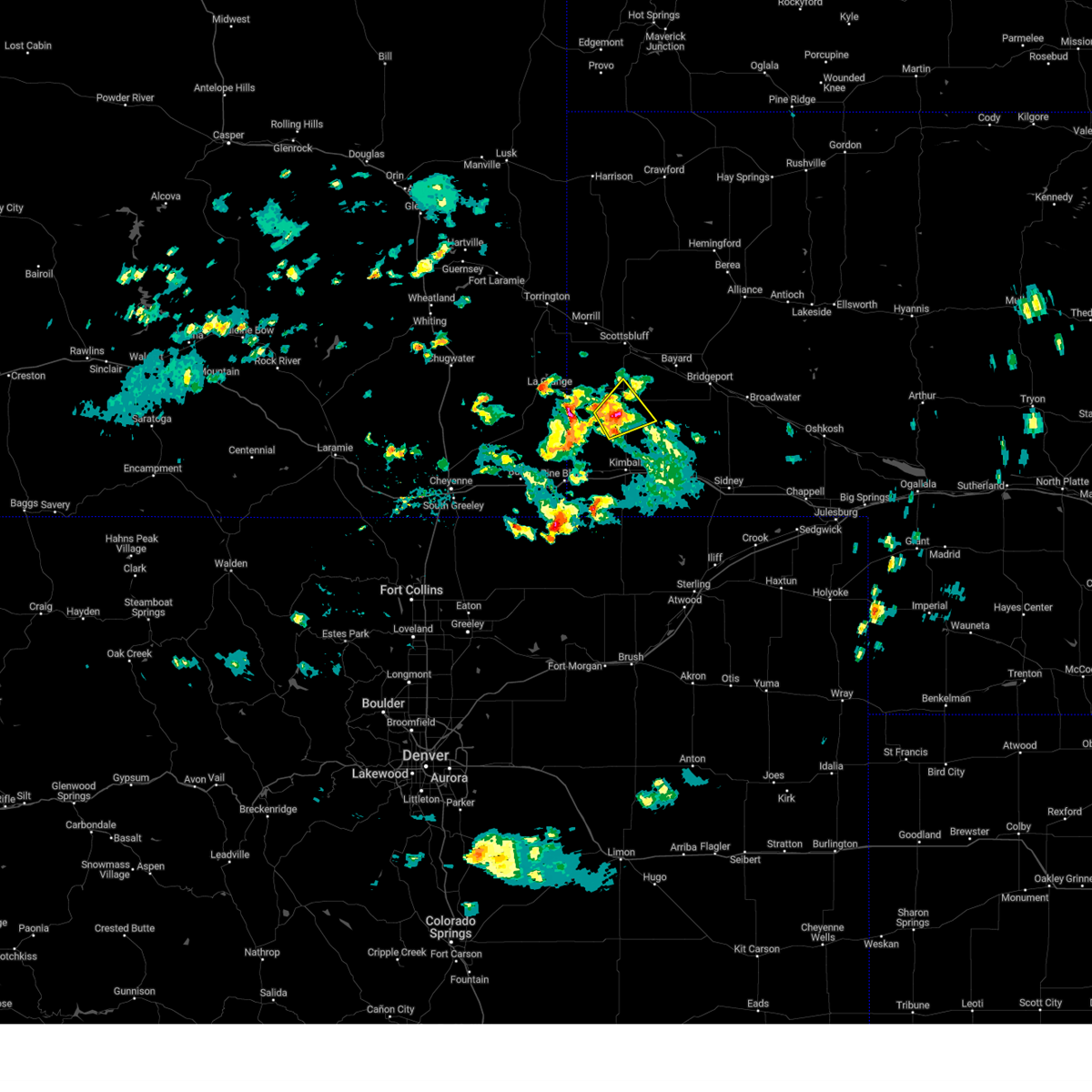 At 255 pm mdt, a severe thunderstorm was located over harrisburg, or 20 miles north of kimball, moving northeast at 25 mph (radar indicated. at 250pm nickel size hail was reported). Hazards include 60 mph wind gusts and quarter size hail. Hail damage to vehicles is expected. expect wind damage to roofs, siding, and trees. locations impacted include, harrisburg. hail threat, radar indicated max hail size, 1. 00 in wind threat, radar indicated max wind gust, 60 mph. At 255 pm mdt, a severe thunderstorm was located over harrisburg, or 20 miles north of kimball, moving northeast at 25 mph (radar indicated. at 250pm nickel size hail was reported). Hazards include 60 mph wind gusts and quarter size hail. Hail damage to vehicles is expected. expect wind damage to roofs, siding, and trees. locations impacted include, harrisburg. hail threat, radar indicated max hail size, 1. 00 in wind threat, radar indicated max wind gust, 60 mph.
|
| 5/29/2023 2:29 PM MDT |
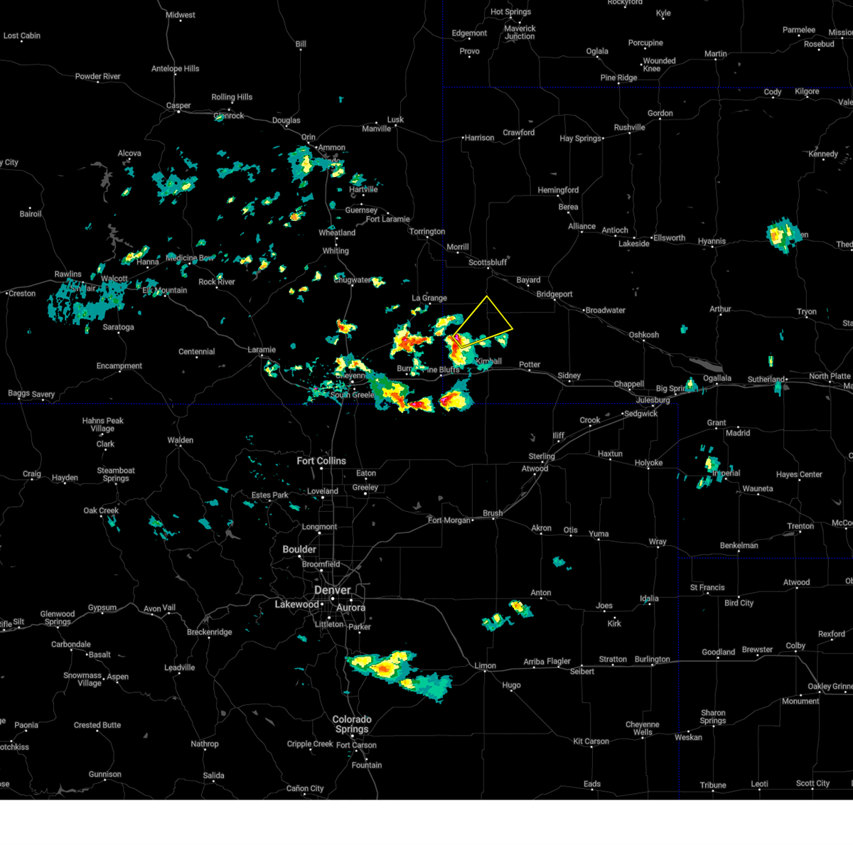 At 228 pm mdt, a severe thunderstorm was located 11 miles east of albin, or 18 miles northwest of kimball, moving northeast at 25 mph (radar indicated). Hazards include 60 mph wind gusts and quarter size hail. Hail damage to vehicles is expected. Expect wind damage to roofs, siding, and trees. At 228 pm mdt, a severe thunderstorm was located 11 miles east of albin, or 18 miles northwest of kimball, moving northeast at 25 mph (radar indicated). Hazards include 60 mph wind gusts and quarter size hail. Hail damage to vehicles is expected. Expect wind damage to roofs, siding, and trees.
|
| 5/27/2023 7:00 PM MDT |
 At 659 pm mdt, severe thunderstorms were located along a line extending from near wildcat hills campground to near kimball to 12 miles east of panorama point, moving east at 25 mph (radar indicated). Hazards include 60 mph wind gusts and quarter size hail. Hail damage to vehicles is expected. Expect wind damage to roofs, siding, and trees. At 659 pm mdt, severe thunderstorms were located along a line extending from near wildcat hills campground to near kimball to 12 miles east of panorama point, moving east at 25 mph (radar indicated). Hazards include 60 mph wind gusts and quarter size hail. Hail damage to vehicles is expected. Expect wind damage to roofs, siding, and trees.
|
| 5/27/2023 6:15 PM MDT |
 At 615 pm mdt, severe thunderstorms were located along a line extending from 6 miles northeast of veteran to 9 miles east of albin to 8 miles east of panorama point, moving northeast at 35 mph (radar indicated). Hazards include 60 mph wind gusts and half dollar size hail. Hail damage to vehicles is expected. Expect wind damage to roofs, siding, and trees. At 615 pm mdt, severe thunderstorms were located along a line extending from 6 miles northeast of veteran to 9 miles east of albin to 8 miles east of panorama point, moving northeast at 35 mph (radar indicated). Hazards include 60 mph wind gusts and half dollar size hail. Hail damage to vehicles is expected. Expect wind damage to roofs, siding, and trees.
|
| 5/27/2023 5:56 PM MDT | Corrects report for 50 se la grang in banner county NE, 12.9 miles ENE of Harrisburg, NE |
| 5/9/2023 9:42 PM MDT |
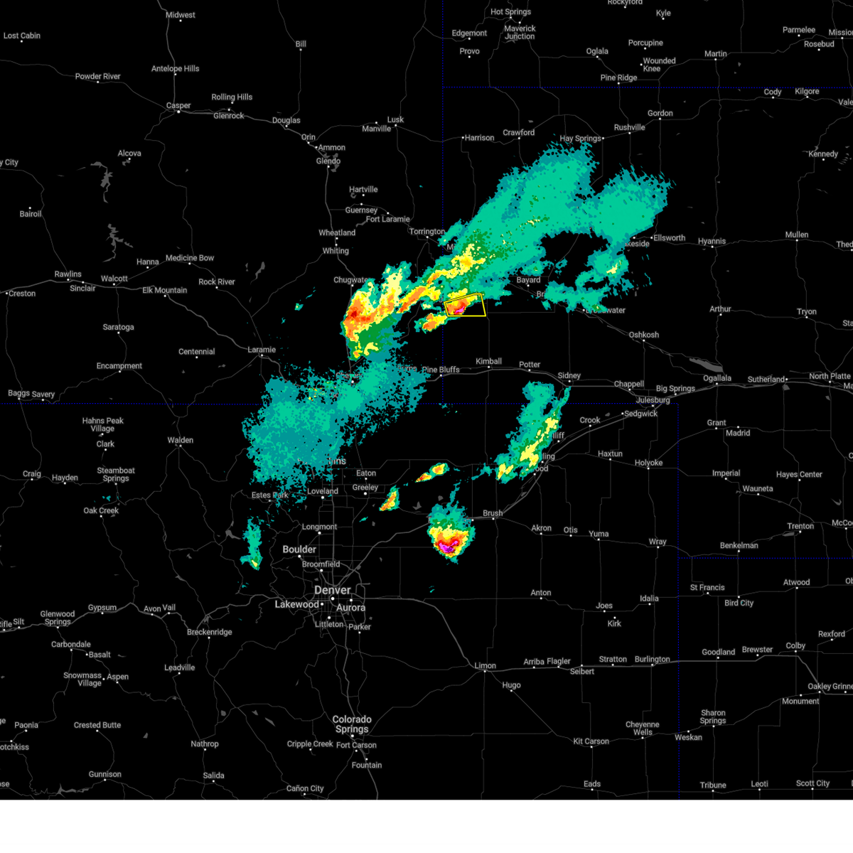 At 942 pm mdt, a severe thunderstorm was located 8 miles northwest of harrisburg, or 21 miles southwest of scottsbluff, moving northeast at 15 mph (radar indicated). Hazards include 60 mph wind gusts and half dollar size hail. Hail damage to vehicles is expected. expect wind damage to roofs, siding, and trees. locations impacted include, harrisburg. hail threat, radar indicated max hail size, 1. 25 in wind threat, radar indicated max wind gust, 60 mph. At 942 pm mdt, a severe thunderstorm was located 8 miles northwest of harrisburg, or 21 miles southwest of scottsbluff, moving northeast at 15 mph (radar indicated). Hazards include 60 mph wind gusts and half dollar size hail. Hail damage to vehicles is expected. expect wind damage to roofs, siding, and trees. locations impacted include, harrisburg. hail threat, radar indicated max hail size, 1. 25 in wind threat, radar indicated max wind gust, 60 mph.
|
| 5/9/2023 9:25 PM MDT |
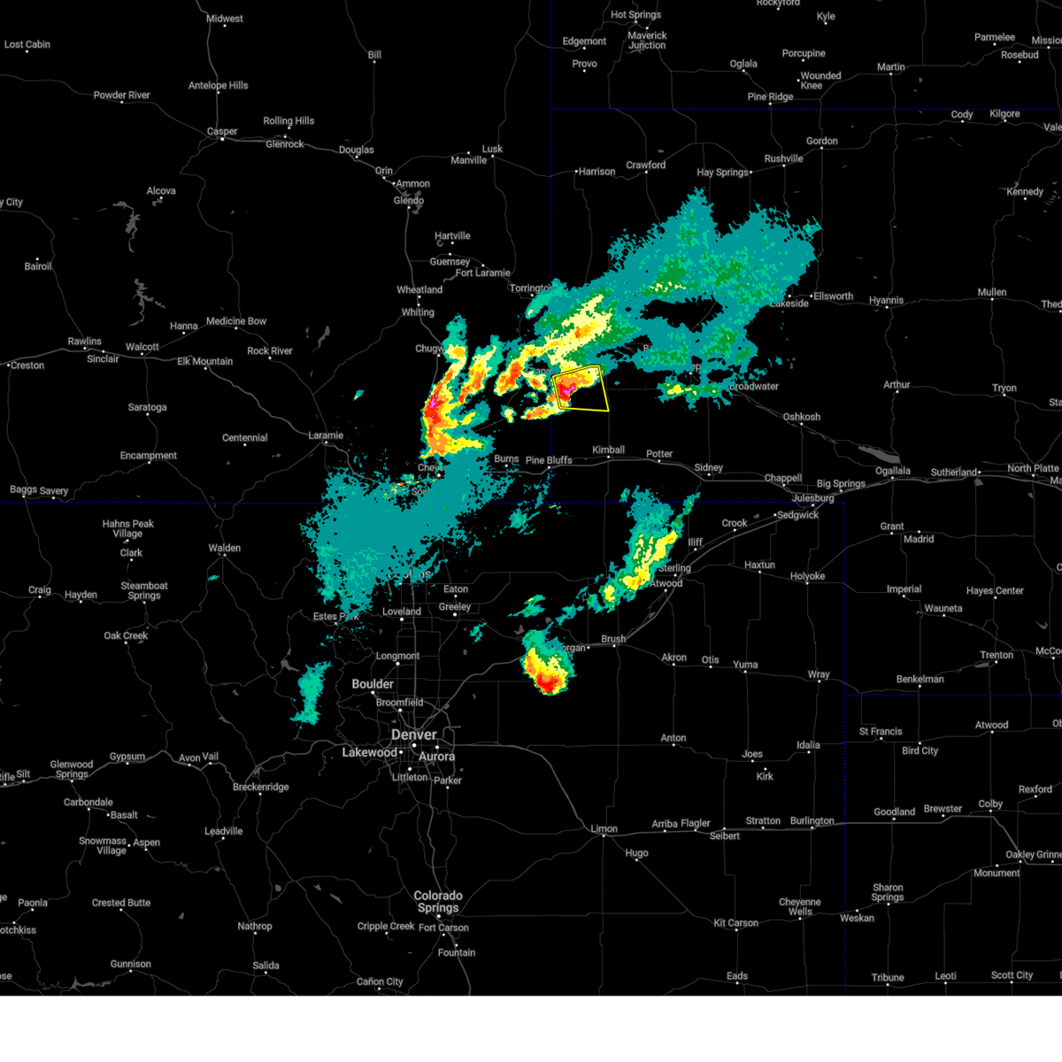 At 925 pm mdt, a severe thunderstorm was located 11 miles west of harrisburg, or 25 miles southwest of scottsbluff, moving east at 15 mph (radar indicated). Hazards include ping pong ball size hail and 60 mph wind gusts. People and animals outdoors will be injured. expect hail damage to roofs, siding, windows, and vehicles. Expect wind damage to roofs, siding, and trees. At 925 pm mdt, a severe thunderstorm was located 11 miles west of harrisburg, or 25 miles southwest of scottsbluff, moving east at 15 mph (radar indicated). Hazards include ping pong ball size hail and 60 mph wind gusts. People and animals outdoors will be injured. expect hail damage to roofs, siding, windows, and vehicles. Expect wind damage to roofs, siding, and trees.
|
| 5/9/2023 5:13 PM MDT |
 The severe thunderstorm warning for southeastern scotts bluff, northeastern kimball and eastern banner counties will expire at 515 pm mdt, the storm which prompted the warning has weakened below severe limits, and has exited the warned area. therefore, the warning will be allowed to expire. The severe thunderstorm warning for southeastern scotts bluff, northeastern kimball and eastern banner counties will expire at 515 pm mdt, the storm which prompted the warning has weakened below severe limits, and has exited the warned area. therefore, the warning will be allowed to expire.
|
| 5/9/2023 4:41 PM MDT |
 At 441 pm mdt, a severe thunderstorm was located near harrisburg, or 21 miles north of kimball, moving east at 35 mph (radar indicated). Hazards include 60 mph wind gusts and nickel size hail. expect damage to roofs, siding, and trees At 441 pm mdt, a severe thunderstorm was located near harrisburg, or 21 miles north of kimball, moving east at 35 mph (radar indicated). Hazards include 60 mph wind gusts and nickel size hail. expect damage to roofs, siding, and trees
|
| 5/9/2023 4:26 PM MDT |
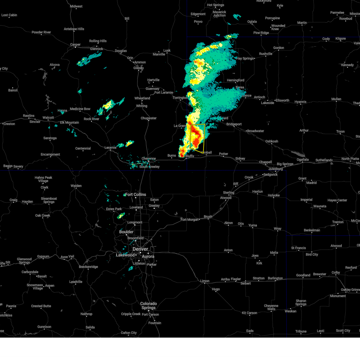 At 425 pm mdt, a severe thunderstorm was located near harrisburg, or 18 miles north of kimball, moving east at 35 mph (radar indicated). Hazards include 70 mph wind gusts and nickel size hail. Expect considerable tree damage. damage is likely to mobile homes, roofs, and outbuildings. locations impacted include, harrisburg. thunderstorm damage threat, considerable hail threat, radar indicated max hail size, 0. 88 in wind threat, radar indicated max wind gust, 70 mph. At 425 pm mdt, a severe thunderstorm was located near harrisburg, or 18 miles north of kimball, moving east at 35 mph (radar indicated). Hazards include 70 mph wind gusts and nickel size hail. Expect considerable tree damage. damage is likely to mobile homes, roofs, and outbuildings. locations impacted include, harrisburg. thunderstorm damage threat, considerable hail threat, radar indicated max hail size, 0. 88 in wind threat, radar indicated max wind gust, 70 mph.
|
| 5/9/2023 3:54 PM MDT |
 At 354 pm mdt, a severe thunderstorm was located 7 miles northeast of albin, or 25 miles northwest of kimball, moving east at 35 mph (radar indicated). Hazards include 70 mph wind gusts and quarter size hail. Hail damage to vehicles is expected. expect considerable tree damage. Wind damage is also likely to mobile homes, roofs, and outbuildings. At 354 pm mdt, a severe thunderstorm was located 7 miles northeast of albin, or 25 miles northwest of kimball, moving east at 35 mph (radar indicated). Hazards include 70 mph wind gusts and quarter size hail. Hail damage to vehicles is expected. expect considerable tree damage. Wind damage is also likely to mobile homes, roofs, and outbuildings.
|
| 8/2/2022 4:12 PM MDT |
 At 412 pm mdt, severe thunderstorms were located along a line extending from near wildcat hills state recreation area to near kimball airport, moving east at 30 mph (radar indicated). Hazards include 60 mph wind gusts. Expect damage to roofs, siding, and trees. locations impacted include, kimball, dix, wildcat hills state recreation area, kimball airport, harrisburg, wildcat hills campground and melbeta. this includes interstate 80 in nebraska between mile markers 14 and 33. hail threat, radar indicated max hail size, <. 75 in wind threat, observed max wind gust, 60 mph. At 412 pm mdt, severe thunderstorms were located along a line extending from near wildcat hills state recreation area to near kimball airport, moving east at 30 mph (radar indicated). Hazards include 60 mph wind gusts. Expect damage to roofs, siding, and trees. locations impacted include, kimball, dix, wildcat hills state recreation area, kimball airport, harrisburg, wildcat hills campground and melbeta. this includes interstate 80 in nebraska between mile markers 14 and 33. hail threat, radar indicated max hail size, <. 75 in wind threat, observed max wind gust, 60 mph.
|
| 8/2/2022 3:55 PM MDT |
 At 355 pm mdt, severe thunderstorms were located along a line extending from near wildcat hills campground to near oliver reservoir, moving east at 30 mph (radar indicated). Hazards include 60 mph wind gusts. expect damage to roofs, siding, and trees At 355 pm mdt, severe thunderstorms were located along a line extending from near wildcat hills campground to near oliver reservoir, moving east at 30 mph (radar indicated). Hazards include 60 mph wind gusts. expect damage to roofs, siding, and trees
|
| 6/30/2022 7:42 PM MDT |
 The severe thunderstorm warning for west central box butte, scotts bluff, banner and southern sioux counties will expire at 745 pm mdt, the storms which prompted the warning have weakened below severe limits, and no longer pose an immediate threat to life or property. therefore, the warning will be allowed to expire. however gusty winds between 45 to 55 mph are still possible with these thunderstorms through 830 pm mdt. The severe thunderstorm warning for west central box butte, scotts bluff, banner and southern sioux counties will expire at 745 pm mdt, the storms which prompted the warning have weakened below severe limits, and no longer pose an immediate threat to life or property. therefore, the warning will be allowed to expire. however gusty winds between 45 to 55 mph are still possible with these thunderstorms through 830 pm mdt.
|
| 6/30/2022 7:30 PM MDT |
 At 730 pm mdt, severe thunderstorms were located along a line extending from 8 miles southwest of flahertys corner to harrisburg, moving east at 55 mph (radar indicated). Hazards include 70 mph wind gusts and penny size hail. Expect considerable tree damage. damage is likely to mobile homes, roofs, and outbuildings. locations impacted include, scottsbluff, gering, mitchell, terrytown, morrill, minatare, lyman, wildcat hills state recreation area, lake minatare campground, stegall, wildcat hills campground, scotts bluff national monument, hubbard hill, harrisburg, flahertys corner, scottsbluff airport, lake minatare, lake alice, melbeta and henry. thunderstorm damage threat, considerable hail threat, radar indicated max hail size, 0. 75 in wind threat, observed max wind gust, 70 mph. At 730 pm mdt, severe thunderstorms were located along a line extending from 8 miles southwest of flahertys corner to harrisburg, moving east at 55 mph (radar indicated). Hazards include 70 mph wind gusts and penny size hail. Expect considerable tree damage. damage is likely to mobile homes, roofs, and outbuildings. locations impacted include, scottsbluff, gering, mitchell, terrytown, morrill, minatare, lyman, wildcat hills state recreation area, lake minatare campground, stegall, wildcat hills campground, scotts bluff national monument, hubbard hill, harrisburg, flahertys corner, scottsbluff airport, lake minatare, lake alice, melbeta and henry. thunderstorm damage threat, considerable hail threat, radar indicated max hail size, 0. 75 in wind threat, observed max wind gust, 70 mph.
|
| 6/30/2022 7:12 PM MDT |
 At 711 pm mdt, severe thunderstorms were located along a line extending from 11 miles southwest of agate bed national monument to 9 miles northeast of albin, moving east at 50 mph (radar indicated). Hazards include 70 mph wind gusts and penny size hail. Expect tree damage. Damage is likely to mobile homes, roofs, and outbuildings. At 711 pm mdt, severe thunderstorms were located along a line extending from 11 miles southwest of agate bed national monument to 9 miles northeast of albin, moving east at 50 mph (radar indicated). Hazards include 70 mph wind gusts and penny size hail. Expect tree damage. Damage is likely to mobile homes, roofs, and outbuildings.
|
| 6/17/2022 3:23 AM MDT |
 The severe thunderstorm warning for west central cheyenne, northeastern kimball, southwestern morrill and southern banner counties will expire at 330 am mdt, the storms which prompted the warning have weakened below severe limits, and no longer pose an immediate threat to life or property. therefore, the warning will be allowed to expire. however gusty winds are still possible with these thunderstorms. The severe thunderstorm warning for west central cheyenne, northeastern kimball, southwestern morrill and southern banner counties will expire at 330 am mdt, the storms which prompted the warning have weakened below severe limits, and no longer pose an immediate threat to life or property. therefore, the warning will be allowed to expire. however gusty winds are still possible with these thunderstorms.
|
| 6/17/2022 3:04 AM MDT |
 At 303 am mdt, severe thunderstorms were located along a line extending from 8 miles east of la grange to near harrisburg to 11 miles northwest of potter to 7 miles south of dix, moving northeast at 20 mph (radar indicated). Hazards include 60 mph wind gusts. Expect damage to roofs, siding, and trees. locations impacted include, kimball, potter, dix and harrisburg. this includes interstate 80 in nebraska between mile markers 22 and 42. hail threat, radar indicated max hail size, <. 75 in wind threat, radar indicated max wind gust, 60 mph. At 303 am mdt, severe thunderstorms were located along a line extending from 8 miles east of la grange to near harrisburg to 11 miles northwest of potter to 7 miles south of dix, moving northeast at 20 mph (radar indicated). Hazards include 60 mph wind gusts. Expect damage to roofs, siding, and trees. locations impacted include, kimball, potter, dix and harrisburg. this includes interstate 80 in nebraska between mile markers 22 and 42. hail threat, radar indicated max hail size, <. 75 in wind threat, radar indicated max wind gust, 60 mph.
|
| 6/17/2022 2:39 AM MDT |
 At 239 am mdt, severe thunderstorms were located along a line extending from near albin to 7 miles south of harrisburg to near dix to 10 miles north of westplains, moving northeast at 30 mph (radar indicated). Hazards include 60 mph wind gusts and penny size hail. expect damage to roofs, siding, and trees At 239 am mdt, severe thunderstorms were located along a line extending from near albin to 7 miles south of harrisburg to near dix to 10 miles north of westplains, moving northeast at 30 mph (radar indicated). Hazards include 60 mph wind gusts and penny size hail. expect damage to roofs, siding, and trees
|
| 6/5/2022 9:56 PM MDT |
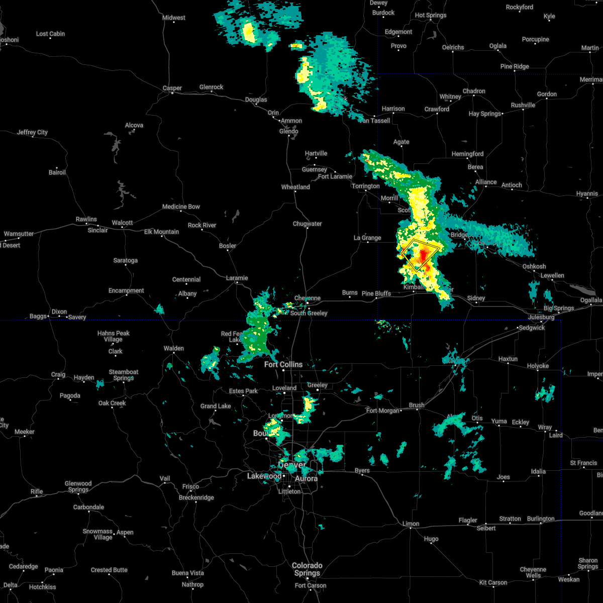 The severe thunderstorm warning for eastern banner county will expire at 1000 pm mdt, the storm which prompted the warning has weakened below severe limits, and no longer poses an immediate threat to life or property. therefore, the warning will be allowed to expire. however small hail, gusty winds and heavy rain are still possible with this thunderstorm. to report severe weather, contact your nearest law enforcement agency. they will relay your report to the national weather service cheyenne. The severe thunderstorm warning for eastern banner county will expire at 1000 pm mdt, the storm which prompted the warning has weakened below severe limits, and no longer poses an immediate threat to life or property. therefore, the warning will be allowed to expire. however small hail, gusty winds and heavy rain are still possible with this thunderstorm. to report severe weather, contact your nearest law enforcement agency. they will relay your report to the national weather service cheyenne.
|
| 6/5/2022 9:45 PM MDT |
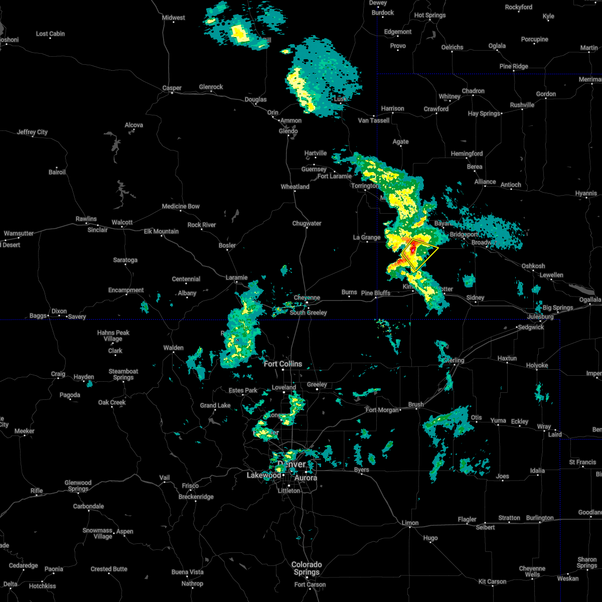 At 944 pm mdt, a severe thunderstorm was located near harrisburg, or 21 miles south of scottsbluff, moving southeast at 30 mph (radar indicated). Hazards include 60 mph wind gusts and quarter size hail. Hail damage to vehicles is expected. expect wind damage to roofs, siding, and trees. locations impacted include, harrisburg. hail threat, radar indicated max hail size, 1. 00 in wind threat, radar indicated max wind gust, 60 mph. At 944 pm mdt, a severe thunderstorm was located near harrisburg, or 21 miles south of scottsbluff, moving southeast at 30 mph (radar indicated). Hazards include 60 mph wind gusts and quarter size hail. Hail damage to vehicles is expected. expect wind damage to roofs, siding, and trees. locations impacted include, harrisburg. hail threat, radar indicated max hail size, 1. 00 in wind threat, radar indicated max wind gust, 60 mph.
|
| 6/5/2022 9:22 PM MDT |
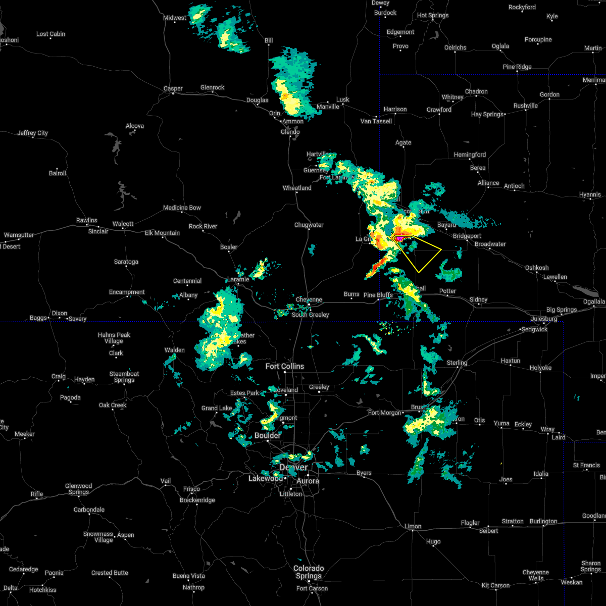 At 922 pm mdt, a severe thunderstorm was located 7 miles west of wildcat hills campground, or 15 miles southwest of scottsbluff, moving southeast at 30 mph (radar indicated). Hazards include ping pong ball size hail and 60 mph wind gusts. People and animals outdoors will be injured. expect hail damage to roofs, siding, windows, and vehicles. Expect wind damage to roofs, siding, and trees. At 922 pm mdt, a severe thunderstorm was located 7 miles west of wildcat hills campground, or 15 miles southwest of scottsbluff, moving southeast at 30 mph (radar indicated). Hazards include ping pong ball size hail and 60 mph wind gusts. People and animals outdoors will be injured. expect hail damage to roofs, siding, windows, and vehicles. Expect wind damage to roofs, siding, and trees.
|
| 5/29/2022 3:38 PM MDT |
 At 337 pm mdt, severe thunderstorms were located along a line extending from 11 miles south of redbird to near mitchell to kimball airport, moving northeast at 40 mph (radar indicated). Hazards include 60 mph wind gusts and penny size hail. Expect damage to roofs, siding, and trees. locations impacted include, scottsbluff, torrington, kimball, gering, mitchell, bayard, terrytown, morrill, minatare, lyman, potter, dix, harrison, oliver campground, wildcat hills state recreation area, stegall, montrose, panorama point, wildcat hills campground and prairie center. this includes interstate 80 in nebraska between mile markers 2 and 42. hail threat, radar indicated max hail size, 0. 75 in wind threat, radar indicated max wind gust, 60 mph. At 337 pm mdt, severe thunderstorms were located along a line extending from 11 miles south of redbird to near mitchell to kimball airport, moving northeast at 40 mph (radar indicated). Hazards include 60 mph wind gusts and penny size hail. Expect damage to roofs, siding, and trees. locations impacted include, scottsbluff, torrington, kimball, gering, mitchell, bayard, terrytown, morrill, minatare, lyman, potter, dix, harrison, oliver campground, wildcat hills state recreation area, stegall, montrose, panorama point, wildcat hills campground and prairie center. this includes interstate 80 in nebraska between mile markers 2 and 42. hail threat, radar indicated max hail size, 0. 75 in wind threat, radar indicated max wind gust, 60 mph.
|
| 5/29/2022 3:11 PM MDT |
 At 311 pm mdt, severe thunderstorms were located along a line extending from 10 miles southeast of lance creek to near stegall to 7 miles northeast of panorama point, moving northeast at 40 mph (radar indicated). Hazards include 60 mph wind gusts and penny size hail. expect damage to roofs, siding, and trees At 311 pm mdt, severe thunderstorms were located along a line extending from 10 miles southeast of lance creek to near stegall to 7 miles northeast of panorama point, moving northeast at 40 mph (radar indicated). Hazards include 60 mph wind gusts and penny size hail. expect damage to roofs, siding, and trees
|
| 7/13/2021 11:29 PM MDT |
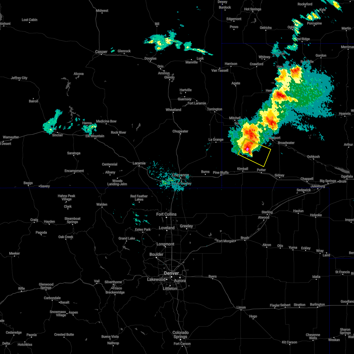 At 1128 pm mdt, a severe thunderstorm was located 10 miles east of harrisburg, or 20 miles north of kimball, moving east at 30 mph (radar indicated). Hazards include 60 mph wind gusts and half dollar size hail. Hail damage to vehicles is expected. expect wind damage to roofs, siding, and trees. Locations impacted include, redington and harrisburg. At 1128 pm mdt, a severe thunderstorm was located 10 miles east of harrisburg, or 20 miles north of kimball, moving east at 30 mph (radar indicated). Hazards include 60 mph wind gusts and half dollar size hail. Hail damage to vehicles is expected. expect wind damage to roofs, siding, and trees. Locations impacted include, redington and harrisburg.
|
| 7/13/2021 11:16 PM MDT |
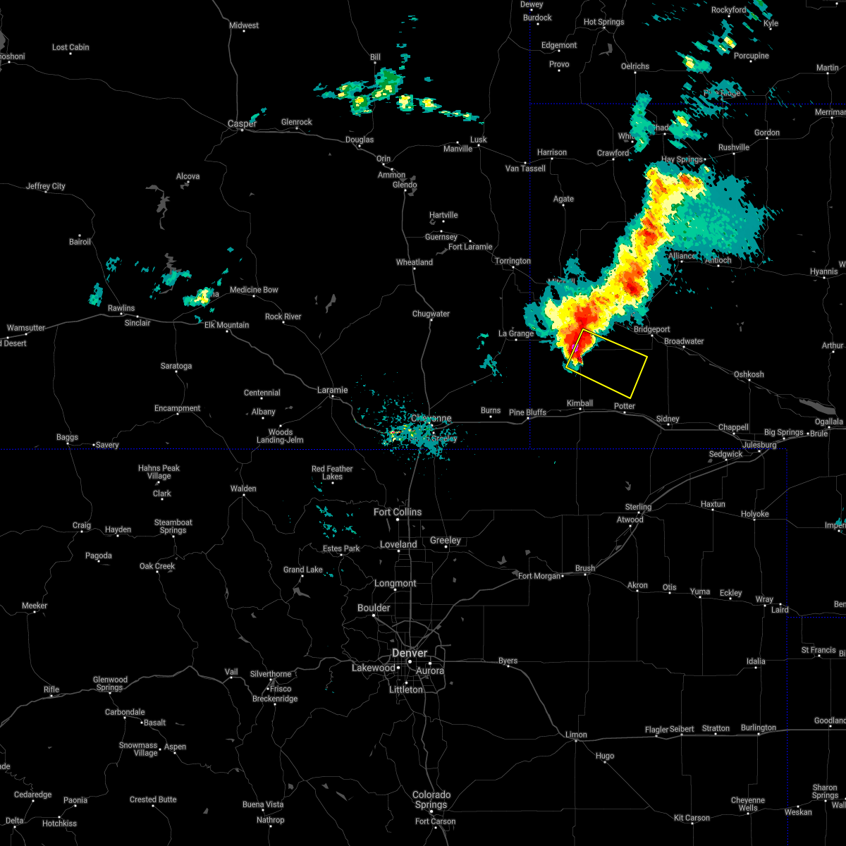 At 1116 pm mdt, a severe thunderstorm was located near harrisburg, or 21 miles north of kimball, moving east at 35 mph (radar indicated). Hazards include 60 mph wind gusts and quarter size hail. Hail damage to vehicles is expected. Expect wind damage to roofs, siding, and trees. At 1116 pm mdt, a severe thunderstorm was located near harrisburg, or 21 miles north of kimball, moving east at 35 mph (radar indicated). Hazards include 60 mph wind gusts and quarter size hail. Hail damage to vehicles is expected. Expect wind damage to roofs, siding, and trees.
|
| 6/19/2021 2:04 PM MDT |
 At 203 pm mdt, severe thunderstorms were located along a line extending from 7 miles west of chimney rock state park to 6 miles east of harrisburg to 13 miles east of albin, moving east at 25 mph (radar indicated). Hazards include 60 mph wind gusts and quarter size hail. Hail damage to vehicles is expected. Expect wind damage to roofs, siding, and trees. At 203 pm mdt, severe thunderstorms were located along a line extending from 7 miles west of chimney rock state park to 6 miles east of harrisburg to 13 miles east of albin, moving east at 25 mph (radar indicated). Hazards include 60 mph wind gusts and quarter size hail. Hail damage to vehicles is expected. Expect wind damage to roofs, siding, and trees.
|
| 6/8/2021 9:43 PM MDT |
 The severe thunderstorm warning for south central scotts bluff, kimball and banner counties will expire at 945 pm mdt, the storms which prompted the warning have weakened below severe limits, and no longer pose an immediate threat to life or property. therefore, the warning will be allowed to expire. however small hail, gusty winds and heavy rain are still possible with these thunderstorms. to report severe weather, contact your nearest law enforcement agency. they will relay your report to the national weather service cheyenne. The severe thunderstorm warning for south central scotts bluff, kimball and banner counties will expire at 945 pm mdt, the storms which prompted the warning have weakened below severe limits, and no longer pose an immediate threat to life or property. therefore, the warning will be allowed to expire. however small hail, gusty winds and heavy rain are still possible with these thunderstorms. to report severe weather, contact your nearest law enforcement agency. they will relay your report to the national weather service cheyenne.
|
| 6/8/2021 9:29 PM MDT |
 At 928 pm mdt, severe thunderstorms were located along a line extending from 9 miles southwest of wildcat hills campground to harrisburg to 11 miles north of kimball to oliver campground, moving east at 30 mph (radar indicated). Hazards include 60 mph wind gusts and penny size hail. Expect damage to roofs, siding, and trees. locations impacted include, kimball, dix, oliver campground, wildcat hills state recreation area, oliver reservoir, kimball airport, harrisburg, wildcat hills campground and bushnell. This includes interstate 80 in nebraska between mile markers 1 and 34. At 928 pm mdt, severe thunderstorms were located along a line extending from 9 miles southwest of wildcat hills campground to harrisburg to 11 miles north of kimball to oliver campground, moving east at 30 mph (radar indicated). Hazards include 60 mph wind gusts and penny size hail. Expect damage to roofs, siding, and trees. locations impacted include, kimball, dix, oliver campground, wildcat hills state recreation area, oliver reservoir, kimball airport, harrisburg, wildcat hills campground and bushnell. This includes interstate 80 in nebraska between mile markers 1 and 34.
|
| 6/8/2021 9:03 PM MDT |
 At 903 pm mdt, severe thunderstorms were located along a line extending from 6 miles southeast of la grange to 6 miles southeast of albin to pine bluffs, moving east at 30 mph (radar indicated). Hazards include 70 mph wind gusts and penny size hail. Expect considerable tree damage. Damage is likely to mobile homes, roofs, and outbuildings. At 903 pm mdt, severe thunderstorms were located along a line extending from 6 miles southeast of la grange to 6 miles southeast of albin to pine bluffs, moving east at 30 mph (radar indicated). Hazards include 70 mph wind gusts and penny size hail. Expect considerable tree damage. Damage is likely to mobile homes, roofs, and outbuildings.
|
| 5/26/2021 6:21 PM MDT |
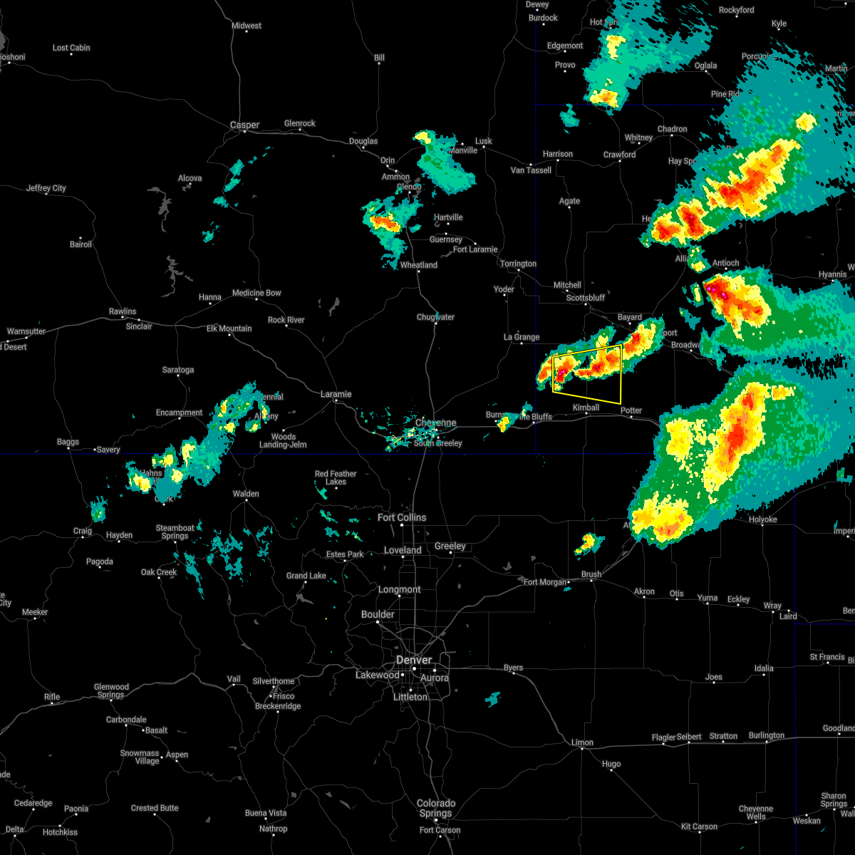 At 621 pm mdt, a severe thunderstorm was located near harrisburg, or 18 miles northwest of kimball, moving east at 30 mph (radar indicated). Hazards include ping pong ball size hail and 60 mph wind gusts. People and animals outdoors will be injured. expect hail damage to roofs, siding, windows, and vehicles. Expect wind damage to roofs, siding, and trees. At 621 pm mdt, a severe thunderstorm was located near harrisburg, or 18 miles northwest of kimball, moving east at 30 mph (radar indicated). Hazards include ping pong ball size hail and 60 mph wind gusts. People and animals outdoors will be injured. expect hail damage to roofs, siding, windows, and vehicles. Expect wind damage to roofs, siding, and trees.
|
| 7/19/2020 5:27 PM MDT |
 At 527 pm mdt, a severe thunderstorm was located near wildcat hills campground, or 13 miles south of scottsbluff, moving northeast at 25 mph (radar indicated). Hazards include golf ball size hail and 60 mph wind gusts. People and animals outdoors will be injured. expect hail damage to roofs, siding, windows, and vehicles. Expect wind damage to roofs, siding, and trees. At 527 pm mdt, a severe thunderstorm was located near wildcat hills campground, or 13 miles south of scottsbluff, moving northeast at 25 mph (radar indicated). Hazards include golf ball size hail and 60 mph wind gusts. People and animals outdoors will be injured. expect hail damage to roofs, siding, windows, and vehicles. Expect wind damage to roofs, siding, and trees.
|
| 6/6/2020 6:12 PM MDT |
 The severe thunderstorm warning for southwestern box butte, scotts bluff, northwestern morrill, eastern banner, southwestern dawes, southern sioux and east central goshen counties will expire at 615 pm mdt, the storms which prompted the warning have moved out of the area. therefore, the warning will be allowed to expire. however gusty winds and heavy rain are still possible with these thunderstorms. a severe thunderstorm watch remains in effect until 800 pm mdt for the panhandle of nebraska, and southeastern wyoming. The severe thunderstorm warning for southwestern box butte, scotts bluff, northwestern morrill, eastern banner, southwestern dawes, southern sioux and east central goshen counties will expire at 615 pm mdt, the storms which prompted the warning have moved out of the area. therefore, the warning will be allowed to expire. however gusty winds and heavy rain are still possible with these thunderstorms. a severe thunderstorm watch remains in effect until 800 pm mdt for the panhandle of nebraska, and southeastern wyoming.
|
| 6/6/2020 5:32 PM MDT |
 At 531 pm mdt, severe thunderstorms were located along a line extending from near torrington to 6 miles southeast of harrisburg, moving east at 70 mph (radar indicated). Hazards include 70 mph wind gusts. Expect considerable tree damage. Damage is likely to mobile homes, roofs, and outbuildings. At 531 pm mdt, severe thunderstorms were located along a line extending from near torrington to 6 miles southeast of harrisburg, moving east at 70 mph (radar indicated). Hazards include 70 mph wind gusts. Expect considerable tree damage. Damage is likely to mobile homes, roofs, and outbuildings.
|
| 6/6/2020 5:32 PM MDT |
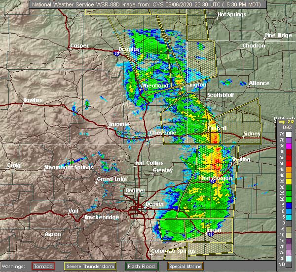 At 531 pm mdt, severe thunderstorms were located along a line extending from near torrington to 6 miles southeast of harrisburg, moving east at 70 mph (radar indicated). Hazards include 70 mph wind gusts. Expect considerable tree damage. Damage is likely to mobile homes, roofs, and outbuildings. At 531 pm mdt, severe thunderstorms were located along a line extending from near torrington to 6 miles southeast of harrisburg, moving east at 70 mph (radar indicated). Hazards include 70 mph wind gusts. Expect considerable tree damage. Damage is likely to mobile homes, roofs, and outbuildings.
|
| 6/6/2020 5:10 PM MDT | Awos station k1bw bravo madi in banner county NE, 14.4 miles E of Harrisburg, NE |
| 6/6/2020 4:56 PM MDT |
 At 455 pm mdt, severe thunderstorms were located along a line extending from near meriden rest area to near grover, moving northeast at 60 mph (radar indicated). Hazards include 70 mph wind gusts. Expect considerable tree damage. Damage is likely to mobile homes, roofs, and outbuildings. At 455 pm mdt, severe thunderstorms were located along a line extending from near meriden rest area to near grover, moving northeast at 60 mph (radar indicated). Hazards include 70 mph wind gusts. Expect considerable tree damage. Damage is likely to mobile homes, roofs, and outbuildings.
|
| 5/23/2020 5:13 PM MDT | Corrects previous non-tstm wnd gst report from 6 se harrisburg. mesonet station ne001 6 se harrisburg ne - banner rd on north 71 (bnr in banner county NE, 5.2 miles NW of Harrisburg, NE |
| 5/23/2020 4:55 PM MDT |
 At 455 pm mdt, a severe thunderstorm was located 9 miles south of harrisburg, or 12 miles north of kimball, moving east at 15 mph (radar indicated). Hazards include ping pong ball size hail and 60 mph wind gusts. People and animals outdoors will be injured. expect hail damage to roofs, siding, windows, and vehicles. expect wind damage to roofs, siding, and trees. Locations impacted include, harrisburg. At 455 pm mdt, a severe thunderstorm was located 9 miles south of harrisburg, or 12 miles north of kimball, moving east at 15 mph (radar indicated). Hazards include ping pong ball size hail and 60 mph wind gusts. People and animals outdoors will be injured. expect hail damage to roofs, siding, windows, and vehicles. expect wind damage to roofs, siding, and trees. Locations impacted include, harrisburg.
|
| 5/23/2020 4:31 PM MDT |
 At 430 pm mdt, a severe thunderstorm was located 11 miles north of oliver campground, or 14 miles northwest of kimball, moving east at 15 mph (radar indicated). Hazards include ping pong ball size hail and 60 mph wind gusts. People and animals outdoors will be injured. expect hail damage to roofs, siding, windows, and vehicles. Expect wind damage to roofs, siding, and trees. At 430 pm mdt, a severe thunderstorm was located 11 miles north of oliver campground, or 14 miles northwest of kimball, moving east at 15 mph (radar indicated). Hazards include ping pong ball size hail and 60 mph wind gusts. People and animals outdoors will be injured. expect hail damage to roofs, siding, windows, and vehicles. Expect wind damage to roofs, siding, and trees.
|
| 8/20/2019 11:22 PM MDT |
 At 1121 pm mdt, severe thunderstorms were located along a line extending from near box butte dam to near hillsdale, moving east at 15 mph. a meteorologist at kneb reports large trees down in scotts bluff county. one tree had a diameter of 3 feet (trained weather spotters). Hazards include 70 mph wind gusts and half dollar size hail. Hail damage to vehicles is expected. expect considerable tree damage. wind damage is also likely to mobile homes, roofs, and outbuildings. locations impacted include, alliance, kimball, bridgeport, bayard, pine bluffs, minatare, hemingford, dix, albin, oliver campground, northport, angora, oliver reservoir, court house and jail rocks, harrisburg, berea, wild horse butte, chimney rock state park, bridgeport state recreation area and kilpatrick lake. this includes the following highways, interstate 80 in wyoming between mile markers 390 and 402. Interstate 80 in nebraska between mile markers 1 and 33. At 1121 pm mdt, severe thunderstorms were located along a line extending from near box butte dam to near hillsdale, moving east at 15 mph. a meteorologist at kneb reports large trees down in scotts bluff county. one tree had a diameter of 3 feet (trained weather spotters). Hazards include 70 mph wind gusts and half dollar size hail. Hail damage to vehicles is expected. expect considerable tree damage. wind damage is also likely to mobile homes, roofs, and outbuildings. locations impacted include, alliance, kimball, bridgeport, bayard, pine bluffs, minatare, hemingford, dix, albin, oliver campground, northport, angora, oliver reservoir, court house and jail rocks, harrisburg, berea, wild horse butte, chimney rock state park, bridgeport state recreation area and kilpatrick lake. this includes the following highways, interstate 80 in wyoming between mile markers 390 and 402. Interstate 80 in nebraska between mile markers 1 and 33.
|
| 8/20/2019 11:09 PM MDT |
 At 1108 pm mdt, severe thunderstorms were located along a line extending from near box butte dam to 6 miles west of hillsdale, moving south at 15 mph. at 11 pm mdt, a trained spotter reported half dollar size hail in albin (trained weather spotters). Hazards include 70 mph wind gusts and half dollar size hail. Hail damage to vehicles is expected. expect considerable tree damage. wind damage is also likely to mobile homes, roofs, and outbuildings. locations impacted include, scottsbluff, alliance, kimball, gering, bridgeport, bayard, terrytown, pine bluffs, minatare, hemingford, burns, dix, albin, oliver campground, wildcat hills state recreation area, northport, angora, wildcat hills campground, box butte dam and oliver reservoir. this includes the following highways, interstate 80 in wyoming between mile markers 388 and 402. Interstate 80 in nebraska between mile markers 1 and 33. At 1108 pm mdt, severe thunderstorms were located along a line extending from near box butte dam to 6 miles west of hillsdale, moving south at 15 mph. at 11 pm mdt, a trained spotter reported half dollar size hail in albin (trained weather spotters). Hazards include 70 mph wind gusts and half dollar size hail. Hail damage to vehicles is expected. expect considerable tree damage. wind damage is also likely to mobile homes, roofs, and outbuildings. locations impacted include, scottsbluff, alliance, kimball, gering, bridgeport, bayard, terrytown, pine bluffs, minatare, hemingford, burns, dix, albin, oliver campground, wildcat hills state recreation area, northport, angora, wildcat hills campground, box butte dam and oliver reservoir. this includes the following highways, interstate 80 in wyoming between mile markers 388 and 402. Interstate 80 in nebraska between mile markers 1 and 33.
|
| 8/20/2019 11:00 PM MDT |
 At 1050 pm mdt, severe thunderstorms were located along a line extending from 7 miles north of box butte campground to 8 miles northwest of hillsdale, moving south at 15 mph (radar indicated). Hazards include 70 mph wind gusts and quarter size hail. Hail damage to vehicles is expected. expect considerable tree damage. Wind damage is also likely to mobile homes, roofs, and outbuildings. At 1050 pm mdt, severe thunderstorms were located along a line extending from 7 miles north of box butte campground to 8 miles northwest of hillsdale, moving south at 15 mph (radar indicated). Hazards include 70 mph wind gusts and quarter size hail. Hail damage to vehicles is expected. expect considerable tree damage. Wind damage is also likely to mobile homes, roofs, and outbuildings.
|
| 8/20/2019 11:00 PM MDT |
 At 1059 pm mdt, severe thunderstorms were located along a line extending from 6 miles north of box butte campground to 7 miles west of hillsdale, moving south at 15 mph. at 1044 pm mdt, the scottsbluff airport asos measured a gust to 73 mph (radar indicated). Hazards include 70 mph wind gusts and quarter size hail. Hail damage to vehicles is expected. expect considerable tree damage. wind damage is also likely to mobile homes, roofs, and outbuildings. locations impacted include, scottsbluff, alliance, kimball, gering, mitchell, bridgeport, bayard, terrytown, pine bluffs, minatare, hemingford, la grange, burns, dix, albin, oliver campground, wildcat hills state recreation area, northport, angora and wildcat hills campground. this includes the following highways, interstate 80 in wyoming between mile markers 387 and 402. Interstate 80 in nebraska between mile markers 1 and 33. At 1059 pm mdt, severe thunderstorms were located along a line extending from 6 miles north of box butte campground to 7 miles west of hillsdale, moving south at 15 mph. at 1044 pm mdt, the scottsbluff airport asos measured a gust to 73 mph (radar indicated). Hazards include 70 mph wind gusts and quarter size hail. Hail damage to vehicles is expected. expect considerable tree damage. wind damage is also likely to mobile homes, roofs, and outbuildings. locations impacted include, scottsbluff, alliance, kimball, gering, mitchell, bridgeport, bayard, terrytown, pine bluffs, minatare, hemingford, la grange, burns, dix, albin, oliver campground, wildcat hills state recreation area, northport, angora and wildcat hills campground. this includes the following highways, interstate 80 in wyoming between mile markers 387 and 402. Interstate 80 in nebraska between mile markers 1 and 33.
|
| 8/20/2019 10:50 PM MDT |
 The national weather service in cheyenne has issued a * severe thunderstorm warning for. box butte county in the panhandle of nebraska. scotts bluff county in the panhandle of nebraska. northwestern cheyenne county in the panhandle of nebraska. Kimball county in the panhandle of nebraska. The national weather service in cheyenne has issued a * severe thunderstorm warning for. box butte county in the panhandle of nebraska. scotts bluff county in the panhandle of nebraska. northwestern cheyenne county in the panhandle of nebraska. Kimball county in the panhandle of nebraska.
|
| 8/1/2019 2:14 PM MDT |
 At 213 pm mdt, a severe thunderstorm was located near harrisburg, or 20 miles north of kimball, moving southeast at 10 mph (radar indicated). Hazards include 60 mph wind gusts and quarter size hail. Hail damage to vehicles is expected. Expect wind damage to roofs, siding, and trees. At 213 pm mdt, a severe thunderstorm was located near harrisburg, or 20 miles north of kimball, moving southeast at 10 mph (radar indicated). Hazards include 60 mph wind gusts and quarter size hail. Hail damage to vehicles is expected. Expect wind damage to roofs, siding, and trees.
|
| 7/6/2019 10:24 PM MDT |
 At 1023 pm mdt, severe thunderstorms were located along a line extending from 6 miles southwest of harrisburg to 8 miles northeast of panorama point, moving east at 35 mph (radar indicated). Hazards include 70 mph wind gusts. Expect considerable tree damage. damage is likely to mobile homes, roofs, and outbuildings. locations impacted include, kimball, pine bluffs, dix, oliver campground, oliver reservoir, kimball airport, harrisburg and bushnell. This includes interstate 80 in nebraska between mile markers 1 and 30. At 1023 pm mdt, severe thunderstorms were located along a line extending from 6 miles southwest of harrisburg to 8 miles northeast of panorama point, moving east at 35 mph (radar indicated). Hazards include 70 mph wind gusts. Expect considerable tree damage. damage is likely to mobile homes, roofs, and outbuildings. locations impacted include, kimball, pine bluffs, dix, oliver campground, oliver reservoir, kimball airport, harrisburg and bushnell. This includes interstate 80 in nebraska between mile markers 1 and 30.
|
| 7/6/2019 10:22 PM MDT |
 A severe thunderstorm warning remains in effect until 1045 pm mdt for kimball. southern banner and southeastern laramie counties. at 1022 pm mdt, severe thunderstorms were located along a line extending from 6 miles southwest of harrisburg to 7 miles northeast of panorama point, moving east at 35 mph. hazard. 70 mph wind gusts. A severe thunderstorm warning remains in effect until 1045 pm mdt for kimball. southern banner and southeastern laramie counties. at 1022 pm mdt, severe thunderstorms were located along a line extending from 6 miles southwest of harrisburg to 7 miles northeast of panorama point, moving east at 35 mph. hazard. 70 mph wind gusts.
|
| 7/6/2019 9:58 PM MDT |
 At 958 pm mdt, severe thunderstorms were located along a line extending from near albin to 7 miles west of panorama point, moving east at 35 mph (radar indicated). Hazards include 70 mph wind gusts. Expect considerable tree damage. Damage is likely to mobile homes, roofs, and outbuildings. At 958 pm mdt, severe thunderstorms were located along a line extending from near albin to 7 miles west of panorama point, moving east at 35 mph (radar indicated). Hazards include 70 mph wind gusts. Expect considerable tree damage. Damage is likely to mobile homes, roofs, and outbuildings.
|
| 7/6/2019 9:35 PM MDT |
 At 934 pm mdt, severe thunderstorms were located along a line extending from near lake minatare campground to chimney rock state park to 6 miles southwest of redington to near oliver reservoir, moving east at 40 mph. these are very dangerous storms capable of significant damage. seek shelter immediately! (trained weather spotters. significant structural and tree damage has been reported across scotts bluff county with these storms!). Hazards include 80 mph wind gusts. Flying debris will be dangerous to those caught without shelter. mobile homes will be heavily damaged. expect considerable damage to roofs, windows, and vehicles. extensive tree damage and power outages are likely. locations impacted include, scottsbluff, sidney, kimball, gering, mitchell, bridgeport, bayard, terrytown, minatare, potter, dalton, dix, gurley, oliver campground, wildcat hills state recreation area, brownson, northport, angora, wildcat hills campground and oliver reservoir. This includes interstate 80 in nebraska between mile markers 15 and 55. At 934 pm mdt, severe thunderstorms were located along a line extending from near lake minatare campground to chimney rock state park to 6 miles southwest of redington to near oliver reservoir, moving east at 40 mph. these are very dangerous storms capable of significant damage. seek shelter immediately! (trained weather spotters. significant structural and tree damage has been reported across scotts bluff county with these storms!). Hazards include 80 mph wind gusts. Flying debris will be dangerous to those caught without shelter. mobile homes will be heavily damaged. expect considerable damage to roofs, windows, and vehicles. extensive tree damage and power outages are likely. locations impacted include, scottsbluff, sidney, kimball, gering, mitchell, bridgeport, bayard, terrytown, minatare, potter, dalton, dix, gurley, oliver campground, wildcat hills state recreation area, brownson, northport, angora, wildcat hills campground and oliver reservoir. This includes interstate 80 in nebraska between mile markers 15 and 55.
|
| 7/6/2019 9:23 PM MDT |
 At 923 pm mdt, severe thunderstorms were located along a line extending from near scottsbluff airport to 6 miles west of chimney rock state park to 11 miles southwest of redington to near oliver campground, moving east at 40 mph (trained weather spotters). Hazards include 60 mph wind gusts. expect damage to roofs, siding, and trees At 923 pm mdt, severe thunderstorms were located along a line extending from near scottsbluff airport to 6 miles west of chimney rock state park to 11 miles southwest of redington to near oliver campground, moving east at 40 mph (trained weather spotters). Hazards include 60 mph wind gusts. expect damage to roofs, siding, and trees
|
| 7/6/2019 9:19 PM MDT |
 At 918 pm mdt, severe thunderstorms were located along a line extending from scottsbluff to near wildcat hills campground to near harrisburg to 8 miles northwest of oliver campground, moving east at 35 mph (trained weather spotters. wind gusts in excess of 60 mph have been observed along this line). Hazards include 60 mph wind gusts and penny size hail. Expect damage to roofs, siding, and trees. locations impacted include, scottsbluff, gering, terrytown, minatare, albin, oliver campground, wildcat hills state recreation area, lake minatare campground, wildcat hills campground, scotts bluff national monument, oliver reservoir, hubbard hill, harrisburg, scottsbluff airport, lake minatare, bushnell and melbeta. This includes interstate 80 in nebraska between mile markers 9 and 12. At 918 pm mdt, severe thunderstorms were located along a line extending from scottsbluff to near wildcat hills campground to near harrisburg to 8 miles northwest of oliver campground, moving east at 35 mph (trained weather spotters. wind gusts in excess of 60 mph have been observed along this line). Hazards include 60 mph wind gusts and penny size hail. Expect damage to roofs, siding, and trees. locations impacted include, scottsbluff, gering, terrytown, minatare, albin, oliver campground, wildcat hills state recreation area, lake minatare campground, wildcat hills campground, scotts bluff national monument, oliver reservoir, hubbard hill, harrisburg, scottsbluff airport, lake minatare, bushnell and melbeta. This includes interstate 80 in nebraska between mile markers 9 and 12.
|
| 7/6/2019 9:11 PM MDT |
 At 911 pm mdt, severe thunderstorms were located along a line extending from near scotts bluff national monument to near wildcat hills campground to near harrisburg to 8 miles north of pine bluffs, moving east at 35 mph (trained weather spotters. damaging winds up to 60 mph have been reported with this line of storms). Hazards include 60 mph wind gusts and penny size hail. Expect damage to roofs, siding, and trees. locations impacted include, scottsbluff, gering, terrytown, minatare, lyman, albin, oliver campground, wildcat hills state recreation area, lake minatare campground, stegall, wildcat hills campground, scotts bluff national monument, oliver reservoir, hubbard hill, harrisburg, gun barrel, scottsbluff airport, lake minatare, bushnell and melbeta. This includes interstate 80 in nebraska between mile markers 9 and 12. At 911 pm mdt, severe thunderstorms were located along a line extending from near scotts bluff national monument to near wildcat hills campground to near harrisburg to 8 miles north of pine bluffs, moving east at 35 mph (trained weather spotters. damaging winds up to 60 mph have been reported with this line of storms). Hazards include 60 mph wind gusts and penny size hail. Expect damage to roofs, siding, and trees. locations impacted include, scottsbluff, gering, terrytown, minatare, lyman, albin, oliver campground, wildcat hills state recreation area, lake minatare campground, stegall, wildcat hills campground, scotts bluff national monument, oliver reservoir, hubbard hill, harrisburg, gun barrel, scottsbluff airport, lake minatare, bushnell and melbeta. This includes interstate 80 in nebraska between mile markers 9 and 12.
|
| 7/6/2019 9:11 PM MDT |
 At 909 pm mdt, severe thunderstorms were located along a line extending from near scotts bluff national monument to near wildcat hills campground to near harrisburg to 8 miles north of pine bluffs, moving east at 35 mph (trained weather spotters. damaging). Hazards include 60 mph wind gusts and penny size hail. Expect damage to roofs, siding, and trees. locations impacted include, scottsbluff, gering, terrytown, minatare, lyman, albin, oliver campground, wildcat hills state recreation area, lake minatare campground, stegall, wildcat hills campground, scotts bluff national monument, oliver reservoir, hubbard hill, harrisburg, gun barrel, scottsbluff airport, lake minatare, bushnell and melbeta. This includes interstate 80 in nebraska between mile markers 9 and 12. At 909 pm mdt, severe thunderstorms were located along a line extending from near scotts bluff national monument to near wildcat hills campground to near harrisburg to 8 miles north of pine bluffs, moving east at 35 mph (trained weather spotters. damaging). Hazards include 60 mph wind gusts and penny size hail. Expect damage to roofs, siding, and trees. locations impacted include, scottsbluff, gering, terrytown, minatare, lyman, albin, oliver campground, wildcat hills state recreation area, lake minatare campground, stegall, wildcat hills campground, scotts bluff national monument, oliver reservoir, hubbard hill, harrisburg, gun barrel, scottsbluff airport, lake minatare, bushnell and melbeta. This includes interstate 80 in nebraska between mile markers 9 and 12.
|
| 7/6/2019 9:10 PM MDT |
 At 909 pm mdt, severe thunderstorms were located along a line extending from near scotts bluff national monument to near wildcat hills campground to near harrisburg to 8 miles north of pine bluffs, moving east at 35 mph (trained weather spotters. damaging). Hazards include 60 mph wind gusts and penny size hail. Expect damage to roofs, siding, and trees. locations impacted include, scottsbluff, gering, terrytown, minatare, lyman, albin, oliver campground, wildcat hills state recreation area, lake minatare campground, stegall, wildcat hills campground, scotts bluff national monument, oliver reservoir, hubbard hill, harrisburg, gun barrel, scottsbluff airport, lake minatare, bushnell and melbeta. This includes interstate 80 in nebraska between mile markers 9 and 12. At 909 pm mdt, severe thunderstorms were located along a line extending from near scotts bluff national monument to near wildcat hills campground to near harrisburg to 8 miles north of pine bluffs, moving east at 35 mph (trained weather spotters. damaging). Hazards include 60 mph wind gusts and penny size hail. Expect damage to roofs, siding, and trees. locations impacted include, scottsbluff, gering, terrytown, minatare, lyman, albin, oliver campground, wildcat hills state recreation area, lake minatare campground, stegall, wildcat hills campground, scotts bluff national monument, oliver reservoir, hubbard hill, harrisburg, gun barrel, scottsbluff airport, lake minatare, bushnell and melbeta. This includes interstate 80 in nebraska between mile markers 9 and 12.
|
| 7/6/2019 9:00 PM MDT |
 At 900 pm mdt, severe thunderstorms were located along a line extending from near hubbard hill to 7 miles northwest of harrisburg to 17 miles southwest of wildcat hills campground to 7 miles south of albin, moving east at 35 mph (radar indicated). Hazards include 60 mph wind gusts and quarter size hail. Hail damage to vehicles is expected. expect wind damage to roofs, siding, and trees. locations impacted include, scottsbluff, gering, terrytown, minatare, lyman, albin, oliver campground, wildcat hills state recreation area, lake minatare campground, stegall, wildcat hills campground, scotts bluff national monument, oliver reservoir, hubbard hill, harrisburg, gun barrel, scottsbluff airport, lake minatare, huntley and bushnell. This includes interstate 80 in nebraska between mile markers 9 and 12. At 900 pm mdt, severe thunderstorms were located along a line extending from near hubbard hill to 7 miles northwest of harrisburg to 17 miles southwest of wildcat hills campground to 7 miles south of albin, moving east at 35 mph (radar indicated). Hazards include 60 mph wind gusts and quarter size hail. Hail damage to vehicles is expected. expect wind damage to roofs, siding, and trees. locations impacted include, scottsbluff, gering, terrytown, minatare, lyman, albin, oliver campground, wildcat hills state recreation area, lake minatare campground, stegall, wildcat hills campground, scotts bluff national monument, oliver reservoir, hubbard hill, harrisburg, gun barrel, scottsbluff airport, lake minatare, huntley and bushnell. This includes interstate 80 in nebraska between mile markers 9 and 12.
|
| 7/6/2019 9:00 PM MDT |
 At 844 pm mdt, severe thunderstorms were located along a line extending from near stegall to 8 miles east of la grange to 7 miles north of albin to 7 miles south of gun barrel, moving east at 35 mph (radar indicated). Hazards include ping pong ball size hail and 60 mph wind gusts. People and animals outdoors will be injured. expect hail damage to roofs, siding, windows, and vehicles. expect wind damage to roofs, siding, and trees. locations impacted include, scottsbluff, gering, terrytown, minatare, la grange, lyman, albin, oliver campground, wildcat hills state recreation area, stegall, wildcat hills campground, hawk springs campground, oliver reservoir, hubbard hill, harrisburg, gun barrel, lake minatare, lake minatare campground, scotts bluff national monument and hawk springs recreation area. This includes interstate 80 in nebraska between mile markers 9 and 12. At 844 pm mdt, severe thunderstorms were located along a line extending from near stegall to 8 miles east of la grange to 7 miles north of albin to 7 miles south of gun barrel, moving east at 35 mph (radar indicated). Hazards include ping pong ball size hail and 60 mph wind gusts. People and animals outdoors will be injured. expect hail damage to roofs, siding, windows, and vehicles. expect wind damage to roofs, siding, and trees. locations impacted include, scottsbluff, gering, terrytown, minatare, la grange, lyman, albin, oliver campground, wildcat hills state recreation area, stegall, wildcat hills campground, hawk springs campground, oliver reservoir, hubbard hill, harrisburg, gun barrel, lake minatare, lake minatare campground, scotts bluff national monument and hawk springs recreation area. This includes interstate 80 in nebraska between mile markers 9 and 12.
|
| 7/6/2019 8:44 PM MDT |
 At 828 pm mdt, severe thunderstorms were located along a line extending from near hawk springs to hawk springs campground to near meriden rest area to 8 miles southwest of gun barrel, moving east at 35 mph (radar indicated). Hazards include ping pong ball size hail and 60 mph wind gusts. People and animals outdoors will be injured. expect hail damage to roofs, siding, windows, and vehicles. Expect wind damage to roofs, siding, and trees. At 828 pm mdt, severe thunderstorms were located along a line extending from near hawk springs to hawk springs campground to near meriden rest area to 8 miles southwest of gun barrel, moving east at 35 mph (radar indicated). Hazards include ping pong ball size hail and 60 mph wind gusts. People and animals outdoors will be injured. expect hail damage to roofs, siding, windows, and vehicles. Expect wind damage to roofs, siding, and trees.
|
| 7/6/2019 8:44 PM MDT |
 At 844 pm mdt, severe thunderstorms were located along a line extending from near stegall to 8 miles east of la grange to 7 miles north of albin to 7 miles south of gun barrel, moving east at 35 mph (radar indicated). Hazards include ping pong ball size hail and 60 mph wind gusts. People and animals outdoors will be injured. expect hail damage to roofs, siding, windows, and vehicles. expect wind damage to roofs, siding, and trees. locations impacted include, scottsbluff, gering, terrytown, minatare, la grange, lyman, albin, oliver campground, wildcat hills state recreation area, stegall, wildcat hills campground, hawk springs campground, oliver reservoir, hubbard hill, harrisburg, gun barrel, lake minatare, lake minatare campground, scotts bluff national monument and hawk springs recreation area. This includes interstate 80 in nebraska between mile markers 9 and 12. At 844 pm mdt, severe thunderstorms were located along a line extending from near stegall to 8 miles east of la grange to 7 miles north of albin to 7 miles south of gun barrel, moving east at 35 mph (radar indicated). Hazards include ping pong ball size hail and 60 mph wind gusts. People and animals outdoors will be injured. expect hail damage to roofs, siding, windows, and vehicles. expect wind damage to roofs, siding, and trees. locations impacted include, scottsbluff, gering, terrytown, minatare, la grange, lyman, albin, oliver campground, wildcat hills state recreation area, stegall, wildcat hills campground, hawk springs campground, oliver reservoir, hubbard hill, harrisburg, gun barrel, lake minatare, lake minatare campground, scotts bluff national monument and hawk springs recreation area. This includes interstate 80 in nebraska between mile markers 9 and 12.
|
| 7/6/2019 8:28 PM MDT |
 At 828 pm mdt, severe thunderstorms were located along a line extending from near hawk springs to hawk springs campground to near meriden rest area to 8 miles southwest of gun barrel, moving east at 35 mph (radar indicated). Hazards include ping pong ball size hail and 60 mph wind gusts. People and animals outdoors will be injured. expect hail damage to roofs, siding, windows, and vehicles. Expect wind damage to roofs, siding, and trees. At 828 pm mdt, severe thunderstorms were located along a line extending from near hawk springs to hawk springs campground to near meriden rest area to 8 miles southwest of gun barrel, moving east at 35 mph (radar indicated). Hazards include ping pong ball size hail and 60 mph wind gusts. People and animals outdoors will be injured. expect hail damage to roofs, siding, windows, and vehicles. Expect wind damage to roofs, siding, and trees.
|
| 6/30/2019 9:39 PM MDT |
 At 939 pm mdt, severe thunderstorms were located along a line extending from near oliver reservoir to 6 miles east of potter to near sunol, moving northeast at 40 mph (trained weather spotters reported trees down near gurley). Hazards include 60 mph wind gusts and penny size hail. expect damage to roofs, siding, and trees At 939 pm mdt, severe thunderstorms were located along a line extending from near oliver reservoir to 6 miles east of potter to near sunol, moving northeast at 40 mph (trained weather spotters reported trees down near gurley). Hazards include 60 mph wind gusts and penny size hail. expect damage to roofs, siding, and trees
|
| 6/17/2019 7:20 PM MDT |
 The severe thunderstorm warning for north central kimball and south central banner counties will expire at 730 pm mdt, the storm which prompted the warning has weakened below severe limits, and no longer poses an immediate threat to life or property. therefore, the warning will be allowed to expire. The severe thunderstorm warning for north central kimball and south central banner counties will expire at 730 pm mdt, the storm which prompted the warning has weakened below severe limits, and no longer poses an immediate threat to life or property. therefore, the warning will be allowed to expire.
|
| 6/17/2019 7:05 PM MDT |
 At 704 pm mdt, a severe thunderstorm was located 8 miles south of harrisburg, or 14 miles north of kimball, moving southeast at 25 mph (radar indicated). Hazards include 60 mph wind gusts and quarter size hail. Hail damage to vehicles is expected. expect wind damage to roofs, siding, and trees. Locations impacted include, harrisburg. At 704 pm mdt, a severe thunderstorm was located 8 miles south of harrisburg, or 14 miles north of kimball, moving southeast at 25 mph (radar indicated). Hazards include 60 mph wind gusts and quarter size hail. Hail damage to vehicles is expected. expect wind damage to roofs, siding, and trees. Locations impacted include, harrisburg.
|
| 6/17/2019 6:44 PM MDT |
 At 644 pm mdt, a severe thunderstorm was located near harrisburg, or 23 miles northwest of kimball, moving southeast at 25 mph (radar indicated). Hazards include 60 mph wind gusts and quarter size hail. Hail damage to vehicles is expected. Expect wind damage to roofs, siding, and trees. At 644 pm mdt, a severe thunderstorm was located near harrisburg, or 23 miles northwest of kimball, moving southeast at 25 mph (radar indicated). Hazards include 60 mph wind gusts and quarter size hail. Hail damage to vehicles is expected. Expect wind damage to roofs, siding, and trees.
|
| 6/17/2019 6:24 PM MDT | Very strong winds...pea sized hail and very heavy rainfall reducing visibility to near zer in banner county NE, 12.4 miles SE of Harrisburg, NE |
| 5/26/2019 3:25 AM MDT |
 At 324 am mdt, a severe thunderstorm was located 7 miles northwest of oliver campground, or 14 miles northwest of kimball, moving northeast at 20 mph. this storm has had a history of producing lots of hail covering the ground (radar indicated). Hazards include quarter size hail. damage to vehicles is possible At 324 am mdt, a severe thunderstorm was located 7 miles northwest of oliver campground, or 14 miles northwest of kimball, moving northeast at 20 mph. this storm has had a history of producing lots of hail covering the ground (radar indicated). Hazards include quarter size hail. damage to vehicles is possible
|
| 4/26/2019 3:19 PM MDT |
 At 319 pm mdt, severe thunderstorms were located along a line extending from near hubbard hill to scotts bluff national monument to 9 miles west of wildcat hills campground, moving east at 60 mph (radar indicated). Hazards include 60 mph wind gusts and penny size hail. Expect damage to roofs, siding, and trees. Locations impacted include, scottsbluff, gering, terrytown, minatare, wildcat hills state recreation area, hubbard hill, harrisburg, wildcat hills campground, scotts bluff national monument, melbeta and mcgrew. At 319 pm mdt, severe thunderstorms were located along a line extending from near hubbard hill to scotts bluff national monument to 9 miles west of wildcat hills campground, moving east at 60 mph (radar indicated). Hazards include 60 mph wind gusts and penny size hail. Expect damage to roofs, siding, and trees. Locations impacted include, scottsbluff, gering, terrytown, minatare, wildcat hills state recreation area, hubbard hill, harrisburg, wildcat hills campground, scotts bluff national monument, melbeta and mcgrew.
|
| 4/26/2019 2:57 PM MDT |
 At 257 pm mdt, a severe thunderstorm was located near hawk springs campground, or 23 miles southwest of scottsbluff, moving east at 55 mph (radar indicated). Hazards include 60 mph wind gusts and penny size hail. expect damage to roofs, siding, and trees At 257 pm mdt, a severe thunderstorm was located near hawk springs campground, or 23 miles southwest of scottsbluff, moving east at 55 mph (radar indicated). Hazards include 60 mph wind gusts and penny size hail. expect damage to roofs, siding, and trees
|
| 7/28/2018 4:29 PM MDT |
 At 429 pm mdt, severe thunderstorms were located along a line extending from near meriden rest area to near harrisburg, moving southeast at 20 mph (radar indicated). Hazards include 60 mph wind gusts and quarter size hail. Hail damage to vehicles is expected. Expect wind damage to roofs, siding, and trees. At 429 pm mdt, severe thunderstorms were located along a line extending from near meriden rest area to near harrisburg, moving southeast at 20 mph (radar indicated). Hazards include 60 mph wind gusts and quarter size hail. Hail damage to vehicles is expected. Expect wind damage to roofs, siding, and trees.
|
| 6/29/2018 11:30 PM MDT |
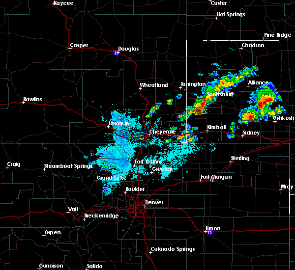 At 1129 pm mdt, a severe thunderstorm was located near harrisburg, or 20 miles southwest of scottsbluff, moving northeast at 15 mph (radar indicated). Hazards include half dollar size hail. Damage to vehicles is expected. This severe thunderstorm will remain over mainly rural areas of north central banner county. At 1129 pm mdt, a severe thunderstorm was located near harrisburg, or 20 miles southwest of scottsbluff, moving northeast at 15 mph (radar indicated). Hazards include half dollar size hail. Damage to vehicles is expected. This severe thunderstorm will remain over mainly rural areas of north central banner county.
|
| 6/16/2018 6:10 PM MDT |
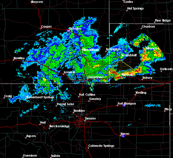 At 610 pm mdt, a severe thunderstorm was located 10 miles north of oliver campground, or 14 miles northwest of kimball, moving northeast at 30 mph (radar indicated). Hazards include ping pong ball size hail and 60 mph wind gusts. People and animals outdoors will be injured. expect hail damage to roofs, siding, windows, and vehicles. Expect wind damage to roofs, siding, and trees. At 610 pm mdt, a severe thunderstorm was located 10 miles north of oliver campground, or 14 miles northwest of kimball, moving northeast at 30 mph (radar indicated). Hazards include ping pong ball size hail and 60 mph wind gusts. People and animals outdoors will be injured. expect hail damage to roofs, siding, windows, and vehicles. Expect wind damage to roofs, siding, and trees.
|
| 5/28/2018 6:50 PM MDT |
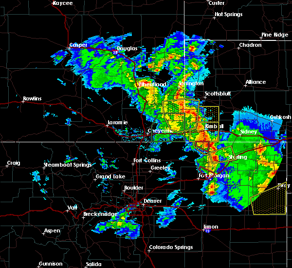 At 649 pm mdt, a severe thunderstorm was located near oliver campground, or 14 miles west of kimball, moving northeast at 35 mph (radar indicated). Hazards include 60 mph wind gusts and nickel size hail. expect damage to roofs, siding, and trees At 649 pm mdt, a severe thunderstorm was located near oliver campground, or 14 miles west of kimball, moving northeast at 35 mph (radar indicated). Hazards include 60 mph wind gusts and nickel size hail. expect damage to roofs, siding, and trees
|
| 5/27/2018 6:48 PM MDT |
 At 648 pm mdt, severe thunderstorms were located along a line extending from 8 miles west of wildcat hills campground to near wildcat hills state recreation area to near redington, moving northeast at 45 mph (radar indicated). Hazards include 60 mph wind gusts and quarter size hail. Hail damage to vehicles is expected. expect wind damage to roofs, siding, and trees. Locations impacted include, scottsbluff, alliance, gering, mitchell, bayard, terrytown, minatare, hemingford, wildcat hills state recreation area, alliance airport, angora, wildcat hills campground, hubbard hill, berea, lake minatare, wild horse butte, lake minatare campground, chimney rock state park, scotts bluff national monument and kilpatrick lake. At 648 pm mdt, severe thunderstorms were located along a line extending from 8 miles west of wildcat hills campground to near wildcat hills state recreation area to near redington, moving northeast at 45 mph (radar indicated). Hazards include 60 mph wind gusts and quarter size hail. Hail damage to vehicles is expected. expect wind damage to roofs, siding, and trees. Locations impacted include, scottsbluff, alliance, gering, mitchell, bayard, terrytown, minatare, hemingford, wildcat hills state recreation area, alliance airport, angora, wildcat hills campground, hubbard hill, berea, lake minatare, wild horse butte, lake minatare campground, chimney rock state park, scotts bluff national monument and kilpatrick lake.
|
| 5/10/2018 4:40 PM MDT | Ping Pong Ball sized hail reported 16.3 miles W of Harrisburg, NE |
| 8/15/2017 5:42 PM MDT | Quarter sized hail reported 4.4 miles NW of Harrisburg, NE, nickel to quarter size hail accumulated 3-4 inches deep on highway 71. |
| 8/15/2017 5:23 PM MDT | Baseball sized hail reported 6.4 miles NW of Harrisburg, NE |
| 8/15/2017 5:05 PM MDT |
 At 504 pm mdt, a confirmed tornado was located just east of harrisburg, or 20 miles north of kimball, moving southeast at 15 mph (weather spotters confirmed tornado). Hazards include damaging tornado and half dollar size hail. Flying debris will be dangerous to those caught without shelter. mobile homes will be damaged or destroyed. damage to roofs, windows, and vehicles will occur. tree damage is likely. This tornadic thunderstorm will remain over mainly rural areas of southeastern banner county. At 504 pm mdt, a confirmed tornado was located just east of harrisburg, or 20 miles north of kimball, moving southeast at 15 mph (weather spotters confirmed tornado). Hazards include damaging tornado and half dollar size hail. Flying debris will be dangerous to those caught without shelter. mobile homes will be damaged or destroyed. damage to roofs, windows, and vehicles will occur. tree damage is likely. This tornadic thunderstorm will remain over mainly rural areas of southeastern banner county.
|
| 8/15/2017 4:57 PM MDT |
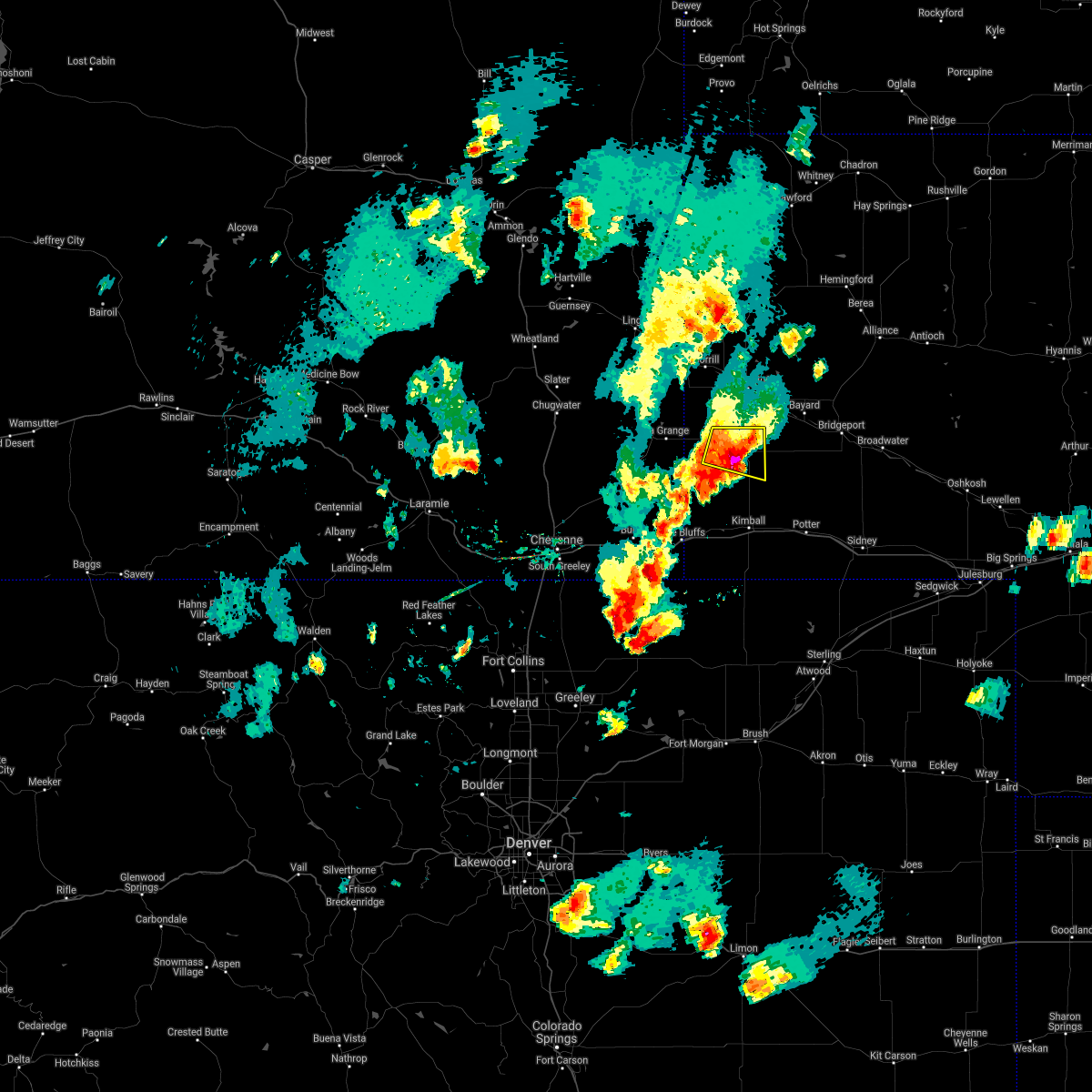 The severe thunderstorm warning for central banner county will expire at 500 pm mdt, a tornado warning is in effect for central banner county, including harrisburg, until 600 pm mdt. a severe thunderstorm watch remains in effect until 1100 pm mdt for the panhandle of nebraska. to report severe weather, contact your nearest law enforcement agency. they will relay your report to the national weather service cheyenne. The severe thunderstorm warning for central banner county will expire at 500 pm mdt, a tornado warning is in effect for central banner county, including harrisburg, until 600 pm mdt. a severe thunderstorm watch remains in effect until 1100 pm mdt for the panhandle of nebraska. to report severe weather, contact your nearest law enforcement agency. they will relay your report to the national weather service cheyenne.
|
| 8/15/2017 4:55 PM MDT |
 At 455 pm mdt, a confirmed tornado was located just east of harrisburg, or 22 miles south of scottsbluff, moving southeast at 15 mph (weather spotters confirmed tornado). Hazards include damaging tornado and quarter size hail. Flying debris will be dangerous to those caught without shelter. mobile homes will be damaged or destroyed. damage to roofs, windows, and vehicles will occur. tree damage is likely. This tornadic thunderstorm will remain over mainly rural areas of central banner county. At 455 pm mdt, a confirmed tornado was located just east of harrisburg, or 22 miles south of scottsbluff, moving southeast at 15 mph (weather spotters confirmed tornado). Hazards include damaging tornado and quarter size hail. Flying debris will be dangerous to those caught without shelter. mobile homes will be damaged or destroyed. damage to roofs, windows, and vehicles will occur. tree damage is likely. This tornadic thunderstorm will remain over mainly rural areas of central banner county.
|
| 8/15/2017 4:42 PM MDT |
 At 442 pm mdt, severe thunderstorms were located along a line extending from near wildcat hills state recreation area to near albin, moving southeast at 15 mph (radar indicated). Hazards include 60 mph wind gusts and penny size hail. Expect damage to roofs, siding, and trees. These severe storms will be near, harrisburg around 445 pm mdt. At 442 pm mdt, severe thunderstorms were located along a line extending from near wildcat hills state recreation area to near albin, moving southeast at 15 mph (radar indicated). Hazards include 60 mph wind gusts and penny size hail. Expect damage to roofs, siding, and trees. These severe storms will be near, harrisburg around 445 pm mdt.
|
| 8/15/2017 4:26 PM MDT |
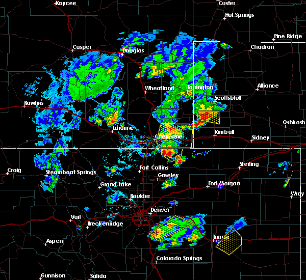 At 426 pm mdt, a severe thunderstorm was located near harrisburg, or 20 miles southwest of scottsbluff, moving east at 20 mph (radar indicated). Hazards include 60 mph wind gusts and penny size hail. Expect damage to roofs, siding, and trees. This severe storm will be near, harrisburg around 450 pm mdt. At 426 pm mdt, a severe thunderstorm was located near harrisburg, or 20 miles southwest of scottsbluff, moving east at 20 mph (radar indicated). Hazards include 60 mph wind gusts and penny size hail. Expect damage to roofs, siding, and trees. This severe storm will be near, harrisburg around 450 pm mdt.
|
| 8/15/2017 3:58 PM MDT |
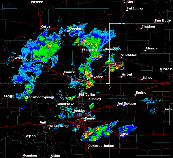 At 358 pm mdt, a severe thunderstorm was located 9 miles east of la grange, or 24 miles southwest of scottsbluff, moving east at 25 mph (radar indicated). Hazards include 60 mph wind gusts and quarter size hail. Hail damage to vehicles is expected. expect wind damage to roofs, siding, and trees. This severe thunderstorm will be near, harrisburg around 440 pm mdt. At 358 pm mdt, a severe thunderstorm was located 9 miles east of la grange, or 24 miles southwest of scottsbluff, moving east at 25 mph (radar indicated). Hazards include 60 mph wind gusts and quarter size hail. Hail damage to vehicles is expected. expect wind damage to roofs, siding, and trees. This severe thunderstorm will be near, harrisburg around 440 pm mdt.
|
| 6/12/2017 6:59 PM MDT |
 At 658 pm mdt, a severe thunderstorm capable of producing a tornado was located 7 miles east of wildcat hills state recreation area, or 15 miles southeast of scottsbluff, moving northeast at 20 mph (radar indicated rotation). Hazards include tornado and hail up to three inches in diameter. Flying debris will be dangerous to those caught without shelter. mobile homes will be damaged or destroyed. damage to roofs, windows, and vehicles will occur. tree damage is likely. this dangerous storm will be near, chimney rock state park around 725 pm mdt. bayard, south bayard junction and moomaws corner around 730 pm mdt. other locations impacted by this tornadic thunderstorm include mcgrew and melbeta. This replaces the tornado warning which was previously in effect for the warned area. At 658 pm mdt, a severe thunderstorm capable of producing a tornado was located 7 miles east of wildcat hills state recreation area, or 15 miles southeast of scottsbluff, moving northeast at 20 mph (radar indicated rotation). Hazards include tornado and hail up to three inches in diameter. Flying debris will be dangerous to those caught without shelter. mobile homes will be damaged or destroyed. damage to roofs, windows, and vehicles will occur. tree damage is likely. this dangerous storm will be near, chimney rock state park around 725 pm mdt. bayard, south bayard junction and moomaws corner around 730 pm mdt. other locations impacted by this tornadic thunderstorm include mcgrew and melbeta. This replaces the tornado warning which was previously in effect for the warned area.
|
| 6/12/2017 6:41 PM MDT |
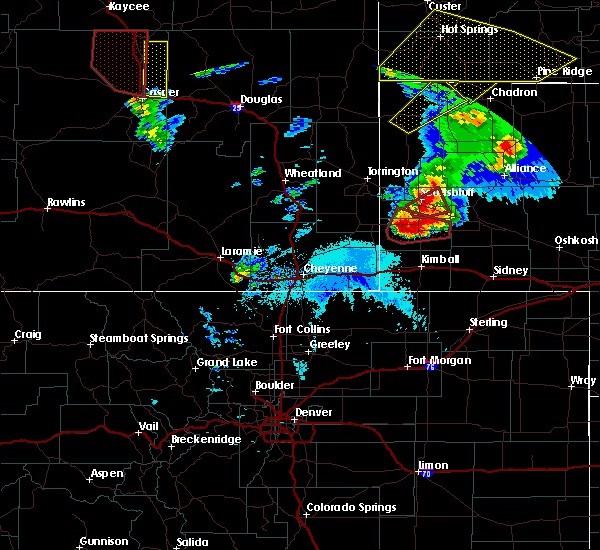 At 641 pm mdt, a confirmed tornado was located 9 miles southeast of wildcat hills state recreation area, or 19 miles south of scottsbluff, moving northeast at 35 mph (weather spotters confirmed tornado). Hazards include damaging tornado and three inch hail. Flying debris will be dangerous to those caught without shelter. mobile homes will be damaged or destroyed. damage to roofs, windows, and vehicles will occur. tree damage is likely. This tornadic thunderstorm will remain over mainly rural areas of south central scotts bluff and central banner counties. At 641 pm mdt, a confirmed tornado was located 9 miles southeast of wildcat hills state recreation area, or 19 miles south of scottsbluff, moving northeast at 35 mph (weather spotters confirmed tornado). Hazards include damaging tornado and three inch hail. Flying debris will be dangerous to those caught without shelter. mobile homes will be damaged or destroyed. damage to roofs, windows, and vehicles will occur. tree damage is likely. This tornadic thunderstorm will remain over mainly rural areas of south central scotts bluff and central banner counties.
|
| 6/12/2017 6:30 PM MDT |
 At 629 pm mdt, a confirmed tornado was located near harrisburg, or 19 miles northwest of kimball, moving northeast at 25 mph (weather spotters confirmed tornado). Hazards include damaging tornado and hail up to three inches in diameter. Flying debris will be dangerous to those caught without shelter. mobile homes will be damaged or destroyed. damage to roofs, windows, and vehicles will occur. tree damage is likely. the tornado will be near, harrisburg around 650 pm mdt. Wildcat hills state recreation area and wildcat hills campground around 700 pm mdt. At 629 pm mdt, a confirmed tornado was located near harrisburg, or 19 miles northwest of kimball, moving northeast at 25 mph (weather spotters confirmed tornado). Hazards include damaging tornado and hail up to three inches in diameter. Flying debris will be dangerous to those caught without shelter. mobile homes will be damaged or destroyed. damage to roofs, windows, and vehicles will occur. tree damage is likely. the tornado will be near, harrisburg around 650 pm mdt. Wildcat hills state recreation area and wildcat hills campground around 700 pm mdt.
|
| 6/12/2017 6:12 PM MDT |
 At 611 pm mdt, a confirmed tornado was located 10 miles southwest of harrisburg, or 15 miles northwest of kimball, moving northeast at 20 mph. several other small areas of rotation were located along the kimball and banner county line south of harrisburg, and could also be producing tornadoes (weather spotters confirmed tornado). Hazards include damaging tornado and three inch hail. Flying debris will be dangerous to those caught without shelter. mobile homes will be damaged or destroyed. damage to roofs, windows, and vehicles will occur. tree damage is likely. This tornado will be near, harrisburg around 630 pm mdt. At 611 pm mdt, a confirmed tornado was located 10 miles southwest of harrisburg, or 15 miles northwest of kimball, moving northeast at 20 mph. several other small areas of rotation were located along the kimball and banner county line south of harrisburg, and could also be producing tornadoes (weather spotters confirmed tornado). Hazards include damaging tornado and three inch hail. Flying debris will be dangerous to those caught without shelter. mobile homes will be damaged or destroyed. damage to roofs, windows, and vehicles will occur. tree damage is likely. This tornado will be near, harrisburg around 630 pm mdt.
|
| 6/12/2017 6:00 PM MDT |
 At 558 pm mdt, a confirmed tornado was located 9 miles north of oliver campground, or 13 miles northwest of kimball, moving northeast at 30 mph (weather spotters confirmed intermittent tornado touchdowns north of bushnell). Hazards include damaging tornado and three inch hail. Flying debris will be dangerous to those caught without shelter. mobile homes will be damaged or destroyed. damage to roofs, windows, and vehicles will occur. tree damage is likely. This tornado will be near, harrisburg around 630 pm mdt. At 558 pm mdt, a confirmed tornado was located 9 miles north of oliver campground, or 13 miles northwest of kimball, moving northeast at 30 mph (weather spotters confirmed intermittent tornado touchdowns north of bushnell). Hazards include damaging tornado and three inch hail. Flying debris will be dangerous to those caught without shelter. mobile homes will be damaged or destroyed. damage to roofs, windows, and vehicles will occur. tree damage is likely. This tornado will be near, harrisburg around 630 pm mdt.
|
| 6/12/2017 6:00 PM MDT |
 At 551 pm mdt, a severe thunderstorm capable of producing a tornado was located near oliver campground, or 12 miles northwest of kimball, moving northeast at 35 mph. a second area of rotation was located about 10 miles northwest of pine bluffs, also moving northeast (radar indicated rotation). Hazards include developing tornado and hail up to three inches in diameter. Flying debris will be dangerous to those caught without shelter. mobile homes will be damaged or destroyed. damage to roofs, windows, and vehicles will occur. tree damage is likely. this dangerous storm will be near, harrisburg around 625 pm mdt. other locations impacted by this tornadic thunderstorm include bushnell. This includes interstate 80 in nebraska near mile marker 12. At 551 pm mdt, a severe thunderstorm capable of producing a tornado was located near oliver campground, or 12 miles northwest of kimball, moving northeast at 35 mph. a second area of rotation was located about 10 miles northwest of pine bluffs, also moving northeast (radar indicated rotation). Hazards include developing tornado and hail up to three inches in diameter. Flying debris will be dangerous to those caught without shelter. mobile homes will be damaged or destroyed. damage to roofs, windows, and vehicles will occur. tree damage is likely. this dangerous storm will be near, harrisburg around 625 pm mdt. other locations impacted by this tornadic thunderstorm include bushnell. This includes interstate 80 in nebraska near mile marker 12.
|
| 6/12/2017 5:52 PM MDT |
 At 551 pm mdt, a severe thunderstorm capable of producing a tornado was located near oliver campground, or 12 miles northwest of kimball, moving northeast at 35 mph. a second area of rotation was located about 10 miles northwest of pine bluffs, also moving northeast (radar indicated rotation). Hazards include developing tornado and hail up to three inches in diameter. Flying debris will be dangerous to those caught without shelter. mobile homes will be damaged or destroyed. damage to roofs, windows, and vehicles will occur. tree damage is likely. this dangerous storm will be near, harrisburg around 625 pm mdt. other locations impacted by this tornadic thunderstorm include bushnell. This includes interstate 80 in nebraska near mile marker 12. At 551 pm mdt, a severe thunderstorm capable of producing a tornado was located near oliver campground, or 12 miles northwest of kimball, moving northeast at 35 mph. a second area of rotation was located about 10 miles northwest of pine bluffs, also moving northeast (radar indicated rotation). Hazards include developing tornado and hail up to three inches in diameter. Flying debris will be dangerous to those caught without shelter. mobile homes will be damaged or destroyed. damage to roofs, windows, and vehicles will occur. tree damage is likely. this dangerous storm will be near, harrisburg around 625 pm mdt. other locations impacted by this tornadic thunderstorm include bushnell. This includes interstate 80 in nebraska near mile marker 12.
|
| 5/26/2017 4:25 PM MDT |
 At 424 pm mdt, a severe thunderstorm was located near oliver campground, or 13 miles northwest of kimball, moving east at 30 mph (radar indicated). Hazards include 70 mph wind gusts and ping pong ball size hail. People and animals outdoors will be injured. expect hail damage to roofs, siding, windows, and vehicles. expect considerable tree damage. wind damage is also likely to mobile homes, roofs, and outbuildings. This severe thunderstorm will remain over mainly rural areas of northern kimball and eastern banner counties. At 424 pm mdt, a severe thunderstorm was located near oliver campground, or 13 miles northwest of kimball, moving east at 30 mph (radar indicated). Hazards include 70 mph wind gusts and ping pong ball size hail. People and animals outdoors will be injured. expect hail damage to roofs, siding, windows, and vehicles. expect considerable tree damage. wind damage is also likely to mobile homes, roofs, and outbuildings. This severe thunderstorm will remain over mainly rural areas of northern kimball and eastern banner counties.
|
| 5/26/2017 4:08 PM MDT |
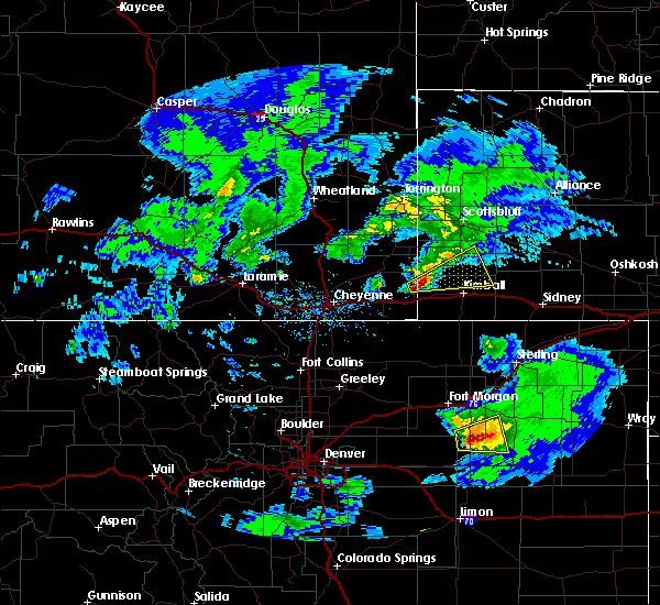 At 407 pm mdt, a severe thunderstorm was located 8 miles north of pine bluffs, or 20 miles west of kimball, moving east at 35 mph (radar indicated). Hazards include 60 mph wind gusts and quarter size hail. Hail damage to vehicles is expected. expect wind damage to roofs, siding, and trees. This severe thunderstorm will remain over mainly rural areas of northern kimball, eastern banner and east central laramie counties. At 407 pm mdt, a severe thunderstorm was located 8 miles north of pine bluffs, or 20 miles west of kimball, moving east at 35 mph (radar indicated). Hazards include 60 mph wind gusts and quarter size hail. Hail damage to vehicles is expected. expect wind damage to roofs, siding, and trees. This severe thunderstorm will remain over mainly rural areas of northern kimball, eastern banner and east central laramie counties.
|
| 7/29/2016 4:25 PM MDT | The severe thunderstorm warning for eastern banner county will expire at 430 pm mdt, the storm which prompted the warning has weakened below severe limits and exited the warned area. therefore the warning will be allowed to expire. a severe thunderstorm watch remains in effect until 1000 pm mdt for the panhandle of nebraska. |
| 7/29/2016 4:11 PM MDT |
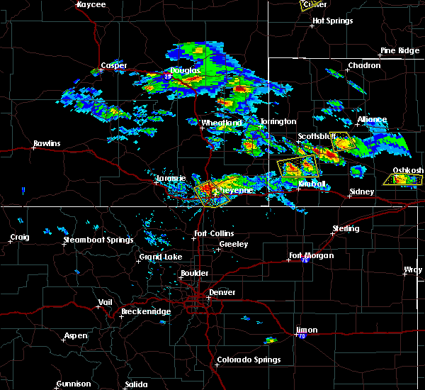 At 411 pm mdt, a severe thunderstorm was located over harrisburg, or 20 miles north of kimball, moving east at 20 mph (radar indicated). Hazards include 60 mph wind gusts and quarter size hail. Hail damage to vehicles is expected. expect wind damage to roofs, siding, and trees. Locations impacted include, harrisburg. At 411 pm mdt, a severe thunderstorm was located over harrisburg, or 20 miles north of kimball, moving east at 20 mph (radar indicated). Hazards include 60 mph wind gusts and quarter size hail. Hail damage to vehicles is expected. expect wind damage to roofs, siding, and trees. Locations impacted include, harrisburg.
|
| 7/29/2016 3:58 PM MDT |
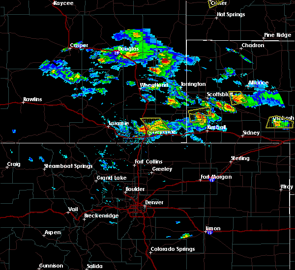 At 358 pm mdt, a severe thunderstorm was located over harrisburg, or 20 miles north of kimball, moving east at 40 mph (radar indicated). Hazards include golf ball size hail and 60 mph wind gusts. People and animals outdoors will be injured. expect hail damage to roofs, siding, windows, and vehicles. Expect wind damage to roofs, siding, and trees. At 358 pm mdt, a severe thunderstorm was located over harrisburg, or 20 miles north of kimball, moving east at 40 mph (radar indicated). Hazards include golf ball size hail and 60 mph wind gusts. People and animals outdoors will be injured. expect hail damage to roofs, siding, windows, and vehicles. Expect wind damage to roofs, siding, and trees.
|
| 7/29/2016 3:43 PM MDT |
 At 343 pm mdt, a severe thunderstorm was located near harrisburg, or 19 miles south of scottsbluff, moving east at 25 mph (radar indicated). Hazards include 60 mph wind gusts and quarter size hail. Hail damage to vehicles is expected. expect wind damage to roofs, siding, and trees. Locations impacted include, harrisburg. At 343 pm mdt, a severe thunderstorm was located near harrisburg, or 19 miles south of scottsbluff, moving east at 25 mph (radar indicated). Hazards include 60 mph wind gusts and quarter size hail. Hail damage to vehicles is expected. expect wind damage to roofs, siding, and trees. Locations impacted include, harrisburg.
|
| 7/29/2016 3:25 PM MDT |
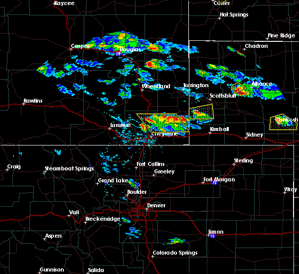 At 325 pm mdt, a severe thunderstorm was located 10 miles northwest of harrisburg, or 20 miles southwest of scottsbluff, moving east at 10 mph (radar indicated). Hazards include 60 mph wind gusts and half dollar size hail. Hail damage to vehicles is expected. expect wind damage to roofs, siding, and trees. Locations impacted include, wildcat hills campground, harrisburg and wildcat hills state recreation area. At 325 pm mdt, a severe thunderstorm was located 10 miles northwest of harrisburg, or 20 miles southwest of scottsbluff, moving east at 10 mph (radar indicated). Hazards include 60 mph wind gusts and half dollar size hail. Hail damage to vehicles is expected. expect wind damage to roofs, siding, and trees. Locations impacted include, wildcat hills campground, harrisburg and wildcat hills state recreation area.
|
| 7/29/2016 3:12 PM MDT |
 At 312 pm mdt, a severe thunderstorm was located 10 miles east of la grange, or 22 miles southwest of scottsbluff, moving east at 20 mph (radar indicated). Hazards include two inch hail and 60 mph wind gusts. People and animals outdoors will be injured. expect hail damage to roofs, siding, windows, and vehicles. Expect wind damage to roofs, siding, and trees. At 312 pm mdt, a severe thunderstorm was located 10 miles east of la grange, or 22 miles southwest of scottsbluff, moving east at 20 mph (radar indicated). Hazards include two inch hail and 60 mph wind gusts. People and animals outdoors will be injured. expect hail damage to roofs, siding, windows, and vehicles. Expect wind damage to roofs, siding, and trees.
|
| 7/27/2016 10:32 PM MDT | Ping Pong Ball sized hail reported 18 miles ESE of Harrisburg, NE |
| 7/27/2016 6:39 PM MDT |
 At 639 pm mdt, a severe thunderstorm capable of producing a tornado was located over wildcat hills campground, or 9 miles south of scottsbluff, moving southeast at 30 mph (radar indicated rotation). Hazards include tornado and golf ball size hail. Flying debris will be dangerous to those caught without shelter. mobile homes will be damaged or destroyed. damage to roofs, windows, and vehicles will occur. tree damage is likely. This dangerous storm will be near, harrisburg around 700 pm mdt. At 639 pm mdt, a severe thunderstorm capable of producing a tornado was located over wildcat hills campground, or 9 miles south of scottsbluff, moving southeast at 30 mph (radar indicated rotation). Hazards include tornado and golf ball size hail. Flying debris will be dangerous to those caught without shelter. mobile homes will be damaged or destroyed. damage to roofs, windows, and vehicles will occur. tree damage is likely. This dangerous storm will be near, harrisburg around 700 pm mdt.
|
| 7/27/2016 6:26 PM MDT |
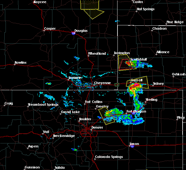 At 625 pm mdt, a severe thunderstorm was located over hubbard hill, or near scottsbluff, moving south at 30 mph (radar indicated). Hazards include golf ball size hail and 60 mph wind gusts. People and animals outdoors will be injured. expect hail damage to roofs, siding, windows, and vehicles. Expect wind damage to roofs, siding, and trees. At 625 pm mdt, a severe thunderstorm was located over hubbard hill, or near scottsbluff, moving south at 30 mph (radar indicated). Hazards include golf ball size hail and 60 mph wind gusts. People and animals outdoors will be injured. expect hail damage to roofs, siding, windows, and vehicles. Expect wind damage to roofs, siding, and trees.
|
| 6/28/2016 5:27 PM MDT | The severe thunderstorm warning for northwestern banner, southwestern scotts bluff, southeastern goshen and northeastern laramie counties will expire at 530 pm mdt, the storm which prompted the warning has weakened below severe limits, and no longer pose an immediate threat to life or property. therefore the warning will be allowed to expire. however small hail and heavy rain are still possible with this thunderstorm. a severe thunderstorm watch remains in effect until 900 pm mdt for central nebraska, and southeastern wyoming. |
| 6/28/2016 5:27 PM MDT | The severe thunderstorm warning for northwestern banner, southwestern scotts bluff, southeastern goshen and northeastern laramie counties will expire at 530 pm mdt, the storm which prompted the warning has weakened below severe limits, and no longer pose an immediate threat to life or property. therefore the warning will be allowed to expire. however small hail and heavy rain are still possible with this thunderstorm. a severe thunderstorm watch remains in effect until 900 pm mdt for central nebraska, and southeastern wyoming. |
| 6/28/2016 5:04 PM MDT |
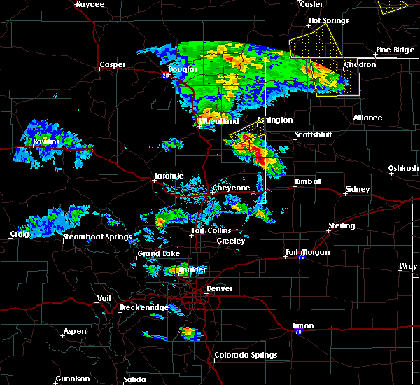 At 503 pm mdt, a severe thunderstorm was located over la grange, or 29 miles southwest of scottsbluff, moving east at 25 mph (radar indicated). Hazards include 60 mph wind gusts and half dollar size hail. Hail damage to vehicles is expected. expect wind damage to roofs, siding, and trees. This severe thunderstorm will remain over mainly rural areas of northwestern banner, southwestern scotts bluff, southeastern goshen and northeastern laramie counties. At 503 pm mdt, a severe thunderstorm was located over la grange, or 29 miles southwest of scottsbluff, moving east at 25 mph (radar indicated). Hazards include 60 mph wind gusts and half dollar size hail. Hail damage to vehicles is expected. expect wind damage to roofs, siding, and trees. This severe thunderstorm will remain over mainly rural areas of northwestern banner, southwestern scotts bluff, southeastern goshen and northeastern laramie counties.
|
| 6/12/2016 7:38 PM MDT |
 At 737 pm mdt, severe thunderstorms were located along a line extending from 7 miles west of hemingford to near kilpatrick lake to near moomaws corner to 8 miles southeast of harrisburg to near panorama point, moving east at 45 mph (radar indicated). Hazards include 60 mph wind gusts and nickel size hail. Expect damage to roofs. siding. And trees. At 737 pm mdt, severe thunderstorms were located along a line extending from 7 miles west of hemingford to near kilpatrick lake to near moomaws corner to 8 miles southeast of harrisburg to near panorama point, moving east at 45 mph (radar indicated). Hazards include 60 mph wind gusts and nickel size hail. Expect damage to roofs. siding. And trees.
|
| 6/12/2016 7:24 PM MDT |
 At 723 pm mdt, severe thunderstorms were located along a line extending from near flahertys corner to 7 miles northeast of lake alice to near minatare to 11 miles southwest of harrisburg, moving east at 40 mph (reports received from kneb of 60 to 69 mph winds west of scottsbluff arounf 705pm). Hazards include 60 mph wind gusts and nickel size hail. Expect damage to roofs. siding. and trees. Locations impacted include, scottsbluff, gering, bayard, terrytown, minatare, lake alice, redington, moomaws corner, harrisburg, angora, scotts bluff national monument, lake minatare, the intersection of highway 385 and l62, south bayard junction, berea, chimney rock state park, wildcat hills campground, kilpatrick lake, wildcat hills state recreation area and wild horse butte. At 723 pm mdt, severe thunderstorms were located along a line extending from near flahertys corner to 7 miles northeast of lake alice to near minatare to 11 miles southwest of harrisburg, moving east at 40 mph (reports received from kneb of 60 to 69 mph winds west of scottsbluff arounf 705pm). Hazards include 60 mph wind gusts and nickel size hail. Expect damage to roofs. siding. and trees. Locations impacted include, scottsbluff, gering, bayard, terrytown, minatare, lake alice, redington, moomaws corner, harrisburg, angora, scotts bluff national monument, lake minatare, the intersection of highway 385 and l62, south bayard junction, berea, chimney rock state park, wildcat hills campground, kilpatrick lake, wildcat hills state recreation area and wild horse butte.
|
| 6/12/2016 7:03 PM MDT |
 At 703 pm mdt, severe thunderstorms were located along a line extending from 9 miles southwest of flahertys corner to lake alice to near wildcat hills campground to near albin, moving east at 45 mph (radar indicated). Hazards include 60 mph wind gusts and nickel size hail. Expect damage to roofs. siding. And trees. At 703 pm mdt, severe thunderstorms were located along a line extending from 9 miles southwest of flahertys corner to lake alice to near wildcat hills campground to near albin, moving east at 45 mph (radar indicated). Hazards include 60 mph wind gusts and nickel size hail. Expect damage to roofs. siding. And trees.
|
| 4/25/2016 8:15 PM MDT |
 At 815 pm mdt, severe thunderstorms were located along a line extending from near hubbard hill to scotts bluff national monument to 6 miles southeast of wildcat hills state recreation area, moving northeast at 25 mph (radar indicated). Hazards include 60 mph wind gusts and penny size hail. Expect damage to roofs. siding. And trees. At 815 pm mdt, severe thunderstorms were located along a line extending from near hubbard hill to scotts bluff national monument to 6 miles southeast of wildcat hills state recreation area, moving northeast at 25 mph (radar indicated). Hazards include 60 mph wind gusts and penny size hail. Expect damage to roofs. siding. And trees.
|
| 4/25/2016 7:52 PM MDT |
 At 750 pm mdt, severe thunderstorms were located along a line extending from near stegall to 7 miles south of hubbard hill to harrisburg, moving northeast at 25 mph (radar indicated). Hazards include 60 mph wind gusts and half inch hail. Expect damage to roofs. siding. and trees. Locations impacted include, scottsbluff, gering, mitchell, terrytown, minatare, harrisburg, scotts bluff national monument, stegall, wildcat hills campground, hubbard hill, wildcat hills state recreation area, scottsbluff airport, melbeta and mcgrew. At 750 pm mdt, severe thunderstorms were located along a line extending from near stegall to 7 miles south of hubbard hill to harrisburg, moving northeast at 25 mph (radar indicated). Hazards include 60 mph wind gusts and half inch hail. Expect damage to roofs. siding. and trees. Locations impacted include, scottsbluff, gering, mitchell, terrytown, minatare, harrisburg, scotts bluff national monument, stegall, wildcat hills campground, hubbard hill, wildcat hills state recreation area, scottsbluff airport, melbeta and mcgrew.
|
| 4/25/2016 7:35 PM MDT |
 At 734 pm mdt, severe thunderstorms were located along a line extending from 8 miles southwest of stegall to 11 miles south of hubbard hill to near harrisburg, moving northeast at 30 mph (radar indicated). Hazards include 60 mph wind gusts and half size hail. Expect damage to roofs. siding. And trees. At 734 pm mdt, severe thunderstorms were located along a line extending from 8 miles southwest of stegall to 11 miles south of hubbard hill to near harrisburg, moving northeast at 30 mph (radar indicated). Hazards include 60 mph wind gusts and half size hail. Expect damage to roofs. siding. And trees.
|
| 7/18/2015 5:00 PM MDT |
 At 459 pm mdt, a severe thunderstorm was located near harrisburg, or 19 miles north of kimball, moving east at 35 mph (radar indicated). Hazards include two inch hail and 70 mph wind gusts. at 455 pm mdt, two inch diameter hail was reported in harrisburg. People and animals outdoors will be injured. expect hail damage to roofs, siding, windows and vehicles. expect considerable tree damage. wind damage is also likely to mobile homes, roofs and outbuildings. Locations impacted include, harrisburg. At 459 pm mdt, a severe thunderstorm was located near harrisburg, or 19 miles north of kimball, moving east at 35 mph (radar indicated). Hazards include two inch hail and 70 mph wind gusts. at 455 pm mdt, two inch diameter hail was reported in harrisburg. People and animals outdoors will be injured. expect hail damage to roofs, siding, windows and vehicles. expect considerable tree damage. wind damage is also likely to mobile homes, roofs and outbuildings. Locations impacted include, harrisburg.
|
| 7/18/2015 4:55 PM MDT | Hen Egg sized hail reported 0.8 miles E of Harrisburg, NE |
| 7/18/2015 4:50 PM MDT | Storm damage reported in banner county NE, 0.8 miles E of Harrisburg, NE |
| 7/18/2015 4:50 PM MDT | Quarter sized hail reported 0.8 miles E of Harrisburg, NE |
| 7/18/2015 4:45 PM MDT | Storm damage reported in banner county NE, 3.9 miles E of Harrisburg, NE |
| 7/18/2015 4:43 PM MDT |
 At 442 pm mdt, a severe thunderstorm was located near harrisburg, or 23 miles southwest of scottsbluff, moving east at 35 mph (radar indicated). Hazards include golf ball size hail and 70 mph wind gusts. People and animals outdoors will be injured. expect hail damage to roofs, siding, windows and vehicles. expect considerable tree damage. wind damage is also likely to mobile homes, roofs and outbuildings. Locations impacted include, harrisburg. At 442 pm mdt, a severe thunderstorm was located near harrisburg, or 23 miles southwest of scottsbluff, moving east at 35 mph (radar indicated). Hazards include golf ball size hail and 70 mph wind gusts. People and animals outdoors will be injured. expect hail damage to roofs, siding, windows and vehicles. expect considerable tree damage. wind damage is also likely to mobile homes, roofs and outbuildings. Locations impacted include, harrisburg.
|
| 7/18/2015 4:40 PM MDT |
 At 439 pm mdt, a severe thunderstorm was located 8 miles west of harrisburg, or 24 miles southwest of scottsbluff, moving east at 30 mph (radar indicated). Hazards include golf ball size hail and 70 mph wind gusts. People and animals outdoors will be injured. expect hail damage to roofs, siding, windows and vehicles. expect considerable tree damage. Wind damage is also likely to mobile homes, roofs and outbuildings. At 439 pm mdt, a severe thunderstorm was located 8 miles west of harrisburg, or 24 miles southwest of scottsbluff, moving east at 30 mph (radar indicated). Hazards include golf ball size hail and 70 mph wind gusts. People and animals outdoors will be injured. expect hail damage to roofs, siding, windows and vehicles. expect considerable tree damage. Wind damage is also likely to mobile homes, roofs and outbuildings.
|
| 7/18/2015 4:36 PM MDT |
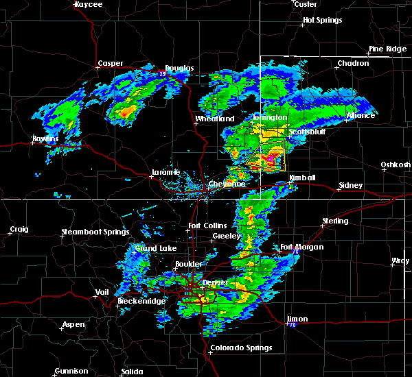 At 435 pm mdt, a severe thunderstorm was located 9 miles west of harrisburg, or 25 miles southwest of scottsbluff, moving east at 30 mph (radar indicated). Hazards include golf ball size hail and 70 mph wind gusts. People and animals outdoors will be injured. expect hail damage to roofs, siding, windows and vehicles. expect considerable tree damage. wind damage is also likely to mobile homes, roofs and outbuildings. Locations impacted include, harrisburg. At 435 pm mdt, a severe thunderstorm was located 9 miles west of harrisburg, or 25 miles southwest of scottsbluff, moving east at 30 mph (radar indicated). Hazards include golf ball size hail and 70 mph wind gusts. People and animals outdoors will be injured. expect hail damage to roofs, siding, windows and vehicles. expect considerable tree damage. wind damage is also likely to mobile homes, roofs and outbuildings. Locations impacted include, harrisburg.
|
| 7/18/2015 4:11 PM MDT |
 At 410 pm mdt, a severe thunderstorm was located near la grange, or 32 miles southwest of scottsbluff, moving east at 35 mph (radar indicated). Hazards include half dollar size hail and 60 mph wind gusts. Hail damage to vehicles is expected. expect wind damage to roofs, siding and trees. locations impacted include, la grange, hawk springs campground, harrisburg, meriden rest area and hawk springs recreation area. This severe thunderstorm warning does not include the city of cheyenne. At 410 pm mdt, a severe thunderstorm was located near la grange, or 32 miles southwest of scottsbluff, moving east at 35 mph (radar indicated). Hazards include half dollar size hail and 60 mph wind gusts. Hail damage to vehicles is expected. expect wind damage to roofs, siding and trees. locations impacted include, la grange, hawk springs campground, harrisburg, meriden rest area and hawk springs recreation area. This severe thunderstorm warning does not include the city of cheyenne.
|
| 7/18/2015 3:53 PM MDT |
 At 353 pm mdt, a severe thunderstorm was located near meriden rest area, or 32 miles south of torrington, moving east at 35 mph (radar indicated). Hazards include 60 mph wind gusts and nickel size hail. Expect damage to roofs. Siding and trees. At 353 pm mdt, a severe thunderstorm was located near meriden rest area, or 32 miles south of torrington, moving east at 35 mph (radar indicated). Hazards include 60 mph wind gusts and nickel size hail. Expect damage to roofs. Siding and trees.
|
| 7/18/2015 3:53 PM MDT |
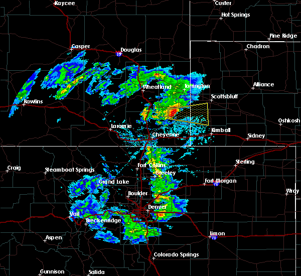 At 353 pm mdt, a severe thunderstorm was located near meriden rest area, or 32 miles south of torrington, moving east at 35 mph (radar indicated). Hazards include 60 mph wind gusts and nickel size hail. Expect damage to roofs. Siding and trees. At 353 pm mdt, a severe thunderstorm was located near meriden rest area, or 32 miles south of torrington, moving east at 35 mph (radar indicated). Hazards include 60 mph wind gusts and nickel size hail. Expect damage to roofs. Siding and trees.
|
| 6/25/2015 4:51 PM MDT |
 At 451 pm mdt, severe thunderstorms were located along a line extending from near wildcat hills campground to 8 miles southeast of la grange, moving southeast at 45 mph (radar indicated). Hazards include ping pong size hail and 60 mph wind gusts. People and animals outdoors will be injured. expect hail damage to roofs, siding, windows and vehicles. Expect wind damage to roofs, siding and trees. At 451 pm mdt, severe thunderstorms were located along a line extending from near wildcat hills campground to 8 miles southeast of la grange, moving southeast at 45 mph (radar indicated). Hazards include ping pong size hail and 60 mph wind gusts. People and animals outdoors will be injured. expect hail damage to roofs, siding, windows and vehicles. Expect wind damage to roofs, siding and trees.
|
| 6/25/2015 4:51 PM MDT |
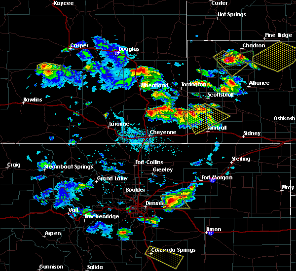 At 451 pm mdt, severe thunderstorms were located along a line extending from near wildcat hills campground to 8 miles southeast of la grange, moving southeast at 45 mph (radar indicated). Hazards include ping pong size hail and 60 mph wind gusts. People and animals outdoors will be injured. expect hail damage to roofs, siding, windows and vehicles. Expect wind damage to roofs, siding and trees. At 451 pm mdt, severe thunderstorms were located along a line extending from near wildcat hills campground to 8 miles southeast of la grange, moving southeast at 45 mph (radar indicated). Hazards include ping pong size hail and 60 mph wind gusts. People and animals outdoors will be injured. expect hail damage to roofs, siding, windows and vehicles. Expect wind damage to roofs, siding and trees.
|
| 6/16/2015 7:53 PM MDT |
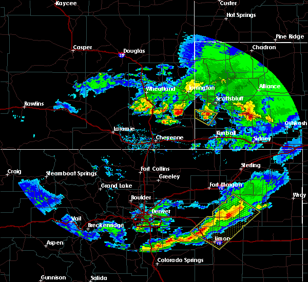 The severe thunderstorm warning for western banner and southwestern scotts bluff counties will expire at 800 pm mdt, the storm which prompted the warning has weakened below severe limits, and no longer pose an immediate threat to life or property. therefore the warning will be allowed to expire. however heavy rain is still possible with this thunderstorm. a severe thunderstorm watch remains in effect until 900 pm mdt for central nebraska. The severe thunderstorm warning for western banner and southwestern scotts bluff counties will expire at 800 pm mdt, the storm which prompted the warning has weakened below severe limits, and no longer pose an immediate threat to life or property. therefore the warning will be allowed to expire. however heavy rain is still possible with this thunderstorm. a severe thunderstorm watch remains in effect until 900 pm mdt for central nebraska.
|
| 6/16/2015 7:32 PM MDT |
 At 731 pm mdt, a severe thunderstorm was located 9 miles east of la grange, or 21 miles southwest of scottsbluff, moving east at 30 mph (radar indicated). Hazards include quarter size hail and 60 mph wind gusts. Hail damage to vehicles is expected. expect wind damage to roofs, siding and trees. Locations impacted include, harrisburg. At 731 pm mdt, a severe thunderstorm was located 9 miles east of la grange, or 21 miles southwest of scottsbluff, moving east at 30 mph (radar indicated). Hazards include quarter size hail and 60 mph wind gusts. Hail damage to vehicles is expected. expect wind damage to roofs, siding and trees. Locations impacted include, harrisburg.
|
| 6/16/2015 7:12 PM MDT |
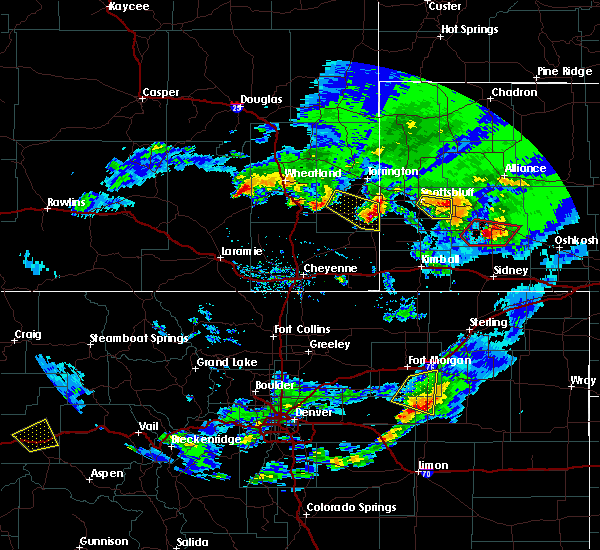 At 712 pm mdt, a severe thunderstorm was located near hawk springs campground, or 24 miles south of torrington, moving southeast at 35 mph (trained weather spotters). Hazards include golf ball size hail and 60 mph wind gusts. People and animals outdoors will be injured. expect hail damage to roofs, siding, windows and vehicles. Expect wind damage to roofs, siding and trees. At 712 pm mdt, a severe thunderstorm was located near hawk springs campground, or 24 miles south of torrington, moving southeast at 35 mph (trained weather spotters). Hazards include golf ball size hail and 60 mph wind gusts. People and animals outdoors will be injured. expect hail damage to roofs, siding, windows and vehicles. Expect wind damage to roofs, siding and trees.
|
| 7/9/2013 7:10 PM MDT | Soft pea to marble size hail as wel in banner county NE, 13.2 miles W of Harrisburg, NE |
| 6/22/2013 5:10 PM MDT | Tennis Ball sized hail reported 12.4 miles SE of Harrisburg, NE, hail mostly quarter sized with some to size of tennis balls. heavy rain with vis down to 1/8 mi. 2 windows damaged. one cracked. one broken out. both on north side of h |
| 6/22/2013 5:04 PM MDT | Center pivot partially overturne in banner county NE, 12.4 miles SE of Harrisburg, NE |
| 6/21/2013 3:26 PM MDT | Baseball sized hail reported 8 miles W of Harrisburg, NE |
| 6/21/2013 3:00 PM MDT | Quarter sized hail reported 0.8 miles E of Harrisburg, NE |
| 6/17/2013 4:55 PM MDT | Quarter sized hail reported 18 miles ESE of Harrisburg, NE, relayed by kneb. |
| 5/26/2013 9:35 PM MDT | Quarter sized hail reported 5.7 miles SE of Harrisburg, NE, hail was maily pea size with some quarter size. |
| 1/1/0001 12:00 AM | Quarter sized hail reported 6.2 miles N of Harrisburg, NE |
| 1/1/0001 12:00 AM | Storm damage reported in banner county NE, 5.2 miles NW of Harrisburg, NE |
| 1/1/0001 12:00 AM | Quarter sized hail reported 16 miles SW of Harrisburg, NE |
| 1/1/0001 12:00 AM | Quarter sized hail reported 18.4 miles ESE of Harrisburg, NE |
| 1/1/0001 12:00 AM | Ping Pong Ball sized hail reported 9.5 miles SW of Harrisburg, NE, small hail lasted from 733 pm until 743 pm mdt. the largest stones were up to walnut size. estimated wind gusts of at least 40 mph preceded the rain and hail. |
Hail Maps for Harrisburg, NE


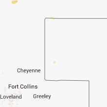


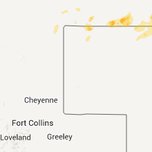

Connect with Interactive Hail Maps