

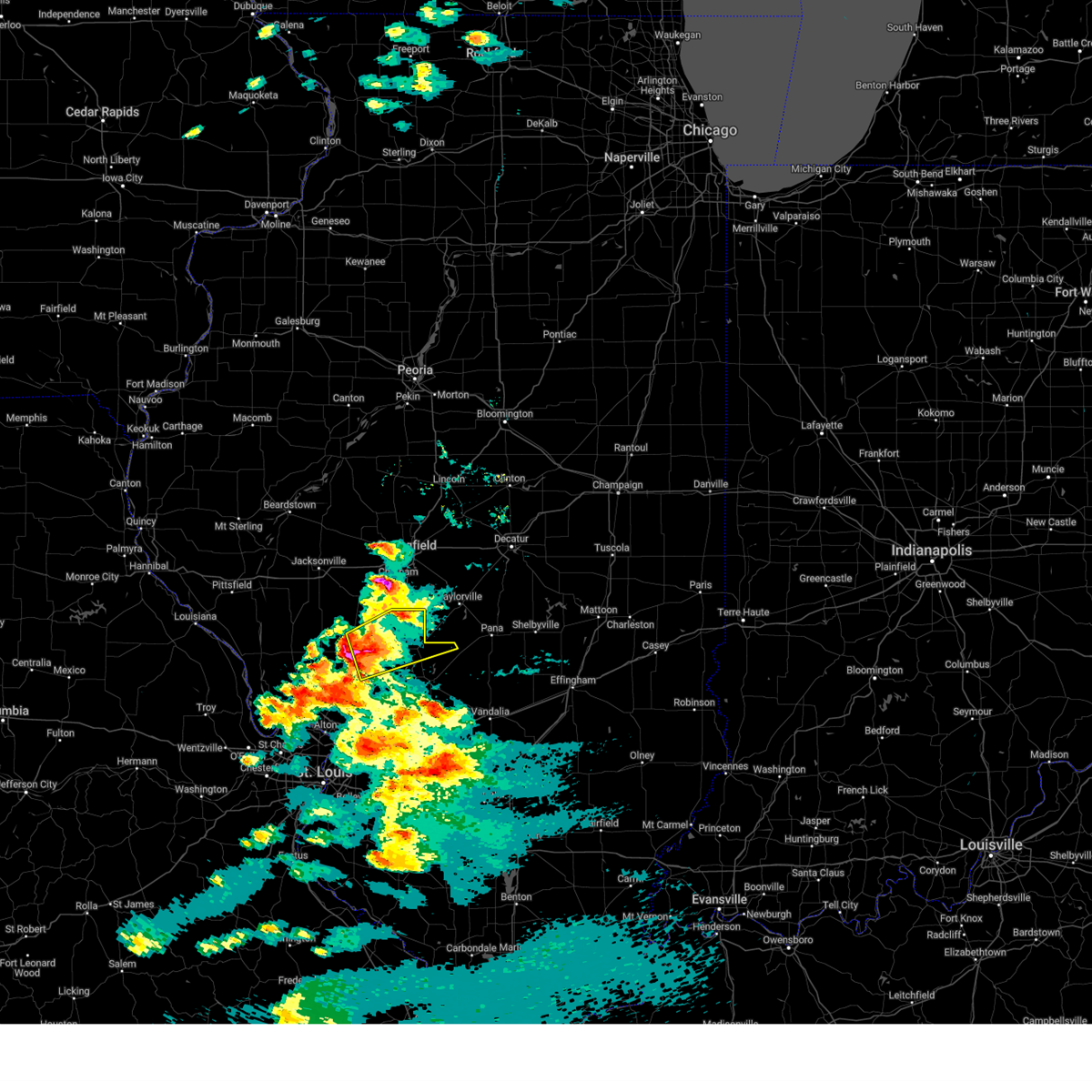
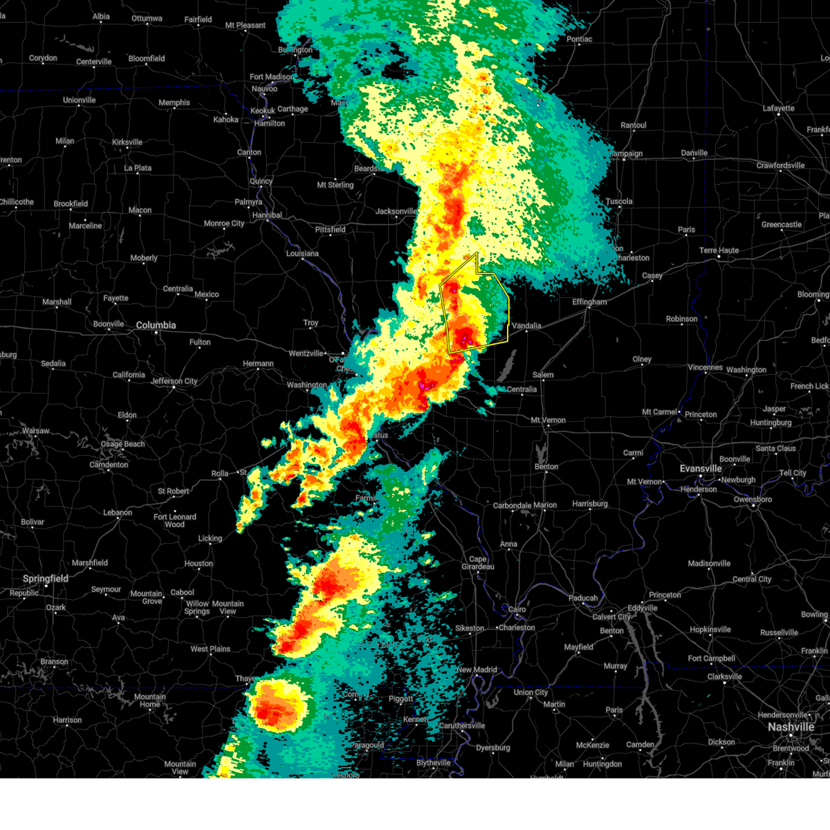
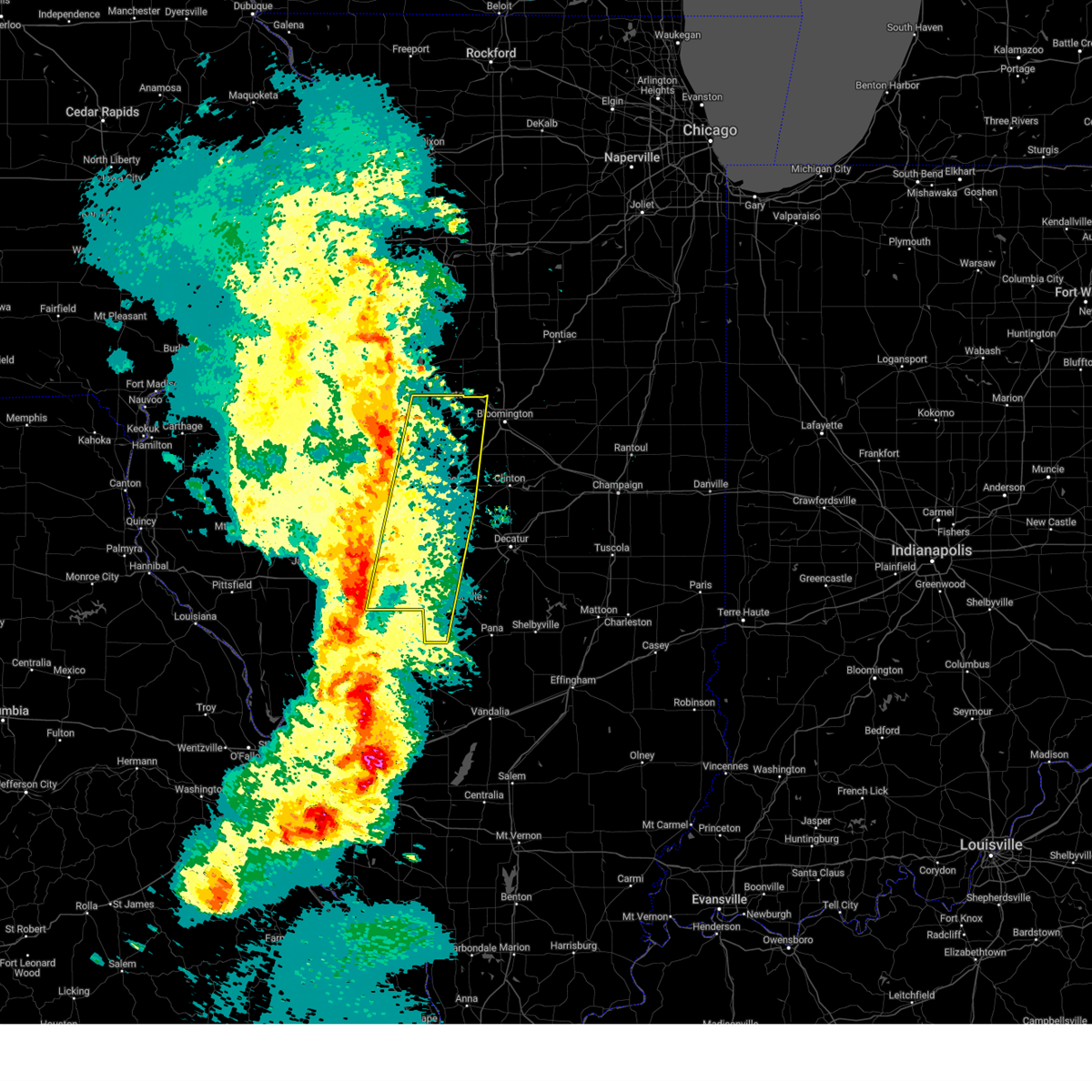
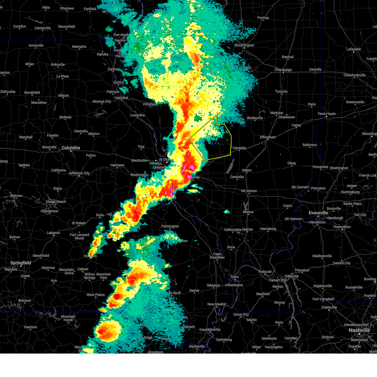
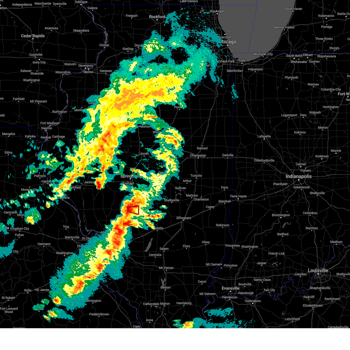
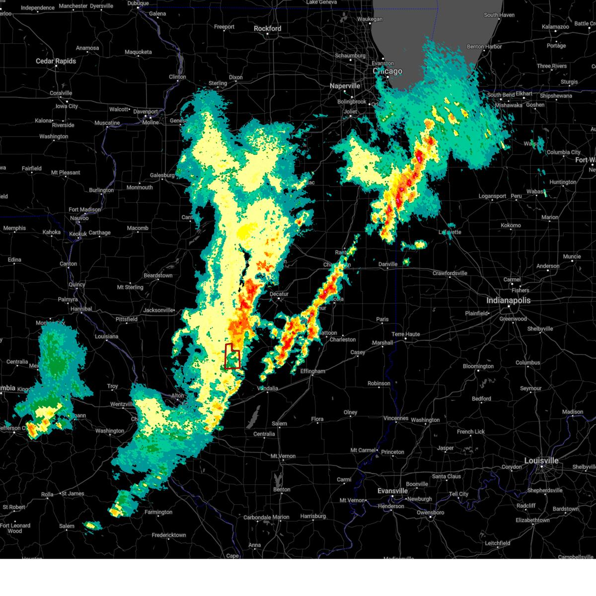
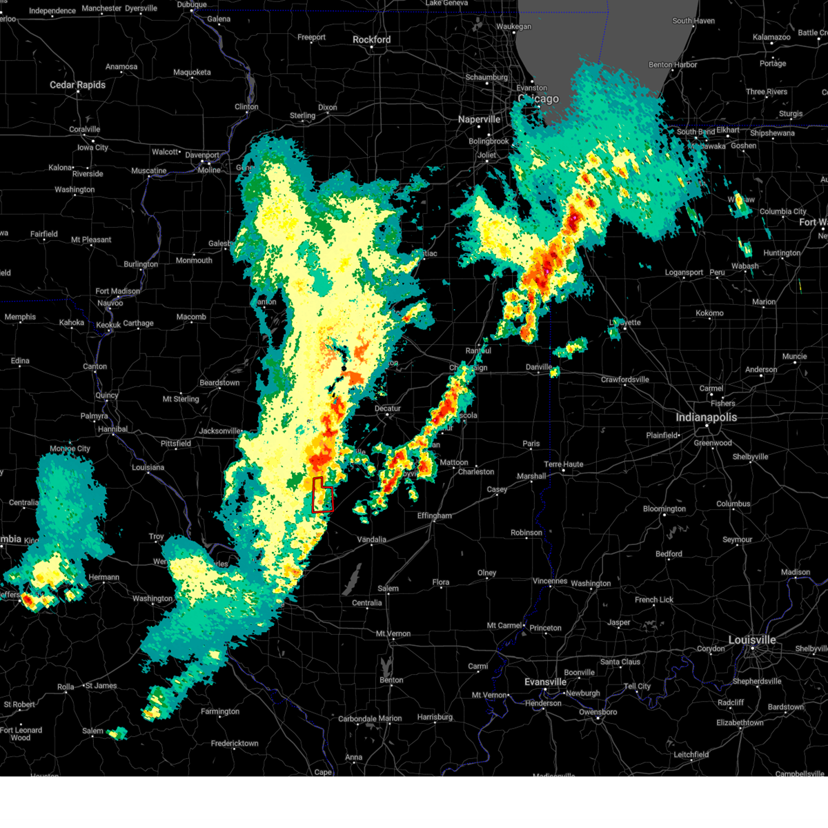
Hail Map for Harvel, IL
The Harvel, IL area has had 5 reports of on-the-ground hail by trained spotters, and has been under severe weather warnings 9 times during the past 12 months. Doppler radar has detected hail at or near Harvel, IL on 53 occasions, including 2 occasions during the past year.
| Name: | Harvel, IL |
| Where Located: | 61.7 miles NE of Saint Louis, MO |
| Map: | Google Map for Harvel, IL |
| Population: | 223 |
| Housing Units: | 116 |
| More Info: | Search Google for Harvel, IL |
5
The Top Recent Hail Date for Harvel, IL is Friday, May 16, 2025 (3rd out of 53)

Hail and Wind Damage Spotted near Harvel, IL
| Date / Time | Report Details |
|---|---|
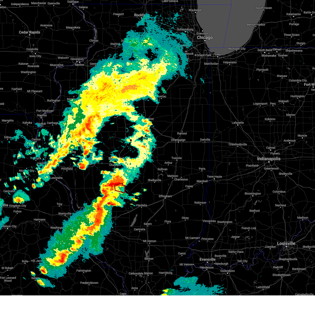
| 5/16/2025 4:10 PM CDT | The storm which prompted the warning has moved out of the area. therefore, the warning will be allowed to expire. a tornado watch remains in effect until 1000 pm cdt for central illinois. |
| 5/16/2025 3:32 PM CDT | Svrilx the national weather service in lincoln has issued a * severe thunderstorm warning for, christian county in central illinois, south central sangamon county in central illinois, northwestern shelby county in central illinois, southwestern macon county in central illinois, * until 415 pm cdt. * at 332 pm cdt, a severe thunderstorm was located near farmersville, or 11 miles southeast of virden, moving northeast at 55 mph (radar indicated). Hazards include 60 mph wind gusts and quarter size hail. Hail damage to vehicles is expected. expect wind damage to roofs, siding, and trees. this severe thunderstorm will be near, morrisonville around 340 pm cdt. taylorville, kincaid, and jeisyville around 345 pm cdt. other locations in the path of this severe thunderstorm include stonington, blue mound and macon. this includes the following highways, interstate 55 between mile markers 77 and 80. Interstate 72 between mile markers 128 and 131. |
| 5/16/2025 3:20 PM CDT | At 320 pm cdt, a severe thunderstorm was located 7 miles north of east gillespie, or 7 miles southeast of carlinville, moving northeast at 65 mph (radar indicated). Hazards include 60 mph wind gusts and quarter size hail. Hail damage to vehicles is expected. expect wind damage to roofs, siding, and trees. locations impacted include, carlinville, virden, girard, raymond, white oak, farmersville, waggoner, nilwood, harvel, hettick, standard city, atwater and honey bend. This includes interstate 55 in illinois between exits 60 and 63. |
| 5/16/2025 3:07 PM CDT |
 Svrlsx the national weather service in st louis has issued a * severe thunderstorm warning for, northwestern montgomery county in south central illinois, northeastern macoupin county in southwestern illinois, * until 345 pm cdt. * at 307 pm cdt, a severe thunderstorm was located 7 miles west of carlinville, moving east at 55 mph (radar indicated). Hazards include 60 mph wind gusts and quarter size hail. Hail damage to vehicles is expected. Expect wind damage to roofs, siding, and trees. Svrlsx the national weather service in st louis has issued a * severe thunderstorm warning for, northwestern montgomery county in south central illinois, northeastern macoupin county in southwestern illinois, * until 345 pm cdt. * at 307 pm cdt, a severe thunderstorm was located 7 miles west of carlinville, moving east at 55 mph (radar indicated). Hazards include 60 mph wind gusts and quarter size hail. Hail damage to vehicles is expected. Expect wind damage to roofs, siding, and trees.
|
| 3/14/2025 10:41 PM CDT | Svrilx the national weather service in lincoln has issued a * severe thunderstorm warning for, christian county in central illinois, eastern sangamon county in central illinois, western shelby county in central illinois, macon county in central illinois, * until 1145 pm cdt. * at 1041 pm cdt, severe thunderstorms were located along a line extending from near cornland to near white oak to near van burensburg, moving northeast at 60 mph (radar indicated). Hazards include 70 mph wind gusts. Expect considerable tree damage. damage is likely to mobile homes, roofs, and outbuildings. severe thunderstorms will be near, edinburg, morrisonville, mechanicsburg, jeisyville, buffalo, and kincaid around 1045 pm cdt. mount auburn, taylorville, and illiopolis around 1050 pm cdt. owaneco and niantic around 1055 pm cdt. stonington and pana around 1100 pm cdt. other locations in the path of these severe thunderstorms include blue mound, warrensburg, harristown, herrick, assumption, tower hill, decatur, cowden, moweaqua, forsyth, macon and shelbyville. This includes interstate 72 between mile markers 112 and 148. |
| 3/14/2025 10:40 PM CDT | Svrlsx the national weather service in st louis has issued a * severe thunderstorm warning for, central montgomery county in south central illinois, * until 1115 pm cdt. * at 1040 pm cdt, severe thunderstorms were located along a line from 9 miles southeast of white oak to over schram city, or along a line from 12 miles northwest of nokomis to over hillsboro, moving northeast at 50 mph (radar indicated). Hazards include 60 mph wind gusts and small hail. Expect damage to roofs, siding, and trees. this severe thunderstorm will be near, hillsboro and schram city around 1040 pm cdt. witt around 1050 pm cdt. Other locations impacted by the severe thunderstorm include butler, irving, coalton, wenonah and ohlman. |
| 3/14/2025 10:25 PM CDT |
 At 1025 pm cdt, severe thunderstorms were located along a line from 9 miles south of farmersville to over reno, or along a line from 9 miles east of carlinville to 9 miles northwest of greenville, moving northeast at 65 mph (radar indicated). Hazards include 70 mph wind gusts and half dollar size hail. Hail damage to vehicles is expected. expect considerable tree damage. wind damage is also likely to mobile homes, roofs, and outbuildings. locations impacted include, greenville, litchfield, hillsboro, staunton, gillespie, mount olive, benld, raymond, witt, livingston, taylor springs, coffeen, alhambra, mulberry grove, schram city, sorento, sawyerville, mount clare, east gillespie and eagarville. this includes the following state parks, lake lou yaeger. this includes the following highways, interstate 55 in illinois between exits 37 and 63. Interstate 70 in illinois between exits 45 and 52. At 1025 pm cdt, severe thunderstorms were located along a line from 9 miles south of farmersville to over reno, or along a line from 9 miles east of carlinville to 9 miles northwest of greenville, moving northeast at 65 mph (radar indicated). Hazards include 70 mph wind gusts and half dollar size hail. Hail damage to vehicles is expected. expect considerable tree damage. wind damage is also likely to mobile homes, roofs, and outbuildings. locations impacted include, greenville, litchfield, hillsboro, staunton, gillespie, mount olive, benld, raymond, witt, livingston, taylor springs, coffeen, alhambra, mulberry grove, schram city, sorento, sawyerville, mount clare, east gillespie and eagarville. this includes the following state parks, lake lou yaeger. this includes the following highways, interstate 55 in illinois between exits 37 and 63. Interstate 70 in illinois between exits 45 and 52.
|
| 3/14/2025 10:04 PM CDT |
 Svrilx the national weather service in lincoln has issued a * severe thunderstorm warning for, eastern menard county in central illinois, logan county in central illinois, western christian county in central illinois, sangamon county in central illinois, tazewell county in central illinois, southwestern mclean county in central illinois, east central mason county in central illinois, * until 1100 pm cdt. * at 1004 pm cdt, severe thunderstorms were located along a line extending from near manito to near greenview to near waverly, moving northeast at 60 mph (radar indicated). Hazards include 70 mph wind gusts. Expect considerable tree damage. damage is likely to mobile homes, roofs, and outbuildings. severe thunderstorms will be near, mason city, middletown, san jose, delavan, new holland, chatham, green valley, pekin, sherman, and springfield around 1010 pm cdt. williamsville, hartsburg, tremont, morton, elkhart, emden, hopedale, and riverton around 1015 pm cdt. mackinaw, rochester, and lincoln around 1020 pm cdt. other locations in the path of these severe thunderstorms include dawson, minier, buffalo, cornland, armington, mechanicsburg, mount pulaski, atlanta, stanford, danvers, beason, mclean, illiopolis and carlock. this includes the following highways, interstate 155 between mile markers 0 and 31. interstate 55 between mile markers 77 and 145. interstate 72 between mile markers 87 and 122. Interstate 74 between mile markers 119 and 121. Svrilx the national weather service in lincoln has issued a * severe thunderstorm warning for, eastern menard county in central illinois, logan county in central illinois, western christian county in central illinois, sangamon county in central illinois, tazewell county in central illinois, southwestern mclean county in central illinois, east central mason county in central illinois, * until 1100 pm cdt. * at 1004 pm cdt, severe thunderstorms were located along a line extending from near manito to near greenview to near waverly, moving northeast at 60 mph (radar indicated). Hazards include 70 mph wind gusts. Expect considerable tree damage. damage is likely to mobile homes, roofs, and outbuildings. severe thunderstorms will be near, mason city, middletown, san jose, delavan, new holland, chatham, green valley, pekin, sherman, and springfield around 1010 pm cdt. williamsville, hartsburg, tremont, morton, elkhart, emden, hopedale, and riverton around 1015 pm cdt. mackinaw, rochester, and lincoln around 1020 pm cdt. other locations in the path of these severe thunderstorms include dawson, minier, buffalo, cornland, armington, mechanicsburg, mount pulaski, atlanta, stanford, danvers, beason, mclean, illiopolis and carlock. this includes the following highways, interstate 155 between mile markers 0 and 31. interstate 55 between mile markers 77 and 145. interstate 72 between mile markers 87 and 122. Interstate 74 between mile markers 119 and 121.
|
| 3/14/2025 9:57 PM CDT |
 Svrlsx the national weather service in st louis has issued a * severe thunderstorm warning for, northern bond county in south central illinois, montgomery county in south central illinois, southern macoupin county in southwestern illinois, northeastern madison county in southwestern illinois, * until 1045 pm cdt. * at 957 pm cdt, severe thunderstorms were located along a line from over shipman to near troy, or along a line from 12 miles northeast of godfrey to near glen carbon, moving northeast at 50 mph (radar indicated). Hazards include 70 mph wind gusts and half dollar size hail. Hail damage to vehicles is expected. expect considerable tree damage. Wind damage is also likely to mobile homes, roofs, and outbuildings. Svrlsx the national weather service in st louis has issued a * severe thunderstorm warning for, northern bond county in south central illinois, montgomery county in south central illinois, southern macoupin county in southwestern illinois, northeastern madison county in southwestern illinois, * until 1045 pm cdt. * at 957 pm cdt, severe thunderstorms were located along a line from over shipman to near troy, or along a line from 12 miles northeast of godfrey to near glen carbon, moving northeast at 50 mph (radar indicated). Hazards include 70 mph wind gusts and half dollar size hail. Hail damage to vehicles is expected. expect considerable tree damage. Wind damage is also likely to mobile homes, roofs, and outbuildings.
|
| 5/24/2024 5:12 PM CDT |
 The storms which prompted the warning have weakened below severe limits, and no longer pose an immediate threat to life or property. therefore, the warning will be allowed to expire. a severe thunderstorm watch remains in effect until 900 pm cdt for south central and southwestern illinois. to report severe weather, contact your nearest law enforcement agency. they will relay your report to the national weather service st louis. The storms which prompted the warning have weakened below severe limits, and no longer pose an immediate threat to life or property. therefore, the warning will be allowed to expire. a severe thunderstorm watch remains in effect until 900 pm cdt for south central and southwestern illinois. to report severe weather, contact your nearest law enforcement agency. they will relay your report to the national weather service st louis.
|
| 5/24/2024 4:45 PM CDT |
 At 445 pm cdt, severe thunderstorms were located along a line extending from near girard to near carlinville, moving east at 25 mph (radar indicated). Hazards include 60 mph wind gusts and quarter size hail. Hail damage to vehicles is expected. expect wind damage to roofs, siding, and trees. locations impacted include, litchfield, hillsboro, carlinville, girard, raymond, farmersville, taylor springs, schram city, waggoner, nilwood, harvel, butler, standard city, hornsby, atwater, and honey bend. this also includes lake lou yaeger. This includes interstate 55 in illinois between exits 52 and 63. At 445 pm cdt, severe thunderstorms were located along a line extending from near girard to near carlinville, moving east at 25 mph (radar indicated). Hazards include 60 mph wind gusts and quarter size hail. Hail damage to vehicles is expected. expect wind damage to roofs, siding, and trees. locations impacted include, litchfield, hillsboro, carlinville, girard, raymond, farmersville, taylor springs, schram city, waggoner, nilwood, harvel, butler, standard city, hornsby, atwater, and honey bend. this also includes lake lou yaeger. This includes interstate 55 in illinois between exits 52 and 63.
|
| 5/24/2024 4:25 PM CDT |
 Svrlsx the national weather service in st louis has issued a * severe thunderstorm warning for, northern macoupin county in southwestern illinois, northwestern montgomery county in south central illinois, * until 515 pm cdt. * at 425 pm cdt, severe thunderstorms were located along a line extending from near white oak to girard to 6 miles east of kemper, moving east at 30 mph (radar indicated). Hazards include 60 mph wind gusts and quarter size hail. Hail damage to vehicles is expected. Expect wind damage to roofs, siding, and trees. Svrlsx the national weather service in st louis has issued a * severe thunderstorm warning for, northern macoupin county in southwestern illinois, northwestern montgomery county in south central illinois, * until 515 pm cdt. * at 425 pm cdt, severe thunderstorms were located along a line extending from near white oak to girard to 6 miles east of kemper, moving east at 30 mph (radar indicated). Hazards include 60 mph wind gusts and quarter size hail. Hail damage to vehicles is expected. Expect wind damage to roofs, siding, and trees.
|
| 5/24/2024 1:59 PM CDT |
 The storms which prompted the warning have weakened below severe limits, and no longer pose an immediate threat to life or property. therefore, the warning will be allowed to expire. however, heavy rain is still expected with these thunderstorms. to report severe weather, contact your nearest law enforcement agency. they will relay your report to the national weather service st louis. The storms which prompted the warning have weakened below severe limits, and no longer pose an immediate threat to life or property. therefore, the warning will be allowed to expire. however, heavy rain is still expected with these thunderstorms. to report severe weather, contact your nearest law enforcement agency. they will relay your report to the national weather service st louis.
|
| 5/24/2024 1:40 PM CDT |
 At 140 pm cdt, severe thunderstorms were located along a line extending from 7 miles northeast of shipman to near mount olive to coffeen, moving northeast at 20 mph (radar indicated). Hazards include 60 mph wind gusts and quarter size hail. Hail damage to vehicles is expected. expect wind damage to roofs, siding, and trees. locations impacted include, litchfield, hillsboro, carlinville, virden, gillespie, girard, mount olive, benld, raymond, witt, white oak, farmersville, taylor springs, coffeen, wilsonville, schram city, sawyerville, mount clare, east gillespie, and eagarville. this also includes beaver dam state park and lake lou yaeger. This includes interstate 55 in illinois between exits 44 and 63. At 140 pm cdt, severe thunderstorms were located along a line extending from 7 miles northeast of shipman to near mount olive to coffeen, moving northeast at 20 mph (radar indicated). Hazards include 60 mph wind gusts and quarter size hail. Hail damage to vehicles is expected. expect wind damage to roofs, siding, and trees. locations impacted include, litchfield, hillsboro, carlinville, virden, gillespie, girard, mount olive, benld, raymond, witt, white oak, farmersville, taylor springs, coffeen, wilsonville, schram city, sawyerville, mount clare, east gillespie, and eagarville. this also includes beaver dam state park and lake lou yaeger. This includes interstate 55 in illinois between exits 44 and 63.
|
| 5/24/2024 1:13 PM CDT |
 Svrlsx the national weather service in st louis has issued a * severe thunderstorm warning for, macoupin county in southwestern illinois, montgomery county in south central illinois, * until 200 pm cdt. * at 113 pm cdt, severe thunderstorms were located along a line extending from 6 miles east of greenfield to near litchfield to near coffeen, moving north at 30 mph (radar indicated). Hazards include 60 mph wind gusts and quarter size hail. Hail damage to vehicles is expected. Expect wind damage to roofs, siding, and trees. Svrlsx the national weather service in st louis has issued a * severe thunderstorm warning for, macoupin county in southwestern illinois, montgomery county in south central illinois, * until 200 pm cdt. * at 113 pm cdt, severe thunderstorms were located along a line extending from 6 miles east of greenfield to near litchfield to near coffeen, moving north at 30 mph (radar indicated). Hazards include 60 mph wind gusts and quarter size hail. Hail damage to vehicles is expected. Expect wind damage to roofs, siding, and trees.
|
| 4/18/2024 6:25 PM CDT |
 At 625 pm cdt, a severe thunderstorm was located near witt, or near nokomis, moving east at 30 mph (radar indicated). Hazards include 60 mph wind gusts and quarter size hail. Hail damage to vehicles is expected. expect wind damage to roofs, siding, and trees. Locations impacted include, morrisonville and palmer. At 625 pm cdt, a severe thunderstorm was located near witt, or near nokomis, moving east at 30 mph (radar indicated). Hazards include 60 mph wind gusts and quarter size hail. Hail damage to vehicles is expected. expect wind damage to roofs, siding, and trees. Locations impacted include, morrisonville and palmer.
|
| 4/18/2024 6:18 PM CDT |
 At 618 pm cdt, a severe thunderstorm capable of producing a tornado was located near raymond, moving east at 15 mph (radar indicated rotation). Hazards include tornado and quarter size hail. Flying debris will be dangerous to those caught without shelter. mobile homes will be damaged or destroyed. damage to roofs, windows, and vehicles will occur. tree damage is likely. locations impacted include, raymond and honey bend. This includes interstate 55 in illinois between exits 60 and 63. At 618 pm cdt, a severe thunderstorm capable of producing a tornado was located near raymond, moving east at 15 mph (radar indicated rotation). Hazards include tornado and quarter size hail. Flying debris will be dangerous to those caught without shelter. mobile homes will be damaged or destroyed. damage to roofs, windows, and vehicles will occur. tree damage is likely. locations impacted include, raymond and honey bend. This includes interstate 55 in illinois between exits 60 and 63.
|
| 4/18/2024 6:09 PM CDT |
 At 608 pm cdt, a severe thunderstorm capable of producing a tornado was located near raymond, moving east at 25 mph (radar indicated rotation). Hazards include tornado and quarter size hail. Flying debris will be dangerous to those caught without shelter. mobile homes will be damaged or destroyed. damage to roofs, windows, and vehicles will occur. tree damage is likely. locations impacted include, raymond. This includes interstate 55 in illinois between exits 60 and 63. At 608 pm cdt, a severe thunderstorm capable of producing a tornado was located near raymond, moving east at 25 mph (radar indicated rotation). Hazards include tornado and quarter size hail. Flying debris will be dangerous to those caught without shelter. mobile homes will be damaged or destroyed. damage to roofs, windows, and vehicles will occur. tree damage is likely. locations impacted include, raymond. This includes interstate 55 in illinois between exits 60 and 63.
|
| 4/18/2024 6:09 PM CDT |
 the tornado warning has been cancelled and is no longer in effect the tornado warning has been cancelled and is no longer in effect
|
| 4/18/2024 5:51 PM CDT |
 Svrilx the national weather service in lincoln has issued a * severe thunderstorm warning for, southwestern christian county in central illinois, * until 645 pm cdt. * at 551 pm cdt, a severe thunderstorm was located 7 miles south of girard, or 9 miles northeast of carlinville, moving east at 30 mph (radar indicated). Hazards include ping pong ball size hail and 60 mph wind gusts. People and animals outdoors will be injured. expect hail damage to roofs, siding, windows, and vehicles. expect wind damage to roofs, siding, and trees. This severe thunderstorm will remain over mainly rural areas of southwestern christian county, including the following locations, palmer. Svrilx the national weather service in lincoln has issued a * severe thunderstorm warning for, southwestern christian county in central illinois, * until 645 pm cdt. * at 551 pm cdt, a severe thunderstorm was located 7 miles south of girard, or 9 miles northeast of carlinville, moving east at 30 mph (radar indicated). Hazards include ping pong ball size hail and 60 mph wind gusts. People and animals outdoors will be injured. expect hail damage to roofs, siding, windows, and vehicles. expect wind damage to roofs, siding, and trees. This severe thunderstorm will remain over mainly rural areas of southwestern christian county, including the following locations, palmer.
|
| 4/18/2024 5:45 PM CDT |
 Torlsx the national weather service in st louis has issued a * tornado warning for, northeastern macoupin county in southwestern illinois, northwestern montgomery county in south central illinois, * until 630 pm cdt. * at 543 pm cdt, a severe thunderstorm capable of producing a tornado was located near carlinville, moving east at 25 mph (radar indicated rotation). Hazards include tornado and quarter size hail. Flying debris will be dangerous to those caught without shelter. mobile homes will be damaged or destroyed. damage to roofs, windows, and vehicles will occur. tree damage is likely. this dangerous storm will be near, raymond around 600 pm cdt. This includes interstate 55 in illinois between exits 60 and 63. Torlsx the national weather service in st louis has issued a * tornado warning for, northeastern macoupin county in southwestern illinois, northwestern montgomery county in south central illinois, * until 630 pm cdt. * at 543 pm cdt, a severe thunderstorm capable of producing a tornado was located near carlinville, moving east at 25 mph (radar indicated rotation). Hazards include tornado and quarter size hail. Flying debris will be dangerous to those caught without shelter. mobile homes will be damaged or destroyed. damage to roofs, windows, and vehicles will occur. tree damage is likely. this dangerous storm will be near, raymond around 600 pm cdt. This includes interstate 55 in illinois between exits 60 and 63.
|
| 3/14/2024 6:06 PM CDT |
 The storm which prompted the warning has moved out of the area. therefore, the warning will be allowed to expire. a tornado watch remains in effect until 900 pm cdt for south central and southwestern illinois. remember, a severe thunderstorm warning still remains in effect for eastern montgomery county until 645 pm. The storm which prompted the warning has moved out of the area. therefore, the warning will be allowed to expire. a tornado watch remains in effect until 900 pm cdt for south central and southwestern illinois. remember, a severe thunderstorm warning still remains in effect for eastern montgomery county until 645 pm.
|
| 3/14/2024 5:51 PM CDT |
 the severe thunderstorm warning has been cancelled and is no longer in effect the severe thunderstorm warning has been cancelled and is no longer in effect
|
| 3/14/2024 5:51 PM CDT |
 At 550 pm cdt, a severe thunderstorm was located near litchfield, moving east at 45 mph (at 547 pm, trained weather spotters reported quarter sized hail in litchfield, il). Hazards include golf ball size hail and 60 mph wind gusts. People and animals outdoors will be injured. expect hail damage to roofs, siding, windows, and vehicles. expect wind damage to roofs, siding, and trees. locations impacted include, litchfield, hillsboro, raymond, taylor springs, harvel, butler, and honey bend. this also includes lake lou yaeger. This includes interstate 55 in illinois between exits 52 and 60. At 550 pm cdt, a severe thunderstorm was located near litchfield, moving east at 45 mph (at 547 pm, trained weather spotters reported quarter sized hail in litchfield, il). Hazards include golf ball size hail and 60 mph wind gusts. People and animals outdoors will be injured. expect hail damage to roofs, siding, windows, and vehicles. expect wind damage to roofs, siding, and trees. locations impacted include, litchfield, hillsboro, raymond, taylor springs, harvel, butler, and honey bend. this also includes lake lou yaeger. This includes interstate 55 in illinois between exits 52 and 60.
|
| 3/14/2024 5:37 PM CDT |
 At 537 pm cdt, a severe thunderstorm was located near carlinville, moving east at 55 mph (radar indicated). Hazards include golf ball size hail and 60 mph wind gusts. People and animals outdoors will be injured. expect hail damage to roofs, siding, windows, and vehicles. expect wind damage to roofs, siding, and trees. locations impacted include, litchfield, hillsboro, carlinville, gillespie, raymond, taylor springs, east gillespie, harvel, butler, hornsby, atwater, and honey bend. this also includes lake lou yaeger. This includes interstate 55 in illinois between exits 52 and 63. At 537 pm cdt, a severe thunderstorm was located near carlinville, moving east at 55 mph (radar indicated). Hazards include golf ball size hail and 60 mph wind gusts. People and animals outdoors will be injured. expect hail damage to roofs, siding, windows, and vehicles. expect wind damage to roofs, siding, and trees. locations impacted include, litchfield, hillsboro, carlinville, gillespie, raymond, taylor springs, east gillespie, harvel, butler, hornsby, atwater, and honey bend. this also includes lake lou yaeger. This includes interstate 55 in illinois between exits 52 and 63.
|
| 3/14/2024 5:10 PM CDT |
 Svrlsx the national weather service in st louis has issued a * severe thunderstorm warning for, central macoupin county in southwestern illinois, southwestern montgomery county in south central illinois, * until 615 pm cdt. * at 510 pm cdt, a severe thunderstorm was located near kemper, moving east at 45 mph (radar indicated). Hazards include 60 mph wind gusts and quarter size hail. Hail damage to vehicles is expected. Expect wind damage to roofs, siding, and trees. Svrlsx the national weather service in st louis has issued a * severe thunderstorm warning for, central macoupin county in southwestern illinois, southwestern montgomery county in south central illinois, * until 615 pm cdt. * at 510 pm cdt, a severe thunderstorm was located near kemper, moving east at 45 mph (radar indicated). Hazards include 60 mph wind gusts and quarter size hail. Hail damage to vehicles is expected. Expect wind damage to roofs, siding, and trees.
|
| 3/14/2024 8:57 AM CDT |
 The storms which prompted the warning have moved out of the area. therefore, the warning will be allowed to expire. however, gusty winds are still possible with these thunderstorms. a severe thunderstorm watch remains in effect until 1000 am cdt for central illinois. a severe thunderstorm watch also remains in effect until noon cdt for central illinois. The storms which prompted the warning have moved out of the area. therefore, the warning will be allowed to expire. however, gusty winds are still possible with these thunderstorms. a severe thunderstorm watch remains in effect until 1000 am cdt for central illinois. a severe thunderstorm watch also remains in effect until noon cdt for central illinois.
|
| 3/14/2024 8:34 AM CDT |
 At 834 am cdt, severe thunderstorms were located along a line extending from near illiopolis to near taylorville, moving east at 40 mph (radar indicated). Hazards include 60 mph wind gusts and quarter size hail. Hail damage to vehicles is expected. expect wind damage to roofs, siding, and trees. these severe storms will be near, taylorville, blue mound, stonington, and niantic around 840 am cdt. harristown and owaneco around 845 am cdt. decatur around 850 am cdt. moweaqua and assumption around 855 am cdt. other locations impacted by these severe thunderstorms include boody, willeys, palmer, oconee, sharpsburg, rosamond, taylorville municipal airport, bulpitt, langleyville, and tovey. This includes interstate 72 between mile markers 116 and 137. At 834 am cdt, severe thunderstorms were located along a line extending from near illiopolis to near taylorville, moving east at 40 mph (radar indicated). Hazards include 60 mph wind gusts and quarter size hail. Hail damage to vehicles is expected. expect wind damage to roofs, siding, and trees. these severe storms will be near, taylorville, blue mound, stonington, and niantic around 840 am cdt. harristown and owaneco around 845 am cdt. decatur around 850 am cdt. moweaqua and assumption around 855 am cdt. other locations impacted by these severe thunderstorms include boody, willeys, palmer, oconee, sharpsburg, rosamond, taylorville municipal airport, bulpitt, langleyville, and tovey. This includes interstate 72 between mile markers 116 and 137.
|
| 3/14/2024 8:29 AM CDT |
 the tornado warning has been cancelled and is no longer in effect the tornado warning has been cancelled and is no longer in effect
|
| 3/14/2024 8:27 AM CDT |
 the severe thunderstorm warning has been cancelled and is no longer in effect the severe thunderstorm warning has been cancelled and is no longer in effect
|
| 3/14/2024 8:27 AM CDT |
 At 827 am cdt, severe thunderstorms were located along a line extending from near kincaid to near sorento, moving east at 50 mph (radar indicated). Hazards include 60 mph wind gusts. Expect damage to roofs, siding, and trees. locations impacted include, hillsboro, nokomis, ramsey, witt, taylor springs, coffeen, schram city, sorento, van burensburg, irving, panama, fillmore, coalton, donnellson, butler, ohlman, bingham, wenonah, chapman, and bayle city. This also includes ramsey lake state park. At 827 am cdt, severe thunderstorms were located along a line extending from near kincaid to near sorento, moving east at 50 mph (radar indicated). Hazards include 60 mph wind gusts. Expect damage to roofs, siding, and trees. locations impacted include, hillsboro, nokomis, ramsey, witt, taylor springs, coffeen, schram city, sorento, van burensburg, irving, panama, fillmore, coalton, donnellson, butler, ohlman, bingham, wenonah, chapman, and bayle city. This also includes ramsey lake state park.
|
| 3/14/2024 8:23 AM CDT |
 Torilx the national weather service in lincoln has issued a * tornado warning for, southwestern christian county in central illinois, * until 900 am cdt. * at 822 am cdt, a severe thunderstorm capable of producing a tornado was located near morrisonville, or 13 miles east of virden, moving east at 50 mph (radar indicated rotation). Hazards include tornado and quarter size hail. Flying debris will be dangerous to those caught without shelter. mobile homes will be damaged or destroyed. damage to roofs, windows, and vehicles will occur. tree damage is likely. This dangerous storm will be near, owaneco around 840 am cdt. Torilx the national weather service in lincoln has issued a * tornado warning for, southwestern christian county in central illinois, * until 900 am cdt. * at 822 am cdt, a severe thunderstorm capable of producing a tornado was located near morrisonville, or 13 miles east of virden, moving east at 50 mph (radar indicated rotation). Hazards include tornado and quarter size hail. Flying debris will be dangerous to those caught without shelter. mobile homes will be damaged or destroyed. damage to roofs, windows, and vehicles will occur. tree damage is likely. This dangerous storm will be near, owaneco around 840 am cdt.
|
| 3/14/2024 8:23 AM CDT |
 At 823 am cdt, a severe thunderstorm capable of producing a tornado was located over raymond, moving east at 25 mph (radar indicated rotation). Hazards include tornado. Flying debris will be dangerous to those caught without shelter. mobile homes will be damaged or destroyed. damage to roofs, windows, and vehicles will occur. tree damage is likely. locations impacted include, litchfield, hillsboro, raymond, harvel, and butler. This also includes lake lou yaeger. At 823 am cdt, a severe thunderstorm capable of producing a tornado was located over raymond, moving east at 25 mph (radar indicated rotation). Hazards include tornado. Flying debris will be dangerous to those caught without shelter. mobile homes will be damaged or destroyed. damage to roofs, windows, and vehicles will occur. tree damage is likely. locations impacted include, litchfield, hillsboro, raymond, harvel, and butler. This also includes lake lou yaeger.
|
| 3/14/2024 8:16 AM CDT |
 At 816 am cdt, a severe thunderstorm capable of producing a tornado was located near litchfield, moving east at 45 mph (radar indicated rotation). Hazards include tornado. Flying debris will be dangerous to those caught without shelter. mobile homes will be damaged or destroyed. damage to roofs, windows, and vehicles will occur. tree damage is likely. locations impacted include, raymond and hillsboro. this also includes lake lou yaeger. This includes interstate 55 in illinois between exits 60 and 63. At 816 am cdt, a severe thunderstorm capable of producing a tornado was located near litchfield, moving east at 45 mph (radar indicated rotation). Hazards include tornado. Flying debris will be dangerous to those caught without shelter. mobile homes will be damaged or destroyed. damage to roofs, windows, and vehicles will occur. tree damage is likely. locations impacted include, raymond and hillsboro. this also includes lake lou yaeger. This includes interstate 55 in illinois between exits 60 and 63.
|
| 3/14/2024 8:16 AM CDT |
 the tornado warning has been cancelled and is no longer in effect the tornado warning has been cancelled and is no longer in effect
|
| 3/14/2024 8:13 AM CDT |
 Svrilx the national weather service in lincoln has issued a * severe thunderstorm warning for, christian county in central illinois, central sangamon county in central illinois, western shelby county in central illinois, southwestern macon county in central illinois, * until 900 am cdt. * at 812 am cdt, severe thunderstorms were located along a line extending from riverton to near farmersville, moving east at 40 mph (radar indicated). Hazards include 60 mph wind gusts and quarter size hail. Hail damage to vehicles is expected. expect wind damage to roofs, siding, and trees. severe thunderstorms will be near, kincaid, edinburg, mechanicsburg, dawson, and buffalo around 820 am cdt. jeisyville around 825 am cdt. taylorville, illiopolis, and mount auburn around 830 am cdt. other locations in the path of these severe thunderstorms include blue mound, stonington, niantic, harristown and owaneco. this includes the following highways, interstate 55 between mile markers 77 and 102. Interstate 72 between mile markers 98 and 137. Svrilx the national weather service in lincoln has issued a * severe thunderstorm warning for, christian county in central illinois, central sangamon county in central illinois, western shelby county in central illinois, southwestern macon county in central illinois, * until 900 am cdt. * at 812 am cdt, severe thunderstorms were located along a line extending from riverton to near farmersville, moving east at 40 mph (radar indicated). Hazards include 60 mph wind gusts and quarter size hail. Hail damage to vehicles is expected. expect wind damage to roofs, siding, and trees. severe thunderstorms will be near, kincaid, edinburg, mechanicsburg, dawson, and buffalo around 820 am cdt. jeisyville around 825 am cdt. taylorville, illiopolis, and mount auburn around 830 am cdt. other locations in the path of these severe thunderstorms include blue mound, stonington, niantic, harristown and owaneco. this includes the following highways, interstate 55 between mile markers 77 and 102. Interstate 72 between mile markers 98 and 137.
|
| 3/14/2024 8:10 AM CDT |
 Svrlsx the national weather service in st louis has issued a * severe thunderstorm warning for, northwestern bond county in south central illinois, north central madison county in southwestern illinois, northwestern fayette county in south central illinois, eastern macoupin county in southwestern illinois, montgomery county in south central illinois, * until 900 am cdt. * at 809 am cdt, severe thunderstorms were located along a line extending from near divernon to near worden, moving east at 50 mph (radar indicated). Hazards include 60 mph wind gusts. expect damage to roofs, siding, and trees Svrlsx the national weather service in st louis has issued a * severe thunderstorm warning for, northwestern bond county in south central illinois, north central madison county in southwestern illinois, northwestern fayette county in south central illinois, eastern macoupin county in southwestern illinois, montgomery county in south central illinois, * until 900 am cdt. * at 809 am cdt, severe thunderstorms were located along a line extending from near divernon to near worden, moving east at 50 mph (radar indicated). Hazards include 60 mph wind gusts. expect damage to roofs, siding, and trees
|
| 3/14/2024 8:05 AM CDT |
 At 805 am cdt, severe thunderstorms were located along a line extending from near rochester to bunker hill, moving east at 60 mph (radar indicated). Hazards include 60 mph wind gusts. Expect damage to roofs, siding, and trees. locations impacted include, litchfield, carlinville, staunton, virden, gillespie, girard, mount olive, bunker hill, benld, raymond, white oak, livingston, farmersville, palmyra, wilsonville, sawyerville, mount clare, east gillespie, eagarville, and prairietown. this also includes beaver dam state park and lake lou yaeger. This includes interstate 55 in illinois between exits 37 and 63. At 805 am cdt, severe thunderstorms were located along a line extending from near rochester to bunker hill, moving east at 60 mph (radar indicated). Hazards include 60 mph wind gusts. Expect damage to roofs, siding, and trees. locations impacted include, litchfield, carlinville, staunton, virden, gillespie, girard, mount olive, bunker hill, benld, raymond, white oak, livingston, farmersville, palmyra, wilsonville, sawyerville, mount clare, east gillespie, eagarville, and prairietown. this also includes beaver dam state park and lake lou yaeger. This includes interstate 55 in illinois between exits 37 and 63.
|
| 3/14/2024 8:05 AM CDT |
 the severe thunderstorm warning has been cancelled and is no longer in effect the severe thunderstorm warning has been cancelled and is no longer in effect
|
| 3/14/2024 7:59 AM CDT |
 Torlsx the national weather service in st louis has issued a * tornado warning for, east central macoupin county in southwestern illinois, northwestern montgomery county in south central illinois, * until 845 am cdt. * at 759 am cdt, a severe thunderstorm capable of producing a tornado was located near carlinville, moving east at 45 mph (radar indicated rotation). Hazards include tornado. Flying debris will be dangerous to those caught without shelter. mobile homes will be damaged or destroyed. damage to roofs, windows, and vehicles will occur. tree damage is likely. this dangerous storm will be near, carlinville around 805 am cdt. other locations in the path of this tornadic thunderstorm include raymond and hillsboro. this also includes beaver dam state park and lake lou yaeger. This includes interstate 55 in illinois between exits 60 and 63. Torlsx the national weather service in st louis has issued a * tornado warning for, east central macoupin county in southwestern illinois, northwestern montgomery county in south central illinois, * until 845 am cdt. * at 759 am cdt, a severe thunderstorm capable of producing a tornado was located near carlinville, moving east at 45 mph (radar indicated rotation). Hazards include tornado. Flying debris will be dangerous to those caught without shelter. mobile homes will be damaged or destroyed. damage to roofs, windows, and vehicles will occur. tree damage is likely. this dangerous storm will be near, carlinville around 805 am cdt. other locations in the path of this tornadic thunderstorm include raymond and hillsboro. this also includes beaver dam state park and lake lou yaeger. This includes interstate 55 in illinois between exits 60 and 63.
|
| 3/14/2024 7:55 AM CDT |
 At 754 am cdt, severe thunderstorms were located along a line extending from near chatham to near brighton, moving east at 60 mph (radar indicated). Hazards include 60 mph wind gusts. Expect damage to roofs, siding, and trees. locations impacted include, carlinville, virden, girard, bunker hill, shipman, gillespie, benld, farmersville, wilsonville, sawyerville, mount clare, east gillespie, eagarville, litchfield, staunton, mount olive, white oak and raymond. this also includes confluence state park, beaver dam state park, and lake lou yaeger. This includes interstate 55 in illinois between exits 37 and 63. At 754 am cdt, severe thunderstorms were located along a line extending from near chatham to near brighton, moving east at 60 mph (radar indicated). Hazards include 60 mph wind gusts. Expect damage to roofs, siding, and trees. locations impacted include, carlinville, virden, girard, bunker hill, shipman, gillespie, benld, farmersville, wilsonville, sawyerville, mount clare, east gillespie, eagarville, litchfield, staunton, mount olive, white oak and raymond. this also includes confluence state park, beaver dam state park, and lake lou yaeger. This includes interstate 55 in illinois between exits 37 and 63.
|
| 3/14/2024 7:55 AM CDT |
 the severe thunderstorm warning has been cancelled and is no longer in effect the severe thunderstorm warning has been cancelled and is no longer in effect
|
| 3/14/2024 7:25 AM CDT |
 Svrlsx the national weather service in st louis has issued a * severe thunderstorm warning for, southeastern calhoun county in southwestern illinois, eastern greene county in southwestern illinois, northwestern madison county in southwestern illinois, macoupin county in southwestern illinois, jersey county in southwestern illinois, western montgomery county in south central illinois, northeastern st. charles county in east central missouri, * until 815 am cdt. * at 725 am cdt, severe thunderstorms were located along a line extending from near manchester to near st. paul, moving east at 60 mph (radar indicated). Hazards include 60 mph wind gusts. Expect damage to roofs, siding, and trees. severe thunderstorms will be near, jerseyville, carrollton, greenfield, grafton, athensville, orchard farms, and old kane around 730 am cdt. elsah and portage des sioux around 735 am cdt. godfrey, west alton, and kemper around 740 am cdt. alton, brighton, and palmyra around 745 am cdt. other locations in the path of these severe thunderstorms include shipman, carlinville, virden, girard, bunker hill, dorsey, wilsonville, gillespie, benld, white oak, farmersville, sawyerville, mount clare, east gillespie and eagarville. this includes the following highways, interstate 55 in illinois between exits 37 and 63. interstate 70 in missouri between exits 219 and 222. This also includes confluence state park, pere marquette state park, beaver dam state park, and lake lou yaeger. Svrlsx the national weather service in st louis has issued a * severe thunderstorm warning for, southeastern calhoun county in southwestern illinois, eastern greene county in southwestern illinois, northwestern madison county in southwestern illinois, macoupin county in southwestern illinois, jersey county in southwestern illinois, western montgomery county in south central illinois, northeastern st. charles county in east central missouri, * until 815 am cdt. * at 725 am cdt, severe thunderstorms were located along a line extending from near manchester to near st. paul, moving east at 60 mph (radar indicated). Hazards include 60 mph wind gusts. Expect damage to roofs, siding, and trees. severe thunderstorms will be near, jerseyville, carrollton, greenfield, grafton, athensville, orchard farms, and old kane around 730 am cdt. elsah and portage des sioux around 735 am cdt. godfrey, west alton, and kemper around 740 am cdt. alton, brighton, and palmyra around 745 am cdt. other locations in the path of these severe thunderstorms include shipman, carlinville, virden, girard, bunker hill, dorsey, wilsonville, gillespie, benld, white oak, farmersville, sawyerville, mount clare, east gillespie and eagarville. this includes the following highways, interstate 55 in illinois between exits 37 and 63. interstate 70 in missouri between exits 219 and 222. This also includes confluence state park, pere marquette state park, beaver dam state park, and lake lou yaeger.
|
| 8/12/2023 3:12 AM CDT |
 At 312 am cdt, a severe thunderstorm was located near carlinville, moving east at 45 mph (radar indicated). Hazards include 60 mph wind gusts and penny size hail. expect damage to roofs, siding, and trees At 312 am cdt, a severe thunderstorm was located near carlinville, moving east at 45 mph (radar indicated). Hazards include 60 mph wind gusts and penny size hail. expect damage to roofs, siding, and trees
|
| 8/6/2023 6:54 PM CDT |
 At 653 pm cdt, a severe thunderstorm was located near raymond, or 9 miles north of hillsboro, moving east at 35 mph (radar indicated). Hazards include 60 mph wind gusts and nickel size hail. Expect damage to roofs, siding, and trees. This severe thunderstorm will remain over mainly rural areas of southwestern christian county, including the following locations, rosamond and vanderville. At 653 pm cdt, a severe thunderstorm was located near raymond, or 9 miles north of hillsboro, moving east at 35 mph (radar indicated). Hazards include 60 mph wind gusts and nickel size hail. Expect damage to roofs, siding, and trees. This severe thunderstorm will remain over mainly rural areas of southwestern christian county, including the following locations, rosamond and vanderville.
|
| 8/6/2023 6:48 PM CDT |
 At 648 pm cdt, a severe thunderstorm was located over raymond, moving east at 35 mph (radar indicated). Hazards include 60 mph wind gusts and nickel size hail. expect damage to roofs, siding, and trees At 648 pm cdt, a severe thunderstorm was located over raymond, moving east at 35 mph (radar indicated). Hazards include 60 mph wind gusts and nickel size hail. expect damage to roofs, siding, and trees
|
| 7/17/2023 7:02 PM CDT |
 At 702 pm cdt, a severe thunderstorm was located over taylorville, moving east at 40 mph (radar indicated). Hazards include golf ball size hail and 60 mph wind gusts. People and animals outdoors will be injured. expect hail damage to roofs, siding, windows, and vehicles. expect wind damage to roofs, siding, and trees. this severe thunderstorm will remain over mainly rural areas of southern christian and southeastern sangamon counties, including the following locations, rosamond, palmer, owaneco, tovey, taylorville airport and vanderville. thunderstorm damage threat, considerable hail threat, radar indicated max hail size, 1. 75 in wind threat, radar indicated max wind gust, 60 mph. At 702 pm cdt, a severe thunderstorm was located over taylorville, moving east at 40 mph (radar indicated). Hazards include golf ball size hail and 60 mph wind gusts. People and animals outdoors will be injured. expect hail damage to roofs, siding, windows, and vehicles. expect wind damage to roofs, siding, and trees. this severe thunderstorm will remain over mainly rural areas of southern christian and southeastern sangamon counties, including the following locations, rosamond, palmer, owaneco, tovey, taylorville airport and vanderville. thunderstorm damage threat, considerable hail threat, radar indicated max hail size, 1. 75 in wind threat, radar indicated max wind gust, 60 mph.
|
| 7/17/2023 6:55 PM CDT |
 At 654 pm cdt, a severe thunderstorm was located near jeisyville, or 8 miles west of taylorville, moving east at 40 mph (radar indicated). Hazards include 60 mph wind gusts and quarter size hail. Hail damage to vehicles is expected. expect wind damage to roofs, siding, and trees. this severe storm will be near, taylorville around 700 pm cdt. this includes interstate 55 between mile markers 77 and 82. hail threat, radar indicated max hail size, 1. 00 in wind threat, radar indicated max wind gust, 60 mph. At 654 pm cdt, a severe thunderstorm was located near jeisyville, or 8 miles west of taylorville, moving east at 40 mph (radar indicated). Hazards include 60 mph wind gusts and quarter size hail. Hail damage to vehicles is expected. expect wind damage to roofs, siding, and trees. this severe storm will be near, taylorville around 700 pm cdt. this includes interstate 55 between mile markers 77 and 82. hail threat, radar indicated max hail size, 1. 00 in wind threat, radar indicated max wind gust, 60 mph.
|
| 7/17/2023 6:54 PM CDT |
 At 654 pm cdt, a severe thunderstorm was located over white oak, moving southeast at 25 mph (radar indicated). Hazards include 60 mph wind gusts and quarter size hail. Hail damage to vehicles is expected. expect wind damage to roofs, siding, and trees. locations impacted include, white oak and farmersville. hail threat, radar indicated max hail size, 1. 00 in wind threat, radar indicated max wind gust, 60 mph. At 654 pm cdt, a severe thunderstorm was located over white oak, moving southeast at 25 mph (radar indicated). Hazards include 60 mph wind gusts and quarter size hail. Hail damage to vehicles is expected. expect wind damage to roofs, siding, and trees. locations impacted include, white oak and farmersville. hail threat, radar indicated max hail size, 1. 00 in wind threat, radar indicated max wind gust, 60 mph.
|
| 7/17/2023 6:44 PM CDT |
 At 643 pm cdt, a severe thunderstorm was located over white oak, moving east at 35 mph (radar indicated). Hazards include 60 mph wind gusts and quarter size hail. Hail damage to vehicles is expected. expect wind damage to roofs, siding, and trees. locations impacted include, white oak and farmersville. hail threat, radar indicated max hail size, 1. 00 in wind threat, radar indicated max wind gust, 60 mph. At 643 pm cdt, a severe thunderstorm was located over white oak, moving east at 35 mph (radar indicated). Hazards include 60 mph wind gusts and quarter size hail. Hail damage to vehicles is expected. expect wind damage to roofs, siding, and trees. locations impacted include, white oak and farmersville. hail threat, radar indicated max hail size, 1. 00 in wind threat, radar indicated max wind gust, 60 mph.
|
| 7/17/2023 6:41 PM CDT |
 At 641 pm cdt, a severe thunderstorm was located over white oak, or 9 miles east of virden, moving east at 40 mph (radar indicated). Hazards include ping pong ball size hail and 60 mph wind gusts. People and animals outdoors will be injured. expect hail damage to roofs, siding, windows, and vehicles. expect wind damage to roofs, siding, and trees. this severe thunderstorm will be near, kincaid, morrisonville, bulpitt and jeisyville around 655 pm cdt. taylorville around 700 pm cdt. this includes interstate 55 between mile markers 77 and 82. hail threat, radar indicated max hail size, 1. 50 in wind threat, radar indicated max wind gust, 60 mph. At 641 pm cdt, a severe thunderstorm was located over white oak, or 9 miles east of virden, moving east at 40 mph (radar indicated). Hazards include ping pong ball size hail and 60 mph wind gusts. People and animals outdoors will be injured. expect hail damage to roofs, siding, windows, and vehicles. expect wind damage to roofs, siding, and trees. this severe thunderstorm will be near, kincaid, morrisonville, bulpitt and jeisyville around 655 pm cdt. taylorville around 700 pm cdt. this includes interstate 55 between mile markers 77 and 82. hail threat, radar indicated max hail size, 1. 50 in wind threat, radar indicated max wind gust, 60 mph.
|
| 7/17/2023 6:28 PM CDT |
 At 628 pm cdt, a severe thunderstorm was located near divernon, moving east at 40 mph (radar indicated). Hazards include ping pong ball size hail and 60 mph wind gusts. People and animals outdoors will be injured. expect hail damage to roofs, siding, windows, and vehicles. Expect wind damage to roofs, siding, and trees. At 628 pm cdt, a severe thunderstorm was located near divernon, moving east at 40 mph (radar indicated). Hazards include ping pong ball size hail and 60 mph wind gusts. People and animals outdoors will be injured. expect hail damage to roofs, siding, windows, and vehicles. Expect wind damage to roofs, siding, and trees.
|
| 7/1/2023 1:54 AM CDT |
 The severe thunderstorm warning for northwestern montgomery county will expire at 200 am cdt, the storm which prompted the warning has weakened below severe limits, and has exited the warned area. therefore, the warning will be allowed to expire. to report severe weather, contact your nearest law enforcement agency. they will relay your report to the national weather service st louis. The severe thunderstorm warning for northwestern montgomery county will expire at 200 am cdt, the storm which prompted the warning has weakened below severe limits, and has exited the warned area. therefore, the warning will be allowed to expire. to report severe weather, contact your nearest law enforcement agency. they will relay your report to the national weather service st louis.
|
| 7/1/2023 1:45 AM CDT |
 At 145 am cdt, a severe thunderstorm was located near raymond, moving northeast at 25 mph (radar indicated). Hazards include 60 mph wind gusts and quarter size hail. Hail damage to vehicles is expected. expect wind damage to roofs, siding, and trees. locations impacted include, white oak, farmersville, waggoner, and harvel. hail threat, radar indicated max hail size, 1. 00 in wind threat, radar indicated max wind gust, 60 mph. At 145 am cdt, a severe thunderstorm was located near raymond, moving northeast at 25 mph (radar indicated). Hazards include 60 mph wind gusts and quarter size hail. Hail damage to vehicles is expected. expect wind damage to roofs, siding, and trees. locations impacted include, white oak, farmersville, waggoner, and harvel. hail threat, radar indicated max hail size, 1. 00 in wind threat, radar indicated max wind gust, 60 mph.
|
| 7/1/2023 1:37 AM CDT |
 At 136 am cdt, a severe thunderstorm was located over farmersville, moving east at 40 mph (radar indicated). Hazards include 60 mph wind gusts and quarter size hail. Hail damage to vehicles is expected. expect wind damage to roofs, siding, and trees. locations impacted include, virden, girard, white oak, farmersville, waggoner, and harvel. hail threat, radar indicated max hail size, 1. 00 in wind threat, radar indicated max wind gust, 60 mph. At 136 am cdt, a severe thunderstorm was located over farmersville, moving east at 40 mph (radar indicated). Hazards include 60 mph wind gusts and quarter size hail. Hail damage to vehicles is expected. expect wind damage to roofs, siding, and trees. locations impacted include, virden, girard, white oak, farmersville, waggoner, and harvel. hail threat, radar indicated max hail size, 1. 00 in wind threat, radar indicated max wind gust, 60 mph.
|
| 7/1/2023 1:23 AM CDT |
 At 123 am cdt, a severe thunderstorm was located over girard, moving east at 45 mph (radar indicated). Hazards include 60 mph wind gusts and half dollar size hail. Hail damage to vehicles is expected. Expect wind damage to roofs, siding, and trees. At 123 am cdt, a severe thunderstorm was located over girard, moving east at 45 mph (radar indicated). Hazards include 60 mph wind gusts and half dollar size hail. Hail damage to vehicles is expected. Expect wind damage to roofs, siding, and trees.
|
| 6/29/2023 12:47 PM CDT |
 At 1246 pm cdt, severe thunderstorms were located along a line extending from near assumption to near schram city to near sorento, moving east at 75 mph (at 1241 pm, broadcast media reported 60 mph winds estimated in litchfield, illinois). Hazards include 60 mph wind gusts and quarter size hail. Hail damage to vehicles is expected. expect wind damage to roofs, siding, and trees. locations impacted include, litchfield, hillsboro, staunton, gillespie, nokomis, mount olive, benld, worden, raymond, witt, livingston, taylor springs, coffeen, wilsonville, schram city, sorento, sawyerville, mount clare, eagarville, and van burensburg. this also includes lake lou yaeger. This includes interstate 55 in illinois between exits 33 and 63. At 1246 pm cdt, severe thunderstorms were located along a line extending from near assumption to near schram city to near sorento, moving east at 75 mph (at 1241 pm, broadcast media reported 60 mph winds estimated in litchfield, illinois). Hazards include 60 mph wind gusts and quarter size hail. Hail damage to vehicles is expected. expect wind damage to roofs, siding, and trees. locations impacted include, litchfield, hillsboro, staunton, gillespie, nokomis, mount olive, benld, worden, raymond, witt, livingston, taylor springs, coffeen, wilsonville, schram city, sorento, sawyerville, mount clare, eagarville, and van burensburg. this also includes lake lou yaeger. This includes interstate 55 in illinois between exits 33 and 63.
|
| 6/29/2023 12:27 PM CDT |
 At 1227 pm cdt, severe thunderstorms were located along a line extending from white oak to near east gillespie to near brighton, moving east at 75 mph (radar indicated). Hazards include 60 mph wind gusts and quarter size hail. Hail damage to vehicles is expected. expect wind damage to roofs, siding, and trees. locations impacted include, alton, godfrey, bethalto, litchfield, hillsboro, carlinville, staunton, gillespie, nokomis, brighton, girard, mount olive, bunker hill, benld, worden, raymond, witt, white oak, livingston, and farmersville. this also includes lake lou yaeger. This includes interstate 55 in illinois between exits 33 and 63. At 1227 pm cdt, severe thunderstorms were located along a line extending from white oak to near east gillespie to near brighton, moving east at 75 mph (radar indicated). Hazards include 60 mph wind gusts and quarter size hail. Hail damage to vehicles is expected. expect wind damage to roofs, siding, and trees. locations impacted include, alton, godfrey, bethalto, litchfield, hillsboro, carlinville, staunton, gillespie, nokomis, brighton, girard, mount olive, bunker hill, benld, worden, raymond, witt, white oak, livingston, and farmersville. this also includes lake lou yaeger. This includes interstate 55 in illinois between exits 33 and 63.
|
| 6/29/2023 12:16 PM CDT |
 At 1215 pm cdt, severe thunderstorms were located along a line extending from near virden to near kemper to near grafton, moving east at 75 mph (radar indicated). Hazards include 60 mph wind gusts and quarter size hail. Hail damage to vehicles is expected. Expect wind damage to roofs, siding, and trees. At 1215 pm cdt, severe thunderstorms were located along a line extending from near virden to near kemper to near grafton, moving east at 75 mph (radar indicated). Hazards include 60 mph wind gusts and quarter size hail. Hail damage to vehicles is expected. Expect wind damage to roofs, siding, and trees.
|
| 6/29/2023 12:10 PM CDT |
 At 1209 pm cdt, severe thunderstorms were located along a line extending from san jose to near waverly, moving east at 70 mph (emergency management). Hazards include 70 mph wind gusts and half dollar size hail. Hail damage to vehicles is expected. expect considerable tree damage. wind damage is also likely to mobile homes, roofs, and outbuildings. severe thunderstorms will be near, san jose and emden around 1215 pm cdt. hartsburg around 1220 pm cdt. auburn and divernon around 1225 pm cdt. other locations in the path of these severe thunderstorms include pawnee, atlanta, waynesville, bulpitt, taylorville, kincaid, edinburg, jeisyville, stonington and moweaqua. this includes the following highways, interstate 155 between mile markers 0 and 11. interstate 55 between mile markers 77 and 141. Interstate 72 between mile markers 77 and 146. At 1209 pm cdt, severe thunderstorms were located along a line extending from san jose to near waverly, moving east at 70 mph (emergency management). Hazards include 70 mph wind gusts and half dollar size hail. Hail damage to vehicles is expected. expect considerable tree damage. wind damage is also likely to mobile homes, roofs, and outbuildings. severe thunderstorms will be near, san jose and emden around 1215 pm cdt. hartsburg around 1220 pm cdt. auburn and divernon around 1225 pm cdt. other locations in the path of these severe thunderstorms include pawnee, atlanta, waynesville, bulpitt, taylorville, kincaid, edinburg, jeisyville, stonington and moweaqua. this includes the following highways, interstate 155 between mile markers 0 and 11. interstate 55 between mile markers 77 and 141. Interstate 72 between mile markers 77 and 146.
|
| 5/14/2023 7:58 PM CDT |
 The severe thunderstorm warning for southwestern christian county will expire at 800 pm cdt, the storm which prompted the warning has weakened below severe limits, and has exited the warned area. therefore, the warning will be allowed to expire. however small hail and gusty winds are still possible with this thunderstorm. a severe thunderstorm watch remains in effect until 1000 pm cdt for central illinois. The severe thunderstorm warning for southwestern christian county will expire at 800 pm cdt, the storm which prompted the warning has weakened below severe limits, and has exited the warned area. therefore, the warning will be allowed to expire. however small hail and gusty winds are still possible with this thunderstorm. a severe thunderstorm watch remains in effect until 1000 pm cdt for central illinois.
|
| 5/14/2023 7:44 PM CDT |
 At 744 pm cdt, a severe thunderstorm was located near morrisonville, or 8 miles northwest of nokomis, moving southeast at 20 mph (public. at 7:37 pm, the public reported quarter size hail five miles southwest of morrisonville). Hazards include 60 mph wind gusts and quarter size hail. Hail damage to vehicles is expected. expect wind damage to roofs, siding, and trees. locations impacted include, morrisonville and palmer. hail threat, observed max hail size, 1. 00 in wind threat, radar indicated max wind gust, 60 mph. At 744 pm cdt, a severe thunderstorm was located near morrisonville, or 8 miles northwest of nokomis, moving southeast at 20 mph (public. at 7:37 pm, the public reported quarter size hail five miles southwest of morrisonville). Hazards include 60 mph wind gusts and quarter size hail. Hail damage to vehicles is expected. expect wind damage to roofs, siding, and trees. locations impacted include, morrisonville and palmer. hail threat, observed max hail size, 1. 00 in wind threat, radar indicated max wind gust, 60 mph.
|
| 5/14/2023 7:37 PM CDT | Quarter sized hail reported 0.7 miles WSW of Harvel, IL |
| 5/14/2023 7:32 PM CDT |
 At 732 pm cdt, a severe thunderstorm was located over morrisonville, moving southeast at 30 mph (radar indicated). Hazards include 60 mph wind gusts and quarter size hail. Hail damage to vehicles is expected. Expect wind damage to roofs, siding, and trees. At 732 pm cdt, a severe thunderstorm was located over morrisonville, moving southeast at 30 mph (radar indicated). Hazards include 60 mph wind gusts and quarter size hail. Hail damage to vehicles is expected. Expect wind damage to roofs, siding, and trees.
|
| 5/14/2023 7:25 PM CDT |
 At 724 pm cdt, a severe thunderstorm was located over morrisonville, or 13 miles southwest of taylorville, moving southeast at 20 mph (radar indicated). Hazards include 60 mph wind gusts and quarter size hail. Hail damage to vehicles is expected. expect wind damage to roofs, siding, and trees. this severe thunderstorm will remain over mainly rural areas of southwestern christian county, including the following locations, palmer. hail threat, radar indicated max hail size, 1. 00 in wind threat, radar indicated max wind gust, 60 mph. At 724 pm cdt, a severe thunderstorm was located over morrisonville, or 13 miles southwest of taylorville, moving southeast at 20 mph (radar indicated). Hazards include 60 mph wind gusts and quarter size hail. Hail damage to vehicles is expected. expect wind damage to roofs, siding, and trees. this severe thunderstorm will remain over mainly rural areas of southwestern christian county, including the following locations, palmer. hail threat, radar indicated max hail size, 1. 00 in wind threat, radar indicated max wind gust, 60 mph.
|
| 5/14/2023 7:20 PM CDT |
 At 720 pm cdt, a severe thunderstorm was located near morrisonville, moving southeast at 20 mph (radar indicated). Hazards include 60 mph wind gusts and quarter size hail. Hail damage to vehicles is expected. expect wind damage to roofs, siding, and trees. locations impacted include, white oak, farmersville, and harvel. hail threat, radar indicated max hail size, 1. 00 in wind threat, radar indicated max wind gust, 60 mph. At 720 pm cdt, a severe thunderstorm was located near morrisonville, moving southeast at 20 mph (radar indicated). Hazards include 60 mph wind gusts and quarter size hail. Hail damage to vehicles is expected. expect wind damage to roofs, siding, and trees. locations impacted include, white oak, farmersville, and harvel. hail threat, radar indicated max hail size, 1. 00 in wind threat, radar indicated max wind gust, 60 mph.
|
| 5/14/2023 7:05 PM CDT |
 At 704 pm cdt, a severe thunderstorm was located over white oak, moving southeast at 25 mph (radar indicated). Hazards include 60 mph wind gusts and half dollar size hail. Hail damage to vehicles is expected. expect wind damage to roofs, siding, and trees. locations impacted include, white oak, farmersville, and harvel. hail threat, radar indicated max hail size, 1. 25 in wind threat, radar indicated max wind gust, 60 mph. At 704 pm cdt, a severe thunderstorm was located over white oak, moving southeast at 25 mph (radar indicated). Hazards include 60 mph wind gusts and half dollar size hail. Hail damage to vehicles is expected. expect wind damage to roofs, siding, and trees. locations impacted include, white oak, farmersville, and harvel. hail threat, radar indicated max hail size, 1. 25 in wind threat, radar indicated max wind gust, 60 mph.
|
| 5/14/2023 6:47 PM CDT |
 At 647 pm cdt, a severe thunderstorm was located over divernon, moving southeast at 25 mph (radar indicated). Hazards include 60 mph wind gusts and quarter size hail. Hail damage to vehicles is expected. Expect wind damage to roofs, siding, and trees. At 647 pm cdt, a severe thunderstorm was located over divernon, moving southeast at 25 mph (radar indicated). Hazards include 60 mph wind gusts and quarter size hail. Hail damage to vehicles is expected. Expect wind damage to roofs, siding, and trees.
|
| 5/14/2023 5:42 PM CDT |
 The severe thunderstorm warning for southwestern christian county will expire at 545 pm cdt, the storm which prompted the warning has moved out of the area. therefore, the warning will be allowed to expire. a severe thunderstorm watch remains in effect until 1000 pm cdt for central illinois. remember, a severe thunderstorm warning still remains in effect for portions of southwestern christian county!. The severe thunderstorm warning for southwestern christian county will expire at 545 pm cdt, the storm which prompted the warning has moved out of the area. therefore, the warning will be allowed to expire. a severe thunderstorm watch remains in effect until 1000 pm cdt for central illinois. remember, a severe thunderstorm warning still remains in effect for portions of southwestern christian county!.
|
| 5/14/2023 5:36 PM CDT |
 At 536 pm cdt, a severe thunderstorm was located near morrisonville, or 9 miles northwest of nokomis, moving southeast at 15 mph (public. at 5:32 pm, half dollar size hail was reported two miles northeast of harvel). Hazards include 60 mph wind gusts and half dollar size hail. Hail damage to vehicles is expected. expect wind damage to roofs, siding, and trees. this severe thunderstorm will remain over mainly rural areas of southwestern christian county. hail threat, observed max hail size, 1. 25 in wind threat, radar indicated max wind gust, 60 mph. At 536 pm cdt, a severe thunderstorm was located near morrisonville, or 9 miles northwest of nokomis, moving southeast at 15 mph (public. at 5:32 pm, half dollar size hail was reported two miles northeast of harvel). Hazards include 60 mph wind gusts and half dollar size hail. Hail damage to vehicles is expected. expect wind damage to roofs, siding, and trees. this severe thunderstorm will remain over mainly rural areas of southwestern christian county. hail threat, observed max hail size, 1. 25 in wind threat, radar indicated max wind gust, 60 mph.
|
| 5/14/2023 5:35 PM CDT |
 At 534 pm cdt, a severe thunderstorm was located over nokomis, moving southeast at 15 mph. another severe thunderstorm was located south of morrisonville, also moving southeast at 15 mph. both storms will affect montgomery county (radar indicated). Hazards include 60 mph wind gusts and half dollar size hail. Hail damage to vehicles is expected. Expect wind damage to roofs, siding, and trees. At 534 pm cdt, a severe thunderstorm was located over nokomis, moving southeast at 15 mph. another severe thunderstorm was located south of morrisonville, also moving southeast at 15 mph. both storms will affect montgomery county (radar indicated). Hazards include 60 mph wind gusts and half dollar size hail. Hail damage to vehicles is expected. Expect wind damage to roofs, siding, and trees.
|
| 5/14/2023 5:32 PM CDT | Half Dollar sized hail reported 1.5 miles SW of Harvel, IL |
| 5/14/2023 5:27 PM CDT |
 At 526 pm cdt, a severe thunderstorm was located near morrisonville, or 12 miles northwest of nokomis, moving southeast at 20 mph (public. at 5:10 pm, quarter size hail was reported east of farmersville). Hazards include 60 mph wind gusts and quarter size hail. Hail damage to vehicles is expected. expect wind damage to roofs, siding, and trees. locations impacted include, morrisonville. hail threat, observed max hail size, 1. 00 in wind threat, radar indicated max wind gust, 60 mph. At 526 pm cdt, a severe thunderstorm was located near morrisonville, or 12 miles northwest of nokomis, moving southeast at 20 mph (public. at 5:10 pm, quarter size hail was reported east of farmersville). Hazards include 60 mph wind gusts and quarter size hail. Hail damage to vehicles is expected. expect wind damage to roofs, siding, and trees. locations impacted include, morrisonville. hail threat, observed max hail size, 1. 00 in wind threat, radar indicated max wind gust, 60 mph.
|
| 5/14/2023 5:25 PM CDT | Golf Ball sized hail reported 2.4 miles SW of Harvel, IL |
| 5/14/2023 5:24 PM CDT |
 At 524 pm cdt, a severe thunderstorm was located over morrisonville, or 12 miles northwest of nokomis, moving south at 20 mph (radar indicated). Hazards include 60 mph wind gusts and quarter size hail. Hail damage to vehicles is expected. expect wind damage to roofs, siding, and trees. this severe thunderstorm will remain over mainly rural areas of southwestern christian county. hail threat, radar indicated max hail size, 1. 00 in wind threat, radar indicated max wind gust, 60 mph. At 524 pm cdt, a severe thunderstorm was located over morrisonville, or 12 miles northwest of nokomis, moving south at 20 mph (radar indicated). Hazards include 60 mph wind gusts and quarter size hail. Hail damage to vehicles is expected. expect wind damage to roofs, siding, and trees. this severe thunderstorm will remain over mainly rural areas of southwestern christian county. hail threat, radar indicated max hail size, 1. 00 in wind threat, radar indicated max wind gust, 60 mph.
|
| 5/14/2023 5:14 PM CDT |
 At 514 pm cdt, a severe thunderstorm was located over morrisonville, or 13 miles southwest of taylorville, moving southeast at 20 mph (radar indicated). Hazards include 60 mph wind gusts and quarter size hail. Hail damage to vehicles is expected. expect wind damage to roofs, siding, and trees. this severe thunderstorm will be near, morrisonville around 520 pm cdt. hail threat, radar indicated max hail size, 1. 00 in wind threat, radar indicated max wind gust, 60 mph. At 514 pm cdt, a severe thunderstorm was located over morrisonville, or 13 miles southwest of taylorville, moving southeast at 20 mph (radar indicated). Hazards include 60 mph wind gusts and quarter size hail. Hail damage to vehicles is expected. expect wind damage to roofs, siding, and trees. this severe thunderstorm will be near, morrisonville around 520 pm cdt. hail threat, radar indicated max hail size, 1. 00 in wind threat, radar indicated max wind gust, 60 mph.
|
| 5/14/2023 5:13 PM CDT | Quarter sized hail reported 4.9 miles SSE of Harvel, IL |
| 5/7/2023 7:07 PM CDT |
 The severe thunderstorm warning for northwestern montgomery county will expire at 715 pm cdt, the storm which prompted the warning has weakened below severe limits, and has exited the warned area. therefore, the warning will be allowed to expire. a severe thunderstorm watch remains in effect until 900 pm cdt for south central illinois. The severe thunderstorm warning for northwestern montgomery county will expire at 715 pm cdt, the storm which prompted the warning has weakened below severe limits, and has exited the warned area. therefore, the warning will be allowed to expire. a severe thunderstorm watch remains in effect until 900 pm cdt for south central illinois.
|
| 5/7/2023 7:02 PM CDT |
 At 701 pm cdt, a severe thunderstorm was located near raymond, moving east at 25 mph (radar indicated). Hazards include 60 mph wind gusts and quarter size hail. Hail damage to vehicles is expected. expect wind damage to roofs, siding, and trees. locations impacted include, raymond, waggoner, and harvel. this includes interstate 55 in illinois near exit 63. hail threat, radar indicated max hail size, 1. 00 in wind threat, radar indicated max wind gust, 60 mph. At 701 pm cdt, a severe thunderstorm was located near raymond, moving east at 25 mph (radar indicated). Hazards include 60 mph wind gusts and quarter size hail. Hail damage to vehicles is expected. expect wind damage to roofs, siding, and trees. locations impacted include, raymond, waggoner, and harvel. this includes interstate 55 in illinois near exit 63. hail threat, radar indicated max hail size, 1. 00 in wind threat, radar indicated max wind gust, 60 mph.
|
| 5/7/2023 6:50 PM CDT |
 At 650 pm cdt, a severe thunderstorm was located near nokomis, moving east at 25 mph (radar indicated). Hazards include golf ball size hail and 60 mph wind gusts. People and animals outdoors will be injured. expect hail damage to roofs, siding, windows, and vehicles. expect wind damage to roofs, siding, and trees. locations impacted include, hillsboro, nokomis, witt, irving, coalton, butler, ohlman, and wenonah. thunderstorm damage threat, considerable hail threat, radar indicated max hail size, 1. 75 in wind threat, radar indicated max wind gust, 60 mph. At 650 pm cdt, a severe thunderstorm was located near nokomis, moving east at 25 mph (radar indicated). Hazards include golf ball size hail and 60 mph wind gusts. People and animals outdoors will be injured. expect hail damage to roofs, siding, windows, and vehicles. expect wind damage to roofs, siding, and trees. locations impacted include, hillsboro, nokomis, witt, irving, coalton, butler, ohlman, and wenonah. thunderstorm damage threat, considerable hail threat, radar indicated max hail size, 1. 75 in wind threat, radar indicated max wind gust, 60 mph.
|
| 5/7/2023 6:44 PM CDT |
 At 644 pm cdt, a severe thunderstorm was located over raymond, moving east at 35 mph (trained weather spotters). Hazards include golf ball size hail and 60 mph wind gusts. People and animals outdoors will be injured. expect hail damage to roofs, siding, windows, and vehicles. expect wind damage to roofs, siding, and trees. locations impacted include, litchfield, raymond, waggoner, harvel, butler, standard city, atwater, and honey bend. this also includes lake lou yaeger. this includes interstate 55 in illinois between exits 52 and 63. thunderstorm damage threat, considerable hail threat, observed max hail size, 1. 75 in wind threat, radar indicated max wind gust, 60 mph. At 644 pm cdt, a severe thunderstorm was located over raymond, moving east at 35 mph (trained weather spotters). Hazards include golf ball size hail and 60 mph wind gusts. People and animals outdoors will be injured. expect hail damage to roofs, siding, windows, and vehicles. expect wind damage to roofs, siding, and trees. locations impacted include, litchfield, raymond, waggoner, harvel, butler, standard city, atwater, and honey bend. this also includes lake lou yaeger. this includes interstate 55 in illinois between exits 52 and 63. thunderstorm damage threat, considerable hail threat, observed max hail size, 1. 75 in wind threat, radar indicated max wind gust, 60 mph.
|
| 5/7/2023 6:43 PM CDT |
 At 642 pm cdt, a severe thunderstorm was located near nokomis, moving east at 25 mph (radar indicated). Hazards include 60 mph wind gusts and quarter size hail. Hail damage to vehicles is expected. expect wind damage to roofs, siding, and trees. locations impacted include, hillsboro, nokomis, witt, irving, coalton, butler, ohlman, and wenonah. hail threat, radar indicated max hail size, 1. 00 in wind threat, radar indicated max wind gust, 60 mph. At 642 pm cdt, a severe thunderstorm was located near nokomis, moving east at 25 mph (radar indicated). Hazards include 60 mph wind gusts and quarter size hail. Hail damage to vehicles is expected. expect wind damage to roofs, siding, and trees. locations impacted include, hillsboro, nokomis, witt, irving, coalton, butler, ohlman, and wenonah. hail threat, radar indicated max hail size, 1. 00 in wind threat, radar indicated max wind gust, 60 mph.
|
| 5/7/2023 6:24 PM CDT |
 At 624 pm cdt, a severe thunderstorm was located near carlinville, moving east at 30 mph (radar indicated). Hazards include 60 mph wind gusts and half dollar size hail. Hail damage to vehicles is expected. Expect wind damage to roofs, siding, and trees. At 624 pm cdt, a severe thunderstorm was located near carlinville, moving east at 30 mph (radar indicated). Hazards include 60 mph wind gusts and half dollar size hail. Hail damage to vehicles is expected. Expect wind damage to roofs, siding, and trees.
|
| 5/7/2023 6:18 PM CDT |
 At 617 pm cdt, a severe thunderstorm was located over hillsboro, moving east at 25 mph (radar indicated). Hazards include 60 mph wind gusts and quarter size hail. Hail damage to vehicles is expected. Expect wind damage to roofs, siding, and trees. At 617 pm cdt, a severe thunderstorm was located over hillsboro, moving east at 25 mph (radar indicated). Hazards include 60 mph wind gusts and quarter size hail. Hail damage to vehicles is expected. Expect wind damage to roofs, siding, and trees.
|
| 5/7/2023 4:32 PM CDT |
 At 432 pm cdt, a severe thunderstorm was located near morrisonville, or 9 miles southwest of taylorville, moving east at 15 mph (radar indicated). Hazards include quarter size hail. damage to vehicles is expected At 432 pm cdt, a severe thunderstorm was located near morrisonville, or 9 miles southwest of taylorville, moving east at 15 mph (radar indicated). Hazards include quarter size hail. damage to vehicles is expected
|
| 5/7/2023 3:41 PM CDT |
 At 341 pm cdt, a severe thunderstorm was located over white oak, or 12 miles east of virden, moving east at 20 mph (trained weather spotters). Hazards include ping pong ball size hail and 60 mph wind gusts. People and animals outdoors will be injured. expect hail damage to roofs, siding, windows, and vehicles. expect wind damage to roofs, siding, and trees. this severe thunderstorm will be near, kincaid, bulpitt and jeisyville around 400 pm cdt. other locations in the path of this severe thunderstorm include taylorville. this includes interstate 55 between mile markers 77 and 84. hail threat, radar indicated max hail size, 1. 50 in wind threat, radar indicated max wind gust, 60 mph. At 341 pm cdt, a severe thunderstorm was located over white oak, or 12 miles east of virden, moving east at 20 mph (trained weather spotters). Hazards include ping pong ball size hail and 60 mph wind gusts. People and animals outdoors will be injured. expect hail damage to roofs, siding, windows, and vehicles. expect wind damage to roofs, siding, and trees. this severe thunderstorm will be near, kincaid, bulpitt and jeisyville around 400 pm cdt. other locations in the path of this severe thunderstorm include taylorville. this includes interstate 55 between mile markers 77 and 84. hail threat, radar indicated max hail size, 1. 50 in wind threat, radar indicated max wind gust, 60 mph.
|
| 5/7/2023 3:34 PM CDT |
 At 334 pm cdt, a severe thunderstorm capable of producing a tornado was located near divernon, moving southeast at 15 mph (radar indicated rotation). Hazards include tornado and half dollar size hail. Flying debris will be dangerous to those caught without shelter. mobile homes will be damaged or destroyed. damage to roofs, windows, and vehicles will occur. tree damage is likely. this dangerous storm will be near, white oak and farmersville around 340 pm cdt. Other locations impacted by this tornadic thunderstorm include harvel and waggoner. At 334 pm cdt, a severe thunderstorm capable of producing a tornado was located near divernon, moving southeast at 15 mph (radar indicated rotation). Hazards include tornado and half dollar size hail. Flying debris will be dangerous to those caught without shelter. mobile homes will be damaged or destroyed. damage to roofs, windows, and vehicles will occur. tree damage is likely. this dangerous storm will be near, white oak and farmersville around 340 pm cdt. Other locations impacted by this tornadic thunderstorm include harvel and waggoner.
|
| 5/7/2023 3:24 PM CDT |
 At 324 pm cdt, a severe thunderstorm capable of producing a tornado was located near auburn, moving southeast at 15 mph (radar indicated rotation). Hazards include tornado and ping pong ball size hail. Flying debris will be dangerous to those caught without shelter. mobile homes will be damaged or destroyed. damage to roofs, windows, and vehicles will occur. tree damage is likely. this dangerous storm will be near, farmersville around 335 pm cdt. white oak around 340 pm cdt. Other locations impacted by this tornadic thunderstorm include harvel and waggoner. At 324 pm cdt, a severe thunderstorm capable of producing a tornado was located near auburn, moving southeast at 15 mph (radar indicated rotation). Hazards include tornado and ping pong ball size hail. Flying debris will be dangerous to those caught without shelter. mobile homes will be damaged or destroyed. damage to roofs, windows, and vehicles will occur. tree damage is likely. this dangerous storm will be near, farmersville around 335 pm cdt. white oak around 340 pm cdt. Other locations impacted by this tornadic thunderstorm include harvel and waggoner.
|
| 5/7/2023 5:30 AM CDT |
 At 530 am cdt, severe thunderstorms were located along a line extending from near dennison to near morrisonville, moving south at 20 mph (radar indicated). Hazards include 60 mph wind gusts and penny size hail. Expect damage to roofs, siding, and trees. severe thunderstorms will be near, morrisonville around 535 am cdt. other locations in the path of these severe thunderstorms include west union. this includes the following highways, interstate 57 between mile markers 169 and 191. interstate 70 between mile markers 106 and 154. hail threat, radar indicated max hail size, 0. 75 in wind threat, radar indicated max wind gust, 60 mph. At 530 am cdt, severe thunderstorms were located along a line extending from near dennison to near morrisonville, moving south at 20 mph (radar indicated). Hazards include 60 mph wind gusts and penny size hail. Expect damage to roofs, siding, and trees. severe thunderstorms will be near, morrisonville around 535 am cdt. other locations in the path of these severe thunderstorms include west union. this includes the following highways, interstate 57 between mile markers 169 and 191. interstate 70 between mile markers 106 and 154. hail threat, radar indicated max hail size, 0. 75 in wind threat, radar indicated max wind gust, 60 mph.
|
| 4/15/2023 8:09 PM CDT |
 The severe thunderstorm warning for central montgomery county will expire at 815 pm cdt, the storm which prompted the warning has weakened below severe limits, and no longer poses an immediate threat to life or property. therefore, the warning will be allowed to expire. however, gusty winds and heavy rain are still possible with this thunderstorm. a tornado watch remains in effect until 1000 pm cdt for south central illinois. The severe thunderstorm warning for central montgomery county will expire at 815 pm cdt, the storm which prompted the warning has weakened below severe limits, and no longer poses an immediate threat to life or property. therefore, the warning will be allowed to expire. however, gusty winds and heavy rain are still possible with this thunderstorm. a tornado watch remains in effect until 1000 pm cdt for south central illinois.
|
| 4/15/2023 8:05 PM CDT |
 At 805 pm cdt, a severe thunderstorm was located near witt, moving northeast at 50 mph (radar indicated). Hazards include 60 mph wind gusts and quarter size hail. Hail damage to vehicles is expected. expect wind damage to roofs, siding, and trees. Locations impacted include, hillsboro, nokomis, raymond, witt, irving, coalton, harvel, ohlman, and wenonah. At 805 pm cdt, a severe thunderstorm was located near witt, moving northeast at 50 mph (radar indicated). Hazards include 60 mph wind gusts and quarter size hail. Hail damage to vehicles is expected. expect wind damage to roofs, siding, and trees. Locations impacted include, hillsboro, nokomis, raymond, witt, irving, coalton, harvel, ohlman, and wenonah.
|
| 4/15/2023 7:34 PM CDT |
 At 734 pm cdt, a severe thunderstorm was located over gillespie, moving northeast at 50 mph (radar indicated). Hazards include 60 mph wind gusts and quarter size hail. Hail damage to vehicles is expected. Expect wind damage to roofs, siding, and trees. At 734 pm cdt, a severe thunderstorm was located over gillespie, moving northeast at 50 mph (radar indicated). Hazards include 60 mph wind gusts and quarter size hail. Hail damage to vehicles is expected. Expect wind damage to roofs, siding, and trees.
|
| 2/22/2023 2:36 PM CST |
 At 235 pm cst, severe thunderstorms were located along a line extending from near raymond to near litchfield to near mount olive, moving east at 45 mph (radar indicated). Hazards include 60 mph wind gusts. Expect damage to roofs, siding, and trees. locations impacted include, litchfield, hillsboro, nokomis, raymond, witt, taylor springs, schram city, irving, coalton, butler, ohlman, walshville, wenonah and honey bend. this also includes lake lou yaeger. This includes interstate 55 in illinois between exits 52 and 60. At 235 pm cst, severe thunderstorms were located along a line extending from near raymond to near litchfield to near mount olive, moving east at 45 mph (radar indicated). Hazards include 60 mph wind gusts. Expect damage to roofs, siding, and trees. locations impacted include, litchfield, hillsboro, nokomis, raymond, witt, taylor springs, schram city, irving, coalton, butler, ohlman, walshville, wenonah and honey bend. this also includes lake lou yaeger. This includes interstate 55 in illinois between exits 52 and 60.
|
| 2/22/2023 2:24 PM CST |
 At 223 pm cst, severe thunderstorms were located along a line extending from near carlinville to near east gillespie to near staunton, moving east at 45 mph (radar indicated). Hazards include 60 mph wind gusts. Expect damage to roofs, siding, and trees. locations impacted include, litchfield, hillsboro, carlinville, staunton, gillespie, nokomis, mount olive, benld, raymond, witt, taylor springs, wilsonville, schram city, sawyerville, mount clare, east gillespie, eagarville, irving, coalton and waggoner. this also includes lake lou yaeger. This includes interstate 55 in illinois between exits 44 and 63. At 223 pm cst, severe thunderstorms were located along a line extending from near carlinville to near east gillespie to near staunton, moving east at 45 mph (radar indicated). Hazards include 60 mph wind gusts. Expect damage to roofs, siding, and trees. locations impacted include, litchfield, hillsboro, carlinville, staunton, gillespie, nokomis, mount olive, benld, raymond, witt, taylor springs, wilsonville, schram city, sawyerville, mount clare, east gillespie, eagarville, irving, coalton and waggoner. this also includes lake lou yaeger. This includes interstate 55 in illinois between exits 44 and 63.
|
| 2/22/2023 2:11 PM CST |
 At 211 pm cst, severe thunderstorms were located along a line extending from near shipman to near bunker hill to near bethalto, moving northeast at 55 mph (radar indicated). Hazards include 60 mph wind gusts. Expect damage to roofs, siding, and trees. locations impacted include, carlinville, gillespie, mount clare, east gillespie, eagarville, staunton, wilsonville, mount olive, benld, sawyerville, litchfield, farmersville, raymond, taylor springs, hillsboro, schram city and witt. this also includes beaver dam state park and lake lou yaeger. This includes interstate 55 in illinois between exits 41 and 63. At 211 pm cst, severe thunderstorms were located along a line extending from near shipman to near bunker hill to near bethalto, moving northeast at 55 mph (radar indicated). Hazards include 60 mph wind gusts. Expect damage to roofs, siding, and trees. locations impacted include, carlinville, gillespie, mount clare, east gillespie, eagarville, staunton, wilsonville, mount olive, benld, sawyerville, litchfield, farmersville, raymond, taylor springs, hillsboro, schram city and witt. this also includes beaver dam state park and lake lou yaeger. This includes interstate 55 in illinois between exits 41 and 63.
|
| 2/22/2023 1:57 PM CST |
 At 157 pm cst, severe thunderstorms were located along a line extending from near kemper to brighton to godfrey, moving northeast at 50 mph (radar indicated). Hazards include 60 mph wind gusts. Expect damage to roofs, siding, and trees. severe thunderstorms will be near, kemper around 200 pm cst. shipman around 205 pm cst. dorsey around 210 pm cst. bunker hill and prairietown around 215 pm cst. other locations in the path of these severe thunderstorms include carlinville, wilsonville, staunton, gillespie, benld, sawyerville, mount clare, east gillespie, mount olive, eagarville, litchfield, raymond and farmersville. this includes interstate 55 in illinois between exits 41 and 63. This also includes beaver dam state park and lake lou yaeger. At 157 pm cst, severe thunderstorms were located along a line extending from near kemper to brighton to godfrey, moving northeast at 50 mph (radar indicated). Hazards include 60 mph wind gusts. Expect damage to roofs, siding, and trees. severe thunderstorms will be near, kemper around 200 pm cst. shipman around 205 pm cst. dorsey around 210 pm cst. bunker hill and prairietown around 215 pm cst. other locations in the path of these severe thunderstorms include carlinville, wilsonville, staunton, gillespie, benld, sawyerville, mount clare, east gillespie, mount olive, eagarville, litchfield, raymond and farmersville. this includes interstate 55 in illinois between exits 41 and 63. This also includes beaver dam state park and lake lou yaeger.
|
| 8/3/2022 5:13 PM CDT |
 At 512 pm cdt, a severe thunderstorm was located near witt, moving northeast at 25 mph (radar indicated). Hazards include 60 mph wind gusts and penny size hail. Expect damage to roofs, siding, and trees. locations impacted include, litchfield, hillsboro, raymond, witt, taylor springs, schram city, irving, butler and honey bend. this also includes lake lou yaeger. this includes interstate 55 in illinois near exit 60. hail threat, radar indicated max hail size, 0. 75 in wind threat, radar indicated max wind gust, 60 mph. At 512 pm cdt, a severe thunderstorm was located near witt, moving northeast at 25 mph (radar indicated). Hazards include 60 mph wind gusts and penny size hail. Expect damage to roofs, siding, and trees. locations impacted include, litchfield, hillsboro, raymond, witt, taylor springs, schram city, irving, butler and honey bend. this also includes lake lou yaeger. this includes interstate 55 in illinois near exit 60. hail threat, radar indicated max hail size, 0. 75 in wind threat, radar indicated max wind gust, 60 mph.
|
| 8/3/2022 4:55 PM CDT |
 At 454 pm cdt, a severe thunderstorm was located over litchfield, moving northeast at 30 mph (measured wind reports). Hazards include 70 mph wind gusts and penny size hail. Expect considerable tree damage. damage is likely to mobile homes, roofs, and outbuildings. locations impacted include, hillsboro, raymond and witt. this also includes lake lou yaeger. this includes interstate 55 in illinois between exits 44 and 63. thunderstorm damage threat, considerable hail threat, radar indicated max hail size, 0. 75 in wind threat, observed max wind gust, 70 mph. At 454 pm cdt, a severe thunderstorm was located over litchfield, moving northeast at 30 mph (measured wind reports). Hazards include 70 mph wind gusts and penny size hail. Expect considerable tree damage. damage is likely to mobile homes, roofs, and outbuildings. locations impacted include, hillsboro, raymond and witt. this also includes lake lou yaeger. this includes interstate 55 in illinois between exits 44 and 63. thunderstorm damage threat, considerable hail threat, radar indicated max hail size, 0. 75 in wind threat, observed max wind gust, 70 mph.
|
| 8/3/2022 4:42 PM CDT |
 At 442 pm cdt, a severe thunderstorm was located near east gillespie, moving northeast at 30 mph (radar indicated). Hazards include 60 mph wind gusts and penny size hail. Expect damage to roofs, siding, and trees. this severe thunderstorm will be near, litchfield around 500 pm cdt. other locations in the path of this severe thunderstorm include hillsboro, raymond and witt. this includes interstate 55 in illinois between exits 44 and 63. this also includes lake lou yaeger. hail threat, radar indicated max hail size, 0. 75 in wind threat, radar indicated max wind gust, 60 mph. At 442 pm cdt, a severe thunderstorm was located near east gillespie, moving northeast at 30 mph (radar indicated). Hazards include 60 mph wind gusts and penny size hail. Expect damage to roofs, siding, and trees. this severe thunderstorm will be near, litchfield around 500 pm cdt. other locations in the path of this severe thunderstorm include hillsboro, raymond and witt. this includes interstate 55 in illinois between exits 44 and 63. this also includes lake lou yaeger. hail threat, radar indicated max hail size, 0. 75 in wind threat, radar indicated max wind gust, 60 mph.
|
| 8/3/2022 3:42 PM CDT |
 At 342 pm cdt, a severe thunderstorm was located near girard, moving east at 30 mph (radar indicated). Hazards include 60 mph wind gusts and penny size hail. Expect damage to roofs, siding, and trees. locations impacted include, farmersville and raymond. this includes interstate 55 in illinois between exits 60 and 63. hail threat, radar indicated max hail size, 0. 75 in wind threat, radar indicated max wind gust, 60 mph. At 342 pm cdt, a severe thunderstorm was located near girard, moving east at 30 mph (radar indicated). Hazards include 60 mph wind gusts and penny size hail. Expect damage to roofs, siding, and trees. locations impacted include, farmersville and raymond. this includes interstate 55 in illinois between exits 60 and 63. hail threat, radar indicated max hail size, 0. 75 in wind threat, radar indicated max wind gust, 60 mph.
|
| 8/3/2022 3:13 PM CDT |
 At 313 pm cdt, a severe thunderstorm was located over girard, moving east at 25 mph (radar indicated). Hazards include 60 mph wind gusts and quarter size hail. Hail damage to vehicles is expected. expect wind damage to roofs, siding, and trees. this severe thunderstorm will be near, farmersville around 325 pm cdt. other locations in the path of this severe thunderstorm include white oak. this includes interstate 55 in illinois between exits 60 and 63. hail threat, radar indicated max hail size, 1. 00 in wind threat, radar indicated max wind gust, 60 mph. At 313 pm cdt, a severe thunderstorm was located over girard, moving east at 25 mph (radar indicated). Hazards include 60 mph wind gusts and quarter size hail. Hail damage to vehicles is expected. expect wind damage to roofs, siding, and trees. this severe thunderstorm will be near, farmersville around 325 pm cdt. other locations in the path of this severe thunderstorm include white oak. this includes interstate 55 in illinois between exits 60 and 63. hail threat, radar indicated max hail size, 1. 00 in wind threat, radar indicated max wind gust, 60 mph.
|
| 6/25/2022 11:11 PM CDT |
 The severe thunderstorm warning for southwestern christian county will expire at 1115 pm cdt, the storm which prompted the warning has weakened below severe limits, and no longer poses an immediate threat to life or property. therefore, the warning will be allowed to expire. however small hail and gusty winds are still possible with this thunderstorm. a severe thunderstorm watch remains in effect until midnight cdt for central illinois. The severe thunderstorm warning for southwestern christian county will expire at 1115 pm cdt, the storm which prompted the warning has weakened below severe limits, and no longer poses an immediate threat to life or property. therefore, the warning will be allowed to expire. however small hail and gusty winds are still possible with this thunderstorm. a severe thunderstorm watch remains in effect until midnight cdt for central illinois.
|
| 6/25/2022 11:10 PM CDT |
 The severe thunderstorm warning for northwestern montgomery county will expire at 1115 pm cdt, the storm which prompted the warning has weakened below severe limits, and no longer poses an immediate threat to life or property. therefore, the warning will be allowed to expire. however small hail and gusty winds are still possible with this thunderstorm. a severe thunderstorm watch remains in effect until midnight cdt for south central and southwestern illinois. to report severe weather, contact your nearest law enforcement agency. they will relay your report to the national weather service st louis. The severe thunderstorm warning for northwestern montgomery county will expire at 1115 pm cdt, the storm which prompted the warning has weakened below severe limits, and no longer poses an immediate threat to life or property. therefore, the warning will be allowed to expire. however small hail and gusty winds are still possible with this thunderstorm. a severe thunderstorm watch remains in effect until midnight cdt for south central and southwestern illinois. to report severe weather, contact your nearest law enforcement agency. they will relay your report to the national weather service st louis.
|
| 6/25/2022 10:53 PM CDT |
 At 1052 pm cdt, a severe thunderstorm was located over farmersville, moving east at 15 mph (radar indicated). Hazards include 60 mph wind gusts and quarter size hail. Hail damage to vehicles is expected. expect wind damage to roofs, siding, and trees. this severe thunderstorm will remain over mainly rural areas of northwestern montgomery county. hail threat, radar indicated max hail size, 1. 00 in wind threat, radar indicated max wind gust, 60 mph. At 1052 pm cdt, a severe thunderstorm was located over farmersville, moving east at 15 mph (radar indicated). Hazards include 60 mph wind gusts and quarter size hail. Hail damage to vehicles is expected. expect wind damage to roofs, siding, and trees. this severe thunderstorm will remain over mainly rural areas of northwestern montgomery county. hail threat, radar indicated max hail size, 1. 00 in wind threat, radar indicated max wind gust, 60 mph.
|
| 6/25/2022 10:46 PM CDT |
 At 1046 pm cdt, a severe thunderstorm was located near farmersville, or 11 miles east of virden, moving east at 30 mph (radar indicated). Hazards include 60 mph wind gusts and penny size hail. Expect damage to roofs, siding, and trees. this severe thunderstorm will be near, morrisonville around 1100 pm cdt. hail threat, radar indicated max hail size, 0. 75 in wind threat, radar indicated max wind gust, 60 mph. At 1046 pm cdt, a severe thunderstorm was located near farmersville, or 11 miles east of virden, moving east at 30 mph (radar indicated). Hazards include 60 mph wind gusts and penny size hail. Expect damage to roofs, siding, and trees. this severe thunderstorm will be near, morrisonville around 1100 pm cdt. hail threat, radar indicated max hail size, 0. 75 in wind threat, radar indicated max wind gust, 60 mph.
|
| 6/25/2022 10:40 PM CDT |
 At 1039 pm cdt, a severe thunderstorm was located near farmersville, moving east at 20 mph (radar indicated). Hazards include 60 mph wind gusts and quarter size hail. Hail damage to vehicles is expected. expect wind damage to roofs, siding, and trees. this severe thunderstorm will be near, white oak around 1050 pm cdt. hail threat, radar indicated max hail size, 1. 00 in wind threat, radar indicated max wind gust, 60 mph. At 1039 pm cdt, a severe thunderstorm was located near farmersville, moving east at 20 mph (radar indicated). Hazards include 60 mph wind gusts and quarter size hail. Hail damage to vehicles is expected. expect wind damage to roofs, siding, and trees. this severe thunderstorm will be near, white oak around 1050 pm cdt. hail threat, radar indicated max hail size, 1. 00 in wind threat, radar indicated max wind gust, 60 mph.
|
| 6/17/2022 5:28 AM CDT |
 At 528 am cdt, a severe thunderstorm was located over morrisonville, or 9 miles southwest of taylorville, moving east at 35 mph (radar indicated). Hazards include 60 mph wind gusts. Expect damage to roofs, siding, and trees. locations impacted include, morrisonville and palmer. hail threat, radar indicated max hail size, <. 75 in wind threat, radar indicated max wind gust, 60 mph. At 528 am cdt, a severe thunderstorm was located over morrisonville, or 9 miles southwest of taylorville, moving east at 35 mph (radar indicated). Hazards include 60 mph wind gusts. Expect damage to roofs, siding, and trees. locations impacted include, morrisonville and palmer. hail threat, radar indicated max hail size, <. 75 in wind threat, radar indicated max wind gust, 60 mph.
|
| 6/17/2022 5:20 AM CDT |
 At 520 am cdt, severe thunderstorms were located along a line extending from virden to wilsonville, moving east at 35 mph (an automated station in litchfield reported a 70 mph wind gust at 520 am). Hazards include 70 mph wind gusts and nickel size hail. Expect considerable tree damage. damage is likely to mobile homes, roofs, and outbuildings. these severe storms will be near, farmersville around 530 am cdt. other locations in the path of these severe thunderstorms include white oak, sorento, reno, hillsboro, taylor springs, schram city, coffeen, van burensburg and woburn. this also includes lake lou yaeger. this includes the following highways, interstate 70 in illinois between exits 36 and 52. interstate 55 in illinois between exits 52 and 63. thunderstorm damage threat, considerable hail threat, radar indicated max hail size, 0. 88 in wind threat, radar indicated max wind gust, 70 mph. At 520 am cdt, severe thunderstorms were located along a line extending from virden to wilsonville, moving east at 35 mph (an automated station in litchfield reported a 70 mph wind gust at 520 am). Hazards include 70 mph wind gusts and nickel size hail. Expect considerable tree damage. damage is likely to mobile homes, roofs, and outbuildings. these severe storms will be near, farmersville around 530 am cdt. other locations in the path of these severe thunderstorms include white oak, sorento, reno, hillsboro, taylor springs, schram city, coffeen, van burensburg and woburn. this also includes lake lou yaeger. this includes the following highways, interstate 70 in illinois between exits 36 and 52. interstate 55 in illinois between exits 52 and 63. thunderstorm damage threat, considerable hail threat, radar indicated max hail size, 0. 88 in wind threat, radar indicated max wind gust, 70 mph.
|
| 6/17/2022 5:14 AM CDT |
 At 514 am cdt, a severe thunderstorm was located near farmersville, or 8 miles east of virden, moving east at 25 mph (radar indicated). Hazards include 60 mph wind gusts. expect damage to roofs, siding, and trees At 514 am cdt, a severe thunderstorm was located near farmersville, or 8 miles east of virden, moving east at 25 mph (radar indicated). Hazards include 60 mph wind gusts. expect damage to roofs, siding, and trees
|
| 6/17/2022 5:10 AM CDT |
 At 510 am cdt, severe thunderstorms were located along a line extending from near virden to near bunker hill, moving east at 35 mph (radar indicated). Hazards include 60 mph wind gusts and nickel size hail. Expect damage to roofs, siding, and trees. severe thunderstorms will be near, farmersville around 530 am cdt. other locations in the path of these severe thunderstorms include white oak, sorento, taylor springs, reno, hillsboro, coffeen and schram city. this includes the following highways, interstate 70 in illinois between exits 36 and 52. interstate 55 in illinois between exits 52 and 63. this also includes lake lou yaeger. hail threat, radar indicated max hail size, 0. 88 in wind threat, radar indicated max wind gust, 60 mph. At 510 am cdt, severe thunderstorms were located along a line extending from near virden to near bunker hill, moving east at 35 mph (radar indicated). Hazards include 60 mph wind gusts and nickel size hail. Expect damage to roofs, siding, and trees. severe thunderstorms will be near, farmersville around 530 am cdt. other locations in the path of these severe thunderstorms include white oak, sorento, taylor springs, reno, hillsboro, coffeen and schram city. this includes the following highways, interstate 70 in illinois between exits 36 and 52. interstate 55 in illinois between exits 52 and 63. this also includes lake lou yaeger. hail threat, radar indicated max hail size, 0. 88 in wind threat, radar indicated max wind gust, 60 mph.
|
| 6/12/2022 10:32 AM CDT |
 At 1032 am cdt, a severe thunderstorm was located 8 miles east of carlinville, moving southeast at 25 mph (radar indicated). Hazards include ping pong ball size hail and 60 mph wind gusts. People and animals outdoors will be injured. expect hail damage to roofs, siding, windows, and vehicles. expect wind damage to roofs, siding, and trees. locations impacted include, litchfield, carlinville, raymond, waggoner, standard city, atwater and honey bend. this also includes lake lou yaeger. this includes interstate 55 in illinois between exits 52 and 63. hail threat, radar indicated max hail size, 1. 50 in wind threat, radar indicated max wind gust, 60 mph. At 1032 am cdt, a severe thunderstorm was located 8 miles east of carlinville, moving southeast at 25 mph (radar indicated). Hazards include ping pong ball size hail and 60 mph wind gusts. People and animals outdoors will be injured. expect hail damage to roofs, siding, windows, and vehicles. expect wind damage to roofs, siding, and trees. locations impacted include, litchfield, carlinville, raymond, waggoner, standard city, atwater and honey bend. this also includes lake lou yaeger. this includes interstate 55 in illinois between exits 52 and 63. hail threat, radar indicated max hail size, 1. 50 in wind threat, radar indicated max wind gust, 60 mph.
|
| 6/12/2022 10:14 AM CDT |
 At 1014 am cdt, a severe thunderstorm was located near girard, moving southeast at 25 mph (radar indicated). Hazards include ping pong ball size hail and 60 mph wind gusts. People and animals outdoors will be injured. expect hail damage to roofs, siding, windows, and vehicles. Expect wind damage to roofs, siding, and trees. At 1014 am cdt, a severe thunderstorm was located near girard, moving southeast at 25 mph (radar indicated). Hazards include ping pong ball size hail and 60 mph wind gusts. People and animals outdoors will be injured. expect hail damage to roofs, siding, windows, and vehicles. Expect wind damage to roofs, siding, and trees.
|
| 5/19/2022 6:42 PM CDT |
 At 641 pm cdt, a severe thunderstorm capable of producing a tornado was located over coffeen, moving north at 35 mph (radar indicated rotation). Hazards include tornado. Flying debris will be dangerous to those caught without shelter. mobile homes will be damaged or destroyed. damage to roofs, windows, and vehicles will occur. tree damage is likely. this dangerous storm will be near, hillsboro around 645 pm cdt. Other locations in the path of this tornadic thunderstorm include schram city, witt and nokomis. At 641 pm cdt, a severe thunderstorm capable of producing a tornado was located over coffeen, moving north at 35 mph (radar indicated rotation). Hazards include tornado. Flying debris will be dangerous to those caught without shelter. mobile homes will be damaged or destroyed. damage to roofs, windows, and vehicles will occur. tree damage is likely. this dangerous storm will be near, hillsboro around 645 pm cdt. Other locations in the path of this tornadic thunderstorm include schram city, witt and nokomis.
|
| 5/19/2022 6:34 PM CDT |
 At 633 pm cdt, a severe thunderstorm was located over litchfield, moving northeast at 45 mph (radar indicated). Hazards include 60 mph wind gusts. Expect damage to roofs, siding, and trees. locations impacted include, raymond. this also includes lake lou yaeger. This includes interstate 55 in illinois between exits 52 and 63. At 633 pm cdt, a severe thunderstorm was located over litchfield, moving northeast at 45 mph (radar indicated). Hazards include 60 mph wind gusts. Expect damage to roofs, siding, and trees. locations impacted include, raymond. this also includes lake lou yaeger. This includes interstate 55 in illinois between exits 52 and 63.
|
| 5/19/2022 6:28 PM CDT |
 At 628 pm cdt, a severe thunderstorm capable of producing a tornado was located near woburn, moving northeast at 40 mph (radar indicated rotation). Hazards include tornado. Flying debris will be dangerous to those caught without shelter. mobile homes will be damaged or destroyed. damage to roofs, windows, and vehicles will occur. tree damage is likely. this dangerous storm will be near, coffeen and van burensburg around 635 pm cdt. Other locations in the path of this tornadic thunderstorm include witt and nokomis. At 628 pm cdt, a severe thunderstorm capable of producing a tornado was located near woburn, moving northeast at 40 mph (radar indicated rotation). Hazards include tornado. Flying debris will be dangerous to those caught without shelter. mobile homes will be damaged or destroyed. damage to roofs, windows, and vehicles will occur. tree damage is likely. this dangerous storm will be near, coffeen and van burensburg around 635 pm cdt. Other locations in the path of this tornadic thunderstorm include witt and nokomis.
|
| 5/19/2022 6:17 PM CDT |
 At 617 pm cdt, severe thunderstorms were located along a line extending from shipman to sawyerville to near sorento, moving northeast at 35 mph (radar indicated). Hazards include 60 mph wind gusts. Expect damage to roofs, siding, and trees. severe thunderstorms will be near, mount olive, benld, sawyerville and mount clare around 620 pm cdt. gillespie, east gillespie and eagarville around 625 pm cdt. other locations in the path of these severe thunderstorms include taylor springs, litchfield, hillsboro, carlinville, schram city, raymond and palmyra. this includes interstate 55 in illinois between exits 44 and 63. This also includes beaver dam state park and lake lou yaeger. At 617 pm cdt, severe thunderstorms were located along a line extending from shipman to sawyerville to near sorento, moving northeast at 35 mph (radar indicated). Hazards include 60 mph wind gusts. Expect damage to roofs, siding, and trees. severe thunderstorms will be near, mount olive, benld, sawyerville and mount clare around 620 pm cdt. gillespie, east gillespie and eagarville around 625 pm cdt. other locations in the path of these severe thunderstorms include taylor springs, litchfield, hillsboro, carlinville, schram city, raymond and palmyra. this includes interstate 55 in illinois between exits 44 and 63. This also includes beaver dam state park and lake lou yaeger.
|
| 3/5/2022 11:35 PM CST |
 The severe thunderstorm warning for christian, northwestern shelby and southwestern macon counties will expire at 1145 pm cst, the storm which prompted the warning has moved out of the area. therefore, the warning will be allowed to expire. a severe thunderstorm watch remains in effect until 200 am cst for central illinois. to report severe weather, contact your nearest law enforcement agency. they will relay your report to the national weather service lincoln. The severe thunderstorm warning for christian, northwestern shelby and southwestern macon counties will expire at 1145 pm cst, the storm which prompted the warning has moved out of the area. therefore, the warning will be allowed to expire. a severe thunderstorm watch remains in effect until 200 am cst for central illinois. to report severe weather, contact your nearest law enforcement agency. they will relay your report to the national weather service lincoln.
|
| 3/5/2022 11:24 PM CST |
 At 1124 pm cst, a severe thunderstorm was located over litchfield, moving east at 70 mph (radar indicated). Hazards include 60 mph wind gusts and quarter size hail. Hail damage to vehicles is expected. expect wind damage to roofs, siding, and trees. this severe thunderstorm will be near, taylor springs around 1130 pm cst. hillsboro, coffeen and schram city around 1135 pm cst. witt around 1140 pm cst. other locations in the path of this severe thunderstorm include nokomis. this includes interstate 55 in illinois between exits 52 and 63. this also includes ramsey lake state park and lake lou yaeger. hail threat, radar indicated max hail size, 1. 00 in wind threat, radar indicated max wind gust, 60 mph. At 1124 pm cst, a severe thunderstorm was located over litchfield, moving east at 70 mph (radar indicated). Hazards include 60 mph wind gusts and quarter size hail. Hail damage to vehicles is expected. expect wind damage to roofs, siding, and trees. this severe thunderstorm will be near, taylor springs around 1130 pm cst. hillsboro, coffeen and schram city around 1135 pm cst. witt around 1140 pm cst. other locations in the path of this severe thunderstorm include nokomis. this includes interstate 55 in illinois between exits 52 and 63. this also includes ramsey lake state park and lake lou yaeger. hail threat, radar indicated max hail size, 1. 00 in wind threat, radar indicated max wind gust, 60 mph.
|
| 3/5/2022 11:15 PM CST |
 At 1114 pm cst, a severe thunderstorm was located near taylorville, moving east at 60 mph (radar indicated). Hazards include 60 mph wind gusts. Expect damage to roofs, siding, and trees. locations impacted include, stonington, assumption, moweaqua and macon. This includes interstate 72 between mile markers 131 and 135. At 1114 pm cst, a severe thunderstorm was located near taylorville, moving east at 60 mph (radar indicated). Hazards include 60 mph wind gusts. Expect damage to roofs, siding, and trees. locations impacted include, stonington, assumption, moweaqua and macon. This includes interstate 72 between mile markers 131 and 135.
|
| 3/5/2022 10:59 PM CST |
 At 1058 pm cst, a severe thunderstorm was located over white oak, or 9 miles east of virden, moving east at 65 mph (radar indicated). Hazards include 60 mph wind gusts. Expect damage to roofs, siding, and trees. this severe thunderstorm will be near, kincaid, bulpitt and jeisyville around 1110 pm cst. taylorville around 1115 pm cst. other locations in the path of this severe thunderstorm include stonington, assumption, blue mound, moweaqua and macon. this includes the following highways, interstate 55 between mile markers 77 and 83. Interstate 72 between mile markers 129 and 135. At 1058 pm cst, a severe thunderstorm was located over white oak, or 9 miles east of virden, moving east at 65 mph (radar indicated). Hazards include 60 mph wind gusts. Expect damage to roofs, siding, and trees. this severe thunderstorm will be near, kincaid, bulpitt and jeisyville around 1110 pm cst. taylorville around 1115 pm cst. other locations in the path of this severe thunderstorm include stonington, assumption, blue mound, moweaqua and macon. this includes the following highways, interstate 55 between mile markers 77 and 83. Interstate 72 between mile markers 129 and 135.
|
| 7/9/2021 11:43 PM CDT |
 At 1143 pm cdt, a severe thunderstorm was located near taylorville, moving east at 45 mph (radar indicated. at 1135 pm cdt 60 mph wind was reported at the taylorville airport). Hazards include 60 mph wind gusts. Expect damage to roofs, siding, and trees. this severe thunderstorm will be near, pana around 1150 pm cdt. assumption around 1155 pm cdt. tower hill around 1200 am cdt. Other locations in the path of this severe thunderstorm include westervelt, shelbyville and findlay. At 1143 pm cdt, a severe thunderstorm was located near taylorville, moving east at 45 mph (radar indicated. at 1135 pm cdt 60 mph wind was reported at the taylorville airport). Hazards include 60 mph wind gusts. Expect damage to roofs, siding, and trees. this severe thunderstorm will be near, pana around 1150 pm cdt. assumption around 1155 pm cdt. tower hill around 1200 am cdt. Other locations in the path of this severe thunderstorm include westervelt, shelbyville and findlay.
|
| 6/19/2021 11:11 AM CDT |
 At 1111 am cdt, a severe thunderstorm was located near virden, moving southeast at 35 mph (radar indicated). Hazards include 60 mph wind gusts and quarter size hail. Hail damage to vehicles is expected. expect wind damage to roofs, siding, and trees. locations impacted include, virden, girard, raymond, white oak, farmersville, palmyra, waggoner, nilwood, harvel, modesto, standard city, scottville, atwater and honey bend. this also includes lake lou yaeger. This includes interstate 55 in illinois between exits 60 and 63. At 1111 am cdt, a severe thunderstorm was located near virden, moving southeast at 35 mph (radar indicated). Hazards include 60 mph wind gusts and quarter size hail. Hail damage to vehicles is expected. expect wind damage to roofs, siding, and trees. locations impacted include, virden, girard, raymond, white oak, farmersville, palmyra, waggoner, nilwood, harvel, modesto, standard city, scottville, atwater and honey bend. this also includes lake lou yaeger. This includes interstate 55 in illinois between exits 60 and 63.
|
| 6/19/2021 10:45 AM CDT |
 At 1045 am cdt, a severe thunderstorm was located near waverly, moving southeast at 40 mph (radar indicated). Hazards include 60 mph wind gusts and quarter size hail. Hail damage to vehicles is expected. Expect wind damage to roofs, siding, and trees. At 1045 am cdt, a severe thunderstorm was located near waverly, moving southeast at 40 mph (radar indicated). Hazards include 60 mph wind gusts and quarter size hail. Hail damage to vehicles is expected. Expect wind damage to roofs, siding, and trees.
|
| 5/3/2021 6:56 PM CDT |
 At 655 pm cdt, a severe thunderstorm was located near farmersville, moving east at 40 mph (radar indicated). Hazards include 60 mph wind gusts and half dollar size hail. Hail damage to vehicles is expected. expect wind damage to roofs, siding, and trees. locations impacted include, hillsboro, raymond, witt, white oak, farmersville, waggoner, harvel and honey bend. This includes interstate 55 in illinois between exits 60 and 63. At 655 pm cdt, a severe thunderstorm was located near farmersville, moving east at 40 mph (radar indicated). Hazards include 60 mph wind gusts and half dollar size hail. Hail damage to vehicles is expected. expect wind damage to roofs, siding, and trees. locations impacted include, hillsboro, raymond, witt, white oak, farmersville, waggoner, harvel and honey bend. This includes interstate 55 in illinois between exits 60 and 63.
|
| 5/3/2021 6:54 PM CDT |
 At 654 pm cdt, a severe thunderstorm was located over farmersville, or 9 miles southeast of virden, moving east at 35 mph (radar indicated). Hazards include ping pong ball size hail and 60 mph wind gusts. People and animals outdoors will be injured. expect hail damage to roofs, siding, windows, and vehicles. Expect wind damage to roofs, siding, and trees. At 654 pm cdt, a severe thunderstorm was located over farmersville, or 9 miles southeast of virden, moving east at 35 mph (radar indicated). Hazards include ping pong ball size hail and 60 mph wind gusts. People and animals outdoors will be injured. expect hail damage to roofs, siding, windows, and vehicles. Expect wind damage to roofs, siding, and trees.
|
| 5/3/2021 6:45 PM CDT |
 At 644 pm cdt, a severe thunderstorm was located over girard, moving east at 40 mph (radar indicated). Hazards include 60 mph wind gusts and quarter size hail. Hail damage to vehicles is expected. Expect wind damage to roofs, siding, and trees. At 644 pm cdt, a severe thunderstorm was located over girard, moving east at 40 mph (radar indicated). Hazards include 60 mph wind gusts and quarter size hail. Hail damage to vehicles is expected. Expect wind damage to roofs, siding, and trees.
|
| 5/28/2020 6:15 PM CDT |
 At 614 pm cdt, a confirmed tornado was located near harvel, or 5 miles southwest of morrisonville, moving northeast at 25 mph (weather spotters confirmed tornado). Hazards include damaging tornado and quarter size hail. Flying debris will be dangerous to those caught without shelter. mobile homes will be damaged or destroyed. damage to roofs, windows, and vehicles will occur. tree damage is likely. the tornado will be near, morrisonville around 625 pm cdt. Other locations impacted by this tornadic thunderstorm include palmer. At 614 pm cdt, a confirmed tornado was located near harvel, or 5 miles southwest of morrisonville, moving northeast at 25 mph (weather spotters confirmed tornado). Hazards include damaging tornado and quarter size hail. Flying debris will be dangerous to those caught without shelter. mobile homes will be damaged or destroyed. damage to roofs, windows, and vehicles will occur. tree damage is likely. the tornado will be near, morrisonville around 625 pm cdt. Other locations impacted by this tornadic thunderstorm include palmer.
|
| 5/28/2020 5:50 PM CDT |
 At 550 pm cdt, a severe thunderstorm was located near raymond, moving northeast at 20 mph (radar indicated). Hazards include 60 mph wind gusts and quarter size hail. Hail damage to vehicles is expected. Expect wind damage to roofs, siding, and trees. At 550 pm cdt, a severe thunderstorm was located near raymond, moving northeast at 20 mph (radar indicated). Hazards include 60 mph wind gusts and quarter size hail. Hail damage to vehicles is expected. Expect wind damage to roofs, siding, and trees.
|
| 4/8/2020 6:17 PM CDT |
 At 614 pm cdt, severe thunderstorms were located along a line extending from near white heath to near mount zion to near jeisyville, moving east at 45 mph (radar indicated). Hazards include 70 mph wind gusts and quarter size hail. Hail damage to vehicles is expected. expect considerable tree damage. wind damage is also likely to mobile homes, roofs, and outbuildings. locations impacted include, decatur, taylorville, tuscola, sullivan, mount zion, tolono, villa grove, arthur, moweaqua, bement, kincaid, cerro gordo, bethany, long creek, atwood, assumption, blue mound, macon, lovington and morrisonville. This includes interstate 57 between mile markers 208 and 226. At 614 pm cdt, severe thunderstorms were located along a line extending from near white heath to near mount zion to near jeisyville, moving east at 45 mph (radar indicated). Hazards include 70 mph wind gusts and quarter size hail. Hail damage to vehicles is expected. expect considerable tree damage. wind damage is also likely to mobile homes, roofs, and outbuildings. locations impacted include, decatur, taylorville, tuscola, sullivan, mount zion, tolono, villa grove, arthur, moweaqua, bement, kincaid, cerro gordo, bethany, long creek, atwood, assumption, blue mound, macon, lovington and morrisonville. This includes interstate 57 between mile markers 208 and 226.
|
| 4/8/2020 5:56 PM CDT |
 At 556 pm cdt, severe thunderstorms were located along a line extending from near monticello to near macon to near pawnee, moving east at 45 mph (radar indicated). Hazards include 70 mph wind gusts and quarter size hail. Hail damage to vehicles is expected. expect considerable tree damage. Wind damage is also likely to mobile homes, roofs, and outbuildings. At 556 pm cdt, severe thunderstorms were located along a line extending from near monticello to near macon to near pawnee, moving east at 45 mph (radar indicated). Hazards include 70 mph wind gusts and quarter size hail. Hail damage to vehicles is expected. expect considerable tree damage. Wind damage is also likely to mobile homes, roofs, and outbuildings.
|
| 8/20/2019 10:46 AM CDT |
 At 1046 am cdt, severe thunderstorms were located along a line extending from near decatur to near stonington to near girard, moving east at 50 mph (radar indicated). Hazards include 70 mph wind gusts and quarter size hail. Hail damage to vehicles is expected. expect considerable tree damage. wind damage is also likely to mobile homes, roofs, and outbuildings. locations impacted include, decatur, taylorville, mount zion, kincaid, harristown, blue mound, macon, morrisonville, stonington, jeisyville, palmer, boody, willeys, sharpsburg, elwin, decatur airport and taylorville airport. This includes interstate 72 between mile markers 132 and 135. At 1046 am cdt, severe thunderstorms were located along a line extending from near decatur to near stonington to near girard, moving east at 50 mph (radar indicated). Hazards include 70 mph wind gusts and quarter size hail. Hail damage to vehicles is expected. expect considerable tree damage. wind damage is also likely to mobile homes, roofs, and outbuildings. locations impacted include, decatur, taylorville, mount zion, kincaid, harristown, blue mound, macon, morrisonville, stonington, jeisyville, palmer, boody, willeys, sharpsburg, elwin, decatur airport and taylorville airport. This includes interstate 72 between mile markers 132 and 135.
|
| 8/20/2019 10:17 AM CDT |
 At 1016 am cdt, severe thunderstorms were located along a line extending from near cornland to rochester to near palmyra, moving east at 55 mph (radar indicated). Hazards include 70 mph wind gusts and quarter size hail. Hail damage to vehicles is expected. expect considerable tree damage. Wind damage is also likely to mobile homes, roofs, and outbuildings. At 1016 am cdt, severe thunderstorms were located along a line extending from near cornland to rochester to near palmyra, moving east at 55 mph (radar indicated). Hazards include 70 mph wind gusts and quarter size hail. Hail damage to vehicles is expected. expect considerable tree damage. Wind damage is also likely to mobile homes, roofs, and outbuildings.
|
| 6/21/2019 12:29 PM CDT |
 At 1229 pm cdt, severe thunderstorms were located along a line extending from near chatham to farmersville to mount olive, moving east at 45 mph (radar indicated). Hazards include 60 mph wind gusts and penny size hail. expect damage to roofs, siding, and trees At 1229 pm cdt, severe thunderstorms were located along a line extending from near chatham to farmersville to mount olive, moving east at 45 mph (radar indicated). Hazards include 60 mph wind gusts and penny size hail. expect damage to roofs, siding, and trees
|
| 6/21/2019 12:27 PM CDT |
 At 1226 pm cdt, severe thunderstorms were located along a line extending from near divernon to near raymond to near litchfield, moving east at 40 mph (radar indicated). Hazards include 60 mph wind gusts and penny size hail. expect damage to roofs, siding, and trees At 1226 pm cdt, severe thunderstorms were located along a line extending from near divernon to near raymond to near litchfield, moving east at 40 mph (radar indicated). Hazards include 60 mph wind gusts and penny size hail. expect damage to roofs, siding, and trees
|
| 6/5/2019 4:55 PM CDT |
 At 454 pm cdt, severe thunderstorms were located along a line extending from near assumption to near nokomis, moving southeast at 35 mph (radar indicated. at 438 pm a wind gust of 63 mph was reported at the taylorville airport). Hazards include 60 mph wind gusts. Expect damage to roofs, siding, and trees. Locations impacted include, taylorville, pana, assumption, morrisonville, tower hill, rosamond, owaneco, palmer and vanderville. At 454 pm cdt, severe thunderstorms were located along a line extending from near assumption to near nokomis, moving southeast at 35 mph (radar indicated. at 438 pm a wind gust of 63 mph was reported at the taylorville airport). Hazards include 60 mph wind gusts. Expect damage to roofs, siding, and trees. Locations impacted include, taylorville, pana, assumption, morrisonville, tower hill, rosamond, owaneco, palmer and vanderville.
|
| 6/5/2019 4:27 PM CDT |
 At 427 pm cdt, a severe thunderstorm was located near taylorville, moving southeast at 30 mph (radar indicated). Hazards include 60 mph wind gusts and quarter size hail. Hail damage to vehicles is expected. Expect wind damage to roofs, siding, and trees. At 427 pm cdt, a severe thunderstorm was located near taylorville, moving southeast at 30 mph (radar indicated). Hazards include 60 mph wind gusts and quarter size hail. Hail damage to vehicles is expected. Expect wind damage to roofs, siding, and trees.
|
| 5/23/2019 2:42 AM CDT |
 The severe thunderstorm warning for northwestern fayette and montgomery counties will expire at 245 am cdt, the storm which prompted the warning has weakened below severe limits, and has exited the warned area. therefore, the warning will be allowed to expire. however gusty winds are still possible with this thunderstorm. a tornado watch remains in effect until 500 am cdt for south central illinois. The severe thunderstorm warning for northwestern fayette and montgomery counties will expire at 245 am cdt, the storm which prompted the warning has weakened below severe limits, and has exited the warned area. therefore, the warning will be allowed to expire. however gusty winds are still possible with this thunderstorm. a tornado watch remains in effect until 500 am cdt for south central illinois.
|
| 5/23/2019 2:17 AM CDT |
 At 217 am cdt, a severe thunderstorm was located near nokomis, moving east at 70 mph (radar indicated). Hazards include 60 mph wind gusts. Expect damage to roofs, siding, and trees. locations impacted include, litchfield, hillsboro, nokomis, ramsey, raymond, witt, taylor springs, coffeen, schram city, van burensburg, irving, herrick, panama, fillmore, coalton, donnellson, butler, ohlman, bingham and walshville. This also includes ramsey lake state park. At 217 am cdt, a severe thunderstorm was located near nokomis, moving east at 70 mph (radar indicated). Hazards include 60 mph wind gusts. Expect damage to roofs, siding, and trees. locations impacted include, litchfield, hillsboro, nokomis, ramsey, raymond, witt, taylor springs, coffeen, schram city, van burensburg, irving, herrick, panama, fillmore, coalton, donnellson, butler, ohlman, bingham and walshville. This also includes ramsey lake state park.
|
| 5/23/2019 1:58 AM CDT |
 At 158 am cdt, a severe thunderstorm was located over litchfield, moving east at 50 mph (radar indicated). Hazards include 60 mph wind gusts. expect damage to roofs, siding, and trees At 158 am cdt, a severe thunderstorm was located over litchfield, moving east at 50 mph (radar indicated). Hazards include 60 mph wind gusts. expect damage to roofs, siding, and trees
|
| 5/23/2019 1:38 AM CDT |
 At 138 am cdt, severe thunderstorms were located along a line extending from near nokomis to near schram city to near coffeen, moving east at 55 mph (radar indicated). Hazards include 60 mph wind gusts. Expect damage to roofs, siding, and trees. locations impacted include, litchfield, hillsboro, nokomis, ramsey, raymond, witt, taylor springs, coffeen, schram city, sorento, van burensburg, irving, herrick, panama, fillmore, coalton, harvel, donnellson, butler and ohlman. This also includes ramsey lake state park and lake lou yaeger. At 138 am cdt, severe thunderstorms were located along a line extending from near nokomis to near schram city to near coffeen, moving east at 55 mph (radar indicated). Hazards include 60 mph wind gusts. Expect damage to roofs, siding, and trees. locations impacted include, litchfield, hillsboro, nokomis, ramsey, raymond, witt, taylor springs, coffeen, schram city, sorento, van burensburg, irving, herrick, panama, fillmore, coalton, harvel, donnellson, butler and ohlman. This also includes ramsey lake state park and lake lou yaeger.
|
| 5/23/2019 1:22 AM CDT |
 At 122 am cdt, severe thunderstorms were located along a line extending from near raymond to litchfield to near sawyerville, moving east at 45 mph (radar indicated). Hazards include 60 mph wind gusts. expect damage to roofs, siding, and trees At 122 am cdt, severe thunderstorms were located along a line extending from near raymond to litchfield to near sawyerville, moving east at 45 mph (radar indicated). Hazards include 60 mph wind gusts. expect damage to roofs, siding, and trees
|
| 5/21/2019 2:36 PM CDT |
 At 736 pm cdt, severe thunderstorms were located along a line extending from shipman to carpenter to near lebanon, moving northeast at 45 mph (radar indicated). Hazards include 60 mph wind gusts and penny size hail. expect damage to roofs, siding, and trees At 736 pm cdt, severe thunderstorms were located along a line extending from shipman to carpenter to near lebanon, moving northeast at 45 mph (radar indicated). Hazards include 60 mph wind gusts and penny size hail. expect damage to roofs, siding, and trees
|
| 3/9/2019 4:58 PM CST |
 The severe thunderstorm warning for central montgomery county will expire at 500 pm cst. the storms which prompted the warning have weakened below severe limits, and no longer pose an immediate threat to life or property. therefore, the warning will be allowed to expire. However gusty winds and small hail are still possible with these thunderstorms. The severe thunderstorm warning for central montgomery county will expire at 500 pm cst. the storms which prompted the warning have weakened below severe limits, and no longer pose an immediate threat to life or property. therefore, the warning will be allowed to expire. However gusty winds and small hail are still possible with these thunderstorms.
|
| 3/9/2019 4:34 PM CST |
 At 433 pm cst, severe thunderstorms were located along a line extending from 6 miles southeast of raymond to near taylor springs, moving east at 50 mph (radar indicated). Hazards include 60 mph wind gusts and penny size hail. Expect damage to roofs, siding, and trees. locations impacted include, litchfield, hillsboro, nokomis, raymond, witt, taylor springs, coffeen, schram city, irving, fillmore, coalton, butler, ohlman, walshville, wenonah and honey bend. This also includes lake lou yaeger. At 433 pm cst, severe thunderstorms were located along a line extending from 6 miles southeast of raymond to near taylor springs, moving east at 50 mph (radar indicated). Hazards include 60 mph wind gusts and penny size hail. Expect damage to roofs, siding, and trees. locations impacted include, litchfield, hillsboro, nokomis, raymond, witt, taylor springs, coffeen, schram city, irving, fillmore, coalton, butler, ohlman, walshville, wenonah and honey bend. This also includes lake lou yaeger.
|
| 3/9/2019 4:13 PM CST |
 At 411 pm cst, severe thunderstorms were located along a line extending from near east gillespie to near bunker hill, moving east at 50 mph (radar indicated). Hazards include 60 mph wind gusts and penny size hail. expect damage to roofs, siding, and trees At 411 pm cst, severe thunderstorms were located along a line extending from near east gillespie to near bunker hill, moving east at 50 mph (radar indicated). Hazards include 60 mph wind gusts and penny size hail. expect damage to roofs, siding, and trees
|
| 12/1/2018 4:54 PM CST |
 At 453 pm cst, a confirmed large and extremely dangerous tornado was located over morrisonville, or 10 miles northwest of nokomis, moving northeast at 35 mph. this is a particularly dangerous situation. take cover now! (radar confirmed tornado). Hazards include damaging tornado. You are in a life-threatening situation. flying debris may be deadly to those caught without shelter. mobile homes will be destroyed. considerable damage to homes, businesses, and vehicles is likely and complete destruction is possible. the tornado will be near, taylorville around 520 pm cst. Other locations impacted by this tornadic thunderstorm include willeys, palmer, owaneco, taylorville airport and vanderville. At 453 pm cst, a confirmed large and extremely dangerous tornado was located over morrisonville, or 10 miles northwest of nokomis, moving northeast at 35 mph. this is a particularly dangerous situation. take cover now! (radar confirmed tornado). Hazards include damaging tornado. You are in a life-threatening situation. flying debris may be deadly to those caught without shelter. mobile homes will be destroyed. considerable damage to homes, businesses, and vehicles is likely and complete destruction is possible. the tornado will be near, taylorville around 520 pm cst. Other locations impacted by this tornadic thunderstorm include willeys, palmer, owaneco, taylorville airport and vanderville.
|
| 12/1/2018 4:39 PM CST |
 At 439 pm cst, a severe thunderstorm capable of producing a tornado was located near raymond, or 9 miles north of hillsboro, moving northeast at 35 mph (radar indicated rotation). Hazards include tornado. Flying debris will be dangerous to those caught without shelter. mobile homes will be damaged or destroyed. damage to roofs, windows, and vehicles will occur. tree damage is likely. this dangerous storm will be near, morrisonville around 455 pm cst. taylorville around 520 pm cst. Other locations impacted by this tornadic thunderstorm include willeys, palmer, owaneco, taylorville airport and vanderville. At 439 pm cst, a severe thunderstorm capable of producing a tornado was located near raymond, or 9 miles north of hillsboro, moving northeast at 35 mph (radar indicated rotation). Hazards include tornado. Flying debris will be dangerous to those caught without shelter. mobile homes will be damaged or destroyed. damage to roofs, windows, and vehicles will occur. tree damage is likely. this dangerous storm will be near, morrisonville around 455 pm cst. taylorville around 520 pm cst. Other locations impacted by this tornadic thunderstorm include willeys, palmer, owaneco, taylorville airport and vanderville.
|
| 12/1/2018 4:28 PM CST |
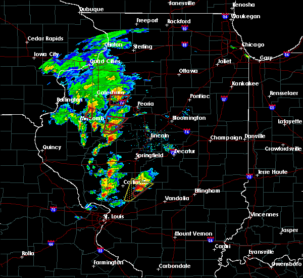 At 428 pm cst, a confirmed tornado was located over raymond, moving northeast at 30 mph (weather spotters confirmed tornado). Hazards include damaging tornado and quarter size hail. Flying debris will be dangerous to those caught without shelter. mobile homes will be damaged or destroyed. damage to roofs, windows, and vehicles will occur. tree damage is likely. this tornadic thunderstorm will remain over mainly rural areas of northwestern montgomery county, including the following locations, harvel. This includes interstate 55 in illinois near exit 63. At 428 pm cst, a confirmed tornado was located over raymond, moving northeast at 30 mph (weather spotters confirmed tornado). Hazards include damaging tornado and quarter size hail. Flying debris will be dangerous to those caught without shelter. mobile homes will be damaged or destroyed. damage to roofs, windows, and vehicles will occur. tree damage is likely. this tornadic thunderstorm will remain over mainly rural areas of northwestern montgomery county, including the following locations, harvel. This includes interstate 55 in illinois near exit 63.
|
| 12/1/2018 3:57 PM CST |
 At 357 pm cst, a severe thunderstorm was located over sawyerville, moving north at 30 mph (radar indicated). Hazards include 60 mph wind gusts and quarter size hail. Hail damage to vehicles is expected. Expect wind damage to roofs, siding, and trees. At 357 pm cst, a severe thunderstorm was located over sawyerville, moving north at 30 mph (radar indicated). Hazards include 60 mph wind gusts and quarter size hail. Hail damage to vehicles is expected. Expect wind damage to roofs, siding, and trees.
|
| 7/19/2018 10:46 PM CDT |
 The national weather service in lincoln has issued a * severe thunderstorm warning for. christian county in central illinois. until 1130 pm cdt. At 1045 pm cdt, a severe thunderstorm was located near jeisyville, or 10 miles west of taylorville, moving southeast at 40 mph. The national weather service in lincoln has issued a * severe thunderstorm warning for. christian county in central illinois. until 1130 pm cdt. At 1045 pm cdt, a severe thunderstorm was located near jeisyville, or 10 miles west of taylorville, moving southeast at 40 mph.
|
| 7/14/2018 5:31 PM CDT |
 At 531 pm cdt, severe thunderstorms were located along a line extending from near carlinville to 7 miles northwest of east gillespie to shipman, moving east at 45 mph (radar indicated). Hazards include 60 mph wind gusts and quarter size hail. Hail damage to vehicles is expected. expect wind damage to roofs, siding, and trees. locations impacted include, litchfield, carlinville, staunton, virden, gillespie, girard, mount olive, bunker hill, benld, raymond, white oak, farmersville, shipman, wilsonville, sawyerville, mount clare, east gillespie, eagarville, waggoner and nilwood. this also includes beaver dam state park and lake lou yaeger. This includes interstate 55 in illinois between exits 41 and 63. At 531 pm cdt, severe thunderstorms were located along a line extending from near carlinville to 7 miles northwest of east gillespie to shipman, moving east at 45 mph (radar indicated). Hazards include 60 mph wind gusts and quarter size hail. Hail damage to vehicles is expected. expect wind damage to roofs, siding, and trees. locations impacted include, litchfield, carlinville, staunton, virden, gillespie, girard, mount olive, bunker hill, benld, raymond, white oak, farmersville, shipman, wilsonville, sawyerville, mount clare, east gillespie, eagarville, waggoner and nilwood. this also includes beaver dam state park and lake lou yaeger. This includes interstate 55 in illinois between exits 41 and 63.
|
| 7/14/2018 5:12 PM CDT |
 At 510 pm cdt, severe thunderstorms were located along a line extending from near palmyra to near kemper to near brighton, moving east at 25 mph. another severe storm was located near gillespie, moving to the northeast at 20 mph (radar indicated). Hazards include 60 mph wind gusts and quarter size hail. Hail damage to vehicles is expected. Expect wind damage to roofs, siding, and trees. At 510 pm cdt, severe thunderstorms were located along a line extending from near palmyra to near kemper to near brighton, moving east at 25 mph. another severe storm was located near gillespie, moving to the northeast at 20 mph (radar indicated). Hazards include 60 mph wind gusts and quarter size hail. Hail damage to vehicles is expected. Expect wind damage to roofs, siding, and trees.
|
| 7/1/2018 6:03 PM CDT |
 At 603 pm cdt, severe thunderstorms were located along a line extending from morrisonville to roxana, moving east at 30 mph (radar indicated). Hazards include 60 mph wind gusts and penny size hail. expect damage to roofs, siding, and trees At 603 pm cdt, severe thunderstorms were located along a line extending from morrisonville to roxana, moving east at 30 mph (radar indicated). Hazards include 60 mph wind gusts and penny size hail. expect damage to roofs, siding, and trees
|
| 6/28/2018 5:08 PM CDT |
 At 508 pm cdt, severe thunderstorms were located along a line extending from near illiopolis to morrisonville to near hardin, moving southeast at 45 mph (radar indicated). Hazards include 60 mph wind gusts. Expect damage to roofs, siding, and trees. locations impacted include, jerseyville, litchfield, hillsboro, carlinville, virden, gillespie, nokomis, carrollton, brighton, girard, benld, greenfield, raymond, witt, white oak, farmersville, palmyra, shipman, schram city and mount clare. this also includes beaver dam state park and lake lou yaeger. This includes interstate 55 in illinois between exits 52 and 63. At 508 pm cdt, severe thunderstorms were located along a line extending from near illiopolis to morrisonville to near hardin, moving southeast at 45 mph (radar indicated). Hazards include 60 mph wind gusts. Expect damage to roofs, siding, and trees. locations impacted include, jerseyville, litchfield, hillsboro, carlinville, virden, gillespie, nokomis, carrollton, brighton, girard, benld, greenfield, raymond, witt, white oak, farmersville, palmyra, shipman, schram city and mount clare. this also includes beaver dam state park and lake lou yaeger. This includes interstate 55 in illinois between exits 52 and 63.
|
| 6/28/2018 5:02 PM CDT |
 At 501 pm cdt, severe thunderstorms were located along a line extending from mount pulaski to mount auburn to near morrisonville, moving east at 60 mph (radar indicated). Hazards include 70 mph wind gusts. Expect considerable tree damage. damage is likely to mobile homes, roofs, and outbuildings. locations impacted include, taylorville, atlanta, mount pulaski, kincaid, edinburg, morrisonville, stonington, illiopolis, niantic, mechanicsburg, mount auburn, latham, chestnut, bulpitt, jeisyville, beason, tovey, buffalo, berry and owaneco. this includes the following highways, interstate 55 between mile markers 139 and 142. Interstate 72 between mile markers 113 and 128. At 501 pm cdt, severe thunderstorms were located along a line extending from mount pulaski to mount auburn to near morrisonville, moving east at 60 mph (radar indicated). Hazards include 70 mph wind gusts. Expect considerable tree damage. damage is likely to mobile homes, roofs, and outbuildings. locations impacted include, taylorville, atlanta, mount pulaski, kincaid, edinburg, morrisonville, stonington, illiopolis, niantic, mechanicsburg, mount auburn, latham, chestnut, bulpitt, jeisyville, beason, tovey, buffalo, berry and owaneco. this includes the following highways, interstate 55 between mile markers 139 and 142. Interstate 72 between mile markers 113 and 128.
|
| 6/28/2018 4:44 PM CDT |
 At 444 pm cdt, severe thunderstorms were located along a line extending from near elkhart to rochester to near virden, moving southeast at 45 mph (radar indicated). Hazards include 70 mph wind gusts. Expect considerable tree damage. Damage is likely to mobile homes, roofs, and outbuildings. At 444 pm cdt, severe thunderstorms were located along a line extending from near elkhart to rochester to near virden, moving southeast at 45 mph (radar indicated). Hazards include 70 mph wind gusts. Expect considerable tree damage. Damage is likely to mobile homes, roofs, and outbuildings.
|
| 6/28/2018 4:39 PM CDT |
 At 439 pm cdt, severe thunderstorms were located along a line extending from near middletown to near auburn to near alsey, moving southeast at 55 mph (radar indicated). Hazards include 60 mph wind gusts and penny size hail. expect damage to roofs, siding, and trees At 439 pm cdt, severe thunderstorms were located along a line extending from near middletown to near auburn to near alsey, moving southeast at 55 mph (radar indicated). Hazards include 60 mph wind gusts and penny size hail. expect damage to roofs, siding, and trees
|
| 5/27/2018 2:24 PM CDT |
 At 223 pm cdt, a severe thunderstorm was located near morrisonville, or 7 miles northwest of nokomis, moving southeast at 15 mph (trained weather spotters. christian county emergency manager reported quarter size hail in morrisonville at 2:00 pm cdt). Hazards include quarter size hail. Damage to vehicles is expected. Locations impacted include, palmer. At 223 pm cdt, a severe thunderstorm was located near morrisonville, or 7 miles northwest of nokomis, moving southeast at 15 mph (trained weather spotters. christian county emergency manager reported quarter size hail in morrisonville at 2:00 pm cdt). Hazards include quarter size hail. Damage to vehicles is expected. Locations impacted include, palmer.
|
| 5/27/2018 2:07 PM CDT |
 At 206 pm cdt, a severe thunderstorm was located just south of morrisonville, or 11 miles southwest of taylorville, moving southeast at 10 mph (radar indicated). Hazards include 60 mph wind gusts and quarter size hail. Hail damage to vehicles is expected. expect wind damage to roofs, siding, and trees. Locations impacted include, palmer. At 206 pm cdt, a severe thunderstorm was located just south of morrisonville, or 11 miles southwest of taylorville, moving southeast at 10 mph (radar indicated). Hazards include 60 mph wind gusts and quarter size hail. Hail damage to vehicles is expected. expect wind damage to roofs, siding, and trees. Locations impacted include, palmer.
|
| 5/27/2018 1:45 PM CDT |
 At 145 pm cdt, a severe thunderstorm was located over morrisonville, or 12 miles west of taylorville, moving southeast at 15 mph (radar indicated). Hazards include 60 mph wind gusts and quarter size hail. Hail damage to vehicles is expected. Expect wind damage to roofs, siding, and trees. At 145 pm cdt, a severe thunderstorm was located over morrisonville, or 12 miles west of taylorville, moving southeast at 15 mph (radar indicated). Hazards include 60 mph wind gusts and quarter size hail. Hail damage to vehicles is expected. Expect wind damage to roofs, siding, and trees.
|
| 5/14/2018 7:16 PM CDT |
 At 715 pm cdt, severe thunderstorms were located along a line extending from near taylorville to carlyle, moving east at 45 mph (radar indicated). Hazards include 60 mph wind gusts. Expect damage to roofs, siding, and trees. locations impacted include, greenville, hillsboro, breese, carlyle, nokomis, centralia, aviston, st. rose, germantown, albers, wamac, beckemeyer, witt, pocahontas, taylor springs, coffeen, mulberry grove, schram city, tamalco and sorento. this also includes carlyle lake recreational area. this includes the following highways, interstate 70 in illinois between exits 36 and 52. Interstate 64 in illinois near exit 34. At 715 pm cdt, severe thunderstorms were located along a line extending from near taylorville to carlyle, moving east at 45 mph (radar indicated). Hazards include 60 mph wind gusts. Expect damage to roofs, siding, and trees. locations impacted include, greenville, hillsboro, breese, carlyle, nokomis, centralia, aviston, st. rose, germantown, albers, wamac, beckemeyer, witt, pocahontas, taylor springs, coffeen, mulberry grove, schram city, tamalco and sorento. this also includes carlyle lake recreational area. this includes the following highways, interstate 70 in illinois between exits 36 and 52. Interstate 64 in illinois near exit 34.
|
| 5/14/2018 7:02 PM CDT |
 A severe thunderstorm warning remains in effect until 745 pm cdt for clinton and bond counties in south central illinois. eastern madison county in southwestern illinois and montgomery counties in south central illinois. At 702 pm cdt, severe thunderstorms were located along a line extending from near morrisonville to near aviston, moving east at 30. A severe thunderstorm warning remains in effect until 745 pm cdt for clinton and bond counties in south central illinois. eastern madison county in southwestern illinois and montgomery counties in south central illinois. At 702 pm cdt, severe thunderstorms were located along a line extending from near morrisonville to near aviston, moving east at 30.
|
| 5/14/2018 6:35 PM CDT |
 At 635 pm cdt, severe thunderstorms were located along a line extending from near girard to near lebanon, moving east at 30 mph (radar indicated). Hazards include 60 mph wind gusts. expect damage to roofs, siding, and trees At 635 pm cdt, severe thunderstorms were located along a line extending from near girard to near lebanon, moving east at 30 mph (radar indicated). Hazards include 60 mph wind gusts. expect damage to roofs, siding, and trees
|
| 9/4/2017 5:47 PM CDT |
 At 546 pm cdt, a severe thunderstorm was located near hillsboro, moving southeast at 35 mph (trained weather spotters. golf ball hail was reported 6 miles southwest of carlinville at beaver dam state park). Hazards include golf ball size hail and 60 mph wind gusts. People and animals outdoors will be injured. expect hail damage to roofs, siding, windows, and vehicles. expect wind damage to roofs, siding, and trees. locations impacted include, litchfield, hillsboro, carlinville, staunton, gillespie, mount olive, bunker hill, benld, raymond, farmersville, taylor springs, shipman, wilsonville, schram city, sawyerville, mount clare, east gillespie, eagarville, kemper and irving. this also includes beaver dam state park and lake lou yaeger. This includes interstate 55 in illinois between exits 41 and 63. At 546 pm cdt, a severe thunderstorm was located near hillsboro, moving southeast at 35 mph (trained weather spotters. golf ball hail was reported 6 miles southwest of carlinville at beaver dam state park). Hazards include golf ball size hail and 60 mph wind gusts. People and animals outdoors will be injured. expect hail damage to roofs, siding, windows, and vehicles. expect wind damage to roofs, siding, and trees. locations impacted include, litchfield, hillsboro, carlinville, staunton, gillespie, mount olive, bunker hill, benld, raymond, farmersville, taylor springs, shipman, wilsonville, schram city, sawyerville, mount clare, east gillespie, eagarville, kemper and irving. this also includes beaver dam state park and lake lou yaeger. This includes interstate 55 in illinois between exits 41 and 63.
|
| 9/4/2017 5:15 PM CDT |
 At 514 pm cdt, a severe thunderstorm was located near carlinville, moving southeast at 35 mph (trained weather spotters. hail to the size of ping pong balls was reported north of carlinville with this storm). Hazards include ping pong ball size hail and 60 mph wind gusts. People and animals outdoors will be injured. expect hail damage to roofs, siding, windows, and vehicles. Expect wind damage to roofs, siding, and trees. At 514 pm cdt, a severe thunderstorm was located near carlinville, moving southeast at 35 mph (trained weather spotters. hail to the size of ping pong balls was reported north of carlinville with this storm). Hazards include ping pong ball size hail and 60 mph wind gusts. People and animals outdoors will be injured. expect hail damage to roofs, siding, windows, and vehicles. Expect wind damage to roofs, siding, and trees.
|
| 7/23/2017 4:28 AM CDT |
 At 427 am cdt, severe thunderstorms were located along a line extending from farmersville to near witt to van burensburg, moving east at 45 mph (radar indicated). Hazards include 60 mph wind gusts. Expect damage to roofs, siding, and trees. locations impacted include, vandalia, litchfield, hillsboro, nokomis, st. elmo, ramsey, raymond, witt, taylor springs, coffeen, schram city, wrights corner, van burensburg, avena, irving, herrick, fillmore, coalton, butler and ohlman. this also includes ramsey lake state park and lake lou yaeger. this includes the following highways, interstate 70 in illinois near exit 76. Interstate 55 in illinois between exits 60 and 63. At 427 am cdt, severe thunderstorms were located along a line extending from farmersville to near witt to van burensburg, moving east at 45 mph (radar indicated). Hazards include 60 mph wind gusts. Expect damage to roofs, siding, and trees. locations impacted include, vandalia, litchfield, hillsboro, nokomis, st. elmo, ramsey, raymond, witt, taylor springs, coffeen, schram city, wrights corner, van burensburg, avena, irving, herrick, fillmore, coalton, butler and ohlman. this also includes ramsey lake state park and lake lou yaeger. this includes the following highways, interstate 70 in illinois near exit 76. Interstate 55 in illinois between exits 60 and 63.
|
| 7/23/2017 4:08 AM CDT |
 At 408 am cdt, severe thunderstorms were located along a line extending from near palmyra to near litchfield to near sorento, moving east at 45 mph (radar indicated). Hazards include 60 mph wind gusts and penny size hail. expect damage to roofs, siding, and trees At 408 am cdt, severe thunderstorms were located along a line extending from near palmyra to near litchfield to near sorento, moving east at 45 mph (radar indicated). Hazards include 60 mph wind gusts and penny size hail. expect damage to roofs, siding, and trees
|
| 7/23/2017 3:39 AM CDT |
 At 339 am cdt, severe thunderstorms were located along a line extending from near manchester to near kemper to dorsey, moving east at 50 mph (radar indicated). Hazards include 70 mph wind gusts and quarter size hail. Hail damage to vehicles is expected. expect considerable tree damage. wind damage is also likely to mobile homes, roofs, and outbuildings. locations impacted include, litchfield, hillsboro, carlinville, staunton, virden, gillespie, white hall, brighton, girard, mount olive, roodhouse, bunker hill, benld, greenfield, raymond, white oak, farmersville, palmyra, taylor springs and coffeen. this also includes beaver dam state park and lake lou yaeger. This includes interstate 55 in illinois between exits 41 and 63. At 339 am cdt, severe thunderstorms were located along a line extending from near manchester to near kemper to dorsey, moving east at 50 mph (radar indicated). Hazards include 70 mph wind gusts and quarter size hail. Hail damage to vehicles is expected. expect considerable tree damage. wind damage is also likely to mobile homes, roofs, and outbuildings. locations impacted include, litchfield, hillsboro, carlinville, staunton, virden, gillespie, white hall, brighton, girard, mount olive, roodhouse, bunker hill, benld, greenfield, raymond, white oak, farmersville, palmyra, taylor springs and coffeen. this also includes beaver dam state park and lake lou yaeger. This includes interstate 55 in illinois between exits 41 and 63.
|
| 7/23/2017 3:25 AM CDT |
 At 325 am cdt, severe thunderstorms were located along a line extending from near alsey to near kemper to near godfrey, moving east at 50 mph (radar indicated). Hazards include 70 mph wind gusts and quarter size hail. Hail damage to vehicles is expected. expect considerable tree damage. Wind damage is also likely to mobile homes, roofs, and outbuildings. At 325 am cdt, severe thunderstorms were located along a line extending from near alsey to near kemper to near godfrey, moving east at 50 mph (radar indicated). Hazards include 70 mph wind gusts and quarter size hail. Hail damage to vehicles is expected. expect considerable tree damage. Wind damage is also likely to mobile homes, roofs, and outbuildings.
|
| 7/10/2017 11:20 PM CDT |
 The severe thunderstorm warning for northeastern bond, northwestern fayette and montgomery counties will expire at 1130 pm cdt, the storm which prompted the warning has weakened below severe limits, and no longer poses an immediate threat to life or property. therefore the warning will be allowed to expire. The severe thunderstorm warning for northeastern bond, northwestern fayette and montgomery counties will expire at 1130 pm cdt, the storm which prompted the warning has weakened below severe limits, and no longer poses an immediate threat to life or property. therefore the warning will be allowed to expire.
|
| 7/10/2017 10:52 PM CDT |
 At 1052 pm cdt, a severe thunderstorm was located 7 miles northwest of pana, moving southeast at 40 mph (radar indicated). Hazards include 60 mph wind gusts and nickel size hail. Expect damage to roofs, siding, and trees. locations impacted include, vandalia, greenville, hillsboro, nokomis, ramsey, raymond, witt, white oak, farmersville, taylor springs, coffeen, mulberry grove, schram city, woburn, wrights corner, van burensburg, irving, shafter, herrick and fillmore. this also includes ramsey lake state park. This includes interstate 70 in illinois between exits 45 and 63. At 1052 pm cdt, a severe thunderstorm was located 7 miles northwest of pana, moving southeast at 40 mph (radar indicated). Hazards include 60 mph wind gusts and nickel size hail. Expect damage to roofs, siding, and trees. locations impacted include, vandalia, greenville, hillsboro, nokomis, ramsey, raymond, witt, white oak, farmersville, taylor springs, coffeen, mulberry grove, schram city, woburn, wrights corner, van burensburg, irving, shafter, herrick and fillmore. this also includes ramsey lake state park. This includes interstate 70 in illinois between exits 45 and 63.
|
| 7/10/2017 10:46 PM CDT |
 At 1045 pm cdt, severe thunderstorms were located along a line extending from assumption to near pana to near morrisonville, moving southeast at 55 mph (radar indicated). Hazards include 70 mph wind gusts. Expect considerable tree damage. damage is likely to mobile homes, roofs, and outbuildings. Locations impacted include, taylorville, pana, kincaid, assumption, morrisonville, stonington, bulpitt, jeisyville, tovey, rosamond, owaneco, palmer, willeys, sharpsburg, vanderville and taylorville airport. At 1045 pm cdt, severe thunderstorms were located along a line extending from assumption to near pana to near morrisonville, moving southeast at 55 mph (radar indicated). Hazards include 70 mph wind gusts. Expect considerable tree damage. damage is likely to mobile homes, roofs, and outbuildings. Locations impacted include, taylorville, pana, kincaid, assumption, morrisonville, stonington, bulpitt, jeisyville, tovey, rosamond, owaneco, palmer, willeys, sharpsburg, vanderville and taylorville airport.
|
| 7/10/2017 10:28 PM CDT |
 At 1028 pm cdt, a severe thunderstorm was located over kincaid, moving southeast at 60 mph (radar indicated). Hazards include 60 mph wind gusts and nickel size hail. expect damage to roofs, siding, and trees At 1028 pm cdt, a severe thunderstorm was located over kincaid, moving southeast at 60 mph (radar indicated). Hazards include 60 mph wind gusts and nickel size hail. expect damage to roofs, siding, and trees
|
| 7/10/2017 10:14 PM CDT |
 At 1014 pm cdt, severe thunderstorms were located along a line extending from near mechanicsburg to near rochester to near loami, moving southeast at 45 mph (radar indicated). Hazards include 70 mph wind gusts. Expect considerable tree damage. Damage is likely to mobile homes, roofs, and outbuildings. At 1014 pm cdt, severe thunderstorms were located along a line extending from near mechanicsburg to near rochester to near loami, moving southeast at 45 mph (radar indicated). Hazards include 70 mph wind gusts. Expect considerable tree damage. Damage is likely to mobile homes, roofs, and outbuildings.
|
| 5/19/2017 6:41 AM CDT |
 The severe thunderstorm warning for menard, christian, sangamon, cass and northern morgan counties will expire at 645 am cdt, the storms which prompted the warning have weakened below severe limits, and no longer pose an immediate threat to life or property. therefore the warning will be allowed to expire. however gusty winds and heavy rain are still possible with these thunderstorms. The severe thunderstorm warning for menard, christian, sangamon, cass and northern morgan counties will expire at 645 am cdt, the storms which prompted the warning have weakened below severe limits, and no longer pose an immediate threat to life or property. therefore the warning will be allowed to expire. however gusty winds and heavy rain are still possible with these thunderstorms.
|
| 5/19/2017 6:28 AM CDT |
 At 627 am cdt, severe thunderstorms were located along a line extending from near virginia to near pawnee to near schram city, moving northeast at 60 mph (radar indicated). Hazards include 60 mph wind gusts. Expect damage to roofs, siding, and trees. locations impacted include, springfield, jacksonville, taylorville, virginia, chatham, alexander, auburn, sherman, rochester, riverton, pawnee, petersburg, athens, kincaid, williamsville, new berlin, ashland, divernon, edinburg and morrisonville. this includes the following highways, interstate 55 between mile markers 79 and 109. Interstate 72 between mile markers 68 and 124. At 627 am cdt, severe thunderstorms were located along a line extending from near virginia to near pawnee to near schram city, moving northeast at 60 mph (radar indicated). Hazards include 60 mph wind gusts. Expect damage to roofs, siding, and trees. locations impacted include, springfield, jacksonville, taylorville, virginia, chatham, alexander, auburn, sherman, rochester, riverton, pawnee, petersburg, athens, kincaid, williamsville, new berlin, ashland, divernon, edinburg and morrisonville. this includes the following highways, interstate 55 between mile markers 79 and 109. Interstate 72 between mile markers 68 and 124.
|
| 5/19/2017 6:24 AM CDT |
 At 623 am cdt, severe thunderstorms were located along a line extending from white oak to near beaver creek, moving northeast at 65 mph (trained weather spotters). Hazards include 60 mph wind gusts. Expect damage to roofs, siding, and trees. locations impacted include, greenville, litchfield, hillsboro, nokomis, ramsey, raymond, witt, white oak, pocahontas, farmersville, taylor springs, coffeen, mulberry grove, schram city, tamalco, sorento, beaver creek, woburn, van burensburg and reno. this also includes ramsey lake state park and lake lou yaeger. this includes the following highways, interstate 70 in illinois between exits 36 and 52. Interstate 55 in illinois between exits 60 and 63. At 623 am cdt, severe thunderstorms were located along a line extending from white oak to near beaver creek, moving northeast at 65 mph (trained weather spotters). Hazards include 60 mph wind gusts. Expect damage to roofs, siding, and trees. locations impacted include, greenville, litchfield, hillsboro, nokomis, ramsey, raymond, witt, white oak, pocahontas, farmersville, taylor springs, coffeen, mulberry grove, schram city, tamalco, sorento, beaver creek, woburn, van burensburg and reno. this also includes ramsey lake state park and lake lou yaeger. this includes the following highways, interstate 70 in illinois between exits 36 and 52. Interstate 55 in illinois between exits 60 and 63.
|
| 5/19/2017 6:07 AM CDT |
 At 606 am cdt, severe thunderstorms were located along a line extending from near meredosia to near girard to near sorento, moving northeast at 55 mph (radar indicated). Hazards include 70 mph wind gusts. Expect considerable tree damage. damage is likely to mobile homes, roofs, and outbuildings. locations impacted include, springfield, jacksonville, taylorville, virginia, winchester, chatham, alexander, auburn, sherman, rochester, riverton, pawnee, petersburg, athens, kincaid, williamsville, new berlin, ashland, waverly and divernon. this includes the following highways, interstate 55 between mile markers 77 and 109. Interstate 72 between mile markers 46 and 124. At 606 am cdt, severe thunderstorms were located along a line extending from near meredosia to near girard to near sorento, moving northeast at 55 mph (radar indicated). Hazards include 70 mph wind gusts. Expect considerable tree damage. damage is likely to mobile homes, roofs, and outbuildings. locations impacted include, springfield, jacksonville, taylorville, virginia, winchester, chatham, alexander, auburn, sherman, rochester, riverton, pawnee, petersburg, athens, kincaid, williamsville, new berlin, ashland, waverly and divernon. this includes the following highways, interstate 55 between mile markers 77 and 109. Interstate 72 between mile markers 46 and 124.
|
| 5/19/2017 6:02 AM CDT |
 At 601 am cdt, severe thunderstorms were located along a line extending from near palmyra to near st. rose, moving northeast at 45 mph. these are very dangerous storms (trained weather spotters). Hazards include 80 mph wind gusts. Flying debris will be dangerous to those caught without shelter. mobile homes will be heavily damaged. expect considerable damage to roofs, windows, and vehicles. extensive tree damage and power outages are likely. locations impacted include, greenville, litchfield, hillsboro, carlinville, staunton, virden, gillespie, nokomis, girard, mount olive, bunker hill, benld, ramsey, raymond, witt, white oak, pocahontas, farmersville, palmyra and taylor springs. this also includes ramsey lake state park, beaver dam state park, and lake lou yaeger. this includes the following highways, interstate 70 in illinois between exits 36 and 52. Interstate 55 in illinois between exits 41 and 63. At 601 am cdt, severe thunderstorms were located along a line extending from near palmyra to near st. rose, moving northeast at 45 mph. these are very dangerous storms (trained weather spotters). Hazards include 80 mph wind gusts. Flying debris will be dangerous to those caught without shelter. mobile homes will be heavily damaged. expect considerable damage to roofs, windows, and vehicles. extensive tree damage and power outages are likely. locations impacted include, greenville, litchfield, hillsboro, carlinville, staunton, virden, gillespie, nokomis, girard, mount olive, bunker hill, benld, ramsey, raymond, witt, white oak, pocahontas, farmersville, palmyra and taylor springs. this also includes ramsey lake state park, beaver dam state park, and lake lou yaeger. this includes the following highways, interstate 70 in illinois between exits 36 and 52. Interstate 55 in illinois between exits 41 and 63.
|
| 5/19/2017 5:47 AM CDT |
 At 547 am cdt, severe thunderstorms were located along a line extending from near naples to 7 miles west of carlinville to near marine, moving northeast at 60 mph (radar indicated). Hazards include 70 mph wind gusts. Expect considerable tree damage. Damage is likely to mobile homes, roofs, and outbuildings. At 547 am cdt, severe thunderstorms were located along a line extending from near naples to 7 miles west of carlinville to near marine, moving northeast at 60 mph (radar indicated). Hazards include 70 mph wind gusts. Expect considerable tree damage. Damage is likely to mobile homes, roofs, and outbuildings.
|
| 5/19/2017 5:36 AM CDT |
 At 536 am cdt, severe thunderstorms were located along a line extending from near carrollton to mascoutah, moving northeast at 60 mph. these are very dangerous storms (radar indicated). Hazards include 80 mph wind gusts. Flying debris will be dangerous to those caught without shelter. mobile homes will be heavily damaged. expect considerable damage to roofs, windows, and vehicles. Extensive tree damage and power outages are likely. At 536 am cdt, severe thunderstorms were located along a line extending from near carrollton to mascoutah, moving northeast at 60 mph. these are very dangerous storms (radar indicated). Hazards include 80 mph wind gusts. Flying debris will be dangerous to those caught without shelter. mobile homes will be heavily damaged. expect considerable damage to roofs, windows, and vehicles. Extensive tree damage and power outages are likely.
|
| 4/29/2017 5:04 PM CDT |
 At 503 pm cdt, severe thunderstorms were located along a line extending from near pawnee to morrisonville to near coffeen, moving northeast at 50 mph (trained weather spotters observed wind speeds of 60 mph and quarter size hail). Hazards include 60 mph wind gusts and quarter size hail. Hail damage to vehicles is expected. expect wind damage to roofs, siding, and trees. locations impacted include, litchfield, hillsboro, virden, nokomis, girard, ramsey, raymond, witt, white oak, farmersville, taylor springs, coffeen, schram city, irving, panama, fillmore, coalton, waggoner, harvel and donnellson. this also includes ramsey lake state park and lake lou yaeger. This includes interstate 55 in illinois between exits 60 and 63. At 503 pm cdt, severe thunderstorms were located along a line extending from near pawnee to morrisonville to near coffeen, moving northeast at 50 mph (trained weather spotters observed wind speeds of 60 mph and quarter size hail). Hazards include 60 mph wind gusts and quarter size hail. Hail damage to vehicles is expected. expect wind damage to roofs, siding, and trees. locations impacted include, litchfield, hillsboro, virden, nokomis, girard, ramsey, raymond, witt, white oak, farmersville, taylor springs, coffeen, schram city, irving, panama, fillmore, coalton, waggoner, harvel and donnellson. this also includes ramsey lake state park and lake lou yaeger. This includes interstate 55 in illinois between exits 60 and 63.
|
| 4/29/2017 5:02 PM CDT |
 At 502 pm cdt, severe thunderstorms were located along a line extending from near pawnee to near witt to near reno, moving northeast at 50 mph (trained weather spotters). Hazards include 60 mph wind gusts and quarter size hail. Hail damage to vehicles is expected. expect wind damage to roofs, siding, and trees. locations impacted include, decatur, taylorville, pana, moweaqua, kincaid, harristown, warrensburg, assumption, blue mound, macon, edinburg, morrisonville, stonington, niantic, tower hill, mount auburn, bulpitt, jeisyville, tovey and herrick. This includes interstate 72 between mile markers 125 and 139. At 502 pm cdt, severe thunderstorms were located along a line extending from near pawnee to near witt to near reno, moving northeast at 50 mph (trained weather spotters). Hazards include 60 mph wind gusts and quarter size hail. Hail damage to vehicles is expected. expect wind damage to roofs, siding, and trees. locations impacted include, decatur, taylorville, pana, moweaqua, kincaid, harristown, warrensburg, assumption, blue mound, macon, edinburg, morrisonville, stonington, niantic, tower hill, mount auburn, bulpitt, jeisyville, tovey and herrick. This includes interstate 72 between mile markers 125 and 139.
|
| 4/29/2017 4:54 PM CDT | Quarter sized hail reported 1 miles ESE of Harvel, IL |
| 4/29/2017 4:54 PM CDT | Storm damage reported in montgomery county IL, 1 miles ESE of Harvel, IL |
| 4/29/2017 4:46 PM CDT |
 At 445 pm cdt, severe thunderstorms were located along a line extending from near virden to litchfield to near alhambra, moving northeast at 50 mph (radar indicated). Hazards include 60 mph wind gusts and quarter size hail. Hail damage to vehicles is expected. Expect wind damage to roofs, siding, and trees. At 445 pm cdt, severe thunderstorms were located along a line extending from near virden to litchfield to near alhambra, moving northeast at 50 mph (radar indicated). Hazards include 60 mph wind gusts and quarter size hail. Hail damage to vehicles is expected. Expect wind damage to roofs, siding, and trees.
|
| 4/29/2017 4:42 PM CDT |
 At 442 pm cdt, severe thunderstorms were located along a line extending from girard to near litchfield to near alhambra, moving northeast at 50 mph (radar indicated). Hazards include 60 mph wind gusts and quarter size hail. Hail damage to vehicles is expected. Expect wind damage to roofs, siding, and trees. At 442 pm cdt, severe thunderstorms were located along a line extending from girard to near litchfield to near alhambra, moving northeast at 50 mph (radar indicated). Hazards include 60 mph wind gusts and quarter size hail. Hail damage to vehicles is expected. Expect wind damage to roofs, siding, and trees.
|
| 4/29/2017 4:25 PM CDT |
 At 424 pm cdt, severe thunderstorms were located along a line extending from 6 miles south of palmyra to near mount clare to carpenter, moving northeast at 50 mph (radar indicated). Hazards include 60 mph wind gusts and quarter size hail. Hail damage to vehicles is expected. expect wind damage to roofs, siding, and trees. locations impacted include, bethalto, litchfield, carlinville, staunton, gillespie, girard, mount olive, bunker hill, benld, roxana, worden, raymond, white oak, livingston, farmersville, wilsonville, sawyerville, mount clare, east gillespie and eagarville. this also includes beaver dam state park and lake lou yaeger. This includes interstate 55 in illinois between exits 33 and 63. At 424 pm cdt, severe thunderstorms were located along a line extending from 6 miles south of palmyra to near mount clare to carpenter, moving northeast at 50 mph (radar indicated). Hazards include 60 mph wind gusts and quarter size hail. Hail damage to vehicles is expected. expect wind damage to roofs, siding, and trees. locations impacted include, bethalto, litchfield, carlinville, staunton, gillespie, girard, mount olive, bunker hill, benld, roxana, worden, raymond, white oak, livingston, farmersville, wilsonville, sawyerville, mount clare, east gillespie and eagarville. this also includes beaver dam state park and lake lou yaeger. This includes interstate 55 in illinois between exits 33 and 63.
|
| 4/29/2017 4:03 PM CDT |
 At 402 pm cdt, severe thunderstorms were located along a line extending from near kemper to near alton to granite city, moving northeast at 50 mph (trained weather spotters have observed quarter size hail and severe wind damage with this line of thunderstorms). Hazards include 60 mph wind gusts and quarter size hail. Hail damage to vehicles is expected. Expect wind damage to roofs, siding, and trees. At 402 pm cdt, severe thunderstorms were located along a line extending from near kemper to near alton to granite city, moving northeast at 50 mph (trained weather spotters have observed quarter size hail and severe wind damage with this line of thunderstorms). Hazards include 60 mph wind gusts and quarter size hail. Hail damage to vehicles is expected. Expect wind damage to roofs, siding, and trees.
|
| 3/30/2017 1:32 PM CDT |
 At 132 pm cdt, a severe thunderstorm was located near raymond, moving northeast at 40 mph (radar indicated). Hazards include 60 mph wind gusts and quarter size hail. Hail damage to vehicles is expected. expect wind damage to roofs, siding, and trees. locations impacted include, litchfield, raymond, farmersville, waggoner, harvel, standard city, hornsby, atwater and honey bend. this also includes lake lou yaeger. This includes interstate 55 in illinois between exits 52 and 63. At 132 pm cdt, a severe thunderstorm was located near raymond, moving northeast at 40 mph (radar indicated). Hazards include 60 mph wind gusts and quarter size hail. Hail damage to vehicles is expected. expect wind damage to roofs, siding, and trees. locations impacted include, litchfield, raymond, farmersville, waggoner, harvel, standard city, hornsby, atwater and honey bend. this also includes lake lou yaeger. This includes interstate 55 in illinois between exits 52 and 63.
|
| 3/30/2017 1:19 PM CDT |
 At 118 pm cdt, a severe thunderstorm was located near eagarville, moving northeast at 35 mph (radar indicated). Hazards include 60 mph wind gusts and quarter size hail. Hail damage to vehicles is expected. expect wind damage to roofs, siding, and trees. locations impacted include, litchfield, carlinville, staunton, gillespie, mount olive, bunker hill, benld, raymond, farmersville, wilsonville, sawyerville, mount clare, east gillespie, eagarville, waggoner, white city, harvel, royal lakes, standard city and dorchester. this also includes lake lou yaeger. This includes interstate 55 in illinois between exits 41 and 63. At 118 pm cdt, a severe thunderstorm was located near eagarville, moving northeast at 35 mph (radar indicated). Hazards include 60 mph wind gusts and quarter size hail. Hail damage to vehicles is expected. expect wind damage to roofs, siding, and trees. locations impacted include, litchfield, carlinville, staunton, gillespie, mount olive, bunker hill, benld, raymond, farmersville, wilsonville, sawyerville, mount clare, east gillespie, eagarville, waggoner, white city, harvel, royal lakes, standard city and dorchester. this also includes lake lou yaeger. This includes interstate 55 in illinois between exits 41 and 63.
|
| 3/30/2017 12:58 PM CDT |
 At 1257 pm cdt, a severe thunderstorm was located near wilsonville, moving northeast at 35 mph (trained weather spotters). Hazards include half dollar size hail. damage to vehicles is expected At 1257 pm cdt, a severe thunderstorm was located near wilsonville, moving northeast at 35 mph (trained weather spotters). Hazards include half dollar size hail. damage to vehicles is expected
|
| 3/7/2017 12:56 AM CST |
 At 1252 am cst, severe thunderstorms were located along a line extending from near kenney to white oak, moving east at 55 mph (radar indicated). Hazards include 70 mph wind gusts and quarter size hail. Hail damage to vehicles is expected. expect considerable tree damage. wind damage is also likely to mobile homes, roofs, and outbuildings. locations impacted include, springfield, decatur, taylorville, auburn, rochester, forsyth, pawnee, maroa, kincaid, harristown, warrensburg, divernon, blue mound, edinburg, morrisonville, stonington, illiopolis, niantic, mechanicsburg and mount auburn. this includes the following highways, interstate 55 between mile markers 77 and 85. interstate 72 between mile markers 112 and 144. A tornado watch remains in effect until 400 am cst for sangamon county, and a severe thunderstorm watch remains in effect until 500 am cst for logan county, christian county, macon county and dewitt county. At 1252 am cst, severe thunderstorms were located along a line extending from near kenney to white oak, moving east at 55 mph (radar indicated). Hazards include 70 mph wind gusts and quarter size hail. Hail damage to vehicles is expected. expect considerable tree damage. wind damage is also likely to mobile homes, roofs, and outbuildings. locations impacted include, springfield, decatur, taylorville, auburn, rochester, forsyth, pawnee, maroa, kincaid, harristown, warrensburg, divernon, blue mound, edinburg, morrisonville, stonington, illiopolis, niantic, mechanicsburg and mount auburn. this includes the following highways, interstate 55 between mile markers 77 and 85. interstate 72 between mile markers 112 and 144. A tornado watch remains in effect until 400 am cst for sangamon county, and a severe thunderstorm watch remains in effect until 500 am cst for logan county, christian county, macon county and dewitt county.
|
| 3/7/2017 12:55 AM CST |
 At 1254 am cst, severe thunderstorms were located along a line extending from near girard to staunton, moving northeast at 60 mph (radar indicated). Hazards include 60 mph wind gusts. expect damage to roofs, siding, and trees At 1254 am cst, severe thunderstorms were located along a line extending from near girard to staunton, moving northeast at 60 mph (radar indicated). Hazards include 60 mph wind gusts. expect damage to roofs, siding, and trees
|
| 3/7/2017 12:47 AM CST |
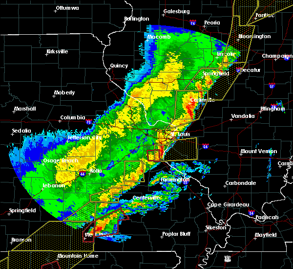 At 1246 am cst, severe thunderstorms were located along a line extending from girard to near carlinville to near prairietown, moving east at 55 mph (trained weather spotters). Hazards include 60 mph wind gusts. Expect damage to roofs, siding, and trees. locations impacted include, florissant, alton, godfrey, wood river, bethalto, litchfield, black jack, carlinville, staunton, virden, gillespie, east alton, brighton, girard, mount olive, bunker hill, benld, raymond, white oak and livingston. this also includes beaver dam state park and lake lou yaeger. this includes interstate 55 in illinois between exits 41 and 63. A tornado watch remains in effect until 400 am cst for south central and southwestern illinois, and east central missouri. At 1246 am cst, severe thunderstorms were located along a line extending from girard to near carlinville to near prairietown, moving east at 55 mph (trained weather spotters). Hazards include 60 mph wind gusts. Expect damage to roofs, siding, and trees. locations impacted include, florissant, alton, godfrey, wood river, bethalto, litchfield, black jack, carlinville, staunton, virden, gillespie, east alton, brighton, girard, mount olive, bunker hill, benld, raymond, white oak and livingston. this also includes beaver dam state park and lake lou yaeger. this includes interstate 55 in illinois between exits 41 and 63. A tornado watch remains in effect until 400 am cst for south central and southwestern illinois, and east central missouri.
|
| 3/7/2017 12:30 AM CST |
 At 1229 am cst, severe thunderstorms were located along a line extending from near williamsville to near waverly, moving east at 65 mph (radar indicated). Hazards include 70 mph wind gusts and quarter size hail. Hail damage to vehicles is expected. expect considerable tree damage. Wind damage is also likely to mobile homes, roofs, and outbuildings. At 1229 am cst, severe thunderstorms were located along a line extending from near williamsville to near waverly, moving east at 65 mph (radar indicated). Hazards include 70 mph wind gusts and quarter size hail. Hail damage to vehicles is expected. expect considerable tree damage. Wind damage is also likely to mobile homes, roofs, and outbuildings.
|
| 3/7/2017 12:29 AM CST |
 At 1229 am cst, severe thunderstorms were located along a line extending from near palmyra to near kemper to near west alton, moving northeast at 60 mph (trained weather spotters). Hazards include 60 mph wind gusts. Expect damage to roofs, siding, and trees. locations impacted include, florissant, alton, maryland heights, hazelwood, godfrey, bridgeton, wood river, bethalto, jerseyville, litchfield, black jack, carlinville, staunton, virden, gillespie, lambert-st. louis international airport, east alton, carrollton, brighton and girard. this also includes beaver dam state park and lake lou yaeger. this includes the following highways, interstate 55 in illinois between exits 41 and 63. interstate 70 in missouri near exit 231. A tornado watch remains in effect until 400 am cst for south central and southwestern illinois, and east central missouri. At 1229 am cst, severe thunderstorms were located along a line extending from near palmyra to near kemper to near west alton, moving northeast at 60 mph (trained weather spotters). Hazards include 60 mph wind gusts. Expect damage to roofs, siding, and trees. locations impacted include, florissant, alton, maryland heights, hazelwood, godfrey, bridgeton, wood river, bethalto, jerseyville, litchfield, black jack, carlinville, staunton, virden, gillespie, lambert-st. louis international airport, east alton, carrollton, brighton and girard. this also includes beaver dam state park and lake lou yaeger. this includes the following highways, interstate 55 in illinois between exits 41 and 63. interstate 70 in missouri near exit 231. A tornado watch remains in effect until 400 am cst for south central and southwestern illinois, and east central missouri.
|
| 3/7/2017 12:08 AM CST |
 At 1207 am cst, severe thunderstorms were located along a line extending from near carrollton to 7 miles west of grafton to near dardenne prairie, moving northeast at 80 mph (trained weather spotters. 60 mph winds have been reported in o`fallon missouri). Hazards include 60 mph wind gusts. expect damage to roofs, siding, and trees At 1207 am cst, severe thunderstorms were located along a line extending from near carrollton to 7 miles west of grafton to near dardenne prairie, moving northeast at 80 mph (trained weather spotters. 60 mph winds have been reported in o`fallon missouri). Hazards include 60 mph wind gusts. expect damage to roofs, siding, and trees
|
| 2/28/2017 5:38 PM CST |
 The tornado warning for northwestern montgomery county will expire at 545 pm cst, the storm which prompted the warning has moved out of the area. therefore the warning will be allowed to expire. a tornado watch remains in effect until 900 pm cst for south central and southwestern illinois. The tornado warning for northwestern montgomery county will expire at 545 pm cst, the storm which prompted the warning has moved out of the area. therefore the warning will be allowed to expire. a tornado watch remains in effect until 900 pm cst for south central and southwestern illinois.
|
| 2/28/2017 5:28 PM CST |
 At 527 pm cst, a severe thunderstorm capable of producing a tornado was located over farmersville, moving east at 50 mph (radar indicated rotation). Hazards include tornado. Flying debris will be dangerous to those caught without shelter. mobile homes will be damaged or destroyed. damage to roofs, windows, and vehicles will occur. tree damage is likely. this dangerous storm will be near, white oak around 530 pm cst. Other locations impacted by this tornadic thunderstorm include harvel and waggoner. At 527 pm cst, a severe thunderstorm capable of producing a tornado was located over farmersville, moving east at 50 mph (radar indicated rotation). Hazards include tornado. Flying debris will be dangerous to those caught without shelter. mobile homes will be damaged or destroyed. damage to roofs, windows, and vehicles will occur. tree damage is likely. this dangerous storm will be near, white oak around 530 pm cst. Other locations impacted by this tornadic thunderstorm include harvel and waggoner.
|
| 2/28/2017 5:14 PM CST |
 At 513 pm cst, a severe thunderstorm capable of producing a tornado was located near girard, moving east at 55 mph (radar indicated rotation). Hazards include tornado. Flying debris will be dangerous to those caught without shelter. mobile homes will be damaged or destroyed. damage to roofs, windows, and vehicles will occur. tree damage is likely. this dangerous storm will be near, farmersville around 520 pm cst. white oak around 530 pm cst. Other locations impacted by this tornadic thunderstorm include nilwood, waggoner, standard city, atwater and harvel. At 513 pm cst, a severe thunderstorm capable of producing a tornado was located near girard, moving east at 55 mph (radar indicated rotation). Hazards include tornado. Flying debris will be dangerous to those caught without shelter. mobile homes will be damaged or destroyed. damage to roofs, windows, and vehicles will occur. tree damage is likely. this dangerous storm will be near, farmersville around 520 pm cst. white oak around 530 pm cst. Other locations impacted by this tornadic thunderstorm include nilwood, waggoner, standard city, atwater and harvel.
|
| 7/13/2016 4:41 PM CDT |
 The severe thunderstorm warning for washington, clinton, bond and montgomery counties in south central illinois, eastern madison and northeastern randolph counties in southwestern illinois will expire at 445 pm cdt, the storms which prompted the warning have moved out of the area. therefore the warning will be allowed to expire. however gusty winds are still possible with these thunderstorms. a severe thunderstorm watch remains in effect until 900 pm cdt for southwestern illinois. to report severe weather, contact your nearest law enforcement agency. they will relay your report to the national weather service st louis. The severe thunderstorm warning for washington, clinton, bond and montgomery counties in south central illinois, eastern madison and northeastern randolph counties in southwestern illinois will expire at 445 pm cdt, the storms which prompted the warning have moved out of the area. therefore the warning will be allowed to expire. however gusty winds are still possible with these thunderstorms. a severe thunderstorm watch remains in effect until 900 pm cdt for southwestern illinois. to report severe weather, contact your nearest law enforcement agency. they will relay your report to the national weather service st louis.
|
| 7/13/2016 4:32 PM CDT |
 At 432 pm cdt, severe thunderstorms were located along a line extending from near taylorville to near pinckneyville, moving east at 65 mph (trained weather spotters). Hazards include 70 mph wind gusts. Expect considerable tree damage. damage is likely to mobile homes, roofs, and outbuildings. locations impacted include, highland, greenville, litchfield, hillsboro, breese, sparta, new baden, carlyle, nashville, nokomis, trenton, aviston, okawville, st. rose, germantown, albers, beckemeyer, raymond, coulterville and tilden. this also includes lake lou yaeger. this includes the following highways, interstate 70 in illinois between exits 30 and 52. interstate 55 in illinois between exits 52 and 63. Interstate 64 in illinois between exits 34 and 50. At 432 pm cdt, severe thunderstorms were located along a line extending from near taylorville to near pinckneyville, moving east at 65 mph (trained weather spotters). Hazards include 70 mph wind gusts. Expect considerable tree damage. damage is likely to mobile homes, roofs, and outbuildings. locations impacted include, highland, greenville, litchfield, hillsboro, breese, sparta, new baden, carlyle, nashville, nokomis, trenton, aviston, okawville, st. rose, germantown, albers, beckemeyer, raymond, coulterville and tilden. this also includes lake lou yaeger. this includes the following highways, interstate 70 in illinois between exits 30 and 52. interstate 55 in illinois between exits 52 and 63. Interstate 64 in illinois between exits 34 and 50.
|
| 7/13/2016 4:24 PM CDT |
 At 423 pm cdt, severe thunderstorms were located along a line extending from near riverton to near pawnee to near litchfield, moving east at 45 mph (radar indicated). Hazards include 60 mph wind gusts. Expect damage to roofs. siding. And trees. At 423 pm cdt, severe thunderstorms were located along a line extending from near riverton to near pawnee to near litchfield, moving east at 45 mph (radar indicated). Hazards include 60 mph wind gusts. Expect damage to roofs. siding. And trees.
|
| 7/13/2016 4:11 PM CDT |
 At 410 pm cdt, severe thunderstorms were located along a line extending from near farmersville to near baldwin, moving east at 50 mph (trained weather spotters. numerous reports of wind damage and measured wind gusts of 60 to 70 mph). Hazards include 70 mph wind gusts. Expect considerable tree damage. damage is likely to mobile homes, roofs, and outbuildings. locations impacted include, belleville, o`fallon, east st. louis, collinsville, edwardsville, fairview heights, swansea, glen carbon, shiloh, wood river, highland, troy, waterloo, bethalto, maryville, mascoutah, greenville, litchfield, hillsboro and carlinville. this also includes lake lou yaeger. this includes the following highways, interstate 70 in illinois between exits 21 and 52. interstate 55 in illinois between exits 23 and 63. Interstate 64 in illinois between exits 9 and 50. At 410 pm cdt, severe thunderstorms were located along a line extending from near farmersville to near baldwin, moving east at 50 mph (trained weather spotters. numerous reports of wind damage and measured wind gusts of 60 to 70 mph). Hazards include 70 mph wind gusts. Expect considerable tree damage. damage is likely to mobile homes, roofs, and outbuildings. locations impacted include, belleville, o`fallon, east st. louis, collinsville, edwardsville, fairview heights, swansea, glen carbon, shiloh, wood river, highland, troy, waterloo, bethalto, maryville, mascoutah, greenville, litchfield, hillsboro and carlinville. this also includes lake lou yaeger. this includes the following highways, interstate 70 in illinois between exits 21 and 52. interstate 55 in illinois between exits 23 and 63. Interstate 64 in illinois between exits 9 and 50.
|
| 7/13/2016 3:48 PM CDT |
 At 347 pm cdt, severe thunderstorms were located along a line extending from near palmyra to 6 miles south of new design, moving east at 50 mph (trained weather spotters. numerous reports of wind damage and measured winds of 60 to 70 mph). Hazards include 70 mph wind gusts. Expect considerable tree damage. Damage is likely to mobile homes, roofs, and outbuildings. At 347 pm cdt, severe thunderstorms were located along a line extending from near palmyra to 6 miles south of new design, moving east at 50 mph (trained weather spotters. numerous reports of wind damage and measured winds of 60 to 70 mph). Hazards include 70 mph wind gusts. Expect considerable tree damage. Damage is likely to mobile homes, roofs, and outbuildings.
|
| 5/7/2016 4:49 PM CDT |
 At 448 pm cdt, severe thunderstorms were located along a line extending from near hillsboro to staunton, moving east at 40 mph (trained weather spotters). Hazards include 70 mph wind gusts. Expect considerable tree damage. damage is likely to mobile homes, roofs, and outbuildings. locations impacted include, litchfield, hillsboro, staunton, gillespie, mount olive, benld, raymond, witt, livingston, taylor springs, coffeen, wilsonville, schram city, sorento, sawyerville, mount clare, east gillespie, eagarville, reno and van burensburg. this also includes lake lou yaeger. This includes interstate 55 in illinois between exits 37 and 60. At 448 pm cdt, severe thunderstorms were located along a line extending from near hillsboro to staunton, moving east at 40 mph (trained weather spotters). Hazards include 70 mph wind gusts. Expect considerable tree damage. damage is likely to mobile homes, roofs, and outbuildings. locations impacted include, litchfield, hillsboro, staunton, gillespie, mount olive, benld, raymond, witt, livingston, taylor springs, coffeen, wilsonville, schram city, sorento, sawyerville, mount clare, east gillespie, eagarville, reno and van burensburg. this also includes lake lou yaeger. This includes interstate 55 in illinois between exits 37 and 60.
|
| 5/7/2016 4:36 PM CDT |
 At 436 pm cdt, severe thunderstorms were located along a line extending from near raymond to near bunker hill, moving southeast at 45 mph (trained weather spotters). Hazards include 60 mph wind gusts. Expect damage to roofs. siding. And trees. At 436 pm cdt, severe thunderstorms were located along a line extending from near raymond to near bunker hill, moving southeast at 45 mph (trained weather spotters). Hazards include 60 mph wind gusts. Expect damage to roofs. siding. And trees.
|
| 4/27/2016 11:01 PM CDT |
 At 1101 pm cdt, a severe thunderstorm was located over farmersville, moving northeast at 30 mph (radar indicated). Hazards include quarter size hail. Damage to vehicles is expected. locations impacted include, farmersville, waggoner and harvel. This includes interstate 55 in illinois near exit 63. At 1101 pm cdt, a severe thunderstorm was located over farmersville, moving northeast at 30 mph (radar indicated). Hazards include quarter size hail. Damage to vehicles is expected. locations impacted include, farmersville, waggoner and harvel. This includes interstate 55 in illinois near exit 63.
|
| 4/27/2016 11:01 PM CDT |
 At 1101 pm cdt, a severe thunderstorm was located over farmersville, or 8 miles southeast of virden, moving northeast at 35 mph (radar indicated). Hazards include 60 mph wind gusts and quarter size hail. Hail damage to vehicles is expected. Expect wind damage to roofs, siding, and trees. At 1101 pm cdt, a severe thunderstorm was located over farmersville, or 8 miles southeast of virden, moving northeast at 35 mph (radar indicated). Hazards include 60 mph wind gusts and quarter size hail. Hail damage to vehicles is expected. Expect wind damage to roofs, siding, and trees.
|
| 4/27/2016 10:51 PM CDT |
 At 1050 pm cdt, a severe thunderstorm was located near farmersville, moving northeast at 35 mph (radar indicated). Hazards include quarter size hail. Damage to vehicles is expected. locations impacted include, farmersville, waggoner, harvel, standard city and atwater. This includes interstate 55 in illinois near exit 63. At 1050 pm cdt, a severe thunderstorm was located near farmersville, moving northeast at 35 mph (radar indicated). Hazards include quarter size hail. Damage to vehicles is expected. locations impacted include, farmersville, waggoner, harvel, standard city and atwater. This includes interstate 55 in illinois near exit 63.
|
| 4/27/2016 10:34 PM CDT |
 At 1033 pm cdt, a severe thunderstorm was located near carlinville, moving northeast at 20 mph (radar indicated). Hazards include quarter size hail. damage to vehicles is expected At 1033 pm cdt, a severe thunderstorm was located near carlinville, moving northeast at 20 mph (radar indicated). Hazards include quarter size hail. damage to vehicles is expected
|
| 4/27/2016 6:58 PM CDT |
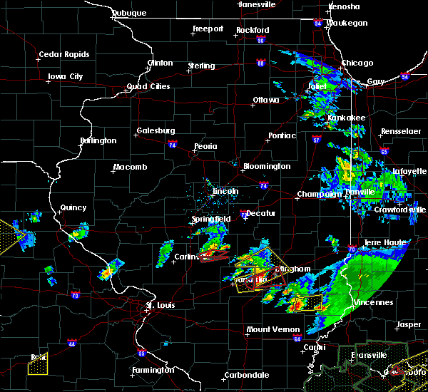 At 658 pm cdt, a severe thunderstorm capable of producing a tornado was located 5 miles southeast of morrisonville, or 7 miles northwest of nokomis, moving northeast at 15 mph (radar indicated rotation). Hazards include tornado. Flying debris will be dangerous to those caught without shelter. mobile homes will be damaged or destroyed. damage to roofs, windows, and vehicles will occur. tree damage is likely. This tornadic thunderstorm will remain over mainly rural areas of southwestern christian county, including the following locations: vanderville. At 658 pm cdt, a severe thunderstorm capable of producing a tornado was located 5 miles southeast of morrisonville, or 7 miles northwest of nokomis, moving northeast at 15 mph (radar indicated rotation). Hazards include tornado. Flying debris will be dangerous to those caught without shelter. mobile homes will be damaged or destroyed. damage to roofs, windows, and vehicles will occur. tree damage is likely. This tornadic thunderstorm will remain over mainly rural areas of southwestern christian county, including the following locations: vanderville.
|
| 4/27/2016 6:56 PM CDT |
 At 656 pm cdt, a severe thunderstorm capable of producing a tornado was located near witt, moving east at 15 mph (radar indicated rotation). Hazards include tornado. Flying debris will be dangerous to those caught without shelter. mobile homes will be damaged or destroyed. damage to roofs, windows, and vehicles will occur. tree damage is likely. This tornadic thunderstorm will remain over mainly rural areas of central montgomery county, including the following locations: ohlman and wenonah. At 656 pm cdt, a severe thunderstorm capable of producing a tornado was located near witt, moving east at 15 mph (radar indicated rotation). Hazards include tornado. Flying debris will be dangerous to those caught without shelter. mobile homes will be damaged or destroyed. damage to roofs, windows, and vehicles will occur. tree damage is likely. This tornadic thunderstorm will remain over mainly rural areas of central montgomery county, including the following locations: ohlman and wenonah.
|
| 4/27/2016 6:51 PM CDT |
 At 651 pm cdt, a confirmed tornado was located near morrisonville, moving east at 10 mph (law enforcement confirmed tornado). Hazards include damaging tornado. Flying debris will be dangerous to those caught without shelter. mobile homes will be damaged or destroyed. damage to roofs, windows, and vehicles will occur. tree damage is likely. Locations impacted include, ohlman and wenonah. At 651 pm cdt, a confirmed tornado was located near morrisonville, moving east at 10 mph (law enforcement confirmed tornado). Hazards include damaging tornado. Flying debris will be dangerous to those caught without shelter. mobile homes will be damaged or destroyed. damage to roofs, windows, and vehicles will occur. tree damage is likely. Locations impacted include, ohlman and wenonah.
|
| 4/27/2016 6:45 PM CDT |
 At 645 pm cdt, a confirmed tornado was located 5 miles east of raymond, or 9 miles west of nokomis, moving northeast at 15 mph (weather spotters confirmed tornado). Hazards include damaging tornado. Flying debris will be dangerous to those caught without shelter. mobile homes will be damaged or destroyed. damage to roofs, windows, and vehicles will occur. tree damage is likely. this tornado will be near, morrisonville around 705 pm cdt. Other locations impacted by this tornadic thunderstorm include palmer, owaneco, taylorville airport and vanderville. At 645 pm cdt, a confirmed tornado was located 5 miles east of raymond, or 9 miles west of nokomis, moving northeast at 15 mph (weather spotters confirmed tornado). Hazards include damaging tornado. Flying debris will be dangerous to those caught without shelter. mobile homes will be damaged or destroyed. damage to roofs, windows, and vehicles will occur. tree damage is likely. this tornado will be near, morrisonville around 705 pm cdt. Other locations impacted by this tornadic thunderstorm include palmer, owaneco, taylorville airport and vanderville.
|
| 4/27/2016 6:41 PM CDT |
 At 641 pm cdt, a confirmed tornado was located near raymond, moving east at 15 mph (law enforcement confirmed tornado). Hazards include damaging tornado. Flying debris will be dangerous to those caught without shelter. mobile homes will be damaged or destroyed. damage to roofs, windows, and vehicles will occur. tree damage is likely. Locations impacted include, raymond, harvel, ohlman and wenonah. At 641 pm cdt, a confirmed tornado was located near raymond, moving east at 15 mph (law enforcement confirmed tornado). Hazards include damaging tornado. Flying debris will be dangerous to those caught without shelter. mobile homes will be damaged or destroyed. damage to roofs, windows, and vehicles will occur. tree damage is likely. Locations impacted include, raymond, harvel, ohlman and wenonah.
|
| 4/27/2016 6:37 PM CDT |
 At 637 pm cdt, a confirmed tornado was located near morrisonville, or 12 miles northwest of nokomis, moving northeast at 20 mph (weather spotters confirmed tornado). Hazards include damaging tornado. Flying debris will be dangerous to those caught without shelter. mobile homes will be damaged or destroyed. damage to roofs, windows, and vehicles will occur. tree damage is likely. the tornado will be near, morrisonville around 650 pm cdt. taylorville, kincaid, bulpitt and jeisyville around 715 pm cdt. Other locations impacted by this tornadic thunderstorm include palmer, owaneco, taylorville airport, vanderville and tovey. At 637 pm cdt, a confirmed tornado was located near morrisonville, or 12 miles northwest of nokomis, moving northeast at 20 mph (weather spotters confirmed tornado). Hazards include damaging tornado. Flying debris will be dangerous to those caught without shelter. mobile homes will be damaged or destroyed. damage to roofs, windows, and vehicles will occur. tree damage is likely. the tornado will be near, morrisonville around 650 pm cdt. taylorville, kincaid, bulpitt and jeisyville around 715 pm cdt. Other locations impacted by this tornadic thunderstorm include palmer, owaneco, taylorville airport, vanderville and tovey.
|
| 4/27/2016 6:32 PM CDT |
 At 632 pm cdt, a confirmed tornado was located over raymond, moving northeast at 20 mph (law enforcement confirmed tornado). Hazards include damaging tornado. Flying debris will be dangerous to those caught without shelter. mobile homes will be damaged or destroyed. damage to roofs, windows, and vehicles will occur. tree damage is likely. This tornadic thunderstorm will remain over mainly rural areas of central montgomery county, including the following locations: ohlman, harvel, wenonah and waggoner. At 632 pm cdt, a confirmed tornado was located over raymond, moving northeast at 20 mph (law enforcement confirmed tornado). Hazards include damaging tornado. Flying debris will be dangerous to those caught without shelter. mobile homes will be damaged or destroyed. damage to roofs, windows, and vehicles will occur. tree damage is likely. This tornadic thunderstorm will remain over mainly rural areas of central montgomery county, including the following locations: ohlman, harvel, wenonah and waggoner.
|
| 12/23/2015 9:06 AM CST | At 905 am cst, severe thunderstorms were located along a line extending from near raymond to coffeen to near greenville, moving northeast at 70 mph (radar indicated). Hazards include 60 mph wind gusts. Expect damage to roofs. siding and trees. locations impacted include, vandalia, greenville, litchfield, hillsboro, nokomis, st. elmo, ramsey, raymond, witt, white oak, pocahontas, brownstown, farmersville, taylor springs, coffeen, mulberry grove, schram city, wrights corner, reno and woburn. this warning also includes ramsey lake state park and lake lou yaeger. this includes the following highways, interstate 70 in illinois between exits 36 and 76. Interstate 55 in illinois between exits 60 and 63. |
| 12/23/2015 8:50 AM CST | At 849 am cst, severe thunderstorms were located along a line extending from east gillespie to near alhambra to highland, moving northeast at 70 mph (radar indicated). Hazards include 60 mph wind gusts. Expect damage to roofs. Siding and trees. |
| 8/18/2015 5:43 PM CDT |
 At 543 pm cdt, severe thunderstorms were located along a line extending from near schram city to near coffeen, moving east at 40 mph (radar indicated). Hazards include 60 mph wind gusts. Expect damage to roofs. siding and trees. Locations impacted include, hillsboro, nokomis, witt, taylor springs, coffeen, schram city, van burensburg, irving, fillmore, coalton, butler, ohlman, bingham, wenonah, chapman and bayle city. At 543 pm cdt, severe thunderstorms were located along a line extending from near schram city to near coffeen, moving east at 40 mph (radar indicated). Hazards include 60 mph wind gusts. Expect damage to roofs. siding and trees. Locations impacted include, hillsboro, nokomis, witt, taylor springs, coffeen, schram city, van burensburg, irving, fillmore, coalton, butler, ohlman, bingham, wenonah, chapman and bayle city.
|
| 8/18/2015 5:24 PM CDT |
 At 524 pm cdt, severe thunderstorms were located along a line extending from litchfield to near sorento, moving northeast at 40 mph (radar indicated). Hazards include 60 mph wind gusts. Expect damage to roofs. Siding and trees. At 524 pm cdt, severe thunderstorms were located along a line extending from litchfield to near sorento, moving northeast at 40 mph (radar indicated). Hazards include 60 mph wind gusts. Expect damage to roofs. Siding and trees.
|
| 6/25/2015 7:27 PM CDT |
 At 722 pm cdt, a severe thunderstorm was located near girard, and moving east at 35 mph (trained weather spotters). Hazards include 60 mph wind gusts and quarter size hail. Hail damage to vehicles is expected. Expect wind damage to roofs, siding and trees. At 722 pm cdt, a severe thunderstorm was located near girard, and moving east at 35 mph (trained weather spotters). Hazards include 60 mph wind gusts and quarter size hail. Hail damage to vehicles is expected. Expect wind damage to roofs, siding and trees.
|
| 6/20/2015 10:32 PM CDT |
 At 1032 pm cdt, severe thunderstorms were located along a line extending from near warrensburg to near stonington to 5 miles northeast of morrisonville, moving east at 45 mph (trained weather spotters). Hazards include 60 mph wind gusts. Expect damage to roofs. siding and trees. locations impacted include, decatur, taylorville, pana, mount zion, forsyth, moweaqua, maroa, harristown, long creek, warrensburg, assumption, blue mound, macon, morrisonville, argenta, stonington, oreana, niantic, dalton city and oakley. this includes interstate 72 between mile markers 127 and 156. A tornado watch remains in effect until 1100 pm cdt for central illinois. At 1032 pm cdt, severe thunderstorms were located along a line extending from near warrensburg to near stonington to 5 miles northeast of morrisonville, moving east at 45 mph (trained weather spotters). Hazards include 60 mph wind gusts. Expect damage to roofs. siding and trees. locations impacted include, decatur, taylorville, pana, mount zion, forsyth, moweaqua, maroa, harristown, long creek, warrensburg, assumption, blue mound, macon, morrisonville, argenta, stonington, oreana, niantic, dalton city and oakley. this includes interstate 72 between mile markers 127 and 156. A tornado watch remains in effect until 1100 pm cdt for central illinois.
|
| 6/20/2015 10:16 PM CDT |
 At 1016 pm cdt, severe thunderstorms were located along a line extending from near chestnut to near edinburg to 4 miles south of pawnee, moving east at 40 mph (trained weather spotters). Hazards include 60 mph wind gusts. Expect damage to roofs. Siding and trees. At 1016 pm cdt, severe thunderstorms were located along a line extending from near chestnut to near edinburg to 4 miles south of pawnee, moving east at 40 mph (trained weather spotters). Hazards include 60 mph wind gusts. Expect damage to roofs. Siding and trees.
|
| 6/15/2015 6:10 PM CDT |
 At 609 pm cdt, a severe thunderstorm was located near hillsboro, and moving east at 15 mph (radar indicated). Hazards include 60 mph wind gusts and quarter size hail. Hail damage to vehicles is expected. Expect wind damage to roofs, siding and trees. At 609 pm cdt, a severe thunderstorm was located near hillsboro, and moving east at 15 mph (radar indicated). Hazards include 60 mph wind gusts and quarter size hail. Hail damage to vehicles is expected. Expect wind damage to roofs, siding and trees.
|
| 6/7/2015 9:45 PM CDT | At 945 pm cdt, severe thunderstorms were located along a line extending from near cooks mills to near shelbyville to 5 miles southeast of morrisonville, moving southeast at 55 mph (radar indicated). Hazards include 60 mph wind gusts and quarter size hail. Hail damage to vehicles is expected. expect wind damage to roofs, siding and trees. locations impacted include, taylorville, shelbyville, sullivan, pana, lakewood, moweaqua, kincaid, bethany, assumption, blue mound, macon, edinburg, morrisonville, stonington, windsor, stewardson, findlay, cowden, tower hill and dalton city. This includes interstate 57 between mile markers 169 and 170. |
| 6/7/2015 9:15 PM CDT | At 915 pm cdt, severe thunderstorms were located along a line extending from 6 miles southwest of dalton city to 6 miles southwest of auburn, moving southeast at 35 mph (radar indicated). Hazards include 60 mph wind gusts and quarter size hail. Hail damage to vehicles is expected. Expect wind damage to roofs, siding and trees. |
| 5/24/2015 11:31 PM CDT | At 1131 pm cdt, a severe thunderstorm was located over mount auburn, or 14 miles north of taylorville, moving north at 50 mph (radar indicated). Hazards include 60 mph wind gusts. Expect damage to roofs. siding and trees. locations impacted include, taylorville, pana, moweaqua, kincaid, assumption, edinburg, morrisonville, stonington, illiopolis, mechanicsburg, mount auburn, bulpitt, jeisyville, tovey, dawson, buffalo, rosamond, berry, owaneco and palmer. this includes interstate 72 between mile markers 110 and 124. A tornado watch remains in effect until 100 am cdt for central illinois. |
| 5/24/2015 11:03 PM CDT | At 1102 pm cdt, a severe thunderstorm was located near morrisonville, or near nokomis, moving north at 55 mph (radar indicated). Hazards include 60 mph wind gusts. Expect damage to roofs. Siding and trees. |
| 5/24/2015 10:59 PM CDT | At 1056 pm cdt, severe thunderstorms were located along a line extending from 6 miles northwest of nokomis to shobonier, and moving east at 25 mph (radar indicated). Hazards include 70 mph wind gusts. Expect considerable tree damage. Damage is likely to mobile homes, roofs and outbuildings. |
| 5/10/2015 6:35 PM CDT | At 635 pm cdt, severe thunderstorms were located along a line extending from near divernon to taylor springs, moving northeast at 50 mph (radar indicated). Hazards include 60 mph wind gusts and penny size hail. Expect damage to roofs. Siding and trees. |
| 1/1/0001 12:00 AM | Power lines down in montgomery county IL, 1 miles ESE of Harvel, IL |
Hail Maps for Harvel, IL


Connect with Interactive Hail Maps