

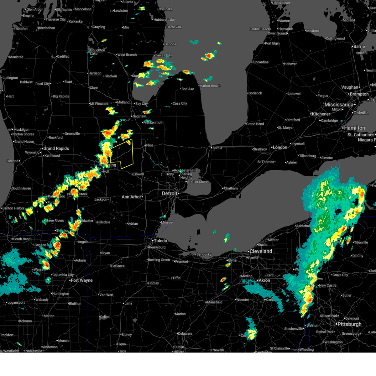
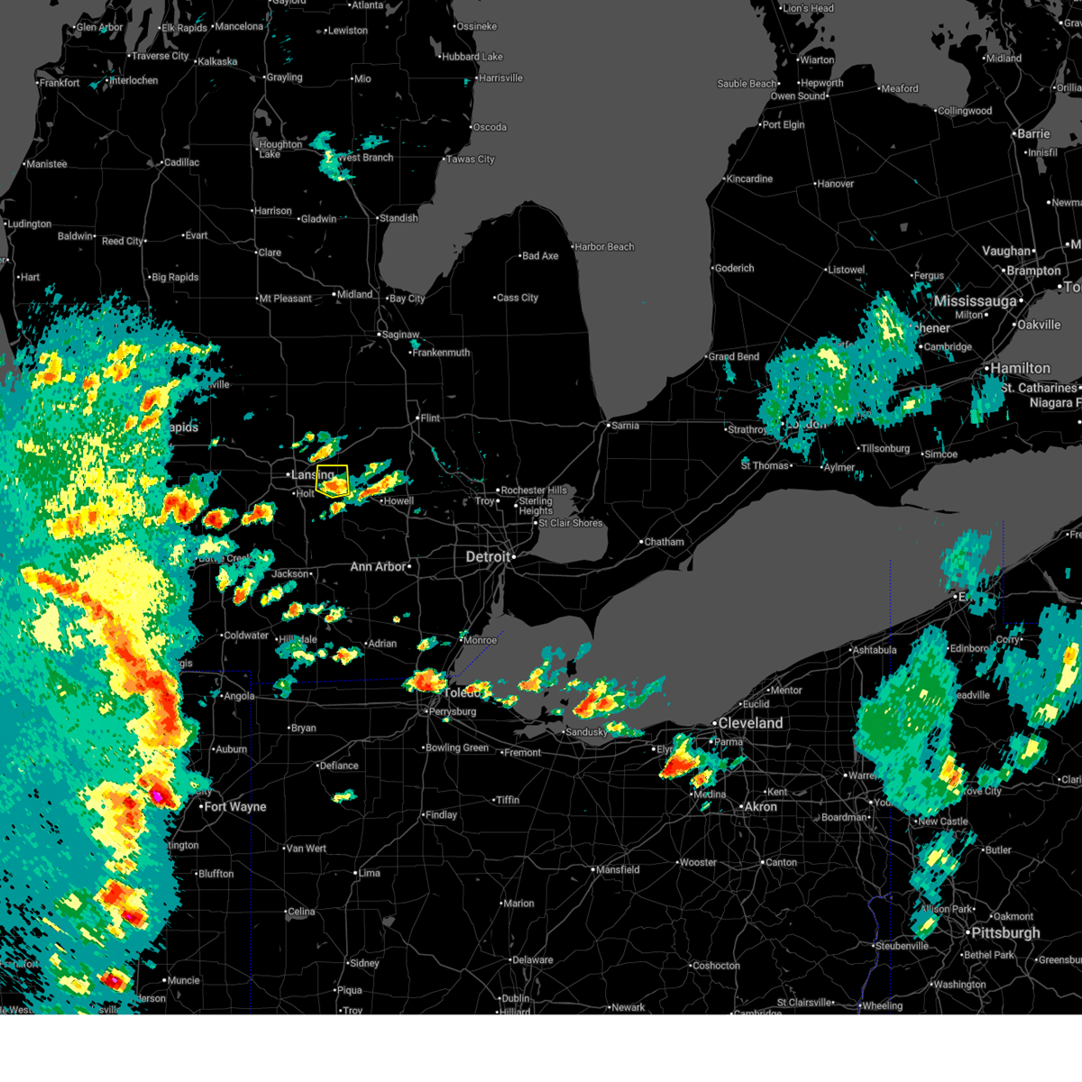
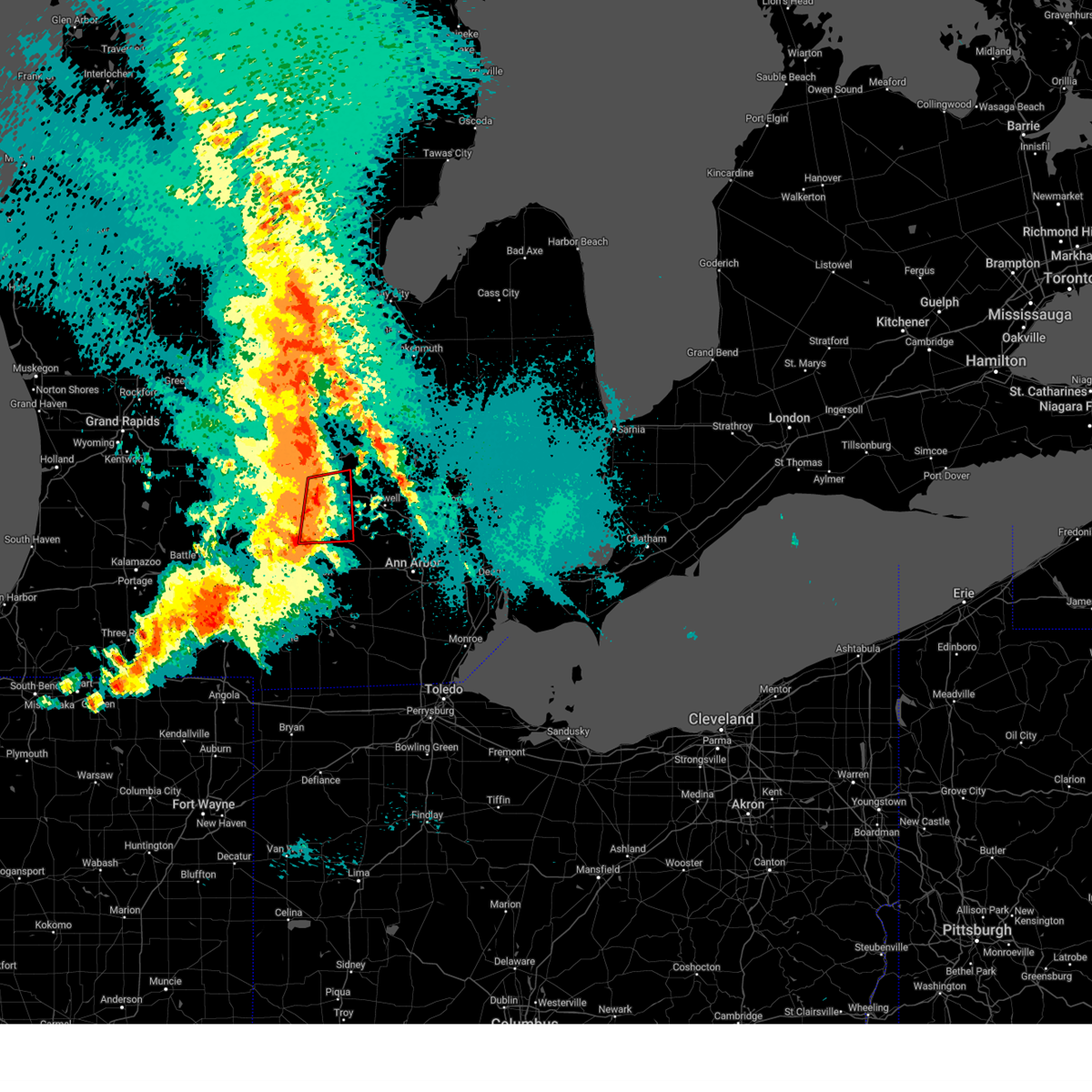
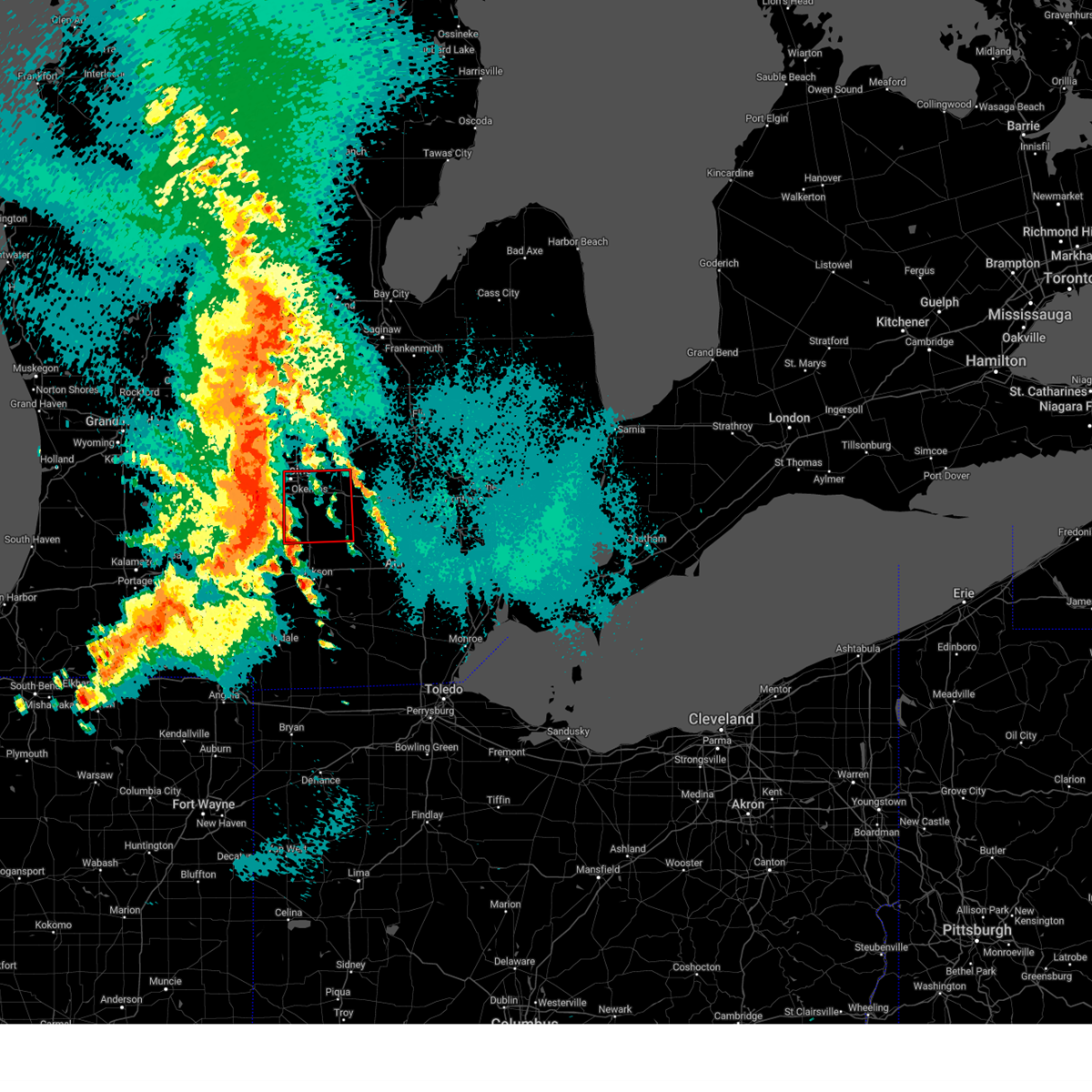
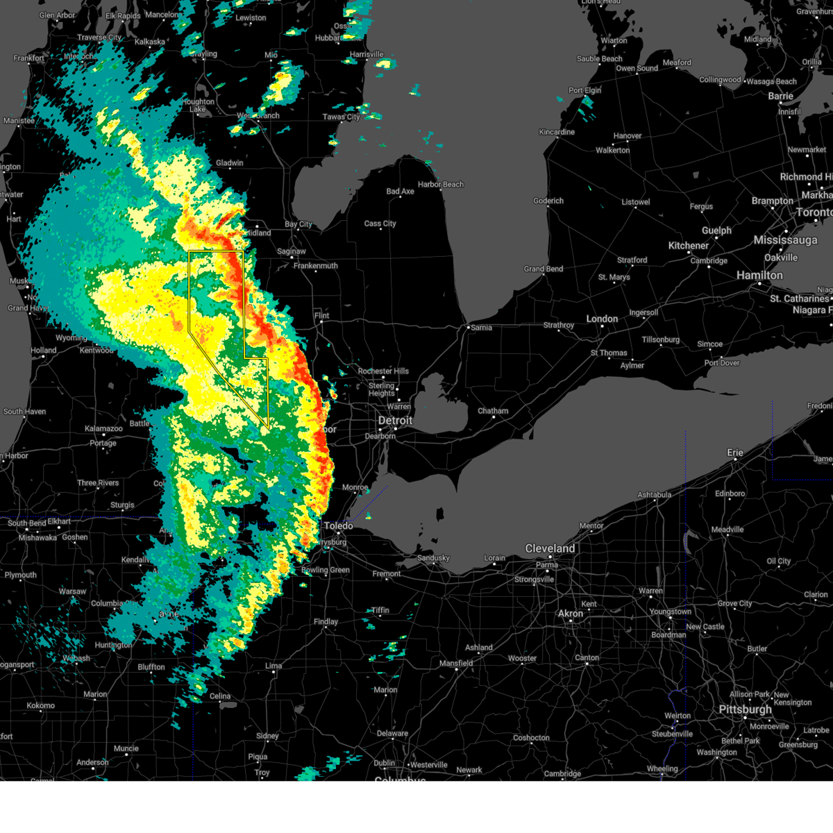
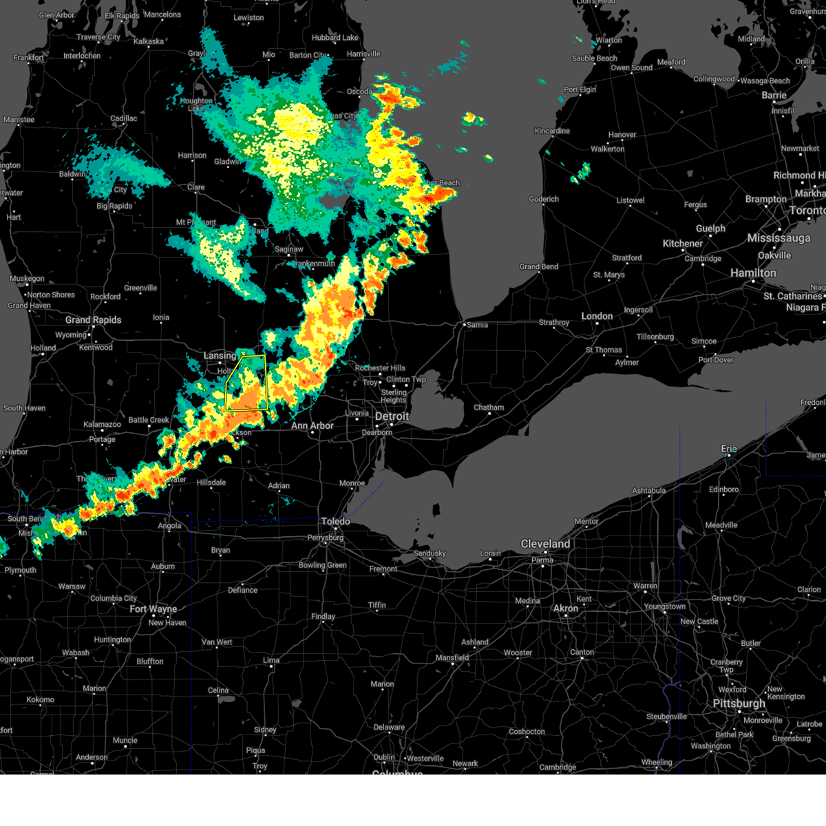
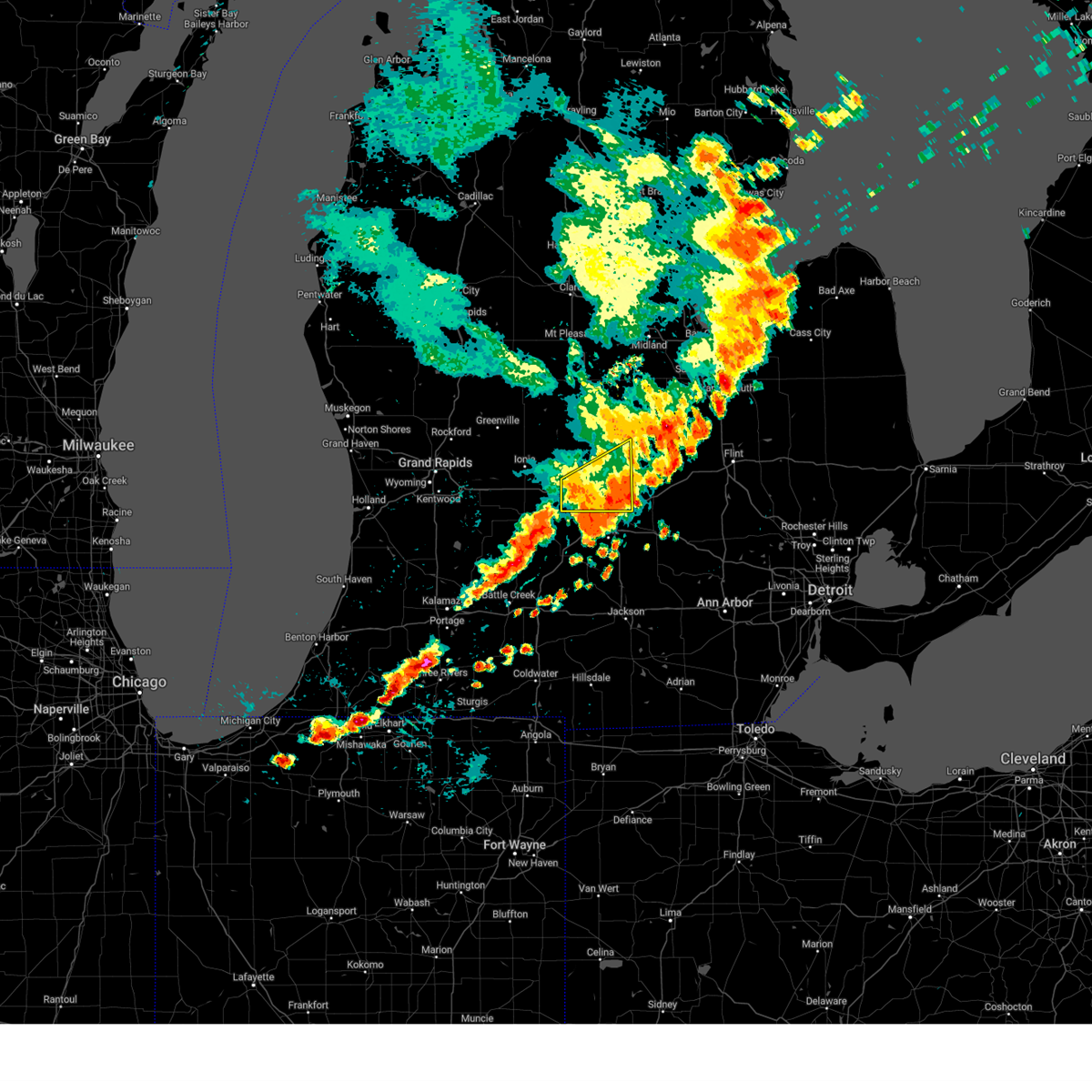
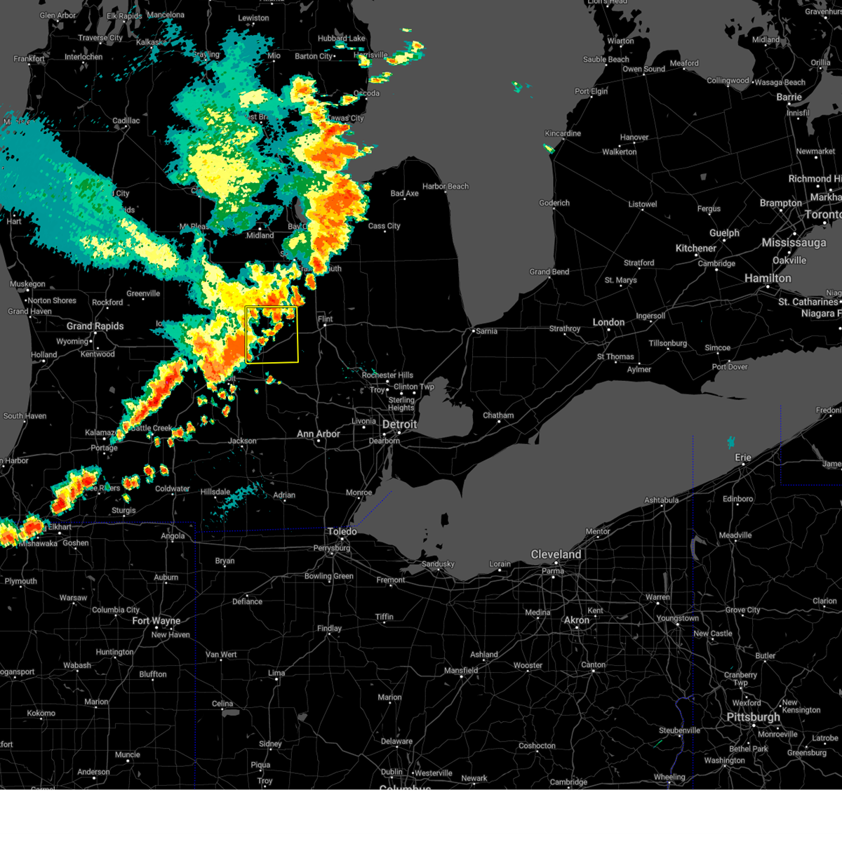
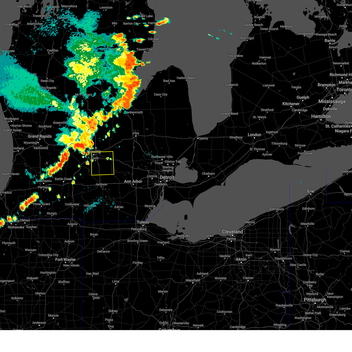
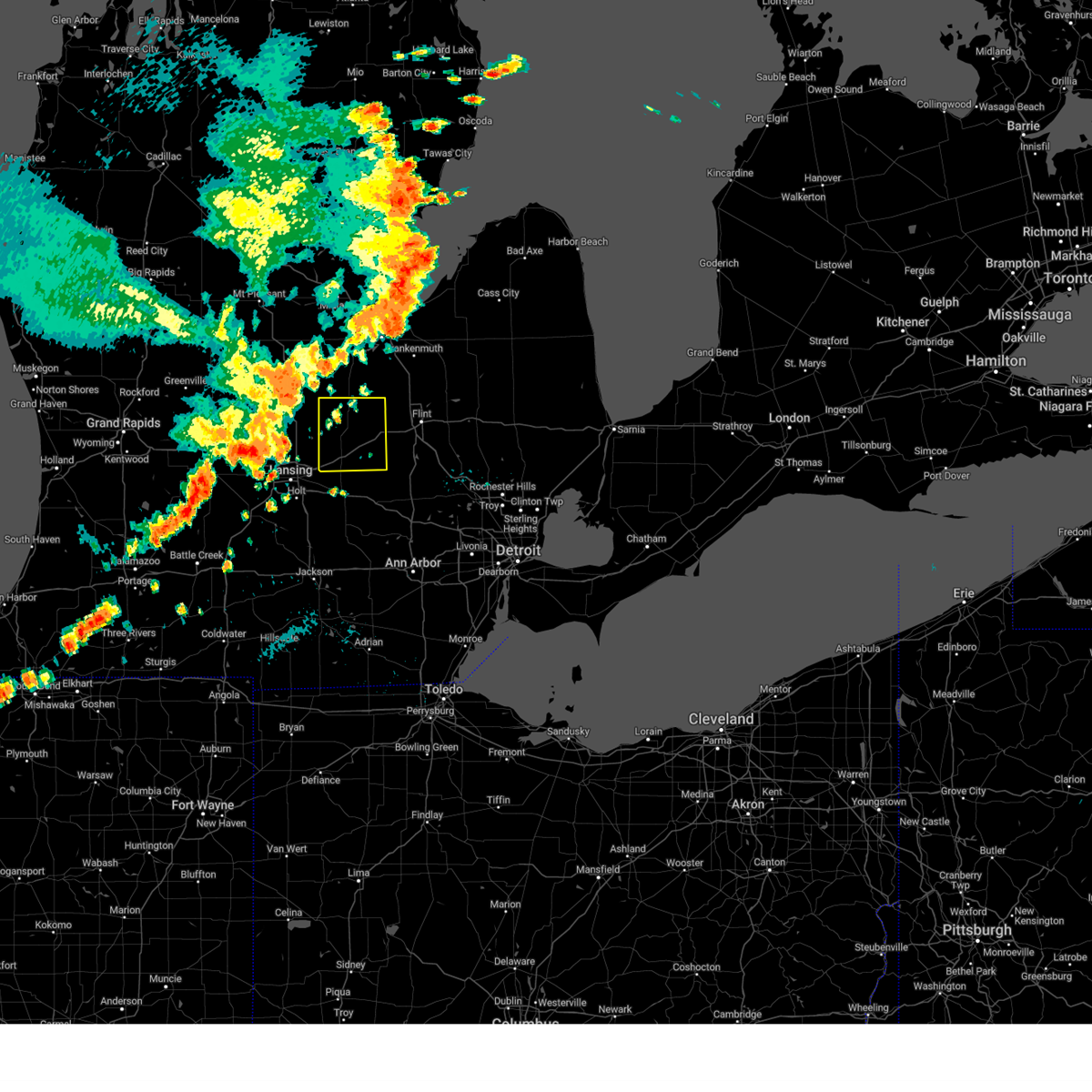
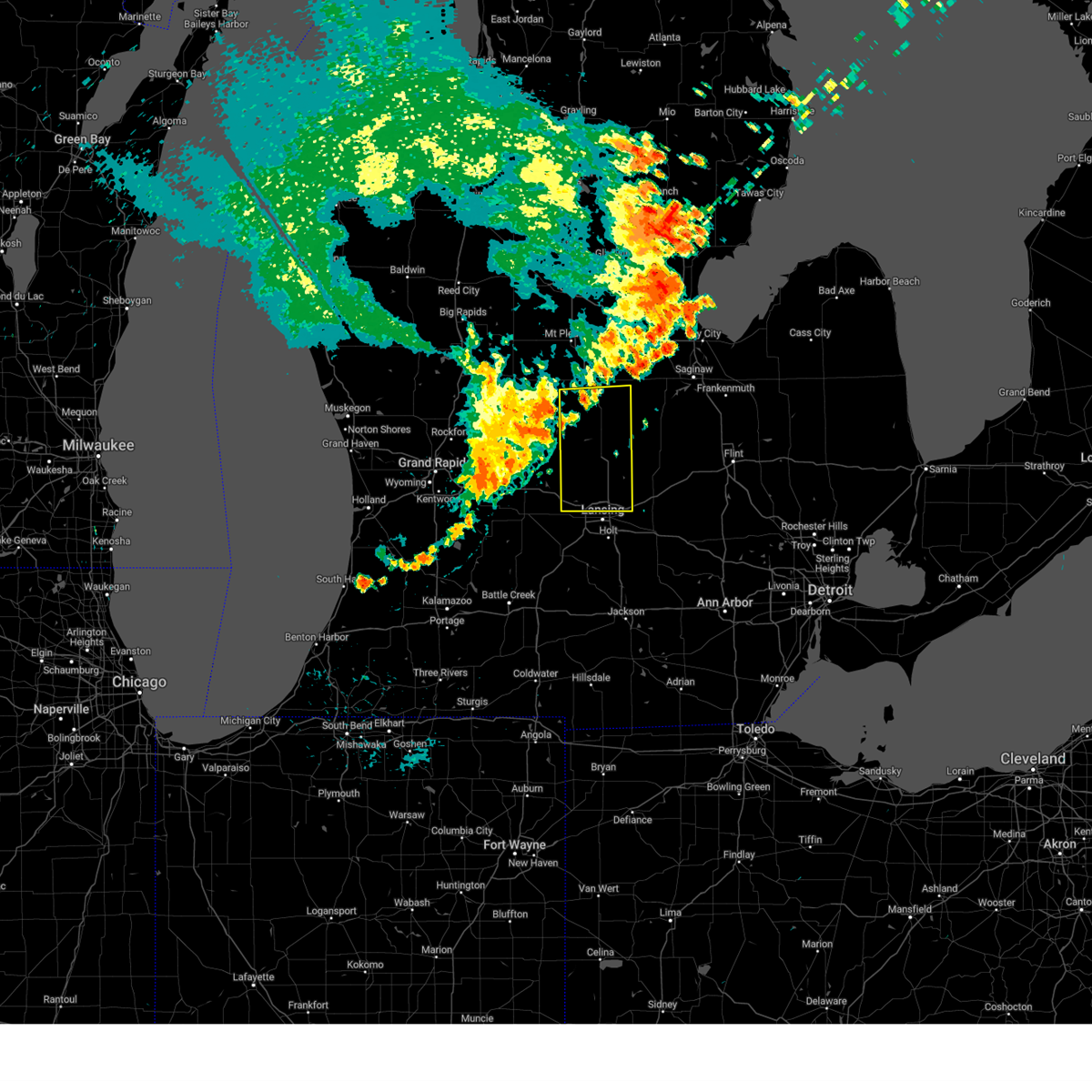
Hail Map for Haslett, MI
The Haslett, MI area has had 3 reports of on-the-ground hail by trained spotters, and has been under severe weather warnings 37 times during the past 12 months. Doppler radar has detected hail at or near Haslett, MI on 33 occasions.
| Name: | Haslett, MI |
| Where Located: | 41.1 miles WSW of Flint, MI |
| Map: | Google Map for Haslett, MI |
| Population: | 19220 |
| Housing Units: | 9557 |
| More Info: | Search Google for Haslett, MI |
3
The Top Recent Hail Date for Haslett, MI is Thursday, July 20, 2023 (4th out of 33)

Hail and Wind Damage Spotted near Haslett, MI
| Date / Time | Report Details |
|---|---|
| 6/27/2025 4:12 PM EDT | The stronger storms which prompted the warning have moved out of the area. therefore, the warning will be allowed to expire. however, lightning is still possible through at least 430 pm. a severe thunderstorm watch remains in effect until 900 pm edt for south central michigan. |
| 6/27/2025 3:57 PM EDT | Tree down on vehicle near woodbury rd and braiden rd. no injuries... but passenger reportedly stuck in vehicl in shiawassee county MI, 4.3 miles SW of Haslett, MI |
| 6/27/2025 3:57 PM EDT | Tree down on lansing rd blocking the eastbound lane near woodbury r in shiawassee county MI, 4.8 miles SW of Haslett, MI |
| 6/27/2025 3:56 PM EDT | the severe thunderstorm warning has been cancelled and is no longer in effect |
| 6/27/2025 3:56 PM EDT | At 356 pm edt, severe thunderstorms were located along a line extending from near owosso to near williamston, moving east at 30 mph (radar indicated). Hazards include 60 mph wind gusts. Expect damage to roofs, siding, and trees. these severe storms will be near, williamston around 400 pm edt. Other locations impacted by these severe thunderstorms include webberville, dansville, okemos, bell oak, holt, and haslett. |
| 6/27/2025 3:42 PM EDT |
 Svrdtx the national weather service in detroit/pontiac has issued a * severe thunderstorm warning for, shiawassee county in southeastern michigan, northwestern livingston county in southeastern michigan, * until 445 pm edt. * at 342 pm edt, a severe thunderstorm was located near east lansing, or 7 miles southwest of laingsburg, moving east at 40 mph (radar indicated). Hazards include 60 mph wind gusts. Expect damage to roofs, siding, and trees. this severe thunderstorm will be near, perry around 350 pm edt. morrice around 355 pm edt. bancroft around 405 pm edt. durand around 410 pm edt. lennon around 420 pm edt. Other locations impacted by this severe thunderstorm include juddville, bennington, shaftsburg, conway township, and vernon. Svrdtx the national weather service in detroit/pontiac has issued a * severe thunderstorm warning for, shiawassee county in southeastern michigan, northwestern livingston county in southeastern michigan, * until 445 pm edt. * at 342 pm edt, a severe thunderstorm was located near east lansing, or 7 miles southwest of laingsburg, moving east at 40 mph (radar indicated). Hazards include 60 mph wind gusts. Expect damage to roofs, siding, and trees. this severe thunderstorm will be near, perry around 350 pm edt. morrice around 355 pm edt. bancroft around 405 pm edt. durand around 410 pm edt. lennon around 420 pm edt. Other locations impacted by this severe thunderstorm include juddville, bennington, shaftsburg, conway township, and vernon.
|
| 6/27/2025 3:36 PM EDT |
 At 334 pm edt, severe thunderstorms were located along a line extending from near st. johns to lansing, moving east at 25 mph (radar indicated). Hazards include 60 mph wind gusts. Expect damage to roofs, siding, and trees. these severe storms will be near, lansing and east lansing around 340 pm edt. williamston around 400 pm edt. Other locations impacted by these severe thunderstorms include webberville, ovid, dansville, okemos, bath, bell oak, holt, eureka, and haslett. At 334 pm edt, severe thunderstorms were located along a line extending from near st. johns to lansing, moving east at 25 mph (radar indicated). Hazards include 60 mph wind gusts. Expect damage to roofs, siding, and trees. these severe storms will be near, lansing and east lansing around 340 pm edt. williamston around 400 pm edt. Other locations impacted by these severe thunderstorms include webberville, ovid, dansville, okemos, bath, bell oak, holt, eureka, and haslett.
|
| 6/27/2025 3:36 PM EDT |
 the severe thunderstorm warning has been cancelled and is no longer in effect the severe thunderstorm warning has been cancelled and is no longer in effect
|
| 6/27/2025 3:18 PM EDT |
 Svrgrr the national weather service in grand rapids has issued a * severe thunderstorm warning for, ingham county in south central michigan, clinton county in south central michigan, northeastern eaton county in south central michigan, * until 415 pm edt. * at 318 pm edt, severe thunderstorms were located along a line extending from near st. johns to near grand ledge, moving east at 25 mph (radar indicated). Hazards include 60 mph wind gusts. Expect damage to roofs, siding, and trees. severe thunderstorms will be near, lansing, st. johns, dewitt, capital region international airport, and edgemont park around 325 pm edt. east lansing around 330 pm edt. williamston around 355 pm edt. Other locations impacted by these severe thunderstorms include wacousta, ovid, dansville, okemos, dimondale, fowler, bath, bell oak, holt, and maple rapids. Svrgrr the national weather service in grand rapids has issued a * severe thunderstorm warning for, ingham county in south central michigan, clinton county in south central michigan, northeastern eaton county in south central michigan, * until 415 pm edt. * at 318 pm edt, severe thunderstorms were located along a line extending from near st. johns to near grand ledge, moving east at 25 mph (radar indicated). Hazards include 60 mph wind gusts. Expect damage to roofs, siding, and trees. severe thunderstorms will be near, lansing, st. johns, dewitt, capital region international airport, and edgemont park around 325 pm edt. east lansing around 330 pm edt. williamston around 355 pm edt. Other locations impacted by these severe thunderstorms include wacousta, ovid, dansville, okemos, dimondale, fowler, bath, bell oak, holt, and maple rapids.
|
| 6/18/2025 5:12 PM EDT |
 At 511 pm edt, a severe thunderstorm was located near williamston, or 8 miles south of perry, moving northeast at 30 mph (radar indicated). Hazards include 60 mph wind gusts and penny size hail. Expect damage to roofs, siding, and trees. Locations impacted include, williamston, webberville, bell oak,. At 511 pm edt, a severe thunderstorm was located near williamston, or 8 miles south of perry, moving northeast at 30 mph (radar indicated). Hazards include 60 mph wind gusts and penny size hail. Expect damage to roofs, siding, and trees. Locations impacted include, williamston, webberville, bell oak,.
|
| 6/18/2025 5:01 PM EDT |
 Svrgrr the national weather service in grand rapids has issued a * severe thunderstorm warning for, eastern ingham county in south central michigan, * until 545 pm edt. * at 459 pm edt, a severe thunderstorm was located near williamston, or 8 miles east of mason, moving northeast at 30 mph (radar indicated). Hazards include 60 mph wind gusts. expect damage to roofs, siding, and trees Svrgrr the national weather service in grand rapids has issued a * severe thunderstorm warning for, eastern ingham county in south central michigan, * until 545 pm edt. * at 459 pm edt, a severe thunderstorm was located near williamston, or 8 miles east of mason, moving northeast at 30 mph (radar indicated). Hazards include 60 mph wind gusts. expect damage to roofs, siding, and trees
|
| 5/16/2025 12:07 AM EDT |
 The storms which prompted the warning have moved out of the area. therefore, the warning will be allowed to expire. a tornado watch remains in effect until 300 am edt for south central michigan. The storms which prompted the warning have moved out of the area. therefore, the warning will be allowed to expire. a tornado watch remains in effect until 300 am edt for south central michigan.
|
| 5/16/2025 12:06 AM EDT |
 the severe thunderstorm warning has been cancelled and is no longer in effect the severe thunderstorm warning has been cancelled and is no longer in effect
|
| 5/15/2025 11:49 PM EDT |
 At 1148 pm edt, a severe squall line capable of producing both tornadoes and extensive straight line wind damage was located along a line extending from near east lansing to leslie, moving east at 60 mph (radar indicated rotation). Hazards include tornado. Flying debris will be dangerous to those caught without shelter. mobile homes will be damaged or destroyed. damage to roofs, windows, and vehicles will occur. tree damage is likely. Locations impacted include, williamston and stockbridge. At 1148 pm edt, a severe squall line capable of producing both tornadoes and extensive straight line wind damage was located along a line extending from near east lansing to leslie, moving east at 60 mph (radar indicated rotation). Hazards include tornado. Flying debris will be dangerous to those caught without shelter. mobile homes will be damaged or destroyed. damage to roofs, windows, and vehicles will occur. tree damage is likely. Locations impacted include, williamston and stockbridge.
|
| 5/15/2025 11:34 PM EDT |
 Torgrr the national weather service in grand rapids has issued a * tornado warning for, ingham county in south central michigan, * until 1215 am edt. * at 1133 pm edt, severe thunderstorms capable of producing both tornadoes and extensive straight line wind damage were located along a line extending from near potterville to near eaton rapids, moving east at 65 mph (radar indicated rotation). Hazards include tornado. Flying debris will be dangerous to those caught without shelter. mobile homes will be damaged or destroyed. damage to roofs, windows, and vehicles will occur. tree damage is likely. these dangerous storms will be near, lansing, mason, and east lansing around 1140 pm edt. Williamston around 1150 pm edt. Torgrr the national weather service in grand rapids has issued a * tornado warning for, ingham county in south central michigan, * until 1215 am edt. * at 1133 pm edt, severe thunderstorms capable of producing both tornadoes and extensive straight line wind damage were located along a line extending from near potterville to near eaton rapids, moving east at 65 mph (radar indicated rotation). Hazards include tornado. Flying debris will be dangerous to those caught without shelter. mobile homes will be damaged or destroyed. damage to roofs, windows, and vehicles will occur. tree damage is likely. these dangerous storms will be near, lansing, mason, and east lansing around 1140 pm edt. Williamston around 1150 pm edt.
|
| 5/15/2025 11:24 PM EDT |
 Svrgrr the national weather service in grand rapids has issued a * severe thunderstorm warning for, clinton county in south central michigan, * until 1230 am edt. * at 1124 pm edt, severe thunderstorms were located along a line extending from 5 miles southwest of carson city to near portland to 7 miles west of grand ledge to near lansing, moving east at 40 mph (radar indicated). Hazards include 70 mph wind gusts. Expect considerable tree damage. Damage is likely to mobile homes, roofs, and outbuildings. Svrgrr the national weather service in grand rapids has issued a * severe thunderstorm warning for, clinton county in south central michigan, * until 1230 am edt. * at 1124 pm edt, severe thunderstorms were located along a line extending from 5 miles southwest of carson city to near portland to 7 miles west of grand ledge to near lansing, moving east at 40 mph (radar indicated). Hazards include 70 mph wind gusts. Expect considerable tree damage. Damage is likely to mobile homes, roofs, and outbuildings.
|
| 3/30/2025 7:22 PM EDT |
 The storms which prompted warnings have moved out of the area. therefore, the warning will be allowed to expire. a severe thunderstorm watch remains in effect until 1000 pm edt for southeastern michigan. The storms which prompted warnings have moved out of the area. therefore, the warning will be allowed to expire. a severe thunderstorm watch remains in effect until 1000 pm edt for southeastern michigan.
|
| 3/30/2025 7:03 PM EDT |
 the severe thunderstorm warning has been cancelled and is no longer in effect the severe thunderstorm warning has been cancelled and is no longer in effect
|
| 3/30/2025 6:49 PM EDT |
 the tornado warning has been cancelled and is no longer in effect the tornado warning has been cancelled and is no longer in effect
|
| 3/30/2025 6:47 PM EDT |
 At 645 pm edt, severe thunderstorms were located along a line extending from 8 miles southwest of shepherd to near ann arbor, moving east at 70 mph. these are destructive storms for central and southern michigan (at 6:32 pm lansing asos gusted to 62 mph). Hazards include 80 mph wind gusts. Flying debris will be dangerous to those caught without shelter. mobile homes will be heavily damaged. expect considerable damage to roofs, windows, and vehicles. extensive tree damage and power outages are likely. Locations impacted include, alma, williamston, edgemont park, elm hall, ovid, ithaca, north star, bunker hill, bell oak, bath, gratiot community ai, holt, maple rapids, forest hill, breckenridge, dewitt, pompeii, sumner, east lansing, riverdale,. At 645 pm edt, severe thunderstorms were located along a line extending from 8 miles southwest of shepherd to near ann arbor, moving east at 70 mph. these are destructive storms for central and southern michigan (at 6:32 pm lansing asos gusted to 62 mph). Hazards include 80 mph wind gusts. Flying debris will be dangerous to those caught without shelter. mobile homes will be heavily damaged. expect considerable damage to roofs, windows, and vehicles. extensive tree damage and power outages are likely. Locations impacted include, alma, williamston, edgemont park, elm hall, ovid, ithaca, north star, bunker hill, bell oak, bath, gratiot community ai, holt, maple rapids, forest hill, breckenridge, dewitt, pompeii, sumner, east lansing, riverdale,.
|
| 3/30/2025 6:44 PM EDT | Tordtx the national weather service in detroit/pontiac has issued a * tornado warning for, shiawassee county in southeastern michigan, * until 715 pm edt. * at 644 pm edt, a severe thunderstorm capable of producing a tornado was located near perry, moving northeast at 60 mph (radar indicated rotation). Hazards include tornado. Flying debris will be dangerous to those caught without shelter. mobile homes will be damaged or destroyed. damage to roofs, windows, and vehicles will occur. tree damage is likely. this dangerous storm will be near, perry and morrice around 650 pm edt. corunna around 655 pm edt. other locations impacted by this tornadic thunderstorm include juddville, bennington, shaftsburg, and carland. This includes i-69 between mile markers 98 and 114. |
| 3/30/2025 6:44 PM EDT | At 644 pm edt, severe thunderstorms were located along a line extending from near dewitt to near williamston to 6 miles north of gregory, moving northeast at 65 mph (radar indicated). Hazards include 70 mph wind gusts and penny size hail. Expect considerable tree damage. damage is likely to mobile homes, roofs, and outbuildings. these severe storms will be near, laingsburg, perry, morrice, bancroft, and owosso around 650 pm edt. byron, durand, and corunna around 655 pm edt. lennon and henderson around 700 pm edt. new lothrop around 705 pm edt. other locations impacted by these severe thunderstorms include juddville, bennington, shaftsburg, carland, and vernon. This includes i-69 between mile markers 98 and 123. |
| 3/30/2025 6:41 PM EDT |
 Torgrr the national weather service in grand rapids has issued a * tornado warning for, northeastern ingham county in south central michigan, * until 715 pm edt. * at 641 pm edt, severe thunderstorms capable of producing both tornadoes and extensive straight line wind damage were located near williamston, or 6 miles south of perry, moving northeast at 65 mph (radar indicated rotation). Hazards include tornado. Flying debris will be dangerous to those caught without shelter. mobile homes will be damaged or destroyed. damage to roofs, windows, and vehicles will occur. tree damage is likely. This tornadic thunderstorm will remain over mainly rural areas of northeastern ingham county, including the following locations, bell oak, webberville, and haslett. Torgrr the national weather service in grand rapids has issued a * tornado warning for, northeastern ingham county in south central michigan, * until 715 pm edt. * at 641 pm edt, severe thunderstorms capable of producing both tornadoes and extensive straight line wind damage were located near williamston, or 6 miles south of perry, moving northeast at 65 mph (radar indicated rotation). Hazards include tornado. Flying debris will be dangerous to those caught without shelter. mobile homes will be damaged or destroyed. damage to roofs, windows, and vehicles will occur. tree damage is likely. This tornadic thunderstorm will remain over mainly rural areas of northeastern ingham county, including the following locations, bell oak, webberville, and haslett.
|
| 3/30/2025 6:33 PM EDT |
 At 633 pm edt, severe thunderstorms were located along a line extending from capital region international airport to near mason to near stockbridge, moving northeast at 65 mph (radar indicated). Hazards include 70 mph wind gusts and penny size hail. Expect considerable tree damage. damage is likely to mobile homes, roofs, and outbuildings. these severe storms will be near, perry around 640 pm edt. laingsburg and morrice around 645 pm edt. bancroft and owosso around 650 pm edt. byron, durand, corunna, and henderson around 655 pm edt. lennon around 700 pm edt. new lothrop around 705 pm edt. other locations impacted by these severe thunderstorms include juddville, bennington, shaftsburg, carland, and vernon. This includes i-69 between mile markers 98 and 123. At 633 pm edt, severe thunderstorms were located along a line extending from capital region international airport to near mason to near stockbridge, moving northeast at 65 mph (radar indicated). Hazards include 70 mph wind gusts and penny size hail. Expect considerable tree damage. damage is likely to mobile homes, roofs, and outbuildings. these severe storms will be near, perry around 640 pm edt. laingsburg and morrice around 645 pm edt. bancroft and owosso around 650 pm edt. byron, durand, corunna, and henderson around 655 pm edt. lennon around 700 pm edt. new lothrop around 705 pm edt. other locations impacted by these severe thunderstorms include juddville, bennington, shaftsburg, carland, and vernon. This includes i-69 between mile markers 98 and 123.
|
| 3/30/2025 6:28 PM EDT | At 626 pm edt, severe thunderstorms were located along a line extending from lakeview to near grass lake, moving northeast at 55 mph. these are destructive storms for central and southern michigan (jackson asos reported 96 mph winds at 6:17 pm). Hazards include wind gusts in excess of 80 mph. Flying debris will be dangerous to those caught without shelter. mobile homes will be heavily damaged. expect considerable damage to roofs, windows, and vehicles. extensive tree damage and power outages are likely. Locations impacted include, alma, charlotte, elm hall, eden, jackson, bell oak, bath, forest hill, pompeii, spring arbor, riverdale, michigan center, eagle, onondaga, springport, oak point, dansville, lansing, norvell, bannister,. |
| 3/30/2025 6:24 PM EDT | Svrdtx the national weather service in detroit/pontiac has issued a * severe thunderstorm warning for, shiawassee county in southeastern michigan, * until 730 pm edt. * at 623 pm edt, severe thunderstorms were located along a line extending from near potterville to near leslie to near grass lake, moving northeast at 65 mph (radar indicated). Hazards include 70 mph wind gusts and penny size hail. Expect considerable tree damage. damage is likely to mobile homes, roofs, and outbuildings. severe thunderstorms will be near, laingsburg and perry around 640 pm edt. morrice around 645 pm edt. bancroft and owosso around 650 pm edt. byron, durand, corunna, and henderson around 655 pm edt. lennon around 700 pm edt. new lothrop around 705 pm edt. other locations impacted by these severe thunderstorms include juddville, bennington, shaftsburg, carland, and vernon. This includes i-69 between mile markers 98 and 123. |
| 3/30/2025 6:07 PM EDT | At 606 pm edt, severe thunderstorms were located along a line extending from 9 miles south of portland to 7 miles west of cement city, moving east at 70 mph (trained weather spotters at 5 pm reported 70 mph winds southwest of nashville). Hazards include 70 mph wind gusts. Expect considerable tree damage. damage is likely to mobile homes, roofs, and outbuildings. Locations impacted include, alma, charlotte, elm hall, eden, jackson, bell oak, bath, forest hill, pompeii, spring arbor, riverdale, michigan center, eagle, onondaga, springport, oak point, dansville, lansing, norvell, bannister,. |
| 3/30/2025 5:56 PM EDT | Svrgrr the national weather service in grand rapids has issued a * severe thunderstorm warning for, jackson county in south central michigan, ingham county in south central michigan, gratiot county in central michigan, clinton county in south central michigan, eaton county in south central michigan, * until 730 pm edt. * at 555 pm edt, severe thunderstorms were located along a line extending from near lake odessa to 5 miles east of litchfield, moving east at 70 mph. these storms have a history of producing destructive wind gusts of 70 mph (radar indicated). Hazards include 70 mph wind gusts. Expect considerable tree damage. Damage is likely to mobile homes, roofs, and outbuildings. |
| 8/27/2024 5:20 PM EDT |
 At 520 pm edt, severe thunderstorms were located along a line extending from near brighton to near pinckney to 6 miles northeast of jackson, moving east at 40 mph (radar indicated). Hazards include 60 mph wind gusts and penny size hail. Expect damage to roofs, siding, and trees. Locations impacted include, mason, williamston, leslie, stockbridge, bunker hill, webberville, dansville, eden, fitchburg, bell oak, okemos, haslett,. At 520 pm edt, severe thunderstorms were located along a line extending from near brighton to near pinckney to 6 miles northeast of jackson, moving east at 40 mph (radar indicated). Hazards include 60 mph wind gusts and penny size hail. Expect damage to roofs, siding, and trees. Locations impacted include, mason, williamston, leslie, stockbridge, bunker hill, webberville, dansville, eden, fitchburg, bell oak, okemos, haslett,.
|
| 8/27/2024 5:19 PM EDT |
 the severe thunderstorm warning has been cancelled and is no longer in effect the severe thunderstorm warning has been cancelled and is no longer in effect
|
| 8/27/2024 5:08 PM EDT |
 At 508 pm edt, severe thunderstorms were located along a line extending from 6 miles northwest of pinckney to near gregory to 7 miles south of leslie, moving southeast at 50 mph (radar indicated). Hazards include 70 mph wind gusts and penny size hail. Expect considerable tree damage. damage is likely to mobile homes, roofs, and outbuildings. Locations impacted include, lansing, mason, east lansing, williamston, leslie, stockbridge, edgemont park, aurelius, onondaga, bunker hill, webberville, dansville, eden, fitchburg, okemos, bell oak, holt, haslett,. At 508 pm edt, severe thunderstorms were located along a line extending from 6 miles northwest of pinckney to near gregory to 7 miles south of leslie, moving southeast at 50 mph (radar indicated). Hazards include 70 mph wind gusts and penny size hail. Expect considerable tree damage. damage is likely to mobile homes, roofs, and outbuildings. Locations impacted include, lansing, mason, east lansing, williamston, leslie, stockbridge, edgemont park, aurelius, onondaga, bunker hill, webberville, dansville, eden, fitchburg, okemos, bell oak, holt, haslett,.
|
| 8/27/2024 4:57 PM EDT |
 At 457 pm edt, severe thunderstorms were located along a line extending from near lennon to durand to near perry, moving east at 45 mph (radar indicated). Hazards include 60 mph wind gusts and penny size hail. Expect damage to roofs, siding, and trees. these severe storms will be near, byron around 505 pm edt. other locations impacted by these severe thunderstorms include juddville, bennington, shaftsburg, and vernon. This includes i-69 between mile markers 98 and 123. At 457 pm edt, severe thunderstorms were located along a line extending from near lennon to durand to near perry, moving east at 45 mph (radar indicated). Hazards include 60 mph wind gusts and penny size hail. Expect damage to roofs, siding, and trees. these severe storms will be near, byron around 505 pm edt. other locations impacted by these severe thunderstorms include juddville, bennington, shaftsburg, and vernon. This includes i-69 between mile markers 98 and 123.
|
| 8/27/2024 4:54 PM EDT |
 The storms which prompted the warning have moved out of the area. therefore, the warning will be allowed to expire. a severe thunderstorm watch remains in effect until 800 pm edt for south central and central michigan. The storms which prompted the warning have moved out of the area. therefore, the warning will be allowed to expire. a severe thunderstorm watch remains in effect until 800 pm edt for south central and central michigan.
|
| 8/27/2024 4:38 PM EDT |
 the severe thunderstorm warning has been cancelled and is no longer in effect the severe thunderstorm warning has been cancelled and is no longer in effect
|
| 8/27/2024 4:38 PM EDT |
 At 438 pm edt, severe thunderstorms were located along a line extending from near new lothrop to near owosso to near east lansing, moving east at 40 mph (radar indicated). Hazards include 60 mph wind gusts and penny size hail. Expect damage to roofs, siding, and trees. these severe storms will be near, perry, new lothrop, corunna, morrice, and bancroft around 445 pm edt. durand and lennon around 450 pm edt. byron around 500 pm edt. other locations impacted by these severe thunderstorms include juddville, bennington, shaftsburg, carland, and vernon. This includes i-69 between mile markers 98 and 123. At 438 pm edt, severe thunderstorms were located along a line extending from near new lothrop to near owosso to near east lansing, moving east at 40 mph (radar indicated). Hazards include 60 mph wind gusts and penny size hail. Expect damage to roofs, siding, and trees. these severe storms will be near, perry, new lothrop, corunna, morrice, and bancroft around 445 pm edt. durand and lennon around 450 pm edt. byron around 500 pm edt. other locations impacted by these severe thunderstorms include juddville, bennington, shaftsburg, carland, and vernon. This includes i-69 between mile markers 98 and 123.
|
| 8/27/2024 4:38 PM EDT |
 At 437 pm edt, severe thunderstorms were located along a line extending from near oakley to near owosso to 5 miles northwest of williamston, moving east at 50 mph (radar indicated). Hazards include 60 mph wind gusts. Expect damage to roofs, siding, and trees. locations impacted include, st. Johns, grand ledge, elsie, dewitt, capital region inter, ovid, westphalia, eagle, wacousta, bath,. At 437 pm edt, severe thunderstorms were located along a line extending from near oakley to near owosso to 5 miles northwest of williamston, moving east at 50 mph (radar indicated). Hazards include 60 mph wind gusts. Expect damage to roofs, siding, and trees. locations impacted include, st. Johns, grand ledge, elsie, dewitt, capital region inter, ovid, westphalia, eagle, wacousta, bath,.
|
| 8/27/2024 4:24 PM EDT |
 Svrgrr the national weather service in grand rapids has issued a * severe thunderstorm warning for, ingham county in south central michigan, * until 530 pm edt. * at 423 pm edt, severe thunderstorms were located along a line extending from st. johns to near nashville, moving east at 40 mph (radar indicated). Hazards include 70 mph wind gusts and penny size hail. Expect considerable tree damage. Damage is likely to mobile homes, roofs, and outbuildings. Svrgrr the national weather service in grand rapids has issued a * severe thunderstorm warning for, ingham county in south central michigan, * until 530 pm edt. * at 423 pm edt, severe thunderstorms were located along a line extending from st. johns to near nashville, moving east at 40 mph (radar indicated). Hazards include 70 mph wind gusts and penny size hail. Expect considerable tree damage. Damage is likely to mobile homes, roofs, and outbuildings.
|
| 8/27/2024 4:22 PM EDT |
 Svrdtx the national weather service in detroit/pontiac has issued a * severe thunderstorm warning for, shiawassee county in southeastern michigan, * until 545 pm edt. * at 422 pm edt, severe thunderstorms were located along a line extending from 7 miles south of ithaca to 6 miles west of dewitt to potterville, moving east at 50 mph (radar indicated). Hazards include 60 mph wind gusts and penny size hail. Expect damage to roofs, siding, and trees. severe thunderstorms will be near, laingsburg around 440 pm edt. owosso, perry, morrice, and henderson around 445 pm edt. corunna around 450 pm edt. durand, new lothrop, and bancroft around 455 pm edt. byron and lennon around 500 pm edt. other locations impacted by these severe thunderstorms include juddville, bennington, shaftsburg, carland, and vernon. This includes i-69 between mile markers 98 and 123. Svrdtx the national weather service in detroit/pontiac has issued a * severe thunderstorm warning for, shiawassee county in southeastern michigan, * until 545 pm edt. * at 422 pm edt, severe thunderstorms were located along a line extending from 7 miles south of ithaca to 6 miles west of dewitt to potterville, moving east at 50 mph (radar indicated). Hazards include 60 mph wind gusts and penny size hail. Expect damage to roofs, siding, and trees. severe thunderstorms will be near, laingsburg around 440 pm edt. owosso, perry, morrice, and henderson around 445 pm edt. corunna around 450 pm edt. durand, new lothrop, and bancroft around 455 pm edt. byron and lennon around 500 pm edt. other locations impacted by these severe thunderstorms include juddville, bennington, shaftsburg, carland, and vernon. This includes i-69 between mile markers 98 and 123.
|
| 8/27/2024 3:55 PM EDT |
 Svrgrr the national weather service in grand rapids has issued a * severe thunderstorm warning for, gratiot county in central michigan, clinton county in south central michigan, * until 500 pm edt. * at 355 pm edt, severe thunderstorms were located along a line extending from 7 miles north of carson city, to 9 miles northeast of ionia, to near saranac, moving east at 55 mph (radar indicated. numerous power outages due to strong winds were reported in kent, montcalm, and ionia counties). Hazards include 60 mph wind gusts. expect damage to roofs, siding, and trees Svrgrr the national weather service in grand rapids has issued a * severe thunderstorm warning for, gratiot county in central michigan, clinton county in south central michigan, * until 500 pm edt. * at 355 pm edt, severe thunderstorms were located along a line extending from 7 miles north of carson city, to 9 miles northeast of ionia, to near saranac, moving east at 55 mph (radar indicated. numerous power outages due to strong winds were reported in kent, montcalm, and ionia counties). Hazards include 60 mph wind gusts. expect damage to roofs, siding, and trees
|
| 6/25/2024 8:00 AM EDT |
 At 759 am edt, severe thunderstorms were located along a line extending from near morrice to 7 miles east of mason to 10 miles southwest of leslie, moving east at 60 mph (radar indicated). Hazards include 60 mph wind gusts. Expect damage to roofs, siding, and trees. Locations impacted include, mason, williamston, leslie, stockbridge, aurelius, onondaga, bunker hill, webberville, dansville, eden, fitchburg, bell oak, okemos, haslett,. At 759 am edt, severe thunderstorms were located along a line extending from near morrice to 7 miles east of mason to 10 miles southwest of leslie, moving east at 60 mph (radar indicated). Hazards include 60 mph wind gusts. Expect damage to roofs, siding, and trees. Locations impacted include, mason, williamston, leslie, stockbridge, aurelius, onondaga, bunker hill, webberville, dansville, eden, fitchburg, bell oak, okemos, haslett,.
|
| 6/25/2024 8:00 AM EDT |
 the severe thunderstorm warning has been cancelled and is no longer in effect the severe thunderstorm warning has been cancelled and is no longer in effect
|
| 6/25/2024 7:49 AM EDT |
 At 749 am edt, severe thunderstorms were located along a line extending from near laingsburg to near mason to 9 miles southwest of eaton rapids, moving southeast at 60 mph (radar indicated). Hazards include 60 mph wind gusts. Expect damage to roofs, siding, and trees. Locations impacted include, lansing, charlotte, mason, eaton rapids, east lansing, williamston, potterville, leslie, bellevue, stockbridge, edgemont park, dewitt, capital region inter, aurelius, onondaga, bunker hill, olivet, brookfield, webberville, dimondale,. At 749 am edt, severe thunderstorms were located along a line extending from near laingsburg to near mason to 9 miles southwest of eaton rapids, moving southeast at 60 mph (radar indicated). Hazards include 60 mph wind gusts. Expect damage to roofs, siding, and trees. Locations impacted include, lansing, charlotte, mason, eaton rapids, east lansing, williamston, potterville, leslie, bellevue, stockbridge, edgemont park, dewitt, capital region inter, aurelius, onondaga, bunker hill, olivet, brookfield, webberville, dimondale,.
|
| 6/25/2024 7:31 AM EDT |
 At 731 am edt, severe thunderstorms were located along a line extending from 5 miles north of dewitt to near potterville to near bellevue, moving southeast at 40 mph (radar indicated). Hazards include 60 mph wind gusts. Expect damage to roofs, siding, and trees. locations impacted include, lansing, charlotte, mason, st. Johns, eaton rapids, east lansing, grand ledge, williamston, potterville, leslie, bellevue, stockbridge, edgemont park, dewitt, capital region inter, aurelius, onondaga, bunker hill, kalamo, olivet,. At 731 am edt, severe thunderstorms were located along a line extending from 5 miles north of dewitt to near potterville to near bellevue, moving southeast at 40 mph (radar indicated). Hazards include 60 mph wind gusts. Expect damage to roofs, siding, and trees. locations impacted include, lansing, charlotte, mason, st. Johns, eaton rapids, east lansing, grand ledge, williamston, potterville, leslie, bellevue, stockbridge, edgemont park, dewitt, capital region inter, aurelius, onondaga, bunker hill, kalamo, olivet,.
|
| 4/17/2024 2:29 PM EDT |
 The storm which prompted the warning has weakened below severe limits, and no longer appears capable of producing a tornado. therefore, the warning will be allowed to expire. a severe thunderstorm watch remains in effect until 700 pm edt for south central michigan. The storm which prompted the warning has weakened below severe limits, and no longer appears capable of producing a tornado. therefore, the warning will be allowed to expire. a severe thunderstorm watch remains in effect until 700 pm edt for south central michigan.
|
| 4/17/2024 2:16 PM EDT |
 At 215 pm edt, a severe thunderstorm capable of producing a tornado was located 6 miles northeast of east lansing, or 6 miles southwest of laingsburg, moving northeast at 35 mph (radar indicated rotation). Hazards include tornado and quarter size hail. Flying debris will be dangerous to those caught without shelter. mobile homes will be damaged or destroyed. damage to roofs, windows, and vehicles will occur. tree damage is likely. Locations impacted include, lansing, east lansing, okemos, haslett,. At 215 pm edt, a severe thunderstorm capable of producing a tornado was located 6 miles northeast of east lansing, or 6 miles southwest of laingsburg, moving northeast at 35 mph (radar indicated rotation). Hazards include tornado and quarter size hail. Flying debris will be dangerous to those caught without shelter. mobile homes will be damaged or destroyed. damage to roofs, windows, and vehicles will occur. tree damage is likely. Locations impacted include, lansing, east lansing, okemos, haslett,.
|
| 4/17/2024 2:15 PM EDT | Quarter sized hail reported 0.2 miles WSW of Haslett, MI |
| 4/17/2024 2:00 PM EDT |
 At 159 pm edt, a severe thunderstorm capable of producing a tornado was located near lansing, moving northeast at 35 mph (radar indicated rotation). Hazards include tornado and quarter size hail. Flying debris will be dangerous to those caught without shelter. mobile homes will be damaged or destroyed. damage to roofs, windows, and vehicles will occur. tree damage is likely. Locations impacted include, lansing and east lansing. At 159 pm edt, a severe thunderstorm capable of producing a tornado was located near lansing, moving northeast at 35 mph (radar indicated rotation). Hazards include tornado and quarter size hail. Flying debris will be dangerous to those caught without shelter. mobile homes will be damaged or destroyed. damage to roofs, windows, and vehicles will occur. tree damage is likely. Locations impacted include, lansing and east lansing.
|
| 4/17/2024 2:00 PM EDT |
 the tornado warning has been cancelled and is no longer in effect the tornado warning has been cancelled and is no longer in effect
|
| 4/17/2024 1:40 PM EDT |
 Torgrr the national weather service in grand rapids has issued a * tornado warning for, northern ingham county in south central michigan, eastern eaton county in south central michigan, * until 230 pm edt. * at 140 pm edt, a severe thunderstorm capable of producing a tornado was located near eaton rapids, moving northeast at 35 mph (radar indicated rotation). Hazards include tornado and ping pong ball size hail. Flying debris will be dangerous to those caught without shelter. mobile homes will be damaged or destroyed. damage to roofs, windows, and vehicles will occur. tree damage is likely. this dangerous storm will be near, lansing, mason, east lansing, and potterville around 145 pm edt. edgemont park around 150 pm edt. Other locations in the path of this tornadic thunderstorm include williamston. Torgrr the national weather service in grand rapids has issued a * tornado warning for, northern ingham county in south central michigan, eastern eaton county in south central michigan, * until 230 pm edt. * at 140 pm edt, a severe thunderstorm capable of producing a tornado was located near eaton rapids, moving northeast at 35 mph (radar indicated rotation). Hazards include tornado and ping pong ball size hail. Flying debris will be dangerous to those caught without shelter. mobile homes will be damaged or destroyed. damage to roofs, windows, and vehicles will occur. tree damage is likely. this dangerous storm will be near, lansing, mason, east lansing, and potterville around 145 pm edt. edgemont park around 150 pm edt. Other locations in the path of this tornadic thunderstorm include williamston.
|
| 8/24/2023 9:45 PM EDT |
 At 944 pm edt, severe thunderstorms were located along a line extending from near swartz creek to near byron to near cohoctah, moving southeast at 45 mph (radar indicated). Hazards include 70 mph wind gusts. Expect considerable tree damage. damage is likely to mobile homes, roofs, and outbuildings. these severe thunderstorms will remain over mainly rural areas of southeastern shiawassee county, including the following locations, juddville, shaftsburg and vernon. thunderstorm damage threat, considerable hail threat, radar indicated max hail size, <. 75 in wind threat, radar indicated max wind gust, 70 mph. At 944 pm edt, severe thunderstorms were located along a line extending from near swartz creek to near byron to near cohoctah, moving southeast at 45 mph (radar indicated). Hazards include 70 mph wind gusts. Expect considerable tree damage. damage is likely to mobile homes, roofs, and outbuildings. these severe thunderstorms will remain over mainly rural areas of southeastern shiawassee county, including the following locations, juddville, shaftsburg and vernon. thunderstorm damage threat, considerable hail threat, radar indicated max hail size, <. 75 in wind threat, radar indicated max wind gust, 70 mph.
|
| 8/24/2023 9:30 PM EDT |
 At 930 pm edt, severe thunderstorms were located along a line extending from near lennon to near corunna to near owosso, moving southeast at 30 mph (radar indicated). Hazards include 70 mph wind gusts. Expect considerable tree damage. damage is likely to mobile homes, roofs, and outbuildings. these severe storms will be near, lennon around 940 pm edt. durand around 945 pm edt. bancroft around 950 pm edt. byron around 955 pm edt. other locations impacted by these severe thunderstorms include juddville, bennington, shaftsburg, carland and vernon. thunderstorm damage threat, considerable hail threat, radar indicated max hail size, <. 75 in wind threat, radar indicated max wind gust, 70 mph. At 930 pm edt, severe thunderstorms were located along a line extending from near lennon to near corunna to near owosso, moving southeast at 30 mph (radar indicated). Hazards include 70 mph wind gusts. Expect considerable tree damage. damage is likely to mobile homes, roofs, and outbuildings. these severe storms will be near, lennon around 940 pm edt. durand around 945 pm edt. bancroft around 950 pm edt. byron around 955 pm edt. other locations impacted by these severe thunderstorms include juddville, bennington, shaftsburg, carland and vernon. thunderstorm damage threat, considerable hail threat, radar indicated max hail size, <. 75 in wind threat, radar indicated max wind gust, 70 mph.
|
| 8/24/2023 9:17 PM EDT |
 At 916 pm edt, severe thunderstorms were located along a line extending from near henderson to near owosso to 6 miles north of laingsburg, moving southeast at 40 mph (radar indicated). Hazards include 70 mph wind gusts. Expect considerable tree damage. damage is likely to mobile homes, roofs, and outbuildings. these severe storms will be near, owosso around 920 pm edt. new lothrop and corunna around 925 pm edt. perry around 930 pm edt. durand, morrice, bancroft and lennon around 935 pm edt. byron around 945 pm edt. other locations impacted by these severe thunderstorms include juddville, fenmore, layton corners, bennington, shaftsburg, carland and vernon. thunderstorm damage threat, considerable hail threat, radar indicated max hail size, <. 75 in wind threat, radar indicated max wind gust, 70 mph. At 916 pm edt, severe thunderstorms were located along a line extending from near henderson to near owosso to 6 miles north of laingsburg, moving southeast at 40 mph (radar indicated). Hazards include 70 mph wind gusts. Expect considerable tree damage. damage is likely to mobile homes, roofs, and outbuildings. these severe storms will be near, owosso around 920 pm edt. new lothrop and corunna around 925 pm edt. perry around 930 pm edt. durand, morrice, bancroft and lennon around 935 pm edt. byron around 945 pm edt. other locations impacted by these severe thunderstorms include juddville, fenmore, layton corners, bennington, shaftsburg, carland and vernon. thunderstorm damage threat, considerable hail threat, radar indicated max hail size, <. 75 in wind threat, radar indicated max wind gust, 70 mph.
|
| 8/24/2023 9:16 PM EDT |
 At 914 pm edt, a severe thunderstorm was located 6 miles west of williamston, or 6 miles north of mason, moving east at 25 mph. this is a destructive storm for ingham county. storms are occurring across ingham county with additional strong winds moving in from eaton county (radar indicated). Hazards include 80 mph wind gusts and quarter size hail. Flying debris will be dangerous to those caught without shelter. mobile homes will be heavily damaged. expect considerable damage to roofs, windows, and vehicles. extensive tree damage and power outages are likely. Locations impacted include, lansing, mason, east lansing, williamston, edgemont park, webberville, dansville, mason jewett airport, okemos, bell oak, holt, haslett,. At 914 pm edt, a severe thunderstorm was located 6 miles west of williamston, or 6 miles north of mason, moving east at 25 mph. this is a destructive storm for ingham county. storms are occurring across ingham county with additional strong winds moving in from eaton county (radar indicated). Hazards include 80 mph wind gusts and quarter size hail. Flying debris will be dangerous to those caught without shelter. mobile homes will be heavily damaged. expect considerable damage to roofs, windows, and vehicles. extensive tree damage and power outages are likely. Locations impacted include, lansing, mason, east lansing, williamston, edgemont park, webberville, dansville, mason jewett airport, okemos, bell oak, holt, haslett,.
|
| 8/24/2023 8:58 PM EDT |
 At 857 pm edt, a severe thunderstorm was located near marion springs, or 8 miles west of chesaning, moving southeast at 30 mph (radar indicated). Hazards include 60 mph wind gusts. Expect damage to roofs, siding, and trees. this severe thunderstorm will be near, chesaning and oakley around 910 pm edt. henderson around 915 pm edt. new lothrop and corunna around 930 pm edt. durand and lennon around 945 pm edt. other locations impacted by this severe thunderstorm include brant, juddville, fenmore, layton corners, bennington, shaftsburg, carland and vernon. hail threat, radar indicated max hail size, <. 75 in wind threat, radar indicated max wind gust, 60 mph. At 857 pm edt, a severe thunderstorm was located near marion springs, or 8 miles west of chesaning, moving southeast at 30 mph (radar indicated). Hazards include 60 mph wind gusts. Expect damage to roofs, siding, and trees. this severe thunderstorm will be near, chesaning and oakley around 910 pm edt. henderson around 915 pm edt. new lothrop and corunna around 930 pm edt. durand and lennon around 945 pm edt. other locations impacted by this severe thunderstorm include brant, juddville, fenmore, layton corners, bennington, shaftsburg, carland and vernon. hail threat, radar indicated max hail size, <. 75 in wind threat, radar indicated max wind gust, 60 mph.
|
| 8/24/2023 8:51 PM EDT |
 At 851 pm edt, a severe thunderstorm was located near lansing, moving east at 25 mph (radar indicated). Hazards include 60 mph wind gusts and quarter size hail. Hail damage to vehicles is expected. Expect wind damage to roofs, siding, and trees. At 851 pm edt, a severe thunderstorm was located near lansing, moving east at 25 mph (radar indicated). Hazards include 60 mph wind gusts and quarter size hail. Hail damage to vehicles is expected. Expect wind damage to roofs, siding, and trees.
|
| 8/11/2023 7:59 PM EDT |
 At 759 pm edt, a severe thunderstorm capable of producing a tornado was located over perry, moving east at 20 mph (radar indicated rotation). Hazards include tornado. Flying debris will be dangerous to those caught without shelter. mobile homes will be damaged or destroyed. damage to roofs, windows, and vehicles will occur. tree damage is likely. this dangerous storm will be near, bancroft around 825 pm edt. byron around 840 pm edt. other locations impacted by this tornadic thunderstorm include shaftsburg. This includes i-69 between mile markers 100 and 113. At 759 pm edt, a severe thunderstorm capable of producing a tornado was located over perry, moving east at 20 mph (radar indicated rotation). Hazards include tornado. Flying debris will be dangerous to those caught without shelter. mobile homes will be damaged or destroyed. damage to roofs, windows, and vehicles will occur. tree damage is likely. this dangerous storm will be near, bancroft around 825 pm edt. byron around 840 pm edt. other locations impacted by this tornadic thunderstorm include shaftsburg. This includes i-69 between mile markers 100 and 113.
|
| 8/11/2023 7:51 PM EDT |
 At 750 pm edt, a severe thunderstorm was located near perry, moving east at 20 mph (radar indicated). Hazards include 60 mph wind gusts and quarter size hail. Hail damage to vehicles is expected. expect wind damage to roofs, siding, and trees. this severe thunderstorm will be near, perry around 800 pm edt. morrice around 805 pm edt. bancroft around 825 pm edt. cohoctah, byron and gaines around 850 pm edt. linden and oak grove around 900 pm edt. Other locations impacted by this severe thunderstorm include plainfield, island lake state recreation area, argentine, conway township, vernon, parkers corners, lakeland, chilson, bennington and unadilla. At 750 pm edt, a severe thunderstorm was located near perry, moving east at 20 mph (radar indicated). Hazards include 60 mph wind gusts and quarter size hail. Hail damage to vehicles is expected. expect wind damage to roofs, siding, and trees. this severe thunderstorm will be near, perry around 800 pm edt. morrice around 805 pm edt. bancroft around 825 pm edt. cohoctah, byron and gaines around 850 pm edt. linden and oak grove around 900 pm edt. Other locations impacted by this severe thunderstorm include plainfield, island lake state recreation area, argentine, conway township, vernon, parkers corners, lakeland, chilson, bennington and unadilla.
|
| 7/20/2023 2:37 PM EDT |
 The severe thunderstorm warning for eastern clinton county will expire at 245 pm edt, the storms which prompted the warning have moved out of the area. therefore, the warning will be allowed to expire. a severe thunderstorm watch remains in effect until 800 pm edt for south central michigan. The severe thunderstorm warning for eastern clinton county will expire at 245 pm edt, the storms which prompted the warning have moved out of the area. therefore, the warning will be allowed to expire. a severe thunderstorm watch remains in effect until 800 pm edt for south central michigan.
|
| 7/20/2023 2:35 PM EDT | Quarter sized hail reported 0.2 miles WSW of Haslett, MI, time estimated from radar. |
| 7/20/2023 2:18 PM EDT |
 At 218 pm edt, severe thunderstorms were located along a line extending from near edgemont park to 6 miles east of bellevue, moving east at 35 mph (radar indicated). Hazards include 60 mph wind gusts and quarter size hail. Hail damage to vehicles is expected. Expect wind damage to roofs, siding, and trees. At 218 pm edt, severe thunderstorms were located along a line extending from near edgemont park to 6 miles east of bellevue, moving east at 35 mph (radar indicated). Hazards include 60 mph wind gusts and quarter size hail. Hail damage to vehicles is expected. Expect wind damage to roofs, siding, and trees.
|
| 7/20/2023 2:14 PM EDT |
 At 214 pm edt, severe thunderstorms were located along a line extending from near elsie to near capital region international airport, moving east at 30 mph (radar indicated). Hazards include 60 mph wind gusts and quarter size hail. Hail damage to vehicles is expected. expect wind damage to roofs, siding, and trees. severe thunderstorms will be near, elsie around 220 pm edt. hail threat, radar indicated max hail size, 1. 00 in wind threat, radar indicated max wind gust, 60 mph. At 214 pm edt, severe thunderstorms were located along a line extending from near elsie to near capital region international airport, moving east at 30 mph (radar indicated). Hazards include 60 mph wind gusts and quarter size hail. Hail damage to vehicles is expected. expect wind damage to roofs, siding, and trees. severe thunderstorms will be near, elsie around 220 pm edt. hail threat, radar indicated max hail size, 1. 00 in wind threat, radar indicated max wind gust, 60 mph.
|
| 7/20/2023 1:35 PM EDT |
 At 134 pm edt, severe thunderstorms were located along a line extending from near ithaca to 7 miles south of carson city to gerald r. ford international airport, moving east at 40 mph (radar indicated). Hazards include 60 mph wind gusts and penny size hail. expect damage to roofs, siding, and trees At 134 pm edt, severe thunderstorms were located along a line extending from near ithaca to 7 miles south of carson city to gerald r. ford international airport, moving east at 40 mph (radar indicated). Hazards include 60 mph wind gusts and penny size hail. expect damage to roofs, siding, and trees
|
| 7/13/2023 12:42 AM EDT |
 The severe thunderstorm warning for northeastern ingham county will expire at 1245 am edt, the storms which prompted the warning have weakened below severe limits, and have exited the warned area. therefore, the warning will be allowed to expire. a tornado watch remains in effect until 300 am edt for south central michigan. The severe thunderstorm warning for northeastern ingham county will expire at 1245 am edt, the storms which prompted the warning have weakened below severe limits, and have exited the warned area. therefore, the warning will be allowed to expire. a tornado watch remains in effect until 300 am edt for south central michigan.
|
| 7/13/2023 12:30 AM EDT |
 At 1230 am edt, severe thunderstorms were located along a line extending from near perry to near williamston, moving east at 30 mph (radar indicated.!** weakened). Hazards include 60 mph wind gusts. Expect damage to roofs, siding, and trees. Locations impacted include, williamston, webberville, bell oak, okemos, haslett,. At 1230 am edt, severe thunderstorms were located along a line extending from near perry to near williamston, moving east at 30 mph (radar indicated.!** weakened). Hazards include 60 mph wind gusts. Expect damage to roofs, siding, and trees. Locations impacted include, williamston, webberville, bell oak, okemos, haslett,.
|
| 7/13/2023 12:04 AM EDT |
 At 1204 am edt, a severe thunderstorm was located over east lansing, or near lansing, moving east at 30 mph (radar indicated). Hazards include 60 mph wind gusts. expect damage to roofs, siding, and trees At 1204 am edt, a severe thunderstorm was located over east lansing, or near lansing, moving east at 30 mph (radar indicated). Hazards include 60 mph wind gusts. expect damage to roofs, siding, and trees
|
| 6/25/2023 5:03 PM EDT |
 At 503 pm edt, severe thunderstorms were located along a line extending from 5 miles southwest of eaton rapids to 5 miles northeast of litchfield, moving northeast at 30 mph (radar indicated). Hazards include 60 mph wind gusts and penny size hail. expect damage to roofs, siding, and trees At 503 pm edt, severe thunderstorms were located along a line extending from 5 miles southwest of eaton rapids to 5 miles northeast of litchfield, moving northeast at 30 mph (radar indicated). Hazards include 60 mph wind gusts and penny size hail. expect damage to roofs, siding, and trees
|
| 4/5/2023 11:55 AM EDT |
 At 1155 am edt, severe thunderstorms were located along a line extending from 5 miles northeast of williamston to leslie, moving east at 45 mph (radar indicated). Hazards include 60 mph wind gusts. Expect damage to roofs, siding, and trees. Locations impacted include, lansing, mason, williamston, leslie, stockbridge, aurelius, onondaga, bunker hill, webberville, dansville, eden, fitchburg, bell oak, mason jewett airport, okemos, haslett,. At 1155 am edt, severe thunderstorms were located along a line extending from 5 miles northeast of williamston to leslie, moving east at 45 mph (radar indicated). Hazards include 60 mph wind gusts. Expect damage to roofs, siding, and trees. Locations impacted include, lansing, mason, williamston, leslie, stockbridge, aurelius, onondaga, bunker hill, webberville, dansville, eden, fitchburg, bell oak, mason jewett airport, okemos, haslett,.
|
| 4/5/2023 11:37 AM EDT |
 At 1137 am edt, severe thunderstorms were located along a line extending from morrice to near mason, moving northeast at 75 mph (radar indicated). Hazards include 60 mph wind gusts. expect damage to roofs, siding, and trees At 1137 am edt, severe thunderstorms were located along a line extending from morrice to near mason, moving northeast at 75 mph (radar indicated). Hazards include 60 mph wind gusts. expect damage to roofs, siding, and trees
|
| 4/5/2023 11:10 AM EDT |
 The severe thunderstorm warning for northern ingham and clinton counties will expire at 1115 am edt, the storms which prompted the warning have moved out of the warned area. therefore, the warning will be allowed to expire. a tornado watch remains in effect until 400 pm edt for south central and central michigan. The severe thunderstorm warning for northern ingham and clinton counties will expire at 1115 am edt, the storms which prompted the warning have moved out of the warned area. therefore, the warning will be allowed to expire. a tornado watch remains in effect until 400 pm edt for south central and central michigan.
|
| 4/5/2023 10:44 AM EDT |
 At 1043 am edt, severe thunderstorms were located along a line extending from near grand ledge to near laingsburg, moving northeast at 55 mph (radar indicated). Hazards include 60 mph wind gusts. Expect damage to roofs, siding, and trees. locations impacted include, lansing, st. Johns, east lansing, grand ledge, williamston, elsie, edgemont park, dewitt, capital region inter, eureka, ovid, webberville, fowler, westphalia, maple rapids, waverly, hubbardston, eagle, bell oak, abrams municipal air,. At 1043 am edt, severe thunderstorms were located along a line extending from near grand ledge to near laingsburg, moving northeast at 55 mph (radar indicated). Hazards include 60 mph wind gusts. Expect damage to roofs, siding, and trees. locations impacted include, lansing, st. Johns, east lansing, grand ledge, williamston, elsie, edgemont park, dewitt, capital region inter, eureka, ovid, webberville, fowler, westphalia, maple rapids, waverly, hubbardston, eagle, bell oak, abrams municipal air,.
|
| 4/5/2023 10:41 AM EDT |
 At 1039 am edt, a severe thunderstorm was located near owosso, moving northeast at 70 mph (radar indicated). Hazards include 60 mph wind gusts. Expect damage to roofs, siding, and trees. this severe storm will be near, corunna around 1045 am edt. durand around 1050 am edt. new lothrop and lennon around 1055 am edt. other locations impacted by this severe thunderstorm include juddville, bennington, shaftsburg, carland and vernon. hail threat, radar indicated max hail size, <. 75 in wind threat, radar indicated max wind gust, 60 mph. At 1039 am edt, a severe thunderstorm was located near owosso, moving northeast at 70 mph (radar indicated). Hazards include 60 mph wind gusts. Expect damage to roofs, siding, and trees. this severe storm will be near, corunna around 1045 am edt. durand around 1050 am edt. new lothrop and lennon around 1055 am edt. other locations impacted by this severe thunderstorm include juddville, bennington, shaftsburg, carland and vernon. hail threat, radar indicated max hail size, <. 75 in wind threat, radar indicated max wind gust, 60 mph.
|
| 4/5/2023 10:26 AM EDT |
 At 1026 am edt, a severe thunderstorm was located near dewitt, or 7 miles southwest of laingsburg, moving northeast at 70 mph (radar indicated). Hazards include 60 mph wind gusts. Expect damage to roofs, siding, and trees. this severe thunderstorm will be near, laingsburg around 1030 am edt. perry and morrice around 1035 am edt. owosso around 1040 am edt. corunna and bancroft around 1045 am edt. durand and lennon around 1050 am edt. new lothrop around 1055 am edt. other locations impacted by this severe thunderstorm include juddville, bennington, shaftsburg, carland and vernon. hail threat, radar indicated max hail size, <. 75 in wind threat, radar indicated max wind gust, 60 mph. At 1026 am edt, a severe thunderstorm was located near dewitt, or 7 miles southwest of laingsburg, moving northeast at 70 mph (radar indicated). Hazards include 60 mph wind gusts. Expect damage to roofs, siding, and trees. this severe thunderstorm will be near, laingsburg around 1030 am edt. perry and morrice around 1035 am edt. owosso around 1040 am edt. corunna and bancroft around 1045 am edt. durand and lennon around 1050 am edt. new lothrop around 1055 am edt. other locations impacted by this severe thunderstorm include juddville, bennington, shaftsburg, carland and vernon. hail threat, radar indicated max hail size, <. 75 in wind threat, radar indicated max wind gust, 60 mph.
|
| 4/5/2023 10:14 AM EDT |
 At 1014 am edt, a severe thunderstorm was located over grand ledge, or 9 miles northwest of lansing, moving northeast at 60 mph (radar indicated). Hazards include 60 mph wind gusts. expect damage to roofs, siding, and trees At 1014 am edt, a severe thunderstorm was located over grand ledge, or 9 miles northwest of lansing, moving northeast at 60 mph (radar indicated). Hazards include 60 mph wind gusts. expect damage to roofs, siding, and trees
|
| 4/4/2023 8:18 PM EDT |
 At 817 pm edt, a severe thunderstorm was located near grand ledge, or 8 miles southeast of portland, moving east at 40 mph (radar indicated). Hazards include 60 mph wind gusts and quarter size hail. Hail damage to vehicles is expected. expect wind damage to roofs, siding, and trees. locations impacted include, lansing, east lansing, grand ledge, williamston, edgemont park, dewitt, capital region inter, webberville, dimondale, waverly, eagle, wacousta, okemos, bell oak, abrams municipal air, bath, holt, haslett, hail threat, radar indicated max hail size, 1. 00 in wind threat, radar indicated max wind gust, 60 mph. At 817 pm edt, a severe thunderstorm was located near grand ledge, or 8 miles southeast of portland, moving east at 40 mph (radar indicated). Hazards include 60 mph wind gusts and quarter size hail. Hail damage to vehicles is expected. expect wind damage to roofs, siding, and trees. locations impacted include, lansing, east lansing, grand ledge, williamston, edgemont park, dewitt, capital region inter, webberville, dimondale, waverly, eagle, wacousta, okemos, bell oak, abrams municipal air, bath, holt, haslett, hail threat, radar indicated max hail size, 1. 00 in wind threat, radar indicated max wind gust, 60 mph.
|
| 4/4/2023 8:04 PM EDT |
 At 804 pm edt, a severe thunderstorm was located 6 miles south of portland, moving east at 25 mph (radar indicated). Hazards include golf ball size hail and 60 mph wind gusts. People and animals outdoors will be injured. expect hail damage to roofs, siding, windows, and vehicles. Expect wind damage to roofs, siding, and trees. At 804 pm edt, a severe thunderstorm was located 6 miles south of portland, moving east at 25 mph (radar indicated). Hazards include golf ball size hail and 60 mph wind gusts. People and animals outdoors will be injured. expect hail damage to roofs, siding, windows, and vehicles. Expect wind damage to roofs, siding, and trees.
|
| 9/21/2022 10:28 AM EDT |
 At 1027 am edt, severe thunderstorms were located along a line extending from near east lansing to 5 miles west of eaton rapids, moving southeast at 40 mph (public). Hazards include quarter size hail. damage to vehicles is expected At 1027 am edt, severe thunderstorms were located along a line extending from near east lansing to 5 miles west of eaton rapids, moving southeast at 40 mph (public). Hazards include quarter size hail. damage to vehicles is expected
|
| 9/21/2022 10:21 AM EDT |
 The severe thunderstorm warning for clinton county will expire at 1030 am edt, the storms which prompted the warning have moved out of the warned area. therefore, the warning will be allowed to expire. a severe thunderstorm watch remains in effect until 100 pm edt for south central michigan. The severe thunderstorm warning for clinton county will expire at 1030 am edt, the storms which prompted the warning have moved out of the warned area. therefore, the warning will be allowed to expire. a severe thunderstorm watch remains in effect until 100 pm edt for south central michigan.
|
| 9/21/2022 10:00 AM EDT |
 At 959 am edt, severe thunderstorms were located along a line extending from near elsie to near grand ledge, moving east at 45 mph (radar indicated). Hazards include 60 mph wind gusts and quarter size hail. Hail damage to vehicles is expected. expect wind damage to roofs, siding, and trees. locations impacted include, st. johns, grand ledge, elsie, dewitt, capital region international airport, eureka, ovid, fowler, westphalia, eagle, wacousta, abrams municipal air, bath, hail threat, radar indicated max hail size, 1. 00 in wind threat, radar indicated max wind gust, 60 mph. At 959 am edt, severe thunderstorms were located along a line extending from near elsie to near grand ledge, moving east at 45 mph (radar indicated). Hazards include 60 mph wind gusts and quarter size hail. Hail damage to vehicles is expected. expect wind damage to roofs, siding, and trees. locations impacted include, st. johns, grand ledge, elsie, dewitt, capital region international airport, eureka, ovid, fowler, westphalia, eagle, wacousta, abrams municipal air, bath, hail threat, radar indicated max hail size, 1. 00 in wind threat, radar indicated max wind gust, 60 mph.
|
| 9/21/2022 9:36 AM EDT |
 At 936 am edt, severe thunderstorms were located along a line extending from 5 miles southeast of carson city to 5 miles southeast of saranac, moving east at 35 mph (radar indicated). Hazards include 60 mph wind gusts and quarter size hail. Hail damage to vehicles is expected. Expect wind damage to roofs, siding, and trees. At 936 am edt, severe thunderstorms were located along a line extending from 5 miles southeast of carson city to 5 miles southeast of saranac, moving east at 35 mph (radar indicated). Hazards include 60 mph wind gusts and quarter size hail. Hail damage to vehicles is expected. Expect wind damage to roofs, siding, and trees.
|
| 8/29/2022 5:12 PM EDT |
 The severe thunderstorm warning for northern ingham, eastern gratiot, clinton and northeastern eaton counties will expire at 515 pm edt, the storms which prompted the warning will soon exit the warned area. therefore, the warning will be allowed to expire. a severe thunderstorm watch remains in effect until 800 pm edt for south central and central michigan. The severe thunderstorm warning for northern ingham, eastern gratiot, clinton and northeastern eaton counties will expire at 515 pm edt, the storms which prompted the warning will soon exit the warned area. therefore, the warning will be allowed to expire. a severe thunderstorm watch remains in effect until 800 pm edt for south central and central michigan.
|
| 8/29/2022 5:01 PM EDT |
 At 459 pm edt, severe thunderstorms were located along a line extending from 5 miles north of marion springs to near henderson to near lansing, moving east at 40 mph (radar indicated. these storms have a history of producing damaging winds and power outages). Hazards include 60 mph wind gusts and quarter size hail. Hail damage to vehicles is expected. expect wind damage to roofs, siding, and trees. locations impacted include, lansing, mason, st. johns, ithaca, east lansing, grand ledge, st. louis, williamston, potterville, breckenridge, elsie, edgemont park, dewitt, eureka, wheeler, ovid, webberville, dimondale, north star, hail threat, radar indicated max hail size, 1. 00 in wind threat, observed max wind gust, 60 mph. At 459 pm edt, severe thunderstorms were located along a line extending from 5 miles north of marion springs to near henderson to near lansing, moving east at 40 mph (radar indicated. these storms have a history of producing damaging winds and power outages). Hazards include 60 mph wind gusts and quarter size hail. Hail damage to vehicles is expected. expect wind damage to roofs, siding, and trees. locations impacted include, lansing, mason, st. johns, ithaca, east lansing, grand ledge, st. louis, williamston, potterville, breckenridge, elsie, edgemont park, dewitt, eureka, wheeler, ovid, webberville, dimondale, north star, hail threat, radar indicated max hail size, 1. 00 in wind threat, observed max wind gust, 60 mph.
|
| 8/29/2022 4:31 PM EDT |
 At 430 pm edt, severe thunderstorms were located along a line extending from near ithaca to near st. johns to 6 miles northwest of charlotte, moving east at 55 mph (trained weather spotters). Hazards include 60 mph wind gusts and quarter size hail. Hail damage to vehicles is expected. expect wind damage to roofs, siding, and trees. locations impacted include, lansing, alma, charlotte, mason, st. johns, ithaca, east lansing, grand ledge, st. louis, williamston, potterville, breckenridge, elsie, edgemont park, dewitt, capital region inter, eureka, wheeler, sumner, ovid, hail threat, radar indicated max hail size, 1. 00 in wind threat, radar indicated max wind gust, 60 mph. At 430 pm edt, severe thunderstorms were located along a line extending from near ithaca to near st. johns to 6 miles northwest of charlotte, moving east at 55 mph (trained weather spotters). Hazards include 60 mph wind gusts and quarter size hail. Hail damage to vehicles is expected. expect wind damage to roofs, siding, and trees. locations impacted include, lansing, alma, charlotte, mason, st. johns, ithaca, east lansing, grand ledge, st. louis, williamston, potterville, breckenridge, elsie, edgemont park, dewitt, capital region inter, eureka, wheeler, sumner, ovid, hail threat, radar indicated max hail size, 1. 00 in wind threat, radar indicated max wind gust, 60 mph.
|
| 8/29/2022 3:47 PM EDT |
 At 345 pm edt, a line of severe thunderstorms was located along a line from grand rapids to near stanton, moving east at 45 mph. these storms have a history of producing wind damage and power outages. seek shelter inside a sturdy building (trained weather spotters). Hazards include 60 mph wind gusts and quarter size hail. Hail damage to vehicles is expected. Expect wind damage to roofs, siding, and trees. At 345 pm edt, a line of severe thunderstorms was located along a line from grand rapids to near stanton, moving east at 45 mph. these storms have a history of producing wind damage and power outages. seek shelter inside a sturdy building (trained weather spotters). Hazards include 60 mph wind gusts and quarter size hail. Hail damage to vehicles is expected. Expect wind damage to roofs, siding, and trees.
|
| 8/3/2022 5:14 PM EDT |
 At 514 pm edt, severe thunderstorms were located along a line extending from near mason to 10 miles northeast of litchfield, moving east at 35 mph (radar indicated). Hazards include 60 mph wind gusts and quarter size hail. Hail damage to vehicles is expected. Expect wind damage to roofs, siding, and trees. At 514 pm edt, severe thunderstorms were located along a line extending from near mason to 10 miles northeast of litchfield, moving east at 35 mph (radar indicated). Hazards include 60 mph wind gusts and quarter size hail. Hail damage to vehicles is expected. Expect wind damage to roofs, siding, and trees.
|
| 8/3/2022 4:42 PM EDT |
 At 441 pm edt, severe thunderstorms were located along a line extending from near lennon to 6 miles northeast of williamston, moving east at 30 mph (radar indicated). Hazards include 60 mph wind gusts and quarter size hail. Hail damage to vehicles is expected. expect wind damage to roofs, siding, and trees. Locations impacted include, lansing, charlotte, mason, eaton rapids, east lansing, grand ledge, williamston, potterville, leslie, bellevue, stockbridge, edgemont park, aurelius, onondaga, bunker hill, kalamo, olivet, brookfield, webberville, dimondale,. At 441 pm edt, severe thunderstorms were located along a line extending from near lennon to 6 miles northeast of williamston, moving east at 30 mph (radar indicated). Hazards include 60 mph wind gusts and quarter size hail. Hail damage to vehicles is expected. expect wind damage to roofs, siding, and trees. Locations impacted include, lansing, charlotte, mason, eaton rapids, east lansing, grand ledge, williamston, potterville, leslie, bellevue, stockbridge, edgemont park, aurelius, onondaga, bunker hill, kalamo, olivet, brookfield, webberville, dimondale,.
|
| 8/3/2022 4:10 PM EDT |
 At 409 pm edt, severe thunderstorms were located along a line extending from near lennon to corunna to near perry, moving east at 35 mph (radar indicated). Hazards include 60 mph wind gusts and quarter size hail. Hail damage to vehicles is expected. expect wind damage to roofs, siding, and trees. these severe storms will be near, new lothrop around 415 pm edt. durand around 420 pm edt. lennon around 425 pm edt. bancroft around 430 pm edt. byron around 440 pm edt. other locations impacted by these severe thunderstorms include juddville, bennington, shaftsburg and vernon. hail threat, radar indicated max hail size, 1. 00 in wind threat, radar indicated max wind gust, 60 mph. At 409 pm edt, severe thunderstorms were located along a line extending from near lennon to corunna to near perry, moving east at 35 mph (radar indicated). Hazards include 60 mph wind gusts and quarter size hail. Hail damage to vehicles is expected. expect wind damage to roofs, siding, and trees. these severe storms will be near, new lothrop around 415 pm edt. durand around 420 pm edt. lennon around 425 pm edt. bancroft around 430 pm edt. byron around 440 pm edt. other locations impacted by these severe thunderstorms include juddville, bennington, shaftsburg and vernon. hail threat, radar indicated max hail size, 1. 00 in wind threat, radar indicated max wind gust, 60 mph.
|
| 8/3/2022 3:46 PM EDT |
 At 346 pm edt, severe thunderstorms were located along a line extending from near corunna to near owosso to 6 miles southwest of laingsburg, moving east at 45 mph (radar indicated). Hazards include 60 mph wind gusts and quarter size hail. Hail damage to vehicles is expected. expect wind damage to roofs, siding, and trees. these severe storms will be near, owosso and henderson around 350 pm edt. new lothrop and corunna around 355 pm edt. perry around 400 pm edt. durand and morrice around 405 pm edt. bancroft and lennon around 410 pm edt. byron around 420 pm edt. other locations impacted by these severe thunderstorms include juddville, layton corners, bennington, shaftsburg, carland, vernon and burt. people attending saginaw county fair should seek safe shelter immediately! hail threat, radar indicated max hail size, 1. 00 in wind threat, radar indicated max wind gust, 60 mph. At 346 pm edt, severe thunderstorms were located along a line extending from near corunna to near owosso to 6 miles southwest of laingsburg, moving east at 45 mph (radar indicated). Hazards include 60 mph wind gusts and quarter size hail. Hail damage to vehicles is expected. expect wind damage to roofs, siding, and trees. these severe storms will be near, owosso and henderson around 350 pm edt. new lothrop and corunna around 355 pm edt. perry around 400 pm edt. durand and morrice around 405 pm edt. bancroft and lennon around 410 pm edt. byron around 420 pm edt. other locations impacted by these severe thunderstorms include juddville, layton corners, bennington, shaftsburg, carland, vernon and burt. people attending saginaw county fair should seek safe shelter immediately! hail threat, radar indicated max hail size, 1. 00 in wind threat, radar indicated max wind gust, 60 mph.
|
| 8/3/2022 3:36 PM EDT |
 At 334 pm edt, severe thunderstorms were located along a line extending from 5 miles south of st. johns to 6 miles northwest of potterville, moving east at 35 mph (radar indicated). Hazards include 60 mph wind gusts and quarter size hail. Hail damage to vehicles is expected. Expect wind damage to roofs, siding, and trees. At 334 pm edt, severe thunderstorms were located along a line extending from 5 miles south of st. johns to 6 miles northwest of potterville, moving east at 35 mph (radar indicated). Hazards include 60 mph wind gusts and quarter size hail. Hail damage to vehicles is expected. Expect wind damage to roofs, siding, and trees.
|
| 8/3/2022 3:32 PM EDT |
 At 331 pm edt, severe thunderstorms were located along a line extending from near elsie to near st. johns to dewitt, moving east at 35 mph (radar indicated). Hazards include 60 mph wind gusts and quarter size hail. Hail damage to vehicles is expected. expect wind damage to roofs, siding, and trees. severe thunderstorms will be near, oakley and henderson around 345 pm edt. owosso, chesaning and laingsburg around 355 pm edt. corunna around 400 pm edt. perry and new lothrop around 405 pm edt. morrice around 410 pm edt. lennon around 415 pm edt. bancroft around 420 pm edt. durand around 425 pm edt. other locations impacted by these severe thunderstorms include juddville, layton corners, bennington, shaftsburg, carland, vernon and burt. hail threat, radar indicated max hail size, 1. 00 in wind threat, radar indicated max wind gust, 60 mph. At 331 pm edt, severe thunderstorms were located along a line extending from near elsie to near st. johns to dewitt, moving east at 35 mph (radar indicated). Hazards include 60 mph wind gusts and quarter size hail. Hail damage to vehicles is expected. expect wind damage to roofs, siding, and trees. severe thunderstorms will be near, oakley and henderson around 345 pm edt. owosso, chesaning and laingsburg around 355 pm edt. corunna around 400 pm edt. perry and new lothrop around 405 pm edt. morrice around 410 pm edt. lennon around 415 pm edt. bancroft around 420 pm edt. durand around 425 pm edt. other locations impacted by these severe thunderstorms include juddville, layton corners, bennington, shaftsburg, carland, vernon and burt. hail threat, radar indicated max hail size, 1. 00 in wind threat, radar indicated max wind gust, 60 mph.
|
| 7/23/2022 11:43 PM EDT |
 The severe thunderstorm warning for ingham, gratiot and clinton counties will expire at 1145 pm edt, the storms which prompted the warning have moved out of the area. therefore, the warning will be allowed to expire. a severe thunderstorm watch remains in effect until midnight edt for south central and central michigan. The severe thunderstorm warning for ingham, gratiot and clinton counties will expire at 1145 pm edt, the storms which prompted the warning have moved out of the area. therefore, the warning will be allowed to expire. a severe thunderstorm watch remains in effect until midnight edt for south central and central michigan.
|
| 7/23/2022 11:27 PM EDT |
 At 1126 pm edt, severe thunderstorms were located along a line extending from near ithaca to near elsie to 5 miles west of mason, moving east at 45 mph (radar indicated. at 1115 pm, 60 mph was reported at the capital city airport in lansing). Hazards include 60 mph wind gusts and quarter size hail. Hail damage to vehicles is expected. expect wind damage to roofs, siding, and trees. locations impacted include, lansing, mason, st. johns, ithaca, east lansing, grand ledge, williamston, elsie, edgemont park, dewitt, eureka, sumner, ovid, webberville, fowler, north star, westphalia, maple rapids, dansville, ashley, hail threat, radar indicated max hail size, 1. 00 in wind threat, observed max wind gust, 60 mph. At 1126 pm edt, severe thunderstorms were located along a line extending from near ithaca to near elsie to 5 miles west of mason, moving east at 45 mph (radar indicated. at 1115 pm, 60 mph was reported at the capital city airport in lansing). Hazards include 60 mph wind gusts and quarter size hail. Hail damage to vehicles is expected. expect wind damage to roofs, siding, and trees. locations impacted include, lansing, mason, st. johns, ithaca, east lansing, grand ledge, williamston, elsie, edgemont park, dewitt, eureka, sumner, ovid, webberville, fowler, north star, westphalia, maple rapids, dansville, ashley, hail threat, radar indicated max hail size, 1. 00 in wind threat, observed max wind gust, 60 mph.
|
| 7/23/2022 10:58 PM EDT |
 At 1058 pm edt, severe thunderstorms were located along a line extending from 6 miles northwest of carson city to 6 miles northwest of st. johns to 5 miles west of charlotte, moving east at 55 mph (radar indicated). Hazards include 60 mph wind gusts and quarter size hail. Hail damage to vehicles is expected. Expect wind damage to roofs, siding, and trees. At 1058 pm edt, severe thunderstorms were located along a line extending from 6 miles northwest of carson city to 6 miles northwest of st. johns to 5 miles west of charlotte, moving east at 55 mph (radar indicated). Hazards include 60 mph wind gusts and quarter size hail. Hail damage to vehicles is expected. Expect wind damage to roofs, siding, and trees.
|
| 7/11/2022 10:14 PM EDT |
 At 1014 pm edt, a severe thunderstorm capable of producing a tornado was located 6 miles northeast of portland, moving east at 40 mph (radar indicated rotation). Hazards include tornado. Flying debris will be dangerous to those caught without shelter. mobile homes will be damaged or destroyed. damage to roofs, windows, and vehicles will occur. tree damage is likely. this dangerous storm will be near, st. johns around 1030 pm edt. Other locations in the path of this tornadic thunderstorm include dewitt. At 1014 pm edt, a severe thunderstorm capable of producing a tornado was located 6 miles northeast of portland, moving east at 40 mph (radar indicated rotation). Hazards include tornado. Flying debris will be dangerous to those caught without shelter. mobile homes will be damaged or destroyed. damage to roofs, windows, and vehicles will occur. tree damage is likely. this dangerous storm will be near, st. johns around 1030 pm edt. Other locations in the path of this tornadic thunderstorm include dewitt.
|
| 9/13/2021 1:19 PM EDT |
 At 119 pm edt, a severe thunderstorm was located near fowlerville, moving east at 40 mph (radar indicated). Hazards include 60 mph wind gusts and quarter size hail. Hail damage to vehicles is expected. expect wind damage to roofs, siding, and trees. this severe thunderstorm will be near, fowlerville around 125 pm edt. howell, cohoctah and oak grove around 135 pm edt. hartland and brighton around 150 pm edt. milford and south lyon around 200 pm edt. novi around 215 pm edt. other locations impacted by this severe thunderstorm include plainfield, island lake state recreation area, commerce, new hudson, rose center, walled lake, conway township, parkers corners, lakeland and white lake. hail threat, radar indicated max hail size, 1. 00 in wind threat, radar indicated max wind gust, 60 mph. At 119 pm edt, a severe thunderstorm was located near fowlerville, moving east at 40 mph (radar indicated). Hazards include 60 mph wind gusts and quarter size hail. Hail damage to vehicles is expected. expect wind damage to roofs, siding, and trees. this severe thunderstorm will be near, fowlerville around 125 pm edt. howell, cohoctah and oak grove around 135 pm edt. hartland and brighton around 150 pm edt. milford and south lyon around 200 pm edt. novi around 215 pm edt. other locations impacted by this severe thunderstorm include plainfield, island lake state recreation area, commerce, new hudson, rose center, walled lake, conway township, parkers corners, lakeland and white lake. hail threat, radar indicated max hail size, 1. 00 in wind threat, radar indicated max wind gust, 60 mph.
|
| 9/13/2021 1:18 PM EDT |
 At 117 pm edt, a severe thunderstorm was located near williamston, or 7 miles west of fowlerville, moving east at 35 mph (radar indicated). Hazards include 60 mph wind gusts and quarter size hail. Hail damage to vehicles is expected. Expect wind damage to roofs, siding, and trees. At 117 pm edt, a severe thunderstorm was located near williamston, or 7 miles west of fowlerville, moving east at 35 mph (radar indicated). Hazards include 60 mph wind gusts and quarter size hail. Hail damage to vehicles is expected. Expect wind damage to roofs, siding, and trees.
|
| 9/7/2021 6:27 PM EDT |
 The severe thunderstorm warning for southeastern clinton county will expire at 630 pm edt, the storm which prompted the warning has weakened below severe limits, and has exited the warned area. therefore, the warning will be allowed to expire. a severe thunderstorm watch remains in effect until 1100 pm edt for south central michigan. The severe thunderstorm warning for southeastern clinton county will expire at 630 pm edt, the storm which prompted the warning has weakened below severe limits, and has exited the warned area. therefore, the warning will be allowed to expire. a severe thunderstorm watch remains in effect until 1100 pm edt for south central michigan.
|
| 9/7/2021 6:17 PM EDT |
 At 616 pm edt, severe thunderstorms were located along a line extending from morrice to near fowlerville to 6 miles northwest of grass lake, moving east at 60 mph (radar indicated). Hazards include 60 mph wind gusts. Expect damage to roofs, siding, and trees. locations impacted include, lansing, jackson, mason, williamston, leslie, stockbridge, grass lake, vandercook lake, leoni, spring arbor, napoleon, sandstone, norvell, bunker hill, webberville, horton, dansville, eden, bell oak, rives junction, hail threat, radar indicated max hail size, <. 75 in wind threat, observed max wind gust, 60 mph. At 616 pm edt, severe thunderstorms were located along a line extending from morrice to near fowlerville to 6 miles northwest of grass lake, moving east at 60 mph (radar indicated). Hazards include 60 mph wind gusts. Expect damage to roofs, siding, and trees. locations impacted include, lansing, jackson, mason, williamston, leslie, stockbridge, grass lake, vandercook lake, leoni, spring arbor, napoleon, sandstone, norvell, bunker hill, webberville, horton, dansville, eden, bell oak, rives junction, hail threat, radar indicated max hail size, <. 75 in wind threat, observed max wind gust, 60 mph.
|
| 9/7/2021 6:15 PM EDT |
 At 615 pm edt, a severe thunderstorm was located near laingsburg, moving northeast at 50 mph. wind gusts of 50 to 60 mph remain possible (radar indicated). Hazards include 60 mph wind gusts. Expect damage to roofs, siding, and trees. locations impacted include, dewitt, ovid, bath, hail threat, radar indicated max hail size, <. 75 in wind threat, radar indicated max wind gust, 60 mph. At 615 pm edt, a severe thunderstorm was located near laingsburg, moving northeast at 50 mph. wind gusts of 50 to 60 mph remain possible (radar indicated). Hazards include 60 mph wind gusts. Expect damage to roofs, siding, and trees. locations impacted include, dewitt, ovid, bath, hail threat, radar indicated max hail size, <. 75 in wind threat, radar indicated max wind gust, 60 mph.
|
| 9/7/2021 6:01 PM EDT |
 At 601 pm edt, a severe thunderstorm was located over edgemont park, or near lansing, moving east at 50 mph (radar indicated). Hazards include 60 mph wind gusts. expect damage to roofs, siding, and trees At 601 pm edt, a severe thunderstorm was located over edgemont park, or near lansing, moving east at 50 mph (radar indicated). Hazards include 60 mph wind gusts. expect damage to roofs, siding, and trees
|
| 9/7/2021 5:40 PM EDT |
 At 537 pm edt, severe thunderstorms were located along a line extending from 8 miles northwest of potterville to 6 miles south of charlotte to 5 miles northeast of burlington, moving east at 60 mph. a wind gust to 69 mph was recorded at kalamazoo with this line of storms, with 66 mph measured at battle creek (radar indicated). Hazards include 70 mph wind gusts. expect damage to roofs, siding, and trees At 537 pm edt, severe thunderstorms were located along a line extending from 8 miles northwest of potterville to 6 miles south of charlotte to 5 miles northeast of burlington, moving east at 60 mph. a wind gust to 69 mph was recorded at kalamazoo with this line of storms, with 66 mph measured at battle creek (radar indicated). Hazards include 70 mph wind gusts. expect damage to roofs, siding, and trees
|
| 9/7/2021 3:40 PM EDT |
 At 339 pm edt, severe thunderstorms were located along a line extending from 5 miles northwest of merrill to 6 miles north of ionia, moving east at 40 mph (trained weather spotters. at 336 pm quarter sized hail was reported just east of alma). Hazards include 60 mph wind gusts and quarter size hail. Hail damage to vehicles is expected. expect wind damage to roofs, siding, and trees. locations impacted include, ionia, alma, st. johns, belding, portland, ithaca, grand ledge, st. louis, lake odessa, breckenridge, saranac, elsie, dewitt, eureka, wheeler, orleans, sumner, ovid, fowler, sebewa, hail threat, observed max hail size, 1. 00 in wind threat, radar indicated max wind gust, 60 mph. At 339 pm edt, severe thunderstorms were located along a line extending from 5 miles northwest of merrill to 6 miles north of ionia, moving east at 40 mph (trained weather spotters. at 336 pm quarter sized hail was reported just east of alma). Hazards include 60 mph wind gusts and quarter size hail. Hail damage to vehicles is expected. expect wind damage to roofs, siding, and trees. locations impacted include, ionia, alma, st. johns, belding, portland, ithaca, grand ledge, st. louis, lake odessa, breckenridge, saranac, elsie, dewitt, eureka, wheeler, orleans, sumner, ovid, fowler, sebewa, hail threat, observed max hail size, 1. 00 in wind threat, radar indicated max wind gust, 60 mph.
|
| 9/7/2021 3:26 PM EDT |
 At 326 pm edt, a severe thunderstorm was located 6 miles southeast of carson city, or 12 miles southwest of ithaca, moving east at 35 mph (radar indicated). Hazards include 60 mph wind gusts and quarter size hail. Hail damage to vehicles is expected. Expect wind damage to roofs, siding, and trees. At 326 pm edt, a severe thunderstorm was located 6 miles southeast of carson city, or 12 miles southwest of ithaca, moving east at 35 mph (radar indicated). Hazards include 60 mph wind gusts and quarter size hail. Hail damage to vehicles is expected. Expect wind damage to roofs, siding, and trees.
|
| 8/29/2021 5:41 PM EDT |
 The severe thunderstorm warning for eastern ingham county will expire at 545 pm edt, the storms which prompted the warning have weakened below severe limits, and have exited the warned area. therefore, the warning will be allowed to expire. however, gusty winds are still possible with these thunderstorms. The severe thunderstorm warning for eastern ingham county will expire at 545 pm edt, the storms which prompted the warning have weakened below severe limits, and have exited the warned area. therefore, the warning will be allowed to expire. however, gusty winds are still possible with these thunderstorms.
|
| 8/29/2021 5:21 PM EDT |
 At 521 pm edt, severe thunderstorms were located along a line extending from 5 miles northwest of williamston to 6 miles east of leslie, moving east at 35 mph (radar indicated). Hazards include 60 mph wind gusts. expect damage to roofs, siding, and trees At 521 pm edt, severe thunderstorms were located along a line extending from 5 miles northwest of williamston to 6 miles east of leslie, moving east at 35 mph (radar indicated). Hazards include 60 mph wind gusts. expect damage to roofs, siding, and trees
|
| 8/24/2021 7:27 PM EDT |
 The severe thunderstorm warning for ingham, southern clinton and eastern eaton counties will expire at 730 pm edt, the storm which prompted the warning has weakened below severe limits, and no longer poses an immediate threat to life or property. therefore, the warning will be allowed to expire. The severe thunderstorm warning for ingham, southern clinton and eastern eaton counties will expire at 730 pm edt, the storm which prompted the warning has weakened below severe limits, and no longer poses an immediate threat to life or property. therefore, the warning will be allowed to expire.
|
| 8/24/2021 7:09 PM EDT |
 At 708 pm edt, a severe thunderstorm was located near lansing, moving east at 25 mph (radar indicated). Hazards include 60 mph wind gusts. Expect damage to roofs, siding, and trees. locations impacted include, lansing, charlotte, mason, eaton rapids, east lansing, grand ledge, williamston, potterville, leslie, stockbridge, edgemont park, dewitt, aurelius, onondaga, bunker hill, brookfield, webberville, dimondale, dansville, eden, hail threat, radar indicated max hail size, <. 75 in wind threat, radar indicated max wind gust, 60 mph. At 708 pm edt, a severe thunderstorm was located near lansing, moving east at 25 mph (radar indicated). Hazards include 60 mph wind gusts. Expect damage to roofs, siding, and trees. locations impacted include, lansing, charlotte, mason, eaton rapids, east lansing, grand ledge, williamston, potterville, leslie, stockbridge, edgemont park, dewitt, aurelius, onondaga, bunker hill, brookfield, webberville, dimondale, dansville, eden, hail threat, radar indicated max hail size, <. 75 in wind threat, radar indicated max wind gust, 60 mph.
|
| 8/24/2021 6:48 PM EDT |
 At 648 pm edt, a severe thunderstorm was located near grand ledge, or 9 miles north of charlotte, moving east at 25 mph (radar indicated). Hazards include 60 mph wind gusts. expect damage to roofs, siding, and trees At 648 pm edt, a severe thunderstorm was located near grand ledge, or 9 miles north of charlotte, moving east at 25 mph (radar indicated). Hazards include 60 mph wind gusts. expect damage to roofs, siding, and trees
|
| 8/11/2021 2:59 PM EDT |
 At 259 pm edt, severe thunderstorms were located along a line extending from 6 miles east of east lansing to stockbridge, moving northeast at 50 mph (radar indicated). Hazards include 60 mph wind gusts. Expect damage to roofs, siding, and trees. locations impacted include, williamston, stockbridge, webberville, dansville, okemos, bell oak, haslett, hail threat, radar indicated max hail size, <. 75 in wind threat, radar indicated max wind gust, 60 mph. At 259 pm edt, severe thunderstorms were located along a line extending from 6 miles east of east lansing to stockbridge, moving northeast at 50 mph (radar indicated). Hazards include 60 mph wind gusts. Expect damage to roofs, siding, and trees. locations impacted include, williamston, stockbridge, webberville, dansville, okemos, bell oak, haslett, hail threat, radar indicated max hail size, <. 75 in wind threat, radar indicated max wind gust, 60 mph.
|
| 8/11/2021 2:38 PM EDT |
 At 238 pm edt, a severe thunderstorm was located over mason, moving east at 40 mph (radar indicated). Hazards include 60 mph wind gusts. expect damage to roofs, siding, and trees At 238 pm edt, a severe thunderstorm was located over mason, moving east at 40 mph (radar indicated). Hazards include 60 mph wind gusts. expect damage to roofs, siding, and trees
|
| 8/11/2021 12:07 AM EDT |
 The severe thunderstorm warning for jackson, ingham, gratiot, isabella, clare and clinton counties will expire at 1215 am edt, the storms which prompted the warning have moved out of the area. therefore, the warning will be allowed to expire. a severe thunderstorm watch remains in effect until 300 am edt for south central and central michigan. The severe thunderstorm warning for jackson, ingham, gratiot, isabella, clare and clinton counties will expire at 1215 am edt, the storms which prompted the warning have moved out of the area. therefore, the warning will be allowed to expire. a severe thunderstorm watch remains in effect until 300 am edt for south central and central michigan.
|
| 8/10/2021 11:09 PM EDT |
 At 1108 pm edt, severe thunderstorms were located along a line extending from 9 miles south of mitchell state park to near canadian lakes to 6 miles east of greenville to near nashville to 5 miles west of union city, moving east at 55 mph (radar indicated). Hazards include 60 mph wind gusts. expect damage to roofs, siding, and trees At 1108 pm edt, severe thunderstorms were located along a line extending from 9 miles south of mitchell state park to near canadian lakes to 6 miles east of greenville to near nashville to 5 miles west of union city, moving east at 55 mph (radar indicated). Hazards include 60 mph wind gusts. expect damage to roofs, siding, and trees
|
| 7/24/2021 7:32 PM EDT |
 At 731 pm edt, severe thunderstorms were located along a line extending from near perry to 5 miles northeast of mason, moving east at 45 mph (radar indicated). Hazards include 60 mph wind gusts. Expect damage to roofs, siding, and trees. Locations impacted include, lansing, east lansing, williamston, webberville, okemos, bell oak, haslett, holt,. At 731 pm edt, severe thunderstorms were located along a line extending from near perry to 5 miles northeast of mason, moving east at 45 mph (radar indicated). Hazards include 60 mph wind gusts. Expect damage to roofs, siding, and trees. Locations impacted include, lansing, east lansing, williamston, webberville, okemos, bell oak, haslett, holt,.
|
| 7/24/2021 7:13 PM EDT |
 At 712 pm edt, severe thunderstorms were located along a line extending from 5 miles north of east lansing to 5 miles west of lansing, moving east at 40 mph (radar indicated). Hazards include 60 mph wind gusts. Expect damage to roofs, siding, and trees. Locations impacted include, lansing, east lansing, grand ledge, williamston, edgemont park, dewitt, webberville, waverly, okemos, bath, bell oak, haslett, holt,. At 712 pm edt, severe thunderstorms were located along a line extending from 5 miles north of east lansing to 5 miles west of lansing, moving east at 40 mph (radar indicated). Hazards include 60 mph wind gusts. Expect damage to roofs, siding, and trees. Locations impacted include, lansing, east lansing, grand ledge, williamston, edgemont park, dewitt, webberville, waverly, okemos, bath, bell oak, haslett, holt,.
|
| 7/24/2021 6:58 PM EDT |
 At 658 pm edt, a severe thunderstorm was located near grand ledge, or 8 miles northwest of lansing, moving east at 45 mph (radar indicated). Hazards include 60 mph wind gusts. expect damage to roofs, siding, and trees At 658 pm edt, a severe thunderstorm was located near grand ledge, or 8 miles northwest of lansing, moving east at 45 mph (radar indicated). Hazards include 60 mph wind gusts. expect damage to roofs, siding, and trees
|
| 7/24/2021 6:17 PM EDT |
 At 617 pm edt, severe thunderstorms were located along a line extending from near lennon to owosso to near st. johns, moving southeast at 25 mph (radar indicated). Hazards include 60 mph wind gusts and quarter size hail. Hail damage to vehicles is expected. expect wind damage to roofs, siding, and trees. these severe storms will be near, new lothrop, corunna and lennon around 620 pm edt. durand around 640 pm edt. perry and byron around 655 pm edt. morrice around 700 pm edt. bancroft around 710 pm edt. Other locations impacted by these severe thunderstorms include juddville, bennington, shaftsburg, carland and vernon. At 617 pm edt, severe thunderstorms were located along a line extending from near lennon to owosso to near st. johns, moving southeast at 25 mph (radar indicated). Hazards include 60 mph wind gusts and quarter size hail. Hail damage to vehicles is expected. expect wind damage to roofs, siding, and trees. these severe storms will be near, new lothrop, corunna and lennon around 620 pm edt. durand around 640 pm edt. perry and byron around 655 pm edt. morrice around 700 pm edt. bancroft around 710 pm edt. Other locations impacted by these severe thunderstorms include juddville, bennington, shaftsburg, carland and vernon.
|
| 7/24/2021 6:06 PM EDT |
 At 605 pm edt, a severe thunderstorm was located near new lothrop, moving east at 40 mph (radar indicated). Hazards include 60 mph wind gusts. Expect damage to roofs, siding, and trees. this severe thunderstorm will be near, new lothrop around 610 pm edt. Durand and lennon around 615 pm edt. At 605 pm edt, a severe thunderstorm was located near new lothrop, moving east at 40 mph (radar indicated). Hazards include 60 mph wind gusts. Expect damage to roofs, siding, and trees. this severe thunderstorm will be near, new lothrop around 610 pm edt. Durand and lennon around 615 pm edt.
|
| 7/7/2021 5:18 PM EDT |
 At 518 pm edt, a severe thunderstorm was located over lansing, moving northeast at 20 mph (radar indicated). Hazards include 60 mph wind gusts and quarter size hail. Hail damage to vehicles is expected. Expect wind damage to roofs, siding, and trees. At 518 pm edt, a severe thunderstorm was located over lansing, moving northeast at 20 mph (radar indicated). Hazards include 60 mph wind gusts and quarter size hail. Hail damage to vehicles is expected. Expect wind damage to roofs, siding, and trees.
|
| 7/7/2021 3:16 PM EDT |
 At 316 pm edt, severe thunderstorms were located along a line extending from near mason to near leslie to 6 miles east of burlington, moving east at 30 mph (radar indicated). Hazards include 60 mph wind gusts and quarter size hail. Hail damage to vehicles is expected. expect wind damage to roofs, siding, and trees. Locations impacted include, jackson, albion, mason, williamston, leslie, homer, stockbridge, brooklyn, grass lake, burlington, vandercook lake, leoni, spring arbor, napoleon, sandstone, aurelius, onondaga, norvell, bunker hill, pulaski,. At 316 pm edt, severe thunderstorms were located along a line extending from near mason to near leslie to 6 miles east of burlington, moving east at 30 mph (radar indicated). Hazards include 60 mph wind gusts and quarter size hail. Hail damage to vehicles is expected. expect wind damage to roofs, siding, and trees. Locations impacted include, jackson, albion, mason, williamston, leslie, homer, stockbridge, brooklyn, grass lake, burlington, vandercook lake, leoni, spring arbor, napoleon, sandstone, aurelius, onondaga, norvell, bunker hill, pulaski,.
|
| 7/7/2021 2:59 PM EDT |
 At 259 pm edt, severe thunderstorms were located along a line extending from near mason to 10 miles south of eaton rapids to near burlington, moving east at 30 mph (radar indicated). Hazards include 60 mph wind gusts and quarter size hail. Hail damage to vehicles is expected. Expect wind damage to roofs, siding, and trees. At 259 pm edt, severe thunderstorms were located along a line extending from near mason to 10 miles south of eaton rapids to near burlington, moving east at 30 mph (radar indicated). Hazards include 60 mph wind gusts and quarter size hail. Hail damage to vehicles is expected. Expect wind damage to roofs, siding, and trees.
|
| 6/28/2021 7:42 PM EDT |
 At 741 pm edt, a severe thunderstorm was located near williamston, or 7 miles northeast of mason, moving east at 20 mph. this storm has produced some power outages south of lansing (radar indicated). Hazards include 60 mph wind gusts and quarter size hail. Hail damage to vehicles is expected. expect wind damage to roofs, siding, and trees. Locations impacted include, williamston, webberville, okemos, bell oak, haslett,. At 741 pm edt, a severe thunderstorm was located near williamston, or 7 miles northeast of mason, moving east at 20 mph. this storm has produced some power outages south of lansing (radar indicated). Hazards include 60 mph wind gusts and quarter size hail. Hail damage to vehicles is expected. expect wind damage to roofs, siding, and trees. Locations impacted include, williamston, webberville, okemos, bell oak, haslett,.
|
| 6/28/2021 7:26 PM EDT |
 At 724 pm edt, a severe thunderstorm was located near mason, moving east at 20 mph (radar indicated). Hazards include 60 mph wind gusts. expect damage to roofs, siding, and trees At 724 pm edt, a severe thunderstorm was located near mason, moving east at 20 mph (radar indicated). Hazards include 60 mph wind gusts. expect damage to roofs, siding, and trees
|
| 6/26/2021 6:28 PM EDT |
 At 628 pm edt, severe thunderstorms capable of producing a tornado were located along a line extending from 5 miles southwest of perry to near mason, moving east at 35 mph (radar indicated rotation). Hazards include tornado. Flying debris will be dangerous to those caught without shelter. mobile homes will be damaged or destroyed. damage to roofs, windows, and vehicles will occur. Tree damage is likely. At 628 pm edt, severe thunderstorms capable of producing a tornado were located along a line extending from 5 miles southwest of perry to near mason, moving east at 35 mph (radar indicated rotation). Hazards include tornado. Flying debris will be dangerous to those caught without shelter. mobile homes will be damaged or destroyed. damage to roofs, windows, and vehicles will occur. Tree damage is likely.
|
| 6/26/2021 5:52 PM EDT |
 At 551 pm edt, severe thunderstorms were located along a line extending from near henderson to near owosso to near haslett, moving east at 40 mph (radar indicated). Hazards include 60 mph wind gusts. Expect damage to roofs, siding, and trees. these severe storms will be near, owosso around 555 pm edt. corunna and henderson around 600 pm edt. morrice around 605 pm edt. durand around 610 pm edt. new lothrop, bancroft and lennon around 615 pm edt. byron around 625 pm edt. Other locations impacted by these severe thunderstorms include juddville, bennington, shaftsburg, carland and vernon. At 551 pm edt, severe thunderstorms were located along a line extending from near henderson to near owosso to near haslett, moving east at 40 mph (radar indicated). Hazards include 60 mph wind gusts. Expect damage to roofs, siding, and trees. these severe storms will be near, owosso around 555 pm edt. corunna and henderson around 600 pm edt. morrice around 605 pm edt. durand around 610 pm edt. new lothrop, bancroft and lennon around 615 pm edt. byron around 625 pm edt. Other locations impacted by these severe thunderstorms include juddville, bennington, shaftsburg, carland and vernon.
|
| 6/26/2021 5:32 PM EDT |
 At 532 pm edt, severe thunderstorms were located along a line extending from near st. johns to 6 miles west of laingsburg to edgemont park, moving east at 40 mph (radar indicated). Hazards include 60 mph wind gusts. Expect damage to roofs, siding, and trees. severe thunderstorms will be near, laingsburg around 540 pm edt. owosso and henderson around 555 pm edt. perry, corunna and morrice around 600 pm edt. durand around 610 pm edt. new lothrop, bancroft and lennon around 615 pm edt. byron around 620 pm edt. Other locations impacted by these severe thunderstorms include juddville, bennington, shaftsburg, carland and vernon. At 532 pm edt, severe thunderstorms were located along a line extending from near st. johns to 6 miles west of laingsburg to edgemont park, moving east at 40 mph (radar indicated). Hazards include 60 mph wind gusts. Expect damage to roofs, siding, and trees. severe thunderstorms will be near, laingsburg around 540 pm edt. owosso and henderson around 555 pm edt. perry, corunna and morrice around 600 pm edt. durand around 610 pm edt. new lothrop, bancroft and lennon around 615 pm edt. byron around 620 pm edt. Other locations impacted by these severe thunderstorms include juddville, bennington, shaftsburg, carland and vernon.
|
| 6/26/2021 5:32 PM EDT |
 At 531 pm edt, a confirmed tornado was located just north of eaton rapids, moving northeast at 35 mph (weather spotters confirmed tornado). Hazards include damaging tornado. Flying debris will be dangerous to those caught without shelter. mobile homes will be damaged or destroyed. damage to roofs, windows, and vehicles will occur. tree damage is likely. the tornado will be near, mason and edgemont park around 550 pm edt. Other locations in the path of this tornadic thunderstorm include lansing, east lansing and williamston. At 531 pm edt, a confirmed tornado was located just north of eaton rapids, moving northeast at 35 mph (weather spotters confirmed tornado). Hazards include damaging tornado. Flying debris will be dangerous to those caught without shelter. mobile homes will be damaged or destroyed. damage to roofs, windows, and vehicles will occur. tree damage is likely. the tornado will be near, mason and edgemont park around 550 pm edt. Other locations in the path of this tornadic thunderstorm include lansing, east lansing and williamston.
|
| 6/26/2021 5:20 PM EDT |
 At 518 pm edt, severe thunderstorms were located along a line extending from near grand ledge to 6 miles south of charlotte, moving east at 35 mph (radar indicated). Hazards include 60 mph wind gusts. expect damage to roofs, siding, and trees At 518 pm edt, severe thunderstorms were located along a line extending from near grand ledge to 6 miles south of charlotte, moving east at 35 mph (radar indicated). Hazards include 60 mph wind gusts. expect damage to roofs, siding, and trees
|
| 6/20/2021 9:41 PM EDT |
 The severe thunderstorm warning for jackson, ingham and eastern eaton counties will expire at 945 pm edt, the storms which prompted the warning have weakened below severe limits, and have exited the warned area. therefore, the warning will be allowed to expire. a severe thunderstorm watch remains in effect until 100 am edt for south central michigan. The severe thunderstorm warning for jackson, ingham and eastern eaton counties will expire at 945 pm edt, the storms which prompted the warning have weakened below severe limits, and have exited the warned area. therefore, the warning will be allowed to expire. a severe thunderstorm watch remains in effect until 100 am edt for south central michigan.
|
| 6/20/2021 9:13 PM EDT |
 At 913 pm edt, severe thunderstorms were located along a line extending from near potterville to near leslie to near jackson, moving northeast at 45 mph (radar indicated). Hazards include 60 mph wind gusts and penny size hail. Expect damage to roofs, siding, and trees. Locations impacted include, lansing, jackson, mason, eaton rapids, east lansing, grand ledge, williamston, potterville, leslie, stockbridge, brooklyn, grass lake, edgemont park, vandercook lake, leoni, spring arbor, napoleon, sandstone, aurelius, onondaga,. At 913 pm edt, severe thunderstorms were located along a line extending from near potterville to near leslie to near jackson, moving northeast at 45 mph (radar indicated). Hazards include 60 mph wind gusts and penny size hail. Expect damage to roofs, siding, and trees. Locations impacted include, lansing, jackson, mason, eaton rapids, east lansing, grand ledge, williamston, potterville, leslie, stockbridge, brooklyn, grass lake, edgemont park, vandercook lake, leoni, spring arbor, napoleon, sandstone, aurelius, onondaga,.
|
| 6/20/2021 8:42 PM EDT |
 At 841 pm edt, severe thunderstorms were located along a line extending from near brownlee park to 5 miles east of marshall to near litchfield, moving northeast at 45 mph (radar indicated). Hazards include 60 mph wind gusts and penny size hail. expect damage to roofs, siding, and trees At 841 pm edt, severe thunderstorms were located along a line extending from near brownlee park to 5 miles east of marshall to near litchfield, moving northeast at 45 mph (radar indicated). Hazards include 60 mph wind gusts and penny size hail. expect damage to roofs, siding, and trees
|
| 6/12/2021 6:59 PM EDT |
 At 658 pm edt, a severe thunderstorm was located near williamston, or 6 miles west of fowlerville, moving south at 35 mph. this is a very dangerous storm (radar indicated). Hazards include baseball size hail and 60 mph wind gusts. People and animals outdoors will be severely injured. expect shattered windows, extensive damage to roofs, siding, and vehicles. Locations impacted include, williamston, stockbridge, webberville, dansville, fitchburg, bell oak, haslett, okemos,. At 658 pm edt, a severe thunderstorm was located near williamston, or 6 miles west of fowlerville, moving south at 35 mph. this is a very dangerous storm (radar indicated). Hazards include baseball size hail and 60 mph wind gusts. People and animals outdoors will be severely injured. expect shattered windows, extensive damage to roofs, siding, and vehicles. Locations impacted include, williamston, stockbridge, webberville, dansville, fitchburg, bell oak, haslett, okemos,.
|
| 6/12/2021 6:37 PM EDT |
 At 636 pm edt, a severe thunderstorm was located near laingsburg, moving south at 35 mph. this is a very dangerous storm (radar indicated). Hazards include baseball size hail and 60 mph wind gusts. People and animals outdoors will be severely injured. Expect shattered windows, extensive damage to roofs, siding, and vehicles. At 636 pm edt, a severe thunderstorm was located near laingsburg, moving south at 35 mph. this is a very dangerous storm (radar indicated). Hazards include baseball size hail and 60 mph wind gusts. People and animals outdoors will be severely injured. Expect shattered windows, extensive damage to roofs, siding, and vehicles.
|
| 10/23/2020 2:21 PM EDT |
 The severe thunderstorm warning for northwestern ingham and clinton counties will expire at 230 pm edt, the storms which prompted the warning have moved out of the area. therefore, the warning will be allowed to expire. The severe thunderstorm warning for northwestern ingham and clinton counties will expire at 230 pm edt, the storms which prompted the warning have moved out of the area. therefore, the warning will be allowed to expire.
|
| 10/23/2020 1:43 PM EDT |
 At 143 pm edt, severe thunderstorms were located along a line extending from 5 miles east of portland to near edgemont park to near potterville, moving northeast at 55 mph (radar indicated). Hazards include 60 mph wind gusts and penny size hail. Expect damage to roofs, siding, and trees. locations impacted include, lansing, st. Johns, east lansing, grand ledge, elsie, edgemont park, dewitt, ovid, westphalia, eagle, wacousta, okemos, bath, holt, haslett,. At 143 pm edt, severe thunderstorms were located along a line extending from 5 miles east of portland to near edgemont park to near potterville, moving northeast at 55 mph (radar indicated). Hazards include 60 mph wind gusts and penny size hail. Expect damage to roofs, siding, and trees. locations impacted include, lansing, st. Johns, east lansing, grand ledge, elsie, edgemont park, dewitt, ovid, westphalia, eagle, wacousta, okemos, bath, holt, haslett,.
|
| 10/23/2020 1:32 PM EDT |
 At 132 pm edt, severe thunderstorms were located along a line extending from 6 miles southwest of portland to 5 miles west of grand ledge to near charlotte, moving northeast at 60 mph (radar indicated). Hazards include 60 mph wind gusts and penny size hail. expect damage to roofs, siding, and trees At 132 pm edt, severe thunderstorms were located along a line extending from 6 miles southwest of portland to 5 miles west of grand ledge to near charlotte, moving northeast at 60 mph (radar indicated). Hazards include 60 mph wind gusts and penny size hail. expect damage to roofs, siding, and trees
|
| 6/10/2020 3:38 PM EDT |
 At 338 pm edt, severe thunderstorms were located along a line extending from near perry to near stockbridge, moving northeast at 40 mph (radar indicated). Hazards include 60 mph wind gusts and penny size hail. Expect damage to roofs, siding, and trees. Locations impacted include, lansing, mason, east lansing, williamston, stockbridge, bunker hill, webberville, dansville, fitchburg, okemos, bell oak, haslett,. At 338 pm edt, severe thunderstorms were located along a line extending from near perry to near stockbridge, moving northeast at 40 mph (radar indicated). Hazards include 60 mph wind gusts and penny size hail. Expect damage to roofs, siding, and trees. Locations impacted include, lansing, mason, east lansing, williamston, stockbridge, bunker hill, webberville, dansville, fitchburg, okemos, bell oak, haslett,.
|
| 6/10/2020 2:39 PM EDT |
 At 238 pm edt, severe thunderstorms were located along a line extending from potterville to 7 miles south of eaton rapids, moving northeast at 50 mph. additional severe thunderstorms were approaching marshall and albion, moving northeast at 50 mph (radar indicated). Hazards include 60 mph wind gusts and quarter size hail. Hail damage to vehicles is expected. Expect wind damage to roofs, siding, and trees. At 238 pm edt, severe thunderstorms were located along a line extending from potterville to 7 miles south of eaton rapids, moving northeast at 50 mph. additional severe thunderstorms were approaching marshall and albion, moving northeast at 50 mph (radar indicated). Hazards include 60 mph wind gusts and quarter size hail. Hail damage to vehicles is expected. Expect wind damage to roofs, siding, and trees.
|
| 4/7/2020 8:21 PM EDT |
 At 821 pm edt, severe thunderstorms were located along a line extending from near grand ledge to mason, moving east at 35 mph (radar indicated). Hazards include golf ball size hail and 60 mph wind gusts. People and animals outdoors will be injured. expect hail damage to roofs, siding, windows, and vehicles. expect wind damage to roofs, siding, and trees. Locations impacted include, lansing, charlotte, mason, eaton rapids, waverly, haslett, east lansing, grand ledge, williamston, potterville, leslie, stockbridge, edgemont park, aurelius, onondaga, bunker hill, dimondale, dansville, eden, fitchburg,. At 821 pm edt, severe thunderstorms were located along a line extending from near grand ledge to mason, moving east at 35 mph (radar indicated). Hazards include golf ball size hail and 60 mph wind gusts. People and animals outdoors will be injured. expect hail damage to roofs, siding, windows, and vehicles. expect wind damage to roofs, siding, and trees. Locations impacted include, lansing, charlotte, mason, eaton rapids, waverly, haslett, east lansing, grand ledge, williamston, potterville, leslie, stockbridge, edgemont park, aurelius, onondaga, bunker hill, dimondale, dansville, eden, fitchburg,.
|
| 4/7/2020 8:01 PM EDT |
 At 800 pm edt, a severe thunderstorm was located 3 miles north of potterville, or 6 miles southwest of waverly, moving east at 40 mph (radar indicated). Hazards include golf ball size hail and 60 mph wind gusts. People and animals outdoors will be injured. expect hail damage to roofs, siding, windows, and vehicles. expect wind damage to roofs, siding, and trees. Locations impacted include, lansing, charlotte, mason, eaton rapids, waverly, haslett, east lansing, grand ledge, williamston, potterville, leslie, stockbridge, edgemont park, aurelius, onondaga, bunker hill, brookfield, webberville, dimondale, dansville,. At 800 pm edt, a severe thunderstorm was located 3 miles north of potterville, or 6 miles southwest of waverly, moving east at 40 mph (radar indicated). Hazards include golf ball size hail and 60 mph wind gusts. People and animals outdoors will be injured. expect hail damage to roofs, siding, windows, and vehicles. expect wind damage to roofs, siding, and trees. Locations impacted include, lansing, charlotte, mason, eaton rapids, waverly, haslett, east lansing, grand ledge, williamston, potterville, leslie, stockbridge, edgemont park, aurelius, onondaga, bunker hill, brookfield, webberville, dimondale, dansville,.
|
| 4/7/2020 7:54 PM EDT |
 At 754 pm edt, severe thunderstorms were located along a line extending from near grand ledge to near potterville to 7 miles northeast of nashville, moving southeast at 50 mph (radar indicated). Hazards include 60 mph wind gusts and quarter size hail. Hail damage to vehicles is expected. Expect wind damage to roofs, siding, and trees. At 754 pm edt, severe thunderstorms were located along a line extending from near grand ledge to near potterville to 7 miles northeast of nashville, moving southeast at 50 mph (radar indicated). Hazards include 60 mph wind gusts and quarter size hail. Hail damage to vehicles is expected. Expect wind damage to roofs, siding, and trees.
|
| 9/11/2019 7:58 PM EDT |
 At 756 pm edt, a severe thunderstorm was located near forest hills, or near lowell, moving east at 55 mph. other strong storms were oriented along a line from belding to maple rapids and were moving south (radar indicated). Hazards include 60 mph wind gusts and penny size hail. expect damage to roofs, siding, and trees At 756 pm edt, a severe thunderstorm was located near forest hills, or near lowell, moving east at 55 mph. other strong storms were oriented along a line from belding to maple rapids and were moving south (radar indicated). Hazards include 60 mph wind gusts and penny size hail. expect damage to roofs, siding, and trees
|
| 9/3/2019 10:59 PM EDT |
 The national weather service in grand rapids has issued a * severe thunderstorm warning for. ingham county in south central michigan. central eaton county in south central michigan. until midnight edt. At 1059 pm edt, a severe thunderstorm was located near charlotte,. The national weather service in grand rapids has issued a * severe thunderstorm warning for. ingham county in south central michigan. central eaton county in south central michigan. until midnight edt. At 1059 pm edt, a severe thunderstorm was located near charlotte,.
|
| 7/29/2019 1:50 PM EDT |
 At 149 pm edt, a severe thunderstorm was located near st. johns, moving east at 50 mph (radar indicated). Hazards include 60 mph wind gusts. expect damage to roofs, siding, and trees At 149 pm edt, a severe thunderstorm was located near st. johns, moving east at 50 mph (radar indicated). Hazards include 60 mph wind gusts. expect damage to roofs, siding, and trees
|
| 7/19/2019 3:56 PM EDT |
 The severe thunderstorm warning for northeastern ingham county will expire at 400 pm edt, the storm which prompted the warning has moved out of the area. therefore, the warning will be allowed to expire. to report severe weather, contact your nearest law enforcement agency. they will relay your report to the national weather service grand rapids. The severe thunderstorm warning for northeastern ingham county will expire at 400 pm edt, the storm which prompted the warning has moved out of the area. therefore, the warning will be allowed to expire. to report severe weather, contact your nearest law enforcement agency. they will relay your report to the national weather service grand rapids.
|
| 7/19/2019 3:36 PM EDT |
 At 334 pm edt, a severe thunderstorm was located 6 miles northwest of fowlerville, moving east at 30 mph. a second storm has formed and is following a similar path to the first (radar indicated). Hazards include 60 mph wind gusts and quarter size hail. Hail damage to vehicles is expected. expect wind damage to roofs, siding, and trees. Locations impacted include, haslett, williamston, webberville, bell oak, okemos,. At 334 pm edt, a severe thunderstorm was located 6 miles northwest of fowlerville, moving east at 30 mph. a second storm has formed and is following a similar path to the first (radar indicated). Hazards include 60 mph wind gusts and quarter size hail. Hail damage to vehicles is expected. expect wind damage to roofs, siding, and trees. Locations impacted include, haslett, williamston, webberville, bell oak, okemos,.
|
| 7/19/2019 3:17 PM EDT |
 At 317 pm edt, a severe thunderstorm was located over williamston, or 6 miles southeast of haslett, moving east at 30 mph (radar indicated). Hazards include 60 mph wind gusts and quarter size hail. Hail damage to vehicles is expected. Expect wind damage to roofs, siding, and trees. At 317 pm edt, a severe thunderstorm was located over williamston, or 6 miles southeast of haslett, moving east at 30 mph (radar indicated). Hazards include 60 mph wind gusts and quarter size hail. Hail damage to vehicles is expected. Expect wind damage to roofs, siding, and trees.
|
| 6/1/2019 2:06 PM EDT |
 The severe thunderstorm warning for shiawassee, western genesee and northern livingston counties will expire at 215 pm edt, the storm which prompted the warning has weakened below severe limits, and no longer poses an immediate threat to life or property. therefore, the warning will be allowed to expire. however gusty winds are still possible with this thunderstorm. a severe thunderstorm watch remains in effect until 600 pm edt for southeastern michigan. The severe thunderstorm warning for shiawassee, western genesee and northern livingston counties will expire at 215 pm edt, the storm which prompted the warning has weakened below severe limits, and no longer poses an immediate threat to life or property. therefore, the warning will be allowed to expire. however gusty winds are still possible with this thunderstorm. a severe thunderstorm watch remains in effect until 600 pm edt for southeastern michigan.
|
| 6/1/2019 1:37 PM EDT |
 At 137 pm edt, a severe thunderstorm was located over durand, moving northeast at 40 mph (radar indicated). Hazards include 60 mph wind gusts and penny size hail. Expect damage to roofs, siding, and trees. this severe storm will be near, gaines around 140 pm edt. lennon around 145 pm edt. flushing and swartz creek around 155 pm edt. flint, mount morris and beecher around 205 pm edt. other locations impacted by this severe thunderstorm include juddville, rankin, bennington, argentine, conway township, shaftsburg, carland, vernon and deerfield township. People attending downtown swartz creek should seek safe shelter immediately!. At 137 pm edt, a severe thunderstorm was located over durand, moving northeast at 40 mph (radar indicated). Hazards include 60 mph wind gusts and penny size hail. Expect damage to roofs, siding, and trees. this severe storm will be near, gaines around 140 pm edt. lennon around 145 pm edt. flushing and swartz creek around 155 pm edt. flint, mount morris and beecher around 205 pm edt. other locations impacted by this severe thunderstorm include juddville, rankin, bennington, argentine, conway township, shaftsburg, carland, vernon and deerfield township. People attending downtown swartz creek should seek safe shelter immediately!.
|
| 6/1/2019 1:23 PM EDT |
 At 122 pm edt, a severe thunderstorm was located over morrice, or near perry, moving northeast at 40 mph (radar indicated). Hazards include 60 mph wind gusts and penny size hail. Expect damage to roofs, siding, and trees. this severe thunderstorm will be near, bancroft around 130 pm edt. corunna around 135 pm edt. durand and gaines around 140 pm edt. lennon around 145 pm edt. flushing and swartz creek around 155 pm edt. flint, mount morris and beecher around 205 pm edt. other locations impacted by this severe thunderstorm include juddville, rankin, bennington, argentine, conway township, shaftsburg, carland, vernon and deerfield township. People attending downtown swartz creek should seek safe shelter immediately!. At 122 pm edt, a severe thunderstorm was located over morrice, or near perry, moving northeast at 40 mph (radar indicated). Hazards include 60 mph wind gusts and penny size hail. Expect damage to roofs, siding, and trees. this severe thunderstorm will be near, bancroft around 130 pm edt. corunna around 135 pm edt. durand and gaines around 140 pm edt. lennon around 145 pm edt. flushing and swartz creek around 155 pm edt. flint, mount morris and beecher around 205 pm edt. other locations impacted by this severe thunderstorm include juddville, rankin, bennington, argentine, conway township, shaftsburg, carland, vernon and deerfield township. People attending downtown swartz creek should seek safe shelter immediately!.
|
| 6/1/2019 1:06 PM EDT |
 The severe thunderstorm warning for ingham, southern clinton and northeastern eaton counties will expire at 115 pm edt, the storm which prompted the warning has weakened below severe limits, and no longer poses an immediate threat to life or property. therefore, the warning will be allowed to expire. however gusty winds are still possible with this thunderstorm. a severe thunderstorm watch remains in effect until 600 pm edt for south central michigan. The severe thunderstorm warning for ingham, southern clinton and northeastern eaton counties will expire at 115 pm edt, the storm which prompted the warning has weakened below severe limits, and no longer poses an immediate threat to life or property. therefore, the warning will be allowed to expire. however gusty winds are still possible with this thunderstorm. a severe thunderstorm watch remains in effect until 600 pm edt for south central michigan.
|
| 6/1/2019 12:56 PM EDT |
 At 1254 pm edt, a severe thunderstorm was located over lansing, moving east at 50 mph (radar indicated). Hazards include 60 mph wind gusts. Expect damage to roofs, siding, and trees. Locations impacted include, lansing, mason, waverly, haslett, east lansing, grand ledge, williamston, potterville, dewitt, edgemont park, aurelius, webberville, dimondale, dansville, eden, wacousta, okemos, bath, bell oak, holt,. At 1254 pm edt, a severe thunderstorm was located over lansing, moving east at 50 mph (radar indicated). Hazards include 60 mph wind gusts. Expect damage to roofs, siding, and trees. Locations impacted include, lansing, mason, waverly, haslett, east lansing, grand ledge, williamston, potterville, dewitt, edgemont park, aurelius, webberville, dimondale, dansville, eden, wacousta, okemos, bath, bell oak, holt,.
|
| 6/1/2019 12:44 PM EDT |
 At 1244 pm edt, a severe thunderstorm was located near grand ledge, or 6 miles west of waverly, moving east at 50 mph (radar indicated). Hazards include 60 mph wind gusts. Expect damage to roofs, siding, and trees. Locations impacted include, lansing, charlotte, mason, portland, waverly, haslett, east lansing, grand ledge, williamston, potterville, edgemont park, dewitt, aurelius, webberville, dimondale, dansville, mulliken, eden, eagle, bath,. At 1244 pm edt, a severe thunderstorm was located near grand ledge, or 6 miles west of waverly, moving east at 50 mph (radar indicated). Hazards include 60 mph wind gusts. Expect damage to roofs, siding, and trees. Locations impacted include, lansing, charlotte, mason, portland, waverly, haslett, east lansing, grand ledge, williamston, potterville, edgemont park, dewitt, aurelius, webberville, dimondale, dansville, mulliken, eden, eagle, bath,.
|
| 6/1/2019 12:31 PM EDT |
 At 1231 pm edt, a severe thunderstorm was located 8 miles west of grand ledge, or 10 miles south of portland, moving east at 50 mph (radar indicated). Hazards include 60 mph wind gusts. expect damage to roofs, siding, and trees At 1231 pm edt, a severe thunderstorm was located 8 miles west of grand ledge, or 10 miles south of portland, moving east at 50 mph (radar indicated). Hazards include 60 mph wind gusts. expect damage to roofs, siding, and trees
|
| 3/14/2019 6:30 PM EDT | Quarter sized hail reported 1.5 miles S of Haslett, MI |
| 3/14/2019 6:27 PM EDT |
 At 627 pm edt, a severe thunderstorm was located near east lansing, or near haslett, moving northeast at 50 mph (radar indicated). Hazards include 60 mph wind gusts and penny size hail. Expect damage to roofs, siding, and trees. Locations impacted include, lansing, waverly, haslett, east lansing, potterville, edgemont park, dewitt, dimondale, okemos, bath, holt,. At 627 pm edt, a severe thunderstorm was located near east lansing, or near haslett, moving northeast at 50 mph (radar indicated). Hazards include 60 mph wind gusts and penny size hail. Expect damage to roofs, siding, and trees. Locations impacted include, lansing, waverly, haslett, east lansing, potterville, edgemont park, dewitt, dimondale, okemos, bath, holt,.
|
| 3/14/2019 6:11 PM EDT |
 At 611 pm edt, a severe thunderstorm was located near potterville, or 6 miles southwest of waverly, moving northeast at 50 mph (radar indicated). Hazards include 60 mph wind gusts and penny size hail. expect damage to roofs, siding, and trees At 611 pm edt, a severe thunderstorm was located near potterville, or 6 miles southwest of waverly, moving northeast at 50 mph (radar indicated). Hazards include 60 mph wind gusts and penny size hail. expect damage to roofs, siding, and trees
|
| 2/24/2019 4:22 AM EST |
 The severe thunderstorm warning for jackson and ingham counties will expire at 430 am est, the storms which prompted the warning have weakened below severe limits, and have exited the warned area. therefore, the warning will be allowed to expire. The severe thunderstorm warning for jackson and ingham counties will expire at 430 am est, the storms which prompted the warning have weakened below severe limits, and have exited the warned area. therefore, the warning will be allowed to expire.
|
| 2/24/2019 3:58 AM EST |
 At 356 am est, a line of showers and embedded thunderstorms located along a line extending from near haslett to 9 miles southwest of vandercook lake, moving east at 50 mph (battle creek airport observation). Hazards include 60 mph wind gusts. Expect damage to roofs, siding, and trees. Locations impacted include, lansing, jackson, mason, vandercook lake, haslett, east lansing, williamston, leslie, stockbridge, brooklyn, grass lake, edgemont park, leoni, spring arbor, napoleon, sandstone, aurelius, onondaga, norvell, bunker hill,. At 356 am est, a line of showers and embedded thunderstorms located along a line extending from near haslett to 9 miles southwest of vandercook lake, moving east at 50 mph (battle creek airport observation). Hazards include 60 mph wind gusts. Expect damage to roofs, siding, and trees. Locations impacted include, lansing, jackson, mason, vandercook lake, haslett, east lansing, williamston, leslie, stockbridge, brooklyn, grass lake, edgemont park, leoni, spring arbor, napoleon, sandstone, aurelius, onondaga, norvell, bunker hill,.
|
| 2/24/2019 3:28 AM EST |
 At 327 am est, a line of showers with embedded thunderstorms were located along a line extending from 9 miles west of grand ledge to near litchfield, moving east at 50 mph (official observations). Hazards include 60 mph wind gusts. expect damage to roofs, siding, and trees At 327 am est, a line of showers with embedded thunderstorms were located along a line extending from 9 miles west of grand ledge to near litchfield, moving east at 50 mph (official observations). Hazards include 60 mph wind gusts. expect damage to roofs, siding, and trees
|
| 7/13/2017 5:07 AM EDT |
 The severe thunderstorm warning for northern ingham and southeastern clinton counties will expire at 515 am edt, the storm which prompted the warning has moved out of the area. therefore the warning will be allowed to expire. The severe thunderstorm warning for northern ingham and southeastern clinton counties will expire at 515 am edt, the storm which prompted the warning has moved out of the area. therefore the warning will be allowed to expire.
|
| 7/13/2017 4:47 AM EDT |
 At 446 am edt, a severe thunderstorm was located near perry, moving east at 50 mph (radar indicated). Hazards include 60 mph wind gusts. Expect damage to roofs, siding, and trees. Locations impacted include, lansing, haslett, east lansing, williamston, webberville, okemos, bath, bell oak,. At 446 am edt, a severe thunderstorm was located near perry, moving east at 50 mph (radar indicated). Hazards include 60 mph wind gusts. Expect damage to roofs, siding, and trees. Locations impacted include, lansing, haslett, east lansing, williamston, webberville, okemos, bath, bell oak,.
|
| 7/13/2017 4:22 AM EDT |
 At 421 am edt, a severe thunderstorm was located near edgemont park, or near waverly, moving east at 50 mph (radar indicated). Hazards include 60 mph wind gusts. expect damage to roofs, siding, and trees At 421 am edt, a severe thunderstorm was located near edgemont park, or near waverly, moving east at 50 mph (radar indicated). Hazards include 60 mph wind gusts. expect damage to roofs, siding, and trees
|
| 7/8/2016 5:17 PM EDT |
 At 517 pm edt, a severe thunderstorm was located over williamston, moving east at 40 mph (radar indicated). Hazards include 60 mph wind gusts and quarter size hail. Hail damage to vehicles is expected. expect wind damage to roofs, siding and trees. Locations impacted include, haslett, williamston, webberville, bell oak, okemos,. At 517 pm edt, a severe thunderstorm was located over williamston, moving east at 40 mph (radar indicated). Hazards include 60 mph wind gusts and quarter size hail. Hail damage to vehicles is expected. expect wind damage to roofs, siding and trees. Locations impacted include, haslett, williamston, webberville, bell oak, okemos,.
|
| 7/8/2016 4:58 PM EDT |
 At 458 pm edt, a severe thunderstorm was located over northern lansing, moving east at 40 mph (radar indicated). Hazards include 60 mph wind gusts and quarter size hail. Hail damage to vehicles is expected. Expect wind damage to roofs, siding and trees. At 458 pm edt, a severe thunderstorm was located over northern lansing, moving east at 40 mph (radar indicated). Hazards include 60 mph wind gusts and quarter size hail. Hail damage to vehicles is expected. Expect wind damage to roofs, siding and trees.
|
| 9/3/2015 4:28 PM EDT |
 At 427 pm edt, severe thunderstorms were located along a line extending from near lansing to near potterville to nashville, moving east at 20 mph (radar indicated). Hazards include 60 mph wind gusts. Expect damage to roofs. siding and trees. Locations impacted include, lansing, charlotte, waverly, haslett, east lansing, grand ledge, potterville, nashville, edgemont park, dewitt, kalamo, olivet, dimondale, vermontville, gresham, bath, okemos,. At 427 pm edt, severe thunderstorms were located along a line extending from near lansing to near potterville to nashville, moving east at 20 mph (radar indicated). Hazards include 60 mph wind gusts. Expect damage to roofs. siding and trees. Locations impacted include, lansing, charlotte, waverly, haslett, east lansing, grand ledge, potterville, nashville, edgemont park, dewitt, kalamo, olivet, dimondale, vermontville, gresham, bath, okemos,.
|
| 9/3/2015 3:54 PM EDT |
 At 353 pm edt, severe thunderstorms were located along a line extending from near grand ledge to near nashville, moving east at 20 mph (radar indicated). Hazards include 60 mph wind gusts. Expect damage to roofs. Siding and trees. At 353 pm edt, severe thunderstorms were located along a line extending from near grand ledge to near nashville, moving east at 20 mph (radar indicated). Hazards include 60 mph wind gusts. Expect damage to roofs. Siding and trees.
|
| 8/2/2015 10:03 PM EDT |
 At 1003 pm edt, severe thunderstorms were located along a line extending from near goodrich to near perry, moving southeast at 25 mph (radar indicated). Hazards include 60 mph wind gusts. Expect damage to roofs. siding and trees. Locations impacted include, flint, fenton, grand blanc, durand, perry, laingsburg, burton, swartz creek, linden, goodrich, morrice, byron, bancroft, gaines, lake fenton, atlas, argentine, shaftsburg and rankin. At 1003 pm edt, severe thunderstorms were located along a line extending from near goodrich to near perry, moving southeast at 25 mph (radar indicated). Hazards include 60 mph wind gusts. Expect damage to roofs. siding and trees. Locations impacted include, flint, fenton, grand blanc, durand, perry, laingsburg, burton, swartz creek, linden, goodrich, morrice, byron, bancroft, gaines, lake fenton, atlas, argentine, shaftsburg and rankin.
|
| 8/2/2015 9:49 PM EDT |
 At 949 pm edt, severe thunderstorms were located along a line extending from davison to near laingsburg, moving southeast at 60 mph (radar indicated). Hazards include 60 mph wind gusts. Expect damage to roofs. siding and trees. These severe thunderstorms will remain over mainly rural areas of shiawassee and genesee counties, including the following locations, rankin, vernon, juddville, argentine, bennington, shaftsburg, atlas and genesee. At 949 pm edt, severe thunderstorms were located along a line extending from davison to near laingsburg, moving southeast at 60 mph (radar indicated). Hazards include 60 mph wind gusts. Expect damage to roofs. siding and trees. These severe thunderstorms will remain over mainly rural areas of shiawassee and genesee counties, including the following locations, rankin, vernon, juddville, argentine, bennington, shaftsburg, atlas and genesee.
|
| 8/2/2015 9:33 PM EDT |
 At 933 pm edt, severe thunderstorms were located along a line extending from near mayville to near durand, moving east at 60 mph (radar indicated). Hazards include 60 mph wind gusts. Expect damage to roofs. siding and trees. these severe storms will be near, linden around 945 pm edt. fenton and lake fenton around 950 pm edt. grand blanc around 955 pm edt. goodrich around 1000 pm edt. Other locations impacted by these severe thunderstorms include burt, rankin, vernon, juddville, thetford township, carland, argentine, bennington, shaftsburg and atlas. At 933 pm edt, severe thunderstorms were located along a line extending from near mayville to near durand, moving east at 60 mph (radar indicated). Hazards include 60 mph wind gusts. Expect damage to roofs. siding and trees. these severe storms will be near, linden around 945 pm edt. fenton and lake fenton around 950 pm edt. grand blanc around 955 pm edt. goodrich around 1000 pm edt. Other locations impacted by these severe thunderstorms include burt, rankin, vernon, juddville, thetford township, carland, argentine, bennington, shaftsburg and atlas.
|
| 8/2/2015 9:23 PM EDT |
 At 922 pm edt, severe thunderstorms were located along a line extending from near bridgeport to 6 miles north of laingsburg, moving southeast at 45 mph (radar indicated). Hazards include 60 mph wind gusts. Expect damage to roofs. siding and trees. severe thunderstorms will be near, frankenmuth and birch run around 930 pm edt. corunna around 935 pm edt. morrice around 940 pm edt. durand, millington and bancroft around 945 pm edt. otisville and otter lake around 950 pm edt. byron and gaines around 955 pm edt. linden around 1005 pm edt. fenton around 1010 pm edt. Other locations impacted by these severe thunderstorms include burt, carland, arthur, shaftsburg, atlas, genesee, rankin, vernon, richville and gera. At 922 pm edt, severe thunderstorms were located along a line extending from near bridgeport to 6 miles north of laingsburg, moving southeast at 45 mph (radar indicated). Hazards include 60 mph wind gusts. Expect damage to roofs. siding and trees. severe thunderstorms will be near, frankenmuth and birch run around 930 pm edt. corunna around 935 pm edt. morrice around 940 pm edt. durand, millington and bancroft around 945 pm edt. otisville and otter lake around 950 pm edt. byron and gaines around 955 pm edt. linden around 1005 pm edt. fenton around 1010 pm edt. Other locations impacted by these severe thunderstorms include burt, carland, arthur, shaftsburg, atlas, genesee, rankin, vernon, richville and gera.
|
| 7/14/2015 2:15 AM EDT |
 At 215 am edt, a severe thunderstorm was located near elsie, moving east at 40 mph (radar indicated). Hazards include 60 mph wind gusts. Expect damage to roofs. siding and trees. locations impacted include, st. Johns, northwestern east la, dewitt, elsie, de witt, eureka, ovid, bath,. At 215 am edt, a severe thunderstorm was located near elsie, moving east at 40 mph (radar indicated). Hazards include 60 mph wind gusts. Expect damage to roofs. siding and trees. locations impacted include, st. Johns, northwestern east la, dewitt, elsie, de witt, eureka, ovid, bath,.
|
| 7/14/2015 1:59 AM EDT |
 At 158 am edt, a severe thunderstorm was located near st. johns, moving east at 50 mph (radar indicated). Hazards include 60 mph wind gusts. Expect damage to roofs. siding and trees. locations impacted include, st. Johns, northwestern east la, grand ledge, dewitt, elsie, de witt, eureka, ovid, fowler, westphalia, maple rapids, pewamo, hubbardston, eagle, wacousta, bath,. At 158 am edt, a severe thunderstorm was located near st. johns, moving east at 50 mph (radar indicated). Hazards include 60 mph wind gusts. Expect damage to roofs. siding and trees. locations impacted include, st. Johns, northwestern east la, grand ledge, dewitt, elsie, de witt, eureka, ovid, fowler, westphalia, maple rapids, pewamo, hubbardston, eagle, wacousta, bath,.
|
| 7/14/2015 1:40 AM EDT |
 At 140 am edt, a severe thunderstorm was located near portland, moving east at 50 mph (radar indicated). Hazards include 60 mph wind gusts. Expect damage to roofs. Siding and trees. At 140 am edt, a severe thunderstorm was located near portland, moving east at 50 mph (radar indicated). Hazards include 60 mph wind gusts. Expect damage to roofs. Siding and trees.
|
| 6/23/2015 12:32 AM EDT |
 At 1232 am edt, a severe thunderstorm was located over perry, moving east at 30 mph (radar indicated). Hazards include 60 mph wind gusts. Expect damage to roofs. siding and trees. this severe storm will be near, morrice around 1240 am edt. bancroft around 1250 am edt. durand and byron around 100 am edt. other locations impacted by this severe thunderstorm include shaftsburg, vernon and bennington. A tornado watch remains in effect until 300 am edt for southeastern michigan. At 1232 am edt, a severe thunderstorm was located over perry, moving east at 30 mph (radar indicated). Hazards include 60 mph wind gusts. Expect damage to roofs. siding and trees. this severe storm will be near, morrice around 1240 am edt. bancroft around 1250 am edt. durand and byron around 100 am edt. other locations impacted by this severe thunderstorm include shaftsburg, vernon and bennington. A tornado watch remains in effect until 300 am edt for southeastern michigan.
|
| 6/23/2015 12:07 AM EDT |
 At 1206 am edt, a severe thunderstorm was located over bancroft, or near perry, moving east at 45 mph (radar indicated). Hazards include 60 mph wind gusts and quarter size hail. Hail damage to vehicles is expected. expect wind damage to roofs, siding and trees. this severe storm will be near, bancroft around 1210 am edt. durand around 1215 am edt. byron around 1220 am edt. other locations impacted by this severe thunderstorm include shaftsburg, vernon and bennington. A tornado watch remains in effect until 300 am edt for southeastern michigan. At 1206 am edt, a severe thunderstorm was located over bancroft, or near perry, moving east at 45 mph (radar indicated). Hazards include 60 mph wind gusts and quarter size hail. Hail damage to vehicles is expected. expect wind damage to roofs, siding and trees. this severe storm will be near, bancroft around 1210 am edt. durand around 1215 am edt. byron around 1220 am edt. other locations impacted by this severe thunderstorm include shaftsburg, vernon and bennington. A tornado watch remains in effect until 300 am edt for southeastern michigan.
|
| 6/22/2015 11:54 PM EDT |
 At 1154 pm edt, a severe thunderstorm was located over morrice, or near perry, moving east at 30 mph (radar indicated). Hazards include 60 mph wind gusts and quarter size hail. Hail damage to vehicles is expected. expect wind damage to roofs, siding and trees. this severe thunderstorm will be near, bancroft around 1205 am edt. durand around 1210 am edt. byron around 1220 am edt. other locations impacted by this severe thunderstorm include shaftsburg, vernon and bennington. A tornado watch remains in effect until 300 am edt for southeastern michigan. At 1154 pm edt, a severe thunderstorm was located over morrice, or near perry, moving east at 30 mph (radar indicated). Hazards include 60 mph wind gusts and quarter size hail. Hail damage to vehicles is expected. expect wind damage to roofs, siding and trees. this severe thunderstorm will be near, bancroft around 1205 am edt. durand around 1210 am edt. byron around 1220 am edt. other locations impacted by this severe thunderstorm include shaftsburg, vernon and bennington. A tornado watch remains in effect until 300 am edt for southeastern michigan.
|
| 6/22/2015 3:36 PM EDT |
 At 336 pm edt, severe thunderstorms were located along a line extending from near williamston to near stockbridge, moving east at 95 mph (radar indicated). Hazards include 60 mph wind gusts and quarter size hail. Hail damage to vehicles is expected. expect wind damage to roofs, siding and trees. Locations impacted include, haslett, williamston, leslie, stockbridge, bunker hill, webberville, dansville, fitchburg, bell oak, okemos,. At 336 pm edt, severe thunderstorms were located along a line extending from near williamston to near stockbridge, moving east at 95 mph (radar indicated). Hazards include 60 mph wind gusts and quarter size hail. Hail damage to vehicles is expected. expect wind damage to roofs, siding and trees. Locations impacted include, haslett, williamston, leslie, stockbridge, bunker hill, webberville, dansville, fitchburg, bell oak, okemos,.
|
| 6/22/2015 3:24 PM EDT |
 At 323 pm edt, severe thunderstorms were located along a line extending from near fowlerville to near eaton rapids, moving east southeast at 50 mph (radar indicated). Hazards include 60 mph wind gusts and quarter size hail. Hail damage to vehicles is expected. expect wind damage to roofs, siding and trees. Locations impacted include, lansing, mason, haslett, east lansing, williamston, leslie, stockbridge, edgemont park, aurelius, onondaga, bunker hill, webberville, dansville, eden, fitchburg, holt, bell oak, okemos,. At 323 pm edt, severe thunderstorms were located along a line extending from near fowlerville to near eaton rapids, moving east southeast at 50 mph (radar indicated). Hazards include 60 mph wind gusts and quarter size hail. Hail damage to vehicles is expected. expect wind damage to roofs, siding and trees. Locations impacted include, lansing, mason, haslett, east lansing, williamston, leslie, stockbridge, edgemont park, aurelius, onondaga, bunker hill, webberville, dansville, eden, fitchburg, holt, bell oak, okemos,.
|
| 6/22/2015 3:04 PM EDT |
 At 304 pm edt, severe thunderstorms were located along a line extending from haslett to near nashville, moving east at 55 mph (radar indicated). Hazards include 60 mph wind gusts. Expect damage to roofs. Siding and trees. At 304 pm edt, severe thunderstorms were located along a line extending from haslett to near nashville, moving east at 55 mph (radar indicated). Hazards include 60 mph wind gusts. Expect damage to roofs. Siding and trees.
|
| 1/1/0001 12:00 AM | Mesonet site kmihasle3 recorded a 59 mph wind gust when the storms tracked throug in ingham county MI, 1.1 miles SW of Haslett, MI |
Hail Maps for Haslett, MI


Connect with Interactive Hail Maps