

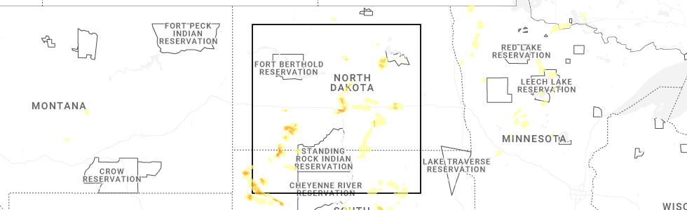
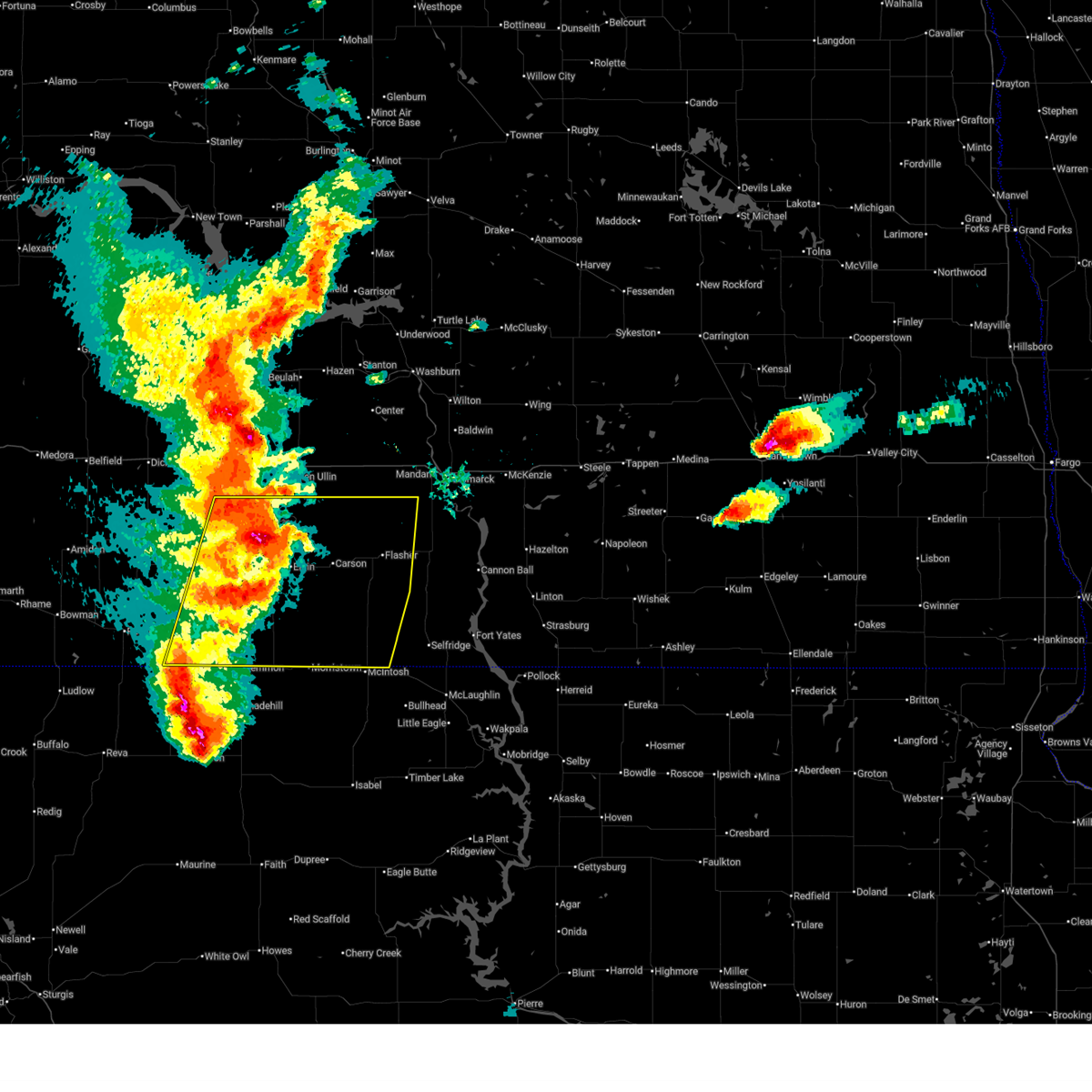
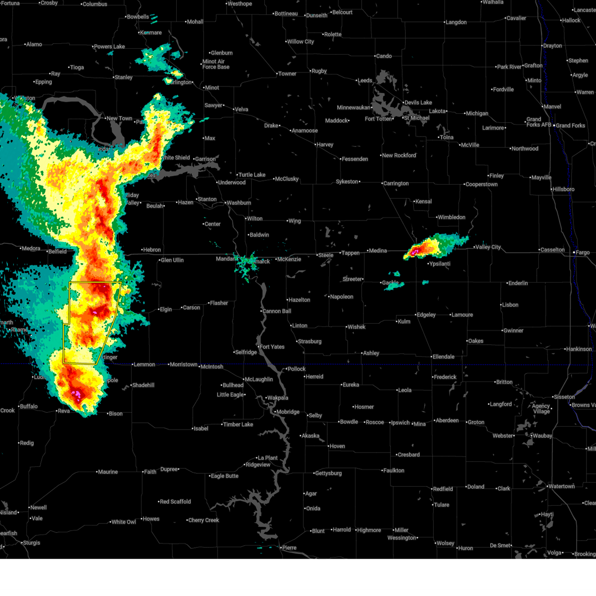
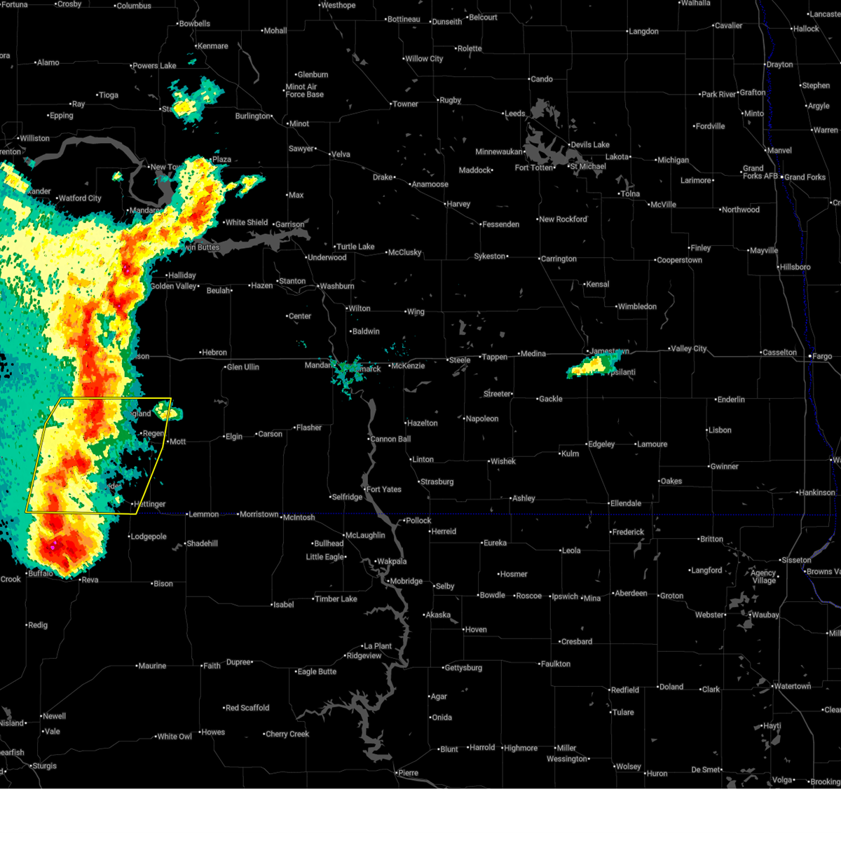
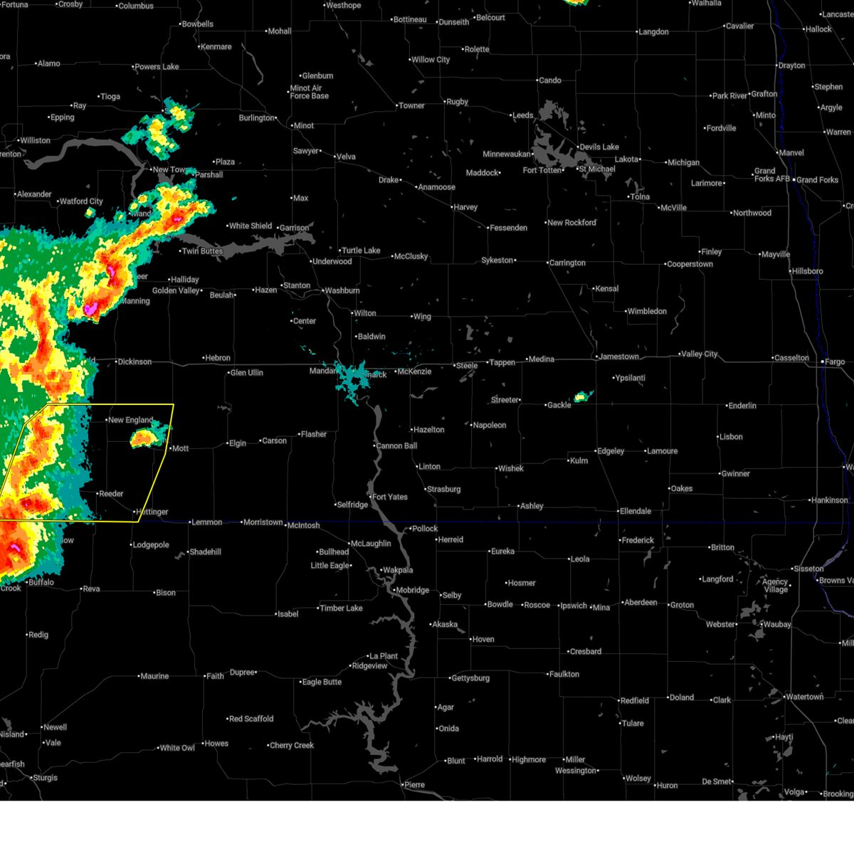
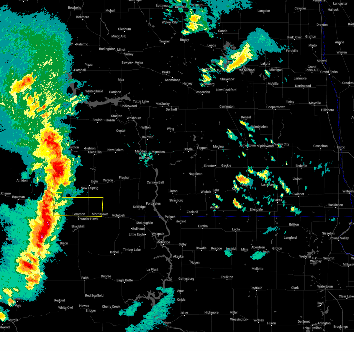
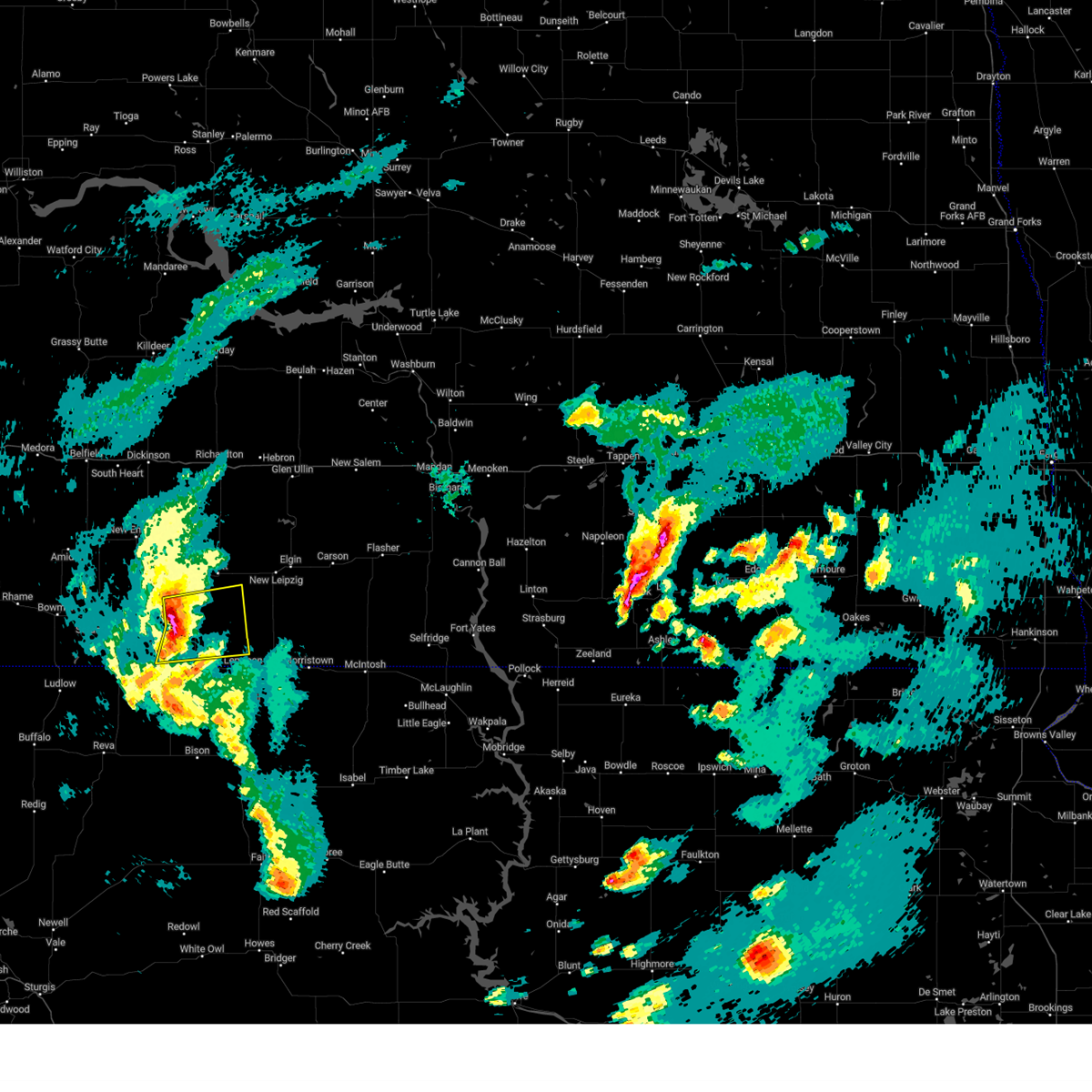
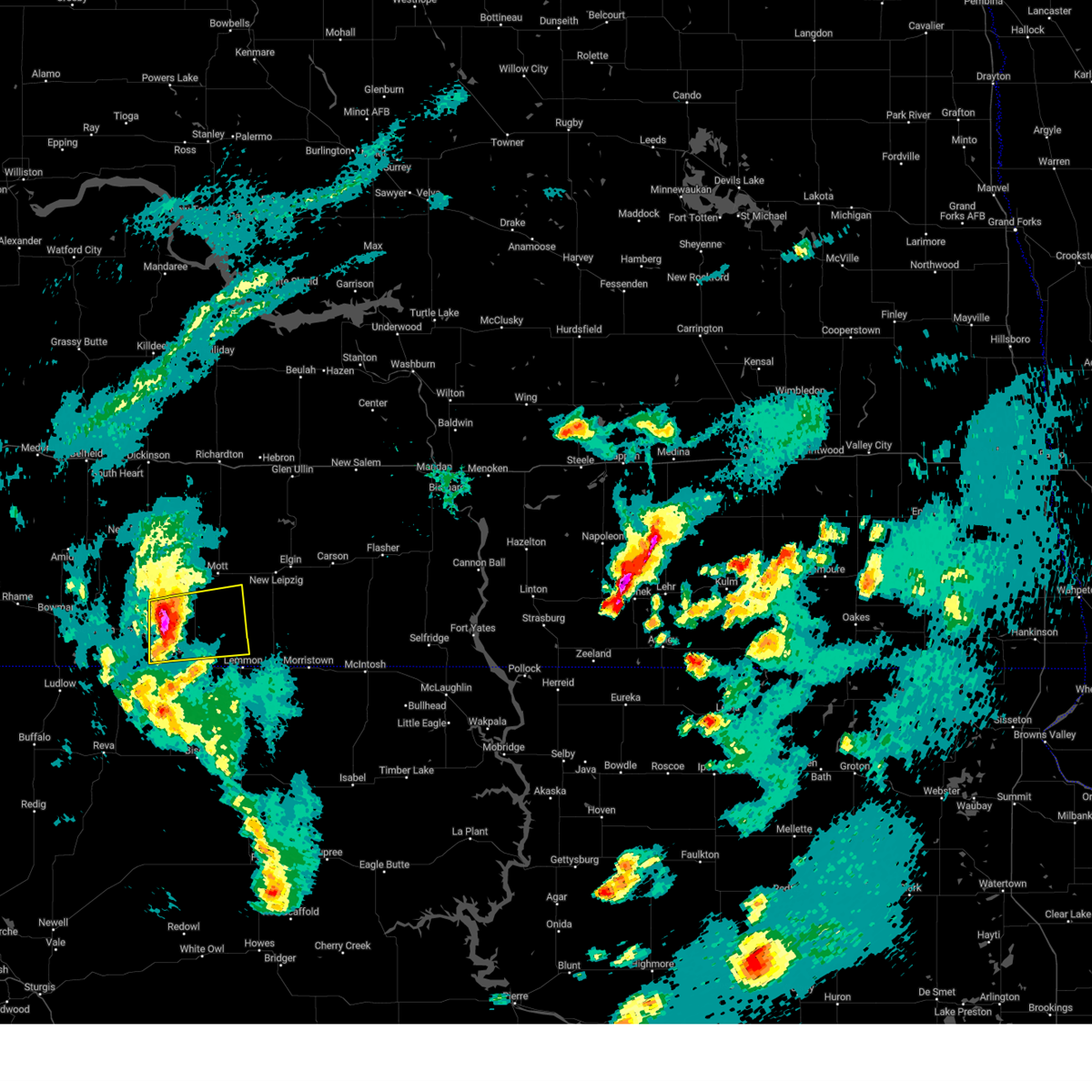
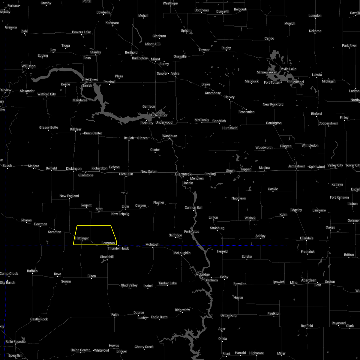
Hail Map for Hettinger, ND
The Hettinger, ND area has had 37 reports of on-the-ground hail by trained spotters, and has been under severe weather warnings 17 times during the past 12 months. Doppler radar has detected hail at or near Hettinger, ND on 39 occasions, including 3 occasions during the past year.
| Name: | Hettinger, ND |
| Where Located: | 104.5 miles WSW of Bismarck, ND |
| Map: | Google Map for Hettinger, ND |
| Population: | 1226 |
| Housing Units: | 704 |
| More Info: | Search Google for Hettinger, ND |
0
The Top Recent Hail Date for Hettinger, ND is Wednesday, July 9, 2025 (19th out of 39)
Hail and Wind Damage Spotted near Hettinger, ND
| Date / Time | Report Details |
|---|---|
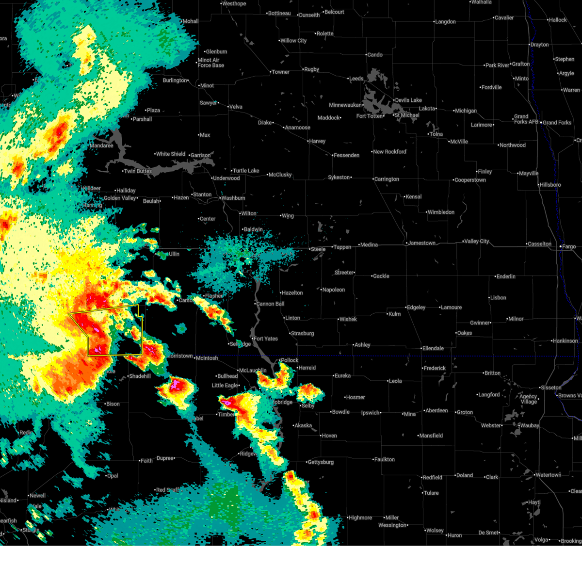
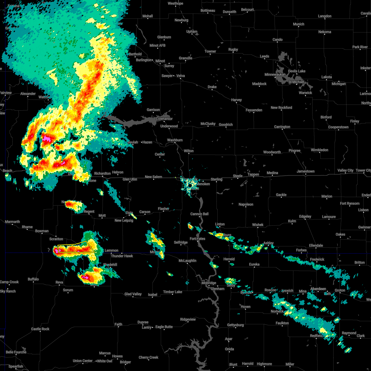
| 7/9/2025 3:05 PM MDT |
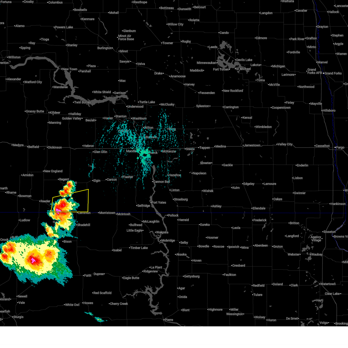 At 304 pm mdt, a severe thunderstorm was located over haynes, or 5 miles southeast of hettinger, moving east at 25 mph (public. at 400 pm, two inch hail was reported at the hettinger golf course). Hazards include two inch hail and 60 mph wind gusts. People and animals outdoors will be injured. expect hail damage to roofs, siding, windows, and vehicles. expect wind damage to roofs, siding, and trees. Locations impacted include, hettinger and haynes. At 304 pm mdt, a severe thunderstorm was located over haynes, or 5 miles southeast of hettinger, moving east at 25 mph (public. at 400 pm, two inch hail was reported at the hettinger golf course). Hazards include two inch hail and 60 mph wind gusts. People and animals outdoors will be injured. expect hail damage to roofs, siding, windows, and vehicles. expect wind damage to roofs, siding, and trees. Locations impacted include, hettinger and haynes.
|
| 7/9/2025 2:58 PM MDT | Tennis Ball sized hail reported 1.1 miles NW of Hettinger, ND, pictures sent via social media. dents also reported on cars. |
| 7/9/2025 2:56 PM MDT |
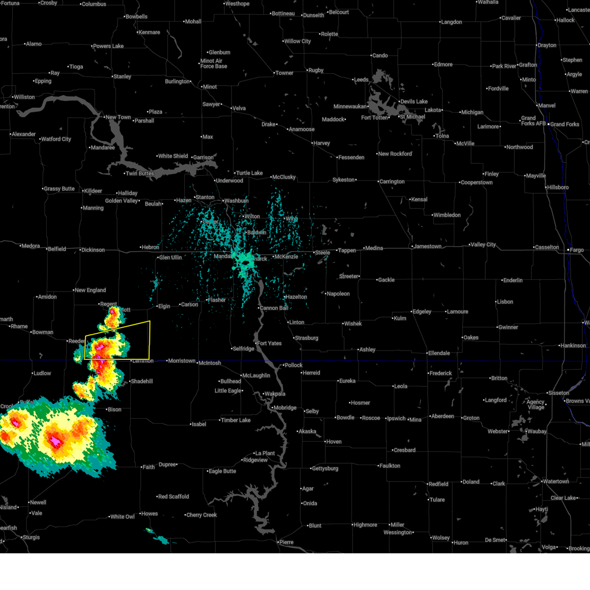 At 255 pm mdt, a severe thunderstorm was located near haynes, or near hettinger, moving east at 25 mph (trained weather spotters. at 354 pm cdt, ping pong size hail was reported hettinger golf course). Hazards include golf ball size hail and 60 mph wind gusts. People and animals outdoors will be injured. expect hail damage to roofs, siding, windows, and vehicles. expect wind damage to roofs, siding, and trees. Locations impacted include, hettinger and haynes. At 255 pm mdt, a severe thunderstorm was located near haynes, or near hettinger, moving east at 25 mph (trained weather spotters. at 354 pm cdt, ping pong size hail was reported hettinger golf course). Hazards include golf ball size hail and 60 mph wind gusts. People and animals outdoors will be injured. expect hail damage to roofs, siding, windows, and vehicles. expect wind damage to roofs, siding, and trees. Locations impacted include, hettinger and haynes.
|
| 7/9/2025 2:49 PM MDT |
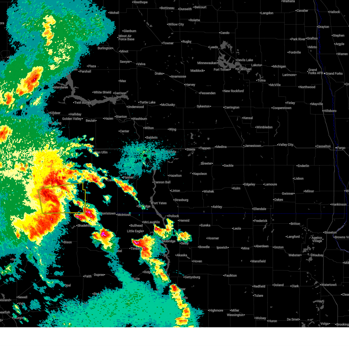
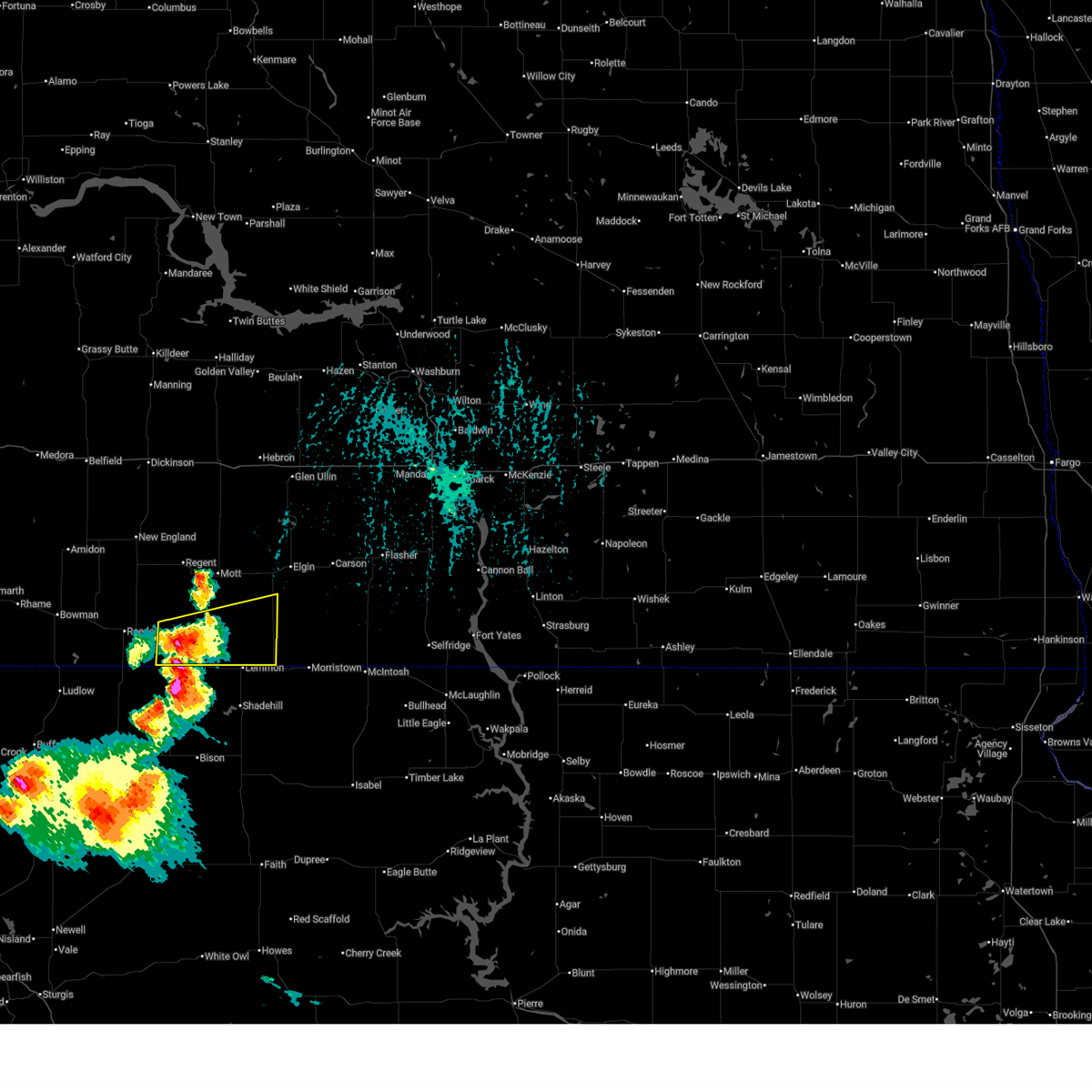 Svrbis the national weather service in bismarck has issued a * severe thunderstorm warning for, southwestern sioux county in south central north dakota, southeastern hettinger county in southwestern north dakota, southwestern grant county in south central north dakota, southeastern adams county in southwestern north dakota, * until 345 pm mdt. * at 248 pm mdt, a severe thunderstorm was located near hettinger, moving east at 25 mph (radar indicated). Hazards include 60 mph wind gusts and half dollar size hail. Hail damage to vehicles is expected. Expect wind damage to roofs, siding, and trees. Svrbis the national weather service in bismarck has issued a * severe thunderstorm warning for, southwestern sioux county in south central north dakota, southeastern hettinger county in southwestern north dakota, southwestern grant county in south central north dakota, southeastern adams county in southwestern north dakota, * until 345 pm mdt. * at 248 pm mdt, a severe thunderstorm was located near hettinger, moving east at 25 mph (radar indicated). Hazards include 60 mph wind gusts and half dollar size hail. Hail damage to vehicles is expected. Expect wind damage to roofs, siding, and trees.
|
| 6/20/2025 7:20 PM MDT |
 At 819 pm cdt/719 pm mdt/, severe thunderstorms were located along a line extending from 6 miles southwest of glen ullin to 4 miles west of heart butte dam to lemmon, moving east at 60 mph (radar indicated). Hazards include 70 mph wind gusts and quarter size hail. Hail damage to vehicles is expected. expect considerable tree damage. wind damage is also likely to mobile homes, roofs, and outbuildings. locations impacted include, hettinger, mott, elgin, carson, flasher, new leipzig, almont, haynes, heart butte dam, shields, north lemmon, burt, lark, raleigh, leith, heil, bentley, st. Gertrude, porcupine, and standing rock. At 819 pm cdt/719 pm mdt/, severe thunderstorms were located along a line extending from 6 miles southwest of glen ullin to 4 miles west of heart butte dam to lemmon, moving east at 60 mph (radar indicated). Hazards include 70 mph wind gusts and quarter size hail. Hail damage to vehicles is expected. expect considerable tree damage. wind damage is also likely to mobile homes, roofs, and outbuildings. locations impacted include, hettinger, mott, elgin, carson, flasher, new leipzig, almont, haynes, heart butte dam, shields, north lemmon, burt, lark, raleigh, leith, heil, bentley, st. Gertrude, porcupine, and standing rock.
|
| 6/20/2025 7:14 PM MDT | Storm damage reported in perkins county SD, 14.7 miles N of Hettinger, ND |
| 6/20/2025 7:03 PM MDT |
 Svrbis the national weather service in bismarck has issued a * severe thunderstorm warning for, southwestern sioux county in south central north dakota, hettinger county in southwestern north dakota, central morton county in south central north dakota, southeastern stark county in southwestern north dakota, grant county in south central north dakota, adams county in southwestern north dakota, * until 900 pm cdt/800 pm mdt/. * at 803 pm cdt/703 pm mdt/, severe thunderstorms were located along a line extending from 11 miles south of richardton to 15 miles north of mott to near haynes, moving east at 60 mph (radar indicated). Hazards include 70 mph wind gusts and quarter size hail. Hail damage to vehicles is expected. expect considerable tree damage. Wind damage is also likely to mobile homes, roofs, and outbuildings. Svrbis the national weather service in bismarck has issued a * severe thunderstorm warning for, southwestern sioux county in south central north dakota, hettinger county in southwestern north dakota, central morton county in south central north dakota, southeastern stark county in southwestern north dakota, grant county in south central north dakota, adams county in southwestern north dakota, * until 900 pm cdt/800 pm mdt/. * at 803 pm cdt/703 pm mdt/, severe thunderstorms were located along a line extending from 11 miles south of richardton to 15 miles north of mott to near haynes, moving east at 60 mph (radar indicated). Hazards include 70 mph wind gusts and quarter size hail. Hail damage to vehicles is expected. expect considerable tree damage. Wind damage is also likely to mobile homes, roofs, and outbuildings.
|
| 6/20/2025 6:57 PM MDT |
 the severe thunderstorm warning has been cancelled and is no longer in effect the severe thunderstorm warning has been cancelled and is no longer in effect
|
| 6/20/2025 6:57 PM MDT |
 At 657 pm mdt, severe thunderstorms were located along a line extending from 12 miles south of gladstone to 7 miles southwest of regent to 8 miles south of reeder, moving east at 50 mph (radar indicated). Hazards include 70 mph wind gusts and quarter size hail. Hail damage to vehicles is expected. expect considerable tree damage. wind damage is also likely to mobile homes, roofs, and outbuildings. Locations impacted include, hettinger, new england, reeder, regent, bucyrus, and havelock. At 657 pm mdt, severe thunderstorms were located along a line extending from 12 miles south of gladstone to 7 miles southwest of regent to 8 miles south of reeder, moving east at 50 mph (radar indicated). Hazards include 70 mph wind gusts and quarter size hail. Hail damage to vehicles is expected. expect considerable tree damage. wind damage is also likely to mobile homes, roofs, and outbuildings. Locations impacted include, hettinger, new england, reeder, regent, bucyrus, and havelock.
|
| 6/20/2025 6:53 PM MDT | Asos station khei hettinger airpor in adams county ND, 1.5 miles SSE of Hettinger, ND |
| 6/20/2025 6:29 PM MDT |
 At 628 pm mdt, severe thunderstorms were located along a line extending from 9 miles northwest of new england to 10 miles north of scranton to 8 miles north of ludlow, moving east at 50 mph (radar indicated. at 0615 pm mdt, 58 mph was reported at bowman). Hazards include 70 mph wind gusts and quarter size hail. Hail damage to vehicles is expected. expect considerable tree damage. wind damage is also likely to mobile homes, roofs, and outbuildings. Locations impacted include, bowman, hettinger, new england, scranton, reeder, regent, amidon, bucyrus, havelock, gascoyne, bowman haley dam, and buffalo springs. At 628 pm mdt, severe thunderstorms were located along a line extending from 9 miles northwest of new england to 10 miles north of scranton to 8 miles north of ludlow, moving east at 50 mph (radar indicated. at 0615 pm mdt, 58 mph was reported at bowman). Hazards include 70 mph wind gusts and quarter size hail. Hail damage to vehicles is expected. expect considerable tree damage. wind damage is also likely to mobile homes, roofs, and outbuildings. Locations impacted include, bowman, hettinger, new england, scranton, reeder, regent, amidon, bucyrus, havelock, gascoyne, bowman haley dam, and buffalo springs.
|
| 6/20/2025 6:09 PM MDT |
 Svrbis the national weather service in bismarck has issued a * severe thunderstorm warning for, bowman county in southwestern north dakota, hettinger county in southwestern north dakota, slope county in southwestern north dakota, western adams county in southwestern north dakota, * until 715 pm mdt. * at 608 pm mdt, severe thunderstorms were located along a line extending from 10 miles north of amidon to 6 miles north of bowman to near table mountain, moving east at 50 mph (radar indicated). Hazards include 70 mph wind gusts and quarter size hail. Hail damage to vehicles is expected. expect considerable tree damage. Wind damage is also likely to mobile homes, roofs, and outbuildings. Svrbis the national weather service in bismarck has issued a * severe thunderstorm warning for, bowman county in southwestern north dakota, hettinger county in southwestern north dakota, slope county in southwestern north dakota, western adams county in southwestern north dakota, * until 715 pm mdt. * at 608 pm mdt, severe thunderstorms were located along a line extending from 10 miles north of amidon to 6 miles north of bowman to near table mountain, moving east at 50 mph (radar indicated). Hazards include 70 mph wind gusts and quarter size hail. Hail damage to vehicles is expected. expect considerable tree damage. Wind damage is also likely to mobile homes, roofs, and outbuildings.
|
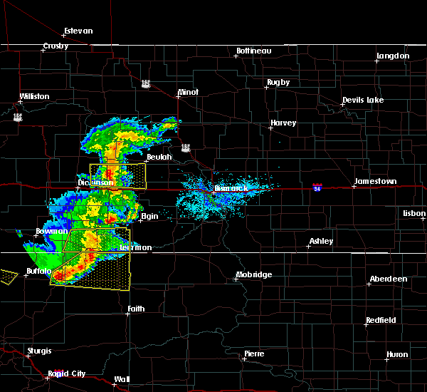
| 6/16/2025 12:32 AM MDT |
 At 1230 am mdt, severe thunderstorms were located along a line extending from 9 miles south of regent to 11 miles northeast of haynes to white butte, moving east at 55 mph. these are destructive storms for adams and southern hettinger counties (trained weather spotters. at 1215 am mdt, a 94 mph wind gust was reported 1 mile west of hettinger). Hazards include 90 mph wind gusts. You are in a life-threatening situation. flying debris may be deadly to those caught without shelter. mobile homes will be heavily damaged or destroyed. homes and businesses will have substantial roof and window damage. expect extensive tree damage and power outages. Locations impacted include, hettinger, haynes, burt, and bentley. At 1230 am mdt, severe thunderstorms were located along a line extending from 9 miles south of regent to 11 miles northeast of haynes to white butte, moving east at 55 mph. these are destructive storms for adams and southern hettinger counties (trained weather spotters. at 1215 am mdt, a 94 mph wind gust was reported 1 mile west of hettinger). Hazards include 90 mph wind gusts. You are in a life-threatening situation. flying debris may be deadly to those caught without shelter. mobile homes will be heavily damaged or destroyed. homes and businesses will have substantial roof and window damage. expect extensive tree damage and power outages. Locations impacted include, hettinger, haynes, burt, and bentley.
|
| 6/16/2025 12:20 AM MDT |
 Svrbis the national weather service in bismarck has issued a * severe thunderstorm warning for, southern hettinger county in southwestern north dakota, adams county in southwestern north dakota, * until 100 am mdt. * at 1219 am mdt, severe thunderstorms were located along a line extending from 11 miles southwest of regent to 11 miles north of haynes to 4 miles southeast of hettinger, moving east at 55 mph. these are destructive storms for adams and southern hettinger counties (radar indicated). Hazards include 90 mph wind gusts. You are in a life-threatening situation. flying debris may be deadly to those caught without shelter. mobile homes will be heavily damaged or destroyed. homes and businesses will have substantial roof and window damage. Expect extensive tree damage and power outages. Svrbis the national weather service in bismarck has issued a * severe thunderstorm warning for, southern hettinger county in southwestern north dakota, adams county in southwestern north dakota, * until 100 am mdt. * at 1219 am mdt, severe thunderstorms were located along a line extending from 11 miles southwest of regent to 11 miles north of haynes to 4 miles southeast of hettinger, moving east at 55 mph. these are destructive storms for adams and southern hettinger counties (radar indicated). Hazards include 90 mph wind gusts. You are in a life-threatening situation. flying debris may be deadly to those caught without shelter. mobile homes will be heavily damaged or destroyed. homes and businesses will have substantial roof and window damage. Expect extensive tree damage and power outages.
|
| 6/16/2025 12:15 AM MDT | Nw hettinger ndawn. 10 meter peak wind gus in adams county ND, 0.8 miles ENE of Hettinger, ND |
| 6/15/2025 11:57 PM MDT |
 Svrbis the national weather service in bismarck has issued a * severe thunderstorm warning for, hettinger county in southwestern north dakota, adams county in southwestern north dakota, * until 100 am mdt. * at 1156 pm mdt, severe thunderstorms were located along a line extending from 17 miles south of new england to near scranton to 9 miles southwest of reeder, moving east at 55 mph (radar indicated). Hazards include 70 mph wind gusts and nickel size hail. Expect considerable tree damage. Damage is likely to mobile homes, roofs, and outbuildings. Svrbis the national weather service in bismarck has issued a * severe thunderstorm warning for, hettinger county in southwestern north dakota, adams county in southwestern north dakota, * until 100 am mdt. * at 1156 pm mdt, severe thunderstorms were located along a line extending from 17 miles south of new england to near scranton to 9 miles southwest of reeder, moving east at 55 mph (radar indicated). Hazards include 70 mph wind gusts and nickel size hail. Expect considerable tree damage. Damage is likely to mobile homes, roofs, and outbuildings.
|
| 5/11/2025 8:28 PM MDT | Asos station khei hettinger airpor in adams county ND, 1.5 miles SSE of Hettinger, ND |
| 5/11/2025 8:25 PM MDT |
 Svrbis the national weather service in bismarck has issued a * severe thunderstorm warning for, southeastern hettinger county in southwestern north dakota, west central grant county in south central north dakota, central adams county in southwestern north dakota, * until 915 pm mdt. * at 825 pm mdt, a severe thunderstorm was located over hettinger, moving northeast at 40 mph (radar indicated). Hazards include 70 mph wind gusts. Expect considerable tree damage. Damage is likely to mobile homes, roofs, and outbuildings. Svrbis the national weather service in bismarck has issued a * severe thunderstorm warning for, southeastern hettinger county in southwestern north dakota, west central grant county in south central north dakota, central adams county in southwestern north dakota, * until 915 pm mdt. * at 825 pm mdt, a severe thunderstorm was located over hettinger, moving northeast at 40 mph (radar indicated). Hazards include 70 mph wind gusts. Expect considerable tree damage. Damage is likely to mobile homes, roofs, and outbuildings.
|
| 5/11/2025 8:23 PM MDT | Hettinger nw (ndawn). 10 meter wind gust of 68 mph at the same tim in adams county ND, 1.3 miles SSE of Hettinger, ND |
| 9/16/2024 1:30 AM MDT | Asos station khei hettinger airpor in adams county ND, 1.5 miles SSE of Hettinger, ND |
| 7/13/2024 10:26 PM MDT |
 The storm which prompted the warning has weakened below severe limits. therefore, the warning will be allowed to expire. however, gusty winds up to 55 mph are still possible in eastern adams county with this thunderstorm. The storm which prompted the warning has weakened below severe limits. therefore, the warning will be allowed to expire. however, gusty winds up to 55 mph are still possible in eastern adams county with this thunderstorm.
|
| 7/13/2024 10:10 PM MDT |
 At 1009 pm mdt, a cluster of severe thunderstorms were located across far southwest north dakota, or near hettinger, moving southeast at 45 mph (radar indicated). Hazards include 70 mph wind gusts and penny size hail. Expect considerable tree damage. damage is likely to mobile homes, roofs, and outbuildings. Locations impacted include, hettinger, scranton, reeder, regent, haynes, bucyrus, gascoyne, and bowman haley dam. At 1009 pm mdt, a cluster of severe thunderstorms were located across far southwest north dakota, or near hettinger, moving southeast at 45 mph (radar indicated). Hazards include 70 mph wind gusts and penny size hail. Expect considerable tree damage. damage is likely to mobile homes, roofs, and outbuildings. Locations impacted include, hettinger, scranton, reeder, regent, haynes, bucyrus, gascoyne, and bowman haley dam.
|
| 7/13/2024 9:54 PM MDT |
 At 954 pm mdt, a severe thunderstorm was located near hettinger, moving southeast at 45 mph (radar indicated). Hazards include 70 mph wind gusts and penny size hail. Expect considerable tree damage. damage is likely to mobile homes, roofs, and outbuildings. Locations impacted include, bowman, hettinger, scranton, rhame, reeder, regent, haynes, amidon, mud buttes, griffin, bucyrus, gascoyne, bowman haley dam, and buffalo springs. At 954 pm mdt, a severe thunderstorm was located near hettinger, moving southeast at 45 mph (radar indicated). Hazards include 70 mph wind gusts and penny size hail. Expect considerable tree damage. damage is likely to mobile homes, roofs, and outbuildings. Locations impacted include, bowman, hettinger, scranton, rhame, reeder, regent, haynes, amidon, mud buttes, griffin, bucyrus, gascoyne, bowman haley dam, and buffalo springs.
|
| 7/13/2024 9:30 PM MDT |
 Svrbis the national weather service in bismarck has issued a * severe thunderstorm warning for, bowman county in southwestern north dakota, southwestern hettinger county in southwestern north dakota, southeastern slope county in southwestern north dakota, adams county in southwestern north dakota, * until 1030 pm mdt. * at 928 pm mdt, a cluster of severe thunderstorms were located across far southwest north dakota, moving southeast at 45 mph (radar indicated). Hazards include 70 mph wind gusts and penny size hail. Expect considerable tree damage. Damage is likely to mobile homes, roofs, and outbuildings. Svrbis the national weather service in bismarck has issued a * severe thunderstorm warning for, bowman county in southwestern north dakota, southwestern hettinger county in southwestern north dakota, southeastern slope county in southwestern north dakota, adams county in southwestern north dakota, * until 1030 pm mdt. * at 928 pm mdt, a cluster of severe thunderstorms were located across far southwest north dakota, moving southeast at 45 mph (radar indicated). Hazards include 70 mph wind gusts and penny size hail. Expect considerable tree damage. Damage is likely to mobile homes, roofs, and outbuildings.
|
| 6/27/2024 7:10 PM MDT | Asos station khei hettinger airpor in adams county ND, 1.5 miles SSE of Hettinger, ND |
| 6/27/2024 7:04 PM MDT |
 Svrbis the national weather service in bismarck has issued a * severe thunderstorm warning for, southwestern sioux county in south central north dakota, southwestern grant county in south central north dakota, adams county in southwestern north dakota, * until 800 pm mdt. * at 703 pm mdt, severe thunderstorms were located along a line extending from 11 miles south of regent to 7 miles northeast of hettinger to 5 miles southwest of haynes, moving east at 45 mph. these are destructive storms (radar indicated). Hazards include 80 mph wind gusts and quarter size hail. Flying debris will be dangerous to those caught without shelter. mobile homes will be heavily damaged. expect considerable damage to roofs, windows, and vehicles. Extensive tree damage and power outages are likely. Svrbis the national weather service in bismarck has issued a * severe thunderstorm warning for, southwestern sioux county in south central north dakota, southwestern grant county in south central north dakota, adams county in southwestern north dakota, * until 800 pm mdt. * at 703 pm mdt, severe thunderstorms were located along a line extending from 11 miles south of regent to 7 miles northeast of hettinger to 5 miles southwest of haynes, moving east at 45 mph. these are destructive storms (radar indicated). Hazards include 80 mph wind gusts and quarter size hail. Flying debris will be dangerous to those caught without shelter. mobile homes will be heavily damaged. expect considerable damage to roofs, windows, and vehicles. Extensive tree damage and power outages are likely.
|
| 6/27/2024 6:34 PM MDT |
 At 634 pm mdt, severe thunderstorms were located along a line extending from 8 miles northwest of new england to 15 miles southwest of regent to 10 miles south of reeder, moving east at 55 mph (radar indicated). Hazards include golf ball size hail and 70 mph wind gusts. People and animals outdoors will be injured. expect hail damage to roofs, siding, windows, and vehicles. expect considerable tree damage. wind damage is also likely to mobile homes, roofs, and outbuildings. Locations impacted include, hettinger, mott, new england, scranton, reeder, regent, haynes, burt, bucyrus, havelock, gascoyne, bowman haley dam, buffalo springs, and bentley. At 634 pm mdt, severe thunderstorms were located along a line extending from 8 miles northwest of new england to 15 miles southwest of regent to 10 miles south of reeder, moving east at 55 mph (radar indicated). Hazards include golf ball size hail and 70 mph wind gusts. People and animals outdoors will be injured. expect hail damage to roofs, siding, windows, and vehicles. expect considerable tree damage. wind damage is also likely to mobile homes, roofs, and outbuildings. Locations impacted include, hettinger, mott, new england, scranton, reeder, regent, haynes, burt, bucyrus, havelock, gascoyne, bowman haley dam, buffalo springs, and bentley.
|
| 6/27/2024 6:17 PM MDT |
 Svrbis the national weather service in bismarck has issued a * severe thunderstorm warning for, eastern bowman county in southwestern north dakota, hettinger county in southwestern north dakota, eastern slope county in southwestern north dakota, adams county in southwestern north dakota, * until 730 pm mdt. * at 616 pm mdt, severe thunderstorms were located along a line extending from 11 miles north of amidon to 8 miles north of scranton to 10 miles northeast of ludlow, moving east at 55 mph (radar indicated). Hazards include 70 mph wind gusts and half dollar size hail. Hail damage to vehicles is expected. expect considerable tree damage. Wind damage is also likely to mobile homes, roofs, and outbuildings. Svrbis the national weather service in bismarck has issued a * severe thunderstorm warning for, eastern bowman county in southwestern north dakota, hettinger county in southwestern north dakota, eastern slope county in southwestern north dakota, adams county in southwestern north dakota, * until 730 pm mdt. * at 616 pm mdt, severe thunderstorms were located along a line extending from 11 miles north of amidon to 8 miles north of scranton to 10 miles northeast of ludlow, moving east at 55 mph (radar indicated). Hazards include 70 mph wind gusts and half dollar size hail. Hail damage to vehicles is expected. expect considerable tree damage. Wind damage is also likely to mobile homes, roofs, and outbuildings.
|
| 6/22/2024 7:06 PM MDT | Quarter sized hail reported 7.9 miles W of Hettinger, ND, picture of a handful of hailstones up to the size of quarters. relayed via broadcast media. time estimated by radar. |
| 6/15/2024 8:20 PM MDT | Quarter sized hail reported 14 miles N of Hettinger, ND |
| 5/23/2024 5:47 PM MDT |
 At 546 pm mdt, a severe thunderstorm was located 10 miles north of hettinger, moving east at 20 mph (radar indicated). Hazards include 60 mph wind gusts and half dollar size hail. Hail damage to vehicles is expected. expect wind damage to roofs, siding, and trees. Locations impacted include, hettinger. At 546 pm mdt, a severe thunderstorm was located 10 miles north of hettinger, moving east at 20 mph (radar indicated). Hazards include 60 mph wind gusts and half dollar size hail. Hail damage to vehicles is expected. expect wind damage to roofs, siding, and trees. Locations impacted include, hettinger.
|
| 5/23/2024 5:38 PM MDT | Ping Pong Ball sized hail reported 5.8 miles SSE of Hettinger, ND, spotter reported approximately ping pong-sized hail for around 3 minutes. |
| 5/23/2024 5:36 PM MDT |
 Svrbis the national weather service in bismarck has issued a * severe thunderstorm warning for, southeastern hettinger county in southwestern north dakota, central adams county in southwestern north dakota, * until 630 pm mdt. * at 536 pm mdt, a severe thunderstorm was located 9 miles north of hettinger, moving east at 25 mph (radar indicated). Hazards include 60 mph wind gusts and half dollar size hail. Hail damage to vehicles is expected. Expect wind damage to roofs, siding, and trees. Svrbis the national weather service in bismarck has issued a * severe thunderstorm warning for, southeastern hettinger county in southwestern north dakota, central adams county in southwestern north dakota, * until 630 pm mdt. * at 536 pm mdt, a severe thunderstorm was located 9 miles north of hettinger, moving east at 25 mph (radar indicated). Hazards include 60 mph wind gusts and half dollar size hail. Hail damage to vehicles is expected. Expect wind damage to roofs, siding, and trees.
|
| 5/23/2024 5:30 PM MDT | Strong winds of 50 to 60 mph began at 630 pm and lasted 12 minutes to 642 pm. pea to dime sized hail also fell with the strong wind in adams county ND, 10.9 miles S of Hettinger, ND |
| 5/17/2024 5:02 PM MDT |
 At 501 pm mdt, severe thunderstorms were located along a line extending from 11 miles southwest of regent to 8 miles north of haynes to 7 miles northwest of shadehill reservoir, south dakota, moving east at 50 mph (trained weather spotters. at 500 pm mdt, a 70 mph gust was reported at the hettinger airport). Hazards include 70 mph wind gusts. Expect considerable tree damage. damage is likely to mobile homes, roofs, and outbuildings. these severe storms will be near, mott around 520 pm mdt. Other locations impacted by these severe thunderstorms include bucyrus, burt, and bentley. At 501 pm mdt, severe thunderstorms were located along a line extending from 11 miles southwest of regent to 8 miles north of haynes to 7 miles northwest of shadehill reservoir, south dakota, moving east at 50 mph (trained weather spotters. at 500 pm mdt, a 70 mph gust was reported at the hettinger airport). Hazards include 70 mph wind gusts. Expect considerable tree damage. damage is likely to mobile homes, roofs, and outbuildings. these severe storms will be near, mott around 520 pm mdt. Other locations impacted by these severe thunderstorms include bucyrus, burt, and bentley.
|
| 5/17/2024 4:58 PM MDT | Asos station khei hettinger airpor in adams county ND, 1.5 miles SSE of Hettinger, ND |
| 5/17/2024 4:39 PM MDT |
 At 439 pm mdt, severe thunderstorms were located along a line extending from 8 miles north of reeder to 4 miles west of hettinger to near lodgepole, moving east at 45 mph (radar indicated). Hazards include 70 mph wind gusts. Expect considerable tree damage. damage is likely to mobile homes, roofs, and outbuildings. these severe storms will be near, hettinger around 445 pm mdt. haynes around 450 pm mdt. mott around 515 pm mdt. Other locations impacted by these severe thunderstorms include bucyrus, burt, and bentley. At 439 pm mdt, severe thunderstorms were located along a line extending from 8 miles north of reeder to 4 miles west of hettinger to near lodgepole, moving east at 45 mph (radar indicated). Hazards include 70 mph wind gusts. Expect considerable tree damage. damage is likely to mobile homes, roofs, and outbuildings. these severe storms will be near, hettinger around 445 pm mdt. haynes around 450 pm mdt. mott around 515 pm mdt. Other locations impacted by these severe thunderstorms include bucyrus, burt, and bentley.
|
| 5/17/2024 4:31 PM MDT |
 Svrbis the national weather service in bismarck has issued a * severe thunderstorm warning for, southern hettinger county in southwestern north dakota, adams county in southwestern north dakota, * until 530 pm mdt. * at 430 pm mdt, severe thunderstorms were located along a line extending from 8 miles north of reeder to 4 miles southwest of hettinger to near lodgepole, south dakota, moving east at 45 mph (radar indicated). Hazards include 60 mph wind gusts. Expect damage to roofs, siding, and trees. severe thunderstorms will be near, hettinger around 435 pm mdt. haynes around 440 pm mdt. mott around 510 pm mdt. Other locations impacted by these severe thunderstorms include bucyrus, burt, and bentley. Svrbis the national weather service in bismarck has issued a * severe thunderstorm warning for, southern hettinger county in southwestern north dakota, adams county in southwestern north dakota, * until 530 pm mdt. * at 430 pm mdt, severe thunderstorms were located along a line extending from 8 miles north of reeder to 4 miles southwest of hettinger to near lodgepole, south dakota, moving east at 45 mph (radar indicated). Hazards include 60 mph wind gusts. Expect damage to roofs, siding, and trees. severe thunderstorms will be near, hettinger around 435 pm mdt. haynes around 440 pm mdt. mott around 510 pm mdt. Other locations impacted by these severe thunderstorms include bucyrus, burt, and bentley.
|
| 9/4/2023 5:34 PM MDT |
 At 633 pm cdt/533 pm mdt/, severe thunderstorms were located along a line extending from near hettinger to 7 miles northeast of shadehill to 9 miles east of shambo ranch, moving northeast at 40 mph (radar indicated). Hazards include 70 mph wind gusts. Expect considerable tree damage. damage is likely to mobile homes, roofs, and outbuildings. severe thunderstorms will be near, mott around 610 pm mdt. other locations impacted by these severe thunderstorms include burt, leith, heil, bentley, standing rock and standing rock nation. thunderstorm damage threat, considerable hail threat, radar indicated max hail size, <. 75 in wind threat, radar indicated max wind gust, 70 mph. At 633 pm cdt/533 pm mdt/, severe thunderstorms were located along a line extending from near hettinger to 7 miles northeast of shadehill to 9 miles east of shambo ranch, moving northeast at 40 mph (radar indicated). Hazards include 70 mph wind gusts. Expect considerable tree damage. damage is likely to mobile homes, roofs, and outbuildings. severe thunderstorms will be near, mott around 610 pm mdt. other locations impacted by these severe thunderstorms include burt, leith, heil, bentley, standing rock and standing rock nation. thunderstorm damage threat, considerable hail threat, radar indicated max hail size, <. 75 in wind threat, radar indicated max wind gust, 70 mph.
|
| 7/31/2023 8:47 PM MDT |
 At 847 pm mdt, a severe thunderstorm was located 7 miles south of scranton, or 17 miles southeast of bowman, moving east at 30 mph (radar indicated). Hazards include ping pong ball size hail and 60 mph wind gusts. People and animals outdoors will be injured. expect hail damage to roofs, siding, windows, and vehicles. expect wind damage to roofs, siding, and trees. this severe storm will be near, reeder around 900 pm mdt. hettinger around 930 pm mdt. other locations impacted by this severe thunderstorm include bowman haley dam, bucyrus and gascoyne. hail threat, radar indicated max hail size, 1. 50 in wind threat, radar indicated max wind gust, 60 mph. At 847 pm mdt, a severe thunderstorm was located 7 miles south of scranton, or 17 miles southeast of bowman, moving east at 30 mph (radar indicated). Hazards include ping pong ball size hail and 60 mph wind gusts. People and animals outdoors will be injured. expect hail damage to roofs, siding, windows, and vehicles. expect wind damage to roofs, siding, and trees. this severe storm will be near, reeder around 900 pm mdt. hettinger around 930 pm mdt. other locations impacted by this severe thunderstorm include bowman haley dam, bucyrus and gascoyne. hail threat, radar indicated max hail size, 1. 50 in wind threat, radar indicated max wind gust, 60 mph.
|
| 7/31/2023 8:30 PM MDT |
 At 829 pm mdt, a severe thunderstorm was located 6 miles southwest of scranton, or 12 miles southeast of bowman, moving east at 35 mph (radar indicated). Hazards include ping pong ball size hail and 60 mph wind gusts. People and animals outdoors will be injured. expect hail damage to roofs, siding, windows, and vehicles. expect wind damage to roofs, siding, and trees. this severe thunderstorm will be near, scranton around 835 pm mdt. reeder around 855 pm mdt. hettinger around 915 pm mdt. other locations impacted by this severe thunderstorm include bowman haley dam, bucyrus and gascoyne. hail threat, radar indicated max hail size, 1. 50 in wind threat, radar indicated max wind gust, 60 mph. At 829 pm mdt, a severe thunderstorm was located 6 miles southwest of scranton, or 12 miles southeast of bowman, moving east at 35 mph (radar indicated). Hazards include ping pong ball size hail and 60 mph wind gusts. People and animals outdoors will be injured. expect hail damage to roofs, siding, windows, and vehicles. expect wind damage to roofs, siding, and trees. this severe thunderstorm will be near, scranton around 835 pm mdt. reeder around 855 pm mdt. hettinger around 915 pm mdt. other locations impacted by this severe thunderstorm include bowman haley dam, bucyrus and gascoyne. hail threat, radar indicated max hail size, 1. 50 in wind threat, radar indicated max wind gust, 60 mph.
|
| 7/11/2023 7:30 PM MDT |
 At 729 pm mdt, a severe thunderstorm was located 9 miles north of north cave hills, or 14 miles south of bowman, moving southeast at 35 mph (radar indicated). Hazards include golf ball size hail and 60 mph wind gusts. People and animals outdoors will be injured. expect hail damage to roofs, siding, windows, and vehicles. expect wind damage to roofs, siding, and trees. Locations impacted include, bowman, hettinger, scranton, reeder, mud buttes, bucyrus, gascoyne, bowman haley dam and buffalo springs. At 729 pm mdt, a severe thunderstorm was located 9 miles north of north cave hills, or 14 miles south of bowman, moving southeast at 35 mph (radar indicated). Hazards include golf ball size hail and 60 mph wind gusts. People and animals outdoors will be injured. expect hail damage to roofs, siding, windows, and vehicles. expect wind damage to roofs, siding, and trees. Locations impacted include, bowman, hettinger, scranton, reeder, mud buttes, bucyrus, gascoyne, bowman haley dam and buffalo springs.
|
| 7/11/2023 7:10 PM MDT |
 At 709 pm mdt, a severe thunderstorm was located 9 miles southwest of bowman, moving southeast at 35 mph (radar indicated). Hazards include golf ball size hail and 60 mph wind gusts. People and animals outdoors will be injured. expect hail damage to roofs, siding, windows, and vehicles. expect wind damage to roofs, siding, and trees. Locations impacted include, bowman, hettinger, scranton, rhame, reeder, mud buttes, griffin, bucyrus, gascoyne, sunset butte, bowman haley dam and buffalo springs. At 709 pm mdt, a severe thunderstorm was located 9 miles southwest of bowman, moving southeast at 35 mph (radar indicated). Hazards include golf ball size hail and 60 mph wind gusts. People and animals outdoors will be injured. expect hail damage to roofs, siding, windows, and vehicles. expect wind damage to roofs, siding, and trees. Locations impacted include, bowman, hettinger, scranton, rhame, reeder, mud buttes, griffin, bucyrus, gascoyne, sunset butte, bowman haley dam and buffalo springs.
|
| 7/11/2023 6:49 PM MDT |
 At 648 pm mdt, severe thunderstorms were located along a line extending from 14 miles southwest of new england to 7 miles north of mud buttes, moving southeast at 40 mph (radar indicated). Hazards include golf ball size hail and 60 mph wind gusts. People and animals outdoors will be injured. expect hail damage to roofs, siding, windows, and vehicles. expect wind damage to roofs, siding, and trees. locations impacted include, bowman, hettinger, scranton, rhame, reeder, marmarth, amidon, mud buttes, griffin, bucyrus, gascoyne, sunset butte, bowman haley dam, buffalo springs and pretty butte. thunderstorm damage threat, considerable hail threat, radar indicated max hail size, 1. 75 in wind threat, radar indicated max wind gust, 60 mph. At 648 pm mdt, severe thunderstorms were located along a line extending from 14 miles southwest of new england to 7 miles north of mud buttes, moving southeast at 40 mph (radar indicated). Hazards include golf ball size hail and 60 mph wind gusts. People and animals outdoors will be injured. expect hail damage to roofs, siding, windows, and vehicles. expect wind damage to roofs, siding, and trees. locations impacted include, bowman, hettinger, scranton, rhame, reeder, marmarth, amidon, mud buttes, griffin, bucyrus, gascoyne, sunset butte, bowman haley dam, buffalo springs and pretty butte. thunderstorm damage threat, considerable hail threat, radar indicated max hail size, 1. 75 in wind threat, radar indicated max wind gust, 60 mph.
|
| 7/11/2023 6:42 PM MDT |
 At 641 pm mdt, severe thunderstorms were located along a line extending from 13 miles southwest of new england to 9 miles north of mud buttes, moving southeast at 40 mph (radar indicated). Hazards include 60 mph wind gusts and half dollar size hail. Hail damage to vehicles is expected. expect wind damage to roofs, siding, and trees. these severe thunderstorms will remain over mainly rural areas of bowman, slope and western adams counties, including the following locations, sunset butte, bowman haley dam, bucyrus, griffin, buffalo springs, pretty butte and gascoyne. hail threat, radar indicated max hail size, 1. 25 in wind threat, radar indicated max wind gust, 60 mph. At 641 pm mdt, severe thunderstorms were located along a line extending from 13 miles southwest of new england to 9 miles north of mud buttes, moving southeast at 40 mph (radar indicated). Hazards include 60 mph wind gusts and half dollar size hail. Hail damage to vehicles is expected. expect wind damage to roofs, siding, and trees. these severe thunderstorms will remain over mainly rural areas of bowman, slope and western adams counties, including the following locations, sunset butte, bowman haley dam, bucyrus, griffin, buffalo springs, pretty butte and gascoyne. hail threat, radar indicated max hail size, 1. 25 in wind threat, radar indicated max wind gust, 60 mph.
|
| 7/4/2022 12:01 AM MDT |
 At 101 am cdt/1201 am mdt/, severe thunderstorms were located along a line extending from 9 miles northeast of richardton to 8 miles west of new leipzig to 4 miles south of haynes, moving east at 40 mph (radar indicated). Hazards include 70 mph wind gusts. Expect considerable tree damage. damage is likely to mobile homes, roofs, and outbuildings. locations impacted include, hebron, new leipzig, elgin, north lemmon and carson. thunderstorm damage threat, considerable hail threat, radar indicated max hail size, <. 75 in wind threat, radar indicated max wind gust, 70 mph. At 101 am cdt/1201 am mdt/, severe thunderstorms were located along a line extending from 9 miles northeast of richardton to 8 miles west of new leipzig to 4 miles south of haynes, moving east at 40 mph (radar indicated). Hazards include 70 mph wind gusts. Expect considerable tree damage. damage is likely to mobile homes, roofs, and outbuildings. locations impacted include, hebron, new leipzig, elgin, north lemmon and carson. thunderstorm damage threat, considerable hail threat, radar indicated max hail size, <. 75 in wind threat, radar indicated max wind gust, 70 mph.
|
| 7/3/2022 11:39 PM MDT |
 At 1238 am cdt/1138 pm mdt/, severe thunderstorms were located along a line extending from 5 miles northwest of taylor to 4 miles southwest of mott to 7 miles southwest of hettinger, moving east at 40 mph (radar indicated). Hazards include 70 mph wind gusts. Expect considerable tree damage. damage is likely to mobile homes, roofs, and outbuildings. severe thunderstorms will be near, mott around 1145 pm mdt. richardton around 1150 pm mdt. other locations in the path of these severe thunderstorms include haynes, hebron, new leipzig, elgin, north lemmon and carson. thunderstorm damage threat, considerable hail threat, radar indicated max hail size, <. 75 in wind threat, radar indicated max wind gust, 70 mph. At 1238 am cdt/1138 pm mdt/, severe thunderstorms were located along a line extending from 5 miles northwest of taylor to 4 miles southwest of mott to 7 miles southwest of hettinger, moving east at 40 mph (radar indicated). Hazards include 70 mph wind gusts. Expect considerable tree damage. damage is likely to mobile homes, roofs, and outbuildings. severe thunderstorms will be near, mott around 1145 pm mdt. richardton around 1150 pm mdt. other locations in the path of these severe thunderstorms include haynes, hebron, new leipzig, elgin, north lemmon and carson. thunderstorm damage threat, considerable hail threat, radar indicated max hail size, <. 75 in wind threat, radar indicated max wind gust, 70 mph.
|
| 7/3/2022 11:22 PM MDT |
 At 1121 pm mdt, severe thunderstorms were located along a line extending from 8 miles south of dickinson to 12 miles northeast of reeder to 10 miles north of ralph, moving east at 40 mph (radar indicated). Hazards include 70 mph wind gusts and penny size hail. Expect considerable tree damage. damage is likely to mobile homes, roofs, and outbuildings. locations impacted include, hettinger, mott, new england, scranton, reeder, regent, bucyrus, havelock, gascoyne, bowman haley dam, buffalo springs, lefor and schefield. thunderstorm damage threat, considerable hail threat, radar indicated max hail size, 0. 75 in wind threat, radar indicated max wind gust, 70 mph. At 1121 pm mdt, severe thunderstorms were located along a line extending from 8 miles south of dickinson to 12 miles northeast of reeder to 10 miles north of ralph, moving east at 40 mph (radar indicated). Hazards include 70 mph wind gusts and penny size hail. Expect considerable tree damage. damage is likely to mobile homes, roofs, and outbuildings. locations impacted include, hettinger, mott, new england, scranton, reeder, regent, bucyrus, havelock, gascoyne, bowman haley dam, buffalo springs, lefor and schefield. thunderstorm damage threat, considerable hail threat, radar indicated max hail size, 0. 75 in wind threat, radar indicated max wind gust, 70 mph.
|
| 7/3/2022 10:59 PM MDT |
 At 1058 pm mdt, severe thunderstorms were located along a line extending from 9 miles south of south heart to 8 miles northeast of scranton to 5 miles northeast of ludlow, moving east at 40 mph (radar indicated). Hazards include 70 mph wind gusts and nickel size hail. Expect considerable tree damage. damage is likely to mobile homes, roofs, and outbuildings. locations impacted include, hettinger and mott. thunderstorm damage threat, considerable hail threat, radar indicated max hail size, 0. 88 in wind threat, radar indicated max wind gust, 70 mph. At 1058 pm mdt, severe thunderstorms were located along a line extending from 9 miles south of south heart to 8 miles northeast of scranton to 5 miles northeast of ludlow, moving east at 40 mph (radar indicated). Hazards include 70 mph wind gusts and nickel size hail. Expect considerable tree damage. damage is likely to mobile homes, roofs, and outbuildings. locations impacted include, hettinger and mott. thunderstorm damage threat, considerable hail threat, radar indicated max hail size, 0. 88 in wind threat, radar indicated max wind gust, 70 mph.
|
| 7/3/2022 10:41 PM MDT |
 At 1038 pm mdt, severe thunderstorms were located along a line extending from 11 miles southwest of south heart to 6 miles northeast of bowman to table mountain, moving east at 40 mph (radar indicated). Hazards include 70 mph wind gusts and nickel size hail. Expect considerable tree damage. damage is likely to mobile homes, roofs, and outbuildings. severe thunderstorms will be near, scranton around 1050 pm mdt. other locations in the path of these severe thunderstorms include mott. thunderstorm damage threat, considerable hail threat, radar indicated max hail size, 0. 88 in wind threat, radar indicated max wind gust, 70 mph. At 1038 pm mdt, severe thunderstorms were located along a line extending from 11 miles southwest of south heart to 6 miles northeast of bowman to table mountain, moving east at 40 mph (radar indicated). Hazards include 70 mph wind gusts and nickel size hail. Expect considerable tree damage. damage is likely to mobile homes, roofs, and outbuildings. severe thunderstorms will be near, scranton around 1050 pm mdt. other locations in the path of these severe thunderstorms include mott. thunderstorm damage threat, considerable hail threat, radar indicated max hail size, 0. 88 in wind threat, radar indicated max wind gust, 70 mph.
|
| 7/2/2022 9:02 PM MDT |
 At 902 pm mdt, a severe thunderstorm was located 5 miles north of hettinger, moving southeast at 35 mph (radar indicated). Hazards include 70 mph wind gusts and quarter size hail. Hail damage to vehicles is expected. expect considerable tree damage. wind damage is also likely to mobile homes, roofs, and outbuildings. locations impacted include, hettinger and haynes. thunderstorm damage threat, considerable hail threat, radar indicated max hail size, 1. 00 in wind threat, radar indicated max wind gust, 70 mph. At 902 pm mdt, a severe thunderstorm was located 5 miles north of hettinger, moving southeast at 35 mph (radar indicated). Hazards include 70 mph wind gusts and quarter size hail. Hail damage to vehicles is expected. expect considerable tree damage. wind damage is also likely to mobile homes, roofs, and outbuildings. locations impacted include, hettinger and haynes. thunderstorm damage threat, considerable hail threat, radar indicated max hail size, 1. 00 in wind threat, radar indicated max wind gust, 70 mph.
|
| 7/2/2022 8:39 PM MDT |
 At 839 pm mdt, a severe thunderstorm was located 7 miles east of reeder, or 12 miles northwest of hettinger, moving southeast at 50 mph (radar indicated). Hazards include 70 mph wind gusts and half dollar size hail. Hail damage to vehicles is expected. expect considerable tree damage. wind damage is also likely to mobile homes, roofs, and outbuildings. this severe thunderstorm will be near, hettinger around 855 pm mdt. other locations in the path of this severe thunderstorm include haynes and white butte. thunderstorm damage threat, considerable hail threat, radar indicated max hail size, 1. 25 in wind threat, radar indicated max wind gust, 70 mph. At 839 pm mdt, a severe thunderstorm was located 7 miles east of reeder, or 12 miles northwest of hettinger, moving southeast at 50 mph (radar indicated). Hazards include 70 mph wind gusts and half dollar size hail. Hail damage to vehicles is expected. expect considerable tree damage. wind damage is also likely to mobile homes, roofs, and outbuildings. this severe thunderstorm will be near, hettinger around 855 pm mdt. other locations in the path of this severe thunderstorm include haynes and white butte. thunderstorm damage threat, considerable hail threat, radar indicated max hail size, 1. 25 in wind threat, radar indicated max wind gust, 70 mph.
|
| 6/29/2022 8:05 PM MDT | Dime size hai in adams county ND, 10.9 miles S of Hettinger, ND |
| 6/29/2022 7:39 PM MDT |
 At 739 pm mdt, a severe thunderstorm was located over reeder, or 16 miles west of hettinger, moving northeast at 50 mph (radar indicated). Hazards include 70 mph wind gusts and half dollar size hail. Hail damage to vehicles is expected. expect considerable tree damage. Wind damage is also likely to mobile homes, roofs, and outbuildings. At 739 pm mdt, a severe thunderstorm was located over reeder, or 16 miles west of hettinger, moving northeast at 50 mph (radar indicated). Hazards include 70 mph wind gusts and half dollar size hail. Hail damage to vehicles is expected. expect considerable tree damage. Wind damage is also likely to mobile homes, roofs, and outbuildings.
|
| 6/19/2022 9:16 PM MDT |
 At 916 pm mdt, a severe thunderstorm was located 11 miles north of white butte, or 13 miles northwest of lemmon, moving northeast at 40 mph (radar indicated). Hazards include golf ball size hail and 60 mph wind gusts. People and animals outdoors will be injured. expect hail damage to roofs, siding, windows, and vehicles. expect wind damage to roofs, siding, and trees. locations impacted include, hettinger and haynes. thunderstorm damage threat, considerable hail threat, radar indicated max hail size, 1. 75 in wind threat, radar indicated max wind gust, 60 mph. At 916 pm mdt, a severe thunderstorm was located 11 miles north of white butte, or 13 miles northwest of lemmon, moving northeast at 40 mph (radar indicated). Hazards include golf ball size hail and 60 mph wind gusts. People and animals outdoors will be injured. expect hail damage to roofs, siding, windows, and vehicles. expect wind damage to roofs, siding, and trees. locations impacted include, hettinger and haynes. thunderstorm damage threat, considerable hail threat, radar indicated max hail size, 1. 75 in wind threat, radar indicated max wind gust, 60 mph.
|
| 6/19/2022 9:00 PM MDT |
 At 900 pm mdt, a severe thunderstorm was located near haynes, or 6 miles east of hettinger, moving northeast at 40 mph (radar indicated). Hazards include two inch hail and 60 mph wind gusts. People and animals outdoors will be injured. expect hail damage to roofs, siding, windows, and vehicles. expect wind damage to roofs, siding, and trees. locations impacted include, hettinger, haynes and bucyrus. thunderstorm damage threat, considerable hail threat, radar indicated max hail size, 2. 00 in wind threat, radar indicated max wind gust, 60 mph. At 900 pm mdt, a severe thunderstorm was located near haynes, or 6 miles east of hettinger, moving northeast at 40 mph (radar indicated). Hazards include two inch hail and 60 mph wind gusts. People and animals outdoors will be injured. expect hail damage to roofs, siding, windows, and vehicles. expect wind damage to roofs, siding, and trees. locations impacted include, hettinger, haynes and bucyrus. thunderstorm damage threat, considerable hail threat, radar indicated max hail size, 2. 00 in wind threat, radar indicated max wind gust, 60 mph.
|
| 6/19/2022 8:55 PM MDT | Storm damage reported in adams county ND, 2.3 miles ESE of Hettinger, ND |
| 6/19/2022 8:54 PM MDT |
 At 853 pm mdt, a severe thunderstorm was located over hettinger, moving northeast at 40 mph (radar indicated). Hazards include golf ball size hail and 60 mph wind gusts. People and animals outdoors will be injured. expect hail damage to roofs, siding, windows, and vehicles. expect wind damage to roofs, siding, and trees. locations impacted include, hettinger, haynes and bucyrus. thunderstorm damage threat, considerable hail threat, radar indicated max hail size, 1. 75 in wind threat, radar indicated max wind gust, 60 mph. At 853 pm mdt, a severe thunderstorm was located over hettinger, moving northeast at 40 mph (radar indicated). Hazards include golf ball size hail and 60 mph wind gusts. People and animals outdoors will be injured. expect hail damage to roofs, siding, windows, and vehicles. expect wind damage to roofs, siding, and trees. locations impacted include, hettinger, haynes and bucyrus. thunderstorm damage threat, considerable hail threat, radar indicated max hail size, 1. 75 in wind threat, radar indicated max wind gust, 60 mph.
|
| 6/19/2022 8:30 PM MDT |
 At 829 pm mdt, a severe thunderstorm was located 9 miles northeast of ralph, or 16 miles southwest of hettinger, moving northeast at 40 mph (radar indicated). Hazards include golf ball size hail and 60 mph wind gusts. People and animals outdoors will be injured. expect hail damage to roofs, siding, windows, and vehicles. Expect wind damage to roofs, siding, and trees. At 829 pm mdt, a severe thunderstorm was located 9 miles northeast of ralph, or 16 miles southwest of hettinger, moving northeast at 40 mph (radar indicated). Hazards include golf ball size hail and 60 mph wind gusts. People and animals outdoors will be injured. expect hail damage to roofs, siding, windows, and vehicles. Expect wind damage to roofs, siding, and trees.
|
| 5/28/2022 6:54 PM MDT |
 At 653 pm mdt, severe thunderstorms were located along a line extending from 5 miles east of mud buttes to 11 miles south of reeder, moving northeast at 45 mph (radar indicated). Hazards include 60 mph wind gusts and penny size hail. Expect damage to roofs, siding, and trees. locations impacted include, bowman, hettinger, scranton, rhame, reeder, mud buttes, griffin, bucyrus, gascoyne, sunset butte, bowman haley dam and buffalo springs. hail threat, radar indicated max hail size, 0. 75 in wind threat, radar indicated max wind gust, 60 mph. At 653 pm mdt, severe thunderstorms were located along a line extending from 5 miles east of mud buttes to 11 miles south of reeder, moving northeast at 45 mph (radar indicated). Hazards include 60 mph wind gusts and penny size hail. Expect damage to roofs, siding, and trees. locations impacted include, bowman, hettinger, scranton, rhame, reeder, mud buttes, griffin, bucyrus, gascoyne, sunset butte, bowman haley dam and buffalo springs. hail threat, radar indicated max hail size, 0. 75 in wind threat, radar indicated max wind gust, 60 mph.
|
| 5/28/2022 6:26 PM MDT |
 At 625 pm mdt, severe thunderstorms were located along a line extending from 6 miles southwest of ladner to 8 miles southwest of ralph, moving northeast at 45 mph (radar indicated). Hazards include 60 mph wind gusts and penny size hail. expect damage to roofs, siding, and trees At 625 pm mdt, severe thunderstorms were located along a line extending from 6 miles southwest of ladner to 8 miles southwest of ralph, moving northeast at 45 mph (radar indicated). Hazards include 60 mph wind gusts and penny size hail. expect damage to roofs, siding, and trees
|
| 8/30/2021 6:15 PM MDT | Baseball sized hail reported 8.2 miles WNW of Hettinger, ND, hail ranging in size from marble to baseball fell from 600 to 615 pm mdt. report relayed by emergency management. |
| 8/30/2021 6:10 PM MDT |
 At 610 pm mdt, a severe thunderstorm was located over white butte, or 11 miles west of lemmon, moving south at 15 mph (radar indicated). Hazards include tennis ball size hail and 60 mph wind gusts. People and animals outdoors will be injured. expect hail damage to roofs, siding, windows, and vehicles. expect wind damage to roofs, siding, and trees. locations impacted include, haynes. thunderstorm damage threat, considerable hail threat, radar indicated max hail size, 2. 50 in wind threat, radar indicated max wind gust, 60 mph. At 610 pm mdt, a severe thunderstorm was located over white butte, or 11 miles west of lemmon, moving south at 15 mph (radar indicated). Hazards include tennis ball size hail and 60 mph wind gusts. People and animals outdoors will be injured. expect hail damage to roofs, siding, windows, and vehicles. expect wind damage to roofs, siding, and trees. locations impacted include, haynes. thunderstorm damage threat, considerable hail threat, radar indicated max hail size, 2. 50 in wind threat, radar indicated max wind gust, 60 mph.
|
| 8/30/2021 5:52 PM MDT |
 At 551 pm mdt, a severe thunderstorm was located 5 miles northeast of haynes, or 10 miles east of hettinger, moving south at 10 mph (radar indicated). Hazards include tennis ball size hail and 60 mph wind gusts. People and animals outdoors will be injured. expect hail damage to roofs, siding, windows, and vehicles. expect wind damage to roofs, siding, and trees. locations impacted include, hettinger and haynes. thunderstorm damage threat, considerable hail threat, radar indicated max hail size, 2. 50 in wind threat, radar indicated max wind gust, 60 mph. At 551 pm mdt, a severe thunderstorm was located 5 miles northeast of haynes, or 10 miles east of hettinger, moving south at 10 mph (radar indicated). Hazards include tennis ball size hail and 60 mph wind gusts. People and animals outdoors will be injured. expect hail damage to roofs, siding, windows, and vehicles. expect wind damage to roofs, siding, and trees. locations impacted include, hettinger and haynes. thunderstorm damage threat, considerable hail threat, radar indicated max hail size, 2. 50 in wind threat, radar indicated max wind gust, 60 mph.
|
| 8/30/2021 5:30 PM MDT |
 At 529 pm mdt, a severe thunderstorm was located 8 miles north of haynes, or 10 miles northeast of hettinger, moving south at 15 mph (radar indicated). Hazards include tennis ball size hail and 60 mph wind gusts. People and animals outdoors will be injured. expect hail damage to roofs, siding, windows, and vehicles. Expect wind damage to roofs, siding, and trees. At 529 pm mdt, a severe thunderstorm was located 8 miles north of haynes, or 10 miles northeast of hettinger, moving south at 15 mph (radar indicated). Hazards include tennis ball size hail and 60 mph wind gusts. People and animals outdoors will be injured. expect hail damage to roofs, siding, windows, and vehicles. Expect wind damage to roofs, siding, and trees.
|
| 8/26/2021 2:06 AM MDT | Asos station khei hettinger airpor in adams county ND, 1.5 miles SSE of Hettinger, ND |
| 8/26/2021 1:56 AM MDT |
 At 156 am mdt, severe thunderstorms were located along a line extending from 10 miles south of regent to 10 miles south of reeder, moving east at 40 mph (radar indicated). Hazards include 60 mph wind gusts and quarter size hail. Hail damage to vehicles is expected. expect wind damage to roofs, siding, and trees. locations impacted include, hettinger, reeder and bucyrus. hail threat, radar indicated max hail size, 1. 00 in wind threat, radar indicated max wind gust, 60 mph. At 156 am mdt, severe thunderstorms were located along a line extending from 10 miles south of regent to 10 miles south of reeder, moving east at 40 mph (radar indicated). Hazards include 60 mph wind gusts and quarter size hail. Hail damage to vehicles is expected. expect wind damage to roofs, siding, and trees. locations impacted include, hettinger, reeder and bucyrus. hail threat, radar indicated max hail size, 1. 00 in wind threat, radar indicated max wind gust, 60 mph.
|
| 8/26/2021 1:43 AM MDT |
 At 143 am mdt, severe thunderstorms were located along a line extending from 9 miles northeast of reeder to 9 miles northeast of ludlow, moving east at 35 mph (radar indicated). Hazards include 60 mph wind gusts and quarter size hail. Hail damage to vehicles is expected. Expect wind damage to roofs, siding, and trees. At 143 am mdt, severe thunderstorms were located along a line extending from 9 miles northeast of reeder to 9 miles northeast of ludlow, moving east at 35 mph (radar indicated). Hazards include 60 mph wind gusts and quarter size hail. Hail damage to vehicles is expected. Expect wind damage to roofs, siding, and trees.
|
| 7/22/2021 5:12 PM MDT |
 The severe thunderstorm warning for northeastern bowman, western hettinger, eastern slope and western adams counties will expire at 515 pm mdt, the storms which prompted the warning have moved out of the area. therefore, the warning will be allowed to expire. however gusty winds are still possible with these thunderstorms. The severe thunderstorm warning for northeastern bowman, western hettinger, eastern slope and western adams counties will expire at 515 pm mdt, the storms which prompted the warning have moved out of the area. therefore, the warning will be allowed to expire. however gusty winds are still possible with these thunderstorms.
|
| 7/22/2021 5:03 PM MDT |
 At 502 pm mdt, severe thunderstorms were located along a line extending from near new england to 5 miles north of ralph, moving southeast at 20 mph (at 453 pm mdt the hettinger airport recorded 60 mph wind gusts). Hazards include 60 mph wind gusts and penny size hail. Expect damage to roofs, siding, and trees. Locations impacted include, hettinger, amidon, new england, scranton, reeder, regent, bucyrus, havelock, gascoyne and buffalo springs. At 502 pm mdt, severe thunderstorms were located along a line extending from near new england to 5 miles north of ralph, moving southeast at 20 mph (at 453 pm mdt the hettinger airport recorded 60 mph wind gusts). Hazards include 60 mph wind gusts and penny size hail. Expect damage to roofs, siding, and trees. Locations impacted include, hettinger, amidon, new england, scranton, reeder, regent, bucyrus, havelock, gascoyne and buffalo springs.
|
| 7/22/2021 4:59 PM MDT | Storm damage reported in perkins county SD, 14 miles N of Hettinger, ND |
| 7/22/2021 4:53 PM MDT | Asos station khei hettinger airpor in adams county ND, 1.5 miles SSE of Hettinger, ND |
| 7/22/2021 4:47 PM MDT |
 At 446 pm mdt, severe thunderstorms were located along a line extending from new england to 9 miles northwest of ralph, moving southeast at 20 mph (radar indicated). Hazards include 60 mph wind gusts and penny size hail. Expect damage to roofs, siding, and trees. Locations impacted include, bowman, hettinger, amidon, new england, scranton, reeder, regent, bucyrus, havelock, gascoyne, bowman haley dam and buffalo springs. At 446 pm mdt, severe thunderstorms were located along a line extending from new england to 9 miles northwest of ralph, moving southeast at 20 mph (radar indicated). Hazards include 60 mph wind gusts and penny size hail. Expect damage to roofs, siding, and trees. Locations impacted include, bowman, hettinger, amidon, new england, scranton, reeder, regent, bucyrus, havelock, gascoyne, bowman haley dam and buffalo springs.
|
| 7/22/2021 4:34 PM MDT |
 At 434 pm mdt, severe thunderstorms were located along a line extending from near new england to 9 miles northeast of ludlow, moving southeast at 20 mph (radar indicated). Hazards include 60 mph wind gusts and penny size hail. Expect damage to roofs, siding, and trees. Locations impacted include, bowman, hettinger, amidon, new england, scranton, rhame, reeder, regent, mud buttes, griffin, bucyrus, havelock, gascoyne, bowman haley dam and buffalo springs. At 434 pm mdt, severe thunderstorms were located along a line extending from near new england to 9 miles northeast of ludlow, moving southeast at 20 mph (radar indicated). Hazards include 60 mph wind gusts and penny size hail. Expect damage to roofs, siding, and trees. Locations impacted include, bowman, hettinger, amidon, new england, scranton, rhame, reeder, regent, mud buttes, griffin, bucyrus, havelock, gascoyne, bowman haley dam and buffalo springs.
|
| 7/22/2021 4:12 PM MDT |
 At 411 pm mdt, severe thunderstorms were located along a line extending from 11 miles northwest of new england to 10 miles north of ludlow, moving southeast at 20 mph (radar indicated). Hazards include 70 mph wind gusts and penny size hail. Expect considerable tree damage. Damage is likely to mobile homes, roofs, and outbuildings. At 411 pm mdt, severe thunderstorms were located along a line extending from 11 miles northwest of new england to 10 miles north of ludlow, moving southeast at 20 mph (radar indicated). Hazards include 70 mph wind gusts and penny size hail. Expect considerable tree damage. Damage is likely to mobile homes, roofs, and outbuildings.
|
| 7/8/2021 6:47 PM MDT |
 At 647 pm mdt, severe thunderstorms were located along a line extending from haynes to 12 miles south of scranton, moving southeast at 30 mph (radar indicated). Hazards include golf ball size hail and 60 mph wind gusts. People and animals outdoors will be injured. expect hail damage to roofs, siding, windows, and vehicles. expect wind damage to roofs, siding, and trees. Locations impacted include, hettinger. At 647 pm mdt, severe thunderstorms were located along a line extending from haynes to 12 miles south of scranton, moving southeast at 30 mph (radar indicated). Hazards include golf ball size hail and 60 mph wind gusts. People and animals outdoors will be injured. expect hail damage to roofs, siding, windows, and vehicles. expect wind damage to roofs, siding, and trees. Locations impacted include, hettinger.
|
| 7/8/2021 6:29 PM MDT |
 At 629 pm mdt, a severe thunderstorm was located 7 miles southeast of reeder, or 9 miles west of hettinger, moving southeast at 40 mph (radar indicated). Hazards include golf ball size hail and 70 mph wind gusts. People and animals outdoors will be injured. expect hail damage to roofs, siding, windows, and vehicles. expect considerable tree damage. Wind damage is also likely to mobile homes, roofs, and outbuildings. At 629 pm mdt, a severe thunderstorm was located 7 miles southeast of reeder, or 9 miles west of hettinger, moving southeast at 40 mph (radar indicated). Hazards include golf ball size hail and 70 mph wind gusts. People and animals outdoors will be injured. expect hail damage to roofs, siding, windows, and vehicles. expect considerable tree damage. Wind damage is also likely to mobile homes, roofs, and outbuildings.
|
| 7/5/2021 5:53 PM MDT | Asos station khei hettinger airpor in adams county ND, 1.5 miles SSE of Hettinger, ND |
| 6/8/2021 10:50 PM MDT | Facebook report of strong winds north of hettinger. picked up and carried 24 foot oil pipe and super steel wind break pane in adams county ND, 5.4 miles S of Hettinger, ND |
| 8/14/2020 1:55 AM MDT |
 The severe thunderstorm warning for south central adams county will expire at 200 am mdt, the storm which prompted the warning has weakened below severe limits. therefore, the warning will be allowed to expire. however small hail and gusty winds are still possible with this thunderstorm. a severe thunderstorm watch remains in effect until 700 am mdt for southwestern north dakota. The severe thunderstorm warning for south central adams county will expire at 200 am mdt, the storm which prompted the warning has weakened below severe limits. therefore, the warning will be allowed to expire. however small hail and gusty winds are still possible with this thunderstorm. a severe thunderstorm watch remains in effect until 700 am mdt for southwestern north dakota.
|
| 8/14/2020 1:45 AM MDT | Half Dollar sized hail reported 0.4 miles ENE of Hettinger, ND, lots of nickel size hail. only a few half-dollars. |
| 8/14/2020 1:45 AM MDT |
 At 145 am mdt, a severe thunderstorm was located over haynes, or 6 miles east of hettinger, moving east at 45 mph (radar indicated). Hazards include 60 mph wind gusts and quarter size hail. Hail damage to vehicles is expected. expect wind damage to roofs, siding, and trees. This severe storm will be near, white butte around 155 am mdt. At 145 am mdt, a severe thunderstorm was located over haynes, or 6 miles east of hettinger, moving east at 45 mph (radar indicated). Hazards include 60 mph wind gusts and quarter size hail. Hail damage to vehicles is expected. expect wind damage to roofs, siding, and trees. This severe storm will be near, white butte around 155 am mdt.
|
| 8/14/2020 1:18 AM MDT |
 At 118 am mdt, a severe thunderstorm was located 12 miles northeast of ralph, or 14 miles west of hettinger, moving east at 40 mph (radar indicated). Hazards include 60 mph wind gusts and quarter size hail. Hail damage to vehicles is expected. expect wind damage to roofs, siding, and trees. this severe thunderstorm will be near, hettinger around 140 am mdt. haynes around 150 am mdt. white butte around 155 am mdt. Other locations impacted by this severe thunderstorm include bucyrus. At 118 am mdt, a severe thunderstorm was located 12 miles northeast of ralph, or 14 miles west of hettinger, moving east at 40 mph (radar indicated). Hazards include 60 mph wind gusts and quarter size hail. Hail damage to vehicles is expected. expect wind damage to roofs, siding, and trees. this severe thunderstorm will be near, hettinger around 140 am mdt. haynes around 150 am mdt. white butte around 155 am mdt. Other locations impacted by this severe thunderstorm include bucyrus.
|
| 8/14/2020 12:42 AM MDT |
 At 141 am cdt/1241 am mdt/, severe thunderstorms were located along a line extending from 14 miles north of regent to near mott to near haynes, moving east at 40 mph. these are very dangerous storms (radar indicated). Hazards include 80 mph wind gusts and golf ball size hail. Flying debris will be dangerous to those caught without shelter. mobile homes will be heavily damaged. expect considerable damage to roofs, windows, and vehicles. extensive tree damage and power outages are likely. severe thunderstorms will be near, mott around 1245 am mdt. new leipzig and north lemmon around 105 am mdt. elgin around 115 am mdt. heart butte dam around 125 am mdt. carson around 135 am mdt. almont around 145 am mdt. other locations impacted by these severe thunderstorms include heil, st. Gertrude, raleigh, bucyrus, burt, leith, lark, havelock and bentley. At 141 am cdt/1241 am mdt/, severe thunderstorms were located along a line extending from 14 miles north of regent to near mott to near haynes, moving east at 40 mph. these are very dangerous storms (radar indicated). Hazards include 80 mph wind gusts and golf ball size hail. Flying debris will be dangerous to those caught without shelter. mobile homes will be heavily damaged. expect considerable damage to roofs, windows, and vehicles. extensive tree damage and power outages are likely. severe thunderstorms will be near, mott around 1245 am mdt. new leipzig and north lemmon around 105 am mdt. elgin around 115 am mdt. heart butte dam around 125 am mdt. carson around 135 am mdt. almont around 145 am mdt. other locations impacted by these severe thunderstorms include heil, st. Gertrude, raleigh, bucyrus, burt, leith, lark, havelock and bentley.
|
| 8/14/2020 12:40 AM MDT | Quarter sized hail reported 4.1 miles SSE of Hettinger, ND |
| 8/14/2020 12:29 AM MDT |
 At 1228 am mdt, severe thunderstorms were located along a line extending from 13 miles south of gladstone to regent to 4 miles north of hettinger, moving east at 45 mph. these are very dangerous storms (radar indicated). Hazards include 80 mph wind gusts and golf ball size hail. Flying debris will be dangerous to those caught without shelter. mobile homes will be heavily damaged. expect considerable damage to roofs, windows, and vehicles. extensive tree damage and power outages are likely. these severe storms will be near, mott around 1245 am mdt. Other locations impacted by these severe thunderstorms include bucyrus, schefield, havelock and lefor. At 1228 am mdt, severe thunderstorms were located along a line extending from 13 miles south of gladstone to regent to 4 miles north of hettinger, moving east at 45 mph. these are very dangerous storms (radar indicated). Hazards include 80 mph wind gusts and golf ball size hail. Flying debris will be dangerous to those caught without shelter. mobile homes will be heavily damaged. expect considerable damage to roofs, windows, and vehicles. extensive tree damage and power outages are likely. these severe storms will be near, mott around 1245 am mdt. Other locations impacted by these severe thunderstorms include bucyrus, schefield, havelock and lefor.
|
| 8/13/2020 11:59 PM MDT |
 At 1143 pm mdt, severe thunderstorms were located along a line extending from 7 miles north of amidon to 12 miles northeast of bowman to 11 miles northeast of ludlow, moving east at 45 mph (radar indicated). Hazards include 70 mph wind gusts and half dollar size hail. Hail damage to vehicles is expected. expect considerable tree damage. wind damage is also likely to mobile homes, roofs, and outbuildings. severe thunderstorms will be near, reeder around 1210 am mdt. hettinger around 1225 am mdt. regent around 1230 am mdt. mott around 1245 am mdt. Other locations impacted by these severe thunderstorms include bowman haley dam, bucyrus, schefield, griffin, buffalo springs, havelock, lefor and gascoyne. At 1143 pm mdt, severe thunderstorms were located along a line extending from 7 miles north of amidon to 12 miles northeast of bowman to 11 miles northeast of ludlow, moving east at 45 mph (radar indicated). Hazards include 70 mph wind gusts and half dollar size hail. Hail damage to vehicles is expected. expect considerable tree damage. wind damage is also likely to mobile homes, roofs, and outbuildings. severe thunderstorms will be near, reeder around 1210 am mdt. hettinger around 1225 am mdt. regent around 1230 am mdt. mott around 1245 am mdt. Other locations impacted by these severe thunderstorms include bowman haley dam, bucyrus, schefield, griffin, buffalo springs, havelock, lefor and gascoyne.
|
| 8/13/2020 11:43 PM MDT |
 At 1143 pm mdt, severe thunderstorms were located along a line extending from 7 miles north of amidon to 12 miles northeast of bowman to 11 miles northeast of ludlow, moving east at 45 mph (radar indicated). Hazards include 70 mph wind gusts and half dollar size hail. Hail damage to vehicles is expected. expect considerable tree damage. wind damage is also likely to mobile homes, roofs, and outbuildings. severe thunderstorms will be near, reeder around 1210 am mdt. hettinger around 1225 am mdt. regent around 1230 am mdt. mott around 1245 am mdt. Other locations impacted by these severe thunderstorms include bowman haley dam, bucyrus, schefield, griffin, buffalo springs, havelock, lefor and gascoyne. At 1143 pm mdt, severe thunderstorms were located along a line extending from 7 miles north of amidon to 12 miles northeast of bowman to 11 miles northeast of ludlow, moving east at 45 mph (radar indicated). Hazards include 70 mph wind gusts and half dollar size hail. Hail damage to vehicles is expected. expect considerable tree damage. wind damage is also likely to mobile homes, roofs, and outbuildings. severe thunderstorms will be near, reeder around 1210 am mdt. hettinger around 1225 am mdt. regent around 1230 am mdt. mott around 1245 am mdt. Other locations impacted by these severe thunderstorms include bowman haley dam, bucyrus, schefield, griffin, buffalo springs, havelock, lefor and gascoyne.
|
| 8/11/2020 8:44 PM MDT |
 At 844 pm mdt, a severe thunderstorm was located 7 miles north of white butte, or 10 miles northwest of lemmon, moving east at 25 mph (radar indicated). Hazards include 70 mph wind gusts and penny size hail. Expect considerable tree damage. damage is likely to mobile homes, roofs, and outbuildings. This severe thunderstorm will remain over mainly rural areas of southeastern hettinger and adams counties. At 844 pm mdt, a severe thunderstorm was located 7 miles north of white butte, or 10 miles northwest of lemmon, moving east at 25 mph (radar indicated). Hazards include 70 mph wind gusts and penny size hail. Expect considerable tree damage. damage is likely to mobile homes, roofs, and outbuildings. This severe thunderstorm will remain over mainly rural areas of southeastern hettinger and adams counties.
|
| 8/11/2020 8:30 PM MDT | Storm damage reported in perkins county SD, 14 miles N of Hettinger, ND |
| 8/11/2020 8:18 PM MDT | Hettinger airport observatio in adams county ND, 1 miles ESE of Hettinger, ND |
| 8/11/2020 8:15 PM MDT |
 At 815 pm mdt, a severe thunderstorm was located near hettinger, moving east at 30 mph (radar indicated). Hazards include 70 mph wind gusts and quarter size hail. Hail damage to vehicles is expected. expect considerable tree damage. wind damage is also likely to mobile homes, roofs, and outbuildings. this severe thunderstorm will be near, haynes around 830 pm mdt. Other locations impacted by this severe thunderstorm include bucyrus. At 815 pm mdt, a severe thunderstorm was located near hettinger, moving east at 30 mph (radar indicated). Hazards include 70 mph wind gusts and quarter size hail. Hail damage to vehicles is expected. expect considerable tree damage. wind damage is also likely to mobile homes, roofs, and outbuildings. this severe thunderstorm will be near, haynes around 830 pm mdt. Other locations impacted by this severe thunderstorm include bucyrus.
|
| 8/11/2020 8:13 PM MDT | Measured thunderstorm wind gust at hettinger airport. strong winds lasted 10-15 minute in adams county ND, 1 miles ESE of Hettinger, ND |
| 8/11/2020 7:42 PM MDT |
 At 742 pm mdt, a severe thunderstorm was located over reeder, or 15 miles northwest of hettinger, moving east at 25 mph (radar indicated). Hazards include 70 mph wind gusts and quarter size hail. Hail damage to vehicles is expected. expect considerable tree damage. wind damage is also likely to mobile homes, roofs, and outbuildings. this severe storm will be near, hettinger around 815 pm mdt. Other locations impacted by this severe thunderstorm include bowman haley dam, bucyrus, buffalo springs and gascoyne. At 742 pm mdt, a severe thunderstorm was located over reeder, or 15 miles northwest of hettinger, moving east at 25 mph (radar indicated). Hazards include 70 mph wind gusts and quarter size hail. Hail damage to vehicles is expected. expect considerable tree damage. wind damage is also likely to mobile homes, roofs, and outbuildings. this severe storm will be near, hettinger around 815 pm mdt. Other locations impacted by this severe thunderstorm include bowman haley dam, bucyrus, buffalo springs and gascoyne.
|
| 8/11/2020 7:21 PM MDT |
 At 721 pm mdt, a severe thunderstorm was located over scranton, or 14 miles east of bowman, moving east at 25 mph (radar indicated). Hazards include 70 mph wind gusts and quarter size hail. Hail damage to vehicles is expected. expect considerable tree damage. wind damage is also likely to mobile homes, roofs, and outbuildings. this severe thunderstorm will be near, reeder around 740 pm mdt. hettinger around 815 pm mdt. Other locations impacted by this severe thunderstorm include bowman haley dam, bucyrus, buffalo springs and gascoyne. At 721 pm mdt, a severe thunderstorm was located over scranton, or 14 miles east of bowman, moving east at 25 mph (radar indicated). Hazards include 70 mph wind gusts and quarter size hail. Hail damage to vehicles is expected. expect considerable tree damage. wind damage is also likely to mobile homes, roofs, and outbuildings. this severe thunderstorm will be near, reeder around 740 pm mdt. hettinger around 815 pm mdt. Other locations impacted by this severe thunderstorm include bowman haley dam, bucyrus, buffalo springs and gascoyne.
|
| 7/25/2020 3:45 PM MDT |
 At 345 pm mdt, a severe thunderstorm was located 5 miles northeast of haynes, or 12 miles east of hettinger, moving northeast at 25 mph (radar indicated). Hazards include golf ball size hail and 60 mph wind gusts. People and animals outdoors will be injured. expect hail damage to roofs, siding, windows, and vehicles. expect wind damage to roofs, siding, and trees. Locations impacted include, hettinger, mott, haynes, burt and bentley. At 345 pm mdt, a severe thunderstorm was located 5 miles northeast of haynes, or 12 miles east of hettinger, moving northeast at 25 mph (radar indicated). Hazards include golf ball size hail and 60 mph wind gusts. People and animals outdoors will be injured. expect hail damage to roofs, siding, windows, and vehicles. expect wind damage to roofs, siding, and trees. Locations impacted include, hettinger, mott, haynes, burt and bentley.
|
| 7/25/2020 3:28 PM MDT |
 At 328 pm mdt, a severe thunderstorm was located 7 miles north of haynes, or 10 miles northeast of hettinger, moving northeast at 35 mph (radar indicated). Hazards include ping pong ball size hail and 60 mph wind gusts. People and animals outdoors will be injured. expect hail damage to roofs, siding, windows, and vehicles. expect wind damage to roofs, siding, and trees. This severe thunderstorm will remain over mainly rural areas of southeastern hettinger and central adams counties, including the following locations, burt and bentley. At 328 pm mdt, a severe thunderstorm was located 7 miles north of haynes, or 10 miles northeast of hettinger, moving northeast at 35 mph (radar indicated). Hazards include ping pong ball size hail and 60 mph wind gusts. People and animals outdoors will be injured. expect hail damage to roofs, siding, windows, and vehicles. expect wind damage to roofs, siding, and trees. This severe thunderstorm will remain over mainly rural areas of southeastern hettinger and central adams counties, including the following locations, burt and bentley.
|
| 7/25/2020 3:06 PM MDT | Half Dollar sized hail reported 0.4 miles ENE of Hettinger, ND, hail is ongoing at the time of the call. |
| 7/25/2020 3:06 PM MDT |
 At 306 pm mdt, a severe thunderstorm was located over hettinger, moving northeast at 40 mph (radar indicated). Hazards include ping pong ball size hail and 60 mph wind gusts. People and animals outdoors will be injured. expect hail damage to roofs, siding, windows, and vehicles. expect wind damage to roofs, siding, and trees. this severe thunderstorm will be near, mott around 350 pm mdt. Other locations impacted by this severe thunderstorm include bucyrus, burt and bentley. At 306 pm mdt, a severe thunderstorm was located over hettinger, moving northeast at 40 mph (radar indicated). Hazards include ping pong ball size hail and 60 mph wind gusts. People and animals outdoors will be injured. expect hail damage to roofs, siding, windows, and vehicles. expect wind damage to roofs, siding, and trees. this severe thunderstorm will be near, mott around 350 pm mdt. Other locations impacted by this severe thunderstorm include bucyrus, burt and bentley.
|
| 7/7/2020 10:08 PM MDT |
 At 1007 pm mdt, a severe thunderstorm was located 7 miles east of reeder, or 11 miles northwest of hettinger, moving northeast at 45 mph (radar indicated). Hazards include golf ball size hail and 60 mph wind gusts. People and animals outdoors will be injured. expect hail damage to roofs, siding, windows, and vehicles. expect wind damage to roofs, siding, and trees. This severe thunderstorm will remain over mainly rural areas of adams county, including the following locations, bucyrus. At 1007 pm mdt, a severe thunderstorm was located 7 miles east of reeder, or 11 miles northwest of hettinger, moving northeast at 45 mph (radar indicated). Hazards include golf ball size hail and 60 mph wind gusts. People and animals outdoors will be injured. expect hail damage to roofs, siding, windows, and vehicles. expect wind damage to roofs, siding, and trees. This severe thunderstorm will remain over mainly rural areas of adams county, including the following locations, bucyrus.
|
| 7/7/2020 9:48 PM MDT |
 At 947 pm mdt, a severe thunderstorm was located 5 miles southwest of reeder, or 18 miles west of hettinger, moving northeast at 45 mph (radar indicated). Hazards include golf ball size hail and 60 mph wind gusts. People and animals outdoors will be injured. expect hail damage to roofs, siding, windows, and vehicles. expect wind damage to roofs, siding, and trees. this severe storm will be near, reeder around 955 pm mdt. Other locations impacted by this severe thunderstorm include bowman haley dam, bucyrus, buffalo springs and gascoyne. At 947 pm mdt, a severe thunderstorm was located 5 miles southwest of reeder, or 18 miles west of hettinger, moving northeast at 45 mph (radar indicated). Hazards include golf ball size hail and 60 mph wind gusts. People and animals outdoors will be injured. expect hail damage to roofs, siding, windows, and vehicles. expect wind damage to roofs, siding, and trees. this severe storm will be near, reeder around 955 pm mdt. Other locations impacted by this severe thunderstorm include bowman haley dam, bucyrus, buffalo springs and gascoyne.
|
| 7/7/2020 9:29 PM MDT |
 At 929 pm mdt, a severe thunderstorm was located 9 miles northeast of ludlow, or 18 miles southeast of bowman, moving northeast at 45 mph (radar indicated). Hazards include golf ball size hail and 60 mph wind gusts. People and animals outdoors will be injured. expect hail damage to roofs, siding, windows, and vehicles. expect wind damage to roofs, siding, and trees. this severe thunderstorm will be near, reeder around 955 pm mdt. Other locations impacted by this severe thunderstorm include bowman haley dam, bucyrus, buffalo springs and gascoyne. At 929 pm mdt, a severe thunderstorm was located 9 miles northeast of ludlow, or 18 miles southeast of bowman, moving northeast at 45 mph (radar indicated). Hazards include golf ball size hail and 60 mph wind gusts. People and animals outdoors will be injured. expect hail damage to roofs, siding, windows, and vehicles. expect wind damage to roofs, siding, and trees. this severe thunderstorm will be near, reeder around 955 pm mdt. Other locations impacted by this severe thunderstorm include bowman haley dam, bucyrus, buffalo springs and gascoyne.
|
| 7/5/2020 5:56 PM MDT |
 A severe thunderstorm warning remains in effect until 630 pm mdt for southwestern adams county. at 556 pm mdt, a severe thunderstorm was located 6 miles west of hettinger, moving east at 25 mph. hazard. 60 mph wind gusts and quarter size hail. source. Radar indicated. A severe thunderstorm warning remains in effect until 630 pm mdt for southwestern adams county. at 556 pm mdt, a severe thunderstorm was located 6 miles west of hettinger, moving east at 25 mph. hazard. 60 mph wind gusts and quarter size hail. source. Radar indicated.
|
| 7/5/2020 5:44 PM MDT |
 At 544 pm mdt, a severe thunderstorm was located 7 miles west of hettinger, moving east at 30 mph (radar indicated). Hazards include 60 mph wind gusts and quarter size hail. Hail damage to vehicles is expected. expect wind damage to roofs, siding, and trees. this severe storm will be near, hettinger around 600 pm mdt. haynes around 615 pm mdt. Other locations impacted by this severe thunderstorm include bucyrus. At 544 pm mdt, a severe thunderstorm was located 7 miles west of hettinger, moving east at 30 mph (radar indicated). Hazards include 60 mph wind gusts and quarter size hail. Hail damage to vehicles is expected. expect wind damage to roofs, siding, and trees. this severe storm will be near, hettinger around 600 pm mdt. haynes around 615 pm mdt. Other locations impacted by this severe thunderstorm include bucyrus.
|
| 7/5/2020 5:24 PM MDT |
 At 524 pm mdt, a severe thunderstorm was located 9 miles south of reeder, or 18 miles west of hettinger, moving east at 30 mph (radar indicated). Hazards include 60 mph wind gusts and half dollar size hail. Hail damage to vehicles is expected. expect wind damage to roofs, siding, and trees. this severe thunderstorm will be near, hettinger around 600 pm mdt. haynes around 615 pm mdt. Other locations impacted by this severe thunderstorm include bowman haley dam and bucyrus. At 524 pm mdt, a severe thunderstorm was located 9 miles south of reeder, or 18 miles west of hettinger, moving east at 30 mph (radar indicated). Hazards include 60 mph wind gusts and half dollar size hail. Hail damage to vehicles is expected. expect wind damage to roofs, siding, and trees. this severe thunderstorm will be near, hettinger around 600 pm mdt. haynes around 615 pm mdt. Other locations impacted by this severe thunderstorm include bowman haley dam and bucyrus.
|
| 7/3/2020 11:34 PM MDT |
 At 1133 pm mdt, a severe thunderstorm was located 5 miles northeast of hettinger, moving east at 30 mph (radar indicated). Hazards include 60 mph wind gusts and quarter size hail. Hail damage to vehicles is expected. expect wind damage to roofs, siding, and trees. Locations impacted include, hettinger, haynes and bucyrus. At 1133 pm mdt, a severe thunderstorm was located 5 miles northeast of hettinger, moving east at 30 mph (radar indicated). Hazards include 60 mph wind gusts and quarter size hail. Hail damage to vehicles is expected. expect wind damage to roofs, siding, and trees. Locations impacted include, hettinger, haynes and bucyrus.
|
| 7/3/2020 11:19 PM MDT |
 At 1118 pm mdt, a severe thunderstorm was located 5 miles northwest of hettinger, moving east at 30 mph (radar indicated). Hazards include ping pong ball size hail and 60 mph wind gusts. People and animals outdoors will be injured. expect hail damage to roofs, siding, windows, and vehicles. expect wind damage to roofs, siding, and trees. Locations impacted include, hettinger, reeder, haynes and bucyrus. At 1118 pm mdt, a severe thunderstorm was located 5 miles northwest of hettinger, moving east at 30 mph (radar indicated). Hazards include ping pong ball size hail and 60 mph wind gusts. People and animals outdoors will be injured. expect hail damage to roofs, siding, windows, and vehicles. expect wind damage to roofs, siding, and trees. Locations impacted include, hettinger, reeder, haynes and bucyrus.
|
| 7/3/2020 11:13 PM MDT |
 At 1113 pm mdt, a severe thunderstorm was located 7 miles northwest of hettinger, moving east at 30 mph (radar indicated). Hazards include 60 mph wind gusts and quarter size hail. Hail damage to vehicles is expected. expect wind damage to roofs, siding, and trees. this severe thunderstorm will be near, hettinger around 1125 pm mdt. haynes around 1145 pm mdt. Other locations impacted by this severe thunderstorm include bucyrus. At 1113 pm mdt, a severe thunderstorm was located 7 miles northwest of hettinger, moving east at 30 mph (radar indicated). Hazards include 60 mph wind gusts and quarter size hail. Hail damage to vehicles is expected. expect wind damage to roofs, siding, and trees. this severe thunderstorm will be near, hettinger around 1125 pm mdt. haynes around 1145 pm mdt. Other locations impacted by this severe thunderstorm include bucyrus.
|
| 6/28/2020 7:11 PM MDT |
 The severe thunderstorm warning for southwestern adams county will expire at 715 pm mdt, the storm which prompted the warning has weakened below severe limits. therefore, the warning will be allowed to expire. a tornado watch remains in effect until 900 pm mdt for southwestern north dakota. to report severe weather, contact your nearest law enforcement agency. they will relay your report to the national weather service bismarck. The severe thunderstorm warning for southwestern adams county will expire at 715 pm mdt, the storm which prompted the warning has weakened below severe limits. therefore, the warning will be allowed to expire. a tornado watch remains in effect until 900 pm mdt for southwestern north dakota. to report severe weather, contact your nearest law enforcement agency. they will relay your report to the national weather service bismarck.
|
| 6/28/2020 6:55 PM MDT |
 At 655 pm mdt, a severe thunderstorm was located near hettinger, moving northeast at 40 mph. this is a very dangerous storm (trained weather spotters. this storm has a history of producing wind gusts up to 83 mph). Hazards include 80 mph wind gusts and nickel size hail. Flying debris will be dangerous to those caught without shelter. mobile homes will be heavily damaged. expect considerable damage to roofs, windows, and vehicles. extensive tree damage and power outages are likely. this severe storm will be near, haynes around 705 pm mdt. Other locations impacted by this severe thunderstorm include bucyrus. At 655 pm mdt, a severe thunderstorm was located near hettinger, moving northeast at 40 mph. this is a very dangerous storm (trained weather spotters. this storm has a history of producing wind gusts up to 83 mph). Hazards include 80 mph wind gusts and nickel size hail. Flying debris will be dangerous to those caught without shelter. mobile homes will be heavily damaged. expect considerable damage to roofs, windows, and vehicles. extensive tree damage and power outages are likely. this severe storm will be near, haynes around 705 pm mdt. Other locations impacted by this severe thunderstorm include bucyrus.
|
| 6/28/2020 6:45 PM MDT |
 At 643 pm mdt, a severe thunderstorm was located 5 miles west of hettinger, moving northeast at 45 mph. this is a very dangerous storm (trained weather spotters. at 629 pm mdt, an 83 mph wind gust was measured 7 miles north-northeast of ralph, south dakota). Hazards include 80 mph wind gusts and penny size hail. Flying debris will be dangerous to those caught without shelter. mobile homes will be heavily damaged. expect considerable damage to roofs, windows, and vehicles. extensive tree damage and power outages are likely. this severe storm will be near, hettinger around 650 pm mdt. haynes around 700 pm mdt. Other locations impacted by this severe thunderstorm include bucyrus. At 643 pm mdt, a severe thunderstorm was located 5 miles west of hettinger, moving northeast at 45 mph. this is a very dangerous storm (trained weather spotters. at 629 pm mdt, an 83 mph wind gust was measured 7 miles north-northeast of ralph, south dakota). Hazards include 80 mph wind gusts and penny size hail. Flying debris will be dangerous to those caught without shelter. mobile homes will be heavily damaged. expect considerable damage to roofs, windows, and vehicles. extensive tree damage and power outages are likely. this severe storm will be near, hettinger around 650 pm mdt. haynes around 700 pm mdt. Other locations impacted by this severe thunderstorm include bucyrus.
|
| 6/28/2020 6:32 PM MDT |
 At 631 pm mdt, a severe thunderstorm was located 12 miles south of reeder, or 14 miles southwest of hettinger, moving northeast at 30 mph (radar indicated). Hazards include 60 mph wind gusts and quarter size hail. Hail damage to vehicles is expected. expect wind damage to roofs, siding, and trees. this severe storm will be near, hettinger around 700 pm mdt. haynes around 710 pm mdt. Other locations impacted by this severe thunderstorm include bucyrus. At 631 pm mdt, a severe thunderstorm was located 12 miles south of reeder, or 14 miles southwest of hettinger, moving northeast at 30 mph (radar indicated). Hazards include 60 mph wind gusts and quarter size hail. Hail damage to vehicles is expected. expect wind damage to roofs, siding, and trees. this severe storm will be near, hettinger around 700 pm mdt. haynes around 710 pm mdt. Other locations impacted by this severe thunderstorm include bucyrus.
|
| 6/28/2020 6:16 PM MDT |
 At 615 pm mdt, a severe thunderstorm was located 6 miles northwest of ralph, south dakota, or 23 miles southwest of hettinger, moving northeast at 45 mph (radar indicated). Hazards include 60 mph wind gusts and half dollar size hail. Hail damage to vehicles is expected. expect wind damage to roofs, siding, and trees. this severe thunderstorm will be near, hettinger around 645 pm mdt. haynes around 655 pm mdt. Other locations impacted by this severe thunderstorm include bucyrus. At 615 pm mdt, a severe thunderstorm was located 6 miles northwest of ralph, south dakota, or 23 miles southwest of hettinger, moving northeast at 45 mph (radar indicated). Hazards include 60 mph wind gusts and half dollar size hail. Hail damage to vehicles is expected. expect wind damage to roofs, siding, and trees. this severe thunderstorm will be near, hettinger around 645 pm mdt. haynes around 655 pm mdt. Other locations impacted by this severe thunderstorm include bucyrus.
|
| 6/6/2020 8:47 PM MDT |
 At 847 pm mdt, severe thunderstorms were located along a line extending from 9 miles southwest of new england to thunder hawk, moving northeast at 20 mph (radar indicated). Hazards include 70 mph wind gusts and penny size hail. Expect considerable tree damage. damage is likely to mobile homes, roofs, and outbuildings. severe thunderstorms will be near, new england around 915 pm mdt. Other locations impacted by these severe thunderstorms include schefield, burt, havelock, bentley, lefor and dickinson regional airport. At 847 pm mdt, severe thunderstorms were located along a line extending from 9 miles southwest of new england to thunder hawk, moving northeast at 20 mph (radar indicated). Hazards include 70 mph wind gusts and penny size hail. Expect considerable tree damage. damage is likely to mobile homes, roofs, and outbuildings. severe thunderstorms will be near, new england around 915 pm mdt. Other locations impacted by these severe thunderstorms include schefield, burt, havelock, bentley, lefor and dickinson regional airport.
|
| 6/6/2020 8:36 PM MDT |
 At 834 pm mdt, severe thunderstorms were located along a line extending from 16 miles west of amidon to 12 miles northeast of reeder, moving northeast at 55 mph (trained weather spotters). Hazards include 70 mph wind gusts and penny size hail. Expect considerable tree damage. damage is likely to mobile homes, roofs, and outbuildings. these severe storms will be near, regent around 855 pm mdt. hettinger reported a wind gust of 61 mph when the storms moved through there. Other locations impacted by these severe thunderstorms include bucyrus, griffin, burt, buffalo springs, havelock, pretty butte, bentley and gascoyne. At 834 pm mdt, severe thunderstorms were located along a line extending from 16 miles west of amidon to 12 miles northeast of reeder, moving northeast at 55 mph (trained weather spotters). Hazards include 70 mph wind gusts and penny size hail. Expect considerable tree damage. damage is likely to mobile homes, roofs, and outbuildings. these severe storms will be near, regent around 855 pm mdt. hettinger reported a wind gust of 61 mph when the storms moved through there. Other locations impacted by these severe thunderstorms include bucyrus, griffin, burt, buffalo springs, havelock, pretty butte, bentley and gascoyne.
|
| 6/6/2020 8:24 PM MDT | Hettinger airpor in adams county ND, 0.6 miles SSE of Hettinger, ND |
| 6/6/2020 8:04 PM MDT |
 At 804 pm mdt, severe thunderstorms were located along a line extending from 5 miles southeast of marmarth to 9 miles northeast of ralph, moving north at 45 mph (radar indicated). Hazards include 70 mph wind gusts. Expect considerable tree damage. damage is likely to mobile homes, roofs, and outbuildings. these severe storms will be near, marmarth around 810 pm mdt. reeder around 825 pm mdt. new england around 910 pm mdt. Other locations impacted by these severe thunderstorms include sunset butte, bowman haley dam, bucyrus, griffin, burt, buffalo springs, three v crossing, havelock, pretty butte and bentley. At 804 pm mdt, severe thunderstorms were located along a line extending from 5 miles southeast of marmarth to 9 miles northeast of ralph, moving north at 45 mph (radar indicated). Hazards include 70 mph wind gusts. Expect considerable tree damage. damage is likely to mobile homes, roofs, and outbuildings. these severe storms will be near, marmarth around 810 pm mdt. reeder around 825 pm mdt. new england around 910 pm mdt. Other locations impacted by these severe thunderstorms include sunset butte, bowman haley dam, bucyrus, griffin, burt, buffalo springs, three v crossing, havelock, pretty butte and bentley.
|
| 6/6/2020 7:40 PM MDT |
 At 739 pm mdt, severe thunderstorms were located along a line extending from 6 miles northwest of ladner to 4 miles west of prairie city, moving northeast at 55 mph (radar indicated). Hazards include 70 mph wind gusts. Expect considerable tree damage. damage is likely to mobile homes, roofs, and outbuildings. severe thunderstorms will be near, mud buttes around 750 pm mdt. rhame around 805 pm mdt. hettinger and haynes around 820 pm mdt. amidon around 830 pm mdt. mott around 845 pm mdt. Other locations impacted by these severe thunderstorms include sunset butte, bowman haley dam, bucyrus, griffin, burt, buffalo springs, three v crossing, havelock, pretty butte and bentley. At 739 pm mdt, severe thunderstorms were located along a line extending from 6 miles northwest of ladner to 4 miles west of prairie city, moving northeast at 55 mph (radar indicated). Hazards include 70 mph wind gusts. Expect considerable tree damage. damage is likely to mobile homes, roofs, and outbuildings. severe thunderstorms will be near, mud buttes around 750 pm mdt. rhame around 805 pm mdt. hettinger and haynes around 820 pm mdt. amidon around 830 pm mdt. mott around 845 pm mdt. Other locations impacted by these severe thunderstorms include sunset butte, bowman haley dam, bucyrus, griffin, burt, buffalo springs, three v crossing, havelock, pretty butte and bentley.
|
| 8/11/2019 3:40 PM MDT | Quarter sized hail reported 6.8 miles S of Hettinger, ND, reported crop damage as well. |
| 8/11/2019 3:33 PM MDT |
 At 332 pm mdt, a severe thunderstorm was located 5 miles north of hettinger, moving northeast at 15 mph (radar indicated). Hazards include 60 mph wind gusts and half dollar size hail. Hail damage to vehicles is expected. expect wind damage to roofs, siding, and trees. This severe thunderstorm will remain over mainly rural areas of central adams county, including the following locations, bucyrus. At 332 pm mdt, a severe thunderstorm was located 5 miles north of hettinger, moving northeast at 15 mph (radar indicated). Hazards include 60 mph wind gusts and half dollar size hail. Hail damage to vehicles is expected. expect wind damage to roofs, siding, and trees. This severe thunderstorm will remain over mainly rural areas of central adams county, including the following locations, bucyrus.
|
| 7/2/2019 7:07 PM MDT |
 At 705 pm mdt, severe thunderstorms were located along a line extending from 5 miles southeast of regent to near haynes, moving east at 35 mph (radar indicated). Hazards include 60 mph wind gusts and half dollar size hail. Hail damage to vehicles is expected. expect wind damage to roofs, siding, and trees. these severe storms will be near, mott around 720 pm mdt. Other locations impacted by these severe thunderstorms include burt and bentley. At 705 pm mdt, severe thunderstorms were located along a line extending from 5 miles southeast of regent to near haynes, moving east at 35 mph (radar indicated). Hazards include 60 mph wind gusts and half dollar size hail. Hail damage to vehicles is expected. expect wind damage to roofs, siding, and trees. these severe storms will be near, mott around 720 pm mdt. Other locations impacted by these severe thunderstorms include burt and bentley.
|
| 7/2/2019 6:51 PM MDT |
 At 651 pm mdt, severe thunderstorms were located along a line extending from 5 miles west of regent to hettinger, moving east at 25 mph (radar indicated). Hazards include 60 mph wind gusts and quarter size hail. Hail damage to vehicles is expected. expect wind damage to roofs, siding, and trees. these severe storms will be near, regent around 705 pm mdt. haynes around 710 pm mdt. mott around 730 pm mdt. Other locations impacted by these severe thunderstorms include bucyrus, burt, havelock and bentley. At 651 pm mdt, severe thunderstorms were located along a line extending from 5 miles west of regent to hettinger, moving east at 25 mph (radar indicated). Hazards include 60 mph wind gusts and quarter size hail. Hail damage to vehicles is expected. expect wind damage to roofs, siding, and trees. these severe storms will be near, regent around 705 pm mdt. haynes around 710 pm mdt. mott around 730 pm mdt. Other locations impacted by these severe thunderstorms include bucyrus, burt, havelock and bentley.
|
| 7/2/2019 6:32 PM MDT |
 At 631 pm mdt, severe thunderstorms were located along a line extending from 8 miles south of new england to 8 miles west of hettinger, moving east at 30 mph (radar indicated). Hazards include 60 mph wind gusts and quarter size hail. Hail damage to vehicles is expected. expect wind damage to roofs, siding, and trees. severe thunderstorms will be near, hettinger around 650 pm mdt. regent around 655 pm mdt. haynes around 705 pm mdt. mott around 720 pm mdt. Other locations impacted by these severe thunderstorms include bucyrus, burt, havelock and bentley. At 631 pm mdt, severe thunderstorms were located along a line extending from 8 miles south of new england to 8 miles west of hettinger, moving east at 30 mph (radar indicated). Hazards include 60 mph wind gusts and quarter size hail. Hail damage to vehicles is expected. expect wind damage to roofs, siding, and trees. severe thunderstorms will be near, hettinger around 650 pm mdt. regent around 655 pm mdt. haynes around 705 pm mdt. mott around 720 pm mdt. Other locations impacted by these severe thunderstorms include bucyrus, burt, havelock and bentley.
|
| 8/3/2018 9:24 PM MDT |
 At 924 pm mdt, a severe thunderstorm was located over haynes, or 6 miles east of hettinger, moving east at 15 mph (trained weather spotters). Hazards include half dollar size hail. Damage to vehicles is expected. Locations impacted include, hettinger, haynes, white butte and north lemmon. At 924 pm mdt, a severe thunderstorm was located over haynes, or 6 miles east of hettinger, moving east at 15 mph (trained weather spotters). Hazards include half dollar size hail. Damage to vehicles is expected. Locations impacted include, hettinger, haynes, white butte and north lemmon.
|
| 8/3/2018 9:08 PM MDT | Half Dollar sized hail reported 0.4 miles ENE of Hettinger, ND, hailing at the time of call. |
| 8/3/2018 9:07 PM MDT |
 At 906 pm mdt, a severe thunderstorm was located over hettinger, moving east at 15 mph (trained weather spotters). Hazards include 60 mph wind gusts and half dollar size hail. Hail damage to vehicles is expected. Expect wind damage to roofs, siding, and trees. At 906 pm mdt, a severe thunderstorm was located over hettinger, moving east at 15 mph (trained weather spotters). Hazards include 60 mph wind gusts and half dollar size hail. Hail damage to vehicles is expected. Expect wind damage to roofs, siding, and trees.
|
| 7/7/2018 10:28 PM MDT |
 At 1027 pm mdt, a severe thunderstorm was located over hettinger, moving northeast at 45 mph (radar indicated). Hazards include 60 mph wind gusts and quarter size hail. Hail damage to vehicles is expected. expect wind damage to roofs, siding, and trees. This severe thunderstorm will remain over mainly rural areas of southeastern hettinger and adams counties, including the following locations, bucyrus, burt and bentley. At 1027 pm mdt, a severe thunderstorm was located over hettinger, moving northeast at 45 mph (radar indicated). Hazards include 60 mph wind gusts and quarter size hail. Hail damage to vehicles is expected. expect wind damage to roofs, siding, and trees. This severe thunderstorm will remain over mainly rural areas of southeastern hettinger and adams counties, including the following locations, bucyrus, burt and bentley.
|
| 7/3/2018 3:03 AM MDT |
 At 402 am cdt/302 am mdt/, severe thunderstorms were located along a line extending from 10 miles northeast of glen ullin to elgin to near lemmon, moving east at 45 mph (a wind gust of 67 mph was reported at glen ullin airport). Hazards include 70 mph wind gusts and quarter size hail. Hail damage to vehicles is expected. expect considerable tree damage. wind damage is also likely to mobile homes, roofs, and outbuildings. Locations impacted include, hettinger, glen ullin, mott, elgin, new salem, hebron, richardton, carson, gladstone, new leipzig, regent, taylor, almont, morristown, haynes, heart butte dam, north lemmon, burt, bucyrus and leith. At 402 am cdt/302 am mdt/, severe thunderstorms were located along a line extending from 10 miles northeast of glen ullin to elgin to near lemmon, moving east at 45 mph (a wind gust of 67 mph was reported at glen ullin airport). Hazards include 70 mph wind gusts and quarter size hail. Hail damage to vehicles is expected. expect considerable tree damage. wind damage is also likely to mobile homes, roofs, and outbuildings. Locations impacted include, hettinger, glen ullin, mott, elgin, new salem, hebron, richardton, carson, gladstone, new leipzig, regent, taylor, almont, morristown, haynes, heart butte dam, north lemmon, burt, bucyrus and leith.
|
| 7/3/2018 2:38 AM MDT |
 At 337 am cdt/237 am mdt/, severe thunderstorms were located along a line extending from 7 miles northeast of hebron to 9 miles northwest of new leipzig to haynes, moving east at 50 mph (automated systems measured wind gusts up to 60 mph at hettinger airport). Hazards include 60 mph wind gusts and quarter size hail. Hail damage to vehicles is expected. expect wind damage to roofs, siding, and trees. Locations impacted include, hettinger, glen ullin, mott, elgin, new salem, hebron, richardton, carson, gladstone, new leipzig, regent, taylor, almont, morristown, haynes, heart butte dam, north lemmon, burt, bucyrus and leith. At 337 am cdt/237 am mdt/, severe thunderstorms were located along a line extending from 7 miles northeast of hebron to 9 miles northwest of new leipzig to haynes, moving east at 50 mph (automated systems measured wind gusts up to 60 mph at hettinger airport). Hazards include 60 mph wind gusts and quarter size hail. Hail damage to vehicles is expected. expect wind damage to roofs, siding, and trees. Locations impacted include, hettinger, glen ullin, mott, elgin, new salem, hebron, richardton, carson, gladstone, new leipzig, regent, taylor, almont, morristown, haynes, heart butte dam, north lemmon, burt, bucyrus and leith.
|
| 7/3/2018 2:18 AM MDT | Asos station hei... hettinger municipal airpor in adams county ND, 1 miles ESE of Hettinger, ND |
| 7/3/2018 2:15 AM MDT |
 At 314 am cdt/214 am mdt/, severe thunderstorms were located along a line extending from 6 miles northeast of richardton to 8 miles northwest of mott to 4 miles south of haynes, moving east at 45 mph (radar indicated). Hazards include 60 mph wind gusts and quarter size hail. Hail damage to vehicles is expected. Expect wind damage to roofs, siding, and trees. At 314 am cdt/214 am mdt/, severe thunderstorms were located along a line extending from 6 miles northeast of richardton to 8 miles northwest of mott to 4 miles south of haynes, moving east at 45 mph (radar indicated). Hazards include 60 mph wind gusts and quarter size hail. Hail damage to vehicles is expected. Expect wind damage to roofs, siding, and trees.
|
| 6/28/2018 11:48 PM MDT |
 At 1246 am cdt/1146 pm mdt/, severe thunderstorms were located along a line extending from 4 miles east of glen ullin to near new leipzig to near white butte, moving east at 55 mph (radar indicated). Hazards include 70 mph wind gusts and quarter size hail. Hail damage to vehicles is expected. expect considerable tree damage. wind damage is also likely to mobile homes, roofs, and outbuildings. these severe storms will be near, elgin around 1150 pm mdt. carson and almont around 1200 am mdt. morristown and fish creek dam around 1215 am mdt. other locations impacted by these severe thunderstorms include heil, st. Gertrude, raleigh, burt, leith, lark and bentley. At 1246 am cdt/1146 pm mdt/, severe thunderstorms were located along a line extending from 4 miles east of glen ullin to near new leipzig to near white butte, moving east at 55 mph (radar indicated). Hazards include 70 mph wind gusts and quarter size hail. Hail damage to vehicles is expected. expect considerable tree damage. wind damage is also likely to mobile homes, roofs, and outbuildings. these severe storms will be near, elgin around 1150 pm mdt. carson and almont around 1200 am mdt. morristown and fish creek dam around 1215 am mdt. other locations impacted by these severe thunderstorms include heil, st. Gertrude, raleigh, burt, leith, lark and bentley.
|
| 6/28/2018 11:17 PM MDT |
 At 1215 am cdt/1115 pm mdt/, severe thunderstorms were located along a line extending from near richardton to 5 miles west of mott to 11 miles south of reeder, moving east at 55 mph (radar indicated). Hazards include 70 mph wind gusts and quarter size hail. Hail damage to vehicles is expected. expect considerable tree damage. wind damage is also likely to mobile homes, roofs, and outbuildings. severe thunderstorms will be near, mott around 1125 pm mdt. hettinger and haynes around 1135 pm mdt. glen ullin and new leipzig around 1140 pm mdt. elgin around 1145 pm mdt. north lemmon around 1155 pm mdt. Carson around 1200 am mdt. At 1215 am cdt/1115 pm mdt/, severe thunderstorms were located along a line extending from near richardton to 5 miles west of mott to 11 miles south of reeder, moving east at 55 mph (radar indicated). Hazards include 70 mph wind gusts and quarter size hail. Hail damage to vehicles is expected. expect considerable tree damage. wind damage is also likely to mobile homes, roofs, and outbuildings. severe thunderstorms will be near, mott around 1125 pm mdt. hettinger and haynes around 1135 pm mdt. glen ullin and new leipzig around 1140 pm mdt. elgin around 1145 pm mdt. north lemmon around 1155 pm mdt. Carson around 1200 am mdt.
|
| 6/28/2018 7:07 AM MDT | Tennis Ball sized hail reported 10.3 miles SW of Hettinger, ND, deputy in adams county reported damage to vehicles... with many windows broken out due to large hail up to 2.5 inches in diameter. |
| 6/28/2018 7:00 AM MDT |
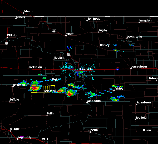 At 659 am mdt, a severe thunderstorm was located 10 miles north of haynes, or 12 miles northeast of hettinger, moving east at 40 mph. this is a very dangerous storm (public). Hazards include three inch hail. People and animals outdoors will be severely injured. expect shattered windows, extensive damage to roofs, siding, and vehicles. This severe thunderstorm will remain over mainly rural areas of southwestern sioux, southwestern grant and southeastern adams counties. At 659 am mdt, a severe thunderstorm was located 10 miles north of haynes, or 12 miles northeast of hettinger, moving east at 40 mph. this is a very dangerous storm (public). Hazards include three inch hail. People and animals outdoors will be severely injured. expect shattered windows, extensive damage to roofs, siding, and vehicles. This severe thunderstorm will remain over mainly rural areas of southwestern sioux, southwestern grant and southeastern adams counties.
|
| 6/28/2018 6:58 AM MDT | Tea Cup sized hail reported 7.4 miles S of Hettinger, ND |
| 6/28/2018 6:54 AM MDT | Baseball sized hail reported 6.8 miles S of Hettinger, ND, adams county em relayed a public report of baseball size hail... with extensive damage to homes (broken windows... damaged siding/roofs). time of report estimated based |
| 6/26/2018 11:00 PM MDT | Golf Ball sized hail reported 0.4 miles ENE of Hettinger, ND, largest hail was 1.75 inches. lots of ping pong ball sized hail covering the ground. broken windows. the duration of the hail event was 20 minutes. |
| 6/26/2018 10:53 PM MDT |
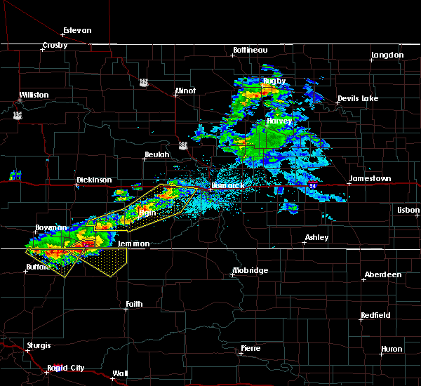 At 1053 pm mdt, a severe thunderstorm was located near haynes, or 6 miles southeast of hettinger, moving southeast at 40 mph (radar indicated). Hazards include tennis ball size hail and 60 mph wind gusts. People and animals outdoors will be injured. expect hail damage to roofs, siding, windows, and vehicles. expect wind damage to roofs, siding, and trees. Locations impacted include, hettinger. At 1053 pm mdt, a severe thunderstorm was located near haynes, or 6 miles southeast of hettinger, moving southeast at 40 mph (radar indicated). Hazards include tennis ball size hail and 60 mph wind gusts. People and animals outdoors will be injured. expect hail damage to roofs, siding, windows, and vehicles. expect wind damage to roofs, siding, and trees. Locations impacted include, hettinger.
|
| 6/26/2018 10:48 PM MDT | Quarter sized hail reported 0.6 miles SSE of Hettinger, ND, quarter sized hail began at 1148 pm cdt nd lasted 5 minutes. still hailing at the time of the report. |
| 6/26/2018 10:46 PM MDT |
 At 1046 pm mdt, a severe thunderstorm was located over hettinger, moving southeast at 35 mph (radar indicated). Hazards include tennis ball size hail and 60 mph wind gusts. People and animals outdoors will be injured. expect hail damage to roofs, siding, windows, and vehicles. expect wind damage to roofs, siding, and trees. This severe thunderstorm will remain over mainly rural areas of southeastern bowman and western adams counties, including the following locations, bowman haley dam and bucyrus. At 1046 pm mdt, a severe thunderstorm was located over hettinger, moving southeast at 35 mph (radar indicated). Hazards include tennis ball size hail and 60 mph wind gusts. People and animals outdoors will be injured. expect hail damage to roofs, siding, windows, and vehicles. expect wind damage to roofs, siding, and trees. This severe thunderstorm will remain over mainly rural areas of southeastern bowman and western adams counties, including the following locations, bowman haley dam and bucyrus.
|
| 6/26/2018 10:30 PM MDT |
 At 1029 pm mdt, a severe thunderstorm was located 8 miles west of hettinger, moving southeast at 45 mph (radar indicated). Hazards include tennis ball size hail and 60 mph wind gusts. golf ball size hail and 60 mph winds were reported in reeder. People and animals outdoors will be injured. expect hail damage to roofs, siding, windows, and vehicles. expect wind damage to roofs, siding, and trees. this severe storm will be near, hettinger around 1040 pm mdt. Other locations impacted by this severe thunderstorm include bowman haley dam, bucyrus and gascoyne. At 1029 pm mdt, a severe thunderstorm was located 8 miles west of hettinger, moving southeast at 45 mph (radar indicated). Hazards include tennis ball size hail and 60 mph wind gusts. golf ball size hail and 60 mph winds were reported in reeder. People and animals outdoors will be injured. expect hail damage to roofs, siding, windows, and vehicles. expect wind damage to roofs, siding, and trees. this severe storm will be near, hettinger around 1040 pm mdt. Other locations impacted by this severe thunderstorm include bowman haley dam, bucyrus and gascoyne.
|
| 6/26/2018 10:19 PM MDT |
 At 1018 pm mdt, a severe thunderstorm was located over reeder, or 18 miles northwest of hettinger, moving southeast at 40 mph (radar indicated). Hazards include tennis ball size hail. People and animals outdoors will be injured. expect damage to roofs, siding, windows, and vehicles. this severe thunderstorm will be near, hettinger around 1045 pm mdt. Other locations impacted by this severe thunderstorm include bowman haley dam, bucyrus and gascoyne. At 1018 pm mdt, a severe thunderstorm was located over reeder, or 18 miles northwest of hettinger, moving southeast at 40 mph (radar indicated). Hazards include tennis ball size hail. People and animals outdoors will be injured. expect damage to roofs, siding, windows, and vehicles. this severe thunderstorm will be near, hettinger around 1045 pm mdt. Other locations impacted by this severe thunderstorm include bowman haley dam, bucyrus and gascoyne.
|
| 6/26/2018 10:09 PM MDT |
 At 1009 pm mdt, a severe thunderstorm was located near scranton, or 16 miles east of bowman, moving southeast at 40 mph (radar indicated). Hazards include golf ball size hail. People and animals outdoors will be injured. expect damage to roofs, siding, windows, and vehicles. this severe thunderstorm will be near, reeder around 1020 pm mdt. hettinger around 1045 pm mdt. Other locations impacted by this severe thunderstorm include bowman haley dam, bucyrus and gascoyne. At 1009 pm mdt, a severe thunderstorm was located near scranton, or 16 miles east of bowman, moving southeast at 40 mph (radar indicated). Hazards include golf ball size hail. People and animals outdoors will be injured. expect damage to roofs, siding, windows, and vehicles. this severe thunderstorm will be near, reeder around 1020 pm mdt. hettinger around 1045 pm mdt. Other locations impacted by this severe thunderstorm include bowman haley dam, bucyrus and gascoyne.
|
| 6/26/2018 8:25 PM MDT |
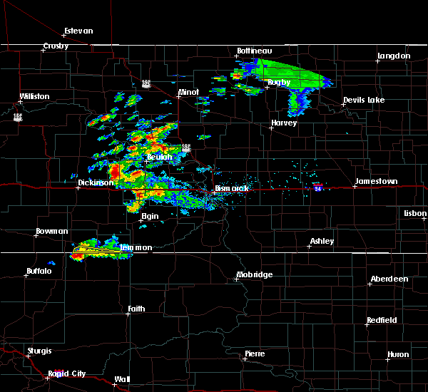 The severe thunderstorm warning for south central adams county will expire at 830 pm mdt, the storm which prompted the warning has weakened below severe limits and the warning will be allowed to expire. a severe thunderstorm watch remains in effect until 1000 pm mdt for southwestern north dakota. The severe thunderstorm warning for south central adams county will expire at 830 pm mdt, the storm which prompted the warning has weakened below severe limits and the warning will be allowed to expire. a severe thunderstorm watch remains in effect until 1000 pm mdt for southwestern north dakota.
|
| 6/26/2018 8:02 PM MDT |
 At 801 pm mdt, a severe thunderstorm was located near hettinger, moving southeast at 25 mph. this is a very dangerous storm (radar indicated). Hazards include three inch hail and 60 mph wind gusts. People and animals outdoors will be severely injured. expect shattered windows, extensive damage to roofs, siding, and vehicles. this severe storm will be near, hettinger around 805 pm mdt. Haynes around 825 pm mdt. At 801 pm mdt, a severe thunderstorm was located near hettinger, moving southeast at 25 mph. this is a very dangerous storm (radar indicated). Hazards include three inch hail and 60 mph wind gusts. People and animals outdoors will be severely injured. expect shattered windows, extensive damage to roofs, siding, and vehicles. this severe storm will be near, hettinger around 805 pm mdt. Haynes around 825 pm mdt.
|
| 6/26/2018 7:56 PM MDT | Ping Pong Ball sized hail reported 4.4 miles N of Hettinger, ND, mostly quarter but a few up to ping-pong. |
| 6/26/2018 7:53 PM MDT | Quarter sized hail reported 0.4 miles ENE of Hettinger, ND, still ongoing at the time this report was sent. |
| 6/26/2018 7:45 PM MDT | Half Dollar sized hail reported 0.4 miles ENE of Hettinger, ND, adams county law enforcement report. drove nd highway 8 from hettinger to the south dakota border. had half dollar size hail in hettinger... near airport... and half do |
| 6/26/2018 7:44 PM MDT |
 At 742 pm mdt, a severe thunderstorm was located 7 miles southeast of reeder, or 10 miles west of hettinger, moving southeast at 25 mph. this is a very dangerous storm that radar indicates was producing hail larger than baseball size. seek shelter inside a study building now! this is a very dangerous storm (radar indicated). Hazards include three inch hail and 60 mph wind gusts. People and animals outdoors will be severely injured. expect shattered windows, extensive damage to roofs, siding, and vehicles. this severe storm will be near, hettinger around 805 pm mdt. haynes around 825 pm mdt. Other locations impacted by this severe thunderstorm include bucyrus. At 742 pm mdt, a severe thunderstorm was located 7 miles southeast of reeder, or 10 miles west of hettinger, moving southeast at 25 mph. this is a very dangerous storm that radar indicates was producing hail larger than baseball size. seek shelter inside a study building now! this is a very dangerous storm (radar indicated). Hazards include three inch hail and 60 mph wind gusts. People and animals outdoors will be severely injured. expect shattered windows, extensive damage to roofs, siding, and vehicles. this severe storm will be near, hettinger around 805 pm mdt. haynes around 825 pm mdt. Other locations impacted by this severe thunderstorm include bucyrus.
|
| 6/26/2018 7:33 PM MDT |
 At 732 pm mdt, a severe thunderstorm was located near reeder, or 15 miles west of hettinger, moving southeast at 25 mph (radar indicated). Hazards include golf ball size hail and 60 mph wind gusts. People and animals outdoors will be injured. expect hail damage to roofs, siding, windows, and vehicles. expect wind damage to roofs, siding, and trees. this severe thunderstorm will be near, hettinger around 805 pm mdt. haynes around 825 pm mdt. Other locations impacted by this severe thunderstorm include bucyrus. At 732 pm mdt, a severe thunderstorm was located near reeder, or 15 miles west of hettinger, moving southeast at 25 mph (radar indicated). Hazards include golf ball size hail and 60 mph wind gusts. People and animals outdoors will be injured. expect hail damage to roofs, siding, windows, and vehicles. expect wind damage to roofs, siding, and trees. this severe thunderstorm will be near, hettinger around 805 pm mdt. haynes around 825 pm mdt. Other locations impacted by this severe thunderstorm include bucyrus.
|
| 6/26/2018 7:19 PM MDT |
 At 718 pm mdt, a severe thunderstorm was located 6 miles southwest of reeder, or 18 miles southeast of bowman, moving southeast at 25 mph. this is a very dangerous storm with hail as large as golf balls (radar indicated). Hazards include golf ball size hail and 60 mph wind gusts. People and animals outdoors will be injured. expect hail damage to roofs, siding, windows, and vehicles. expect wind damage to roofs, siding, and trees. this severe storm will be near, reeder around 725 pm mdt. Other locations impacted by this severe thunderstorm include bucyrus and gascoyne. At 718 pm mdt, a severe thunderstorm was located 6 miles southwest of reeder, or 18 miles southeast of bowman, moving southeast at 25 mph. this is a very dangerous storm with hail as large as golf balls (radar indicated). Hazards include golf ball size hail and 60 mph wind gusts. People and animals outdoors will be injured. expect hail damage to roofs, siding, windows, and vehicles. expect wind damage to roofs, siding, and trees. this severe storm will be near, reeder around 725 pm mdt. Other locations impacted by this severe thunderstorm include bucyrus and gascoyne.
|
| 6/26/2018 7:04 PM MDT |
 At 701 pm mdt, severe thunderstorms were located along a line extending from 13 miles north of reeder to near scranton to 10 miles southeast of bowman, moving southeast at 25 mph (radar indicated). Hazards include 60 mph wind gusts and half dollar size hail. Hail damage to vehicles is expected. expect wind damage to roofs, siding, and trees. these severe storms will be near, reeder around 730 pm mdt. Other locations impacted by these severe thunderstorms include bowman haley dam, bucyrus, buffalo springs and gascoyne. At 701 pm mdt, severe thunderstorms were located along a line extending from 13 miles north of reeder to near scranton to 10 miles southeast of bowman, moving southeast at 25 mph (radar indicated). Hazards include 60 mph wind gusts and half dollar size hail. Hail damage to vehicles is expected. expect wind damage to roofs, siding, and trees. these severe storms will be near, reeder around 730 pm mdt. Other locations impacted by these severe thunderstorms include bowman haley dam, bucyrus, buffalo springs and gascoyne.
|
| 6/26/2018 6:54 PM MDT |
 At 652 pm mdt, severe thunderstorms were located along a line extending from 10 miles north of new england to 10 miles north of reeder to 8 miles south of bowman, moving east at 30 mph (radar indicated). Hazards include 60 mph wind gusts and half dollar size hail. Hail damage to vehicles is expected. expect wind damage to roofs, siding, and trees. these severe storms will be near, new england around 705 pm mdt. Other locations impacted by these severe thunderstorms include bowman haley dam, bucyrus, schefield, griffin, buffalo springs, havelock, lefor and gascoyne. At 652 pm mdt, severe thunderstorms were located along a line extending from 10 miles north of new england to 10 miles north of reeder to 8 miles south of bowman, moving east at 30 mph (radar indicated). Hazards include 60 mph wind gusts and half dollar size hail. Hail damage to vehicles is expected. expect wind damage to roofs, siding, and trees. these severe storms will be near, new england around 705 pm mdt. Other locations impacted by these severe thunderstorms include bowman haley dam, bucyrus, schefield, griffin, buffalo springs, havelock, lefor and gascoyne.
|
| 6/26/2018 6:26 PM MDT |
 At 624 pm mdt, severe thunderstorms were located along a line extending from 13 miles northwest of new england to 12 miles north of scranton to 7 miles south of rhame, moving east at 30 mph (radar indicated). Hazards include 60 mph wind gusts and half dollar size hail. Hail damage to vehicles is expected. expect wind damage to roofs, siding, and trees. severe thunderstorms will be near, bowman around 640 pm mdt. new england around 650 pm mdt. regent around 725 pm mdt. Other locations impacted by these severe thunderstorms include bowman haley dam, bucyrus, schefield, griffin, buffalo springs, havelock, lefor and gascoyne. At 624 pm mdt, severe thunderstorms were located along a line extending from 13 miles northwest of new england to 12 miles north of scranton to 7 miles south of rhame, moving east at 30 mph (radar indicated). Hazards include 60 mph wind gusts and half dollar size hail. Hail damage to vehicles is expected. expect wind damage to roofs, siding, and trees. severe thunderstorms will be near, bowman around 640 pm mdt. new england around 650 pm mdt. regent around 725 pm mdt. Other locations impacted by these severe thunderstorms include bowman haley dam, bucyrus, schefield, griffin, buffalo springs, havelock, lefor and gascoyne.
|
| 6/14/2018 6:35 PM MDT | Quarter sized hail reported 4.9 miles SE of Hettinger, ND, lasted about 5 minutes. |
| 6/7/2018 10:03 PM MDT |
 At 941 pm mdt, severe thunderstorms were located along a line extending from 5 miles northeast of rhame to near ludlow, moving east at 50 mph (trained weather spotters and observations have reported damaging winds with this storm). Hazards include 70 mph wind gusts. Expect considerable tree damage. Damage is likely to mobile homes, roofs, and outbuildings. At 941 pm mdt, severe thunderstorms were located along a line extending from 5 miles northeast of rhame to near ludlow, moving east at 50 mph (trained weather spotters and observations have reported damaging winds with this storm). Hazards include 70 mph wind gusts. Expect considerable tree damage. Damage is likely to mobile homes, roofs, and outbuildings.
|
| 6/7/2018 9:42 PM MDT |
 At 941 pm mdt, severe thunderstorms were located along a line extending from 5 miles northeast of rhame to near ludlow, moving east at 50 mph (trained weather spotters and observations have reported damaging winds with this storm). Hazards include 70 mph wind gusts. Expect considerable tree damage. Damage is likely to mobile homes, roofs, and outbuildings. At 941 pm mdt, severe thunderstorms were located along a line extending from 5 miles northeast of rhame to near ludlow, moving east at 50 mph (trained weather spotters and observations have reported damaging winds with this storm). Hazards include 70 mph wind gusts. Expect considerable tree damage. Damage is likely to mobile homes, roofs, and outbuildings.
|
| 5/22/2018 6:00 PM MDT | Quarter sized hail reported 8.5 miles SW of Hettinger, ND, 8-9 miles northeast of hettinger along highway 8. also heavy rain with ditches full of water. |
| 8/26/2017 4:46 PM MDT |
 At 446 pm mdt, a severe thunderstorm was located near scranton, or 10 miles east of bowman, moving southeast at 25 mph (radar indicated). Hazards include quarter size hail. Damage to vehicles is expected. this severe storm will be near, scranton around 455 pm mdt. reeder around 515 pm mdt. Other locations impacted by this severe thunderstorm include bucyrus, buffalo springs and gascoyne. At 446 pm mdt, a severe thunderstorm was located near scranton, or 10 miles east of bowman, moving southeast at 25 mph (radar indicated). Hazards include quarter size hail. Damage to vehicles is expected. this severe storm will be near, scranton around 455 pm mdt. reeder around 515 pm mdt. Other locations impacted by this severe thunderstorm include bucyrus, buffalo springs and gascoyne.
|
| 8/26/2017 4:11 PM MDT |
 At 411 pm mdt, a severe thunderstorm was located 8 miles north of bowman, moving southeast at 35 mph (radar indicated). Hazards include quarter size hail. Damage to vehicles is expected. this severe thunderstorm will be near, bowman around 420 pm mdt. scranton around 440 pm mdt. reeder around 455 pm mdt. Other locations impacted by this severe thunderstorm include bowman haley dam, bucyrus, griffin, buffalo springs and gascoyne. At 411 pm mdt, a severe thunderstorm was located 8 miles north of bowman, moving southeast at 35 mph (radar indicated). Hazards include quarter size hail. Damage to vehicles is expected. this severe thunderstorm will be near, bowman around 420 pm mdt. scranton around 440 pm mdt. reeder around 455 pm mdt. Other locations impacted by this severe thunderstorm include bowman haley dam, bucyrus, griffin, buffalo springs and gascoyne.
|
| 8/12/2017 6:00 PM MDT | Quarter sized hail reported 17.8 miles S of Hettinger, ND |
| 8/11/2017 6:17 PM MDT | Quarter sized hail reported 16.3 miles NE of Hettinger, ND |
| 8/5/2017 5:25 PM MDT |
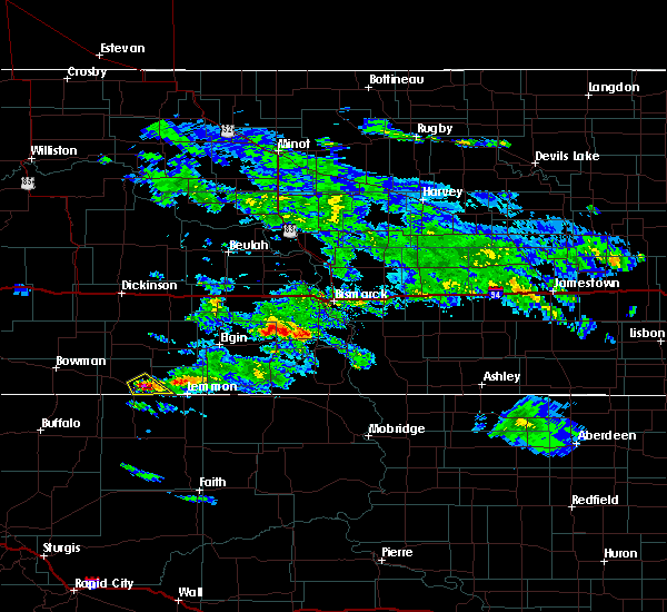 At 525 pm mdt, a severe thunderstorm was located near hettinger, moving southeast at 15 mph (radar indicated). Hazards include ping pong ball size hail and 60 mph wind gusts. People and animals outdoors will be injured. expect hail damage to roofs, siding, windows, and vehicles. expect wind damage to roofs, siding, and trees. This severe storm will be near, haynes around 540 pm mdt. At 525 pm mdt, a severe thunderstorm was located near hettinger, moving southeast at 15 mph (radar indicated). Hazards include ping pong ball size hail and 60 mph wind gusts. People and animals outdoors will be injured. expect hail damage to roofs, siding, windows, and vehicles. expect wind damage to roofs, siding, and trees. This severe storm will be near, haynes around 540 pm mdt.
|
| 8/5/2017 5:14 PM MDT |
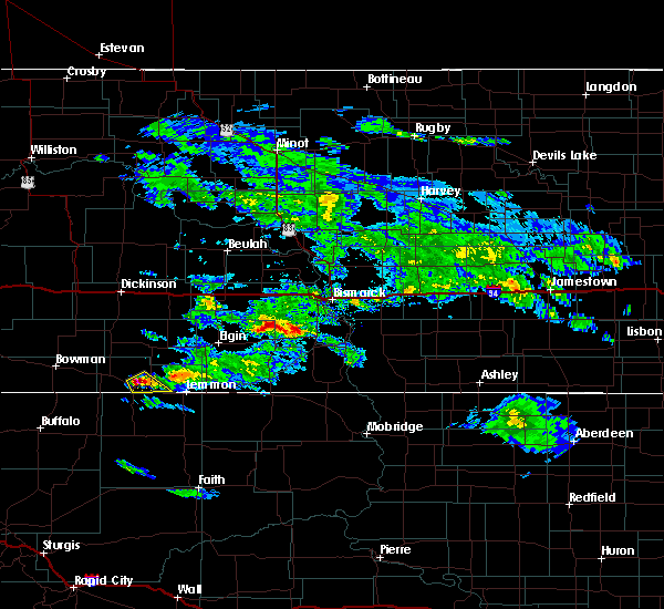 At 513 pm mdt, a severe thunderstorm was located near hettinger, moving southeast at 15 mph (radar indicated). Hazards include 60 mph wind gusts and quarter size hail. Hail damage to vehicles is expected. expect wind damage to roofs, siding, and trees. This severe thunderstorm will be near, haynes around 535 pm mdt. At 513 pm mdt, a severe thunderstorm was located near hettinger, moving southeast at 15 mph (radar indicated). Hazards include 60 mph wind gusts and quarter size hail. Hail damage to vehicles is expected. expect wind damage to roofs, siding, and trees. This severe thunderstorm will be near, haynes around 535 pm mdt.
|
| 7/20/2017 6:17 PM MDT |
 At 716 pm cdt/616 pm mdt/, severe thunderstorms were located along a line extending from 17 miles west of heart butte dam to 8 miles east of mott to 5 miles southwest of hettinger, moving east at 55 mph (radar indicated). Hazards include 70 mph wind gusts and quarter size hail. Hail damage to vehicles is expected. expect considerable tree damage. Wind damage is also likely to mobile homes, roofs, and outbuildings. At 716 pm cdt/616 pm mdt/, severe thunderstorms were located along a line extending from 17 miles west of heart butte dam to 8 miles east of mott to 5 miles southwest of hettinger, moving east at 55 mph (radar indicated). Hazards include 70 mph wind gusts and quarter size hail. Hail damage to vehicles is expected. expect considerable tree damage. Wind damage is also likely to mobile homes, roofs, and outbuildings.
|
| 7/20/2017 6:00 PM MDT | Measured by airport aso in adams county ND, 1 miles ESE of Hettinger, ND |
| 7/20/2017 5:56 PM MDT |
 At 555 pm mdt, severe thunderstorms were located along a line extending from 14 miles north of regent to 4 miles north of hettinger to 12 miles southwest of reeder, moving southeast at 30 mph (radar indicated). Hazards include 70 mph wind gusts and quarter size hail. Hail damage to vehicles is expected. expect considerable tree damage. wind damage is also likely to mobile homes, roofs, and outbuildings. Locations impacted include, hettinger, mott, scranton, new leipzig, reeder, regent, haynes, heart butte dam, burt, bucyrus, havelock, gascoyne, bowman haley dam, bentley and lefor. At 555 pm mdt, severe thunderstorms were located along a line extending from 14 miles north of regent to 4 miles north of hettinger to 12 miles southwest of reeder, moving southeast at 30 mph (radar indicated). Hazards include 70 mph wind gusts and quarter size hail. Hail damage to vehicles is expected. expect considerable tree damage. wind damage is also likely to mobile homes, roofs, and outbuildings. Locations impacted include, hettinger, mott, scranton, new leipzig, reeder, regent, haynes, heart butte dam, burt, bucyrus, havelock, gascoyne, bowman haley dam, bentley and lefor.
|
| 7/20/2017 5:53 PM MDT | Airport asos repor in adams county ND, 1.5 miles SSE of Hettinger, ND |
| 7/20/2017 5:41 PM MDT |
 At 538 pm mdt, severe thunderstorms were located along a line extending from 10 miles north of regent to near reeder to 5 miles northeast of north cave hills near bowman haley dam, moving southeast at 25 mph (radar indicated. at 520 mdt at the bowman airport, 73 mph winds were reported). Hazards include 70 mph wind gusts and quarter size hail. Hail damage to vehicles is expected. expect considerable tree damage. wind damage is also likely to mobile homes, roofs, and outbuildings. Locations impacted include, hettinger, mott, scranton, new leipzig, reeder, regent, haynes, heart butte dam, burt, bucyrus, havelock, gascoyne, bowman haley dam, bentley and lefor. At 538 pm mdt, severe thunderstorms were located along a line extending from 10 miles north of regent to near reeder to 5 miles northeast of north cave hills near bowman haley dam, moving southeast at 25 mph (radar indicated. at 520 mdt at the bowman airport, 73 mph winds were reported). Hazards include 70 mph wind gusts and quarter size hail. Hail damage to vehicles is expected. expect considerable tree damage. wind damage is also likely to mobile homes, roofs, and outbuildings. Locations impacted include, hettinger, mott, scranton, new leipzig, reeder, regent, haynes, heart butte dam, burt, bucyrus, havelock, gascoyne, bowman haley dam, bentley and lefor.
|
| 7/20/2017 5:29 PM MDT |
 At 528 pm mdt, severe thunderstorms were located along a line extending from 11 miles east of new england to 4 miles northwest of reeder to 6 miles north of north cave hills west of bowman haley dam, moving southeast at 25 mph (radar indicated). Hazards include 60 mph wind gusts and quarter size hail. Hail damage to vehicles is expected. expect wind damage to roofs, siding, and trees. severe thunderstorms will be near, reeder around 540 pm mdt. hettinger and mott around 615 pm mdt. haynes around 630 pm mdt. Other locations impacted by these severe thunderstorms include bowman haley dam, bucyrus, burt, havelock, bentley, lefor and gascoyne. At 528 pm mdt, severe thunderstorms were located along a line extending from 11 miles east of new england to 4 miles northwest of reeder to 6 miles north of north cave hills west of bowman haley dam, moving southeast at 25 mph (radar indicated). Hazards include 60 mph wind gusts and quarter size hail. Hail damage to vehicles is expected. expect wind damage to roofs, siding, and trees. severe thunderstorms will be near, reeder around 540 pm mdt. hettinger and mott around 615 pm mdt. haynes around 630 pm mdt. Other locations impacted by these severe thunderstorms include bowman haley dam, bucyrus, burt, havelock, bentley, lefor and gascoyne.
|
| 7/20/2017 4:58 PM MDT |
 At 456 pm mdt, severe thunderstorms were located along a line extending from 5 miles northeast of new england to 5 miles north of table mountain, moving east at 35 mph (trained weather spotters report 60 mph winds 5 miles west of rhame). Hazards include 60 mph wind gusts and quarter size hail. Hail damage to vehicles is expected. expect wind damage to roofs, siding, and trees. these severe storms will be near, new england around 500 pm mdt. Other locations impacted by these severe thunderstorms include sunset butte, bowman haley dam, bucyrus, griffin, buffalo springs, havelock and gascoyne. At 456 pm mdt, severe thunderstorms were located along a line extending from 5 miles northeast of new england to 5 miles north of table mountain, moving east at 35 mph (trained weather spotters report 60 mph winds 5 miles west of rhame). Hazards include 60 mph wind gusts and quarter size hail. Hail damage to vehicles is expected. expect wind damage to roofs, siding, and trees. these severe storms will be near, new england around 500 pm mdt. Other locations impacted by these severe thunderstorms include sunset butte, bowman haley dam, bucyrus, griffin, buffalo springs, havelock and gascoyne.
|
| 7/20/2017 4:33 PM MDT |
 At 432 pm mdt, severe thunderstorms were located along a line extending from 7 miles northwest of new england to near mud buttes, moving east at 40 mph (radar indicated). Hazards include 60 mph wind gusts and quarter size hail. Hail damage to vehicles is expected. expect wind damage to roofs, siding, and trees. severe thunderstorms will be near, new england around 440 pm mdt. reeder around 530 pm mdt. Other locations impacted by these severe thunderstorms include sunset butte, bowman haley dam, bucyrus, griffin, buffalo springs, havelock, pretty butte and gascoyne. At 432 pm mdt, severe thunderstorms were located along a line extending from 7 miles northwest of new england to near mud buttes, moving east at 40 mph (radar indicated). Hazards include 60 mph wind gusts and quarter size hail. Hail damage to vehicles is expected. expect wind damage to roofs, siding, and trees. severe thunderstorms will be near, new england around 440 pm mdt. reeder around 530 pm mdt. Other locations impacted by these severe thunderstorms include sunset butte, bowman haley dam, bucyrus, griffin, buffalo springs, havelock, pretty butte and gascoyne.
|
| 2/21/2017 5:35 PM MST | Quarter sized hail reported 6.1 miles S of Hettinger, ND, report relayed by media. |
| 8/9/2016 9:06 PM MDT |
 At 906 pm mdt, a severe thunderstorm was located 9 miles north of north lemmon, or 10 miles north of lemmon, moving east at 45 mph. this is a very dangerous storm (radar indicated). Hazards include baseball size hail and 60 mph wind gusts. People and animals outdoors will be severely injured. expect shattered windows, extensive damage to roofs, siding, and vehicles. Locations impacted include, hettinger, elgin, carson, new leipzig, haynes, north lemmon, burt, leith, heil and bentley. At 906 pm mdt, a severe thunderstorm was located 9 miles north of north lemmon, or 10 miles north of lemmon, moving east at 45 mph. this is a very dangerous storm (radar indicated). Hazards include baseball size hail and 60 mph wind gusts. People and animals outdoors will be severely injured. expect shattered windows, extensive damage to roofs, siding, and vehicles. Locations impacted include, hettinger, elgin, carson, new leipzig, haynes, north lemmon, burt, leith, heil and bentley.
|
| 8/9/2016 8:58 PM MDT | Report from tuesday evenin in adams county ND, 0.4 miles ENE of Hettinger, ND |
| 8/9/2016 8:56 PM MDT |
 At 854 pm mdt, a severe thunderstorm was located 6 miles northeast of haynes, or 12 miles east of hettinger, moving east at 45 mph (trained weather spotters. at 840 pm mdt...a trained spotter reported quarter size hail 9 miles south of bucyrus). Hazards include 60 mph wind gusts and quarter size hail. Hail damage to vehicles is expected. expect wind damage to roofs, siding, and trees. This severe thunderstorm will remain over mainly rural areas of southern hettinger, southwestern grant, southwestern sioux and adams counties, including the following locations: burt, leith, bentley, heil and bucyrus. At 854 pm mdt, a severe thunderstorm was located 6 miles northeast of haynes, or 12 miles east of hettinger, moving east at 45 mph (trained weather spotters. at 840 pm mdt...a trained spotter reported quarter size hail 9 miles south of bucyrus). Hazards include 60 mph wind gusts and quarter size hail. Hail damage to vehicles is expected. expect wind damage to roofs, siding, and trees. This severe thunderstorm will remain over mainly rural areas of southern hettinger, southwestern grant, southwestern sioux and adams counties, including the following locations: burt, leith, bentley, heil and bucyrus.
|
| 8/9/2016 8:54 PM MDT | . in adams county ND, 0.4 miles ENE of Hettinger, ND |
| 8/9/2016 8:41 PM MDT | Quarter sized hail reported 8.1 miles ENE of Hettinger, ND, largest estimated size was quarter sized. most below 1 inch diameter. |
| 8/9/2016 8:39 PM MDT |
 At 838 pm mdt, a severe thunderstorm was located near hettinger, moving east at 45 mph (radar indicated). Hazards include 60 mph wind gusts and half dollar size hail. Hail damage to vehicles is expected. expect wind damage to roofs, siding, and trees. this severe thunderstorm will be near, haynes around 850 pm mdt. Other locations impacted by this severe thunderstorm include burt, leith, bentley, heil and bucyrus. At 838 pm mdt, a severe thunderstorm was located near hettinger, moving east at 45 mph (radar indicated). Hazards include 60 mph wind gusts and half dollar size hail. Hail damage to vehicles is expected. expect wind damage to roofs, siding, and trees. this severe thunderstorm will be near, haynes around 850 pm mdt. Other locations impacted by this severe thunderstorm include burt, leith, bentley, heil and bucyrus.
|
| 8/9/2016 8:16 PM MDT |
 At 816 pm mdt, a severe thunderstorm was located over reeder, or 15 miles northwest of hettinger, moving east at 25 mph (radar indicated). Hazards include 60 mph wind gusts and quarter size hail. Hail damage to vehicles is expected. expect wind damage to roofs, siding, and trees. This severe thunderstorm will remain over mainly rural areas of eastern bowman and western adams counties, including the following locations: gascoyne, buffalo springs, bucyrus and bowman haley dam. At 816 pm mdt, a severe thunderstorm was located over reeder, or 15 miles northwest of hettinger, moving east at 25 mph (radar indicated). Hazards include 60 mph wind gusts and quarter size hail. Hail damage to vehicles is expected. expect wind damage to roofs, siding, and trees. This severe thunderstorm will remain over mainly rural areas of eastern bowman and western adams counties, including the following locations: gascoyne, buffalo springs, bucyrus and bowman haley dam.
|
| 8/9/2016 7:52 PM MDT |
 At 752 pm mdt, a severe thunderstorm was located 5 miles south of scranton, or 14 miles southeast of bowman, moving east at 25 mph (radar indicated). Hazards include golf ball size hail and 60 mph wind gusts. People and animals outdoors will be injured. expect hail damage to roofs, siding, windows, and vehicles. expect wind damage to roofs, siding, and trees. this severe storm will be near, reeder around 815 pm mdt. Other locations impacted by this severe thunderstorm include gascoyne, buffalo springs, bucyrus and bowman haley dam. At 752 pm mdt, a severe thunderstorm was located 5 miles south of scranton, or 14 miles southeast of bowman, moving east at 25 mph (radar indicated). Hazards include golf ball size hail and 60 mph wind gusts. People and animals outdoors will be injured. expect hail damage to roofs, siding, windows, and vehicles. expect wind damage to roofs, siding, and trees. this severe storm will be near, reeder around 815 pm mdt. Other locations impacted by this severe thunderstorm include gascoyne, buffalo springs, bucyrus and bowman haley dam.
|
| 8/9/2016 7:46 PM MDT |
 At 746 pm mdt, a severe thunderstorm was located 6 miles southwest of scranton, or 12 miles southeast of bowman, moving east at 25 mph (radar indicated). Hazards include 60 mph wind gusts and quarter size hail. Hail damage to vehicles is expected. expect wind damage to roofs, siding, and trees. this severe thunderstorm will be near, scranton around 755 pm mdt. reeder around 815 pm mdt. Other locations impacted by this severe thunderstorm include gascoyne, buffalo springs, bucyrus and bowman haley dam. At 746 pm mdt, a severe thunderstorm was located 6 miles southwest of scranton, or 12 miles southeast of bowman, moving east at 25 mph (radar indicated). Hazards include 60 mph wind gusts and quarter size hail. Hail damage to vehicles is expected. expect wind damage to roofs, siding, and trees. this severe thunderstorm will be near, scranton around 755 pm mdt. reeder around 815 pm mdt. Other locations impacted by this severe thunderstorm include gascoyne, buffalo springs, bucyrus and bowman haley dam.
|
| 7/14/2016 6:50 PM MDT | Quarter sized hail reported 12.7 miles N of Hettinger, ND |
| 7/10/2016 11:30 PM MDT |
 At 1129 pm mdt, a severe thunderstorm was located 5 miles northwest of hettinger, moving northeast at 55 mph (radar indicated). Hazards include 60 mph wind gusts and quarter size hail. Hail damage to vehicles is expected. expect wind damage to roofs, siding, and trees. Locations impacted include, hettinger and bucyrus. At 1129 pm mdt, a severe thunderstorm was located 5 miles northwest of hettinger, moving northeast at 55 mph (radar indicated). Hazards include 60 mph wind gusts and quarter size hail. Hail damage to vehicles is expected. expect wind damage to roofs, siding, and trees. Locations impacted include, hettinger and bucyrus.
|
| 7/10/2016 11:17 PM MDT |
 At 1116 pm mdt, a severe thunderstorm was located 10 miles south of reeder, or 16 miles west of hettinger, moving northeast at 35 mph (radar indicated). Hazards include ping pong ball size hail and 60 mph wind gusts. People and animals outdoors will be injured. expect hail damage to roofs, siding, windows, and vehicles. expect wind damage to roofs, siding, and trees. Locations impacted include, reeder, bucyrus and gascoyne. At 1116 pm mdt, a severe thunderstorm was located 10 miles south of reeder, or 16 miles west of hettinger, moving northeast at 35 mph (radar indicated). Hazards include ping pong ball size hail and 60 mph wind gusts. People and animals outdoors will be injured. expect hail damage to roofs, siding, windows, and vehicles. expect wind damage to roofs, siding, and trees. Locations impacted include, reeder, bucyrus and gascoyne.
|
| 7/10/2016 11:03 PM MDT |
 At 1103 pm mdt, a severe thunderstorm was located 7 miles east of reeder, or 8 miles northwest of hettinger, moving northeast at 35 mph (radar indicated). Hazards include golf ball size hail and 60 mph wind gusts. People and animals outdoors will be injured. expect hail damage to roofs, siding, windows, and vehicles. expect wind damage to roofs, siding, and trees. Locations impacted include, near hettinger, reeder, bucyrus and gascoyne. At 1103 pm mdt, a severe thunderstorm was located 7 miles east of reeder, or 8 miles northwest of hettinger, moving northeast at 35 mph (radar indicated). Hazards include golf ball size hail and 60 mph wind gusts. People and animals outdoors will be injured. expect hail damage to roofs, siding, windows, and vehicles. expect wind damage to roofs, siding, and trees. Locations impacted include, near hettinger, reeder, bucyrus and gascoyne.
|
| 7/10/2016 10:38 PM MDT |
 At 1038 pm mdt, a severe thunderstorm was located 11 miles north of ralph, or 20 miles west of hettinger, moving northeast at 20 mph (radar indicated). Hazards include 60 mph wind gusts and half dollar size hail. Hail damage to vehicles is expected. Expect wind damage to roofs, siding, and trees. At 1038 pm mdt, a severe thunderstorm was located 11 miles north of ralph, or 20 miles west of hettinger, moving northeast at 20 mph (radar indicated). Hazards include 60 mph wind gusts and half dollar size hail. Hail damage to vehicles is expected. Expect wind damage to roofs, siding, and trees.
|
| 7/10/2016 6:25 PM MDT | Quarter size hail and very heavy rain ongoin in adams county ND, 14.6 miles SSW of Hettinger, ND |
| 7/10/2016 6:21 PM MDT |
 At 719 pm cdt/619 pm mdt/, severe thunderstorms were located along a line extending from 4 miles west of marshall to 5 miles west of heart butte dam to 4 miles northeast of white butte, moving east at 70 mph. these are very dangerous storms. get to shelter now if you are in the warned area! stay away from windows! (public). Hazards include 80 mph wind gusts and golf ball size hail. Flying debris will be dangerous to those caught without shelter. mobile homes will be heavily damaged. expect considerable damage to roofs, windows, and vehicles. extensive tree damage and power outages are likely. Locations impacted include, glen ullin, elgin, hebron, richardton, carson, new leipzig, haynes, heart butte dam and fish creek dam. At 719 pm cdt/619 pm mdt/, severe thunderstorms were located along a line extending from 4 miles west of marshall to 5 miles west of heart butte dam to 4 miles northeast of white butte, moving east at 70 mph. these are very dangerous storms. get to shelter now if you are in the warned area! stay away from windows! (public). Hazards include 80 mph wind gusts and golf ball size hail. Flying debris will be dangerous to those caught without shelter. mobile homes will be heavily damaged. expect considerable damage to roofs, windows, and vehicles. extensive tree damage and power outages are likely. Locations impacted include, glen ullin, elgin, hebron, richardton, carson, new leipzig, haynes, heart butte dam and fish creek dam.
|
| 7/10/2016 5:57 PM MDT |
 At 656 pm cdt/556 pm mdt/, severe thunderstorms were located along a line extending from 7 miles south of dunn center to 13 miles south of hebron to 11 miles south of mott, moving east at 70 mph (radar indicated). Hazards include 70 mph wind gusts and half dollar size hail. Hail damage to vehicles is expected. expect considerable tree damage. wind damage is also likely to mobile homes, roofs, and outbuildings. Locations impacted include, dickinson, beulah, hettinger, glen ullin, mott, elgin, new salem, hebron, new england, richardton, carson, gladstone, zap, new leipzig, regent, taylor, almont, marshall, haynes and heart butte dam. At 656 pm cdt/556 pm mdt/, severe thunderstorms were located along a line extending from 7 miles south of dunn center to 13 miles south of hebron to 11 miles south of mott, moving east at 70 mph (radar indicated). Hazards include 70 mph wind gusts and half dollar size hail. Hail damage to vehicles is expected. expect considerable tree damage. wind damage is also likely to mobile homes, roofs, and outbuildings. Locations impacted include, dickinson, beulah, hettinger, glen ullin, mott, elgin, new salem, hebron, new england, richardton, carson, gladstone, zap, new leipzig, regent, taylor, almont, marshall, haynes and heart butte dam.
|
| 7/10/2016 5:36 PM MDT |
 At 635 pm cdt/535 pm mdt/, severe thunderstorms were located along a line extending from 5 miles east of south fairfield to 13 miles north of regent to 6 miles east of reeder, moving east at 70 mph (radar indicated). Hazards include two inch hail and 70 mph wind gusts. People and animals outdoors will be injured. expect hail damage to roofs, siding, windows, and vehicles. expect considerable tree damage. Wind damage is also likely to mobile homes, roofs, and outbuildings. At 635 pm cdt/535 pm mdt/, severe thunderstorms were located along a line extending from 5 miles east of south fairfield to 13 miles north of regent to 6 miles east of reeder, moving east at 70 mph (radar indicated). Hazards include two inch hail and 70 mph wind gusts. People and animals outdoors will be injured. expect hail damage to roofs, siding, windows, and vehicles. expect considerable tree damage. Wind damage is also likely to mobile homes, roofs, and outbuildings.
|
| 7/6/2016 6:15 PM MDT | Storm damage reported in perkins county SD, 6.5 miles NNE of Hettinger, ND |
| 7/6/2016 6:11 PM MDT |
 At 710 pm cdt/610 pm mdt/, severe thunderstorms were located along a line extending from 12 miles southwest of glen ullin to 9 miles southwest of new leipzig to haynes, moving east at 45 mph (trained weather spotters). Hazards include 70 mph wind gusts and penny size hail. Expect considerable tree damage. damage is likely to mobile homes, roofs, and outbuildings. these severe storms will be near, new leipzig around 620 pm mdt. heart butte dam around 625 pm mdt. Other locations impacted by these severe thunderstorms include burt, porcupine, raleigh, bucyrus, havelock, lark and leith. At 710 pm cdt/610 pm mdt/, severe thunderstorms were located along a line extending from 12 miles southwest of glen ullin to 9 miles southwest of new leipzig to haynes, moving east at 45 mph (trained weather spotters). Hazards include 70 mph wind gusts and penny size hail. Expect considerable tree damage. damage is likely to mobile homes, roofs, and outbuildings. these severe storms will be near, new leipzig around 620 pm mdt. heart butte dam around 625 pm mdt. Other locations impacted by these severe thunderstorms include burt, porcupine, raleigh, bucyrus, havelock, lark and leith.
|
| 7/6/2016 5:59 PM MDT | Asos station hettinger municipal airport /hei in adams county ND, 1 miles ESE of Hettinger, ND |
| 7/6/2016 5:56 PM MDT |
 At 655 pm cdt/555 pm mdt/, severe thunderstorms were located along a line extending from 9 miles south of richardton to 7 miles southeast of mott to near haynes, moving east at 50 mph (trained weather spotters). Hazards include 70 mph wind gusts and nickel size hail. Expect considerable tree damage. damage is likely to mobile homes, roofs, and outbuildings. these severe storms will be near, new leipzig around 605 pm mdt. heart butte dam around 625 pm mdt. Other locations impacted by these severe thunderstorms include burt, porcupine, raleigh, bucyrus, havelock, lark and leith. At 655 pm cdt/555 pm mdt/, severe thunderstorms were located along a line extending from 9 miles south of richardton to 7 miles southeast of mott to near haynes, moving east at 50 mph (trained weather spotters). Hazards include 70 mph wind gusts and nickel size hail. Expect considerable tree damage. damage is likely to mobile homes, roofs, and outbuildings. these severe storms will be near, new leipzig around 605 pm mdt. heart butte dam around 625 pm mdt. Other locations impacted by these severe thunderstorms include burt, porcupine, raleigh, bucyrus, havelock, lark and leith.
|
| 7/6/2016 5:39 PM MDT |
 At 638 pm cdt/538 pm mdt/, severe thunderstorms were located along a line extending from 7 miles south of gladstone to 5 miles southwest of mott to hettinger, moving east at 60 mph (radar indicated). Hazards include 70 mph wind gusts and penny size hail. Expect considerable tree damage. damage is likely to mobile homes, roofs, and outbuildings. severe thunderstorms will be near, mott around 545 pm mdt. new leipzig around 600 pm mdt. heart butte dam around 615 pm mdt. almont around 625 pm mdt. Other locations impacted by these severe thunderstorms include burt, porcupine, raleigh, bucyrus, havelock, lark, leith, lefor and heil. At 638 pm cdt/538 pm mdt/, severe thunderstorms were located along a line extending from 7 miles south of gladstone to 5 miles southwest of mott to hettinger, moving east at 60 mph (radar indicated). Hazards include 70 mph wind gusts and penny size hail. Expect considerable tree damage. damage is likely to mobile homes, roofs, and outbuildings. severe thunderstorms will be near, mott around 545 pm mdt. new leipzig around 600 pm mdt. heart butte dam around 615 pm mdt. almont around 625 pm mdt. Other locations impacted by these severe thunderstorms include burt, porcupine, raleigh, bucyrus, havelock, lark, leith, lefor and heil.
|
| 6/21/2016 7:15 PM MDT | Tea Cup sized hail reported 0.9 miles NNE of Hettinger, ND |
| 6/11/2016 6:15 PM MDT | Storm damage reported in perkins county SD, 8.5 miles N of Hettinger, ND |
| 6/9/2016 6:32 PM MDT |
 At 631 pm mdt, a severe thunderstorm was located 6 miles south of reeder, or 13 miles west of hettinger, moving northeast at 25 mph (radar indicated). Hazards include 60 mph wind gusts and quarter size hail. Hail damage to vehicles is expected. expect wind damage to roofs, siding, and trees. this severe thunderstorm will be near, reeder around 640 pm mdt. Other locations impacted by this severe thunderstorm include bucyrus. At 631 pm mdt, a severe thunderstorm was located 6 miles south of reeder, or 13 miles west of hettinger, moving northeast at 25 mph (radar indicated). Hazards include 60 mph wind gusts and quarter size hail. Hail damage to vehicles is expected. expect wind damage to roofs, siding, and trees. this severe thunderstorm will be near, reeder around 640 pm mdt. Other locations impacted by this severe thunderstorm include bucyrus.
|
| 7/27/2015 8:42 PM MDT | The severe thunderstorm warning for western grant, eastern adams and eastern hettinger counties will expire at 845 pm mdt, the storm which prompted the warning has moved out of the area. therefore the warning will be allowed to expire. however gusty winds are still possible with this thunderstorm. a severe thunderstorm watch remains in effect until 200 am mdt for southwestern north dakota. |
| 7/27/2015 8:14 PM MDT |
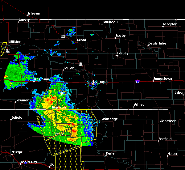 At 812 pm mdt, a severe thunderstorm was located 8 miles southeast of mott, moving north at 45 mph (trained weather spotters. at 750 pm mdt...60 mph winds were reported 8 miles northeast of haynes). Hazards include 70 mph wind gusts and penny size hail. Expect considerable tree damage. damage is likely to mobile homes, roofs and outbuildings. This severe thunderstorm will remain over mainly rural areas of western grant, eastern adams and eastern hettinger counties, including the following locations, burt and bentley. At 812 pm mdt, a severe thunderstorm was located 8 miles southeast of mott, moving north at 45 mph (trained weather spotters. at 750 pm mdt...60 mph winds were reported 8 miles northeast of haynes). Hazards include 70 mph wind gusts and penny size hail. Expect considerable tree damage. damage is likely to mobile homes, roofs and outbuildings. This severe thunderstorm will remain over mainly rural areas of western grant, eastern adams and eastern hettinger counties, including the following locations, burt and bentley.
|
| 7/27/2015 7:57 PM MDT |
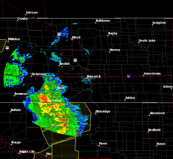 At 756 pm mdt, a severe thunderstorm was located 12 miles north of white butte, or 13 miles northwest of lemmon, moving northeast at 45 mph (radar indicated). Hazards include 60 mph wind gusts and quarter size hail. Hail damage to vehicles is expected. expect wind damage to roofs, siding and trees. this severe storm will be near, new leipzig around 825 pm mdt. elgin around 830 pm mdt. Other locations impacted by this severe thunderstorm include burt and bentley. At 756 pm mdt, a severe thunderstorm was located 12 miles north of white butte, or 13 miles northwest of lemmon, moving northeast at 45 mph (radar indicated). Hazards include 60 mph wind gusts and quarter size hail. Hail damage to vehicles is expected. expect wind damage to roofs, siding and trees. this severe storm will be near, new leipzig around 825 pm mdt. elgin around 830 pm mdt. Other locations impacted by this severe thunderstorm include burt and bentley.
|
| 7/27/2015 7:44 PM MDT |
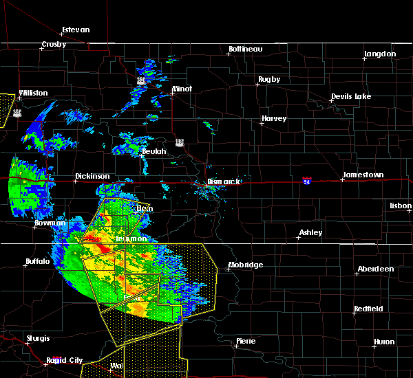 At 743 pm mdt, a severe thunderstorm was located over haynes, or 8 miles east of hettinger, moving north at 45 mph (radar indicated). Hazards include 60 mph wind gusts and quarter size hail. Hail damage to vehicles is expected. expect wind damage to roofs, siding and trees. this severe thunderstorm will be near, mott around 820 pm mdt. Other locations impacted by this severe thunderstorm include burt and bentley. At 743 pm mdt, a severe thunderstorm was located over haynes, or 8 miles east of hettinger, moving north at 45 mph (radar indicated). Hazards include 60 mph wind gusts and quarter size hail. Hail damage to vehicles is expected. expect wind damage to roofs, siding and trees. this severe thunderstorm will be near, mott around 820 pm mdt. Other locations impacted by this severe thunderstorm include burt and bentley.
|
| 6/30/2015 7:19 PM MDT |
 At 719 pm mdt, a severe thunderstorm was located 6 miles southwest of reeder, or 19 miles southeast of bowman, moving southeast at 25 mph (radar indicated). Hazards include golf ball size hail and 60 mph wind gusts. People and animals outdoors will be injured. expect hail damage to roofs, siding, windows and vehicles. expect wind damage to roofs, siding and trees. this severe thunderstorm will remain over mainly rural areas of southwestern adams and southeastern bowman counties, including the following locations, bucyrus, gascoyne and bowman haley dam. A tornado watch remains in effect until 100 am mdt for southwestern north dakota. At 719 pm mdt, a severe thunderstorm was located 6 miles southwest of reeder, or 19 miles southeast of bowman, moving southeast at 25 mph (radar indicated). Hazards include golf ball size hail and 60 mph wind gusts. People and animals outdoors will be injured. expect hail damage to roofs, siding, windows and vehicles. expect wind damage to roofs, siding and trees. this severe thunderstorm will remain over mainly rural areas of southwestern adams and southeastern bowman counties, including the following locations, bucyrus, gascoyne and bowman haley dam. A tornado watch remains in effect until 100 am mdt for southwestern north dakota.
|
| 6/30/2015 6:59 PM MDT |
 At 658 pm mdt, a severe thunderstorm was located over scranton, or 13 miles east of bowman, moving southeast at 25 mph (radar indicated). Hazards include two inch hail and 60 mph wind gusts. People and animals outdoors will be injured. expect hail damage to roofs, siding, windows and vehicles. expect wind damage to roofs, siding and trees. this severe thunderstorm will be near, reeder around 715 pm mdt. other locations impacted by this severe thunderstorm include buffalo springs, gascoyne, bucyrus and bowman haley dam. A tornado watch remains in effect until 100 am mdt for southwestern north dakota. At 658 pm mdt, a severe thunderstorm was located over scranton, or 13 miles east of bowman, moving southeast at 25 mph (radar indicated). Hazards include two inch hail and 60 mph wind gusts. People and animals outdoors will be injured. expect hail damage to roofs, siding, windows and vehicles. expect wind damage to roofs, siding and trees. this severe thunderstorm will be near, reeder around 715 pm mdt. other locations impacted by this severe thunderstorm include buffalo springs, gascoyne, bucyrus and bowman haley dam. A tornado watch remains in effect until 100 am mdt for southwestern north dakota.
|
| 6/21/2015 10:34 PM MDT |
 At 1034 pm mdt, a severe thunderstorm was located 5 miles east of scranton, or 17 miles east of bowman, moving east at 50 mph (radar indicated). Hazards include 60 mph wind gusts and half dollar size hail. Hail damage to vehicles is expected. expect wind damage to roofs, siding and trees. This severe thunderstorm will remain over mainly rural areas of adams, hettinger, southeastern slope and eastern bowman counties, including the following locations, burt, buffalo springs, bucyrus, havelock, gascoyne, bentley and bowman haley dam. At 1034 pm mdt, a severe thunderstorm was located 5 miles east of scranton, or 17 miles east of bowman, moving east at 50 mph (radar indicated). Hazards include 60 mph wind gusts and half dollar size hail. Hail damage to vehicles is expected. expect wind damage to roofs, siding and trees. This severe thunderstorm will remain over mainly rural areas of adams, hettinger, southeastern slope and eastern bowman counties, including the following locations, burt, buffalo springs, bucyrus, havelock, gascoyne, bentley and bowman haley dam.
|
| 6/21/2015 10:28 PM MDT | Dime sized hail also occurre in adams county ND, 0.4 miles ENE of Hettinger, ND |
| 6/21/2015 10:16 PM MDT |
 At 1016 pm mdt, a severe thunderstorm was located near bowman, moving east at 35 mph (trained weather spotters). Hazards include 70 mph wind gusts and half dollar size hail. Hail damage to vehicles is expected. expect considerable tree damage. wind damage is also likely to mobile homes, roofs and outbuildings. this severe thunderstorm will be near, scranton around 1035 pm mdt. reeder around 1050 pm mdt. hettinger around 1115 pm mdt. Other locations impacted by this severe thunderstorm include burt, buffalo springs, bucyrus, griffin, havelock, gascoyne, bentley and bowman haley dam. At 1016 pm mdt, a severe thunderstorm was located near bowman, moving east at 35 mph (trained weather spotters). Hazards include 70 mph wind gusts and half dollar size hail. Hail damage to vehicles is expected. expect considerable tree damage. wind damage is also likely to mobile homes, roofs and outbuildings. this severe thunderstorm will be near, scranton around 1035 pm mdt. reeder around 1050 pm mdt. hettinger around 1115 pm mdt. Other locations impacted by this severe thunderstorm include burt, buffalo springs, bucyrus, griffin, havelock, gascoyne, bentley and bowman haley dam.
|
| 3/28/2015 5:16 PM MST | Storm damage reported in adams county ND, 1.8 miles SE of Hettinger, ND |
| 5/29/2014 4:40 PM MDT | Golf Ball sized hail reported 13.8 miles SSE of Hettinger, ND, a few large golfball size hailstones. |
| 6/22/2013 7:26 PM MDT | Peak wind gust at hettinger airport measured at 58 mp in adams county ND, 1.8 miles SE of Hettinger, ND |
| 6/21/2013 10:10 AM MDT | Half Dollar sized hail reported 18.5 miles S of Hettinger, ND, heavy rain and est winds of 50 mph also reported |
| 5/25/2013 4:06 PM MDT | Quarter sized hail reported 7.6 miles E of Hettinger, ND, hail began at 339 pm mdt and ended at 439 pm mdt. over 1 inch of rain fell during the same time frame. |
| 5/25/2013 3:55 PM MDT | Storm damage reported in perkins county SD, 7.4 miles NE of Hettinger, ND |
| 5/25/2013 3:35 PM MDT | Quarter sized hail reported 1.3 miles E of Hettinger, ND, quarter size hail reported by sheriffs deputy. |
| 5/25/2013 3:35 PM MDT | Quarter sized hail reported 0.4 miles ENE of Hettinger, ND, reported bigger than quarter size hail with wind gusts to 50 mph at 335 pm mdt.. ongiong at the time of observation |
| 5/25/2013 3:35 PM MDT | Half Dollar sized hail reported 0.4 miles ENE of Hettinger, ND, hail began at 335 pm mdt and still ongoing. |
| 5/25/2013 3:35 PM MDT | Ping Pong Ball sized hail reported 0.4 miles ENE of Hettinger, ND, hail slightly smaller than golf ball size. larger hail began at 435 pm cdt and ongoing at time of report. |
| 7/17/2012 8:53 PM MDT | Storm damage reported in perkins county SD, 6.5 miles NNE of Hettinger, ND |
| 6/13/2012 8:20 PM MDT | Quarter sized hail reported 13.3 miles N of Hettinger, ND, estimated 40-50 mph winds |
| 6/13/2012 7:37 PM MDT | Quarter sized hail reported 6.5 miles NNE of Hettinger, ND |
| 1/1/0001 12:00 AM | Storm damage reported in adams county ND, 0.4 miles ENE of Hettinger, ND |
| 1/1/0001 12:00 AM | Quarter sized hail reported 10.7 miles NNE of Hettinger, ND |
| 1/1/0001 12:00 AM | Quarter sized hail reported 13.3 miles N of Hettinger, ND |
| 1/1/0001 12:00 AM | Late repor in adams county ND, 0.4 miles ENE of Hettinger, ND |
Hail Maps for Hettinger, ND


Connect with Interactive Hail Maps