

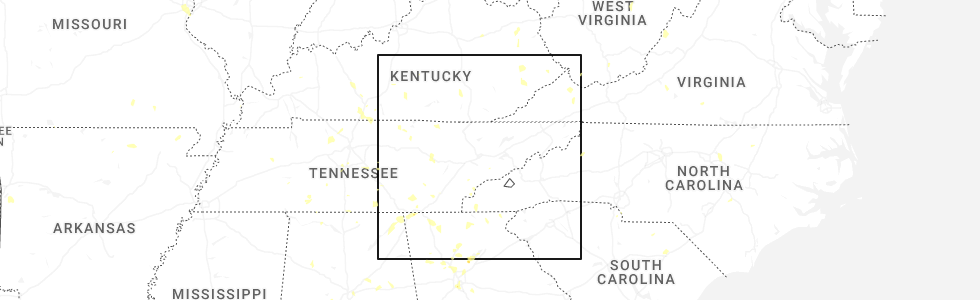
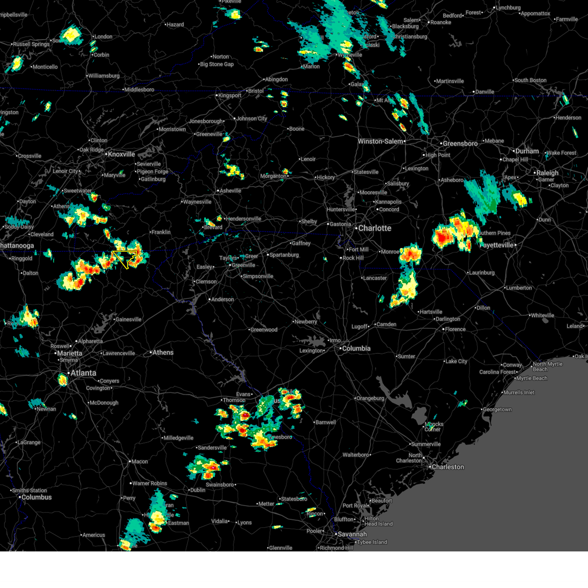
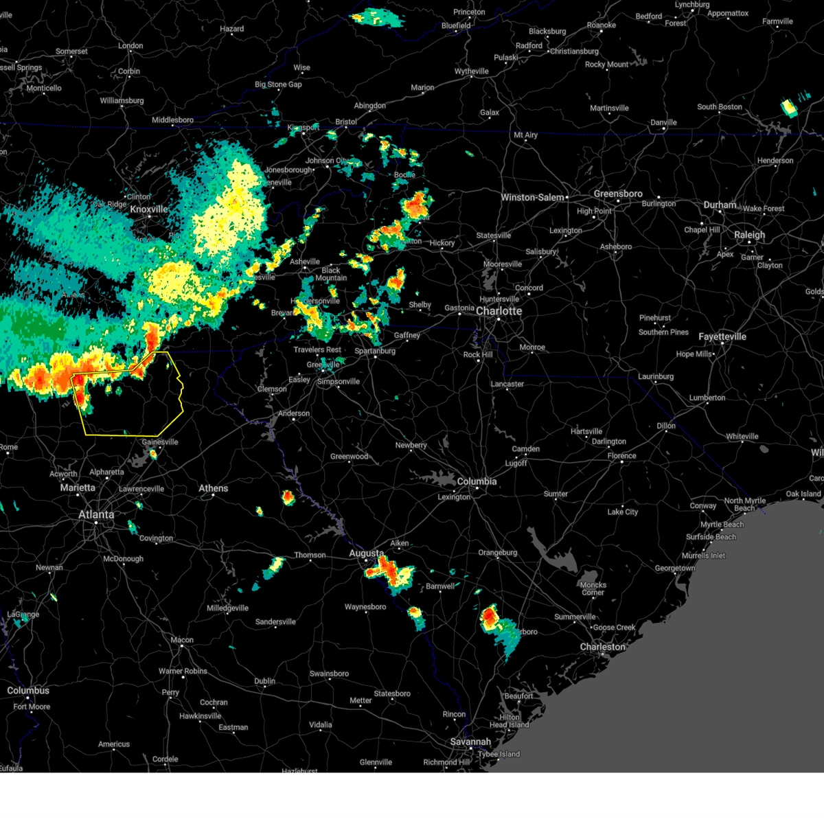
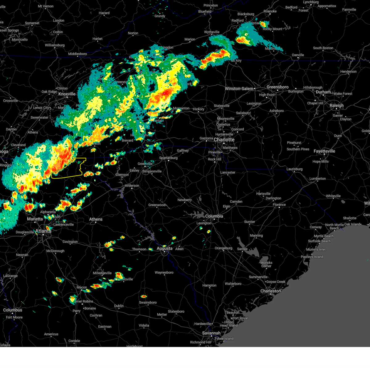
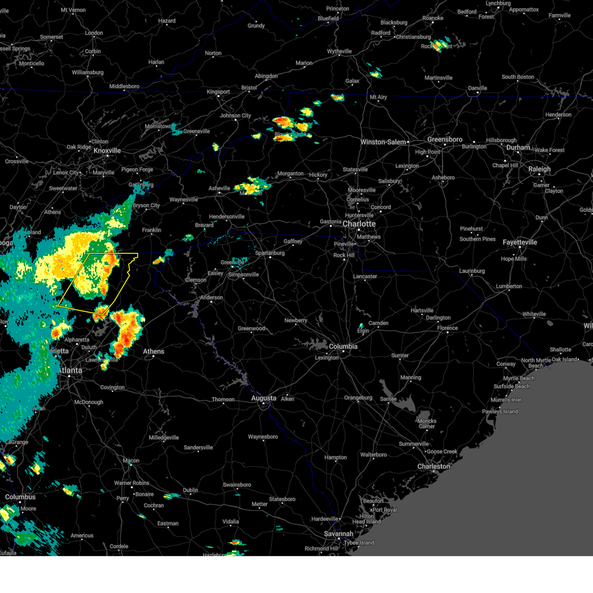
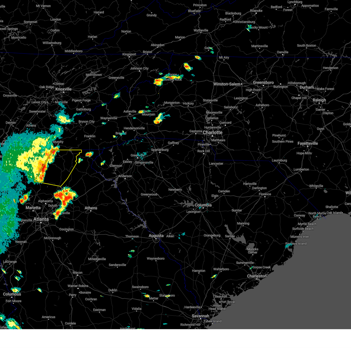
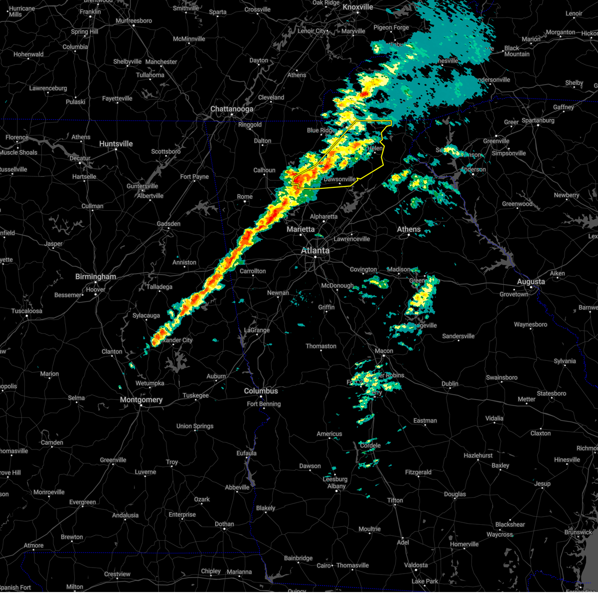
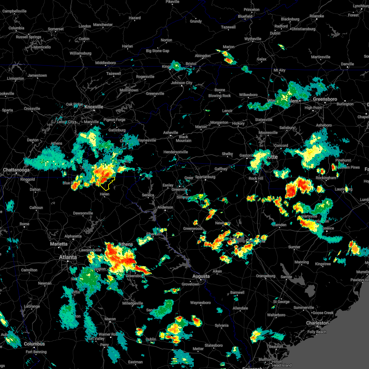
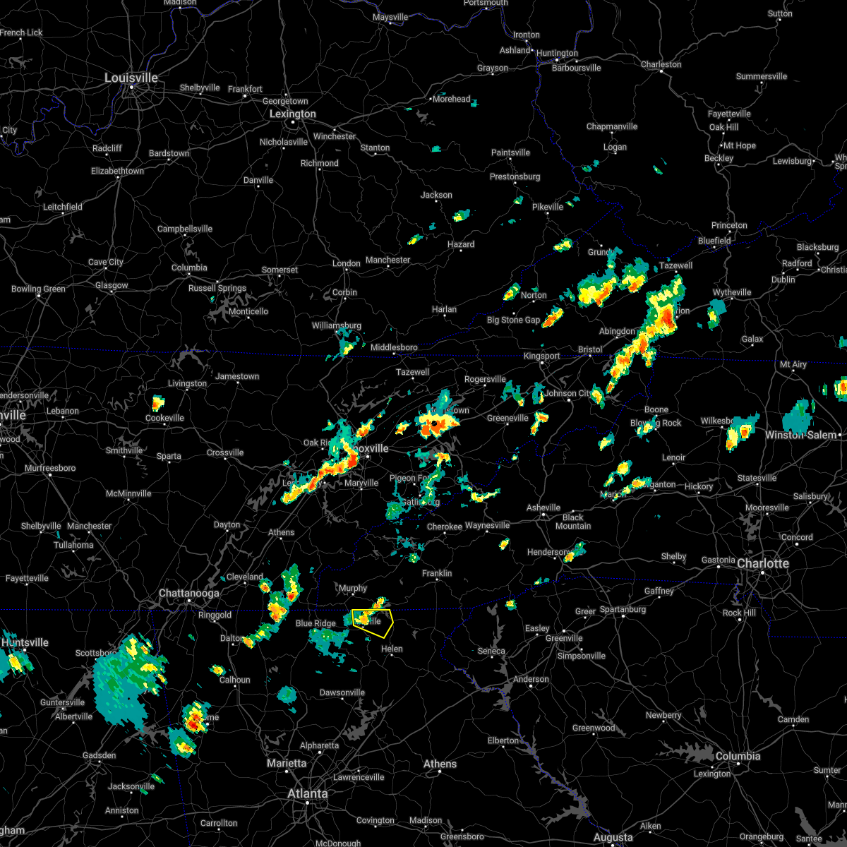
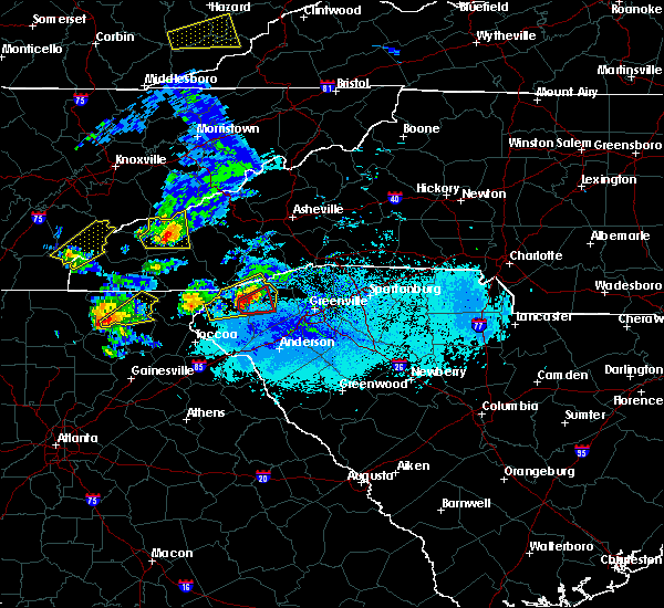
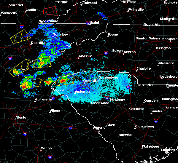
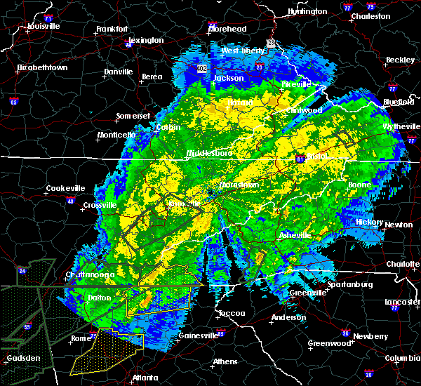
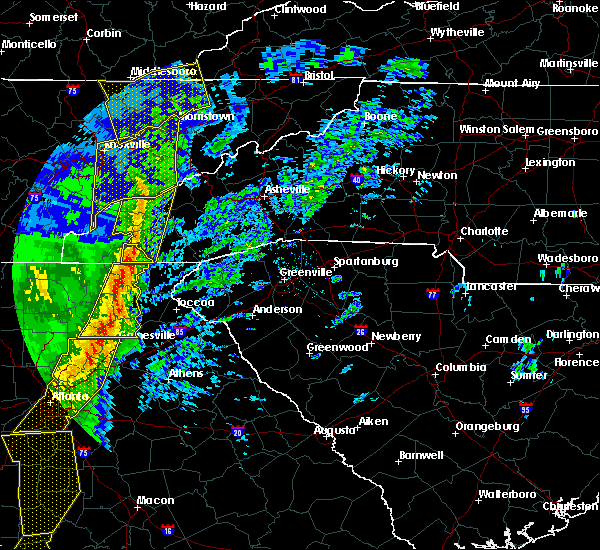
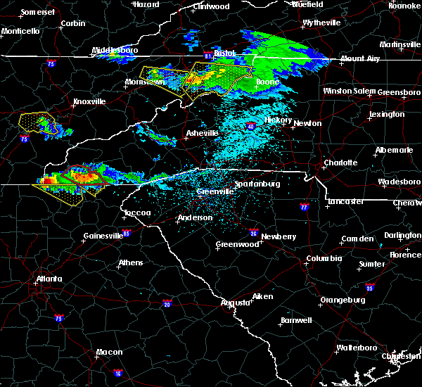
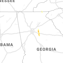
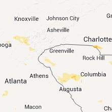
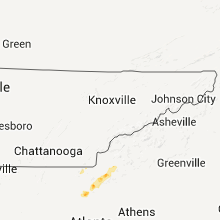
Hail Map for Hiawassee, GA
The Hiawassee, GA area has had 6 reports of on-the-ground hail by trained spotters, and has been under severe weather warnings 10 times during the past 12 months. Doppler radar has detected hail at or near Hiawassee, GA on 24 occasions, including 1 occasion during the past year.
| Name: | Hiawassee, GA |
| Where Located: | 65.8 miles W of Greenville, SC |
| Map: | Google Map for Hiawassee, GA |
| Population: | 880 |
| Housing Units: | 744 |
| More Info: | Search Google for Hiawassee, GA |
0
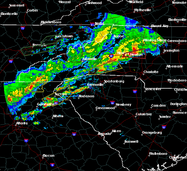
The Top Recent Hail Date for Hiawassee, GA is Friday, June 27, 2025 (24th out of 24)
Hail and Wind Damage Spotted near Hiawassee, GA
| Date / Time | Report Details |
|---|---|
| 6/27/2025 5:12 PM EDT |
 the severe thunderstorm warning has been cancelled and is no longer in effect the severe thunderstorm warning has been cancelled and is no longer in effect
|
| 6/27/2025 4:58 PM EDT |
 Svrffc the national weather service in peachtree city has issued a * severe thunderstorm warning for, western towns county in northeastern georgia, northeastern union county in north central georgia, * until 530 pm edt. * at 458 pm edt, a severe thunderstorm was located over young harris, or near hiawassee, moving west at 15 mph (radar indicated). Hazards include 60 mph wind gusts. expect damage to roofs, siding, and trees Svrffc the national weather service in peachtree city has issued a * severe thunderstorm warning for, western towns county in northeastern georgia, northeastern union county in north central georgia, * until 530 pm edt. * at 458 pm edt, a severe thunderstorm was located over young harris, or near hiawassee, moving west at 15 mph (radar indicated). Hazards include 60 mph wind gusts. expect damage to roofs, siding, and trees
|
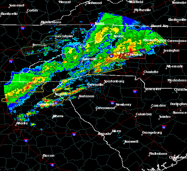
| 6/27/2025 4:35 PM EDT |
 The storm which prompted the warning has weakened below severe limits, and no longer poses an immediate threat to life or property. therefore, the warning will be allowed to expire. however, gusty winds and heavy rain are still possible with this thunderstorm. The storm which prompted the warning has weakened below severe limits, and no longer poses an immediate threat to life or property. therefore, the warning will be allowed to expire. however, gusty winds and heavy rain are still possible with this thunderstorm.
|
| 6/27/2025 4:09 PM EDT |
 Svrffc the national weather service in peachtree city has issued a * severe thunderstorm warning for, eastern towns county in northeastern georgia, * until 445 pm edt. * at 409 pm edt, a severe thunderstorm was located near lake burton, or 10 miles southeast of hiawassee, and is nearly stationary (radar indicated). Hazards include 60 mph wind gusts. expect damage to roofs, siding, and trees Svrffc the national weather service in peachtree city has issued a * severe thunderstorm warning for, eastern towns county in northeastern georgia, * until 445 pm edt. * at 409 pm edt, a severe thunderstorm was located near lake burton, or 10 miles southeast of hiawassee, and is nearly stationary (radar indicated). Hazards include 60 mph wind gusts. expect damage to roofs, siding, and trees
|
| 5/2/2025 9:38 PM EDT |
 The storm which prompted the warning has moved out of the area. therefore, the warning will be allowed to expire. a severe thunderstorm watch remains in effect until 200 am edt for north central and northeastern georgia. The storm which prompted the warning has moved out of the area. therefore, the warning will be allowed to expire. a severe thunderstorm watch remains in effect until 200 am edt for north central and northeastern georgia.
|
| 5/2/2025 9:23 PM EDT |
 the severe thunderstorm warning has been cancelled and is no longer in effect the severe thunderstorm warning has been cancelled and is no longer in effect
|
| 5/2/2025 9:23 PM EDT |
 At 923 pm edt, a severe thunderstorm was located over garland, or near dahlonega, moving east at 30 mph (radar indicated). Hazards include 60 mph wind gusts and penny size hail. Expect damage to roofs, siding, and trees. Locations impacted include, dahlonega, dawsonville, hiawassee, young harris, whitley gap shelter, blue mountain shelter, brasstown bald, titus, mountain scene, woods hole shelter, low gap shelter, camp coleman lake, owltown, vogel state park, auraria, track rock, tate city, macedonia, plum orchard gap shelter, and porter springs. At 923 pm edt, a severe thunderstorm was located over garland, or near dahlonega, moving east at 30 mph (radar indicated). Hazards include 60 mph wind gusts and penny size hail. Expect damage to roofs, siding, and trees. Locations impacted include, dahlonega, dawsonville, hiawassee, young harris, whitley gap shelter, blue mountain shelter, brasstown bald, titus, mountain scene, woods hole shelter, low gap shelter, camp coleman lake, owltown, vogel state park, auraria, track rock, tate city, macedonia, plum orchard gap shelter, and porter springs.
|
| 5/2/2025 8:52 PM EDT |
 Svrffc the national weather service in peachtree city has issued a * severe thunderstorm warning for, towns county in northeastern georgia, lumpkin county in north central georgia, southeastern gilmer county in north central georgia, northwestern white county in northeastern georgia, northern dawson county in north central georgia, northeastern pickens county in north central georgia, union county in north central georgia, southeastern fannin county in north central georgia, * until 945 pm edt. * at 852 pm edt, a severe thunderstorm was located over nimblewill, or 8 miles north of dawsonville, moving east at 30 mph (radar indicated). Hazards include 60 mph wind gusts and penny size hail. expect damage to roofs, siding, and trees Svrffc the national weather service in peachtree city has issued a * severe thunderstorm warning for, towns county in northeastern georgia, lumpkin county in north central georgia, southeastern gilmer county in north central georgia, northwestern white county in northeastern georgia, northern dawson county in north central georgia, northeastern pickens county in north central georgia, union county in north central georgia, southeastern fannin county in north central georgia, * until 945 pm edt. * at 852 pm edt, a severe thunderstorm was located over nimblewill, or 8 miles north of dawsonville, moving east at 30 mph (radar indicated). Hazards include 60 mph wind gusts and penny size hail. expect damage to roofs, siding, and trees
|
| 7/30/2024 6:55 PM EDT |
 Svrffc the national weather service in peachtree city has issued a * severe thunderstorm warning for, towns county in northeastern georgia, lumpkin county in north central georgia, gilmer county in north central georgia, white county in northeastern georgia, dawson county in north central georgia, northwestern hall county in north central georgia, eastern pickens county in north central georgia, union county in north central georgia, southeastern fannin county in north central georgia, * until 745 pm edt. * at 655 pm edt, severe thunderstorms were located along a line extending from young harris to near woods hole shelter to near fort mountain state park, moving south at 35 mph (radar indicated). Hazards include 60 mph wind gusts and quarter size hail. Hail damage to vehicles is expected. Expect wind damage to roofs, siding, and trees. Svrffc the national weather service in peachtree city has issued a * severe thunderstorm warning for, towns county in northeastern georgia, lumpkin county in north central georgia, gilmer county in north central georgia, white county in northeastern georgia, dawson county in north central georgia, northwestern hall county in north central georgia, eastern pickens county in north central georgia, union county in north central georgia, southeastern fannin county in north central georgia, * until 745 pm edt. * at 655 pm edt, severe thunderstorms were located along a line extending from young harris to near woods hole shelter to near fort mountain state park, moving south at 35 mph (radar indicated). Hazards include 60 mph wind gusts and quarter size hail. Hail damage to vehicles is expected. Expect wind damage to roofs, siding, and trees.
|
| 7/30/2024 6:19 PM EDT |
 Svrffc the national weather service in peachtree city has issued a * severe thunderstorm warning for, towns county in northeastern georgia, northern gilmer county in north central georgia, north central white county in northeastern georgia, union county in north central georgia, fannin county in north central georgia, * until 700 pm edt. * at 617 pm edt, severe thunderstorms were located along a line extending from near andrews to near hiawasse dam to near tasso, moving south at 30 mph (radar indicated). Hazards include 60 mph wind gusts and quarter size hail. Hail damage to vehicles is expected. Expect wind damage to roofs, siding, and trees. Svrffc the national weather service in peachtree city has issued a * severe thunderstorm warning for, towns county in northeastern georgia, northern gilmer county in north central georgia, north central white county in northeastern georgia, union county in north central georgia, fannin county in north central georgia, * until 700 pm edt. * at 617 pm edt, severe thunderstorms were located along a line extending from near andrews to near hiawasse dam to near tasso, moving south at 30 mph (radar indicated). Hazards include 60 mph wind gusts and quarter size hail. Hail damage to vehicles is expected. Expect wind damage to roofs, siding, and trees.
|
| 5/9/2024 7:50 AM EDT |
 the severe thunderstorm warning has been cancelled and is no longer in effect the severe thunderstorm warning has been cancelled and is no longer in effect
|
| 5/9/2024 6:55 AM EDT |
 Svrffc the national weather service in peachtree city has issued a * severe thunderstorm warning for, towns county in northeastern georgia, northern lumpkin county in north central georgia, central gilmer county in north central georgia, white county in northeastern georgia, union county in north central georgia, fannin county in north central georgia, * until 800 am edt. * at 655 am edt, severe thunderstorms were located along a line extending from hot house to near carters, moving east at 55 mph (radar indicated). Hazards include 60 mph wind gusts. expect damage to roofs, siding, and trees Svrffc the national weather service in peachtree city has issued a * severe thunderstorm warning for, towns county in northeastern georgia, northern lumpkin county in north central georgia, central gilmer county in north central georgia, white county in northeastern georgia, union county in north central georgia, fannin county in north central georgia, * until 800 am edt. * at 655 am edt, severe thunderstorms were located along a line extending from hot house to near carters, moving east at 55 mph (radar indicated). Hazards include 60 mph wind gusts. expect damage to roofs, siding, and trees
|
| 5/8/2024 11:56 PM EDT |
 Svrffc the national weather service in peachtree city has issued a * severe thunderstorm warning for, towns county in northeastern georgia, union county in north central georgia, northeastern fannin county in north central georgia, * until 1245 am edt. * at 1156 pm edt, severe thunderstorms were located along a line extending from near tusquitee to alexanders mill to gumlog to near jones creek, moving east at 30 mph (radar indicated). Hazards include 60 mph wind gusts and penny size hail. expect damage to roofs, siding, and trees Svrffc the national weather service in peachtree city has issued a * severe thunderstorm warning for, towns county in northeastern georgia, union county in north central georgia, northeastern fannin county in north central georgia, * until 1245 am edt. * at 1156 pm edt, severe thunderstorms were located along a line extending from near tusquitee to alexanders mill to gumlog to near jones creek, moving east at 30 mph (radar indicated). Hazards include 60 mph wind gusts and penny size hail. expect damage to roofs, siding, and trees
|
| 8/7/2023 3:32 PM EDT |
 At 332 pm edt, severe thunderstorms were located along a line extending from near hiawassee to owltown to near dial, moving east at 50 mph (radar indicated). Hazards include 70 mph wind gusts. Expect considerable tree damage. Damage is likely to mobile homes, roofs, and outbuildings. At 332 pm edt, severe thunderstorms were located along a line extending from near hiawassee to owltown to near dial, moving east at 50 mph (radar indicated). Hazards include 70 mph wind gusts. Expect considerable tree damage. Damage is likely to mobile homes, roofs, and outbuildings.
|
| 8/7/2023 3:13 PM EDT |
 At 312 pm edt, severe thunderstorms were located along a line extending from culberson to near nottely dam to near cherry log, moving east at 50 mph (radar indicated). Hazards include 70 mph wind gusts and quarter size hail. Hail damage to vehicles is expected. expect considerable tree damage. wind damage is also likely to mobile homes, roofs, and outbuildings. locations impacted include, blue ridge, hiawassee, blairsville, young harris, morganton, suches, blue mountain shelter, gumlog, loving, jones creek, woods hole shelter, mineral bluff, vogel state park, cherry log, gaddistown, hemp, margret, brasstown bald, nottely dam, and hurst. thunderstorm damage threat, considerable hail threat, radar indicated max hail size, 1. 00 in wind threat, radar indicated max wind gust, 70 mph. At 312 pm edt, severe thunderstorms were located along a line extending from culberson to near nottely dam to near cherry log, moving east at 50 mph (radar indicated). Hazards include 70 mph wind gusts and quarter size hail. Hail damage to vehicles is expected. expect considerable tree damage. wind damage is also likely to mobile homes, roofs, and outbuildings. locations impacted include, blue ridge, hiawassee, blairsville, young harris, morganton, suches, blue mountain shelter, gumlog, loving, jones creek, woods hole shelter, mineral bluff, vogel state park, cherry log, gaddistown, hemp, margret, brasstown bald, nottely dam, and hurst. thunderstorm damage threat, considerable hail threat, radar indicated max hail size, 1. 00 in wind threat, radar indicated max wind gust, 70 mph.
|
| 8/7/2023 2:54 PM EDT |
 At 253 pm edt, severe thunderstorms were located along a line extending from near copperhill to near higdon to near mountaintown, moving east at 45 mph (radar indicated). Hazards include 70 mph wind gusts and quarter size hail. Hail damage to vehicles is expected. expect considerable tree damage. Wind damage is also likely to mobile homes, roofs, and outbuildings. At 253 pm edt, severe thunderstorms were located along a line extending from near copperhill to near higdon to near mountaintown, moving east at 45 mph (radar indicated). Hazards include 70 mph wind gusts and quarter size hail. Hail damage to vehicles is expected. expect considerable tree damage. Wind damage is also likely to mobile homes, roofs, and outbuildings.
|
| 7/20/2023 3:20 PM EDT |
 At 320 pm edt, a severe thunderstorm was located over william l. davenport refuge, or over ducktown, moving southeast at 35 mph (radar indicated). Hazards include 60 mph wind gusts and quarter size hail. Hail damage to vehicles is expected. Expect wind damage to roofs, siding, and trees. At 320 pm edt, a severe thunderstorm was located over william l. davenport refuge, or over ducktown, moving southeast at 35 mph (radar indicated). Hazards include 60 mph wind gusts and quarter size hail. Hail damage to vehicles is expected. Expect wind damage to roofs, siding, and trees.
|
| 7/2/2023 6:57 PM EDT |
 The severe thunderstorm warning for towns, lumpkin, southeastern gilmer, northwestern white, dawson, northwestern hall, northeastern pickens, union and eastern fannin counties will expire at 700 pm edt, the storms which prompted the warning have weakened below severe limits, and no longer pose an immediate threat to life or property. therefore, the warning will be allowed to expire. however gusty winds are still possible with these thunderstorms. a severe thunderstorm watch remains in effect until 900 pm edt for north central and northeastern georgia. The severe thunderstorm warning for towns, lumpkin, southeastern gilmer, northwestern white, dawson, northwestern hall, northeastern pickens, union and eastern fannin counties will expire at 700 pm edt, the storms which prompted the warning have weakened below severe limits, and no longer pose an immediate threat to life or property. therefore, the warning will be allowed to expire. however gusty winds are still possible with these thunderstorms. a severe thunderstorm watch remains in effect until 900 pm edt for north central and northeastern georgia.
|
| 7/2/2023 6:24 PM EDT |
 At 623 pm edt, severe thunderstorms were located along a line extending from gumlog to near lake tamarack, moving east at 40 mph (radar indicated). Hazards include 60 mph wind gusts and quarter size hail. Hail damage to vehicles is expected. Expect wind damage to roofs, siding, and trees. At 623 pm edt, severe thunderstorms were located along a line extending from gumlog to near lake tamarack, moving east at 40 mph (radar indicated). Hazards include 60 mph wind gusts and quarter size hail. Hail damage to vehicles is expected. Expect wind damage to roofs, siding, and trees.
|
| 3/3/2023 3:52 PM EST |
 At 352 pm est, severe thunderstorms were located along a line extending from margret to amicalola falls state park to near talmadge, moving northeast at 65 mph (radar indicated). Hazards include 60 mph wind gusts and penny size hail. expect damage to roofs, siding, and trees At 352 pm est, severe thunderstorms were located along a line extending from margret to amicalola falls state park to near talmadge, moving northeast at 65 mph (radar indicated). Hazards include 60 mph wind gusts and penny size hail. expect damage to roofs, siding, and trees
|
| 7/3/2022 7:04 PM EDT | Tree down at konahetah dr and konahetah rd in towns county GA, 1.3 miles WNW of Hiawassee, GA |
| 7/3/2022 7:01 PM EDT |
 At 701 pm edt, a severe thunderstorm was located over macedonia, or over hiawassee, moving southeast at 10 mph (radar indicated). Hazards include 60 mph wind gusts and quarter size hail. Hail damage to vehicles is expected. Expect wind damage to roofs, siding, and trees. At 701 pm edt, a severe thunderstorm was located over macedonia, or over hiawassee, moving southeast at 10 mph (radar indicated). Hazards include 60 mph wind gusts and quarter size hail. Hail damage to vehicles is expected. Expect wind damage to roofs, siding, and trees.
|
| 6/2/2022 3:53 PM EDT |
 The severe thunderstorm warning for western towns and northeastern union counties will expire at 400 pm edt, the storm which prompted the warning has weakened below severe limits. therefore, the warning will be allowed to expire. however gusty winds and heavy rain are still possible with this thunderstorm through 415 pm. The severe thunderstorm warning for western towns and northeastern union counties will expire at 400 pm edt, the storm which prompted the warning has weakened below severe limits. therefore, the warning will be allowed to expire. however gusty winds and heavy rain are still possible with this thunderstorm through 415 pm.
|
| 6/2/2022 3:24 PM EDT |
 At 324 pm edt, a severe thunderstorm was located over blairsville, moving east at 20 mph (radar indicated). Hazards include 60 mph wind gusts and penny size hail. expect damage to roofs, siding, and trees At 324 pm edt, a severe thunderstorm was located over blairsville, moving east at 20 mph (radar indicated). Hazards include 60 mph wind gusts and penny size hail. expect damage to roofs, siding, and trees
|
| 4/25/2020 6:55 PM EDT |
 At 654 pm edt, a severe thunderstorm was located 3 miles north of suches, or 10 miles south of blairsville, moving east at 40 mph (radar indicated). Hazards include 60 mph wind gusts and quarter size hail. Hail damage to vehicles is expected. expect wind damage to roofs, siding, and trees. Locations impacted include, hiawassee, owltown, blue mountain shelter, vogel state park, brasstown bald, track rock, anna ruby falls, macedonia, mountain scene, woods hole shelter, blood mountain shelter and low gap shelter. At 654 pm edt, a severe thunderstorm was located 3 miles north of suches, or 10 miles south of blairsville, moving east at 40 mph (radar indicated). Hazards include 60 mph wind gusts and quarter size hail. Hail damage to vehicles is expected. expect wind damage to roofs, siding, and trees. Locations impacted include, hiawassee, owltown, blue mountain shelter, vogel state park, brasstown bald, track rock, anna ruby falls, macedonia, mountain scene, woods hole shelter, blood mountain shelter and low gap shelter.
|
| 4/25/2020 6:40 PM EDT |
 The national weather service in peachtree city has issued a * severe thunderstorm warning for. towns county in northeastern georgia. northern white county in northeastern georgia. union county in north central georgia. Southeastern fannin county in north central georgia. The national weather service in peachtree city has issued a * severe thunderstorm warning for. towns county in northeastern georgia. northern white county in northeastern georgia. union county in north central georgia. Southeastern fannin county in north central georgia.
|
| 4/13/2020 2:04 AM EDT |
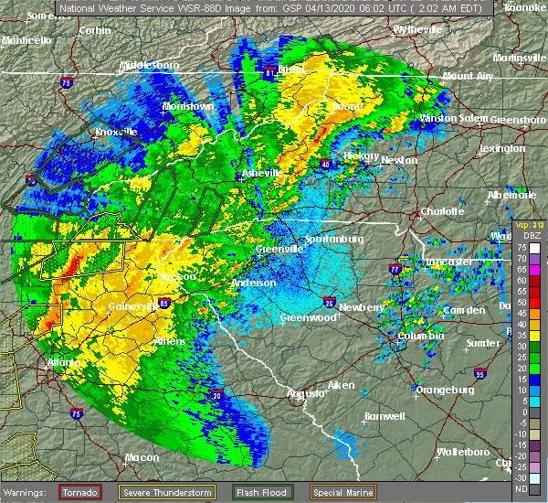 At 204 am edt, a severe thunderstorm was located near gaddistown, or 11 miles southwest of blairsville, moving northeast at 65 mph (radar indicated). Hazards include 60 mph wind gusts. Expect damage to roofs, siding, and trees. Locations impacted include, hiawassee, blairsville, young harris, helen, suches, unicoi state park, robertstown, blue mountain shelter, gumlog, jones creek, woods hole shelter, low gap shelter, vogel state park, anna ruby falls, stover creek shelter, gaddistown, margret, whitley gap shelter, brasstown bald and nottely dam. At 204 am edt, a severe thunderstorm was located near gaddistown, or 11 miles southwest of blairsville, moving northeast at 65 mph (radar indicated). Hazards include 60 mph wind gusts. Expect damage to roofs, siding, and trees. Locations impacted include, hiawassee, blairsville, young harris, helen, suches, unicoi state park, robertstown, blue mountain shelter, gumlog, jones creek, woods hole shelter, low gap shelter, vogel state park, anna ruby falls, stover creek shelter, gaddistown, margret, whitley gap shelter, brasstown bald and nottely dam.
|
| 4/13/2020 1:36 AM EDT |
 At 136 am edt, a severe thunderstorm was located over hemp, or 8 miles east of blue ridge, moving northeast at 55 mph (radar indicated). Hazards include 70 mph wind gusts. Expect considerable tree damage. damage is likely to mobile homes, roofs, and outbuildings. Locations impacted include, blue ridge, hiawassee, blairsville, young harris, east ellijay, helen, morganton, suches, unicoi state park, robertstown, blue mountain shelter, gumlog, loving, jones creek, woods hole shelter, low gap shelter, cartecay, pisgah, mineral bluff and vogel state park. At 136 am edt, a severe thunderstorm was located over hemp, or 8 miles east of blue ridge, moving northeast at 55 mph (radar indicated). Hazards include 70 mph wind gusts. Expect considerable tree damage. damage is likely to mobile homes, roofs, and outbuildings. Locations impacted include, blue ridge, hiawassee, blairsville, young harris, east ellijay, helen, morganton, suches, unicoi state park, robertstown, blue mountain shelter, gumlog, loving, jones creek, woods hole shelter, low gap shelter, cartecay, pisgah, mineral bluff and vogel state park.
|
| 4/13/2020 1:25 AM EDT |
 At 125 am edt, a severe thunderstorm was located over cherry log, or near blue ridge, moving northeast at 60 mph (radar indicated). Hazards include 70 mph wind gusts. Expect considerable tree damage. damage is likely to mobile homes, roofs, and outbuildings. Locations impacted include, blue ridge, hiawassee, blairsville, young harris, east ellijay, helen, morganton, suches, unicoi state park, robertstown, blue mountain shelter, gumlog, higdon, loving, jones creek, woods hole shelter, epworth, low gap shelter, cartecay and pisgah. At 125 am edt, a severe thunderstorm was located over cherry log, or near blue ridge, moving northeast at 60 mph (radar indicated). Hazards include 70 mph wind gusts. Expect considerable tree damage. damage is likely to mobile homes, roofs, and outbuildings. Locations impacted include, blue ridge, hiawassee, blairsville, young harris, east ellijay, helen, morganton, suches, unicoi state park, robertstown, blue mountain shelter, gumlog, higdon, loving, jones creek, woods hole shelter, epworth, low gap shelter, cartecay and pisgah.
|
| 4/13/2020 1:23 AM EDT |
 At 123 am edt, a severe thunderstorm was located near cherry log, or near ellijay, moving east at 55 mph (radar indicated). Hazards include 60 mph wind gusts. expect damage to roofs, siding, and trees At 123 am edt, a severe thunderstorm was located near cherry log, or near ellijay, moving east at 55 mph (radar indicated). Hazards include 60 mph wind gusts. expect damage to roofs, siding, and trees
|
| 1/11/2020 5:51 PM EST |
 At 551 pm est, severe thunderstorms were located along a line extending from titus to near war hill park, moving east at 40 mph (radar indicated). Hazards include 60 mph wind gusts. Expect damage to roofs, siding, and trees. Locations impacted include, gainesville, dahlonega, cleveland, dawsonville, hiawassee, lula, young harris, clermont, helen, unicoi state park, dougherty, robertstown, blue mountain shelter, mossy creek, titus, woods hole shelter, low gap shelter, murrayville, vogel state park and anna ruby falls. At 551 pm est, severe thunderstorms were located along a line extending from titus to near war hill park, moving east at 40 mph (radar indicated). Hazards include 60 mph wind gusts. Expect damage to roofs, siding, and trees. Locations impacted include, gainesville, dahlonega, cleveland, dawsonville, hiawassee, lula, young harris, clermont, helen, unicoi state park, dougherty, robertstown, blue mountain shelter, mossy creek, titus, woods hole shelter, low gap shelter, murrayville, vogel state park and anna ruby falls.
|
| 1/11/2020 5:27 PM EST |
 At 526 pm est, severe thunderstorms were located along a line extending from alexanders mill to near silver city, moving east at 40 mph (radar indicated). Hazards include 60 mph wind gusts. expect damage to roofs, siding, and trees At 526 pm est, severe thunderstorms were located along a line extending from alexanders mill to near silver city, moving east at 40 mph (radar indicated). Hazards include 60 mph wind gusts. expect damage to roofs, siding, and trees
|
| 8/13/2019 9:28 PM EDT |
 The national weather service in peachtree city has issued a * severe thunderstorm warning for. towns county in northeastern georgia. central lumpkin county in north central georgia. southeastern gilmer county in north central georgia. Northern white county in northeastern georgia. The national weather service in peachtree city has issued a * severe thunderstorm warning for. towns county in northeastern georgia. central lumpkin county in north central georgia. southeastern gilmer county in north central georgia. Northern white county in northeastern georgia.
|
| 8/13/2019 9:00 PM EDT |
 At 900 pm edt, severe thunderstorms were located along a line extending from near mountaintown to dial to near gumlog, moving east at 15 mph (radar indicated). Hazards include 60 mph wind gusts. expect damage to roofs, siding, and trees At 900 pm edt, severe thunderstorms were located along a line extending from near mountaintown to dial to near gumlog, moving east at 15 mph (radar indicated). Hazards include 60 mph wind gusts. expect damage to roofs, siding, and trees
|
| 6/22/2019 12:54 AM EDT |
 At 1253 am edt, severe thunderstorms were located along a line extending from near mountain scene to jasper, moving east at 70 mph (radar indicated). Hazards include 60 mph wind gusts. expect damage to roofs, siding, and trees At 1253 am edt, severe thunderstorms were located along a line extending from near mountain scene to jasper, moving east at 70 mph (radar indicated). Hazards include 60 mph wind gusts. expect damage to roofs, siding, and trees
|
| 6/22/2019 12:22 AM EDT |
 At 1221 am edt, severe thunderstorms were located along a line extending from near hiawasse dam to near jones mill, and are nearly stationary (radar indicated). Hazards include 60 mph wind gusts. Expect damage to roofs, siding, and trees. Locations impacted include, ellijay, blue ridge, hiawassee, blairsville, young harris, east ellijay, morganton, suches, blue mountain shelter, jones mill, gumlog, jones creek, titus, cohutta wilderness, pisgah, mineral bluff, cherry log, stover creek shelter, plum orchard gap shelter and hemp. At 1221 am edt, severe thunderstorms were located along a line extending from near hiawasse dam to near jones mill, and are nearly stationary (radar indicated). Hazards include 60 mph wind gusts. Expect damage to roofs, siding, and trees. Locations impacted include, ellijay, blue ridge, hiawassee, blairsville, young harris, east ellijay, morganton, suches, blue mountain shelter, jones mill, gumlog, jones creek, titus, cohutta wilderness, pisgah, mineral bluff, cherry log, stover creek shelter, plum orchard gap shelter and hemp.
|
| 6/22/2019 12:08 AM EDT |
 At 1207 am edt, severe thunderstorms were located along a line extending from near murphy to near jones mill, moving east at 60 mph (radar indicated). Hazards include 60 mph wind gusts. Expect damage to roofs, siding, and trees. Locations impacted include, ellijay, blue ridge, hiawassee, blairsville, young harris, east ellijay, morganton, suches, blue mountain shelter, jones mill, gumlog, jones creek, titus, cohutta wilderness, pisgah, mineral bluff, cherry log, stover creek shelter, plum orchard gap shelter and hemp. At 1207 am edt, severe thunderstorms were located along a line extending from near murphy to near jones mill, moving east at 60 mph (radar indicated). Hazards include 60 mph wind gusts. Expect damage to roofs, siding, and trees. Locations impacted include, ellijay, blue ridge, hiawassee, blairsville, young harris, east ellijay, morganton, suches, blue mountain shelter, jones mill, gumlog, jones creek, titus, cohutta wilderness, pisgah, mineral bluff, cherry log, stover creek shelter, plum orchard gap shelter and hemp.
|
| 6/22/2019 12:03 AM EDT |
 At 1202 am edt, severe thunderstorms were located along a line extending from hiawasse dam to near conasauga lake, moving southeast at 60 mph (radar indicated). Hazards include 60 mph wind gusts. expect damage to roofs, siding, and trees At 1202 am edt, severe thunderstorms were located along a line extending from hiawasse dam to near conasauga lake, moving southeast at 60 mph (radar indicated). Hazards include 60 mph wind gusts. expect damage to roofs, siding, and trees
|
| 6/24/2018 3:48 PM EDT |
 At 347 pm edt, a severe thunderstorm was located over brasstown bald, or near hiawassee, moving southeast at 30 mph (radar indicated). Hazards include 60 mph wind gusts and quarter size hail. Hail damage to vehicles is expected. expect wind damage to roofs, siding, and trees. Locations impacted include, hiawassee, young harris, blue mountain shelter, brasstown bald, track rock, tate city, macedonia, plum orchard gap shelter, titus, mountain scene and alexanders mill. At 347 pm edt, a severe thunderstorm was located over brasstown bald, or near hiawassee, moving southeast at 30 mph (radar indicated). Hazards include 60 mph wind gusts and quarter size hail. Hail damage to vehicles is expected. expect wind damage to roofs, siding, and trees. Locations impacted include, hiawassee, young harris, blue mountain shelter, brasstown bald, track rock, tate city, macedonia, plum orchard gap shelter, titus, mountain scene and alexanders mill.
|
| 6/24/2018 3:19 PM EDT |
 At 318 pm edt, a severe thunderstorm was located near blairsville, moving east at 30 mph (radar indicated). Hazards include 60 mph wind gusts and quarter size hail. Hail damage to vehicles is expected. Expect wind damage to roofs, siding, and trees. At 318 pm edt, a severe thunderstorm was located near blairsville, moving east at 30 mph (radar indicated). Hazards include 60 mph wind gusts and quarter size hail. Hail damage to vehicles is expected. Expect wind damage to roofs, siding, and trees.
|
| 6/23/2018 3:50 PM EDT | Reports via social media of the storm flipping a small dock on lake chatuge in hiawasse in towns county GA, 0.6 miles E of Hiawassee, GA |
| 6/23/2018 3:45 PM EDT | Small dock on lake chatuge in hiawassee was lifted into the air and flipped ove in towns county GA, 0.6 miles E of Hiawassee, GA |
| 6/23/2018 3:31 PM EDT |
 At 330 pm edt, severe thunderstorms were located along a line extending from near nottely dam to near camp merrill, moving east at 45 mph (radar indicated). Hazards include 60 mph wind gusts. Expect damage to roofs, siding, and trees. Locations impacted include, hiawassee, blairsville, young harris, helen, suches, unicoi state park, robertstown, blue mountain shelter, gumlog, titus, woods hole shelter, low gap shelter, vogel state park, anna ruby falls, plum orchard gap shelter, turners corner, sautee, qualatchee lake, whitley gap shelter and brasstown bald. At 330 pm edt, severe thunderstorms were located along a line extending from near nottely dam to near camp merrill, moving east at 45 mph (radar indicated). Hazards include 60 mph wind gusts. Expect damage to roofs, siding, and trees. Locations impacted include, hiawassee, blairsville, young harris, helen, suches, unicoi state park, robertstown, blue mountain shelter, gumlog, titus, woods hole shelter, low gap shelter, vogel state park, anna ruby falls, plum orchard gap shelter, turners corner, sautee, qualatchee lake, whitley gap shelter and brasstown bald.
|
| 6/23/2018 3:14 PM EDT |
 At 314 pm edt, severe thunderstorms were located along a line extending from near hot house to roy, moving east at 45 mph (radar indicated). Hazards include 60 mph wind gusts. expect damage to roofs, siding, and trees At 314 pm edt, severe thunderstorms were located along a line extending from near hot house to roy, moving east at 45 mph (radar indicated). Hazards include 60 mph wind gusts. expect damage to roofs, siding, and trees
|
| 3/17/2018 8:44 PM EDT |
 At 843 pm edt, a severe thunderstorm was located over tusquitee, or near hayesville, moving southeast at 35 mph (radar indicated). Hazards include 60 mph wind gusts and quarter size hail. Hail damage to vehicles is expected. Expect wind damage to roofs, siding, and trees. At 843 pm edt, a severe thunderstorm was located over tusquitee, or near hayesville, moving southeast at 35 mph (radar indicated). Hazards include 60 mph wind gusts and quarter size hail. Hail damage to vehicles is expected. Expect wind damage to roofs, siding, and trees.
|
| 3/21/2017 8:07 PM EDT |
 At 805 pm edt, severe thunderstorms were located extending from hot house to near morganton to amicalola falls state park to near tate, moving east at 45 mph (radar indicated, plus multiple reports of damage to trees and powerlines due to very strong winds). Hazards include 60 mph wind gusts and quarter size hail. Hail damage to vehicles is expected. Expect wind damage to roofs, siding, and trees. At 805 pm edt, severe thunderstorms were located extending from hot house to near morganton to amicalola falls state park to near tate, moving east at 45 mph (radar indicated, plus multiple reports of damage to trees and powerlines due to very strong winds). Hazards include 60 mph wind gusts and quarter size hail. Hail damage to vehicles is expected. Expect wind damage to roofs, siding, and trees.
|
| 3/1/2017 5:22 PM EST |
 At 521 pm est, a severe thunderstorm was located over owltown, or near blairsville, moving east at 50 mph (radar indicated). Hazards include 60 mph wind gusts and quarter size hail. Hail damage to vehicles is expected. expect wind damage to roofs, siding, and trees. locations impacted include, hiawassee, blairsville, young harris, helen, unicoi state park, whitley gap shelter, robertstown, blue mountain shelter, brasstown bald, titus, mountain scene, woods hole shelter, low gap shelter, owltown, vogel state park, track rock, anna ruby falls, macedonia, plum orchard gap shelter and blood mountain shelter. A tornado watch remains in effect until 700 pm est for north central and northeastern georgia. At 521 pm est, a severe thunderstorm was located over owltown, or near blairsville, moving east at 50 mph (radar indicated). Hazards include 60 mph wind gusts and quarter size hail. Hail damage to vehicles is expected. expect wind damage to roofs, siding, and trees. locations impacted include, hiawassee, blairsville, young harris, helen, unicoi state park, whitley gap shelter, robertstown, blue mountain shelter, brasstown bald, titus, mountain scene, woods hole shelter, low gap shelter, owltown, vogel state park, track rock, anna ruby falls, macedonia, plum orchard gap shelter and blood mountain shelter. A tornado watch remains in effect until 700 pm est for north central and northeastern georgia.
|
| 3/1/2017 5:12 PM EST |
 At 511 pm est, a severe thunderstorm was located over jones creek, or 10 miles southwest of blairsville, moving east at 45 mph (radar indicated). Hazards include 60 mph wind gusts and quarter size hail. Hail damage to vehicles is expected. expect wind damage to roofs, siding, and trees. locations impacted include, hiawassee, blairsville, young harris, helen, unicoi state park, robertstown, blue mountain shelter, jones creek, titus, woods hole shelter, low gap shelter, vogel state park, anna ruby falls, plum orchard gap shelter, gaddistown, hemp, margret, whitley gap shelter, brasstown bald and hurst. A tornado watch remains in effect until 700 pm est for north central and northeastern georgia. At 511 pm est, a severe thunderstorm was located over jones creek, or 10 miles southwest of blairsville, moving east at 45 mph (radar indicated). Hazards include 60 mph wind gusts and quarter size hail. Hail damage to vehicles is expected. expect wind damage to roofs, siding, and trees. locations impacted include, hiawassee, blairsville, young harris, helen, unicoi state park, robertstown, blue mountain shelter, jones creek, titus, woods hole shelter, low gap shelter, vogel state park, anna ruby falls, plum orchard gap shelter, gaddistown, hemp, margret, whitley gap shelter, brasstown bald and hurst. A tornado watch remains in effect until 700 pm est for north central and northeastern georgia.
|
| 3/1/2017 4:58 PM EST |
 At 457 pm est, a severe thunderstorm was located near cherry log, or near blue ridge, moving east at 45 mph (radar indicated). Hazards include 60 mph wind gusts and quarter size hail. Hail damage to vehicles is expected. Expect wind damage to roofs, siding, and trees. At 457 pm est, a severe thunderstorm was located near cherry log, or near blue ridge, moving east at 45 mph (radar indicated). Hazards include 60 mph wind gusts and quarter size hail. Hail damage to vehicles is expected. Expect wind damage to roofs, siding, and trees.
|
| 7/8/2016 8:45 PM EDT |
 At 845 pm edt, severe thunderstorms were located along a line extending from near moccasin creek state park to near ducktown, moving southeast at 35 mph (radar indicated). Hazards include 60 mph wind gusts and quarter size hail. Hail damage to vehicles is expected. expect wind damage to roofs, siding, and trees. Other locations in the warning include but are not limited to cleveland, blue ridge, hiawassee, blairsville, young harris, helen, morganton, suches, unicoi state park, jones creek, sautee, epworth, smithgall woods conservation are, leaf, macedonia, alexanders mill, turners corner, mountain scene, low gap shelter and titus. At 845 pm edt, severe thunderstorms were located along a line extending from near moccasin creek state park to near ducktown, moving southeast at 35 mph (radar indicated). Hazards include 60 mph wind gusts and quarter size hail. Hail damage to vehicles is expected. expect wind damage to roofs, siding, and trees. Other locations in the warning include but are not limited to cleveland, blue ridge, hiawassee, blairsville, young harris, helen, morganton, suches, unicoi state park, jones creek, sautee, epworth, smithgall woods conservation are, leaf, macedonia, alexanders mill, turners corner, mountain scene, low gap shelter and titus.
|
| 7/8/2016 8:11 PM EDT |
 At 810 pm edt, severe thunderstorms were located along a line extending from near murphy to 7 miles northeast of ducktown, moving southeast at 30 mph (radar indicated). Hazards include 60 mph wind gusts and quarter size hail. Hail damage to vehicles is expected. expect wind damage to roofs, siding, and trees. Other locations in the warning include but are not limited to blue ridge, hiawassee, blairsville, young harris, morganton, suches, jones creek, brasstown bald, pisgah, epworth, stover creek shelter, track rock, macedonia, alexanders mill, mountain scene, black gap shelter, margret, hurst, low gap shelter and gumlog. At 810 pm edt, severe thunderstorms were located along a line extending from near murphy to 7 miles northeast of ducktown, moving southeast at 30 mph (radar indicated). Hazards include 60 mph wind gusts and quarter size hail. Hail damage to vehicles is expected. expect wind damage to roofs, siding, and trees. Other locations in the warning include but are not limited to blue ridge, hiawassee, blairsville, young harris, morganton, suches, jones creek, brasstown bald, pisgah, epworth, stover creek shelter, track rock, macedonia, alexanders mill, mountain scene, black gap shelter, margret, hurst, low gap shelter and gumlog.
|
| 7/14/2015 6:02 PM EDT |
 At 559 pm edt, severe thunderstorms were located extending from southeast of benton to near ducktown to hayesville to southeast of nantahala lake to west of franklin, moving east at 60 mph (radar indicated). Hazards include 60 mph wind gusts and quarter size hail. Hail damage to vehicles is expected. expect wind damage to roofs, siding and trees. Other locations in the warning include but are not limited to blue ridge, hiawassee, blairsville, young harris, morganton, suches, jones creek, brasstown bald, the plum orchard gap shelter, epworth, higdon, track rock, macedonia, jones mill, alexanders mill, mountain scene, margret, hurst, the low gap shelter and titus. At 559 pm edt, severe thunderstorms were located extending from southeast of benton to near ducktown to hayesville to southeast of nantahala lake to west of franklin, moving east at 60 mph (radar indicated). Hazards include 60 mph wind gusts and quarter size hail. Hail damage to vehicles is expected. expect wind damage to roofs, siding and trees. Other locations in the warning include but are not limited to blue ridge, hiawassee, blairsville, young harris, morganton, suches, jones creek, brasstown bald, the plum orchard gap shelter, epworth, higdon, track rock, macedonia, jones mill, alexanders mill, mountain scene, margret, hurst, the low gap shelter and titus.
|
| 7/14/2015 12:26 PM EDT |
 At 1225 pm edt, severe thunderstorms were located extending from near moccasin creek state park to near blairsville, moving south at 25 mph (radar indicated). Hazards include 60 mph wind gusts and quarter size hail. Hail damage to vehicles is expected. expect wind damage to roofs, siding and trees. Other locations in the warning include but are not limited to hiawassee, blairsville, young harris, brasstown bald, plum orchard gap shelter, owltown, blood mountain shelter, track rock, vogel state park, macedonia, woods hole shelter, mountain scene, blue mountain shelter, titus and tate city. At 1225 pm edt, severe thunderstorms were located extending from near moccasin creek state park to near blairsville, moving south at 25 mph (radar indicated). Hazards include 60 mph wind gusts and quarter size hail. Hail damage to vehicles is expected. expect wind damage to roofs, siding and trees. Other locations in the warning include but are not limited to hiawassee, blairsville, young harris, brasstown bald, plum orchard gap shelter, owltown, blood mountain shelter, track rock, vogel state park, macedonia, woods hole shelter, mountain scene, blue mountain shelter, titus and tate city.
|
| 7/14/2015 12:20 PM EDT | Few trees down in towns county GA, 0.6 miles E of Hiawassee, GA |
| 7/14/2015 11:55 AM EDT |
 At 1154 am edt, severe thunderstorms were located extending from near andrews to 6 miles south of murphy, moving south at 30 mph (radar indicated). Hazards include 60 mph wind gusts and quarter size hail. Hail damage to vehicles is expected. expect wind damage to roofs, siding and trees. Other locations in the warning include but are not limited to hiawassee, blairsville, young harris, brasstown bald, plum orchard gap shelter, gumlog, owltown, nottely dam, blood mountain shelter, track rock, vogel state park, macedonia, woods hole shelter, alexanders mill, mountain scene, ivy log, blue mountain shelter, low gap shelter, titus and tate city. At 1154 am edt, severe thunderstorms were located extending from near andrews to 6 miles south of murphy, moving south at 30 mph (radar indicated). Hazards include 60 mph wind gusts and quarter size hail. Hail damage to vehicles is expected. expect wind damage to roofs, siding and trees. Other locations in the warning include but are not limited to hiawassee, blairsville, young harris, brasstown bald, plum orchard gap shelter, gumlog, owltown, nottely dam, blood mountain shelter, track rock, vogel state park, macedonia, woods hole shelter, alexanders mill, mountain scene, ivy log, blue mountain shelter, low gap shelter, titus and tate city.
|
| 6/26/2015 5:07 PM EDT | Quarter sized hail reported 2.2 miles NE of Hiawassee, GA, the long ridge camp ground reported quarter sized hail. |
| 6/26/2015 4:50 PM EDT | At 450 pm edt, a severe thunderstorm was located over young harris, or near hayesville, moving northeast at 20 mph (radar indicated). Hazards include 60 mph wind gusts and quarter size hail. Hail damage to vehicles is expected. expect wind damage to roofs, siding and trees. Other locations in the warning include but are not limited to hiawassee, young harris and alexanders mill. |
| 6/26/2015 4:35 PM EDT | Quarter sized hail reported 6.4 miles NNW of Hiawassee, GA, quarter sized hail on mauldin drive |
| 6/26/2015 4:32 PM EDT | At 432 pm edt, a severe thunderstorm was located near hiawassee, moving northeast at 10 mph (radar indicated). Hazards include 60 mph wind gusts and quarter size hail. Hail damage to vehicles is expected. expect wind damage to roofs, siding and trees. Other locations in the warning include but are not limited to hiawassee, plum orchard gap shelter, macedonia, titus, tate city and mountain scene. |
| 6/19/2014 5:30 PM EDT | Towns county 911 center reported approximately six trees down county wide. four of these trees fell along hwy 75 sout in towns county GA, 2.3 miles NNW of Hiawassee, GA |
| 6/13/2013 5:45 PM EDT | Numerous trees down across the county particularly hiawassee are in towns county GA, 0.6 miles E of Hiawassee, GA |
| 3/5/2013 4:27 PM EST | Tree down on home south of hiawasse in towns county GA, 4.8 miles N of Hiawassee, GA |
| 1/30/2013 2:00 PM EST | Trees down across the county...especially on the east sid in towns county GA, 1.7 miles W of Hiawassee, GA |
| 7/5/2012 8:00 PM EDT | 2 trees down in the macedonia are in towns county GA, 3.6 miles NNW of Hiawassee, GA |
| 4/26/2012 7:06 PM EDT | Quarter sized hail reported 0.6 miles E of Hiawassee, GA, the public reported quarter sized hail in the city of hiawassee. |
| 4/26/2012 9:37 AM EDT | Quarter sized hail reported 0.6 miles E of Hiawassee, GA, the public reported quarter sized hail in hiawassee with duration unknown. |
| 1/1/0001 12:00 AM | Trees down countywid in towns county GA, 0.6 miles E of Hiawassee, GA |
| 1/1/0001 12:00 AM | Quarter sized hail reported 2.9 miles NNW of Hiawassee, GA |
| 5/26/2011 5:25 PM EDT | Golf Ball sized hail reported 5.7 miles NNE of Hiawassee, GA |
| 1/1/0001 12:00 AM | Towns county emergency management reports a tree downed onto a house on the southern end of the count in towns county GA, 6.3 miles N of Hiawassee, GA |
| 1/1/0001 12:00 AM | Towns county 911 relayed reports of over 9 trees downed in the county. traffic lights were also reported ou in towns county GA, 0.6 miles E of Hiawassee, GA |
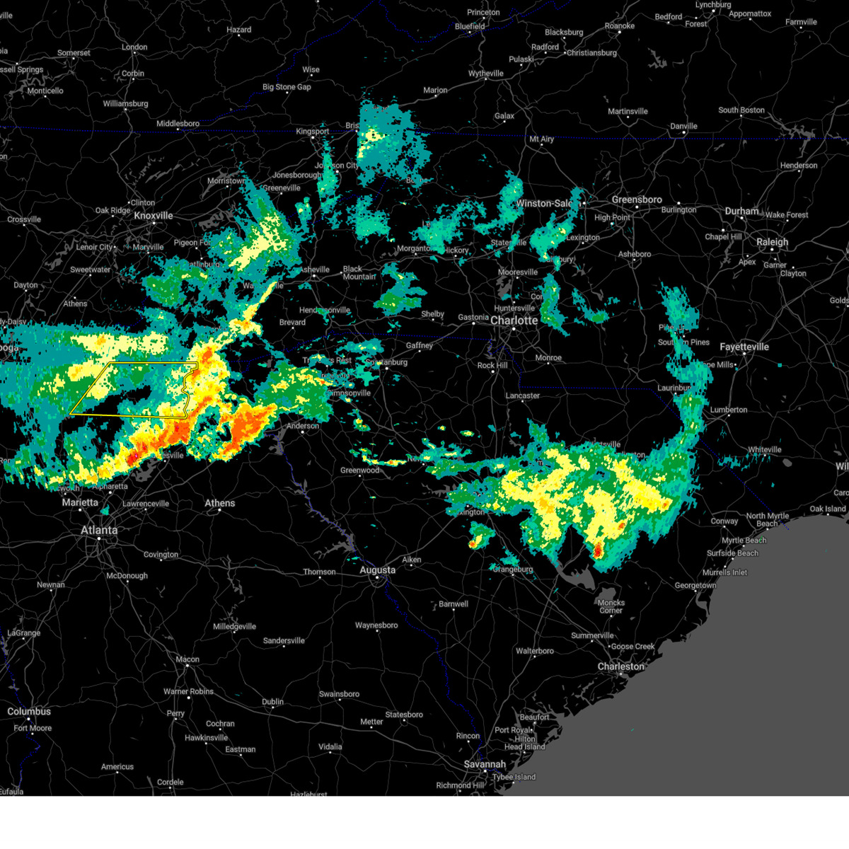
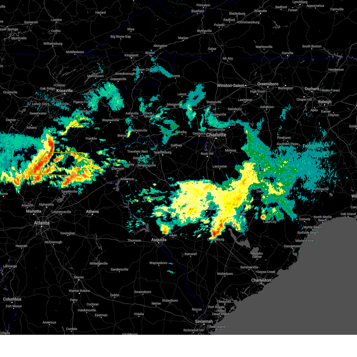
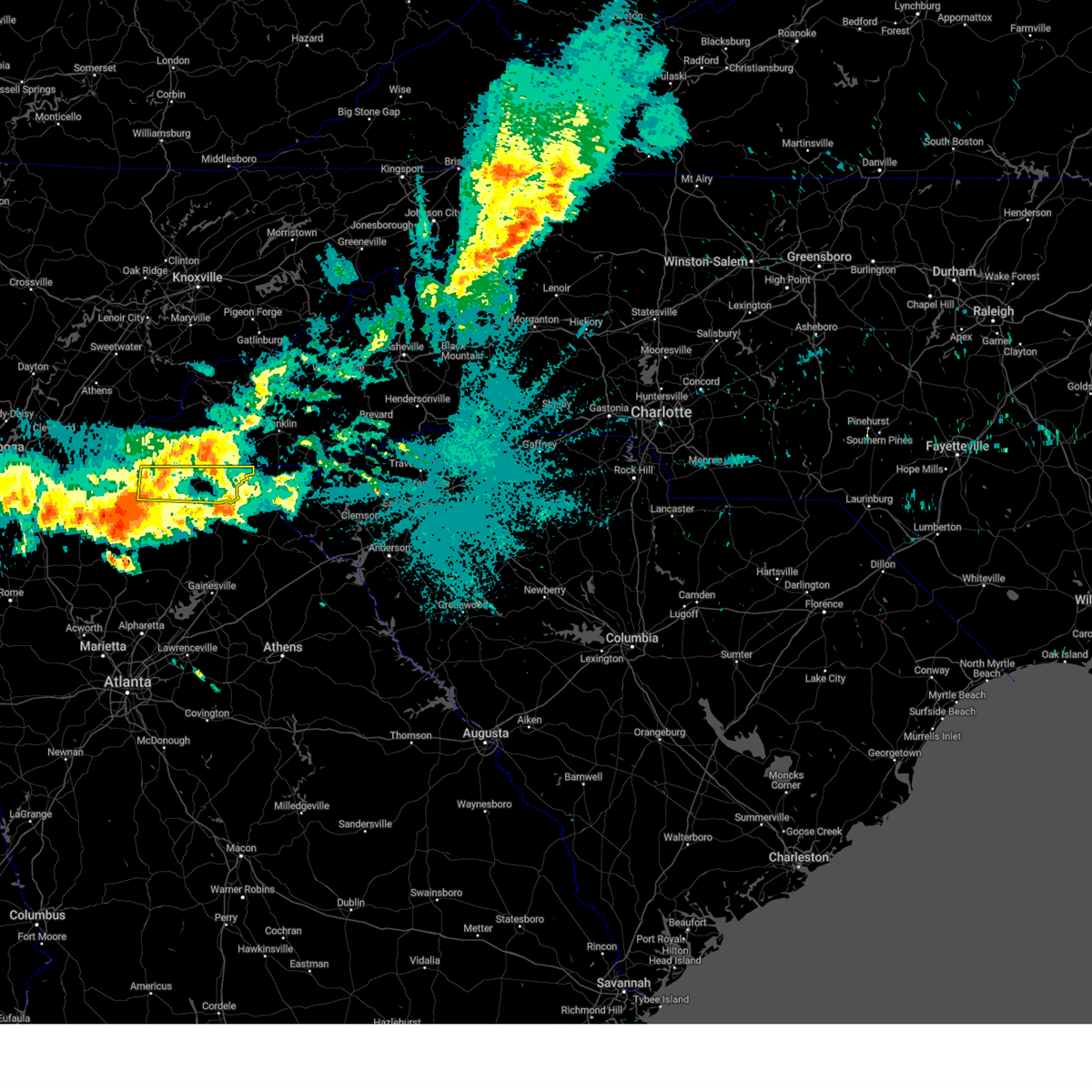
Hail Maps for Hiawassee, GA


Connect with Interactive Hail Maps