

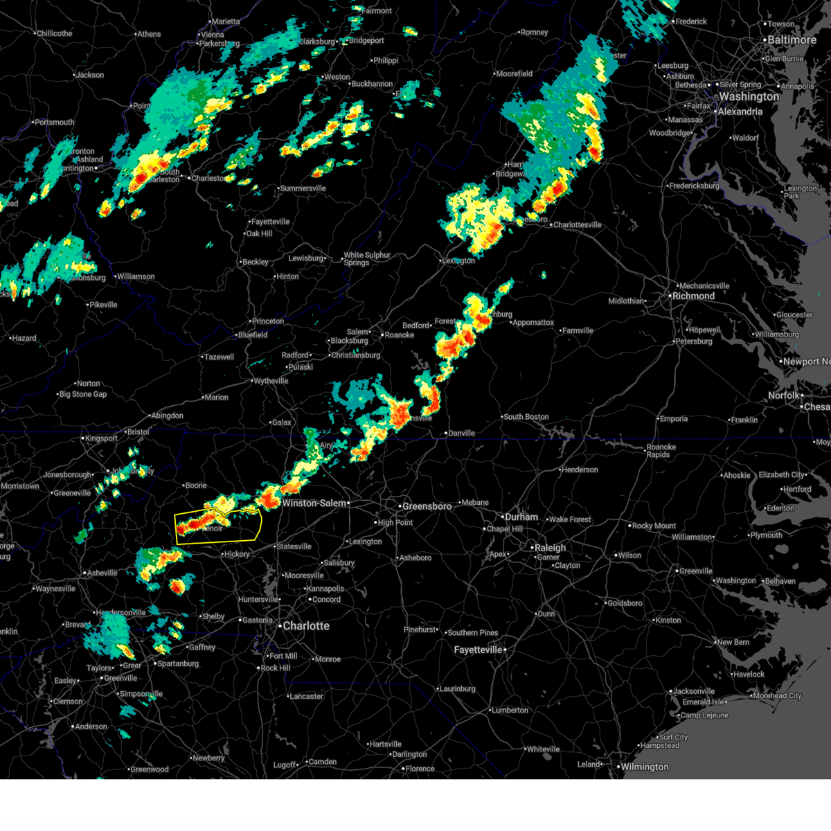
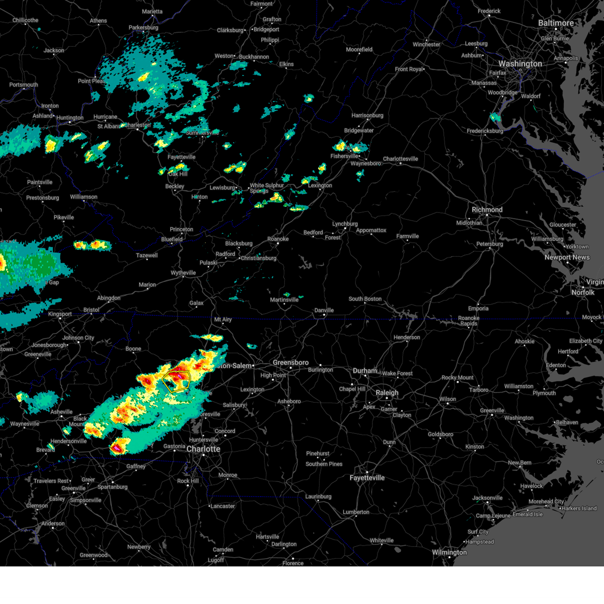
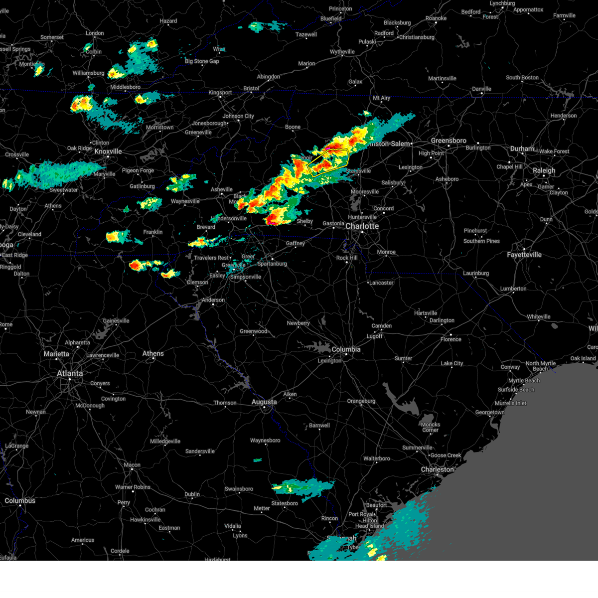
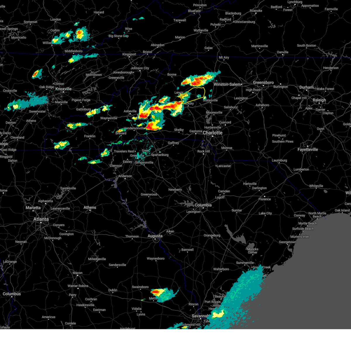
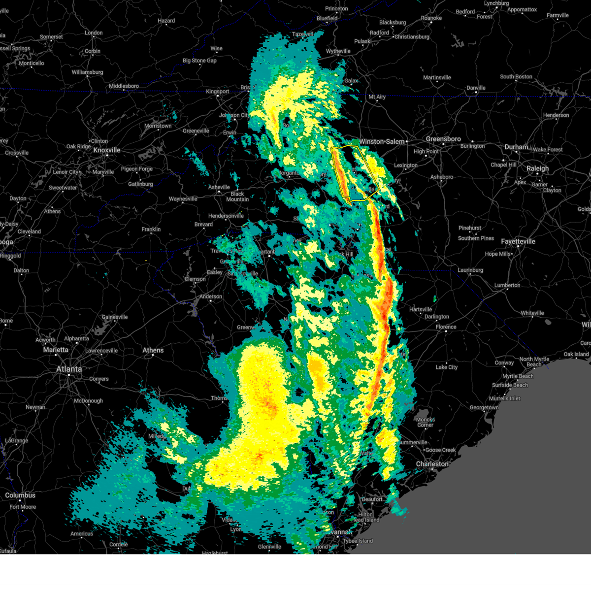
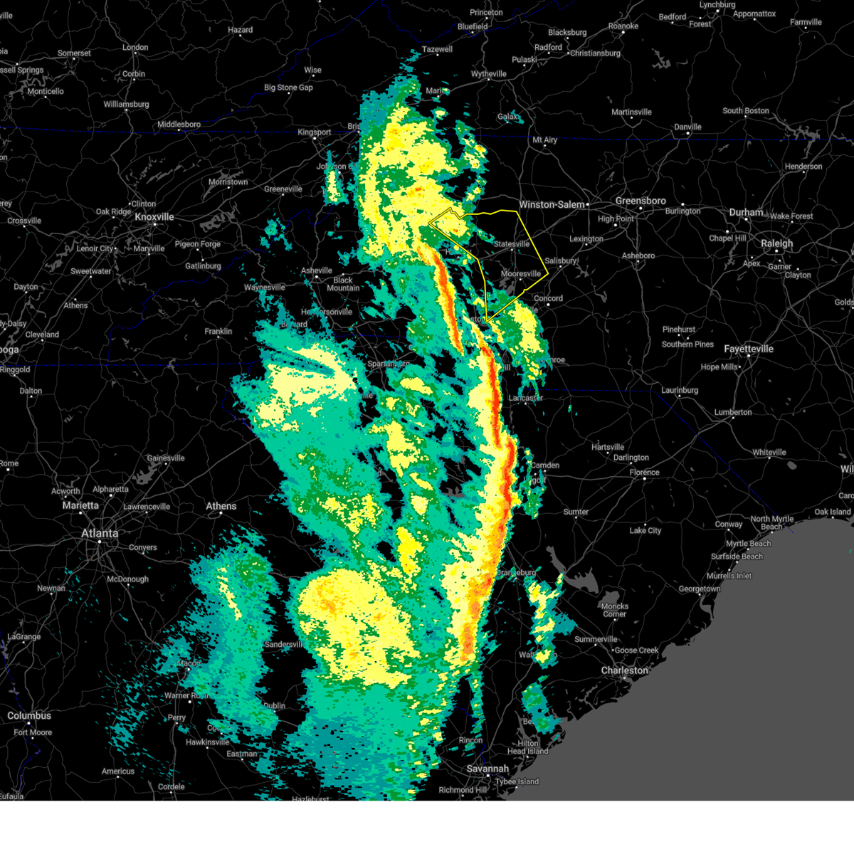
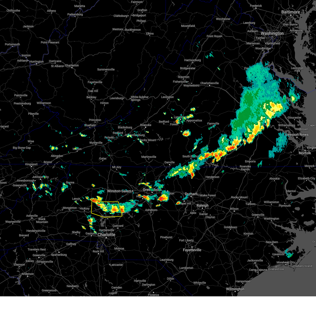
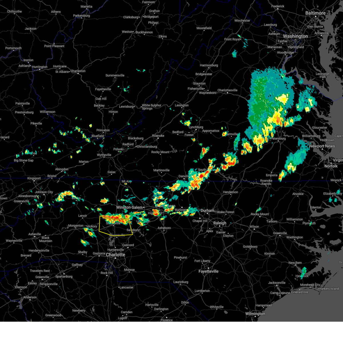
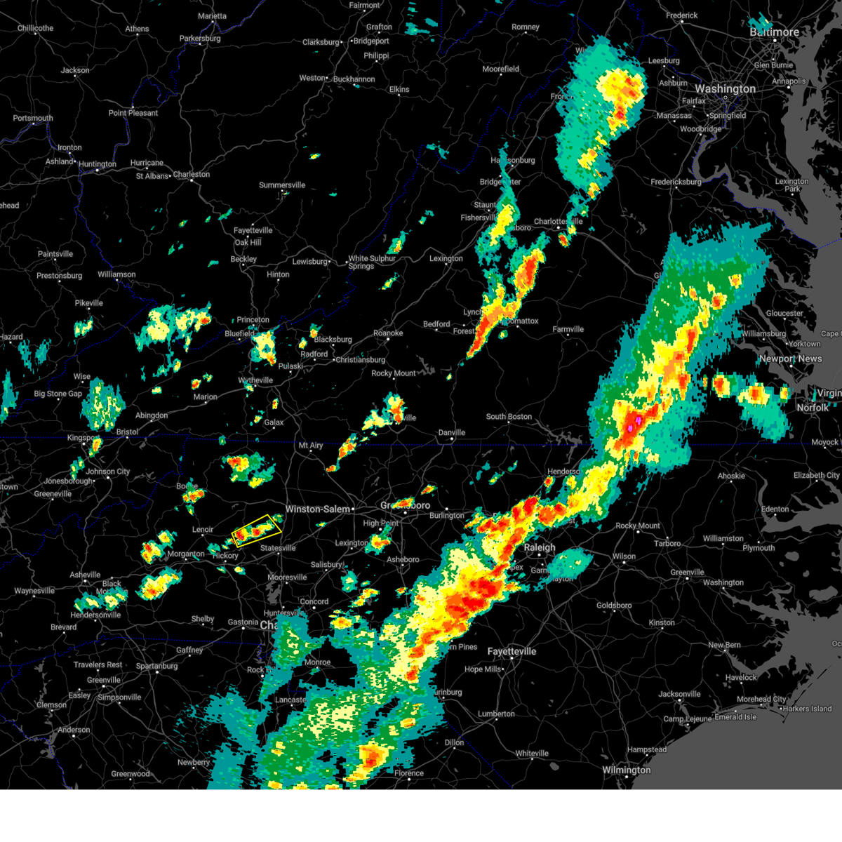
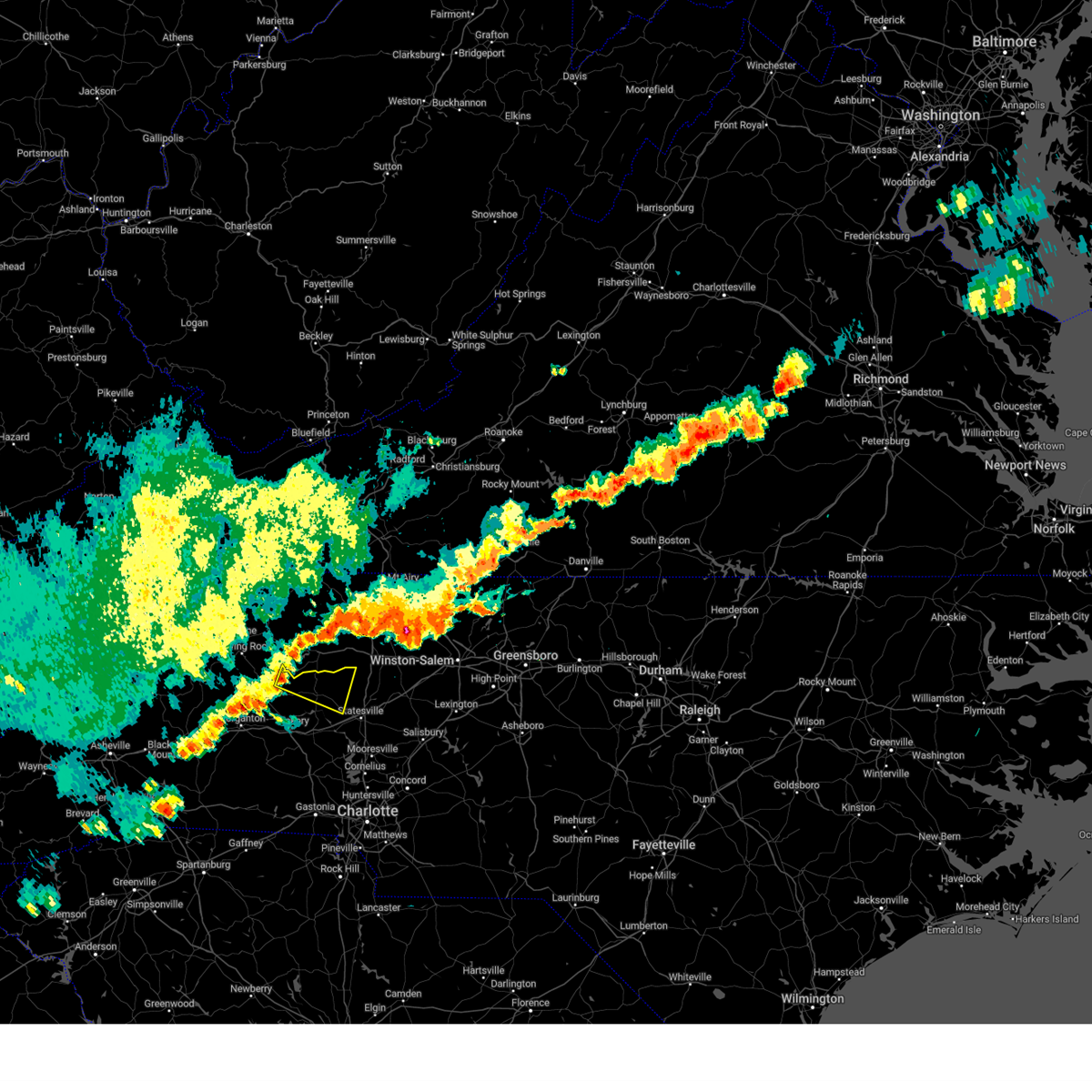
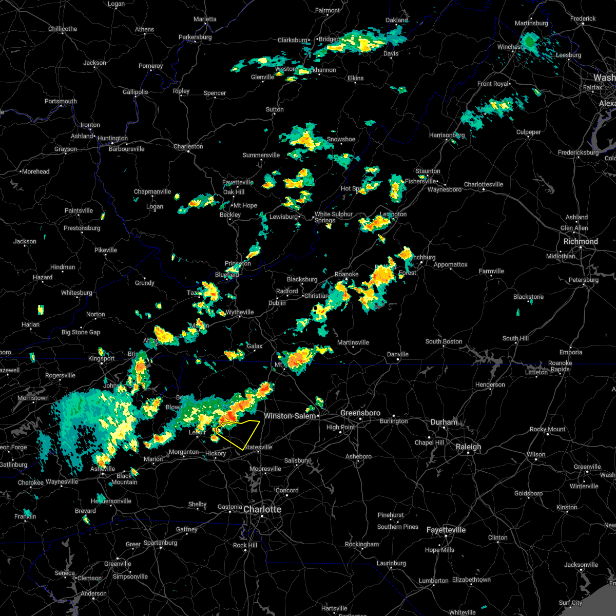
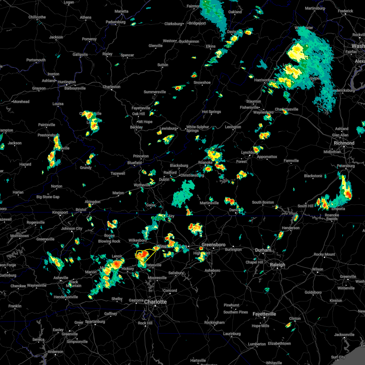
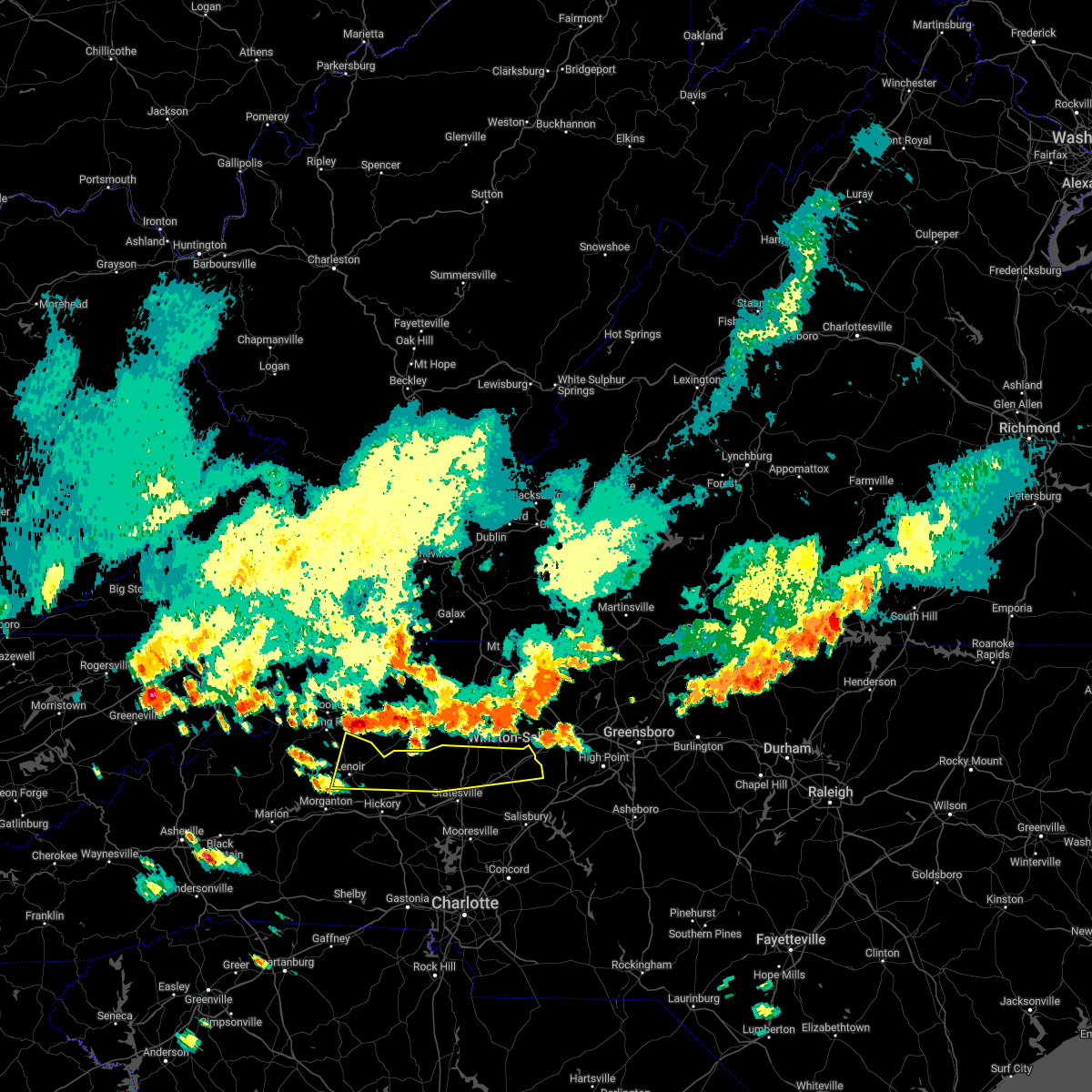
Hail Map for Hiddenite, NC
The Hiddenite, NC area has had 3 reports of on-the-ground hail by trained spotters, and has been under severe weather warnings 17 times during the past 12 months. Doppler radar has detected hail at or near Hiddenite, NC on 33 occasions, including 2 occasions during the past year.
| Name: | Hiddenite, NC |
| Where Located: | 49.1 miles NNW of Charlotte, NC |
| Map: | Google Map for Hiddenite, NC |
| Population: | 536 |
| Housing Units: | 260 |
| More Info: | Search Google for Hiddenite, NC |
1
The Top Recent Hail Date for Hiddenite, NC is Monday, August 19, 2024 (7th out of 33)

Hail and Wind Damage Spotted near Hiddenite, NC
| Date / Time | Report Details |
|---|---|
| 6/19/2025 4:09 PM EDT | Svrgsp the national weather service in greenville-spartanburg has issued a * severe thunderstorm warning for, northwestern davie county in the piedmont of north carolina, central alexander county in the piedmont of north carolina, northern iredell county in the piedmont of north carolina, * until 515 pm edt. * at 408 pm edt, a severe thunderstorm was located 14 miles north of statesville, or 4 miles east of love valley, moving northeast at 30 mph (radar indicated). Hazards include 60 mph wind gusts and penny size hail. expect damage to trees and power lines |
| 6/19/2025 3:55 PM EDT | The storm which prompted the warning has weakened below severe limits, and no longer poses an immediate threat to life or property. therefore, the warning will be allowed to expire. however, gusty winds and heavy rain are still possible with this thunderstorm. |
| 6/19/2025 3:32 PM EDT | At 332 pm edt, a severe thunderstorm was located near lenoir, moving east at 15 mph (radar indicated). Hazards include 60 mph wind gusts and penny size hail. Expect damage to trees and power lines. Locations impacted include, lenoir, taylorsville, sawmills, gamewell, hudson, cajah's mountain, stony point, cedar rock, hiddenite, and little river in alexander county. |
| 6/19/2025 3:07 PM EDT |
 Svrgsp the national weather service in greenville-spartanburg has issued a * severe thunderstorm warning for, alexander county in the piedmont of north carolina, caldwell county in western north carolina, central burke county in western north carolina, * until 400 pm edt. * at 307 pm edt, a severe thunderstorm was located near lenoir, moving east at 25 mph (radar indicated). Hazards include 60 mph wind gusts and penny size hail. expect damage to trees and power lines Svrgsp the national weather service in greenville-spartanburg has issued a * severe thunderstorm warning for, alexander county in the piedmont of north carolina, caldwell county in western north carolina, central burke county in western north carolina, * until 400 pm edt. * at 307 pm edt, a severe thunderstorm was located near lenoir, moving east at 25 mph (radar indicated). Hazards include 60 mph wind gusts and penny size hail. expect damage to trees and power lines
|
| 5/8/2025 5:33 PM EDT |
 the severe thunderstorm warning has been cancelled and is no longer in effect the severe thunderstorm warning has been cancelled and is no longer in effect
|
| 5/8/2025 5:33 PM EDT |
 At 533 pm edt, a severe thunderstorm was located 4 miles north of taylorsville, moving east at 15 mph (radar indicated). Hazards include 60 mph wind gusts and half dollar size hail. Minor hail damage to vehicles is expected. expect wind damage to trees and power lines. Locations impacted include, vashti, hiddenite, millersville, ellendale, taylorsville, and stony point. At 533 pm edt, a severe thunderstorm was located 4 miles north of taylorsville, moving east at 15 mph (radar indicated). Hazards include 60 mph wind gusts and half dollar size hail. Minor hail damage to vehicles is expected. expect wind damage to trees and power lines. Locations impacted include, vashti, hiddenite, millersville, ellendale, taylorsville, and stony point.
|
| 5/8/2025 5:24 PM EDT |
 At 523 pm edt, a severe thunderstorm was located 6 miles west of taylorsville, or 5 miles north of bethlehem, moving northeast at 25 mph (radar indicated). Hazards include 60 mph wind gusts and penny size hail. Expect damage to trees and power lines. Locations impacted include, hiddenite, granite falls, little river in alexander county, bethlehem, hudson, rhodhiss, millersville, ellendale, vashti, and taylorsville. At 523 pm edt, a severe thunderstorm was located 6 miles west of taylorsville, or 5 miles north of bethlehem, moving northeast at 25 mph (radar indicated). Hazards include 60 mph wind gusts and penny size hail. Expect damage to trees and power lines. Locations impacted include, hiddenite, granite falls, little river in alexander county, bethlehem, hudson, rhodhiss, millersville, ellendale, vashti, and taylorsville.
|
| 5/8/2025 5:01 PM EDT |
 Svrgsp the national weather service in greenville-spartanburg has issued a * severe thunderstorm warning for, alexander county in the piedmont of north carolina, southeastern caldwell county in western north carolina, * until 600 pm edt. * at 501 pm edt, a severe thunderstorm was located 8 miles north of hickory, or 4 miles northeast of granite falls, moving northeast at 30 mph (radar indicated). Hazards include 60 mph wind gusts and quarter size hail. Minor hail damage to vehicles is expected. Expect wind damage to trees and power lines. Svrgsp the national weather service in greenville-spartanburg has issued a * severe thunderstorm warning for, alexander county in the piedmont of north carolina, southeastern caldwell county in western north carolina, * until 600 pm edt. * at 501 pm edt, a severe thunderstorm was located 8 miles north of hickory, or 4 miles northeast of granite falls, moving northeast at 30 mph (radar indicated). Hazards include 60 mph wind gusts and quarter size hail. Minor hail damage to vehicles is expected. Expect wind damage to trees and power lines.
|
| 12/29/2024 9:48 AM EST |
 At 947 am est, severe thunderstorms were located along a line extending from near wilkesboro to 8 miles northeast of taylorsville to 8 miles south of statesville to 3 miles north of uptown charlotte, moving northeast at 45 mph (radar indicated). Hazards include 60 mph wind gusts. Expect damage to trees and power lines. Locations impacted include, statesville, mooresville, troutman, stony point, cleveland, catawba, love valley, lake norman, lake norman state park, and lookout shoals lake. At 947 am est, severe thunderstorms were located along a line extending from near wilkesboro to 8 miles northeast of taylorsville to 8 miles south of statesville to 3 miles north of uptown charlotte, moving northeast at 45 mph (radar indicated). Hazards include 60 mph wind gusts. Expect damage to trees and power lines. Locations impacted include, statesville, mooresville, troutman, stony point, cleveland, catawba, love valley, lake norman, lake norman state park, and lookout shoals lake.
|
| 12/29/2024 9:48 AM EST |
 the severe thunderstorm warning has been cancelled and is no longer in effect the severe thunderstorm warning has been cancelled and is no longer in effect
|
| 12/29/2024 9:45 AM EST | Tree blocking vashti cemetary roa in alexander county NC, 6.6 miles SSE of Hiddenite, NC |
| 12/29/2024 9:11 AM EST |
 Svrgsp the national weather service in greenville-spartanburg has issued a * severe thunderstorm warning for, eastern catawba county in the piedmont of north carolina, alexander county in the piedmont of north carolina, eastern lincoln county in the piedmont of north carolina, iredell county in the piedmont of north carolina, northeastern caldwell county in western north carolina, northwestern mecklenburg county in the piedmont of north carolina, western rowan county in the piedmont of north carolina, northeastern gaston county in the piedmont of north carolina, * until 1030 am est. * at 911 am est, severe thunderstorms were located along a line extending from 4 miles southwest of lenoir to 5 miles west of hickory to 4 miles southwest of lincolnton to 3 miles north of york, moving northeast at 45 mph (radar indicated). Hazards include 60 mph wind gusts. expect damage to trees and power lines Svrgsp the national weather service in greenville-spartanburg has issued a * severe thunderstorm warning for, eastern catawba county in the piedmont of north carolina, alexander county in the piedmont of north carolina, eastern lincoln county in the piedmont of north carolina, iredell county in the piedmont of north carolina, northeastern caldwell county in western north carolina, northwestern mecklenburg county in the piedmont of north carolina, western rowan county in the piedmont of north carolina, northeastern gaston county in the piedmont of north carolina, * until 1030 am est. * at 911 am est, severe thunderstorms were located along a line extending from 4 miles southwest of lenoir to 5 miles west of hickory to 4 miles southwest of lincolnton to 3 miles north of york, moving northeast at 45 mph (radar indicated). Hazards include 60 mph wind gusts. expect damage to trees and power lines
|
| 8/19/2024 4:45 PM EDT |
 The storms which prompted the warning have weakened below severe limits, and no longer pose an immediate threat to life or property. therefore, the warning has been allowed to expire. however, gusty winds and heavy rain are still possible with these thunderstorms. to report severe weather to the national weather service greenville-spartanburg, call toll free, 1, 800, 2 6 7, 8 1 0 1, or post on our facebook page, or tweet it using hashtag nwsgsp. your message should describe the event and the specific location where it occurred. The storms which prompted the warning have weakened below severe limits, and no longer pose an immediate threat to life or property. therefore, the warning has been allowed to expire. however, gusty winds and heavy rain are still possible with these thunderstorms. to report severe weather to the national weather service greenville-spartanburg, call toll free, 1, 800, 2 6 7, 8 1 0 1, or post on our facebook page, or tweet it using hashtag nwsgsp. your message should describe the event and the specific location where it occurred.
|
| 8/19/2024 4:23 PM EDT | Trees and lines down at cheatham ford rd and lawzyday farm dr. time estimate in alexander county NC, 1.8 miles NW of Hiddenite, NC |
| 8/19/2024 4:07 PM EDT |
 Svrgsp the national weather service in greenville-spartanburg has issued a * severe thunderstorm warning for, northeastern catawba county in the piedmont of north carolina, southwestern davie county in the piedmont of north carolina, southeastern alexander county in the piedmont of north carolina, central iredell county in the piedmont of north carolina, northwestern rowan county in the piedmont of north carolina, * until 445 pm edt. * at 406 pm edt, severe thunderstorms were located along a line extending from 4 miles east of taylorsville to 4 miles north of statesville to 7 miles southwest of mocksville, moving south at 20 mph (radar indicated). Hazards include 60 mph wind gusts and nickel size hail. expect damage to trees and power lines Svrgsp the national weather service in greenville-spartanburg has issued a * severe thunderstorm warning for, northeastern catawba county in the piedmont of north carolina, southwestern davie county in the piedmont of north carolina, southeastern alexander county in the piedmont of north carolina, central iredell county in the piedmont of north carolina, northwestern rowan county in the piedmont of north carolina, * until 445 pm edt. * at 406 pm edt, severe thunderstorms were located along a line extending from 4 miles east of taylorsville to 4 miles north of statesville to 7 miles southwest of mocksville, moving south at 20 mph (radar indicated). Hazards include 60 mph wind gusts and nickel size hail. expect damage to trees and power lines
|
| 8/3/2024 5:47 PM EDT | Tree down at joe lackey ln and hill river r in alexander county NC, 1.7 miles SW of Hiddenite, NC |
| 8/3/2024 5:08 PM EDT |
 Svrgsp the national weather service in greenville-spartanburg has issued a * severe thunderstorm warning for, central alexander county in the piedmont of north carolina, northwestern iredell county in the piedmont of north carolina, * until 600 pm edt. * at 508 pm edt, a severe thunderstorm was located over taylorsville, moving east at 15 mph (radar indicated). Hazards include 60 mph wind gusts. expect damage to trees and power lines Svrgsp the national weather service in greenville-spartanburg has issued a * severe thunderstorm warning for, central alexander county in the piedmont of north carolina, northwestern iredell county in the piedmont of north carolina, * until 600 pm edt. * at 508 pm edt, a severe thunderstorm was located over taylorsville, moving east at 15 mph (radar indicated). Hazards include 60 mph wind gusts. expect damage to trees and power lines
|
| 7/30/2024 8:22 PM EDT |
 At 822 pm edt, a severe thunderstorm was located 6 miles west of statesville, or 4 miles southeast of stony point, moving east at 30 mph (radar indicated). Hazards include 60 mph wind gusts and penny size hail. Expect damage to trees and power lines. Locations impacted include, statesville, troutman, stony point, claremont, catawba, harmony, lookout shoals lake, hiddenite, turnersburg, and olin. At 822 pm edt, a severe thunderstorm was located 6 miles west of statesville, or 4 miles southeast of stony point, moving east at 30 mph (radar indicated). Hazards include 60 mph wind gusts and penny size hail. Expect damage to trees and power lines. Locations impacted include, statesville, troutman, stony point, claremont, catawba, harmony, lookout shoals lake, hiddenite, turnersburg, and olin.
|
| 7/30/2024 8:22 PM EDT |
 the severe thunderstorm warning has been cancelled and is no longer in effect the severe thunderstorm warning has been cancelled and is no longer in effect
|
| 7/30/2024 7:52 PM EDT |
 Svrgsp the national weather service in greenville-spartanburg has issued a * severe thunderstorm warning for, northeastern catawba county in the piedmont of north carolina, alexander county in the piedmont of north carolina, iredell county in the piedmont of north carolina, southeastern caldwell county in western north carolina, northwestern rowan county in the piedmont of north carolina, * until 830 pm edt. * at 751 pm edt, a severe thunderstorm was located 6 miles northeast of hickory, or near bethlehem, moving east at 30 mph (radar indicated). Hazards include 60 mph wind gusts and penny size hail. expect damage to trees and power lines Svrgsp the national weather service in greenville-spartanburg has issued a * severe thunderstorm warning for, northeastern catawba county in the piedmont of north carolina, alexander county in the piedmont of north carolina, iredell county in the piedmont of north carolina, southeastern caldwell county in western north carolina, northwestern rowan county in the piedmont of north carolina, * until 830 pm edt. * at 751 pm edt, a severe thunderstorm was located 6 miles northeast of hickory, or near bethlehem, moving east at 30 mph (radar indicated). Hazards include 60 mph wind gusts and penny size hail. expect damage to trees and power lines
|
| 7/17/2024 3:40 PM EDT | Tree down on vashti r in alexander county NC, 5.9 miles S of Hiddenite, NC |
| 7/17/2024 3:19 PM EDT | Tree down on poplar springs r in alexander county NC, 6.2 miles SW of Hiddenite, NC |
| 5/26/2024 8:37 PM EDT |
 Svrgsp the national weather service in greenville-spartanburg has issued a * severe thunderstorm warning for, northeastern catawba county in the piedmont of north carolina, davie county in the piedmont of north carolina, alexander county in the piedmont of north carolina, iredell county in the piedmont of north carolina, southeastern caldwell county in western north carolina, western rowan county in the piedmont of north carolina, * until 930 pm edt. * at 837 pm edt, a severe thunderstorm was located 9 miles east of taylorsville, or near stony point, moving east at 40 mph (radar indicated). Hazards include 60 mph wind gusts and penny size hail. expect damage to trees and power lines Svrgsp the national weather service in greenville-spartanburg has issued a * severe thunderstorm warning for, northeastern catawba county in the piedmont of north carolina, davie county in the piedmont of north carolina, alexander county in the piedmont of north carolina, iredell county in the piedmont of north carolina, southeastern caldwell county in western north carolina, western rowan county in the piedmont of north carolina, * until 930 pm edt. * at 837 pm edt, a severe thunderstorm was located 9 miles east of taylorsville, or near stony point, moving east at 40 mph (radar indicated). Hazards include 60 mph wind gusts and penny size hail. expect damage to trees and power lines
|
| 5/7/2024 6:43 PM EDT |
 Svrgsp the national weather service in greenville-spartanburg has issued a * severe thunderstorm warning for, southeastern alexander county in the piedmont of north carolina, west central iredell county in the piedmont of north carolina, * until 730 pm edt. * at 642 pm edt, a severe thunderstorm was located 5 miles southeast of taylorsville, or near stony point, moving southeast at 10 mph (radar indicated). Hazards include 60 mph wind gusts and quarter size hail. Minor hail damage to vehicles is expected. Expect wind damage to trees and power lines. Svrgsp the national weather service in greenville-spartanburg has issued a * severe thunderstorm warning for, southeastern alexander county in the piedmont of north carolina, west central iredell county in the piedmont of north carolina, * until 730 pm edt. * at 642 pm edt, a severe thunderstorm was located 5 miles southeast of taylorsville, or near stony point, moving southeast at 10 mph (radar indicated). Hazards include 60 mph wind gusts and quarter size hail. Minor hail damage to vehicles is expected. Expect wind damage to trees and power lines.
|
| 5/7/2024 6:25 PM EDT |
 At 625 pm edt, a severe thunderstorm was located 4 miles east of taylorsville, or near stony point, moving southeast at 15 mph (radar indicated). Hazards include 60 mph wind gusts and quarter size hail. Minor hail damage to vehicles is expected. expect wind damage to trees and power lines. Locations impacted include, taylorsville, stony point, hiddenite, millersville, and lake hickory. At 625 pm edt, a severe thunderstorm was located 4 miles east of taylorsville, or near stony point, moving southeast at 15 mph (radar indicated). Hazards include 60 mph wind gusts and quarter size hail. Minor hail damage to vehicles is expected. expect wind damage to trees and power lines. Locations impacted include, taylorsville, stony point, hiddenite, millersville, and lake hickory.
|
| 5/7/2024 6:04 PM EDT |
 At 604 pm edt, a severe thunderstorm was located near taylorsville, moving southeast at 15 mph (radar indicated). Hazards include 60 mph wind gusts and quarter size hail. Minor hail damage to vehicles is expected. expect wind damage to trees and power lines. Locations impacted include, taylorsville, stony point, vashti, hiddenite, millersville, and lake hickory. At 604 pm edt, a severe thunderstorm was located near taylorsville, moving southeast at 15 mph (radar indicated). Hazards include 60 mph wind gusts and quarter size hail. Minor hail damage to vehicles is expected. expect wind damage to trees and power lines. Locations impacted include, taylorsville, stony point, vashti, hiddenite, millersville, and lake hickory.
|
| 5/7/2024 5:40 PM EDT |
 Svrgsp the national weather service in greenville-spartanburg has issued a * severe thunderstorm warning for, alexander county in the piedmont of north carolina, * until 645 pm edt. * at 540 pm edt, a severe thunderstorm was located 6 miles south of boomer, moving southeast at 15 mph (radar indicated). Hazards include golf ball size hail and 60 mph wind gusts. People and animals outdoors will be injured. expect hail damage to roofs, siding, windows, and vehicles. Expect wind damage to trees and power lines. Svrgsp the national weather service in greenville-spartanburg has issued a * severe thunderstorm warning for, alexander county in the piedmont of north carolina, * until 645 pm edt. * at 540 pm edt, a severe thunderstorm was located 6 miles south of boomer, moving southeast at 15 mph (radar indicated). Hazards include golf ball size hail and 60 mph wind gusts. People and animals outdoors will be injured. expect hail damage to roofs, siding, windows, and vehicles. Expect wind damage to trees and power lines.
|
| 4/11/2024 7:25 PM EDT |
 The storm which prompted the warning has moved out of the area. therefore, the warning will be allowed to expire. a tornado watch remains in effect until 1100 pm edt for the piedmont of north carolina. The storm which prompted the warning has moved out of the area. therefore, the warning will be allowed to expire. a tornado watch remains in effect until 1100 pm edt for the piedmont of north carolina.
|
| 4/11/2024 7:13 PM EDT | Trees blocking roadway on sulphur springs roa in alexander county NC, 1.7 miles S of Hiddenite, NC |
| 4/11/2024 7:06 PM EDT |
 At 705 pm edt, a severe thunderstorm capable of producing a tornado was located 7 miles west of statesville, or 5 miles east of lookout shoals lake, moving northeast at 30 mph (radar indicated rotation). Hazards include tornado and quarter size hail. Flying debris will be dangerous to those caught without shelter. mobile homes will be damaged or destroyed. damage to roofs, windows, and vehicles will occur. tree damage is likely. This tornadic thunderstorm will remain over mainly rural areas of eastern catawba, southeastern alexander and west central iredell counties, including the following locations, hiddenite, scotts, and bandys. At 705 pm edt, a severe thunderstorm capable of producing a tornado was located 7 miles west of statesville, or 5 miles east of lookout shoals lake, moving northeast at 30 mph (radar indicated rotation). Hazards include tornado and quarter size hail. Flying debris will be dangerous to those caught without shelter. mobile homes will be damaged or destroyed. damage to roofs, windows, and vehicles will occur. tree damage is likely. This tornadic thunderstorm will remain over mainly rural areas of eastern catawba, southeastern alexander and west central iredell counties, including the following locations, hiddenite, scotts, and bandys.
|
| 4/11/2024 7:00 PM EDT |
 Svrgsp the national weather service in greenville-spartanburg has issued a * severe thunderstorm warning for, alexander county in the piedmont of north carolina, northern iredell county in the piedmont of north carolina, * until 745 pm edt. * at 700 pm edt, severe thunderstorms were located along a line extending from near boomer to near taylorsville to 5 miles north of newton, moving northeast at 50 mph (radar indicated). Hazards include 60 mph wind gusts and nickel size hail. expect damage to trees and power lines Svrgsp the national weather service in greenville-spartanburg has issued a * severe thunderstorm warning for, alexander county in the piedmont of north carolina, northern iredell county in the piedmont of north carolina, * until 745 pm edt. * at 700 pm edt, severe thunderstorms were located along a line extending from near boomer to near taylorsville to 5 miles north of newton, moving northeast at 50 mph (radar indicated). Hazards include 60 mph wind gusts and nickel size hail. expect damage to trees and power lines
|
| 4/11/2024 6:45 PM EDT |
 At 645 pm edt, a severe thunderstorm was located 4 miles east of newton, or near claremont, moving northeast at 30 mph (radar indicated). Hazards include 60 mph wind gusts and quarter size hail. Minor hail damage to vehicles is expected. expect wind damage to trees and power lines. Locations impacted include, statesville, newton, conover, maiden, stony point, claremont, catawba, lookout shoals lake, hiddenite, and bandys. At 645 pm edt, a severe thunderstorm was located 4 miles east of newton, or near claremont, moving northeast at 30 mph (radar indicated). Hazards include 60 mph wind gusts and quarter size hail. Minor hail damage to vehicles is expected. expect wind damage to trees and power lines. Locations impacted include, statesville, newton, conover, maiden, stony point, claremont, catawba, lookout shoals lake, hiddenite, and bandys.
|
| 4/11/2024 6:45 PM EDT |
 the severe thunderstorm warning has been cancelled and is no longer in effect the severe thunderstorm warning has been cancelled and is no longer in effect
|
| 4/11/2024 6:37 PM EDT |
 Torgsp the national weather service in greenville-spartanburg has issued a * tornado warning for, eastern catawba county in the piedmont of north carolina, southeastern alexander county in the piedmont of north carolina, west central iredell county in the piedmont of north carolina, * until 730 pm edt. * at 637 pm edt, a severe thunderstorm capable of producing a tornado was located 4 miles southeast of newton, or near maiden, moving northeast at 30 mph (radar indicated rotation). Hazards include tornado and quarter size hail. Flying debris will be dangerous to those caught without shelter. mobile homes will be damaged or destroyed. damage to roofs, windows, and vehicles will occur. tree damage is likely. this dangerous storm will be near, catawba around 650 pm edt. Other locations impacted by this dangerous thunderstorm include hiddenite, scotts, and bandys. Torgsp the national weather service in greenville-spartanburg has issued a * tornado warning for, eastern catawba county in the piedmont of north carolina, southeastern alexander county in the piedmont of north carolina, west central iredell county in the piedmont of north carolina, * until 730 pm edt. * at 637 pm edt, a severe thunderstorm capable of producing a tornado was located 4 miles southeast of newton, or near maiden, moving northeast at 30 mph (radar indicated rotation). Hazards include tornado and quarter size hail. Flying debris will be dangerous to those caught without shelter. mobile homes will be damaged or destroyed. damage to roofs, windows, and vehicles will occur. tree damage is likely. this dangerous storm will be near, catawba around 650 pm edt. Other locations impacted by this dangerous thunderstorm include hiddenite, scotts, and bandys.
|
| 4/11/2024 6:33 PM EDT |
 Svrgsp the national weather service in greenville-spartanburg has issued a * severe thunderstorm warning for, central catawba county in the piedmont of north carolina, southeastern alexander county in the piedmont of north carolina, northeastern lincoln county in the piedmont of north carolina, west central iredell county in the piedmont of north carolina, * until 715 pm edt. * at 633 pm edt, a severe thunderstorm was located 5 miles south of newton, or over maiden, moving northeast at 30 mph (radar indicated). Hazards include 60 mph wind gusts and quarter size hail. Minor hail damage to vehicles is expected. Expect wind damage to trees and power lines. Svrgsp the national weather service in greenville-spartanburg has issued a * severe thunderstorm warning for, central catawba county in the piedmont of north carolina, southeastern alexander county in the piedmont of north carolina, northeastern lincoln county in the piedmont of north carolina, west central iredell county in the piedmont of north carolina, * until 715 pm edt. * at 633 pm edt, a severe thunderstorm was located 5 miles south of newton, or over maiden, moving northeast at 30 mph (radar indicated). Hazards include 60 mph wind gusts and quarter size hail. Minor hail damage to vehicles is expected. Expect wind damage to trees and power lines.
|
| 8/27/2023 4:29 PM EDT |
 At 429 pm edt, a severe thunderstorm was located 8 miles southeast of taylorsville, or near stony point, moving east at 15 mph (radar indicated). Hazards include 60 mph wind gusts. expect damage to trees and power lines At 429 pm edt, a severe thunderstorm was located 8 miles southeast of taylorsville, or near stony point, moving east at 15 mph (radar indicated). Hazards include 60 mph wind gusts. expect damage to trees and power lines
|
| 8/27/2023 4:03 PM EDT |
 At 402 pm edt, a severe thunderstorm was located near taylorsville, moving east at 15 mph (radar indicated). Hazards include 60 mph wind gusts. Expect damage to trees and power lines. locations impacted include, taylorsville, bethlehem, stony point, hiddenite, little river in alexander county, vashti, millersville, ellendale, oxford and lake hickory. hail threat, radar indicated max hail size, <. 75 in wind threat, radar indicated max wind gust, 60 mph. At 402 pm edt, a severe thunderstorm was located near taylorsville, moving east at 15 mph (radar indicated). Hazards include 60 mph wind gusts. Expect damage to trees and power lines. locations impacted include, taylorsville, bethlehem, stony point, hiddenite, little river in alexander county, vashti, millersville, ellendale, oxford and lake hickory. hail threat, radar indicated max hail size, <. 75 in wind threat, radar indicated max wind gust, 60 mph.
|
| 8/27/2023 3:40 PM EDT |
 At 340 pm edt, a severe thunderstorm was located 8 miles west of taylorsville, or 6 miles north of bethlehem, moving east at 15 mph (radar indicated). Hazards include 60 mph wind gusts. expect damage to trees and power lines At 340 pm edt, a severe thunderstorm was located 8 miles west of taylorsville, or 6 miles north of bethlehem, moving east at 15 mph (radar indicated). Hazards include 60 mph wind gusts. expect damage to trees and power lines
|
| 8/7/2023 4:52 PM EDT |
 At 451 pm edt, severe thunderstorms were located along a line extending from 6 miles northwest of statesville to 12 miles southeast of newton to 7 miles southeast of lincolnton, moving east at 50 mph (radar indicated). Hazards include 70 mph wind gusts and quarter size hail. Minor hail damage to vehicles is expected. expect considerable tree damage. Wind damage is also likely to mobile homes, roofs, and outbuildings. At 451 pm edt, severe thunderstorms were located along a line extending from 6 miles northwest of statesville to 12 miles southeast of newton to 7 miles southeast of lincolnton, moving east at 50 mph (radar indicated). Hazards include 70 mph wind gusts and quarter size hail. Minor hail damage to vehicles is expected. expect considerable tree damage. Wind damage is also likely to mobile homes, roofs, and outbuildings.
|
| 8/7/2023 4:42 PM EDT |
 At 440 pm edt, severe thunderstorms were located along a line extending from 8 miles south of taylorsville to 5 miles southeast of newton to near lincolnton, moving southeast at 75 mph. these are destructive storms for eastern catawba and lincoln counties (radar indicated). Hazards include 80 mph wind gusts and quarter size hail. Flying debris will be dangerous to those caught without shelter. mobile homes will be heavily damaged. expect considerable damage to roofs, windows, and vehicles. extensive tree damage and power outages are likely. locations impacted include, hickory, newton, lincolnton, taylorsville, st. stephens, conover, longview, bethlehem, maiden and hildebran. thunderstorm damage threat, destructive hail threat, radar indicated max hail size, 1. 00 in wind threat, radar indicated max wind gust, 80 mph. At 440 pm edt, severe thunderstorms were located along a line extending from 8 miles south of taylorsville to 5 miles southeast of newton to near lincolnton, moving southeast at 75 mph. these are destructive storms for eastern catawba and lincoln counties (radar indicated). Hazards include 80 mph wind gusts and quarter size hail. Flying debris will be dangerous to those caught without shelter. mobile homes will be heavily damaged. expect considerable damage to roofs, windows, and vehicles. extensive tree damage and power outages are likely. locations impacted include, hickory, newton, lincolnton, taylorsville, st. stephens, conover, longview, bethlehem, maiden and hildebran. thunderstorm damage threat, destructive hail threat, radar indicated max hail size, 1. 00 in wind threat, radar indicated max wind gust, 80 mph.
|
| 8/7/2023 4:40 PM EDT | Power lines down on roadwa in alexander county NC, 2 miles NNW of Hiddenite, NC |
| 8/7/2023 4:35 PM EDT | Powerlines dow in alexander county NC, 2 miles WNW of Hiddenite, NC |
| 8/7/2023 4:32 PM EDT | Power lines and trees dow in alexander county NC, 3.2 miles NE of Hiddenite, NC |
| 8/7/2023 4:29 PM EDT |
 At 429 pm edt, severe thunderstorms were located along a line extending from 7 miles west of taylorsville to 13 miles west of lincolnton, moving east at 35 mph (radar indicated). Hazards include 70 mph wind gusts and quarter size hail. Minor hail damage to vehicles is expected. expect considerable tree damage. Wind damage is also likely to mobile homes, roofs, and outbuildings. At 429 pm edt, severe thunderstorms were located along a line extending from 7 miles west of taylorsville to 13 miles west of lincolnton, moving east at 35 mph (radar indicated). Hazards include 70 mph wind gusts and quarter size hail. Minor hail damage to vehicles is expected. expect considerable tree damage. Wind damage is also likely to mobile homes, roofs, and outbuildings.
|
| 8/7/2023 4:24 PM EDT |
 At 424 pm edt, severe thunderstorms were located along a line extending from 5 miles southwest of taylorsville to 6 miles south of hickory to 15 miles southeast of morganton, moving east at 45 mph (radar indicated). Hazards include 70 mph wind gusts. Expect considerable tree damage. damage is likely to mobile homes, roofs, and outbuildings. locations impacted include, hickory, lenoir, morganton, taylorsville, st. stephens, conover, longview, sawmills, granite falls and valdese. thunderstorm damage threat, considerable hail threat, radar indicated max hail size, <. 75 in wind threat, radar indicated max wind gust, 70 mph. At 424 pm edt, severe thunderstorms were located along a line extending from 5 miles southwest of taylorsville to 6 miles south of hickory to 15 miles southeast of morganton, moving east at 45 mph (radar indicated). Hazards include 70 mph wind gusts. Expect considerable tree damage. damage is likely to mobile homes, roofs, and outbuildings. locations impacted include, hickory, lenoir, morganton, taylorsville, st. stephens, conover, longview, sawmills, granite falls and valdese. thunderstorm damage threat, considerable hail threat, radar indicated max hail size, <. 75 in wind threat, radar indicated max wind gust, 70 mph.
|
| 8/7/2023 4:04 PM EDT |
 At 404 pm edt, severe thunderstorms were located along a line extending from 4 miles northwest of lenoir to near morganton to 7 miles southeast of marion, moving east at 45 mph (radar indicated). Hazards include 70 mph wind gusts. Expect considerable tree damage. Damage is likely to mobile homes, roofs, and outbuildings. At 404 pm edt, severe thunderstorms were located along a line extending from 4 miles northwest of lenoir to near morganton to 7 miles southeast of marion, moving east at 45 mph (radar indicated). Hazards include 70 mph wind gusts. Expect considerable tree damage. Damage is likely to mobile homes, roofs, and outbuildings.
|
| 7/29/2023 7:03 PM EDT |
 At 703 pm edt, a severe thunderstorm was located 7 miles southwest of boomer, or 5 miles southeast of elkville, moving east at 20 mph (radar indicated). Hazards include 60 mph wind gusts and nickel size hail. expect damage to trees and power lines At 703 pm edt, a severe thunderstorm was located 7 miles southwest of boomer, or 5 miles southeast of elkville, moving east at 20 mph (radar indicated). Hazards include 60 mph wind gusts and nickel size hail. expect damage to trees and power lines
|
| 7/28/2023 4:31 PM EDT |
 At 430 pm edt, a severe thunderstorm was located 10 miles northwest of statesville, or 4 miles northeast of stony point, moving east at 5 mph (radar indicated). Hazards include 60 mph wind gusts and nickel size hail. expect damage to trees and power lines At 430 pm edt, a severe thunderstorm was located 10 miles northwest of statesville, or 4 miles northeast of stony point, moving east at 5 mph (radar indicated). Hazards include 60 mph wind gusts and nickel size hail. expect damage to trees and power lines
|
| 7/23/2023 4:49 PM EDT |
 At 448 pm edt, a severe thunderstorm was located near boomer, moving east at 15 mph (radar indicated). Hazards include 60 mph wind gusts and quarter size hail. Minor hail damage to vehicles is expected. expect wind damage to trees and power lines. locations impacted include, taylorsville, vashti, hiddenite, ellendale and kings creek. hail threat, radar indicated max hail size, 1. 00 in wind threat, radar indicated max wind gust, 60 mph. At 448 pm edt, a severe thunderstorm was located near boomer, moving east at 15 mph (radar indicated). Hazards include 60 mph wind gusts and quarter size hail. Minor hail damage to vehicles is expected. expect wind damage to trees and power lines. locations impacted include, taylorsville, vashti, hiddenite, ellendale and kings creek. hail threat, radar indicated max hail size, 1. 00 in wind threat, radar indicated max wind gust, 60 mph.
|
| 7/23/2023 4:27 PM EDT |
 At 427 pm edt, a severe thunderstorm was located 7 miles west of boomer, or near elkville, moving east at 15 mph (radar indicated). Hazards include 60 mph wind gusts and quarter size hail. Minor hail damage to vehicles is expected. Expect wind damage to trees and power lines. At 427 pm edt, a severe thunderstorm was located 7 miles west of boomer, or near elkville, moving east at 15 mph (radar indicated). Hazards include 60 mph wind gusts and quarter size hail. Minor hail damage to vehicles is expected. Expect wind damage to trees and power lines.
|
| 4/6/2023 4:53 PM EDT |
 At 452 pm edt, a severe thunderstorm was located 7 miles northeast of taylorsville, or 4 miles west of love valley, moving east at 30 mph (trained weather spotters). Hazards include 60 mph wind gusts and quarter size hail. Minor hail damage to vehicles is expected. expect wind damage to trees and power lines. locations impacted include, love valley, vashti and hiddenite. hail threat, observed max hail size, 1. 00 in wind threat, radar indicated max wind gust, 60 mph. At 452 pm edt, a severe thunderstorm was located 7 miles northeast of taylorsville, or 4 miles west of love valley, moving east at 30 mph (trained weather spotters). Hazards include 60 mph wind gusts and quarter size hail. Minor hail damage to vehicles is expected. expect wind damage to trees and power lines. locations impacted include, love valley, vashti and hiddenite. hail threat, observed max hail size, 1. 00 in wind threat, radar indicated max wind gust, 60 mph.
|
| 4/6/2023 4:51 PM EDT | Quarter sized hail reported 3 miles S of Hiddenite, NC |
| 4/6/2023 4:51 PM EDT |
 At 450 pm edt, a severe thunderstorm was located 8 miles east of taylorsville, or near love valley, moving east at 40 mph (trained weather spotters). Hazards include 60 mph wind gusts and quarter size hail. Minor hail damage to vehicles is expected. Expect wind damage to trees and power lines. At 450 pm edt, a severe thunderstorm was located 8 miles east of taylorsville, or near love valley, moving east at 40 mph (trained weather spotters). Hazards include 60 mph wind gusts and quarter size hail. Minor hail damage to vehicles is expected. Expect wind damage to trees and power lines.
|
| 4/6/2023 4:38 PM EDT |
 At 438 pm edt, a severe thunderstorm was located near taylorsville, moving east at 30 mph (radar indicated). Hazards include golf ball size hail and 60 mph wind gusts. People and animals outdoors will be injured. expect hail damage to roofs, siding, windows, and vehicles. expect wind damage to trees and power lines. locations impacted include, taylorsville, love valley, vashti, hiddenite and ellendale. thunderstorm damage threat, considerable hail threat, radar indicated max hail size, 1. 75 in wind threat, radar indicated max wind gust, 60 mph. At 438 pm edt, a severe thunderstorm was located near taylorsville, moving east at 30 mph (radar indicated). Hazards include golf ball size hail and 60 mph wind gusts. People and animals outdoors will be injured. expect hail damage to roofs, siding, windows, and vehicles. expect wind damage to trees and power lines. locations impacted include, taylorsville, love valley, vashti, hiddenite and ellendale. thunderstorm damage threat, considerable hail threat, radar indicated max hail size, 1. 75 in wind threat, radar indicated max wind gust, 60 mph.
|
| 4/6/2023 4:33 PM EDT |
 At 433 pm edt, a severe thunderstorm was located 5 miles west of taylorsville, moving east at 25 mph (radar indicated). Hazards include 60 mph wind gusts and quarter size hail. Minor hail damage to vehicles is expected. expect wind damage to trees and power lines. locations impacted include, taylorsville, love valley, vashti, hiddenite, ellendale and little river in alexander county. hail threat, radar indicated max hail size, 1. 00 in wind threat, radar indicated max wind gust, 60 mph. At 433 pm edt, a severe thunderstorm was located 5 miles west of taylorsville, moving east at 25 mph (radar indicated). Hazards include 60 mph wind gusts and quarter size hail. Minor hail damage to vehicles is expected. expect wind damage to trees and power lines. locations impacted include, taylorsville, love valley, vashti, hiddenite, ellendale and little river in alexander county. hail threat, radar indicated max hail size, 1. 00 in wind threat, radar indicated max wind gust, 60 mph.
|
| 4/6/2023 4:30 PM EDT |
 At 430 pm edt, a severe thunderstorm was located 6 miles west of taylorsville, moving east at 25 mph (radar indicated). Hazards include 60 mph wind gusts. expect damage to trees and power lines At 430 pm edt, a severe thunderstorm was located 6 miles west of taylorsville, moving east at 25 mph (radar indicated). Hazards include 60 mph wind gusts. expect damage to trees and power lines
|
| 1/12/2023 5:28 PM EST |
 At 528 pm est, severe thunderstorms were located along a line extending from 14 miles south of ronda to 8 miles west of statesville, moving east at 45 mph (radar indicated). Hazards include 60 mph wind gusts and penny size hail. Expect damage to trees and power lines. locations impacted include, stony point, love valley, lookout shoals lake, hiddenite, millersville, union grove, scotts, oxford, st. stephens and lake hickory. hail threat, radar indicated max hail size, 0. 75 in wind threat, radar indicated max wind gust, 60 mph. At 528 pm est, severe thunderstorms were located along a line extending from 14 miles south of ronda to 8 miles west of statesville, moving east at 45 mph (radar indicated). Hazards include 60 mph wind gusts and penny size hail. Expect damage to trees and power lines. locations impacted include, stony point, love valley, lookout shoals lake, hiddenite, millersville, union grove, scotts, oxford, st. stephens and lake hickory. hail threat, radar indicated max hail size, 0. 75 in wind threat, radar indicated max wind gust, 60 mph.
|
| 1/12/2023 5:09 PM EST |
 At 509 pm est, severe thunderstorms were located along a line extending from near taylorsville to 3 miles northeast of hickory, moving northeast at 70 mph (radar indicated). Hazards include 60 mph wind gusts and quarter size hail. Minor hail damage to vehicles is expected. Expect wind damage to trees and power lines. At 509 pm est, severe thunderstorms were located along a line extending from near taylorsville to 3 miles northeast of hickory, moving northeast at 70 mph (radar indicated). Hazards include 60 mph wind gusts and quarter size hail. Minor hail damage to vehicles is expected. Expect wind damage to trees and power lines.
|
| 7/25/2022 4:08 PM EDT |
 The severe thunderstorm warning for northeastern catawba, southern alexander, west central iredell and southeastern caldwell counties will expire at 415 pm edt, the storm which prompted the warning has weakened below severe limits, and no longer poses an immediate threat to life or property. therefore, the warning will be allowed to expire. however, gusty winds and heavy rain are still possible with this thunderstorm. The severe thunderstorm warning for northeastern catawba, southern alexander, west central iredell and southeastern caldwell counties will expire at 415 pm edt, the storm which prompted the warning has weakened below severe limits, and no longer poses an immediate threat to life or property. therefore, the warning will be allowed to expire. however, gusty winds and heavy rain are still possible with this thunderstorm.
|
| 7/25/2022 3:52 PM EDT |
 At 351 pm edt, a severe thunderstorm was located 7 miles northeast of hickory, or near bethlehem, moving southeast at 10 mph (radar indicated). Hazards include 60 mph wind gusts and penny size hail. Expect damage to trees and power lines. locations impacted include, hickory, st. stephens, conover, bethlehem, stony point, claremont, catawba, lake hickory, lookout shoals lake and northlakes. hail threat, radar indicated max hail size, 0. 75 in wind threat, radar indicated max wind gust, 60 mph. At 351 pm edt, a severe thunderstorm was located 7 miles northeast of hickory, or near bethlehem, moving southeast at 10 mph (radar indicated). Hazards include 60 mph wind gusts and penny size hail. Expect damage to trees and power lines. locations impacted include, hickory, st. stephens, conover, bethlehem, stony point, claremont, catawba, lake hickory, lookout shoals lake and northlakes. hail threat, radar indicated max hail size, 0. 75 in wind threat, radar indicated max wind gust, 60 mph.
|
| 7/25/2022 3:35 PM EDT |
 At 335 pm edt, a severe thunderstorm was located 6 miles north of hickory, or near bethlehem, moving east at 15 mph (radar indicated). Hazards include 60 mph wind gusts and quarter size hail. Minor hail damage to vehicles is expected. Expect wind damage to trees and power lines. At 335 pm edt, a severe thunderstorm was located 6 miles north of hickory, or near bethlehem, moving east at 15 mph (radar indicated). Hazards include 60 mph wind gusts and quarter size hail. Minor hail damage to vehicles is expected. Expect wind damage to trees and power lines.
|
| 7/25/2022 2:51 PM EDT |
 The severe thunderstorm warning for alexander and northwestern iredell counties will expire at 300 pm edt, the storm which prompted the warning has weakened below severe limits, and no longer poses an immediate threat to life or property. therefore, the warning will be allowed to expire. however, gusty winds and heavy rain are still possible with this thunderstorm. The severe thunderstorm warning for alexander and northwestern iredell counties will expire at 300 pm edt, the storm which prompted the warning has weakened below severe limits, and no longer poses an immediate threat to life or property. therefore, the warning will be allowed to expire. however, gusty winds and heavy rain are still possible with this thunderstorm.
|
| 7/25/2022 2:37 PM EDT |
 At 236 pm edt, a severe thunderstorm was located 4 miles northwest of taylorsville, moving southeast at 10 mph (radar indicated). Hazards include 60 mph wind gusts and penny size hail. Expect damage to trees and power lines. locations impacted include, taylorsville, stony point, love valley, hiddenite, vashti, ellendale, scotts and millersville. hail threat, radar indicated max hail size, 0. 75 in wind threat, radar indicated max wind gust, 60 mph. At 236 pm edt, a severe thunderstorm was located 4 miles northwest of taylorsville, moving southeast at 10 mph (radar indicated). Hazards include 60 mph wind gusts and penny size hail. Expect damage to trees and power lines. locations impacted include, taylorsville, stony point, love valley, hiddenite, vashti, ellendale, scotts and millersville. hail threat, radar indicated max hail size, 0. 75 in wind threat, radar indicated max wind gust, 60 mph.
|
| 7/25/2022 2:12 PM EDT |
 At 212 pm edt, a severe thunderstorm was located near boomer, moving southeast at 15 mph (radar indicated). Hazards include 60 mph wind gusts and quarter size hail. Minor hail damage to vehicles is expected. Expect wind damage to trees and power lines. At 212 pm edt, a severe thunderstorm was located near boomer, moving southeast at 15 mph (radar indicated). Hazards include 60 mph wind gusts and quarter size hail. Minor hail damage to vehicles is expected. Expect wind damage to trees and power lines.
|
| 7/17/2022 4:07 PM EDT |
 At 407 pm edt, a severe thunderstorm was located 9 miles east of taylorsville, or near love valley, moving northeast at 10 mph (radar indicated). Hazards include 60 mph wind gusts and penny size hail. Expect damage to trees and power lines. locations impacted include, stony point, love valley, vashti, hiddenite, union grove and taylorsville. hail threat, radar indicated max hail size, 0. 75 in wind threat, radar indicated max wind gust, 60 mph. At 407 pm edt, a severe thunderstorm was located 9 miles east of taylorsville, or near love valley, moving northeast at 10 mph (radar indicated). Hazards include 60 mph wind gusts and penny size hail. Expect damage to trees and power lines. locations impacted include, stony point, love valley, vashti, hiddenite, union grove and taylorsville. hail threat, radar indicated max hail size, 0. 75 in wind threat, radar indicated max wind gust, 60 mph.
|
| 7/17/2022 3:56 PM EDT |
 At 356 pm edt, a severe thunderstorm was located 8 miles east of taylorsville, or near love valley, moving northeast at 10 mph (radar indicated). Hazards include 60 mph wind gusts and penny size hail. expect damage to trees and power lines At 356 pm edt, a severe thunderstorm was located 8 miles east of taylorsville, or near love valley, moving northeast at 10 mph (radar indicated). Hazards include 60 mph wind gusts and penny size hail. expect damage to trees and power lines
|
| 7/8/2022 9:56 PM EDT |
 The severe thunderstorm warning for central catawba and southern alexander counties will expire at 1000 pm edt, the storms which prompted the warning have weakened below severe limits, and have exited the warned area. therefore, the warning will be allowed to expire. however heavy rain is still possible with these thunderstorms. The severe thunderstorm warning for central catawba and southern alexander counties will expire at 1000 pm edt, the storms which prompted the warning have weakened below severe limits, and have exited the warned area. therefore, the warning will be allowed to expire. however heavy rain is still possible with these thunderstorms.
|
| 7/8/2022 9:43 PM EDT |
 At 942 pm edt, severe thunderstorms were located along a line extending from near taylorsville to 6 miles southwest of hickory, moving southeast at 20 mph (radar indicated). Hazards include 60 mph wind gusts and quarter size hail. Minor hail damage to vehicles is expected. expect wind damage to trees and power lines. locations impacted include, hickory, newton, taylorsville, st. stephens, conover, longview, bethlehem, stony point, claremont and mountain view. hail threat, radar indicated max hail size, 1. 00 in wind threat, radar indicated max wind gust, 60 mph. At 942 pm edt, severe thunderstorms were located along a line extending from near taylorsville to 6 miles southwest of hickory, moving southeast at 20 mph (radar indicated). Hazards include 60 mph wind gusts and quarter size hail. Minor hail damage to vehicles is expected. expect wind damage to trees and power lines. locations impacted include, hickory, newton, taylorsville, st. stephens, conover, longview, bethlehem, stony point, claremont and mountain view. hail threat, radar indicated max hail size, 1. 00 in wind threat, radar indicated max wind gust, 60 mph.
|
| 7/8/2022 9:16 PM EDT |
 At 916 pm edt, severe thunderstorms were located along a line extending from 6 miles south of boomer to 7 miles west of hickory, moving southeast at 20 mph (radar indicated). Hazards include 60 mph wind gusts and quarter size hail. Minor hail damage to vehicles is expected. Expect wind damage to trees and power lines. At 916 pm edt, severe thunderstorms were located along a line extending from 6 miles south of boomer to 7 miles west of hickory, moving southeast at 20 mph (radar indicated). Hazards include 60 mph wind gusts and quarter size hail. Minor hail damage to vehicles is expected. Expect wind damage to trees and power lines.
|
| 7/5/2022 6:26 PM EDT |
 At 626 pm edt, severe thunderstorms were located along a line extending from 8 miles northeast of mocksville to 5 miles southwest of boomer, moving southeast at 35 mph (radar indicated). Hazards include 60 mph wind gusts and quarter size hail. Minor hail damage to vehicles is expected. expect wind damage to trees and power lines. locations impacted include, mocksville, taylorsville, bermuda run, stony point, harmony, love valley, hiddenite, advance, little river in alexander county and turnersburg. hail threat, radar indicated max hail size, 1. 00 in wind threat, radar indicated max wind gust, 60 mph. At 626 pm edt, severe thunderstorms were located along a line extending from 8 miles northeast of mocksville to 5 miles southwest of boomer, moving southeast at 35 mph (radar indicated). Hazards include 60 mph wind gusts and quarter size hail. Minor hail damage to vehicles is expected. expect wind damage to trees and power lines. locations impacted include, mocksville, taylorsville, bermuda run, stony point, harmony, love valley, hiddenite, advance, little river in alexander county and turnersburg. hail threat, radar indicated max hail size, 1. 00 in wind threat, radar indicated max wind gust, 60 mph.
|
| 7/5/2022 5:51 PM EDT |
 At 550 pm edt, severe thunderstorms were located along a line extending from near east bend to 7 miles southeast of deep gap, moving south at 15 mph (radar indicated). Hazards include 60 mph wind gusts and quarter size hail. Minor hail damage to vehicles is expected. Expect wind damage to trees and power lines. At 550 pm edt, severe thunderstorms were located along a line extending from near east bend to 7 miles southeast of deep gap, moving south at 15 mph (radar indicated). Hazards include 60 mph wind gusts and quarter size hail. Minor hail damage to vehicles is expected. Expect wind damage to trees and power lines.
|
| 6/17/2022 4:09 PM EDT |
 At 409 pm edt, a severe thunderstorm was located 6 miles southeast of wilkesboro, or 4 miles southeast of moravian falls, moving southeast at 20 mph (radar indicated). Hazards include 60 mph wind gusts and quarter size hail. Minor hail damage to vehicles is expected. Expect wind damage to trees and power lines. At 409 pm edt, a severe thunderstorm was located 6 miles southeast of wilkesboro, or 4 miles southeast of moravian falls, moving southeast at 20 mph (radar indicated). Hazards include 60 mph wind gusts and quarter size hail. Minor hail damage to vehicles is expected. Expect wind damage to trees and power lines.
|
| 6/16/2022 2:32 PM EDT |
 At 232 pm edt, a severe thunderstorm was located near statesville, moving southeast at 15 mph (radar indicated). Hazards include 60 mph wind gusts and quarter size hail. Minor hail damage to vehicles is expected. Expect wind damage to trees and power lines. At 232 pm edt, a severe thunderstorm was located near statesville, moving southeast at 15 mph (radar indicated). Hazards include 60 mph wind gusts and quarter size hail. Minor hail damage to vehicles is expected. Expect wind damage to trees and power lines.
|
| 6/14/2022 6:55 AM EDT |
 At 655 am edt, severe thunderstorms were located along a line extending from 6 miles southeast of erwin to 12 miles north of morganton to 4 miles southwest of kannapolis, moving south at 25 mph (radar indicated). Hazards include 60 mph wind gusts. expect damage to trees and power lines At 655 am edt, severe thunderstorms were located along a line extending from 6 miles southeast of erwin to 12 miles north of morganton to 4 miles southwest of kannapolis, moving south at 25 mph (radar indicated). Hazards include 60 mph wind gusts. expect damage to trees and power lines
|
| 6/14/2022 6:37 AM EDT |
 At 637 am edt, severe thunderstorms were located along a line extending from 8 miles southeast of taylorsville to 7 miles west of lenoir to near newland to 9 miles north of burnsville, moving south at 30 mph (radar indicated). Hazards include 60 mph wind gusts. Expect damage to trees and power lines. locations impacted include, hickory, lenoir, morganton, spruce pine, taylorsville, burnsville, newland, st. stephens, longview and sawmills. hail threat, radar indicated max hail size, <. 75 in wind threat, radar indicated max wind gust, 60 mph. At 637 am edt, severe thunderstorms were located along a line extending from 8 miles southeast of taylorsville to 7 miles west of lenoir to near newland to 9 miles north of burnsville, moving south at 30 mph (radar indicated). Hazards include 60 mph wind gusts. Expect damage to trees and power lines. locations impacted include, hickory, lenoir, morganton, spruce pine, taylorsville, burnsville, newland, st. stephens, longview and sawmills. hail threat, radar indicated max hail size, <. 75 in wind threat, radar indicated max wind gust, 60 mph.
|
| 6/14/2022 6:09 AM EDT |
 At 608 am edt, severe thunderstorms were located along a line extending from 3 miles southeast of traphill to 9 miles southeast of deep gap to 3 miles southwest of beech mountain to 4 miles north of elizabethton, moving south at 35 mph (radar indicated). Hazards include 60 mph wind gusts. expect damage to trees and power lines At 608 am edt, severe thunderstorms were located along a line extending from 3 miles southeast of traphill to 9 miles southeast of deep gap to 3 miles southwest of beech mountain to 4 miles north of elizabethton, moving south at 35 mph (radar indicated). Hazards include 60 mph wind gusts. expect damage to trees and power lines
|
| 6/2/2022 5:31 PM EDT |
 At 531 pm edt, a severe thunderstorm was located 9 miles east of taylorsville, or near love valley, moving east at 20 mph (radar indicated). Hazards include 60 mph wind gusts and penny size hail. expect damage to trees and power lines At 531 pm edt, a severe thunderstorm was located 9 miles east of taylorsville, or near love valley, moving east at 20 mph (radar indicated). Hazards include 60 mph wind gusts and penny size hail. expect damage to trees and power lines
|
| 5/26/2022 7:56 PM EDT |
 At 756 pm edt, a severe thunderstorm capable of producing a tornado was located 4 miles west of statesville, moving northeast at 40 mph (radar indicated rotation). Hazards include tornado. Flying debris will be dangerous to those caught without shelter. mobile homes will be damaged or destroyed. damage to roofs, windows, and vehicles will occur. tree damage is likely. this dangerous storm will be near, harmony around 820 pm edt. Other locations impacted by this dangerous thunderstorm include sheffield, hiddenite, union grove, scotts and turnersburg. At 756 pm edt, a severe thunderstorm capable of producing a tornado was located 4 miles west of statesville, moving northeast at 40 mph (radar indicated rotation). Hazards include tornado. Flying debris will be dangerous to those caught without shelter. mobile homes will be damaged or destroyed. damage to roofs, windows, and vehicles will occur. tree damage is likely. this dangerous storm will be near, harmony around 820 pm edt. Other locations impacted by this dangerous thunderstorm include sheffield, hiddenite, union grove, scotts and turnersburg.
|
| 5/26/2022 7:47 PM EDT |
 At 746 pm edt, a severe thunderstorm capable of producing a tornado was located 7 miles southeast of taylorsville, or 4 miles southwest of stony point, moving northeast at 35 mph (radar indicated rotation). Hazards include tornado. Flying debris will be dangerous to those caught without shelter. mobile homes will be damaged or destroyed. damage to roofs, windows, and vehicles will occur. tree damage is likely. this dangerous storm will be near, taylorsville around 750 pm edt. stony point around 800 pm edt. love valley around 810 pm edt. Other locations impacted by this tornadic thunderstorm include vashti, hiddenite, millersville and scotts. At 746 pm edt, a severe thunderstorm capable of producing a tornado was located 7 miles southeast of taylorsville, or 4 miles southwest of stony point, moving northeast at 35 mph (radar indicated rotation). Hazards include tornado. Flying debris will be dangerous to those caught without shelter. mobile homes will be damaged or destroyed. damage to roofs, windows, and vehicles will occur. tree damage is likely. this dangerous storm will be near, taylorsville around 750 pm edt. stony point around 800 pm edt. love valley around 810 pm edt. Other locations impacted by this tornadic thunderstorm include vashti, hiddenite, millersville and scotts.
|
| 5/26/2022 7:26 PM EDT |
 At 726 pm edt, a severe thunderstorm capable of producing a tornado was located near newton, moving northeast at 35 mph (radar indicated rotation). Hazards include tornado. Flying debris will be dangerous to those caught without shelter. mobile homes will be damaged or destroyed. damage to roofs, windows, and vehicles will occur. tree damage is likely. this dangerous storm will be near, claremont around 730 pm edt. lookout shoals lake, catawba, lake hickory and st. stephens around 740 pm edt. taylorsville around 750 pm edt. stony point around 800 pm edt. love valley around 810 pm edt. Other locations impacted by this tornadic thunderstorm include vashti, hiddenite, millersville, scotts and oxford. At 726 pm edt, a severe thunderstorm capable of producing a tornado was located near newton, moving northeast at 35 mph (radar indicated rotation). Hazards include tornado. Flying debris will be dangerous to those caught without shelter. mobile homes will be damaged or destroyed. damage to roofs, windows, and vehicles will occur. tree damage is likely. this dangerous storm will be near, claremont around 730 pm edt. lookout shoals lake, catawba, lake hickory and st. stephens around 740 pm edt. taylorsville around 750 pm edt. stony point around 800 pm edt. love valley around 810 pm edt. Other locations impacted by this tornadic thunderstorm include vashti, hiddenite, millersville, scotts and oxford.
|
| 5/26/2022 7:25 PM EDT |
 At 725 pm edt, a severe thunderstorm capable of producing a tornado was located 10 miles north of statesville, or 4 miles southeast of love valley, moving northeast at 30 mph (radar indicated rotation). Hazards include tornado. Flying debris will be dangerous to those caught without shelter. mobile homes will be damaged or destroyed. damage to roofs, windows, and vehicles will occur. tree damage is likely. this dangerous storm will be near, love valley around 730 pm edt. Other locations impacted by this tornadic thunderstorm include hiddenite, union grove, scotts and olin. At 725 pm edt, a severe thunderstorm capable of producing a tornado was located 10 miles north of statesville, or 4 miles southeast of love valley, moving northeast at 30 mph (radar indicated rotation). Hazards include tornado. Flying debris will be dangerous to those caught without shelter. mobile homes will be damaged or destroyed. damage to roofs, windows, and vehicles will occur. tree damage is likely. this dangerous storm will be near, love valley around 730 pm edt. Other locations impacted by this tornadic thunderstorm include hiddenite, union grove, scotts and olin.
|
| 5/26/2022 7:15 PM EDT |
 At 714 pm edt, a severe thunderstorm capable of producing a tornado was located 6 miles southwest of newton, or near maiden, moving northeast at 35 mph (radar indicated rotation). Hazards include tornado. Flying debris will be dangerous to those caught without shelter. mobile homes will be damaged or destroyed. damage to roofs, windows, and vehicles will occur. tree damage is likely. this dangerous storm will be near, hickory around 720 pm edt. newton, claremont and conover around 730 pm edt. lookout shoals lake, catawba, lake hickory and st. stephens around 740 pm edt. taylorsville, stony point and love valley around 800 pm edt. Other locations impacted by this dangerous thunderstorm include hiddenite, startown, bandys, vashti and millersville. At 714 pm edt, a severe thunderstorm capable of producing a tornado was located 6 miles southwest of newton, or near maiden, moving northeast at 35 mph (radar indicated rotation). Hazards include tornado. Flying debris will be dangerous to those caught without shelter. mobile homes will be damaged or destroyed. damage to roofs, windows, and vehicles will occur. tree damage is likely. this dangerous storm will be near, hickory around 720 pm edt. newton, claremont and conover around 730 pm edt. lookout shoals lake, catawba, lake hickory and st. stephens around 740 pm edt. taylorsville, stony point and love valley around 800 pm edt. Other locations impacted by this dangerous thunderstorm include hiddenite, startown, bandys, vashti and millersville.
|
| 5/26/2022 7:07 PM EDT |
 At 707 pm edt, a severe thunderstorm capable of producing a tornado was located 7 miles west of statesville, or near stony point, moving northeast at 30 mph (radar indicated rotation). Hazards include tornado. Flying debris will be dangerous to those caught without shelter. mobile homes will be damaged or destroyed. damage to roofs, windows, and vehicles will occur. tree damage is likely. this dangerous storm will be near, stony point around 710 pm edt. love valley around 730 pm edt. Other locations impacted by this dangerous thunderstorm include hiddenite, union grove, scotts and olin. At 707 pm edt, a severe thunderstorm capable of producing a tornado was located 7 miles west of statesville, or near stony point, moving northeast at 30 mph (radar indicated rotation). Hazards include tornado. Flying debris will be dangerous to those caught without shelter. mobile homes will be damaged or destroyed. damage to roofs, windows, and vehicles will occur. tree damage is likely. this dangerous storm will be near, stony point around 710 pm edt. love valley around 730 pm edt. Other locations impacted by this dangerous thunderstorm include hiddenite, union grove, scotts and olin.
|
| 5/26/2022 7:00 PM EDT |
 At 700 pm edt, a severe thunderstorm capable of producing a tornado was located 9 miles west of statesville, or near lookout shoals lake, moving northeast at 30 mph (radar indicated rotation). Hazards include tornado. Flying debris will be dangerous to those caught without shelter. mobile homes will be damaged or destroyed. damage to roofs, windows, and vehicles will occur. tree damage is likely. this dangerous storm will be near, stony point around 710 pm edt. Other locations impacted by this tornadic thunderstorm include hiddenite and scotts. At 700 pm edt, a severe thunderstorm capable of producing a tornado was located 9 miles west of statesville, or near lookout shoals lake, moving northeast at 30 mph (radar indicated rotation). Hazards include tornado. Flying debris will be dangerous to those caught without shelter. mobile homes will be damaged or destroyed. damage to roofs, windows, and vehicles will occur. tree damage is likely. this dangerous storm will be near, stony point around 710 pm edt. Other locations impacted by this tornadic thunderstorm include hiddenite and scotts.
|
| 5/26/2022 6:37 PM EDT |
 At 637 pm edt, a severe thunderstorm was located near taylorsville, moving northeast at 30 mph (radar indicated). Hazards include 60 mph wind gusts and quarter size hail. Minor hail damage to vehicles is expected. expect wind damage to trees and power lines. Locations impacted include, taylorsville, stony point, love valley, hiddenite, vashti, millersville, ellendale and little river in alexander county. At 637 pm edt, a severe thunderstorm was located near taylorsville, moving northeast at 30 mph (radar indicated). Hazards include 60 mph wind gusts and quarter size hail. Minor hail damage to vehicles is expected. expect wind damage to trees and power lines. Locations impacted include, taylorsville, stony point, love valley, hiddenite, vashti, millersville, ellendale and little river in alexander county.
|
| 5/26/2022 6:34 PM EDT |
 At 633 pm edt, a severe thunderstorm capable of producing a tornado was located near newton, or near maiden, moving northeast at 30 mph (radar indicated rotation). Hazards include tornado. Flying debris will be dangerous to those caught without shelter. mobile homes will be damaged or destroyed. damage to roofs, windows, and vehicles will occur. tree damage is likely. this dangerous storm will be near, claremont, catawba and conover around 650 pm edt. lookout shoals lake around 700 pm edt. stony point around 720 pm edt. Other locations impacted by this tornadic thunderstorm include hiddenite, startown, scotts, oxford and bandys. At 633 pm edt, a severe thunderstorm capable of producing a tornado was located near newton, or near maiden, moving northeast at 30 mph (radar indicated rotation). Hazards include tornado. Flying debris will be dangerous to those caught without shelter. mobile homes will be damaged or destroyed. damage to roofs, windows, and vehicles will occur. tree damage is likely. this dangerous storm will be near, claremont, catawba and conover around 650 pm edt. lookout shoals lake around 700 pm edt. stony point around 720 pm edt. Other locations impacted by this tornadic thunderstorm include hiddenite, startown, scotts, oxford and bandys.
|
| 5/26/2022 6:24 PM EDT |
 At 624 pm edt, a severe thunderstorm capable of producing a tornado was located 6 miles north of lincolnton, or over maiden, moving northeast at 30 mph (radar indicated rotation). Hazards include tornado. Flying debris will be dangerous to those caught without shelter. mobile homes will be damaged or destroyed. damage to roofs, windows, and vehicles will occur. tree damage is likely. this dangerous storm will be near, newton and claremont around 640 pm edt. catawba and conover around 650 pm edt. lookout shoals lake around 700 pm edt. stony point around 710 pm edt. Other locations impacted by this dangerous thunderstorm include hiddenite, startown, scotts, oxford and bandys. At 624 pm edt, a severe thunderstorm capable of producing a tornado was located 6 miles north of lincolnton, or over maiden, moving northeast at 30 mph (radar indicated rotation). Hazards include tornado. Flying debris will be dangerous to those caught without shelter. mobile homes will be damaged or destroyed. damage to roofs, windows, and vehicles will occur. tree damage is likely. this dangerous storm will be near, newton and claremont around 640 pm edt. catawba and conover around 650 pm edt. lookout shoals lake around 700 pm edt. stony point around 710 pm edt. Other locations impacted by this dangerous thunderstorm include hiddenite, startown, scotts, oxford and bandys.
|
| 5/26/2022 6:17 PM EDT |
 At 617 pm edt, a severe thunderstorm was located 7 miles south of taylorsville, or 4 miles east of bethlehem, moving northeast at 30 mph (radar indicated). Hazards include 60 mph wind gusts and quarter size hail. Minor hail damage to vehicles is expected. Expect wind damage to trees and power lines. At 617 pm edt, a severe thunderstorm was located 7 miles south of taylorsville, or 4 miles east of bethlehem, moving northeast at 30 mph (radar indicated). Hazards include 60 mph wind gusts and quarter size hail. Minor hail damage to vehicles is expected. Expect wind damage to trees and power lines.
|
| 5/26/2022 6:02 PM EDT |
 At 602 pm edt, a severe thunderstorm capable of producing a tornado was located 5 miles north of taylorsville, moving northeast at 30 mph (radar indicated rotation). Hazards include tornado. Flying debris will be dangerous to those caught without shelter. mobile homes will be damaged or destroyed. damage to roofs, windows, and vehicles will occur. tree damage is likely. This tornadic thunderstorm will remain over mainly rural areas of northern alexander county, including the following locations, vashti and hiddenite. At 602 pm edt, a severe thunderstorm capable of producing a tornado was located 5 miles north of taylorsville, moving northeast at 30 mph (radar indicated rotation). Hazards include tornado. Flying debris will be dangerous to those caught without shelter. mobile homes will be damaged or destroyed. damage to roofs, windows, and vehicles will occur. tree damage is likely. This tornadic thunderstorm will remain over mainly rural areas of northern alexander county, including the following locations, vashti and hiddenite.
|
| 5/26/2022 5:41 PM EDT |
 At 541 pm edt, a severe thunderstorm capable of producing a tornado was located 6 miles southwest of taylorsville, or 4 miles north of bethlehem, moving northeast at 30 mph (radar indicated rotation). Hazards include tornado. Flying debris will be dangerous to those caught without shelter. mobile homes will be damaged or destroyed. damage to roofs, windows, and vehicles will occur. tree damage is likely. this dangerous storm will be near, taylorsville around 550 pm edt. Other locations impacted by this dangerous thunderstorm include vashti, hiddenite, millersville, ellendale and little river in alexander county. At 541 pm edt, a severe thunderstorm capable of producing a tornado was located 6 miles southwest of taylorsville, or 4 miles north of bethlehem, moving northeast at 30 mph (radar indicated rotation). Hazards include tornado. Flying debris will be dangerous to those caught without shelter. mobile homes will be damaged or destroyed. damage to roofs, windows, and vehicles will occur. tree damage is likely. this dangerous storm will be near, taylorsville around 550 pm edt. Other locations impacted by this dangerous thunderstorm include vashti, hiddenite, millersville, ellendale and little river in alexander county.
|
| 5/26/2022 5:14 PM EDT |
 At 514 pm edt, a severe thunderstorm capable of producing a tornado was located 5 miles southwest of hickory, or near hildebran, moving northeast at 25 mph (radar indicated rotation). Hazards include tornado. Flying debris will be dangerous to those caught without shelter. mobile homes will be damaged or destroyed. damage to roofs, windows, and vehicles will occur. tree damage is likely. this dangerous storm will be near, hickory and hickory regional airport around 520 pm edt. granite falls, rhodhiss, hudson and sawmills around 530 pm edt. bethlehem, st. stephens and lake hickory around 540 pm edt. taylorsville around 600 pm edt. Other locations impacted by this tornadic thunderstorm include northlakes, kings creek, little river in alexander county, millersville and propst. At 514 pm edt, a severe thunderstorm capable of producing a tornado was located 5 miles southwest of hickory, or near hildebran, moving northeast at 25 mph (radar indicated rotation). Hazards include tornado. Flying debris will be dangerous to those caught without shelter. mobile homes will be damaged or destroyed. damage to roofs, windows, and vehicles will occur. tree damage is likely. this dangerous storm will be near, hickory and hickory regional airport around 520 pm edt. granite falls, rhodhiss, hudson and sawmills around 530 pm edt. bethlehem, st. stephens and lake hickory around 540 pm edt. taylorsville around 600 pm edt. Other locations impacted by this tornadic thunderstorm include northlakes, kings creek, little river in alexander county, millersville and propst.
|
| 5/26/2022 4:57 PM EDT |
 At 457 pm edt, a severe thunderstorm capable of producing a tornado was located 12 miles southwest of hickory, or 7 miles southwest of mountain view, moving northeast at 30 mph (radar indicated rotation). Hazards include tornado. Flying debris will be dangerous to those caught without shelter. mobile homes will be damaged or destroyed. damage to roofs, windows, and vehicles will occur. tree damage is likely. this dangerous storm will be near, connelly springs around 510 pm edt. hickory, hickory regional airport, longview, hildebran and icard around 520 pm edt. bethlehem, st. stephens, hudson and sawmills around 530 pm edt. taylorsville and lake hickory around 540 pm edt. Other locations impacted by this dangerous thunderstorm include northlakes, kings creek, little river in alexander county, cooksville and millersville. At 457 pm edt, a severe thunderstorm capable of producing a tornado was located 12 miles southwest of hickory, or 7 miles southwest of mountain view, moving northeast at 30 mph (radar indicated rotation). Hazards include tornado. Flying debris will be dangerous to those caught without shelter. mobile homes will be damaged or destroyed. damage to roofs, windows, and vehicles will occur. tree damage is likely. this dangerous storm will be near, connelly springs around 510 pm edt. hickory, hickory regional airport, longview, hildebran and icard around 520 pm edt. bethlehem, st. stephens, hudson and sawmills around 530 pm edt. taylorsville and lake hickory around 540 pm edt. Other locations impacted by this dangerous thunderstorm include northlakes, kings creek, little river in alexander county, cooksville and millersville.
|
| 9/8/2021 2:07 PM EDT |
 At 207 pm edt, a severe thunderstorm was located 7 miles north of hickory, or near lake hickory, moving northeast at 15 mph (radar indicated). Hazards include 60 mph wind gusts and quarter size hail. Minor hail damage to vehicles is expected. Expect wind damage to trees and power lines. At 207 pm edt, a severe thunderstorm was located 7 miles north of hickory, or near lake hickory, moving northeast at 15 mph (radar indicated). Hazards include 60 mph wind gusts and quarter size hail. Minor hail damage to vehicles is expected. Expect wind damage to trees and power lines.
|
| 8/17/2021 11:05 PM EDT |
 The tornado warning for northeastern alexander and northwestern iredell counties will expire at 1115 pm edt, the storm which prompted the warning has moved out of the area. therefore, the warning will be allowed to expire. a tornado watch remains in effect until 200 am edt for the piedmont of north carolina. The tornado warning for northeastern alexander and northwestern iredell counties will expire at 1115 pm edt, the storm which prompted the warning has moved out of the area. therefore, the warning will be allowed to expire. a tornado watch remains in effect until 200 am edt for the piedmont of north carolina.
|
| 8/17/2021 10:44 PM EDT |
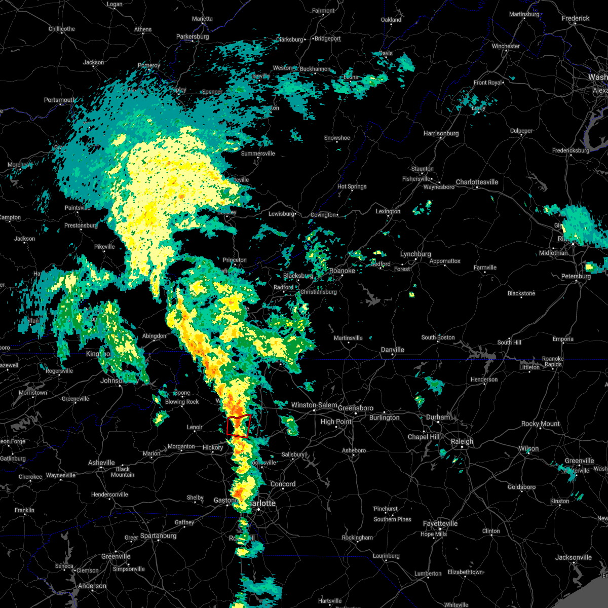 At 1043 pm edt, a severe thunderstorm capable of producing a tornado was located 6 miles northeast of taylorsville, or 5 miles west of love valley, moving north at 55 mph (radar indicated rotation). Hazards include tornado. Flying debris will be dangerous to those caught without shelter. mobile homes will be damaged or destroyed. damage to roofs, windows, and vehicles will occur. tree damage is likely. This dangerous thunderstorm will remain over mainly rural areas of northeastern alexander and northwestern iredell counties, including the following locations, vashti and hiddenite. At 1043 pm edt, a severe thunderstorm capable of producing a tornado was located 6 miles northeast of taylorsville, or 5 miles west of love valley, moving north at 55 mph (radar indicated rotation). Hazards include tornado. Flying debris will be dangerous to those caught without shelter. mobile homes will be damaged or destroyed. damage to roofs, windows, and vehicles will occur. tree damage is likely. This dangerous thunderstorm will remain over mainly rural areas of northeastern alexander and northwestern iredell counties, including the following locations, vashti and hiddenite.
|
| 8/17/2021 11:49 AM EDT |
 At 1149 am edt, a confirmed tornado was located 7 miles east of taylorsville, or 4 miles southwest of love valley, moving north at 15 mph (emergency management confirmed tornado). Hazards include damaging tornado. Flying debris will be dangerous to those caught without shelter. mobile homes will be damaged or destroyed. damage to roofs, windows, and vehicles will occur. tree damage is likely. This tornadic thunderstorm will remain over mainly rural areas of northeastern alexander county, including the following locations, vashti and hiddenite. At 1149 am edt, a confirmed tornado was located 7 miles east of taylorsville, or 4 miles southwest of love valley, moving north at 15 mph (emergency management confirmed tornado). Hazards include damaging tornado. Flying debris will be dangerous to those caught without shelter. mobile homes will be damaged or destroyed. damage to roofs, windows, and vehicles will occur. tree damage is likely. This tornadic thunderstorm will remain over mainly rural areas of northeastern alexander county, including the following locations, vashti and hiddenite.
|
| 8/17/2021 11:36 AM EDT |
 At 1136 am edt, a confirmed tornado was located 7 miles east of taylorsville, or near stony point, moving north at 35 mph (emergency management confirmed tornado). Hazards include damaging tornado. Flying debris will be dangerous to those caught without shelter. mobile homes will be damaged or destroyed. damage to roofs, windows, and vehicles will occur. tree damage is likely. the tornado will be near, taylorsville and love valley around 1140 am edt. Other locations impacted by this dangerous thunderstorm include vashti, hiddenite and scotts. At 1136 am edt, a confirmed tornado was located 7 miles east of taylorsville, or near stony point, moving north at 35 mph (emergency management confirmed tornado). Hazards include damaging tornado. Flying debris will be dangerous to those caught without shelter. mobile homes will be damaged or destroyed. damage to roofs, windows, and vehicles will occur. tree damage is likely. the tornado will be near, taylorsville and love valley around 1140 am edt. Other locations impacted by this dangerous thunderstorm include vashti, hiddenite and scotts.
|
| 7/17/2021 1:53 PM EDT |
 At 153 pm edt, a severe thunderstorm was located 7 miles south of taylorsville, or 4 miles northwest of lookout shoals lake, moving northeast at 10 mph (radar indicated). Hazards include 60 mph wind gusts and quarter size hail. Minor hail damage to vehicles is expected. expect wind damage to trees and power lines. Locations impacted include, stony point, lookout shoals lake, hiddenite, millersville, scotts, oxford and lake hickory. At 153 pm edt, a severe thunderstorm was located 7 miles south of taylorsville, or 4 miles northwest of lookout shoals lake, moving northeast at 10 mph (radar indicated). Hazards include 60 mph wind gusts and quarter size hail. Minor hail damage to vehicles is expected. expect wind damage to trees and power lines. Locations impacted include, stony point, lookout shoals lake, hiddenite, millersville, scotts, oxford and lake hickory.
|
| 7/17/2021 1:33 PM EDT |
 At 133 pm edt, a severe thunderstorm was located 7 miles south of taylorsville, or 4 miles northwest of lookout shoals lake, moving northeast at 15 mph (radar indicated). Hazards include 60 mph wind gusts and quarter size hail. Minor hail damage to vehicles is expected. Expect wind damage to trees and power lines. At 133 pm edt, a severe thunderstorm was located 7 miles south of taylorsville, or 4 miles northwest of lookout shoals lake, moving northeast at 15 mph (radar indicated). Hazards include 60 mph wind gusts and quarter size hail. Minor hail damage to vehicles is expected. Expect wind damage to trees and power lines.
|
| 6/8/2021 6:21 PM EDT |
 At 621 pm edt, a severe thunderstorm was located near taylorsville, moving northeast at 10 mph (radar indicated). Hazards include 60 mph wind gusts and quarter size hail. Minor hail damage to vehicles is expected. expect wind damage to trees and power lines. Locations impacted include, taylorsville, love valley, vashti, hiddenite, millersville and union grove. At 621 pm edt, a severe thunderstorm was located near taylorsville, moving northeast at 10 mph (radar indicated). Hazards include 60 mph wind gusts and quarter size hail. Minor hail damage to vehicles is expected. expect wind damage to trees and power lines. Locations impacted include, taylorsville, love valley, vashti, hiddenite, millersville and union grove.
|
| 6/8/2021 6:03 PM EDT |
 At 603 pm edt, a severe thunderstorm was located over taylorsville, moving northeast at 15 mph (radar indicated). Hazards include 60 mph wind gusts and quarter size hail. Minor hail damage to vehicles is expected. Expect wind damage to trees and power lines. At 603 pm edt, a severe thunderstorm was located over taylorsville, moving northeast at 15 mph (radar indicated). Hazards include 60 mph wind gusts and quarter size hail. Minor hail damage to vehicles is expected. Expect wind damage to trees and power lines.
|
| 3/27/2021 2:19 PM EDT |
 At 218 pm edt, a severe thunderstorm was located 6 miles northeast of lenoir, or near cedar rock, moving east at 40 mph (radar indicated). Hazards include 60 mph wind gusts and quarter size hail. Minor hail damage to vehicles is expected. Expect wind damage to trees and power lines. At 218 pm edt, a severe thunderstorm was located 6 miles northeast of lenoir, or near cedar rock, moving east at 40 mph (radar indicated). Hazards include 60 mph wind gusts and quarter size hail. Minor hail damage to vehicles is expected. Expect wind damage to trees and power lines.
|
| 7/31/2020 9:39 PM EDT |
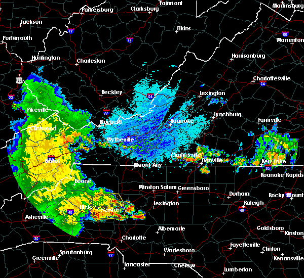 At 939 pm edt, a severe thunderstorm was located 8 miles northeast of taylorsville, or near love valley, moving east at 20 mph (radar indicated). Hazards include 60 mph wind gusts and penny size hail. Expect damage to trees and power lines. Locations impacted include, stony point, love valley, hiddenite, turnersburg, olin, vashti, union grove, scotts and taylorsville. At 939 pm edt, a severe thunderstorm was located 8 miles northeast of taylorsville, or near love valley, moving east at 20 mph (radar indicated). Hazards include 60 mph wind gusts and penny size hail. Expect damage to trees and power lines. Locations impacted include, stony point, love valley, hiddenite, turnersburg, olin, vashti, union grove, scotts and taylorsville.
|
| 7/31/2020 9:05 PM EDT |
 At 904 pm edt, a severe thunderstorm was located near taylorsville, moving east at 20 mph (radar indicated). Hazards include 60 mph wind gusts and quarter size hail. Minor hail damage to vehicles is expected. Expect wind damage to trees and power lines. At 904 pm edt, a severe thunderstorm was located near taylorsville, moving east at 20 mph (radar indicated). Hazards include 60 mph wind gusts and quarter size hail. Minor hail damage to vehicles is expected. Expect wind damage to trees and power lines.
|
| 7/20/2020 4:17 PM EDT |
 At 417 pm edt, severe thunderstorms were located along a line extending from 14 miles southwest of yadkinville to 9 miles northwest of statesville, moving southeast at 20 mph (radar indicated). Hazards include 60 mph wind gusts and penny size hail. Expect damage to trees and power lines. Locations impacted include, statesville, stony point, harmony, turnersburg, olin, sheffield, union grove, scotts and cool springs. At 417 pm edt, severe thunderstorms were located along a line extending from 14 miles southwest of yadkinville to 9 miles northwest of statesville, moving southeast at 20 mph (radar indicated). Hazards include 60 mph wind gusts and penny size hail. Expect damage to trees and power lines. Locations impacted include, statesville, stony point, harmony, turnersburg, olin, sheffield, union grove, scotts and cool springs.
|
| 7/20/2020 4:02 PM EDT |
 The national weather service in greenville-spartanburg has issued a * severe thunderstorm warning for. northwestern davie county in the piedmont of north carolina. southeastern alexander county in the piedmont of north carolina. northern iredell county in the piedmont of north carolina. Until 445 pm edt. The national weather service in greenville-spartanburg has issued a * severe thunderstorm warning for. northwestern davie county in the piedmont of north carolina. southeastern alexander county in the piedmont of north carolina. northern iredell county in the piedmont of north carolina. Until 445 pm edt.
|
| 7/18/2020 3:53 PM EDT |
 The severe thunderstorm warning for north central catawba, alexander and southeastern caldwell counties will expire at 400 pm edt, the storm which prompted the warning has moved out of the area. therefore the warning will be allowed to expire. however gusty winds and heavy rain are still possible with this thunderstorm. The severe thunderstorm warning for north central catawba, alexander and southeastern caldwell counties will expire at 400 pm edt, the storm which prompted the warning has moved out of the area. therefore the warning will be allowed to expire. however gusty winds and heavy rain are still possible with this thunderstorm.
|
| 7/18/2020 3:46 PM EDT |
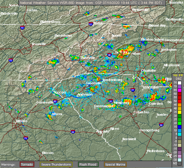 At 346 pm edt, a severe thunderstorm was located over taylorsville, moving southeast at 5 mph (radar indicated). Hazards include 60 mph wind gusts and quarter size hail. Minor hail damage to vehicles is expected. expect wind damage to trees and power lines. locations impacted include, hickory, newton, taylorsville, st. Stephens, conover, sawmills, granite falls, bethlehem, hudson and claremont. At 346 pm edt, a severe thunderstorm was located over taylorsville, moving southeast at 5 mph (radar indicated). Hazards include 60 mph wind gusts and quarter size hail. Minor hail damage to vehicles is expected. expect wind damage to trees and power lines. locations impacted include, hickory, newton, taylorsville, st. Stephens, conover, sawmills, granite falls, bethlehem, hudson and claremont.
|
| 7/18/2020 3:19 PM EDT |
 At 319 pm edt, a severe thunderstorm was located near taylorsville, moving southeast at 5 mph (radar indicated). Hazards include 60 mph wind gusts and quarter size hail. Minor hail damage to vehicles is expected. Expect wind damage to trees and power lines. At 319 pm edt, a severe thunderstorm was located near taylorsville, moving southeast at 5 mph (radar indicated). Hazards include 60 mph wind gusts and quarter size hail. Minor hail damage to vehicles is expected. Expect wind damage to trees and power lines.
|
| 4/13/2020 4:13 AM EDT |
 At 411 am edt, strong to severe thunderstorms were located along a line extending from 11 miles southeast of wilkesboro to 7 miles southeast of shelby, moving northeast at 70 mph. scattered pockets of wind damage will occur across the north carolina piedmont early this morning, including portions of the charlotte metropolitan area (radar indicated). Hazards include 60 mph wind gusts. expect damage to trees and power lines At 411 am edt, strong to severe thunderstorms were located along a line extending from 11 miles southeast of wilkesboro to 7 miles southeast of shelby, moving northeast at 70 mph. scattered pockets of wind damage will occur across the north carolina piedmont early this morning, including portions of the charlotte metropolitan area (radar indicated). Hazards include 60 mph wind gusts. expect damage to trees and power lines
|
| 4/13/2020 3:23 AM EDT |
 At 321 am edt, heavy rain with embedded thunderstorms were located across the north carolina foothills, from 4 miles northwest of laurel springs to 8 miles southeast of forest city, moving northeast at 60 mph. additional thundrestorms will move through the area early this morning. scattered damaging wind gusts will occur with these storms (radar indicated). Hazards include 60 mph wind gusts. expect damage to trees and power lines At 321 am edt, heavy rain with embedded thunderstorms were located across the north carolina foothills, from 4 miles northwest of laurel springs to 8 miles southeast of forest city, moving northeast at 60 mph. additional thundrestorms will move through the area early this morning. scattered damaging wind gusts will occur with these storms (radar indicated). Hazards include 60 mph wind gusts. expect damage to trees and power lines
|
| 1/11/2020 8:57 PM EST |
 At 857 pm est, severe thunderstorms were located along a line extending from 4 miles south of boomer to 5 miles south of hickory to 6 miles northeast of gaffney, moving northeast at 35 mph (radar indicated). Hazards include 70 mph wind gusts. Expect considerable tree damage. Damage is likely to mobile homes, roofs, and outbuildings. At 857 pm est, severe thunderstorms were located along a line extending from 4 miles south of boomer to 5 miles south of hickory to 6 miles northeast of gaffney, moving northeast at 35 mph (radar indicated). Hazards include 70 mph wind gusts. Expect considerable tree damage. Damage is likely to mobile homes, roofs, and outbuildings.
|
| 8/22/2019 2:41 PM EDT |
 At 227 pm edt, severe thunderstorms were located along a line extending from 10 miles southeast of wilkesboro to 8 miles northeast of taylorsville to 6 miles northeast of hickory, moving east at 20 mph (radar indicated). Hazards include 60 mph wind gusts and quarter size hail. Minor hail damage to vehicles is expected. expect wind damage to trees and power lines. Locations impacted include, taylorsville, bethlehem, stony point, love valley, hiddenite, little river in alexander county, olin, millersville, ellendale and vashti. At 227 pm edt, severe thunderstorms were located along a line extending from 10 miles southeast of wilkesboro to 8 miles northeast of taylorsville to 6 miles northeast of hickory, moving east at 20 mph (radar indicated). Hazards include 60 mph wind gusts and quarter size hail. Minor hail damage to vehicles is expected. expect wind damage to trees and power lines. Locations impacted include, taylorsville, bethlehem, stony point, love valley, hiddenite, little river in alexander county, olin, millersville, ellendale and vashti.
|
| 8/22/2019 2:27 PM EDT |
 At 227 pm edt, severe thunderstorms were located along a line extending from 10 miles southeast of wilkesboro to 8 miles northeast of taylorsville to 6 miles northeast of hickory, moving east at 20 mph (radar indicated). Hazards include 60 mph wind gusts and quarter size hail. Minor hail damage to vehicles is expected. expect wind damage to trees and power lines. Locations impacted include, taylorsville, bethlehem, stony point, love valley, hiddenite, little river in alexander county, olin, millersville, ellendale and vashti. At 227 pm edt, severe thunderstorms were located along a line extending from 10 miles southeast of wilkesboro to 8 miles northeast of taylorsville to 6 miles northeast of hickory, moving east at 20 mph (radar indicated). Hazards include 60 mph wind gusts and quarter size hail. Minor hail damage to vehicles is expected. expect wind damage to trees and power lines. Locations impacted include, taylorsville, bethlehem, stony point, love valley, hiddenite, little river in alexander county, olin, millersville, ellendale and vashti.
|
| 8/22/2019 2:05 PM EDT |
 At 205 pm edt, severe thunderstorms were located along a line extending from 8 miles east of boomer to 3 miles northeast of taylorsville to 5 miles northwest of hickory, moving east at 20 mph (radar indicated). Hazards include 60 mph wind gusts and quarter size hail. Minor hail damage to vehicles is expected. Expect wind damage to trees and power lines. At 205 pm edt, severe thunderstorms were located along a line extending from 8 miles east of boomer to 3 miles northeast of taylorsville to 5 miles northwest of hickory, moving east at 20 mph (radar indicated). Hazards include 60 mph wind gusts and quarter size hail. Minor hail damage to vehicles is expected. Expect wind damage to trees and power lines.
|
| 8/21/2019 5:26 PM EDT |
 The severe thunderstorm warning for alexander county will expire at 530 pm edt, the strongest part of the severe thunderstorm which prompted the warning has moved out of the warned area. therefore the warning will be allowed to expire. however gusty winds, heavy rain, and frequent lightning are still possible, especially across the southern part of the county. The severe thunderstorm warning for alexander county will expire at 530 pm edt, the strongest part of the severe thunderstorm which prompted the warning has moved out of the warned area. therefore the warning will be allowed to expire. however gusty winds, heavy rain, and frequent lightning are still possible, especially across the southern part of the county.
|
| 8/21/2019 4:39 PM EDT | Numerous trees and power lines down in the are in alexander county NC, 0.5 miles NE of Hiddenite, NC |
| 8/21/2019 4:38 PM EDT | The vashti community was the hardest hit in alexander county by this storm. a road in this area was completely shut down from numerous tree falls blocking the road. als in alexander county NC, 6.6 miles SSE of Hiddenite, NC |
| 8/21/2019 4:25 PM EDT |
 The national weather service in greenville-spartanburg has issued a * severe thunderstorm warning for. alexander county in the piedmont of north carolina. until 530 pm edt. At 425 pm edt, a severe thunderstorm was located near taylorsville, moving east at 10 mph. The national weather service in greenville-spartanburg has issued a * severe thunderstorm warning for. alexander county in the piedmont of north carolina. until 530 pm edt. At 425 pm edt, a severe thunderstorm was located near taylorsville, moving east at 10 mph.
|
| 8/13/2019 3:56 PM EDT |
 The national weather service in greenville-spartanburg has issued a * severe thunderstorm warning for. catawba county in the piedmont of north carolina. alexander county in the piedmont of north carolina. northern iredell county in the piedmont of north carolina. Southeastern caldwell county in western north carolina. The national weather service in greenville-spartanburg has issued a * severe thunderstorm warning for. catawba county in the piedmont of north carolina. alexander county in the piedmont of north carolina. northern iredell county in the piedmont of north carolina. Southeastern caldwell county in western north carolina.
|
| 8/13/2019 3:43 PM EDT |
 A severe thunderstorm warning remains in effect until 400 pm edt for northwestern catawba. alexander. northern iredell. southeastern caldwell and east central burke counties. At 342 pm edt, severe thunderstorms were located along a line extending from 11 miles south of ronda to 4 miles southeast of morganton, moving southeast at 30 mph. A severe thunderstorm warning remains in effect until 400 pm edt for northwestern catawba. alexander. northern iredell. southeastern caldwell and east central burke counties. At 342 pm edt, severe thunderstorms were located along a line extending from 11 miles south of ronda to 4 miles southeast of morganton, moving southeast at 30 mph.
|
| 8/13/2019 3:10 PM EDT |
 The national weather service in greenville-spartanburg has issued a * severe thunderstorm warning for. northwestern catawba county in the piedmont of north carolina. alexander county in the piedmont of north carolina. northern iredell county in the piedmont of north carolina. Caldwell county in western north carolina. The national weather service in greenville-spartanburg has issued a * severe thunderstorm warning for. northwestern catawba county in the piedmont of north carolina. alexander county in the piedmont of north carolina. northern iredell county in the piedmont of north carolina. Caldwell county in western north carolina.
|
| 8/10/2019 7:11 PM EDT |
 At 711 pm edt, a severe thunderstorm was located 7 miles southeast of taylorsville, or near stony point, moving southeast at 15 mph (radar indicated). Hazards include 60 mph wind gusts and quarter size hail. Minor hail damage to vehicles is expected. Expect wind damage to trees and power lines. At 711 pm edt, a severe thunderstorm was located 7 miles southeast of taylorsville, or near stony point, moving southeast at 15 mph (radar indicated). Hazards include 60 mph wind gusts and quarter size hail. Minor hail damage to vehicles is expected. Expect wind damage to trees and power lines.
|
| 8/4/2019 5:26 PM EDT |
 At 525 pm edt, a severe thunderstorm was located 7 miles southwest of taylorsville, or near bethlehem, moving southeast at 10 mph (radar indicated). Hazards include 60 mph wind gusts and quarter size hail. Minor hail damage to vehicles is expected. Expect wind damage to trees and power lines. At 525 pm edt, a severe thunderstorm was located 7 miles southwest of taylorsville, or near bethlehem, moving southeast at 10 mph (radar indicated). Hazards include 60 mph wind gusts and quarter size hail. Minor hail damage to vehicles is expected. Expect wind damage to trees and power lines.
|
| 8/1/2019 7:14 PM EDT |
 At 714 pm edt, a severe thunderstorm was located near statesville, moving north at 5 mph (radar indicated). Hazards include 60 mph wind gusts and quarter size hail. Minor hail damage to vehicles is expected. Expect wind damage to trees and power lines. At 714 pm edt, a severe thunderstorm was located near statesville, moving north at 5 mph (radar indicated). Hazards include 60 mph wind gusts and quarter size hail. Minor hail damage to vehicles is expected. Expect wind damage to trees and power lines.
|
| 7/11/2019 4:23 PM EDT |
 A severe thunderstorm warning remains in effect until 445 pm edt for north central catawba and southern alexander counties. at 421 pm edt, a severe thunderstorm was located 7 miles northeast of hickory, or near st. stephens, moving northeast at 15 mph. hazard. 60 mph wind gusts and quarter size hail. source. Radar indicated. A severe thunderstorm warning remains in effect until 445 pm edt for north central catawba and southern alexander counties. at 421 pm edt, a severe thunderstorm was located 7 miles northeast of hickory, or near st. stephens, moving northeast at 15 mph. hazard. 60 mph wind gusts and quarter size hail. source. Radar indicated.
|
| 7/11/2019 4:12 PM EDT |
 At 406 pm edt, a severe thunderstorm was located near hickory, or over st. stephens, moving northeast at 15 mph (radar indicated). Hazards include 60 mph wind gusts and quarter size hail. Minor hail damage to vehicles is expected. Expect wind damage to trees and power lines. At 406 pm edt, a severe thunderstorm was located near hickory, or over st. stephens, moving northeast at 15 mph (radar indicated). Hazards include 60 mph wind gusts and quarter size hail. Minor hail damage to vehicles is expected. Expect wind damage to trees and power lines.
|
| 7/11/2019 4:06 PM EDT |
 At 406 pm edt, a severe thunderstorm was located near hickory, or over st. stephens, moving northeast at 15 mph (radar indicated). Hazards include 60 mph wind gusts and quarter size hail. Minor hail damage to vehicles is expected. Expect wind damage to trees and power lines. At 406 pm edt, a severe thunderstorm was located near hickory, or over st. stephens, moving northeast at 15 mph (radar indicated). Hazards include 60 mph wind gusts and quarter size hail. Minor hail damage to vehicles is expected. Expect wind damage to trees and power lines.
|
| 7/4/2019 6:06 PM EDT |
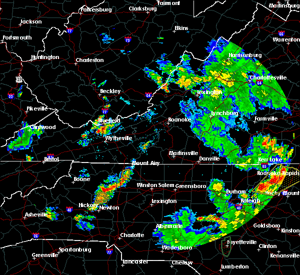 The severe thunderstorm warning for central alexander county will expire at 615 pm edt, the storm which prompted the warning has weakened below severe limits, and no longer poses an immediate threat to life or property. therefore the warning will be allowed to expire. however gusty winds and heavy rain are still possible with this thunderstorm. The severe thunderstorm warning for central alexander county will expire at 615 pm edt, the storm which prompted the warning has weakened below severe limits, and no longer poses an immediate threat to life or property. therefore the warning will be allowed to expire. however gusty winds and heavy rain are still possible with this thunderstorm.
|
| 7/4/2019 5:55 PM EDT |
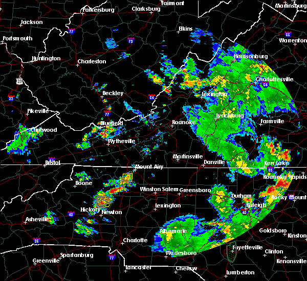 At 555 pm edt, a severe thunderstorm was located near taylorsville, moving southeast at 10 mph (public). Hazards include ping pong ball size hail and 60 mph wind gusts. People and animals outdoors will be injured. expect hail damage to roofs, siding, windows, and vehicles. expect wind damage to trees and power lines. Locations impacted include, taylorsville, vashti and hiddenite. At 555 pm edt, a severe thunderstorm was located near taylorsville, moving southeast at 10 mph (public). Hazards include ping pong ball size hail and 60 mph wind gusts. People and animals outdoors will be injured. expect hail damage to roofs, siding, windows, and vehicles. expect wind damage to trees and power lines. Locations impacted include, taylorsville, vashti and hiddenite.
|
| 7/4/2019 5:54 PM EDT |
 At 532 pm edt, a severe thunderstorm was located near taylorsville, moving south at 5 mph (radar indicated). Hazards include 60 mph wind gusts and penny size hail. expect damage to trees and power lines At 532 pm edt, a severe thunderstorm was located near taylorsville, moving south at 5 mph (radar indicated). Hazards include 60 mph wind gusts and penny size hail. expect damage to trees and power lines
|
| 7/4/2019 5:43 PM EDT |
 At 543 pm edt, a severe thunderstorm was located near taylorsville, moving southeast at 10 mph (radar indicated). Hazards include 70 mph wind gusts and quarter size hail. Minor hail damage to vehicles is expected. expect considerable tree damage. Wind damage is also likely to mobile homes, roofs, and outbuildings. At 543 pm edt, a severe thunderstorm was located near taylorsville, moving southeast at 10 mph (radar indicated). Hazards include 70 mph wind gusts and quarter size hail. Minor hail damage to vehicles is expected. expect considerable tree damage. Wind damage is also likely to mobile homes, roofs, and outbuildings.
|
| 7/4/2019 5:32 PM EDT |
 At 532 pm edt, a severe thunderstorm was located near taylorsville, moving south at 5 mph (radar indicated). Hazards include 60 mph wind gusts and penny size hail. expect damage to trees and power lines At 532 pm edt, a severe thunderstorm was located near taylorsville, moving south at 5 mph (radar indicated). Hazards include 60 mph wind gusts and penny size hail. expect damage to trees and power lines
|
| 6/24/2019 9:16 PM EDT |
 At 916 pm edt, severe thunderstorms were located along a line extending from 15 miles east of taylorsville to 7 miles northwest of statesville to 14 miles northwest of kannapolis to 5 miles west of huntersville to 6 miles southwest of uptown charlotte to 7 miles south of york to 6 miles south of chester, moving northeast at 70 mph (radar indicated). Hazards include 70 mph wind gusts. Expect considerable tree damage. damage is likely to mobile homes, roofs, and outbuildings. Locations impacted include, gastonia, rock hill, uptown charlotte, huntersville, statesville, lincolnton, york, chester, mocksville and central charlotte. At 916 pm edt, severe thunderstorms were located along a line extending from 15 miles east of taylorsville to 7 miles northwest of statesville to 14 miles northwest of kannapolis to 5 miles west of huntersville to 6 miles southwest of uptown charlotte to 7 miles south of york to 6 miles south of chester, moving northeast at 70 mph (radar indicated). Hazards include 70 mph wind gusts. Expect considerable tree damage. damage is likely to mobile homes, roofs, and outbuildings. Locations impacted include, gastonia, rock hill, uptown charlotte, huntersville, statesville, lincolnton, york, chester, mocksville and central charlotte.
|
| 6/24/2019 9:00 PM EDT |
 At 859 pm edt, severe thunderstorms were located along a line extending from 4 miles southeast of taylorsville to 10 miles southwest of statesville to 7 miles southeast of lincolnton to 8 miles southeast of gastonia to 7 miles southwest of york to 16 miles southeast of union, moving northeast at 50 mph (radar indicated). Hazards include 70 mph wind gusts. Expect considerable tree damage. Damage is likely to mobile homes, roofs, and outbuildings. At 859 pm edt, severe thunderstorms were located along a line extending from 4 miles southeast of taylorsville to 10 miles southwest of statesville to 7 miles southeast of lincolnton to 8 miles southeast of gastonia to 7 miles southwest of york to 16 miles southeast of union, moving northeast at 50 mph (radar indicated). Hazards include 70 mph wind gusts. Expect considerable tree damage. Damage is likely to mobile homes, roofs, and outbuildings.
|
| 5/31/2019 2:28 PM EDT |
 At 226 pm edt, a severe thunderstorm was located 4 miles southeast of taylorsville, or near stony point, moving east at 25 mph (radar indicated). Hazards include 60 mph wind gusts and penny size hail. expect damage to trees and power lines At 226 pm edt, a severe thunderstorm was located 4 miles southeast of taylorsville, or near stony point, moving east at 25 mph (radar indicated). Hazards include 60 mph wind gusts and penny size hail. expect damage to trees and power lines
|
| 4/19/2019 4:22 PM EDT |
 The tornado warning for northeastern alexander and northwestern iredell counties will expire at 430 pm edt, the storm which prompted the warning has moved out of the area. therefore the warning will be allowed to expire. a tornado watch remains in effect until 500 pm edt for the piedmont of north carolina. The tornado warning for northeastern alexander and northwestern iredell counties will expire at 430 pm edt, the storm which prompted the warning has moved out of the area. therefore the warning will be allowed to expire. a tornado watch remains in effect until 500 pm edt for the piedmont of north carolina.
|
| 4/19/2019 4:12 PM EDT |
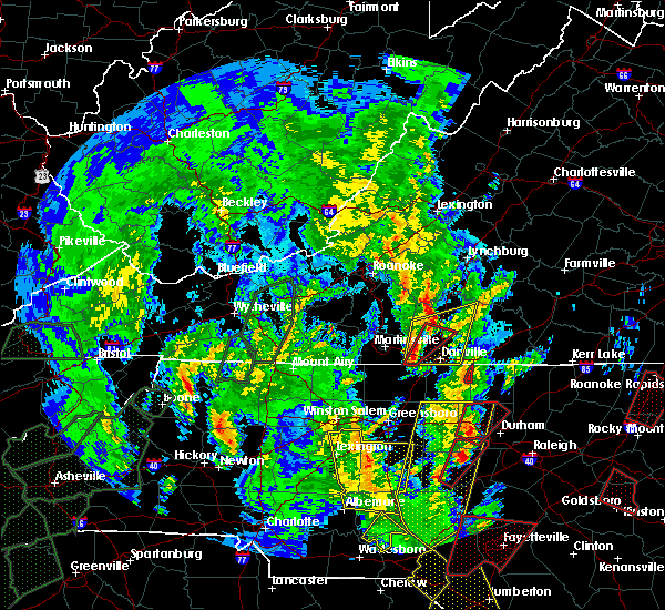 At 412 pm edt, a severe thunderstorm capable of producing a tornado was located 8 miles northeast of taylorsville, or near love valley, moving northeast at 45 mph (radar indicated rotation). Hazards include tornado. Flying debris will be dangerous to those caught without shelter. mobile homes will be damaged or destroyed. damage to roofs, windows, and vehicles will occur. Tree damage is likely. At 412 pm edt, a severe thunderstorm capable of producing a tornado was located 8 miles northeast of taylorsville, or near love valley, moving northeast at 45 mph (radar indicated rotation). Hazards include tornado. Flying debris will be dangerous to those caught without shelter. mobile homes will be damaged or destroyed. damage to roofs, windows, and vehicles will occur. Tree damage is likely.
|
| 9/27/2018 6:40 PM EDT |
 At 640 pm edt, a severe thunderstorm was located 7 miles south of taylorsville, or 4 miles northwest of lookout shoals lake, moving northeast at 35 mph (radar indicated). Hazards include 60 mph wind gusts and penny size hail. expect damage to trees and power lines At 640 pm edt, a severe thunderstorm was located 7 miles south of taylorsville, or 4 miles northwest of lookout shoals lake, moving northeast at 35 mph (radar indicated). Hazards include 60 mph wind gusts and penny size hail. expect damage to trees and power lines
|
| 8/21/2018 3:59 PM EDT |
 The national weather service in greenville-spartanburg has issued a * severe thunderstorm warning for. eastern alexander county in the piedmont of north carolina. northern iredell county in the piedmont of north carolina. until 445 pm edt. At 359 pm edt, severe thunderstorms were located along a line. The national weather service in greenville-spartanburg has issued a * severe thunderstorm warning for. eastern alexander county in the piedmont of north carolina. northern iredell county in the piedmont of north carolina. until 445 pm edt. At 359 pm edt, severe thunderstorms were located along a line.
|
| 8/21/2018 3:42 PM EDT |
 A severe thunderstorm warning remains in effect until 400 pm edt for north central catawba and alexander counties. at 341 pm edt, a severe thunderstorm was located near taylorsville, moving east at 35 mph. hazard. 60 mph wind gusts. source. Radar indicated. A severe thunderstorm warning remains in effect until 400 pm edt for north central catawba and alexander counties. at 341 pm edt, a severe thunderstorm was located near taylorsville, moving east at 35 mph. hazard. 60 mph wind gusts. source. Radar indicated.
|
| 8/21/2018 3:18 PM EDT |
 At 318 pm edt, a severe thunderstorm was located 7 miles southeast of lenoir, or near granite falls, moving east at 35 mph (radar indicated). Hazards include 60 mph wind gusts. expect damage to trees and power lines At 318 pm edt, a severe thunderstorm was located 7 miles southeast of lenoir, or near granite falls, moving east at 35 mph (radar indicated). Hazards include 60 mph wind gusts. expect damage to trees and power lines
|
| 8/8/2018 5:30 PM EDT |
 At 530 pm edt, severe thunderstorms were located along a line extending from 13 miles southeast of boomer to 3 miles southwest of taylorsville, moving east at 25 mph (trained weather spotters have reported wind damage in the area with these storms. radar indicates hail is possible as well). Hazards include 60 mph wind gusts and quarter size hail. Minor hail damage to vehicles is expected. Expect wind damage to trees and power lines. At 530 pm edt, severe thunderstorms were located along a line extending from 13 miles southeast of boomer to 3 miles southwest of taylorsville, moving east at 25 mph (trained weather spotters have reported wind damage in the area with these storms. radar indicates hail is possible as well). Hazards include 60 mph wind gusts and quarter size hail. Minor hail damage to vehicles is expected. Expect wind damage to trees and power lines.
|
| 7/21/2018 7:20 PM EDT |
 At 719 pm edt, a severe thunderstorm was located 6 miles north of taylorsville, or 6 miles south of moravian falls, moving east at 20 mph (radar indicated). Hazards include 60 mph wind gusts and quarter size hail. Minor hail damage to vehicles is expected. expect wind damage to trees and power lines. Locations impacted include, taylorsville, bethlehem, stony point, hiddenite, little river in alexander county, vashti, millersville, ellendale and lake hickory. At 719 pm edt, a severe thunderstorm was located 6 miles north of taylorsville, or 6 miles south of moravian falls, moving east at 20 mph (radar indicated). Hazards include 60 mph wind gusts and quarter size hail. Minor hail damage to vehicles is expected. expect wind damage to trees and power lines. Locations impacted include, taylorsville, bethlehem, stony point, hiddenite, little river in alexander county, vashti, millersville, ellendale and lake hickory.
|
| 7/21/2018 7:06 PM EDT |
 At 705 pm edt, a severe thunderstorm was located 4 miles east of taylorsville, moving east at 15 mph (radar indicated). Hazards include 60 mph wind gusts and quarter size hail. Minor hail damage to vehicles is expected. expect wind damage to trees and power lines. locations impacted include, hickory, newton, taylorsville, st. Stephens, conover, longview, bethlehem, stony point, claremont and catawba. At 705 pm edt, a severe thunderstorm was located 4 miles east of taylorsville, moving east at 15 mph (radar indicated). Hazards include 60 mph wind gusts and quarter size hail. Minor hail damage to vehicles is expected. expect wind damage to trees and power lines. locations impacted include, hickory, newton, taylorsville, st. Stephens, conover, longview, bethlehem, stony point, claremont and catawba.
|
| 7/21/2018 6:38 PM EDT |
 At 638 pm edt, a severe thunderstorm was located 4 miles north of hickory, or near lake hickory, moving southeast at 10 mph (radar indicated). Hazards include golf ball size hail and 60 mph wind gusts. People and animals outdoors will be injured. expect hail damage to roofs, siding, windows, and vehicles. Expect wind damage to trees and power lines. At 638 pm edt, a severe thunderstorm was located 4 miles north of hickory, or near lake hickory, moving southeast at 10 mph (radar indicated). Hazards include golf ball size hail and 60 mph wind gusts. People and animals outdoors will be injured. expect hail damage to roofs, siding, windows, and vehicles. Expect wind damage to trees and power lines.
|
| 6/25/2018 5:57 PM EDT |
 The national weather service in greenville-spartanburg has issued a * severe thunderstorm warning for. northwestern cabarrus county in the piedmont of north carolina. catawba county in the piedmont of north carolina. davie county in the piedmont of north carolina. Alexander county in the piedmont of north carolina. The national weather service in greenville-spartanburg has issued a * severe thunderstorm warning for. northwestern cabarrus county in the piedmont of north carolina. catawba county in the piedmont of north carolina. davie county in the piedmont of north carolina. Alexander county in the piedmont of north carolina.
|
| 6/25/2018 5:50 PM EDT |
 At 549 pm edt, severe thunderstorms were located along a line extending from 14 miles south of ronda to 9 miles northwest of shelby, moving east at 30 mph (radar indicated). Hazards include 60 mph wind gusts and quarter size hail. Minor hail damage to vehicles is expected. expect wind damage to trees and power lines. locations impacted include, hickory, newton, taylorsville, st. Stephens, conover, longview, sawmills, granite falls, valdese and bethlehem. At 549 pm edt, severe thunderstorms were located along a line extending from 14 miles south of ronda to 9 miles northwest of shelby, moving east at 30 mph (radar indicated). Hazards include 60 mph wind gusts and quarter size hail. Minor hail damage to vehicles is expected. expect wind damage to trees and power lines. locations impacted include, hickory, newton, taylorsville, st. Stephens, conover, longview, sawmills, granite falls, valdese and bethlehem.
|
| 6/25/2018 5:22 PM EDT |
 At 521 pm edt, severe thunderstorms were located along a line extending from 7 miles northeast of taylorsville to 5 miles north of forest city, moving east at 30 mph (radar indicated). Hazards include 60 mph wind gusts and quarter size hail. Minor hail damage to vehicles is expected. Expect wind damage to trees and power lines. At 521 pm edt, severe thunderstorms were located along a line extending from 7 miles northeast of taylorsville to 5 miles north of forest city, moving east at 30 mph (radar indicated). Hazards include 60 mph wind gusts and quarter size hail. Minor hail damage to vehicles is expected. Expect wind damage to trees and power lines.
|
| 6/1/2018 4:31 PM EDT |
 At 431 pm edt, a severe thunderstorm was located 5 miles south of taylorsville, moving east at 20 mph (radar indicated). Hazards include 60 mph wind gusts and quarter size hail. Minor hail damage to vehicles is expected. expect wind damage to trees and power lines. locations impacted include, hickory, taylorsville, st. Stephens, bethlehem, stony point, love valley, lookout shoals lake, hiddenite, little river in alexander county and millersville. At 431 pm edt, a severe thunderstorm was located 5 miles south of taylorsville, moving east at 20 mph (radar indicated). Hazards include 60 mph wind gusts and quarter size hail. Minor hail damage to vehicles is expected. expect wind damage to trees and power lines. locations impacted include, hickory, taylorsville, st. Stephens, bethlehem, stony point, love valley, lookout shoals lake, hiddenite, little river in alexander county and millersville.
|
| 6/1/2018 4:13 PM EDT |
 At 413 pm edt, a severe thunderstorm was located 7 miles southwest of taylorsville, or near bethlehem, moving east at 20 mph (radar indicated). Hazards include 60 mph wind gusts and quarter size hail. Minor hail damage to vehicles is expected. Expect wind damage to trees and power lines. At 413 pm edt, a severe thunderstorm was located 7 miles southwest of taylorsville, or near bethlehem, moving east at 20 mph (radar indicated). Hazards include 60 mph wind gusts and quarter size hail. Minor hail damage to vehicles is expected. Expect wind damage to trees and power lines.
|
| 5/10/2018 4:31 PM EDT |
 At 430 pm edt, a severe thunderstorm was located 5 miles east of taylorsville, or near stony point, moving east at 20 mph (radar indicated). Hazards include 60 mph wind gusts and quarter size hail. Minor hail damage to vehicles is expected. Expect wind damage to trees and power lines. At 430 pm edt, a severe thunderstorm was located 5 miles east of taylorsville, or near stony point, moving east at 20 mph (radar indicated). Hazards include 60 mph wind gusts and quarter size hail. Minor hail damage to vehicles is expected. Expect wind damage to trees and power lines.
|
| 9/1/2017 5:16 PM EDT |
 At 516 pm edt, severe thunderstorms were located along a line extending from 6 miles east of taylorsville to 9 miles west of statesville to 8 miles southeast of newton, moving east at 30 mph (radar indicated). Hazards include 60 mph wind gusts and quarter size hail. Minor hail damage to vehicles is expected. Expect wind damage to trees and power lines. At 516 pm edt, severe thunderstorms were located along a line extending from 6 miles east of taylorsville to 9 miles west of statesville to 8 miles southeast of newton, moving east at 30 mph (radar indicated). Hazards include 60 mph wind gusts and quarter size hail. Minor hail damage to vehicles is expected. Expect wind damage to trees and power lines.
|
| 7/17/2017 6:09 PM EDT |
 The severe thunderstorm warning for north central catawba, southern alexander and west central iredell counties will expire at 615 pm edt, the storm which prompted the warning has moved out of the area. therefore the warning will be allowed to expire. however small hail and gusty winds are still possible with this thunderstorm. if you observed large hail or wind damage, please report it to the national weather service greenville-spartanburg by calling toll free, 1, 800, 2 6 7, 8 1 0 1, or by posting on our facebook page, or tweet it using hashtag nwsgsp. your message should describe the event and the specific location where it occurred. remember, a severe thunderstorm warning still remains in effect for western and central catawba county until 645 pm edt. The severe thunderstorm warning for north central catawba, southern alexander and west central iredell counties will expire at 615 pm edt, the storm which prompted the warning has moved out of the area. therefore the warning will be allowed to expire. however small hail and gusty winds are still possible with this thunderstorm. if you observed large hail or wind damage, please report it to the national weather service greenville-spartanburg by calling toll free, 1, 800, 2 6 7, 8 1 0 1, or by posting on our facebook page, or tweet it using hashtag nwsgsp. your message should describe the event and the specific location where it occurred. remember, a severe thunderstorm warning still remains in effect for western and central catawba county until 645 pm edt.
|
| 7/17/2017 5:51 PM EDT |
 At 550 pm edt, a severe thunderstorm was located 6 miles north of hickory, or near bethlehem, moving south at 20 mph (radar indicated). Hazards include 60 mph wind gusts and quarter size hail. Minor hail damage to vehicles is expected. expect wind damage to trees and power lines. locations impacted include, st. Stephens, bethlehem, stony point, lookout shoals lake, hiddenite, little river in alexander county, millersville, oxford, scotts and conover. At 550 pm edt, a severe thunderstorm was located 6 miles north of hickory, or near bethlehem, moving south at 20 mph (radar indicated). Hazards include 60 mph wind gusts and quarter size hail. Minor hail damage to vehicles is expected. expect wind damage to trees and power lines. locations impacted include, st. Stephens, bethlehem, stony point, lookout shoals lake, hiddenite, little river in alexander county, millersville, oxford, scotts and conover.
|
| 7/17/2017 5:23 PM EDT |
 At 523 pm edt, a severe thunderstorm was located near taylorsville, moving south at 10 mph (radar indicated). Hazards include 60 mph wind gusts and quarter size hail. Minor hail damage to vehicles is expected. Expect wind damage to trees and power lines. At 523 pm edt, a severe thunderstorm was located near taylorsville, moving south at 10 mph (radar indicated). Hazards include 60 mph wind gusts and quarter size hail. Minor hail damage to vehicles is expected. Expect wind damage to trees and power lines.
|
| 7/17/2017 5:14 PM EDT |
 At 513 pm edt, a severe thunderstorm was located near taylorsville, moving south at 10 mph (radar indicated). Hazards include 60 mph wind gusts and quarter size hail. Minor hail damage to vehicles is expected. expect wind damage to trees and power lines. Locations impacted include, taylorsville, stony point, hiddenite, vashti, millersville and ellendale. At 513 pm edt, a severe thunderstorm was located near taylorsville, moving south at 10 mph (radar indicated). Hazards include 60 mph wind gusts and quarter size hail. Minor hail damage to vehicles is expected. expect wind damage to trees and power lines. Locations impacted include, taylorsville, stony point, hiddenite, vashti, millersville and ellendale.
|
| 7/17/2017 4:43 PM EDT |
 At 442 pm edt, a severe thunderstorm was located 5 miles north of taylorsville, moving southeast at 5 mph (radar indicated). Hazards include 60 mph wind gusts and quarter size hail. Minor hail damage to vehicles is expected. Expect wind damage to trees and power lines. At 442 pm edt, a severe thunderstorm was located 5 miles north of taylorsville, moving southeast at 5 mph (radar indicated). Hazards include 60 mph wind gusts and quarter size hail. Minor hail damage to vehicles is expected. Expect wind damage to trees and power lines.
|
| 7/13/2017 4:28 PM EDT |
 At 427 pm edt, a severe thunderstorm was located 5 miles east of taylorsville, or 5 miles north of stony point, moving east at 25 mph (radar indicated). Hazards include 60 mph wind gusts and quarter size hail. Minor hail damage to vehicles is expected. Expect wind damage to trees and power lines. At 427 pm edt, a severe thunderstorm was located 5 miles east of taylorsville, or 5 miles north of stony point, moving east at 25 mph (radar indicated). Hazards include 60 mph wind gusts and quarter size hail. Minor hail damage to vehicles is expected. Expect wind damage to trees and power lines.
|
| 7/1/2017 1:44 PM EDT |
 At 144 pm edt, a severe thunderstorm was located 6 miles northeast of taylorsville, moving east at 30 mph (radar indicated). Hazards include 60 mph wind gusts and quarter size hail. Minor hail damage to vehicles is expected. Expect wind damage to trees and power lines. At 144 pm edt, a severe thunderstorm was located 6 miles northeast of taylorsville, moving east at 30 mph (radar indicated). Hazards include 60 mph wind gusts and quarter size hail. Minor hail damage to vehicles is expected. Expect wind damage to trees and power lines.
|
| 6/13/2017 3:44 PM EDT |
 At 344 pm edt, a severe thunderstorm was located near taylorsville, moving southeast at 10 mph (radar indicated). Hazards include 60 mph wind gusts and quarter size hail. Minor hail damage to vehicles is expected. expect wind damage to trees and power lines. Locations impacted include, taylorsville, stony point, love valley, hiddenite, little river in alexander county, vashti, millersville, ellendale, scotts and olin. At 344 pm edt, a severe thunderstorm was located near taylorsville, moving southeast at 10 mph (radar indicated). Hazards include 60 mph wind gusts and quarter size hail. Minor hail damage to vehicles is expected. expect wind damage to trees and power lines. Locations impacted include, taylorsville, stony point, love valley, hiddenite, little river in alexander county, vashti, millersville, ellendale, scotts and olin.
|
| 6/13/2017 3:24 PM EDT |
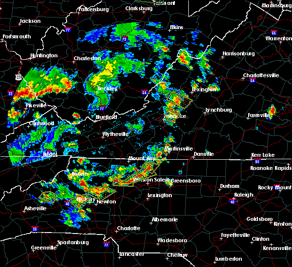 At 324 pm edt, a severe thunderstorm was located near taylorsville, moving southeast at 5 mph (radar indicated). Hazards include 60 mph wind gusts and quarter size hail. Minor hail damage to vehicles is expected. Expect wind damage to trees and power lines. At 324 pm edt, a severe thunderstorm was located near taylorsville, moving southeast at 5 mph (radar indicated). Hazards include 60 mph wind gusts and quarter size hail. Minor hail damage to vehicles is expected. Expect wind damage to trees and power lines.
|
| 5/24/2017 4:15 PM EDT |
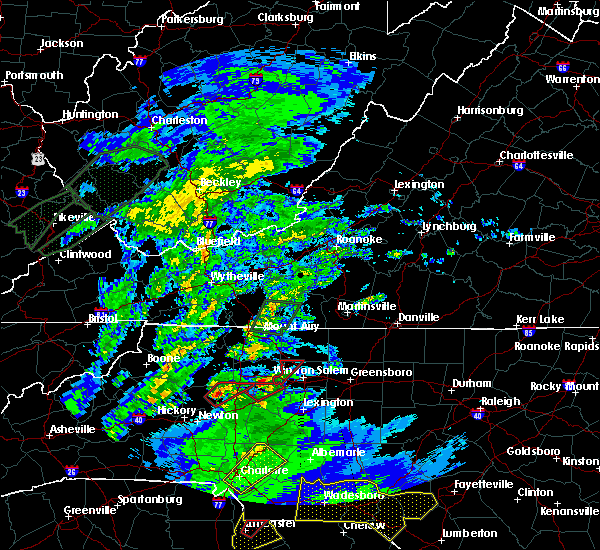 At 415 pm edt, a severe thunderstorm capable of producing a tornado was located 9 miles east of taylorsville, or 4 miles south of love valley, moving northeast at 25 mph (radar indicated rotation). Hazards include tornado. Flying debris will be dangerous to those caught without shelter. mobile homes will be damaged or destroyed. damage to roofs, windows, and vehicles will occur. tree damage is likely. this dangerous storm will be near, love valley around 420 pm edt. Other locations impacted by this dangerous thunderstorm include hiddenite, union grove and olin. At 415 pm edt, a severe thunderstorm capable of producing a tornado was located 9 miles east of taylorsville, or 4 miles south of love valley, moving northeast at 25 mph (radar indicated rotation). Hazards include tornado. Flying debris will be dangerous to those caught without shelter. mobile homes will be damaged or destroyed. damage to roofs, windows, and vehicles will occur. tree damage is likely. this dangerous storm will be near, love valley around 420 pm edt. Other locations impacted by this dangerous thunderstorm include hiddenite, union grove and olin.
|
| 4/6/2017 12:52 AM EDT |
 At 1252 am edt, severe thunderstorms were located along a line extending from near lenoir to 10 miles southwest of hickory to 5 miles west of shelby, moving northeast at 65 mph (radar indicated). Hazards include 60 mph wind gusts. expect damage to trees and minor damage to roofs and siding At 1252 am edt, severe thunderstorms were located along a line extending from near lenoir to 10 miles southwest of hickory to 5 miles west of shelby, moving northeast at 65 mph (radar indicated). Hazards include 60 mph wind gusts. expect damage to trees and minor damage to roofs and siding
|
| 11/30/2016 6:13 PM EST |
 At 613 pm est, severe thunderstorms were located along a line extending from 6 miles north of mocksville to 9 miles southwest of statesville to 10 miles northeast of lincolnton to 9 miles north of winnsboro, moving east at 35 mph (radar indicated). Hazards include 60 mph wind gusts. Expect damage to roofs. Siding and trees. At 613 pm est, severe thunderstorms were located along a line extending from 6 miles north of mocksville to 9 miles southwest of statesville to 10 miles northeast of lincolnton to 9 miles north of winnsboro, moving east at 35 mph (radar indicated). Hazards include 60 mph wind gusts. Expect damage to roofs. Siding and trees.
|
| 11/30/2016 6:07 PM EST |
 At 606 pm est, severe thunderstorms were located along a line extending from near east bend to 7 miles southwest of statesville to near lincolnton to 6 miles southwest of rock hill to 12 miles south of chester, moving northeast at 55 mph (radar indicated). Hazards include 60 mph wind gusts. Expect damage to roofs. siding and trees. Locations impacted include, gastonia, rock hill, hickory, statesville, newton, lincolnton, york, chester, taylorsville and mt holly. At 606 pm est, severe thunderstorms were located along a line extending from near east bend to 7 miles southwest of statesville to near lincolnton to 6 miles southwest of rock hill to 12 miles south of chester, moving northeast at 55 mph (radar indicated). Hazards include 60 mph wind gusts. Expect damage to roofs. siding and trees. Locations impacted include, gastonia, rock hill, hickory, statesville, newton, lincolnton, york, chester, taylorsville and mt holly.
|
| 11/30/2016 5:42 PM EST |
 At 542 pm est, severe thunderstorms were located along a line extending from 11 miles southwest of yadkinville to 8 miles southwest of newton to 3 miles northwest of shelby to 10 miles east of union to 6 miles north of newberry, moving northeast at 55 mph (radar indicated). Hazards include 60 mph wind gusts. Expect damage to roofs. siding and trees. Locations impacted include, gastonia, rock hill, hickory, statesville, shelby, newton, gaffney, lincolnton, union and york. At 542 pm est, severe thunderstorms were located along a line extending from 11 miles southwest of yadkinville to 8 miles southwest of newton to 3 miles northwest of shelby to 10 miles east of union to 6 miles north of newberry, moving northeast at 55 mph (radar indicated). Hazards include 60 mph wind gusts. Expect damage to roofs. siding and trees. Locations impacted include, gastonia, rock hill, hickory, statesville, shelby, newton, gaffney, lincolnton, union and york.
|
| 11/30/2016 5:26 PM EST |
 At 526 pm est, severe thunderstorms were located along a line extending from 8 miles east of taylorsville to 14 miles north of shelby to 8 miles southeast of forest city to 5 miles south of union to 8 miles west of newberry, moving northeast at 55 mph (radar indicated). Hazards include 60 mph wind gusts. Expect damage to roofs. Siding and trees. At 526 pm est, severe thunderstorms were located along a line extending from 8 miles east of taylorsville to 14 miles north of shelby to 8 miles southeast of forest city to 5 miles south of union to 8 miles west of newberry, moving northeast at 55 mph (radar indicated). Hazards include 60 mph wind gusts. Expect damage to roofs. Siding and trees.
|
| 9/29/2016 5:37 PM EDT |
 At 537 pm edt, a severe thunderstorm was located 8 miles southeast of taylorsville, or over stony point, moving northeast at 15 mph (trained weather spotters). Hazards include 60 mph wind gusts and quarter size hail. Hail damage to vehicles is expected. expect wind damage to roofs, siding and trees. Locations impacted include, stony point, love valley, scotts, hiddenite and turnersburg. At 537 pm edt, a severe thunderstorm was located 8 miles southeast of taylorsville, or over stony point, moving northeast at 15 mph (trained weather spotters). Hazards include 60 mph wind gusts and quarter size hail. Hail damage to vehicles is expected. expect wind damage to roofs, siding and trees. Locations impacted include, stony point, love valley, scotts, hiddenite and turnersburg.
|
| 9/29/2016 5:30 PM EDT | Quarter sized hail reported 0.5 miles NE of Hiddenite, NC, 1/4 inch to 1 inch hail observed off hwy 90 e |
| 9/29/2016 5:21 PM EDT |
 At 521 pm edt, a severe thunderstorm was located 9 miles southeast of taylorsville, or near lookout shoals lake, moving northeast at 20 mph (radar indicated). Hazards include 60 mph wind gusts and quarter size hail. Hail damage to vehicles is expected. Expect wind damage to roofs, siding and trees. At 521 pm edt, a severe thunderstorm was located 9 miles southeast of taylorsville, or near lookout shoals lake, moving northeast at 20 mph (radar indicated). Hazards include 60 mph wind gusts and quarter size hail. Hail damage to vehicles is expected. Expect wind damage to roofs, siding and trees.
|
| 8/27/2016 4:30 PM EDT | Small tree limbs blown dow in alexander county NC, 2.5 miles SW of Hiddenite, NC |
| 8/17/2016 5:21 PM EDT |
 The severe thunderstorm warning for northwestern iredell and southeastern alexander counties will expire at 530 pm edt, the storm which prompted the warning has weakened below severe limits, and no longer poses an immediate threat to life or property. therefore the warning will be allowed to expire. The severe thunderstorm warning for northwestern iredell and southeastern alexander counties will expire at 530 pm edt, the storm which prompted the warning has weakened below severe limits, and no longer poses an immediate threat to life or property. therefore the warning will be allowed to expire.
|
| 8/17/2016 4:55 PM EDT |
 At 455 pm edt, a severe thunderstorm was located 5 miles southeast of taylorsville, or near stony point, moving east at 5 mph (radar indicated). Hazards include 60 mph wind gusts. Expect damage to roofs. siding and trees. Locations impacted include, stony point, love valley, scotts, hiddenite, lookout shoals lake and statesville. At 455 pm edt, a severe thunderstorm was located 5 miles southeast of taylorsville, or near stony point, moving east at 5 mph (radar indicated). Hazards include 60 mph wind gusts. Expect damage to roofs. siding and trees. Locations impacted include, stony point, love valley, scotts, hiddenite, lookout shoals lake and statesville.
|
| 8/17/2016 4:49 PM EDT | Broadcast media reported trees and powerlines down on liberty church rd in hiddenite in alexander county NC, 2 miles NNE of Hiddenite, NC |
| 8/17/2016 4:41 PM EDT |
 At 441 pm edt, a severe thunderstorm was located 5 miles southeast of taylorsville, or 4 miles west of stony point, moving east at 5 mph (radar indicated). Hazards include 60 mph wind gusts. Expect damage to roofs. Siding and trees. At 441 pm edt, a severe thunderstorm was located 5 miles southeast of taylorsville, or 4 miles west of stony point, moving east at 5 mph (radar indicated). Hazards include 60 mph wind gusts. Expect damage to roofs. Siding and trees.
|
| 7/22/2016 2:43 PM EDT |
 At 242 pm edt, a severe thunderstorm was located near taylorsville, moving east at 10 mph (radar indicated). Hazards include 60 mph wind gusts. Expect damage to roofs. siding and trees. Locations impacted include, taylorsville, stony point, love valley, olin, hiddenite, vashti, union grove, scotts and statesville. At 242 pm edt, a severe thunderstorm was located near taylorsville, moving east at 10 mph (radar indicated). Hazards include 60 mph wind gusts. Expect damage to roofs. siding and trees. Locations impacted include, taylorsville, stony point, love valley, olin, hiddenite, vashti, union grove, scotts and statesville.
|
| 7/22/2016 2:23 PM EDT |
 At 223 pm edt, a severe thunderstorm was located 4 miles northwest of taylorsville, moving east at 20 mph (radar indicated). Hazards include 60 mph wind gusts. Expect damage to roofs. Siding and trees. At 223 pm edt, a severe thunderstorm was located 4 miles northwest of taylorsville, moving east at 20 mph (radar indicated). Hazards include 60 mph wind gusts. Expect damage to roofs. Siding and trees.
|
| 7/8/2016 7:52 PM EDT |
 The severe thunderstorm warning for caldwell, burke, eastern mitchell, northwestern catawba, southern yancey, avery, central mcdowell and alexander counties will expire at 800 pm edt, the storms which prompted the warning have weakened below severe limits, and have exited the warned area. therefore the warning will be allowed to expire. however gusty winds are still possible with these thunderstorms. a severe thunderstorm watch remains in effect until midnight edt for the piedmont of and western north carolina. The severe thunderstorm warning for caldwell, burke, eastern mitchell, northwestern catawba, southern yancey, avery, central mcdowell and alexander counties will expire at 800 pm edt, the storms which prompted the warning have weakened below severe limits, and have exited the warned area. therefore the warning will be allowed to expire. however gusty winds are still possible with these thunderstorms. a severe thunderstorm watch remains in effect until midnight edt for the piedmont of and western north carolina.
|
| 7/8/2016 7:40 PM EDT | Large tree across roadway on cheatham ford r in alexander county NC, 0.5 miles NE of Hiddenite, NC |
| 7/8/2016 7:40 PM EDT | Sulphur spings road closed in vashti due to trees in alexander county NC, 6.5 miles S of Hiddenite, NC |
| 7/8/2016 7:18 PM EDT |
 At 718 pm edt, severe thunderstorms were located along a line extending from 5 miles north of beech mountain to 6 miles north of spruce pine to 3 miles west of burnsville, moving east at 55 mph (radar indicated). Hazards include 70 mph wind gusts. Expect considerable tree damage. Damage is likely to mobile homes, roofs and outbuildings. At 718 pm edt, severe thunderstorms were located along a line extending from 5 miles north of beech mountain to 6 miles north of spruce pine to 3 miles west of burnsville, moving east at 55 mph (radar indicated). Hazards include 70 mph wind gusts. Expect considerable tree damage. Damage is likely to mobile homes, roofs and outbuildings.
|
| 7/5/2016 3:14 PM EDT |
 At 313 pm edt, a severe thunderstorm was located 7 miles northeast of hickory, or near bethlehem, moving east at 25 mph (radar indicated. also...storms in this area have a history of causing wind damage). Hazards include 60 mph wind gusts and penny size hail. Expect damage to roofs. siding and trees. locations impacted include, hickory, taylorsville, st. Stephens, bethlehem, claremont, catawba, lookout shoals lake, oxford, little river in alexander county and millersville. At 313 pm edt, a severe thunderstorm was located 7 miles northeast of hickory, or near bethlehem, moving east at 25 mph (radar indicated. also...storms in this area have a history of causing wind damage). Hazards include 60 mph wind gusts and penny size hail. Expect damage to roofs. siding and trees. locations impacted include, hickory, taylorsville, st. Stephens, bethlehem, claremont, catawba, lookout shoals lake, oxford, little river in alexander county and millersville.
|
| 7/5/2016 2:53 PM EDT |
 At 252 pm edt, a severe thunderstorm was located 7 miles south of lenoir, or near lake rhodhiss, moving east at 35 mph (radar indicated). Hazards include 60 mph wind gusts and penny size hail. Expect damage to roofs. Siding and trees. At 252 pm edt, a severe thunderstorm was located 7 miles south of lenoir, or near lake rhodhiss, moving east at 35 mph (radar indicated). Hazards include 60 mph wind gusts and penny size hail. Expect damage to roofs. Siding and trees.
|
| 5/2/2016 5:13 PM EDT |
 At 513 pm edt, a severe thunderstorm was located 9 miles southeast of taylorsville, or near lake wylie, moving northeast at 30 mph (radar indicated). Hazards include 60 mph wind gusts and quarter size hail. Hail damage to vehicles is expected. Expect wind damage to roofs, siding and trees. At 513 pm edt, a severe thunderstorm was located 9 miles southeast of taylorsville, or near lake wylie, moving northeast at 30 mph (radar indicated). Hazards include 60 mph wind gusts and quarter size hail. Hail damage to vehicles is expected. Expect wind damage to roofs, siding and trees.
|
| 4/28/2016 5:44 PM EDT |
 At 544 pm edt, a severe thunderstorm was located near boomer, moving southeast at 25 mph (radar indicated). Hazards include 60 mph wind gusts and quarter size hail. Hail damage to vehicles is expected. Expect wind damage to roofs, siding and trees. At 544 pm edt, a severe thunderstorm was located near boomer, moving southeast at 25 mph (radar indicated). Hazards include 60 mph wind gusts and quarter size hail. Hail damage to vehicles is expected. Expect wind damage to roofs, siding and trees.
|
| 4/28/2016 4:57 PM EDT | The severe thunderstorm warning for northwestern iredell and northeastern alexander counties will expire at 500 pm edt, the storm which prompted the warning has weakened below severe limits, and no longer poses an immediate threat to life or property. therefore the warning will be allowed to expire. however gusty winds are still possible with this thunderstorm. a severe thunderstorm watch remains in effect until 1100 pm edt for central north carolina. if you observed large hail or wind damage, please report it to the national weather service greenville-spartanburg by calling toll free, 1, 800, 2 6 7, 8 1 0 1, or by posting on our facebook page, or tweet it using hashtag nwsgsp. your message should describe the event and the specific location where it occurred. remember, a severe thunderstorm warning still remains in effect for northeast iredell county until 515 pm est. |
| 4/28/2016 4:33 PM EDT |
 At 433 pm edt, a severe thunderstorm was located 6 miles northeast of taylorsville, or 6 miles west of love valley, moving east at 30 mph (radar indicated). Hazards include 60 mph wind gusts and penny size hail. Expect damage to roofs. siding and trees. Locations impacted include, statesville, stony point, love valley, vashti, olin, scotts, hiddenite, turnersburg and taylorsville. At 433 pm edt, a severe thunderstorm was located 6 miles northeast of taylorsville, or 6 miles west of love valley, moving east at 30 mph (radar indicated). Hazards include 60 mph wind gusts and penny size hail. Expect damage to roofs. siding and trees. Locations impacted include, statesville, stony point, love valley, vashti, olin, scotts, hiddenite, turnersburg and taylorsville.
|
| 4/28/2016 4:14 PM EDT |
 At 414 pm edt, a severe thunderstorm was located 4 miles northwest of taylorsville, moving east at 20 mph (radar indicated). Hazards include 60 mph wind gusts and penny size hail. Expect damage to roofs. Siding and trees. At 414 pm edt, a severe thunderstorm was located 4 miles northwest of taylorsville, moving east at 20 mph (radar indicated). Hazards include 60 mph wind gusts and penny size hail. Expect damage to roofs. Siding and trees.
|
| 2/24/2016 12:00 PM EST |
 At 1159 am est, doppler radar indicated a severe thunderstorm capable of producing a tornado. this dangerous storm was located 5 miles south of taylorsville, moving northeast at 55 mph. locations impacted include, taylorsville, stony point, vashti, millersville, hiddenite, bethlehem, lookout shoals lake and lake hickory. At 1159 am est, doppler radar indicated a severe thunderstorm capable of producing a tornado. this dangerous storm was located 5 miles south of taylorsville, moving northeast at 55 mph. locations impacted include, taylorsville, stony point, vashti, millersville, hiddenite, bethlehem, lookout shoals lake and lake hickory.
|
| 2/24/2016 11:43 AM EST |
 At 1142 am est, doppler radar indicated a severe thunderstorm capable of producing a tornado. this dangerous storm was located 5 miles south of hickory, or near mountain view, moving northeast at 65 mph. locations impacted include, hickory, newton, taylorsville, st. stephens, conover, stony point, claremont, love valley, lookout shoals lake and mountain view. At 1142 am est, doppler radar indicated a severe thunderstorm capable of producing a tornado. this dangerous storm was located 5 miles south of hickory, or near mountain view, moving northeast at 65 mph. locations impacted include, hickory, newton, taylorsville, st. stephens, conover, stony point, claremont, love valley, lookout shoals lake and mountain view.
|
| 2/24/2016 11:35 AM EST |
 At 1134 am est, doppler radar indicated a severe thunderstorm with a history of producing damaging winds in excess of 60 mph. this storm was located 5 miles northeast of hickory, or near st. stephens, moving northeast at 55 mph. locations impacted include, hickory, taylorsville, st. stephens, conover, longview, bethlehem, stony point, mountain view, oxford and propst. a tornado watch remains in effect until 700 pm est for central north carolina. At 1134 am est, doppler radar indicated a severe thunderstorm with a history of producing damaging winds in excess of 60 mph. this storm was located 5 miles northeast of hickory, or near st. stephens, moving northeast at 55 mph. locations impacted include, hickory, taylorsville, st. stephens, conover, longview, bethlehem, stony point, mountain view, oxford and propst. a tornado watch remains in effect until 700 pm est for central north carolina.
|
| 2/24/2016 11:33 AM EST |
 At 1133 am est, doppler radar indicated a severe thunderstorm capable of producing a tornado. this dangerous storm was located 10 miles west of lincolnton, or 6 miles northeast of belwood, and moving northeast at 60 mph. At 1133 am est, doppler radar indicated a severe thunderstorm capable of producing a tornado. this dangerous storm was located 10 miles west of lincolnton, or 6 miles northeast of belwood, and moving northeast at 60 mph.
|
| 2/24/2016 11:06 AM EST |
 At 1105 am est, doppler radar indicated a severe thunderstorm with a history of producing damaging winds in excess of 60 mph. this storm was located 12 miles north of shelby, or near belwood, and moving northeast at 55 mph. * locations in the warning include, hickory, taylorsville, st. stephens, conover, longview, granite falls, bethlehem, icard, hildebran and connelly springs. At 1105 am est, doppler radar indicated a severe thunderstorm with a history of producing damaging winds in excess of 60 mph. this storm was located 12 miles north of shelby, or near belwood, and moving northeast at 55 mph. * locations in the warning include, hickory, taylorsville, st. stephens, conover, longview, granite falls, bethlehem, icard, hildebran and connelly springs.
|
| 8/19/2015 2:25 PM EDT |
 At 225 pm edt, doppler radar indicated a severe thunderstorm capable of producing quarter size hail and damaging winds in excess of 60 mph. this storm was located 9 miles east of taylorsville, or near love valley, moving east at 15 mph. locations impacted include, stony point, love valley, union grove, turnersburg, olin, hiddenite, vashti, scotts and statesville. At 225 pm edt, doppler radar indicated a severe thunderstorm capable of producing quarter size hail and damaging winds in excess of 60 mph. this storm was located 9 miles east of taylorsville, or near love valley, moving east at 15 mph. locations impacted include, stony point, love valley, union grove, turnersburg, olin, hiddenite, vashti, scotts and statesville.
|
| 8/19/2015 2:11 PM EDT |
 At 211 pm edt, doppler radar indicated a severe thunderstorm capable of producing quarter size hail and damaging winds in excess of 60 mph. this storm was located 6 miles northeast of taylorsville, or 5 miles west of love valley, and moving east at 20 mph. * locations in the warning include, stony point, love valley, union grove, vashti, turnersburg, olin, hiddenite, scotts, taylorsville and statesville. At 211 pm edt, doppler radar indicated a severe thunderstorm capable of producing quarter size hail and damaging winds in excess of 60 mph. this storm was located 6 miles northeast of taylorsville, or 5 miles west of love valley, and moving east at 20 mph. * locations in the warning include, stony point, love valley, union grove, vashti, turnersburg, olin, hiddenite, scotts, taylorsville and statesville.
|
| 8/10/2015 6:10 PM EDT |
 At 609 pm edt, doppler radar indicated a severe thunderstorm capable of producing quarter size hail and damaging winds in excess of 60 mph. this storm was located near taylorsville, moving east at 10 mph. locations impacted include, taylorsville, stony point, vashti, ellendale, millersville, hiddenite, little river in alexander county, lookout shoals lake and lake hickory. At 609 pm edt, doppler radar indicated a severe thunderstorm capable of producing quarter size hail and damaging winds in excess of 60 mph. this storm was located near taylorsville, moving east at 10 mph. locations impacted include, taylorsville, stony point, vashti, ellendale, millersville, hiddenite, little river in alexander county, lookout shoals lake and lake hickory.
|
| 8/10/2015 5:45 PM EDT |
 At 545 pm edt, doppler radar indicated a severe thunderstorm capable of producing quarter size hail and damaging winds in excess of 60 mph. this storm was located 5 miles northwest of taylorsville, and moving east at 10 mph. * locations in the warning include, taylorsville, stony point, vashti, kings creek, ellendale, millersville, hiddenite, little river in alexander county, lookout shoals lake and lake hickory. At 545 pm edt, doppler radar indicated a severe thunderstorm capable of producing quarter size hail and damaging winds in excess of 60 mph. this storm was located 5 miles northwest of taylorsville, and moving east at 10 mph. * locations in the warning include, taylorsville, stony point, vashti, kings creek, ellendale, millersville, hiddenite, little river in alexander county, lookout shoals lake and lake hickory.
|
| 8/10/2015 5:24 PM EDT |
 At 524 pm edt, doppler radar indicated a severe thunderstorm capable of producing quarter size hail and damaging winds in excess of 60 mph. this storm was located 8 miles southwest of boomer, or 7 miles east of cedar rock, moving east at 10 mph. locations impacted include, taylorsville, stony point, vashti, kings creek, ellendale, millersville, hiddenite and little river in alexander county. At 524 pm edt, doppler radar indicated a severe thunderstorm capable of producing quarter size hail and damaging winds in excess of 60 mph. this storm was located 8 miles southwest of boomer, or 7 miles east of cedar rock, moving east at 10 mph. locations impacted include, taylorsville, stony point, vashti, kings creek, ellendale, millersville, hiddenite and little river in alexander county.
|
| 8/10/2015 5:04 PM EDT |
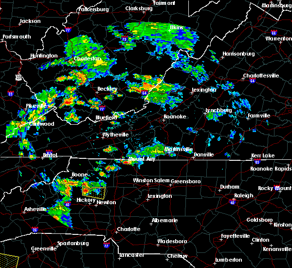 At 504 pm edt, doppler radar indicated a severe thunderstorm capable of producing quarter size hail and damaging winds in excess of 60 mph. this storm was located 9 miles southwest of boomer, or 5 miles northeast of cedar rock, and moving east at 15 mph. * locations in the warning include, taylorsville, stony point, vashti, kings creek, ellendale, millersville, hiddenite and little river in alexander county. At 504 pm edt, doppler radar indicated a severe thunderstorm capable of producing quarter size hail and damaging winds in excess of 60 mph. this storm was located 9 miles southwest of boomer, or 5 miles northeast of cedar rock, and moving east at 15 mph. * locations in the warning include, taylorsville, stony point, vashti, kings creek, ellendale, millersville, hiddenite and little river in alexander county.
|
| 7/13/2015 8:36 PM EDT |
 The severe thunderstorm warning for southeastern caldwell, burke, northeastern rutherford, western catawba, northwestern iredell, southern mcdowell and alexander counties will expire at 845 pm edt, the line of storms which prompted the warning have moved out of the area. therefore the warning will be allowed to expire. The severe thunderstorm warning for southeastern caldwell, burke, northeastern rutherford, western catawba, northwestern iredell, southern mcdowell and alexander counties will expire at 845 pm edt, the line of storms which prompted the warning have moved out of the area. therefore the warning will be allowed to expire.
|
| 7/13/2015 8:06 PM EDT |
 At 805 pm edt, doppler radar indicated a line of showers and thunderstorms with a history of producing damaging winds in excess of 60 mph. these storms were located along a line extending from 5 miles north of north wilkesboro to 5 miles north of morganton to 9 miles west of downtown asheville, and moving southeast at 25 mph. At 805 pm edt, doppler radar indicated a line of showers and thunderstorms with a history of producing damaging winds in excess of 60 mph. these storms were located along a line extending from 5 miles north of north wilkesboro to 5 miles north of morganton to 9 miles west of downtown asheville, and moving southeast at 25 mph.
|
| 6/26/2015 5:48 PM EDT | Several power lines blown down in a field just se of hiddenite... n in alexander county NC, 1.1 miles NNW of Hiddenite, NC |
| 6/19/2015 4:02 PM EDT |
 At 401 pm edt, doppler radar indicated a severe thunderstorm capable of producing quarter size hail and damaging winds in excess of 60 mph. this storm was located 4 miles west of taylorsville, moving east at 35 mph. locations impacted include, taylorsville, bethlehem, stony point, lake hickory, ellendale, millersville, hiddenite, little river in alexander county, lookout shoals lake and vashti. At 401 pm edt, doppler radar indicated a severe thunderstorm capable of producing quarter size hail and damaging winds in excess of 60 mph. this storm was located 4 miles west of taylorsville, moving east at 35 mph. locations impacted include, taylorsville, bethlehem, stony point, lake hickory, ellendale, millersville, hiddenite, little river in alexander county, lookout shoals lake and vashti.
|
| 6/19/2015 3:45 PM EDT |
 At 345 pm edt, doppler radar indicated a severe thunderstorm capable of producing quarter size hail and damaging winds in excess of 60 mph. this storm was located 6 miles east of lenoir, or 4 miles northeast of hudson, moving east at 30 mph. locations impacted include, hickory, taylorsville, st. stephens, conover, longview, sawmills, granite falls, bethlehem, hudson and stony point. At 345 pm edt, doppler radar indicated a severe thunderstorm capable of producing quarter size hail and damaging winds in excess of 60 mph. this storm was located 6 miles east of lenoir, or 4 miles northeast of hudson, moving east at 30 mph. locations impacted include, hickory, taylorsville, st. stephens, conover, longview, sawmills, granite falls, bethlehem, hudson and stony point.
|
| 6/19/2015 3:27 PM EDT |
 At 326 pm edt, doppler radar indicated a severe thunderstorm capable of producing quarter size hail and damaging winds in excess of 60 mph. this storm was located 8 miles south of lenoir, or near sawmills, and moving east at 35 mph. At 326 pm edt, doppler radar indicated a severe thunderstorm capable of producing quarter size hail and damaging winds in excess of 60 mph. this storm was located 8 miles south of lenoir, or near sawmills, and moving east at 35 mph.
|
| 6/2/2015 6:08 PM EDT | At 608 pm edt, doppler radar indicated a severe thunderstorm capable of producing quarter size hail and damaging winds in excess of 60 mph. this storm was located 9 miles northeast of newton, or over catawba, moving northeast at 20 mph. locations impacted include, statesville, newton, conover, maiden, stony point, claremont, catawba, love valley, lookout shoals lake and oxford. |
| 6/2/2015 5:49 PM EDT | At 548 pm edt, doppler radar indicated a severe thunderstorm capable of producing quarter size hail and damaging winds in excess of 60 mph. this storm was located near newton, or over claremont, and moving northeast at 25 mph. |
| 5/23/2013 8:48 PM EDT | Quarter sized hail reported 1.8 miles NW of Hiddenite, NC, 1 inch hail reported ese of hiddenite. |
| 1/1/0001 12:00 AM | Several trees down on sideroads off of hwy 9 in alexander county NC, 1.1 miles NNW of Hiddenite, NC |
| 1/1/0001 12:00 AM | Church under construction destroyed...numerous large trees snapped off and power lines dow in alexander county NC, 0.5 miles NE of Hiddenite, NC |
| 1/1/0001 12:00 AM | Church under construction destroyed...numerous large trees snapped off and power lines dow in alexander county NC, 0.5 miles NE of Hiddenite, NC |
Hail Maps for Hiddenite, NC


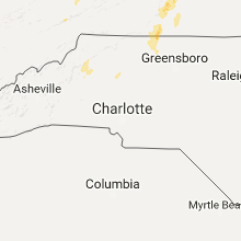


Connect with Interactive Hail Maps