

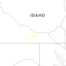
Hail Map for Hollister, ID
The Hollister, ID area has had 0 reports of on-the-ground hail by trained spotters, and has been under severe weather warnings 0 times during the past 12 months. Doppler radar has detected hail at or near Hollister, ID on 5 occasions, including 2 occasions during the past year.
| Name: | Hollister, ID |
| Where Located: | 15 miles SSW of Twin Falls, ID |
| Map: | Google Map for Hollister, ID |
| Population: | 272 |
| Housing Units: | 100 |
| More Info: | Search Google for Hollister, ID |
0
The Top Recent Hail Date for Hollister, ID is Sunday, August 18, 2024 (4th out of 5)

Hail and Wind Damage Spotted near Hollister, ID
| Date / Time | Report Details |
|---|---|
| 5/26/2023 2:16 PM MDT |
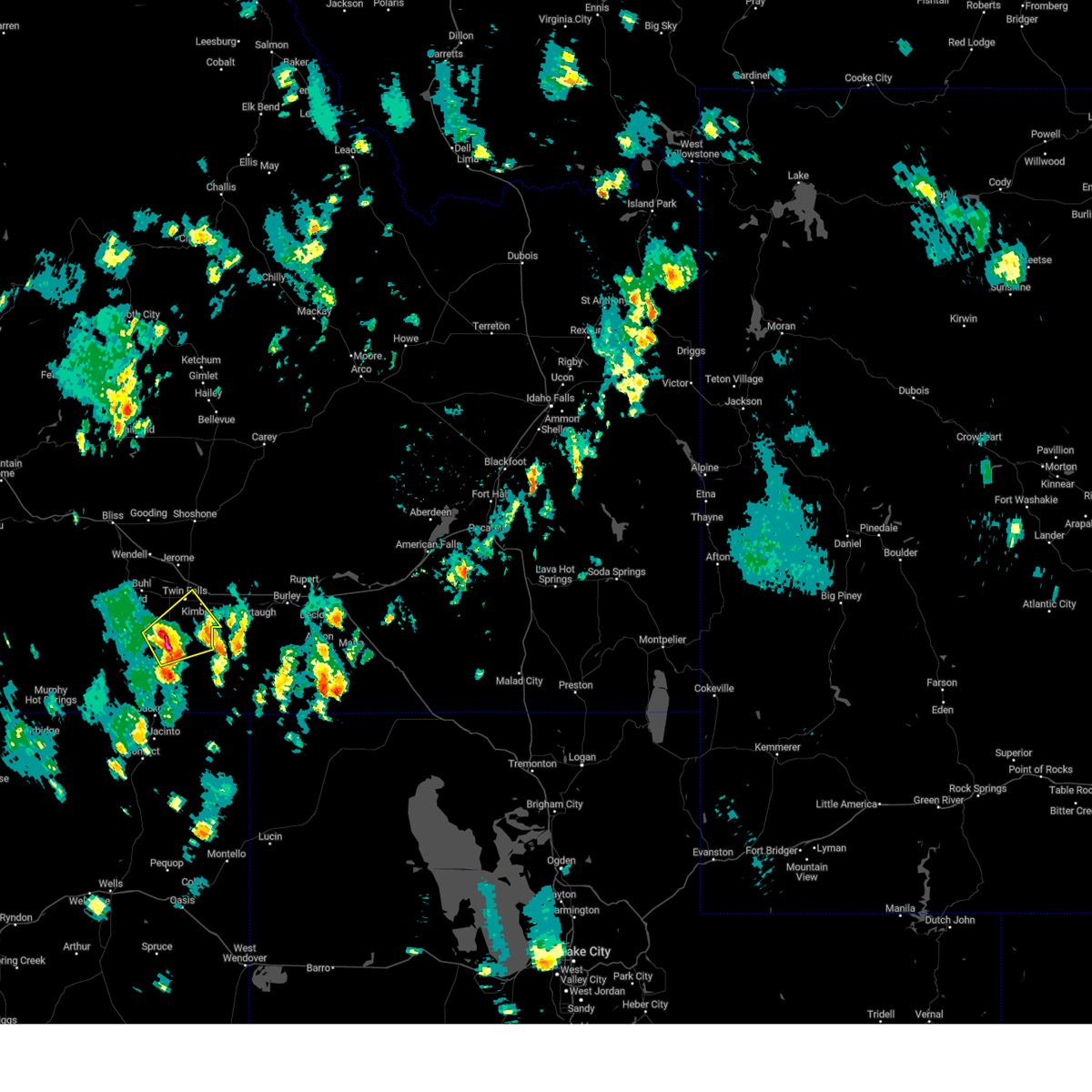 At 216 pm mdt, a severe thunderstorm was located over hollister, or 15 miles southwest of twin falls, moving northeast at 20 mph (radar indicated). Hazards include 60 mph wind gusts and half dollar size hail. Hail damage to vehicles is expected. expect wind damage to roofs, siding, and trees. this severe thunderstorm will be near, magic valley regional airport around 240 pm mdt. twin falls, kimberly and rock creek around 300 pm mdt. hail threat, radar indicated max hail size, 1. 25 in wind threat, radar indicated max wind gust, 60 mph. At 216 pm mdt, a severe thunderstorm was located over hollister, or 15 miles southwest of twin falls, moving northeast at 20 mph (radar indicated). Hazards include 60 mph wind gusts and half dollar size hail. Hail damage to vehicles is expected. expect wind damage to roofs, siding, and trees. this severe thunderstorm will be near, magic valley regional airport around 240 pm mdt. twin falls, kimberly and rock creek around 300 pm mdt. hail threat, radar indicated max hail size, 1. 25 in wind threat, radar indicated max wind gust, 60 mph.
|
| 6/5/2022 3:32 PM MDT |
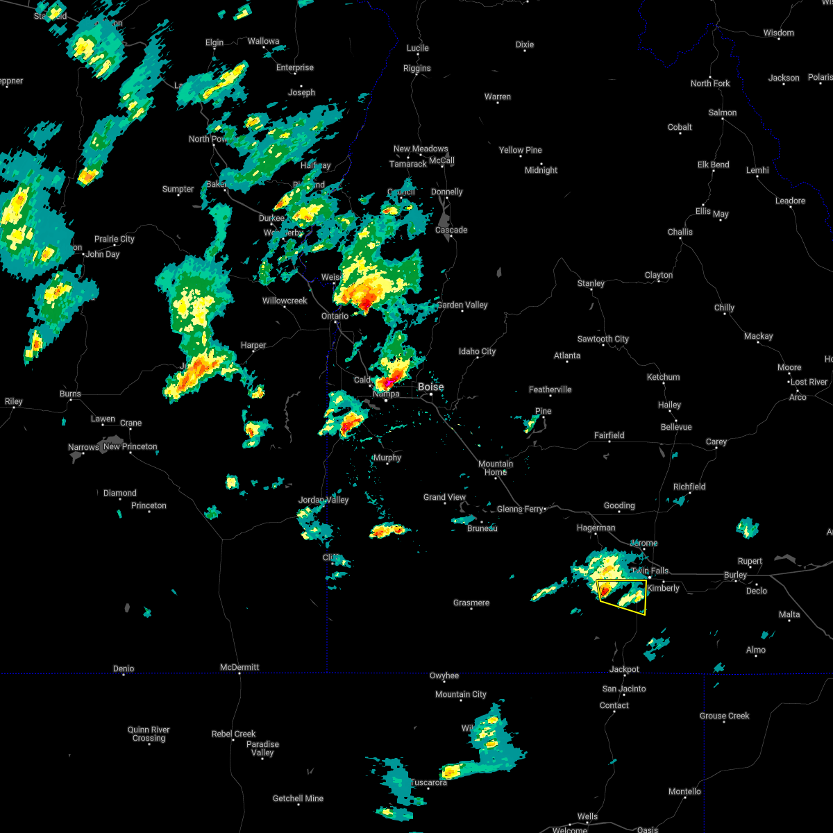 At 331 pm mdt, a severe thunderstorm was located 7 miles southeast of castleford, or 16 miles southwest of twin falls, moving east at 35 mph (radar indicated). Hazards include 60 mph wind gusts and quarter size hail. Hail damage to vehicles is expected. expect wind damage to roofs, siding, and trees. this severe storm will be near, hollister around 350 pm mdt. hail threat, radar indicated max hail size, 1. 00 in wind threat, radar indicated max wind gust, 60 mph. At 331 pm mdt, a severe thunderstorm was located 7 miles southeast of castleford, or 16 miles southwest of twin falls, moving east at 35 mph (radar indicated). Hazards include 60 mph wind gusts and quarter size hail. Hail damage to vehicles is expected. expect wind damage to roofs, siding, and trees. this severe storm will be near, hollister around 350 pm mdt. hail threat, radar indicated max hail size, 1. 00 in wind threat, radar indicated max wind gust, 60 mph.
|
| 6/5/2022 3:11 PM MDT |
 At 311 pm mdt, a severe thunderstorm was located near roseworth, or 27 miles west of twin falls, moving east at 30 mph (radar indicated). Hazards include 60 mph wind gusts and quarter size hail. Hail damage to vehicles is expected. expect wind damage to roofs, siding, and trees. this severe thunderstorm will be near, castleford around 320 pm mdt. hollister around 350 pm mdt. twin falls and magic valley regional airport around 400 pm mdt. hail threat, radar indicated max hail size, 1. 00 in wind threat, radar indicated max wind gust, 60 mph. At 311 pm mdt, a severe thunderstorm was located near roseworth, or 27 miles west of twin falls, moving east at 30 mph (radar indicated). Hazards include 60 mph wind gusts and quarter size hail. Hail damage to vehicles is expected. expect wind damage to roofs, siding, and trees. this severe thunderstorm will be near, castleford around 320 pm mdt. hollister around 350 pm mdt. twin falls and magic valley regional airport around 400 pm mdt. hail threat, radar indicated max hail size, 1. 00 in wind threat, radar indicated max wind gust, 60 mph.
|
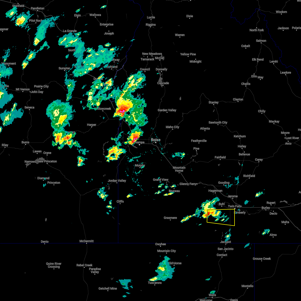
| 5/31/2018 1:07 PM MDT |
 At 107 pm mdt, a severe thunderstorm was located near hollister, or 17 miles southwest of twin falls, moving northeast at 30 mph (radar indicated). Hazards include 60 mph wind gusts and quarter size hail. Hail damage to vehicles is expected. expect wind damage to roofs, siding, and trees. this severe storm will be near, hollister around 110 pm mdt. Twin falls, filer, magic valley regional airport and rock creek around 130 pm mdt. At 107 pm mdt, a severe thunderstorm was located near hollister, or 17 miles southwest of twin falls, moving northeast at 30 mph (radar indicated). Hazards include 60 mph wind gusts and quarter size hail. Hail damage to vehicles is expected. expect wind damage to roofs, siding, and trees. this severe storm will be near, hollister around 110 pm mdt. Twin falls, filer, magic valley regional airport and rock creek around 130 pm mdt.
|
| 5/31/2018 12:49 PM MDT |
 At 1249 pm mdt, a severe thunderstorm was located over salmon falls dam, or 17 miles north of jackpot, moving northeast at 30 mph (radar indicated). Hazards include 60 mph wind gusts and quarter size hail. Hail damage to vehicles is expected. expect wind damage to roofs, siding, and trees. this severe thunderstorm will be near, rogerson around 1250 pm mdt. hollister around 110 pm mdt. Twin falls, filer, magic valley regional airport and rock creek around 130 pm mdt. At 1249 pm mdt, a severe thunderstorm was located over salmon falls dam, or 17 miles north of jackpot, moving northeast at 30 mph (radar indicated). Hazards include 60 mph wind gusts and quarter size hail. Hail damage to vehicles is expected. expect wind damage to roofs, siding, and trees. this severe thunderstorm will be near, rogerson around 1250 pm mdt. hollister around 110 pm mdt. Twin falls, filer, magic valley regional airport and rock creek around 130 pm mdt.
|
| 8/14/2015 10:45 PM MDT | Tgfi1 trail gulch raws in twin falls county ID, 13.7 miles WNW of Hollister, ID |
| 8/11/2015 4:45 PM MDT | Trail gulch raws reported a thunderstorm wind gust of 55 mp in twin falls county ID, 13.7 miles WNW of Hollister, ID |
| 6/1/2015 1:08 PM MDT | At 107 pm mdt, doppler radar indicated a line of severe thunderstorms capable of producing quarter size hail and damaging winds in excess of 60 mph. these storms were located along a line extending from near buhl to near china mountain, and moving northeast at 40 mph. * severe thunderstorms will be near, buhl around 110 pm mdt. filer around 120 pm mdt. jerome, twin falls, rogerson and winter spring around 130 pm mdt. kimberly, hansen and timber butte around 140 pm mdt. eden, magic mountain ski area and minidoka national monument around 150 pm mdt. |
| 8/13/2014 3:48 PM MDT | Trail gulch raws in twin falls county ID, 13.7 miles WNW of Hollister, ID |
| 8/24/2013 5:43 PM MDT | Trail gulch raws at 5700 fee in twin falls county ID, 13.7 miles WNW of Hollister, ID |
| 8/31/2012 9:43 PM MDT | Storm damage reported in twin falls county ID, 13.7 miles WNW of Hollister, ID |
| 1/1/0001 12:00 AM | Thunderstorm west of hollister collapsed and produced an outflow boundary that was strongest to its east with a peak gust to 58 mph at trail gulch raws in the hour endi in twin falls county ID, 13.7 miles WNW of Hollister, ID |
Hail Maps for Hollister, ID


Connect with Interactive Hail Maps