

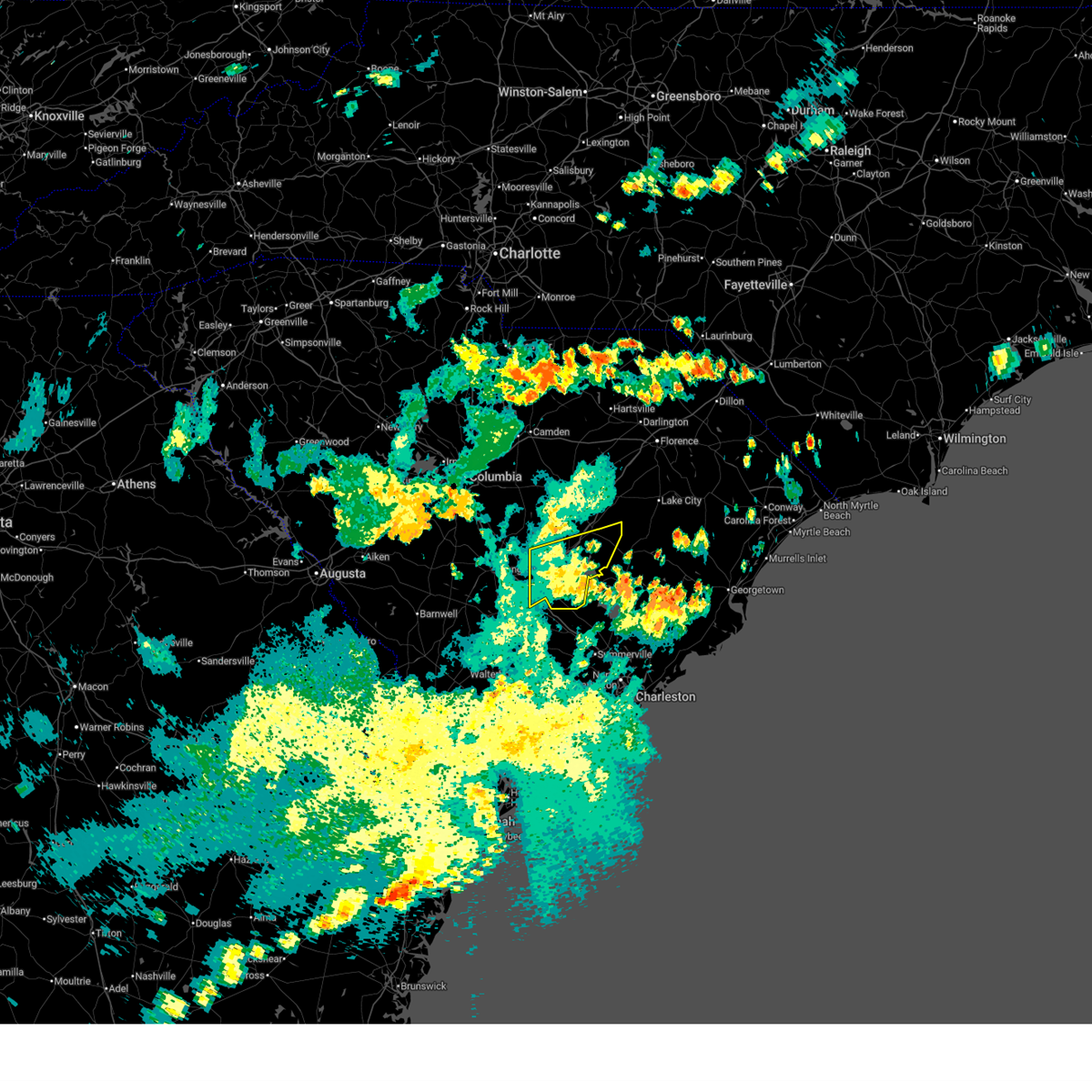
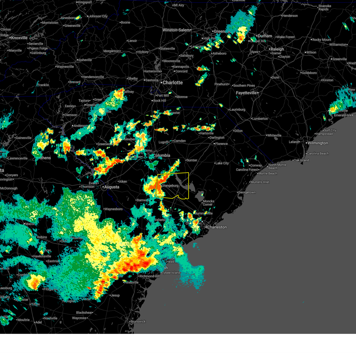
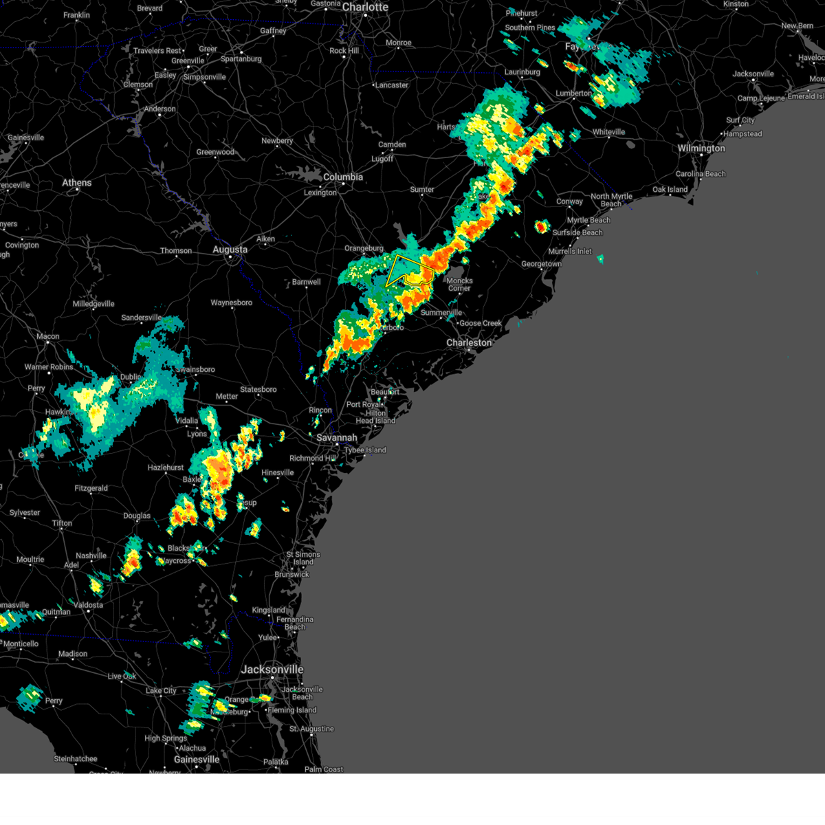
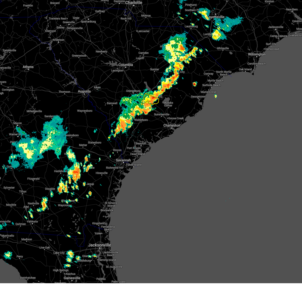
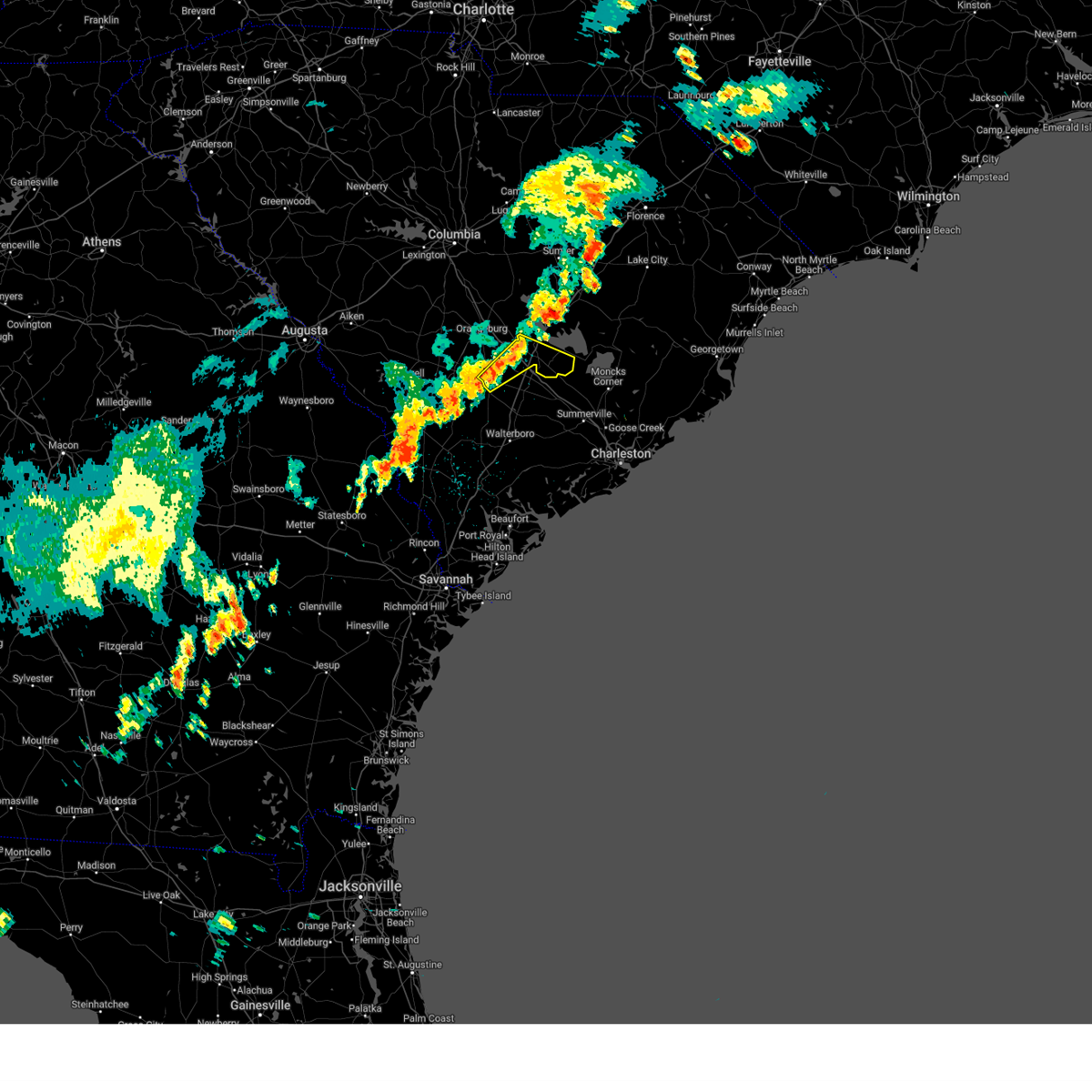
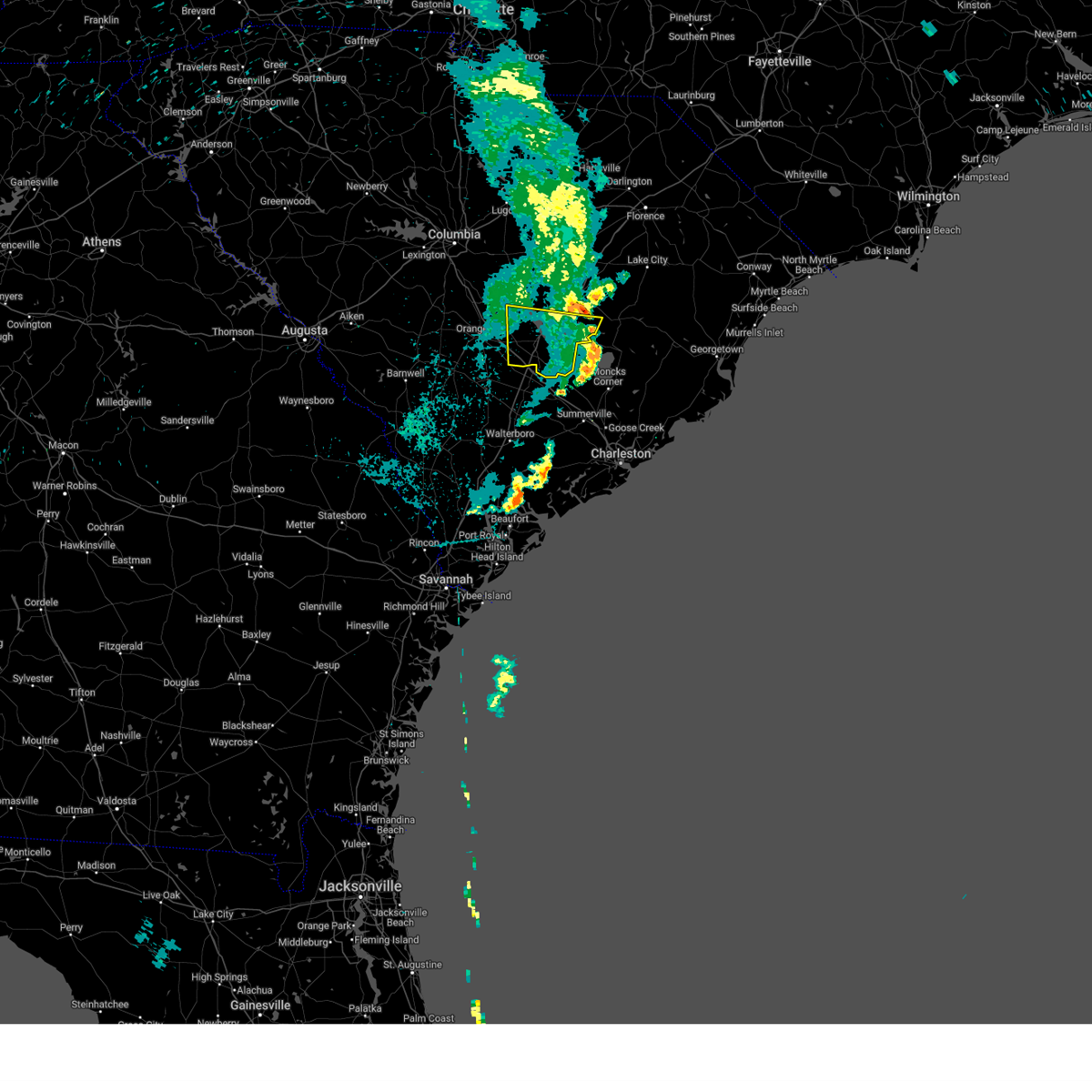
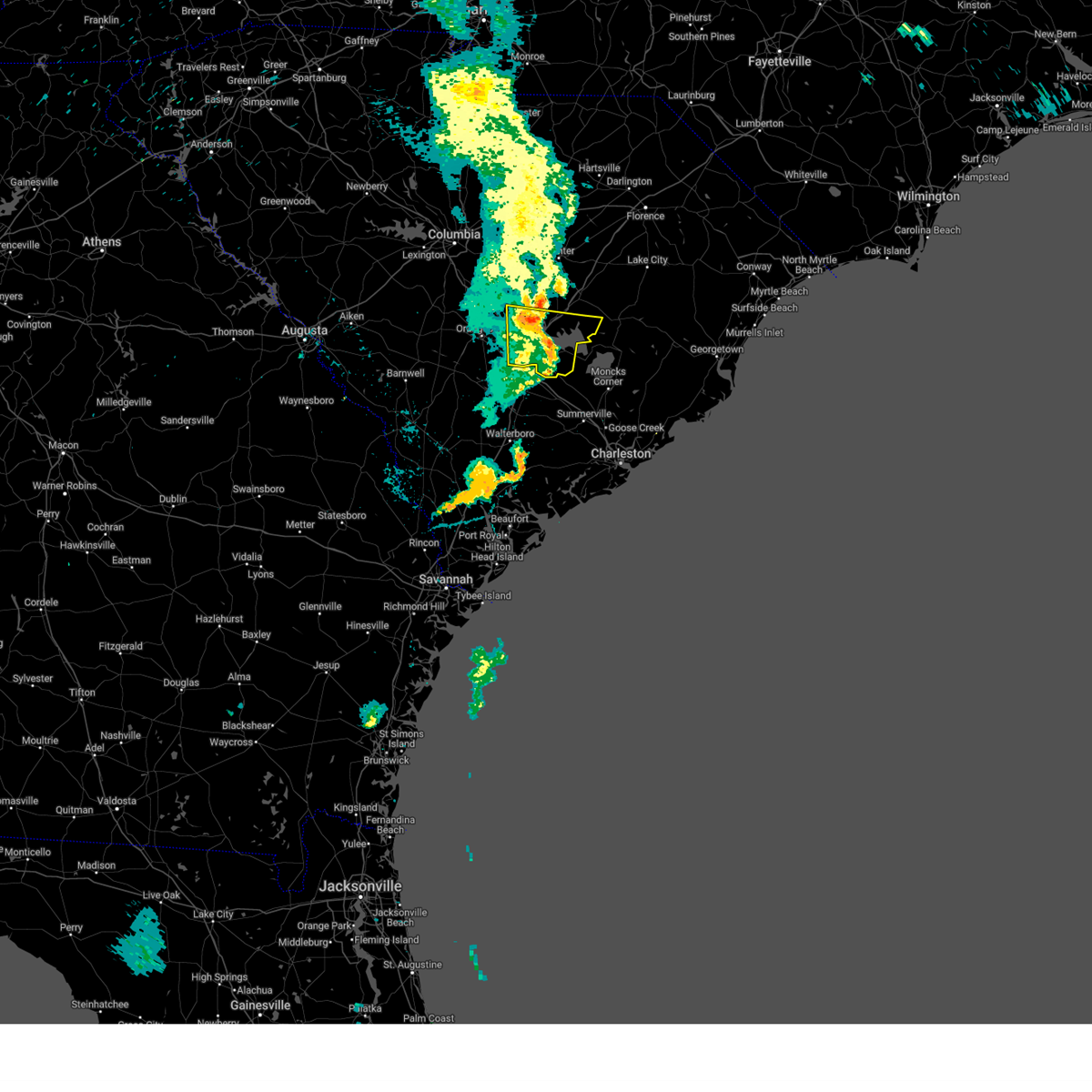
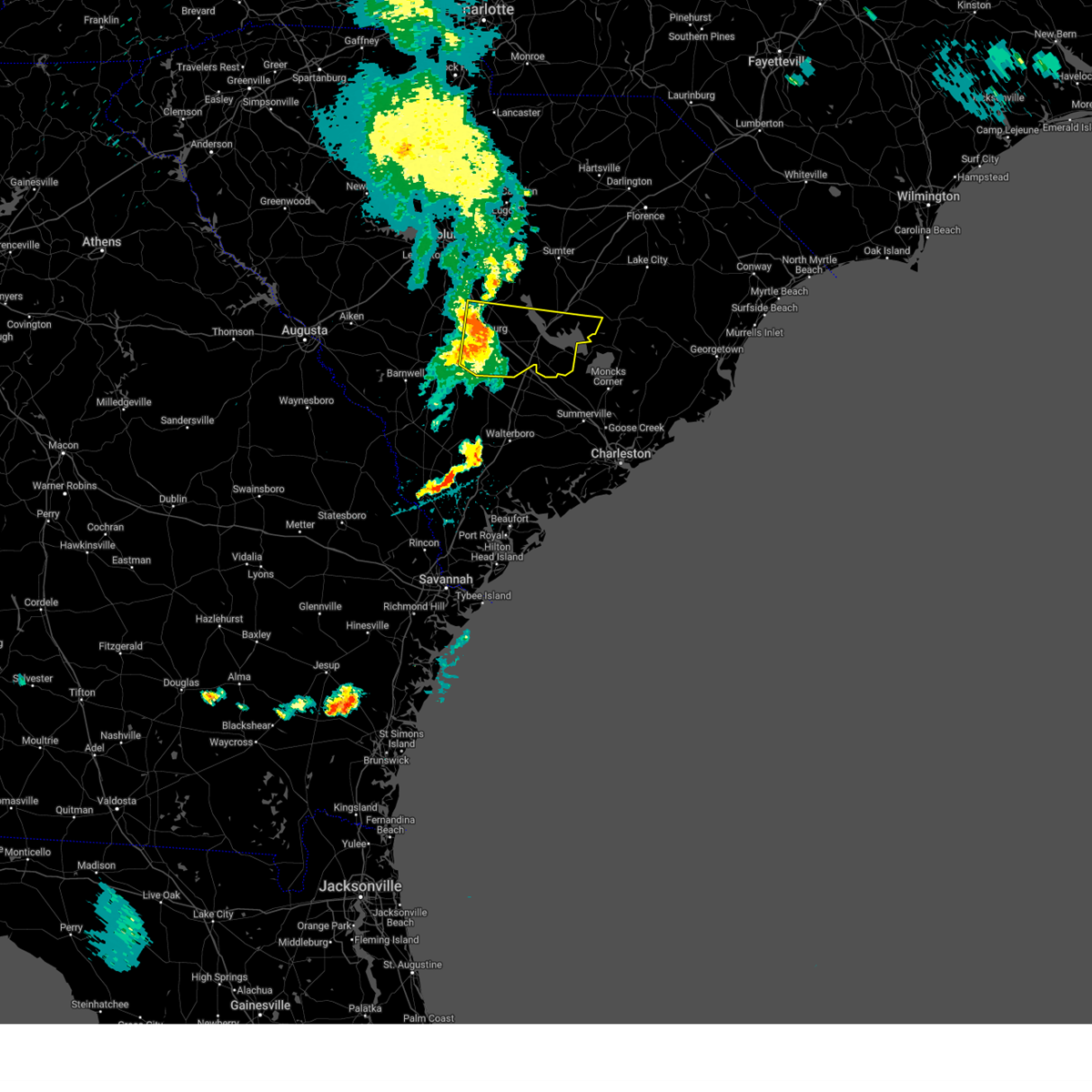
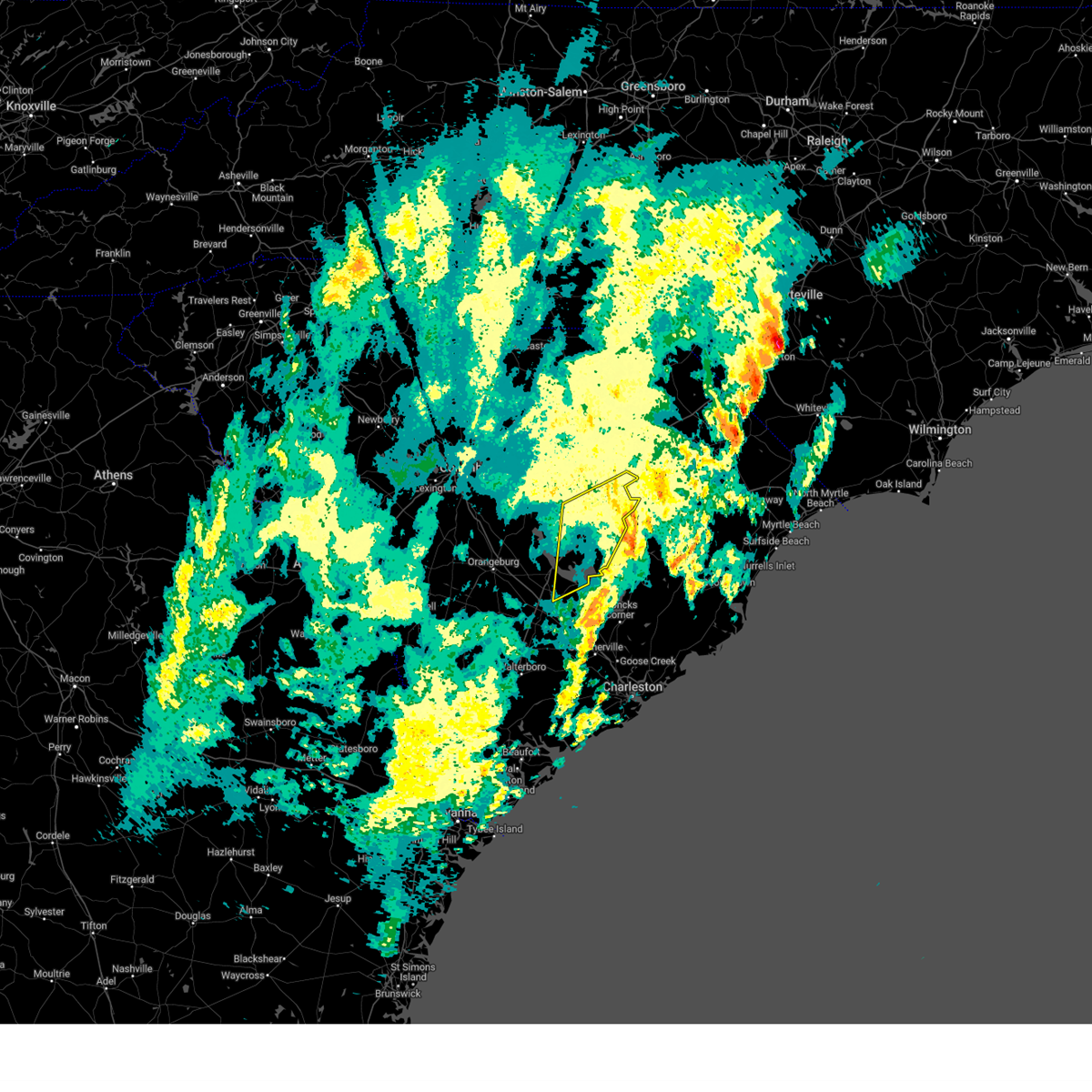
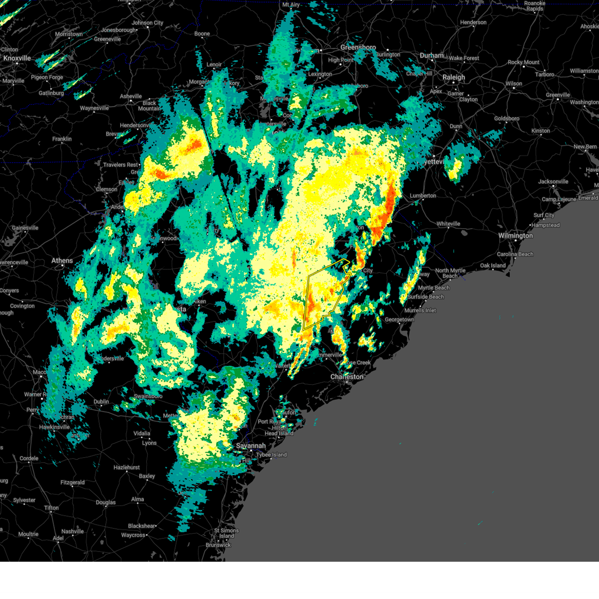
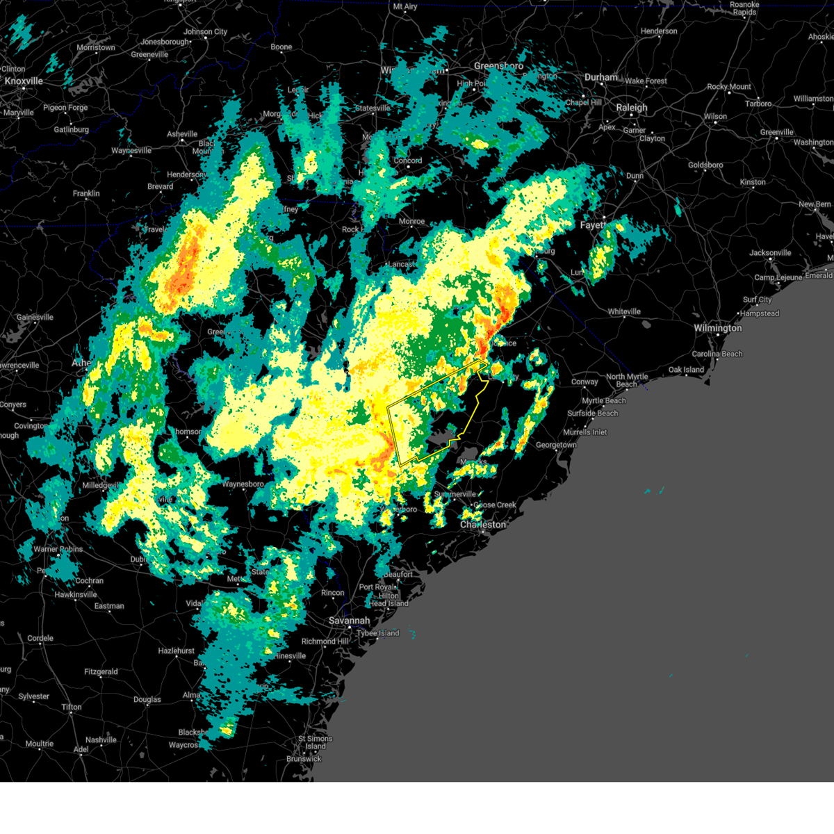
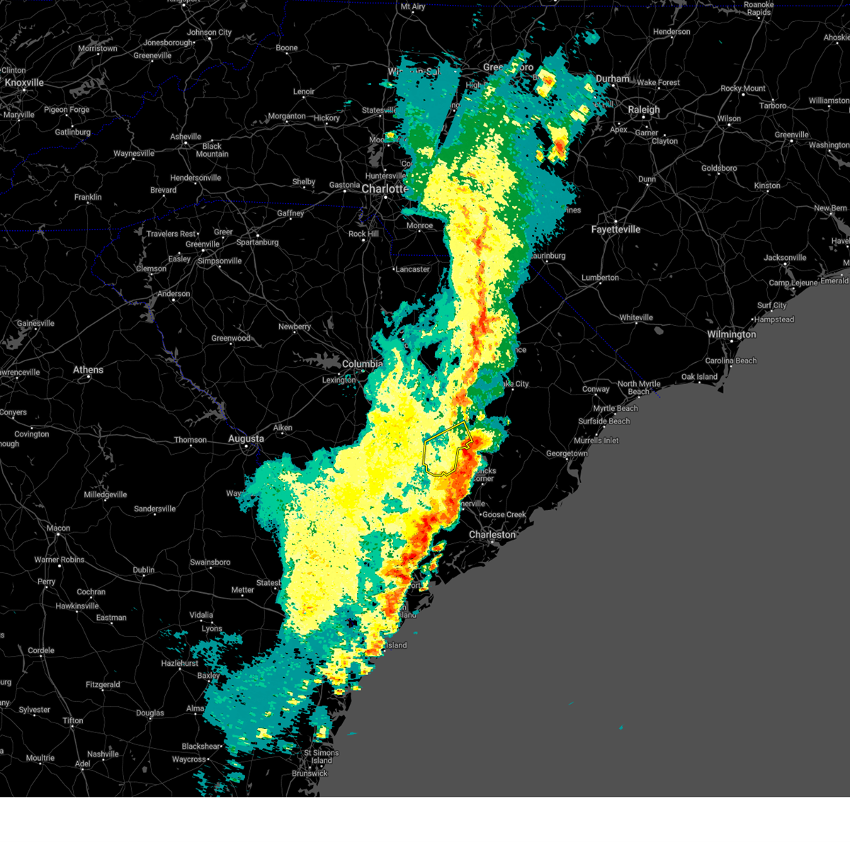
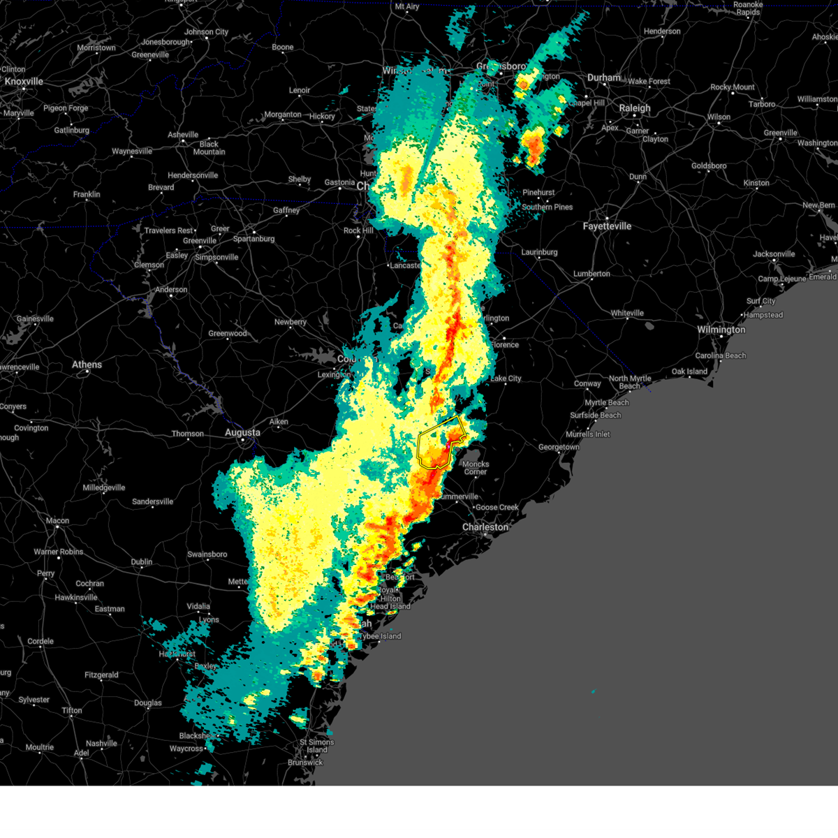
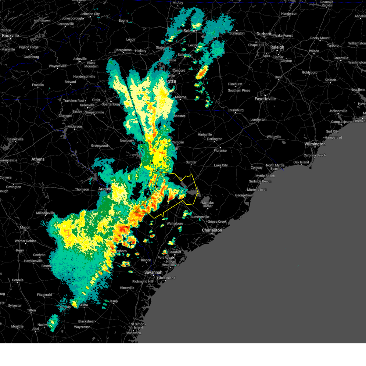
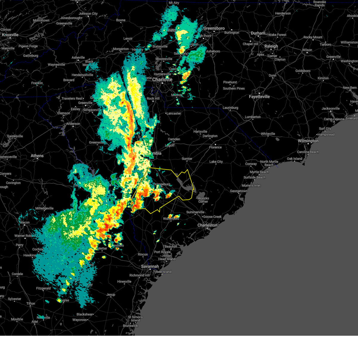
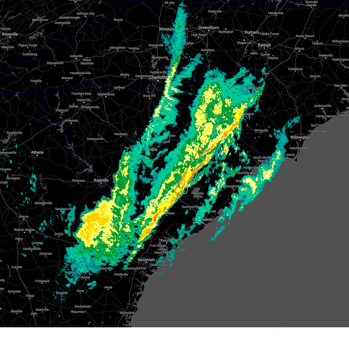
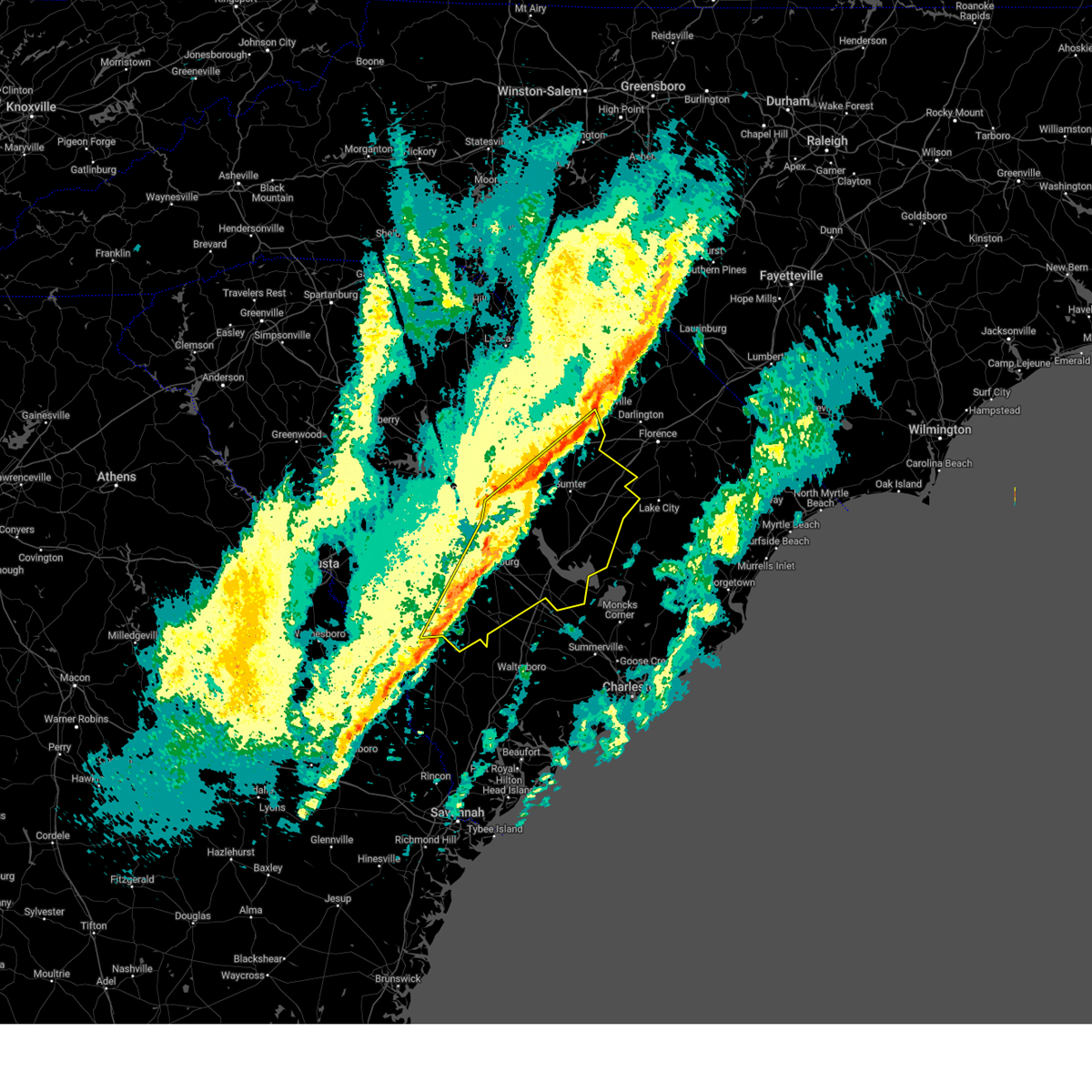
Hail Map for Holly Hill, SC
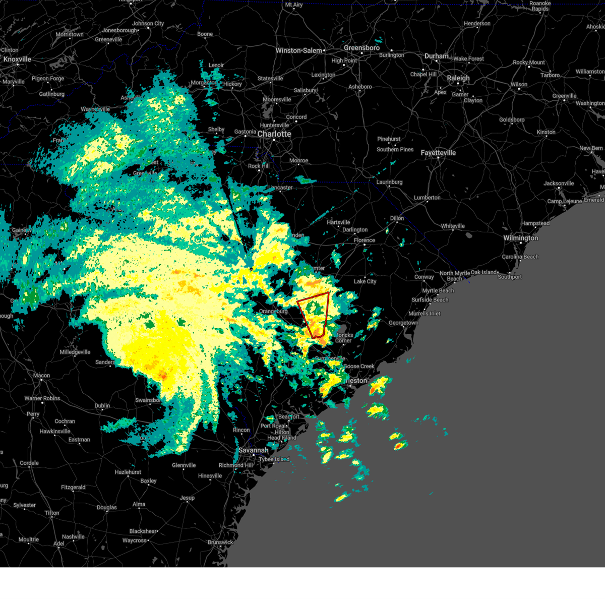
The Holly Hill, SC area has had 3 reports of on-the-ground hail by trained spotters, and has been under severe weather warnings 26 times during the past 12 months. Doppler radar has detected hail at or near Holly Hill, SC on 57 occasions, including 3 occasions during the past year.
| Name: | Holly Hill, SC |
| Where Located: | 24.8 miles WNW of Charleston, SC |
| Map: | Google Map for Holly Hill, SC |
| Population: | 1277 |
| Housing Units: | 616 |
| More Info: | Search Google for Holly Hill, SC |
0
The Top Recent Hail Date for Holly Hill, SC is Wednesday, June 25, 2025 (48th out of 57)

Hail and Wind Damage Spotted near Holly Hill, SC
| Date / Time | Report Details |
|---|---|
| 7/10/2025 6:43 PM EDT |
 the severe thunderstorm warning has been cancelled and is no longer in effect the severe thunderstorm warning has been cancelled and is no longer in effect
|
| 7/10/2025 6:15 PM EDT | Svrcae the national weather service in columbia has issued a * severe thunderstorm warning for, southeastern calhoun county in central south carolina, southern clarendon county in central south carolina, southeastern orangeburg county in central south carolina, * until 700 pm edt. * at 615 pm edt, a severe thunderstorm was located near holly hill, or 15 miles north of saint george, moving east at 25 mph (radar indicated). Hazards include 60 mph wind gusts. expect damage to trees and powerlines |
| 7/10/2025 5:36 PM EDT |
 Svrcae the national weather service in columbia has issued a * severe thunderstorm warning for, southeastern calhoun county in central south carolina, southwestern clarendon county in central south carolina, southwestern sumter county in central south carolina, central orangeburg county in central south carolina, * until 615 pm edt. * at 536 pm edt, a severe thunderstorm was located over south carolina state university, or over brookdale, moving east at 30 mph (radar indicated). Hazards include 60 mph wind gusts and quarter size hail. Hail damage to vehicles is expected. Expect wind damage to trees and powerlines. Svrcae the national weather service in columbia has issued a * severe thunderstorm warning for, southeastern calhoun county in central south carolina, southwestern clarendon county in central south carolina, southwestern sumter county in central south carolina, central orangeburg county in central south carolina, * until 615 pm edt. * at 536 pm edt, a severe thunderstorm was located over south carolina state university, or over brookdale, moving east at 30 mph (radar indicated). Hazards include 60 mph wind gusts and quarter size hail. Hail damage to vehicles is expected. Expect wind damage to trees and powerlines.
|
| 6/8/2025 12:41 PM EDT |
 The storm which prompted the warning has moved out of the area. therefore, the warning will be allowed to expire. The storm which prompted the warning has moved out of the area. therefore, the warning will be allowed to expire.
|
| 6/8/2025 12:37 PM EDT | Tree reported down and blocking both lanes of state road at highway 311. time estimated from rada in berkeley county SC, 7.4 miles NW of Holly Hill, SC |
| 6/8/2025 12:27 PM EDT |
 At 1227 pm edt, a severe thunderstorm was located near holly hill, or 19 miles northeast of saint george, moving east at 25 mph (radar indicated). Hazards include 60 mph wind gusts and half dollar size hail. Hail damage to vehicles is expected. expect wind damage to trees and powerlines. locations impacted include, holly hill, eutawville, and vance. this includes the following highways, interstate 26 between mile markers 164 and 169. Interstate 95 between mile markers 85 and 95. At 1227 pm edt, a severe thunderstorm was located near holly hill, or 19 miles northeast of saint george, moving east at 25 mph (radar indicated). Hazards include 60 mph wind gusts and half dollar size hail. Hail damage to vehicles is expected. expect wind damage to trees and powerlines. locations impacted include, holly hill, eutawville, and vance. this includes the following highways, interstate 26 between mile markers 164 and 169. Interstate 95 between mile markers 85 and 95.
|
| 6/8/2025 12:17 PM EDT | The sc dot webcam on i-95 near mile marker 93 shows trees down on the interstate blocking the road. time estimated from rada in orangeburg county SC, 8.3 miles SE of Holly Hill, SC |
| 6/8/2025 12:03 PM EDT |
 Svrcae the national weather service in columbia has issued a * severe thunderstorm warning for, southeastern orangeburg county in central south carolina, * until 1245 pm edt. * at 1202 pm edt, a severe thunderstorm was located near bowman, or 9 miles north of saint george, moving east at 35 mph (radar indicated). Hazards include 60 mph wind gusts and quarter size hail. Hail damage to vehicles is expected. Expect wind damage to trees and powerlines. Svrcae the national weather service in columbia has issued a * severe thunderstorm warning for, southeastern orangeburg county in central south carolina, * until 1245 pm edt. * at 1202 pm edt, a severe thunderstorm was located near bowman, or 9 miles north of saint george, moving east at 35 mph (radar indicated). Hazards include 60 mph wind gusts and quarter size hail. Hail damage to vehicles is expected. Expect wind damage to trees and powerlines.
|
| 6/7/2025 10:42 PM EDT |
 The storms which prompted the warning have moved out of the area. therefore, the warning will be allowed to expire. a severe thunderstorm watch remains in effect until midnight edt for central south carolina. The storms which prompted the warning have moved out of the area. therefore, the warning will be allowed to expire. a severe thunderstorm watch remains in effect until midnight edt for central south carolina.
|
| 6/7/2025 10:24 PM EDT |
 At 1024 pm edt, severe thunderstorms were located along a line extending from 6 miles west of alcolu to near holly hill, moving east at 70 mph (radar indicated). Hazards include 60 mph wind gusts. Expect damage to trees and powerlines. locations impacted include, holly hill, summerton, bowman, elloree, santee state park, santee cooper regional airport, santee, eutawville, vance, poplar creek landing, st. paul, stumphole landing, rocks pond campground and marina, eautaw springs, indian bluff recreation park, davis station, creston, blounts landing, mill creek marina and campground, and low falls landing. this includes the following highways, interstate 26 between mile markers 158 and 168. Interstate 95 between mile markers 87 and 111. At 1024 pm edt, severe thunderstorms were located along a line extending from 6 miles west of alcolu to near holly hill, moving east at 70 mph (radar indicated). Hazards include 60 mph wind gusts. Expect damage to trees and powerlines. locations impacted include, holly hill, summerton, bowman, elloree, santee state park, santee cooper regional airport, santee, eutawville, vance, poplar creek landing, st. paul, stumphole landing, rocks pond campground and marina, eautaw springs, indian bluff recreation park, davis station, creston, blounts landing, mill creek marina and campground, and low falls landing. this includes the following highways, interstate 26 between mile markers 158 and 168. Interstate 95 between mile markers 87 and 111.
|
| 6/7/2025 9:54 PM EDT |
 Svrcae the national weather service in columbia has issued a * severe thunderstorm warning for, southern calhoun county in central south carolina, southwestern clarendon county in central south carolina, orangeburg county in central south carolina, * until 1045 pm edt. * at 954 pm edt, severe thunderstorms were located along a line extending from near st. matthews to near branchville, moving east at 70 mph (radar indicated). Hazards include 60 mph wind gusts. expect damage to trees and powerlines Svrcae the national weather service in columbia has issued a * severe thunderstorm warning for, southern calhoun county in central south carolina, southwestern clarendon county in central south carolina, orangeburg county in central south carolina, * until 1045 pm edt. * at 954 pm edt, severe thunderstorms were located along a line extending from near st. matthews to near branchville, moving east at 70 mph (radar indicated). Hazards include 60 mph wind gusts. expect damage to trees and powerlines
|
| 4/7/2025 8:14 PM EDT |
 The storm which prompted the warning has moved out of the area. therefore, the warning will be allowed to expire. The storm which prompted the warning has moved out of the area. therefore, the warning will be allowed to expire.
|
| 4/7/2025 7:46 PM EDT |
 the severe thunderstorm warning has been cancelled and is no longer in effect the severe thunderstorm warning has been cancelled and is no longer in effect
|
| 4/7/2025 7:46 PM EDT |
 At 746 pm edt, a severe thunderstorm was located over santee cooper regional airport, or 7 miles south of manning, moving east at 60 mph (radar indicated). Hazards include 60 mph wind gusts. Expect damage to trees and powerlines. locations impacted include, summerton, st. paul, manning, alcolu, brogdon, vance, turbeville, lakewood, eutawville, foreston, woods bay state park, eautaw springs, indian bluff recreation park, santee cooper regional airport, gable, davis station, paxville, blounts landing, mill creek marina and campground, and shiloh. This includes interstate 95 between mile markers 102 and 145. At 746 pm edt, a severe thunderstorm was located over santee cooper regional airport, or 7 miles south of manning, moving east at 60 mph (radar indicated). Hazards include 60 mph wind gusts. Expect damage to trees and powerlines. locations impacted include, summerton, st. paul, manning, alcolu, brogdon, vance, turbeville, lakewood, eutawville, foreston, woods bay state park, eautaw springs, indian bluff recreation park, santee cooper regional airport, gable, davis station, paxville, blounts landing, mill creek marina and campground, and shiloh. This includes interstate 95 between mile markers 102 and 145.
|
| 4/7/2025 7:23 PM EDT |
 Svrcae the national weather service in columbia has issued a * severe thunderstorm warning for, southeastern calhoun county in central south carolina, clarendon county in central south carolina, central sumter county in central south carolina, southeastern orangeburg county in central south carolina, * until 815 pm edt. * at 723 pm edt, a severe thunderstorm was located near elloree, or 13 miles east of brookdale, moving east at 60 mph (radar indicated). Hazards include 60 mph wind gusts. expect damage to trees and powerlines Svrcae the national weather service in columbia has issued a * severe thunderstorm warning for, southeastern calhoun county in central south carolina, clarendon county in central south carolina, central sumter county in central south carolina, southeastern orangeburg county in central south carolina, * until 815 pm edt. * at 723 pm edt, a severe thunderstorm was located near elloree, or 13 miles east of brookdale, moving east at 60 mph (radar indicated). Hazards include 60 mph wind gusts. expect damage to trees and powerlines
|
| 3/31/2025 6:15 PM EDT |
 the severe thunderstorm warning has been cancelled and is no longer in effect the severe thunderstorm warning has been cancelled and is no longer in effect
|
| 3/31/2025 6:01 PM EDT |
 the severe thunderstorm warning has been cancelled and is no longer in effect the severe thunderstorm warning has been cancelled and is no longer in effect
|
| 3/31/2025 6:01 PM EDT |
 At 600 pm edt, a severe thunderstorm was located near holly hill, or 17 miles northeast of saint george, moving east at 35 mph (radar indicated). Hazards include 60 mph wind gusts and quarter size hail. Hail damage to vehicles is expected. expect wind damage to trees and powerlines. locations impacted include, eautaw springs, indian bluff recreation park, santee cooper regional airport, santee, rocks pond campground and marina, blounts landing, mill creek marina and campground, holly hill, vance, and eutawville. This includes interstate 95 between mile markers 92 and 102. At 600 pm edt, a severe thunderstorm was located near holly hill, or 17 miles northeast of saint george, moving east at 35 mph (radar indicated). Hazards include 60 mph wind gusts and quarter size hail. Hail damage to vehicles is expected. expect wind damage to trees and powerlines. locations impacted include, eautaw springs, indian bluff recreation park, santee cooper regional airport, santee, rocks pond campground and marina, blounts landing, mill creek marina and campground, holly hill, vance, and eutawville. This includes interstate 95 between mile markers 92 and 102.
|
| 3/31/2025 5:46 PM EDT |
 the severe thunderstorm warning has been cancelled and is no longer in effect the severe thunderstorm warning has been cancelled and is no longer in effect
|
| 3/31/2025 5:46 PM EDT |
 At 544 pm edt, a severe thunderstorm was located near bowman, or 11 miles north of saint george, moving east at 35 mph (radar indicated). Hazards include ping pong ball size hail and 60 mph wind gusts. People and animals outdoors will be injured. expect hail damage to roofs, siding, windows, and vehicles. expect wind damage to trees and powerlines. locations impacted include, summerton, bowman, poplar creek landing, st. paul, manning, stumphole landing, rocks pond campground and marina, yonder field, vance, eutawville, santee state park, eautaw springs, indian bluff recreation park, santee cooper regional airport, elloree, santee, davis station, blounts landing, mill creek marina and campground, and holly hill. this includes the following highways, interstate 26 between mile markers 154 and 168. Interstate 95 between mile markers 85 and 122. At 544 pm edt, a severe thunderstorm was located near bowman, or 11 miles north of saint george, moving east at 35 mph (radar indicated). Hazards include ping pong ball size hail and 60 mph wind gusts. People and animals outdoors will be injured. expect hail damage to roofs, siding, windows, and vehicles. expect wind damage to trees and powerlines. locations impacted include, summerton, bowman, poplar creek landing, st. paul, manning, stumphole landing, rocks pond campground and marina, yonder field, vance, eutawville, santee state park, eautaw springs, indian bluff recreation park, santee cooper regional airport, elloree, santee, davis station, blounts landing, mill creek marina and campground, and holly hill. this includes the following highways, interstate 26 between mile markers 154 and 168. Interstate 95 between mile markers 85 and 122.
|
| 3/31/2025 5:26 PM EDT |
 Svrcae the national weather service in columbia has issued a * severe thunderstorm warning for, southeastern calhoun county in central south carolina, southwestern clarendon county in central south carolina, east central bamberg county in central south carolina, southeastern orangeburg county in central south carolina, * until 630 pm edt. * at 525 pm edt, severe thunderstorms were located near branchville, or 13 miles northwest of saint george, moving east at 35 mph (radar indicated). Hazards include 60 mph wind gusts and quarter size hail. Hail damage to vehicles is expected. Expect wind damage to trees and powerlines. Svrcae the national weather service in columbia has issued a * severe thunderstorm warning for, southeastern calhoun county in central south carolina, southwestern clarendon county in central south carolina, east central bamberg county in central south carolina, southeastern orangeburg county in central south carolina, * until 630 pm edt. * at 525 pm edt, severe thunderstorms were located near branchville, or 13 miles northwest of saint george, moving east at 35 mph (radar indicated). Hazards include 60 mph wind gusts and quarter size hail. Hail damage to vehicles is expected. Expect wind damage to trees and powerlines.
|
| 3/31/2025 5:06 PM EDT |
 At 505 pm edt, severe thunderstorms were located along a line extending from 7 miles southwest of poinsett state park to rivers bridge state park, moving east at 15 mph (radar indicated). Hazards include 60 mph wind gusts and penny size hail. Expect damage to trees and powerlines. locations impacted include, bowman, govan, fort motte, stumphole landing, cameron, hilda, ehrhardt, prince of orange mall, santee state park, edisto, holly hill, lone star, cope, orangeburg county airport, bamberg, yonder field, eutawville, st. matthews, elloree, and creston. this includes the following highways, interstate 26 between mile markers 131 and 169. Interstate 95 between mile markers 85 and 113. At 505 pm edt, severe thunderstorms were located along a line extending from 7 miles southwest of poinsett state park to rivers bridge state park, moving east at 15 mph (radar indicated). Hazards include 60 mph wind gusts and penny size hail. Expect damage to trees and powerlines. locations impacted include, bowman, govan, fort motte, stumphole landing, cameron, hilda, ehrhardt, prince of orange mall, santee state park, edisto, holly hill, lone star, cope, orangeburg county airport, bamberg, yonder field, eutawville, st. matthews, elloree, and creston. this includes the following highways, interstate 26 between mile markers 131 and 169. Interstate 95 between mile markers 85 and 113.
|
| 3/31/2025 5:06 PM EDT |
 the severe thunderstorm warning has been cancelled and is no longer in effect the severe thunderstorm warning has been cancelled and is no longer in effect
|
| 3/31/2025 4:26 PM EDT |
 Svrcae the national weather service in columbia has issued a * severe thunderstorm warning for, calhoun county in central south carolina, southwestern clarendon county in central south carolina, eastern barnwell county in central south carolina, bamberg county in central south carolina, southeastern lexington county in central south carolina, orangeburg county in central south carolina, * until 530 pm edt. * at 426 pm edt, severe thunderstorms were located along a line extending from near sandy run to near sycamore, moving east at 40 mph (radar indicated). Hazards include 60 mph wind gusts and penny size hail. expect damage to trees and powerlines Svrcae the national weather service in columbia has issued a * severe thunderstorm warning for, calhoun county in central south carolina, southwestern clarendon county in central south carolina, eastern barnwell county in central south carolina, bamberg county in central south carolina, southeastern lexington county in central south carolina, orangeburg county in central south carolina, * until 530 pm edt. * at 426 pm edt, severe thunderstorms were located along a line extending from near sandy run to near sycamore, moving east at 40 mph (radar indicated). Hazards include 60 mph wind gusts and penny size hail. expect damage to trees and powerlines
|
| 2/16/2025 9:29 AM EST |
 At 928 am est, severe thunderstorms were located along a line extending from 6 miles northeast of pamplico to near round o, moving east at 45 mph (radar indicated). Hazards include 60 mph wind gusts. Expect damage to trees and powerlines. locations impacted include, manning, holly hill, woods bay state park, santee cooper regional airport, turbeville, eutawville, vance, rocks pond campground and marina, foreston, eautaw springs, indian bluff recreation park, gable, davis station, blounts landing, mill creek marina and campground, and shiloh. This includes interstate 95 between mile markers 112 and 115, and between mile markers 119 and 146. At 928 am est, severe thunderstorms were located along a line extending from 6 miles northeast of pamplico to near round o, moving east at 45 mph (radar indicated). Hazards include 60 mph wind gusts. Expect damage to trees and powerlines. locations impacted include, manning, holly hill, woods bay state park, santee cooper regional airport, turbeville, eutawville, vance, rocks pond campground and marina, foreston, eautaw springs, indian bluff recreation park, gable, davis station, blounts landing, mill creek marina and campground, and shiloh. This includes interstate 95 between mile markers 112 and 115, and between mile markers 119 and 146.
|
| 2/16/2025 9:29 AM EST |
 the severe thunderstorm warning has been cancelled and is no longer in effect the severe thunderstorm warning has been cancelled and is no longer in effect
|
| 2/16/2025 8:29 AM EST |
 Svrcae the national weather service in columbia has issued a * severe thunderstorm warning for, lee county in central south carolina, calhoun county in central south carolina, clarendon county in central south carolina, southeastern barnwell county in central south carolina, bamberg county in central south carolina, sumter county in central south carolina, orangeburg county in central south carolina, southeastern richland county in central south carolina, * until 945 am est. * at 827 am est, severe thunderstorms were located along a line extending from near bishopville to near ulmer, moving east at 45 mph (numerous reports of downed trees from trained weather spotters). Hazards include 60 mph wind gusts. expect damage to trees and powerlines Svrcae the national weather service in columbia has issued a * severe thunderstorm warning for, lee county in central south carolina, calhoun county in central south carolina, clarendon county in central south carolina, southeastern barnwell county in central south carolina, bamberg county in central south carolina, sumter county in central south carolina, orangeburg county in central south carolina, southeastern richland county in central south carolina, * until 945 am est. * at 827 am est, severe thunderstorms were located along a line extending from near bishopville to near ulmer, moving east at 45 mph (numerous reports of downed trees from trained weather spotters). Hazards include 60 mph wind gusts. expect damage to trees and powerlines
|
| 9/27/2024 4:51 AM EDT |
 Torcae the national weather service in columbia has issued a * tornado warning for, east central calhoun county in central south carolina, southwestern clarendon county in central south carolina, east central orangeburg county in central south carolina, * until 515 am edt. * at 451 am edt, severe thunderstorms capable of producing a tornado were located 7 miles east of holly hill, or 18 miles northwest of moncks corner, moving north at 65 mph (radar indicated rotation). Hazards include tornado. Flying debris will be dangerous to those caught without shelter. mobile homes will be damaged or destroyed. damage to roofs, windows, and vehicles will occur. tree damage is likely. these dangerous storms will be near, holly hill around 455 am edt. summerton around 500 am edt. other locations impacted by these tornadic thunderstorms include poplar creek landing, st. paul, stumphole landing, rocks pond campground and marina, vance, eutawville, eautaw springs, indian bluff recreation park, santee, and davis station. This includes interstate 95 between mile markers 96 and 119. Torcae the national weather service in columbia has issued a * tornado warning for, east central calhoun county in central south carolina, southwestern clarendon county in central south carolina, east central orangeburg county in central south carolina, * until 515 am edt. * at 451 am edt, severe thunderstorms capable of producing a tornado were located 7 miles east of holly hill, or 18 miles northwest of moncks corner, moving north at 65 mph (radar indicated rotation). Hazards include tornado. Flying debris will be dangerous to those caught without shelter. mobile homes will be damaged or destroyed. damage to roofs, windows, and vehicles will occur. tree damage is likely. these dangerous storms will be near, holly hill around 455 am edt. summerton around 500 am edt. other locations impacted by these tornadic thunderstorms include poplar creek landing, st. paul, stumphole landing, rocks pond campground and marina, vance, eutawville, eautaw springs, indian bluff recreation park, santee, and davis station. This includes interstate 95 between mile markers 96 and 119.
|
| 6/25/2024 4:42 PM EDT |
 The storm which prompted the warning has weakened below severe limits, and no longer poses an immediate threat to life or property. therefore, the warning will be allowed to expire. The storm which prompted the warning has weakened below severe limits, and no longer poses an immediate threat to life or property. therefore, the warning will be allowed to expire.
|
| 6/25/2024 4:25 PM EDT |
 At 424 pm edt, a severe thunderstorm was located near holly hill, or 10 miles northeast of saint george, and is nearly stationary. emergency manager reports pea sized hail observed on i-26 at exit 65 (radar indicated). Hazards include 60 mph wind gusts. Expect damage to trees and powerlines. locations impacted include, holly hill, santee, eutawville, vance, eautaw springs, indian bluff recreation park, rocks pond campground and marina, and mill creek marina and campground. this includes the following highways, interstate 26 between mile markers 163 and 169. Interstate 95 between mile markers 85 and 97. At 424 pm edt, a severe thunderstorm was located near holly hill, or 10 miles northeast of saint george, and is nearly stationary. emergency manager reports pea sized hail observed on i-26 at exit 65 (radar indicated). Hazards include 60 mph wind gusts. Expect damage to trees and powerlines. locations impacted include, holly hill, santee, eutawville, vance, eautaw springs, indian bluff recreation park, rocks pond campground and marina, and mill creek marina and campground. this includes the following highways, interstate 26 between mile markers 163 and 169. Interstate 95 between mile markers 85 and 97.
|
| 6/25/2024 4:01 PM EDT |
 Svrcae the national weather service in columbia has issued a * severe thunderstorm warning for, southeastern orangeburg county in central south carolina, * until 445 pm edt. * at 401 pm edt, a severe thunderstorm was located near holly hill, or 10 miles north of saint george, and is nearly stationary (radar indicated). Hazards include 60 mph wind gusts. expect damage to trees and powerlines Svrcae the national weather service in columbia has issued a * severe thunderstorm warning for, southeastern orangeburg county in central south carolina, * until 445 pm edt. * at 401 pm edt, a severe thunderstorm was located near holly hill, or 10 miles north of saint george, and is nearly stationary (radar indicated). Hazards include 60 mph wind gusts. expect damage to trees and powerlines
|
| 1/9/2024 4:55 PM EST |
 The severe thunderstorm warning for central lee, clarendon, central sumter and southeastern orangeburg counties will expire at 500 pm est, the storms which prompted the warning have moved out of the area. therefore, the warning will be allowed to expire. please report any storm related damage to the national weather service in columbia sc. The severe thunderstorm warning for central lee, clarendon, central sumter and southeastern orangeburg counties will expire at 500 pm est, the storms which prompted the warning have moved out of the area. therefore, the warning will be allowed to expire. please report any storm related damage to the national weather service in columbia sc.
|
| 1/9/2024 4:39 PM EST |
 At 439 pm est, severe thunderstorms were located along a line extending from 11 miles northwest of hoffman to quinby, moving east at 55 mph (emergency management). Hazards include 60 mph wind gusts. Expect damage to trees and powerlines. locations impacted include, sumter, manning, bishopville, south sumter, holly hill, summerton, alcolu, woods bay state park, santee cooper regional airport, elliott, lee state park, turbeville, mayesville, lynchburg, eutawville, paxville, brogdon, eautaw springs, blounts landing, and ashland. this includes the following highways, interstate 20 in south carolina between mile markers 117 and 125. interstate 95 between mile markers 107 and 146. hail threat, radar indicated max hail size, <. 75 in wind threat, radar indicated max wind gust, 60 mph. At 439 pm est, severe thunderstorms were located along a line extending from 11 miles northwest of hoffman to quinby, moving east at 55 mph (emergency management). Hazards include 60 mph wind gusts. Expect damage to trees and powerlines. locations impacted include, sumter, manning, bishopville, south sumter, holly hill, summerton, alcolu, woods bay state park, santee cooper regional airport, elliott, lee state park, turbeville, mayesville, lynchburg, eutawville, paxville, brogdon, eautaw springs, blounts landing, and ashland. this includes the following highways, interstate 20 in south carolina between mile markers 117 and 125. interstate 95 between mile markers 107 and 146. hail threat, radar indicated max hail size, <. 75 in wind threat, radar indicated max wind gust, 60 mph.
|
| 1/9/2024 3:44 PM EST |
 At 344 pm est, severe thunderstorms were located along a line extending from 7 miles northwest of carolina sandhills wildlife refuge to 8 miles north of summerton, moving northeast at 55 mph (emergency management). Hazards include 60 mph wind gusts. expect damage to trees and powerlines At 344 pm est, severe thunderstorms were located along a line extending from 7 miles northwest of carolina sandhills wildlife refuge to 8 miles north of summerton, moving northeast at 55 mph (emergency management). Hazards include 60 mph wind gusts. expect damage to trees and powerlines
|
| 1/9/2024 2:58 PM EST |
 At 258 pm est, severe thunderstorms were located along a line extending from arcadia lakes to 6 miles north of lodge, moving northeast at 45 mph (radar indicated). Hazards include 70 mph wind gusts. Expect considerable tree damage. Damage is likely to mobile homes, roofs, and outbuildings. At 258 pm est, severe thunderstorms were located along a line extending from arcadia lakes to 6 miles north of lodge, moving northeast at 45 mph (radar indicated). Hazards include 70 mph wind gusts. Expect considerable tree damage. Damage is likely to mobile homes, roofs, and outbuildings.
|
| 8/26/2023 8:19 PM EDT |
 At 819 pm edt, severe thunderstorms were located along a line extending from near santee state park to near eastern lake marion, moving south at 10 mph (radar indicated). Hazards include 60 mph wind gusts. expect damage to trees and powerlines At 819 pm edt, severe thunderstorms were located along a line extending from near santee state park to near eastern lake marion, moving south at 10 mph (radar indicated). Hazards include 60 mph wind gusts. expect damage to trees and powerlines
|
| 8/7/2023 7:47 PM EDT |
 At 746 pm edt, severe thunderstorms were located along a line extending from near santee state park to near branchville, moving southeast at 45 mph (radar indicated). Hazards include 60 mph wind gusts. Expect damage to trees and powerlines. locations impacted include, orangeburg, bamberg, brookdale, holly hill, branchville, summerton, bowman, elloree, santee state park, santee cooper regional airport, claflin college, south carolina state university, orangeburg county airport, edisto gardens, santee, cameron, eutawville, rowesville, vance, and cordova. this includes the following highways, interstate 26 between mile markers 144 and 169. interstate 95 between mile markers 85 and 111. hail threat, radar indicated max hail size, <. 75 in wind threat, radar indicated max wind gust, 60 mph. At 746 pm edt, severe thunderstorms were located along a line extending from near santee state park to near branchville, moving southeast at 45 mph (radar indicated). Hazards include 60 mph wind gusts. Expect damage to trees and powerlines. locations impacted include, orangeburg, bamberg, brookdale, holly hill, branchville, summerton, bowman, elloree, santee state park, santee cooper regional airport, claflin college, south carolina state university, orangeburg county airport, edisto gardens, santee, cameron, eutawville, rowesville, vance, and cordova. this includes the following highways, interstate 26 between mile markers 144 and 169. interstate 95 between mile markers 85 and 111. hail threat, radar indicated max hail size, <. 75 in wind threat, radar indicated max wind gust, 60 mph.
|
| 8/7/2023 7:13 PM EDT |
 At 711 pm edt, a line of severe thunderstorms was located in central orangeburg county moving east at 40 mph. another line of thunderstorms was moving into the county from the west at 40 mph (radar indicated). Hazards include 60-70 mph wind gusts. Expect considerable tree damage. Damage is likely to mobile homes, roofs, and outbuildings. At 711 pm edt, a line of severe thunderstorms was located in central orangeburg county moving east at 40 mph. another line of thunderstorms was moving into the county from the west at 40 mph (radar indicated). Hazards include 60-70 mph wind gusts. Expect considerable tree damage. Damage is likely to mobile homes, roofs, and outbuildings.
|
| 7/20/2023 10:33 PM EDT |
 At 1032 pm edt, severe thunderstorms were located along a line extending from near summerton to near holly hill to near round o, moving east at 40 mph (radar indicated). Hazards include 60 mph wind gusts. Expect damage to trees and powerlines. locations impacted include, holly hill, summerton, santee state park, santee cooper regional airport, santee, eutawville, vance, st. paul, rocks pond campground and marina, eautaw springs, indian bluff recreation park, davis station, blounts landing, mill creek marina and campground and poplar creek landing. this includes the following highways, interstate 26 near mile marker 168. interstate 95 between mile markers 86 and 113. hail threat, radar indicated max hail size, <. 75 in wind threat, radar indicated max wind gust, 60 mph. At 1032 pm edt, severe thunderstorms were located along a line extending from near summerton to near holly hill to near round o, moving east at 40 mph (radar indicated). Hazards include 60 mph wind gusts. Expect damage to trees and powerlines. locations impacted include, holly hill, summerton, santee state park, santee cooper regional airport, santee, eutawville, vance, st. paul, rocks pond campground and marina, eautaw springs, indian bluff recreation park, davis station, blounts landing, mill creek marina and campground and poplar creek landing. this includes the following highways, interstate 26 near mile marker 168. interstate 95 between mile markers 86 and 113. hail threat, radar indicated max hail size, <. 75 in wind threat, radar indicated max wind gust, 60 mph.
|
| 7/20/2023 10:11 PM EDT |
 At 1010 pm edt, severe thunderstorms were located along a line extending from 8 miles north of elloree to near bowman to near colleton, moving east at 45 mph (radar indicated). Hazards include 60 mph wind gusts. this line of storms has had a history of causing tree damage and power outages. expect damage to trees and powerlines At 1010 pm edt, severe thunderstorms were located along a line extending from 8 miles north of elloree to near bowman to near colleton, moving east at 45 mph (radar indicated). Hazards include 60 mph wind gusts. this line of storms has had a history of causing tree damage and power outages. expect damage to trees and powerlines
|
| 7/20/2023 9:38 PM EDT |
 At 937 pm edt, severe thunderstorms were located along a line extending from 11 miles south of sandy run to near rivers bridge state park to near hiltonia, moving southeast at 45 mph (radar indicated). Hazards include 60 mph wind gusts. Expect damage to trees and powerlines. locations impacted include, orangeburg, bamberg, denmark, brookdale, st. matthews, holly hill, branchville, bowman, elloree, santee state park, claflin college, south carolina state university, orangeburg county airport, rivers bridge state park, edisto gardens, santee, north, ehrhardt, cameron and neeses. this includes the following highways, interstate 26 between mile markers 133 and 169. interstate 95 between mile markers 85 and 103. hail threat, radar indicated max hail size, <. 75 in wind threat, radar indicated max wind gust, 60 mph. At 937 pm edt, severe thunderstorms were located along a line extending from 11 miles south of sandy run to near rivers bridge state park to near hiltonia, moving southeast at 45 mph (radar indicated). Hazards include 60 mph wind gusts. Expect damage to trees and powerlines. locations impacted include, orangeburg, bamberg, denmark, brookdale, st. matthews, holly hill, branchville, bowman, elloree, santee state park, claflin college, south carolina state university, orangeburg county airport, rivers bridge state park, edisto gardens, santee, north, ehrhardt, cameron and neeses. this includes the following highways, interstate 26 between mile markers 133 and 169. interstate 95 between mile markers 85 and 103. hail threat, radar indicated max hail size, <. 75 in wind threat, radar indicated max wind gust, 60 mph.
|
| 7/20/2023 9:12 PM EDT |
 At 911 pm edt, severe thunderstorms were located along a line extending from 14 miles northeast of aiken state park to near barnwell to near perkins, moving southeast at 65 mph (radar indicated). Hazards include 60 mph wind gusts. expect damage to trees and powerlines At 911 pm edt, severe thunderstorms were located along a line extending from 14 miles northeast of aiken state park to near barnwell to near perkins, moving southeast at 65 mph (radar indicated). Hazards include 60 mph wind gusts. expect damage to trees and powerlines
|
| 6/7/2023 5:03 PM EDT |
 At 502 pm edt, a severe thunderstorm was located near holly hill, or 13 miles north of saint george, moving east at 30 mph (radar indicated). Hazards include 60 mph wind gusts and quarter size hail. Hail damage to vehicles is expected. expect wind damage to trees and powerlines. locations impacted include, holly hill, elloree, santee state park, santee, vance, indian bluff recreation park, poplar creek landing and mill creek marina and campground. this includes the following highways, interstate 26 between mile markers 165 and 169. interstate 95 between mile markers 85 and 100. hail threat, radar indicated max hail size, 1. 00 in wind threat, radar indicated max wind gust, 60 mph. At 502 pm edt, a severe thunderstorm was located near holly hill, or 13 miles north of saint george, moving east at 30 mph (radar indicated). Hazards include 60 mph wind gusts and quarter size hail. Hail damage to vehicles is expected. expect wind damage to trees and powerlines. locations impacted include, holly hill, elloree, santee state park, santee, vance, indian bluff recreation park, poplar creek landing and mill creek marina and campground. this includes the following highways, interstate 26 between mile markers 165 and 169. interstate 95 between mile markers 85 and 100. hail threat, radar indicated max hail size, 1. 00 in wind threat, radar indicated max wind gust, 60 mph.
|
| 6/7/2023 4:32 PM EDT |
 At 431 pm edt, a severe thunderstorm was located near bowman, or 10 miles southeast of orangeburg, moving east at 30 mph (radar indicated). Hazards include 60 mph wind gusts and quarter size hail. Hail damage to vehicles is expected. expect wind damage to trees and powerlines. locations impacted include, orangeburg, brookdale, holly hill, branchville, bowman, elloree, orangeburg county airport, santee state park, claflin college, edisto gardens, south carolina state university, santee, rowesville, vance, poplar creek landing, yonder field, wilkinson heights, indian bluff recreation park, mill creek marina and campground and edisto. this includes the following highways, interstate 26 between mile markers 150 and 169. interstate 95 between mile markers 85 and 100. hail threat, radar indicated max hail size, 1. 00 in wind threat, radar indicated max wind gust, 60 mph. At 431 pm edt, a severe thunderstorm was located near bowman, or 10 miles southeast of orangeburg, moving east at 30 mph (radar indicated). Hazards include 60 mph wind gusts and quarter size hail. Hail damage to vehicles is expected. expect wind damage to trees and powerlines. locations impacted include, orangeburg, brookdale, holly hill, branchville, bowman, elloree, orangeburg county airport, santee state park, claflin college, edisto gardens, south carolina state university, santee, rowesville, vance, poplar creek landing, yonder field, wilkinson heights, indian bluff recreation park, mill creek marina and campground and edisto. this includes the following highways, interstate 26 between mile markers 150 and 169. interstate 95 between mile markers 85 and 100. hail threat, radar indicated max hail size, 1. 00 in wind threat, radar indicated max wind gust, 60 mph.
|
| 6/7/2023 4:22 PM EDT |
 At 422 pm edt, a severe thunderstorm was located 7 miles south of orangeburg county airport, or 9 miles northeast of bamberg, moving east at 30 mph (radar indicated). Hazards include 60 mph wind gusts and quarter size hail. Hail damage to vehicles is expected. Expect wind damage to trees and powerlines. At 422 pm edt, a severe thunderstorm was located 7 miles south of orangeburg county airport, or 9 miles northeast of bamberg, moving east at 30 mph (radar indicated). Hazards include 60 mph wind gusts and quarter size hail. Hail damage to vehicles is expected. Expect wind damage to trees and powerlines.
|
| 1/4/2023 12:10 PM EST |
 The severe thunderstorm warning for southern lee, eastern calhoun, clarendon, sumter and southeastern orangeburg counties will expire at 1215 pm est, the storms which prompted the warning have weakened below severe limits, and have exited the warned area. therefore, the warning will be allowed to expire. a tornado watch remains in effect until 200 pm est for central south carolina. The severe thunderstorm warning for southern lee, eastern calhoun, clarendon, sumter and southeastern orangeburg counties will expire at 1215 pm est, the storms which prompted the warning have weakened below severe limits, and have exited the warned area. therefore, the warning will be allowed to expire. a tornado watch remains in effect until 200 pm est for central south carolina.
|
| 1/4/2023 11:44 AM EST |
 At 1143 am est, severe thunderstorms were located along a line extending from 6 miles north of sumter county airport to 6 miles south of summerton to near harleyville, moving east at 45 mph (radar indicated). Hazards include 60 mph wind gusts. Expect damage to trees and powerlines. locations impacted include, sumter, manning, south sumter, shaw air base, holly hill, summerton, oakland, santee state park, mulberry, alcolu, woods bay state park, santee cooper regional airport, elliott, sumter county airport, millwood, santee, turbeville, mayesville, pinewood and lynchburg. this includes the following highways, interstate 26 between mile markers 166 and 169. Interstate 95 between mile markers 85 and 146. At 1143 am est, severe thunderstorms were located along a line extending from 6 miles north of sumter county airport to 6 miles south of summerton to near harleyville, moving east at 45 mph (radar indicated). Hazards include 60 mph wind gusts. Expect damage to trees and powerlines. locations impacted include, sumter, manning, south sumter, shaw air base, holly hill, summerton, oakland, santee state park, mulberry, alcolu, woods bay state park, santee cooper regional airport, elliott, sumter county airport, millwood, santee, turbeville, mayesville, pinewood and lynchburg. this includes the following highways, interstate 26 between mile markers 166 and 169. Interstate 95 between mile markers 85 and 146.
|
| 1/4/2023 11:34 AM EST |
 At 1133 am est, severe thunderstorms were located along a line extending from near oakland to near santee state park to reevesville, moving east at 45 mph (radar indicated). Hazards include 60 mph wind gusts. Expect damage to trees and powerlines. locations impacted include, sumter, manning, south sumter, shaw air base, holly hill, summerton, bowman, eastover, elloree, oakland, santee state park, mulberry, alcolu, woods bay state park, santee cooper regional airport, elliott, sumter county airport, millwood, poinsett state park and santee. this includes the following highways, interstate 26 between mile markers 159 and 169. Interstate 95 between mile markers 85 and 146. At 1133 am est, severe thunderstorms were located along a line extending from near oakland to near santee state park to reevesville, moving east at 45 mph (radar indicated). Hazards include 60 mph wind gusts. Expect damage to trees and powerlines. locations impacted include, sumter, manning, south sumter, shaw air base, holly hill, summerton, bowman, eastover, elloree, oakland, santee state park, mulberry, alcolu, woods bay state park, santee cooper regional airport, elliott, sumter county airport, millwood, poinsett state park and santee. this includes the following highways, interstate 26 between mile markers 159 and 169. Interstate 95 between mile markers 85 and 146.
|
| 1/4/2023 11:17 AM EST |
 At 1116 am est, severe thunderstorms were located along a line extending from 8 miles northeast of mcentire air base to 6 miles north of bowman to near branchville, moving east at 45 mph (radar indicated. wind damage has been reported with these storms!). Hazards include 60 mph wind gusts. expect damage to trees and powerlines At 1116 am est, severe thunderstorms were located along a line extending from 8 miles northeast of mcentire air base to 6 miles north of bowman to near branchville, moving east at 45 mph (radar indicated. wind damage has been reported with these storms!). Hazards include 60 mph wind gusts. expect damage to trees and powerlines
|
| 6/17/2022 8:21 PM EDT |
 At 821 pm edt, a severe thunderstorm was located near old santee canal state park, or 7 miles east of moncks corner, moving southeast at 90 mph (radar indicated). Hazards include 60 mph wind gusts and penny size hail. Expect damage to trees and powerlines. locations impacted include, orangeburg, bamberg, denmark, brookdale, holly hill, branchville, bowman, elloree, santee state park, claflin college, south carolina state university, orangeburg county airport, rivers bridge state park, edisto gardens, santee, ehrhardt, hilda, cameron, norway and eutawville. this includes the following highways, interstate 26 between mile markers 145 and 169. interstate 95 between mile markers 85 and 106. hail threat, radar indicated max hail size, 0. 75 in wind threat, radar indicated max wind gust, 60 mph. At 821 pm edt, a severe thunderstorm was located near old santee canal state park, or 7 miles east of moncks corner, moving southeast at 90 mph (radar indicated). Hazards include 60 mph wind gusts and penny size hail. Expect damage to trees and powerlines. locations impacted include, orangeburg, bamberg, denmark, brookdale, holly hill, branchville, bowman, elloree, santee state park, claflin college, south carolina state university, orangeburg county airport, rivers bridge state park, edisto gardens, santee, ehrhardt, hilda, cameron, norway and eutawville. this includes the following highways, interstate 26 between mile markers 145 and 169. interstate 95 between mile markers 85 and 106. hail threat, radar indicated max hail size, 0. 75 in wind threat, radar indicated max wind gust, 60 mph.
|
| 6/17/2022 8:05 PM EDT | Orangeburg county dispatch reported trees down at camden road in holly hill. time estimated by rada in orangeburg county SC, 0.5 miles SE of Holly Hill, SC |
| 6/17/2022 7:46 PM EDT |
 At 745 pm edt, a severe thunderstorm was located near brookdale, moving southeast at 90 mph (radar indicated). Hazards include 60 mph wind gusts and penny size hail. expect damage to trees and powerlines At 745 pm edt, a severe thunderstorm was located near brookdale, moving southeast at 90 mph (radar indicated). Hazards include 60 mph wind gusts and penny size hail. expect damage to trees and powerlines
|
| 6/16/2022 8:00 PM EDT | Sc highway patrol reported trees down on i95 at mile marker 88sb. time estimate in orangeburg county SC, 7.2 miles ESE of Holly Hill, SC |
| 6/16/2022 7:52 PM EDT |
 At 751 pm edt, a severe thunderstorm was located near brookdale, moving south at 25 mph (radar indicated). Hazards include 60 mph wind gusts and penny size hail. expect damage to trees and powerlines At 751 pm edt, a severe thunderstorm was located near brookdale, moving south at 25 mph (radar indicated). Hazards include 60 mph wind gusts and penny size hail. expect damage to trees and powerlines
|
| 5/27/2022 5:58 AM EDT |
 At 557 am edt, a severe thunderstorm capable of producing a tornado was located 7 miles west of holly hill, or 8 miles north of indian field, moving northeast at 30 mph (radar indicated rotation). Hazards include tornado. Flying debris will be dangerous to those caught without shelter. mobile homes will be damaged or destroyed. damage to roofs, windows, and vehicles will occur. tree damage is likely. this dangerous storm will be near, santee state park around 625 am edt. summerton around 630 am edt. other locations impacted by this tornadic thunderstorm include indian bluff recreation park, poplar creek landing, st. paul, santee, mill creek marina and campground, vance and eutawville. this includes the following highways, interstate 26 between mile markers 163 and 169. Interstate 95 between mile markers 85 and 107. At 557 am edt, a severe thunderstorm capable of producing a tornado was located 7 miles west of holly hill, or 8 miles north of indian field, moving northeast at 30 mph (radar indicated rotation). Hazards include tornado. Flying debris will be dangerous to those caught without shelter. mobile homes will be damaged or destroyed. damage to roofs, windows, and vehicles will occur. tree damage is likely. this dangerous storm will be near, santee state park around 625 am edt. summerton around 630 am edt. other locations impacted by this tornadic thunderstorm include indian bluff recreation park, poplar creek landing, st. paul, santee, mill creek marina and campground, vance and eutawville. this includes the following highways, interstate 26 between mile markers 163 and 169. Interstate 95 between mile markers 85 and 107.
|
| 5/6/2022 5:56 PM EDT |
 At 556 pm edt, a severe thunderstorm was located near summerton, or 14 miles west of manning, moving northeast at 70 mph (radar indicated). Hazards include 60 mph wind gusts and quarter size hail. Hail damage to vehicles is expected. Expect wind damage to trees and powerlines. At 556 pm edt, a severe thunderstorm was located near summerton, or 14 miles west of manning, moving northeast at 70 mph (radar indicated). Hazards include 60 mph wind gusts and quarter size hail. Hail damage to vehicles is expected. Expect wind damage to trees and powerlines.
|
| 5/6/2022 5:42 PM EDT |
 At 542 pm edt, a severe thunderstorm was located near elloree, or 12 miles northeast of brookdale, moving northeast at 70 mph (radar indicated). Hazards include ping pong ball size hail and 60 mph wind gusts. People and animals outdoors will be injured. expect hail damage to roofs, siding, windows, and vehicles. expect wind damage to trees and powerlines. locations impacted include, orangeburg, mcentire air base, brookdale, st. matthews, holly hill, branchville, summerton, bowman, eastover, elloree, congaree national park, santee state park, claflin college, south carolina state university, orangeburg county airport, sandy run, gadsden, edisto gardens, santee and swansea. this includes the following highways, interstate 26 between mile markers 124 and 169. interstate 95 between mile markers 85 and 109. hail threat, radar indicated max hail size, 1. 50 in wind threat, radar indicated max wind gust, 60 mph. At 542 pm edt, a severe thunderstorm was located near elloree, or 12 miles northeast of brookdale, moving northeast at 70 mph (radar indicated). Hazards include ping pong ball size hail and 60 mph wind gusts. People and animals outdoors will be injured. expect hail damage to roofs, siding, windows, and vehicles. expect wind damage to trees and powerlines. locations impacted include, orangeburg, mcentire air base, brookdale, st. matthews, holly hill, branchville, summerton, bowman, eastover, elloree, congaree national park, santee state park, claflin college, south carolina state university, orangeburg county airport, sandy run, gadsden, edisto gardens, santee and swansea. this includes the following highways, interstate 26 between mile markers 124 and 169. interstate 95 between mile markers 85 and 109. hail threat, radar indicated max hail size, 1. 50 in wind threat, radar indicated max wind gust, 60 mph.
|
| 5/6/2022 5:35 PM EDT |
 At 534 pm edt, a severe thunderstorm was located near brookdale, moving northeast at 70 mph (radar indicated). Hazards include 70 mph wind gusts and half dollar size hail. Hail damage to vehicles is expected. expect considerable tree damage. wind damage is also likely to mobile homes, roofs, and outbuildings. locations impacted include, orangeburg, bamberg, denmark, mcentire air base, brookdale, st. matthews, holly hill, branchville, summerton, bowman, eastover, elloree, santee state park, orangeburg county airport, congaree national park, claflin college, south carolina state university, sandy run, gadsden and edisto gardens. this includes the following highways, interstate 26 between mile markers 124 and 169. interstate 95 between mile markers 85 and 109. thunderstorm damage threat, considerable hail threat, radar indicated max hail size, 1. 25 in wind threat, observed max wind gust, 70 mph. At 534 pm edt, a severe thunderstorm was located near brookdale, moving northeast at 70 mph (radar indicated). Hazards include 70 mph wind gusts and half dollar size hail. Hail damage to vehicles is expected. expect considerable tree damage. wind damage is also likely to mobile homes, roofs, and outbuildings. locations impacted include, orangeburg, bamberg, denmark, mcentire air base, brookdale, st. matthews, holly hill, branchville, summerton, bowman, eastover, elloree, santee state park, orangeburg county airport, congaree national park, claflin college, south carolina state university, sandy run, gadsden and edisto gardens. this includes the following highways, interstate 26 between mile markers 124 and 169. interstate 95 between mile markers 85 and 109. thunderstorm damage threat, considerable hail threat, radar indicated max hail size, 1. 25 in wind threat, observed max wind gust, 70 mph.
|
| 5/6/2022 5:25 PM EDT |
 At 524 pm edt, a severe thunderstorm was located near edisto gardens, or near orangeburg, moving northeast at 70 mph (radar indicated). Hazards include 70 mph wind gusts and half dollar size hail. Hail damage to vehicles is expected. expect considerable tree damage. Wind damage is also likely to mobile homes, roofs, and outbuildings. At 524 pm edt, a severe thunderstorm was located near edisto gardens, or near orangeburg, moving northeast at 70 mph (radar indicated). Hazards include 70 mph wind gusts and half dollar size hail. Hail damage to vehicles is expected. expect considerable tree damage. Wind damage is also likely to mobile homes, roofs, and outbuildings.
|
| 4/5/2022 7:43 PM EDT |
 The tornado warning for south central clarendon and southeastern orangeburg counties will expire at 745 pm edt, the storm which prompted the warning has weakened below severe limits, and has exited the warned area. therefore, the warning will be allowed to expire. a tornado watch remains in effect until 900 pm edt for central south carolina. The tornado warning for south central clarendon and southeastern orangeburg counties will expire at 745 pm edt, the storm which prompted the warning has weakened below severe limits, and has exited the warned area. therefore, the warning will be allowed to expire. a tornado watch remains in effect until 900 pm edt for central south carolina.
|
| 4/5/2022 7:22 PM EDT |
 At 721 pm edt, a severe thunderstorm capable of producing a tornado was located over harleyville, or 7 miles east of indian field, moving northeast at 45 mph (radar indicated rotation). Hazards include tornado. Flying debris will be dangerous to those caught without shelter. mobile homes will be damaged or destroyed. damage to roofs, windows, and vehicles will occur. tree damage is likely. this dangerous storm will be near, holly hill around 730 pm edt. Other locations impacted by this tornadic thunderstorm include eautaw springs, rocks pond campground and marina and blounts landing. At 721 pm edt, a severe thunderstorm capable of producing a tornado was located over harleyville, or 7 miles east of indian field, moving northeast at 45 mph (radar indicated rotation). Hazards include tornado. Flying debris will be dangerous to those caught without shelter. mobile homes will be damaged or destroyed. damage to roofs, windows, and vehicles will occur. tree damage is likely. this dangerous storm will be near, holly hill around 730 pm edt. Other locations impacted by this tornadic thunderstorm include eautaw springs, rocks pond campground and marina and blounts landing.
|
| 4/5/2022 5:25 PM EDT |
 At 524 pm edt, a severe thunderstorm capable of producing a tornado was located 7 miles west of holly hill, or 8 miles north of indian field, moving northeast at 35 mph (radar indicated rotation. at 517pm, orangeburg county em reported strong rotation near bowman). Hazards include tornado. Flying debris will be dangerous to those caught without shelter. mobile homes will be damaged or destroyed. damage to roofs, windows, and vehicles will occur. tree damage is likely. this dangerous storm will be near, holly hill around 535 pm edt. other locations impacted by this tornadic thunderstorm include santee, mill creek marina and campground, vance, indian bluff recreation park and eutawville. this includes the following highways, interstate 26 between mile markers 161 and 169. Interstate 95 between mile markers 85 and 100. At 524 pm edt, a severe thunderstorm capable of producing a tornado was located 7 miles west of holly hill, or 8 miles north of indian field, moving northeast at 35 mph (radar indicated rotation. at 517pm, orangeburg county em reported strong rotation near bowman). Hazards include tornado. Flying debris will be dangerous to those caught without shelter. mobile homes will be damaged or destroyed. damage to roofs, windows, and vehicles will occur. tree damage is likely. this dangerous storm will be near, holly hill around 535 pm edt. other locations impacted by this tornadic thunderstorm include santee, mill creek marina and campground, vance, indian bluff recreation park and eutawville. this includes the following highways, interstate 26 between mile markers 161 and 169. Interstate 95 between mile markers 85 and 100.
|
| 4/5/2022 5:17 PM EDT |
 At 517 pm edt, a severe thunderstorm capable of producing a tornado was located near bowman, or 7 miles northwest of indian field, moving northeast at 35 mph (radar indicated rotation). Hazards include tornado. Flying debris will be dangerous to those caught without shelter. mobile homes will be damaged or destroyed. damage to roofs, windows, and vehicles will occur. tree damage is likely. this dangerous storm will be near, holly hill around 535 pm edt. other locations impacted by this tornadic thunderstorm include santee, mill creek marina and campground, vance, indian bluff recreation park and eutawville. this includes the following highways, interstate 26 between mile markers 161 and 169. Interstate 95 between mile markers 85 and 100. At 517 pm edt, a severe thunderstorm capable of producing a tornado was located near bowman, or 7 miles northwest of indian field, moving northeast at 35 mph (radar indicated rotation). Hazards include tornado. Flying debris will be dangerous to those caught without shelter. mobile homes will be damaged or destroyed. damage to roofs, windows, and vehicles will occur. tree damage is likely. this dangerous storm will be near, holly hill around 535 pm edt. other locations impacted by this tornadic thunderstorm include santee, mill creek marina and campground, vance, indian bluff recreation park and eutawville. this includes the following highways, interstate 26 between mile markers 161 and 169. Interstate 95 between mile markers 85 and 100.
|
| 4/5/2022 5:05 PM EDT |
 At 504 pm edt, a severe thunderstorm capable of producing a tornado was located near reevesville, or 9 miles northwest of saint george, moving northeast at 35 mph (radar indicated rotation). Hazards include tornado. Flying debris will be dangerous to those caught without shelter. mobile homes will be damaged or destroyed. damage to roofs, windows, and vehicles will occur. tree damage is likely. this dangerous storm will be near, bowman around 510 pm edt. holly hill around 535 pm edt. other locations impacted by this tornadic thunderstorm include santee, mill creek marina and campground, vance, indian bluff recreation park and eutawville. this includes the following highways, interstate 26 between mile markers 161 and 169. Interstate 95 between mile markers 85 and 100. At 504 pm edt, a severe thunderstorm capable of producing a tornado was located near reevesville, or 9 miles northwest of saint george, moving northeast at 35 mph (radar indicated rotation). Hazards include tornado. Flying debris will be dangerous to those caught without shelter. mobile homes will be damaged or destroyed. damage to roofs, windows, and vehicles will occur. tree damage is likely. this dangerous storm will be near, bowman around 510 pm edt. holly hill around 535 pm edt. other locations impacted by this tornadic thunderstorm include santee, mill creek marina and campground, vance, indian bluff recreation park and eutawville. this includes the following highways, interstate 26 between mile markers 161 and 169. Interstate 95 between mile markers 85 and 100.
|
| 4/5/2022 4:50 PM EDT |
 At 450 pm edt, a severe thunderstorm capable of producing a tornado was located over branchville, or 13 miles southeast of bamberg, moving northeast at 35 mph (radar indicated rotation. this storm has a history of producing tornadoes!). Hazards include tornado. Flying debris will be dangerous to those caught without shelter. mobile homes will be damaged or destroyed. damage to roofs, windows, and vehicles will occur. tree damage is likely. this dangerous storm will be near, bowman around 510 pm edt. holly hill around 535 pm edt. other locations impacted by this tornadic thunderstorm include santee, mill creek marina and campground, vance, indian bluff recreation park and eutawville. this includes the following highways, interstate 26 between mile markers 161 and 169. Interstate 95 between mile markers 85 and 100. At 450 pm edt, a severe thunderstorm capable of producing a tornado was located over branchville, or 13 miles southeast of bamberg, moving northeast at 35 mph (radar indicated rotation. this storm has a history of producing tornadoes!). Hazards include tornado. Flying debris will be dangerous to those caught without shelter. mobile homes will be damaged or destroyed. damage to roofs, windows, and vehicles will occur. tree damage is likely. this dangerous storm will be near, bowman around 510 pm edt. holly hill around 535 pm edt. other locations impacted by this tornadic thunderstorm include santee, mill creek marina and campground, vance, indian bluff recreation park and eutawville. this includes the following highways, interstate 26 between mile markers 161 and 169. Interstate 95 between mile markers 85 and 100.
|
| 6/15/2021 7:02 PM EDT |
 At 701 pm edt, a severe thunderstorm was located over holly hill, or 11 miles northeast of indian field, moving southeast at 35 mph (radar indicated). Hazards include golf ball size hail and 70 mph wind gusts. People and animals outdoors will be injured. expect hail damage to roofs, siding, windows, and vehicles. expect considerable tree damage. wind damage is also likely to mobile homes, roofs, and outbuildings. locations impacted include, holly hill, eutawville, vance, eautaw springs, indian bluff recreation park, st. paul, rocks pond campground and marina, blounts landing and mill creek marina and campground. This includes interstate 95 between mile markers 100 and 106. At 701 pm edt, a severe thunderstorm was located over holly hill, or 11 miles northeast of indian field, moving southeast at 35 mph (radar indicated). Hazards include golf ball size hail and 70 mph wind gusts. People and animals outdoors will be injured. expect hail damage to roofs, siding, windows, and vehicles. expect considerable tree damage. wind damage is also likely to mobile homes, roofs, and outbuildings. locations impacted include, holly hill, eutawville, vance, eautaw springs, indian bluff recreation park, st. paul, rocks pond campground and marina, blounts landing and mill creek marina and campground. This includes interstate 95 between mile markers 100 and 106.
|
| 6/15/2021 6:45 PM EDT | Sc highway patrol reports trees down near the intersection of us 176 and us 15. time estimated from rada in orangeburg county SC, 5 miles SE of Holly Hill, SC |
| 6/15/2021 6:45 PM EDT |
 At 645 pm edt, a severe thunderstorm was located near holly hill, or 12 miles north of indian field, moving southeast at 30 mph (radar indicated). Hazards include golf ball size hail and 60 mph wind gusts. People and animals outdoors will be injured. expect hail damage to roofs, siding, windows, and vehicles. expect wind damage to roofs, siding, and trees. locations impacted include, holly hill, elloree, santee state park, santee, eutawville, vance, poplar creek landing, st. paul, rocks pond campground and marina, eautaw springs, indian bluff recreation park, blounts landing and mill creek marina and campground. this includes the following highways, interstate 26 between mile markers 159 and 169. Interstate 95 between mile markers 85 and 106. At 645 pm edt, a severe thunderstorm was located near holly hill, or 12 miles north of indian field, moving southeast at 30 mph (radar indicated). Hazards include golf ball size hail and 60 mph wind gusts. People and animals outdoors will be injured. expect hail damage to roofs, siding, windows, and vehicles. expect wind damage to roofs, siding, and trees. locations impacted include, holly hill, elloree, santee state park, santee, eutawville, vance, poplar creek landing, st. paul, rocks pond campground and marina, eautaw springs, indian bluff recreation park, blounts landing and mill creek marina and campground. this includes the following highways, interstate 26 between mile markers 159 and 169. Interstate 95 between mile markers 85 and 106.
|
| 6/15/2021 6:38 PM EDT | Orangeburg county em reports tree damage along vance road. reports of tree tops snapped off and multiple trees uproote in orangeburg county SC, 8.3 miles SE of Holly Hill, SC |
| 6/15/2021 6:27 PM EDT |
 At 626 pm edt, a severe thunderstorm was located near elloree, or 12 miles east of brookdale, moving southeast at 35 mph (radar indicated). Hazards include 60 mph wind gusts and penny size hail. expect damage to roofs, siding, and trees At 626 pm edt, a severe thunderstorm was located near elloree, or 12 miles east of brookdale, moving southeast at 35 mph (radar indicated). Hazards include 60 mph wind gusts and penny size hail. expect damage to roofs, siding, and trees
|
| 5/11/2021 6:24 PM EDT |
 At 624 pm edt, a severe thunderstorm was located near holly hill, or 16 miles northeast of indian field, moving southeast at 25 mph (radar indicated). Hazards include 60 mph wind gusts and quarter size hail. Hail damage to vehicles is expected. Expect wind damage to roofs, siding, and trees. At 624 pm edt, a severe thunderstorm was located near holly hill, or 16 miles northeast of indian field, moving southeast at 25 mph (radar indicated). Hazards include 60 mph wind gusts and quarter size hail. Hail damage to vehicles is expected. Expect wind damage to roofs, siding, and trees.
|
| 5/4/2021 6:57 PM EDT |
 The severe thunderstorm warning for southeastern calhoun, southeastern barnwell, bamberg and orangeburg counties will expire at 700 pm edt, the storms which prompted the warning have weakened below severe limits, and no longer pose an immediate threat to life or property. therefore, the warning will be allowed to expire. however gusty winds are still possible with these thunderstorms. a severe thunderstorm watch remains in effect until 900 pm edt for central south carolina. The severe thunderstorm warning for southeastern calhoun, southeastern barnwell, bamberg and orangeburg counties will expire at 700 pm edt, the storms which prompted the warning have weakened below severe limits, and no longer pose an immediate threat to life or property. therefore, the warning will be allowed to expire. however gusty winds are still possible with these thunderstorms. a severe thunderstorm watch remains in effect until 900 pm edt for central south carolina.
|
| 5/4/2021 6:43 PM EDT |
 At 642 pm edt, severe thunderstorms were located along a line extending from near santee state park to near ulmer, moving southeast at 25 mph (radar indicated). Hazards include 60 mph wind gusts and penny size hail. Expect damage to roofs, siding, and trees. locations impacted include, orangeburg, barnwell, bamberg, denmark, brookdale, holly hill, branchville, bowman, elloree, santee state park, claflin college, south carolina state university, orangeburg county airport, rivers bridge state park, edisto gardens, santee, ehrhardt, hilda, cameron and eutawville. this includes the following highways, interstate 26 between mile markers 149 and 169. Interstate 95 between mile markers 85 and 101. At 642 pm edt, severe thunderstorms were located along a line extending from near santee state park to near ulmer, moving southeast at 25 mph (radar indicated). Hazards include 60 mph wind gusts and penny size hail. Expect damage to roofs, siding, and trees. locations impacted include, orangeburg, barnwell, bamberg, denmark, brookdale, holly hill, branchville, bowman, elloree, santee state park, claflin college, south carolina state university, orangeburg county airport, rivers bridge state park, edisto gardens, santee, ehrhardt, hilda, cameron and eutawville. this includes the following highways, interstate 26 between mile markers 149 and 169. Interstate 95 between mile markers 85 and 101.
|
| 5/4/2021 6:03 PM EDT |
 At 603 pm edt, severe thunderstorms were located along a line extending from near poinsett state park to 6 miles east of savannah river site, moving east at 30 mph (radar indicated). Hazards include 60 mph wind gusts. expect damage to roofs, siding, and trees At 603 pm edt, severe thunderstorms were located along a line extending from near poinsett state park to 6 miles east of savannah river site, moving east at 30 mph (radar indicated). Hazards include 60 mph wind gusts. expect damage to roofs, siding, and trees
|
| 5/3/2021 6:44 PM EDT |
 At 644 pm edt, a severe thunderstorm was located 8 miles north of lodge, or 9 miles southeast of bamberg, moving east at 45 mph (radar indicated). Hazards include ping pong ball size hail and 60 mph wind gusts. People and animals outdoors will be injured. expect hail damage to roofs, siding, windows, and vehicles. Expect wind damage to roofs, siding, and trees. At 644 pm edt, a severe thunderstorm was located 8 miles north of lodge, or 9 miles southeast of bamberg, moving east at 45 mph (radar indicated). Hazards include ping pong ball size hail and 60 mph wind gusts. People and animals outdoors will be injured. expect hail damage to roofs, siding, windows, and vehicles. Expect wind damage to roofs, siding, and trees.
|
| 6/27/2020 9:33 PM EDT | Tree in roadway at the intersection of gilway and gum street in orangeburg county SC, 0.4 miles NNW of Holly Hill, SC |
| 6/27/2020 9:08 PM EDT |
 At 908 pm edt, severe thunderstorms were located along a line extending from 8 miles north of elloree to 7 miles east of bowman to near reevesville, moving east at 50 mph (radar indicated). Hazards include 60 mph wind gusts. Expect damage to roofs, siding, and trees. locations impacted include, holly hill, branchville, summerton, bowman, elloree, santee state park, santee cooper regional airport, santee, cameron, eutawville, vance, poplar creek landing, rimini, stumphole landing, eautaw springs, blounts landing, lone star, low falls landing, st. paul and rocks pond campground and marina. this includes the following highways, interstate 26 between mile markers 154 and 169. Interstate 95 between mile markers 85 and 114. At 908 pm edt, severe thunderstorms were located along a line extending from 8 miles north of elloree to 7 miles east of bowman to near reevesville, moving east at 50 mph (radar indicated). Hazards include 60 mph wind gusts. Expect damage to roofs, siding, and trees. locations impacted include, holly hill, branchville, summerton, bowman, elloree, santee state park, santee cooper regional airport, santee, cameron, eutawville, vance, poplar creek landing, rimini, stumphole landing, eautaw springs, blounts landing, lone star, low falls landing, st. paul and rocks pond campground and marina. this includes the following highways, interstate 26 between mile markers 154 and 169. Interstate 95 between mile markers 85 and 114.
|
| 6/27/2020 8:42 PM EDT |
 At 842 pm edt, severe thunderstorms were located along a line extending from 10 miles south of sandy run to edisto gardens to near bamberg to near ulmer, moving east at 50 mph (radar indicated). Hazards include 60 mph wind gusts. expect damage to roofs, siding, and trees At 842 pm edt, severe thunderstorms were located along a line extending from 10 miles south of sandy run to edisto gardens to near bamberg to near ulmer, moving east at 50 mph (radar indicated). Hazards include 60 mph wind gusts. expect damage to roofs, siding, and trees
|
| 6/23/2020 7:10 PM EDT |
 At 709 pm edt, severe thunderstorms were located along a line extending from 8 miles west of manning to 6 miles south of summerton to near bowman to near branchville, moving east at 35 mph (radar indicated. this storm downed trees on interstate 26 near mile marker 152, just southeast of orangeburg). Hazards include 60 mph wind gusts. Expect damage to roofs, siding, and trees. locations impacted include, manning, holly hill, branchville, summerton, bowman, elloree, santee state park, santee cooper regional airport, santee, eutawville, vance, rimini, st. paul, rocks pond campground and marina, yonder field, foreston, eautaw springs, indian bluff recreation park, davis station and blounts landing. this includes the following highways, interstate 26 between mile markers 158 and 169. Interstate 95 between mile markers 85 and 118. At 709 pm edt, severe thunderstorms were located along a line extending from 8 miles west of manning to 6 miles south of summerton to near bowman to near branchville, moving east at 35 mph (radar indicated. this storm downed trees on interstate 26 near mile marker 152, just southeast of orangeburg). Hazards include 60 mph wind gusts. Expect damage to roofs, siding, and trees. locations impacted include, manning, holly hill, branchville, summerton, bowman, elloree, santee state park, santee cooper regional airport, santee, eutawville, vance, rimini, st. paul, rocks pond campground and marina, yonder field, foreston, eautaw springs, indian bluff recreation park, davis station and blounts landing. this includes the following highways, interstate 26 between mile markers 158 and 169. Interstate 95 between mile markers 85 and 118.
|
| 6/23/2020 6:29 PM EDT |
 At 629 pm edt, severe thunderstorms were located along a line extending from 7 miles east of st. matthews to near bowman to near branchville, moving east at 35 mph (radar indicated). Hazards include 60 mph wind gusts and quarter size hail. Hail damage to vehicles is expected. Expect wind damage to roofs, siding, and trees. At 629 pm edt, severe thunderstorms were located along a line extending from 7 miles east of st. matthews to near bowman to near branchville, moving east at 35 mph (radar indicated). Hazards include 60 mph wind gusts and quarter size hail. Hail damage to vehicles is expected. Expect wind damage to roofs, siding, and trees.
|
| 5/22/2020 7:40 PM EDT | Quarter sized hail reported 5 miles SE of Holly Hill, SC, orangeburg co em reported quarter size hail near the community of wells. time estimated. |
| 5/22/2020 7:15 PM EDT |
 At 715 pm edt, a severe thunderstorm was located near orangeburg county airport, or near orangeburg, moving southeast at 20 mph (radar indicated). Hazards include 60 mph wind gusts and quarter size hail. Hail damage to vehicles is expected. Expect wind damage to roofs, siding, and trees. At 715 pm edt, a severe thunderstorm was located near orangeburg county airport, or near orangeburg, moving southeast at 20 mph (radar indicated). Hazards include 60 mph wind gusts and quarter size hail. Hail damage to vehicles is expected. Expect wind damage to roofs, siding, and trees.
|
| 4/13/2020 6:35 AM EDT |
 At 634 am edt, severe thunderstorms were located along a line extending from 6 miles northwest of elloree to near smoaks, moving northeast at 60 mph (radar indicated). Hazards include 70 mph wind gusts and penny size hail. Expect considerable tree damage. Damage is likely to mobile homes, roofs, and outbuildings. At 634 am edt, severe thunderstorms were located along a line extending from 6 miles northwest of elloree to near smoaks, moving northeast at 60 mph (radar indicated). Hazards include 70 mph wind gusts and penny size hail. Expect considerable tree damage. Damage is likely to mobile homes, roofs, and outbuildings.
|
| 1/12/2020 12:45 AM EST |
 At 1243 am est, likely severe thunderstorms extended from near foreston southward to lake marion. movement was northeast near 60 mph (radar indicated). Hazards include 60 mph wind gusts. Expect damage to roofs, siding, and trees. Locations impacted include, lake marion, blounts landing, and foreston. At 1243 am est, likely severe thunderstorms extended from near foreston southward to lake marion. movement was northeast near 60 mph (radar indicated). Hazards include 60 mph wind gusts. Expect damage to roofs, siding, and trees. Locations impacted include, lake marion, blounts landing, and foreston.
|
| 1/12/2020 12:29 AM EST |
 At 1228 am est, a likely severe thunderstorm was in the eutawville and lake marion area, moving northeast at 65 mph (radar indicated). Hazards include 60 mph wind gusts. Expect damage to roofs, siding, and trees. locations impacted include, holly hill, summerton, santee cooper regional airport, eutawville, vance, eautaw springs, indian bluff recreation park, davis station, rocks pond campground and marina, blounts landing, mill creek marina and campground and foreston. This includes interstate 95 between mile markers 108 and 114. At 1228 am est, a likely severe thunderstorm was in the eutawville and lake marion area, moving northeast at 65 mph (radar indicated). Hazards include 60 mph wind gusts. Expect damage to roofs, siding, and trees. locations impacted include, holly hill, summerton, santee cooper regional airport, eutawville, vance, eautaw springs, indian bluff recreation park, davis station, rocks pond campground and marina, blounts landing, mill creek marina and campground and foreston. This includes interstate 95 between mile markers 108 and 114.
|
| 1/12/2020 12:19 AM EST |
 At 1217 am est, a likely severe thunderstorm near the holly hill, vance, and eutawville area of eastern orangeburg county. this included lake marion. movement was northeast near 65 mph (radar indicated). Hazards include 60 mph wind gusts. Expect damage to roofs, siding, and trees. locations impacted include, holly hill, summerton, santee cooper regional airport, santee state park, santee, eutawville, vance, st. paul, rocks pond campground and marina, foreston, eautaw springs, indian bluff recreation park, davis station, blounts landing and mill creek marina and campground. This includes interstate 95 between mile markers 87 and 114. At 1217 am est, a likely severe thunderstorm near the holly hill, vance, and eutawville area of eastern orangeburg county. this included lake marion. movement was northeast near 65 mph (radar indicated). Hazards include 60 mph wind gusts. Expect damage to roofs, siding, and trees. locations impacted include, holly hill, summerton, santee cooper regional airport, santee state park, santee, eutawville, vance, st. paul, rocks pond campground and marina, foreston, eautaw springs, indian bluff recreation park, davis station, blounts landing and mill creek marina and campground. This includes interstate 95 between mile markers 87 and 114.
|
| 1/12/2020 12:05 AM EST |
 At 1203 am est, a likely severe thunderstorm was located near bowman, moving northeast at 65 mph (radar indicated). Hazards include 60 mph wind gusts. expect damage to roofs, siding, and trees At 1203 am est, a likely severe thunderstorm was located near bowman, moving northeast at 65 mph (radar indicated). Hazards include 60 mph wind gusts. expect damage to roofs, siding, and trees
|
| 10/31/2019 8:27 PM EDT |
 The severe thunderstorm warning for southeastern lee, clarendon, central sumter and southeastern orangeburg counties will expire at 830 pm edt, the storms which prompted the warning have moved out of the area. therefore, the warning will be allowed to expire. The severe thunderstorm warning for southeastern lee, clarendon, central sumter and southeastern orangeburg counties will expire at 830 pm edt, the storms which prompted the warning have moved out of the area. therefore, the warning will be allowed to expire.
|
| 10/31/2019 7:51 PM EDT |
 At 751 pm edt, severe thunderstorms were located along a line extending from near elliott to santee cooper regional airport to near holly hill, moving east at 45 mph (radar indicated). Hazards include 60 mph wind gusts. Expect damage to roofs, siding, and trees. locations impacted include, sumter, manning, south sumter, holly hill, summerton, alcolu, woods bay state park, santee state park, santee cooper regional airport, mulberry, sumter county airport, millwood, santee, turbeville, mayesville, lynchburg, eutawville, paxville, vance and brogdon. this includes the following highways, interstate 26 between mile markers 164 and 168. Interstate 95 between mile markers 86 and 146. At 751 pm edt, severe thunderstorms were located along a line extending from near elliott to santee cooper regional airport to near holly hill, moving east at 45 mph (radar indicated). Hazards include 60 mph wind gusts. Expect damage to roofs, siding, and trees. locations impacted include, sumter, manning, south sumter, holly hill, summerton, alcolu, woods bay state park, santee state park, santee cooper regional airport, mulberry, sumter county airport, millwood, santee, turbeville, mayesville, lynchburg, eutawville, paxville, vance and brogdon. this includes the following highways, interstate 26 between mile markers 164 and 168. Interstate 95 between mile markers 86 and 146.
|
| 10/31/2019 7:27 PM EDT |
 At 726 pm edt, severe thunderstorms were located along a line extending from near shaw air base to near elloree to near padgetts, moving east at 35 mph (radar indicated). Hazards include 60 mph wind gusts. expect damage to roofs, siding, and trees At 726 pm edt, severe thunderstorms were located along a line extending from near shaw air base to near elloree to near padgetts, moving east at 35 mph (radar indicated). Hazards include 60 mph wind gusts. expect damage to roofs, siding, and trees
|
| 8/23/2019 4:22 PM EDT |
 At 422 pm edt, severe thunderstorms were located along a line extending from near timmonsville to near eastern lake marion, moving east at 25 mph (radar indicated). Hazards include 60 mph wind gusts and quarter size hail. Hail damage to vehicles is expected. expect wind damage to roofs, siding, and trees. locations impacted include, manning, holly hill, summerton, alcolu, woods bay state park, santee cooper regional airport, turbeville, lynchburg, eutawville, vance, rocks pond campground and marina, foreston, eautaw springs, indian bluff recreation park, gable, davis station, blounts landing, mill creek marina and campground and shiloh. This includes interstate 95 between mile markers 109 and 146. At 422 pm edt, severe thunderstorms were located along a line extending from near timmonsville to near eastern lake marion, moving east at 25 mph (radar indicated). Hazards include 60 mph wind gusts and quarter size hail. Hail damage to vehicles is expected. expect wind damage to roofs, siding, and trees. locations impacted include, manning, holly hill, summerton, alcolu, woods bay state park, santee cooper regional airport, turbeville, lynchburg, eutawville, vance, rocks pond campground and marina, foreston, eautaw springs, indian bluff recreation park, gable, davis station, blounts landing, mill creek marina and campground and shiloh. This includes interstate 95 between mile markers 109 and 146.
|
| 8/23/2019 3:47 PM EDT |
 At 347 pm edt, severe thunderstorms were located along a line extending from near cartersville to near holly hill, moving east at 25 mph (radar indicated). Hazards include 60 mph wind gusts and quarter size hail. Hail damage to vehicles is expected. Expect wind damage to roofs, siding, and trees. At 347 pm edt, severe thunderstorms were located along a line extending from near cartersville to near holly hill, moving east at 25 mph (radar indicated). Hazards include 60 mph wind gusts and quarter size hail. Hail damage to vehicles is expected. Expect wind damage to roofs, siding, and trees.
|
| 8/23/2019 3:42 PM EDT |
 At 342 pm edt, severe thunderstorms were located along a line extending from 8 miles south of poinsett state park to 7 miles east of bowman, moving northeast at 15 mph (radar indicated). Hazards include 60 mph wind gusts and quarter size hail. Hail damage to vehicles is expected. expect wind damage to roofs, siding, and trees. locations impacted include, manning, holly hill, summerton, bowman, elloree, alcolu, santee state park, santee, eutawville, vance, poplar creek landing, st. paul, stumphole landing, eautaw springs, indian bluff recreation park, davis station, mill creek marina and campground, low falls landing and lone star. this includes the following highways, interstate 26 between mile markers 160 and 169. Interstate 95 between mile markers 85 and 122. At 342 pm edt, severe thunderstorms were located along a line extending from 8 miles south of poinsett state park to 7 miles east of bowman, moving northeast at 15 mph (radar indicated). Hazards include 60 mph wind gusts and quarter size hail. Hail damage to vehicles is expected. expect wind damage to roofs, siding, and trees. locations impacted include, manning, holly hill, summerton, bowman, elloree, alcolu, santee state park, santee, eutawville, vance, poplar creek landing, st. paul, stumphole landing, eautaw springs, indian bluff recreation park, davis station, mill creek marina and campground, low falls landing and lone star. this includes the following highways, interstate 26 between mile markers 160 and 169. Interstate 95 between mile markers 85 and 122.
|
| 8/23/2019 3:18 PM EDT |
 At 318 pm edt, severe thunderstorms were located along a line extending from 7 miles east of st. matthews to near bowman, moving northeast at 15 mph (radar indicated). Hazards include 60 mph wind gusts and quarter size hail. Hail damage to vehicles is expected. Expect wind damage to roofs, siding, and trees. At 318 pm edt, severe thunderstorms were located along a line extending from 7 miles east of st. matthews to near bowman, moving northeast at 15 mph (radar indicated). Hazards include 60 mph wind gusts and quarter size hail. Hail damage to vehicles is expected. Expect wind damage to roofs, siding, and trees.
|
| 7/18/2019 6:46 PM EDT |
 At 646 pm edt, a severe thunderstorm was located near holly hill, or 7 miles north of indian field, moving southeast at 40 mph (law enforcement). Hazards include 60 mph wind gusts and penny size hail. Expect damage to roofs, siding, and trees. locations impacted include, brookdale, holly hill, bowman, elloree, santee, cameron, eutawville, vance, yonder field, eautaw springs, indian bluff recreation park, mill creek marina and campground and wilkinson heights. this includes the following highways, interstate 26 between mile markers 149 and 168. Interstate 95 between mile markers 86 and 99. At 646 pm edt, a severe thunderstorm was located near holly hill, or 7 miles north of indian field, moving southeast at 40 mph (law enforcement). Hazards include 60 mph wind gusts and penny size hail. Expect damage to roofs, siding, and trees. locations impacted include, brookdale, holly hill, bowman, elloree, santee, cameron, eutawville, vance, yonder field, eautaw springs, indian bluff recreation park, mill creek marina and campground and wilkinson heights. this includes the following highways, interstate 26 between mile markers 149 and 168. Interstate 95 between mile markers 86 and 99.
|
| 7/18/2019 6:25 PM EDT |
 At 624 pm edt, a severe thunderstorm was located 7 miles west of elloree, or 7 miles east of brookdale, moving southeast at 40 mph (law enforcement reports trees down across portions of central orangeburg county. this storm has a history of producing strong damaging winds). Hazards include 70 mph wind gusts and quarter size hail. Hail damage to vehicles is expected. expect considerable tree damage. Wind damage is also likely to mobile homes, roofs, and outbuildings. At 624 pm edt, a severe thunderstorm was located 7 miles west of elloree, or 7 miles east of brookdale, moving southeast at 40 mph (law enforcement reports trees down across portions of central orangeburg county. this storm has a history of producing strong damaging winds). Hazards include 70 mph wind gusts and quarter size hail. Hail damage to vehicles is expected. expect considerable tree damage. Wind damage is also likely to mobile homes, roofs, and outbuildings.
|
| 7/13/2019 7:25 PM EDT | Orangeburg co dispatch reported 2 trees down at 207 jack branch rd. time estimate in orangeburg county SC, 8.6 miles SE of Holly Hill, SC |
| 6/22/2019 7:13 PM EDT |
 The severe thunderstorm warning for southeastern calhoun, clarendon, central sumter and southeastern orangeburg counties will expire at 715 pm edt, the storms which prompted the warning have moved out of the area. therefore, the warning will be allowed to expire. however gusty winds are still possible with these thunderstorms. a severe thunderstorm watch remains in effect until 900 pm edt for central south carolina. to report severe weather, contact your nearest law enforcement agency. they will relay your report to the national weather service columbia. The severe thunderstorm warning for southeastern calhoun, clarendon, central sumter and southeastern orangeburg counties will expire at 715 pm edt, the storms which prompted the warning have moved out of the area. therefore, the warning will be allowed to expire. however gusty winds are still possible with these thunderstorms. a severe thunderstorm watch remains in effect until 900 pm edt for central south carolina. to report severe weather, contact your nearest law enforcement agency. they will relay your report to the national weather service columbia.
|
| 6/22/2019 6:42 PM EDT |
 At 642 pm edt, severe thunderstorms were located along a line extending from 8 miles south of poinsett state park to near eastern lake marion, moving northeast at 40 mph (radar indicated). Hazards include 60 mph wind gusts. Expect damage to roofs, siding, and trees. locations impacted include, manning, holly hill, summerton, elloree, alcolu, woods bay state park, santee state park, santee cooper regional airport, santee, turbeville, cameron, eutawville, paxville, vance, poplar creek landing, rimini, stumphole landing, brogdon, eautaw springs and blounts landing. This includes interstate 95 between mile markers 85 and 135. At 642 pm edt, severe thunderstorms were located along a line extending from 8 miles south of poinsett state park to near eastern lake marion, moving northeast at 40 mph (radar indicated). Hazards include 60 mph wind gusts. Expect damage to roofs, siding, and trees. locations impacted include, manning, holly hill, summerton, elloree, alcolu, woods bay state park, santee state park, santee cooper regional airport, santee, turbeville, cameron, eutawville, paxville, vance, poplar creek landing, rimini, stumphole landing, brogdon, eautaw springs and blounts landing. This includes interstate 95 between mile markers 85 and 135.
|
| 6/22/2019 6:15 PM EDT |
 At 615 pm edt, severe thunderstorms were located along a line extending from near brookdale to 6 miles north of indian field, moving northeast at 40 mph (radar indicated). Hazards include 60 mph wind gusts. expect damage to roofs, siding, and trees At 615 pm edt, severe thunderstorms were located along a line extending from near brookdale to 6 miles north of indian field, moving northeast at 40 mph (radar indicated). Hazards include 60 mph wind gusts. expect damage to roofs, siding, and trees
|
| 6/22/2019 5:20 AM EDT |
 At 520 am edt, severe thunderstorms were located along a line extending from near santee cooper regional airport to near lodge, moving east at 30 mph (radar indicated). Hazards include 70 mph wind gusts. Expect considerable tree damage. damage is likely to mobile homes, roofs, and outbuildings. locations impacted include, holly hill, branchville, summerton, bowman, santee state park, santee cooper regional airport, rivers bridge state park, santee, ehrhardt, eutawville, vance, st. paul, rocks pond campground and marina, eautaw springs, indian bluff recreation park, davis station, blounts landing, mill creek marina and campground and poplar creek landing. This includes interstate 95 between mile markers 85 and 112. At 520 am edt, severe thunderstorms were located along a line extending from near santee cooper regional airport to near lodge, moving east at 30 mph (radar indicated). Hazards include 70 mph wind gusts. Expect considerable tree damage. damage is likely to mobile homes, roofs, and outbuildings. locations impacted include, holly hill, branchville, summerton, bowman, santee state park, santee cooper regional airport, rivers bridge state park, santee, ehrhardt, eutawville, vance, st. paul, rocks pond campground and marina, eautaw springs, indian bluff recreation park, davis station, blounts landing, mill creek marina and campground and poplar creek landing. This includes interstate 95 between mile markers 85 and 112.
|
| 6/22/2019 4:37 AM EDT |
 At 436 am edt, severe thunderstorms were located along a line extending from near st. matthews to near ulmer, moving southeast at 50 mph (radar indicated). Hazards include 70 mph wind gusts. Expect considerable tree damage. Damage is likely to mobile homes, roofs, and outbuildings. At 436 am edt, severe thunderstorms were located along a line extending from near st. matthews to near ulmer, moving southeast at 50 mph (radar indicated). Hazards include 70 mph wind gusts. Expect considerable tree damage. Damage is likely to mobile homes, roofs, and outbuildings.
|
| 6/20/2019 6:42 PM EDT |
 The severe thunderstorm warning for southeastern calhoun, clarendon, north central bamberg and southeastern orangeburg counties will expire at 645 pm edt, the storms which prompted the warning have moved out of the area. therefore, the warning will be allowed to expire. a severe thunderstorm watch remains in effect until 1000 pm edt for central south carolina. The severe thunderstorm warning for southeastern calhoun, clarendon, north central bamberg and southeastern orangeburg counties will expire at 645 pm edt, the storms which prompted the warning have moved out of the area. therefore, the warning will be allowed to expire. a severe thunderstorm watch remains in effect until 1000 pm edt for central south carolina.
|
| 6/20/2019 6:24 PM EDT |
 At 623 pm edt, severe thunderstorms were located along a line extending from 10 miles west of salters to near eastern lake marion, moving east at 65 mph. the strongest winds and large hail should be occurring in eutawville (radar indicated). Hazards include 70 mph wind gusts and quarter size hail. Hail damage to vehicles is expected. expect considerable tree damage. wind damage is also likely to mobile homes, roofs, and outbuildings. locations impacted include, orangeburg, manning, bamberg, denmark, brookdale, holly hill, branchville, summerton, bowman, elloree, santee state park, santee cooper regional airport, orangeburg county airport, santee, cameron, eutawville, rowesville, vance, cordova and cope. This includes interstate 95 between mile markers 85 and 119. At 623 pm edt, severe thunderstorms were located along a line extending from 10 miles west of salters to near eastern lake marion, moving east at 65 mph. the strongest winds and large hail should be occurring in eutawville (radar indicated). Hazards include 70 mph wind gusts and quarter size hail. Hail damage to vehicles is expected. expect considerable tree damage. wind damage is also likely to mobile homes, roofs, and outbuildings. locations impacted include, orangeburg, manning, bamberg, denmark, brookdale, holly hill, branchville, summerton, bowman, elloree, santee state park, santee cooper regional airport, orangeburg county airport, santee, cameron, eutawville, rowesville, vance, cordova and cope. This includes interstate 95 between mile markers 85 and 119.
|
| 6/20/2019 6:05 PM EDT |
 At 605 pm edt, severe thunderstorms were located along a line extending from near summerton to near bowman, moving east at 45 mph. the strongest winds are approaching manning (radar indicated). Hazards include 70 mph wind gusts and penny size hail. Expect considerable tree damage. damage is likely to mobile homes, roofs, and outbuildings. locations impacted include, orangeburg, manning, bamberg, denmark, brookdale, holly hill, branchville, summerton, bowman, elloree, santee state park, orangeburg county airport, alcolu, santee cooper regional airport, claflin college, south carolina state university, edisto gardens, santee, turbeville and pinewood. This includes interstate 95 between mile markers 85 and 135. At 605 pm edt, severe thunderstorms were located along a line extending from near summerton to near bowman, moving east at 45 mph. the strongest winds are approaching manning (radar indicated). Hazards include 70 mph wind gusts and penny size hail. Expect considerable tree damage. damage is likely to mobile homes, roofs, and outbuildings. locations impacted include, orangeburg, manning, bamberg, denmark, brookdale, holly hill, branchville, summerton, bowman, elloree, santee state park, orangeburg county airport, alcolu, santee cooper regional airport, claflin college, south carolina state university, edisto gardens, santee, turbeville and pinewood. This includes interstate 95 between mile markers 85 and 135.
|
| 6/20/2019 5:42 PM EDT |
 At 541 pm edt, severe thunderstorms were located along a line extending from 8 miles southwest of poinsett state park to near blackville, moving east at 60 mph. the strongest winds will soon move over st. matthews in calhoun county (radar indicated). Hazards include 70 mph wind gusts. Expect considerable tree damage. Damage is likely to mobile homes, roofs, and outbuildings. At 541 pm edt, severe thunderstorms were located along a line extending from 8 miles southwest of poinsett state park to near blackville, moving east at 60 mph. the strongest winds will soon move over st. matthews in calhoun county (radar indicated). Hazards include 70 mph wind gusts. Expect considerable tree damage. Damage is likely to mobile homes, roofs, and outbuildings.
|
| 6/20/2019 5:29 PM EDT |
 At 529 pm edt, a severe thunderstorm was located near holly hill, or 16 miles northeast of indian field, moving east at 40 mph (radar indicated). Hazards include 70 mph wind gusts and half dollar size hail. Hail damage to vehicles is expected. expect considerable tree damage. Wind damage is also likely to mobile homes, roofs, and outbuildings. At 529 pm edt, a severe thunderstorm was located near holly hill, or 16 miles northeast of indian field, moving east at 40 mph (radar indicated). Hazards include 70 mph wind gusts and half dollar size hail. Hail damage to vehicles is expected. expect considerable tree damage. Wind damage is also likely to mobile homes, roofs, and outbuildings.
|
| 6/20/2019 4:42 PM EDT |
 At 442 pm edt, severe thunderstorms were located along a line extending from near summerton to near branchville, moving east at 45 mph (radar indicated). Hazards include 70 mph wind gusts. Expect considerable tree damage. Damage is likely to mobile homes, roofs, and outbuildings. At 442 pm edt, severe thunderstorms were located along a line extending from near summerton to near branchville, moving east at 45 mph (radar indicated). Hazards include 70 mph wind gusts. Expect considerable tree damage. Damage is likely to mobile homes, roofs, and outbuildings.
|
| 6/20/2019 4:16 PM EDT |
 At 416 pm edt, a severe thunderstorm was located near brookdale, moving east at 45 mph (radar indicated). Hazards include 60 mph wind gusts. expect damage to roofs, siding, and trees At 416 pm edt, a severe thunderstorm was located near brookdale, moving east at 45 mph (radar indicated). Hazards include 60 mph wind gusts. expect damage to roofs, siding, and trees
|
| 4/19/2019 2:37 PM EDT |
 The severe thunderstorm warning for calhoun, southwestern clarendon, southwestern sumter and eastern orangeburg counties will expire at 245 pm edt, the storms which prompted the warning have moved out of the area. therefore, the warning will be allowed to expire. a tornado watch remains in effect until 600 pm edt for central south carolina. to report severe weather, contact your nearest law enforcement agency. they will relay your report to the national weather service columbia. The severe thunderstorm warning for calhoun, southwestern clarendon, southwestern sumter and eastern orangeburg counties will expire at 245 pm edt, the storms which prompted the warning have moved out of the area. therefore, the warning will be allowed to expire. a tornado watch remains in effect until 600 pm edt for central south carolina. to report severe weather, contact your nearest law enforcement agency. they will relay your report to the national weather service columbia.
|
| 4/19/2019 1:52 PM EDT |
 At 151 pm edt, severe thunderstorms were located along a line extending from near bamberg to near ruffin, moving northeast at 50 mph (radar indicated). Hazards include 70 mph wind gusts. Expect considerable tree damage. Damage is likely to mobile homes, roofs, and outbuildings. At 151 pm edt, severe thunderstorms were located along a line extending from near bamberg to near ruffin, moving northeast at 50 mph (radar indicated). Hazards include 70 mph wind gusts. Expect considerable tree damage. Damage is likely to mobile homes, roofs, and outbuildings.
|
| 7/26/2018 4:04 PM EDT |
 At 404 pm edt, a severe thunderstorm was located near holly hill, or 29 miles south of manning, moving northwest at 15 mph (radar indicated). Hazards include 60 mph wind gusts and quarter size hail. Hail damage to vehicles is expected. Expect wind damage to roofs, siding, and trees. At 404 pm edt, a severe thunderstorm was located near holly hill, or 29 miles south of manning, moving northwest at 15 mph (radar indicated). Hazards include 60 mph wind gusts and quarter size hail. Hail damage to vehicles is expected. Expect wind damage to roofs, siding, and trees.
|
| 6/25/2018 9:14 PM EDT |
 At 914 pm edt, severe thunderstorms were located along a line extending from near st. matthews to near ulmer, moving southeast at 25 mph (radar indicated). Hazards include 60 mph wind gusts. expect damage to roofs, siding, and trees At 914 pm edt, severe thunderstorms were located along a line extending from near st. matthews to near ulmer, moving southeast at 25 mph (radar indicated). Hazards include 60 mph wind gusts. expect damage to roofs, siding, and trees
|
| 6/25/2018 8:49 PM EDT |
 At 847 pm edt, severe thunderstorms were located along a line extending from 8 miles northwest of gourdin to 7 miles southeast of elloree to near brookdale, moving southeast at 20 mph (radar indicated). Hazards include 60 mph wind gusts and quarter size hail. Hail damage to vehicles is expected. expect wind damage to roofs, siding, and trees. locations impacted include, orangeburg, manning, brookdale, st. matthews, holly hill, summerton, bowman, elloree, santee, north, cameron, neeses, eutawville, woodford, vance, cordova, livingston, wilkinson heights and edisto. this includes the following highways, interstate 26 between mile markers 136 and 169. Interstate 95 between mile markers 85 and 130. At 847 pm edt, severe thunderstorms were located along a line extending from 8 miles northwest of gourdin to 7 miles southeast of elloree to near brookdale, moving southeast at 20 mph (radar indicated). Hazards include 60 mph wind gusts and quarter size hail. Hail damage to vehicles is expected. expect wind damage to roofs, siding, and trees. locations impacted include, orangeburg, manning, brookdale, st. matthews, holly hill, summerton, bowman, elloree, santee, north, cameron, neeses, eutawville, woodford, vance, cordova, livingston, wilkinson heights and edisto. this includes the following highways, interstate 26 between mile markers 136 and 169. Interstate 95 between mile markers 85 and 130.
|
| 6/25/2018 8:14 PM EDT |
 At 813 pm edt, severe thunderstorms were located along a line extending from near manning to near elloree to 10 miles south of gaston, moving southeast at 20 mph (radar indicated). Hazards include 70 mph wind gusts and quarter size hail. Hail damage to vehicles is expected. expect considerable tree damage. Wind damage is also likely to mobile homes, roofs, and outbuildings. At 813 pm edt, severe thunderstorms were located along a line extending from near manning to near elloree to 10 miles south of gaston, moving southeast at 20 mph (radar indicated). Hazards include 70 mph wind gusts and quarter size hail. Hail damage to vehicles is expected. expect considerable tree damage. Wind damage is also likely to mobile homes, roofs, and outbuildings.
|
| 6/24/2018 10:30 PM EDT |
 At 1030 pm edt, a severe thunderstorm was located over holly hill, or 26 miles south of manning, moving southeast at 20 mph (radar indicated). Hazards include 60 mph wind gusts. expect damage to roofs, siding, and trees At 1030 pm edt, a severe thunderstorm was located over holly hill, or 26 miles south of manning, moving southeast at 20 mph (radar indicated). Hazards include 60 mph wind gusts. expect damage to roofs, siding, and trees
|
| 6/24/2018 9:40 PM EDT |
 At 940 pm edt, severe thunderstorms were located along a line extending from 10 miles east of manning to near brookdale, moving southeast at 30 mph (radar indicated). Hazards include 70 mph wind gusts and penny size hail. Expect considerable tree damage. Damage is likely to mobile homes, roofs, and outbuildings. At 940 pm edt, severe thunderstorms were located along a line extending from 10 miles east of manning to near brookdale, moving southeast at 30 mph (radar indicated). Hazards include 70 mph wind gusts and penny size hail. Expect considerable tree damage. Damage is likely to mobile homes, roofs, and outbuildings.
|
| 6/14/2018 3:10 PM EDT |
 At 310 pm edt, a severe thunderstorm was located 7 miles southeast of brookdale, moving southeast at 10 mph (radar indicated). Hazards include 60 mph wind gusts and quarter size hail. Hail damage to vehicles is expected. expect wind damage to roofs, siding, and trees. locations impacted include, holly hill, bowman, eutawville and vance. this includes the following highways, interstate 26 between mile markers 154 and 169. Interstate 95 between mile markers 85 and 96. At 310 pm edt, a severe thunderstorm was located 7 miles southeast of brookdale, moving southeast at 10 mph (radar indicated). Hazards include 60 mph wind gusts and quarter size hail. Hail damage to vehicles is expected. expect wind damage to roofs, siding, and trees. locations impacted include, holly hill, bowman, eutawville and vance. this includes the following highways, interstate 26 between mile markers 154 and 169. Interstate 95 between mile markers 85 and 96.
|
| 6/14/2018 2:39 PM EDT |
 At 238 pm edt, a severe thunderstorm was located near elloree, or 12 miles east of brookdale, moving southeast at 30 mph (radar indicated). Hazards include 60 mph wind gusts and quarter size hail. Hail damage to vehicles is expected. Expect wind damage to roofs, siding, and trees. At 238 pm edt, a severe thunderstorm was located near elloree, or 12 miles east of brookdale, moving southeast at 30 mph (radar indicated). Hazards include 60 mph wind gusts and quarter size hail. Hail damage to vehicles is expected. Expect wind damage to roofs, siding, and trees.
|
| 6/11/2018 3:40 PM EDT |
 At 335 pm edt, thunderstorms extended from near paxville southward through elloree to around orangeburg. movement was eastward near 30 mph. a weakening trend has occurred by a few storms may still contain wind gusts of 40 to 60 mph (radar indicated). Hazards include 60 mph wind gusts and nickel size hail. Expect damage to roofs, siding, and trees. locations impacted include, manning, holly hill, summerton, elloree, santee, cameron, eutawville, paxville and vance. this includes the following highways, interstate 26 between mile markers 150 and 168. Interstate 95 between mile markers 86 and 125. At 335 pm edt, thunderstorms extended from near paxville southward through elloree to around orangeburg. movement was eastward near 30 mph. a weakening trend has occurred by a few storms may still contain wind gusts of 40 to 60 mph (radar indicated). Hazards include 60 mph wind gusts and nickel size hail. Expect damage to roofs, siding, and trees. locations impacted include, manning, holly hill, summerton, elloree, santee, cameron, eutawville, paxville and vance. this includes the following highways, interstate 26 between mile markers 150 and 168. Interstate 95 between mile markers 86 and 125.
|
| 6/11/2018 3:07 PM EDT |
 At 304 pm edt, thunderstorms extending from sumter county southward into western orangeburg county. some of the thunderstorms were severe. movement was eastward near 30 mph and toward clarendon county and parts of northern and eastern orangeburg county. this includes lake marion (radar indicated). Hazards include 60 mph wind gusts and nickel size hail. expect damage to roofs, siding, and trees At 304 pm edt, thunderstorms extending from sumter county southward into western orangeburg county. some of the thunderstorms were severe. movement was eastward near 30 mph and toward clarendon county and parts of northern and eastern orangeburg county. this includes lake marion (radar indicated). Hazards include 60 mph wind gusts and nickel size hail. expect damage to roofs, siding, and trees
|
| 7/19/2017 4:36 PM EDT |
 At 435 pm edt, severe thunderstorms were located along a line extending from sardis to 9 miles west of salters to near eadytown to 6 miles west of cross, moving southeast at 35 mph (radar indicated). Hazards include 60 mph wind gusts. Expect damage to roofs, siding, and trees. Locations impacted include, manning, holly hill, turbeville, eutawville and shiloh. At 435 pm edt, severe thunderstorms were located along a line extending from sardis to 9 miles west of salters to near eadytown to 6 miles west of cross, moving southeast at 35 mph (radar indicated). Hazards include 60 mph wind gusts. Expect damage to roofs, siding, and trees. Locations impacted include, manning, holly hill, turbeville, eutawville and shiloh.
|
| 7/19/2017 3:48 PM EDT |
 At 347 pm edt, severe thunderstorms were located along a line extending from near bishopville to south sumter to near summerton to 8 miles northwest of holly hill, moving southeast at 20 mph (radar indicated). Hazards include 60 mph wind gusts and penny size hail. expect damage to roofs, siding, and trees At 347 pm edt, severe thunderstorms were located along a line extending from near bishopville to south sumter to near summerton to 8 miles northwest of holly hill, moving southeast at 20 mph (radar indicated). Hazards include 60 mph wind gusts and penny size hail. expect damage to roofs, siding, and trees
|
| 7/15/2017 4:03 PM EDT |
 At 400 pm edt, a severe thunderstorm was in the lake marion area. movement was east near 20 mph (radar indicated). Hazards include 60 mph wind gusts. Expect damage to roofs, siding, and trees. Locations impacted include, lake marion and eutawville. At 400 pm edt, a severe thunderstorm was in the lake marion area. movement was east near 20 mph (radar indicated). Hazards include 60 mph wind gusts. Expect damage to roofs, siding, and trees. Locations impacted include, lake marion and eutawville.
|
| 7/15/2017 3:44 PM EDT |
 At 343 pm edt, likely severe thunderstorm were in the santee and vance area, moving east near 20 mph and toward lake marion (radar indicated). Hazards include 60 mph wind gusts. expect damage to roofs, siding, and trees At 343 pm edt, likely severe thunderstorm were in the santee and vance area, moving east near 20 mph and toward lake marion (radar indicated). Hazards include 60 mph wind gusts. expect damage to roofs, siding, and trees
|
| 7/7/2017 5:42 PM EDT |
 The severe thunderstorm warning for southeastern orangeburg county will expire at 545 pm edt, the storm which prompted the warning has moved out of the area. therefore the warning will be allowed to expire. however gusty winds are still possible with a second storm south of branchville. to report severe weather, contact your nearest law enforcement agency. they will relay your report to the national weather service columbia. The severe thunderstorm warning for southeastern orangeburg county will expire at 545 pm edt, the storm which prompted the warning has moved out of the area. therefore the warning will be allowed to expire. however gusty winds are still possible with a second storm south of branchville. to report severe weather, contact your nearest law enforcement agency. they will relay your report to the national weather service columbia.
|
| 7/7/2017 5:25 PM EDT |
 At 523 pm edt, a severe thunderstorm was located over indian field, or 25 miles southeast of orangeburg, outside ofthe warning area, moving southeast at 15 mph. however, a second strong storm is moving into the warning area south a branchville, and could also cause wind damage (radar indicated). Hazards include 60 mph wind gusts and penny size hail. Expect damage to roofs, siding, and trees. Locations impacted include, holly hill, branchville and bowman. At 523 pm edt, a severe thunderstorm was located over indian field, or 25 miles southeast of orangeburg, outside ofthe warning area, moving southeast at 15 mph. however, a second strong storm is moving into the warning area south a branchville, and could also cause wind damage (radar indicated). Hazards include 60 mph wind gusts and penny size hail. Expect damage to roofs, siding, and trees. Locations impacted include, holly hill, branchville and bowman.
|
| 7/7/2017 4:51 PM EDT |
 At 451 pm edt, a severe thunderstorm was located near branchville, or 16 miles southeast of orangeburg, moving east at 15 mph (radar indicated). Hazards include 60 mph wind gusts and penny size hail. expect damage to roofs, siding, and trees At 451 pm edt, a severe thunderstorm was located near branchville, or 16 miles southeast of orangeburg, moving east at 15 mph (radar indicated). Hazards include 60 mph wind gusts and penny size hail. expect damage to roofs, siding, and trees
|
| 5/13/2017 1:30 PM EDT |
 At 130 pm edt, a severe thunderstorm was located near holly hill, or 29 miles southeast of brookdale, moving northeast at 20 mph (radar indicated). Hazards include ping pong ball size hail and 60 mph wind gusts. People and animals outdoors will be injured. expect hail damage to roofs, siding, windows, and vehicles. expect wind damage to roofs, siding, and trees. Locations impacted include, holly hill and eutawville. At 130 pm edt, a severe thunderstorm was located near holly hill, or 29 miles southeast of brookdale, moving northeast at 20 mph (radar indicated). Hazards include ping pong ball size hail and 60 mph wind gusts. People and animals outdoors will be injured. expect hail damage to roofs, siding, windows, and vehicles. expect wind damage to roofs, siding, and trees. Locations impacted include, holly hill and eutawville.
|
| 5/13/2017 1:17 PM EDT |
 At 116 pm edt, a severe thunderstorm was located near indian field, or 25 miles southeast of brookdale, moving northeast at 15 mph (radar indicated). Hazards include 60 mph wind gusts and quarter size hail. Hail damage to vehicles is expected. Expect wind damage to roofs, siding, and trees. At 116 pm edt, a severe thunderstorm was located near indian field, or 25 miles southeast of brookdale, moving northeast at 15 mph (radar indicated). Hazards include 60 mph wind gusts and quarter size hail. Hail damage to vehicles is expected. Expect wind damage to roofs, siding, and trees.
|
| 5/4/2017 9:06 PM EDT | Orangeburg co em reported roof damage to a restaurant in holly hil in orangeburg county SC, 0.4 miles NNW of Holly Hill, SC |
| 5/4/2017 9:05 PM EDT | Reports of trees down near white sands rd and gardner blvd (hwy 453) sw of holly hil in orangeburg county SC, 2.9 miles NNE of Holly Hill, SC |
| 5/4/2017 9:05 PM EDT |
 At 904 pm edt, a severe thunderstorm capable of producing a tornado was located over holly hill, or 25 miles southwest of manning, moving north at 40 mph (weather spotters reported a funnel cloud near harleyville). Hazards include tornado. Flying debris will be dangerous to those caught without shelter. mobile homes will be damaged or destroyed. damage to roofs, windows, and vehicles will occur. tree damage is likely. This tornadic thunderstorm will remain over mainly rural areas of southwestern clarendon and southeastern orangeburg counties, including the following locations: santee, vance and eutawville. At 904 pm edt, a severe thunderstorm capable of producing a tornado was located over holly hill, or 25 miles southwest of manning, moving north at 40 mph (weather spotters reported a funnel cloud near harleyville). Hazards include tornado. Flying debris will be dangerous to those caught without shelter. mobile homes will be damaged or destroyed. damage to roofs, windows, and vehicles will occur. tree damage is likely. This tornadic thunderstorm will remain over mainly rural areas of southwestern clarendon and southeastern orangeburg counties, including the following locations: santee, vance and eutawville.
|
| 5/4/2017 9:02 PM EDT | Orangeburg co em reports trees down on a house at caufield ct and gardner blvd (hwy 453 in orangeburg county SC, 2 miles NNE of Holly Hill, SC |
| 5/4/2017 8:52 PM EDT |
 At 852 pm edt, a severe thunderstorm capable of producing a tornado was located near harleyville, or 27 miles southeast of brookdale, moving north at 40 mph (radar indicated rotation). Hazards include tornado. Flying debris will be dangerous to those caught without shelter. mobile homes will be damaged or destroyed. damage to roofs, windows, and vehicles will occur. tree damage is likely. this dangerous storm will be near, holly hill around 900 pm edt. Other locations impacted by this tornadic thunderstorm include santee, vance and eutawville. At 852 pm edt, a severe thunderstorm capable of producing a tornado was located near harleyville, or 27 miles southeast of brookdale, moving north at 40 mph (radar indicated rotation). Hazards include tornado. Flying debris will be dangerous to those caught without shelter. mobile homes will be damaged or destroyed. damage to roofs, windows, and vehicles will occur. tree damage is likely. this dangerous storm will be near, holly hill around 900 pm edt. Other locations impacted by this tornadic thunderstorm include santee, vance and eutawville.
|
| 4/5/2017 4:09 PM EDT |
 At 409 pm edt, a severe thunderstorm was located near cross, or 24 miles south of manning, moving northeast at 55 mph (radar indicated). Hazards include 60 mph wind gusts and half dollar size hail. Hail damage to vehicles is expected. expect wind damage to roofs, siding, and trees. locations impacted include, holly hill and eutawville. A tornado watch remains in effect until 800 pm edt for central south carolina. At 409 pm edt, a severe thunderstorm was located near cross, or 24 miles south of manning, moving northeast at 55 mph (radar indicated). Hazards include 60 mph wind gusts and half dollar size hail. Hail damage to vehicles is expected. expect wind damage to roofs, siding, and trees. locations impacted include, holly hill and eutawville. A tornado watch remains in effect until 800 pm edt for central south carolina.
|
| 4/5/2017 3:47 PM EDT |
 At 347 pm edt, a severe thunderstorm was located over harleyville, or 27 miles southeast of brookdale, moving northeast at 45 mph (radar indicated). Hazards include 60 mph wind gusts and half dollar size hail. Hail damage to vehicles is expected. Expect wind damage to roofs, siding, and trees. At 347 pm edt, a severe thunderstorm was located over harleyville, or 27 miles southeast of brookdale, moving northeast at 45 mph (radar indicated). Hazards include 60 mph wind gusts and half dollar size hail. Hail damage to vehicles is expected. Expect wind damage to roofs, siding, and trees.
|
| 4/3/2017 5:58 PM EDT |
 At 558 pm edt, severe thunderstorms were located along a line extending from near timmonsville to near holly hill, moving east at 45 mph (radar indicated). Hazards include 60 mph wind gusts. Expect damage to roofs, siding, and trees. locations impacted include, manning, holly hill, summerton, turbeville, mayesville, lynchburg, eutawville, vance and shiloh. A tornado watch remains in effect until 900 pm edt for central south carolina. At 558 pm edt, severe thunderstorms were located along a line extending from near timmonsville to near holly hill, moving east at 45 mph (radar indicated). Hazards include 60 mph wind gusts. Expect damage to roofs, siding, and trees. locations impacted include, manning, holly hill, summerton, turbeville, mayesville, lynchburg, eutawville, vance and shiloh. A tornado watch remains in effect until 900 pm edt for central south carolina.
|
| 4/3/2017 5:46 PM EDT |
 At 545 pm edt, severe thunderstorms were located along a line extending from near lamar to indian field, moving east at 45 mph (radar indicated). Hazards include 70 mph wind gusts. Expect considerable tree damage. Damage is likely to mobile homes, roofs, and outbuildings. At 545 pm edt, severe thunderstorms were located along a line extending from near lamar to indian field, moving east at 45 mph (radar indicated). Hazards include 70 mph wind gusts. Expect considerable tree damage. Damage is likely to mobile homes, roofs, and outbuildings.
|
| 4/3/2017 5:31 PM EDT |
 At 529 pm edt, severe thunderstorms were located along a line extending from 7 miles east of south sumter to indian field, moving east at 65 mph (radar indicated). Hazards include 70 mph wind gusts and quarter size hail. Hail damage to vehicles is expected. expect considerable tree damage. wind damage is also likely to mobile homes, roofs, and outbuildings. locations impacted include, manning, holly hill, summerton, bowman, elloree, santee, turbeville, pinewood, cameron, eutawville, paxville and vance. a tornado warning remains in effect for a portion of calhoun county. A tornado watch remains in effect until 900 pm edt for central south carolina. At 529 pm edt, severe thunderstorms were located along a line extending from 7 miles east of south sumter to indian field, moving east at 65 mph (radar indicated). Hazards include 70 mph wind gusts and quarter size hail. Hail damage to vehicles is expected. expect considerable tree damage. wind damage is also likely to mobile homes, roofs, and outbuildings. locations impacted include, manning, holly hill, summerton, bowman, elloree, santee, turbeville, pinewood, cameron, eutawville, paxville and vance. a tornado warning remains in effect for a portion of calhoun county. A tornado watch remains in effect until 900 pm edt for central south carolina.
|
| 4/3/2017 4:57 PM EDT |
 At 456 pm edt, severe thunderstorms were located along a line extending from near st. matthews to near ulmer, moving east at 65 mph (radar indicated). Hazards include 70 mph wind gusts and quarter size hail. Hail damage to vehicles is expected. expect considerable tree damage. Wind damage is also likely to mobile homes, roofs, and outbuildings. At 456 pm edt, severe thunderstorms were located along a line extending from near st. matthews to near ulmer, moving east at 65 mph (radar indicated). Hazards include 70 mph wind gusts and quarter size hail. Hail damage to vehicles is expected. expect considerable tree damage. Wind damage is also likely to mobile homes, roofs, and outbuildings.
|
| 4/3/2017 4:18 PM EDT |
 At 418 pm edt, severe thunderstorms were located along a line extending from 12 miles southwest of gaston to near sycamore, moving northeast at 60 mph (radar indicated). Hazards include 70 mph wind gusts and quarter size hail. Hail damage to vehicles is expected. expect considerable tree damage. Wind damage is also likely to mobile homes, roofs, and outbuildings. At 418 pm edt, severe thunderstorms were located along a line extending from 12 miles southwest of gaston to near sycamore, moving northeast at 60 mph (radar indicated). Hazards include 70 mph wind gusts and quarter size hail. Hail damage to vehicles is expected. expect considerable tree damage. Wind damage is also likely to mobile homes, roofs, and outbuildings.
|
| 3/21/2017 10:58 PM EDT |
 At 1058 pm edt, a severe thunderstorm was located 8 miles northwest of summerton, or 12 miles west of manning, moving east at 45 mph (radar indicated). Hazards include 60 mph wind gusts. expect damage to roofs, siding, and trees At 1058 pm edt, a severe thunderstorm was located 8 miles northwest of summerton, or 12 miles west of manning, moving east at 45 mph (radar indicated). Hazards include 60 mph wind gusts. expect damage to roofs, siding, and trees
|
| 2/15/2017 12:00 PM EST | Half Dollar sized hail reported 2 miles NNE of Holly Hill, SC, public reported half dollar sized hail at a business south of holly hill on gardner blvd/hwy 453. . |
| 2/15/2017 11:49 AM EST |
 At 1149 am est, a severe thunderstorm was located near indian field, or 20 miles southeast of brookdale, moving east at 60 mph (radar indicated). Hazards include 60 mph wind gusts and quarter size hail. Hail damage to vehicles is expected. Expect wind damage to roofs, siding, and trees. At 1149 am est, a severe thunderstorm was located near indian field, or 20 miles southeast of brookdale, moving east at 60 mph (radar indicated). Hazards include 60 mph wind gusts and quarter size hail. Hail damage to vehicles is expected. Expect wind damage to roofs, siding, and trees.
|
| 2/15/2017 10:58 AM EST |
 At 1057 am est, a severe thunderstorm was located near eastern lake marion, or 11 miles south of manning, moving east at 45 mph (radar indicated). Hazards include 60 mph wind gusts. Expect damage to roofs, siding, and trees. Locations impacted include, holly hill, bowman, santee, eutawville and vance. At 1057 am est, a severe thunderstorm was located near eastern lake marion, or 11 miles south of manning, moving east at 45 mph (radar indicated). Hazards include 60 mph wind gusts. Expect damage to roofs, siding, and trees. Locations impacted include, holly hill, bowman, santee, eutawville and vance.
|
| 2/15/2017 10:35 AM EST |
 At 1035 am est, a severe thunderstorm was located near elloree, or 18 miles southwest of manning, moving east at 45 mph (radar indicated). Hazards include 60 mph wind gusts. expect damage to roofs, siding, and trees At 1035 am est, a severe thunderstorm was located near elloree, or 18 miles southwest of manning, moving east at 45 mph (radar indicated). Hazards include 60 mph wind gusts. expect damage to roofs, siding, and trees
|
| 1/21/2017 5:10 PM EST |
 At 509 pm est, a severe thunderstorm was located 7 miles south of summerton, or 16 miles southwest of manning, moving east at 25 mph (radar indicated). Hazards include 60 mph wind gusts. Expect damage to roofs, siding, and trees. locations impacted include, holly hill, elloree, santee, eutawville and vance. A tornado watch remains in effect until 700 pm est for central south carolina. At 509 pm est, a severe thunderstorm was located 7 miles south of summerton, or 16 miles southwest of manning, moving east at 25 mph (radar indicated). Hazards include 60 mph wind gusts. Expect damage to roofs, siding, and trees. locations impacted include, holly hill, elloree, santee, eutawville and vance. A tornado watch remains in effect until 700 pm est for central south carolina.
|
| 1/21/2017 4:55 PM EST |
 At 454 pm est, a severe thunderstorm was located near elloree, or 19 miles east of brookdale, moving east at 30 mph (radar indicated). Hazards include 60 mph wind gusts. Expect damage to roofs, siding, and trees. locations impacted include, holly hill, bowman, elloree, santee, eutawville and vance. A tornado watch remains in effect until 700 pm est for central south carolina. At 454 pm est, a severe thunderstorm was located near elloree, or 19 miles east of brookdale, moving east at 30 mph (radar indicated). Hazards include 60 mph wind gusts. Expect damage to roofs, siding, and trees. locations impacted include, holly hill, bowman, elloree, santee, eutawville and vance. A tornado watch remains in effect until 700 pm est for central south carolina.
|
| 1/21/2017 4:38 PM EST |
 At 437 pm est, a severe thunderstorm was located near bowman, or 8 miles southeast of orangeburg, moving east at 25 mph (radar indicated). Hazards include 60 mph wind gusts. expect damage to roofs, siding, and trees At 437 pm est, a severe thunderstorm was located near bowman, or 8 miles southeast of orangeburg, moving east at 25 mph (radar indicated). Hazards include 60 mph wind gusts. expect damage to roofs, siding, and trees
|
| 7/5/2016 6:50 PM EDT |
 At 647 pm edt, thunderstorms were in much of clarendon county and eastern orangeburg county. movement was eastward near 30 mph. some of the thunderstorms contained wind gusts of 40 to 60 mph. (radar indicated). Hazards include 60 mph wind gusts. Expect damage to roofs. siding. and trees. Locations impacted include, holly hill, summerton, santee, eutawville and vance. At 647 pm edt, thunderstorms were in much of clarendon county and eastern orangeburg county. movement was eastward near 30 mph. some of the thunderstorms contained wind gusts of 40 to 60 mph. (radar indicated). Hazards include 60 mph wind gusts. Expect damage to roofs. siding. and trees. Locations impacted include, holly hill, summerton, santee, eutawville and vance.
|
| 7/5/2016 6:20 PM EDT |
 At 619 pm edt, a line of thunderstorms extended from eastern calhoun county southward into bamberg county. movement was eastward near 35 mph. some of the thunderstorms in the line contained wind gusts of 40 to 60 mph (radar indicated). Hazards include 60 mph wind gusts. Expect damage to roofs. siding. And trees. At 619 pm edt, a line of thunderstorms extended from eastern calhoun county southward into bamberg county. movement was eastward near 35 mph. some of the thunderstorms in the line contained wind gusts of 40 to 60 mph (radar indicated). Hazards include 60 mph wind gusts. Expect damage to roofs. siding. And trees.
|
| 6/24/2016 5:56 PM EDT |
 At 555 pm edt, severe thunderstorms were located along a line extending from near hebron to 7 miles west of orangeburg, moving southeast at 25 mph (radar indicated). Hazards include 60 mph wind gusts and quarter size hail. Hail damage to vehicles is expected. expect wind damage to roofs, siding, and trees. Locations impacted include, orangeburg, manning, brookdale, holly hill, summerton, elloree, santee, cameron, eutawville, vance, wilkinson heights and edisto. At 555 pm edt, severe thunderstorms were located along a line extending from near hebron to 7 miles west of orangeburg, moving southeast at 25 mph (radar indicated). Hazards include 60 mph wind gusts and quarter size hail. Hail damage to vehicles is expected. expect wind damage to roofs, siding, and trees. Locations impacted include, orangeburg, manning, brookdale, holly hill, summerton, elloree, santee, cameron, eutawville, vance, wilkinson heights and edisto.
|
| 6/24/2016 5:25 PM EDT |
 At 524 pm edt, severe thunderstorms were located along a line extending from 12 miles south of cartersville to 16 miles south of gaston, moving southeast at 25 mph (radar indicated). Hazards include 60 mph wind gusts and quarter size hail. Hail damage to vehicles is expected. Expect wind damage to roofs, siding, and trees. At 524 pm edt, severe thunderstorms were located along a line extending from 12 miles south of cartersville to 16 miles south of gaston, moving southeast at 25 mph (radar indicated). Hazards include 60 mph wind gusts and quarter size hail. Hail damage to vehicles is expected. Expect wind damage to roofs, siding, and trees.
|
| 6/17/2016 3:53 PM EDT |
 At 353 pm edt, a severe thunderstorm was located near barnwell, moving southeast at 30 mph (radar indicated). Hazards include 70 mph wind gusts and half dollar size hail. Hail damage to vehicles is expected. expect considerable tree damage. Wind damage is also likely to mobile homes, roofs, and outbuildings. At 353 pm edt, a severe thunderstorm was located near barnwell, moving southeast at 30 mph (radar indicated). Hazards include 70 mph wind gusts and half dollar size hail. Hail damage to vehicles is expected. expect considerable tree damage. Wind damage is also likely to mobile homes, roofs, and outbuildings.
|
| 6/17/2016 3:24 PM EDT |
 At 323 pm edt, a severe thunderstorm was located 10 miles northeast of williston, or 19 miles northwest of denmark, moving east at 40 mph (radar indicated). Hazards include 70 mph wind gusts and half dollar size hail. Hail damage to vehicles is expected. expect considerable tree damage. wind damage is also likely to mobile homes, roofs, and outbuildings. locations impacted include, orangeburg, bamberg, denmark, brookdale, williston, blackville, new ellenton, st. Matthews, holly hill, branchville, bowman, elloree, santee, swansea, wagener, north, pelion, springfield, hilda and cameron. At 323 pm edt, a severe thunderstorm was located 10 miles northeast of williston, or 19 miles northwest of denmark, moving east at 40 mph (radar indicated). Hazards include 70 mph wind gusts and half dollar size hail. Hail damage to vehicles is expected. expect considerable tree damage. wind damage is also likely to mobile homes, roofs, and outbuildings. locations impacted include, orangeburg, bamberg, denmark, brookdale, williston, blackville, new ellenton, st. Matthews, holly hill, branchville, bowman, elloree, santee, swansea, wagener, north, pelion, springfield, hilda and cameron.
|
| 6/17/2016 3:20 PM EDT | Sc state hwy patrol reports tree down in roadway at the intersection of poplar hill dr and ruffacre ln in berkeley county SC, 10.6 miles WNW of Holly Hill, SC |
| 6/17/2016 3:13 PM EDT |
 At 313 pm edt, a severe thunderstorm was located near bowman, or 9 miles southeast of orangeburg, moving east at 30 mph (radar indicated). Hazards include 60 mph wind gusts and quarter size hail. Hail damage to vehicles is expected. expect wind damage to roofs, siding, and trees. locations impacted include, orangeburg, bamberg, denmark, brookdale, williston, blackville, new ellenton, st. Matthews, holly hill, branchville, bowman, elloree, santee, swansea, wagener, north, pelion, springfield, hilda and cameron. At 313 pm edt, a severe thunderstorm was located near bowman, or 9 miles southeast of orangeburg, moving east at 30 mph (radar indicated). Hazards include 60 mph wind gusts and quarter size hail. Hail damage to vehicles is expected. expect wind damage to roofs, siding, and trees. locations impacted include, orangeburg, bamberg, denmark, brookdale, williston, blackville, new ellenton, st. Matthews, holly hill, branchville, bowman, elloree, santee, swansea, wagener, north, pelion, springfield, hilda and cameron.
|
| 6/17/2016 3:08 PM EDT | Sc state hwy patrol reports trees down along sc 311 near the intersections of old community rd and mudville rd in berkeley county SC, 9.1 miles WNW of Holly Hill, SC |
| 6/17/2016 2:43 PM EDT |
 At 243 pm edt, a severe thunderstorm was located 9 miles north of bamberg, moving east at 30 mph (radar indicated). Hazards include 60 mph wind gusts and quarter size hail. Hail damage to vehicles is expected. Expect wind damage to roofs, siding, and trees. At 243 pm edt, a severe thunderstorm was located 9 miles north of bamberg, moving east at 30 mph (radar indicated). Hazards include 60 mph wind gusts and quarter size hail. Hail damage to vehicles is expected. Expect wind damage to roofs, siding, and trees.
|
| 5/1/2016 3:10 PM EDT | Trees down near i-95 and us 176 in orangeburg county SC, 7.3 miles ESE of Holly Hill, SC |
| 5/1/2016 2:58 PM EDT |
 At 258 pm edt, a severe thunderstorm was located near holly hill, or 10 miles north of indian field, moving east at 10 mph (radar indicated). Hazards include 60 mph wind gusts and quarter size hail. Hail damage to vehicles is expected. Expect wind damage to roofs, siding, and trees. At 258 pm edt, a severe thunderstorm was located near holly hill, or 10 miles north of indian field, moving east at 10 mph (radar indicated). Hazards include 60 mph wind gusts and quarter size hail. Hail damage to vehicles is expected. Expect wind damage to roofs, siding, and trees.
|
| 9/10/2015 7:40 PM EDT | Trees down on power lines along highway 311. time estimated based on rada in berkeley county SC, 10.5 miles WNW of Holly Hill, SC |
| 7/19/2015 3:26 PM EDT |
 At 326 pm edt, doppler radar indicated a line of severe thunderstorms capable of producing damaging winds in excess of 60 mph. these storms were located along a line extending from near bowman to near holly hill, and moving southeast at 25 mph. At 326 pm edt, doppler radar indicated a line of severe thunderstorms capable of producing damaging winds in excess of 60 mph. these storms were located along a line extending from near bowman to near holly hill, and moving southeast at 25 mph.
|
| 7/18/2015 9:16 PM EDT |
 At 915 pm edt, doppler radar indicated a severe thunderstorm capable of producing damaging winds in excess of 60 mph. this storm was located near saint george, moving southeast at 15 mph. locations impacted include, holly hill and eutawville. At 915 pm edt, doppler radar indicated a severe thunderstorm capable of producing damaging winds in excess of 60 mph. this storm was located near saint george, moving southeast at 15 mph. locations impacted include, holly hill and eutawville.
|
| 7/18/2015 8:31 PM EDT |
 At 830 pm edt, doppler radar indicated a severe thunderstorm capable of producing damaging winds in excess of 60 mph. this storm was located near bowman, or 7 miles northwest of indian field, and moving southeast at 15 mph. penny size hail may also accompany the damaging winds. At 830 pm edt, doppler radar indicated a severe thunderstorm capable of producing damaging winds in excess of 60 mph. this storm was located near bowman, or 7 miles northwest of indian field, and moving southeast at 15 mph. penny size hail may also accompany the damaging winds.
|
| 7/3/2015 1:11 PM EDT |
 At 111 pm edt, doppler radar indicated a severe thunderstorm capable of producing damaging winds in excess of 60 mph. this storm was located near ulmer, or 11 miles southeast of barnwell, and moving east at 25 mph. At 111 pm edt, doppler radar indicated a severe thunderstorm capable of producing damaging winds in excess of 60 mph. this storm was located near ulmer, or 11 miles southeast of barnwell, and moving east at 25 mph.
|
| 7/2/2015 5:50 PM EDT |
 At 549 pm edt, doppler radar indicated a line of severe thunderstorms capable of producing damaging winds in excess of 60 mph. these storms were located along a line extending from near lydia to south sumter to 7 miles northwest of elloree to near bamberg, moving southeast at 45 mph. locations impacted include, sumter, orangeburg, manning, brookdale, south sumter, st. matthews, holly hill, branchville, summerton, bowman, elloree, millwood, mulberry, santee, turbeville, mayesville, pinewood, cameron, lynchburg and eutawville. At 549 pm edt, doppler radar indicated a line of severe thunderstorms capable of producing damaging winds in excess of 60 mph. these storms were located along a line extending from near lydia to south sumter to 7 miles northwest of elloree to near bamberg, moving southeast at 45 mph. locations impacted include, sumter, orangeburg, manning, brookdale, south sumter, st. matthews, holly hill, branchville, summerton, bowman, elloree, millwood, mulberry, santee, turbeville, mayesville, pinewood, cameron, lynchburg and eutawville.
|
| 7/2/2015 5:27 PM EDT |
 At 527 pm edt, doppler radar indicated a line of severe thunderstorms capable of producing damaging winds in excess of 60 mph. these storms were located along a line extending from 6 miles southwest of clyde to 10 miles southeast of camden to 7 miles east of eastover to st. matthews to 10 miles northeast of denmark, and moving east at 35 mph. At 527 pm edt, doppler radar indicated a line of severe thunderstorms capable of producing damaging winds in excess of 60 mph. these storms were located along a line extending from 6 miles southwest of clyde to 10 miles southeast of camden to 7 miles east of eastover to st. matthews to 10 miles northeast of denmark, and moving east at 35 mph.
|
| 6/30/2015 5:17 PM EDT |
 At 516 pm edt, doppler radar indicated a line of severe thunderstorms capable of producing damaging winds in excess of 60 mph. these storms were located along a line extending from 6 miles northeast of fort jackson to near bamberg, and moving east at 30 mph. nickel size hail may also accompany the damaging winds. At 516 pm edt, doppler radar indicated a line of severe thunderstorms capable of producing damaging winds in excess of 60 mph. these storms were located along a line extending from 6 miles northeast of fort jackson to near bamberg, and moving east at 30 mph. nickel size hail may also accompany the damaging winds.
|
| 4/19/2015 6:03 PM EDT | At 558 pm edt, national weather service doppler radar continued to indicate a line of severe thunderstorms capable of producing damaging winds in excess of 60 mph. these storms were located along a line extending from oakland to 10 miles southeast of eutawville, or along a line extending from 11 miles northwest of sumter to 15 miles west of moncks corner, moving northeast at 40 mph. other locations in the warning include but are not limited to millwood, south sumter, mulberry, manning, mayesville, bishopville, turbeville and lynchburg. |
| 4/19/2015 5:24 PM EDT | At 522 pm edt, national weather service doppler radar indicated a line of severe thunderstorms capable of producing damaging winds in excess of 60 mph. these storms were located along a line extending from 13 miles west of eastover to 15 miles south of bowman, or along a line extending from 9 miles south of forest acres to 6 miles southwest of saint george, and moving northeast at 40 mph. * some communities in the warning area include sumter, summerton, st. matthews, south sumter, orangeburg, mulberry, millwood, manning, holly hill, elloree, eastover, brookdale, bowman, bishopville and oakland. |
| 4/8/2015 12:11 AM EDT | The national weather service in columbia has issued a * severe thunderstorm warning for. Southeastern calhoun county in central south carolina southwestern sumter county in central south carolina clarendon county in central south carolina eastern orangeburg county in central south carolina. |
| 7/15/2014 6:34 PM EDT | The em reported a few trees down near the intersection of toney bay road and coach roa in orangeburg county SC, 3.9 miles NW of Holly Hill, SC |
| 6/9/2014 10:22 PM EDT | South carolina highway patrol reported a tree down along interstate 26 eastbound near mile marker 17 in dorchester county SC, 7 miles ENE of Holly Hill, SC |
| 2/21/2014 11:50 AM EST | Hwy dept. reported power outages in holly hill and the surrounding are in orangeburg county SC, 0.4 miles SSW of Holly Hill, SC |
| 6/4/2013 3:45 PM EDT | Several trees down near highway 15 near i-26. time estimated by rada in dorchester county SC, 6.1 miles ENE of Holly Hill, SC |
| 6/4/2013 3:28 PM EDT | Hightway patrol reported a tree down on eastbound i-26 near i-95 interchange blocking traffi in orangeburg county SC, 8 miles E of Holly Hill, SC |
| 4/19/2013 6:30 PM EDT | Tree down on helmet lan in berkeley county SC, 10.4 miles WNW of Holly Hill, SC |
| 7/30/2012 5:46 PM EDT | Sc highway patrol reported trees down on hwy 453 between holly hill and i-26 in orangeburg county SC, 3.3 miles NNE of Holly Hill, SC |
| 7/30/2012 5:39 PM EDT | Sc highway patrol reported trees down on hwy 453 near hwy 176 in holly hill in orangeburg county SC, 0.4 miles NNW of Holly Hill, SC |
| 7/30/2012 4:46 PM EDT | Sc highway patrol reported trees down on hwy 453 between holly hill and i-26 in orangeburg county SC, 3.3 miles NNE of Holly Hill, SC |
| 7/30/2012 4:39 PM EDT | Sc highway patrol reported trees down on hwy 453 near hwy 176 in holly hill in orangeburg county SC, 0.4 miles NNW of Holly Hill, SC |
| 5/29/2012 11:03 PM EDT | Highway patrol reported trees down nar unity road and togetherness lan in orangeburg county SC, 0.8 miles WSW of Holly Hill, SC |
| 5/29/2012 11:03 PM EDT | Highway patrol reported trees down near unity road and togetherness lan in orangeburg county SC, 0.8 miles WSW of Holly Hill, SC |
| 5/29/2012 11:03 PM EDT | Sheriff dispatch reported trees down near holly hil in orangeburg county SC, 2.7 miles WSW of Holly Hill, SC |
| 1/1/0001 12:00 AM | Law enforcement reported trees down on powerlines near the intersection of highway 311 and poplar hill driv in berkeley county SC, 9.4 miles WNW of Holly Hill, SC |
| 1/1/0001 12:00 AM | Golf Ball sized hail reported 11 miles WNW of Holly Hill, SC, golfball sized hail reported near tree farm lane and hwy 311. |
Hail Maps for Holly Hill, SC
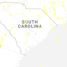
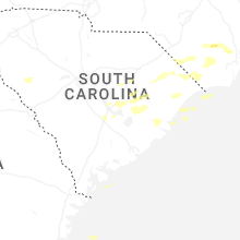


Connect with Interactive Hail Maps