

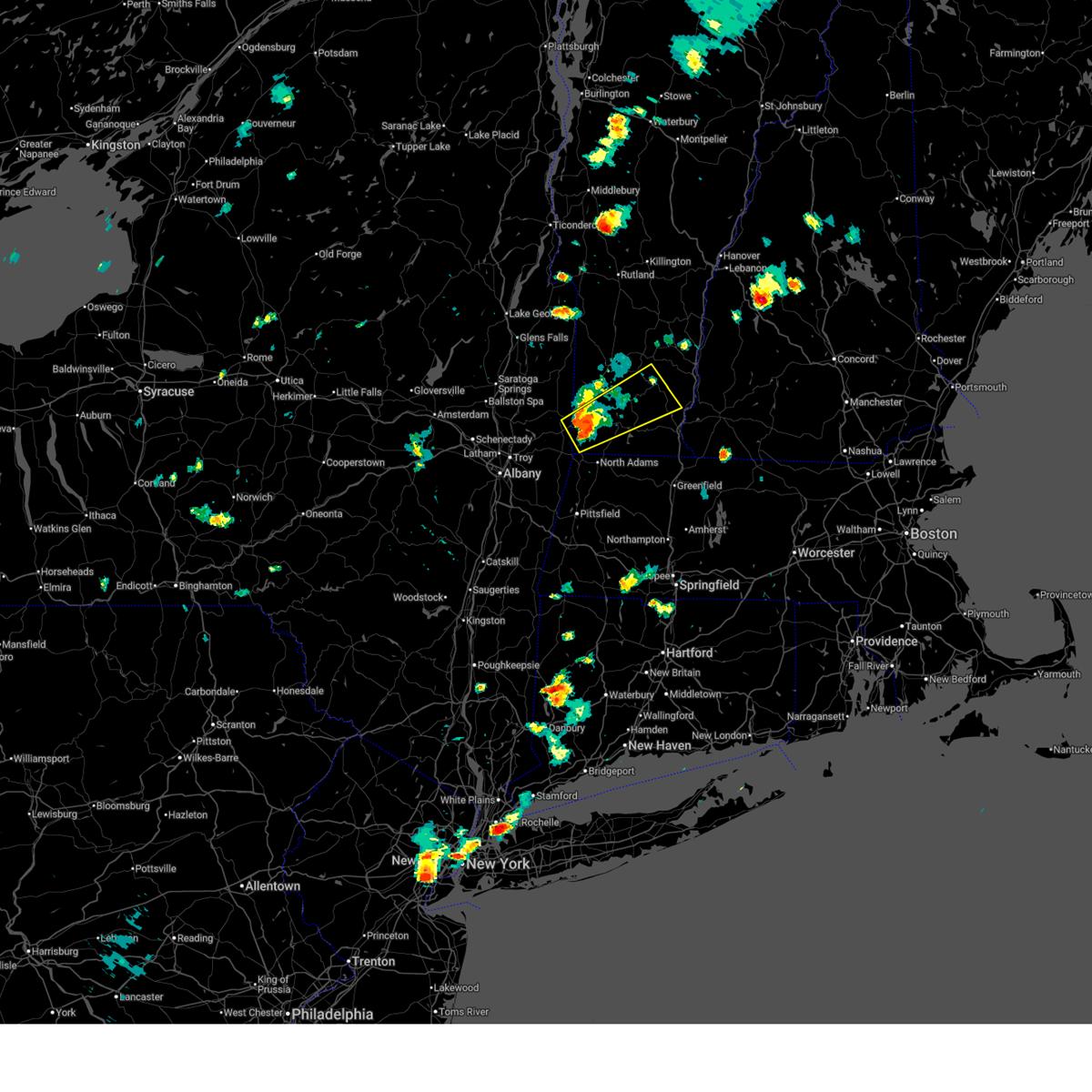
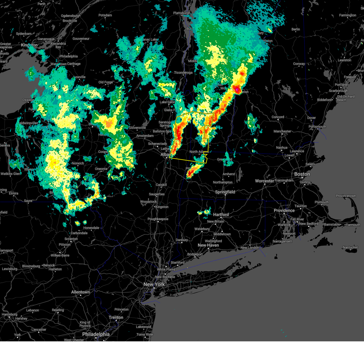
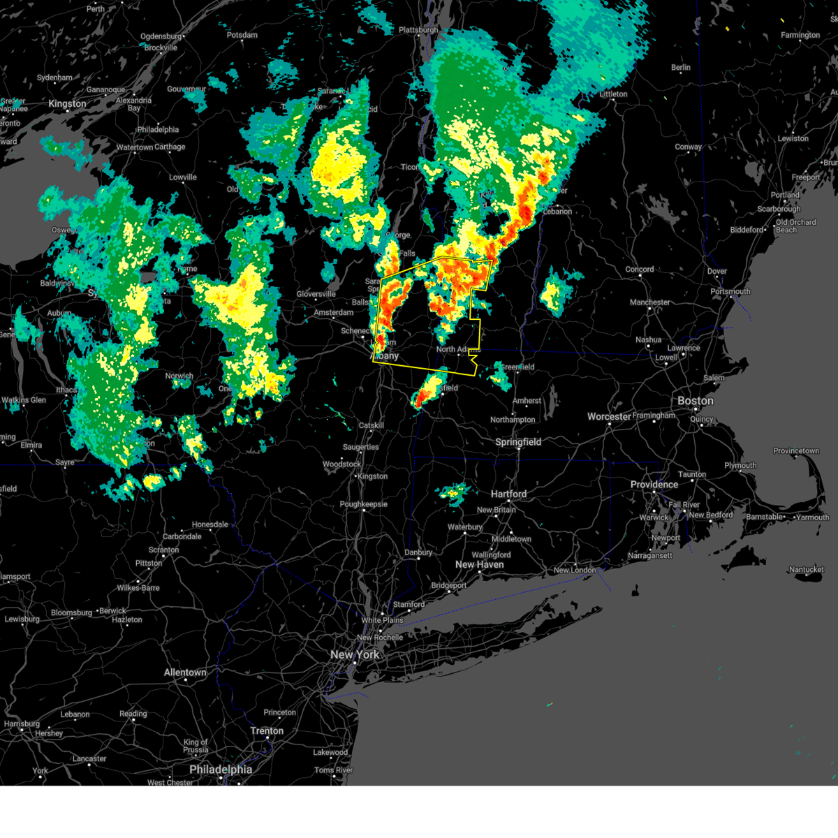
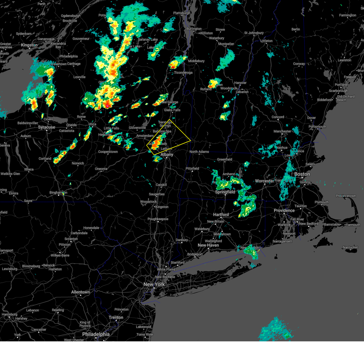
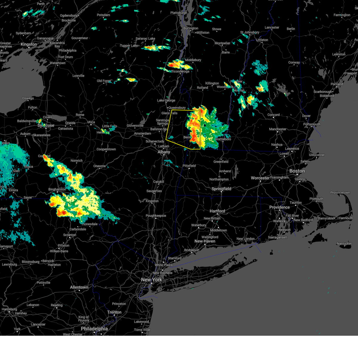
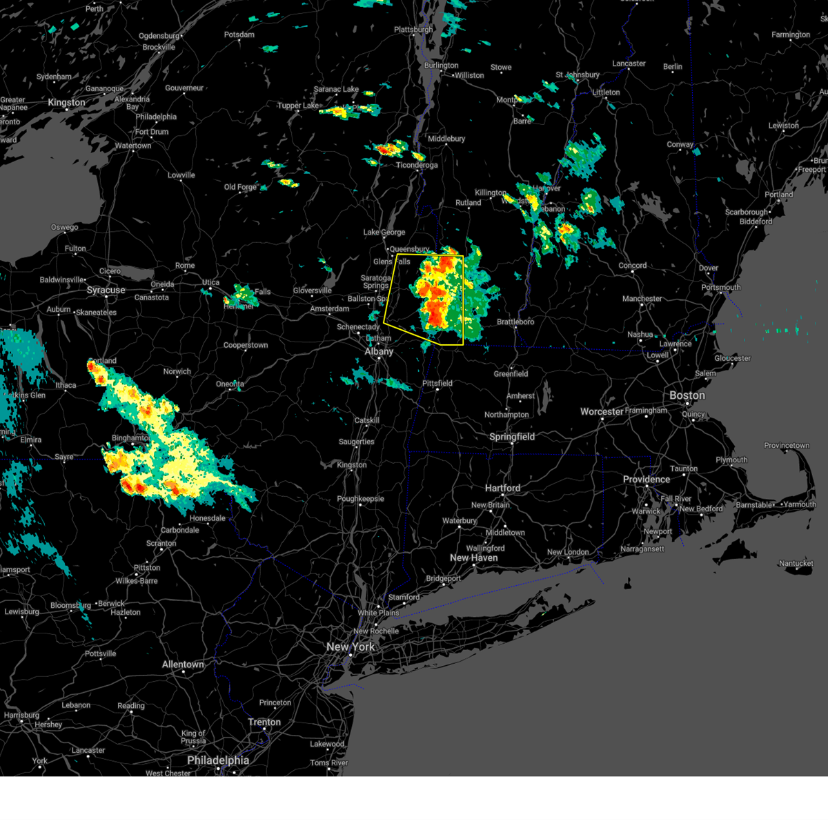
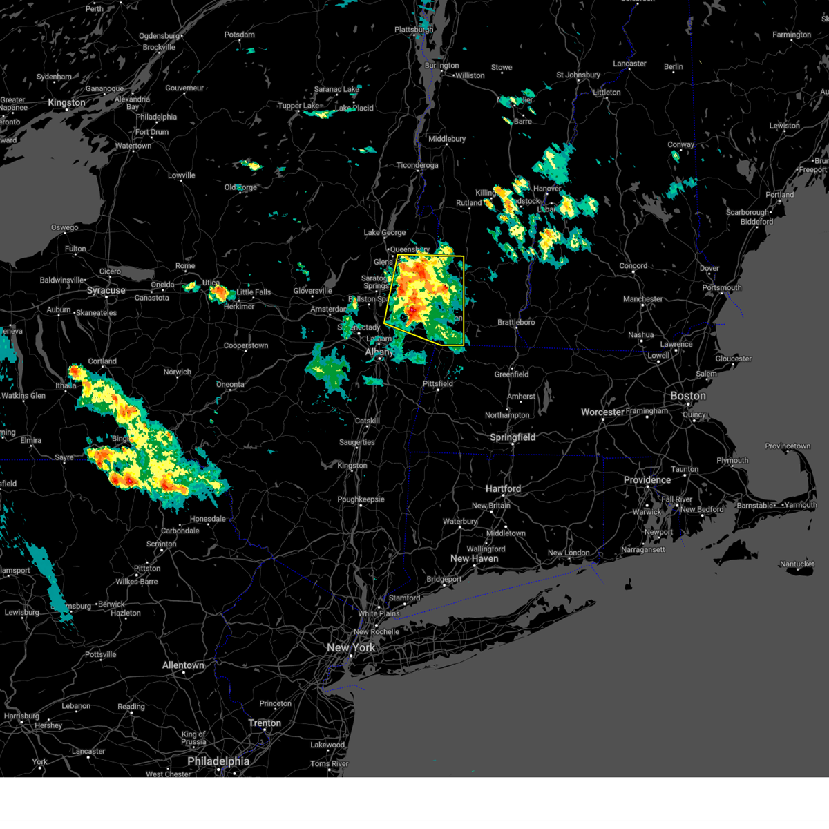
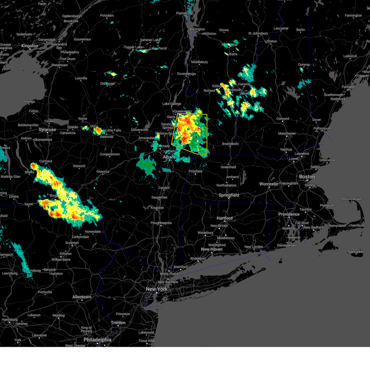
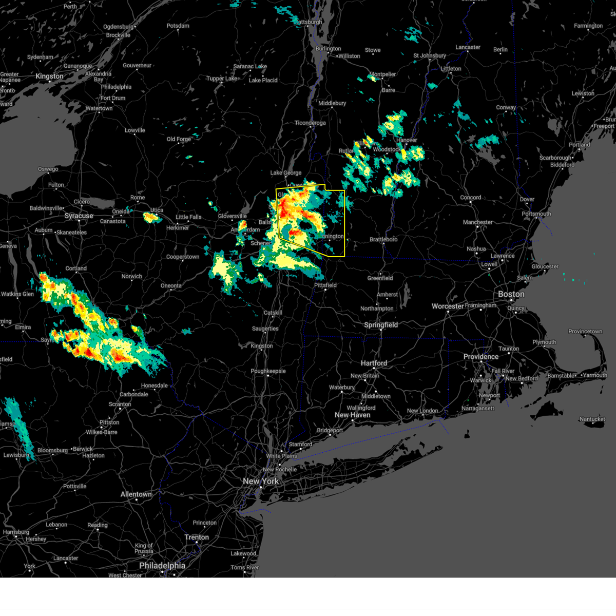
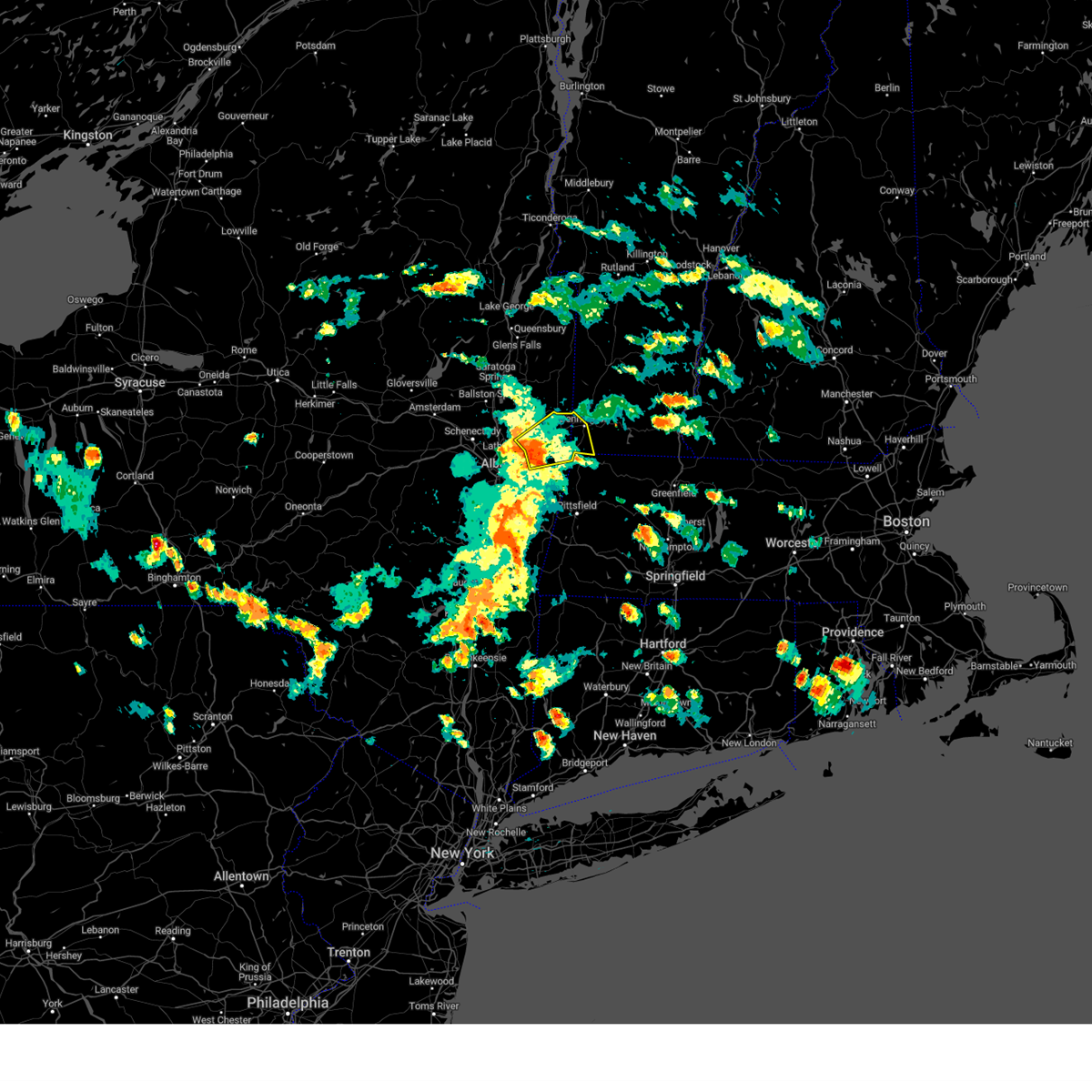
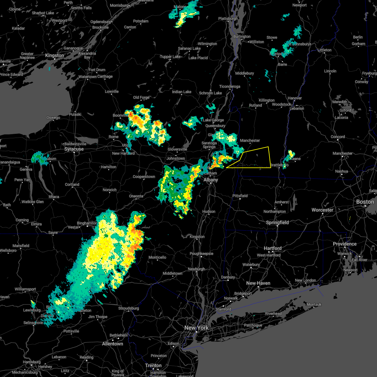
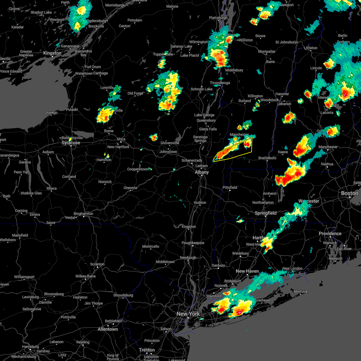
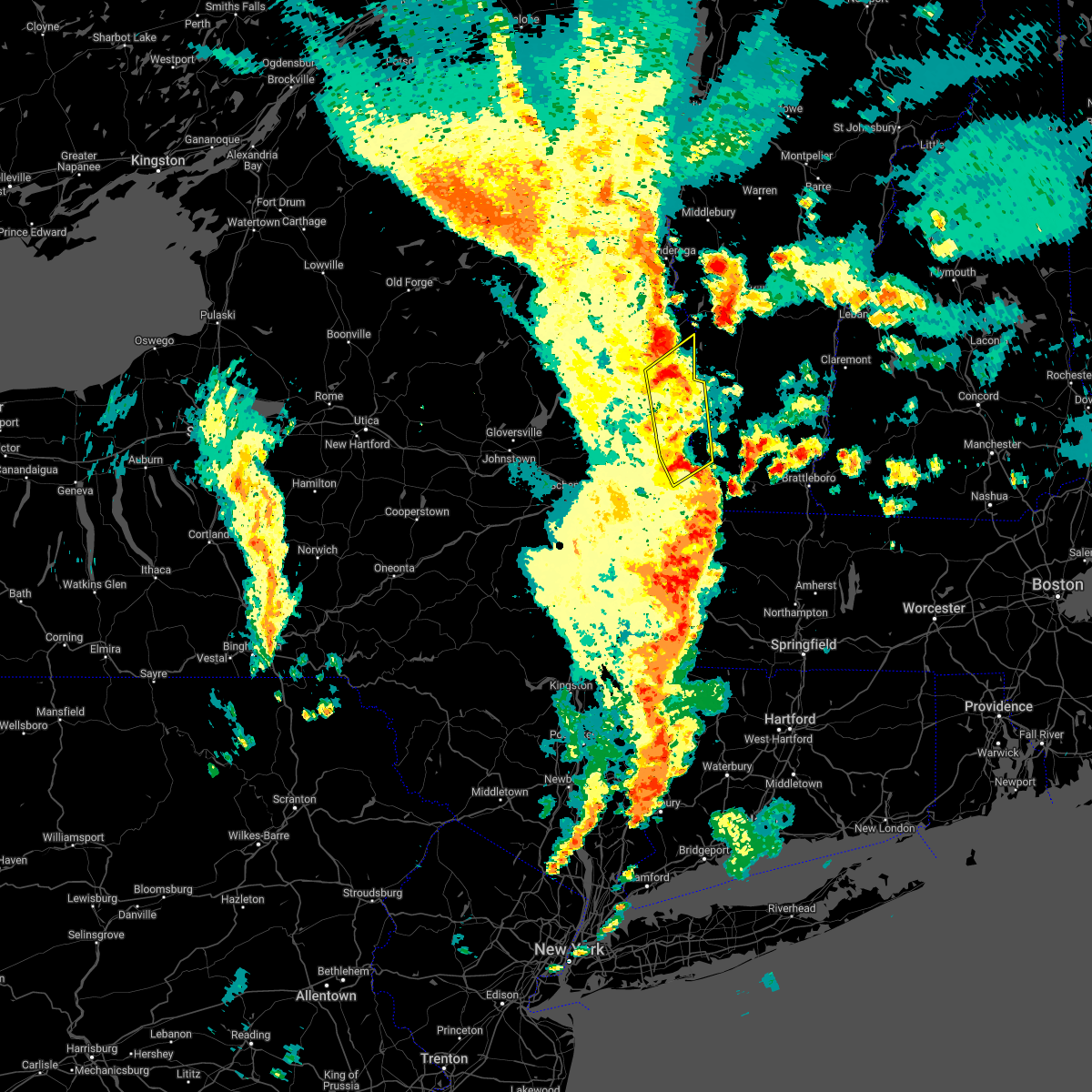
Hail Map for Hoosick Falls, NY
The Hoosick Falls, NY area has had 2 reports of on-the-ground hail by trained spotters, and has been under severe weather warnings 22 times during the past 12 months. Doppler radar has detected hail at or near Hoosick Falls, NY on 20 occasions.
| Name: | Hoosick Falls, NY |
| Where Located: | 30.4 miles E of Schenectady, NY |
| Map: | Google Map for Hoosick Falls, NY |
| Population: | 3501 |
| Housing Units: | 1620 |
| More Info: | Search Google for Hoosick Falls, NY |
0
The Top Recent Hail Date for Hoosick Falls, NY is Wednesday, June 19, 2024 (20th out of 20)

Hail and Wind Damage Spotted near Hoosick Falls, NY
| Date / Time | Report Details |
|---|---|
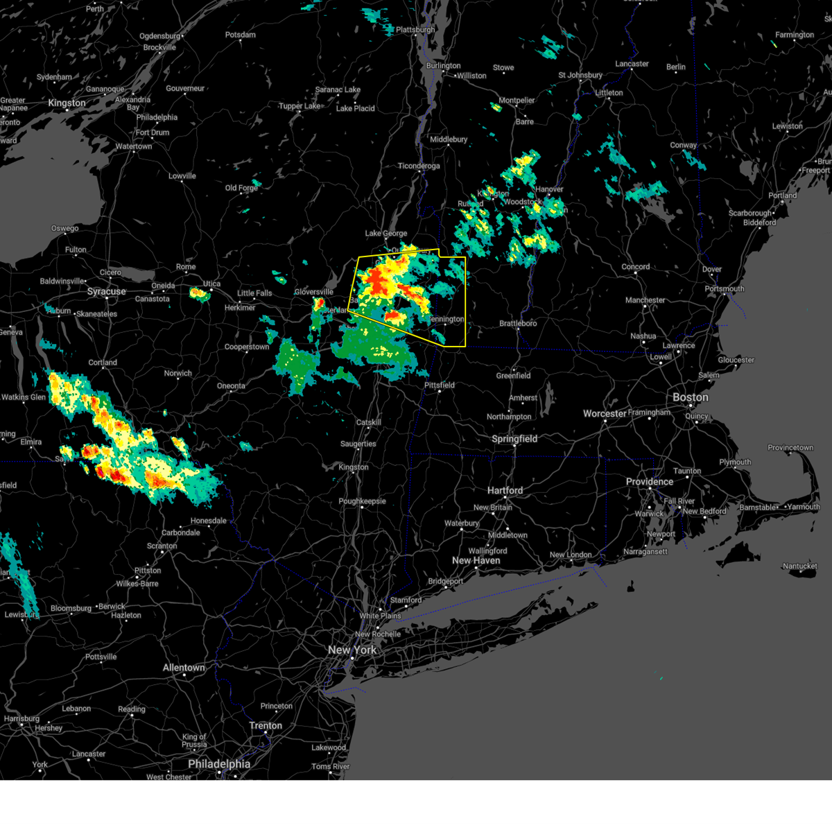
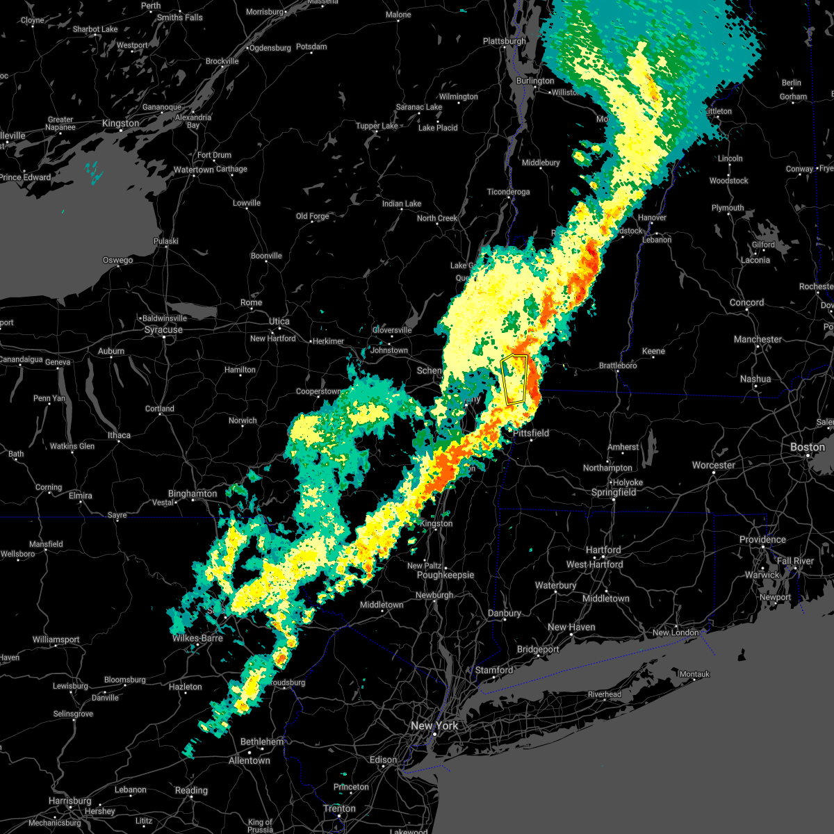
| 6/19/2025 4:23 PM EDT |
 Svraly the national weather service in albany has issued a * severe thunderstorm warning for, northeastern rensselaer county in east central new york, southern bennington county in southern vermont, northern windham county in southern vermont, * until 515 pm edt. * at 423 pm edt, a severe thunderstorm was located over bennington, moving northeast at 40 mph (radar indicated). Hazards include 60 mph wind gusts and nickel size hail. expect damage to roofs, siding, and trees Svraly the national weather service in albany has issued a * severe thunderstorm warning for, northeastern rensselaer county in east central new york, southern bennington county in southern vermont, northern windham county in southern vermont, * until 515 pm edt. * at 423 pm edt, a severe thunderstorm was located over bennington, moving northeast at 40 mph (radar indicated). Hazards include 60 mph wind gusts and nickel size hail. expect damage to roofs, siding, and trees
|
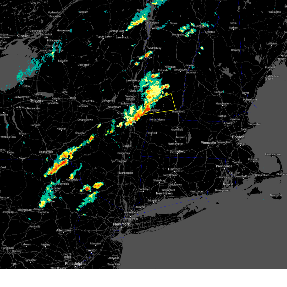
| 6/19/2025 4:17 PM EDT |
 At 417 pm edt, a severe thunderstorm was located over bennington, moving northeast at 40 mph (radar indicated). Hazards include 60 mph wind gusts and quarter size hail. Hail damage to vehicles is expected. expect wind damage to roofs, siding, and trees. Locations impacted include, bennington, hoosick falls, arlington, shaftsbury, pownal, hoosick, north bennington, woodford, old bennington, glastenbury, white creek station, hoosick junction, paper mill village, sodom, chiselville, petersburg junction, east hoosick, south shaftsbury, east arlington, and hidden valley. At 417 pm edt, a severe thunderstorm was located over bennington, moving northeast at 40 mph (radar indicated). Hazards include 60 mph wind gusts and quarter size hail. Hail damage to vehicles is expected. expect wind damage to roofs, siding, and trees. Locations impacted include, bennington, hoosick falls, arlington, shaftsbury, pownal, hoosick, north bennington, woodford, old bennington, glastenbury, white creek station, hoosick junction, paper mill village, sodom, chiselville, petersburg junction, east hoosick, south shaftsbury, east arlington, and hidden valley.
|
| 6/19/2025 4:04 PM EDT | Tree down on babcock lake rd. time estimated from rada in rensselaer county NY, 6.3 miles NNE of Hoosick Falls, NY |
| 6/19/2025 4:04 PM EDT | Svraly the national weather service in albany has issued a * severe thunderstorm warning for, northeastern rensselaer county in east central new york, southwestern bennington county in southern vermont, * until 430 pm edt. * at 404 pm edt, a severe thunderstorm was located near grafton, or near hoosick falls, moving northeast at 40 mph (radar indicated). Hazards include 60 mph wind gusts and quarter size hail. Hail damage to vehicles is expected. Expect wind damage to roofs, siding, and trees. |
| 5/17/2025 6:10 PM EDT |
 At 610 pm edt, severe thunderstorms were located along a line extending from greenwich to 7 miles southwest of cambridge to wynantskill, moving east at 40 mph (radar indicated). Hazards include 60 mph wind gusts and quarter size hail. Hail damage to vehicles is expected. expect wind damage to roofs, siding, and trees. Locations impacted include, chiselville, north hancock, readsboro falls, cheshire harbor, cambridge, south shaftsbury, middle falls, bromley village, east kansas, arlington, white oaks, peters four corners, west hoosick, poestenkill, walloomsac, blackinton, searsburg, east schaghticoke, stratton valley, and north adams. At 610 pm edt, severe thunderstorms were located along a line extending from greenwich to 7 miles southwest of cambridge to wynantskill, moving east at 40 mph (radar indicated). Hazards include 60 mph wind gusts and quarter size hail. Hail damage to vehicles is expected. expect wind damage to roofs, siding, and trees. Locations impacted include, chiselville, north hancock, readsboro falls, cheshire harbor, cambridge, south shaftsbury, middle falls, bromley village, east kansas, arlington, white oaks, peters four corners, west hoosick, poestenkill, walloomsac, blackinton, searsburg, east schaghticoke, stratton valley, and north adams.
|
| 5/17/2025 6:10 PM EDT |
 the severe thunderstorm warning has been cancelled and is no longer in effect the severe thunderstorm warning has been cancelled and is no longer in effect
|
| 5/17/2025 5:52 PM EDT |
 Svraly the national weather service in albany has issued a * severe thunderstorm warning for, northeastern berkshire county in western massachusetts, northeastern albany county in east central new york, southeastern saratoga county in east central new york, southern washington county in east central new york, rensselaer county in east central new york, bennington county in southern vermont, * until 700 pm edt. * at 552 pm edt, severe thunderstorms were located along a line extending from near saratoga springs to colonie, moving east at 35 mph (radar indicated). Hazards include 60 mph wind gusts and quarter size hail. Hail damage to vehicles is expected. Expect wind damage to roofs, siding, and trees. Svraly the national weather service in albany has issued a * severe thunderstorm warning for, northeastern berkshire county in western massachusetts, northeastern albany county in east central new york, southeastern saratoga county in east central new york, southern washington county in east central new york, rensselaer county in east central new york, bennington county in southern vermont, * until 700 pm edt. * at 552 pm edt, severe thunderstorms were located along a line extending from near saratoga springs to colonie, moving east at 35 mph (radar indicated). Hazards include 60 mph wind gusts and quarter size hail. Hail damage to vehicles is expected. Expect wind damage to roofs, siding, and trees.
|
| 5/17/2025 1:12 PM EDT |
 Svraly the national weather service in albany has issued a * severe thunderstorm warning for, schenectady county in east central new york, northeastern albany county in east central new york, southern saratoga county in east central new york, southwestern washington county in east central new york, northern rensselaer county in east central new york, * until 215 pm edt. * at 111 pm edt, a severe thunderstorm was located over scotia, moving northeast at 25 mph (radar indicated). Hazards include 60 mph wind gusts and quarter size hail. Hail damage to vehicles is expected. Expect wind damage to roofs, siding, and trees. Svraly the national weather service in albany has issued a * severe thunderstorm warning for, schenectady county in east central new york, northeastern albany county in east central new york, southern saratoga county in east central new york, southwestern washington county in east central new york, northern rensselaer county in east central new york, * until 215 pm edt. * at 111 pm edt, a severe thunderstorm was located over scotia, moving northeast at 25 mph (radar indicated). Hazards include 60 mph wind gusts and quarter size hail. Hail damage to vehicles is expected. Expect wind damage to roofs, siding, and trees.
|
| 8/5/2024 6:17 PM EDT |
 the severe thunderstorm warning has been cancelled and is no longer in effect the severe thunderstorm warning has been cancelled and is no longer in effect
|
| 8/5/2024 6:08 PM EDT |
 At 606 pm edt, a severe thunderstorm was located near bennington, moving east at 30 mph (law enforcement reported a tree down on wires 1 west of stillwater). Hazards include 60 mph wind gusts and quarter size hail. Hail damage to vehicles is expected. expect wind damage to roofs, siding, and trees. Locations impacted include, bennington, hudson falls, mechanicville, hoosick falls, arlington, salem, manchester, shaftsbury, pownal, fort edward, dorset, cambridge, greenwich, stamford, manchester center, danby, pawlet, gates, hoosick, and porter. At 606 pm edt, a severe thunderstorm was located near bennington, moving east at 30 mph (law enforcement reported a tree down on wires 1 west of stillwater). Hazards include 60 mph wind gusts and quarter size hail. Hail damage to vehicles is expected. expect wind damage to roofs, siding, and trees. Locations impacted include, bennington, hudson falls, mechanicville, hoosick falls, arlington, salem, manchester, shaftsbury, pownal, fort edward, dorset, cambridge, greenwich, stamford, manchester center, danby, pawlet, gates, hoosick, and porter.
|
| 8/5/2024 5:55 PM EDT | 1 foot diameter tree down. retired nws employe in washington county NY, 6.5 miles SE of Hoosick Falls, NY |
| 8/5/2024 5:50 PM EDT |
 At 549 pm edt, a severe thunderstorm was located near hoosick falls, moving east at 30 mph (radar indicated). Hazards include 60 mph wind gusts and quarter size hail. Hail damage to vehicles is expected. expect wind damage to roofs, siding, and trees. Locations impacted include, bennington, hudson falls, mechanicville, hoosick falls, arlington, salem, manchester, shaftsbury, pownal, fort edward, dorset, cambridge, greenwich, stamford, manchester center, danby, pawlet, gates, hoosick, and porter. At 549 pm edt, a severe thunderstorm was located near hoosick falls, moving east at 30 mph (radar indicated). Hazards include 60 mph wind gusts and quarter size hail. Hail damage to vehicles is expected. expect wind damage to roofs, siding, and trees. Locations impacted include, bennington, hudson falls, mechanicville, hoosick falls, arlington, salem, manchester, shaftsbury, pownal, fort edward, dorset, cambridge, greenwich, stamford, manchester center, danby, pawlet, gates, hoosick, and porter.
|
| 8/5/2024 5:50 PM EDT |
 the severe thunderstorm warning has been cancelled and is no longer in effect the severe thunderstorm warning has been cancelled and is no longer in effect
|
| 8/5/2024 5:37 PM EDT |
 At 536 pm edt, a severe thunderstorm was located near mechanicville, moving east at 30 mph (radar indicated). Hazards include 60 mph wind gusts and quarter size hail. Hail damage to vehicles is expected. expect wind damage to roofs, siding, and trees. Locations impacted include, bennington, saratoga springs, glens falls, hudson falls, mechanicville, hoosick falls, arlington, salem, manchester, shaftsbury, pownal, fort edward, corinth, dorset, cambridge, greenwich, stamford, round lake, manchester center, and west glens falls. At 536 pm edt, a severe thunderstorm was located near mechanicville, moving east at 30 mph (radar indicated). Hazards include 60 mph wind gusts and quarter size hail. Hail damage to vehicles is expected. expect wind damage to roofs, siding, and trees. Locations impacted include, bennington, saratoga springs, glens falls, hudson falls, mechanicville, hoosick falls, arlington, salem, manchester, shaftsbury, pownal, fort edward, corinth, dorset, cambridge, greenwich, stamford, round lake, manchester center, and west glens falls.
|
| 8/5/2024 5:29 PM EDT |
 Svraly the national weather service in albany has issued a * severe thunderstorm warning for, south central warren county in east central new york, saratoga county in east central new york, southern washington county in east central new york, northeastern rensselaer county in east central new york, bennington county in southern vermont, * until 630 pm edt. * at 529 pm edt, a severe thunderstorm was located near saratoga springs, moving east at 30 mph (radar indicated). Hazards include 60 mph wind gusts and quarter size hail. Hail damage to vehicles is expected. Expect wind damage to roofs, siding, and trees. Svraly the national weather service in albany has issued a * severe thunderstorm warning for, south central warren county in east central new york, saratoga county in east central new york, southern washington county in east central new york, northeastern rensselaer county in east central new york, bennington county in southern vermont, * until 630 pm edt. * at 529 pm edt, a severe thunderstorm was located near saratoga springs, moving east at 30 mph (radar indicated). Hazards include 60 mph wind gusts and quarter size hail. Hail damage to vehicles is expected. Expect wind damage to roofs, siding, and trees.
|
| 7/17/2024 1:24 PM EDT |
 Svraly the national weather service in albany has issued a * severe thunderstorm warning for, southeastern washington county in east central new york, northeastern rensselaer county in east central new york, central bennington county in southern vermont, northwestern windham county in southern vermont, * until 215 pm edt. * at 124 pm edt, a severe thunderstorm was located near hoosick falls, moving east at 35 mph (radar indicated). Hazards include 60 mph wind gusts. expect damage to roofs, siding, and trees Svraly the national weather service in albany has issued a * severe thunderstorm warning for, southeastern washington county in east central new york, northeastern rensselaer county in east central new york, central bennington county in southern vermont, northwestern windham county in southern vermont, * until 215 pm edt. * at 124 pm edt, a severe thunderstorm was located near hoosick falls, moving east at 35 mph (radar indicated). Hazards include 60 mph wind gusts. expect damage to roofs, siding, and trees
|
| 7/17/2024 1:15 PM EDT |
 The storms which prompted the warning have weakened below severe limits, and no longer pose an immediate threat to life or property. therefore, the warning has been allowed to expire. however, gusty winds are still expected with these thunderstorms. a severe thunderstorm watch remains in effect until 800 pm edt for western massachusetts, east central new york, and southern vermont. The storms which prompted the warning have weakened below severe limits, and no longer pose an immediate threat to life or property. therefore, the warning has been allowed to expire. however, gusty winds are still expected with these thunderstorms. a severe thunderstorm watch remains in effect until 800 pm edt for western massachusetts, east central new york, and southern vermont.
|
| 7/17/2024 12:47 PM EDT |
 Svraly the national weather service in albany has issued a * severe thunderstorm warning for, east central schenectady county in east central new york, northeastern albany county in east central new york, southeastern saratoga county in east central new york, southern washington county in east central new york, northern rensselaer county in east central new york, southwestern bennington county in southern vermont, * until 115 pm edt. * at 1246 pm edt, severe thunderstorms were located along a line extending from near greenwich to waterford to colonie, moving east at 25 mph (radar indicated). Hazards include 60 mph wind gusts. expect damage to roofs, siding, and trees Svraly the national weather service in albany has issued a * severe thunderstorm warning for, east central schenectady county in east central new york, northeastern albany county in east central new york, southeastern saratoga county in east central new york, southern washington county in east central new york, northern rensselaer county in east central new york, southwestern bennington county in southern vermont, * until 115 pm edt. * at 1246 pm edt, severe thunderstorms were located along a line extending from near greenwich to waterford to colonie, moving east at 25 mph (radar indicated). Hazards include 60 mph wind gusts. expect damage to roofs, siding, and trees
|
| 7/16/2024 5:58 PM EDT |
 Svraly the national weather service in albany has issued a * severe thunderstorm warning for, northern rensselaer county in east central new york, western bennington county in southern vermont, * until 615 pm edt. * at 557 pm edt, a severe thunderstorm was located near grafton, or 7 miles southwest of hoosick falls, moving east at 35 mph (radar indicated). Hazards include 70 mph wind gusts. Expect considerable tree damage. Damage is likely to mobile homes, roofs, and outbuildings. Svraly the national weather service in albany has issued a * severe thunderstorm warning for, northern rensselaer county in east central new york, western bennington county in southern vermont, * until 615 pm edt. * at 557 pm edt, a severe thunderstorm was located near grafton, or 7 miles southwest of hoosick falls, moving east at 35 mph (radar indicated). Hazards include 70 mph wind gusts. Expect considerable tree damage. Damage is likely to mobile homes, roofs, and outbuildings.
|
| 7/16/2024 5:47 PM EDT |
 At 547 pm edt, severe thunderstorms were located along a line extending from near mechanicville to wyantskill, moving east at 35 mph (radar indicated). Hazards include 70 mph wind gusts. Expect considerable tree damage. damage is likely to mobile homes, roofs, and outbuildings. Locations impacted include, albany, troy, clifton park, cohoes, watervliet, rensselaer, colonie, mechanicville, hoosick falls, delmar, latham, guilderland, menands, green island, grafton, waterford, berlin, loudonville, west sand lake, and averill park. At 547 pm edt, severe thunderstorms were located along a line extending from near mechanicville to wyantskill, moving east at 35 mph (radar indicated). Hazards include 70 mph wind gusts. Expect considerable tree damage. damage is likely to mobile homes, roofs, and outbuildings. Locations impacted include, albany, troy, clifton park, cohoes, watervliet, rensselaer, colonie, mechanicville, hoosick falls, delmar, latham, guilderland, menands, green island, grafton, waterford, berlin, loudonville, west sand lake, and averill park.
|
| 7/16/2024 5:35 PM EDT |
 At 534 pm edt, severe thunderstorms were located along a line extending from 7 miles east of chestertown to 6 miles northwest of salem to near mechanicville, moving east at 50 mph. these are destructive storms for the lake george and glens falls area into washington county (public). Hazards include 80 mph wind gusts. Flying debris will be dangerous to those caught without shelter. mobile homes will be heavily damaged. expect considerable damage to roofs, windows, and vehicles. extensive tree damage and power outages are likely. Locations impacted include, bennington, saratoga springs, hudson falls, mechanicville, hoosick falls, whitehall, arlington, salem, manchester, stratton, ballston spa, shaftsbury, fort edward, granville, hartford, dorset, cambridge, greenwich, round lake, and eagle point campground. At 534 pm edt, severe thunderstorms were located along a line extending from 7 miles east of chestertown to 6 miles northwest of salem to near mechanicville, moving east at 50 mph. these are destructive storms for the lake george and glens falls area into washington county (public). Hazards include 80 mph wind gusts. Flying debris will be dangerous to those caught without shelter. mobile homes will be heavily damaged. expect considerable damage to roofs, windows, and vehicles. extensive tree damage and power outages are likely. Locations impacted include, bennington, saratoga springs, hudson falls, mechanicville, hoosick falls, whitehall, arlington, salem, manchester, stratton, ballston spa, shaftsbury, fort edward, granville, hartford, dorset, cambridge, greenwich, round lake, and eagle point campground.
|
| 7/16/2024 5:29 PM EDT | Svraly the national weather service in albany has issued a * severe thunderstorm warning for, eastern warren county in east central new york, southeastern saratoga county in east central new york, washington county in east central new york, northeastern rensselaer county in east central new york, bennington county in southern vermont, west central windham county in southern vermont, * until 615 pm edt. * at 528 pm edt, severe thunderstorms were located along a line extending from 6 miles east of chestertown to 6 miles southeast of fort edward to near round lake, moving east at 50 mph (public). Hazards include 70 mph wind gusts. Expect considerable tree damage. Damage is likely to mobile homes, roofs, and outbuildings. |
| 7/16/2024 5:08 PM EDT |
 Svraly the national weather service in albany has issued a * severe thunderstorm warning for, schenectady county in east central new york, northern albany county in east central new york, southeastern saratoga county in east central new york, rensselaer county in east central new york, * until 600 pm edt. * at 508 pm edt, severe thunderstorms were located along a line extending from near glenville to near altamont, moving east at 35 mph (radar indicated). Hazards include 60 mph wind gusts. expect damage to roofs, siding, and trees Svraly the national weather service in albany has issued a * severe thunderstorm warning for, schenectady county in east central new york, northern albany county in east central new york, southeastern saratoga county in east central new york, rensselaer county in east central new york, * until 600 pm edt. * at 508 pm edt, severe thunderstorms were located along a line extending from near glenville to near altamont, moving east at 35 mph (radar indicated). Hazards include 60 mph wind gusts. expect damage to roofs, siding, and trees
|
| 7/16/2024 4:52 PM EDT |
 Toraly the national weather service in albany has issued a * tornado warning for, central warren county in east central new york, saratoga county in east central new york, washington county in east central new york, northeastern rensselaer county in east central new york, * until 530 pm edt. * at 451 pm edt, a severe thunderstorm capable of producing a tornado was located 9 miles north of day center, or 15 miles west of warrensburg, moving east at 50 mph (radar indicated rotation). Hazards include tornado. Flying debris will be dangerous to those caught without shelter. mobile homes will be damaged or destroyed. damage to roofs, windows, and vehicles will occur. tree damage is likely. this dangerous storm will be near, warrensburg around 505 pm edt. lake george village around 510 pm edt. comstock around 525 pm edt. Other locations impacted by this tornadic thunderstorm include parkis mills, deans corners, grangerville, south bay village, glenwild, northumberland, wayville, wiley corners, middle falls, and halls corner. Toraly the national weather service in albany has issued a * tornado warning for, central warren county in east central new york, saratoga county in east central new york, washington county in east central new york, northeastern rensselaer county in east central new york, * until 530 pm edt. * at 451 pm edt, a severe thunderstorm capable of producing a tornado was located 9 miles north of day center, or 15 miles west of warrensburg, moving east at 50 mph (radar indicated rotation). Hazards include tornado. Flying debris will be dangerous to those caught without shelter. mobile homes will be damaged or destroyed. damage to roofs, windows, and vehicles will occur. tree damage is likely. this dangerous storm will be near, warrensburg around 505 pm edt. lake george village around 510 pm edt. comstock around 525 pm edt. Other locations impacted by this tornadic thunderstorm include parkis mills, deans corners, grangerville, south bay village, glenwild, northumberland, wayville, wiley corners, middle falls, and halls corner.
|
| 6/23/2024 6:40 PM EDT | Trees and wires down on turnpike roa in rensselaer county NY, 5.3 miles SE of Hoosick Falls, NY |
| 6/21/2024 3:43 PM EDT |
 the severe thunderstorm warning has been cancelled and is no longer in effect the severe thunderstorm warning has been cancelled and is no longer in effect
|
| 6/21/2024 3:24 PM EDT |
 Svraly the national weather service in albany has issued a * severe thunderstorm warning for, northeastern rensselaer county in east central new york, southwestern bennington county in southern vermont, * until 415 pm edt. * at 323 pm edt, severe thunderstorms were located along a line extending from near center brunswick to near grafton to near berlin, moving east at 30 mph (radar indicated). Hazards include 60 mph wind gusts and penny size hail. expect damage to roofs, siding, and trees Svraly the national weather service in albany has issued a * severe thunderstorm warning for, northeastern rensselaer county in east central new york, southwestern bennington county in southern vermont, * until 415 pm edt. * at 323 pm edt, severe thunderstorms were located along a line extending from near center brunswick to near grafton to near berlin, moving east at 30 mph (radar indicated). Hazards include 60 mph wind gusts and penny size hail. expect damage to roofs, siding, and trees
|
| 6/19/2024 3:45 PM EDT | One oak tree snapped and blocking road on rt. 6 in rensselaer county NY, 5.7 miles ESE of Hoosick Falls, NY |
| 9/8/2023 6:10 PM EDT |
 At 609 pm edt, a severe thunderstorm was located over castleton-on-hudson, or near east greenbush, moving northeast at 30 mph (radar indicated). Hazards include 60 mph wind gusts and quarter size hail. Hail damage to vehicles is expected. Expect wind damage to roofs, siding, and trees. At 609 pm edt, a severe thunderstorm was located over castleton-on-hudson, or near east greenbush, moving northeast at 30 mph (radar indicated). Hazards include 60 mph wind gusts and quarter size hail. Hail damage to vehicles is expected. Expect wind damage to roofs, siding, and trees.
|
| 9/7/2023 9:15 PM EDT | Reports of multiple trees and power lines down in hoosick resulting in numerous power outages. time estimated from rada in rensselaer county NY, 2.8 miles NNW of Hoosick Falls, NY |
| 9/7/2023 9:08 PM EDT |
 At 908 pm edt, a severe thunderstorm was located near hoosick falls, moving northeast at 35 mph (radar indicated). Hazards include 60 mph wind gusts and quarter size hail. Hail damage to vehicles is expected. expect wind damage to roofs, siding, and trees. locations impacted include, hoosick falls, salem, grafton, cambridge, greenwich, hoosick, lee, pittstown, easton, schaghticoke, valley falls, center white creek, hoosick junction, center falls, petersburg junction, johnsonville, eagleville, north cambridge, east pittstown and shushan. hail threat, radar indicated max hail size, 1. 00 in wind threat, radar indicated max wind gust, 60 mph. At 908 pm edt, a severe thunderstorm was located near hoosick falls, moving northeast at 35 mph (radar indicated). Hazards include 60 mph wind gusts and quarter size hail. Hail damage to vehicles is expected. expect wind damage to roofs, siding, and trees. locations impacted include, hoosick falls, salem, grafton, cambridge, greenwich, hoosick, lee, pittstown, easton, schaghticoke, valley falls, center white creek, hoosick junction, center falls, petersburg junction, johnsonville, eagleville, north cambridge, east pittstown and shushan. hail threat, radar indicated max hail size, 1. 00 in wind threat, radar indicated max wind gust, 60 mph.
|
| 9/7/2023 8:59 PM EDT |
 At 859 pm edt, a severe thunderstorm was located over new ashford, or 9 miles southwest of north adams, moving northeast at 50 mph (radar indicated). Hazards include 60 mph wind gusts and quarter size hail. Hail damage to vehicles is expected. Expect wind damage to roofs, siding, and trees. At 859 pm edt, a severe thunderstorm was located over new ashford, or 9 miles southwest of north adams, moving northeast at 50 mph (radar indicated). Hazards include 60 mph wind gusts and quarter size hail. Hail damage to vehicles is expected. Expect wind damage to roofs, siding, and trees.
|
| 9/7/2023 8:38 PM EDT |
 At 838 pm edt, a severe thunderstorm was located over latham, moving northeast at 55 mph (radar indicated). Hazards include 60 mph wind gusts and quarter size hail. Hail damage to vehicles is expected. Expect wind damage to roofs, siding, and trees. At 838 pm edt, a severe thunderstorm was located over latham, moving northeast at 55 mph (radar indicated). Hazards include 60 mph wind gusts and quarter size hail. Hail damage to vehicles is expected. Expect wind damage to roofs, siding, and trees.
|
| 7/13/2023 7:18 PM EDT |
 At 716 pm edt, severe thunderstorms were located along a line extending from shrewsbury to near hoosick falls to near preston-potter hollow, moving east at 40 mph. these are destructive storms for washington county, northern rensselaer and bennington county (radar indicated). Hazards include 80 mph wind gusts and penny size hail. Flying debris will be dangerous to those caught without shelter. mobile homes will be heavily damaged. expect considerable damage to roofs, windows, and vehicles. Extensive tree damage and power outages are likely. At 716 pm edt, severe thunderstorms were located along a line extending from shrewsbury to near hoosick falls to near preston-potter hollow, moving east at 40 mph. these are destructive storms for washington county, northern rensselaer and bennington county (radar indicated). Hazards include 80 mph wind gusts and penny size hail. Flying debris will be dangerous to those caught without shelter. mobile homes will be heavily damaged. expect considerable damage to roofs, windows, and vehicles. Extensive tree damage and power outages are likely.
|
| 7/13/2023 6:54 PM EDT |
 At 654 pm edt, severe thunderstorms were located along a line extending from near ira to mechanicville to near gilboa, moving east at 40 mph (radar indicated). Hazards include 70 mph wind gusts and quarter size hail. Hail damage to vehicles is expected. expect considerable tree damage. Wind damage is also likely to mobile homes, roofs, and outbuildings. At 654 pm edt, severe thunderstorms were located along a line extending from near ira to mechanicville to near gilboa, moving east at 40 mph (radar indicated). Hazards include 70 mph wind gusts and quarter size hail. Hail damage to vehicles is expected. expect considerable tree damage. Wind damage is also likely to mobile homes, roofs, and outbuildings.
|
| 7/9/2023 3:05 PM EDT | Tree down on hous in rensselaer county NY, 4.3 miles SSE of Hoosick Falls, NY |
| 7/9/2023 2:53 PM EDT | Tree down blockig road on rt 67 and eagle bridge road in hoosick... ny in rensselaer county NY, 4.3 miles SSE of Hoosick Falls, NY |
| 7/9/2023 2:35 PM EDT |
 At 235 pm edt, a severe thunderstorm was located near hoosick falls, moving northwest at 20 mph (radar indicated). Hazards include 60 mph wind gusts and penny size hail. expect damage to roofs, siding, and trees At 235 pm edt, a severe thunderstorm was located near hoosick falls, moving northwest at 20 mph (radar indicated). Hazards include 60 mph wind gusts and penny size hail. expect damage to roofs, siding, and trees
|
| 7/4/2023 7:18 PM EDT | 100 foot pine tree down on a house on route 67 moving eastbound just passed buskirk seventh-day adventist church in rensselaer county NY, 5.3 miles SE of Hoosick Falls, NY |
| 9/26/2022 3:54 PM EDT | Reported tree down on road... but no closure in rensselaer county NY, 2.8 miles NNW of Hoosick Falls, NY |
| 9/26/2022 3:43 PM EDT |
 At 342 pm edt, a severe thunderstorm was located near greenwich, or 11 miles west of salem, moving northeast at 35 mph (radar indicated). Hazards include 60 mph wind gusts and penny size hail. Expect damage to roofs, siding, and trees. locations impacted include, bennington, hudson falls, hoosick falls, arlington, salem, shaftsbury, fort edward, granville, hartford, cambridge, greenwich, hoosick, porter, lee, northumberland, south glens falls, white creek, easton, north bennington and schuylerville. hail threat, radar indicated max hail size, 0. 75 in wind threat, radar indicated max wind gust, 60 mph. At 342 pm edt, a severe thunderstorm was located near greenwich, or 11 miles west of salem, moving northeast at 35 mph (radar indicated). Hazards include 60 mph wind gusts and penny size hail. Expect damage to roofs, siding, and trees. locations impacted include, bennington, hudson falls, hoosick falls, arlington, salem, shaftsbury, fort edward, granville, hartford, cambridge, greenwich, hoosick, porter, lee, northumberland, south glens falls, white creek, easton, north bennington and schuylerville. hail threat, radar indicated max hail size, 0. 75 in wind threat, radar indicated max wind gust, 60 mph.
|
| 9/26/2022 3:18 PM EDT |
 At 317 pm edt, a severe thunderstorm was located over north ballston spa, or near saratoga springs, moving northeast at 35 mph (radar indicated). Hazards include 60 mph wind gusts and penny size hail. expect damage to roofs, siding, and trees At 317 pm edt, a severe thunderstorm was located over north ballston spa, or near saratoga springs, moving northeast at 35 mph (radar indicated). Hazards include 60 mph wind gusts and penny size hail. expect damage to roofs, siding, and trees
|
| 9/13/2022 3:41 PM EDT |
 The severe thunderstorm warning for southwestern washington and northeastern rensselaer counties will expire at 345 pm edt, the storm which prompted the warning has moved out of the area. therefore, the warning will be allowed to expire. The severe thunderstorm warning for southwestern washington and northeastern rensselaer counties will expire at 345 pm edt, the storm which prompted the warning has moved out of the area. therefore, the warning will be allowed to expire.
|
| 9/13/2022 3:26 PM EDT |
 At 325 pm edt, a severe thunderstorm was located over hoosick falls, moving northeast at 30 mph (radar indicated). Hazards include 60 mph wind gusts and quarter size hail. Hail damage to vehicles is expected. expect wind damage to roofs, siding, and trees. locations impacted include, hoosick falls, hoosick, lee, schuylerville, center white creek, hoosick junction, west cambridge, post corners, east hoosick, johnsonville, east buskirk, eagle bridge, north cambridge, fly summit, east pittstown, clarks mills, millertown, southwest hoosick, archdale and potter hill. hail threat, radar indicated max hail size, 1. 00 in wind threat, radar indicated max wind gust, 60 mph. At 325 pm edt, a severe thunderstorm was located over hoosick falls, moving northeast at 30 mph (radar indicated). Hazards include 60 mph wind gusts and quarter size hail. Hail damage to vehicles is expected. expect wind damage to roofs, siding, and trees. locations impacted include, hoosick falls, hoosick, lee, schuylerville, center white creek, hoosick junction, west cambridge, post corners, east hoosick, johnsonville, east buskirk, eagle bridge, north cambridge, fly summit, east pittstown, clarks mills, millertown, southwest hoosick, archdale and potter hill. hail threat, radar indicated max hail size, 1. 00 in wind threat, radar indicated max wind gust, 60 mph.
|
| 9/13/2022 3:01 PM EDT |
 At 301 pm edt, a severe thunderstorm was located near center brunswick, or 7 miles southeast of mechanicville, moving northeast at 25 mph (radar indicated). Hazards include 60 mph wind gusts and quarter size hail. Hail damage to vehicles is expected. expect wind damage to roofs, siding, and trees. locations impacted include, albany, troy, cohoes, watervliet, rensselaer, colonie, mechanicville, hoosick falls, delmar, latham, guilderland, menands, green island, waterford, loudonville, center brunswick, wyantskill, feura bush, wynantskill and halfmoon. hail threat, radar indicated max hail size, 1. 00 in wind threat, radar indicated max wind gust, 60 mph. At 301 pm edt, a severe thunderstorm was located near center brunswick, or 7 miles southeast of mechanicville, moving northeast at 25 mph (radar indicated). Hazards include 60 mph wind gusts and quarter size hail. Hail damage to vehicles is expected. expect wind damage to roofs, siding, and trees. locations impacted include, albany, troy, cohoes, watervliet, rensselaer, colonie, mechanicville, hoosick falls, delmar, latham, guilderland, menands, green island, waterford, loudonville, center brunswick, wyantskill, feura bush, wynantskill and halfmoon. hail threat, radar indicated max hail size, 1. 00 in wind threat, radar indicated max wind gust, 60 mph.
|
| 9/13/2022 2:42 PM EDT |
 At 242 pm edt, a severe thunderstorm was located near latham, moving northeast at 20 mph (radar indicated). Hazards include 60 mph wind gusts and quarter size hail. Hail damage to vehicles is expected. Expect wind damage to roofs, siding, and trees. At 242 pm edt, a severe thunderstorm was located near latham, moving northeast at 20 mph (radar indicated). Hazards include 60 mph wind gusts and quarter size hail. Hail damage to vehicles is expected. Expect wind damage to roofs, siding, and trees.
|
| 8/26/2022 12:45 PM EDT | At 1244 pm edt, severe thunderstorms were located along a line extending from near hartford to near hoosick falls, moving north at 25 mph (radar indicated). Hazards include 60 mph wind gusts and nickel size hail. expect damage to roofs, siding, and trees |
| 8/26/2022 12:45 PM EDT | At 1244 pm edt, severe thunderstorms were located along a line extending from near hartford to near hoosick falls, moving north at 25 mph (radar indicated). Hazards include 60 mph wind gusts and nickel size hail. expect damage to roofs, siding, and trees |
| 8/4/2022 4:45 PM EDT | Trees and wires down along parsons avenue in hoosick falls. time estimate in rensselaer county NY, 0.7 miles WSW of Hoosick Falls, NY |
| 8/4/2022 4:44 PM EDT | Trees and wires down along tate road in hoosick falls. time estimate in rensselaer county NY, 1.2 miles SE of Hoosick Falls, NY |
| 8/4/2022 4:43 PM EDT |
 At 442 pm edt, a severe thunderstorm was located near waterford, or near mechanicville, moving east at 25 mph (radar indicated). Hazards include 60 mph wind gusts and quarter size hail. Hail damage to vehicles is expected. Expect wind damage to roofs, siding, and trees. At 442 pm edt, a severe thunderstorm was located near waterford, or near mechanicville, moving east at 25 mph (radar indicated). Hazards include 60 mph wind gusts and quarter size hail. Hail damage to vehicles is expected. Expect wind damage to roofs, siding, and trees.
|
| 7/24/2022 7:41 PM EDT |
 At 740 pm edt, a severe thunderstorm was located 7 miles east of shaftsbury, or 8 miles southeast of arlington, moving east at 30 mph (radar indicated). Hazards include 60 mph wind gusts and penny size hail. Expect damage to roofs, siding, and trees. locations impacted include, bennington, hoosick falls, arlington, stratton, shaftsbury, wilmington, west wardsboro, hoosick, north bennington, dover, marlboro, jamaica, wardsboro, woodford, old bennington, searsburg, glastenbury, somerset, wardsboro center and paper mill village. hail threat, radar indicated max hail size, 0. 75 in wind threat, radar indicated max wind gust, 60 mph. At 740 pm edt, a severe thunderstorm was located 7 miles east of shaftsbury, or 8 miles southeast of arlington, moving east at 30 mph (radar indicated). Hazards include 60 mph wind gusts and penny size hail. Expect damage to roofs, siding, and trees. locations impacted include, bennington, hoosick falls, arlington, stratton, shaftsbury, wilmington, west wardsboro, hoosick, north bennington, dover, marlboro, jamaica, wardsboro, woodford, old bennington, searsburg, glastenbury, somerset, wardsboro center and paper mill village. hail threat, radar indicated max hail size, 0. 75 in wind threat, radar indicated max wind gust, 60 mph.
|
| 7/24/2022 7:36 PM EDT |
 At 736 pm edt, severe thunderstorms were located along a line extending from near grafton to stephentown to near chatham, moving east at 40 mph (radar indicated). Hazards include 60 mph wind gusts. Expect damage to roofs, siding, and trees. locations impacted include, pittsfield, bennington, north adams, hudson, hoosick falls, chatham, nassau, adams, williamstown, lee, lenox, pownal, cheshire, stephentown, coxsackie, new lebanon, grafton, berlin, valatie and becket. hail threat, radar indicated max hail size, <. 75 in wind threat, radar indicated max wind gust, 60 mph. At 736 pm edt, severe thunderstorms were located along a line extending from near grafton to stephentown to near chatham, moving east at 40 mph (radar indicated). Hazards include 60 mph wind gusts. Expect damage to roofs, siding, and trees. locations impacted include, pittsfield, bennington, north adams, hudson, hoosick falls, chatham, nassau, adams, williamstown, lee, lenox, pownal, cheshire, stephentown, coxsackie, new lebanon, grafton, berlin, valatie and becket. hail threat, radar indicated max hail size, <. 75 in wind threat, radar indicated max wind gust, 60 mph.
|
| 7/24/2022 7:14 PM EDT |
 At 714 pm edt, severe thunderstorms were located along a line extending from near latham to near castleton-on-hudson to 6 miles west of athens, moving east at 50 mph (radar indicated). Hazards include 60 mph wind gusts. expect damage to roofs, siding, and trees At 714 pm edt, severe thunderstorms were located along a line extending from near latham to near castleton-on-hudson to 6 miles west of athens, moving east at 50 mph (radar indicated). Hazards include 60 mph wind gusts. expect damage to roofs, siding, and trees
|
| 7/24/2022 7:01 PM EDT |
 At 700 pm edt, a severe thunderstorm was located near hoosick falls, moving east at 30 mph (radar indicated). Hazards include 60 mph wind gusts and penny size hail. expect damage to roofs, siding, and trees At 700 pm edt, a severe thunderstorm was located near hoosick falls, moving east at 30 mph (radar indicated). Hazards include 60 mph wind gusts and penny size hail. expect damage to roofs, siding, and trees
|
| 7/21/2022 3:31 PM EDT |
 At 331 pm edt, a severe thunderstorm was located over hoosick falls, moving northeast at 40 mph (radar indicated). Hazards include 60 mph wind gusts and penny size hail. Expect damage to roofs, siding, and trees. locations impacted include, hoosick falls, arlington, stratton, shaftsbury, west wardsboro, white creek, north bennington, old bennington, glastenbury, somerset, white creek station, center white creek, hoosick junction, stratton valley, paper mill village, sodom, bondville, post corners, east hoosick and east buskirk. hail threat, radar indicated max hail size, 0. 75 in wind threat, radar indicated max wind gust, 60 mph. At 331 pm edt, a severe thunderstorm was located over hoosick falls, moving northeast at 40 mph (radar indicated). Hazards include 60 mph wind gusts and penny size hail. Expect damage to roofs, siding, and trees. locations impacted include, hoosick falls, arlington, stratton, shaftsbury, west wardsboro, white creek, north bennington, old bennington, glastenbury, somerset, white creek station, center white creek, hoosick junction, stratton valley, paper mill village, sodom, bondville, post corners, east hoosick and east buskirk. hail threat, radar indicated max hail size, 0. 75 in wind threat, radar indicated max wind gust, 60 mph.
|
| 7/21/2022 3:02 PM EDT |
 At 302 pm edt, a severe thunderstorm was located near hoosick falls, moving east at 40 mph (radar indicated). Hazards include 60 mph wind gusts and quarter size hail. Hail damage to vehicles is expected. Expect wind damage to roofs, siding, and trees. At 302 pm edt, a severe thunderstorm was located near hoosick falls, moving east at 40 mph (radar indicated). Hazards include 60 mph wind gusts and quarter size hail. Hail damage to vehicles is expected. Expect wind damage to roofs, siding, and trees.
|
| 5/22/2022 6:24 PM EDT |
 At 622 pm edt, severe thunderstorms were located along a line extending from near salem to near pittsfield, moving east at 50 mph (radar indicated). Hazards include 60 mph wind gusts and nickel size hail. expect damage to roofs, siding, and trees At 622 pm edt, severe thunderstorms were located along a line extending from near salem to near pittsfield, moving east at 50 mph (radar indicated). Hazards include 60 mph wind gusts and nickel size hail. expect damage to roofs, siding, and trees
|
| 5/16/2022 5:18 PM EDT |
 At 517 pm edt, severe thunderstorms were located along a line extending from cambridge to near bennington, moving northeast at 40 mph (radar indicated). Hazards include 60 mph wind gusts. Expect damage to roofs, siding, and trees. locations impacted include, hoosick falls, arlington, salem, shaftsbury, granville, hartford, cambridge, kingsbury, porter, white creek, north bennington, rupert, sandgate, argyle, cossayuna, center white creek, hoosick junction, sodom, smiths basin and center falls. hail threat, radar indicated max hail size, <. 75 in wind threat, radar indicated max wind gust, 60 mph. At 517 pm edt, severe thunderstorms were located along a line extending from cambridge to near bennington, moving northeast at 40 mph (radar indicated). Hazards include 60 mph wind gusts. Expect damage to roofs, siding, and trees. locations impacted include, hoosick falls, arlington, salem, shaftsbury, granville, hartford, cambridge, kingsbury, porter, white creek, north bennington, rupert, sandgate, argyle, cossayuna, center white creek, hoosick junction, sodom, smiths basin and center falls. hail threat, radar indicated max hail size, <. 75 in wind threat, radar indicated max wind gust, 60 mph.
|
| 5/16/2022 5:03 PM EDT |
 At 503 pm edt, severe thunderstorms were located along a line extending from near hudson falls to near salem, moving northeast at 40 mph (radar indicated). Hazards include 60 mph wind gusts. Expect damage to roofs, siding, and trees. locations impacted include, hudson falls, hoosick falls, arlington, salem, shaftsbury, fort edward, granville, hartford, cambridge, greenwich, kingsbury, porter, lee, pittstown, northumberland, south glens falls, white creek, easton, north bennington and schuylerville. hail threat, radar indicated max hail size, <. 75 in wind threat, radar indicated max wind gust, 60 mph. At 503 pm edt, severe thunderstorms were located along a line extending from near hudson falls to near salem, moving northeast at 40 mph (radar indicated). Hazards include 60 mph wind gusts. Expect damage to roofs, siding, and trees. locations impacted include, hudson falls, hoosick falls, arlington, salem, shaftsbury, fort edward, granville, hartford, cambridge, greenwich, kingsbury, porter, lee, pittstown, northumberland, south glens falls, white creek, easton, north bennington and schuylerville. hail threat, radar indicated max hail size, <. 75 in wind threat, radar indicated max wind gust, 60 mph.
|
| 5/16/2022 4:46 PM EDT |
 At 446 pm edt, severe thunderstorms were located along a line extending from near fort edward to cohoes, moving northeast at 25 mph (radar indicated). Hazards include 60 mph wind gusts. expect damage to roofs, siding, and trees At 446 pm edt, severe thunderstorms were located along a line extending from near fort edward to cohoes, moving northeast at 25 mph (radar indicated). Hazards include 60 mph wind gusts. expect damage to roofs, siding, and trees
|
| 3/7/2022 8:53 PM EST | Trees and wires dow in rensselaer county NY, 0.3 miles SW of Hoosick Falls, NY |
| 3/7/2022 8:40 PM EST | Trees and wires dow in rensselaer county NY, 0.9 miles SSW of Hoosick Falls, NY |
| 3/7/2022 8:30 PM EST | Trees and wires dow in rensselaer county NY, 0.9 miles SSE of Hoosick Falls, NY |
| 3/7/2022 8:27 PM EST |
 At 826 pm est, a severe thunderstorm was located over hoosick falls, moving east at 55 mph (radar indicated). Hazards include 60 mph wind gusts. expect damage to roofs, siding, and trees At 826 pm est, a severe thunderstorm was located over hoosick falls, moving east at 55 mph (radar indicated). Hazards include 60 mph wind gusts. expect damage to roofs, siding, and trees
|
| 9/15/2021 3:58 PM EDT |
 The severe thunderstorm warning for central rensselaer and southwestern bennington counties will expire at 400 pm edt, the storm which prompted the warning has weakened below severe limits, and has exited most of the warned area. therefore, the warning will be allowed to expire. however heavy rain is still possible with this thunderstorm for southeastern parts of rensselaer county. a severe thunderstorm watch remains in effect until 800 pm edt for western massachusetts, east central new york, and southern vermont. The severe thunderstorm warning for central rensselaer and southwestern bennington counties will expire at 400 pm edt, the storm which prompted the warning has weakened below severe limits, and has exited most of the warned area. therefore, the warning will be allowed to expire. however heavy rain is still possible with this thunderstorm for southeastern parts of rensselaer county. a severe thunderstorm watch remains in effect until 800 pm edt for western massachusetts, east central new york, and southern vermont.
|
| 9/15/2021 3:00 PM EDT |
 At 259 pm edt, a severe thunderstorm was located near grafton, or 9 miles southwest of hoosick falls, moving northeast at 35 mph (radar indicated). Hazards include 60 mph wind gusts and half dollar size hail. Hail damage to vehicles is expected. expect wind damage to roofs, siding, and trees. this severe thunderstorm will be near, hoosick falls around 315 pm edt. bennington around 330 pm edt. other locations impacted by this severe thunderstorm include south troy, schaghticoke hill, hoosick junction, paper mill village, sodom, petersburg junction, albia, johnsonville, south shaftsbury and schaghticoke. please report hail size, damaging winds and reports of trees down to the national weather service by email at alb. stormreport@noaa. gov, on facebook at www. facebook. com/nwsalbany or twitter @nwsalbany hail threat, radar indicated max hail size, 1. 25 in wind threat, radar indicated max wind gust, 60 mph. At 259 pm edt, a severe thunderstorm was located near grafton, or 9 miles southwest of hoosick falls, moving northeast at 35 mph (radar indicated). Hazards include 60 mph wind gusts and half dollar size hail. Hail damage to vehicles is expected. expect wind damage to roofs, siding, and trees. this severe thunderstorm will be near, hoosick falls around 315 pm edt. bennington around 330 pm edt. other locations impacted by this severe thunderstorm include south troy, schaghticoke hill, hoosick junction, paper mill village, sodom, petersburg junction, albia, johnsonville, south shaftsbury and schaghticoke. please report hail size, damaging winds and reports of trees down to the national weather service by email at alb. stormreport@noaa. gov, on facebook at www. facebook. com/nwsalbany or twitter @nwsalbany hail threat, radar indicated max hail size, 1. 25 in wind threat, radar indicated max wind gust, 60 mph.
|
| 9/15/2021 2:52 PM EDT |
 At 252 pm edt, a severe thunderstorm was located near hoosick falls, moving east at 35 mph (radar indicated). Hazards include 60 mph wind gusts and quarter size hail. Hail damage to vehicles is expected. expect wind damage to roofs, siding, and trees. locations impacted include, hoosick falls, arlington, salem, manchester, shaftsbury, cambridge, greenwich, manchester center, lee, white creek, easton, north bennington, sunderland, schaghticoke, valley falls, sandgate, glastenbury, cossayuna, schaghticoke hill and center white creek. hail threat, radar indicated max hail size, 1. 00 in wind threat, radar indicated max wind gust, 60 mph. At 252 pm edt, a severe thunderstorm was located near hoosick falls, moving east at 35 mph (radar indicated). Hazards include 60 mph wind gusts and quarter size hail. Hail damage to vehicles is expected. expect wind damage to roofs, siding, and trees. locations impacted include, hoosick falls, arlington, salem, manchester, shaftsbury, cambridge, greenwich, manchester center, lee, white creek, easton, north bennington, sunderland, schaghticoke, valley falls, sandgate, glastenbury, cossayuna, schaghticoke hill and center white creek. hail threat, radar indicated max hail size, 1. 00 in wind threat, radar indicated max wind gust, 60 mph.
|
| 9/15/2021 2:28 PM EDT |
 At 226 pm edt, a severe thunderstorm was located over greenwich, or 11 miles southwest of salem, moving east at 25 mph (radar indicated). Hazards include 60 mph wind gusts and quarter size hail. Hail damage to vehicles is expected. Expect wind damage to roofs, siding, and trees. At 226 pm edt, a severe thunderstorm was located over greenwich, or 11 miles southwest of salem, moving east at 25 mph (radar indicated). Hazards include 60 mph wind gusts and quarter size hail. Hail damage to vehicles is expected. Expect wind damage to roofs, siding, and trees.
|
| 9/8/2021 8:25 PM EDT |
 At 824 pm edt, a severe thunderstorm was located over grafton, or 8 miles southwest of hoosick falls, moving northeast at 25 mph (radar indicated). Hazards include 60 mph wind gusts and penny size hail. Expect damage to roofs, siding, and trees. locations impacted include, hoosick falls, grafton, berlin, hoosick, hoosick junction, southwest hoosick, petersburg junction, east hoosick, potter hill, babcock lake, west hoosick, stillham, north hoosick, walloomsac, eagle bridge, petersburg, boyntonville, east grafton, east pittstown and north petersburg. hail threat, radar indicated max hail size, 0. 75 in wind threat, radar indicated max wind gust, 60 mph. At 824 pm edt, a severe thunderstorm was located over grafton, or 8 miles southwest of hoosick falls, moving northeast at 25 mph (radar indicated). Hazards include 60 mph wind gusts and penny size hail. Expect damage to roofs, siding, and trees. locations impacted include, hoosick falls, grafton, berlin, hoosick, hoosick junction, southwest hoosick, petersburg junction, east hoosick, potter hill, babcock lake, west hoosick, stillham, north hoosick, walloomsac, eagle bridge, petersburg, boyntonville, east grafton, east pittstown and north petersburg. hail threat, radar indicated max hail size, 0. 75 in wind threat, radar indicated max wind gust, 60 mph.
|
| 9/8/2021 8:17 PM EDT | Downed tree between fox hollow road and route 22 in rensselaer county NY, 5.4 miles N of Hoosick Falls, NY |
| 9/8/2021 7:51 PM EDT |
 At 751 pm edt, a severe thunderstorm was located over wyantskill, or over troy, moving northeast at 25 mph (radar indicated). Hazards include 70 mph wind gusts and nickel size hail. Expect considerable tree damage. Damage is likely to mobile homes, roofs, and outbuildings. At 751 pm edt, a severe thunderstorm was located over wyantskill, or over troy, moving northeast at 25 mph (radar indicated). Hazards include 70 mph wind gusts and nickel size hail. Expect considerable tree damage. Damage is likely to mobile homes, roofs, and outbuildings.
|
| 9/8/2021 7:16 PM EDT |
 At 716 pm edt, a severe thunderstorm was located over mechanicville, moving east at 25 mph (radar indicated). Hazards include 60 mph wind gusts. expect damage to roofs, siding, and trees At 716 pm edt, a severe thunderstorm was located over mechanicville, moving east at 25 mph (radar indicated). Hazards include 60 mph wind gusts. expect damage to roofs, siding, and trees
|
| 8/12/2021 3:29 PM EDT |
 At 328 pm edt, severe thunderstorms were located along a line extending from near hoosick falls to near averill park to near castleton-on-hudson, moving east at 30 mph (law enforcement). Hazards include 60 mph wind gusts and penny size hail. expect damage to roofs, siding, and trees At 328 pm edt, severe thunderstorms were located along a line extending from near hoosick falls to near averill park to near castleton-on-hudson, moving east at 30 mph (law enforcement). Hazards include 60 mph wind gusts and penny size hail. expect damage to roofs, siding, and trees
|
| 8/12/2021 3:28 PM EDT | Tree and wires down on petersburg junction road in rensselaer county NY, 4.1 miles NNW of Hoosick Falls, NY |
| 8/12/2021 2:57 PM EDT |
 At 257 pm edt, a severe thunderstorm was located over center brunswick, or near troy, moving east at 30 mph (radar indicated). Hazards include 60 mph wind gusts and penny size hail. Expect damage to roofs, siding, and trees. Locations impacted include, albany, troy, clifton park, cohoes, watervliet, rensselaer, colonie, mechanicville, hoosick falls, delmar, latham, menands, green island, grafton, waterford, berlin, loudonville, west sand lake, averill park and center brunswick. At 257 pm edt, a severe thunderstorm was located over center brunswick, or near troy, moving east at 30 mph (radar indicated). Hazards include 60 mph wind gusts and penny size hail. Expect damage to roofs, siding, and trees. Locations impacted include, albany, troy, clifton park, cohoes, watervliet, rensselaer, colonie, mechanicville, hoosick falls, delmar, latham, menands, green island, grafton, waterford, berlin, loudonville, west sand lake, averill park and center brunswick.
|
| 8/12/2021 2:42 PM EDT |
 At 241 pm edt, a severe thunderstorm was located over latham, moving east at 30 mph (radar indicated). Hazards include 60 mph wind gusts and penny size hail. expect damage to roofs, siding, and trees At 241 pm edt, a severe thunderstorm was located over latham, moving east at 30 mph (radar indicated). Hazards include 60 mph wind gusts and penny size hail. expect damage to roofs, siding, and trees
|
| 7/29/2021 8:50 PM EDT |
 At 849 pm edt, a severe thunderstorm was located near berlin, or 11 miles east of troy, moving east at 35 mph (radar indicated). Hazards include 60 mph wind gusts. Expect damage to roofs, siding, and trees. Locations impacted include, troy, bennington, north adams, rensselaer, hoosick falls, adams, williamstown, pownal, grafton, berlin, stamford, new ashford, west sand lake, averill park, center brunswick, wyantskill, wynantskill, north greenbush, brunswick and sand lake. At 849 pm edt, a severe thunderstorm was located near berlin, or 11 miles east of troy, moving east at 35 mph (radar indicated). Hazards include 60 mph wind gusts. Expect damage to roofs, siding, and trees. Locations impacted include, troy, bennington, north adams, rensselaer, hoosick falls, adams, williamstown, pownal, grafton, berlin, stamford, new ashford, west sand lake, averill park, center brunswick, wyantskill, wynantskill, north greenbush, brunswick and sand lake.
|
| 7/29/2021 8:20 PM EDT | Tree on wire in rensselaer county NY, 0.3 miles SW of Hoosick Falls, NY |
| 7/29/2021 8:03 PM EDT |
 At 802 pm edt, a severe thunderstorm was located over schenectady, moving east at 45 mph (radar indicated). Hazards include 60 mph wind gusts. expect damage to roofs, siding, and trees At 802 pm edt, a severe thunderstorm was located over schenectady, moving east at 45 mph (radar indicated). Hazards include 60 mph wind gusts. expect damage to roofs, siding, and trees
|
| 7/29/2021 7:56 PM EDT |
 At 756 pm edt, a severe thunderstorm was located near mechanicville, moving east at 45 mph (radar indicated). Hazards include 60 mph wind gusts. Expect damage to roofs, siding, and trees. Locations impacted include, schenectady, bennington, clifton park, saratoga springs, scotia, mechanicville, hoosick falls, arlington, salem, manchester, glenville, niskayuna, ballston spa, shaftsbury, cambridge, greenwich, round lake, rotterdam junction, east glenville and burnt hills. At 756 pm edt, a severe thunderstorm was located near mechanicville, moving east at 45 mph (radar indicated). Hazards include 60 mph wind gusts. Expect damage to roofs, siding, and trees. Locations impacted include, schenectady, bennington, clifton park, saratoga springs, scotia, mechanicville, hoosick falls, arlington, salem, manchester, glenville, niskayuna, ballston spa, shaftsbury, cambridge, greenwich, round lake, rotterdam junction, east glenville and burnt hills.
|
| 7/29/2021 7:41 PM EDT |
 At 741 pm edt, a severe thunderstorm was located over burnt hills, or near scotia, moving east at 85 mph (radar indicated). Hazards include 60 mph wind gusts. expect damage to roofs, siding, and trees At 741 pm edt, a severe thunderstorm was located over burnt hills, or near scotia, moving east at 85 mph (radar indicated). Hazards include 60 mph wind gusts. expect damage to roofs, siding, and trees
|
| 7/20/2021 9:25 PM EDT | Trees and wires dow in rensselaer county NY, 2.4 miles SSW of Hoosick Falls, NY |
| 7/20/2021 9:24 PM EDT |
 At 923 pm edt, severe thunderstorms were located along a line extending from dorset to near grafton, moving east at 45 mph (radar indicated). Hazards include 60 mph wind gusts. expect damage to roofs, siding, and trees At 923 pm edt, severe thunderstorms were located along a line extending from dorset to near grafton, moving east at 45 mph (radar indicated). Hazards include 60 mph wind gusts. expect damage to roofs, siding, and trees
|
| 7/20/2021 9:14 PM EDT |
 At 914 pm edt, a severe thunderstorm was located near cambridge, or near hoosick falls, moving east at 35 mph (radar indicated). Hazards include 60 mph wind gusts. Expect damage to roofs, siding, and trees. Locations impacted include, hoosick falls, cambridge, greenwich, hoosick, lee, white creek, easton, schaghticoke, valley falls, white creek station, center white creek, hoosick junction, west cambridge, battenville, post corners, center falls, petersburg junction, east hoosick, johnsonville and east buskirk. At 914 pm edt, a severe thunderstorm was located near cambridge, or near hoosick falls, moving east at 35 mph (radar indicated). Hazards include 60 mph wind gusts. Expect damage to roofs, siding, and trees. Locations impacted include, hoosick falls, cambridge, greenwich, hoosick, lee, white creek, easton, schaghticoke, valley falls, white creek station, center white creek, hoosick junction, west cambridge, battenville, post corners, center falls, petersburg junction, east hoosick, johnsonville and east buskirk.
|
| 7/20/2021 8:54 PM EDT |
 At 853 pm edt, a severe thunderstorm was located near mechanicville, moving east at 35 mph (radar indicated). Hazards include 60 mph wind gusts. expect damage to roofs, siding, and trees At 853 pm edt, a severe thunderstorm was located near mechanicville, moving east at 35 mph (radar indicated). Hazards include 60 mph wind gusts. expect damage to roofs, siding, and trees
|
| 7/14/2021 3:39 PM EDT |
 At 338 pm edt, a severe thunderstorm was located over hoosick falls, moving east at 20 mph (radar indicated). Hazards include 60 mph wind gusts and penny size hail. Expect damage to roofs, siding, and trees. Locations impacted include, bennington, hoosick falls, pownal, grafton, hoosick, pittstown, north bennington, old bennington, paper mill village, petersburg junction, quackenkill, east hoosick, babcock lake, tamarack, petersburg, factory hollow, haynersville, raymertown, north pownal and southwest hoosick. At 338 pm edt, a severe thunderstorm was located over hoosick falls, moving east at 20 mph (radar indicated). Hazards include 60 mph wind gusts and penny size hail. Expect damage to roofs, siding, and trees. Locations impacted include, bennington, hoosick falls, pownal, grafton, hoosick, pittstown, north bennington, old bennington, paper mill village, petersburg junction, quackenkill, east hoosick, babcock lake, tamarack, petersburg, factory hollow, haynersville, raymertown, north pownal and southwest hoosick.
|
| 7/14/2021 2:58 PM EDT |
 At 258 pm edt, a severe thunderstorm was located near mechanicville, moving east at 20 mph (radar indicated). Hazards include 60 mph wind gusts and nickel size hail. expect damage to roofs, siding, and trees At 258 pm edt, a severe thunderstorm was located near mechanicville, moving east at 20 mph (radar indicated). Hazards include 60 mph wind gusts and nickel size hail. expect damage to roofs, siding, and trees
|
| 6/30/2021 3:24 PM EDT |
 At 324 pm edt, severe thunderstorms were located along a line extending from near pawlet to near shaftsbury to near grafton, moving east at 45 mph (radar indicated). Hazards include 60 mph wind gusts. expect damage to roofs, siding, and trees At 324 pm edt, severe thunderstorms were located along a line extending from near pawlet to near shaftsbury to near grafton, moving east at 45 mph (radar indicated). Hazards include 60 mph wind gusts. expect damage to roofs, siding, and trees
|
| 6/30/2021 3:24 PM EDT |
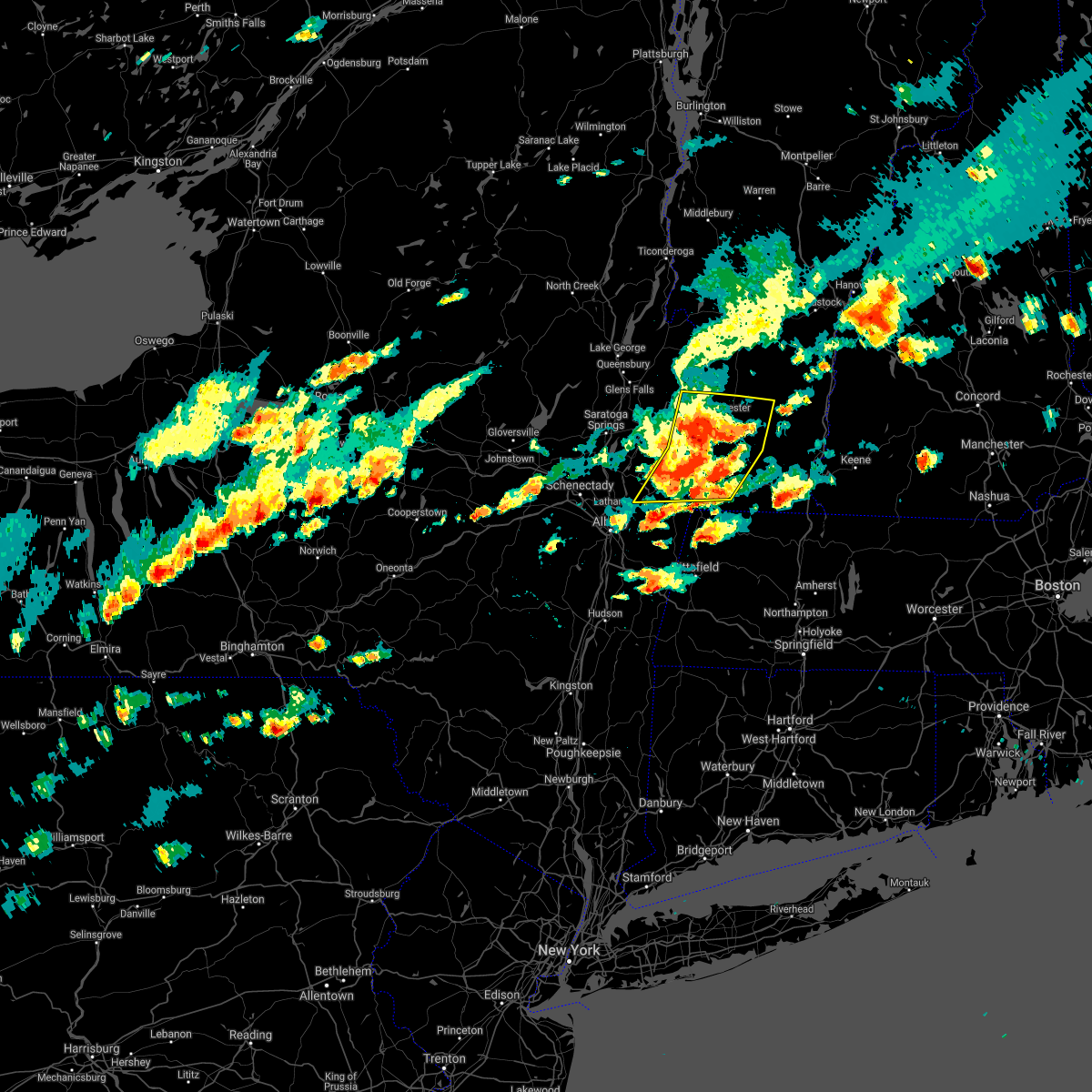 At 324 pm edt, severe thunderstorms were located along a line extending from near pawlet to near shaftsbury to near grafton, moving east at 45 mph (radar indicated). Hazards include 60 mph wind gusts. expect damage to roofs, siding, and trees At 324 pm edt, severe thunderstorms were located along a line extending from near pawlet to near shaftsbury to near grafton, moving east at 45 mph (radar indicated). Hazards include 60 mph wind gusts. expect damage to roofs, siding, and trees
|
| 6/30/2021 3:15 PM EDT |
 At 314 pm edt, severe thunderstorms were located along a line extending from granville to near greenwich to burnt hills, moving east at 45 mph (radar indicated). Hazards include 60 mph wind gusts. Expect damage to roofs, siding, and trees. Locations impacted include, clifton park, mechanicville, hoosick falls, salem, cambridge, greenwich, halfmoon, porter, lee, pittstown, white creek, easton, stillwater, schuylerville, rupert, victory, schaghticoke, valley falls, sandgate and argyle. At 314 pm edt, severe thunderstorms were located along a line extending from granville to near greenwich to burnt hills, moving east at 45 mph (radar indicated). Hazards include 60 mph wind gusts. Expect damage to roofs, siding, and trees. Locations impacted include, clifton park, mechanicville, hoosick falls, salem, cambridge, greenwich, halfmoon, porter, lee, pittstown, white creek, easton, stillwater, schuylerville, rupert, victory, schaghticoke, valley falls, sandgate and argyle.
|
| 6/30/2021 2:54 PM EDT |
 At 254 pm edt, severe thunderstorms were located along a line extending from near hudson falls to near saratoga springs to near duanesburg, moving east at 45 mph (radar indicated). Hazards include 60 mph wind gusts. expect damage to roofs, siding, and trees At 254 pm edt, severe thunderstorms were located along a line extending from near hudson falls to near saratoga springs to near duanesburg, moving east at 45 mph (radar indicated). Hazards include 60 mph wind gusts. expect damage to roofs, siding, and trees
|
| 6/21/2021 10:36 PM EDT |
 The severe thunderstorm warning for northern rensselaer county will expire at 1045 pm edt, the storms which prompted the warning have weakened below severe limits, and have exited the warned area. therefore, the warning will be allowed to expire. a severe thunderstorm watch remains in effect until 1100 pm edt for east central new york, and southern vermont. a severe thunderstorm watch also remains in effect until 1100 pm edt for east central new york. The severe thunderstorm warning for northern rensselaer county will expire at 1045 pm edt, the storms which prompted the warning have weakened below severe limits, and have exited the warned area. therefore, the warning will be allowed to expire. a severe thunderstorm watch remains in effect until 1100 pm edt for east central new york, and southern vermont. a severe thunderstorm watch also remains in effect until 1100 pm edt for east central new york.
|
| 6/21/2021 10:04 PM EDT |
 At 1003 pm edt, severe thunderstorms were located along a line extending from greenwich to near cambridge to near averill park, moving northeast at 45 mph (radar indicated). Hazards include 60 mph wind gusts. Expect damage to roofs, siding, and trees. Locations impacted include, troy, east greenbush, rensselaer, hoosick falls, grafton, west sand lake, center brunswick, wyantskill, wynantskill, north greenbush, brunswick, hoosick, pittstown, poestenkill, schaghticoke, valley falls, south troy, schaghticoke hill, hoosick junction and petersburg junction. At 1003 pm edt, severe thunderstorms were located along a line extending from greenwich to near cambridge to near averill park, moving northeast at 45 mph (radar indicated). Hazards include 60 mph wind gusts. Expect damage to roofs, siding, and trees. Locations impacted include, troy, east greenbush, rensselaer, hoosick falls, grafton, west sand lake, center brunswick, wyantskill, wynantskill, north greenbush, brunswick, hoosick, pittstown, poestenkill, schaghticoke, valley falls, south troy, schaghticoke hill, hoosick junction and petersburg junction.
|
| 6/21/2021 9:44 PM EDT |
 At 943 pm edt, severe thunderstorms were located along a line extending from round lake to mechanicville to menands, moving northeast at 35 mph (radar indicated). Hazards include 60 mph wind gusts. expect damage to roofs, siding, and trees At 943 pm edt, severe thunderstorms were located along a line extending from round lake to mechanicville to menands, moving northeast at 35 mph (radar indicated). Hazards include 60 mph wind gusts. expect damage to roofs, siding, and trees
|
| 5/26/2021 4:23 PM EDT |
 At 422 pm edt, a line of showers and thunderstorms with strong winds were located along a line extending from near wells to near cambridge to near averill park, moving east at 45 mph (radar indicated). Hazards include 60 mph wind gusts. expect damage to roofs, siding, and trees At 422 pm edt, a line of showers and thunderstorms with strong winds were located along a line extending from near wells to near cambridge to near averill park, moving east at 45 mph (radar indicated). Hazards include 60 mph wind gusts. expect damage to roofs, siding, and trees
|
| 10/7/2020 4:09 PM EDT |
 At 408 pm edt, a severe thunderstorm was located near pownal, or near bennington, moving east at 70 mph. this is a very dangerous storm (radar indicated). Hazards include 80 mph wind gusts and nickel size hail. Flying debris will be dangerous to those caught without shelter. mobile homes will be heavily damaged. expect considerable damage to roofs, windows, and vehicles. extensive tree damage and power outages are likely. Locations impacted include, albany, troy, pittsfield, bennington, kingston, east greenbush, cohoes, north adams, brattleboro, watervliet, rensselaer, colonie, great barrington, new paltz, hudson, ellenville, catskill, saugerties, hoosick falls and bellows falls. At 408 pm edt, a severe thunderstorm was located near pownal, or near bennington, moving east at 70 mph. this is a very dangerous storm (radar indicated). Hazards include 80 mph wind gusts and nickel size hail. Flying debris will be dangerous to those caught without shelter. mobile homes will be heavily damaged. expect considerable damage to roofs, windows, and vehicles. extensive tree damage and power outages are likely. Locations impacted include, albany, troy, pittsfield, bennington, kingston, east greenbush, cohoes, north adams, brattleboro, watervliet, rensselaer, colonie, great barrington, new paltz, hudson, ellenville, catskill, saugerties, hoosick falls and bellows falls.
|
| 10/7/2020 4:02 PM EDT | Route 22 at hoosick falls high school closed due to downed trees and wires in rensselaer county NY, 1.9 miles N of Hoosick Falls, NY |
| 10/7/2020 3:56 PM EDT |
 At 356 pm edt, severe thunderstorms were located along a line extending from near pawlet to center brunswick to near davenport, moving southeast at 80 mph (radar indicated). Hazards include 70 mph wind gusts. Expect considerable tree damage. Damage is likely to mobile homes, roofs, and outbuildings. At 356 pm edt, severe thunderstorms were located along a line extending from near pawlet to center brunswick to near davenport, moving southeast at 80 mph (radar indicated). Hazards include 70 mph wind gusts. Expect considerable tree damage. Damage is likely to mobile homes, roofs, and outbuildings.
|
| 10/7/2020 3:48 PM EDT |
 At 347 pm edt, severe thunderstorms were located along a line extending from near dorset to 7 miles southwest of cambridge to middleburgh, moving east at 60 mph (radar indicated). Hazards include 70 mph wind gusts. Expect considerable tree damage. damage is likely to mobile homes, roofs, and outbuildings. Locations impacted include, albany, schenectady, troy, bennington, clifton park, rotterdam, saratoga springs, amsterdam, east greenbush, cohoes, north adams, watervliet, rensselaer, colonie, scotia, hudson falls, mechanicville, cobleskill, hoosick falls and bellows falls. At 347 pm edt, severe thunderstorms were located along a line extending from near dorset to 7 miles southwest of cambridge to middleburgh, moving east at 60 mph (radar indicated). Hazards include 70 mph wind gusts. Expect considerable tree damage. damage is likely to mobile homes, roofs, and outbuildings. Locations impacted include, albany, schenectady, troy, bennington, clifton park, rotterdam, saratoga springs, amsterdam, east greenbush, cohoes, north adams, watervliet, rensselaer, colonie, scotia, hudson falls, mechanicville, cobleskill, hoosick falls and bellows falls.
|
| 10/7/2020 3:43 PM EDT |
 At 342 pm edt, severe thunderstorms were located along a line extending from near dorset to 6 miles northeast of mechanicville to near middleburgh, moving east southeast at 60 mph (radar indicated). Hazards include 60 mph wind gusts. Expect damage to roofs, siding, and trees. Locations impacted include, albany, schenectady, troy, bennington, clifton park, rotterdam, saratoga springs, amsterdam, east greenbush, cohoes, north adams, watervliet, rensselaer, colonie, scotia, hudson falls, mechanicville, cobleskill, hoosick falls and bellows falls. At 342 pm edt, severe thunderstorms were located along a line extending from near dorset to 6 miles northeast of mechanicville to near middleburgh, moving east southeast at 60 mph (radar indicated). Hazards include 60 mph wind gusts. Expect damage to roofs, siding, and trees. Locations impacted include, albany, schenectady, troy, bennington, clifton park, rotterdam, saratoga springs, amsterdam, east greenbush, cohoes, north adams, watervliet, rensselaer, colonie, scotia, hudson falls, mechanicville, cobleskill, hoosick falls and bellows falls.
|
| 10/7/2020 3:21 PM EDT |
 At 320 pm edt, severe thunderstorms were located along a line extending from near lake george village to near broadalbin to cooperstown, moving east at 60 mph (radar indicated). Hazards include 70 mph wind gusts. Expect considerable tree damage. Damage is likely to mobile homes, roofs, and outbuildings. At 320 pm edt, severe thunderstorms were located along a line extending from near lake george village to near broadalbin to cooperstown, moving east at 60 mph (radar indicated). Hazards include 70 mph wind gusts. Expect considerable tree damage. Damage is likely to mobile homes, roofs, and outbuildings.
|
| 8/29/2020 7:40 PM EDT |
 At 740 pm edt, severe thunderstorms were located along a line extending from near greenwich to castleton-on-hudson, moving southeast at 25 mph (radar indicated). Hazards include 60 mph wind gusts. expect damage to roofs, siding, and trees At 740 pm edt, severe thunderstorms were located along a line extending from near greenwich to castleton-on-hudson, moving southeast at 25 mph (radar indicated). Hazards include 60 mph wind gusts. expect damage to roofs, siding, and trees
|
| 8/29/2020 6:41 PM EDT |
 The tornado warning for northeastern rensselaer county will expire at 645 pm edt, the storm which prompted the warning has weakened below severe limits, and has exited the warned area. therefore, the warning will be allowed to expire. a severe thunderstorm watch remains in effect until 900 pm edt for east central new york, and southern vermont. remember, a severe thunderstorm warning still remains in effect for portions of central and northern rensselaer county until 730 pm edt. The tornado warning for northeastern rensselaer county will expire at 645 pm edt, the storm which prompted the warning has weakened below severe limits, and has exited the warned area. therefore, the warning will be allowed to expire. a severe thunderstorm watch remains in effect until 900 pm edt for east central new york, and southern vermont. remember, a severe thunderstorm warning still remains in effect for portions of central and northern rensselaer county until 730 pm edt.
|
| 8/29/2020 6:27 PM EDT |
 At 627 pm edt, a severe thunderstorm capable of producing a tornado was located near hoosick falls, moving southeast at 20 mph (radar indicated rotation). Hazards include tornado. Flying debris will be dangerous to those caught without shelter. mobile homes will be damaged or destroyed. damage to roofs, windows, and vehicles will occur. tree damage is likely. this dangerous storm will be near, bennington and pownal around 645 pm edt. stamford around 700 pm edt. other locations impacted by this tornadic thunderstorm include hoosick junction, paper mill village, sodom, north pownal, petersburg junction, east hoosick, potter hill, babcock lake, north hoosick and north bennington. please report hail size, damaging winds and reports of trees down to the national weather service by email at alb. stormreport@noaa. gov, on facebook at www. facebook. Com/nwsalbany or twitter @nwsalbany. At 627 pm edt, a severe thunderstorm capable of producing a tornado was located near hoosick falls, moving southeast at 20 mph (radar indicated rotation). Hazards include tornado. Flying debris will be dangerous to those caught without shelter. mobile homes will be damaged or destroyed. damage to roofs, windows, and vehicles will occur. tree damage is likely. this dangerous storm will be near, bennington and pownal around 645 pm edt. stamford around 700 pm edt. other locations impacted by this tornadic thunderstorm include hoosick junction, paper mill village, sodom, north pownal, petersburg junction, east hoosick, potter hill, babcock lake, north hoosick and north bennington. please report hail size, damaging winds and reports of trees down to the national weather service by email at alb. stormreport@noaa. gov, on facebook at www. facebook. Com/nwsalbany or twitter @nwsalbany.
|
| 8/29/2020 6:18 PM EDT |
 At 618 pm edt, a severe thunderstorm capable of producing a tornado was located near hoosick falls, moving east at 25 mph (radar indicated rotation). Hazards include tornado. Flying debris will be dangerous to those caught without shelter. mobile homes will be damaged or destroyed. damage to roofs, windows, and vehicles will occur. tree damage is likely. This tornadic thunderstorm will remain over mainly rural areas of northeastern rensselaer county, including the following locations, pittstown, southwest hoosick, petersburg junction, potter hill, babcock lake, west hoosick, stillham, petersburg, factory hollow and boyntonville. At 618 pm edt, a severe thunderstorm capable of producing a tornado was located near hoosick falls, moving east at 25 mph (radar indicated rotation). Hazards include tornado. Flying debris will be dangerous to those caught without shelter. mobile homes will be damaged or destroyed. damage to roofs, windows, and vehicles will occur. tree damage is likely. This tornadic thunderstorm will remain over mainly rural areas of northeastern rensselaer county, including the following locations, pittstown, southwest hoosick, petersburg junction, potter hill, babcock lake, west hoosick, stillham, petersburg, factory hollow and boyntonville.
|
| 8/29/2020 6:00 PM EDT |
 At 600 pm edt, a severe thunderstorm capable of producing a tornado was located 7 miles west of hoosick falls, moving east at 25 mph (radar indicated rotation). Hazards include tornado and quarter size hail. Flying debris will be dangerous to those caught without shelter. mobile homes will be damaged or destroyed. damage to roofs, windows, and vehicles will occur. tree damage is likely. this dangerous storm will be near, grafton around 615 pm edt. hoosick falls around 620 pm edt. other locations impacted by this tornadic thunderstorm include pittstown, schaghticoke hill, hoosick junction, melrose, petersburg junction, east hoosick, babcock lake, johnsonville, east buskirk and eagle bridge. please report hail size, damaging winds and reports of trees down to the national weather service by email at alb. stormreport@noaa. gov, on facebook at www. facebook. Com/nwsalbany or twitter @nwsalbany. At 600 pm edt, a severe thunderstorm capable of producing a tornado was located 7 miles west of hoosick falls, moving east at 25 mph (radar indicated rotation). Hazards include tornado and quarter size hail. Flying debris will be dangerous to those caught without shelter. mobile homes will be damaged or destroyed. damage to roofs, windows, and vehicles will occur. tree damage is likely. this dangerous storm will be near, grafton around 615 pm edt. hoosick falls around 620 pm edt. other locations impacted by this tornadic thunderstorm include pittstown, schaghticoke hill, hoosick junction, melrose, petersburg junction, east hoosick, babcock lake, johnsonville, east buskirk and eagle bridge. please report hail size, damaging winds and reports of trees down to the national weather service by email at alb. stormreport@noaa. gov, on facebook at www. facebook. Com/nwsalbany or twitter @nwsalbany.
|
| 8/29/2020 5:31 PM EDT |
 At 531 pm edt, a confirmed tornado was located near mechanicville, moving east at 40 mph (public confirmed tornado). Hazards include damaging tornado and quarter size hail. Flying debris will be dangerous to those caught without shelter. mobile homes will be damaged or destroyed. damage to roofs, windows, and vehicles will occur. tree damage is likely. the tornado will be near, cambridge around 550 pm edt. hoosick falls around 555 pm edt. other locations impacted by this tornadic thunderstorm include schaghticoke hill, center white creek, hoosick junction, petersburg junction, johnsonville, willow glen, coons, wayville, schaghticoke and north cambridge. please report hail size, damaging winds and reports of trees down to the national weather service by email at alb. stormreport@noaa. gov, on facebook at www. facebook. Com/nwsalbany or twitter @nwsalbany. At 531 pm edt, a confirmed tornado was located near mechanicville, moving east at 40 mph (public confirmed tornado). Hazards include damaging tornado and quarter size hail. Flying debris will be dangerous to those caught without shelter. mobile homes will be damaged or destroyed. damage to roofs, windows, and vehicles will occur. tree damage is likely. the tornado will be near, cambridge around 550 pm edt. hoosick falls around 555 pm edt. other locations impacted by this tornadic thunderstorm include schaghticoke hill, center white creek, hoosick junction, petersburg junction, johnsonville, willow glen, coons, wayville, schaghticoke and north cambridge. please report hail size, damaging winds and reports of trees down to the national weather service by email at alb. stormreport@noaa. gov, on facebook at www. facebook. Com/nwsalbany or twitter @nwsalbany.
|
| 7/14/2020 2:21 PM EDT |
 At 220 pm edt, a severe thunderstorm was located 8 miles northeast of mechanicville, moving east at 20 mph (radar indicated). Hazards include 60 mph wind gusts and quarter size hail. Hail damage to vehicles is expected. expect wind damage to roofs, siding, and trees. Locations impacted include, hoosick falls, cambridge, hoosick, lee, white creek, easton, schaghticoke, valley falls, white creek station, schaghticoke hill, center white creek, hoosick junction, west cambridge, post corners, petersburg junction, east hoosick, johnsonville, east buskirk, eagle bridge and north cambridge. At 220 pm edt, a severe thunderstorm was located 8 miles northeast of mechanicville, moving east at 20 mph (radar indicated). Hazards include 60 mph wind gusts and quarter size hail. Hail damage to vehicles is expected. expect wind damage to roofs, siding, and trees. Locations impacted include, hoosick falls, cambridge, hoosick, lee, white creek, easton, schaghticoke, valley falls, white creek station, schaghticoke hill, center white creek, hoosick junction, west cambridge, post corners, petersburg junction, east hoosick, johnsonville, east buskirk, eagle bridge and north cambridge.
|
| 7/14/2020 2:00 PM EDT |
 At 200 pm edt, a severe thunderstorm was located near mechanicville, moving east at 20 mph (radar indicated). Hazards include 60 mph wind gusts and quarter size hail. Hail damage to vehicles is expected. Expect wind damage to roofs, siding, and trees. At 200 pm edt, a severe thunderstorm was located near mechanicville, moving east at 20 mph (radar indicated). Hazards include 60 mph wind gusts and quarter size hail. Hail damage to vehicles is expected. Expect wind damage to roofs, siding, and trees.
|
| 7/8/2020 4:10 PM EDT |
 At 410 pm edt, a severe thunderstorm was located near hoosick falls, moving east at 20 mph (radar indicated). Hazards include 60 mph wind gusts and penny size hail. Expect damage to roofs, siding, and trees. Locations impacted include, clifton park, mechanicville, hoosick falls, grafton, halfmoon, pittstown, stillwater, schaghticoke, valley falls, schaghticoke hill, hoosick junction, johnsonville, willow glen, coons, pleasantdale, tamarack, petersburg, grays corners, haynersville and east pittstown. At 410 pm edt, a severe thunderstorm was located near hoosick falls, moving east at 20 mph (radar indicated). Hazards include 60 mph wind gusts and penny size hail. Expect damage to roofs, siding, and trees. Locations impacted include, clifton park, mechanicville, hoosick falls, grafton, halfmoon, pittstown, stillwater, schaghticoke, valley falls, schaghticoke hill, hoosick junction, johnsonville, willow glen, coons, pleasantdale, tamarack, petersburg, grays corners, haynersville and east pittstown.
|
| 7/8/2020 3:59 PM EDT |
 At 358 pm edt, a severe thunderstorm was located 8 miles west of hoosick falls, moving east at 20 mph (radar indicated). Hazards include 60 mph wind gusts and quarter size hail. Hail damage to vehicles is expected. expect wind damage to roofs, siding, and trees. Locations impacted include, clifton park, mechanicville, hoosick falls, grafton, round lake, country knolls, halfmoon, hoosick, lee, pittstown, white creek, easton, stillwater, schaghticoke, valley falls, deans corners, schaghticoke hill, center white creek, hoosick junction and petersburg junction. At 358 pm edt, a severe thunderstorm was located 8 miles west of hoosick falls, moving east at 20 mph (radar indicated). Hazards include 60 mph wind gusts and quarter size hail. Hail damage to vehicles is expected. expect wind damage to roofs, siding, and trees. Locations impacted include, clifton park, mechanicville, hoosick falls, grafton, round lake, country knolls, halfmoon, hoosick, lee, pittstown, white creek, easton, stillwater, schaghticoke, valley falls, deans corners, schaghticoke hill, center white creek, hoosick junction and petersburg junction.
|
| 7/8/2020 3:42 PM EDT |
 At 341 pm edt, a severe thunderstorm was located near mechanicville, moving east at 20 mph (radar indicated). Hazards include 60 mph wind gusts and quarter size hail. Hail damage to vehicles is expected. Expect wind damage to roofs, siding, and trees. At 341 pm edt, a severe thunderstorm was located near mechanicville, moving east at 20 mph (radar indicated). Hazards include 60 mph wind gusts and quarter size hail. Hail damage to vehicles is expected. Expect wind damage to roofs, siding, and trees.
|
| 5/29/2020 8:18 PM EDT |
 At 818 pm edt, a severe thunderstorm was located near shaftsbury, or 7 miles southwest of arlington, moving northeast at 45 mph (radar indicated). Hazards include 60 mph wind gusts and quarter size hail. Hail damage to vehicles is expected. Expect wind damage to roofs, siding, and trees. At 818 pm edt, a severe thunderstorm was located near shaftsbury, or 7 miles southwest of arlington, moving northeast at 45 mph (radar indicated). Hazards include 60 mph wind gusts and quarter size hail. Hail damage to vehicles is expected. Expect wind damage to roofs, siding, and trees.
|
| 5/15/2020 6:26 PM EDT |
 At 625 pm edt, severe thunderstorms were located along a line extending from 6 miles northeast of salem to near shaftsbury to near mechanicville, moving east at 65 mph (radar indicated). Hazards include 70 mph wind gusts and quarter size hail. Hail damage to vehicles is expected. expect considerable tree damage. Wind damage is also likely to mobile homes, roofs, and outbuildings. At 625 pm edt, severe thunderstorms were located along a line extending from 6 miles northeast of salem to near shaftsbury to near mechanicville, moving east at 65 mph (radar indicated). Hazards include 70 mph wind gusts and quarter size hail. Hail damage to vehicles is expected. expect considerable tree damage. Wind damage is also likely to mobile homes, roofs, and outbuildings.
|
| 5/15/2020 6:08 PM EDT |
 At 608 pm edt, a severe thunderstorm was located near greenwich, or 10 miles east of saratoga springs, moving east at 50 mph (radar indicated). Hazards include 70 mph wind gusts and quarter size hail. Hail damage to vehicles is expected. expect considerable tree damage. wind damage is also likely to mobile homes, roofs, and outbuildings. Locations impacted include, saratoga springs, glens falls, hudson falls, mechanicville, hoosick falls, salem, glenville, milton, ballston spa, fort edward, cambridge, greenwich, round lake, rotterdam junction, burnt hills, glens falls north, country knolls, north ballston spa, west glens falls and pattersonville-rotterdam junction. At 608 pm edt, a severe thunderstorm was located near greenwich, or 10 miles east of saratoga springs, moving east at 50 mph (radar indicated). Hazards include 70 mph wind gusts and quarter size hail. Hail damage to vehicles is expected. expect considerable tree damage. wind damage is also likely to mobile homes, roofs, and outbuildings. Locations impacted include, saratoga springs, glens falls, hudson falls, mechanicville, hoosick falls, salem, glenville, milton, ballston spa, fort edward, cambridge, greenwich, round lake, rotterdam junction, burnt hills, glens falls north, country knolls, north ballston spa, west glens falls and pattersonville-rotterdam junction.
|
| 5/15/2020 5:42 PM EDT |
 At 541 pm edt, a severe thunderstorm was located near galway, or 12 miles west of saratoga springs, moving east at 55 mph (radar indicated). Hazards include 60 mph wind gusts and quarter size hail. Hail damage to vehicles is expected. Expect wind damage to roofs, siding, and trees. At 541 pm edt, a severe thunderstorm was located near galway, or 12 miles west of saratoga springs, moving east at 55 mph (radar indicated). Hazards include 60 mph wind gusts and quarter size hail. Hail damage to vehicles is expected. Expect wind damage to roofs, siding, and trees.
|
| 9/23/2019 7:52 PM EDT |
 At 751 pm edt, a severe thunderstorm was located near mechanicville, moving east at 50 mph (radar indicated). Hazards include 60 mph wind gusts. Expect damage to roofs, siding, and trees. Locations impacted include, clifton park, saratoga springs, mechanicville, hoosick falls, salem, cambridge, greenwich, round lake, country knolls, gates, halfmoon, malta, hoosick, lee, pittstown, northumberland, white creek, easton, stillwater and schuylerville. At 751 pm edt, a severe thunderstorm was located near mechanicville, moving east at 50 mph (radar indicated). Hazards include 60 mph wind gusts. Expect damage to roofs, siding, and trees. Locations impacted include, clifton park, saratoga springs, mechanicville, hoosick falls, salem, cambridge, greenwich, round lake, country knolls, gates, halfmoon, malta, hoosick, lee, pittstown, northumberland, white creek, easton, stillwater and schuylerville.
|
| 9/23/2019 7:26 PM EDT |
 At 725 pm edt, a severe thunderstorm was located near burnt hills, or 7 miles north of scotia, moving east at 55 mph (radar indicated). Hazards include 60 mph wind gusts. expect damage to roofs, siding, and trees At 725 pm edt, a severe thunderstorm was located near burnt hills, or 7 miles north of scotia, moving east at 55 mph (radar indicated). Hazards include 60 mph wind gusts. expect damage to roofs, siding, and trees
|
| 9/4/2019 2:45 PM EDT |
 At 245 pm edt, a severe thunderstorm was located near stratton, moving east at 35 mph (radar indicated). Hazards include 60 mph wind gusts. Expect damage to roofs, siding, and trees. Locations impacted include, bennington, hoosick falls, arlington, townshend, stratton, shaftsbury, newfane, west wardsboro, hoosick, north bennington, dover, jamaica, wardsboro, woodford, old bennington, searsburg, glastenbury, somerset, wardsboro center and hoosick junction. At 245 pm edt, a severe thunderstorm was located near stratton, moving east at 35 mph (radar indicated). Hazards include 60 mph wind gusts. Expect damage to roofs, siding, and trees. Locations impacted include, bennington, hoosick falls, arlington, townshend, stratton, shaftsbury, newfane, west wardsboro, hoosick, north bennington, dover, jamaica, wardsboro, woodford, old bennington, searsburg, glastenbury, somerset, wardsboro center and hoosick junction.
|
| 9/4/2019 2:32 PM EDT |
 The national weather service in albany has issued a * severe thunderstorm warning for. southeastern washington county in east central new york. northeastern rensselaer county in east central new york. southern bennington county in southern vermont. Northwestern windham county in southern vermont. The national weather service in albany has issued a * severe thunderstorm warning for. southeastern washington county in east central new york. northeastern rensselaer county in east central new york. southern bennington county in southern vermont. Northwestern windham county in southern vermont.
|
| 9/4/2019 2:32 PM EDT |
 At 232 pm edt, a severe thunderstorm was located over shaftsbury, or near arlington, moving east at 30 mph (radar indicated). Hazards include 60 mph wind gusts. expect damage to roofs, siding, and trees At 232 pm edt, a severe thunderstorm was located over shaftsbury, or near arlington, moving east at 30 mph (radar indicated). Hazards include 60 mph wind gusts. expect damage to roofs, siding, and trees
|
| 9/4/2019 2:25 PM EDT |
 At 225 pm edt, a severe thunderstorm was located over grafton, or 8 miles southwest of hoosick falls, moving east at 45 mph (radar indicated). Hazards include 60 mph wind gusts. Expect damage to roofs, siding, and trees. Locations impacted include, troy, bennington, north adams, hoosick falls, adams, williamstown, pownal, grafton, berlin, west sand lake, center brunswick, wyantskill, averill park, wynantskill, north greenbush, brunswick, sand lake, hoosick, pittstown and poestenkill. At 225 pm edt, a severe thunderstorm was located over grafton, or 8 miles southwest of hoosick falls, moving east at 45 mph (radar indicated). Hazards include 60 mph wind gusts. Expect damage to roofs, siding, and trees. Locations impacted include, troy, bennington, north adams, hoosick falls, adams, williamstown, pownal, grafton, berlin, west sand lake, center brunswick, wyantskill, averill park, wynantskill, north greenbush, brunswick, sand lake, hoosick, pittstown and poestenkill.
|
| 9/4/2019 2:01 PM EDT |
 At 201 pm edt, a severe thunderstorm was located near colonie, moving east at 40 mph (radar indicated). Hazards include 60 mph wind gusts and nickel size hail. expect damage to roofs, siding, and trees At 201 pm edt, a severe thunderstorm was located near colonie, moving east at 40 mph (radar indicated). Hazards include 60 mph wind gusts and nickel size hail. expect damage to roofs, siding, and trees
|
| 9/4/2019 12:51 PM EDT |
 The severe thunderstorm warning for southern washington and northeastern rensselaer counties will expire at 100 pm edt, the storm which prompted the warning has moved out of the area. therefore, the warning will be allowed to expire. The severe thunderstorm warning for southern washington and northeastern rensselaer counties will expire at 100 pm edt, the storm which prompted the warning has moved out of the area. therefore, the warning will be allowed to expire.
|
| 9/4/2019 12:29 PM EDT |
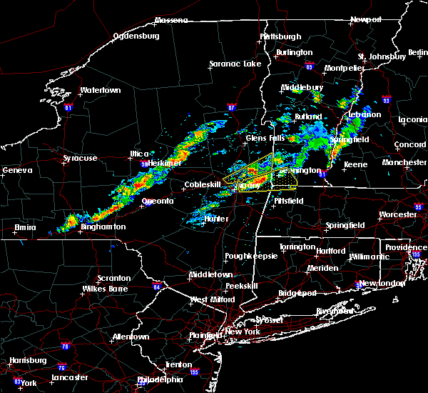 At 1229 pm edt, a severe thunderstorm was located near grafton, or near hoosick falls, moving east at 50 mph (radar indicated). Hazards include 60 mph wind gusts and penny size hail. Expect damage to roofs, siding, and trees. Locations impacted include, bennington, north adams, hoosick falls, williamstown, pownal, grafton, berlin, stamford, readsboro, hoosick, pittstown, north bennington, woodford, old bennington, hairpin turn, paper mill village, east poestenkill, petersburg junction, quackenkill and east hoosick. At 1229 pm edt, a severe thunderstorm was located near grafton, or near hoosick falls, moving east at 50 mph (radar indicated). Hazards include 60 mph wind gusts and penny size hail. Expect damage to roofs, siding, and trees. Locations impacted include, bennington, north adams, hoosick falls, williamstown, pownal, grafton, berlin, stamford, readsboro, hoosick, pittstown, north bennington, woodford, old bennington, hairpin turn, paper mill village, east poestenkill, petersburg junction, quackenkill and east hoosick.
|
| 9/4/2019 12:25 PM EDT |
 At 1225 pm edt, a severe thunderstorm was located 7 miles east of mechanicville, moving northeast at 55 mph (radar indicated). Hazards include 60 mph wind gusts and quarter size hail. Hail damage to vehicles is expected. expect wind damage to roofs, siding, and trees. Locations impacted include, hoosick falls, salem, cambridge, lee, white creek, easton, schaghticoke, valley falls, schaghticoke hill, center white creek, hoosick junction, west cambridge, post corners, johnsonville, east buskirk, eagle bridge, rexleigh, eagleville, anaquassacook and north cambridge. At 1225 pm edt, a severe thunderstorm was located 7 miles east of mechanicville, moving northeast at 55 mph (radar indicated). Hazards include 60 mph wind gusts and quarter size hail. Hail damage to vehicles is expected. expect wind damage to roofs, siding, and trees. Locations impacted include, hoosick falls, salem, cambridge, lee, white creek, easton, schaghticoke, valley falls, schaghticoke hill, center white creek, hoosick junction, west cambridge, post corners, johnsonville, east buskirk, eagle bridge, rexleigh, eagleville, anaquassacook and north cambridge.
|
| 9/4/2019 12:14 PM EDT |
 At 1214 pm edt, a severe thunderstorm was located over center brunswick, or over troy, moving east at 50 mph (radar indicated). Hazards include 60 mph wind gusts and quarter size hail. Hail damage to vehicles is expected. Expect wind damage to roofs, siding, and trees. At 1214 pm edt, a severe thunderstorm was located over center brunswick, or over troy, moving east at 50 mph (radar indicated). Hazards include 60 mph wind gusts and quarter size hail. Hail damage to vehicles is expected. Expect wind damage to roofs, siding, and trees.
|
| 9/4/2019 12:08 PM EDT |
 At 1207 pm edt, a severe thunderstorm was located over clifton park, moving northeast at 50 mph (radar indicated). Hazards include 60 mph wind gusts and quarter size hail. Hail damage to vehicles is expected. Expect wind damage to roofs, siding, and trees. At 1207 pm edt, a severe thunderstorm was located over clifton park, moving northeast at 50 mph (radar indicated). Hazards include 60 mph wind gusts and quarter size hail. Hail damage to vehicles is expected. Expect wind damage to roofs, siding, and trees.
|
| 8/21/2019 4:51 PM EDT |
 At 450 pm edt, severe thunderstorms were located along a line extending from near manchester center to near shaftsbury to near hoosick falls, moving east at 25 mph (radar indicated). Hazards include 60 mph wind gusts and penny size hail. Expect damage to roofs, siding, and trees. Locations impacted include, bennington, hoosick falls, arlington, manchester, shaftsbury, manchester center, hoosick, pittstown, white creek, north bennington, sunderland, schaghticoke, valley falls, woodford, peru, old bennington, searsburg, glastenbury, schaghticoke hill and center white creek. At 450 pm edt, severe thunderstorms were located along a line extending from near manchester center to near shaftsbury to near hoosick falls, moving east at 25 mph (radar indicated). Hazards include 60 mph wind gusts and penny size hail. Expect damage to roofs, siding, and trees. Locations impacted include, bennington, hoosick falls, arlington, manchester, shaftsbury, manchester center, hoosick, pittstown, white creek, north bennington, sunderland, schaghticoke, valley falls, woodford, peru, old bennington, searsburg, glastenbury, schaghticoke hill and center white creek.
|
| 8/21/2019 4:24 PM EDT |
 The national weather service in albany has issued a * severe thunderstorm warning for. southeastern washington county in east central new york. northern rensselaer county in east central new york. bennington county in southern vermont. Until 500 pm edt. The national weather service in albany has issued a * severe thunderstorm warning for. southeastern washington county in east central new york. northern rensselaer county in east central new york. bennington county in southern vermont. Until 500 pm edt.
|
| 8/21/2019 4:24 PM EDT |
 At 423 pm edt, severe thunderstorms were located along a line extending from 6 miles west of dorset to near cambridge to near mechanicville, moving east at 25 mph (radar indicated). Hazards include 70 mph wind gusts and penny size hail. Expect considerable tree damage. Damage is likely to mobile homes, roofs, and outbuildings. At 423 pm edt, severe thunderstorms were located along a line extending from 6 miles west of dorset to near cambridge to near mechanicville, moving east at 25 mph (radar indicated). Hazards include 70 mph wind gusts and penny size hail. Expect considerable tree damage. Damage is likely to mobile homes, roofs, and outbuildings.
|
| 8/21/2019 4:06 PM EDT |
 A severe thunderstorm warning remains in effect until 430 pm edt for southeastern saratoga. southern washington and northern rensselaer counties. At 406 pm edt, severe thunderstorms were located along a line extending from 6 miles southeast of fort edward to near mechanicville, moving east at 25 mph. A severe thunderstorm warning remains in effect until 430 pm edt for southeastern saratoga. southern washington and northern rensselaer counties. At 406 pm edt, severe thunderstorms were located along a line extending from 6 miles southeast of fort edward to near mechanicville, moving east at 25 mph.
|
| 8/21/2019 3:45 PM EDT |
 At 344 pm edt, severe thunderstorms were located along a line extending from near fort edward to near alplaus, moving east at 25 mph. these are very dangerous storms (radar indicated). Hazards include 80 mph wind gusts and penny size hail. Flying debris will be dangerous to those caught without shelter. mobile homes will be heavily damaged. expect considerable damage to roofs, windows, and vehicles. extensive tree damage and power outages are likely. Locations impacted include, clifton park, saratoga springs, hudson falls, mechanicville, hoosick falls, salem, ballston spa, fort edward, cambridge, greenwich, round lake, burnt hills, country knolls, north ballston spa, gates, malta, hoosick, porter, lee and pittstown. At 344 pm edt, severe thunderstorms were located along a line extending from near fort edward to near alplaus, moving east at 25 mph. these are very dangerous storms (radar indicated). Hazards include 80 mph wind gusts and penny size hail. Flying debris will be dangerous to those caught without shelter. mobile homes will be heavily damaged. expect considerable damage to roofs, windows, and vehicles. extensive tree damage and power outages are likely. Locations impacted include, clifton park, saratoga springs, hudson falls, mechanicville, hoosick falls, salem, ballston spa, fort edward, cambridge, greenwich, round lake, burnt hills, country knolls, north ballston spa, gates, malta, hoosick, porter, lee and pittstown.
|
| 8/21/2019 3:35 PM EDT |
 At 335 pm edt, severe thunderstorms were located along a line extending from near fort edward to alplaus, moving east at 25 mph (radar indicated). Hazards include 70 mph wind gusts and penny size hail. Expect considerable tree damage. damage is likely to mobile homes, roofs, and outbuildings. Locations impacted include, clifton park, saratoga springs, glens falls, hudson falls, mechanicville, hoosick falls, salem, milton, ballston spa, fort edward, cambridge, greenwich, round lake, burnt hills, country knolls, north ballston spa, east glenville, gates, wilton and malta. At 335 pm edt, severe thunderstorms were located along a line extending from near fort edward to alplaus, moving east at 25 mph (radar indicated). Hazards include 70 mph wind gusts and penny size hail. Expect considerable tree damage. damage is likely to mobile homes, roofs, and outbuildings. Locations impacted include, clifton park, saratoga springs, glens falls, hudson falls, mechanicville, hoosick falls, salem, milton, ballston spa, fort edward, cambridge, greenwich, round lake, burnt hills, country knolls, north ballston spa, east glenville, gates, wilton and malta.
|
| 8/21/2019 3:28 PM EDT |
 The national weather service in albany has issued a * severe thunderstorm warning for. northeastern schenectady county in east central new york. eastern saratoga county in east central new york. southern washington county in east central new york. Northern rensselaer county in east central new york. The national weather service in albany has issued a * severe thunderstorm warning for. northeastern schenectady county in east central new york. eastern saratoga county in east central new york. southern washington county in east central new york. Northern rensselaer county in east central new york.
|
| 8/18/2019 8:19 PM EDT |
 At 819 pm edt, a severe thunderstorm was located near bennington, moving northeast at 45 mph (radar indicated). Hazards include 60 mph wind gusts. expect damage to roofs, siding, and trees At 819 pm edt, a severe thunderstorm was located near bennington, moving northeast at 45 mph (radar indicated). Hazards include 60 mph wind gusts. expect damage to roofs, siding, and trees
|
| 8/18/2019 8:19 PM EDT |
 The national weather service in albany has issued a * severe thunderstorm warning for. northern berkshire county in western massachusetts. northeastern columbia county in east central new york. southeastern washington county in east central new york. Eastern rensselaer county in east central new york. The national weather service in albany has issued a * severe thunderstorm warning for. northern berkshire county in western massachusetts. northeastern columbia county in east central new york. southeastern washington county in east central new york. Eastern rensselaer county in east central new york.
|
| 8/18/2019 8:19 PM EDT |
 At 819 pm edt, a severe thunderstorm was located near bennington, moving northeast at 45 mph (radar indicated). Hazards include 60 mph wind gusts. expect damage to roofs, siding, and trees At 819 pm edt, a severe thunderstorm was located near bennington, moving northeast at 45 mph (radar indicated). Hazards include 60 mph wind gusts. expect damage to roofs, siding, and trees
|
| 8/18/2019 8:19 PM EDT |
 At 819 pm edt, a severe thunderstorm was located near bennington, moving northeast at 45 mph (radar indicated). Hazards include 60 mph wind gusts. expect damage to roofs, siding, and trees At 819 pm edt, a severe thunderstorm was located near bennington, moving northeast at 45 mph (radar indicated). Hazards include 60 mph wind gusts. expect damage to roofs, siding, and trees
|
| 8/18/2019 7:25 PM EDT | Trees and wires dow in rensselaer county NY, 0.3 miles SW of Hoosick Falls, NY |
| 8/18/2019 7:13 PM EDT |
 At 712 pm edt, a severe thunderstorm was located near hoosick falls, moving east at 25 mph (radar indicated). Hazards include 60 mph wind gusts and quarter size hail. Hail damage to vehicles is expected. Expect wind damage to roofs, siding, and trees. At 712 pm edt, a severe thunderstorm was located near hoosick falls, moving east at 25 mph (radar indicated). Hazards include 60 mph wind gusts and quarter size hail. Hail damage to vehicles is expected. Expect wind damage to roofs, siding, and trees.
|
| 8/17/2019 6:09 PM EDT |
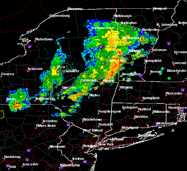 At 608 pm edt, severe thunderstorms were located along a line extending from near pawlet to near grafton, moving east at 30 mph (radar indicated). Hazards include 60 mph wind gusts and penny size hail. expect damage to roofs, siding, and trees At 608 pm edt, severe thunderstorms were located along a line extending from near pawlet to near grafton, moving east at 30 mph (radar indicated). Hazards include 60 mph wind gusts and penny size hail. expect damage to roofs, siding, and trees
|
| 8/17/2019 6:09 PM EDT |
 The national weather service in albany has issued a * severe thunderstorm warning for. southeastern washington county in east central new york. northeastern rensselaer county in east central new york. bennington county in southern vermont. Western windham county in southern vermont. The national weather service in albany has issued a * severe thunderstorm warning for. southeastern washington county in east central new york. northeastern rensselaer county in east central new york. bennington county in southern vermont. Western windham county in southern vermont.
|
| 8/17/2019 5:34 PM EDT |
 At 534 pm edt, severe thunderstorms were located along a line extending from 6 miles south of fort edward to colonie, moving east at 40 mph (law enforcement has reported multiple areas of trees and wires down). Hazards include 60 mph wind gusts and quarter size hail. Hail damage to vehicles is expected. Expect wind damage to roofs, siding, and trees. At 534 pm edt, severe thunderstorms were located along a line extending from 6 miles south of fort edward to colonie, moving east at 40 mph (law enforcement has reported multiple areas of trees and wires down). Hazards include 60 mph wind gusts and quarter size hail. Hail damage to vehicles is expected. Expect wind damage to roofs, siding, and trees.
|
| 8/8/2019 6:14 PM EDT |
 At 613 pm edt, severe thunderstorms were located along a line extending from near greenwich to near cheshire to ashley falls, moving east at 35 mph (trained weather spotters reported trees and wires down in stockbridge, ma, and ghent, ny). Hazards include 60 mph wind gusts. Expect damage to roofs, siding, and trees. severe thunderstorms will be near, cheshire and savoy around 620 pm edt. shaftsbury, sandisfield and hawley around 635 pm edt. arlington around 640 pm edt. manchester around 645 pm edt. tolland and manchester center around 650 pm edt. stratton around 700 pm edt. west wardsboro around 705 pm edt. townshend around 715 pm edt. Other locations impacted by these severe thunderstorms include goose city, chiselville, north hancock, readsboro falls, cheshire harbor, south shaftsbury, south windham, middle falls, dalton and adams junction. At 613 pm edt, severe thunderstorms were located along a line extending from near greenwich to near cheshire to ashley falls, moving east at 35 mph (trained weather spotters reported trees and wires down in stockbridge, ma, and ghent, ny). Hazards include 60 mph wind gusts. Expect damage to roofs, siding, and trees. severe thunderstorms will be near, cheshire and savoy around 620 pm edt. shaftsbury, sandisfield and hawley around 635 pm edt. arlington around 640 pm edt. manchester around 645 pm edt. tolland and manchester center around 650 pm edt. stratton around 700 pm edt. west wardsboro around 705 pm edt. townshend around 715 pm edt. Other locations impacted by these severe thunderstorms include goose city, chiselville, north hancock, readsboro falls, cheshire harbor, south shaftsbury, south windham, middle falls, dalton and adams junction.
|
| 8/8/2019 6:01 PM EDT |
 At 600 pm edt, severe thunderstorms were located along a line extending from near greenwich to near hoosick falls to near pownal, moving east at 50 mph (radar indicated). Hazards include 60 mph wind gusts and quarter size hail. Hail damage to vehicles is expected. expect wind damage to roofs, siding, and trees. Locations impacted include, bennington, saratoga springs, mechanicville, hoosick falls, arlington, salem, manchester, stratton, shaftsbury, pownal, grafton, wilmington, cambridge, greenwich, stamford, readsboro, center brunswick, manchester center, west wardsboro and gates. At 600 pm edt, severe thunderstorms were located along a line extending from near greenwich to near hoosick falls to near pownal, moving east at 50 mph (radar indicated). Hazards include 60 mph wind gusts and quarter size hail. Hail damage to vehicles is expected. expect wind damage to roofs, siding, and trees. Locations impacted include, bennington, saratoga springs, mechanicville, hoosick falls, arlington, salem, manchester, stratton, shaftsbury, pownal, grafton, wilmington, cambridge, greenwich, stamford, readsboro, center brunswick, manchester center, west wardsboro and gates.
|
| 8/8/2019 5:36 PM EDT |
 At 536 pm edt, severe thunderstorms were located along a line extending from near ballston spa to near mechanicville to troy, moving east at 50 mph (radar indicated). Hazards include 60 mph wind gusts and quarter size hail. Hail damage to vehicles is expected. Expect wind damage to roofs, siding, and trees. At 536 pm edt, severe thunderstorms were located along a line extending from near ballston spa to near mechanicville to troy, moving east at 50 mph (radar indicated). Hazards include 60 mph wind gusts and quarter size hail. Hail damage to vehicles is expected. Expect wind damage to roofs, siding, and trees.
|
| 7/28/2019 5:15 PM EDT |
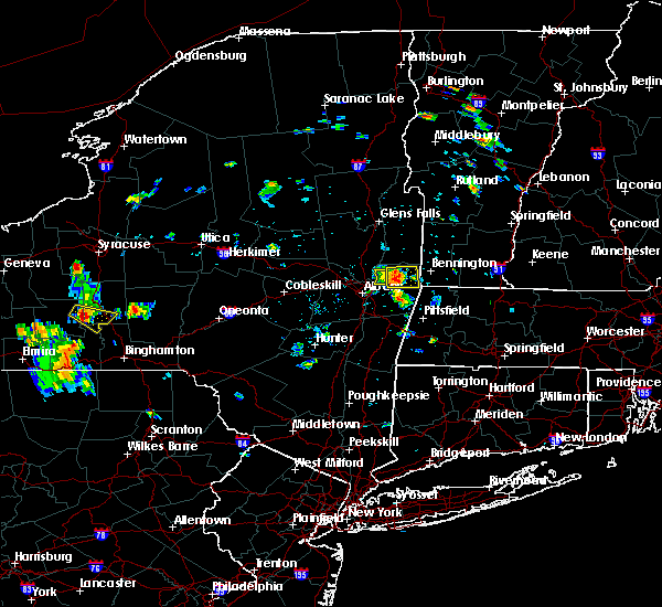 At 515 pm edt, a severe thunderstorm was located near grafton, or near hoosick falls, moving east at 20 mph (law enforcement). Hazards include 60 mph wind gusts and penny size hail. expect damage to roofs, siding, and trees At 515 pm edt, a severe thunderstorm was located near grafton, or near hoosick falls, moving east at 20 mph (law enforcement). Hazards include 60 mph wind gusts and penny size hail. expect damage to roofs, siding, and trees
|
| 7/28/2019 5:15 PM EDT |
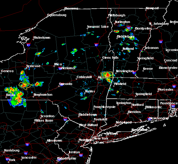 At 515 pm edt, a severe thunderstorm was located near grafton, or near hoosick falls, moving east at 20 mph (law enforcement). Hazards include 60 mph wind gusts and penny size hail. expect damage to roofs, siding, and trees At 515 pm edt, a severe thunderstorm was located near grafton, or near hoosick falls, moving east at 20 mph (law enforcement). Hazards include 60 mph wind gusts and penny size hail. expect damage to roofs, siding, and trees
|
| 7/28/2019 5:09 PM EDT |
 At 509 pm edt, a severe thunderstorm was located near grafton, or 7 miles southwest of hoosick falls, moving east at 30 mph (radar indicated). Hazards include 60 mph wind gusts and penny size hail. Expect damage to roofs, siding, and trees. Locations impacted include, hoosick falls, grafton, brunswick, hoosick, pittstown, valley falls, petersburg junction, quackenkill, babcock lake, tamarack, petersburg, factory hollow, haynersville, east pittstown, raymertown, millertown, southwest hoosick, potter hill, west hoosick and stillham. At 509 pm edt, a severe thunderstorm was located near grafton, or 7 miles southwest of hoosick falls, moving east at 30 mph (radar indicated). Hazards include 60 mph wind gusts and penny size hail. Expect damage to roofs, siding, and trees. Locations impacted include, hoosick falls, grafton, brunswick, hoosick, pittstown, valley falls, petersburg junction, quackenkill, babcock lake, tamarack, petersburg, factory hollow, haynersville, east pittstown, raymertown, millertown, southwest hoosick, potter hill, west hoosick and stillham.
|
| 7/28/2019 4:54 PM EDT |
 At 454 pm edt, a severe thunderstorm was located near center brunswick, or near mechanicville, moving east at 20 mph (radar indicated). Hazards include 60 mph wind gusts and penny size hail. expect damage to roofs, siding, and trees At 454 pm edt, a severe thunderstorm was located near center brunswick, or near mechanicville, moving east at 20 mph (radar indicated). Hazards include 60 mph wind gusts and penny size hail. expect damage to roofs, siding, and trees
|
| 7/20/2019 8:13 PM EDT | Estimated 60 mph wind gusts with some tree limbs dow in rensselaer county NY, 2.7 miles NNW of Hoosick Falls, NY |
| 7/20/2019 7:39 PM EDT |
 At 739 pm edt, a severe thunderstorm was located over waterford, or near cohoes, moving east at 40 mph (radar indicated). Hazards include 60 mph wind gusts. expect damage to roofs, siding, and trees At 739 pm edt, a severe thunderstorm was located over waterford, or near cohoes, moving east at 40 mph (radar indicated). Hazards include 60 mph wind gusts. expect damage to roofs, siding, and trees
|
| 6/26/2019 7:52 PM EDT |
 At 752 pm edt, severe thunderstorms were located along a line extending from near shaftsbury to pownal to near berlin, moving east at 30 mph (radar indicated). Hazards include 60 mph wind gusts and quarter size hail. Hail damage to vehicles is expected. expect wind damage to roofs, siding, and trees. severe thunderstorms will be near, bennington, arlington and shaftsbury around 800 pm edt. stamford around 805 pm edt. new ashford around 810 pm edt. north adams, monroe and readsboro around 820 pm edt. stratton, adams and wilmington around 825 pm edt. west wardsboro around 830 pm edt. florida around 835 pm edt. townshend around 845 pm edt. Other locations impacted by these severe thunderstorms include goose city, chiselville, north hancock, readsboro falls, grafton, cheshire harbor, south shaftsbury, south windham, guilford and zylonite. At 752 pm edt, severe thunderstorms were located along a line extending from near shaftsbury to pownal to near berlin, moving east at 30 mph (radar indicated). Hazards include 60 mph wind gusts and quarter size hail. Hail damage to vehicles is expected. expect wind damage to roofs, siding, and trees. severe thunderstorms will be near, bennington, arlington and shaftsbury around 800 pm edt. stamford around 805 pm edt. new ashford around 810 pm edt. north adams, monroe and readsboro around 820 pm edt. stratton, adams and wilmington around 825 pm edt. west wardsboro around 830 pm edt. florida around 835 pm edt. townshend around 845 pm edt. Other locations impacted by these severe thunderstorms include goose city, chiselville, north hancock, readsboro falls, grafton, cheshire harbor, south shaftsbury, south windham, guilford and zylonite.
|
| 6/26/2019 7:50 PM EDT |
 The severe thunderstorm warning for southeastern washington and northern rensselaer counties will expire at 800 pm edt, the storms which prompted the warning have moved out of the area. therefore, the warning will be allowed to expire. The severe thunderstorm warning for southeastern washington and northern rensselaer counties will expire at 800 pm edt, the storms which prompted the warning have moved out of the area. therefore, the warning will be allowed to expire.
|
| 6/26/2019 7:28 PM EDT |
 At 727 pm edt, severe thunderstorms were located along a line extending from near cambridge to near grafton, moving east at 35 mph (trained weather spotters. downed trees were reported in schaghticoke). Hazards include 60 mph wind gusts and quarter size hail. Hail damage to vehicles is expected. expect wind damage to roofs, siding, and trees. these severe storms will be near, cambridge around 730 pm edt. hoosick falls around 740 pm edt. Other locations impacted by these severe thunderstorms include center white creek, hoosick junction, center falls, petersburg junction, johnsonville, eagleville, tamarack, north cambridge, hoosick and fitch point. At 727 pm edt, severe thunderstorms were located along a line extending from near cambridge to near grafton, moving east at 35 mph (trained weather spotters. downed trees were reported in schaghticoke). Hazards include 60 mph wind gusts and quarter size hail. Hail damage to vehicles is expected. expect wind damage to roofs, siding, and trees. these severe storms will be near, cambridge around 730 pm edt. hoosick falls around 740 pm edt. Other locations impacted by these severe thunderstorms include center white creek, hoosick junction, center falls, petersburg junction, johnsonville, eagleville, tamarack, north cambridge, hoosick and fitch point.
|
| 6/26/2019 7:11 PM EDT |
 The national weather service in albany has issued a * severe thunderstorm warning for. southeastern saratoga county in east central new york. southern washington county in east central new york. northern rensselaer county in east central new york. Until 800 pm edt. The national weather service in albany has issued a * severe thunderstorm warning for. southeastern saratoga county in east central new york. southern washington county in east central new york. northern rensselaer county in east central new york. Until 800 pm edt.
|
| 5/23/2019 9:45 PM EDT |
 At 945 pm edt, a severe thunderstorm was located near shaftsbury, or 7 miles northeast of hoosick falls, moving east at 40 mph (radar indicated). Hazards include 60 mph wind gusts and penny size hail. Expect damage to roofs, siding, and trees. Locations impacted include, bennington, hoosick falls, arlington, manchester, shaftsbury, cambridge, manchester center, lee, white creek, north bennington, sunderland, woodford, sandgate, old bennington, glastenbury, center white creek, hoosick junction, paper mill village, sodom and beartown. At 945 pm edt, a severe thunderstorm was located near shaftsbury, or 7 miles northeast of hoosick falls, moving east at 40 mph (radar indicated). Hazards include 60 mph wind gusts and penny size hail. Expect damage to roofs, siding, and trees. Locations impacted include, bennington, hoosick falls, arlington, manchester, shaftsbury, cambridge, manchester center, lee, white creek, north bennington, sunderland, woodford, sandgate, old bennington, glastenbury, center white creek, hoosick junction, paper mill village, sodom and beartown.
|
| 5/23/2019 9:41 PM EDT |
 At 941 pm edt, a severe thunderstorm was located 8 miles east of mechanicville, moving east at 40 mph (radar indicated). Hazards include 60 mph wind gusts and quarter size hail. Hail damage to vehicles is expected. Expect wind damage to roofs, siding, and trees. At 941 pm edt, a severe thunderstorm was located 8 miles east of mechanicville, moving east at 40 mph (radar indicated). Hazards include 60 mph wind gusts and quarter size hail. Hail damage to vehicles is expected. Expect wind damage to roofs, siding, and trees.
|
| 5/23/2019 9:17 PM EDT |
 At 916 pm edt, a severe thunderstorm was located near greenwich, or 9 miles east of saratoga springs, moving east at 40 mph (radar indicated). Hazards include 60 mph wind gusts and penny size hail. expect damage to roofs, siding, and trees At 916 pm edt, a severe thunderstorm was located near greenwich, or 9 miles east of saratoga springs, moving east at 40 mph (radar indicated). Hazards include 60 mph wind gusts and penny size hail. expect damage to roofs, siding, and trees
|
| 8/17/2018 6:52 PM EDT |
 At 650 pm edt, severe thunderstorms were located along a line extending from ballston spa to near country knolls to near guilderland to 6 miles southeast of westerlo to near windham, moving east at 40 mph (radar indicated). Hazards include 60 mph wind gusts and quarter size hail. Hail damage to vehicles is expected. expect wind damage to roofs, siding, and trees. these severe storms will be near, albany, clifton park, colonie, delmar, guilderland, milton, ballston spa, round lake, north ballston spa and country knolls around 655 pm edt. saratoga springs, rensselaer, mechanicville, latham, menands, new baltimore, ravena, loudonville and selkirk around 700 pm edt. cohoes, watervliet, green island, waterford, castleton-on-hudson and wyantskill around 705 pm edt. troy, center brunswick, west sand lake and averill park around 710 pm edt. East greenbush, nassau, coxsackie, grafton, cambridge and greenwich around 715 pm edt. At 650 pm edt, severe thunderstorms were located along a line extending from ballston spa to near country knolls to near guilderland to 6 miles southeast of westerlo to near windham, moving east at 40 mph (radar indicated). Hazards include 60 mph wind gusts and quarter size hail. Hail damage to vehicles is expected. expect wind damage to roofs, siding, and trees. these severe storms will be near, albany, clifton park, colonie, delmar, guilderland, milton, ballston spa, round lake, north ballston spa and country knolls around 655 pm edt. saratoga springs, rensselaer, mechanicville, latham, menands, new baltimore, ravena, loudonville and selkirk around 700 pm edt. cohoes, watervliet, green island, waterford, castleton-on-hudson and wyantskill around 705 pm edt. troy, center brunswick, west sand lake and averill park around 710 pm edt. East greenbush, nassau, coxsackie, grafton, cambridge and greenwich around 715 pm edt.
|
| 8/17/2018 6:22 PM EDT |
 At 621 pm edt, severe thunderstorms were located along a line extending from near amsterdam to near duanesburg to near berne to near preston-potter hollow to near fleischmanns, moving east at 40 mph (radar indicated). Hazards include 60 mph wind gusts and quarter size hail. Hail damage to vehicles is expected. expect wind damage to roofs, siding, and trees. severe thunderstorms will be near, amsterdam, duanesburg, berne, delanson and pattersonville-rotterdam junction around 625 pm edt. rotterdam, glenville and rotterdam junction around 630 pm edt. schenectady, scotia, niskayuna, altamont, alplaus and east glenville around 635 pm edt. westerlo, voorheesville, burnt hills and feura bush around 640 pm edt. clifton park, guilderland, ballston spa, north ballston spa and country knolls around 645 pm edt. albany, colonie, delmar, milton and round lake around 650 pm edt. saratoga springs, rensselaer, mechanicville, latham, new baltimore, ravena and loudonville around 655 pm edt. Cohoes, watervliet, menands, green island, selkirk and wyantskill around 700 pm edt. At 621 pm edt, severe thunderstorms were located along a line extending from near amsterdam to near duanesburg to near berne to near preston-potter hollow to near fleischmanns, moving east at 40 mph (radar indicated). Hazards include 60 mph wind gusts and quarter size hail. Hail damage to vehicles is expected. expect wind damage to roofs, siding, and trees. severe thunderstorms will be near, amsterdam, duanesburg, berne, delanson and pattersonville-rotterdam junction around 625 pm edt. rotterdam, glenville and rotterdam junction around 630 pm edt. schenectady, scotia, niskayuna, altamont, alplaus and east glenville around 635 pm edt. westerlo, voorheesville, burnt hills and feura bush around 640 pm edt. clifton park, guilderland, ballston spa, north ballston spa and country knolls around 645 pm edt. albany, colonie, delmar, milton and round lake around 650 pm edt. saratoga springs, rensselaer, mechanicville, latham, new baltimore, ravena and loudonville around 655 pm edt. Cohoes, watervliet, menands, green island, selkirk and wyantskill around 700 pm edt.
|
| 8/7/2018 2:15 PM EDT |
 At 215 pm edt, a severe thunderstorm was located near clifton park, moving east at 25 mph (radar indicated). Hazards include 60 mph wind gusts and quarter size hail. Hail damage to vehicles is expected. expect wind damage to roofs, siding, and trees. this severe thunderstorm will be near, waterford around 220 pm edt. troy and green island around 225 pm edt. center brunswick around 230 pm edt. grafton around 250 pm edt. hoosick falls around 300 pm edt. Other locations impacted by this severe thunderstorm include schaghticoke hill, hoosick junction, petersburg junction, johnsonville, willow glen, coons, schaghticoke, pleasantdale, tamarack and petersburg. At 215 pm edt, a severe thunderstorm was located near clifton park, moving east at 25 mph (radar indicated). Hazards include 60 mph wind gusts and quarter size hail. Hail damage to vehicles is expected. expect wind damage to roofs, siding, and trees. this severe thunderstorm will be near, waterford around 220 pm edt. troy and green island around 225 pm edt. center brunswick around 230 pm edt. grafton around 250 pm edt. hoosick falls around 300 pm edt. Other locations impacted by this severe thunderstorm include schaghticoke hill, hoosick junction, petersburg junction, johnsonville, willow glen, coons, schaghticoke, pleasantdale, tamarack and petersburg.
|
| 8/4/2018 6:52 PM EDT |
 The severe thunderstorm warning for southeastern saratoga, southwestern washington and northern rensselaer counties will expire at 700 pm edt, the storm which prompted the warning has weakened below severe limits, and has exited the warned area. therefore, the warning will be allowed to expire. another severe thunderstorm warning remains in effect for southern rensselaer county until 730 pm. The severe thunderstorm warning for southeastern saratoga, southwestern washington and northern rensselaer counties will expire at 700 pm edt, the storm which prompted the warning has weakened below severe limits, and has exited the warned area. therefore, the warning will be allowed to expire. another severe thunderstorm warning remains in effect for southern rensselaer county until 730 pm.
|
| 8/4/2018 6:10 PM EDT |
 At 610 pm edt, a severe thunderstorm was located near mechanicville, moving southeast at 25 mph (radar indicated). Hazards include 60 mph wind gusts and quarter size hail. Hail damage to vehicles is expected. expect wind damage to roofs, siding, and trees. this severe thunderstorm will be near, mechanicville around 615 pm edt. hoosick falls around 650 pm edt. grafton around 655 pm edt. Other locations impacted by this severe thunderstorm include deans corners, schaghticoke hill, center white creek, hoosick junction, johnsonville, willow glen, coons, wayville, schaghticoke and barberville. At 610 pm edt, a severe thunderstorm was located near mechanicville, moving southeast at 25 mph (radar indicated). Hazards include 60 mph wind gusts and quarter size hail. Hail damage to vehicles is expected. expect wind damage to roofs, siding, and trees. this severe thunderstorm will be near, mechanicville around 615 pm edt. hoosick falls around 650 pm edt. grafton around 655 pm edt. Other locations impacted by this severe thunderstorm include deans corners, schaghticoke hill, center white creek, hoosick junction, johnsonville, willow glen, coons, wayville, schaghticoke and barberville.
|
| 8/3/2018 1:32 PM EDT |
 At 131 pm edt, a severe thunderstorm was located over arlington, moving northeast at 30 mph (radar indicated). Hazards include 60 mph wind gusts and quarter size hail. Hail damage to vehicles is expected. expect wind damage to roofs, siding, and trees. this severe storm will be near, manchester around 145 pm edt. manchester center around 150 pm edt. stratton around 155 pm edt. londonderry around 200 pm edt. Other locations impacted by this severe thunderstorm include wardsboro center, center white creek, hoosick junction, paper mill village, sodom, chiselville, south shaftsbury, barnumville, eagleville and north cambridge. At 131 pm edt, a severe thunderstorm was located over arlington, moving northeast at 30 mph (radar indicated). Hazards include 60 mph wind gusts and quarter size hail. Hail damage to vehicles is expected. expect wind damage to roofs, siding, and trees. this severe storm will be near, manchester around 145 pm edt. manchester center around 150 pm edt. stratton around 155 pm edt. londonderry around 200 pm edt. Other locations impacted by this severe thunderstorm include wardsboro center, center white creek, hoosick junction, paper mill village, sodom, chiselville, south shaftsbury, barnumville, eagleville and north cambridge.
|
| 8/3/2018 1:25 PM EDT |
 At 124 pm edt, a severe thunderstorm was located over averill park, or 7 miles southeast of troy, moving northeast at 25 mph (trained weather spotters. 1 inch hail and trees down were reported in glenmont). Hazards include 60 mph wind gusts and quarter size hail. Hail damage to vehicles is expected. expect wind damage to roofs, siding, and trees. this severe storm will be near, grafton and berlin around 145 pm edt. Other locations impacted by this severe thunderstorm include south troy, petersburg junction, albia, west stephentown, millers corners, taborton, barberville, center berlin, tamarack and petersburg. At 124 pm edt, a severe thunderstorm was located over averill park, or 7 miles southeast of troy, moving northeast at 25 mph (trained weather spotters. 1 inch hail and trees down were reported in glenmont). Hazards include 60 mph wind gusts and quarter size hail. Hail damage to vehicles is expected. expect wind damage to roofs, siding, and trees. this severe storm will be near, grafton and berlin around 145 pm edt. Other locations impacted by this severe thunderstorm include south troy, petersburg junction, albia, west stephentown, millers corners, taborton, barberville, center berlin, tamarack and petersburg.
|
| 8/3/2018 1:02 PM EDT |
 The national weather service in albany has issued a * severe thunderstorm warning for. southeastern washington county in east central new york. northeastern rensselaer county in east central new york. central bennington county in southern vermont. Northwestern windham county in southern vermont. The national weather service in albany has issued a * severe thunderstorm warning for. southeastern washington county in east central new york. northeastern rensselaer county in east central new york. central bennington county in southern vermont. Northwestern windham county in southern vermont.
|
| 8/3/2018 1:02 PM EDT |
 At 101 pm edt, a severe thunderstorm was located near cambridge, or near hoosick falls, moving northeast at 30 mph (radar indicated). Hazards include 60 mph wind gusts and quarter size hail. Hail damage to vehicles is expected. expect wind damage to roofs, siding, and trees. this severe thunderstorm will be near, cambridge around 105 pm edt. shaftsbury around 125 pm edt. arlington around 135 pm edt. manchester around 145 pm edt. manchester center around 150 pm edt. stratton around 155 pm edt. Other locations impacted by this severe thunderstorm include wardsboro center, center white creek, hoosick junction, paper mill village, sodom, chiselville, south shaftsbury, barnumville, eagleville and north cambridge. At 101 pm edt, a severe thunderstorm was located near cambridge, or near hoosick falls, moving northeast at 30 mph (radar indicated). Hazards include 60 mph wind gusts and quarter size hail. Hail damage to vehicles is expected. expect wind damage to roofs, siding, and trees. this severe thunderstorm will be near, cambridge around 105 pm edt. shaftsbury around 125 pm edt. arlington around 135 pm edt. manchester around 145 pm edt. manchester center around 150 pm edt. stratton around 155 pm edt. Other locations impacted by this severe thunderstorm include wardsboro center, center white creek, hoosick junction, paper mill village, sodom, chiselville, south shaftsbury, barnumville, eagleville and north cambridge.
|
| 8/3/2018 12:56 PM EDT |
 At 1256 pm edt, a severe thunderstorm was located over selkirk, or near delmar, moving northeast at 25 mph (radar indicated). Hazards include 60 mph wind gusts and quarter size hail. Hail damage to vehicles is expected. expect wind damage to roofs, siding, and trees. this severe thunderstorm will be near, castleton-on-hudson around 100 pm edt. albany around 105 pm edt. east greenbush, rensselaer and loudonville around 115 pm edt. watervliet and menands around 120 pm edt. west sand lake and wyantskill around 125 pm edt. averill park and center brunswick around 130 pm edt. grafton and berlin around 150 pm edt. Other locations impacted by this severe thunderstorm include south troy, bleecker stadium, brookview, petersburg junction, van hoesen station, albia, west stephentown, spawn hollow, beckers corners and karlsfeld. At 1256 pm edt, a severe thunderstorm was located over selkirk, or near delmar, moving northeast at 25 mph (radar indicated). Hazards include 60 mph wind gusts and quarter size hail. Hail damage to vehicles is expected. expect wind damage to roofs, siding, and trees. this severe thunderstorm will be near, castleton-on-hudson around 100 pm edt. albany around 105 pm edt. east greenbush, rensselaer and loudonville around 115 pm edt. watervliet and menands around 120 pm edt. west sand lake and wyantskill around 125 pm edt. averill park and center brunswick around 130 pm edt. grafton and berlin around 150 pm edt. Other locations impacted by this severe thunderstorm include south troy, bleecker stadium, brookview, petersburg junction, van hoesen station, albia, west stephentown, spawn hollow, beckers corners and karlsfeld.
|
| 7/27/2018 1:56 PM EDT |
 At 156 pm edt, a severe thunderstorm was located over green island, or over troy, moving northeast at 30 mph (radar indicated). Hazards include ping pong ball size hail and 60 mph wind gusts. People and animals outdoors will be injured. expect hail damage to roofs, siding, windows, and vehicles. expect wind damage to roofs, siding, and trees. this severe thunderstorm will be near, waterford around 200 pm edt. center brunswick around 205 pm edt. grafton around 220 pm edt. hoosick falls around 235 pm edt. cambridge around 240 pm edt. bennington around 250 pm edt. shaftsbury around 255 pm edt. arlington around 300 pm edt. Other locations impacted by this severe thunderstorm include chiselville, albia, johnsonville, south shaftsbury, grays corners, hoosick, hidden valley, east kansas, east pittstown and clifton park center. At 156 pm edt, a severe thunderstorm was located over green island, or over troy, moving northeast at 30 mph (radar indicated). Hazards include ping pong ball size hail and 60 mph wind gusts. People and animals outdoors will be injured. expect hail damage to roofs, siding, windows, and vehicles. expect wind damage to roofs, siding, and trees. this severe thunderstorm will be near, waterford around 200 pm edt. center brunswick around 205 pm edt. grafton around 220 pm edt. hoosick falls around 235 pm edt. cambridge around 240 pm edt. bennington around 250 pm edt. shaftsbury around 255 pm edt. arlington around 300 pm edt. Other locations impacted by this severe thunderstorm include chiselville, albia, johnsonville, south shaftsbury, grays corners, hoosick, hidden valley, east kansas, east pittstown and clifton park center.
|
| 6/18/2018 4:07 PM EDT | Trees dow in rensselaer county NY, 2.4 miles SSW of Hoosick Falls, NY |
| 6/18/2018 4:06 PM EDT | Trees down in rensselaer county NY, 0.4 miles SE of Hoosick Falls, NY |
| 6/18/2018 4:06 PM EDT | Trees and wires dow in rensselaer county NY, 1.7 miles SSW of Hoosick Falls, NY |
| 6/18/2018 4:06 PM EDT |
 At 405 pm edt, severe thunderstorms were located along a line extending from 6 miles east of fort edward to near cambridge to near berlin, moving east at 40 mph (radar indicated). Hazards include 60 mph wind gusts. Expect damage to roofs, siding, and trees. severe thunderstorms will be near, arlington and shaftsbury around 415 pm edt. bennington, williamstown and new ashford around 420 pm edt. north adams around 425 pm edt. adams around 430 pm edt. stratton, dorset, florida and savoy around 435 pm edt. manchester, wilmington, manchester center and west wardsboro around 440 pm edt. londonderry and newfane around 455 pm edt. brattleboro and putney around 500 pm edt. Other locations impacted by these severe thunderstorms include goose city, chiselville, north hancock, readsboro falls, cheshire harbor, south shaftsbury, south windham, bromley village, east kansas and white oaks. At 405 pm edt, severe thunderstorms were located along a line extending from 6 miles east of fort edward to near cambridge to near berlin, moving east at 40 mph (radar indicated). Hazards include 60 mph wind gusts. Expect damage to roofs, siding, and trees. severe thunderstorms will be near, arlington and shaftsbury around 415 pm edt. bennington, williamstown and new ashford around 420 pm edt. north adams around 425 pm edt. adams around 430 pm edt. stratton, dorset, florida and savoy around 435 pm edt. manchester, wilmington, manchester center and west wardsboro around 440 pm edt. londonderry and newfane around 455 pm edt. brattleboro and putney around 500 pm edt. Other locations impacted by these severe thunderstorms include goose city, chiselville, north hancock, readsboro falls, cheshire harbor, south shaftsbury, south windham, bromley village, east kansas and white oaks.
|
| 5/4/2018 8:41 PM EDT | Trees dow in rensselaer county NY, 2.8 miles NNW of Hoosick Falls, NY |
| 5/4/2018 8:28 PM EDT |
 At 827 pm edt, severe thunderstorms were located along a line extending from near granville to near cambridge to near waterford, moving east at 55 mph (radar indicated). Hazards include 70 mph wind gusts. Expect considerable tree damage. damage is likely to mobile homes, roofs, and outbuildings. severe thunderstorms will be near, granville and wells around 830 pm edt. shaftsbury and pawlet around 835 pm edt. hoosick falls and arlington around 840 pm edt. bennington, stratton and pownal around 850 pm edt. west wardsboro around 855 pm edt. townshend, readsboro and newfane around 905 pm edt. wilmington around 910 pm edt. putney, saxtons river and westminster around 915 pm edt. A tornado watch remains in effect until 1000 pm edt for east central new york. At 827 pm edt, severe thunderstorms were located along a line extending from near granville to near cambridge to near waterford, moving east at 55 mph (radar indicated). Hazards include 70 mph wind gusts. Expect considerable tree damage. damage is likely to mobile homes, roofs, and outbuildings. severe thunderstorms will be near, granville and wells around 830 pm edt. shaftsbury and pawlet around 835 pm edt. hoosick falls and arlington around 840 pm edt. bennington, stratton and pownal around 850 pm edt. west wardsboro around 855 pm edt. townshend, readsboro and newfane around 905 pm edt. wilmington around 910 pm edt. putney, saxtons river and westminster around 915 pm edt. A tornado watch remains in effect until 1000 pm edt for east central new york.
|
| 5/4/2018 8:25 PM EDT |
 At 823 pm edt, a severe thunderstorm was located over waterford, or over cohoes, moving east at 60 mph (radar indicated). Hazards include 60 mph wind gusts. Expect damage to roofs, siding, and trees. this severe storm will be near, grafton around 835 pm edt. hoosick falls and berlin around 840 pm edt. reports from schenectady county indicate downed trees and power lines at many locations throughout the county. other locations impacted by this severe thunderstorm include shakers, bleecker stadium, glenridge, hoffmans, albia, johnsonville, harding crossing, willow glen, young corners and garrison manor. A tornado watch remains in effect until 1000 pm edt for east central new york. At 823 pm edt, a severe thunderstorm was located over waterford, or over cohoes, moving east at 60 mph (radar indicated). Hazards include 60 mph wind gusts. Expect damage to roofs, siding, and trees. this severe storm will be near, grafton around 835 pm edt. hoosick falls and berlin around 840 pm edt. reports from schenectady county indicate downed trees and power lines at many locations throughout the county. other locations impacted by this severe thunderstorm include shakers, bleecker stadium, glenridge, hoffmans, albia, johnsonville, harding crossing, willow glen, young corners and garrison manor. A tornado watch remains in effect until 1000 pm edt for east central new york.
|
| 5/4/2018 8:00 PM EDT |
 At 759 pm edt, a severe thunderstorm was located near duanesburg, or 8 miles south of amsterdam, moving east at 60 mph (radar indicated). Hazards include 60 mph wind gusts. Expect damage to roofs, siding, and trees. this severe thunderstorm will be near, altamont and rotterdam junction around 805 pm edt. rotterdam, scotia, east glenville and burnt hills around 810 pm edt. schenectady, clifton park, colonie, guilderland, niskayuna and alplaus around 815 pm edt. albany, cohoes, latham and loudonville around 820 pm edt. troy, watervliet, menands, green island, waterford and wynantskill around 825 pm edt. center brunswick around 830 pm edt. grafton around 835 pm edt. hoosick falls and berlin around 840 pm edt. other locations impacted by this severe thunderstorm include shakers, bleecker stadium, glenridge, hoffmans, albia, johnsonville, harding crossing, willow glen, young corners and garrison manor. A tornado watch remains in effect until 1000 pm edt for east central new york. At 759 pm edt, a severe thunderstorm was located near duanesburg, or 8 miles south of amsterdam, moving east at 60 mph (radar indicated). Hazards include 60 mph wind gusts. Expect damage to roofs, siding, and trees. this severe thunderstorm will be near, altamont and rotterdam junction around 805 pm edt. rotterdam, scotia, east glenville and burnt hills around 810 pm edt. schenectady, clifton park, colonie, guilderland, niskayuna and alplaus around 815 pm edt. albany, cohoes, latham and loudonville around 820 pm edt. troy, watervliet, menands, green island, waterford and wynantskill around 825 pm edt. center brunswick around 830 pm edt. grafton around 835 pm edt. hoosick falls and berlin around 840 pm edt. other locations impacted by this severe thunderstorm include shakers, bleecker stadium, glenridge, hoffmans, albia, johnsonville, harding crossing, willow glen, young corners and garrison manor. A tornado watch remains in effect until 1000 pm edt for east central new york.
|
| 10/24/2017 3:15 PM EDT |
 At 314 pm edt, severe thunderstorms were located along a line extending from 6 miles southeast of corinth to waterford, moving north at 70 mph (radar indicated). Hazards include 60 mph wind gusts. Expect damage to trees, and power lines. Locations impacted include, troy, clifton park, saratoga springs, cohoes, glens falls, watervliet, rensselaer, hudson falls, mechanicville, hoosick falls, nassau, milton, menands, fort edward, stephentown, green island, grafton, waterford, berlin and cambridge. At 314 pm edt, severe thunderstorms were located along a line extending from 6 miles southeast of corinth to waterford, moving north at 70 mph (radar indicated). Hazards include 60 mph wind gusts. Expect damage to trees, and power lines. Locations impacted include, troy, clifton park, saratoga springs, cohoes, glens falls, watervliet, rensselaer, hudson falls, mechanicville, hoosick falls, nassau, milton, menands, fort edward, stephentown, green island, grafton, waterford, berlin and cambridge.
|
| 10/24/2017 2:54 PM EDT |
 At 254 pm edt, severe thunderstorms were located along a line extending from near cohoes to near coxsackie, moving north at 45 mph (radar indicated). Hazards include 60 mph wind gusts. Expect damage to trees, and power lines. severe thunderstorms will be near, clifton park around 300 pm edt. mechanicville, round lake and country knolls around 305 pm edt. ravena around 310 pm edt. castleton-on-hudson, selkirk and feura bush around 315 pm edt. east greenbush, delmar and greenwich around 325 pm edt. albany, rensselaer, colonie, menands, loudonville, wyantskill and west sand lake around 330 pm edt. watervliet, latham and green island around 335 pm edt. troy, cohoes, glens falls, fort edward, waterford and center brunswick around 340 pm edt. Other locations impacted by these severe thunderstorms include parkis mills, deans corners, shakers, bleecker stadium, brookview, glenridge, van hoesen station, grangerville, northumberland and beckers corners. At 254 pm edt, severe thunderstorms were located along a line extending from near cohoes to near coxsackie, moving north at 45 mph (radar indicated). Hazards include 60 mph wind gusts. Expect damage to trees, and power lines. severe thunderstorms will be near, clifton park around 300 pm edt. mechanicville, round lake and country knolls around 305 pm edt. ravena around 310 pm edt. castleton-on-hudson, selkirk and feura bush around 315 pm edt. east greenbush, delmar and greenwich around 325 pm edt. albany, rensselaer, colonie, menands, loudonville, wyantskill and west sand lake around 330 pm edt. watervliet, latham and green island around 335 pm edt. troy, cohoes, glens falls, fort edward, waterford and center brunswick around 340 pm edt. Other locations impacted by these severe thunderstorms include parkis mills, deans corners, shakers, bleecker stadium, brookview, glenridge, van hoesen station, grangerville, northumberland and beckers corners.
|
| 9/7/2017 7:22 PM EDT |
 The severe thunderstorm warning for north central berkshire, northeastern albany, southeastern saratoga, southern washington, rensselaer and southwestern bennington counties will expire at 730 pm edt, the storms which prompted the warning have weakened below severe limits, and no longer pose an immediate threat to life or property. therefore the warning will be allowed to expire. however gusty winds and heavy rain are still possible with these thunderstorms. The severe thunderstorm warning for north central berkshire, northeastern albany, southeastern saratoga, southern washington, rensselaer and southwestern bennington counties will expire at 730 pm edt, the storms which prompted the warning have weakened below severe limits, and no longer pose an immediate threat to life or property. therefore the warning will be allowed to expire. however gusty winds and heavy rain are still possible with these thunderstorms.
|
| 9/7/2017 6:56 PM EDT |
 At 655 pm edt, severe thunderstorms were located along a line extending from 6 miles south of greenwich to rensselaer, moving east at 25 mph (radar indicated). Hazards include 60 mph wind gusts and quarter size hail. Minor damage to vehicles is possible. expect wind damage to trees, and power lines. severe thunderstorms will be near, wyantskill around 705 pm edt. cambridge around 710 pm edt. west sand lake around 715 pm edt. averill park around 720 pm edt. hoosick falls around 725 pm edt. bennington, shaftsbury and stephentown around 730 pm edt. Other locations impacted by these severe thunderstorms include bleecker stadium, albia, north hancock, johnsonville, south shaftsbury, millers corners, hoosick, hidden valley, best and east pittstown. At 655 pm edt, severe thunderstorms were located along a line extending from 6 miles south of greenwich to rensselaer, moving east at 25 mph (radar indicated). Hazards include 60 mph wind gusts and quarter size hail. Minor damage to vehicles is possible. expect wind damage to trees, and power lines. severe thunderstorms will be near, wyantskill around 705 pm edt. cambridge around 710 pm edt. west sand lake around 715 pm edt. averill park around 720 pm edt. hoosick falls around 725 pm edt. bennington, shaftsbury and stephentown around 730 pm edt. Other locations impacted by these severe thunderstorms include bleecker stadium, albia, north hancock, johnsonville, south shaftsbury, millers corners, hoosick, hidden valley, best and east pittstown.
|
| 8/22/2017 8:51 PM EDT |
 At 850 pm edt, a severe thunderstorm was located near hoosick falls, moving east at 25 mph (radar indicated). Hazards include 60 mph wind gusts. Expect damage to trees, and power lines. this severe storm will be near, hoosick falls around 900 pm edt. bennington and shaftsbury around 925 pm edt. other locations impacted by this severe thunderstorm include center white creek, hoosick junction, paper mill village, sodom, petersburg junction, readsboro falls, south shaftsbury, petersburg, north cambridge and hoosick. A tornado watch remains in effect until 900 pm edt for east central new york. At 850 pm edt, a severe thunderstorm was located near hoosick falls, moving east at 25 mph (radar indicated). Hazards include 60 mph wind gusts. Expect damage to trees, and power lines. this severe storm will be near, hoosick falls around 900 pm edt. bennington and shaftsbury around 925 pm edt. other locations impacted by this severe thunderstorm include center white creek, hoosick junction, paper mill village, sodom, petersburg junction, readsboro falls, south shaftsbury, petersburg, north cambridge and hoosick. A tornado watch remains in effect until 900 pm edt for east central new york.
|
| 8/22/2017 8:28 PM EDT |
 At 828 pm edt, a severe thunderstorm was located near mechanicville, moving east at 25 mph (radar indicated). Hazards include 60 mph wind gusts. Expect damage to trees, and power lines. this severe thunderstorm will be near, grafton around 850 pm edt. hoosick falls around 900 pm edt. shaftsbury around 920 pm edt. bennington around 925 pm edt. other locations impacted by this severe thunderstorm include albia, readsboro falls, johnsonville, south shaftsbury, hoosick, hidden valley, east kansas, woodford state park, east pittstown and brunswick. A tornado watch remains in effect until 900 pm edt for east central new york. At 828 pm edt, a severe thunderstorm was located near mechanicville, moving east at 25 mph (radar indicated). Hazards include 60 mph wind gusts. Expect damage to trees, and power lines. this severe thunderstorm will be near, grafton around 850 pm edt. hoosick falls around 900 pm edt. shaftsbury around 920 pm edt. bennington around 925 pm edt. other locations impacted by this severe thunderstorm include albia, readsboro falls, johnsonville, south shaftsbury, hoosick, hidden valley, east kansas, woodford state park, east pittstown and brunswick. A tornado watch remains in effect until 900 pm edt for east central new york.
|
| 7/8/2017 11:28 AM EDT |
 The severe thunderstorm warning for eastern schenectady, northern albany, southeastern saratoga, southern washington and rensselaer counties will expire at 1130 am edt, the storms which prompted the warning have weakened below severe limits, and no longer pose an immediate threat to life or property. therefore the warning will be allowed to expire. however heavy rain is still possible with these thunderstorms. to report severe weather, contact your nearest law enforcement agency. they will relay your report to the national weather service albany. The severe thunderstorm warning for eastern schenectady, northern albany, southeastern saratoga, southern washington and rensselaer counties will expire at 1130 am edt, the storms which prompted the warning have weakened below severe limits, and no longer pose an immediate threat to life or property. therefore the warning will be allowed to expire. however heavy rain is still possible with these thunderstorms. to report severe weather, contact your nearest law enforcement agency. they will relay your report to the national weather service albany.
|
| 7/8/2017 11:06 AM EDT |
 At 1105 am edt, severe thunderstorms were located along a line extending from near country knolls to near colonie to near voorheesville, moving east at 40 mph (radar indicated). Hazards include 60 mph wind gusts and quarter size hail. Minor damage to vehicles is possible. expect wind damage to trees, and power lines. these severe storms will be near, mechanicville, round lake and country knolls around 1110 am edt. troy, cohoes, green island and waterford around 1115 am edt. loudonville and center brunswick around 1120 am edt. east greenbush, watervliet, rensselaer, latham and menands around 1125 am edt. Hoosick falls, grafton, cambridge, wynantskill, west sand lake and averill park around 1130 am edt. At 1105 am edt, severe thunderstorms were located along a line extending from near country knolls to near colonie to near voorheesville, moving east at 40 mph (radar indicated). Hazards include 60 mph wind gusts and quarter size hail. Minor damage to vehicles is possible. expect wind damage to trees, and power lines. these severe storms will be near, mechanicville, round lake and country knolls around 1110 am edt. troy, cohoes, green island and waterford around 1115 am edt. loudonville and center brunswick around 1120 am edt. east greenbush, watervliet, rensselaer, latham and menands around 1125 am edt. Hoosick falls, grafton, cambridge, wynantskill, west sand lake and averill park around 1130 am edt.
|
| 7/8/2017 10:37 AM EDT |
 At 1036 am edt, severe thunderstorms were located along a line extending from near pattersonville-rotterdam junction to delanson to near schoharie, moving east at 40 mph (radar indicated). Hazards include 60 mph wind gusts and quarter size hail. Minor damage to vehicles is possible. expect wind damage to trees, and power lines. severe thunderstorms will be near, rotterdam junction and pattersonville-rotterdam junction around 1040 am edt. duanesburg around 1045 am edt. schenectady, scotia, niskayuna and berne around 1050 am edt. rotterdam, east glenville, alplaus and burnt hills around 1055 am edt. clifton park, altamont and country knolls around 1100 am edt. voorheesville and round lake around 1105 am edt. albany, cohoes, mechanicville, latham and guilderland around 1110 am edt. Troy, colonie, delmar, green island and waterford around 1115 am edt. At 1036 am edt, severe thunderstorms were located along a line extending from near pattersonville-rotterdam junction to delanson to near schoharie, moving east at 40 mph (radar indicated). Hazards include 60 mph wind gusts and quarter size hail. Minor damage to vehicles is possible. expect wind damage to trees, and power lines. severe thunderstorms will be near, rotterdam junction and pattersonville-rotterdam junction around 1040 am edt. duanesburg around 1045 am edt. schenectady, scotia, niskayuna and berne around 1050 am edt. rotterdam, east glenville, alplaus and burnt hills around 1055 am edt. clifton park, altamont and country knolls around 1100 am edt. voorheesville and round lake around 1105 am edt. albany, cohoes, mechanicville, latham and guilderland around 1110 am edt. Troy, colonie, delmar, green island and waterford around 1115 am edt.
|
| 7/1/2017 6:24 PM EDT |
 At 624 pm edt, severe thunderstorms were located along a line extending from near middletown springs to arlington to near hoosick falls, moving east at 40 mph (radar indicated). Hazards include 60 mph wind gusts. Expect damage to trees, and power lines. severe thunderstorms will be near, manchester and manchester center around 630 pm edt. bennington and stratton around 645 pm edt. west wardsboro around 650 pm edt. townshend around 700 pm edt. wilmington and newfane around 705 pm edt. putney and westminster around 715 pm edt. chesterfield, westmoreland and guilford center around 725 pm edt. brattleboro and vernon around 730 pm edt. Other locations impacted by these severe thunderstorms include goose city, chiselville, readsboro falls, grafton, south shaftsbury, south windham, guilford, hoosick, hidden valley and bromley village. At 624 pm edt, severe thunderstorms were located along a line extending from near middletown springs to arlington to near hoosick falls, moving east at 40 mph (radar indicated). Hazards include 60 mph wind gusts. Expect damage to trees, and power lines. severe thunderstorms will be near, manchester and manchester center around 630 pm edt. bennington and stratton around 645 pm edt. west wardsboro around 650 pm edt. townshend around 700 pm edt. wilmington and newfane around 705 pm edt. putney and westminster around 715 pm edt. chesterfield, westmoreland and guilford center around 725 pm edt. brattleboro and vernon around 730 pm edt. Other locations impacted by these severe thunderstorms include goose city, chiselville, readsboro falls, grafton, south shaftsbury, south windham, guilford, hoosick, hidden valley and bromley village.
|
| 6/19/2017 4:05 PM EDT |
 At 405 pm edt, severe thunderstorms were located along a line extending from near dorset to arlington to near grafton, moving east at 40 mph (radar indicated). Hazards include 60 mph wind gusts. Expect damage to trees, and power lines. severe thunderstorms will be near, manchester, dorset and manchester center around 410 pm edt. stratton around 420 pm edt. londonderry and west wardsboro around 425 pm edt. stamford around 430 pm edt. readsboro around 435 pm edt. townshend and newfane around 440 pm edt. wilmington around 445 pm edt. putney and saxtons river around 450 pm edt. Other locations impacted by these severe thunderstorms include goose city, chiselville, readsboro falls, grafton, south shaftsbury, south windham, guilford, hoosick, hidden valley and bromley village. At 405 pm edt, severe thunderstorms were located along a line extending from near dorset to arlington to near grafton, moving east at 40 mph (radar indicated). Hazards include 60 mph wind gusts. Expect damage to trees, and power lines. severe thunderstorms will be near, manchester, dorset and manchester center around 410 pm edt. stratton around 420 pm edt. londonderry and west wardsboro around 425 pm edt. stamford around 430 pm edt. readsboro around 435 pm edt. townshend and newfane around 440 pm edt. wilmington around 445 pm edt. putney and saxtons river around 450 pm edt. Other locations impacted by these severe thunderstorms include goose city, chiselville, readsboro falls, grafton, south shaftsbury, south windham, guilford, hoosick, hidden valley and bromley village.
|
| 6/19/2017 1:01 PM EDT | Trees down along route 22 in the town of hoosic in rensselaer county NY, 2.7 miles NNW of Hoosick Falls, NY |
| 6/19/2017 12:53 PM EDT |
 At 1253 pm edt, a severe thunderstorm was located over green island, or over troy, moving east at 40 mph (radar indicated). Hazards include 60 mph wind gusts and penny size hail. Expect damage to trees, and power lines. this severe thunderstorm will be near, grafton around 110 pm edt. hoosick falls around 120 pm edt. pownal around 125 pm edt. bennington around 135 pm edt. Other locations impacted by this severe thunderstorm include south troy, paper mill village, sodom, petersburg junction, albia, readsboro falls, south shaftsbury, barberville, pleasantdale and tamarack. At 1253 pm edt, a severe thunderstorm was located over green island, or over troy, moving east at 40 mph (radar indicated). Hazards include 60 mph wind gusts and penny size hail. Expect damage to trees, and power lines. this severe thunderstorm will be near, grafton around 110 pm edt. hoosick falls around 120 pm edt. pownal around 125 pm edt. bennington around 135 pm edt. Other locations impacted by this severe thunderstorm include south troy, paper mill village, sodom, petersburg junction, albia, readsboro falls, south shaftsbury, barberville, pleasantdale and tamarack.
|
| 6/19/2017 12:53 PM EDT |
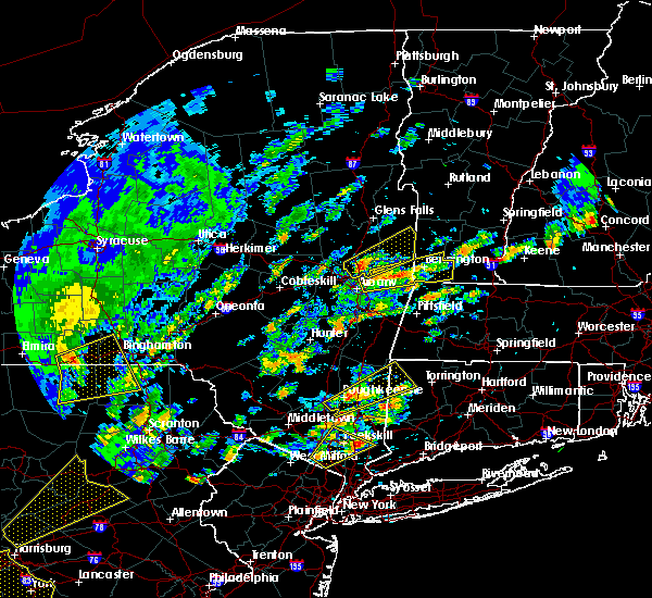 The national weather service in albany has issued a * severe thunderstorm warning for. northeastern albany county in east central new york. northern rensselaer county in east central new york. southern bennington county in southern vermont. Until 200 pm edt. The national weather service in albany has issued a * severe thunderstorm warning for. northeastern albany county in east central new york. northern rensselaer county in east central new york. southern bennington county in southern vermont. Until 200 pm edt.
|
| 6/19/2017 12:43 PM EDT |
 At 1243 pm edt, a severe thunderstorm was located over clifton park, moving northeast at 30 mph (radar indicated). Hazards include 60 mph wind gusts and penny size hail. Expect damage to trees, and power lines. this severe thunderstorm will be near, waterford around 1250 pm edt. round lake around 1255 pm edt. mechanicville around 100 pm edt. greenwich around 130 pm edt. cambridge around 135 pm edt. salem around 145 pm edt. Other locations impacted by this severe thunderstorm include schaghticoke hill, center white creek, hoosick junction, center falls, johnsonville, willow glen, coons, wayville, schaghticoke and middle falls. At 1243 pm edt, a severe thunderstorm was located over clifton park, moving northeast at 30 mph (radar indicated). Hazards include 60 mph wind gusts and penny size hail. Expect damage to trees, and power lines. this severe thunderstorm will be near, waterford around 1250 pm edt. round lake around 1255 pm edt. mechanicville around 100 pm edt. greenwich around 130 pm edt. cambridge around 135 pm edt. salem around 145 pm edt. Other locations impacted by this severe thunderstorm include schaghticoke hill, center white creek, hoosick junction, center falls, johnsonville, willow glen, coons, wayville, schaghticoke and middle falls.
|
| 5/31/2017 5:00 PM EDT |
 At 500 pm edt, a severe thunderstorm was located over grafton, or 10 miles east of troy, moving east at 25 mph (radar indicated). Hazards include 60 mph wind gusts and quarter size hail. Hail damage to vehicles is expected. expect wind damage to roofs, siding, and trees. this severe thunderstorm will be near, berlin around 510 pm edt. pownal around 525 pm edt. williamstown around 530 pm edt. north adams and stamford around 545 pm edt. florida around 555 pm edt. monroe and readsboro around 600 pm edt. Other locations impacted by this severe thunderstorm include hairpin turn, center white creek, hoosick junction, paper mill village, sodom, greylock, petersburg junction, readsboro falls, johnsonville and south shaftsbury. At 500 pm edt, a severe thunderstorm was located over grafton, or 10 miles east of troy, moving east at 25 mph (radar indicated). Hazards include 60 mph wind gusts and quarter size hail. Hail damage to vehicles is expected. expect wind damage to roofs, siding, and trees. this severe thunderstorm will be near, berlin around 510 pm edt. pownal around 525 pm edt. williamstown around 530 pm edt. north adams and stamford around 545 pm edt. florida around 555 pm edt. monroe and readsboro around 600 pm edt. Other locations impacted by this severe thunderstorm include hairpin turn, center white creek, hoosick junction, paper mill village, sodom, greylock, petersburg junction, readsboro falls, johnsonville and south shaftsbury.
|
| 5/31/2017 5:00 PM EDT |
 The national weather service in albany has issued a * severe thunderstorm warning for. northeastern berkshire county in western massachusetts. southeastern washington county in east central new york. northeastern rensselaer county in east central new york. Southern bennington county in southern vermont. The national weather service in albany has issued a * severe thunderstorm warning for. northeastern berkshire county in western massachusetts. southeastern washington county in east central new york. northeastern rensselaer county in east central new york. Southern bennington county in southern vermont.
|
| 5/31/2017 4:40 PM EDT |
 At 439 pm edt, a severe thunderstorm was located over waterford, or over cohoes, moving east at 40 mph (radar indicated). Hazards include 60 mph wind gusts and quarter size hail. Hail damage to vehicles is expected. expect wind damage to roofs, siding, and trees. this severe storm will be near, grafton around 455 pm edt. hoosick falls around 500 pm edt. Other locations impacted by this severe thunderstorm include deans corners, shakers, albia, johnsonville, willow glen, wayville, elnora, halls corner, grays corners and mannings cove. At 439 pm edt, a severe thunderstorm was located over waterford, or over cohoes, moving east at 40 mph (radar indicated). Hazards include 60 mph wind gusts and quarter size hail. Hail damage to vehicles is expected. expect wind damage to roofs, siding, and trees. this severe storm will be near, grafton around 455 pm edt. hoosick falls around 500 pm edt. Other locations impacted by this severe thunderstorm include deans corners, shakers, albia, johnsonville, willow glen, wayville, elnora, halls corner, grays corners and mannings cove.
|
| 5/31/2017 4:18 PM EDT |
 At 418 pm edt, a severe thunderstorm was located over schenectady, moving east at 40 mph (radar indicated). Hazards include ping pong ball size hail and 60 mph wind gusts. People and animals outdoors will be injured. expect hail damage to roofs, siding, windows, and vehicles. expect wind damage to roofs, siding, and trees. this severe storm will be near, albany and clifton park around 425 pm edt. latham and loudonville around 430 pm edt. troy, cohoes, watervliet, mechanicville, menands, green island and waterford around 435 pm edt. center brunswick around 440 pm edt. grafton around 455 pm edt. hoosick falls around 500 pm edt. Other locations impacted by this severe thunderstorm include parkis mills, deans corners, shakers, glenridge, albia, johnsonville, harding crossing, west milton, willow glen and garrison manor. At 418 pm edt, a severe thunderstorm was located over schenectady, moving east at 40 mph (radar indicated). Hazards include ping pong ball size hail and 60 mph wind gusts. People and animals outdoors will be injured. expect hail damage to roofs, siding, windows, and vehicles. expect wind damage to roofs, siding, and trees. this severe storm will be near, albany and clifton park around 425 pm edt. latham and loudonville around 430 pm edt. troy, cohoes, watervliet, mechanicville, menands, green island and waterford around 435 pm edt. center brunswick around 440 pm edt. grafton around 455 pm edt. hoosick falls around 500 pm edt. Other locations impacted by this severe thunderstorm include parkis mills, deans corners, shakers, glenridge, albia, johnsonville, harding crossing, west milton, willow glen and garrison manor.
|
| 5/31/2017 4:06 PM EDT |
 At 405 pm edt, a severe thunderstorm was located near rotterdam, moving east at 40 mph (radar indicated). Hazards include 60 mph wind gusts and quarter size hail. Hail damage to vehicles is expected. expect wind damage to roofs, siding, and trees. this severe thunderstorm will be near, albany, schenectady, rotterdam, scotia, niskayuna and alplaus around 415 pm edt. colonie, east glenville and burnt hills around 420 pm edt. clifton park and loudonville around 425 pm edt. cohoes, watervliet, latham and menands around 430 pm edt. troy, mechanicville, green island and waterford around 435 pm edt. center brunswick around 440 pm edt. grafton around 455 pm edt. Hoosick falls around 500 pm edt. At 405 pm edt, a severe thunderstorm was located near rotterdam, moving east at 40 mph (radar indicated). Hazards include 60 mph wind gusts and quarter size hail. Hail damage to vehicles is expected. expect wind damage to roofs, siding, and trees. this severe thunderstorm will be near, albany, schenectady, rotterdam, scotia, niskayuna and alplaus around 415 pm edt. colonie, east glenville and burnt hills around 420 pm edt. clifton park and loudonville around 425 pm edt. cohoes, watervliet, latham and menands around 430 pm edt. troy, mechanicville, green island and waterford around 435 pm edt. center brunswick around 440 pm edt. grafton around 455 pm edt. Hoosick falls around 500 pm edt.
|
| 5/18/2017 8:13 PM EDT | Tree limbs down from wind and lightning in rensselaer county NY, 6.8 miles N of Hoosick Falls, NY |
| 5/18/2017 8:10 PM EDT |
 At 809 pm edt, severe thunderstorms were located along a line extending from near salem to near grafton to wynantskill, moving east at 50 mph (radar indicated). Hazards include 60 mph wind gusts and quarter size hail. Hail damage to vehicles is expected. expect wind damage to roofs, siding, and trees. severe thunderstorms will be near, salem around 815 pm edt. hoosick falls around 820 pm edt. dorset and berlin around 825 pm edt. bennington, manchester and manchester center around 830 pm edt. williamstown and pownal around 835 pm edt. north adams around 840 pm edt. londonderry, wilmington, stamford and florida around 845 pm edt. monroe and readsboro around 850 pm edt. Other locations impacted by these severe thunderstorms include goose city, chiselville, readsboro falls, south shaftsbury, south windham, middle falls, bromley village, east kansas, white oaks and north westminster. At 809 pm edt, severe thunderstorms were located along a line extending from near salem to near grafton to wynantskill, moving east at 50 mph (radar indicated). Hazards include 60 mph wind gusts and quarter size hail. Hail damage to vehicles is expected. expect wind damage to roofs, siding, and trees. severe thunderstorms will be near, salem around 815 pm edt. hoosick falls around 820 pm edt. dorset and berlin around 825 pm edt. bennington, manchester and manchester center around 830 pm edt. williamstown and pownal around 835 pm edt. north adams around 840 pm edt. londonderry, wilmington, stamford and florida around 845 pm edt. monroe and readsboro around 850 pm edt. Other locations impacted by these severe thunderstorms include goose city, chiselville, readsboro falls, south shaftsbury, south windham, middle falls, bromley village, east kansas, white oaks and north westminster.
|
| 5/18/2017 7:45 PM EDT |
 At 744 pm edt, severe thunderstorms were located along a line extending from ballston spa to niskayuna to near breakabeen, moving east at 45 mph (radar indicated). Hazards include 60 mph wind gusts and quarter size hail. Hail damage to vehicles is expected. expect wind damage to roofs, siding, and trees. severe thunderstorms will be near, albany, schenectady, clifton park, rotterdam, colonie, guilderland, niskayuna, ballston spa, round lake and country knolls around 750 pm edt. cohoes, watervliet, mechanicville, latham, menands and loudonville around 755 pm edt. troy, berne, green island, waterford and wynantskill around 800 pm edt. center brunswick around 805 pm edt. grafton, cambridge and feura bush around 815 pm edt. hoosick falls, delmar, berlin and selkirk around 820 pm edt. castleton-on-hudson around 825 pm edt. east greenbush around 830 pm edt. Other locations impacted by these severe thunderstorms include deans corners, shakers, bleecker stadium, east berne, brookview, glenridge, hoffmans, van hoesen station, west berne and huntersland. At 744 pm edt, severe thunderstorms were located along a line extending from ballston spa to niskayuna to near breakabeen, moving east at 45 mph (radar indicated). Hazards include 60 mph wind gusts and quarter size hail. Hail damage to vehicles is expected. expect wind damage to roofs, siding, and trees. severe thunderstorms will be near, albany, schenectady, clifton park, rotterdam, colonie, guilderland, niskayuna, ballston spa, round lake and country knolls around 750 pm edt. cohoes, watervliet, mechanicville, latham, menands and loudonville around 755 pm edt. troy, berne, green island, waterford and wynantskill around 800 pm edt. center brunswick around 805 pm edt. grafton, cambridge and feura bush around 815 pm edt. hoosick falls, delmar, berlin and selkirk around 820 pm edt. castleton-on-hudson around 825 pm edt. east greenbush around 830 pm edt. Other locations impacted by these severe thunderstorms include deans corners, shakers, bleecker stadium, east berne, brookview, glenridge, hoffmans, van hoesen station, west berne and huntersland.
|
| 5/1/2017 10:19 PM EDT |
 At 1019 pm edt, severe thunderstorms were located along a line extending from near pawlet to near arlington to near grafton to nassau, moving northeast at 40 mph (radar indicated). Hazards include 60 mph wind gusts. Expect damage to roofs, siding, and trees. Locations impacted include, east greenbush, hoosick falls, nassau, stephentown, grafton, berlin, castleton-on-hudson, west sand lake, averill park, wynantskill, brunswick, sand lake, hoosick, pittstown, poestenkill, white creek, east nassau, center white creek, hoosick junction and brookview. At 1019 pm edt, severe thunderstorms were located along a line extending from near pawlet to near arlington to near grafton to nassau, moving northeast at 40 mph (radar indicated). Hazards include 60 mph wind gusts. Expect damage to roofs, siding, and trees. Locations impacted include, east greenbush, hoosick falls, nassau, stephentown, grafton, berlin, castleton-on-hudson, west sand lake, averill park, wynantskill, brunswick, sand lake, hoosick, pittstown, poestenkill, white creek, east nassau, center white creek, hoosick junction and brookview.
|
| 5/1/2017 9:55 PM EDT |
 At 955 pm edt, severe thunderstorms were located along a line extending from near fort edward to 7 miles southwest of cambridge to troy to near ravena, moving northeast at 40 mph (radar indicated). Hazards include 60 mph wind gusts. Expect damage to roofs, siding, and trees. severe thunderstorms will be near, cambridge around 1005 pm edt. salem and grafton around 1010 pm edt. east greenbush and nassau around 1015 pm edt. hoosick falls around 1020 pm edt. stephentown around 1030 pm edt. berlin around 1040 pm edt. Other locations impacted by these severe thunderstorms include brookview, van hoesen station, albia, johnsonville, millers corners, middle falls, south schodack, hoosick, best and luther. At 955 pm edt, severe thunderstorms were located along a line extending from near fort edward to 7 miles southwest of cambridge to troy to near ravena, moving northeast at 40 mph (radar indicated). Hazards include 60 mph wind gusts. Expect damage to roofs, siding, and trees. severe thunderstorms will be near, cambridge around 1005 pm edt. salem and grafton around 1010 pm edt. east greenbush and nassau around 1015 pm edt. hoosick falls around 1020 pm edt. stephentown around 1030 pm edt. berlin around 1040 pm edt. Other locations impacted by these severe thunderstorms include brookview, van hoesen station, albia, johnsonville, millers corners, middle falls, south schodack, hoosick, best and luther.
|
| 3/8/2017 2:41 PM EST |
 The severe thunderstorm warning for eastern schenectady. columbia. albany. eastern greene. saratoga. southern washington and rensselaer counties will expire at 245 pm est. the storms which prompted the warning have moved out of the warned area. Therefore, the warning will be allowed to expire. The severe thunderstorm warning for eastern schenectady. columbia. albany. eastern greene. saratoga. southern washington and rensselaer counties will expire at 245 pm est. the storms which prompted the warning have moved out of the warned area. Therefore, the warning will be allowed to expire.
|
| 3/8/2017 2:11 PM EST |
 At 211 pm est, severe thunderstorms were located along a line extending from near fort edward to catskill, moving east at 50 mph (radar indicated). Hazards include 60 mph wind gusts. Expect damage to roofs, siding, and trees. these severe storms will be near, fort edward around 215 pm est. philmont around 225 pm est. chatham and salem around 230 pm est. Austerlitz around 235 pm est. At 211 pm est, severe thunderstorms were located along a line extending from near fort edward to catskill, moving east at 50 mph (radar indicated). Hazards include 60 mph wind gusts. Expect damage to roofs, siding, and trees. these severe storms will be near, fort edward around 215 pm est. philmont around 225 pm est. chatham and salem around 230 pm est. Austerlitz around 235 pm est.
|
| 3/8/2017 1:45 PM EST |
 At 145 pm est, severe thunderstorms were located along a line extending from edinburg to near hunter, moving east at 55 mph (radar indicated). Hazards include 60 mph wind gusts. Expect damage to roofs, siding, and trees. severe thunderstorms will be near, corinth around 200 pm est. saratoga springs and catskill around 205 pm est. hudson, claverack, livingston, athens, claverack-red mills and lorenz park around 210 pm est. fort edward and philmont around 215 pm est. austerlitz around 225 pm est. salem around 230 pm est. Other locations impacted by these severe thunderstorms include deans corners, charleston, bleecker stadium, glenridge, hoffmans, west berne, huntersland, wayville, broome center and wiley corners. At 145 pm est, severe thunderstorms were located along a line extending from edinburg to near hunter, moving east at 55 mph (radar indicated). Hazards include 60 mph wind gusts. Expect damage to roofs, siding, and trees. severe thunderstorms will be near, corinth around 200 pm est. saratoga springs and catskill around 205 pm est. hudson, claverack, livingston, athens, claverack-red mills and lorenz park around 210 pm est. fort edward and philmont around 215 pm est. austerlitz around 225 pm est. salem around 230 pm est. Other locations impacted by these severe thunderstorms include deans corners, charleston, bleecker stadium, glenridge, hoffmans, west berne, huntersland, wayville, broome center and wiley corners.
|
| 8/13/2016 8:13 PM EDT |
 At 812 pm edt, a severe thunderstorm was located near grafton, or 8 miles south of hoosick falls, moving east at 40 mph (radar indicated). Hazards include 60 mph wind gusts and quarter size hail. Hail damage to vehicles is expected. expect wind damage to roofs, siding, and trees. this severe thunderstorm will be near, pownal around 820 pm edt. bennington and williamstown around 825 pm edt. north adams around 830 pm edt. stamford around 835 pm edt. florida around 840 pm edt. monroe and readsboro around 845 pm edt. wilmington around 850 pm edt. Other locations impacted by this severe thunderstorm include medburyville, denault corners, lincolnville, braeside, paper mill village, dunham hollow, maple grove, fly summit, valley falls and east renfrew. At 812 pm edt, a severe thunderstorm was located near grafton, or 8 miles south of hoosick falls, moving east at 40 mph (radar indicated). Hazards include 60 mph wind gusts and quarter size hail. Hail damage to vehicles is expected. expect wind damage to roofs, siding, and trees. this severe thunderstorm will be near, pownal around 820 pm edt. bennington and williamstown around 825 pm edt. north adams around 830 pm edt. stamford around 835 pm edt. florida around 840 pm edt. monroe and readsboro around 845 pm edt. wilmington around 850 pm edt. Other locations impacted by this severe thunderstorm include medburyville, denault corners, lincolnville, braeside, paper mill village, dunham hollow, maple grove, fly summit, valley falls and east renfrew.
|
| 8/13/2016 7:36 PM EDT |
 At 736 pm edt, a severe thunderstorm was located near clifton park, moving east at 45 mph (radar indicated). Hazards include 60 mph wind gusts and quarter size hail. Hail damage to vehicles is expected. expect wind damage to roofs, siding, and trees. this severe thunderstorm will be near, waterford around 740 pm edt. hoosick falls around 805 pm edt. other locations impacted by this severe thunderstorm include east hoosick, petersburg junction, stoodley corners, lincolnville, millertown, speigletown, duane mansion, babcock lake, schaghticoke hill and lisha kill. this includes the following highways, interstate 890 near mile marker 7. Interstate 87 near mile marker 8-8a, near mile marker 9-10, and mile marker 8a and near mile marker 8-9. At 736 pm edt, a severe thunderstorm was located near clifton park, moving east at 45 mph (radar indicated). Hazards include 60 mph wind gusts and quarter size hail. Hail damage to vehicles is expected. expect wind damage to roofs, siding, and trees. this severe thunderstorm will be near, waterford around 740 pm edt. hoosick falls around 805 pm edt. other locations impacted by this severe thunderstorm include east hoosick, petersburg junction, stoodley corners, lincolnville, millertown, speigletown, duane mansion, babcock lake, schaghticoke hill and lisha kill. this includes the following highways, interstate 890 near mile marker 7. Interstate 87 near mile marker 8-8a, near mile marker 9-10, and mile marker 8a and near mile marker 8-9.
|
| 8/13/2016 5:00 PM EDT | Tree down across bovee hill road and lester lane in rensselaer county NY, 0.6 miles NNE of Hoosick Falls, NY |
| 8/13/2016 4:57 PM EDT |
 At 457 pm edt, a severe thunderstorm was located near cambridge, or near hoosick falls, moving northeast at 40 mph (radar indicated). Hazards include 60 mph wind gusts and quarter size hail. Hail damage to vehicles is expected. expect wind damage to roofs, siding, and trees. this severe thunderstorm will be near, hoosick falls around 500 pm edt. cambridge around 505 pm edt. shaftsbury around 515 pm edt. arlington around 520 pm edt. Other locations impacted by this severe thunderstorm include east hoosick, petersburg junction, millertown, west sandgate, petersburg, paper mill village, peters four corners, babcock lake, fly summit and north hoosick. At 457 pm edt, a severe thunderstorm was located near cambridge, or near hoosick falls, moving northeast at 40 mph (radar indicated). Hazards include 60 mph wind gusts and quarter size hail. Hail damage to vehicles is expected. expect wind damage to roofs, siding, and trees. this severe thunderstorm will be near, hoosick falls around 500 pm edt. cambridge around 505 pm edt. shaftsbury around 515 pm edt. arlington around 520 pm edt. Other locations impacted by this severe thunderstorm include east hoosick, petersburg junction, millertown, west sandgate, petersburg, paper mill village, peters four corners, babcock lake, fly summit and north hoosick.
|
| 8/13/2016 4:26 PM EDT |
 At 426 pm edt, a severe thunderstorm was located near shaftsbury, or 7 miles southwest of arlington, moving northeast at 40 mph (radar indicated). Hazards include 60 mph wind gusts and penny size hail. Expect damage to roofs. siding. and trees. this severe thunderstorm will be near, shaftsbury around 430 pm edt. arlington around 440 pm edt. manchester and manchester center around 450 pm edt. stratton around 455 pm edt. londonderry around 510 pm edt. Other locations impacted by this severe thunderstorm include goose island, peru town center, rawsonville, west sandgate, paper mill village, manchester depot, wardsboro center, landgrove town center, tiplady and south argyle. At 426 pm edt, a severe thunderstorm was located near shaftsbury, or 7 miles southwest of arlington, moving northeast at 40 mph (radar indicated). Hazards include 60 mph wind gusts and penny size hail. Expect damage to roofs. siding. and trees. this severe thunderstorm will be near, shaftsbury around 430 pm edt. arlington around 440 pm edt. manchester and manchester center around 450 pm edt. stratton around 455 pm edt. londonderry around 510 pm edt. Other locations impacted by this severe thunderstorm include goose island, peru town center, rawsonville, west sandgate, paper mill village, manchester depot, wardsboro center, landgrove town center, tiplady and south argyle.
|
| 7/1/2016 5:28 PM EDT |
 At 527 pm edt, severe thunderstorms were located along a line extending from near huletts landing to near fort edward to clifton park, moving east at 40 mph (radar indicated). Hazards include 60 mph wind gusts. Expect damage to roofs. siding. And trees. At 527 pm edt, severe thunderstorms were located along a line extending from near huletts landing to near fort edward to clifton park, moving east at 40 mph (radar indicated). Hazards include 60 mph wind gusts. Expect damage to roofs. siding. And trees.
|
| 4/7/2016 5:05 PM EDT |
 At 504 pm edt, severe thunderstorms were located along a line extending from 6 miles northwest of huletts landing to near berlin, moving east at 25 mph (radar indicated). Hazards include 60 mph wind gusts and penny size hail. Expect damage to roofs. siding. and trees. Locations impacted include, bennington, glens falls, north adams, hudson falls, warrensburg, hoosick falls, whitehall, arlington, salem, lake george village, adams, williamstown, shaftsbury, pownal, fort edward, granville, hartford, cambridge, greenwich and stamford. At 504 pm edt, severe thunderstorms were located along a line extending from 6 miles northwest of huletts landing to near berlin, moving east at 25 mph (radar indicated). Hazards include 60 mph wind gusts and penny size hail. Expect damage to roofs. siding. and trees. Locations impacted include, bennington, glens falls, north adams, hudson falls, warrensburg, hoosick falls, whitehall, arlington, salem, lake george village, adams, williamstown, shaftsbury, pownal, fort edward, granville, hartford, cambridge, greenwich and stamford.
|
| 4/7/2016 4:28 PM EDT |
 At 427 pm edt, severe thunderstorms were located along a line extending from near johnsburg to near averill park, moving east at 25 mph (radar indicated). Hazards include 60 mph wind gusts and penny size hail. Expect damage to roofs. siding. And trees. At 427 pm edt, severe thunderstorms were located along a line extending from near johnsburg to near averill park, moving east at 25 mph (radar indicated). Hazards include 60 mph wind gusts and penny size hail. Expect damage to roofs. siding. And trees.
|
| 2/24/2016 11:57 PM EST |
 At 1156 pm est, severe thunderstorms were located along a line extending from near wyantskill to near copake to near lake carmel, moving northeast at 65 mph (radar indicated). Hazards include 60 mph wind gusts. Expect damage to roofs. siding and trees. severe thunderstorms will be near, sheffield, wyantskill, west sand lake and averill park around 1200 am est. troy, great barrington, austerlitz, housatonic and center brunswick around 1205 am est. sherman, lee, grafton, gaylordsville and wingdale around 1210 am est. new milford, lenox and kent around 1215 am est. pittsfield, hoosick falls, becket and new preston around 1220 am est. bennington, cheshire, litchfield and cornwall bridge around 1225 am est. savoy around 1230 am est. torrington, norfolk and florida around 1235 am est. Other locations impacted by these severe thunderstorms include medburyville, arthursburg, the cedars, sharon valley, birch groves, east cornwall, dunham hollow, mount ross, maple grove and kelly corner. At 1156 pm est, severe thunderstorms were located along a line extending from near wyantskill to near copake to near lake carmel, moving northeast at 65 mph (radar indicated). Hazards include 60 mph wind gusts. Expect damage to roofs. siding and trees. severe thunderstorms will be near, sheffield, wyantskill, west sand lake and averill park around 1200 am est. troy, great barrington, austerlitz, housatonic and center brunswick around 1205 am est. sherman, lee, grafton, gaylordsville and wingdale around 1210 am est. new milford, lenox and kent around 1215 am est. pittsfield, hoosick falls, becket and new preston around 1220 am est. bennington, cheshire, litchfield and cornwall bridge around 1225 am est. savoy around 1230 am est. torrington, norfolk and florida around 1235 am est. Other locations impacted by these severe thunderstorms include medburyville, arthursburg, the cedars, sharon valley, birch groves, east cornwall, dunham hollow, mount ross, maple grove and kelly corner.
|
| 8/3/2015 3:31 PM EDT |
 At 331 pm edt, a severe thunderstorm was located near center brunswick, or 7 miles northeast of troy, moving northeast at 25 mph (radar indicated). Hazards include 60 mph wind gusts and quarter size hail. Hail damage to vehicles is expected. expect wind damage to roofs, siding and trees. this severe thunderstorm will be near, grafton around 340 pm edt. hoosick falls around 400 pm edt. Other locations impacted by this severe thunderstorm include east hoosick, petersburg junction, lincolnville, millertown, petersburg, speigletown, eagle mills, babcock lake, schaghticoke hill and north hoosick. At 331 pm edt, a severe thunderstorm was located near center brunswick, or 7 miles northeast of troy, moving northeast at 25 mph (radar indicated). Hazards include 60 mph wind gusts and quarter size hail. Hail damage to vehicles is expected. expect wind damage to roofs, siding and trees. this severe thunderstorm will be near, grafton around 340 pm edt. hoosick falls around 400 pm edt. Other locations impacted by this severe thunderstorm include east hoosick, petersburg junction, lincolnville, millertown, petersburg, speigletown, eagle mills, babcock lake, schaghticoke hill and north hoosick.
|
| 7/24/2015 3:41 PM EDT |
 At 341 pm edt, a severe thunderstorm was located near center brunswick, or 7 miles southeast of mechanicville, moving south at 25 mph (radar indicated). Hazards include 60 mph wind gusts and quarter size hail. Hail damage to vehicles is expected. expect wind damage to roofs, siding and trees. this severe storm will be near, troy and waterford around 345 pm edt. Other locations impacted by this severe thunderstorm include petersburg junction, haynersville, east saratoga junciton, lincolnville, south cambridge, millertown, speigletown, pleasantdale, babcock lake and schaghticoke hill. At 341 pm edt, a severe thunderstorm was located near center brunswick, or 7 miles southeast of mechanicville, moving south at 25 mph (radar indicated). Hazards include 60 mph wind gusts and quarter size hail. Hail damage to vehicles is expected. expect wind damage to roofs, siding and trees. this severe storm will be near, troy and waterford around 345 pm edt. Other locations impacted by this severe thunderstorm include petersburg junction, haynersville, east saratoga junciton, lincolnville, south cambridge, millertown, speigletown, pleasantdale, babcock lake and schaghticoke hill.
|
| 7/24/2015 3:17 PM EDT |
 At 317 pm edt, a severe thunderstorm was located 7 miles northeast of mechanicville, moving south at 25 mph (radar indicated). Hazards include 60 mph wind gusts and quarter size hail. Hail damage to vehicles is expected. expect wind damage to roofs, siding and trees. this severe thunderstorm will be near, mechanicville around 330 pm edt. waterford around 345 pm edt. troy and cohoes around 350 pm edt. Other locations impacted by this severe thunderstorm include petersburg junction, the saratoga battllefield, deans corners, east saratoga junciton, lincolnville, millertown, speigletown, babcock lake, schaghticoke hill and reynolds. At 317 pm edt, a severe thunderstorm was located 7 miles northeast of mechanicville, moving south at 25 mph (radar indicated). Hazards include 60 mph wind gusts and quarter size hail. Hail damage to vehicles is expected. expect wind damage to roofs, siding and trees. this severe thunderstorm will be near, mechanicville around 330 pm edt. waterford around 345 pm edt. troy and cohoes around 350 pm edt. Other locations impacted by this severe thunderstorm include petersburg junction, the saratoga battllefield, deans corners, east saratoga junciton, lincolnville, millertown, speigletown, babcock lake, schaghticoke hill and reynolds.
|
| 7/19/2015 6:41 PM EDT | Trees dow in rensselaer county NY, 2.8 miles NNW of Hoosick Falls, NY |
| 7/19/2015 6:40 PM EDT | *** 1 inj *** tree fell on moving vehicle resulting in a head injury. time estimated by rada in rensselaer county NY, 0.3 miles SW of Hoosick Falls, NY |
| 7/19/2015 6:30 PM EDT |
 At 630 pm edt, a severe thunderstorm was located over berlin, or 13 miles west of north adams, moving east at 35 mph (radar indicated). Hazards include 60 mph wind gusts and quarter size hail. Hail damage to vehicles is expected. expect wind damage to roofs, siding and trees. this severe thunderstorm will be near, new ashford around 640 pm edt. williamstown and pownal around 645 pm edt. north adams and adams around 655 pm edt. stamford around 700 pm edt. florida around 705 pm edt. monroe and readsboro around 710 pm edt. charlemont and rowe around 715 pm edt. Other locations impacted by this severe thunderstorm include denault corners, lincolnville, braeside, paper mill village, dunham hollow, maple grove, valley falls, east renfrew, brunswick center and braytonville. At 630 pm edt, a severe thunderstorm was located over berlin, or 13 miles west of north adams, moving east at 35 mph (radar indicated). Hazards include 60 mph wind gusts and quarter size hail. Hail damage to vehicles is expected. expect wind damage to roofs, siding and trees. this severe thunderstorm will be near, new ashford around 640 pm edt. williamstown and pownal around 645 pm edt. north adams and adams around 655 pm edt. stamford around 700 pm edt. florida around 705 pm edt. monroe and readsboro around 710 pm edt. charlemont and rowe around 715 pm edt. Other locations impacted by this severe thunderstorm include denault corners, lincolnville, braeside, paper mill village, dunham hollow, maple grove, valley falls, east renfrew, brunswick center and braytonville.
|
| 7/19/2015 5:57 PM EDT |
 At 557 pm edt, a severe thunderstorm was located over grafton, or 9 miles southwest of hoosick falls, moving east at 20 mph (trained weather spotters). Hazards include 70 mph wind gusts and quarter size hail. Hail damage to vehicles is expected. expect considerable tree damage. wind damage is also likely to mobile homes, roofs and outbuildings. this severe storm will be near, berlin around 605 pm edt. hoosick falls around 615 pm edt. Other locations impacted by this severe thunderstorm include east hoosick, petersburg junction, fullers, mckownville, lincolnville, petersburg, speigletown, eagle mills, babcock lake and schaghticoke hill. At 557 pm edt, a severe thunderstorm was located over grafton, or 9 miles southwest of hoosick falls, moving east at 20 mph (trained weather spotters). Hazards include 70 mph wind gusts and quarter size hail. Hail damage to vehicles is expected. expect considerable tree damage. wind damage is also likely to mobile homes, roofs and outbuildings. this severe storm will be near, berlin around 605 pm edt. hoosick falls around 615 pm edt. Other locations impacted by this severe thunderstorm include east hoosick, petersburg junction, fullers, mckownville, lincolnville, petersburg, speigletown, eagle mills, babcock lake and schaghticoke hill.
|
| 7/19/2015 5:40 PM EDT |
 At 539 pm edt, a severe thunderstorm was located over center brunswick, or near troy, moving east at 20 mph (trained weather spotters). Hazards include 60 mph wind gusts and quarter size hail. Hail damage to vehicles is expected. expect wind damage to roofs, siding and trees. this severe storm will be near, grafton around 600 pm edt. berlin around 605 pm edt. hoosick falls around 615 pm edt. Other locations impacted by this severe thunderstorm include east hoosick, petersburg junction, fullers, mckownville, lincolnville, petersburg, speigletown, eagle mills, babcock lake and schaghticoke hill. At 539 pm edt, a severe thunderstorm was located over center brunswick, or near troy, moving east at 20 mph (trained weather spotters). Hazards include 60 mph wind gusts and quarter size hail. Hail damage to vehicles is expected. expect wind damage to roofs, siding and trees. this severe storm will be near, grafton around 600 pm edt. berlin around 605 pm edt. hoosick falls around 615 pm edt. Other locations impacted by this severe thunderstorm include east hoosick, petersburg junction, fullers, mckownville, lincolnville, petersburg, speigletown, eagle mills, babcock lake and schaghticoke hill.
|
| 7/19/2015 5:26 PM EDT |
 At 526 pm edt, a severe thunderstorm was located over waterford, or over cohoes, moving east at 20 mph (radar indicated). Hazards include 60 mph wind gusts and quarter size hail. Hail damage to vehicles is expected. expect wind damage to roofs, siding and trees. this severe thunderstorm will be near, center brunswick around 535 pm edt. grafton around 600 pm edt. berlin around 610 pm edt. hoosick falls around 615 pm edt. Other locations impacted by this severe thunderstorm include east hoosick, petersburg junction, fullers, mckownville, lincolnville, petersburg, speigletown, eagle mills, babcock lake and schaghticoke hill. At 526 pm edt, a severe thunderstorm was located over waterford, or over cohoes, moving east at 20 mph (radar indicated). Hazards include 60 mph wind gusts and quarter size hail. Hail damage to vehicles is expected. expect wind damage to roofs, siding and trees. this severe thunderstorm will be near, center brunswick around 535 pm edt. grafton around 600 pm edt. berlin around 610 pm edt. hoosick falls around 615 pm edt. Other locations impacted by this severe thunderstorm include east hoosick, petersburg junction, fullers, mckownville, lincolnville, petersburg, speigletown, eagle mills, babcock lake and schaghticoke hill.
|
| 7/1/2015 4:20 PM EDT | Tress and wires down at the intersection of rt. 67 and north hoosick stree in rensselaer county NY, 2.4 miles SSW of Hoosick Falls, NY |
| 7/1/2015 4:09 PM EDT |
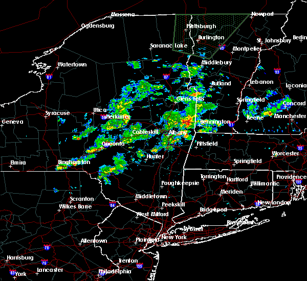 At 409 pm edt, a severe thunderstorm was located near hoosick falls, moving east at 30 mph (radar indicated). Hazards include 60 mph wind gusts and quarter size hail. Hail damage to vehicles is expected. expect wind damage to roofs, siding and trees. this severe thunderstorm will be near, bennington and shaftsbury around 425 pm edt. arlington around 430 pm edt. Other locations impacted by this severe thunderstorm include east hoosick, petersburg junction, woodford, paper mill village, peters four corners, glastenbury, babcock lake, fly summit, north hoosick and hidden valley. At 409 pm edt, a severe thunderstorm was located near hoosick falls, moving east at 30 mph (radar indicated). Hazards include 60 mph wind gusts and quarter size hail. Hail damage to vehicles is expected. expect wind damage to roofs, siding and trees. this severe thunderstorm will be near, bennington and shaftsbury around 425 pm edt. arlington around 430 pm edt. Other locations impacted by this severe thunderstorm include east hoosick, petersburg junction, woodford, paper mill village, peters four corners, glastenbury, babcock lake, fly summit, north hoosick and hidden valley.
|
| 6/12/2015 8:51 PM EDT |
 The national weather service in albany has issued a * severe thunderstorm warning for. northeastern berkshire county in western massachusetts. eastern rensselaer county in east central new york. southern bennington county in southern vermont. Southwestern windham county in southern vermont. The national weather service in albany has issued a * severe thunderstorm warning for. northeastern berkshire county in western massachusetts. eastern rensselaer county in east central new york. southern bennington county in southern vermont. Southwestern windham county in southern vermont.
|
| 6/9/2015 2:41 PM EDT |
 At 240 pm edt, a severe thunderstorm was located over burnt hills, or near clifton park, moving northeast at 45 mph (radar indicated). Hazards include 60 mph wind gusts and quarter size hail. Hail damage to vehicles is expected. expect wind damage to roofs, siding and trees. this severe thunderstorm will be near, ballston spa, country knolls and north ballston spa around 245 pm edt. mechanicville, milton and round lake around 250 pm edt. greenwich around 310 pm edt. cambridge around 315 pm edt. salem around 325 pm edt. this storm has shown some rotation and will continue to be monitored. Other locations impacted by this severe thunderstorm include francis corners, schuylerville, south galway corner, east saratoga junciton, lincolnville, holsapple corners, west milton, eddy corners, saratoga performing arts center and fly summit. At 240 pm edt, a severe thunderstorm was located over burnt hills, or near clifton park, moving northeast at 45 mph (radar indicated). Hazards include 60 mph wind gusts and quarter size hail. Hail damage to vehicles is expected. expect wind damage to roofs, siding and trees. this severe thunderstorm will be near, ballston spa, country knolls and north ballston spa around 245 pm edt. mechanicville, milton and round lake around 250 pm edt. greenwich around 310 pm edt. cambridge around 315 pm edt. salem around 325 pm edt. this storm has shown some rotation and will continue to be monitored. Other locations impacted by this severe thunderstorm include francis corners, schuylerville, south galway corner, east saratoga junciton, lincolnville, holsapple corners, west milton, eddy corners, saratoga performing arts center and fly summit.
|
| 7/23/2014 5:40 PM EDT | Trees down on factory hill road. time estimated by rada in rensselaer county NY, 2.4 miles SSW of Hoosick Falls, NY |
| 7/7/2014 7:10 PM EDT | Tree limbs down in rensselaer county NY, 0.3 miles SW of Hoosick Falls, NY |
| 9/12/2013 3:10 PM EDT | Multiple limbs down throughout village. time estimated from rada in rensselaer county NY, 0.3 miles SW of Hoosick Falls, NY |
| 6/2/2013 2:47 PM EDT | Large tree limbs down in rensselaer county NY, 2.8 miles NNW of Hoosick Falls, NY |
| 5/21/2013 9:55 PM EDT | Tree down on route 7 near mann of kent tavern in rensselaer county NY, 0.3 miles SW of Hoosick Falls, NY |
| 5/29/2012 5:10 PM EDT | Trees down in rensselaer county NY, 0.3 miles SW of Hoosick Falls, NY |
| 1/1/0001 12:00 AM | Tree on house kokely ave in rensselaer county NY, 0.3 miles SW of Hoosick Falls, NY |
| 1/1/0001 12:00 AM | Tree on house pine valley rd in rensselaer county NY, 2.8 miles NNW of Hoosick Falls, NY |
| 1/1/0001 12:00 AM | Trees down in washington county NY, 5.3 miles SE of Hoosick Falls, NY |
| 1/1/0001 12:00 AM | Trees down. trees blocking road in rensselaer county NY, 2.8 miles NNW of Hoosick Falls, NY |
| 1/1/0001 12:00 AM | Baseball sized hail reported 3.8 miles SE of Hoosick Falls, NY |
| 1/1/0001 12:00 AM | Quarter sized hail reported 0.3 miles SW of Hoosick Falls, NY |
| 1/1/0001 12:00 AM | Tree down on car on abbott s in rensselaer county NY, 0.3 miles SW of Hoosick Falls, NY |
| 1/1/0001 12:00 AM | Trees down at 4369 sr 6 in rensselaer county NY, 2.8 miles NNW of Hoosick Falls, NY |
Hail Maps for Hoosick Falls, NY


Connect with Interactive Hail Maps