

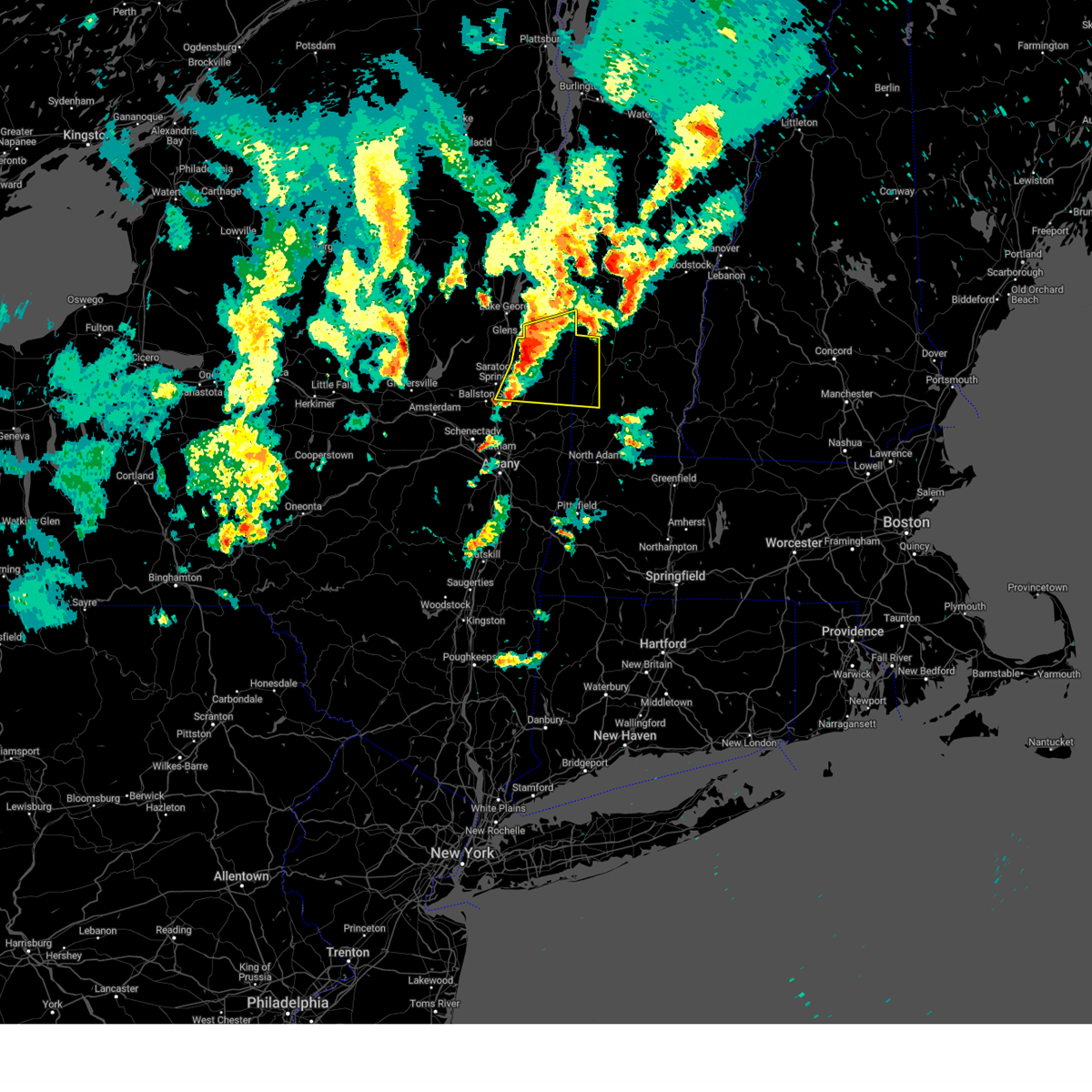
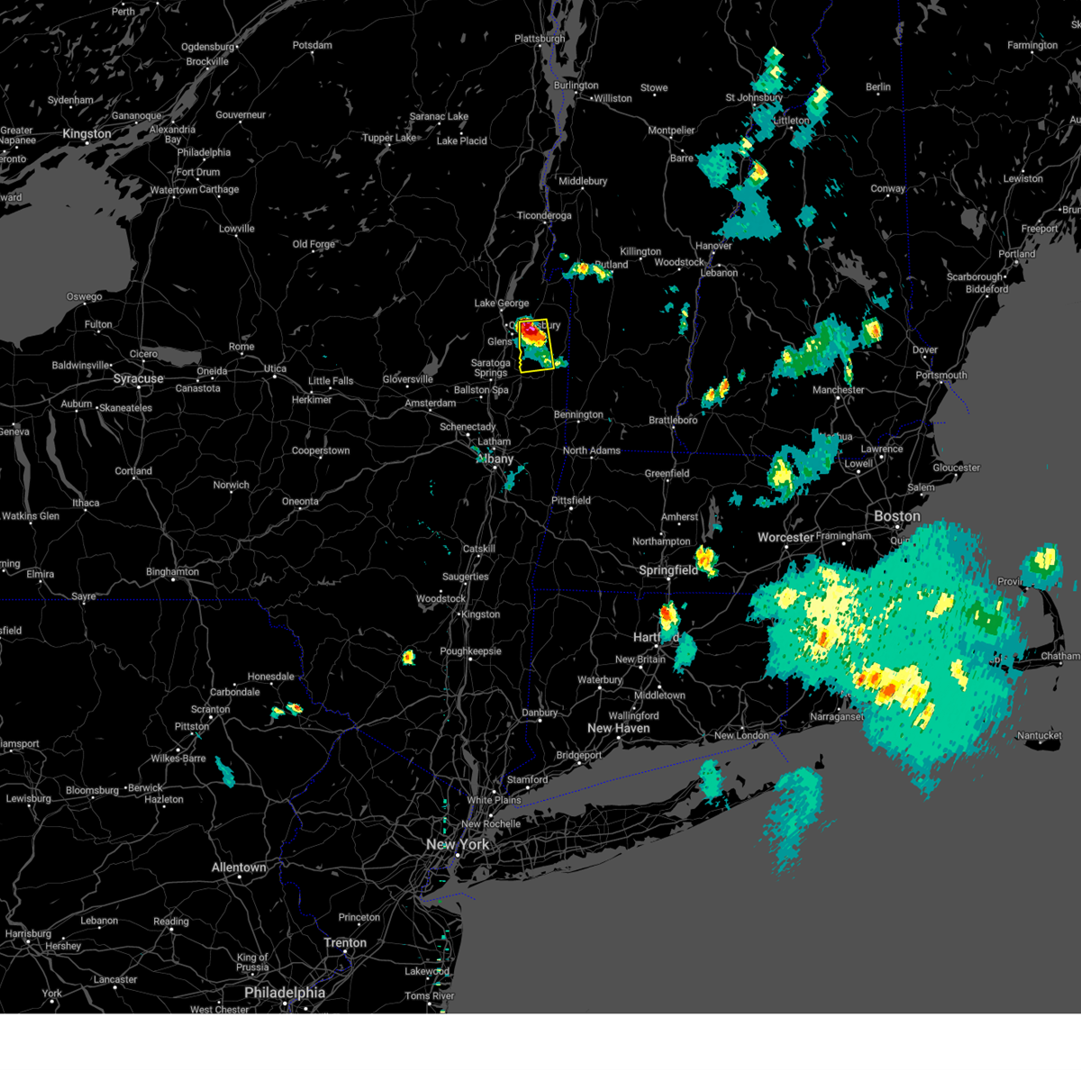
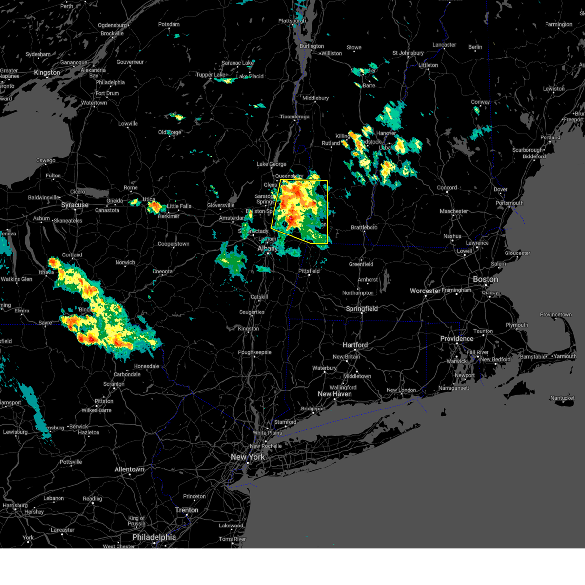
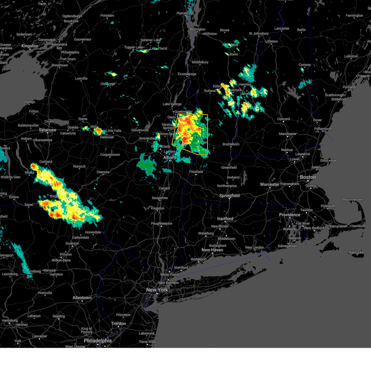
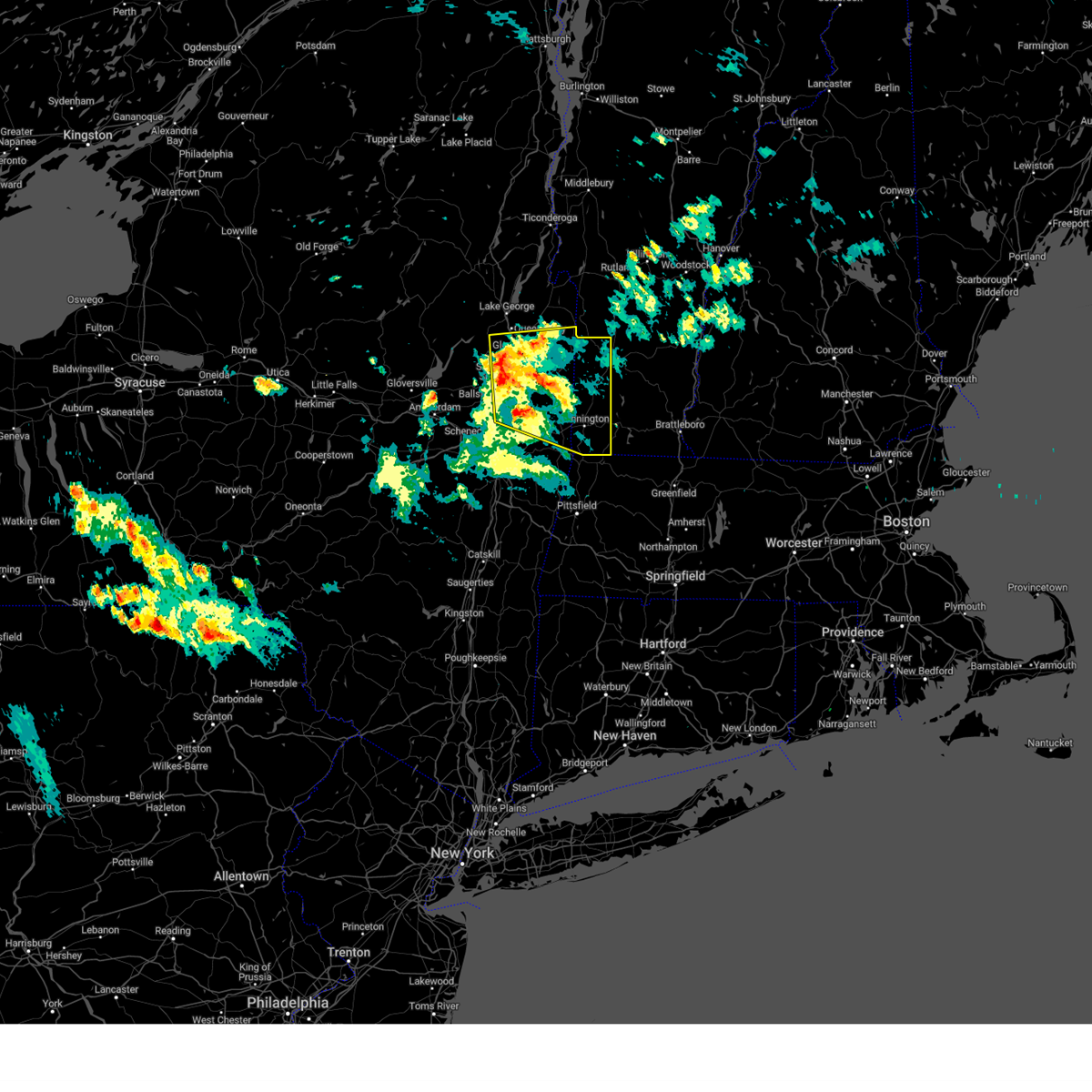
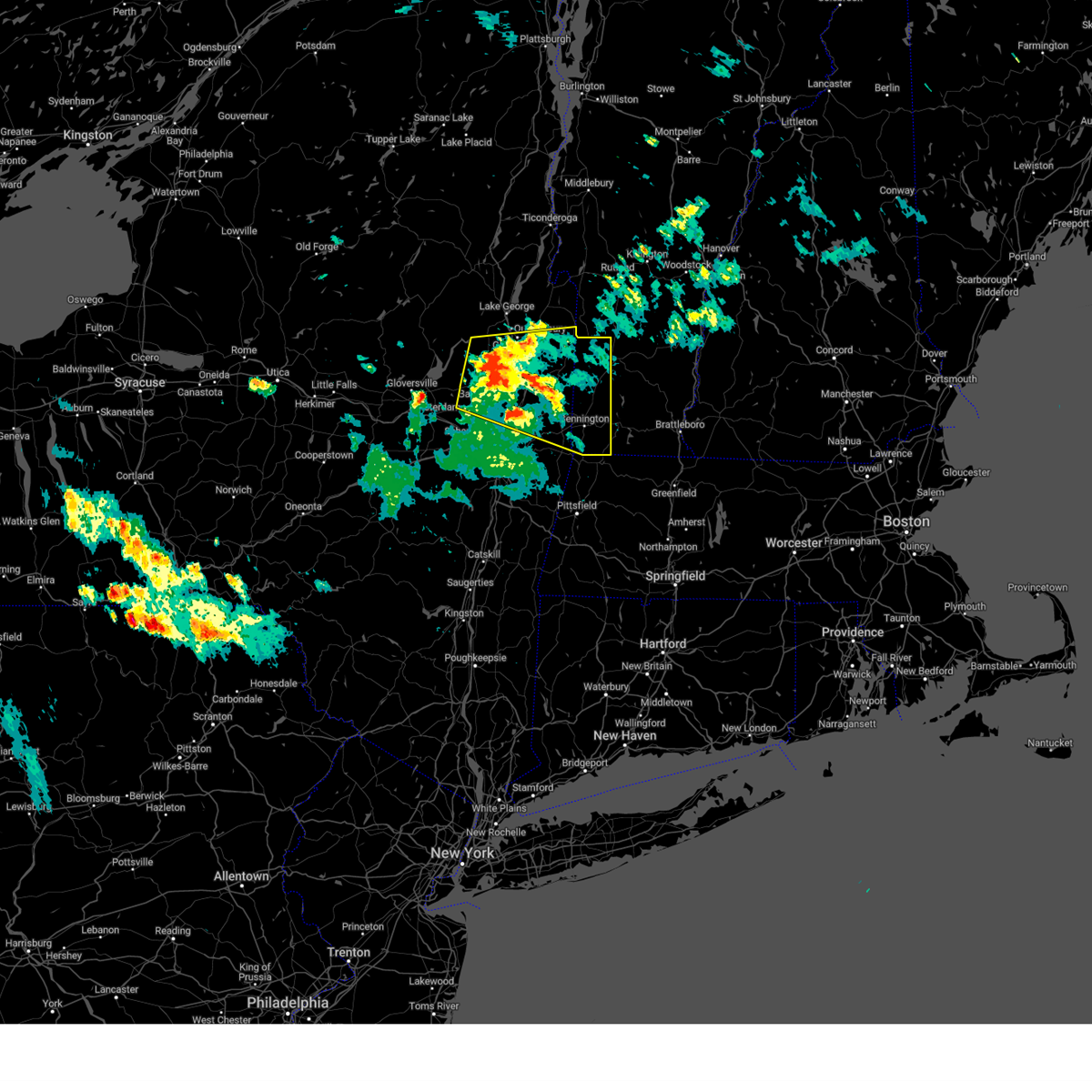
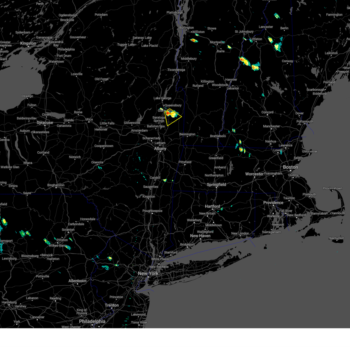
Hail Map for Hudson Falls, NY
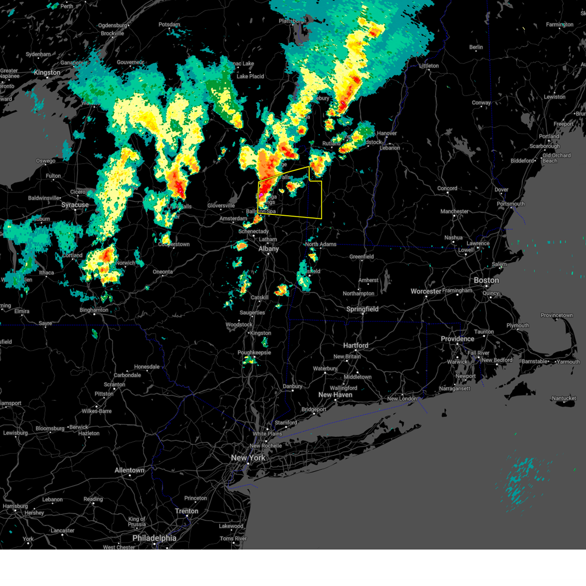
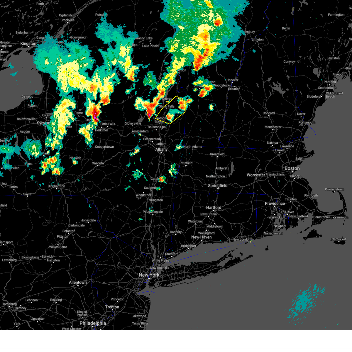
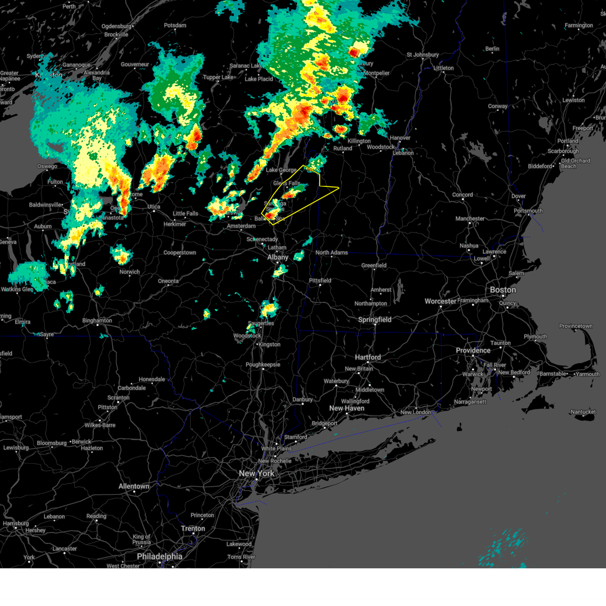
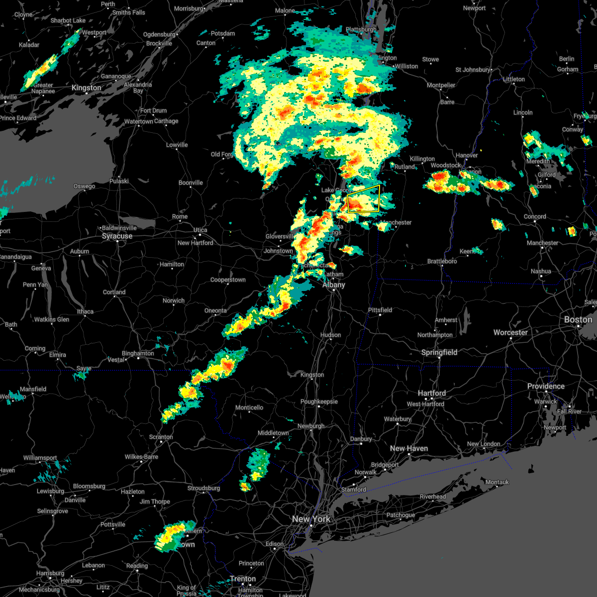
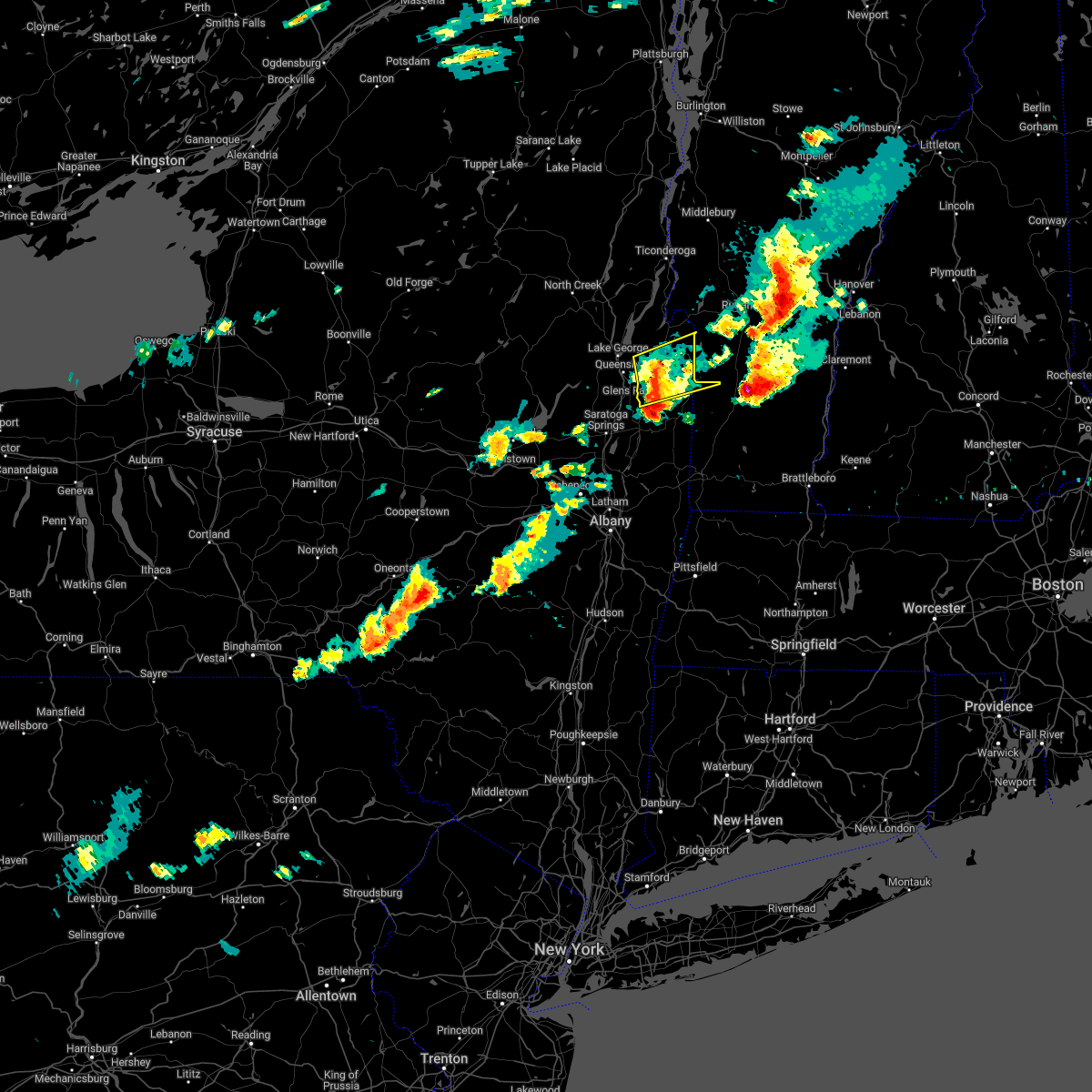
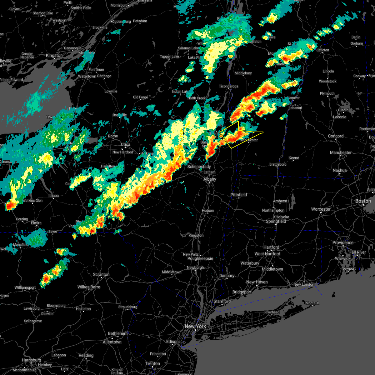
The Hudson Falls, NY area has had 4 reports of on-the-ground hail by trained spotters, and has been under severe weather warnings 19 times during the past 12 months. Doppler radar has detected hail at or near Hudson Falls, NY on 24 occasions, including 3 occasions during the past year.
| Name: | Hudson Falls, NY |
| Where Located: | 38.4 miles NNE of Schenectady, NY |
| Map: | Google Map for Hudson Falls, NY |
| Population: | 7281 |
| Housing Units: | 3195 |
| More Info: | Search Google for Hudson Falls, NY |
2
The Top Recent Hail Date for Hudson Falls, NY is Thursday, August 15, 2024 (7th out of 24)

Hail and Wind Damage Spotted near Hudson Falls, NY
| Date / Time | Report Details |
|---|---|
| 5/17/2025 5:01 PM EDT |
 At 500 pm edt, a severe thunderstorm was located near fort edward, or near hudson falls, moving east at 30 mph (radar indicated). Hazards include 60 mph wind gusts and quarter size hail. Hail damage to vehicles is expected. expect wind damage to roofs, siding, and trees. Locations impacted include, deans corners, chiselville, grangerville, northumberland, cambridge, middle falls, west pawlet, mannings cove, hidden valley, east kansas, arlington, shushan, slateville, east hartford, hudson falls, the saratoga battllefield, clarks corner, durkeetown, north greenwich, and fenimore. At 500 pm edt, a severe thunderstorm was located near fort edward, or near hudson falls, moving east at 30 mph (radar indicated). Hazards include 60 mph wind gusts and quarter size hail. Hail damage to vehicles is expected. expect wind damage to roofs, siding, and trees. Locations impacted include, deans corners, chiselville, grangerville, northumberland, cambridge, middle falls, west pawlet, mannings cove, hidden valley, east kansas, arlington, shushan, slateville, east hartford, hudson falls, the saratoga battllefield, clarks corner, durkeetown, north greenwich, and fenimore.
|
| 5/17/2025 5:01 PM EDT |
 the severe thunderstorm warning has been cancelled and is no longer in effect the severe thunderstorm warning has been cancelled and is no longer in effect
|
| 5/17/2025 4:27 PM EDT |
 Svraly the national weather service in albany has issued a * severe thunderstorm warning for, southeastern warren county in east central new york, northeastern saratoga county in east central new york, southern washington county in east central new york, northwestern bennington county in southern vermont, * until 530 pm edt. * at 426 pm edt, a severe thunderstorm was located near saratoga springs, moving east at 30 mph (radar indicated). Hazards include ping pong ball size hail and 60 mph wind gusts. People and animals outdoors will be injured. expect hail damage to roofs, siding, windows, and vehicles. Expect wind damage to roofs, siding, and trees. Svraly the national weather service in albany has issued a * severe thunderstorm warning for, southeastern warren county in east central new york, northeastern saratoga county in east central new york, southern washington county in east central new york, northwestern bennington county in southern vermont, * until 530 pm edt. * at 426 pm edt, a severe thunderstorm was located near saratoga springs, moving east at 30 mph (radar indicated). Hazards include ping pong ball size hail and 60 mph wind gusts. People and animals outdoors will be injured. expect hail damage to roofs, siding, windows, and vehicles. Expect wind damage to roofs, siding, and trees.
|
| 5/17/2025 4:05 PM EDT |
 At 405 pm edt, a severe thunderstorm was located near fort edward, or 7 miles south of hudson falls, moving northeast at 30 mph (radar indicated). Hazards include 60 mph wind gusts and quarter size hail. Hail damage to vehicles is expected. expect wind damage to roofs, siding, and trees. Locations impacted include, cossayuna, dunham basin, smiths basin, goose island, adamsville, grangerville, kings station, northumberland, east hebron, south granville, north greenfield, oneida corners, paradise beach, comstock, hartman, starks knob, clarks mills, randall corner, slateville, and danielstown. At 405 pm edt, a severe thunderstorm was located near fort edward, or 7 miles south of hudson falls, moving northeast at 30 mph (radar indicated). Hazards include 60 mph wind gusts and quarter size hail. Hail damage to vehicles is expected. expect wind damage to roofs, siding, and trees. Locations impacted include, cossayuna, dunham basin, smiths basin, goose island, adamsville, grangerville, kings station, northumberland, east hebron, south granville, north greenfield, oneida corners, paradise beach, comstock, hartman, starks knob, clarks mills, randall corner, slateville, and danielstown.
|
| 5/17/2025 4:05 PM EDT |
 the severe thunderstorm warning has been cancelled and is no longer in effect the severe thunderstorm warning has been cancelled and is no longer in effect
|
| 5/17/2025 3:32 PM EDT |
 Svraly the national weather service in albany has issued a * severe thunderstorm warning for, southeastern warren county in east central new york, northeastern saratoga county in east central new york, central washington county in east central new york, northwestern bennington county in southern vermont, * until 430 pm edt. * at 332 pm edt, a severe thunderstorm was located over saratoga springs, moving northeast at 30 mph (radar indicated). Hazards include 60 mph wind gusts and quarter size hail. Hail damage to vehicles is expected. Expect wind damage to roofs, siding, and trees. Svraly the national weather service in albany has issued a * severe thunderstorm warning for, southeastern warren county in east central new york, northeastern saratoga county in east central new york, central washington county in east central new york, northwestern bennington county in southern vermont, * until 430 pm edt. * at 332 pm edt, a severe thunderstorm was located over saratoga springs, moving northeast at 30 mph (radar indicated). Hazards include 60 mph wind gusts and quarter size hail. Hail damage to vehicles is expected. Expect wind damage to roofs, siding, and trees.
|
| 8/15/2024 6:06 PM EDT | Received report of trees down on power lines along burgoyne ave in hudson falls. time based on rada in washington county NY, 0.7 miles WNW of Hudson Falls, NY |
| 8/15/2024 6:05 PM EDT | Received report of trees and wires down along melony lane. time based on rada in washington county NY, 1.2 miles WSW of Hudson Falls, NY |
| 8/15/2024 6:00 PM EDT |
 At 600 pm edt, a severe thunderstorm was located near fort edward, or near hudson falls, moving south at 25 mph (radar indicated). Hazards include ping pong ball size hail and 60 mph wind gusts. People and animals outdoors will be injured. expect hail damage to roofs, siding, windows, and vehicles. expect wind damage to roofs, siding, and trees. Locations impacted include, hudson falls, fort edward, kingsbury, argyle, cossayuna, dunham basin, smiths basin, lick springs, goose island, east greenwich, adamsville, south hartford, north argyle, durkeetown, south argyle, north greenwich, fort miller, fitch point, bald mountain, and spraguetown. At 600 pm edt, a severe thunderstorm was located near fort edward, or near hudson falls, moving south at 25 mph (radar indicated). Hazards include ping pong ball size hail and 60 mph wind gusts. People and animals outdoors will be injured. expect hail damage to roofs, siding, windows, and vehicles. expect wind damage to roofs, siding, and trees. Locations impacted include, hudson falls, fort edward, kingsbury, argyle, cossayuna, dunham basin, smiths basin, lick springs, goose island, east greenwich, adamsville, south hartford, north argyle, durkeetown, south argyle, north greenwich, fort miller, fitch point, bald mountain, and spraguetown.
|
| 8/15/2024 5:59 PM EDT | Corrects previous tstm wnd dmg report from 1 ssw hudson falls. tree down on lower main st in ft. edwar in washington county NY, 1 miles NNE of Hudson Falls, NY |
| 8/15/2024 5:57 PM EDT | Tree down with road blocked on burgoyne ave/county route 4 in washington county NY, 1.2 miles WSW of Hudson Falls, NY |
| 8/15/2024 5:55 PM EDT | Trees & wires down on east labarge s in washington county NY, 1.1 miles S of Hudson Falls, NY |
| 8/15/2024 5:52 PM EDT | Tree and wires down on county route 41 in kingsbur in washington county NY, 3.7 miles SW of Hudson Falls, NY |
| 8/15/2024 5:49 PM EDT | Corrects previous tstm wnd dmg report from 4 nne hudson falls. tree down blocking road on state route in washington county NY, 3.9 miles SW of Hudson Falls, NY |
| 8/15/2024 5:45 PM EDT | Tree & wires down on hendee r in washington county NY, 4.2 miles SW of Hudson Falls, NY |
| 8/15/2024 5:40 PM EDT | Received multiple reports of trees and wires down in the town of kingsbury. time based on rada in washington county NY, 4.7 miles SW of Hudson Falls, NY |
| 8/15/2024 5:36 PM EDT |
 Svraly the national weather service in albany has issued a * severe thunderstorm warning for, central washington county in east central new york, * until 615 pm edt. * at 536 pm edt, a severe thunderstorm was located near comstock, or 8 miles northeast of hudson falls, moving south at 25 mph (radar indicated). Hazards include 60 mph wind gusts and quarter size hail. Hail damage to vehicles is expected. Expect wind damage to roofs, siding, and trees. Svraly the national weather service in albany has issued a * severe thunderstorm warning for, central washington county in east central new york, * until 615 pm edt. * at 536 pm edt, a severe thunderstorm was located near comstock, or 8 miles northeast of hudson falls, moving south at 25 mph (radar indicated). Hazards include 60 mph wind gusts and quarter size hail. Hail damage to vehicles is expected. Expect wind damage to roofs, siding, and trees.
|
| 8/5/2024 6:17 PM EDT |
 the severe thunderstorm warning has been cancelled and is no longer in effect the severe thunderstorm warning has been cancelled and is no longer in effect
|
| 8/5/2024 6:08 PM EDT |
 At 606 pm edt, a severe thunderstorm was located near bennington, moving east at 30 mph (law enforcement reported a tree down on wires 1 west of stillwater). Hazards include 60 mph wind gusts and quarter size hail. Hail damage to vehicles is expected. expect wind damage to roofs, siding, and trees. Locations impacted include, bennington, hudson falls, mechanicville, hoosick falls, arlington, salem, manchester, shaftsbury, pownal, fort edward, dorset, cambridge, greenwich, stamford, manchester center, danby, pawlet, gates, hoosick, and porter. At 606 pm edt, a severe thunderstorm was located near bennington, moving east at 30 mph (law enforcement reported a tree down on wires 1 west of stillwater). Hazards include 60 mph wind gusts and quarter size hail. Hail damage to vehicles is expected. expect wind damage to roofs, siding, and trees. Locations impacted include, bennington, hudson falls, mechanicville, hoosick falls, arlington, salem, manchester, shaftsbury, pownal, fort edward, dorset, cambridge, greenwich, stamford, manchester center, danby, pawlet, gates, hoosick, and porter.
|
| 8/5/2024 5:50 PM EDT |
 At 549 pm edt, a severe thunderstorm was located near hoosick falls, moving east at 30 mph (radar indicated). Hazards include 60 mph wind gusts and quarter size hail. Hail damage to vehicles is expected. expect wind damage to roofs, siding, and trees. Locations impacted include, bennington, hudson falls, mechanicville, hoosick falls, arlington, salem, manchester, shaftsbury, pownal, fort edward, dorset, cambridge, greenwich, stamford, manchester center, danby, pawlet, gates, hoosick, and porter. At 549 pm edt, a severe thunderstorm was located near hoosick falls, moving east at 30 mph (radar indicated). Hazards include 60 mph wind gusts and quarter size hail. Hail damage to vehicles is expected. expect wind damage to roofs, siding, and trees. Locations impacted include, bennington, hudson falls, mechanicville, hoosick falls, arlington, salem, manchester, shaftsbury, pownal, fort edward, dorset, cambridge, greenwich, stamford, manchester center, danby, pawlet, gates, hoosick, and porter.
|
| 8/5/2024 5:50 PM EDT |
 the severe thunderstorm warning has been cancelled and is no longer in effect the severe thunderstorm warning has been cancelled and is no longer in effect
|
| 8/5/2024 5:37 PM EDT |
 At 536 pm edt, a severe thunderstorm was located near mechanicville, moving east at 30 mph (radar indicated). Hazards include 60 mph wind gusts and quarter size hail. Hail damage to vehicles is expected. expect wind damage to roofs, siding, and trees. Locations impacted include, bennington, saratoga springs, glens falls, hudson falls, mechanicville, hoosick falls, arlington, salem, manchester, shaftsbury, pownal, fort edward, corinth, dorset, cambridge, greenwich, stamford, round lake, manchester center, and west glens falls. At 536 pm edt, a severe thunderstorm was located near mechanicville, moving east at 30 mph (radar indicated). Hazards include 60 mph wind gusts and quarter size hail. Hail damage to vehicles is expected. expect wind damage to roofs, siding, and trees. Locations impacted include, bennington, saratoga springs, glens falls, hudson falls, mechanicville, hoosick falls, arlington, salem, manchester, shaftsbury, pownal, fort edward, corinth, dorset, cambridge, greenwich, stamford, round lake, manchester center, and west glens falls.
|
| 8/5/2024 5:29 PM EDT |
 Svraly the national weather service in albany has issued a * severe thunderstorm warning for, south central warren county in east central new york, saratoga county in east central new york, southern washington county in east central new york, northeastern rensselaer county in east central new york, bennington county in southern vermont, * until 630 pm edt. * at 529 pm edt, a severe thunderstorm was located near saratoga springs, moving east at 30 mph (radar indicated). Hazards include 60 mph wind gusts and quarter size hail. Hail damage to vehicles is expected. Expect wind damage to roofs, siding, and trees. Svraly the national weather service in albany has issued a * severe thunderstorm warning for, south central warren county in east central new york, saratoga county in east central new york, southern washington county in east central new york, northeastern rensselaer county in east central new york, bennington county in southern vermont, * until 630 pm edt. * at 529 pm edt, a severe thunderstorm was located near saratoga springs, moving east at 30 mph (radar indicated). Hazards include 60 mph wind gusts and quarter size hail. Hail damage to vehicles is expected. Expect wind damage to roofs, siding, and trees.
|
| 8/1/2024 1:43 PM EDT |
 Svraly the national weather service in albany has issued a * severe thunderstorm warning for, east central saratoga county in east central new york, southern washington county in east central new york, * until 230 pm edt. * at 142 pm edt, a severe thunderstorm was located near fort edward, or near hudson falls, moving southeast at 10 mph (radar indicated). Hazards include 60 mph wind gusts and penny size hail. expect damage to roofs, siding, and trees Svraly the national weather service in albany has issued a * severe thunderstorm warning for, east central saratoga county in east central new york, southern washington county in east central new york, * until 230 pm edt. * at 142 pm edt, a severe thunderstorm was located near fort edward, or near hudson falls, moving southeast at 10 mph (radar indicated). Hazards include 60 mph wind gusts and penny size hail. expect damage to roofs, siding, and trees
|
| 7/16/2024 5:35 PM EDT |
 At 534 pm edt, severe thunderstorms were located along a line extending from 7 miles east of chestertown to 6 miles northwest of salem to near mechanicville, moving east at 50 mph. these are destructive storms for the lake george and glens falls area into washington county (public). Hazards include 80 mph wind gusts. Flying debris will be dangerous to those caught without shelter. mobile homes will be heavily damaged. expect considerable damage to roofs, windows, and vehicles. extensive tree damage and power outages are likely. Locations impacted include, bennington, saratoga springs, hudson falls, mechanicville, hoosick falls, whitehall, arlington, salem, manchester, stratton, ballston spa, shaftsbury, fort edward, granville, hartford, dorset, cambridge, greenwich, round lake, and eagle point campground. At 534 pm edt, severe thunderstorms were located along a line extending from 7 miles east of chestertown to 6 miles northwest of salem to near mechanicville, moving east at 50 mph. these are destructive storms for the lake george and glens falls area into washington county (public). Hazards include 80 mph wind gusts. Flying debris will be dangerous to those caught without shelter. mobile homes will be heavily damaged. expect considerable damage to roofs, windows, and vehicles. extensive tree damage and power outages are likely. Locations impacted include, bennington, saratoga springs, hudson falls, mechanicville, hoosick falls, whitehall, arlington, salem, manchester, stratton, ballston spa, shaftsbury, fort edward, granville, hartford, dorset, cambridge, greenwich, round lake, and eagle point campground.
|
| 7/16/2024 5:30 PM EDT | Tree down on boulevard. time estimate in washington county NY, 0.3 miles NNW of Hudson Falls, NY |
| 7/16/2024 5:30 PM EDT | Tree down on boulevard. time estimate in washington county NY, 0.3 miles NNW of Hudson Falls, NY |
| 7/16/2024 5:29 PM EDT | Svraly the national weather service in albany has issued a * severe thunderstorm warning for, eastern warren county in east central new york, southeastern saratoga county in east central new york, washington county in east central new york, northeastern rensselaer county in east central new york, bennington county in southern vermont, west central windham county in southern vermont, * until 615 pm edt. * at 528 pm edt, severe thunderstorms were located along a line extending from 6 miles east of chestertown to 6 miles southeast of fort edward to near round lake, moving east at 50 mph (public). Hazards include 70 mph wind gusts. Expect considerable tree damage. Damage is likely to mobile homes, roofs, and outbuildings. |
| 7/16/2024 5:22 PM EDT | Multiple reports of trees and wires down in the town of kingsbur in washington county NY, 4.7 miles SW of Hudson Falls, NY |
| 7/16/2024 5:21 PM EDT |
 At 521 pm edt, a severe thunderstorm capable of producing a tornado was located 7 miles west of comstock, or 7 miles east of lake george village, moving east at 50 mph (radar indicated rotation). Hazards include tornado. Flying debris will be dangerous to those caught without shelter. mobile homes will be damaged or destroyed. damage to roofs, windows, and vehicles will occur. tree damage is likely. this dangerous storm will be near, comstock around 525 pm edt. Other locations impacted by this tornadic thunderstorm include deans corners, lake luzerne, grangerville, south bay village, west milton, northumberland, wayville, greenfield center, conklingville, and truthville. At 521 pm edt, a severe thunderstorm capable of producing a tornado was located 7 miles west of comstock, or 7 miles east of lake george village, moving east at 50 mph (radar indicated rotation). Hazards include tornado. Flying debris will be dangerous to those caught without shelter. mobile homes will be damaged or destroyed. damage to roofs, windows, and vehicles will occur. tree damage is likely. this dangerous storm will be near, comstock around 525 pm edt. Other locations impacted by this tornadic thunderstorm include deans corners, lake luzerne, grangerville, south bay village, west milton, northumberland, wayville, greenfield center, conklingville, and truthville.
|
| 7/16/2024 5:18 PM EDT | Trained spotter estimates 70 mph winds and downed trees on notre dame roa in washington county NY, 0.3 miles NNW of Hudson Falls, NY |
| 7/16/2024 5:16 PM EDT | Multiple reports of trees and wires down in the village of hudson fall in washington county NY, 0.5 miles SSW of Hudson Falls, NY |
| 7/16/2024 5:15 PM EDT | Tree down on boulevard. time estimate in washington county NY, 0.3 miles NNW of Hudson Falls, NY |
| 7/16/2024 4:52 PM EDT |
 Toraly the national weather service in albany has issued a * tornado warning for, central warren county in east central new york, saratoga county in east central new york, washington county in east central new york, northeastern rensselaer county in east central new york, * until 530 pm edt. * at 451 pm edt, a severe thunderstorm capable of producing a tornado was located 9 miles north of day center, or 15 miles west of warrensburg, moving east at 50 mph (radar indicated rotation). Hazards include tornado. Flying debris will be dangerous to those caught without shelter. mobile homes will be damaged or destroyed. damage to roofs, windows, and vehicles will occur. tree damage is likely. this dangerous storm will be near, warrensburg around 505 pm edt. lake george village around 510 pm edt. comstock around 525 pm edt. Other locations impacted by this tornadic thunderstorm include parkis mills, deans corners, grangerville, south bay village, glenwild, northumberland, wayville, wiley corners, middle falls, and halls corner. Toraly the national weather service in albany has issued a * tornado warning for, central warren county in east central new york, saratoga county in east central new york, washington county in east central new york, northeastern rensselaer county in east central new york, * until 530 pm edt. * at 451 pm edt, a severe thunderstorm capable of producing a tornado was located 9 miles north of day center, or 15 miles west of warrensburg, moving east at 50 mph (radar indicated rotation). Hazards include tornado. Flying debris will be dangerous to those caught without shelter. mobile homes will be damaged or destroyed. damage to roofs, windows, and vehicles will occur. tree damage is likely. this dangerous storm will be near, warrensburg around 505 pm edt. lake george village around 510 pm edt. comstock around 525 pm edt. Other locations impacted by this tornadic thunderstorm include parkis mills, deans corners, grangerville, south bay village, glenwild, northumberland, wayville, wiley corners, middle falls, and halls corner.
|
| 5/21/2024 3:15 PM EDT | Multiple reports of trees and wires down in the town of kingsbur in washington county NY, 4.7 miles SW of Hudson Falls, NY |
| 5/21/2024 3:07 PM EDT |
 Svraly the national weather service in albany has issued a * severe thunderstorm warning for, southeastern warren county in east central new york, central washington county in east central new york, * until 345 pm edt. * at 307 pm edt, a severe thunderstorm was located near hudson falls, moving east at 15 mph (radar indicated). Hazards include 60 mph wind gusts and quarter size hail. Hail damage to vehicles is expected. Expect wind damage to roofs, siding, and trees. Svraly the national weather service in albany has issued a * severe thunderstorm warning for, southeastern warren county in east central new york, central washington county in east central new york, * until 345 pm edt. * at 307 pm edt, a severe thunderstorm was located near hudson falls, moving east at 15 mph (radar indicated). Hazards include 60 mph wind gusts and quarter size hail. Hail damage to vehicles is expected. Expect wind damage to roofs, siding, and trees.
|
| 9/7/2023 8:32 PM EDT |
 At 832 pm edt, a severe thunderstorm was located near glens falls north, or near lake george village, moving northeast at 25 mph (radar indicated). Hazards include 60 mph wind gusts and quarter size hail. Hail damage to vehicles is expected. Expect wind damage to roofs, siding, and trees. At 832 pm edt, a severe thunderstorm was located near glens falls north, or near lake george village, moving northeast at 25 mph (radar indicated). Hazards include 60 mph wind gusts and quarter size hail. Hail damage to vehicles is expected. Expect wind damage to roofs, siding, and trees.
|
| 9/7/2023 7:11 PM EDT |
 At 710 pm edt, a severe thunderstorm was located near west glens falls, or near glens falls, moving northeast at 25 mph (radar indicated). Hazards include 60 mph wind gusts. Expect damage to roofs, siding, and trees. locations impacted include, glens falls, hudson falls, lake george village, fort edward, hartford, west glens falls, glens falls north, queensbury, kingsbury, south glens falls, lake george, fort ann, cleverdale, french mountain, dunham basin, smiths basin, adamsville, oneida corners, tripoli and paradise beach. hail threat, radar indicated max hail size, <. 75 in wind threat, radar indicated max wind gust, 60 mph. At 710 pm edt, a severe thunderstorm was located near west glens falls, or near glens falls, moving northeast at 25 mph (radar indicated). Hazards include 60 mph wind gusts. Expect damage to roofs, siding, and trees. locations impacted include, glens falls, hudson falls, lake george village, fort edward, hartford, west glens falls, glens falls north, queensbury, kingsbury, south glens falls, lake george, fort ann, cleverdale, french mountain, dunham basin, smiths basin, adamsville, oneida corners, tripoli and paradise beach. hail threat, radar indicated max hail size, <. 75 in wind threat, radar indicated max wind gust, 60 mph.
|
| 9/7/2023 6:46 PM EDT |
 At 646 pm edt, a severe thunderstorm was located near corinth, or 8 miles northwest of saratoga springs, moving northeast at 25 mph (radar indicated). Hazards include 60 mph wind gusts and quarter size hail. Hail damage to vehicles is expected. Expect wind damage to roofs, siding, and trees. At 646 pm edt, a severe thunderstorm was located near corinth, or 8 miles northwest of saratoga springs, moving northeast at 25 mph (radar indicated). Hazards include 60 mph wind gusts and quarter size hail. Hail damage to vehicles is expected. Expect wind damage to roofs, siding, and trees.
|
| 7/13/2023 6:43 PM EDT |
 At 642 pm edt, severe thunderstorms were located along a line extending from near fair haven to near round lake, moving east at 30 mph. these are destructive storms for washington and saratoga counties (radar indicated). Hazards include 80 mph wind gusts and penny size hail. Flying debris will be dangerous to those caught without shelter. mobile homes will be heavily damaged. expect considerable damage to roofs, windows, and vehicles. Extensive tree damage and power outages are likely. At 642 pm edt, severe thunderstorms were located along a line extending from near fair haven to near round lake, moving east at 30 mph. these are destructive storms for washington and saratoga counties (radar indicated). Hazards include 80 mph wind gusts and penny size hail. Flying debris will be dangerous to those caught without shelter. mobile homes will be heavily damaged. expect considerable damage to roofs, windows, and vehicles. Extensive tree damage and power outages are likely.
|
| 7/13/2023 6:34 PM EDT |
 At 633 pm edt, severe thunderstorms were located along a line extending from near whitehall to near ballston spa, moving east at 30 mph (radar indicated). Hazards include 60 mph wind gusts and quarter size hail. Hail damage to vehicles is expected. Expect wind damage to roofs, siding, and trees. At 633 pm edt, severe thunderstorms were located along a line extending from near whitehall to near ballston spa, moving east at 30 mph (radar indicated). Hazards include 60 mph wind gusts and quarter size hail. Hail damage to vehicles is expected. Expect wind damage to roofs, siding, and trees.
|
| 1/1/0001 12:00 AM | Multiple trees downed across pattens mills road in washington county NY, 5.3 miles S of Hudson Falls, NY |
| 7/13/2023 6:02 PM EDT |
 At 602 pm edt, severe thunderstorms were located along a line extending from 6 miles northwest of huletts landing to near corinth to near galway, moving east at 35 mph (radar indicated). Hazards include 60 mph wind gusts and penny size hail. expect damage to roofs, siding, and trees At 602 pm edt, severe thunderstorms were located along a line extending from 6 miles northwest of huletts landing to near corinth to near galway, moving east at 35 mph (radar indicated). Hazards include 60 mph wind gusts and penny size hail. expect damage to roofs, siding, and trees
|
| 7/7/2023 3:20 PM EDT |
 At 320 pm edt, a severe thunderstorm was located near lake george village, moving east at 20 mph (radar indicated). Hazards include 60 mph wind gusts and quarter size hail. Hail damage to vehicles is expected. expect wind damage to roofs, siding, and trees. this severe thunderstorm will be near, hartford and comstock around 345 pm edt. whitehall around 350 pm edt. granville, poultney village and wells around 400 pm edt. other locations impacted by this severe thunderstorm include thurman station, cleverdale, beartown, dunham basin, smiths basin, lake luzerne, adamsville, north granville, south bay village and south granville. please report hail size, damaging winds and reports of trees down to the national weather service by email at alb. stormreport@noaa. gov, on facebook at www. facebook. com/nwsalbany or twitter @nwsalbany hail threat, radar indicated max hail size, 1. 00 in wind threat, radar indicated max wind gust, 60 mph. At 320 pm edt, a severe thunderstorm was located near lake george village, moving east at 20 mph (radar indicated). Hazards include 60 mph wind gusts and quarter size hail. Hail damage to vehicles is expected. expect wind damage to roofs, siding, and trees. this severe thunderstorm will be near, hartford and comstock around 345 pm edt. whitehall around 350 pm edt. granville, poultney village and wells around 400 pm edt. other locations impacted by this severe thunderstorm include thurman station, cleverdale, beartown, dunham basin, smiths basin, lake luzerne, adamsville, north granville, south bay village and south granville. please report hail size, damaging winds and reports of trees down to the national weather service by email at alb. stormreport@noaa. gov, on facebook at www. facebook. com/nwsalbany or twitter @nwsalbany hail threat, radar indicated max hail size, 1. 00 in wind threat, radar indicated max wind gust, 60 mph.
|
| 9/26/2022 3:43 PM EDT |
 At 342 pm edt, a severe thunderstorm was located near greenwich, or 11 miles west of salem, moving northeast at 35 mph (radar indicated). Hazards include 60 mph wind gusts and penny size hail. Expect damage to roofs, siding, and trees. locations impacted include, bennington, hudson falls, hoosick falls, arlington, salem, shaftsbury, fort edward, granville, hartford, cambridge, greenwich, hoosick, porter, lee, northumberland, south glens falls, white creek, easton, north bennington and schuylerville. hail threat, radar indicated max hail size, 0. 75 in wind threat, radar indicated max wind gust, 60 mph. At 342 pm edt, a severe thunderstorm was located near greenwich, or 11 miles west of salem, moving northeast at 35 mph (radar indicated). Hazards include 60 mph wind gusts and penny size hail. Expect damage to roofs, siding, and trees. locations impacted include, bennington, hudson falls, hoosick falls, arlington, salem, shaftsbury, fort edward, granville, hartford, cambridge, greenwich, hoosick, porter, lee, northumberland, south glens falls, white creek, easton, north bennington and schuylerville. hail threat, radar indicated max hail size, 0. 75 in wind threat, radar indicated max wind gust, 60 mph.
|
| 9/26/2022 3:18 PM EDT |
 At 317 pm edt, a severe thunderstorm was located over north ballston spa, or near saratoga springs, moving northeast at 35 mph (radar indicated). Hazards include 60 mph wind gusts and penny size hail. expect damage to roofs, siding, and trees At 317 pm edt, a severe thunderstorm was located over north ballston spa, or near saratoga springs, moving northeast at 35 mph (radar indicated). Hazards include 60 mph wind gusts and penny size hail. expect damage to roofs, siding, and trees
|
| 9/19/2022 2:24 PM EDT |
 At 224 pm edt, a severe thunderstorm was located near saratoga springs, moving northeast at 15 mph (radar indicated). Hazards include 60 mph wind gusts and quarter size hail. Hail damage to vehicles is expected. expect wind damage to roofs, siding, and trees. locations impacted include, hudson falls, salem, fort edward, wilton, northumberland, south glens falls, argyle, gurn spring, bacon hill, cossayuna, dunham basin, smiths basin, jewell corner, goose island, adamsville, kings station, gansevoort, lick springs, ballard corners and west hebron. hail threat, radar indicated max hail size, 1. 00 in wind threat, radar indicated max wind gust, 60 mph. At 224 pm edt, a severe thunderstorm was located near saratoga springs, moving northeast at 15 mph (radar indicated). Hazards include 60 mph wind gusts and quarter size hail. Hail damage to vehicles is expected. expect wind damage to roofs, siding, and trees. locations impacted include, hudson falls, salem, fort edward, wilton, northumberland, south glens falls, argyle, gurn spring, bacon hill, cossayuna, dunham basin, smiths basin, jewell corner, goose island, adamsville, kings station, gansevoort, lick springs, ballard corners and west hebron. hail threat, radar indicated max hail size, 1. 00 in wind threat, radar indicated max wind gust, 60 mph.
|
| 9/19/2022 2:05 PM EDT |
 At 204 pm edt, a severe thunderstorm was located near saratoga springs, moving northeast at 20 mph (radar indicated). Hazards include 60 mph wind gusts and quarter size hail. Hail damage to vehicles is expected. Expect wind damage to roofs, siding, and trees. At 204 pm edt, a severe thunderstorm was located near saratoga springs, moving northeast at 20 mph (radar indicated). Hazards include 60 mph wind gusts and quarter size hail. Hail damage to vehicles is expected. Expect wind damage to roofs, siding, and trees.
|
| 9/13/2022 1:38 PM EDT |
 At 138 pm edt, a severe thunderstorm was located near saratoga springs, moving northeast at 20 mph (radar indicated). Hazards include 60 mph wind gusts and quarter size hail. Hail damage to vehicles is expected. expect wind damage to roofs, siding, and trees. this severe thunderstorm will be near, greenwich around 215 pm edt. fort edward around 235 pm edt. hudson falls around 245 pm edt. other locations impacted by this severe thunderstorm include deans corners, cossayuna, dunham basin, center falls, grangerville, willow glen, northumberland, coons, wayville and middle falls. please report hail size, damaging winds and reports of trees down to the national weather service by email at alb. stormreport@noaa. gov, on facebook at www. facebook. com/nwsalbany or twitter @nwsalbany hail threat, radar indicated max hail size, 1. 00 in wind threat, radar indicated max wind gust, 60 mph. At 138 pm edt, a severe thunderstorm was located near saratoga springs, moving northeast at 20 mph (radar indicated). Hazards include 60 mph wind gusts and quarter size hail. Hail damage to vehicles is expected. expect wind damage to roofs, siding, and trees. this severe thunderstorm will be near, greenwich around 215 pm edt. fort edward around 235 pm edt. hudson falls around 245 pm edt. other locations impacted by this severe thunderstorm include deans corners, cossayuna, dunham basin, center falls, grangerville, willow glen, northumberland, coons, wayville and middle falls. please report hail size, damaging winds and reports of trees down to the national weather service by email at alb. stormreport@noaa. gov, on facebook at www. facebook. com/nwsalbany or twitter @nwsalbany hail threat, radar indicated max hail size, 1. 00 in wind threat, radar indicated max wind gust, 60 mph.
|
| 8/30/2022 3:14 PM EDT |
 At 314 pm edt, a severe thunderstorm was located near hudson falls, moving northeast at 20 mph (trained weather spotters. at 3:10 pm, the glens falls mesonet site reported a 58 mph wind gust). Hazards include 60 mph wind gusts and quarter size hail. Hail damage to vehicles is expected. Expect wind damage to roofs, siding, and trees. At 314 pm edt, a severe thunderstorm was located near hudson falls, moving northeast at 20 mph (trained weather spotters. at 3:10 pm, the glens falls mesonet site reported a 58 mph wind gust). Hazards include 60 mph wind gusts and quarter size hail. Hail damage to vehicles is expected. Expect wind damage to roofs, siding, and trees.
|
| 7/28/2022 4:29 PM EDT |
 At 429 pm edt, a severe thunderstorm was located near hudson falls, moving east at 25 mph (radar indicated). Hazards include 60 mph wind gusts and quarter size hail. Hail damage to vehicles is expected. Expect wind damage to roofs, siding, and trees. At 429 pm edt, a severe thunderstorm was located near hudson falls, moving east at 25 mph (radar indicated). Hazards include 60 mph wind gusts and quarter size hail. Hail damage to vehicles is expected. Expect wind damage to roofs, siding, and trees.
|
| 7/28/2022 4:08 PM EDT |
 At 408 pm edt, a severe thunderstorm was located over glens falls north, or near glens falls, moving east at 30 mph (radar indicated). Hazards include 60 mph wind gusts and quarter size hail. Hail damage to vehicles is expected. expect wind damage to roofs, siding, and trees. this severe storm will be near, fort edward around 415 pm edt. hudson falls around 420 pm edt. hartford and comstock around 435 pm edt. Other locations impacted by this severe thunderstorm include beartown, french mountain, dunham basin, smiths basin, adamsville, fourth lake, lake george, mount hope, oneida corners and tripoli. At 408 pm edt, a severe thunderstorm was located over glens falls north, or near glens falls, moving east at 30 mph (radar indicated). Hazards include 60 mph wind gusts and quarter size hail. Hail damage to vehicles is expected. expect wind damage to roofs, siding, and trees. this severe storm will be near, fort edward around 415 pm edt. hudson falls around 420 pm edt. hartford and comstock around 435 pm edt. Other locations impacted by this severe thunderstorm include beartown, french mountain, dunham basin, smiths basin, adamsville, fourth lake, lake george, mount hope, oneida corners and tripoli.
|
| 7/28/2022 3:49 PM EDT |
 At 349 pm edt, a severe thunderstorm was located near lake luzerne-hadley, or 12 miles southwest of lake george village, moving east at 30 mph (radar indicated). Hazards include 60 mph wind gusts and quarter size hail. Hail damage to vehicles is expected. Expect wind damage to roofs, siding, and trees. At 349 pm edt, a severe thunderstorm was located near lake luzerne-hadley, or 12 miles southwest of lake george village, moving east at 30 mph (radar indicated). Hazards include 60 mph wind gusts and quarter size hail. Hail damage to vehicles is expected. Expect wind damage to roofs, siding, and trees.
|
| 7/12/2022 3:19 PM EDT |
 At 317 pm edt, a severe thunderstorm was located about 10 miles northwest of salem, moving east at 50 mph (radar indicated). Hazards include 60 mph wind gusts and quarter size hail. Hail damage to vehicles is expected. expect wind damage to roofs, siding, and trees. locations impacted include, hudson falls, fort edward, granville, hartford, comstock, kingsbury, porter, hampton, fort ann, argyle, middle granville, braymer school, dunham basin, smiths basin, goose island, adamsville, north granville, east hebron, south granville and truthville. hail threat, radar indicated max hail size, 1. 00 in wind threat, radar indicated max wind gust, 60 mph. At 317 pm edt, a severe thunderstorm was located about 10 miles northwest of salem, moving east at 50 mph (radar indicated). Hazards include 60 mph wind gusts and quarter size hail. Hail damage to vehicles is expected. expect wind damage to roofs, siding, and trees. locations impacted include, hudson falls, fort edward, granville, hartford, comstock, kingsbury, porter, hampton, fort ann, argyle, middle granville, braymer school, dunham basin, smiths basin, goose island, adamsville, north granville, east hebron, south granville and truthville. hail threat, radar indicated max hail size, 1. 00 in wind threat, radar indicated max wind gust, 60 mph.
|
| 7/12/2022 2:42 PM EDT |
 At 241 pm edt, a severe thunderstorm was located near corinth, or 13 miles west of glens falls, moving east at 50 mph. another severe storm is located within the warning area over eastern washington county east of hudson falls, moving east at 50 mph (radar indicated). Hazards include 60 mph wind gusts and quarter size hail. Hail damage to vehicles is expected. Expect wind damage to roofs, siding, and trees. At 241 pm edt, a severe thunderstorm was located near corinth, or 13 miles west of glens falls, moving east at 50 mph. another severe storm is located within the warning area over eastern washington county east of hudson falls, moving east at 50 mph (radar indicated). Hazards include 60 mph wind gusts and quarter size hail. Hail damage to vehicles is expected. Expect wind damage to roofs, siding, and trees.
|
| 7/12/2022 2:14 PM EDT |
 At 214 pm edt, a severe thunderstorm was located over fort edward, or over hudson falls, moving east at 55 mph (radar indicated). Hazards include 60 mph wind gusts and quarter size hail. Hail damage to vehicles is expected. Expect wind damage to roofs, siding, and trees. At 214 pm edt, a severe thunderstorm was located over fort edward, or over hudson falls, moving east at 55 mph (radar indicated). Hazards include 60 mph wind gusts and quarter size hail. Hail damage to vehicles is expected. Expect wind damage to roofs, siding, and trees.
|
| 7/12/2022 1:41 PM EDT |
 At 141 pm edt, a severe thunderstorm was located near day center, or 14 miles northwest of saratoga springs, moving east at 30 mph (radar indicated). Hazards include 60 mph wind gusts and quarter size hail. Hail damage to vehicles is expected. Expect wind damage to roofs, siding, and trees. At 141 pm edt, a severe thunderstorm was located near day center, or 14 miles northwest of saratoga springs, moving east at 30 mph (radar indicated). Hazards include 60 mph wind gusts and quarter size hail. Hail damage to vehicles is expected. Expect wind damage to roofs, siding, and trees.
|
| 7/1/2022 9:36 PM EDT |
 At 935 pm edt, a severe thunderstorm was located over rock city falls, or near saratoga springs, moving east at 40 mph (radar indicated). Hazards include 60 mph wind gusts. expect damage to roofs, siding, and trees At 935 pm edt, a severe thunderstorm was located over rock city falls, or near saratoga springs, moving east at 40 mph (radar indicated). Hazards include 60 mph wind gusts. expect damage to roofs, siding, and trees
|
| 5/16/2022 5:03 PM EDT |
 At 503 pm edt, severe thunderstorms were located along a line extending from near hudson falls to near salem, moving northeast at 40 mph (radar indicated). Hazards include 60 mph wind gusts. Expect damage to roofs, siding, and trees. locations impacted include, hudson falls, hoosick falls, arlington, salem, shaftsbury, fort edward, granville, hartford, cambridge, greenwich, kingsbury, porter, lee, pittstown, northumberland, south glens falls, white creek, easton, north bennington and schuylerville. hail threat, radar indicated max hail size, <. 75 in wind threat, radar indicated max wind gust, 60 mph. At 503 pm edt, severe thunderstorms were located along a line extending from near hudson falls to near salem, moving northeast at 40 mph (radar indicated). Hazards include 60 mph wind gusts. Expect damage to roofs, siding, and trees. locations impacted include, hudson falls, hoosick falls, arlington, salem, shaftsbury, fort edward, granville, hartford, cambridge, greenwich, kingsbury, porter, lee, pittstown, northumberland, south glens falls, white creek, easton, north bennington and schuylerville. hail threat, radar indicated max hail size, <. 75 in wind threat, radar indicated max wind gust, 60 mph.
|
| 5/16/2022 4:46 PM EDT |
 At 446 pm edt, severe thunderstorms were located along a line extending from near fort edward to cohoes, moving northeast at 25 mph (radar indicated). Hazards include 60 mph wind gusts. expect damage to roofs, siding, and trees At 446 pm edt, severe thunderstorms were located along a line extending from near fort edward to cohoes, moving northeast at 25 mph (radar indicated). Hazards include 60 mph wind gusts. expect damage to roofs, siding, and trees
|
| 10/16/2021 2:20 PM EDT |
 At 220 pm edt, severe thunderstorms were located along a line extending from eagle point campground to lake luzerne-hadley to 6 miles northwest of rock city falls, moving east at 35 mph (radar indicated). Hazards include 60 mph wind gusts. Expect damage to roofs, siding, and trees. these severe storms will be near, scaroon manor public campground, eagle point campground and chestertown around 225 pm edt. lake george village around 230 pm edt. glens falls, glens falls north and west glens falls around 235 pm edt. saratoga springs and hudson falls around 240 pm edt. hague and rogers rock campground around 250 pm edt. Other locations impacted by these severe thunderstorms include thurman station, cleverdale, beartown, lake luzerne, wevertown, grangerville, kings station, northumberland, greenfield center and wiley corners. At 220 pm edt, severe thunderstorms were located along a line extending from eagle point campground to lake luzerne-hadley to 6 miles northwest of rock city falls, moving east at 35 mph (radar indicated). Hazards include 60 mph wind gusts. Expect damage to roofs, siding, and trees. these severe storms will be near, scaroon manor public campground, eagle point campground and chestertown around 225 pm edt. lake george village around 230 pm edt. glens falls, glens falls north and west glens falls around 235 pm edt. saratoga springs and hudson falls around 240 pm edt. hague and rogers rock campground around 250 pm edt. Other locations impacted by these severe thunderstorms include thurman station, cleverdale, beartown, lake luzerne, wevertown, grangerville, kings station, northumberland, greenfield center and wiley corners.
|
| 10/16/2021 1:48 PM EDT |
 At 148 pm edt, severe thunderstorms were located along a line extending from near indian lake to near northville to near mayfield, moving east at 40 mph (radar indicated). Hazards include 60 mph wind gusts. Expect damage to roofs, siding, and trees. severe thunderstorms will be near, day center around 200 pm edt. lake luzerne-hadley, lake luzerne campground, scaroon manor public campground and eagle point campground around 215 pm edt. saratoga springs, glens falls, lake george village, corinth, glens falls north and west glens falls around 225 pm edt. hudson falls around 230 pm edt. other locations impacted by these severe thunderstorms include lake luzerne, wevertown, grangerville, glenwild, northumberland, greenfield center, wiley corners, conklingville, north river and porter corners. please report hail size, damaging winds and reports of trees down to the national weather service by email at alb. stormreport@noaa. gov, on facebook at www. facebook. Com/nwsalbany or twitter @nwsalbany. At 148 pm edt, severe thunderstorms were located along a line extending from near indian lake to near northville to near mayfield, moving east at 40 mph (radar indicated). Hazards include 60 mph wind gusts. Expect damage to roofs, siding, and trees. severe thunderstorms will be near, day center around 200 pm edt. lake luzerne-hadley, lake luzerne campground, scaroon manor public campground and eagle point campground around 215 pm edt. saratoga springs, glens falls, lake george village, corinth, glens falls north and west glens falls around 225 pm edt. hudson falls around 230 pm edt. other locations impacted by these severe thunderstorms include lake luzerne, wevertown, grangerville, glenwild, northumberland, greenfield center, wiley corners, conklingville, north river and porter corners. please report hail size, damaging winds and reports of trees down to the national weather service by email at alb. stormreport@noaa. gov, on facebook at www. facebook. Com/nwsalbany or twitter @nwsalbany.
|
| 9/15/2021 1:48 PM EDT |
 At 147 pm edt, a severe thunderstorm was located near salem, moving northeast at 30 mph (radar indicated). Hazards include 60 mph wind gusts and quarter size hail. Hail damage to vehicles is expected. expect wind damage to roofs, siding, and trees. this severe storm will be near, dorset around 220 pm edt. pawlet around 230 pm edt. other locations impacted by this severe thunderstorm include cossayuna, beartown, braymer school, dunham basin, goose island, rupert, adamsville, east hebron, south granville and rexleigh. hail threat, radar indicated max hail size, 1. 00 in wind threat, radar indicated max wind gust, 60 mph. At 147 pm edt, a severe thunderstorm was located near salem, moving northeast at 30 mph (radar indicated). Hazards include 60 mph wind gusts and quarter size hail. Hail damage to vehicles is expected. expect wind damage to roofs, siding, and trees. this severe storm will be near, dorset around 220 pm edt. pawlet around 230 pm edt. other locations impacted by this severe thunderstorm include cossayuna, beartown, braymer school, dunham basin, goose island, rupert, adamsville, east hebron, south granville and rexleigh. hail threat, radar indicated max hail size, 1. 00 in wind threat, radar indicated max wind gust, 60 mph.
|
| 9/15/2021 1:18 PM EDT |
 At 118 pm edt, a severe thunderstorm was located near saratoga springs, moving northeast at 35 mph (radar indicated). Hazards include 60 mph wind gusts and quarter size hail. Hail damage to vehicles is expected. expect wind damage to roofs, siding, and trees. this severe thunderstorm will be near, greenwich around 130 pm edt. salem around 150 pm edt. dorset around 210 pm edt. other locations impacted by this severe thunderstorm include deans corners, cossayuna, beartown, dunham basin, center falls, goose island, adamsville, grangerville, north granville and northumberland. please report hail size, damaging winds and reports of trees down to the national weather service by email at alb. stormreport@noaa. gov, on facebook at www. facebook. com/nwsalbany or twitter @nwsalbany hail threat, radar indicated max hail size, 1. 00 in wind threat, radar indicated max wind gust, 60 mph. At 118 pm edt, a severe thunderstorm was located near saratoga springs, moving northeast at 35 mph (radar indicated). Hazards include 60 mph wind gusts and quarter size hail. Hail damage to vehicles is expected. expect wind damage to roofs, siding, and trees. this severe thunderstorm will be near, greenwich around 130 pm edt. salem around 150 pm edt. dorset around 210 pm edt. other locations impacted by this severe thunderstorm include deans corners, cossayuna, beartown, dunham basin, center falls, goose island, adamsville, grangerville, north granville and northumberland. please report hail size, damaging winds and reports of trees down to the national weather service by email at alb. stormreport@noaa. gov, on facebook at www. facebook. com/nwsalbany or twitter @nwsalbany hail threat, radar indicated max hail size, 1. 00 in wind threat, radar indicated max wind gust, 60 mph.
|
| 9/8/2021 6:51 PM EDT |
 At 650 pm edt, a severe thunderstorm was located near fort edward, or near hudson falls, moving northeast at 45 mph (radar indicated). Hazards include 60 mph wind gusts. expect damage to roofs, siding, and trees At 650 pm edt, a severe thunderstorm was located near fort edward, or near hudson falls, moving northeast at 45 mph (radar indicated). Hazards include 60 mph wind gusts. expect damage to roofs, siding, and trees
|
| 7/20/2021 8:31 PM EDT |
 At 831 pm edt, severe thunderstorms were located along a line extending from near lake george village to near corinth to near galway, moving east at 25 mph (radar indicated). Hazards include 60 mph wind gusts. expect damage to roofs, siding, and trees At 831 pm edt, severe thunderstorms were located along a line extending from near lake george village to near corinth to near galway, moving east at 25 mph (radar indicated). Hazards include 60 mph wind gusts. expect damage to roofs, siding, and trees
|
| 6/30/2021 2:54 PM EDT |
 At 254 pm edt, severe thunderstorms were located along a line extending from near hudson falls to near saratoga springs to near duanesburg, moving east at 45 mph (radar indicated). Hazards include 60 mph wind gusts. expect damage to roofs, siding, and trees At 254 pm edt, severe thunderstorms were located along a line extending from near hudson falls to near saratoga springs to near duanesburg, moving east at 45 mph (radar indicated). Hazards include 60 mph wind gusts. expect damage to roofs, siding, and trees
|
| 6/21/2021 9:30 PM EDT |
 At 928 pm edt, severe thunderstorms were located along a line extending from near fort edward to near country knolls, moving east at 20 mph (emergency management. a few reports of trees and wires downed were received between 845 and 900 pm edt in galway and porters corners). Hazards include 60 mph wind gusts. Expect damage to roofs, siding, and trees. Locations impacted include, schenectady, clifton park, saratoga springs, scotia, mechanicville, niskayuna, ballston spa, fort edward, waterford, round lake, rotterdam junction, east glenville, burnt hills, country knolls, north ballston spa, alplaus, pattersonville-rotterdam junction, gates, halfmoon and malta. At 928 pm edt, severe thunderstorms were located along a line extending from near fort edward to near country knolls, moving east at 20 mph (emergency management. a few reports of trees and wires downed were received between 845 and 900 pm edt in galway and porters corners). Hazards include 60 mph wind gusts. Expect damage to roofs, siding, and trees. Locations impacted include, schenectady, clifton park, saratoga springs, scotia, mechanicville, niskayuna, ballston spa, fort edward, waterford, round lake, rotterdam junction, east glenville, burnt hills, country knolls, north ballston spa, alplaus, pattersonville-rotterdam junction, gates, halfmoon and malta.
|
| 6/21/2021 9:15 PM EDT |
 At 914 pm edt, severe thunderstorms were located along a line extending from hudson falls to country knolls, moving east at 25 mph (emergency management. a few reports of downed trees and wires have been received in saratoga county). Hazards include 60 mph wind gusts. expect damage to roofs, siding, and trees At 914 pm edt, severe thunderstorms were located along a line extending from hudson falls to country knolls, moving east at 25 mph (emergency management. a few reports of downed trees and wires have been received in saratoga county). Hazards include 60 mph wind gusts. expect damage to roofs, siding, and trees
|
| 6/21/2021 9:04 PM EDT |
 At 903 pm edt, severe thunderstorms were located along a line extending from near fort edward to east glenville, moving east at 25 mph (emergency management. at 844 pm, trees and wires were reported down in the vicinity of corinth and galway). Hazards include 60 mph wind gusts and penny size hail. Expect damage to roofs, siding, and trees. Locations impacted include, schenectady, clifton park, saratoga springs, scotia, mechanicville, glenville, niskayuna, ballston spa, fort edward, corinth, waterford, round lake, rotterdam junction, east glenville, burnt hills, rock city falls, country knolls, north ballston spa, alplaus and pattersonville-rotterdam junction. At 903 pm edt, severe thunderstorms were located along a line extending from near fort edward to east glenville, moving east at 25 mph (emergency management. at 844 pm, trees and wires were reported down in the vicinity of corinth and galway). Hazards include 60 mph wind gusts and penny size hail. Expect damage to roofs, siding, and trees. Locations impacted include, schenectady, clifton park, saratoga springs, scotia, mechanicville, glenville, niskayuna, ballston spa, fort edward, corinth, waterford, round lake, rotterdam junction, east glenville, burnt hills, rock city falls, country knolls, north ballston spa, alplaus and pattersonville-rotterdam junction.
|
| 6/21/2021 8:59 PM EDT |
 At 859 pm edt, severe thunderstorms were located along a line extending from near whiting to near west castleton to hartford, moving east at 40 mph (radar indicated). Hazards include 60 mph wind gusts and penny size hail. Expect damage to roofs, siding, and trees. Locations impacted include, glens falls, hudson falls, whitehall, fort edward, granville, hartford, comstock, west glens falls, glens falls north, west haven, putnam, queensbury, kingsbury, mount hope, hampton, fort ann, beartown, dunham basin, smiths basin and putnam station. At 859 pm edt, severe thunderstorms were located along a line extending from near whiting to near west castleton to hartford, moving east at 40 mph (radar indicated). Hazards include 60 mph wind gusts and penny size hail. Expect damage to roofs, siding, and trees. Locations impacted include, glens falls, hudson falls, whitehall, fort edward, granville, hartford, comstock, west glens falls, glens falls north, west haven, putnam, queensbury, kingsbury, mount hope, hampton, fort ann, beartown, dunham basin, smiths basin and putnam station.
|
| 6/21/2021 8:43 PM EDT |
 At 842 pm edt, severe thunderstorms were located along a line extending from near corinth to near pattersonville-rotterdam junction, moving east at 20 mph (radar indicated). Hazards include 60 mph wind gusts and quarter size hail. Hail damage to vehicles is expected. Expect wind damage to roofs, siding, and trees. At 842 pm edt, severe thunderstorms were located along a line extending from near corinth to near pattersonville-rotterdam junction, moving east at 20 mph (radar indicated). Hazards include 60 mph wind gusts and quarter size hail. Hail damage to vehicles is expected. Expect wind damage to roofs, siding, and trees.
|
| 6/21/2021 8:29 PM EDT |
 At 828 pm edt, severe thunderstorms were located along a line extending from 6 miles east of scaroon manor public campground to bolton landing to near corinth, moving east at 40 mph (radar indicated). Hazards include 60 mph wind gusts and penny size hail. expect damage to roofs, siding, and trees At 828 pm edt, severe thunderstorms were located along a line extending from 6 miles east of scaroon manor public campground to bolton landing to near corinth, moving east at 40 mph (radar indicated). Hazards include 60 mph wind gusts and penny size hail. expect damage to roofs, siding, and trees
|
| 6/21/2021 5:25 PM EDT | Trees and wires down in kingsbur in washington county NY, 3.9 miles SW of Hudson Falls, NY |
| 6/21/2021 5:21 PM EDT |
 At 521 pm edt, a severe thunderstorm was located near hudson falls, moving northeast at 25 mph (radar indicated). Hazards include 60 mph wind gusts and nickel size hail. expect damage to roofs, siding, and trees At 521 pm edt, a severe thunderstorm was located near hudson falls, moving northeast at 25 mph (radar indicated). Hazards include 60 mph wind gusts and nickel size hail. expect damage to roofs, siding, and trees
|
| 10/7/2020 3:48 PM EDT |
 At 347 pm edt, severe thunderstorms were located along a line extending from near dorset to 7 miles southwest of cambridge to middleburgh, moving east at 60 mph (radar indicated). Hazards include 70 mph wind gusts. Expect considerable tree damage. damage is likely to mobile homes, roofs, and outbuildings. Locations impacted include, albany, schenectady, troy, bennington, clifton park, rotterdam, saratoga springs, amsterdam, east greenbush, cohoes, north adams, watervliet, rensselaer, colonie, scotia, hudson falls, mechanicville, cobleskill, hoosick falls and bellows falls. At 347 pm edt, severe thunderstorms were located along a line extending from near dorset to 7 miles southwest of cambridge to middleburgh, moving east at 60 mph (radar indicated). Hazards include 70 mph wind gusts. Expect considerable tree damage. damage is likely to mobile homes, roofs, and outbuildings. Locations impacted include, albany, schenectady, troy, bennington, clifton park, rotterdam, saratoga springs, amsterdam, east greenbush, cohoes, north adams, watervliet, rensselaer, colonie, scotia, hudson falls, mechanicville, cobleskill, hoosick falls and bellows falls.
|
| 10/7/2020 3:43 PM EDT |
 At 342 pm edt, severe thunderstorms were located along a line extending from near dorset to 6 miles northeast of mechanicville to near middleburgh, moving east southeast at 60 mph (radar indicated). Hazards include 60 mph wind gusts. Expect damage to roofs, siding, and trees. Locations impacted include, albany, schenectady, troy, bennington, clifton park, rotterdam, saratoga springs, amsterdam, east greenbush, cohoes, north adams, watervliet, rensselaer, colonie, scotia, hudson falls, mechanicville, cobleskill, hoosick falls and bellows falls. At 342 pm edt, severe thunderstorms were located along a line extending from near dorset to 6 miles northeast of mechanicville to near middleburgh, moving east southeast at 60 mph (radar indicated). Hazards include 60 mph wind gusts. Expect damage to roofs, siding, and trees. Locations impacted include, albany, schenectady, troy, bennington, clifton park, rotterdam, saratoga springs, amsterdam, east greenbush, cohoes, north adams, watervliet, rensselaer, colonie, scotia, hudson falls, mechanicville, cobleskill, hoosick falls and bellows falls.
|
| 10/7/2020 3:21 PM EDT |
 At 320 pm edt, severe thunderstorms were located along a line extending from near lake george village to near broadalbin to cooperstown, moving east at 60 mph (radar indicated). Hazards include 70 mph wind gusts. Expect considerable tree damage. Damage is likely to mobile homes, roofs, and outbuildings. At 320 pm edt, severe thunderstorms were located along a line extending from near lake george village to near broadalbin to cooperstown, moving east at 60 mph (radar indicated). Hazards include 70 mph wind gusts. Expect considerable tree damage. Damage is likely to mobile homes, roofs, and outbuildings.
|
| 8/29/2020 4:54 PM EDT |
 At 454 pm edt, severe thunderstorms were located along a line extending from near west glens falls to near galway, moving east at 30 mph (radar indicated). Hazards include 60 mph wind gusts. expect damage to roofs, siding, and trees At 454 pm edt, severe thunderstorms were located along a line extending from near west glens falls to near galway, moving east at 30 mph (radar indicated). Hazards include 60 mph wind gusts. expect damage to roofs, siding, and trees
|
| 8/10/2020 6:11 PM EDT |
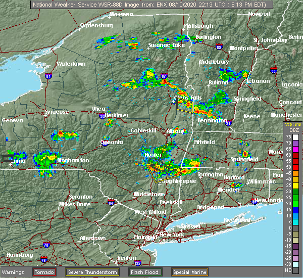 The severe thunderstorm warning for southern washington county will expire at 615 pm edt, the storm which prompted the warning has weakened below severe limits, and no longer poses an immediate threat to life or property. therefore, the warning will be allowed to expire. however gusty winds and heavy rain are still possible with this thunderstorm. to report severe weather, contact your nearest law enforcement agency. they will relay your report to the national weather service albany. The severe thunderstorm warning for southern washington county will expire at 615 pm edt, the storm which prompted the warning has weakened below severe limits, and no longer poses an immediate threat to life or property. therefore, the warning will be allowed to expire. however gusty winds and heavy rain are still possible with this thunderstorm. to report severe weather, contact your nearest law enforcement agency. they will relay your report to the national weather service albany.
|
| 8/10/2020 6:00 PM EDT |
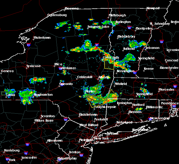 At 559 pm edt, a severe thunderstorm was located near salem, moving southeast at 15 mph (radar indicated). Hazards include 60 mph wind gusts and quarter size hail. Hail damage to vehicles is expected. expect wind damage to roofs, siding, and trees. Locations impacted include, hudson falls, salem, fort edward, kingsbury, porter, argyle, cossayuna, dunham basin, smiths basin, goose island, adamsville, east hebron, rexleigh, tiplady, fitch point, lick springs, west hebron, east greenwich, chamberlin mills and belcher. At 559 pm edt, a severe thunderstorm was located near salem, moving southeast at 15 mph (radar indicated). Hazards include 60 mph wind gusts and quarter size hail. Hail damage to vehicles is expected. expect wind damage to roofs, siding, and trees. Locations impacted include, hudson falls, salem, fort edward, kingsbury, porter, argyle, cossayuna, dunham basin, smiths basin, goose island, adamsville, east hebron, rexleigh, tiplady, fitch point, lick springs, west hebron, east greenwich, chamberlin mills and belcher.
|
| 8/10/2020 5:47 PM EDT |
 At 546 pm edt, a severe thunderstorm was located over salem, moving southeast at 15 mph (emergency management confirmed wind damage in hebron and argyle areas). Hazards include 60 mph wind gusts and quarter size hail. Hail damage to vehicles is expected. expect wind damage to roofs, siding, and trees. Locations impacted include, hudson falls, salem, fort edward, cambridge, greenwich, kingsbury, porter, schuylerville, argyle, cossayuna, dunham basin, battenville, smiths basin, center falls, goose island, adamsville, east hebron, rexleigh, tiplady and middle falls. At 546 pm edt, a severe thunderstorm was located over salem, moving southeast at 15 mph (emergency management confirmed wind damage in hebron and argyle areas). Hazards include 60 mph wind gusts and quarter size hail. Hail damage to vehicles is expected. expect wind damage to roofs, siding, and trees. Locations impacted include, hudson falls, salem, fort edward, cambridge, greenwich, kingsbury, porter, schuylerville, argyle, cossayuna, dunham basin, battenville, smiths basin, center falls, goose island, adamsville, east hebron, rexleigh, tiplady and middle falls.
|
| 8/10/2020 5:11 PM EDT |
 At 510 pm edt, a severe thunderstorm was located near hartford, or 8 miles east of hudson falls, moving southeast at 10 mph (radar indicated). Hazards include 60 mph wind gusts and quarter size hail. Hail damage to vehicles is expected. Expect wind damage to roofs, siding, and trees. At 510 pm edt, a severe thunderstorm was located near hartford, or 8 miles east of hudson falls, moving southeast at 10 mph (radar indicated). Hazards include 60 mph wind gusts and quarter size hail. Hail damage to vehicles is expected. Expect wind damage to roofs, siding, and trees.
|
| 5/29/2020 6:52 PM EDT |
 At 652 pm edt, severe thunderstorms were located along a line extending from hartford to near salem to near mechanicville, moving northeast at 40 mph (radar indicated). Hazards include 60 mph wind gusts and quarter size hail. Hail damage to vehicles is expected. expect wind damage to roofs, siding, and trees. severe thunderstorms will be near, hartford around 655 pm edt. granville around 705 pm edt. cambridge and greenwich around 715 pm edt. pawlet around 720 pm edt. salem around 730 pm edt. dorset around 745 pm edt. Other locations impacted by these severe thunderstorms include deans corners, grangerville, willow glen, northumberland, wayville, truthville, middle falls, west pawlet, mannings cove and shushan. At 652 pm edt, severe thunderstorms were located along a line extending from hartford to near salem to near mechanicville, moving northeast at 40 mph (radar indicated). Hazards include 60 mph wind gusts and quarter size hail. Hail damage to vehicles is expected. expect wind damage to roofs, siding, and trees. severe thunderstorms will be near, hartford around 655 pm edt. granville around 705 pm edt. cambridge and greenwich around 715 pm edt. pawlet around 720 pm edt. salem around 730 pm edt. dorset around 745 pm edt. Other locations impacted by these severe thunderstorms include deans corners, grangerville, willow glen, northumberland, wayville, truthville, middle falls, west pawlet, mannings cove and shushan.
|
| 5/29/2020 6:28 PM EDT |
 At 628 pm edt, severe thunderstorms were located along a line extending from near poultney village to 7 miles north of mechanicville, moving northeast at 50 mph (radar indicated). Hazards include 70 mph wind gusts and quarter size hail. Hail damage to vehicles is expected. expect considerable tree damage. wind damage is also likely to mobile homes, roofs, and outbuildings. these severe storms will be near, granville, poultney village and wells around 635 pm edt. Other locations impacted by these severe thunderstorms include deans corners, glenridge, grangerville, harding crossing, west milton, willow glen, northumberland, garrison manor, wayville and greenfield center. At 628 pm edt, severe thunderstorms were located along a line extending from near poultney village to 7 miles north of mechanicville, moving northeast at 50 mph (radar indicated). Hazards include 70 mph wind gusts and quarter size hail. Hail damage to vehicles is expected. expect considerable tree damage. wind damage is also likely to mobile homes, roofs, and outbuildings. these severe storms will be near, granville, poultney village and wells around 635 pm edt. Other locations impacted by these severe thunderstorms include deans corners, glenridge, grangerville, harding crossing, west milton, willow glen, northumberland, garrison manor, wayville and greenfield center.
|
| 5/29/2020 6:15 PM EDT | Tree on wires... time estimated by radar in washington county NY, 3.6 miles SSW of Hudson Falls, NY |
| 5/29/2020 6:14 PM EDT | Tree blocking roadway at vaughn road/underwood rd in kingsbur in washington county NY, 3.3 miles SSW of Hudson Falls, NY |
| 5/29/2020 6:11 PM EDT | Tree blocking roadway in washington county NY, 2.5 miles WSW of Hudson Falls, NY |
| 5/29/2020 6:10 PM EDT | Tree and wires down on dean road in washington county NY, 1.1 miles S of Hudson Falls, NY |
| 5/29/2020 6:10 PM EDT |
 At 559 pm edt, a severe thunderstorm capable of producing a tornado was located near west glens falls, or near glens falls, moving northeast at 35 mph (radar indicated rotation). Hazards include tornado and quarter size hail. Flying debris will be dangerous to those caught without shelter. mobile homes will be damaged or destroyed. damage to roofs, windows, and vehicles will occur. tree damage is likely. this dangerous storm will be near, glens falls and glens falls north around 610 pm edt. hudson falls around 615 pm edt. Other locations impacted by this tornadic thunderstorm include beartown, danielstown, queensbury, french mountain, lake luzerne, oneida corners, paradise beach, brayton, crosbyside and hartman. At 559 pm edt, a severe thunderstorm capable of producing a tornado was located near west glens falls, or near glens falls, moving northeast at 35 mph (radar indicated rotation). Hazards include tornado and quarter size hail. Flying debris will be dangerous to those caught without shelter. mobile homes will be damaged or destroyed. damage to roofs, windows, and vehicles will occur. tree damage is likely. this dangerous storm will be near, glens falls and glens falls north around 610 pm edt. hudson falls around 615 pm edt. Other locations impacted by this tornadic thunderstorm include beartown, danielstown, queensbury, french mountain, lake luzerne, oneida corners, paradise beach, brayton, crosbyside and hartman.
|
| 5/29/2020 6:08 PM EDT | Tree blocking roadway at dix/quarry crossing. time is radar estimate in warren county NY, 1.4 miles SE of Hudson Falls, NY |
| 5/29/2020 5:59 PM EDT |
 At 559 pm edt, a severe thunderstorm capable of producing a tornado was located near west glens falls, or near glens falls, moving northeast at 35 mph (radar indicated rotation). Hazards include tornado and quarter size hail. Flying debris will be dangerous to those caught without shelter. mobile homes will be damaged or destroyed. damage to roofs, windows, and vehicles will occur. tree damage is likely. this dangerous storm will be near, glens falls and glens falls north around 610 pm edt. hudson falls around 615 pm edt. Other locations impacted by this tornadic thunderstorm include beartown, danielstown, queensbury, french mountain, lake luzerne, oneida corners, paradise beach, brayton, crosbyside and hartman. At 559 pm edt, a severe thunderstorm capable of producing a tornado was located near west glens falls, or near glens falls, moving northeast at 35 mph (radar indicated rotation). Hazards include tornado and quarter size hail. Flying debris will be dangerous to those caught without shelter. mobile homes will be damaged or destroyed. damage to roofs, windows, and vehicles will occur. tree damage is likely. this dangerous storm will be near, glens falls and glens falls north around 610 pm edt. hudson falls around 615 pm edt. Other locations impacted by this tornadic thunderstorm include beartown, danielstown, queensbury, french mountain, lake luzerne, oneida corners, paradise beach, brayton, crosbyside and hartman.
|
| 5/29/2020 5:57 PM EDT |
 At 556 pm edt, severe thunderstorms were located along a line extending from near corinth to rotterdam junction, moving northeast at 45 mph (radar indicated). Hazards include 60 mph wind gusts and quarter size hail. Hail damage to vehicles is expected. expect wind damage to roofs, siding, and trees. severe thunderstorms will be near, corinth around 600 pm edt. glens falls, hudson falls, glens falls north, west glens falls and country knolls around 610 pm edt. ballston spa, round lake, north ballston spa and rock city falls around 615 pm edt. milton around 620 pm edt. saratoga springs and comstock around 625 pm edt. poultney village around 640 pm edt. fort edward around 645 pm edt. granville and hartford around 700 pm edt. Other locations impacted by these severe thunderstorms include deans corners, glenridge, grangerville, harding crossing, west milton, willow glen, northumberland, garrison manor, wayville and greenfield center. At 556 pm edt, severe thunderstorms were located along a line extending from near corinth to rotterdam junction, moving northeast at 45 mph (radar indicated). Hazards include 60 mph wind gusts and quarter size hail. Hail damage to vehicles is expected. expect wind damage to roofs, siding, and trees. severe thunderstorms will be near, corinth around 600 pm edt. glens falls, hudson falls, glens falls north, west glens falls and country knolls around 610 pm edt. ballston spa, round lake, north ballston spa and rock city falls around 615 pm edt. milton around 620 pm edt. saratoga springs and comstock around 625 pm edt. poultney village around 640 pm edt. fort edward around 645 pm edt. granville and hartford around 700 pm edt. Other locations impacted by these severe thunderstorms include deans corners, glenridge, grangerville, harding crossing, west milton, willow glen, northumberland, garrison manor, wayville and greenfield center.
|
| 5/29/2020 5:44 PM EDT |
 At 544 pm edt, a severe thunderstorm capable of producing a tornado was located over corinth, or 12 miles west of glens falls, moving northeast at 30 mph (radar indicated rotation). Hazards include tornado and quarter size hail. Flying debris will be dangerous to those caught without shelter. mobile homes will be damaged or destroyed. damage to roofs, windows, and vehicles will occur. tree damage is likely. this dangerous storm will be near, lake luzerne-hadley around 555 pm edt. west glens falls around 605 pm edt. glens falls, fort edward and glens falls north around 610 pm edt. other locations impacted by this tornadic thunderstorm include randall corner, beartown, danielstown, queensbury, french mountain, lake luzerne, south glens falls, south corinth, palmer and oneida corners. People attending queensbury covid-19 outdoor testing site (mon-fri), and gansevoort covid-19 outdoor testing site (mon-fri) should seek safe shelter immediately!. At 544 pm edt, a severe thunderstorm capable of producing a tornado was located over corinth, or 12 miles west of glens falls, moving northeast at 30 mph (radar indicated rotation). Hazards include tornado and quarter size hail. Flying debris will be dangerous to those caught without shelter. mobile homes will be damaged or destroyed. damage to roofs, windows, and vehicles will occur. tree damage is likely. this dangerous storm will be near, lake luzerne-hadley around 555 pm edt. west glens falls around 605 pm edt. glens falls, fort edward and glens falls north around 610 pm edt. other locations impacted by this tornadic thunderstorm include randall corner, beartown, danielstown, queensbury, french mountain, lake luzerne, south glens falls, south corinth, palmer and oneida corners. People attending queensbury covid-19 outdoor testing site (mon-fri), and gansevoort covid-19 outdoor testing site (mon-fri) should seek safe shelter immediately!.
|
| 5/29/2020 3:17 PM EDT |
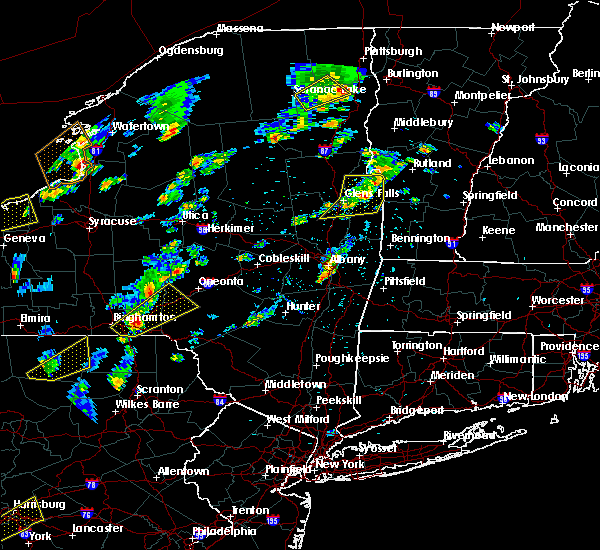 At 317 pm edt, a severe thunderstorm was located over hartford, or 10 miles northeast of hudson falls, moving northeast at 40 mph (radar indicated). Hazards include 60 mph wind gusts and quarter size hail. Hail damage to vehicles is expected. expect wind damage to roofs, siding, and trees. this severe storm will be near, granville around 325 pm edt. Other locations impacted by this severe thunderstorm include middle granville, dunham basin, smiths basin, adamsville, north granville, south granville, truthville, raceville, hampton flats and west pawlet. At 317 pm edt, a severe thunderstorm was located over hartford, or 10 miles northeast of hudson falls, moving northeast at 40 mph (radar indicated). Hazards include 60 mph wind gusts and quarter size hail. Hail damage to vehicles is expected. expect wind damage to roofs, siding, and trees. this severe storm will be near, granville around 325 pm edt. Other locations impacted by this severe thunderstorm include middle granville, dunham basin, smiths basin, adamsville, north granville, south granville, truthville, raceville, hampton flats and west pawlet.
|
| 5/29/2020 2:59 PM EDT |
 At 259 pm edt, severe thunderstorms were located along a line extending from near comstock to fort edward to near corinth, moving northeast at 25 mph (radar indicated). Hazards include 60 mph wind gusts and quarter size hail. Hail damage to vehicles is expected. expect wind damage to roofs, siding, and trees. Locations impacted include, glens falls, hudson falls, whitehall, fort edward, granville, hartford, comstock, west glens falls, glens falls north, kings, queensbury, wilton, kingsbury, mount hope, porter, south glens falls, hampton, fort ann, argyle and cleverdale. At 259 pm edt, severe thunderstorms were located along a line extending from near comstock to fort edward to near corinth, moving northeast at 25 mph (radar indicated). Hazards include 60 mph wind gusts and quarter size hail. Hail damage to vehicles is expected. expect wind damage to roofs, siding, and trees. Locations impacted include, glens falls, hudson falls, whitehall, fort edward, granville, hartford, comstock, west glens falls, glens falls north, kings, queensbury, wilton, kingsbury, mount hope, porter, south glens falls, hampton, fort ann, argyle and cleverdale.
|
| 5/29/2020 2:24 PM EDT |
 At 224 pm edt, severe thunderstorms were located along a line extending from west glens falls to near rock city falls, moving northeast at 35 mph (radar indicated). Hazards include 60 mph wind gusts and quarter size hail. Hail damage to vehicles is expected. Expect wind damage to roofs, siding, and trees. At 224 pm edt, severe thunderstorms were located along a line extending from west glens falls to near rock city falls, moving northeast at 35 mph (radar indicated). Hazards include 60 mph wind gusts and quarter size hail. Hail damage to vehicles is expected. Expect wind damage to roofs, siding, and trees.
|
| 5/15/2020 6:08 PM EDT |
 At 608 pm edt, a severe thunderstorm was located near greenwich, or 10 miles east of saratoga springs, moving east at 50 mph (radar indicated). Hazards include 70 mph wind gusts and quarter size hail. Hail damage to vehicles is expected. expect considerable tree damage. wind damage is also likely to mobile homes, roofs, and outbuildings. Locations impacted include, saratoga springs, glens falls, hudson falls, mechanicville, hoosick falls, salem, glenville, milton, ballston spa, fort edward, cambridge, greenwich, round lake, rotterdam junction, burnt hills, glens falls north, country knolls, north ballston spa, west glens falls and pattersonville-rotterdam junction. At 608 pm edt, a severe thunderstorm was located near greenwich, or 10 miles east of saratoga springs, moving east at 50 mph (radar indicated). Hazards include 70 mph wind gusts and quarter size hail. Hail damage to vehicles is expected. expect considerable tree damage. wind damage is also likely to mobile homes, roofs, and outbuildings. Locations impacted include, saratoga springs, glens falls, hudson falls, mechanicville, hoosick falls, salem, glenville, milton, ballston spa, fort edward, cambridge, greenwich, round lake, rotterdam junction, burnt hills, glens falls north, country knolls, north ballston spa, west glens falls and pattersonville-rotterdam junction.
|
| 5/15/2020 5:42 PM EDT |
 At 541 pm edt, a severe thunderstorm was located near galway, or 12 miles west of saratoga springs, moving east at 55 mph (radar indicated). Hazards include 60 mph wind gusts and quarter size hail. Hail damage to vehicles is expected. Expect wind damage to roofs, siding, and trees. At 541 pm edt, a severe thunderstorm was located near galway, or 12 miles west of saratoga springs, moving east at 55 mph (radar indicated). Hazards include 60 mph wind gusts and quarter size hail. Hail damage to vehicles is expected. Expect wind damage to roofs, siding, and trees.
|
| 8/21/2019 4:06 PM EDT |
 A severe thunderstorm warning remains in effect until 430 pm edt for southeastern saratoga. southern washington and northern rensselaer counties. At 406 pm edt, severe thunderstorms were located along a line extending from 6 miles southeast of fort edward to near mechanicville, moving east at 25 mph. A severe thunderstorm warning remains in effect until 430 pm edt for southeastern saratoga. southern washington and northern rensselaer counties. At 406 pm edt, severe thunderstorms were located along a line extending from 6 miles southeast of fort edward to near mechanicville, moving east at 25 mph.
|
| 8/21/2019 3:45 PM EDT |
 At 344 pm edt, severe thunderstorms were located along a line extending from near fort edward to near alplaus, moving east at 25 mph. these are very dangerous storms (radar indicated). Hazards include 80 mph wind gusts and penny size hail. Flying debris will be dangerous to those caught without shelter. mobile homes will be heavily damaged. expect considerable damage to roofs, windows, and vehicles. extensive tree damage and power outages are likely. Locations impacted include, clifton park, saratoga springs, hudson falls, mechanicville, hoosick falls, salem, ballston spa, fort edward, cambridge, greenwich, round lake, burnt hills, country knolls, north ballston spa, gates, malta, hoosick, porter, lee and pittstown. At 344 pm edt, severe thunderstorms were located along a line extending from near fort edward to near alplaus, moving east at 25 mph. these are very dangerous storms (radar indicated). Hazards include 80 mph wind gusts and penny size hail. Flying debris will be dangerous to those caught without shelter. mobile homes will be heavily damaged. expect considerable damage to roofs, windows, and vehicles. extensive tree damage and power outages are likely. Locations impacted include, clifton park, saratoga springs, hudson falls, mechanicville, hoosick falls, salem, ballston spa, fort edward, cambridge, greenwich, round lake, burnt hills, country knolls, north ballston spa, gates, malta, hoosick, porter, lee and pittstown.
|
| 8/21/2019 3:35 PM EDT |
 At 335 pm edt, severe thunderstorms were located along a line extending from near fort edward to alplaus, moving east at 25 mph (radar indicated). Hazards include 70 mph wind gusts and penny size hail. Expect considerable tree damage. damage is likely to mobile homes, roofs, and outbuildings. Locations impacted include, clifton park, saratoga springs, glens falls, hudson falls, mechanicville, hoosick falls, salem, milton, ballston spa, fort edward, cambridge, greenwich, round lake, burnt hills, country knolls, north ballston spa, east glenville, gates, wilton and malta. At 335 pm edt, severe thunderstorms were located along a line extending from near fort edward to alplaus, moving east at 25 mph (radar indicated). Hazards include 70 mph wind gusts and penny size hail. Expect considerable tree damage. damage is likely to mobile homes, roofs, and outbuildings. Locations impacted include, clifton park, saratoga springs, glens falls, hudson falls, mechanicville, hoosick falls, salem, milton, ballston spa, fort edward, cambridge, greenwich, round lake, burnt hills, country knolls, north ballston spa, east glenville, gates, wilton and malta.
|
| 8/21/2019 3:28 PM EDT |
 The national weather service in albany has issued a * severe thunderstorm warning for. northeastern schenectady county in east central new york. eastern saratoga county in east central new york. southern washington county in east central new york. Northern rensselaer county in east central new york. The national weather service in albany has issued a * severe thunderstorm warning for. northeastern schenectady county in east central new york. eastern saratoga county in east central new york. southern washington county in east central new york. Northern rensselaer county in east central new york.
|
| 8/17/2019 5:34 PM EDT |
 At 534 pm edt, severe thunderstorms were located along a line extending from 6 miles south of fort edward to colonie, moving east at 40 mph (law enforcement has reported multiple areas of trees and wires down). Hazards include 60 mph wind gusts and quarter size hail. Hail damage to vehicles is expected. Expect wind damage to roofs, siding, and trees. At 534 pm edt, severe thunderstorms were located along a line extending from 6 miles south of fort edward to colonie, moving east at 40 mph (law enforcement has reported multiple areas of trees and wires down). Hazards include 60 mph wind gusts and quarter size hail. Hail damage to vehicles is expected. Expect wind damage to roofs, siding, and trees.
|
| 8/17/2019 5:17 PM EDT |
 At 516 pm edt, severe thunderstorms were located along a line extending from near west glens falls to saratoga springs, moving east at 35 mph (radar indicated). Hazards include 60 mph wind gusts and quarter size hail. Hail damage to vehicles is expected. expect wind damage to roofs, siding, and trees. these severe storms will be near, glens falls, glens falls north and west glens falls around 525 pm edt. hudson falls and fort edward around 530 pm edt. Other locations impacted by these severe thunderstorms include parkis mills, deans corners, lake luzerne, grangerville, west milton, glenwild, northumberland, wayville, greenfield center and wiley corners. At 516 pm edt, severe thunderstorms were located along a line extending from near west glens falls to saratoga springs, moving east at 35 mph (radar indicated). Hazards include 60 mph wind gusts and quarter size hail. Hail damage to vehicles is expected. expect wind damage to roofs, siding, and trees. these severe storms will be near, glens falls, glens falls north and west glens falls around 525 pm edt. hudson falls and fort edward around 530 pm edt. Other locations impacted by these severe thunderstorms include parkis mills, deans corners, lake luzerne, grangerville, west milton, glenwild, northumberland, wayville, greenfield center and wiley corners.
|
| 8/17/2019 5:06 PM EDT |
 A severe thunderstorm warning remains in effect until 600 pm edt for southeastern warren. saratoga. southeastern fulton and southwestern washington counties. At 506 pm edt, severe thunderstorms were located along a line extending from lake luzerne-hadley to rock city falls, moving east at 35 mph. A severe thunderstorm warning remains in effect until 600 pm edt for southeastern warren. saratoga. southeastern fulton and southwestern washington counties. At 506 pm edt, severe thunderstorms were located along a line extending from lake luzerne-hadley to rock city falls, moving east at 35 mph.
|
| 8/17/2019 4:55 PM EDT |
 At 454 pm edt, severe thunderstorms were located along a line extending from near day center to galway, moving east at 35 mph (radar indicated). Hazards include 60 mph wind gusts and penny size hail. Expect damage to roofs, siding, and trees. severe thunderstorms will be near, ballston spa around 505 pm edt. milton, corinth, north ballston spa, lake luzerne-hadley and lake luzerne campground around 510 pm edt. saratoga springs around 520 pm edt. glens falls, west glens falls and glens falls north around 525 pm edt. Hudson falls and fort edward around 530 pm edt. At 454 pm edt, severe thunderstorms were located along a line extending from near day center to galway, moving east at 35 mph (radar indicated). Hazards include 60 mph wind gusts and penny size hail. Expect damage to roofs, siding, and trees. severe thunderstorms will be near, ballston spa around 505 pm edt. milton, corinth, north ballston spa, lake luzerne-hadley and lake luzerne campground around 510 pm edt. saratoga springs around 520 pm edt. glens falls, west glens falls and glens falls north around 525 pm edt. Hudson falls and fort edward around 530 pm edt.
|
| 8/7/2019 6:42 PM EDT |
 At 642 pm edt, a severe thunderstorm was located near fort edward, or 8 miles south of hudson falls, moving northeast at 20 mph (radar indicated). Hazards include 70 mph wind gusts and quarter size hail. Hail damage to vehicles is expected. expect considerable tree damage. wind damage is also likely to mobile homes, roofs, and outbuildings. Locations impacted include, hudson falls, fort edward, hartford, gates, northumberland, south glens falls, schuylerville, argyle, bacon hill, cossayuna, dunham basin, jewell corner, goose island, adamsville, grangerville, gansevoort, fitch point, bald mountain, starks knob and clarks mills. At 642 pm edt, a severe thunderstorm was located near fort edward, or 8 miles south of hudson falls, moving northeast at 20 mph (radar indicated). Hazards include 70 mph wind gusts and quarter size hail. Hail damage to vehicles is expected. expect considerable tree damage. wind damage is also likely to mobile homes, roofs, and outbuildings. Locations impacted include, hudson falls, fort edward, hartford, gates, northumberland, south glens falls, schuylerville, argyle, bacon hill, cossayuna, dunham basin, jewell corner, goose island, adamsville, grangerville, gansevoort, fitch point, bald mountain, starks knob and clarks mills.
|
| 8/7/2019 6:26 PM EDT |
 At 626 pm edt, a severe thunderstorm was located 8 miles northeast of saratoga springs, moving northeast at 20 mph (radar indicated). Hazards include 70 mph wind gusts and quarter size hail. Hail damage to vehicles is expected. expect considerable tree damage. wind damage is also likely to mobile homes, roofs, and outbuildings. Locations impacted include, saratoga springs, hudson falls, salem, fort edward, hartford, greenwich, gates, wilton, northumberland, south glens falls, schuylerville, victory, argyle, cossayuna, dunham basin, center falls, goose island, adamsville, grangerville and kings station. At 626 pm edt, a severe thunderstorm was located 8 miles northeast of saratoga springs, moving northeast at 20 mph (radar indicated). Hazards include 70 mph wind gusts and quarter size hail. Hail damage to vehicles is expected. expect considerable tree damage. wind damage is also likely to mobile homes, roofs, and outbuildings. Locations impacted include, saratoga springs, hudson falls, salem, fort edward, hartford, greenwich, gates, wilton, northumberland, south glens falls, schuylerville, victory, argyle, cossayuna, dunham basin, center falls, goose island, adamsville, grangerville and kings station.
|
| 8/7/2019 6:13 PM EDT |
 At 613 pm edt, a severe thunderstorm was located near saratoga springs, moving northeast at 20 mph (radar indicated). Hazards include 70 mph wind gusts and quarter size hail. Hail damage to vehicles is expected. expect considerable tree damage. wind damage is also likely to mobile homes, roofs, and outbuildings. Locations impacted include, saratoga springs, hudson falls, salem, fort edward, hartford, greenwich, gates, wilton, northumberland, south glens falls, schuylerville, victory, argyle, deans corners, cossayuna, dunham basin, center falls, goose island, adamsville and grangerville. At 613 pm edt, a severe thunderstorm was located near saratoga springs, moving northeast at 20 mph (radar indicated). Hazards include 70 mph wind gusts and quarter size hail. Hail damage to vehicles is expected. expect considerable tree damage. wind damage is also likely to mobile homes, roofs, and outbuildings. Locations impacted include, saratoga springs, hudson falls, salem, fort edward, hartford, greenwich, gates, wilton, northumberland, south glens falls, schuylerville, victory, argyle, deans corners, cossayuna, dunham basin, center falls, goose island, adamsville and grangerville.
|
| 8/7/2019 6:03 PM EDT |
 At 603 pm edt, a severe thunderstorm was located near saratoga springs, moving east at 20 mph (radar indicated). Hazards include 60 mph wind gusts and quarter size hail. Hail damage to vehicles is expected. Expect wind damage to roofs, siding, and trees. At 603 pm edt, a severe thunderstorm was located near saratoga springs, moving east at 20 mph (radar indicated). Hazards include 60 mph wind gusts and quarter size hail. Hail damage to vehicles is expected. Expect wind damage to roofs, siding, and trees.
|
| 7/30/2019 6:29 PM EDT |
 At 629 pm edt, severe thunderstorms were located along a line extending from near poultney village to near saratoga springs, moving northeast at 30 mph (radar indicated). Hazards include 60 mph wind gusts and penny size hail. expect damage to roofs, siding, and trees At 629 pm edt, severe thunderstorms were located along a line extending from near poultney village to near saratoga springs, moving northeast at 30 mph (radar indicated). Hazards include 60 mph wind gusts and penny size hail. expect damage to roofs, siding, and trees
|
| 7/30/2019 5:52 PM EDT |
 At 551 pm edt, severe thunderstorms were located along a line extending from lake george village to ballston spa, moving northeast at 25 mph (radar indicated). Hazards include 70 mph wind gusts and quarter size hail. Hail damage to vehicles is expected. expect considerable tree damage. wind damage is also likely to mobile homes, roofs, and outbuildings. Locations impacted include, saratoga springs, glens falls, hudson falls, lake george village, milton, ballston spa, fort edward, corinth, greenwich, comstock, rock city falls, glens falls north, north ballston spa, west glens falls, lake luzerne campground, kings, gates, queensbury, wilton and malta. At 551 pm edt, severe thunderstorms were located along a line extending from lake george village to ballston spa, moving northeast at 25 mph (radar indicated). Hazards include 70 mph wind gusts and quarter size hail. Hail damage to vehicles is expected. expect considerable tree damage. wind damage is also likely to mobile homes, roofs, and outbuildings. Locations impacted include, saratoga springs, glens falls, hudson falls, lake george village, milton, ballston spa, fort edward, corinth, greenwich, comstock, rock city falls, glens falls north, north ballston spa, west glens falls, lake luzerne campground, kings, gates, queensbury, wilton and malta.
|
| 7/30/2019 5:44 PM EDT |
 At 544 pm edt, severe thunderstorms were located along a line extending from near lake george village to near ballston spa, moving northeast at 20 mph (radar indicated). Hazards include 60 mph wind gusts and quarter size hail. Hail damage to vehicles is expected. expect wind damage to roofs, siding, and trees. Locations impacted include, saratoga springs, glens falls, hudson falls, lake george village, milton, ballston spa, fort edward, corinth, greenwich, round lake, comstock, burnt hills, rock city falls, glens falls north, north ballston spa, west glens falls, lake luzerne campground, kings, mount pleasant and gates. At 544 pm edt, severe thunderstorms were located along a line extending from near lake george village to near ballston spa, moving northeast at 20 mph (radar indicated). Hazards include 60 mph wind gusts and quarter size hail. Hail damage to vehicles is expected. expect wind damage to roofs, siding, and trees. Locations impacted include, saratoga springs, glens falls, hudson falls, lake george village, milton, ballston spa, fort edward, corinth, greenwich, round lake, comstock, burnt hills, rock city falls, glens falls north, north ballston spa, west glens falls, lake luzerne campground, kings, mount pleasant and gates.
|
| 7/30/2019 5:23 PM EDT |
 The national weather service in albany has issued a * severe thunderstorm warning for. southeastern warren county in east central new york. saratoga county in east central new york. southwestern washington county in east central new york. Until 630 pm edt. The national weather service in albany has issued a * severe thunderstorm warning for. southeastern warren county in east central new york. saratoga county in east central new york. southwestern washington county in east central new york. Until 630 pm edt.
|
| 5/19/2019 7:30 PM EDT |
 At 730 pm edt, a severe thunderstorm was located near lake luzerne-hadley, or 12 miles southwest of lake george village, moving east at 35 mph (radar indicated). Hazards include 60 mph wind gusts and quarter size hail. Hail damage to vehicles is expected. expect wind damage to roofs, siding, and trees. Locations impacted include, glens falls, hudson falls, fort edward, corinth, day center, west glens falls, lake luzerne campground, glens falls north, queensbury, kingsbury, south glens falls, lake luzerne, hadley, lake george, fort ann, argyle, beartown, dunham basin, smiths basin and conklingville. At 730 pm edt, a severe thunderstorm was located near lake luzerne-hadley, or 12 miles southwest of lake george village, moving east at 35 mph (radar indicated). Hazards include 60 mph wind gusts and quarter size hail. Hail damage to vehicles is expected. expect wind damage to roofs, siding, and trees. Locations impacted include, glens falls, hudson falls, fort edward, corinth, day center, west glens falls, lake luzerne campground, glens falls north, queensbury, kingsbury, south glens falls, lake luzerne, hadley, lake george, fort ann, argyle, beartown, dunham basin, smiths basin and conklingville.
|
| 5/19/2019 7:16 PM EDT |
 At 716 pm edt, a severe thunderstorm was located over day center, or 19 miles southwest of lake george village, moving east at 35 mph (radar indicated). Hazards include 60 mph wind gusts and quarter size hail. Hail damage to vehicles is expected. Expect wind damage to roofs, siding, and trees. At 716 pm edt, a severe thunderstorm was located over day center, or 19 miles southwest of lake george village, moving east at 35 mph (radar indicated). Hazards include 60 mph wind gusts and quarter size hail. Hail damage to vehicles is expected. Expect wind damage to roofs, siding, and trees.
|
| 5/19/2019 6:30 PM EDT |
 At 619 pm edt, severe thunderstorms were located along a line extending from near warrensburg to glens falls to near corinth, moving east at 35 mph (radar indicated). Hazards include 60 mph wind gusts and half dollar size hail. Hail damage to vehicles is expected. expect wind damage to roofs, siding, and trees. Locations impacted include, glens falls, hudson falls, lake george village, fort edward, corinth, granville, hartford, comstock, west glens falls, lake luzerne campground, glens falls north, mount pleasant, queensbury, wilton, kingsbury, porter, south glens falls, lake luzerne, hadley and lake george. At 619 pm edt, severe thunderstorms were located along a line extending from near warrensburg to glens falls to near corinth, moving east at 35 mph (radar indicated). Hazards include 60 mph wind gusts and half dollar size hail. Hail damage to vehicles is expected. expect wind damage to roofs, siding, and trees. Locations impacted include, glens falls, hudson falls, lake george village, fort edward, corinth, granville, hartford, comstock, west glens falls, lake luzerne campground, glens falls north, mount pleasant, queensbury, wilton, kingsbury, porter, south glens falls, lake luzerne, hadley and lake george.
|
| 5/19/2019 6:19 PM EDT |
 At 609 pm edt, severe thunderstorms were located along a line extending from near warrensburg to near west glens falls to near corinth, moving east at 35 mph (radar indicated). Hazards include 60 mph wind gusts and quarter size hail. Hail damage to vehicles is expected. Expect wind damage to roofs, siding, and trees. At 609 pm edt, severe thunderstorms were located along a line extending from near warrensburg to near west glens falls to near corinth, moving east at 35 mph (radar indicated). Hazards include 60 mph wind gusts and quarter size hail. Hail damage to vehicles is expected. Expect wind damage to roofs, siding, and trees.
|
| 5/19/2019 6:09 PM EDT |
 At 609 pm edt, severe thunderstorms were located along a line extending from near warrensburg to near west glens falls to near corinth, moving east at 35 mph (radar indicated). Hazards include 60 mph wind gusts and quarter size hail. Hail damage to vehicles is expected. Expect wind damage to roofs, siding, and trees. At 609 pm edt, severe thunderstorms were located along a line extending from near warrensburg to near west glens falls to near corinth, moving east at 35 mph (radar indicated). Hazards include 60 mph wind gusts and quarter size hail. Hail damage to vehicles is expected. Expect wind damage to roofs, siding, and trees.
|
| 5/19/2019 5:56 PM EDT |
 At 556 pm edt, severe thunderstorms were located along a line extending from lake luzerne campground to near corinth to near rock city falls, moving east at 35 mph (radar indicated). Hazards include 70 mph wind gusts and quarter size hail. Hail damage to vehicles is expected. expect considerable tree damage. wind damage is also likely to mobile homes, roofs, and outbuildings. Locations impacted include, glens falls, hudson falls, warrensburg, lake george village, fort edward, corinth, edinburg, day center, west glens falls, lake luzerne campground, glens falls north, kings, mount pleasant, queensbury, wilton, kingsbury, northumberland, south glens falls, lake luzerne and hadley. At 556 pm edt, severe thunderstorms were located along a line extending from lake luzerne campground to near corinth to near rock city falls, moving east at 35 mph (radar indicated). Hazards include 70 mph wind gusts and quarter size hail. Hail damage to vehicles is expected. expect considerable tree damage. wind damage is also likely to mobile homes, roofs, and outbuildings. Locations impacted include, glens falls, hudson falls, warrensburg, lake george village, fort edward, corinth, edinburg, day center, west glens falls, lake luzerne campground, glens falls north, kings, mount pleasant, queensbury, wilton, kingsbury, northumberland, south glens falls, lake luzerne and hadley.
|
| 5/19/2019 5:21 PM EDT |
 At 520 pm edt, severe thunderstorms were located along a line extending from 6 miles northeast of wells to near sacandaga campground to 7 miles northeast of caroga lake, moving east at 35 mph (radar indicated). Hazards include 70 mph wind gusts and quarter size hail. Hail damage to vehicles is expected. expect considerable tree damage. Wind damage is also likely to mobile homes, roofs, and outbuildings. At 520 pm edt, severe thunderstorms were located along a line extending from 6 miles northeast of wells to near sacandaga campground to 7 miles northeast of caroga lake, moving east at 35 mph (radar indicated). Hazards include 70 mph wind gusts and quarter size hail. Hail damage to vehicles is expected. expect considerable tree damage. Wind damage is also likely to mobile homes, roofs, and outbuildings.
|
| 8/17/2018 7:20 PM EDT |
 At 719 pm edt, a severe thunderstorm was located near salem, moving northeast at 50 mph (radar indicated). Hazards include 60 mph wind gusts and quarter size hail. Hail damage to vehicles is expected. expect wind damage to roofs, siding, and trees. this severe thunderstorm will be near, hartford around 730 pm edt. granville around 740 pm edt. Pawlet around 745 pm edt. At 719 pm edt, a severe thunderstorm was located near salem, moving northeast at 50 mph (radar indicated). Hazards include 60 mph wind gusts and quarter size hail. Hail damage to vehicles is expected. expect wind damage to roofs, siding, and trees. this severe thunderstorm will be near, hartford around 730 pm edt. granville around 740 pm edt. Pawlet around 745 pm edt.
|
| 8/17/2018 6:42 PM EDT |
 At 641 pm edt, a severe thunderstorm was located near edinburg, or 20 miles northeast of gloversville, moving east at 30 mph (radar indicated). Hazards include 60 mph wind gusts. Expect damage to roofs, siding, and trees. this severe thunderstorm will be near, day center around 650 pm edt. lake luzerne-hadley and lake luzerne campground around 705 pm edt. corinth around 710 pm edt. west glens falls and glens falls north around 720 pm edt. glens falls around 725 pm edt. Hudson falls and fort edward around 730 pm edt. At 641 pm edt, a severe thunderstorm was located near edinburg, or 20 miles northeast of gloversville, moving east at 30 mph (radar indicated). Hazards include 60 mph wind gusts. Expect damage to roofs, siding, and trees. this severe thunderstorm will be near, day center around 650 pm edt. lake luzerne-hadley and lake luzerne campground around 705 pm edt. corinth around 710 pm edt. west glens falls and glens falls north around 720 pm edt. glens falls around 725 pm edt. Hudson falls and fort edward around 730 pm edt.
|
| 8/4/2018 5:40 PM EDT |
 At 539 pm edt, a severe thunderstorm was located near glens falls north, or near glens falls, moving east at 15 mph (radar indicated). Hazards include 60 mph wind gusts. Expect damage to roofs, siding, and trees. this severe storm will be near, glens falls north around 555 pm edt. glens falls and west glens falls around 600 pm edt. Other locations impacted by this severe thunderstorm include big hollow, beartown, queensbury, french mountain, lake luzerne, south glens falls, fourth lake, lake george, stony creek station and oneida corners. At 539 pm edt, a severe thunderstorm was located near glens falls north, or near glens falls, moving east at 15 mph (radar indicated). Hazards include 60 mph wind gusts. Expect damage to roofs, siding, and trees. this severe storm will be near, glens falls north around 555 pm edt. glens falls and west glens falls around 600 pm edt. Other locations impacted by this severe thunderstorm include big hollow, beartown, queensbury, french mountain, lake luzerne, south glens falls, fourth lake, lake george, stony creek station and oneida corners.
|
| 8/4/2018 5:24 PM EDT |
 The severe thunderstorm warning for central washington county will expire at 530 pm edt, the storm which prompted the warning has weakened below severe limits, and no longer poses an immediate threat to life or property. therefore, the warning will be allowed to expire. however heavy rain is still possible with this thunderstorm. The severe thunderstorm warning for central washington county will expire at 530 pm edt, the storm which prompted the warning has weakened below severe limits, and no longer poses an immediate threat to life or property. therefore, the warning will be allowed to expire. however heavy rain is still possible with this thunderstorm.
|
| 8/4/2018 5:17 PM EDT |
 At 517 pm edt, a severe thunderstorm was located near lake luzerne campground, or 10 miles southwest of warrensburg, moving east at 20 mph (radar indicated). Hazards include 60 mph wind gusts and quarter size hail. Hail damage to vehicles is expected. expect wind damage to roofs, siding, and trees. this severe thunderstorm will be near, lake luzerne campground and lake luzerne-hadley around 530 pm edt. lake george village around 545 pm edt. glens falls, glens falls north and west glens falls around 555 pm edt. Other locations impacted by this severe thunderstorm include thurman station, cleverdale, big hollow, beartown, french mountain, lake luzerne, fourth lake, lake george, conklingville and stony creek station. At 517 pm edt, a severe thunderstorm was located near lake luzerne campground, or 10 miles southwest of warrensburg, moving east at 20 mph (radar indicated). Hazards include 60 mph wind gusts and quarter size hail. Hail damage to vehicles is expected. expect wind damage to roofs, siding, and trees. this severe thunderstorm will be near, lake luzerne campground and lake luzerne-hadley around 530 pm edt. lake george village around 545 pm edt. glens falls, glens falls north and west glens falls around 555 pm edt. Other locations impacted by this severe thunderstorm include thurman station, cleverdale, big hollow, beartown, french mountain, lake luzerne, fourth lake, lake george, conklingville and stony creek station.
|
| 8/4/2018 4:56 PM EDT |
 At 456 pm edt, a severe thunderstorm was located near bolton landing, or 7 miles northeast of lake george village, moving southeast at 25 mph (radar indicated). Hazards include 60 mph wind gusts and quarter size hail. Hail damage to vehicles is expected. expect wind damage to roofs, siding, and trees. this severe storm will be near, hartford and comstock around 530 pm edt. Other locations impacted by this severe thunderstorm include south bay, middle granville, braymer school, dunham basin, smiths basin, goose island, adamsville, north granville, south bay village and snody dock. At 456 pm edt, a severe thunderstorm was located near bolton landing, or 7 miles northeast of lake george village, moving southeast at 25 mph (radar indicated). Hazards include 60 mph wind gusts and quarter size hail. Hail damage to vehicles is expected. expect wind damage to roofs, siding, and trees. this severe storm will be near, hartford and comstock around 530 pm edt. Other locations impacted by this severe thunderstorm include south bay, middle granville, braymer school, dunham basin, smiths basin, goose island, adamsville, north granville, south bay village and snody dock.
|
| 8/4/2018 4:28 PM EDT |
 At 427 pm edt, a severe thunderstorm was located near huletts landing, or near whitehall, moving south at 25 mph (radar indicated). Hazards include 60 mph wind gusts and quarter size hail. Hail damage to vehicles is expected. expect wind damage to roofs, siding, and trees. this severe thunderstorm will be near, whitehall around 435 pm edt. comstock around 450 pm edt. hudson falls and hartford around 505 pm edt. Other locations impacted by this severe thunderstorm include south bay, middle granville, braymer school, dunham basin, smiths basin, goose island, adamsville, north granville, south bay village and snody dock. At 427 pm edt, a severe thunderstorm was located near huletts landing, or near whitehall, moving south at 25 mph (radar indicated). Hazards include 60 mph wind gusts and quarter size hail. Hail damage to vehicles is expected. expect wind damage to roofs, siding, and trees. this severe thunderstorm will be near, whitehall around 435 pm edt. comstock around 450 pm edt. hudson falls and hartford around 505 pm edt. Other locations impacted by this severe thunderstorm include south bay, middle granville, braymer school, dunham basin, smiths basin, goose island, adamsville, north granville, south bay village and snody dock.
|
| 7/2/2018 7:54 PM EDT |
 At 753 pm edt, a severe thunderstorm was located near corinth, or 9 miles southwest of glens falls, moving east at 30 mph (radar indicated). Hazards include 60 mph wind gusts and penny size hail. Expect damage to roofs, siding, and trees. this severe storm will be near, glens falls, west glens falls and glens falls north around 810 pm edt. hudson falls and fort edward around 815 pm edt. Other locations impacted by this severe thunderstorm include gurn spring, randall corner, danielstown, dunham basin, lick springs, jewell corner, south glens falls, adamsville, wilton and dimmick corners. At 753 pm edt, a severe thunderstorm was located near corinth, or 9 miles southwest of glens falls, moving east at 30 mph (radar indicated). Hazards include 60 mph wind gusts and penny size hail. Expect damage to roofs, siding, and trees. this severe storm will be near, glens falls, west glens falls and glens falls north around 810 pm edt. hudson falls and fort edward around 815 pm edt. Other locations impacted by this severe thunderstorm include gurn spring, randall corner, danielstown, dunham basin, lick springs, jewell corner, south glens falls, adamsville, wilton and dimmick corners.
|
| 7/2/2018 7:25 PM EDT |
 At 725 pm edt, a severe thunderstorm was located near edinburg, or 13 miles northwest of saratoga springs, moving east at 30 mph (radar indicated). Hazards include 60 mph wind gusts and penny size hail. Expect damage to roofs, siding, and trees. this severe thunderstorm will be near, corinth around 745 pm edt. west glens falls around 800 pm edt. glens falls, fort edward and glens falls north around 805 pm edt. hudson falls around 810 pm edt. Other locations impacted by this severe thunderstorm include gurn spring, dunham basin, jewell corner, adamsville, north greenfield, gansevoort, hartman, argyle, fox hill and randall corner. At 725 pm edt, a severe thunderstorm was located near edinburg, or 13 miles northwest of saratoga springs, moving east at 30 mph (radar indicated). Hazards include 60 mph wind gusts and penny size hail. Expect damage to roofs, siding, and trees. this severe thunderstorm will be near, corinth around 745 pm edt. west glens falls around 800 pm edt. glens falls, fort edward and glens falls north around 805 pm edt. hudson falls around 810 pm edt. Other locations impacted by this severe thunderstorm include gurn spring, dunham basin, jewell corner, adamsville, north greenfield, gansevoort, hartman, argyle, fox hill and randall corner.
|
| 6/18/2018 4:06 PM EDT |
 At 405 pm edt, severe thunderstorms were located along a line extending from 6 miles east of fort edward to near cambridge to near berlin, moving east at 40 mph (radar indicated). Hazards include 60 mph wind gusts. Expect damage to roofs, siding, and trees. severe thunderstorms will be near, arlington and shaftsbury around 415 pm edt. bennington, williamstown and new ashford around 420 pm edt. north adams around 425 pm edt. adams around 430 pm edt. stratton, dorset, florida and savoy around 435 pm edt. manchester, wilmington, manchester center and west wardsboro around 440 pm edt. londonderry and newfane around 455 pm edt. brattleboro and putney around 500 pm edt. Other locations impacted by these severe thunderstorms include goose city, chiselville, north hancock, readsboro falls, cheshire harbor, south shaftsbury, south windham, bromley village, east kansas and white oaks. At 405 pm edt, severe thunderstorms were located along a line extending from 6 miles east of fort edward to near cambridge to near berlin, moving east at 40 mph (radar indicated). Hazards include 60 mph wind gusts. Expect damage to roofs, siding, and trees. severe thunderstorms will be near, arlington and shaftsbury around 415 pm edt. bennington, williamstown and new ashford around 420 pm edt. north adams around 425 pm edt. adams around 430 pm edt. stratton, dorset, florida and savoy around 435 pm edt. manchester, wilmington, manchester center and west wardsboro around 440 pm edt. londonderry and newfane around 455 pm edt. brattleboro and putney around 500 pm edt. Other locations impacted by these severe thunderstorms include goose city, chiselville, north hancock, readsboro falls, cheshire harbor, south shaftsbury, south windham, bromley village, east kansas and white oaks.
|
| 6/1/2018 7:37 PM EDT |
 At 737 pm edt, a severe thunderstorm was located near fort edward, or near hudson falls, moving southeast at 20 mph (radar indicated). Hazards include 60 mph wind gusts. Expect damage to roofs, siding, and trees. this severe storm will be near, greenwich around 805 pm edt. Other locations impacted by this severe thunderstorm include cossayuna, braymer school, dunham basin, battenville, jewell corner, center falls, goose island, adamsville, east hebron and south granville. At 737 pm edt, a severe thunderstorm was located near fort edward, or near hudson falls, moving southeast at 20 mph (radar indicated). Hazards include 60 mph wind gusts. Expect damage to roofs, siding, and trees. this severe storm will be near, greenwich around 805 pm edt. Other locations impacted by this severe thunderstorm include cossayuna, braymer school, dunham basin, battenville, jewell corner, center falls, goose island, adamsville, east hebron and south granville.
|
| 6/1/2018 7:16 PM EDT |
 At 715 pm edt, a severe thunderstorm was located over glens falls, moving southeast at 15 mph (radar indicated). Hazards include 60 mph wind gusts and penny size hail. Expect damage to roofs, siding, and trees. this severe thunderstorm will be near, hudson falls and fort edward around 725 pm edt. salem around 815 pm edt. Other locations impacted by this severe thunderstorm include cossayuna, dunham basin, smiths basin, center falls, goose island, adamsville, north granville, east hebron, south granville and truthville. At 715 pm edt, a severe thunderstorm was located over glens falls, moving southeast at 15 mph (radar indicated). Hazards include 60 mph wind gusts and penny size hail. Expect damage to roofs, siding, and trees. this severe thunderstorm will be near, hudson falls and fort edward around 725 pm edt. salem around 815 pm edt. Other locations impacted by this severe thunderstorm include cossayuna, dunham basin, smiths basin, center falls, goose island, adamsville, north granville, east hebron, south granville and truthville.
|
| 5/4/2018 8:14 PM EDT |
 At 813 pm edt, severe thunderstorms were located along a line extending from near hague to near fort edward to near mechanicville, moving east at 70 mph (radar indicated). Hazards include 60 mph wind gusts. Expect damage to roofs, siding, and trees. these severe storms will be near, salem and west haven around 820 pm edt. cambridge around 830 pm edt. A tornado watch remains in effect until 1000 pm edt for east central new york. At 813 pm edt, severe thunderstorms were located along a line extending from near hague to near fort edward to near mechanicville, moving east at 70 mph (radar indicated). Hazards include 60 mph wind gusts. Expect damage to roofs, siding, and trees. these severe storms will be near, salem and west haven around 820 pm edt. cambridge around 830 pm edt. A tornado watch remains in effect until 1000 pm edt for east central new york.
|
| 5/4/2018 7:50 PM EDT |
 At 749 pm edt, severe thunderstorms were located along a line extending from near eagle point campground to 7 miles north of rock city falls to fort johnson, moving east at 55 mph (radar indicated). Hazards include 60 mph wind gusts. Expect damage to roofs, siding, and trees. severe thunderstorms will be near, eagle point campground around 755 pm edt. saratoga springs and corinth around 800 pm edt. hague and huletts landing around 805 pm edt. milton, ballston spa, country knolls and north ballston spa around 810 pm edt. greenwich, round lake and west haven around 815 pm edt. salem around 825 pm edt. A tornado watch remains in effect until 1000 pm edt for eastern and east central new york. At 749 pm edt, severe thunderstorms were located along a line extending from near eagle point campground to 7 miles north of rock city falls to fort johnson, moving east at 55 mph (radar indicated). Hazards include 60 mph wind gusts. Expect damage to roofs, siding, and trees. severe thunderstorms will be near, eagle point campground around 755 pm edt. saratoga springs and corinth around 800 pm edt. hague and huletts landing around 805 pm edt. milton, ballston spa, country knolls and north ballston spa around 810 pm edt. greenwich, round lake and west haven around 815 pm edt. salem around 825 pm edt. A tornado watch remains in effect until 1000 pm edt for eastern and east central new york.
|
| 10/24/2017 3:37 PM EDT |
 At 336 pm edt, a severe thunderstorm was located near greenwich, or 10 miles east of saratoga springs, moving northeast at 35 mph (radar indicated). Hazards include 60 mph wind gusts. Expect damage to trees, and power lines. Locations impacted include, hudson falls, fort edward, cambridge, greenwich, lee, easton, stillwater, schuylerville, center white creek, west cambridge, battenville, post corners, center falls, middle falls, north cambridge, fly summit, north easton, bald mountain, crandall corners and clarks mills. At 336 pm edt, a severe thunderstorm was located near greenwich, or 10 miles east of saratoga springs, moving northeast at 35 mph (radar indicated). Hazards include 60 mph wind gusts. Expect damage to trees, and power lines. Locations impacted include, hudson falls, fort edward, cambridge, greenwich, lee, easton, stillwater, schuylerville, center white creek, west cambridge, battenville, post corners, center falls, middle falls, north cambridge, fly summit, north easton, bald mountain, crandall corners and clarks mills.
|
| 10/24/2017 3:15 PM EDT |
 At 314 pm edt, severe thunderstorms were located along a line extending from 6 miles southeast of corinth to waterford, moving north at 70 mph (radar indicated). Hazards include 60 mph wind gusts. Expect damage to trees, and power lines. Locations impacted include, troy, clifton park, saratoga springs, cohoes, glens falls, watervliet, rensselaer, hudson falls, mechanicville, hoosick falls, nassau, milton, menands, fort edward, stephentown, green island, grafton, waterford, berlin and cambridge. At 314 pm edt, severe thunderstorms were located along a line extending from 6 miles southeast of corinth to waterford, moving north at 70 mph (radar indicated). Hazards include 60 mph wind gusts. Expect damage to trees, and power lines. Locations impacted include, troy, clifton park, saratoga springs, cohoes, glens falls, watervliet, rensselaer, hudson falls, mechanicville, hoosick falls, nassau, milton, menands, fort edward, stephentown, green island, grafton, waterford, berlin and cambridge.
|
| 10/24/2017 2:54 PM EDT |
 At 254 pm edt, severe thunderstorms were located along a line extending from near cohoes to near coxsackie, moving north at 45 mph (radar indicated). Hazards include 60 mph wind gusts. Expect damage to trees, and power lines. severe thunderstorms will be near, clifton park around 300 pm edt. mechanicville, round lake and country knolls around 305 pm edt. ravena around 310 pm edt. castleton-on-hudson, selkirk and feura bush around 315 pm edt. east greenbush, delmar and greenwich around 325 pm edt. albany, rensselaer, colonie, menands, loudonville, wyantskill and west sand lake around 330 pm edt. watervliet, latham and green island around 335 pm edt. troy, cohoes, glens falls, fort edward, waterford and center brunswick around 340 pm edt. Other locations impacted by these severe thunderstorms include parkis mills, deans corners, shakers, bleecker stadium, brookview, glenridge, van hoesen station, grangerville, northumberland and beckers corners. At 254 pm edt, severe thunderstorms were located along a line extending from near cohoes to near coxsackie, moving north at 45 mph (radar indicated). Hazards include 60 mph wind gusts. Expect damage to trees, and power lines. severe thunderstorms will be near, clifton park around 300 pm edt. mechanicville, round lake and country knolls around 305 pm edt. ravena around 310 pm edt. castleton-on-hudson, selkirk and feura bush around 315 pm edt. east greenbush, delmar and greenwich around 325 pm edt. albany, rensselaer, colonie, menands, loudonville, wyantskill and west sand lake around 330 pm edt. watervliet, latham and green island around 335 pm edt. troy, cohoes, glens falls, fort edward, waterford and center brunswick around 340 pm edt. Other locations impacted by these severe thunderstorms include parkis mills, deans corners, shakers, bleecker stadium, brookview, glenridge, van hoesen station, grangerville, northumberland and beckers corners.
|
| 8/4/2017 5:05 PM EDT |
 At 504 pm edt, a severe thunderstorm was located over glens falls north, or near glens falls, moving northeast at 25 mph (radar indicated). Hazards include 60 mph wind gusts and quarter size hail. Minor damage to vehicles is possible. expect wind damage to trees, and power lines. this severe thunderstorm will be near, fort edward around 510 pm edt. hudson falls and lake george village around 515 pm edt. comstock around 540 pm edt. Other locations impacted by this severe thunderstorm include cleverdale, beartown, dunham basin, smiths basin, lake luzerne, adamsville, south bay village, conklingville, oneida corners and paradise beach. At 504 pm edt, a severe thunderstorm was located over glens falls north, or near glens falls, moving northeast at 25 mph (radar indicated). Hazards include 60 mph wind gusts and quarter size hail. Minor damage to vehicles is possible. expect wind damage to trees, and power lines. this severe thunderstorm will be near, fort edward around 510 pm edt. hudson falls and lake george village around 515 pm edt. comstock around 540 pm edt. Other locations impacted by this severe thunderstorm include cleverdale, beartown, dunham basin, smiths basin, lake luzerne, adamsville, south bay village, conklingville, oneida corners and paradise beach.
|
| 8/2/2017 2:43 PM EDT |
 At 243 pm edt, a severe thunderstorm was located near corinth, or 8 miles north of saratoga springs, moving east at 15 mph (radar indicated). Hazards include 60 mph wind gusts and quarter size hail. Minor damage to vehicles is possible. expect wind damage to trees, and power lines. this severe storm will be near, fort edward around 310 pm edt. hudson falls around 315 pm edt. Other locations impacted by this severe thunderstorm include cossayuna, dunham basin, center falls, goose island, adamsville, grangerville, kings station, northumberland, greenfield center and middle falls. At 243 pm edt, a severe thunderstorm was located near corinth, or 8 miles north of saratoga springs, moving east at 15 mph (radar indicated). Hazards include 60 mph wind gusts and quarter size hail. Minor damage to vehicles is possible. expect wind damage to trees, and power lines. this severe storm will be near, fort edward around 310 pm edt. hudson falls around 315 pm edt. Other locations impacted by this severe thunderstorm include cossayuna, dunham basin, center falls, goose island, adamsville, grangerville, kings station, northumberland, greenfield center and middle falls.
|
| 8/2/2017 2:20 PM EDT |
 At 220 pm edt, a severe thunderstorm was located near corinth, or 10 miles northwest of saratoga springs, moving east at 15 mph (radar indicated). Hazards include 60 mph wind gusts and quarter size hail. Minor damage to vehicles is possible. expect wind damage to trees, and power lines. this severe thunderstorm will be near, corinth around 235 pm edt. saratoga springs around 240 pm edt. fort edward around 310 pm edt. hudson falls around 315 pm edt. Other locations impacted by this severe thunderstorm include cossayuna, dunham basin, center falls, goose island, adamsville, grangerville, kings station, northumberland, greenfield center and middle falls. At 220 pm edt, a severe thunderstorm was located near corinth, or 10 miles northwest of saratoga springs, moving east at 15 mph (radar indicated). Hazards include 60 mph wind gusts and quarter size hail. Minor damage to vehicles is possible. expect wind damage to trees, and power lines. this severe thunderstorm will be near, corinth around 235 pm edt. saratoga springs around 240 pm edt. fort edward around 310 pm edt. hudson falls around 315 pm edt. Other locations impacted by this severe thunderstorm include cossayuna, dunham basin, center falls, goose island, adamsville, grangerville, kings station, northumberland, greenfield center and middle falls.
|
| 7/17/2017 5:39 PM EDT |
 The severe thunderstorm warning for washington county will expire at 545 pm edt, the storm which prompted the warning has weakened below severe limits, and no longer poses an immediate threat to life or property. therefore the warning will be allowed to expire. however heavy rain is still possible with this thunderstorm. a severe thunderstorm watch remains in effect until 800 pm edt for east central new york, and southern vermont. The severe thunderstorm warning for washington county will expire at 545 pm edt, the storm which prompted the warning has weakened below severe limits, and no longer poses an immediate threat to life or property. therefore the warning will be allowed to expire. however heavy rain is still possible with this thunderstorm. a severe thunderstorm watch remains in effect until 800 pm edt for east central new york, and southern vermont.
|
| 7/17/2017 5:21 PM EDT |
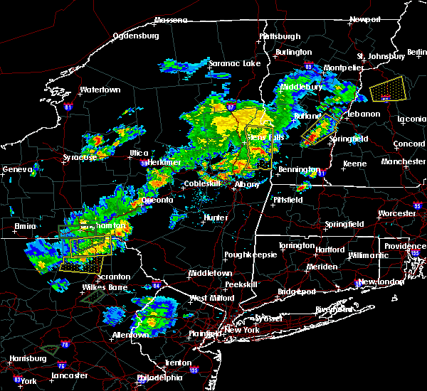 At 521 pm edt, a severe thunderstorm was located near salem, moving northeast at 30 mph (radar indicated). Hazards include 60 mph wind gusts and quarter size hail. Minor damage to vehicles is possible. expect wind damage to trees, and power lines. this severe storm will be near, salem around 530 pm edt. hartford around 535 pm edt. granville around 545 pm edt. Other locations impacted by this severe thunderstorm include cossayuna, center white creek, dunham basin, smiths basin, center falls, goose island, adamsville, north granville, south bay village and east hebron. At 521 pm edt, a severe thunderstorm was located near salem, moving northeast at 30 mph (radar indicated). Hazards include 60 mph wind gusts and quarter size hail. Minor damage to vehicles is possible. expect wind damage to trees, and power lines. this severe storm will be near, salem around 530 pm edt. hartford around 535 pm edt. granville around 545 pm edt. Other locations impacted by this severe thunderstorm include cossayuna, center white creek, dunham basin, smiths basin, center falls, goose island, adamsville, north granville, south bay village and east hebron.
|
| 7/17/2017 4:47 PM EDT |
 At 446 pm edt, severe thunderstorms were located along a line extending from fort edward to niskayuna, moving east at 25 mph (radar indicated). Hazards include 60 mph wind gusts and quarter size hail. Minor damage to vehicles is possible. expect wind damage to trees, and power lines. severe thunderstorms will be near, glens falls, hudson falls, fort edward and west glens falls around 450 pm edt. hartford around 510 pm edt. granville around 525 pm edt. Other locations impacted by these severe thunderstorms include south bay village, northumberland, greenfield center, truthville, middle falls, shushan, slateville, danielstown, east hartford and wilton. At 446 pm edt, severe thunderstorms were located along a line extending from fort edward to niskayuna, moving east at 25 mph (radar indicated). Hazards include 60 mph wind gusts and quarter size hail. Minor damage to vehicles is possible. expect wind damage to trees, and power lines. severe thunderstorms will be near, glens falls, hudson falls, fort edward and west glens falls around 450 pm edt. hartford around 510 pm edt. granville around 525 pm edt. Other locations impacted by these severe thunderstorms include south bay village, northumberland, greenfield center, truthville, middle falls, shushan, slateville, danielstown, east hartford and wilton.
|
| 7/17/2017 3:44 PM EDT |
 At 343 pm edt, a severe thunderstorm was located near edinburg, or 14 miles northwest of saratoga springs, moving east at 25 mph (radar indicated). Hazards include 60 mph wind gusts and quarter size hail. Minor damage to vehicles is possible. expect wind damage to trees, and power lines. this severe thunderstorm will be near, corinth and lake luzerne-hadle around 410 pm edt. glens falls, west glens falls and glens falls north around 430 pm edt. Other locations impacted by this severe thunderstorm include beartown, shaw corners, lake luzerne, kings station, barkersville, glenwild, northumberland, greenfield center, wiley corners and north greenfield. At 343 pm edt, a severe thunderstorm was located near edinburg, or 14 miles northwest of saratoga springs, moving east at 25 mph (radar indicated). Hazards include 60 mph wind gusts and quarter size hail. Minor damage to vehicles is possible. expect wind damage to trees, and power lines. this severe thunderstorm will be near, corinth and lake luzerne-hadle around 410 pm edt. glens falls, west glens falls and glens falls north around 430 pm edt. Other locations impacted by this severe thunderstorm include beartown, shaw corners, lake luzerne, kings station, barkersville, glenwild, northumberland, greenfield center, wiley corners and north greenfield.
|
| 7/1/2017 5:34 PM EDT |
 At 534 pm edt, a severe thunderstorm was located near saratoga springs, moving northeast at 25 mph (radar indicated). Hazards include 60 mph wind gusts and quarter size hail. Minor damage to vehicles is possible. expect wind damage to trees, and power lines. this severe thunderstorm will be near, greenwich around 555 pm edt. salem around 625 pm edt. hartford around 630 pm edt. Other locations impacted by this severe thunderstorm include deans corners, cossayuna, dunham basin, smiths basin, goose island, adamsville, grangerville, kings station, northumberland and wayville. At 534 pm edt, a severe thunderstorm was located near saratoga springs, moving northeast at 25 mph (radar indicated). Hazards include 60 mph wind gusts and quarter size hail. Minor damage to vehicles is possible. expect wind damage to trees, and power lines. this severe thunderstorm will be near, greenwich around 555 pm edt. salem around 625 pm edt. hartford around 630 pm edt. Other locations impacted by this severe thunderstorm include deans corners, cossayuna, dunham basin, smiths basin, goose island, adamsville, grangerville, kings station, northumberland and wayville.
|
| 7/1/2017 5:17 PM EDT |
 At 517 pm edt, a severe thunderstorm capable of producing a tornado was located over west glens falls, or near glens falls, moving northeast at 25 mph (radar indicated rotation). Hazards include tornado. Flying debris will be dangerous to those caught without shelter. mobile homes will be damaged or destroyed. damage to roofs, windows, and vehicles will occur. tree damage is likely. this dangerous storm will be near, glens falls and west glens falls around 525 pm edt. hudson falls and glens falls north around 530 pm edt. Other locations impacted by this tornadic thunderstorm include queensbury, french mountain, dunham basin, smiths basin, adamsville, fort ann, kingsbury, baldwin corner, south hartford and pattens mills. At 517 pm edt, a severe thunderstorm capable of producing a tornado was located over west glens falls, or near glens falls, moving northeast at 25 mph (radar indicated rotation). Hazards include tornado. Flying debris will be dangerous to those caught without shelter. mobile homes will be damaged or destroyed. damage to roofs, windows, and vehicles will occur. tree damage is likely. this dangerous storm will be near, glens falls and west glens falls around 525 pm edt. hudson falls and glens falls north around 530 pm edt. Other locations impacted by this tornadic thunderstorm include queensbury, french mountain, dunham basin, smiths basin, adamsville, fort ann, kingsbury, baldwin corner, south hartford and pattens mills.
|
| 7/1/2017 3:17 PM EDT |
 At 317 pm edt, a severe thunderstorm was located near hudson falls, moving east at 35 mph (radar indicated). Hazards include 60 mph wind gusts. Expect damage to trees, and power lines. Locations impacted include, glens falls, hudson falls, lake george village, fort edward, corinth, granville, hartford, comstock, west glens falls, glens falls north, lake luzerne-hadley, queensbury, wilton, kingsbury, mount hope, porter, south glens falls, lake luzerne, hampton and lake george. At 317 pm edt, a severe thunderstorm was located near hudson falls, moving east at 35 mph (radar indicated). Hazards include 60 mph wind gusts. Expect damage to trees, and power lines. Locations impacted include, glens falls, hudson falls, lake george village, fort edward, corinth, granville, hartford, comstock, west glens falls, glens falls north, lake luzerne-hadley, queensbury, wilton, kingsbury, mount hope, porter, south glens falls, lake luzerne, hampton and lake george.
|
| 7/1/2017 2:44 PM EDT |
 At 243 pm edt, a severe thunderstorm was located near day center, or 13 miles southwest of lake george village, moving east at 25 mph (radar indicated). Hazards include 60 mph wind gusts. expect damage to trees, and power lines At 243 pm edt, a severe thunderstorm was located near day center, or 13 miles southwest of lake george village, moving east at 25 mph (radar indicated). Hazards include 60 mph wind gusts. expect damage to trees, and power lines
|
| 7/1/2017 9:23 AM EDT |
 At 923 am edt, a severe thunderstorm was located near hartford, or near hudson falls, moving east at 30 mph (radar indicated). Hazards include 60 mph wind gusts and quarter size hail. Minor damage to vehicles is possible. expect wind damage to trees, and power lines. Locations impacted include, hudson falls, fort edward, granville, hartford, comstock, kingsbury, fort ann, middle granville, dunham basin, smiths basin, adamsville, north granville, south granville, truthville, raceville, tripoli, west granville, slateville, east hartford and slyboro. At 923 am edt, a severe thunderstorm was located near hartford, or near hudson falls, moving east at 30 mph (radar indicated). Hazards include 60 mph wind gusts and quarter size hail. Minor damage to vehicles is possible. expect wind damage to trees, and power lines. Locations impacted include, hudson falls, fort edward, granville, hartford, comstock, kingsbury, fort ann, middle granville, dunham basin, smiths basin, adamsville, north granville, south granville, truthville, raceville, tripoli, west granville, slateville, east hartford and slyboro.
|
| 7/1/2017 8:53 AM EDT |
 At 853 am edt, a severe thunderstorm was located near west glens falls, or near glens falls, moving northeast at 40 mph (radar indicated). Hazards include 60 mph wind gusts and quarter size hail. Minor damage to vehicles is possible. Expect wind damage to trees, and power lines. At 853 am edt, a severe thunderstorm was located near west glens falls, or near glens falls, moving northeast at 40 mph (radar indicated). Hazards include 60 mph wind gusts and quarter size hail. Minor damage to vehicles is possible. Expect wind damage to trees, and power lines.
|
| 6/27/2017 12:51 PM EDT |
 At 450 pm edt, severe thunderstorms were located along a line extending from near warrensburg to near glens falls north to near west glens falls to 8 miles southeast of corinth to near saratoga springs, moving northeast at 40 mph (radar indicated). Hazards include 60 mph wind gusts and quarter size hail. Minor damage to vehicles is possible. expect wind damage to trees, and power lines. Locations impacted include, saratoga springs, glens falls, hudson falls, warrensburg, whitehall, lake george village, milton, ballston spa, fort edward, corinth, hartford, greenwich, hague, comstock, bolton landing, glens falls north, north ballston spa, lake luzerne-hadley and west glens falls. At 450 pm edt, severe thunderstorms were located along a line extending from near warrensburg to near glens falls north to near west glens falls to 8 miles southeast of corinth to near saratoga springs, moving northeast at 40 mph (radar indicated). Hazards include 60 mph wind gusts and quarter size hail. Minor damage to vehicles is possible. expect wind damage to trees, and power lines. Locations impacted include, saratoga springs, glens falls, hudson falls, warrensburg, whitehall, lake george village, milton, ballston spa, fort edward, corinth, hartford, greenwich, hague, comstock, bolton landing, glens falls north, north ballston spa, lake luzerne-hadley and west glens falls.
|
| 6/27/2017 12:16 PM EDT |
 At 415 pm edt, severe thunderstorms were located along a line extending from near northville to near edinburg to near galway to near hagaman to near pattersonville-rotterdam junction, moving northeast at 40 mph (radar indicated). Hazards include 60 mph wind gusts and quarter size hail. Minor damage to vehicles is possible. expect wind damage to trees, and power lines. severe thunderstorms will be near, edinburg around 420 pm edt. day center around 425 pm edt. rock city falls and east glenville around 430 pm edt. milton and burnt hills around 435 pm edt. ballston spa, corinth and lake luzerne-hadle around 440 pm edt. saratoga springs, round lake, north ballston spa and lake luzerne campground around 445 pm edt. warrensburg, lake george village, glens falls north and west glens falls around 455 pm edt. Glens falls and fort edward around 500 pm edt. At 415 pm edt, severe thunderstorms were located along a line extending from near northville to near edinburg to near galway to near hagaman to near pattersonville-rotterdam junction, moving northeast at 40 mph (radar indicated). Hazards include 60 mph wind gusts and quarter size hail. Minor damage to vehicles is possible. expect wind damage to trees, and power lines. severe thunderstorms will be near, edinburg around 420 pm edt. day center around 425 pm edt. rock city falls and east glenville around 430 pm edt. milton and burnt hills around 435 pm edt. ballston spa, corinth and lake luzerne-hadle around 440 pm edt. saratoga springs, round lake, north ballston spa and lake luzerne campground around 445 pm edt. warrensburg, lake george village, glens falls north and west glens falls around 455 pm edt. Glens falls and fort edward around 500 pm edt.
|
| 6/19/2017 1:40 PM EDT | Multiple trees and power poles snapped at intersection of route 196 and burgoyne ave in washington county NY, 1.2 miles WSW of Hudson Falls, NY |
| 5/31/2017 4:38 PM EDT |
 At 438 pm edt, a severe thunderstorm was located near fort edward, or near hudson falls, moving east at 40 mph (radar indicated). Hazards include 60 mph wind gusts and quarter size hail. Hail damage to vehicles is expected. expect wind damage to roofs, siding, and trees. this severe storm will be near, salem and hartford around 500 pm edt. granville around 510 pm edt. Other locations impacted by this severe thunderstorm include cossayuna, dunham basin, smiths basin, goose island, adamsville, kings station, northumberland, east hebron, south granville and hartman. At 438 pm edt, a severe thunderstorm was located near fort edward, or near hudson falls, moving east at 40 mph (radar indicated). Hazards include 60 mph wind gusts and quarter size hail. Hail damage to vehicles is expected. expect wind damage to roofs, siding, and trees. this severe storm will be near, salem and hartford around 500 pm edt. granville around 510 pm edt. Other locations impacted by this severe thunderstorm include cossayuna, dunham basin, smiths basin, goose island, adamsville, kings station, northumberland, east hebron, south granville and hartman.
|
| 5/31/2017 4:14 PM EDT |
 At 414 pm edt, a severe thunderstorm was located near rock city falls, or 10 miles northwest of saratoga springs, moving east at 40 mph (radar indicated). Hazards include 60 mph wind gusts and quarter size hail. Hail damage to vehicles is expected. expect wind damage to roofs, siding, and trees. this severe thunderstorm will be near, saratoga springs and corinth around 425 pm edt. glens falls, fort edward and west glens falls around 440 pm edt. hudson falls around 445 pm edt. salem and hartford around 500 pm edt. granville around 510 pm edt. Other locations impacted by this severe thunderstorm include cossayuna, dunham basin, smiths basin, goose island, adamsville, kings station, northumberland, east hebron, greenfield center and south granville. At 414 pm edt, a severe thunderstorm was located near rock city falls, or 10 miles northwest of saratoga springs, moving east at 40 mph (radar indicated). Hazards include 60 mph wind gusts and quarter size hail. Hail damage to vehicles is expected. expect wind damage to roofs, siding, and trees. this severe thunderstorm will be near, saratoga springs and corinth around 425 pm edt. glens falls, fort edward and west glens falls around 440 pm edt. hudson falls around 445 pm edt. salem and hartford around 500 pm edt. granville around 510 pm edt. Other locations impacted by this severe thunderstorm include cossayuna, dunham basin, smiths basin, goose island, adamsville, kings station, northumberland, east hebron, greenfield center and south granville.
|
| 5/18/2017 7:37 PM EDT |
 At 736 pm edt, severe thunderstorms were located along a line extending from near hartford to near fort edward to near galway, moving east at 35 mph (radar indicated). Hazards include 60 mph wind gusts and quarter size hail. Hail damage to vehicles is expected. expect wind damage to roofs, siding, and trees. these severe storms will be near, glens falls and hartford around 740 pm edt. hudson falls and fort edward around 745 pm edt. granville around 750 pm edt. saratoga springs around 755 pm edt. salem around 805 pm edt. greenwich around 815 pm edt. Other locations impacted by these severe thunderstorms include parkis mills, grangerville, west milton, northumberland, greenfield center, wiley corners, middle falls, porter corners, north milton and saratoga race course. At 736 pm edt, severe thunderstorms were located along a line extending from near hartford to near fort edward to near galway, moving east at 35 mph (radar indicated). Hazards include 60 mph wind gusts and quarter size hail. Hail damage to vehicles is expected. expect wind damage to roofs, siding, and trees. these severe storms will be near, glens falls and hartford around 740 pm edt. hudson falls and fort edward around 745 pm edt. granville around 750 pm edt. saratoga springs around 755 pm edt. salem around 805 pm edt. greenwich around 815 pm edt. Other locations impacted by these severe thunderstorms include parkis mills, grangerville, west milton, northumberland, greenfield center, wiley corners, middle falls, porter corners, north milton and saratoga race course.
|
| 5/18/2017 7:10 PM EDT |
 At 710 pm edt, severe thunderstorms were located along a line extending from lake luzerne campground to 6 miles east of edinburg to gloversville, moving east at 30 mph (radar indicated). Hazards include 60 mph wind gusts and quarter size hail. Hail damage to vehicles is expected. expect wind damage to roofs, siding, and trees. severe thunderstorms will be near, lake luzerne campground and lake luzerne-hadley around 715 pm edt. lake george village around 720 pm edt. glens falls, corinth, glens falls north and west glens falls around 725 pm edt. fort edward and northampton beach public campground around 730 pm edt. hudson falls around 735 pm edt. galway around 745 pm edt. hartford and rock city falls around 755 pm edt. milton, ballston spa, greenwich and north ballston spa around 800 pm edt. Other locations impacted by these severe thunderstorms include parkis mills, meco, sweets crossing, lake luzerne, grangerville, west milton, glenwild, northumberland, greenfield center and wiley corners. At 710 pm edt, severe thunderstorms were located along a line extending from lake luzerne campground to 6 miles east of edinburg to gloversville, moving east at 30 mph (radar indicated). Hazards include 60 mph wind gusts and quarter size hail. Hail damage to vehicles is expected. expect wind damage to roofs, siding, and trees. severe thunderstorms will be near, lake luzerne campground and lake luzerne-hadley around 715 pm edt. lake george village around 720 pm edt. glens falls, corinth, glens falls north and west glens falls around 725 pm edt. fort edward and northampton beach public campground around 730 pm edt. hudson falls around 735 pm edt. galway around 745 pm edt. hartford and rock city falls around 755 pm edt. milton, ballston spa, greenwich and north ballston spa around 800 pm edt. Other locations impacted by these severe thunderstorms include parkis mills, meco, sweets crossing, lake luzerne, grangerville, west milton, glenwild, northumberland, greenfield center and wiley corners.
|
| 8/13/2016 7:07 PM EDT |
 At 706 pm edt, severe thunderstorms were located along a line extending from near north creek to 6 miles southwest of corinth to near pattersonville-rotterdam junction, moving northeast at 60 mph (radar indicated). Hazards include 60 mph wind gusts and quarter size hail. Hail damage to vehicles is expected. expect wind damage to roofs, siding, and trees. severe thunderstorms will be near, chestertown and north creek around 710 pm edt. corinth, scaroon manor public campground, eagle point campground and lake luzerne-hadle around 715 pm edt. ballston spa, country knolls and rock city falls around 720 pm edt. glens falls, hudson falls, milton, fort edward, round lake, west glens falls, glens falls north and north ballston spa around 725 pm edt. rogers rock campground around 730 pm edt. hartford and comstock around 735 pm edt. greenwich around 740 pm edt. other locations impacted by these severe thunderstorms include goose island, ballard corners, west milton, dresden center, north bolton, glenburnie, overlook, saratoga performing arts center, french mountain and fly summit. this includes the following highways, interstate 90 near mile marker 10-9. Interstate 87 near mile marker 13, near mile marker 12-13, near mile marker 13, and between mile markers 14 and 16. At 706 pm edt, severe thunderstorms were located along a line extending from near north creek to 6 miles southwest of corinth to near pattersonville-rotterdam junction, moving northeast at 60 mph (radar indicated). Hazards include 60 mph wind gusts and quarter size hail. Hail damage to vehicles is expected. expect wind damage to roofs, siding, and trees. severe thunderstorms will be near, chestertown and north creek around 710 pm edt. corinth, scaroon manor public campground, eagle point campground and lake luzerne-hadle around 715 pm edt. ballston spa, country knolls and rock city falls around 720 pm edt. glens falls, hudson falls, milton, fort edward, round lake, west glens falls, glens falls north and north ballston spa around 725 pm edt. rogers rock campground around 730 pm edt. hartford and comstock around 735 pm edt. greenwich around 740 pm edt. other locations impacted by these severe thunderstorms include goose island, ballard corners, west milton, dresden center, north bolton, glenburnie, overlook, saratoga performing arts center, french mountain and fly summit. this includes the following highways, interstate 90 near mile marker 10-9. Interstate 87 near mile marker 13, near mile marker 12-13, near mile marker 13, and between mile markers 14 and 16.
|
| 8/12/2016 4:06 PM EDT |
 At 404 pm edt, a severe thunderstorm was located near greenwich, or 9 miles west of salem, moving east at 40 mph (radar indicated. this storm has a history of producing damage). Hazards include 60 mph wind gusts. Expect damage to roofs. siding. and trees. this severe storm will be near, salem around 415 pm edt. Other locations impacted by this severe thunderstorm include francis corners, schuylerville, goose island, ballard corners, south greenfield, eddy corners, saratoga performing arts center, fly summit, gilbert corners and northumberland. At 404 pm edt, a severe thunderstorm was located near greenwich, or 9 miles west of salem, moving east at 40 mph (radar indicated. this storm has a history of producing damage). Hazards include 60 mph wind gusts. Expect damage to roofs. siding. and trees. this severe storm will be near, salem around 415 pm edt. Other locations impacted by this severe thunderstorm include francis corners, schuylerville, goose island, ballard corners, south greenfield, eddy corners, saratoga performing arts center, fly summit, gilbert corners and northumberland.
|
| 8/12/2016 3:51 PM EDT |
 At 350 pm edt, a severe thunderstorm was located 7 miles southwest of fort edward, or 8 miles south of glens falls, moving east at 45 mph (radar indicated). Hazards include 60 mph wind gusts. Expect damage to roofs. siding. and trees. this severe thunderstorm will be near, fort edward around 355 pm edt. greenwich around 405 pm edt. salem around 415 pm edt. Other locations impacted by this severe thunderstorm include francis corners, schuylerville, goose island, ballard corners, south greenfield, eddy corners, saratoga performing arts center, fly summit, gilbert corners and northumberland. At 350 pm edt, a severe thunderstorm was located 7 miles southwest of fort edward, or 8 miles south of glens falls, moving east at 45 mph (radar indicated). Hazards include 60 mph wind gusts. Expect damage to roofs. siding. and trees. this severe thunderstorm will be near, fort edward around 355 pm edt. greenwich around 405 pm edt. salem around 415 pm edt. Other locations impacted by this severe thunderstorm include francis corners, schuylerville, goose island, ballard corners, south greenfield, eddy corners, saratoga performing arts center, fly summit, gilbert corners and northumberland.
|
| 7/23/2016 6:19 PM EDT |
 At 618 pm edt, a severe thunderstorm was located over greenwich, or 8 miles southwest of salem, moving southeast at 35 mph (radar indicated). Hazards include 60 mph wind gusts and quarter size hail. Hail damage to vehicles is expected. expect wind damage to roofs, siding, and trees. Locations impacted include, saratoga springs, glens falls, hudson falls, fort edward, cambridge, greenwich, west glens falls, glens falls north, lake luzerne-hadley, gates, wilton, lee, northumberland, south glens falls, easton, stillwater, schuylerville, victory, argyle and the saratoga battllefield. At 618 pm edt, a severe thunderstorm was located over greenwich, or 8 miles southwest of salem, moving southeast at 35 mph (radar indicated). Hazards include 60 mph wind gusts and quarter size hail. Hail damage to vehicles is expected. expect wind damage to roofs, siding, and trees. Locations impacted include, saratoga springs, glens falls, hudson falls, fort edward, cambridge, greenwich, west glens falls, glens falls north, lake luzerne-hadley, gates, wilton, lee, northumberland, south glens falls, easton, stillwater, schuylerville, victory, argyle and the saratoga battllefield.
|
| 7/23/2016 5:54 PM EDT |
 At 553 pm edt, a severe thunderstorm was located over glens falls, moving southeast at 35 mph (radar indicated). Hazards include 60 mph wind gusts and quarter size hail. Hail damage to vehicles is expected. Expect wind damage to roofs, siding, and trees. At 553 pm edt, a severe thunderstorm was located over glens falls, moving southeast at 35 mph (radar indicated). Hazards include 60 mph wind gusts and quarter size hail. Hail damage to vehicles is expected. Expect wind damage to roofs, siding, and trees.
|
| 7/18/2016 1:56 PM EDT |
 The severe thunderstorm warning for northeastern saratoga, central washington and southeastern warren counties will expire at 200 pm edt, the storm which prompted the warning has weakened below severe limits, and no longer pose an immediate threat to life or property. therefore, the warning will be allowed to expire. a severe thunderstorm watch remains in effect until 800 pm edt for east central new york. The severe thunderstorm warning for northeastern saratoga, central washington and southeastern warren counties will expire at 200 pm edt, the storm which prompted the warning has weakened below severe limits, and no longer pose an immediate threat to life or property. therefore, the warning will be allowed to expire. a severe thunderstorm watch remains in effect until 800 pm edt for east central new york.
|
| 7/18/2016 1:20 PM EDT | Powerlines down 1/2 mile west of route 4 on route 3 in washington county NY, 0.3 miles NNW of Hudson Falls, NY |
| 7/18/2016 1:04 PM EDT |
 At 103 pm edt, a severe thunderstorm was located near corinth, or 7 miles southwest of glens falls, moving northeast at 45 mph (radar indicated). Hazards include 60 mph wind gusts. Expect damage to roofs. siding. And trees. At 103 pm edt, a severe thunderstorm was located near corinth, or 7 miles southwest of glens falls, moving northeast at 45 mph (radar indicated). Hazards include 60 mph wind gusts. Expect damage to roofs. siding. And trees.
|
| 7/1/2016 5:28 PM EDT |
 At 527 pm edt, severe thunderstorms were located along a line extending from near huletts landing to near fort edward to clifton park, moving east at 40 mph (radar indicated). Hazards include 60 mph wind gusts. Expect damage to roofs. siding. And trees. At 527 pm edt, severe thunderstorms were located along a line extending from near huletts landing to near fort edward to clifton park, moving east at 40 mph (radar indicated). Hazards include 60 mph wind gusts. Expect damage to roofs. siding. And trees.
|
| 4/7/2016 5:05 PM EDT |
 At 504 pm edt, severe thunderstorms were located along a line extending from 6 miles northwest of huletts landing to near berlin, moving east at 25 mph (radar indicated). Hazards include 60 mph wind gusts and penny size hail. Expect damage to roofs. siding. and trees. Locations impacted include, bennington, glens falls, north adams, hudson falls, warrensburg, hoosick falls, whitehall, arlington, salem, lake george village, adams, williamstown, shaftsbury, pownal, fort edward, granville, hartford, cambridge, greenwich and stamford. At 504 pm edt, severe thunderstorms were located along a line extending from 6 miles northwest of huletts landing to near berlin, moving east at 25 mph (radar indicated). Hazards include 60 mph wind gusts and penny size hail. Expect damage to roofs. siding. and trees. Locations impacted include, bennington, glens falls, north adams, hudson falls, warrensburg, hoosick falls, whitehall, arlington, salem, lake george village, adams, williamstown, shaftsbury, pownal, fort edward, granville, hartford, cambridge, greenwich and stamford.
|
| 4/7/2016 4:55 PM EDT | Damage to the siding of a house sanford ridge rd in washington county NY, 4.7 miles S of Hudson Falls, NY |
| 4/7/2016 4:28 PM EDT |
 At 427 pm edt, severe thunderstorms were located along a line extending from near johnsburg to near averill park, moving east at 25 mph (radar indicated). Hazards include 60 mph wind gusts and penny size hail. Expect damage to roofs. siding. And trees. At 427 pm edt, severe thunderstorms were located along a line extending from near johnsburg to near averill park, moving east at 25 mph (radar indicated). Hazards include 60 mph wind gusts and penny size hail. Expect damage to roofs. siding. And trees.
|
| 8/15/2015 5:12 PM EDT |
 At 512 pm edt, a severe thunderstorm was located near hudson falls, moving south at 5 mph (radar indicated). Hazards include 60 mph wind gusts and quarter size hail. Hail damage to vehicles is expected. expect wind damage to roofs, siding and trees. this severe thunderstorm will be near, hartford around 515 pm edt. glens falls and west glens falls around 520 pm edt. hudson falls around 530 pm edt. fort edward around 550 pm edt. Other locations impacted by this severe thunderstorm include goose island, vaughns corners, west fort ann, fernwood, belcher, tripoli, french mountain, kingsbury, adamsville and dunham basin. At 512 pm edt, a severe thunderstorm was located near hudson falls, moving south at 5 mph (radar indicated). Hazards include 60 mph wind gusts and quarter size hail. Hail damage to vehicles is expected. expect wind damage to roofs, siding and trees. this severe thunderstorm will be near, hartford around 515 pm edt. glens falls and west glens falls around 520 pm edt. hudson falls around 530 pm edt. fort edward around 550 pm edt. Other locations impacted by this severe thunderstorm include goose island, vaughns corners, west fort ann, fernwood, belcher, tripoli, french mountain, kingsbury, adamsville and dunham basin.
|
| 7/24/2015 2:33 PM EDT |
 At 233 pm edt, a severe thunderstorm was located near greenwich, or 7 miles west of salem, moving south at 25 mph (trained weather spotters have reported quarter size hail). Hazards include ping pong ball size hail and 60 mph wind gusts. People and animals outdoors will be injured. expect hail damage to roofs, siding, windows and vehicles. expect wind damage to roofs, siding and trees. this severe storm will be near, greenwich around 240 pm edt. Other locations impacted by this severe thunderstorm include schuylerville, goose island, thomson, fernwood, clarks mills, belcher, starks knob, lick springs, bald mountain and adamsville. At 233 pm edt, a severe thunderstorm was located near greenwich, or 7 miles west of salem, moving south at 25 mph (trained weather spotters have reported quarter size hail). Hazards include ping pong ball size hail and 60 mph wind gusts. People and animals outdoors will be injured. expect hail damage to roofs, siding, windows and vehicles. expect wind damage to roofs, siding and trees. this severe storm will be near, greenwich around 240 pm edt. Other locations impacted by this severe thunderstorm include schuylerville, goose island, thomson, fernwood, clarks mills, belcher, starks knob, lick springs, bald mountain and adamsville.
|
| 7/24/2015 2:22 PM EDT |
 At 221 pm edt, a severe thunderstorm was located near fort edward, or 7 miles southeast of hudson falls, moving south at 25 mph (trained weather spotters reported quarter size hail). Hazards include 60 mph wind gusts and quarter size hail. Hail damage to vehicles is expected. expect wind damage to roofs, siding and trees. this severe storm will be near, greenwich around 240 pm edt. Other locations impacted by this severe thunderstorm include schuylerville, goose island, vaughns corners, thomson, fernwood, clarks mills, belcher, starks knob, lick springs and tripoli. At 221 pm edt, a severe thunderstorm was located near fort edward, or 7 miles southeast of hudson falls, moving south at 25 mph (trained weather spotters reported quarter size hail). Hazards include 60 mph wind gusts and quarter size hail. Hail damage to vehicles is expected. expect wind damage to roofs, siding and trees. this severe storm will be near, greenwich around 240 pm edt. Other locations impacted by this severe thunderstorm include schuylerville, goose island, vaughns corners, thomson, fernwood, clarks mills, belcher, starks knob, lick springs and tripoli.
|
| 7/24/2015 2:17 PM EDT | Quarter sized hail reported 0.3 miles NNW of Hudson Falls, NY |
| 7/24/2015 2:15 PM EDT | Quarter sized hail reported 0.3 miles NNW of Hudson Falls, NY |
| 7/24/2015 2:15 PM EDT | Multiple trees down. time estimated by rada in washington county NY, 0.3 miles NNW of Hudson Falls, NY |
| 7/24/2015 2:10 PM EDT | Quarter sized hail reported 0.3 miles NNW of Hudson Falls, NY, spotter |
| 7/24/2015 2:00 PM EDT |
 At 200 pm edt, a severe thunderstorm was located over hudson falls, moving south at 25 mph (radar indicated). Hazards include 60 mph wind gusts and quarter size hail. Hail damage to vehicles is expected. expect wind damage to roofs, siding and trees. this severe thunderstorm will be near, fort edward around 205 pm edt. greenwich around 240 pm edt. Other locations impacted by this severe thunderstorm include schuylerville, goose island, vaughns corners, thomson, fernwood, clarks mills, belcher, starks knob, lick springs and tripoli. At 200 pm edt, a severe thunderstorm was located over hudson falls, moving south at 25 mph (radar indicated). Hazards include 60 mph wind gusts and quarter size hail. Hail damage to vehicles is expected. expect wind damage to roofs, siding and trees. this severe thunderstorm will be near, fort edward around 205 pm edt. greenwich around 240 pm edt. Other locations impacted by this severe thunderstorm include schuylerville, goose island, vaughns corners, thomson, fernwood, clarks mills, belcher, starks knob, lick springs and tripoli.
|
| 6/9/2015 3:15 PM EDT | Wires down on pearl st in washington county NY, 0.3 miles NNW of Hudson Falls, NY |
| 6/9/2015 3:13 PM EDT | One tree dow in washington county NY, 0.3 miles NNW of Hudson Falls, NY |
| 6/9/2015 3:09 PM EDT |
 At 308 pm edt, severe thunderstorms were located along a line extending from near bolton landing to near greenwich, moving east at 35 mph (radar indicated). Hazards include 60 mph wind gusts and quarter size hail. Hail damage to vehicles is expected. expect wind damage to roofs, siding and trees. severe thunderstorms will be near, huletts landing around 320 pm edt. salem around 335 pm edt. manchester, dorset and manchester center around 355 pm edt. Other locations impacted by these severe thunderstorms include schuylerville, east whitehall, goose island, peru town center, west sandgate, dresden center, north bolton, manchester depot, kingsbury and northumberland. At 308 pm edt, severe thunderstorms were located along a line extending from near bolton landing to near greenwich, moving east at 35 mph (radar indicated). Hazards include 60 mph wind gusts and quarter size hail. Hail damage to vehicles is expected. expect wind damage to roofs, siding and trees. severe thunderstorms will be near, huletts landing around 320 pm edt. salem around 335 pm edt. manchester, dorset and manchester center around 355 pm edt. Other locations impacted by these severe thunderstorms include schuylerville, east whitehall, goose island, peru town center, west sandgate, dresden center, north bolton, manchester depot, kingsbury and northumberland.
|
| 6/9/2015 2:54 PM EDT |
 At 253 pm edt, a severe thunderstorm was located near corinth, or 8 miles southwest of glens falls, moving east at 35 mph (radar indicated). Hazards include 60 mph wind gusts and quarter size hail. Hail damage to vehicles is expected. expect wind damage to roofs, siding and trees. this severe storm will be near, glens falls, fort edward, west glens falls and glens falls north around 305 pm edt. hudson falls around 310 pm edt. Other locations impacted by this severe thunderstorm include ballard corners, sky ranch, south greenfield, overlook, hagedorns mills, hickeys corners, lake view, green corners, northumberland and grangerville. At 253 pm edt, a severe thunderstorm was located near corinth, or 8 miles southwest of glens falls, moving east at 35 mph (radar indicated). Hazards include 60 mph wind gusts and quarter size hail. Hail damage to vehicles is expected. expect wind damage to roofs, siding and trees. this severe storm will be near, glens falls, fort edward, west glens falls and glens falls north around 305 pm edt. hudson falls around 310 pm edt. Other locations impacted by this severe thunderstorm include ballard corners, sky ranch, south greenfield, overlook, hagedorns mills, hickeys corners, lake view, green corners, northumberland and grangerville.
|
| 6/9/2015 2:15 PM EDT |
 At 214 pm edt, a severe thunderstorm was located near cranberry creek, or 10 miles northeast of gloversville, moving east at 35 mph (radar indicated). Hazards include 60 mph wind gusts and quarter size hail. Hail damage to vehicles is expected. expect wind damage to roofs, siding and trees. this severe thunderstorm will be near, edinburg around 225 pm edt. rock city falls around 235 pm edt. saratoga springs and corinth around 250 pm edt. glens falls and west glens falls around 305 pm edt. hudson falls and fort edward around 310 pm edt. Other locations impacted by this severe thunderstorm include ballard corners, kingsboro, jackson summit, munsonville, south greenfield, overlook, hagedorns mills, honeywell corners, lake view and northumberland. At 214 pm edt, a severe thunderstorm was located near cranberry creek, or 10 miles northeast of gloversville, moving east at 35 mph (radar indicated). Hazards include 60 mph wind gusts and quarter size hail. Hail damage to vehicles is expected. expect wind damage to roofs, siding and trees. this severe thunderstorm will be near, edinburg around 225 pm edt. rock city falls around 235 pm edt. saratoga springs and corinth around 250 pm edt. glens falls and west glens falls around 305 pm edt. hudson falls and fort edward around 310 pm edt. Other locations impacted by this severe thunderstorm include ballard corners, kingsboro, jackson summit, munsonville, south greenfield, overlook, hagedorns mills, honeywell corners, lake view and northumberland.
|
| 5/11/2015 6:11 PM EDT | At 611 pm edt, a severe thunderstorm was located near lake luzerne campground, or near lake george village, moving east at 45 mph (radar indicated). Hazards include 60 mph wind gusts and quarter size hail. Hail damage to vehicles is expected. expect wind damage to roofs, siding and trees. this severe thunderstorm will be near, glens falls, lake george village, glens falls north and west glens falls around 620 pm edt. whitehall, hartford and comstock around 640 pm edt. granville around 645 pm edt. other locations impacted by this severe thunderstorm include oneida corners, big hollow, fenimore, cleverdale, hogtown, bolton, mount hope, baldwin corner, thurman station and grays corner. 1. 00in. |
| 8/7/2014 2:44 PM EDT | Quarter sized hail reported 0.3 miles NNW of Hudson Falls, NY, public |
| 7/3/2014 5:45 PM EDT | Trees and wires down in washington county NY, 4.7 miles SW of Hudson Falls, NY |
| 6/18/2014 12:05 AM EDT | Trees and wires dow in washington county NY, 0.3 miles NNW of Hudson Falls, NY |
| 6/18/2014 12:05 AM EDT | Trees and wires dow in washington county NY, 4.7 miles SW of Hudson Falls, NY |
Hail Maps for Hudson Falls, NY
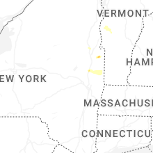
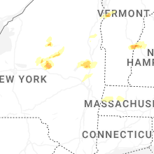


Connect with Interactive Hail Maps