

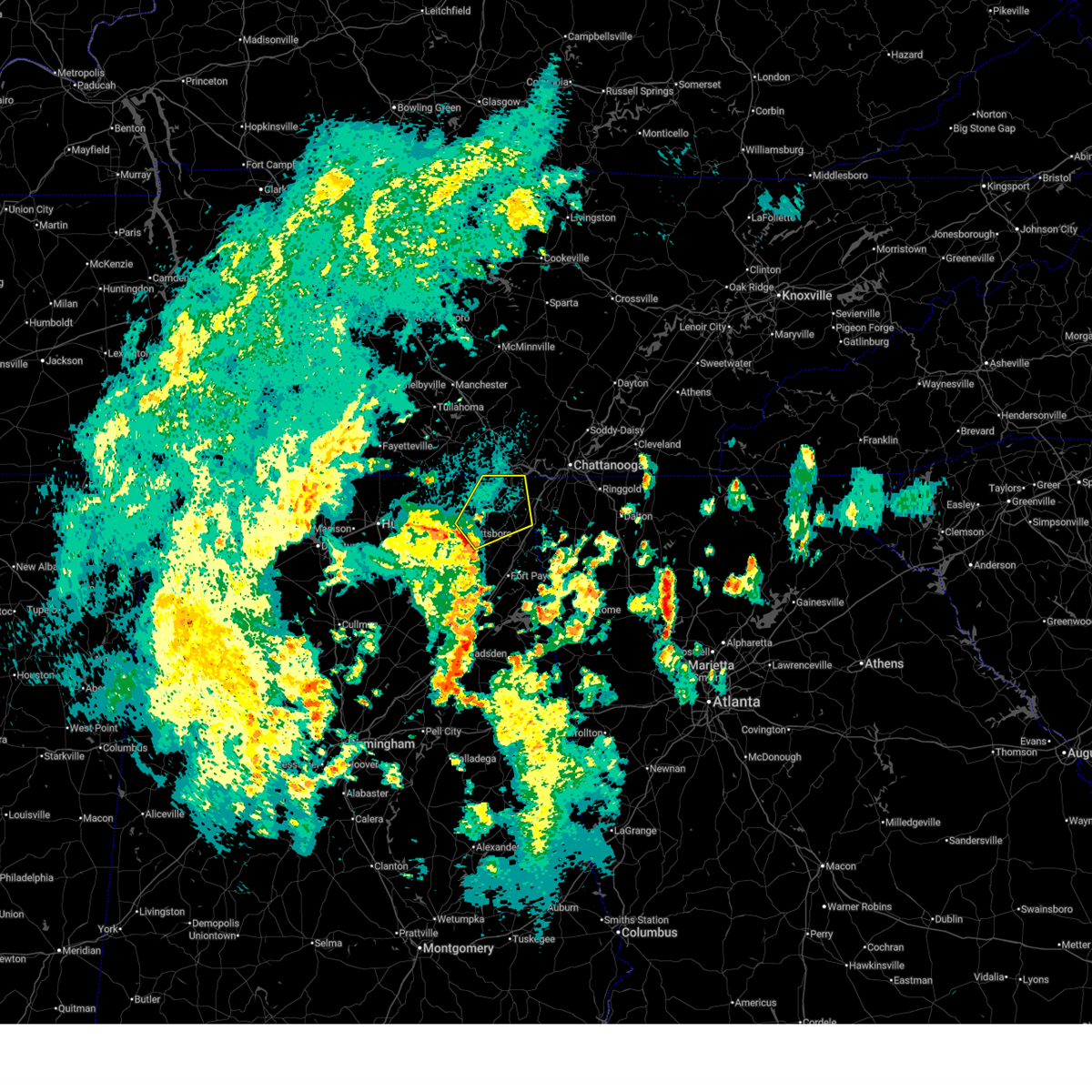
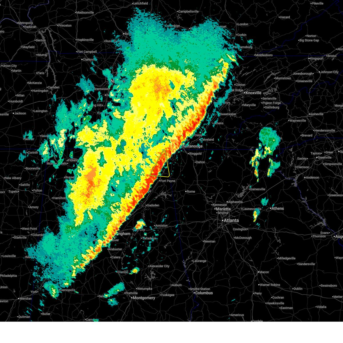
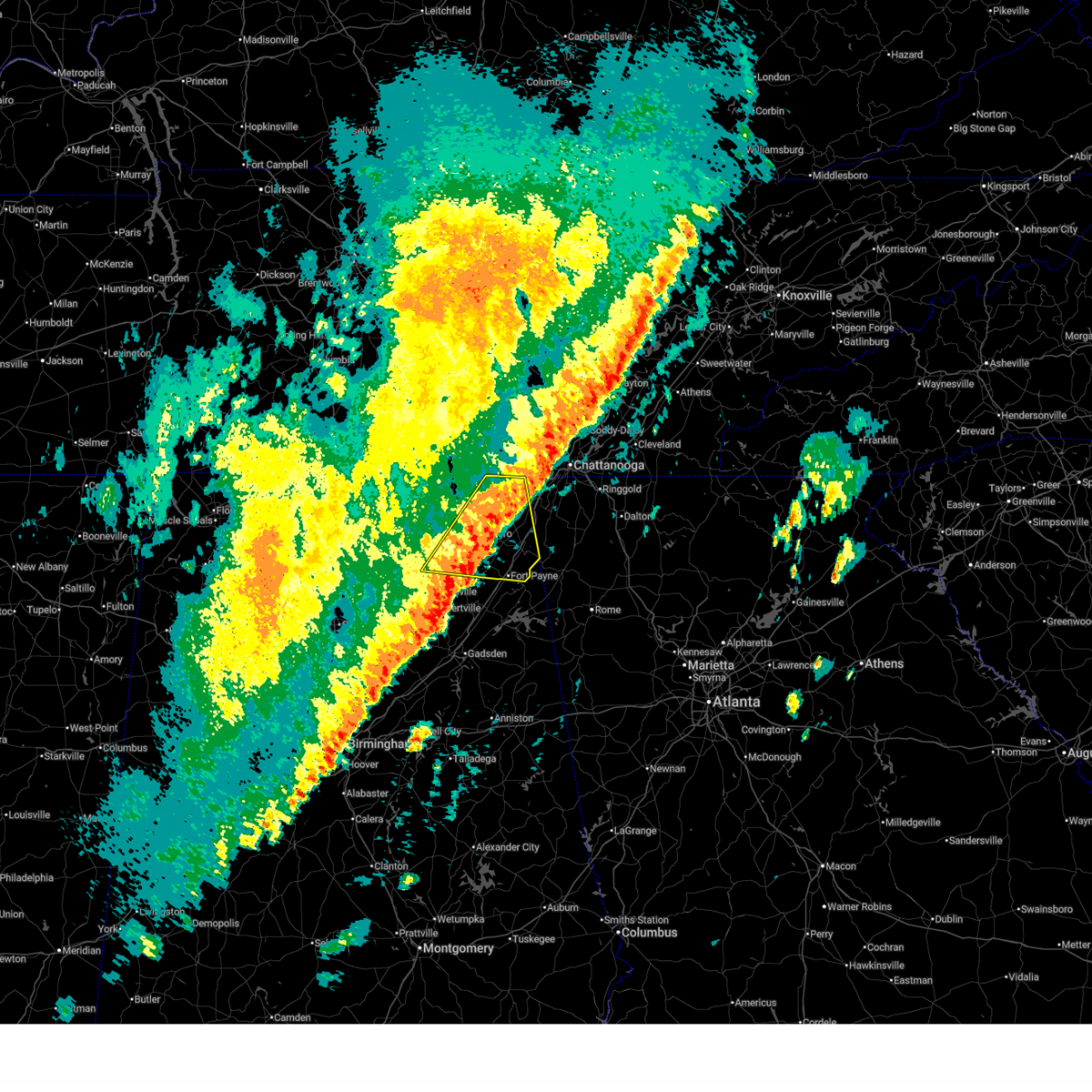
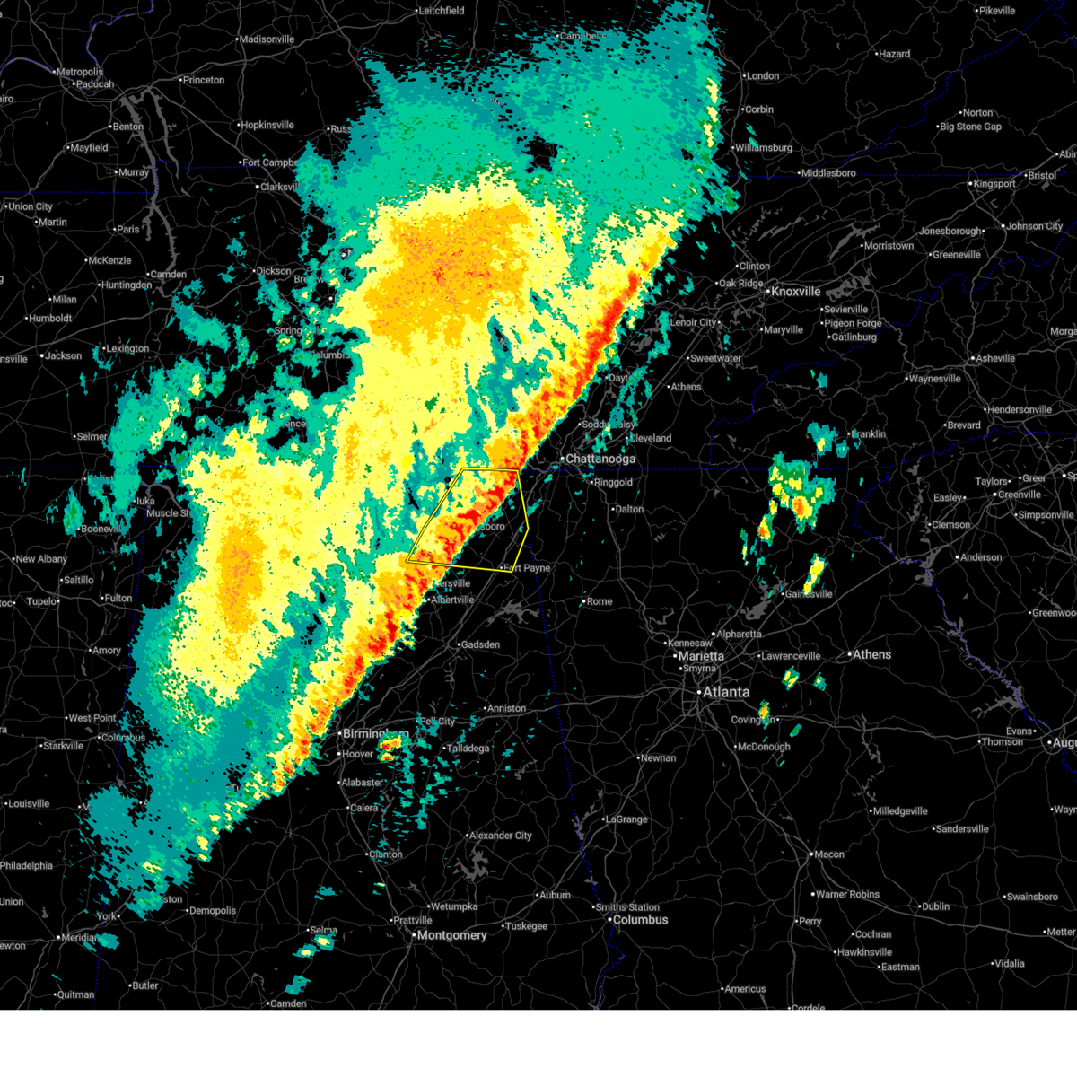
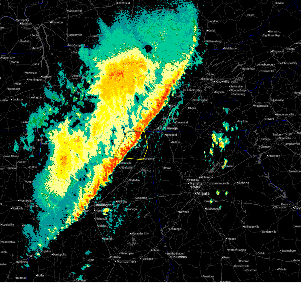
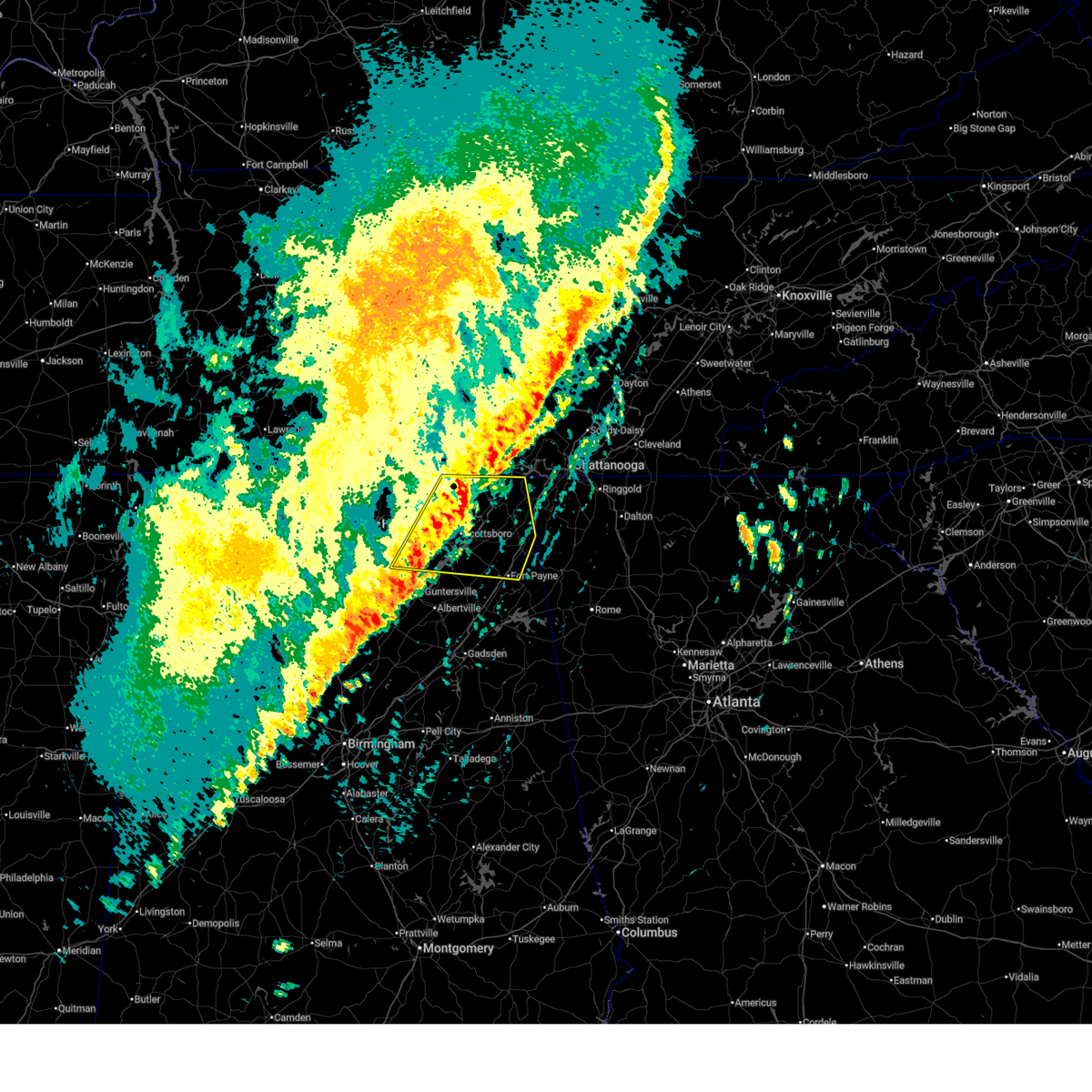
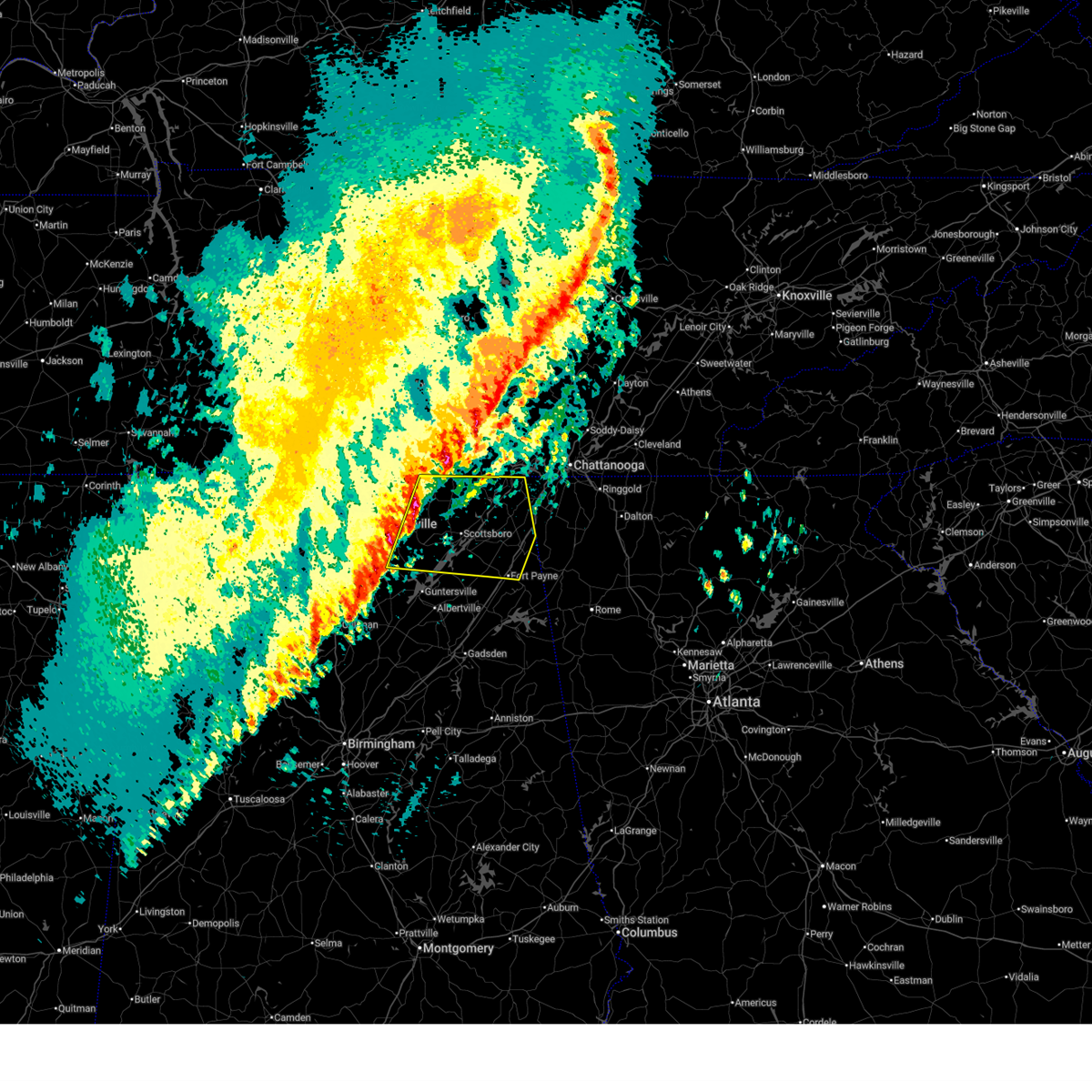
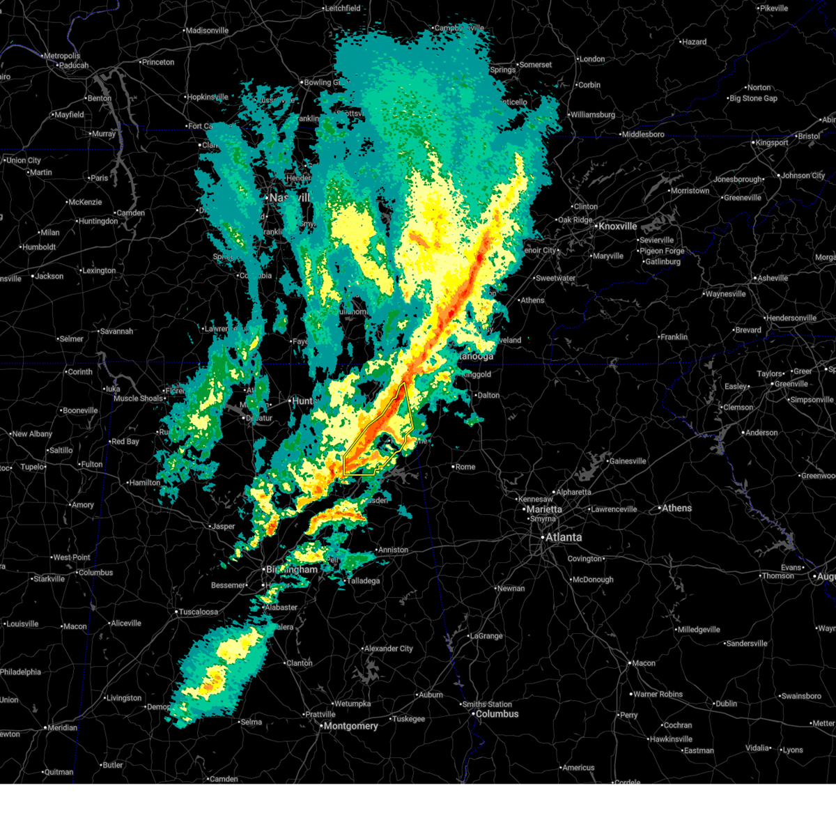
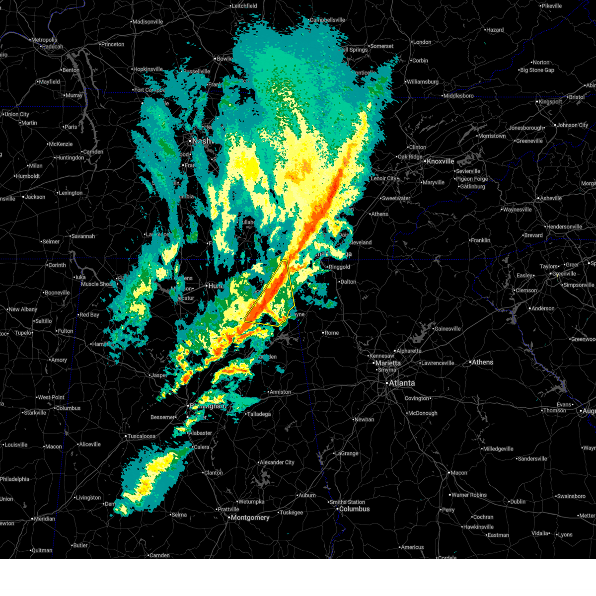
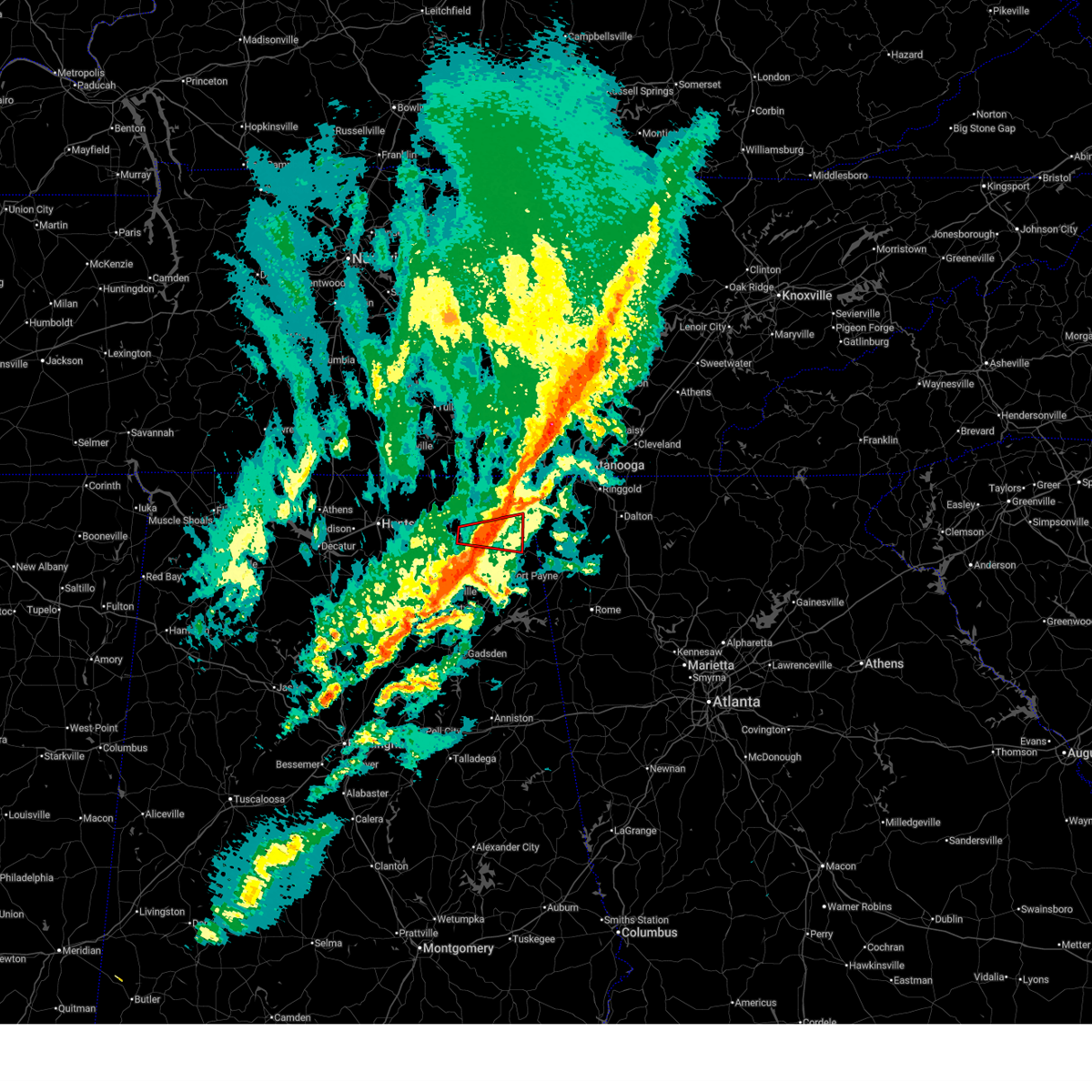
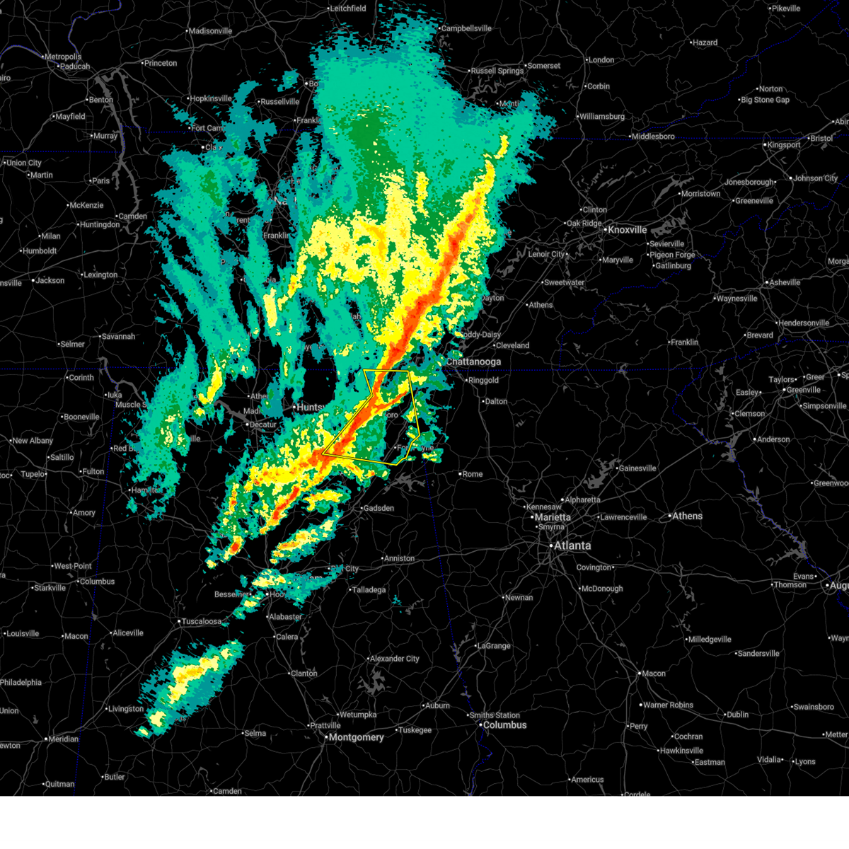
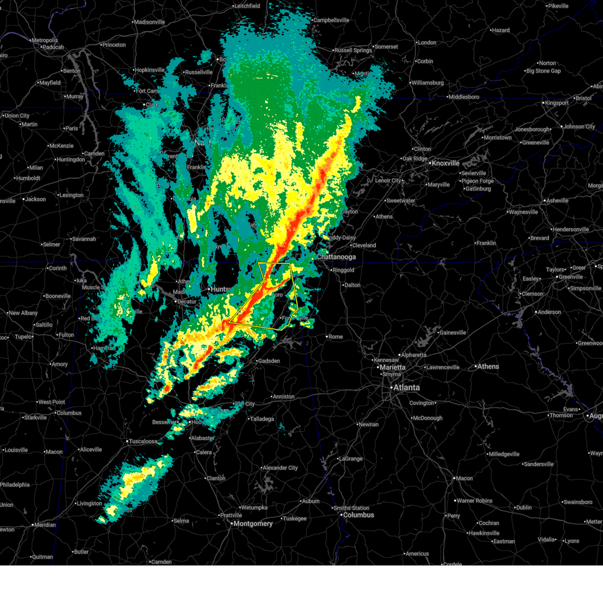
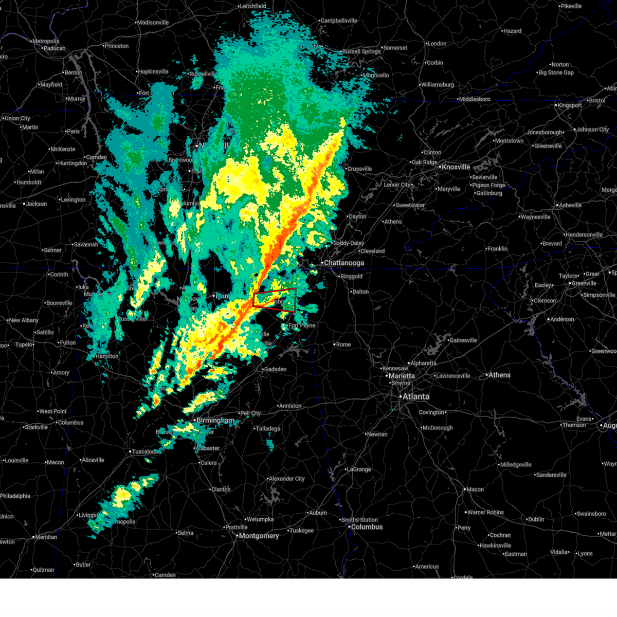
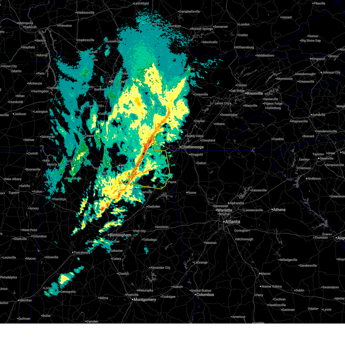
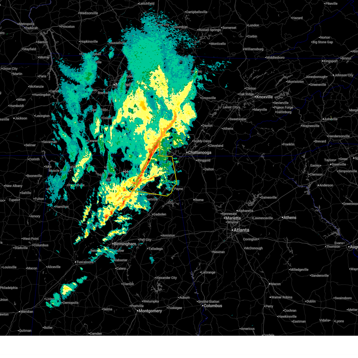
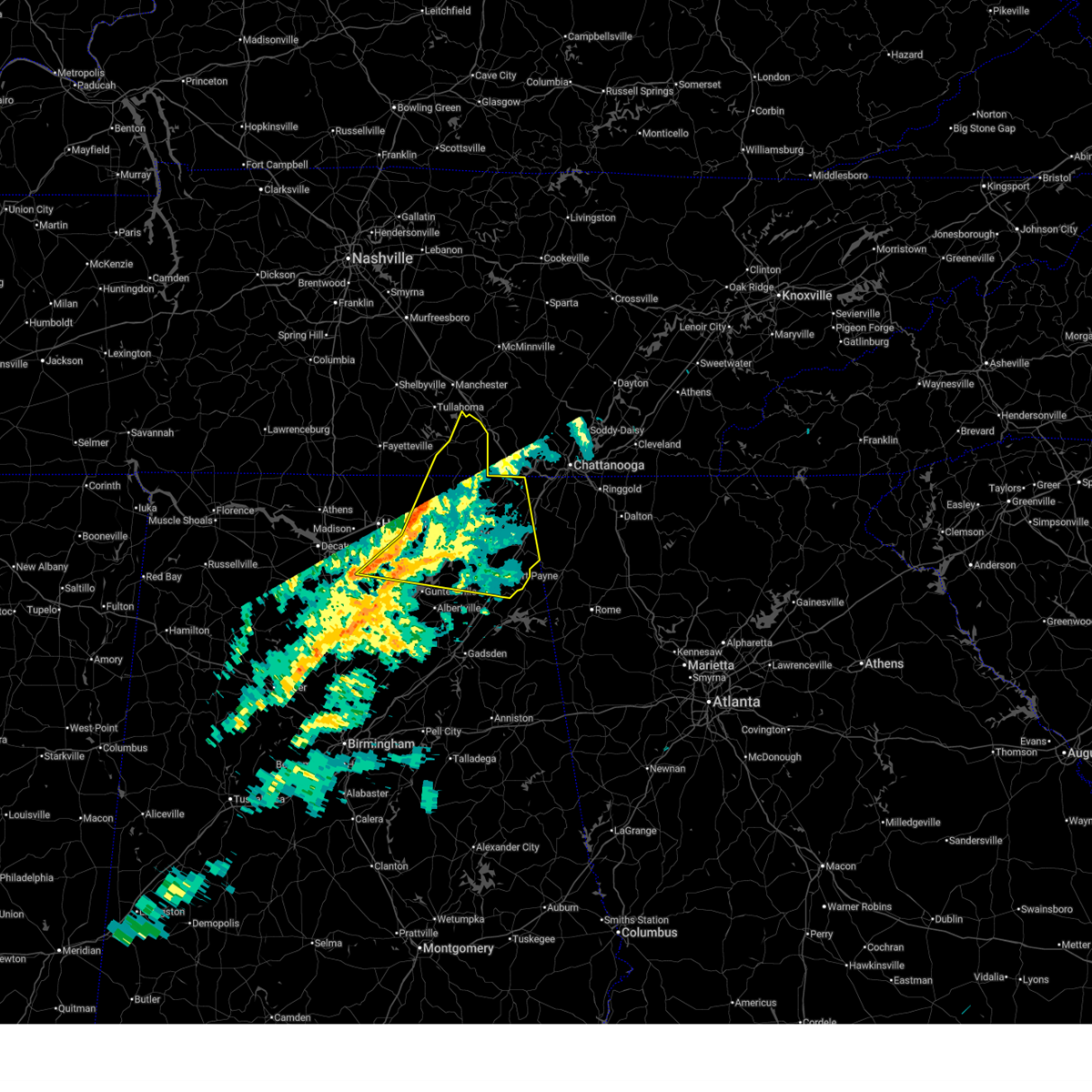
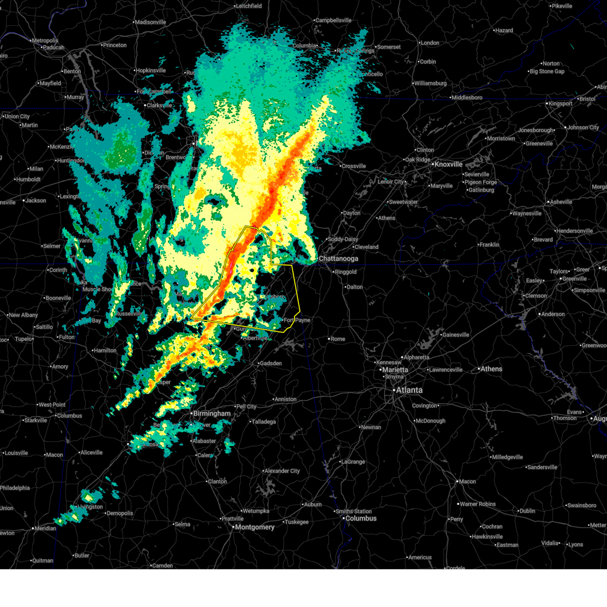
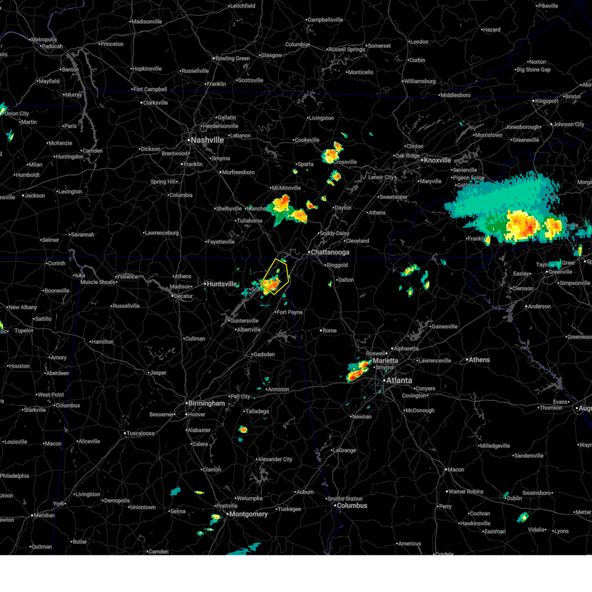
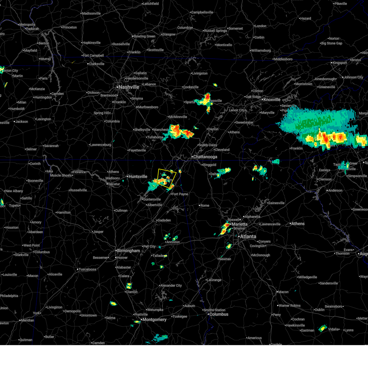
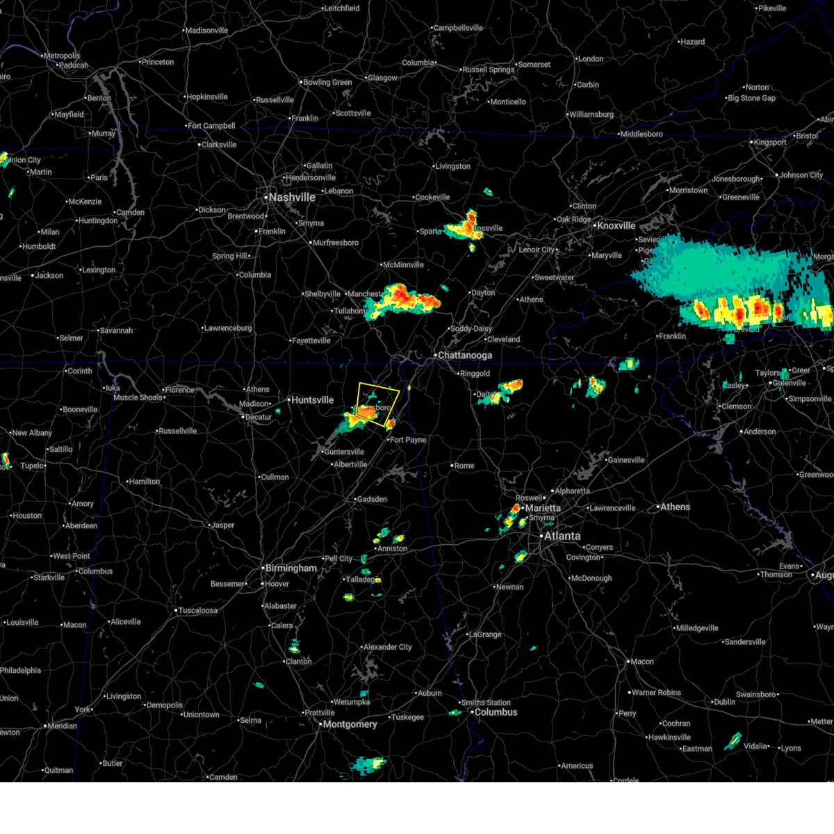
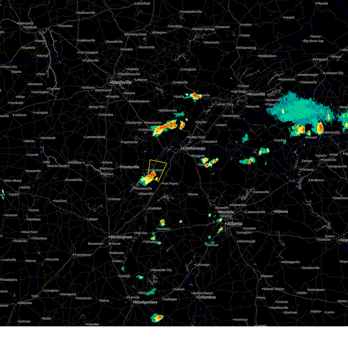
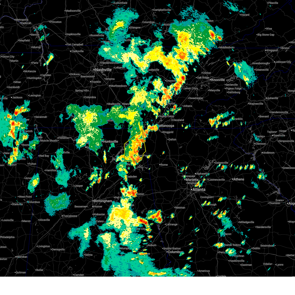
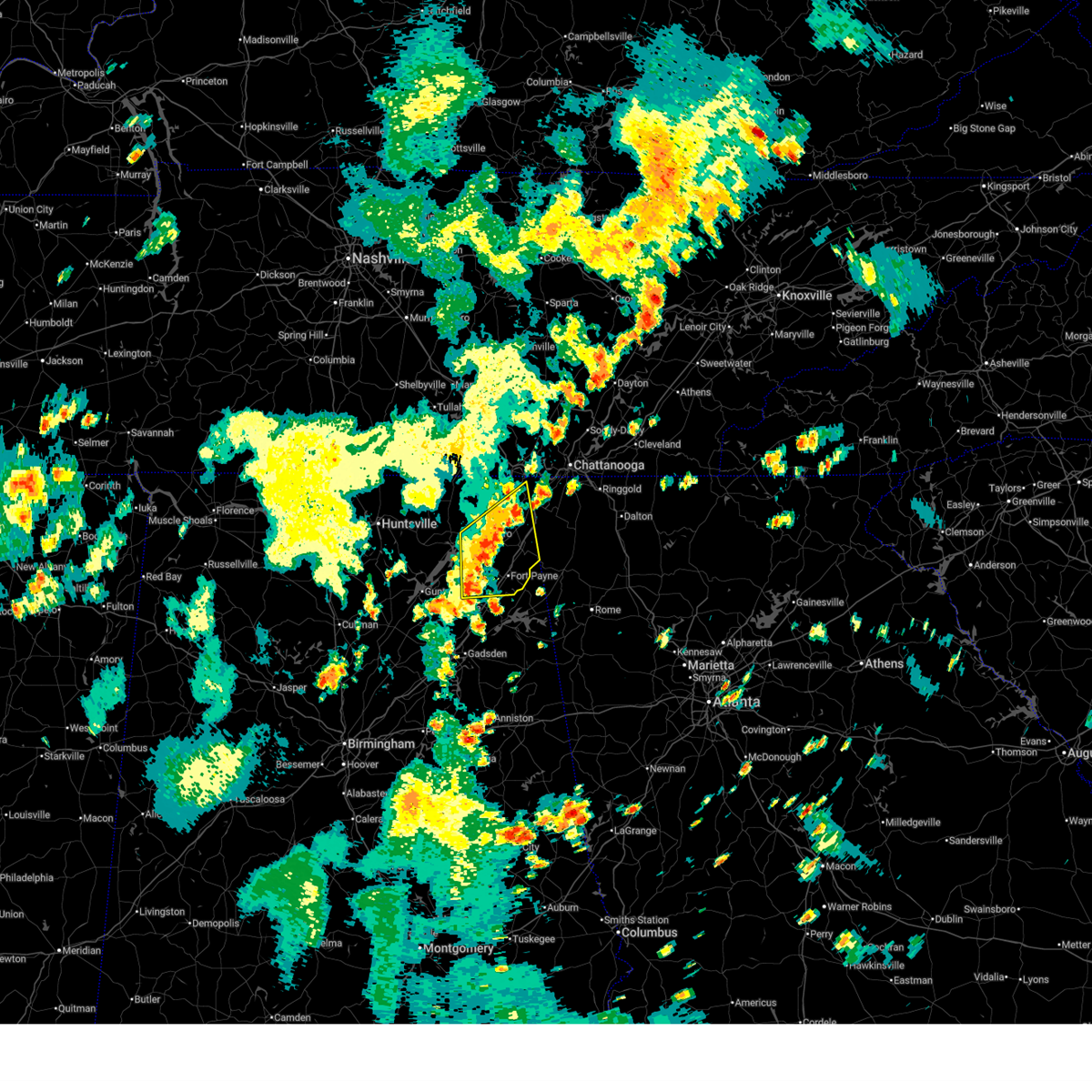
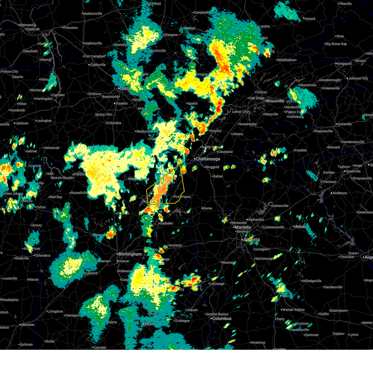
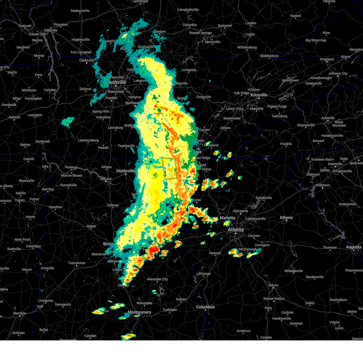
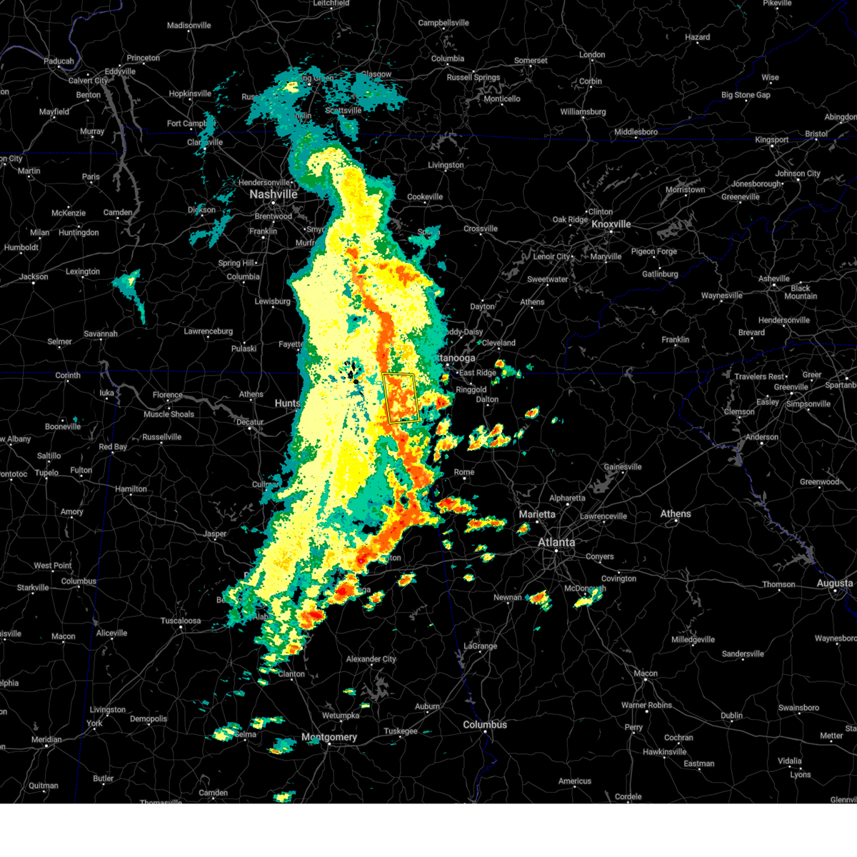
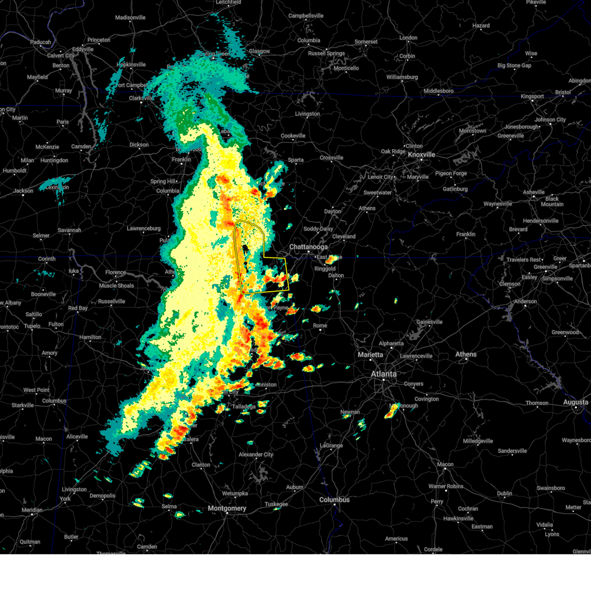
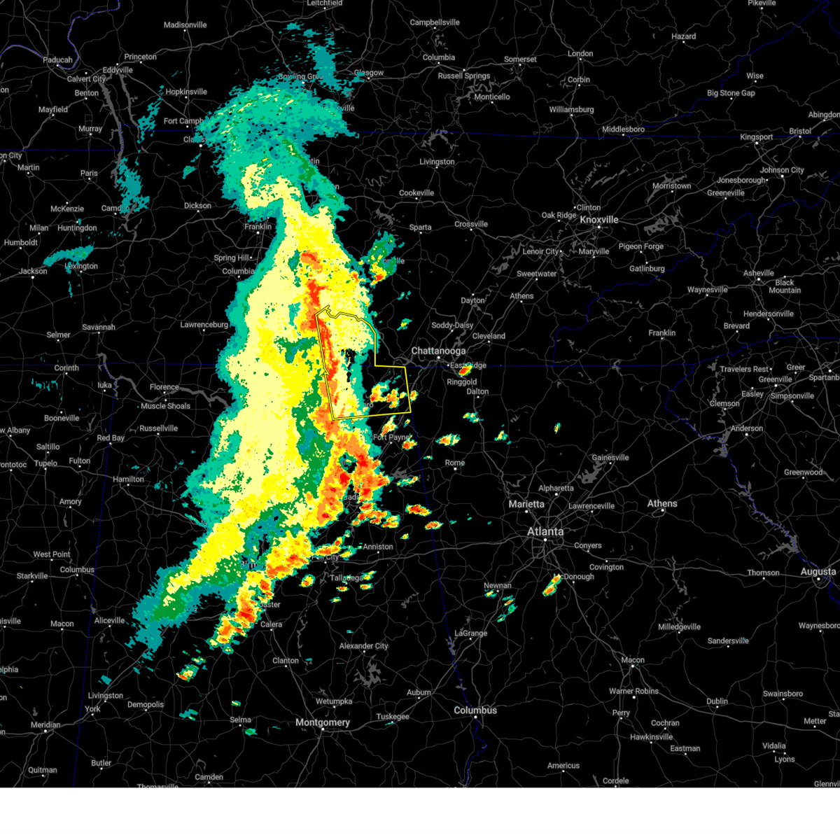
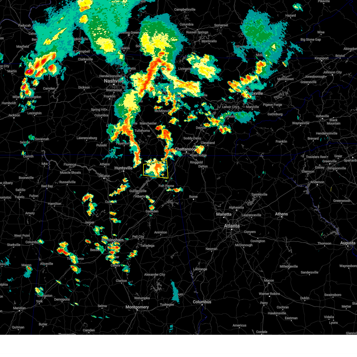
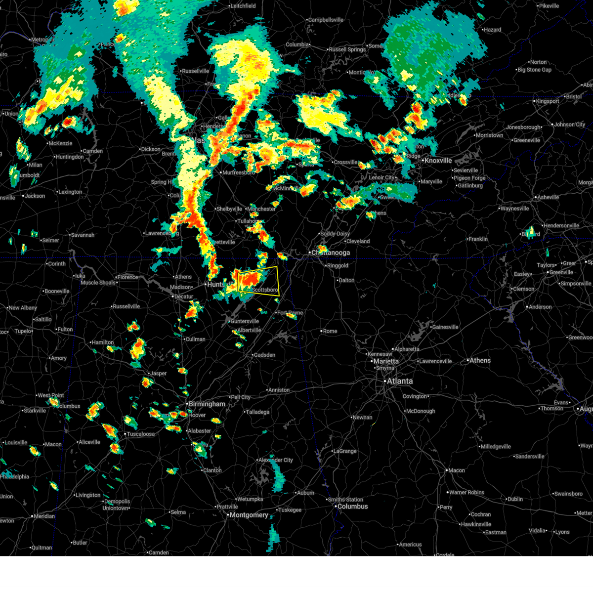
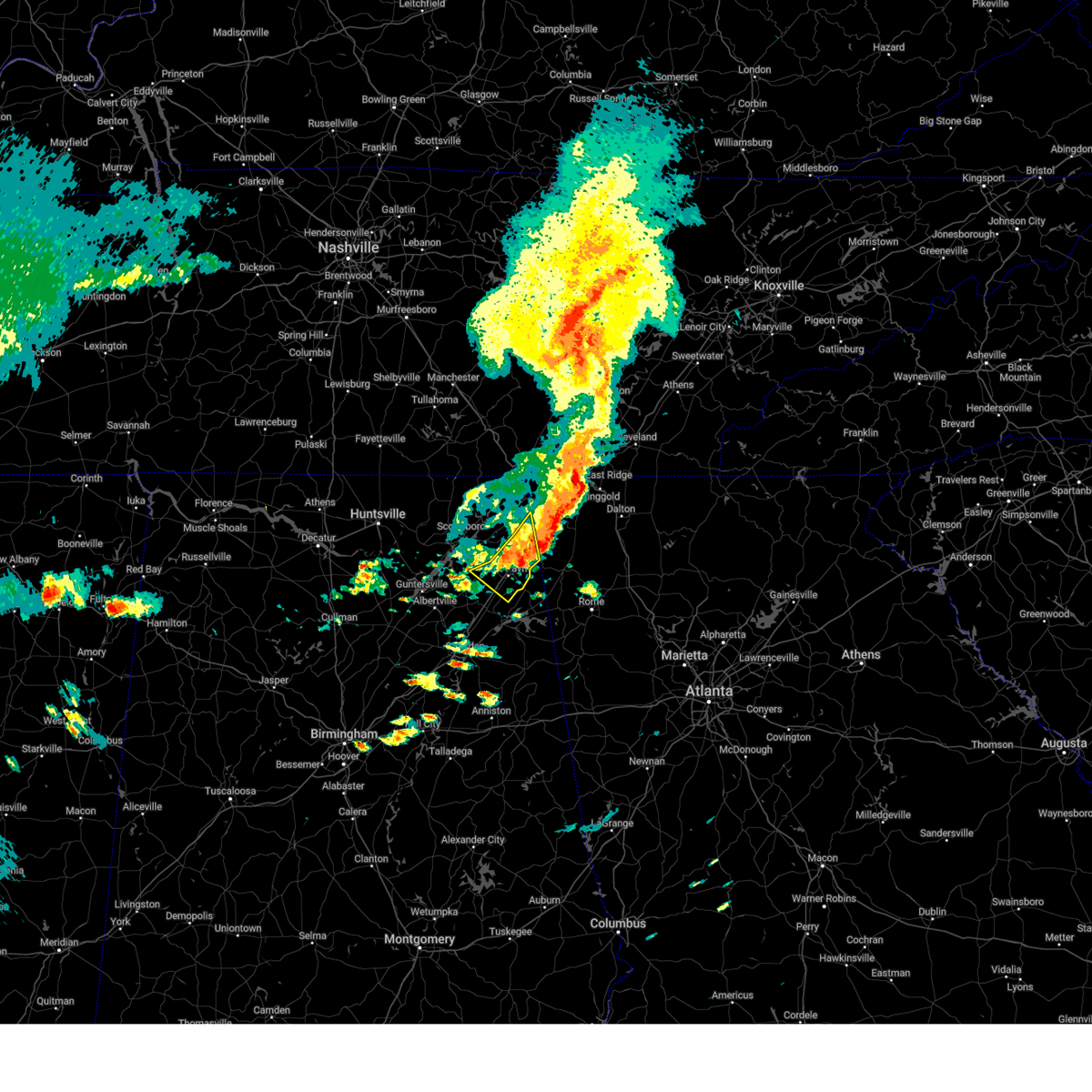
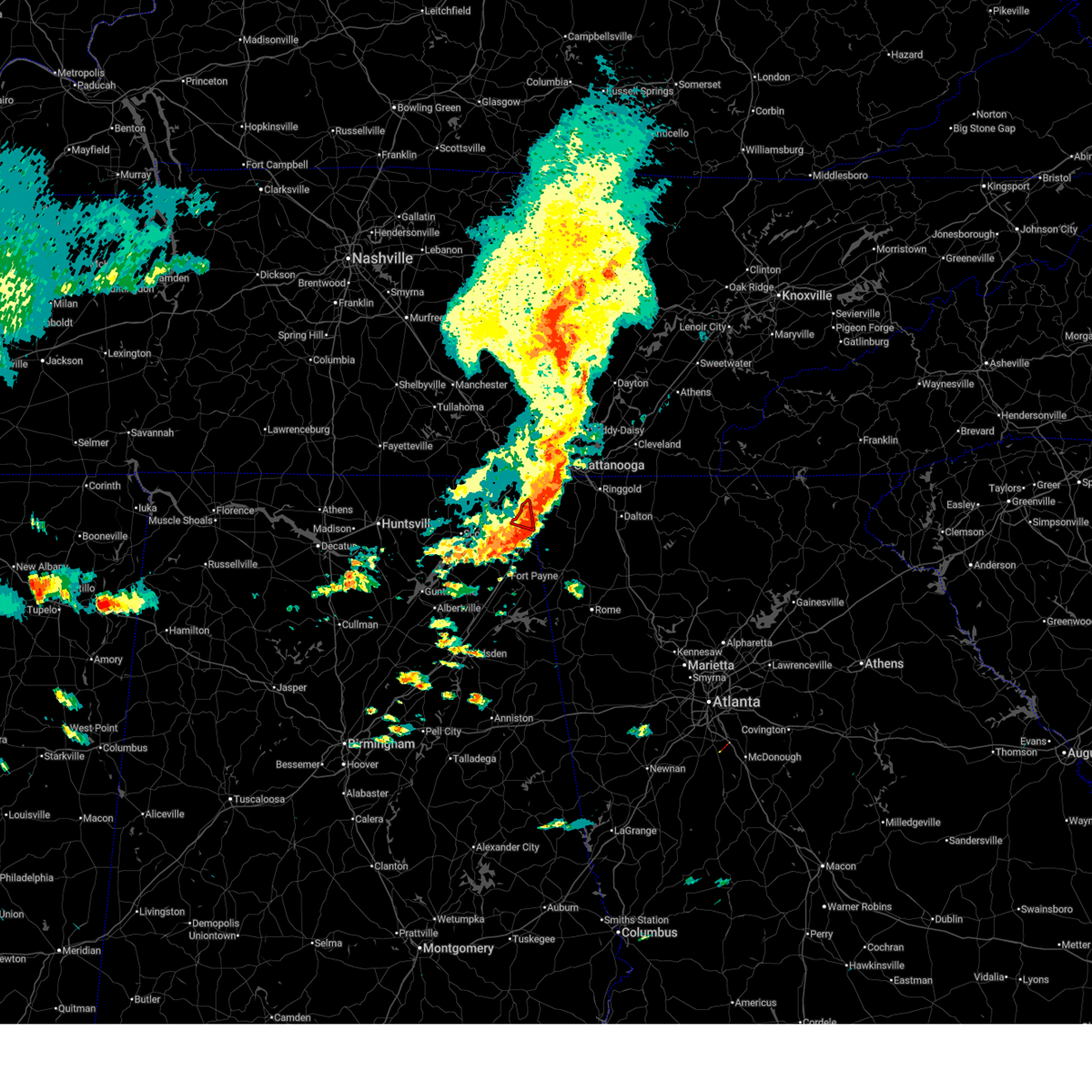
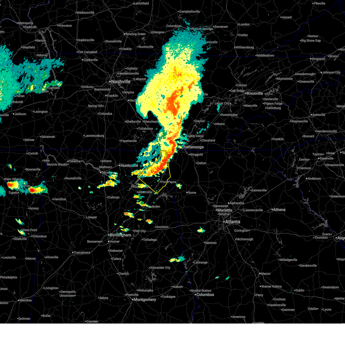
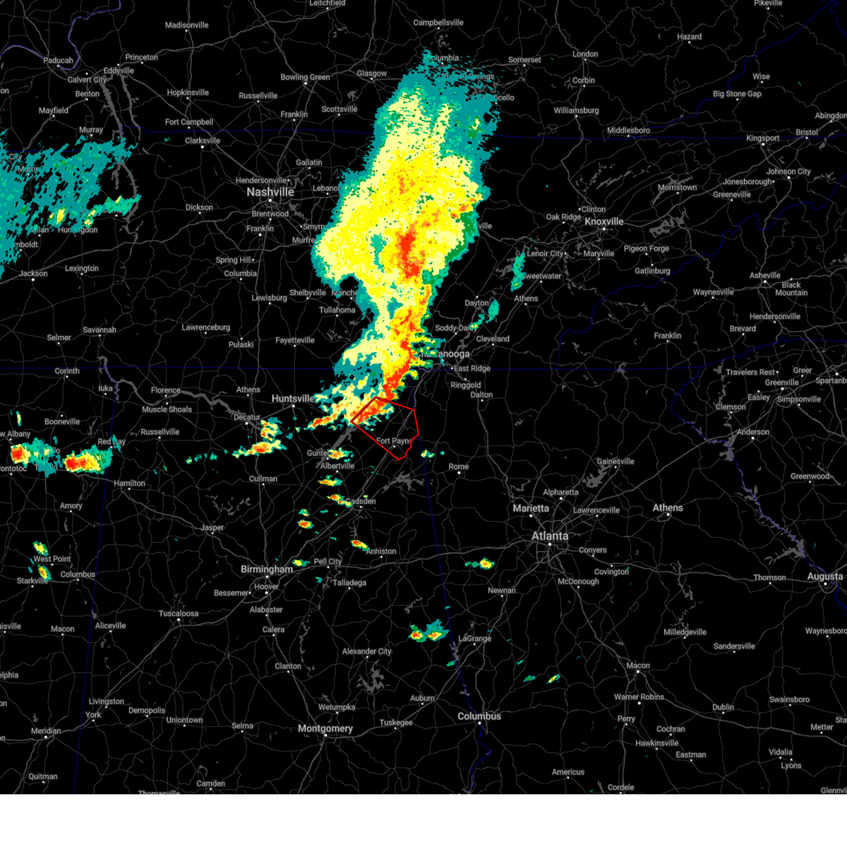
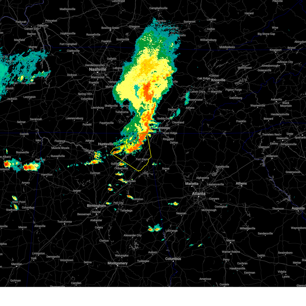
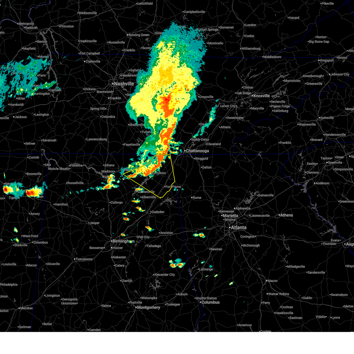
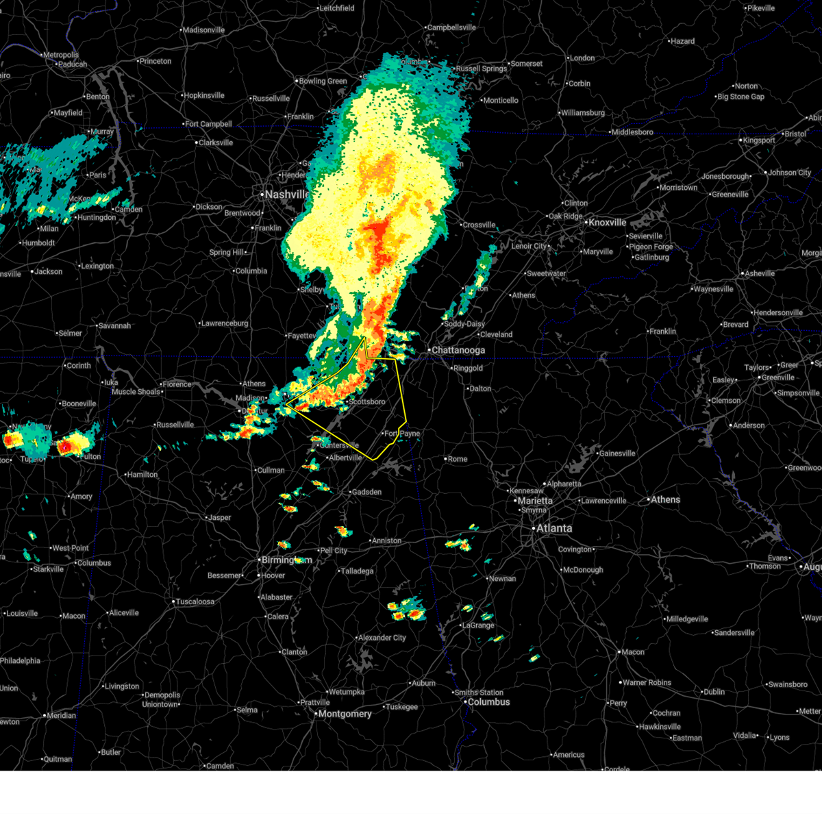
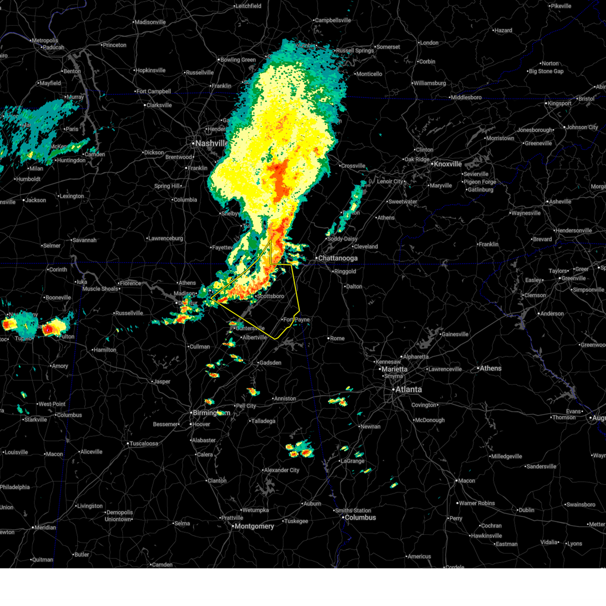
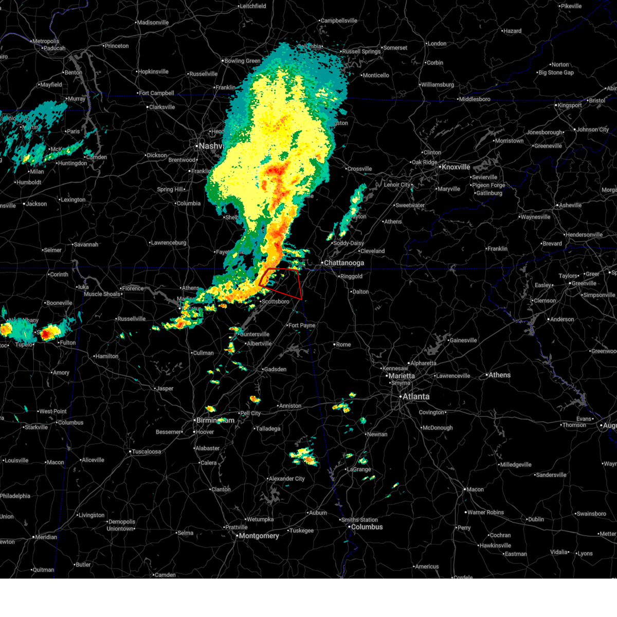
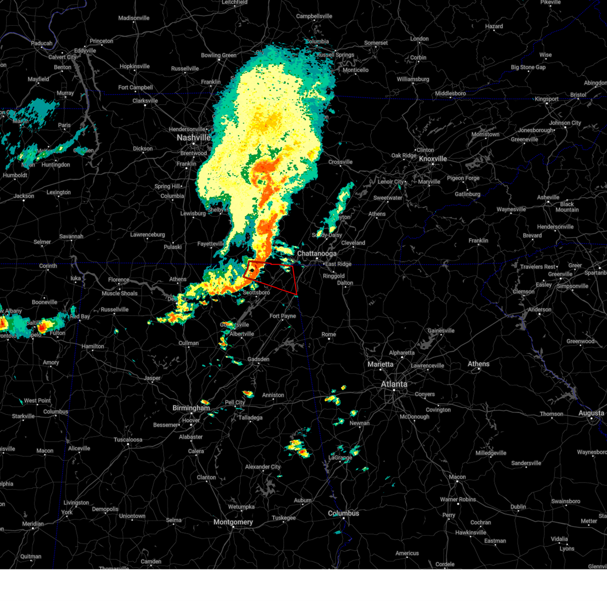
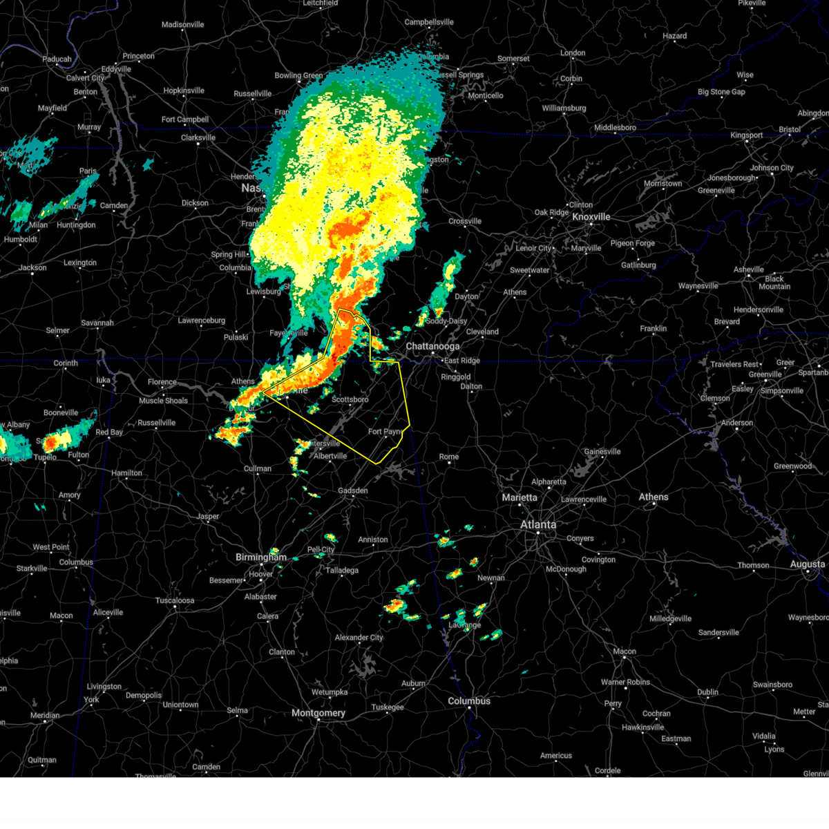
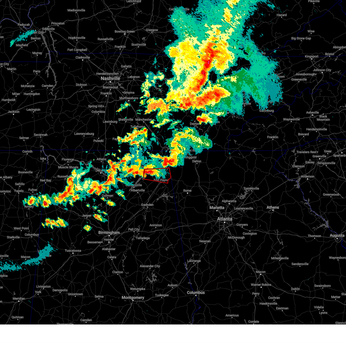
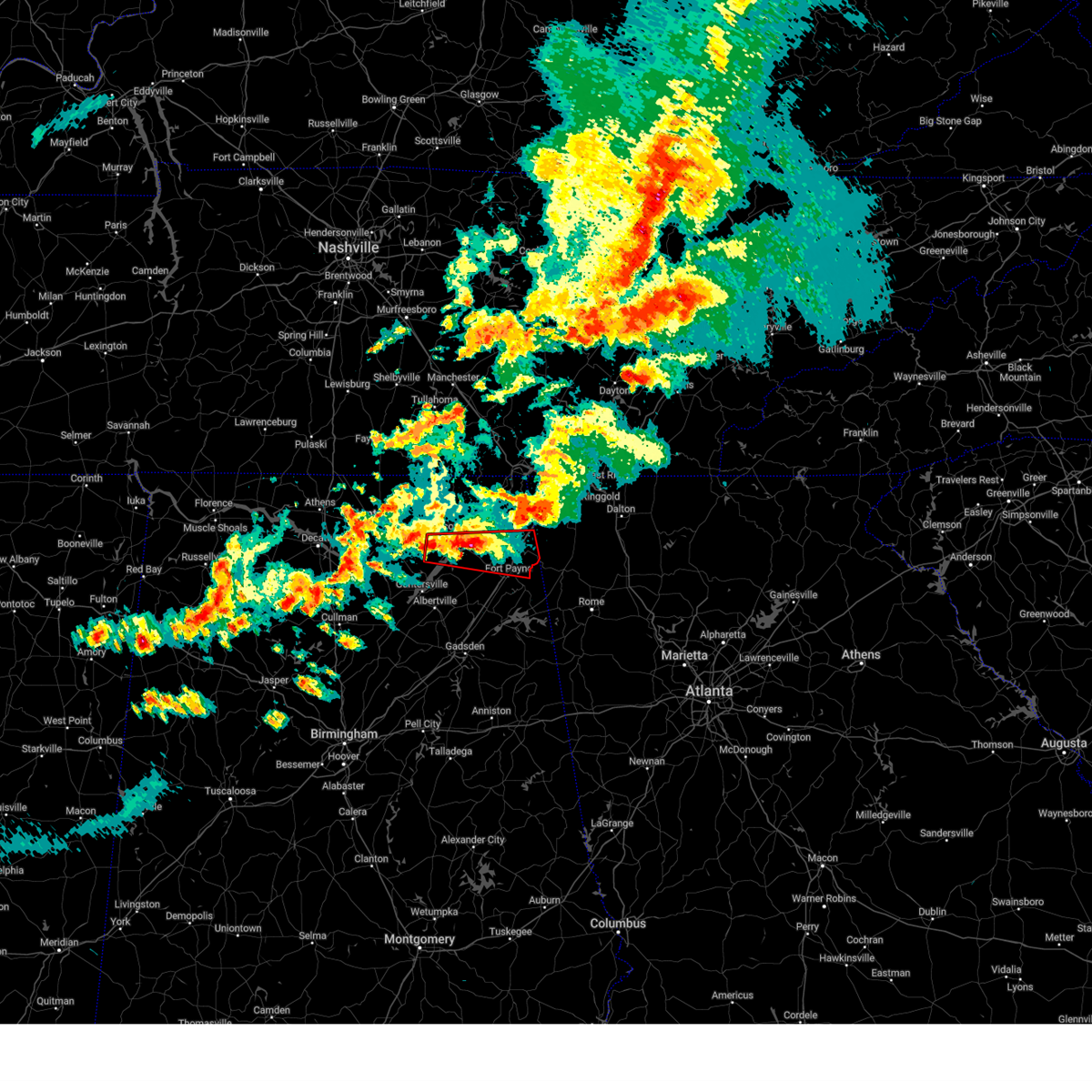
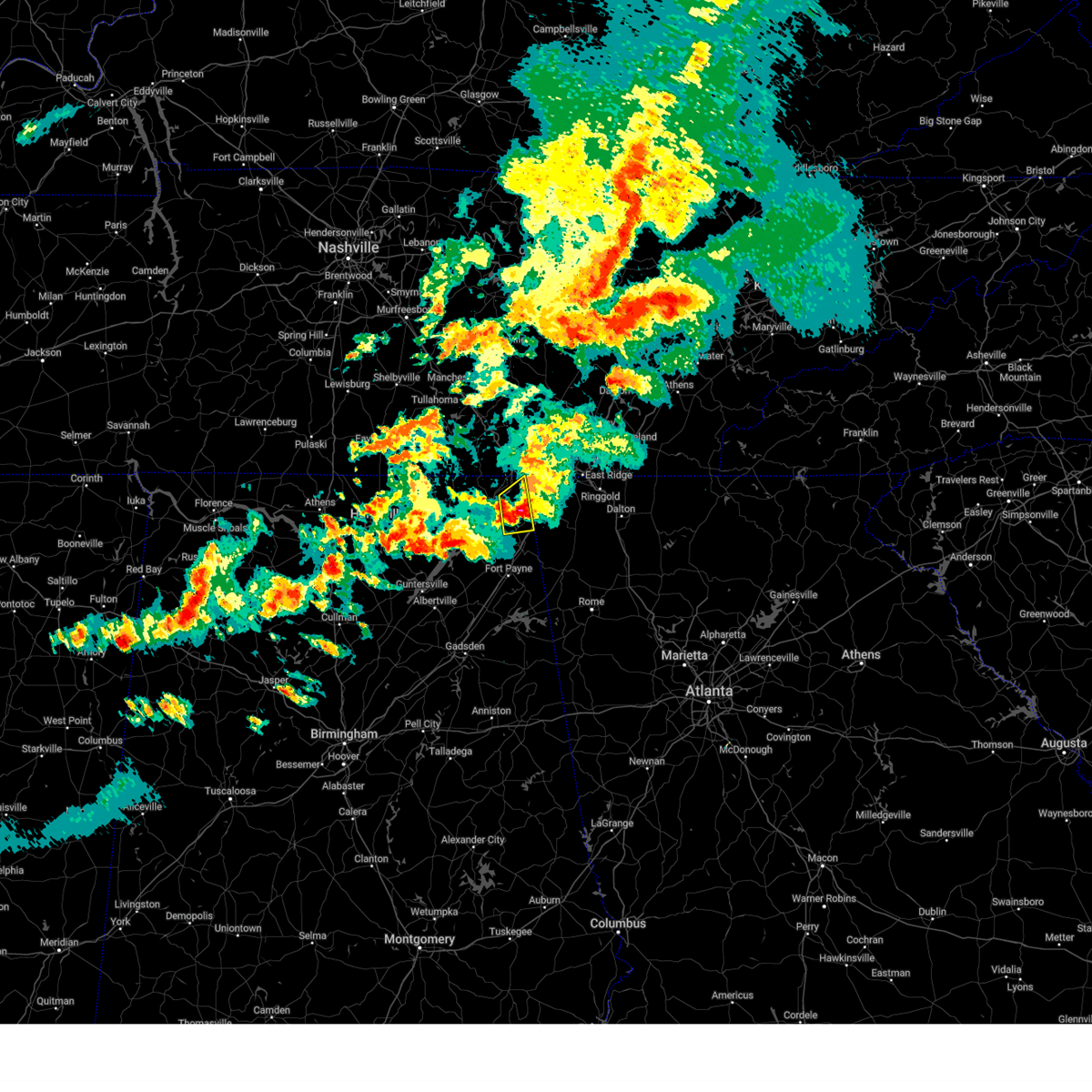
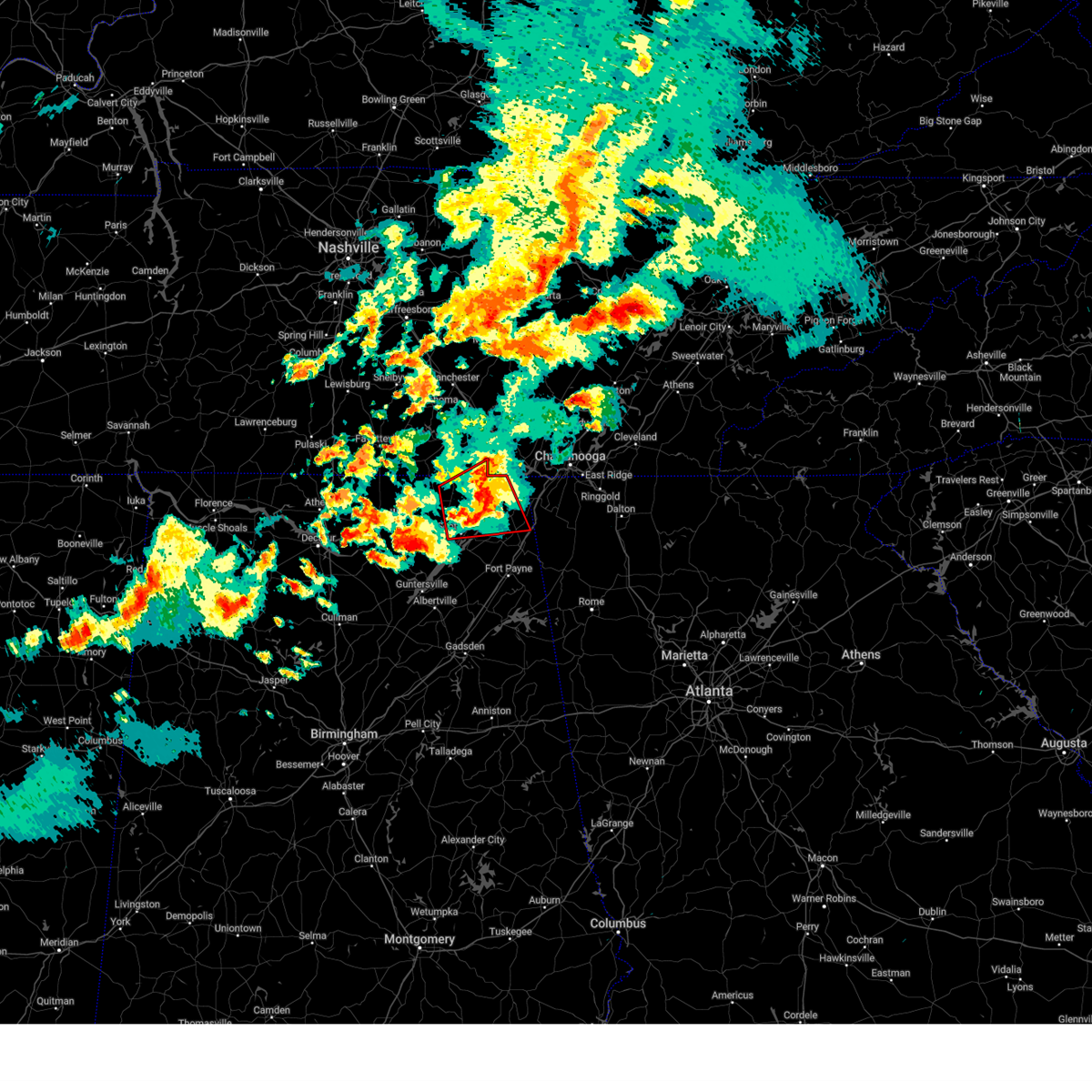
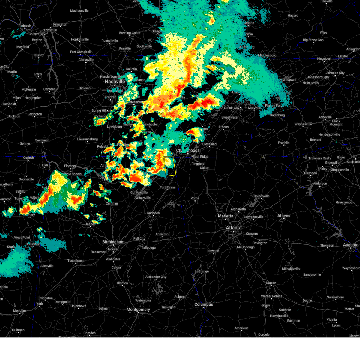
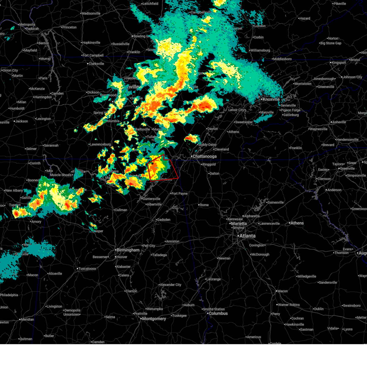
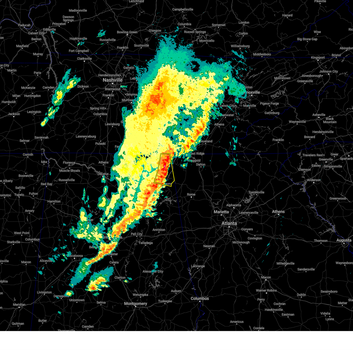
Hail Map for Ider, AL
The Ider, AL area has had 11 reports of on-the-ground hail by trained spotters, and has been under severe weather warnings 36 times during the past 12 months. Doppler radar has detected hail at or near Ider, AL on 49 occasions, including 3 occasions during the past year.
| Name: | Ider, AL |
| Where Located: | 31.5 miles SW of Chattanooga, TN |
| Map: | Google Map for Ider, AL |
| Population: | 723 |
| Housing Units: | 330 |
| More Info: | Search Google for Ider, AL |
0
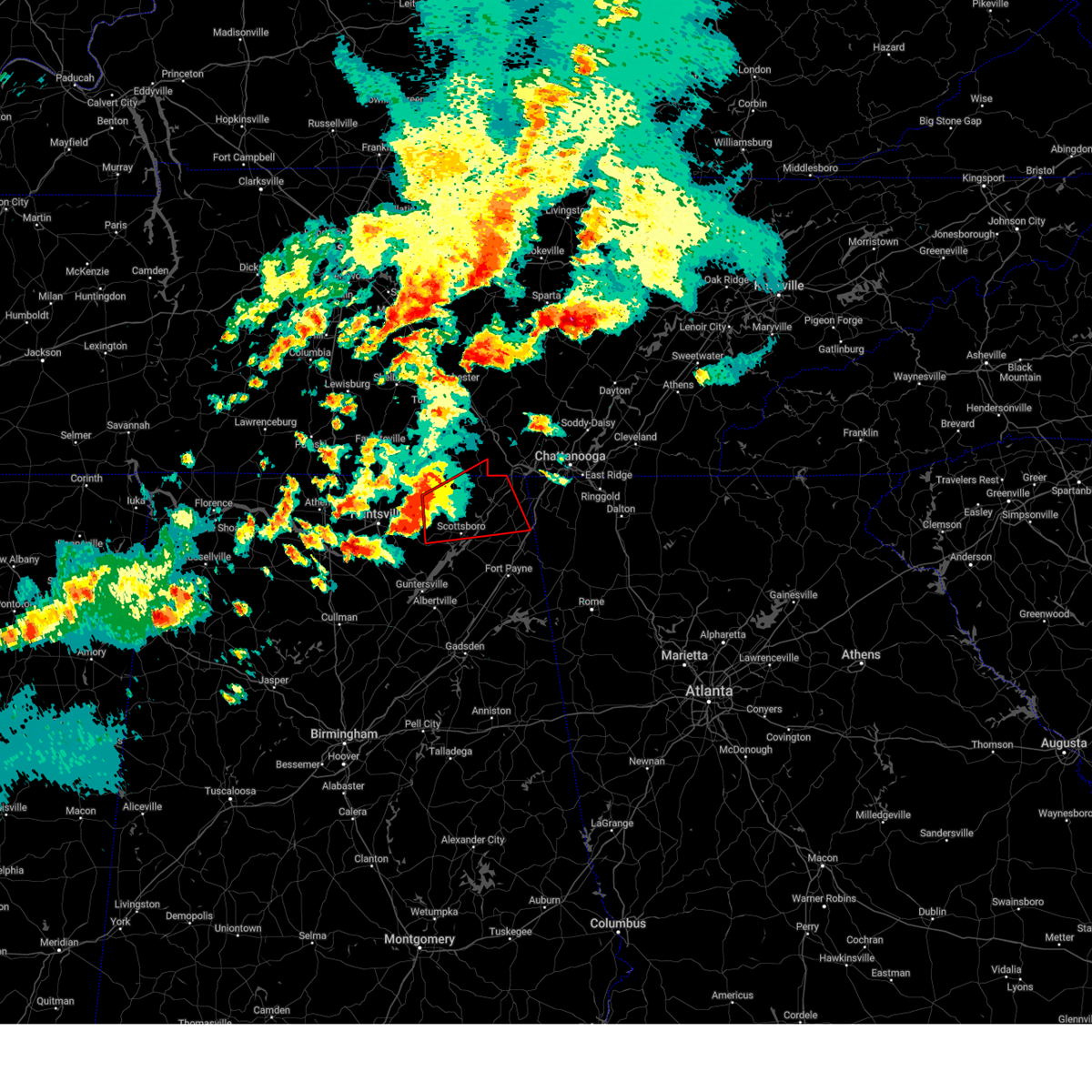
The Top Recent Hail Date for Ider, AL is Friday, June 27, 2025 (45th out of 49)
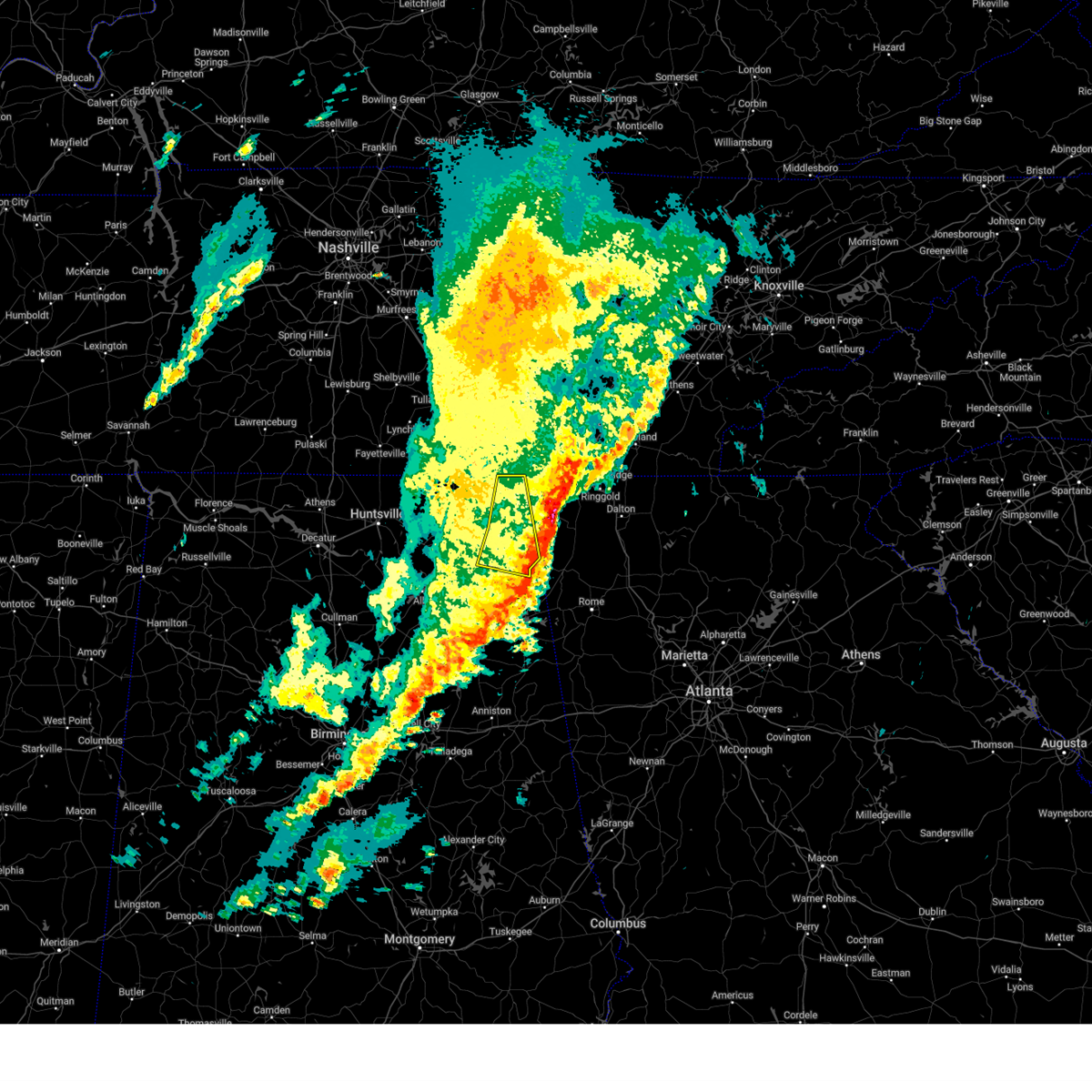
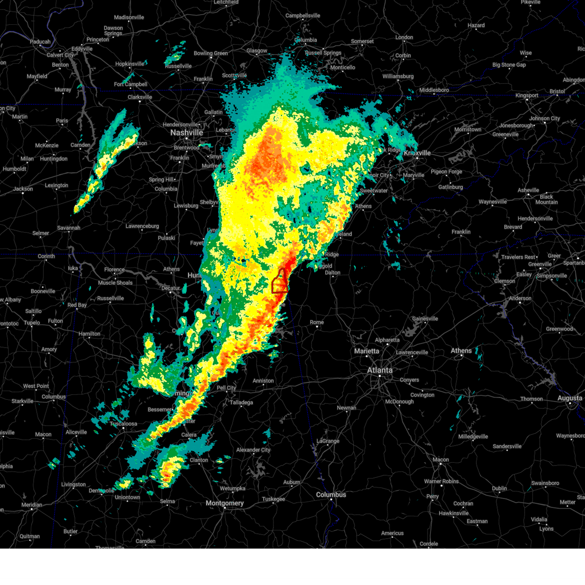
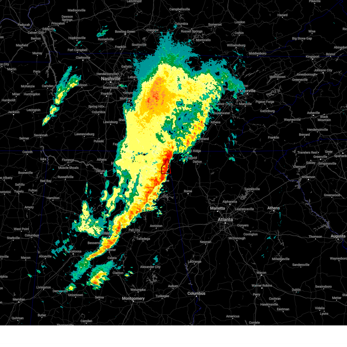
Hail and Wind Damage Spotted near Ider, AL
| Date / Time | Report Details |
|---|---|
| 6/9/2026 7:08 PM CDT | Several trees were knocked down on cr 147 in ide in dekalb county AL, 0.7 miles N of Ider, AL |
| 6/9/2026 7:05 PM CDT |
 At 705 pm cdt, a severe thunderstorm was located over ider, or 15 miles north of fort payne, and is nearly stationary (emergency management. at 7 pm, a large tree was uprooted was reported on county road 771 in ider). Hazards include 60 mph wind gusts and quarter size hail. Hail damage to vehicles is expected. expect wind damage to roofs, siding, and trees. Locations impacted include, fort payne, henagar, ider, pisgah, valley head, hammondville, mentone, rosalie, sulpher springs, and desoto state park. At 705 pm cdt, a severe thunderstorm was located over ider, or 15 miles north of fort payne, and is nearly stationary (emergency management. at 7 pm, a large tree was uprooted was reported on county road 771 in ider). Hazards include 60 mph wind gusts and quarter size hail. Hail damage to vehicles is expected. expect wind damage to roofs, siding, and trees. Locations impacted include, fort payne, henagar, ider, pisgah, valley head, hammondville, mentone, rosalie, sulpher springs, and desoto state park.
|
| 6/9/2026 6:59 PM CDT | A 4 foot diameter tree was uprooted on cr 771 in ide in dekalb county AL, 2.1 miles SE of Ider, AL |
| 6/9/2026 6:58 PM CDT | A tree was knocked down at 200 cr 77 in dekalb county AL, 2.1 miles SE of Ider, AL |
| 6/9/2026 6:41 PM CDT |
 Svrhun the national weather service in huntsville alabama has issued a * severe thunderstorm warning for, east central jackson county in northeastern alabama, northeastern dekalb county in northeastern alabama, * until 745 pm cdt. * at 641 pm cdt, a severe thunderstorm was located near ider, or 15 miles northeast of rainsville, moving southeast at 10 mph (radar indicated). Hazards include 60 mph wind gusts and quarter size hail. Hail damage to vehicles is expected. Expect wind damage to roofs, siding, and trees. Svrhun the national weather service in huntsville alabama has issued a * severe thunderstorm warning for, east central jackson county in northeastern alabama, northeastern dekalb county in northeastern alabama, * until 745 pm cdt. * at 641 pm cdt, a severe thunderstorm was located near ider, or 15 miles northeast of rainsville, moving southeast at 10 mph (radar indicated). Hazards include 60 mph wind gusts and quarter size hail. Hail damage to vehicles is expected. Expect wind damage to roofs, siding, and trees.
|
| 4/4/2026 10:19 PM CDT |
 At 1019 pm cdt, a severe thunderstorm was located near stevenson, or 7 miles south of bridgeport, moving northeast at 40 mph (radar indicated). Hazards include 60 mph wind gusts. Expect damage to roofs, siding, and trees. Locations impacted include, bridgeport, stevenson, ider, bass, martintown, rosalie, long island, russell cave national monument, fabius, and fackler. At 1019 pm cdt, a severe thunderstorm was located near stevenson, or 7 miles south of bridgeport, moving northeast at 40 mph (radar indicated). Hazards include 60 mph wind gusts. Expect damage to roofs, siding, and trees. Locations impacted include, bridgeport, stevenson, ider, bass, martintown, rosalie, long island, russell cave national monument, fabius, and fackler.
|
| 4/4/2026 9:58 PM CDT |
 Svrhun the national weather service in huntsville alabama has issued a * severe thunderstorm warning for, northeastern jackson county in northeastern alabama, northeastern dekalb county in northeastern alabama, * until 1045 pm cdt. * at 958 pm cdt, a severe thunderstorm was located over hollywood, or 7 miles northeast of scottsboro, moving northeast at 40 mph. ema reports 58 mph winds in scottsboro and powerlines down (emergency management). Hazards include 60 mph wind gusts. expect damage to roofs, siding, and trees Svrhun the national weather service in huntsville alabama has issued a * severe thunderstorm warning for, northeastern jackson county in northeastern alabama, northeastern dekalb county in northeastern alabama, * until 1045 pm cdt. * at 958 pm cdt, a severe thunderstorm was located over hollywood, or 7 miles northeast of scottsboro, moving northeast at 40 mph. ema reports 58 mph winds in scottsboro and powerlines down (emergency management). Hazards include 60 mph wind gusts. expect damage to roofs, siding, and trees
|
| 3/16/2026 2:24 AM CDT |
 the severe thunderstorm warning has been cancelled and is no longer in effect the severe thunderstorm warning has been cancelled and is no longer in effect
|
| 3/16/2026 2:08 AM CDT |
 the severe thunderstorm warning has been cancelled and is no longer in effect the severe thunderstorm warning has been cancelled and is no longer in effect
|
| 3/16/2026 2:08 AM CDT |
 At 208 am cdt, severe thunderstorms were located along a line extending from lookout mountain to near fort payne, moving east at 30 mph (radar indicated). Hazards include 60 mph wind gusts and penny size hail. Expect damage to roofs, siding, and trees. Locations impacted include, henagar, ider, valley head, hammondville, mentone, and sulpher springs. At 208 am cdt, severe thunderstorms were located along a line extending from lookout mountain to near fort payne, moving east at 30 mph (radar indicated). Hazards include 60 mph wind gusts and penny size hail. Expect damage to roofs, siding, and trees. Locations impacted include, henagar, ider, valley head, hammondville, mentone, and sulpher springs.
|
| 3/16/2026 2:03 AM CDT |
 the severe thunderstorm warning has been cancelled and is no longer in effect the severe thunderstorm warning has been cancelled and is no longer in effect
|
| 3/16/2026 2:03 AM CDT |
 At 201 am cdt, severe thunderstorms were located along a line extending from near lookout mountain to near sylvania, moving east at 30 mph (radar indicated). Hazards include 60 mph wind gusts and penny size hail. Expect damage to roofs, siding, and trees. Locations impacted include, fort payne, rainsville, henagar, sylvania, powell, ider, pisgah, valley head, hammondville, and mentone. At 201 am cdt, severe thunderstorms were located along a line extending from near lookout mountain to near sylvania, moving east at 30 mph (radar indicated). Hazards include 60 mph wind gusts and penny size hail. Expect damage to roofs, siding, and trees. Locations impacted include, fort payne, rainsville, henagar, sylvania, powell, ider, pisgah, valley head, hammondville, and mentone.
|
| 3/16/2026 1:45 AM CDT |
 Svrhun the national weather service in huntsville alabama has issued a * severe thunderstorm warning for, northeastern marshall county in northeastern alabama, central jackson county in northeastern alabama, northern dekalb county in northeastern alabama, * until 245 am cdt. * at 144 am cdt, severe thunderstorms were located along a line extending from 6 miles southeast of jasper to near fyffe, moving east at 30 mph (radar indicated). Hazards include 60 mph wind gusts and penny size hail. expect damage to roofs, siding, and trees Svrhun the national weather service in huntsville alabama has issued a * severe thunderstorm warning for, northeastern marshall county in northeastern alabama, central jackson county in northeastern alabama, northern dekalb county in northeastern alabama, * until 245 am cdt. * at 144 am cdt, severe thunderstorms were located along a line extending from 6 miles southeast of jasper to near fyffe, moving east at 30 mph (radar indicated). Hazards include 60 mph wind gusts and penny size hail. expect damage to roofs, siding, and trees
|
| 3/16/2026 1:34 AM CDT |
 At 133 am cdt, severe thunderstorms were located along a line extending from near jasper to 7 miles southwest of section, moving east at 35 mph (emergency management). Hazards include 60 mph wind gusts and penny size hail. Expect damage to roofs, siding, and trees. Locations impacted include, scottsboro, fort payne, rainsville, bridgeport, henagar, stevenson, sylvania, fyffe, hollywood, and powell. At 133 am cdt, severe thunderstorms were located along a line extending from near jasper to 7 miles southwest of section, moving east at 35 mph (emergency management). Hazards include 60 mph wind gusts and penny size hail. Expect damage to roofs, siding, and trees. Locations impacted include, scottsboro, fort payne, rainsville, bridgeport, henagar, stevenson, sylvania, fyffe, hollywood, and powell.
|
| 3/16/2026 1:26 AM CDT |
 At 124 am cdt, severe thunderstorms were located along a line extending from near kimball to 7 miles east of grant, moving east at 40 mph (emergency management). Hazards include 60 mph wind gusts and penny size hail. Expect damage to roofs, siding, and trees. Locations impacted include, scottsboro, fort payne, rainsville, bridgeport, henagar, stevenson, sylvania, fyffe, hollywood, and powell. At 124 am cdt, severe thunderstorms were located along a line extending from near kimball to 7 miles east of grant, moving east at 40 mph (emergency management). Hazards include 60 mph wind gusts and penny size hail. Expect damage to roofs, siding, and trees. Locations impacted include, scottsboro, fort payne, rainsville, bridgeport, henagar, stevenson, sylvania, fyffe, hollywood, and powell.
|
| 3/16/2026 1:26 AM CDT |
 the severe thunderstorm warning has been cancelled and is no longer in effect the severe thunderstorm warning has been cancelled and is no longer in effect
|
| 3/16/2026 1:11 AM CDT |
 At 109 am cdt, severe thunderstorms were located along a line extending from 9 miles north of stevenson to near grant, moving east at 40 mph (emergency management). Hazards include 60 mph wind gusts and penny size hail. Expect damage to roofs, siding, and trees. Locations impacted include, scottsboro, fort payne, rainsville, bridgeport, henagar, stevenson, sylvania, owens cross roads, fyffe, and hollywood. At 109 am cdt, severe thunderstorms were located along a line extending from 9 miles north of stevenson to near grant, moving east at 40 mph (emergency management). Hazards include 60 mph wind gusts and penny size hail. Expect damage to roofs, siding, and trees. Locations impacted include, scottsboro, fort payne, rainsville, bridgeport, henagar, stevenson, sylvania, owens cross roads, fyffe, and hollywood.
|
| 3/16/2026 12:43 AM CDT |
 Svrhun the national weather service in huntsville alabama has issued a * severe thunderstorm warning for, northern marshall county in northeastern alabama, jackson county in northeastern alabama, eastern madison county in north central alabama, northern dekalb county in northeastern alabama, * until 145 am cdt. * at 1243 am cdt, severe thunderstorms were located along a line extending from near huntland to near owens cross roads, moving east at 45 mph (radar indicated). Hazards include 60 mph wind gusts and penny size hail. expect damage to roofs, siding, and trees Svrhun the national weather service in huntsville alabama has issued a * severe thunderstorm warning for, northern marshall county in northeastern alabama, jackson county in northeastern alabama, eastern madison county in north central alabama, northern dekalb county in northeastern alabama, * until 145 am cdt. * at 1243 am cdt, severe thunderstorms were located along a line extending from near huntland to near owens cross roads, moving east at 45 mph (radar indicated). Hazards include 60 mph wind gusts and penny size hail. expect damage to roofs, siding, and trees
|
| 12/18/2025 9:23 PM CST |
 Svrhun the national weather service in huntsville alabama has issued a * severe thunderstorm warning for, dekalb county in northeastern alabama, * until 1000 pm cst. * at 922 pm cst, severe thunderstorms were located along a line extending from near trenton to near fort payne to near crossville, moving east at 40 mph (radar indicated). Hazards include 60 mph wind gusts. expect damage to roofs, siding, and trees Svrhun the national weather service in huntsville alabama has issued a * severe thunderstorm warning for, dekalb county in northeastern alabama, * until 1000 pm cst. * at 922 pm cst, severe thunderstorms were located along a line extending from near trenton to near fort payne to near crossville, moving east at 40 mph (radar indicated). Hazards include 60 mph wind gusts. expect damage to roofs, siding, and trees
|
| 12/18/2025 9:17 PM CST |
 At 916 pm cst, severe thunderstorms were located along a line extending from 6 miles north of trenton to near ider to near geraldine, moving east at 50 mph (radar indicated). Hazards include 60 mph wind gusts. Expect damage to roofs, siding, and trees. Locations impacted include, fort payne, rainsville, henagar, sylvania, fyffe, powell, geraldine, section, ider, and pisgah. At 916 pm cst, severe thunderstorms were located along a line extending from 6 miles north of trenton to near ider to near geraldine, moving east at 50 mph (radar indicated). Hazards include 60 mph wind gusts. Expect damage to roofs, siding, and trees. Locations impacted include, fort payne, rainsville, henagar, sylvania, fyffe, powell, geraldine, section, ider, and pisgah.
|
| 12/18/2025 9:17 PM CST |
 the severe thunderstorm warning has been cancelled and is no longer in effect the severe thunderstorm warning has been cancelled and is no longer in effect
|
| 12/18/2025 9:15 PM CST |
 The storm which prompted the warning has weakened below severe limits, and no longer appears capable of producing a tornado. therefore, the warning has been allowed to expire. however, gusty winds are still possible with this thunderstorm. The storm which prompted the warning has weakened below severe limits, and no longer appears capable of producing a tornado. therefore, the warning has been allowed to expire. however, gusty winds are still possible with this thunderstorm.
|
| 12/18/2025 9:06 PM CST |
 the severe thunderstorm warning has been cancelled and is no longer in effect the severe thunderstorm warning has been cancelled and is no longer in effect
|
| 12/18/2025 9:06 PM CST |
 At 903 pm cst, severe thunderstorms were located along a line extending from bridgeport to pisgah to 7 miles west of geraldine, moving east at 40 mph (radar indicated). Hazards include 60 mph wind gusts. Expect damage to roofs, siding, and trees. Locations impacted include, scottsboro, fort payne, guntersville, rainsville, bridgeport, henagar, stevenson, sylvania, fyffe, and hollywood. At 903 pm cst, severe thunderstorms were located along a line extending from bridgeport to pisgah to 7 miles west of geraldine, moving east at 40 mph (radar indicated). Hazards include 60 mph wind gusts. Expect damage to roofs, siding, and trees. Locations impacted include, scottsboro, fort payne, guntersville, rainsville, bridgeport, henagar, stevenson, sylvania, fyffe, and hollywood.
|
| 12/18/2025 9:01 PM CST |
 At 901 pm cst, a severe thunderstorm capable of producing a tornado was located near pisgah, or 7 miles east of scottsboro, moving east at 45 mph (radar indicated rotation). Hazards include tornado. Flying debris will be dangerous to those caught without shelter. mobile homes will be damaged or destroyed. damage to roofs, windows, and vehicles will occur. tree damage is likely. this dangerous storm will be near, henagar and pisgah around 905 pm cst. ider around 910 pm cst. Other locations impacted by this tornadic thunderstorm include dutton, rosalie, and hammondville. At 901 pm cst, a severe thunderstorm capable of producing a tornado was located near pisgah, or 7 miles east of scottsboro, moving east at 45 mph (radar indicated rotation). Hazards include tornado. Flying debris will be dangerous to those caught without shelter. mobile homes will be damaged or destroyed. damage to roofs, windows, and vehicles will occur. tree damage is likely. this dangerous storm will be near, henagar and pisgah around 905 pm cst. ider around 910 pm cst. Other locations impacted by this tornadic thunderstorm include dutton, rosalie, and hammondville.
|
| 12/18/2025 8:52 PM CST |
 Torhun the national weather service in huntsville alabama has issued a * tornado warning for, central jackson county in northeastern alabama, northeastern dekalb county in northeastern alabama, * until 915 pm cst. * at 852 pm cst, severe thunderstorms capable of producing both tornadoes and straight line wind damage were located over scottsboro, moving east at 45 mph (radar indicated rotation). Hazards include tornado. Flying debris will be dangerous to those caught without shelter. mobile homes will be damaged or destroyed. damage to roofs, windows, and vehicles will occur. tree damage is likely. these dangerous storms will be near, scottsboro and hollywood around 855 pm cst. pisgah around 900 pm cst. henagar around 905 pm cst. ider around 910 pm cst. Other locations impacted by this tornadic thunderstorm include dutton, martintown, rosalie, and hammondville. Torhun the national weather service in huntsville alabama has issued a * tornado warning for, central jackson county in northeastern alabama, northeastern dekalb county in northeastern alabama, * until 915 pm cst. * at 852 pm cst, severe thunderstorms capable of producing both tornadoes and straight line wind damage were located over scottsboro, moving east at 45 mph (radar indicated rotation). Hazards include tornado. Flying debris will be dangerous to those caught without shelter. mobile homes will be damaged or destroyed. damage to roofs, windows, and vehicles will occur. tree damage is likely. these dangerous storms will be near, scottsboro and hollywood around 855 pm cst. pisgah around 900 pm cst. henagar around 905 pm cst. ider around 910 pm cst. Other locations impacted by this tornadic thunderstorm include dutton, martintown, rosalie, and hammondville.
|
| 12/18/2025 8:45 PM CST |
 the severe thunderstorm warning has been cancelled and is no longer in effect the severe thunderstorm warning has been cancelled and is no longer in effect
|
| 12/18/2025 8:45 PM CST |
 At 845 pm cst, severe thunderstorms were located along a line extending from near sewanee to 9 miles northeast of skyline to near scottsboro to near guntersville, moving east at 45 mph (radar indicated). Hazards include 60 mph wind gusts. Expect damage to roofs, siding, and trees. Locations impacted include, scottsboro, fort payne, guntersville, rainsville, bridgeport, henagar, stevenson, sylvania, fyffe, and hollywood. At 845 pm cst, severe thunderstorms were located along a line extending from near sewanee to 9 miles northeast of skyline to near scottsboro to near guntersville, moving east at 45 mph (radar indicated). Hazards include 60 mph wind gusts. Expect damage to roofs, siding, and trees. Locations impacted include, scottsboro, fort payne, guntersville, rainsville, bridgeport, henagar, stevenson, sylvania, fyffe, and hollywood.
|
| 12/18/2025 8:36 PM CST |
 At 834 pm cst, severe thunderstorms were located along a line extending from near monteagle to 9 miles east of huntland to 6 miles southwest of skyline to near morgan city, moving east at 50 mph (radar indicated). Hazards include 60 mph wind gusts. Expect damage to roofs, siding, and trees. Locations impacted include, southern huntsville, scottsboro, fort payne, winchester, guntersville, rainsville, bridgeport, decherd, henagar, and stevenson. At 834 pm cst, severe thunderstorms were located along a line extending from near monteagle to 9 miles east of huntland to 6 miles southwest of skyline to near morgan city, moving east at 50 mph (radar indicated). Hazards include 60 mph wind gusts. Expect damage to roofs, siding, and trees. Locations impacted include, southern huntsville, scottsboro, fort payne, winchester, guntersville, rainsville, bridgeport, decherd, henagar, and stevenson.
|
| 12/18/2025 8:36 PM CST |
 the severe thunderstorm warning has been cancelled and is no longer in effect the severe thunderstorm warning has been cancelled and is no longer in effect
|
| 12/18/2025 8:27 PM CST |
 Svrhun the national weather service in huntsville alabama has issued a * severe thunderstorm warning for, northern marshall county in northeastern alabama, jackson county in northeastern alabama, southeastern madison county in north central alabama, dekalb county in northeastern alabama, east central morgan county in north central alabama, southeastern lincoln county in middle tennessee, franklin county in middle tennessee, * until 930 pm cst. * at 826 pm cst, severe thunderstorms were located along a line extending from 6 miles northeast of decherd to near huntland to near gurley to near morgan city, moving east at 50 mph (radar indicated). Hazards include 60 mph wind gusts. expect damage to roofs, siding, and trees Svrhun the national weather service in huntsville alabama has issued a * severe thunderstorm warning for, northern marshall county in northeastern alabama, jackson county in northeastern alabama, southeastern madison county in north central alabama, dekalb county in northeastern alabama, east central morgan county in north central alabama, southeastern lincoln county in middle tennessee, franklin county in middle tennessee, * until 930 pm cst. * at 826 pm cst, severe thunderstorms were located along a line extending from 6 miles northeast of decherd to near huntland to near gurley to near morgan city, moving east at 50 mph (radar indicated). Hazards include 60 mph wind gusts. expect damage to roofs, siding, and trees
|
| 7/22/2025 3:19 PM CDT |
 the severe thunderstorm warning has been cancelled and is no longer in effect the severe thunderstorm warning has been cancelled and is no longer in effect
|
| 7/22/2025 2:44 PM CDT |
 Svrhun the national weather service in huntsville alabama has issued a * severe thunderstorm warning for, southeastern jackson county in northeastern alabama, central dekalb county in northeastern alabama, * until 345 pm cdt. * at 244 pm cdt, a severe thunderstorm was located over pisgah, or 10 miles east of scottsboro, and is nearly stationary (radar indicated). Hazards include 60 mph wind gusts and penny size hail. expect damage to roofs, siding, and trees Svrhun the national weather service in huntsville alabama has issued a * severe thunderstorm warning for, southeastern jackson county in northeastern alabama, central dekalb county in northeastern alabama, * until 345 pm cdt. * at 244 pm cdt, a severe thunderstorm was located over pisgah, or 10 miles east of scottsboro, and is nearly stationary (radar indicated). Hazards include 60 mph wind gusts and penny size hail. expect damage to roofs, siding, and trees
|
| 6/25/2025 5:04 PM CDT |
 At 503 pm cdt, a severe thunderstorm was located 7 miles north of ider, or 9 miles south of bridgeport, moving northeast at 15 mph (radar indicated). Hazards include ping pong ball size hail and 60 mph wind gusts. People and animals outdoors will be injured. expect hail damage to roofs, siding, windows, and vehicles. expect wind damage to roofs, siding, and trees. Locations impacted include, bridgeport, ider, fabius, and higdon. At 503 pm cdt, a severe thunderstorm was located 7 miles north of ider, or 9 miles south of bridgeport, moving northeast at 15 mph (radar indicated). Hazards include ping pong ball size hail and 60 mph wind gusts. People and animals outdoors will be injured. expect hail damage to roofs, siding, windows, and vehicles. expect wind damage to roofs, siding, and trees. Locations impacted include, bridgeport, ider, fabius, and higdon.
|
| 6/25/2025 5:02 PM CDT |
 At 502 pm cdt, a severe thunderstorm was located 7 miles north of ider, or 9 miles south of bridgeport, moving northeast at 15 mph (radar indicated). Hazards include ping pong ball size hail and 60 mph wind gusts. People and animals outdoors will be injured. expect hail damage to roofs, siding, windows, and vehicles. expect wind damage to roofs, siding, and trees. Locations impacted include, bridgeport, henagar, ider, pisgah, rosalie, fabius, and higdon. At 502 pm cdt, a severe thunderstorm was located 7 miles north of ider, or 9 miles south of bridgeport, moving northeast at 15 mph (radar indicated). Hazards include ping pong ball size hail and 60 mph wind gusts. People and animals outdoors will be injured. expect hail damage to roofs, siding, windows, and vehicles. expect wind damage to roofs, siding, and trees. Locations impacted include, bridgeport, henagar, ider, pisgah, rosalie, fabius, and higdon.
|
| 6/25/2025 4:50 PM CDT | A large tree was down in the road at cr 711 at highway 11 in jackson county AL, 3.6 miles SSE of Ider, AL |
| 6/25/2025 4:47 PM CDT |
 Svrhun the national weather service in huntsville alabama has issued a * severe thunderstorm warning for, northeastern jackson county in northeastern alabama, northeastern dekalb county in northeastern alabama, * until 515 pm cdt. * at 447 pm cdt, a severe thunderstorm was located near ider, or 11 miles south of bridgeport, moving northeast at 15 mph (radar indicated). Hazards include 60 mph wind gusts and half dollar size hail. Hail damage to vehicles is expected. Expect wind damage to roofs, siding, and trees. Svrhun the national weather service in huntsville alabama has issued a * severe thunderstorm warning for, northeastern jackson county in northeastern alabama, northeastern dekalb county in northeastern alabama, * until 515 pm cdt. * at 447 pm cdt, a severe thunderstorm was located near ider, or 11 miles south of bridgeport, moving northeast at 15 mph (radar indicated). Hazards include 60 mph wind gusts and half dollar size hail. Hail damage to vehicles is expected. Expect wind damage to roofs, siding, and trees.
|
| 6/25/2025 4:36 PM CDT | A tree was knocked down at 4105 al highway 117 blocking both lanes. time estimated by rada in jackson county AL, 7 miles SSE of Ider, AL |
| 6/25/2025 4:20 PM CDT |
 The storm which prompted the warning has weakened below severe limits, and no longer poses an immediate threat to life or property. therefore, the warning will be allowed to expire. The storm which prompted the warning has weakened below severe limits, and no longer poses an immediate threat to life or property. therefore, the warning will be allowed to expire.
|
| 6/25/2025 4:11 PM CDT |
 At 411 pm cdt, a severe thunderstorm was located over pisgah, or 9 miles east of scottsboro, moving north at 15 mph (radar indicated). Hazards include 60 mph wind gusts and quarter size hail. Hail damage to vehicles is expected. expect wind damage to roofs, siding, and trees. Locations impacted include, scottsboro, henagar, sylvania, hollywood, ider, pisgah, dutton, martintown, rosalie, and fabius. At 411 pm cdt, a severe thunderstorm was located over pisgah, or 9 miles east of scottsboro, moving north at 15 mph (radar indicated). Hazards include 60 mph wind gusts and quarter size hail. Hail damage to vehicles is expected. expect wind damage to roofs, siding, and trees. Locations impacted include, scottsboro, henagar, sylvania, hollywood, ider, pisgah, dutton, martintown, rosalie, and fabius.
|
| 6/25/2025 3:54 PM CDT |
 Svrhun the national weather service in huntsville alabama has issued a * severe thunderstorm warning for, central jackson county in northeastern alabama, central dekalb county in northeastern alabama, * until 430 pm cdt. * at 353 pm cdt, a severe thunderstorm was located near powell, or 8 miles north of rainsville, moving north at 15 mph (radar indicated). Hazards include 60 mph wind gusts and quarter size hail. Hail damage to vehicles is expected. Expect wind damage to roofs, siding, and trees. Svrhun the national weather service in huntsville alabama has issued a * severe thunderstorm warning for, central jackson county in northeastern alabama, central dekalb county in northeastern alabama, * until 430 pm cdt. * at 353 pm cdt, a severe thunderstorm was located near powell, or 8 miles north of rainsville, moving north at 15 mph (radar indicated). Hazards include 60 mph wind gusts and quarter size hail. Hail damage to vehicles is expected. Expect wind damage to roofs, siding, and trees.
|
| 6/13/2025 5:47 PM CDT |
 the severe thunderstorm warning has been cancelled and is no longer in effect the severe thunderstorm warning has been cancelled and is no longer in effect
|
| 6/13/2025 5:33 PM CDT |
 the severe thunderstorm warning has been cancelled and is no longer in effect the severe thunderstorm warning has been cancelled and is no longer in effect
|
| 6/13/2025 5:33 PM CDT |
 At 533 pm cdt, a severe thunderstorm was located over powell, or over rainsville, moving northeast at 20 mph (radar indicated). Hazards include 60 mph wind gusts and penny size hail. Expect damage to roofs, siding, and trees. Locations impacted include, scottsboro, fort payne, rainsville, henagar, sylvania, fyffe, hollywood, powell, geraldine, and section. At 533 pm cdt, a severe thunderstorm was located over powell, or over rainsville, moving northeast at 20 mph (radar indicated). Hazards include 60 mph wind gusts and penny size hail. Expect damage to roofs, siding, and trees. Locations impacted include, scottsboro, fort payne, rainsville, henagar, sylvania, fyffe, hollywood, powell, geraldine, and section.
|
| 6/13/2025 5:19 PM CDT |
 Svrhun the national weather service in huntsville alabama has issued a * severe thunderstorm warning for, northeastern marshall county in northeastern alabama, central jackson county in northeastern alabama, dekalb county in northeastern alabama, * until 615 pm cdt. * at 519 pm cdt, a severe thunderstorm was located near powell, or 7 miles west of rainsville, moving northeast at 20 mph (radar indicated). Hazards include 60 mph wind gusts and penny size hail. expect damage to roofs, siding, and trees Svrhun the national weather service in huntsville alabama has issued a * severe thunderstorm warning for, northeastern marshall county in northeastern alabama, central jackson county in northeastern alabama, dekalb county in northeastern alabama, * until 615 pm cdt. * at 519 pm cdt, a severe thunderstorm was located near powell, or 7 miles west of rainsville, moving northeast at 20 mph (radar indicated). Hazards include 60 mph wind gusts and penny size hail. expect damage to roofs, siding, and trees
|
| 6/7/2025 3:36 PM CDT |
 The storms which prompted the warning have moved out of the area. therefore, the warning will be allowed to expire. a severe thunderstorm watch remains in effect until 600 pm cdt for northeastern alabama, and middle tennessee. to report severe weather, contact your nearest law enforcement agency. they will relay your report to the national weather service huntsville alabama. The storms which prompted the warning have moved out of the area. therefore, the warning will be allowed to expire. a severe thunderstorm watch remains in effect until 600 pm cdt for northeastern alabama, and middle tennessee. to report severe weather, contact your nearest law enforcement agency. they will relay your report to the national weather service huntsville alabama.
|
| 6/7/2025 3:24 PM CDT |
 At 324 pm cdt, severe thunderstorms were located along a line extending from near monteagle to near henagar, moving east at 50 mph (emergency management). Hazards include 60 mph wind gusts. Expect damage to roofs, siding, and trees. Locations impacted include, bridgeport, henagar, stevenson, ider, rosalie, long island, russell cave national monument, fabius, higdon, and sulpher springs. At 324 pm cdt, severe thunderstorms were located along a line extending from near monteagle to near henagar, moving east at 50 mph (emergency management). Hazards include 60 mph wind gusts. Expect damage to roofs, siding, and trees. Locations impacted include, bridgeport, henagar, stevenson, ider, rosalie, long island, russell cave national monument, fabius, higdon, and sulpher springs.
|
| 6/7/2025 3:24 PM CDT |
 the severe thunderstorm warning has been cancelled and is no longer in effect the severe thunderstorm warning has been cancelled and is no longer in effect
|
| 6/7/2025 3:06 PM CDT |
 At 305 pm cdt, severe thunderstorms were located along a line extending from near estill springs to section, moving east at 50 mph (emergency management). Hazards include 60 mph wind gusts. Expect damage to roofs, siding, and trees. Locations impacted include, scottsboro, winchester, bridgeport, decherd, henagar, estill springs, stevenson, cowan, hollywood, and skyline. At 305 pm cdt, severe thunderstorms were located along a line extending from near estill springs to section, moving east at 50 mph (emergency management). Hazards include 60 mph wind gusts. Expect damage to roofs, siding, and trees. Locations impacted include, scottsboro, winchester, bridgeport, decherd, henagar, estill springs, stevenson, cowan, hollywood, and skyline.
|
| 6/7/2025 3:06 PM CDT |
 the severe thunderstorm warning has been cancelled and is no longer in effect the severe thunderstorm warning has been cancelled and is no longer in effect
|
| 6/7/2025 2:51 PM CDT |
 Svrhun the national weather service in huntsville alabama has issued a * severe thunderstorm warning for, jackson county in northeastern alabama, northeastern dekalb county in northeastern alabama, eastern moore county in middle tennessee, franklin county in middle tennessee, * until 345 pm cdt. * at 250 pm cdt, severe thunderstorms were located along a line extending from near lynchburg to 6 miles east of woodville, moving east at 50 mph (radar indicated). Hazards include 60 mph wind gusts. expect damage to roofs, siding, and trees Svrhun the national weather service in huntsville alabama has issued a * severe thunderstorm warning for, jackson county in northeastern alabama, northeastern dekalb county in northeastern alabama, eastern moore county in middle tennessee, franklin county in middle tennessee, * until 345 pm cdt. * at 250 pm cdt, severe thunderstorms were located along a line extending from near lynchburg to 6 miles east of woodville, moving east at 50 mph (radar indicated). Hazards include 60 mph wind gusts. expect damage to roofs, siding, and trees
|
| 6/6/2025 4:10 PM CDT |
 The storm which prompted the warning has weakened below severe limits, and no longer poses an immediate threat to life or property. therefore, the warning will be allowed to expire. however, gusty winds are still possible with this thunderstorm. The storm which prompted the warning has weakened below severe limits, and no longer poses an immediate threat to life or property. therefore, the warning will be allowed to expire. however, gusty winds are still possible with this thunderstorm.
|
| 6/6/2025 3:49 PM CDT |
 At 347 pm cdt, a severe thunderstorm was located near hollywood, or 10 miles northeast of scottsboro, moving east at 35 mph. this storm has produced wind damage in the trenton area of jackson county (emergency management). Hazards include 60 mph wind gusts and quarter size hail. Hail damage to vehicles is expected. expect wind damage to roofs, siding, and trees. Locations impacted include, scottsboro, henagar, stevenson, hollywood, skyline, ider, pisgah, martintown, rosalie, and fabius. At 347 pm cdt, a severe thunderstorm was located near hollywood, or 10 miles northeast of scottsboro, moving east at 35 mph. this storm has produced wind damage in the trenton area of jackson county (emergency management). Hazards include 60 mph wind gusts and quarter size hail. Hail damage to vehicles is expected. expect wind damage to roofs, siding, and trees. Locations impacted include, scottsboro, henagar, stevenson, hollywood, skyline, ider, pisgah, martintown, rosalie, and fabius.
|
| 6/6/2025 3:49 PM CDT |
 the severe thunderstorm warning has been cancelled and is no longer in effect the severe thunderstorm warning has been cancelled and is no longer in effect
|
| 5/25/2025 5:28 PM CDT |
 the severe thunderstorm warning has been cancelled and is no longer in effect the severe thunderstorm warning has been cancelled and is no longer in effect
|
| 5/25/2025 5:28 PM CDT |
 At 527 pm cdt, severe thunderstorms were located along a line extending from near chickamauga to 10 miles northwest of trion to near fort payne, moving southeast at 35 mph (radar indicated). Hazards include 60 mph wind gusts and quarter size hail. Hail damage to vehicles is expected. expect wind damage to roofs, siding, and trees. Locations impacted include, fyffe, fort payne, dog town, collbran, guest, sulpher springs, little river canyon np, hammondville, lebanon, and pine ridge. At 527 pm cdt, severe thunderstorms were located along a line extending from near chickamauga to 10 miles northwest of trion to near fort payne, moving southeast at 35 mph (radar indicated). Hazards include 60 mph wind gusts and quarter size hail. Hail damage to vehicles is expected. expect wind damage to roofs, siding, and trees. Locations impacted include, fyffe, fort payne, dog town, collbran, guest, sulpher springs, little river canyon np, hammondville, lebanon, and pine ridge.
|
| 5/25/2025 5:15 PM CDT |
 The storm which prompted the warning has moved out of the area. therefore, the warning will be allowed to expire. a severe thunderstorm watch remains in effect until 1100 pm cdt for northeastern alabama, and middle tennessee. The storm which prompted the warning has moved out of the area. therefore, the warning will be allowed to expire. a severe thunderstorm watch remains in effect until 1100 pm cdt for northeastern alabama, and middle tennessee.
|
| 5/25/2025 5:12 PM CDT |
 Svrhun the national weather service in huntsville alabama has issued a * severe thunderstorm warning for, central jackson county in northeastern alabama, dekalb county in northeastern alabama, * until 545 pm cdt. * at 511 pm cdt, a line of severe thunderstorms were located along a line extending from near trenton to near ider to powell, moving southeast at 35 mph (radar indicated). Hazards include 60 mph wind gusts and quarter size hail. Hail damage to vehicles is expected. Expect wind damage to roofs, siding, and trees. Svrhun the national weather service in huntsville alabama has issued a * severe thunderstorm warning for, central jackson county in northeastern alabama, dekalb county in northeastern alabama, * until 545 pm cdt. * at 511 pm cdt, a line of severe thunderstorms were located along a line extending from near trenton to near ider to powell, moving southeast at 35 mph (radar indicated). Hazards include 60 mph wind gusts and quarter size hail. Hail damage to vehicles is expected. Expect wind damage to roofs, siding, and trees.
|
| 5/25/2025 5:09 PM CDT |
 At 509 pm cdt, a severe thunderstorm capable of producing a tornado was located near bridgeport, moving east at 35 mph (radar indicated rotation). Hazards include tornado. Flying debris will be dangerous to those caught without shelter. mobile homes will be damaged or destroyed. damage to roofs, windows, and vehicles will occur. tree damage is likely. Locations impacted include, sulpher springs and ider. At 509 pm cdt, a severe thunderstorm capable of producing a tornado was located near bridgeport, moving east at 35 mph (radar indicated rotation). Hazards include tornado. Flying debris will be dangerous to those caught without shelter. mobile homes will be damaged or destroyed. damage to roofs, windows, and vehicles will occur. tree damage is likely. Locations impacted include, sulpher springs and ider.
|
| 5/25/2025 5:09 PM CDT |
 the tornado warning has been cancelled and is no longer in effect the tornado warning has been cancelled and is no longer in effect
|
| 5/25/2025 5:08 PM CDT |
 the tornado warning has been cancelled and is no longer in effect the tornado warning has been cancelled and is no longer in effect
|
| 5/25/2025 5:08 PM CDT |
 At 507 pm cdt, a severe thunderstorm capable of producing a tornado was located near henagar, or 12 miles north of fort payne, moving southeast at 40 mph (radar indicated rotation). Hazards include tornado. Flying debris will be dangerous to those caught without shelter. mobile homes will be damaged or destroyed. damage to roofs, windows, and vehicles will occur. tree damage is likely. This tornadic thunderstorm will remain over mainly rural areas of northeastern dekalb county, including the following locations, pine ridge, mentone, sulpher springs, adamsburg, desoto state park, valley head, little river canyon np, and hammondville. At 507 pm cdt, a severe thunderstorm capable of producing a tornado was located near henagar, or 12 miles north of fort payne, moving southeast at 40 mph (radar indicated rotation). Hazards include tornado. Flying debris will be dangerous to those caught without shelter. mobile homes will be damaged or destroyed. damage to roofs, windows, and vehicles will occur. tree damage is likely. This tornadic thunderstorm will remain over mainly rural areas of northeastern dekalb county, including the following locations, pine ridge, mentone, sulpher springs, adamsburg, desoto state park, valley head, little river canyon np, and hammondville.
|
| 5/25/2025 5:06 PM CDT |
 the severe thunderstorm warning has been cancelled and is no longer in effect the severe thunderstorm warning has been cancelled and is no longer in effect
|
| 5/25/2025 5:06 PM CDT |
 At 504 pm cdt, a severe thunderstorm was located 7 miles northwest of lookout mountain, or 10 miles east of jasper, moving east at 45 mph (emergency management). Hazards include 70 mph wind gusts and ping pong ball size hail. trees reported down in the skyline and scottsboro area from emergency management officials. People and animals outdoors will be injured. expect hail damage to roofs, siding, windows, and vehicles. expect considerable tree damage. wind damage is also likely to mobile homes, roofs, and outbuildings. Locations impacted include, fyffe, fort payne, higdon, ider, little river canyon np, bridgeport, pine ridge, pisgah, rosalie, and rainsville. At 504 pm cdt, a severe thunderstorm was located 7 miles northwest of lookout mountain, or 10 miles east of jasper, moving east at 45 mph (emergency management). Hazards include 70 mph wind gusts and ping pong ball size hail. trees reported down in the skyline and scottsboro area from emergency management officials. People and animals outdoors will be injured. expect hail damage to roofs, siding, windows, and vehicles. expect considerable tree damage. wind damage is also likely to mobile homes, roofs, and outbuildings. Locations impacted include, fyffe, fort payne, higdon, ider, little river canyon np, bridgeport, pine ridge, pisgah, rosalie, and rainsville.
|
| 5/25/2025 5:02 PM CDT |
 At 502 pm cdt, a severe thunderstorm capable of producing a tornado was located over henagar, or 12 miles northeast of rainsville, moving southeast at 40 mph (radar indicated rotation). Hazards include tornado. Flying debris will be dangerous to those caught without shelter. mobile homes will be damaged or destroyed. damage to roofs, windows, and vehicles will occur. tree damage is likely. this dangerous storm will be near, henagar and ider around 505 pm cdt. Other locations impacted by this tornadic thunderstorm include dutton, pine ridge, mentone, rosalie, sulpher springs, adamsburg, desoto state park, valley head, little river canyon np, and hammondville. At 502 pm cdt, a severe thunderstorm capable of producing a tornado was located over henagar, or 12 miles northeast of rainsville, moving southeast at 40 mph (radar indicated rotation). Hazards include tornado. Flying debris will be dangerous to those caught without shelter. mobile homes will be damaged or destroyed. damage to roofs, windows, and vehicles will occur. tree damage is likely. this dangerous storm will be near, henagar and ider around 505 pm cdt. Other locations impacted by this tornadic thunderstorm include dutton, pine ridge, mentone, rosalie, sulpher springs, adamsburg, desoto state park, valley head, little river canyon np, and hammondville.
|
| 5/25/2025 5:01 PM CDT |
 At 501 pm cdt, a severe thunderstorm capable of producing a tornado was located near stevenson, or near bridgeport, moving east at 35 mph (radar indicated rotation). Hazards include tornado. Flying debris will be dangerous to those caught without shelter. mobile homes will be damaged or destroyed. damage to roofs, windows, and vehicles will occur. tree damage is likely. This tornadic thunderstorm will remain over mainly rural areas of northeastern jackson and northeastern dekalb counties, including the following locations, higdon, sulpher springs, and long island. At 501 pm cdt, a severe thunderstorm capable of producing a tornado was located near stevenson, or near bridgeport, moving east at 35 mph (radar indicated rotation). Hazards include tornado. Flying debris will be dangerous to those caught without shelter. mobile homes will be damaged or destroyed. damage to roofs, windows, and vehicles will occur. tree damage is likely. This tornadic thunderstorm will remain over mainly rural areas of northeastern jackson and northeastern dekalb counties, including the following locations, higdon, sulpher springs, and long island.
|
| 5/25/2025 4:59 PM CDT |
 At 459 pm cdt, a severe thunderstorm capable of producing a tornado was located near henagar, or 12 miles north of rainsville, moving southeast at 40 mph (radar indicated rotation). Hazards include tornado. Flying debris will be dangerous to those caught without shelter. mobile homes will be damaged or destroyed. damage to roofs, windows, and vehicles will occur. tree damage is likely. this dangerous storm will be near, henagar and ider around 505 pm cdt. Other locations impacted by this tornadic thunderstorm include dutton, pine ridge, martintown, mentone, rosalie, sulpher springs, adamsburg, desoto state park, valley head, and little river canyon np. At 459 pm cdt, a severe thunderstorm capable of producing a tornado was located near henagar, or 12 miles north of rainsville, moving southeast at 40 mph (radar indicated rotation). Hazards include tornado. Flying debris will be dangerous to those caught without shelter. mobile homes will be damaged or destroyed. damage to roofs, windows, and vehicles will occur. tree damage is likely. this dangerous storm will be near, henagar and ider around 505 pm cdt. Other locations impacted by this tornadic thunderstorm include dutton, pine ridge, martintown, mentone, rosalie, sulpher springs, adamsburg, desoto state park, valley head, and little river canyon np.
|
| 5/25/2025 4:58 PM CDT |
 At 458 pm cdt, a severe thunderstorm was located near jasper, moving east at 45 mph (radar indicated). Hazards include 70 mph wind gusts and ping pong ball size hail. People and animals outdoors will be injured. expect hail damage to roofs, siding, windows, and vehicles. expect considerable tree damage. wind damage is also likely to mobile homes, roofs, and outbuildings. Locations impacted include, fyffe, fort payne, lim rock, higdon, ider, little river canyon np, bridgeport, pine ridge, pisgah, and rosalie. At 458 pm cdt, a severe thunderstorm was located near jasper, moving east at 45 mph (radar indicated). Hazards include 70 mph wind gusts and ping pong ball size hail. People and animals outdoors will be injured. expect hail damage to roofs, siding, windows, and vehicles. expect considerable tree damage. wind damage is also likely to mobile homes, roofs, and outbuildings. Locations impacted include, fyffe, fort payne, lim rock, higdon, ider, little river canyon np, bridgeport, pine ridge, pisgah, and rosalie.
|
| 5/25/2025 4:55 PM CDT |
 At 455 pm cdt, a severe thunderstorm was located over jasper, moving east at 45 mph (radar indicated). Hazards include 70 mph wind gusts and ping pong ball size hail. People and animals outdoors will be injured. expect hail damage to roofs, siding, windows, and vehicles. expect considerable tree damage. wind damage is also likely to mobile homes, roofs, and outbuildings. Locations impacted include, fyffe, fort payne, lim rock, higdon, ider, little river canyon np, bridgeport, pine ridge, pisgah, and rosalie. At 455 pm cdt, a severe thunderstorm was located over jasper, moving east at 45 mph (radar indicated). Hazards include 70 mph wind gusts and ping pong ball size hail. People and animals outdoors will be injured. expect hail damage to roofs, siding, windows, and vehicles. expect considerable tree damage. wind damage is also likely to mobile homes, roofs, and outbuildings. Locations impacted include, fyffe, fort payne, lim rock, higdon, ider, little river canyon np, bridgeport, pine ridge, pisgah, and rosalie.
|
| 5/25/2025 4:54 PM CDT |
 At 454 pm cdt, a severe thunderstorm was located over jasper, moving east at 45 mph (radar indicated). Hazards include 70 mph wind gusts and ping pong ball size hail. People and animals outdoors will be injured. expect hail damage to roofs, siding, windows, and vehicles. expect considerable tree damage. wind damage is also likely to mobile homes, roofs, and outbuildings. Locations impacted include, lim rock, ider, bridgeport, pine ridge, pisgah, rosalie, desoto state park, henagar, dutton, and paint rock. At 454 pm cdt, a severe thunderstorm was located over jasper, moving east at 45 mph (radar indicated). Hazards include 70 mph wind gusts and ping pong ball size hail. People and animals outdoors will be injured. expect hail damage to roofs, siding, windows, and vehicles. expect considerable tree damage. wind damage is also likely to mobile homes, roofs, and outbuildings. Locations impacted include, lim rock, ider, bridgeport, pine ridge, pisgah, rosalie, desoto state park, henagar, dutton, and paint rock.
|
| 5/25/2025 4:52 PM CDT |
 the severe thunderstorm warning has been cancelled and is no longer in effect the severe thunderstorm warning has been cancelled and is no longer in effect
|
| 5/25/2025 4:52 PM CDT |
 At 452 pm cdt, a severe thunderstorm was located over jasper, moving east at 45 mph (radar indicated). Hazards include 70 mph wind gusts. Expect considerable tree damage. damage is likely to mobile homes, roofs, and outbuildings. Locations impacted include, lim rock, ider, bridgeport, pine ridge, pisgah, rosalie, desoto state park, henagar, dutton, and paint rock. At 452 pm cdt, a severe thunderstorm was located over jasper, moving east at 45 mph (radar indicated). Hazards include 70 mph wind gusts. Expect considerable tree damage. damage is likely to mobile homes, roofs, and outbuildings. Locations impacted include, lim rock, ider, bridgeport, pine ridge, pisgah, rosalie, desoto state park, henagar, dutton, and paint rock.
|
| 5/25/2025 4:49 PM CDT |
 At 448 pm cdt, a severe thunderstorm capable of producing a tornado was located over stevenson, or 7 miles southwest of bridgeport, moving east at 35 mph (radar indicated rotation). Hazards include tornado. Flying debris will be dangerous to those caught without shelter. mobile homes will be damaged or destroyed. damage to roofs, windows, and vehicles will occur. tree damage is likely. this dangerous storm will be near, bridgeport around 455 pm cdt. Other locations impacted by this tornadic thunderstorm include bass, long island, russell cave national monument, fabius, higdon, sulpher springs, and fackler. At 448 pm cdt, a severe thunderstorm capable of producing a tornado was located over stevenson, or 7 miles southwest of bridgeport, moving east at 35 mph (radar indicated rotation). Hazards include tornado. Flying debris will be dangerous to those caught without shelter. mobile homes will be damaged or destroyed. damage to roofs, windows, and vehicles will occur. tree damage is likely. this dangerous storm will be near, bridgeport around 455 pm cdt. Other locations impacted by this tornadic thunderstorm include bass, long island, russell cave national monument, fabius, higdon, sulpher springs, and fackler.
|
| 5/25/2025 4:48 PM CDT |
 At 448 pm cdt, a severe thunderstorm was located over kimball, or over jasper, moving east at 45 mph (radar indicated). Hazards include 60 mph wind gusts. Expect damage to roofs, siding, and trees. Locations impacted include, lim rock, ider, bridgeport, pine ridge, pisgah, rosalie, desoto state park, henagar, dutton, and paint rock. At 448 pm cdt, a severe thunderstorm was located over kimball, or over jasper, moving east at 45 mph (radar indicated). Hazards include 60 mph wind gusts. Expect damage to roofs, siding, and trees. Locations impacted include, lim rock, ider, bridgeport, pine ridge, pisgah, rosalie, desoto state park, henagar, dutton, and paint rock.
|
| 5/25/2025 4:46 PM CDT |
 Torhun the national weather service in huntsville alabama has issued a * tornado warning for, central jackson county in northeastern alabama, northeastern dekalb county in northeastern alabama, * until 530 pm cdt. * at 446 pm cdt, a severe thunderstorm capable of producing a tornado was located over hollywood, or 8 miles northeast of scottsboro, moving southeast at 40 mph (radar indicated rotation). Hazards include tornado. Flying debris will be dangerous to those caught without shelter. mobile homes will be damaged or destroyed. damage to roofs, windows, and vehicles will occur. tree damage is likely. this dangerous storm will be near, pisgah around 450 pm cdt. henagar around 455 pm cdt. ider around 500 pm cdt. Other locations impacted by this tornadic thunderstorm include dutton, pine ridge, martintown, mentone, rosalie, sulpher springs, adamsburg, fackler, desoto state park, and valley head. Torhun the national weather service in huntsville alabama has issued a * tornado warning for, central jackson county in northeastern alabama, northeastern dekalb county in northeastern alabama, * until 530 pm cdt. * at 446 pm cdt, a severe thunderstorm capable of producing a tornado was located over hollywood, or 8 miles northeast of scottsboro, moving southeast at 40 mph (radar indicated rotation). Hazards include tornado. Flying debris will be dangerous to those caught without shelter. mobile homes will be damaged or destroyed. damage to roofs, windows, and vehicles will occur. tree damage is likely. this dangerous storm will be near, pisgah around 450 pm cdt. henagar around 455 pm cdt. ider around 500 pm cdt. Other locations impacted by this tornadic thunderstorm include dutton, pine ridge, martintown, mentone, rosalie, sulpher springs, adamsburg, fackler, desoto state park, and valley head.
|
| 5/25/2025 4:42 PM CDT |
 At 442 pm cdt, a severe thunderstorm was located near kimball, or near jasper, moving east at 45 mph (radar indicated). Hazards include 60 mph wind gusts. Expect damage to roofs, siding, and trees. Locations impacted include, lim rock, ider, bridgeport, pine ridge, pisgah, rosalie, desoto state park, henagar, dutton, and paint rock. At 442 pm cdt, a severe thunderstorm was located near kimball, or near jasper, moving east at 45 mph (radar indicated). Hazards include 60 mph wind gusts. Expect damage to roofs, siding, and trees. Locations impacted include, lim rock, ider, bridgeport, pine ridge, pisgah, rosalie, desoto state park, henagar, dutton, and paint rock.
|
| 5/25/2025 4:41 PM CDT |
 the tornado warning has been cancelled and is no longer in effect the tornado warning has been cancelled and is no longer in effect
|
| 5/25/2025 4:41 PM CDT |
 At 441 pm cdt, a severe thunderstorm capable of producing a tornado was located near stevenson, or 11 miles west of bridgeport, moving east at 35 mph (radar indicated rotation). Hazards include tornado. Flying debris will be dangerous to those caught without shelter. mobile homes will be damaged or destroyed. damage to roofs, windows, and vehicles will occur. tree damage is likely. this dangerous storm will be near, stevenson around 445 pm cdt. bridgeport around 455 pm cdt. Other locations impacted by this tornadic thunderstorm include bass, long island, russell cave national monument, fabius, higdon, sulpher springs, and fackler. At 441 pm cdt, a severe thunderstorm capable of producing a tornado was located near stevenson, or 11 miles west of bridgeport, moving east at 35 mph (radar indicated rotation). Hazards include tornado. Flying debris will be dangerous to those caught without shelter. mobile homes will be damaged or destroyed. damage to roofs, windows, and vehicles will occur. tree damage is likely. this dangerous storm will be near, stevenson around 445 pm cdt. bridgeport around 455 pm cdt. Other locations impacted by this tornadic thunderstorm include bass, long island, russell cave national monument, fabius, higdon, sulpher springs, and fackler.
|
| 5/25/2025 4:29 PM CDT |
 At 429 pm cdt, a severe thunderstorm capable of producing a tornado was located 8 miles northeast of skyline, or 18 miles west of bridgeport, moving east at 35 mph (radar indicated rotation). Hazards include tornado. Flying debris will be dangerous to those caught without shelter. mobile homes will be damaged or destroyed. damage to roofs, windows, and vehicles will occur. tree damage is likely. this dangerous storm will be near, stevenson around 440 pm cdt. bridgeport around 455 pm cdt. Other locations impacted by this tornadic thunderstorm include bass, jericho, long island, russell cave national monument, fabius, higdon, sulpher springs, fackler, hytop, and anderson. At 429 pm cdt, a severe thunderstorm capable of producing a tornado was located 8 miles northeast of skyline, or 18 miles west of bridgeport, moving east at 35 mph (radar indicated rotation). Hazards include tornado. Flying debris will be dangerous to those caught without shelter. mobile homes will be damaged or destroyed. damage to roofs, windows, and vehicles will occur. tree damage is likely. this dangerous storm will be near, stevenson around 440 pm cdt. bridgeport around 455 pm cdt. Other locations impacted by this tornadic thunderstorm include bass, jericho, long island, russell cave national monument, fabius, higdon, sulpher springs, fackler, hytop, and anderson.
|
| 5/25/2025 4:24 PM CDT |
 Torhun the national weather service in huntsville alabama has issued a * tornado warning for, northern jackson county in northeastern alabama, northeastern dekalb county in northeastern alabama, southeastern franklin county in middle tennessee, * until 515 pm cdt. * at 424 pm cdt, a severe thunderstorm capable of producing a tornado was located 8 miles north of skyline, or 17 miles south of winchester, moving east at 35 mph (radar indicated rotation). Hazards include tornado. Flying debris will be dangerous to those caught without shelter. mobile homes will be damaged or destroyed. damage to roofs, windows, and vehicles will occur. tree damage is likely. this dangerous storm will be near, stevenson around 440 pm cdt. bridgeport around 455 pm cdt. Other locations impacted by this tornadic thunderstorm include bass, jericho, long island, russell cave national monument, fabius, estillfork, higdon, sulpher springs, hytop, and anderson. Torhun the national weather service in huntsville alabama has issued a * tornado warning for, northern jackson county in northeastern alabama, northeastern dekalb county in northeastern alabama, southeastern franklin county in middle tennessee, * until 515 pm cdt. * at 424 pm cdt, a severe thunderstorm capable of producing a tornado was located 8 miles north of skyline, or 17 miles south of winchester, moving east at 35 mph (radar indicated rotation). Hazards include tornado. Flying debris will be dangerous to those caught without shelter. mobile homes will be damaged or destroyed. damage to roofs, windows, and vehicles will occur. tree damage is likely. this dangerous storm will be near, stevenson around 440 pm cdt. bridgeport around 455 pm cdt. Other locations impacted by this tornadic thunderstorm include bass, jericho, long island, russell cave national monument, fabius, estillfork, higdon, sulpher springs, hytop, and anderson.
|
| 5/25/2025 4:22 PM CDT |
 Svrhun the national weather service in huntsville alabama has issued a * severe thunderstorm warning for, northeastern marshall county in northeastern alabama, jackson county in northeastern alabama, central madison county in north central alabama, dekalb county in northeastern alabama, franklin county in middle tennessee, * until 530 pm cdt. * at 422 pm cdt, a severe thunderstorm was located near cowan, or 8 miles southeast of winchester, moving east at 45 mph (radar indicated). Hazards include 65 mph wind gusts. expect damage to roofs, siding, and trees Svrhun the national weather service in huntsville alabama has issued a * severe thunderstorm warning for, northeastern marshall county in northeastern alabama, jackson county in northeastern alabama, central madison county in north central alabama, dekalb county in northeastern alabama, franklin county in middle tennessee, * until 530 pm cdt. * at 422 pm cdt, a severe thunderstorm was located near cowan, or 8 miles southeast of winchester, moving east at 45 mph (radar indicated). Hazards include 65 mph wind gusts. expect damage to roofs, siding, and trees
|
| 5/20/2025 9:59 PM CDT |
 the tornado warning has been cancelled and is no longer in effect the tornado warning has been cancelled and is no longer in effect
|
| 5/20/2025 9:28 PM CDT |
 Torhun the national weather service in huntsville alabama has issued a * tornado warning for, east central dekalb county in northeastern alabama, * until 1015 pm cdt. * at 927 pm cdt, a confirmed tornado was located near henagar, or 7 miles north of fort payne, moving east at 35 mph (emergency management reports a tornado on the ground earlier with these storms between sylvania and henegar). Hazards include damaging tornado. Flying debris will be dangerous to those caught without shelter. mobile homes will be damaged or destroyed. damage to roofs, windows, and vehicles will occur. tree damage is likely. the tornado will be near, fort payne around 930 pm cdt. Other locations impacted by this tornadic thunderstorm include sulpher springs, valley head, mentone, hammondville, and desoto state park. Torhun the national weather service in huntsville alabama has issued a * tornado warning for, east central dekalb county in northeastern alabama, * until 1015 pm cdt. * at 927 pm cdt, a confirmed tornado was located near henagar, or 7 miles north of fort payne, moving east at 35 mph (emergency management reports a tornado on the ground earlier with these storms between sylvania and henegar). Hazards include damaging tornado. Flying debris will be dangerous to those caught without shelter. mobile homes will be damaged or destroyed. damage to roofs, windows, and vehicles will occur. tree damage is likely. the tornado will be near, fort payne around 930 pm cdt. Other locations impacted by this tornadic thunderstorm include sulpher springs, valley head, mentone, hammondville, and desoto state park.
|
| 5/20/2025 9:15 PM CDT |
 At 914 pm cdt, a confirmed tornado was located near henagar, or 7 miles north of fort payne, moving east at 35 mph (law enforcement confirmed at least tornado between sylvania and henagar). Hazards include damaging tornado and half dollar size hail. Flying debris will be dangerous to those caught without shelter. mobile homes will be damaged or destroyed. damage to roofs, windows, and vehicles will occur. tree damage is likely. this tornado will be near, fort payne around 920 pm cdt. Other locations impacted by this tornadic thunderstorm include dutton, desoto state park, valley head, mentone, hammondville, and pine ridge. At 914 pm cdt, a confirmed tornado was located near henagar, or 7 miles north of fort payne, moving east at 35 mph (law enforcement confirmed at least tornado between sylvania and henagar). Hazards include damaging tornado and half dollar size hail. Flying debris will be dangerous to those caught without shelter. mobile homes will be damaged or destroyed. damage to roofs, windows, and vehicles will occur. tree damage is likely. this tornado will be near, fort payne around 920 pm cdt. Other locations impacted by this tornadic thunderstorm include dutton, desoto state park, valley head, mentone, hammondville, and pine ridge.
|
| 5/20/2025 8:50 PM CDT |
 At 850 pm cdt, a confirmed tornado was located over section, or 7 miles northwest of rainsville, moving east at 35 mph (broadcast media confirmed tornado). Hazards include damaging tornado and half dollar size hail. Flying debris will be dangerous to those caught without shelter. mobile homes will be damaged or destroyed. damage to roofs, windows, and vehicles will occur. tree damage is likely. this tornado will be near, sylvania, powell, and rainsville around 855 pm cdt. henagar around 900 pm cdt. fort payne around 910 pm cdt. Other locations impacted by this tornadic thunderstorm include dutton, langston, mentone, desoto state park, valley head, hammondville, and pine ridge. At 850 pm cdt, a confirmed tornado was located over section, or 7 miles northwest of rainsville, moving east at 35 mph (broadcast media confirmed tornado). Hazards include damaging tornado and half dollar size hail. Flying debris will be dangerous to those caught without shelter. mobile homes will be damaged or destroyed. damage to roofs, windows, and vehicles will occur. tree damage is likely. this tornado will be near, sylvania, powell, and rainsville around 855 pm cdt. henagar around 900 pm cdt. fort payne around 910 pm cdt. Other locations impacted by this tornadic thunderstorm include dutton, langston, mentone, desoto state park, valley head, hammondville, and pine ridge.
|
| 5/20/2025 8:50 PM CDT |
 the tornado warning has been cancelled and is no longer in effect the tornado warning has been cancelled and is no longer in effect
|
| 5/20/2025 8:41 PM CDT |
 Torhun the national weather service in huntsville alabama has issued a * tornado warning for, northeastern marshall county in northeastern alabama, southern jackson county in northeastern alabama, central dekalb county in northeastern alabama, * until 930 pm cdt. * at 841 pm cdt, a confirmed tornado was located over section, or near scottsboro, moving east at 35 mph (broadcast media confirmed tornado). Hazards include damaging tornado and half dollar size hail. Flying debris will be dangerous to those caught without shelter. mobile homes will be damaged or destroyed. damage to roofs, windows, and vehicles will occur. tree damage is likely. the tornado will be near, scottsboro, powell, and section around 845 pm cdt. sylvania and rainsville around 850 pm cdt. henagar around 900 pm cdt. fort payne around 910 pm cdt. Other locations impacted by this tornadic thunderstorm include dutton, langston, mentone, desoto state park, valley head, hammondville, lim rock, and pine ridge. Torhun the national weather service in huntsville alabama has issued a * tornado warning for, northeastern marshall county in northeastern alabama, southern jackson county in northeastern alabama, central dekalb county in northeastern alabama, * until 930 pm cdt. * at 841 pm cdt, a confirmed tornado was located over section, or near scottsboro, moving east at 35 mph (broadcast media confirmed tornado). Hazards include damaging tornado and half dollar size hail. Flying debris will be dangerous to those caught without shelter. mobile homes will be damaged or destroyed. damage to roofs, windows, and vehicles will occur. tree damage is likely. the tornado will be near, scottsboro, powell, and section around 845 pm cdt. sylvania and rainsville around 850 pm cdt. henagar around 900 pm cdt. fort payne around 910 pm cdt. Other locations impacted by this tornadic thunderstorm include dutton, langston, mentone, desoto state park, valley head, hammondville, lim rock, and pine ridge.
|
| 5/20/2025 8:16 PM CDT |
 At 814 pm cdt, a severe thunderstorm was located near lookout mountain, or near trenton, moving northeast at 40 mph (radar indicated). Hazards include golf ball size hail and 60 mph wind gusts. multiple trees were reported down in the flat rock community at 814 pm cdt. People and animals outdoors will be injured. expect hail damage to roofs, siding, windows, and vehicles. expect wind damage to roofs, siding, and trees. Locations impacted include, higdon, sulpher springs, and ider. At 814 pm cdt, a severe thunderstorm was located near lookout mountain, or near trenton, moving northeast at 40 mph (radar indicated). Hazards include golf ball size hail and 60 mph wind gusts. multiple trees were reported down in the flat rock community at 814 pm cdt. People and animals outdoors will be injured. expect hail damage to roofs, siding, windows, and vehicles. expect wind damage to roofs, siding, and trees. Locations impacted include, higdon, sulpher springs, and ider.
|
| 5/20/2025 8:10 PM CDT |
 At 810 pm cdt, a severe thunderstorm was located near trenton, moving northeast at 40 mph (radar indicated). Hazards include golf ball size hail and 60 mph wind gusts. People and animals outdoors will be injured. expect hail damage to roofs, siding, windows, and vehicles. expect wind damage to roofs, siding, and trees. Locations impacted include, higdon, sulpher springs, and ider. At 810 pm cdt, a severe thunderstorm was located near trenton, moving northeast at 40 mph (radar indicated). Hazards include golf ball size hail and 60 mph wind gusts. People and animals outdoors will be injured. expect hail damage to roofs, siding, windows, and vehicles. expect wind damage to roofs, siding, and trees. Locations impacted include, higdon, sulpher springs, and ider.
|
| 5/20/2025 8:02 PM CDT | Multiple trees down along hwy 71 in flat rock. time estimated from rada in jackson county AL, 5.1 miles SSE of Ider, AL |
| 5/20/2025 7:51 PM CDT |
 The storm which prompted the warning has moved out of the area. therefore, the warning will be allowed to expire. a tornado watch remains in effect until 1000 pm cdt for north central and northeastern alabama, and middle tennessee. The storm which prompted the warning has moved out of the area. therefore, the warning will be allowed to expire. a tornado watch remains in effect until 1000 pm cdt for north central and northeastern alabama, and middle tennessee.
|
| 5/20/2025 7:50 PM CDT |
 Svrhun the national weather service in huntsville alabama has issued a * severe thunderstorm warning for, northeastern jackson county in northeastern alabama, northeastern dekalb county in northeastern alabama, * until 830 pm cdt. * at 750 pm cdt, a severe thunderstorm was located near stevenson, or near bridgeport, moving northeast at 40 mph (radar indicated). Hazards include 60 mph wind gusts and quarter size hail. Hail damage to vehicles is expected. Expect wind damage to roofs, siding, and trees. Svrhun the national weather service in huntsville alabama has issued a * severe thunderstorm warning for, northeastern jackson county in northeastern alabama, northeastern dekalb county in northeastern alabama, * until 830 pm cdt. * at 750 pm cdt, a severe thunderstorm was located near stevenson, or near bridgeport, moving northeast at 40 mph (radar indicated). Hazards include 60 mph wind gusts and quarter size hail. Hail damage to vehicles is expected. Expect wind damage to roofs, siding, and trees.
|
| 5/20/2025 7:39 PM CDT |
 At 739 pm cdt, a severe thunderstorm capable of producing a tornado was located 7 miles west of stevenson, or 13 miles north of scottsboro, moving northeast at 40 mph (radar indicated rotation). Hazards include tornado. Flying debris will be dangerous to those caught without shelter. mobile homes will be damaged or destroyed. damage to roofs, windows, and vehicles will occur. tree damage is likely. this dangerous storm will be near, stevenson around 745 pm cdt. bridgeport around 755 pm cdt. Other locations impacted by this tornadic thunderstorm include bass, martintown, rosalie, russell cave national monument, fabius, estillfork, fackler, hytop, larkinsville, and anderson. At 739 pm cdt, a severe thunderstorm capable of producing a tornado was located 7 miles west of stevenson, or 13 miles north of scottsboro, moving northeast at 40 mph (radar indicated rotation). Hazards include tornado. Flying debris will be dangerous to those caught without shelter. mobile homes will be damaged or destroyed. damage to roofs, windows, and vehicles will occur. tree damage is likely. this dangerous storm will be near, stevenson around 745 pm cdt. bridgeport around 755 pm cdt. Other locations impacted by this tornadic thunderstorm include bass, martintown, rosalie, russell cave national monument, fabius, estillfork, fackler, hytop, larkinsville, and anderson.
|
| 5/20/2025 7:21 PM CDT |
 Torhun the national weather service in huntsville alabama has issued a * tornado warning for, jackson county in northeastern alabama, northeastern dekalb county in northeastern alabama, southeastern franklin county in middle tennessee, * until 800 pm cdt. * at 721 pm cdt, a tornado producing storm was located near skyline, or 10 miles northwest of scottsboro, moving northeast at 40 mph (radar confirmed tornado). Hazards include damaging tornado. Flying debris will be dangerous to those caught without shelter. mobile homes will be damaged or destroyed. damage to roofs, windows, and vehicles will occur. tree damage is likely. this tornadic storm will be near, skyline around 725 pm cdt. stevenson around 740 pm cdt. bridgeport around 755 pm cdt. Other locations impacted by this tornadic thunderstorm include bass, martintown, princeton, lim rock, jericho, russell cave national monument, estillfork, fackler, hytop, and anderson. Torhun the national weather service in huntsville alabama has issued a * tornado warning for, jackson county in northeastern alabama, northeastern dekalb county in northeastern alabama, southeastern franklin county in middle tennessee, * until 800 pm cdt. * at 721 pm cdt, a tornado producing storm was located near skyline, or 10 miles northwest of scottsboro, moving northeast at 40 mph (radar confirmed tornado). Hazards include damaging tornado. Flying debris will be dangerous to those caught without shelter. mobile homes will be damaged or destroyed. damage to roofs, windows, and vehicles will occur. tree damage is likely. this tornadic storm will be near, skyline around 725 pm cdt. stevenson around 740 pm cdt. bridgeport around 755 pm cdt. Other locations impacted by this tornadic thunderstorm include bass, martintown, princeton, lim rock, jericho, russell cave national monument, estillfork, fackler, hytop, and anderson.
|
| 5/3/2025 4:28 PM CDT |
 The storms which prompted the warning have moved out of the area. therefore, the warning will be allowed to expire. however, heavy rain is still possible with these thunderstorms. The storms which prompted the warning have moved out of the area. therefore, the warning will be allowed to expire. however, heavy rain is still possible with these thunderstorms.
|
| 5/3/2025 4:16 PM CDT |
 the tornado warning has been cancelled and is no longer in effect the tornado warning has been cancelled and is no longer in effect
|
| 5/3/2025 4:10 PM CDT |
 the tornado warning has been cancelled and is no longer in effect the tornado warning has been cancelled and is no longer in effect
|
| 5/3/2025 4:10 PM CDT |
 At 409 pm cdt, a severe thunderstorm capable of producing a tornado was located near ider, or 11 miles south of trenton, moving east at 40 mph (radar indicated rotation). Hazards include tornado. Flying debris will be dangerous to those caught without shelter. mobile homes will be damaged or destroyed. damage to roofs, windows, and vehicles will occur. tree damage is likely. Locations impacted include, sulpher springs, ider, and henagar. At 409 pm cdt, a severe thunderstorm capable of producing a tornado was located near ider, or 11 miles south of trenton, moving east at 40 mph (radar indicated rotation). Hazards include tornado. Flying debris will be dangerous to those caught without shelter. mobile homes will be damaged or destroyed. damage to roofs, windows, and vehicles will occur. tree damage is likely. Locations impacted include, sulpher springs, ider, and henagar.
|
| 5/3/2025 4:08 PM CDT |
 At 408 pm cdt, severe thunderstorms were located along a line extending from 6 miles northwest of trenton to near ider to near fort payne, moving east at 35 mph (radar indicated). Hazards include 60 mph wind gusts. Expect damage to roofs, siding, and trees. Locations impacted include, long island, higdon, sulpher springs, ider, hammondville, bridgeport, mentone, pisgah, rosalie, and fabius. At 408 pm cdt, severe thunderstorms were located along a line extending from 6 miles northwest of trenton to near ider to near fort payne, moving east at 35 mph (radar indicated). Hazards include 60 mph wind gusts. Expect damage to roofs, siding, and trees. Locations impacted include, long island, higdon, sulpher springs, ider, hammondville, bridgeport, mentone, pisgah, rosalie, and fabius.
|
| 5/3/2025 4:02 PM CDT |
 Torhun the national weather service in huntsville alabama has issued a * tornado warning for, east central jackson county in northeastern alabama, northeastern dekalb county in northeastern alabama, * until 445 pm cdt. * at 401 pm cdt, a severe thunderstorm capable of producing a tornado was located over ider, or 13 miles southwest of trenton, moving east at 40 mph (radar indicated rotation). Hazards include tornado. Flying debris will be dangerous to those caught without shelter. mobile homes will be damaged or destroyed. damage to roofs, windows, and vehicles will occur. tree damage is likely. This tornadic thunderstorm will remain over mainly rural areas of east central jackson and northeastern dekalb counties, including the following locations, fabius, higdon, sulpher springs, and rosalie. Torhun the national weather service in huntsville alabama has issued a * tornado warning for, east central jackson county in northeastern alabama, northeastern dekalb county in northeastern alabama, * until 445 pm cdt. * at 401 pm cdt, a severe thunderstorm capable of producing a tornado was located over ider, or 13 miles southwest of trenton, moving east at 40 mph (radar indicated rotation). Hazards include tornado. Flying debris will be dangerous to those caught without shelter. mobile homes will be damaged or destroyed. damage to roofs, windows, and vehicles will occur. tree damage is likely. This tornadic thunderstorm will remain over mainly rural areas of east central jackson and northeastern dekalb counties, including the following locations, fabius, higdon, sulpher springs, and rosalie.
|
| 5/3/2025 3:57 PM CDT |
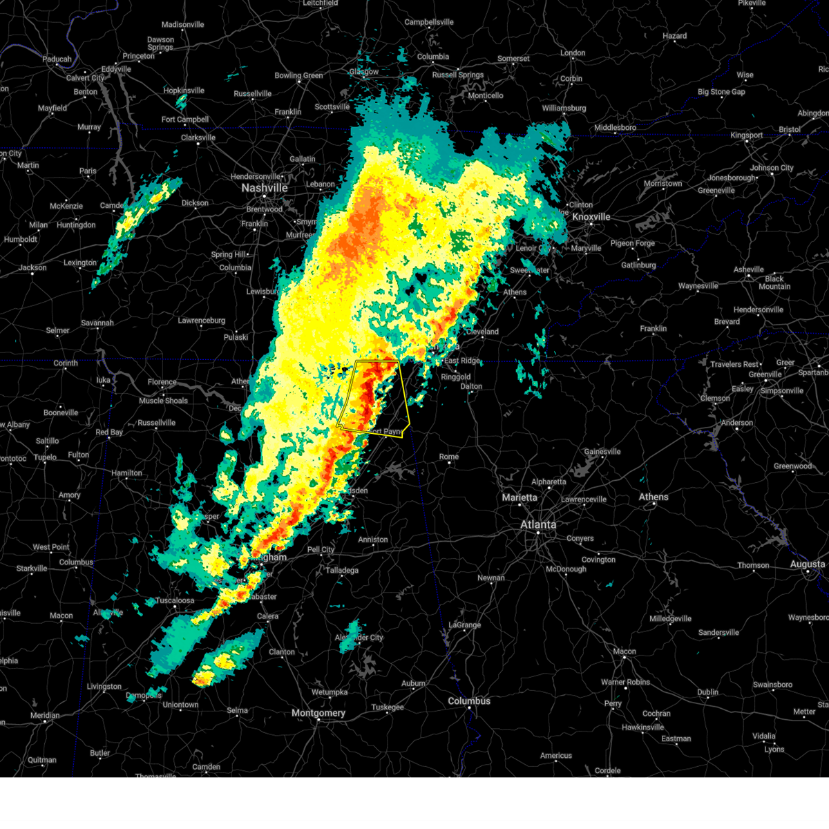 At 357 pm cdt, severe thunderstorms were located along a line extending from near bridgeport to near ider to near rainsville, moving east at 40 mph (radar indicated). Hazards include 60 mph wind gusts. Expect damage to roofs, siding, and trees. Locations impacted include, fort payne, higdon, ider, bridgeport, pisgah, rosalie, rainsville, desoto state park, henagar, and sylvania. At 357 pm cdt, severe thunderstorms were located along a line extending from near bridgeport to near ider to near rainsville, moving east at 40 mph (radar indicated). Hazards include 60 mph wind gusts. Expect damage to roofs, siding, and trees. Locations impacted include, fort payne, higdon, ider, bridgeport, pisgah, rosalie, rainsville, desoto state park, henagar, and sylvania.
|
| 5/3/2025 3:51 PM CDT |
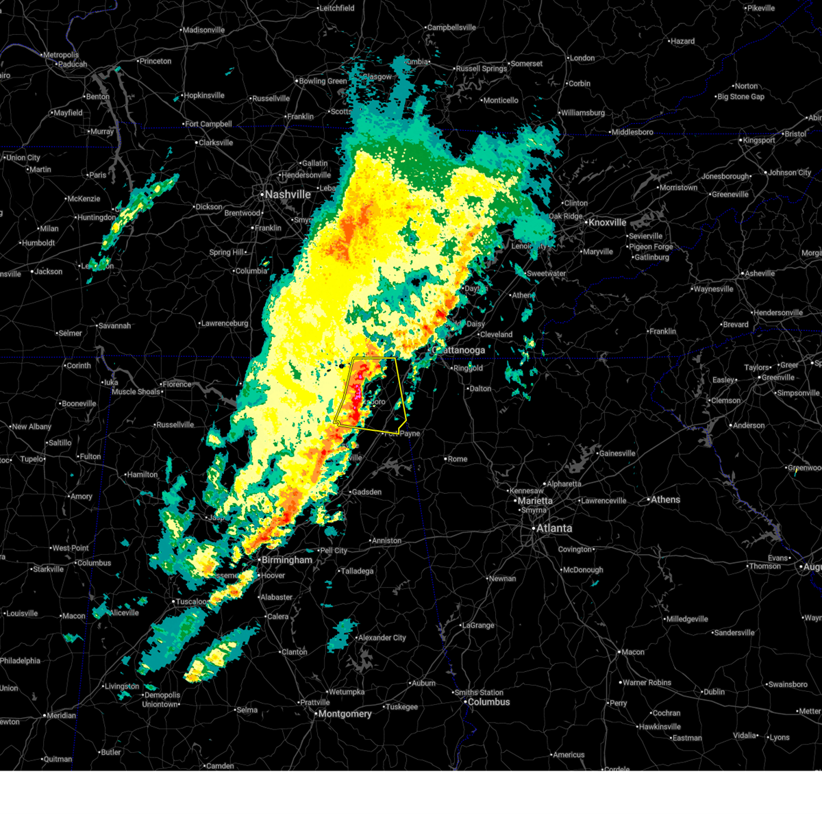 Svrhun the national weather service in huntsville alabama has issued a * severe thunderstorm warning for, central jackson county in northeastern alabama, northern dekalb county in northeastern alabama, * until 430 pm cdt. * at 350 pm cdt, severe thunderstorms were located along a line extending from near bridgeport to near pisgah to powell, moving east at 35 mph (radar indicated). Hazards include 60 mph wind gusts. expect damage to roofs, siding, and trees Svrhun the national weather service in huntsville alabama has issued a * severe thunderstorm warning for, central jackson county in northeastern alabama, northern dekalb county in northeastern alabama, * until 430 pm cdt. * at 350 pm cdt, severe thunderstorms were located along a line extending from near bridgeport to near pisgah to powell, moving east at 35 mph (radar indicated). Hazards include 60 mph wind gusts. expect damage to roofs, siding, and trees
|
| 5/2/2025 5:40 PM CDT |
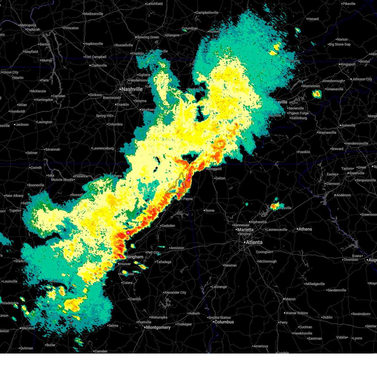 the severe thunderstorm warning has been cancelled and is no longer in effect the severe thunderstorm warning has been cancelled and is no longer in effect
|
| 5/2/2025 5:40 PM CDT |
 At 538 pm cdt, severe thunderstorms were located along a line extending from 7 miles southeast of jasper to 9 miles east of ider to rainsville, moving east at 50 mph (radar indicated). Hazards include ping pong ball size hail and 60 mph wind gusts. People and animals outdoors will be injured. expect hail damage to roofs, siding, windows, and vehicles. expect wind damage to roofs, siding, and trees. Locations impacted include, mentone, sulpher springs, ider, valley head, henagar, hammondville, sylvania, and powell. At 538 pm cdt, severe thunderstorms were located along a line extending from 7 miles southeast of jasper to 9 miles east of ider to rainsville, moving east at 50 mph (radar indicated). Hazards include ping pong ball size hail and 60 mph wind gusts. People and animals outdoors will be injured. expect hail damage to roofs, siding, windows, and vehicles. expect wind damage to roofs, siding, and trees. Locations impacted include, mentone, sulpher springs, ider, valley head, henagar, hammondville, sylvania, and powell.
|
| 5/2/2025 5:35 PM CDT |
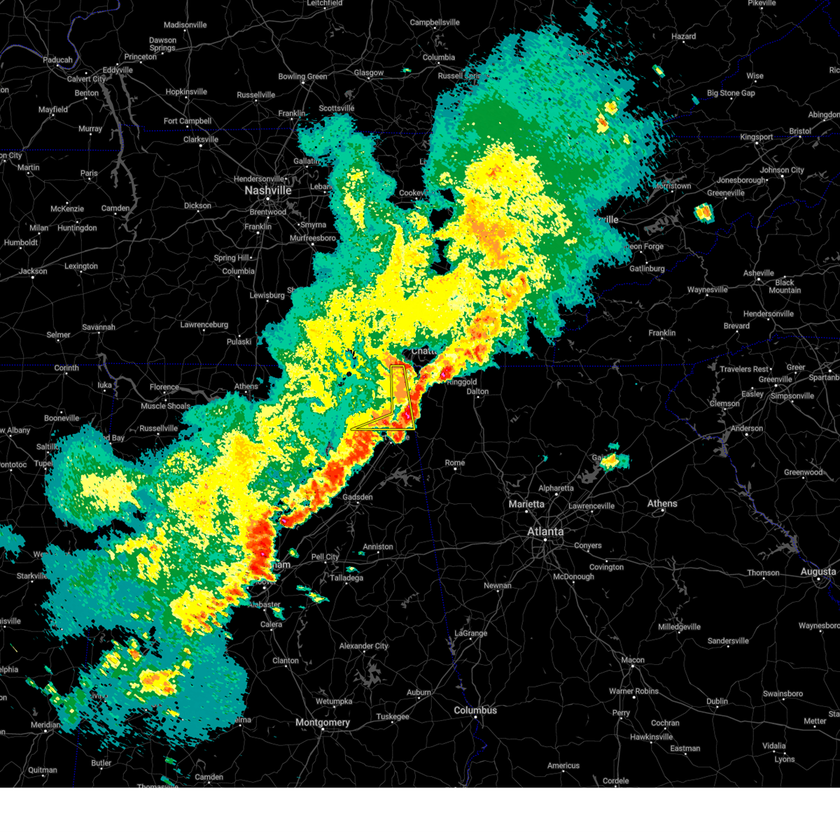 At 533 pm cdt, severe thunderstorms were located along a line extending from near bridgeport to 6 miles southeast of ider to powell, moving east at 45 mph (radar indicated). Hazards include ping pong ball size hail and 60 mph wind gusts. People and animals outdoors will be injured. expect hail damage to roofs, siding, windows, and vehicles. expect wind damage to roofs, siding, and trees. Locations impacted include, bridgeport, mentone, long island, higdon, sulpher springs, ider, valley head, henagar, hammondville, and sylvania. At 533 pm cdt, severe thunderstorms were located along a line extending from near bridgeport to 6 miles southeast of ider to powell, moving east at 45 mph (radar indicated). Hazards include ping pong ball size hail and 60 mph wind gusts. People and animals outdoors will be injured. expect hail damage to roofs, siding, windows, and vehicles. expect wind damage to roofs, siding, and trees. Locations impacted include, bridgeport, mentone, long island, higdon, sulpher springs, ider, valley head, henagar, hammondville, and sylvania.
|
| 5/2/2025 5:28 PM CDT | Emergency manager reported a tree down blocking both lanes on cr 17 in dekalb county AL, 2.3 miles SSE of Ider, AL |
| 5/2/2025 5:27 PM CDT |
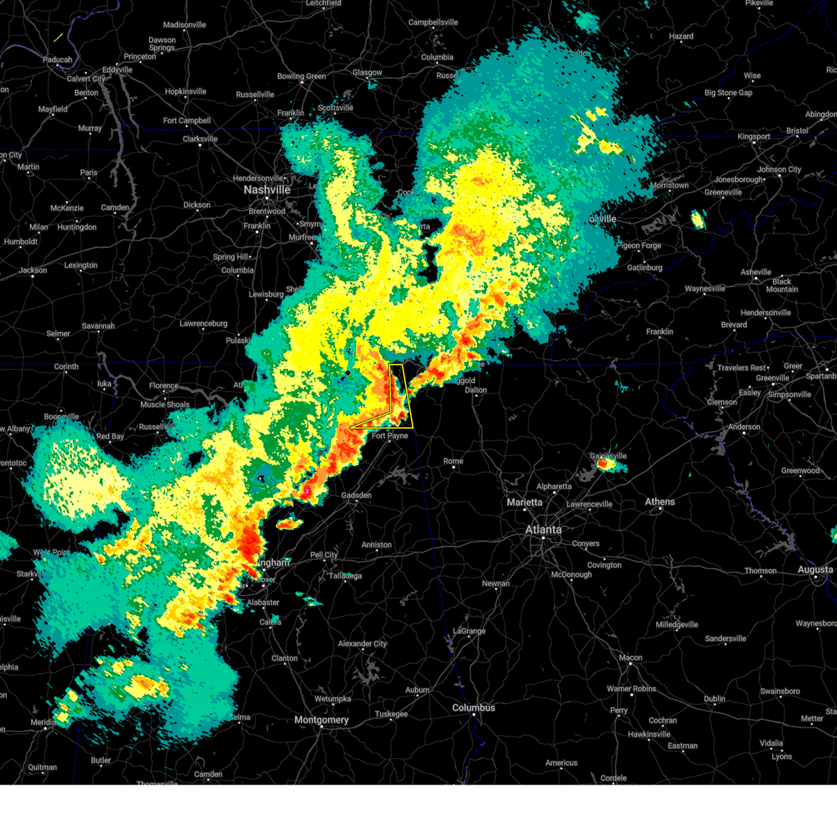 Svrhun the national weather service in huntsville alabama has issued a * severe thunderstorm warning for, eastern jackson county in northeastern alabama, northeastern dekalb county in northeastern alabama, * until 545 pm cdt. * at 526 pm cdt, severe thunderstorms were located along a line extending from 6 miles northwest of trenton to 6 miles southeast of ider to near powell, moving east at 50 mph (radar indicated). Hazards include 60 mph wind gusts and quarter size hail. Hail damage to vehicles is expected. Expect wind damage to roofs, siding, and trees. Svrhun the national weather service in huntsville alabama has issued a * severe thunderstorm warning for, eastern jackson county in northeastern alabama, northeastern dekalb county in northeastern alabama, * until 545 pm cdt. * at 526 pm cdt, severe thunderstorms were located along a line extending from 6 miles northwest of trenton to 6 miles southeast of ider to near powell, moving east at 50 mph (radar indicated). Hazards include 60 mph wind gusts and quarter size hail. Hail damage to vehicles is expected. Expect wind damage to roofs, siding, and trees.
|
| 5/2/2025 5:22 PM CDT |
 At 521 pm cdt, severe thunderstorms were located along a line extending from near south pittsburg to near henagar, moving east at 45 mph (emergency management). Hazards include 60 mph wind gusts and quarter size hail. Hail damage to vehicles is expected. expect wind damage to roofs, siding, and trees. Locations impacted include, higdon, ider, bridgeport, pisgah, rosalie, henagar, bass, dutton, martintown, and long island. At 521 pm cdt, severe thunderstorms were located along a line extending from near south pittsburg to near henagar, moving east at 45 mph (emergency management). Hazards include 60 mph wind gusts and quarter size hail. Hail damage to vehicles is expected. expect wind damage to roofs, siding, and trees. Locations impacted include, higdon, ider, bridgeport, pisgah, rosalie, henagar, bass, dutton, martintown, and long island.
|
| 5/2/2025 5:22 PM CDT |
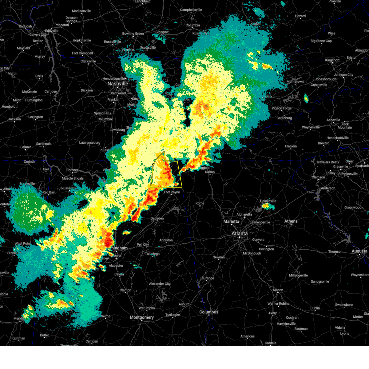 the severe thunderstorm warning has been cancelled and is no longer in effect the severe thunderstorm warning has been cancelled and is no longer in effect
|
| 5/2/2025 5:12 PM CDT |
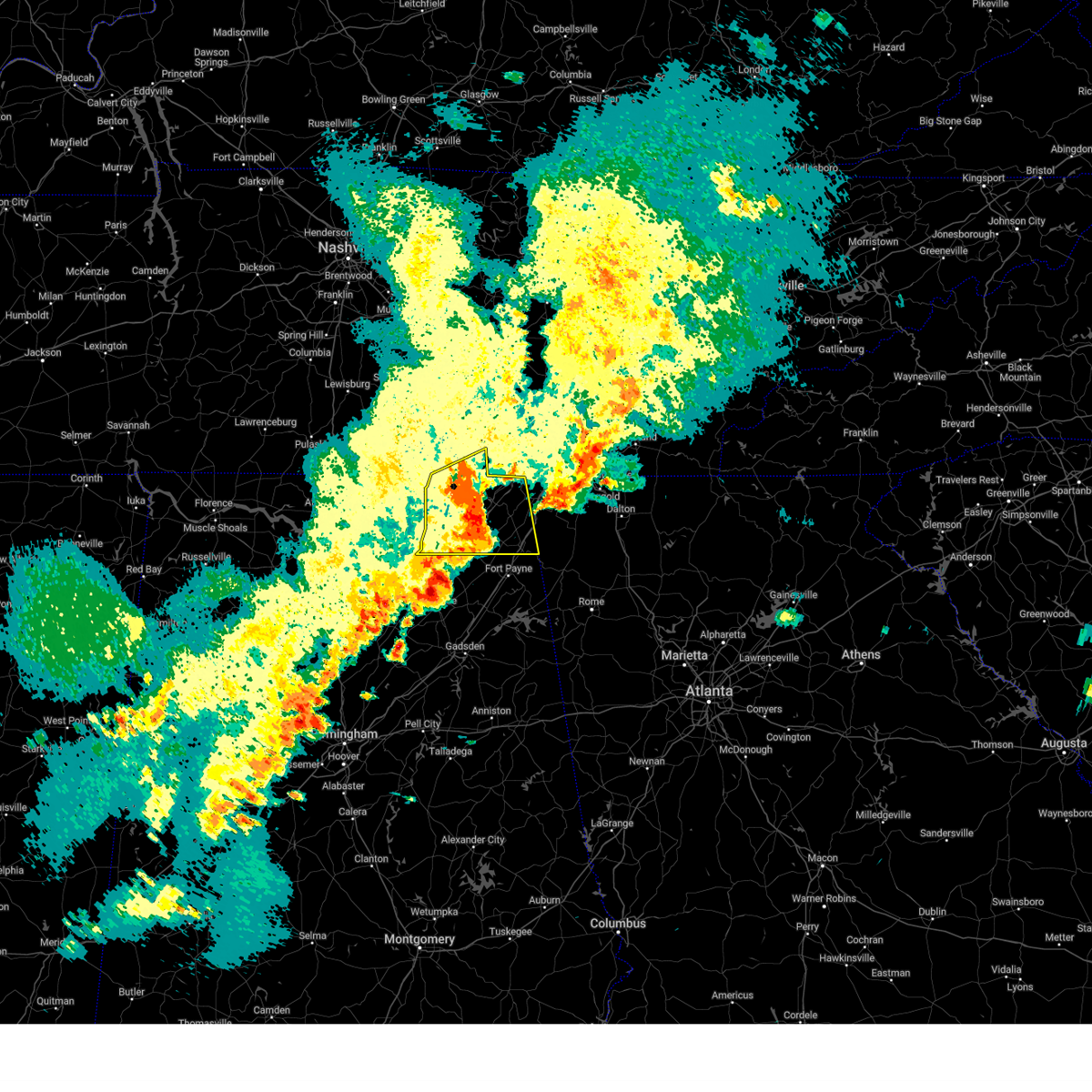 At 510 pm cdt, severe thunderstorms were located along a line extending from 10 miles southeast of cowan to near sylvania, moving east at 40 mph (emergency management). Hazards include 60 mph wind gusts and quarter size hail. Hail damage to vehicles is expected. expect wind damage to roofs, siding, and trees. Locations impacted include, lim rock, jericho, higdon, ider, larkin, bridgeport, pisgah, rosalie, larkinsville, and henagar. At 510 pm cdt, severe thunderstorms were located along a line extending from 10 miles southeast of cowan to near sylvania, moving east at 40 mph (emergency management). Hazards include 60 mph wind gusts and quarter size hail. Hail damage to vehicles is expected. expect wind damage to roofs, siding, and trees. Locations impacted include, lim rock, jericho, higdon, ider, larkin, bridgeport, pisgah, rosalie, larkinsville, and henagar.
|
| 5/2/2025 4:51 PM CDT |
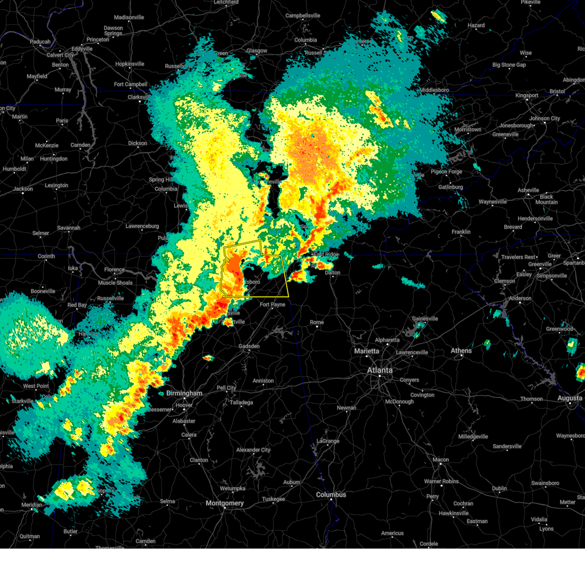 the severe thunderstorm warning has been cancelled and is no longer in effect the severe thunderstorm warning has been cancelled and is no longer in effect
|
| 5/2/2025 4:51 PM CDT |
 At 450 pm cdt, severe thunderstorms were located along a line extending from 6 miles southeast of huntland to 6 miles east of woodville, moving east at 45 mph (trained weather spotters have reported trees down in the woodville area). Hazards include 60 mph wind gusts and quarter size hail. Hail damage to vehicles is expected. expect wind damage to roofs, siding, and trees. Locations impacted include, lim rock, jericho, huntland, higdon, ider, larkin, bridgeport, francisco, beans creek, and pisgah. At 450 pm cdt, severe thunderstorms were located along a line extending from 6 miles southeast of huntland to 6 miles east of woodville, moving east at 45 mph (trained weather spotters have reported trees down in the woodville area). Hazards include 60 mph wind gusts and quarter size hail. Hail damage to vehicles is expected. expect wind damage to roofs, siding, and trees. Locations impacted include, lim rock, jericho, huntland, higdon, ider, larkin, bridgeport, francisco, beans creek, and pisgah.
|
| 5/2/2025 4:34 PM CDT |
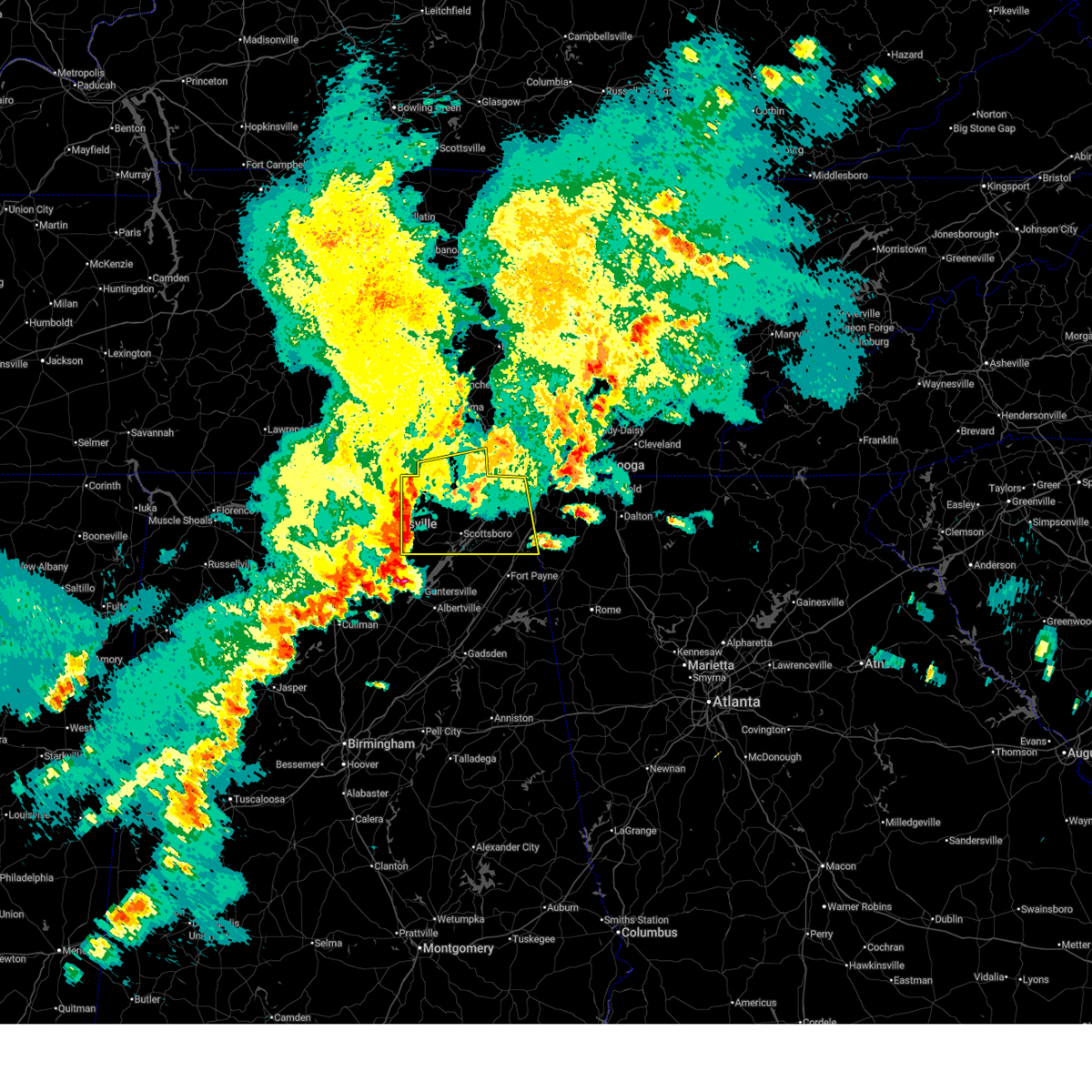 Svrhun the national weather service in huntsville alabama has issued a * severe thunderstorm warning for, north central marshall county in northeastern alabama, jackson county in northeastern alabama, eastern madison county in north central alabama, northeastern dekalb county in northeastern alabama, southern franklin county in middle tennessee, * until 530 pm cdt. * at 434 pm cdt, severe thunderstorms were located along a line extending from 6 miles northeast of new market to near owens cross roads, moving east at 40 mph (radar indicated). Hazards include 60 mph wind gusts and quarter size hail. Hail damage to vehicles is expected. Expect wind damage to roofs, siding, and trees. Svrhun the national weather service in huntsville alabama has issued a * severe thunderstorm warning for, north central marshall county in northeastern alabama, jackson county in northeastern alabama, eastern madison county in north central alabama, northeastern dekalb county in northeastern alabama, southern franklin county in middle tennessee, * until 530 pm cdt. * at 434 pm cdt, severe thunderstorms were located along a line extending from 6 miles northeast of new market to near owens cross roads, moving east at 40 mph (radar indicated). Hazards include 60 mph wind gusts and quarter size hail. Hail damage to vehicles is expected. Expect wind damage to roofs, siding, and trees.
|
| 5/2/2025 4:10 PM CDT |
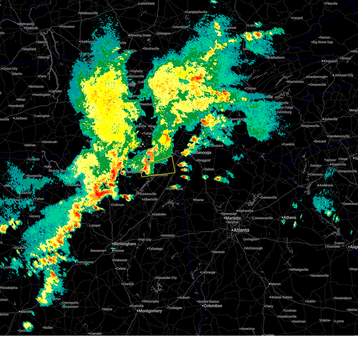 At 409 pm cdt, a severe thunderstorm was located over skyline, or 9 miles north of scottsboro, moving northeast at 30 mph (emergency management). Hazards include 60 mph wind gusts and quarter size hail. Hail damage to vehicles is expected. expect wind damage to roofs, siding, and trees. Locations impacted include, skyline, martintown, lim rock, higdon, fackler, ider, bridgeport, hollywood, pisgah, and rosalie. At 409 pm cdt, a severe thunderstorm was located over skyline, or 9 miles north of scottsboro, moving northeast at 30 mph (emergency management). Hazards include 60 mph wind gusts and quarter size hail. Hail damage to vehicles is expected. expect wind damage to roofs, siding, and trees. Locations impacted include, skyline, martintown, lim rock, higdon, fackler, ider, bridgeport, hollywood, pisgah, and rosalie.
|
| 5/2/2025 3:58 PM CDT |
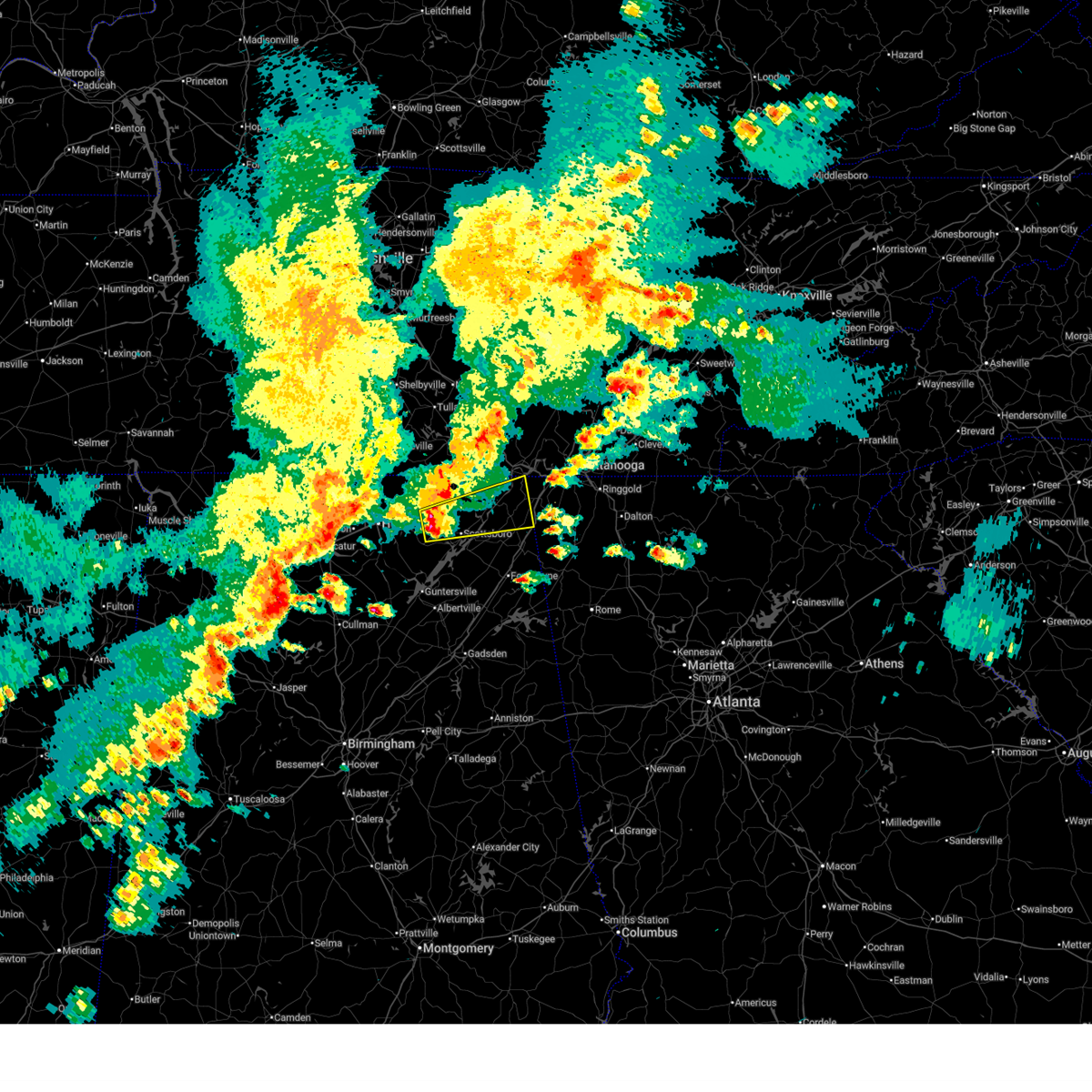 Svrhun the national weather service in huntsville alabama has issued a * severe thunderstorm warning for, central jackson county in northeastern alabama, northeastern dekalb county in northeastern alabama, * until 500 pm cdt. * at 357 pm cdt, a severe thunderstorm was located 7 miles southwest of skyline, or 10 miles northwest of scottsboro, moving east at 30 mph (radar indicated). Hazards include golf ball size hail and 60 mph wind gusts. People and animals outdoors will be injured. expect hail damage to roofs, siding, windows, and vehicles. Expect wind damage to roofs, siding, and trees. Svrhun the national weather service in huntsville alabama has issued a * severe thunderstorm warning for, central jackson county in northeastern alabama, northeastern dekalb county in northeastern alabama, * until 500 pm cdt. * at 357 pm cdt, a severe thunderstorm was located 7 miles southwest of skyline, or 10 miles northwest of scottsboro, moving east at 30 mph (radar indicated). Hazards include golf ball size hail and 60 mph wind gusts. People and animals outdoors will be injured. expect hail damage to roofs, siding, windows, and vehicles. Expect wind damage to roofs, siding, and trees.
|
| 4/10/2025 7:35 PM CDT |
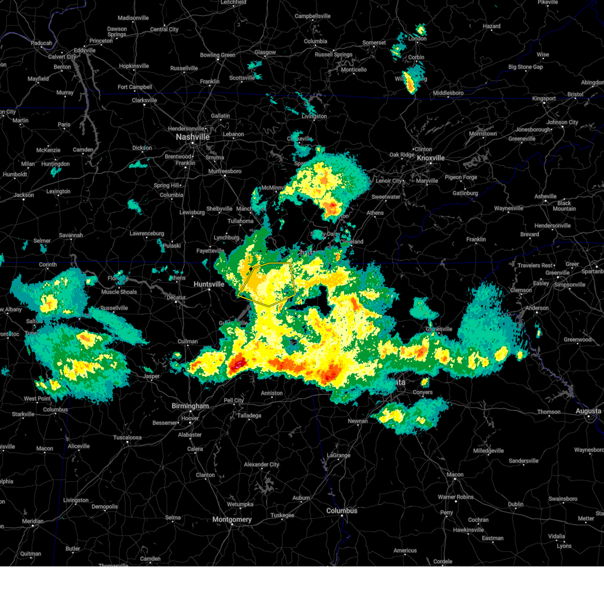 the severe thunderstorm warning has been cancelled and is no longer in effect the severe thunderstorm warning has been cancelled and is no longer in effect
|
| 4/10/2025 7:26 PM CDT |
 At 726 pm cdt, severe thunderstorms were located along a line extending from 7 miles east of la fayette to 9 miles northwest of summerville to fyffe, moving southeast at 55 mph (broadcast media). Hazards include 60 mph wind gusts. Expect damage to roofs, siding, and trees. Locations impacted include, bass, dutton, skyline, martintown, lim rock, long island, russell cave national monument, higdon, sulpher springs, and fackler. At 726 pm cdt, severe thunderstorms were located along a line extending from 7 miles east of la fayette to 9 miles northwest of summerville to fyffe, moving southeast at 55 mph (broadcast media). Hazards include 60 mph wind gusts. Expect damage to roofs, siding, and trees. Locations impacted include, bass, dutton, skyline, martintown, lim rock, long island, russell cave national monument, higdon, sulpher springs, and fackler.
|
| 4/10/2025 7:26 PM CDT |
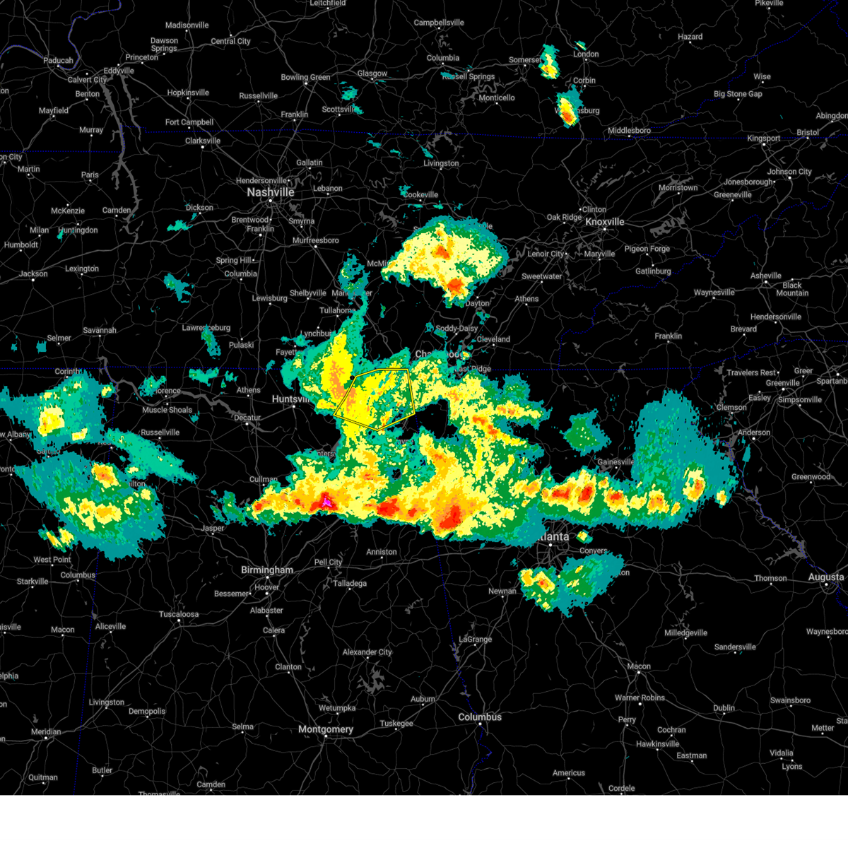 the severe thunderstorm warning has been cancelled and is no longer in effect the severe thunderstorm warning has been cancelled and is no longer in effect
|
| 4/10/2025 6:54 PM CDT |
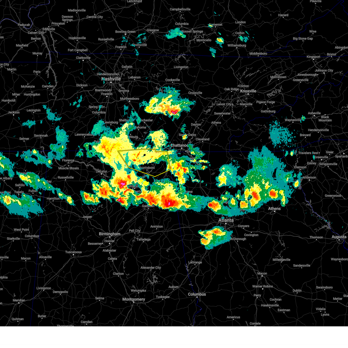 Svrhun the national weather service in huntsville alabama has issued a * severe thunderstorm warning for, jackson county in northeastern alabama, northeastern madison county in north central alabama, northeastern dekalb county in northeastern alabama, southeastern lincoln county in middle tennessee, southern franklin county in middle tennessee, * until 800 pm cdt. * at 653 pm cdt, severe thunderstorms were located along a line extending from near trenton to near pisgah to near woodville, moving southeast at 55 mph (broadcast media. at 6:45 pm, media reported trees down in hazel tree. this is due to outflow from the storms moving southeast). Hazards include 60 mph wind gusts. expect damage to roofs, siding, and trees Svrhun the national weather service in huntsville alabama has issued a * severe thunderstorm warning for, jackson county in northeastern alabama, northeastern madison county in north central alabama, northeastern dekalb county in northeastern alabama, southeastern lincoln county in middle tennessee, southern franklin county in middle tennessee, * until 800 pm cdt. * at 653 pm cdt, severe thunderstorms were located along a line extending from near trenton to near pisgah to near woodville, moving southeast at 55 mph (broadcast media. at 6:45 pm, media reported trees down in hazel tree. this is due to outflow from the storms moving southeast). Hazards include 60 mph wind gusts. expect damage to roofs, siding, and trees
|
| 4/6/2025 2:54 AM CDT |
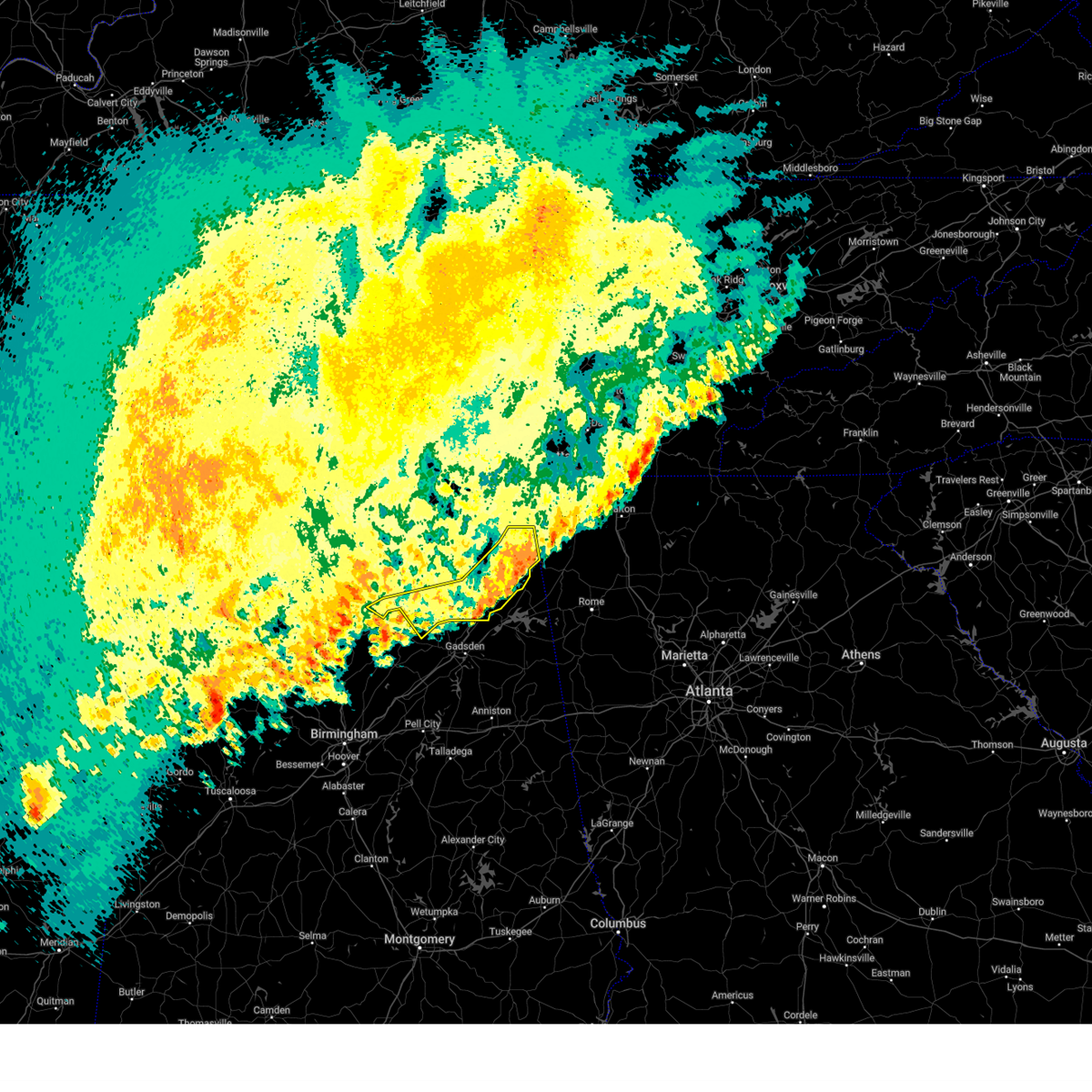 The storms which prompted the warning have moved out of the area. therefore, the warning will be allowed to expire. a tornado watch remains in effect until 500 am cdt for north central and northeastern alabama. The storms which prompted the warning have moved out of the area. therefore, the warning will be allowed to expire. a tornado watch remains in effect until 500 am cdt for north central and northeastern alabama.
|
| 4/6/2025 2:35 AM CDT |
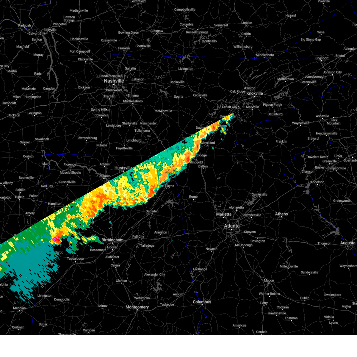 The storm which prompted the warning has moved out of the area. therefore, the warning will be allowed to expire. a tornado watch remains in effect until 300 am cdt for northeastern alabama. The storm which prompted the warning has moved out of the area. therefore, the warning will be allowed to expire. a tornado watch remains in effect until 300 am cdt for northeastern alabama.
|
| 4/6/2025 2:27 AM CDT |
 At 227 am cdt, severe thunderstorms were located along a line extending from near ider to near fyffe to near albertville, moving east at 20 mph (radar indicated). Hazards include 60 mph wind gusts. Expect damage to roofs, siding, and trees. Locations impacted include, fyffe, fort payne, high point, ider, little river canyon np, skirum, pine ridge, painter, rainsville, and joppa. At 227 am cdt, severe thunderstorms were located along a line extending from near ider to near fyffe to near albertville, moving east at 20 mph (radar indicated). Hazards include 60 mph wind gusts. Expect damage to roofs, siding, and trees. Locations impacted include, fyffe, fort payne, high point, ider, little river canyon np, skirum, pine ridge, painter, rainsville, and joppa.
|
| 4/6/2025 2:27 AM CDT |
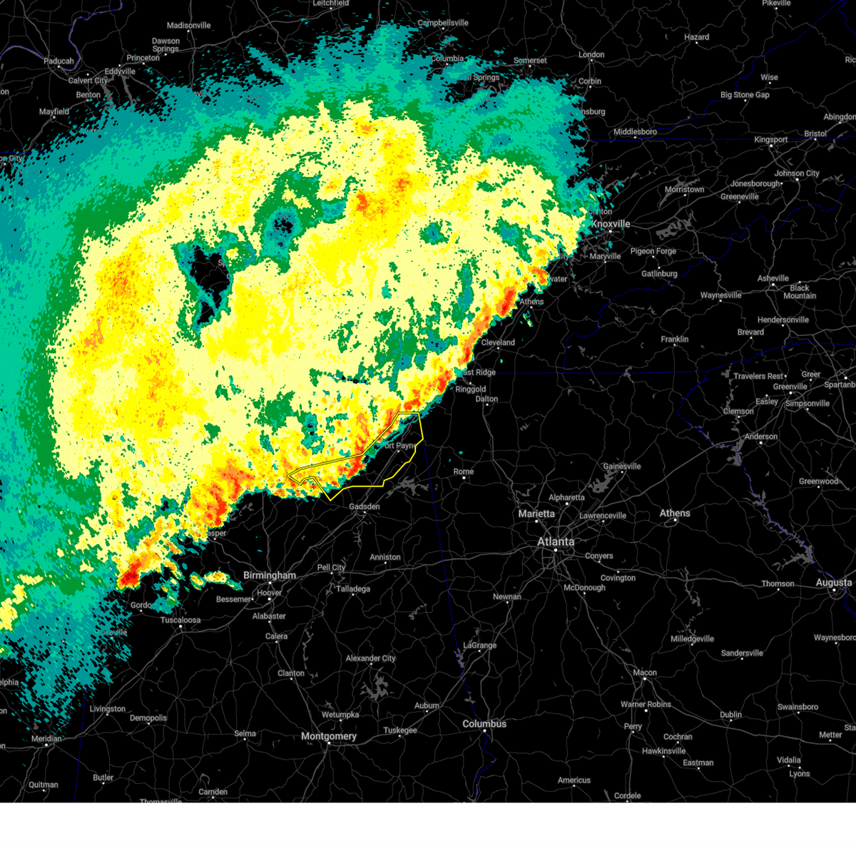 the severe thunderstorm warning has been cancelled and is no longer in effect the severe thunderstorm warning has been cancelled and is no longer in effect
|
| 4/6/2025 2:22 AM CDT |
 the severe thunderstorm warning has been cancelled and is no longer in effect the severe thunderstorm warning has been cancelled and is no longer in effect
|
| 4/6/2025 2:22 AM CDT |
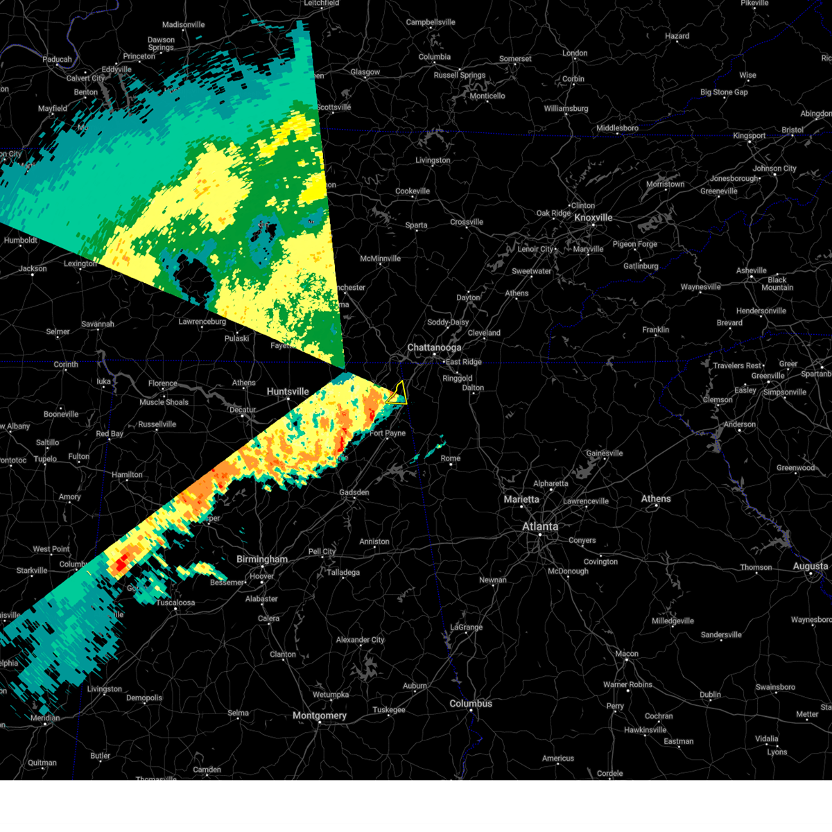 At 222 am cdt, a severe thunderstorm was located near ider, or 10 miles southwest of trenton, moving southeast at 15 mph (radar indicated). Hazards include 60 mph wind gusts. Expect damage to roofs, siding, and trees. Locations impacted include, sulpher springs and ider. At 222 am cdt, a severe thunderstorm was located near ider, or 10 miles southwest of trenton, moving southeast at 15 mph (radar indicated). Hazards include 60 mph wind gusts. Expect damage to roofs, siding, and trees. Locations impacted include, sulpher springs and ider.
|
| 4/6/2025 2:07 AM CDT |
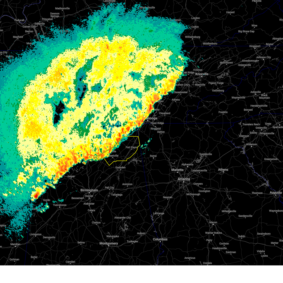 Svrhun the national weather service in huntsville alabama has issued a * severe thunderstorm warning for, marshall county in northeastern alabama, southeastern jackson county in northeastern alabama, dekalb county in northeastern alabama, northeastern cullman county in north central alabama, * until 300 am cdt. * at 207 am cdt, severe thunderstorms were located along a line extending from near henagar to near geraldine to near strawberry, moving east at 20 mph (radar indicated). Hazards include 60 mph wind gusts. expect damage to roofs, siding, and trees Svrhun the national weather service in huntsville alabama has issued a * severe thunderstorm warning for, marshall county in northeastern alabama, southeastern jackson county in northeastern alabama, dekalb county in northeastern alabama, northeastern cullman county in north central alabama, * until 300 am cdt. * at 207 am cdt, severe thunderstorms were located along a line extending from near henagar to near geraldine to near strawberry, moving east at 20 mph (radar indicated). Hazards include 60 mph wind gusts. expect damage to roofs, siding, and trees
|
| 4/6/2025 1:54 AM CDT |
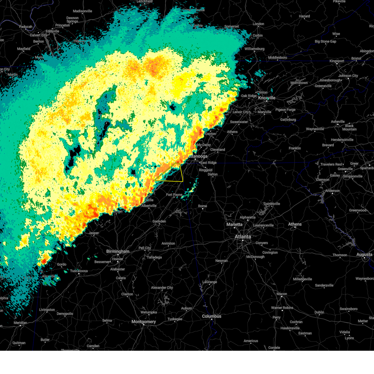 Svrhun the national weather service in huntsville alabama has issued a * severe thunderstorm warning for, northeastern jackson county in northeastern alabama, northeastern dekalb county in northeastern alabama, * until 245 am cdt. * at 153 am cdt, severe thunderstorms were located along a line extending from near trenton to near ider to near pisgah, moving east at 50 mph (radar indicated). Hazards include 60 mph wind gusts. expect damage to roofs, siding, and trees Svrhun the national weather service in huntsville alabama has issued a * severe thunderstorm warning for, northeastern jackson county in northeastern alabama, northeastern dekalb county in northeastern alabama, * until 245 am cdt. * at 153 am cdt, severe thunderstorms were located along a line extending from near trenton to near ider to near pisgah, moving east at 50 mph (radar indicated). Hazards include 60 mph wind gusts. expect damage to roofs, siding, and trees
|
| 4/6/2025 1:46 AM CDT |
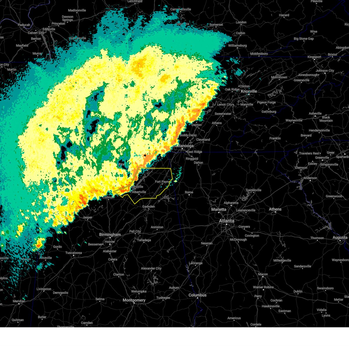 the severe thunderstorm warning has been cancelled and is no longer in effect the severe thunderstorm warning has been cancelled and is no longer in effect
|
| 4/6/2025 1:46 AM CDT |
 At 145 am cdt, severe thunderstorms were located along a line extending from scottsboro to 7 miles southeast of grant to 6 miles southwest of guntersville, moving east at 40 mph (radar indicated). Hazards include 60 mph wind gusts. Expect damage to roofs, siding, and trees. Locations impacted include, high point, lim rock, ider, pine ridge, pisgah, rosalie, painter, joppa, desoto state park, and crossville. At 145 am cdt, severe thunderstorms were located along a line extending from scottsboro to 7 miles southeast of grant to 6 miles southwest of guntersville, moving east at 40 mph (radar indicated). Hazards include 60 mph wind gusts. Expect damage to roofs, siding, and trees. Locations impacted include, high point, lim rock, ider, pine ridge, pisgah, rosalie, painter, joppa, desoto state park, and crossville.
|
| 4/6/2025 1:44 AM CDT |
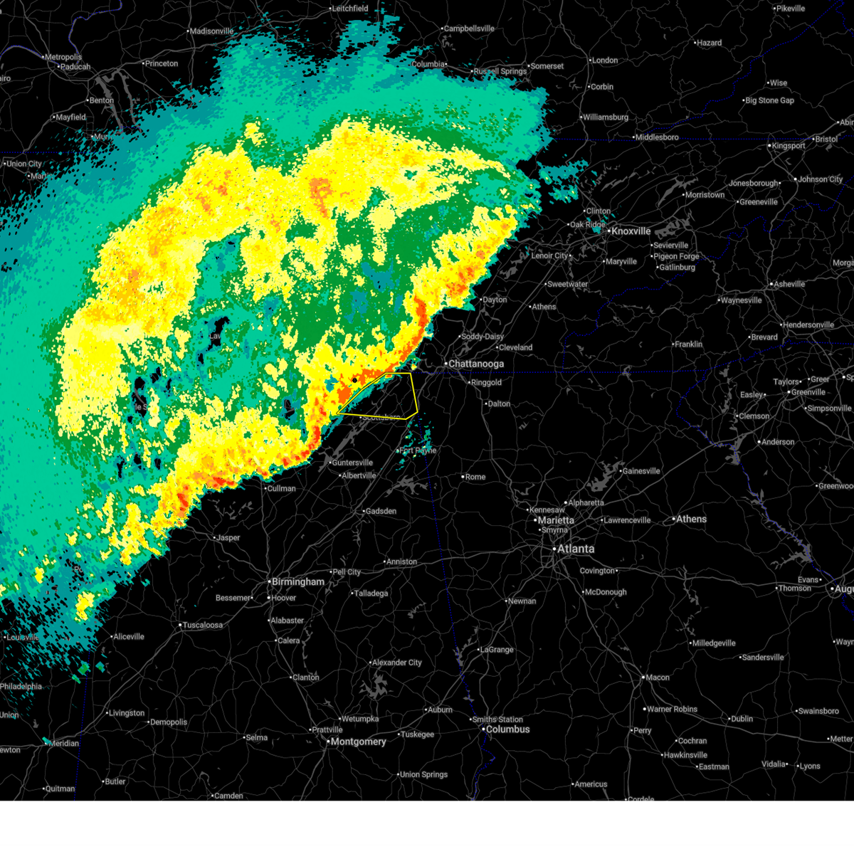 At 143 am cdt, severe thunderstorms were located along a line extending from near bridgeport to 6 miles south of stevenson to near scottsboro, moving east at 30 mph (radar indicated). Hazards include 60 mph wind gusts. Expect damage to roofs, siding, and trees. Locations impacted include, martintown, long island, russell cave national monument, higdon, fackler, ider, bridgeport, hollywood, pisgah, and rosalie. At 143 am cdt, severe thunderstorms were located along a line extending from near bridgeport to 6 miles south of stevenson to near scottsboro, moving east at 30 mph (radar indicated). Hazards include 60 mph wind gusts. Expect damage to roofs, siding, and trees. Locations impacted include, martintown, long island, russell cave national monument, higdon, fackler, ider, bridgeport, hollywood, pisgah, and rosalie.
|
| 4/6/2025 1:35 AM CDT |
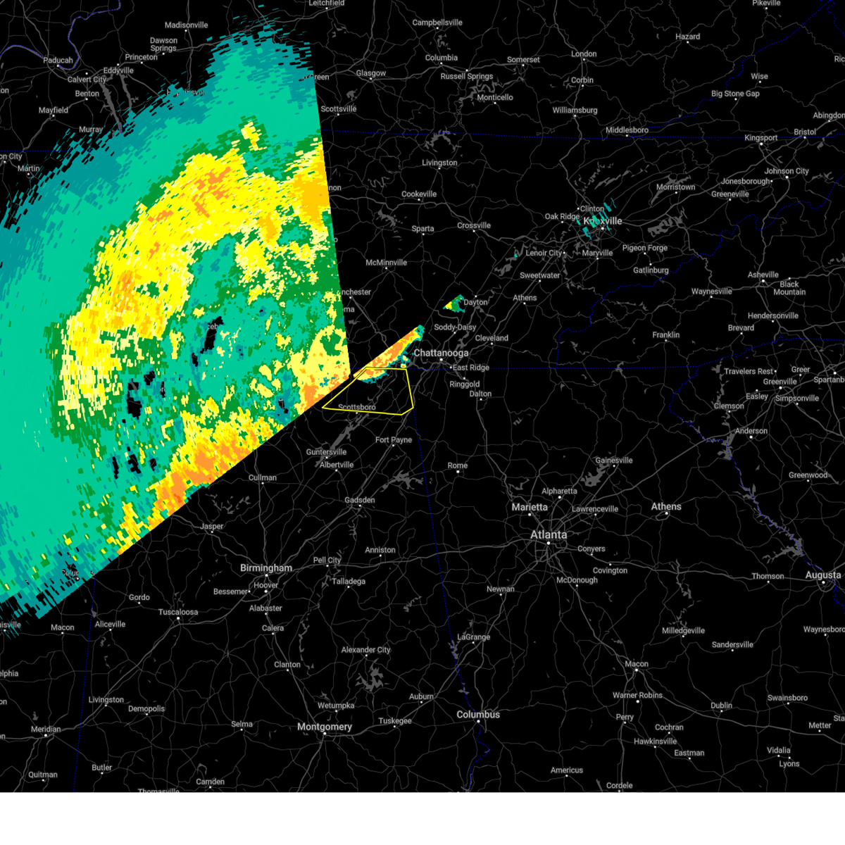 At 135 am cdt, severe thunderstorms were located along a line extending from 6 miles east of bridgeport to near stevenson to near scottsboro, moving east at 45 mph (radar indicated). Hazards include 60 mph wind gusts. Expect damage to roofs, siding, and trees. Locations impacted include, bass, skyline, martintown, long island, russell cave national monument, higdon, fackler, ider, bridgeport, and hollywood. At 135 am cdt, severe thunderstorms were located along a line extending from 6 miles east of bridgeport to near stevenson to near scottsboro, moving east at 45 mph (radar indicated). Hazards include 60 mph wind gusts. Expect damage to roofs, siding, and trees. Locations impacted include, bass, skyline, martintown, long island, russell cave national monument, higdon, fackler, ider, bridgeport, and hollywood.
|
| 4/6/2025 1:35 AM CDT |
 the severe thunderstorm warning has been cancelled and is no longer in effect the severe thunderstorm warning has been cancelled and is no longer in effect
|
| 4/6/2025 1:23 AM CDT |
 Svrhun the national weather service in huntsville alabama has issued a * severe thunderstorm warning for, marshall county in northeastern alabama, southern jackson county in northeastern alabama, southeastern madison county in north central alabama, dekalb county in northeastern alabama, northeastern cullman county in north central alabama, southeastern morgan county in north central alabama, * until 215 am cdt. * at 122 am cdt, severe thunderstorms were located along a line extending from near gurley to 6 miles east of morgan city to 9 miles west of arab, moving east at 40 mph (radar indicated). Hazards include 60 mph wind gusts. expect damage to roofs, siding, and trees Svrhun the national weather service in huntsville alabama has issued a * severe thunderstorm warning for, marshall county in northeastern alabama, southern jackson county in northeastern alabama, southeastern madison county in north central alabama, dekalb county in northeastern alabama, northeastern cullman county in north central alabama, southeastern morgan county in north central alabama, * until 215 am cdt. * at 122 am cdt, severe thunderstorms were located along a line extending from near gurley to 6 miles east of morgan city to 9 miles west of arab, moving east at 40 mph (radar indicated). Hazards include 60 mph wind gusts. expect damage to roofs, siding, and trees
|
| 4/6/2025 1:19 AM CDT |
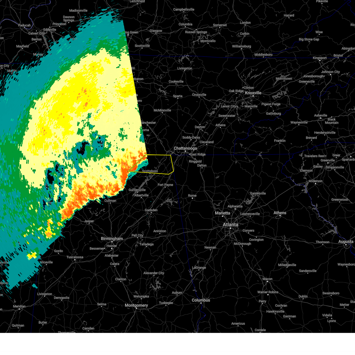 At 118 am cdt, severe thunderstorms were located along a line extending from near bridgeport to near skyline to near gurley, moving east at 35 mph (radar indicated). Hazards include 60 mph wind gusts. Expect damage to roofs, siding, and trees. Locations impacted include, jericho, higdon, ider, larkin, bridgeport, pisgah, rosalie, larkinsville, bass, and skyline. At 118 am cdt, severe thunderstorms were located along a line extending from near bridgeport to near skyline to near gurley, moving east at 35 mph (radar indicated). Hazards include 60 mph wind gusts. Expect damage to roofs, siding, and trees. Locations impacted include, jericho, higdon, ider, larkin, bridgeport, pisgah, rosalie, larkinsville, bass, and skyline.
|
| 4/6/2025 1:19 AM CDT |
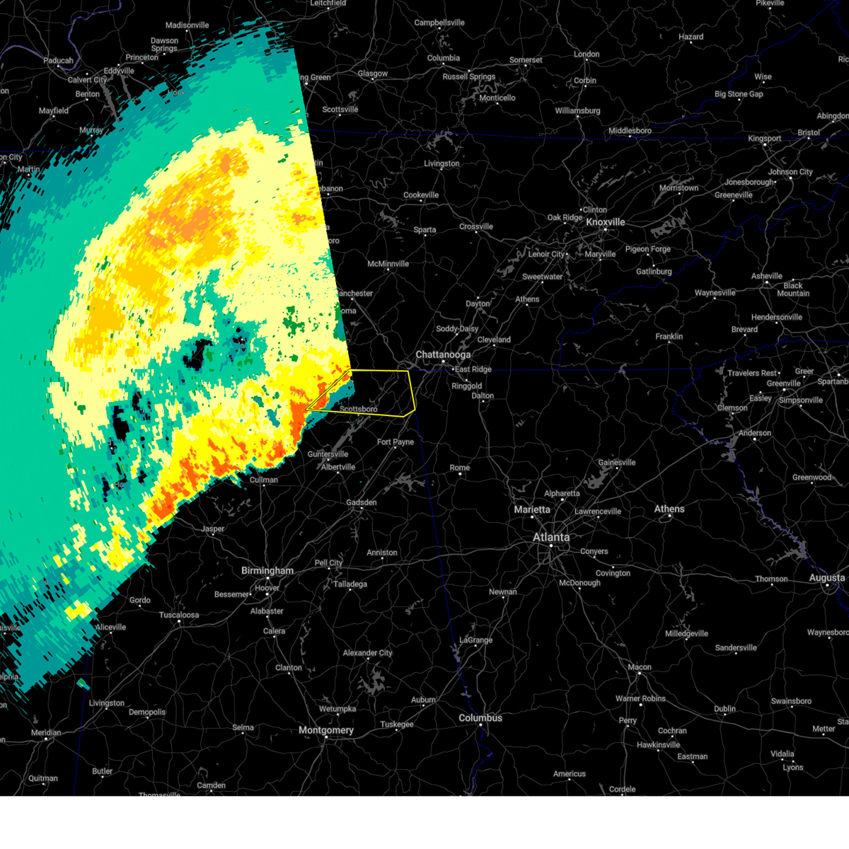 the severe thunderstorm warning has been cancelled and is no longer in effect the severe thunderstorm warning has been cancelled and is no longer in effect
|
| 4/6/2025 1:04 AM CDT |
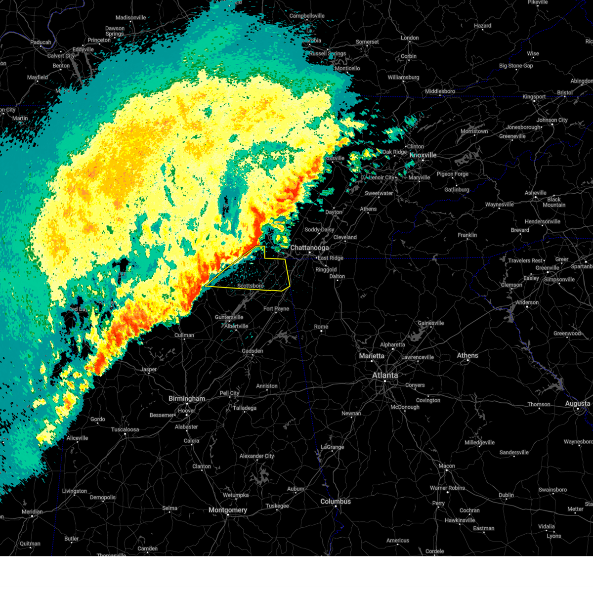 Svrhun the national weather service in huntsville alabama has issued a * severe thunderstorm warning for, jackson county in northeastern alabama, east central madison county in north central alabama, northeastern dekalb county in northeastern alabama, southeastern franklin county in middle tennessee, * until 200 am cdt. * at 103 am cdt, severe thunderstorms were located along a line extending from 9 miles southeast of cowan to near skyline to near gurley, moving east at 45 mph (radar indicated). Hazards include 60 mph wind gusts. expect damage to roofs, siding, and trees Svrhun the national weather service in huntsville alabama has issued a * severe thunderstorm warning for, jackson county in northeastern alabama, east central madison county in north central alabama, northeastern dekalb county in northeastern alabama, southeastern franklin county in middle tennessee, * until 200 am cdt. * at 103 am cdt, severe thunderstorms were located along a line extending from 9 miles southeast of cowan to near skyline to near gurley, moving east at 45 mph (radar indicated). Hazards include 60 mph wind gusts. expect damage to roofs, siding, and trees
|
| 3/4/2025 10:55 PM CST |
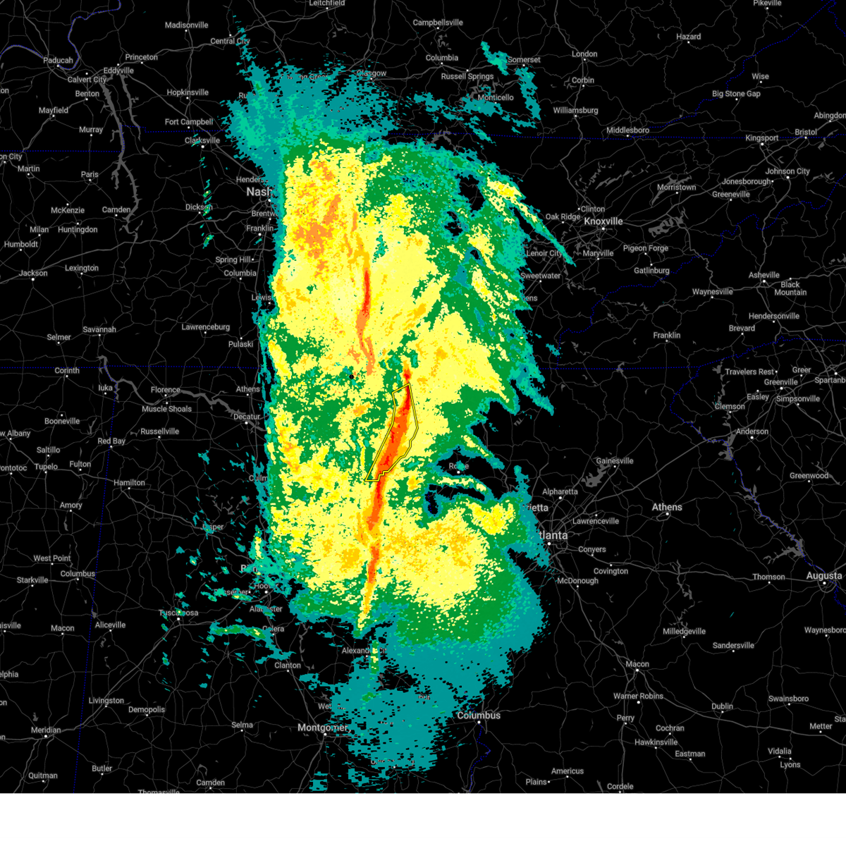 The storms which prompted the warning have moved out of the area. therefore, the warning will be allowed to expire. a severe thunderstorm watch remains in effect until 300 am cst for northeastern alabama. The storms which prompted the warning have moved out of the area. therefore, the warning will be allowed to expire. a severe thunderstorm watch remains in effect until 300 am cst for northeastern alabama.
|
| 3/4/2025 10:28 PM CST |
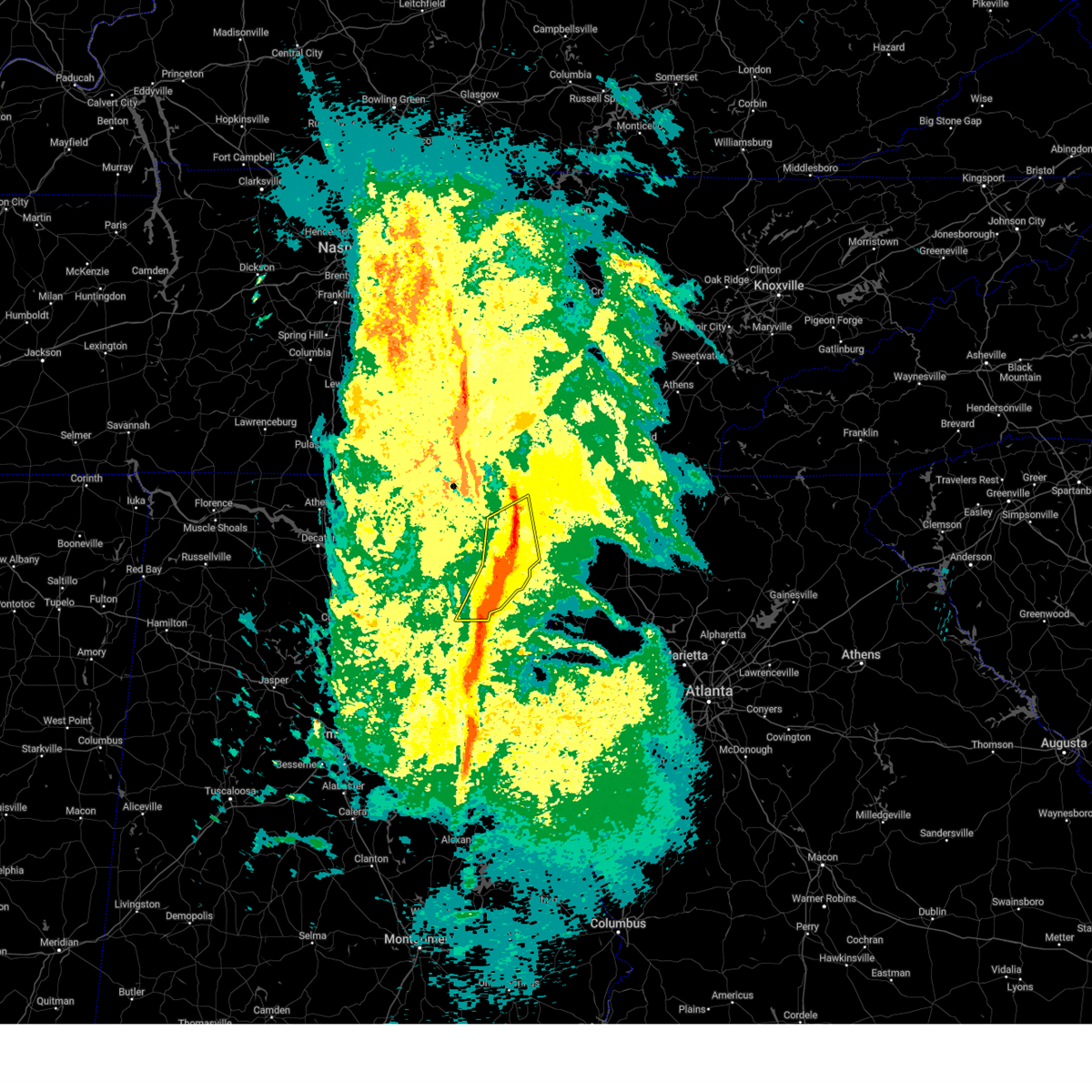 The storms which prompted the warning have moved out of the area. therefore, the warning will be allowed to expire. however, gusty winds are still possible with these thunderstorms. a severe thunderstorm watch remains in effect until 300 am cst for northeastern alabama. remember, a severe thunderstorm warning still remains in effect for portions of jackson and dekalb counties until 11:00 pm. The storms which prompted the warning have moved out of the area. therefore, the warning will be allowed to expire. however, gusty winds are still possible with these thunderstorms. a severe thunderstorm watch remains in effect until 300 am cst for northeastern alabama. remember, a severe thunderstorm warning still remains in effect for portions of jackson and dekalb counties until 11:00 pm.
|
| 3/4/2025 10:27 PM CST |
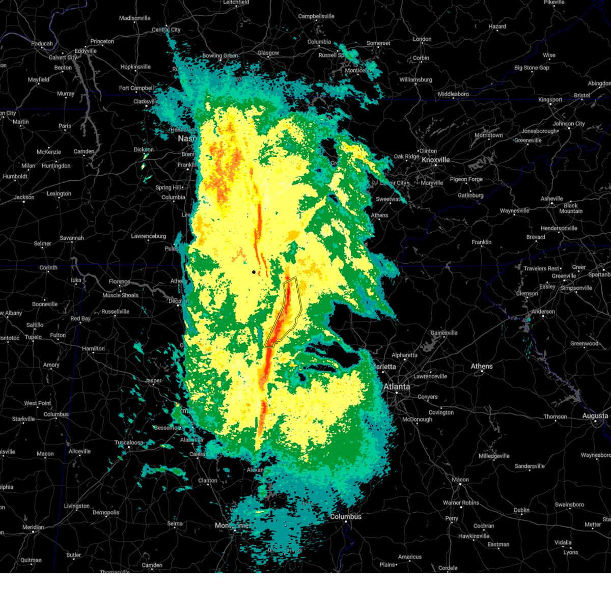 Svrhun the national weather service in huntsville alabama has issued a * severe thunderstorm warning for, east central jackson county in northeastern alabama, eastern dekalb county in northeastern alabama, * until 1100 pm cst. * at 1027 pm cst, severe thunderstorms were located along a line extending from near ider to cherokee rock village, moving northeast at 50 mph (radar indicated). Hazards include 60 mph wind gusts. expect damage to roofs, siding, and trees Svrhun the national weather service in huntsville alabama has issued a * severe thunderstorm warning for, east central jackson county in northeastern alabama, eastern dekalb county in northeastern alabama, * until 1100 pm cst. * at 1027 pm cst, severe thunderstorms were located along a line extending from near ider to cherokee rock village, moving northeast at 50 mph (radar indicated). Hazards include 60 mph wind gusts. expect damage to roofs, siding, and trees
|
| 3/4/2025 10:16 PM CST |
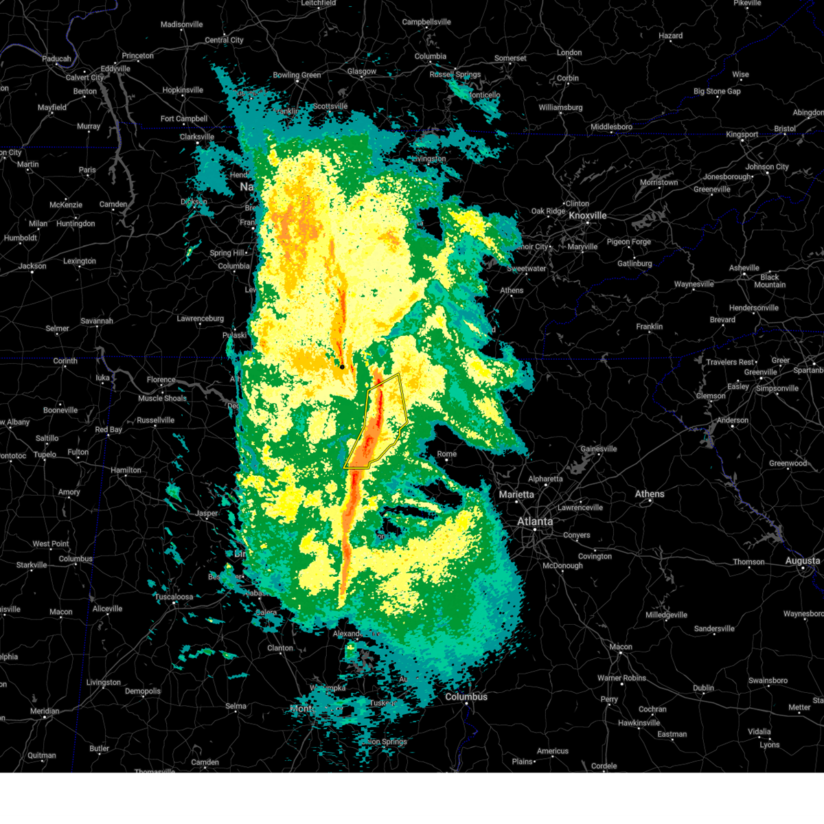 At 1016 pm cst, severe thunderstorms were located along a line extending from near henagar to near fort payne to western weiss lake, moving east at 50 mph (radar indicated). Hazards include 60 mph wind gusts. Expect damage to roofs, siding, and trees. Locations impacted include, fyffe, fort payne, higdon, ider, little river canyon np, skirum, pine ridge, pisgah, rosalie, and rainsville. At 1016 pm cst, severe thunderstorms were located along a line extending from near henagar to near fort payne to western weiss lake, moving east at 50 mph (radar indicated). Hazards include 60 mph wind gusts. Expect damage to roofs, siding, and trees. Locations impacted include, fyffe, fort payne, higdon, ider, little river canyon np, skirum, pine ridge, pisgah, rosalie, and rainsville.
|
| 3/4/2025 9:57 PM CST |
 At 956 pm cst, severe thunderstorms were located along a line extending from near section to near geraldine to near reece city, moving east at 50 mph (radar indicated). Hazards include 60 mph wind gusts and penny size hail. Expect damage to roofs, siding, and trees. Locations impacted include, fyffe, fort payne, higdon, ider, little river canyon np, skirum, pine ridge, pisgah, rosalie, and painter. At 956 pm cst, severe thunderstorms were located along a line extending from near section to near geraldine to near reece city, moving east at 50 mph (radar indicated). Hazards include 60 mph wind gusts and penny size hail. Expect damage to roofs, siding, and trees. Locations impacted include, fyffe, fort payne, higdon, ider, little river canyon np, skirum, pine ridge, pisgah, rosalie, and painter.
|
| 3/4/2025 9:57 PM CST |
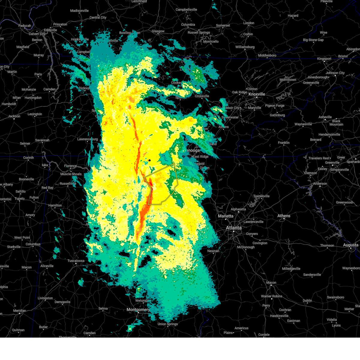 the severe thunderstorm warning has been cancelled and is no longer in effect the severe thunderstorm warning has been cancelled and is no longer in effect
|
| 3/4/2025 9:34 PM CST |
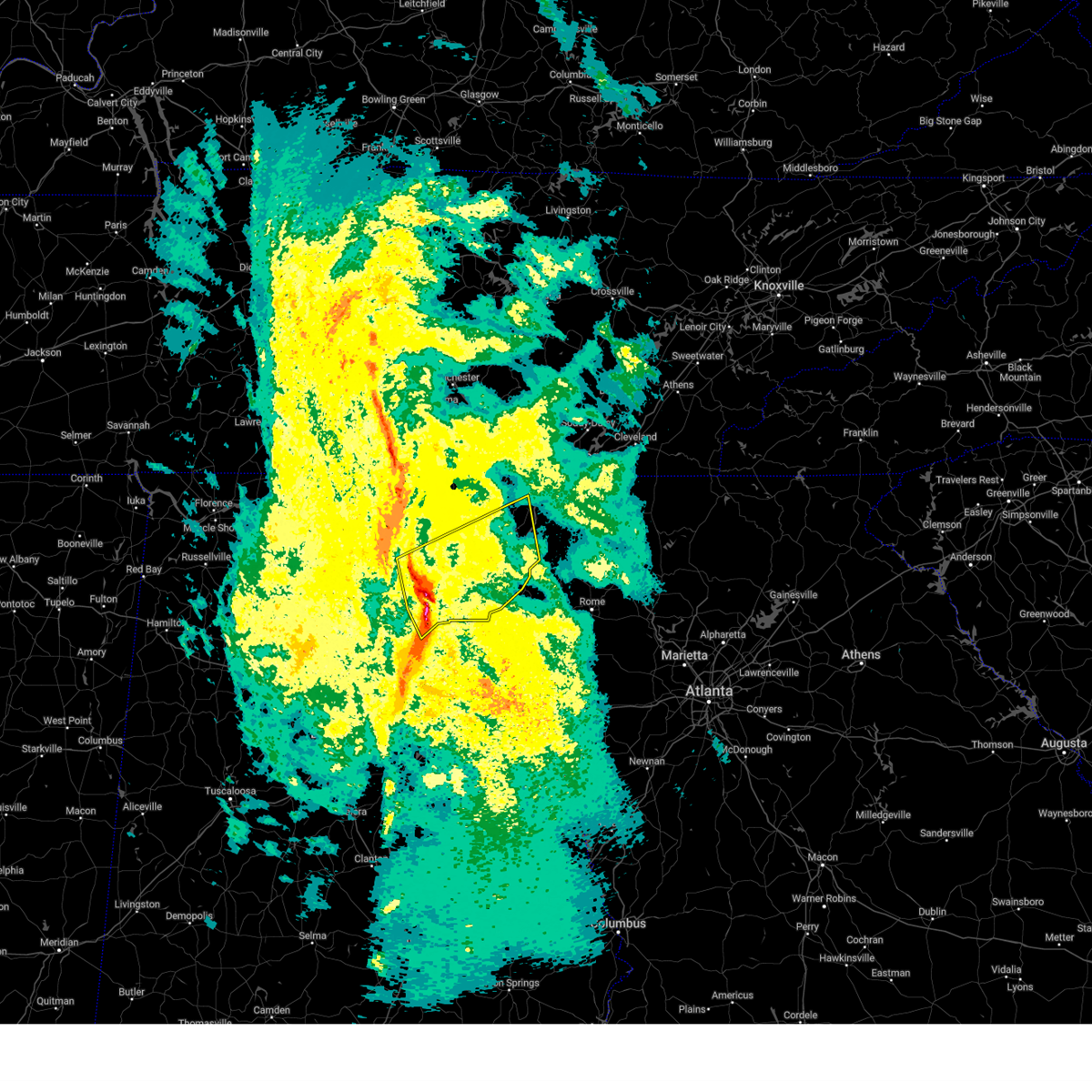 At 932 pm cst, severe thunderstorms were located along a line extending from 7 miles west of grant to near albertville to altoona, moving east at 50 mph (radar indicated. at 9:30 pm ema reported pea sized hail with this storm in douglas al). Hazards include 60 mph wind gusts and penny size hail. Expect damage to roofs, siding, and trees. Locations impacted include, high point, ider, pine ridge, pisgah, rosalie, painter, desoto state park, crossville, henagar, and rabbit town. At 932 pm cst, severe thunderstorms were located along a line extending from 7 miles west of grant to near albertville to altoona, moving east at 50 mph (radar indicated. at 9:30 pm ema reported pea sized hail with this storm in douglas al). Hazards include 60 mph wind gusts and penny size hail. Expect damage to roofs, siding, and trees. Locations impacted include, high point, ider, pine ridge, pisgah, rosalie, painter, desoto state park, crossville, henagar, and rabbit town.
|
| 3/4/2025 9:26 PM CST |
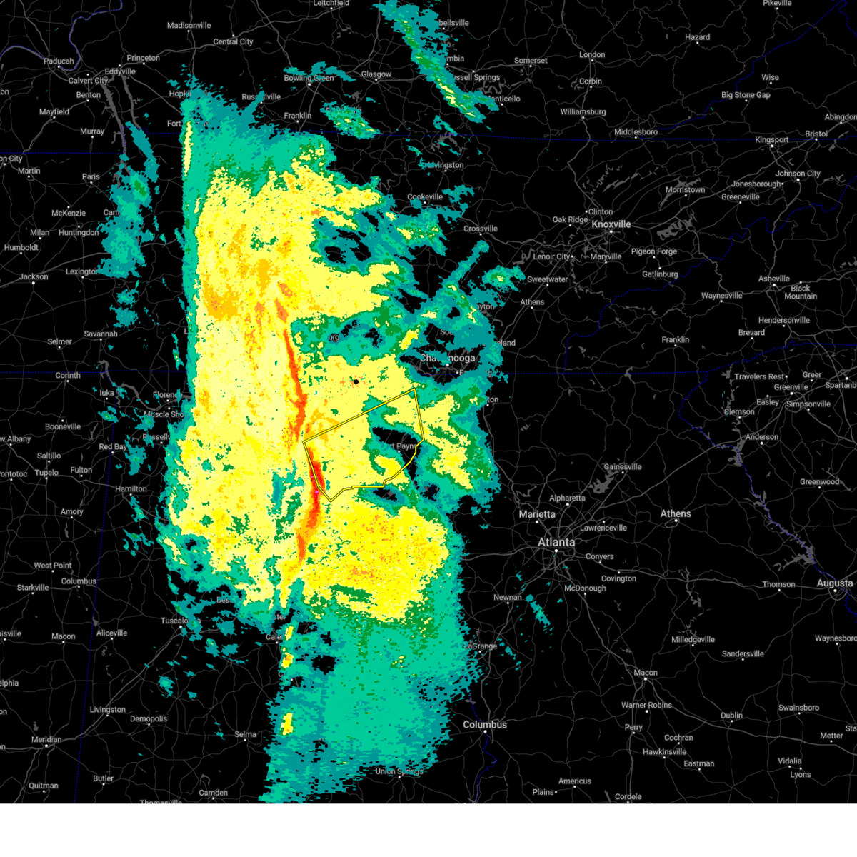 Svrhun the national weather service in huntsville alabama has issued a * severe thunderstorm warning for, marshall county in northeastern alabama, southern jackson county in northeastern alabama, southeastern madison county in north central alabama, dekalb county in northeastern alabama, * until 1030 pm cst. * at 926 pm cst, severe thunderstorms were located along a line extending from 8 miles east of morgan city to 6 miles northeast of mclarty to near altoona, moving east at 50 mph (radar indicated). Hazards include 60 mph wind gusts. expect damage to roofs, siding, and trees Svrhun the national weather service in huntsville alabama has issued a * severe thunderstorm warning for, marshall county in northeastern alabama, southern jackson county in northeastern alabama, southeastern madison county in north central alabama, dekalb county in northeastern alabama, * until 1030 pm cst. * at 926 pm cst, severe thunderstorms were located along a line extending from 8 miles east of morgan city to 6 miles northeast of mclarty to near altoona, moving east at 50 mph (radar indicated). Hazards include 60 mph wind gusts. expect damage to roofs, siding, and trees
|
| 2/16/2025 1:54 AM CST |
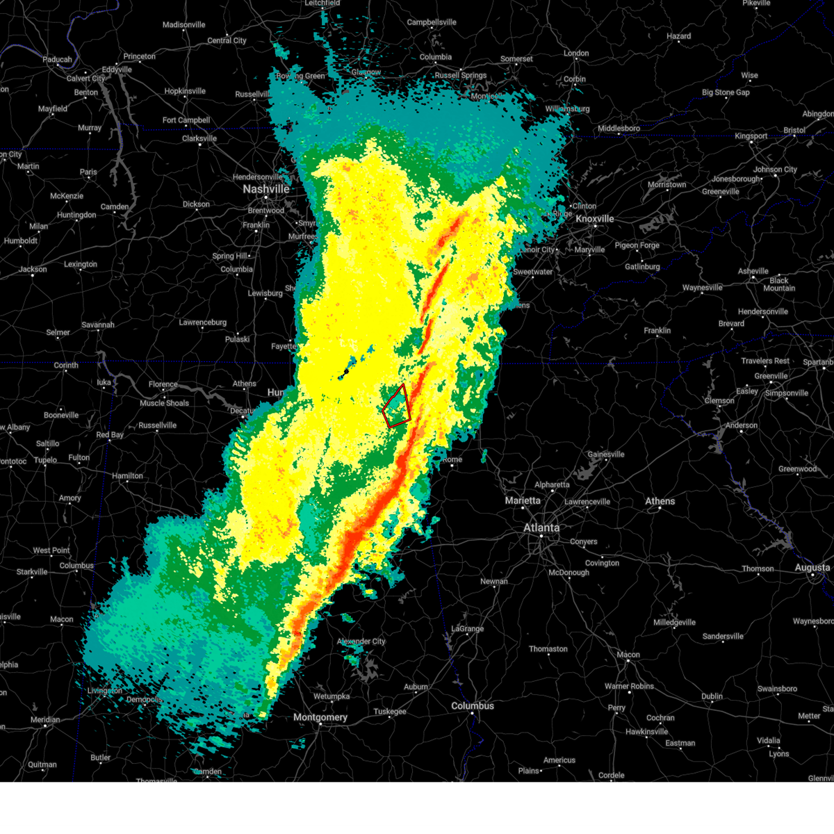 The storm which prompted the warning has moved out of the area. therefore, the warning will be allowed to expire. a tornado watch remains in effect until 600 am cst for northeastern alabama. The storm which prompted the warning has moved out of the area. therefore, the warning will be allowed to expire. a tornado watch remains in effect until 600 am cst for northeastern alabama.
|
| 2/16/2025 1:48 AM CST |
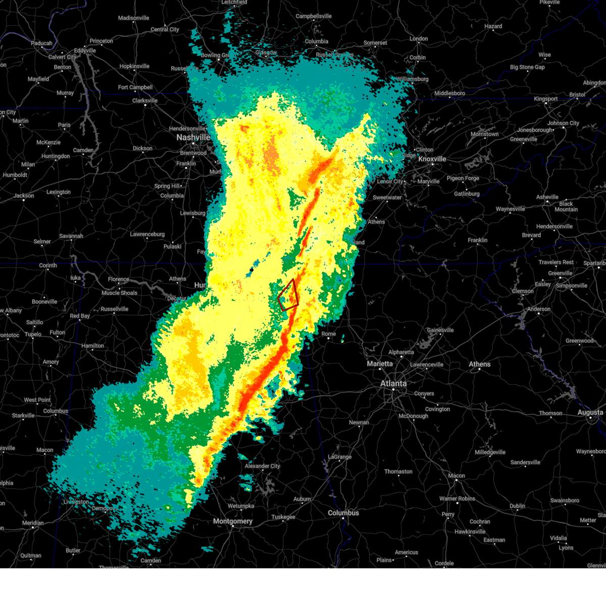 At 147 am cst, a severe thunderstorm capable of producing a tornado was located near ider, or 12 miles northeast of fort payne, moving northeast at 50 mph (radar indicated rotation). Hazards include tornado. Flying debris will be dangerous to those caught without shelter. mobile homes will be damaged or destroyed. damage to roofs, windows, and vehicles will occur. tree damage is likely. This tornadic thunderstorm will remain over mainly rural areas of northeastern dekalb county, including the following locations, sulpher springs, hammondville, valley head, and mentone. At 147 am cst, a severe thunderstorm capable of producing a tornado was located near ider, or 12 miles northeast of fort payne, moving northeast at 50 mph (radar indicated rotation). Hazards include tornado. Flying debris will be dangerous to those caught without shelter. mobile homes will be damaged or destroyed. damage to roofs, windows, and vehicles will occur. tree damage is likely. This tornadic thunderstorm will remain over mainly rural areas of northeastern dekalb county, including the following locations, sulpher springs, hammondville, valley head, and mentone.
|
| 2/16/2025 1:42 AM CST |
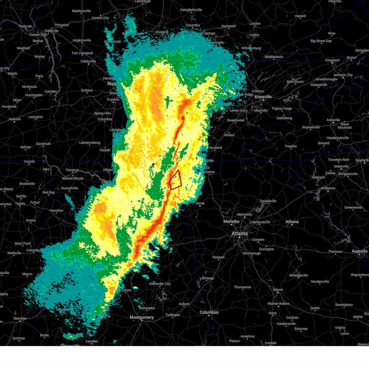 the tornado warning has been cancelled and is no longer in effect the tornado warning has been cancelled and is no longer in effect
|
| 2/16/2025 1:42 AM CST |
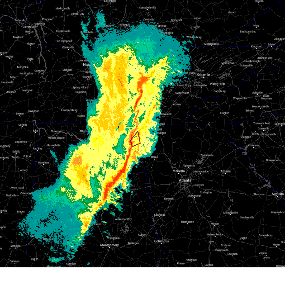 At 141 am cst, a severe thunderstorm capable of producing a tornado was located near henagar, or 10 miles north of fort payne, moving northeast at 60 mph (radar indicated rotation). Hazards include tornado. Flying debris will be dangerous to those caught without shelter. mobile homes will be damaged or destroyed. damage to roofs, windows, and vehicles will occur. tree damage is likely. this dangerous storm will be near, henagar and ider around 145 am cst. Other locations impacted by this tornadic thunderstorm include sulpher springs, hammondville, valley head, and mentone. At 141 am cst, a severe thunderstorm capable of producing a tornado was located near henagar, or 10 miles north of fort payne, moving northeast at 60 mph (radar indicated rotation). Hazards include tornado. Flying debris will be dangerous to those caught without shelter. mobile homes will be damaged or destroyed. damage to roofs, windows, and vehicles will occur. tree damage is likely. this dangerous storm will be near, henagar and ider around 145 am cst. Other locations impacted by this tornadic thunderstorm include sulpher springs, hammondville, valley head, and mentone.
|
| 2/16/2025 1:32 AM CST |
 the tornado warning has been cancelled and is no longer in effect the tornado warning has been cancelled and is no longer in effect
|
| 2/16/2025 1:32 AM CST |
 At 131 am cst, a severe thunderstorm capable of producing a tornado was located over sylvania, or near rainsville, moving east at 55 mph (radar indicated rotation). Hazards include tornado and quarter size hail. Flying debris will be dangerous to those caught without shelter. mobile homes will be damaged or destroyed. damage to roofs, windows, and vehicles will occur. tree damage is likely. this dangerous storm will be near, henagar and sylvania around 135 am cst. Other locations impacted by this tornadic thunderstorm include sulpher springs, hammondville, rosalie, valley head, and mentone. At 131 am cst, a severe thunderstorm capable of producing a tornado was located over sylvania, or near rainsville, moving east at 55 mph (radar indicated rotation). Hazards include tornado and quarter size hail. Flying debris will be dangerous to those caught without shelter. mobile homes will be damaged or destroyed. damage to roofs, windows, and vehicles will occur. tree damage is likely. this dangerous storm will be near, henagar and sylvania around 135 am cst. Other locations impacted by this tornadic thunderstorm include sulpher springs, hammondville, rosalie, valley head, and mentone.
|
| 2/16/2025 1:30 AM CST |
 At 130 am cst, severe thunderstorms were located along a line extending from 8 miles northwest of pikeville to near lookout mountain to near fort payne to near neely henry lake, moving east at 75 mph (radar indicated). Hazards include 60 mph wind gusts and penny size hail. Expect damage to roofs, siding, and trees. Locations impacted include, scottsboro, fort payne, rainsville, bridgeport, henagar, stevenson, crossville, sylvania, fyffe, and hollywood. At 130 am cst, severe thunderstorms were located along a line extending from 8 miles northwest of pikeville to near lookout mountain to near fort payne to near neely henry lake, moving east at 75 mph (radar indicated). Hazards include 60 mph wind gusts and penny size hail. Expect damage to roofs, siding, and trees. Locations impacted include, scottsboro, fort payne, rainsville, bridgeport, henagar, stevenson, crossville, sylvania, fyffe, and hollywood.
|
| 2/16/2025 1:30 AM CST |
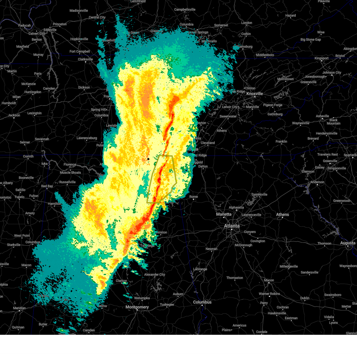 the severe thunderstorm warning has been cancelled and is no longer in effect the severe thunderstorm warning has been cancelled and is no longer in effect
|
| 2/16/2025 1:17 AM CST |
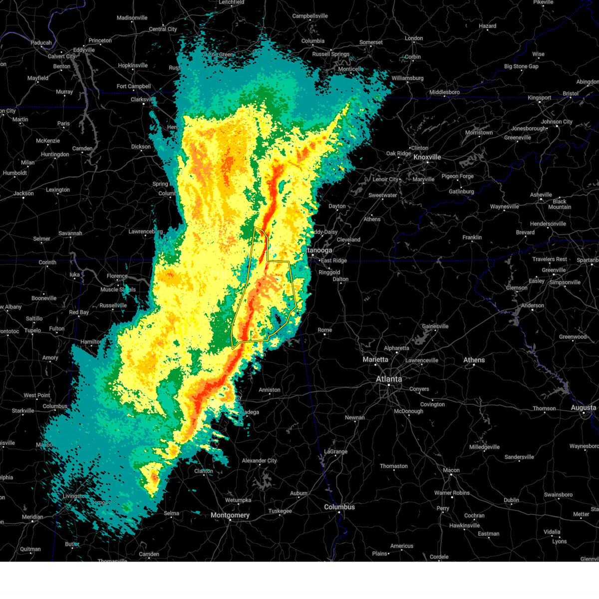 the severe thunderstorm warning has been cancelled and is no longer in effect the severe thunderstorm warning has been cancelled and is no longer in effect
|
| 2/16/2025 1:17 AM CST |
 At 117 am cst, severe thunderstorms were located along a line extending from 10 miles southeast of mcminnville to bridgeport to near fyffe to near ashville, moving east at 75 mph (radar indicated). Hazards include 70 mph wind gusts and quarter size hail. Hail damage to vehicles is expected. expect considerable tree damage. wind damage is also likely to mobile homes, roofs, and outbuildings. Locations impacted include, albertville, scottsboro, fort payne, boaz, guntersville, rainsville, bridgeport, henagar, stevenson, and crossville. At 117 am cst, severe thunderstorms were located along a line extending from 10 miles southeast of mcminnville to bridgeport to near fyffe to near ashville, moving east at 75 mph (radar indicated). Hazards include 70 mph wind gusts and quarter size hail. Hail damage to vehicles is expected. expect considerable tree damage. wind damage is also likely to mobile homes, roofs, and outbuildings. Locations impacted include, albertville, scottsboro, fort payne, boaz, guntersville, rainsville, bridgeport, henagar, stevenson, and crossville.
|
| 2/16/2025 1:15 AM CST |
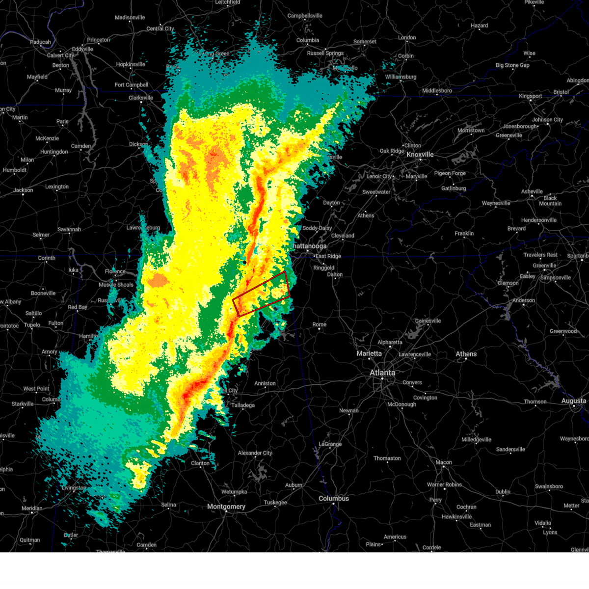 Torhun the national weather service in huntsville alabama has issued a * tornado warning for, northeastern marshall county in northeastern alabama, southeastern jackson county in northeastern alabama, central dekalb county in northeastern alabama, * until 200 am cst. * at 114 am cst, a severe thunderstorm capable of producing a tornado was located 8 miles east of grant, or 10 miles south of scottsboro, moving east at 55 mph (radar indicated rotation). Hazards include tornado and quarter size hail. Flying debris will be dangerous to those caught without shelter. mobile homes will be damaged or destroyed. damage to roofs, windows, and vehicles will occur. tree damage is likely. this dangerous storm will be near, powell and section around 120 am cst. rainsville and sylvania around 125 am cst. henagar around 130 am cst. ider around 140 am cst. Other locations impacted by this tornadic thunderstorm include dutton, langston, rosalie, sulpher springs, hammondville, valley head, and mentone. Torhun the national weather service in huntsville alabama has issued a * tornado warning for, northeastern marshall county in northeastern alabama, southeastern jackson county in northeastern alabama, central dekalb county in northeastern alabama, * until 200 am cst. * at 114 am cst, a severe thunderstorm capable of producing a tornado was located 8 miles east of grant, or 10 miles south of scottsboro, moving east at 55 mph (radar indicated rotation). Hazards include tornado and quarter size hail. Flying debris will be dangerous to those caught without shelter. mobile homes will be damaged or destroyed. damage to roofs, windows, and vehicles will occur. tree damage is likely. this dangerous storm will be near, powell and section around 120 am cst. rainsville and sylvania around 125 am cst. henagar around 130 am cst. ider around 140 am cst. Other locations impacted by this tornadic thunderstorm include dutton, langston, rosalie, sulpher springs, hammondville, valley head, and mentone.
|
| 2/16/2025 1:04 AM CST |
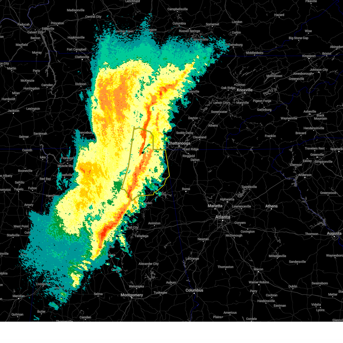 At 103 am cst, severe thunderstorms were located along a line extending from 9 miles southwest of mcminnville to 7 miles northeast of skyline to 6 miles south of grant to near dallas, moving east at 70 mph. multiple areas of rotation are present within this line. this line of storms has a history of producing confirmed winds of 65-75 mph (radar indicated). Hazards include 70 mph wind gusts and quarter size hail. Hail damage to vehicles is expected. expect considerable tree damage. wind damage is also likely to mobile homes, roofs, and outbuildings. Locations impacted include, albertville, scottsboro, fort payne, boaz, winchester, guntersville, arab, rainsville, bridgeport, and decherd. At 103 am cst, severe thunderstorms were located along a line extending from 9 miles southwest of mcminnville to 7 miles northeast of skyline to 6 miles south of grant to near dallas, moving east at 70 mph. multiple areas of rotation are present within this line. this line of storms has a history of producing confirmed winds of 65-75 mph (radar indicated). Hazards include 70 mph wind gusts and quarter size hail. Hail damage to vehicles is expected. expect considerable tree damage. wind damage is also likely to mobile homes, roofs, and outbuildings. Locations impacted include, albertville, scottsboro, fort payne, boaz, winchester, guntersville, arab, rainsville, bridgeport, and decherd.
|
| 2/16/2025 1:04 AM CST |
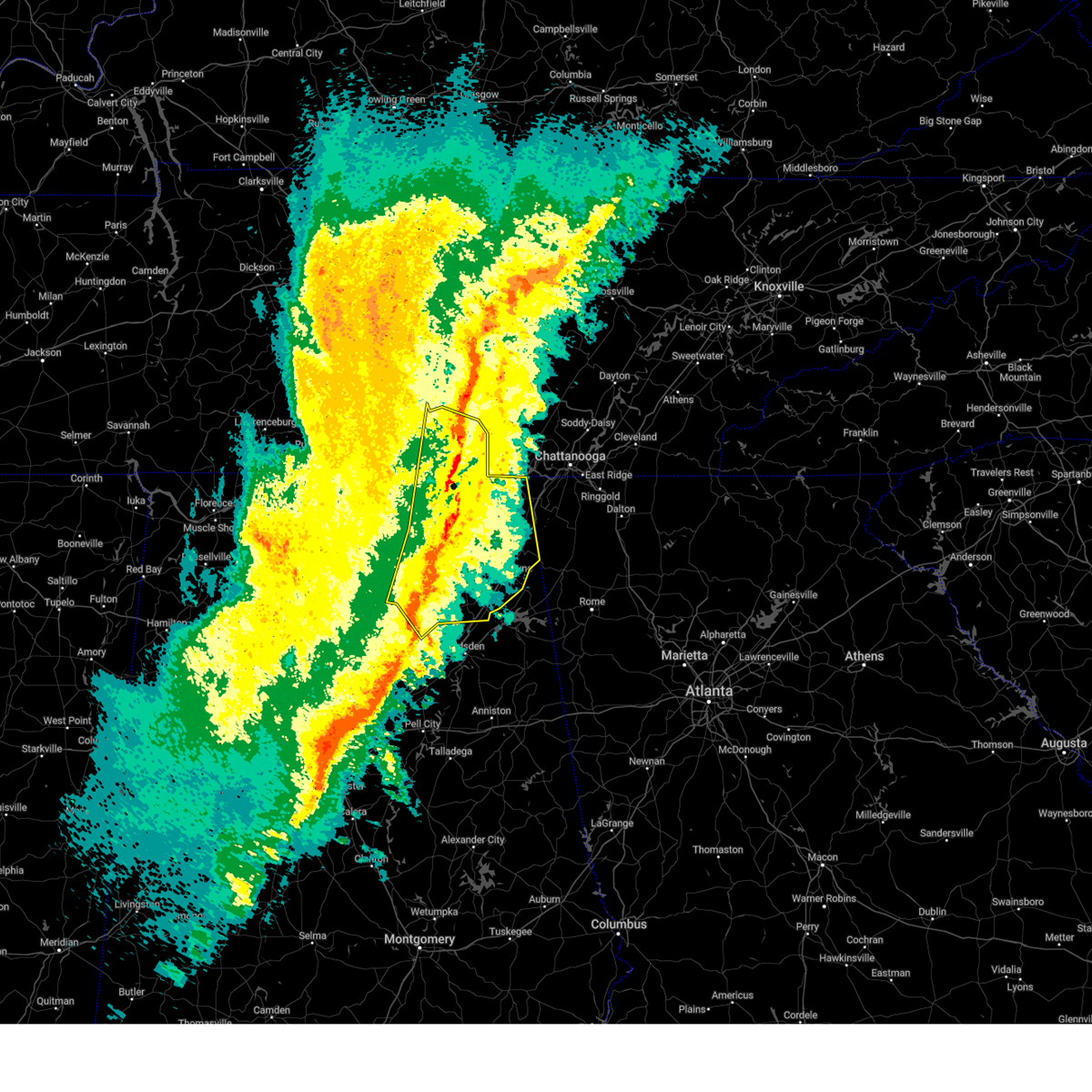 the severe thunderstorm warning has been cancelled and is no longer in effect the severe thunderstorm warning has been cancelled and is no longer in effect
|
| 2/16/2025 12:45 AM CST |
 Svrhun the national weather service in huntsville alabama has issued a * severe thunderstorm warning for, marshall county in northeastern alabama, jackson county in northeastern alabama, madison county in north central alabama, dekalb county in northeastern alabama, cullman county in north central alabama, southeastern morgan county in north central alabama, moore county in middle tennessee, eastern lincoln county in middle tennessee, franklin county in middle tennessee, * until 145 am cst. * at 1243 am cst, severe thunderstorms were located along a line extending from 11 miles northwest of manchester to near new market to near morgan city to near arkadelphia, moving east at 75 mph. multiple areas of rotation are present within this line. this line of storms has a history of producing confirmed winds of 65-75 mph (radar indicated). Hazards include 70 mph wind gusts and quarter size hail. Hail damage to vehicles is expected. expect considerable tree damage. Wind damage is also likely to mobile homes, roofs, and outbuildings. Svrhun the national weather service in huntsville alabama has issued a * severe thunderstorm warning for, marshall county in northeastern alabama, jackson county in northeastern alabama, madison county in north central alabama, dekalb county in northeastern alabama, cullman county in north central alabama, southeastern morgan county in north central alabama, moore county in middle tennessee, eastern lincoln county in middle tennessee, franklin county in middle tennessee, * until 145 am cst. * at 1243 am cst, severe thunderstorms were located along a line extending from 11 miles northwest of manchester to near new market to near morgan city to near arkadelphia, moving east at 75 mph. multiple areas of rotation are present within this line. this line of storms has a history of producing confirmed winds of 65-75 mph (radar indicated). Hazards include 70 mph wind gusts and quarter size hail. Hail damage to vehicles is expected. expect considerable tree damage. Wind damage is also likely to mobile homes, roofs, and outbuildings.
|
| 8/31/2024 1:55 PM CDT |
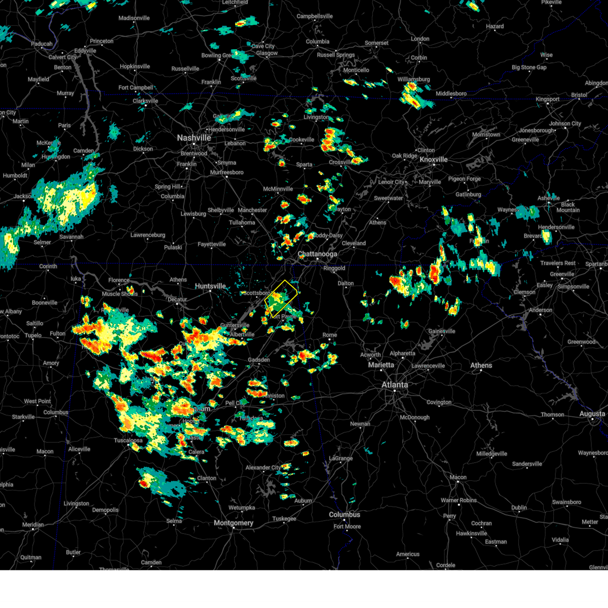 The storm which prompted the warning has weakened below severe limits, and has exited the warned area. therefore, the warning will be allowed to expire. however, gusty winds are still possible with this thunderstorm. The storm which prompted the warning has weakened below severe limits, and has exited the warned area. therefore, the warning will be allowed to expire. however, gusty winds are still possible with this thunderstorm.
|
| 8/31/2024 1:27 PM CDT |
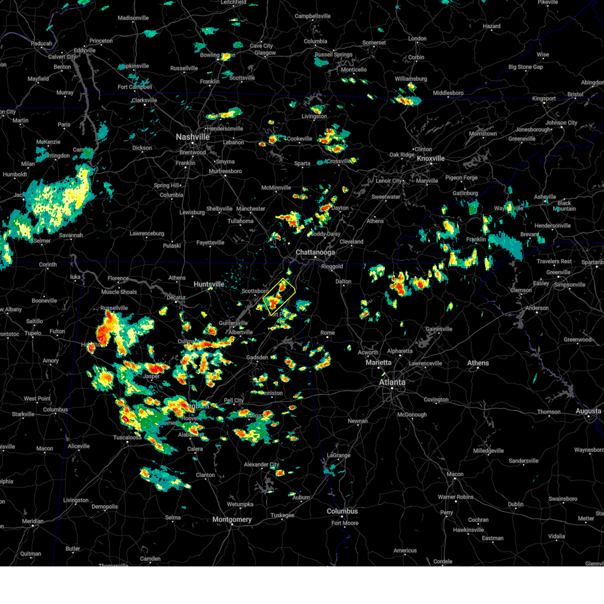 Svrhun the national weather service in huntsville alabama has issued a * severe thunderstorm warning for, southeastern jackson county in northeastern alabama, northeastern dekalb county in northeastern alabama, * until 200 pm cdt. * at 127 pm cdt, a severe thunderstorm was located over henagar, or 11 miles northeast of rainsville, and is nearly stationary (radar indicated). Hazards include 60 mph wind gusts. expect damage to roofs, siding, and trees Svrhun the national weather service in huntsville alabama has issued a * severe thunderstorm warning for, southeastern jackson county in northeastern alabama, northeastern dekalb county in northeastern alabama, * until 200 pm cdt. * at 127 pm cdt, a severe thunderstorm was located over henagar, or 11 miles northeast of rainsville, and is nearly stationary (radar indicated). Hazards include 60 mph wind gusts. expect damage to roofs, siding, and trees
|
| 8/17/2024 3:58 PM CDT |
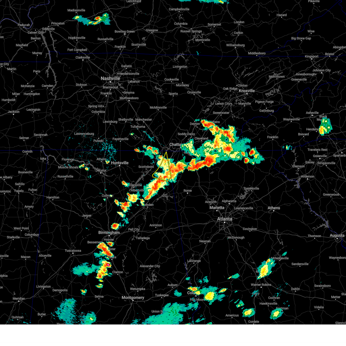 At 358 pm cdt, a severe thunderstorm was located 8 miles northeast of fort payne, moving east at 30 mph (radar indicated). Hazards include 60 mph wind gusts. Expect damage to roofs, siding, and trees. Locations impacted include, fort payne, rainsville, henagar, sylvania, powell, ider, valley head, hammondville, mentone, and higdon. At 358 pm cdt, a severe thunderstorm was located 8 miles northeast of fort payne, moving east at 30 mph (radar indicated). Hazards include 60 mph wind gusts. Expect damage to roofs, siding, and trees. Locations impacted include, fort payne, rainsville, henagar, sylvania, powell, ider, valley head, hammondville, mentone, and higdon.
|
| 8/17/2024 3:36 PM CDT |
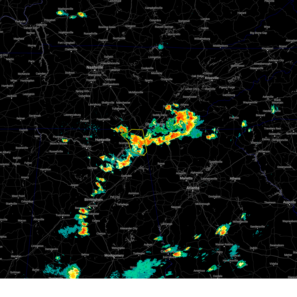 At 336 pm cdt, a severe thunderstorm was located 7 miles northwest of ider, or 11 miles south of bridgeport, moving east at 25 mph (radar indicated). Hazards include 60 mph wind gusts and quarter size hail. Hail damage to vehicles is expected. expect wind damage to roofs, siding, and trees. Locations impacted include, fort payne, rainsville, bridgeport, henagar, stevenson, sylvania, hollywood, powell, ider, and pisgah. At 336 pm cdt, a severe thunderstorm was located 7 miles northwest of ider, or 11 miles south of bridgeport, moving east at 25 mph (radar indicated). Hazards include 60 mph wind gusts and quarter size hail. Hail damage to vehicles is expected. expect wind damage to roofs, siding, and trees. Locations impacted include, fort payne, rainsville, bridgeport, henagar, stevenson, sylvania, hollywood, powell, ider, and pisgah.
|
| 8/17/2024 3:13 PM CDT |
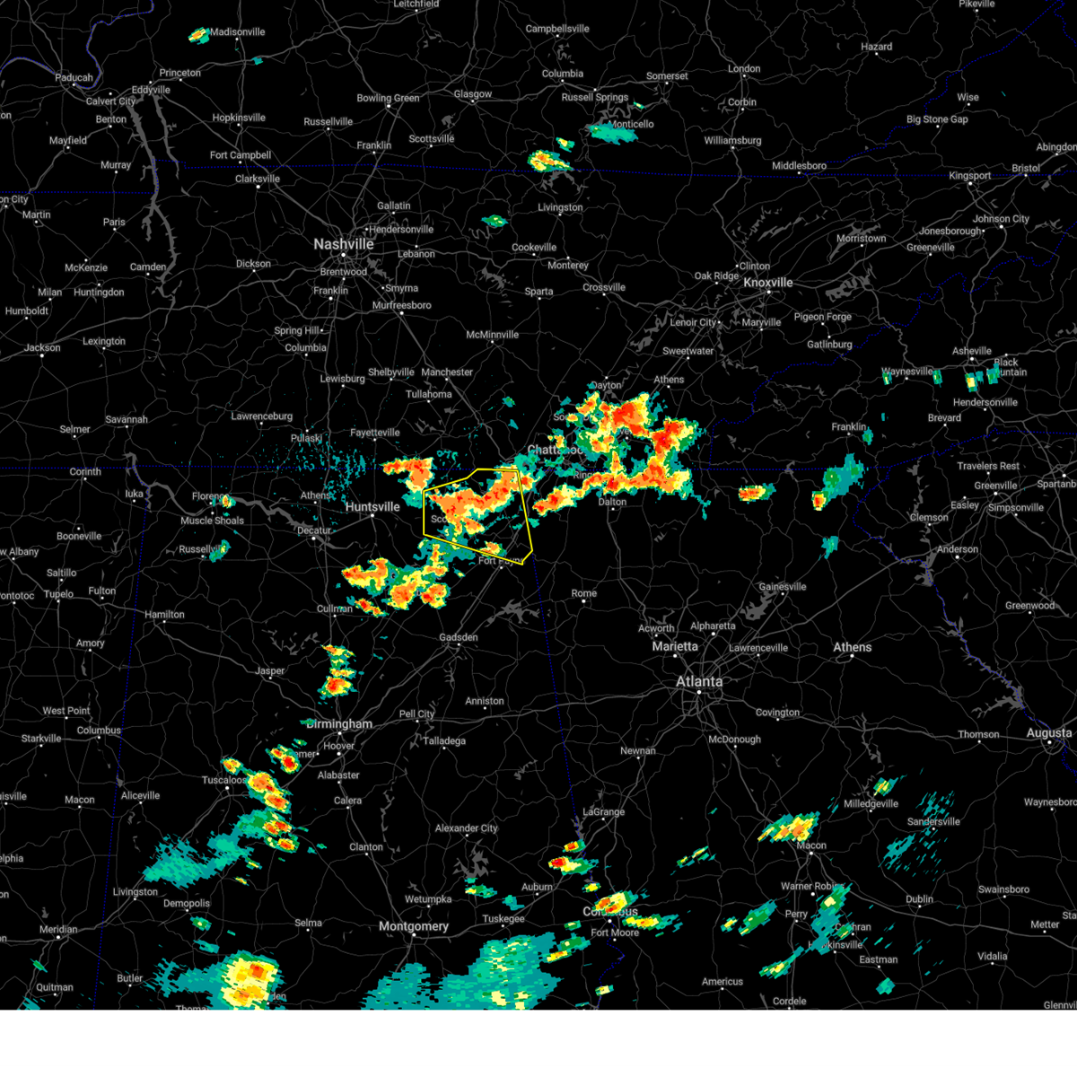 Svrhun the national weather service in huntsville alabama has issued a * severe thunderstorm warning for, jackson county in northeastern alabama, northeastern dekalb county in northeastern alabama, * until 415 pm cdt. * at 313 pm cdt, severe thunderstorms were located along a line extending from near trenton to near stevenson to 6 miles north of hollywood to near scottsboro, moving east at 35 mph (radar indicated). Hazards include 60 mph wind gusts and quarter size hail. Hail damage to vehicles is expected. Expect wind damage to roofs, siding, and trees. Svrhun the national weather service in huntsville alabama has issued a * severe thunderstorm warning for, jackson county in northeastern alabama, northeastern dekalb county in northeastern alabama, * until 415 pm cdt. * at 313 pm cdt, severe thunderstorms were located along a line extending from near trenton to near stevenson to 6 miles north of hollywood to near scottsboro, moving east at 35 mph (radar indicated). Hazards include 60 mph wind gusts and quarter size hail. Hail damage to vehicles is expected. Expect wind damage to roofs, siding, and trees.
|
| 8/17/2024 2:10 PM CDT |
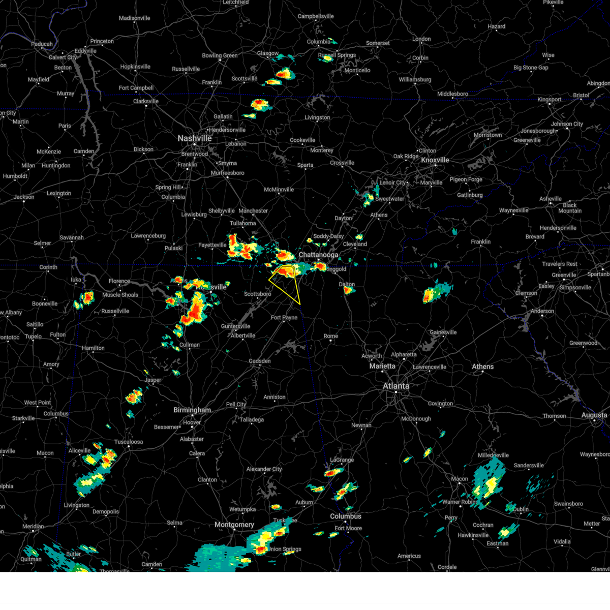 Svrhun the national weather service in huntsville alabama has issued a * severe thunderstorm warning for, northeastern jackson county in northeastern alabama, northeastern dekalb county in northeastern alabama, * until 300 pm cdt. * at 210 pm cdt, a severe thunderstorm was located over bridgeport, moving southeast at 20 mph (radar indicated). Hazards include 60 mph wind gusts and quarter size hail. Hail damage to vehicles is expected. Expect wind damage to roofs, siding, and trees. Svrhun the national weather service in huntsville alabama has issued a * severe thunderstorm warning for, northeastern jackson county in northeastern alabama, northeastern dekalb county in northeastern alabama, * until 300 pm cdt. * at 210 pm cdt, a severe thunderstorm was located over bridgeport, moving southeast at 20 mph (radar indicated). Hazards include 60 mph wind gusts and quarter size hail. Hail damage to vehicles is expected. Expect wind damage to roofs, siding, and trees.
|
| 8/16/2024 5:37 PM CDT |
 the severe thunderstorm warning has been cancelled and is no longer in effect the severe thunderstorm warning has been cancelled and is no longer in effect
|
| 8/16/2024 5:37 PM CDT |
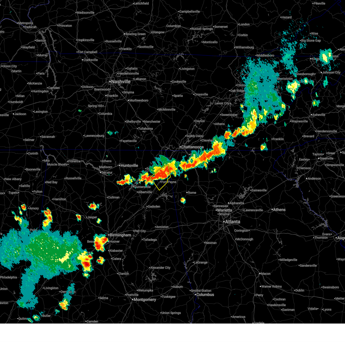 At 536 pm cdt, a severe thunderstorm was located 9 miles west of summerville, moving southeast at 30 mph (radar indicated). Hazards include 60 mph wind gusts and penny size hail. Expect damage to roofs, siding, and trees. Locations impacted include, fort payne, rainsville, henagar, sylvania, powell, ider, valley head, hammondville, mentone, and pine ridge. At 536 pm cdt, a severe thunderstorm was located 9 miles west of summerville, moving southeast at 30 mph (radar indicated). Hazards include 60 mph wind gusts and penny size hail. Expect damage to roofs, siding, and trees. Locations impacted include, fort payne, rainsville, henagar, sylvania, powell, ider, valley head, hammondville, mentone, and pine ridge.
|
| 8/16/2024 5:14 PM CDT |
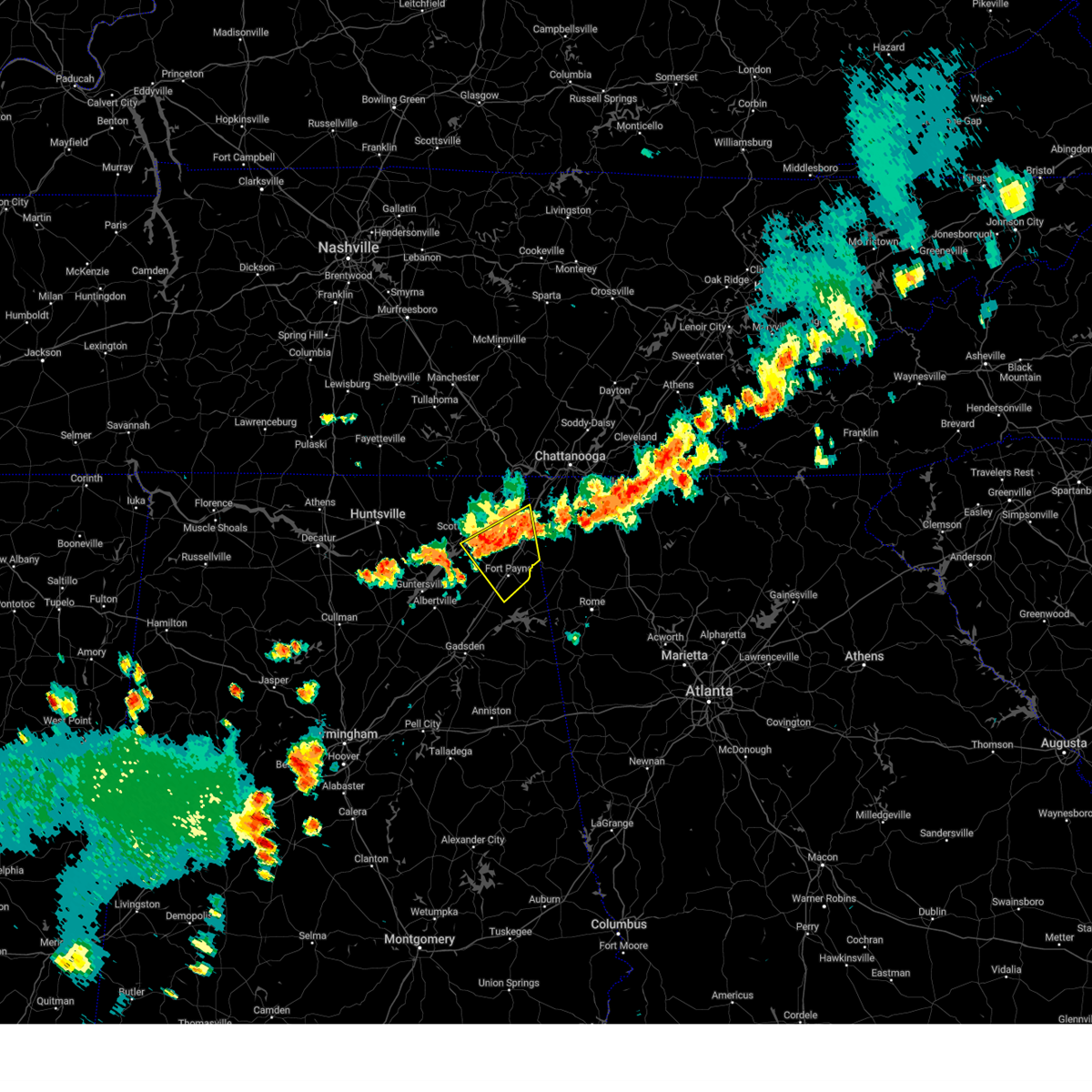 Svrhun the national weather service in huntsville alabama has issued a * severe thunderstorm warning for, southeastern jackson county in northeastern alabama, eastern dekalb county in northeastern alabama, * until 600 pm cdt. * at 514 pm cdt, a severe thunderstorm was located near henagar, or 10 miles north of fort payne, moving east at 25 mph (radar indicated). Hazards include 60 mph wind gusts and penny size hail. expect damage to roofs, siding, and trees Svrhun the national weather service in huntsville alabama has issued a * severe thunderstorm warning for, southeastern jackson county in northeastern alabama, eastern dekalb county in northeastern alabama, * until 600 pm cdt. * at 514 pm cdt, a severe thunderstorm was located near henagar, or 10 miles north of fort payne, moving east at 25 mph (radar indicated). Hazards include 60 mph wind gusts and penny size hail. expect damage to roofs, siding, and trees
|
| 8/2/2024 12:35 PM CDT |
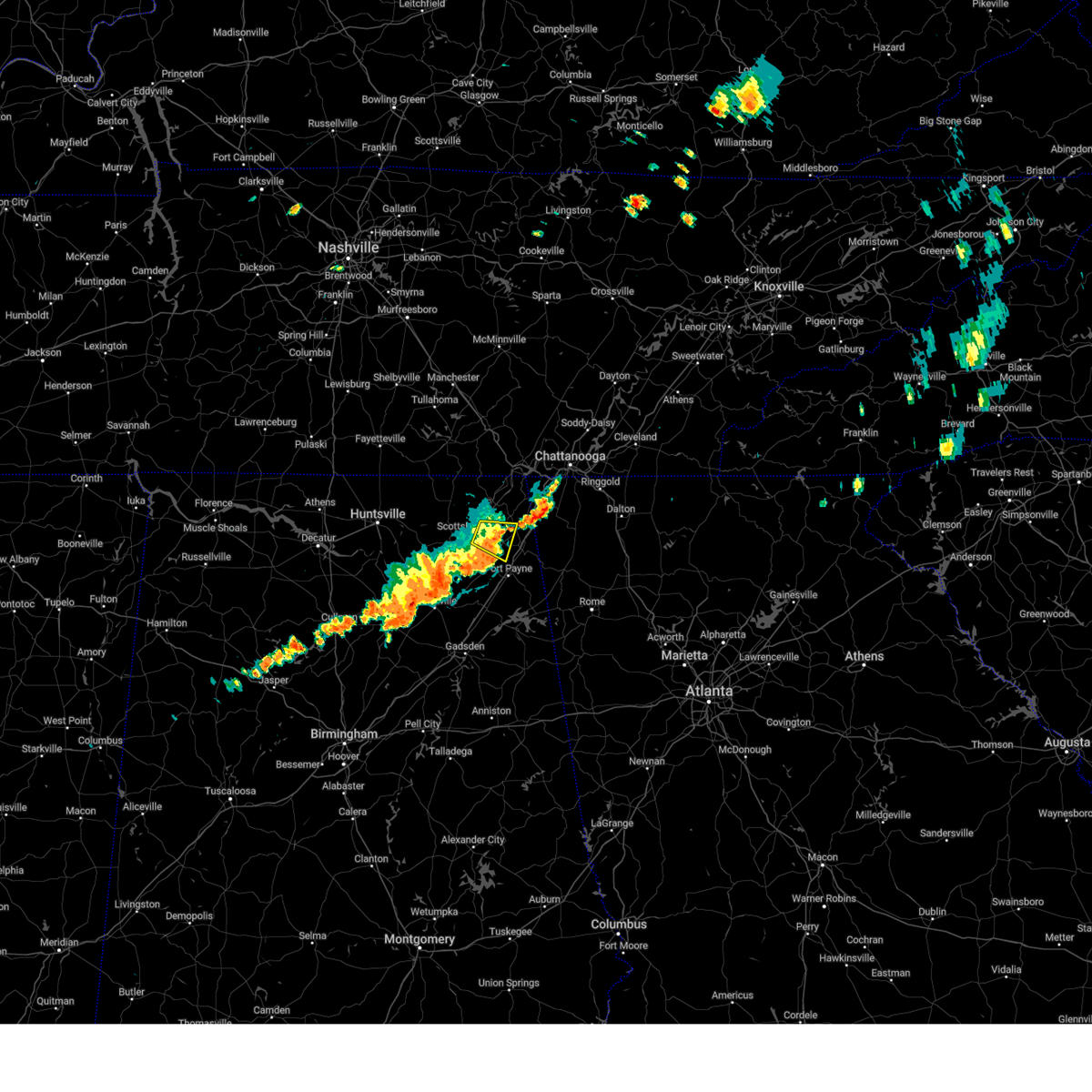 the severe thunderstorm warning has been cancelled and is no longer in effect the severe thunderstorm warning has been cancelled and is no longer in effect
|
| 8/2/2024 12:23 PM CDT |
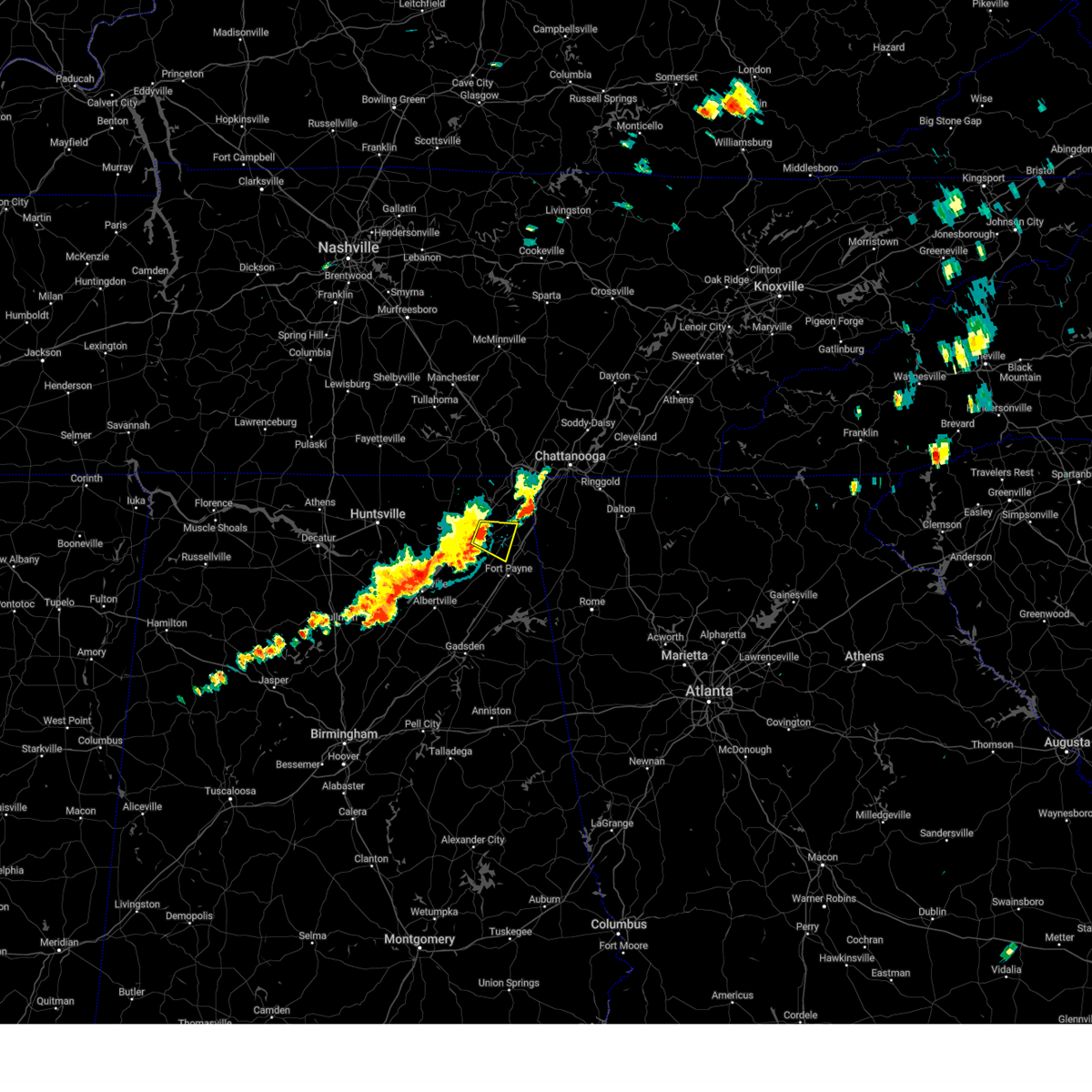 At 1223 pm cdt, a severe thunderstorm was located over pisgah, or 9 miles east of scottsboro, moving east at 30 mph (radar indicated). Hazards include 60 mph wind gusts and quarter size hail. Hail damage to vehicles is expected. expect wind damage to roofs, siding, and trees. Locations impacted include, henagar, sylvania, ider, pisgah, dutton, and rosalie. At 1223 pm cdt, a severe thunderstorm was located over pisgah, or 9 miles east of scottsboro, moving east at 30 mph (radar indicated). Hazards include 60 mph wind gusts and quarter size hail. Hail damage to vehicles is expected. expect wind damage to roofs, siding, and trees. Locations impacted include, henagar, sylvania, ider, pisgah, dutton, and rosalie.
|
| 8/2/2024 12:09 PM CDT |
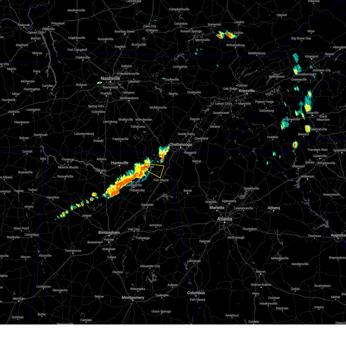 Svrhun the national weather service in huntsville alabama has issued a * severe thunderstorm warning for, central jackson county in northeastern alabama, central dekalb county in northeastern alabama, * until 1245 pm cdt. * at 1208 pm cdt, a severe thunderstorm was located over hollywood, or near scottsboro, moving east at 25 mph (radar indicated). Hazards include 60 mph wind gusts and quarter size hail. Hail damage to vehicles is expected. Expect wind damage to roofs, siding, and trees. Svrhun the national weather service in huntsville alabama has issued a * severe thunderstorm warning for, central jackson county in northeastern alabama, central dekalb county in northeastern alabama, * until 1245 pm cdt. * at 1208 pm cdt, a severe thunderstorm was located over hollywood, or near scottsboro, moving east at 25 mph (radar indicated). Hazards include 60 mph wind gusts and quarter size hail. Hail damage to vehicles is expected. Expect wind damage to roofs, siding, and trees.
|
| 7/29/2024 5:09 PM CDT |
 Svrhun the national weather service in huntsville alabama has issued a * severe thunderstorm warning for, eastern marshall county in northeastern alabama, central jackson county in northeastern alabama, dekalb county in northeastern alabama, * until 600 pm cdt. * at 508 pm cdt, severe thunderstorms were located along a line extending from 6 miles northeast of grant to near pisgah to near trenton, moving east at 25 mph (radar indicated). Hazards include 60 mph wind gusts. expect damage to roofs, siding, and trees Svrhun the national weather service in huntsville alabama has issued a * severe thunderstorm warning for, eastern marshall county in northeastern alabama, central jackson county in northeastern alabama, dekalb county in northeastern alabama, * until 600 pm cdt. * at 508 pm cdt, severe thunderstorms were located along a line extending from 6 miles northeast of grant to near pisgah to near trenton, moving east at 25 mph (radar indicated). Hazards include 60 mph wind gusts. expect damage to roofs, siding, and trees
|
| 7/29/2024 4:59 PM CDT |
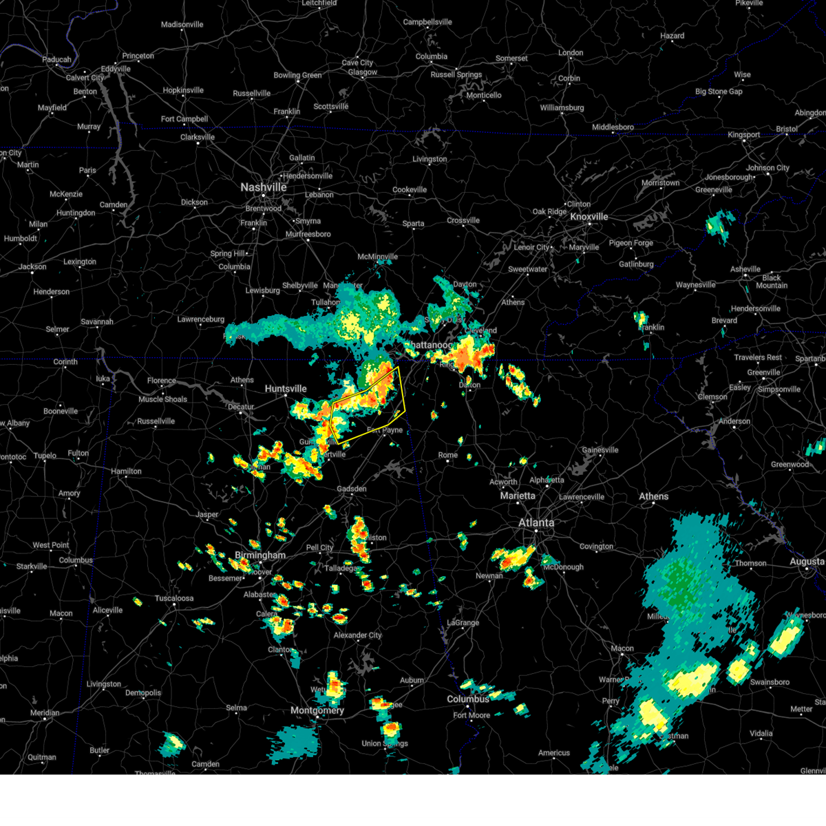 At 458 pm cdt, severe thunderstorms were located along a line extending from near bridgeport to 6 miles south of stevenson to near scottsboro, moving southeast at 15 mph (emergency management). Hazards include 60 mph wind gusts and penny size hail. Expect damage to roofs, siding, and trees. Locations impacted include, scottsboro, fort payne, rainsville, henagar, sylvania, fyffe, hollywood, powell, section, and ider. At 458 pm cdt, severe thunderstorms were located along a line extending from near bridgeport to 6 miles south of stevenson to near scottsboro, moving southeast at 15 mph (emergency management). Hazards include 60 mph wind gusts and penny size hail. Expect damage to roofs, siding, and trees. Locations impacted include, scottsboro, fort payne, rainsville, henagar, sylvania, fyffe, hollywood, powell, section, and ider.
|
| 7/29/2024 4:47 PM CDT |
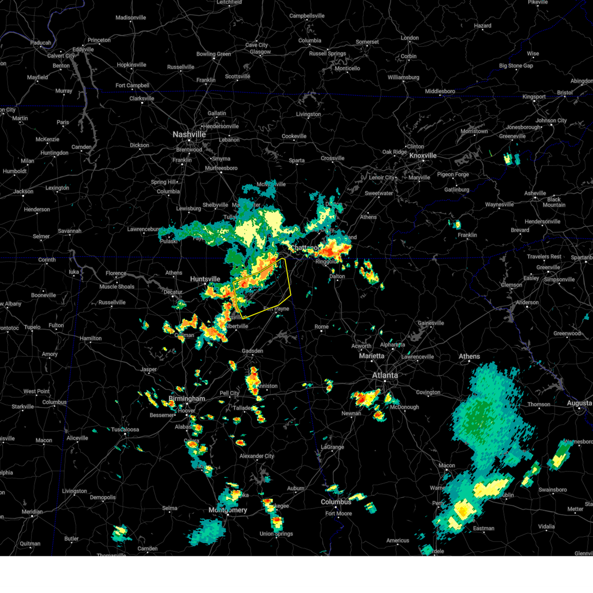 Svrhun the national weather service in huntsville alabama has issued a * severe thunderstorm warning for, northeastern marshall county in northeastern alabama, central jackson county in northeastern alabama, central dekalb county in northeastern alabama, * until 530 pm cdt. * at 447 pm cdt, severe thunderstorms were located along a line extending from bridgeport to near stevenson to near skyline, moving southeast at 15 mph (radar indicated). Hazards include 60 mph wind gusts and penny size hail. expect damage to roofs, siding, and trees Svrhun the national weather service in huntsville alabama has issued a * severe thunderstorm warning for, northeastern marshall county in northeastern alabama, central jackson county in northeastern alabama, central dekalb county in northeastern alabama, * until 530 pm cdt. * at 447 pm cdt, severe thunderstorms were located along a line extending from bridgeport to near stevenson to near skyline, moving southeast at 15 mph (radar indicated). Hazards include 60 mph wind gusts and penny size hail. expect damage to roofs, siding, and trees
|
| 7/17/2024 4:05 PM CDT |
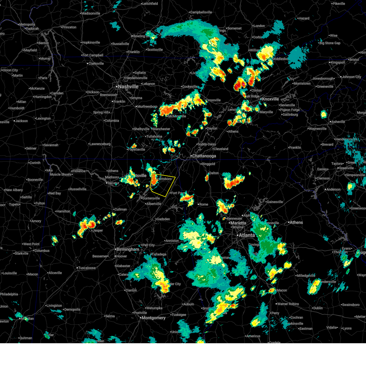 Svrhun the national weather service in huntsville alabama has issued a * severe thunderstorm warning for, southeastern jackson county in northeastern alabama, central dekalb county in northeastern alabama, * until 415 pm cdt. * at 404 pm cdt, a severe thunderstorm was located over section, or near scottsboro, moving east at 25 mph (radar indicated). Hazards include 60 mph wind gusts and quarter size hail. Hail damage to vehicles is expected. Expect wind damage to roofs, siding, and trees. Svrhun the national weather service in huntsville alabama has issued a * severe thunderstorm warning for, southeastern jackson county in northeastern alabama, central dekalb county in northeastern alabama, * until 415 pm cdt. * at 404 pm cdt, a severe thunderstorm was located over section, or near scottsboro, moving east at 25 mph (radar indicated). Hazards include 60 mph wind gusts and quarter size hail. Hail damage to vehicles is expected. Expect wind damage to roofs, siding, and trees.
|
| 7/17/2024 2:06 PM CDT |
 the severe thunderstorm warning has been cancelled and is no longer in effect the severe thunderstorm warning has been cancelled and is no longer in effect
|
| 7/17/2024 2:04 PM CDT |
 At 204 pm cdt, a severe thunderstorm was located near ider, or 12 miles southwest of trenton, moving east at 20 mph (radar indicated). Hazards include 60 mph wind gusts and quarter size hail. Hail damage to vehicles is expected. expect wind damage to roofs, siding, and trees. Locations impacted include, ider, fabius, and higdon. At 204 pm cdt, a severe thunderstorm was located near ider, or 12 miles southwest of trenton, moving east at 20 mph (radar indicated). Hazards include 60 mph wind gusts and quarter size hail. Hail damage to vehicles is expected. expect wind damage to roofs, siding, and trees. Locations impacted include, ider, fabius, and higdon.
|
| 7/17/2024 1:53 PM CDT |
 Svrhun the national weather service in huntsville alabama has issued a * severe thunderstorm warning for, east central jackson county in northeastern alabama, northeastern dekalb county in northeastern alabama, * until 230 pm cdt. * at 153 pm cdt, a severe thunderstorm was located near ider, or 13 miles south of bridgeport, moving east at 20 mph (radar indicated). Hazards include 60 mph wind gusts and quarter size hail. Hail damage to vehicles is expected. Expect wind damage to roofs, siding, and trees. Svrhun the national weather service in huntsville alabama has issued a * severe thunderstorm warning for, east central jackson county in northeastern alabama, northeastern dekalb county in northeastern alabama, * until 230 pm cdt. * at 153 pm cdt, a severe thunderstorm was located near ider, or 13 miles south of bridgeport, moving east at 20 mph (radar indicated). Hazards include 60 mph wind gusts and quarter size hail. Hail damage to vehicles is expected. Expect wind damage to roofs, siding, and trees.
|
| 5/27/2024 4:13 AM CDT |
 The storms which prompted the warning have moved out of the area. therefore, the warning will be allowed to expire. a tornado watch remains in effect until 800 am cdt for north central and northeastern alabama. remember, a severe thunderstorm warning still remains in effect for cullman, marshall, and dekalb counties until 445 am. The storms which prompted the warning have moved out of the area. therefore, the warning will be allowed to expire. a tornado watch remains in effect until 800 am cdt for north central and northeastern alabama. remember, a severe thunderstorm warning still remains in effect for cullman, marshall, and dekalb counties until 445 am.
|
| 5/27/2024 3:41 AM CDT |
 Svrhun the national weather service in huntsville alabama has issued a * severe thunderstorm warning for, central jackson county in northeastern alabama, dekalb county in northeastern alabama, * until 415 am cdt. * at 340 am cdt, severe thunderstorms were located along a line extending from 6 miles southwest of section to 8 miles east of ider, moving southeast at 45 mph. there have been multiple reports of trees and powerlines down associated with this line of storms (public). Hazards include 60 mph wind gusts and penny size hail. expect damage to roofs, siding, and trees Svrhun the national weather service in huntsville alabama has issued a * severe thunderstorm warning for, central jackson county in northeastern alabama, dekalb county in northeastern alabama, * until 415 am cdt. * at 340 am cdt, severe thunderstorms were located along a line extending from 6 miles southwest of section to 8 miles east of ider, moving southeast at 45 mph. there have been multiple reports of trees and powerlines down associated with this line of storms (public). Hazards include 60 mph wind gusts and penny size hail. expect damage to roofs, siding, and trees
|
| 5/27/2024 2:57 AM CDT |
 At 256 am cdt, a severe thunderstorm was located over bridgeport, moving east at 40 mph (radar indicated). Hazards include golf ball size hail and 60 mph wind gusts. People and animals outdoors will be injured. expect hail damage to roofs, siding, windows, and vehicles. expect wind damage to roofs, siding, and trees. Locations impacted include, bridgeport, stevenson, hollywood, ider, anderson, bass, martintown, russell cave national monument, long island, and higdon. At 256 am cdt, a severe thunderstorm was located over bridgeport, moving east at 40 mph (radar indicated). Hazards include golf ball size hail and 60 mph wind gusts. People and animals outdoors will be injured. expect hail damage to roofs, siding, windows, and vehicles. expect wind damage to roofs, siding, and trees. Locations impacted include, bridgeport, stevenson, hollywood, ider, anderson, bass, martintown, russell cave national monument, long island, and higdon.
|
| 5/27/2024 2:57 AM CDT |
 the severe thunderstorm warning has been cancelled and is no longer in effect the severe thunderstorm warning has been cancelled and is no longer in effect
|
| 5/27/2024 2:37 AM CDT |
 At 237 am cdt, a severe thunderstorm was located 9 miles northeast of skyline, or 16 miles west of bridgeport, moving east at 50 mph (radar indicated). Hazards include golf ball size hail and 60 mph wind gusts. People and animals outdoors will be injured. expect hail damage to roofs, siding, windows, and vehicles. expect wind damage to roofs, siding, and trees. Locations impacted include, scottsboro, bridgeport, henagar, stevenson, sylvania, hollywood, huntland, skyline, gurley, and ider. At 237 am cdt, a severe thunderstorm was located 9 miles northeast of skyline, or 16 miles west of bridgeport, moving east at 50 mph (radar indicated). Hazards include golf ball size hail and 60 mph wind gusts. People and animals outdoors will be injured. expect hail damage to roofs, siding, windows, and vehicles. expect wind damage to roofs, siding, and trees. Locations impacted include, scottsboro, bridgeport, henagar, stevenson, sylvania, hollywood, huntland, skyline, gurley, and ider.
|
| 5/27/2024 2:25 AM CDT |
 Svrhun the national weather service in huntsville alabama has issued a * severe thunderstorm warning for, jackson county in northeastern alabama, northeastern madison county in north central alabama, northeastern dekalb county in northeastern alabama, southeastern lincoln county in middle tennessee, southern franklin county in middle tennessee, * until 330 am cdt. * at 225 am cdt, a severe thunderstorm was located near huntland, or 13 miles northeast of moores mill, moving east at 40 mph (radar indicated). Hazards include 60 mph wind gusts and quarter size hail. Hail damage to vehicles is expected. Expect wind damage to roofs, siding, and trees. Svrhun the national weather service in huntsville alabama has issued a * severe thunderstorm warning for, jackson county in northeastern alabama, northeastern madison county in north central alabama, northeastern dekalb county in northeastern alabama, southeastern lincoln county in middle tennessee, southern franklin county in middle tennessee, * until 330 am cdt. * at 225 am cdt, a severe thunderstorm was located near huntland, or 13 miles northeast of moores mill, moving east at 40 mph (radar indicated). Hazards include 60 mph wind gusts and quarter size hail. Hail damage to vehicles is expected. Expect wind damage to roofs, siding, and trees.
|
| 5/9/2024 8:30 AM CDT |
 The storm which prompted the warning has moved out of the area. therefore, the warning will be allowed to expire. a tornado watch remains in effect until 1000 am cdt for north central and northeastern alabama. remember, a severe thunderstorm warning still remains in effect for portions of dekalb and marshall county. remember, a tornado warning still remains in effect for jackson and dekalb county. The storm which prompted the warning has moved out of the area. therefore, the warning will be allowed to expire. a tornado watch remains in effect until 1000 am cdt for north central and northeastern alabama. remember, a severe thunderstorm warning still remains in effect for portions of dekalb and marshall county. remember, a tornado warning still remains in effect for jackson and dekalb county.
|
| 5/9/2024 8:11 AM CDT |
 At 810 am cdt, a severe thunderstorm was located near guntersville, moving east at 60 mph (emergency management). Hazards include 60 mph wind gusts and quarter size hail. Hail damage to vehicles is expected. expect wind damage to roofs, siding, and trees. Locations impacted include, albertville, cullman, scottsboro, fort payne, boaz, guntersville, arab, rainsville, hanceville, and henagar. At 810 am cdt, a severe thunderstorm was located near guntersville, moving east at 60 mph (emergency management). Hazards include 60 mph wind gusts and quarter size hail. Hail damage to vehicles is expected. expect wind damage to roofs, siding, and trees. Locations impacted include, albertville, cullman, scottsboro, fort payne, boaz, guntersville, arab, rainsville, hanceville, and henagar.
|
| 5/9/2024 8:04 AM CDT |
 Svrhun the national weather service in huntsville alabama has issued a * severe thunderstorm warning for, marshall county in northeastern alabama, southern jackson county in northeastern alabama, dekalb county in northeastern alabama, central cullman county in north central alabama, southeastern morgan county in north central alabama, * until 830 am cdt. * at 804 am cdt, a severe thunderstorm was located over strawberry, or near arab, moving east at 60 mph (radar indicated). Hazards include 60 mph wind gusts and quarter size hail. Hail damage to vehicles is expected. Expect wind damage to roofs, siding, and trees. Svrhun the national weather service in huntsville alabama has issued a * severe thunderstorm warning for, marshall county in northeastern alabama, southern jackson county in northeastern alabama, dekalb county in northeastern alabama, central cullman county in north central alabama, southeastern morgan county in north central alabama, * until 830 am cdt. * at 804 am cdt, a severe thunderstorm was located over strawberry, or near arab, moving east at 60 mph (radar indicated). Hazards include 60 mph wind gusts and quarter size hail. Hail damage to vehicles is expected. Expect wind damage to roofs, siding, and trees.
|
| 5/9/2024 5:42 AM CDT |
 The storm which prompted the warning has moved out of the area. therefore, the warning will be allowed to expire. however, gusty winds and heavy rain are still possible with this thunderstorm. a tornado watch remains in effect until 1000 am cdt for northeastern alabama. The storm which prompted the warning has moved out of the area. therefore, the warning will be allowed to expire. however, gusty winds and heavy rain are still possible with this thunderstorm. a tornado watch remains in effect until 1000 am cdt for northeastern alabama.
|
| 5/9/2024 5:19 AM CDT |
 Svrhun the national weather service in huntsville alabama has issued a * severe thunderstorm warning for, east central jackson county in northeastern alabama, northeastern dekalb county in northeastern alabama, * until 545 am cdt. * at 519 am cdt, a severe thunderstorm was located near pisgah, or 14 miles south of bridgeport, moving southeast at 30 mph (radar indicated). Hazards include 60 mph wind gusts and penny size hail. expect damage to roofs, siding, and trees Svrhun the national weather service in huntsville alabama has issued a * severe thunderstorm warning for, east central jackson county in northeastern alabama, northeastern dekalb county in northeastern alabama, * until 545 am cdt. * at 519 am cdt, a severe thunderstorm was located near pisgah, or 14 miles south of bridgeport, moving southeast at 30 mph (radar indicated). Hazards include 60 mph wind gusts and penny size hail. expect damage to roofs, siding, and trees
|
| 5/9/2024 12:08 AM CDT |
 Torhun the national weather service in huntsville alabama has issued a * tornado warning for, east central dekalb county in northeastern alabama, * until 100 am cdt. * at 1208 am cdt, a severe thunderstorm capable of producing a tornado was located over henagar, or 10 miles northeast of rainsville, moving east at 30 mph (radar indicated rotation). Hazards include tornado and ping pong ball size hail. Flying debris will be dangerous to those caught without shelter. mobile homes will be damaged or destroyed. damage to roofs, windows, and vehicles will occur. tree damage is likely. this dangerous storm will be near, henagar around 1215 am cdt. Other locations impacted by this tornadic thunderstorm include valley head, mentone, hammondville, and desoto state park. Torhun the national weather service in huntsville alabama has issued a * tornado warning for, east central dekalb county in northeastern alabama, * until 100 am cdt. * at 1208 am cdt, a severe thunderstorm capable of producing a tornado was located over henagar, or 10 miles northeast of rainsville, moving east at 30 mph (radar indicated rotation). Hazards include tornado and ping pong ball size hail. Flying debris will be dangerous to those caught without shelter. mobile homes will be damaged or destroyed. damage to roofs, windows, and vehicles will occur. tree damage is likely. this dangerous storm will be near, henagar around 1215 am cdt. Other locations impacted by this tornadic thunderstorm include valley head, mentone, hammondville, and desoto state park.
|
| 5/8/2024 11:53 PM CDT |
 At 1153 pm cdt, a severe thunderstorm capable of producing a tornado was located near hollywood, or near scottsboro, moving east at 30 mph (radar indicated rotation). Hazards include tornado and ping pong ball size hail. Flying debris will be dangerous to those caught without shelter. mobile homes will be damaged or destroyed. damage to roofs, windows, and vehicles will occur. tree damage is likely. this dangerous storm will be near, sylvania and pisgah around 1200 am cdt. henagar around 1205 am cdt. Other locations impacted by this tornadic thunderstorm include dutton and rosalie. At 1153 pm cdt, a severe thunderstorm capable of producing a tornado was located near hollywood, or near scottsboro, moving east at 30 mph (radar indicated rotation). Hazards include tornado and ping pong ball size hail. Flying debris will be dangerous to those caught without shelter. mobile homes will be damaged or destroyed. damage to roofs, windows, and vehicles will occur. tree damage is likely. this dangerous storm will be near, sylvania and pisgah around 1200 am cdt. henagar around 1205 am cdt. Other locations impacted by this tornadic thunderstorm include dutton and rosalie.
|
| 5/8/2024 11:35 PM CDT |
 Torhun the national weather service in huntsville alabama has issued a * tornado warning for, central jackson county in northeastern alabama, central dekalb county in northeastern alabama, * until 1215 am cdt. * at 1135 pm cdt, a severe thunderstorm capable of producing a tornado was located over scottsboro, moving east at 30 mph (radar indicated rotation). Hazards include tornado and ping pong ball size hail. Flying debris will be dangerous to those caught without shelter. mobile homes will be damaged or destroyed. damage to roofs, windows, and vehicles will occur. tree damage is likely. this dangerous storm will be near, scottsboro and hollywood around 1140 pm cdt. section around 1145 pm cdt. sylvania around 1155 pm cdt. henagar around 1200 am cdt. Other locations impacted by this tornadic thunderstorm include dutton, larkinsville, lim rock, and rosalie. Torhun the national weather service in huntsville alabama has issued a * tornado warning for, central jackson county in northeastern alabama, central dekalb county in northeastern alabama, * until 1215 am cdt. * at 1135 pm cdt, a severe thunderstorm capable of producing a tornado was located over scottsboro, moving east at 30 mph (radar indicated rotation). Hazards include tornado and ping pong ball size hail. Flying debris will be dangerous to those caught without shelter. mobile homes will be damaged or destroyed. damage to roofs, windows, and vehicles will occur. tree damage is likely. this dangerous storm will be near, scottsboro and hollywood around 1140 pm cdt. section around 1145 pm cdt. sylvania around 1155 pm cdt. henagar around 1200 am cdt. Other locations impacted by this tornadic thunderstorm include dutton, larkinsville, lim rock, and rosalie.
|
| 5/8/2024 11:25 PM CDT |
 The tornado warning that was previously in effect has been reissued for dekalb county and is in effect until 1145 pm. please refer to that bulletin for the latest severe weather information. a tornado watch remains in effect until 300 am cdt for northeastern alabama, and middle tennessee. The tornado warning that was previously in effect has been reissued for dekalb county and is in effect until 1145 pm. please refer to that bulletin for the latest severe weather information. a tornado watch remains in effect until 300 am cdt for northeastern alabama, and middle tennessee.
|
| 5/8/2024 11:09 PM CDT |
 the tornado warning has been cancelled and is no longer in effect the tornado warning has been cancelled and is no longer in effect
|
| 5/8/2024 11:09 PM CDT |
 At 1108 pm cdt, a confirmed large and destructive tornado was located over henagar, or 9 miles north of rainsville, moving east at 20 mph. tornado emergency for henagar, hammondville, and mentone. this is a particularly dangerous situation. take cover now! (radar confirmed tornado). Hazards include deadly tornado. You are in a life-threatening situation. flying debris may be deadly to those caught without shelter. mobile homes will be destroyed. considerable damage to homes, businesses, and vehicles is likely and complete destruction is possible. the tornado will be near, henagar and ider around 1115 pm cdt. Other locations impacted by this tornadic thunderstorm include sulpher springs, valley head, mentone, and hammondville. At 1108 pm cdt, a confirmed large and destructive tornado was located over henagar, or 9 miles north of rainsville, moving east at 20 mph. tornado emergency for henagar, hammondville, and mentone. this is a particularly dangerous situation. take cover now! (radar confirmed tornado). Hazards include deadly tornado. You are in a life-threatening situation. flying debris may be deadly to those caught without shelter. mobile homes will be destroyed. considerable damage to homes, businesses, and vehicles is likely and complete destruction is possible. the tornado will be near, henagar and ider around 1115 pm cdt. Other locations impacted by this tornadic thunderstorm include sulpher springs, valley head, mentone, and hammondville.
|
| 5/8/2024 11:03 PM CDT |
 At 1103 pm cdt, a confirmed tornado was located near henagar, or 9 miles north of rainsville, moving east at 40 mph (radar confirmed tornado). Hazards include damaging tornado and quarter size hail. Flying debris will be dangerous to those caught without shelter. mobile homes will be damaged or destroyed. damage to roofs, windows, and vehicles will occur. tree damage is likely. this tornado will be near, henagar around 1110 pm cdt. Other locations impacted by this tornadic thunderstorm include sulpher springs, valley head, mentone, hammondville, and rosalie. At 1103 pm cdt, a confirmed tornado was located near henagar, or 9 miles north of rainsville, moving east at 40 mph (radar confirmed tornado). Hazards include damaging tornado and quarter size hail. Flying debris will be dangerous to those caught without shelter. mobile homes will be damaged or destroyed. damage to roofs, windows, and vehicles will occur. tree damage is likely. this tornado will be near, henagar around 1110 pm cdt. Other locations impacted by this tornadic thunderstorm include sulpher springs, valley head, mentone, hammondville, and rosalie.
|
| 5/8/2024 10:59 PM CDT |
 At 1058 pm cdt, a severe thunderstorm capable of producing a tornado was located near pisgah, or 10 miles north of rainsville, moving east at 30 mph (radar indicated rotation). Hazards include tornado and quarter size hail. Flying debris will be dangerous to those caught without shelter. mobile homes will be damaged or destroyed. damage to roofs, windows, and vehicles will occur. tree damage is likely. this dangerous storm will be near, henagar and sylvania around 1105 pm cdt. ider around 1110 pm cdt. Other locations impacted by this tornadic thunderstorm include dutton, sulpher springs, valley head, mentone, hammondville, and rosalie. At 1058 pm cdt, a severe thunderstorm capable of producing a tornado was located near pisgah, or 10 miles north of rainsville, moving east at 30 mph (radar indicated rotation). Hazards include tornado and quarter size hail. Flying debris will be dangerous to those caught without shelter. mobile homes will be damaged or destroyed. damage to roofs, windows, and vehicles will occur. tree damage is likely. this dangerous storm will be near, henagar and sylvania around 1105 pm cdt. ider around 1110 pm cdt. Other locations impacted by this tornadic thunderstorm include dutton, sulpher springs, valley head, mentone, hammondville, and rosalie.
|
| 5/8/2024 10:42 PM CDT |
 Torhun the national weather service in huntsville alabama has issued a * tornado warning for, central jackson county in northeastern alabama, northeastern dekalb county in northeastern alabama, * until 1130 pm cdt. * at 1041 pm cdt, a severe thunderstorm capable of producing a tornado was located near scottsboro, moving east at 30 mph (radar indicated rotation). Hazards include tornado and quarter size hail. Flying debris will be dangerous to those caught without shelter. mobile homes will be damaged or destroyed. damage to roofs, windows, and vehicles will occur. tree damage is likely. this dangerous storm will be near, scottsboro and hollywood around 1045 pm cdt. pisgah around 1050 pm cdt. henagar around 1100 pm cdt. ider around 1110 pm cdt. Other locations impacted by this tornadic thunderstorm include dutton, martintown, mentone, rosalie, sulpher springs, valley head, and hammondville. Torhun the national weather service in huntsville alabama has issued a * tornado warning for, central jackson county in northeastern alabama, northeastern dekalb county in northeastern alabama, * until 1130 pm cdt. * at 1041 pm cdt, a severe thunderstorm capable of producing a tornado was located near scottsboro, moving east at 30 mph (radar indicated rotation). Hazards include tornado and quarter size hail. Flying debris will be dangerous to those caught without shelter. mobile homes will be damaged or destroyed. damage to roofs, windows, and vehicles will occur. tree damage is likely. this dangerous storm will be near, scottsboro and hollywood around 1045 pm cdt. pisgah around 1050 pm cdt. henagar around 1100 pm cdt. ider around 1110 pm cdt. Other locations impacted by this tornadic thunderstorm include dutton, martintown, mentone, rosalie, sulpher springs, valley head, and hammondville.
|
| 5/8/2024 9:30 PM CDT |
 Svrhun the national weather service in huntsville alabama has issued a * severe thunderstorm warning for, northeastern jackson county in northeastern alabama, northeastern dekalb county in northeastern alabama, * until 1015 pm cdt. * at 929 pm cdt, a severe thunderstorm was located 7 miles west of stevenson, or 14 miles north of scottsboro, moving east at 35 mph (radar indicated). Hazards include 60 mph wind gusts and quarter size hail. Hail damage to vehicles is expected. Expect wind damage to roofs, siding, and trees. Svrhun the national weather service in huntsville alabama has issued a * severe thunderstorm warning for, northeastern jackson county in northeastern alabama, northeastern dekalb county in northeastern alabama, * until 1015 pm cdt. * at 929 pm cdt, a severe thunderstorm was located 7 miles west of stevenson, or 14 miles north of scottsboro, moving east at 35 mph (radar indicated). Hazards include 60 mph wind gusts and quarter size hail. Hail damage to vehicles is expected. Expect wind damage to roofs, siding, and trees.
|
| 5/8/2024 9:17 PM CDT |
 the severe thunderstorm warning has been cancelled and is no longer in effect the severe thunderstorm warning has been cancelled and is no longer in effect
|
| 5/8/2024 9:09 PM CDT |
 At 909 pm cdt, a severe thunderstorm was located near stevenson, or 8 miles south of bridgeport, moving east at 30 mph (radar indicated). Hazards include 60 mph wind gusts and quarter size hail. Hail damage to vehicles is expected. expect wind damage to roofs, siding, and trees. Locations impacted include, bridgeport, stevenson, ider, pisgah, martintown, rosalie, fabius, higdon, and fackler. At 909 pm cdt, a severe thunderstorm was located near stevenson, or 8 miles south of bridgeport, moving east at 30 mph (radar indicated). Hazards include 60 mph wind gusts and quarter size hail. Hail damage to vehicles is expected. expect wind damage to roofs, siding, and trees. Locations impacted include, bridgeport, stevenson, ider, pisgah, martintown, rosalie, fabius, higdon, and fackler.
|
| 5/8/2024 8:55 PM CDT |
 Svrhun the national weather service in huntsville alabama has issued a * severe thunderstorm warning for, east central dekalb county in northeastern alabama, * until 930 pm cdt. * at 855 pm cdt, a severe thunderstorm was located near henagar, or 12 miles north of fort payne, moving east at 20 mph (radar indicated). Hazards include 60 mph wind gusts and quarter size hail. Hail damage to vehicles is expected. Expect wind damage to roofs, siding, and trees. Svrhun the national weather service in huntsville alabama has issued a * severe thunderstorm warning for, east central dekalb county in northeastern alabama, * until 930 pm cdt. * at 855 pm cdt, a severe thunderstorm was located near henagar, or 12 miles north of fort payne, moving east at 20 mph (radar indicated). Hazards include 60 mph wind gusts and quarter size hail. Hail damage to vehicles is expected. Expect wind damage to roofs, siding, and trees.
|
| 5/8/2024 8:51 PM CDT |
 Torhun the national weather service in huntsville alabama has issued a * tornado warning for, northeastern jackson county in northeastern alabama, northeastern dekalb county in northeastern alabama, * until 930 pm cdt. * at 851 pm cdt, a severe thunderstorm capable of producing a tornado was located over hollywood, or near scottsboro, moving east at 20 mph (radar indicated rotation). Hazards include tornado and quarter size hail. Flying debris will be dangerous to those caught without shelter. mobile homes will be damaged or destroyed. damage to roofs, windows, and vehicles will occur. tree damage is likely. this dangerous storm will be near, scottsboro and hollywood around 855 pm cdt. pisgah around 910 pm cdt. Other locations impacted by this tornadic thunderstorm include fabius, fackler, martintown, and rosalie. Torhun the national weather service in huntsville alabama has issued a * tornado warning for, northeastern jackson county in northeastern alabama, northeastern dekalb county in northeastern alabama, * until 930 pm cdt. * at 851 pm cdt, a severe thunderstorm capable of producing a tornado was located over hollywood, or near scottsboro, moving east at 20 mph (radar indicated rotation). Hazards include tornado and quarter size hail. Flying debris will be dangerous to those caught without shelter. mobile homes will be damaged or destroyed. damage to roofs, windows, and vehicles will occur. tree damage is likely. this dangerous storm will be near, scottsboro and hollywood around 855 pm cdt. pisgah around 910 pm cdt. Other locations impacted by this tornadic thunderstorm include fabius, fackler, martintown, and rosalie.
|
| 5/8/2024 8:47 PM CDT | Quarter sized hail reported 5.8 miles SW of Ider, AL |
| 5/8/2024 8:34 PM CDT |
 Svrhun the national weather service in huntsville alabama has issued a * severe thunderstorm warning for, central jackson county in northeastern alabama, northeastern dekalb county in northeastern alabama, * until 930 pm cdt. * at 833 pm cdt, a severe thunderstorm was located near hollywood, or near scottsboro, moving northeast at 30 mph (radar indicated). Hazards include 60 mph wind gusts and quarter size hail. Hail damage to vehicles is expected. Expect wind damage to roofs, siding, and trees. Svrhun the national weather service in huntsville alabama has issued a * severe thunderstorm warning for, central jackson county in northeastern alabama, northeastern dekalb county in northeastern alabama, * until 930 pm cdt. * at 833 pm cdt, a severe thunderstorm was located near hollywood, or near scottsboro, moving northeast at 30 mph (radar indicated). Hazards include 60 mph wind gusts and quarter size hail. Hail damage to vehicles is expected. Expect wind damage to roofs, siding, and trees.
|
| 5/8/2024 8:32 PM CDT |
 At 832 pm cdt, a severe thunderstorm was located near ider, or 10 miles southwest of trenton, moving east at 35 mph (radar indicated). Hazards include 60 mph wind gusts and quarter size hail. Hail damage to vehicles is expected. expect wind damage to roofs, siding, and trees. Locations impacted include, ider, higdon, and sulpher springs. At 832 pm cdt, a severe thunderstorm was located near ider, or 10 miles southwest of trenton, moving east at 35 mph (radar indicated). Hazards include 60 mph wind gusts and quarter size hail. Hail damage to vehicles is expected. expect wind damage to roofs, siding, and trees. Locations impacted include, ider, higdon, and sulpher springs.
|
| 5/8/2024 8:22 PM CDT |
 The storm which prompted the warning has moved out of the area. therefore, the warning will be allowed to expire. a tornado watch remains in effect until 1100 pm cdt for northeastern alabama, and middle tennessee. remember, a severe thunderstorm warning still remains in effect for 60 mph winds and quarter sized hail. The storm which prompted the warning has moved out of the area. therefore, the warning will be allowed to expire. a tornado watch remains in effect until 1100 pm cdt for northeastern alabama, and middle tennessee. remember, a severe thunderstorm warning still remains in effect for 60 mph winds and quarter sized hail.
|
| 5/8/2024 8:10 PM CDT |
 At 810 pm cdt, a severe thunderstorm was located over ider, or 15 miles southwest of trenton, moving northeast at 35 mph (radar indicated). Hazards include 60 mph wind gusts and quarter size hail. Hail damage to vehicles is expected. expect wind damage to roofs, siding, and trees. Locations impacted include, bridgeport, henagar, ider, pisgah, martintown, rosalie, fabius, higdon, and sulpher springs. At 810 pm cdt, a severe thunderstorm was located over ider, or 15 miles southwest of trenton, moving northeast at 35 mph (radar indicated). Hazards include 60 mph wind gusts and quarter size hail. Hail damage to vehicles is expected. expect wind damage to roofs, siding, and trees. Locations impacted include, bridgeport, henagar, ider, pisgah, martintown, rosalie, fabius, higdon, and sulpher springs.
|
| 5/8/2024 8:01 PM CDT |
 the tornado warning has been cancelled and is no longer in effect the tornado warning has been cancelled and is no longer in effect
|
| 5/8/2024 8:01 PM CDT |
 At 800 pm cdt, a severe thunderstorm capable of producing a tornado was located over henagar, or 12 miles north of fort payne, moving east at 25 mph. emergency management reports a funnel cloud in the area (radar indicated rotation). Hazards include tornado and quarter size hail. Flying debris will be dangerous to those caught without shelter. mobile homes will be damaged or destroyed. damage to roofs, windows, and vehicles will occur. tree damage is likely. this dangerous storm will be near, henagar and ider around 805 pm cdt. Other locations impacted by this tornadic thunderstorm include sulpher springs. At 800 pm cdt, a severe thunderstorm capable of producing a tornado was located over henagar, or 12 miles north of fort payne, moving east at 25 mph. emergency management reports a funnel cloud in the area (radar indicated rotation). Hazards include tornado and quarter size hail. Flying debris will be dangerous to those caught without shelter. mobile homes will be damaged or destroyed. damage to roofs, windows, and vehicles will occur. tree damage is likely. this dangerous storm will be near, henagar and ider around 805 pm cdt. Other locations impacted by this tornadic thunderstorm include sulpher springs.
|
| 5/8/2024 7:52 PM CDT |
 Torhun the national weather service in huntsville alabama has issued a * tornado warning for, east central jackson county in northeastern alabama, northeastern dekalb county in northeastern alabama, * until 830 pm cdt. * at 751 pm cdt, a severe thunderstorm capable of producing a tornado was located over henagar, or 10 miles north of rainsville, moving east at 20 mph. emergency management reported a wall cloud (radar indicated rotation). Hazards include tornado and quarter size hail. Flying debris will be dangerous to those caught without shelter. mobile homes will be damaged or destroyed. damage to roofs, windows, and vehicles will occur. tree damage is likely. this dangerous storm will be near, henagar and ider around 755 pm cdt. Other locations impacted by this tornadic thunderstorm include sulpher springs and rosalie. Torhun the national weather service in huntsville alabama has issued a * tornado warning for, east central jackson county in northeastern alabama, northeastern dekalb county in northeastern alabama, * until 830 pm cdt. * at 751 pm cdt, a severe thunderstorm capable of producing a tornado was located over henagar, or 10 miles north of rainsville, moving east at 20 mph. emergency management reported a wall cloud (radar indicated rotation). Hazards include tornado and quarter size hail. Flying debris will be dangerous to those caught without shelter. mobile homes will be damaged or destroyed. damage to roofs, windows, and vehicles will occur. tree damage is likely. this dangerous storm will be near, henagar and ider around 755 pm cdt. Other locations impacted by this tornadic thunderstorm include sulpher springs and rosalie.
|
| 5/8/2024 7:41 PM CDT |
 The severe thunderstorm will be allowed to expire at the end of this time, but a severe thunderstorm warning remains in effect until 845 pm tonight for 60 mph winds and large hail of one inch in diameter. a tornado watch remains in effect until 1100 pm cdt for north central and northeastern alabama, and middle tennessee. The severe thunderstorm will be allowed to expire at the end of this time, but a severe thunderstorm warning remains in effect until 845 pm tonight for 60 mph winds and large hail of one inch in diameter. a tornado watch remains in effect until 1100 pm cdt for north central and northeastern alabama, and middle tennessee.
|
| 5/8/2024 7:38 PM CDT |
 Svrhun the national weather service in huntsville alabama has issued a * severe thunderstorm warning for, eastern jackson county in northeastern alabama, northeastern dekalb county in northeastern alabama, * until 845 pm cdt. * at 737 pm cdt, two severe thunderstorms were located over section, or near scottsboro, and another near henagar moving northeast at 35 mph (radar indicated). Hazards include 60 mph wind gusts and quarter size hail. Hail damage to vehicles is expected. Expect wind damage to roofs, siding, and trees. Svrhun the national weather service in huntsville alabama has issued a * severe thunderstorm warning for, eastern jackson county in northeastern alabama, northeastern dekalb county in northeastern alabama, * until 845 pm cdt. * at 737 pm cdt, two severe thunderstorms were located over section, or near scottsboro, and another near henagar moving northeast at 35 mph (radar indicated). Hazards include 60 mph wind gusts and quarter size hail. Hail damage to vehicles is expected. Expect wind damage to roofs, siding, and trees.
|
| 5/8/2024 7:18 PM CDT |
 At 718 pm cdt, a severe thunderstorm was located over section, or 7 miles southeast of scottsboro, moving northeast at 25 mph (radar indicated). Hazards include 60 mph wind gusts and quarter size hail. Hail damage to vehicles is expected. expect wind damage to roofs, siding, and trees. Locations impacted include, scottsboro, rainsville, henagar, sylvania, hollywood, powell, section, ider, pisgah, and dutton. At 718 pm cdt, a severe thunderstorm was located over section, or 7 miles southeast of scottsboro, moving northeast at 25 mph (radar indicated). Hazards include 60 mph wind gusts and quarter size hail. Hail damage to vehicles is expected. expect wind damage to roofs, siding, and trees. Locations impacted include, scottsboro, rainsville, henagar, sylvania, hollywood, powell, section, ider, pisgah, and dutton.
|
| 5/8/2024 7:09 PM CDT |
 the severe thunderstorm warning has been cancelled and is no longer in effect the severe thunderstorm warning has been cancelled and is no longer in effect
|
| 5/8/2024 7:09 PM CDT |
 At 708 pm cdt, a severe thunderstorm was located near section, or 7 miles south of scottsboro, moving northeast at 30 mph (radar indicated). Hazards include 60 mph wind gusts and quarter size hail. Hail damage to vehicles is expected. expect wind damage to roofs, siding, and trees. Locations impacted include, scottsboro, rainsville, henagar, sylvania, hollywood, powell, section, ider, pisgah, and dutton. At 708 pm cdt, a severe thunderstorm was located near section, or 7 miles south of scottsboro, moving northeast at 30 mph (radar indicated). Hazards include 60 mph wind gusts and quarter size hail. Hail damage to vehicles is expected. expect wind damage to roofs, siding, and trees. Locations impacted include, scottsboro, rainsville, henagar, sylvania, hollywood, powell, section, ider, pisgah, and dutton.
|
| 5/8/2024 6:58 PM CDT |
 Svrhun the national weather service in huntsville alabama has issued a * severe thunderstorm warning for, northeastern marshall county in northeastern alabama, central jackson county in northeastern alabama, central dekalb county in northeastern alabama, * until 745 pm cdt. * at 658 pm cdt, a severe thunderstorm was located 7 miles southwest of section, or 9 miles south of scottsboro, moving northeast at 25 mph (radar indicated). Hazards include 60 mph wind gusts and quarter size hail. Hail damage to vehicles is expected. Expect wind damage to roofs, siding, and trees. Svrhun the national weather service in huntsville alabama has issued a * severe thunderstorm warning for, northeastern marshall county in northeastern alabama, central jackson county in northeastern alabama, central dekalb county in northeastern alabama, * until 745 pm cdt. * at 658 pm cdt, a severe thunderstorm was located 7 miles southwest of section, or 9 miles south of scottsboro, moving northeast at 25 mph (radar indicated). Hazards include 60 mph wind gusts and quarter size hail. Hail damage to vehicles is expected. Expect wind damage to roofs, siding, and trees.
|
| 5/7/2024 8:24 PM CDT |
 The storm which prompted the warning has moved out of the area. therefore, the warning will be allowed to expire. The storm which prompted the warning has moved out of the area. therefore, the warning will be allowed to expire.
|
| 5/7/2024 8:06 PM CDT |
 At 805 pm cdt, a severe thunderstorm was located 8 miles southeast of ider, or 15 miles west of lafayette, moving east at 25 mph (radar indicated). Hazards include 60 mph wind gusts. Expect damage to roofs, siding, and trees. Locations impacted include, hammondville, mentone, and sulpher springs. At 805 pm cdt, a severe thunderstorm was located 8 miles southeast of ider, or 15 miles west of lafayette, moving east at 25 mph (radar indicated). Hazards include 60 mph wind gusts. Expect damage to roofs, siding, and trees. Locations impacted include, hammondville, mentone, and sulpher springs.
|
| 5/7/2024 8:06 PM CDT |
 the tornado warning has been cancelled and is no longer in effect the tornado warning has been cancelled and is no longer in effect
|
| 5/7/2024 7:54 PM CDT |
 The storm which prompted the warning has moved out of the area. therefore, the warning will be allowed to expire. remember, a severe thunderstorm warning still remains in effect for portions of dekalb county. The storm which prompted the warning has moved out of the area. therefore, the warning will be allowed to expire. remember, a severe thunderstorm warning still remains in effect for portions of dekalb county.
|
| 5/7/2024 7:52 PM CDT |
 Torhun the national weather service in huntsville alabama has issued a * tornado warning for, northeastern dekalb county in northeastern alabama, * until 830 pm cdt. * at 752 pm cdt, a severe thunderstorm capable of producing a tornado was located over ider, or 15 miles northeast of rainsville, moving east at 20 mph (radar indicated rotation). Hazards include tornado. Flying debris will be dangerous to those caught without shelter. mobile homes will be damaged or destroyed. damage to roofs, windows, and vehicles will occur. tree damage is likely. this dangerous storm will be near, ider around 800 pm cdt. Other locations impacted by this tornadic thunderstorm include sulpher springs. Torhun the national weather service in huntsville alabama has issued a * tornado warning for, northeastern dekalb county in northeastern alabama, * until 830 pm cdt. * at 752 pm cdt, a severe thunderstorm capable of producing a tornado was located over ider, or 15 miles northeast of rainsville, moving east at 20 mph (radar indicated rotation). Hazards include tornado. Flying debris will be dangerous to those caught without shelter. mobile homes will be damaged or destroyed. damage to roofs, windows, and vehicles will occur. tree damage is likely. this dangerous storm will be near, ider around 800 pm cdt. Other locations impacted by this tornadic thunderstorm include sulpher springs.
|
| 5/7/2024 7:48 PM CDT |
 Svrhun the national weather service in huntsville alabama has issued a * severe thunderstorm warning for, east central dekalb county in northeastern alabama, * until 830 pm cdt. * at 748 pm cdt, a severe thunderstorm was located near ider, or 13 miles north of fort payne, moving east at 40 mph (radar indicated). Hazards include 60 mph wind gusts. expect damage to roofs, siding, and trees Svrhun the national weather service in huntsville alabama has issued a * severe thunderstorm warning for, east central dekalb county in northeastern alabama, * until 830 pm cdt. * at 748 pm cdt, a severe thunderstorm was located near ider, or 13 miles north of fort payne, moving east at 40 mph (radar indicated). Hazards include 60 mph wind gusts. expect damage to roofs, siding, and trees
|
| 5/7/2024 7:41 PM CDT |
 At 740 pm cdt, a severe thunderstorm capable of producing a tornado was located near henagar, or 14 miles north of rainsville, moving east at 20 mph (radar indicated rotation). Hazards include tornado. Flying debris will be dangerous to those caught without shelter. mobile homes will be damaged or destroyed. damage to roofs, windows, and vehicles will occur. tree damage is likely. this dangerous storm will be near, henagar and ider around 745 pm cdt. Other locations impacted by this tornadic thunderstorm include rosalie. At 740 pm cdt, a severe thunderstorm capable of producing a tornado was located near henagar, or 14 miles north of rainsville, moving east at 20 mph (radar indicated rotation). Hazards include tornado. Flying debris will be dangerous to those caught without shelter. mobile homes will be damaged or destroyed. damage to roofs, windows, and vehicles will occur. tree damage is likely. this dangerous storm will be near, henagar and ider around 745 pm cdt. Other locations impacted by this tornadic thunderstorm include rosalie.
|
| 5/7/2024 7:26 PM CDT |
 Torhun the national weather service in huntsville alabama has issued a * tornado warning for, east central jackson county in northeastern alabama, northeastern dekalb county in northeastern alabama, * until 800 pm cdt. * at 726 pm cdt, a severe thunderstorm capable of producing a tornado was located over pisgah, or 12 miles east of scottsboro, moving east at 25 mph (radar indicated rotation). Hazards include tornado. Flying debris will be dangerous to those caught without shelter. mobile homes will be damaged or destroyed. damage to roofs, windows, and vehicles will occur. tree damage is likely. this dangerous storm will be near, henagar around 730 pm cdt. ider around 735 pm cdt. Other locations impacted by this tornadic thunderstorm include rosalie. Torhun the national weather service in huntsville alabama has issued a * tornado warning for, east central jackson county in northeastern alabama, northeastern dekalb county in northeastern alabama, * until 800 pm cdt. * at 726 pm cdt, a severe thunderstorm capable of producing a tornado was located over pisgah, or 12 miles east of scottsboro, moving east at 25 mph (radar indicated rotation). Hazards include tornado. Flying debris will be dangerous to those caught without shelter. mobile homes will be damaged or destroyed. damage to roofs, windows, and vehicles will occur. tree damage is likely. this dangerous storm will be near, henagar around 730 pm cdt. ider around 735 pm cdt. Other locations impacted by this tornadic thunderstorm include rosalie.
|
| 5/7/2024 7:18 PM CDT |
 Svrhun the national weather service in huntsville alabama has issued a * severe thunderstorm warning for, northeastern jackson county in northeastern alabama, northeastern dekalb county in northeastern alabama, * until 800 pm cdt. * at 718 pm cdt, a severe thunderstorm was located near pisgah, or 8 miles east of scottsboro, moving east at 20 mph (radar indicated). Hazards include 60 mph wind gusts and penny size hail. expect damage to roofs, siding, and trees Svrhun the national weather service in huntsville alabama has issued a * severe thunderstorm warning for, northeastern jackson county in northeastern alabama, northeastern dekalb county in northeastern alabama, * until 800 pm cdt. * at 718 pm cdt, a severe thunderstorm was located near pisgah, or 8 miles east of scottsboro, moving east at 20 mph (radar indicated). Hazards include 60 mph wind gusts and penny size hail. expect damage to roofs, siding, and trees
|
| 2/28/2024 11:12 AM CST |
 The storm which prompted the warning has weakened below severe limits, and no longer poses an immediate threat to life or property. therefore, the warning will be allowed to expire. however, gusty winds are still possible with this thunderstorm. The storm which prompted the warning has weakened below severe limits, and no longer poses an immediate threat to life or property. therefore, the warning will be allowed to expire. however, gusty winds are still possible with this thunderstorm.
|
| 2/28/2024 10:57 AM CST |
 At 1056 am cst, a severe thunderstorm was located over henagar, or 12 miles northeast of rainsville, moving east at 60 mph (radar indicated). Hazards include 60 mph wind gusts and quarter size hail. Hail damage to vehicles is expected. expect wind damage to roofs, siding, and trees. Locations impacted include, henagar, sylvania, powell, ider, valley head, hammondville, mentone, rosalie, and sulpher springs. At 1056 am cst, a severe thunderstorm was located over henagar, or 12 miles northeast of rainsville, moving east at 60 mph (radar indicated). Hazards include 60 mph wind gusts and quarter size hail. Hail damage to vehicles is expected. expect wind damage to roofs, siding, and trees. Locations impacted include, henagar, sylvania, powell, ider, valley head, hammondville, mentone, rosalie, and sulpher springs.
|
| 2/28/2024 10:51 AM CST |
 At 1051 am cst, a severe thunderstorm was located near pisgah, or 10 miles east of scottsboro, moving east at 70 mph (radar indicated). Hazards include 60 mph wind gusts and quarter size hail. Hail damage to vehicles is expected. expect wind damage to roofs, siding, and trees. Locations impacted include, henagar, sylvania, powell, ider, pisgah, valley head, hammondville, mentone, dutton, and martintown. At 1051 am cst, a severe thunderstorm was located near pisgah, or 10 miles east of scottsboro, moving east at 70 mph (radar indicated). Hazards include 60 mph wind gusts and quarter size hail. Hail damage to vehicles is expected. expect wind damage to roofs, siding, and trees. Locations impacted include, henagar, sylvania, powell, ider, pisgah, valley head, hammondville, mentone, dutton, and martintown.
|
| 2/28/2024 10:45 AM CST |
 At 1045 am cst, a severe thunderstorm was located near section, or near scottsboro, moving east at 70 mph (radar indicated). Hazards include 60 mph wind gusts and quarter size hail. Hail damage to vehicles is expected. expect wind damage to roofs, siding, and trees. Locations impacted include, scottsboro, henagar, sylvania, hollywood, powell, section, ider, pisgah, valley head, and hammondville. At 1045 am cst, a severe thunderstorm was located near section, or near scottsboro, moving east at 70 mph (radar indicated). Hazards include 60 mph wind gusts and quarter size hail. Hail damage to vehicles is expected. expect wind damage to roofs, siding, and trees. Locations impacted include, scottsboro, henagar, sylvania, hollywood, powell, section, ider, pisgah, valley head, and hammondville.
|
| 2/28/2024 10:38 AM CST |
 Svrhun the national weather service in huntsville alabama has issued a * severe thunderstorm warning for, northeastern marshall county in northeastern alabama, central jackson county in northeastern alabama, northeastern dekalb county in northeastern alabama, * until 1115 am cst. * at 1038 am cst, a severe thunderstorm was located near scottsboro, moving east at 70 mph (radar indicated). Hazards include 60 mph wind gusts and quarter size hail. Hail damage to vehicles is expected. Expect wind damage to roofs, siding, and trees. Svrhun the national weather service in huntsville alabama has issued a * severe thunderstorm warning for, northeastern marshall county in northeastern alabama, central jackson county in northeastern alabama, northeastern dekalb county in northeastern alabama, * until 1115 am cst. * at 1038 am cst, a severe thunderstorm was located near scottsboro, moving east at 70 mph (radar indicated). Hazards include 60 mph wind gusts and quarter size hail. Hail damage to vehicles is expected. Expect wind damage to roofs, siding, and trees.
|
| 8/14/2023 10:22 PM CDT |
 The severe thunderstorm warning for east central jackson and northeastern dekalb counties will expire at 1030 pm cdt, the storm which prompted the warning has weakened below severe limits, and no longer poses an immediate threat to life or property. therefore, the warning will be allowed to expire. a severe thunderstorm watch remains in effect until 200 am cdt for northeastern alabama, and middle tennessee. The severe thunderstorm warning for east central jackson and northeastern dekalb counties will expire at 1030 pm cdt, the storm which prompted the warning has weakened below severe limits, and no longer poses an immediate threat to life or property. therefore, the warning will be allowed to expire. a severe thunderstorm watch remains in effect until 200 am cdt for northeastern alabama, and middle tennessee.
|
| 8/14/2023 10:12 PM CDT |
 At 1011 pm cdt, a severe thunderstorm was located over ider, or 13 miles southwest of trenton, moving east at 25 mph (radar indicated). Hazards include 60 mph wind gusts and penny size hail. Expect damage to roofs, siding, and trees. locations impacted include, henagar, ider, valley head, hammondville, mentone, rosalie, fabius and sulpher springs. hail threat, radar indicated max hail size, 0. 75 in wind threat, radar indicated max wind gust, 60 mph. At 1011 pm cdt, a severe thunderstorm was located over ider, or 13 miles southwest of trenton, moving east at 25 mph (radar indicated). Hazards include 60 mph wind gusts and penny size hail. Expect damage to roofs, siding, and trees. locations impacted include, henagar, ider, valley head, hammondville, mentone, rosalie, fabius and sulpher springs. hail threat, radar indicated max hail size, 0. 75 in wind threat, radar indicated max wind gust, 60 mph.
|
| 8/14/2023 9:56 PM CDT |
 At 955 pm cdt, a severe thunderstorm was located near pisgah, or 14 miles south of bridgeport, moving east at 25 mph (radar indicated). Hazards include 60 mph wind gusts and penny size hail. expect damage to roofs, siding, and trees At 955 pm cdt, a severe thunderstorm was located near pisgah, or 14 miles south of bridgeport, moving east at 25 mph (radar indicated). Hazards include 60 mph wind gusts and penny size hail. expect damage to roofs, siding, and trees
|
| 8/13/2023 6:05 PM CDT |
 The severe thunderstorm warning for northeastern jackson and northeastern dekalb counties will expire at 615 pm cdt, the storms which prompted the warning have weakened. therefore, the warning will be allowed to expire. a severe thunderstorm watch remains in effect until 800 pm cdt for northeastern alabama. The severe thunderstorm warning for northeastern jackson and northeastern dekalb counties will expire at 615 pm cdt, the storms which prompted the warning have weakened. therefore, the warning will be allowed to expire. a severe thunderstorm watch remains in effect until 800 pm cdt for northeastern alabama.
|
| 8/13/2023 5:55 PM CDT |
 At 554 pm cdt, severe thunderstorms were located along a line extending from near bridgeport to near ider to henagar, moving east at 35 mph (radar indicated). Hazards include 60 mph wind gusts. Expect damage to roofs, siding, and trees. locations impacted include, bridgeport, henagar, stevenson, ider, pisgah, hammondville, mentone, russell cave national monument, long island and higdon. hail threat, radar indicated max hail size, <. 75 in wind threat, radar indicated max wind gust, 60 mph. At 554 pm cdt, severe thunderstorms were located along a line extending from near bridgeport to near ider to henagar, moving east at 35 mph (radar indicated). Hazards include 60 mph wind gusts. Expect damage to roofs, siding, and trees. locations impacted include, bridgeport, henagar, stevenson, ider, pisgah, hammondville, mentone, russell cave national monument, long island and higdon. hail threat, radar indicated max hail size, <. 75 in wind threat, radar indicated max wind gust, 60 mph.
|
| 8/13/2023 5:43 PM CDT |
 At 542 pm cdt, severe thunderstorms were located along a line extending from near bridgeport to pisgah to near sylvania, moving east at 30 mph (radar indicated). Hazards include 60 mph wind gusts. Expect damage to roofs, siding, and trees. locations impacted include, scottsboro, bridgeport, henagar, stevenson, sylvania, hollywood, section, ider, pisgah and valley head. hail threat, radar indicated max hail size, <. 75 in wind threat, radar indicated max wind gust, 60 mph. At 542 pm cdt, severe thunderstorms were located along a line extending from near bridgeport to pisgah to near sylvania, moving east at 30 mph (radar indicated). Hazards include 60 mph wind gusts. Expect damage to roofs, siding, and trees. locations impacted include, scottsboro, bridgeport, henagar, stevenson, sylvania, hollywood, section, ider, pisgah and valley head. hail threat, radar indicated max hail size, <. 75 in wind threat, radar indicated max wind gust, 60 mph.
|
| 8/13/2023 5:25 PM CDT |
 At 525 pm cdt, severe thunderstorms were located along a line extending from 7 miles south of cowan to 7 miles west of stevenson to scottsboro, moving east at 25 mph (radar indicated). Hazards include 60 mph wind gusts. expect damage to roofs, siding, and trees At 525 pm cdt, severe thunderstorms were located along a line extending from 7 miles south of cowan to 7 miles west of stevenson to scottsboro, moving east at 25 mph (radar indicated). Hazards include 60 mph wind gusts. expect damage to roofs, siding, and trees
|
| 8/12/2023 3:12 PM CDT |
 The severe thunderstorm warning for southeastern jackson and northeastern dekalb counties will expire at 315 pm cdt, the storms which prompted the warning have weakened below severe limits, and have exited the warned area. therefore, the warning will be allowed to expire. however gusty winds are still possible with these thunderstorms. a severe thunderstorm watch remains in effect until 600 pm cdt for north central and northeastern alabama. The severe thunderstorm warning for southeastern jackson and northeastern dekalb counties will expire at 315 pm cdt, the storms which prompted the warning have weakened below severe limits, and have exited the warned area. therefore, the warning will be allowed to expire. however gusty winds are still possible with these thunderstorms. a severe thunderstorm watch remains in effect until 600 pm cdt for north central and northeastern alabama.
|
| 8/12/2023 2:52 PM CDT |
 At 251 pm cdt, severe thunderstorms were located along a line extending from near ider to henagar to near powell, moving southeast at 30 mph (radar indicated). Hazards include 60 mph wind gusts. Expect damage to roofs, siding, and trees. locations impacted include, fort payne, rainsville, henagar, sylvania, fyffe, powell, section, ider, pisgah and valley head. hail threat, radar indicated max hail size, <. 75 in wind threat, radar indicated max wind gust, 60 mph. At 251 pm cdt, severe thunderstorms were located along a line extending from near ider to henagar to near powell, moving southeast at 30 mph (radar indicated). Hazards include 60 mph wind gusts. Expect damage to roofs, siding, and trees. locations impacted include, fort payne, rainsville, henagar, sylvania, fyffe, powell, section, ider, pisgah and valley head. hail threat, radar indicated max hail size, <. 75 in wind threat, radar indicated max wind gust, 60 mph.
|
| 8/12/2023 2:39 PM CDT |
 At 238 pm cdt, severe thunderstorms were located along a line extending from near ider to near powell to near section, moving east at 35 mph (radar indicated). Hazards include 60 mph wind gusts. Expect damage to roofs, siding, and trees. locations impacted include, scottsboro, fort payne, rainsville, henagar, stevenson, sylvania, fyffe, hollywood, powell and section. hail threat, radar indicated max hail size, <. 75 in wind threat, radar indicated max wind gust, 60 mph. At 238 pm cdt, severe thunderstorms were located along a line extending from near ider to near powell to near section, moving east at 35 mph (radar indicated). Hazards include 60 mph wind gusts. Expect damage to roofs, siding, and trees. locations impacted include, scottsboro, fort payne, rainsville, henagar, stevenson, sylvania, fyffe, hollywood, powell and section. hail threat, radar indicated max hail size, <. 75 in wind threat, radar indicated max wind gust, 60 mph.
|
| 8/12/2023 2:28 PM CDT |
 At 227 pm cdt, severe thunderstorms were located along a line extending from near bridgeport to hollywood to scottsboro, moving southeast at 30 mph (radar indicated). Hazards include 60 mph wind gusts. expect damage to roofs, siding, and trees At 227 pm cdt, severe thunderstorms were located along a line extending from near bridgeport to hollywood to scottsboro, moving southeast at 30 mph (radar indicated). Hazards include 60 mph wind gusts. expect damage to roofs, siding, and trees
|
| 8/10/2023 9:45 AM CDT | Tree down at cr 326 and cr 709 near flat roc in jackson county AL, 4.8 miles S of Ider, AL |
| 8/10/2023 4:59 AM CDT | Tree down at cr 140 between cr 788 and al 7 in dekalb county AL, 2.5 miles WSW of Ider, AL |
| 8/7/2023 1:11 PM CDT | A large tree was knocked down onto a home at 6350 willow road. time estimated by rada in dekalb county AL, 1.4 miles SSE of Ider, AL |
| 8/6/2023 4:24 PM CDT |
 The severe thunderstorm warning for east central jackson and northeastern dekalb counties will expire at 430 pm cdt, the storm which prompted the warning has moved out of the area. therefore, the warning will be allowed to expire. however gusty winds are still possible with this thunderstorm. a severe thunderstorm watch remains in effect until 800 pm cdt for northeastern alabama, and middle tennessee. The severe thunderstorm warning for east central jackson and northeastern dekalb counties will expire at 430 pm cdt, the storm which prompted the warning has moved out of the area. therefore, the warning will be allowed to expire. however gusty winds are still possible with this thunderstorm. a severe thunderstorm watch remains in effect until 800 pm cdt for northeastern alabama, and middle tennessee.
|
| 8/6/2023 4:12 PM CDT |
 At 411 pm cdt, a severe thunderstorm was located 7 miles east of ider, or 14 miles south of trenton, moving east at 30 mph (radar indicated). Hazards include 60 mph wind gusts and penny size hail. Expect damage to roofs, siding, and trees. locations impacted include, fort payne, ider, valley head, hammondville, mentone, higdon, sulpher springs and desoto state park. hail threat, radar indicated max hail size, 0. 75 in wind threat, radar indicated max wind gust, 60 mph. At 411 pm cdt, a severe thunderstorm was located 7 miles east of ider, or 14 miles south of trenton, moving east at 30 mph (radar indicated). Hazards include 60 mph wind gusts and penny size hail. Expect damage to roofs, siding, and trees. locations impacted include, fort payne, ider, valley head, hammondville, mentone, higdon, sulpher springs and desoto state park. hail threat, radar indicated max hail size, 0. 75 in wind threat, radar indicated max wind gust, 60 mph.
|
| 8/6/2023 3:56 PM CDT |
 At 355 pm cdt, a severe thunderstorm was located 10 miles southeast of henagar, or 10 miles northeast of fort payne, moving east at 40 mph (radar indicated). Hazards include 60 mph wind gusts and penny size hail. Expect damage to roofs, siding, and trees. locations impacted include, fort payne, henagar, stevenson, sylvania, ider, valley head, hammondville, mentone, fabius and higdon. hail threat, radar indicated max hail size, 0. 75 in wind threat, radar indicated max wind gust, 60 mph. At 355 pm cdt, a severe thunderstorm was located 10 miles southeast of henagar, or 10 miles northeast of fort payne, moving east at 40 mph (radar indicated). Hazards include 60 mph wind gusts and penny size hail. Expect damage to roofs, siding, and trees. locations impacted include, fort payne, henagar, stevenson, sylvania, ider, valley head, hammondville, mentone, fabius and higdon. hail threat, radar indicated max hail size, 0. 75 in wind threat, radar indicated max wind gust, 60 mph.
|
| 8/6/2023 3:50 PM CDT | A tree was knocked down onto a home on the 5200 block of cr 141. time estimated by rada in dekalb county AL, 2.7 miles S of Ider, AL |
| 8/6/2023 3:44 PM CDT |
 At 344 pm cdt, a severe thunderstorm was located over henagar, or 9 miles north of fort payne, moving southeast at 45 mph (radar indicated). Hazards include 60 mph wind gusts and penny size hail. expect damage to roofs, siding, and trees At 344 pm cdt, a severe thunderstorm was located over henagar, or 9 miles north of fort payne, moving southeast at 45 mph (radar indicated). Hazards include 60 mph wind gusts and penny size hail. expect damage to roofs, siding, and trees
|
| 7/20/2023 4:41 PM CDT |
 The severe thunderstorm warning for northeastern marshall, jackson, eastern madison and northern dekalb counties will expire at 445 pm cdt, the storms which prompted the warning have moved out of the area. therefore, the warning will be allowed to expire. a severe thunderstorm watch remains in effect until 900 pm cdt for north central and northeastern alabama. remember, a severe thunderstorm warning still remains in effect for jackson, marshall, and dekalb counties until 545 pm. The severe thunderstorm warning for northeastern marshall, jackson, eastern madison and northern dekalb counties will expire at 445 pm cdt, the storms which prompted the warning have moved out of the area. therefore, the warning will be allowed to expire. a severe thunderstorm watch remains in effect until 900 pm cdt for north central and northeastern alabama. remember, a severe thunderstorm warning still remains in effect for jackson, marshall, and dekalb counties until 545 pm.
|
| 7/20/2023 4:40 PM CDT |
 At 440 pm cdt, a severe thunderstorm was located over fyffe, or 7 miles southwest of rainsville, moving south at 25 mph (radar indicated). Hazards include 60 mph wind gusts and quarter size hail. Hail damage to vehicles is expected. Expect wind damage to roofs, siding, and trees. At 440 pm cdt, a severe thunderstorm was located over fyffe, or 7 miles southwest of rainsville, moving south at 25 mph (radar indicated). Hazards include 60 mph wind gusts and quarter size hail. Hail damage to vehicles is expected. Expect wind damage to roofs, siding, and trees.
|
| 7/20/2023 4:08 PM CDT |
 At 408 pm cdt, severe thunderstorms were located along a line extending from 6 miles northeast of gurley to 7 miles east of ider, moving southeast at 40 mph. the primary severe wind will be along an outflow boundary surging ahead of the main storms. please do not wait for rain or to hear thunder or see lightning to seek shelter (radar indicated). Hazards include ping pong ball size hail and 60 mph wind gusts. People and animals outdoors will be injured. expect hail damage to roofs, siding, windows, and vehicles. expect wind damage to roofs, siding, and trees. locations impacted include, scottsboro, fort payne, rainsville, bridgeport, moores mill, henagar, stevenson, sylvania, hollywood and powell. hail threat, radar indicated max hail size, 1. 50 in wind threat, radar indicated max wind gust, 60 mph. At 408 pm cdt, severe thunderstorms were located along a line extending from 6 miles northeast of gurley to 7 miles east of ider, moving southeast at 40 mph. the primary severe wind will be along an outflow boundary surging ahead of the main storms. please do not wait for rain or to hear thunder or see lightning to seek shelter (radar indicated). Hazards include ping pong ball size hail and 60 mph wind gusts. People and animals outdoors will be injured. expect hail damage to roofs, siding, windows, and vehicles. expect wind damage to roofs, siding, and trees. locations impacted include, scottsboro, fort payne, rainsville, bridgeport, moores mill, henagar, stevenson, sylvania, hollywood and powell. hail threat, radar indicated max hail size, 1. 50 in wind threat, radar indicated max wind gust, 60 mph.
|
| 7/20/2023 3:58 PM CDT |
 At 357 pm cdt, severe thunderstorms were located along a line extending from near new market to near ider, moving southeast at 40 mph. the primary severe wind will be along an outflow boundary surging ahead of the main storms. please do not wait for rain or to hear thunder or see lightning to seek shelter (radar indicated). Hazards include 60 mph wind gusts and quarter size hail. Hail damage to vehicles is expected. Expect wind damage to roofs, siding, and trees. At 357 pm cdt, severe thunderstorms were located along a line extending from near new market to near ider, moving southeast at 40 mph. the primary severe wind will be along an outflow boundary surging ahead of the main storms. please do not wait for rain or to hear thunder or see lightning to seek shelter (radar indicated). Hazards include 60 mph wind gusts and quarter size hail. Hail damage to vehicles is expected. Expect wind damage to roofs, siding, and trees.
|
| 7/20/2023 3:38 PM CDT |
 At 337 pm cdt, a severe thunderstorm was located 7 miles northwest of stevenson, or 13 miles west of bridgeport, moving southeast at 35 mph. the primary severe wind will be along an outflow boundary surging ahead of the main storms. please do not wait for rain or to hear thunder or see lightning to seek shelter (radar indicated). Hazards include 60 mph wind gusts and quarter size hail. Hail damage to vehicles is expected. expect wind damage to roofs, siding, and trees. locations impacted include, scottsboro, bridgeport, henagar, stevenson, hollywood, skyline, ider, pisgah, anderson and hammondville. hail threat, radar indicated max hail size, 1. 00 in wind threat, radar indicated max wind gust, 60 mph. At 337 pm cdt, a severe thunderstorm was located 7 miles northwest of stevenson, or 13 miles west of bridgeport, moving southeast at 35 mph. the primary severe wind will be along an outflow boundary surging ahead of the main storms. please do not wait for rain or to hear thunder or see lightning to seek shelter (radar indicated). Hazards include 60 mph wind gusts and quarter size hail. Hail damage to vehicles is expected. expect wind damage to roofs, siding, and trees. locations impacted include, scottsboro, bridgeport, henagar, stevenson, hollywood, skyline, ider, pisgah, anderson and hammondville. hail threat, radar indicated max hail size, 1. 00 in wind threat, radar indicated max wind gust, 60 mph.
|
| 7/20/2023 3:17 PM CDT |
 At 317 pm cdt, severe thunderstorms were located along a line extending from near kimball to near huntland, moving southeast at 45 mph (radar indicated). Hazards include 60 mph wind gusts and penny size hail. expect damage to roofs, siding, and trees At 317 pm cdt, severe thunderstorms were located along a line extending from near kimball to near huntland, moving southeast at 45 mph (radar indicated). Hazards include 60 mph wind gusts and penny size hail. expect damage to roofs, siding, and trees
|
| 7/2/2023 3:19 PM CDT |
 At 319 pm cdt, severe thunderstorms were located along a line extending from ider to sylvania to 8 miles west of geraldine, moving southeast at 25 mph (radar indicated). Hazards include 60 mph wind gusts and quarter size hail. Hail damage to vehicles is expected. Expect wind damage to roofs, siding, and trees. At 319 pm cdt, severe thunderstorms were located along a line extending from ider to sylvania to 8 miles west of geraldine, moving southeast at 25 mph (radar indicated). Hazards include 60 mph wind gusts and quarter size hail. Hail damage to vehicles is expected. Expect wind damage to roofs, siding, and trees.
|
| 7/1/2023 2:46 PM CDT |
 At 246 pm cdt, severe thunderstorms were located along a line extending from 7 miles west of bridgeport to near stevenson to near henagar, moving east at 15 mph (radar indicated). Hazards include 60 mph wind gusts and nickel size hail. expect damage to roofs, siding, and trees At 246 pm cdt, severe thunderstorms were located along a line extending from 7 miles west of bridgeport to near stevenson to near henagar, moving east at 15 mph (radar indicated). Hazards include 60 mph wind gusts and nickel size hail. expect damage to roofs, siding, and trees
|
| 3/25/2023 1:45 AM CDT |
 At 144 am cdt, severe thunderstorms were located along a line extending from near trenton to 6 miles east of ider to near henagar, moving east at 50 mph (radar indicated). Hazards include 60 mph wind gusts. Expect damage to roofs, siding, and trees. Locations impacted include, henagar, ider, valley head, hammondville, mentone and sulpher springs. At 144 am cdt, severe thunderstorms were located along a line extending from near trenton to 6 miles east of ider to near henagar, moving east at 50 mph (radar indicated). Hazards include 60 mph wind gusts. Expect damage to roofs, siding, and trees. Locations impacted include, henagar, ider, valley head, hammondville, mentone and sulpher springs.
|
| 3/25/2023 1:43 AM CDT |
 The tornado warning for east central jackson and northeastern dekalb counties will expire at 145 am cdt, the storm which prompted the warning has weakened below severe limits, and no longer appears capable of producing a tornado. therefore, the warning will be allowed to expire. a tornado watch remains in effect until 300 am cdt for northeastern alabama. The tornado warning for east central jackson and northeastern dekalb counties will expire at 145 am cdt, the storm which prompted the warning has weakened below severe limits, and no longer appears capable of producing a tornado. therefore, the warning will be allowed to expire. a tornado watch remains in effect until 300 am cdt for northeastern alabama.
|
| 3/25/2023 1:42 AM CDT | Multiple trees & power lines reported down along county road 155 in the cartersville community. possible tornad in dekalb county AL, 5.8 miles SW of Ider, AL |
| 3/25/2023 1:42 AM CDT | Partial damage to a roof on a house along with trees down in the yard along county road 15 in dekalb county AL, 6.6 miles SSW of Ider, AL |
| 3/25/2023 1:30 AM CDT | Multiple trees and power lines reported down along county road 81 and alabama highway 117 in flat rock. possible tornad in jackson county AL, 6.1 miles SSE of Ider, AL |
| 3/25/2023 1:26 AM CDT |
 At 126 am cdt, a severe thunderstorm capable of producing a tornado was located over pisgah, or 11 miles east of scottsboro, moving east at 50 mph (radar indicated rotation). Hazards include tornado. Flying debris will be dangerous to those caught without shelter. mobile homes will be damaged or destroyed. damage to roofs, windows, and vehicles will occur. tree damage is likely. Locations impacted include, henagar, ider, pisgah, hammondville, sulpher springs and rosalie. At 126 am cdt, a severe thunderstorm capable of producing a tornado was located over pisgah, or 11 miles east of scottsboro, moving east at 50 mph (radar indicated rotation). Hazards include tornado. Flying debris will be dangerous to those caught without shelter. mobile homes will be damaged or destroyed. damage to roofs, windows, and vehicles will occur. tree damage is likely. Locations impacted include, henagar, ider, pisgah, hammondville, sulpher springs and rosalie.
|
| 3/25/2023 1:24 AM CDT |
 At 123 am cdt, severe thunderstorms were located along a line extending from bridgeport to pisgah to section, moving east at 60 mph (radar indicated). Hazards include 60 mph wind gusts. expect damage to roofs, siding, and trees At 123 am cdt, severe thunderstorms were located along a line extending from bridgeport to pisgah to section, moving east at 60 mph (radar indicated). Hazards include 60 mph wind gusts. expect damage to roofs, siding, and trees
|
| 3/25/2023 1:20 AM CDT |
 At 120 am cdt, a severe thunderstorm capable of producing a tornado was located near hollywood, or near scottsboro, moving east at 50 mph (radar indicated rotation). Hazards include tornado. Flying debris will be dangerous to those caught without shelter. mobile homes will be damaged or destroyed. damage to roofs, windows, and vehicles will occur. tree damage is likely. this dangerous storm will be near, pisgah around 125 am cdt. henagar and ider around 135 am cdt. Other locations impacted by this tornadic thunderstorm include sulpher springs, rosalie and hammondville. At 120 am cdt, a severe thunderstorm capable of producing a tornado was located near hollywood, or near scottsboro, moving east at 50 mph (radar indicated rotation). Hazards include tornado. Flying debris will be dangerous to those caught without shelter. mobile homes will be damaged or destroyed. damage to roofs, windows, and vehicles will occur. tree damage is likely. this dangerous storm will be near, pisgah around 125 am cdt. henagar and ider around 135 am cdt. Other locations impacted by this tornadic thunderstorm include sulpher springs, rosalie and hammondville.
|
| 3/25/2023 1:08 AM CDT |
 At 108 am cdt, a tornado producing storm was located over grant, or 11 miles north of guntersville, moving east at 60 mph (radar confirmed tornado). Hazards include damaging tornado. Flying debris will be dangerous to those caught without shelter. mobile homes will be damaged or destroyed. damage to roofs, windows, and vehicles will occur. tree damage is likely. this tornadic storm will be near, section around 125 am cdt. fyffe and powell around 130 am cdt. rainsville and sylvania around 135 am cdt. fort payne and henagar around 140 am cdt. Other locations impacted by this tornadic thunderstorm include dutton, pine ridge, langston, rosalie, columbus city and hammondville. At 108 am cdt, a tornado producing storm was located over grant, or 11 miles north of guntersville, moving east at 60 mph (radar confirmed tornado). Hazards include damaging tornado. Flying debris will be dangerous to those caught without shelter. mobile homes will be damaged or destroyed. damage to roofs, windows, and vehicles will occur. tree damage is likely. this tornadic storm will be near, section around 125 am cdt. fyffe and powell around 130 am cdt. rainsville and sylvania around 135 am cdt. fort payne and henagar around 140 am cdt. Other locations impacted by this tornadic thunderstorm include dutton, pine ridge, langston, rosalie, columbus city and hammondville.
|
| 3/3/2023 12:53 PM CST |
 At 1252 pm cst, severe thunderstorms were located along a line extending from near kimball to near henagar, moving northeast at 60 mph (radar indicated). Hazards include 70 mph wind gusts. Expect considerable tree damage. damage is likely to mobile homes, roofs, and outbuildings. locations impacted include, fort payne, rainsville, henagar, crossville, sylvania, fyffe, powell, geraldine, ider and pisgah. thunderstorm damage threat, considerable hail threat, radar indicated max hail size, <. 75 in wind threat, radar indicated max wind gust, 70 mph. At 1252 pm cst, severe thunderstorms were located along a line extending from near kimball to near henagar, moving northeast at 60 mph (radar indicated). Hazards include 70 mph wind gusts. Expect considerable tree damage. damage is likely to mobile homes, roofs, and outbuildings. locations impacted include, fort payne, rainsville, henagar, crossville, sylvania, fyffe, powell, geraldine, ider and pisgah. thunderstorm damage threat, considerable hail threat, radar indicated max hail size, <. 75 in wind threat, radar indicated max wind gust, 70 mph.
|
| 3/3/2023 12:48 PM CST |
 At 1248 pm cst, a confirmed tornado was located over pisgah, or 13 miles east of scottsboro, moving northeast at 50 mph (law enforcement confirmed tornado). Hazards include damaging tornado. Flying debris will be dangerous to those caught without shelter. mobile homes will be damaged or destroyed. damage to roofs, windows, and vehicles will occur. tree damage is likely. this tornado will be near, ider around 1255 pm cst. Other locations impacted by this tornadic thunderstorm include fabius and rosalie. At 1248 pm cst, a confirmed tornado was located over pisgah, or 13 miles east of scottsboro, moving northeast at 50 mph (law enforcement confirmed tornado). Hazards include damaging tornado. Flying debris will be dangerous to those caught without shelter. mobile homes will be damaged or destroyed. damage to roofs, windows, and vehicles will occur. tree damage is likely. this tornado will be near, ider around 1255 pm cst. Other locations impacted by this tornadic thunderstorm include fabius and rosalie.
|
| 3/3/2023 12:42 PM CST |
 At 1241 pm cst, a confirmed tornado was located near section, or near scottsboro, moving northeast at 40 mph (law enforcement confirmed tornado). Hazards include damaging tornado. Flying debris will be dangerous to those caught without shelter. mobile homes will be damaged or destroyed. damage to roofs, windows, and vehicles will occur. tree damage is likely. this tornado will be near, hollywood around 1245 pm cst. pisgah around 1250 pm cst. henagar around 100 pm cst. ider around 105 pm cst. Other locations impacted by this tornadic thunderstorm include fabius, dutton and rosalie. At 1241 pm cst, a confirmed tornado was located near section, or near scottsboro, moving northeast at 40 mph (law enforcement confirmed tornado). Hazards include damaging tornado. Flying debris will be dangerous to those caught without shelter. mobile homes will be damaged or destroyed. damage to roofs, windows, and vehicles will occur. tree damage is likely. this tornado will be near, hollywood around 1245 pm cst. pisgah around 1250 pm cst. henagar around 100 pm cst. ider around 105 pm cst. Other locations impacted by this tornadic thunderstorm include fabius, dutton and rosalie.
|
| 3/3/2023 12:37 PM CST |
 At 1237 pm cst, a severe thunderstorm capable of producing a tornado was located over section, or near scottsboro, moving northeast at 60 mph (radar indicated rotation). Hazards include tornado. Flying debris will be dangerous to those caught without shelter. mobile homes will be damaged or destroyed. damage to roofs, windows, and vehicles will occur. tree damage is likely. this dangerous storm will be near, hollywood and pisgah around 1245 pm cst. Other locations impacted by this tornadic thunderstorm include fabius, dutton, martintown and rosalie. At 1237 pm cst, a severe thunderstorm capable of producing a tornado was located over section, or near scottsboro, moving northeast at 60 mph (radar indicated rotation). Hazards include tornado. Flying debris will be dangerous to those caught without shelter. mobile homes will be damaged or destroyed. damage to roofs, windows, and vehicles will occur. tree damage is likely. this dangerous storm will be near, hollywood and pisgah around 1245 pm cst. Other locations impacted by this tornadic thunderstorm include fabius, dutton, martintown and rosalie.
|
| 3/3/2023 12:37 PM CST |
 At 1237 pm cst, severe thunderstorms were located along a line extending from near stevenson to near section, moving northeast at 60 mph (radar indicated). Hazards include 70 mph wind gusts. Expect considerable tree damage. damage is likely to mobile homes, roofs, and outbuildings. locations impacted include, albertville, scottsboro, fort payne, boaz, rainsville, henagar, stevenson, crossville, sylvania and fyffe. thunderstorm damage threat, considerable hail threat, radar indicated max hail size, <. 75 in wind threat, radar indicated max wind gust, 70 mph. At 1237 pm cst, severe thunderstorms were located along a line extending from near stevenson to near section, moving northeast at 60 mph (radar indicated). Hazards include 70 mph wind gusts. Expect considerable tree damage. damage is likely to mobile homes, roofs, and outbuildings. locations impacted include, albertville, scottsboro, fort payne, boaz, rainsville, henagar, stevenson, crossville, sylvania and fyffe. thunderstorm damage threat, considerable hail threat, radar indicated max hail size, <. 75 in wind threat, radar indicated max wind gust, 70 mph.
|
| 3/3/2023 12:14 PM CST |
 At 1214 pm cst, severe thunderstorms were located along a line extending from near skyline to near guntersville, moving northeast at 60 mph (radar indicated). Hazards include 70 mph wind gusts. Expect considerable tree damage. Damage is likely to mobile homes, roofs, and outbuildings. At 1214 pm cst, severe thunderstorms were located along a line extending from near skyline to near guntersville, moving northeast at 60 mph (radar indicated). Hazards include 70 mph wind gusts. Expect considerable tree damage. Damage is likely to mobile homes, roofs, and outbuildings.
|
| 1/12/2023 4:08 PM CST |
 The tornado warning for northeastern dekalb county will expire at 415 pm cst, the storm which prompted the warning has weakened below severe limits, and no longer appears capable of producing a tornado. therefore, the warning will be allowed to expire. The tornado warning for northeastern dekalb county will expire at 415 pm cst, the storm which prompted the warning has weakened below severe limits, and no longer appears capable of producing a tornado. therefore, the warning will be allowed to expire.
|
| 1/12/2023 4:03 PM CST |
 At 403 pm cst, a severe thunderstorm capable of producing a tornado was located 7 miles northeast of ider, or 7 miles south of trenton, moving east at 35 mph (radar indicated rotation). Hazards include tornado. Flying debris will be dangerous to those caught without shelter. mobile homes will be damaged or destroyed. damage to roofs, windows, and vehicles will occur. tree damage is likely. Locations impacted include, ider. At 403 pm cst, a severe thunderstorm capable of producing a tornado was located 7 miles northeast of ider, or 7 miles south of trenton, moving east at 35 mph (radar indicated rotation). Hazards include tornado. Flying debris will be dangerous to those caught without shelter. mobile homes will be damaged or destroyed. damage to roofs, windows, and vehicles will occur. tree damage is likely. Locations impacted include, ider.
|
| 1/12/2023 3:49 PM CST |
 At 348 pm cst, a severe thunderstorm capable of producing a tornado was located near ider, or 14 miles south of bridgeport, moving east at 35 mph (radar indicated rotation). Hazards include tornado. Flying debris will be dangerous to those caught without shelter. mobile homes will be damaged or destroyed. damage to roofs, windows, and vehicles will occur. tree damage is likely. This tornadic thunderstorm will remain over mainly rural areas of east central jackson and northeastern dekalb counties, including the following locations, rosalie. At 348 pm cst, a severe thunderstorm capable of producing a tornado was located near ider, or 14 miles south of bridgeport, moving east at 35 mph (radar indicated rotation). Hazards include tornado. Flying debris will be dangerous to those caught without shelter. mobile homes will be damaged or destroyed. damage to roofs, windows, and vehicles will occur. tree damage is likely. This tornadic thunderstorm will remain over mainly rural areas of east central jackson and northeastern dekalb counties, including the following locations, rosalie.
|
| 1/12/2023 3:45 PM CST |
 At 345 pm cst, a severe thunderstorm capable of producing a tornado was located near ider, moving east at 35 mph (radar indicated rotation). Hazards include tornado. Flying debris will be dangerous to those caught without shelter. mobile homes will be damaged or destroyed. damage to roofs, windows, and vehicles will occur. tree damage is likely. This dangerous storm will be near, ider around 350 pm cst. At 345 pm cst, a severe thunderstorm capable of producing a tornado was located near ider, moving east at 35 mph (radar indicated rotation). Hazards include tornado. Flying debris will be dangerous to those caught without shelter. mobile homes will be damaged or destroyed. damage to roofs, windows, and vehicles will occur. tree damage is likely. This dangerous storm will be near, ider around 350 pm cst.
|
| 1/12/2023 3:43 PM CST |
 At 343 pm cst, a severe thunderstorm capable of producing a tornado was located near pisgah, or 15 miles south of bridgeport, moving east at 35 mph (radar indicated rotation). Hazards include tornado. Flying debris will be dangerous to those caught without shelter. mobile homes will be damaged or destroyed. damage to roofs, windows, and vehicles will occur. tree damage is likely. This dangerous storm will be near, ider around 350 pm cst. At 343 pm cst, a severe thunderstorm capable of producing a tornado was located near pisgah, or 15 miles south of bridgeport, moving east at 35 mph (radar indicated rotation). Hazards include tornado. Flying debris will be dangerous to those caught without shelter. mobile homes will be damaged or destroyed. damage to roofs, windows, and vehicles will occur. tree damage is likely. This dangerous storm will be near, ider around 350 pm cst.
|
| 1/12/2023 10:16 AM CST |
 At 1016 am cst, a severe thunderstorm was located 7 miles north of ider, or 9 miles south of bridgeport, moving northeast at 55 mph (radar indicated). Hazards include 60 mph wind gusts and quarter size hail. Hail damage to vehicles is expected. expect wind damage to roofs, siding, and trees. Locations impacted include, henagar, ider, pisgah, fabius, higdon and rosalie. At 1016 am cst, a severe thunderstorm was located 7 miles north of ider, or 9 miles south of bridgeport, moving northeast at 55 mph (radar indicated). Hazards include 60 mph wind gusts and quarter size hail. Hail damage to vehicles is expected. expect wind damage to roofs, siding, and trees. Locations impacted include, henagar, ider, pisgah, fabius, higdon and rosalie.
|
| 1/12/2023 10:16 AM CST |
 At 1015 am cst, a severe thunderstorm capable of producing a tornado was located near ider, or 10 miles southwest of trenton, moving northeast at 55 mph (weather spotters reported rotation with this storm). Hazards include tornado and quarter size hail. Flying debris will be dangerous to those caught without shelter. mobile homes will be damaged or destroyed. damage to roofs, windows, and vehicles will occur. tree damage is likely. This tornadic thunderstorm will remain over mainly rural areas of east central jackson and northeastern dekalb counties, including the following locations, fabius, higdon, sulpher springs and rosalie. At 1015 am cst, a severe thunderstorm capable of producing a tornado was located near ider, or 10 miles southwest of trenton, moving northeast at 55 mph (weather spotters reported rotation with this storm). Hazards include tornado and quarter size hail. Flying debris will be dangerous to those caught without shelter. mobile homes will be damaged or destroyed. damage to roofs, windows, and vehicles will occur. tree damage is likely. This tornadic thunderstorm will remain over mainly rural areas of east central jackson and northeastern dekalb counties, including the following locations, fabius, higdon, sulpher springs and rosalie.
|
| 1/12/2023 10:10 AM CST | Trees were reported snapped or uprooted at intersection of cr 216 and cr 49 in jackson county AL, 8.4 miles S of Ider, AL |
| 1/12/2023 10:00 AM CST |
 At 1000 am cst, a severe thunderstorm capable of producing a tornado was located near pisgah, or 8 miles east of scottsboro, moving northeast at 55 mph (radar indicated rotation). Hazards include tornado and quarter size hail. Flying debris will be dangerous to those caught without shelter. mobile homes will be damaged or destroyed. damage to roofs, windows, and vehicles will occur. tree damage is likely. this dangerous storm will be near, henagar and ider around 1010 am cst. Other locations impacted by this tornadic thunderstorm include dutton, martintown, rosalie, fabius, higdon, sulpher springs and fackler. At 1000 am cst, a severe thunderstorm capable of producing a tornado was located near pisgah, or 8 miles east of scottsboro, moving northeast at 55 mph (radar indicated rotation). Hazards include tornado and quarter size hail. Flying debris will be dangerous to those caught without shelter. mobile homes will be damaged or destroyed. damage to roofs, windows, and vehicles will occur. tree damage is likely. this dangerous storm will be near, henagar and ider around 1010 am cst. Other locations impacted by this tornadic thunderstorm include dutton, martintown, rosalie, fabius, higdon, sulpher springs and fackler.
|
| 1/12/2023 9:56 AM CST |
 At 956 am cst, a severe thunderstorm was located over scottsboro, moving northeast at 55 mph (radar indicated). Hazards include 60 mph wind gusts and quarter size hail. Hail damage to vehicles is expected. Expect wind damage to roofs, siding, and trees. At 956 am cst, a severe thunderstorm was located over scottsboro, moving northeast at 55 mph (radar indicated). Hazards include 60 mph wind gusts and quarter size hail. Hail damage to vehicles is expected. Expect wind damage to roofs, siding, and trees.
|
| 1/3/2023 2:45 PM EST | Tree down on cloverdale rd and morgan r in dade county GA, 8.2 miles W of Ider, AL |
| 1/3/2023 1:27 PM CST |
 The severe thunderstorm warning for east central jackson and northeastern dekalb counties will expire at 130 pm cst, the storm which prompted the warning has moved out of the area. therefore, the warning will be allowed to expire. a tornado watch remains in effect until 500 pm cst for northeastern alabama. The severe thunderstorm warning for east central jackson and northeastern dekalb counties will expire at 130 pm cst, the storm which prompted the warning has moved out of the area. therefore, the warning will be allowed to expire. a tornado watch remains in effect until 500 pm cst for northeastern alabama.
|
| 1/3/2023 1:18 PM CST |
 At 117 pm cst, a severe thunderstorm was located 7 miles north of ider, or 9 miles southwest of trenton, moving southeast at 30 mph (radar indicated). Hazards include 60 mph wind gusts. Expect damage to roofs, siding, and trees. locations impacted include, ider, higdon and sulpher springs. hail threat, radar indicated max hail size, <. 75 in wind threat, radar indicated max wind gust, 60 mph. At 117 pm cst, a severe thunderstorm was located 7 miles north of ider, or 9 miles southwest of trenton, moving southeast at 30 mph (radar indicated). Hazards include 60 mph wind gusts. Expect damage to roofs, siding, and trees. locations impacted include, ider, higdon and sulpher springs. hail threat, radar indicated max hail size, <. 75 in wind threat, radar indicated max wind gust, 60 mph.
|
| 1/3/2023 1:06 PM CST |
 At 105 pm cst, a severe thunderstorm was located near stevenson, or 7 miles south of bridgeport, moving southeast at 30 mph (radar indicated). Hazards include 60 mph wind gusts. expect damage to roofs, siding, and trees At 105 pm cst, a severe thunderstorm was located near stevenson, or 7 miles south of bridgeport, moving southeast at 30 mph (radar indicated). Hazards include 60 mph wind gusts. expect damage to roofs, siding, and trees
|
| 5/6/2022 2:14 PM CDT | Trees were snapped or uprooted near highway 71 and cr 12 in jackson county AL, 4.7 miles SSE of Ider, AL |
| 5/6/2022 2:14 PM CDT | Trees were uprooted or snapped at 9714 cr 1 in jackson county AL, 7.6 miles S of Ider, AL |
| 5/6/2022 2:13 PM CDT | Trees were snapped or uprooted near the intersection of cr 744 and cr 68 in jackson county AL, 7.6 miles SSE of Ider, AL |
| 1/1/2022 9:05 PM CST |
 The severe thunderstorm warning for northeastern jackson and northeastern dekalb counties will expire at 915 pm cst, the storm which prompted the warning has weakened below severe limits, and has exited the warned area. therefore, the warning will be allowed to expire. a tornado watch remains in effect until 200 am cst for north central and northeastern alabama. to report severe weather, contact your nearest law enforcement agency. they will relay your report to the national weather service huntsville alabama. The severe thunderstorm warning for northeastern jackson and northeastern dekalb counties will expire at 915 pm cst, the storm which prompted the warning has weakened below severe limits, and has exited the warned area. therefore, the warning will be allowed to expire. a tornado watch remains in effect until 200 am cst for north central and northeastern alabama. to report severe weather, contact your nearest law enforcement agency. they will relay your report to the national weather service huntsville alabama.
|
| 1/1/2022 8:50 PM CST |
 At 849 pm cst, a severe thunderstorm capable of producing a tornado was located near ider, or 12 miles south of bridgeport, moving east at 45 mph (radar indicated rotation). Hazards include tornado. Flying debris will be dangerous to those caught without shelter. mobile homes will be damaged or destroyed. damage to roofs, windows, and vehicles will occur. tree damage is likely. this dangerous storm will be near, ider around 855 pm cst. Other locations impacted by this tornadic thunderstorm include higdon and martintown. At 849 pm cst, a severe thunderstorm capable of producing a tornado was located near ider, or 12 miles south of bridgeport, moving east at 45 mph (radar indicated rotation). Hazards include tornado. Flying debris will be dangerous to those caught without shelter. mobile homes will be damaged or destroyed. damage to roofs, windows, and vehicles will occur. tree damage is likely. this dangerous storm will be near, ider around 855 pm cst. Other locations impacted by this tornadic thunderstorm include higdon and martintown.
|
| 1/1/2022 8:42 PM CST |
 At 842 pm cst, a severe thunderstorm was located 7 miles southeast of bridgeport, moving east at 60 mph (radar indicated). Hazards include 60 mph wind gusts. Expect damage to roofs, siding, and trees. Locations impacted include, scottsboro, bridgeport, henagar, stevenson, hollywood, ider, pisgah, valley head, hammondville and mentone. At 842 pm cst, a severe thunderstorm was located 7 miles southeast of bridgeport, moving east at 60 mph (radar indicated). Hazards include 60 mph wind gusts. Expect damage to roofs, siding, and trees. Locations impacted include, scottsboro, bridgeport, henagar, stevenson, hollywood, ider, pisgah, valley head, hammondville and mentone.
|
| 1/1/2022 8:38 PM CST |
 At 838 pm cst, a severe thunderstorm capable of producing a tornado was located near pisgah, or 9 miles northeast of scottsboro, moving east at 50 mph (radar indicated rotation). Hazards include tornado. Flying debris will be dangerous to those caught without shelter. mobile homes will be damaged or destroyed. damage to roofs, windows, and vehicles will occur. tree damage is likely. this dangerous storm will be near, henagar and ider around 850 pm cst. Other locations impacted by this tornadic thunderstorm include sulpher springs, higdon, martintown and rosalie. At 838 pm cst, a severe thunderstorm capable of producing a tornado was located near pisgah, or 9 miles northeast of scottsboro, moving east at 50 mph (radar indicated rotation). Hazards include tornado. Flying debris will be dangerous to those caught without shelter. mobile homes will be damaged or destroyed. damage to roofs, windows, and vehicles will occur. tree damage is likely. this dangerous storm will be near, henagar and ider around 850 pm cst. Other locations impacted by this tornadic thunderstorm include sulpher springs, higdon, martintown and rosalie.
|
| 1/1/2022 8:25 PM CST |
 At 825 pm cst, a severe thunderstorm was located near hollywood, or 8 miles northeast of scottsboro, moving east at 55 mph (radar indicated). Hazards include 60 mph wind gusts. expect damage to roofs, siding, and trees At 825 pm cst, a severe thunderstorm was located near hollywood, or 8 miles northeast of scottsboro, moving east at 55 mph (radar indicated). Hazards include 60 mph wind gusts. expect damage to roofs, siding, and trees
|
| 12/29/2021 8:38 PM CST |
 The tornado warning for northeastern dekalb county will expire at 845 pm cst, the storm which prompted the warning has weakened below severe limits, and no longer appears capable of producing a tornado. therefore, the warning will be allowed to expire. a tornado watch remains in effect until 1000 pm cst for northeastern alabama. The tornado warning for northeastern dekalb county will expire at 845 pm cst, the storm which prompted the warning has weakened below severe limits, and no longer appears capable of producing a tornado. therefore, the warning will be allowed to expire. a tornado watch remains in effect until 1000 pm cst for northeastern alabama.
|
| 12/29/2021 8:29 PM CST |
 At 828 pm cst, a confirmed tornado was located over rainsville, moving east at 45 mph (radar confirmed tornado). Hazards include damaging tornado. Flying debris will be dangerous to those caught without shelter. mobile homes will be damaged or destroyed. damage to roofs, windows, and vehicles will occur. tree damage is likely. this tornado will be near, fort payne around 840 pm cst. Other locations impacted by this tornadic thunderstorm include sulpher springs, valley head, hammondville, mentone and desoto state park. At 828 pm cst, a confirmed tornado was located over rainsville, moving east at 45 mph (radar confirmed tornado). Hazards include damaging tornado. Flying debris will be dangerous to those caught without shelter. mobile homes will be damaged or destroyed. damage to roofs, windows, and vehicles will occur. tree damage is likely. this tornado will be near, fort payne around 840 pm cst. Other locations impacted by this tornadic thunderstorm include sulpher springs, valley head, hammondville, mentone and desoto state park.
|
| 12/29/2021 8:18 PM CST |
 At 818 pm cst, a severe thunderstorm capable of producing a tornado was located near powell, or near rainsville, moving east at 55 mph (radar indicated rotation). Hazards include tornado. Flying debris will be dangerous to those caught without shelter. mobile homes will be damaged or destroyed. damage to roofs, windows, and vehicles will occur. tree damage is likely. this dangerous storm will be near, sylvania around 830 pm cst. fort payne and henagar around 835 pm cst. ider around 840 pm cst. Other locations impacted by this tornadic thunderstorm include dutton, mentone, rosalie, sulpher springs, valley head, hammondville and desoto state park. At 818 pm cst, a severe thunderstorm capable of producing a tornado was located near powell, or near rainsville, moving east at 55 mph (radar indicated rotation). Hazards include tornado. Flying debris will be dangerous to those caught without shelter. mobile homes will be damaged or destroyed. damage to roofs, windows, and vehicles will occur. tree damage is likely. this dangerous storm will be near, sylvania around 830 pm cst. fort payne and henagar around 835 pm cst. ider around 840 pm cst. Other locations impacted by this tornadic thunderstorm include dutton, mentone, rosalie, sulpher springs, valley head, hammondville and desoto state park.
|
| 8/11/2021 6:16 PM EDT | A tree was downed in the 3000 block of mason roa in dade county GA, 9.6 miles WSW of Ider, AL |
| 5/6/2021 8:08 PM CDT |
 The severe thunderstorm warning for dekalb county will expire at 815 pm cdt, the storms which prompted the warning are moving out of the area. therefore, the warning will be allowed to expire. The severe thunderstorm warning for dekalb county will expire at 815 pm cdt, the storms which prompted the warning are moving out of the area. therefore, the warning will be allowed to expire.
|
| 5/6/2021 7:56 PM CDT |
 At 755 pm cdt, strong winds were located along a line extending from 6 miles south of trenton to near tabor road to near steele, moving east at 45 mph. tree damage and power outages have been reported (emergency management). Hazards include 60 mph wind gusts. Expect damage to roofs, siding, and trees. Locations impacted include, fort payne, rainsville, henagar, crossville, sylvania, fyffe, ider, valley head, hammondville and mentone. At 755 pm cdt, strong winds were located along a line extending from 6 miles south of trenton to near tabor road to near steele, moving east at 45 mph. tree damage and power outages have been reported (emergency management). Hazards include 60 mph wind gusts. Expect damage to roofs, siding, and trees. Locations impacted include, fort payne, rainsville, henagar, crossville, sylvania, fyffe, ider, valley head, hammondville and mentone.
|
| 5/6/2021 7:34 PM CDT |
 At 733 pm cdt, severe thunderstorms were located along a line extending from stevenson to 6 miles east of guntersville to near cleveland, moving east at 45 mph (emergency management and doppler radar). Hazards include 60 mph wind gusts. Expect damage to roofs, siding, and trees. Locations impacted include, albertville, scottsboro, fort payne, boaz, guntersville, rainsville, bridgeport, henagar, stevenson and crossville. At 733 pm cdt, severe thunderstorms were located along a line extending from stevenson to 6 miles east of guntersville to near cleveland, moving east at 45 mph (emergency management and doppler radar). Hazards include 60 mph wind gusts. Expect damage to roofs, siding, and trees. Locations impacted include, albertville, scottsboro, fort payne, boaz, guntersville, rainsville, bridgeport, henagar, stevenson and crossville.
|
| 5/6/2021 7:13 PM CDT |
 At 711 pm cdt, severe thunderstorms were located along a line extending from 8 miles north of skyline to 8 miles east of morgan city to near good hope, moving east at 55 mph (emergency management and doppler radar). Hazards include 60 mph wind gusts. expect damage to roofs, siding, and trees At 711 pm cdt, severe thunderstorms were located along a line extending from 8 miles north of skyline to 8 miles east of morgan city to near good hope, moving east at 55 mph (emergency management and doppler radar). Hazards include 60 mph wind gusts. expect damage to roofs, siding, and trees
|
| 5/4/2021 10:04 AM CDT |
 At 1004 am cdt, severe thunderstorms were located along a line extending from near ider to 10 miles northeast of fort payne to near little river falls, moving east at 30 mph (radar indicated). Hazards include 60 mph wind gusts. Expect damage to roofs, siding, and trees. Locations impacted include, fort payne, ider, valley head, hammondville, mentone, sulpher springs and desoto state park. At 1004 am cdt, severe thunderstorms were located along a line extending from near ider to 10 miles northeast of fort payne to near little river falls, moving east at 30 mph (radar indicated). Hazards include 60 mph wind gusts. Expect damage to roofs, siding, and trees. Locations impacted include, fort payne, ider, valley head, hammondville, mentone, sulpher springs and desoto state park.
|
| 5/4/2021 9:56 AM CDT |
 At 955 am cdt, severe thunderstorms were located along a line extending from near south pittsburg to 6 miles west of trenton to near henagar, moving northeast at 30 mph (radar indicated). Hazards include 60 mph wind gusts. Expect damage to roofs, siding, and trees. Locations impacted include, bridgeport, henagar, ider, higdon and long island. At 955 am cdt, severe thunderstorms were located along a line extending from near south pittsburg to 6 miles west of trenton to near henagar, moving northeast at 30 mph (radar indicated). Hazards include 60 mph wind gusts. Expect damage to roofs, siding, and trees. Locations impacted include, bridgeport, henagar, ider, higdon and long island.
|
| 5/4/2021 9:51 AM CDT |
 The national weather service in huntsville alabama has issued a * severe thunderstorm warning for. northeastern dekalb county in northeastern alabama. until 1015 am cdt. At 950 am cdt, severe thunderstorms were located along a line extending from near ider to 7 miles north of little river falls to. The national weather service in huntsville alabama has issued a * severe thunderstorm warning for. northeastern dekalb county in northeastern alabama. until 1015 am cdt. At 950 am cdt, severe thunderstorms were located along a line extending from near ider to 7 miles north of little river falls to.
|
| 5/4/2021 9:39 AM CDT |
 The national weather service in huntsville alabama has issued a * severe thunderstorm warning for. northeastern jackson county in northeastern alabama. northeastern dekalb county in northeastern alabama. until 1015 am cdt. At 939 am cdt, severe thunderstorms were located along a line. The national weather service in huntsville alabama has issued a * severe thunderstorm warning for. northeastern jackson county in northeastern alabama. northeastern dekalb county in northeastern alabama. until 1015 am cdt. At 939 am cdt, severe thunderstorms were located along a line.
|
| 4/24/2021 5:07 PM CDT |
 At 507 pm cdt, a severe thunderstorm was located near woodville, or 10 miles southwest of scottsboro, moving east at 50 mph (radar indicated). Hazards include 60 mph wind gusts and half dollar size hail. Hail damage to vehicles is expected. Expect wind damage to roofs, siding, and trees. At 507 pm cdt, a severe thunderstorm was located near woodville, or 10 miles southwest of scottsboro, moving east at 50 mph (radar indicated). Hazards include 60 mph wind gusts and half dollar size hail. Hail damage to vehicles is expected. Expect wind damage to roofs, siding, and trees.
|
| 3/25/2021 9:46 AM CDT |
 At 945 am cdt, severe thunderstorms were located along a line extending from near henagar to near sylvania to near fort payne to 6 miles southeast of fyffe, moving east at 40 mph (radar indicated). Hazards include 60 mph wind gusts and quarter size hail. Hail damage to vehicles is expected. expect wind damage to roofs, siding, and trees. Locations impacted include, fort payne, rainsville, henagar, sylvania, fyffe, ider, valley head, hammondville, mentone and pine ridge. At 945 am cdt, severe thunderstorms were located along a line extending from near henagar to near sylvania to near fort payne to 6 miles southeast of fyffe, moving east at 40 mph (radar indicated). Hazards include 60 mph wind gusts and quarter size hail. Hail damage to vehicles is expected. expect wind damage to roofs, siding, and trees. Locations impacted include, fort payne, rainsville, henagar, sylvania, fyffe, ider, valley head, hammondville, mentone and pine ridge.
|
| 3/25/2021 9:33 AM CDT |
 At 933 am cdt, severe thunderstorms were located along a line extending from near sylvania to near fyffe to near geraldine to near crossville, moving east at 50 mph (radar indicated). Hazards include 60 mph wind gusts and quarter size hail. Hail damage to vehicles is expected. expect wind damage to roofs, siding, and trees. Locations impacted include, scottsboro, fort payne, rainsville, henagar, crossville, sylvania, fyffe, powell, geraldine and section. At 933 am cdt, severe thunderstorms were located along a line extending from near sylvania to near fyffe to near geraldine to near crossville, moving east at 50 mph (radar indicated). Hazards include 60 mph wind gusts and quarter size hail. Hail damage to vehicles is expected. expect wind damage to roofs, siding, and trees. Locations impacted include, scottsboro, fort payne, rainsville, henagar, crossville, sylvania, fyffe, powell, geraldine and section.
|
| 3/25/2021 9:13 AM CDT |
 At 913 am cdt, severe thunderstorms were located along a line extending from 7 miles southwest of section to 8 miles southeast of grant to near guntersville to near albertville, moving east at 40 mph (radar indicated). Hazards include 60 mph wind gusts and quarter size hail. Hail damage to vehicles is expected. Expect wind damage to roofs, siding, and trees. At 913 am cdt, severe thunderstorms were located along a line extending from 7 miles southwest of section to 8 miles southeast of grant to near guntersville to near albertville, moving east at 40 mph (radar indicated). Hazards include 60 mph wind gusts and quarter size hail. Hail damage to vehicles is expected. Expect wind damage to roofs, siding, and trees.
|
| 5/4/2020 10:56 PM CDT |
 The severe thunderstorm warning for eastern dekalb county will expire at 1100 pm cdt, the storms which prompted the warning are moving out of the area. therefore, the warning will be allowed to expire. however gusty winds are still possible with these thunderstorms. a severe thunderstorm watch remains in effect until midnight cdt for northeastern alabama, and middle tennessee. The severe thunderstorm warning for eastern dekalb county will expire at 1100 pm cdt, the storms which prompted the warning are moving out of the area. therefore, the warning will be allowed to expire. however gusty winds are still possible with these thunderstorms. a severe thunderstorm watch remains in effect until midnight cdt for northeastern alabama, and middle tennessee.
|
| 5/4/2020 10:45 PM CDT |
 At 1044 pm cdt, severe thunderstorms were located along a line extending from 8 miles southeast of ider to fort payne, moving southeast at 55 mph (radar indicated). Hazards include 60 mph wind gusts. Expect damage to roofs, siding, and trees. Locations impacted include, fort payne, rainsville, henagar, sylvania, ider, valley head, hammondville, mentone, pine ridge and sulpher springs. At 1044 pm cdt, severe thunderstorms were located along a line extending from 8 miles southeast of ider to fort payne, moving southeast at 55 mph (radar indicated). Hazards include 60 mph wind gusts. Expect damage to roofs, siding, and trees. Locations impacted include, fort payne, rainsville, henagar, sylvania, ider, valley head, hammondville, mentone, pine ridge and sulpher springs.
|
| 5/4/2020 10:26 PM CDT |
 At 1025 pm cdt, severe thunderstorms were located along a line extending from 7 miles southeast of stevenson to near pisgah, moving southeast at 55 mph. this storm has a history of producing wind damage (radar indicated). Hazards include 60 mph wind gusts. expect damage to roofs, siding, and trees At 1025 pm cdt, severe thunderstorms were located along a line extending from 7 miles southeast of stevenson to near pisgah, moving southeast at 55 mph. this storm has a history of producing wind damage (radar indicated). Hazards include 60 mph wind gusts. expect damage to roofs, siding, and trees
|
| 5/4/2020 10:20 PM CDT | A tree was down blocking both lanes of highway 11 in jackson county AL, 5.1 miles SSE of Ider, AL |
| 5/3/2020 6:24 PM CDT |
 The severe thunderstorm warning for central jackson and northeastern dekalb counties will expire at 630 pm cdt, the storms which prompted the warning have moved out of the warned area. therefore, the warning will be allowed to expire. however gusty winds are still possible with these thunderstorms. a severe thunderstorm watch remains in effect until 800 pm cdt for north central and northeastern alabama, and middle tennessee. The severe thunderstorm warning for central jackson and northeastern dekalb counties will expire at 630 pm cdt, the storms which prompted the warning have moved out of the warned area. therefore, the warning will be allowed to expire. however gusty winds are still possible with these thunderstorms. a severe thunderstorm watch remains in effect until 800 pm cdt for north central and northeastern alabama, and middle tennessee.
|
| 5/3/2020 6:17 PM CDT |
 At 616 pm cdt, severe thunderstorms were located along a line extending from near signal mountain to near henagar to section, moving east at 65 mph (radar indicated. widespread tree damage has been reported with this line of storms). Hazards include 70 mph wind gusts. Expect considerable tree damage. damage is likely to mobile homes, roofs, and outbuildings. Locations impacted include, scottsboro, fort payne, rainsville, bridgeport, henagar, stevenson, sylvania, fyffe, hollywood and powell. At 616 pm cdt, severe thunderstorms were located along a line extending from near signal mountain to near henagar to section, moving east at 65 mph (radar indicated. widespread tree damage has been reported with this line of storms). Hazards include 70 mph wind gusts. Expect considerable tree damage. damage is likely to mobile homes, roofs, and outbuildings. Locations impacted include, scottsboro, fort payne, rainsville, bridgeport, henagar, stevenson, sylvania, fyffe, hollywood and powell.
|
| 5/3/2020 5:41 PM CDT |
 The national weather service in huntsville alabama has issued a * severe thunderstorm warning for. jackson county in northeastern alabama. northeastern madison county in north central alabama. northeastern dekalb county in northeastern alabama. Southeastern franklin county in middle tennessee. The national weather service in huntsville alabama has issued a * severe thunderstorm warning for. jackson county in northeastern alabama. northeastern madison county in north central alabama. northeastern dekalb county in northeastern alabama. Southeastern franklin county in middle tennessee.
|
| 5/3/2020 5:41 PM CDT |
 At 540 pm cdt, severe thunderstorms were located along a line extending from near monteagle to 7 miles southeast of new market to huntsville, moving east at 65 mph (radar indicated. this storm has a history of producing widespread tree damage and power outages). Hazards include 70 mph wind gusts and penny size hail. Expect considerable tree damage. Damage is likely to mobile homes, roofs, and outbuildings. At 540 pm cdt, severe thunderstorms were located along a line extending from near monteagle to 7 miles southeast of new market to huntsville, moving east at 65 mph (radar indicated. this storm has a history of producing widespread tree damage and power outages). Hazards include 70 mph wind gusts and penny size hail. Expect considerable tree damage. Damage is likely to mobile homes, roofs, and outbuildings.
|
| 4/12/2020 9:59 PM CDT |
 The national weather service in huntsville alabama has issued a * severe thunderstorm warning for. eastern jackson county in northeastern alabama. southeastern marshall county in northeastern alabama. dekalb county in northeastern alabama. Until 1030 pm cdt. The national weather service in huntsville alabama has issued a * severe thunderstorm warning for. eastern jackson county in northeastern alabama. southeastern marshall county in northeastern alabama. dekalb county in northeastern alabama. Until 1030 pm cdt.
|
| 3/24/2020 8:39 PM CDT |
 At 839 pm cdt, a severe thunderstorm capable of producing a tornado was located near henagar, or 8 miles northeast of rainsville, moving east at 35 mph (radar indicated rotation). Hazards include tornado. Flying debris will be dangerous to those caught without shelter. mobile homes will be damaged or destroyed. damage to roofs, windows, and vehicles will occur. Tree damage is likely. At 839 pm cdt, a severe thunderstorm capable of producing a tornado was located near henagar, or 8 miles northeast of rainsville, moving east at 35 mph (radar indicated rotation). Hazards include tornado. Flying debris will be dangerous to those caught without shelter. mobile homes will be damaged or destroyed. damage to roofs, windows, and vehicles will occur. Tree damage is likely.
|
| 2/5/2020 11:07 AM CST |
 At 1107 am cst, a severe thunderstorm was located over pisgah, or 10 miles east of scottsboro, moving east at 45 mph (radar indicated). Hazards include 60 mph wind gusts. Expect damage to roofs, siding, and trees. Locations impacted include, henagar, ider, pisgah, dutton and rosalie. At 1107 am cst, a severe thunderstorm was located over pisgah, or 10 miles east of scottsboro, moving east at 45 mph (radar indicated). Hazards include 60 mph wind gusts. Expect damage to roofs, siding, and trees. Locations impacted include, henagar, ider, pisgah, dutton and rosalie.
|
| 2/5/2020 10:55 AM CST |
 At 1054 am cst, a severe thunderstorm was located over scottsboro, moving east at 45 mph (radar indicated). Hazards include 60 mph wind gusts. expect damage to roofs, siding, and trees At 1054 am cst, a severe thunderstorm was located over scottsboro, moving east at 45 mph (radar indicated). Hazards include 60 mph wind gusts. expect damage to roofs, siding, and trees
|
| 1/11/2020 2:27 PM CST |
 The severe thunderstorm warning for jackson and dekalb counties will expire at 230 pm cst, the storms which prompted the warning have moved out of the area. therefore, the warning will be allowed to expire. The severe thunderstorm warning for jackson and dekalb counties will expire at 230 pm cst, the storms which prompted the warning have moved out of the area. therefore, the warning will be allowed to expire.
|
| 1/11/2020 2:01 PM CST |
 At 200 pm cst, severe thunderstorms were located along a line extending from 10 miles west of south pittsburg to cherokee rock village, moving northeast at 65 mph (radar indicated). Hazards include 60 mph wind gusts. Expect damage to roofs, siding, and trees. Locations impacted include, scottsboro, fort payne, rainsville, bridgeport, henagar, stevenson, crossville, sylvania, fyffe and hollywood. At 200 pm cst, severe thunderstorms were located along a line extending from 10 miles west of south pittsburg to cherokee rock village, moving northeast at 65 mph (radar indicated). Hazards include 60 mph wind gusts. Expect damage to roofs, siding, and trees. Locations impacted include, scottsboro, fort payne, rainsville, bridgeport, henagar, stevenson, crossville, sylvania, fyffe and hollywood.
|
| 1/11/2020 1:28 PM CST |
 At 127 pm cst, severe thunderstorms were located along a line extending from near new market to near aurora, moving east at 45 mph (radar indicated). Hazards include 70 mph wind gusts. Expect considerable tree damage. Damage is likely to mobile homes, roofs, and outbuildings. At 127 pm cst, severe thunderstorms were located along a line extending from near new market to near aurora, moving east at 45 mph (radar indicated). Hazards include 70 mph wind gusts. Expect considerable tree damage. Damage is likely to mobile homes, roofs, and outbuildings.
|
| 7/13/2019 3:43 PM CDT |
 The severe thunderstorm warning for east central dekalb county will expire at 345 pm cdt, the storm which prompted the warning has weakened below severe limits, and no longer poses an immediate threat to life or property. therefore, the warning will be allowed to expire. however gusty winds of 30 to 40 mph and heavy rain are still possible with this thunderstorm across eastern dekalb county. The severe thunderstorm warning for east central dekalb county will expire at 345 pm cdt, the storm which prompted the warning has weakened below severe limits, and no longer poses an immediate threat to life or property. therefore, the warning will be allowed to expire. however gusty winds of 30 to 40 mph and heavy rain are still possible with this thunderstorm across eastern dekalb county.
|
| 7/13/2019 3:08 PM CDT |
 At 308 pm cdt, a severe thunderstorm was located near rainsville, moving northeast at 15 mph (radar indicated). Hazards include 60 to 70 mph wind gusts. expect damage to roofs, siding, and trees At 308 pm cdt, a severe thunderstorm was located near rainsville, moving northeast at 15 mph (radar indicated). Hazards include 60 to 70 mph wind gusts. expect damage to roofs, siding, and trees
|
| 6/27/2019 4:50 PM CDT |
 At 450 pm cdt, a severe thunderstorm was located 8 miles northwest of summerville, moving northwest at 10 mph (radar indicated). Hazards include 60 mph wind gusts and quarter size hail. Hail damage to vehicles is expected. Expect wind damage to roofs, siding, and trees. At 450 pm cdt, a severe thunderstorm was located 8 miles northwest of summerville, moving northwest at 10 mph (radar indicated). Hazards include 60 mph wind gusts and quarter size hail. Hail damage to vehicles is expected. Expect wind damage to roofs, siding, and trees.
|
| 6/21/2019 10:53 PM CDT |
 At 1052 pm cdt, severe thunderstorms were located along a line extending from 6 miles east of ider to 6 miles northwest of guntersville, moving southeast at 40 mph (radar indicated). Hazards include 60 mph wind gusts. expect damage to roofs, siding, and trees At 1052 pm cdt, severe thunderstorms were located along a line extending from 6 miles east of ider to 6 miles northwest of guntersville, moving southeast at 40 mph (radar indicated). Hazards include 60 mph wind gusts. expect damage to roofs, siding, and trees
|
| 6/21/2019 10:39 PM CDT |
 At 1018 pm cdt, severe thunderstorms were located along a line extending from near trenton to hollywood to near woodville, moving southeast at 55 mph (radar indicated). Hazards include 60 mph wind gusts. expect damage to roofs, siding, and trees At 1018 pm cdt, severe thunderstorms were located along a line extending from near trenton to hollywood to near woodville, moving southeast at 55 mph (radar indicated). Hazards include 60 mph wind gusts. expect damage to roofs, siding, and trees
|
| 6/21/2019 10:30 PM CDT | Power outage reported along cr 140 in ider. power lines and trees down in both the ider and henagar communitie in dekalb county AL, 0.9 miles SW of Ider, AL |
| 6/21/2019 10:19 PM CDT |
 At 1018 pm cdt, severe thunderstorms were located along a line extending from near trenton to hollywood to near woodville, moving southeast at 55 mph (radar indicated). Hazards include 60 mph wind gusts. expect damage to roofs, siding, and trees At 1018 pm cdt, severe thunderstorms were located along a line extending from near trenton to hollywood to near woodville, moving southeast at 55 mph (radar indicated). Hazards include 60 mph wind gusts. expect damage to roofs, siding, and trees
|
| 6/20/2019 4:41 AM CDT |
 At 440 am cdt, severe thunderstorms were located along a line extending from 6 miles west of mcminnville to 7 miles west of lafayette, moving northeast at 60 mph (radar indicated). Hazards include 60 mph wind gusts. Expect damage to roofs, siding, and trees. Locations impacted include, bridgeport, henagar, stevenson, ider, hammondville, long island, russell cave national monument, sulpher springs and higdon. At 440 am cdt, severe thunderstorms were located along a line extending from 6 miles west of mcminnville to 7 miles west of lafayette, moving northeast at 60 mph (radar indicated). Hazards include 60 mph wind gusts. Expect damage to roofs, siding, and trees. Locations impacted include, bridgeport, henagar, stevenson, ider, hammondville, long island, russell cave national monument, sulpher springs and higdon.
|
| 6/20/2019 4:23 AM CDT |
 At 422 am cdt, severe thunderstorms were located along a line extending from near manchester to 6 miles northeast of little river falls, moving northeast at 60 mph (radar indicated). Hazards include 60 mph wind gusts. Expect damage to roofs, siding, and trees. Locations impacted include, scottsboro, winchester, rainsville, bridgeport, decherd, henagar, estill springs, stevenson, sylvania and cowan. At 422 am cdt, severe thunderstorms were located along a line extending from near manchester to 6 miles northeast of little river falls, moving northeast at 60 mph (radar indicated). Hazards include 60 mph wind gusts. Expect damage to roofs, siding, and trees. Locations impacted include, scottsboro, winchester, rainsville, bridgeport, decherd, henagar, estill springs, stevenson, sylvania and cowan.
|
| 6/20/2019 4:08 AM CDT |
 At 408 am cdt, severe thunderstorms were located along a line extending from tullahoma to near little river canyon national preserve, moving northeast at 60 mph (radar indicated). Hazards include 60 mph wind gusts. expect damage to roofs, siding, and trees At 408 am cdt, severe thunderstorms were located along a line extending from tullahoma to near little river canyon national preserve, moving northeast at 60 mph (radar indicated). Hazards include 60 mph wind gusts. expect damage to roofs, siding, and trees
|
| 5/9/2019 2:42 PM CDT |
 The severe thunderstorm warning for northeastern dekalb county will expire at 245 pm cdt. the storms which prompted the warning have weakened below severe limits, and have exited the warned area. Therefore, the warning will be allowed to expire. The severe thunderstorm warning for northeastern dekalb county will expire at 245 pm cdt. the storms which prompted the warning have weakened below severe limits, and have exited the warned area. Therefore, the warning will be allowed to expire.
|
| 5/9/2019 2:30 PM CDT |
 A severe thunderstorm warning remains in effect until 245 pm cdt for northeastern dekalb county. at 230 pm cdt, severe thunderstorms were located along a line extending from near trenton to trion, moving northeast at 45 mph. hazard. 60 mph wind gusts. source. Radar indicated. A severe thunderstorm warning remains in effect until 245 pm cdt for northeastern dekalb county. at 230 pm cdt, severe thunderstorms were located along a line extending from near trenton to trion, moving northeast at 45 mph. hazard. 60 mph wind gusts. source. Radar indicated.
|
| 5/9/2019 2:27 PM CDT |
 At 145 pm cdt, a severe thunderstorm capable of producing a tornado was located near section, or 9 miles west of rainsville, moving northeast at 40 mph (radar indicated rotation). Hazards include tornado. Flying debris will be dangerous to those caught without shelter. mobile homes will be damaged or destroyed. damage to roofs, windows, and vehicles will occur. Tree damage is likely. At 145 pm cdt, a severe thunderstorm capable of producing a tornado was located near section, or 9 miles west of rainsville, moving northeast at 40 mph (radar indicated rotation). Hazards include tornado. Flying debris will be dangerous to those caught without shelter. mobile homes will be damaged or destroyed. damage to roofs, windows, and vehicles will occur. Tree damage is likely.
|
| 5/9/2019 2:17 PM CDT |
 A tornado warning remains in effect until 230 pm cdt for east central jackson and northeastern dekalb counties. at 216 pm cdt, a severe thunderstorm capable of producing a tornado was located over ider, or 16 miles south of bridgeport, moving east at 40 mph. hazard. Tornado. A tornado warning remains in effect until 230 pm cdt for east central jackson and northeastern dekalb counties. at 216 pm cdt, a severe thunderstorm capable of producing a tornado was located over ider, or 16 miles south of bridgeport, moving east at 40 mph. hazard. Tornado.
|
| 5/9/2019 2:10 PM CDT |
 A severe thunderstorm warning remains in effect until 245 pm cdt for southeastern jackson and eastern dekalb counties. at 209 pm cdt, severe thunderstorms were located along a line extending from near pisgah to near little river falls, moving northeast at 45 mph. hazard. 60 mph wind gusts. A severe thunderstorm warning remains in effect until 245 pm cdt for southeastern jackson and eastern dekalb counties. at 209 pm cdt, severe thunderstorms were located along a line extending from near pisgah to near little river falls, moving northeast at 45 mph. hazard. 60 mph wind gusts.
|
| 5/9/2019 2:02 PM CDT |
 A tornado warning remains in effect until 230 pm cdt for southeastern jackson and northeastern dekalb counties. at 201 pm cdt, a severe thunderstorm capable of producing a tornado was located near pisgah, or 9 miles north of rainsville, moving northeast at 40 mph. hazard. Tornado. A tornado warning remains in effect until 230 pm cdt for southeastern jackson and northeastern dekalb counties. at 201 pm cdt, a severe thunderstorm capable of producing a tornado was located near pisgah, or 9 miles north of rainsville, moving northeast at 40 mph. hazard. Tornado.
|
| 5/9/2019 1:46 PM CDT |
 The national weather service in huntsville alabama has issued a * severe thunderstorm warning for. southeastern jackson county in northeastern alabama. dekalb county in northeastern alabama. until 245 pm cdt. At 145 pm cdt, severe thunderstorms were located along a line. The national weather service in huntsville alabama has issued a * severe thunderstorm warning for. southeastern jackson county in northeastern alabama. dekalb county in northeastern alabama. until 245 pm cdt. At 145 pm cdt, severe thunderstorms were located along a line.
|
| 5/9/2019 1:45 PM CDT |
 The national weather service in huntsville alabama has issued a * tornado warning for. southeastern jackson county in northeastern alabama. central dekalb county in northeastern alabama. until 230 pm cdt. At 145 pm cdt, a severe thunderstorm capable of producing a tornado. The national weather service in huntsville alabama has issued a * tornado warning for. southeastern jackson county in northeastern alabama. central dekalb county in northeastern alabama. until 230 pm cdt. At 145 pm cdt, a severe thunderstorm capable of producing a tornado.
|
| 4/14/2019 7:10 AM CDT |
 The severe thunderstorm warning for east central jackson and eastern dekalb counties will expire at 715 am cdt, the storms which prompted the warning have weakened below severe limits, and have exited the warned area. therefore, the warning will be allowed to expire. a tornado watch remains in effect until 900 am cdt for northeastern alabama. to report severe weather, contact your nearest law enforcement agency. they will relay your report to the national weather service huntsville alabama. The severe thunderstorm warning for east central jackson and eastern dekalb counties will expire at 715 am cdt, the storms which prompted the warning have weakened below severe limits, and have exited the warned area. therefore, the warning will be allowed to expire. a tornado watch remains in effect until 900 am cdt for northeastern alabama. to report severe weather, contact your nearest law enforcement agency. they will relay your report to the national weather service huntsville alabama.
|
| 4/14/2019 6:50 AM CDT |
 At 650 am cdt, severe thunderstorms were located along a line extending from near ider to near sylvania to near sand rock, moving east at 25 mph (radar indicated). Hazards include 60 mph wind gusts. Expect damage to roofs, siding, and trees. locations impacted include, fort payne, rainsville, henagar, sylvania, ider, valley head, hammondville, mentone, pine ridge and dog town. A tornado watch remains in effect until 900 am cdt for northeastern alabama. At 650 am cdt, severe thunderstorms were located along a line extending from near ider to near sylvania to near sand rock, moving east at 25 mph (radar indicated). Hazards include 60 mph wind gusts. Expect damage to roofs, siding, and trees. locations impacted include, fort payne, rainsville, henagar, sylvania, ider, valley head, hammondville, mentone, pine ridge and dog town. A tornado watch remains in effect until 900 am cdt for northeastern alabama.
|
| 4/14/2019 6:37 AM CDT |
 At 636 am cdt, severe thunderstorms were located along a line extending from near pisgah to near rainsville to near tabor road, moving east at 25 mph (radar indicated). Hazards include 60 mph wind gusts. expect damage to roofs, siding, and trees At 636 am cdt, severe thunderstorms were located along a line extending from near pisgah to near rainsville to near tabor road, moving east at 25 mph (radar indicated). Hazards include 60 mph wind gusts. expect damage to roofs, siding, and trees
|
| 11/6/2018 3:18 AM CST |
 At 318 am cst, severe thunderstorms were located along a line extending from near ridgeside to 10 miles southeast of ider, moving east at 65 mph (radar indicated). Hazards include 60 mph wind gusts. Expect damage to roofs, siding, and trees. locations impacted include, fort payne, rainsville, henagar, sylvania, ider, valley head, hammondville, mentone, sulpher springs and desoto state park. A tornado watch remains in effect until 600 am cst for northeastern alabama, and middle tennessee. At 318 am cst, severe thunderstorms were located along a line extending from near ridgeside to 10 miles southeast of ider, moving east at 65 mph (radar indicated). Hazards include 60 mph wind gusts. Expect damage to roofs, siding, and trees. locations impacted include, fort payne, rainsville, henagar, sylvania, ider, valley head, hammondville, mentone, sulpher springs and desoto state park. A tornado watch remains in effect until 600 am cst for northeastern alabama, and middle tennessee.
|
| 11/6/2018 3:06 AM CST |
 At 306 am cst, a severe thunderstorm capable of producing a tornado was located near ider, or 10 miles southwest of trenton, moving east at 50 mph (radar indicated rotation). Hazards include tornado. Flying debris will be dangerous to those caught without shelter. mobile homes will be damaged or destroyed. damage to roofs, windows, and vehicles will occur. Tree damage is likely. At 306 am cst, a severe thunderstorm capable of producing a tornado was located near ider, or 10 miles southwest of trenton, moving east at 50 mph (radar indicated rotation). Hazards include tornado. Flying debris will be dangerous to those caught without shelter. mobile homes will be damaged or destroyed. damage to roofs, windows, and vehicles will occur. Tree damage is likely.
|
| 11/6/2018 2:54 AM CST |
 At 253 am cst, severe thunderstorms were located along a line extending from near south pittsburg to near section, moving east at 65 mph (radar indicated). Hazards include 60 mph wind gusts. expect damage to roofs, siding, and trees At 253 am cst, severe thunderstorms were located along a line extending from near south pittsburg to near section, moving east at 65 mph (radar indicated). Hazards include 60 mph wind gusts. expect damage to roofs, siding, and trees
|
| 11/1/2018 12:13 PM CDT |
 The tornado warning for northeastern dekalb county will expire at 1215 pm cdt, the storm which prompted the warning has moved out of the area. therefore, the warning will be allowed to expire. The tornado warning for northeastern dekalb county will expire at 1215 pm cdt, the storm which prompted the warning has moved out of the area. therefore, the warning will be allowed to expire.
|
| 11/1/2018 11:57 AM CDT |
 At 1156 am cdt, a severe thunderstorm capable of producing a tornado was located over ider, or 16 miles northeast of rainsville, moving northeast at 35 mph (radar indicated rotation). Hazards include tornado. Flying debris will be dangerous to those caught without shelter. mobile homes will be damaged or destroyed. damage to roofs, windows, and vehicles will occur. tree damage is likely. Locations impacted include, henagar, ider and sulpher springs. At 1156 am cdt, a severe thunderstorm capable of producing a tornado was located over ider, or 16 miles northeast of rainsville, moving northeast at 35 mph (radar indicated rotation). Hazards include tornado. Flying debris will be dangerous to those caught without shelter. mobile homes will be damaged or destroyed. damage to roofs, windows, and vehicles will occur. tree damage is likely. Locations impacted include, henagar, ider and sulpher springs.
|
| 11/1/2018 11:43 AM CDT |
 At 1143 am cdt, a severe thunderstorm capable of producing a tornado was located over henagar, or 9 miles north of rainsville, moving northeast at 35 mph (radar indicated rotation). Hazards include tornado. Flying debris will be dangerous to those caught without shelter. mobile homes will be damaged or destroyed. damage to roofs, windows, and vehicles will occur. Tree damage is likely. At 1143 am cdt, a severe thunderstorm capable of producing a tornado was located over henagar, or 9 miles north of rainsville, moving northeast at 35 mph (radar indicated rotation). Hazards include tornado. Flying debris will be dangerous to those caught without shelter. mobile homes will be damaged or destroyed. damage to roofs, windows, and vehicles will occur. Tree damage is likely.
|
| 8/17/2018 7:52 PM CDT |
 The severe thunderstorm warning for northeastern jackson and northeastern dekalb counties will expire at 800 pm cdt, the storms which prompted the warning have weakened below severe limits, and have exited the warned area. therefore, the warning will be allowed to expire. however heavy rain and lightning is still possible with these thunderstorms. The severe thunderstorm warning for northeastern jackson and northeastern dekalb counties will expire at 800 pm cdt, the storms which prompted the warning have weakened below severe limits, and have exited the warned area. therefore, the warning will be allowed to expire. however heavy rain and lightning is still possible with these thunderstorms.
|
| 8/17/2018 7:41 PM CDT |
 At 740 pm cdt, severe thunderstorms were located along a line extending from hidgon to ider to fort payne, moving northeast at 30 mph (radar indicated). Hazards include 60 mph wind gusts. Expect damage to roofs, siding, and trees. Locations impacted include, fort payne, ider, valley head, hammondville, mentone, sulpher springs, higdon and desoto state park. At 740 pm cdt, severe thunderstorms were located along a line extending from hidgon to ider to fort payne, moving northeast at 30 mph (radar indicated). Hazards include 60 mph wind gusts. Expect damage to roofs, siding, and trees. Locations impacted include, fort payne, ider, valley head, hammondville, mentone, sulpher springs, higdon and desoto state park.
|
| 8/17/2018 7:28 PM CDT |
 At 728 pm cdt, severe thunderstorms were located along a line extending from near ider to near henagar to near fort payne, moving northeast at 30 mph (radar indicated). Hazards include 60 mph wind gusts. expect damage to roofs, siding, and trees At 728 pm cdt, severe thunderstorms were located along a line extending from near ider to near henagar to near fort payne, moving northeast at 30 mph (radar indicated). Hazards include 60 mph wind gusts. expect damage to roofs, siding, and trees
|
| 8/17/2018 7:14 PM CDT |
 At 712 pm cdt, severe thunderstorms were located along a line extending from near bridgeport to higdon to near pisgah, moving east at 35 mph (radar indicated). Hazards include 60 mph wind gusts. Expect damage to roofs, siding, and trees. Locations impacted include, bridgeport, stevenson, ider, pisgah, rosalie, long island, russell cave national monument, fabius, sulpher springs and higdon. At 712 pm cdt, severe thunderstorms were located along a line extending from near bridgeport to higdon to near pisgah, moving east at 35 mph (radar indicated). Hazards include 60 mph wind gusts. Expect damage to roofs, siding, and trees. Locations impacted include, bridgeport, stevenson, ider, pisgah, rosalie, long island, russell cave national monument, fabius, sulpher springs and higdon.
|
| 8/17/2018 6:55 PM CDT |
 At 655 pm cdt, severe thunderstorms were located along a line extending from south pittsburg to near bridgeport to near pisgah, moving east at 35 mph (radar indicated). Hazards include 60 mph wind gusts. expect damage to roofs, siding, and trees At 655 pm cdt, severe thunderstorms were located along a line extending from south pittsburg to near bridgeport to near pisgah, moving east at 35 mph (radar indicated). Hazards include 60 mph wind gusts. expect damage to roofs, siding, and trees
|
| 7/21/2018 5:23 AM CDT |
 The severe thunderstorm warning for northeastern jackson and northeastern dekalb counties will expire at 530 am cdt, the severe thunderstorm which prompted the warning has weakened. therefore, the warning will be allowed to expire. a severe thunderstorm watch remains in effect until 900 am cdt for north central and northeastern alabama, and middle tennessee. The severe thunderstorm warning for northeastern jackson and northeastern dekalb counties will expire at 530 am cdt, the severe thunderstorm which prompted the warning has weakened. therefore, the warning will be allowed to expire. a severe thunderstorm watch remains in effect until 900 am cdt for north central and northeastern alabama, and middle tennessee.
|
| 7/21/2018 5:11 AM CDT |
 At 511 am cdt, a severe thunderstorm was located near stevenson, or 11 miles southwest of bridgeport, moving southeast at 25 mph (radar indicated). Hazards include 60 mph wind gusts and quarter size hail. Hail damage to vehicles is expected. expect wind damage to roofs, siding, and trees. Locations impacted include, henagar, stevenson, ider, pisgah, martintown, rosalie, fabius and fackler. At 511 am cdt, a severe thunderstorm was located near stevenson, or 11 miles southwest of bridgeport, moving southeast at 25 mph (radar indicated). Hazards include 60 mph wind gusts and quarter size hail. Hail damage to vehicles is expected. expect wind damage to roofs, siding, and trees. Locations impacted include, henagar, stevenson, ider, pisgah, martintown, rosalie, fabius and fackler.
|
| 7/21/2018 5:02 AM CDT |
 At 502 am cdt, a severe thunderstorm was located near stevenson, or 11 miles southwest of bridgeport, moving southeast at 20 mph (radar indicated). Hazards include 60 mph wind gusts and quarter size hail. Hail damage to vehicles is expected. Expect wind damage to roofs, siding, and trees. At 502 am cdt, a severe thunderstorm was located near stevenson, or 11 miles southwest of bridgeport, moving southeast at 20 mph (radar indicated). Hazards include 60 mph wind gusts and quarter size hail. Hail damage to vehicles is expected. Expect wind damage to roofs, siding, and trees.
|
| 6/28/2018 1:05 PM CDT |
 At 104 pm cdt, severe thunderstorms were located along a line extending from near henagar to near grant to near priceville, moving south at 30 mph (radar indicated). Hazards include 70 mph wind gusts and penny size hail. Expect considerable tree damage. Damage is likely to mobile homes, roofs, and outbuildings. At 104 pm cdt, severe thunderstorms were located along a line extending from near henagar to near grant to near priceville, moving south at 30 mph (radar indicated). Hazards include 70 mph wind gusts and penny size hail. Expect considerable tree damage. Damage is likely to mobile homes, roofs, and outbuildings.
|
| 6/28/2018 12:53 PM CDT | Tree down reported at cr 14 al hwy 117 flat rock...a in jackson county AL, 2.9 miles SSE of Ider, AL |
| 6/28/2018 12:48 PM CDT |
 At 1248 pm cdt, a severe thunderstorm was located near ider, or 14 miles south of trenton, moving southeast at 35 mph (radar indicated). Hazards include 60 mph wind gusts. Expect damage to roofs, siding, and trees. Locations impacted include, scottsboro, fort payne, rainsville, bridgeport, henagar, stevenson, sylvania, fyffe, hollywood and powell. At 1248 pm cdt, a severe thunderstorm was located near ider, or 14 miles south of trenton, moving southeast at 35 mph (radar indicated). Hazards include 60 mph wind gusts. Expect damage to roofs, siding, and trees. Locations impacted include, scottsboro, fort payne, rainsville, bridgeport, henagar, stevenson, sylvania, fyffe, hollywood and powell.
|
| 6/28/2018 12:42 PM CDT | Tree reported down on country road 155 near cartersvill in dekalb county AL, 6 miles SW of Ider, AL |
| 6/28/2018 12:38 PM CDT | Trees and power lines down reported at cr 784 ider...a in dekalb county AL, 4.8 miles SSW of Ider, AL |
| 6/28/2018 12:25 PM CDT |
 At 1225 pm cdt, a severe thunderstorm was located 7 miles south of bridgeport, moving southeast at 35 mph (radar indicated). Hazards include 60 mph wind gusts and penny size hail. expect damage to roofs, siding, and trees At 1225 pm cdt, a severe thunderstorm was located 7 miles south of bridgeport, moving southeast at 35 mph (radar indicated). Hazards include 60 mph wind gusts and penny size hail. expect damage to roofs, siding, and trees
|
| 6/28/2018 11:33 AM CDT |
 At 1132 am cdt, a severe thunderstorm was located near tims ford lake, or near winchester, moving southeast at 30 mph (radar indicated). Hazards include 60 mph wind gusts and penny size hail. expect damage to roofs, siding, and trees At 1132 am cdt, a severe thunderstorm was located near tims ford lake, or near winchester, moving southeast at 30 mph (radar indicated). Hazards include 60 mph wind gusts and penny size hail. expect damage to roofs, siding, and trees
|
| 4/4/2018 12:05 AM CDT |
 The severe thunderstorm warning for eastern jackson and dekalb counties will expire at 1215 am cdt, the storms which prompted the warning have moved out of the area. therefore the warning will be allowed to expire. a severe thunderstorm watch remains in effect until 100 am cdt for northeastern alabama, and middle tennessee. The severe thunderstorm warning for eastern jackson and dekalb counties will expire at 1215 am cdt, the storms which prompted the warning have moved out of the area. therefore the warning will be allowed to expire. a severe thunderstorm watch remains in effect until 100 am cdt for northeastern alabama, and middle tennessee.
|
| 4/3/2018 11:57 PM CDT |
 At 1156 pm cdt, severe thunderstorms were located along a line extending from near bridgeport to near sand rock, moving east at 45 mph (emergency management. at 1142 pm cdt, jackson county emergency management reported trees down across county road 1 in paint rock. this line of storms has a history of producing wind damage across north alabama). Hazards include 60 mph wind gusts. Expect damage to roofs, siding, and trees. Locations impacted include, fort payne, rainsville, bridgeport, little river canyon national preserve, henagar, stevenson, sylvania, fyffe and powell. At 1156 pm cdt, severe thunderstorms were located along a line extending from near bridgeport to near sand rock, moving east at 45 mph (emergency management. at 1142 pm cdt, jackson county emergency management reported trees down across county road 1 in paint rock. this line of storms has a history of producing wind damage across north alabama). Hazards include 60 mph wind gusts. Expect damage to roofs, siding, and trees. Locations impacted include, fort payne, rainsville, bridgeport, little river canyon national preserve, henagar, stevenson, sylvania, fyffe and powell.
|
| 4/3/2018 11:48 PM CDT |
 At 1145 pm cdt, severe thunderstorms were located along a line extending from near russell cave national monument to near crossville, moving east at 50 mph (emergency management. at 1142 pm cdt, jackson county emergency management reported trees down across county road 1 in paint rock. this line of storms has a history of producing wind damage across north alabama). Hazards include 60 mph wind gusts. Expect damage to roofs, siding, and trees. Locations impacted include, scottsboro, fort payne, rainsville, bridgeport, little river canyon national preserve, henagar, stevenson, crossville and sylvania. At 1145 pm cdt, severe thunderstorms were located along a line extending from near russell cave national monument to near crossville, moving east at 50 mph (emergency management. at 1142 pm cdt, jackson county emergency management reported trees down across county road 1 in paint rock. this line of storms has a history of producing wind damage across north alabama). Hazards include 60 mph wind gusts. Expect damage to roofs, siding, and trees. Locations impacted include, scottsboro, fort payne, rainsville, bridgeport, little river canyon national preserve, henagar, stevenson, crossville and sylvania.
|
| 4/3/2018 11:29 PM CDT |
 At 1127 pm cdt, severe thunderstorms were located along a line extending from near hytop to near boaz, moving east at 45 mph (emergency management. at 1125 pm cdt, emergency managers reported widespread power outages across scottsboro and guntersville. this line also has a history of producing widespread wind damage elsewhere across north alabama). Hazards include 60 mph wind gusts. expect damage to roofs, siding, and trees At 1127 pm cdt, severe thunderstorms were located along a line extending from near hytop to near boaz, moving east at 45 mph (emergency management. at 1125 pm cdt, emergency managers reported widespread power outages across scottsboro and guntersville. this line also has a history of producing widespread wind damage elsewhere across north alabama). Hazards include 60 mph wind gusts. expect damage to roofs, siding, and trees
|
| 3/1/2018 7:11 AM CST |
 The severe thunderstorm warning for southeastern jackson, east central marshall and dekalb counties will expire at 715 am cst, the storms which prompted the warning have weakened below severe limits, and no longer pose an immediate threat to life or property. therefore the warning will be allowed to expire. however gusty winds are still possible with these thunderstorms. The severe thunderstorm warning for southeastern jackson, east central marshall and dekalb counties will expire at 715 am cst, the storms which prompted the warning have weakened below severe limits, and no longer pose an immediate threat to life or property. therefore the warning will be allowed to expire. however gusty winds are still possible with these thunderstorms.
|
| 3/1/2018 6:40 AM CST |
 At 639 am cst, severe thunderstorms were located along a line extending from trenton to 7 miles northeast of guntersville, moving east at 30 mph (radar indicated). Hazards include 60 mph wind gusts. expect damage to roofs, siding, and trees At 639 am cst, severe thunderstorms were located along a line extending from trenton to 7 miles northeast of guntersville, moving east at 30 mph (radar indicated). Hazards include 60 mph wind gusts. expect damage to roofs, siding, and trees
|
| 11/18/2017 7:26 PM CST |
 The severe thunderstorm warning for northeastern dekalb county will expire at 730 pm cst, the storm which prompted the warning has moved out of the area. therefore the warning will be allowed to expire. The severe thunderstorm warning for northeastern dekalb county will expire at 730 pm cst, the storm which prompted the warning has moved out of the area. therefore the warning will be allowed to expire.
|
| 11/18/2017 7:16 PM CST |
 At 715 pm cst, a severe thunderstorm was located near ider, or 11 miles southwest of trenton, moving east at 65 mph (radar indicated). Hazards include 60 mph wind gusts. Expect damage to roofs, siding, and trees. Locations impacted include, henagar, ider and sulpher springs. At 715 pm cst, a severe thunderstorm was located near ider, or 11 miles southwest of trenton, moving east at 65 mph (radar indicated). Hazards include 60 mph wind gusts. Expect damage to roofs, siding, and trees. Locations impacted include, henagar, ider and sulpher springs.
|
| 11/18/2017 7:02 PM CST |
 At 702 pm cst, a severe thunderstorm was located over pisgah, or 10 miles east of scottsboro, moving east at 65 mph (radar indicated). Hazards include 60 mph wind gusts. expect damage to roofs, siding, and trees At 702 pm cst, a severe thunderstorm was located over pisgah, or 10 miles east of scottsboro, moving east at 65 mph (radar indicated). Hazards include 60 mph wind gusts. expect damage to roofs, siding, and trees
|
| 9/5/2017 4:28 PM CDT | Quarter sized hail reported 0.1 miles WNW of Ider, AL, quarter sized hail was reported in ider. |
| 9/5/2017 3:58 PM CDT |
 At 357 pm cdt, a severe thunderstorm was located near pisgah, or 13 miles south of bridgeport, moving southeast at 10 mph (radar indicated). Hazards include 60 mph wind gusts and quarter size hail. Hail damage to vehicles is expected. expect wind damage to roofs, siding, and trees. Locations impacted include, henagar, hollywood, ider, pisgah, flat rock, martintown, higdon, sulpher springs and rosalie. At 357 pm cdt, a severe thunderstorm was located near pisgah, or 13 miles south of bridgeport, moving southeast at 10 mph (radar indicated). Hazards include 60 mph wind gusts and quarter size hail. Hail damage to vehicles is expected. expect wind damage to roofs, siding, and trees. Locations impacted include, henagar, hollywood, ider, pisgah, flat rock, martintown, higdon, sulpher springs and rosalie.
|
| 9/5/2017 3:42 PM CDT |
 At 341 pm cdt, severe thunderstorms were located along a line extending from near trenton to 6 miles south of stevenson, moving southeast at 20 mph (radar indicated). Hazards include 60 mph wind gusts and quarter size hail. Hail damage to vehicles is expected. Expect wind damage to roofs, siding, and trees. At 341 pm cdt, severe thunderstorms were located along a line extending from near trenton to 6 miles south of stevenson, moving southeast at 20 mph (radar indicated). Hazards include 60 mph wind gusts and quarter size hail. Hail damage to vehicles is expected. Expect wind damage to roofs, siding, and trees.
|
| 6/15/2017 3:03 PM CDT |
 At 302 pm cdt, severe thunderstorms were located along a line extending from 7 miles northeast of ider to near sylvania to near geraldine, moving southeast at 20 mph (radar indicated). Hazards include 60 mph wind gusts. Expect damage to roofs, siding, and trees. Locations impacted include, fort payne, rainsville, little river canyon national preserve, henagar, collinsville, crossville, sylvania, fyffe, powell and geraldine. At 302 pm cdt, severe thunderstorms were located along a line extending from 7 miles northeast of ider to near sylvania to near geraldine, moving southeast at 20 mph (radar indicated). Hazards include 60 mph wind gusts. Expect damage to roofs, siding, and trees. Locations impacted include, fort payne, rainsville, little river canyon national preserve, henagar, collinsville, crossville, sylvania, fyffe, powell and geraldine.
|
| 6/15/2017 2:49 PM CDT |
 At 247 pm cdt, severe thunderstorms were located along a line extending from 7 miles south of bridgeport to near sylvania to 8 miles northwest of geraldine, moving southeast at 40 mph (radar indicated). Hazards include 60 mph wind gusts. expect damage to roofs, siding, and trees At 247 pm cdt, severe thunderstorms were located along a line extending from 7 miles south of bridgeport to near sylvania to 8 miles northwest of geraldine, moving southeast at 40 mph (radar indicated). Hazards include 60 mph wind gusts. expect damage to roofs, siding, and trees
|
| 6/15/2017 2:37 PM CDT |
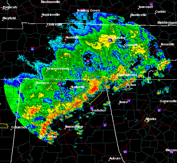 At 235 pm cdt, severe thunderstorms were located along a line extending from near bridgeport to near pisgah to near grant, moving southeast at 20 mph (radar indicated). Hazards include 60 mph wind gusts. Expect damage to roofs, siding, and trees. Locations impacted include, scottsboro, guntersville, rainsville, bridgeport, henagar, stevenson, crossville, sylvania, fyffe and hollywood. At 235 pm cdt, severe thunderstorms were located along a line extending from near bridgeport to near pisgah to near grant, moving southeast at 20 mph (radar indicated). Hazards include 60 mph wind gusts. Expect damage to roofs, siding, and trees. Locations impacted include, scottsboro, guntersville, rainsville, bridgeport, henagar, stevenson, crossville, sylvania, fyffe and hollywood.
|
| 6/15/2017 2:25 PM CDT |
 At 224 pm cdt, severe thunderstorms were located along a line extending from near stevenson to near section to near guntersville, moving southeast at 55 mph (radar indicated). Hazards include 60 mph wind gusts. Expect damage to roofs, siding, and trees. Locations impacted include, scottsboro, guntersville, rainsville, bridgeport, henagar, stevenson, crossville, sylvania, fyffe and hollywood. At 224 pm cdt, severe thunderstorms were located along a line extending from near stevenson to near section to near guntersville, moving southeast at 55 mph (radar indicated). Hazards include 60 mph wind gusts. Expect damage to roofs, siding, and trees. Locations impacted include, scottsboro, guntersville, rainsville, bridgeport, henagar, stevenson, crossville, sylvania, fyffe and hollywood.
|
| 6/15/2017 2:14 PM CDT |
 At 214 pm cdt, severe thunderstorms were located along a line extending from 11 miles northwest of stevenson to near skyline to near morgan city, moving southeast at 25 mph (radar indicated). Hazards include 60 mph wind gusts. expect damage to roofs, siding, and trees At 214 pm cdt, severe thunderstorms were located along a line extending from 11 miles northwest of stevenson to near skyline to near morgan city, moving southeast at 25 mph (radar indicated). Hazards include 60 mph wind gusts. expect damage to roofs, siding, and trees
|
| 5/28/2017 1:41 AM CDT |
 The severe thunderstorm warning for east central dekalb county will expire at 145 am cdt, the storm which prompted the warning has weakened below severe limits, and no longer poses an immediate threat to life or property. therefore the warning will be allowed to expire. however gusty winds are still possible with this thunderstorm. a severe thunderstorm watch remains in effect until 500 am cdt for northeastern alabama, and middle tennessee. The severe thunderstorm warning for east central dekalb county will expire at 145 am cdt, the storm which prompted the warning has weakened below severe limits, and no longer poses an immediate threat to life or property. therefore the warning will be allowed to expire. however gusty winds are still possible with this thunderstorm. a severe thunderstorm watch remains in effect until 500 am cdt for northeastern alabama, and middle tennessee.
|
| 5/28/2017 1:29 AM CDT |
 At 128 am cdt, a severe thunderstorm was located over sylvania, or near rainsville, moving east at 30 mph (radar indicated). Hazards include 60 mph wind gusts and penny size hail. Expect damage to roofs, siding, and trees. Locations impacted include, fort payne, rainsville, henagar, sylvania, powell, valley head, hammondville, mentone, pine ridge and shiloh. At 128 am cdt, a severe thunderstorm was located over sylvania, or near rainsville, moving east at 30 mph (radar indicated). Hazards include 60 mph wind gusts and penny size hail. Expect damage to roofs, siding, and trees. Locations impacted include, fort payne, rainsville, henagar, sylvania, powell, valley head, hammondville, mentone, pine ridge and shiloh.
|
| 5/28/2017 1:15 AM CDT |
 At 115 am cdt, a severe thunderstorm was located over powell, or near rainsville, moving east at 30 mph (radar indicated). Hazards include 60 mph wind gusts and penny size hail. expect damage to roofs, siding, and trees At 115 am cdt, a severe thunderstorm was located over powell, or near rainsville, moving east at 30 mph (radar indicated). Hazards include 60 mph wind gusts and penny size hail. expect damage to roofs, siding, and trees
|
| 5/27/2017 10:57 PM CDT |
 The severe thunderstorm warning for jackson, madison and northeastern dekalb counties will expire at 1100 pm cdt, the storms which prompted the warning have weakened below severe limits, and no longer pose an immediate threat to life or property. therefore the warning will be allowed to expire. however small hail and gusty winds are still possible with these thunderstorms. a severe thunderstorm watch remains in effect until 500 am cdt for north central, northeastern and northwestern alabama, and middle tennessee. The severe thunderstorm warning for jackson, madison and northeastern dekalb counties will expire at 1100 pm cdt, the storms which prompted the warning have weakened below severe limits, and no longer pose an immediate threat to life or property. therefore the warning will be allowed to expire. however small hail and gusty winds are still possible with these thunderstorms. a severe thunderstorm watch remains in effect until 500 am cdt for north central, northeastern and northwestern alabama, and middle tennessee.
|
| 5/27/2017 10:46 PM CDT |
 At 1045 pm cdt, severe thunderstorms were located along a line extending from madison to 9 miles southeast of ider, moving southeast at 30 mph (radar indicated). Hazards include 60 mph wind gusts and quarter size hail. Hail damage to vehicles is expected. expect wind damage to roofs, siding, and trees. Locations impacted include, huntsville, madison, scottsboro, moores mill, meridianville, redstone arsenal, hazel green, henagar, stevenson and sylvania. At 1045 pm cdt, severe thunderstorms were located along a line extending from madison to 9 miles southeast of ider, moving southeast at 30 mph (radar indicated). Hazards include 60 mph wind gusts and quarter size hail. Hail damage to vehicles is expected. expect wind damage to roofs, siding, and trees. Locations impacted include, huntsville, madison, scottsboro, moores mill, meridianville, redstone arsenal, hazel green, henagar, stevenson and sylvania.
|
| 5/27/2017 10:26 PM CDT |
 At 1025 pm cdt, severe thunderstorms were located along a line extending from near madison to 6 miles south of bridgeport, moving south at 20 mph (radar indicated). Hazards include 60 mph wind gusts and quarter size hail. Hail damage to vehicles is expected. Expect wind damage to roofs, siding, and trees. At 1025 pm cdt, severe thunderstorms were located along a line extending from near madison to 6 miles south of bridgeport, moving south at 20 mph (radar indicated). Hazards include 60 mph wind gusts and quarter size hail. Hail damage to vehicles is expected. Expect wind damage to roofs, siding, and trees.
|
| 5/20/2017 6:11 PM CDT |
 At 611 pm cdt, a severe thunderstorm was located near fort payne, moving northwest at 25 mph (radar indicated). Hazards include 60 mph wind gusts. Expect damage to roofs, siding, and trees. Locations impacted include, fort payne, rainsville, henagar, sylvania, fyffe, powell, ider, valley head, hammondville and mentone. At 611 pm cdt, a severe thunderstorm was located near fort payne, moving northwest at 25 mph (radar indicated). Hazards include 60 mph wind gusts. Expect damage to roofs, siding, and trees. Locations impacted include, fort payne, rainsville, henagar, sylvania, fyffe, powell, ider, valley head, hammondville and mentone.
|
| 5/20/2017 6:01 PM CDT |
 At 600 pm cdt, a severe thunderstorm was located over fort payne, moving northwest at 25 mph (radar indicated). Hazards include 60 mph wind gusts. expect damage to roofs, siding, and trees At 600 pm cdt, a severe thunderstorm was located over fort payne, moving northwest at 25 mph (radar indicated). Hazards include 60 mph wind gusts. expect damage to roofs, siding, and trees
|
| 4/30/2017 3:58 PM CDT |
 The severe thunderstorm warning for jackson, dekalb and franklin counties will expire at 400 pm cdt, the storms which prompted the warning have weakened below severe limits, and no longer pose an immediate threat to life or property. therefore the warning will be allowed to expire. however, gusty winds are still possible with these thunderstorms. a tornado watch remains in effect until 700 pm cdt for northeastern alabama, and middle tennessee. The severe thunderstorm warning for jackson, dekalb and franklin counties will expire at 400 pm cdt, the storms which prompted the warning have weakened below severe limits, and no longer pose an immediate threat to life or property. therefore the warning will be allowed to expire. however, gusty winds are still possible with these thunderstorms. a tornado watch remains in effect until 700 pm cdt for northeastern alabama, and middle tennessee.
|
| 4/30/2017 3:58 PM CDT |
 The severe thunderstorm warning for jackson. dekalb and franklin counties will expire at 400 pm cdt. the storms which prompted the warning have weakened below severe limits, and no longer pose an immediate threat to life or property. therefore the warning will be allowed to expire. However, gusty winds are still possible with these thunderstorms. The severe thunderstorm warning for jackson. dekalb and franklin counties will expire at 400 pm cdt. the storms which prompted the warning have weakened below severe limits, and no longer pose an immediate threat to life or property. therefore the warning will be allowed to expire. However, gusty winds are still possible with these thunderstorms.
|
| 4/30/2017 3:49 PM CDT |
 At 349 pm cdt, severe thunderstorms were located along a line extending from near estill springs to near collinsville, moving east at 40 mph (radar indicated). Hazards include 60 mph wind gusts. Expect damage to roofs, siding, and trees. locations impacted include, scottsboro, fort payne, winchester, rainsville, bridgeport, little river canyon national preserve, decherd, henagar, estill springs and stevenson. A tornado watch remains in effect until 700 pm cdt for north central and northeastern alabama, and middle tennessee. At 349 pm cdt, severe thunderstorms were located along a line extending from near estill springs to near collinsville, moving east at 40 mph (radar indicated). Hazards include 60 mph wind gusts. Expect damage to roofs, siding, and trees. locations impacted include, scottsboro, fort payne, winchester, rainsville, bridgeport, little river canyon national preserve, decherd, henagar, estill springs and stevenson. A tornado watch remains in effect until 700 pm cdt for north central and northeastern alabama, and middle tennessee.
|
| 4/30/2017 3:33 PM CDT |
 At 333 pm cdt, severe thunderstorms were located along a line extending from 7 miles north of tullahoma to near crossville, moving northeast at 55 mph (radar indicated). Hazards include 60 mph wind gusts. Expect damage to roofs, siding, and trees. locations impacted include, scottsboro, fort payne, boaz, winchester, rainsville, bridgeport, little river canyon national preserve, decherd, henagar and estill springs. A tornado watch remains in effect until 700 pm cdt for north central and northeastern alabama, and middle tennessee. At 333 pm cdt, severe thunderstorms were located along a line extending from 7 miles north of tullahoma to near crossville, moving northeast at 55 mph (radar indicated). Hazards include 60 mph wind gusts. Expect damage to roofs, siding, and trees. locations impacted include, scottsboro, fort payne, boaz, winchester, rainsville, bridgeport, little river canyon national preserve, decherd, henagar and estill springs. A tornado watch remains in effect until 700 pm cdt for north central and northeastern alabama, and middle tennessee.
|
| 4/30/2017 3:17 PM CDT |
 At 317 pm cdt, severe thunderstorms were located along a line extending from lynchburg to albertville, moving northeast at 40 mph (radar indicated). Hazards include 60 mph wind gusts. Expect damage to roofs, siding, and trees. locations impacted include, albertville, scottsboro, fort payne, boaz, winchester, guntersville, fayetteville, rainsville, bridgeport and lynchburg. A tornado watch remains in effect until 700 pm cdt for north central and northeastern alabama, and middle tennessee. At 317 pm cdt, severe thunderstorms were located along a line extending from lynchburg to albertville, moving northeast at 40 mph (radar indicated). Hazards include 60 mph wind gusts. Expect damage to roofs, siding, and trees. locations impacted include, albertville, scottsboro, fort payne, boaz, winchester, guntersville, fayetteville, rainsville, bridgeport and lynchburg. A tornado watch remains in effect until 700 pm cdt for north central and northeastern alabama, and middle tennessee.
|
| 4/30/2017 2:54 PM CDT |
 At 252 pm cdt, severe thunderstorms were located along a line extending from near petersburg to near altoona, moving northeast at 55 mph (radar indicated). Hazards include 60 mph wind gusts. expect damage to roofs, siding, and trees At 252 pm cdt, severe thunderstorms were located along a line extending from near petersburg to near altoona, moving northeast at 55 mph (radar indicated). Hazards include 60 mph wind gusts. expect damage to roofs, siding, and trees
|
| 4/22/2017 6:14 PM CDT |
 At 614 pm cdt, a severe thunderstorm was located near ider, or 14 miles south of bridgeport, moving east at 35 mph (radar indicated). Hazards include 60 mph wind gusts and quarter size hail. Hail damage to vehicles is expected. expect wind damage to roofs, siding, and trees. Locations impacted include, bridgeport, henagar, stevenson, hollywood, ider, pisgah, higdon, rosalie, flat rock and martintown. At 614 pm cdt, a severe thunderstorm was located near ider, or 14 miles south of bridgeport, moving east at 35 mph (radar indicated). Hazards include 60 mph wind gusts and quarter size hail. Hail damage to vehicles is expected. expect wind damage to roofs, siding, and trees. Locations impacted include, bridgeport, henagar, stevenson, hollywood, ider, pisgah, higdon, rosalie, flat rock and martintown.
|
| 4/22/2017 6:04 PM CDT |
 At 603 pm cdt, a severe thunderstorm was located near hollywood, or 9 miles northeast of scottsboro, moving east at 35 mph (radar indicated). Hazards include 60 mph wind gusts and quarter size hail. Hail damage to vehicles is expected. expect wind damage to roofs, siding, and trees. Locations impacted include, bridgeport, henagar, stevenson, hollywood, ider, pisgah, higdon, rosalie, bass and flat rock. At 603 pm cdt, a severe thunderstorm was located near hollywood, or 9 miles northeast of scottsboro, moving east at 35 mph (radar indicated). Hazards include 60 mph wind gusts and quarter size hail. Hail damage to vehicles is expected. expect wind damage to roofs, siding, and trees. Locations impacted include, bridgeport, henagar, stevenson, hollywood, ider, pisgah, higdon, rosalie, bass and flat rock.
|
| 4/22/2017 5:55 PM CDT |
 At 554 pm cdt, a severe thunderstorm was located over skyline, or 11 miles north of scottsboro, moving east at 55 mph (radar indicated). Hazards include 60 mph wind gusts and quarter size hail. Hail damage to vehicles is expected. Expect wind damage to roofs, siding, and trees. At 554 pm cdt, a severe thunderstorm was located over skyline, or 11 miles north of scottsboro, moving east at 55 mph (radar indicated). Hazards include 60 mph wind gusts and quarter size hail. Hail damage to vehicles is expected. Expect wind damage to roofs, siding, and trees.
|
| 3/10/2017 1:29 AM CST |
 At 128 am cst, severe thunderstorms were located along a line extending from near trion to near albertville, moving east at 45 mph (radar indicated). Hazards include 60 mph wind gusts and quarter size hail. Hail damage to vehicles is expected. expect wind damage to roofs, siding, and trees. Locations impacted include, albertville, scottsboro, fort payne, boaz, guntersville, arab, rainsville, little river canyon national preserve, henagar and collinsville. At 128 am cst, severe thunderstorms were located along a line extending from near trion to near albertville, moving east at 45 mph (radar indicated). Hazards include 60 mph wind gusts and quarter size hail. Hail damage to vehicles is expected. expect wind damage to roofs, siding, and trees. Locations impacted include, albertville, scottsboro, fort payne, boaz, guntersville, arab, rainsville, little river canyon national preserve, henagar and collinsville.
|
| 3/10/2017 1:14 AM CST |
 At 114 am cst, severe thunderstorms were located along a line extending from 10 miles northwest of trion to near arab, moving east at 65 mph (radar indicated). Hazards include 60 mph wind gusts and quarter size hail. Hail damage to vehicles is expected. Expect wind damage to roofs, siding, and trees. At 114 am cst, severe thunderstorms were located along a line extending from 10 miles northwest of trion to near arab, moving east at 65 mph (radar indicated). Hazards include 60 mph wind gusts and quarter size hail. Hail damage to vehicles is expected. Expect wind damage to roofs, siding, and trees.
|
| 3/10/2017 12:27 AM CST |
 At 1227 am cst, severe thunderstorms were located along a line extending from near sewanee to triana, moving southeast at 40 mph (radar indicated). Hazards include 60 mph wind gusts and quarter size hail. Hail damage to vehicles is expected. Expect wind damage to roofs, siding, and trees. At 1227 am cst, severe thunderstorms were located along a line extending from near sewanee to triana, moving southeast at 40 mph (radar indicated). Hazards include 60 mph wind gusts and quarter size hail. Hail damage to vehicles is expected. Expect wind damage to roofs, siding, and trees.
|
| 3/1/2017 2:41 PM CST | Golf Ball sized hail reported 0.1 miles WNW of Ider, AL, . |
| 3/1/2017 2:40 PM CST |
 At 239 pm cst, a severe thunderstorm was located near ider, or 8 miles southwest of trenton, moving east at 55 mph. spotters report golf ball hail in ider with this storm (radar indicated). Hazards include golf ball size hail and 60 mph wind gusts. People and animals outdoors will be injured. expect hail damage to roofs, siding, windows, and vehicles. expect wind damage to roofs, siding, and trees. locations impacted include, henagar, ider, pisgah, flat rock, higdon, sulpher springs, rosalie and fabius. A tornado watch remains in effect until 600 pm cst for northeastern alabama, and middle tennessee. At 239 pm cst, a severe thunderstorm was located near ider, or 8 miles southwest of trenton, moving east at 55 mph. spotters report golf ball hail in ider with this storm (radar indicated). Hazards include golf ball size hail and 60 mph wind gusts. People and animals outdoors will be injured. expect hail damage to roofs, siding, windows, and vehicles. expect wind damage to roofs, siding, and trees. locations impacted include, henagar, ider, pisgah, flat rock, higdon, sulpher springs, rosalie and fabius. A tornado watch remains in effect until 600 pm cst for northeastern alabama, and middle tennessee.
|
| 3/1/2017 2:30 PM CST |
 At 229 pm cst, a severe thunderstorm was located near ider, or 13 miles south of bridgeport, moving east at 55 mph (radar indicated). Hazards include 60 mph wind gusts and quarter size hail. Hail damage to vehicles is expected. expect wind damage to roofs, siding, and trees. locations impacted include, henagar, ider, pisgah, flat rock, higdon, sulpher springs, rosalie and fabius. A tornado watch remains in effect until 600 pm cst for northeastern alabama, and middle tennessee. At 229 pm cst, a severe thunderstorm was located near ider, or 13 miles south of bridgeport, moving east at 55 mph (radar indicated). Hazards include 60 mph wind gusts and quarter size hail. Hail damage to vehicles is expected. expect wind damage to roofs, siding, and trees. locations impacted include, henagar, ider, pisgah, flat rock, higdon, sulpher springs, rosalie and fabius. A tornado watch remains in effect until 600 pm cst for northeastern alabama, and middle tennessee.
|
| 3/1/2017 2:19 PM CST |
 At 219 pm cst, a severe thunderstorm was located near hollywood, or 8 miles northeast of scottsboro, moving east at 55 mph (radar indicated). Hazards include 60 mph wind gusts and quarter size hail. Hail damage to vehicles is expected. Expect wind damage to roofs, siding, and trees. At 219 pm cst, a severe thunderstorm was located near hollywood, or 8 miles northeast of scottsboro, moving east at 55 mph (radar indicated). Hazards include 60 mph wind gusts and quarter size hail. Hail damage to vehicles is expected. Expect wind damage to roofs, siding, and trees.
|
| 11/30/2016 2:39 AM CST |
 At 239 am cst, severe thunderstorms were located along a line extending from near bridgeport to near stevenson to near scottsboro, moving east at 40 mph (radar indicated). Hazards include 60 mph wind gusts. Expect damage to roofs. siding. And trees. At 239 am cst, severe thunderstorms were located along a line extending from near bridgeport to near stevenson to near scottsboro, moving east at 40 mph (radar indicated). Hazards include 60 mph wind gusts. Expect damage to roofs. siding. And trees.
|
| 11/30/2016 2:12 AM CST |
 At 212 am cst, a severe thunderstorm was located near stevenson, or 11 miles west of bridgeport, moving northeast at 55 mph (radar indicated). Hazards include 60 mph wind gusts and nickel size hail. Expect damage to roofs. siding. And trees. At 212 am cst, a severe thunderstorm was located near stevenson, or 11 miles west of bridgeport, moving northeast at 55 mph (radar indicated). Hazards include 60 mph wind gusts and nickel size hail. Expect damage to roofs. siding. And trees.
|
| 11/30/2016 12:13 AM CST |
 At 1213 am cst, a confirmed tornado was located near ider, or 12 miles southwest of trenton, moving northeast at 40 mph (radar confirmed tornado). Hazards include damaging tornado. Flying debris will be dangerous to those caught without shelter. mobile homes will be damaged or destroyed. damage to roofs, windows, and vehicles will occur. tree damage is likely. This tornadic thunderstorm will remain over mainly rural areas of east central jackson and northeastern dekalb counties, including the following locations: rosalie, higdon and flat rock. At 1213 am cst, a confirmed tornado was located near ider, or 12 miles southwest of trenton, moving northeast at 40 mph (radar confirmed tornado). Hazards include damaging tornado. Flying debris will be dangerous to those caught without shelter. mobile homes will be damaged or destroyed. damage to roofs, windows, and vehicles will occur. tree damage is likely. This tornadic thunderstorm will remain over mainly rural areas of east central jackson and northeastern dekalb counties, including the following locations: rosalie, higdon and flat rock.
|
| 11/30/2016 12:02 AM CST |
 At 1201 am cst, a severe thunderstorm capable of producing a tornado was located over pisgah, or 13 miles east of scottsboro, moving northeast at 50 mph (radar indicated rotation). Hazards include tornado. Flying debris will be dangerous to those caught without shelter. mobile homes will be damaged or destroyed. damage to roofs, windows, and vehicles will occur. tree damage is likely. this dangerous storm will be near, ider around 1205 am cst. Other locations impacted by this tornadic thunderstorm include higdon, fabius, rosalie and flat rock. At 1201 am cst, a severe thunderstorm capable of producing a tornado was located over pisgah, or 13 miles east of scottsboro, moving northeast at 50 mph (radar indicated rotation). Hazards include tornado. Flying debris will be dangerous to those caught without shelter. mobile homes will be damaged or destroyed. damage to roofs, windows, and vehicles will occur. tree damage is likely. this dangerous storm will be near, ider around 1205 am cst. Other locations impacted by this tornadic thunderstorm include higdon, fabius, rosalie and flat rock.
|
| 6/15/2016 7:34 PM CDT |
 At 733 pm cdt, a severe thunderstorm was located near little river canyon national preserve, moving southeast at 30 mph (radar indicated). Hazards include 60 mph wind gusts. Expect damage to roofs. siding. and trees. Locations impacted include, albertville, fort payne, boaz, guntersville, rainsville, little river canyon national preserve, henagar, collinsville, crossville and sylvania. At 733 pm cdt, a severe thunderstorm was located near little river canyon national preserve, moving southeast at 30 mph (radar indicated). Hazards include 60 mph wind gusts. Expect damage to roofs. siding. and trees. Locations impacted include, albertville, fort payne, boaz, guntersville, rainsville, little river canyon national preserve, henagar, collinsville, crossville and sylvania.
|
| 6/15/2016 7:26 PM CDT |
 At 725 pm cdt, a severe thunderstorm was located over fort payne, moving southeast at 30 mph (radar indicated). Hazards include 60 mph wind gusts. Expect damage to roofs. siding. and trees. Locations impacted include, albertville, fort payne, boaz, guntersville, rainsville, little river canyon national preserve, henagar, collinsville, crossville and sylvania. At 725 pm cdt, a severe thunderstorm was located over fort payne, moving southeast at 30 mph (radar indicated). Hazards include 60 mph wind gusts. Expect damage to roofs. siding. and trees. Locations impacted include, albertville, fort payne, boaz, guntersville, rainsville, little river canyon national preserve, henagar, collinsville, crossville and sylvania.
|
| 6/15/2016 7:14 PM CDT | Roof blown off a storage building and a tree has fallen on a vehicl in dekalb county AL, 0.1 miles WNW of Ider, AL |
| 6/15/2016 7:12 PM CDT |
 The severe thunderstorm warning for southeastern madison. jackson. central dekalb. northeastern marshall and southeastern franklin counties will expire at 715 pm cdt. the storms which prompted the warning have moved out of the area. therefore the warning will be allowed to expire. remember. A severe thunderstorm warning still remains in effect for. The severe thunderstorm warning for southeastern madison. jackson. central dekalb. northeastern marshall and southeastern franklin counties will expire at 715 pm cdt. the storms which prompted the warning have moved out of the area. therefore the warning will be allowed to expire. remember. A severe thunderstorm warning still remains in effect for.
|
| 6/15/2016 7:12 PM CDT |
 The severe thunderstorm warning for southeastern madison, jackson, central dekalb, northeastern marshall and southeastern franklin counties will expire at 715 pm cdt, the storms which prompted the warning have moved out of the area. therefore the warning will be allowed to expire. remember, a severe thunderstorm warning still remains in effect for the southern portions of jackson county alabama as well as all of dekalb county in alabama. The severe thunderstorm warning for southeastern madison, jackson, central dekalb, northeastern marshall and southeastern franklin counties will expire at 715 pm cdt, the storms which prompted the warning have moved out of the area. therefore the warning will be allowed to expire. remember, a severe thunderstorm warning still remains in effect for the southern portions of jackson county alabama as well as all of dekalb county in alabama.
|
| 6/15/2016 7:11 PM CDT |
 At 710 pm cdt, a severe thunderstorm was located over sylvania, or over rainsville, moving southeast at 30 mph (radar indicated). Hazards include 60 mph wind gusts. Expect damage to roofs. siding. And trees. At 710 pm cdt, a severe thunderstorm was located over sylvania, or over rainsville, moving southeast at 30 mph (radar indicated). Hazards include 60 mph wind gusts. Expect damage to roofs. siding. And trees.
|
| 6/15/2016 6:23 PM CDT |
 At 623 pm cdt, severe thunderstorms were located along a line extending from 6 miles northwest of south pittsburg to 7 miles east of new market, moving southeast at 65 mph (radar indicated). Hazards include 60 mph wind gusts and quarter size hail. Hail damage to vehicles is expected. Expect wind damage to roofs, siding, and trees. At 623 pm cdt, severe thunderstorms were located along a line extending from 6 miles northwest of south pittsburg to 7 miles east of new market, moving southeast at 65 mph (radar indicated). Hazards include 60 mph wind gusts and quarter size hail. Hail damage to vehicles is expected. Expect wind damage to roofs, siding, and trees.
|
| 12/25/2015 10:35 AM CST |
 The severe thunderstorm warning for northeastern dekalb county will expire at 1045 am cst, the storm which prompted the warning has weakened below severe limits and exited the warned area. therefore the warning will be allowed to expire. however heavy rain is still possible with this thunderstorm. The severe thunderstorm warning for northeastern dekalb county will expire at 1045 am cst, the storm which prompted the warning has weakened below severe limits and exited the warned area. therefore the warning will be allowed to expire. however heavy rain is still possible with this thunderstorm.
|
| 12/25/2015 10:27 AM CST |
 At 1026 am cst, a severe thunderstorm was located near ider, or 12 miles south of trenton, moving northeast at 55 mph (radar indicated). Hazards include 60 mph wind gusts. Expect damage to roofs. siding and trees. Locations impacted include, ider, valley head, hammondville and sulpher springs. At 1026 am cst, a severe thunderstorm was located near ider, or 12 miles south of trenton, moving northeast at 55 mph (radar indicated). Hazards include 60 mph wind gusts. Expect damage to roofs. siding and trees. Locations impacted include, ider, valley head, hammondville and sulpher springs.
|
| 12/25/2015 10:18 AM CST |
 At 1018 am cst, a severe thunderstorm was located near ider, or 14 miles northeast of rainsville, moving northeast at 55 mph (radar indicated). Hazards include 60 mph wind gusts. Expect damage to roofs. Siding and trees. At 1018 am cst, a severe thunderstorm was located near ider, or 14 miles northeast of rainsville, moving northeast at 55 mph (radar indicated). Hazards include 60 mph wind gusts. Expect damage to roofs. Siding and trees.
|
| 12/24/2015 1:42 AM CST | The severe thunderstorm warning for east central jackson and northeastern dekalb counties will expire at 145 am cst, the storm which prompted the warning has weakened below severe limits, and no longer pose an immediate threat to life or property. therefore the warning will be allowed to expire. however gusty winds are still possible with this thunderstorm. |
| 12/24/2015 1:32 AM CST | At 132 am cst, a severe thunderstorm was located over henagar, or 13 miles northeast of rainsville, moving northeast at 40 mph (radar indicated). Hazards include 60 mph wind gusts and penny size hail. Expect damage to roofs. siding and trees. Locations impacted include, rainsville, henagar, sylvania, ider, pisgah, valley head, hammondville, mentone, flat rock and sulpher springs. |
| 12/24/2015 1:20 AM CST | At 119 am cst, a severe thunderstorm was located over sylvania, or near rainsville, moving northeast at 45 mph (radar indicated). Hazards include 60 mph wind gusts and penny size hail. Expect damage to roofs. Siding and trees. |
| 7/20/2015 4:07 PM CDT |
 At 407 pm cdt, a severe thunderstorm was located over pisgah, or 10 miles east of scottsboro, moving southeast at 20 mph (radar indicated). Hazards include 60 mph wind gusts. Expect damage to roofs. siding and trees. Locations impacted include, scottsboro, rainsville, henagar, sylvania, fyffe, hollywood, powell, section, ider and pisgah. At 407 pm cdt, a severe thunderstorm was located over pisgah, or 10 miles east of scottsboro, moving southeast at 20 mph (radar indicated). Hazards include 60 mph wind gusts. Expect damage to roofs. siding and trees. Locations impacted include, scottsboro, rainsville, henagar, sylvania, fyffe, hollywood, powell, section, ider and pisgah.
|
| 7/20/2015 3:50 PM CDT |
 At 350 pm cdt, a severe thunderstorm was located over hollywood, or near scottsboro, moving southeast at 20 mph (radar indicated). Hazards include 60 mph wind gusts. Expect damage to roofs. Siding and trees. At 350 pm cdt, a severe thunderstorm was located over hollywood, or near scottsboro, moving southeast at 20 mph (radar indicated). Hazards include 60 mph wind gusts. Expect damage to roofs. Siding and trees.
|
| 7/14/2015 8:15 PM CDT | A few trees and power lines were downed by thunderstorm wind in dekalb county AL, 0.1 miles WNW of Ider, AL |
| 7/14/2015 7:47 PM CDT |
 At 747 pm cdt, severe thunderstorms were located along a line extending from near fyffe to near crossville to near sardis city, moving southeast at 40 mph (trained weather spotters). Hazards include 60 mph wind gusts. Expect damage to roofs. siding and trees. Locations impacted include, albertville, fort payne, boaz, rainsville, little river canyon national preserve, henagar, collinsville, crossville, sylvania and fyffe. At 747 pm cdt, severe thunderstorms were located along a line extending from near fyffe to near crossville to near sardis city, moving southeast at 40 mph (trained weather spotters). Hazards include 60 mph wind gusts. Expect damage to roofs. siding and trees. Locations impacted include, albertville, fort payne, boaz, rainsville, little river canyon national preserve, henagar, collinsville, crossville, sylvania and fyffe.
|
| 7/14/2015 7:36 PM CDT |
 At 735 pm cdt, severe thunderstorms were located along a line extending from near powell to geraldine to near albertville, moving east at 40 mph (radar indicated). Hazards include 60 mph wind gusts. Expect damage to roofs. Siding and trees. At 735 pm cdt, severe thunderstorms were located along a line extending from near powell to geraldine to near albertville, moving east at 40 mph (radar indicated). Hazards include 60 mph wind gusts. Expect damage to roofs. Siding and trees.
|
| 7/14/2015 6:38 PM CDT |
 At 637 pm cdt, a severe thunderstorm was located near henagar, or 10 miles north of fort payne, moving south at 20 mph (radar indicated). Hazards include 60 mph wind gusts. Expect damage to roofs. Siding and trees. At 637 pm cdt, a severe thunderstorm was located near henagar, or 10 miles north of fort payne, moving south at 20 mph (radar indicated). Hazards include 60 mph wind gusts. Expect damage to roofs. Siding and trees.
|
| 7/2/2015 11:52 AM CDT |
 At 1152 am cdt, a severe thunderstorm was located near stevenson, or near bridgeport, moving east at 25 mph (radar indicated). Hazards include 60 mph wind gusts. Expect damage to roofs. Siding and trees. At 1152 am cdt, a severe thunderstorm was located near stevenson, or near bridgeport, moving east at 25 mph (radar indicated). Hazards include 60 mph wind gusts. Expect damage to roofs. Siding and trees.
|
| 6/10/2015 3:46 PM CDT |
 At 346 pm cdt, a severe thunderstorm was located over rainsville, and is nearly stationary. at 340 pm, a trained spotter reported pea sized hail and strong winds in rainsville (radar indicated). Hazards include 60 mph wind gusts and penny size hail. Expect damage to roofs. siding and trees. Locations impacted include, fort payne, rainsville, henagar, sylvania, fyffe, powell, section, ider, dutton and pine ridge. At 346 pm cdt, a severe thunderstorm was located over rainsville, and is nearly stationary. at 340 pm, a trained spotter reported pea sized hail and strong winds in rainsville (radar indicated). Hazards include 60 mph wind gusts and penny size hail. Expect damage to roofs. siding and trees. Locations impacted include, fort payne, rainsville, henagar, sylvania, fyffe, powell, section, ider, dutton and pine ridge.
|
| 6/10/2015 3:32 PM CDT |
 At 332 pm cdt, a severe thunderstorm was located over rainsville, and is nearly stationary (radar indicated). Hazards include 60 mph wind gusts and nickel size hail. Expect damage to roofs. Siding and trees. At 332 pm cdt, a severe thunderstorm was located over rainsville, and is nearly stationary (radar indicated). Hazards include 60 mph wind gusts and nickel size hail. Expect damage to roofs. Siding and trees.
|
| 6/8/2015 5:22 PM CDT | An external tin roof on an apartment complex was torn off at 4952 hwy 75. trees and powerline down in the area as wel in dekalb county AL, 5.8 miles SW of Ider, AL |
| 6/8/2015 5:22 PM CDT | At 521 pm cdt, a severe thunderstorm was located near ider..moving northeast at 50 mph (radar indicated). Hazards include 60 mph wind gusts and quarter size hail. Hail damage to vehicles is expected. Expect wind damage to roofs, siding and trees. |
| 6/8/2015 5:14 PM CDT | Trees knocked down in the ider area. time estimated by rada in dekalb county AL, 0.1 miles WNW of Ider, AL |
| 4/20/2015 3:27 AM CDT | At 325 am cdt, severe thunderstorms were located along a line extending from near trenton to near collinsville, moving east at 45 mph (radar indicated). Hazards include 60 mph wind gusts. Expect damage to roofs. siding and trees. these severe storms will be near, little river canyon national preserve around 440 am edt. other locations impacted by these severe thunderstorms include skirum, peeks corner, pine ridge, lathamville, hammondville, desoto state park, lebanon, shiloh, dog town and valley head. 75in. |
| 4/20/2015 3:20 AM CDT | Power outage on highway 117 in ide in dekalb county AL, 0.1 miles WNW of Ider, AL |
| 4/20/2015 3:16 AM CDT | At 315 am cdt, severe thunderstorms were located along a line extending from near bridgeport to near collinsville, moving east at 55 mph (radar indicated). Hazards include 60 mph wind gusts. Expect damage to roofs. siding and trees. these severe storms will be near, little river canyon national preserve around 430 am edt. other locations impacted by these severe thunderstorms include skirum, lakeview, hammondville, fabius, kilpatrick, lebanon, shiloh, valley head, bass and higdon. 75in. |
| 4/20/2015 2:54 AM CDT | At 253 am cdt, severe thunderstorms were located along a line extending from near stevenson to 9 miles northwest of geraldine, moving east at 50 mph (radar indicated). Hazards include 60 mph wind gusts. Expect damage to roofs. siding and trees. severe thunderstorms will be near, stevenson around 300 am cdt. bridgeport around 305 am cdt. powell around 310 am cdt. rainsville around 315 am cdt. fort payne and little river canyon national preserve around 325 am cdt. other locations impacted by these severe thunderstorms include skirum, lakeview, hammondville, fabius, kilpatrick, lebanon, shiloh, valley head, bass and higdon. 75in. |
| 4/19/2015 5:52 PM CDT | At 550 pm cdt, a severe thunderstorm was located 7 miles southwest of trenton, moving east at 40 mph (public reported half dollar sized hail near scottsboro). Hazards include 60 mph wind gusts and half dollar size hail. Hail damage to vehicles is expected. expect wind damage to roofs, siding and trees. locations impacted include, bridgeport, stevenson, ider, higdon, flat rock, fabius, rosalie and new hope. 1. 00in. |
| 4/19/2015 5:42 PM CDT | At 541 pm cdt, a severe thunderstorm was located near ider, or 12 miles south of bridgeport, moving east at 40 mph (radar indicated). Hazards include 60 mph wind gusts and quarter size hail. Hail damage to vehicles is expected. Expect wind damage to roofs, siding and trees. |
| 4/3/2015 8:24 PM CST | Damage to a home and garage in the cartersville area outside of ider along hwy 75. possible tornad in dekalb county AL, 2 miles S of Ider, AL |
| 4/3/2015 9:06 PM CDT | A severe thunderstorm warning remains in effect until 915 pm cdt for northeastern dekalb and east central jackson counties. at 905 pm cdt. a severe thunderstorm was located over ider. or 13 miles southwest of trenton. moving east at 30 mph. hazard. 60 mph wind gusts. source. Radar indicated. |
| 4/3/2015 8:03 PM CST | Many trees down on highway 75... about 2 miles north of ider... crossing between cartersville and ider. possible tornad in dekalb county AL, 2 miles S of Ider, AL |
| 4/3/2015 8:52 PM CDT | The national weather service in huntsville has issued a * severe thunderstorm warning for. northeastern dekalb county in northeastern alabama. east central jackson county in northeastern alabama. until 915 pm cdt * at 852 pm cdt. a severe thunderstorm was located near pisgah. Or. |
| 10/12/2014 8:49 PM CDT | Quarter sized hail reported 0.1 miles WNW of Ider, AL, quarter sized hail was reported near the intersection of highway 75 and cr 117. |
| 6/6/2014 11:45 AM CDT | Tree down near intersection of county road 121 and country lane near ider. time estimated from rada in dekalb county AL, 1.4 miles SSE of Ider, AL |
| 1/1/0001 12:00 AM | Trees down at intersection of county road 738 and county road 14 in dekalb county AL, 5.8 miles W of Ider, AL |
| 1/1/0001 12:00 AM | Golf Ball sized hail reported 5.8 miles SW of Ider, AL |
| 6/15/2011 2:53 PM CDT | Baseball sized hail reported 1.2 miles W of Ider, AL, on county rd 778 near ider. golfball to baseball sized hail reported. |
| 1/1/0001 12:00 AM | Baseball sized hail reported 3.1 miles SW of Ider, AL, on county rd 778 near ider. golfball to baseball sized hail reported. |
| 1/1/0001 12:00 AM | Quarter sized hail reported 4.9 miles SSE of Ider, AL, one inch diameter hail was reported. |
| 1/1/0001 12:00 AM | Quarter sized hail reported 4.9 miles SSE of Ider, AL, one inch diamter hail was reported. |
| 1/1/0001 12:00 AM | Golf Ball sized hail reported 0.1 miles WNW of Ider, AL |
| 1/1/0001 12:00 AM | Golf Ball sized hail reported 0.1 miles WNW of Ider, AL |
| 1/1/0001 12:00 AM | Tree down on mobile home along cr 651. no injurie in dekalb county AL, 2.8 miles NW of Ider, AL |
| 1/1/0001 12:00 AM | Partial roof pulled up on residence with large tree branches snapped along county road 65 in dekalb county AL, 2.4 miles NNW of Ider, AL |
Hail Maps for Ider, AL

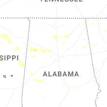


Connect with Interactive Hail Maps