

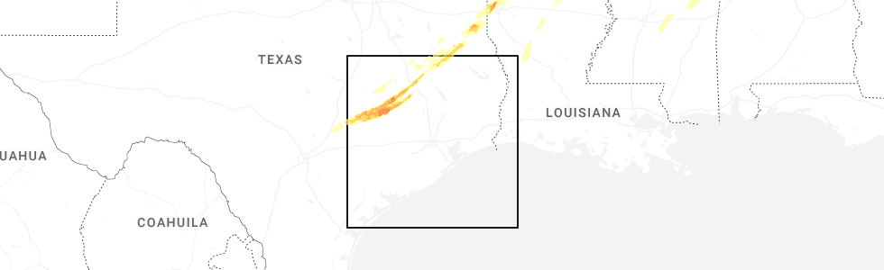
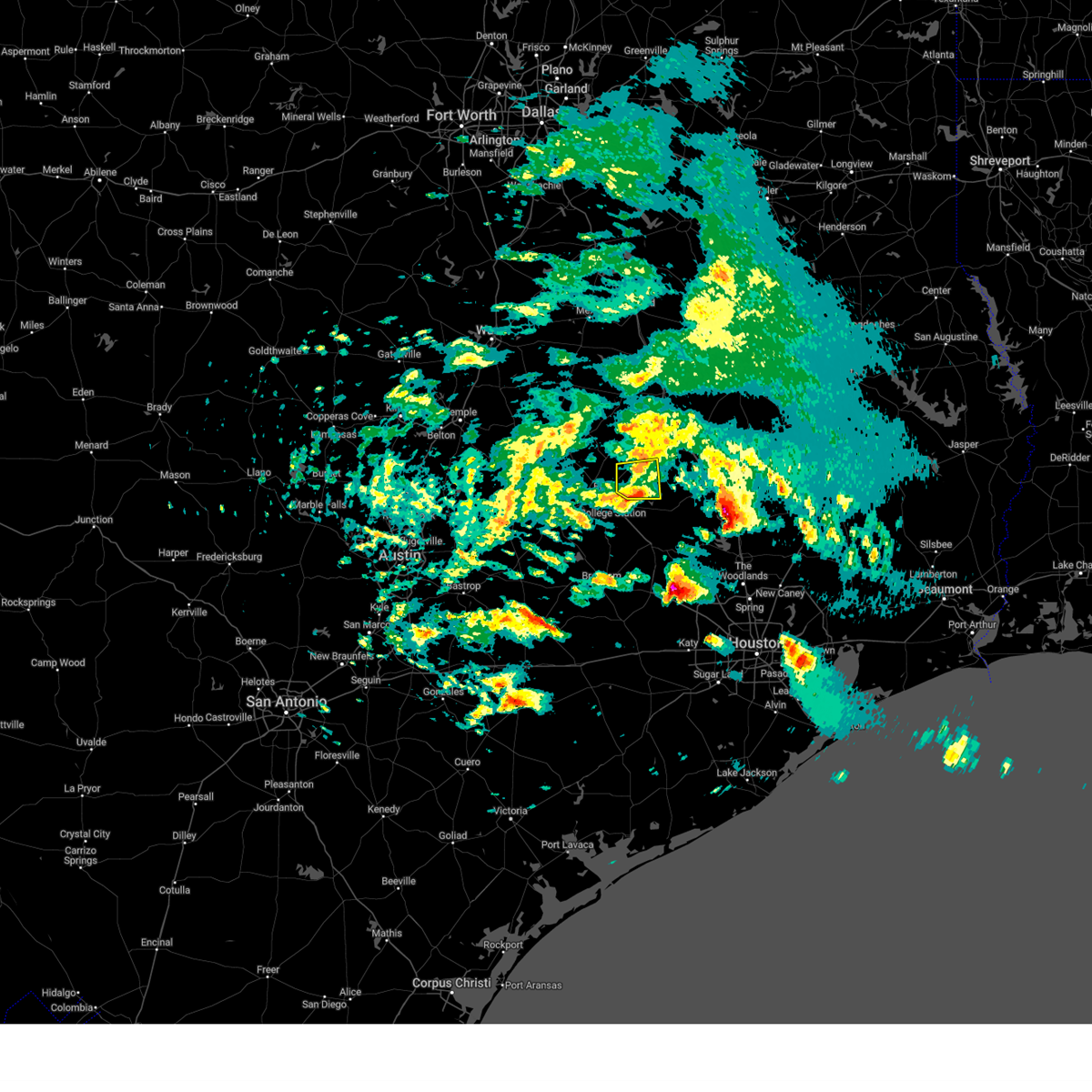
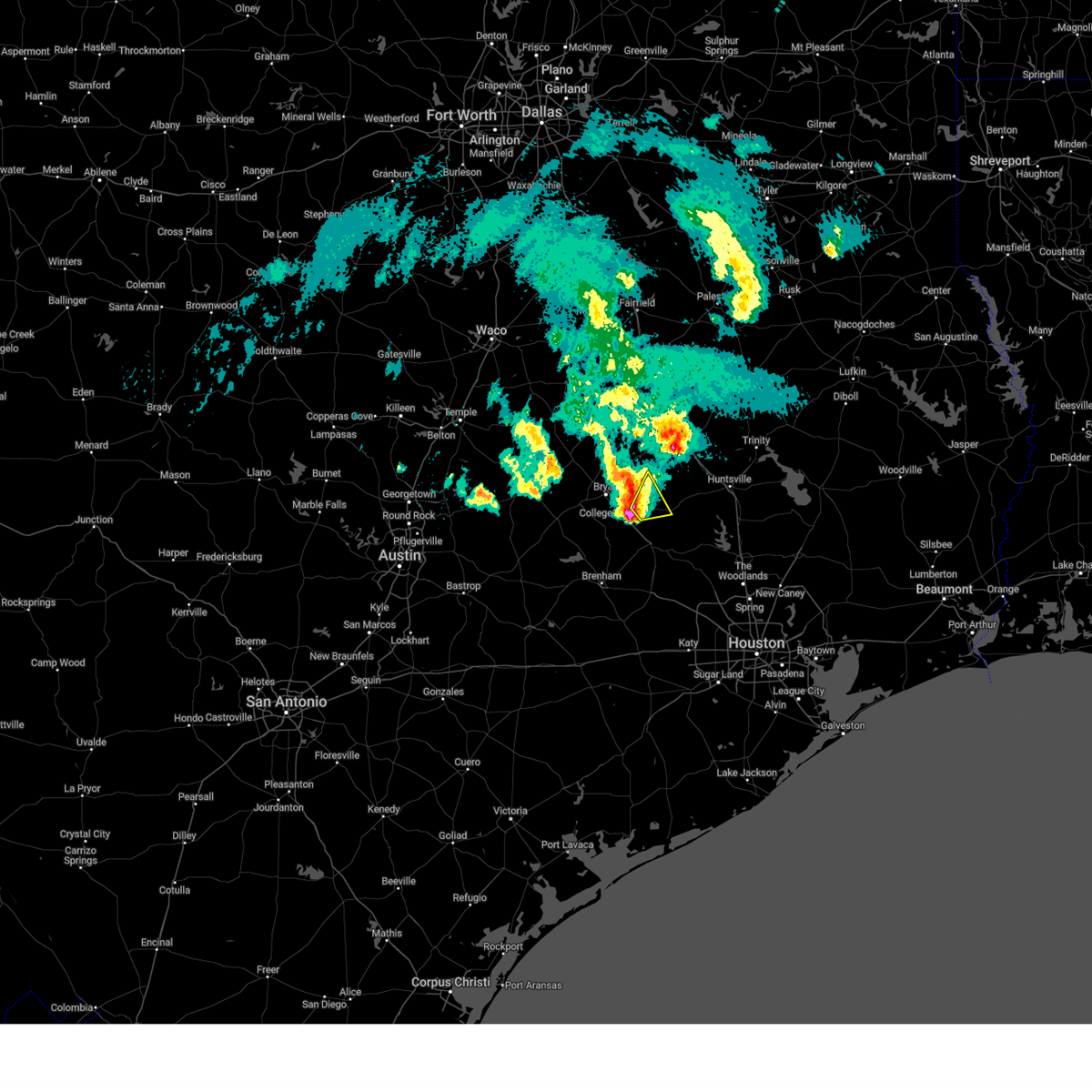
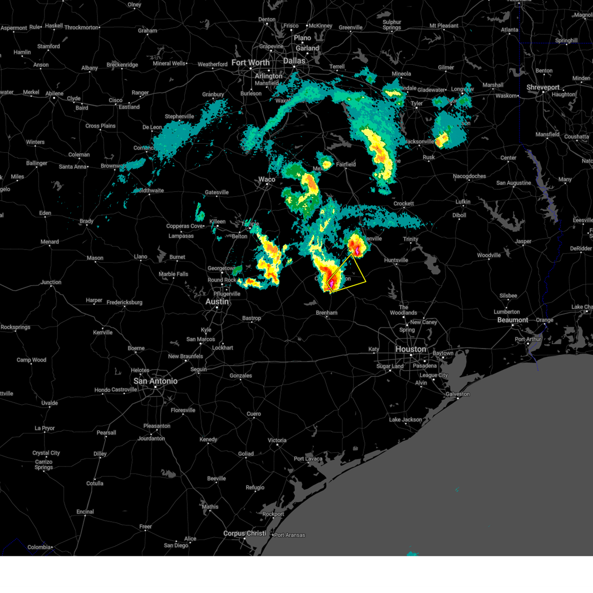
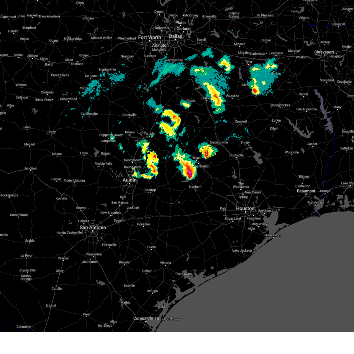
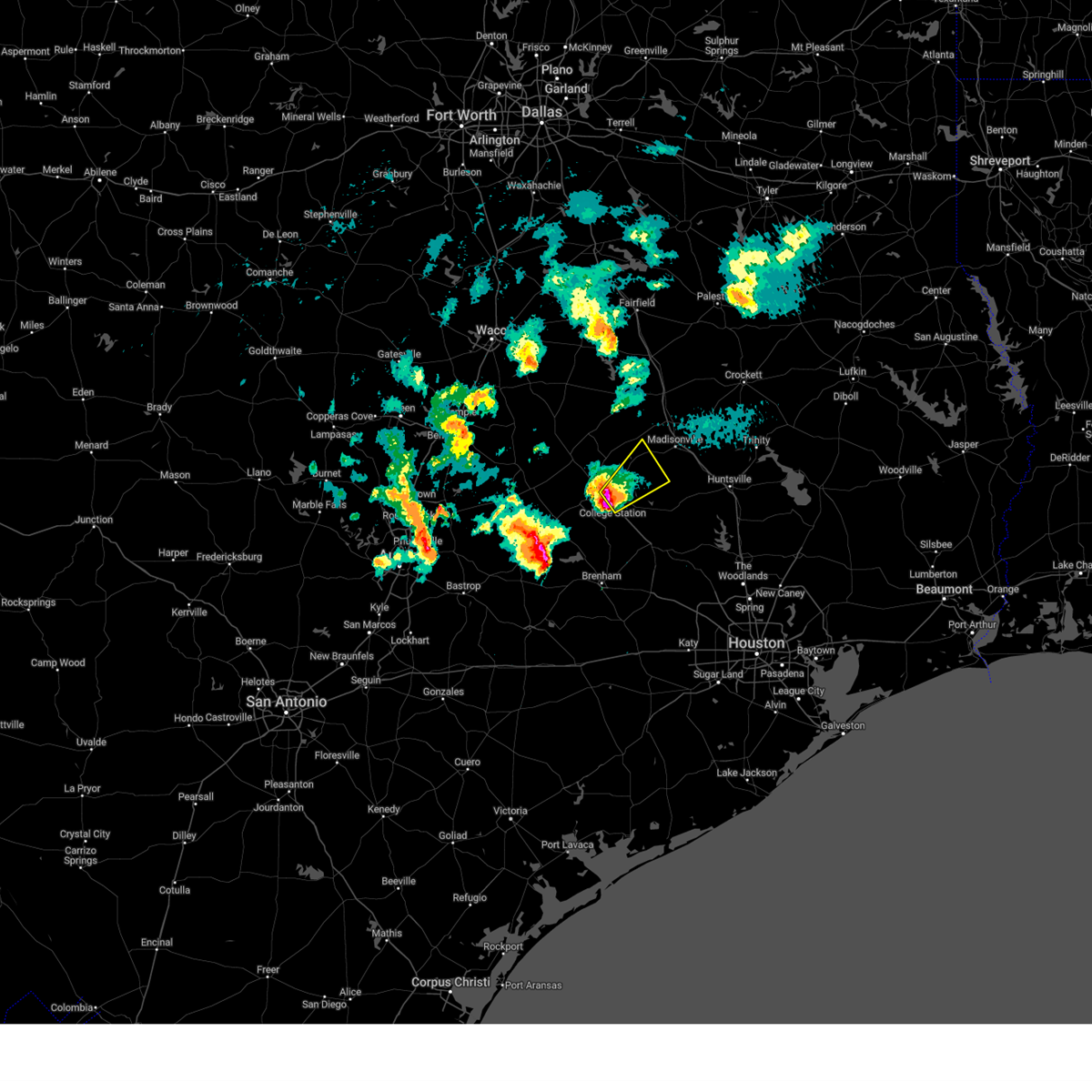
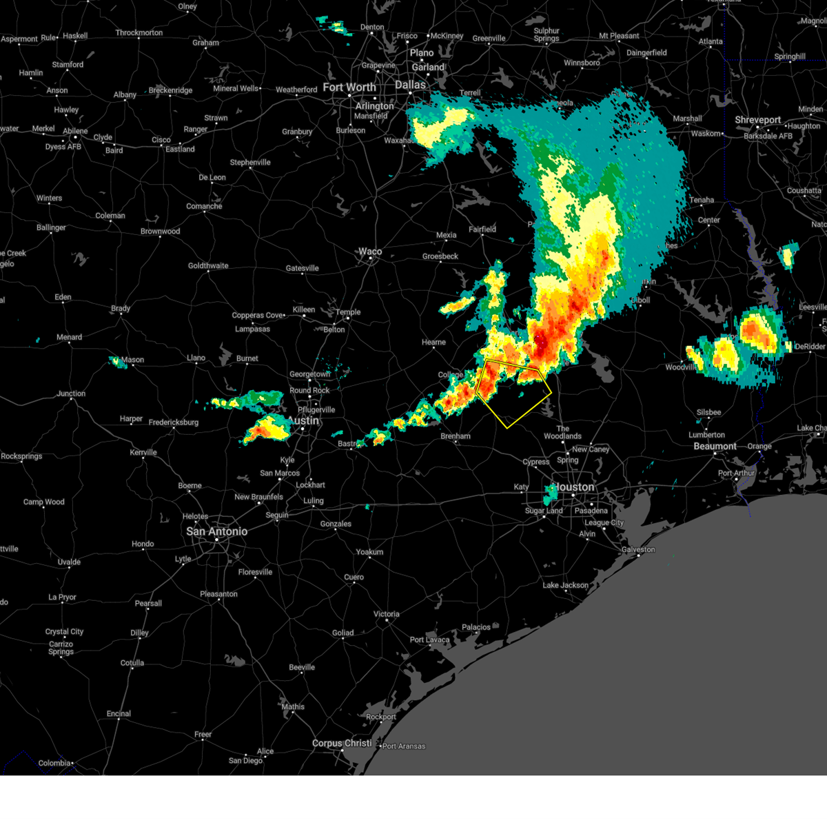
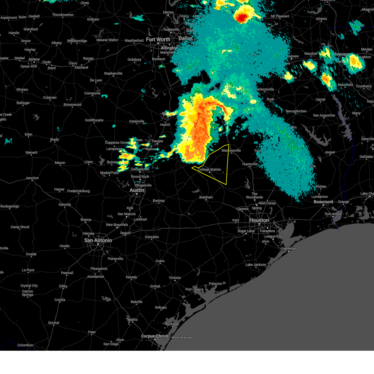
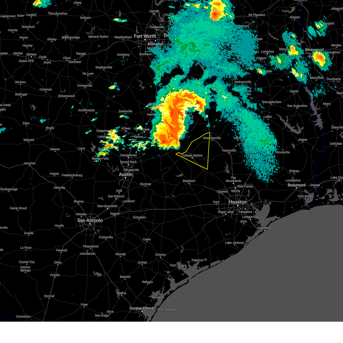
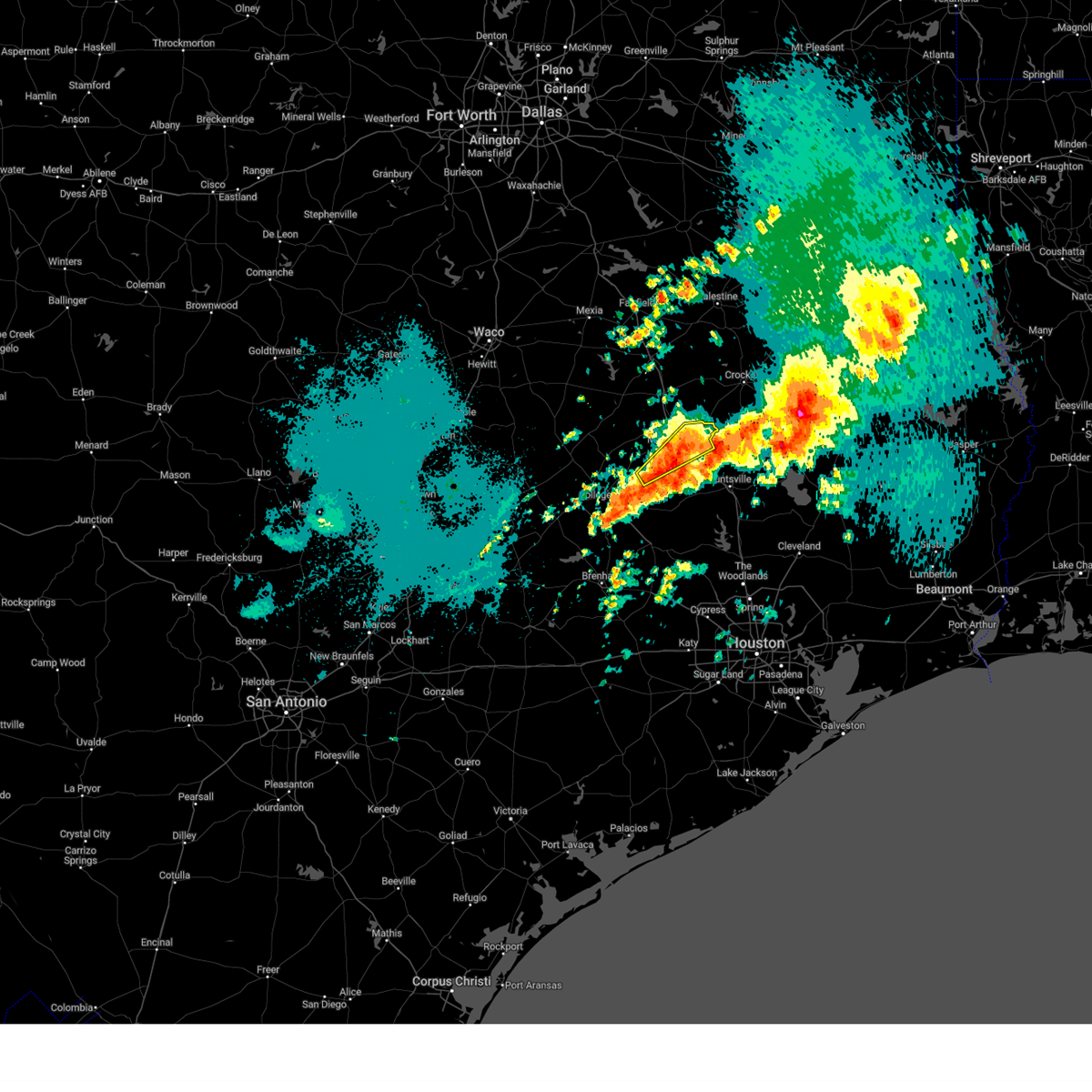
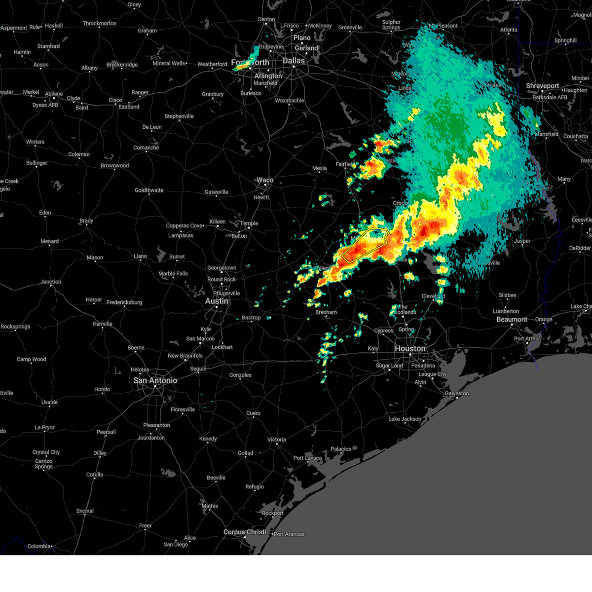
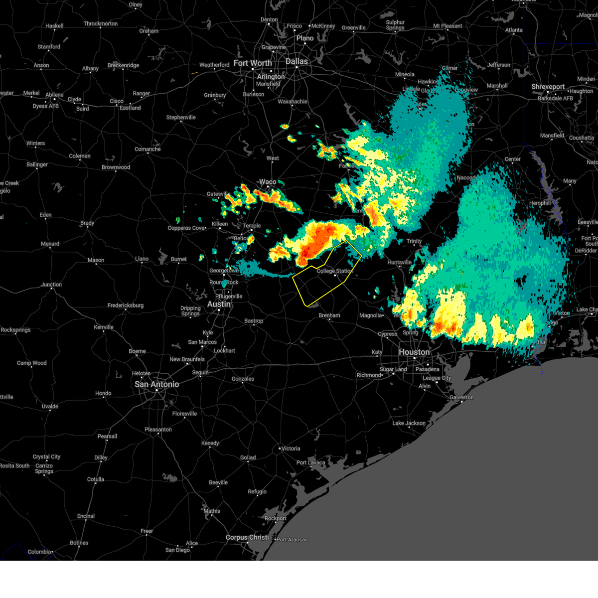
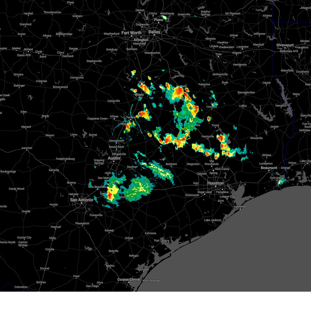
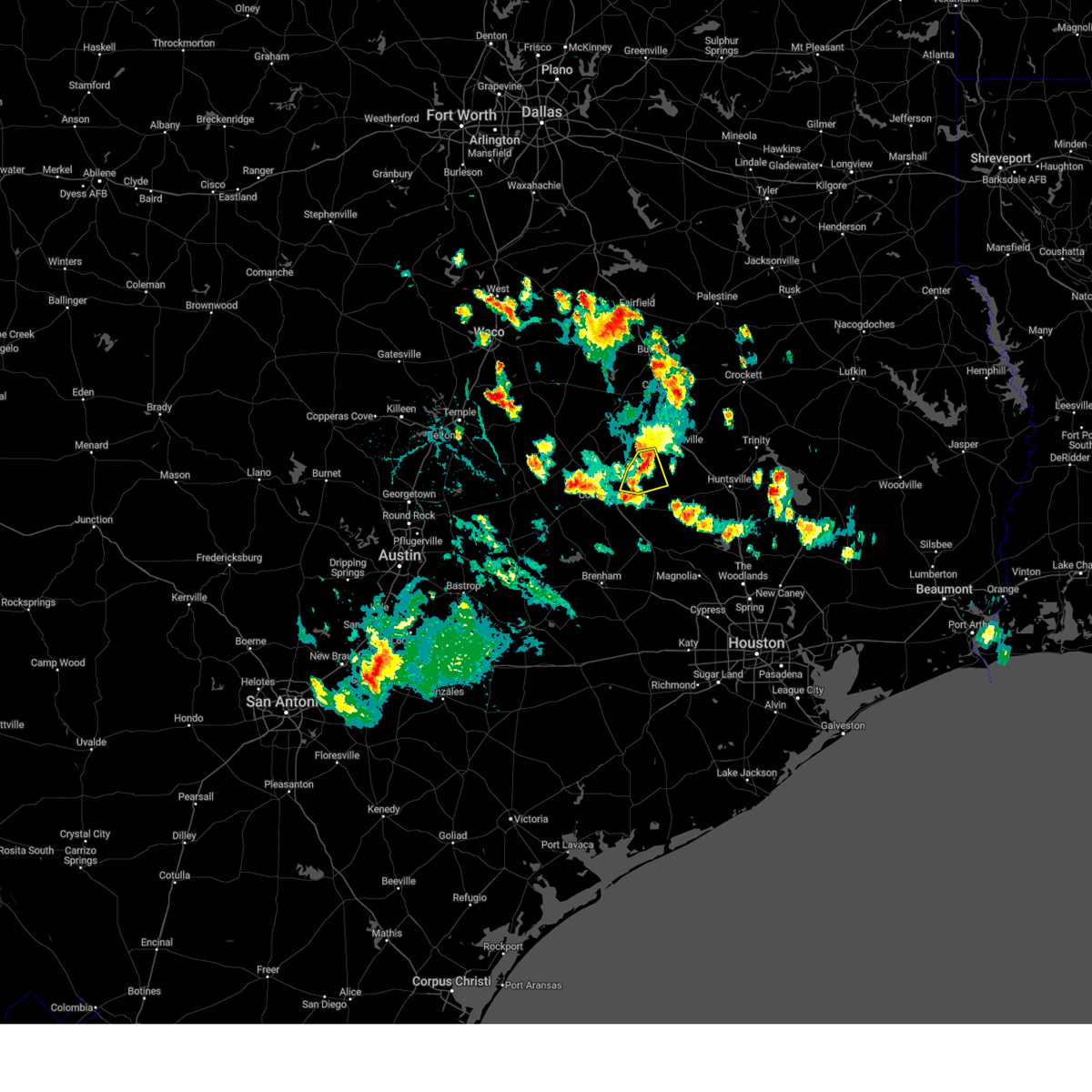
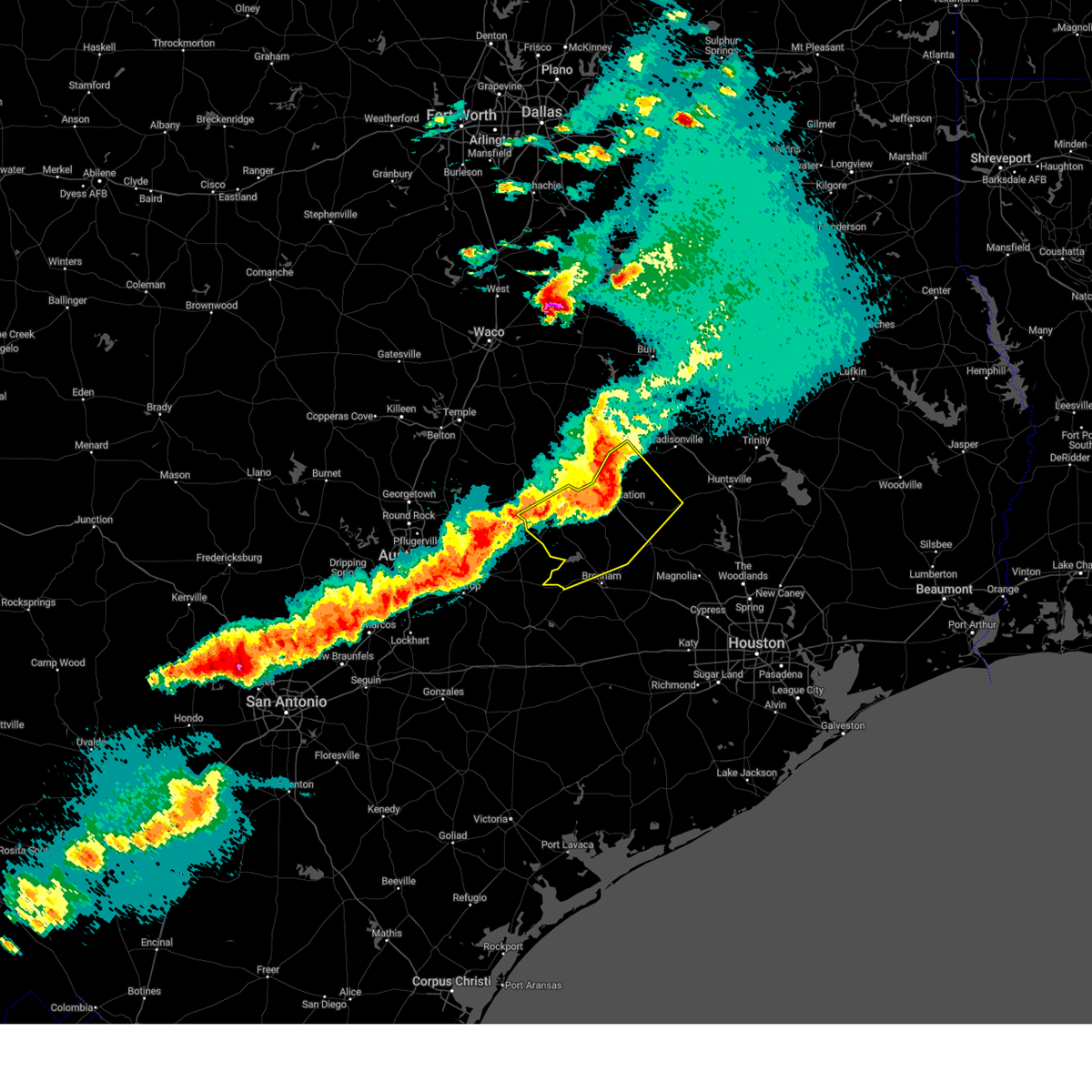
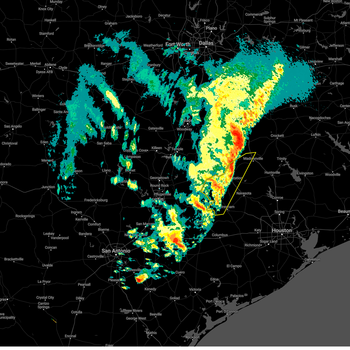
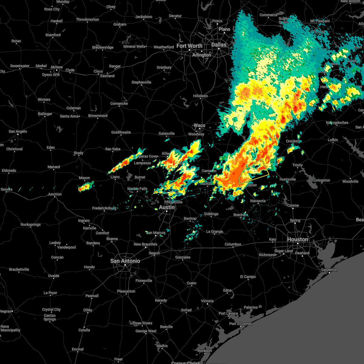
Hail Map for Iola, TX
The Iola, TX area has had 1 report of on-the-ground hail by trained spotters, and has been under severe weather warnings 17 times during the past 12 months. Doppler radar has detected hail at or near Iola, TX on 36 occasions, including 2 occasions during the past year.
| Name: | Iola, TX |
| Where Located: | 81.2 miles NNW of Houston, TX |
| Map: | Google Map for Iola, TX |
| Population: | 401 |
| Housing Units: | 175 |
| More Info: | Search Google for Iola, TX |
3
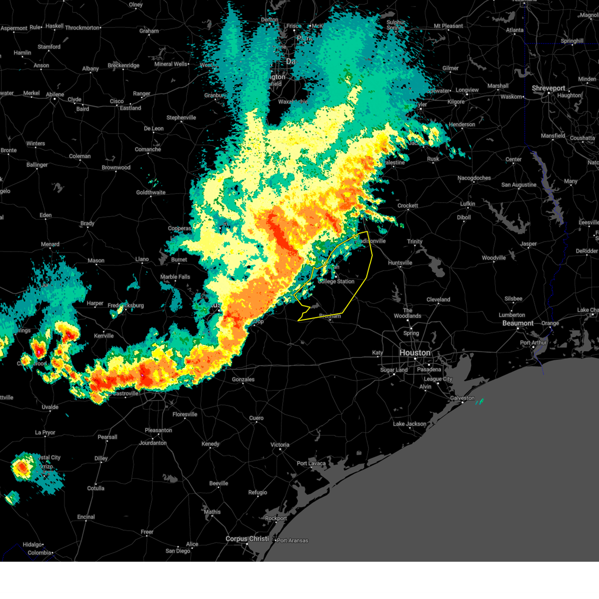
The Top Recent Hail Date for Iola, TX is Friday, March 14, 2025 (7th out of 36)
Hail and Wind Damage Spotted near Iola, TX
| Date / Time | Report Details |
|---|---|
| 5/26/2025 10:59 PM CDT |
 The storms which prompted the warning have weakened below severe limits, and no longer pose an immediate threat to life or property. therefore, the warning will be allowed to expire. however, gusty winds are still possible with these thunderstorms. a severe thunderstorm watch remains in effect until 500 am cdt for southeastern texas. The storms which prompted the warning have weakened below severe limits, and no longer pose an immediate threat to life or property. therefore, the warning will be allowed to expire. however, gusty winds are still possible with these thunderstorms. a severe thunderstorm watch remains in effect until 500 am cdt for southeastern texas.
|
| 5/26/2025 10:10 PM CDT |
 Svrhgx the national weather service in league city has issued a * severe thunderstorm warning for, burleson county in southeastern texas, northwestern grimes county in southeastern texas, brazos county in southeastern texas, northern washington county in southeastern texas, western madison county in southeastern texas, * until 1100 pm cdt. * at 1009 pm cdt, severe thunderstorms were located along a line extending from near bremond to near hearne to near caldwell to near dime box to near paige, moving east at 40 mph (radar indicated). Hazards include 60 mph wind gusts. expect damage to roofs, siding, and trees Svrhgx the national weather service in league city has issued a * severe thunderstorm warning for, burleson county in southeastern texas, northwestern grimes county in southeastern texas, brazos county in southeastern texas, northern washington county in southeastern texas, western madison county in southeastern texas, * until 1100 pm cdt. * at 1009 pm cdt, severe thunderstorms were located along a line extending from near bremond to near hearne to near caldwell to near dime box to near paige, moving east at 40 mph (radar indicated). Hazards include 60 mph wind gusts. expect damage to roofs, siding, and trees
|
| 5/6/2025 3:37 PM CDT |
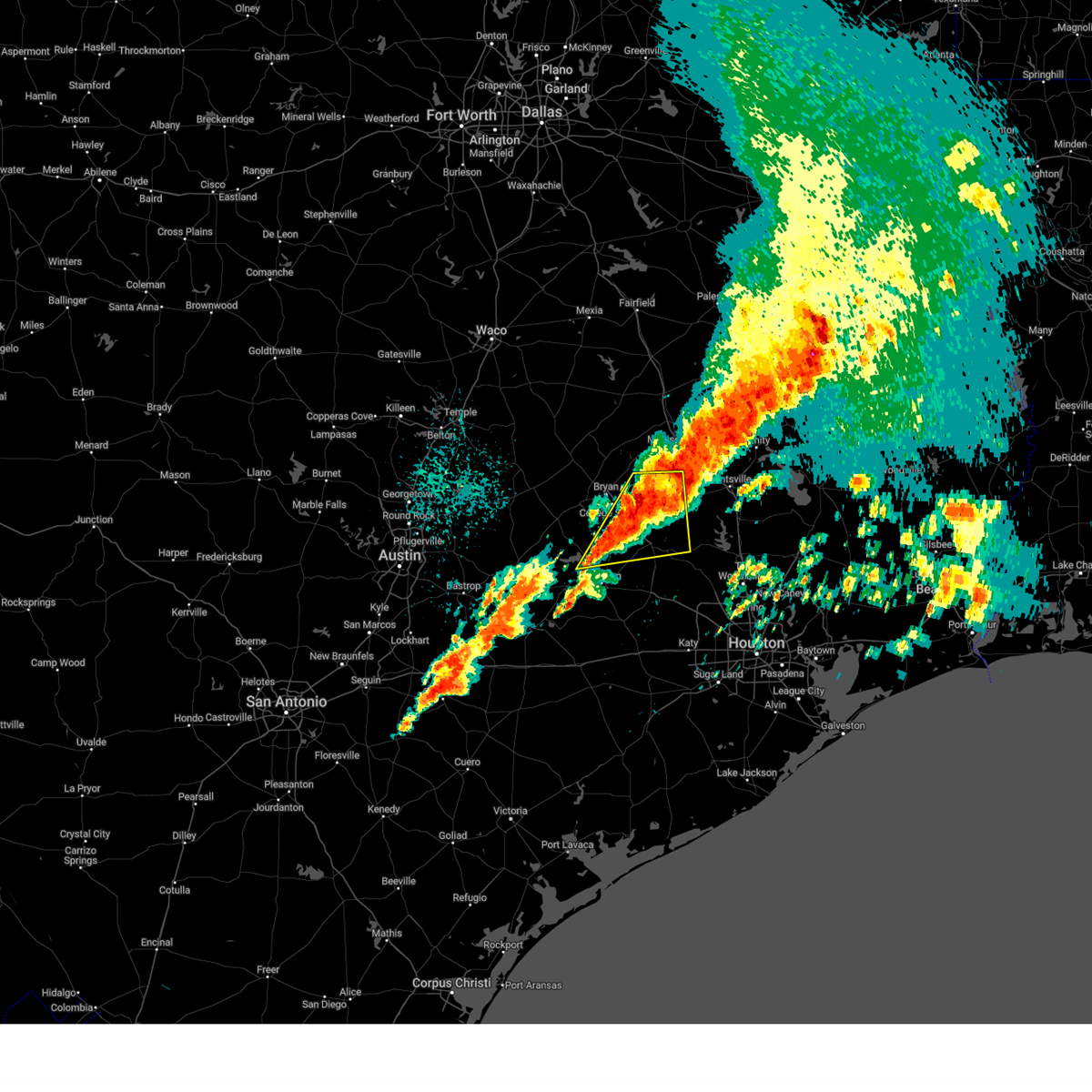 At 335 pm cdt, a line of severe thunderstorms extends from northern washington county through southeast burleson, southern brazos, and grimes counties. hail and damaging wind gusts are the primary concerns. a tornado cannot be ruled out. (radar indicated). Hazards include 60 mph wind gusts and quarter size hail. Hail damage to vehicles is expected. expect wind damage to roofs, siding, and trees. Locations impacted include, college station, eastern bryan, navasota, washington, bedias, millican, anderson, iola, independence, wellborn, roans prairie, richards, and carlos. At 335 pm cdt, a line of severe thunderstorms extends from northern washington county through southeast burleson, southern brazos, and grimes counties. hail and damaging wind gusts are the primary concerns. a tornado cannot be ruled out. (radar indicated). Hazards include 60 mph wind gusts and quarter size hail. Hail damage to vehicles is expected. expect wind damage to roofs, siding, and trees. Locations impacted include, college station, eastern bryan, navasota, washington, bedias, millican, anderson, iola, independence, wellborn, roans prairie, richards, and carlos.
|
| 5/6/2025 3:22 PM CDT | Svrhgx the national weather service in league city has issued a * severe thunderstorm warning for, southeastern burleson county in southeastern texas, grimes county in southeastern texas, southeastern brazos county in southeastern texas, northeastern washington county in southeastern texas, * until 400 pm cdt. * at 320 pm cdt, a line of severe thunderstorms extended from northern washington county into southeastern burleson county, brazos county, and northern grimes county. it is moving east at 40 mph. hail and damaging wind gusts are the primary concern. however, a tornado cannot be ruled out in association with this line (radar indicated). Hazards include 60 mph wind gusts and quarter size hail. Hail damage to vehicles is expected. Expect wind damage to roofs, siding, and trees. |
| 5/6/2025 2:53 PM CDT |
 At 253 pm cdt, a severe thunderstorm was located near college station, moving northeast at 50 mph (radar indicated). Hazards include 60 mph wind gusts and quarter size hail. Hail damage to vehicles is expected. expect wind damage to roofs, siding, and trees. Locations impacted include, college station, bryan, kurten, wixon valley, kyle field, iola, wellborn, north zulch, and carlos. At 253 pm cdt, a severe thunderstorm was located near college station, moving northeast at 50 mph (radar indicated). Hazards include 60 mph wind gusts and quarter size hail. Hail damage to vehicles is expected. expect wind damage to roofs, siding, and trees. Locations impacted include, college station, bryan, kurten, wixon valley, kyle field, iola, wellborn, north zulch, and carlos.
|
| 5/6/2025 2:52 PM CDT |
 Svrhgx the national weather service in league city has issued a * severe thunderstorm warning for, northwestern grimes county in southeastern texas, central brazos county in southeastern texas, southwestern madison county in southeastern texas, * until 330 pm cdt. * at 252 pm cdt, a severe thunderstorm was located near college station, moving northeast at 50 mph (radar indicated). Hazards include 60 mph wind gusts and quarter size hail. Hail damage to vehicles is expected. Expect wind damage to roofs, siding, and trees. Svrhgx the national weather service in league city has issued a * severe thunderstorm warning for, northwestern grimes county in southeastern texas, central brazos county in southeastern texas, southwestern madison county in southeastern texas, * until 330 pm cdt. * at 252 pm cdt, a severe thunderstorm was located near college station, moving northeast at 50 mph (radar indicated). Hazards include 60 mph wind gusts and quarter size hail. Hail damage to vehicles is expected. Expect wind damage to roofs, siding, and trees.
|
| 5/5/2025 5:36 PM CDT |
 The storm which prompted the warning has weakened below severe limits, and no longer poses an immediate threat to life or property. therefore, the warning will be allowed to expire. however, heavy rain is still possible with this thunderstorm. a severe thunderstorm watch remains in effect until 800 pm cdt for southeastern texas. The storm which prompted the warning has weakened below severe limits, and no longer poses an immediate threat to life or property. therefore, the warning will be allowed to expire. however, heavy rain is still possible with this thunderstorm. a severe thunderstorm watch remains in effect until 800 pm cdt for southeastern texas.
|
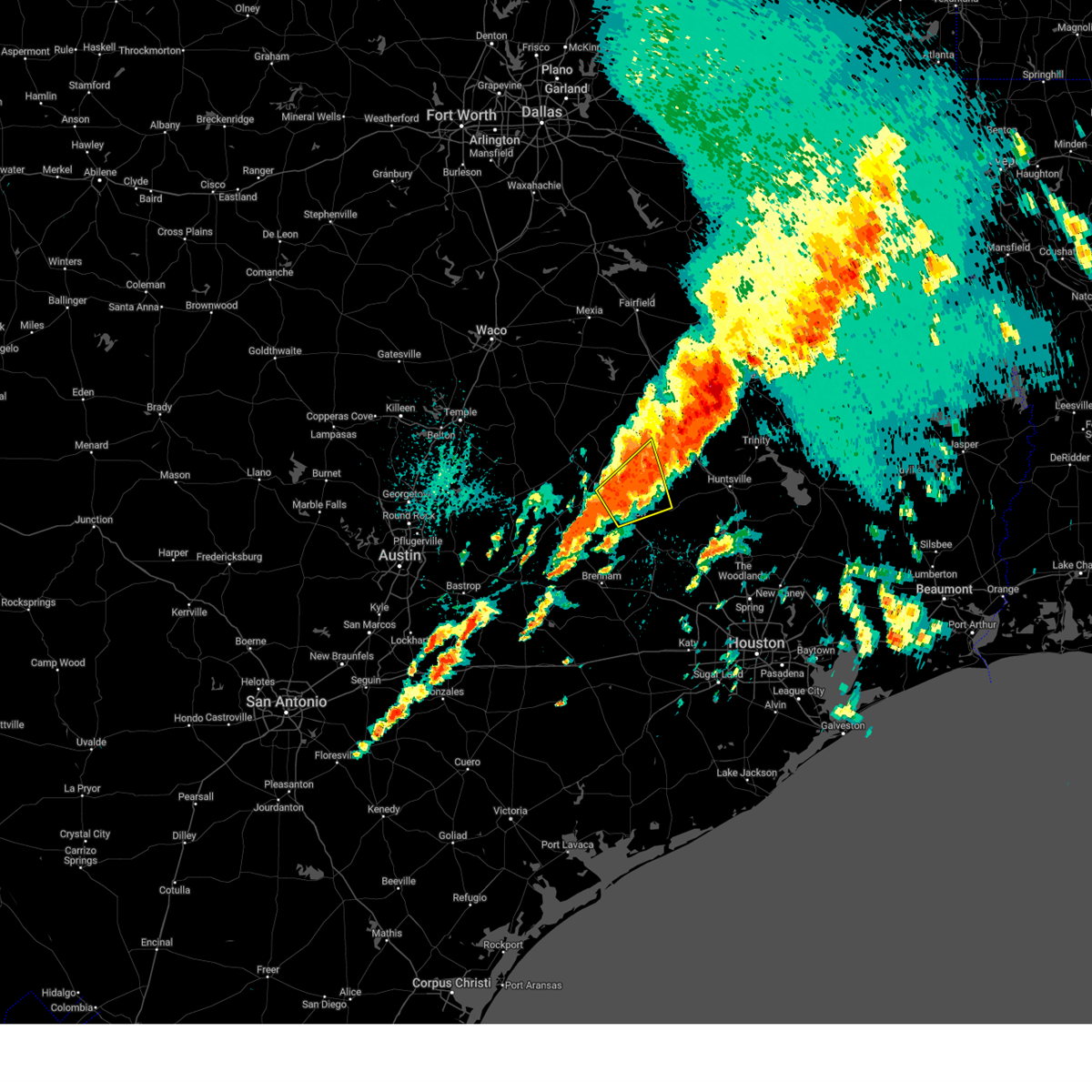
| 5/5/2025 5:20 PM CDT | At 519 pm cdt, a severe thunderstorm was located near kurten, or 12 miles northeast of bryan, moving east at 30 mph (radar indicated). Hazards include 60 mph wind gusts and quarter size hail. Hail damage to vehicles is expected. expect wind damage to roofs, siding, and trees. Locations impacted include, kurten, wixon valley, and iola. |
| 5/5/2025 5:07 PM CDT | At 507 pm cdt, a severe thunderstorm was located over wixon valley, or 7 miles northeast of bryan, moving east at 30 mph (radar indicated). Hazards include golf ball size hail and 60 mph wind gusts. People and animals outdoors will be injured. expect hail damage to roofs, siding, windows, and vehicles. expect wind damage to roofs, siding, and trees. Locations impacted include, northern bryan, kurten, wixon valley, and iola. |
| 5/5/2025 5:05 PM CDT | Svrhgx the national weather service in league city has issued a * severe thunderstorm warning for, northwestern grimes county in southeastern texas, northeastern brazos county in southeastern texas, southwestern madison county in southeastern texas, * until 545 pm cdt. * at 505 pm cdt, a severe thunderstorm was located over wixon valley, or near bryan, moving east at 30 mph (radar indicated). Hazards include 60 mph wind gusts and half dollar size hail. Hail damage to vehicles is expected. Expect wind damage to roofs, siding, and trees. |
| 5/2/2025 4:42 PM CDT | Svrhgx the national weather service in league city has issued a * severe thunderstorm warning for, northern grimes county in southeastern texas, northeastern brazos county in southeastern texas, western houston county in southeastern texas, madison county in southeastern texas, northwestern walker county in southeastern texas, * until 530 pm cdt. * at 442 pm cdt, severe thunderstorms were located along a line extending from 6 miles southeast of fairfield lake state park to near buffalo to 10 miles southwest of fort boggy state park to 10 miles southeast of camp creek lake to 6 miles north of kurten, moving southeast at 30 mph (radar indicated). Hazards include 60 mph wind gusts and half dollar size hail. Hail damage to vehicles is expected. Expect wind damage to roofs, siding, and trees. |
| 3/15/2025 4:01 AM CDT |
 the severe thunderstorm warning has been cancelled and is no longer in effect the severe thunderstorm warning has been cancelled and is no longer in effect
|
| 3/15/2025 4:01 AM CDT |
 At 401 am cdt, a severe thunderstorm was located 11 miles northwest of anderson, or 13 miles east of college station, moving northeast around 45 mph (radar indicated). Hazards include ping pong ball size hail. People and animals outdoors will be injured. expect damage to roofs, siding, windows, and vehicles. Locations impacted include, iola and carlos. At 401 am cdt, a severe thunderstorm was located 11 miles northwest of anderson, or 13 miles east of college station, moving northeast around 45 mph (radar indicated). Hazards include ping pong ball size hail. People and animals outdoors will be injured. expect damage to roofs, siding, windows, and vehicles. Locations impacted include, iola and carlos.
|
| 3/15/2025 3:44 AM CDT |
 Svrhgx the national weather service in league city has issued a * severe thunderstorm warning for, northwestern grimes county in southeastern texas, east central burleson county in southeastern texas, southeastern brazos county in southeastern texas, * until 415 am cdt. * at 344 am cdt, a severe thunderstorm was located over college station, moving northeast at around 40 mph (radar indicated). Hazards include golf ball size hail. People and animals outdoors will be injured. Expect damage to roofs, siding, windows, and vehicles. Svrhgx the national weather service in league city has issued a * severe thunderstorm warning for, northwestern grimes county in southeastern texas, east central burleson county in southeastern texas, southeastern brazos county in southeastern texas, * until 415 am cdt. * at 344 am cdt, a severe thunderstorm was located over college station, moving northeast at around 40 mph (radar indicated). Hazards include golf ball size hail. People and animals outdoors will be injured. Expect damage to roofs, siding, windows, and vehicles.
|
| 3/15/2025 3:36 AM CDT |
 At 336 am cdt, a severe thunderstorm was located 9 miles northwest of bedias, or 12 miles southwest of madisonville, moving northeast at around 40 mph (radar indicated). Hazards include golf ball size hail and 60 mph wind gusts. People and animals outdoors will be injured. expect hail damage to roofs, siding, windows, and vehicles. expect wind damage to roofs, siding, and trees. Locations impacted include, iola and north zulch. At 336 am cdt, a severe thunderstorm was located 9 miles northwest of bedias, or 12 miles southwest of madisonville, moving northeast at around 40 mph (radar indicated). Hazards include golf ball size hail and 60 mph wind gusts. People and animals outdoors will be injured. expect hail damage to roofs, siding, windows, and vehicles. expect wind damage to roofs, siding, and trees. Locations impacted include, iola and north zulch.
|
| 3/15/2025 3:17 AM CDT |
 At 317 am cdt, a severe thunderstorm was located near kurten, or 7 miles northeast of bryan, moving northeast at around 40 mph (radar indicated). Hazards include golf ball size hail and 60 mph wind gusts. People and animals outdoors will be injured. expect hail damage to roofs, siding, windows, and vehicles. expect wind damage to roofs, siding, and trees. Locations impacted include, iola, wixon valley, kurten, north zulch, bryan, and college station. At 317 am cdt, a severe thunderstorm was located near kurten, or 7 miles northeast of bryan, moving northeast at around 40 mph (radar indicated). Hazards include golf ball size hail and 60 mph wind gusts. People and animals outdoors will be injured. expect hail damage to roofs, siding, windows, and vehicles. expect wind damage to roofs, siding, and trees. Locations impacted include, iola, wixon valley, kurten, north zulch, bryan, and college station.
|
| 3/15/2025 3:12 AM CDT |
 Svrhgx the national weather service in league city has issued a * severe thunderstorm warning for, northwestern grimes county in southeastern texas, northeastern brazos county in southeastern texas, southwestern madison county in southeastern texas, * until 345 am cdt. * at 312 am cdt, a severe thunderstorm was located near bryan, moving northeast at around 40 mph (radar indicated). Hazards include 60 mph wind gusts and quarter size hail. Hail damage to vehicles is expected. Expect wind damage to roofs, siding, and trees. Svrhgx the national weather service in league city has issued a * severe thunderstorm warning for, northwestern grimes county in southeastern texas, northeastern brazos county in southeastern texas, southwestern madison county in southeastern texas, * until 345 am cdt. * at 312 am cdt, a severe thunderstorm was located near bryan, moving northeast at around 40 mph (radar indicated). Hazards include 60 mph wind gusts and quarter size hail. Hail damage to vehicles is expected. Expect wind damage to roofs, siding, and trees.
|
| 5/31/2024 5:36 AM CDT |
 Svrhgx the national weather service in league city has issued a * severe thunderstorm warning for, grimes county in southeastern texas, southeastern brazos county in southeastern texas, northwestern montgomery county in southeastern texas, western houston county in southeastern texas, madison county in southeastern texas, western walker county in southeastern texas, * until 600 am cdt. * at 535 am cdt, severe thunderstorms were located along a line extending from 8 miles southwest of elkhart to near navasota, moving east at 40 mph (radar indicated). Hazards include 60 mph wind gusts and penny size hail. expect damage to roofs, siding, and trees Svrhgx the national weather service in league city has issued a * severe thunderstorm warning for, grimes county in southeastern texas, southeastern brazos county in southeastern texas, northwestern montgomery county in southeastern texas, western houston county in southeastern texas, madison county in southeastern texas, western walker county in southeastern texas, * until 600 am cdt. * at 535 am cdt, severe thunderstorms were located along a line extending from 8 miles southwest of elkhart to near navasota, moving east at 40 mph (radar indicated). Hazards include 60 mph wind gusts and penny size hail. expect damage to roofs, siding, and trees
|
| 5/31/2024 5:03 AM CDT |
 At 501 am cdt, severe thunderstorms were located along a line extending from 10 miles southeast of fort boggy state park to 8 miles north of lake somerville state park & trailway, moving southeast at around 45 mph (radar indicated). Hazards include 60 mph wind gusts and penny size hail. Expect damage to roofs, siding, and trees. Locations impacted include, college station, bryan, huntsville, brenham, navasota, madisonville, caldwell, austonio, washington, trinity, somerville, lovelady, snook, riverside, bedias, kurten, burton, wixon valley, millican, and anderson. At 501 am cdt, severe thunderstorms were located along a line extending from 10 miles southeast of fort boggy state park to 8 miles north of lake somerville state park & trailway, moving southeast at around 45 mph (radar indicated). Hazards include 60 mph wind gusts and penny size hail. Expect damage to roofs, siding, and trees. Locations impacted include, college station, bryan, huntsville, brenham, navasota, madisonville, caldwell, austonio, washington, trinity, somerville, lovelady, snook, riverside, bedias, kurten, burton, wixon valley, millican, and anderson.
|
| 5/31/2024 4:36 AM CDT |
 Svrhgx the national weather service in league city has issued a * severe thunderstorm warning for, west central trinity county in southeastern texas, grimes county in southeastern texas, burleson county in southeastern texas, brazos county in southeastern texas, washington county in southeastern texas, northwestern montgomery county in southeastern texas, southwestern houston county in southeastern texas, madison county in southeastern texas, walker county in southeastern texas, * until 530 am cdt. * at 435 am cdt, severe thunderstorms were located along a line extending from 9 miles west of fort boggy state park to near tanglewood, moving southeast at around 50 mph (radar indicated). Hazards include 60 mph wind gusts and penny size hail. expect damage to roofs, siding, and trees Svrhgx the national weather service in league city has issued a * severe thunderstorm warning for, west central trinity county in southeastern texas, grimes county in southeastern texas, burleson county in southeastern texas, brazos county in southeastern texas, washington county in southeastern texas, northwestern montgomery county in southeastern texas, southwestern houston county in southeastern texas, madison county in southeastern texas, walker county in southeastern texas, * until 530 am cdt. * at 435 am cdt, severe thunderstorms were located along a line extending from 9 miles west of fort boggy state park to near tanglewood, moving southeast at around 50 mph (radar indicated). Hazards include 60 mph wind gusts and penny size hail. expect damage to roofs, siding, and trees
|
| 5/30/2024 6:42 PM CDT |
 Svrhgx the national weather service in league city has issued a * severe thunderstorm warning for, southwestern trinity county in southeastern texas, northern grimes county in southeastern texas, east central brazos county in southeastern texas, northwestern montgomery county in southeastern texas, southwestern houston county in southeastern texas, eastern madison county in southeastern texas, walker county in southeastern texas, * until 730 pm cdt. * at 642 pm cdt, severe thunderstorms were located along a line extending from near austonio to 8 miles southeast of madisonville to 7 miles southeast of kurten, moving southeast at 40 mph (radar indicated). Hazards include 60 mph wind gusts and quarter size hail. Hail damage to vehicles is expected. Expect wind damage to roofs, siding, and trees. Svrhgx the national weather service in league city has issued a * severe thunderstorm warning for, southwestern trinity county in southeastern texas, northern grimes county in southeastern texas, east central brazos county in southeastern texas, northwestern montgomery county in southeastern texas, southwestern houston county in southeastern texas, eastern madison county in southeastern texas, walker county in southeastern texas, * until 730 pm cdt. * at 642 pm cdt, severe thunderstorms were located along a line extending from near austonio to 8 miles southeast of madisonville to 7 miles southeast of kurten, moving southeast at 40 mph (radar indicated). Hazards include 60 mph wind gusts and quarter size hail. Hail damage to vehicles is expected. Expect wind damage to roofs, siding, and trees.
|
| 5/28/2024 12:00 PM CDT |
 Svrhgx the national weather service in league city has issued a * severe thunderstorm warning for, grimes county in southeastern texas, east central brazos county in southeastern texas, northwestern montgomery county in southeastern texas, southwestern walker county in southeastern texas, * until 1230 pm cdt. * at 1159 am cdt, a severe thunderstorm was located near anderson, or 9 miles north of navasota, moving southeast at 20 mph (radar indicated). Hazards include 60 mph wind gusts and quarter size hail. Hail damage to vehicles is expected. Expect wind damage to roofs, siding, and trees. Svrhgx the national weather service in league city has issued a * severe thunderstorm warning for, grimes county in southeastern texas, east central brazos county in southeastern texas, northwestern montgomery county in southeastern texas, southwestern walker county in southeastern texas, * until 1230 pm cdt. * at 1159 am cdt, a severe thunderstorm was located near anderson, or 9 miles north of navasota, moving southeast at 20 mph (radar indicated). Hazards include 60 mph wind gusts and quarter size hail. Hail damage to vehicles is expected. Expect wind damage to roofs, siding, and trees.
|
| 5/22/2024 8:30 PM CDT |
 At 829 pm cdt, severe thunderstorms were located along a line extending from 8 miles southwest of palestine to 9 miles southeast of madisonville, moving east at 45 mph (radar indicated). Hazards include 70 mph wind gusts and quarter size hail. Hail damage to vehicles is expected. expect considerable tree damage. wind damage is also likely to mobile homes, roofs, and outbuildings. Locations impacted include, northern huntsville, crockett, madisonville, austonio, trinity, grapeland, lovelady, riverside, bedias, latexo, normangee, iola, crabbs prairie, north zulch, and mound city. At 829 pm cdt, severe thunderstorms were located along a line extending from 8 miles southwest of palestine to 9 miles southeast of madisonville, moving east at 45 mph (radar indicated). Hazards include 70 mph wind gusts and quarter size hail. Hail damage to vehicles is expected. expect considerable tree damage. wind damage is also likely to mobile homes, roofs, and outbuildings. Locations impacted include, northern huntsville, crockett, madisonville, austonio, trinity, grapeland, lovelady, riverside, bedias, latexo, normangee, iola, crabbs prairie, north zulch, and mound city.
|
| 5/22/2024 8:30 PM CDT |
 the severe thunderstorm warning has been cancelled and is no longer in effect the severe thunderstorm warning has been cancelled and is no longer in effect
|
| 5/22/2024 7:58 PM CDT |
 Svrhgx the national weather service in league city has issued a * severe thunderstorm warning for, southwestern trinity county in southeastern texas, northern grimes county in southeastern texas, northeastern brazos county in southeastern texas, houston county in southeastern texas, madison county in southeastern texas, central walker county in southeastern texas, * until 900 pm cdt. * at 756 pm cdt, severe thunderstorms were located along a line extending from near fairfield to 6 miles northeast of kurten, moving east at 45 mph (radar indicated). Hazards include 70 mph wind gusts and quarter size hail. Hail damage to vehicles is expected. expect considerable tree damage. Wind damage is also likely to mobile homes, roofs, and outbuildings. Svrhgx the national weather service in league city has issued a * severe thunderstorm warning for, southwestern trinity county in southeastern texas, northern grimes county in southeastern texas, northeastern brazos county in southeastern texas, houston county in southeastern texas, madison county in southeastern texas, central walker county in southeastern texas, * until 900 pm cdt. * at 756 pm cdt, severe thunderstorms were located along a line extending from near fairfield to 6 miles northeast of kurten, moving east at 45 mph (radar indicated). Hazards include 70 mph wind gusts and quarter size hail. Hail damage to vehicles is expected. expect considerable tree damage. Wind damage is also likely to mobile homes, roofs, and outbuildings.
|
| 5/22/2024 7:42 PM CDT |
 At 741 pm cdt, a severe thunderstorm was located near wixon valley, or 9 miles north of bryan, moving east at 40 mph (radar indicated). Hazards include 70 mph wind gusts and quarter size hail. Hail damage to vehicles is expected. expect considerable tree damage. wind damage is also likely to mobile homes, roofs, and outbuildings. Locations impacted include, college station, bryan, kurten, wixon valley, kyle field, bryan utilities lake, normangee, iola, north zulch, and carlos. At 741 pm cdt, a severe thunderstorm was located near wixon valley, or 9 miles north of bryan, moving east at 40 mph (radar indicated). Hazards include 70 mph wind gusts and quarter size hail. Hail damage to vehicles is expected. expect considerable tree damage. wind damage is also likely to mobile homes, roofs, and outbuildings. Locations impacted include, college station, bryan, kurten, wixon valley, kyle field, bryan utilities lake, normangee, iola, north zulch, and carlos.
|
| 5/22/2024 7:26 PM CDT |
 Svrhgx the national weather service in league city has issued a * severe thunderstorm warning for, northwestern grimes county in southeastern texas, north central burleson county in southeastern texas, brazos county in southeastern texas, western madison county in southeastern texas, * until 800 pm cdt. * at 725 pm cdt, a severe thunderstorm was located near hearne, moving east at 45 mph (radar indicated). Hazards include 70 mph wind gusts and quarter size hail. Hail damage to vehicles is expected. expect considerable tree damage. Wind damage is also likely to mobile homes, roofs, and outbuildings. Svrhgx the national weather service in league city has issued a * severe thunderstorm warning for, northwestern grimes county in southeastern texas, north central burleson county in southeastern texas, brazos county in southeastern texas, western madison county in southeastern texas, * until 800 pm cdt. * at 725 pm cdt, a severe thunderstorm was located near hearne, moving east at 45 mph (radar indicated). Hazards include 70 mph wind gusts and quarter size hail. Hail damage to vehicles is expected. expect considerable tree damage. Wind damage is also likely to mobile homes, roofs, and outbuildings.
|
| 5/16/2024 4:27 PM CDT |
 At 426 pm cdt, a cluster of strong thunderstorms was located 7 miles west of huntsville, moving east at 50 mph (radar indicated). Hazards include 60 mph wind gusts and quarter size hail. Hail damage to vehicles is expected. expect wind damage to roofs, siding, and trees. Locations impacted include, huntsville, trinity, point blank, riverside, bedias, anderson, huntsville state park, iola, crabbs prairie, oakhurst, roans prairie, richards, and carlos. At 426 pm cdt, a cluster of strong thunderstorms was located 7 miles west of huntsville, moving east at 50 mph (radar indicated). Hazards include 60 mph wind gusts and quarter size hail. Hail damage to vehicles is expected. expect wind damage to roofs, siding, and trees. Locations impacted include, huntsville, trinity, point blank, riverside, bedias, anderson, huntsville state park, iola, crabbs prairie, oakhurst, roans prairie, richards, and carlos.
|
| 5/16/2024 4:18 PM CDT |
 Svrhgx the national weather service in league city has issued a * severe thunderstorm warning for, southwestern trinity county in southeastern texas, central grimes county in southeastern texas, northwestern montgomery county in southeastern texas, northwestern san jacinto county in southeastern texas, eastern madison county in southeastern texas, walker county in southeastern texas, * until 500 pm cdt. * at 417 pm cdt, a cluster of strong thunderstorms was located 11 miles west of huntsville, moving east at 50 mph (radar indicated). Hazards include 60 mph wind gusts. expect damage to roofs, siding, and trees Svrhgx the national weather service in league city has issued a * severe thunderstorm warning for, southwestern trinity county in southeastern texas, central grimes county in southeastern texas, northwestern montgomery county in southeastern texas, northwestern san jacinto county in southeastern texas, eastern madison county in southeastern texas, walker county in southeastern texas, * until 500 pm cdt. * at 417 pm cdt, a cluster of strong thunderstorms was located 11 miles west of huntsville, moving east at 50 mph (radar indicated). Hazards include 60 mph wind gusts. expect damage to roofs, siding, and trees
|
| 5/12/2024 10:27 AM CDT |
 Svrhgx the national weather service in league city has issued a * severe thunderstorm warning for, northern grimes county in southeastern texas, northeastern brazos county in southeastern texas, northwestern montgomery county in southeastern texas, madison county in southeastern texas, southwestern walker county in southeastern texas, * until 1115 am cdt. * at 1026 am cdt, a severe thunderstorm was located 10 miles southeast of franklin, or 12 miles east of hearne, moving east southeast at around 40 mph (radar indicated). Hazards include ping pong ball size hail and 60 mph wind gusts. People and animals outdoors will be injured. expect hail damage to roofs, siding, windows, and vehicles. Expect wind damage to roofs, siding, and trees. Svrhgx the national weather service in league city has issued a * severe thunderstorm warning for, northern grimes county in southeastern texas, northeastern brazos county in southeastern texas, northwestern montgomery county in southeastern texas, madison county in southeastern texas, southwestern walker county in southeastern texas, * until 1115 am cdt. * at 1026 am cdt, a severe thunderstorm was located 10 miles southeast of franklin, or 12 miles east of hearne, moving east southeast at around 40 mph (radar indicated). Hazards include ping pong ball size hail and 60 mph wind gusts. People and animals outdoors will be injured. expect hail damage to roofs, siding, windows, and vehicles. Expect wind damage to roofs, siding, and trees.
|
| 4/28/2024 9:06 PM CDT |
 At 904 pm cdt, a severe thunderstorm was located 8 miles northeast of madisonville, moving northeast at 30 mph (radar indicated). Hazards include 60 mph wind gusts and quarter size hail. Hail damage to vehicles is expected. expect wind damage to roofs, siding, and trees. Locations impacted include, madisonville and iola. At 904 pm cdt, a severe thunderstorm was located 8 miles northeast of madisonville, moving northeast at 30 mph (radar indicated). Hazards include 60 mph wind gusts and quarter size hail. Hail damage to vehicles is expected. expect wind damage to roofs, siding, and trees. Locations impacted include, madisonville and iola.
|
| 4/28/2024 9:06 PM CDT |
 the severe thunderstorm warning has been cancelled and is no longer in effect the severe thunderstorm warning has been cancelled and is no longer in effect
|
| 4/28/2024 8:30 PM CDT |
 Svrhgx the national weather service in league city has issued a * severe thunderstorm warning for, northwestern grimes county in southeastern texas, east central brazos county in southeastern texas, madison county in southeastern texas, west central walker county in southeastern texas, * until 915 pm cdt. * at 829 pm cdt, a severe thunderstorm was located 7 miles northwest of bedias, or 8 miles southwest of madisonville, moving northeast at 30 mph (radar indicated). Hazards include 60 mph wind gusts and quarter size hail. Hail damage to vehicles is expected. Expect wind damage to roofs, siding, and trees. Svrhgx the national weather service in league city has issued a * severe thunderstorm warning for, northwestern grimes county in southeastern texas, east central brazos county in southeastern texas, madison county in southeastern texas, west central walker county in southeastern texas, * until 915 pm cdt. * at 829 pm cdt, a severe thunderstorm was located 7 miles northwest of bedias, or 8 miles southwest of madisonville, moving northeast at 30 mph (radar indicated). Hazards include 60 mph wind gusts and quarter size hail. Hail damage to vehicles is expected. Expect wind damage to roofs, siding, and trees.
|
| 4/28/2024 7:51 PM CDT |
 At 751 pm cdt, a severe thunderstorm was located over bedias, or 14 miles south of madisonville, moving northeast at 30 mph (radar indicated). Hazards include golf ball size hail and 60 mph wind gusts. People and animals outdoors will be injured. expect hail damage to roofs, siding, windows, and vehicles. expect wind damage to roofs, siding, and trees. Locations impacted include, bedias and iola. At 751 pm cdt, a severe thunderstorm was located over bedias, or 14 miles south of madisonville, moving northeast at 30 mph (radar indicated). Hazards include golf ball size hail and 60 mph wind gusts. People and animals outdoors will be injured. expect hail damage to roofs, siding, windows, and vehicles. expect wind damage to roofs, siding, and trees. Locations impacted include, bedias and iola.
|
| 4/28/2024 7:48 PM CDT |
 At 747 pm cdt, a severe thunderstorm was located near bedias, or 15 miles south of madisonville, moving northeast at 30 mph (radar indicated). Hazards include 60 mph wind gusts and quarter size hail. Hail damage to vehicles is expected. expect wind damage to roofs, siding, and trees. Locations impacted include, bedias and iola. At 747 pm cdt, a severe thunderstorm was located near bedias, or 15 miles south of madisonville, moving northeast at 30 mph (radar indicated). Hazards include 60 mph wind gusts and quarter size hail. Hail damage to vehicles is expected. expect wind damage to roofs, siding, and trees. Locations impacted include, bedias and iola.
|
| 4/28/2024 7:41 PM CDT |
 Svrhgx the national weather service in league city has issued a * severe thunderstorm warning for, northern grimes county in southeastern texas, southeastern madison county in southeastern texas, west central walker county in southeastern texas, * until 815 pm cdt. * at 741 pm cdt, a severe thunderstorm was located near bedias, or 18 miles south of madisonville, moving northeast at 30 mph (radar indicated). Hazards include 60 mph wind gusts and quarter size hail. Hail damage to vehicles is expected. Expect wind damage to roofs, siding, and trees. Svrhgx the national weather service in league city has issued a * severe thunderstorm warning for, northern grimes county in southeastern texas, southeastern madison county in southeastern texas, west central walker county in southeastern texas, * until 815 pm cdt. * at 741 pm cdt, a severe thunderstorm was located near bedias, or 18 miles south of madisonville, moving northeast at 30 mph (radar indicated). Hazards include 60 mph wind gusts and quarter size hail. Hail damage to vehicles is expected. Expect wind damage to roofs, siding, and trees.
|
| 4/28/2024 6:18 PM CDT |
 At 618 pm cdt, a severe thunderstorm was located near madisonville, moving northeast at 45 mph (radar indicated). Hazards include 60 mph wind gusts and quarter size hail. Hail damage to vehicles is expected. expect wind damage to roofs, siding, and trees. Locations impacted include, bedias and iola. At 618 pm cdt, a severe thunderstorm was located near madisonville, moving northeast at 45 mph (radar indicated). Hazards include 60 mph wind gusts and quarter size hail. Hail damage to vehicles is expected. expect wind damage to roofs, siding, and trees. Locations impacted include, bedias and iola.
|
| 4/28/2024 6:13 PM CDT |
 Svrhgx the national weather service in league city has issued a * severe thunderstorm warning for, northwestern grimes county in southeastern texas, southwestern madison county in southeastern texas, northwestern walker county in southeastern texas, * until 645 pm cdt. * at 613 pm cdt, a severe thunderstorm was located near bedias, or 14 miles southwest of madisonville, moving northeast at 30 mph (radar indicated). Hazards include 60 mph wind gusts and quarter size hail. Hail damage to vehicles is expected. Expect wind damage to roofs, siding, and trees. Svrhgx the national weather service in league city has issued a * severe thunderstorm warning for, northwestern grimes county in southeastern texas, southwestern madison county in southeastern texas, northwestern walker county in southeastern texas, * until 645 pm cdt. * at 613 pm cdt, a severe thunderstorm was located near bedias, or 14 miles southwest of madisonville, moving northeast at 30 mph (radar indicated). Hazards include 60 mph wind gusts and quarter size hail. Hail damage to vehicles is expected. Expect wind damage to roofs, siding, and trees.
|
| 4/28/2024 6:03 PM CDT |
 At 603 pm cdt, a severe thunderstorm was located near bedias, or 14 miles southwest of madisonville, moving northeast at 45 mph (radar indicated). Hazards include 60 mph wind gusts and quarter size hail. Hail damage to vehicles is expected. expect wind damage to roofs, siding, and trees. Locations impacted include, bedias and iola. At 603 pm cdt, a severe thunderstorm was located near bedias, or 14 miles southwest of madisonville, moving northeast at 45 mph (radar indicated). Hazards include 60 mph wind gusts and quarter size hail. Hail damage to vehicles is expected. expect wind damage to roofs, siding, and trees. Locations impacted include, bedias and iola.
|
| 4/28/2024 5:57 PM CDT |
 Svrhgx the national weather service in league city has issued a * severe thunderstorm warning for, northwestern grimes county in southeastern texas, * until 630 pm cdt. * at 557 pm cdt, a severe thunderstorm was located 7 miles southwest of bedias, or 16 miles northeast of college station, moving northeast at 45 mph (radar indicated). Hazards include 60 mph wind gusts and quarter size hail. Hail damage to vehicles is expected. Expect wind damage to roofs, siding, and trees. Svrhgx the national weather service in league city has issued a * severe thunderstorm warning for, northwestern grimes county in southeastern texas, * until 630 pm cdt. * at 557 pm cdt, a severe thunderstorm was located 7 miles southwest of bedias, or 16 miles northeast of college station, moving northeast at 45 mph (radar indicated). Hazards include 60 mph wind gusts and quarter size hail. Hail damage to vehicles is expected. Expect wind damage to roofs, siding, and trees.
|
| 6/21/2023 7:18 PM CDT |
 At 717 pm cdt, a severe thunderstorm was located near madisonville, moving south at 45 mph (radar indicated). Hazards include 60 mph wind gusts and nickel size hail. expect damage to roofs, siding, and trees At 717 pm cdt, a severe thunderstorm was located near madisonville, moving south at 45 mph (radar indicated). Hazards include 60 mph wind gusts and nickel size hail. expect damage to roofs, siding, and trees
|
| 6/10/2023 10:11 PM CDT |
 At 1011 pm cdt, severe thunderstorms were located along a line extending from 6 miles southeast of madisonville to 11 miles northeast of millican to 8 miles west of caldwell, moving east at 45 mph (radar indicated). Hazards include 60 mph wind gusts and quarter size hail. Hail damage to vehicles is expected. expect wind damage to roofs, siding, and trees. locations impacted include, college station, bryan, navasota, caldwell, somerville, snook, bedias, wixon valley, millican, anderson, lake somerville dam, kyle field, bryan utilities lake, lake somerville state park & trailway, iola, lyons, deanville, independence, chriesman and wellborn. hail threat, radar indicated max hail size, 1. 00 in wind threat, observed max wind gust, 60 mph. At 1011 pm cdt, severe thunderstorms were located along a line extending from 6 miles southeast of madisonville to 11 miles northeast of millican to 8 miles west of caldwell, moving east at 45 mph (radar indicated). Hazards include 60 mph wind gusts and quarter size hail. Hail damage to vehicles is expected. expect wind damage to roofs, siding, and trees. locations impacted include, college station, bryan, navasota, caldwell, somerville, snook, bedias, wixon valley, millican, anderson, lake somerville dam, kyle field, bryan utilities lake, lake somerville state park & trailway, iola, lyons, deanville, independence, chriesman and wellborn. hail threat, radar indicated max hail size, 1. 00 in wind threat, observed max wind gust, 60 mph.
|
| 6/10/2023 10:00 PM CDT |
 At 1000 pm cdt, severe thunderstorms were located along a line extending from near madisonville to near college station to near tanglewood, moving east at 45 mph (radar indicated). Hazards include 60 mph wind gusts and quarter size hail. Hail damage to vehicles is expected. Expect wind damage to roofs, siding, and trees. At 1000 pm cdt, severe thunderstorms were located along a line extending from near madisonville to near college station to near tanglewood, moving east at 45 mph (radar indicated). Hazards include 60 mph wind gusts and quarter size hail. Hail damage to vehicles is expected. Expect wind damage to roofs, siding, and trees.
|
| 6/10/2023 9:19 PM CDT |
 At 918 pm cdt, severe thunderstorms were located along a line extending from near franklin to 11 miles southeast of cameron, moving southeast at 30 mph (radar indicated). Hazards include 60 mph wind gusts and half dollar size hail. Hail damage to vehicles is expected. Expect wind damage to roofs, siding, and trees. At 918 pm cdt, severe thunderstorms were located along a line extending from near franklin to 11 miles southeast of cameron, moving southeast at 30 mph (radar indicated). Hazards include 60 mph wind gusts and half dollar size hail. Hail damage to vehicles is expected. Expect wind damage to roofs, siding, and trees.
|
| 6/8/2023 3:12 PM CDT |
 The severe thunderstorm warning for northwestern grimes, northeastern brazos and southwestern madison counties will expire at 315 pm cdt, the storm which prompted the warning has weakened below severe limits, and no longer poses an immediate threat to life or property. therefore, the warning will be allowed to expire. however small hail and gusty winds are still possible with this thunderstorm. The severe thunderstorm warning for northwestern grimes, northeastern brazos and southwestern madison counties will expire at 315 pm cdt, the storm which prompted the warning has weakened below severe limits, and no longer poses an immediate threat to life or property. therefore, the warning will be allowed to expire. however small hail and gusty winds are still possible with this thunderstorm.
|
| 6/8/2023 2:59 PM CDT |
 At 259 pm cdt, a severe thunderstorm was located near kurten, or 11 miles northeast of bryan, moving south at 25 mph (radar indicated). Hazards include 60 mph wind gusts and quarter size hail. Hail damage to vehicles is expected. expect wind damage to roofs, siding, and trees. locations impacted include, iola and north zulch. hail threat, radar indicated max hail size, 1. 00 in wind threat, radar indicated max wind gust, 60 mph. At 259 pm cdt, a severe thunderstorm was located near kurten, or 11 miles northeast of bryan, moving south at 25 mph (radar indicated). Hazards include 60 mph wind gusts and quarter size hail. Hail damage to vehicles is expected. expect wind damage to roofs, siding, and trees. locations impacted include, iola and north zulch. hail threat, radar indicated max hail size, 1. 00 in wind threat, radar indicated max wind gust, 60 mph.
|
| 6/8/2023 2:40 PM CDT |
 At 240 pm cdt, a severe thunderstorm was located 11 miles northeast of kurten, or 14 miles west of madisonville, moving south at 20 mph (radar indicated). Hazards include 60 mph wind gusts and quarter size hail. Hail damage to vehicles is expected. expect wind damage to roofs, siding, and trees. locations impacted include, bedias, kurten, normangee, iola and north zulch. hail threat, radar indicated max hail size, 1. 00 in wind threat, radar indicated max wind gust, 60 mph. At 240 pm cdt, a severe thunderstorm was located 11 miles northeast of kurten, or 14 miles west of madisonville, moving south at 20 mph (radar indicated). Hazards include 60 mph wind gusts and quarter size hail. Hail damage to vehicles is expected. expect wind damage to roofs, siding, and trees. locations impacted include, bedias, kurten, normangee, iola and north zulch. hail threat, radar indicated max hail size, 1. 00 in wind threat, radar indicated max wind gust, 60 mph.
|
| 6/8/2023 2:30 PM CDT |
 At 229 pm cdt, a severe thunderstorm was located 8 miles southeast of camp creek lake, or 16 miles west of madisonville, moving south at 25 mph (radar indicated). Hazards include 60 mph wind gusts and half dollar size hail. Hail damage to vehicles is expected. Expect wind damage to roofs, siding, and trees. At 229 pm cdt, a severe thunderstorm was located 8 miles southeast of camp creek lake, or 16 miles west of madisonville, moving south at 25 mph (radar indicated). Hazards include 60 mph wind gusts and half dollar size hail. Hail damage to vehicles is expected. Expect wind damage to roofs, siding, and trees.
|
| 6/3/2023 11:19 PM CDT |
 At 1118 pm cdt, a severe thunderstorm was located 11 miles west of madisonville, moving southeast at 15 mph (radar indicated). Hazards include 60 mph wind gusts and quarter size hail. Hail damage to vehicles is expected. Expect wind damage to roofs, siding, and trees. At 1118 pm cdt, a severe thunderstorm was located 11 miles west of madisonville, moving southeast at 15 mph (radar indicated). Hazards include 60 mph wind gusts and quarter size hail. Hail damage to vehicles is expected. Expect wind damage to roofs, siding, and trees.
|
| 4/28/2023 6:52 PM CDT |
 The severe thunderstorm warning for grimes, northeastern brazos, northwestern montgomery, western madison, northeastern waller and southwestern walker counties will expire at 700 pm cdt, the storms which prompted the warning have moved out of the warned area. a new severe thunderstorm warning is in effect for grimes, madison, houston, montgomery, san jacinto, trinity, and walker county till 7:30 pm cdt. The severe thunderstorm warning for grimes, northeastern brazos, northwestern montgomery, western madison, northeastern waller and southwestern walker counties will expire at 700 pm cdt, the storms which prompted the warning have moved out of the warned area. a new severe thunderstorm warning is in effect for grimes, madison, houston, montgomery, san jacinto, trinity, and walker county till 7:30 pm cdt.
|
| 4/28/2023 6:37 PM CDT |
 At 636 pm cdt, severe thunderstorms were located along a line extending from 12 miles southeast of bedias to 9 miles northwest of montgomery to 7 miles southeast of anderson, moving east at 50 mph (radar indicated. law enforcement reported trees down in grimes county due to the strong winds). Hazards include 60 mph wind gusts and nickel size hail. Expect damage to roofs, siding, and trees. Locations impacted include, southwestern huntsville, navasota, madisonville, montgomery, bedias, anderson, todd mission, huntsville state park, normangee, iola, crabbs prairie, dobbin, north zulch, dacus, plantersville, roans prairie, richards and carlos. At 636 pm cdt, severe thunderstorms were located along a line extending from 12 miles southeast of bedias to 9 miles northwest of montgomery to 7 miles southeast of anderson, moving east at 50 mph (radar indicated. law enforcement reported trees down in grimes county due to the strong winds). Hazards include 60 mph wind gusts and nickel size hail. Expect damage to roofs, siding, and trees. Locations impacted include, southwestern huntsville, navasota, madisonville, montgomery, bedias, anderson, todd mission, huntsville state park, normangee, iola, crabbs prairie, dobbin, north zulch, dacus, plantersville, roans prairie, richards and carlos.
|
| 4/28/2023 6:23 PM CDT |
 At 622 pm cdt, severe thunderstorms were located along a line extending from near bedias to near anderson to near navasota, moving southeast at 50 mph (radar indicated). Hazards include 60 mph wind gusts and nickel size hail. expect damage to roofs, siding, and trees At 622 pm cdt, severe thunderstorms were located along a line extending from near bedias to near anderson to near navasota, moving southeast at 50 mph (radar indicated). Hazards include 60 mph wind gusts and nickel size hail. expect damage to roofs, siding, and trees
|
| 4/28/2023 6:12 PM CDT |
 At 611 pm cdt, severe thunderstorms were located along a line extending from 6 miles east of kurten to near snook to near dime box, moving southeast at 40 mph (radar indicated. broadcast media reported power lines and trees down in northern brazos county due to the strong winds). Hazards include 60 mph wind gusts and nickel size hail. Expect damage to roofs, siding, and trees. Locations impacted include, college station, bryan, navasota, caldwell, somerville, snook, kurten, burton, wixon valley, millican, lake somerville dam, lake somerville state park & trailway, kyle field, bryan utilities lake, iola, carmine, lyons, deanville, independence and quarry. At 611 pm cdt, severe thunderstorms were located along a line extending from 6 miles east of kurten to near snook to near dime box, moving southeast at 40 mph (radar indicated. broadcast media reported power lines and trees down in northern brazos county due to the strong winds). Hazards include 60 mph wind gusts and nickel size hail. Expect damage to roofs, siding, and trees. Locations impacted include, college station, bryan, navasota, caldwell, somerville, snook, kurten, burton, wixon valley, millican, lake somerville dam, lake somerville state park & trailway, kyle field, bryan utilities lake, iola, carmine, lyons, deanville, independence and quarry.
|
| 4/28/2023 5:59 PM CDT |
 At 559 pm cdt, severe thunderstorms were located along a line extending from near kurten to near snook to near dime box, moving southeast at 40 mph (radar indicated). Hazards include 60 mph wind gusts and nickel size hail. expect damage to roofs, siding, and trees At 559 pm cdt, severe thunderstorms were located along a line extending from near kurten to near snook to near dime box, moving southeast at 40 mph (radar indicated). Hazards include 60 mph wind gusts and nickel size hail. expect damage to roofs, siding, and trees
|
| 4/20/2023 8:16 PM CDT |
 At 815 pm cdt, severe thunderstorms were located along a line extending from 10 miles south of camp creek lake to 8 miles northeast of wixon valley to near kurten to 6 miles east of kyle field to near college station to near snook to 9 miles northeast of somerville, moving east at 30 mph (radar indicated). Hazards include 60 mph wind gusts and quarter size hail. Hail damage to vehicles is expected. expect wind damage to roofs, siding, and trees. locations impacted include, college station, bryan, navasota, washington, snook, bedias, kurten, wixon valley, millican, anderson, kyle field, iola, plantersville, wellborn, roans prairie, richards and carlos. hail threat, radar indicated max hail size, 1. 00 in wind threat, radar indicated max wind gust, 60 mph. At 815 pm cdt, severe thunderstorms were located along a line extending from 10 miles south of camp creek lake to 8 miles northeast of wixon valley to near kurten to 6 miles east of kyle field to near college station to near snook to 9 miles northeast of somerville, moving east at 30 mph (radar indicated). Hazards include 60 mph wind gusts and quarter size hail. Hail damage to vehicles is expected. expect wind damage to roofs, siding, and trees. locations impacted include, college station, bryan, navasota, washington, snook, bedias, kurten, wixon valley, millican, anderson, kyle field, iola, plantersville, wellborn, roans prairie, richards and carlos. hail threat, radar indicated max hail size, 1. 00 in wind threat, radar indicated max wind gust, 60 mph.
|
| 4/20/2023 8:14 PM CDT |
 At 813 pm cdt, severe thunderstorms were located along a line extending from 10 miles south of camp creek lake to 8 miles northeast of wixon valley to near kurten to 6 miles east of kyle field to near college station to near snook to 9 miles northeast of somerville, moving east at 30 mph (radar indicated). Hazards include 60 mph wind gusts and quarter size hail. Hail damage to vehicles is expected. Expect wind damage to roofs, siding, and trees. At 813 pm cdt, severe thunderstorms were located along a line extending from 10 miles south of camp creek lake to 8 miles northeast of wixon valley to near kurten to 6 miles east of kyle field to near college station to near snook to 9 miles northeast of somerville, moving east at 30 mph (radar indicated). Hazards include 60 mph wind gusts and quarter size hail. Hail damage to vehicles is expected. Expect wind damage to roofs, siding, and trees.
|
| 3/2/2023 9:11 PM CST |
 At 909 pm cst, severe thunderstorms were located along a line extending from near buffalo to near centerville to near lake somerville dam, moving east at 50 mph (radar indicated). Hazards include 60 mph wind gusts. Expect damage to roofs, siding, and trees. locations impacted include, college station, bryan, caldwell, somerville, snook, kurten, burton, wixon valley, lake somerville dam, lake somerville state park & trailway, kyle field, bryan utilities lake, normangee, iola, carmine, lyons, deanville, independence, chriesman and quarry. hail threat, radar indicated max hail size, <. 75 in wind threat, radar indicated max wind gust, 60 mph. At 909 pm cst, severe thunderstorms were located along a line extending from near buffalo to near centerville to near lake somerville dam, moving east at 50 mph (radar indicated). Hazards include 60 mph wind gusts. Expect damage to roofs, siding, and trees. locations impacted include, college station, bryan, caldwell, somerville, snook, kurten, burton, wixon valley, lake somerville dam, lake somerville state park & trailway, kyle field, bryan utilities lake, normangee, iola, carmine, lyons, deanville, independence, chriesman and quarry. hail threat, radar indicated max hail size, <. 75 in wind threat, radar indicated max wind gust, 60 mph.
|
| 3/2/2023 8:42 PM CST |
 At 842 pm cst, severe thunderstorms were located along a line extending from 11 miles southwest of lake limestone to near twin oak reservoir to 7 miles east of fedor, moving east at 50 mph (radar indicated). Hazards include 60 mph wind gusts. expect damage to roofs, siding, and trees At 842 pm cst, severe thunderstorms were located along a line extending from 11 miles southwest of lake limestone to near twin oak reservoir to 7 miles east of fedor, moving east at 50 mph (radar indicated). Hazards include 60 mph wind gusts. expect damage to roofs, siding, and trees
|
| 10/24/2022 11:00 PM CDT |
 At 1059 pm cdt, a severe thunderstorm was located 7 miles southwest of bedias, or 16 miles northeast of college station, moving east at 45 mph (radar indicated. at 1035 pm cdt, 61 mph winds were reported at easterwood field in college station. power flashes were also reported at 1040 pm cdt near university drive in college station). Hazards include 60 mph wind gusts and quarter size hail. Hail damage to vehicles is expected. expect wind damage to roofs, siding, and trees. Locations impacted include, southeastern college station, navasota, madisonville, bedias, millican, anderson, iola, plantersville, roans prairie, richards, north zulch and carlos. At 1059 pm cdt, a severe thunderstorm was located 7 miles southwest of bedias, or 16 miles northeast of college station, moving east at 45 mph (radar indicated. at 1035 pm cdt, 61 mph winds were reported at easterwood field in college station. power flashes were also reported at 1040 pm cdt near university drive in college station). Hazards include 60 mph wind gusts and quarter size hail. Hail damage to vehicles is expected. expect wind damage to roofs, siding, and trees. Locations impacted include, southeastern college station, navasota, madisonville, bedias, millican, anderson, iola, plantersville, roans prairie, richards, north zulch and carlos.
|
| 10/24/2022 10:44 PM CDT |
 At 1042 pm cdt, a severe thunderstorm was located near kurten, or 7 miles northeast of bryan, moving east at 45 mph (radar indicated. at 1035 pm cdt, 61 mph winds were reported at easterwood field in college station. power flashes were also reported at 1040 pm cdt near university drive in college station). Hazards include 60 mph wind gusts and quarter size hail. Hail damage to vehicles is expected. Expect wind damage to roofs, siding, and trees. At 1042 pm cdt, a severe thunderstorm was located near kurten, or 7 miles northeast of bryan, moving east at 45 mph (radar indicated. at 1035 pm cdt, 61 mph winds were reported at easterwood field in college station. power flashes were also reported at 1040 pm cdt near university drive in college station). Hazards include 60 mph wind gusts and quarter size hail. Hail damage to vehicles is expected. Expect wind damage to roofs, siding, and trees.
|
| 5/25/2022 1:29 AM CDT |
 At 127 am cdt, severe thunderstorms were located along a line extending from 10 miles southwest of centerville to near bedias to near navasota to 9 miles north of bellville to sublime, moving southeast at 50 mph (radar indicated). Hazards include 60 mph wind gusts. expect damage to roofs, siding, and trees At 127 am cdt, severe thunderstorms were located along a line extending from 10 miles southwest of centerville to near bedias to near navasota to 9 miles north of bellville to sublime, moving southeast at 50 mph (radar indicated). Hazards include 60 mph wind gusts. expect damage to roofs, siding, and trees
|
| 5/25/2022 12:43 AM CDT |
 At 1242 am cdt, severe thunderstorms were located along a line extending from 7 miles southeast of hearne to 9 miles northeast of caldwell to 6 miles north of lake somerville state park & trailway to 6 miles northwest of round top to near cistern, moving east at 45 mph (radar indicated). Hazards include 70 mph wind gusts and penny size hail. Expect considerable tree damage. Damage is likely to mobile homes, roofs, and outbuildings. At 1242 am cdt, severe thunderstorms were located along a line extending from 7 miles southeast of hearne to 9 miles northeast of caldwell to 6 miles north of lake somerville state park & trailway to 6 miles northwest of round top to near cistern, moving east at 45 mph (radar indicated). Hazards include 70 mph wind gusts and penny size hail. Expect considerable tree damage. Damage is likely to mobile homes, roofs, and outbuildings.
|
| 5/5/2022 3:33 PM CDT |
 At 333 pm cdt, a severe thunderstorm was located near bedias, or 15 miles south of madisonville, moving northeast at 75 mph (radar indicated). Hazards include 60 mph wind gusts and quarter size hail. Hail damage to vehicles is expected. Expect wind damage to roofs, siding, and trees. At 333 pm cdt, a severe thunderstorm was located near bedias, or 15 miles south of madisonville, moving northeast at 75 mph (radar indicated). Hazards include 60 mph wind gusts and quarter size hail. Hail damage to vehicles is expected. Expect wind damage to roofs, siding, and trees.
|
| 5/5/2022 3:16 PM CDT |
 At 316 pm cdt, a severe thunderstorm was located 10 miles west of madisonville, moving east at 55 mph (radar indicated). Hazards include 60 mph wind gusts. expect damage to roofs, siding, and trees At 316 pm cdt, a severe thunderstorm was located 10 miles west of madisonville, moving east at 55 mph (radar indicated). Hazards include 60 mph wind gusts. expect damage to roofs, siding, and trees
|
| 4/30/2022 10:01 PM CDT |
 At 1000 pm cdt, severe thunderstorms were located along a line extending from near bedias to 8 miles west of huntsville state park to 9 miles west of point blank to near sebastopol, moving southeast at 20 mph (radar indicated). Hazards include quarter size hail. Damage to vehicles is expected. locations impacted include, huntsville, new waverly, riverside, bedias, huntsville state park, iola, crabbs prairie and oakhurst. hail threat, radar indicated max hail size, 1. 00 in wind threat, radar indicated max wind gust, <50 mph. At 1000 pm cdt, severe thunderstorms were located along a line extending from near bedias to 8 miles west of huntsville state park to 9 miles west of point blank to near sebastopol, moving southeast at 20 mph (radar indicated). Hazards include quarter size hail. Damage to vehicles is expected. locations impacted include, huntsville, new waverly, riverside, bedias, huntsville state park, iola, crabbs prairie and oakhurst. hail threat, radar indicated max hail size, 1. 00 in wind threat, radar indicated max wind gust, <50 mph.
|
| 4/30/2022 9:25 PM CDT |
 At 925 pm cdt, severe thunderstorms were located along a line extending from 7 miles east of kurten to 8 miles southeast of bedias to 6 miles north of huntsville to trinity, moving southeast at 20 mph (radar indicated). Hazards include quarter size hail. damage to vehicles is expected At 925 pm cdt, severe thunderstorms were located along a line extending from 7 miles east of kurten to 8 miles southeast of bedias to 6 miles north of huntsville to trinity, moving southeast at 20 mph (radar indicated). Hazards include quarter size hail. damage to vehicles is expected
|
| 4/30/2022 9:00 PM CDT |
 At 859 pm cdt, severe thunderstorms were located along a line extending from 10 miles west of riverside to 6 miles northeast of bedias to 10 miles east of kurten, moving southeast at 15 mph (radar indicated). Hazards include quarter size hail. damage to vehicles is expected At 859 pm cdt, severe thunderstorms were located along a line extending from 10 miles west of riverside to 6 miles northeast of bedias to 10 miles east of kurten, moving southeast at 15 mph (radar indicated). Hazards include quarter size hail. damage to vehicles is expected
|
| 3/21/2022 9:23 PM CDT |
 At 921 pm cdt, a confirmed tornado was located 8 miles southwest of madisonville, moving northeast at 40 mph (weather spotters confirmed tornado. at 918 pm cdt, a tornado was reported near iola). Hazards include damaging tornado and quarter size hail. Flying debris will be dangerous to those caught without shelter. mobile homes will be damaged or destroyed. damage to roofs, windows, and vehicles will occur. tree damage is likely. this tornado will be near, madisonville around 935 pm cdt. Other locations impacted by this tornadic thunderstorm include iola and north zulch. At 921 pm cdt, a confirmed tornado was located 8 miles southwest of madisonville, moving northeast at 40 mph (weather spotters confirmed tornado. at 918 pm cdt, a tornado was reported near iola). Hazards include damaging tornado and quarter size hail. Flying debris will be dangerous to those caught without shelter. mobile homes will be damaged or destroyed. damage to roofs, windows, and vehicles will occur. tree damage is likely. this tornado will be near, madisonville around 935 pm cdt. Other locations impacted by this tornadic thunderstorm include iola and north zulch.
|
| 3/21/2022 9:09 PM CDT |
 At 909 pm cdt, a severe thunderstorm capable of producing a tornado was located 8 miles east of kurten, or 16 miles southwest of madisonville, moving northeast at 40 mph (radar indicated rotation). Hazards include tornado and quarter size hail. Flying debris will be dangerous to those caught without shelter. mobile homes will be damaged or destroyed. damage to roofs, windows, and vehicles will occur. tree damage is likely. this dangerous storm will be near, madisonville around 935 pm cdt. Other locations impacted by this tornadic thunderstorm include iola and north zulch. At 909 pm cdt, a severe thunderstorm capable of producing a tornado was located 8 miles east of kurten, or 16 miles southwest of madisonville, moving northeast at 40 mph (radar indicated rotation). Hazards include tornado and quarter size hail. Flying debris will be dangerous to those caught without shelter. mobile homes will be damaged or destroyed. damage to roofs, windows, and vehicles will occur. tree damage is likely. this dangerous storm will be near, madisonville around 935 pm cdt. Other locations impacted by this tornadic thunderstorm include iola and north zulch.
|
| 3/21/2022 8:54 PM CDT |
 At 853 pm cdt, a severe thunderstorm capable of producing a tornado was located near wixon valley, or 7 miles northeast of bryan, moving northeast at 40 mph (radar indicated rotation). Hazards include tornado and quarter size hail. Flying debris will be dangerous to those caught without shelter. mobile homes will be damaged or destroyed. damage to roofs, windows, and vehicles will occur. tree damage is likely. this dangerous storm will be near, madisonville around 935 pm cdt. Other locations impacted by this tornadic thunderstorm include iola and north zulch. At 853 pm cdt, a severe thunderstorm capable of producing a tornado was located near wixon valley, or 7 miles northeast of bryan, moving northeast at 40 mph (radar indicated rotation). Hazards include tornado and quarter size hail. Flying debris will be dangerous to those caught without shelter. mobile homes will be damaged or destroyed. damage to roofs, windows, and vehicles will occur. tree damage is likely. this dangerous storm will be near, madisonville around 935 pm cdt. Other locations impacted by this tornadic thunderstorm include iola and north zulch.
|
| 6/22/2021 12:08 AM CDT |
 At 1207 am cdt, a severe thunderstorm was located near bedias, or 18 miles south of madisonville, moving south at 20 mph (radar indicated). Hazards include 60 mph wind gusts and quarter size hail. Hail damage to vehicles is expected. Expect wind damage to roofs, siding, and trees. At 1207 am cdt, a severe thunderstorm was located near bedias, or 18 miles south of madisonville, moving south at 20 mph (radar indicated). Hazards include 60 mph wind gusts and quarter size hail. Hail damage to vehicles is expected. Expect wind damage to roofs, siding, and trees.
|
| 6/15/2021 8:06 PM CDT |
 The severe thunderstorm warning for northern grimes and east central brazos counties will expire at 815 pm cdt, the severe thunderstorm which prompted the warning has weakened. therefore, the warning will be allowed to expire. however gusty winds and heavy rain are still possible with this thunderstorm. The severe thunderstorm warning for northern grimes and east central brazos counties will expire at 815 pm cdt, the severe thunderstorm which prompted the warning has weakened. therefore, the warning will be allowed to expire. however gusty winds and heavy rain are still possible with this thunderstorm.
|
| 6/15/2021 7:33 PM CDT |
 At 733 pm cdt, a severe thunderstorm was located near bedias, or 16 miles south of madisonville, moving west at 15 mph (trained weather spotters). Hazards include 60 mph wind gusts and quarter size hail. Hail damage to vehicles is expected. Expect wind damage to roofs, siding, and trees. At 733 pm cdt, a severe thunderstorm was located near bedias, or 16 miles south of madisonville, moving west at 15 mph (trained weather spotters). Hazards include 60 mph wind gusts and quarter size hail. Hail damage to vehicles is expected. Expect wind damage to roofs, siding, and trees.
|
| 4/8/2021 8:58 PM CDT |
 At 857 pm cdt, a severe thunderstorm was located over northwestern bryan, moving southeast at 35 mph (radar indicated). Hazards include ping pong ball size hail. half dollar size hail was just reported at osr and sandy point road. People and animals outdoors will be injured. expect damage to roofs, siding, windows, and vehicles. Locations impacted include, college station, bryan, snook, kurten, wixon valley, millican, kyle field, iola, wellborn and carlos. At 857 pm cdt, a severe thunderstorm was located over northwestern bryan, moving southeast at 35 mph (radar indicated). Hazards include ping pong ball size hail. half dollar size hail was just reported at osr and sandy point road. People and animals outdoors will be injured. expect damage to roofs, siding, windows, and vehicles. Locations impacted include, college station, bryan, snook, kurten, wixon valley, millican, kyle field, iola, wellborn and carlos.
|
| 4/8/2021 8:39 PM CDT |
 At 838 pm cdt, a severe thunderstorm was located near hearne, moving southeast at 45 mph (radar indicated. this storm has a history of producing large hail). Hazards include ping pong ball size hail. People and animals outdoors will be injured. Expect damage to roofs, siding, windows, and vehicles. At 838 pm cdt, a severe thunderstorm was located near hearne, moving southeast at 45 mph (radar indicated. this storm has a history of producing large hail). Hazards include ping pong ball size hail. People and animals outdoors will be injured. Expect damage to roofs, siding, windows, and vehicles.
|
| 3/23/2021 1:22 AM CDT |
 The severe thunderstorm warning for northern grimes, east central brazos and south central madison counties will expire at 130 am cdt, the storm which prompted the warning is moving out of the area. therefore, the warning will be allowed to expire. however, a new warning has been issued to account for the storm as it continues to move to the northeast. large hail and gusty winds are still likely with this thunderstorm. a severe thunderstorm watch remains in effect until 400 am cdt for southeastern texas. remember, a severe thunderstorm warning still remains in effect for grimes and madison counties until 200 am cdt. The severe thunderstorm warning for northern grimes, east central brazos and south central madison counties will expire at 130 am cdt, the storm which prompted the warning is moving out of the area. therefore, the warning will be allowed to expire. however, a new warning has been issued to account for the storm as it continues to move to the northeast. large hail and gusty winds are still likely with this thunderstorm. a severe thunderstorm watch remains in effect until 400 am cdt for southeastern texas. remember, a severe thunderstorm warning still remains in effect for grimes and madison counties until 200 am cdt.
|
| 3/23/2021 1:11 AM CDT |
 At 111 am cdt, a severe thunderstorm was located near bedias, or 11 miles southwest of madisonville, moving east at 40 mph (radar indicated). Hazards include 60 mph wind gusts and quarter size hail. Hail damage to vehicles is expected. expect wind damage to roofs, siding, and trees. Locations impacted include, northern college station, eastern bryan, madisonville, bedias and iola. At 111 am cdt, a severe thunderstorm was located near bedias, or 11 miles southwest of madisonville, moving east at 40 mph (radar indicated). Hazards include 60 mph wind gusts and quarter size hail. Hail damage to vehicles is expected. expect wind damage to roofs, siding, and trees. Locations impacted include, northern college station, eastern bryan, madisonville, bedias and iola.
|
| 3/23/2021 1:00 AM CDT |
 At 100 am cdt, a severe thunderstorm was located 8 miles east of kurten, or 16 miles northeast of bryan, moving east at 40 mph (radar indicated). Hazards include 60 mph wind gusts and nickel size hail. Expect damage to roofs, siding, and trees. Locations impacted include, northern college station, bryan, madisonville, bedias, iola and north zulch. At 100 am cdt, a severe thunderstorm was located 8 miles east of kurten, or 16 miles northeast of bryan, moving east at 40 mph (radar indicated). Hazards include 60 mph wind gusts and nickel size hail. Expect damage to roofs, siding, and trees. Locations impacted include, northern college station, bryan, madisonville, bedias, iola and north zulch.
|
| 3/23/2021 12:43 AM CDT |
 At 1243 am cdt, a severe thunderstorm was located over wixon valley, or 8 miles northeast of bryan, moving east at 40 mph (radar indicated). Hazards include 60 mph wind gusts and penny size hail. expect damage to roofs, siding, and trees At 1243 am cdt, a severe thunderstorm was located over wixon valley, or 8 miles northeast of bryan, moving east at 40 mph (radar indicated). Hazards include 60 mph wind gusts and penny size hail. expect damage to roofs, siding, and trees
|
| 8/28/2020 5:51 PM CDT |
 The severe thunderstorm warning for northern grimes and south central madison counties will expire at 600 pm cdt, the storm which prompted the warning has weakened below severe limits, and no longer poses an immediate threat to life or property. therefore, the warning will be allowed to expire. law enforcement has no severe weather reports with this storm. The severe thunderstorm warning for northern grimes and south central madison counties will expire at 600 pm cdt, the storm which prompted the warning has weakened below severe limits, and no longer poses an immediate threat to life or property. therefore, the warning will be allowed to expire. law enforcement has no severe weather reports with this storm.
|
| 8/28/2020 5:34 PM CDT |
 At 533 pm cdt, a severe thunderstorm was located near bedias, or 14 miles southwest of madisonville, moving south at 10 mph (radar indicated). Hazards include 60 mph wind gusts and quarter size hail. Hail damage to vehicles is expected. Expect wind damage to roofs, siding, and trees. At 533 pm cdt, a severe thunderstorm was located near bedias, or 14 miles southwest of madisonville, moving south at 10 mph (radar indicated). Hazards include 60 mph wind gusts and quarter size hail. Hail damage to vehicles is expected. Expect wind damage to roofs, siding, and trees.
|
| 5/27/2020 6:51 PM CDT |
 At 651 pm cdt, a severe thunderstorm was located near college station, moving east at 35 mph (radar indicated). Hazards include half dollar size hail. damage to vehicles is expected At 651 pm cdt, a severe thunderstorm was located near college station, moving east at 35 mph (radar indicated). Hazards include half dollar size hail. damage to vehicles is expected
|
| 4/29/2020 3:35 AM CDT |
 At 335 am cdt, severe thunderstorms were located along a line extending from near livingston to 9 miles east of new waverly to 9 miles north of anderson to 9 miles northwest of bryan to 7 miles south of calvert, moving south at 35 mph (radar indicated). Hazards include 60 mph wind gusts and quarter size hail. Hail damage to vehicles is expected. Expect wind damage to roofs, siding, and trees. At 335 am cdt, severe thunderstorms were located along a line extending from near livingston to 9 miles east of new waverly to 9 miles north of anderson to 9 miles northwest of bryan to 7 miles south of calvert, moving south at 35 mph (radar indicated). Hazards include 60 mph wind gusts and quarter size hail. Hail damage to vehicles is expected. Expect wind damage to roofs, siding, and trees.
|
| 4/29/2020 2:50 AM CDT |
 At 249 am cdt, severe thunderstorms were located along a line extending from near lufkin to near trinity to 13 miles northwest of riverside to 9 miles northwest of madisonville to 9 miles north of franklin, moving south at 45 mph (radar indicated). Hazards include 60 mph wind gusts and quarter size hail. Hail damage to vehicles is expected. Expect wind damage to roofs, siding, and trees. At 249 am cdt, severe thunderstorms were located along a line extending from near lufkin to near trinity to 13 miles northwest of riverside to 9 miles northwest of madisonville to 9 miles north of franklin, moving south at 45 mph (radar indicated). Hazards include 60 mph wind gusts and quarter size hail. Hail damage to vehicles is expected. Expect wind damage to roofs, siding, and trees.
|
| 4/22/2020 4:43 PM CDT |
 The severe thunderstorm warning for northwestern grimes. northeastern brazos. madison and west central walker counties will expire at 445 pm cdt. the storm which prompted the warning has moved out of the area. therefore, the warning will be allowed to expire. A tornado watch remains in effect until 500 pm cdt for southeastern. The severe thunderstorm warning for northwestern grimes. northeastern brazos. madison and west central walker counties will expire at 445 pm cdt. the storm which prompted the warning has moved out of the area. therefore, the warning will be allowed to expire. A tornado watch remains in effect until 500 pm cdt for southeastern.
|
| 4/22/2020 4:23 PM CDT |
 At 423 pm cdt, a severe thunderstorm was located near madisonville, moving northeast at 50 mph (radar indicated). Hazards include 60 mph wind gusts and quarter size hail. Hail damage to vehicles is expected. expect wind damage to roofs, siding, and trees. Locations impacted include, madisonville, bedias, kurten, wixon valley, iola and north zulch. At 423 pm cdt, a severe thunderstorm was located near madisonville, moving northeast at 50 mph (radar indicated). Hazards include 60 mph wind gusts and quarter size hail. Hail damage to vehicles is expected. expect wind damage to roofs, siding, and trees. Locations impacted include, madisonville, bedias, kurten, wixon valley, iola and north zulch.
|
| 4/22/2020 4:10 PM CDT |
 At 410 pm cdt, a severe thunderstorm was located near madisonville, moving northeast at 50 mph (radar indicated). Hazards include 60 mph wind gusts and quarter size hail. Hail damage to vehicles is expected. expect wind damage to roofs, siding, and trees. Locations impacted include, madisonville, bedias, kurten, wixon valley, iola and north zulch. At 410 pm cdt, a severe thunderstorm was located near madisonville, moving northeast at 50 mph (radar indicated). Hazards include 60 mph wind gusts and quarter size hail. Hail damage to vehicles is expected. expect wind damage to roofs, siding, and trees. Locations impacted include, madisonville, bedias, kurten, wixon valley, iola and north zulch.
|
| 4/22/2020 3:58 PM CDT |
 At 357 pm cdt, a severe thunderstorm was located near kurten, or 15 miles northeast of bryan, moving northeast at 50 mph (radar indicated). Hazards include 60 mph wind gusts and quarter size hail. Hail damage to vehicles is expected. Expect wind damage to roofs, siding, and trees. At 357 pm cdt, a severe thunderstorm was located near kurten, or 15 miles northeast of bryan, moving northeast at 50 mph (radar indicated). Hazards include 60 mph wind gusts and quarter size hail. Hail damage to vehicles is expected. Expect wind damage to roofs, siding, and trees.
|
| 4/22/2020 3:18 PM CDT |
 At 317 pm cdt, a severe thunderstorm was located west of bryan college station, moving northeast at 50 mph (radar indicated). Hazards include 60 mph wind gusts and quarter size hail. Hail damage to vehicles is expected. Expect wind damage to roofs, siding, and trees. At 317 pm cdt, a severe thunderstorm was located west of bryan college station, moving northeast at 50 mph (radar indicated). Hazards include 60 mph wind gusts and quarter size hail. Hail damage to vehicles is expected. Expect wind damage to roofs, siding, and trees.
|
| 4/9/2020 5:00 PM CDT |
 At 458 pm cdt, a cluster of severe thunderstorms were located along a line extending from near bedias to near montgomery to 6 miles southwest of brenham, moving east at 45 mph. these storms have had a history of producing quarter sized hail (radar indicated). Hazards include 70 mph wind gusts and quarter size hail. Hail damage to vehicles is expected. expect considerable tree damage. Wind damage is also likely to mobile homes, roofs, and outbuildings. At 458 pm cdt, a cluster of severe thunderstorms were located along a line extending from near bedias to near montgomery to 6 miles southwest of brenham, moving east at 45 mph. these storms have had a history of producing quarter sized hail (radar indicated). Hazards include 70 mph wind gusts and quarter size hail. Hail damage to vehicles is expected. expect considerable tree damage. Wind damage is also likely to mobile homes, roofs, and outbuildings.
|
| 1/10/2020 10:32 PM CST |
 At 1031 pm cst, severe thunderstorms were located along a line extending from 11 miles south of centerville to near bedias to near washington, moving northeast at 55 mph (radar indicated). Hazards include 60 mph wind gusts. Expect damage to roofs, siding, and trees. these severe storms will be near, bedias around 1035 pm cst. anderson around 1045 pm cst. Other locations impacted by these severe thunderstorms include crabbs prairie, roans prairie, iola, richards, north zulch, carlos, dacus and normangee. At 1031 pm cst, severe thunderstorms were located along a line extending from 11 miles south of centerville to near bedias to near washington, moving northeast at 55 mph (radar indicated). Hazards include 60 mph wind gusts. Expect damage to roofs, siding, and trees. these severe storms will be near, bedias around 1035 pm cst. anderson around 1045 pm cst. Other locations impacted by these severe thunderstorms include crabbs prairie, roans prairie, iola, richards, north zulch, carlos, dacus and normangee.
|
| 1/10/2020 10:15 PM CST |
 At 1014 pm cst, severe thunderstorms were located along a line extending from 14 miles north of kurten to 7 miles east of college station to 8 miles northeast of brenham, moving northeast at 55 mph (radar indicated). Hazards include 60 mph wind gusts. Expect damage to roofs, siding, and trees. severe thunderstorms will be near, navasota around 1030 pm cst. bedias around 1035 pm cst. anderson around 1040 pm cst. Other locations impacted by these severe thunderstorms include wellborn, crabbs prairie, roans prairie, independence, iola, richards, north zulch, carlos, dacus and normangee. At 1014 pm cst, severe thunderstorms were located along a line extending from 14 miles north of kurten to 7 miles east of college station to 8 miles northeast of brenham, moving northeast at 55 mph (radar indicated). Hazards include 60 mph wind gusts. Expect damage to roofs, siding, and trees. severe thunderstorms will be near, navasota around 1030 pm cst. bedias around 1035 pm cst. anderson around 1040 pm cst. Other locations impacted by these severe thunderstorms include wellborn, crabbs prairie, roans prairie, independence, iola, richards, north zulch, carlos, dacus and normangee.
|
| 1/10/2020 9:40 PM CST |
 At 940 pm cst, severe thunderstorms were located along a line extending from 7 miles southwest of hearne to 6 miles west of fayetteville, moving northeast at 60 mph. the most severe part of the line of storms is near caldwell (radar indicated). Hazards include 70 mph wind gusts. Expect considerable tree damage. damage is likely to mobile homes, roofs, and outbuildings. Locations impacted include, college station, bryan, brenham, navasota, caldwell, washington, shelby, somerville, snook, kurten, burton, wixon valley, millican, lake somerville dam, kyle field, lake somerville state park & trailway, iola, carmine, lyons and north zulch. At 940 pm cst, severe thunderstorms were located along a line extending from 7 miles southwest of hearne to 6 miles west of fayetteville, moving northeast at 60 mph. the most severe part of the line of storms is near caldwell (radar indicated). Hazards include 70 mph wind gusts. Expect considerable tree damage. damage is likely to mobile homes, roofs, and outbuildings. Locations impacted include, college station, bryan, brenham, navasota, caldwell, washington, shelby, somerville, snook, kurten, burton, wixon valley, millican, lake somerville dam, kyle field, lake somerville state park & trailway, iola, carmine, lyons and north zulch.
|
| 1/10/2020 9:25 PM CST |
 At 924 pm cst, severe thunderstorms were located along a line extending from 8 miles east of rockdale to near muldoon, moving northeast at 55 mph (radar indicated). Hazards include 60 mph wind gusts. expect damage to roofs, siding, and trees At 924 pm cst, severe thunderstorms were located along a line extending from 8 miles east of rockdale to near muldoon, moving northeast at 55 mph (radar indicated). Hazards include 60 mph wind gusts. expect damage to roofs, siding, and trees
|
| 6/20/2019 6:04 AM CDT |
 At 604 am cdt, a severe thunderstorm was located 9 miles west of madisonville, moving southeast at 35 mph (radar indicated). Hazards include half dollar size hail. damage to vehicles is expected At 604 am cdt, a severe thunderstorm was located 9 miles west of madisonville, moving southeast at 35 mph (radar indicated). Hazards include half dollar size hail. damage to vehicles is expected
|
| 6/16/2019 10:00 PM CDT |
 At 1000 pm cdt, severe thunderstorms were located along a line extending from near bedias to near anderson, moving east at 55 mph (law enforcement). Hazards include 60 mph wind gusts and penny size hail. expect damage to roofs, siding, and trees At 1000 pm cdt, severe thunderstorms were located along a line extending from near bedias to near anderson, moving east at 55 mph (law enforcement). Hazards include 60 mph wind gusts and penny size hail. expect damage to roofs, siding, and trees
|
| 6/16/2019 9:53 PM CDT |
 At 951 pm cdt, severe thunderstorms were located along a line extending from near anderson to 6 miles southeast of washington, moving southeast at 60 mph (law enforcement). Hazards include 60 mph wind gusts and penny size hail. Expect damage to roofs, siding, and trees. Locations impacted include, southeastern college station, navasota, bedias, millican, anderson, iola, roans prairie, richards and carlos. At 951 pm cdt, severe thunderstorms were located along a line extending from near anderson to 6 miles southeast of washington, moving southeast at 60 mph (law enforcement). Hazards include 60 mph wind gusts and penny size hail. Expect damage to roofs, siding, and trees. Locations impacted include, southeastern college station, navasota, bedias, millican, anderson, iola, roans prairie, richards and carlos.
|
| 6/16/2019 9:33 PM CDT |
 At 933 pm cdt, severe thunderstorms were located along a line extending from 8 miles east of kurten to near millican, moving southeast at 60 mph (radar indicated). Hazards include 60 mph wind gusts and penny size hail. expect damage to roofs, siding, and trees At 933 pm cdt, severe thunderstorms were located along a line extending from 8 miles east of kurten to near millican, moving southeast at 60 mph (radar indicated). Hazards include 60 mph wind gusts and penny size hail. expect damage to roofs, siding, and trees
|
| 5/8/2019 3:02 PM CDT |
 At 302 pm cdt, a severe thunderstorm was located 9 miles southeast of bedias, or 17 miles west of huntsville, moving east at 35 mph (radar indicated). Hazards include 60 mph wind gusts. Expect damage to roofs, siding, and trees. Locations impacted include, bedias, iola, richards, carlos and roans prairie. At 302 pm cdt, a severe thunderstorm was located 9 miles southeast of bedias, or 17 miles west of huntsville, moving east at 35 mph (radar indicated). Hazards include 60 mph wind gusts. Expect damage to roofs, siding, and trees. Locations impacted include, bedias, iola, richards, carlos and roans prairie.
|
| 5/8/2019 2:29 PM CDT |
 The national weather service in league city has issued a * severe thunderstorm warning for. northern grimes county in southeastern texas. east central brazos county in southeastern texas. northwestern montgomery county in southeastern texas. Southwestern walker county in southeastern texas. The national weather service in league city has issued a * severe thunderstorm warning for. northern grimes county in southeastern texas. east central brazos county in southeastern texas. northwestern montgomery county in southeastern texas. Southwestern walker county in southeastern texas.
|
| 5/8/2019 2:08 PM CDT |
 At 207 pm cdt, a line of severe thunderstorms was centered 11 miles northeast of kurten, or 12 miles southwest of madisonville, moving east at 55 mph (radar indicated). Hazards include 60 mph wind gusts. Expect damage to roofs, siding, and trees. the line has a history of downing trees. Locations impacted include, college station, bryan, madisonville, kurten, wixon valley, kyle field, iola and north zulch. At 207 pm cdt, a line of severe thunderstorms was centered 11 miles northeast of kurten, or 12 miles southwest of madisonville, moving east at 55 mph (radar indicated). Hazards include 60 mph wind gusts. Expect damage to roofs, siding, and trees. the line has a history of downing trees. Locations impacted include, college station, bryan, madisonville, kurten, wixon valley, kyle field, iola and north zulch.
|
| 5/8/2019 1:41 PM CDT |
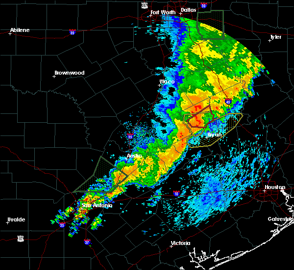 At 140 pm cdt, a line of severe thunderstorms was located near franklin, or 10 miles northeast of hearne, moving east at 45 mph (radar indicated). Hazards include 60 mph wind gusts. expect damage to roofs, siding, and trees At 140 pm cdt, a line of severe thunderstorms was located near franklin, or 10 miles northeast of hearne, moving east at 45 mph (radar indicated). Hazards include 60 mph wind gusts. expect damage to roofs, siding, and trees
|
| 5/7/2019 2:52 PM CDT |
 The severe thunderstorm warning for northern grimes, east central brazos, southwestern madison and western walker counties will expire at 300 pm cdt, the storm which prompted the warning has weakened below severe limits, and no longer poses an immediate threat to life or property. therefore, the warning will be allowed to expire. however heavy rain is still possible with this thunderstorm. to report severe weather, contact your nearest law enforcement agency. they will relay your report to the national weather service league city. The severe thunderstorm warning for northern grimes, east central brazos, southwestern madison and western walker counties will expire at 300 pm cdt, the storm which prompted the warning has weakened below severe limits, and no longer poses an immediate threat to life or property. therefore, the warning will be allowed to expire. however heavy rain is still possible with this thunderstorm. to report severe weather, contact your nearest law enforcement agency. they will relay your report to the national weather service league city.
|
| 5/7/2019 2:40 PM CDT | Quarter sized hail reported 0.6 miles NNW of Iola, TX, twitter report with photo. |
| 5/7/2019 2:31 PM CDT |
 At 231 pm cdt, a severe thunderstorm was located 9 miles southeast of kurten, or 11 miles northeast of college station, moving northeast at 20 mph (radar indicated). Hazards include 60 mph wind gusts and quarter size hail. Hail damage to vehicles is expected. Expect wind damage to roofs, siding, and trees. At 231 pm cdt, a severe thunderstorm was located 9 miles southeast of kurten, or 11 miles northeast of college station, moving northeast at 20 mph (radar indicated). Hazards include 60 mph wind gusts and quarter size hail. Hail damage to vehicles is expected. Expect wind damage to roofs, siding, and trees.
|
| 4/24/2019 6:05 PM CDT |
 At 604 pm cdt, a severe thunderstorm was located 7 miles west of madisonville, moving northeast at 35 mph (radar indicated). Hazards include 60 mph wind gusts and quarter size hail. Hail damage to vehicles is expected. expect wind damage to roofs, siding, and trees. Locations impacted include, madisonville, bedias, normangee, iola and north zulch. At 604 pm cdt, a severe thunderstorm was located 7 miles west of madisonville, moving northeast at 35 mph (radar indicated). Hazards include 60 mph wind gusts and quarter size hail. Hail damage to vehicles is expected. expect wind damage to roofs, siding, and trees. Locations impacted include, madisonville, bedias, normangee, iola and north zulch.
|
| 4/24/2019 5:41 PM CDT |
 At 541 pm cdt, a severe thunderstorm was located near kurten, or 13 miles northeast of bryan, moving northeast at 40 mph (radar indicated). Hazards include golf ball size hail and 70 mph wind gusts. People and animals outdoors will be injured. expect hail damage to roofs, siding, windows, and vehicles. expect considerable tree damage. Wind damage is also likely to mobile homes, roofs, and outbuildings. At 541 pm cdt, a severe thunderstorm was located near kurten, or 13 miles northeast of bryan, moving northeast at 40 mph (radar indicated). Hazards include golf ball size hail and 70 mph wind gusts. People and animals outdoors will be injured. expect hail damage to roofs, siding, windows, and vehicles. expect considerable tree damage. Wind damage is also likely to mobile homes, roofs, and outbuildings.
|
| 4/18/2019 2:17 AM CDT |
 At 217 am cdt, severe thunderstorms were located along a line extending from 9 miles north of madisonville to 11 miles northwest of anderson, moving northeast at 40 mph (radar indicated). Hazards include 60 mph wind gusts. expect damage to roofs, siding, and trees At 217 am cdt, severe thunderstorms were located along a line extending from 9 miles north of madisonville to 11 miles northwest of anderson, moving northeast at 40 mph (radar indicated). Hazards include 60 mph wind gusts. expect damage to roofs, siding, and trees
|
| 4/18/2019 1:52 AM CDT |
 At 151 am cdt, severe thunderstorms were located along a line extending from 12 miles west of madisonville to near college station, moving east at 45 mph. a storm spotter reported a wind gust of 60 miles per hour 3 miles southwest of college station at 147 am (radar indicated). Hazards include 60 mph wind gusts and penny size hail. Expect damage to roofs, siding, and trees. Locations impacted include, college station, bryan, madisonville, bedias, kurten, wixon valley, kyle field, iola and north zulch. At 151 am cdt, severe thunderstorms were located along a line extending from 12 miles west of madisonville to near college station, moving east at 45 mph. a storm spotter reported a wind gust of 60 miles per hour 3 miles southwest of college station at 147 am (radar indicated). Hazards include 60 mph wind gusts and penny size hail. Expect damage to roofs, siding, and trees. Locations impacted include, college station, bryan, madisonville, bedias, kurten, wixon valley, kyle field, iola and north zulch.
|
| 4/18/2019 1:32 AM CDT |
 At 132 am cdt, severe thunderstorms were located along a line extending from 9 miles east of franklin to 8 miles west of bryan, moving east at 45 mph (radar indicated). Hazards include 60 mph wind gusts and penny size hail. expect damage to roofs, siding, and trees At 132 am cdt, severe thunderstorms were located along a line extending from 9 miles east of franklin to 8 miles west of bryan, moving east at 45 mph (radar indicated). Hazards include 60 mph wind gusts and penny size hail. expect damage to roofs, siding, and trees
|
| 4/13/2019 12:40 PM CDT | Trees snappe in grimes county TX, 3.3 miles SSE of Iola, TX |
| 4/7/2019 12:52 PM CDT |
 At 1252 pm cdt, a severe thunderstorm was located 10 miles northeast of kurten, or 13 miles west of madisonville, moving northeast at 30 mph (radar indicated). Hazards include 60 mph wind gusts. Expect damage to roofs, siding, and trees. Locations impacted include, northeastern college station, northeastern bryan, huntsville, madisonville, montgomery, bedias, kurten, wixon valley, anderson, huntsville state park, iola, crabbs prairie, dobbin, north zulch, dacus, plantersville, roans prairie, richards and carlos. At 1252 pm cdt, a severe thunderstorm was located 10 miles northeast of kurten, or 13 miles west of madisonville, moving northeast at 30 mph (radar indicated). Hazards include 60 mph wind gusts. Expect damage to roofs, siding, and trees. Locations impacted include, northeastern college station, northeastern bryan, huntsville, madisonville, montgomery, bedias, kurten, wixon valley, anderson, huntsville state park, iola, crabbs prairie, dobbin, north zulch, dacus, plantersville, roans prairie, richards and carlos.
|
| 4/7/2019 12:20 PM CDT |
 At 1220 pm cdt, a severe thunderstorm was located near college station, moving northeast at 35 mph (radar indicated). Hazards include 60 mph wind gusts. expect damage to roofs, siding, and trees At 1220 pm cdt, a severe thunderstorm was located near college station, moving northeast at 35 mph (radar indicated). Hazards include 60 mph wind gusts. expect damage to roofs, siding, and trees
|
| 6/3/2018 10:42 PM CDT |
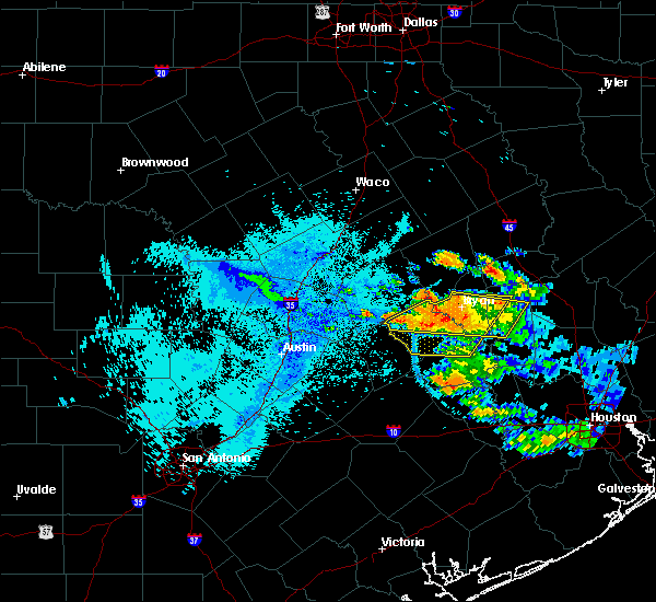 At 1042 pm cdt, severe thunderstorms were located along a line extending from 7 miles northeast of tanglewood to near millican, moving southwest at 15 mph (radar indicated). Hazards include 60 mph wind gusts and penny size hail. expect damage to roofs, siding, and trees At 1042 pm cdt, severe thunderstorms were located along a line extending from 7 miles northeast of tanglewood to near millican, moving southwest at 15 mph (radar indicated). Hazards include 60 mph wind gusts and penny size hail. expect damage to roofs, siding, and trees
|
| 6/3/2018 9:00 PM CDT |
 The national weather service in league city has issued a * severe thunderstorm warning for. northern grimes county in southeastern texas. northwestern montgomery county in southeastern texas. northwestern san jacinto county in southeastern texas. Walker county in southeastern texas. The national weather service in league city has issued a * severe thunderstorm warning for. northern grimes county in southeastern texas. northwestern montgomery county in southeastern texas. northwestern san jacinto county in southeastern texas. Walker county in southeastern texas.
|
| 4/7/2018 12:23 AM CDT |
 At 1223 am cdt, a severe thunderstorm capable of producing a tornado was located near bedias, or 14 miles southwest of madisonville, moving east at 45 mph (radar indicated rotation). Hazards include tornado. Flying debris will be dangerous to those caught without shelter. mobile homes will be damaged or destroyed. damage to roofs, windows, and vehicles will occur. tree damage is likely. This tornadic thunderstorm will remain over mainly rural areas of northern grimes, northwestern montgomery and southwestern walker counties, including the following locations, iola and crabbs prairie. At 1223 am cdt, a severe thunderstorm capable of producing a tornado was located near bedias, or 14 miles southwest of madisonville, moving east at 45 mph (radar indicated rotation). Hazards include tornado. Flying debris will be dangerous to those caught without shelter. mobile homes will be damaged or destroyed. damage to roofs, windows, and vehicles will occur. tree damage is likely. This tornadic thunderstorm will remain over mainly rural areas of northern grimes, northwestern montgomery and southwestern walker counties, including the following locations, iola and crabbs prairie.
|
| 4/7/2018 12:11 AM CDT |
 At 1211 am cdt, a severe thunderstorm was located 7 miles south of kurten, or 8 miles northeast of college station, moving east at 45 mph (radar indicated). Hazards include 70 mph wind gusts and penny size hail. Expect considerable tree damage. Damage is likely to mobile homes, roofs, and outbuildings. At 1211 am cdt, a severe thunderstorm was located 7 miles south of kurten, or 8 miles northeast of college station, moving east at 45 mph (radar indicated). Hazards include 70 mph wind gusts and penny size hail. Expect considerable tree damage. Damage is likely to mobile homes, roofs, and outbuildings.
|
| 4/6/2018 11:46 PM CDT |
 At 1146 pm cdt, a severe thunderstorm was located near hearne, moving east at 55 mph (radar indicated). Hazards include 60 mph wind gusts and penny size hail. expect damage to roofs, siding, and trees At 1146 pm cdt, a severe thunderstorm was located near hearne, moving east at 55 mph (radar indicated). Hazards include 60 mph wind gusts and penny size hail. expect damage to roofs, siding, and trees
|
| 3/18/2018 8:41 PM CDT |
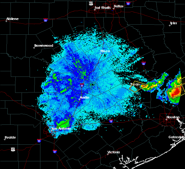 The severe thunderstorm warning for northwestern grimes and east central brazos counties will expire at 845 pm cdt, the storm which prompted the warning has weakened below severe limits, and no longer poses an immediate threat to life or property. therefore, the warning will be allowed to expire. a severe thunderstorm watch remains in effect until 1100 pm cdt for southeastern texas. The severe thunderstorm warning for northwestern grimes and east central brazos counties will expire at 845 pm cdt, the storm which prompted the warning has weakened below severe limits, and no longer poses an immediate threat to life or property. therefore, the warning will be allowed to expire. a severe thunderstorm watch remains in effect until 1100 pm cdt for southeastern texas.
|
| 3/18/2018 8:19 PM CDT |
 At 818 pm cdt, a severe thunderstorm was located 7 miles south of kurten, or 7 miles northeast of college station, moving northeast at 50 mph (radar indicated). Hazards include golf ball size hail and 60 mph wind gusts. People and animals outdoors will be injured. expect hail damage to roofs, siding, windows, and vehicles. expect wind damage to roofs, siding, and trees. Locations impacted include, college station, eastern bryan, kyle field and iola. At 818 pm cdt, a severe thunderstorm was located 7 miles south of kurten, or 7 miles northeast of college station, moving northeast at 50 mph (radar indicated). Hazards include golf ball size hail and 60 mph wind gusts. People and animals outdoors will be injured. expect hail damage to roofs, siding, windows, and vehicles. expect wind damage to roofs, siding, and trees. Locations impacted include, college station, eastern bryan, kyle field and iola.
|
| 3/18/2018 8:02 PM CDT |
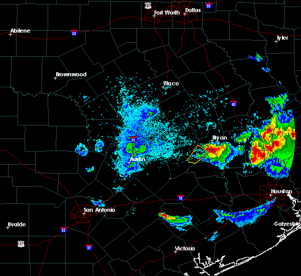 At 802 pm cdt, a severe thunderstorm was located near kyle field, or near college station, moving northeast at 50 mph (radar indicated). Hazards include golf ball size hail and 60 mph wind gusts. People and animals outdoors will be injured. expect hail damage to roofs, siding, windows, and vehicles. Expect wind damage to roofs, siding, and trees. At 802 pm cdt, a severe thunderstorm was located near kyle field, or near college station, moving northeast at 50 mph (radar indicated). Hazards include golf ball size hail and 60 mph wind gusts. People and animals outdoors will be injured. expect hail damage to roofs, siding, windows, and vehicles. Expect wind damage to roofs, siding, and trees.
|
| 3/18/2018 6:51 PM CDT |
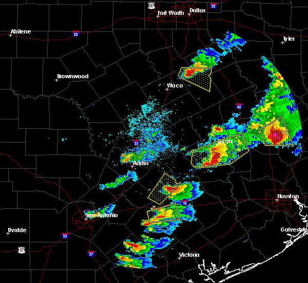 At 651 pm cdt, a severe thunderstorm was located over millican, or 8 miles northwest of navasota, moving east at 45 mph (radar indicated). Hazards include two inch hail and 60 mph wind gusts. People and animals outdoors will be injured. expect hail damage to roofs, siding, windows, and vehicles. expect wind damage to roofs, siding, and trees. Locations impacted include, college station, bryan, navasota, somerville, snook, millican, anderson, lake somerville dam, kyle field, iola, lyons, wellborn, carlos and roans prairie. At 651 pm cdt, a severe thunderstorm was located over millican, or 8 miles northwest of navasota, moving east at 45 mph (radar indicated). Hazards include two inch hail and 60 mph wind gusts. People and animals outdoors will be injured. expect hail damage to roofs, siding, windows, and vehicles. expect wind damage to roofs, siding, and trees. Locations impacted include, college station, bryan, navasota, somerville, snook, millican, anderson, lake somerville dam, kyle field, iola, lyons, wellborn, carlos and roans prairie.
|
| 3/18/2018 6:33 PM CDT |
 At 632 pm cdt, a severe thunderstorm was located over snook, or 11 miles southwest of college station, moving east at 45 mph. these storms have had a history of producing up to softball size hail (radar indicated). Hazards include ping pong ball to golf ball size hail and 60 mph wind gusts. People and animals outdoors will be injured. expect hail damage to roofs, siding, windows, and vehicles. Expect wind damage to roofs, siding, and trees. At 632 pm cdt, a severe thunderstorm was located over snook, or 11 miles southwest of college station, moving east at 45 mph. these storms have had a history of producing up to softball size hail (radar indicated). Hazards include ping pong ball to golf ball size hail and 60 mph wind gusts. People and animals outdoors will be injured. expect hail damage to roofs, siding, windows, and vehicles. Expect wind damage to roofs, siding, and trees.
|
| 3/18/2018 6:21 PM CDT |
 At 621 pm cdt, a severe thunderstorm was located 11 miles northwest of riverside, or 15 miles north of huntsville, moving east at 45 mph. this is a very dangerous storm (radar indicated). Hazards include baseball size hail and 60 mph wind gusts. People and animals outdoors will be severely injured. expect shattered windows, extensive damage to roofs, siding, and vehicles. Locations impacted include, northern huntsville, madisonville, bedias and crabbs prairie. At 621 pm cdt, a severe thunderstorm was located 11 miles northwest of riverside, or 15 miles north of huntsville, moving east at 45 mph. this is a very dangerous storm (radar indicated). Hazards include baseball size hail and 60 mph wind gusts. People and animals outdoors will be severely injured. expect shattered windows, extensive damage to roofs, siding, and vehicles. Locations impacted include, northern huntsville, madisonville, bedias and crabbs prairie.
|
| 3/18/2018 6:06 PM CDT |
 At 606 pm cdt, a severe thunderstorm was located 10 miles southeast of madisonville, moving east at 45 mph (radar indicated). Hazards include tennis ball size hail and 60 mph wind gusts. People and animals outdoors will be injured. expect hail damage to roofs, siding, windows, and vehicles. expect wind damage to roofs, siding, and trees. Locations impacted include, northern huntsville, madisonville, bedias and crabbs prairie. At 606 pm cdt, a severe thunderstorm was located 10 miles southeast of madisonville, moving east at 45 mph (radar indicated). Hazards include tennis ball size hail and 60 mph wind gusts. People and animals outdoors will be injured. expect hail damage to roofs, siding, windows, and vehicles. expect wind damage to roofs, siding, and trees. Locations impacted include, northern huntsville, madisonville, bedias and crabbs prairie.
|
| 3/18/2018 5:46 PM CDT |
 At 546 pm cdt, a severe thunderstorm was located near bedias, or 9 miles southwest of madisonville, moving east at 45 mph (radar indicated). Hazards include tennis ball size hail and 60 mph wind gusts. People and animals outdoors will be injured. expect hail damage to roofs, siding, windows, and vehicles. Expect wind damage to roofs, siding, and trees. At 546 pm cdt, a severe thunderstorm was located near bedias, or 9 miles southwest of madisonville, moving east at 45 mph (radar indicated). Hazards include tennis ball size hail and 60 mph wind gusts. People and animals outdoors will be injured. expect hail damage to roofs, siding, windows, and vehicles. Expect wind damage to roofs, siding, and trees.
|
| 3/18/2018 5:33 PM CDT |
 At 533 pm cdt, a severe thunderstorm was located 8 miles northwest of bedias, or 9 miles southwest of madisonville, moving east at 45 mph (radar indicated). Hazards include golf ball size hail and 60 mph wind gusts. People and animals outdoors will be injured. expect hail damage to roofs, siding, windows, and vehicles. expect wind damage to roofs, siding, and trees. Locations impacted include, northern bryan, bedias, kurten, wixon valley, iola and north zulch. At 533 pm cdt, a severe thunderstorm was located 8 miles northwest of bedias, or 9 miles southwest of madisonville, moving east at 45 mph (radar indicated). Hazards include golf ball size hail and 60 mph wind gusts. People and animals outdoors will be injured. expect hail damage to roofs, siding, windows, and vehicles. expect wind damage to roofs, siding, and trees. Locations impacted include, northern bryan, bedias, kurten, wixon valley, iola and north zulch.
|
| 3/18/2018 5:03 PM CDT |
 At 502 pm cdt, a severe thunderstorm was located 7 miles northwest of wixon valley, or 10 miles north of bryan, moving east at 40 mph (radar indicated). Hazards include ping pong ball size hail and 60 mph wind gusts. People and animals outdoors will be injured. expect hail damage to roofs, siding, windows, and vehicles. Expect wind damage to roofs, siding, and trees. At 502 pm cdt, a severe thunderstorm was located 7 miles northwest of wixon valley, or 10 miles north of bryan, moving east at 40 mph (radar indicated). Hazards include ping pong ball size hail and 60 mph wind gusts. People and animals outdoors will be injured. expect hail damage to roofs, siding, windows, and vehicles. Expect wind damage to roofs, siding, and trees.
|
| 6/4/2017 2:41 AM CDT |
 At 241 am cdt, a severe thunderstorm was located 11 miles southeast of bedias, or 13 miles west of huntsville, moving east at 25 mph (radar indicated). Hazards include 60 mph wind gusts and penny size hail. expect damage to roofs, siding, and trees At 241 am cdt, a severe thunderstorm was located 11 miles southeast of bedias, or 13 miles west of huntsville, moving east at 25 mph (radar indicated). Hazards include 60 mph wind gusts and penny size hail. expect damage to roofs, siding, and trees
|
| 6/4/2017 2:17 AM CDT |
 At 216 am cdt, a severe thunderstorm was located 10 miles south of bedias, or 18 miles north of navasota, moving east at 25 mph (radar indicated). Hazards include 60 mph wind gusts and penny size hail. Expect damage to roofs, siding, and trees. Locations impacted include, southeastern college station, navasota, bedias, millican, anderson, iola, crabbs prairie, roans prairie, richards, carlos and dacus. At 216 am cdt, a severe thunderstorm was located 10 miles south of bedias, or 18 miles north of navasota, moving east at 25 mph (radar indicated). Hazards include 60 mph wind gusts and penny size hail. Expect damage to roofs, siding, and trees. Locations impacted include, southeastern college station, navasota, bedias, millican, anderson, iola, crabbs prairie, roans prairie, richards, carlos and dacus.
|
| 6/4/2017 2:05 AM CDT |
 At 203 am cdt, a severe thunderstorm was located 10 miles northwest of anderson, or 14 miles east of college station, moving east at 25 mph (radar indicated). Hazards include 60 mph wind gusts and penny size hail. expect damage to roofs, siding, and trees At 203 am cdt, a severe thunderstorm was located 10 miles northwest of anderson, or 14 miles east of college station, moving east at 25 mph (radar indicated). Hazards include 60 mph wind gusts and penny size hail. expect damage to roofs, siding, and trees
|
| 5/28/2017 7:17 PM CDT |
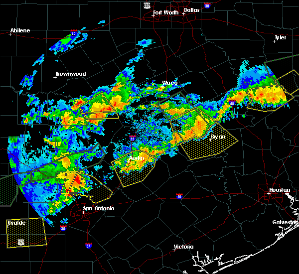 At 716 pm cdt, a severe thunderstorm was located 12 miles northeast of caldwell, moving southeast at 30 mph (radar indicated). Hazards include 60 mph wind gusts and quarter size hail. Hail damage to vehicles is expected. expect wind damage to roofs, siding, and trees. Locations impacted include, college station, bryan, caldwell, snook, kurten, wixon valley, millican, kyle field, iola, lyons, chriesman, wellborn and carlos. At 716 pm cdt, a severe thunderstorm was located 12 miles northeast of caldwell, moving southeast at 30 mph (radar indicated). Hazards include 60 mph wind gusts and quarter size hail. Hail damage to vehicles is expected. expect wind damage to roofs, siding, and trees. Locations impacted include, college station, bryan, caldwell, snook, kurten, wixon valley, millican, kyle field, iola, lyons, chriesman, wellborn and carlos.
|
| 5/28/2017 7:02 PM CDT |
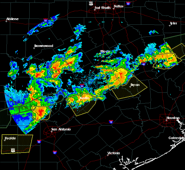 At 657 pm cdt, a severe thunderstorm was located over calvert, or 7 miles northwest of hearne, moving southeast at 50 mph (radar indicated). Hazards include 60 mph wind gusts and quarter size hail. Hail damage to vehicles is expected. Expect wind damage to roofs, siding, and trees. At 657 pm cdt, a severe thunderstorm was located over calvert, or 7 miles northwest of hearne, moving southeast at 50 mph (radar indicated). Hazards include 60 mph wind gusts and quarter size hail. Hail damage to vehicles is expected. Expect wind damage to roofs, siding, and trees.
|
| 5/28/2017 6:57 PM CDT |
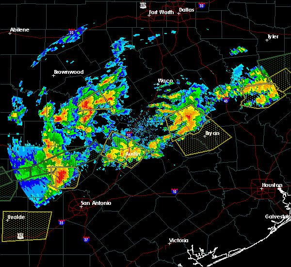 The national weather service in league city has issued a * severe thunderstorm warning for. burleson county in southeastern texas. northwestern grimes county in southeastern texas. brazos county in southeastern texas. Southwestern madison county in southeastern texas. The national weather service in league city has issued a * severe thunderstorm warning for. burleson county in southeastern texas. northwestern grimes county in southeastern texas. brazos county in southeastern texas. Southwestern madison county in southeastern texas.
|
| 5/3/2017 5:42 PM CDT |
 At 540 pm cdt, a cluster of severe thunderstorms was centered 10 miles northwest of bryan, moving southeast at 40 mph (radar indicated). Hazards include 60 mph wind gusts and quarter size hail. Hail damage to vehicles is expected. Expect wind damage to roofs, siding, and trees. At 540 pm cdt, a cluster of severe thunderstorms was centered 10 miles northwest of bryan, moving southeast at 40 mph (radar indicated). Hazards include 60 mph wind gusts and quarter size hail. Hail damage to vehicles is expected. Expect wind damage to roofs, siding, and trees.
|
| 2/20/2017 2:17 AM CST |
 At 216 am cst, severe thunderstorms were located along a line extending from near madisonville to near bedias to near anderson, moving east at 45 mph (radar indicated). Hazards include 60 mph wind gusts. Expect damage to roofs, siding, and trees. Locations impacted include, madisonville, bedias, kurten, iola and north zulch. At 216 am cst, severe thunderstorms were located along a line extending from near madisonville to near bedias to near anderson, moving east at 45 mph (radar indicated). Hazards include 60 mph wind gusts. Expect damage to roofs, siding, and trees. Locations impacted include, madisonville, bedias, kurten, iola and north zulch.
|
| 2/20/2017 1:28 AM CST |
 At 127 am cst, severe thunderstorms were located along a line extending from near hearne to near bryan to near snook, moving east at 45 mph (radar indicated). Hazards include 70 mph wind gusts. Expect considerable tree damage. Damage is likely to mobile homes, roofs, and outbuildings. At 127 am cst, severe thunderstorms were located along a line extending from near hearne to near bryan to near snook, moving east at 45 mph (radar indicated). Hazards include 70 mph wind gusts. Expect considerable tree damage. Damage is likely to mobile homes, roofs, and outbuildings.
|
| 1/2/2017 6:50 AM CST |
 At 646 am cst, severe thunderstorms were located along a line extending from 9 miles east of kyle field to near college station to 6 miles southeast of snook to 10 miles east of somerville to near brenham to 9 miles northeast of industry, moving east at 35 mph (radar indicated). Hazards include 60 mph wind gusts. expect damage to roofs, siding, and trees At 646 am cst, severe thunderstorms were located along a line extending from 9 miles east of kyle field to near college station to 6 miles southeast of snook to 10 miles east of somerville to near brenham to 9 miles northeast of industry, moving east at 35 mph (radar indicated). Hazards include 60 mph wind gusts. expect damage to roofs, siding, and trees
|
| 5/26/2016 1:47 PM CDT |
 At 147 pm cdt, a severe thunderstorm capable of producing a tornado was located near bedias, or 14 miles southwest of madisonville, moving east at 20 mph (radar indicated rotation). Hazards include tornado. Flying debris will be dangerous to those caught without shelter. mobile homes will be damaged or destroyed. damage to roofs, windows, and vehicles will occur. Tree damage is likely. At 147 pm cdt, a severe thunderstorm capable of producing a tornado was located near bedias, or 14 miles southwest of madisonville, moving east at 20 mph (radar indicated rotation). Hazards include tornado. Flying debris will be dangerous to those caught without shelter. mobile homes will be damaged or destroyed. damage to roofs, windows, and vehicles will occur. Tree damage is likely.
|
| 5/26/2016 1:34 PM CDT |
 At 134 pm cdt, a severe thunderstorm was located 7 miles east of kurten, or 15 miles northeast of bryan, moving east at 20 mph (radar indicated). Hazards include 60 mph wind gusts and quarter size hail. Hail damage to vehicles is expected. Expect wind damage to roofs, siding, and trees. At 134 pm cdt, a severe thunderstorm was located 7 miles east of kurten, or 15 miles northeast of bryan, moving east at 20 mph (radar indicated). Hazards include 60 mph wind gusts and quarter size hail. Hail damage to vehicles is expected. Expect wind damage to roofs, siding, and trees.
|
| 5/26/2016 12:55 PM CDT |
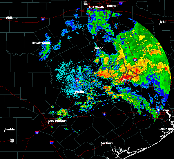 At 1254 pm cdt, a severe thunderstorm capable of producing a tornado was located near kurten, or 11 miles northeast of bryan, moving northeast at 20 mph (radar indicated rotation). Hazards include tornado. Flying debris will be dangerous to those caught without shelter. mobile homes will be damaged or destroyed. damage to roofs, windows, and vehicles will occur. Tree damage is likely. At 1254 pm cdt, a severe thunderstorm capable of producing a tornado was located near kurten, or 11 miles northeast of bryan, moving northeast at 20 mph (radar indicated rotation). Hazards include tornado. Flying debris will be dangerous to those caught without shelter. mobile homes will be damaged or destroyed. damage to roofs, windows, and vehicles will occur. Tree damage is likely.
|
| 5/26/2016 12:44 PM CDT |
 At 1244 pm cdt, a confirmed tornado was located near wixon valley, or near bryan, moving northeast at 25 mph (public confirmed tornado). Hazards include damaging tornado. Flying debris will be dangerous to those caught without shelter. mobile homes will be damaged or destroyed. damage to roofs, windows, and vehicles will occur. tree damage is likely. Locations impacted include, northern college station, northeastern bryan, kurten, wixon valley and iola. At 1244 pm cdt, a confirmed tornado was located near wixon valley, or near bryan, moving northeast at 25 mph (public confirmed tornado). Hazards include damaging tornado. Flying debris will be dangerous to those caught without shelter. mobile homes will be damaged or destroyed. damage to roofs, windows, and vehicles will occur. tree damage is likely. Locations impacted include, northern college station, northeastern bryan, kurten, wixon valley and iola.
|
| 5/26/2016 12:32 PM CDT |
 At 1232 pm cdt, a severe thunderstorm capable of producing a tornado was located over eastern bryan, moving northeast at 25 mph (radar indicated rotation). Hazards include tornado. Flying debris will be dangerous to those caught without shelter. mobile homes will be damaged or destroyed. damage to roofs, windows, and vehicles will occur. Tree damage is likely. At 1232 pm cdt, a severe thunderstorm capable of producing a tornado was located over eastern bryan, moving northeast at 25 mph (radar indicated rotation). Hazards include tornado. Flying debris will be dangerous to those caught without shelter. mobile homes will be damaged or destroyed. damage to roofs, windows, and vehicles will occur. Tree damage is likely.
|
| 4/30/2016 7:00 AM CDT |
 At 657 am cdt, severe thunderstorms were located along a line extending from 11 miles northwest of bedias to 6 miles southwest of pine island, moving east at 30 mph (college station asos reported a 56 mph wind gust at 653 am). Hazards include 60 mph wind gusts. Expect damage to roofs. siding. and trees. trees are more susceptible of toppling due to recently more saturated ground. Locations impacted include, college station, bryan, brenham, navasota, sealy, hempstead, prairie view, brookshire, bellville, columbus, washington, waller, weimar, pine island, san felipe, snook, pattison, bedias, kurten and industry. At 657 am cdt, severe thunderstorms were located along a line extending from 11 miles northwest of bedias to 6 miles southwest of pine island, moving east at 30 mph (college station asos reported a 56 mph wind gust at 653 am). Hazards include 60 mph wind gusts. Expect damage to roofs. siding. and trees. trees are more susceptible of toppling due to recently more saturated ground. Locations impacted include, college station, bryan, brenham, navasota, sealy, hempstead, prairie view, brookshire, bellville, columbus, washington, waller, weimar, pine island, san felipe, snook, pattison, bedias, kurten and industry.
|
| 4/30/2016 6:33 AM CDT |
 At 632 am cdt, severe thunderstorms were located along a line extending from near kurten to near bellville, moving east at 35 mph (radar indicated). Hazards include 60 mph wind gusts. Expect damage to roofs. siding. and trees. Toppled trees. At 632 am cdt, severe thunderstorms were located along a line extending from near kurten to near bellville, moving east at 35 mph (radar indicated). Hazards include 60 mph wind gusts. Expect damage to roofs. siding. and trees. Toppled trees.
|
| 4/27/2016 4:05 AM CDT |
 At 405 am cdt, severe thunderstorms were located along a line extending from 10 miles southwest of centerville to near bedias to near anderson, moving northeast at 60 mph (radar indicated). Hazards include 60 mph wind gusts. Expect damage to roofs. siding. and trees. Locations impacted include, northwestern huntsville, madisonville, austonio, bedias, iola, crabbs prairie, north zulch and carlos. At 405 am cdt, severe thunderstorms were located along a line extending from 10 miles southwest of centerville to near bedias to near anderson, moving northeast at 60 mph (radar indicated). Hazards include 60 mph wind gusts. Expect damage to roofs. siding. and trees. Locations impacted include, northwestern huntsville, madisonville, austonio, bedias, iola, crabbs prairie, north zulch and carlos.
|
| 4/27/2016 3:51 AM CDT |
 At 350 am cdt, severe thunderstorms were located along a line extending from 12 miles east of franklin to near kurten to near millican, moving northeast at 60 mph (radar indicated). Hazards include 60 mph wind gusts. Expect damage to roofs. siding. And trees. At 350 am cdt, severe thunderstorms were located along a line extending from 12 miles east of franklin to near kurten to near millican, moving northeast at 60 mph (radar indicated). Hazards include 60 mph wind gusts. Expect damage to roofs. siding. And trees.
|
| 11/17/2015 4:55 AM CST |
 At 455 am cst, a severe thunderstorm was located 12 miles southwest of bedias, or 13 miles east of college station, moving northeast at 30 mph (radar indicated). Hazards include 60 mph wind gusts and nickel size hail. Expect damage to roofs. Siding and trees. At 455 am cst, a severe thunderstorm was located 12 miles southwest of bedias, or 13 miles east of college station, moving northeast at 30 mph (radar indicated). Hazards include 60 mph wind gusts and nickel size hail. Expect damage to roofs. Siding and trees.
|
| 11/17/2015 4:47 AM CST |
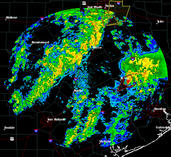 At 446 am cst, a severe thunderstorm capable of producing a tornado was located 12 miles northwest of anderson, or 12 miles east of college station, moving northeast at 40 mph (weather spotters reported a funnel cloud). Hazards include tornado. Flying debris will be dangerous to those caught without shelter. mobile homes will be damaged or destroyed. damage to roofs, windows and vehicles will occur. tree damage is likely. This tornadic thunderstorm will remain over mainly rural areas of east central brazos and northwestern grimes counties, including the following locations, carlos, roans prairie and iola. At 446 am cst, a severe thunderstorm capable of producing a tornado was located 12 miles northwest of anderson, or 12 miles east of college station, moving northeast at 40 mph (weather spotters reported a funnel cloud). Hazards include tornado. Flying debris will be dangerous to those caught without shelter. mobile homes will be damaged or destroyed. damage to roofs, windows and vehicles will occur. tree damage is likely. This tornadic thunderstorm will remain over mainly rural areas of east central brazos and northwestern grimes counties, including the following locations, carlos, roans prairie and iola.
|
| 11/17/2015 4:16 AM CST |
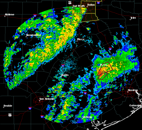 At 416 am cst, a severe thunderstorm capable of producing a tornado was located 8 miles southwest of millican, or 13 miles west of navasota, moving northeast at 40 mph (radar indicated rotation). Hazards include tornado. Flying debris will be dangerous to those caught without shelter. mobile homes will be damaged or destroyed. damage to roofs, windows and vehicles will occur. tree damage is likely. this dangerous storm will be near, millican around 430 am cst. Other locations impacted by this tornadic thunderstorm include wellborn, carlos, roans prairie, iola and independence. At 416 am cst, a severe thunderstorm capable of producing a tornado was located 8 miles southwest of millican, or 13 miles west of navasota, moving northeast at 40 mph (radar indicated rotation). Hazards include tornado. Flying debris will be dangerous to those caught without shelter. mobile homes will be damaged or destroyed. damage to roofs, windows and vehicles will occur. tree damage is likely. this dangerous storm will be near, millican around 430 am cst. Other locations impacted by this tornadic thunderstorm include wellborn, carlos, roans prairie, iola and independence.
|
| 11/17/2015 4:14 AM CST |
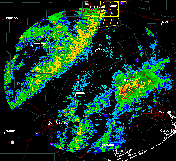 At 413 am cst, a severe thunderstorm capable of producing a tornado was located 10 miles west of washington, or 13 miles north of brenham, moving northeast at 40 mph (radar indicated rotation). Hazards include tornado. Flying debris will be dangerous to those caught without shelter. mobile homes will be damaged or destroyed. damage to roofs, windows and vehicles will occur. tree damage is likely. this dangerous storm will be near, millican around 430 am cst. Other locations impacted by this tornadic thunderstorm include wellborn, carlos, roans prairie and iola. At 413 am cst, a severe thunderstorm capable of producing a tornado was located 10 miles west of washington, or 13 miles north of brenham, moving northeast at 40 mph (radar indicated rotation). Hazards include tornado. Flying debris will be dangerous to those caught without shelter. mobile homes will be damaged or destroyed. damage to roofs, windows and vehicles will occur. tree damage is likely. this dangerous storm will be near, millican around 430 am cst. Other locations impacted by this tornadic thunderstorm include wellborn, carlos, roans prairie and iola.
|
| 5/25/2015 7:08 PM CDT | At 707 pm cdt, doppler radar indicated a severe thunderstorm capable of producing quarter size hail and damaging winds in excess of 60 mph. this storm was located near huntsville state park, or 7 miles southwest of huntsville, moving east at 60 mph. locations impacted include, conroe, huntsville, navasota, willis, washington, panorama village, new waverly, montgomery, bedias, millican, anderson, lake conroe dam, huntsville state park, iola, dobbin, richards, dacus, plantersville, crabbs prairie and carlos. a tornado watch remains in effect until 1000 pm cdt for southeastern texas. |
| 5/25/2015 6:42 PM CDT | At 642 pm cdt, doppler radar indicated a severe thunderstorm capable of producing damaging winds in excess of 60 mph. this storm was located near anderson, or 7 miles north of navasota, and moving east at 60 mph. |
| 5/25/2015 6:20 PM CDT | At 620 pm cdt, doppler radar indicated a severe thunderstorm capable of producing damaging winds in excess of 60 mph. this storm was located 7 miles southeast of madisonville, moving east at 40 mph. locations impacted include, madisonville, bedias, midway, iola, richards, north zulch, carlos and roans prairie. a tornado watch remains in effect until 1000 pm cdt for southeastern texas. |
| 5/25/2015 5:57 PM CDT | At 555 pm cdt, doppler radar indicated a severe thunderstorm capable of producing damaging winds in excess of 60 mph. this storm was located 8 miles west of bedias, or 16 miles southwest of madisonville, and moving east at 50 mph. |
| 5/25/2015 5:37 PM CDT | At 537 pm cdt, doppler radar indicated a severe thunderstorm capable of producing damaging winds in excess of 60 mph. this storm was located near wixon valley, or near bryan, moving east at 50 mph. locations impacted include, college station, bryan, caldwell, somerville, snook, kurten, wixon valley, millican, kyle field, iola, wellborn, deanville, chriesman, north zulch, carlos and lyons. a tornado watch remains in effect until 1000 pm cdt for southeastern texas. |
| 5/25/2015 5:37 PM CDT | At 537 pm cdt, doppler radar indicated a severe thunderstorm capable of producing damaging winds in excess of 60 mph. this storm was located near wixon valley, or near bryan, moving east at 50 mph. locations impacted include, college station, bryan, caldwell, somerville, snook, kurten, wixon valley, millican, kyle field, iola, wellborn, deanville, chriesman, north zulch, carlos and lyons. a tornado watch remains in effect until 1000 pm cdt for southeastern texas. |
| 5/25/2015 5:21 PM CDT | At 520 pm cdt, doppler radar indicated a severe thunderstorm capable of producing damaging winds in excess of 60 mph. this storm was located over northwestern bryan, and moving east at 50 mph. |
| 5/25/2015 5:21 PM CDT | At 520 pm cdt, doppler radar indicated a severe thunderstorm capable of producing damaging winds in excess of 60 mph. this storm was located over northwestern bryan, and moving east at 50 mph. |
| 5/14/2015 3:15 PM CDT | At 314 pm cdt, doppler radar indicated a severe thunderstorm capable of producing quarter size hail and damaging winds in excess of 60 mph. this storm was located 9 miles south of bedias, or 18 miles north of navasota, and moving north at 30 mph. |
| 4/19/2015 5:10 PM CDT | The national weather service in league city has issued a * severe thunderstorm warning for. southwestern walker county in southeastern texas. northeastern grimes county in southeastern texas. until 545 pm cdt * at 510 pm cdt. Doppler radar indicated a severe thunderstorm. |
| 4/19/2015 4:04 PM CDT | At 403 pm cdt, doppler radar indicated a severe thunderstorm capable of producing quarter size hail. this storm was located 9 miles west of bedias, or 16 miles southwest of madisonville, moving east at 45 mph. locations impacted include, bedias and iola. the storm has diminished but may reintensify. |
| 4/19/2015 3:45 PM CDT | At 344 pm cdt, doppler radar indicated a severe thunderstorm capable of producing quarter size hail. this storm was located near wixon valley, or near bryan, and moving east at 30 mph. |
| 10/12/2013 4:55 PM CDT | Reports of trees down in southern madison count in madison county TX, 6.5 miles SSE of Iola, TX |
| 1/1/0001 12:00 AM | Numerous trees down within grimes count in grimes county TX, 0.4 miles WSW of Iola, TX |
Hail Maps for Iola, TX

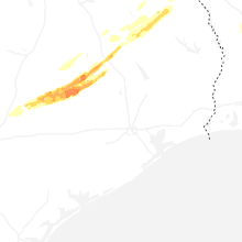


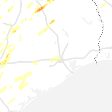


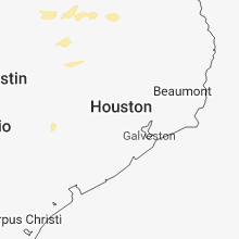
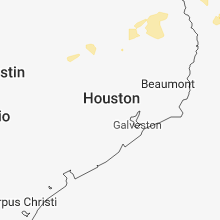


Connect with Interactive Hail Maps