

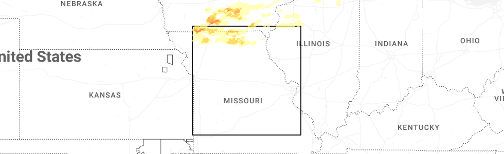
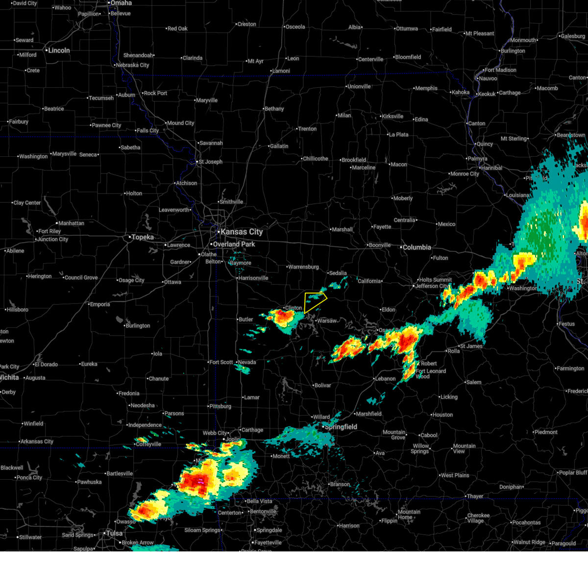
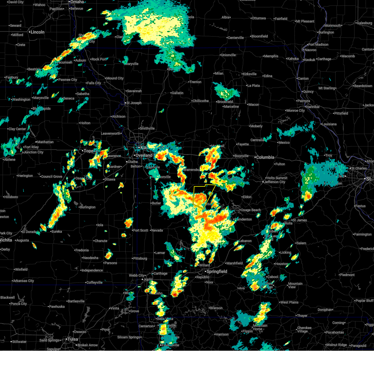
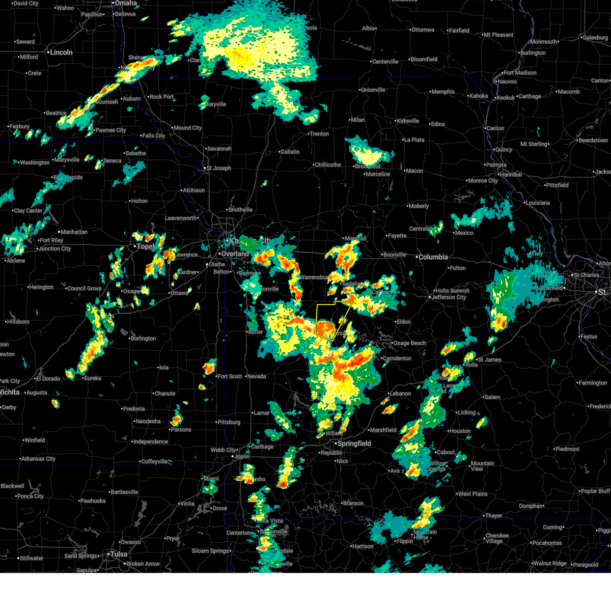
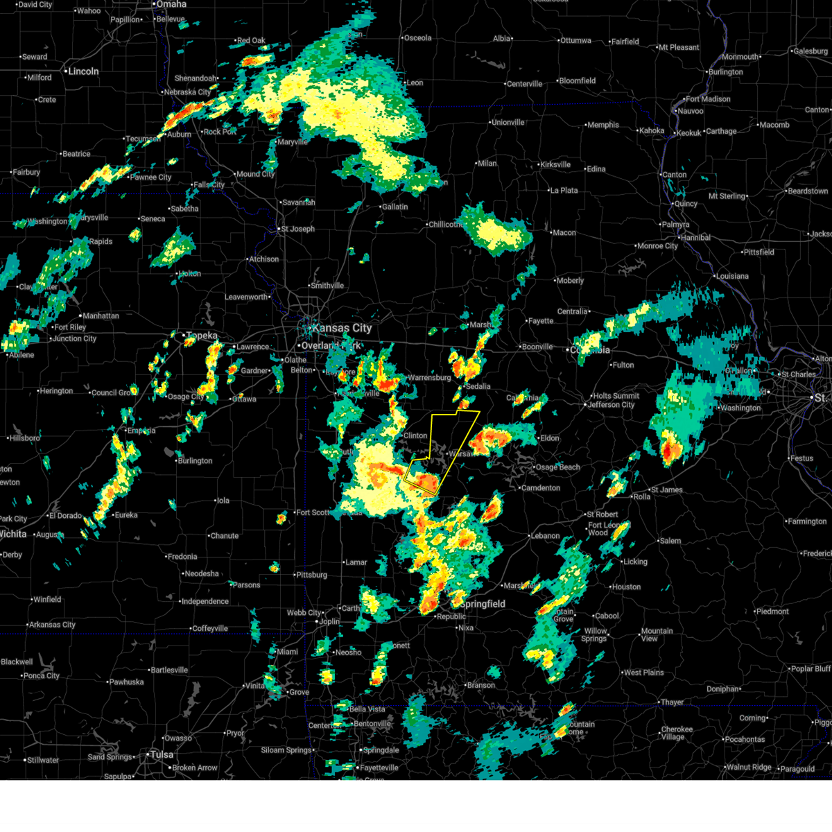
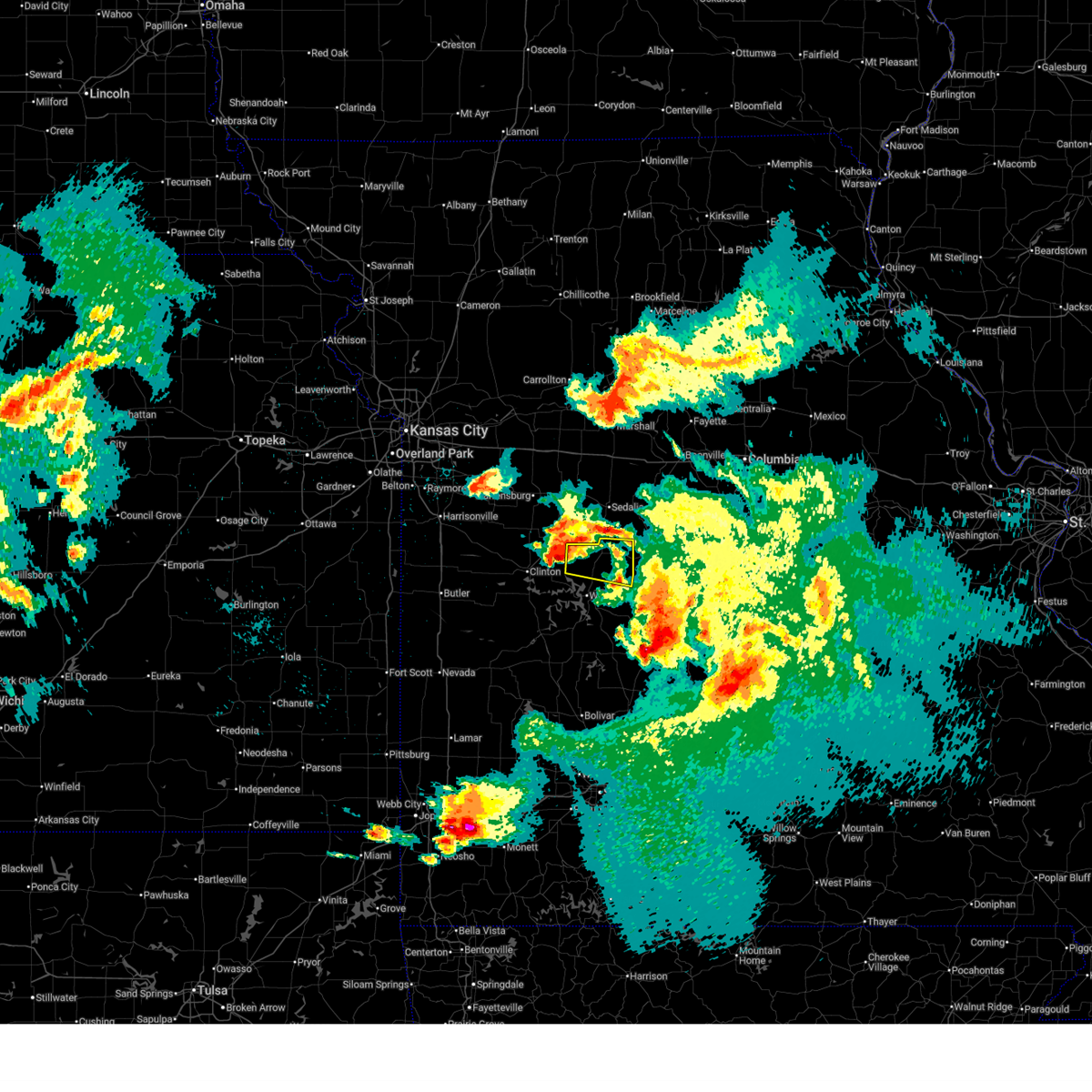
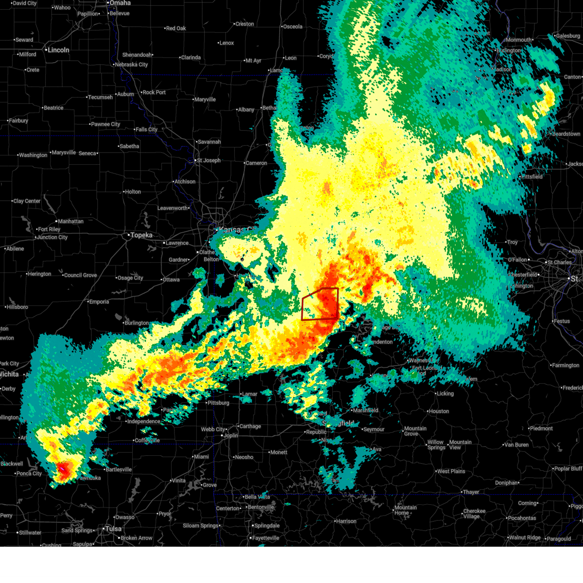
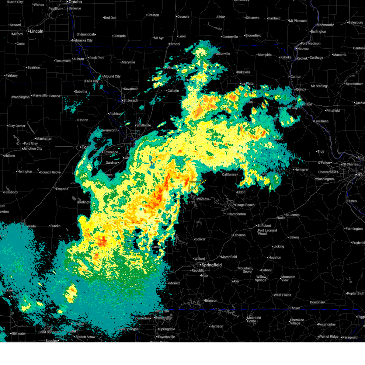
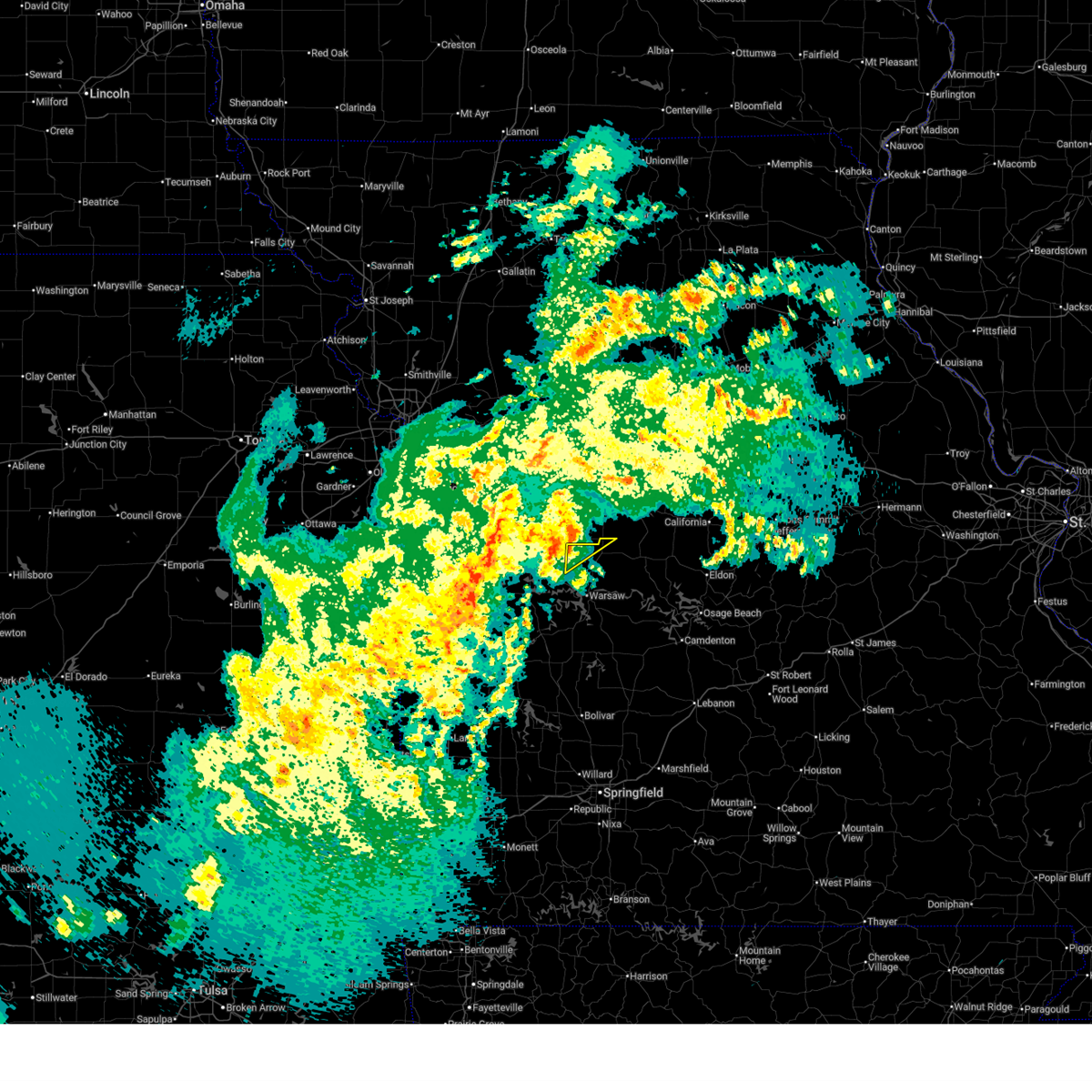
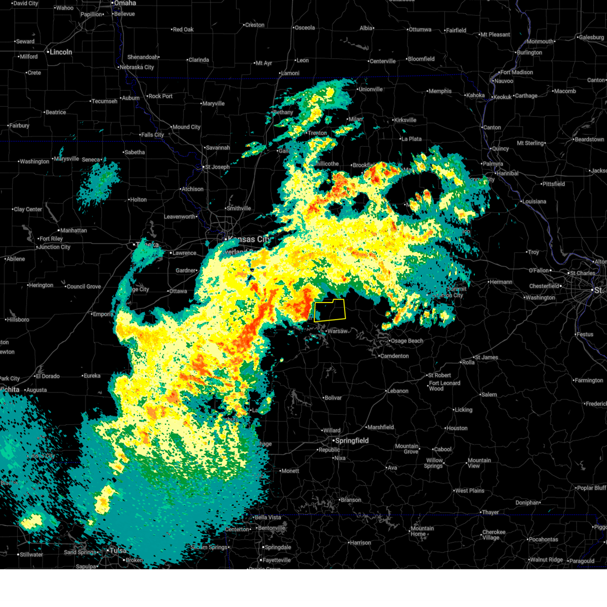
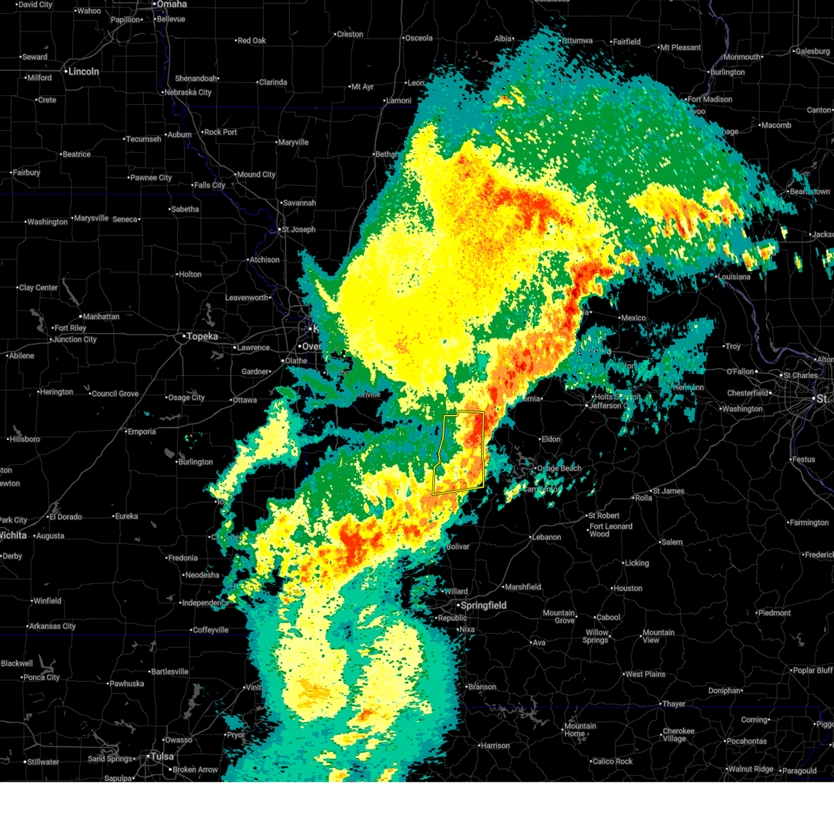
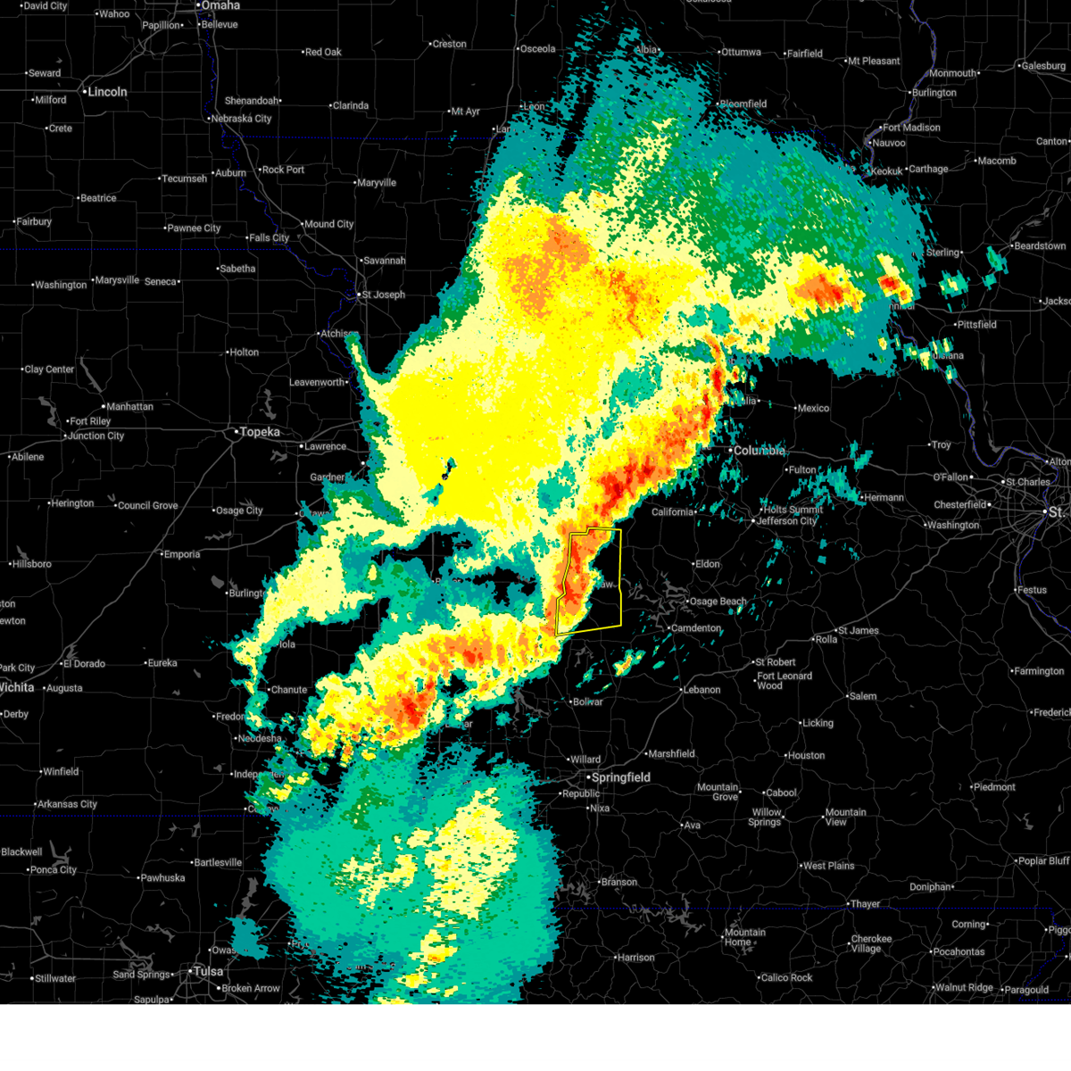
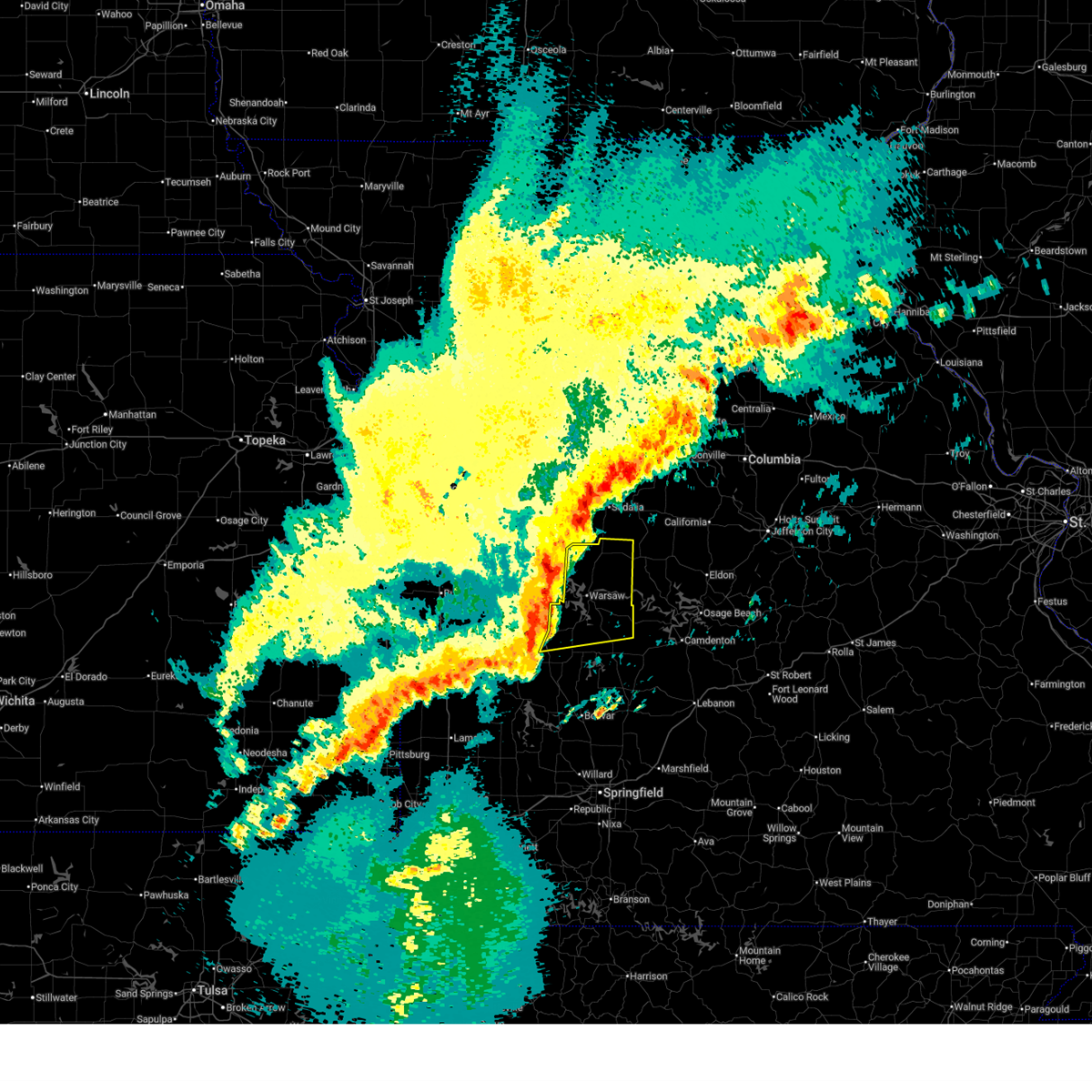
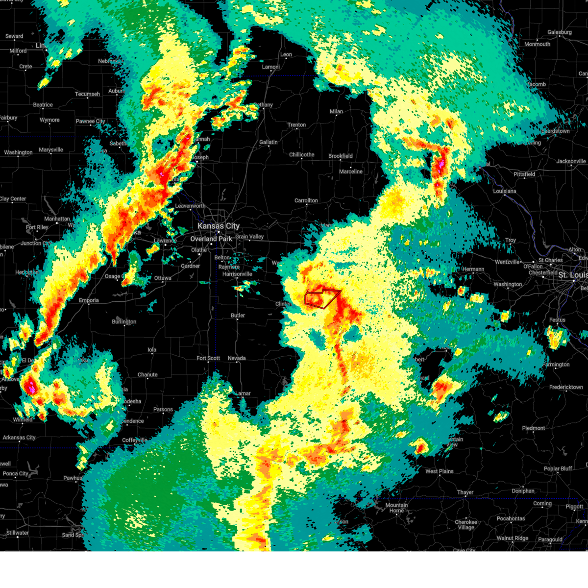
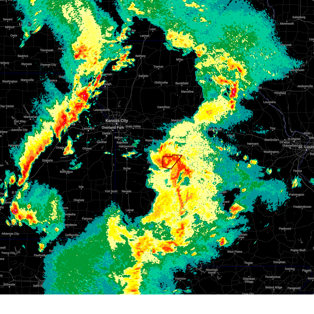
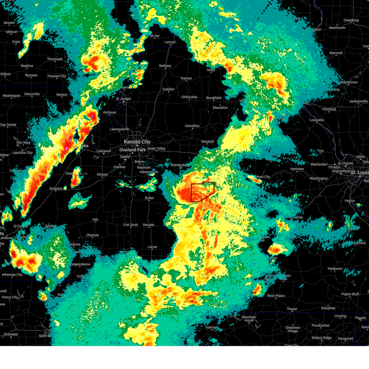
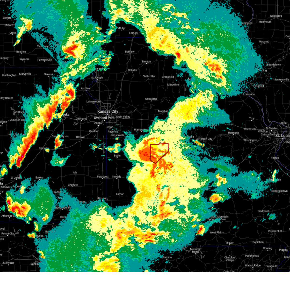
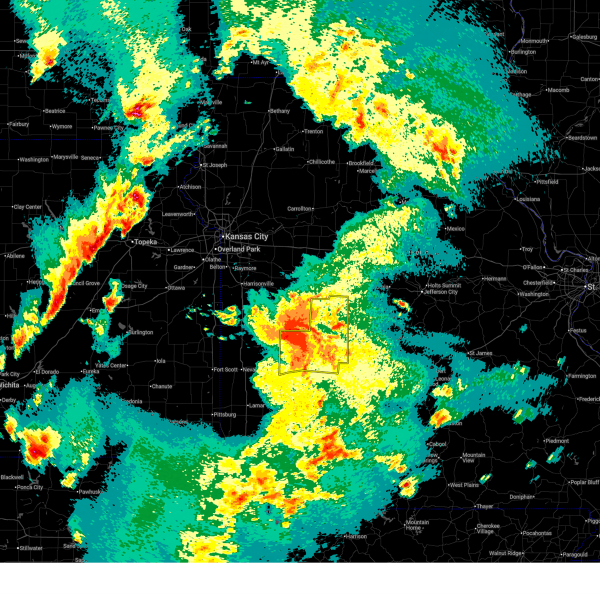
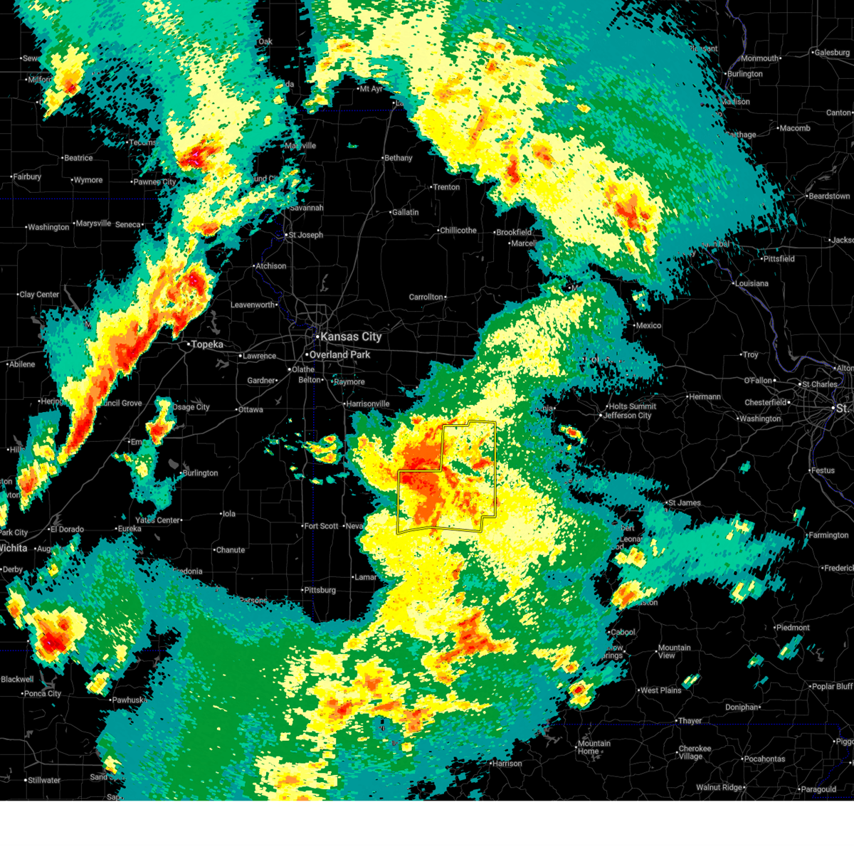
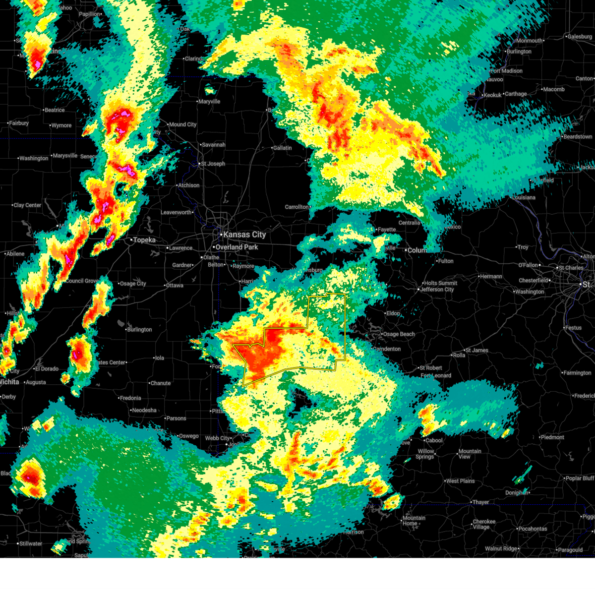
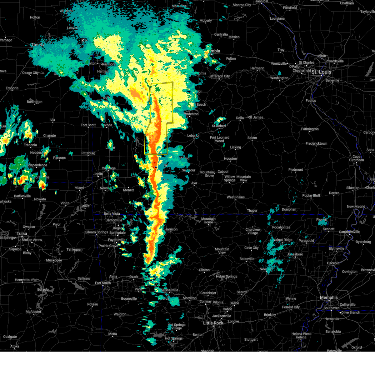
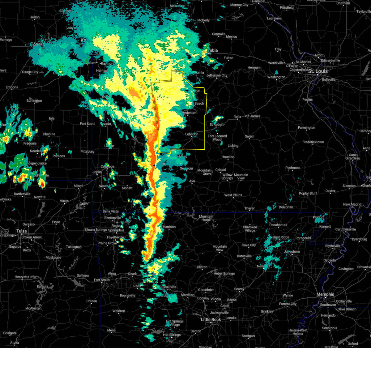
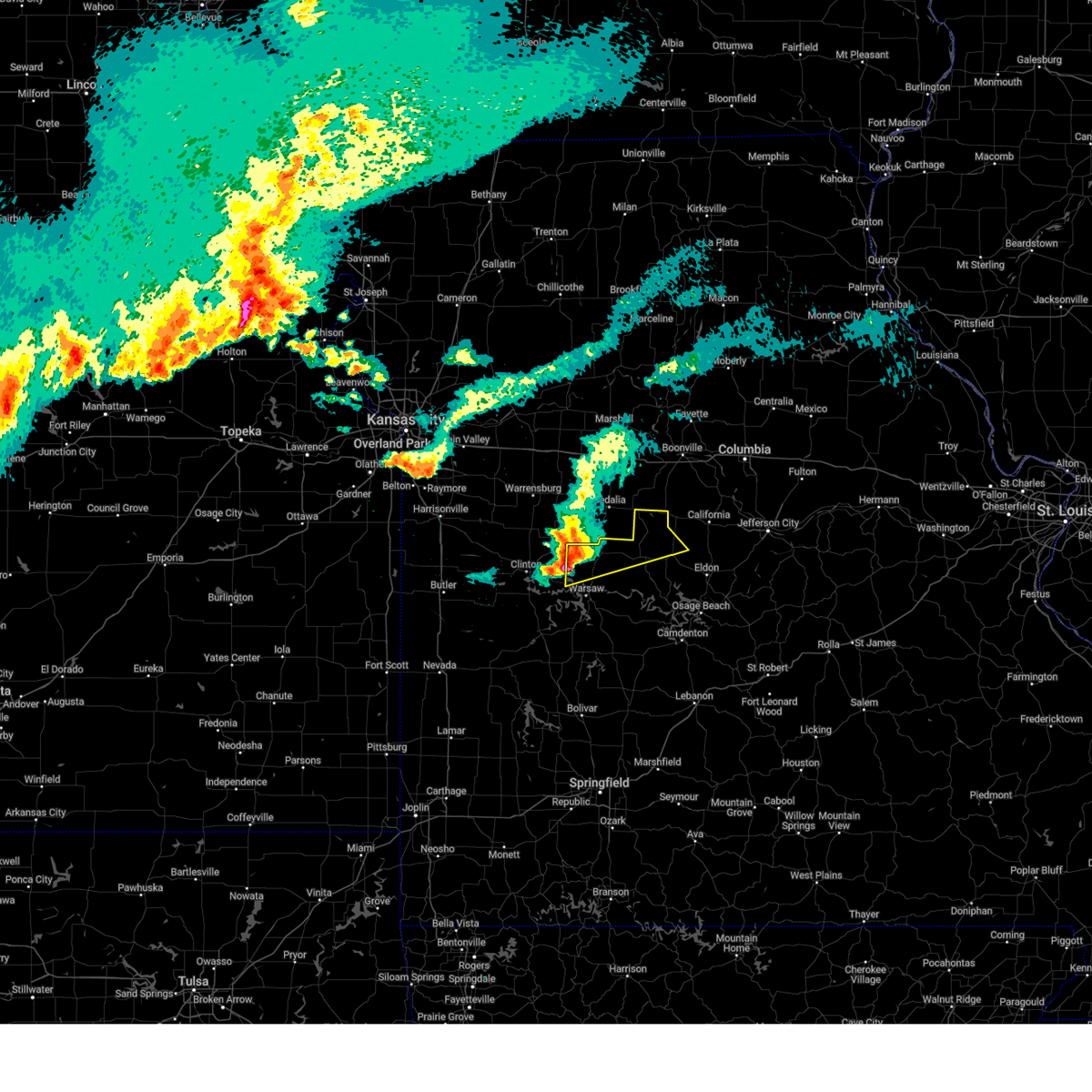
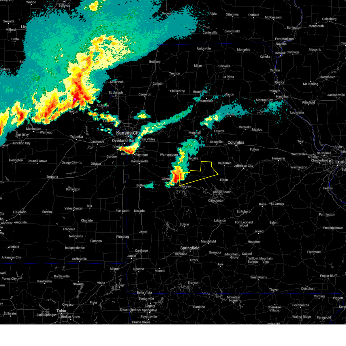
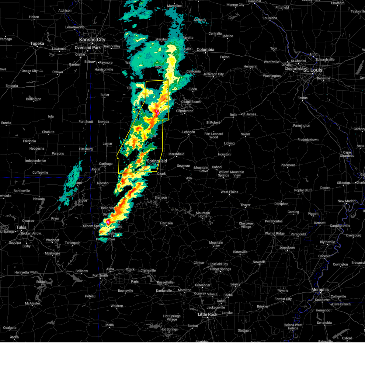
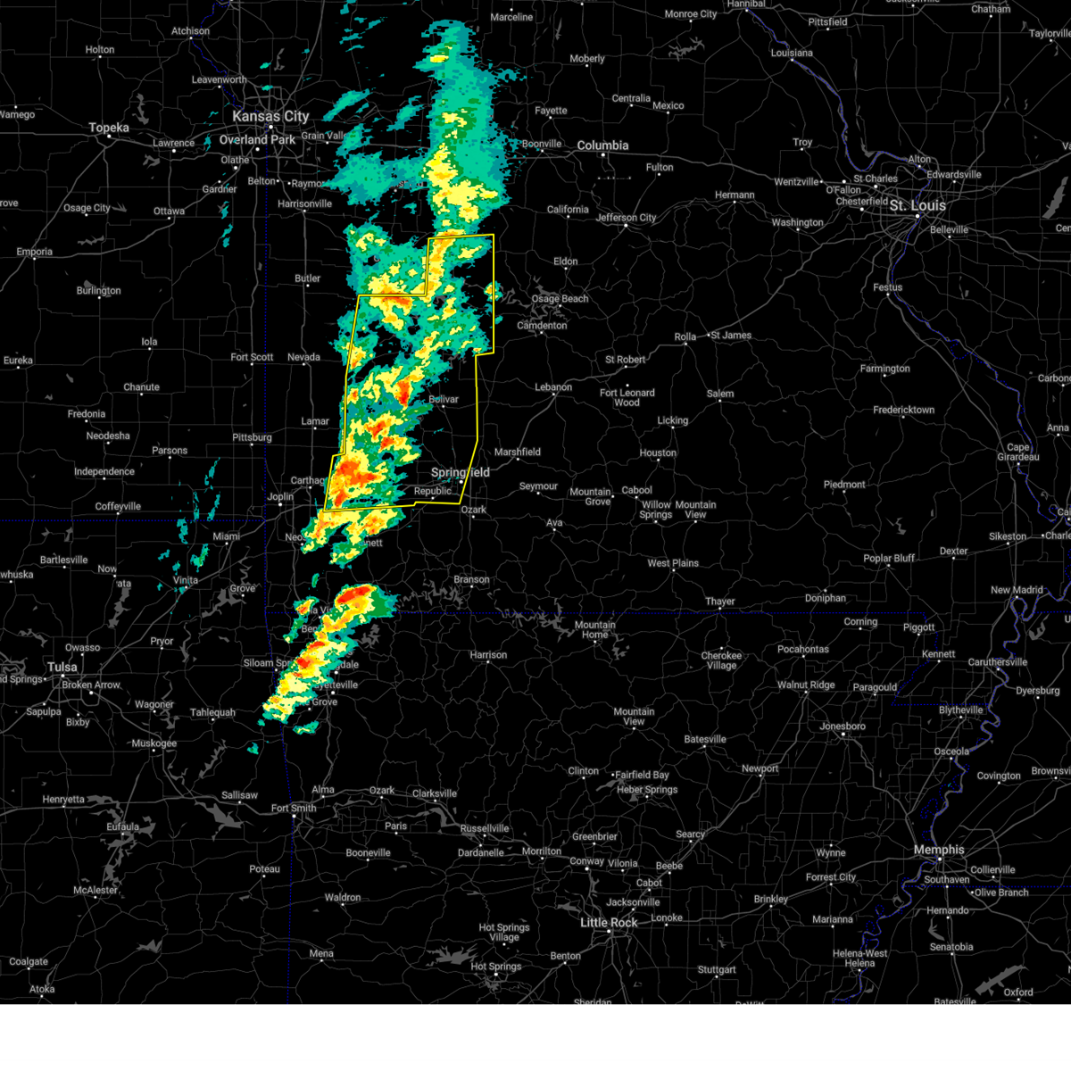
Hail Map for Ionia, MO
The Ionia, MO area has had 2 reports of on-the-ground hail by trained spotters, and has been under severe weather warnings 24 times during the past 12 months. Doppler radar has detected hail at or near Ionia, MO on 66 occasions, including 4 occasions during the past year.
| Name: | Ionia, MO |
| Where Located: | 61.8 miles WSW of Columbia, MO |
| Map: | Google Map for Ionia, MO |
| Population: | 88 |
| Housing Units: | 57 |
| More Info: | Search Google for Ionia, MO |
1
The Top Recent Hail Date for Ionia, MO is Thursday, June 11, 2026 (20th out of 66)
Hail and Wind Damage Spotted near Ionia, MO
| Date / Time | Report Details |
|---|---|
| 6/13/2026 10:25 PM CDT |
 Svrsgf the national weather service in springfield has issued a * severe thunderstorm warning for, northern benton county in central missouri, morgan county in central missouri, * until 1130 pm cdt. * at 1025 pm cdt, severe thunderstorms were located along a line extending from 8 miles northeast of malta bend to 7 miles north of sedalia to near windsor, moving east at 40 mph (radar indicated). Hazards include 60 mph wind gusts. expect damage to roofs, siding, and trees Svrsgf the national weather service in springfield has issued a * severe thunderstorm warning for, northern benton county in central missouri, morgan county in central missouri, * until 1130 pm cdt. * at 1025 pm cdt, severe thunderstorms were located along a line extending from 8 miles northeast of malta bend to 7 miles north of sedalia to near windsor, moving east at 40 mph (radar indicated). Hazards include 60 mph wind gusts. expect damage to roofs, siding, and trees
|
| 6/11/2026 9:19 PM CDT |
 the severe thunderstorm warning has been cancelled and is no longer in effect the severe thunderstorm warning has been cancelled and is no longer in effect
|
| 6/11/2026 9:12 PM CDT |
 At 912 pm cdt, a severe thunderstorm was located near windsor, moving northeast at 45 mph (radar indicated). Hazards include two inch hail. People and animals outdoors will be injured. expect damage to roofs, siding, windows, and vehicles. Locations impacted include, ionia and brandon. At 912 pm cdt, a severe thunderstorm was located near windsor, moving northeast at 45 mph (radar indicated). Hazards include two inch hail. People and animals outdoors will be injured. expect damage to roofs, siding, windows, and vehicles. Locations impacted include, ionia and brandon.
|
| 6/11/2026 8:47 PM CDT |
 Svrsgf the national weather service in springfield has issued a * severe thunderstorm warning for, northwestern benton county in central missouri, * until 930 pm cdt. * at 846 pm cdt, a severe thunderstorm was located over clinton, moving northeast at 45 mph (public. at 822 pm, the public reported 2 inch hail in appleton city. this cell is currently producing large hail). Hazards include two inch hail. People and animals outdoors will be injured. Expect damage to roofs, siding, windows, and vehicles. Svrsgf the national weather service in springfield has issued a * severe thunderstorm warning for, northwestern benton county in central missouri, * until 930 pm cdt. * at 846 pm cdt, a severe thunderstorm was located over clinton, moving northeast at 45 mph (public. at 822 pm, the public reported 2 inch hail in appleton city. this cell is currently producing large hail). Hazards include two inch hail. People and animals outdoors will be injured. Expect damage to roofs, siding, windows, and vehicles.
|
| 6/7/2026 4:35 PM CDT |
 The storm which prompted the warning has weakened below severe limits, and no longer poses an immediate threat to life or property. therefore, the warning will be allowed to expire. The storm which prompted the warning has weakened below severe limits, and no longer poses an immediate threat to life or property. therefore, the warning will be allowed to expire.
|
| 6/7/2026 4:26 PM CDT |
 At 425 pm cdt, a severe thunderstorm was located near warsaw, moving northeast at 35 mph (radar indicated). Hazards include 60 mph wind gusts. Expect damage to roofs, siding, and trees. Locations impacted include, truman lake, truman state park, warsaw, lincoln, cole camp, ionia, palo pinto, racket, mora, brandon, and whitakerville. At 425 pm cdt, a severe thunderstorm was located near warsaw, moving northeast at 35 mph (radar indicated). Hazards include 60 mph wind gusts. Expect damage to roofs, siding, and trees. Locations impacted include, truman lake, truman state park, warsaw, lincoln, cole camp, ionia, palo pinto, racket, mora, brandon, and whitakerville.
|
| 6/7/2026 4:04 PM CDT |
 Svrsgf the national weather service in springfield has issued a * severe thunderstorm warning for, northwestern hickory county in central missouri, northwestern benton county in central missouri, northeastern st. clair county in west central missouri, * until 445 pm cdt. * at 403 pm cdt, a severe thunderstorm was located 10 miles east of lowry city, or 11 miles southwest of warsaw, moving northeast at 35 mph (radar indicated). Hazards include 60 mph wind gusts. expect damage to roofs, siding, and trees Svrsgf the national weather service in springfield has issued a * severe thunderstorm warning for, northwestern hickory county in central missouri, northwestern benton county in central missouri, northeastern st. clair county in west central missouri, * until 445 pm cdt. * at 403 pm cdt, a severe thunderstorm was located 10 miles east of lowry city, or 11 miles southwest of warsaw, moving northeast at 35 mph (radar indicated). Hazards include 60 mph wind gusts. expect damage to roofs, siding, and trees
|
| 4/26/2026 11:35 PM CDT |
 Svrsgf the national weather service in springfield has issued a * severe thunderstorm warning for, northern benton county in central missouri, * until 1230 am cdt. * at 1135 pm cdt, a severe thunderstorm was located near calhoun, or near windsor, moving east at 30 mph (radar indicated). Hazards include 60 mph wind gusts and quarter size hail. Hail damage to vehicles is expected. Expect wind damage to roofs, siding, and trees. Svrsgf the national weather service in springfield has issued a * severe thunderstorm warning for, northern benton county in central missouri, * until 1230 am cdt. * at 1135 pm cdt, a severe thunderstorm was located near calhoun, or near windsor, moving east at 30 mph (radar indicated). Hazards include 60 mph wind gusts and quarter size hail. Hail damage to vehicles is expected. Expect wind damage to roofs, siding, and trees.
|
| 4/26/2026 7:22 PM CDT |
 Svrsgf the national weather service in springfield has issued a * severe thunderstorm warning for, eastern benton county in central missouri, northwestern camden county in central missouri, morgan county in central missouri, * until 800 pm cdt. * at 722 pm cdt, severe thunderstorms were located along a line extending from near cole camp to 9 miles southeast of lincoln to 10 miles southeast of warsaw, moving northeast at 50 mph (radar indicated). Hazards include 70 mph wind gusts and quarter size hail. Hail damage to vehicles is expected. expect considerable tree damage. Wind damage is also likely to mobile homes, roofs, and outbuildings. Svrsgf the national weather service in springfield has issued a * severe thunderstorm warning for, eastern benton county in central missouri, northwestern camden county in central missouri, morgan county in central missouri, * until 800 pm cdt. * at 722 pm cdt, severe thunderstorms were located along a line extending from near cole camp to 9 miles southeast of lincoln to 10 miles southeast of warsaw, moving northeast at 50 mph (radar indicated). Hazards include 70 mph wind gusts and quarter size hail. Hail damage to vehicles is expected. expect considerable tree damage. Wind damage is also likely to mobile homes, roofs, and outbuildings.
|
| 4/26/2026 7:00 PM CDT |
 At 700 pm cdt, severe thunderstorms were located along a line extending from near green ridge to near warsaw to 7 miles north of weaubleau, moving east at 45 mph (radar indicated). Hazards include 70 mph wind gusts and quarter size hail. Hail damage to vehicles is expected. expect considerable tree damage. wind damage is also likely to mobile homes, roofs, and outbuildings. Locations impacted include, truman lake, truman state park, warsaw, lincoln, cole camp, osceola, hermitage, wheatland, preston, cross timbers, ionia, vista, gerster, palo pinto, quincy, lakeview heights, crockerville, fristoe, knobby, and racket. At 700 pm cdt, severe thunderstorms were located along a line extending from near green ridge to near warsaw to 7 miles north of weaubleau, moving east at 45 mph (radar indicated). Hazards include 70 mph wind gusts and quarter size hail. Hail damage to vehicles is expected. expect considerable tree damage. wind damage is also likely to mobile homes, roofs, and outbuildings. Locations impacted include, truman lake, truman state park, warsaw, lincoln, cole camp, osceola, hermitage, wheatland, preston, cross timbers, ionia, vista, gerster, palo pinto, quincy, lakeview heights, crockerville, fristoe, knobby, and racket.
|
| 4/26/2026 6:49 PM CDT |
 Svrsgf the national weather service in springfield has issued a * severe thunderstorm warning for, northern hickory county in central missouri, benton county in central missouri, northeastern st. clair county in west central missouri, * until 730 pm cdt. * at 649 pm cdt, severe thunderstorms were located along a line extending from windsor to 9 miles west of warsaw to near osceola, moving east at 40 mph (radar indicated). Hazards include 60 mph wind gusts and quarter size hail. Hail damage to vehicles is expected. Expect wind damage to roofs, siding, and trees. Svrsgf the national weather service in springfield has issued a * severe thunderstorm warning for, northern hickory county in central missouri, benton county in central missouri, northeastern st. clair county in west central missouri, * until 730 pm cdt. * at 649 pm cdt, severe thunderstorms were located along a line extending from windsor to 9 miles west of warsaw to near osceola, moving east at 40 mph (radar indicated). Hazards include 60 mph wind gusts and quarter size hail. Hail damage to vehicles is expected. Expect wind damage to roofs, siding, and trees.
|
| 4/17/2026 7:45 PM CDT |
 The storm which prompted the warning has moved out of the area. therefore, the warning has been allowed to expire. a tornado watch remains in effect until 900 pm cdt for central missouri. The storm which prompted the warning has moved out of the area. therefore, the warning has been allowed to expire. a tornado watch remains in effect until 900 pm cdt for central missouri.
|
| 4/17/2026 7:27 PM CDT |
 At 726 pm cdt, a severe thunderstorm capable of producing a tornado was located over warsaw, moving east at 55 mph (radar indicated rotation). Hazards include tornado and quarter size hail. Flying debris will be dangerous to those caught without shelter. mobile homes will be damaged or destroyed. damage to roofs, windows, and vehicles will occur. tree damage is likely. Locations impacted include, truman lake, truman state park, warsaw, lincoln, cole camp, ionia, palo pinto, lakeview heights, crockerville, zora, racket, edmonson, and mora. At 726 pm cdt, a severe thunderstorm capable of producing a tornado was located over warsaw, moving east at 55 mph (radar indicated rotation). Hazards include tornado and quarter size hail. Flying debris will be dangerous to those caught without shelter. mobile homes will be damaged or destroyed. damage to roofs, windows, and vehicles will occur. tree damage is likely. Locations impacted include, truman lake, truman state park, warsaw, lincoln, cole camp, ionia, palo pinto, lakeview heights, crockerville, zora, racket, edmonson, and mora.
|
| 4/17/2026 7:10 PM CDT |
 Torsgf the national weather service in springfield has issued a * tornado warning for, central benton county in central missouri, * until 745 pm cdt. * at 710 pm cdt, a severe thunderstorm capable of producing a tornado was located 8 miles east of deepwater, or 10 miles southeast of clinton, moving east at 55 mph (radar indicated rotation). Hazards include tornado and quarter size hail. Flying debris will be dangerous to those caught without shelter. mobile homes will be damaged or destroyed. damage to roofs, windows, and vehicles will occur. Tree damage is likely. Torsgf the national weather service in springfield has issued a * tornado warning for, central benton county in central missouri, * until 745 pm cdt. * at 710 pm cdt, a severe thunderstorm capable of producing a tornado was located 8 miles east of deepwater, or 10 miles southeast of clinton, moving east at 55 mph (radar indicated rotation). Hazards include tornado and quarter size hail. Flying debris will be dangerous to those caught without shelter. mobile homes will be damaged or destroyed. damage to roofs, windows, and vehicles will occur. Tree damage is likely.
|
| 4/13/2026 10:59 PM CDT |
 At 1059 pm cdt, a severe thunderstorm was located near lincoln, or 12 miles northeast of warsaw, moving east at 40 mph (radar indicated). Hazards include 60 mph wind gusts and nickel size hail. Expect damage to roofs, siding, and trees. Locations impacted include, truman lake, lincoln, cole camp, ionia, palo pinto, mora, and crockerville. At 1059 pm cdt, a severe thunderstorm was located near lincoln, or 12 miles northeast of warsaw, moving east at 40 mph (radar indicated). Hazards include 60 mph wind gusts and nickel size hail. Expect damage to roofs, siding, and trees. Locations impacted include, truman lake, lincoln, cole camp, ionia, palo pinto, mora, and crockerville.
|
| 4/13/2026 10:33 PM CDT |
 Svrsgf the national weather service in springfield has issued a * severe thunderstorm warning for, northern benton county in central missouri, * until 1115 pm cdt. * at 1033 pm cdt, a severe thunderstorm was located near calhoun, or 7 miles south of windsor, moving east at 40 mph (radar indicated). Hazards include 60 mph wind gusts and nickel size hail. expect damage to roofs, siding, and trees Svrsgf the national weather service in springfield has issued a * severe thunderstorm warning for, northern benton county in central missouri, * until 1115 pm cdt. * at 1033 pm cdt, a severe thunderstorm was located near calhoun, or 7 miles south of windsor, moving east at 40 mph (radar indicated). Hazards include 60 mph wind gusts and nickel size hail. expect damage to roofs, siding, and trees
|
| 4/1/2026 10:04 PM CDT |
 the severe thunderstorm warning has been cancelled and is no longer in effect the severe thunderstorm warning has been cancelled and is no longer in effect
|
| 4/1/2026 9:51 PM CDT |
 At 950 pm cdt, a severe thunderstorm was located near windsor, moving northeast at 45 mph (radar indicated). Hazards include 60 mph wind gusts and nickel size hail. Expect damage to roofs, siding, and trees. Locations impacted include, ionia, brandon, and mora. At 950 pm cdt, a severe thunderstorm was located near windsor, moving northeast at 45 mph (radar indicated). Hazards include 60 mph wind gusts and nickel size hail. Expect damage to roofs, siding, and trees. Locations impacted include, ionia, brandon, and mora.
|
| 4/1/2026 9:35 PM CDT |
 Svrsgf the national weather service in springfield has issued a * severe thunderstorm warning for, northern benton county in central missouri, * until 1015 pm cdt. * at 935 pm cdt, a severe thunderstorm was located 7 miles southeast of calhoun, or 10 miles east of clinton, moving northeast at 35 mph (radar indicated). Hazards include 60 mph wind gusts and quarter size hail. Hail damage to vehicles is expected. Expect wind damage to roofs, siding, and trees. Svrsgf the national weather service in springfield has issued a * severe thunderstorm warning for, northern benton county in central missouri, * until 1015 pm cdt. * at 935 pm cdt, a severe thunderstorm was located 7 miles southeast of calhoun, or 10 miles east of clinton, moving northeast at 35 mph (radar indicated). Hazards include 60 mph wind gusts and quarter size hail. Hail damage to vehicles is expected. Expect wind damage to roofs, siding, and trees.
|
| 3/11/2026 1:09 AM CDT |
 The storms which prompted the warning have weakened below severe limits, and have exited the warned area. therefore, the warning will be allowed to expire. however, gusty winds are still possible with these thunderstorms. a tornado watch remains in effect until 400 am cdt for central and west central missouri. The storms which prompted the warning have weakened below severe limits, and have exited the warned area. therefore, the warning will be allowed to expire. however, gusty winds are still possible with these thunderstorms. a tornado watch remains in effect until 400 am cdt for central and west central missouri.
|
| 3/11/2026 12:55 AM CDT |
 the severe thunderstorm warning has been cancelled and is no longer in effect the severe thunderstorm warning has been cancelled and is no longer in effect
|
| 3/11/2026 12:55 AM CDT |
 At 1255 am cdt, severe thunderstorms were located along a line extending from near lincoln to near warsaw to 11 miles north of hermitage to near wheatland, moving east at 55 mph (radar indicated). Hazards include 60 mph wind gusts and nickel size hail. Expect damage to roofs, siding, and trees. Locations impacted include, truman lake, truman state park, warsaw, lincoln, cole camp, cross timbers, ionia, quincy, lakeview heights, crockerville, fristoe, zora, knobby, edwards, edmonson, mora, hastain, and whitakerville. At 1255 am cdt, severe thunderstorms were located along a line extending from near lincoln to near warsaw to 11 miles north of hermitage to near wheatland, moving east at 55 mph (radar indicated). Hazards include 60 mph wind gusts and nickel size hail. Expect damage to roofs, siding, and trees. Locations impacted include, truman lake, truman state park, warsaw, lincoln, cole camp, cross timbers, ionia, quincy, lakeview heights, crockerville, fristoe, zora, knobby, edwards, edmonson, mora, hastain, and whitakerville.
|
| 3/11/2026 12:38 AM CDT |
 Svrsgf the national weather service in springfield has issued a * severe thunderstorm warning for, northern hickory county in central missouri, benton county in central missouri, northeastern st. clair county in west central missouri, * until 115 am cdt. * at 1237 am cdt, severe thunderstorms were located along a line extending from 6 miles southeast of calhoun to 9 miles northeast of lowry city to 6 miles east of osceola to 8 miles west of weaubleau, moving east at 55 mph (radar indicated). Hazards include 60 mph wind gusts and nickel size hail. expect damage to roofs, siding, and trees Svrsgf the national weather service in springfield has issued a * severe thunderstorm warning for, northern hickory county in central missouri, benton county in central missouri, northeastern st. clair county in west central missouri, * until 115 am cdt. * at 1237 am cdt, severe thunderstorms were located along a line extending from 6 miles southeast of calhoun to 9 miles northeast of lowry city to 6 miles east of osceola to 8 miles west of weaubleau, moving east at 55 mph (radar indicated). Hazards include 60 mph wind gusts and nickel size hail. expect damage to roofs, siding, and trees
|
| 9/18/2025 5:59 PM CDT | Svrsgf the national weather service in springfield has issued a * severe thunderstorm warning for, northeastern hickory county in central missouri, eastern benton county in central missouri, western miller county in central missouri, camden county in central missouri, morgan county in central missouri, * until 645 pm cdt. * at 558 pm cdt, severe thunderstorms were located along a line extending from 7 miles north of cole camp to near laurie to near macks creek, moving northeast at 30 mph (radar indicated). Hazards include 60 mph wind gusts and quarter size hail. Hail damage to vehicles is expected. Expect wind damage to roofs, siding, and trees. |
| 5/19/2025 8:10 PM CDT |
 The storm which prompted the warning has weakened below severe limits, and has exited the warned area. therefore, the warning will be allowed to expire. a tornado watch remains in effect until 900 pm cdt for central missouri. The storm which prompted the warning has weakened below severe limits, and has exited the warned area. therefore, the warning will be allowed to expire. a tornado watch remains in effect until 900 pm cdt for central missouri.
|
| 5/19/2025 7:56 PM CDT |
 At 756 pm cdt, a severe thunderstorm capable of producing a tornado was located near cole camp, or 13 miles south of sedalia, moving northeast at 45 mph (radar indicated rotation). Hazards include tornado. Flying debris will be dangerous to those caught without shelter. mobile homes will be damaged or destroyed. damage to roofs, windows, and vehicles will occur. tree damage is likely. Locations impacted include, cole camp, ionia, brandon, and mora. At 756 pm cdt, a severe thunderstorm capable of producing a tornado was located near cole camp, or 13 miles south of sedalia, moving northeast at 45 mph (radar indicated rotation). Hazards include tornado. Flying debris will be dangerous to those caught without shelter. mobile homes will be damaged or destroyed. damage to roofs, windows, and vehicles will occur. tree damage is likely. Locations impacted include, cole camp, ionia, brandon, and mora.
|
| 5/19/2025 7:43 PM CDT |
 Torsgf the national weather service in springfield has issued a * tornado warning for, northern benton county in central missouri, * until 815 pm cdt. * at 743 pm cdt, a severe thunderstorm capable of producing a tornado was located over lincoln, or 12 miles north of warsaw, moving northeast at 45 mph (radar indicated rotation). Hazards include tornado. Flying debris will be dangerous to those caught without shelter. mobile homes will be damaged or destroyed. damage to roofs, windows, and vehicles will occur. Tree damage is likely. Torsgf the national weather service in springfield has issued a * tornado warning for, northern benton county in central missouri, * until 815 pm cdt. * at 743 pm cdt, a severe thunderstorm capable of producing a tornado was located over lincoln, or 12 miles north of warsaw, moving northeast at 45 mph (radar indicated rotation). Hazards include tornado. Flying debris will be dangerous to those caught without shelter. mobile homes will be damaged or destroyed. damage to roofs, windows, and vehicles will occur. Tree damage is likely.
|
| 5/19/2025 7:38 PM CDT |
 At 738 pm cdt, severe thunderstorms were located along a line extending from 10 miles south of stover to 6 miles northwest of macks creek to 10 miles east of humansville, moving east at 45 mph (radar indicated). Hazards include 70 mph wind gusts and quarter size hail. Hail damage to vehicles is expected. expect considerable tree damage. wind damage is also likely to mobile homes, roofs, and outbuildings. Locations impacted include, truman lake, truman state park, warsaw, lincoln, cole camp, preston, cross timbers, ionia, palo pinto, lakeview heights, brandon, crockerville, zora, fristoe, knobby, racket, edmonson, mora, edwards, and hastain. At 738 pm cdt, severe thunderstorms were located along a line extending from 10 miles south of stover to 6 miles northwest of macks creek to 10 miles east of humansville, moving east at 45 mph (radar indicated). Hazards include 70 mph wind gusts and quarter size hail. Hail damage to vehicles is expected. expect considerable tree damage. wind damage is also likely to mobile homes, roofs, and outbuildings. Locations impacted include, truman lake, truman state park, warsaw, lincoln, cole camp, preston, cross timbers, ionia, palo pinto, lakeview heights, brandon, crockerville, zora, fristoe, knobby, racket, edmonson, mora, edwards, and hastain.
|
| 5/19/2025 7:38 PM CDT |
 the severe thunderstorm warning has been cancelled and is no longer in effect the severe thunderstorm warning has been cancelled and is no longer in effect
|
| 5/19/2025 7:36 PM CDT |
 At 734 pm cdt, a confirmed tornado was located near cole camp, or 16 miles northeast of warsaw, moving northeast at 60 mph (radar confirmed tornado). Hazards include damaging tornado and quarter size hail. Flying debris will be dangerous to those caught without shelter. mobile homes will be damaged or destroyed. damage to roofs, windows, and vehicles will occur. tree damage is likely. Locations impacted include, truman lake, lincoln, cole camp, ionia, palo pinto, mora, and brandon. At 734 pm cdt, a confirmed tornado was located near cole camp, or 16 miles northeast of warsaw, moving northeast at 60 mph (radar confirmed tornado). Hazards include damaging tornado and quarter size hail. Flying debris will be dangerous to those caught without shelter. mobile homes will be damaged or destroyed. damage to roofs, windows, and vehicles will occur. tree damage is likely. Locations impacted include, truman lake, lincoln, cole camp, ionia, palo pinto, mora, and brandon.
|
| 5/19/2025 7:25 PM CDT |
 At 725 pm cdt, a confirmed tornado was located near lincoln, or near warsaw, moving northeast at 60 mph (radar confirmed tornado). Hazards include damaging tornado and quarter size hail. Flying debris will be dangerous to those caught without shelter. mobile homes will be damaged or destroyed. damage to roofs, windows, and vehicles will occur. tree damage is likely. Locations impacted include, truman lake, truman state park, warsaw, lincoln, cole camp, ionia, palo pinto, racket, edmonson, mora, brandon, and crockerville. At 725 pm cdt, a confirmed tornado was located near lincoln, or near warsaw, moving northeast at 60 mph (radar confirmed tornado). Hazards include damaging tornado and quarter size hail. Flying debris will be dangerous to those caught without shelter. mobile homes will be damaged or destroyed. damage to roofs, windows, and vehicles will occur. tree damage is likely. Locations impacted include, truman lake, truman state park, warsaw, lincoln, cole camp, ionia, palo pinto, racket, edmonson, mora, brandon, and crockerville.
|
| 5/19/2025 7:19 PM CDT |
 Torsgf the national weather service in springfield has issued a * tornado warning for, benton county in central missouri, * until 745 pm cdt. * at 719 pm cdt, a tornado producing storm was located over warsaw, moving northeast at 60 mph (radar confirmed tornado). Hazards include damaging tornado and quarter size hail. Flying debris will be dangerous to those caught without shelter. mobile homes will be damaged or destroyed. damage to roofs, windows, and vehicles will occur. Tree damage is likely. Torsgf the national weather service in springfield has issued a * tornado warning for, benton county in central missouri, * until 745 pm cdt. * at 719 pm cdt, a tornado producing storm was located over warsaw, moving northeast at 60 mph (radar confirmed tornado). Hazards include damaging tornado and quarter size hail. Flying debris will be dangerous to those caught without shelter. mobile homes will be damaged or destroyed. damage to roofs, windows, and vehicles will occur. Tree damage is likely.
|
| 5/19/2025 7:06 PM CDT |
 At 706 pm cdt, severe thunderstorms were located along a line extending from near warsaw to near wheatland to stockton, moving east at 45 mph (radar indicated). Hazards include 70 mph wind gusts and quarter size hail. Hail damage to vehicles is expected. expect considerable tree damage. wind damage is also likely to mobile homes, roofs, and outbuildings. Locations impacted include, pomme de terre lake, truman lake, truman state park, pomme de terre state park, warsaw, pittsburg, lincoln, cole camp, osceola, lowry city, hermitage, weaubleau, wheatland, preston, cross timbers, collins, roscoe, ionia, vista, and gerster. At 706 pm cdt, severe thunderstorms were located along a line extending from near warsaw to near wheatland to stockton, moving east at 45 mph (radar indicated). Hazards include 70 mph wind gusts and quarter size hail. Hail damage to vehicles is expected. expect considerable tree damage. wind damage is also likely to mobile homes, roofs, and outbuildings. Locations impacted include, pomme de terre lake, truman lake, truman state park, pomme de terre state park, warsaw, pittsburg, lincoln, cole camp, osceola, lowry city, hermitage, weaubleau, wheatland, preston, cross timbers, collins, roscoe, ionia, vista, and gerster.
|
| 5/19/2025 7:06 PM CDT |
 the severe thunderstorm warning has been cancelled and is no longer in effect the severe thunderstorm warning has been cancelled and is no longer in effect
|
| 5/19/2025 6:40 PM CDT |
 Svrsgf the national weather service in springfield has issued a * severe thunderstorm warning for, hickory county in central missouri, northern cedar county in southwestern missouri, benton county in central missouri, st. clair county in west central missouri, eastern vernon county in west central missouri, * until 745 pm cdt. * at 640 pm cdt, severe thunderstorms were located along a line extending from near lowry city to 10 miles southwest of osceola to 8 miles east of sheldon, moving east at 45 mph (radar indicated). Hazards include 60 mph wind gusts and quarter size hail. Hail damage to vehicles is expected. Expect wind damage to roofs, siding, and trees. Svrsgf the national weather service in springfield has issued a * severe thunderstorm warning for, hickory county in central missouri, northern cedar county in southwestern missouri, benton county in central missouri, st. clair county in west central missouri, eastern vernon county in west central missouri, * until 745 pm cdt. * at 640 pm cdt, severe thunderstorms were located along a line extending from near lowry city to 10 miles southwest of osceola to 8 miles east of sheldon, moving east at 45 mph (radar indicated). Hazards include 60 mph wind gusts and quarter size hail. Hail damage to vehicles is expected. Expect wind damage to roofs, siding, and trees.
|
| 4/20/2025 4:06 PM CDT |
 the severe thunderstorm warning has been cancelled and is no longer in effect the severe thunderstorm warning has been cancelled and is no longer in effect
|
| 4/20/2025 4:06 PM CDT |
 At 406 pm cdt, severe thunderstorms were located along a line extending from near cole camp to 10 miles northwest of macks creek to near springfield, moving northeast at 60 mph (radar indicated). Hazards include 70 mph wind gusts and quarter size hail. Hail damage to vehicles is expected. expect considerable tree damage. wind damage is also likely to mobile homes, roofs, and outbuildings. Locations impacted include, flemington, palo pinto, preston, quincy, hermitage, lakeview heights, pittsburg, truman state park, crockerville, fristoe, knobby, eudora, racket, halfway, bolivar, fair play, goodson, morrisville, lincoln, and nemo. At 406 pm cdt, severe thunderstorms were located along a line extending from near cole camp to 10 miles northwest of macks creek to near springfield, moving northeast at 60 mph (radar indicated). Hazards include 70 mph wind gusts and quarter size hail. Hail damage to vehicles is expected. expect considerable tree damage. wind damage is also likely to mobile homes, roofs, and outbuildings. Locations impacted include, flemington, palo pinto, preston, quincy, hermitage, lakeview heights, pittsburg, truman state park, crockerville, fristoe, knobby, eudora, racket, halfway, bolivar, fair play, goodson, morrisville, lincoln, and nemo.
|
| 4/20/2025 3:58 PM CDT |
 Svrsgf the national weather service in springfield has issued a * severe thunderstorm warning for, eastern hickory county in central missouri, dallas county in southwestern missouri, benton county in central missouri, miller county in central missouri, eastern polk county in southwestern missouri, laclede county in southwestern missouri, camden county in central missouri, morgan county in central missouri, * until 500 pm cdt. * at 354 pm cdt, severe thunderstorms were located along a line extending from near lincoln to 10 miles northwest of buffalo to 6 miles northwest of roberson hollow, moving northeast at 55 mph (radar indicated). Hazards include 70 mph wind gusts and quarter size hail. Hail damage to vehicles is expected. expect considerable tree damage. Wind damage is also likely to mobile homes, roofs, and outbuildings. Svrsgf the national weather service in springfield has issued a * severe thunderstorm warning for, eastern hickory county in central missouri, dallas county in southwestern missouri, benton county in central missouri, miller county in central missouri, eastern polk county in southwestern missouri, laclede county in southwestern missouri, camden county in central missouri, morgan county in central missouri, * until 500 pm cdt. * at 354 pm cdt, severe thunderstorms were located along a line extending from near lincoln to 10 miles northwest of buffalo to 6 miles northwest of roberson hollow, moving northeast at 55 mph (radar indicated). Hazards include 70 mph wind gusts and quarter size hail. Hail damage to vehicles is expected. expect considerable tree damage. Wind damage is also likely to mobile homes, roofs, and outbuildings.
|
| 4/20/2025 3:48 PM CDT |
 At 348 pm cdt, severe thunderstorms were located along a line extending from 8 miles northwest of warsaw to 10 miles northeast of hermitage to 6 miles north of galena, moving northeast at 55 mph (radar indicated). Hazards include 70 mph wind gusts and quarter size hail. Hail damage to vehicles is expected. expect considerable tree damage. wind damage is also likely to mobile homes, roofs, and outbuildings. Locations impacted include, vista, flemington, palo pinto, pittsburg, truman state park, fristoe, osceola, eudora, racket, lowry city, goodson, morrisville, lincoln, nemo, hastain, wheatland, monegaw springs, whitakerville, aldrich, and warsaw. At 348 pm cdt, severe thunderstorms were located along a line extending from 8 miles northwest of warsaw to 10 miles northeast of hermitage to 6 miles north of galena, moving northeast at 55 mph (radar indicated). Hazards include 70 mph wind gusts and quarter size hail. Hail damage to vehicles is expected. expect considerable tree damage. wind damage is also likely to mobile homes, roofs, and outbuildings. Locations impacted include, vista, flemington, palo pinto, pittsburg, truman state park, fristoe, osceola, eudora, racket, lowry city, goodson, morrisville, lincoln, nemo, hastain, wheatland, monegaw springs, whitakerville, aldrich, and warsaw.
|
| 4/20/2025 3:48 PM CDT |
 the severe thunderstorm warning has been cancelled and is no longer in effect the severe thunderstorm warning has been cancelled and is no longer in effect
|
| 4/20/2025 3:25 PM CDT |
 Svrsgf the national weather service in springfield has issued a * severe thunderstorm warning for, hickory county in central missouri, cedar county in southwestern missouri, benton county in central missouri, polk county in southwestern missouri, st. clair county in west central missouri, eastern dade county in southwestern missouri, * until 430 pm cdt. * at 324 pm cdt, severe thunderstorms were located along a line extending from near lowry city to near weaubleau to 7 miles east of cassville, moving northeast at 55 mph (radar indicated). Hazards include 70 mph wind gusts and quarter size hail. Hail damage to vehicles is expected. expect considerable tree damage. Wind damage is also likely to mobile homes, roofs, and outbuildings. Svrsgf the national weather service in springfield has issued a * severe thunderstorm warning for, hickory county in central missouri, cedar county in southwestern missouri, benton county in central missouri, polk county in southwestern missouri, st. clair county in west central missouri, eastern dade county in southwestern missouri, * until 430 pm cdt. * at 324 pm cdt, severe thunderstorms were located along a line extending from near lowry city to near weaubleau to 7 miles east of cassville, moving northeast at 55 mph (radar indicated). Hazards include 70 mph wind gusts and quarter size hail. Hail damage to vehicles is expected. expect considerable tree damage. Wind damage is also likely to mobile homes, roofs, and outbuildings.
|
| 4/2/2025 12:05 AM CDT |
 At 1205 am cdt, a severe thunderstorm was located near cole camp, or 14 miles south of sedalia, moving east at 50 mph (radar indicated). Hazards include 60 mph wind gusts and quarter size hail. Hail damage to vehicles is expected. expect wind damage to roofs, siding, and trees. Locations impacted include, cole camp, mora, florence, ionia, syracuse, crockerville, stover, and lincoln. At 1205 am cdt, a severe thunderstorm was located near cole camp, or 14 miles south of sedalia, moving east at 50 mph (radar indicated). Hazards include 60 mph wind gusts and quarter size hail. Hail damage to vehicles is expected. expect wind damage to roofs, siding, and trees. Locations impacted include, cole camp, mora, florence, ionia, syracuse, crockerville, stover, and lincoln.
|
| 4/1/2025 11:48 PM CDT |
 At 1148 pm cdt, a severe thunderstorm was located near lincoln, or 9 miles southeast of windsor, moving east at 50 mph (radar indicated). Hazards include 60 mph wind gusts and half dollar size hail. Hail damage to vehicles is expected. expect wind damage to roofs, siding, and trees. Locations impacted include, palo pinto, cole camp, mora, florence, ionia, syracuse, brandon, lincoln, stover, crockerville, and truman lake. At 1148 pm cdt, a severe thunderstorm was located near lincoln, or 9 miles southeast of windsor, moving east at 50 mph (radar indicated). Hazards include 60 mph wind gusts and half dollar size hail. Hail damage to vehicles is expected. expect wind damage to roofs, siding, and trees. Locations impacted include, palo pinto, cole camp, mora, florence, ionia, syracuse, brandon, lincoln, stover, crockerville, and truman lake.
|
| 4/1/2025 11:41 PM CDT |
 Svrsgf the national weather service in springfield has issued a * severe thunderstorm warning for, northern benton county in central missouri, northern morgan county in central missouri, * until 1230 am cdt. * at 1141 pm cdt, a severe thunderstorm was located 7 miles southeast of calhoun, or 9 miles south of windsor, moving east at 50 mph (radar indicated). Hazards include 60 mph wind gusts and quarter size hail. Hail damage to vehicles is expected. Expect wind damage to roofs, siding, and trees. Svrsgf the national weather service in springfield has issued a * severe thunderstorm warning for, northern benton county in central missouri, northern morgan county in central missouri, * until 1230 am cdt. * at 1141 pm cdt, a severe thunderstorm was located 7 miles southeast of calhoun, or 9 miles south of windsor, moving east at 50 mph (radar indicated). Hazards include 60 mph wind gusts and quarter size hail. Hail damage to vehicles is expected. Expect wind damage to roofs, siding, and trees.
|
| 3/14/2025 5:14 PM CDT |
 the severe thunderstorm warning has been cancelled and is no longer in effect the severe thunderstorm warning has been cancelled and is no longer in effect
|
| 3/14/2025 5:14 PM CDT |
 At 513 pm cdt, a severe thunderstorm was located over wheatland, or near hermitage, moving northeast at 70 mph (radar indicated). Hazards include 70 mph wind gusts and quarter size hail. Hail damage to vehicles is expected. expect considerable tree damage. wind damage is also likely to mobile homes, roofs, and outbuildings. locations impacted include, vista, glidewell, flemington, palo pinto, pittsburg, truman state park, cane hill, fristoe, umber view heights, cave springs, mount vernon, eudora, racket, pennsboro, neola, goodson, morrisville, lincoln, nemo, and hastain. This includes interstate 44 between mile markers 33 and 79. At 513 pm cdt, a severe thunderstorm was located over wheatland, or near hermitage, moving northeast at 70 mph (radar indicated). Hazards include 70 mph wind gusts and quarter size hail. Hail damage to vehicles is expected. expect considerable tree damage. wind damage is also likely to mobile homes, roofs, and outbuildings. locations impacted include, vista, glidewell, flemington, palo pinto, pittsburg, truman state park, cane hill, fristoe, umber view heights, cave springs, mount vernon, eudora, racket, pennsboro, neola, goodson, morrisville, lincoln, nemo, and hastain. This includes interstate 44 between mile markers 33 and 79.
|
| 3/14/2025 4:43 PM CDT |
 Svrsgf the national weather service in springfield has issued a * severe thunderstorm warning for, hickory county in central missouri, cedar county in southwestern missouri, benton county in central missouri, polk county in southwestern missouri, lawrence county in southwestern missouri, greene county in southwestern missouri, st. clair county in west central missouri, eastern jasper county in southwestern missouri, dade county in southwestern missouri, * until 545 pm cdt. * at 442 pm cdt, a severe thunderstorm was located 9 miles north of greenfield, moving northeast at 70 mph (radar indicated). Hazards include 70 mph wind gusts and quarter size hail. Hail damage to vehicles is expected. expect considerable tree damage. Wind damage is also likely to mobile homes, roofs, and outbuildings. Svrsgf the national weather service in springfield has issued a * severe thunderstorm warning for, hickory county in central missouri, cedar county in southwestern missouri, benton county in central missouri, polk county in southwestern missouri, lawrence county in southwestern missouri, greene county in southwestern missouri, st. clair county in west central missouri, eastern jasper county in southwestern missouri, dade county in southwestern missouri, * until 545 pm cdt. * at 442 pm cdt, a severe thunderstorm was located 9 miles north of greenfield, moving northeast at 70 mph (radar indicated). Hazards include 70 mph wind gusts and quarter size hail. Hail damage to vehicles is expected. expect considerable tree damage. Wind damage is also likely to mobile homes, roofs, and outbuildings.
|
| 7/11/2024 9:27 PM CDT |
 The storm which prompted the warning has weakened below severe limits, and no longer poses an immediate threat to life or property. therefore, the warning will be allowed to expire. The storm which prompted the warning has weakened below severe limits, and no longer poses an immediate threat to life or property. therefore, the warning will be allowed to expire.
|
| 7/11/2024 8:46 PM CDT |
 Svrsgf the national weather service in springfield has issued a * severe thunderstorm warning for, northwestern benton county in central missouri, * until 930 pm cdt. * at 846 pm cdt, a severe thunderstorm was located near calhoun, or near windsor, moving east at 20 mph (radar indicated). Hazards include 60 mph wind gusts and quarter size hail. Hail damage to vehicles is expected. Expect wind damage to roofs, siding, and trees. Svrsgf the national weather service in springfield has issued a * severe thunderstorm warning for, northwestern benton county in central missouri, * until 930 pm cdt. * at 846 pm cdt, a severe thunderstorm was located near calhoun, or near windsor, moving east at 20 mph (radar indicated). Hazards include 60 mph wind gusts and quarter size hail. Hail damage to vehicles is expected. Expect wind damage to roofs, siding, and trees.
|
| 6/29/2024 12:21 AM CDT |
 The storms which prompted the warning have weakened below severe limits, and no longer pose an immediate threat to life or property. therefore, the warning will be allowed to expire. however, gusty winds and heavy rain are still possible with these thunderstorms. a severe thunderstorm watch remains in effect until 400 am cdt for central missouri. to report severe weather, contact your nearest law enforcement agency. they will relay your report to the national weather service springfield. The storms which prompted the warning have weakened below severe limits, and no longer pose an immediate threat to life or property. therefore, the warning will be allowed to expire. however, gusty winds and heavy rain are still possible with these thunderstorms. a severe thunderstorm watch remains in effect until 400 am cdt for central missouri. to report severe weather, contact your nearest law enforcement agency. they will relay your report to the national weather service springfield.
|
| 6/28/2024 11:28 PM CDT |
 Svrsgf the national weather service in springfield has issued a * severe thunderstorm warning for, benton county in central missouri, * until 1230 am cdt. * at 1125 pm cdt, severe thunderstorms were located along a line extending from near holden to 7 miles north of clinton to 6 miles northwest of montrose, moving east at 40 mph (radar indicated). Hazards include 60 mph wind gusts and penny size hail. expect damage to roofs, siding, and trees Svrsgf the national weather service in springfield has issued a * severe thunderstorm warning for, benton county in central missouri, * until 1230 am cdt. * at 1125 pm cdt, severe thunderstorms were located along a line extending from near holden to 7 miles north of clinton to 6 miles northwest of montrose, moving east at 40 mph (radar indicated). Hazards include 60 mph wind gusts and penny size hail. expect damage to roofs, siding, and trees
|
| 5/26/2024 3:38 PM CDT |
 At 337 pm cdt, a severe thunderstorm was located 9 miles west of lincoln, or 10 miles northwest of warsaw, moving east at 35 mph. this is a destructive storm for palo pinto, lincoln, cole camp (radar indicated). Hazards include baseball size hail and 60 mph wind gusts. People and animals outdoors will be severely injured. expect shattered windows, extensive damage to roofs, siding, and vehicles. Locations impacted include, truman lake, truman state park, lincoln, cole camp, ionia, palo pinto, racket, mora, edmonson, brandon, and crockerville. At 337 pm cdt, a severe thunderstorm was located 9 miles west of lincoln, or 10 miles northwest of warsaw, moving east at 35 mph. this is a destructive storm for palo pinto, lincoln, cole camp (radar indicated). Hazards include baseball size hail and 60 mph wind gusts. People and animals outdoors will be severely injured. expect shattered windows, extensive damage to roofs, siding, and vehicles. Locations impacted include, truman lake, truman state park, lincoln, cole camp, ionia, palo pinto, racket, mora, edmonson, brandon, and crockerville.
|
| 5/26/2024 3:22 PM CDT |
 Svrsgf the national weather service in springfield has issued a * severe thunderstorm warning for, northern benton county in central missouri, * until 400 pm cdt. * at 321 pm cdt, a severe thunderstorm was located near clinton, moving east at 40 mph (radar indicated). Hazards include ping pong ball size hail and 60 mph wind gusts. People and animals outdoors will be injured. expect hail damage to roofs, siding, windows, and vehicles. Expect wind damage to roofs, siding, and trees. Svrsgf the national weather service in springfield has issued a * severe thunderstorm warning for, northern benton county in central missouri, * until 400 pm cdt. * at 321 pm cdt, a severe thunderstorm was located near clinton, moving east at 40 mph (radar indicated). Hazards include ping pong ball size hail and 60 mph wind gusts. People and animals outdoors will be injured. expect hail damage to roofs, siding, windows, and vehicles. Expect wind damage to roofs, siding, and trees.
|
| 5/26/2024 12:18 AM CDT |
 the tornado warning has been cancelled and is no longer in effect the tornado warning has been cancelled and is no longer in effect
|
| 5/26/2024 12:04 AM CDT |
 At 1204 am cdt, a severe thunderstorm capable of producing a tornado was located near lincoln, or 11 miles east of windsor, moving east at 45 mph (radar indicated rotation). Hazards include tornado and half dollar size hail. Flying debris will be dangerous to those caught without shelter. mobile homes will be damaged or destroyed. damage to roofs, windows, and vehicles will occur. tree damage is likely. Locations impacted include, lincoln, cole camp, ionia, crockerville, and mora. At 1204 am cdt, a severe thunderstorm capable of producing a tornado was located near lincoln, or 11 miles east of windsor, moving east at 45 mph (radar indicated rotation). Hazards include tornado and half dollar size hail. Flying debris will be dangerous to those caught without shelter. mobile homes will be damaged or destroyed. damage to roofs, windows, and vehicles will occur. tree damage is likely. Locations impacted include, lincoln, cole camp, ionia, crockerville, and mora.
|
| 5/25/2024 11:55 PM CDT |
 Torsgf the national weather service in springfield has issued a * tornado warning for, northern benton county in central missouri, * until 1230 am cdt. * at 1155 pm cdt, a severe thunderstorm capable of producing a tornado was located near lincoln, or 7 miles southeast of windsor, moving east at 45 mph (radar indicated rotation). Hazards include tornado and half dollar size hail. Flying debris will be dangerous to those caught without shelter. mobile homes will be damaged or destroyed. damage to roofs, windows, and vehicles will occur. Tree damage is likely. Torsgf the national weather service in springfield has issued a * tornado warning for, northern benton county in central missouri, * until 1230 am cdt. * at 1155 pm cdt, a severe thunderstorm capable of producing a tornado was located near lincoln, or 7 miles southeast of windsor, moving east at 45 mph (radar indicated rotation). Hazards include tornado and half dollar size hail. Flying debris will be dangerous to those caught without shelter. mobile homes will be damaged or destroyed. damage to roofs, windows, and vehicles will occur. Tree damage is likely.
|
| 5/25/2024 11:44 PM CDT |
 Svrsgf the national weather service in springfield has issued a * severe thunderstorm warning for, northern benton county in central missouri, * until 1230 am cdt. * at 1144 pm cdt, a severe thunderstorm was located 9 miles south of calhoun, or 10 miles east of clinton, moving east at 50 mph (radar indicated). Hazards include 60 mph wind gusts and half dollar size hail. Hail damage to vehicles is expected. Expect wind damage to roofs, siding, and trees. Svrsgf the national weather service in springfield has issued a * severe thunderstorm warning for, northern benton county in central missouri, * until 1230 am cdt. * at 1144 pm cdt, a severe thunderstorm was located 9 miles south of calhoun, or 10 miles east of clinton, moving east at 50 mph (radar indicated). Hazards include 60 mph wind gusts and half dollar size hail. Hail damage to vehicles is expected. Expect wind damage to roofs, siding, and trees.
|
| 5/21/2024 5:51 PM CDT |
 The storm which prompted the warning has moved out of the area. therefore, the warning will be allowed to expire. a tornado watch remains in effect until 1000 pm cdt for central missouri. The storm which prompted the warning has moved out of the area. therefore, the warning will be allowed to expire. a tornado watch remains in effect until 1000 pm cdt for central missouri.
|
| 5/21/2024 5:27 PM CDT |
 Torsgf the national weather service in springfield has issued a * tornado warning for, northern benton county in central missouri, * until 600 pm cdt. * at 527 pm cdt, a severe thunderstorm capable of producing a tornado was located near calhoun, or near windsor, moving northeast at 40 mph (radar indicated rotation). Hazards include tornado and ping pong ball size hail. Flying debris will be dangerous to those caught without shelter. mobile homes will be damaged or destroyed. damage to roofs, windows, and vehicles will occur. Tree damage is likely. Torsgf the national weather service in springfield has issued a * tornado warning for, northern benton county in central missouri, * until 600 pm cdt. * at 527 pm cdt, a severe thunderstorm capable of producing a tornado was located near calhoun, or near windsor, moving northeast at 40 mph (radar indicated rotation). Hazards include tornado and ping pong ball size hail. Flying debris will be dangerous to those caught without shelter. mobile homes will be damaged or destroyed. damage to roofs, windows, and vehicles will occur. Tree damage is likely.
|
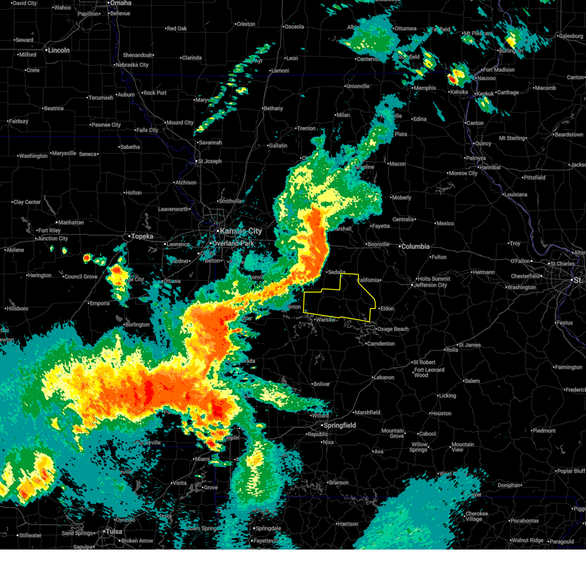
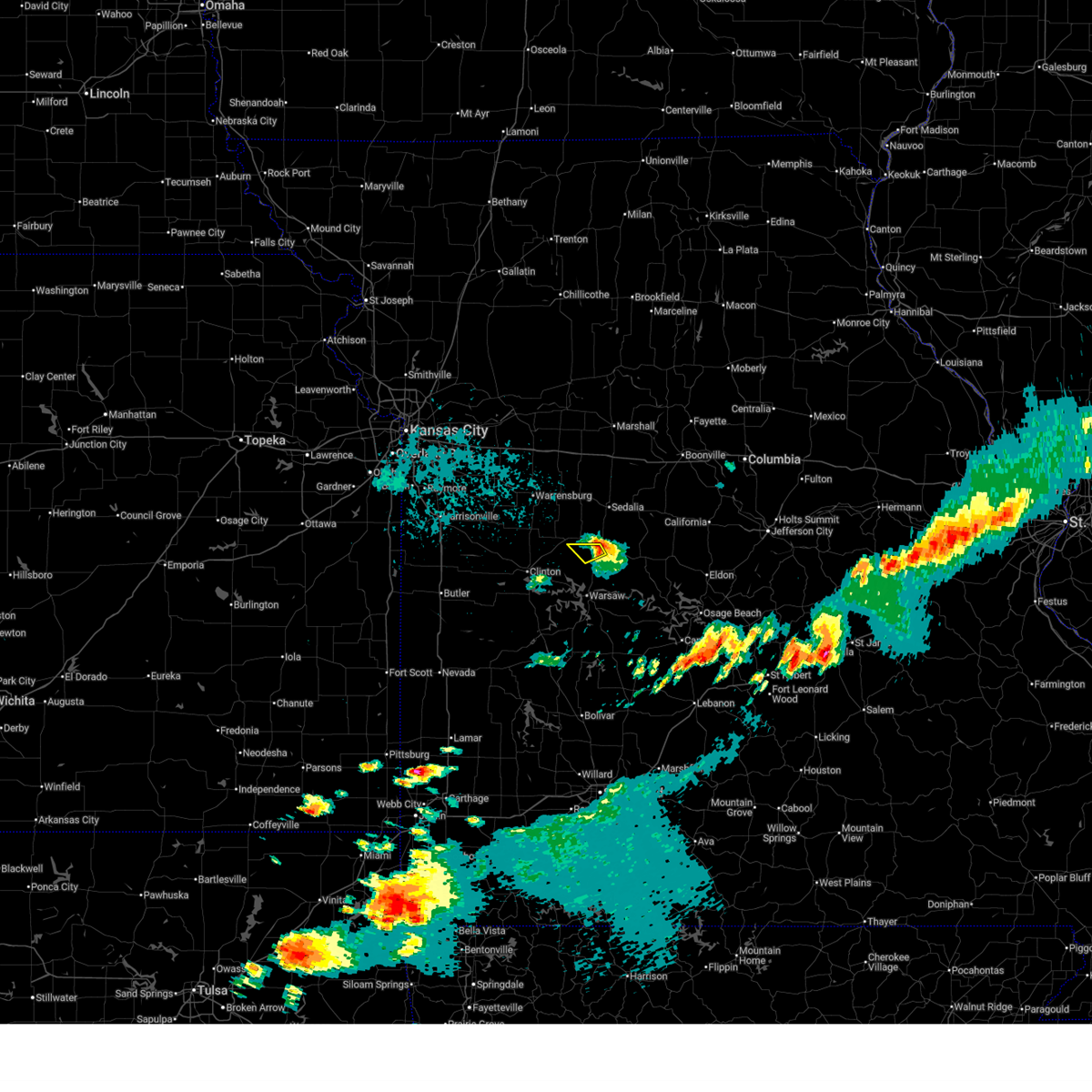
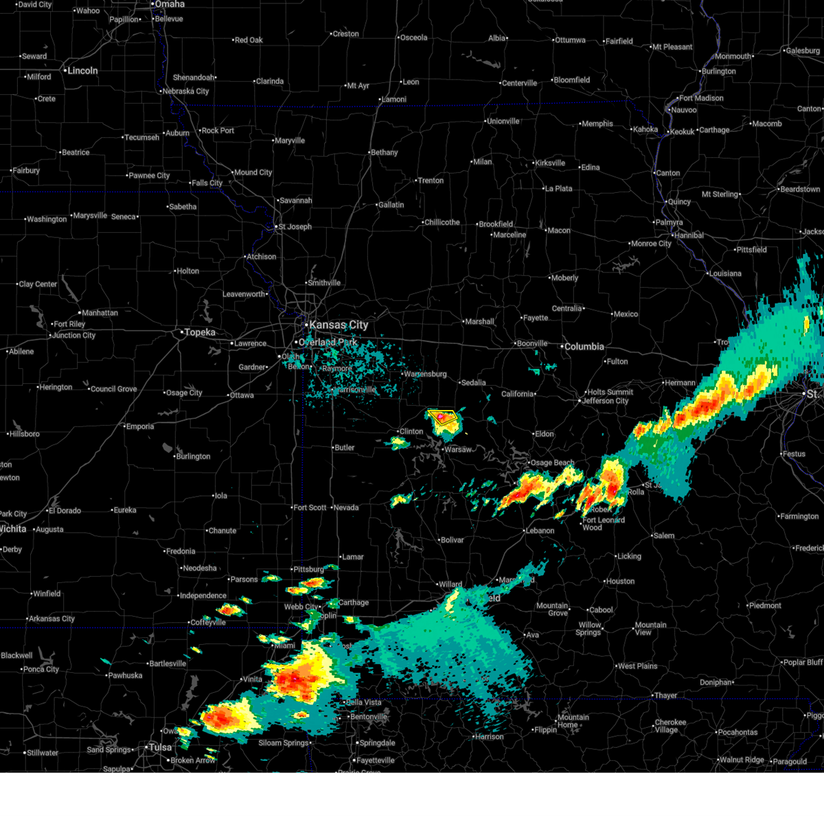
| 5/8/2024 8:45 AM CDT | Tennis Ball sized hail reported 1.4 miles SSW of Ionia, MO, sgf received report of tennis ball sized hail. time estimated from radar. |
| 5/8/2024 8:43 AM CDT | Quarter sized hail reported 0.5 miles SSW of Ionia, MO |
| 5/8/2024 8:29 AM CDT |
 Svrsgf the national weather service in springfield has issued a * severe thunderstorm warning for, northern benton county in central missouri, northwestern morgan county in central missouri, * until 915 am cdt. * at 827 am cdt, a severe thunderstorm was located near ionia, or 8 miles southeast of windsor, moving east at 30 mph. this is a destructive storm for ionia (radar indicated). Hazards include baseball size hail and 60 mph wind gusts. People and animals outdoors will be severely injured. Expect shattered windows, extensive damage to roofs, siding, and vehicles. Svrsgf the national weather service in springfield has issued a * severe thunderstorm warning for, northern benton county in central missouri, northwestern morgan county in central missouri, * until 915 am cdt. * at 827 am cdt, a severe thunderstorm was located near ionia, or 8 miles southeast of windsor, moving east at 30 mph. this is a destructive storm for ionia (radar indicated). Hazards include baseball size hail and 60 mph wind gusts. People and animals outdoors will be severely injured. Expect shattered windows, extensive damage to roofs, siding, and vehicles.
|
| 5/8/2024 8:20 AM CDT |
 At 819 am cdt, a severe thunderstorm was located near green ridge, or 9 miles east of windsor, moving northeast at 55 mph (radar indicated). Hazards include ping pong ball size hail and 60 mph wind gusts. People and animals outdoors will be injured. expect hail damage to roofs, siding, windows, and vehicles. expect wind damage to roofs, siding, and trees. Locations impacted include, truman lake, lincoln, cole camp, ionia, palo pinto, mora, and brandon. At 819 am cdt, a severe thunderstorm was located near green ridge, or 9 miles east of windsor, moving northeast at 55 mph (radar indicated). Hazards include ping pong ball size hail and 60 mph wind gusts. People and animals outdoors will be injured. expect hail damage to roofs, siding, windows, and vehicles. expect wind damage to roofs, siding, and trees. Locations impacted include, truman lake, lincoln, cole camp, ionia, palo pinto, mora, and brandon.
|
| 5/8/2024 8:06 AM CDT |
 Svrsgf the national weather service in springfield has issued a * severe thunderstorm warning for, northern benton county in central missouri, * until 830 am cdt. * at 805 am cdt, a severe thunderstorm was located near calhoun, or near windsor, moving northeast at 55 mph (radar indicated). Hazards include 60 mph wind gusts and half dollar size hail. Hail damage to vehicles is expected. Expect wind damage to roofs, siding, and trees. Svrsgf the national weather service in springfield has issued a * severe thunderstorm warning for, northern benton county in central missouri, * until 830 am cdt. * at 805 am cdt, a severe thunderstorm was located near calhoun, or near windsor, moving northeast at 55 mph (radar indicated). Hazards include 60 mph wind gusts and half dollar size hail. Hail damage to vehicles is expected. Expect wind damage to roofs, siding, and trees.
|
| 5/7/2024 12:59 AM CDT |
 The storm which prompted the warning has weakened below severe limits, and no longer appears capable of producing a tornado. therefore, the warning will be allowed to expire. however, gusty winds are still possible with this thunderstorm. a tornado watch remains in effect until 400 am cdt for central and west central missouri. The storm which prompted the warning has weakened below severe limits, and no longer appears capable of producing a tornado. therefore, the warning will be allowed to expire. however, gusty winds are still possible with this thunderstorm. a tornado watch remains in effect until 400 am cdt for central and west central missouri.
|
| 5/7/2024 12:40 AM CDT |
 Svrsgf the national weather service in springfield has issued a * severe thunderstorm warning for, hickory county in central missouri, webster county in southwestern missouri, dallas county in southwestern missouri, wright county in southwestern missouri, benton county in central missouri, western miller county in central missouri, laclede county in southwestern missouri, northwestern pulaski county in central missouri, camden county in central missouri, morgan county in central missouri, * until 130 am cdt. * at 1240 am cdt, severe thunderstorms were located along a line extending from 8 miles northwest of warsaw to near bolivar to 8 miles southwest of crane, moving northeast at 60 mph (radar indicated). Hazards include 60 mph wind gusts. expect damage to roofs, siding, and trees Svrsgf the national weather service in springfield has issued a * severe thunderstorm warning for, hickory county in central missouri, webster county in southwestern missouri, dallas county in southwestern missouri, wright county in southwestern missouri, benton county in central missouri, western miller county in central missouri, laclede county in southwestern missouri, northwestern pulaski county in central missouri, camden county in central missouri, morgan county in central missouri, * until 130 am cdt. * at 1240 am cdt, severe thunderstorms were located along a line extending from 8 miles northwest of warsaw to near bolivar to 8 miles southwest of crane, moving northeast at 60 mph (radar indicated). Hazards include 60 mph wind gusts. expect damage to roofs, siding, and trees
|
| 5/7/2024 12:32 AM CDT |
 Torsgf the national weather service in springfield has issued a * tornado warning for, central benton county in central missouri, northeastern st. clair county in west central missouri, * until 100 am cdt. * at 1232 am cdt, a severe thunderstorm capable of producing a tornado was located 9 miles east of lowry city, or 11 miles west of warsaw, moving northeast at 65 mph (radar indicated rotation). Hazards include tornado. Flying debris will be dangerous to those caught without shelter. mobile homes will be damaged or destroyed. damage to roofs, windows, and vehicles will occur. Tree damage is likely. Torsgf the national weather service in springfield has issued a * tornado warning for, central benton county in central missouri, northeastern st. clair county in west central missouri, * until 100 am cdt. * at 1232 am cdt, a severe thunderstorm capable of producing a tornado was located 9 miles east of lowry city, or 11 miles west of warsaw, moving northeast at 65 mph (radar indicated rotation). Hazards include tornado. Flying debris will be dangerous to those caught without shelter. mobile homes will be damaged or destroyed. damage to roofs, windows, and vehicles will occur. Tree damage is likely.
|
| 4/27/2024 10:35 PM CDT |
 The storms which prompted the warning have weakened below severe limits, and no longer pose an immediate threat to life or property. therefore, the warning has been allowed to expire. however, heavy rain is still possible with these thunderstorms. a tornado watch remains in effect until midnight cdt for central and west central missouri. a tornado watch also remains in effect until 400 am cdt for central missouri. The storms which prompted the warning have weakened below severe limits, and no longer pose an immediate threat to life or property. therefore, the warning has been allowed to expire. however, heavy rain is still possible with these thunderstorms. a tornado watch remains in effect until midnight cdt for central and west central missouri. a tornado watch also remains in effect until 400 am cdt for central missouri.
|
| 4/27/2024 10:30 PM CDT |
 The storm which prompted the warning has weakened below severe limits, and has exited the warned area. therefore, the warning has been allowed to expire. however, gusty winds are still possible with this thunderstorm. a tornado watch remains in effect until midnight cdt for central missouri. a tornado watch also remains in effect until 400 am cdt for central missouri. The storm which prompted the warning has weakened below severe limits, and has exited the warned area. therefore, the warning has been allowed to expire. however, gusty winds are still possible with this thunderstorm. a tornado watch remains in effect until midnight cdt for central missouri. a tornado watch also remains in effect until 400 am cdt for central missouri.
|
| 4/27/2024 10:05 PM CDT |
 Torsgf the national weather service in springfield has issued a * tornado warning for, northern benton county in central missouri, * until 1030 pm cdt. * at 1005 pm cdt, a severe thunderstorm capable of producing a tornado was located over lincoln, or 9 miles north of warsaw, moving northeast at 40 mph (radar indicated rotation). Hazards include tornado and quarter size hail. Flying debris will be dangerous to those caught without shelter. mobile homes will be damaged or destroyed. damage to roofs, windows, and vehicles will occur. Tree damage is likely. Torsgf the national weather service in springfield has issued a * tornado warning for, northern benton county in central missouri, * until 1030 pm cdt. * at 1005 pm cdt, a severe thunderstorm capable of producing a tornado was located over lincoln, or 9 miles north of warsaw, moving northeast at 40 mph (radar indicated rotation). Hazards include tornado and quarter size hail. Flying debris will be dangerous to those caught without shelter. mobile homes will be damaged or destroyed. damage to roofs, windows, and vehicles will occur. Tree damage is likely.
|
| 4/27/2024 9:57 PM CDT |
 At 956 pm cdt, severe thunderstorms were located along a line extending from 6 miles southeast of windsor to near warsaw to 6 miles east of osceola, moving east at 40 mph (radar indicated). Hazards include 60 mph wind gusts and quarter size hail. Hail damage to vehicles is expected. expect wind damage to roofs, siding, and trees. Locations impacted include, truman lake, truman state park, warsaw, lincoln, cole camp, cross timbers, ionia, palo pinto, quincy, lakeview heights, brandon, crockerville, zora, fristoe, knobby, racket, mora, edmonson, edwards, and hastain. At 956 pm cdt, severe thunderstorms were located along a line extending from 6 miles southeast of windsor to near warsaw to 6 miles east of osceola, moving east at 40 mph (radar indicated). Hazards include 60 mph wind gusts and quarter size hail. Hail damage to vehicles is expected. expect wind damage to roofs, siding, and trees. Locations impacted include, truman lake, truman state park, warsaw, lincoln, cole camp, cross timbers, ionia, palo pinto, quincy, lakeview heights, brandon, crockerville, zora, fristoe, knobby, racket, mora, edmonson, edwards, and hastain.
|
| 4/27/2024 9:40 PM CDT |
 Svrsgf the national weather service in springfield has issued a * severe thunderstorm warning for, northern hickory county in central missouri, benton county in central missouri, * until 1030 pm cdt. * at 940 pm cdt, severe thunderstorms were located along a line extending from near whiteman afb to near windsor to 8 miles east of deepwater to near osceola, moving east at 35 mph (radar indicated). Hazards include 60 mph wind gusts and quarter size hail. Hail damage to vehicles is expected. Expect wind damage to roofs, siding, and trees. Svrsgf the national weather service in springfield has issued a * severe thunderstorm warning for, northern hickory county in central missouri, benton county in central missouri, * until 1030 pm cdt. * at 940 pm cdt, severe thunderstorms were located along a line extending from near whiteman afb to near windsor to 8 miles east of deepwater to near osceola, moving east at 35 mph (radar indicated). Hazards include 60 mph wind gusts and quarter size hail. Hail damage to vehicles is expected. Expect wind damage to roofs, siding, and trees.
|
| 4/18/2024 2:04 PM CDT |
 At 204 pm cdt, a severe thunderstorm was located near cole camp, or 14 miles northeast of warsaw, moving east at 35 mph (radar indicated). Hazards include ping pong ball size hail and 60 mph wind gusts. People and animals outdoors will be injured. expect hail damage to roofs, siding, windows, and vehicles. expect wind damage to roofs, siding, and trees. Locations impacted include, truman lake, truman state park, lincoln, cole camp, ionia, palo pinto, racket, mora, edmonson, crockerville, and zora. At 204 pm cdt, a severe thunderstorm was located near cole camp, or 14 miles northeast of warsaw, moving east at 35 mph (radar indicated). Hazards include ping pong ball size hail and 60 mph wind gusts. People and animals outdoors will be injured. expect hail damage to roofs, siding, windows, and vehicles. expect wind damage to roofs, siding, and trees. Locations impacted include, truman lake, truman state park, lincoln, cole camp, ionia, palo pinto, racket, mora, edmonson, crockerville, and zora.
|
| 4/18/2024 1:56 PM CDT |
 At 155 pm cdt, a severe thunderstorm was located over lincoln, or 11 miles north of warsaw, moving east at 35 mph (radar indicated). Hazards include 60 mph wind gusts and quarter size hail. Hail damage to vehicles is expected. expect wind damage to roofs, siding, and trees. Locations impacted include, truman lake, truman state park, lincoln, cole camp, ionia, palo pinto, racket, mora, edmonson, crockerville, and zora. At 155 pm cdt, a severe thunderstorm was located over lincoln, or 11 miles north of warsaw, moving east at 35 mph (radar indicated). Hazards include 60 mph wind gusts and quarter size hail. Hail damage to vehicles is expected. expect wind damage to roofs, siding, and trees. Locations impacted include, truman lake, truman state park, lincoln, cole camp, ionia, palo pinto, racket, mora, edmonson, crockerville, and zora.
|
| 4/18/2024 1:29 PM CDT |
 Svrsgf the national weather service in springfield has issued a * severe thunderstorm warning for, northern benton county in central missouri, * until 230 pm cdt. * at 128 pm cdt, a severe thunderstorm was located near calhoun, or 8 miles east of clinton, moving east at 35 mph (radar indicated). Hazards include 60 mph wind gusts and quarter size hail. Hail damage to vehicles is expected. Expect wind damage to roofs, siding, and trees. Svrsgf the national weather service in springfield has issued a * severe thunderstorm warning for, northern benton county in central missouri, * until 230 pm cdt. * at 128 pm cdt, a severe thunderstorm was located near calhoun, or 8 miles east of clinton, moving east at 35 mph (radar indicated). Hazards include 60 mph wind gusts and quarter size hail. Hail damage to vehicles is expected. Expect wind damage to roofs, siding, and trees.
|
| 3/14/2024 4:27 AM CDT |
 Svrsgf the national weather service in springfield has issued a * severe thunderstorm warning for, northern hickory county in central missouri, benton county in central missouri, northeastern st. clair county in west central missouri, * until 515 am cdt. * at 427 am cdt, severe thunderstorms were located along a line extending from 6 miles east of calhoun to near lowry city to osceola, moving east at 55 mph (radar indicated). Hazards include 60 mph wind gusts and quarter size hail. Hail damage to vehicles is expected. Expect wind damage to roofs, siding, and trees. Svrsgf the national weather service in springfield has issued a * severe thunderstorm warning for, northern hickory county in central missouri, benton county in central missouri, northeastern st. clair county in west central missouri, * until 515 am cdt. * at 427 am cdt, severe thunderstorms were located along a line extending from 6 miles east of calhoun to near lowry city to osceola, moving east at 55 mph (radar indicated). Hazards include 60 mph wind gusts and quarter size hail. Hail damage to vehicles is expected. Expect wind damage to roofs, siding, and trees.
|
| 3/12/2024 11:32 PM CDT |
 Svrsgf the national weather service in springfield has issued a * severe thunderstorm warning for, northeastern benton county in central missouri, northwestern morgan county in central missouri, * until 1215 am cdt. * at 1132 pm cdt, a severe thunderstorm was located near cole camp, or 10 miles south of sedalia, moving southeast at 30 mph (radar indicated). Hazards include 60 mph wind gusts and quarter size hail. Hail damage to vehicles is expected. Expect wind damage to roofs, siding, and trees. Svrsgf the national weather service in springfield has issued a * severe thunderstorm warning for, northeastern benton county in central missouri, northwestern morgan county in central missouri, * until 1215 am cdt. * at 1132 pm cdt, a severe thunderstorm was located near cole camp, or 10 miles south of sedalia, moving southeast at 30 mph (radar indicated). Hazards include 60 mph wind gusts and quarter size hail. Hail damage to vehicles is expected. Expect wind damage to roofs, siding, and trees.
|
| 9/23/2023 7:41 PM CDT |
 The severe thunderstorm warning for benton county will expire at 745 pm cdt, the storms which prompted the warning have weakened below severe limits, and no longer pose an immediate threat to life or property. therefore, the warning will be allowed to expire. a severe thunderstorm watch remains in effect until midnight cdt for central and west central missouri. The severe thunderstorm warning for benton county will expire at 745 pm cdt, the storms which prompted the warning have weakened below severe limits, and no longer pose an immediate threat to life or property. therefore, the warning will be allowed to expire. a severe thunderstorm watch remains in effect until midnight cdt for central and west central missouri.
|
| 9/23/2023 6:51 PM CDT |
 At 650 pm cdt, severe thunderstorms were located along a line extending from near calhoun to 9 miles west of warsaw to lowry city, moving east at 30 mph (radar indicated). Hazards include 60 mph wind gusts and quarter size hail. Hail damage to vehicles is expected. Expect wind damage to roofs, siding, and trees. At 650 pm cdt, severe thunderstorms were located along a line extending from near calhoun to 9 miles west of warsaw to lowry city, moving east at 30 mph (radar indicated). Hazards include 60 mph wind gusts and quarter size hail. Hail damage to vehicles is expected. Expect wind damage to roofs, siding, and trees.
|
| 9/23/2023 6:28 PM CDT |
 At 628 pm cdt, severe thunderstorms were located along a line extending from near windsor to 6 miles east of deepwater to 7 miles east of schell city, moving east at 25 mph (radar indicated). Hazards include 60 mph wind gusts and quarter size hail. Hail damage to vehicles is expected. expect wind damage to roofs, siding, and trees. locations impacted include, pomme de terre lake, truman lake, truman state park, pomme de terre state park, warsaw, pittsburg, lincoln, appleton city, cole camp, osceola, lowry city, hermitage, weaubleau, wheatland, preston, cross timbers, collins, flemington, roscoe and ionia. hail threat, radar indicated max hail size, 1. 00 in wind threat, radar indicated max wind gust, 60 mph. At 628 pm cdt, severe thunderstorms were located along a line extending from near windsor to 6 miles east of deepwater to 7 miles east of schell city, moving east at 25 mph (radar indicated). Hazards include 60 mph wind gusts and quarter size hail. Hail damage to vehicles is expected. expect wind damage to roofs, siding, and trees. locations impacted include, pomme de terre lake, truman lake, truman state park, pomme de terre state park, warsaw, pittsburg, lincoln, appleton city, cole camp, osceola, lowry city, hermitage, weaubleau, wheatland, preston, cross timbers, collins, flemington, roscoe and ionia. hail threat, radar indicated max hail size, 1. 00 in wind threat, radar indicated max wind gust, 60 mph.
|
| 9/23/2023 6:07 PM CDT |
 At 606 pm cdt, severe thunderstorms were located along a line extending from windsor to near deepwater to 6 miles northwest of appleton city, moving southeast at 35 mph (radar indicated). Hazards include 60 mph wind gusts and quarter size hail. Hail damage to vehicles is expected. Expect wind damage to roofs, siding, and trees. At 606 pm cdt, severe thunderstorms were located along a line extending from windsor to near deepwater to 6 miles northwest of appleton city, moving southeast at 35 mph (radar indicated). Hazards include 60 mph wind gusts and quarter size hail. Hail damage to vehicles is expected. Expect wind damage to roofs, siding, and trees.
|
| 8/2/2023 8:18 PM CDT |
 At 817 pm cdt, a severe thunderstorm was located over cole camp, or 14 miles south of sedalia, moving east at 35 mph (radar indicated). Hazards include 60 mph wind gusts and quarter size hail. Hail damage to vehicles is expected. Expect wind damage to roofs, siding, and trees. At 817 pm cdt, a severe thunderstorm was located over cole camp, or 14 miles south of sedalia, moving east at 35 mph (radar indicated). Hazards include 60 mph wind gusts and quarter size hail. Hail damage to vehicles is expected. Expect wind damage to roofs, siding, and trees.
|
| 7/30/2023 9:09 PM CDT |
 At 907 pm cdt, a severe thunderstorm was located near clinton, moving southeast at 55 mph (trained weather spotters). Hazards include 70 mph wind gusts. Expect considerable tree damage. Damage is likely to mobile homes, roofs, and outbuildings. At 907 pm cdt, a severe thunderstorm was located near clinton, moving southeast at 55 mph (trained weather spotters). Hazards include 70 mph wind gusts. Expect considerable tree damage. Damage is likely to mobile homes, roofs, and outbuildings.
|
| 7/18/2023 8:07 AM CDT |
 At 807 am cdt, a severe thunderstorm was located near cole camp, or 11 miles south of sedalia, moving southeast at 35 mph (radar indicated). Hazards include 60 mph wind gusts and quarter size hail. Hail damage to vehicles is expected. Expect wind damage to roofs, siding, and trees. At 807 am cdt, a severe thunderstorm was located near cole camp, or 11 miles south of sedalia, moving southeast at 35 mph (radar indicated). Hazards include 60 mph wind gusts and quarter size hail. Hail damage to vehicles is expected. Expect wind damage to roofs, siding, and trees.
|
| 7/17/2023 6:43 PM CDT |
 At 643 pm cdt, a severe thunderstorm was located near windsor, moving southeast at 30 mph (radar indicated). Hazards include 60 mph wind gusts and quarter size hail. Hail damage to vehicles is expected. Expect wind damage to roofs, siding, and trees. At 643 pm cdt, a severe thunderstorm was located near windsor, moving southeast at 30 mph (radar indicated). Hazards include 60 mph wind gusts and quarter size hail. Hail damage to vehicles is expected. Expect wind damage to roofs, siding, and trees.
|
| 7/14/2023 5:38 PM CDT |
 At 534 pm cdt, severe thunderstorms were located along a line extending from blackburn to 6 miles southwest of warsaw, moving east at 50 mph (radar indicated). Hazards include 60 mph wind gusts and quarter size hail. Hail damage to vehicles is expected. Expect wind damage to roofs, siding, and trees. At 534 pm cdt, severe thunderstorms were located along a line extending from blackburn to 6 miles southwest of warsaw, moving east at 50 mph (radar indicated). Hazards include 60 mph wind gusts and quarter size hail. Hail damage to vehicles is expected. Expect wind damage to roofs, siding, and trees.
|
| 2/27/2023 2:09 AM CST |
 At 209 am cst, severe thunderstorms were located along a line extending from 10 miles east of deepwater to 9 miles east of lowry city to near weaubleau, moving northeast at 55 mph (radar indicated). Hazards include 60 mph wind gusts. expect damage to roofs, siding, and trees At 209 am cst, severe thunderstorms were located along a line extending from 10 miles east of deepwater to 9 miles east of lowry city to near weaubleau, moving northeast at 55 mph (radar indicated). Hazards include 60 mph wind gusts. expect damage to roofs, siding, and trees
|
| 6/8/2022 3:07 AM CDT |
 At 307 am cdt, severe thunderstorms were located along a line extending from near otterville to near cole camp to 10 miles southwest of warsaw, moving southeast at 45 mph (radar indicated). Hazards include 60 mph wind gusts. Expect damage to roofs, siding, and trees. locations impacted include, truman lake, truman state park, warsaw, lincoln, cole camp, stover, syracuse, ionia, palo pinto, lakeview heights, florence, brandon, crockerville, zora, iconium, racket, edmonson, mora, whitakerville, hail threat, radar indicated max hail size, <. 75 in wind threat, radar indicated max wind gust, 60 mph. At 307 am cdt, severe thunderstorms were located along a line extending from near otterville to near cole camp to 10 miles southwest of warsaw, moving southeast at 45 mph (radar indicated). Hazards include 60 mph wind gusts. Expect damage to roofs, siding, and trees. locations impacted include, truman lake, truman state park, warsaw, lincoln, cole camp, stover, syracuse, ionia, palo pinto, lakeview heights, florence, brandon, crockerville, zora, iconium, racket, edmonson, mora, whitakerville, hail threat, radar indicated max hail size, <. 75 in wind threat, radar indicated max wind gust, 60 mph.
|
| 6/8/2022 2:56 AM CDT |
 The severe thunderstorm warning for henry, east central bates, pettis, southwestern saline and southeastern johnson counties will expire at 300 am cdt, the storms which prompted the warning have moved out of the area. therefore, the warning will be allowed to expire. a severe thunderstorm warning remains in effect for southeast pettis county. a severe thunderstorm watch remains in effect until 500 am cdt for central and west central missouri. The severe thunderstorm warning for henry, east central bates, pettis, southwestern saline and southeastern johnson counties will expire at 300 am cdt, the storms which prompted the warning have moved out of the area. therefore, the warning will be allowed to expire. a severe thunderstorm warning remains in effect for southeast pettis county. a severe thunderstorm watch remains in effect until 500 am cdt for central and west central missouri.
|
| 6/8/2022 2:43 AM CDT |
 At 243 am cdt, severe thunderstorms were located along a line extending from near la monte to near windsor to near deepwater, moving southeast at 55 mph (radar indicated). Hazards include 60 mph wind gusts. expect damage to roofs, siding, and trees At 243 am cdt, severe thunderstorms were located along a line extending from near la monte to near windsor to near deepwater, moving southeast at 55 mph (radar indicated). Hazards include 60 mph wind gusts. expect damage to roofs, siding, and trees
|
| 6/8/2022 2:43 AM CDT |
 At 242 am cdt, severe thunderstorms were located along a line extending from 7 miles northeast of houstonia to 6 miles north of sedalia to near green ridge to near lowry city, moving east at 55 mph (radar indicated). Hazards include 60 mph wind gusts. Expect damage to roofs, siding, and trees. locations impacted include, sedalia, clinton, windsor, knob noster, sweet springs, whiteman air force base, la monte, leeton, green ridge, calhoun, deepwater, montrose, houstonia, whiteman afb, coal, emma, hughesville, brownington, ionia and tightwad. this includes interstate 70 in missouri between mile markers 63 and 70. hail threat, radar indicated max hail size, <. 75 in wind threat, radar indicated max wind gust, 60 mph. At 242 am cdt, severe thunderstorms were located along a line extending from 7 miles northeast of houstonia to 6 miles north of sedalia to near green ridge to near lowry city, moving east at 55 mph (radar indicated). Hazards include 60 mph wind gusts. Expect damage to roofs, siding, and trees. locations impacted include, sedalia, clinton, windsor, knob noster, sweet springs, whiteman air force base, la monte, leeton, green ridge, calhoun, deepwater, montrose, houstonia, whiteman afb, coal, emma, hughesville, brownington, ionia and tightwad. this includes interstate 70 in missouri between mile markers 63 and 70. hail threat, radar indicated max hail size, <. 75 in wind threat, radar indicated max wind gust, 60 mph.
|
| 6/8/2022 2:30 AM CDT |
 At 230 am cdt, severe thunderstorms were located along a line extending from near concordia to near leeton to appleton city, moving east at 55 mph (radar indicated). Hazards include 60 mph wind gusts. Expect damage to roofs, siding, and trees. locations impacted include, sedalia, warrensburg, clinton, windsor, knob noster, concordia, sweet springs, whiteman air force base, la monte, leeton, urich, green ridge, calhoun, deepwater, montrose, chilhowee, houstonia, whiteman afb, coal and centerview. this includes interstate 70 in missouri between mile markers 51 and 71. hail threat, radar indicated max hail size, <. 75 in wind threat, radar indicated max wind gust, 60 mph. At 230 am cdt, severe thunderstorms were located along a line extending from near concordia to near leeton to appleton city, moving east at 55 mph (radar indicated). Hazards include 60 mph wind gusts. Expect damage to roofs, siding, and trees. locations impacted include, sedalia, warrensburg, clinton, windsor, knob noster, concordia, sweet springs, whiteman air force base, la monte, leeton, urich, green ridge, calhoun, deepwater, montrose, chilhowee, houstonia, whiteman afb, coal and centerview. this includes interstate 70 in missouri between mile markers 51 and 71. hail threat, radar indicated max hail size, <. 75 in wind threat, radar indicated max wind gust, 60 mph.
|
| 6/8/2022 2:16 AM CDT |
 At 215 am cdt, severe thunderstorms were located along a line extending from higginsville to 7 miles southwest of warrensburg to 7 miles east of butler, moving southeast at 45 mph (radar indicated). Hazards include 60 mph wind gusts. expect damage to roofs, siding, and trees At 215 am cdt, severe thunderstorms were located along a line extending from higginsville to 7 miles southwest of warrensburg to 7 miles east of butler, moving southeast at 45 mph (radar indicated). Hazards include 60 mph wind gusts. expect damage to roofs, siding, and trees
|
| 5/15/2022 10:12 AM CDT |
 At 1012 am cdt, severe thunderstorms were located along a line extending from 6 miles northwest of lincoln to near hermitage to stockton, moving southeast at 50 mph (radar indicated). Hazards include 60 mph wind gusts and quarter size hail. Hail damage to vehicles is expected. Expect wind damage to roofs, siding, and trees. At 1012 am cdt, severe thunderstorms were located along a line extending from 6 miles northwest of lincoln to near hermitage to stockton, moving southeast at 50 mph (radar indicated). Hazards include 60 mph wind gusts and quarter size hail. Hail damage to vehicles is expected. Expect wind damage to roofs, siding, and trees.
|
| 5/15/2022 10:01 AM CDT | At 1001 am cdt, severe thunderstorms were located along a line extending from 7 miles southwest of lincoln to 8 miles east of osceola to 6 miles east of el dorado springs, moving southeast at 45 mph (radar indicated). Hazards include 60 mph wind gusts and quarter size hail. Hail damage to vehicles is expected. expect wind damage to roofs, siding, and trees. locations impacted include, pomme de terre lake, truman lake, truman state park, pomme de terre state park, el dorado springs, warsaw, stockton, pittsburg, lincoln, cole camp, osceola, lowry city, hermitage, weaubleau, wheatland, preston, cross timbers, collins, roscoe, ionia, hail threat, radar indicated max hail size, 1. 00 in wind threat, radar indicated max wind gust, 60 mph. |
| 5/15/2022 9:31 AM CDT |
 At 931 am cdt, severe thunderstorms were located along a line extending from 7 miles north of clinton to 6 miles southwest of deepwater to near walker, moving east at 45 mph (radar indicated). Hazards include 60 mph wind gusts and quarter size hail. Hail damage to vehicles is expected. expect wind damage to roofs, siding, and trees. locations impacted include, pomme de terre lake, truman lake, truman state park, pomme de terre state park, el dorado springs, warsaw, stockton, pittsburg, lincoln, appleton city, cole camp, osceola, lowry city, hermitage, weaubleau, wheatland, walker, schell city, preston, cross timbers, this includes interstate 49 between mile markers 99 and 107. hail threat, radar indicated max hail size, 1. 00 in wind threat, radar indicated max wind gust, 60 mph. At 931 am cdt, severe thunderstorms were located along a line extending from 7 miles north of clinton to 6 miles southwest of deepwater to near walker, moving east at 45 mph (radar indicated). Hazards include 60 mph wind gusts and quarter size hail. Hail damage to vehicles is expected. expect wind damage to roofs, siding, and trees. locations impacted include, pomme de terre lake, truman lake, truman state park, pomme de terre state park, el dorado springs, warsaw, stockton, pittsburg, lincoln, appleton city, cole camp, osceola, lowry city, hermitage, weaubleau, wheatland, walker, schell city, preston, cross timbers, this includes interstate 49 between mile markers 99 and 107. hail threat, radar indicated max hail size, 1. 00 in wind threat, radar indicated max wind gust, 60 mph.
|
| 5/15/2022 9:18 AM CDT |
 At 917 am cdt, severe thunderstorms were located along a line extending from near chilhowee to montrose to near rich hill, moving southeast at 45 mph (radar indicated). Hazards include 60 mph wind gusts and penny size hail. expect damage to roofs, siding, and trees At 917 am cdt, severe thunderstorms were located along a line extending from near chilhowee to montrose to near rich hill, moving southeast at 45 mph (radar indicated). Hazards include 60 mph wind gusts and penny size hail. expect damage to roofs, siding, and trees
|
| 3/5/2022 7:34 PM CST |
 At 734 pm cst, severe thunderstorms were located along a line extending from near windsor to near deepwater, moving southeast at 30 mph (radar indicated). Hazards include 60 mph wind gusts and quarter size hail. Hail damage to vehicles is expected. Expect wind damage to roofs, siding, and trees. At 734 pm cst, severe thunderstorms were located along a line extending from near windsor to near deepwater, moving southeast at 30 mph (radar indicated). Hazards include 60 mph wind gusts and quarter size hail. Hail damage to vehicles is expected. Expect wind damage to roofs, siding, and trees.
|
| 7/10/2021 7:48 PM CDT |
 At 748 pm cdt, a severe thunderstorm was located over warrensburg, moving southeast at 25 mph (radar indicated). Hazards include 60 mph wind gusts and quarter size hail. Hail damage to vehicles is expected. Expect wind damage to roofs, siding, and trees. At 748 pm cdt, a severe thunderstorm was located over warrensburg, moving southeast at 25 mph (radar indicated). Hazards include 60 mph wind gusts and quarter size hail. Hail damage to vehicles is expected. Expect wind damage to roofs, siding, and trees.
|
| 6/25/2021 5:28 PM CDT |
 At 528 pm cdt, severe thunderstorms were located along a line extending from 6 miles west of cole camp to near lincoln, moving east at 15 mph (radar indicated). Hazards include 60 mph wind gusts and penny size hail. Expect damage to roofs, siding, and trees. Locations impacted include, lincoln, cole camp, ionia, brandon, crockerville, mora,. At 528 pm cdt, severe thunderstorms were located along a line extending from 6 miles west of cole camp to near lincoln, moving east at 15 mph (radar indicated). Hazards include 60 mph wind gusts and penny size hail. Expect damage to roofs, siding, and trees. Locations impacted include, lincoln, cole camp, ionia, brandon, crockerville, mora,.
|
| 6/25/2021 5:06 PM CDT |
 At 505 pm cdt, a severe thunderstorm was located near windsor, moving east at 20 mph (radar indicated). Hazards include 60 mph wind gusts and penny size hail. Expect damage to roofs, siding, and trees. this severe storm will be near, lincoln around 530 pm cdt. cole camp around 545 pm cdt. Other locations impacted by this severe thunderstorm include ionia, brandon, crockerville and mora. At 505 pm cdt, a severe thunderstorm was located near windsor, moving east at 20 mph (radar indicated). Hazards include 60 mph wind gusts and penny size hail. Expect damage to roofs, siding, and trees. this severe storm will be near, lincoln around 530 pm cdt. cole camp around 545 pm cdt. Other locations impacted by this severe thunderstorm include ionia, brandon, crockerville and mora.
|
| 6/25/2021 4:52 PM CDT |
 At 452 pm cdt, a severe thunderstorm was located near windsor, moving east at 25 mph (radar indicated). Hazards include 60 mph wind gusts and penny size hail. Expect damage to roofs, siding, and trees. this severe thunderstorm will be near, lincoln around 520 pm cdt. cole camp around 535 pm cdt. Other locations impacted by this severe thunderstorm include ionia, brandon, crockerville and mora. At 452 pm cdt, a severe thunderstorm was located near windsor, moving east at 25 mph (radar indicated). Hazards include 60 mph wind gusts and penny size hail. Expect damage to roofs, siding, and trees. this severe thunderstorm will be near, lincoln around 520 pm cdt. cole camp around 535 pm cdt. Other locations impacted by this severe thunderstorm include ionia, brandon, crockerville and mora.
|
| 6/11/2021 5:34 PM CDT |
 At 533 pm cdt, a severe thunderstorm was located near lincoln, or 7 miles north of warsaw, moving south at 20 mph (radar indicated). Hazards include 70 mph wind gusts and quarter size hail. Hail damage to vehicles is expected. expect considerable tree damage. wind damage is also likely to mobile homes, roofs, and outbuildings. Locations impacted include, truman lake, truman state park, warsaw, lincoln, cole camp, ionia, palo pinto, brandon, crockerville, zora, racket, edmonson, mora,. At 533 pm cdt, a severe thunderstorm was located near lincoln, or 7 miles north of warsaw, moving south at 20 mph (radar indicated). Hazards include 70 mph wind gusts and quarter size hail. Hail damage to vehicles is expected. expect considerable tree damage. wind damage is also likely to mobile homes, roofs, and outbuildings. Locations impacted include, truman lake, truman state park, warsaw, lincoln, cole camp, ionia, palo pinto, brandon, crockerville, zora, racket, edmonson, mora,.
|
| 6/11/2021 5:20 PM CDT | Small and larger tree branches down along with 1 to 2 foot trees down. power poles are bent and some siding off of houses. estimated winds of 60 to 70 mph lasted about in benton county MO, 0.3 miles NW of Ionia, MO |
| 6/11/2021 5:06 PM CDT |
 At 505 pm cdt, severe thunderstorms were located along a line extending from near sedalia to near urich, moving southeast at 30 mph (radar indicated). Hazards include 60 mph wind gusts. expect damage to roofs, siding, and trees At 505 pm cdt, severe thunderstorms were located along a line extending from near sedalia to near urich, moving southeast at 30 mph (radar indicated). Hazards include 60 mph wind gusts. expect damage to roofs, siding, and trees
|
| 11/14/2020 8:07 PM CST |
 The severe thunderstorm warning for northeastern benton county will expire at 815 pm cst, the storms which prompted the warning have weakened below severe limits, and have exited the warned area. therefore, the warning will be allowed to expire. a tornado watch remains in effect until midnight cst for central missouri. The severe thunderstorm warning for northeastern benton county will expire at 815 pm cst, the storms which prompted the warning have weakened below severe limits, and have exited the warned area. therefore, the warning will be allowed to expire. a tornado watch remains in effect until midnight cst for central missouri.
|
| 11/14/2020 7:51 PM CST |
 At 751 pm cst, severe thunderstorms were located along a line extending from 6 miles northwest of cole camp to near lincoln to near warsaw, moving east at 55 mph (radar indicated). Hazards include 60 mph wind gusts. expect damage to roofs, siding, and trees At 751 pm cst, severe thunderstorms were located along a line extending from 6 miles northwest of cole camp to near lincoln to near warsaw, moving east at 55 mph (radar indicated). Hazards include 60 mph wind gusts. expect damage to roofs, siding, and trees
|
| 8/31/2020 10:32 AM CDT |
 At 1032 am cdt, severe thunderstorms were located along a line extending from 7 miles northwest of stover to near cole camp to 6 miles south of lincoln to near warsaw, moving east at 40 mph (radar indicated). Hazards include 60 mph wind gusts. Expect damage to roofs, siding, and trees. Locations impacted include, truman lake, truman state park, versailles, warsaw, lincoln, cole camp, stover, ionia, palo pinto, lakeview heights, crockerville, zora, racket, edmonson, mora, whitakerville,. At 1032 am cdt, severe thunderstorms were located along a line extending from 7 miles northwest of stover to near cole camp to 6 miles south of lincoln to near warsaw, moving east at 40 mph (radar indicated). Hazards include 60 mph wind gusts. Expect damage to roofs, siding, and trees. Locations impacted include, truman lake, truman state park, versailles, warsaw, lincoln, cole camp, stover, ionia, palo pinto, lakeview heights, crockerville, zora, racket, edmonson, mora, whitakerville,.
|
| 8/31/2020 10:09 AM CDT |
 At 1009 am cdt, severe thunderstorms were located along a line extending from near green ridge to near calhoun to 8 miles east of clinton to near deepwater, moving east at 40 mph (radar indicated). Hazards include 60 mph wind gusts. expect damage to roofs, siding, and trees At 1009 am cdt, severe thunderstorms were located along a line extending from near green ridge to near calhoun to 8 miles east of clinton to near deepwater, moving east at 40 mph (radar indicated). Hazards include 60 mph wind gusts. expect damage to roofs, siding, and trees
|
| 8/10/2020 3:26 PM CDT |
 At 326 pm cdt, severe thunderstorms were located along a line extending from sedalia to 7 miles north of cole camp to near lincoln, moving east at 45 mph (radar indicated). Hazards include 60 mph wind gusts and quarter size hail. Hail damage to vehicles is expected. Expect wind damage to roofs, siding, and trees. At 326 pm cdt, severe thunderstorms were located along a line extending from sedalia to 7 miles north of cole camp to near lincoln, moving east at 45 mph (radar indicated). Hazards include 60 mph wind gusts and quarter size hail. Hail damage to vehicles is expected. Expect wind damage to roofs, siding, and trees.
|
| 6/5/2020 5:39 AM CDT |
 At 539 am cdt, severe thunderstorms were located along a line extending from 8 miles north of stover to 12 miles east of warsaw to 8 miles south of hermitage, moving southeast at 50 mph (radar indicated). Hazards include 60 mph wind gusts and penny size hail. Expect damage to roofs, siding, and trees. Locations impacted include, truman lake, lake of the ozarks, truman state park, versailles, warsaw, lincoln, cole camp, stover, hermitage, wheatland, preston, cross timbers, syracuse, gravois mills, climax springs, ionia, palo pinto, quincy, lakeview heights, florence,. At 539 am cdt, severe thunderstorms were located along a line extending from 8 miles north of stover to 12 miles east of warsaw to 8 miles south of hermitage, moving southeast at 50 mph (radar indicated). Hazards include 60 mph wind gusts and penny size hail. Expect damage to roofs, siding, and trees. Locations impacted include, truman lake, lake of the ozarks, truman state park, versailles, warsaw, lincoln, cole camp, stover, hermitage, wheatland, preston, cross timbers, syracuse, gravois mills, climax springs, ionia, palo pinto, quincy, lakeview heights, florence,.
|
| 6/5/2020 5:31 AM CDT |
 At 531 am cdt, severe thunderstorms were located along a line extending from near smithton to 7 miles east of warsaw to near weaubleau, moving east at 50 mph (radar indicated). Hazards include 60 mph wind gusts and penny size hail. Expect damage to roofs, siding, and trees. Locations impacted include, pomme de terre lake, truman lake, lake of the ozarks, truman state park, pomme de terre state park, versailles, warsaw, pittsburg, lincoln, cole camp, stover, hermitage, weaubleau, wheatland, preston, cross timbers, syracuse, collins, flemington, gravois mills,. At 531 am cdt, severe thunderstorms were located along a line extending from near smithton to 7 miles east of warsaw to near weaubleau, moving east at 50 mph (radar indicated). Hazards include 60 mph wind gusts and penny size hail. Expect damage to roofs, siding, and trees. Locations impacted include, pomme de terre lake, truman lake, lake of the ozarks, truman state park, pomme de terre state park, versailles, warsaw, pittsburg, lincoln, cole camp, stover, hermitage, weaubleau, wheatland, preston, cross timbers, syracuse, collins, flemington, gravois mills,.
|
| 6/5/2020 4:41 AM CDT |
 At 440 am cdt, severe thunderstorms were located along a line extending from 10 miles north of warrensburg to near chilhowee to 6 miles west of appleton city, moving southeast at 50 mph (radar indicated). Hazards include 60 mph wind gusts and penny size hail. expect damage to roofs, siding, and trees At 440 am cdt, severe thunderstorms were located along a line extending from 10 miles north of warrensburg to near chilhowee to 6 miles west of appleton city, moving southeast at 50 mph (radar indicated). Hazards include 60 mph wind gusts and penny size hail. expect damage to roofs, siding, and trees
|
| 5/15/2020 1:29 AM CDT |
 At 128 am cdt, severe thunderstorms were located along a line extending from near smithton to near lincoln to near warsaw to near lowry city, moving east at 40 mph (radar indicated). Hazards include 60 mph wind gusts and nickel size hail. Expect damage to roofs, siding, and trees. Locations impacted include, truman lake, lake of the ozarks, truman state park, versailles, village of four seasons, warsaw, lincoln, cole camp, stover, laurie, sunrise beach, cross timbers, barnett, syracuse, gravois mills, climax springs, ionia, palo pinto, quincy, lakeview heights,. At 128 am cdt, severe thunderstorms were located along a line extending from near smithton to near lincoln to near warsaw to near lowry city, moving east at 40 mph (radar indicated). Hazards include 60 mph wind gusts and nickel size hail. Expect damage to roofs, siding, and trees. Locations impacted include, truman lake, lake of the ozarks, truman state park, versailles, village of four seasons, warsaw, lincoln, cole camp, stover, laurie, sunrise beach, cross timbers, barnett, syracuse, gravois mills, climax springs, ionia, palo pinto, quincy, lakeview heights,.
|
| 5/15/2020 1:09 AM CDT |
 At 109 am cdt, severe thunderstorms were located along a line extending from near la monte to near windsor to 7 miles east of deepwater to near lowry city, moving east at 45 mph (radar indicated). Hazards include 60 mph wind gusts and nickel size hail. expect damage to roofs, siding, and trees At 109 am cdt, severe thunderstorms were located along a line extending from near la monte to near windsor to 7 miles east of deepwater to near lowry city, moving east at 45 mph (radar indicated). Hazards include 60 mph wind gusts and nickel size hail. expect damage to roofs, siding, and trees
|
| 5/4/2020 12:45 PM CDT |
 At 1244 pm cdt, severe thunderstorms were located along a line extending from whiteman afb to near calhoun to near deepwater, moving east at 60 mph (radar indicated). Hazards include 70 mph wind gusts and quarter size hail. Hail damage to vehicles is expected. expect considerable tree damage. Wind damage is also likely to mobile homes, roofs, and outbuildings. At 1244 pm cdt, severe thunderstorms were located along a line extending from whiteman afb to near calhoun to near deepwater, moving east at 60 mph (radar indicated). Hazards include 70 mph wind gusts and quarter size hail. Hail damage to vehicles is expected. expect considerable tree damage. Wind damage is also likely to mobile homes, roofs, and outbuildings.
|
| 4/28/2020 5:05 PM CDT |
 At 505 pm cdt, a severe thunderstorm was located near cole camp, or 14 miles southeast of windsor, moving east at 45 mph (radar indicated). Hazards include 60 mph wind gusts and quarter size hail. Hail damage to vehicles is expected. expect wind damage to roofs, siding, and trees. Locations impacted include, lincoln, cole camp, ionia, brandon, crockerville, mora,. At 505 pm cdt, a severe thunderstorm was located near cole camp, or 14 miles southeast of windsor, moving east at 45 mph (radar indicated). Hazards include 60 mph wind gusts and quarter size hail. Hail damage to vehicles is expected. expect wind damage to roofs, siding, and trees. Locations impacted include, lincoln, cole camp, ionia, brandon, crockerville, mora,.
|
| 4/28/2020 4:48 PM CDT |
 At 448 pm cdt, a severe thunderstorm was located near calhoun, or 10 miles south of windsor, moving east at 35 mph (radar indicated). Hazards include 60 mph wind gusts and quarter size hail. Hail damage to vehicles is expected. Expect wind damage to roofs, siding, and trees. At 448 pm cdt, a severe thunderstorm was located near calhoun, or 10 miles south of windsor, moving east at 35 mph (radar indicated). Hazards include 60 mph wind gusts and quarter size hail. Hail damage to vehicles is expected. Expect wind damage to roofs, siding, and trees.
|
| 9/28/2019 8:55 PM CDT |
 The severe thunderstorm warning for northern benton county will expire at 900 pm cdt, the storm which prompted the warning has weakened below severe limits, and no longer poses an immediate threat to life or property. therefore, the warning will be allowed to expire. The severe thunderstorm warning for northern benton county will expire at 900 pm cdt, the storm which prompted the warning has weakened below severe limits, and no longer poses an immediate threat to life or property. therefore, the warning will be allowed to expire.
|
| 9/28/2019 8:16 PM CDT |
 At 816 pm cdt, a severe thunderstorm was located 9 miles east of clinton, moving northeast at 25 mph (radar indicated). Hazards include 60 mph wind gusts and quarter size hail. Hail damage to vehicles is expected. Expect wind damage to roofs, siding, and trees. At 816 pm cdt, a severe thunderstorm was located 9 miles east of clinton, moving northeast at 25 mph (radar indicated). Hazards include 60 mph wind gusts and quarter size hail. Hail damage to vehicles is expected. Expect wind damage to roofs, siding, and trees.
|
| 8/26/2019 1:41 PM CDT |
 The severe thunderstorm warning for benton, western miller, northwestern camden and morgan counties will expire at 145 pm cdt, the storms which prompted the warning have weakened below severe limits, and no longer pose an immediate threat to life or property. therefore, the warning will be allowed to expire. a severe thunderstorm watch remains in effect until 500 pm cdt for central and west central missouri. The severe thunderstorm warning for benton, western miller, northwestern camden and morgan counties will expire at 145 pm cdt, the storms which prompted the warning have weakened below severe limits, and no longer pose an immediate threat to life or property. therefore, the warning will be allowed to expire. a severe thunderstorm watch remains in effect until 500 pm cdt for central and west central missouri.
|
| 8/26/2019 12:59 PM CDT |
 The national weather service in springfield has issued a * severe thunderstorm warning for. benton county in central missouri. western miller county in central missouri. northwestern camden county in central missouri. Morgan county in central missouri. The national weather service in springfield has issued a * severe thunderstorm warning for. benton county in central missouri. western miller county in central missouri. northwestern camden county in central missouri. Morgan county in central missouri.
|
| 8/26/2019 12:22 PM CDT |
 At 1222 pm cdt, severe thunderstorms were located along a line extending from near sedalia to near windsor to near clinton, moving east at 70 mph (radar indicated). Hazards include 60 mph wind gusts. expect damage to roofs, siding, and trees At 1222 pm cdt, severe thunderstorms were located along a line extending from near sedalia to near windsor to near clinton, moving east at 70 mph (radar indicated). Hazards include 60 mph wind gusts. expect damage to roofs, siding, and trees
|
| 8/17/2019 5:17 AM CDT |
 At 516 am cdt, a severe thunderstorm was located near green ridge, or 9 miles southeast of whiteman air force base, moving east at 50 mph (measured wind speed at whiteman afb). Hazards include 75 mph wind gusts and penny size hail. Expect considerable tree damage. damage is likely to mobile homes, roofs, and outbuildings. Locations impacted include, sedalia, windsor, knob noster, whiteman air force base, la monte, smithton, green ridge, whiteman afb, hughesville, ionia and sedalia memorial arpt. At 516 am cdt, a severe thunderstorm was located near green ridge, or 9 miles southeast of whiteman air force base, moving east at 50 mph (measured wind speed at whiteman afb). Hazards include 75 mph wind gusts and penny size hail. Expect considerable tree damage. damage is likely to mobile homes, roofs, and outbuildings. Locations impacted include, sedalia, windsor, knob noster, whiteman air force base, la monte, smithton, green ridge, whiteman afb, hughesville, ionia and sedalia memorial arpt.
|
| 8/17/2019 5:00 AM CDT |
 At 500 am cdt, a severe thunderstorm was located near leeton, or 8 miles southwest of whiteman air force base, moving east at 45 mph (radar indicated). Hazards include 70 mph wind gusts and penny size hail. Expect considerable tree damage. Damage is likely to mobile homes, roofs, and outbuildings. At 500 am cdt, a severe thunderstorm was located near leeton, or 8 miles southwest of whiteman air force base, moving east at 45 mph (radar indicated). Hazards include 70 mph wind gusts and penny size hail. Expect considerable tree damage. Damage is likely to mobile homes, roofs, and outbuildings.
|
| 8/16/2019 12:02 AM CDT |
 At 1201 am cdt, severe thunderstorms were located along a line extending from near sedalia to 8 miles northwest of cole camp to 7 miles south of green ridge, moving southeast at 40 mph. these are very dangerous storms (trained weather spotters). Hazards include 80 mph wind gusts and quarter size hail. at 1140 pm a 78 mph wind gust was reported at whiteman air force base. Flying debris will be dangerous to those caught without shelter. mobile homes will be heavily damaged. expect considerable damage to roofs, windows, and vehicles. extensive tree damage and power outages are likely. Locations impacted include, versailles, lincoln, cole camp, stover, ionia, edmonson, mora, lakeview heights, florence, brandon, crockerville, zora,. At 1201 am cdt, severe thunderstorms were located along a line extending from near sedalia to 8 miles northwest of cole camp to 7 miles south of green ridge, moving southeast at 40 mph. these are very dangerous storms (trained weather spotters). Hazards include 80 mph wind gusts and quarter size hail. at 1140 pm a 78 mph wind gust was reported at whiteman air force base. Flying debris will be dangerous to those caught without shelter. mobile homes will be heavily damaged. expect considerable damage to roofs, windows, and vehicles. extensive tree damage and power outages are likely. Locations impacted include, versailles, lincoln, cole camp, stover, ionia, edmonson, mora, lakeview heights, florence, brandon, crockerville, zora,.
|
| 8/15/2019 11:56 PM CDT |
 At 1155 pm cdt, severe thunderstorms were located along a line extending from near sedalia to near green ridge, moving southeast at 40 mph (radar indicated). Hazards include 60 mph wind gusts and quarter size hail. Hail damage to vehicles is expected. Expect wind damage to roofs, siding, and trees. At 1155 pm cdt, severe thunderstorms were located along a line extending from near sedalia to near green ridge, moving southeast at 40 mph (radar indicated). Hazards include 60 mph wind gusts and quarter size hail. Hail damage to vehicles is expected. Expect wind damage to roofs, siding, and trees.
|
| 6/22/2019 11:31 PM CDT |
 At 1131 pm cdt, severe thunderstorms were located along a line extending from near sedalia to 7 miles east of green ridge to near warsaw to near lowry city, moving east at 55 mph (radar indicated). Hazards include 70 mph wind gusts and penny size hail. Expect considerable tree damage. damage is likely to mobile homes, roofs, and outbuildings. Locations impacted include, truman lake, lake of the ozarks, truman state park, versailles, warsaw, lincoln, appleton city, cole camp, stover, lowry city, syracuse, climax springs, ionia, palo pinto, lakeview heights, florence, crockerville, fristoe, knobby, racket,. At 1131 pm cdt, severe thunderstorms were located along a line extending from near sedalia to 7 miles east of green ridge to near warsaw to near lowry city, moving east at 55 mph (radar indicated). Hazards include 70 mph wind gusts and penny size hail. Expect considerable tree damage. damage is likely to mobile homes, roofs, and outbuildings. Locations impacted include, truman lake, lake of the ozarks, truman state park, versailles, warsaw, lincoln, appleton city, cole camp, stover, lowry city, syracuse, climax springs, ionia, palo pinto, lakeview heights, florence, crockerville, fristoe, knobby, racket,.
|
| 6/22/2019 11:07 PM CDT |
 At 1106 pm cdt, severe thunderstorms were located along a line extending from near warrensburg to leeton to near clinton to appleton city, moving east at 45 mph (radar indicated). Hazards include 70 mph wind gusts and penny size hail. Expect considerable tree damage. Damage is likely to mobile homes, roofs, and outbuildings. At 1106 pm cdt, severe thunderstorms were located along a line extending from near warrensburg to leeton to near clinton to appleton city, moving east at 45 mph (radar indicated). Hazards include 70 mph wind gusts and penny size hail. Expect considerable tree damage. Damage is likely to mobile homes, roofs, and outbuildings.
|
| 6/21/2019 12:17 PM CDT |
 At 1217 pm cdt, severe thunderstorms were located along a line extending from 7 miles northeast of versailles to 10 miles southwest of stover to 8 miles southeast of warsaw, moving southeast at 35 mph (radar indicated). Hazards include 60 mph wind gusts and penny size hail. Expect damage to roofs, siding, and trees. Locations impacted include, lake of the ozarks, truman lake, truman state park, versailles, village of four seasons, warsaw, lincoln, cole camp, stover, laurie, sunrise beach, barnett, syracuse, gravois mills, climax springs, ionia, palo pinto, lakeview heights, florence, crockerville,. At 1217 pm cdt, severe thunderstorms were located along a line extending from 7 miles northeast of versailles to 10 miles southwest of stover to 8 miles southeast of warsaw, moving southeast at 35 mph (radar indicated). Hazards include 60 mph wind gusts and penny size hail. Expect damage to roofs, siding, and trees. Locations impacted include, lake of the ozarks, truman lake, truman state park, versailles, village of four seasons, warsaw, lincoln, cole camp, stover, laurie, sunrise beach, barnett, syracuse, gravois mills, climax springs, ionia, palo pinto, lakeview heights, florence, crockerville,.
|
| 6/21/2019 11:59 AM CDT |
 At 1122 am cdt, severe thunderstorms were located along a line extending from 9 miles south of marshall to near la monte to 6 miles north of clinton, moving east at 50 mph (radar indicated). Hazards include 60 mph wind gusts. expect damage to roofs, siding, and trees At 1122 am cdt, severe thunderstorms were located along a line extending from 9 miles south of marshall to near la monte to 6 miles north of clinton, moving east at 50 mph (radar indicated). Hazards include 60 mph wind gusts. expect damage to roofs, siding, and trees
|
| 6/21/2019 11:42 AM CDT |
 At 1141 am cdt, a severe thunderstorm was located 7 miles west of montrose, or 11 miles east of butler, moving east at 40 mph (radar indicated). Hazards include 60 mph wind gusts. expect damage to roofs, siding, and trees At 1141 am cdt, a severe thunderstorm was located 7 miles west of montrose, or 11 miles east of butler, moving east at 40 mph (radar indicated). Hazards include 60 mph wind gusts. expect damage to roofs, siding, and trees
|
| 6/21/2019 11:23 AM CDT |
 At 1122 am cdt, severe thunderstorms were located along a line extending from 9 miles south of marshall to near la monte to 6 miles north of clinton, moving east at 50 mph (radar indicated). Hazards include 60 mph wind gusts. expect damage to roofs, siding, and trees At 1122 am cdt, severe thunderstorms were located along a line extending from 9 miles south of marshall to near la monte to 6 miles north of clinton, moving east at 50 mph (radar indicated). Hazards include 60 mph wind gusts. expect damage to roofs, siding, and trees
|
| 6/21/2019 10:58 AM CDT |
 At 1057 am cdt, a severe thunderstorm was located near garden city, moving southeast at 40 mph (radar indicated). Hazards include 60 mph wind gusts. expect damage to roofs, siding, and trees At 1057 am cdt, a severe thunderstorm was located near garden city, moving southeast at 40 mph (radar indicated). Hazards include 60 mph wind gusts. expect damage to roofs, siding, and trees
|
| 5/22/2019 9:18 PM CDT |
 At 918 pm cdt, a severe thunderstorm was located near stover, or 10 miles west of versailles, moving east at 60 mph (radar indicated). Hazards include 60 mph wind gusts and half dollar size hail. Hail damage to vehicles is expected. expect wind damage to roofs, siding, and trees. Locations impacted include, truman lake, versailles, lincoln, cole camp, stover, syracuse, ionia, palo pinto, mora, florence, crockerville,. At 918 pm cdt, a severe thunderstorm was located near stover, or 10 miles west of versailles, moving east at 60 mph (radar indicated). Hazards include 60 mph wind gusts and half dollar size hail. Hail damage to vehicles is expected. expect wind damage to roofs, siding, and trees. Locations impacted include, truman lake, versailles, lincoln, cole camp, stover, syracuse, ionia, palo pinto, mora, florence, crockerville,.
|
| 5/22/2019 8:46 PM CDT |
 At 845 pm cdt, a severe thunderstorm was located 8 miles northwest of warsaw, moving east at 45 mph (radar indicated). Hazards include 70 mph wind gusts and ping pong ball size hail. People and animals outdoors will be injured. expect hail damage to roofs, siding, windows, and vehicles. expect considerable tree damage. Wind damage is also likely to mobile homes, roofs, and outbuildings. At 845 pm cdt, a severe thunderstorm was located 8 miles northwest of warsaw, moving east at 45 mph (radar indicated). Hazards include 70 mph wind gusts and ping pong ball size hail. People and animals outdoors will be injured. expect hail damage to roofs, siding, windows, and vehicles. expect considerable tree damage. Wind damage is also likely to mobile homes, roofs, and outbuildings.
|
| 5/22/2019 7:53 PM CDT |
 At 752 pm cdt, a severe thunderstorm was located 8 miles east of deepwater, or 10 miles southeast of clinton, moving northeast at 30 mph (radar indicated). Hazards include golf ball size hail and 70 mph wind gusts. People and animals outdoors will be injured. expect hail damage to roofs, siding, windows, and vehicles. expect considerable tree damage. Wind damage is also likely to mobile homes, roofs, and outbuildings. At 752 pm cdt, a severe thunderstorm was located 8 miles east of deepwater, or 10 miles southeast of clinton, moving northeast at 30 mph (radar indicated). Hazards include golf ball size hail and 70 mph wind gusts. People and animals outdoors will be injured. expect hail damage to roofs, siding, windows, and vehicles. expect considerable tree damage. Wind damage is also likely to mobile homes, roofs, and outbuildings.
|
| 5/18/2019 3:59 PM CDT |
 A severe thunderstorm warning remains in effect until 415 pm cdt for benton county. at 358 pm cdt, severe thunderstorms were located along a line extending from near calhoun to near warsaw to 7 miles northwest of wheatland, moving northeast at 40 mph. hazard. 60 mph wind gusts. A severe thunderstorm warning remains in effect until 415 pm cdt for benton county. at 358 pm cdt, severe thunderstorms were located along a line extending from near calhoun to near warsaw to 7 miles northwest of wheatland, moving northeast at 40 mph. hazard. 60 mph wind gusts.
|
| 5/18/2019 3:48 PM CDT |
 At 332 pm cdt, severe thunderstorms were located along a line extending from near deepwater to near lowry city to 8 miles south of osceola, moving northeast at 35 mph (radar indicated). Hazards include 60 mph wind gusts. expect damage to roofs, siding, and trees At 332 pm cdt, severe thunderstorms were located along a line extending from near deepwater to near lowry city to 8 miles south of osceola, moving northeast at 35 mph (radar indicated). Hazards include 60 mph wind gusts. expect damage to roofs, siding, and trees
|
| 5/18/2019 3:33 PM CDT |
 At 332 pm cdt, severe thunderstorms were located along a line extending from near deepwater to near lowry city to 8 miles south of osceola, moving northeast at 35 mph (radar indicated). Hazards include 60 mph wind gusts. expect damage to roofs, siding, and trees At 332 pm cdt, severe thunderstorms were located along a line extending from near deepwater to near lowry city to 8 miles south of osceola, moving northeast at 35 mph (radar indicated). Hazards include 60 mph wind gusts. expect damage to roofs, siding, and trees
|
| 12/1/2018 2:23 AM CST |
 The severe thunderstorm warning for benton county will expire at 230 am cst, the storms which prompted the warning have moved out of the area. therefore, the warning will be allowed to expire. however heavy rain is still possible with these thunderstorms. to report severe weather, contact your nearest law enforcement agency. they will relay your report to the national weather service springfield. The severe thunderstorm warning for benton county will expire at 230 am cst, the storms which prompted the warning have moved out of the area. therefore, the warning will be allowed to expire. however heavy rain is still possible with these thunderstorms. to report severe weather, contact your nearest law enforcement agency. they will relay your report to the national weather service springfield.
|
| 12/1/2018 2:16 AM CST |
 At 216 am cst, severe thunderstorms were located along a line extending from 7 miles east of green ridge to near stover, moving north at 60 mph (radar indicated). Hazards include 60 mph wind gusts. Expect damage to roofs, siding, and trees. Locations impacted include, truman lake, truman state park, warsaw, lincoln, cole camp, palo pinto, lakeview heights, brandon, crockerville, zora, fristoe, knobby, racket, edmonson, mora, edwards, hastain, whitakerville,. At 216 am cst, severe thunderstorms were located along a line extending from 7 miles east of green ridge to near stover, moving north at 60 mph (radar indicated). Hazards include 60 mph wind gusts. Expect damage to roofs, siding, and trees. Locations impacted include, truman lake, truman state park, warsaw, lincoln, cole camp, palo pinto, lakeview heights, brandon, crockerville, zora, fristoe, knobby, racket, edmonson, mora, edwards, hastain, whitakerville,.
|
| 12/1/2018 1:29 AM CST |
 At 129 am cst, severe thunderstorms were located along a line extending from 10 miles west of warsaw to near wheatland, moving northeast at 60 mph (radar indicated). Hazards include 60 mph wind gusts. expect damage to roofs, siding, and trees At 129 am cst, severe thunderstorms were located along a line extending from 10 miles west of warsaw to near wheatland, moving northeast at 60 mph (radar indicated). Hazards include 60 mph wind gusts. expect damage to roofs, siding, and trees
|
| 7/19/2018 11:21 AM CDT |
 At 1121 am cdt, a severe thunderstorm was located near windsor, moving south at 20 mph (radar indicated). Hazards include golf ball size hail and 70 mph wind gusts. People and animals outdoors will be injured. expect hail damage to roofs, siding, windows, and vehicles. expect considerable tree damage. wind damage is also likely to mobile homes, roofs, and outbuildings. Locations impacted include, truman lake, truman state park, lincoln, cole camp, palo pinto, edmonson, mora, brandon, crockerville,. At 1121 am cdt, a severe thunderstorm was located near windsor, moving south at 20 mph (radar indicated). Hazards include golf ball size hail and 70 mph wind gusts. People and animals outdoors will be injured. expect hail damage to roofs, siding, windows, and vehicles. expect considerable tree damage. wind damage is also likely to mobile homes, roofs, and outbuildings. Locations impacted include, truman lake, truman state park, lincoln, cole camp, palo pinto, edmonson, mora, brandon, crockerville,.
|
| 7/19/2018 10:58 AM CDT |
 At 1057 am cdt, a severe thunderstorm was located near green ridge, or 7 miles north of windsor, moving southeast at 20 mph (radar indicated). Hazards include 70 mph wind gusts and half dollar size hail. Hail damage to vehicles is expected. expect considerable tree damage. Wind damage is also likely to mobile homes, roofs, and outbuildings. At 1057 am cdt, a severe thunderstorm was located near green ridge, or 7 miles north of windsor, moving southeast at 20 mph (radar indicated). Hazards include 70 mph wind gusts and half dollar size hail. Hail damage to vehicles is expected. expect considerable tree damage. Wind damage is also likely to mobile homes, roofs, and outbuildings.
|
| 5/28/2018 3:52 PM CDT |
 At 351 pm cdt, a severe thunderstorm was located over lincoln, or 11 miles north of warsaw, moving west at 15 mph (radar indicated). Hazards include 60 mph wind gusts and quarter size hail. Hail damage to vehicles is expected. Expect wind damage to roofs, siding, and trees. At 351 pm cdt, a severe thunderstorm was located over lincoln, or 11 miles north of warsaw, moving west at 15 mph (radar indicated). Hazards include 60 mph wind gusts and quarter size hail. Hail damage to vehicles is expected. Expect wind damage to roofs, siding, and trees.
|
| 5/2/2018 11:05 PM CDT |
 At 1043 pm cdt, severe thunderstorms were located along a line extending from near windsor to 6 miles east of deepwater to 10 miles southwest of osceola, moving east at 35 mph (radar indicated). Hazards include 60 mph wind gusts and quarter size hail. Hail damage to vehicles is expected. Expect wind damage to roofs, siding, and trees. At 1043 pm cdt, severe thunderstorms were located along a line extending from near windsor to 6 miles east of deepwater to 10 miles southwest of osceola, moving east at 35 mph (radar indicated). Hazards include 60 mph wind gusts and quarter size hail. Hail damage to vehicles is expected. Expect wind damage to roofs, siding, and trees.
|
| 5/2/2018 10:44 PM CDT |
 At 1043 pm cdt, severe thunderstorms were located along a line extending from near windsor to 6 miles east of deepwater to 10 miles southwest of osceola, moving east at 35 mph (radar indicated). Hazards include 60 mph wind gusts and quarter size hail. Hail damage to vehicles is expected. Expect wind damage to roofs, siding, and trees. At 1043 pm cdt, severe thunderstorms were located along a line extending from near windsor to 6 miles east of deepwater to 10 miles southwest of osceola, moving east at 35 mph (radar indicated). Hazards include 60 mph wind gusts and quarter size hail. Hail damage to vehicles is expected. Expect wind damage to roofs, siding, and trees.
|
| 10/14/2017 9:01 PM CDT |
 At 901 pm cdt, a severe thunderstorm was located 8 miles east of green ridge, or 8 miles south of sedalia, moving east at 50 mph (radar indicated). Hazards include 60 mph wind gusts and penny size hail. expect damage to roofs, siding, and trees At 901 pm cdt, a severe thunderstorm was located 8 miles east of green ridge, or 8 miles south of sedalia, moving east at 50 mph (radar indicated). Hazards include 60 mph wind gusts and penny size hail. expect damage to roofs, siding, and trees
|
| 6/17/2017 2:27 AM CDT |
 At 226 am cdt, severe thunderstorms were located along a line extending from near la monte to 8 miles south of sedalia to near cole camp to near warsaw to 10 miles east of lowry city to near osceola to near schell city to 8 miles north of walker, moving southeast at 55 mph (radar indicated). Hazards include 60 mph wind gusts. Expect damage to roofs, siding, and trees. Locations impacted include, truman lake, truman state park, warsaw, lincoln, appleton city, cole camp, osceola, lowry city, roscoe, ionia, vista, palo pinto, crockerville, harper, iconium, racket, tiffin, edmonson, mora, johnson city,. At 226 am cdt, severe thunderstorms were located along a line extending from near la monte to 8 miles south of sedalia to near cole camp to near warsaw to 10 miles east of lowry city to near osceola to near schell city to 8 miles north of walker, moving southeast at 55 mph (radar indicated). Hazards include 60 mph wind gusts. Expect damage to roofs, siding, and trees. Locations impacted include, truman lake, truman state park, warsaw, lincoln, appleton city, cole camp, osceola, lowry city, roscoe, ionia, vista, palo pinto, crockerville, harper, iconium, racket, tiffin, edmonson, mora, johnson city,.
|
| 6/17/2017 2:01 AM CDT |
 At 200 am cdt, severe thunderstorms were located along a line extending from near higginsville to near knob noster to whiteman afb to near leeton to near clinton to near montrose to butler to 12 miles southwest of adrian, moving southeast at 45 mph (radar indicated). Hazards include 60 mph wind gusts. expect damage to roofs, siding, and trees At 200 am cdt, severe thunderstorms were located along a line extending from near higginsville to near knob noster to whiteman afb to near leeton to near clinton to near montrose to butler to 12 miles southwest of adrian, moving southeast at 45 mph (radar indicated). Hazards include 60 mph wind gusts. expect damage to roofs, siding, and trees
|
| 5/27/2017 1:53 PM CDT |
 At 152 pm cdt, severe thunderstorms were located along a line extending from 7 miles northwest of cole camp to near lincoln to near warsaw to 9 miles east of lowry city, moving east at 40 mph (radar indicated). Hazards include two inch hail and 70 mph wind gusts. People and animals outdoors will be injured. expect hail damage to roofs, siding, windows, and vehicles. expect considerable tree damage. wind damage is also likely to mobile homes, roofs, and outbuildings. Locations impacted include, truman lake, truman state park, warsaw, lincoln, cole camp, ionia, palo pinto, lakeview heights, brandon, crockerville, zora, fristoe, knobby, racket, edmonson, mora, edwards, hastain, whitakerville, a tornado watch remains in effect until 700 pm cdt for central and west central missouri. At 152 pm cdt, severe thunderstorms were located along a line extending from 7 miles northwest of cole camp to near lincoln to near warsaw to 9 miles east of lowry city, moving east at 40 mph (radar indicated). Hazards include two inch hail and 70 mph wind gusts. People and animals outdoors will be injured. expect hail damage to roofs, siding, windows, and vehicles. expect considerable tree damage. wind damage is also likely to mobile homes, roofs, and outbuildings. Locations impacted include, truman lake, truman state park, warsaw, lincoln, cole camp, ionia, palo pinto, lakeview heights, brandon, crockerville, zora, fristoe, knobby, racket, edmonson, mora, edwards, hastain, whitakerville, a tornado watch remains in effect until 700 pm cdt for central and west central missouri.
|
| 5/27/2017 1:28 PM CDT |
 At 128 pm cdt, severe thunderstorms were located along a line extending from near windsor to deepwater, moving east at 50 mph (radar indicated). Hazards include golf ball size hail and 70 mph wind gusts. People and animals outdoors will be injured. expect hail damage to roofs, siding, windows, and vehicles. expect considerable tree damage. Wind damage is also likely to mobile homes, roofs, and outbuildings. At 128 pm cdt, severe thunderstorms were located along a line extending from near windsor to deepwater, moving east at 50 mph (radar indicated). Hazards include golf ball size hail and 70 mph wind gusts. People and animals outdoors will be injured. expect hail damage to roofs, siding, windows, and vehicles. expect considerable tree damage. Wind damage is also likely to mobile homes, roofs, and outbuildings.
|
| 3/6/2017 9:19 PM CST |
 At 919 pm cst, a severe thunderstorm was located near appleton city, or 15 miles southwest of clinton, moving east at 60 mph (radar indicated). Hazards include 70 mph wind gusts and quarter size hail. Hail damage to vehicles is expected. expect considerable tree damage. Wind damage is also likely to mobile homes, roofs, and outbuildings. At 919 pm cst, a severe thunderstorm was located near appleton city, or 15 miles southwest of clinton, moving east at 60 mph (radar indicated). Hazards include 70 mph wind gusts and quarter size hail. Hail damage to vehicles is expected. expect considerable tree damage. Wind damage is also likely to mobile homes, roofs, and outbuildings.
|
| 7/13/2016 12:18 PM CDT |
 At 1218 pm cdt, severe thunderstorms were located along a line extending from near cole camp to warsaw, moving east at 50 mph (radar indicated). Hazards include 60 mph wind gusts and quarter size hail. Hail damage to vehicles is expected. Expect wind damage to roofs, siding, and trees. At 1218 pm cdt, severe thunderstorms were located along a line extending from near cole camp to warsaw, moving east at 50 mph (radar indicated). Hazards include 60 mph wind gusts and quarter size hail. Hail damage to vehicles is expected. Expect wind damage to roofs, siding, and trees.
|
| 7/12/2016 7:24 AM CDT |
 The severe thunderstorm warning for northern cedar, st. clair and western benton counties will expire at 730 am cdt, the storms which prompted the warning have weakened below severe limits, and exited the warned area. therefore the warning will be allowed to expire. The severe thunderstorm warning for northern cedar, st. clair and western benton counties will expire at 730 am cdt, the storms which prompted the warning have weakened below severe limits, and exited the warned area. therefore the warning will be allowed to expire.
|
| 7/12/2016 7:10 AM CDT |
 At 709 am cdt, severe thunderstorms were located along a line extending from 6 miles north of lincoln to 10 miles south of el dorado springs, moving east at 50 mph (radar indicated). Hazards include 60 mph wind gusts. Expect damage to roofs. siding. and trees. Locations impacted include, truman lake, truman state park, el dorado springs, warsaw, lincoln, appleton city, osceola, lowry city, collins, roscoe, ionia, vista, gerster, filley, cedar springs, palo pinto, racket, monegaw springs, harper, brandon,. At 709 am cdt, severe thunderstorms were located along a line extending from 6 miles north of lincoln to 10 miles south of el dorado springs, moving east at 50 mph (radar indicated). Hazards include 60 mph wind gusts. Expect damage to roofs. siding. and trees. Locations impacted include, truman lake, truman state park, el dorado springs, warsaw, lincoln, appleton city, osceola, lowry city, collins, roscoe, ionia, vista, gerster, filley, cedar springs, palo pinto, racket, monegaw springs, harper, brandon,.
|
| 7/12/2016 6:47 AM CDT |
 At 646 am cdt, severe thunderstorms were located along a line extending from near clinton to near nevada, moving southeast at 45 mph (radar indicated). Hazards include 60 mph wind gusts. Expect damage to roofs. siding. And trees. At 646 am cdt, severe thunderstorms were located along a line extending from near clinton to near nevada, moving southeast at 45 mph (radar indicated). Hazards include 60 mph wind gusts. Expect damage to roofs. siding. And trees.
|
| 7/7/2016 6:44 AM CDT |
 At 644 am cdt, severe thunderstorms were located along a line extending from 7 miles north of versailles to 12 miles east of warsaw to near lowry city, moving southeast at 55 mph (radar indicated). Hazards include 60 mph wind gusts. Expect damage to roofs. siding. and trees. Locations impacted include, truman lake, lake of the ozarks, truman state park, versailles, village of four seasons, warsaw, lincoln, appleton city, cole camp, stover, osceola, laurie, lowry city, sunrise beach, barnett, syracuse, collins, gravois mills, roscoe, ionia,. At 644 am cdt, severe thunderstorms were located along a line extending from 7 miles north of versailles to 12 miles east of warsaw to near lowry city, moving southeast at 55 mph (radar indicated). Hazards include 60 mph wind gusts. Expect damage to roofs. siding. and trees. Locations impacted include, truman lake, lake of the ozarks, truman state park, versailles, village of four seasons, warsaw, lincoln, appleton city, cole camp, stover, osceola, laurie, lowry city, sunrise beach, barnett, syracuse, collins, gravois mills, roscoe, ionia,.
|
| 7/7/2016 6:06 AM CDT |
 At 605 am cdt, severe thunderstorms were located along a line extending from near marshall to 6 miles north of windsor to 7 miles northeast of butler, moving southeast at 50 mph (radar indicated). Hazards include 60 mph wind gusts. Expect damage to roofs. siding. And trees. At 605 am cdt, severe thunderstorms were located along a line extending from near marshall to 6 miles north of windsor to 7 miles northeast of butler, moving southeast at 50 mph (radar indicated). Hazards include 60 mph wind gusts. Expect damage to roofs. siding. And trees.
|
| 5/26/2016 5:50 PM CDT |
 At 549 pm cdt, a severe thunderstorm was located near cole camp, or 14 miles east of windsor, moving northeast at 25 mph (radar indicated). Hazards include 60 mph wind gusts and quarter size hail. Hail damage to vehicles is expected. expect wind damage to roofs, siding, and trees. Locations impacted include, lincoln, cole camp, ionia, mora, palo pinto, brandon,. At 549 pm cdt, a severe thunderstorm was located near cole camp, or 14 miles east of windsor, moving northeast at 25 mph (radar indicated). Hazards include 60 mph wind gusts and quarter size hail. Hail damage to vehicles is expected. expect wind damage to roofs, siding, and trees. Locations impacted include, lincoln, cole camp, ionia, mora, palo pinto, brandon,.
|
| 5/26/2016 5:34 PM CDT |
 At 534 pm cdt, a severe thunderstorm was located near lincoln, or 10 miles southeast of windsor, moving northeast at 30 mph (radar indicated). Hazards include 60 mph wind gusts and quarter size hail. Hail damage to vehicles is expected. expect wind damage to roofs, siding, and trees. Locations impacted include, truman lake, lincoln, cole camp, ionia, mora, palo pinto, brandon,. At 534 pm cdt, a severe thunderstorm was located near lincoln, or 10 miles southeast of windsor, moving northeast at 30 mph (radar indicated). Hazards include 60 mph wind gusts and quarter size hail. Hail damage to vehicles is expected. expect wind damage to roofs, siding, and trees. Locations impacted include, truman lake, lincoln, cole camp, ionia, mora, palo pinto, brandon,.
|
| 5/26/2016 5:18 PM CDT |
 At 518 pm cdt, a severe thunderstorm was located near lincoln, or 7 miles southeast of windsor, moving northeast at 25 mph (radar indicated). Hazards include 60 mph wind gusts and quarter size hail. Hail damage to vehicles is expected. Expect wind damage to roofs, siding, and trees. At 518 pm cdt, a severe thunderstorm was located near lincoln, or 7 miles southeast of windsor, moving northeast at 25 mph (radar indicated). Hazards include 60 mph wind gusts and quarter size hail. Hail damage to vehicles is expected. Expect wind damage to roofs, siding, and trees.
|
| 4/26/2016 10:57 AM CDT |
 At 1055 am cdt, severe thunderstorms were located along a line extending from 6 miles southeast of otterville to near lincoln, moving east at 25 mph (law enforcement. 60 mph winds and quarter size hail have been reported in several locations along highway 50 between smithton and syracuse in northern morgan county). Hazards include 60 mph wind gusts and quarter size hail. Hail damage to vehicles is expected. expect wind damage to roofs, siding, and trees. Locations impacted include, versailles, warsaw, lincoln, cole camp, stover, syracuse, ionia, edmonson, mora, lakeview heights, florence, crockerville, zora,. At 1055 am cdt, severe thunderstorms were located along a line extending from 6 miles southeast of otterville to near lincoln, moving east at 25 mph (law enforcement. 60 mph winds and quarter size hail have been reported in several locations along highway 50 between smithton and syracuse in northern morgan county). Hazards include 60 mph wind gusts and quarter size hail. Hail damage to vehicles is expected. expect wind damage to roofs, siding, and trees. Locations impacted include, versailles, warsaw, lincoln, cole camp, stover, syracuse, ionia, edmonson, mora, lakeview heights, florence, crockerville, zora,.
|
| 4/26/2016 10:47 AM CDT |
 At 1047 am cdt, severe thunderstorms were located along a line extending from near otterville to lincoln, moving east at 30 mph (radar indicated). Hazards include 60 mph wind gusts and quarter size hail. Hail damage to vehicles is expected. Expect wind damage to roofs, siding, and trees. At 1047 am cdt, severe thunderstorms were located along a line extending from near otterville to lincoln, moving east at 30 mph (radar indicated). Hazards include 60 mph wind gusts and quarter size hail. Hail damage to vehicles is expected. Expect wind damage to roofs, siding, and trees.
|
| 4/10/2016 6:20 PM CDT |
 At 620 pm cdt, a severe thunderstorm was located near lincoln, or 8 miles northeast of warsaw, moving east at 40 mph (radar indicated). Hazards include 60 mph wind gusts and quarter size hail. Hail damage to vehicles is expected. expect wind damage to roofs, siding, and trees. Locations impacted include, truman lake, lincoln, cole camp, ionia, zora, crockerville, palo pinto, edmonson,. At 620 pm cdt, a severe thunderstorm was located near lincoln, or 8 miles northeast of warsaw, moving east at 40 mph (radar indicated). Hazards include 60 mph wind gusts and quarter size hail. Hail damage to vehicles is expected. expect wind damage to roofs, siding, and trees. Locations impacted include, truman lake, lincoln, cole camp, ionia, zora, crockerville, palo pinto, edmonson,.
|
| 4/10/2016 6:05 PM CDT |
 At 605 pm cdt, a severe thunderstorm was located over cole camp, or 14 miles south of sedalia, moving east at 45 mph (radar indicated). Hazards include golf ball size hail and 60 mph wind gusts. People and animals outdoors will be injured. expect hail damage to roofs, siding, windows, and vehicles. expect wind damage to roofs, siding, and trees. Locations impacted include, truman lake, truman state park, lincoln, cole camp, ionia, mora, zora, crockerville, palo pinto, racket, edmonson,. At 605 pm cdt, a severe thunderstorm was located over cole camp, or 14 miles south of sedalia, moving east at 45 mph (radar indicated). Hazards include golf ball size hail and 60 mph wind gusts. People and animals outdoors will be injured. expect hail damage to roofs, siding, windows, and vehicles. expect wind damage to roofs, siding, and trees. Locations impacted include, truman lake, truman state park, lincoln, cole camp, ionia, mora, zora, crockerville, palo pinto, racket, edmonson,.
|
| 4/10/2016 5:55 PM CDT |
 At 554 pm cdt, a severe thunderstorm was located near lincoln, or 10 miles southeast of windsor, moving east at 45 mph (radar indicated). Hazards include 60 mph wind gusts and half dollar size hail. Hail damage to vehicles is expected. expect wind damage to roofs, siding, and trees. Locations impacted include, truman lake, truman state park, lincoln, cole camp, ionia, mora, zora, crockerville, palo pinto, racket, edmonson,. At 554 pm cdt, a severe thunderstorm was located near lincoln, or 10 miles southeast of windsor, moving east at 45 mph (radar indicated). Hazards include 60 mph wind gusts and half dollar size hail. Hail damage to vehicles is expected. expect wind damage to roofs, siding, and trees. Locations impacted include, truman lake, truman state park, lincoln, cole camp, ionia, mora, zora, crockerville, palo pinto, racket, edmonson,.
|
| 4/10/2016 5:38 PM CDT |
 At 537 pm cdt, a severe thunderstorm was located 7 miles southeast of calhoun, or 10 miles south of windsor, moving east at 45 mph (radar indicated). Hazards include 60 mph wind gusts and quarter size hail. Hail damage to vehicles is expected. Expect wind damage to roofs, siding, and trees. At 537 pm cdt, a severe thunderstorm was located 7 miles southeast of calhoun, or 10 miles south of windsor, moving east at 45 mph (radar indicated). Hazards include 60 mph wind gusts and quarter size hail. Hail damage to vehicles is expected. Expect wind damage to roofs, siding, and trees.
|
| 3/23/2016 10:10 PM CDT |
 The severe thunderstorm warning for northern benton county will expire at 1015 pm cdt, the storm which prompted the warning has weakened below severe limits and exited the warned area. therefore the warning will be allowed to expire. however small hail and gusty winds are still possible with this thunderstorm. The severe thunderstorm warning for northern benton county will expire at 1015 pm cdt, the storm which prompted the warning has weakened below severe limits and exited the warned area. therefore the warning will be allowed to expire. however small hail and gusty winds are still possible with this thunderstorm.
|
| 3/23/2016 9:57 PM CDT |
 At 957 pm cdt, a severe thunderstorm was located over lincoln, or 12 miles north of warsaw, moving northeast at 60 mph (radar indicated). Hazards include 60 mph wind gusts and quarter size hail. Hail damage to vehicles is expected. expect wind damage to roofs, siding and trees. Locations impacted include, truman lake, lincoln, cole camp, ionia, mora, crockerville, brandon,. At 957 pm cdt, a severe thunderstorm was located over lincoln, or 12 miles north of warsaw, moving northeast at 60 mph (radar indicated). Hazards include 60 mph wind gusts and quarter size hail. Hail damage to vehicles is expected. expect wind damage to roofs, siding and trees. Locations impacted include, truman lake, lincoln, cole camp, ionia, mora, crockerville, brandon,.
|
| 3/23/2016 9:44 PM CDT |
 At 944 pm cdt, a severe thunderstorm was located 9 miles northwest of warsaw, moving northeast at 65 mph (radar indicated). Hazards include 60 mph wind gusts and quarter size hail. Hail damage to vehicles is expected. Expect wind damage to roofs, siding and trees. At 944 pm cdt, a severe thunderstorm was located 9 miles northwest of warsaw, moving northeast at 65 mph (radar indicated). Hazards include 60 mph wind gusts and quarter size hail. Hail damage to vehicles is expected. Expect wind damage to roofs, siding and trees.
|
| 7/1/2015 9:26 PM CDT |
 The severe thunderstorm warning for south central pettis county will expire at 930 pm cdt, the line of storms which prompted the warning has moved out of the warned area. additional strong thunderstorms are still possible, and a tornado watch remains in effect until 12 am. The severe thunderstorm warning for south central pettis county will expire at 930 pm cdt, the line of storms which prompted the warning has moved out of the warned area. additional strong thunderstorms are still possible, and a tornado watch remains in effect until 12 am.
|
| 7/1/2015 9:25 PM CDT |
 At 919 pm cdt, severe thunderstorms were located along a line extending from stover to 6 miles north of warsaw, and moving southeast at 30 mph (radar indicated). Hazards include 60 mph wind gusts and quarter size hail. Hail damage to vehicles is expected. expect considerable tree damage. wind damage is also likely to mobile homes, roofs and outbuildings. locations impacted include, cole camp, lincoln, stover and warsaw. this warning also includes lake of the ozarks, truman lake and truman state park. A tornado watch remains in effect until midnight cdt thursday morning for southeast kansas and southern missouri. At 919 pm cdt, severe thunderstorms were located along a line extending from stover to 6 miles north of warsaw, and moving southeast at 30 mph (radar indicated). Hazards include 60 mph wind gusts and quarter size hail. Hail damage to vehicles is expected. expect considerable tree damage. wind damage is also likely to mobile homes, roofs and outbuildings. locations impacted include, cole camp, lincoln, stover and warsaw. this warning also includes lake of the ozarks, truman lake and truman state park. A tornado watch remains in effect until midnight cdt thursday morning for southeast kansas and southern missouri.
|
| 7/1/2015 9:15 PM CDT | Large tree branches down in ionia in benton county MO, 0.3 miles NW of Ionia, MO |
| 7/1/2015 9:10 PM CDT |
 At 838 pm, local law enforcement reported straight line wind damage 4 miles southwest of sedalia. at 906 pm cdt, severe thunderstorms were located along a line extending from 7 miles south of otterville to cole camp to calhoun, and moving south at 25 mph (radar indicated). Hazards include 60 mph wind gusts and nickel size hail. Expect damage to roofs. siding and trees. Locations impacted include,. At 838 pm, local law enforcement reported straight line wind damage 4 miles southwest of sedalia. at 906 pm cdt, severe thunderstorms were located along a line extending from 7 miles south of otterville to cole camp to calhoun, and moving south at 25 mph (radar indicated). Hazards include 60 mph wind gusts and nickel size hail. Expect damage to roofs. siding and trees. Locations impacted include,.
|
| 7/1/2015 8:58 PM CDT |
 At 855 pm cdt, severe thunderstorms were located along a line extending from otterville to cole camp to leeton, and moving south at 25 mph (radar indicated). Hazards include 60 mph wind gusts and nickel size hail. Expect damage to roofs. siding and trees. Locations impacted include, mainly rural areas of eastern henry county. At 855 pm cdt, severe thunderstorms were located along a line extending from otterville to cole camp to leeton, and moving south at 25 mph (radar indicated). Hazards include 60 mph wind gusts and nickel size hail. Expect damage to roofs. siding and trees. Locations impacted include, mainly rural areas of eastern henry county.
|
| 7/1/2015 8:53 PM CDT |
 At 850 pm cdt, severe thunderstorms were located along a line extending from 12 miles northwest of cole camp to 17 miles northwest of lincoln, and moving southeast at 25 mph (radar indicated). Hazards include 60 mph wind gusts and quarter size hail. Hail damage to vehicles is expected. Expect wind damage to roofs, siding and trees. At 850 pm cdt, severe thunderstorms were located along a line extending from 12 miles northwest of cole camp to 17 miles northwest of lincoln, and moving southeast at 25 mph (radar indicated). Hazards include 60 mph wind gusts and quarter size hail. Hail damage to vehicles is expected. Expect wind damage to roofs, siding and trees.
|
| 7/1/2015 8:49 PM CDT |
 At 845 pm cdt, severe thunderstorms were located along a line extending from otterville to 7 miles northwest of cole camp to leeton, and moving south at 25 mph. at 824 pm, local law enforcement reported quarter size hail 6 miles west-southwest of sedalia (radar indicated). Hazards include 60 mph wind gusts and quarter size hail. Hail damage to vehicles is expected. Expect wind damage to roofs, siding and trees. At 845 pm cdt, severe thunderstorms were located along a line extending from otterville to 7 miles northwest of cole camp to leeton, and moving south at 25 mph. at 824 pm, local law enforcement reported quarter size hail 6 miles west-southwest of sedalia (radar indicated). Hazards include 60 mph wind gusts and quarter size hail. Hail damage to vehicles is expected. Expect wind damage to roofs, siding and trees.
|
| 6/26/2015 3:14 AM CDT |
 At 311 am cdt, severe thunderstorms were located along a line extending from 16 miles northwest of lincoln to 9 miles east of lowry city to schell city to 15 miles northwest of walker, and moving southeast at 40 mph (law enforcement. this line of storms has a history of producing tree damage in clinton). Hazards include 70 mph wind gusts and penny size hail. Expect considerable tree damage. damage is likely to mobile homes, roofs and outbuildings. locations impacted include, appleton city, cole camp, lincoln, lowry city, nevada, osceola, schell city, walker and warsaw. this warning also includes lake of the ozarks, truman lake and truman state park. A severe thunderstorm watch remains in effect until 900 am cdt friday morning for southeast kansas and southern missouri. At 311 am cdt, severe thunderstorms were located along a line extending from 16 miles northwest of lincoln to 9 miles east of lowry city to schell city to 15 miles northwest of walker, and moving southeast at 40 mph (law enforcement. this line of storms has a history of producing tree damage in clinton). Hazards include 70 mph wind gusts and penny size hail. Expect considerable tree damage. damage is likely to mobile homes, roofs and outbuildings. locations impacted include, appleton city, cole camp, lincoln, lowry city, nevada, osceola, schell city, walker and warsaw. this warning also includes lake of the ozarks, truman lake and truman state park. A severe thunderstorm watch remains in effect until 900 am cdt friday morning for southeast kansas and southern missouri.
|
| 6/26/2015 2:58 AM CDT |
 At 256 am cdt, severe thunderstorms were located along a line extending from butler to clinton to 10 miles west of sedalia, and moving southeast at 40 mph (radar indicated). Hazards include 60 mph wind gusts and penny size hail. Expect damage to roofs. Siding and trees. At 256 am cdt, severe thunderstorms were located along a line extending from butler to clinton to 10 miles west of sedalia, and moving southeast at 40 mph (radar indicated). Hazards include 60 mph wind gusts and penny size hail. Expect damage to roofs. Siding and trees.
|
| 6/26/2015 2:57 AM CDT |
 At 254 am cdt, severe thunderstorms were located along a line extending from knob noster to 7 miles northwest of clinton to 9 miles east of butler, and moving southeast at 35 mph (radar indicated). Hazards include 60 mph wind gusts. Expect damage to roofs. siding and trees. Locations impacted include, knob noster, whiteman air force base, clinton, windsor, sedalia, leeton, montrose, la monte, calhoun, deepwater, green ridge, smithton, la due, rockville, coal, brownington, tightwad and sedalia memorial arpt. At 254 am cdt, severe thunderstorms were located along a line extending from knob noster to 7 miles northwest of clinton to 9 miles east of butler, and moving southeast at 35 mph (radar indicated). Hazards include 60 mph wind gusts. Expect damage to roofs. siding and trees. Locations impacted include, knob noster, whiteman air force base, clinton, windsor, sedalia, leeton, montrose, la monte, calhoun, deepwater, green ridge, smithton, la due, rockville, coal, brownington, tightwad and sedalia memorial arpt.
|
| 6/26/2015 2:38 AM CDT |
 At 236 am cdt, severe thunderstorms were located along a line extending from 9 miles south of mayview to 5 miles northeast of creighton to adrian, and moving southeast at 45 mph (radar indicated). Hazards include 60 mph wind gusts. Expect damage to roofs. Siding and trees. At 236 am cdt, severe thunderstorms were located along a line extending from 9 miles south of mayview to 5 miles northeast of creighton to adrian, and moving southeast at 45 mph (radar indicated). Hazards include 60 mph wind gusts. Expect damage to roofs. Siding and trees.
|
| 5/17/2015 1:28 AM CDT | The severe thunderstorm warning for st. clair, northwestern hickory, northern cedar and benton counties will expire at 130 am cdt, , a severe thunderstorm warning remains in effect for the remainder of cedar county until 200 am cdt, the line of storms which prompted the warning has weakened below severe limits, and no longer poses an immediate threat to life or property. however, gusty winds and heavy rain are still possible with these thunderstorms. a tornado watch remains in effect until 500 am cdt sunday morning for southeast kansas and southwestern missouri. |
| 5/17/2015 1:25 AM CDT | At 122 am cdt, severe thunderstorms were located along a line extending from 10 miles east of houstonia to 10 miles north of hermitage, and moving east at 50 mph (radar indicated). Hazards include 60 mph wind gusts. Expect damage to roofs. siding and trees. locations impacted include, this will impact i-70 between mile markers 63 and 70. 75in. |
| 5/17/2015 1:20 AM CDT | At 117 am cdt, severe thunderstorms were located along a line extending from 7 miles east of sweet springs to 8 miles south of warsaw, and moving east at 50 mph (radar indicated). Hazards include 60 mph wind gusts. Expect damage to roofs. siding and trees. locations impacted include, mainly rural areas of central pettis county. this will impact i-70 between mile markers 53 and 70. 75in. |
| 5/17/2015 12:58 AM CDT | At 1255 am cdt, severe thunderstorms were located along a line extending from concordia to lowry city, and moving east at 50 mph (radar indicated). Hazards include 60 mph wind gusts. Expect damage to roofs. siding and trees. locations impacted include, concordia, knob noster, whiteman air force base, windsor, sweet springs, la monte, green ridge, houstonia, coal, tightwad, emma and hughesville. winds up to 80 mph will be possible in aullville and higginsville. this will impact i-70 between mile markers 43 and 70. 75in. |
| 5/17/2015 12:44 AM CDT | At 1242 am cdt, severe thunderstorms were located along a line extending from 19 miles northwest of lowry city to lowry city to 11 miles south of el dorado springs, and moving northeast at 70 mph (radar indicated). Hazards include 60 mph wind gusts. Expect damage to roofs. Siding and trees. |
| 5/17/2015 12:43 AM CDT | At 1239 am cdt, severe thunderstorms were located along a line extending from mayview to appleton city, and moving east at 50 mph. at 1207 am, local law enforcement reported straight line wind damage in adrian. winds up to 80 mph will be possible in holden, centerview, warrensburg, knob knoster, and whiteman air force base (radar indicated). Hazards include 60 mph wind gusts. Expect damage to roofs. Siding and trees. |
| 4/8/2015 5:39 PM CDT | A severe thunderstorm warning remains in effect for pettis and southwestern cooper counties in central missouri. and southeastern johnson county in west central missouri until 615 pm cdt. at 538 pm cdt. a severe thunderstorm was located near green ridge. and moving northeast at 50 mph. hazard. 60 mph wind gusts and quarter size hail. |
| 4/8/2015 5:24 PM CDT | The national weather service in pleasant hill has issued a * severe thunderstorm warning for. southwestern cooper county in central missouri. northeastern henry county in west central missouri. southern johnson county in west central missouri. Pettis county in central missouri. |
| 6/22/2014 8:58 PM CDT | Near route e and ware road. public reported several 18-24 inch diameter trees downed. report via law enforcement. time is estimate in pettis county MO, 4.7 miles S of Ionia, MO |
Hail Maps for Ionia, MO
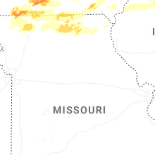

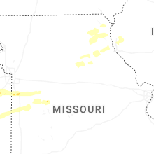
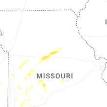

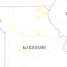
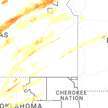


Connect with Interactive Hail Maps