

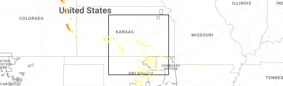
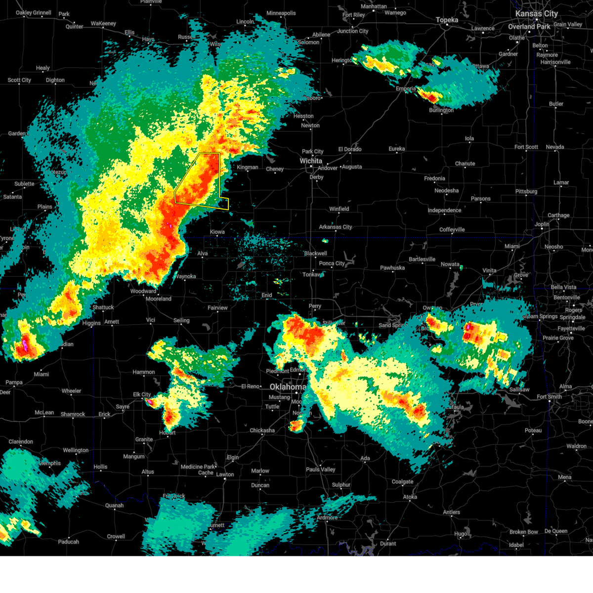
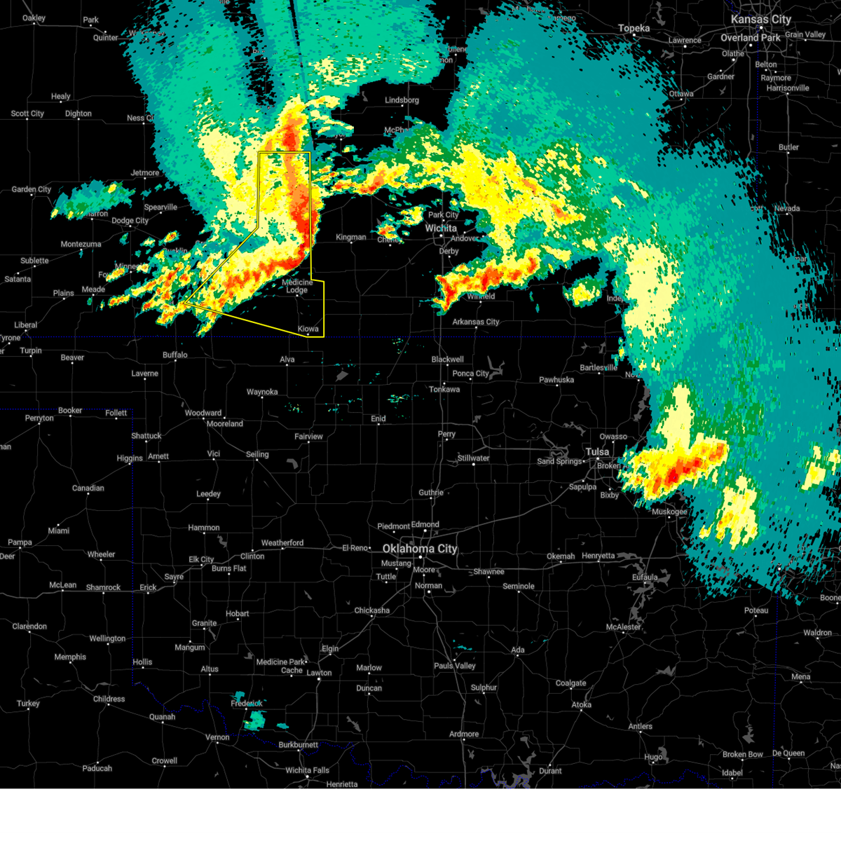
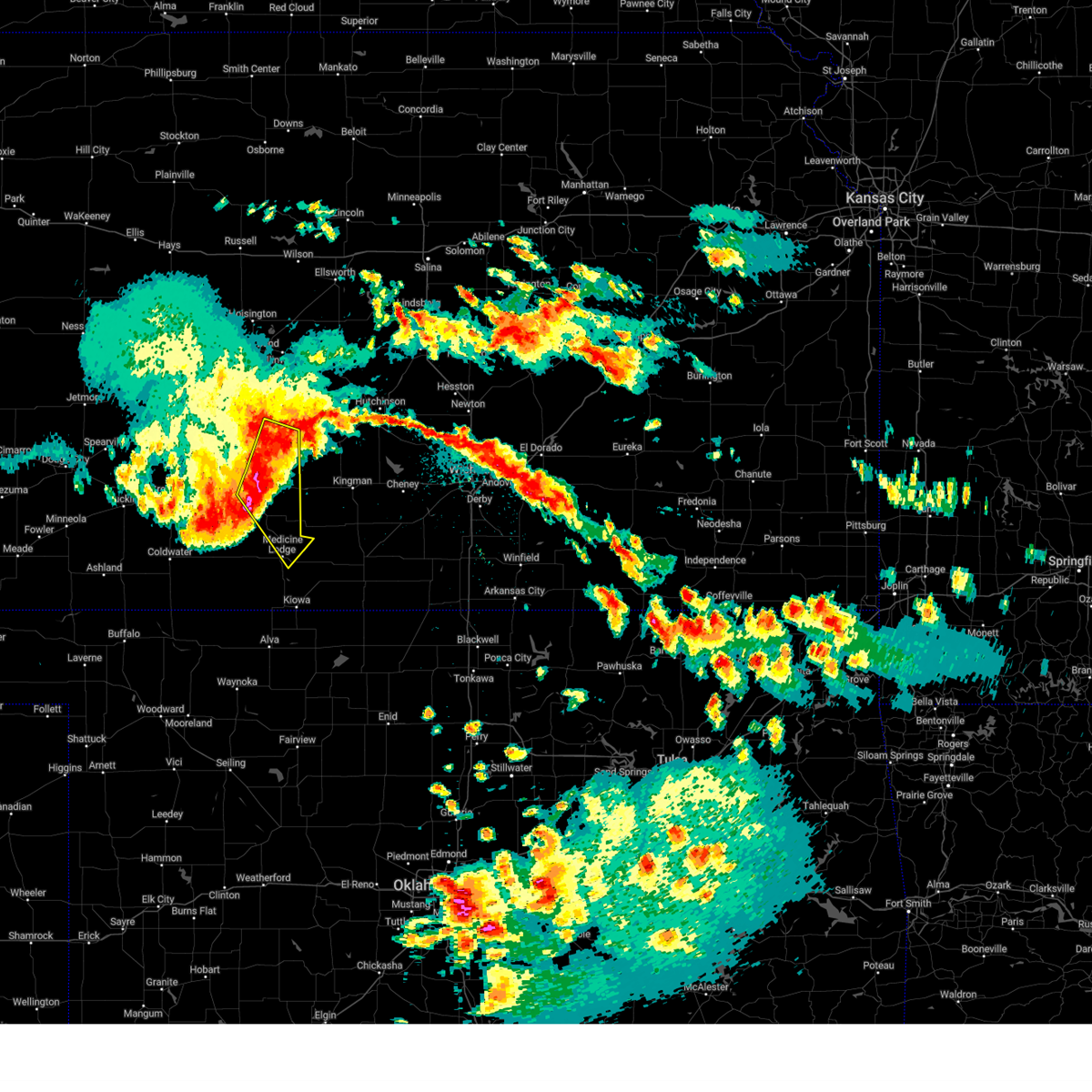
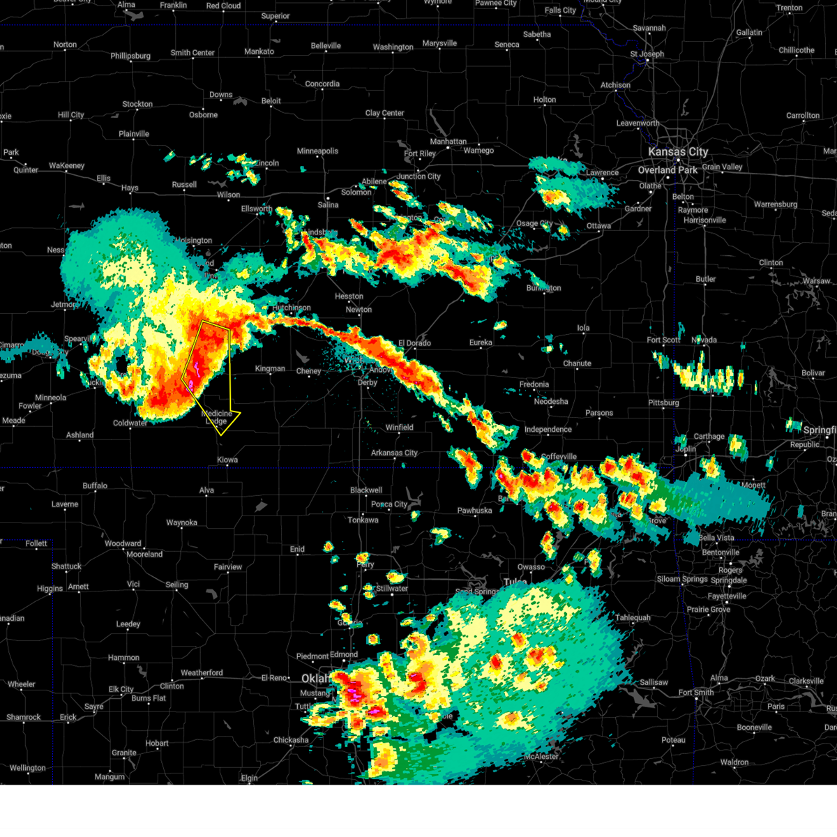
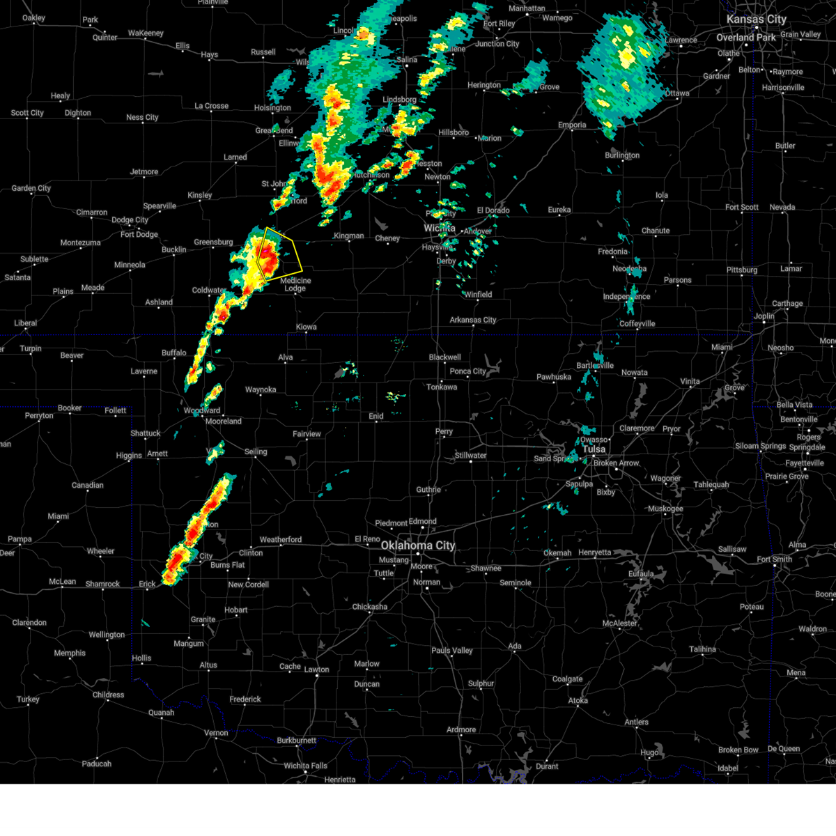
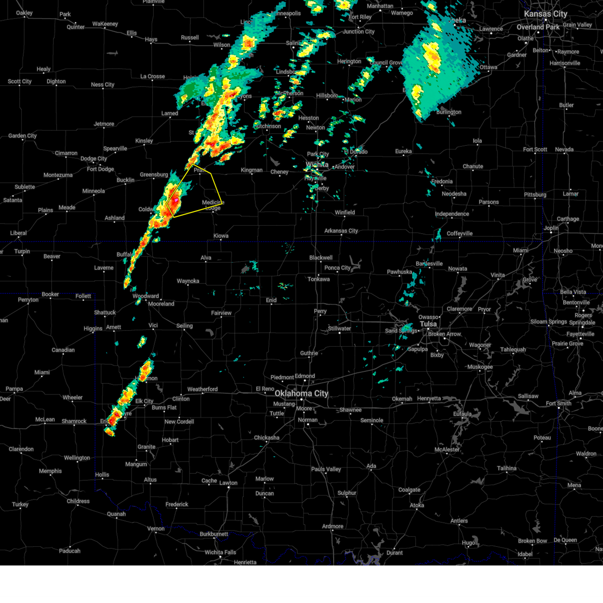
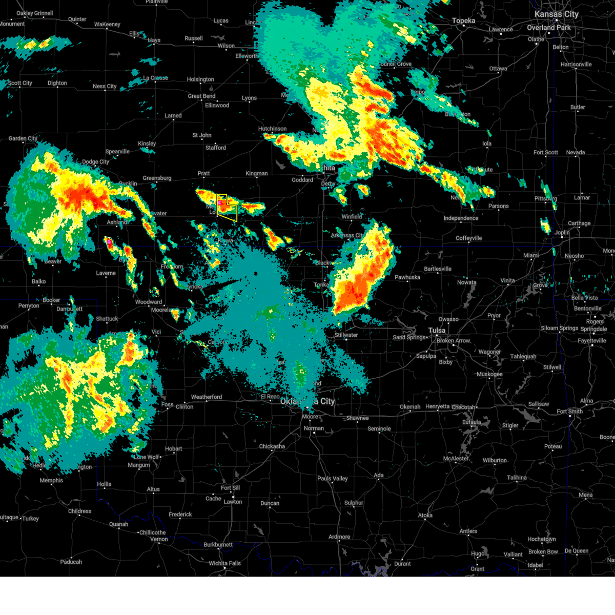
Hail Map for Isabel, KS
The Isabel, KS area has had 0 reports of on-the-ground hail by trained spotters, and has been under severe weather warnings 19 times during the past 12 months. Doppler radar has detected hail at or near Isabel, KS on 72 occasions, including 8 occasions during the past year.
| Name: | Isabel, KS |
| Where Located: | 68.4 miles WSW of Wichita, KS |
| Map: | Google Map for Isabel, KS |
| Population: | 90 |
| Housing Units: | 47 |
| More Info: | Search Google for Isabel, KS |
1
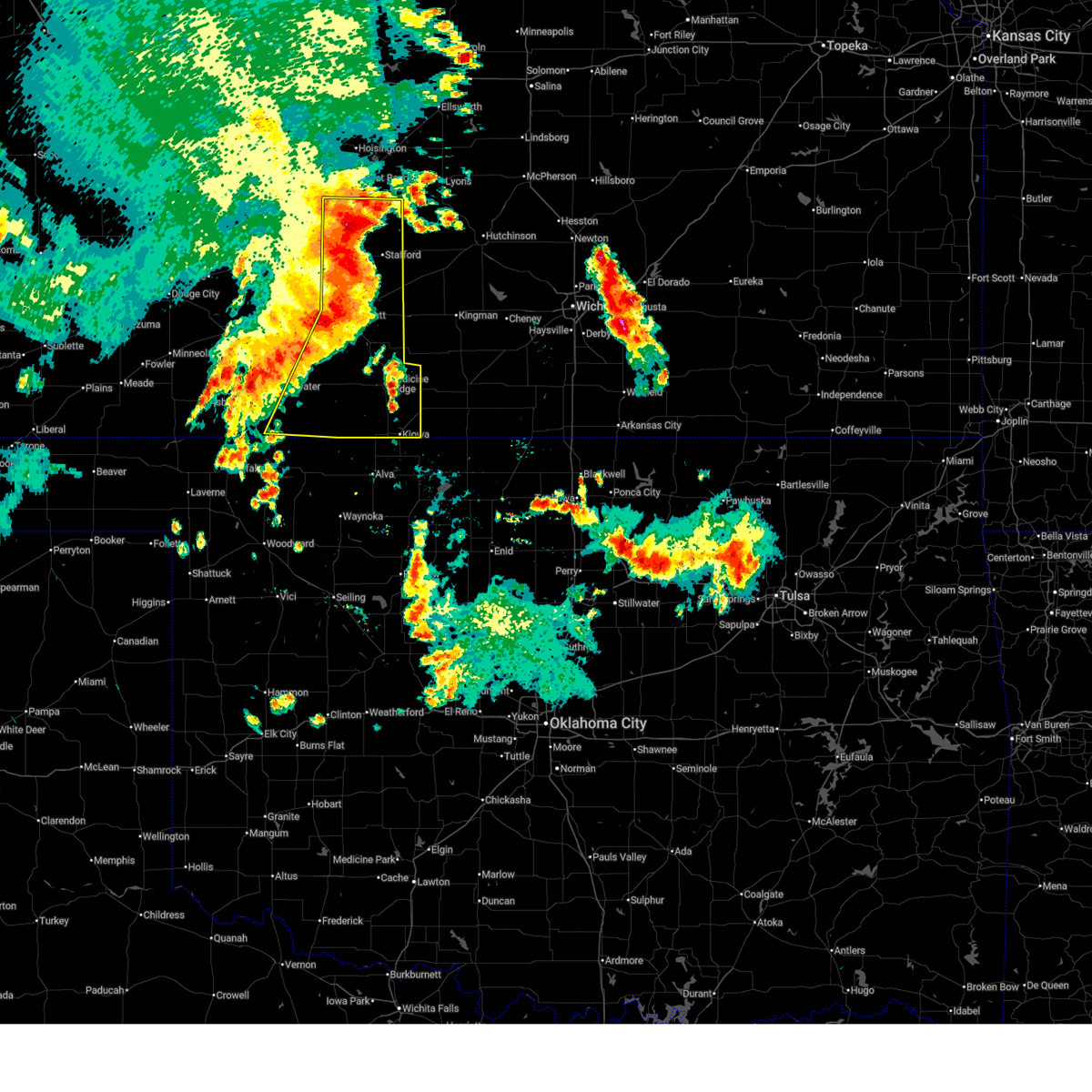
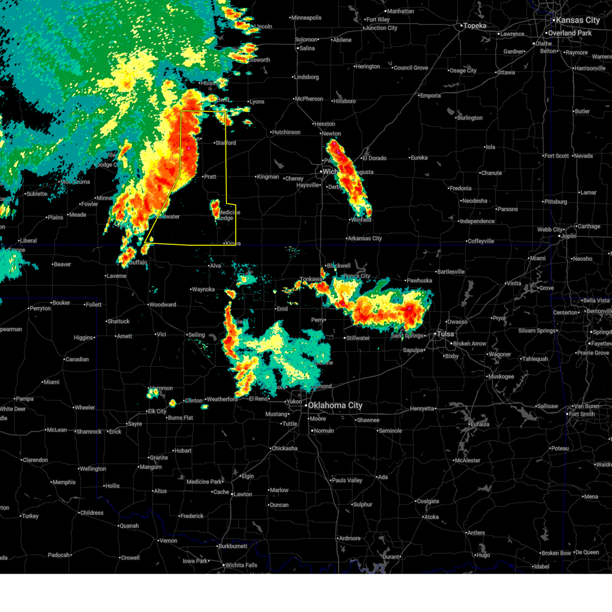
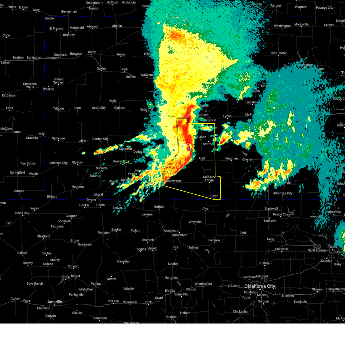
The Top Recent Hail Date for Isabel, KS is Friday, May 23, 2025 (25th out of 72)
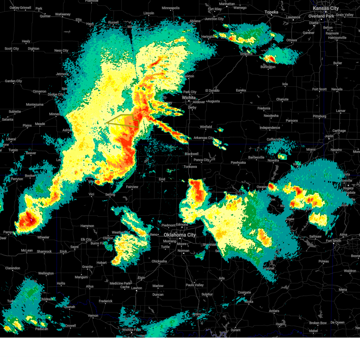
Hail and Wind Damage Spotted near Isabel, KS
| Date / Time | Report Details |
|---|---|
| 6/14/2025 6:35 AM CDT |
 At 635 am cdt, severe thunderstorms were located along a line extending from near hudson to near cairo to 10 miles southeast of wilmore, moving east at 45 mph (radar indicated). Hazards include 70 mph wind gusts and penny size hail. Expect considerable tree damage. damage is likely to mobile homes, roofs, and outbuildings. these severe storms will be near, sawyer, isabel, lake city, zenith, cairo, and neola around 640 am cdt. Other locations in the path of these severe thunderstorms include medicine lodge and sharon. At 635 am cdt, severe thunderstorms were located along a line extending from near hudson to near cairo to 10 miles southeast of wilmore, moving east at 45 mph (radar indicated). Hazards include 70 mph wind gusts and penny size hail. Expect considerable tree damage. damage is likely to mobile homes, roofs, and outbuildings. these severe storms will be near, sawyer, isabel, lake city, zenith, cairo, and neola around 640 am cdt. Other locations in the path of these severe thunderstorms include medicine lodge and sharon.
|
| 6/14/2025 6:22 AM CDT |
 Svrddc the national weather service in dodge city has issued a * severe thunderstorm warning for, southeastern kiowa county in south central kansas, barber county in south central kansas, eastern comanche county in south central kansas, southeastern pawnee county in south central kansas, stafford county in south central kansas, pratt county in south central kansas, * until 700 am cdt. * at 621 am cdt, severe thunderstorms were located along a line extending from near seward to near pratt to near lake coldwater, moving east at 45 mph (radar indicated). Hazards include 60 mph wind gusts and penny size hail. Expect damage to roofs, siding, and trees. severe thunderstorms will be near, pratt, st. john, iuka, hudson, coats, and croft around 625 am cdt. stafford, preston, sawyer, sun city, and cairo around 630 am cdt. lake city, zenith, and neola around 635 am cdt. isabel around 640 am cdt. Other locations in the path of these severe thunderstorms include medicine lodge. Svrddc the national weather service in dodge city has issued a * severe thunderstorm warning for, southeastern kiowa county in south central kansas, barber county in south central kansas, eastern comanche county in south central kansas, southeastern pawnee county in south central kansas, stafford county in south central kansas, pratt county in south central kansas, * until 700 am cdt. * at 621 am cdt, severe thunderstorms were located along a line extending from near seward to near pratt to near lake coldwater, moving east at 45 mph (radar indicated). Hazards include 60 mph wind gusts and penny size hail. Expect damage to roofs, siding, and trees. severe thunderstorms will be near, pratt, st. john, iuka, hudson, coats, and croft around 625 am cdt. stafford, preston, sawyer, sun city, and cairo around 630 am cdt. lake city, zenith, and neola around 635 am cdt. isabel around 640 am cdt. Other locations in the path of these severe thunderstorms include medicine lodge.
|
| 6/7/2025 1:18 AM CDT |
 the severe thunderstorm warning has been cancelled and is no longer in effect the severe thunderstorm warning has been cancelled and is no longer in effect
|
| 6/7/2025 1:18 AM CDT |
 At 118 am cdt, a severe thunderstorm was located near attica, moving east at 50 mph (radar indicated). Hazards include 60 mph wind gusts. Expect damage to roofs, siding, and trees. Locations impacted include, medicine lodge, isabel, lake city, and sun city. At 118 am cdt, a severe thunderstorm was located near attica, moving east at 50 mph (radar indicated). Hazards include 60 mph wind gusts. Expect damage to roofs, siding, and trees. Locations impacted include, medicine lodge, isabel, lake city, and sun city.
|
| 6/7/2025 1:02 AM CDT |
 Svrddc the national weather service in dodge city has issued a * severe thunderstorm warning for, northern barber county in south central kansas, pratt county in south central kansas, * until 130 am cdt. * at 102 am cdt, a severe thunderstorm was located near medicine lodge, moving east at 50 mph (radar indicated). Hazards include 60 mph wind gusts. expect damage to roofs, siding, and trees Svrddc the national weather service in dodge city has issued a * severe thunderstorm warning for, northern barber county in south central kansas, pratt county in south central kansas, * until 130 am cdt. * at 102 am cdt, a severe thunderstorm was located near medicine lodge, moving east at 50 mph (radar indicated). Hazards include 60 mph wind gusts. expect damage to roofs, siding, and trees
|
| 6/2/2025 9:06 PM CDT |
 The storms which prompted the warning have moved out of the area. therefore, the warning will be allowed to expire. a severe thunderstorm watch remains in effect until 100 am cdt for south central kansas. to report severe weather, contact your nearest law enforcement agency. they will relay your report to the national weather service dodge city. The storms which prompted the warning have moved out of the area. therefore, the warning will be allowed to expire. a severe thunderstorm watch remains in effect until 100 am cdt for south central kansas. to report severe weather, contact your nearest law enforcement agency. they will relay your report to the national weather service dodge city.
|
| 6/2/2025 8:50 PM CDT |
 At 850 pm cdt, severe thunderstorms were located along a line extending from near medicine lodge to kiowa, moving east at 35 mph (radar indicated). Hazards include 60 mph wind gusts. Expect damage to roofs, siding, and trees. Locations impacted include, sharon and hazelton. At 850 pm cdt, severe thunderstorms were located along a line extending from near medicine lodge to kiowa, moving east at 35 mph (radar indicated). Hazards include 60 mph wind gusts. Expect damage to roofs, siding, and trees. Locations impacted include, sharon and hazelton.
|
| 6/2/2025 8:33 PM CDT |
 Svrddc the national weather service in dodge city has issued a * severe thunderstorm warning for, barber county in south central kansas, southeastern pratt county in south central kansas, * until 915 pm cdt. * at 833 pm cdt, severe thunderstorms were located along a line extending from 6 miles east of lake city to near hardtner, moving east at 35 mph (radar indicated). Hazards include 60 mph wind gusts. Expect damage to roofs, siding, and trees. severe thunderstorms will be near, medicine lodge and kiowa around 840 pm cdt. Sharon and hazelton around 850 pm cdt. Svrddc the national weather service in dodge city has issued a * severe thunderstorm warning for, barber county in south central kansas, southeastern pratt county in south central kansas, * until 915 pm cdt. * at 833 pm cdt, severe thunderstorms were located along a line extending from 6 miles east of lake city to near hardtner, moving east at 35 mph (radar indicated). Hazards include 60 mph wind gusts. Expect damage to roofs, siding, and trees. severe thunderstorms will be near, medicine lodge and kiowa around 840 pm cdt. Sharon and hazelton around 850 pm cdt.
|
| 5/25/2025 6:27 AM CDT |
 the severe thunderstorm warning has been cancelled and is no longer in effect the severe thunderstorm warning has been cancelled and is no longer in effect
|
| 5/25/2025 6:27 AM CDT |
 At 627 am cdt, severe thunderstorms were located along a line extending from 7 miles west of raymond to near cunningham to near lake city, moving east at 55 mph (radar indicated). Hazards include 70 mph wind gusts and penny size hail. Expect considerable tree damage. damage is likely to mobile homes, roofs, and outbuildings. Locations impacted include, sawyer, isabel, lake city, zenith, medicine lodge and sharon. At 627 am cdt, severe thunderstorms were located along a line extending from 7 miles west of raymond to near cunningham to near lake city, moving east at 55 mph (radar indicated). Hazards include 70 mph wind gusts and penny size hail. Expect considerable tree damage. damage is likely to mobile homes, roofs, and outbuildings. Locations impacted include, sawyer, isabel, lake city, zenith, medicine lodge and sharon.
|
| 5/25/2025 5:59 AM CDT |
 Svrddc the national weather service in dodge city has issued a * severe thunderstorm warning for, kiowa county in south central kansas, barber county in south central kansas, northern comanche county in south central kansas, eastern pawnee county in south central kansas, stafford county in south central kansas, southeastern edwards county in south central kansas, pratt county in south central kansas, * until 700 am cdt. * at 558 am cdt, severe thunderstorms were located along a line extending from near pawnee rock to near hopewell to 9 miles northwest of wilmore, moving east at 55 mph (radar indicated). Hazards include 70 mph wind gusts and penny size hail. Expect considerable tree damage. damage is likely to mobile homes, roofs, and outbuildings. severe thunderstorms will be near, pratt, st. john, iuka, cullison, seward, byers, radium, dillwyn, belvidere, and croft around 605 am cdt. stafford, hudson, coats, and sun city around 615 am cdt. Other locations in the path of these severe thunderstorms include preston, sawyer, cairo, neola, lake city, zenith, isabel, medicine lodge and sharon. Svrddc the national weather service in dodge city has issued a * severe thunderstorm warning for, kiowa county in south central kansas, barber county in south central kansas, northern comanche county in south central kansas, eastern pawnee county in south central kansas, stafford county in south central kansas, southeastern edwards county in south central kansas, pratt county in south central kansas, * until 700 am cdt. * at 558 am cdt, severe thunderstorms were located along a line extending from near pawnee rock to near hopewell to 9 miles northwest of wilmore, moving east at 55 mph (radar indicated). Hazards include 70 mph wind gusts and penny size hail. Expect considerable tree damage. damage is likely to mobile homes, roofs, and outbuildings. severe thunderstorms will be near, pratt, st. john, iuka, cullison, seward, byers, radium, dillwyn, belvidere, and croft around 605 am cdt. stafford, hudson, coats, and sun city around 615 am cdt. Other locations in the path of these severe thunderstorms include preston, sawyer, cairo, neola, lake city, zenith, isabel, medicine lodge and sharon.
|
| 5/24/2025 2:47 AM CDT |
 The storms which prompted the warning have moved out of the area. therefore, the warning has been allowed to expire. however, gusty winds and heavy rain are still possible with these thunderstorms. a severe thunderstorm watch remains in effect until 600 am cdt for south central kansas. The storms which prompted the warning have moved out of the area. therefore, the warning has been allowed to expire. however, gusty winds and heavy rain are still possible with these thunderstorms. a severe thunderstorm watch remains in effect until 600 am cdt for south central kansas.
|
| 5/24/2025 2:33 AM CDT |
 the severe thunderstorm warning has been cancelled and is no longer in effect the severe thunderstorm warning has been cancelled and is no longer in effect
|
| 5/24/2025 2:33 AM CDT |
 At 233 am cdt, severe thunderstorms were located along a line extending from 7 miles west of arlington to near isabel, moving east at 35 mph (radar indicated). Hazards include 60 mph wind gusts and penny size hail. Expect damage to roofs, siding, and trees. Locations impacted include, isabel. At 233 am cdt, severe thunderstorms were located along a line extending from 7 miles west of arlington to near isabel, moving east at 35 mph (radar indicated). Hazards include 60 mph wind gusts and penny size hail. Expect damage to roofs, siding, and trees. Locations impacted include, isabel.
|
| 5/24/2025 2:09 AM CDT |
 Svrddc the national weather service in dodge city has issued a * severe thunderstorm warning for, northeastern barber county in south central kansas, southeastern stafford county in south central kansas, pratt county in south central kansas, * until 245 am cdt. * at 209 am cdt, severe thunderstorms were located along a line extending from near neola to near sun city, moving east at 35 mph (radar indicated). Hazards include 60 mph wind gusts and penny size hail. Expect damage to roofs, siding, and trees. severe thunderstorms will be near, preston, sawyer, and cairo around 215 am cdt. Isabel around 225 am cdt. Svrddc the national weather service in dodge city has issued a * severe thunderstorm warning for, northeastern barber county in south central kansas, southeastern stafford county in south central kansas, pratt county in south central kansas, * until 245 am cdt. * at 209 am cdt, severe thunderstorms were located along a line extending from near neola to near sun city, moving east at 35 mph (radar indicated). Hazards include 60 mph wind gusts and penny size hail. Expect damage to roofs, siding, and trees. severe thunderstorms will be near, preston, sawyer, and cairo around 215 am cdt. Isabel around 225 am cdt.
|
| 5/24/2025 2:07 AM CDT |
 Svrddc the national weather service in dodge city has issued a * severe thunderstorm warning for, northeastern barber county in south central kansas, southeastern stafford county in south central kansas, pratt county in south central kansas, * until 245 am cdt. * at 207 am cdt, severe thunderstorms were located along a line extending from near neola to near sun city, moving southeast at 35 mph (radar indicated). Hazards include two inch hail and 60 mph wind gusts. People and animals outdoors will be injured. expect hail damage to roofs, siding, windows, and vehicles. expect wind damage to roofs, siding, and trees. severe thunderstorms will be near, preston, sawyer, and neola around 210 am cdt. cairo around 215 am cdt. isabel around 225 am cdt. Other locations in the path of these severe thunderstorms include medicine lodge. Svrddc the national weather service in dodge city has issued a * severe thunderstorm warning for, northeastern barber county in south central kansas, southeastern stafford county in south central kansas, pratt county in south central kansas, * until 245 am cdt. * at 207 am cdt, severe thunderstorms were located along a line extending from near neola to near sun city, moving southeast at 35 mph (radar indicated). Hazards include two inch hail and 60 mph wind gusts. People and animals outdoors will be injured. expect hail damage to roofs, siding, windows, and vehicles. expect wind damage to roofs, siding, and trees. severe thunderstorms will be near, preston, sawyer, and neola around 210 am cdt. cairo around 215 am cdt. isabel around 225 am cdt. Other locations in the path of these severe thunderstorms include medicine lodge.
|
| 10/30/2024 2:15 PM CDT |
 At 214 pm cdt, a severe thunderstorm was located near coats, moving northeast at 45 mph (radar indicated). Hazards include 60 mph wind gusts and quarter size hail. Hail damage to vehicles is expected. expect wind damage to roofs, siding, and trees. Locations impacted include, pratt. At 214 pm cdt, a severe thunderstorm was located near coats, moving northeast at 45 mph (radar indicated). Hazards include 60 mph wind gusts and quarter size hail. Hail damage to vehicles is expected. expect wind damage to roofs, siding, and trees. Locations impacted include, pratt.
|
| 10/30/2024 2:15 PM CDT |
 the severe thunderstorm warning has been cancelled and is no longer in effect the severe thunderstorm warning has been cancelled and is no longer in effect
|
| 10/30/2024 1:54 PM CDT |
 Svrddc the national weather service in dodge city has issued a * severe thunderstorm warning for, southeastern kiowa county in south central kansas, northern barber county in south central kansas, northeastern comanche county in south central kansas, southern pratt county in south central kansas, * until 245 pm cdt. * at 153 pm cdt, a severe thunderstorm was located near belvidere, moving northeast at 45 mph (radar indicated). Hazards include 60 mph wind gusts and quarter size hail. Hail damage to vehicles is expected. expect wind damage to roofs, siding, and trees. this severe thunderstorm will be near, croft around 200 pm cdt. coats around 205 pm cdt. Other locations in the path of this severe thunderstorm include pratt. Svrddc the national weather service in dodge city has issued a * severe thunderstorm warning for, southeastern kiowa county in south central kansas, northern barber county in south central kansas, northeastern comanche county in south central kansas, southern pratt county in south central kansas, * until 245 pm cdt. * at 153 pm cdt, a severe thunderstorm was located near belvidere, moving northeast at 45 mph (radar indicated). Hazards include 60 mph wind gusts and quarter size hail. Hail damage to vehicles is expected. expect wind damage to roofs, siding, and trees. this severe thunderstorm will be near, croft around 200 pm cdt. coats around 205 pm cdt. Other locations in the path of this severe thunderstorm include pratt.
|
| 7/6/2024 8:38 PM CDT |
 Svrddc the national weather service in dodge city has issued a * severe thunderstorm warning for, kiowa county in south central kansas, meade county in southwestern kansas, northwestern barber county in south central kansas, northern comanche county in south central kansas, southern stafford county in south central kansas, pratt county in south central kansas, clark county in southwestern kansas, * until 945 pm cdt. * at 838 pm cdt, severe thunderstorms were located along a line extending from near macksville to 8 miles northwest of bloom, moving southeast at 45 mph (radar indicated). Hazards include 60 mph wind gusts. Expect damage to roofs, siding, and trees. severe thunderstorms will be near, mullinville, byers, and hopewell around 845 pm cdt. greensburg around 850 pm cdt. haviland, cullison, clark state lake, and wellsford around 855 pm cdt. Other locations in the path of these severe thunderstorms include pratt, coats, belvidere, croft, ashland, sawyer, wilmore, coldwater, protection, sitka, sun city and lake coldwater. Svrddc the national weather service in dodge city has issued a * severe thunderstorm warning for, kiowa county in south central kansas, meade county in southwestern kansas, northwestern barber county in south central kansas, northern comanche county in south central kansas, southern stafford county in south central kansas, pratt county in south central kansas, clark county in southwestern kansas, * until 945 pm cdt. * at 838 pm cdt, severe thunderstorms were located along a line extending from near macksville to 8 miles northwest of bloom, moving southeast at 45 mph (radar indicated). Hazards include 60 mph wind gusts. Expect damage to roofs, siding, and trees. severe thunderstorms will be near, mullinville, byers, and hopewell around 845 pm cdt. greensburg around 850 pm cdt. haviland, cullison, clark state lake, and wellsford around 855 pm cdt. Other locations in the path of these severe thunderstorms include pratt, coats, belvidere, croft, ashland, sawyer, wilmore, coldwater, protection, sitka, sun city and lake coldwater.
|
| 6/27/2024 11:38 PM CDT |
 The storms which prompted the warning is weakening below severe limits. therefore, the warning will be allowed to expire at 1145 pm. The storms which prompted the warning is weakening below severe limits. therefore, the warning will be allowed to expire at 1145 pm.
|
| 6/27/2024 11:17 PM CDT |
 At 1116 pm cdt, severe thunderstorms were located along a line extending from near cunningham to near hardtner, moving east at 25 mph (radar indicated). Hazards include 60 mph wind gusts and nickel size hail. Expect damage to roofs, siding, and trees. Locations impacted include, medicine lodge, hardtner and sharon. At 1116 pm cdt, severe thunderstorms were located along a line extending from near cunningham to near hardtner, moving east at 25 mph (radar indicated). Hazards include 60 mph wind gusts and nickel size hail. Expect damage to roofs, siding, and trees. Locations impacted include, medicine lodge, hardtner and sharon.
|
| 6/27/2024 10:59 PM CDT |
 Svrddc the national weather service in dodge city has issued a * severe thunderstorm warning for, barber county in south central kansas, southeastern pratt county in south central kansas, * until 1145 pm cdt. * at 1059 pm cdt, severe thunderstorms were located along a line extending from near cunningham to 6 miles west of hardtner, moving east at 30 mph (radar indicated). Hazards include 60 mph wind gusts and penny size hail. Expect damage to roofs, siding, and trees. severe thunderstorms will be near, medicine lodge and hardtner around 1105 pm cdt. Other locations in the path of these severe thunderstorms include sharon and kiowa. Svrddc the national weather service in dodge city has issued a * severe thunderstorm warning for, barber county in south central kansas, southeastern pratt county in south central kansas, * until 1145 pm cdt. * at 1059 pm cdt, severe thunderstorms were located along a line extending from near cunningham to 6 miles west of hardtner, moving east at 30 mph (radar indicated). Hazards include 60 mph wind gusts and penny size hail. Expect damage to roofs, siding, and trees. severe thunderstorms will be near, medicine lodge and hardtner around 1105 pm cdt. Other locations in the path of these severe thunderstorms include sharon and kiowa.
|
| 6/27/2024 10:38 PM CDT |
 At 1038 pm cdt, severe thunderstorms were located along a line extending from near pratt to 9 miles southwest of medicine lodge, moving east at 40 mph (radar indicated). Hazards include 60 mph wind gusts and penny size hail. Expect damage to roofs, siding, and trees. Locations impacted include, medicine lodge, isabel and cairo. At 1038 pm cdt, severe thunderstorms were located along a line extending from near pratt to 9 miles southwest of medicine lodge, moving east at 40 mph (radar indicated). Hazards include 60 mph wind gusts and penny size hail. Expect damage to roofs, siding, and trees. Locations impacted include, medicine lodge, isabel and cairo.
|
| 6/27/2024 10:18 PM CDT |
 Svrddc the national weather service in dodge city has issued a * severe thunderstorm warning for, southeastern kiowa county in south central kansas, northern barber county in south central kansas, northeastern comanche county in south central kansas, pratt county in south central kansas, * until 1100 pm cdt. * at 1018 pm cdt, severe thunderstorms were located along a line extending from near cullison to 7 miles north of aetna, moving east at 30 mph (radar indicated). Hazards include 60 mph wind gusts and penny size hail. Expect damage to roofs, siding, and trees. severe thunderstorms will be near, cullison, coats, and sun city around 1025 pm cdt. pratt and lake city around 1030 pm cdt. Other locations in the path of these severe thunderstorms include sawyer. Svrddc the national weather service in dodge city has issued a * severe thunderstorm warning for, southeastern kiowa county in south central kansas, northern barber county in south central kansas, northeastern comanche county in south central kansas, pratt county in south central kansas, * until 1100 pm cdt. * at 1018 pm cdt, severe thunderstorms were located along a line extending from near cullison to 7 miles north of aetna, moving east at 30 mph (radar indicated). Hazards include 60 mph wind gusts and penny size hail. Expect damage to roofs, siding, and trees. severe thunderstorms will be near, cullison, coats, and sun city around 1025 pm cdt. pratt and lake city around 1030 pm cdt. Other locations in the path of these severe thunderstorms include sawyer.
|
| 6/13/2024 9:24 PM CDT |
 the severe thunderstorm warning has been cancelled and is no longer in effect the severe thunderstorm warning has been cancelled and is no longer in effect
|
| 6/13/2024 9:13 PM CDT |
 At 913 pm cdt, severe thunderstorms were located along a line extending from near sharon to near buffalo, moving southeast at 35 mph (radar indicated). Hazards include 60 mph wind gusts. Expect damage to roofs, siding, and trees. Locations impacted include, medicine lodge, kiowa, coldwater, protection, hardtner, sharon, hazelton, isabel, lake city, aetna, and buttermilk. At 913 pm cdt, severe thunderstorms were located along a line extending from near sharon to near buffalo, moving southeast at 35 mph (radar indicated). Hazards include 60 mph wind gusts. Expect damage to roofs, siding, and trees. Locations impacted include, medicine lodge, kiowa, coldwater, protection, hardtner, sharon, hazelton, isabel, lake city, aetna, and buttermilk.
|
| 6/13/2024 8:43 PM CDT |
 Svrddc the national weather service in dodge city has issued a * severe thunderstorm warning for, barber county in south central kansas, comanche county in south central kansas, southeastern clark county in southwestern kansas, * until 945 pm cdt. * at 843 pm cdt, severe thunderstorms were located along a line extending from near isabel to 6 miles southwest of sitka, moving southeast at 35 mph (radar indicated). Hazards include 60 mph wind gusts. expect damage to roofs, siding, and trees Svrddc the national weather service in dodge city has issued a * severe thunderstorm warning for, barber county in south central kansas, comanche county in south central kansas, southeastern clark county in southwestern kansas, * until 945 pm cdt. * at 843 pm cdt, severe thunderstorms were located along a line extending from near isabel to 6 miles southwest of sitka, moving southeast at 35 mph (radar indicated). Hazards include 60 mph wind gusts. expect damage to roofs, siding, and trees
|
| 6/9/2024 1:25 AM CDT |
 The storms which prompted the warning have moved out of the area. therefore, the warning will be allowed to expire. however, gusty winds are still possible with these thunderstorms. a severe thunderstorm watch remains in effect until 300 am cdt for south central kansas. The storms which prompted the warning have moved out of the area. therefore, the warning will be allowed to expire. however, gusty winds are still possible with these thunderstorms. a severe thunderstorm watch remains in effect until 300 am cdt for south central kansas.
|
| 6/9/2024 12:56 AM CDT |
 At 1256 am cdt, severe thunderstorms were located along a line extending from near dillwyn to near pratt to near lake city to aetna, moving east at 30 mph (radar indicated). Hazards include 60 mph wind gusts and penny size hail. Expect damage to roofs, siding, and trees. Locations impacted include, pratt, iuka, sawyer, medicine lodge, stafford, preston, isabel, cairo, neola and zenith. At 1256 am cdt, severe thunderstorms were located along a line extending from near dillwyn to near pratt to near lake city to aetna, moving east at 30 mph (radar indicated). Hazards include 60 mph wind gusts and penny size hail. Expect damage to roofs, siding, and trees. Locations impacted include, pratt, iuka, sawyer, medicine lodge, stafford, preston, isabel, cairo, neola and zenith.
|
| 6/9/2024 12:56 AM CDT |
 the severe thunderstorm warning has been cancelled and is no longer in effect the severe thunderstorm warning has been cancelled and is no longer in effect
|
| 6/9/2024 12:35 AM CDT |
 At 1235 am cdt, severe thunderstorms were located along a line extending from near belpre to near wellsford to 7 miles east of wilmore to 6 miles east of buttermilk, moving east at 40 mph (radar indicated). Hazards include 60 mph wind gusts and penny size hail. Expect damage to roofs, siding, and trees. Locations impacted include, macksville, cullison, sun city, hopewell, croft, wellsford, byers, pratt, coats, lake city, aetna, iuka, sawyer, medicine lodge, preston, isabel, cairo and neola. At 1235 am cdt, severe thunderstorms were located along a line extending from near belpre to near wellsford to 7 miles east of wilmore to 6 miles east of buttermilk, moving east at 40 mph (radar indicated). Hazards include 60 mph wind gusts and penny size hail. Expect damage to roofs, siding, and trees. Locations impacted include, macksville, cullison, sun city, hopewell, croft, wellsford, byers, pratt, coats, lake city, aetna, iuka, sawyer, medicine lodge, preston, isabel, cairo and neola.
|
| 6/9/2024 12:11 AM CDT |
 Svrddc the national weather service in dodge city has issued a * severe thunderstorm warning for, kiowa county in south central kansas, northwestern barber county in south central kansas, comanche county in south central kansas, southern stafford county in south central kansas, pratt county in south central kansas, edwards county in south central kansas, * until 130 am cdt. * at 1211 am cdt, severe thunderstorms were located along a line extending from near lewis to near greensburg to near coldwater to 7 miles south of protection, moving east at 45 mph (radar indicated). Hazards include 70 mph wind gusts and penny size hail. Expect considerable tree damage. damage is likely to mobile homes, roofs, and outbuildings. severe thunderstorms will be near, coldwater, greensburg, lewis, wilmore, fellsburg, lake coldwater, and centerview around 1215 am cdt. belpre and buttermilk around 1220 am cdt. haviland, trousdale, and belvidere around 1225 am cdt. macksville, hopewell, and wellsford around 1230 am cdt. other locations in the path of these severe thunderstorms include croft, cullison, sun city, byers, dillwyn, st. John, coats, pratt, iuka and lake city. Svrddc the national weather service in dodge city has issued a * severe thunderstorm warning for, kiowa county in south central kansas, northwestern barber county in south central kansas, comanche county in south central kansas, southern stafford county in south central kansas, pratt county in south central kansas, edwards county in south central kansas, * until 130 am cdt. * at 1211 am cdt, severe thunderstorms were located along a line extending from near lewis to near greensburg to near coldwater to 7 miles south of protection, moving east at 45 mph (radar indicated). Hazards include 70 mph wind gusts and penny size hail. Expect considerable tree damage. damage is likely to mobile homes, roofs, and outbuildings. severe thunderstorms will be near, coldwater, greensburg, lewis, wilmore, fellsburg, lake coldwater, and centerview around 1215 am cdt. belpre and buttermilk around 1220 am cdt. haviland, trousdale, and belvidere around 1225 am cdt. macksville, hopewell, and wellsford around 1230 am cdt. other locations in the path of these severe thunderstorms include croft, cullison, sun city, byers, dillwyn, st. John, coats, pratt, iuka and lake city.
|
| 6/3/2024 6:13 AM CDT |
 The storms which prompted the warning are moving out of the warned area. therefore, the warning will be allowed to expire. a severe thunderstorm watch remains in effect until 700 am cdt for south central kansas. The storms which prompted the warning are moving out of the warned area. therefore, the warning will be allowed to expire. a severe thunderstorm watch remains in effect until 700 am cdt for south central kansas.
|
| 6/3/2024 5:26 AM CDT |
 Svrddc the national weather service in dodge city has issued a * severe thunderstorm warning for, eastern kiowa county in south central kansas, barber county in south central kansas, eastern comanche county in south central kansas, pratt county in south central kansas, southeastern edwards county in south central kansas, * until 615 am cdt. * at 525 am cdt, severe thunderstorms were located along a line extending from near hopewell to 12 miles northwest of freedom, moving east at 65 mph (radar indicated). Hazards include 70 mph wind gusts and penny size hail. these storms have a history of producing wind damage. Expect considerable tree damage. damage is likely to mobile homes, roofs, and outbuildings. severe thunderstorms will be near, pratt, cullison, coats, sun city, aetna, and croft around 530 am cdt. iuka and lake city around 535 am cdt. preston and sawyer around 540 am cdt. medicine lodge, isabel, and cairo around 545 am cdt. Other locations in the path of these severe thunderstorms include hardtner, kiowa, sharon and hazelton. Svrddc the national weather service in dodge city has issued a * severe thunderstorm warning for, eastern kiowa county in south central kansas, barber county in south central kansas, eastern comanche county in south central kansas, pratt county in south central kansas, southeastern edwards county in south central kansas, * until 615 am cdt. * at 525 am cdt, severe thunderstorms were located along a line extending from near hopewell to 12 miles northwest of freedom, moving east at 65 mph (radar indicated). Hazards include 70 mph wind gusts and penny size hail. these storms have a history of producing wind damage. Expect considerable tree damage. damage is likely to mobile homes, roofs, and outbuildings. severe thunderstorms will be near, pratt, cullison, coats, sun city, aetna, and croft around 530 am cdt. iuka and lake city around 535 am cdt. preston and sawyer around 540 am cdt. medicine lodge, isabel, and cairo around 545 am cdt. Other locations in the path of these severe thunderstorms include hardtner, kiowa, sharon and hazelton.
|
| 5/19/2024 7:26 PM CDT |
 the severe thunderstorm warning has been cancelled and is no longer in effect the severe thunderstorm warning has been cancelled and is no longer in effect
|
| 5/19/2024 7:26 PM CDT |
 At 726 pm cdt, severe thunderstorms were located along a line extending from near lorraine to near nickerson to near turon, moving northeast at 55 mph (radar indicated). Hazards include 60 mph wind gusts and penny size hail. Expect damage to roofs, siding, and trees. locations impacted include, pratt, medicine lodge, st. John, stafford, kiowa, iuka, preston, sharon, hudson, sawyer, cullison, hazelton, isabel, coats, seward, lake city, sun city, byers, croft, and zenith. At 726 pm cdt, severe thunderstorms were located along a line extending from near lorraine to near nickerson to near turon, moving northeast at 55 mph (radar indicated). Hazards include 60 mph wind gusts and penny size hail. Expect damage to roofs, siding, and trees. locations impacted include, pratt, medicine lodge, st. John, stafford, kiowa, iuka, preston, sharon, hudson, sawyer, cullison, hazelton, isabel, coats, seward, lake city, sun city, byers, croft, and zenith.
|
| 5/19/2024 7:08 PM CDT |
 the severe thunderstorm warning has been cancelled and is no longer in effect the severe thunderstorm warning has been cancelled and is no longer in effect
|
| 5/19/2024 7:08 PM CDT |
 At 708 pm cdt, severe thunderstorms were located along a line extending from near claflin to near plevna to near pratt, moving northeast at 55 mph (radar indicated). Hazards include 60 mph wind gusts and penny size hail. Expect damage to roofs, siding, and trees. locations impacted include, pratt, medicine lodge, st. John, stafford, kiowa, coldwater, haviland, hardtner, iuka, preston, sharon, hudson, sawyer, cullison, hazelton, isabel, coats, seward, lake city, and wilmore. At 708 pm cdt, severe thunderstorms were located along a line extending from near claflin to near plevna to near pratt, moving northeast at 55 mph (radar indicated). Hazards include 60 mph wind gusts and penny size hail. Expect damage to roofs, siding, and trees. locations impacted include, pratt, medicine lodge, st. John, stafford, kiowa, coldwater, haviland, hardtner, iuka, preston, sharon, hudson, sawyer, cullison, hazelton, isabel, coats, seward, lake city, and wilmore.
|
| 5/19/2024 6:59 PM CDT |
 At 658 pm cdt, severe thunderstorms were located along a line extending from near hoisington to zenith to near cullison, moving northeast at 55 mph (radar indicated). Hazards include 60 mph wind gusts and penny size hail. Expect damage to roofs, siding, and trees. Locations impacted include, pratt, iuka, preston, zenith and neola. At 658 pm cdt, severe thunderstorms were located along a line extending from near hoisington to zenith to near cullison, moving northeast at 55 mph (radar indicated). Hazards include 60 mph wind gusts and penny size hail. Expect damage to roofs, siding, and trees. Locations impacted include, pratt, iuka, preston, zenith and neola.
|
| 5/19/2024 6:44 PM CDT |
 Svrddc the national weather service in dodge city has issued a * severe thunderstorm warning for, kiowa county in south central kansas, barber county in south central kansas, comanche county in south central kansas, southeastern pawnee county in south central kansas, stafford county in south central kansas, pratt county in south central kansas, southeastern edwards county in south central kansas, * until 745 pm cdt. * at 644 pm cdt, severe thunderstorms were located along a line extending from 6 miles west of great bend to 8 miles southwest of stafford to near croft, moving northeast at 55 mph. these are destructive storms for stafford and pratt counties (radar indicated). Hazards include 80 mph wind gusts and quarter size hail. Flying debris will be dangerous to those caught without shelter. mobile homes will be heavily damaged. expect considerable damage to roofs, windows, and vehicles. extensive tree damage and power outages are likely. severe thunderstorms will be near, pratt, stafford, iuka, hudson, and cullison around 650 pm cdt. zenith and neola around 655 pm cdt. Preston around 700 pm cdt. Svrddc the national weather service in dodge city has issued a * severe thunderstorm warning for, kiowa county in south central kansas, barber county in south central kansas, comanche county in south central kansas, southeastern pawnee county in south central kansas, stafford county in south central kansas, pratt county in south central kansas, southeastern edwards county in south central kansas, * until 745 pm cdt. * at 644 pm cdt, severe thunderstorms were located along a line extending from 6 miles west of great bend to 8 miles southwest of stafford to near croft, moving northeast at 55 mph. these are destructive storms for stafford and pratt counties (radar indicated). Hazards include 80 mph wind gusts and quarter size hail. Flying debris will be dangerous to those caught without shelter. mobile homes will be heavily damaged. expect considerable damage to roofs, windows, and vehicles. extensive tree damage and power outages are likely. severe thunderstorms will be near, pratt, stafford, iuka, hudson, and cullison around 650 pm cdt. zenith and neola around 655 pm cdt. Preston around 700 pm cdt.
|
| 10/3/2023 10:33 PM CDT |
 At 1033 pm cdt, severe thunderstorms were located along a line extending from near preston to 7 miles southeast of wilmore, moving east at 35 mph (radar indicated). Hazards include 60 mph wind gusts and penny size hail. Expect damage to roofs, siding, and trees. locations impacted include, sawyer, lake city, sun city, cairo and isabel. hail threat, radar indicated max hail size, 0. 75 in wind threat, radar indicated max wind gust, 60 mph. At 1033 pm cdt, severe thunderstorms were located along a line extending from near preston to 7 miles southeast of wilmore, moving east at 35 mph (radar indicated). Hazards include 60 mph wind gusts and penny size hail. Expect damage to roofs, siding, and trees. locations impacted include, sawyer, lake city, sun city, cairo and isabel. hail threat, radar indicated max hail size, 0. 75 in wind threat, radar indicated max wind gust, 60 mph.
|
| 10/3/2023 10:08 PM CDT |
 At 1006 pm cdt, severe thunderstorms were located along a line extending from near iuka to near coldwater, moving east at 40 mph (radar indicated). Hazards include 60 mph wind gusts and penny size hail. Expect damage to roofs, siding, and trees. severe thunderstorms will be near, pratt, preston, coats, and croft around 1010 pm cdt. sun city around 1015 pm cdt. sawyer and cairo around 1020 pm cdt. lake city around 1025 pm cdt. other locations in the path of these severe thunderstorms include isabel. this warning replaces the previous warning which was in effect for portions of kiowa, comanche, pratt, and barber county. hail threat, radar indicated max hail size, 0. 75 in wind threat, radar indicated max wind gust, 60 mph. At 1006 pm cdt, severe thunderstorms were located along a line extending from near iuka to near coldwater, moving east at 40 mph (radar indicated). Hazards include 60 mph wind gusts and penny size hail. Expect damage to roofs, siding, and trees. severe thunderstorms will be near, pratt, preston, coats, and croft around 1010 pm cdt. sun city around 1015 pm cdt. sawyer and cairo around 1020 pm cdt. lake city around 1025 pm cdt. other locations in the path of these severe thunderstorms include isabel. this warning replaces the previous warning which was in effect for portions of kiowa, comanche, pratt, and barber county. hail threat, radar indicated max hail size, 0. 75 in wind threat, radar indicated max wind gust, 60 mph.
|
| 8/6/2023 12:38 AM CDT |
 At 1237 am cdt, a severe thunderstorm was located near nashville, or 8 miles southeast of isabel, moving east at 25 mph (radar indicated). Hazards include 60 mph wind gusts and quarter size hail. Hail damage to vehicles is expected. expect wind damage to roofs, siding, and trees. locations impacted include, sharon and isabel. hail threat, radar indicated max hail size, 1. 00 in wind threat, radar indicated max wind gust, 60 mph. At 1237 am cdt, a severe thunderstorm was located near nashville, or 8 miles southeast of isabel, moving east at 25 mph (radar indicated). Hazards include 60 mph wind gusts and quarter size hail. Hail damage to vehicles is expected. expect wind damage to roofs, siding, and trees. locations impacted include, sharon and isabel. hail threat, radar indicated max hail size, 1. 00 in wind threat, radar indicated max wind gust, 60 mph.
|
| 8/6/2023 12:29 AM CDT |
 At 1229 am cdt, a severe thunderstorm was located near isabel, moving east at 25 mph (radar indicated). Hazards include 60 mph wind gusts and quarter size hail. Hail damage to vehicles is expected. expect wind damage to roofs, siding, and trees. this severe thunderstorm will remain over mainly rural areas of northeastern barber and southeastern pratt counties. hail threat, radar indicated max hail size, 1. 00 in wind threat, radar indicated max wind gust, 60 mph. At 1229 am cdt, a severe thunderstorm was located near isabel, moving east at 25 mph (radar indicated). Hazards include 60 mph wind gusts and quarter size hail. Hail damage to vehicles is expected. expect wind damage to roofs, siding, and trees. this severe thunderstorm will remain over mainly rural areas of northeastern barber and southeastern pratt counties. hail threat, radar indicated max hail size, 1. 00 in wind threat, radar indicated max wind gust, 60 mph.
|
| 8/5/2023 4:57 AM CDT |
 The severe thunderstorm warning for north central barber and eastern pratt counties will expire at 500 am cdt, the storms which prompted the warning have moved out of the area. therefore, the warning will be allowed to expire. however gusty winds are still possible with these thunderstorms. The severe thunderstorm warning for north central barber and eastern pratt counties will expire at 500 am cdt, the storms which prompted the warning have moved out of the area. therefore, the warning will be allowed to expire. however gusty winds are still possible with these thunderstorms.
|
| 8/5/2023 4:37 AM CDT |
 At 437 am cdt, severe thunderstorms were located along a line extending from near turon to near cairo to near isabel, moving east at 25 mph (radar indicated). Hazards include 60 mph wind gusts. Expect damage to roofs, siding, and trees. these severe thunderstorms will remain over mainly rural areas of north central barber and eastern pratt counties. hail threat, radar indicated max hail size, <. 75 in wind threat, radar indicated max wind gust, 60 mph. At 437 am cdt, severe thunderstorms were located along a line extending from near turon to near cairo to near isabel, moving east at 25 mph (radar indicated). Hazards include 60 mph wind gusts. Expect damage to roofs, siding, and trees. these severe thunderstorms will remain over mainly rural areas of north central barber and eastern pratt counties. hail threat, radar indicated max hail size, <. 75 in wind threat, radar indicated max wind gust, 60 mph.
|
| 8/5/2023 4:36 AM CDT |
 At 435 am cdt, severe thunderstorms were located along a line extending from near isabel to near sharon to near kiowa, moving east at 30 mph (radar indicated). Hazards include 70 mph wind gusts. Expect considerable tree damage. damage is likely to mobile homes, roofs, and outbuildings. locations impacted include, medicine lodge, kiowa, hardtner, sharon, hazelton and isabel. thunderstorm damage threat, considerable hail threat, radar indicated max hail size, <. 75 in wind threat, radar indicated max wind gust, 70 mph. At 435 am cdt, severe thunderstorms were located along a line extending from near isabel to near sharon to near kiowa, moving east at 30 mph (radar indicated). Hazards include 70 mph wind gusts. Expect considerable tree damage. damage is likely to mobile homes, roofs, and outbuildings. locations impacted include, medicine lodge, kiowa, hardtner, sharon, hazelton and isabel. thunderstorm damage threat, considerable hail threat, radar indicated max hail size, <. 75 in wind threat, radar indicated max wind gust, 70 mph.
|
| 8/5/2023 4:25 AM CDT |
 At 425 am cdt, severe thunderstorms were located along a line extending from near turon to near pratt to near sawyer, moving east at 25 mph (radar indicated). Hazards include 60 mph wind gusts. Expect damage to roofs, siding, and trees. severe thunderstorms will be near, preston around 435 am cdt. cairo around 440 am cdt. isabel around 445 am cdt. hail threat, radar indicated max hail size, <. 75 in wind threat, radar indicated max wind gust, 60 mph. At 425 am cdt, severe thunderstorms were located along a line extending from near turon to near pratt to near sawyer, moving east at 25 mph (radar indicated). Hazards include 60 mph wind gusts. Expect damage to roofs, siding, and trees. severe thunderstorms will be near, preston around 435 am cdt. cairo around 440 am cdt. isabel around 445 am cdt. hail threat, radar indicated max hail size, <. 75 in wind threat, radar indicated max wind gust, 60 mph.
|
| 8/5/2023 4:20 AM CDT |
 At 419 am cdt, severe thunderstorms were located along a line extending from near sawyer to near medicine lodge to near hardtner, moving east at 45 mph (radar indicated). Hazards include 70 mph wind gusts. Expect considerable tree damage. damage is likely to mobile homes, roofs, and outbuildings. locations impacted include, kiowa, isabel, sharon and hazelton. thunderstorm damage threat, considerable hail threat, radar indicated max hail size, <. 75 in wind threat, radar indicated max wind gust, 70 mph. At 419 am cdt, severe thunderstorms were located along a line extending from near sawyer to near medicine lodge to near hardtner, moving east at 45 mph (radar indicated). Hazards include 70 mph wind gusts. Expect considerable tree damage. damage is likely to mobile homes, roofs, and outbuildings. locations impacted include, kiowa, isabel, sharon and hazelton. thunderstorm damage threat, considerable hail threat, radar indicated max hail size, <. 75 in wind threat, radar indicated max wind gust, 70 mph.
|
| 8/5/2023 3:57 AM CDT |
 At 356 am cdt, severe thunderstorms were located along a line extending from near sun city to near freedom, oklahoma, moving east at 30 mph (radar indicated). Hazards include 60 mph wind gusts. Expect damage to roofs, siding, and trees. severe thunderstorms will be near, lake city around 410 am cdt. other locations in the path of these severe thunderstorms include sawyer, isabel, medicine lodge and sharon. hail threat, radar indicated max hail size, <. 75 in wind threat, radar indicated max wind gust, 60 mph. At 356 am cdt, severe thunderstorms were located along a line extending from near sun city to near freedom, oklahoma, moving east at 30 mph (radar indicated). Hazards include 60 mph wind gusts. Expect damage to roofs, siding, and trees. severe thunderstorms will be near, lake city around 410 am cdt. other locations in the path of these severe thunderstorms include sawyer, isabel, medicine lodge and sharon. hail threat, radar indicated max hail size, <. 75 in wind threat, radar indicated max wind gust, 60 mph.
|
| 7/16/2023 8:15 PM CDT |
 At 815 pm cdt, a severe thunderstorm was located near medicine lodge, moving southeast at 40 mph (radar indicated). Hazards include two inch hail and 60 mph wind gusts. People and animals outdoors will be injured. expect hail damage to roofs, siding, windows, and vehicles. expect wind damage to roofs, siding, and trees. Locations impacted include, medicine lodge, sharon, sawyer, isabel, coats and lake city. At 815 pm cdt, a severe thunderstorm was located near medicine lodge, moving southeast at 40 mph (radar indicated). Hazards include two inch hail and 60 mph wind gusts. People and animals outdoors will be injured. expect hail damage to roofs, siding, windows, and vehicles. expect wind damage to roofs, siding, and trees. Locations impacted include, medicine lodge, sharon, sawyer, isabel, coats and lake city.
|
| 7/16/2023 8:04 PM CDT |
 At 804 pm cdt, a severe thunderstorm was located near sawyer, moving southeast at 40 mph (radar indicated). Hazards include tennis ball size hail and 60 mph wind gusts. People and animals outdoors will be injured. expect hail damage to roofs, siding, windows, and vehicles. expect wind damage to roofs, siding, and trees. locations impacted include, medicine lodge, sharon, sawyer, isabel, coats and lake city. thunderstorm damage threat, considerable hail threat, radar indicated max hail size, 2. 50 in wind threat, radar indicated max wind gust, 60 mph. At 804 pm cdt, a severe thunderstorm was located near sawyer, moving southeast at 40 mph (radar indicated). Hazards include tennis ball size hail and 60 mph wind gusts. People and animals outdoors will be injured. expect hail damage to roofs, siding, windows, and vehicles. expect wind damage to roofs, siding, and trees. locations impacted include, medicine lodge, sharon, sawyer, isabel, coats and lake city. thunderstorm damage threat, considerable hail threat, radar indicated max hail size, 2. 50 in wind threat, radar indicated max wind gust, 60 mph.
|
| 7/16/2023 7:56 PM CDT |
 At 756 pm cdt, a severe thunderstorm was located near sawyer, moving southeast at 40 mph (radar indicated). Hazards include tennis ball size hail and 60 mph wind gusts. People and animals outdoors will be injured. expect hail damage to roofs, siding, windows, and vehicles. expect wind damage to roofs, siding, and trees. locations impacted include, isabel, medicine lodge and sharon. thunderstorm damage threat, considerable hail threat, radar indicated max hail size, 2. 50 in wind threat, radar indicated max wind gust, 60 mph. At 756 pm cdt, a severe thunderstorm was located near sawyer, moving southeast at 40 mph (radar indicated). Hazards include tennis ball size hail and 60 mph wind gusts. People and animals outdoors will be injured. expect hail damage to roofs, siding, windows, and vehicles. expect wind damage to roofs, siding, and trees. locations impacted include, isabel, medicine lodge and sharon. thunderstorm damage threat, considerable hail threat, radar indicated max hail size, 2. 50 in wind threat, radar indicated max wind gust, 60 mph.
|
| 7/16/2023 7:41 PM CDT |
 At 741 pm cdt, a severe thunderstorm was located near pratt, moving southeast at 40 mph (radar indicated). Hazards include ping pong ball size hail and 60 mph wind gusts. People and animals outdoors will be injured. expect hail damage to roofs, siding, windows, and vehicles. expect wind damage to roofs, siding, and trees. this severe thunderstorm will be near, coats around 755 pm cdt. sawyer around 800 pm cdt. other locations in the path of this severe thunderstorm include isabel, medicine lodge and sharon. hail threat, radar indicated max hail size, 1. 50 in wind threat, radar indicated max wind gust, 60 mph. At 741 pm cdt, a severe thunderstorm was located near pratt, moving southeast at 40 mph (radar indicated). Hazards include ping pong ball size hail and 60 mph wind gusts. People and animals outdoors will be injured. expect hail damage to roofs, siding, windows, and vehicles. expect wind damage to roofs, siding, and trees. this severe thunderstorm will be near, coats around 755 pm cdt. sawyer around 800 pm cdt. other locations in the path of this severe thunderstorm include isabel, medicine lodge and sharon. hail threat, radar indicated max hail size, 1. 50 in wind threat, radar indicated max wind gust, 60 mph.
|
| 7/7/2023 6:21 AM CDT |
 The severe thunderstorm warning for barber and eastern comanche counties will expire at 630 am cdt, the severe thunderstorm which prompted the warning has weakened below severe limits. therefore, the warning will be allowed to expire. The severe thunderstorm warning for barber and eastern comanche counties will expire at 630 am cdt, the severe thunderstorm which prompted the warning has weakened below severe limits. therefore, the warning will be allowed to expire.
|
| 7/7/2023 6:10 AM CDT |
 At 609 am cdt, a severe thunderstorm was located near medicine lodge, moving southeast at 55 mph (radar indicated). Hazards include 60 mph wind gusts. Expect damage to roofs, siding, and trees. locations impacted include, sharon. hail threat, radar indicated max hail size, <. 75 in wind threat, radar indicated max wind gust, 60 mph. At 609 am cdt, a severe thunderstorm was located near medicine lodge, moving southeast at 55 mph (radar indicated). Hazards include 60 mph wind gusts. Expect damage to roofs, siding, and trees. locations impacted include, sharon. hail threat, radar indicated max hail size, <. 75 in wind threat, radar indicated max wind gust, 60 mph.
|
| 7/7/2023 5:49 AM CDT |
 At 548 am cdt, a severe thunderstorm was located near pratt, moving southeast at 40 mph (automated equipment. pratt airport measured a wind gust of 60 mph at 535 pm). Hazards include 60 mph wind gusts. Expect damage to roofs, siding, and trees. this severe thunderstorm will be near, isabel around 600 am cdt. other locations in the path of this severe thunderstorm include sharon. hail threat, radar indicated max hail size, <. 75 in wind threat, radar indicated max wind gust, 60 mph. At 548 am cdt, a severe thunderstorm was located near pratt, moving southeast at 40 mph (automated equipment. pratt airport measured a wind gust of 60 mph at 535 pm). Hazards include 60 mph wind gusts. Expect damage to roofs, siding, and trees. this severe thunderstorm will be near, isabel around 600 am cdt. other locations in the path of this severe thunderstorm include sharon. hail threat, radar indicated max hail size, <. 75 in wind threat, radar indicated max wind gust, 60 mph.
|
| 6/27/2023 10:11 PM CDT |
 The severe thunderstorm warning for barber and pratt counties will expire at 1015 pm cdt, the storm which prompted the warning has moved out of the area. therefore, the warning will be allowed to expire. however gusty winds are still possible with this thunderstorm. a severe thunderstorm watch remains in effect until 200 am cdt for south central kansas. The severe thunderstorm warning for barber and pratt counties will expire at 1015 pm cdt, the storm which prompted the warning has moved out of the area. therefore, the warning will be allowed to expire. however gusty winds are still possible with this thunderstorm. a severe thunderstorm watch remains in effect until 200 am cdt for south central kansas.
|
| 6/27/2023 10:02 PM CDT |
 At 1001 pm cdt, a severe thunderstorm was located 8 miles north of hardtner, moving east at 50 mph (radar indicated). Hazards include 60 mph wind gusts. Expect damage to roofs, siding, and trees. hail threat, radar indicated max hail size, <. 75 in wind threat, radar indicated max wind gust, 60 mph. At 1001 pm cdt, a severe thunderstorm was located 8 miles north of hardtner, moving east at 50 mph (radar indicated). Hazards include 60 mph wind gusts. Expect damage to roofs, siding, and trees. hail threat, radar indicated max hail size, <. 75 in wind threat, radar indicated max wind gust, 60 mph.
|
| 6/27/2023 9:34 PM CDT |
 At 934 pm cdt, a severe thunderstorm was located 10 miles east of buttermilk, moving east at 45 mph (radar indicated). Hazards include 60 mph wind gusts. Expect damage to roofs, siding, and trees. hail threat, radar indicated max hail size, <. 75 in wind threat, radar indicated max wind gust, 60 mph. At 934 pm cdt, a severe thunderstorm was located 10 miles east of buttermilk, moving east at 45 mph (radar indicated). Hazards include 60 mph wind gusts. Expect damage to roofs, siding, and trees. hail threat, radar indicated max hail size, <. 75 in wind threat, radar indicated max wind gust, 60 mph.
|
| 6/27/2023 9:17 PM CDT |
 At 917 pm cdt, a severe thunderstorm was located near protection, moving east at 50 mph (radar indicated). Hazards include 60 mph wind gusts and penny size hail. Expect damage to roofs, siding, and trees. hail threat, radar indicated max hail size, 0. 75 in wind threat, radar indicated max wind gust, 60 mph. At 917 pm cdt, a severe thunderstorm was located near protection, moving east at 50 mph (radar indicated). Hazards include 60 mph wind gusts and penny size hail. Expect damage to roofs, siding, and trees. hail threat, radar indicated max hail size, 0. 75 in wind threat, radar indicated max wind gust, 60 mph.
|
| 6/21/2023 7:12 AM CDT |
 At 711 am cdt, a severe thunderstorm was located near lake city, moving southeast at 20 mph (radar indicated). Hazards include 60 mph wind gusts and quarter size hail. Hail damage to vehicles is expected. expect wind damage to roofs, siding, and trees. hail threat, radar indicated max hail size, 1. 00 in wind threat, radar indicated max wind gust, 60 mph. At 711 am cdt, a severe thunderstorm was located near lake city, moving southeast at 20 mph (radar indicated). Hazards include 60 mph wind gusts and quarter size hail. Hail damage to vehicles is expected. expect wind damage to roofs, siding, and trees. hail threat, radar indicated max hail size, 1. 00 in wind threat, radar indicated max wind gust, 60 mph.
|
| 6/21/2023 7:00 AM CDT | At 700 am cdt, a severe thunderstorm was located 7 miles south of sun city, moving southeast at 35 mph (radar indicated). Hazards include 60 mph wind gusts and quarter size hail. Hail damage to vehicles is expected. expect wind damage to roofs, siding, and trees. hail threat, radar indicated max hail size, 1. 00 in wind threat, radar indicated max wind gust, 60 mph. |
| 6/21/2023 6:32 AM CDT |
 At 632 am cdt, a severe thunderstorm was located near belvidere, moving southeast at 35 mph (radar indicated). Hazards include 60 mph wind gusts and quarter size hail. Hail damage to vehicles is expected. expect wind damage to roofs, siding, and trees. other locations in the path of this severe thunderstorm include aetna and hardtner. hail threat, radar indicated max hail size, 1. 00 in wind threat, radar indicated max wind gust, 60 mph. At 632 am cdt, a severe thunderstorm was located near belvidere, moving southeast at 35 mph (radar indicated). Hazards include 60 mph wind gusts and quarter size hail. Hail damage to vehicles is expected. expect wind damage to roofs, siding, and trees. other locations in the path of this severe thunderstorm include aetna and hardtner. hail threat, radar indicated max hail size, 1. 00 in wind threat, radar indicated max wind gust, 60 mph.
|
| 6/15/2023 7:20 PM CDT |
 The severe thunderstorm warning for barber and pratt counties will expire at 730 pm cdt, the storms which prompted the warning have weakened below severe limits, and no longer pose an immediate threat to life or property. therefore, the warning will be allowed to expire. however gusty winds are still possible with these thunderstorms. a severe thunderstorm watch remains in effect until 800 pm cdt for south central kansas. The severe thunderstorm warning for barber and pratt counties will expire at 730 pm cdt, the storms which prompted the warning have weakened below severe limits, and no longer pose an immediate threat to life or property. therefore, the warning will be allowed to expire. however gusty winds are still possible with these thunderstorms. a severe thunderstorm watch remains in effect until 800 pm cdt for south central kansas.
|
| 6/15/2023 6:57 PM CDT |
 At 657 pm cdt, severe thunderstorms were located along a line extending from near hopewell to near coats to near aetna, moving east at 35 mph (radar indicated). Hazards include 60 mph wind gusts and penny size hail. Expect damage to roofs, siding, and trees. locations impacted include, coats, sawyer, iuka, pratt, hardtner, isabel, kiowa, cairo and hazelton. hail threat, radar indicated max hail size, 0. 75 in wind threat, radar indicated max wind gust, 60 mph. At 657 pm cdt, severe thunderstorms were located along a line extending from near hopewell to near coats to near aetna, moving east at 35 mph (radar indicated). Hazards include 60 mph wind gusts and penny size hail. Expect damage to roofs, siding, and trees. locations impacted include, coats, sawyer, iuka, pratt, hardtner, isabel, kiowa, cairo and hazelton. hail threat, radar indicated max hail size, 0. 75 in wind threat, radar indicated max wind gust, 60 mph.
|
| 6/15/2023 6:34 PM CDT |
 At 633 pm cdt, severe thunderstorms were located along a line extending from near fellsburg to near belvidere to 8 miles southwest of aetna, moving east at 45 mph (radar indicated). Hazards include 60 mph wind gusts and penny size hail. Expect damage to roofs, siding, and trees. severe thunderstorms will be near, aetna and croft around 640 pm cdt. other locations in the path of these severe thunderstorms include coats, hardtner, iuka, sawyer, isabel, kiowa and hazelton. hail threat, radar indicated max hail size, 0. 75 in wind threat, radar indicated max wind gust, 60 mph. At 633 pm cdt, severe thunderstorms were located along a line extending from near fellsburg to near belvidere to 8 miles southwest of aetna, moving east at 45 mph (radar indicated). Hazards include 60 mph wind gusts and penny size hail. Expect damage to roofs, siding, and trees. severe thunderstorms will be near, aetna and croft around 640 pm cdt. other locations in the path of these severe thunderstorms include coats, hardtner, iuka, sawyer, isabel, kiowa and hazelton. hail threat, radar indicated max hail size, 0. 75 in wind threat, radar indicated max wind gust, 60 mph.
|
| 5/9/2023 8:03 PM CDT |
 At 803 pm cdt, a severe thunderstorm was located near cairo, moving east at 20 mph (radar indicated). Hazards include ping pong ball size hail. People and animals outdoors will be injured. expect damage to roofs, siding, windows, and vehicles. locations impacted include, sawyer, isabel and cairo. hail threat, observed max hail size, 1. 50 in wind threat, radar indicated max wind gust, <50 mph. At 803 pm cdt, a severe thunderstorm was located near cairo, moving east at 20 mph (radar indicated). Hazards include ping pong ball size hail. People and animals outdoors will be injured. expect damage to roofs, siding, windows, and vehicles. locations impacted include, sawyer, isabel and cairo. hail threat, observed max hail size, 1. 50 in wind threat, radar indicated max wind gust, <50 mph.
|
| 5/9/2023 7:45 PM CDT |
 At 744 pm cdt, a severe thunderstorm was located near cairo, moving east at 20 mph (radar indicated). Hazards include two inch hail. People and animals outdoors will be injured. expect damage to roofs, siding, windows, and vehicles. locations impacted include, cairo and isabel. ping pong ball size hail was reported in pratt at 743 pm cdt. thunderstorm damage threat, considerable hail threat, observed max hail size, 2. 00 in wind threat, radar indicated max wind gust, <50 mph. At 744 pm cdt, a severe thunderstorm was located near cairo, moving east at 20 mph (radar indicated). Hazards include two inch hail. People and animals outdoors will be injured. expect damage to roofs, siding, windows, and vehicles. locations impacted include, cairo and isabel. ping pong ball size hail was reported in pratt at 743 pm cdt. thunderstorm damage threat, considerable hail threat, observed max hail size, 2. 00 in wind threat, radar indicated max wind gust, <50 mph.
|
| 5/9/2023 7:25 PM CDT |
 At 725 pm cdt, a severe thunderstorm was located near pratt, moving east at 20 mph (radar indicated). Hazards include two inch hail. People and animals outdoors will be injured. expect damage to roofs, siding, windows, and vehicles. this severe thunderstorm will be near, sawyer around 745 pm cdt. other locations in the path of this severe thunderstorm include cairo and isabel. thunderstorm damage threat, considerable hail threat, radar indicated max hail size, 2. 00 in wind threat, radar indicated max wind gust, <50 mph. At 725 pm cdt, a severe thunderstorm was located near pratt, moving east at 20 mph (radar indicated). Hazards include two inch hail. People and animals outdoors will be injured. expect damage to roofs, siding, windows, and vehicles. this severe thunderstorm will be near, sawyer around 745 pm cdt. other locations in the path of this severe thunderstorm include cairo and isabel. thunderstorm damage threat, considerable hail threat, radar indicated max hail size, 2. 00 in wind threat, radar indicated max wind gust, <50 mph.
|
| 4/14/2023 8:56 PM CDT |
 At 856 pm cdt, severe thunderstorms were located along a line extending from near turon to near isabel, moving northeast at 30 mph (radar indicated). Hazards include 60 mph wind gusts and nickel size hail. Expect damage to roofs, siding, and trees. locations impacted include, isabel and cairo. hail threat, radar indicated max hail size, 0. 88 in wind threat, radar indicated max wind gust, 60 mph. At 856 pm cdt, severe thunderstorms were located along a line extending from near turon to near isabel, moving northeast at 30 mph (radar indicated). Hazards include 60 mph wind gusts and nickel size hail. Expect damage to roofs, siding, and trees. locations impacted include, isabel and cairo. hail threat, radar indicated max hail size, 0. 88 in wind threat, radar indicated max wind gust, 60 mph.
|
| 4/14/2023 8:44 PM CDT |
 At 844 pm cdt, severe thunderstorms were located along a line extending from near turon to 6 miles northwest of medicine lodge, moving northeast at 30 mph (radar indicated). Hazards include 60 mph wind gusts and nickel size hail. expect damage to roofs, siding, and trees At 844 pm cdt, severe thunderstorms were located along a line extending from near turon to 6 miles northwest of medicine lodge, moving northeast at 30 mph (radar indicated). Hazards include 60 mph wind gusts and nickel size hail. expect damage to roofs, siding, and trees
|
| 4/14/2023 8:33 PM CDT |
 At 832 pm cdt, severe thunderstorms were located along a line extending from near turon to near nashville to near coats, moving northeast at 30 mph (radar indicated). Hazards include 60 mph wind gusts and nickel size hail. Expect damage to roofs, siding, and trees. locations impacted include, preston, sawyer, isabel and cairo. hail threat, radar indicated max hail size, 0. 88 in wind threat, radar indicated max wind gust, 60 mph. At 832 pm cdt, severe thunderstorms were located along a line extending from near turon to near nashville to near coats, moving northeast at 30 mph (radar indicated). Hazards include 60 mph wind gusts and nickel size hail. Expect damage to roofs, siding, and trees. locations impacted include, preston, sawyer, isabel and cairo. hail threat, radar indicated max hail size, 0. 88 in wind threat, radar indicated max wind gust, 60 mph.
|
| 4/14/2023 8:22 PM CDT |
 At 822 pm cdt, severe thunderstorms were located along a line extending from near turon to near isabel to near sun city, moving northeast at 30 mph (radar indicated). Hazards include 60 mph wind gusts and nickel size hail. expect damage to roofs, siding, and trees At 822 pm cdt, severe thunderstorms were located along a line extending from near turon to near isabel to near sun city, moving northeast at 30 mph (radar indicated). Hazards include 60 mph wind gusts and nickel size hail. expect damage to roofs, siding, and trees
|
| 5/31/2022 8:20 PM CDT |
 At 820 pm cdt, a severe thunderstorm was located near medicine lodge, moving north at 20 mph (radar indicated). Hazards include 60 mph wind gusts and quarter size hail. Hail damage to vehicles is expected. expect wind damage to roofs, siding, and trees. locations impacted include, medicine lodge, kiowa, hardtner, sharon, sawyer, hazelton and isabel. hail threat, radar indicated max hail size, 1. 00 in wind threat, radar indicated max wind gust, 60 mph. At 820 pm cdt, a severe thunderstorm was located near medicine lodge, moving north at 20 mph (radar indicated). Hazards include 60 mph wind gusts and quarter size hail. Hail damage to vehicles is expected. expect wind damage to roofs, siding, and trees. locations impacted include, medicine lodge, kiowa, hardtner, sharon, sawyer, hazelton and isabel. hail threat, radar indicated max hail size, 1. 00 in wind threat, radar indicated max wind gust, 60 mph.
|
| 5/31/2022 7:54 PM CDT |
 At 753 pm cdt, a severe thunderstorm was located 10 miles north of hardtner, moving northeast at 40 mph (radar indicated). Hazards include 60 mph wind gusts and quarter size hail. Hail damage to vehicles is expected. Expect wind damage to roofs, siding, and trees. At 753 pm cdt, a severe thunderstorm was located 10 miles north of hardtner, moving northeast at 40 mph (radar indicated). Hazards include 60 mph wind gusts and quarter size hail. Hail damage to vehicles is expected. Expect wind damage to roofs, siding, and trees.
|
| 5/19/2022 1:58 AM CDT | At 157 am cdt, severe thunderstorms were located along a line extending from near lake city to near hardtner, moving northeast at 30 mph (radar indicated). Hazards include 60 mph wind gusts and quarter size hail. Hail damage to vehicles is expected. expect wind damage to roofs, siding, and trees. locations impacted include, medicine lodge, kiowa, hardtner, isabel, lake city and aetna. hail threat, radar indicated max hail size, 1. 00 in wind threat, radar indicated max wind gust, 60 mph. |
| 5/19/2022 1:28 AM CDT |
 At 128 am cdt, severe thunderstorms were located along a line extending from 10 miles north of aetna to 11 miles northeast of freedom, moving northeast at 30 mph (radar indicated). Hazards include 60 mph wind gusts and quarter size hail. Hail damage to vehicles is expected. Expect wind damage to roofs, siding, and trees. At 128 am cdt, severe thunderstorms were located along a line extending from 10 miles north of aetna to 11 miles northeast of freedom, moving northeast at 30 mph (radar indicated). Hazards include 60 mph wind gusts and quarter size hail. Hail damage to vehicles is expected. Expect wind damage to roofs, siding, and trees.
|
| 5/14/2022 9:09 PM CDT |
 The severe thunderstorm warning for barber and southeastern pratt counties will expire at 915 pm cdt, the storm which prompted the warning has moved out of the area. therefore, the warning will be allowed to expire. however small hail, gusty winds and heavy rain are still possible with this thunderstorm. a severe thunderstorm watch remains in effect until midnight cdt for south central kansas. The severe thunderstorm warning for barber and southeastern pratt counties will expire at 915 pm cdt, the storm which prompted the warning has moved out of the area. therefore, the warning will be allowed to expire. however small hail, gusty winds and heavy rain are still possible with this thunderstorm. a severe thunderstorm watch remains in effect until midnight cdt for south central kansas.
|
| 5/14/2022 8:57 PM CDT |
 At 857 pm cdt, a severe thunderstorm was located 7 miles northwest of medicine lodge, moving southeast at 30 mph (radar indicated). Hazards include 60 mph wind gusts and quarter size hail. Hail damage to vehicles is expected. expect wind damage to roofs, siding, and trees. locations impacted include, medicine lodge, kiowa, hardtner, sharon, sawyer, hazelton, isabel and lake city. hail threat, radar indicated max hail size, 1. 00 in wind threat, radar indicated max wind gust, 60 mph. At 857 pm cdt, a severe thunderstorm was located 7 miles northwest of medicine lodge, moving southeast at 30 mph (radar indicated). Hazards include 60 mph wind gusts and quarter size hail. Hail damage to vehicles is expected. expect wind damage to roofs, siding, and trees. locations impacted include, medicine lodge, kiowa, hardtner, sharon, sawyer, hazelton, isabel and lake city. hail threat, radar indicated max hail size, 1. 00 in wind threat, radar indicated max wind gust, 60 mph.
|
| 5/14/2022 8:43 PM CDT |
 At 843 pm cdt, a severe thunderstorm was located near lake city, moving southeast at 25 mph (radar indicated). Hazards include 60 mph wind gusts and quarter size hail. Hail damage to vehicles is expected. expect wind damage to roofs, siding, and trees. locations impacted include, medicine lodge, kiowa, hardtner, sharon, sawyer, hazelton, isabel, coats, lake city and sun city. hail threat, radar indicated max hail size, 1. 00 in wind threat, radar indicated max wind gust, 60 mph. At 843 pm cdt, a severe thunderstorm was located near lake city, moving southeast at 25 mph (radar indicated). Hazards include 60 mph wind gusts and quarter size hail. Hail damage to vehicles is expected. expect wind damage to roofs, siding, and trees. locations impacted include, medicine lodge, kiowa, hardtner, sharon, sawyer, hazelton, isabel, coats, lake city and sun city. hail threat, radar indicated max hail size, 1. 00 in wind threat, radar indicated max wind gust, 60 mph.
|
| 5/14/2022 8:29 PM CDT |
 At 829 pm cdt, a severe thunderstorm was located near coats, moving southeast at 35 mph (radar indicated). Hazards include golf ball size hail and 70 mph wind gusts. People and animals outdoors will be injured. expect hail damage to roofs, siding, windows, and vehicles. expect considerable tree damage. wind damage is also likely to mobile homes, roofs, and outbuildings. locations impacted include, pratt, medicine lodge, kiowa, hardtner, sharon, sawyer, cullison, hazelton, isabel, coats, lake city, sun city and cairo. thunderstorm damage threat, considerable hail threat, radar indicated max hail size, 1. 75 in wind threat, radar indicated max wind gust, 70 mph. At 829 pm cdt, a severe thunderstorm was located near coats, moving southeast at 35 mph (radar indicated). Hazards include golf ball size hail and 70 mph wind gusts. People and animals outdoors will be injured. expect hail damage to roofs, siding, windows, and vehicles. expect considerable tree damage. wind damage is also likely to mobile homes, roofs, and outbuildings. locations impacted include, pratt, medicine lodge, kiowa, hardtner, sharon, sawyer, cullison, hazelton, isabel, coats, lake city, sun city and cairo. thunderstorm damage threat, considerable hail threat, radar indicated max hail size, 1. 75 in wind threat, radar indicated max wind gust, 70 mph.
|
| 5/14/2022 8:11 PM CDT |
 At 811 pm cdt, a severe thunderstorm was located near croft, moving southeast at 35 mph (radar indicated). Hazards include two inch hail and 60 mph wind gusts. People and animals outdoors will be injured. expect hail damage to roofs, siding, windows, and vehicles. Expect wind damage to roofs, siding, and trees. At 811 pm cdt, a severe thunderstorm was located near croft, moving southeast at 35 mph (radar indicated). Hazards include two inch hail and 60 mph wind gusts. People and animals outdoors will be injured. expect hail damage to roofs, siding, windows, and vehicles. Expect wind damage to roofs, siding, and trees.
|
| 10/13/2021 1:57 AM CDT |
 At 156 am cdt, severe thunderstorms were located along a line extending from near windom to 6 miles southwest of cairo, moving northeast at 60 mph (radar indicated). Hazards include 60 mph wind gusts and penny size hail. Expect damage to roofs, siding, and trees. Locations impacted include, medicine lodge, kiowa, hardtner, sharon, hazelton, isabel and cairo. At 156 am cdt, severe thunderstorms were located along a line extending from near windom to 6 miles southwest of cairo, moving northeast at 60 mph (radar indicated). Hazards include 60 mph wind gusts and penny size hail. Expect damage to roofs, siding, and trees. Locations impacted include, medicine lodge, kiowa, hardtner, sharon, hazelton, isabel and cairo.
|
| 10/13/2021 1:42 AM CDT |
 At 142 am cdt, severe thunderstorms were located along a line extending from near nickerson to near lake city, moving northeast at 55 mph (radar indicated). Hazards include 70 mph wind gusts and penny size hail. Expect considerable tree damage. damage is likely to mobile homes, roofs, and outbuildings. Locations impacted include, medicine lodge, kiowa, hardtner, preston, sharon, sawyer, hazelton, isabel, lake city, aetna and cairo. At 142 am cdt, severe thunderstorms were located along a line extending from near nickerson to near lake city, moving northeast at 55 mph (radar indicated). Hazards include 70 mph wind gusts and penny size hail. Expect considerable tree damage. damage is likely to mobile homes, roofs, and outbuildings. Locations impacted include, medicine lodge, kiowa, hardtner, preston, sharon, sawyer, hazelton, isabel, lake city, aetna and cairo.
|
| 10/13/2021 1:10 AM CDT |
 The severe thunderstorm warning for eastern kiowa, barber, comanche, southeastern pawnee, stafford, southeastern edwards and pratt counties will expire at 115 am cdt, the storms which prompted the warning have moved out of the area. therefore, the warning will be allowed to expire. however gusty winds are still possible with these thunderstorms. a tornado watch remains in effect until 500 am cdt for south central kansas. The severe thunderstorm warning for eastern kiowa, barber, comanche, southeastern pawnee, stafford, southeastern edwards and pratt counties will expire at 115 am cdt, the storms which prompted the warning have moved out of the area. therefore, the warning will be allowed to expire. however gusty winds are still possible with these thunderstorms. a tornado watch remains in effect until 500 am cdt for south central kansas.
|
| 10/13/2021 1:09 AM CDT |
 At 109 am cdt, severe thunderstorms were located along a line extending from near turon to 8 miles southwest of aetna, moving northeast at 55 mph (radar indicated). Hazards include 70 mph wind gusts and penny size hail. Expect considerable tree damage. Damage is likely to mobile homes, roofs, and outbuildings. At 109 am cdt, severe thunderstorms were located along a line extending from near turon to 8 miles southwest of aetna, moving northeast at 55 mph (radar indicated). Hazards include 70 mph wind gusts and penny size hail. Expect considerable tree damage. Damage is likely to mobile homes, roofs, and outbuildings.
|
| 10/13/2021 12:43 AM CDT |
 At 1242 am cdt, severe thunderstorms were located along a line extending from near ellinwood to near preston to 10 miles southwest of sun city, moving northeast at 55 mph. these are destructive storms for pratt, medicine lodge, st. john, and stafford (public). Hazards include 80 mph wind gusts and penny size hail. Flying debris will be dangerous to those caught without shelter. mobile homes will be heavily damaged. expect considerable damage to roofs, windows, and vehicles. extensive tree damage and power outages are likely. Locations impacted include, neola, zenith, sawyer, isabel and cairo. At 1242 am cdt, severe thunderstorms were located along a line extending from near ellinwood to near preston to 10 miles southwest of sun city, moving northeast at 55 mph. these are destructive storms for pratt, medicine lodge, st. john, and stafford (public). Hazards include 80 mph wind gusts and penny size hail. Flying debris will be dangerous to those caught without shelter. mobile homes will be heavily damaged. expect considerable damage to roofs, windows, and vehicles. extensive tree damage and power outages are likely. Locations impacted include, neola, zenith, sawyer, isabel and cairo.
|
| 10/13/2021 12:17 AM CDT |
 At 1216 am cdt, severe thunderstorms were located along a line extending from near radium to near wellsford to near buttermilk, moving northeast at 55 mph. these are destructive storms for pratt, medicine lodge, st. john, and stafford (radar indicated). Hazards include 80 mph wind gusts and penny size hail. Flying debris will be dangerous to those caught without shelter. mobile homes will be heavily damaged. expect considerable damage to roofs, windows, and vehicles. extensive tree damage and power outages are likely. severe thunderstorms will be near, seward and radium around 1220 am cdt. cullison around 1225 am cdt. pratt and iuka around 1235 am cdt. Other locations in the path of these severe thunderstorms include preston, sun city, neola, lake city, zenith, sawyer and isabel. At 1216 am cdt, severe thunderstorms were located along a line extending from near radium to near wellsford to near buttermilk, moving northeast at 55 mph. these are destructive storms for pratt, medicine lodge, st. john, and stafford (radar indicated). Hazards include 80 mph wind gusts and penny size hail. Flying debris will be dangerous to those caught without shelter. mobile homes will be heavily damaged. expect considerable damage to roofs, windows, and vehicles. extensive tree damage and power outages are likely. severe thunderstorms will be near, seward and radium around 1220 am cdt. cullison around 1225 am cdt. pratt and iuka around 1235 am cdt. Other locations in the path of these severe thunderstorms include preston, sun city, neola, lake city, zenith, sawyer and isabel.
|
| 6/25/2021 6:59 PM CDT |
 At 616 pm cdt, severe thunderstorms were located along a line extending from near lake city to 6 miles northeast of hardtner, moving northeast at 45 mph (radar indicated). Hazards include 60 mph wind gusts and quarter size hail. Hail damage to vehicles is expected. expect wind damage to roofs, siding, and trees. severe thunderstorms will be near, sawyer and hazelton around 630 pm cdt. sharon and isabel around 635 pm cdt. Other locations in the path of these severe thunderstorms include cairo. At 616 pm cdt, severe thunderstorms were located along a line extending from near lake city to 6 miles northeast of hardtner, moving northeast at 45 mph (radar indicated). Hazards include 60 mph wind gusts and quarter size hail. Hail damage to vehicles is expected. expect wind damage to roofs, siding, and trees. severe thunderstorms will be near, sawyer and hazelton around 630 pm cdt. sharon and isabel around 635 pm cdt. Other locations in the path of these severe thunderstorms include cairo.
|
| 6/25/2021 6:17 PM CDT |
 At 616 pm cdt, severe thunderstorms were located along a line extending from near lake city to 6 miles northeast of hardtner, moving northeast at 45 mph (radar indicated). Hazards include 60 mph wind gusts and quarter size hail. Hail damage to vehicles is expected. expect wind damage to roofs, siding, and trees. severe thunderstorms will be near, sawyer and hazelton around 630 pm cdt. sharon and isabel around 635 pm cdt. Other locations in the path of these severe thunderstorms include cairo. At 616 pm cdt, severe thunderstorms were located along a line extending from near lake city to 6 miles northeast of hardtner, moving northeast at 45 mph (radar indicated). Hazards include 60 mph wind gusts and quarter size hail. Hail damage to vehicles is expected. expect wind damage to roofs, siding, and trees. severe thunderstorms will be near, sawyer and hazelton around 630 pm cdt. sharon and isabel around 635 pm cdt. Other locations in the path of these severe thunderstorms include cairo.
|
| 5/2/2021 11:50 PM CDT |
 The severe thunderstorm warning for southeastern stafford and pratt counties will expire at midnight cdt, the storms which prompted the warning have weakened below severe limits, and have exited the warned area. therefore, the warning will be allowed to expire. however small hail and gusty winds are still possible with these thunderstorms. a severe thunderstorm watch remains in effect until midnight cdt for south central kansas. The severe thunderstorm warning for southeastern stafford and pratt counties will expire at midnight cdt, the storms which prompted the warning have weakened below severe limits, and have exited the warned area. therefore, the warning will be allowed to expire. however small hail and gusty winds are still possible with these thunderstorms. a severe thunderstorm watch remains in effect until midnight cdt for south central kansas.
|
| 5/2/2021 11:43 PM CDT |
 At 1142 pm cdt, severe thunderstorms were located along a line extending from near stafford to 6 miles southwest of isabel, moving east at 30 mph (radar indicated). Hazards include 60 mph wind gusts and nickel size hail. Expect damage to roofs, siding, and trees. Locations impacted include, pratt, iuka, preston, sawyer, isabel, coats, byers, cairo and neola. At 1142 pm cdt, severe thunderstorms were located along a line extending from near stafford to 6 miles southwest of isabel, moving east at 30 mph (radar indicated). Hazards include 60 mph wind gusts and nickel size hail. Expect damage to roofs, siding, and trees. Locations impacted include, pratt, iuka, preston, sawyer, isabel, coats, byers, cairo and neola.
|
| 5/2/2021 11:15 PM CDT |
 At 1114 pm cdt, severe thunderstorms were located along a line extending from near dillwyn to near sun city, moving east at 30 mph (radar indicated). Hazards include 60 mph wind gusts and nickel size hail. expect damage to roofs, siding, and trees At 1114 pm cdt, severe thunderstorms were located along a line extending from near dillwyn to near sun city, moving east at 30 mph (radar indicated). Hazards include 60 mph wind gusts and nickel size hail. expect damage to roofs, siding, and trees
|
| 4/6/2021 11:50 PM CDT |
 At 1150 pm cdt, severe thunderstorms were located along a line extending from near isabel to near medicine lodge to near hardtner, moving east at 20 mph (radar indicated). Hazards include 60 mph wind gusts and half dollar size hail. Hail damage to vehicles is expected. Expect wind damage to roofs, siding, and trees. At 1150 pm cdt, severe thunderstorms were located along a line extending from near isabel to near medicine lodge to near hardtner, moving east at 20 mph (radar indicated). Hazards include 60 mph wind gusts and half dollar size hail. Hail damage to vehicles is expected. Expect wind damage to roofs, siding, and trees.
|
| 4/6/2021 11:35 PM CDT |
 At 1135 pm cdt, a severe thunderstorm was located near isabel, moving east at 20 mph (radar indicated). Hazards include 60 mph wind gusts and half dollar size hail. Hail damage to vehicles is expected. expect wind damage to roofs, siding, and trees. Locations impacted include, sawyer and isabel. At 1135 pm cdt, a severe thunderstorm was located near isabel, moving east at 20 mph (radar indicated). Hazards include 60 mph wind gusts and half dollar size hail. Hail damage to vehicles is expected. expect wind damage to roofs, siding, and trees. Locations impacted include, sawyer and isabel.
|
| 4/6/2021 11:06 PM CDT |
 At 1105 pm cdt, a severe thunderstorm was located very near coats, moving east at 20 mph (radar indicated). Hazards include 60 mph wind gusts and half dollar size hail. Hail damage to vehicles is expected. Expect wind damage to roofs, siding, and trees. At 1105 pm cdt, a severe thunderstorm was located very near coats, moving east at 20 mph (radar indicated). Hazards include 60 mph wind gusts and half dollar size hail. Hail damage to vehicles is expected. Expect wind damage to roofs, siding, and trees.
|
| 11/9/2020 11:51 PM CST |
 The severe thunderstorm warning for barber and southeastern pratt counties will expire at midnight cst, the storms which prompted the warning have weakened below severe limits, and no longer pose an immediate threat to life or property. therefore, the warning will be allowed to expire. however gusty winds are still possible with these thunderstorms. The severe thunderstorm warning for barber and southeastern pratt counties will expire at midnight cst, the storms which prompted the warning have weakened below severe limits, and no longer pose an immediate threat to life or property. therefore, the warning will be allowed to expire. however gusty winds are still possible with these thunderstorms.
|
| 11/9/2020 11:35 PM CST |
 At 1135 pm cst, severe thunderstorms were located along a line extending from near isabel to 7 miles southwest of medicine lodge, moving east at 40 mph (radar indicated). Hazards include 60 mph wind gusts and penny size hail. Expect damage to roofs, siding, and trees. Locations impacted include, medicine lodge, kiowa, sharon, sawyer, hazelton, isabel and cairo. At 1135 pm cst, severe thunderstorms were located along a line extending from near isabel to 7 miles southwest of medicine lodge, moving east at 40 mph (radar indicated). Hazards include 60 mph wind gusts and penny size hail. Expect damage to roofs, siding, and trees. Locations impacted include, medicine lodge, kiowa, sharon, sawyer, hazelton, isabel and cairo.
|
| 11/9/2020 11:19 PM CST |
 At 1119 pm cst, severe thunderstorms were located along a line extending from near cairo to 10 miles northwest of hardtner, moving east at 45 mph (radar indicated). Hazards include 60 mph wind gusts and penny size hail. expect damage to roofs, siding, and trees At 1119 pm cst, severe thunderstorms were located along a line extending from near cairo to 10 miles northwest of hardtner, moving east at 45 mph (radar indicated). Hazards include 60 mph wind gusts and penny size hail. expect damage to roofs, siding, and trees
|
| 7/13/2020 1:58 AM CDT |
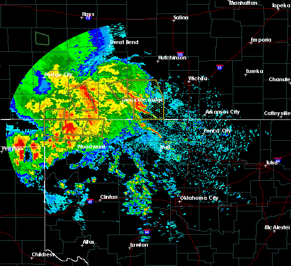 At 157 am cdt, a severe thunderstorm was located near isabel, moving east at 20 mph (radar indicated). Hazards include 60 mph wind gusts and quarter size hail. Hail damage to vehicles is expected. expect wind damage to roofs, siding, and trees. Locations impacted include, isabel. At 157 am cdt, a severe thunderstorm was located near isabel, moving east at 20 mph (radar indicated). Hazards include 60 mph wind gusts and quarter size hail. Hail damage to vehicles is expected. expect wind damage to roofs, siding, and trees. Locations impacted include, isabel.
|
| 7/13/2020 1:46 AM CDT |
 At 146 am cdt, a severe thunderstorm was located near isabel, moving east at 20 mph (radar indicated). Hazards include 60 mph wind gusts and quarter size hail. Hail damage to vehicles is expected. expect wind damage to roofs, siding, and trees. Locations impacted include, pratt, sawyer, isabel and cairo. At 146 am cdt, a severe thunderstorm was located near isabel, moving east at 20 mph (radar indicated). Hazards include 60 mph wind gusts and quarter size hail. Hail damage to vehicles is expected. expect wind damage to roofs, siding, and trees. Locations impacted include, pratt, sawyer, isabel and cairo.
|
| 7/13/2020 1:30 AM CDT |
 At 130 am cdt, a severe thunderstorm was located near sawyer, moving east at 20 mph (radar indicated). Hazards include 60 mph wind gusts and quarter size hail. Hail damage to vehicles is expected. Expect wind damage to roofs, siding, and trees. At 130 am cdt, a severe thunderstorm was located near sawyer, moving east at 20 mph (radar indicated). Hazards include 60 mph wind gusts and quarter size hail. Hail damage to vehicles is expected. Expect wind damage to roofs, siding, and trees.
|
| 6/21/2020 6:56 PM CDT |
 At 656 pm cdt, severe thunderstorms were located along a line extending from near turon to near coats to near lake coldwater, moving southeast at 35 mph. these are very dangerous storms (radar indicated). Hazards include 80 mph wind gusts and quarter size hail. Flying debris will be dangerous to those caught without shelter. mobile homes will be heavily damaged. expect considerable damage to roofs, windows, and vehicles. Extensive tree damage and power outages are likely. At 656 pm cdt, severe thunderstorms were located along a line extending from near turon to near coats to near lake coldwater, moving southeast at 35 mph. these are very dangerous storms (radar indicated). Hazards include 80 mph wind gusts and quarter size hail. Flying debris will be dangerous to those caught without shelter. mobile homes will be heavily damaged. expect considerable damage to roofs, windows, and vehicles. Extensive tree damage and power outages are likely.
|
| 6/21/2020 6:19 PM CDT |
 At 617 pm cdt, severe thunderstorms were located along a line extending from near hudson to near hopewell to near greensburg, moving southeast at 35 mph. these are very dangerous storms (radar indicated). Hazards include 80 mph wind gusts and quarter size hail. Flying debris will be dangerous to those caught without shelter. mobile homes will be heavily damaged. expect considerable damage to roofs, windows, and vehicles. Extensive tree damage and power outages are likely. At 617 pm cdt, severe thunderstorms were located along a line extending from near hudson to near hopewell to near greensburg, moving southeast at 35 mph. these are very dangerous storms (radar indicated). Hazards include 80 mph wind gusts and quarter size hail. Flying debris will be dangerous to those caught without shelter. mobile homes will be heavily damaged. expect considerable damage to roofs, windows, and vehicles. Extensive tree damage and power outages are likely.
|
| 6/21/2020 6:17 PM CDT |
 At 617 pm cdt, severe thunderstorms were located along a line extending from near hudson to near hopewell to near greensburg, moving southeast at 35 mph. these are very dangerous storms (radar indicated). Hazards include 80 mph wind gusts and quarter size hail. Flying debris will be dangerous to those caught without shelter. mobile homes will be heavily damaged. expect considerable damage to roofs, windows, and vehicles. Extensive tree damage and power outages are likely. At 617 pm cdt, severe thunderstorms were located along a line extending from near hudson to near hopewell to near greensburg, moving southeast at 35 mph. these are very dangerous storms (radar indicated). Hazards include 80 mph wind gusts and quarter size hail. Flying debris will be dangerous to those caught without shelter. mobile homes will be heavily damaged. expect considerable damage to roofs, windows, and vehicles. Extensive tree damage and power outages are likely.
|
| 6/21/2020 2:36 AM CDT |
 The severe thunderstorm warning for barber and southeastern pratt counties will expire at 245 am cdt, the storms which prompted the warning have weakened below severe limits, and have exited the warned area. therefore, the warning will be allowed to expire. The severe thunderstorm warning for barber and southeastern pratt counties will expire at 245 am cdt, the storms which prompted the warning have weakened below severe limits, and have exited the warned area. therefore, the warning will be allowed to expire.
|
| 6/21/2020 2:10 AM CDT |
 At 210 am cdt, severe thunderstorms were located along a line extending from near nashville to 7 miles southeast of aetna, moving southeast at 20 mph (radar indicated). Hazards include 60 mph wind gusts. Expect damage to roofs, siding, and trees. Locations impacted include, medicine lodge, kiowa, hardtner, sharon, hazelton and isabel. At 210 am cdt, severe thunderstorms were located along a line extending from near nashville to 7 miles southeast of aetna, moving southeast at 20 mph (radar indicated). Hazards include 60 mph wind gusts. Expect damage to roofs, siding, and trees. Locations impacted include, medicine lodge, kiowa, hardtner, sharon, hazelton and isabel.
|
| 6/21/2020 1:58 AM CDT |
 At 157 am cdt, severe thunderstorms were located along a line extending from 7 miles southeast of nashville to near aetna, moving southeast at 35 mph (radar indicated). Hazards include 60 mph wind gusts. expect damage to roofs, siding, and trees At 157 am cdt, severe thunderstorms were located along a line extending from 7 miles southeast of nashville to near aetna, moving southeast at 35 mph (radar indicated). Hazards include 60 mph wind gusts. expect damage to roofs, siding, and trees
|
| 4/19/2020 12:55 AM CDT |
 The severe thunderstorm warning for southern pratt county will expire at 100 am cdt, the storm which prompted the warning has weakened below severe limits, and no longer poses an immediate threat to life or property. therefore, the warning will be allowed to expire. however gusty winds are still possible with this thunderstorm. The severe thunderstorm warning for southern pratt county will expire at 100 am cdt, the storm which prompted the warning has weakened below severe limits, and no longer poses an immediate threat to life or property. therefore, the warning will be allowed to expire. however gusty winds are still possible with this thunderstorm.
|
| 4/19/2020 12:45 AM CDT |
 At 1244 am cdt, a severe thunderstorm was located near coats, moving east at 35 mph (radar indicated). Hazards include 60 mph wind gusts and half dollar size hail. Hail damage to vehicles is expected. expect wind damage to roofs, siding, and trees. Locations impacted include, pratt, sawyer, cullison, isabel and coats. At 1244 am cdt, a severe thunderstorm was located near coats, moving east at 35 mph (radar indicated). Hazards include 60 mph wind gusts and half dollar size hail. Hail damage to vehicles is expected. expect wind damage to roofs, siding, and trees. Locations impacted include, pratt, sawyer, cullison, isabel and coats.
|
| 4/19/2020 12:21 AM CDT |
 At 1220 am cdt, a severe thunderstorm was located near belvidere, moving northeast at 40 mph (radar indicated). Hazards include half dollar size hail. damage to vehicles is expected At 1220 am cdt, a severe thunderstorm was located near belvidere, moving northeast at 40 mph (radar indicated). Hazards include half dollar size hail. damage to vehicles is expected
|
| 3/24/2020 1:47 AM CDT |
 At 147 am cdt, a severe thunderstorm was located very near isabel, moving east at 25 mph (radar indicated). Hazards include quarter size hail. damage to vehicles is expected At 147 am cdt, a severe thunderstorm was located very near isabel, moving east at 25 mph (radar indicated). Hazards include quarter size hail. damage to vehicles is expected
|
| 9/24/2019 9:46 PM CDT |
 At 946 pm cdt, a severe thunderstorm was located near sawyer, moving east at 20 mph (radar indicated). Hazards include 60 mph wind gusts and quarter size hail. Hail damage to vehicles is expected. expect wind damage to roofs, siding, and trees. Locations impacted include, medicine lodge, kiowa, coldwater, hardtner, sharon, sawyer, hazelton, isabel, coats, lake city, sun city, wilmore, aetna, croft and belvidere. At 946 pm cdt, a severe thunderstorm was located near sawyer, moving east at 20 mph (radar indicated). Hazards include 60 mph wind gusts and quarter size hail. Hail damage to vehicles is expected. expect wind damage to roofs, siding, and trees. Locations impacted include, medicine lodge, kiowa, coldwater, hardtner, sharon, sawyer, hazelton, isabel, coats, lake city, sun city, wilmore, aetna, croft and belvidere.
|
| 9/24/2019 9:30 PM CDT |
 At 930 pm cdt, a severe thunderstorm capable of producing a tornado was located 7 miles northwest of medicine lodge, moving east at 25 mph (radar indicated rotation). Hazards include tornado and half dollar size hail. Flying debris will be dangerous to those caught without shelter. mobile homes will be damaged or destroyed. damage to roofs, windows, and vehicles will occur. tree damage is likely. this dangerous storm will be near, medicine lodge around 935 pm cdt. Isabel around 940 pm cdt. At 930 pm cdt, a severe thunderstorm capable of producing a tornado was located 7 miles northwest of medicine lodge, moving east at 25 mph (radar indicated rotation). Hazards include tornado and half dollar size hail. Flying debris will be dangerous to those caught without shelter. mobile homes will be damaged or destroyed. damage to roofs, windows, and vehicles will occur. tree damage is likely. this dangerous storm will be near, medicine lodge around 935 pm cdt. Isabel around 940 pm cdt.
|
| 9/24/2019 9:24 PM CDT |
 At 923 pm cdt, a severe thunderstorm capable of producing a tornado was located near lake city, moving east at 20 mph (radar indicated rotation). Hazards include tornado and half dollar size hail. Flying debris will be dangerous to those caught without shelter. mobile homes will be damaged or destroyed. damage to roofs, windows, and vehicles will occur. tree damage is likely. this dangerous storm will be near, sawyer around 930 pm cdt. Medicine lodge and isabel around 950 pm cdt. At 923 pm cdt, a severe thunderstorm capable of producing a tornado was located near lake city, moving east at 20 mph (radar indicated rotation). Hazards include tornado and half dollar size hail. Flying debris will be dangerous to those caught without shelter. mobile homes will be damaged or destroyed. damage to roofs, windows, and vehicles will occur. tree damage is likely. this dangerous storm will be near, sawyer around 930 pm cdt. Medicine lodge and isabel around 950 pm cdt.
|
| 9/24/2019 9:12 PM CDT |
 At 912 pm cdt, a severe thunderstorm capable of producing a tornado was located near lake city, moving east at 25 mph (radar indicated rotation). Hazards include tornado and golf ball size hail. Flying debris will be dangerous to those caught without shelter. mobile homes will be damaged or destroyed. damage to roofs, windows, and vehicles will occur. tree damage is likely. this dangerous storm will be near, sawyer around 920 pm cdt. Isabel around 930 pm cdt. At 912 pm cdt, a severe thunderstorm capable of producing a tornado was located near lake city, moving east at 25 mph (radar indicated rotation). Hazards include tornado and golf ball size hail. Flying debris will be dangerous to those caught without shelter. mobile homes will be damaged or destroyed. damage to roofs, windows, and vehicles will occur. tree damage is likely. this dangerous storm will be near, sawyer around 920 pm cdt. Isabel around 930 pm cdt.
|
| 9/24/2019 9:09 PM CDT |
 At 909 pm cdt, a severe thunderstorm was located near sun city, moving northeast at 20 mph (radar indicated). Hazards include 70 mph wind gusts and half dollar size hail. Hail damage to vehicles is expected. expect considerable tree damage. Wind damage is also likely to mobile homes, roofs, and outbuildings. At 909 pm cdt, a severe thunderstorm was located near sun city, moving northeast at 20 mph (radar indicated). Hazards include 70 mph wind gusts and half dollar size hail. Hail damage to vehicles is expected. expect considerable tree damage. Wind damage is also likely to mobile homes, roofs, and outbuildings.
|
| 9/24/2019 9:03 PM CDT |
 At 903 pm cdt, a severe thunderstorm was located near sun city, moving northeast at 20 mph (radar indicated). Hazards include 60 mph wind gusts and half dollar size hail. Hail damage to vehicles is expected. Expect wind damage to roofs, siding, and trees. At 903 pm cdt, a severe thunderstorm was located near sun city, moving northeast at 20 mph (radar indicated). Hazards include 60 mph wind gusts and half dollar size hail. Hail damage to vehicles is expected. Expect wind damage to roofs, siding, and trees.
|
| 9/24/2019 9:00 PM CDT |
 At 900 pm cdt, a severe thunderstorm was located near cairo, moving east at 15 mph (radar indicated). Hazards include 60 mph wind gusts and quarter size hail. Hail damage to vehicles is expected. expect wind damage to roofs, siding, and trees. Locations impacted include, pratt, preston, sawyer, isabel and cairo. At 900 pm cdt, a severe thunderstorm was located near cairo, moving east at 15 mph (radar indicated). Hazards include 60 mph wind gusts and quarter size hail. Hail damage to vehicles is expected. expect wind damage to roofs, siding, and trees. Locations impacted include, pratt, preston, sawyer, isabel and cairo.
|
| 9/24/2019 8:45 PM CDT |
 At 845 pm cdt, a severe thunderstorm was located near pratt, moving east at 15 mph (radar indicated). Hazards include 60 mph wind gusts and half dollar size hail. Hail damage to vehicles is expected. Expect wind damage to roofs, siding, and trees. At 845 pm cdt, a severe thunderstorm was located near pratt, moving east at 15 mph (radar indicated). Hazards include 60 mph wind gusts and half dollar size hail. Hail damage to vehicles is expected. Expect wind damage to roofs, siding, and trees.
|
| 9/24/2019 7:53 PM CDT | 50-60 mph wind gusts reported northeast of medicine lodg in barber county KS, 7.6 miles NNW of Isabel, KS |
| 9/24/2019 7:25 PM CDT |
 At 725 pm cdt, a severe thunderstorm was located near isabel, moving southeast at 25 mph (radar indicated). Hazards include 60 mph wind gusts and quarter size hail. Hail damage to vehicles is expected. expect wind damage to roofs, siding, and trees. Locations impacted include, sharon and isabel. At 725 pm cdt, a severe thunderstorm was located near isabel, moving southeast at 25 mph (radar indicated). Hazards include 60 mph wind gusts and quarter size hail. Hail damage to vehicles is expected. expect wind damage to roofs, siding, and trees. Locations impacted include, sharon and isabel.
|
| 9/24/2019 7:20 PM CDT |
 At 720 pm cdt, a severe thunderstorm was located very near isabel, moving southeast at 20 mph (radar indicated). Hazards include 60 mph wind gusts and half dollar size hail. Hail damage to vehicles is expected. expect wind damage to roofs, siding, and trees. Locations impacted include, medicine lodge, sharon, sawyer and isabel. At 720 pm cdt, a severe thunderstorm was located very near isabel, moving southeast at 20 mph (radar indicated). Hazards include 60 mph wind gusts and half dollar size hail. Hail damage to vehicles is expected. expect wind damage to roofs, siding, and trees. Locations impacted include, medicine lodge, sharon, sawyer and isabel.
|
| 9/24/2019 7:08 PM CDT |
 At 708 pm cdt, a severe thunderstorm was located near sawyer, moving southeast at 20 mph (radar indicated). Hazards include 70 mph wind gusts and ping pong ball size hail. People and animals outdoors will be injured. expect hail damage to roofs, siding, windows, and vehicles. expect considerable tree damage. wind damage is also likely to mobile homes, roofs, and outbuildings. Locations impacted include, medicine lodge, sharon, sawyer, hazelton and isabel. At 708 pm cdt, a severe thunderstorm was located near sawyer, moving southeast at 20 mph (radar indicated). Hazards include 70 mph wind gusts and ping pong ball size hail. People and animals outdoors will be injured. expect hail damage to roofs, siding, windows, and vehicles. expect considerable tree damage. wind damage is also likely to mobile homes, roofs, and outbuildings. Locations impacted include, medicine lodge, sharon, sawyer, hazelton and isabel.
|
| 9/24/2019 6:59 PM CDT |
 At 659 pm cdt, a severe thunderstorm was located very near sawyer, moving southeast at 20 mph (radar indicated). Hazards include two inch hail and 70 mph wind gusts. People and animals outdoors will be injured. expect hail damage to roofs, siding, windows, and vehicles. expect considerable tree damage. wind damage is also likely to mobile homes, roofs, and outbuildings. Locations impacted include, pratt, medicine lodge, sharon, sawyer, hazelton, isabel, coats and cairo. At 659 pm cdt, a severe thunderstorm was located very near sawyer, moving southeast at 20 mph (radar indicated). Hazards include two inch hail and 70 mph wind gusts. People and animals outdoors will be injured. expect hail damage to roofs, siding, windows, and vehicles. expect considerable tree damage. wind damage is also likely to mobile homes, roofs, and outbuildings. Locations impacted include, pratt, medicine lodge, sharon, sawyer, hazelton, isabel, coats and cairo.
|
| 9/24/2019 6:49 PM CDT |
 At 648 pm cdt, a severe thunderstorm was located near coats, moving southeast at 25 mph (radar indicated). Hazards include two inch hail and 70 mph wind gusts. People and animals outdoors will be injured. expect hail damage to roofs, siding, windows, and vehicles. expect considerable tree damage. Wind damage is also likely to mobile homes, roofs, and outbuildings. At 648 pm cdt, a severe thunderstorm was located near coats, moving southeast at 25 mph (radar indicated). Hazards include two inch hail and 70 mph wind gusts. People and animals outdoors will be injured. expect hail damage to roofs, siding, windows, and vehicles. expect considerable tree damage. Wind damage is also likely to mobile homes, roofs, and outbuildings.
|
| 9/24/2019 6:44 PM CDT |
 At 644 pm cdt, a severe thunderstorm was located near cairo, moving east at 5 mph (radar indicated). Hazards include 60 mph wind gusts and quarter size hail. Hail damage to vehicles is expected. expect wind damage to roofs, siding, and trees. Locations impacted include, isabel and cairo. At 644 pm cdt, a severe thunderstorm was located near cairo, moving east at 5 mph (radar indicated). Hazards include 60 mph wind gusts and quarter size hail. Hail damage to vehicles is expected. expect wind damage to roofs, siding, and trees. Locations impacted include, isabel and cairo.
|
| 9/24/2019 6:36 PM CDT |
 At 635 pm cdt, a severe thunderstorm was located near isabel, moving east at 15 mph (radar indicated). Hazards include 60 mph wind gusts and half dollar size hail. Hail damage to vehicles is expected. expect wind damage to roofs, siding, and trees. Locations impacted include, isabel. At 635 pm cdt, a severe thunderstorm was located near isabel, moving east at 15 mph (radar indicated). Hazards include 60 mph wind gusts and half dollar size hail. Hail damage to vehicles is expected. expect wind damage to roofs, siding, and trees. Locations impacted include, isabel.
|
| 9/24/2019 6:29 PM CDT |
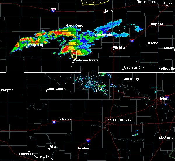 At 629 pm cdt, a severe thunderstorm was located near isabel, moving east at 15 mph (radar indicated). Hazards include ping pong ball size hail and 60 mph wind gusts. People and animals outdoors will be injured. expect hail damage to roofs, siding, windows, and vehicles. Expect wind damage to roofs, siding, and trees. At 629 pm cdt, a severe thunderstorm was located near isabel, moving east at 15 mph (radar indicated). Hazards include ping pong ball size hail and 60 mph wind gusts. People and animals outdoors will be injured. expect hail damage to roofs, siding, windows, and vehicles. Expect wind damage to roofs, siding, and trees.
|
| 9/24/2019 6:20 PM CDT |
 At 620 pm cdt, a severe thunderstorm was located near cairo, moving east at 15 mph (radar indicated). Hazards include ping pong ball size hail and 60 mph wind gusts. People and animals outdoors will be injured. expect hail damage to roofs, siding, windows, and vehicles. Expect wind damage to roofs, siding, and trees. At 620 pm cdt, a severe thunderstorm was located near cairo, moving east at 15 mph (radar indicated). Hazards include ping pong ball size hail and 60 mph wind gusts. People and animals outdoors will be injured. expect hail damage to roofs, siding, windows, and vehicles. Expect wind damage to roofs, siding, and trees.
|
| 9/24/2019 6:13 PM CDT |
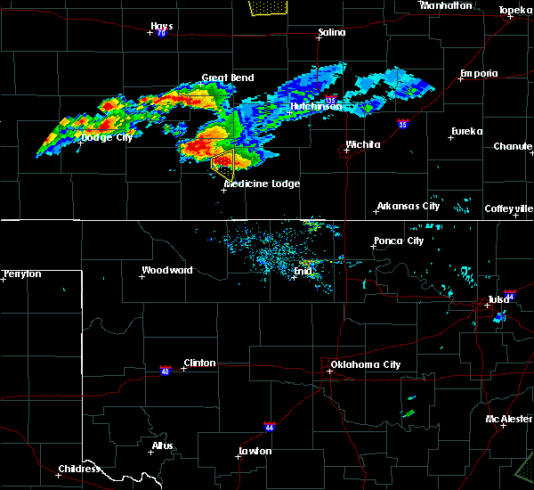 At 613 pm cdt, a severe thunderstorm was located near sawyer, moving east at 20 mph (radar indicated). Hazards include tennis ball size hail and 60 mph wind gusts. People and animals outdoors will be injured. expect hail damage to roofs, siding, windows, and vehicles. expect wind damage to roofs, siding, and trees. Locations impacted include, isabel and cairo. At 613 pm cdt, a severe thunderstorm was located near sawyer, moving east at 20 mph (radar indicated). Hazards include tennis ball size hail and 60 mph wind gusts. People and animals outdoors will be injured. expect hail damage to roofs, siding, windows, and vehicles. expect wind damage to roofs, siding, and trees. Locations impacted include, isabel and cairo.
|
| 9/24/2019 5:59 PM CDT |
 At 555 pm cdt, a severe thunderstorm was located near pratt, moving southeast at 15 mph (radar indicated). Hazards include golf ball size hail and 60 mph wind gusts. People and animals outdoors will be injured. expect hail damage to roofs, siding, windows, and vehicles. expect wind damage to roofs, siding, and trees. Locations impacted include, pratt, sawyer, isabel and cairo. At 555 pm cdt, a severe thunderstorm was located near pratt, moving southeast at 15 mph (radar indicated). Hazards include golf ball size hail and 60 mph wind gusts. People and animals outdoors will be injured. expect hail damage to roofs, siding, windows, and vehicles. expect wind damage to roofs, siding, and trees. Locations impacted include, pratt, sawyer, isabel and cairo.
|
| 9/24/2019 5:56 PM CDT |
 At 555 pm cdt, a severe thunderstorm was located near pratt, moving southeast at 15 mph (radar indicated). Hazards include golf ball size hail and 60 mph wind gusts. People and animals outdoors will be injured. expect hail damage to roofs, siding, windows, and vehicles. expect wind damage to roofs, siding, and trees. Locations impacted include, pratt, sawyer, isabel and cairo. At 555 pm cdt, a severe thunderstorm was located near pratt, moving southeast at 15 mph (radar indicated). Hazards include golf ball size hail and 60 mph wind gusts. People and animals outdoors will be injured. expect hail damage to roofs, siding, windows, and vehicles. expect wind damage to roofs, siding, and trees. Locations impacted include, pratt, sawyer, isabel and cairo.
|
| 9/24/2019 5:48 PM CDT |
 At 547 pm cdt, a severe thunderstorm was located near pratt, moving east at 15 mph (radar indicated). Hazards include golf ball size hail and 60 mph wind gusts. People and animals outdoors will be injured. expect hail damage to roofs, siding, windows, and vehicles. expect wind damage to roofs, siding, and trees. Locations impacted include, pratt, sawyer, isabel and cairo. At 547 pm cdt, a severe thunderstorm was located near pratt, moving east at 15 mph (radar indicated). Hazards include golf ball size hail and 60 mph wind gusts. People and animals outdoors will be injured. expect hail damage to roofs, siding, windows, and vehicles. expect wind damage to roofs, siding, and trees. Locations impacted include, pratt, sawyer, isabel and cairo.
|
| 9/24/2019 5:30 PM CDT |
 At 530 pm cdt, a severe thunderstorm was located near pratt, moving east at 15 mph (radar indicated). Hazards include ping pong ball size hail and 60 mph wind gusts. People and animals outdoors will be injured. expect hail damage to roofs, siding, windows, and vehicles. expect wind damage to roofs, siding, and trees. Locations impacted include, pratt, sawyer, isabel, coats and cairo. At 530 pm cdt, a severe thunderstorm was located near pratt, moving east at 15 mph (radar indicated). Hazards include ping pong ball size hail and 60 mph wind gusts. People and animals outdoors will be injured. expect hail damage to roofs, siding, windows, and vehicles. expect wind damage to roofs, siding, and trees. Locations impacted include, pratt, sawyer, isabel, coats and cairo.
|
| 9/24/2019 5:28 PM CDT |
 At 528 pm cdt, a severe thunderstorm was located near pratt, moving east at 15 mph (radar indicated). Hazards include 60 mph wind gusts and half dollar size hail. Hail damage to vehicles is expected. Expect wind damage to roofs, siding, and trees. At 528 pm cdt, a severe thunderstorm was located near pratt, moving east at 15 mph (radar indicated). Hazards include 60 mph wind gusts and half dollar size hail. Hail damage to vehicles is expected. Expect wind damage to roofs, siding, and trees.
|
| 8/30/2019 12:10 AM CDT |
 At 1210 am cdt, severe thunderstorms were located along a line extending from near nashville to 9 miles south of aetna, moving southeast at 20 mph (radar indicated). Hazards include 70 mph wind gusts and nickel size hail. Expect considerable tree damage. Damage is likely to mobile homes, roofs, and outbuildings. At 1210 am cdt, severe thunderstorms were located along a line extending from near nashville to 9 miles south of aetna, moving southeast at 20 mph (radar indicated). Hazards include 70 mph wind gusts and nickel size hail. Expect considerable tree damage. Damage is likely to mobile homes, roofs, and outbuildings.
|
| 8/29/2019 11:56 PM CDT |
 At 1155 pm cdt, severe thunderstorms were located along a line extending from near isabel to near buttermilk, moving southeast at 20 mph (radar indicated). Hazards include 70 mph wind gusts and nickel size hail. Expect considerable tree damage. damage is likely to mobile homes, roofs, and outbuildings. Locations impacted include, pratt, medicine lodge, kiowa, hardtner, sharon, sawyer, hazelton, isabel, coats, lake city, sun city, aetna and cairo. At 1155 pm cdt, severe thunderstorms were located along a line extending from near isabel to near buttermilk, moving southeast at 20 mph (radar indicated). Hazards include 70 mph wind gusts and nickel size hail. Expect considerable tree damage. damage is likely to mobile homes, roofs, and outbuildings. Locations impacted include, pratt, medicine lodge, kiowa, hardtner, sharon, sawyer, hazelton, isabel, coats, lake city, sun city, aetna and cairo.
|
| 8/29/2019 11:46 PM CDT |
 At 1146 pm cdt, severe thunderstorms were located along a line extending from near sawyer to near buttermilk, moving southeast at 25 mph (radar indicated). Hazards include 70 mph wind gusts and nickel size hail. Expect considerable tree damage. damage is likely to mobile homes, roofs, and outbuildings. Locations impacted include, pratt, medicine lodge, kiowa, hardtner, sharon, sawyer, hazelton, isabel, coats, lake city, sun city, aetna and cairo. At 1146 pm cdt, severe thunderstorms were located along a line extending from near sawyer to near buttermilk, moving southeast at 25 mph (radar indicated). Hazards include 70 mph wind gusts and nickel size hail. Expect considerable tree damage. damage is likely to mobile homes, roofs, and outbuildings. Locations impacted include, pratt, medicine lodge, kiowa, hardtner, sharon, sawyer, hazelton, isabel, coats, lake city, sun city, aetna and cairo.
|
| 8/29/2019 11:28 PM CDT |
 At 1128 pm cdt, severe thunderstorms were located along a line extending from near sawyer to 7 miles south of buttermilk, moving southeast at 25 mph (radar indicated). Hazards include 70 mph wind gusts and nickel size hail. Expect considerable tree damage. Damage is likely to mobile homes, roofs, and outbuildings. At 1128 pm cdt, severe thunderstorms were located along a line extending from near sawyer to 7 miles south of buttermilk, moving southeast at 25 mph (radar indicated). Hazards include 70 mph wind gusts and nickel size hail. Expect considerable tree damage. Damage is likely to mobile homes, roofs, and outbuildings.
|
| 8/25/2019 3:57 AM CDT |
 At 356 am cdt, a severe thunderstorm was located very near sun city, moving southeast at 35 mph (radar indicated). Hazards include golf ball size hail and 60 mph wind gusts. People and animals outdoors will be injured. expect hail damage to roofs, siding, windows, and vehicles. expect wind damage to roofs, siding, and trees. Locations impacted include, sawyer, isabel, coats, lake city, sun city, croft, belvidere and wellsford. At 356 am cdt, a severe thunderstorm was located very near sun city, moving southeast at 35 mph (radar indicated). Hazards include golf ball size hail and 60 mph wind gusts. People and animals outdoors will be injured. expect hail damage to roofs, siding, windows, and vehicles. expect wind damage to roofs, siding, and trees. Locations impacted include, sawyer, isabel, coats, lake city, sun city, croft, belvidere and wellsford.
|
| 8/25/2019 3:31 AM CDT |
 At 331 am cdt, a severe thunderstorm was located near belvidere, moving southeast at 35 mph (radar indicated). Hazards include 60 mph wind gusts and half dollar size hail. Hail damage to vehicles is expected. Expect wind damage to roofs, siding, and trees. At 331 am cdt, a severe thunderstorm was located near belvidere, moving southeast at 35 mph (radar indicated). Hazards include 60 mph wind gusts and half dollar size hail. Hail damage to vehicles is expected. Expect wind damage to roofs, siding, and trees.
|
| 8/13/2019 10:11 PM CDT |
 The severe thunderstorm warning for northeastern barber, eastern stafford and pratt counties will expire at 1015 pm cdt, the storms which prompted the warning have moved out of the area. therefore, the warning will be allowed to expire. however gusty winds are still possible with these thunderstorms. a severe thunderstorm watch remains in effect until 200 am cdt for south central kansas. The severe thunderstorm warning for northeastern barber, eastern stafford and pratt counties will expire at 1015 pm cdt, the storms which prompted the warning have moved out of the area. therefore, the warning will be allowed to expire. however gusty winds are still possible with these thunderstorms. a severe thunderstorm watch remains in effect until 200 am cdt for south central kansas.
|
| 8/13/2019 9:40 PM CDT |
 At 939 pm cdt, severe thunderstorms were located along a line extending from 7 miles northeast of seward to 8 miles southwest of stafford to near coats, moving east at 35 mph (radar indicated). Hazards include 60 mph wind gusts and penny size hail. expect damage to roofs, siding, and trees At 939 pm cdt, severe thunderstorms were located along a line extending from 7 miles northeast of seward to 8 miles southwest of stafford to near coats, moving east at 35 mph (radar indicated). Hazards include 60 mph wind gusts and penny size hail. expect damage to roofs, siding, and trees
|
| 8/13/2019 8:51 PM CDT |
 At 851 pm cdt, severe thunderstorms were located along a line extending from near pawnee rock to near dillwyn to near wellsford, moving east at 45 mph (radar indicated). Hazards include 70 mph wind gusts and nickel size hail. Expect considerable tree damage. Damage is likely to mobile homes, roofs, and outbuildings. At 851 pm cdt, severe thunderstorms were located along a line extending from near pawnee rock to near dillwyn to near wellsford, moving east at 45 mph (radar indicated). Hazards include 70 mph wind gusts and nickel size hail. Expect considerable tree damage. Damage is likely to mobile homes, roofs, and outbuildings.
|
| 7/6/2019 12:11 AM CDT |
 At 1208 am cdt, severe thunderstorms were located along a line extending from 10 miles south of kingman to 8 miles north of selman, moving southeast at 25 mph (radar indicated). Hazards include 70 mph wind gusts and quarter size hail. Hail damage to vehicles is expected. expect considerable tree damage. wind damage is also likely to mobile homes, roofs, and outbuildings. Locations impacted include, medicine lodge, kiowa, hardtner, sharon, hazelton, isabel, lake city, sun city, aetna and buttermilk. At 1208 am cdt, severe thunderstorms were located along a line extending from 10 miles south of kingman to 8 miles north of selman, moving southeast at 25 mph (radar indicated). Hazards include 70 mph wind gusts and quarter size hail. Hail damage to vehicles is expected. expect considerable tree damage. wind damage is also likely to mobile homes, roofs, and outbuildings. Locations impacted include, medicine lodge, kiowa, hardtner, sharon, hazelton, isabel, lake city, sun city, aetna and buttermilk.
|
| 7/5/2019 11:29 PM CDT |
 At 1128 pm cdt, severe thunderstorms were located along a line extending from near cunningham to 10 miles southeast of acres, moving southeast at 25 mph (radar indicated). Hazards include 60 mph wind gusts and quarter size hail. Hail damage to vehicles is expected. Expect wind damage to roofs, siding, and trees. At 1128 pm cdt, severe thunderstorms were located along a line extending from near cunningham to 10 miles southeast of acres, moving southeast at 25 mph (radar indicated). Hazards include 60 mph wind gusts and quarter size hail. Hail damage to vehicles is expected. Expect wind damage to roofs, siding, and trees.
|
| 6/15/2019 11:50 PM CDT |
 At 1150 pm cdt, a severe thunderstorm was located very near sun city, moving west at 10 mph (radar indicated). Hazards include ping pong ball size hail. People and animals outdoors will be injured. expect damage to roofs, siding, windows, and vehicles. Locations impacted include, isabel, lake city and sun city. At 1150 pm cdt, a severe thunderstorm was located very near sun city, moving west at 10 mph (radar indicated). Hazards include ping pong ball size hail. People and animals outdoors will be injured. expect damage to roofs, siding, windows, and vehicles. Locations impacted include, isabel, lake city and sun city.
|
| 6/15/2019 11:24 PM CDT |
 At 1121 pm cdt, a severe thunderstorm was located north of medicine lodge, and is nearly stationary. the storm is developing farther west across northern barber county (radar indicated). Hazards include golf ball size hail. People and animals outdoors will be injured. Expect damage to roofs, siding, windows, and vehicles. At 1121 pm cdt, a severe thunderstorm was located north of medicine lodge, and is nearly stationary. the storm is developing farther west across northern barber county (radar indicated). Hazards include golf ball size hail. People and animals outdoors will be injured. Expect damage to roofs, siding, windows, and vehicles.
|
| 6/15/2019 11:11 PM CDT |
 At 1110 pm cdt, a severe thunderstorm was located near sawyer, and is nearly stationary (radar indicated). Hazards include half dollar size hail. Damage to vehicles is expected. Locations impacted include, sawyer and isabel. At 1110 pm cdt, a severe thunderstorm was located near sawyer, and is nearly stationary (radar indicated). Hazards include half dollar size hail. Damage to vehicles is expected. Locations impacted include, sawyer and isabel.
|
| 6/15/2019 10:53 PM CDT |
 At 1053 pm cdt, a severe thunderstorm was located near sawyer, moving east at 10 mph (radar indicated). Hazards include half dollar size hail. damage to vehicles is expected At 1053 pm cdt, a severe thunderstorm was located near sawyer, moving east at 10 mph (radar indicated). Hazards include half dollar size hail. damage to vehicles is expected
|
| 6/15/2019 12:01 AM CDT |
 A severe thunderstorm warning remains in effect until 1230 am cdt for barber and southeastern pratt counties. at 1201 am cdt, a severe thunderstorm was located near attica, moving east at 55 mph. hazard. 70 mph wind gusts and penny size hail. source. Radar indicated. A severe thunderstorm warning remains in effect until 1230 am cdt for barber and southeastern pratt counties. at 1201 am cdt, a severe thunderstorm was located near attica, moving east at 55 mph. hazard. 70 mph wind gusts and penny size hail. source. Radar indicated.
|
| 6/14/2019 11:38 PM CDT |
 At 1137 pm cdt, a line of severe thunderstorms extended from north of pratt to southeast of coldwater, moving east at 55 mph (radar indicated). Hazards include 70 mph wind gusts and penny size hail. Expect considerable tree damage. Damage is likely to mobile homes, roofs, and outbuildings. At 1137 pm cdt, a line of severe thunderstorms extended from north of pratt to southeast of coldwater, moving east at 55 mph (radar indicated). Hazards include 70 mph wind gusts and penny size hail. Expect considerable tree damage. Damage is likely to mobile homes, roofs, and outbuildings.
|
| 5/27/2019 12:40 AM CDT |
 The severe thunderstorm warning for barber, stafford and pratt counties will expire at 1245 am cdt, the storms which prompted the warning have moved out of the area. therefore, the warning will be allowed to expire. however gusty winds are still possible with these thunderstorms in eastern barber county through 1 am. a severe thunderstorm watch remains in effect until 200 am cdt for south central kansas. The severe thunderstorm warning for barber, stafford and pratt counties will expire at 1245 am cdt, the storms which prompted the warning have moved out of the area. therefore, the warning will be allowed to expire. however gusty winds are still possible with these thunderstorms in eastern barber county through 1 am. a severe thunderstorm watch remains in effect until 200 am cdt for south central kansas.
|
| 5/27/2019 12:24 AM CDT |
 At 1223 am cdt, severe thunderstorms were located along a line extending from near ellinwood to near cairo to near hardtner, moving northeast at 50 mph (radar indicated. at 1215 am the pratt airport reported a wind gust of 71 mph). Hazards include 70 mph wind gusts and penny size hail. Expect considerable tree damage. damage is likely to mobile homes, roofs, and outbuildings. locations impacted include, pratt, medicine lodge, st. john, stafford, kiowa, hardtner, iuka, preston, sharon, hudson, sawyer, hazelton, isabel, lake city, zenith, cairo and neola. Time, mot, loc 0523z 205deg 139kt 3831 9864 3761 9853 3700 9867. At 1223 am cdt, severe thunderstorms were located along a line extending from near ellinwood to near cairo to near hardtner, moving northeast at 50 mph (radar indicated. at 1215 am the pratt airport reported a wind gust of 71 mph). Hazards include 70 mph wind gusts and penny size hail. Expect considerable tree damage. damage is likely to mobile homes, roofs, and outbuildings. locations impacted include, pratt, medicine lodge, st. john, stafford, kiowa, hardtner, iuka, preston, sharon, hudson, sawyer, hazelton, isabel, lake city, zenith, cairo and neola. Time, mot, loc 0523z 205deg 139kt 3831 9864 3761 9853 3700 9867.
|
| 5/26/2019 11:51 PM CDT |
 At 1151 pm cdt, severe thunderstorms were located along a line extending from near ash valley to wellsford to near aetna, moving east at 45 mph (radar indicated). Hazards include 70 mph wind gusts and penny size hail. Expect considerable tree damage. Damage is likely to mobile homes, roofs, and outbuildings. At 1151 pm cdt, severe thunderstorms were located along a line extending from near ash valley to wellsford to near aetna, moving east at 45 mph (radar indicated). Hazards include 70 mph wind gusts and penny size hail. Expect considerable tree damage. Damage is likely to mobile homes, roofs, and outbuildings.
|
| 5/18/2019 7:36 PM CDT |
 At 735 pm cdt, a severe thunderstorm was located near isabel, moving east at 20 mph (radar indicated). Hazards include quarter size hail. Damage to vehicles is expected. Locations impacted include, sawyer, isabel and cairo. At 735 pm cdt, a severe thunderstorm was located near isabel, moving east at 20 mph (radar indicated). Hazards include quarter size hail. Damage to vehicles is expected. Locations impacted include, sawyer, isabel and cairo.
|
| 5/18/2019 7:10 PM CDT |
 At 709 pm cdt, a severe thunderstorm was located near lake city, moving northeast at 15 mph (radar indicated). Hazards include ping pong ball size hail and 60 mph wind gusts. People and animals outdoors will be injured. expect hail damage to roofs, siding, windows, and vehicles. Expect wind damage to roofs, siding, and trees. At 709 pm cdt, a severe thunderstorm was located near lake city, moving northeast at 15 mph (radar indicated). Hazards include ping pong ball size hail and 60 mph wind gusts. People and animals outdoors will be injured. expect hail damage to roofs, siding, windows, and vehicles. Expect wind damage to roofs, siding, and trees.
|
| 6/24/2018 11:49 PM CDT |
 At 1149 pm cdt, severe thunderstorms were located along a line extending from 6 miles southeast of nashville to 8 miles southeast of aetna, moving east at 40 mph (radar indicated). Hazards include 60 mph wind gusts and penny size hail. Expect damage to roofs, siding, and trees. Locations impacted include, medicine lodge, kiowa, hardtner, sharon, hazelton, isabel, lake city and aetna. At 1149 pm cdt, severe thunderstorms were located along a line extending from 6 miles southeast of nashville to 8 miles southeast of aetna, moving east at 40 mph (radar indicated). Hazards include 60 mph wind gusts and penny size hail. Expect damage to roofs, siding, and trees. Locations impacted include, medicine lodge, kiowa, hardtner, sharon, hazelton, isabel, lake city and aetna.
|
| 6/24/2018 11:23 PM CDT |
 At 1123 pm cdt, severe thunderstorms were located along a line extending from 7 miles south of cunningham to 8 miles southeast of buttermilk, moving east at 45 mph (radar indicated). Hazards include 60 mph wind gusts and penny size hail. expect damage to roofs, siding, and trees At 1123 pm cdt, severe thunderstorms were located along a line extending from 7 miles south of cunningham to 8 miles southeast of buttermilk, moving east at 45 mph (radar indicated). Hazards include 60 mph wind gusts and penny size hail. expect damage to roofs, siding, and trees
|
| 6/24/2018 11:07 PM CDT |
 At 1107 pm cdt, severe thunderstorms were located along a line extending from 6 miles south of cunningham to 9 miles southwest of buttermilk, moving east at 60 mph (radar indicated). Hazards include 70 mph wind gusts and quarter size hail. Hail damage to vehicles is expected. expect considerable tree damage. wind damage is also likely to mobile homes, roofs, and outbuildings. Locations impacted include, pratt, medicine lodge, kiowa, coldwater, protection, hardtner, sharon, sawyer, cullison, hazelton, isabel, coats, sitka, lake city, sun city, wilmore, aetna, croft, lake coldwater and cairo. At 1107 pm cdt, severe thunderstorms were located along a line extending from 6 miles south of cunningham to 9 miles southwest of buttermilk, moving east at 60 mph (radar indicated). Hazards include 70 mph wind gusts and quarter size hail. Hail damage to vehicles is expected. expect considerable tree damage. wind damage is also likely to mobile homes, roofs, and outbuildings. Locations impacted include, pratt, medicine lodge, kiowa, coldwater, protection, hardtner, sharon, sawyer, cullison, hazelton, isabel, coats, sitka, lake city, sun city, wilmore, aetna, croft, lake coldwater and cairo.
|
| 6/24/2018 10:37 PM CDT |
 At 1037 pm cdt, severe thunderstorms were located along a line extending from 2 miles northeast of belvidere to 6 miles southwest of englewood, moving east at 50 mph (radar indicated). Hazards include 70 mph wind gusts and quarter size hail. Hail damage to vehicles is expected. expect considerable tree damage. Wind damage is also likely to mobile homes, roofs, and outbuildings. At 1037 pm cdt, severe thunderstorms were located along a line extending from 2 miles northeast of belvidere to 6 miles southwest of englewood, moving east at 50 mph (radar indicated). Hazards include 70 mph wind gusts and quarter size hail. Hail damage to vehicles is expected. expect considerable tree damage. Wind damage is also likely to mobile homes, roofs, and outbuildings.
|
| 6/24/2018 1:21 AM CDT |
 At 120 am cdt, severe thunderstorms were located along a line extending from near cairo to 9 miles north of hardtner to 12 miles northeast of freedom, moving southeast at 30 mph (radar indicated). Hazards include 60 mph wind gusts and penny size hail. Expect damage to roofs, siding, and trees. Locations impacted include, pratt, medicine lodge, kiowa, hardtner, iuka, preston, sharon, sawyer, hazelton, isabel, lake city, aetna and cairo. At 120 am cdt, severe thunderstorms were located along a line extending from near cairo to 9 miles north of hardtner to 12 miles northeast of freedom, moving southeast at 30 mph (radar indicated). Hazards include 60 mph wind gusts and penny size hail. Expect damage to roofs, siding, and trees. Locations impacted include, pratt, medicine lodge, kiowa, hardtner, iuka, preston, sharon, sawyer, hazelton, isabel, lake city, aetna and cairo.
|
| 6/24/2018 12:54 AM CDT |
 At 1253 am cdt, severe thunderstorms were located along a line extending from iuka to 9 miles south of lake city to 11 miles north of freedom, moving southeast at 40 mph (radar indicated). Hazards include 60 mph wind gusts and penny size hail. Expect damage to roofs, siding, and trees. Locations impacted include, pratt, medicine lodge, kiowa, hardtner, iuka, preston, sharon, sawyer, cullison, hazelton, isabel, coats, lake city, sun city, byers, aetna, croft, cairo and buttermilk. At 1253 am cdt, severe thunderstorms were located along a line extending from iuka to 9 miles south of lake city to 11 miles north of freedom, moving southeast at 40 mph (radar indicated). Hazards include 60 mph wind gusts and penny size hail. Expect damage to roofs, siding, and trees. Locations impacted include, pratt, medicine lodge, kiowa, hardtner, iuka, preston, sharon, sawyer, cullison, hazelton, isabel, coats, lake city, sun city, byers, aetna, croft, cairo and buttermilk.
|
| 6/24/2018 12:35 AM CDT |
 At 1234 am cdt, severe thunderstorms were located along a line extending from near hopewell to 8 miles southwest of sun city to 6 miles south of buttermilk, moving southeast at 40 mph (radar indicated). Hazards include 60 mph wind gusts and penny size hail. Expect damage to roofs, siding, and trees. Locations impacted include, pratt, medicine lodge, kiowa, coldwater, haviland, hardtner, iuka, preston, sharon, sawyer, cullison, hazelton, isabel, belpre, coats, lake city, wilmore, sun city, byers and aetna. At 1234 am cdt, severe thunderstorms were located along a line extending from near hopewell to 8 miles southwest of sun city to 6 miles south of buttermilk, moving southeast at 40 mph (radar indicated). Hazards include 60 mph wind gusts and penny size hail. Expect damage to roofs, siding, and trees. Locations impacted include, pratt, medicine lodge, kiowa, coldwater, haviland, hardtner, iuka, preston, sharon, sawyer, cullison, hazelton, isabel, belpre, coats, lake city, wilmore, sun city, byers and aetna.
|
| 6/24/2018 12:14 AM CDT |
 At 1214 am cdt, severe thunderstorms were located along a line extending from 3 miles northwest of trousdale to 2 miles northeast of wilmore to 10 miles southeast of acres, moving southeast at 40 mph (radar indicated). Hazards include 60 mph wind gusts and penny size hail. expect damage to roofs, siding, and trees At 1214 am cdt, severe thunderstorms were located along a line extending from 3 miles northwest of trousdale to 2 miles northeast of wilmore to 10 miles southeast of acres, moving southeast at 40 mph (radar indicated). Hazards include 60 mph wind gusts and penny size hail. expect damage to roofs, siding, and trees
|
| 6/22/2018 8:18 PM CDT |
 At 818 pm cdt, severe thunderstorms were located along a line extending from 5 miles east of preston to 6 miles west of medicine lodge to 9 miles southeast of buttermilk, moving east at 65 mph (radar indicated). Hazards include 70 mph wind gusts and penny size hail. Expect considerable tree damage. damage is likely to mobile homes, roofs, and outbuildings. locations impacted include, pratt, medicine lodge, kiowa, hardtner, preston, sharon, sawyer, hazelton, isabel, coats, lake city, sun city, aetna and cairo. Numerous reports of 60 to 70 mph wind gusts have been reported with this line of storms since 745 pm cdt. At 818 pm cdt, severe thunderstorms were located along a line extending from 5 miles east of preston to 6 miles west of medicine lodge to 9 miles southeast of buttermilk, moving east at 65 mph (radar indicated). Hazards include 70 mph wind gusts and penny size hail. Expect considerable tree damage. damage is likely to mobile homes, roofs, and outbuildings. locations impacted include, pratt, medicine lodge, kiowa, hardtner, preston, sharon, sawyer, hazelton, isabel, coats, lake city, sun city, aetna and cairo. Numerous reports of 60 to 70 mph wind gusts have been reported with this line of storms since 745 pm cdt.
|
| 6/22/2018 7:55 PM CDT |
 At 755 pm cdt, severe thunderstorms were located along a line extending from 2 miles east of byers to 6 miles southeast of wilmore to 7 miles southeast of acres, moving southeast at 55 mph (radar indicated). Hazards include 70 mph wind gusts and penny size hail. Expect considerable tree damage. Damage is likely to mobile homes, roofs, and outbuildings. At 755 pm cdt, severe thunderstorms were located along a line extending from 2 miles east of byers to 6 miles southeast of wilmore to 7 miles southeast of acres, moving southeast at 55 mph (radar indicated). Hazards include 70 mph wind gusts and penny size hail. Expect considerable tree damage. Damage is likely to mobile homes, roofs, and outbuildings.
|
| 6/22/2018 7:47 PM CDT |
 At 747 pm cdt, severe thunderstorms were located along a line extending from near hopewell to 6 miles northwest of wilmore to 4 miles north of acres, moving southeast at 50 mph (radar indicated). Hazards include 70 mph wind gusts and penny size hail. Expect considerable tree damage. damage is likely to mobile homes, roofs, and outbuildings. Locations impacted include, pratt, ashland, coldwater, greensburg, haviland, protection, sawyer, cullison, isabel, coats, sitka, lake city, sun city, wilmore, hopewell, wellsford, croft, lake coldwater, acres and trousdale. At 747 pm cdt, severe thunderstorms were located along a line extending from near hopewell to 6 miles northwest of wilmore to 4 miles north of acres, moving southeast at 50 mph (radar indicated). Hazards include 70 mph wind gusts and penny size hail. Expect considerable tree damage. damage is likely to mobile homes, roofs, and outbuildings. Locations impacted include, pratt, ashland, coldwater, greensburg, haviland, protection, sawyer, cullison, isabel, coats, sitka, lake city, sun city, wilmore, hopewell, wellsford, croft, lake coldwater, acres and trousdale.
|
| 6/22/2018 7:32 PM CDT |
 At 732 pm cdt, severe thunderstorms were located along a line extending from 4 miles south of belpre to 9 miles south of minneola, moving southeast at 20 mph (radar indicated). Hazards include 70 mph wind gusts and nickel size hail. Expect considerable tree damage. damage is likely to mobile homes, roofs, and outbuildings. Locations impacted include, pratt, ashland, coldwater, bucklin, greensburg, minneola, haviland, protection, mullinville, ford, sawyer, bloom, cullison, isabel, coats, sitka, lake city, wilmore, sun city and fellsburg. At 732 pm cdt, severe thunderstorms were located along a line extending from 4 miles south of belpre to 9 miles south of minneola, moving southeast at 20 mph (radar indicated). Hazards include 70 mph wind gusts and nickel size hail. Expect considerable tree damage. damage is likely to mobile homes, roofs, and outbuildings. Locations impacted include, pratt, ashland, coldwater, bucklin, greensburg, minneola, haviland, protection, mullinville, ford, sawyer, bloom, cullison, isabel, coats, sitka, lake city, wilmore, sun city and fellsburg.
|
| 6/22/2018 7:06 PM CDT |
 At 705 pm cdt, severe thunderstorms were located along a line extending from belpre to 7 miles north of fowler, moving southeast at 45 mph. these are very dangerous storms (radar indicated). Hazards include 80 mph wind gusts and nickel size hail. Flying debris will be dangerous to those caught without shelter. mobile homes will be heavily damaged. expect considerable damage to roofs, windows, and vehicles. Extensive tree damage and power outages are likely. At 705 pm cdt, severe thunderstorms were located along a line extending from belpre to 7 miles north of fowler, moving southeast at 45 mph. these are very dangerous storms (radar indicated). Hazards include 80 mph wind gusts and nickel size hail. Flying debris will be dangerous to those caught without shelter. mobile homes will be heavily damaged. expect considerable damage to roofs, windows, and vehicles. Extensive tree damage and power outages are likely.
|
| 6/20/2018 12:18 AM CDT |
 At 1218 am cdt, the leading edge of severe thunderstorm high winds were located along a line extending from 5 miles north of zenith to 4 miles southwest of sun city to 8 miles southeast of sitka to 5 miles east of rosston, moving south at 40 mph (radar indicated). Hazards include 60 mph wind gusts. Expect damage to roofs, siding, and trees. locations impacted include, pratt, medicine lodge, st. John, stafford, ashland, coldwater, greensburg, haviland, protection, iuka, preston, hudson, sawyer, cullison, isabel, coats, sitka, lake city, wilmore and sun city. At 1218 am cdt, the leading edge of severe thunderstorm high winds were located along a line extending from 5 miles north of zenith to 4 miles southwest of sun city to 8 miles southeast of sitka to 5 miles east of rosston, moving south at 40 mph (radar indicated). Hazards include 60 mph wind gusts. Expect damage to roofs, siding, and trees. locations impacted include, pratt, medicine lodge, st. John, stafford, ashland, coldwater, greensburg, haviland, protection, iuka, preston, hudson, sawyer, cullison, isabel, coats, sitka, lake city, wilmore and sun city.
|
| 6/19/2018 11:58 PM CDT |
 At 1158 pm cdt, severe thunderstorms were located along a line extending from 7 miles southwest of raymond to 3 miles west of croft to 4 miles north of sitka to 7 miles southeast of englewood, moving south at 40 mph (radar indicated). Hazards include two inch hail and 60 mph wind gusts. People and animals outdoors will be injured. expect hail damage to roofs, siding, windows, and vehicles. Expect wind damage to roofs, siding, and trees. At 1158 pm cdt, severe thunderstorms were located along a line extending from 7 miles southwest of raymond to 3 miles west of croft to 4 miles north of sitka to 7 miles southeast of englewood, moving south at 40 mph (radar indicated). Hazards include two inch hail and 60 mph wind gusts. People and animals outdoors will be injured. expect hail damage to roofs, siding, windows, and vehicles. Expect wind damage to roofs, siding, and trees.
|
| 6/7/2018 3:49 AM CDT |
 At 326 am cdt, severe thunderstorms were located along a line extending from 2 miles southeast of preston to 5 miles west of hardtner, moving east at 30 mph (radar indicated). Hazards include 70 mph wind gusts and nickel size hail. Expect considerable tree damage. Damage is likely to mobile homes, roofs, and outbuildings. At 326 am cdt, severe thunderstorms were located along a line extending from 2 miles southeast of preston to 5 miles west of hardtner, moving east at 30 mph (radar indicated). Hazards include 70 mph wind gusts and nickel size hail. Expect considerable tree damage. Damage is likely to mobile homes, roofs, and outbuildings.
|
| 6/7/2018 3:26 AM CDT |
 At 326 am cdt, severe thunderstorms were located along a line extending from 2 miles southeast of preston to 5 miles west of hardtner, moving east at 30 mph (radar indicated). Hazards include 70 mph wind gusts and nickel size hail. Expect considerable tree damage. Damage is likely to mobile homes, roofs, and outbuildings. At 326 am cdt, severe thunderstorms were located along a line extending from 2 miles southeast of preston to 5 miles west of hardtner, moving east at 30 mph (radar indicated). Hazards include 70 mph wind gusts and nickel size hail. Expect considerable tree damage. Damage is likely to mobile homes, roofs, and outbuildings.
|
| 6/7/2018 3:22 AM CDT |
 At 322 am cdt, severe thunderstorms were located along a line extending from 3 miles south of hudson to 9 miles north of hardtner, moving east at 35 mph (radar indicated). Hazards include 70 mph wind gusts and quarter size hail. Hail damage to vehicles is expected. expect considerable tree damage. wind damage is also likely to mobile homes, roofs, and outbuildings. locations impacted include, pratt, larned, medicine lodge, st. John, stafford, kiowa, coldwater, greensburg, haviland, macksville, lewis, garfield, hardtner, iuka, preston, sharon, hudson, sawyer, cullison and hazelton. At 322 am cdt, severe thunderstorms were located along a line extending from 3 miles south of hudson to 9 miles north of hardtner, moving east at 35 mph (radar indicated). Hazards include 70 mph wind gusts and quarter size hail. Hail damage to vehicles is expected. expect considerable tree damage. wind damage is also likely to mobile homes, roofs, and outbuildings. locations impacted include, pratt, larned, medicine lodge, st. John, stafford, kiowa, coldwater, greensburg, haviland, macksville, lewis, garfield, hardtner, iuka, preston, sharon, hudson, sawyer, cullison and hazelton.
|
| 6/7/2018 2:45 AM CDT |
 At 244 am cdt, severe thunderstorms were located along a line extending from zook to 7 miles northwest of aetna, moving east at 35 mph (radar indicated). Hazards include 70 mph wind gusts and quarter size hail. Hail damage to vehicles is expected. expect considerable tree damage. Wind damage is also likely to mobile homes, roofs, and outbuildings. At 244 am cdt, severe thunderstorms were located along a line extending from zook to 7 miles northwest of aetna, moving east at 35 mph (radar indicated). Hazards include 70 mph wind gusts and quarter size hail. Hail damage to vehicles is expected. expect considerable tree damage. Wind damage is also likely to mobile homes, roofs, and outbuildings.
|
| 5/31/2018 12:20 AM CDT |
 The severe thunderstorm warning for northeastern barber and eastern pratt counties will expire at 1230 am cdt, the severe thunderstorm which prompted the warning is moving out of the warned area. therefore, the warning will be allowed to expire. a severe thunderstorm watch remains in effect until 500 am cdt for south central kansas. The severe thunderstorm warning for northeastern barber and eastern pratt counties will expire at 1230 am cdt, the severe thunderstorm which prompted the warning is moving out of the warned area. therefore, the warning will be allowed to expire. a severe thunderstorm watch remains in effect until 500 am cdt for south central kansas.
|
| 5/31/2018 12:02 AM CDT |
 At 1144 pm cdt, a severe thunderstorm was located 6 miles northeast of lake city, moving northeast at 25 mph (radar indicated). Hazards include 60 mph wind gusts and quarter size hail. Hail damage to vehicles is expected. Expect wind damage to roofs, siding, and trees. At 1144 pm cdt, a severe thunderstorm was located 6 miles northeast of lake city, moving northeast at 25 mph (radar indicated). Hazards include 60 mph wind gusts and quarter size hail. Hail damage to vehicles is expected. Expect wind damage to roofs, siding, and trees.
|
| 5/30/2018 11:44 PM CDT |
 At 1144 pm cdt, a severe thunderstorm was located 6 miles northeast of lake city, moving northeast at 25 mph (radar indicated). Hazards include 60 mph wind gusts and quarter size hail. Hail damage to vehicles is expected. Expect wind damage to roofs, siding, and trees. At 1144 pm cdt, a severe thunderstorm was located 6 miles northeast of lake city, moving northeast at 25 mph (radar indicated). Hazards include 60 mph wind gusts and quarter size hail. Hail damage to vehicles is expected. Expect wind damage to roofs, siding, and trees.
|
| 5/18/2018 9:43 PM CDT |
 The severe thunderstorm warning for barber, southern stafford and pratt counties will expire at 945 pm cdt, the the leading edge of the storms which prompted the warning have moved out of the area. therefore the warning will be allowed to expire. however small hail, gusty winds and heavy rain are still possible with these thunderstorms. a severe thunderstorm watch remains in effect until 1100 pm cdt for south central kansas. The severe thunderstorm warning for barber, southern stafford and pratt counties will expire at 945 pm cdt, the the leading edge of the storms which prompted the warning have moved out of the area. therefore the warning will be allowed to expire. however small hail, gusty winds and heavy rain are still possible with these thunderstorms. a severe thunderstorm watch remains in effect until 1100 pm cdt for south central kansas.
|
| 5/18/2018 8:57 PM CDT |
 At 856 pm cdt, the leading edge of severe thunderstorms were located along a line extending from 2 miles northwest of dillwyn to 3 miles northeast of coats to 6 miles west of hardtner, moving east at 30 mph (radar indicated). Hazards include 60 mph wind gusts and quarter size hail. Hail damage to vehicles is expected. expect wind damage to roofs, siding, and trees. This warning replaces the previous warning for barber, southern stafford and pratt county. At 856 pm cdt, the leading edge of severe thunderstorms were located along a line extending from 2 miles northwest of dillwyn to 3 miles northeast of coats to 6 miles west of hardtner, moving east at 30 mph (radar indicated). Hazards include 60 mph wind gusts and quarter size hail. Hail damage to vehicles is expected. expect wind damage to roofs, siding, and trees. This warning replaces the previous warning for barber, southern stafford and pratt county.
|
| 5/18/2018 8:46 PM CDT |
 At 846 pm cdt, the leading edge of severe thunderstorms were located along a line extending from 3 miles northwest of macksville to 2 miles west of coats to 8 miles southeast of aetna, moving east at 60 mph (radar indicated). Hazards include 70 mph wind gusts and quarter size hail. Hail damage to vehicles is expected. expect considerable tree damage. wind damage is also likely to mobile homes, roofs, and outbuildings. locations impacted include, pratt, medicine lodge, st. John, stafford, kiowa, haviland, macksville, lewis, hardtner, iuka, preston, sharon, sawyer, cullison, hazelton, isabel, belpre, coats, lake city and sun city. At 846 pm cdt, the leading edge of severe thunderstorms were located along a line extending from 3 miles northwest of macksville to 2 miles west of coats to 8 miles southeast of aetna, moving east at 60 mph (radar indicated). Hazards include 70 mph wind gusts and quarter size hail. Hail damage to vehicles is expected. expect considerable tree damage. wind damage is also likely to mobile homes, roofs, and outbuildings. locations impacted include, pratt, medicine lodge, st. John, stafford, kiowa, haviland, macksville, lewis, hardtner, iuka, preston, sharon, sawyer, cullison, hazelton, isabel, belpre, coats, lake city and sun city.
|
| 5/18/2018 8:28 PM CDT |
 At 828 pm cdt, the leading edge of severe thunderstorms were located along a line extending from 3 miles east of lewis to near belvidere to 8 miles southwest of aetna, moving east at 25 mph (radar indicated). Hazards include 70 mph wind gusts and quarter size hail. Hail damage to vehicles is expected. expect considerable tree damage. wind damage is also likely to mobile homes, roofs, and outbuildings. locations impacted include, pratt, medicine lodge, kinsley, st. John, stafford, kiowa, coldwater, greensburg, haviland, macksville, lewis, offerle, hardtner, iuka, preston, sharon, sawyer, cullison, hazelton and isabel. At 828 pm cdt, the leading edge of severe thunderstorms were located along a line extending from 3 miles east of lewis to near belvidere to 8 miles southwest of aetna, moving east at 25 mph (radar indicated). Hazards include 70 mph wind gusts and quarter size hail. Hail damage to vehicles is expected. expect considerable tree damage. wind damage is also likely to mobile homes, roofs, and outbuildings. locations impacted include, pratt, medicine lodge, kinsley, st. John, stafford, kiowa, coldwater, greensburg, haviland, macksville, lewis, offerle, hardtner, iuka, preston, sharon, sawyer, cullison, hazelton and isabel.
|
| 5/18/2018 8:00 PM CDT |
 The national weather service in dodge city has issued a * severe thunderstorm warning for. kiowa county in south central kansas. barber county in south central kansas. comanche county in south central kansas. Southern stafford county in south central kansas. The national weather service in dodge city has issued a * severe thunderstorm warning for. kiowa county in south central kansas. barber county in south central kansas. comanche county in south central kansas. Southern stafford county in south central kansas.
|
| 5/13/2018 9:27 PM CDT |
 At 926 pm cdt, severe thunderstorms were located along a line extending from 3 miles south of coats to 7 miles west of hardtner, moving east at 25 mph (radar indicated). Hazards include 60 mph wind gusts. Expect damage to roofs, siding, and trees. Locations impacted include, medicine lodge, kiowa, hardtner, sharon, sawyer, hazelton, isabel, coats, lake city, sun city, aetna, croft and belvidere. At 926 pm cdt, severe thunderstorms were located along a line extending from 3 miles south of coats to 7 miles west of hardtner, moving east at 25 mph (radar indicated). Hazards include 60 mph wind gusts. Expect damage to roofs, siding, and trees. Locations impacted include, medicine lodge, kiowa, hardtner, sharon, sawyer, hazelton, isabel, coats, lake city, sun city, aetna, croft and belvidere.
|
| 5/13/2018 9:02 PM CDT |
 The national weather service in dodge city has issued a * severe thunderstorm warning for. southeastern kiowa county in south central kansas. barber county in south central kansas. eastern comanche county in south central kansas. Southern pratt county in south central kansas. The national weather service in dodge city has issued a * severe thunderstorm warning for. southeastern kiowa county in south central kansas. barber county in south central kansas. eastern comanche county in south central kansas. Southern pratt county in south central kansas.
|
| 5/2/2018 4:58 PM CDT |
 At 458 pm cdt, a severe thunderstorm was located 3 miles west of nashville, or 4 miles southeast of isabel, moving east at 55 mph (radar indicated). Hazards include 60 mph wind gusts and half dollar size hail. Hail damage to vehicles is expected. Expect wind damage to roofs, siding, and trees. At 458 pm cdt, a severe thunderstorm was located 3 miles west of nashville, or 4 miles southeast of isabel, moving east at 55 mph (radar indicated). Hazards include 60 mph wind gusts and half dollar size hail. Hail damage to vehicles is expected. Expect wind damage to roofs, siding, and trees.
|
| 8/5/2017 4:42 PM CDT |
 At 442 pm cdt, a severe thunderstorm was located 3 miles southwest of coats, or 13 miles southwest of pratt, moving northeast at 20 mph (public. the public reported quarter size hail 4 miles north of sun city from this storm). Hazards include 70 mph wind gusts and half dollar size hail. Hail damage to vehicles is expected. expect considerable tree damage. wind damage is also likely to mobile homes, roofs, and outbuildings. Locations impacted include, pratt, sawyer, coats, natrona, elm mills and pratt county lake. At 442 pm cdt, a severe thunderstorm was located 3 miles southwest of coats, or 13 miles southwest of pratt, moving northeast at 20 mph (public. the public reported quarter size hail 4 miles north of sun city from this storm). Hazards include 70 mph wind gusts and half dollar size hail. Hail damage to vehicles is expected. expect considerable tree damage. wind damage is also likely to mobile homes, roofs, and outbuildings. Locations impacted include, pratt, sawyer, coats, natrona, elm mills and pratt county lake.
|
| 8/5/2017 4:39 PM CDT |
 At 438 pm cdt, a severe thunderstorm was located 4 miles south of coats, or 14 miles southwest of pratt, moving northeast at 20 mph (radar indicated). Hazards include 70 mph wind gusts and half dollar size hail. Hail damage to vehicles is expected. expect considerable tree damage. wind damage is also likely to mobile homes, roofs, and outbuildings. Locations impacted include, pratt, sawyer, coats, natrona, elm mills and pratt county lake. At 438 pm cdt, a severe thunderstorm was located 4 miles south of coats, or 14 miles southwest of pratt, moving northeast at 20 mph (radar indicated). Hazards include 70 mph wind gusts and half dollar size hail. Hail damage to vehicles is expected. expect considerable tree damage. wind damage is also likely to mobile homes, roofs, and outbuildings. Locations impacted include, pratt, sawyer, coats, natrona, elm mills and pratt county lake.
|
| 6/29/2017 8:51 PM CDT |
 At 151 am cdt, severe thunderstorms were located along a line extending from 2 miles east of radium to 4 miles southwest of lake arrowhead, moving east at 15 mph (radar indicated). Hazards include 60 mph wind gusts and up to half dollar size hail. Hail damage to vehicles is expected. expect wind damage to roofs, siding, and trees. Locations impacted include, stafford, lake arrowhead, preston, hudson, isabel, natrona, neola, cairo and pratt county lake. At 151 am cdt, severe thunderstorms were located along a line extending from 2 miles east of radium to 4 miles southwest of lake arrowhead, moving east at 15 mph (radar indicated). Hazards include 60 mph wind gusts and up to half dollar size hail. Hail damage to vehicles is expected. expect wind damage to roofs, siding, and trees. Locations impacted include, stafford, lake arrowhead, preston, hudson, isabel, natrona, neola, cairo and pratt county lake.
|
| 6/29/2017 8:32 PM CDT |
 At 131 am cdt, severe thunderstorms were located along a line extending from near radium to 4 miles northeast of lake city, moving east at 15 mph (radar indicated). Hazards include 60 mph wind gusts and up to half dollar size hail. Hail damage to vehicles is expected. expect wind damage to roofs, siding, and trees. Locations impacted include, pratt, saint john, stafford, lake arrowhead, iuka, preston, hudson, sawyer, cullison, isabel, coats, seward, lake city, byers, radium, natrona, neola, cairo, dillwyn and elm mills. At 131 am cdt, severe thunderstorms were located along a line extending from near radium to 4 miles northeast of lake city, moving east at 15 mph (radar indicated). Hazards include 60 mph wind gusts and up to half dollar size hail. Hail damage to vehicles is expected. expect wind damage to roofs, siding, and trees. Locations impacted include, pratt, saint john, stafford, lake arrowhead, iuka, preston, hudson, sawyer, cullison, isabel, coats, seward, lake city, byers, radium, natrona, neola, cairo, dillwyn and elm mills.
|
| 6/29/2017 8:12 PM CDT |
 At 110 am cdt, several severe thunderstorms were located along a line extending from 4 miles south of pawnee rock to 4 miles north of lake city, moving east at 15 mph (radar indicated). Hazards include half dollar size hail. damage to vehicles is expected At 110 am cdt, several severe thunderstorms were located along a line extending from 4 miles south of pawnee rock to 4 miles north of lake city, moving east at 15 mph (radar indicated). Hazards include half dollar size hail. damage to vehicles is expected
|
| 6/29/2017 6:34 PM CDT |
 At 1134 pm cdt, a severe thunderstorm was located very near sawyer, or 10 miles south of pratt, moving northeast at 20 mph (radar indicated). Hazards include ping pong ball size hail. People and animals outdoors will be injured. expect damage to roofs, siding, windows, and vehicles. Locations impacted include, pratt, lake arrowhead, sawyer, isabel, coats, elm mills and pratt county lake. At 1134 pm cdt, a severe thunderstorm was located very near sawyer, or 10 miles south of pratt, moving northeast at 20 mph (radar indicated). Hazards include ping pong ball size hail. People and animals outdoors will be injured. expect damage to roofs, siding, windows, and vehicles. Locations impacted include, pratt, lake arrowhead, sawyer, isabel, coats, elm mills and pratt county lake.
|
| 6/29/2017 6:13 PM CDT |
 At 1111 pm cdt, a severe thunderstorm was located 4 miles north of lake city, or 16 miles south of pratt, moving northeast at 20 mph (radar indicated). Hazards include two inch hail and 60 mph wind gusts. People and animals outdoors will be injured. expect hail damage to roofs, siding, windows, and vehicles. Expect wind damage to roofs, siding, and trees. At 1111 pm cdt, a severe thunderstorm was located 4 miles north of lake city, or 16 miles south of pratt, moving northeast at 20 mph (radar indicated). Hazards include two inch hail and 60 mph wind gusts. People and animals outdoors will be injured. expect hail damage to roofs, siding, windows, and vehicles. Expect wind damage to roofs, siding, and trees.
|
| 6/15/2017 8:36 PM CDT |
 At 835 pm cdt, a severe thunderstorm was located 4 miles east of cullison, or 5 miles southwest of pratt, moving east at 30 mph (radar indicated). Hazards include 60 mph wind gusts and quarter size hail. trained spotters reported quarter size hail near cullison. Hail damage to vehicles is expected. Expect wind damage to roofs, siding, and trees. At 835 pm cdt, a severe thunderstorm was located 4 miles east of cullison, or 5 miles southwest of pratt, moving east at 30 mph (radar indicated). Hazards include 60 mph wind gusts and quarter size hail. trained spotters reported quarter size hail near cullison. Hail damage to vehicles is expected. Expect wind damage to roofs, siding, and trees.
|
| 6/15/2017 8:01 PM CDT |
 At 801 pm cdt, a severe thunderstorm was located very near pratt, moving southeast at 25 mph (radar indicated). Hazards include 60 mph wind gusts and quarter size hail. Hail damage to vehicles is expected. Expect wind damage to roofs, siding, and trees. At 801 pm cdt, a severe thunderstorm was located very near pratt, moving southeast at 25 mph (radar indicated). Hazards include 60 mph wind gusts and quarter size hail. Hail damage to vehicles is expected. Expect wind damage to roofs, siding, and trees.
|
| 5/19/2017 4:28 PM CDT |
 At 427 pm cdt, a severe thunderstorm capable of producing a tornado was located 4 miles north of medicine lodge, moving northeast at 30 mph (radar indicated rotation). Hazards include tornado and quarter size hail. Flying debris will be dangerous to those caught without shelter. mobile homes will be damaged or destroyed. damage to roofs, windows, and vehicles will occur. tree damage is likely. This dangerous storm will be near, isabel around 440 pm cdt. At 427 pm cdt, a severe thunderstorm capable of producing a tornado was located 4 miles north of medicine lodge, moving northeast at 30 mph (radar indicated rotation). Hazards include tornado and quarter size hail. Flying debris will be dangerous to those caught without shelter. mobile homes will be damaged or destroyed. damage to roofs, windows, and vehicles will occur. tree damage is likely. This dangerous storm will be near, isabel around 440 pm cdt.
|
| 5/19/2017 3:55 PM CDT |
 At 355 pm cdt, a confirmed tornado was located 4 miles north of medicine lodge, moving northeast at 15 mph (weather spotters confirmed tornado). Hazards include damaging tornado and quarter size hail. Flying debris will be dangerous to those caught without shelter. mobile homes will be damaged or destroyed. damage to roofs, windows, and vehicles will occur. tree damage is likely. the tornado will be near, lake arrowhead around 410 pm cdt. Isabel around 430 pm cdt. At 355 pm cdt, a confirmed tornado was located 4 miles north of medicine lodge, moving northeast at 15 mph (weather spotters confirmed tornado). Hazards include damaging tornado and quarter size hail. Flying debris will be dangerous to those caught without shelter. mobile homes will be damaged or destroyed. damage to roofs, windows, and vehicles will occur. tree damage is likely. the tornado will be near, lake arrowhead around 410 pm cdt. Isabel around 430 pm cdt.
|
| 5/16/2017 11:53 PM CDT |
 At 1153 pm cdt, a severe thunderstorm was located 3 miles southeast of coats, or 12 miles south of pratt, moving northeast at 45 mph (radar indicated). Hazards include 60 mph wind gusts and quarter size hail. Hail damage to vehicles is expected. Expect wind damage to roofs, siding, and trees. At 1153 pm cdt, a severe thunderstorm was located 3 miles southeast of coats, or 12 miles south of pratt, moving northeast at 45 mph (radar indicated). Hazards include 60 mph wind gusts and quarter size hail. Hail damage to vehicles is expected. Expect wind damage to roofs, siding, and trees.
|
| 9/9/2016 6:15 PM CDT |
 At 615 pm cdt, a severe thunderstorm was located very near lake arrowhead, or 10 miles north of medicine lodge, moving northeast at 20 mph (radar indicated). Hazards include 60 mph wind gusts and half dollar size hail. Hail damage to vehicles is expected. Expect wind damage to roofs, siding, and trees. At 615 pm cdt, a severe thunderstorm was located very near lake arrowhead, or 10 miles north of medicine lodge, moving northeast at 20 mph (radar indicated). Hazards include 60 mph wind gusts and half dollar size hail. Hail damage to vehicles is expected. Expect wind damage to roofs, siding, and trees.
|
| 6/28/2016 3:24 PM CDT |
 At 323 pm cdt, a severe thunderstorm was located 3 miles northwest of isabel, moving south at 25 mph (radar indicated). Hazards include golf ball size hail and 70 mph wind gusts. People and animals outdoors will be injured. expect hail damage to roofs, siding, windows and vehicles. expect considerable tree damage. Wind damage is also likely to mobile homes, roofs and outbuildings. At 323 pm cdt, a severe thunderstorm was located 3 miles northwest of isabel, moving south at 25 mph (radar indicated). Hazards include golf ball size hail and 70 mph wind gusts. People and animals outdoors will be injured. expect hail damage to roofs, siding, windows and vehicles. expect considerable tree damage. Wind damage is also likely to mobile homes, roofs and outbuildings.
|
| 6/28/2016 2:54 PM CDT |
 At 253 pm cdt, a severe thunderstorm was located 3 miles southeast of cairo, moving south at 10 mph (radar indicated). Hazards include ping pong ball size hail and 60 mph wind gusts. People and animals outdoors will be injured. expect hail damage to roofs, siding, windows and vehicles. expect wind damage to roofs, siding and trees. Locations impacted include, isabel and cairo. At 253 pm cdt, a severe thunderstorm was located 3 miles southeast of cairo, moving south at 10 mph (radar indicated). Hazards include ping pong ball size hail and 60 mph wind gusts. People and animals outdoors will be injured. expect hail damage to roofs, siding, windows and vehicles. expect wind damage to roofs, siding and trees. Locations impacted include, isabel and cairo.
|
| 6/28/2016 2:40 PM CDT |
 At 240 pm cdt, a severe thunderstorm was located very near cairo, moving southeast at 5 mph (radar indicated). Hazards include ping pong ball size hail and 60 mph wind gusts. People and animals outdoors will be injured. expect hail damage to roofs, siding, windows and vehicles. Expect wind damage to roofs, siding and trees. At 240 pm cdt, a severe thunderstorm was located very near cairo, moving southeast at 5 mph (radar indicated). Hazards include ping pong ball size hail and 60 mph wind gusts. People and animals outdoors will be injured. expect hail damage to roofs, siding, windows and vehicles. Expect wind damage to roofs, siding and trees.
|
| 6/26/2016 4:25 PM CDT |
 The severe thunderstorm warning for southeastern pratt and north central barber counties will expire at 430 pm cdt, the severe thunderstorm which prompted the warning has weakened. therefore the warning will be allowed to expire. however gusty winds and heavy rain are still possible with this thunderstorm. to report severe weather, contact your nearest law enforcement agency. they will relay your report to the national weather service dodge city. The severe thunderstorm warning for southeastern pratt and north central barber counties will expire at 430 pm cdt, the severe thunderstorm which prompted the warning has weakened. therefore the warning will be allowed to expire. however gusty winds and heavy rain are still possible with this thunderstorm. to report severe weather, contact your nearest law enforcement agency. they will relay your report to the national weather service dodge city.
|
| 6/26/2016 3:58 PM CDT |
 At 357 pm cdt, a severe thunderstorm was located very near sawyer, moving northeast at 15 mph (radar indicated). Hazards include 60 mph wind gusts and quarter size hail. Hail damage to vehicles is expected. expect wind damage to roofs, siding and trees. Locations impacted include, sawyer, isabel and cairo. At 357 pm cdt, a severe thunderstorm was located very near sawyer, moving northeast at 15 mph (radar indicated). Hazards include 60 mph wind gusts and quarter size hail. Hail damage to vehicles is expected. expect wind damage to roofs, siding and trees. Locations impacted include, sawyer, isabel and cairo.
|
| 6/26/2016 3:42 PM CDT |
 At 342 pm cdt, a severe thunderstorm was located 5 miles southeast of coats, moving northeast at 15 mph (radar indicated). Hazards include 70 mph wind gusts and quarter size hail. Hail damage to vehicles is expected. expect considerable tree damage. Wind damage is also likely to mobile homes, roofs and outbuildings. At 342 pm cdt, a severe thunderstorm was located 5 miles southeast of coats, moving northeast at 15 mph (radar indicated). Hazards include 70 mph wind gusts and quarter size hail. Hail damage to vehicles is expected. expect considerable tree damage. Wind damage is also likely to mobile homes, roofs and outbuildings.
|
| 5/24/2016 8:14 PM CDT |
 At 814 pm cdt, a severe thunderstorm capable of producing a tornado was located 4 miles south of sawyer, moving northeast at 30 mph (radar indicated rotation). Hazards include tornado and tennis ball size hail. Flying debris will be dangerous to those caught without shelter. mobile homes will be damaged or destroyed. damage to roofs, windows and vehicles will occur. tree damage is likely. this dangerous storm will be near, sawyer around 820 pm cdt. Isabel around 825 pm cdt. At 814 pm cdt, a severe thunderstorm capable of producing a tornado was located 4 miles south of sawyer, moving northeast at 30 mph (radar indicated rotation). Hazards include tornado and tennis ball size hail. Flying debris will be dangerous to those caught without shelter. mobile homes will be damaged or destroyed. damage to roofs, windows and vehicles will occur. tree damage is likely. this dangerous storm will be near, sawyer around 820 pm cdt. Isabel around 825 pm cdt.
|
| 5/24/2016 7:19 PM CDT | The national weather service in dodge city has issued a * severe thunderstorm warning for. southeastern pratt county in south central kansas. northeastern barber county in south central kansas. until 815 pm cdt * at 719 pm cdt. A severe thunderstorm was located 3 miles south of. |
| 5/9/2016 2:21 PM CDT |
 At 220 pm cdt, a severe thunderstorm was located very near medicine lodge, moving northeast at 35 mph (radar indicated). Hazards include up to ping pong ball size hail and 60 mph wind gusts. People and animals outdoors will be injured. expect hail damage to roofs, siding, windows and vehicles. Expect wind damage to roofs, siding and trees. At 220 pm cdt, a severe thunderstorm was located very near medicine lodge, moving northeast at 35 mph (radar indicated). Hazards include up to ping pong ball size hail and 60 mph wind gusts. People and animals outdoors will be injured. expect hail damage to roofs, siding, windows and vehicles. Expect wind damage to roofs, siding and trees.
|
| 5/8/2016 8:20 PM CDT |
 At 820 pm cdt, a severe thunderstorm was located 6 miles south of sawyer, moving northeast at 45 mph (radar indicated). Hazards include ping pong ball size hail. People and animals outdoors will be injured. Expect damage to roofs, siding, windows and vehicles. At 820 pm cdt, a severe thunderstorm was located 6 miles south of sawyer, moving northeast at 45 mph (radar indicated). Hazards include ping pong ball size hail. People and animals outdoors will be injured. Expect damage to roofs, siding, windows and vehicles.
|
| 5/9/2015 11:36 AM CDT | At 1135 am cdt, a severe thunderstorm was located 3 miles northwest of cairo, moving north at 40 mph. another area of strong thunderstorms were located in southern barber, moving north at 40 mph (radar indicated). Hazards include 60 mph wind gusts and quarter size hail. Hail damage to vehicles is expected. Expect wind damage to roofs, siding and trees. |
| 4/18/2015 4:16 PM CDT | At 416 pm cdt, a severe thunderstorm was located very near lake city, moving northeast at 30 mph (radar indicated). Hazards include quarter size hail. damage to vehicles is expected |
| 4/12/2015 7:44 PM CDT | A severe thunderstorm warning remains in effect until 800 pm cdt for north central barber and southeastern pratt counties. at 743 pm cdt. a severe thunderstorm was located near isabel. moving northeast at 30 mph. hazard. 60 mph wind gusts and quarter size hail. source. Radar indicated. |
| 4/12/2015 7:30 PM CDT | A severe thunderstorm warning remains in effect until 800 pm cdt for northwestern barber and southeastern pratt counties. at 729 pm cdt. a severe thunderstorm was located near sawyer. moving northeast at 25 mph. hazard. 60 mph wind gusts and quarter size hail. source. Radar indicated. |
| 4/12/2015 7:02 PM CDT | The national weather service in dodge city has issued a * severe thunderstorm warning for. northwestern barber county in south central kansas. southeastern pratt county in south central kansas. until 800 pm cdt * at 701 pm cdt. A severe thunderstorm was located near lake city. |
| 4/8/2015 7:35 PM CDT | The national weather service in dodge city has issued a * tornado warning for. northeastern barber county in south central kansas. until 800 pm cdt * at 734 pm cdt. a severe thunderstorm capable of producing a tornado was located near medicine lodge. Moving northeast at 30. |
| 1/1/0001 12:00 AM | Storm damage reported in pratt county KS, 5.5 miles SSW of Isabel, KS |
| 1/1/0001 12:00 AM | Storm damage reported in pratt county KS, 2.4 miles SSE of Isabel, KS |
Hail Maps for Isabel, KS


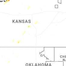


Connect with Interactive Hail Maps