

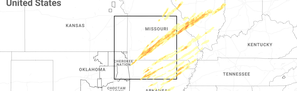
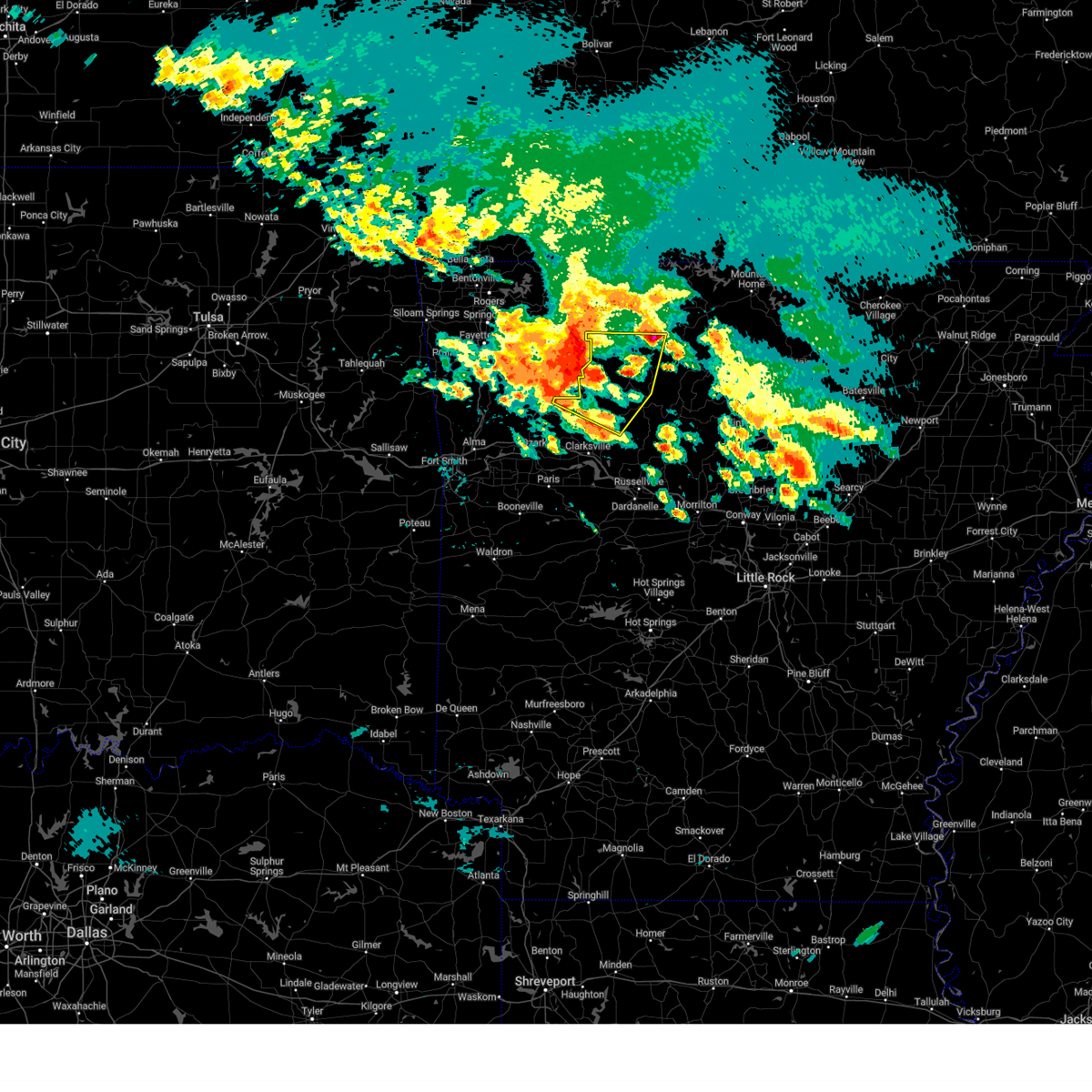
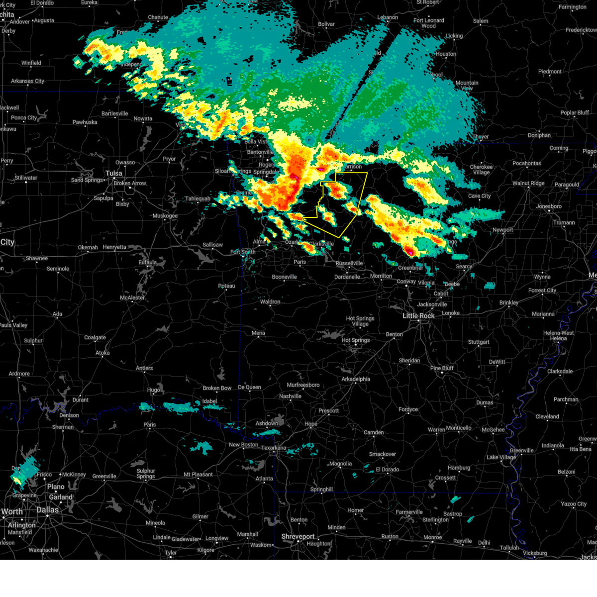
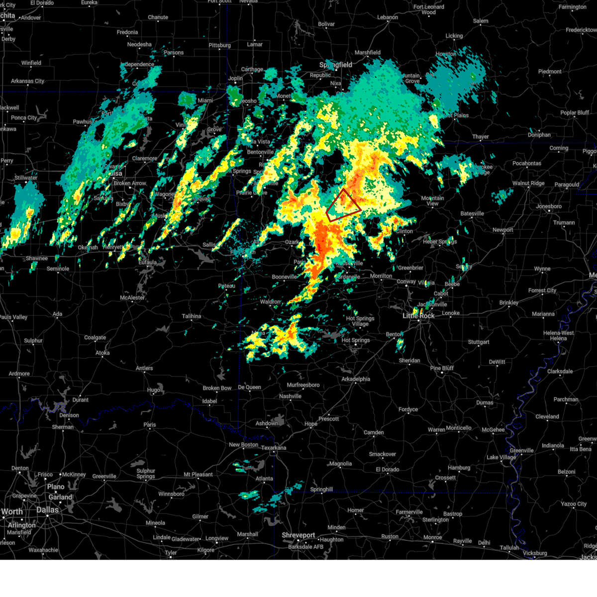
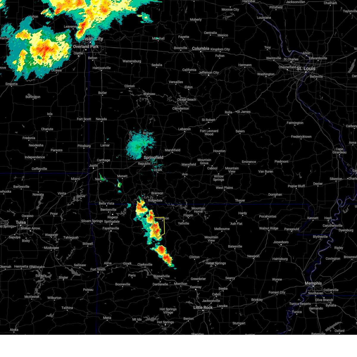
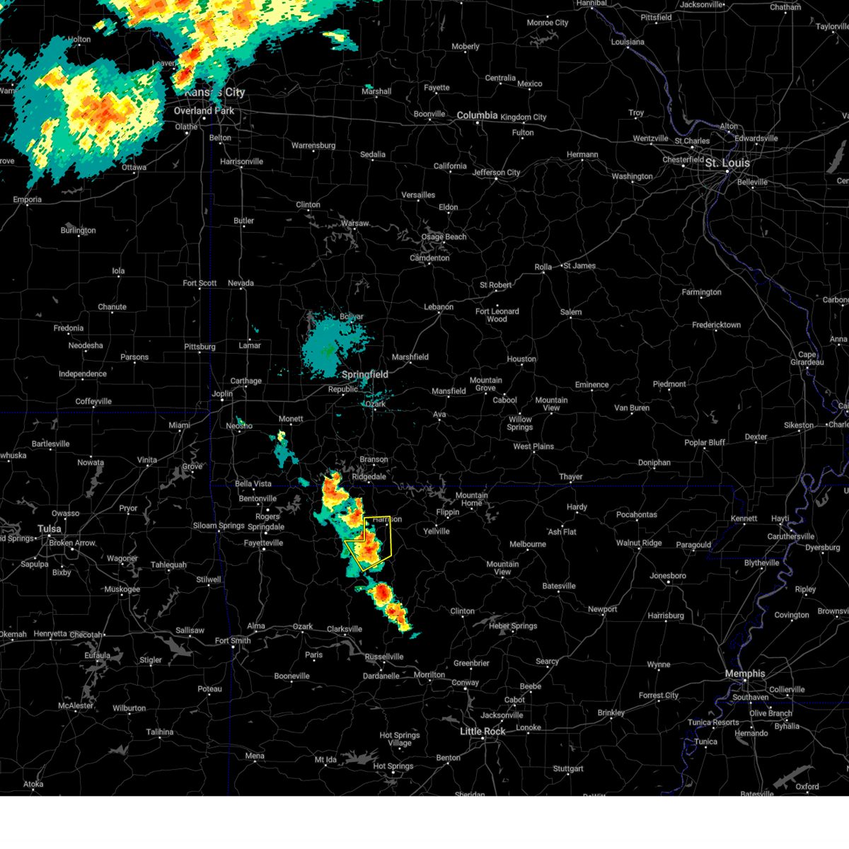
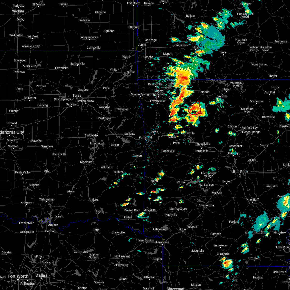
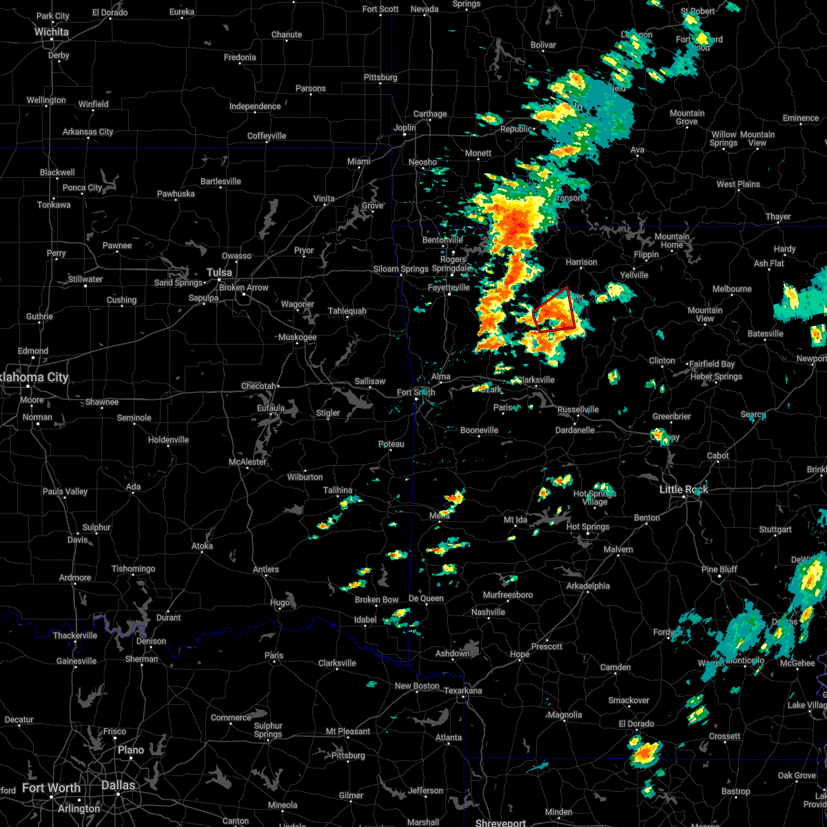
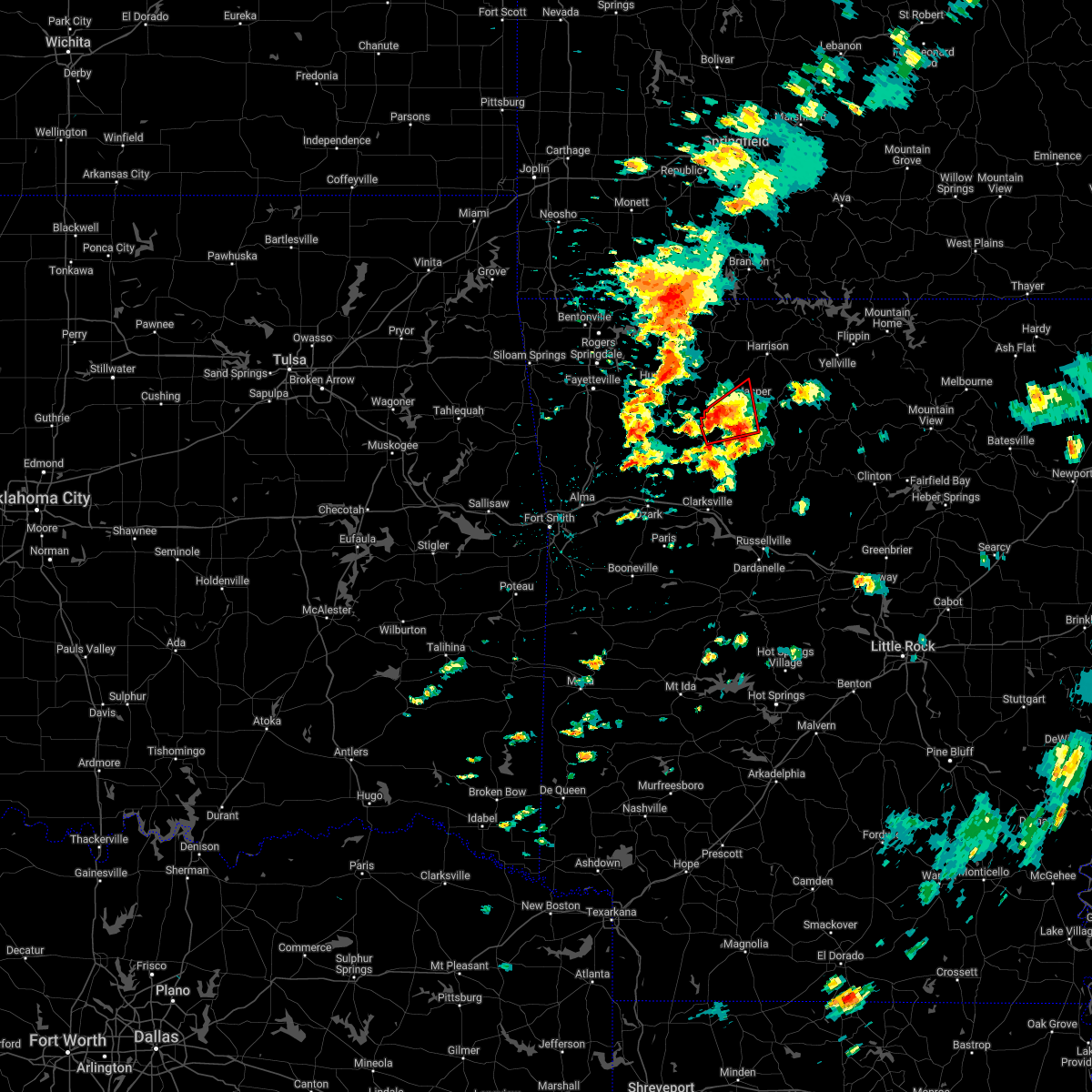
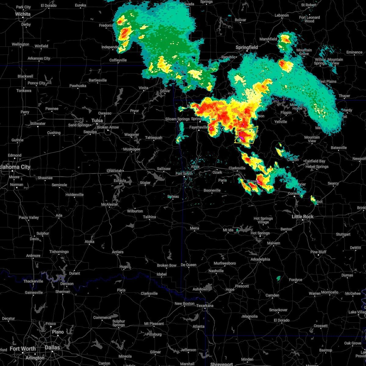
Hail Map for Jasper, AR
The Jasper, AR area has had 34 reports of on-the-ground hail by trained spotters, and has been under severe weather warnings 17 times during the past 12 months. Doppler radar has detected hail at or near Jasper, AR on 60 occasions, including 3 occasions during the past year.
| Name: | Jasper, AR |
| Where Located: | 81.8 miles ENE of Fort Smith, AR |
| Map: | Google Map for Jasper, AR |
| Population: | 466 |
| Housing Units: | 268 |
| More Info: | Search Google for Jasper, AR |
1
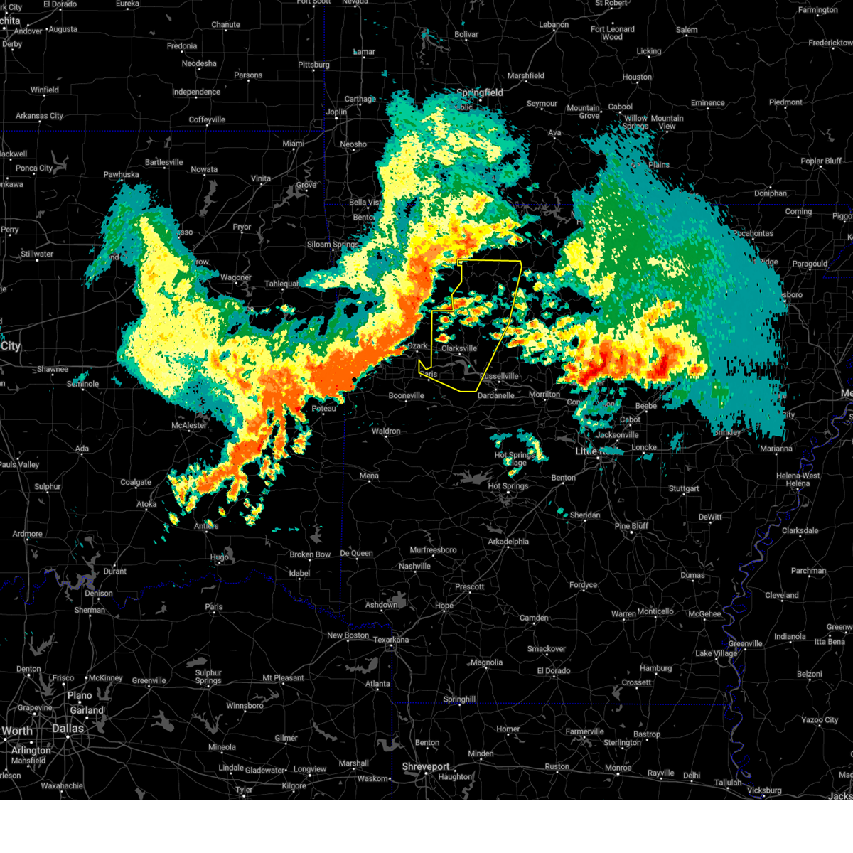
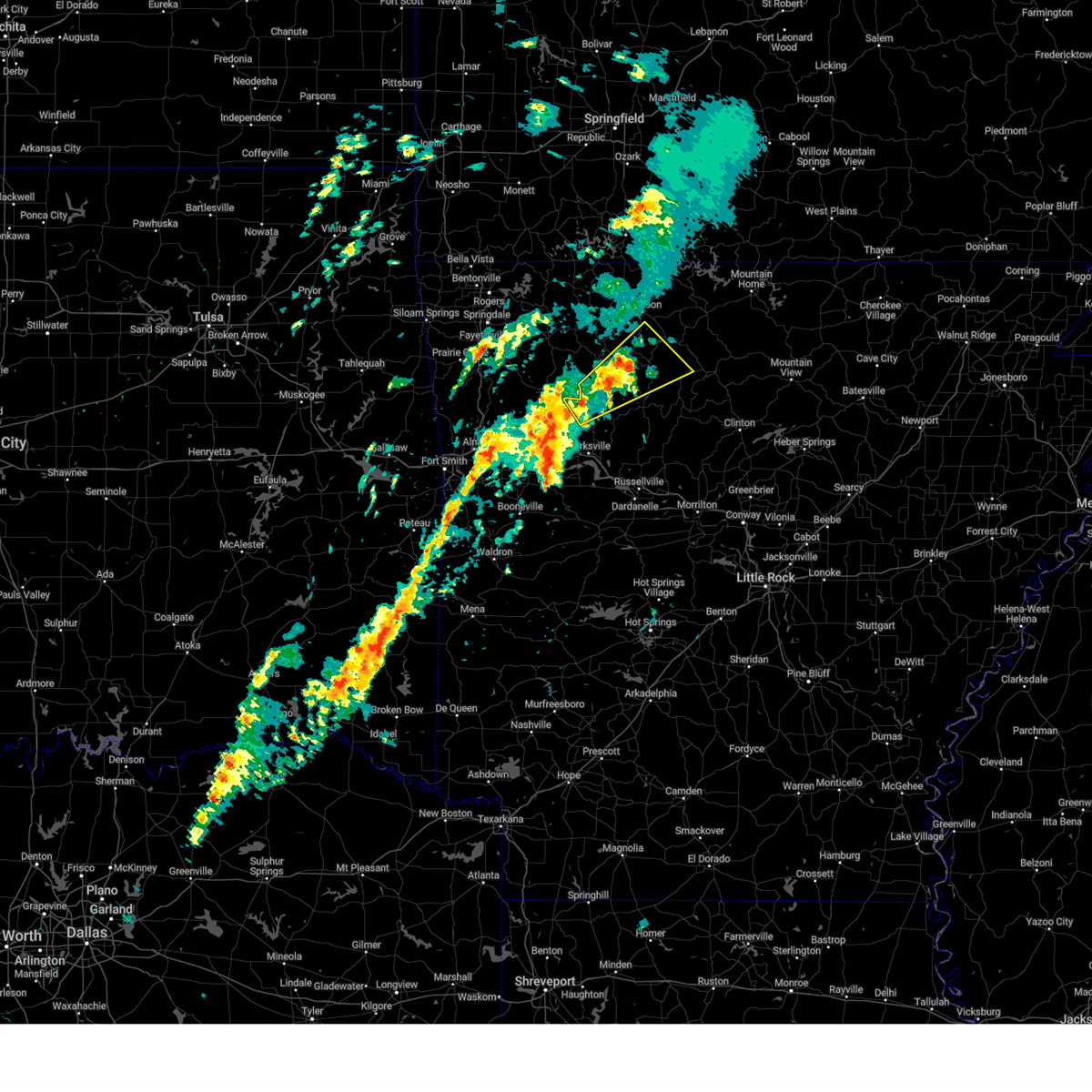
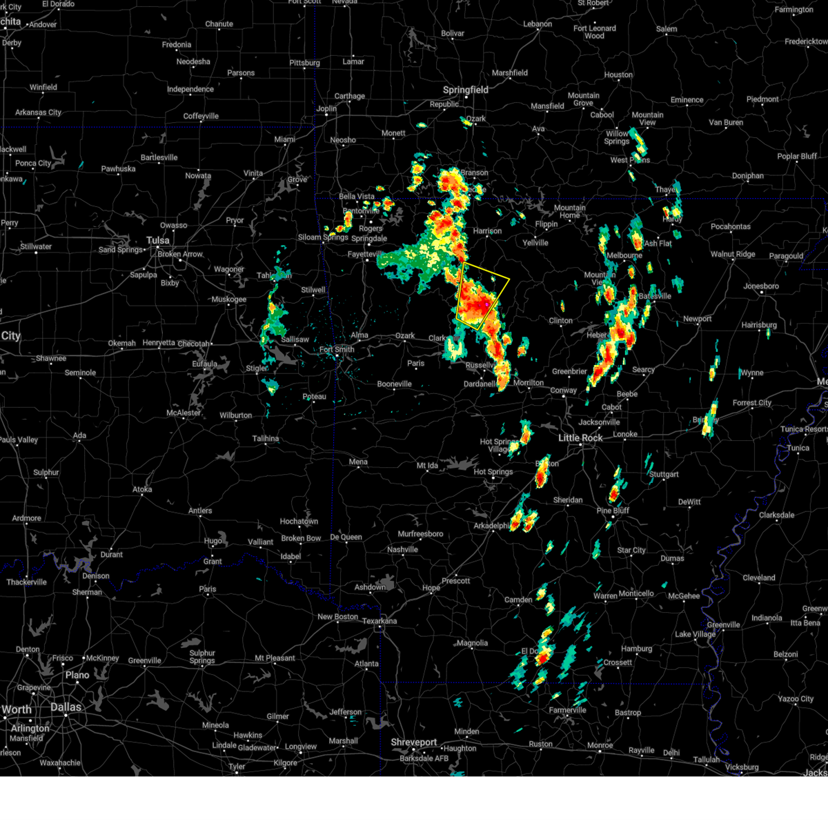
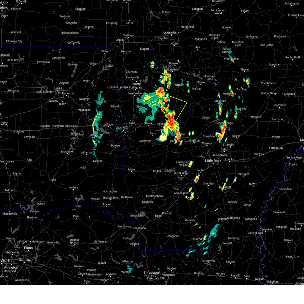
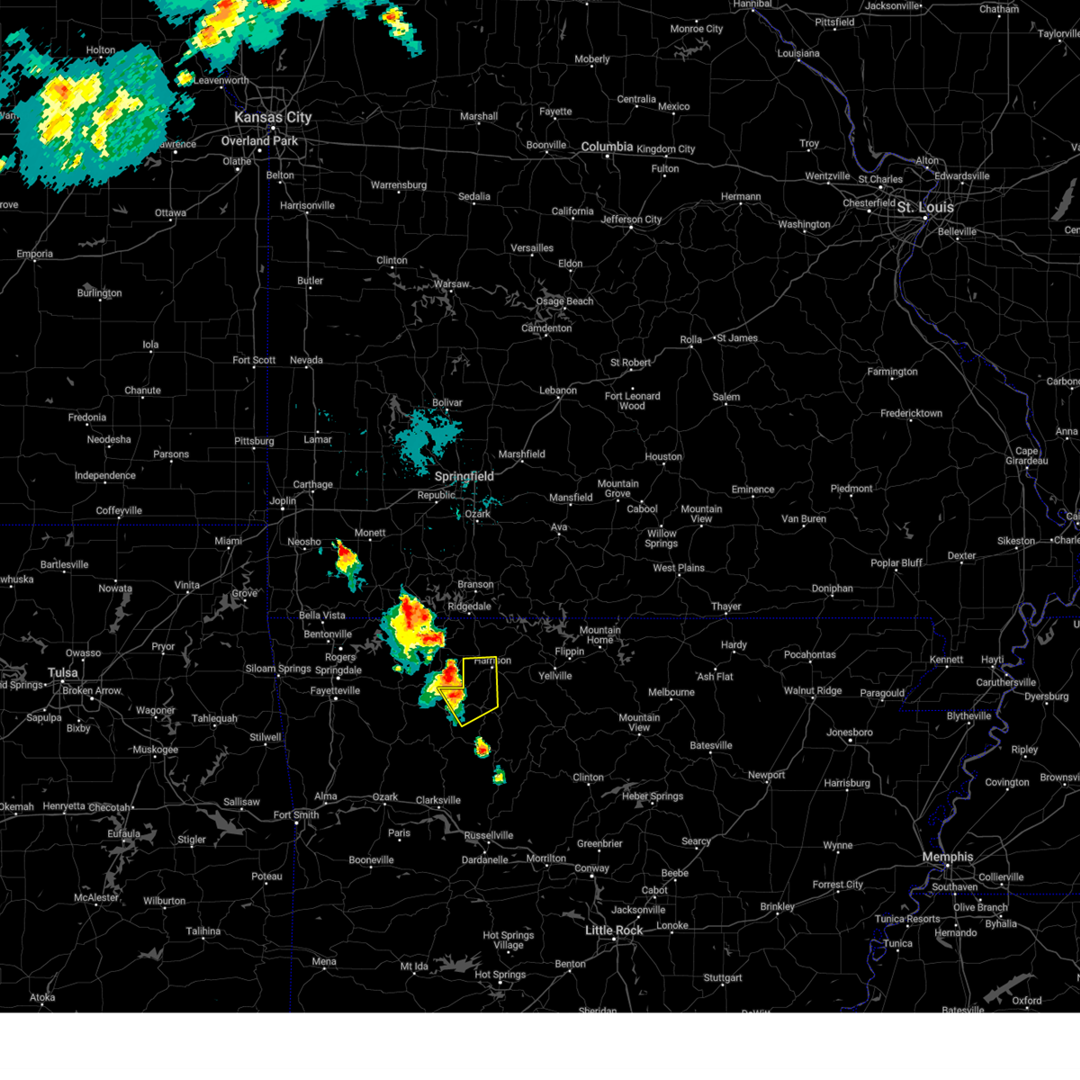
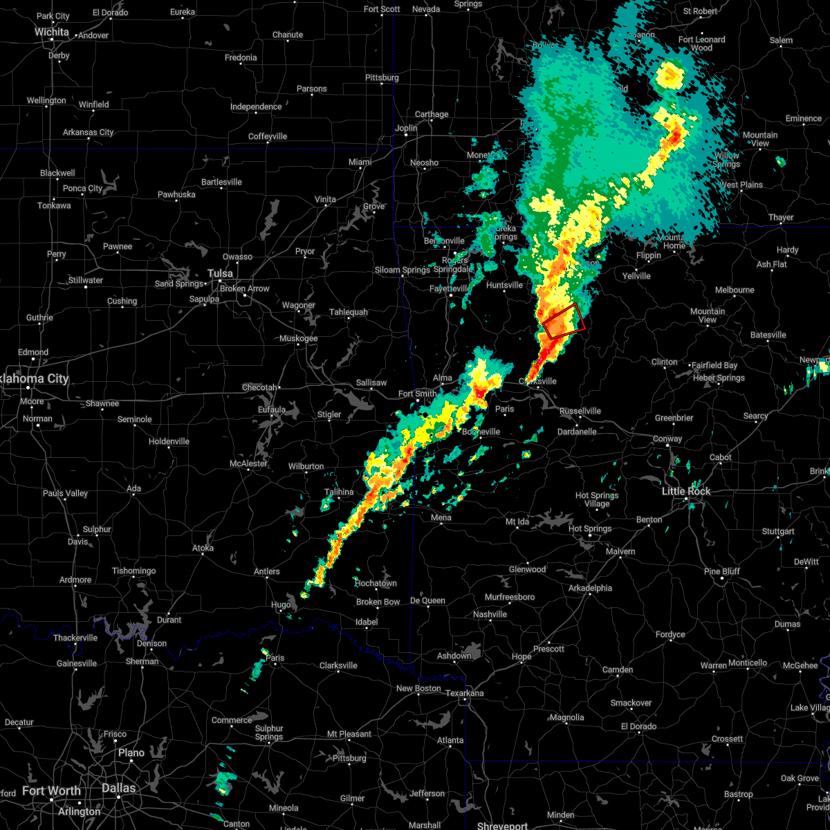
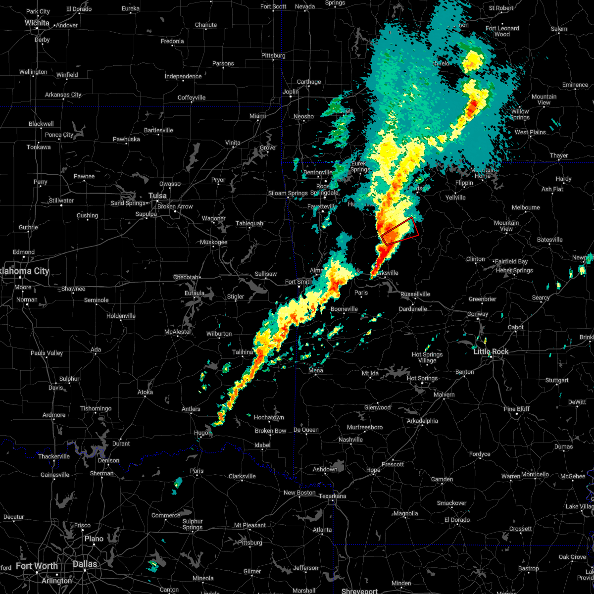
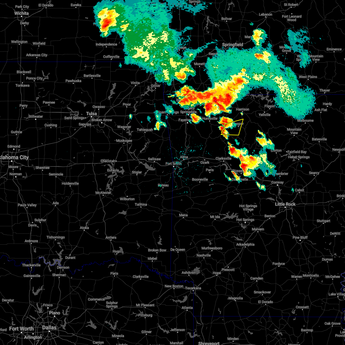
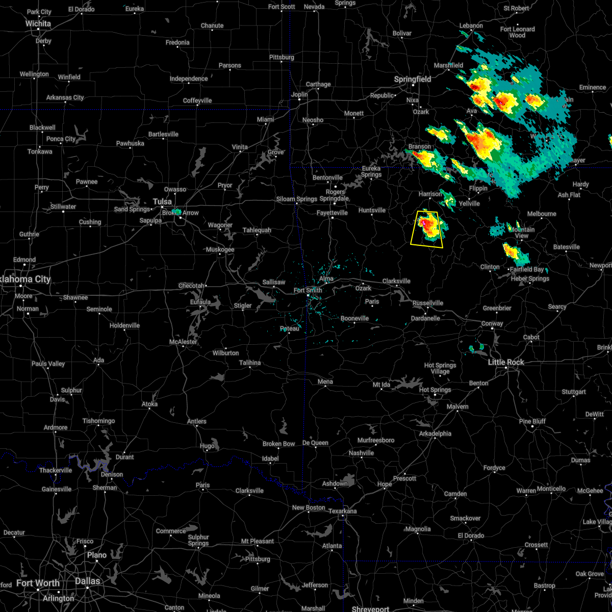
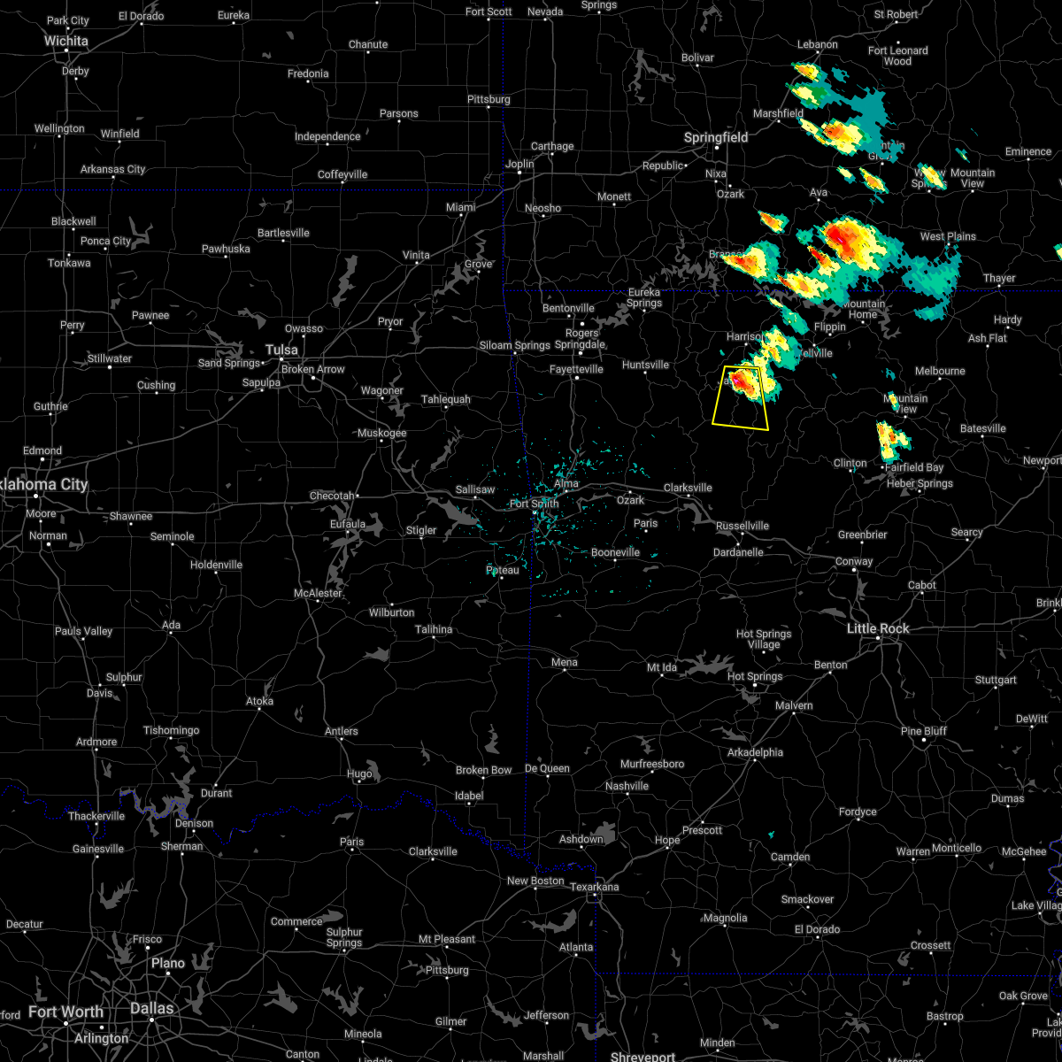
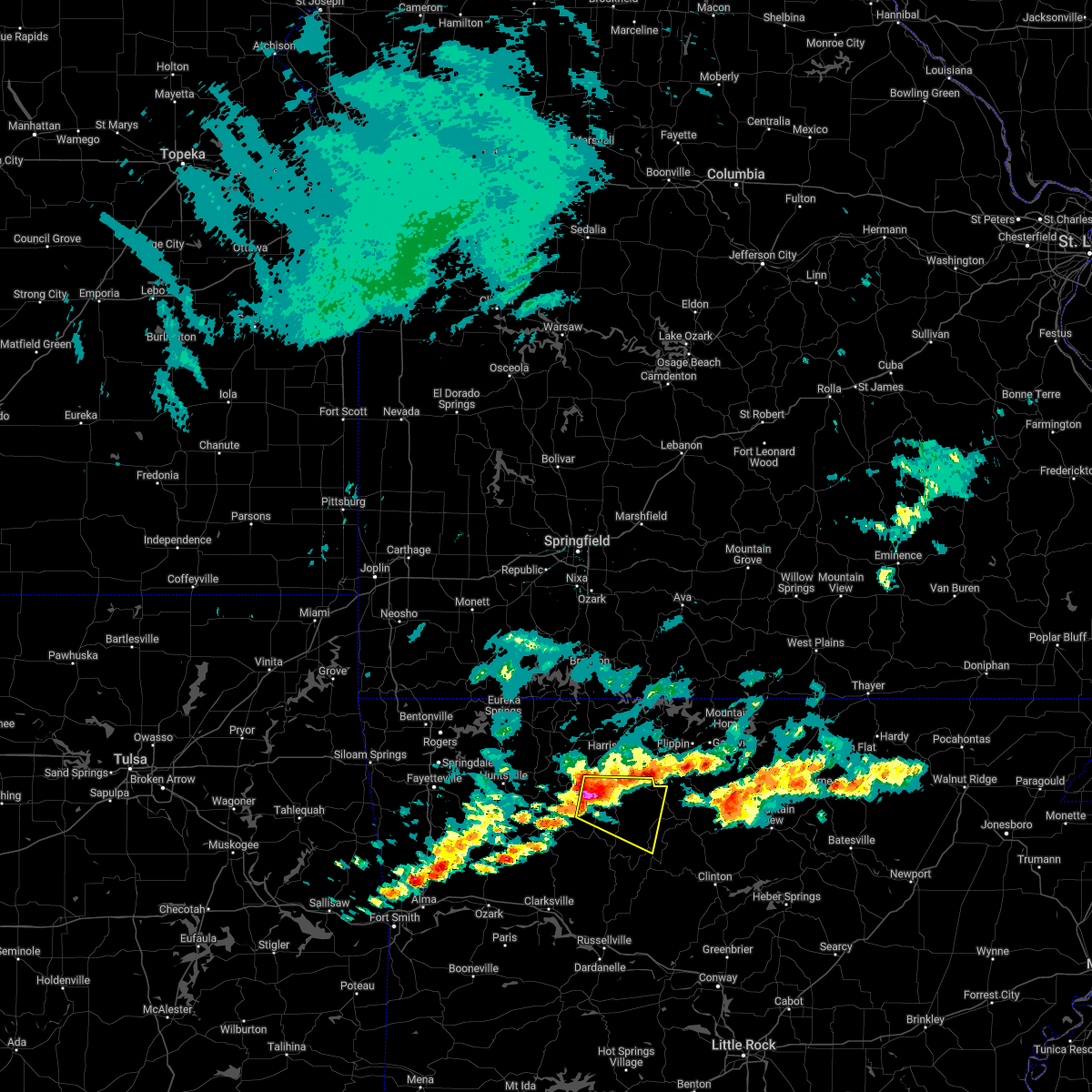
The Top Recent Hail Date for Jasper, AR is Friday, March 14, 2025 (4th out of 60)
Hail and Wind Damage Spotted near Jasper, AR
| Date / Time | Report Details |
|---|---|
| 6/7/2025 7:17 AM CDT | Numerous trees reported down across the county with portions of arkansas highway 7 blocked with downed tree in newton county AR, 18.9 miles NNW of Jasper, AR |
| 6/7/2025 6:35 AM CDT |
 Svrlzk the national weather service in little rock has issued a * severe thunderstorm warning for, northeastern logan county in western arkansas, newton county in north central arkansas, johnson county in western arkansas, northwestern pope county in central arkansas, * until 715 am cdt. * at 635 am cdt, severe thunderstorms were located along a line extending from near aurora to near st. paul to 7 miles southeast of mulberry, moving east at 55 mph (radar indicated). Hazards include 60 mph wind gusts and quarter size hail. Hail damage to vehicles is expected. Expect wind damage to roofs, siding, and trees. Svrlzk the national weather service in little rock has issued a * severe thunderstorm warning for, northeastern logan county in western arkansas, newton county in north central arkansas, johnson county in western arkansas, northwestern pope county in central arkansas, * until 715 am cdt. * at 635 am cdt, severe thunderstorms were located along a line extending from near aurora to near st. paul to 7 miles southeast of mulberry, moving east at 55 mph (radar indicated). Hazards include 60 mph wind gusts and quarter size hail. Hail damage to vehicles is expected. Expect wind damage to roofs, siding, and trees.
|
| 5/19/2025 8:34 PM CDT |
 Svrlzk the national weather service in little rock has issued a * severe thunderstorm warning for, northern logan county in western arkansas, western newton county in north central arkansas, johnson county in western arkansas, * until 930 pm cdt. * at 833 pm cdt, severe thunderstorms were located along a line extending from cass to ozark to near branch, moving northeast at 55 mph (radar indicated). Hazards include 60 mph wind gusts. expect damage to roofs, siding, and trees Svrlzk the national weather service in little rock has issued a * severe thunderstorm warning for, northern logan county in western arkansas, western newton county in north central arkansas, johnson county in western arkansas, * until 930 pm cdt. * at 833 pm cdt, severe thunderstorms were located along a line extending from cass to ozark to near branch, moving northeast at 55 mph (radar indicated). Hazards include 60 mph wind gusts. expect damage to roofs, siding, and trees
|
| 5/18/2025 5:55 PM CDT |
 The storms which prompted the warning have weakened below severe limits, and no longer pose an immediate threat to life or property. therefore, the warning will be allowed to expire. however gusty winds and heavy rain are still possible with these thunderstorms. a severe thunderstorm watch remains in effect until 1100 pm cdt for western, central and north central arkansas. The storms which prompted the warning have weakened below severe limits, and no longer pose an immediate threat to life or property. therefore, the warning will be allowed to expire. however gusty winds and heavy rain are still possible with these thunderstorms. a severe thunderstorm watch remains in effect until 1100 pm cdt for western, central and north central arkansas.
|
| 5/18/2025 5:22 PM CDT |
 the severe thunderstorm warning has been cancelled and is no longer in effect the severe thunderstorm warning has been cancelled and is no longer in effect
|
| 5/18/2025 5:22 PM CDT |
 At 522 pm cdt, severe thunderstorms were located along a line extending from lost valley state park to near pettigrew, moving southeast at 45 mph (radar indicated). Hazards include 60 mph wind gusts and quarter size hail. Hail damage to vehicles is expected. expect wind damage to roofs, siding, and trees. Locations impacted include, marble falls, yardelle, catalpa, fort douglas, western grove, fallsville, crossroad, swain, haw creek falls campground, gum springs in newton county, dillen, carver, erbie, upper buffalo wilderness area, nail, arbaugh, ponca, hasty, lurton, devils knob,. At 522 pm cdt, severe thunderstorms were located along a line extending from lost valley state park to near pettigrew, moving southeast at 45 mph (radar indicated). Hazards include 60 mph wind gusts and quarter size hail. Hail damage to vehicles is expected. expect wind damage to roofs, siding, and trees. Locations impacted include, marble falls, yardelle, catalpa, fort douglas, western grove, fallsville, crossroad, swain, haw creek falls campground, gum springs in newton county, dillen, carver, erbie, upper buffalo wilderness area, nail, arbaugh, ponca, hasty, lurton, devils knob,.
|
| 5/18/2025 5:03 PM CDT |
 Svrlzk the national weather service in little rock has issued a * severe thunderstorm warning for, newton county in north central arkansas, northern johnson county in western arkansas, southern boone county in north central arkansas, north central pope county in central arkansas, * until 600 pm cdt. * at 503 pm cdt, severe thunderstorms were located along a line extending from near marble to near st. paul, moving southeast at 45 mph (radar indicated). Hazards include 70 mph wind gusts and quarter size hail. Hail damage to vehicles is expected. expect considerable tree damage. Wind damage is also likely to mobile homes, roofs, and outbuildings. Svrlzk the national weather service in little rock has issued a * severe thunderstorm warning for, newton county in north central arkansas, northern johnson county in western arkansas, southern boone county in north central arkansas, north central pope county in central arkansas, * until 600 pm cdt. * at 503 pm cdt, severe thunderstorms were located along a line extending from near marble to near st. paul, moving southeast at 45 mph (radar indicated). Hazards include 70 mph wind gusts and quarter size hail. Hail damage to vehicles is expected. expect considerable tree damage. Wind damage is also likely to mobile homes, roofs, and outbuildings.
|
| 4/20/2025 4:10 PM CDT |
 Svrlzk the national weather service in little rock has issued a * severe thunderstorm warning for, searcy county in north central arkansas, eastern newton county in north central arkansas, northeastern johnson county in western arkansas, marion county in north central arkansas, northwestern van buren county in north central arkansas, boone county in north central arkansas, western baxter county in north central arkansas, northern pope county in central arkansas, * until 500 pm cdt. * at 410 pm cdt, severe thunderstorms were located along a line extending from 9 miles northeast of omaha to near pruitt to near bertha, moving northeast at 85 mph (radar indicated). Hazards include 60 mph wind gusts and penny size hail. expect damage to roofs, siding, and trees Svrlzk the national weather service in little rock has issued a * severe thunderstorm warning for, searcy county in north central arkansas, eastern newton county in north central arkansas, northeastern johnson county in western arkansas, marion county in north central arkansas, northwestern van buren county in north central arkansas, boone county in north central arkansas, western baxter county in north central arkansas, northern pope county in central arkansas, * until 500 pm cdt. * at 410 pm cdt, severe thunderstorms were located along a line extending from 9 miles northeast of omaha to near pruitt to near bertha, moving northeast at 85 mph (radar indicated). Hazards include 60 mph wind gusts and penny size hail. expect damage to roofs, siding, and trees
|
| 4/20/2025 3:25 PM CDT |
 Svrlzk the national weather service in little rock has issued a * severe thunderstorm warning for, newton county in north central arkansas, johnson county in western arkansas, boone county in north central arkansas, northwestern pope county in central arkansas, * until 415 pm cdt. * at 325 pm cdt, severe thunderstorms were located along a line extending from near huntsville to near cass to near ratcliff, moving northeast at 75 mph (radar indicated). Hazards include 60 mph wind gusts and nickel size hail. expect damage to roofs, siding, and trees Svrlzk the national weather service in little rock has issued a * severe thunderstorm warning for, newton county in north central arkansas, johnson county in western arkansas, boone county in north central arkansas, northwestern pope county in central arkansas, * until 415 pm cdt. * at 325 pm cdt, severe thunderstorms were located along a line extending from near huntsville to near cass to near ratcliff, moving northeast at 75 mph (radar indicated). Hazards include 60 mph wind gusts and nickel size hail. expect damage to roofs, siding, and trees
|
| 4/2/2025 11:47 AM CDT |
 the severe thunderstorm warning has been cancelled and is no longer in effect the severe thunderstorm warning has been cancelled and is no longer in effect
|
| 4/2/2025 11:31 AM CDT |
 Svrlzk the national weather service in little rock has issued a * severe thunderstorm warning for, west central searcy county in north central arkansas, newton county in north central arkansas, north central johnson county in western arkansas, south central boone county in north central arkansas, * until 1215 pm cdt. * at 1131 am cdt, a severe thunderstorm was located near devils knob, or 19 miles north of clarksville, moving northeast at 60 mph (radar indicated). Hazards include 60 mph wind gusts and quarter size hail. Hail damage to vehicles is expected. Expect wind damage to roofs, siding, and trees. Svrlzk the national weather service in little rock has issued a * severe thunderstorm warning for, west central searcy county in north central arkansas, newton county in north central arkansas, north central johnson county in western arkansas, south central boone county in north central arkansas, * until 1215 pm cdt. * at 1131 am cdt, a severe thunderstorm was located near devils knob, or 19 miles north of clarksville, moving northeast at 60 mph (radar indicated). Hazards include 60 mph wind gusts and quarter size hail. Hail damage to vehicles is expected. Expect wind damage to roofs, siding, and trees.
|
| 3/14/2025 8:05 PM CDT | Golf Ball sized hail reported 5.7 miles N of Jasper, AR |
| 3/14/2025 8:03 PM CDT |
 At 803 pm cdt, a severe thunderstorm was located near pruitt, or 7 miles northeast of jasper, moving northeast at 50 mph (radar indicated). Hazards include 60 mph wind gusts and quarter size hail. Hail damage to vehicles is expected. expect wind damage to roofs, siding, and trees. Locations impacted include, marble falls, wayton, yardelle, western grove, crossroad, vendor, swain, parthenon, gum springs in newton county, bellefonte, piercetown, mt judea, carver, nail, jasper, pruitt, hasty, woolum recreation area, valley springs,. At 803 pm cdt, a severe thunderstorm was located near pruitt, or 7 miles northeast of jasper, moving northeast at 50 mph (radar indicated). Hazards include 60 mph wind gusts and quarter size hail. Hail damage to vehicles is expected. expect wind damage to roofs, siding, and trees. Locations impacted include, marble falls, wayton, yardelle, western grove, crossroad, vendor, swain, parthenon, gum springs in newton county, bellefonte, piercetown, mt judea, carver, nail, jasper, pruitt, hasty, woolum recreation area, valley springs,.
|
| 3/14/2025 7:45 PM CDT |
 Svrlzk the national weather service in little rock has issued a * severe thunderstorm warning for, west central searcy county in north central arkansas, central newton county in north central arkansas, south central boone county in north central arkansas, * until 830 pm cdt. * at 744 pm cdt, a severe thunderstorm was located near upper buffalo wilderness area, or 11 miles southwest of jasper, moving northeast at 35 mph (radar indicated). Hazards include 60 mph wind gusts and quarter size hail. Hail damage to vehicles is expected. Expect wind damage to roofs, siding, and trees. Svrlzk the national weather service in little rock has issued a * severe thunderstorm warning for, west central searcy county in north central arkansas, central newton county in north central arkansas, south central boone county in north central arkansas, * until 830 pm cdt. * at 744 pm cdt, a severe thunderstorm was located near upper buffalo wilderness area, or 11 miles southwest of jasper, moving northeast at 35 mph (radar indicated). Hazards include 60 mph wind gusts and quarter size hail. Hail damage to vehicles is expected. Expect wind damage to roofs, siding, and trees.
|
| 11/4/2024 4:40 AM CST |
 The storm which prompted the warning has weakened below severe limits, and no longer appears capable of producing a tornado. therefore, the warning will be allowed to expire. however heavy rain is still possible with this thunderstorm. The storm which prompted the warning has weakened below severe limits, and no longer appears capable of producing a tornado. therefore, the warning will be allowed to expire. however heavy rain is still possible with this thunderstorm.
|
| 11/4/2024 4:25 AM CST |
 At 425 am cst, a severe thunderstorm capable of producing a tornado was located over walnut, or 16 miles southwest of jasper, moving northeast at 30 mph (radar indicated rotation). Hazards include tornado. Flying debris will be dangerous to those caught without shelter. mobile homes will be damaged or destroyed. damage to roofs, windows, and vehicles will occur. tree damage is likely. Locations impacted include, jasper, walnut, wayton, nail, cowell, crossroad, swain, parthenon, gum springs in newton county, deer,. At 425 am cst, a severe thunderstorm capable of producing a tornado was located over walnut, or 16 miles southwest of jasper, moving northeast at 30 mph (radar indicated rotation). Hazards include tornado. Flying debris will be dangerous to those caught without shelter. mobile homes will be damaged or destroyed. damage to roofs, windows, and vehicles will occur. tree damage is likely. Locations impacted include, jasper, walnut, wayton, nail, cowell, crossroad, swain, parthenon, gum springs in newton county, deer,.
|
| 11/4/2024 4:17 AM CST |
 At 417 am cst, a confirmed tornado was located over walnut, or 17 miles southwest of jasper, moving northeast at 50 mph (radar confirmed tornado). Hazards include damaging tornado. Flying debris will be dangerous to those caught without shelter. mobile homes will be damaged or destroyed. damage to roofs, windows, and vehicles will occur. tree damage is likely. Locations impacted include, jasper, walnut, wayton, nail, cowell, crossroad, swain, parthenon, gum springs in newton county, deer,. At 417 am cst, a confirmed tornado was located over walnut, or 17 miles southwest of jasper, moving northeast at 50 mph (radar confirmed tornado). Hazards include damaging tornado. Flying debris will be dangerous to those caught without shelter. mobile homes will be damaged or destroyed. damage to roofs, windows, and vehicles will occur. tree damage is likely. Locations impacted include, jasper, walnut, wayton, nail, cowell, crossroad, swain, parthenon, gum springs in newton county, deer,.
|
| 11/4/2024 4:17 AM CST |
 the tornado warning has been cancelled and is no longer in effect the tornado warning has been cancelled and is no longer in effect
|
| 11/4/2024 4:10 AM CST |
 Torlzk the national weather service in little rock has issued a * tornado warning for, southeastern newton county in north central arkansas, north central johnson county in western arkansas, * until 445 am cst. * at 410 am cst, a severe thunderstorm capable of producing a tornado was located over devils knob, or 19 miles north of clarksville, moving northeast at 35 mph (radar indicated rotation). Hazards include tornado. Flying debris will be dangerous to those caught without shelter. mobile homes will be damaged or destroyed. damage to roofs, windows, and vehicles will occur. Tree damage is likely. Torlzk the national weather service in little rock has issued a * tornado warning for, southeastern newton county in north central arkansas, north central johnson county in western arkansas, * until 445 am cst. * at 410 am cst, a severe thunderstorm capable of producing a tornado was located over devils knob, or 19 miles north of clarksville, moving northeast at 35 mph (radar indicated rotation). Hazards include tornado. Flying debris will be dangerous to those caught without shelter. mobile homes will be damaged or destroyed. damage to roofs, windows, and vehicles will occur. Tree damage is likely.
|
| 5/26/2024 3:15 AM CDT |
 Svrlzk the national weather service in little rock has issued a * severe thunderstorm warning for, northwestern searcy county in north central arkansas, northern newton county in north central arkansas, southwestern marion county in north central arkansas, southern boone county in north central arkansas, * until 400 am cdt. * at 314 am cdt, severe thunderstorms were located along a line extending from red bank to near osage to near kingston, moving east at 40 mph (radar indicated). Hazards include 60 mph wind gusts and quarter size hail. Hail damage to vehicles is expected. Expect wind damage to roofs, siding, and trees. Svrlzk the national weather service in little rock has issued a * severe thunderstorm warning for, northwestern searcy county in north central arkansas, northern newton county in north central arkansas, southwestern marion county in north central arkansas, southern boone county in north central arkansas, * until 400 am cdt. * at 314 am cdt, severe thunderstorms were located along a line extending from red bank to near osage to near kingston, moving east at 40 mph (radar indicated). Hazards include 60 mph wind gusts and quarter size hail. Hail damage to vehicles is expected. Expect wind damage to roofs, siding, and trees.
|
| 5/22/2024 10:58 AM CDT |
 The storm which prompted the warning has weakened below severe limits, and no longer poses an immediate threat to life or property. therefore, the warning will be allowed to expire. however gusty winds are still possible with this thunderstorm. a severe thunderstorm watch remains in effect until 500 pm cdt for north central arkansas. The storm which prompted the warning has weakened below severe limits, and no longer poses an immediate threat to life or property. therefore, the warning will be allowed to expire. however gusty winds are still possible with this thunderstorm. a severe thunderstorm watch remains in effect until 500 pm cdt for north central arkansas.
|
| 5/22/2024 10:15 AM CDT |
 Svrlzk the national weather service in little rock has issued a * severe thunderstorm warning for, northwestern searcy county in north central arkansas, northern newton county in north central arkansas, southwestern marion county in north central arkansas, southern boone county in north central arkansas, * until 1100 am cdt. * at 1015 am cdt, a severe thunderstorm was located over lost valley state park, or 10 miles west of jasper, moving east at 40 mph (radar indicated). Hazards include 60 mph wind gusts and quarter size hail. Hail damage to vehicles is expected. Expect wind damage to roofs, siding, and trees. Svrlzk the national weather service in little rock has issued a * severe thunderstorm warning for, northwestern searcy county in north central arkansas, northern newton county in north central arkansas, southwestern marion county in north central arkansas, southern boone county in north central arkansas, * until 1100 am cdt. * at 1015 am cdt, a severe thunderstorm was located over lost valley state park, or 10 miles west of jasper, moving east at 40 mph (radar indicated). Hazards include 60 mph wind gusts and quarter size hail. Hail damage to vehicles is expected. Expect wind damage to roofs, siding, and trees.
|
| 5/7/2024 3:45 AM CDT |
 At 344 am cdt, severe thunderstorms were located along a line extending from near lost valley state park to 7 miles east of walnut to near rosetta to lamar, moving northeast at 60 mph (radar indicated). Hazards include 60 mph wind gusts and nickel size hail. Expect damage to roofs, siding, and trees. Locations impacted include, russellville, harrison, clarksville, booneville, paris, jasper, lamar, dover, london, knoxville, subiaco, hartman, scranton, ratcliff, erbie, upper buffalo wilderness area, devils knob, lost valley state park, pruitt, holman,. At 344 am cdt, severe thunderstorms were located along a line extending from near lost valley state park to 7 miles east of walnut to near rosetta to lamar, moving northeast at 60 mph (radar indicated). Hazards include 60 mph wind gusts and nickel size hail. Expect damage to roofs, siding, and trees. Locations impacted include, russellville, harrison, clarksville, booneville, paris, jasper, lamar, dover, london, knoxville, subiaco, hartman, scranton, ratcliff, erbie, upper buffalo wilderness area, devils knob, lost valley state park, pruitt, holman,.
|
| 5/7/2024 3:30 AM CDT |
 At 330 am cdt, severe thunderstorms were located along a line extending from near lost valley state park to near upper buffalo wilderness area to near devils knob to 7 miles north of woodland to near hartman, moving east at 50 mph (radar indicated). Hazards include 60 mph wind gusts and half dollar size hail. Hail damage to vehicles is expected. expect wind damage to roofs, siding, and trees. Locations impacted include, russellville, harrison, clarksville, booneville, paris, jasper, lamar, dover, london, knoxville, subiaco, hartman, scranton, ratcliff, erbie, upper buffalo wilderness area, devils knob, lost valley state park, pruitt, holman,. At 330 am cdt, severe thunderstorms were located along a line extending from near lost valley state park to near upper buffalo wilderness area to near devils knob to 7 miles north of woodland to near hartman, moving east at 50 mph (radar indicated). Hazards include 60 mph wind gusts and half dollar size hail. Hail damage to vehicles is expected. expect wind damage to roofs, siding, and trees. Locations impacted include, russellville, harrison, clarksville, booneville, paris, jasper, lamar, dover, london, knoxville, subiaco, hartman, scranton, ratcliff, erbie, upper buffalo wilderness area, devils knob, lost valley state park, pruitt, holman,.
|
| 5/7/2024 3:12 AM CDT |
 Svrlzk the national weather service in little rock has issued a * severe thunderstorm warning for, central logan county in western arkansas, newton county in north central arkansas, johnson county in western arkansas, southwestern boone county in north central arkansas, northeastern yell county in central arkansas, northwestern pope county in central arkansas, * until 400 am cdt. * at 312 am cdt, severe thunderstorms were located along a line extending from near japton to near witter to near cass to near ozark, moving east at 55 mph (radar indicated). Hazards include 60 mph wind gusts and half dollar size hail. Hail damage to vehicles is expected. Expect wind damage to roofs, siding, and trees. Svrlzk the national weather service in little rock has issued a * severe thunderstorm warning for, central logan county in western arkansas, newton county in north central arkansas, johnson county in western arkansas, southwestern boone county in north central arkansas, northeastern yell county in central arkansas, northwestern pope county in central arkansas, * until 400 am cdt. * at 312 am cdt, severe thunderstorms were located along a line extending from near japton to near witter to near cass to near ozark, moving east at 55 mph (radar indicated). Hazards include 60 mph wind gusts and half dollar size hail. Hail damage to vehicles is expected. Expect wind damage to roofs, siding, and trees.
|
| 4/2/2024 2:41 AM CDT |
 At 240 am cdt, a severe thunderstorm with strong low level rotation that could produce a tornado at any time was located near pruitt, moving east at 45 mph (radar indicated rotation). Hazards include tornado and quarter size hail. Flying debris will be dangerous to those caught without shelter. mobile homes will be damaged or destroyed. damage to roofs, windows, and vehicles will occur. tree damage is likely. Locations in or near the path include, jasper, western grove, erbie, pruitt, carver, marble falls, yardelle, compton, hasty, mt sherman,. At 240 am cdt, a severe thunderstorm with strong low level rotation that could produce a tornado at any time was located near pruitt, moving east at 45 mph (radar indicated rotation). Hazards include tornado and quarter size hail. Flying debris will be dangerous to those caught without shelter. mobile homes will be damaged or destroyed. damage to roofs, windows, and vehicles will occur. tree damage is likely. Locations in or near the path include, jasper, western grove, erbie, pruitt, carver, marble falls, yardelle, compton, hasty, mt sherman,.
|
| 4/2/2024 2:30 AM CDT |
 At 228 am cdt, a severe thunderstorm with strong low level rotation that could produce a tornado at any time was located near lost valley state park, moving east at 40 mph (radar indicated rotation). Hazards include tornado and quarter size hail. Flying debris will be dangerous to those caught without shelter. mobile homes will be damaged or destroyed. damage to roofs, windows, and vehicles will occur. tree damage is likely. Locations in or near the path include, jasper, western grove, lost valley state park, piercetown, carver, erbie, upper buffalo wilderness area, pruitt, boxley, marble falls, yardelle, compton, low gap, vendor, parthenon, ponca, hasty, mt sherman,. At 228 am cdt, a severe thunderstorm with strong low level rotation that could produce a tornado at any time was located near lost valley state park, moving east at 40 mph (radar indicated rotation). Hazards include tornado and quarter size hail. Flying debris will be dangerous to those caught without shelter. mobile homes will be damaged or destroyed. damage to roofs, windows, and vehicles will occur. tree damage is likely. Locations in or near the path include, jasper, western grove, lost valley state park, piercetown, carver, erbie, upper buffalo wilderness area, pruitt, boxley, marble falls, yardelle, compton, low gap, vendor, parthenon, ponca, hasty, mt sherman,.
|
| 4/2/2024 2:07 AM CDT |
 Torlzk the national weather service in little rock has issued a * tornado warning for, northern newton county in north central arkansas, * until 300 am cdt. * at 205 am cdt, a severe thunderstorm with strong low level rotation that could produce a tornado at any time was located 3 miles east of witter, moving east at 50 mph (radar indicated rotation). Hazards include tornado and quarter size hail. Flying debris will be dangerous to those caught without shelter. mobile homes will be damaged or destroyed. damage to roofs, windows, and vehicles will occur. tree damage is likely. Locations in or near the path include, jasper, western grove, lost valley state park, piercetown, carver, erbie, upper buffalo wilderness area, pruitt, mossville, boxley, wayton, marble falls, yardelle, compton, low gap, vendor, parthenon, gum springs in newton county, mt judea, ponca,. Torlzk the national weather service in little rock has issued a * tornado warning for, northern newton county in north central arkansas, * until 300 am cdt. * at 205 am cdt, a severe thunderstorm with strong low level rotation that could produce a tornado at any time was located 3 miles east of witter, moving east at 50 mph (radar indicated rotation). Hazards include tornado and quarter size hail. Flying debris will be dangerous to those caught without shelter. mobile homes will be damaged or destroyed. damage to roofs, windows, and vehicles will occur. tree damage is likely. Locations in or near the path include, jasper, western grove, lost valley state park, piercetown, carver, erbie, upper buffalo wilderness area, pruitt, mossville, boxley, wayton, marble falls, yardelle, compton, low gap, vendor, parthenon, gum springs in newton county, mt judea, ponca,.
|
| 3/14/2024 3:35 PM CDT |
 Svrlzk the national weather service in little rock has issued a * severe thunderstorm warning for, northern newton county in north central arkansas, boone county in north central arkansas, * until 430 pm cdt. * at 334 pm cdt, severe thunderstorms were located along a line extending from near urbanette to near rule to near witter, moving east at 35 mph (radar indicated). Hazards include 60 mph wind gusts and quarter size hail. Hail damage to vehicles is expected. Expect wind damage to roofs, siding, and trees. Svrlzk the national weather service in little rock has issued a * severe thunderstorm warning for, northern newton county in north central arkansas, boone county in north central arkansas, * until 430 pm cdt. * at 334 pm cdt, severe thunderstorms were located along a line extending from near urbanette to near rule to near witter, moving east at 35 mph (radar indicated). Hazards include 60 mph wind gusts and quarter size hail. Hail damage to vehicles is expected. Expect wind damage to roofs, siding, and trees.
|
| 9/4/2023 1:37 PM CDT |
 The severe thunderstorm warning for west central searcy, eastern newton, northeastern johnson and northwestern pope counties will expire at 145 pm cdt, the storm which prompted the warning has weakened below severe limits, and no longer poses an immediate threat to life or property. therefore, the warning will be allowed to expire. however gusty winds and heavy rain are still possible with this thunderstorm. The severe thunderstorm warning for west central searcy, eastern newton, northeastern johnson and northwestern pope counties will expire at 145 pm cdt, the storm which prompted the warning has weakened below severe limits, and no longer poses an immediate threat to life or property. therefore, the warning will be allowed to expire. however gusty winds and heavy rain are still possible with this thunderstorm.
|
| 9/4/2023 1:21 PM CDT |
 A severe thunderstorm warning remains in effect until 145 pm cdt for west central searcy. eastern newton. northeastern johnson and northwestern pope counties. at 121 pm cdt, a severe thunderstorm was located 7 miles north of dillen, or 13 miles south of jasper, moving north at 30 mph. hazard. 60 mph wind gusts and nickel size hail. A severe thunderstorm warning remains in effect until 145 pm cdt for west central searcy. eastern newton. northeastern johnson and northwestern pope counties. at 121 pm cdt, a severe thunderstorm was located 7 miles north of dillen, or 13 miles south of jasper, moving north at 30 mph. hazard. 60 mph wind gusts and nickel size hail.
|
| 9/4/2023 1:03 PM CDT |
 At 102 pm cdt, a severe thunderstorm was located near dillen, or 19 miles northeast of clarksville, moving north at 30 mph (radar indicated). Hazards include 60 mph wind gusts and nickel size hail. expect damage to roofs, siding, and trees At 102 pm cdt, a severe thunderstorm was located near dillen, or 19 miles northeast of clarksville, moving north at 30 mph (radar indicated). Hazards include 60 mph wind gusts and nickel size hail. expect damage to roofs, siding, and trees
|
| 8/9/2023 10:28 PM CDT |
 At 1028 pm cdt, a severe thunderstorm was located over pruitt, or near jasper, moving east at 25 mph (radar indicated). Hazards include 60 mph wind gusts and quarter size hail. Hail damage to vehicles is expected. Expect wind damage to roofs, siding, and trees. At 1028 pm cdt, a severe thunderstorm was located over pruitt, or near jasper, moving east at 25 mph (radar indicated). Hazards include 60 mph wind gusts and quarter size hail. Hail damage to vehicles is expected. Expect wind damage to roofs, siding, and trees.
|
| 7/31/2023 12:26 AM CDT |
 At 1226 am cdt, severe thunderstorms were located along a line extending from near pyatt to 7 miles east of upper buffalo wilderness area, moving southeast at 55 mph (radar indicated). Hazards include 70 mph wind gusts. Expect considerable tree damage. damage is likely to mobile homes, roofs, and outbuildings. locations impacted include, harrison, mountain home, bull shoals, marshall, yellville, jasper, gassville, flippin, lakeview in baxter county, diamond city, norfork, salesville, bergman, western grove, lead hill, briarcliff, pyatt, valley springs, arkawana, dugger, thunderstorm damage threat, considerable hail threat, radar indicated max hail size, <. 75 in wind threat, radar indicated max wind gust, 70 mph. At 1226 am cdt, severe thunderstorms were located along a line extending from near pyatt to 7 miles east of upper buffalo wilderness area, moving southeast at 55 mph (radar indicated). Hazards include 70 mph wind gusts. Expect considerable tree damage. damage is likely to mobile homes, roofs, and outbuildings. locations impacted include, harrison, mountain home, bull shoals, marshall, yellville, jasper, gassville, flippin, lakeview in baxter county, diamond city, norfork, salesville, bergman, western grove, lead hill, briarcliff, pyatt, valley springs, arkawana, dugger, thunderstorm damage threat, considerable hail threat, radar indicated max hail size, <. 75 in wind threat, radar indicated max wind gust, 70 mph.
|
| 7/31/2023 12:08 AM CDT |
 At 1206 am cdt, severe thunderstorms were located along a line extending from near diamond city to near kingston, moving southeast at 55 mph. these are destructive storms for harrison in boone county and jasper in newton county (radar indicated). Hazards include 80 mph wind gusts. Flying debris will be dangerous to those caught without shelter. mobile homes will be heavily damaged. expect considerable damage to roofs, windows, and vehicles. Extensive tree damage and power outages are likely. At 1206 am cdt, severe thunderstorms were located along a line extending from near diamond city to near kingston, moving southeast at 55 mph. these are destructive storms for harrison in boone county and jasper in newton county (radar indicated). Hazards include 80 mph wind gusts. Flying debris will be dangerous to those caught without shelter. mobile homes will be heavily damaged. expect considerable damage to roofs, windows, and vehicles. Extensive tree damage and power outages are likely.
|
| 7/30/2023 7:34 PM CDT |
 At 734 pm cdt, a severe thunderstorm was located over carrollton, or 11 miles west of harrison, moving southeast at 25 mph (radar indicated). Hazards include 60 mph wind gusts and quarter size hail. Hail damage to vehicles is expected. expect wind damage to roofs, siding, and trees. locations impacted include, harrison, jasper, erbie, pruitt, red bank, capps, batavia, marble falls, gaither, mt sherman, hail threat, radar indicated max hail size, 1. 00 in wind threat, radar indicated max wind gust, 60 mph. At 734 pm cdt, a severe thunderstorm was located over carrollton, or 11 miles west of harrison, moving southeast at 25 mph (radar indicated). Hazards include 60 mph wind gusts and quarter size hail. Hail damage to vehicles is expected. expect wind damage to roofs, siding, and trees. locations impacted include, harrison, jasper, erbie, pruitt, red bank, capps, batavia, marble falls, gaither, mt sherman, hail threat, radar indicated max hail size, 1. 00 in wind threat, radar indicated max wind gust, 60 mph.
|
| 7/30/2023 7:30 PM CDT |
 At 730 pm cdt, a severe thunderstorm was located over carrollton, or 12 miles west of harrison, moving southeast at 25 mph (radar indicated). Hazards include 60 mph wind gusts and quarter size hail. Hail damage to vehicles is expected. expect wind damage to roofs, siding, and trees. locations impacted include, harrison, jasper, lost valley state park, capps, erbie, pruitt, red bank, upper buffalo wilderness area, batavia, marble falls, compton, low gap, parthenon, gaither, ponca, mt sherman, hail threat, radar indicated max hail size, 1. 00 in wind threat, radar indicated max wind gust, 60 mph. At 730 pm cdt, a severe thunderstorm was located over carrollton, or 12 miles west of harrison, moving southeast at 25 mph (radar indicated). Hazards include 60 mph wind gusts and quarter size hail. Hail damage to vehicles is expected. expect wind damage to roofs, siding, and trees. locations impacted include, harrison, jasper, lost valley state park, capps, erbie, pruitt, red bank, upper buffalo wilderness area, batavia, marble falls, compton, low gap, parthenon, gaither, ponca, mt sherman, hail threat, radar indicated max hail size, 1. 00 in wind threat, radar indicated max wind gust, 60 mph.
|
| 7/30/2023 7:03 PM CDT |
 At 703 pm cdt, a severe thunderstorm was located near osage, or 12 miles west of harrison, moving southeast at 25 mph (radar indicated). Hazards include 60 mph wind gusts and quarter size hail. Hail damage to vehicles is expected. Expect wind damage to roofs, siding, and trees. At 703 pm cdt, a severe thunderstorm was located near osage, or 12 miles west of harrison, moving southeast at 25 mph (radar indicated). Hazards include 60 mph wind gusts and quarter size hail. Hail damage to vehicles is expected. Expect wind damage to roofs, siding, and trees.
|
| 7/14/2023 9:30 PM CDT |
 At 930 pm cdt, severe thunderstorms were located along a line extending from near maumee to near witts spring to near devils knob, moving southeast at 45 mph (radar indicated). Hazards include 60 mph wind gusts and penny size hail. Expect damage to roofs, siding, and trees. locations impacted include, marshall, jasper, western grove, marsena, witts spring, carver, moore, duff, upper buffalo wilderness area, point peter, maumee, bohannon, lost valley state park, imo, pruitt, watts, kay, eula, piercetown, walnut, hail threat, radar indicated max hail size, 0. 75 in wind threat, radar indicated max wind gust, 60 mph. At 930 pm cdt, severe thunderstorms were located along a line extending from near maumee to near witts spring to near devils knob, moving southeast at 45 mph (radar indicated). Hazards include 60 mph wind gusts and penny size hail. Expect damage to roofs, siding, and trees. locations impacted include, marshall, jasper, western grove, marsena, witts spring, carver, moore, duff, upper buffalo wilderness area, point peter, maumee, bohannon, lost valley state park, imo, pruitt, watts, kay, eula, piercetown, walnut, hail threat, radar indicated max hail size, 0. 75 in wind threat, radar indicated max wind gust, 60 mph.
|
| 7/14/2023 9:11 PM CDT |
 At 911 pm cdt, severe thunderstorms were located along a line extending from 6 miles southwest of yellville to near piercetown to near st. paul, moving southeast at 45 mph (radar indicated). Hazards include 60 mph wind gusts and penny size hail. expect damage to roofs, siding, and trees At 911 pm cdt, severe thunderstorms were located along a line extending from 6 miles southwest of yellville to near piercetown to near st. paul, moving southeast at 45 mph (radar indicated). Hazards include 60 mph wind gusts and penny size hail. expect damage to roofs, siding, and trees
|
| 7/14/2023 8:50 PM CDT |
 At 850 pm cdt, severe thunderstorms were located along a line extending from near lead hill to near western grove to near witter, moving southeast at 50 mph (radar indicated). Hazards include 60 mph wind gusts and penny size hail. Expect damage to roofs, siding, and trees. locations impacted include, jasper, western grove, valley springs, dugger, carver, erbie, upper buffalo wilderness area, point peter, eula, lost valley state park, piercetown, pruitt, everton, st. joe, pindall, bass, marble falls, yardelle, crossroad, gum springs in newton county, hail threat, radar indicated max hail size, 0. 75 in wind threat, radar indicated max wind gust, 60 mph. At 850 pm cdt, severe thunderstorms were located along a line extending from near lead hill to near western grove to near witter, moving southeast at 50 mph (radar indicated). Hazards include 60 mph wind gusts and penny size hail. Expect damage to roofs, siding, and trees. locations impacted include, jasper, western grove, valley springs, dugger, carver, erbie, upper buffalo wilderness area, point peter, eula, lost valley state park, piercetown, pruitt, everton, st. joe, pindall, bass, marble falls, yardelle, crossroad, gum springs in newton county, hail threat, radar indicated max hail size, 0. 75 in wind threat, radar indicated max wind gust, 60 mph.
|
| 7/14/2023 8:31 PM CDT |
 At 830 pm cdt, severe thunderstorms were located along a line extending from near myrtle to near valley springs to near elkins, moving southeast at 55 mph (radar indicated). Hazards include 60 mph wind gusts and penny size hail. expect damage to roofs, siding, and trees At 830 pm cdt, severe thunderstorms were located along a line extending from near myrtle to near valley springs to near elkins, moving southeast at 55 mph (radar indicated). Hazards include 60 mph wind gusts and penny size hail. expect damage to roofs, siding, and trees
|
| 5/10/2023 4:13 PM CDT | Picture on social media shows a large tree and powerlines down across a roa in newton county AR, 4.6 miles NNW of Jasper, AR |
| 4/5/2023 8:23 AM CDT |
 At 823 am cdt, severe thunderstorms were located along a line extending from near lakeway to 8 miles northeast of walnut, moving east at 50 mph (radar indicated). Hazards include 60 mph wind gusts and quarter size hail. Hail damage to vehicles is expected. Expect wind damage to roofs, siding, and trees. At 823 am cdt, severe thunderstorms were located along a line extending from near lakeway to 8 miles northeast of walnut, moving east at 50 mph (radar indicated). Hazards include 60 mph wind gusts and quarter size hail. Hail damage to vehicles is expected. Expect wind damage to roofs, siding, and trees.
|
| 4/5/2023 5:46 AM CDT |
 At 546 am cdt, a severe thunderstorm capable of producing a tornado was located near upper buffalo wilderness area, or 13 miles southeast of huntsville, moving northeast at 55 mph (radar indicated rotation). Hazards include tornado. Flying debris will be dangerous to those caught without shelter. mobile homes will be damaged or destroyed. damage to roofs, windows, and vehicles will occur. Tree damage is likely. At 546 am cdt, a severe thunderstorm capable of producing a tornado was located near upper buffalo wilderness area, or 13 miles southeast of huntsville, moving northeast at 55 mph (radar indicated rotation). Hazards include tornado. Flying debris will be dangerous to those caught without shelter. mobile homes will be damaged or destroyed. damage to roofs, windows, and vehicles will occur. Tree damage is likely.
|
| 4/5/2023 5:40 AM CDT |
 At 540 am cdt, severe thunderstorms were located along a line extending from near witter to near upper buffalo wilderness area to near boston, moving northeast at 60 mph (radar indicated). Hazards include 60 mph wind gusts and quarter size hail. Hail damage to vehicles is expected. Expect wind damage to roofs, siding, and trees. At 540 am cdt, severe thunderstorms were located along a line extending from near witter to near upper buffalo wilderness area to near boston, moving northeast at 60 mph (radar indicated). Hazards include 60 mph wind gusts and quarter size hail. Hail damage to vehicles is expected. Expect wind damage to roofs, siding, and trees.
|
| 2/16/2023 1:24 AM CST |
 At 123 am cst, a severe thunderstorm capable of producing a tornado was located near walnut, or 12 miles southwest of jasper, moving northeast at 45 mph (radar indicated rotation). Hazards include tornado. Flying debris will be dangerous to those caught without shelter. mobile homes will be damaged or destroyed. damage to roofs, windows, and vehicles will occur. tree damage is likely. Locations impacted include, walnut, wayton, mossville, nail, crossroad, parthenon, swain, gum springs in newton county, deer,. At 123 am cst, a severe thunderstorm capable of producing a tornado was located near walnut, or 12 miles southwest of jasper, moving northeast at 45 mph (radar indicated rotation). Hazards include tornado. Flying debris will be dangerous to those caught without shelter. mobile homes will be damaged or destroyed. damage to roofs, windows, and vehicles will occur. tree damage is likely. Locations impacted include, walnut, wayton, mossville, nail, crossroad, parthenon, swain, gum springs in newton county, deer,.
|
| 2/16/2023 1:14 AM CST |
 At 114 am cst, a severe thunderstorm capable of producing a tornado was located near walnut, or 19 miles southwest of jasper, moving northeast at 45 mph (radar indicated rotation). Hazards include tornado. Flying debris will be dangerous to those caught without shelter. mobile homes will be damaged or destroyed. damage to roofs, windows, and vehicles will occur. Tree damage is likely. At 114 am cst, a severe thunderstorm capable of producing a tornado was located near walnut, or 19 miles southwest of jasper, moving northeast at 45 mph (radar indicated rotation). Hazards include tornado. Flying debris will be dangerous to those caught without shelter. mobile homes will be damaged or destroyed. damage to roofs, windows, and vehicles will occur. Tree damage is likely.
|
| 11/4/2022 8:44 PM CDT |
 At 844 pm cdt, a severe thunderstorm was located over jasper, moving northeast at 40 mph (radar indicated). Hazards include 60 mph wind gusts and quarter size hail. Hail damage to vehicles is expected. expect wind damage to roofs, siding, and trees. locations impacted include, jasper, western grove, valley springs, dugger, piercetown, carver, erbie, pruitt, crawford, everton, st. joe, pindall, wayton, marble falls, yardelle, parthenon, vendor, gum springs in newton county, eros, bruno, hail threat, radar indicated max hail size, 1. 00 in wind threat, radar indicated max wind gust, 60 mph. At 844 pm cdt, a severe thunderstorm was located over jasper, moving northeast at 40 mph (radar indicated). Hazards include 60 mph wind gusts and quarter size hail. Hail damage to vehicles is expected. expect wind damage to roofs, siding, and trees. locations impacted include, jasper, western grove, valley springs, dugger, piercetown, carver, erbie, pruitt, crawford, everton, st. joe, pindall, wayton, marble falls, yardelle, parthenon, vendor, gum springs in newton county, eros, bruno, hail threat, radar indicated max hail size, 1. 00 in wind threat, radar indicated max wind gust, 60 mph.
|
| 11/4/2022 8:29 PM CDT |
 At 828 pm cdt, a severe thunderstorm was located over upper buffalo wilderness area, or 13 miles southwest of jasper, moving northeast at 40 mph (radar indicated). Hazards include 60 mph wind gusts and quarter size hail. Hail damage to vehicles is expected. Expect wind damage to roofs, siding, and trees. At 828 pm cdt, a severe thunderstorm was located over upper buffalo wilderness area, or 13 miles southwest of jasper, moving northeast at 40 mph (radar indicated). Hazards include 60 mph wind gusts and quarter size hail. Hail damage to vehicles is expected. Expect wind damage to roofs, siding, and trees.
|
| 10/15/2022 8:01 PM CDT |
 At 801 pm cdt, a severe thunderstorm was located near dillen, or 14 miles south of jasper, moving northeast at 30 mph (radar indicated). Hazards include half dollar size hail. Damage to vehicles is expected. locations impacted include, jasper, dillen, piercetown, moore, pruitt, bertha, ben hur, wayton, fort douglas, crossroad, parthenon, swain, vendor, haw creek falls campground, gum springs in newton county, mt judea, deer, cowell, nail, sand gap, hail threat, radar indicated max hail size, 1. 25 in wind threat, radar indicated max wind gust, <50 mph. At 801 pm cdt, a severe thunderstorm was located near dillen, or 14 miles south of jasper, moving northeast at 30 mph (radar indicated). Hazards include half dollar size hail. Damage to vehicles is expected. locations impacted include, jasper, dillen, piercetown, moore, pruitt, bertha, ben hur, wayton, fort douglas, crossroad, parthenon, swain, vendor, haw creek falls campground, gum springs in newton county, mt judea, deer, cowell, nail, sand gap, hail threat, radar indicated max hail size, 1. 25 in wind threat, radar indicated max wind gust, <50 mph.
|
| 10/15/2022 7:48 PM CDT |
 At 748 pm cdt, a severe thunderstorm was located near walnut, or 18 miles southwest of jasper, moving northeast at 30 mph (radar indicated). Hazards include two inch hail and 60 mph wind gusts. People and animals outdoors will be injured. expect hail damage to roofs, siding, windows, and vehicles. expect wind damage to roofs, siding, and trees. locations impacted include, jasper, dillen, moore, devils knob, piercetown, walnut, pruitt, bertha, rosetta, ben hur, fort douglas, crossroad, swain, haw creek falls campground, gum springs in newton county, nail, lurton, mineral springs recreation area, wayton, parthenon, thunderstorm damage threat, considerable hail threat, radar indicated max hail size, 2. 00 in wind threat, radar indicated max wind gust, 60 mph. At 748 pm cdt, a severe thunderstorm was located near walnut, or 18 miles southwest of jasper, moving northeast at 30 mph (radar indicated). Hazards include two inch hail and 60 mph wind gusts. People and animals outdoors will be injured. expect hail damage to roofs, siding, windows, and vehicles. expect wind damage to roofs, siding, and trees. locations impacted include, jasper, dillen, moore, devils knob, piercetown, walnut, pruitt, bertha, rosetta, ben hur, fort douglas, crossroad, swain, haw creek falls campground, gum springs in newton county, nail, lurton, mineral springs recreation area, wayton, parthenon, thunderstorm damage threat, considerable hail threat, radar indicated max hail size, 2. 00 in wind threat, radar indicated max wind gust, 60 mph.
|
| 10/15/2022 7:40 PM CDT |
 At 738 pm cdt, a severe thunderstorm was located over devils knob, or 19 miles north of clarksville, moving northeast at 30 mph. this is a destructive storm for devils knob (radar indicated). Hazards include baseball size hail and 60 mph wind gusts. People and animals outdoors will be severely injured. expect shattered windows, extensive damage to roofs, siding, and vehicles. locations impacted include, jasper, dillen, moore, devils knob, piercetown, walnut, pruitt, bertha, rosetta, ben hur, fort douglas, crossroad, fallsville, swain, haw creek falls campground, gum springs in newton county, nail, lurton, mineral springs recreation area, wayton, thunderstorm damage threat, destructive hail threat, radar indicated max hail size, 2. 75 in wind threat, radar indicated max wind gust, 60 mph. At 738 pm cdt, a severe thunderstorm was located over devils knob, or 19 miles north of clarksville, moving northeast at 30 mph. this is a destructive storm for devils knob (radar indicated). Hazards include baseball size hail and 60 mph wind gusts. People and animals outdoors will be severely injured. expect shattered windows, extensive damage to roofs, siding, and vehicles. locations impacted include, jasper, dillen, moore, devils knob, piercetown, walnut, pruitt, bertha, rosetta, ben hur, fort douglas, crossroad, fallsville, swain, haw creek falls campground, gum springs in newton county, nail, lurton, mineral springs recreation area, wayton, thunderstorm damage threat, destructive hail threat, radar indicated max hail size, 2. 75 in wind threat, radar indicated max wind gust, 60 mph.
|
| 10/15/2022 7:32 PM CDT |
 At 732 pm cdt, a severe thunderstorm was located over devils knob, or 17 miles north of clarksville, moving northeast at 30 mph (radar indicated). Hazards include tennis ball size hail and 60 mph wind gusts. People and animals outdoors will be injured. expect hail damage to roofs, siding, windows, and vehicles. expect wind damage to roofs, siding, and trees. locations impacted include, jasper, dillen, moore, devils knob, piercetown, walnut, pruitt, bertha, rosetta, upper buffalo wilderness area, ben hur, fort douglas, crossroad, fallsville, swain, haw creek falls campground, gum springs in newton county, nail, arbaugh, lurton, thunderstorm damage threat, considerable hail threat, radar indicated max hail size, 2. 50 in wind threat, radar indicated max wind gust, 60 mph. At 732 pm cdt, a severe thunderstorm was located over devils knob, or 17 miles north of clarksville, moving northeast at 30 mph (radar indicated). Hazards include tennis ball size hail and 60 mph wind gusts. People and animals outdoors will be injured. expect hail damage to roofs, siding, windows, and vehicles. expect wind damage to roofs, siding, and trees. locations impacted include, jasper, dillen, moore, devils knob, piercetown, walnut, pruitt, bertha, rosetta, upper buffalo wilderness area, ben hur, fort douglas, crossroad, fallsville, swain, haw creek falls campground, gum springs in newton county, nail, arbaugh, lurton, thunderstorm damage threat, considerable hail threat, radar indicated max hail size, 2. 50 in wind threat, radar indicated max wind gust, 60 mph.
|
| 10/15/2022 7:25 PM CDT |
 At 724 pm cdt, a severe thunderstorm was located near devils knob, or 16 miles north of clarksville, moving northeast at 35 mph (radar indicated). Hazards include golf ball size hail. People and animals outdoors will be injured. Expect damage to roofs, siding, windows, and vehicles. At 724 pm cdt, a severe thunderstorm was located near devils knob, or 16 miles north of clarksville, moving northeast at 35 mph (radar indicated). Hazards include golf ball size hail. People and animals outdoors will be injured. Expect damage to roofs, siding, windows, and vehicles.
|
| 6/23/2022 4:26 PM CDT | Quarter sized hail reported 4.2 miles ESE of Jasper, AR |
| 6/23/2022 4:16 PM CDT |
 At 415 pm cdt, a severe thunderstorm was located near jasper, moving southeast at 10 mph (radar indicated). Hazards include 60 mph wind gusts and quarter size hail. Hail damage to vehicles is expected. expect wind damage to roofs, siding, and trees. locations impacted include, jasper, western grove, carver, erbie, upper buffalo wilderness area, lost valley state park, piercetown, walnut, pruitt, bass, marble falls, yardelle, fallsville, crossroad, swain, gum springs in newton county, nail, arbaugh, ponca, hasty, hail threat, radar indicated max hail size, 1. 00 in wind threat, radar indicated max wind gust, 60 mph. At 415 pm cdt, a severe thunderstorm was located near jasper, moving southeast at 10 mph (radar indicated). Hazards include 60 mph wind gusts and quarter size hail. Hail damage to vehicles is expected. expect wind damage to roofs, siding, and trees. locations impacted include, jasper, western grove, carver, erbie, upper buffalo wilderness area, lost valley state park, piercetown, walnut, pruitt, bass, marble falls, yardelle, fallsville, crossroad, swain, gum springs in newton county, nail, arbaugh, ponca, hasty, hail threat, radar indicated max hail size, 1. 00 in wind threat, radar indicated max wind gust, 60 mph.
|
| 6/23/2022 4:05 PM CDT |
 At 405 pm cdt, a severe thunderstorm was located near erbie, or near jasper, moving southeast at 10 mph (radar indicated). Hazards include 60 mph wind gusts and quarter size hail. Hail damage to vehicles is expected. Expect wind damage to roofs, siding, and trees. At 405 pm cdt, a severe thunderstorm was located near erbie, or near jasper, moving southeast at 10 mph (radar indicated). Hazards include 60 mph wind gusts and quarter size hail. Hail damage to vehicles is expected. Expect wind damage to roofs, siding, and trees.
|
| 5/21/2022 2:56 PM CDT |
 At 256 pm cdt, a severe thunderstorm capable of producing a tornado was located near lost valley state park, or 9 miles west of jasper, moving northeast at 25 mph (radar indicated rotation). Hazards include tornado. Flying debris will be dangerous to those caught without shelter. mobile homes will be damaged or destroyed. damage to roofs, windows, and vehicles will occur. tree damage is likely. Locations impacted include, erbie, lost valley state park, upper buffalo wilderness area, wayton, boxley, mossville, ponca, low gap, crossroad, parthenon, mt sherman,. At 256 pm cdt, a severe thunderstorm capable of producing a tornado was located near lost valley state park, or 9 miles west of jasper, moving northeast at 25 mph (radar indicated rotation). Hazards include tornado. Flying debris will be dangerous to those caught without shelter. mobile homes will be damaged or destroyed. damage to roofs, windows, and vehicles will occur. tree damage is likely. Locations impacted include, erbie, lost valley state park, upper buffalo wilderness area, wayton, boxley, mossville, ponca, low gap, crossroad, parthenon, mt sherman,.
|
| 5/21/2022 2:53 PM CDT |
 At 253 pm cdt, a confirmed tornado was located near upper buffalo wilderness area, or 11 miles southwest of jasper, moving northeast at 25 mph (radar confirmed tornado). Hazards include damaging tornado. Flying debris will be dangerous to those caught without shelter. mobile homes will be damaged or destroyed. damage to roofs, windows, and vehicles will occur. tree damage is likely. Locations impacted include, erbie, upper buffalo wilderness area, lost valley state park, wayton, boxley, mossville, ponca, low gap, crossroad, parthenon, mt sherman,. At 253 pm cdt, a confirmed tornado was located near upper buffalo wilderness area, or 11 miles southwest of jasper, moving northeast at 25 mph (radar confirmed tornado). Hazards include damaging tornado. Flying debris will be dangerous to those caught without shelter. mobile homes will be damaged or destroyed. damage to roofs, windows, and vehicles will occur. tree damage is likely. Locations impacted include, erbie, upper buffalo wilderness area, lost valley state park, wayton, boxley, mossville, ponca, low gap, crossroad, parthenon, mt sherman,.
|
| 5/21/2022 2:45 PM CDT |
 At 245 pm cdt, a confirmed tornado was located over upper buffalo wilderness area, or 14 miles southwest of jasper, moving northeast at 25 mph (radar confirmed tornado). Hazards include damaging tornado. Flying debris will be dangerous to those caught without shelter. mobile homes will be damaged or destroyed. damage to roofs, windows, and vehicles will occur. tree damage is likely. Locations impacted include, jasper, lost valley state park, erbie, upper buffalo wilderness area, wayton, boxley, mossville, low gap, crossroad, parthenon, swain, ponca, mt sherman,. At 245 pm cdt, a confirmed tornado was located over upper buffalo wilderness area, or 14 miles southwest of jasper, moving northeast at 25 mph (radar confirmed tornado). Hazards include damaging tornado. Flying debris will be dangerous to those caught without shelter. mobile homes will be damaged or destroyed. damage to roofs, windows, and vehicles will occur. tree damage is likely. Locations impacted include, jasper, lost valley state park, erbie, upper buffalo wilderness area, wayton, boxley, mossville, low gap, crossroad, parthenon, swain, ponca, mt sherman,.
|
| 5/21/2022 2:38 PM CDT |
 At 238 pm cdt, a severe thunderstorm capable of producing a tornado was located near upper buffalo wilderness area, or 17 miles southwest of jasper, moving northeast at 25 mph (radar indicated rotation). Hazards include tornado. Flying debris will be dangerous to those caught without shelter. mobile homes will be damaged or destroyed. damage to roofs, windows, and vehicles will occur. Tree damage is likely. At 238 pm cdt, a severe thunderstorm capable of producing a tornado was located near upper buffalo wilderness area, or 17 miles southwest of jasper, moving northeast at 25 mph (radar indicated rotation). Hazards include tornado. Flying debris will be dangerous to those caught without shelter. mobile homes will be damaged or destroyed. damage to roofs, windows, and vehicles will occur. Tree damage is likely.
|
| 5/15/2022 1:13 PM CDT |
 At 113 pm cdt, severe thunderstorms were located along a line extending from near harrison to 6 miles northeast of walnut to near elkins, moving east at 20 mph (radar indicated). Hazards include ping pong ball size hail and 60 mph wind gusts. People and animals outdoors will be injured. expect hail damage to roofs, siding, windows, and vehicles. Expect wind damage to roofs, siding, and trees. At 113 pm cdt, severe thunderstorms were located along a line extending from near harrison to 6 miles northeast of walnut to near elkins, moving east at 20 mph (radar indicated). Hazards include ping pong ball size hail and 60 mph wind gusts. People and animals outdoors will be injured. expect hail damage to roofs, siding, windows, and vehicles. Expect wind damage to roofs, siding, and trees.
|
| 5/15/2022 1:05 PM CDT | Golf Ball sized hail reported 12.1 miles E of Jasper, AR, golf ball size hail was reported near boxley. |
| 5/15/2022 12:56 PM CDT |
 At 1256 pm cdt, a severe thunderstorm was located over upper buffalo wilderness area, or 14 miles west of jasper, moving east at 15 mph (radar indicated). Hazards include two inch hail and 60 mph wind gusts. People and animals outdoors will be injured. expect hail damage to roofs, siding, windows, and vehicles. expect wind damage to roofs, siding, and trees. locations impacted include, jasper, lost valley state park, erbie, upper buffalo wilderness area, pruitt, wayton, boxley, mossville, marble falls, low gap, crossroad, parthenon, gum springs in newton county, ponca, mt sherman, thunderstorm damage threat, considerable hail threat, radar indicated max hail size, 2. 00 in wind threat, radar indicated max wind gust, 60 mph. At 1256 pm cdt, a severe thunderstorm was located over upper buffalo wilderness area, or 14 miles west of jasper, moving east at 15 mph (radar indicated). Hazards include two inch hail and 60 mph wind gusts. People and animals outdoors will be injured. expect hail damage to roofs, siding, windows, and vehicles. expect wind damage to roofs, siding, and trees. locations impacted include, jasper, lost valley state park, erbie, upper buffalo wilderness area, pruitt, wayton, boxley, mossville, marble falls, low gap, crossroad, parthenon, gum springs in newton county, ponca, mt sherman, thunderstorm damage threat, considerable hail threat, radar indicated max hail size, 2. 00 in wind threat, radar indicated max wind gust, 60 mph.
|
| 5/15/2022 12:39 PM CDT |
 At 1239 pm cdt, a severe thunderstorm was located near upper buffalo wilderness area, or 15 miles west of jasper, moving east at 25 mph (radar indicated). Hazards include 60 mph wind gusts and quarter size hail. Hail damage to vehicles is expected. Expect wind damage to roofs, siding, and trees. At 1239 pm cdt, a severe thunderstorm was located near upper buffalo wilderness area, or 15 miles west of jasper, moving east at 25 mph (radar indicated). Hazards include 60 mph wind gusts and quarter size hail. Hail damage to vehicles is expected. Expect wind damage to roofs, siding, and trees.
|
| 5/14/2022 4:02 PM CDT |
 At 401 pm cdt, a severe thunderstorm was located over jasper, moving south at 5 mph. this storm has a history of producing large hail in and around jasper, including one to two inch sized hail in the last 30 minutes (trained weather spotters). Hazards include 60 mph wind gusts and half dollar size hail. Hail damage to vehicles is expected. expect wind damage to roofs, siding, and trees. locations impacted include, jasper, piercetown, carver, erbie, pruitt, bass, wayton, marble falls, crossroad, vendor, parthenon, gum springs in newton county, mt judea, deer, hasty, mt sherman, cowell, hail threat, radar indicated max hail size, 1. 25 in wind threat, radar indicated max wind gust, 60 mph. At 401 pm cdt, a severe thunderstorm was located over jasper, moving south at 5 mph. this storm has a history of producing large hail in and around jasper, including one to two inch sized hail in the last 30 minutes (trained weather spotters). Hazards include 60 mph wind gusts and half dollar size hail. Hail damage to vehicles is expected. expect wind damage to roofs, siding, and trees. locations impacted include, jasper, piercetown, carver, erbie, pruitt, bass, wayton, marble falls, crossroad, vendor, parthenon, gum springs in newton county, mt judea, deer, hasty, mt sherman, cowell, hail threat, radar indicated max hail size, 1. 25 in wind threat, radar indicated max wind gust, 60 mph.
|
| 5/14/2022 3:50 PM CDT | Hen Egg sized hail reported 0.2 miles NE of Jasper, AR |
| 5/14/2022 3:48 PM CDT |
 At 348 pm cdt, a severe thunderstorm was located over jasper, moving south at 10 mph. this storm has a history of producing up to quarter size hail, most recently in and near jasper (trained weather spotters). Hazards include 60 mph wind gusts and quarter size hail. Hail damage to vehicles is expected. expect wind damage to roofs, siding, and trees. locations impacted include, jasper, piercetown, carver, erbie, pruitt, bass, wayton, marble falls, crossroad, vendor, parthenon, gum springs in newton county, mt judea, deer, hasty, mt sherman, cowell, hail threat, radar indicated max hail size, 1. 00 in wind threat, radar indicated max wind gust, 60 mph. At 348 pm cdt, a severe thunderstorm was located over jasper, moving south at 10 mph. this storm has a history of producing up to quarter size hail, most recently in and near jasper (trained weather spotters). Hazards include 60 mph wind gusts and quarter size hail. Hail damage to vehicles is expected. expect wind damage to roofs, siding, and trees. locations impacted include, jasper, piercetown, carver, erbie, pruitt, bass, wayton, marble falls, crossroad, vendor, parthenon, gum springs in newton county, mt judea, deer, hasty, mt sherman, cowell, hail threat, radar indicated max hail size, 1. 00 in wind threat, radar indicated max wind gust, 60 mph.
|
| 5/14/2022 3:44 PM CDT | Hen Egg sized hail reported 0.2 miles NE of Jasper, AR, *update* recieved a social media picture from jasper showing a mix of hail sizes... with the largest being two inches. |
| 5/14/2022 3:44 PM CDT | Quarter sized hail reported 0.2 miles NE of Jasper, AR |
| 5/14/2022 3:40 PM CDT | Ping Pong Ball sized hail reported 0.7 miles SW of Jasper, AR, made a call to a local store north of jasper. |
| 5/14/2022 3:32 PM CDT |
 At 332 pm cdt, a severe thunderstorm was located over pruitt, or near jasper, moving south at 10 mph (radar indicated). Hazards include 60 mph wind gusts and quarter size hail. Hail damage to vehicles is expected. Expect wind damage to roofs, siding, and trees. At 332 pm cdt, a severe thunderstorm was located over pruitt, or near jasper, moving south at 10 mph (radar indicated). Hazards include 60 mph wind gusts and quarter size hail. Hail damage to vehicles is expected. Expect wind damage to roofs, siding, and trees.
|
| 5/14/2022 3:22 PM CDT | Ping Pong Ball sized hail reported 3.8 miles W of Jasper, AR, in the flatwoods area east of jasper... 1.6 inch hail was measured. |
| 5/2/2022 11:36 PM CDT |
 At 1136 pm cdt, severe thunderstorms were located along a line extending from near capps to piercetown to 6 miles southwest of dillen, moving east at 45 mph (radar indicated). Hazards include 60 mph wind gusts. Expect damage to roofs, siding, and trees. locations impacted include, jasper, western grove, valley springs, dugger, olvey, carver, erbie, moore, devils knob, pruitt, rosetta, dillen, red bank, piercetown, walnut, crawford, bertha, upper buffalo wilderness area, bellefonte, everton, hail threat, radar indicated max hail size, <. 75 in wind threat, radar indicated max wind gust, 60 mph. At 1136 pm cdt, severe thunderstorms were located along a line extending from near capps to piercetown to 6 miles southwest of dillen, moving east at 45 mph (radar indicated). Hazards include 60 mph wind gusts. Expect damage to roofs, siding, and trees. locations impacted include, jasper, western grove, valley springs, dugger, olvey, carver, erbie, moore, devils knob, pruitt, rosetta, dillen, red bank, piercetown, walnut, crawford, bertha, upper buffalo wilderness area, bellefonte, everton, hail threat, radar indicated max hail size, <. 75 in wind threat, radar indicated max wind gust, 60 mph.
|
| 5/2/2022 11:15 PM CDT |
 At 1114 pm cdt, severe thunderstorms were located along a line extending from near osage to near upper buffalo wilderness area to near hartman, moving east at 45 mph (radar indicated). Hazards include 60 mph wind gusts. Expect damage to roofs, siding, and trees. locations impacted include, clarksville, jasper, lamar, london, knoxville, hartman, western grove, scranton, valley springs, dugger, olvey, carver, erbie, moore, upper buffalo wilderness area, devils knob, hoyt, lost valley state park, pruitt, holman, this includes interstate 40 between mile markers 44 and 74. hail threat, radar indicated max hail size, <. 75 in wind threat, radar indicated max wind gust, 60 mph. At 1114 pm cdt, severe thunderstorms were located along a line extending from near osage to near upper buffalo wilderness area to near hartman, moving east at 45 mph (radar indicated). Hazards include 60 mph wind gusts. Expect damage to roofs, siding, and trees. locations impacted include, clarksville, jasper, lamar, london, knoxville, hartman, western grove, scranton, valley springs, dugger, olvey, carver, erbie, moore, upper buffalo wilderness area, devils knob, hoyt, lost valley state park, pruitt, holman, this includes interstate 40 between mile markers 44 and 74. hail threat, radar indicated max hail size, <. 75 in wind threat, radar indicated max wind gust, 60 mph.
|
| 5/2/2022 10:56 PM CDT |
 At 1056 pm cdt, severe thunderstorms were located along a line extending from near marble to near pettigrew to mulberry, moving east at 40 mph (radar indicated). Hazards include 60 mph wind gusts and quarter size hail. Hail damage to vehicles is expected. Expect wind damage to roofs, siding, and trees. At 1056 pm cdt, severe thunderstorms were located along a line extending from near marble to near pettigrew to mulberry, moving east at 40 mph (radar indicated). Hazards include 60 mph wind gusts and quarter size hail. Hail damage to vehicles is expected. Expect wind damage to roofs, siding, and trees.
|
| 4/6/2022 1:05 AM CDT | Half Dollar sized hail reported 3.8 miles W of Jasper, AR |
| 4/6/2022 12:52 AM CDT |
 At 1251 am cdt, a severe thunderstorm was located over jasper, moving east at 50 mph (radar indicated). Hazards include 60 mph wind gusts and half dollar size hail. Hail damage to vehicles is expected. expect wind damage to roofs, siding, and trees. locations impacted include, jasper, western grove, witts spring, carver, erbie, point peter, eula, piercetown, pruitt, duff, st. joe, pindall, bass, marble falls, yardelle, crossroad, gum springs in newton county, hasty, woolum recreation area, vendor, hail threat, radar indicated max hail size, 1. 25 in wind threat, radar indicated max wind gust, 60 mph. At 1251 am cdt, a severe thunderstorm was located over jasper, moving east at 50 mph (radar indicated). Hazards include 60 mph wind gusts and half dollar size hail. Hail damage to vehicles is expected. expect wind damage to roofs, siding, and trees. locations impacted include, jasper, western grove, witts spring, carver, erbie, point peter, eula, piercetown, pruitt, duff, st. joe, pindall, bass, marble falls, yardelle, crossroad, gum springs in newton county, hasty, woolum recreation area, vendor, hail threat, radar indicated max hail size, 1. 25 in wind threat, radar indicated max wind gust, 60 mph.
|
| 4/6/2022 12:50 AM CDT | Quarter sized hail reported 0.2 miles NE of Jasper, AR, quarter size hail covering the ground at jasper. |
| 4/6/2022 12:50 AM CDT | Golf Ball sized hail reported 0.2 miles NE of Jasper, AR, quarter to golf ball size hail covering the ground at jasper. |
| 4/6/2022 12:40 AM CDT | Quarter sized hail reported 10.2 miles E of Jasper, AR |
| 4/6/2022 12:38 AM CDT | Quarter sized hail reported 14.7 miles E of Jasper, AR, report from mping: quarter (1.00 in.). |
| 4/6/2022 12:35 AM CDT |
 At 1234 am cdt, a severe thunderstorm was located over lost valley state park, or 13 miles west of jasper, moving east at 40 mph (radar indicated). Hazards include golf ball size hail and 60 mph wind gusts. People and animals outdoors will be injured. expect hail damage to roofs, siding, windows, and vehicles. expect wind damage to roofs, siding, and trees. locations impacted include, jasper, western grove, witts spring, carver, erbie, upper buffalo wilderness area, point peter, eula, lost valley state park, piercetown, pruitt, duff, st. joe, pindall, bass, marble falls, yardelle, crossroad, gum springs in newton county, ponca, thunderstorm damage threat, considerable hail threat, radar indicated max hail size, 1. 75 in wind threat, radar indicated max wind gust, 60 mph. At 1234 am cdt, a severe thunderstorm was located over lost valley state park, or 13 miles west of jasper, moving east at 40 mph (radar indicated). Hazards include golf ball size hail and 60 mph wind gusts. People and animals outdoors will be injured. expect hail damage to roofs, siding, windows, and vehicles. expect wind damage to roofs, siding, and trees. locations impacted include, jasper, western grove, witts spring, carver, erbie, upper buffalo wilderness area, point peter, eula, lost valley state park, piercetown, pruitt, duff, st. joe, pindall, bass, marble falls, yardelle, crossroad, gum springs in newton county, ponca, thunderstorm damage threat, considerable hail threat, radar indicated max hail size, 1. 75 in wind threat, radar indicated max wind gust, 60 mph.
|
| 4/6/2022 12:30 AM CDT | Quarter sized hail reported 14.1 miles E of Jasper, AR |
| 4/6/2022 12:21 AM CDT |
 At 1221 am cdt, a severe thunderstorm was located over kingston, or 12 miles east of huntsville, moving east at 45 mph (radar indicated). Hazards include 60 mph wind gusts and quarter size hail. Hail damage to vehicles is expected. Expect wind damage to roofs, siding, and trees. At 1221 am cdt, a severe thunderstorm was located over kingston, or 12 miles east of huntsville, moving east at 45 mph (radar indicated). Hazards include 60 mph wind gusts and quarter size hail. Hail damage to vehicles is expected. Expect wind damage to roofs, siding, and trees.
|
| 3/30/2022 7:57 AM CDT |
 At 757 am cdt, severe thunderstorms were located along a line extending from 6 miles west of walnut to near devils knob to 6 miles northeast of woodland to clarksville, moving northeast at 50 mph (radar indicated). Hazards include 60 mph wind gusts and quarter size hail. Hail damage to vehicles is expected. Expect wind damage to roofs, siding, and trees. At 757 am cdt, severe thunderstorms were located along a line extending from 6 miles west of walnut to near devils knob to 6 miles northeast of woodland to clarksville, moving northeast at 50 mph (radar indicated). Hazards include 60 mph wind gusts and quarter size hail. Hail damage to vehicles is expected. Expect wind damage to roofs, siding, and trees.
|
| 3/6/2022 9:29 PM CST |
 At 929 pm cst, a severe thunderstorm capable of producing a tornado was located near jasper, moving east at 35 mph (radar indicated rotation). Hazards include tornado. Flying debris will be dangerous to those caught without shelter. mobile homes will be damaged or destroyed. damage to roofs, windows, and vehicles will occur. Tree damage is likely. At 929 pm cst, a severe thunderstorm capable of producing a tornado was located near jasper, moving east at 35 mph (radar indicated rotation). Hazards include tornado. Flying debris will be dangerous to those caught without shelter. mobile homes will be damaged or destroyed. damage to roofs, windows, and vehicles will occur. Tree damage is likely.
|
| 5/3/2021 11:24 PM CDT |
 The national weather service in little rock has issued a * severe thunderstorm warning for. stone county in north central arkansas. searcy county in north central arkansas. eastern newton county in north central arkansas. Marion county in north central arkansas. The national weather service in little rock has issued a * severe thunderstorm warning for. stone county in north central arkansas. searcy county in north central arkansas. eastern newton county in north central arkansas. Marion county in north central arkansas.
|
| 5/3/2021 11:17 PM CDT |
 At 1117 pm cdt, severe thunderstorms were located along a line extending from near erbie to jasper, moving northeast at 50 mph (radar indicated). Hazards include 60 mph wind gusts and penny size hail. Expect damage to roofs, siding, and trees. Locations impacted include, harrison, jasper, western grove, valley springs, dugger, olvey, erbie, upper buffalo wilderness area, red bank, lost valley state park, capps, pruitt, crawford, bellefonte, alpena, everton, pindall, batavia, bear creek springs, marble falls,. At 1117 pm cdt, severe thunderstorms were located along a line extending from near erbie to jasper, moving northeast at 50 mph (radar indicated). Hazards include 60 mph wind gusts and penny size hail. Expect damage to roofs, siding, and trees. Locations impacted include, harrison, jasper, western grove, valley springs, dugger, olvey, erbie, upper buffalo wilderness area, red bank, lost valley state park, capps, pruitt, crawford, bellefonte, alpena, everton, pindall, batavia, bear creek springs, marble falls,.
|
| 5/3/2021 11:03 PM CDT |
 At 1103 pm cdt, severe thunderstorms were located along a line extending from near upper buffalo wilderness area to 7 miles north of walnut, moving northeast at 40 mph (radar indicated). Hazards include 60 mph wind gusts and nickel size hail. expect damage to roofs, siding, and trees At 1103 pm cdt, severe thunderstorms were located along a line extending from near upper buffalo wilderness area to 7 miles north of walnut, moving northeast at 40 mph (radar indicated). Hazards include 60 mph wind gusts and nickel size hail. expect damage to roofs, siding, and trees
|
| 4/9/2021 10:18 PM CDT |
 At 1017 pm cdt, severe thunderstorms were located along a line extending from near grandview to marble to near pettigrew, moving east at 50 mph (radar indicated). Hazards include 60 mph wind gusts. expect damage to roofs, siding, and trees At 1017 pm cdt, severe thunderstorms were located along a line extending from near grandview to marble to near pettigrew, moving east at 50 mph (radar indicated). Hazards include 60 mph wind gusts. expect damage to roofs, siding, and trees
|
| 11/14/2020 11:13 PM CST |
 At 1113 pm cst, severe thunderstorms were located along a line extending from 9 miles north of dillen to near rosetta to woodland to denning, moving east at 45 mph (radar indicated). Hazards include 60 mph wind gusts and quarter size hail. Hail damage to vehicles is expected. expect wind damage to roofs, siding, and trees. Locations impacted include, clarksville, paris, jasper, lamar, knoxville, subiaco, hartman, western grove, scranton, ratcliff, carver, moore, point peter, devils knob, hoyt, midway in logan county, pruitt, holman, rosetta, dillen, this includes interstate 40 between mile markers 44 and 67. At 1113 pm cst, severe thunderstorms were located along a line extending from 9 miles north of dillen to near rosetta to woodland to denning, moving east at 45 mph (radar indicated). Hazards include 60 mph wind gusts and quarter size hail. Hail damage to vehicles is expected. expect wind damage to roofs, siding, and trees. Locations impacted include, clarksville, paris, jasper, lamar, knoxville, subiaco, hartman, western grove, scranton, ratcliff, carver, moore, point peter, devils knob, hoyt, midway in logan county, pruitt, holman, rosetta, dillen, this includes interstate 40 between mile markers 44 and 67.
|
| 11/14/2020 10:58 PM CST |
 At 1057 pm cst, severe thunderstorms were located along a line extending from 7 miles southeast of lost valley state park to 6 miles southwest of devils knob to near wiederkehr village to 6 miles north of branch, moving east at 45 mph (radar indicated). Hazards include 60 mph wind gusts and penny size hail. expect damage to roofs, siding, and trees At 1057 pm cst, severe thunderstorms were located along a line extending from 7 miles southeast of lost valley state park to 6 miles southwest of devils knob to near wiederkehr village to 6 miles north of branch, moving east at 45 mph (radar indicated). Hazards include 60 mph wind gusts and penny size hail. expect damage to roofs, siding, and trees
|
| 6/4/2020 6:49 AM CDT |
 At 648 am cdt, severe thunderstorms were located along a line extending from rush to near piercetown, moving southeast at 45 mph (radar indicated). Hazards include 60 mph wind gusts. Expect damage to roofs, siding, and trees. Locations impacted include, marshall, yellville, jasper, flippin, western grove, valley springs, dugger, marsena, witts spring, carver, erbie, duff, moore, upper buffalo wilderness area, point peter, maumee, bohannon, lost valley state park, imo, pruitt,. At 648 am cdt, severe thunderstorms were located along a line extending from rush to near piercetown, moving southeast at 45 mph (radar indicated). Hazards include 60 mph wind gusts. Expect damage to roofs, siding, and trees. Locations impacted include, marshall, yellville, jasper, flippin, western grove, valley springs, dugger, marsena, witts spring, carver, erbie, duff, moore, upper buffalo wilderness area, point peter, maumee, bohannon, lost valley state park, imo, pruitt,.
|
| 6/4/2020 6:28 AM CDT |
 At 628 am cdt, severe thunderstorms were located along a line extending from near yellville to erbie, moving southeast at 45 mph (radar indicated). Hazards include 60 mph wind gusts. expect damage to roofs, siding, and trees At 628 am cdt, severe thunderstorms were located along a line extending from near yellville to erbie, moving southeast at 45 mph (radar indicated). Hazards include 60 mph wind gusts. expect damage to roofs, siding, and trees
|
| 6/3/2020 5:17 PM CDT | Quarter sized hail reported 9.6 miles NW of Jasper, AR |
| 6/3/2020 4:41 PM CDT | Tree fell onto a home in partheno in newton county AR, 5.2 miles NE of Jasper, AR |
| 5/22/2020 11:15 AM CDT |
 At 1115 am cdt, severe thunderstorms were located along a line extending from near omaha to near rosetta, moving east at 40 mph (radar indicated). Hazards include 60 mph wind gusts and penny size hail. Expect damage to roofs, siding, and trees. Locations impacted include, harrison, jasper, diamond city, bergman, western grove, lead hill, valley springs, omaha, dugger, olvey, roberson hollow, carver, erbie, moore, upper buffalo wilderness area, winington, devils knob, lost valley state park, pruitt, rosetta,. At 1115 am cdt, severe thunderstorms were located along a line extending from near omaha to near rosetta, moving east at 40 mph (radar indicated). Hazards include 60 mph wind gusts and penny size hail. Expect damage to roofs, siding, and trees. Locations impacted include, harrison, jasper, diamond city, bergman, western grove, lead hill, valley springs, omaha, dugger, olvey, roberson hollow, carver, erbie, moore, upper buffalo wilderness area, winington, devils knob, lost valley state park, pruitt, rosetta,.
|
| 5/22/2020 10:49 AM CDT |
 At 1048 am cdt, severe thunderstorms were located along a line extending from 7 miles north of urbanette to near pettigrew, moving east at 40 mph (radar indicated). Hazards include 60 mph wind gusts and quarter size hail. Hail damage to vehicles is expected. Expect wind damage to roofs, siding, and trees. At 1048 am cdt, severe thunderstorms were located along a line extending from 7 miles north of urbanette to near pettigrew, moving east at 40 mph (radar indicated). Hazards include 60 mph wind gusts and quarter size hail. Hail damage to vehicles is expected. Expect wind damage to roofs, siding, and trees.
|
| 5/4/2020 12:23 PM CDT |
 At 1222 pm cdt, a severe thunderstorm was located over piercetown, or near jasper, moving east at 30 mph (radar indicated). Hazards include two inch hail and 60 mph wind gusts. People and animals outdoors will be injured. expect hail damage to roofs, siding, windows, and vehicles. expect wind damage to roofs, siding, and trees. Locations impacted include, jasper, piercetown, carver, yardelle, vendor, hasty, gum springs in newton county, mt judea,. At 1222 pm cdt, a severe thunderstorm was located over piercetown, or near jasper, moving east at 30 mph (radar indicated). Hazards include two inch hail and 60 mph wind gusts. People and animals outdoors will be injured. expect hail damage to roofs, siding, windows, and vehicles. expect wind damage to roofs, siding, and trees. Locations impacted include, jasper, piercetown, carver, yardelle, vendor, hasty, gum springs in newton county, mt judea,.
|
| 5/4/2020 12:20 PM CDT |
 At 1220 pm cdt, a severe thunderstorm was located over piercetown, or near jasper, moving southeast at 30 mph (radar indicated). Hazards include two inch hail and 60 mph wind gusts. People and animals outdoors will be injured. expect hail damage to roofs, siding, windows, and vehicles. Expect wind damage to roofs, siding, and trees. At 1220 pm cdt, a severe thunderstorm was located over piercetown, or near jasper, moving southeast at 30 mph (radar indicated). Hazards include two inch hail and 60 mph wind gusts. People and animals outdoors will be injured. expect hail damage to roofs, siding, windows, and vehicles. Expect wind damage to roofs, siding, and trees.
|
| 5/4/2020 12:15 PM CDT | Ping Pong Ball sized hail reported 0.2 miles NE of Jasper, AR, storm spotter reports ping pong ball size hail in jasper. |
| 5/4/2020 12:15 PM CDT | Ping Pong Ball sized hail reported 0.7 miles SW of Jasper, AR, storm spotter reports ping pong ball size hail. |
| 5/4/2020 12:14 PM CDT |
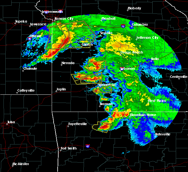 At 1213 pm cdt, a severe thunderstorm was located over jasper, moving southeast at 35 mph (radar indicated). Hazards include two inch hail and 60 mph wind gusts. People and animals outdoors will be injured. expect hail damage to roofs, siding, windows, and vehicles. expect wind damage to roofs, siding, and trees. Locations impacted include, jasper, western grove, piercetown, carver, erbie, pruitt, marble falls, yardelle, vendor, parthenon, gum springs in newton county, mt judea, hasty, mt sherman,. At 1213 pm cdt, a severe thunderstorm was located over jasper, moving southeast at 35 mph (radar indicated). Hazards include two inch hail and 60 mph wind gusts. People and animals outdoors will be injured. expect hail damage to roofs, siding, windows, and vehicles. expect wind damage to roofs, siding, and trees. Locations impacted include, jasper, western grove, piercetown, carver, erbie, pruitt, marble falls, yardelle, vendor, parthenon, gum springs in newton county, mt judea, hasty, mt sherman,.
|
| 5/4/2020 12:10 PM CDT | Ping Pong Ball sized hail reported 3.5 miles ESE of Jasper, AR, public submitted pictures of ping pong ball size hail. |
| 5/4/2020 11:57 AM CDT |
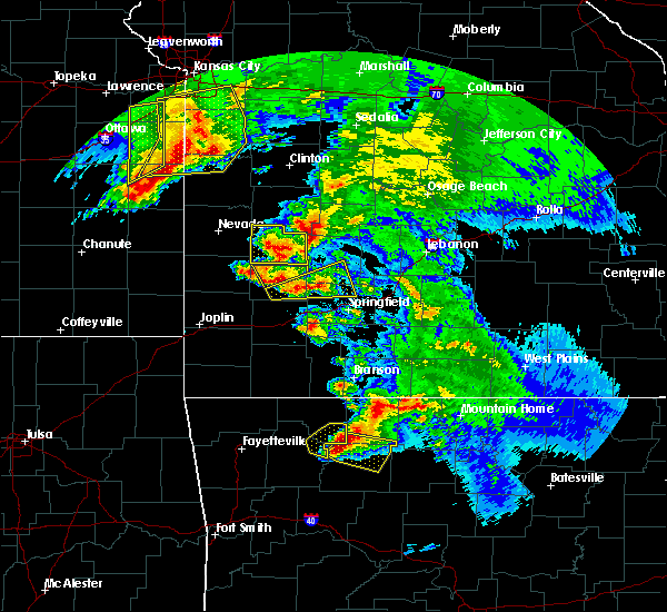 At 1156 am cdt, severe thunderstorms were located along a line extending from near red bank to near lost valley state park, moving southeast at 40 mph. there is a high likelihood this storm is producing very large hail! (radar indicated). Hazards include two inch hail and 60 mph wind gusts. People and animals outdoors will be injured. expect hail damage to roofs, siding, windows, and vehicles. expect wind damage to roofs, siding, and trees. Locations impacted include, jasper, western grove, valley springs, dugger, lost valley state park, piercetown, carver, erbie, pruitt, red bank, upper buffalo wilderness area, marble falls, yardelle, compton, low gap, vendor, parthenon, gum springs in newton county, mt judea, gaither,. At 1156 am cdt, severe thunderstorms were located along a line extending from near red bank to near lost valley state park, moving southeast at 40 mph. there is a high likelihood this storm is producing very large hail! (radar indicated). Hazards include two inch hail and 60 mph wind gusts. People and animals outdoors will be injured. expect hail damage to roofs, siding, windows, and vehicles. expect wind damage to roofs, siding, and trees. Locations impacted include, jasper, western grove, valley springs, dugger, lost valley state park, piercetown, carver, erbie, pruitt, red bank, upper buffalo wilderness area, marble falls, yardelle, compton, low gap, vendor, parthenon, gum springs in newton county, mt judea, gaither,.
|
| 5/4/2020 11:31 AM CDT |
 At 1131 am cdt, severe thunderstorms were located along a line extending from rudd to near marble, moving east at 45 mph (radar indicated). Hazards include two inch hail and 60 mph wind gusts. People and animals outdoors will be injured. expect hail damage to roofs, siding, windows, and vehicles. Expect wind damage to roofs, siding, and trees. At 1131 am cdt, severe thunderstorms were located along a line extending from rudd to near marble, moving east at 45 mph (radar indicated). Hazards include two inch hail and 60 mph wind gusts. People and animals outdoors will be injured. expect hail damage to roofs, siding, windows, and vehicles. Expect wind damage to roofs, siding, and trees.
|
| 4/28/2020 9:27 PM CDT |
 The severe thunderstorm warning for northern searcy, northeastern newton, southeastern marion, baxter and western fulton counties will expire at 930 pm cdt, the storms which prompted the warning have moved out of the area. therefore, the warning will be allowed to expire. however gusty winds and heavy rain are still possible with these thunderstorms. a severe thunderstorm watch remains in effect until 300 am cdt for north central arkansas. The severe thunderstorm warning for northern searcy, northeastern newton, southeastern marion, baxter and western fulton counties will expire at 930 pm cdt, the storms which prompted the warning have moved out of the area. therefore, the warning will be allowed to expire. however gusty winds and heavy rain are still possible with these thunderstorms. a severe thunderstorm watch remains in effect until 300 am cdt for north central arkansas.
|
| 4/28/2020 9:10 PM CDT |
 At 909 pm cdt, severe thunderstorms were located along a line extending from shipp to near rush to duff, moving east at 55 mph (radar indicated). Hazards include 60 mph wind gusts and quarter size hail. Hail damage to vehicles is expected. expect wind damage to roofs, siding, and trees. Locations impacted include, mountain home, bull shoals, yellville, jasper, gassville, flippin, lakeview in baxter county, norfork, salesville, western grove, viola, briarcliff, valley springs, arkawana, dugger, ott, carver, duff, bull shoals state park, herron,. At 909 pm cdt, severe thunderstorms were located along a line extending from shipp to near rush to duff, moving east at 55 mph (radar indicated). Hazards include 60 mph wind gusts and quarter size hail. Hail damage to vehicles is expected. expect wind damage to roofs, siding, and trees. Locations impacted include, mountain home, bull shoals, yellville, jasper, gassville, flippin, lakeview in baxter county, norfork, salesville, western grove, viola, briarcliff, valley springs, arkawana, dugger, ott, carver, duff, bull shoals state park, herron,.
|
| 4/28/2020 8:42 PM CDT |
 At 841 pm cdt, severe thunderstorms were located along a line extending from near clark hill to crawford to jasper, moving east at 50 mph (radar indicated). Hazards include 60 mph wind gusts and quarter size hail. Hail damage to vehicles is expected. Expect wind damage to roofs, siding, and trees. At 841 pm cdt, severe thunderstorms were located along a line extending from near clark hill to crawford to jasper, moving east at 50 mph (radar indicated). Hazards include 60 mph wind gusts and quarter size hail. Hail damage to vehicles is expected. Expect wind damage to roofs, siding, and trees.
|
| 3/19/2020 6:54 PM CDT |
 The tornado warning for northeastern newton county will expire at 700 pm cdt, the storm which prompted the warning has moved out of the area. therefore, the warning will be allowed to expire. however heavy rain is still possible with this thunderstorm. a tornado watch remains in effect until 1000 pm cdt for north central arkansas. The tornado warning for northeastern newton county will expire at 700 pm cdt, the storm which prompted the warning has moved out of the area. therefore, the warning will be allowed to expire. however heavy rain is still possible with this thunderstorm. a tornado watch remains in effect until 1000 pm cdt for north central arkansas.
|
| 3/19/2020 6:33 PM CDT |
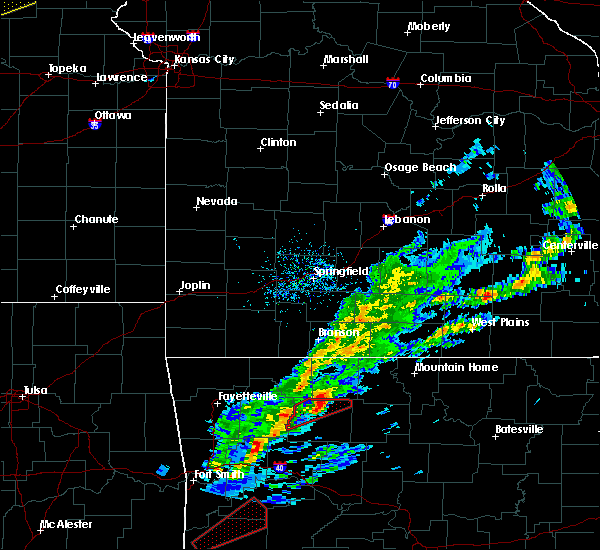 At 633 pm cdt, a severe thunderstorm capable of producing a tornado was located over erbie, or near jasper, moving northeast at 45 mph (radar indicated rotation). Hazards include tornado and quarter size hail. Flying debris will be dangerous to those caught without shelter. mobile homes will be damaged or destroyed. damage to roofs, windows, and vehicles will occur. tree damage is likely. Locations impacted include, jasper, western grove, erbie, pruitt, marble falls, yardelle, mt sherman,. At 633 pm cdt, a severe thunderstorm capable of producing a tornado was located over erbie, or near jasper, moving northeast at 45 mph (radar indicated rotation). Hazards include tornado and quarter size hail. Flying debris will be dangerous to those caught without shelter. mobile homes will be damaged or destroyed. damage to roofs, windows, and vehicles will occur. tree damage is likely. Locations impacted include, jasper, western grove, erbie, pruitt, marble falls, yardelle, mt sherman,.
|
| 3/19/2020 6:08 PM CDT |
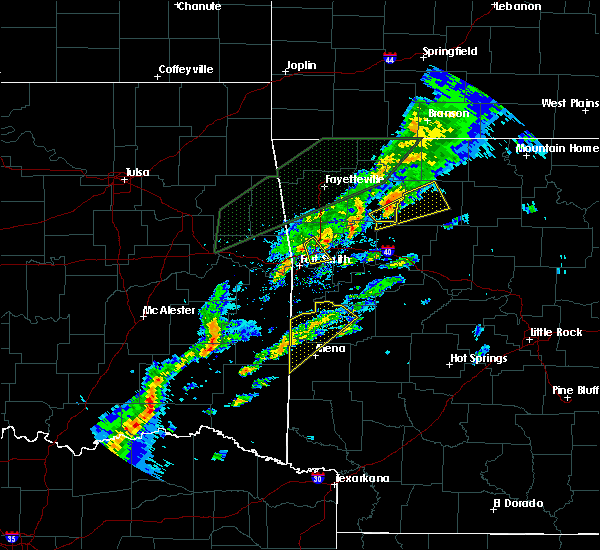 At 608 pm cdt, a severe thunderstorm capable of producing a tornado was located near upper buffalo wilderness area, or 17 miles southeast of huntsville, moving northeast at 50 mph (radar indicated rotation). Hazards include tornado and quarter size hail. Flying debris will be dangerous to those caught without shelter. mobile homes will be damaged or destroyed. damage to roofs, windows, and vehicles will occur. Tree damage is likely. At 608 pm cdt, a severe thunderstorm capable of producing a tornado was located near upper buffalo wilderness area, or 17 miles southeast of huntsville, moving northeast at 50 mph (radar indicated rotation). Hazards include tornado and quarter size hail. Flying debris will be dangerous to those caught without shelter. mobile homes will be damaged or destroyed. damage to roofs, windows, and vehicles will occur. Tree damage is likely.
|
| 3/19/2020 5:48 PM CDT |
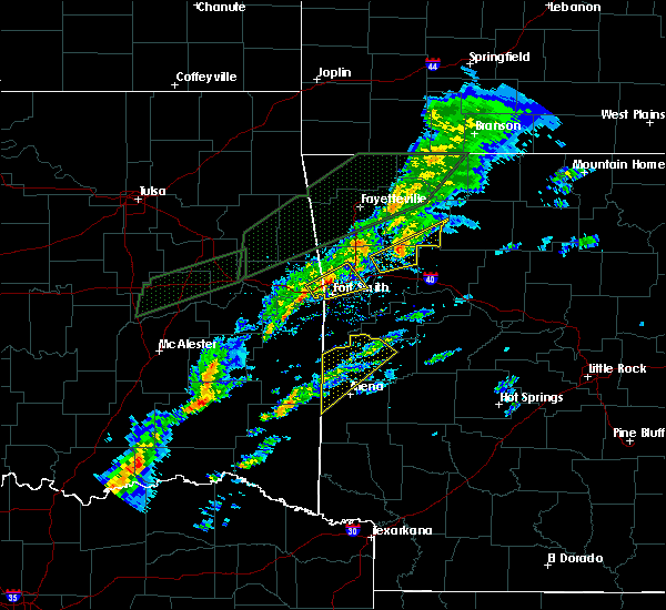 At 548 pm cdt, a severe thunderstorm was located near saint paul, or 18 miles north of ozark, moving northeast at 45 mph (radar indicated). Hazards include 60 mph wind gusts and quarter size hail. Hail damage to vehicles is expected. Expect wind damage to roofs, siding, and trees. At 548 pm cdt, a severe thunderstorm was located near saint paul, or 18 miles north of ozark, moving northeast at 45 mph (radar indicated). Hazards include 60 mph wind gusts and quarter size hail. Hail damage to vehicles is expected. Expect wind damage to roofs, siding, and trees.
|
| 3/11/2020 7:43 AM CDT | Quarter sized hail reported 18.5 miles NE of Jasper, AR |
| 1/10/2020 8:32 PM CST |
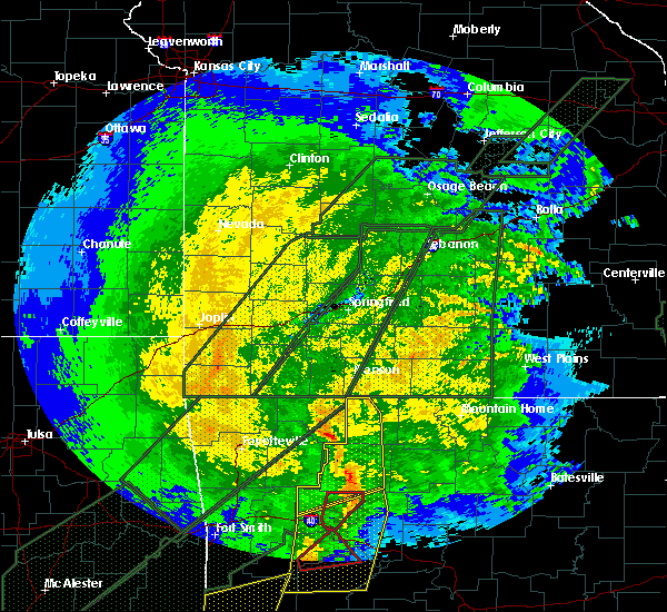 At 832 pm cst, severe thunderstorms were located along a line extending from osage to 6 miles west of erbie to near lost valley state park to 7 miles northeast of walnut to near dillen, moving northeast at 60 mph (radar indicated). Hazards include 60 mph wind gusts and nickel size hail. Expect damage to roofs, siding, and trees. Locations impacted include, harrison, jasper, bergman, omaha, roberson hollow, carver, erbie, devils knob, lost valley state park, pruitt, rosetta, myrtle, self, dillen, red bank, capps, piercetown, walnut, bertha, upper buffalo wilderness area,. At 832 pm cst, severe thunderstorms were located along a line extending from osage to 6 miles west of erbie to near lost valley state park to 7 miles northeast of walnut to near dillen, moving northeast at 60 mph (radar indicated). Hazards include 60 mph wind gusts and nickel size hail. Expect damage to roofs, siding, and trees. Locations impacted include, harrison, jasper, bergman, omaha, roberson hollow, carver, erbie, devils knob, lost valley state park, pruitt, rosetta, myrtle, self, dillen, red bank, capps, piercetown, walnut, bertha, upper buffalo wilderness area,.
|
| 1/10/2020 8:05 PM CST |
 At 804 pm cst, severe thunderstorms were located along a line extending from aurora to near witter to near pettigrew to 10 miles east of cass to 7 miles northwest of woodland, moving northeast at 45 mph (radar indicated). Hazards include 70 mph wind gusts and quarter size hail. Hail damage to vehicles is expected. expect considerable tree damage. Wind damage is also likely to mobile homes, roofs, and outbuildings. At 804 pm cst, severe thunderstorms were located along a line extending from aurora to near witter to near pettigrew to 10 miles east of cass to 7 miles northwest of woodland, moving northeast at 45 mph (radar indicated). Hazards include 70 mph wind gusts and quarter size hail. Hail damage to vehicles is expected. expect considerable tree damage. Wind damage is also likely to mobile homes, roofs, and outbuildings.
|
| 10/21/2019 1:47 AM CDT |
 At 147 am cdt, severe thunderstorms were located along a line extending from 8 miles west of price place to near woodland, moving east at 55 mph (radar indicated). Hazards include 60 mph wind gusts and quarter size hail. Hail damage to vehicles is expected. Expect wind damage to roofs, siding, and trees. At 147 am cdt, severe thunderstorms were located along a line extending from 8 miles west of price place to near woodland, moving east at 55 mph (radar indicated). Hazards include 60 mph wind gusts and quarter size hail. Hail damage to vehicles is expected. Expect wind damage to roofs, siding, and trees.
|
| 10/21/2019 1:30 AM CDT | Trees were reported down in jaspe in newton county AR, 0.2 miles NE of Jasper, AR |
| 10/21/2019 1:14 AM CDT |
 At 113 am cdt, severe thunderstorms were located along a line extending from 7 miles south of kimberling city to kingston to near mulberry, moving east at 60 mph (radar indicated). Hazards include 60 mph wind gusts and quarter size hail. Hail damage to vehicles is expected. Expect wind damage to roofs, siding, and trees. At 113 am cdt, severe thunderstorms were located along a line extending from 7 miles south of kimberling city to kingston to near mulberry, moving east at 60 mph (radar indicated). Hazards include 60 mph wind gusts and quarter size hail. Hail damage to vehicles is expected. Expect wind damage to roofs, siding, and trees.
|
| 8/27/2019 12:29 AM CDT |
 At 1229 am cdt, severe thunderstorms were located along a line extending from near jasper to 9 miles southwest of piercetown to near dillen to 6 miles north of woodland, moving southeast at 45 mph (radar indicated). Hazards include 60 mph wind gusts. expect damage to roofs, siding, and trees At 1229 am cdt, severe thunderstorms were located along a line extending from near jasper to 9 miles southwest of piercetown to near dillen to 6 miles north of woodland, moving southeast at 45 mph (radar indicated). Hazards include 60 mph wind gusts. expect damage to roofs, siding, and trees
|
| 8/27/2019 12:14 AM CDT |
 At 1213 am cdt, severe thunderstorms were located along a line extending from near red bank to near jasper to 7 miles east of upper buffalo wilderness area to 8 miles southeast of pettigrew, moving east at 55 mph (radar indicated). Hazards include 60 mph wind gusts. Expect damage to roofs, siding, and trees. Locations impacted include, jasper, western grove, valley springs, dugger, olvey, marsena, carver, erbie, duff, upper buffalo wilderness area, point peter, devils knob, lost valley state park, pruitt, rosetta, dillen, red bank, eula, piercetown, walnut,. At 1213 am cdt, severe thunderstorms were located along a line extending from near red bank to near jasper to 7 miles east of upper buffalo wilderness area to 8 miles southeast of pettigrew, moving east at 55 mph (radar indicated). Hazards include 60 mph wind gusts. Expect damage to roofs, siding, and trees. Locations impacted include, jasper, western grove, valley springs, dugger, olvey, marsena, carver, erbie, duff, upper buffalo wilderness area, point peter, devils knob, lost valley state park, pruitt, rosetta, dillen, red bank, eula, piercetown, walnut,.
|
| 8/26/2019 11:59 PM CDT |
 At 1144 pm cdt, severe thunderstorms were located along a line extending from near berryville to marble to near aurora to 7 miles west of saint paul, moving east at 55 mph (radar indicated). Hazards include 60 mph wind gusts. expect damage to roofs, siding, and trees At 1144 pm cdt, severe thunderstorms were located along a line extending from near berryville to marble to near aurora to 7 miles west of saint paul, moving east at 55 mph (radar indicated). Hazards include 60 mph wind gusts. expect damage to roofs, siding, and trees
|
| 8/26/2019 11:45 PM CDT |
 At 1144 pm cdt, severe thunderstorms were located along a line extending from near berryville to marble to near aurora to 7 miles west of saint paul, moving east at 55 mph (radar indicated). Hazards include 60 mph wind gusts. expect damage to roofs, siding, and trees At 1144 pm cdt, severe thunderstorms were located along a line extending from near berryville to marble to near aurora to 7 miles west of saint paul, moving east at 55 mph (radar indicated). Hazards include 60 mph wind gusts. expect damage to roofs, siding, and trees
|
| 8/26/2019 5:25 PM CDT |
 At 524 pm cdt, a severe thunderstorm was located near western grove, or 11 miles northeast of jasper, moving southeast at 25 mph (radar indicated). Hazards include 60 mph wind gusts and quarter size hail. Hail damage to vehicles is expected. Expect wind damage to roofs, siding, and trees. At 524 pm cdt, a severe thunderstorm was located near western grove, or 11 miles northeast of jasper, moving southeast at 25 mph (radar indicated). Hazards include 60 mph wind gusts and quarter size hail. Hail damage to vehicles is expected. Expect wind damage to roofs, siding, and trees.
|
| 6/26/2019 1:40 PM CDT |
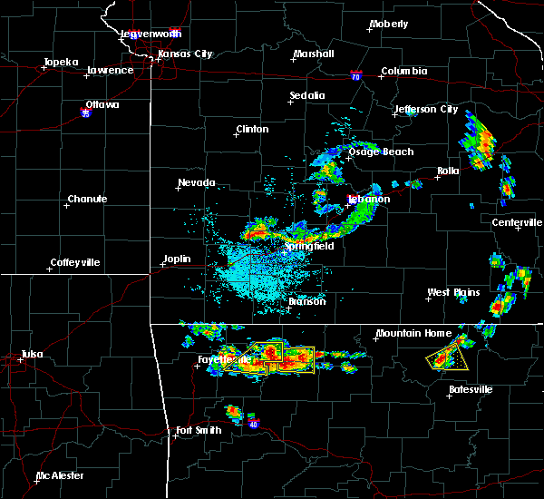 At 139 pm cdt, a severe thunderstorm was located near erbie, or 8 miles north of jasper, moving east at 10 mph (radar indicated). Hazards include 60 mph wind gusts and half dollar size hail. Hail damage to vehicles is expected. expect wind damage to roofs, siding, and trees. Locations impacted include, harrison, jasper, valley springs, capps, erbie, pruitt, red bank, bellefonte, batavia, marble falls, yardelle, compton, gaither, hasty, mt sherman,. At 139 pm cdt, a severe thunderstorm was located near erbie, or 8 miles north of jasper, moving east at 10 mph (radar indicated). Hazards include 60 mph wind gusts and half dollar size hail. Hail damage to vehicles is expected. expect wind damage to roofs, siding, and trees. Locations impacted include, harrison, jasper, valley springs, capps, erbie, pruitt, red bank, bellefonte, batavia, marble falls, yardelle, compton, gaither, hasty, mt sherman,.
|
| 6/26/2019 1:17 PM CDT |
 At 116 pm cdt, a severe thunderstorm was located near erbie, or 9 miles northwest of jasper, moving east at 10 mph (radar indicated). Hazards include 60 mph wind gusts and half dollar size hail. Hail damage to vehicles is expected. Expect wind damage to roofs, siding, and trees. At 116 pm cdt, a severe thunderstorm was located near erbie, or 9 miles northwest of jasper, moving east at 10 mph (radar indicated). Hazards include 60 mph wind gusts and half dollar size hail. Hail damage to vehicles is expected. Expect wind damage to roofs, siding, and trees.
|
| 6/23/2019 12:09 PM CDT |
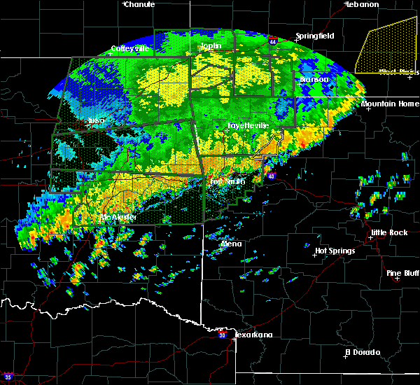 At 1209 pm cdt, severe thunderstorms were located along a line extending from pettigrew to near wiederkehr village, moving east at 30 mph (radar indicated). Hazards include 60 mph wind gusts and quarter size hail. Hail damage to vehicles is expected. Expect wind damage to roofs, siding, and trees. At 1209 pm cdt, severe thunderstorms were located along a line extending from pettigrew to near wiederkehr village, moving east at 30 mph (radar indicated). Hazards include 60 mph wind gusts and quarter size hail. Hail damage to vehicles is expected. Expect wind damage to roofs, siding, and trees.
|
| 6/23/2019 11:51 AM CDT |
 The severe thunderstorm warning for northern newton and boone counties will expire at noon cdt, the storm which prompted the warning has weakened below severe limits, and no longer poses an immediate threat to life or property. therefore, the warning will be allowed to expire. however gusty winds and heavy rain are still possible with this thunderstorm. The severe thunderstorm warning for northern newton and boone counties will expire at noon cdt, the storm which prompted the warning has weakened below severe limits, and no longer poses an immediate threat to life or property. therefore, the warning will be allowed to expire. however gusty winds and heavy rain are still possible with this thunderstorm.
|
| 6/23/2019 11:14 AM CDT |
 At 1113 am cdt, a severe thunderstorm was located over rudd, or 13 miles southeast of berryville, moving east at 35 mph (radar indicated). Hazards include 60 mph wind gusts and quarter size hail. Hail damage to vehicles is expected. Expect wind damage to roofs, siding, and trees. At 1113 am cdt, a severe thunderstorm was located over rudd, or 13 miles southeast of berryville, moving east at 35 mph (radar indicated). Hazards include 60 mph wind gusts and quarter size hail. Hail damage to vehicles is expected. Expect wind damage to roofs, siding, and trees.
|
| 5/29/2019 3:28 AM CDT |
 At 328 am cdt, severe thunderstorms were located along a line extending from 7 miles southeast of pettigrew to subiaco, moving east at 60 mph (radar indicated). Hazards include 60 mph wind gusts and penny size hail. Expect damage to roofs, siding, and trees. Locations impacted include, clarksville, paris, jasper, lamar, knoxville, subiaco, hartman, scranton, blue mountain, upper buffalo wilderness area, devils knob, hoyt, midway in logan county, holman, rosetta, woodland, hinkle, mount magazine, walnut, spadra, this includes interstate 40 between mile markers 44 and 72. At 328 am cdt, severe thunderstorms were located along a line extending from 7 miles southeast of pettigrew to subiaco, moving east at 60 mph (radar indicated). Hazards include 60 mph wind gusts and penny size hail. Expect damage to roofs, siding, and trees. Locations impacted include, clarksville, paris, jasper, lamar, knoxville, subiaco, hartman, scranton, blue mountain, upper buffalo wilderness area, devils knob, hoyt, midway in logan county, holman, rosetta, woodland, hinkle, mount magazine, walnut, spadra, this includes interstate 40 between mile markers 44 and 72.
|
| 5/29/2019 3:05 AM CDT |
 At 304 am cdt, severe thunderstorms were located along a line extending from near fern to near fort chaffee, moving east at 60 mph (radar indicated). Hazards include 60 mph wind gusts and quarter size hail. Hail damage to vehicles is expected. Expect wind damage to roofs, siding, and trees. At 304 am cdt, severe thunderstorms were located along a line extending from near fern to near fort chaffee, moving east at 60 mph (radar indicated). Hazards include 60 mph wind gusts and quarter size hail. Hail damage to vehicles is expected. Expect wind damage to roofs, siding, and trees.
|
| 5/21/2019 2:26 PM CDT |
 At 225 pm cdt, a severe thunderstorm capable of producing a tornado was located near jasper, moving northeast at 55 mph (radar indicated rotation). Hazards include tornado and quarter size hail. Flying debris will be dangerous to those caught without shelter. mobile homes will be damaged or destroyed. damage to roofs, windows, and vehicles will occur. tree damage is likely. locations impacted include, jasper, western grove, dillen, carver, erbie, duff, red bank, point peter, eula, piercetown, walnut, pruitt, capps, upper buffalo wilderness area, st. Joe, pindall, bass, marble falls, yardelle, fort douglas,. At 225 pm cdt, a severe thunderstorm capable of producing a tornado was located near jasper, moving northeast at 55 mph (radar indicated rotation). Hazards include tornado and quarter size hail. Flying debris will be dangerous to those caught without shelter. mobile homes will be damaged or destroyed. damage to roofs, windows, and vehicles will occur. tree damage is likely. locations impacted include, jasper, western grove, dillen, carver, erbie, duff, red bank, point peter, eula, piercetown, walnut, pruitt, capps, upper buffalo wilderness area, st. Joe, pindall, bass, marble falls, yardelle, fort douglas,.
|
| 5/21/2019 2:06 PM CDT |
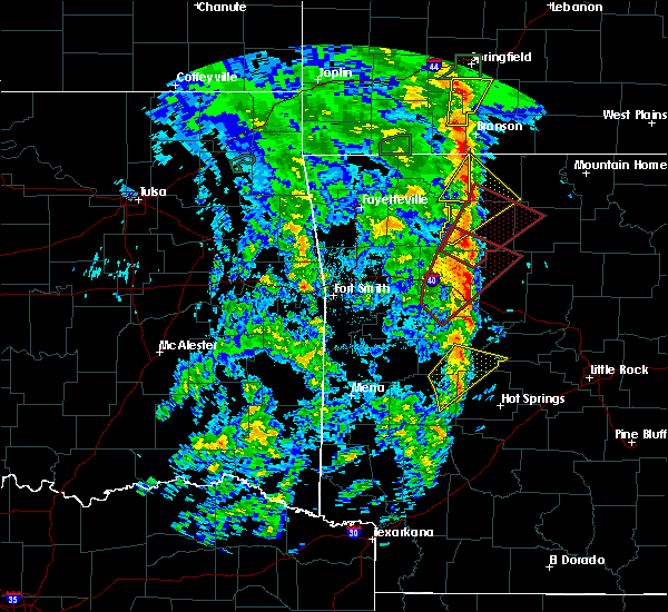 At 206 pm cdt, a severe thunderstorm capable of producing a tornado was located over rosetta, or 20 miles northeast of clarksville, moving northeast at 45 mph (radar indicated rotation). Hazards include tornado and quarter size hail. Flying debris will be dangerous to those caught without shelter. mobile homes will be damaged or destroyed. damage to roofs, windows, and vehicles will occur. Tree damage is likely. At 206 pm cdt, a severe thunderstorm capable of producing a tornado was located over rosetta, or 20 miles northeast of clarksville, moving northeast at 45 mph (radar indicated rotation). Hazards include tornado and quarter size hail. Flying debris will be dangerous to those caught without shelter. mobile homes will be damaged or destroyed. damage to roofs, windows, and vehicles will occur. Tree damage is likely.
|
| 5/21/2019 1:54 PM CDT |
 At 153 pm cdt, a severe thunderstorm was located over lost valley state park, or 10 miles west of jasper. another developing storm was centered near fallsville. the storms were moving northeast at 45 mph (radar indicated). Hazards include 60 mph wind gusts and quarter size hail. Hail damage to vehicles is expected. expect wind damage to roofs, siding, and trees. Locations impacted include, harrison, jasper, western grove, valley springs, dugger, olvey, roberson hollow, erbie, upper buffalo wilderness area, red bank, lost valley state park, capps, pruitt, bellefonte, alpena, everton, batavia, bear creek springs, marble falls, ridgeway, a tornado watch remains in effect until 700 pm cdt for north central arkansas. At 153 pm cdt, a severe thunderstorm was located over lost valley state park, or 10 miles west of jasper. another developing storm was centered near fallsville. the storms were moving northeast at 45 mph (radar indicated). Hazards include 60 mph wind gusts and quarter size hail. Hail damage to vehicles is expected. expect wind damage to roofs, siding, and trees. Locations impacted include, harrison, jasper, western grove, valley springs, dugger, olvey, roberson hollow, erbie, upper buffalo wilderness area, red bank, lost valley state park, capps, pruitt, bellefonte, alpena, everton, batavia, bear creek springs, marble falls, ridgeway, a tornado watch remains in effect until 700 pm cdt for north central arkansas.
|
| 5/21/2019 1:37 PM CDT |
 At 137 pm cdt, a severe thunderstorm was located near upper buffalo wilderness area, or 19 miles southwest of jasper, moving northeast at 45 mph (radar indicated). Hazards include 60 mph wind gusts and quarter size hail. Hail damage to vehicles is expected. Expect wind damage to roofs, siding, and trees. At 137 pm cdt, a severe thunderstorm was located near upper buffalo wilderness area, or 19 miles southwest of jasper, moving northeast at 45 mph (radar indicated). Hazards include 60 mph wind gusts and quarter size hail. Hail damage to vehicles is expected. Expect wind damage to roofs, siding, and trees.
|
| 5/18/2019 3:35 PM CDT |
 At 334 pm cdt, severe thunderstorms were located along a line extending from near piercetown to near moore to hector, moving northeast at 40 mph (radar indicated). Hazards include 60 mph wind gusts and nickel size hail. Expect damage to roofs, siding, and trees. Locations impacted include, russellville, jasper, dover, hector, witts spring, dillen, erbie, broomfield, moore, dabney, solo, smyrna, piercetown, bertha, taral, lake dardanelle, ben hur, bass, alread, brock creek campground, a tornado watch remains in effect until 800 pm cdt for central, western and north central arkansas. At 334 pm cdt, severe thunderstorms were located along a line extending from near piercetown to near moore to hector, moving northeast at 40 mph (radar indicated). Hazards include 60 mph wind gusts and nickel size hail. Expect damage to roofs, siding, and trees. Locations impacted include, russellville, jasper, dover, hector, witts spring, dillen, erbie, broomfield, moore, dabney, solo, smyrna, piercetown, bertha, taral, lake dardanelle, ben hur, bass, alread, brock creek campground, a tornado watch remains in effect until 800 pm cdt for central, western and north central arkansas.
|
| 5/18/2019 3:07 PM CDT |
 The national weather service in little rock has issued a * severe thunderstorm warning for. east central logan county in western arkansas. eastern johnson county in western arkansas. southwestern searcy county in north central arkansas. Eastern newton county in north central arkansas. The national weather service in little rock has issued a * severe thunderstorm warning for. east central logan county in western arkansas. eastern johnson county in western arkansas. southwestern searcy county in north central arkansas. Eastern newton county in north central arkansas.
|
| 2/7/2019 3:58 AM CST |
 At 357 am cst, a severe thunderstorm was located near pruitt, or 5 miles northeast of jasper, moving northeast at 55 mph (radar indicated). Hazards include 60 mph wind gusts and quarter size hail. Hail damage to vehicles is expected. Expect wind damage to roofs, siding, and trees. At 357 am cst, a severe thunderstorm was located near pruitt, or 5 miles northeast of jasper, moving northeast at 55 mph (radar indicated). Hazards include 60 mph wind gusts and quarter size hail. Hail damage to vehicles is expected. Expect wind damage to roofs, siding, and trees.
|
| 2/7/2019 3:32 AM CST |
 At 330 am cst, severe thunderstorms were located along a line extending from near rudd to near boston and oark, moving northeast at 50 mph (radar indicated). Hazards include 60 mph wind gusts and quarter size hail. Hail damage to vehicles is expected. expect wind damage to roofs, siding, and trees. Locations impacted include, harrison, jasper, valley springs, carver, erbie, upper buffalo wilderness area, devils knob, lost valley state park, pruitt, rosetta, myrtle, self, dillen, red bank, capps, piercetown, walnut, bellefonte, alpena, batavia,. At 330 am cst, severe thunderstorms were located along a line extending from near rudd to near boston and oark, moving northeast at 50 mph (radar indicated). Hazards include 60 mph wind gusts and quarter size hail. Hail damage to vehicles is expected. expect wind damage to roofs, siding, and trees. Locations impacted include, harrison, jasper, valley springs, carver, erbie, upper buffalo wilderness area, devils knob, lost valley state park, pruitt, rosetta, myrtle, self, dillen, red bank, capps, piercetown, walnut, bellefonte, alpena, batavia,.
|
| 2/7/2019 3:07 AM CST |
 At 306 am cst, severe thunderstorms were located along a line extending from near elkins to 9 miles west of saint paul to mulberry, moving northeast at 50 mph (radar indicated). Hazards include 60 mph wind gusts and quarter size hail. Hail damage to vehicles is expected. Expect wind damage to roofs, siding, and trees. At 306 am cst, severe thunderstorms were located along a line extending from near elkins to 9 miles west of saint paul to mulberry, moving northeast at 50 mph (radar indicated). Hazards include 60 mph wind gusts and quarter size hail. Hail damage to vehicles is expected. Expect wind damage to roofs, siding, and trees.
|
| 12/1/2018 12:46 AM CST |
 At 1245 am cst, severe thunderstorms were located along a line extending from near dugger to near marshall to near woolum to jerusalem to near plainview in yell county, moving east at 70 mph (radar indicated). Hazards include 70 mph wind gusts and quarter size hail. Hail damage to vehicles is expected. expect considerable tree damage. wind damage is also likely to mobile homes, roofs, and outbuildings. locations impacted include, russellville, danville, marshall, jasper, dardanelle, atkins, pottsville, dover, ola, london, hector, western grove, adona, witts spring, duff, maumee, bohannon, blick, pruitt, elberta, this includes interstate 40 between mile markers 73 and 104. A tornado watch remains in effect until 200 am cst for central, western and north central arkansas. At 1245 am cst, severe thunderstorms were located along a line extending from near dugger to near marshall to near woolum to jerusalem to near plainview in yell county, moving east at 70 mph (radar indicated). Hazards include 70 mph wind gusts and quarter size hail. Hail damage to vehicles is expected. expect considerable tree damage. wind damage is also likely to mobile homes, roofs, and outbuildings. locations impacted include, russellville, danville, marshall, jasper, dardanelle, atkins, pottsville, dover, ola, london, hector, western grove, adona, witts spring, duff, maumee, bohannon, blick, pruitt, elberta, this includes interstate 40 between mile markers 73 and 104. A tornado watch remains in effect until 200 am cst for central, western and north central arkansas.
|
| 12/1/2018 12:27 AM CST |
 At 1227 am cst, severe thunderstorms were located along a line extending from jasper to near moore to near solo to near lake dardanelle to 6 miles east of fourche valley, moving east at 70 mph (radar indicated). Hazards include 70 mph wind gusts and quarter size hail. Hail damage to vehicles is expected. expect considerable tree damage. wind damage is also likely to mobile homes, roofs, and outbuildings. locations impacted include, russellville, danville, marshall, jasper, dardanelle, atkins, pottsville, lamar, dover, ola, london, knoxville, hector, western grove, adona, witts spring, duff, upper buffalo wilderness area, maumee, bohannon, this includes interstate 40 between mile markers 62 and 104. A tornado watch remains in effect until 200 am cst for central, western and north central arkansas. At 1227 am cst, severe thunderstorms were located along a line extending from jasper to near moore to near solo to near lake dardanelle to 6 miles east of fourche valley, moving east at 70 mph (radar indicated). Hazards include 70 mph wind gusts and quarter size hail. Hail damage to vehicles is expected. expect considerable tree damage. wind damage is also likely to mobile homes, roofs, and outbuildings. locations impacted include, russellville, danville, marshall, jasper, dardanelle, atkins, pottsville, lamar, dover, ola, london, knoxville, hector, western grove, adona, witts spring, duff, upper buffalo wilderness area, maumee, bohannon, this includes interstate 40 between mile markers 62 and 104. A tornado watch remains in effect until 200 am cst for central, western and north central arkansas.
|
| 12/1/2018 12:08 AM CST |
 At 1208 am cst, severe thunderstorms were located along a line extending from near devils knob to 7 miles north of holman to near mount magazine to 6 miles west of muddy creek wma, moving northeast at 65 mph (radar indicated). Hazards include 60 mph wind gusts and quarter size hail. Hail damage to vehicles is expected. Expect wind damage to roofs, siding, and trees. At 1208 am cst, severe thunderstorms were located along a line extending from near devils knob to 7 miles north of holman to near mount magazine to 6 miles west of muddy creek wma, moving northeast at 65 mph (radar indicated). Hazards include 60 mph wind gusts and quarter size hail. Hail damage to vehicles is expected. Expect wind damage to roofs, siding, and trees.
|
| 11/30/2018 11:48 PM CST |
 At 1147 pm cst, severe thunderstorms were located along a line extending from near japton to 8 miles northwest of woodland to near magazine to 12 miles southeast of beauchamp, moving east at 65 mph (radar indicated). Hazards include 70 mph wind gusts and quarter size hail. Hail damage to vehicles is expected. expect considerable tree damage. wind damage is also likely to mobile homes, roofs, and outbuildings. locations impacted include, clarksville, booneville, waldron, paris, jasper, lamar, mansfield, magazine, knoxville, subiaco, hartman, scranton, ratcliff, blue mountain, beauchamp, erbie, upper buffalo wilderness area, devils knob, lost valley state park, pruitt, this includes interstate 40 between mile markers 44 and 67. A tornado watch remains in effect until 200 am cst for western, central and north central arkansas. At 1147 pm cst, severe thunderstorms were located along a line extending from near japton to 8 miles northwest of woodland to near magazine to 12 miles southeast of beauchamp, moving east at 65 mph (radar indicated). Hazards include 70 mph wind gusts and quarter size hail. Hail damage to vehicles is expected. expect considerable tree damage. wind damage is also likely to mobile homes, roofs, and outbuildings. locations impacted include, clarksville, booneville, waldron, paris, jasper, lamar, mansfield, magazine, knoxville, subiaco, hartman, scranton, ratcliff, blue mountain, beauchamp, erbie, upper buffalo wilderness area, devils knob, lost valley state park, pruitt, this includes interstate 40 between mile markers 44 and 67. A tornado watch remains in effect until 200 am cst for western, central and north central arkansas.
|
| 11/30/2018 11:09 PM CST |
 At 1109 pm cst, severe thunderstorms were located along a line extending from near short to fort smith to 9 miles northeast of big cedar, moving northeast at 70 mph (radar indicated). Hazards include 70 mph wind gusts and quarter size hail. Hail damage to vehicles is expected. expect considerable tree damage. Wind damage is also likely to mobile homes, roofs, and outbuildings. At 1109 pm cst, severe thunderstorms were located along a line extending from near short to fort smith to 9 miles northeast of big cedar, moving northeast at 70 mph (radar indicated). Hazards include 70 mph wind gusts and quarter size hail. Hail damage to vehicles is expected. expect considerable tree damage. Wind damage is also likely to mobile homes, roofs, and outbuildings.
|
| 7/21/2018 1:07 AM CDT |
 At 107 am cdt, severe thunderstorms were located along a line extending from near piercetown to near boston, moving southeast at 45 mph (radar indicated). Hazards include 60 mph wind gusts and nickel size hail. Expect damage to roofs, siding, and trees. Locations impacted include, jasper, dillen, moore, upper buffalo wilderness area, devils knob, walnut, rosetta, lost valley state park, ben hur, catalpa, yale, crossroad, fallsville, swain, gum springs in newton county, oark, nail, wolf pen campground, arbaugh, lurton,. At 107 am cdt, severe thunderstorms were located along a line extending from near piercetown to near boston, moving southeast at 45 mph (radar indicated). Hazards include 60 mph wind gusts and nickel size hail. Expect damage to roofs, siding, and trees. Locations impacted include, jasper, dillen, moore, upper buffalo wilderness area, devils knob, walnut, rosetta, lost valley state park, ben hur, catalpa, yale, crossroad, fallsville, swain, gum springs in newton county, oark, nail, wolf pen campground, arbaugh, lurton,.
|
| 7/21/2018 1:03 AM CDT |
 At 102 am cdt, severe thunderstorms were located along a line extending from near rush to near piercetown, moving southeast at 45 mph (radar indicated). Hazards include 60 mph wind gusts and quarter size hail. Hail damage to vehicles is expected. Expect wind damage to roofs, siding, and trees. At 102 am cdt, severe thunderstorms were located along a line extending from near rush to near piercetown, moving southeast at 45 mph (radar indicated). Hazards include 60 mph wind gusts and quarter size hail. Hail damage to vehicles is expected. Expect wind damage to roofs, siding, and trees.
|
| 7/21/2018 12:48 AM CDT |
 At 1248 am cdt, severe thunderstorms were located along a line extending from near harrison to kingston, moving southeast at 50 mph (radar indicated). Hazards include 60 mph wind gusts and nickel size hail. expect damage to roofs, siding, and trees At 1248 am cdt, severe thunderstorms were located along a line extending from near harrison to kingston, moving southeast at 50 mph (radar indicated). Hazards include 60 mph wind gusts and nickel size hail. expect damage to roofs, siding, and trees
|
| 7/21/2018 12:32 AM CDT |
 At 1232 am cdt, severe thunderstorms were located along a line extending from bergman to near osage, moving southeast at 55 mph (radar indicated). Hazards include 60 mph wind gusts and quarter size hail. Hail damage to vehicles is expected. expect wind damage to roofs, siding, and trees. locations impacted include, harrison, jasper, bergman, western grove, valley springs, dugger, olvey, myrtle, self, carver, erbie, red bank, capps, piercetown, pruitt, crawford, bellefonte, alpena, everton, st. Joe,. At 1232 am cdt, severe thunderstorms were located along a line extending from bergman to near osage, moving southeast at 55 mph (radar indicated). Hazards include 60 mph wind gusts and quarter size hail. Hail damage to vehicles is expected. expect wind damage to roofs, siding, and trees. locations impacted include, harrison, jasper, bergman, western grove, valley springs, dugger, olvey, myrtle, self, carver, erbie, red bank, capps, piercetown, pruitt, crawford, bellefonte, alpena, everton, st. Joe,.
|
| 7/21/2018 12:19 AM CDT |
 At 1219 am cdt, severe thunderstorms were located along a line extending from omaha to near rule, moving southeast at 50 mph (radar indicated). Hazards include 60 mph wind gusts and quarter size hail. Hail damage to vehicles is expected. Expect wind damage to roofs, siding, and trees. At 1219 am cdt, severe thunderstorms were located along a line extending from omaha to near rule, moving southeast at 50 mph (radar indicated). Hazards include 60 mph wind gusts and quarter size hail. Hail damage to vehicles is expected. Expect wind damage to roofs, siding, and trees.
|
| 7/19/2018 8:15 PM CDT |
 At 815 pm cdt, severe thunderstorms were located along a line extending from near rush to near duff to piercetown to near lost valley state park, moving southeast at 45 mph (radar indicated). Hazards include 60 mph wind gusts. Expect damage to roofs, siding, and trees. Locations impacted include, marshall, yellville, jasper, western grove, valley springs, dugger, marsena, witts spring, carver, erbie, moore, duff, point peter, maumee, bohannon, lost valley state park, imo, pruitt, watts, kay,. At 815 pm cdt, severe thunderstorms were located along a line extending from near rush to near duff to piercetown to near lost valley state park, moving southeast at 45 mph (radar indicated). Hazards include 60 mph wind gusts. Expect damage to roofs, siding, and trees. Locations impacted include, marshall, yellville, jasper, western grove, valley springs, dugger, marsena, witts spring, carver, erbie, moore, duff, point peter, maumee, bohannon, lost valley state park, imo, pruitt, watts, kay,.
|
| 7/19/2018 7:58 PM CDT |
 At 757 pm cdt, severe thunderstorms were located along a line extending from near lakeway to crawford to near pruitt to near osage, moving southeast at 45 mph (radar indicated). Hazards include 60 mph wind gusts. expect damage to roofs, siding, and trees At 757 pm cdt, severe thunderstorms were located along a line extending from near lakeway to crawford to near pruitt to near osage, moving southeast at 45 mph (radar indicated). Hazards include 60 mph wind gusts. expect damage to roofs, siding, and trees
|
| 7/19/2018 7:44 PM CDT |
 At 744 pm cdt, severe thunderstorms were located along a line extending from near lead hill to bergman to capps to osage, moving south at 45 mph (radar indicated). Hazards include 60 mph wind gusts. Expect damage to roofs, siding, and trees. Locations impacted include, harrison, jasper, diamond city, bergman, western grove, lead hill, pyatt, valley springs, dugger, olvey, myrtle, self, erbie, lakeway, red bank, clark hill, winington, dodd city, lost valley state park, capps,. At 744 pm cdt, severe thunderstorms were located along a line extending from near lead hill to bergman to capps to osage, moving south at 45 mph (radar indicated). Hazards include 60 mph wind gusts. Expect damage to roofs, siding, and trees. Locations impacted include, harrison, jasper, diamond city, bergman, western grove, lead hill, pyatt, valley springs, dugger, olvey, myrtle, self, erbie, lakeway, red bank, clark hill, winington, dodd city, lost valley state park, capps,.
|
| 7/19/2018 7:36 PM CDT |
 At 735 pm cdt, severe thunderstorms were located along a line extending from diamond city to self to near carrollton to near green forest, moving south at 45 mph (radar indicated). Hazards include 60 mph wind gusts. Expect damage to roofs, siding, and trees. Locations impacted include, harrison, jasper, diamond city, bergman, western grove, lead hill, pyatt, valley springs, omaha, dugger, olvey, myrtle, roberson hollow, self, erbie, lakeway, red bank, clark hill, winington, dodd city,. At 735 pm cdt, severe thunderstorms were located along a line extending from diamond city to self to near carrollton to near green forest, moving south at 45 mph (radar indicated). Hazards include 60 mph wind gusts. Expect damage to roofs, siding, and trees. Locations impacted include, harrison, jasper, diamond city, bergman, western grove, lead hill, pyatt, valley springs, omaha, dugger, olvey, myrtle, roberson hollow, self, erbie, lakeway, red bank, clark hill, winington, dodd city,.
|
| 7/19/2018 7:19 PM CDT |
 At 718 pm cdt, severe thunderstorms were located along a line extending from near taneyville to 8 miles south of forsyth to near roberson hollow to 7 miles northeast of urbanette, moving south at 45 mph (radar indicated). Hazards include 60 mph wind gusts. expect damage to roofs, siding, and trees At 718 pm cdt, severe thunderstorms were located along a line extending from near taneyville to 8 miles south of forsyth to near roberson hollow to 7 miles northeast of urbanette, moving south at 45 mph (radar indicated). Hazards include 60 mph wind gusts. expect damage to roofs, siding, and trees
|
| 6/24/2018 8:12 AM CDT |
 The severe thunderstorm warning for northeastern johnson, newton, western searcy, southwestern marion, southern boone and north central pope counties will expire at 815 am cdt, the storms which prompted the warning have weakened. therefore, the warning will be allowed to expire. a severe thunderstorm watch remains in effect until 1100 am cdt for western and central arkansas. The severe thunderstorm warning for northeastern johnson, newton, western searcy, southwestern marion, southern boone and north central pope counties will expire at 815 am cdt, the storms which prompted the warning have weakened. therefore, the warning will be allowed to expire. a severe thunderstorm watch remains in effect until 1100 am cdt for western and central arkansas.
|
| 6/24/2018 7:29 AM CDT |
 At 729 am cdt, severe thunderstorms were located along a line extending from near upper buffalo wilderness area to walnut to 7 miles south of rosetta, moving northeast at 45 mph (radar indicated). Hazards include 60 mph wind gusts. expect damage to roofs, siding, and trees At 729 am cdt, severe thunderstorms were located along a line extending from near upper buffalo wilderness area to walnut to 7 miles south of rosetta, moving northeast at 45 mph (radar indicated). Hazards include 60 mph wind gusts. expect damage to roofs, siding, and trees
|
| 6/2/2018 2:30 PM CDT | Quarter sized hail reported 9.6 miles NW of Jasper, AR, reports of quarter size hail... also had pea and marble size hail mixed in. |
| 6/2/2018 2:10 PM CDT |
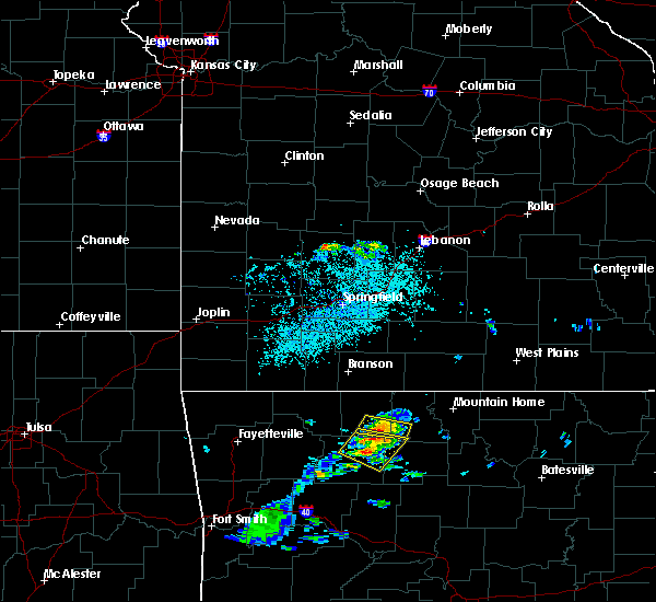 At 209 pm cdt, severe thunderstorms were located from western grove to piercetown, moving southeast at 20 mph (radar indicated). Hazards include 60 mph wind gusts and half dollar size hail. Hail damage to vehicles is expected. expect wind damage to roofs, siding, and trees. locations impacted include, jasper, western grove, dugger, piercetown, carver, pruitt, st. Joe, pindall, bass, marble falls, yardelle, parthenon, vendor, gum springs in newton county, mt judea, gaither, hasty, woolum recreation area, mt sherman,. At 209 pm cdt, severe thunderstorms were located from western grove to piercetown, moving southeast at 20 mph (radar indicated). Hazards include 60 mph wind gusts and half dollar size hail. Hail damage to vehicles is expected. expect wind damage to roofs, siding, and trees. locations impacted include, jasper, western grove, dugger, piercetown, carver, pruitt, st. Joe, pindall, bass, marble falls, yardelle, parthenon, vendor, gum springs in newton county, mt judea, gaither, hasty, woolum recreation area, mt sherman,.
|
| 6/2/2018 1:59 PM CDT |
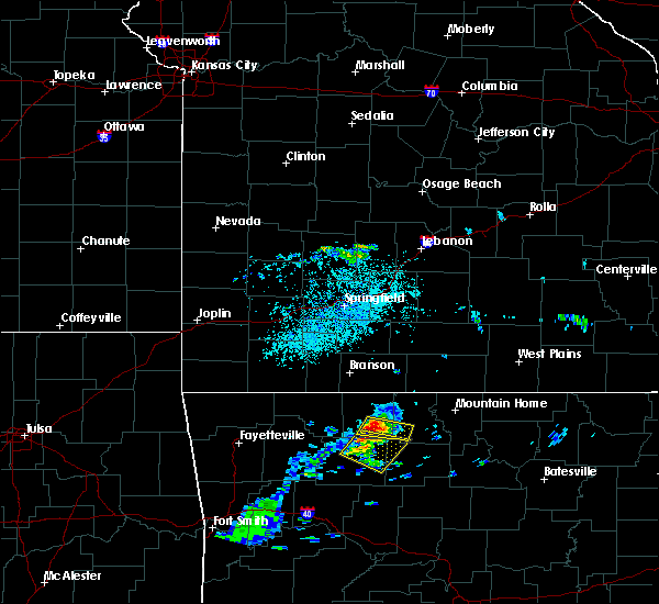 At 158 pm cdt, a severe thunderstorm was located near pruitt, or 8 miles south of harrison, moving southeast at 20 mph (radar indicated). Hazards include ping pong ball size hail and 60 mph wind gusts. People and animals outdoors will be injured. expect hail damage to roofs, siding, windows, and vehicles. Expect wind damage to roofs, siding, and trees. At 158 pm cdt, a severe thunderstorm was located near pruitt, or 8 miles south of harrison, moving southeast at 20 mph (radar indicated). Hazards include ping pong ball size hail and 60 mph wind gusts. People and animals outdoors will be injured. expect hail damage to roofs, siding, windows, and vehicles. Expect wind damage to roofs, siding, and trees.
|
| 6/2/2018 1:53 PM CDT | Golf Ball sized hail reported 7.1 miles SSW of Jasper, AR |
| 5/31/2018 11:26 PM CDT |
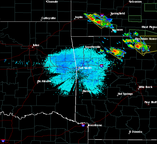 At 1126 pm cdt, a severe thunderstorm was located over jasper, moving southeast at 15 mph (radar indicated). Hazards include 60 mph wind gusts and quarter size hail. Hail damage to vehicles is expected. Expect wind damage to roofs, siding, and trees. At 1126 pm cdt, a severe thunderstorm was located over jasper, moving southeast at 15 mph (radar indicated). Hazards include 60 mph wind gusts and quarter size hail. Hail damage to vehicles is expected. Expect wind damage to roofs, siding, and trees.
|
| 5/31/2018 11:15 PM CDT | Trees were down in jaspe in newton county AR, 0.2 miles NE of Jasper, AR |
| 4/13/2018 7:26 PM CDT |
 At 726 pm cdt, severe thunderstorms were located along a line extending from near western grove to near carver to near moore to holman, moving northeast at 50 mph (radar indicated). Hazards include 60 mph wind gusts and nickel size hail. expect damage to roofs, siding, and trees At 726 pm cdt, severe thunderstorms were located along a line extending from near western grove to near carver to near moore to holman, moving northeast at 50 mph (radar indicated). Hazards include 60 mph wind gusts and nickel size hail. expect damage to roofs, siding, and trees
|
| 4/13/2018 7:06 PM CDT |
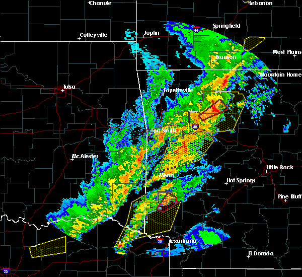 At 706 pm cdt, severe thunderstorms were located along a line extending from 8 miles north of dillen to near bertha to 6 miles north of holman, moving east at 45 mph (radar indicated). Hazards include 70 mph wind gusts and nickel size hail. Expect considerable tree damage. damage is likely to mobile homes, roofs, and outbuildings. Locations impacted include, clarksville, jasper, lamar, knoxville, hartman, hector, western grove, marsena, witts spring, carver, erbie, moore, duff, point peter, devils knob, hoyt, bohannon, pruitt, holman, rosetta, a tornado watch remains in effect until 1000 pm cdt for western, central and north central arkansas. At 706 pm cdt, severe thunderstorms were located along a line extending from 8 miles north of dillen to near bertha to 6 miles north of holman, moving east at 45 mph (radar indicated). Hazards include 70 mph wind gusts and nickel size hail. Expect considerable tree damage. damage is likely to mobile homes, roofs, and outbuildings. Locations impacted include, clarksville, jasper, lamar, knoxville, hartman, hector, western grove, marsena, witts spring, carver, erbie, moore, duff, point peter, devils knob, hoyt, bohannon, pruitt, holman, rosetta, a tornado watch remains in effect until 1000 pm cdt for western, central and north central arkansas.
|
| 4/13/2018 6:41 PM CDT |
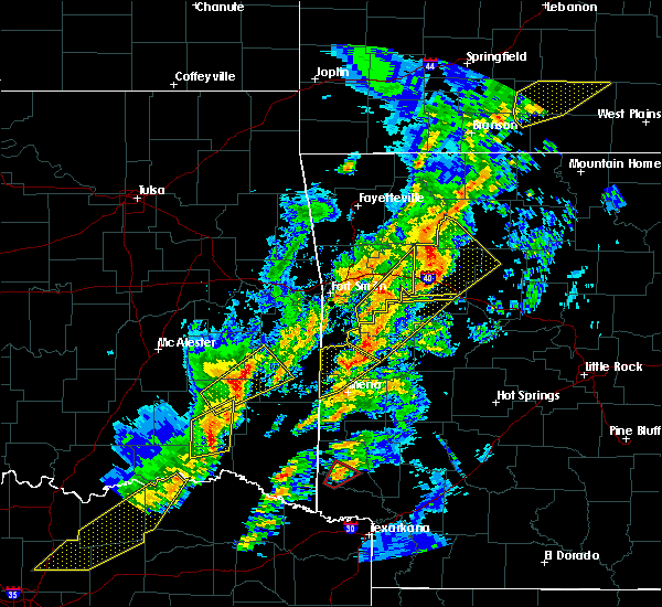 The national weather service in little rock has issued a * severe thunderstorm warning for. johnson county in western arkansas. newton county in north central arkansas. western searcy county in north central arkansas. Northwestern van buren county in north central arkansas. The national weather service in little rock has issued a * severe thunderstorm warning for. johnson county in western arkansas. newton county in north central arkansas. western searcy county in north central arkansas. Northwestern van buren county in north central arkansas.
|
| 8/18/2017 7:10 PM CDT |
 At 709 pm cdt, a severe thunderstorm was located over pruitt, or near jasper, moving southeast at 40 mph (radar indicated). Hazards include 60 mph wind gusts and half dollar size hail. Hail damage to vehicles is expected. expect wind damage to roofs, siding, and trees. Locations impacted include, harrison, jasper, western grove, erbie, red bank, lost valley state park, capps, pruitt, upper buffalo wilderness area, alpena, batavia, marble falls, yardelle, crossroad, gum springs in newton county, gaither, ponca, hasty, wayton, boxley,. At 709 pm cdt, a severe thunderstorm was located over pruitt, or near jasper, moving southeast at 40 mph (radar indicated). Hazards include 60 mph wind gusts and half dollar size hail. Hail damage to vehicles is expected. expect wind damage to roofs, siding, and trees. Locations impacted include, harrison, jasper, western grove, erbie, red bank, lost valley state park, capps, pruitt, upper buffalo wilderness area, alpena, batavia, marble falls, yardelle, crossroad, gum springs in newton county, gaither, ponca, hasty, wayton, boxley,.
|
| 8/18/2017 7:02 PM CDT |
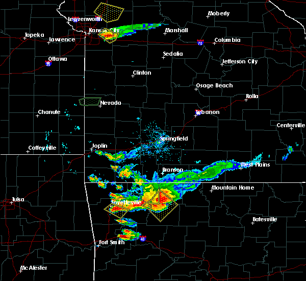 At 702 pm cdt, a severe thunderstorm was located over erbie, or near jasper, moving southeast at 30 mph (radar indicated). Hazards include 60 mph wind gusts and penny size hail. Expect damage to roofs, siding, and trees. Locations impacted include, harrison, jasper, western grove, erbie, red bank, lost valley state park, capps, pruitt, upper buffalo wilderness area, alpena, batavia, marble falls, yardelle, crossroad, gum springs in newton county, gaither, ponca, hasty, wayton, boxley,. At 702 pm cdt, a severe thunderstorm was located over erbie, or near jasper, moving southeast at 30 mph (radar indicated). Hazards include 60 mph wind gusts and penny size hail. Expect damage to roofs, siding, and trees. Locations impacted include, harrison, jasper, western grove, erbie, red bank, lost valley state park, capps, pruitt, upper buffalo wilderness area, alpena, batavia, marble falls, yardelle, crossroad, gum springs in newton county, gaither, ponca, hasty, wayton, boxley,.
|
| 8/18/2017 6:47 PM CDT |
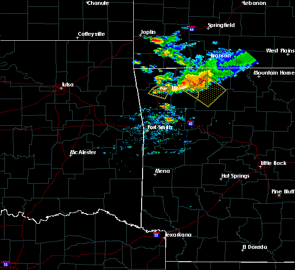 At 647 pm cdt, a severe thunderstorm was located near osage, or 12 miles northwest of jasper, moving southeast at 35 mph (radar indicated). Hazards include 60 mph wind gusts and quarter size hail. Hail damage to vehicles is expected. Expect wind damage to roofs, siding, and trees. At 647 pm cdt, a severe thunderstorm was located near osage, or 12 miles northwest of jasper, moving southeast at 35 mph (radar indicated). Hazards include 60 mph wind gusts and quarter size hail. Hail damage to vehicles is expected. Expect wind damage to roofs, siding, and trees.
|
| 6/23/2017 2:37 PM CDT |
 At 235 pm cdt, severe thunderstorms continue to move across newton county, with the strongest located near lost valley state park, or 9 miles west of jasper, moving southeast at 25 mph (radar indicated). Hazards include 60 mph wind gusts and quarter size hail. Hail damage to vehicles is expected. expect wind damage to roofs, siding, and trees. Locations impacted include, jasper, carver, erbie, moore, upper buffalo wilderness area, lost valley state park, piercetown, pruitt, ben hur, bass, marble falls, crossroad, swain, gum springs in newton county, nail, ponca, hasty, lurton, mossville, wayton,. At 235 pm cdt, severe thunderstorms continue to move across newton county, with the strongest located near lost valley state park, or 9 miles west of jasper, moving southeast at 25 mph (radar indicated). Hazards include 60 mph wind gusts and quarter size hail. Hail damage to vehicles is expected. expect wind damage to roofs, siding, and trees. Locations impacted include, jasper, carver, erbie, moore, upper buffalo wilderness area, lost valley state park, piercetown, pruitt, ben hur, bass, marble falls, crossroad, swain, gum springs in newton county, nail, ponca, hasty, lurton, mossville, wayton,.
|
| 6/23/2017 2:23 PM CDT |
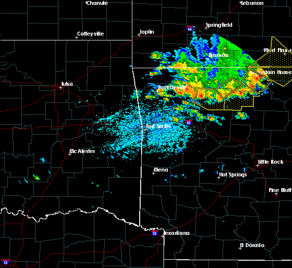 At 222 pm cdt, a severe thunderstorm was located over lost valley state park, or 12 miles west of jasper, moving southeast at 25 mph (radar indicated). Hazards include 60 mph wind gusts and quarter size hail. Hail damage to vehicles is expected. Expect wind damage to roofs, siding, and trees. At 222 pm cdt, a severe thunderstorm was located over lost valley state park, or 12 miles west of jasper, moving southeast at 25 mph (radar indicated). Hazards include 60 mph wind gusts and quarter size hail. Hail damage to vehicles is expected. Expect wind damage to roofs, siding, and trees.
|
| 5/28/2017 12:26 AM CDT |
 At 1225 am cdt, severe thunderstorms were located along a line extending from near cass to 9 miles northwest of woodland to 6 miles north of hartman to near denning, moving east at 75 mph (radar indicated). Hazards include 70 mph wind gusts and nickel size hail. Expect considerable tree damage. damage is likely to mobile homes, roofs, and outbuildings. locations impacted include, russellville, clarksville, jasper, lamar, dover, london, knoxville, hartman, hector, scranton, witts spring, erbie, upper buffalo wilderness area, devils knob, bohannon, lost valley state park, pruitt, holman, dillen, woodland, this includes interstate 40 between mile markers 45 and 79. A tornado watch remains in effect until 200 am cdt for western, central and north central arkansas. At 1225 am cdt, severe thunderstorms were located along a line extending from near cass to 9 miles northwest of woodland to 6 miles north of hartman to near denning, moving east at 75 mph (radar indicated). Hazards include 70 mph wind gusts and nickel size hail. Expect considerable tree damage. damage is likely to mobile homes, roofs, and outbuildings. locations impacted include, russellville, clarksville, jasper, lamar, dover, london, knoxville, hartman, hector, scranton, witts spring, erbie, upper buffalo wilderness area, devils knob, bohannon, lost valley state park, pruitt, holman, dillen, woodland, this includes interstate 40 between mile markers 45 and 79. A tornado watch remains in effect until 200 am cdt for western, central and north central arkansas.
|
| 5/28/2017 12:15 AM CDT |
 At 1215 am cdt, severe thunderstorms were located along a line extending from 6 miles north of fern to near cass to 8 miles northwest of ozark to near mulberry, moving east at 65 mph (radar indicated). Hazards include 60 mph wind gusts. expect damage to roofs, siding, and trees At 1215 am cdt, severe thunderstorms were located along a line extending from 6 miles north of fern to near cass to 8 miles northwest of ozark to near mulberry, moving east at 65 mph (radar indicated). Hazards include 60 mph wind gusts. expect damage to roofs, siding, and trees
|
| 5/19/2017 1:34 AM CDT |
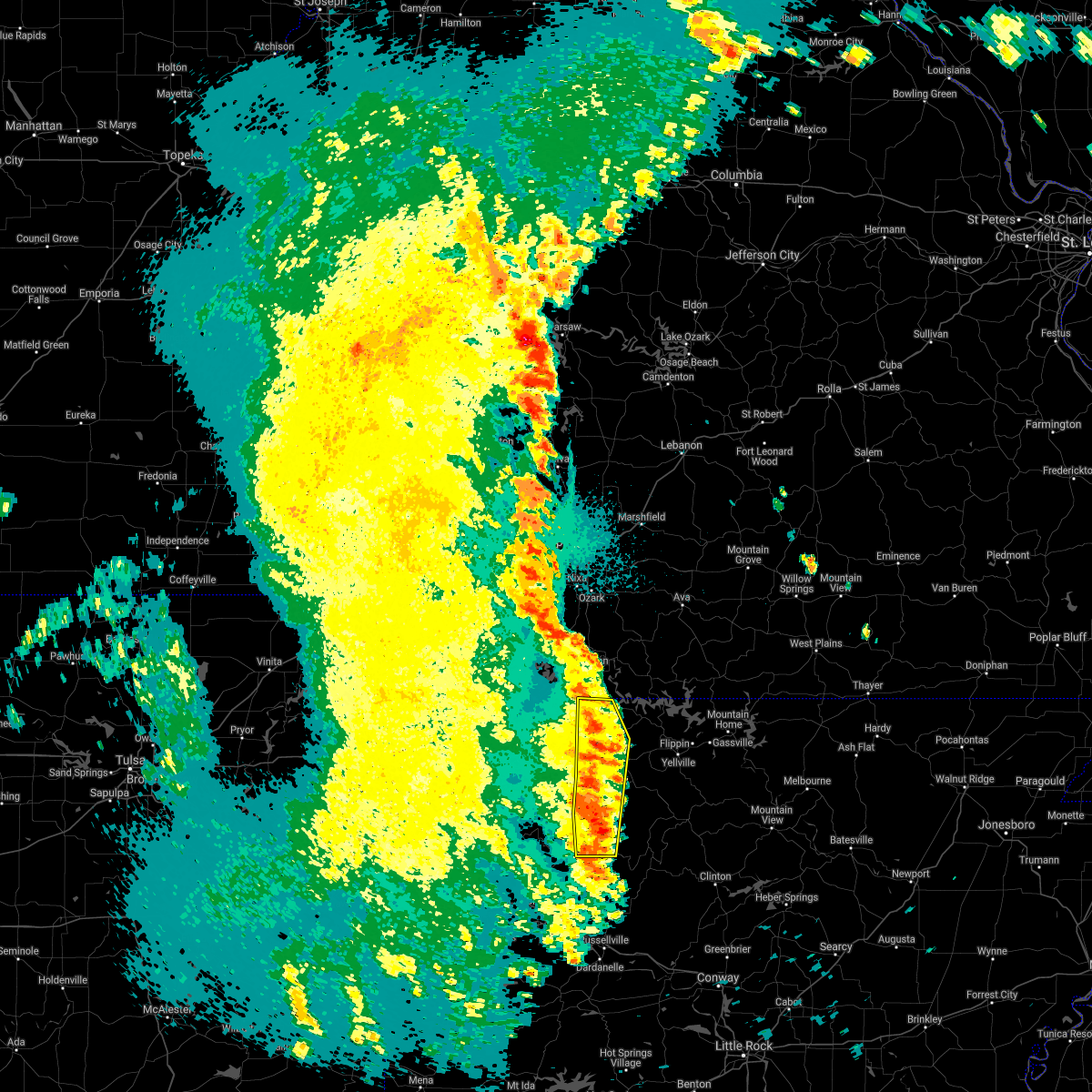 At 133 am cdt, severe thunderstorms were located along a line extending from near omaha to near harrison to near bertha, moving east at 45 mph (radar indicated). Hazards include 60 mph wind gusts and nickel size hail. Expect damage to roofs, siding, and trees. Locations impacted include, harrison, jasper, bergman, omaha, myrtle, roberson hollow, self, carver, erbie, red bank, capps, piercetown, pruitt, bellefonte, alpena, batavia, bear creek springs, new hope in boone county, marble falls, ridgeway, a tornado watch remains in effect until 600 am cdt for western and north central arkansas. At 133 am cdt, severe thunderstorms were located along a line extending from near omaha to near harrison to near bertha, moving east at 45 mph (radar indicated). Hazards include 60 mph wind gusts and nickel size hail. Expect damage to roofs, siding, and trees. Locations impacted include, harrison, jasper, bergman, omaha, myrtle, roberson hollow, self, carver, erbie, red bank, capps, piercetown, pruitt, bellefonte, alpena, batavia, bear creek springs, new hope in boone county, marble falls, ridgeway, a tornado watch remains in effect until 600 am cdt for western and north central arkansas.
|
| 5/19/2017 1:18 AM CDT |
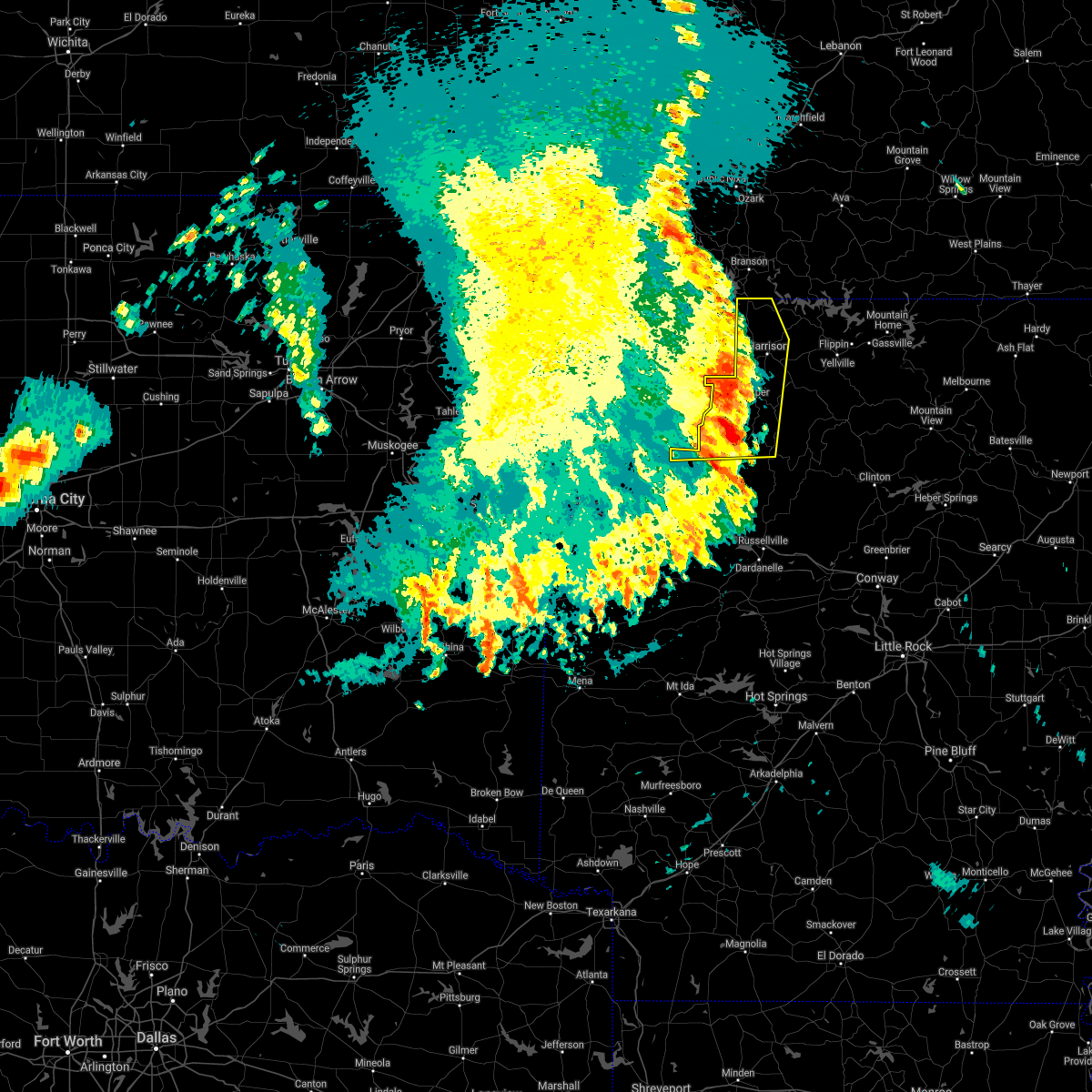 At 117 am cdt, severe thunderstorms were located along a line extending from near denver to 5 miles west of jasper to near rosetta, moving east at 45 mph (radar indicated). Hazards include 60 mph wind gusts and nickel size hail. Expect damage to roofs, siding, and trees. Locations impacted include, harrison, jasper, bergman, omaha, roberson hollow, carver, erbie, upper buffalo wilderness area, devils knob, lost valley state park, pruitt, myrtle, self, red bank, capps, piercetown, walnut, bellefonte, alpena, batavia, a tornado watch remains in effect until 600 am cdt for western, central and north central arkansas. At 117 am cdt, severe thunderstorms were located along a line extending from near denver to 5 miles west of jasper to near rosetta, moving east at 45 mph (radar indicated). Hazards include 60 mph wind gusts and nickel size hail. Expect damage to roofs, siding, and trees. Locations impacted include, harrison, jasper, bergman, omaha, roberson hollow, carver, erbie, upper buffalo wilderness area, devils knob, lost valley state park, pruitt, myrtle, self, red bank, capps, piercetown, walnut, bellefonte, alpena, batavia, a tornado watch remains in effect until 600 am cdt for western, central and north central arkansas.
|
| 5/19/2017 1:15 AM CDT | Lots of trees were down along with a few power line in newton county AR, 4.9 miles NNE of Jasper, AR |
| 5/19/2017 12:55 AM CDT |
 At 1254 am cdt, severe thunderstorms were located along a line extending from near beaver to marble to 6 miles south of boston, moving east at 40 mph (radar indicated). Hazards include 60 mph wind gusts and nickel size hail. expect damage to roofs, siding, and trees At 1254 am cdt, severe thunderstorms were located along a line extending from near beaver to marble to 6 miles south of boston, moving east at 40 mph (radar indicated). Hazards include 60 mph wind gusts and nickel size hail. expect damage to roofs, siding, and trees
|
| 4/29/2017 5:20 PM CDT |
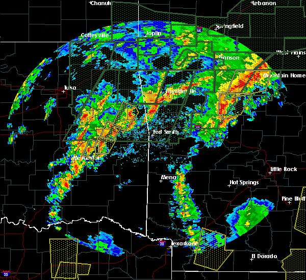 At 520 pm cdt, severe thunderstorms were located along a line extending from near piercetown to 8 miles northwest of moore to near bertha, moving northeast at 40 mph (radar indicated). Hazards include 60 mph wind gusts. expect damage to roofs, siding, and trees At 520 pm cdt, severe thunderstorms were located along a line extending from near piercetown to 8 miles northwest of moore to near bertha, moving northeast at 40 mph (radar indicated). Hazards include 60 mph wind gusts. expect damage to roofs, siding, and trees
|
| 4/29/2017 5:04 PM CDT |
 At 503 pm cdt, severe thunderstorms were located along a line extending from yellville to valley springs to 6 miles north of dillen, moving northeast at 55 mph (radar indicated). Hazards include 60 mph wind gusts and penny size hail. Expect damage to roofs, siding, and trees. Locations impacted include, yellville, jasper, flippin, western grove, pyatt, valley springs, dugger, carver, erbie, point peter, devils knob, pruitt, rosetta, dillen, piercetown, walnut, crawford, bertha, eula, summit,. At 503 pm cdt, severe thunderstorms were located along a line extending from yellville to valley springs to 6 miles north of dillen, moving northeast at 55 mph (radar indicated). Hazards include 60 mph wind gusts and penny size hail. Expect damage to roofs, siding, and trees. Locations impacted include, yellville, jasper, flippin, western grove, pyatt, valley springs, dugger, carver, erbie, point peter, devils knob, pruitt, rosetta, dillen, piercetown, walnut, crawford, bertha, eula, summit,.
|
| 4/29/2017 4:51 PM CDT |
 At 451 pm cdt, severe thunderstorms were located along a line extending from near duff to near jasper to near rosetta, moving northeast at 55 mph (radar indicated). Hazards include 60 mph wind gusts and nickel size hail. expect damage to roofs, siding, and trees At 451 pm cdt, severe thunderstorms were located along a line extending from near duff to near jasper to near rosetta, moving northeast at 55 mph (radar indicated). Hazards include 60 mph wind gusts and nickel size hail. expect damage to roofs, siding, and trees
|
| 4/29/2017 4:37 PM CDT |
 At 437 pm cdt, a severe thunderstorm capable of producing a tornado was located 7 miles south of jasper, moving northeast at 50 mph (radar indicated rotation). Hazards include tornado and quarter size hail. Flying debris will be dangerous to those caught without shelter. mobile homes will be damaged or destroyed. damage to roofs, windows, and vehicles will occur. tree damage is likely. locations impacted include, harrison, jasper, western grove, valley springs, dugger, carver, erbie, duff, red bank, point peter, capps, piercetown, pruitt, upper buffalo wilderness area, bellefonte, st. Joe, pindall, batavia, bass, bear creek springs,. At 437 pm cdt, a severe thunderstorm capable of producing a tornado was located 7 miles south of jasper, moving northeast at 50 mph (radar indicated rotation). Hazards include tornado and quarter size hail. Flying debris will be dangerous to those caught without shelter. mobile homes will be damaged or destroyed. damage to roofs, windows, and vehicles will occur. tree damage is likely. locations impacted include, harrison, jasper, western grove, valley springs, dugger, carver, erbie, duff, red bank, point peter, capps, piercetown, pruitt, upper buffalo wilderness area, bellefonte, st. Joe, pindall, batavia, bass, bear creek springs,.
|
| 4/29/2017 4:27 PM CDT |
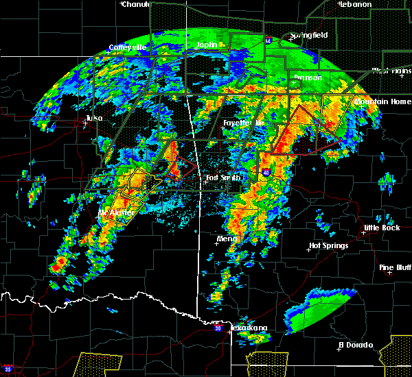 At 427 pm cdt, a severe thunderstorm capable of producing a tornado was located over walnut, or 16 miles southwest of jasper, moving northeast at 50 mph (radar indicated rotation). Hazards include tornado. Flying debris will be dangerous to those caught without shelter. mobile homes will be damaged or destroyed. damage to roofs, windows, and vehicles will occur. tree damage is likely. locations impacted include, harrison, marshall, jasper, western grove, valley springs, dugger, marsena, carver, erbie, duff, point peter, pruitt, red bank, eula, capps, piercetown, walnut, upper buffalo wilderness area, bellefonte, st. Joe,. At 427 pm cdt, a severe thunderstorm capable of producing a tornado was located over walnut, or 16 miles southwest of jasper, moving northeast at 50 mph (radar indicated rotation). Hazards include tornado. Flying debris will be dangerous to those caught without shelter. mobile homes will be damaged or destroyed. damage to roofs, windows, and vehicles will occur. tree damage is likely. locations impacted include, harrison, marshall, jasper, western grove, valley springs, dugger, marsena, carver, erbie, duff, point peter, pruitt, red bank, eula, capps, piercetown, walnut, upper buffalo wilderness area, bellefonte, st. Joe,.
|
| 4/29/2017 4:18 PM CDT |
 At 418 pm cdt, a severe thunderstorm capable of producing a tornado was located over devils knob, or 16 miles north of clarksville, moving northeast at 45 mph (radar indicated rotation). Hazards include tornado and quarter size hail. Flying debris will be dangerous to those caught without shelter. mobile homes will be damaged or destroyed. damage to roofs, windows, and vehicles will occur. Tree damage is likely. At 418 pm cdt, a severe thunderstorm capable of producing a tornado was located over devils knob, or 16 miles north of clarksville, moving northeast at 45 mph (radar indicated rotation). Hazards include tornado and quarter size hail. Flying debris will be dangerous to those caught without shelter. mobile homes will be damaged or destroyed. damage to roofs, windows, and vehicles will occur. Tree damage is likely.
|
| 4/26/2017 1:47 AM CDT |
 At 146 am cdt, severe thunderstorms were located along a line extending from 7 miles northeast of urbanette to rudd to near huntsville, moving east at 50 mph (radar indicated). Hazards include 60 mph wind gusts. expect damage to roofs, siding, and trees At 146 am cdt, severe thunderstorms were located along a line extending from 7 miles northeast of urbanette to rudd to near huntsville, moving east at 50 mph (radar indicated). Hazards include 60 mph wind gusts. expect damage to roofs, siding, and trees
|
| 4/4/2017 10:09 PM CDT | Em reported trees down in newton county AR, 8.3 miles NW of Jasper, AR |
| 4/4/2017 9:25 PM CDT |
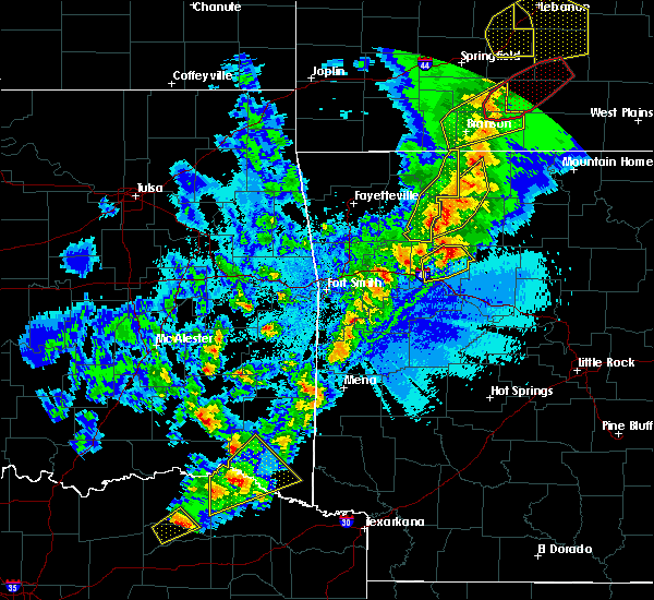 At 925 pm cdt, severe thunderstorms were located along a line extending from near lost valley state park to near upper buffalo wilderness area to near walnut to 6 miles west of devils knob, moving northeast at 55 mph (radar indicated). Hazards include 60 mph wind gusts. expect damage to roofs, siding, and trees At 925 pm cdt, severe thunderstorms were located along a line extending from near lost valley state park to near upper buffalo wilderness area to near walnut to 6 miles west of devils knob, moving northeast at 55 mph (radar indicated). Hazards include 60 mph wind gusts. expect damage to roofs, siding, and trees
|
| 3/29/2017 7:14 PM CDT |
 At 713 pm cdt, a severe thunderstorm was located near piercetown, or near jasper, moving northeast at 50 mph (radar indicated). Hazards include 60 mph wind gusts and nickel size hail. Expect damage to roofs, siding, and trees. Locations impacted include, harrison, jasper, western grove, valley springs, dugger, olvey, carver, erbie, piercetown, pruitt, crawford, bellefonte, everton, pindall, marble falls, yardelle, crossroad, gum springs in newton county, gaither, eros, a tornado watch remains in effect until midnight cdt for north central arkansas. At 713 pm cdt, a severe thunderstorm was located near piercetown, or near jasper, moving northeast at 50 mph (radar indicated). Hazards include 60 mph wind gusts and nickel size hail. Expect damage to roofs, siding, and trees. Locations impacted include, harrison, jasper, western grove, valley springs, dugger, olvey, carver, erbie, piercetown, pruitt, crawford, bellefonte, everton, pindall, marble falls, yardelle, crossroad, gum springs in newton county, gaither, eros, a tornado watch remains in effect until midnight cdt for north central arkansas.
|
| 3/29/2017 6:57 PM CDT |
 At 656 pm cdt, a severe thunderstorm was located near walnut, or 15 miles south of jasper, moving northeast at 50 mph (radar indicated). Hazards include 60 mph wind gusts and nickel size hail. expect damage to roofs, siding, and trees At 656 pm cdt, a severe thunderstorm was located near walnut, or 15 miles south of jasper, moving northeast at 50 mph (radar indicated). Hazards include 60 mph wind gusts and nickel size hail. expect damage to roofs, siding, and trees
|
| 3/7/2017 1:01 AM CST |
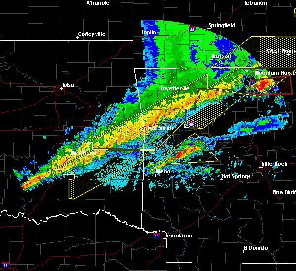 At 101 am cst, severe thunderstorms were located along a line extending from near western grove to 8 miles northeast of walnut to 9 miles southeast of pettigrew to near ozark, moving east at 35 mph (radar indicated). Hazards include 60 mph wind gusts and penny size hail. Expect damage to roofs, siding, and trees. locations impacted include, clarksville, jasper, lamar, hartman, carver, erbie, duff, moore, upper buffalo wilderness area, point peter, devils knob, lost valley state park, pruitt, holman, rosetta, dillen, woodland, eula, piercetown, walnut, this includes interstate 40 between mile markers 44 and 63. A tornado watch remains in effect until 500 am cst for western, central and north central arkansas. At 101 am cst, severe thunderstorms were located along a line extending from near western grove to 8 miles northeast of walnut to 9 miles southeast of pettigrew to near ozark, moving east at 35 mph (radar indicated). Hazards include 60 mph wind gusts and penny size hail. Expect damage to roofs, siding, and trees. locations impacted include, clarksville, jasper, lamar, hartman, carver, erbie, duff, moore, upper buffalo wilderness area, point peter, devils knob, lost valley state park, pruitt, holman, rosetta, dillen, woodland, eula, piercetown, walnut, this includes interstate 40 between mile markers 44 and 63. A tornado watch remains in effect until 500 am cst for western, central and north central arkansas.
|
| 3/7/2017 12:33 AM CST |
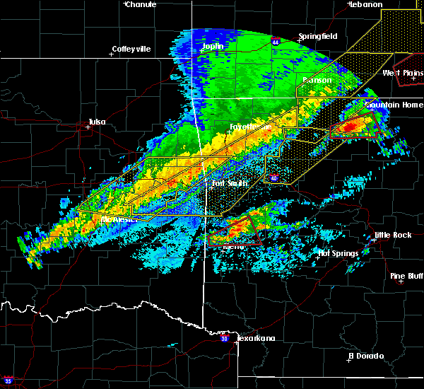 At 1232 am cst, severe thunderstorms were located along a line extending from near erbie to near witter to 6 miles northwest of cass to rudy, moving east at 65 mph (radar indicated). Hazards include 60 mph wind gusts and penny size hail. expect damage to roofs, siding, and trees At 1232 am cst, severe thunderstorms were located along a line extending from near erbie to near witter to 6 miles northwest of cass to rudy, moving east at 65 mph (radar indicated). Hazards include 60 mph wind gusts and penny size hail. expect damage to roofs, siding, and trees
|
| 3/7/2017 12:18 AM CST |
 At 1217 am cst, severe thunderstorms were located along a line extending from 9 miles north of diamond city to near omaha to near carrollton to near marble, moving east at 30 mph (radar indicated). Hazards include 60 mph wind gusts and nickel size hail. Expect damage to roofs, siding, and trees. Locations impacted include, harrison, bull shoals, yellville, jasper, flippin, lakeview in baxter county, diamond city, bergman, western grove, lead hill, pyatt, valley springs, omaha, arkawana, dugger, olvey, roberson hollow, carver, erbie, lakeway, a tornado watch remains in effect until 500 am cst for north central arkansas. At 1217 am cst, severe thunderstorms were located along a line extending from 9 miles north of diamond city to near omaha to near carrollton to near marble, moving east at 30 mph (radar indicated). Hazards include 60 mph wind gusts and nickel size hail. Expect damage to roofs, siding, and trees. Locations impacted include, harrison, bull shoals, yellville, jasper, flippin, lakeview in baxter county, diamond city, bergman, western grove, lead hill, pyatt, valley springs, omaha, arkawana, dugger, olvey, roberson hollow, carver, erbie, lakeway, a tornado watch remains in effect until 500 am cst for north central arkansas.
|
| 3/7/2017 12:06 AM CST | Trees and power lines were blown down. multiple trees are down on the road between hasty and carve in newton county AR, 7.7 miles W of Jasper, AR |
| 3/7/2017 12:02 AM CST |
 At 1201 am cst, a severe thunderstorm capable of producing a tornado was located over piercetown, or near jasper, moving east at 40 mph (radar indicated rotation). Hazards include tornado and golf ball size hail. Flying debris will be dangerous to those caught without shelter. mobile homes will be damaged or destroyed. damage to roofs, windows, and vehicles will occur. tree damage is likely. locations impacted include, marshall, yellville, jasper, western grove, valley springs, dugger, carver, erbie, duff, point peter, piercetown, pruitt, crawford, everton, st. Joe, pindall, gilbert, zach, marble falls, yardelle,. At 1201 am cst, a severe thunderstorm capable of producing a tornado was located over piercetown, or near jasper, moving east at 40 mph (radar indicated rotation). Hazards include tornado and golf ball size hail. Flying debris will be dangerous to those caught without shelter. mobile homes will be damaged or destroyed. damage to roofs, windows, and vehicles will occur. tree damage is likely. locations impacted include, marshall, yellville, jasper, western grove, valley springs, dugger, carver, erbie, duff, point peter, piercetown, pruitt, crawford, everton, st. Joe, pindall, gilbert, zach, marble falls, yardelle,.
|
| 3/7/2017 12:00 AM CST | Quarter sized hail reported 4.9 miles W of Jasper, AR |
| 3/7/2017 12:00 AM CST | A few large trees were blown dow in newton county AR, 4.9 miles W of Jasper, AR |
| 3/6/2017 11:57 PM CST | Some roofs had shingles blown off of them. trees were blown down and snappe in newton county AR, 0.2 miles NE of Jasper, AR |
| 3/6/2017 11:55 PM CST |
 At 1154 pm cst, severe thunderstorms were located along a line extending from near forsyth to near urbanette to near berryville to hindsville, moving east at 55 mph (radar indicated). Hazards include 60 mph wind gusts and nickel size hail. expect damage to roofs, siding, and trees At 1154 pm cst, severe thunderstorms were located along a line extending from near forsyth to near urbanette to near berryville to hindsville, moving east at 55 mph (radar indicated). Hazards include 60 mph wind gusts and nickel size hail. expect damage to roofs, siding, and trees
|
| 3/6/2017 11:52 PM CST | Several homes have suffered damage...and the post office has been destroyed. the roof was blown off of a church...and several roadways are blocke in newton county AR, 4.9 miles NNE of Jasper, AR |
| 3/6/2017 11:52 PM CST | Roof blown off of a church in newton county AR, 5.2 miles NE of Jasper, AR |
| 3/6/2017 11:51 PM CST |
 At 1150 pm cst, a severe thunderstorm capable of producing a tornado was located near jasper, moving east at 40 mph (radar indicated rotation). Hazards include tornado and golf ball size hail. Flying debris will be dangerous to those caught without shelter. mobile homes will be damaged or destroyed. damage to roofs, windows, and vehicles will occur. Tree damage is likely. At 1150 pm cst, a severe thunderstorm capable of producing a tornado was located near jasper, moving east at 40 mph (radar indicated rotation). Hazards include tornado and golf ball size hail. Flying debris will be dangerous to those caught without shelter. mobile homes will be damaged or destroyed. damage to roofs, windows, and vehicles will occur. Tree damage is likely.
|
| 3/6/2017 11:48 PM CST | Golf Ball sized hail reported 3.7 miles ESE of Jasper, AR |
| 3/6/2017 11:45 PM CST |
 At 1144 pm cst, a severe thunderstorm capable of producing a tornado was located near lost valley state park, or 8 miles west of jasper, moving east at 35 mph (radar indicated rotation). Hazards include tornado and golf ball size hail. Flying debris will be dangerous to those caught without shelter. mobile homes will be damaged or destroyed. damage to roofs, windows, and vehicles will occur. tree damage is likely. Locations impacted include, jasper, lost valley state park, erbie, upper buffalo wilderness area, pruitt, mossville, wayton, boxley, compton, crossroad, low gap, vendor, parthenon, gum springs in newton county, mt judea, ponca, mt sherman, marble falls,. At 1144 pm cst, a severe thunderstorm capable of producing a tornado was located near lost valley state park, or 8 miles west of jasper, moving east at 35 mph (radar indicated rotation). Hazards include tornado and golf ball size hail. Flying debris will be dangerous to those caught without shelter. mobile homes will be damaged or destroyed. damage to roofs, windows, and vehicles will occur. tree damage is likely. Locations impacted include, jasper, lost valley state park, erbie, upper buffalo wilderness area, pruitt, mossville, wayton, boxley, compton, crossroad, low gap, vendor, parthenon, gum springs in newton county, mt judea, ponca, mt sherman, marble falls,.
|
| 3/6/2017 11:35 PM CST |
 At 1135 pm cst, a severe thunderstorm capable of producing a tornado was located over upper buffalo wilderness area, or 14 miles west of jasper, moving east at 40 mph (radar indicated rotation). Hazards include tornado and golf ball size hail. Flying debris will be dangerous to those caught without shelter. mobile homes will be damaged or destroyed. damage to roofs, windows, and vehicles will occur. tree damage is likely. Locations impacted include, jasper, lost valley state park, erbie, upper buffalo wilderness area, pruitt, mossville, wayton, boxley, compton, crossroad, low gap, vendor, swain, parthenon, gum springs in newton county, mt judea, ponca, mt sherman, marble falls,. At 1135 pm cst, a severe thunderstorm capable of producing a tornado was located over upper buffalo wilderness area, or 14 miles west of jasper, moving east at 40 mph (radar indicated rotation). Hazards include tornado and golf ball size hail. Flying debris will be dangerous to those caught without shelter. mobile homes will be damaged or destroyed. damage to roofs, windows, and vehicles will occur. tree damage is likely. Locations impacted include, jasper, lost valley state park, erbie, upper buffalo wilderness area, pruitt, mossville, wayton, boxley, compton, crossroad, low gap, vendor, swain, parthenon, gum springs in newton county, mt judea, ponca, mt sherman, marble falls,.
|
| 3/6/2017 11:20 PM CST |
 At 1119 pm cst, a severe thunderstorm capable of producing a tornado was located near boston, or 14 miles southeast of huntsville, moving east at 35 mph (radar indicated rotation). Hazards include tornado and ping pong ball size hail. Flying debris will be dangerous to those caught without shelter. mobile homes will be damaged or destroyed. damage to roofs, windows, and vehicles will occur. Tree damage is likely. At 1119 pm cst, a severe thunderstorm capable of producing a tornado was located near boston, or 14 miles southeast of huntsville, moving east at 35 mph (radar indicated rotation). Hazards include tornado and ping pong ball size hail. Flying debris will be dangerous to those caught without shelter. mobile homes will be damaged or destroyed. damage to roofs, windows, and vehicles will occur. Tree damage is likely.
|
| 3/1/2017 1:55 AM CST |
 At 155 am cst, severe thunderstorms were located along a line extending from near eula to smyrna to near solo to near broomfield, moving east at 75 mph (radar indicated). Hazards include 70 mph wind gusts and nickel size hail. Expect considerable tree damage. damage is likely to mobile homes, roofs, and outbuildings. Locations impacted include, clinton, marshall, jasper, dover, hector, shirley, witts spring, duff, maumee, bohannon, blick, pruitt, elberta, watts, dillen, broomfield, eula, elba, old lexington, marsena, a tornado watch remains in effect until 600 am cst for central, western and north central arkansas. At 155 am cst, severe thunderstorms were located along a line extending from near eula to smyrna to near solo to near broomfield, moving east at 75 mph (radar indicated). Hazards include 70 mph wind gusts and nickel size hail. Expect considerable tree damage. damage is likely to mobile homes, roofs, and outbuildings. Locations impacted include, clinton, marshall, jasper, dover, hector, shirley, witts spring, duff, maumee, bohannon, blick, pruitt, elberta, watts, dillen, broomfield, eula, elba, old lexington, marsena, a tornado watch remains in effect until 600 am cst for central, western and north central arkansas.
|
| 3/1/2017 1:39 AM CST |
 At 138 am cst, severe thunderstorms were located along a line extending from near walnut to rosetta to near lamar to scranton, moving east at 70 mph (radar indicated). Hazards include 70 mph wind gusts and nickel size hail. Expect considerable tree damage. Damage is likely to mobile homes, roofs, and outbuildings. At 138 am cst, severe thunderstorms were located along a line extending from near walnut to rosetta to near lamar to scranton, moving east at 70 mph (radar indicated). Hazards include 70 mph wind gusts and nickel size hail. Expect considerable tree damage. Damage is likely to mobile homes, roofs, and outbuildings.
|
| 2/6/2017 11:47 PM CST |
 At 1145 pm cst, a severe thunderstorm was located over jasper, moving northeast at 45 mph (radar indicated). Hazards include quarter size hail. damage to vehicles is expected At 1145 pm cst, a severe thunderstorm was located over jasper, moving northeast at 45 mph (radar indicated). Hazards include quarter size hail. damage to vehicles is expected
|
| 10/12/2016 5:15 PM CDT | Tennis Ball sized hail reported 6.6 miles WNW of Jasper, AR |
| 10/12/2016 4:55 PM CDT |
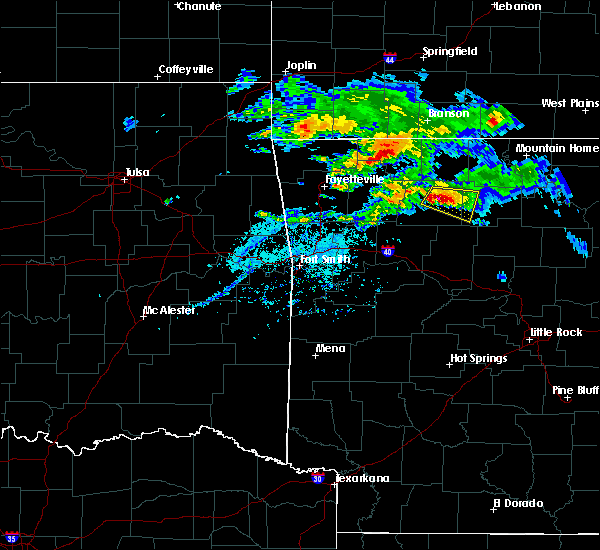 At 455 pm cdt, a severe thunderstorm was located near piercetown, or near jasper, moving southeast at 35 mph (radar indicated). Hazards include 60 mph wind gusts and quarter size hail. Hail damage to vehicles is expected. expect wind damage to roofs, siding, and trees. locations impacted include, jasper, pruitt, point peter, eula, piercetown, carver, witts spring, st. Joe, bass, mt judea, gum springs in newton county, vendor, crossroad, woolum recreation area, baker ford, hasty, parthenon, wayton, snowball,. At 455 pm cdt, a severe thunderstorm was located near piercetown, or near jasper, moving southeast at 35 mph (radar indicated). Hazards include 60 mph wind gusts and quarter size hail. Hail damage to vehicles is expected. expect wind damage to roofs, siding, and trees. locations impacted include, jasper, pruitt, point peter, eula, piercetown, carver, witts spring, st. Joe, bass, mt judea, gum springs in newton county, vendor, crossroad, woolum recreation area, baker ford, hasty, parthenon, wayton, snowball,.
|
| 10/12/2016 4:43 PM CDT |
 At 443 pm cdt, a severe thunderstorm was located over jasper, moving east at 30 mph (radar indicated). Hazards include 60 mph wind gusts and quarter size hail. Hail damage to vehicles is expected. Expect wind damage to roofs, siding, and trees. At 443 pm cdt, a severe thunderstorm was located over jasper, moving east at 30 mph (radar indicated). Hazards include 60 mph wind gusts and quarter size hail. Hail damage to vehicles is expected. Expect wind damage to roofs, siding, and trees.
|
| 10/12/2016 4:34 PM CDT | A few trees were knocked down between ponca and low gap on highway 74 wes in newton county AR, 8 miles E of Jasper, AR |
| 10/12/2016 4:31 PM CDT |
 At 430 pm cdt, a severe thunderstorm was located over lost valley state park, or 10 miles west of jasper, moving east at 30 mph (radar indicated). Hazards include 60 mph wind gusts and quarter size hail. Hail damage to vehicles is expected. expect wind damage to roofs, siding, and trees. Locations impacted include, jasper, pruitt, lost valley state park, erbie, upper buffalo wilderness area, compton, marble falls, low gap, boxley, gum springs in newton county, mt sherman, ponca, parthenon,. At 430 pm cdt, a severe thunderstorm was located over lost valley state park, or 10 miles west of jasper, moving east at 30 mph (radar indicated). Hazards include 60 mph wind gusts and quarter size hail. Hail damage to vehicles is expected. expect wind damage to roofs, siding, and trees. Locations impacted include, jasper, pruitt, lost valley state park, erbie, upper buffalo wilderness area, compton, marble falls, low gap, boxley, gum springs in newton county, mt sherman, ponca, parthenon,.
|
| 10/12/2016 4:19 PM CDT |
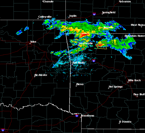 At 418 pm cdt, a severe thunderstorm was located near kingston, or 15 miles east of huntsville, moving east at 25 mph (radar indicated). Hazards include 60 mph wind gusts and quarter size hail. Hail damage to vehicles is expected. Expect wind damage to roofs, siding, and trees. At 418 pm cdt, a severe thunderstorm was located near kingston, or 15 miles east of huntsville, moving east at 25 mph (radar indicated). Hazards include 60 mph wind gusts and quarter size hail. Hail damage to vehicles is expected. Expect wind damage to roofs, siding, and trees.
|
| 4/27/2016 1:58 AM CDT |
 At 157 am cdt, severe thunderstorms were located along a line extending from grandview to near pettigrew to near booneville, moving east at 50 mph (radar indicated). Hazards include 60 mph wind gusts and penny size hail. Expect damage to roofs. siding. and trees. Locations impacted include, harrison, clarksville, paris, jasper, lamar, knoxville, subiaco, hartman, bergman, scranton, ratcliff, omaha, tokalon, capps, upper buffalo wilder, self, devils knob, walnut, hinkle, holman,. At 157 am cdt, severe thunderstorms were located along a line extending from grandview to near pettigrew to near booneville, moving east at 50 mph (radar indicated). Hazards include 60 mph wind gusts and penny size hail. Expect damage to roofs. siding. and trees. Locations impacted include, harrison, clarksville, paris, jasper, lamar, knoxville, subiaco, hartman, bergman, scranton, ratcliff, omaha, tokalon, capps, upper buffalo wilder, self, devils knob, walnut, hinkle, holman,.
|
| 4/27/2016 1:25 AM CDT |
 At 125 am cdt, severe thunderstorms were located along a line extending from garfield to 6 miles east of brentwood to near washburn, moving east at 50 mph (radar indicated). Hazards include 60 mph wind gusts and penny size hail. Expect damage to roofs. siding. And trees. At 125 am cdt, severe thunderstorms were located along a line extending from garfield to 6 miles east of brentwood to near washburn, moving east at 50 mph (radar indicated). Hazards include 60 mph wind gusts and penny size hail. Expect damage to roofs. siding. And trees.
|
| 7/8/2015 3:23 PM CDT |
 At 322 pm cdt, doppler radar indicated a line of severe thunderstorms capable of producing damaging winds in excess of 60 mph. these storms were located along a line extending from near jasper to clarksville, and moving east at 45 mph. At 322 pm cdt, doppler radar indicated a line of severe thunderstorms capable of producing damaging winds in excess of 60 mph. these storms were located along a line extending from near jasper to clarksville, and moving east at 45 mph.
|
| 6/26/2015 2:24 PM CDT | At 221 pm cdt, a severe thunderstorm was located 6 miles south of jasper, and moving east at 20 mph (radar indicated). Hazards include 60 mph wind gusts and quarter size hail. Hail damage to vehicles is expected. Expect wind damage to roofs, siding and trees. |
| 6/26/2015 1:53 PM CDT |
 At 151 pm cdt, a severe thunderstorm was located near lost valley sp, and moving east at 20 mph (radar indicated). Hazards include 60 mph wind gusts and quarter size hail. Hail damage to vehicles is expected. Expect wind damage to roofs, siding and trees. At 151 pm cdt, a severe thunderstorm was located near lost valley sp, and moving east at 20 mph (radar indicated). Hazards include 60 mph wind gusts and quarter size hail. Hail damage to vehicles is expected. Expect wind damage to roofs, siding and trees.
|
| 5/27/2015 5:01 PM CDT | At 459 pm cdt, a severe thunderstorm was located near lost valley sp, and moving northeast at 15 mph (radar indicated). Hazards include 60 mph wind gusts and quarter size hail. Hail damage to vehicles is expected. Expect wind damage to roofs, siding and trees. |
| 5/10/2015 12:50 PM CDT | At 1248 pm cdt, severe thunderstorms were located along a line extending from omaha to harrison to 7 miles south of jasper, and moving northeast at 50 mph (radar indicated). Hazards include 60 mph wind gusts. Expect damage to roofs. Siding and trees. |
| 5/10/2015 12:30 PM CDT | At 1228 pm cdt, severe thunderstorms were located along a line extending from 8 miles northwest of oak grove to 7 miles west of red bank to walnut, and moving northeast at 50 mph (radar indicated). Hazards include 60 mph wind gusts and penny size hail. Expect damage to roofs. Siding and trees. |
| 5/10/2015 3:39 AM CDT | At 334 am cdt, a severe thunderstorm was located near bertha, and moving east at 50 mph. the storm is showing signs of weakening and the warning will be allowed to end at 345 am cdt (radar indicated). Hazards include 60 mph wind gusts and quarter size hail. Hail damage to vehicles is expected. expect wind damage to roofs, siding and trees. Heavy rain and possible flash will be possible. |
| 5/10/2015 3:16 AM CDT | At 311 am cdt, a severe thunderstorm was located near ludwig lake, and moving east at 50 mph (radar indicated). Hazards include 60 mph wind gusts and quarter size hail. Hail damage to vehicles is expected. expect wind damage to roofs, siding and trees. heavy rain is also possible and flash flooding will be possible. A flash flood warning is in effect for the area. |
| 5/10/2015 2:57 AM CDT | At 254 am cdt, a severe thunderstorm was located near horsehead lake, and moving east at 50 mph (radar indicated). Hazards include 60 mph wind gusts and quarter size hail. Hail damage to vehicles is expected. expect wind damage to roofs, siding and trees. heavy rain is also possible and flash flooding will be possible. A flash flood warning is in effect for the area. |
| 5/10/2015 2:48 AM CDT | At 243 am cdt, a severe thunderstorm was located near ozark, and moving east at 50 mph (radar indicated). Hazards include 60 mph wind gusts and quarter size hail. Hail damage to vehicles is expected. expect wind damage to roofs, siding and trees. heavy rain is also possible and flash flooding will be possible. A flash flood warning is in effect. |
| 5/10/2015 2:16 AM CDT | At 213 am cdt, a severe thunderstorm was located near horsehead lake, and moving east at 50 mph (radar indicated). Hazards include 60 mph wind gusts and quarter size hail. Hail damage to vehicles is expected. Expect wind damage to roofs, siding and trees. |
| 4/19/2015 4:57 PM CDT | At 454 pm cdt, a severe thunderstorm was located 6 miles east of upper buffalo wilderness area, and moving east at 30 mph (radar indicated). Hazards include 60 mph wind gusts and quarter size hail. Hail damage to vehicles is expected. Expect wind damage to roofs, siding and trees. |
| 4/19/2015 4:39 PM CDT | At 436 pm cdt, a severe thunderstorm was located 7 miles southwest of upper buffalo wilderness area, and moving east at 30 mph (radar indicated). Hazards include 60 mph wind gusts and quarter size hail. Hail damage to vehicles is expected. Expect wind damage to roofs, siding and trees. |
| 4/9/2015 5:45 PM CDT | The national weather service in little rock has issued a * severe thunderstorm warning for. southeastern boone county in north central arkansas. southwestern marion county in north central arkansas. northeastern newton county in north central arkansas. Northwestern searcy county in north central arkansas. |
| 4/9/2015 5:12 PM CDT | The national weather service in little rock has issued a * severe thunderstorm warning for. newton county in north central arkansas. until 600 pm cdt * at 510 pm cdt. a severe thunderstorm was located 13 miles southwest of upper buffalo wilderness area. And moving east at 45. |
| 3/25/2015 10:06 PM CDT | A severe thunderstorm warning remains in effect for west central searcy and central newton counties until 1030 pm cdt. at 1005 pm cdt. national weather service doppler radar continued to indicate a line of severe thunderstorms capable of producing damaging winds in excess of 60 mph. These storms were located along a line extending from 4 miles south of erbie to 6 miles southwest of jasper. |
| 3/25/2015 9:40 PM CDT | The national weather service in little rock has issued a * severe thunderstorm warning for. central newton county in north central arkansas. west central searcy county in north central arkansas. until 1030 pm cdt * at 936 pm cdt. National weather service doppler radar indicated a. |
| 10/2/2014 6:30 PM CDT | Large oak tree down at the corner of oak and south street in jaspe in newton county AR, 0.2 miles NE of Jasper, AR |
| 9/17/2014 3:30 PM CDT | Large tree blocking highway 123 near the highway 74 intersectio in newton county AR, 6.4 miles WNW of Jasper, AR |
| 7/8/2014 5:25 PM CDT | Golf Ball sized hail reported 7.9 miles NE of Jasper, AR |
| 9/7/2012 6:25 PM CDT | Numerous reports of power lines and trees down around jasper and also on highway 7 heading north out of jaspe in newton county AR, 0.2 miles NE of Jasper, AR |
| 9/6/2012 8:28 PM CDT | Quarter sized hail reported 17.8 miles NNW of Jasper, AR |
| 8/16/2012 3:55 PM CDT | Barns were damaged by thunderstorm winds at vendo in newton county AR, 7.4 miles NW of Jasper, AR |
| 8/16/2012 3:50 PM CDT | Trees were pushed over at wayto in newton county AR, 8.5 miles NNE of Jasper, AR |
| 8/16/2012 3:35 PM CDT | Trees were downed...with one tree on a house at partheno in newton county AR, 4.9 miles NNE of Jasper, AR |
| 6/3/2012 5:22 PM CDT | A 59 mph gust was measured at vendo in newton county AR, 7.4 miles NW of Jasper, AR |
| 6/3/2012 5:22 PM CDT | Trees reported dow in newton county AR, 7.2 miles WNW of Jasper, AR |
| 3/30/2012 5:28 PM CDT | Quarter sized hail reported 8.3 miles WNW of Jasper, AR |
| 3/30/2012 5:22 PM CDT | Quarter sized hail reported 7.7 miles W of Jasper, AR, quarter sized hail is covering the ground in hasty. |
| 1/1/0001 12:00 AM | Trees reported down in dee in newton county AR, 12.7 miles N of Jasper, AR |
| 8/20/2011 7:03 PM CDT | Quarter sized hail reported 5.7 miles N of Jasper, AR, hail reported south of jasper along hwy 7. |
| 8/20/2011 6:55 PM CDT | Quarter sized hail reported 4.9 miles NNE of Jasper, AR |
| 1/1/0001 12:00 AM | Tree limbs were blown dow in newton county AR, 12.7 miles N of Jasper, AR |
| 1/1/0001 12:00 AM | Quarter sized hail reported 7.4 miles NW of Jasper, AR |
| 1/1/0001 12:00 AM | Golf Ball sized hail reported 17.8 miles NNW of Jasper, AR, limbs also down |
| 1/1/0001 12:00 AM | Large trees were snapped. trees were down across county road 41 between mount judea and vendo in newton county AR, 8.3 miles NW of Jasper, AR |
| 1/1/0001 12:00 AM | Half Dollar sized hail reported 0.2 miles NE of Jasper, AR |
| 1/1/0001 12:00 AM | Quarter sized hail reported 6.4 miles SSW of Jasper, AR |
Hail Maps for Jasper, AR


Connect with Interactive Hail Maps