

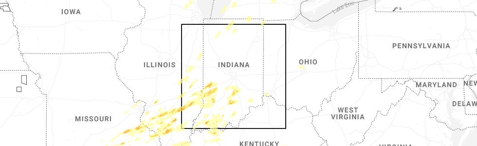
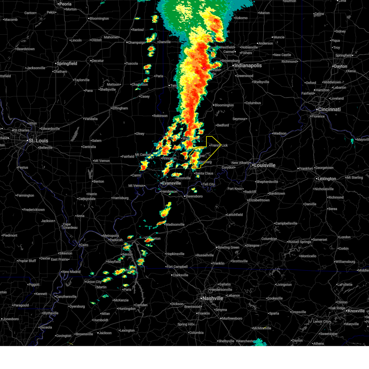
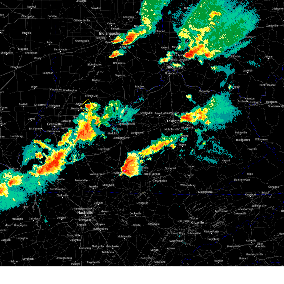
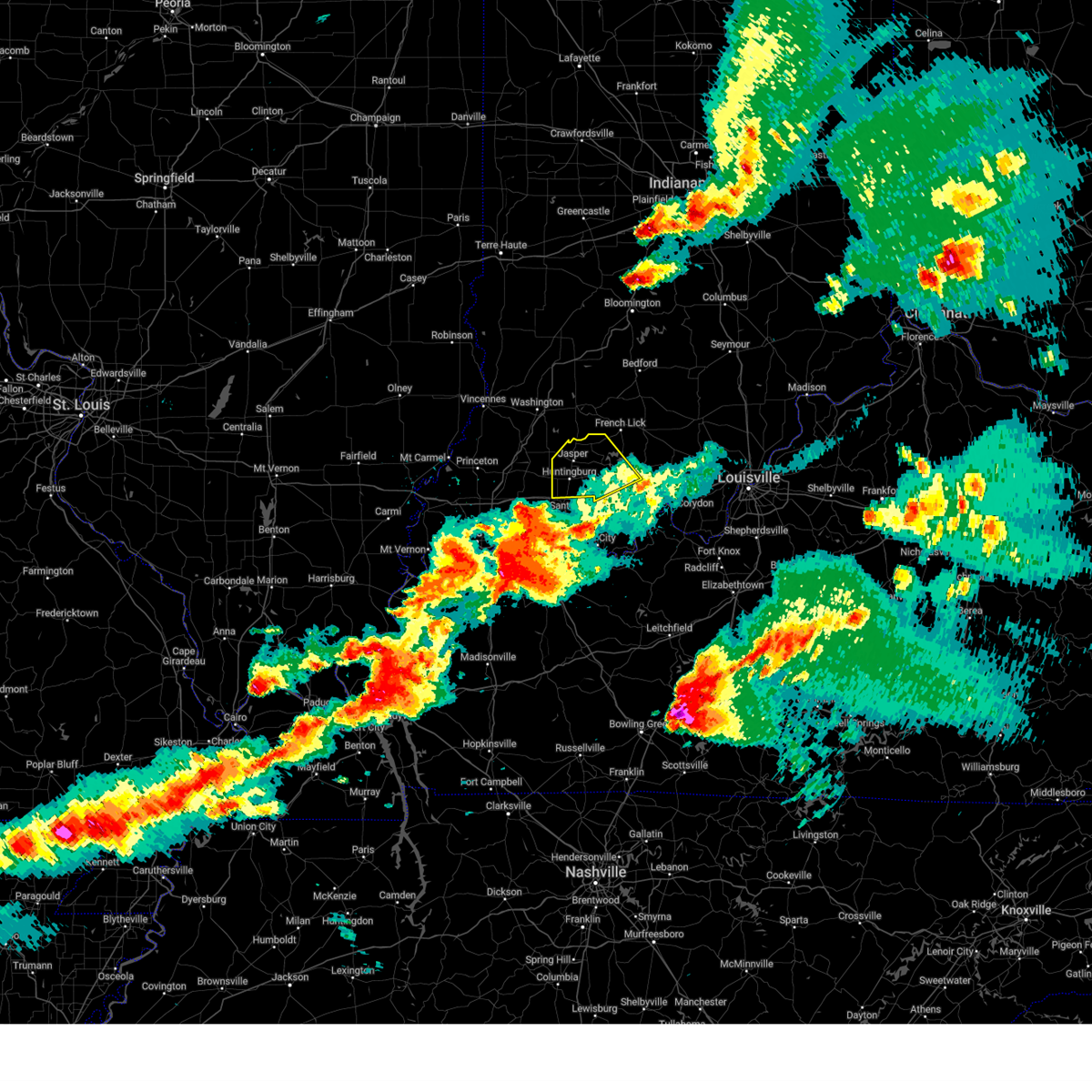
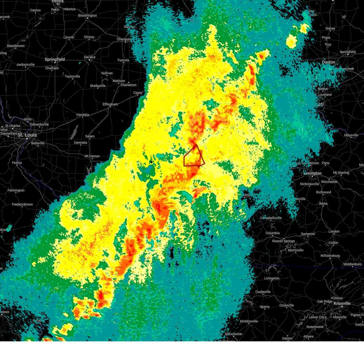
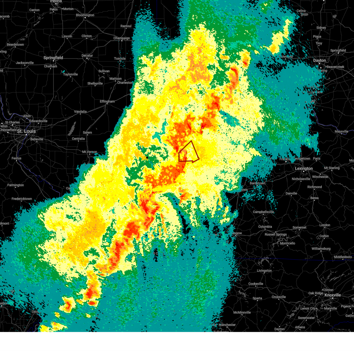
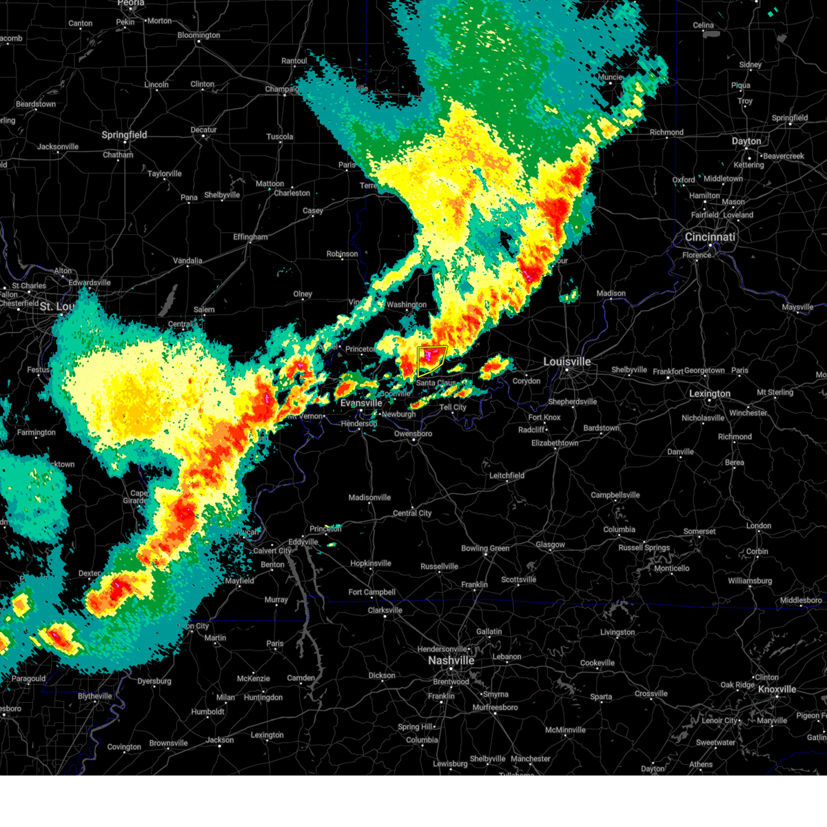
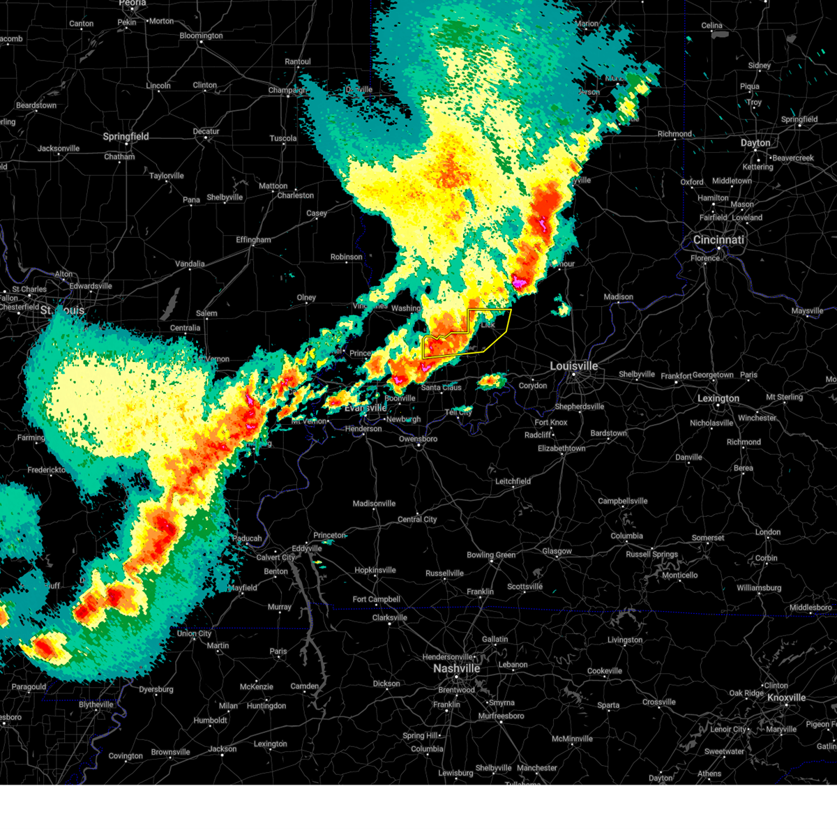
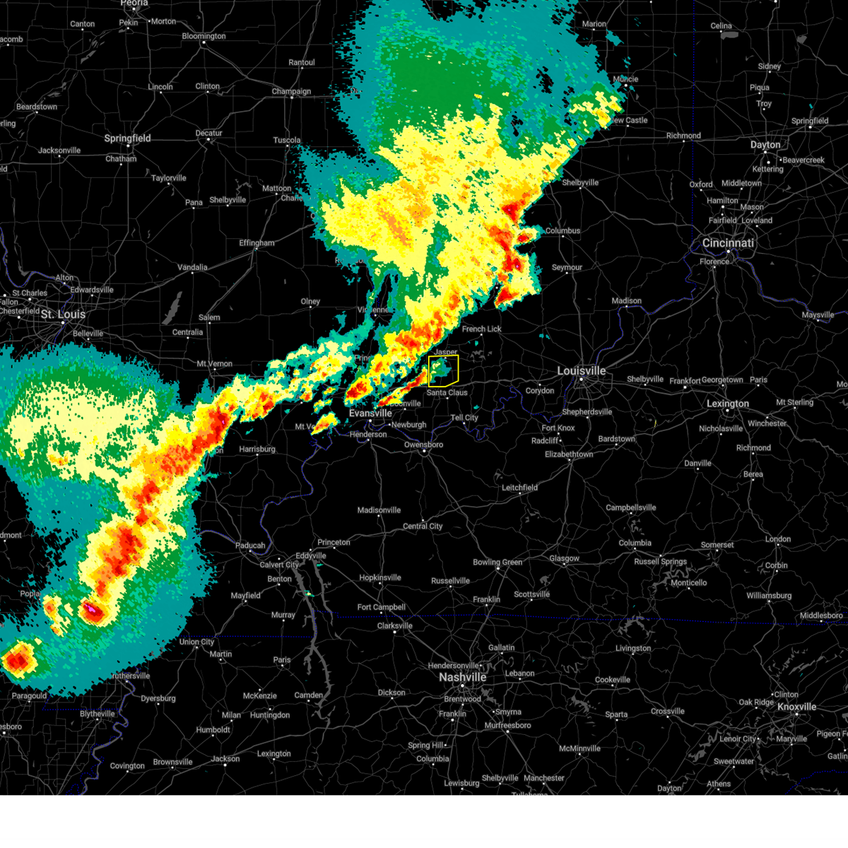
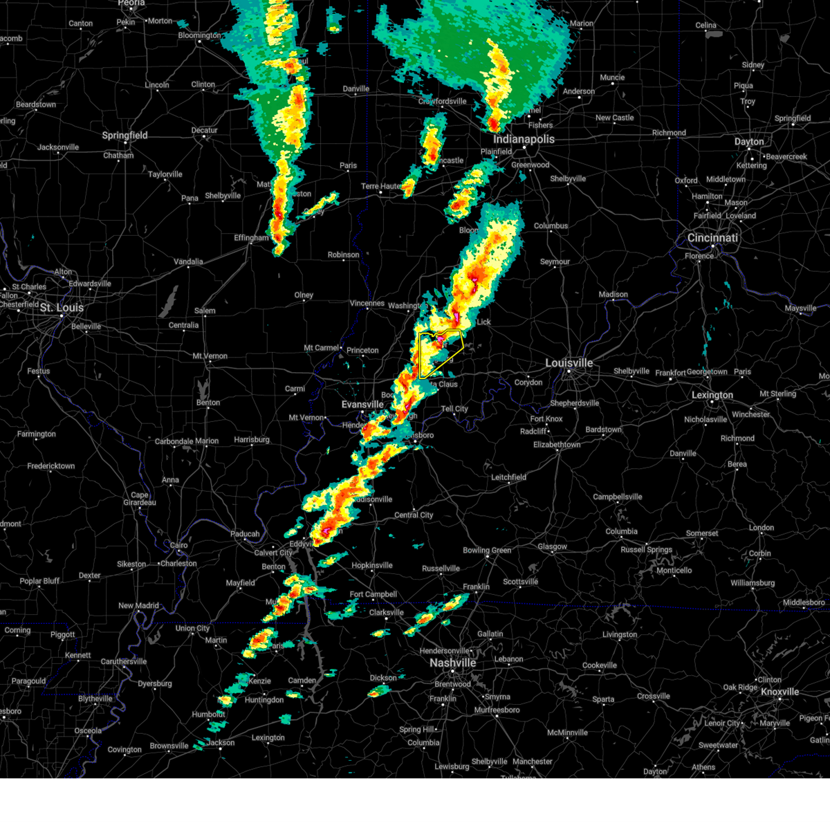
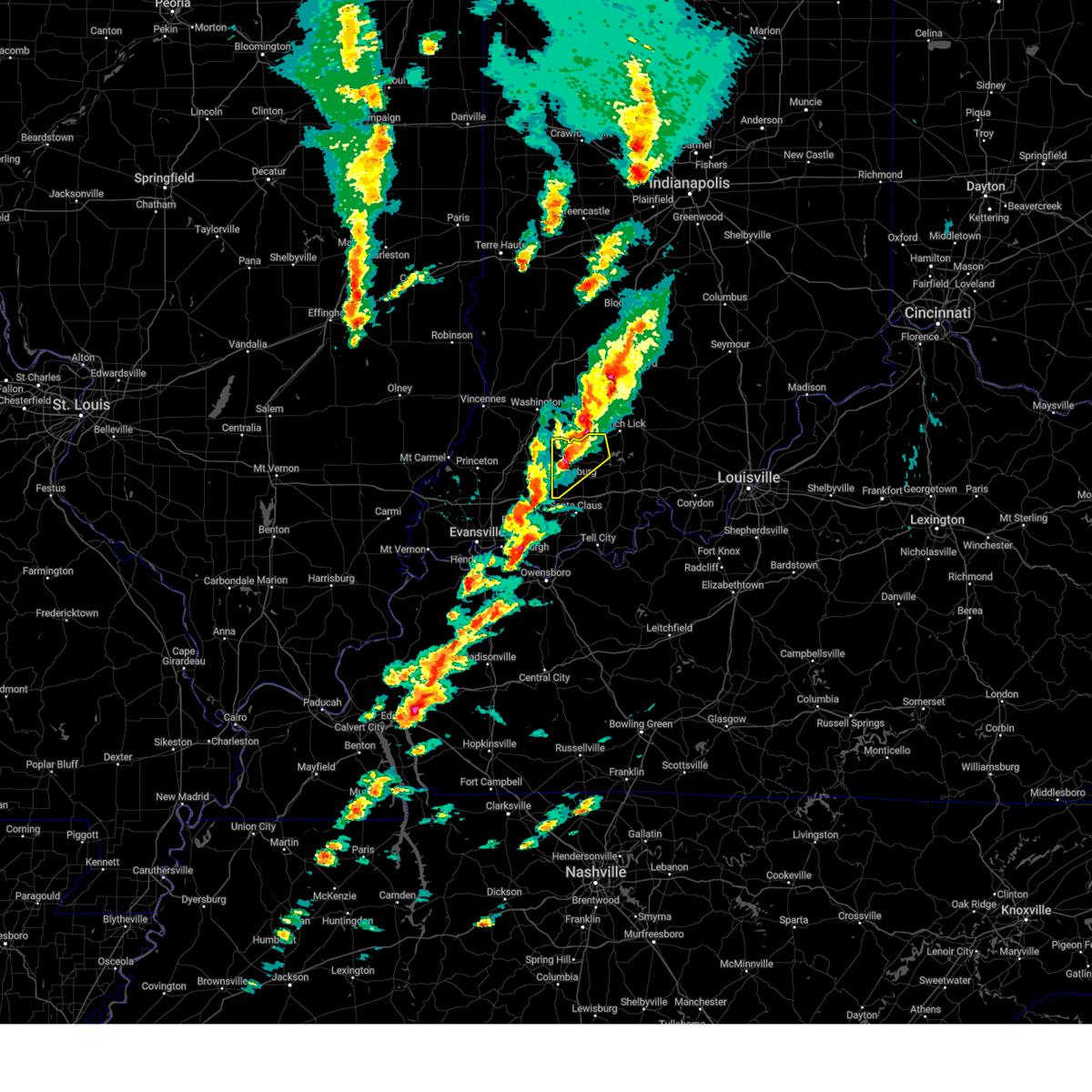
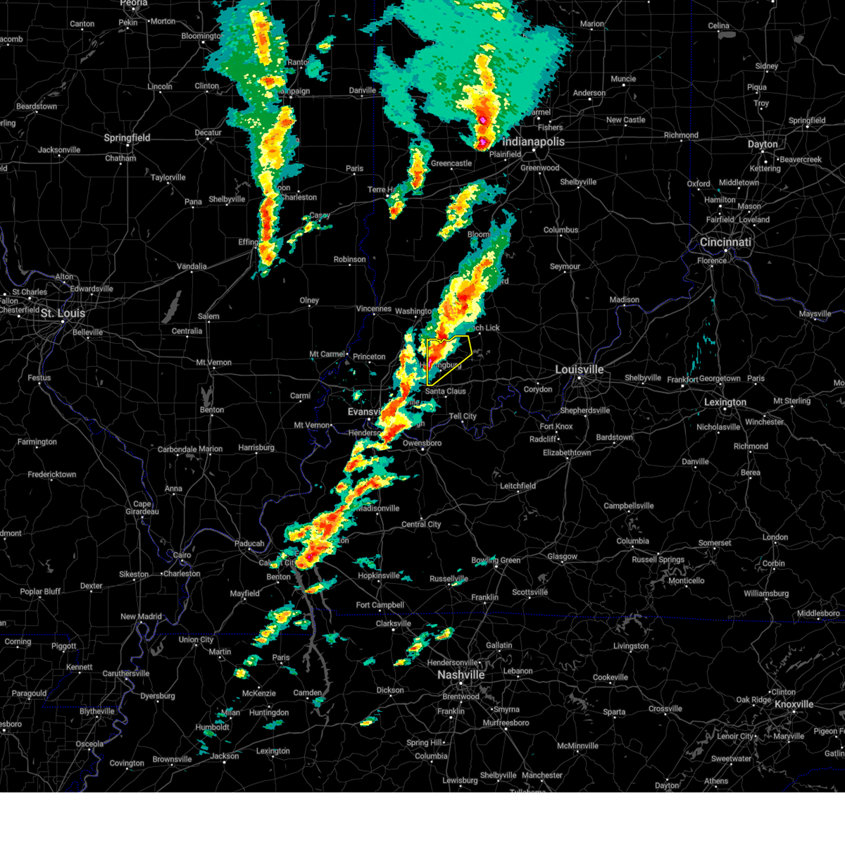
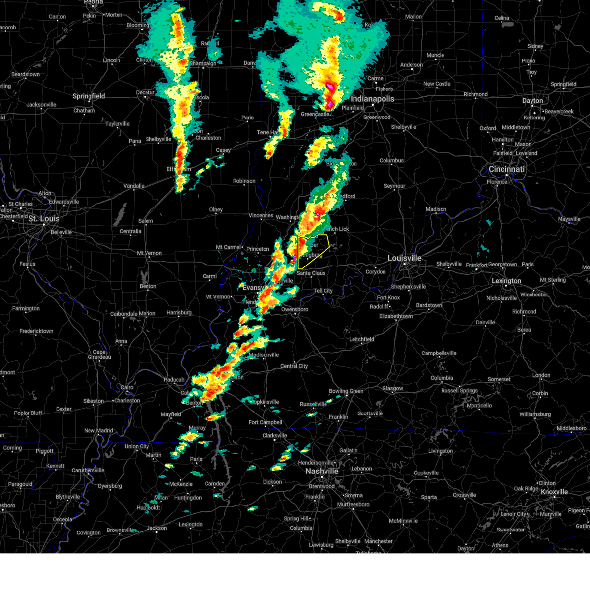
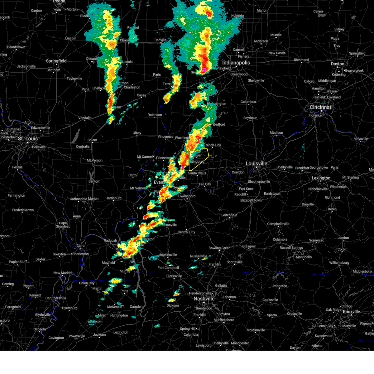
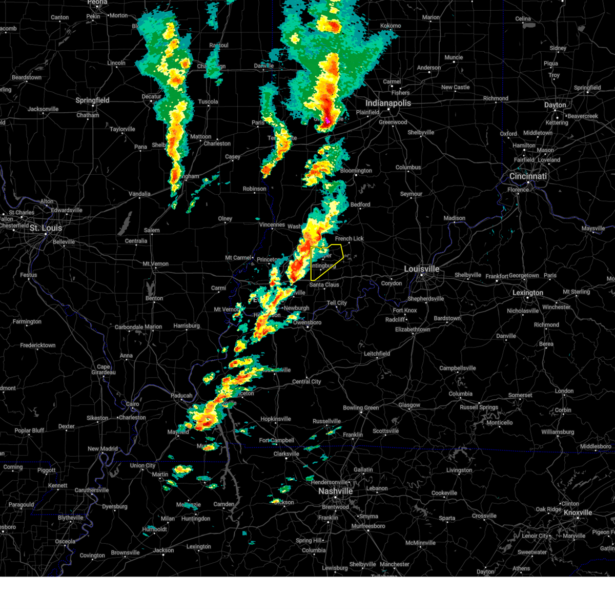
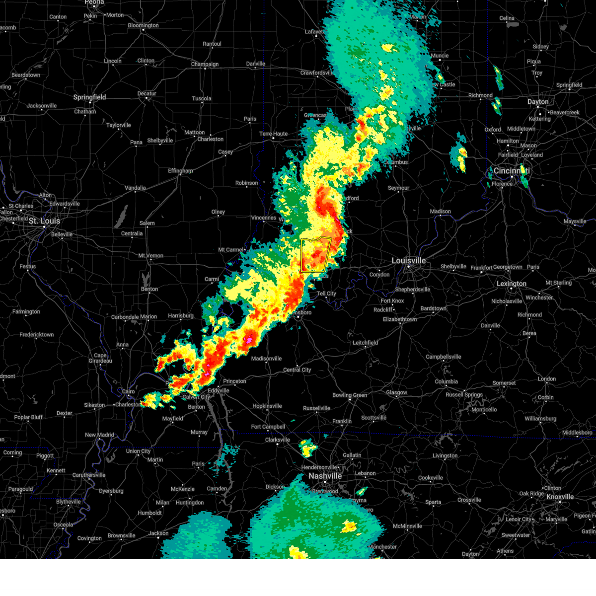
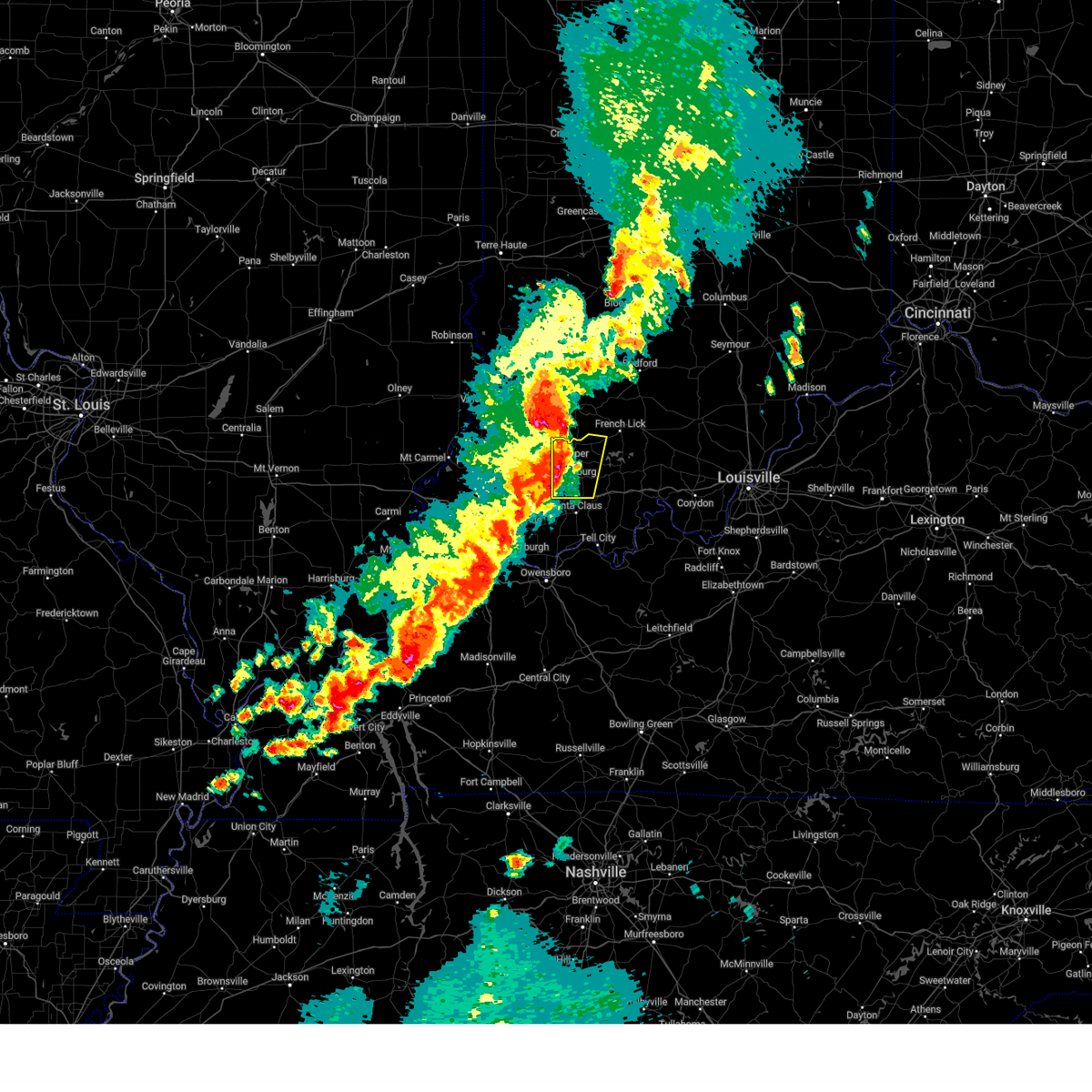
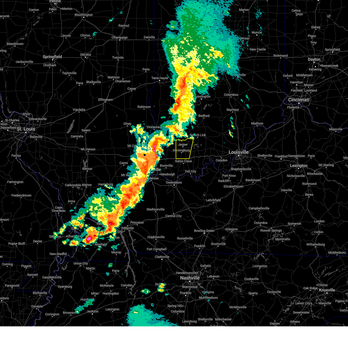
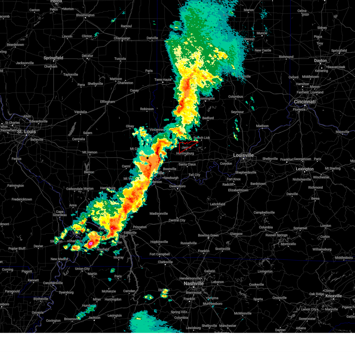
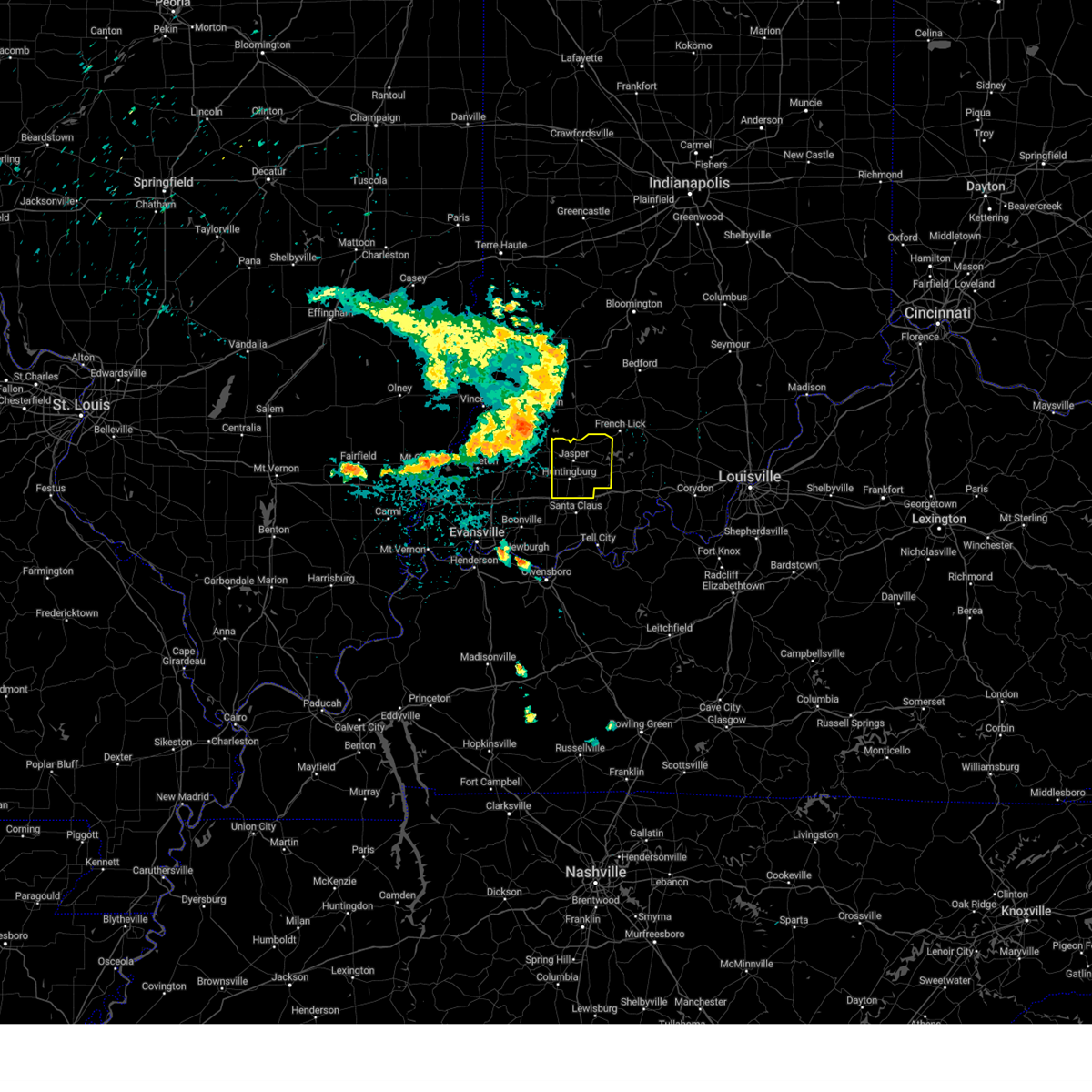
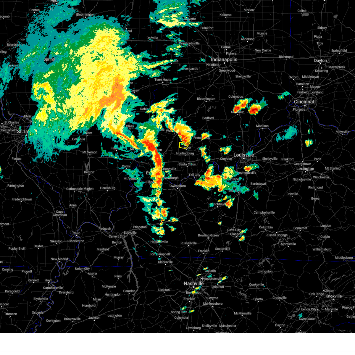
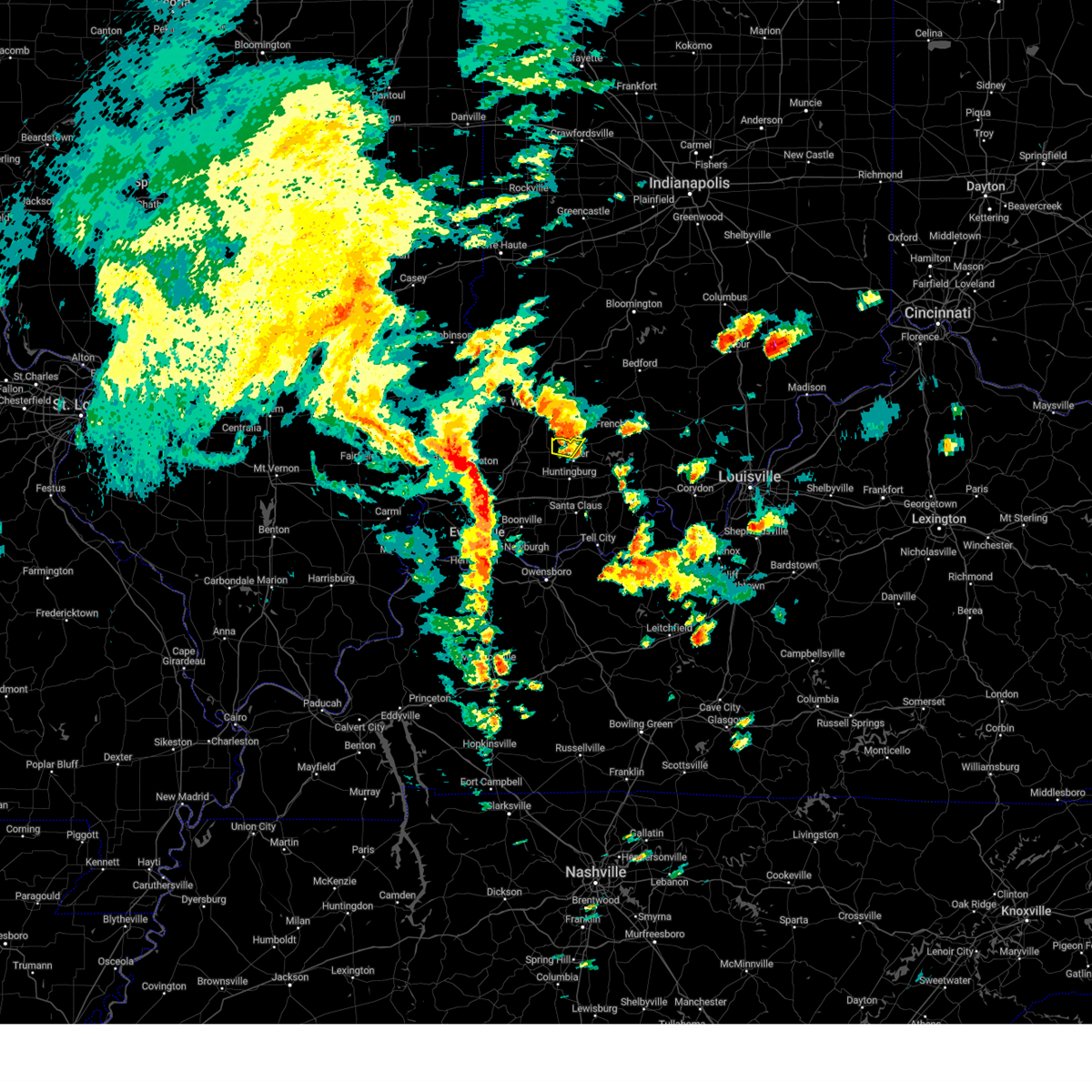
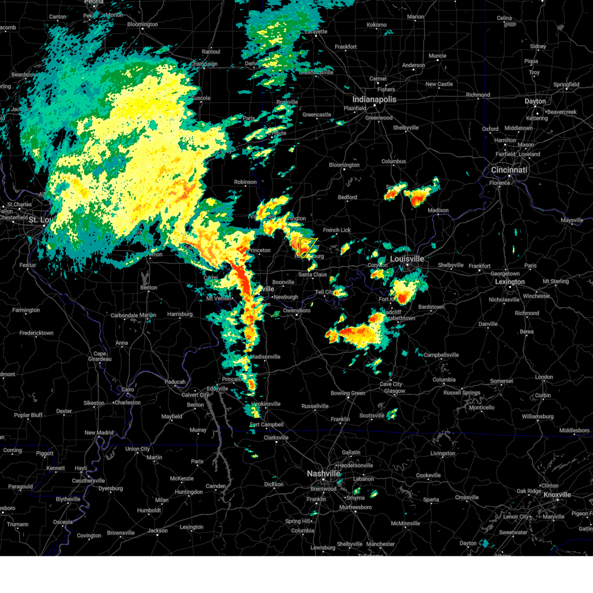
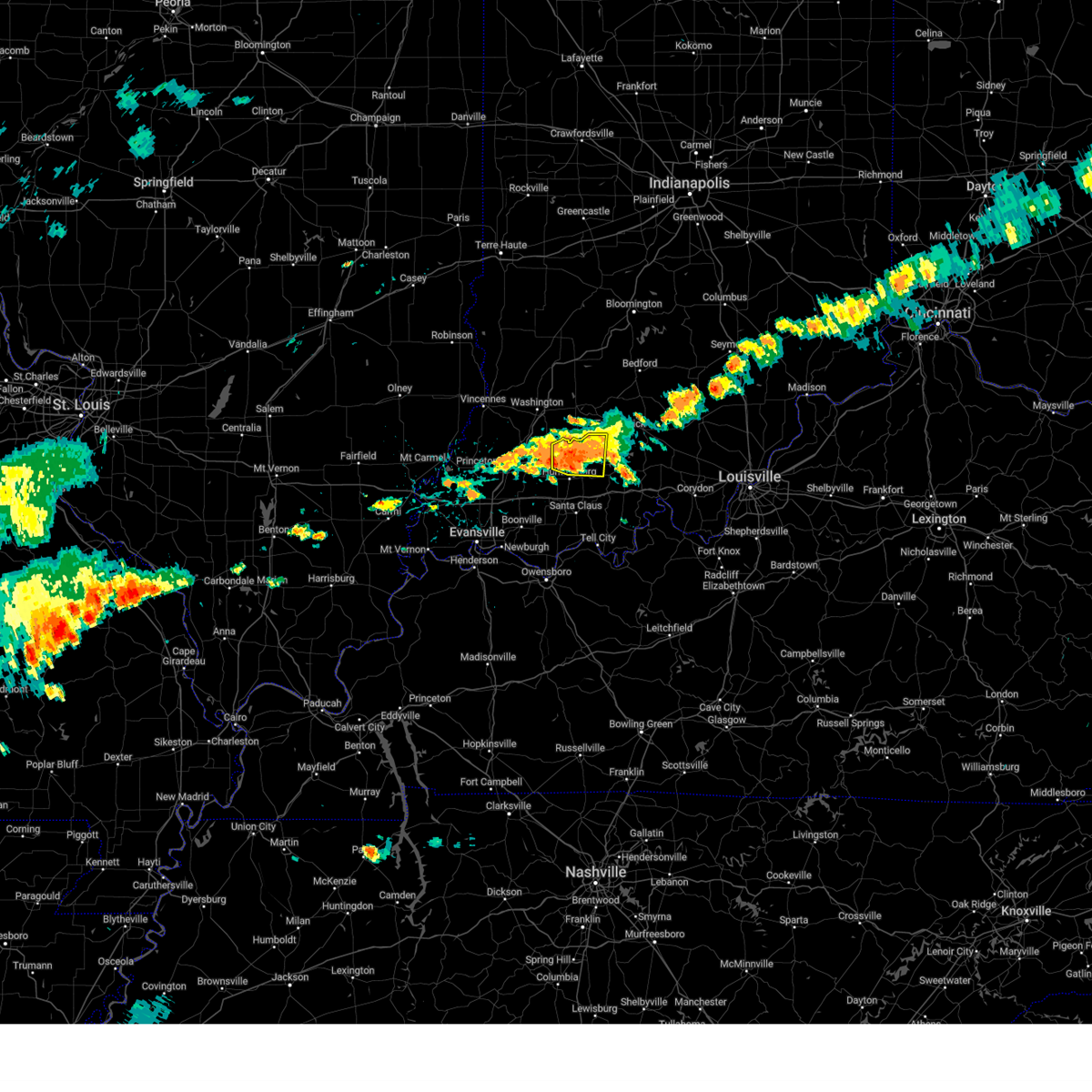
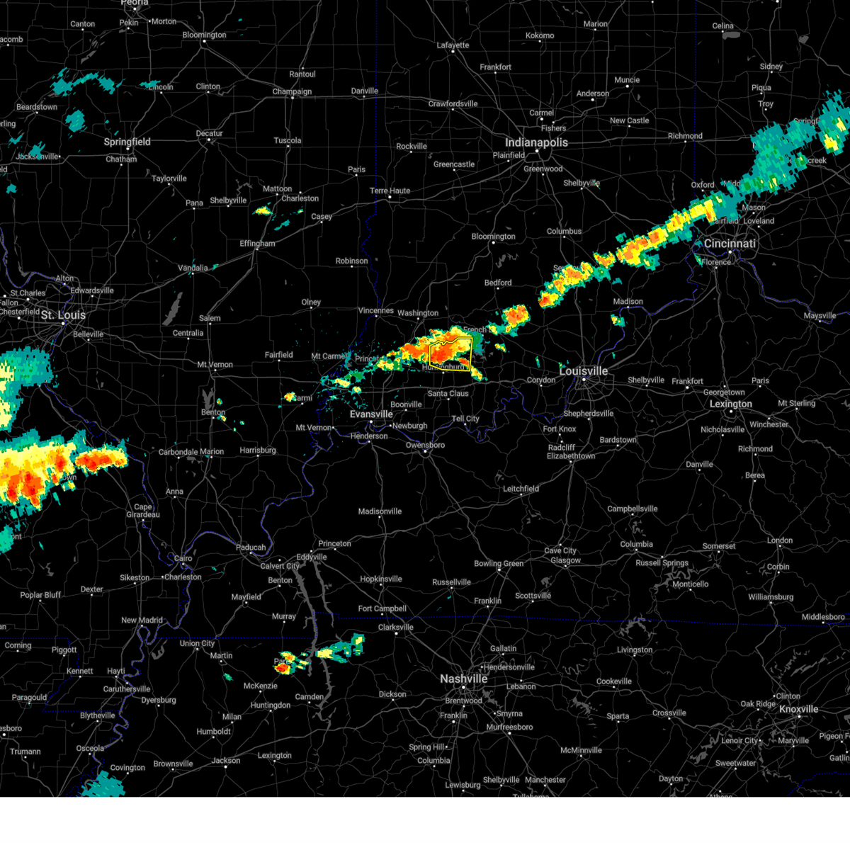
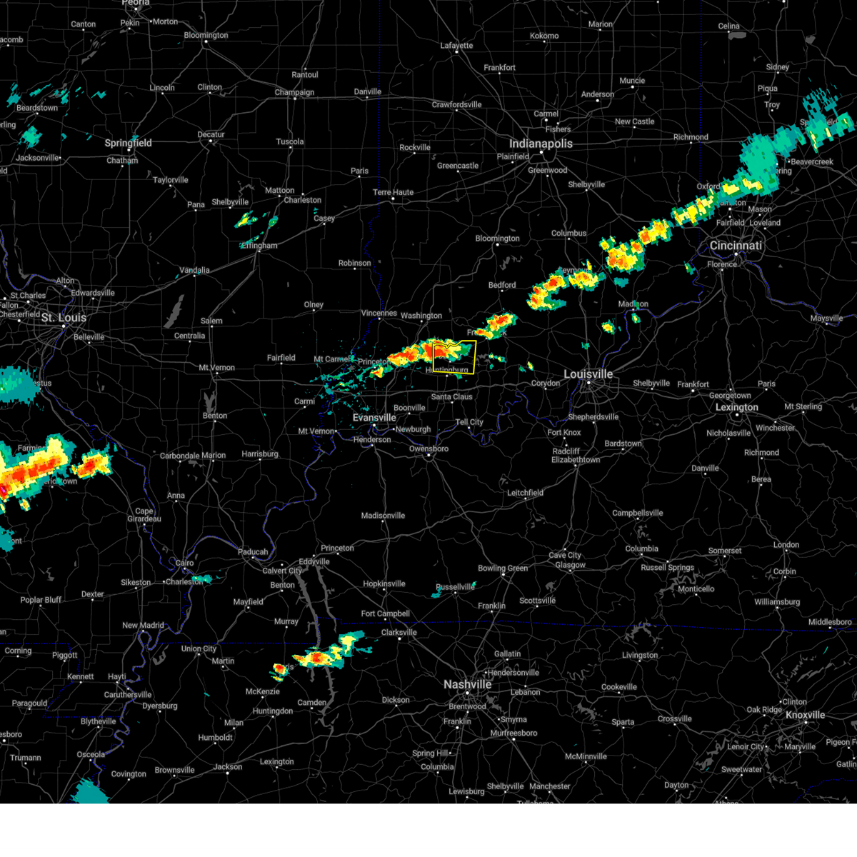
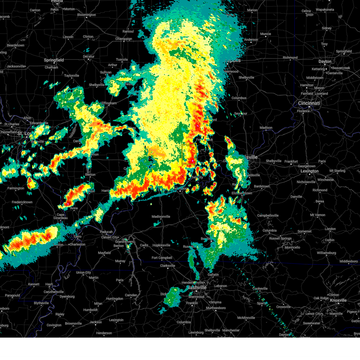
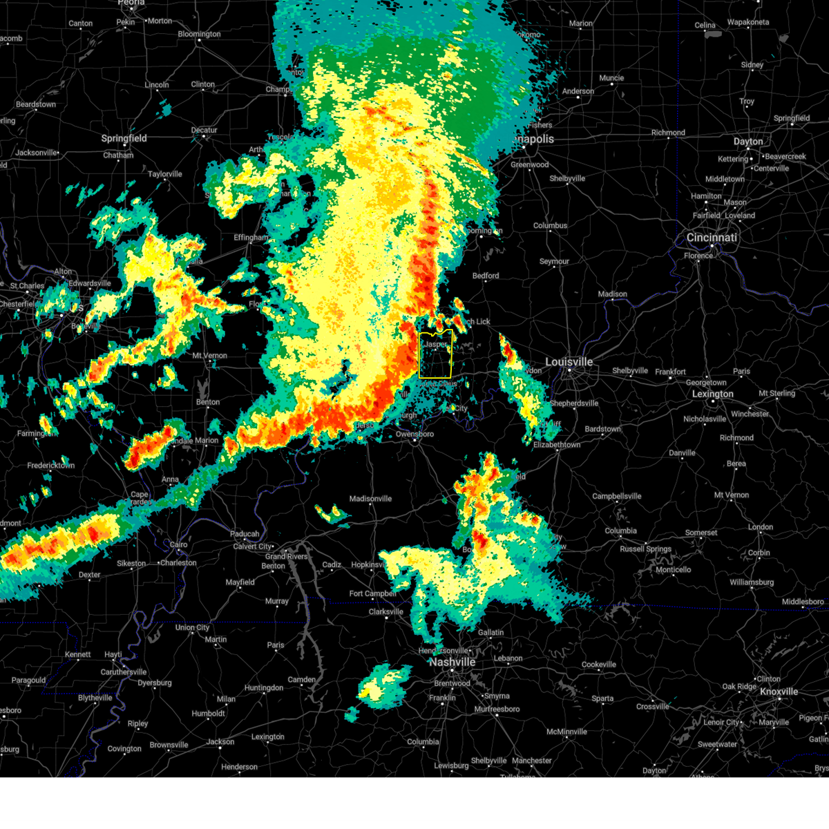
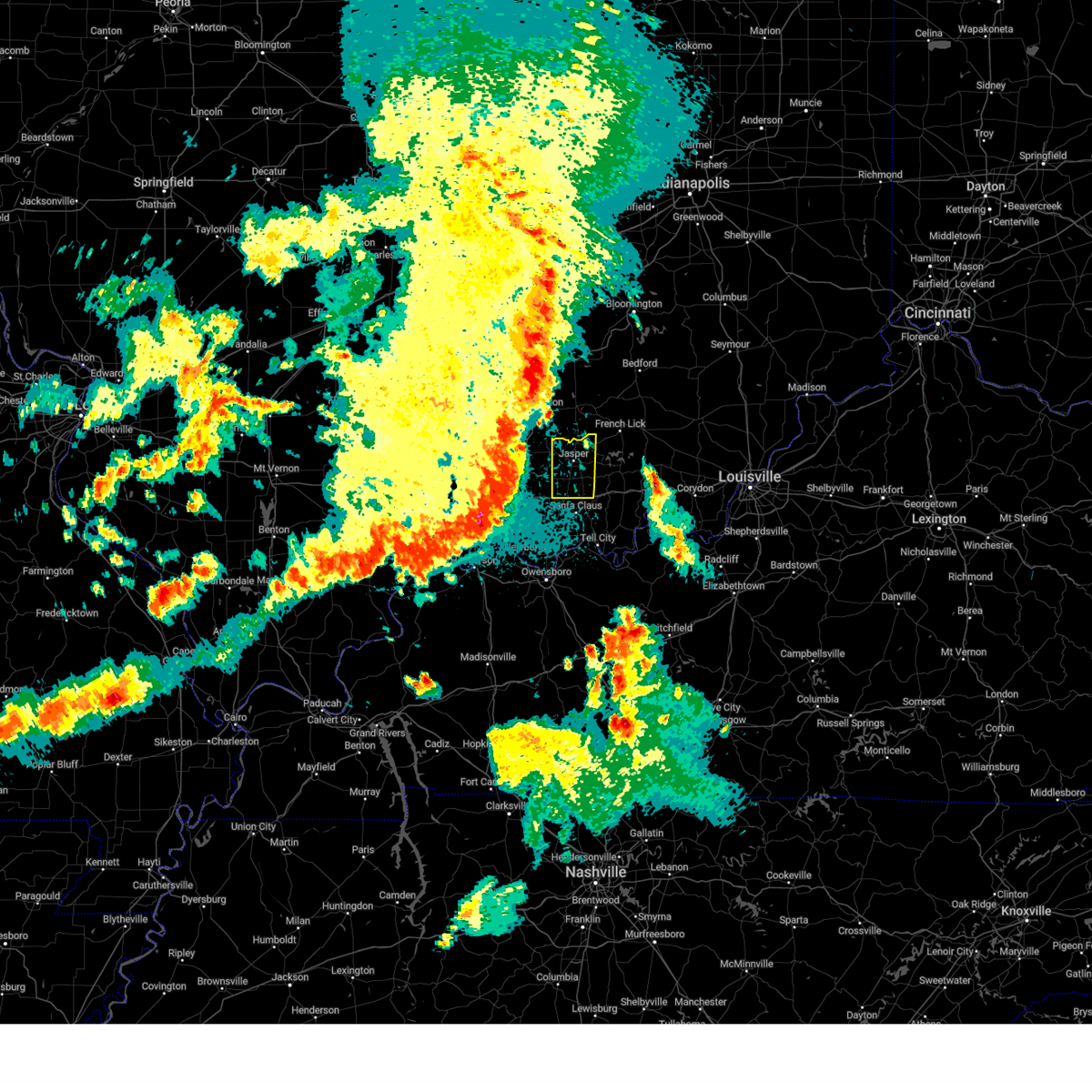
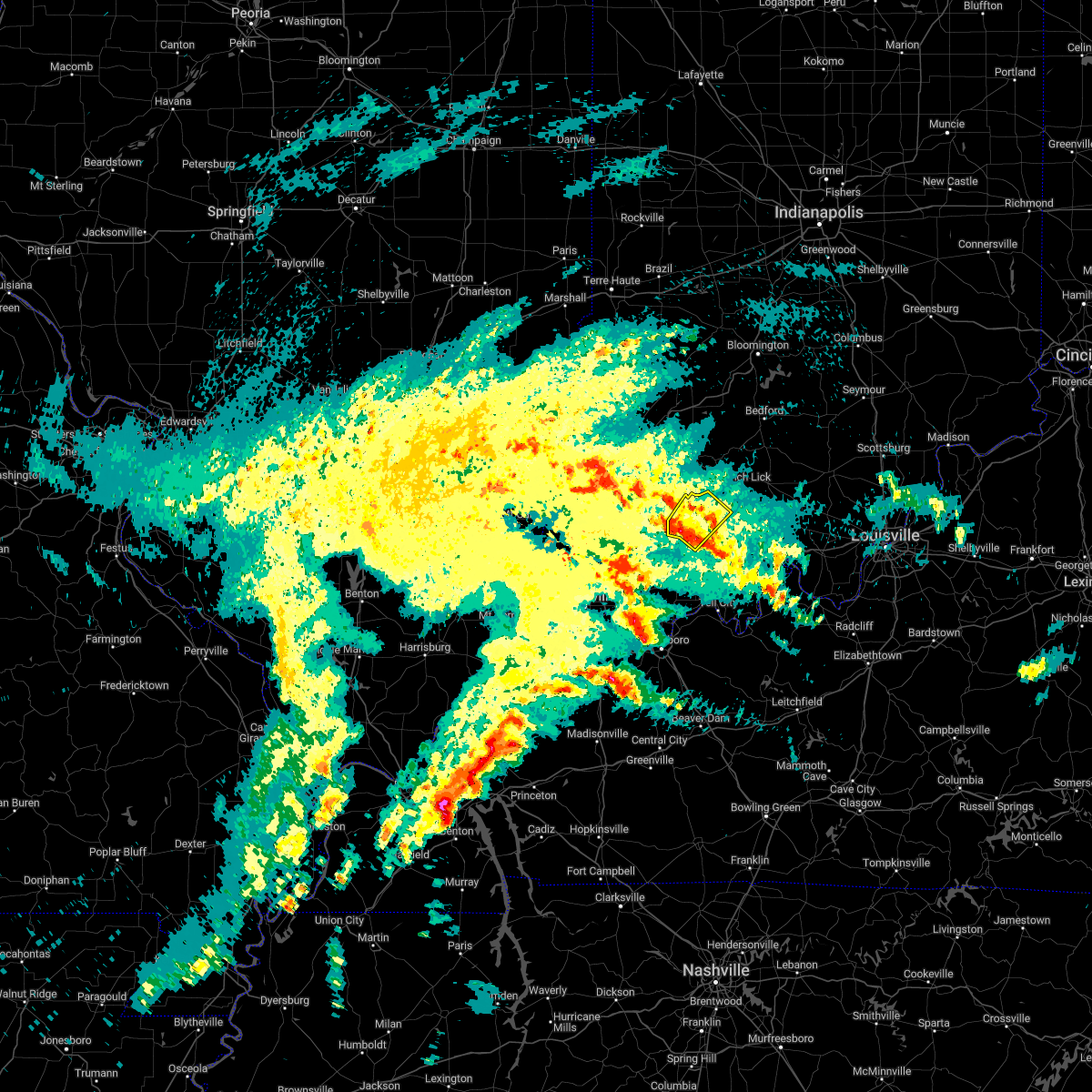
Hail Map for Jasper, IN
The Jasper, IN area has had 11 reports of on-the-ground hail by trained spotters, and has been under severe weather warnings 43 times during the past 12 months. Doppler radar has detected hail at or near Jasper, IN on 88 occasions, including 7 occasions during the past year.
| Name: | Jasper, IN |
| Where Located: | 44.5 miles NE of Evansville, IN |
| Map: | Google Map for Jasper, IN |
| Population: | 15038 |
| Housing Units: | 6419 |
| More Info: | Search Google for Jasper, IN |
2
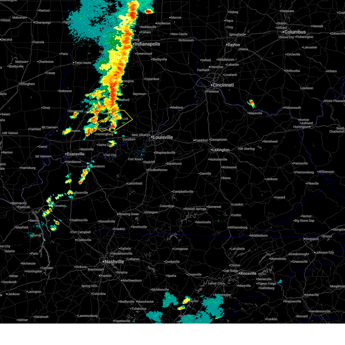
The Top Recent Hail Date for Jasper, IN is Sunday, March 30, 2025 (6th out of 88)
Hail and Wind Damage Spotted near Jasper, IN
| Date / Time | Report Details |
|---|---|
| 6/28/2025 5:50 PM EDT | A few trees down in haysvill in dubois county IN, 6.9 miles S of Jasper, IN |
| 6/18/2025 4:55 PM EDT | 2 trees down in the roadwa in dubois county IN, 3.4 miles SW of Jasper, IN |
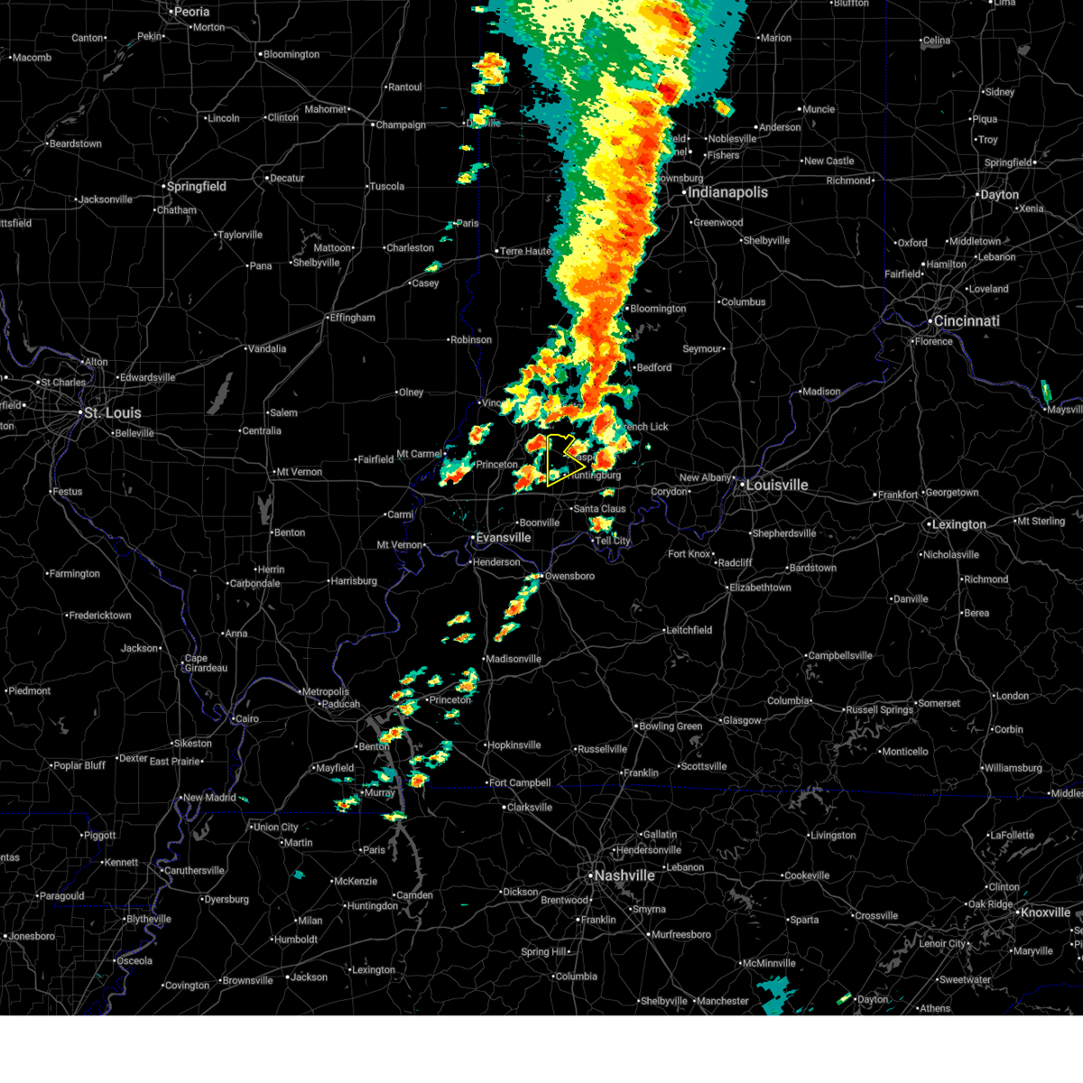
| 6/18/2025 4:52 PM EDT | At 452 pm edt, a severe thunderstorm was located over paoli, moving northeast at 40 mph (radar indicated). Hazards include golf ball size hail and 70 mph wind gusts. People and animals outdoors will be injured. expect hail damage to roofs, siding, windows, and vehicles. expect considerable tree damage. wind damage is also likely to mobile homes, roofs, and outbuildings. Locations impacted include, jasper, paoli, orleans, french lick, stampers creek, orangeville, west baden springs, livonia, dubois, and hillham. |
| 6/18/2025 4:52 PM EDT | the severe thunderstorm warning has been cancelled and is no longer in effect |
| 6/18/2025 4:39 PM EDT |
 At 439 pm edt, a severe thunderstorm was located 8 miles southwest of paoli, moving northeast at 40 mph (radar indicated). Hazards include golf ball size hail and 70 mph wind gusts. People and animals outdoors will be injured. expect hail damage to roofs, siding, windows, and vehicles. expect considerable tree damage. wind damage is also likely to mobile homes, roofs, and outbuildings. Locations impacted include, jasper, paoli, orleans, french lick, stampers creek, orangeville, west baden springs, livonia, dubois, and hillham. At 439 pm edt, a severe thunderstorm was located 8 miles southwest of paoli, moving northeast at 40 mph (radar indicated). Hazards include golf ball size hail and 70 mph wind gusts. People and animals outdoors will be injured. expect hail damage to roofs, siding, windows, and vehicles. expect considerable tree damage. wind damage is also likely to mobile homes, roofs, and outbuildings. Locations impacted include, jasper, paoli, orleans, french lick, stampers creek, orangeville, west baden springs, livonia, dubois, and hillham.
|
| 6/18/2025 4:32 PM EDT |
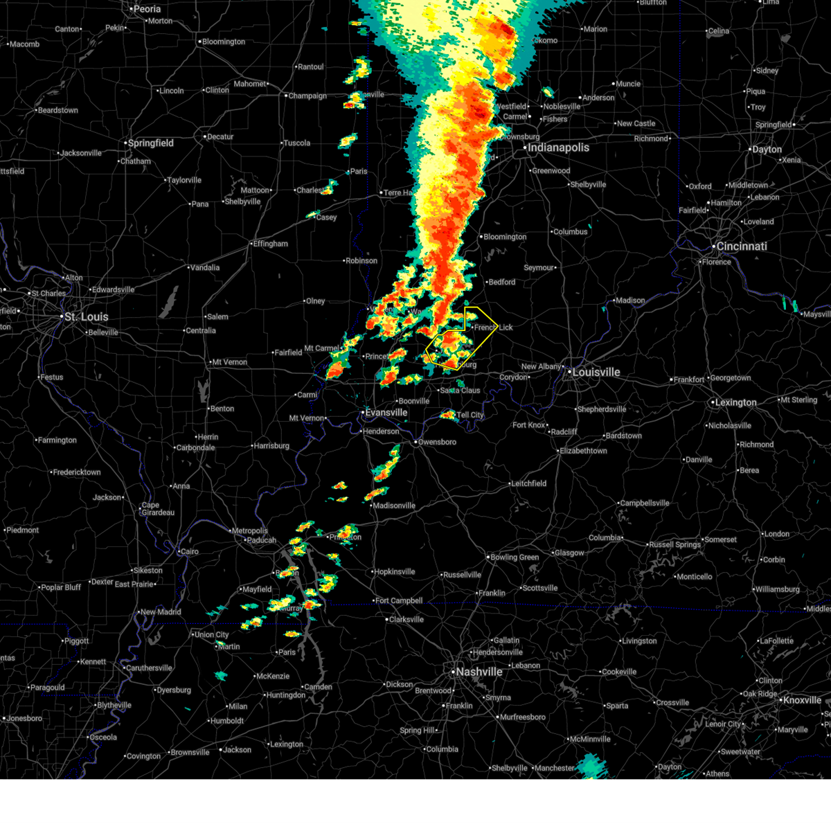
 Svrlmk the national weather service in louisville has issued a * severe thunderstorm warning for, western dubois county in south central indiana, * until 500 pm edt. * at 432 pm edt, a severe thunderstorm was located near winslow, moving northeast at 45 mph (radar indicated). Hazards include 60 mph wind gusts and quarter size hail. Hail damage to vehicles is expected. Expect wind damage to roofs, siding, and trees. Svrlmk the national weather service in louisville has issued a * severe thunderstorm warning for, western dubois county in south central indiana, * until 500 pm edt. * at 432 pm edt, a severe thunderstorm was located near winslow, moving northeast at 45 mph (radar indicated). Hazards include 60 mph wind gusts and quarter size hail. Hail damage to vehicles is expected. Expect wind damage to roofs, siding, and trees.
|
| 6/18/2025 4:28 PM EDT | Svrlmk the national weather service in louisville has issued a * severe thunderstorm warning for, northeastern dubois county in south central indiana, northwestern crawford county in south central indiana, orange county in south central indiana, west central washington county in south central indiana, * until 515 pm edt. * at 428 pm edt, a severe thunderstorm was located 12 miles west of english, moving northeast at 40 mph (radar indicated). Hazards include 60 mph wind gusts and quarter size hail. Hail damage to vehicles is expected. Expect wind damage to roofs, siding, and trees. |
| 6/18/2025 4:25 PM EDT | Power poles down at intersection of omega drive and west division roa in dubois county IN, 1.9 miles ENE of Jasper, IN |
| 6/18/2025 4:18 PM EDT |
 At 418 pm edt, a severe thunderstorm was located 9 miles northeast of jasper, moving northeast at 40 mph (radar indicated). Hazards include 60 mph wind gusts and quarter size hail. Hail damage to vehicles is expected. expect wind damage to roofs, siding, and trees. Locations impacted include, jasper, paoli, huntingburg, french lick, orangeville, west baden springs, birdseye, dubois, hillham, and celestine. At 418 pm edt, a severe thunderstorm was located 9 miles northeast of jasper, moving northeast at 40 mph (radar indicated). Hazards include 60 mph wind gusts and quarter size hail. Hail damage to vehicles is expected. expect wind damage to roofs, siding, and trees. Locations impacted include, jasper, paoli, huntingburg, french lick, orangeville, west baden springs, birdseye, dubois, hillham, and celestine.
|
| 6/18/2025 4:07 PM EDT |
 Svrlmk the national weather service in louisville has issued a * severe thunderstorm warning for, dubois county in south central indiana, northwestern crawford county in south central indiana, northwestern orange county in south central indiana, * until 430 pm edt. * at 407 pm edt, a severe thunderstorm was located over jasper, moving northeast at 40 mph (radar indicated). Hazards include 60 mph wind gusts and quarter size hail. Hail damage to vehicles is expected. Expect wind damage to roofs, siding, and trees. Svrlmk the national weather service in louisville has issued a * severe thunderstorm warning for, dubois county in south central indiana, northwestern crawford county in south central indiana, northwestern orange county in south central indiana, * until 430 pm edt. * at 407 pm edt, a severe thunderstorm was located over jasper, moving northeast at 40 mph (radar indicated). Hazards include 60 mph wind gusts and quarter size hail. Hail damage to vehicles is expected. Expect wind damage to roofs, siding, and trees.
|
| 6/18/2025 3:58 PM EDT | Corrects previous tstm wnd dmg report from 2 wsw jasper. power poles down at intersection of omega drive and west division roa in dubois county IN, 1.9 miles ENE of Jasper, IN |
| 5/16/2025 9:23 PM EDT |
 At 922 pm edt, a severe thunderstorm was located 10 miles east of jasper, moving northeast at 70 mph (radar indicated). Hazards include 60 mph wind gusts and quarter size hail. Hail damage to vehicles is expected. expect wind damage to roofs, siding, and trees. Locations impacted include, birdseye, riceville, dubois, celestine, saint marks, taswell, norton, mentor, eckerty, and ellsworth. At 922 pm edt, a severe thunderstorm was located 10 miles east of jasper, moving northeast at 70 mph (radar indicated). Hazards include 60 mph wind gusts and quarter size hail. Hail damage to vehicles is expected. expect wind damage to roofs, siding, and trees. Locations impacted include, birdseye, riceville, dubois, celestine, saint marks, taswell, norton, mentor, eckerty, and ellsworth.
|
| 5/16/2025 9:23 PM EDT | the severe thunderstorm warning has been cancelled and is no longer in effect |
| 5/16/2025 9:03 PM EDT |
 Svrlmk the national weather service in louisville has issued a * severe thunderstorm warning for, dubois county in south central indiana, northwestern crawford county in south central indiana, northwestern perry county in south central indiana, southwestern orange county in south central indiana, * until 930 pm edt/830 pm cdt/. * at 902 pm edt/802 pm cdt/, a severe thunderstorm was located near folsomville, moving northeast at 60 mph (radar indicated). Hazards include 60 mph wind gusts and quarter size hail. Hail damage to vehicles is expected. Expect wind damage to roofs, siding, and trees. Svrlmk the national weather service in louisville has issued a * severe thunderstorm warning for, dubois county in south central indiana, northwestern crawford county in south central indiana, northwestern perry county in south central indiana, southwestern orange county in south central indiana, * until 930 pm edt/830 pm cdt/. * at 902 pm edt/802 pm cdt/, a severe thunderstorm was located near folsomville, moving northeast at 60 mph (radar indicated). Hazards include 60 mph wind gusts and quarter size hail. Hail damage to vehicles is expected. Expect wind damage to roofs, siding, and trees.
|
| 4/2/2025 11:10 PM EDT | Tree on power line... 190n... just past sultans run... tree is completely blocking roadwa in dubois county IN, 2.4 miles WSW of Jasper, IN |
| 4/2/2025 10:09 PM CDT | The storms which prompted the warning have moved out of the area. therefore, the warning will be allowed to expire. however, gusty winds and heavy rain are still possible with these thunderstorms. a tornado watch remains in effect until 200 am edt/100 am cdt/ for south central indiana, and central kentucky. |
| 4/2/2025 10:00 PM CDT | The storms which prompted the warning have moved out of the area. therefore, the warning will be allowed to expire. however, gusty winds and heavy rain are still possible with these thunderstorms. a tornado watch remains in effect until 200 am edt/100 am cdt/ for south central indiana, and central kentucky. to report severe weather, contact your nearest law enforcement agency. they will relay your report to the national weather service louisville. remember, a severe thunderstorm warning still remains in effect. |
| 4/2/2025 10:44 PM EDT |
 The storm which prompted the warning has moved out of the area. therefore, the warning will be allowed to expire. a tornado watch remains in effect until 200 am edt/100 am cdt/ for south central indiana. remember, a tornado warning still remains in effect for eastern portions of dubois county. The storm which prompted the warning has moved out of the area. therefore, the warning will be allowed to expire. a tornado watch remains in effect until 200 am edt/100 am cdt/ for south central indiana. remember, a tornado warning still remains in effect for eastern portions of dubois county.
|
| 4/2/2025 9:39 PM CDT | Torlmk the national weather service in louisville has issued a * tornado warning for, eastern dubois county in south central indiana, western crawford county in south central indiana, northern perry county in south central indiana, southern orange county in south central indiana, * until 1115 pm edt/1015 pm cdt/. * at 1039 pm edt/939 pm cdt/, severe thunderstorms capable of producing a tornado were located along a line extending from near jasper to near santa claus, moving east at 50 mph (radar indicated rotation). Hazards include tornado. Flying debris will be dangerous to those caught without shelter. mobile homes will be damaged or destroyed. damage to roofs, windows, and vehicles will occur. tree damage is likely. these dangerous storms will be near, english around 1100 pm edt. Other locations impacted by these tornadic storms include celestine, ranger, bretzville, bacon, birdseye, syria, adyeville, fargo, doolittle mills, and deuchars. |
| 4/2/2025 9:37 PM CDT | At 1037 pm edt/937 pm cdt/, severe thunderstorms were located along a line extending from 11 miles southwest of shoals to 10 miles northeast of santa claus to grandview, moving northeast at 60 mph (radar indicated). Hazards include 70 mph wind gusts and nickel size hail. Expect considerable tree damage. damage is likely to mobile homes, roofs, and outbuildings. Locations impacted include, jasper, tell city, paoli, corydon, brandenburg, hardinsburg, hawesville, english, carefree town, and mount pleasant. |
| 4/2/2025 10:35 PM EDT |
 At 1035 pm edt/935 pm cdt/, a severe thunderstorm capable of producing a tornado was located 8 miles south of jasper, moving northeast at 55 mph (radar indicated rotation). Hazards include tornado. Flying debris will be dangerous to those caught without shelter. mobile homes will be damaged or destroyed. damage to roofs, windows, and vehicles will occur. tree damage is likely. This tornadic thunderstorm will remain over mainly rural areas of dubois and northwestern perry counties, including the following locations, dubois, celestine, saint marks, millersport, bretzville, dubois crossroads, huntingburg, mentor, kellerville, and duff. At 1035 pm edt/935 pm cdt/, a severe thunderstorm capable of producing a tornado was located 8 miles south of jasper, moving northeast at 55 mph (radar indicated rotation). Hazards include tornado. Flying debris will be dangerous to those caught without shelter. mobile homes will be damaged or destroyed. damage to roofs, windows, and vehicles will occur. tree damage is likely. This tornadic thunderstorm will remain over mainly rural areas of dubois and northwestern perry counties, including the following locations, dubois, celestine, saint marks, millersport, bretzville, dubois crossroads, huntingburg, mentor, kellerville, and duff.
|
| 4/2/2025 10:20 PM EDT | The storm which prompted the warning has moved out of the area. therefore, the warning will be allowed to expire. a tornado watch remains in effect until 200 am edt for south central indiana. |
| 4/2/2025 9:19 PM CDT | Svrlmk the national weather service in louisville has issued a * severe thunderstorm warning for, harrison county in south central indiana, dubois county in south central indiana, crawford county in south central indiana, perry county in south central indiana, orange county in south central indiana, western washington county in south central indiana, meade county in central kentucky, hancock county in central kentucky, breckinridge county in central kentucky, northeastern ohio county in central kentucky, * until 1100 pm edt/1000 pm cdt/. * at 1018 pm edt/918 pm cdt/, severe thunderstorms were located along a line extending from near petersburg to near folsomville to stanley, moving northeast at 75 mph (radar indicated). Hazards include 70 mph wind gusts and nickel size hail. Expect considerable tree damage. Damage is likely to mobile homes, roofs, and outbuildings. |
| 4/2/2025 10:18 PM EDT |
 Torlmk the national weather service in louisville has issued a * tornado warning for, dubois county in south central indiana, northwestern perry county in south central indiana, * until 1045 pm edt/945 pm cdt/. * at 1018 pm edt/918 pm cdt/, a severe thunderstorm capable of producing a tornado was located over folsomville, moving northeast at 65 mph (radar indicated rotation). Hazards include tornado. Flying debris will be dangerous to those caught without shelter. mobile homes will be damaged or destroyed. damage to roofs, windows, and vehicles will occur. tree damage is likely. this dangerous storm will be near, jasper around 1035 pm edt. Other locations impacted by this tornadic thunderstorm include dubois, celestine, saint marks, millersport, bretzville, dubois crossroads, huntingburg, mentor, kellerville, and duff. Torlmk the national weather service in louisville has issued a * tornado warning for, dubois county in south central indiana, northwestern perry county in south central indiana, * until 1045 pm edt/945 pm cdt/. * at 1018 pm edt/918 pm cdt/, a severe thunderstorm capable of producing a tornado was located over folsomville, moving northeast at 65 mph (radar indicated rotation). Hazards include tornado. Flying debris will be dangerous to those caught without shelter. mobile homes will be damaged or destroyed. damage to roofs, windows, and vehicles will occur. tree damage is likely. this dangerous storm will be near, jasper around 1035 pm edt. Other locations impacted by this tornadic thunderstorm include dubois, celestine, saint marks, millersport, bretzville, dubois crossroads, huntingburg, mentor, kellerville, and duff.
|
| 4/2/2025 10:08 PM EDT | At 1008 pm edt, a severe thunderstorm capable of producing a tornado was located near jasper, moving northeast at 45 mph (radar indicated rotation). Hazards include tornado and quarter size hail. Flying debris will be dangerous to those caught without shelter. mobile homes will be damaged or destroyed. damage to roofs, windows, and vehicles will occur. tree damage is likely. This tornadic thunderstorm will remain over mainly rural areas of northeastern dubois county, including the following locations, ellsworth, dubois, thales, cuzco, portersville, dubois crossroads, kellerville, crystal, and haysville. |
| 4/2/2025 9:59 PM EDT |
 At 959 pm edt, a severe thunderstorm capable of producing a tornado was located near jasper, moving northeast at 50 mph (radar indicated rotation). Hazards include tornado and quarter size hail. Flying debris will be dangerous to those caught without shelter. mobile homes will be damaged or destroyed. damage to roofs, windows, and vehicles will occur. tree damage is likely. this dangerous storm will be near, jasper around 1005 pm edt. Other locations impacted by this tornadic thunderstorm include dubois, celestine, portersville, millersport, dubois crossroads, kellerville, haysville, ellsworth, duff, and thales. At 959 pm edt, a severe thunderstorm capable of producing a tornado was located near jasper, moving northeast at 50 mph (radar indicated rotation). Hazards include tornado and quarter size hail. Flying debris will be dangerous to those caught without shelter. mobile homes will be damaged or destroyed. damage to roofs, windows, and vehicles will occur. tree damage is likely. this dangerous storm will be near, jasper around 1005 pm edt. Other locations impacted by this tornadic thunderstorm include dubois, celestine, portersville, millersport, dubois crossroads, kellerville, haysville, ellsworth, duff, and thales.
|
| 4/2/2025 9:45 PM EDT | Torlmk the national weather service in louisville has issued a * tornado warning for, dubois county in south central indiana, * until 1030 pm edt. * at 945 pm edt, a severe thunderstorm capable of producing a tornado was located 7 miles southeast of winslow, moving northeast at 45 mph (radar indicated rotation). Hazards include tornado and quarter size hail. Flying debris will be dangerous to those caught without shelter. mobile homes will be damaged or destroyed. damage to roofs, windows, and vehicles will occur. tree damage is likely. this dangerous storm will be near, jasper around 955 pm edt. Other locations impacted by this tornadic thunderstorm include dubois, celestine, portersville, millersport, dubois crossroads, huntingburg, kellerville, haysville, ellsworth, and duff. |
| 3/30/2025 7:44 PM EDT |
 The storm which prompted the warning has moved out of the area. therefore, the warning will be allowed to expire. however, gusty winds and heavy rain are still possible with this thunderstorm. a tornado watch remains in effect until 100 am edt for south central indiana. to report severe weather, contact your nearest law enforcement agency. they will relay your report to the national weather service louisville. remember, a severe thunderstorm warning still remains in effect for central and eastern dubois county. The storm which prompted the warning has moved out of the area. therefore, the warning will be allowed to expire. however, gusty winds and heavy rain are still possible with this thunderstorm. a tornado watch remains in effect until 100 am edt for south central indiana. to report severe weather, contact your nearest law enforcement agency. they will relay your report to the national weather service louisville. remember, a severe thunderstorm warning still remains in effect for central and eastern dubois county.
|
| 3/30/2025 7:41 PM EDT | Svrlmk the national weather service in louisville has issued a * severe thunderstorm warning for, northeastern dubois county in south central indiana, northwestern crawford county in south central indiana, orange county in south central indiana, * until 815 pm edt. * at 740 pm edt, severe thunderstorms were located along a line extending from near jasper to 12 miles west of english, moving northeast at 40 mph (trained weather spotters). Hazards include ping pong ball size hail and 60 mph wind gusts. People and animals outdoors will be injured. expect hail damage to roofs, siding, windows, and vehicles. expect wind damage to roofs, siding, and trees. At 735 pm edt, trained spotters reported ping pong ball size hail east of jasper. |
| 3/30/2025 7:34 PM EDT | Ping Pong Ball sized hail reported 4.9 miles W of Jasper, IN |
| 3/30/2025 7:30 PM EDT |
 At 730 pm edt, a severe thunderstorm was located near jasper, moving northeast at 30 mph (radar indicated). Hazards include 60 mph wind gusts and half dollar size hail. Hail damage to vehicles is expected. expect wind damage to roofs, siding, and trees. Locations impacted include, jasper, huntingburg, holland, duff, huntingburg airport, millersport, bretzville, and maltersville. At 730 pm edt, a severe thunderstorm was located near jasper, moving northeast at 30 mph (radar indicated). Hazards include 60 mph wind gusts and half dollar size hail. Hail damage to vehicles is expected. expect wind damage to roofs, siding, and trees. Locations impacted include, jasper, huntingburg, holland, duff, huntingburg airport, millersport, bretzville, and maltersville.
|
| 3/30/2025 7:27 PM EDT |
 The storms which prompted the warning have weakened below severe limits, and no longer pose an immediate threat to life or property. therefore, the warning will be allowed to expire. however, gusty winds and heavy rain are still possible with these thunderstorms. a tornado watch remains in effect until 100 am edt for south central indiana. to report severe weather, contact your nearest law enforcement agency. they will relay your report to the national weather service louisville. The storms which prompted the warning have weakened below severe limits, and no longer pose an immediate threat to life or property. therefore, the warning will be allowed to expire. however, gusty winds and heavy rain are still possible with these thunderstorms. a tornado watch remains in effect until 100 am edt for south central indiana. to report severe weather, contact your nearest law enforcement agency. they will relay your report to the national weather service louisville.
|
| 3/30/2025 7:19 PM EDT |
 At 718 pm edt, a severe thunderstorm was located 8 miles southwest of jasper, moving northeast at 30 mph (radar indicated). Hazards include 60 mph wind gusts and half dollar size hail. Hail damage to vehicles is expected. expect wind damage to roofs, siding, and trees. Locations impacted include, jasper, huntingburg, ferdinand, holland, duff, huntingburg airport, saint anthony, millersport, bretzville, and maltersville. At 718 pm edt, a severe thunderstorm was located 8 miles southwest of jasper, moving northeast at 30 mph (radar indicated). Hazards include 60 mph wind gusts and half dollar size hail. Hail damage to vehicles is expected. expect wind damage to roofs, siding, and trees. Locations impacted include, jasper, huntingburg, ferdinand, holland, duff, huntingburg airport, saint anthony, millersport, bretzville, and maltersville.
|
| 3/30/2025 7:17 PM EDT |
 At 717 pm edt, severe thunderstorms were located along a line extending from 11 miles east of shoals to 7 miles west of paoli to 8 miles east of jasper, moving east at 60 mph (radar indicated). Hazards include 60 mph wind gusts and quarter size hail. Hail damage to vehicles is expected. expect wind damage to roofs, siding, and trees. Locations impacted include, jasper, paoli, orleans, french lick, stampers creek, orangeville, west baden springs, dubois, hillham, and celestine. At 717 pm edt, severe thunderstorms were located along a line extending from 11 miles east of shoals to 7 miles west of paoli to 8 miles east of jasper, moving east at 60 mph (radar indicated). Hazards include 60 mph wind gusts and quarter size hail. Hail damage to vehicles is expected. expect wind damage to roofs, siding, and trees. Locations impacted include, jasper, paoli, orleans, french lick, stampers creek, orangeville, west baden springs, dubois, hillham, and celestine.
|
| 3/30/2025 6:59 PM EDT |
 Svrlmk the national weather service in louisville has issued a * severe thunderstorm warning for, southwestern dubois county in south central indiana, * until 745 pm edt. * at 658 pm edt, a severe thunderstorm was located near lynnville, moving northeast at 30 mph (radar indicated). Hazards include 60 mph wind gusts and quarter size hail. Hail damage to vehicles is expected. Expect wind damage to roofs, siding, and trees. Svrlmk the national weather service in louisville has issued a * severe thunderstorm warning for, southwestern dubois county in south central indiana, * until 745 pm edt. * at 658 pm edt, a severe thunderstorm was located near lynnville, moving northeast at 30 mph (radar indicated). Hazards include 60 mph wind gusts and quarter size hail. Hail damage to vehicles is expected. Expect wind damage to roofs, siding, and trees.
|
| 3/30/2025 6:53 PM EDT | Svrlmk the national weather service in louisville has issued a * severe thunderstorm warning for, northern dubois county in south central indiana, orange county in south central indiana, * until 730 pm edt. * at 653 pm edt, severe thunderstorms were located along a line extending from 10 miles southwest of shoals to 8 miles north of jasper to near winslow, moving east at 65 mph (radar indicated). Hazards include 60 mph wind gusts and quarter size hail. Hail damage to vehicles is expected. Expect wind damage to roofs, siding, and trees. |
| 3/19/2025 8:09 PM EDT |
 At 808 pm edt, a severe thunderstorm was located 8 miles east of shoals, moving northeast at 60 mph (radar indicated). Hazards include 70 mph wind gusts and quarter size hail. Hail damage to vehicles is expected. expect considerable tree damage. wind damage is also likely to mobile homes, roofs, and outbuildings. Locations impacted include, jasper, paoli, huntingburg, orleans, french lick, stampers creek, orangeville, holland, west baden springs, and dubois. At 808 pm edt, a severe thunderstorm was located 8 miles east of shoals, moving northeast at 60 mph (radar indicated). Hazards include 70 mph wind gusts and quarter size hail. Hail damage to vehicles is expected. expect considerable tree damage. wind damage is also likely to mobile homes, roofs, and outbuildings. Locations impacted include, jasper, paoli, huntingburg, orleans, french lick, stampers creek, orangeville, holland, west baden springs, and dubois.
|
| 3/19/2025 8:01 PM EDT |
 The storm which prompted the warning has been replaced by a new severe thunderstorm warning. therefore, the warning has been allowed to expire. a tornado watch remains in effect until midnight edt for south central indiana. to report severe weather, contact your nearest law enforcement agency. they will relay your report to the national weather service louisville. The storm which prompted the warning has been replaced by a new severe thunderstorm warning. therefore, the warning has been allowed to expire. a tornado watch remains in effect until midnight edt for south central indiana. to report severe weather, contact your nearest law enforcement agency. they will relay your report to the national weather service louisville.
|
| 3/19/2025 7:58 PM EDT | Power lines downed in the roadway at the intersection of 350 w and west schuetter road in jaspe in dubois county IN, 2.2 miles SE of Jasper, IN |
| 3/19/2025 7:54 PM EDT |
 Svrlmk the national weather service in louisville has issued a * severe thunderstorm warning for, dubois county in south central indiana, orange county in south central indiana, * until 830 pm edt. * at 754 pm edt, a severe thunderstorm was located 9 miles northeast of jasper, moving northeast at 60 mph (radar indicated). Hazards include golf ball size hail and 70 mph wind gusts. People and animals outdoors will be injured. expect hail damage to roofs, siding, windows, and vehicles. expect considerable tree damage. Wind damage is also likely to mobile homes, roofs, and outbuildings. Svrlmk the national weather service in louisville has issued a * severe thunderstorm warning for, dubois county in south central indiana, orange county in south central indiana, * until 830 pm edt. * at 754 pm edt, a severe thunderstorm was located 9 miles northeast of jasper, moving northeast at 60 mph (radar indicated). Hazards include golf ball size hail and 70 mph wind gusts. People and animals outdoors will be injured. expect hail damage to roofs, siding, windows, and vehicles. expect considerable tree damage. Wind damage is also likely to mobile homes, roofs, and outbuildings.
|
| 3/19/2025 7:53 PM EDT | A shed roof was blocking the roadway along 350 w west of jaspe in dubois county IN, 2.2 miles SE of Jasper, IN |
| 3/19/2025 7:51 PM EDT |
 At 750 pm edt, a severe thunderstorm was located 10 miles northeast of jasper, moving northeast at 55 mph (radar indicated). Hazards include two inch hail and 70 mph wind gusts. People and animals outdoors will be injured. expect hail damage to roofs, siding, windows, and vehicles. expect considerable tree damage. wind damage is also likely to mobile homes, roofs, and outbuildings. Locations impacted include, jasper, huntingburg, holland, dubois, celestine, portersville, millersport, bretzville, dubois crossroads, and kellerville. At 750 pm edt, a severe thunderstorm was located 10 miles northeast of jasper, moving northeast at 55 mph (radar indicated). Hazards include two inch hail and 70 mph wind gusts. People and animals outdoors will be injured. expect hail damage to roofs, siding, windows, and vehicles. expect considerable tree damage. wind damage is also likely to mobile homes, roofs, and outbuildings. Locations impacted include, jasper, huntingburg, holland, dubois, celestine, portersville, millersport, bretzville, dubois crossroads, and kellerville.
|
| 3/19/2025 7:47 PM EDT | Tree down on power lines along state road 56 west of jaspe in dubois county IN, 4.9 miles ESE of Jasper, IN |
| 3/19/2025 7:47 PM EDT | Large pine tree was downed along stewart road west of jasper. time estimated from rada in dubois county IN, 4 miles ENE of Jasper, IN |
| 3/19/2025 7:45 PM EDT |
 At 745 pm edt, a severe thunderstorm was located near jasper, moving northeast at 55 mph (radar indicated). Hazards include 70 mph wind gusts and ping pong ball size hail. People and animals outdoors will be injured. expect hail damage to roofs, siding, windows, and vehicles. expect considerable tree damage. wind damage is also likely to mobile homes, roofs, and outbuildings. Locations impacted include, jasper, huntingburg, holland, dubois, celestine, portersville, millersport, bretzville, dubois crossroads, and kellerville. At 745 pm edt, a severe thunderstorm was located near jasper, moving northeast at 55 mph (radar indicated). Hazards include 70 mph wind gusts and ping pong ball size hail. People and animals outdoors will be injured. expect hail damage to roofs, siding, windows, and vehicles. expect considerable tree damage. wind damage is also likely to mobile homes, roofs, and outbuildings. Locations impacted include, jasper, huntingburg, holland, dubois, celestine, portersville, millersport, bretzville, dubois crossroads, and kellerville.
|
| 3/19/2025 7:37 PM EDT |
 At 737 pm edt, a severe thunderstorm was located near jasper, moving northeast at 55 mph (radar indicated). Hazards include 70 mph wind gusts and quarter size hail. Hail damage to vehicles is expected. expect considerable tree damage. wind damage is also likely to mobile homes, roofs, and outbuildings. Locations impacted include, jasper, huntingburg, holland, dubois, celestine, portersville, millersport, bretzville, dubois crossroads, and kellerville. At 737 pm edt, a severe thunderstorm was located near jasper, moving northeast at 55 mph (radar indicated). Hazards include 70 mph wind gusts and quarter size hail. Hail damage to vehicles is expected. expect considerable tree damage. wind damage is also likely to mobile homes, roofs, and outbuildings. Locations impacted include, jasper, huntingburg, holland, dubois, celestine, portersville, millersport, bretzville, dubois crossroads, and kellerville.
|
| 3/19/2025 7:32 PM EDT |
 At 732 pm edt, a severe thunderstorm was located near winslow, moving northeast at 55 mph (radar indicated). Hazards include 70 mph wind gusts and penny size hail. Expect considerable tree damage. damage is likely to mobile homes, roofs, and outbuildings. Locations impacted include, jasper, huntingburg, holland, dubois, celestine, portersville, millersport, bretzville, dubois crossroads, and kellerville. At 732 pm edt, a severe thunderstorm was located near winslow, moving northeast at 55 mph (radar indicated). Hazards include 70 mph wind gusts and penny size hail. Expect considerable tree damage. damage is likely to mobile homes, roofs, and outbuildings. Locations impacted include, jasper, huntingburg, holland, dubois, celestine, portersville, millersport, bretzville, dubois crossroads, and kellerville.
|
| 3/19/2025 7:25 PM EDT |
 Svrlmk the national weather service in louisville has issued a * severe thunderstorm warning for, dubois county in south central indiana, * until 800 pm edt. * at 725 pm edt, a severe thunderstorm was located near winslow, moving northeast at 55 mph (radar indicated). Hazards include 60 mph wind gusts and penny size hail. expect damage to roofs, siding, and trees Svrlmk the national weather service in louisville has issued a * severe thunderstorm warning for, dubois county in south central indiana, * until 800 pm edt. * at 725 pm edt, a severe thunderstorm was located near winslow, moving northeast at 55 mph (radar indicated). Hazards include 60 mph wind gusts and penny size hail. expect damage to roofs, siding, and trees
|
| 3/15/2025 4:45 AM EDT |
 The storms which prompted the warning have moved out of the area. therefore, the warning has been allowed to expire. a tornado watch remains in effect until 1000 am edt for south central indiana. The storms which prompted the warning have moved out of the area. therefore, the warning has been allowed to expire. a tornado watch remains in effect until 1000 am edt for south central indiana.
|
| 3/15/2025 4:33 AM EDT | Power line down on schnellville rd. time estimated from rada in dubois county IN, 6.3 miles WNW of Jasper, IN |
| 3/15/2025 4:30 AM EDT | Garage roof fell off and into the roadway on greener rd. time estimated off rada in dubois county IN, 3.8 miles WNW of Jasper, IN |
| 3/15/2025 4:28 AM EDT | Trained spotter reports 60 mph wind gust in portersvill in dubois county IN, 7.2 miles SSE of Jasper, IN |
| 3/15/2025 4:27 AM EDT | Several trees and power lines down between jasper and irelan in dubois county IN, 1.8 miles ESE of Jasper, IN |
| 3/15/2025 4:27 AM EDT |
 At 427 am edt, severe thunderstorms were located along a line extending from 12 miles northwest of shoals to 9 miles north of jasper to folsomville, moving east at 80 mph (radar indicated). Hazards include 70 mph wind gusts and quarter size hail. Hail damage to vehicles is expected. expect considerable tree damage. wind damage is also likely to mobile homes, roofs, and outbuildings. Locations impacted include, jasper, huntingburg, ferdinand, holland, dubois, celestine, saint marks, portersville, millersport, and bretzville. At 427 am edt, severe thunderstorms were located along a line extending from 12 miles northwest of shoals to 9 miles north of jasper to folsomville, moving east at 80 mph (radar indicated). Hazards include 70 mph wind gusts and quarter size hail. Hail damage to vehicles is expected. expect considerable tree damage. wind damage is also likely to mobile homes, roofs, and outbuildings. Locations impacted include, jasper, huntingburg, ferdinand, holland, dubois, celestine, saint marks, portersville, millersport, and bretzville.
|
| 3/15/2025 4:26 AM EDT | Tree down blocking schuetter rd area in jasper. time estimated from rada in dubois county IN, 1.4 miles SSE of Jasper, IN |
| 3/15/2025 4:09 AM EDT |
 Svrlmk the national weather service in louisville has issued a * severe thunderstorm warning for, dubois county in south central indiana, * until 445 am edt. * at 409 am edt, severe thunderstorms were located along a line extending from 7 miles northwest of petersburg to near oakland city to near evansville, moving northeast at 80 mph (radar indicated). Hazards include 60 mph wind gusts and quarter size hail. Hail damage to vehicles is expected. Expect wind damage to roofs, siding, and trees. Svrlmk the national weather service in louisville has issued a * severe thunderstorm warning for, dubois county in south central indiana, * until 445 am edt. * at 409 am edt, severe thunderstorms were located along a line extending from 7 miles northwest of petersburg to near oakland city to near evansville, moving northeast at 80 mph (radar indicated). Hazards include 60 mph wind gusts and quarter size hail. Hail damage to vehicles is expected. Expect wind damage to roofs, siding, and trees.
|
| 3/15/2025 4:08 AM EDT |
 Torlmk the national weather service in louisville has issued a * tornado warning for, northern dubois county in south central indiana, * until 445 am edt. * at 408 am edt, a confirmed large and extremely dangerous tornado was located near oakland city, moving northeast at 70 mph. this is a particularly dangerous situation. take cover now! (radar confirmed tornado). Hazards include damaging tornado. You are in a life-threatening situation. flying debris may be deadly to those caught without shelter. mobile homes will be destroyed. considerable damage to homes, businesses, and vehicles is likely and complete destruction is possible. This tornadic thunderstorm will remain over mainly rural areas of northern dubois county, including the following locations, thales, portersville, ireland, dubois crossroads, kellerville, crystal, haysville, and hillham. Torlmk the national weather service in louisville has issued a * tornado warning for, northern dubois county in south central indiana, * until 445 am edt. * at 408 am edt, a confirmed large and extremely dangerous tornado was located near oakland city, moving northeast at 70 mph. this is a particularly dangerous situation. take cover now! (radar confirmed tornado). Hazards include damaging tornado. You are in a life-threatening situation. flying debris may be deadly to those caught without shelter. mobile homes will be destroyed. considerable damage to homes, businesses, and vehicles is likely and complete destruction is possible. This tornadic thunderstorm will remain over mainly rural areas of northern dubois county, including the following locations, thales, portersville, ireland, dubois crossroads, kellerville, crystal, haysville, and hillham.
|
| 7/30/2024 11:58 AM EDT |
 Svrlmk the national weather service in louisville has issued a * severe thunderstorm warning for, dubois county in south central indiana, southwestern orange county in south central indiana, * until 1245 pm edt. * at 1158 am edt, a severe thunderstorm was located near washington, moving east at 40 mph (radar indicated). Hazards include 60 mph wind gusts. expect damage to roofs, siding, and trees Svrlmk the national weather service in louisville has issued a * severe thunderstorm warning for, dubois county in south central indiana, southwestern orange county in south central indiana, * until 1245 pm edt. * at 1158 am edt, a severe thunderstorm was located near washington, moving east at 40 mph (radar indicated). Hazards include 60 mph wind gusts. expect damage to roofs, siding, and trees
|
| 7/9/2024 6:53 PM EDT |
 The storm which prompted the warning has moved out of the area. therefore, the warning will be allowed to expire. a tornado watch remains in effect until midnight edt for south central indiana. The storm which prompted the warning has moved out of the area. therefore, the warning will be allowed to expire. a tornado watch remains in effect until midnight edt for south central indiana.
|
| 7/9/2024 6:47 PM EDT |
 At 647 pm edt, a severe thunderstorm was located 8 miles north of jasper, moving north at 30 mph (radar indicated). Hazards include 60 mph wind gusts. Expect damage to roofs, siding, and trees. Locations impacted include, jasper, portersville, and haysville. At 647 pm edt, a severe thunderstorm was located 8 miles north of jasper, moving north at 30 mph (radar indicated). Hazards include 60 mph wind gusts. Expect damage to roofs, siding, and trees. Locations impacted include, jasper, portersville, and haysville.
|
| 7/9/2024 6:26 PM EDT |
 Svrlmk the national weather service in louisville has issued a * severe thunderstorm warning for, northwestern dubois county in south central indiana, * until 700 pm edt. * at 625 pm edt, a severe thunderstorm was located near jasper, moving north at 30 mph (radar indicated). Hazards include 60 mph wind gusts. expect damage to roofs, siding, and trees Svrlmk the national weather service in louisville has issued a * severe thunderstorm warning for, northwestern dubois county in south central indiana, * until 700 pm edt. * at 625 pm edt, a severe thunderstorm was located near jasper, moving north at 30 mph (radar indicated). Hazards include 60 mph wind gusts. expect damage to roofs, siding, and trees
|
| 7/3/2024 5:27 PM EDT |
 The storm which prompted the warning has weakened below severe limits, and no longer poses an immediate threat to life or property. therefore, the warning will be allowed to expire. however, heavy rain is still possible with this thunderstorm. The storm which prompted the warning has weakened below severe limits, and no longer poses an immediate threat to life or property. therefore, the warning will be allowed to expire. however, heavy rain is still possible with this thunderstorm.
|
| 7/3/2024 5:12 PM EDT |
 At 512 pm edt, a severe thunderstorm was located over jasper, moving east at 20 mph (radar indicated). Hazards include 60 mph wind gusts and penny size hail. Expect damage to roofs, siding, and trees. Locations impacted include, jasper, dubois, celestine, portersville, dubois crossroads, kellerville, haysville, thales, cuzco, and saint anthony. At 512 pm edt, a severe thunderstorm was located over jasper, moving east at 20 mph (radar indicated). Hazards include 60 mph wind gusts and penny size hail. Expect damage to roofs, siding, and trees. Locations impacted include, jasper, dubois, celestine, portersville, dubois crossroads, kellerville, haysville, thales, cuzco, and saint anthony.
|
| 7/3/2024 5:04 PM EDT | Trees and powerlines came dow in dubois county IN, 2.6 miles ESE of Jasper, IN |
| 7/3/2024 4:54 PM EDT |
 Svrlmk the national weather service in louisville has issued a * severe thunderstorm warning for, northern dubois county in south central indiana, * until 530 pm edt. * at 454 pm edt, a severe thunderstorm was located near jasper, moving east at 20 mph (radar indicated). Hazards include 60 mph wind gusts and quarter size hail. Hail damage to vehicles is expected. Expect wind damage to roofs, siding, and trees. Svrlmk the national weather service in louisville has issued a * severe thunderstorm warning for, northern dubois county in south central indiana, * until 530 pm edt. * at 454 pm edt, a severe thunderstorm was located near jasper, moving east at 20 mph (radar indicated). Hazards include 60 mph wind gusts and quarter size hail. Hail damage to vehicles is expected. Expect wind damage to roofs, siding, and trees.
|
| 5/26/2024 9:44 PM CDT |
 The storms which prompted the warning have moved out of the area. therefore, the warning will be allowed to expire. however, gusty winds are still possible with these thunderstorms. a tornado watch remains in effect until 200 am edt/100 am cdt/ for south central indiana, and central kentucky. The storms which prompted the warning have moved out of the area. therefore, the warning will be allowed to expire. however, gusty winds are still possible with these thunderstorms. a tornado watch remains in effect until 200 am edt/100 am cdt/ for south central indiana, and central kentucky.
|
| 5/26/2024 10:29 PM EDT |
 the tornado warning has been cancelled and is no longer in effect the tornado warning has been cancelled and is no longer in effect
|
| 5/26/2024 9:18 PM CDT |
 At 1017 pm edt/917 pm cdt/, severe thunderstorms were located along a line extending from near washington to boonville, moving east at 50 mph (radar indicated). Hazards include 60 mph wind gusts and penny size hail. Expect damage to roofs, siding, and trees. Locations impacted include, jasper, tell city, hawesville, huntingburg, ferdinand, lewisport, cannelton, holland, birdseye, and troy. At 1017 pm edt/917 pm cdt/, severe thunderstorms were located along a line extending from near washington to boonville, moving east at 50 mph (radar indicated). Hazards include 60 mph wind gusts and penny size hail. Expect damage to roofs, siding, and trees. Locations impacted include, jasper, tell city, hawesville, huntingburg, ferdinand, lewisport, cannelton, holland, birdseye, and troy.
|
| 5/26/2024 10:00 PM EDT |
 Torlmk the national weather service in louisville has issued a * tornado warning for, dubois county in south central indiana, * until 1045 pm edt. * at 1000 pm edt, severe thunderstorms capable of producing both tornadoes and extensive straight line wind damage were located near oakland city, moving east at 65 mph (radar indicated rotation). Hazards include tornado. Flying debris will be dangerous to those caught without shelter. mobile homes will be damaged or destroyed. damage to roofs, windows, and vehicles will occur. tree damage is likely. This tornadic thunderstorm will remain over mainly rural areas of dubois county, including the following locations, dubois, hillham, celestine, millersport, bretzville, huntingburg, mentor, birdseye, ellsworth, and duff. Torlmk the national weather service in louisville has issued a * tornado warning for, dubois county in south central indiana, * until 1045 pm edt. * at 1000 pm edt, severe thunderstorms capable of producing both tornadoes and extensive straight line wind damage were located near oakland city, moving east at 65 mph (radar indicated rotation). Hazards include tornado. Flying debris will be dangerous to those caught without shelter. mobile homes will be damaged or destroyed. damage to roofs, windows, and vehicles will occur. tree damage is likely. This tornadic thunderstorm will remain over mainly rural areas of dubois county, including the following locations, dubois, hillham, celestine, millersport, bretzville, huntingburg, mentor, birdseye, ellsworth, and duff.
|
| 5/26/2024 8:52 PM CDT |
 Svrlmk the national weather service in louisville has issued a * severe thunderstorm warning for, dubois county in south central indiana, western perry county in south central indiana, northern hancock county in central kentucky, * until 1045 pm edt/945 pm cdt/. * at 951 pm edt/851 pm cdt/, severe thunderstorms were located along a line extending from near vincennes to near kasson, moving east at 50 mph (radar indicated). Hazards include 70 mph wind gusts and quarter size hail. Hail damage to vehicles is expected. expect considerable tree damage. Wind damage is also likely to mobile homes, roofs, and outbuildings. Svrlmk the national weather service in louisville has issued a * severe thunderstorm warning for, dubois county in south central indiana, western perry county in south central indiana, northern hancock county in central kentucky, * until 1045 pm edt/945 pm cdt/. * at 951 pm edt/851 pm cdt/, severe thunderstorms were located along a line extending from near vincennes to near kasson, moving east at 50 mph (radar indicated). Hazards include 70 mph wind gusts and quarter size hail. Hail damage to vehicles is expected. expect considerable tree damage. Wind damage is also likely to mobile homes, roofs, and outbuildings.
|
| 4/18/2024 11:16 PM EDT |
 The storms which prompted the warning have weakened below severe limits, and no longer pose an immediate threat to life or property. therefore, the warning has been allowed to expire. however, gusty winds are still possible with these thunderstorms. a severe thunderstorm watch remains in effect until 300 am edt/200 am cdt/ for south central indiana, and central kentucky. The storms which prompted the warning have weakened below severe limits, and no longer pose an immediate threat to life or property. therefore, the warning has been allowed to expire. however, gusty winds are still possible with these thunderstorms. a severe thunderstorm watch remains in effect until 300 am edt/200 am cdt/ for south central indiana, and central kentucky.
|
| 4/18/2024 11:00 PM EDT |
 The storms which prompted the warning have moved out of the original warning area and a new warning has been issued downstream. a severe thunderstorm watch remains in effect until 300 am edt for south central indiana. remember, a severe thunderstorm warning still remains in effect for eastern dubois county until 1115 pm edt. The storms which prompted the warning have moved out of the original warning area and a new warning has been issued downstream. a severe thunderstorm watch remains in effect until 300 am edt for south central indiana. remember, a severe thunderstorm warning still remains in effect for eastern dubois county until 1115 pm edt.
|
| 4/18/2024 10:52 PM EDT |
 Svrlmk the national weather service in louisville has issued a * severe thunderstorm warning for, dubois county in south central indiana, crawford county in south central indiana, northern perry county in south central indiana, southern orange county in south central indiana, * until 1115 pm edt/1015 pm cdt/. * at 1051 pm edt/951 pm cdt/, severe thunderstorms were located along a line extending from 13 miles southwest of shoals to near jasper to near dale, moving east at 60 mph (radar indicated). Hazards include 60 mph wind gusts. expect damage to roofs, siding, and trees Svrlmk the national weather service in louisville has issued a * severe thunderstorm warning for, dubois county in south central indiana, crawford county in south central indiana, northern perry county in south central indiana, southern orange county in south central indiana, * until 1115 pm edt/1015 pm cdt/. * at 1051 pm edt/951 pm cdt/, severe thunderstorms were located along a line extending from 13 miles southwest of shoals to near jasper to near dale, moving east at 60 mph (radar indicated). Hazards include 60 mph wind gusts. expect damage to roofs, siding, and trees
|
| 4/18/2024 10:51 PM EDT | Tree in roadway on county road 175 in dubois county IN, 5.5 miles SW of Jasper, IN |
| 4/18/2024 10:45 PM EDT | Tree and power line on fire in the 2500 block of n portersville rd. time estimated from rada in dubois county IN, 3.6 miles SSE of Jasper, IN |
| 4/18/2024 10:38 PM EDT |
 At 1037 pm edt, severe thunderstorms were located along a line extending from 8 miles northeast of petersburg to 8 miles southeast of winslow to near boonville, moving east at 50 mph (radar indicated). Hazards include 60 mph wind gusts. Expect damage to roofs, siding, and trees. Locations impacted include, jasper, huntingburg, ferdinand, holland, dubois, saint marks, portersville, millersport, bretzville, and dubois crossroads. At 1037 pm edt, severe thunderstorms were located along a line extending from 8 miles northeast of petersburg to 8 miles southeast of winslow to near boonville, moving east at 50 mph (radar indicated). Hazards include 60 mph wind gusts. Expect damage to roofs, siding, and trees. Locations impacted include, jasper, huntingburg, ferdinand, holland, dubois, saint marks, portersville, millersport, bretzville, and dubois crossroads.
|
| 4/18/2024 10:24 PM EDT |
 Svrlmk the national weather service in louisville has issued a * severe thunderstorm warning for, dubois county in south central indiana, * until 1100 pm edt. * at 1023 pm edt, severe thunderstorms were located along a line extending from near petersburg to near oakland city to near chandler, moving east at 50 mph (radar indicated). Hazards include 60 mph wind gusts. expect damage to roofs, siding, and trees Svrlmk the national weather service in louisville has issued a * severe thunderstorm warning for, dubois county in south central indiana, * until 1100 pm edt. * at 1023 pm edt, severe thunderstorms were located along a line extending from near petersburg to near oakland city to near chandler, moving east at 50 mph (radar indicated). Hazards include 60 mph wind gusts. expect damage to roofs, siding, and trees
|
| 4/2/2024 6:07 AM CDT |
 Svrlmk the national weather service in louisville has issued a * severe thunderstorm warning for, dubois county in south central indiana, western crawford county in south central indiana, perry county in south central indiana, southwestern orange county in south central indiana, * until 745 am edt/645 am cdt/. * at 706 am edt/606 am cdt/, severe thunderstorms were located along a line extending from oakland city to near chandler, moving east at 65 mph (radar indicated). Hazards include 70 mph wind gusts and penny size hail. Expect considerable tree damage. Damage is likely to mobile homes, roofs, and outbuildings. Svrlmk the national weather service in louisville has issued a * severe thunderstorm warning for, dubois county in south central indiana, western crawford county in south central indiana, perry county in south central indiana, southwestern orange county in south central indiana, * until 745 am edt/645 am cdt/. * at 706 am edt/606 am cdt/, severe thunderstorms were located along a line extending from oakland city to near chandler, moving east at 65 mph (radar indicated). Hazards include 70 mph wind gusts and penny size hail. Expect considerable tree damage. Damage is likely to mobile homes, roofs, and outbuildings.
|
| 3/30/2024 10:09 PM EDT |
 The storm which prompted the warning has moved out of the area. therefore, the warning has been allowed to expire. to report severe weather, contact your nearest law enforcement agency. they will relay your report to the national weather service louisville. The storm which prompted the warning has moved out of the area. therefore, the warning has been allowed to expire. to report severe weather, contact your nearest law enforcement agency. they will relay your report to the national weather service louisville.
|
| 3/30/2024 9:53 PM EDT |
 At 952 pm edt/852 pm cdt/, a severe thunderstorm was located 11 miles east of jasper, moving east at 45 mph (radar indicated). Hazards include 60 mph wind gusts and penny size hail. Expect damage to roofs, siding, and trees. Locations impacted include, jasper, birdseye, dubois, celestine, saint marks, bretzville, dubois crossroads, norton, mentor, and kellerville. At 952 pm edt/852 pm cdt/, a severe thunderstorm was located 11 miles east of jasper, moving east at 45 mph (radar indicated). Hazards include 60 mph wind gusts and penny size hail. Expect damage to roofs, siding, and trees. Locations impacted include, jasper, birdseye, dubois, celestine, saint marks, bretzville, dubois crossroads, norton, mentor, and kellerville.
|
| 3/30/2024 9:37 PM EDT |
 At 936 pm edt/836 pm cdt/, a severe thunderstorm was located over jasper, moving east at 45 mph (radar indicated). Hazards include 60 mph wind gusts and quarter size hail. Hail damage to vehicles is expected. expect wind damage to roofs, siding, and trees. Locations impacted include, jasper, huntingburg, birdseye, dubois, celestine, millersport, bretzville, mentor, ellsworth, and duff. At 936 pm edt/836 pm cdt/, a severe thunderstorm was located over jasper, moving east at 45 mph (radar indicated). Hazards include 60 mph wind gusts and quarter size hail. Hail damage to vehicles is expected. expect wind damage to roofs, siding, and trees. Locations impacted include, jasper, huntingburg, birdseye, dubois, celestine, millersport, bretzville, mentor, ellsworth, and duff.
|
| 3/30/2024 9:35 PM EDT | Dubois county em reported a tree down blocking the road at state road 56 and 750 w. time estimated from rada in dubois county IN, 6.1 miles ESE of Jasper, IN |
| 3/30/2024 9:25 PM EDT |
 Svrlmk the national weather service in louisville has issued a * severe thunderstorm warning for, dubois county in south central indiana, western crawford county in south central indiana, northwestern perry county in south central indiana, southwestern orange county in south central indiana, * until 1000 pm edt/900 pm cdt/. * at 925 pm edt/825 pm cdt/, a severe thunderstorm was located near jasper, moving east at 45 mph (radar indicated). Hazards include 60 mph wind gusts and quarter size hail. Hail damage to vehicles is expected. Expect wind damage to roofs, siding, and trees. Svrlmk the national weather service in louisville has issued a * severe thunderstorm warning for, dubois county in south central indiana, western crawford county in south central indiana, northwestern perry county in south central indiana, southwestern orange county in south central indiana, * until 1000 pm edt/900 pm cdt/. * at 925 pm edt/825 pm cdt/, a severe thunderstorm was located near jasper, moving east at 45 mph (radar indicated). Hazards include 60 mph wind gusts and quarter size hail. Hail damage to vehicles is expected. Expect wind damage to roofs, siding, and trees.
|
| 3/14/2024 10:54 PM EDT |
 The storm which prompted the warning has weakened below severe limits, and no longer appears capable of producing a tornado. therefore, the warning will be allowed to expire. however, small hail and gusty winds are still possible with this thunderstorm. a tornado watch remains in effect until midnight edt for south central indiana. a tornado watch also remains in effect until 400 am edt for south central indiana. remember, a severe thunderstorm warning still remains in effect for portions of dubois county. The storm which prompted the warning has weakened below severe limits, and no longer appears capable of producing a tornado. therefore, the warning will be allowed to expire. however, small hail and gusty winds are still possible with this thunderstorm. a tornado watch remains in effect until midnight edt for south central indiana. a tornado watch also remains in effect until 400 am edt for south central indiana. remember, a severe thunderstorm warning still remains in effect for portions of dubois county.
|
| 3/14/2024 10:43 PM EDT |
 At 1043 pm edt, a severe thunderstorm capable of producing a tornado was located near jasper, moving east at 50 mph (radar indicated rotation). Hazards include tornado and quarter size hail. Flying debris will be dangerous to those caught without shelter. mobile homes will be damaged or destroyed. damage to roofs, windows, and vehicles will occur. tree damage is likely. This tornadic thunderstorm will remain over mainly rural areas of northeastern dubois county, including the following locations, dubois, celestine, saint marks, bretzville, dubois crossroads, norton, mentor, birdseye, kellerville, and ellsworth. At 1043 pm edt, a severe thunderstorm capable of producing a tornado was located near jasper, moving east at 50 mph (radar indicated rotation). Hazards include tornado and quarter size hail. Flying debris will be dangerous to those caught without shelter. mobile homes will be damaged or destroyed. damage to roofs, windows, and vehicles will occur. tree damage is likely. This tornadic thunderstorm will remain over mainly rural areas of northeastern dubois county, including the following locations, dubois, celestine, saint marks, bretzville, dubois crossroads, norton, mentor, birdseye, kellerville, and ellsworth.
|
| 3/14/2024 10:27 PM EDT |
 Torlmk the national weather service in louisville has issued a * tornado warning for, dubois county in south central indiana, * until 1100 pm edt. * at 1026 pm edt, a severe thunderstorm capable of producing a tornado was located near winslow, moving east at 50 mph (radar indicated rotation). Hazards include tornado and quarter size hail. Flying debris will be dangerous to those caught without shelter. mobile homes will be damaged or destroyed. damage to roofs, windows, and vehicles will occur. tree damage is likely. this dangerous storm will be near, jasper around 1030 pm edt. Other locations impacted by this tornadic thunderstorm include dubois, celestine, saint marks, millersport, dubois crossroads, norton, mentor, birdseye, kellerville, and haysville. Torlmk the national weather service in louisville has issued a * tornado warning for, dubois county in south central indiana, * until 1100 pm edt. * at 1026 pm edt, a severe thunderstorm capable of producing a tornado was located near winslow, moving east at 50 mph (radar indicated rotation). Hazards include tornado and quarter size hail. Flying debris will be dangerous to those caught without shelter. mobile homes will be damaged or destroyed. damage to roofs, windows, and vehicles will occur. tree damage is likely. this dangerous storm will be near, jasper around 1030 pm edt. Other locations impacted by this tornadic thunderstorm include dubois, celestine, saint marks, millersport, dubois crossroads, norton, mentor, birdseye, kellerville, and haysville.
|
| 3/14/2024 10:14 PM EDT |
 Svrlmk the national weather service in louisville has issued a * severe thunderstorm warning for, dubois county in south central indiana, northwestern crawford county in south central indiana, northwestern perry county in south central indiana, western orange county in south central indiana, northwestern hancock county in central kentucky, * until 1100 pm edt/1000 pm cdt/. * at 1013 pm edt/913 pm cdt/, severe thunderstorms were located along a line extending from 9 miles north of washington to near oakland city to near mount vernon, moving east at 40 mph (radar indicated). Hazards include 60 mph wind gusts and quarter size hail. Hail damage to vehicles is expected. Expect wind damage to roofs, siding, and trees. Svrlmk the national weather service in louisville has issued a * severe thunderstorm warning for, dubois county in south central indiana, northwestern crawford county in south central indiana, northwestern perry county in south central indiana, western orange county in south central indiana, northwestern hancock county in central kentucky, * until 1100 pm edt/1000 pm cdt/. * at 1013 pm edt/913 pm cdt/, severe thunderstorms were located along a line extending from 9 miles north of washington to near oakland city to near mount vernon, moving east at 40 mph (radar indicated). Hazards include 60 mph wind gusts and quarter size hail. Hail damage to vehicles is expected. Expect wind damage to roofs, siding, and trees.
|
| 9/27/2023 11:50 PM EDT |
 At 1150 pm edt, a severe thunderstorm was located near jasper, moving east at 25 mph (radar indicated). Hazards include quarter size hail. damage to vehicles is expected At 1150 pm edt, a severe thunderstorm was located near jasper, moving east at 25 mph (radar indicated). Hazards include quarter size hail. damage to vehicles is expected
|
| 8/7/2023 12:43 AM EDT | Tree down on mobile hom in dubois county IN, 6 miles SSW of Jasper, IN |
| 8/7/2023 12:36 AM EDT | Tress fallen on roa in dubois county IN, 2.1 miles SSE of Jasper, IN |
| 8/7/2023 12:36 AM EDT | Fallen trees on roa in dubois county IN, 2.7 miles SSE of Jasper, IN |
| 8/7/2023 12:36 AM EDT | Damage to street light in dubois county IN, 0.7 miles SW of Jasper, IN |
| 8/7/2023 12:33 AM EDT | Structural damage to a hom in dubois county IN, 5 miles WSW of Jasper, IN |
| 8/7/2023 12:33 AM EDT | Considerable tree damage. near haysvill in dubois county IN, 7 miles SSW of Jasper, IN |
| 8/7/2023 12:33 AM EDT | Trees down on state road 5 in dubois county IN, 6.3 miles SSW of Jasper, IN |
| 8/7/2023 12:19 AM EDT |
 At 1218 am edt, severe thunderstorms were located along a line extending from 7 miles west of shoals to 9 miles northeast of winslow to near oakland city, moving east-southeast at 40 mph (radar indicated). Hazards include 60 mph wind gusts and quarter size hail. Hail damage to vehicles is expected. Expect wind damage to roofs, siding, and trees. At 1218 am edt, severe thunderstorms were located along a line extending from 7 miles west of shoals to 9 miles northeast of winslow to near oakland city, moving east-southeast at 40 mph (radar indicated). Hazards include 60 mph wind gusts and quarter size hail. Hail damage to vehicles is expected. Expect wind damage to roofs, siding, and trees.
|
| 7/1/2023 8:40 PM EDT | Tree on roadwa in dubois county IN, 7.2 miles NW of Jasper, IN |
| 7/1/2023 8:17 PM EDT |
 At 817 pm edt, a severe thunderstorm was located near winslow, moving east at 60 mph (radar indicated). Hazards include 60 mph wind gusts. expect damage to roofs, siding, and trees At 817 pm edt, a severe thunderstorm was located near winslow, moving east at 60 mph (radar indicated). Hazards include 60 mph wind gusts. expect damage to roofs, siding, and trees
|
| 7/1/2023 10:11 AM EDT |
 The severe thunderstorm warning for dubois county will expire at 1015 am edt, the storm which prompted the warning has weakened below severe limits, and has exited the warned area. therefore, the warning will be allowed to expire. however gusty winds are still possible with this thunderstorm. The severe thunderstorm warning for dubois county will expire at 1015 am edt, the storm which prompted the warning has weakened below severe limits, and has exited the warned area. therefore, the warning will be allowed to expire. however gusty winds are still possible with this thunderstorm.
|
| 7/1/2023 10:01 AM EDT |
 At 1001 am edt, a severe thunderstorm was located 9 miles southeast of jasper, moving east at 40 mph (radar indicated). Hazards include 60 mph wind gusts and penny size hail. Expect damage to roofs, siding, and trees. locations impacted include, jasper, huntingburg, ferdinand, birdseye, dubois, hillham, celestine, bretzville, mentor and ellsworth. hail threat, radar indicated max hail size, 0. 75 in wind threat, radar indicated max wind gust, 60 mph. At 1001 am edt, a severe thunderstorm was located 9 miles southeast of jasper, moving east at 40 mph (radar indicated). Hazards include 60 mph wind gusts and penny size hail. Expect damage to roofs, siding, and trees. locations impacted include, jasper, huntingburg, ferdinand, birdseye, dubois, hillham, celestine, bretzville, mentor and ellsworth. hail threat, radar indicated max hail size, 0. 75 in wind threat, radar indicated max wind gust, 60 mph.
|
| 7/1/2023 9:29 AM EDT |
 At 929 am edt, a severe thunderstorm was located near winslow, moving east at 45 mph (radar indicated). Hazards include 60 mph wind gusts and penny size hail. expect damage to roofs, siding, and trees At 929 am edt, a severe thunderstorm was located near winslow, moving east at 45 mph (radar indicated). Hazards include 60 mph wind gusts and penny size hail. expect damage to roofs, siding, and trees
|
| 6/29/2023 4:17 PM EDT |
 At 416 pm edt, severe thunderstorms were located along a line extending from 7 miles north of salem to near santa claus, moving southeast at 60 mph (trained weather spotters). Hazards include 60 mph wind gusts and penny size hail. Expect damage to roofs, siding, and trees. locations impacted include, jasper, paoli, english, huntingburg, ferdinand, orleans, french lick, stampers creek, marengo and orangeville. hail threat, radar indicated max hail size, 0. 75 in wind threat, observed max wind gust, 60 mph. At 416 pm edt, severe thunderstorms were located along a line extending from 7 miles north of salem to near santa claus, moving southeast at 60 mph (trained weather spotters). Hazards include 60 mph wind gusts and penny size hail. Expect damage to roofs, siding, and trees. locations impacted include, jasper, paoli, english, huntingburg, ferdinand, orleans, french lick, stampers creek, marengo and orangeville. hail threat, radar indicated max hail size, 0. 75 in wind threat, observed max wind gust, 60 mph.
|
| 6/29/2023 3:41 PM EDT |
 At 341 pm edt, severe thunderstorms were located along a line extending from 11 miles east of bloomfield to patoka, moving southeast at 60 mph (radar indicated). Hazards include 60 mph wind gusts and quarter size hail. Hail damage to vehicles is expected. Expect wind damage to roofs, siding, and trees. At 341 pm edt, severe thunderstorms were located along a line extending from 11 miles east of bloomfield to patoka, moving southeast at 60 mph (radar indicated). Hazards include 60 mph wind gusts and quarter size hail. Hail damage to vehicles is expected. Expect wind damage to roofs, siding, and trees.
|
| 6/29/2023 8:01 AM EDT | At 800 am edt, a severe thunderstorm was located near petersburg, moving southeast at 35 mph (radar indicated). Hazards include 60 mph wind gusts and half dollar size hail. Hail damage to vehicles is expected. Expect wind damage to roofs, siding, and trees. |
| 6/25/2023 5:41 PM EDT | Golf Ball sized hail reported 2.4 miles NNW of Jasper, IN, dubois county highway garage. |
| 6/25/2023 5:34 PM EDT |
 At 533 pm edt/433 pm cdt/, a severe thunderstorm was located 11 miles southeast of jasper, moving east at 60 mph (radar indicated). Hazards include golf ball size hail and 60 mph wind gusts. People and animals outdoors will be injured. expect hail damage to roofs, siding, windows, and vehicles. expect wind damage to roofs, siding, and trees. at 529 pm edt, golf ball sized hail was reported west of jasper. locations impacted include, jasper, huntingburg, ferdinand, holland, birdseye, riceville, saint marks, sassafras, millersport and bretzville. thunderstorm damage threat, considerable hail threat, observed max hail size, 1. 75 in wind threat, radar indicated max wind gust, 60 mph. At 533 pm edt/433 pm cdt/, a severe thunderstorm was located 11 miles southeast of jasper, moving east at 60 mph (radar indicated). Hazards include golf ball size hail and 60 mph wind gusts. People and animals outdoors will be injured. expect hail damage to roofs, siding, windows, and vehicles. expect wind damage to roofs, siding, and trees. at 529 pm edt, golf ball sized hail was reported west of jasper. locations impacted include, jasper, huntingburg, ferdinand, holland, birdseye, riceville, saint marks, sassafras, millersport and bretzville. thunderstorm damage threat, considerable hail threat, observed max hail size, 1. 75 in wind threat, radar indicated max wind gust, 60 mph.
|
| 6/25/2023 5:14 PM EDT |
 At 514 pm edt/414 pm cdt/, a severe thunderstorm was located 8 miles southeast of winslow, moving east at 60 mph (radar indicated). Hazards include 60 mph wind gusts and quarter size hail. Hail damage to vehicles is expected. Expect wind damage to roofs, siding, and trees. At 514 pm edt/414 pm cdt/, a severe thunderstorm was located 8 miles southeast of winslow, moving east at 60 mph (radar indicated). Hazards include 60 mph wind gusts and quarter size hail. Hail damage to vehicles is expected. Expect wind damage to roofs, siding, and trees.
|
| 5/7/2023 8:21 AM EDT | Hayesville fire department responding to help clear a couple of trees that fell near the 400 block of east state road 5 in dubois county IN, 6.5 miles SSW of Jasper, IN |
| 3/3/2023 2:28 PM EST |
 The severe thunderstorm warning for dubois and northwestern perry counties will expire at 230 pm est/130 pm cst/, the storms which prompted the warning have moved out of the area. therefore, the warning will be allowed to expire. a tornado watch remains in effect until 500 pm est/400 pm cst/ for south central indiana. The severe thunderstorm warning for dubois and northwestern perry counties will expire at 230 pm est/130 pm cst/, the storms which prompted the warning have moved out of the area. therefore, the warning will be allowed to expire. a tornado watch remains in effect until 500 pm est/400 pm cst/ for south central indiana.
|
| 3/3/2023 2:25 PM EST | Tree down at this address... relayed via dubois county em in dubois county IN, 1.4 miles ENE of Jasper, IN |
| 3/3/2023 2:25 PM EST |
 At 225 pm est/125 pm cst/, a severe thunderstorm capable of producing a tornado was located 10 miles east of jasper, moving northeast at 70 mph (radar indicated rotation). Hazards include tornado. Flying debris will be dangerous to those caught without shelter. mobile homes will be damaged or destroyed. damage to roofs, windows, and vehicles will occur. tree damage is likely. Locations impacted include, jasper, french lick, birdseye, dubois, hillham, celestine, taswell, mentor, eckerty and ellsworth. At 225 pm est/125 pm cst/, a severe thunderstorm capable of producing a tornado was located 10 miles east of jasper, moving northeast at 70 mph (radar indicated rotation). Hazards include tornado. Flying debris will be dangerous to those caught without shelter. mobile homes will be damaged or destroyed. damage to roofs, windows, and vehicles will occur. tree damage is likely. Locations impacted include, jasper, french lick, birdseye, dubois, hillham, celestine, taswell, mentor, eckerty and ellsworth.
|
| 3/3/2023 2:24 PM EST | Tree down 1/2 mile outside of jasper on sr5 in dubois county IN, 1.8 miles ESE of Jasper, IN |
| 3/3/2023 1:12 PM CST |
 At 212 pm est/112 pm cst/, a severe thunderstorm capable of producing a tornado was located near dale, moving northeast at 60 mph (radar indicated rotation). Hazards include tornado. Flying debris will be dangerous to those caught without shelter. mobile homes will be damaged or destroyed. damage to roofs, windows, and vehicles will occur. tree damage is likely. This tornadic thunderstorm will remain over mainly rural areas of dubois, northwestern crawford, northwestern perry and southwestern orange counties, including the following locations, dubois, hillham, celestine, bretzville, huntingburg, taswell, mentor, birdseye, french lick and eckerty. At 212 pm est/112 pm cst/, a severe thunderstorm capable of producing a tornado was located near dale, moving northeast at 60 mph (radar indicated rotation). Hazards include tornado. Flying debris will be dangerous to those caught without shelter. mobile homes will be damaged or destroyed. damage to roofs, windows, and vehicles will occur. tree damage is likely. This tornadic thunderstorm will remain over mainly rural areas of dubois, northwestern crawford, northwestern perry and southwestern orange counties, including the following locations, dubois, hillham, celestine, bretzville, huntingburg, taswell, mentor, birdseye, french lick and eckerty.
|
| 3/3/2023 1:42 PM EST |
 At 142 pm est/1242 pm cst/, severe thunderstorms were located along a line extending from near haubstadt to near stanley, moving northeast at 65 mph. these are destructive storms! (radar indicated). Hazards include 80 mph wind gusts. Flying debris will be dangerous to those caught without shelter. mobile homes will be heavily damaged. expect considerable damage to roofs, windows, and vehicles. extensive tree damage and power outages are likely. These severe thunderstorms will remain over mainly rural areas of dubois and northwestern perry counties, including the following locations, celestine, ranger, millersport, bretzville, huntingburg, mentor, birdseye, duff, adyeville and ferdinand. At 142 pm est/1242 pm cst/, severe thunderstorms were located along a line extending from near haubstadt to near stanley, moving northeast at 65 mph. these are destructive storms! (radar indicated). Hazards include 80 mph wind gusts. Flying debris will be dangerous to those caught without shelter. mobile homes will be heavily damaged. expect considerable damage to roofs, windows, and vehicles. extensive tree damage and power outages are likely. These severe thunderstorms will remain over mainly rural areas of dubois and northwestern perry counties, including the following locations, celestine, ranger, millersport, bretzville, huntingburg, mentor, birdseye, duff, adyeville and ferdinand.
|
| 1/12/2023 4:43 AM EST | Quarter sized hail reported 3.9 miles ESE of Jasper, IN, quarter-size hail reported in ireland in northwest dubois county. |
| 1/12/2023 4:41 AM EST |
 At 440 am est, a severe thunderstorm was located over jasper, moving northeast at 60 mph (radar indicated). Hazards include quarter size hail. Damage to vehicles is expected. this severe thunderstorm will remain over mainly rural areas of central dubois county, including the following locations, dubois, celestine, millersport, bretzville, dubois crossroads, huntingburg, kellerville, haysville, ellsworth and duff. hail threat, radar indicated max hail size, 1. 00 in wind threat, radar indicated max wind gust, <50 mph. At 440 am est, a severe thunderstorm was located over jasper, moving northeast at 60 mph (radar indicated). Hazards include quarter size hail. Damage to vehicles is expected. this severe thunderstorm will remain over mainly rural areas of central dubois county, including the following locations, dubois, celestine, millersport, bretzville, dubois crossroads, huntingburg, kellerville, haysville, ellsworth and duff. hail threat, radar indicated max hail size, 1. 00 in wind threat, radar indicated max wind gust, <50 mph.
|
| 1/12/2023 4:25 AM EST |
 At 425 am est, a severe thunderstorm was located near folsomville, moving northeast at 50 mph (radar indicated). Hazards include quarter size hail. Damage to vehicles is expected. this severe thunderstorm will be near, jasper around 445 am est. hail threat, radar indicated max hail size, 1. 00 in wind threat, radar indicated max wind gust, <50 mph. At 425 am est, a severe thunderstorm was located near folsomville, moving northeast at 50 mph (radar indicated). Hazards include quarter size hail. Damage to vehicles is expected. this severe thunderstorm will be near, jasper around 445 am est. hail threat, radar indicated max hail size, 1. 00 in wind threat, radar indicated max wind gust, <50 mph.
|
| 7/24/2022 9:41 PM EDT |
 The severe thunderstorm warning for dubois county will expire at 945 pm edt, the storm which prompted the warning has moved out of the area. therefore, the warning will be allowed to expire. however gusty winds are still possible with this thunderstorm. a severe thunderstorm watch remains in effect until midnight edt for south central indiana. The severe thunderstorm warning for dubois county will expire at 945 pm edt, the storm which prompted the warning has moved out of the area. therefore, the warning will be allowed to expire. however gusty winds are still possible with this thunderstorm. a severe thunderstorm watch remains in effect until midnight edt for south central indiana.
|
| 7/24/2022 9:28 PM EDT |
 At 927 pm edt, a severe thunderstorm was located near jasper, moving southeast at 25 mph (radar indicated). Hazards include 60 mph wind gusts. Expect damage to roofs, siding, and trees. this severe thunderstorm will remain over mainly rural areas of dubois county, including the following locations, dubois, hillham, celestine, saint marks, bretzville, dubois crossroads, norton, mentor, birdseye and kellerville. hail threat, radar indicated max hail size, <. 75 in wind threat, radar indicated max wind gust, 60 mph. At 927 pm edt, a severe thunderstorm was located near jasper, moving southeast at 25 mph (radar indicated). Hazards include 60 mph wind gusts. Expect damage to roofs, siding, and trees. this severe thunderstorm will remain over mainly rural areas of dubois county, including the following locations, dubois, hillham, celestine, saint marks, bretzville, dubois crossroads, norton, mentor, birdseye and kellerville. hail threat, radar indicated max hail size, <. 75 in wind threat, radar indicated max wind gust, 60 mph.
|
| 7/24/2022 9:15 PM EDT |
 At 914 pm edt, a severe thunderstorm was located near jasper, moving southeast at 25 mph (radar indicated). Hazards include 60 mph wind gusts. Expect damage to roofs, siding, and trees. this severe thunderstorm will be near, jasper around 920 pm edt. hail threat, radar indicated max hail size, <. 75 in wind threat, radar indicated max wind gust, 60 mph. At 914 pm edt, a severe thunderstorm was located near jasper, moving southeast at 25 mph (radar indicated). Hazards include 60 mph wind gusts. Expect damage to roofs, siding, and trees. this severe thunderstorm will be near, jasper around 920 pm edt. hail threat, radar indicated max hail size, <. 75 in wind threat, radar indicated max wind gust, 60 mph.
|
| 7/24/2022 8:52 PM EDT | Multiple reports of tree and power line damage in and around the town of jasper. traffic light also knocked down along 30th street and newton stree in dubois county IN, 1.3 miles S of Jasper, IN |
| 7/24/2022 8:44 PM EDT | Multiple trees down in and around the communities of haysville and portersville... indiana... including a tree blocking the road near 5220 portersville roa in dubois county IN, 7.8 miles SSE of Jasper, IN |
| 6/17/2022 9:29 AM EDT | Roof damage at hoosier hills credit unio in dubois county IN, 2 miles S of Jasper, IN |
| 6/17/2022 9:28 AM EDT |
 The severe thunderstorm warning for dubois county will expire at 930 am edt, the storms which prompted the warning have weakened below severe limits, and no longer pose an immediate threat to life or property. therefore, the warning will be allowed to expire. a severe thunderstorm watch remains in effect until noon edt for south central indiana. remember, a severe thunderstorm warning still remains in effect for northeast dubois county until 1015 am edt. The severe thunderstorm warning for dubois county will expire at 930 am edt, the storms which prompted the warning have weakened below severe limits, and no longer pose an immediate threat to life or property. therefore, the warning will be allowed to expire. a severe thunderstorm watch remains in effect until noon edt for south central indiana. remember, a severe thunderstorm warning still remains in effect for northeast dubois county until 1015 am edt.
|
| 6/17/2022 9:24 AM EDT | Tree in roadway approx 3 miles east of sr16 in dubois county IN, 7.3 miles WNW of Jasper, IN |
| 6/17/2022 9:09 AM EDT | Trees down blocking roadwa in dubois county IN, 2.7 miles ENE of Jasper, IN |
| 6/17/2022 8:52 AM EDT |
 At 851 am edt, severe thunderstorms were located along a line extending from near petersburg to 6 miles south of winslow to near boonville, moving southeast at 40 mph (radar indicated). Hazards include 60 mph wind gusts. expect damage to roofs, siding, and trees At 851 am edt, severe thunderstorms were located along a line extending from near petersburg to 6 miles south of winslow to near boonville, moving southeast at 40 mph (radar indicated). Hazards include 60 mph wind gusts. expect damage to roofs, siding, and trees
|
| 6/1/2022 5:14 PM EDT |
 At 513 pm edt, a severe thunderstorm was located 10 miles northeast of jasper, moving east at 30 mph (radar indicated). Hazards include 70 mph wind gusts and quarter size hail. Hail damage to vehicles is expected. expect considerable tree damage. wind damage is also likely to mobile homes, roofs, and outbuildings. this severe thunderstorm will remain over mainly rural areas of northern dubois and southwestern orange counties, including the following locations, dubois, hillham, portersville, dubois crossroads, norton, french lick, kellerville, haysville, ellsworth and greenbrier. thunderstorm damage threat, considerable hail threat, radar indicated max hail size, 1. 00 in wind threat, radar indicated max wind gust, 70 mph. At 513 pm edt, a severe thunderstorm was located 10 miles northeast of jasper, moving east at 30 mph (radar indicated). Hazards include 70 mph wind gusts and quarter size hail. Hail damage to vehicles is expected. expect considerable tree damage. wind damage is also likely to mobile homes, roofs, and outbuildings. this severe thunderstorm will remain over mainly rural areas of northern dubois and southwestern orange counties, including the following locations, dubois, hillham, portersville, dubois crossroads, norton, french lick, kellerville, haysville, ellsworth and greenbrier. thunderstorm damage threat, considerable hail threat, radar indicated max hail size, 1. 00 in wind threat, radar indicated max wind gust, 70 mph.
|
| 5/21/2022 3:08 PM EDT |
 At 308 pm edt/208 pm cdt/, severe thunderstorms were located along a line extending from 10 miles north of jasper to near grandview, moving east at 30 mph (trained weather spotters). Hazards include 60 mph wind gusts and quarter size hail. Hail damage to vehicles is expected. expect wind damage to roofs, siding, and trees. these severe storms will be near, jasper around 315 pm edt. hail threat, radar indicated max hail size, 1. 00 in wind threat, observed max wind gust, 60 mph. At 308 pm edt/208 pm cdt/, severe thunderstorms were located along a line extending from 10 miles north of jasper to near grandview, moving east at 30 mph (trained weather spotters). Hazards include 60 mph wind gusts and quarter size hail. Hail damage to vehicles is expected. expect wind damage to roofs, siding, and trees. these severe storms will be near, jasper around 315 pm edt. hail threat, radar indicated max hail size, 1. 00 in wind threat, observed max wind gust, 60 mph.
|
| 5/21/2022 3:06 PM EDT | Spotter reports power lines down at the intersection of state route 56 and county road 600w in northwest dubois count in dubois county IN, 4.9 miles ESE of Jasper, IN |
| 5/21/2022 2:56 PM EDT | Jasper police reports power poles down on 34th street blocking the roadway. time estimated from rada in dubois county IN, 2 miles S of Jasper, IN |
| 5/21/2022 2:55 PM EDT |
 At 255 pm edt/155 pm cdt/, severe thunderstorms were located along a line extending from 10 miles southeast of washington to 6 miles north of eureka, moving east at 30 mph (radar indicated). Hazards include 60 mph wind gusts and quarter size hail. Hail damage to vehicles is expected. expect wind damage to roofs, siding, and trees. severe thunderstorms will be near, jasper around 310 pm edt. hail threat, radar indicated max hail size, 1. 00 in wind threat, radar indicated max wind gust, 60 mph. At 255 pm edt/155 pm cdt/, severe thunderstorms were located along a line extending from 10 miles southeast of washington to 6 miles north of eureka, moving east at 30 mph (radar indicated). Hazards include 60 mph wind gusts and quarter size hail. Hail damage to vehicles is expected. expect wind damage to roofs, siding, and trees. severe thunderstorms will be near, jasper around 310 pm edt. hail threat, radar indicated max hail size, 1. 00 in wind threat, radar indicated max wind gust, 60 mph.
|
| 5/19/2022 11:55 PM EDT | Spotter reports tree blocking county road 400e north of schnellville road. time estimated from rada in dubois county IN, 6.1 miles WNW of Jasper, IN |
| 5/19/2022 11:54 PM EDT | Spotter reports tree blocking county road 400e north of schnellville road. time estimated from rada in dubois county IN, 6.1 miles WNW of Jasper, IN |
| 5/19/2022 11:52 PM EDT |
 At 1151 pm edt, severe thunderstorms were located along a line extending from 10 miles south of shoals to near jasper to near dale, moving east at 45 mph (radar indicated). Hazards include 60 mph wind gusts and nickel size hail. Expect damage to roofs, siding, and trees. Locations impacted include, jasper, huntingburg, ferdinand, holland, birdseye, dubois, hillham, celestine, millersport, and bretzville. At 1151 pm edt, severe thunderstorms were located along a line extending from 10 miles south of shoals to near jasper to near dale, moving east at 45 mph (radar indicated). Hazards include 60 mph wind gusts and nickel size hail. Expect damage to roofs, siding, and trees. Locations impacted include, jasper, huntingburg, ferdinand, holland, birdseye, dubois, hillham, celestine, millersport, and bretzville.
|
| 5/19/2022 11:34 PM EDT |
 At 1133 pm edt, severe thunderstorms were located along a line extending from 7 miles northwest of jasper to 9 miles northwest of dale to near folsomville, moving east at 45 mph (radar indicated). Hazards include 60 mph wind gusts and nickel size hail. expect damage to roofs, siding, and trees At 1133 pm edt, severe thunderstorms were located along a line extending from 7 miles northwest of jasper to 9 miles northwest of dale to near folsomville, moving east at 45 mph (radar indicated). Hazards include 60 mph wind gusts and nickel size hail. expect damage to roofs, siding, and trees
|
| 5/19/2022 2:22 PM EDT |
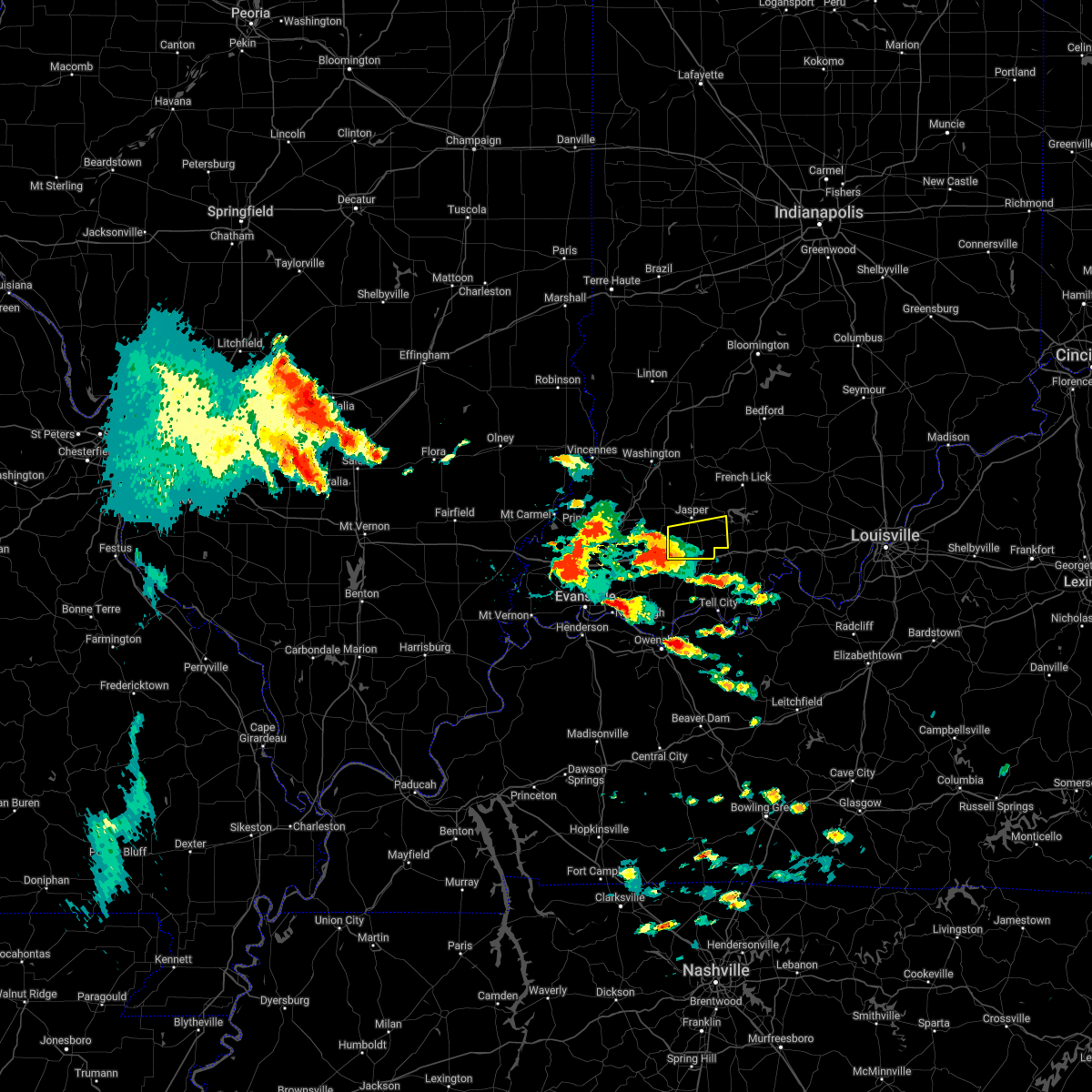 At 222 pm edt, a severe thunderstorm was located 7 miles north of folsomville, moving northeast at 20 mph (radar indicated). Hazards include golf ball size hail and 70 mph wind gusts. People and animals outdoors will be injured. expect hail damage to roofs, siding, windows, and vehicles. expect considerable tree damage. wind damage is also likely to mobile homes, roofs, and outbuildings. Locations impacted include, jasper, huntingburg, ferdinand, holland, celestine, saint marks, millersport, bretzville, mentor and duff. At 222 pm edt, a severe thunderstorm was located 7 miles north of folsomville, moving northeast at 20 mph (radar indicated). Hazards include golf ball size hail and 70 mph wind gusts. People and animals outdoors will be injured. expect hail damage to roofs, siding, windows, and vehicles. expect considerable tree damage. wind damage is also likely to mobile homes, roofs, and outbuildings. Locations impacted include, jasper, huntingburg, ferdinand, holland, celestine, saint marks, millersport, bretzville, mentor and duff.
|
| 5/19/2022 2:01 PM EDT |
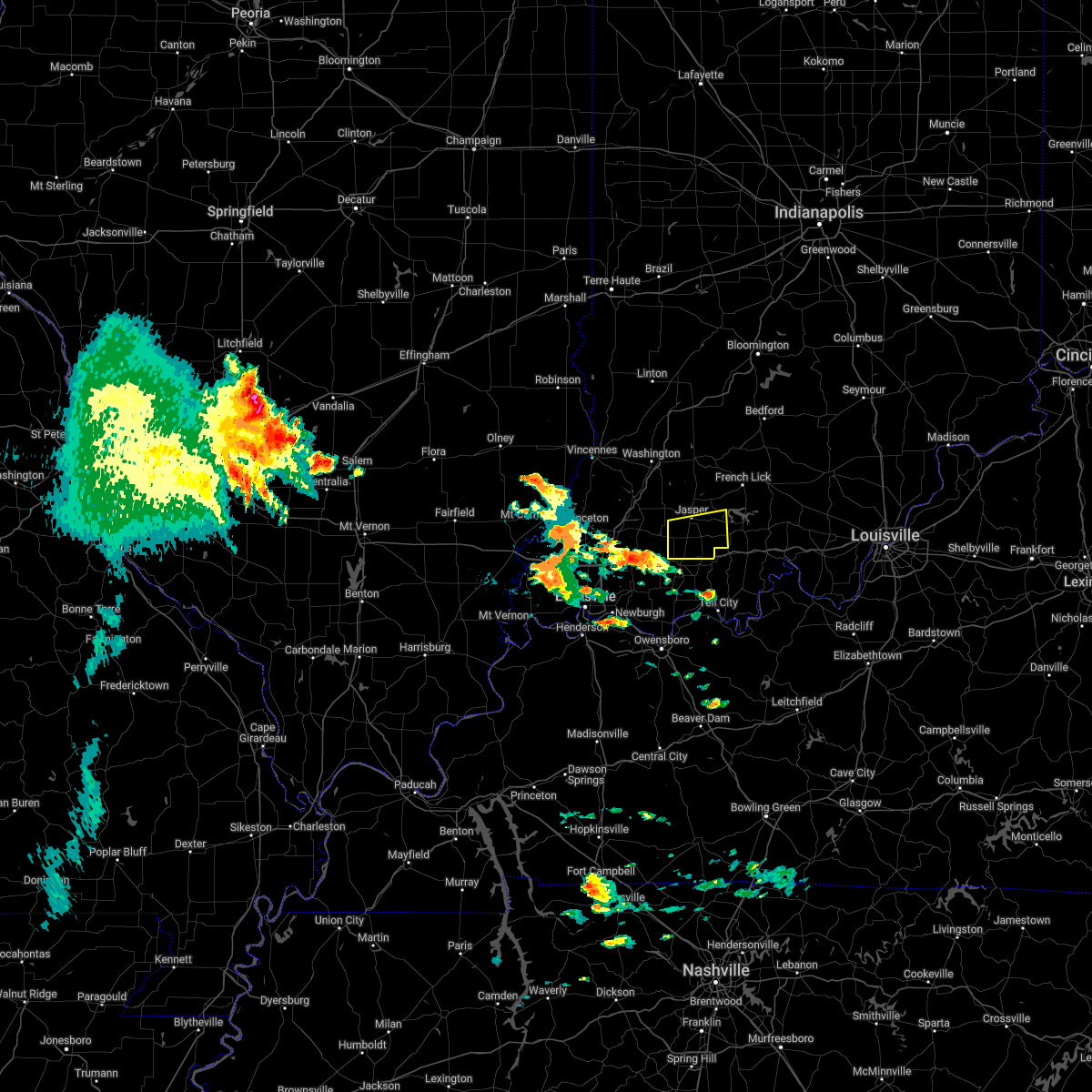 At 201 pm edt, a severe thunderstorm was located over lynnville, moving northeast at 20 mph (radar indicated). Hazards include 70 mph wind gusts and ping pong ball size hail. People and animals outdoors will be injured. expect hail damage to roofs, siding, windows, and vehicles. expect considerable tree damage. wind damage is also likely to mobile homes, roofs, and outbuildings. This severe thunderstorm will remain over mainly rural areas of southern dubois county, including the following locations, celestine, saint marks, millersport, bretzville, huntingburg, mentor, duff, ferdinand, huntingburg airport and saint anthony. At 201 pm edt, a severe thunderstorm was located over lynnville, moving northeast at 20 mph (radar indicated). Hazards include 70 mph wind gusts and ping pong ball size hail. People and animals outdoors will be injured. expect hail damage to roofs, siding, windows, and vehicles. expect considerable tree damage. wind damage is also likely to mobile homes, roofs, and outbuildings. This severe thunderstorm will remain over mainly rural areas of southern dubois county, including the following locations, celestine, saint marks, millersport, bretzville, huntingburg, mentor, duff, ferdinand, huntingburg airport and saint anthony.
|
| 4/13/2022 6:27 PM EDT |
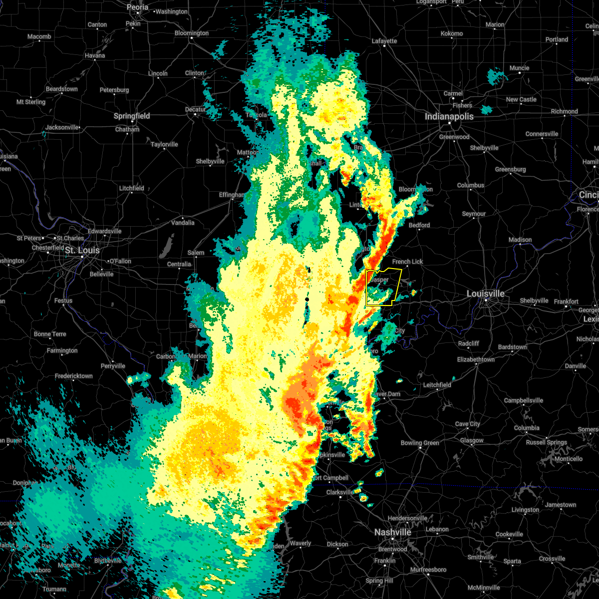 At 627 pm edt, severe thunderstorms were located along a line extending from 7 miles north of shoals to 8 miles east of winslow, moving northeast at 60 mph (radar indicated). Hazards include 60 mph wind gusts and penny size hail. Expect damage to roofs, siding, and trees. these severe thunderstorms will remain over mainly rural areas of dubois county, including the following locations, dubois, hillham, celestine, millersport, bretzville, huntingburg, ellsworth, duff, ferdinand and thales. hail threat, radar indicated max hail size, 0. 75 in wind threat, radar indicated max wind gust, 60 mph. At 627 pm edt, severe thunderstorms were located along a line extending from 7 miles north of shoals to 8 miles east of winslow, moving northeast at 60 mph (radar indicated). Hazards include 60 mph wind gusts and penny size hail. Expect damage to roofs, siding, and trees. these severe thunderstorms will remain over mainly rural areas of dubois county, including the following locations, dubois, hillham, celestine, millersport, bretzville, huntingburg, ellsworth, duff, ferdinand and thales. hail threat, radar indicated max hail size, 0. 75 in wind threat, radar indicated max wind gust, 60 mph.
|
| 3/30/2022 8:42 PM EDT |
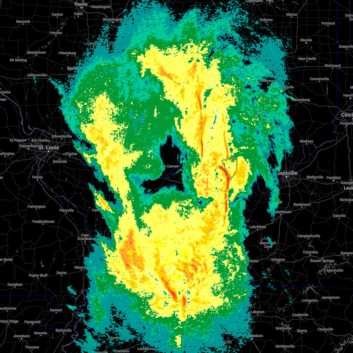 At 842 pm edt, a severe thunderstorm was located 8 miles northeast of jasper, moving northeast at 75 mph (radar indicated). Hazards include 60 mph wind gusts. Expect damage to roofs, siding, and trees. Locations impacted include, dubois, hillham, celestine, saint marks, dubois crossroads, norton, mentor, kellerville, haysville and ellsworth. At 842 pm edt, a severe thunderstorm was located 8 miles northeast of jasper, moving northeast at 75 mph (radar indicated). Hazards include 60 mph wind gusts. Expect damage to roofs, siding, and trees. Locations impacted include, dubois, hillham, celestine, saint marks, dubois crossroads, norton, mentor, kellerville, haysville and ellsworth.
|
| 3/30/2022 8:35 PM EDT |
 At 835 pm edt, a severe thunderstorm was located near jasper, moving northeast at 75 mph (radar indicated). Hazards include 60 mph wind gusts. Expect damage to roofs, siding, and trees. Locations impacted include, jasper, huntingburg, ferdinand, dubois, hillham, celestine, saint marks, bretzville, dubois crossroads and norton. At 835 pm edt, a severe thunderstorm was located near jasper, moving northeast at 75 mph (radar indicated). Hazards include 60 mph wind gusts. Expect damage to roofs, siding, and trees. Locations impacted include, jasper, huntingburg, ferdinand, dubois, hillham, celestine, saint marks, bretzville, dubois crossroads and norton.
|
| 3/30/2022 8:17 PM EDT |
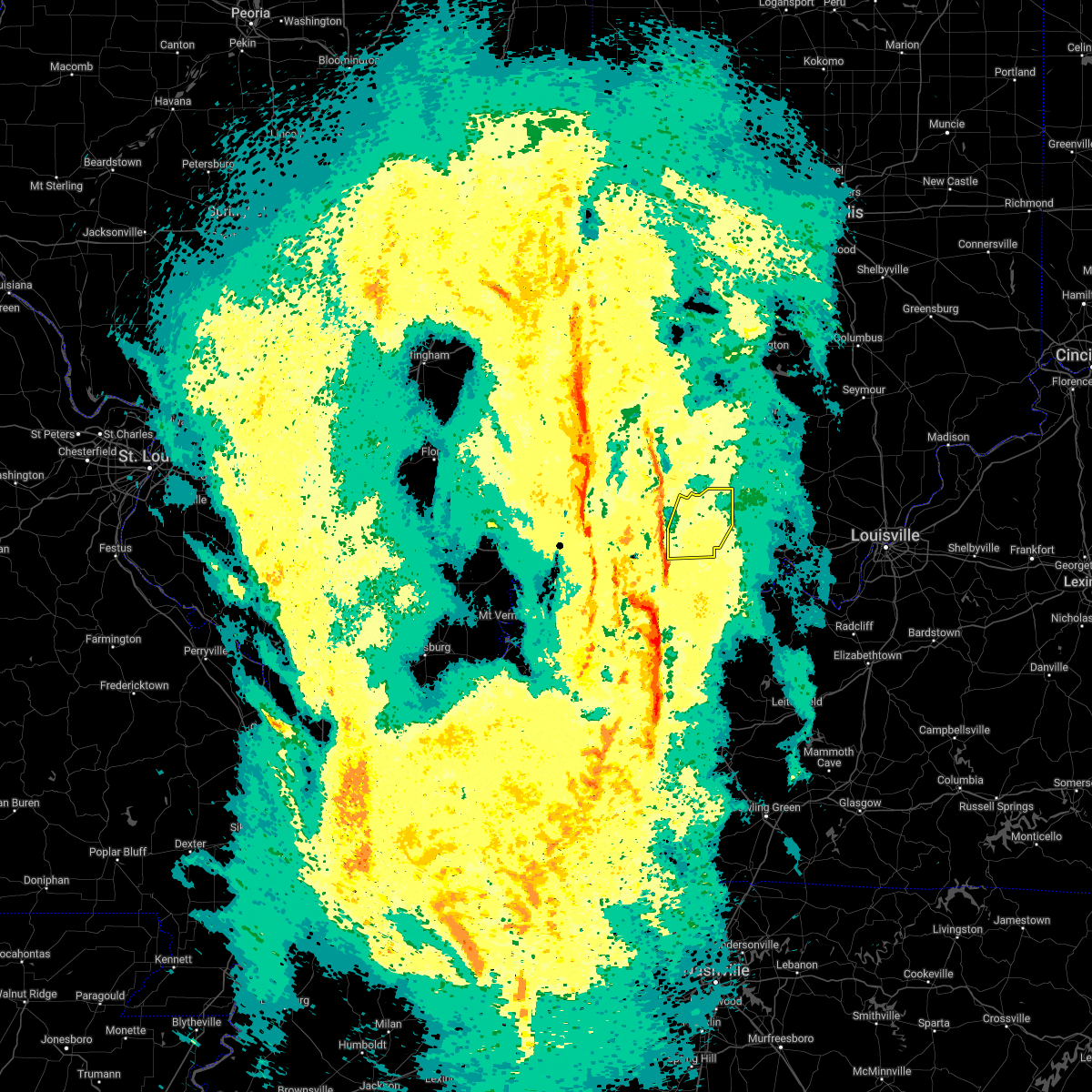 At 817 pm edt, a severe thunderstorm was located 7 miles northwest of grandview, moving northeast at 75 mph (radar indicated). Hazards include 60 mph wind gusts. expect damage to roofs, siding, and trees At 817 pm edt, a severe thunderstorm was located 7 miles northwest of grandview, moving northeast at 75 mph (radar indicated). Hazards include 60 mph wind gusts. expect damage to roofs, siding, and trees
|
| 3/7/2022 3:25 AM EST |
 At 325 am est, a severe thunderstorm was located 10 miles southeast of jasper, moving east at 60 mph (radar indicated). Hazards include 60 mph wind gusts. Expect damage to roofs, siding, and trees. Locations impacted include, english, birdseye, riceville, celestine, ethel, saint marks, taswell, mentor, eckerty and mifflin. At 325 am est, a severe thunderstorm was located 10 miles southeast of jasper, moving east at 60 mph (radar indicated). Hazards include 60 mph wind gusts. Expect damage to roofs, siding, and trees. Locations impacted include, english, birdseye, riceville, celestine, ethel, saint marks, taswell, mentor, eckerty and mifflin.
|
| 3/7/2022 3:14 AM EST |
 At 314 am est, a severe thunderstorm was located 7 miles north of dale, moving east at 65 mph (radar indicated). Hazards include 60 mph wind gusts. expect damage to roofs, siding, and trees At 314 am est, a severe thunderstorm was located 7 miles north of dale, moving east at 65 mph (radar indicated). Hazards include 60 mph wind gusts. expect damage to roofs, siding, and trees
|
| 3/7/2022 3:05 AM EST | Report of a tree in roadway at sr 56 and 500 in dubois county IN, 3.6 miles ESE of Jasper, IN |
| 10/23/2020 5:15 PM EDT |
 At 515 pm edt, a severe thunderstorm was located near jasper, moving east at 30 mph (radar indicated). Hazards include 60 mph wind gusts. Expect damage to roofs, siding, and trees. Locations impacted include, jasper, ferdinand, birdseye, dubois, hillham, celestine, saint marks, bretzville, dubois crossroads and mentor. At 515 pm edt, a severe thunderstorm was located near jasper, moving east at 30 mph (radar indicated). Hazards include 60 mph wind gusts. Expect damage to roofs, siding, and trees. Locations impacted include, jasper, ferdinand, birdseye, dubois, hillham, celestine, saint marks, bretzville, dubois crossroads and mentor.
|
| 10/23/2020 5:14 PM EDT | 30 foot tree limb... 16 inches in diameter... reported down by parks dept... blocking road... but has since been remove in dubois county IN, 0.6 miles S of Jasper, IN |
| 10/23/2020 4:51 PM EDT |
 At 450 pm edt, a severe thunderstorm was located 8 miles southwest of jasper, moving east at 35 mph (radar indicated). Hazards include 60 mph wind gusts and penny size hail. expect damage to roofs, siding, and trees At 450 pm edt, a severe thunderstorm was located 8 miles southwest of jasper, moving east at 35 mph (radar indicated). Hazards include 60 mph wind gusts and penny size hail. expect damage to roofs, siding, and trees
|
| 4/8/2020 9:55 PM EDT | Wind gust reported along sr 16 in dubois county IN, 5.4 miles W of Jasper, IN |
| 4/8/2020 9:54 PM EDT | Power lines downed on 36th stree in dubois county IN, 2.1 miles SSE of Jasper, IN |
| 4/8/2020 9:30 PM EDT |
 At 930 pm edt, severe thunderstorms were located along a line extending from 6 miles north of bloomington to 6 miles northeast of lancaster, moving east at 45 mph (radar indicated). Hazards include 70 mph wind gusts. Expect considerable tree damage. Damage is likely to mobile homes, roofs, and outbuildings. At 930 pm edt, severe thunderstorms were located along a line extending from 6 miles north of bloomington to 6 miles northeast of lancaster, moving east at 45 mph (radar indicated). Hazards include 70 mph wind gusts. Expect considerable tree damage. Damage is likely to mobile homes, roofs, and outbuildings.
|
| 3/28/2020 9:56 PM EDT |
 At 956 pm edt/856 pm cdt/, a severe thunderstorm was located 10 miles east of jasper, moving northeast at 65 mph (radar indicated). Hazards include 70 mph wind gusts. Expect considerable tree damage. Damage is likely to mobile homes, roofs, and outbuildings. At 956 pm edt/856 pm cdt/, a severe thunderstorm was located 10 miles east of jasper, moving northeast at 65 mph (radar indicated). Hazards include 70 mph wind gusts. Expect considerable tree damage. Damage is likely to mobile homes, roofs, and outbuildings.
|
| 3/28/2020 8:37 PM CDT |
 At 937 pm edt/837 pm cdt/, a severe thunderstorm capable of producing a tornado was located near folsomville, moving northeast at 60 mph (radar indicated rotation). Hazards include tornado. Flying debris will be dangerous to those caught without shelter. mobile homes will be damaged or destroyed. damage to roofs, windows, and vehicles will occur. Tree damage is likely. At 937 pm edt/837 pm cdt/, a severe thunderstorm capable of producing a tornado was located near folsomville, moving northeast at 60 mph (radar indicated rotation). Hazards include tornado. Flying debris will be dangerous to those caught without shelter. mobile homes will be damaged or destroyed. damage to roofs, windows, and vehicles will occur. Tree damage is likely.
|
| 3/20/2020 3:57 AM EDT |
 The severe thunderstorm warning for northeastern dubois and orange counties will expire at 400 am edt, the storm which prompted the warning has moved out of the area. therefore, the warning will be allowed to expire. however gusty winds and heavy rain are still possible with this thunderstorm. report severe weather to local law enforcement, post your report to the national weather service louisville facebook page, or tweet your report using hashtag l, m, k, spotter. The severe thunderstorm warning for northeastern dubois and orange counties will expire at 400 am edt, the storm which prompted the warning has moved out of the area. therefore, the warning will be allowed to expire. however gusty winds and heavy rain are still possible with this thunderstorm. report severe weather to local law enforcement, post your report to the national weather service louisville facebook page, or tweet your report using hashtag l, m, k, spotter.
|
| 3/20/2020 3:32 AM EDT |
 At 332 am edt, a severe thunderstorm was located near jasper, moving northeast at 75 mph (radar indicated). Hazards include 60 mph wind gusts and quarter size hail. Hail damage to vehicles is expected. Expect wind damage to roofs, siding, and trees. At 332 am edt, a severe thunderstorm was located near jasper, moving northeast at 75 mph (radar indicated). Hazards include 60 mph wind gusts and quarter size hail. Hail damage to vehicles is expected. Expect wind damage to roofs, siding, and trees.
|
| 10/26/2019 5:45 PM EDT | A tree is across power lines near japser-dubois road and state road 16 in dubois county IN, 2.6 miles W of Jasper, IN |
| 10/26/2019 5:44 PM EDT |
 At 543 pm edt/443 pm cdt/, severe thunderstorms were located along a line extending from near jasper to near brandenburg, moving north at 65 mph (radar indicated). Hazards include 65 mph wind gusts. expect damage to roofs, siding, and trees At 543 pm edt/443 pm cdt/, severe thunderstorms were located along a line extending from near jasper to near brandenburg, moving north at 65 mph (radar indicated). Hazards include 65 mph wind gusts. expect damage to roofs, siding, and trees
|
| 10/26/2019 4:22 PM CDT |
 At 520 pm edt/420 pm cdt/, severe thunderstorms were located along a line extending from near grandview to near hardinsburg, moving north at 70 mph (radar indicated). Hazards include 65 mph wind gusts. expect damage to roofs, siding, and trees At 520 pm edt/420 pm cdt/, severe thunderstorms were located along a line extending from near grandview to near hardinsburg, moving north at 70 mph (radar indicated). Hazards include 65 mph wind gusts. expect damage to roofs, siding, and trees
|
| 8/20/2019 3:30 PM EDT |
 The national weather service in louisville has issued a * severe thunderstorm warning for. southern dubois county in south central indiana. northwestern crawford county in south central indiana. northwestern perry county in south central indiana. Orange county in south central indiana. The national weather service in louisville has issued a * severe thunderstorm warning for. southern dubois county in south central indiana. northwestern crawford county in south central indiana. northwestern perry county in south central indiana. Orange county in south central indiana.
|
| 8/20/2019 3:22 PM EDT |
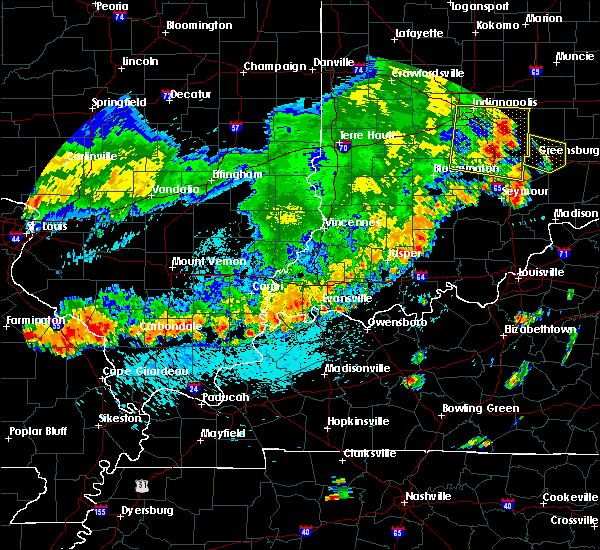 At 322 pm edt, a severe thunderstorm was located 7 miles northeast of jasper, moving east at 15 mph (radar indicated). Hazards include 60 mph wind gusts. expect damage to roofs, siding, and trees At 322 pm edt, a severe thunderstorm was located 7 miles northeast of jasper, moving east at 15 mph (radar indicated). Hazards include 60 mph wind gusts. expect damage to roofs, siding, and trees
|
| 8/20/2019 3:21 PM EDT | Em reports tree down at 15th and leopold in jasper. also reports transformer on fire at 9th and mcarthur in jaspe in dubois county IN, 0.1 miles NE of Jasper, IN |
| 6/30/2019 8:04 PM EDT |
 At 803 pm edt, severe thunderstorms were located along a line extending from 13 miles northeast of english to 6 miles northwest of dale, moving south at 30 mph (radar indicated). Hazards include 60 mph wind gusts. Expect damage to roofs, siding, and trees. Locations impacted include, jasper, english, huntingburg, ferdinand, marengo, holland, birdseye, dubois, hillham, and celestine. At 803 pm edt, severe thunderstorms were located along a line extending from 13 miles northeast of english to 6 miles northwest of dale, moving south at 30 mph (radar indicated). Hazards include 60 mph wind gusts. Expect damage to roofs, siding, and trees. Locations impacted include, jasper, english, huntingburg, ferdinand, marengo, holland, birdseye, dubois, hillham, and celestine.
|
| 6/30/2019 7:45 PM EDT | Power lines down along jasper dubois roa in dubois county IN, 6.2 miles WSW of Jasper, IN |
| 6/30/2019 7:37 PM EDT | Storm damage reported in dubois county IN, 3.9 miles ESE of Jasper, IN |
| 6/30/2019 7:27 PM EDT |
 At 727 pm edt, severe thunderstorms were located along a line extending from 11 miles northeast of paoli to 8 miles east of petersburg, moving south at 30 mph (radar indicated). Hazards include 60 mph wind gusts and penny size hail. expect damage to roofs, siding, and trees At 727 pm edt, severe thunderstorms were located along a line extending from 11 miles northeast of paoli to 8 miles east of petersburg, moving south at 30 mph (radar indicated). Hazards include 60 mph wind gusts and penny size hail. expect damage to roofs, siding, and trees
|
| 6/23/2019 1:48 PM EDT |
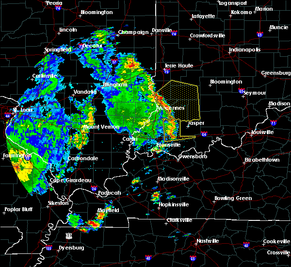 At 147 pm edt, severe thunderstorms were located along a line extending from near washington to near winslow to near folsomville, moving northeast at 45 mph (radar indicated). Hazards include 60 mph wind gusts. expect damage to roofs, siding, and trees At 147 pm edt, severe thunderstorms were located along a line extending from near washington to near winslow to near folsomville, moving northeast at 45 mph (radar indicated). Hazards include 60 mph wind gusts. expect damage to roofs, siding, and trees
|
| 3/14/2019 1:27 PM EDT | Tree across road 231 north of haysvill in dubois county IN, 7 miles SSW of Jasper, IN |
| 3/14/2019 1:18 PM EDT |
 At 118 pm edt, a severe thunderstorm was located near dale, moving northeast at 65 mph (radar indicated). Hazards include 70 mph wind gusts and penny size hail. Expect considerable tree damage. Damage is likely to mobile homes, roofs, and outbuildings. At 118 pm edt, a severe thunderstorm was located near dale, moving northeast at 65 mph (radar indicated). Hazards include 70 mph wind gusts and penny size hail. Expect considerable tree damage. Damage is likely to mobile homes, roofs, and outbuildings.
|
| 3/14/2019 1:09 PM EDT | Quarter sized hail reported 3.6 miles ESE of Jasper, IN, reported at ireland... in. |
| 3/14/2019 1:08 PM EDT |
 At 107 pm edt, a severe thunderstorm capable of producing a tornado was located near jasper, moving northeast at 65 mph (radar indicated rotation). Hazards include tornado and half dollar size hail. Flying debris will be dangerous to those caught without shelter. mobile homes will be damaged or destroyed. damage to roofs, windows, and vehicles will occur. Tree damage is likely. At 107 pm edt, a severe thunderstorm capable of producing a tornado was located near jasper, moving northeast at 65 mph (radar indicated rotation). Hazards include tornado and half dollar size hail. Flying debris will be dangerous to those caught without shelter. mobile homes will be damaged or destroyed. damage to roofs, windows, and vehicles will occur. Tree damage is likely.
|
| 3/14/2019 12:56 PM EDT |
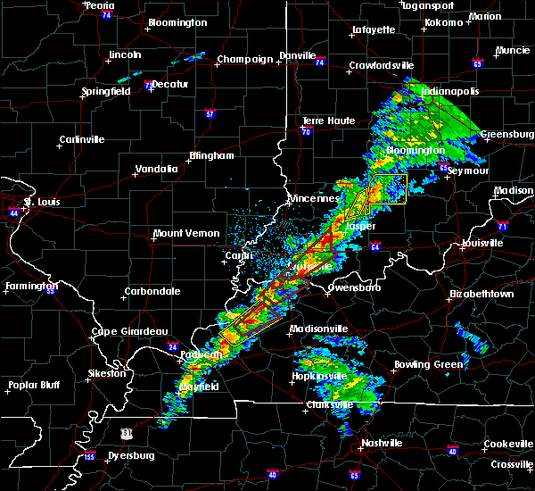 At 1255 pm edt, a severe thunderstorm was located near winslow, moving northeast at 70 mph (radar indicated). Hazards include 60 mph wind gusts and half dollar size hail. Hail damage to vehicles is expected. Expect wind damage to roofs, siding, and trees. At 1255 pm edt, a severe thunderstorm was located near winslow, moving northeast at 70 mph (radar indicated). Hazards include 60 mph wind gusts and half dollar size hail. Hail damage to vehicles is expected. Expect wind damage to roofs, siding, and trees.
|
| 3/14/2019 12:38 PM EDT |
 At 1237 pm edt, a severe thunderstorm was located near jasper, moving northeast at 45 mph (radar indicated). Hazards include 70 mph wind gusts and nickel size hail. Expect considerable tree damage. damage is likely to mobile homes, roofs, and outbuildings. locations impacted include, jasper, thales, cuzco, portersville, ireland, dubois crossroads, kellerville, crystal and haysville. A tornado watch remains in effect until 500 pm edt for south central indiana. At 1237 pm edt, a severe thunderstorm was located near jasper, moving northeast at 45 mph (radar indicated). Hazards include 70 mph wind gusts and nickel size hail. Expect considerable tree damage. damage is likely to mobile homes, roofs, and outbuildings. locations impacted include, jasper, thales, cuzco, portersville, ireland, dubois crossroads, kellerville, crystal and haysville. A tornado watch remains in effect until 500 pm edt for south central indiana.
|
| 3/14/2019 12:30 PM EDT |
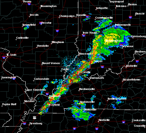 At 1230 pm edt, a severe thunderstorm was located 7 miles east of winslow, moving northeast at 70 mph (radar indicated). Hazards include 70 mph wind gusts and nickel size hail. Expect considerable tree damage. Damage is likely to mobile homes, roofs, and outbuildings. At 1230 pm edt, a severe thunderstorm was located 7 miles east of winslow, moving northeast at 70 mph (radar indicated). Hazards include 70 mph wind gusts and nickel size hail. Expect considerable tree damage. Damage is likely to mobile homes, roofs, and outbuildings.
|
| 2/7/2019 12:57 PM EST |
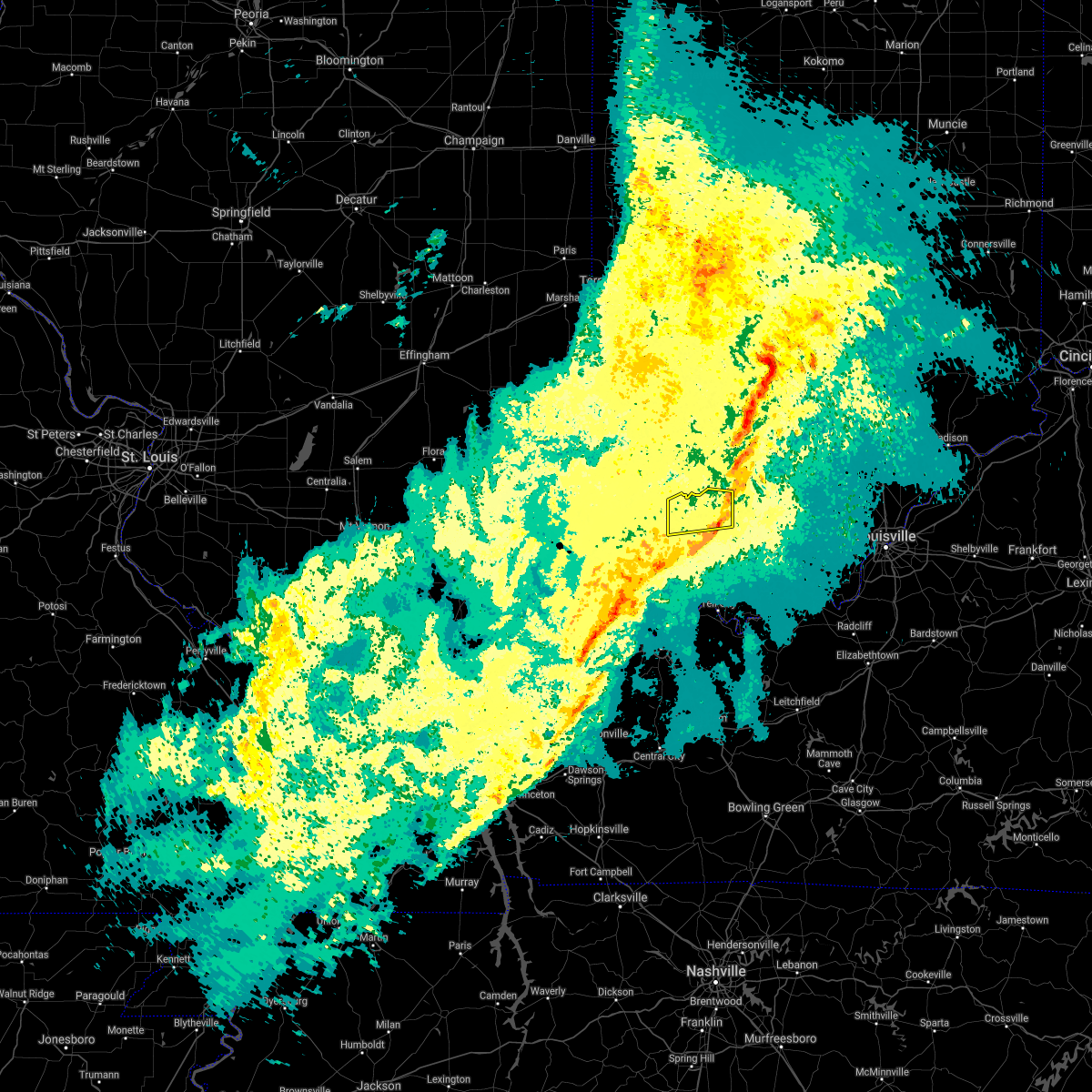 The severe thunderstorm warning for northern dubois county will expire at 100 pm est, the line of storms which prompted the warning will soon move out of the area. therefore, the warning will be allowed to expire. no severe weather reports have been received so far from these storms. report severe weather to local law enforcement, post your report to the national weather service louisville facebook page, or tweet your report using hashtag l, m, k, spotter. The severe thunderstorm warning for northern dubois county will expire at 100 pm est, the line of storms which prompted the warning will soon move out of the area. therefore, the warning will be allowed to expire. no severe weather reports have been received so far from these storms. report severe weather to local law enforcement, post your report to the national weather service louisville facebook page, or tweet your report using hashtag l, m, k, spotter.
|
| 2/7/2019 12:24 PM EST |
 At 1223 pm est, a severe thunderstorm was located near winslow, moving northeast at 65 mph (radar indicated). Hazards include 60 mph wind gusts. expect damage to roofs, siding, and trees At 1223 pm est, a severe thunderstorm was located near winslow, moving northeast at 65 mph (radar indicated). Hazards include 60 mph wind gusts. expect damage to roofs, siding, and trees
|
| 8/15/2018 6:29 PM EDT |
 At 528 pm cdt, severe thunderstorms were located along a line extending from 8 miles east of winslow to near jasper to 8 miles northeast of holiday world, moving northeast at 30 mph. winds gusted to 43 mph as the storm passed the huntingburg airport (radar indicated). Hazards include 60 mph wind gusts. expect damage to roofs, siding, and trees At 528 pm cdt, severe thunderstorms were located along a line extending from 8 miles east of winslow to near jasper to 8 miles northeast of holiday world, moving northeast at 30 mph. winds gusted to 43 mph as the storm passed the huntingburg airport (radar indicated). Hazards include 60 mph wind gusts. expect damage to roofs, siding, and trees
|
| 6/26/2018 12:13 PM EDT |
 The severe thunderstorm warning for dubois county will expire at 1115 am cdt, the storms which prompted the warning have moved out of the area. therefore the warning will be allowed to expire. a severe thunderstorm watch remains in effect until 300 pm cdt for south central indiana. report severe weather to local law enforcement, post your report to the national weather service louisville facebook page, or tweet your report using hashtag l, m, k, spotter. remember, a severe thunderstorm warning still remains in effect for eastern dubois county. The severe thunderstorm warning for dubois county will expire at 1115 am cdt, the storms which prompted the warning have moved out of the area. therefore the warning will be allowed to expire. a severe thunderstorm watch remains in effect until 300 pm cdt for south central indiana. report severe weather to local law enforcement, post your report to the national weather service louisville facebook page, or tweet your report using hashtag l, m, k, spotter. remember, a severe thunderstorm warning still remains in effect for eastern dubois county.
|
| 6/26/2018 12:12 PM EDT | Large tree reported down at lechner ln and 2nd st jasper... i in dubois county IN, 1.2 miles E of Jasper, IN |
| 6/26/2018 12:12 PM EDT |
 The national weather service in louisville has issued a * severe thunderstorm warning for. dubois county in south central indiana. northwestern crawford county in south central indiana. northern perry county in south central indiana. Western orange county in south central indiana. The national weather service in louisville has issued a * severe thunderstorm warning for. dubois county in south central indiana. northwestern crawford county in south central indiana. northern perry county in south central indiana. Western orange county in south central indiana.
|
| 6/26/2018 12:03 PM EDT |
 At 1103 am cdt, severe thunderstorms were located along a line extending from 12 miles southeast of washington to near jasper to dale, moving east at 50 mph (radar indicated). Hazards include 70 mph wind gusts. Expect considerable tree damage. damage is likely to mobile homes, roofs, and outbuildings. Locations impacted include, jasper, huntingburg, ferdinand, holland, dubois, celestine, saint marks, portersville, millersport and bretzville. At 1103 am cdt, severe thunderstorms were located along a line extending from 12 miles southeast of washington to near jasper to dale, moving east at 50 mph (radar indicated). Hazards include 70 mph wind gusts. Expect considerable tree damage. damage is likely to mobile homes, roofs, and outbuildings. Locations impacted include, jasper, huntingburg, ferdinand, holland, dubois, celestine, saint marks, portersville, millersport and bretzville.
|
| 6/26/2018 11:47 AM EDT |
 At 1047 am cdt, severe thunderstorms were located along a line extending from petersburg to 7 miles south of winslow to near folsomville, moving east at 50 mph (radar indicated). Hazards include 70 mph wind gusts. Expect considerable tree damage. Damage is likely to mobile homes, roofs, and outbuildings. At 1047 am cdt, severe thunderstorms were located along a line extending from petersburg to 7 miles south of winslow to near folsomville, moving east at 50 mph (radar indicated). Hazards include 70 mph wind gusts. Expect considerable tree damage. Damage is likely to mobile homes, roofs, and outbuildings.
|
| 5/31/2018 11:22 PM CDT |
 At 1222 am edt/1122 pm cdt/, a severe thunderstorm was located 8 miles northeast of dale, moving east at 50 mph (radar indicated). Hazards include 60 mph wind gusts. expect damage to roofs, siding, and trees At 1222 am edt/1122 pm cdt/, a severe thunderstorm was located 8 miles northeast of dale, moving east at 50 mph (radar indicated). Hazards include 60 mph wind gusts. expect damage to roofs, siding, and trees
|
| 5/31/2018 1:53 PM EDT |
 The severe thunderstorm warning for dubois, crawford, northern perry and orange counties will expire at 200 pm edt/100 pm cdt/, the storms which prompted the warning have moved out of the area. therefore the warning will be allowed to expire. a severe thunderstorm watch remains in effect until 600 pm edt/500 pm cdt/ for south central indiana, and central kentucky. report severe weather to local law enforcement, post your report to the national weather service louisville facebook page, or tweet your report using hashtag l, m, k, spotter. The severe thunderstorm warning for dubois, crawford, northern perry and orange counties will expire at 200 pm edt/100 pm cdt/, the storms which prompted the warning have moved out of the area. therefore the warning will be allowed to expire. a severe thunderstorm watch remains in effect until 600 pm edt/500 pm cdt/ for south central indiana, and central kentucky. report severe weather to local law enforcement, post your report to the national weather service louisville facebook page, or tweet your report using hashtag l, m, k, spotter.
|
| 5/31/2018 1:30 PM EDT |
 At 112 pm edt/1212 pm cdt/, severe thunderstorms were located along a line extending from 8 miles west of shoals to near holiday world, moving east at 55 mph (radar indicated). Hazards include 70 mph wind gusts. Expect considerable tree damage. Damage is likely to mobile homes, roofs, and outbuildings. At 112 pm edt/1212 pm cdt/, severe thunderstorms were located along a line extending from 8 miles west of shoals to near holiday world, moving east at 55 mph (radar indicated). Hazards include 70 mph wind gusts. Expect considerable tree damage. Damage is likely to mobile homes, roofs, and outbuildings.
|
| 5/31/2018 1:13 PM EDT |
 The national weather service in louisville has issued a * severe thunderstorm warning for. dubois county in south central indiana. crawford county in south central indiana. northern perry county in south central indiana. Orange county in south central indiana. The national weather service in louisville has issued a * severe thunderstorm warning for. dubois county in south central indiana. crawford county in south central indiana. northern perry county in south central indiana. Orange county in south central indiana.
|
| 5/31/2018 1:08 PM EDT |
 At 1207 pm cdt, severe thunderstorms were located along a line extending from 9 miles southeast of washington to near grandview, moving east at 55 mph (radar indicated). Hazards include 70 mph wind gusts. Expect considerable tree damage. damage is likely to mobile homes, roofs, and outbuildings. Locations impacted include, jasper, huntingburg, ferdinand, holland, birdseye, dubois, hillham, celestine, millersport and bretzville. At 1207 pm cdt, severe thunderstorms were located along a line extending from 9 miles southeast of washington to near grandview, moving east at 55 mph (radar indicated). Hazards include 70 mph wind gusts. Expect considerable tree damage. damage is likely to mobile homes, roofs, and outbuildings. Locations impacted include, jasper, huntingburg, ferdinand, holland, birdseye, dubois, hillham, celestine, millersport and bretzville.
|
| 5/31/2018 12:53 PM EDT |
 At 1152 am cdt, severe thunderstorms were located along a line extending from near petersburg to 7 miles northwest of rockport, moving east at 55 mph (radar indicated). Hazards include 70 mph wind gusts. Expect considerable tree damage. Damage is likely to mobile homes, roofs, and outbuildings. At 1152 am cdt, severe thunderstorms were located along a line extending from near petersburg to 7 miles northwest of rockport, moving east at 55 mph (radar indicated). Hazards include 70 mph wind gusts. Expect considerable tree damage. Damage is likely to mobile homes, roofs, and outbuildings.
|
| 7/23/2017 7:35 AM EDT |
 At 735 am edt, severe thunderstorms were located along a line extending from 12 miles southwest of shoals to near jasper to near dale, moving east at 55 mph (radar indicated). Hazards include 60 mph wind gusts. Expect damage to roofs, siding, and trees. Locations impacted include, jasper, huntingburg, ferdinand, holland, dubois, celestine, millersport, bretzville, ellsworth and duff. At 735 am edt, severe thunderstorms were located along a line extending from 12 miles southwest of shoals to near jasper to near dale, moving east at 55 mph (radar indicated). Hazards include 60 mph wind gusts. Expect damage to roofs, siding, and trees. Locations impacted include, jasper, huntingburg, ferdinand, holland, dubois, celestine, millersport, bretzville, ellsworth and duff.
|
| 7/23/2017 7:20 AM EDT |
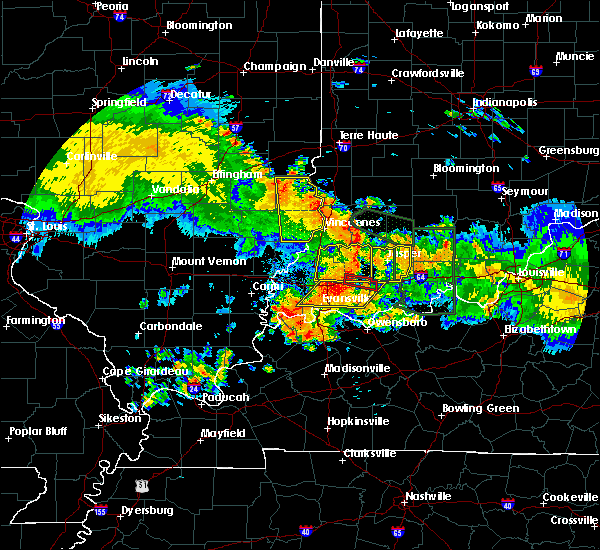 At 719 am edt, severe thunderstorms were located along a line extending from near petersburg to near winslow to near boonville, moving east at 55 mph (radar indicated). Hazards include 60 mph wind gusts. expect damage to roofs, siding, and trees At 719 am edt, severe thunderstorms were located along a line extending from near petersburg to near winslow to near boonville, moving east at 55 mph (radar indicated). Hazards include 60 mph wind gusts. expect damage to roofs, siding, and trees
|
| 7/23/2017 3:12 AM EDT |
 At 312 am edt/212 am cdt/, severe thunderstorms were located along a line extending from 7 miles north of corydon to near dale, moving southeast at 40 mph (radar indicated). Hazards include 60 mph wind gusts. expect damage to roofs, siding, and trees At 312 am edt/212 am cdt/, severe thunderstorms were located along a line extending from 7 miles north of corydon to near dale, moving southeast at 40 mph (radar indicated). Hazards include 60 mph wind gusts. expect damage to roofs, siding, and trees
|
| 6/30/2017 7:42 PM EDT |
 At 742 pm edt, severe thunderstorms were located along a line extending from 9 miles southwest of shoals to near jasper, moving east at 40 mph (radar indicated). Hazards include 60 mph wind gusts. expect damage to roofs, siding, and trees At 742 pm edt, severe thunderstorms were located along a line extending from 9 miles southwest of shoals to near jasper, moving east at 40 mph (radar indicated). Hazards include 60 mph wind gusts. expect damage to roofs, siding, and trees
|
| 5/27/2017 6:51 PM EDT |
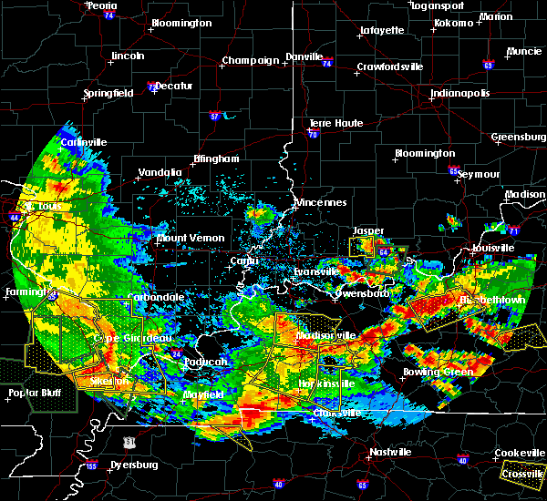 The severe thunderstorm warning for southeastern dubois and northwestern perry counties will expire at 700 pm edt/600 pm cdt/, the storm which prompted the warning has weakened below severe limits, and no longer poses an immediate threat to life or property. therefore the warning will be allowed to expire. a severe thunderstorm watch remains in effect until 1000 pm edt/900 pm cdt/ for south central indiana. report severe weather to local law enforcement, post your report to the national weather service louisville facebook page, or tweet your report using hashtag l, m, k, spotter. The severe thunderstorm warning for southeastern dubois and northwestern perry counties will expire at 700 pm edt/600 pm cdt/, the storm which prompted the warning has weakened below severe limits, and no longer poses an immediate threat to life or property. therefore the warning will be allowed to expire. a severe thunderstorm watch remains in effect until 1000 pm edt/900 pm cdt/ for south central indiana. report severe weather to local law enforcement, post your report to the national weather service louisville facebook page, or tweet your report using hashtag l, m, k, spotter.
|
| 5/27/2017 6:38 PM EDT |
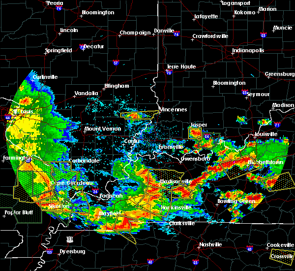 At 638 pm edt/538 pm cdt/, a severe thunderstorm was located 8 miles south of jasper, moving east at 20 mph (radar indicated). Hazards include 60 mph wind gusts and quarter size hail. Hail damage to vehicles is expected. expect wind damage to roofs, siding, and trees. Locations impacted include, jasper, huntingburg, ferdinand, celestine, saint marks, bretzville, mentor, adyeville, huntingburg airport and saint anthony. At 638 pm edt/538 pm cdt/, a severe thunderstorm was located 8 miles south of jasper, moving east at 20 mph (radar indicated). Hazards include 60 mph wind gusts and quarter size hail. Hail damage to vehicles is expected. expect wind damage to roofs, siding, and trees. Locations impacted include, jasper, huntingburg, ferdinand, celestine, saint marks, bretzville, mentor, adyeville, huntingburg airport and saint anthony.
|
| 5/27/2017 6:23 PM EDT |
 At 623 pm edt/523 pm cdt/, a severe thunderstorm was located 7 miles south of jasper, moving east at 20 mph (radar indicated). Hazards include 60 mph wind gusts and quarter size hail. Hail damage to vehicles is expected. Expect wind damage to roofs, siding, and trees. At 623 pm edt/523 pm cdt/, a severe thunderstorm was located 7 miles south of jasper, moving east at 20 mph (radar indicated). Hazards include 60 mph wind gusts and quarter size hail. Hail damage to vehicles is expected. Expect wind damage to roofs, siding, and trees.
|
| 4/29/2017 5:26 AM EDT |
 The severe thunderstorm warning for central dubois county will expire at 530 am edt, the storm which prompted the warning has weakened below severe limits, and no longer poses an immediate threat to life or property. therefore the warning will be allowed to expire. report severe weather to local law enforcement, post your report to the national weather service louisville facebook page, or tweet your report using hashtag l, m, k, spotter. The severe thunderstorm warning for central dubois county will expire at 530 am edt, the storm which prompted the warning has weakened below severe limits, and no longer poses an immediate threat to life or property. therefore the warning will be allowed to expire. report severe weather to local law enforcement, post your report to the national weather service louisville facebook page, or tweet your report using hashtag l, m, k, spotter.
|
| 4/29/2017 5:16 AM EDT |
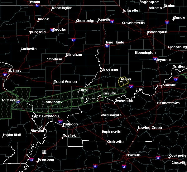 At 516 am edt, a severe thunderstorm was located near jasper, moving northeast at 50 mph (radar indicated). Hazards include 60 mph wind gusts and half dollar size hail. Hail damage to vehicles is expected. expect wind damage to roofs, siding, and trees. Locations impacted include, jasper, huntingburg, dubois, celestine, saint marks, bretzville, dubois crossroads, kellerville, haysville and ellsworth. At 516 am edt, a severe thunderstorm was located near jasper, moving northeast at 50 mph (radar indicated). Hazards include 60 mph wind gusts and half dollar size hail. Hail damage to vehicles is expected. expect wind damage to roofs, siding, and trees. Locations impacted include, jasper, huntingburg, dubois, celestine, saint marks, bretzville, dubois crossroads, kellerville, haysville and ellsworth.
|
| 4/29/2017 4:57 AM EDT |
 At 456 am edt, a severe thunderstorm was located 8 miles northwest of dale, moving northeast at 55 mph (radar indicated). Hazards include 60 mph wind gusts and half dollar size hail. Hail damage to vehicles is expected. Expect wind damage to roofs, siding, and trees. At 456 am edt, a severe thunderstorm was located 8 miles northwest of dale, moving northeast at 55 mph (radar indicated). Hazards include 60 mph wind gusts and half dollar size hail. Hail damage to vehicles is expected. Expect wind damage to roofs, siding, and trees.
|
| 4/28/2017 11:05 PM EDT | Power lines down on 400 north a half mile east of mill stree in dubois county IN, 3.5 miles SSW of Jasper, IN |
| 4/28/2017 10:14 PM EDT |
 At 1013 pm edt, a severe thunderstorm was located 10 miles east of jasper, moving east at 50 mph (radar indicated). Hazards include 60 mph wind gusts and quarter size hail. Hail damage to vehicles is expected. Expect wind damage to roofs, siding, and trees. At 1013 pm edt, a severe thunderstorm was located 10 miles east of jasper, moving east at 50 mph (radar indicated). Hazards include 60 mph wind gusts and quarter size hail. Hail damage to vehicles is expected. Expect wind damage to roofs, siding, and trees.
|
| 4/28/2017 10:03 PM EDT |
 At 1002 pm edt, a severe thunderstorm was located 13 miles west of paoli, moving northeast at 65 mph (radar indicated). Hazards include 60 mph wind gusts and quarter size hail. Hail damage to vehicles is expected. expect wind damage to roofs, siding, and trees. locations impacted include, jasper, huntingburg, french lick, holland, west baden springs, dubois, hillham, celestine, millersport and bretzville. A tornado watch remains in effect until 200 am edt for south central indiana. At 1002 pm edt, a severe thunderstorm was located 13 miles west of paoli, moving northeast at 65 mph (radar indicated). Hazards include 60 mph wind gusts and quarter size hail. Hail damage to vehicles is expected. expect wind damage to roofs, siding, and trees. locations impacted include, jasper, huntingburg, french lick, holland, west baden springs, dubois, hillham, celestine, millersport and bretzville. A tornado watch remains in effect until 200 am edt for south central indiana.
|
| 4/28/2017 9:41 PM EDT |
 At 941 pm edt, a severe thunderstorm was located 7 miles southeast of winslow, moving northeast at 65 mph (radar indicated). Hazards include 60 mph wind gusts and quarter size hail. Hail damage to vehicles is expected. Expect wind damage to roofs, siding, and trees. At 941 pm edt, a severe thunderstorm was located 7 miles southeast of winslow, moving northeast at 65 mph (radar indicated). Hazards include 60 mph wind gusts and quarter size hail. Hail damage to vehicles is expected. Expect wind damage to roofs, siding, and trees.
|
| 3/1/2017 5:33 AM EST |
 At 532 am est, severe thunderstorms were located along a line extending from 8 miles north of paoli to 8 miles south of jasper, moving east at 60 mph (radar indicated). Hazards include 60 mph wind gusts. expect damage to roofs, siding, and trees At 532 am est, severe thunderstorms were located along a line extending from 8 miles north of paoli to 8 miles south of jasper, moving east at 60 mph (radar indicated). Hazards include 60 mph wind gusts. expect damage to roofs, siding, and trees
|
| 3/1/2017 12:18 AM EST |
 At 1218 am est, a severe thunderstorm capable of producing a tornado was located near jasper, moving east at 50 mph (radar indicated rotation). Hazards include tornado and quarter size hail. Flying debris will be dangerous to those caught without shelter. mobile homes will be damaged or destroyed. damage to roofs, windows, and vehicles will occur. tree damage is likely. Locations impacted include, jasper, dubois, ellsworth, hillham, cuzco, thales, dubois crossroads, norton, kellerville and haysville. At 1218 am est, a severe thunderstorm capable of producing a tornado was located near jasper, moving east at 50 mph (radar indicated rotation). Hazards include tornado and quarter size hail. Flying debris will be dangerous to those caught without shelter. mobile homes will be damaged or destroyed. damage to roofs, windows, and vehicles will occur. tree damage is likely. Locations impacted include, jasper, dubois, ellsworth, hillham, cuzco, thales, dubois crossroads, norton, kellerville and haysville.
|
| 3/1/2017 12:10 AM EST | Numerous downed trees blocking roads and a large downed tree on a hom in dubois county IN, 3.9 miles ESE of Jasper, IN |
| 2/28/2017 11:56 PM EST |
 At 1156 pm est, a severe thunderstorm capable of producing a tornado was located over winslow, moving east at 55 mph (radar indicated rotation). Hazards include tornado and quarter size hail. Flying debris will be dangerous to those caught without shelter. mobile homes will be damaged or destroyed. damage to roofs, windows, and vehicles will occur. Tree damage is likely. At 1156 pm est, a severe thunderstorm capable of producing a tornado was located over winslow, moving east at 55 mph (radar indicated rotation). Hazards include tornado and quarter size hail. Flying debris will be dangerous to those caught without shelter. mobile homes will be damaged or destroyed. damage to roofs, windows, and vehicles will occur. Tree damage is likely.
|
| 7/13/2016 8:18 PM EDT |
 At 816 pm edt, severe thunderstorms were located from near jasper moving east at 45 mph. a tree was reported down in celestine by emergency management (trained weather spotters). Hazards include 60 mph wind gusts. Expect damage to roofs. siding. and trees. Locations impacted include, jasper, ferdinand, dubois, kyana, saint anthony, bretzville, celestine, saint marks, crystal and saint henry. At 816 pm edt, severe thunderstorms were located from near jasper moving east at 45 mph. a tree was reported down in celestine by emergency management (trained weather spotters). Hazards include 60 mph wind gusts. Expect damage to roofs. siding. and trees. Locations impacted include, jasper, ferdinand, dubois, kyana, saint anthony, bretzville, celestine, saint marks, crystal and saint henry.
|
| 7/13/2016 8:12 PM EDT | Large tree down at state road 164 and steinbottom roa in dubois county IN, 7.5 miles W of Jasper, IN |
| 7/13/2016 7:43 PM EDT |
 At 742 pm edt, severe thunderstorms were located along a line extending from near petersburg to near lynnville to near chandler, moving east at 45 mph (trained weather spotters). Hazards include 70 mph wind gusts. Expect considerable tree damage. Damage is likely to mobile homes, roofs, and outbuildings. At 742 pm edt, severe thunderstorms were located along a line extending from near petersburg to near lynnville to near chandler, moving east at 45 mph (trained weather spotters). Hazards include 70 mph wind gusts. Expect considerable tree damage. Damage is likely to mobile homes, roofs, and outbuildings.
|
| 7/3/2016 6:05 PM EDT |
 At 605 pm edt, a severe thunderstorm was located near dale, moving northeast at 40 mph (radar indicated). Hazards include 60 mph wind gusts and quarter size hail. Hail damage to vehicles is expected. expect wind damage to roofs, siding, and trees. locations impacted include, huntingburg, ferdinand, holland, saint marks, duff, saint anthony, saint henry, johnsburg, bretzville and maltersville. A tornado watch remains in effect until 1100 pm edt for south central indiana. At 605 pm edt, a severe thunderstorm was located near dale, moving northeast at 40 mph (radar indicated). Hazards include 60 mph wind gusts and quarter size hail. Hail damage to vehicles is expected. expect wind damage to roofs, siding, and trees. locations impacted include, huntingburg, ferdinand, holland, saint marks, duff, saint anthony, saint henry, johnsburg, bretzville and maltersville. A tornado watch remains in effect until 1100 pm edt for south central indiana.
|
| 7/3/2016 5:52 PM EDT |
 At 552 pm edt, severe thunderstorms were located along a line extending from 6 miles east of winslow to near folsomville, moving east at 40 mph (radar indicated). Hazards include 60 mph wind gusts and quarter size hail. Hail damage to vehicles is expected. Expect wind damage to roofs, siding, and trees. At 552 pm edt, severe thunderstorms were located along a line extending from 6 miles east of winslow to near folsomville, moving east at 40 mph (radar indicated). Hazards include 60 mph wind gusts and quarter size hail. Hail damage to vehicles is expected. Expect wind damage to roofs, siding, and trees.
|
| 6/15/2016 7:11 PM EDT |
 The severe thunderstorm warning for southwestern orange and central dubois counties will expire at 715 pm edt, the storms which prompted the warning have moved out of the area. therefore the warning will be allowed to expire. a severe thunderstorm watch remains in effect until 1000 pm edt for south central indiana. The severe thunderstorm warning for southwestern orange and central dubois counties will expire at 715 pm edt, the storms which prompted the warning have moved out of the area. therefore the warning will be allowed to expire. a severe thunderstorm watch remains in effect until 1000 pm edt for south central indiana.
|
| 6/15/2016 7:02 PM EDT |
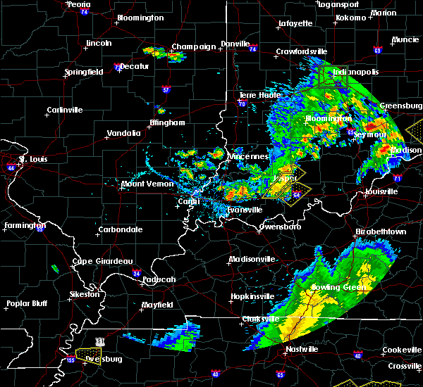 At 702 pm edt, severe thunderstorms were located along a line extending from 8 miles southwest of paoli to near dale, moving southeast at 35 mph (radar indicated). Hazards include 60 mph wind gusts and penny size hail. Expect damage to roofs. siding. and trees. Locations impacted include, jasper, huntingburg, ferdinand, french lick, holland, west baden springs, ellsworth, celestine, schnellville and norton. At 702 pm edt, severe thunderstorms were located along a line extending from 8 miles southwest of paoli to near dale, moving southeast at 35 mph (radar indicated). Hazards include 60 mph wind gusts and penny size hail. Expect damage to roofs. siding. and trees. Locations impacted include, jasper, huntingburg, ferdinand, french lick, holland, west baden springs, ellsworth, celestine, schnellville and norton.
|
| 6/15/2016 6:50 PM EDT | Downed tree blocking the road near the intersection of east county road 300 north and north kellerville roa in dubois county IN, 2.9 miles SW of Jasper, IN |
| 6/15/2016 6:48 PM EDT | Tree and power poll dow in dubois county IN, 0.5 miles WNW of Jasper, IN |
| 6/15/2016 6:42 PM EDT | Trees dow in dubois county IN, 5.5 miles SW of Jasper, IN |
| 6/15/2016 6:25 PM EDT |
 At 624 pm edt, severe thunderstorms were located along a line extending from 6 miles northwest of shoals to near petersburg, moving southeast at 45 mph (radar indicated). Hazards include 60 mph wind gusts and quarter size hail. Hail damage to vehicles is expected. Expect wind damage to roofs, siding, and trees. At 624 pm edt, severe thunderstorms were located along a line extending from 6 miles northwest of shoals to near petersburg, moving southeast at 45 mph (radar indicated). Hazards include 60 mph wind gusts and quarter size hail. Hail damage to vehicles is expected. Expect wind damage to roofs, siding, and trees.
|
| 5/11/2016 7:07 PM EDT |
 At 706 pm edt, severe thunderstorms were located along a line extending from near petersburg to near boonville, moving east at 25 mph (radar indicated). Hazards include 60 mph wind gusts and quarter size hail. Hail damage to vehicles is expected. Expect wind damage to roofs, siding, and trees. At 706 pm edt, severe thunderstorms were located along a line extending from near petersburg to near boonville, moving east at 25 mph (radar indicated). Hazards include 60 mph wind gusts and quarter size hail. Hail damage to vehicles is expected. Expect wind damage to roofs, siding, and trees.
|
| 5/7/2016 7:56 PM CDT |
 At 856 pm edt/756 pm cdt/, severe thunderstorms were located along a line extending from 12 miles northwest of shoals to near stanley, moving east at 35 mph (radar indicated). Hazards include 60 mph wind gusts and quarter size hail. Hail damage to vehicles is expected. Expect wind damage to roofs, siding, and trees. At 856 pm edt/756 pm cdt/, severe thunderstorms were located along a line extending from 12 miles northwest of shoals to near stanley, moving east at 35 mph (radar indicated). Hazards include 60 mph wind gusts and quarter size hail. Hail damage to vehicles is expected. Expect wind damage to roofs, siding, and trees.
|
| 5/7/2016 8:48 PM EDT | Trees down in the cit in dubois county IN, 0.1 miles NE of Jasper, IN |
| 5/7/2016 7:42 PM CDT |
 At 842 pm edt/742 pm cdt/, severe thunderstorms were located along a line extending from 9 miles north of jasper to 7 miles north of hartford, moving southeast at 60 mph (trained weather spotters. wind gusts estimated near 60 mph were reported near ireland). Hazards include 60 mph wind gusts and quarter size hail. Hail damage to vehicles is expected. expect wind damage to roofs, siding, and trees. Locations impacted include, jasper, tell city, hawesville, huntingburg, ferdinand, french lick, lewisport, cannelton, cloverport and leopold. At 842 pm edt/742 pm cdt/, severe thunderstorms were located along a line extending from 9 miles north of jasper to 7 miles north of hartford, moving southeast at 60 mph (trained weather spotters. wind gusts estimated near 60 mph were reported near ireland). Hazards include 60 mph wind gusts and quarter size hail. Hail damage to vehicles is expected. expect wind damage to roofs, siding, and trees. Locations impacted include, jasper, tell city, hawesville, huntingburg, ferdinand, french lick, lewisport, cannelton, cloverport and leopold.
|
| 5/7/2016 8:35 PM EDT | Storm damage reported in dubois county IN, 3.7 miles ENE of Jasper, IN |
| 5/7/2016 8:33 PM EDT | Power outages in irelan in dubois county IN, 7.6 miles SSE of Jasper, IN |
| 5/7/2016 7:22 PM CDT |
 At 821 pm edt/721 pm cdt/, severe thunderstorms were located along a line extending from near washington to near masonville, moving southeast at 60 mph. these storms have a history of producing wind damage (radar indicated). Hazards include 60 mph wind gusts and quarter size hail. Hail damage to vehicles is expected. Expect wind damage to roofs, siding, and trees. At 821 pm edt/721 pm cdt/, severe thunderstorms were located along a line extending from near washington to near masonville, moving southeast at 60 mph. these storms have a history of producing wind damage (radar indicated). Hazards include 60 mph wind gusts and quarter size hail. Hail damage to vehicles is expected. Expect wind damage to roofs, siding, and trees.
|
| 5/7/2016 7:46 PM EDT |
 At 746 pm edt, a severe thunderstorm was located 9 miles southeast of washington, moving southeast at 40 mph (radar indicated). Hazards include 60 mph wind gusts and half dollar size hail. Hail damage to vehicles is expected. Expect wind damage to roofs, siding, and trees. At 746 pm edt, a severe thunderstorm was located 9 miles southeast of washington, moving southeast at 40 mph (radar indicated). Hazards include 60 mph wind gusts and half dollar size hail. Hail damage to vehicles is expected. Expect wind damage to roofs, siding, and trees.
|
| 4/26/2016 7:44 PM EDT |
 At 744 pm edt, severe thunderstorms were located along a line extending from 11 miles south of shoals to near dale, moving northeast at 25 mph (radar indicated). Hazards include 60 mph wind gusts and quarter size hail. Hail damage to vehicles is expected. expect wind damage to roofs, siding, and trees. Locations impacted include, jasper, huntingburg, ferdinand, dubois, kyana, saint anthony, bretzville, celestine, saint marks and crystal. At 744 pm edt, severe thunderstorms were located along a line extending from 11 miles south of shoals to near dale, moving northeast at 25 mph (radar indicated). Hazards include 60 mph wind gusts and quarter size hail. Hail damage to vehicles is expected. expect wind damage to roofs, siding, and trees. Locations impacted include, jasper, huntingburg, ferdinand, dubois, kyana, saint anthony, bretzville, celestine, saint marks and crystal.
|
| 4/26/2016 7:07 PM EDT |
 At 706 pm edt, severe thunderstorms were located along a line extending from near petersburg to near folsomville, moving east at 40 mph (radar indicated). Hazards include 60 mph wind gusts and quarter size hail. Hail damage to vehicles is expected. Expect wind damage to roofs, siding, and trees. At 706 pm edt, severe thunderstorms were located along a line extending from near petersburg to near folsomville, moving east at 40 mph (radar indicated). Hazards include 60 mph wind gusts and quarter size hail. Hail damage to vehicles is expected. Expect wind damage to roofs, siding, and trees.
|
| 3/27/2016 8:19 PM EDT |
 At 818 pm edt, a severe thunderstorm was located 11 miles northeast of jasper, moving northeast at 55 mph (radar indicated). Hazards include quarter size hail. damage to vehicles is expected At 818 pm edt, a severe thunderstorm was located 11 miles northeast of jasper, moving northeast at 55 mph (radar indicated). Hazards include quarter size hail. damage to vehicles is expected
|
| 12/23/2015 5:42 PM EST | At 542 pm est, a severe thunderstorm was located 7 miles east of jasper, moving northeast at 80 mph (radar indicated). Hazards include 60 mph wind gusts and penny size hail. Expect damage to roofs. Siding and trees. |
| 12/23/2015 3:03 PM EST | Wind gust from jasper middle school in dubois county IN, 0.1 miles NE of Jasper, IN |
| 12/23/2015 3:03 PM EST | At 303 pm est, severe thunderstorms were located along a line extending from near shoals to near dale, moving northeast at 55 mph (public weather station at jasper middle school reported 59 mph wind gust). Hazards include 60 mph wind gusts. Expect damage to roofs. siding and trees. locations impacted include, jasper, huntingburg, ferdinand, holland, millersport, celestine, ireland, schnellville, cuzco, haysville, saint henry, duff, thales, huntingburg airport, dubois, kyana, saint anthony, bretzville, saint marks and crystal. A tornado watch remains in effect until 900 pm est for south central indiana. |
| 12/23/2015 2:38 PM EST | At 238 pm est, severe thunderstorms were located along a line extending from 7 miles east of petersburg to near folsomville, moving east at 55 mph (radar indicated). Hazards include 60 mph wind gusts. Expect damage to roofs. Siding and trees. |
| 8/15/2015 6:36 PM EDT |
 At 536 pm cdt, a severe thunderstorm was located near jasper, moving southwest at 15 mph (radar indicated). Hazards include 60 mph wind gusts and quarter size hail. Hail damage to vehicles is expected. expect wind damage to roofs, siding and trees. Locations impacted include, huntingburg, ferdinand, birdseye, kyana, saint anthony, mentor, bretzville, celestine, schnellville, saint marks, saint henry, maltersville and huntingburg airport. At 536 pm cdt, a severe thunderstorm was located near jasper, moving southwest at 15 mph (radar indicated). Hazards include 60 mph wind gusts and quarter size hail. Hail damage to vehicles is expected. expect wind damage to roofs, siding and trees. Locations impacted include, huntingburg, ferdinand, birdseye, kyana, saint anthony, mentor, bretzville, celestine, schnellville, saint marks, saint henry, maltersville and huntingburg airport.
|
| 8/15/2015 6:21 PM EDT |
 At 521 pm cdt, a severe thunderstorm was located 9 miles east of jasper, moving southwest at 20 mph (radar indicated). Hazards include 60 mph wind gusts and quarter size hail. Hail damage to vehicles is expected. Expect wind damage to roofs, siding and trees. At 521 pm cdt, a severe thunderstorm was located 9 miles east of jasper, moving southwest at 20 mph (radar indicated). Hazards include 60 mph wind gusts and quarter size hail. Hail damage to vehicles is expected. Expect wind damage to roofs, siding and trees.
|
| 5/30/2015 6:54 PM EDT | The severe thunderstorm warning for northwestern dubois county will expire at 700 pm edt, the storm which prompted the warning has moved out of the warned area. |
| 5/30/2015 6:45 PM EDT | At 643 pm edt, a severe thunderstorm was located 10 miles north of jasper, moving north at 45 mph (radar indicated). Hazards include 60 mph wind gusts. Expect damage to roofs. siding and trees. Locations impacted include haysville and portersville. |
| 5/30/2015 6:37 PM EDT | At 636 pm edt, a severe thunderstorm was located 7 miles northwest of jasper, moving north at 45 mph (radar indicated). Hazards include 60 mph wind gusts. Expect damage to roofs. Siding and trees. |
| 4/10/2015 1:30 AM EDT | Jasper middle schoo in dubois county IN, 0.5 miles WNW of Jasper, IN |
| 4/10/2015 1:28 AM EDT | A severe thunderstorm warning remains in effect for eastern dubois county until 135 am edt. at 127 am edt. a severe thunderstorm was located 6 miles east of jasper. and moving northeast at 55 mph. this produced a 52 mph wind gust in huntingburg at 122 am. hazard. 60 mph wind gusts. |
| 4/10/2015 1:25 AM EDT | A few trees down around the jasper are in dubois county IN, 2.6 miles W of Jasper, IN |
| 4/10/2015 1:20 AM EDT | A severe thunderstorm warning remains in effect for dubois county until 135 am edt. at 116 am edt. a severe thunderstorm was located near huntingburg. and moving northeast at 55 mph. this produced 50 mph winds in ireland at 114 am. hazard. 60 mph wind gusts. |
| 4/10/2015 12:53 AM EDT | The national weather service in louisville has issued a * severe thunderstorm warning for. dubois county in south central indiana. until 135 am edt * at 1251 am edt. a severe thunderstorm was located 10 miles southwest of jasper. And moving northeast at 55 mph. |
| 4/8/2015 4:45 PM EDT | The national weather service in louisville has issued a * severe thunderstorm warning for. northern dubois county in south central indiana. until 525 pm edt * at 443 pm edt. a severe thunderstorm was located 9 miles south of washington. And moving southeast at 30 mph. |
| 4/7/2015 3:53 PM EDT | The national weather service in louisville has issued a * severe thunderstorm warning for. northwestern crawford county in south central indiana. central dubois county in south central indiana. until 425 pm edt * at 350 pm edt. a severe thunderstorm was located near jasper. And. |
| 6/26/2013 8:45 PM EDT | Numeous trees dow in dubois county IN, 3.4 miles E of Jasper, IN |
| 8/16/2012 7:25 PM EDT | Tree reported down across hwy. 231 near hayesvill in dubois county IN, 6.2 miles S of Jasper, IN |
| 7/27/2012 7:54 PM EDT | Dispatch reports trees down in northeastern jasper in dubois county IN, 2 miles SW of Jasper, IN |
| 7/27/2012 7:50 PM EDT | Tree reported down in backyard via facebook in dubois county IN, 0.1 miles NE of Jasper, IN |
| 7/19/2012 7:04 PM EDT | Power lines dow in dubois county IN, 0.1 miles NE of Jasper, IN |
| 7/1/2012 7:07 PM EDT | Numerous trees down in dubois county IN, 6.4 miles SSE of Jasper, IN |
| 7/1/2012 6:30 PM EDT | Trees and power lines down in the city in dubois county IN, 0.1 miles NE of Jasper, IN |
| 5/4/2012 3:35 PM EDT | Few trees down southeast side of jaspe in dubois county IN, 0.1 miles NE of Jasper, IN |
| 5/4/2012 3:33 PM EDT | Some trees reported dow in dubois county IN, 3.9 miles ESE of Jasper, IN |
| 5/4/2012 3:32 PM EDT | Storm damage reported in dubois county IN, 3.9 miles ESE of Jasper, IN |
| 3/14/2012 8:44 PM EDT | Quarter sized hail reported 0.1 miles NE of Jasper, IN |
| 3/2/2012 2:40 PM EST | Golf Ball sized hail reported 7.7 miles NW of Jasper, IN |
| 3/2/2012 2:23 PM EST | Quarter sized hail reported 3.9 miles ESE of Jasper, IN |
| 1/1/0001 12:00 AM | Storm damage reported in dubois county IN, 3.1 miles ESE of Jasper, IN |
| 1/1/0001 12:00 AM | Quarter sized hail reported 0.1 miles NE of Jasper, IN |
| 1/1/0001 12:00 AM | Tree down in dubois county IN, 3.9 miles ESE of Jasper, IN |
| 1/1/0001 12:00 AM | Outbuildings demolished and trees down in dubois county IN, 6.2 miles S of Jasper, IN |
| 1/1/0001 12:00 AM | Widespread power outages reported in jaspe in dubois county IN, 0.1 miles NE of Jasper, IN |
| 1/1/0001 12:00 AM | Updated...numerous trees and power lines down. widespread power outages reported in jaspe in dubois county IN, 0.1 miles NE of Jasper, IN |
| 1/1/0001 12:00 AM | Golf Ball sized hail reported 3.4 miles E of Jasper, IN |
| 1/1/0001 12:00 AM | Trees down in jasper along with 60 mile an hour winds in dubois county IN, 0.1 miles NE of Jasper, IN |
| 1/1/0001 12:00 AM | Quarter sized hail reported 7.7 miles NW of Jasper, IN |
| 1/1/0001 12:00 AM | Overturned mobile homes reported in the city of jaspe in dubois county IN, 0.1 miles NE of Jasper, IN |
| 1/1/0001 12:00 AM | Numerous trees and power lines down across the cit in dubois county IN, 0.1 miles NE of Jasper, IN |
| 1/1/0001 12:00 AM | Measured at jasper middle school in dubois county IN, 0.1 miles NE of Jasper, IN |
| 1/1/0001 12:00 AM | Quarter sized hail reported 3.9 miles ESE of Jasper, IN |
| 1/1/0001 12:00 AM | Power outages in jasper. reported by wave and weh in dubois county IN, 0.1 miles NE of Jasper, IN |
| 1/1/0001 12:00 AM | Storm damage reported in dubois county IN, 3.9 miles ESE of Jasper, IN |
Hail Maps for Jasper, IN


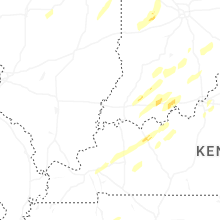
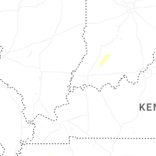


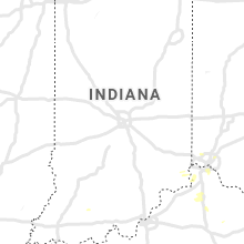


Connect with Interactive Hail Maps