

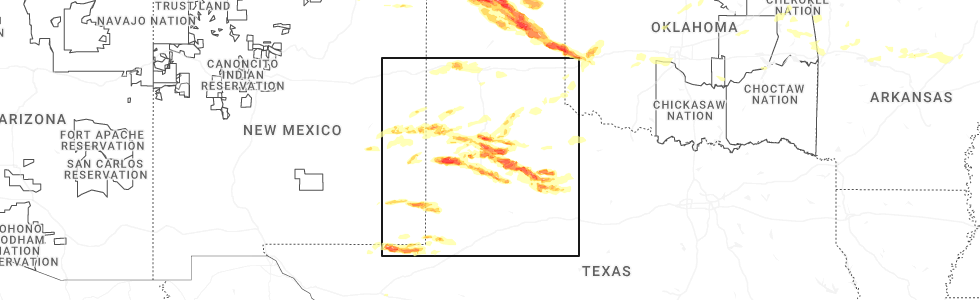
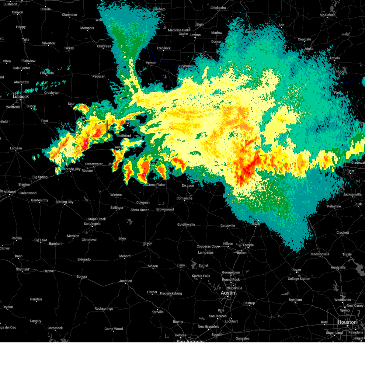
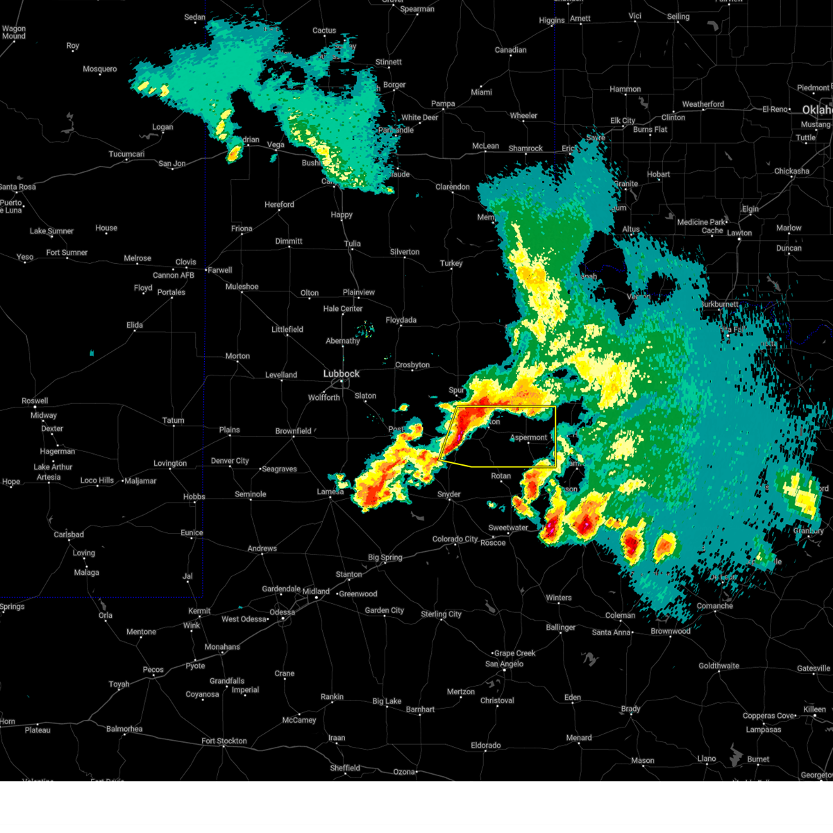
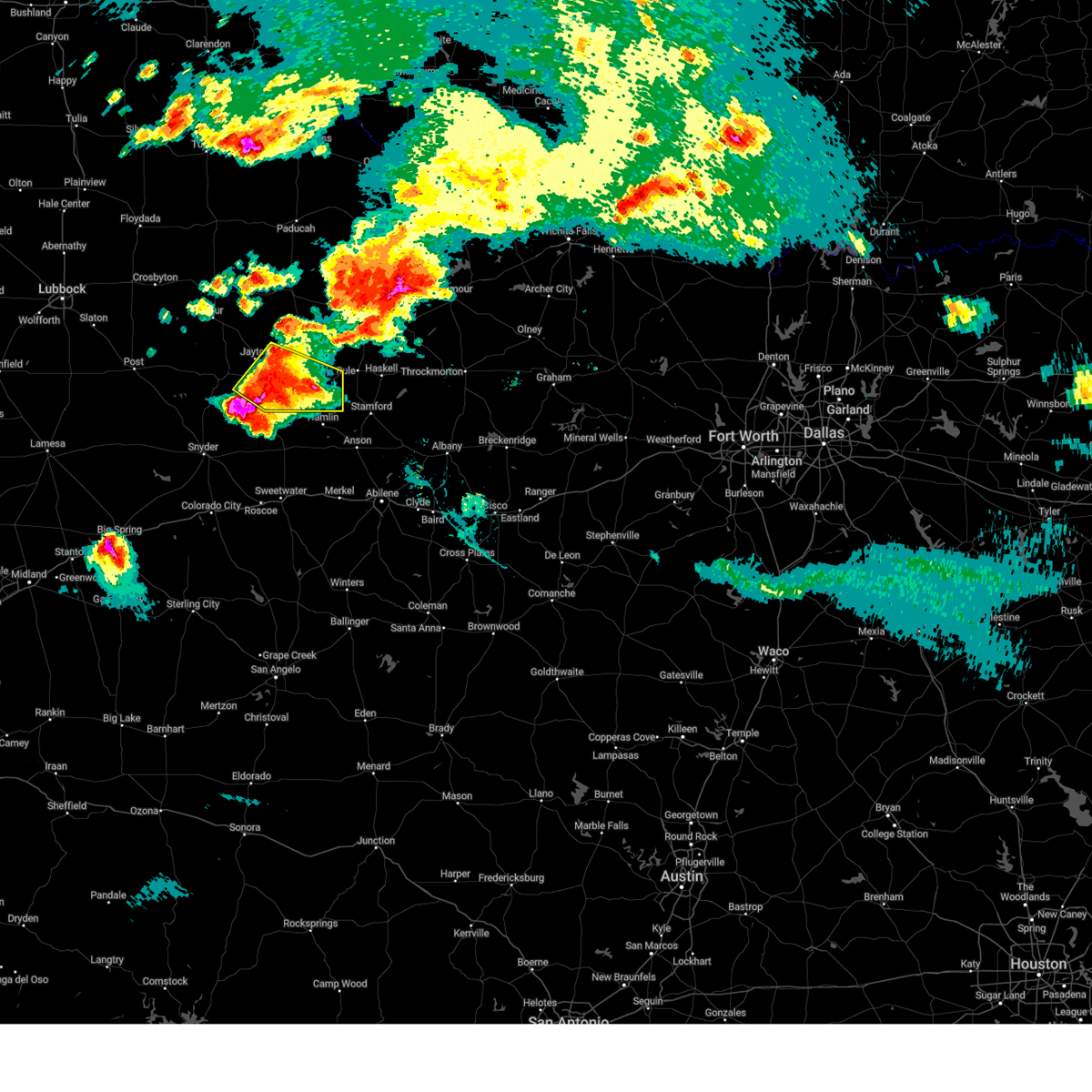
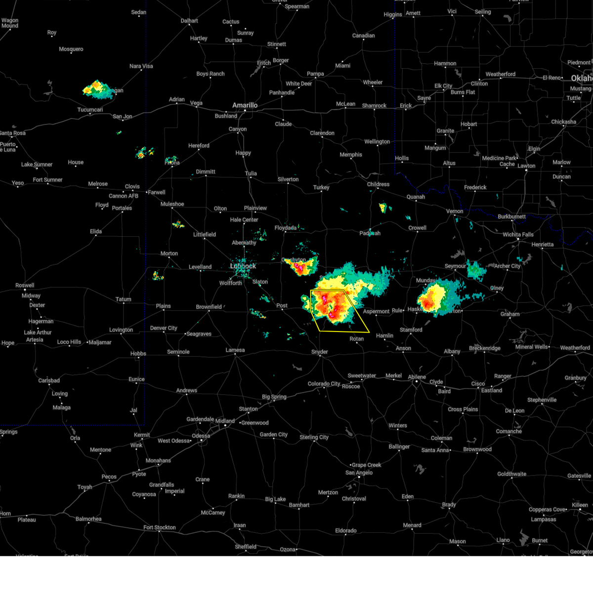
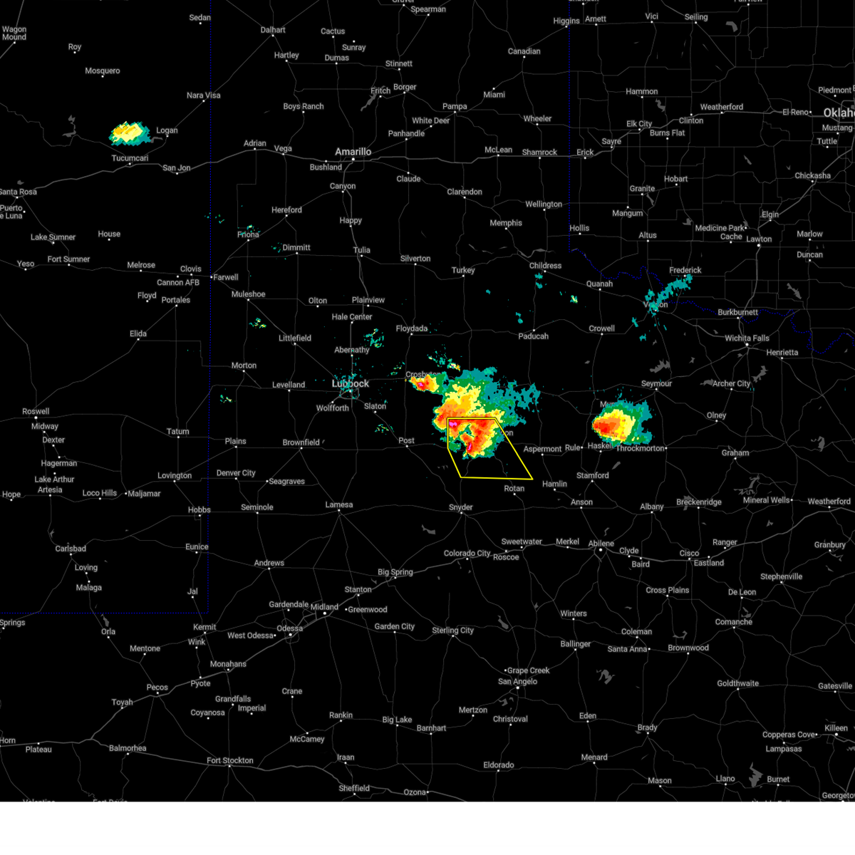
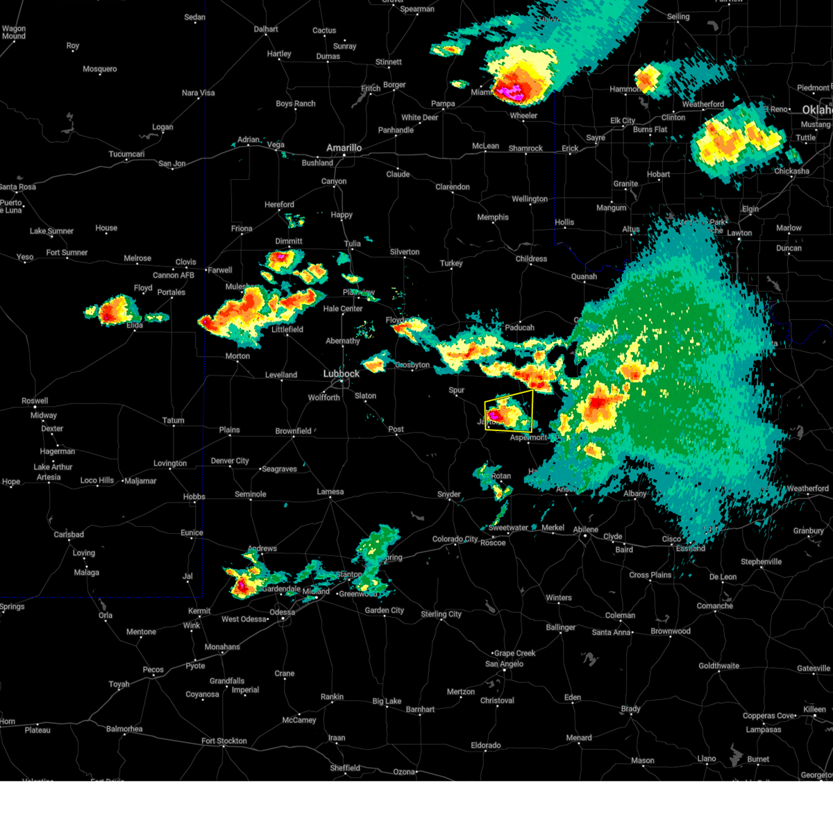
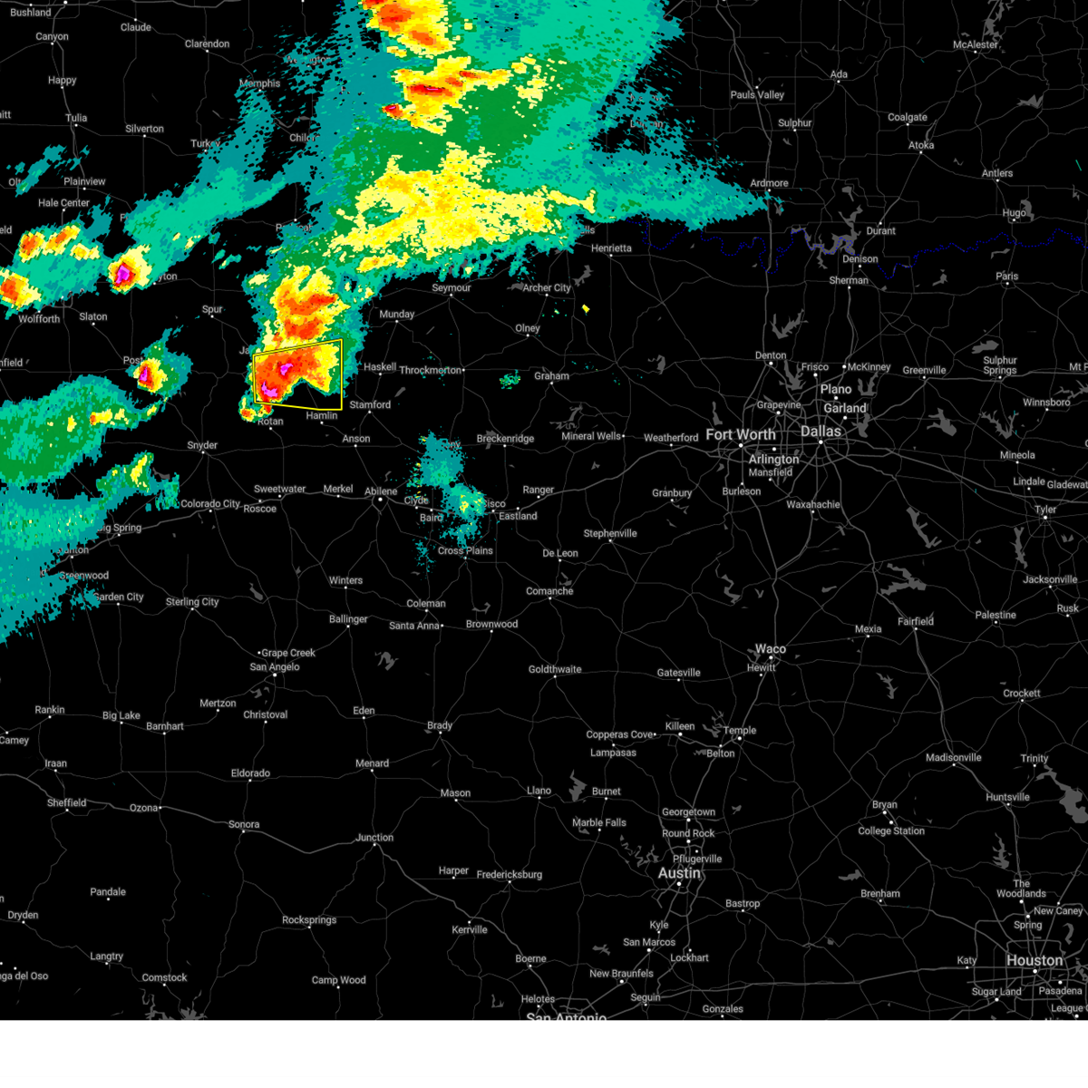
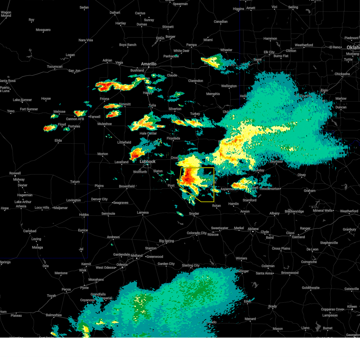
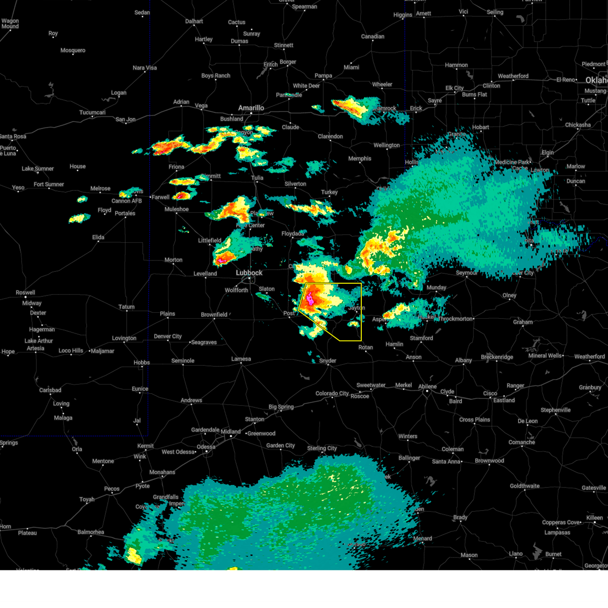
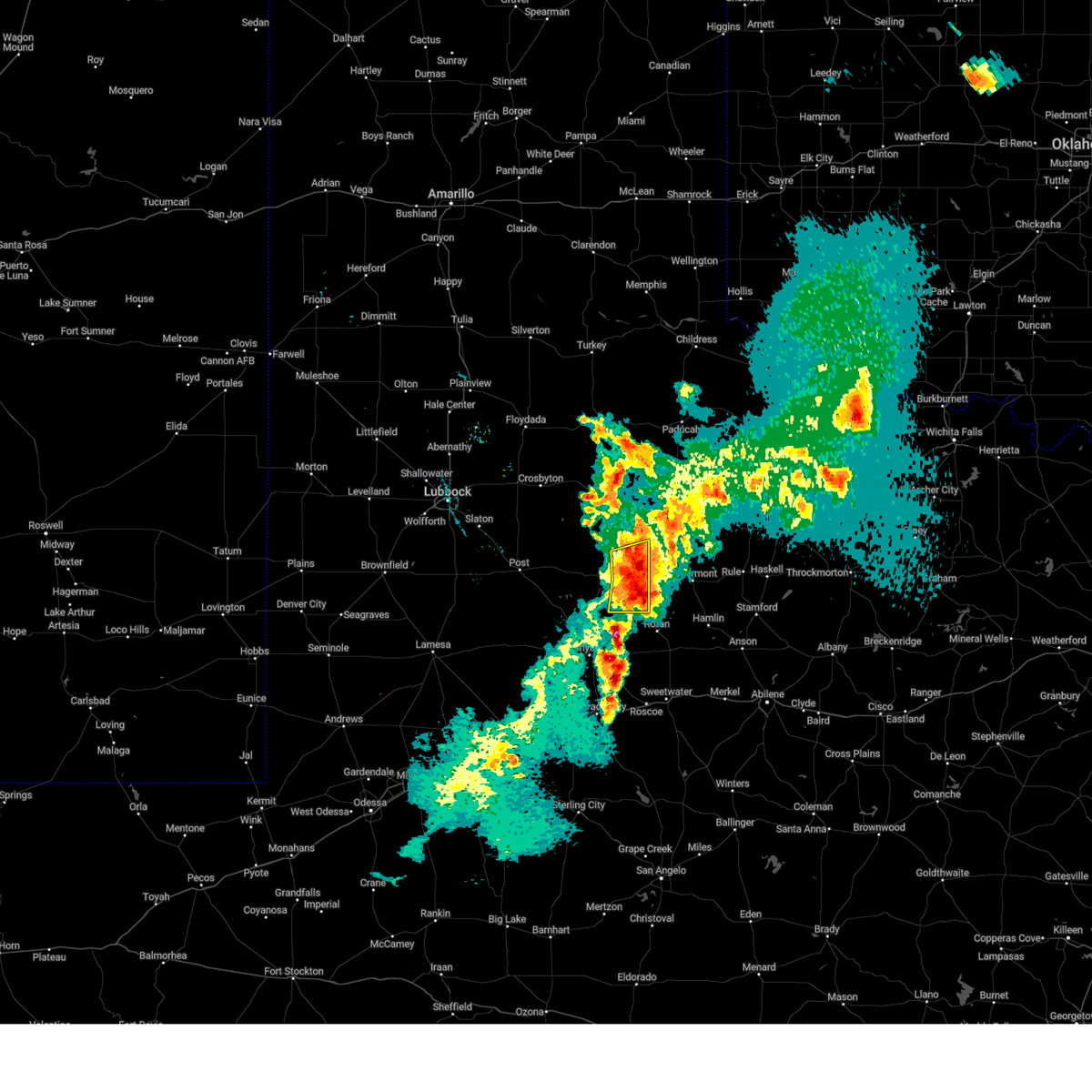
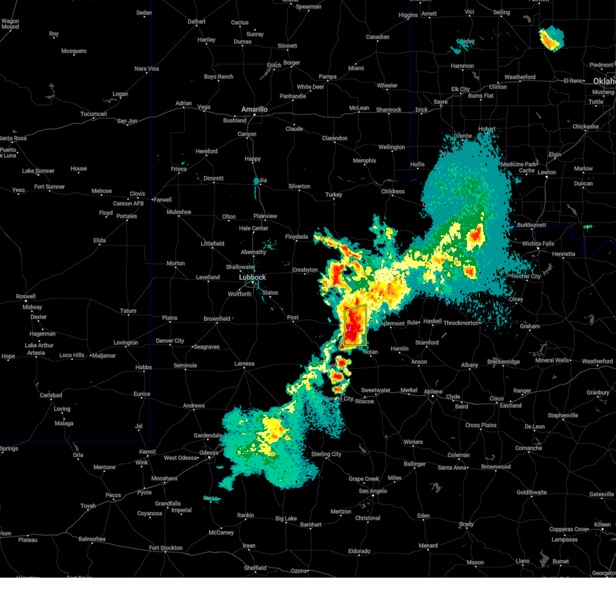
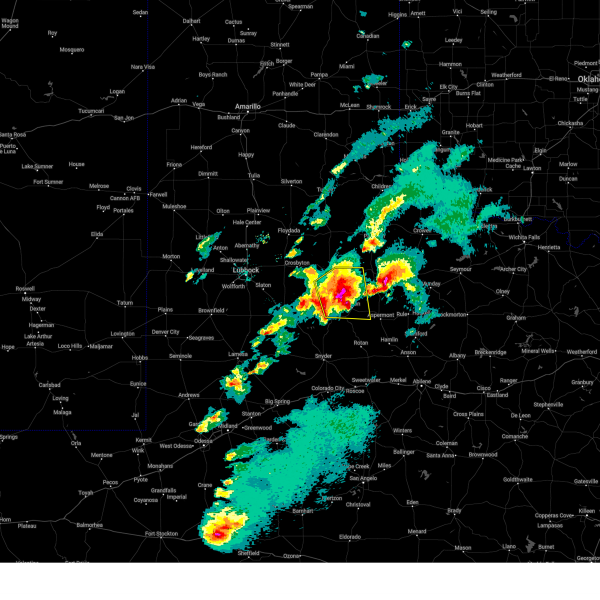
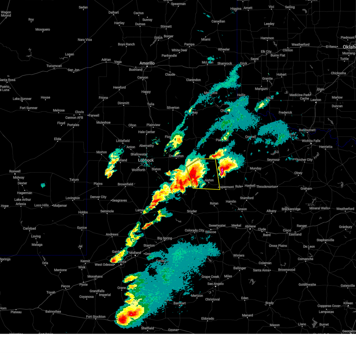
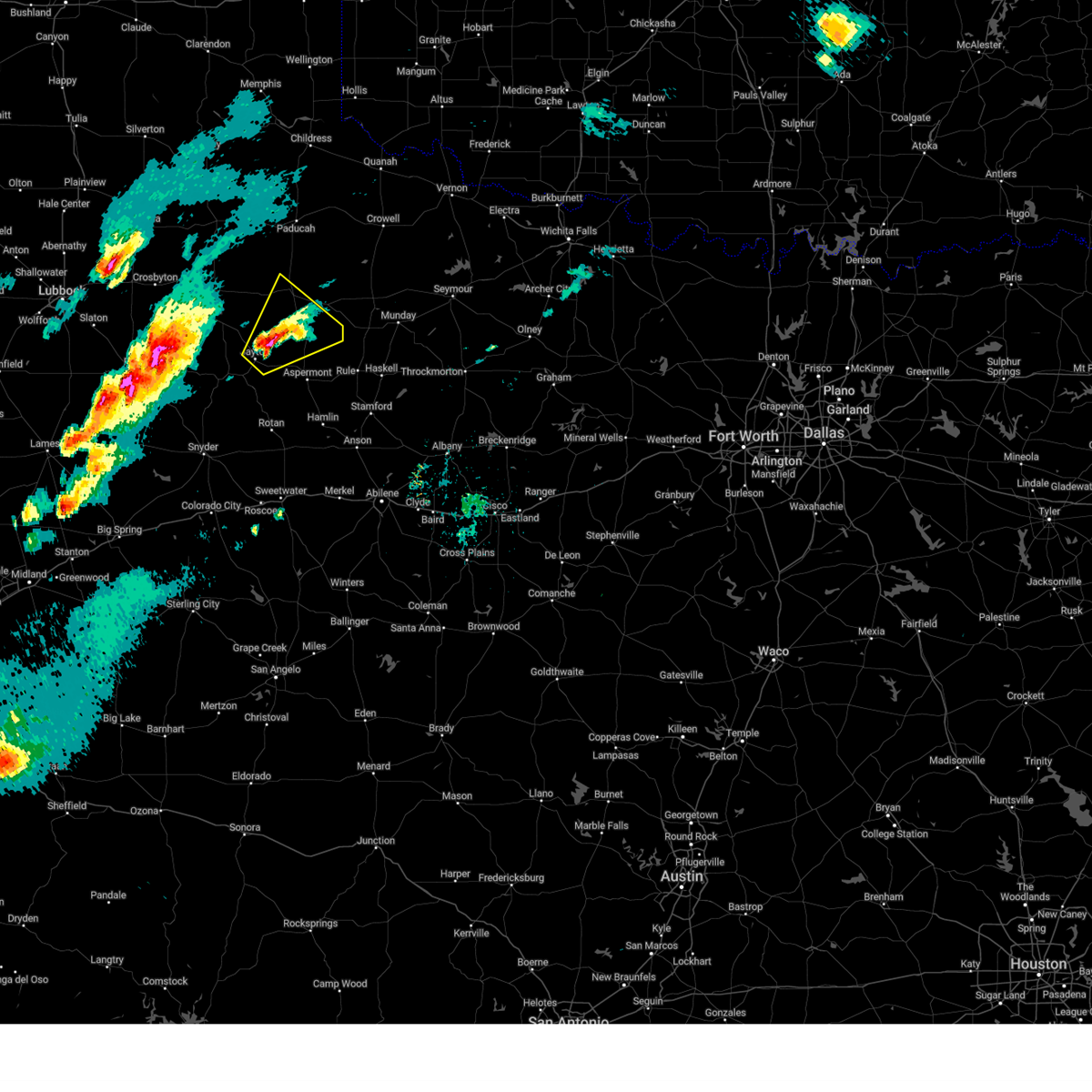
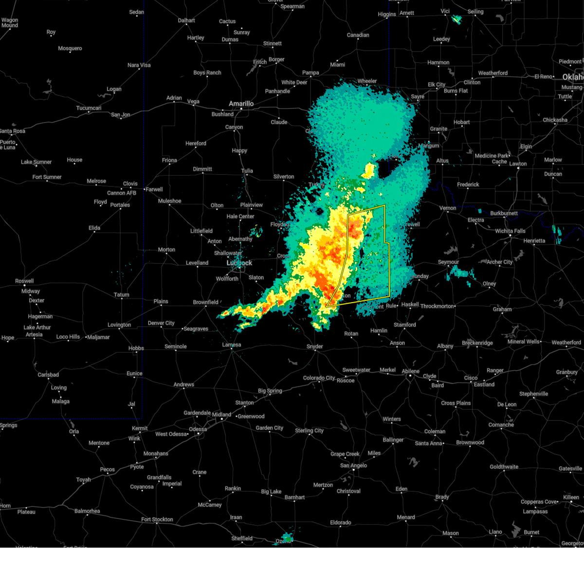
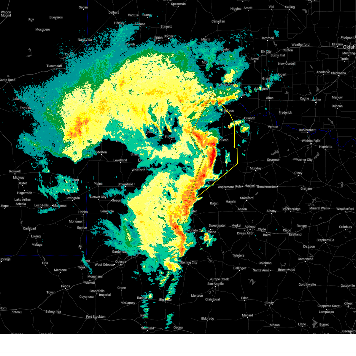
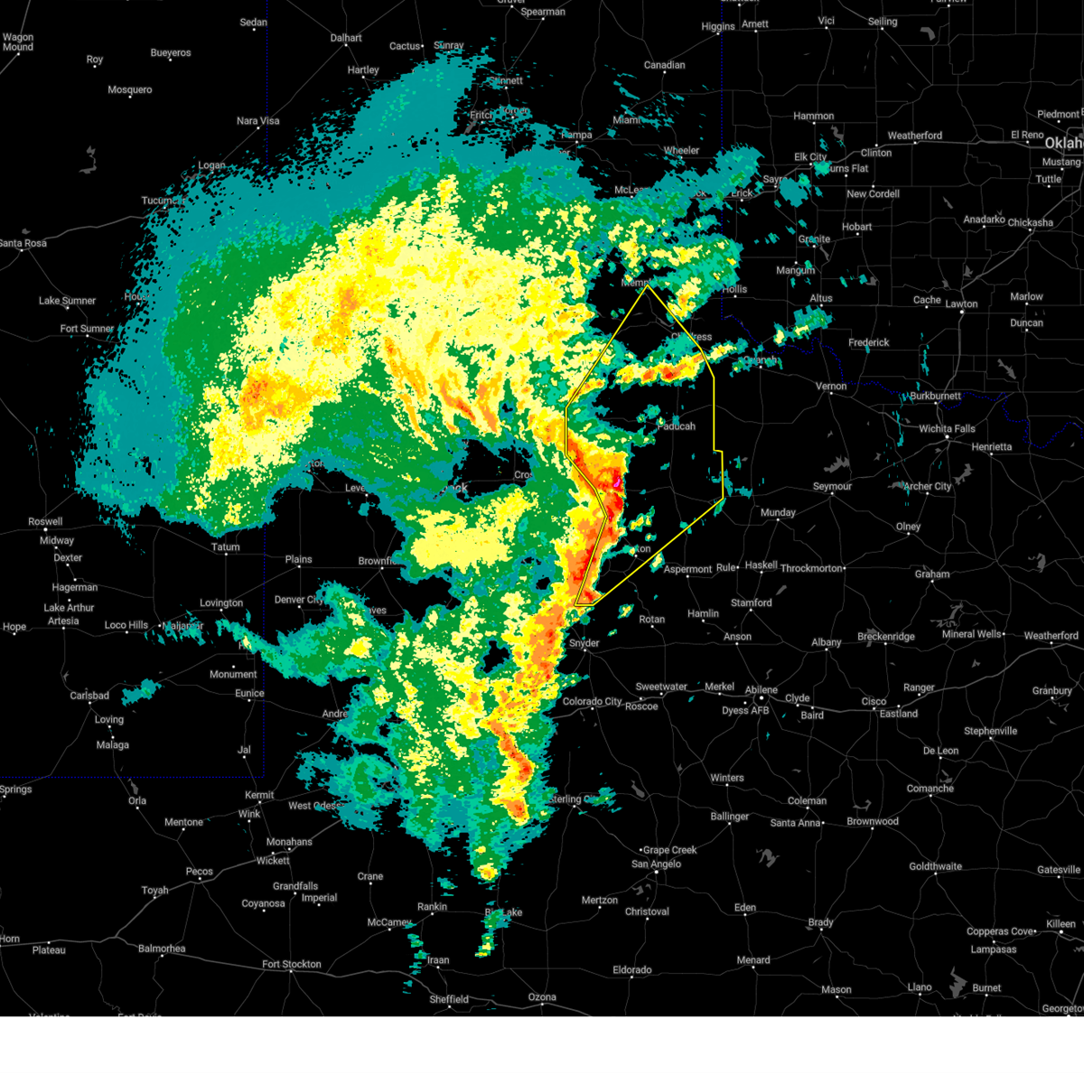
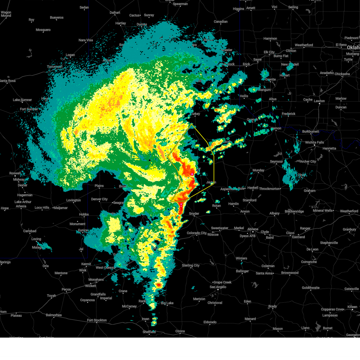
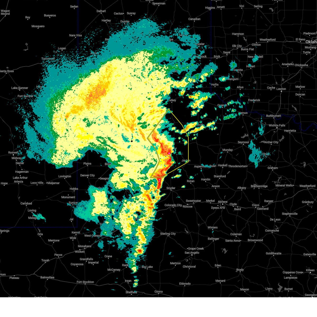
Hail Map for Jayton, TX
The Jayton, TX area has had 26 reports of on-the-ground hail by trained spotters, and has been under severe weather warnings 77 times during the past 12 months. Doppler radar has detected hail at or near Jayton, TX on 95 occasions, including 7 occasions during the past year.
| Name: | Jayton, TX |
| Where Located: | 73.3 miles NW of Abilene, TX |
| Map: | Google Map for Jayton, TX |
| Population: | 534 |
| Housing Units: | 251 |
| More Info: | Search Google for Jayton, TX |
3
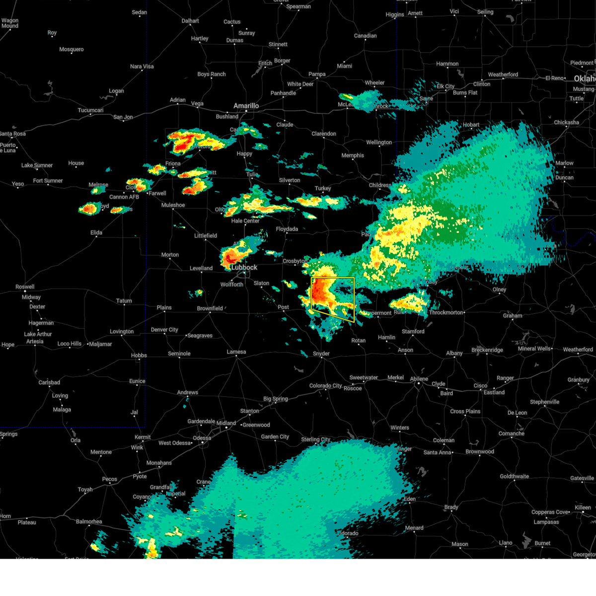
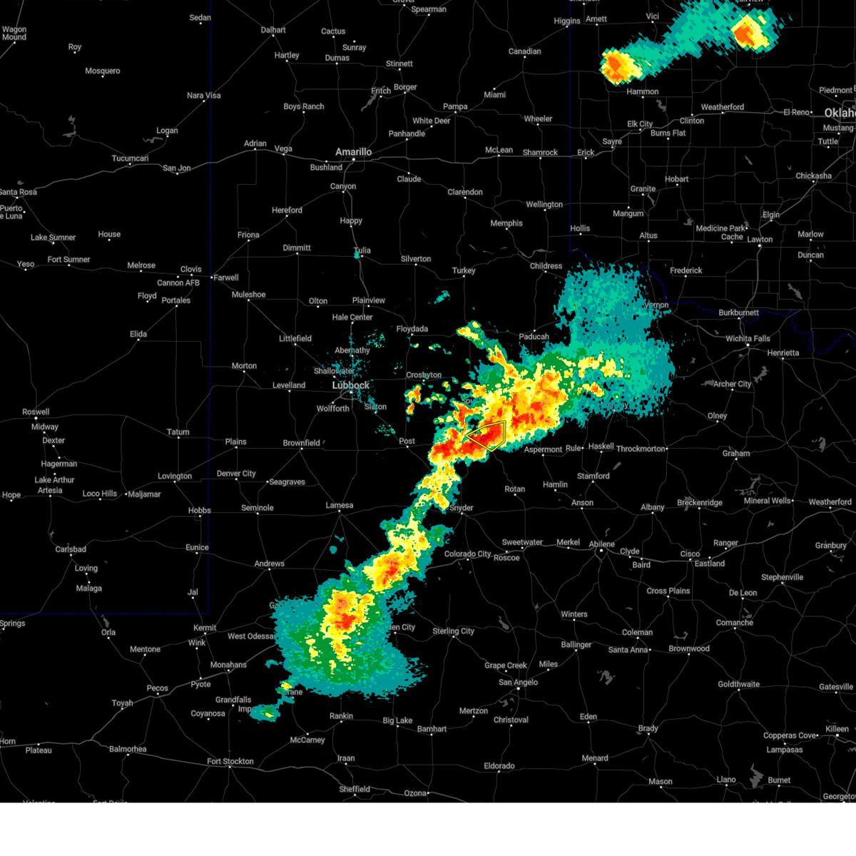
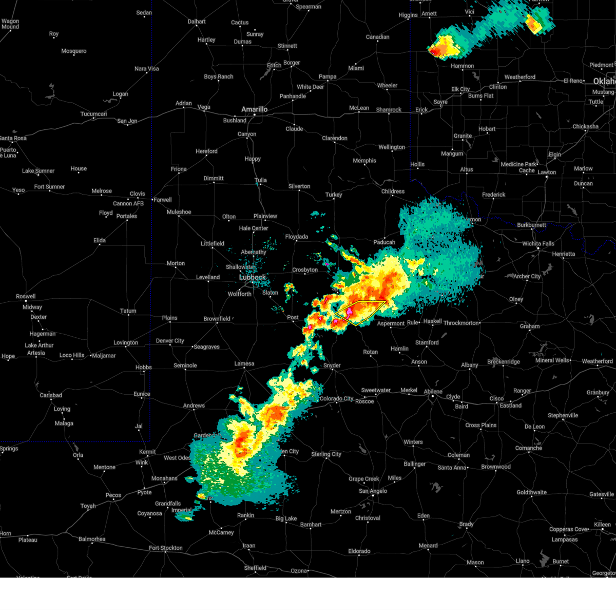
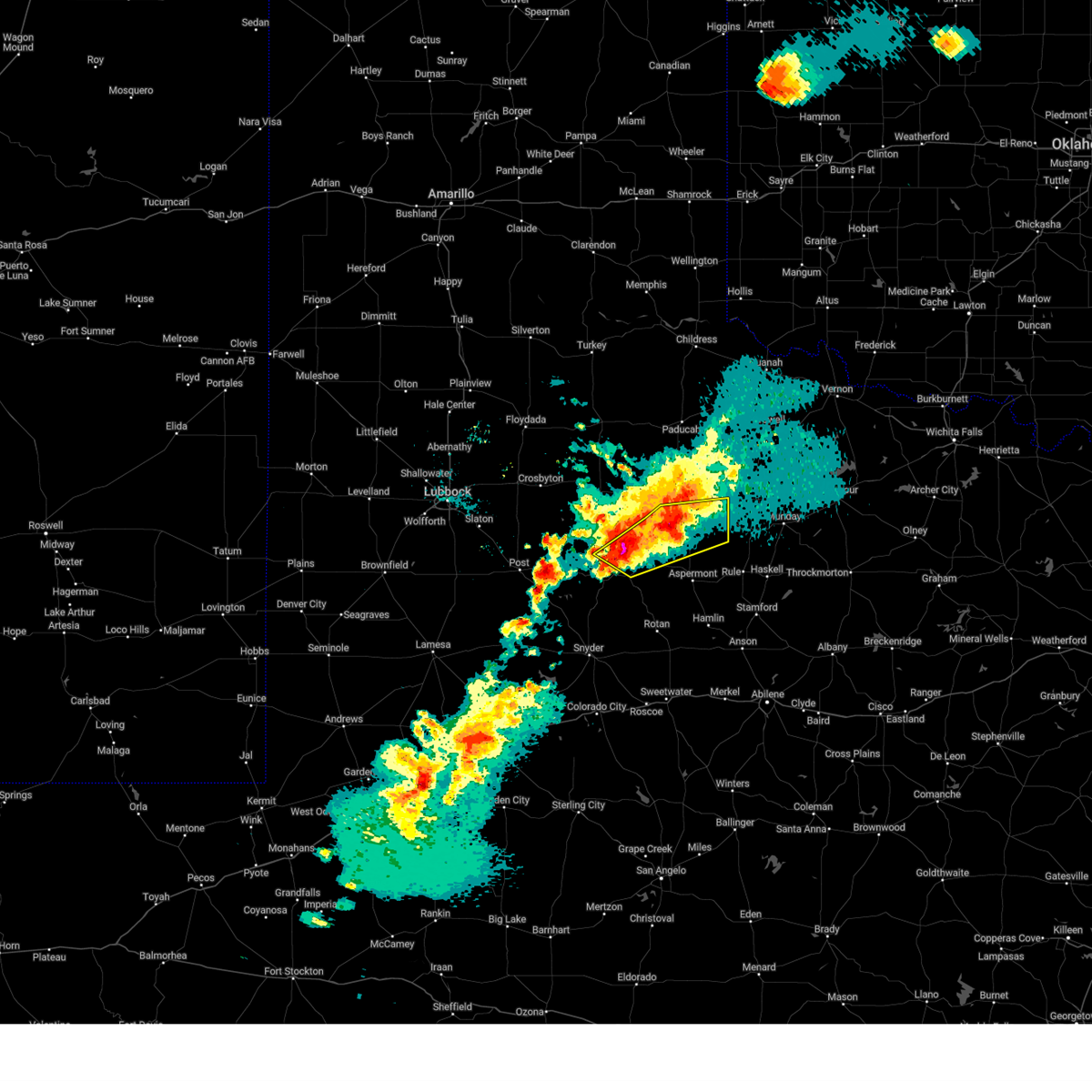
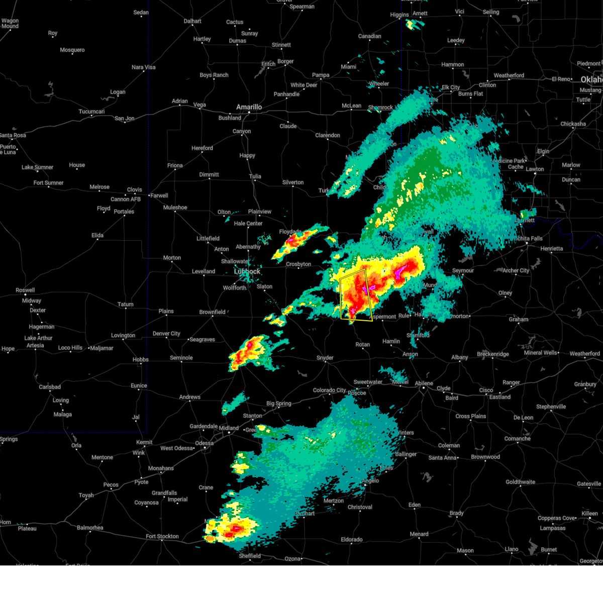
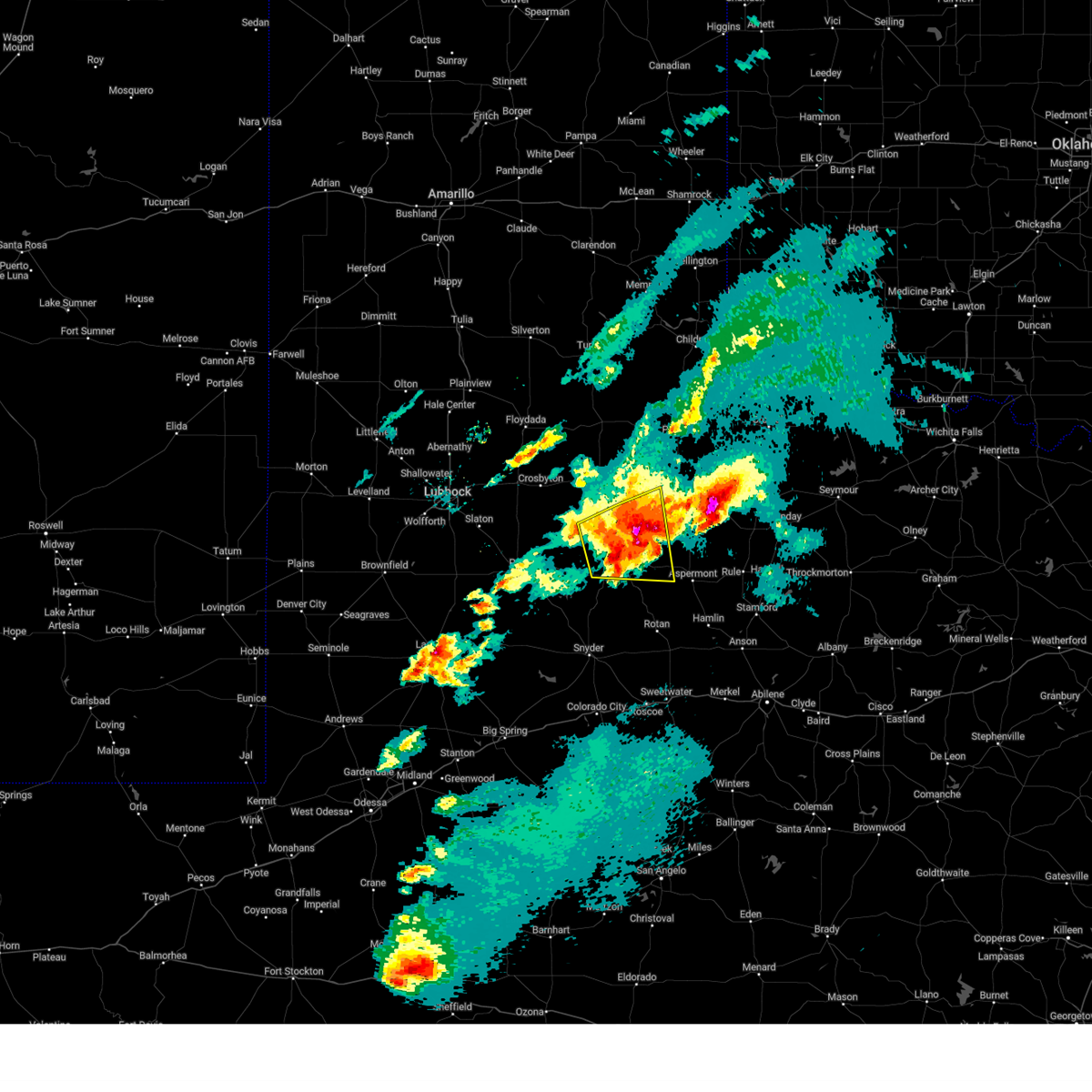
The Top Recent Hail Date for Jayton, TX is Friday, June 6, 2025 (9th out of 95)
Hail and Wind Damage Spotted near Jayton, TX
| Date / Time | Report Details |
|---|---|
| 6/8/2025 11:54 PM CDT |
 the severe thunderstorm warning has been cancelled and is no longer in effect the severe thunderstorm warning has been cancelled and is no longer in effect
|
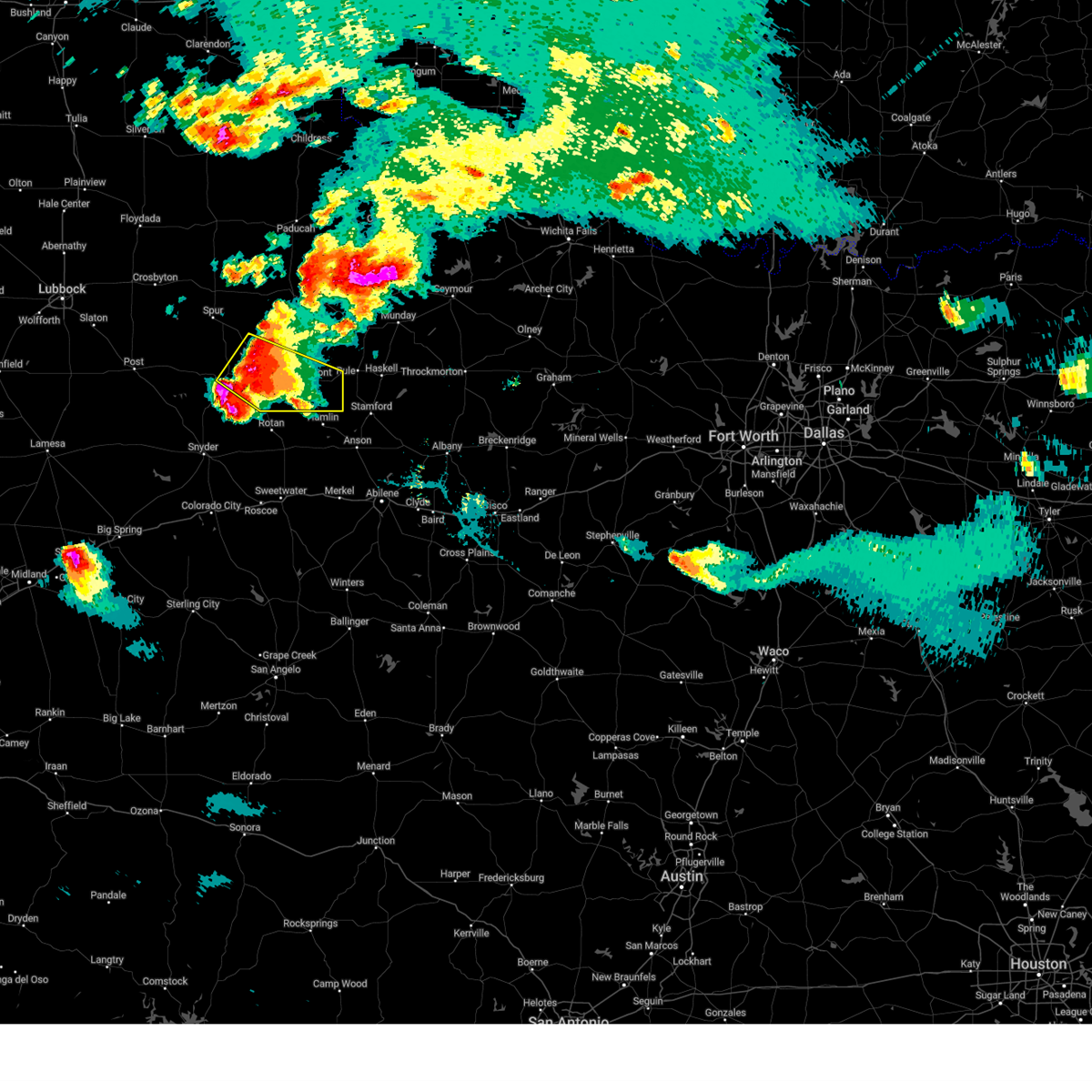
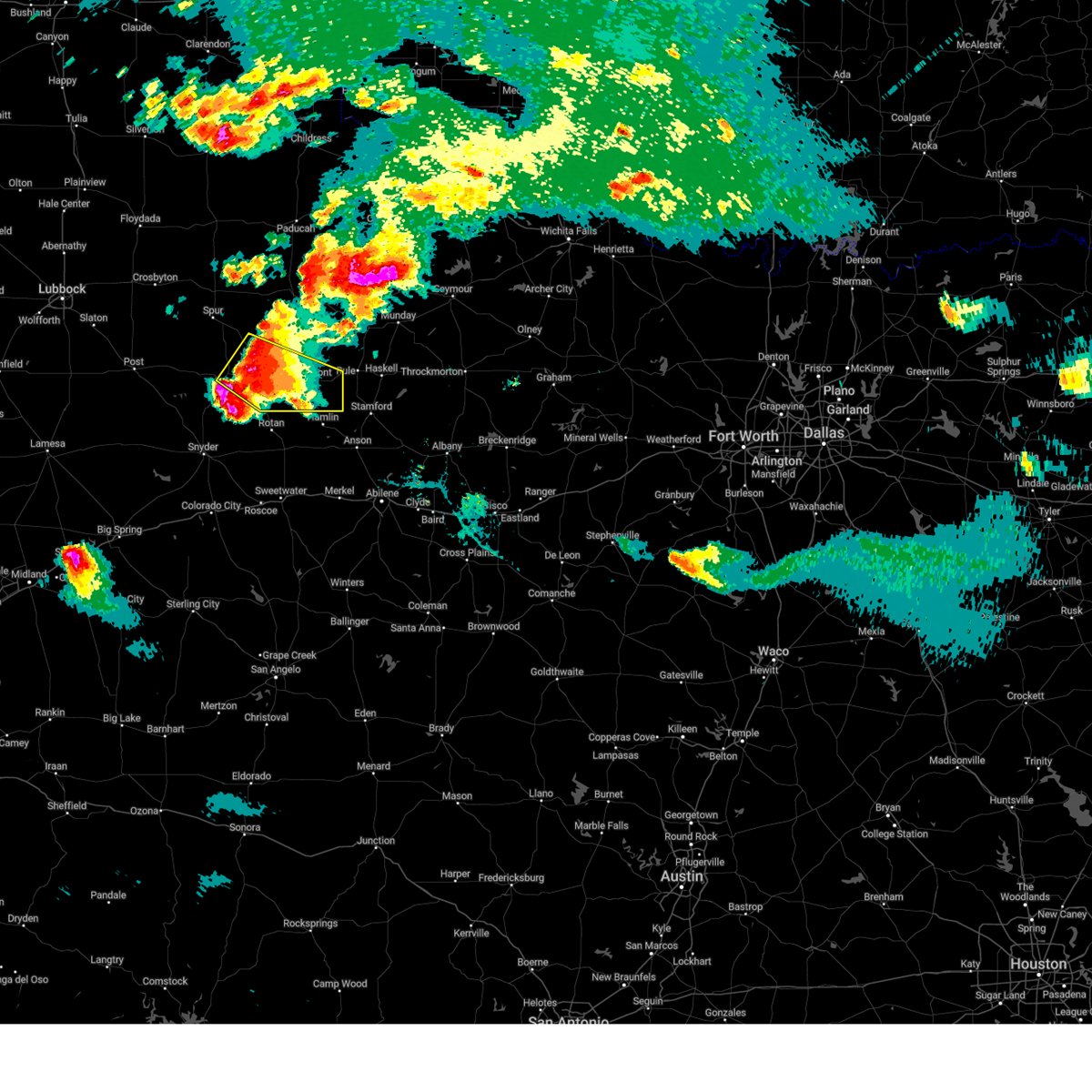
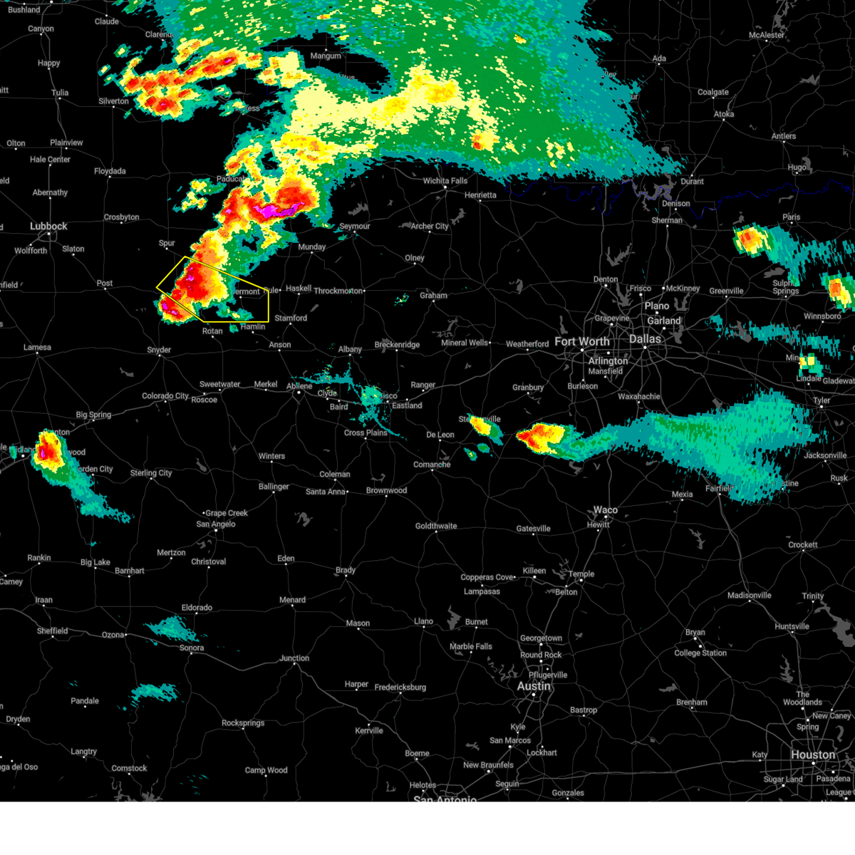
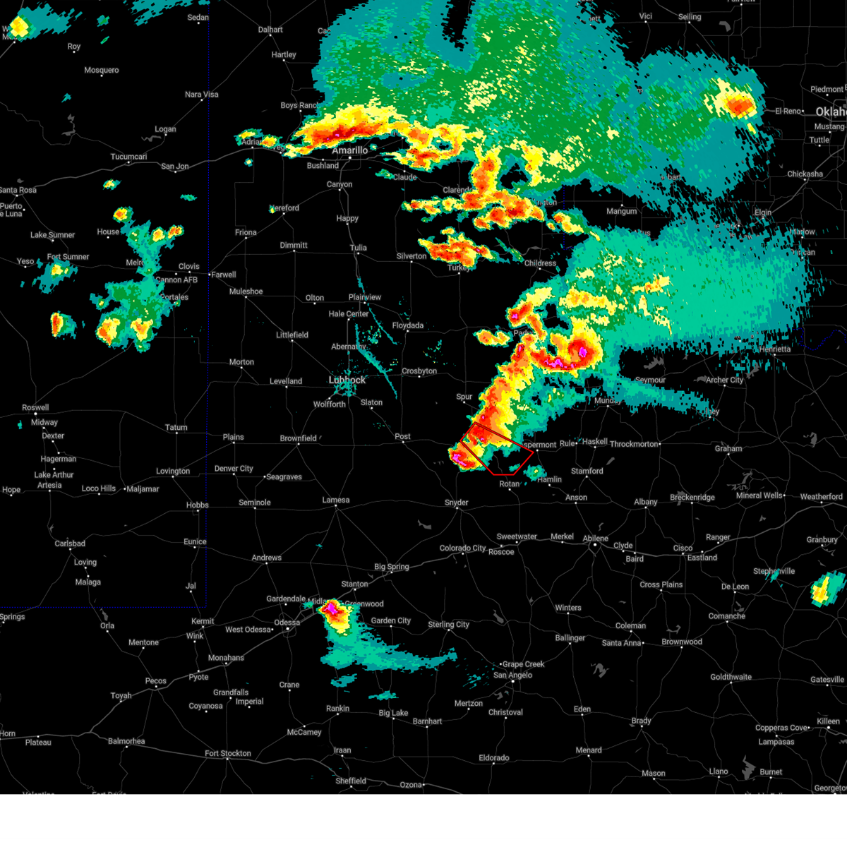
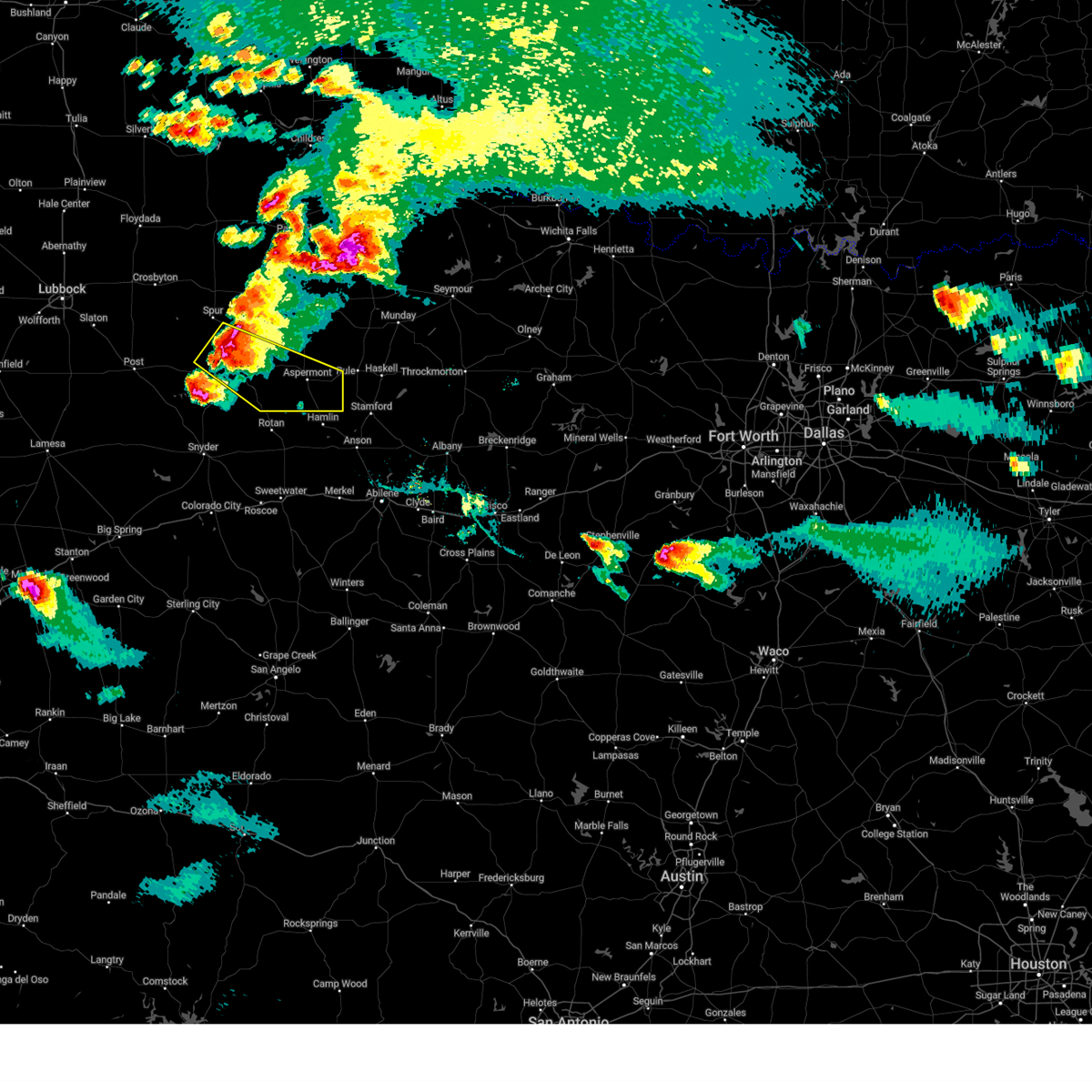
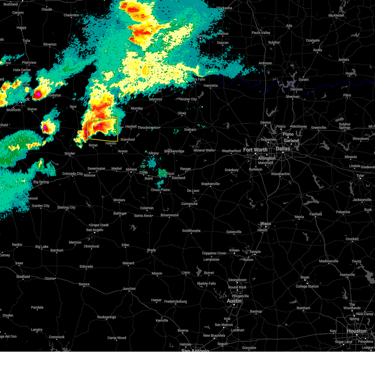
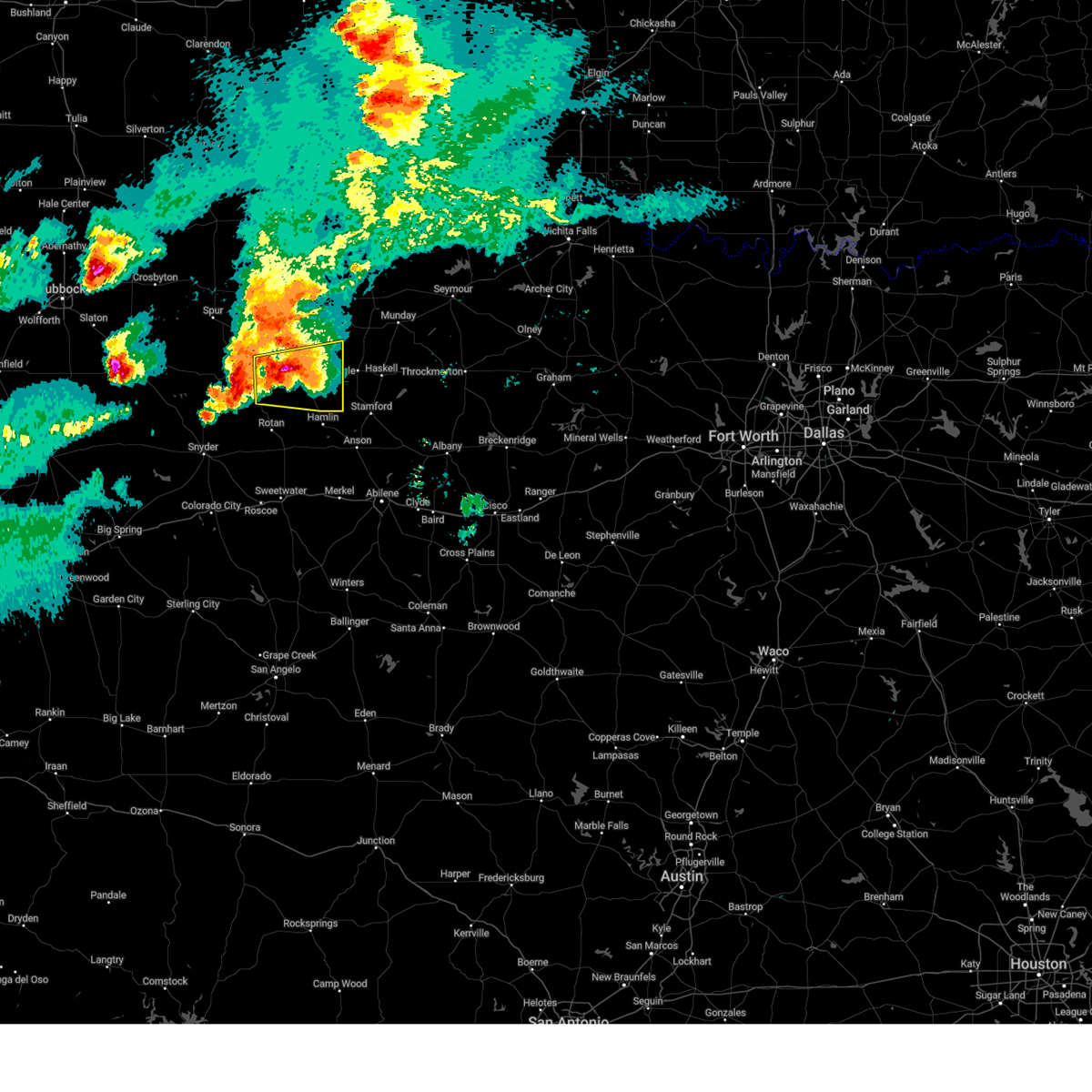
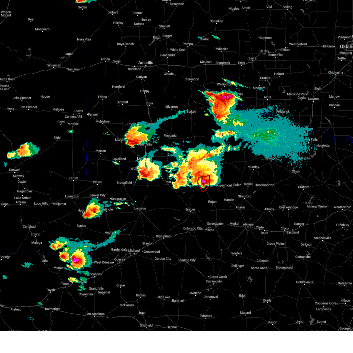
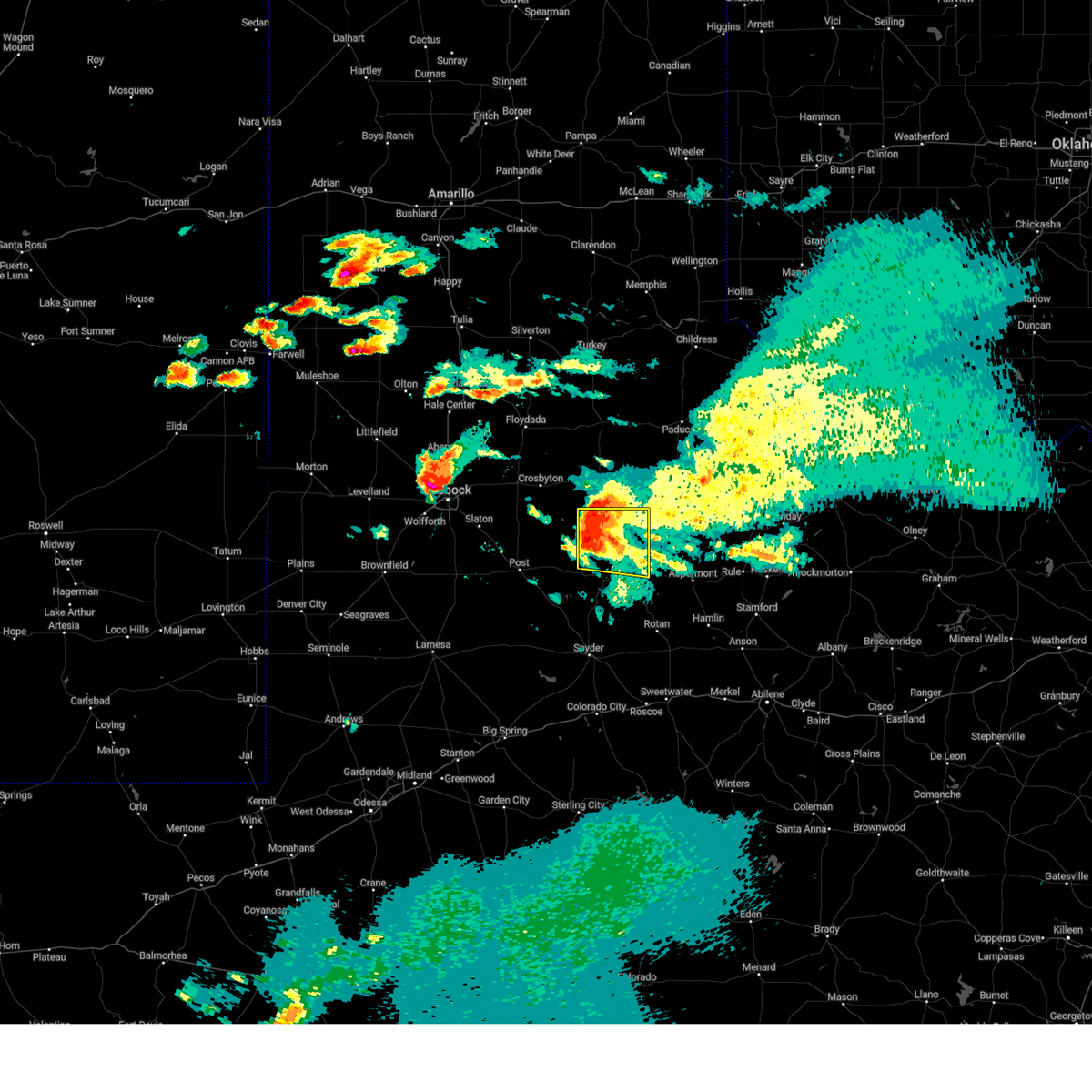
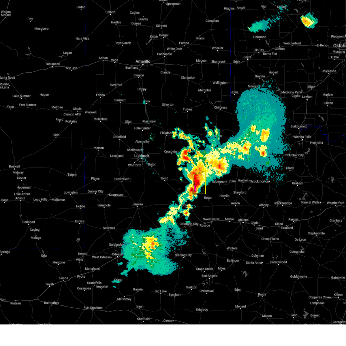
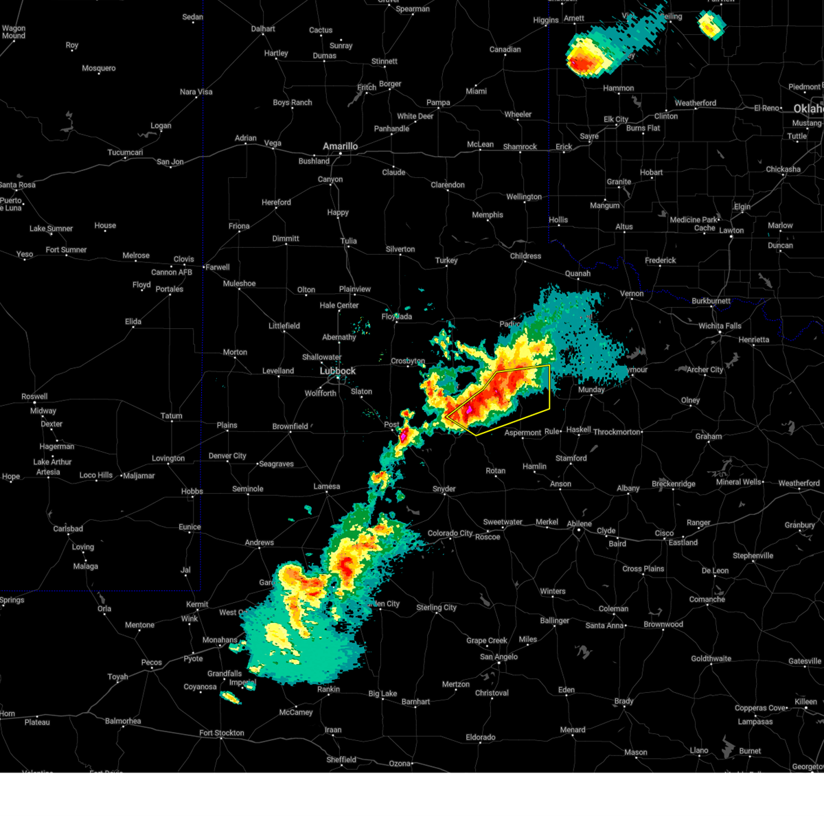
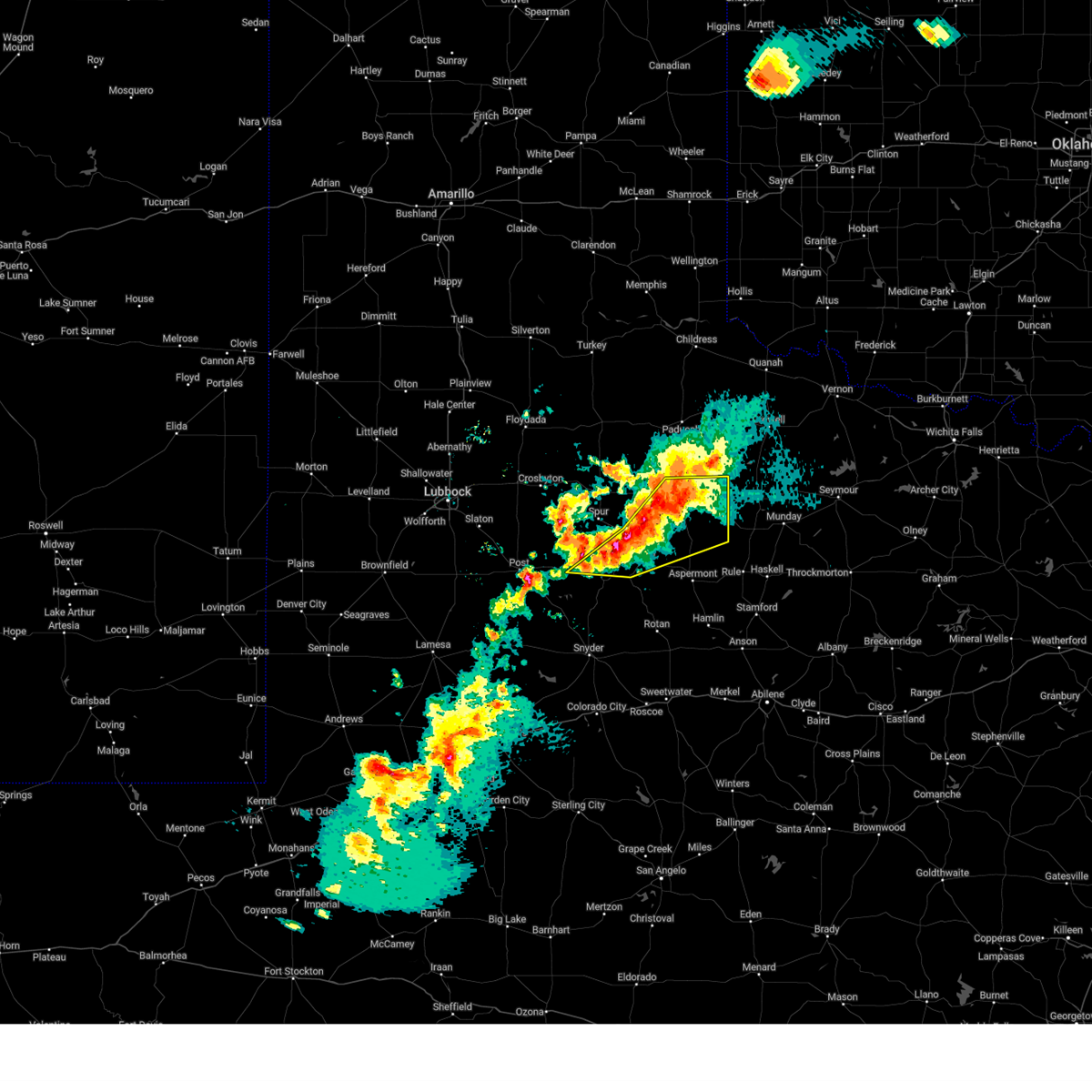
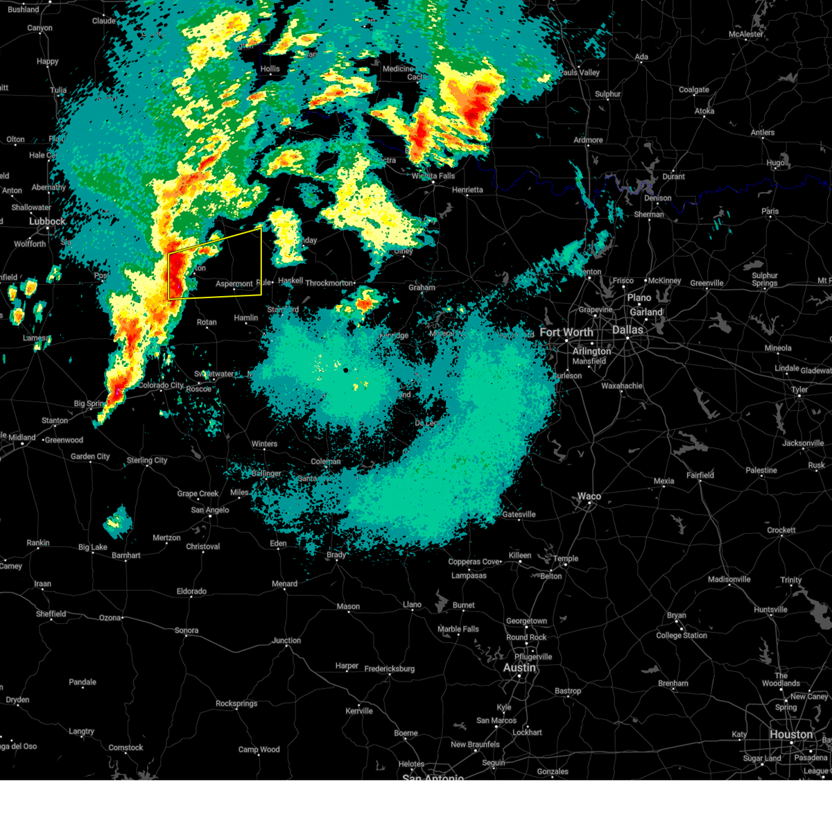
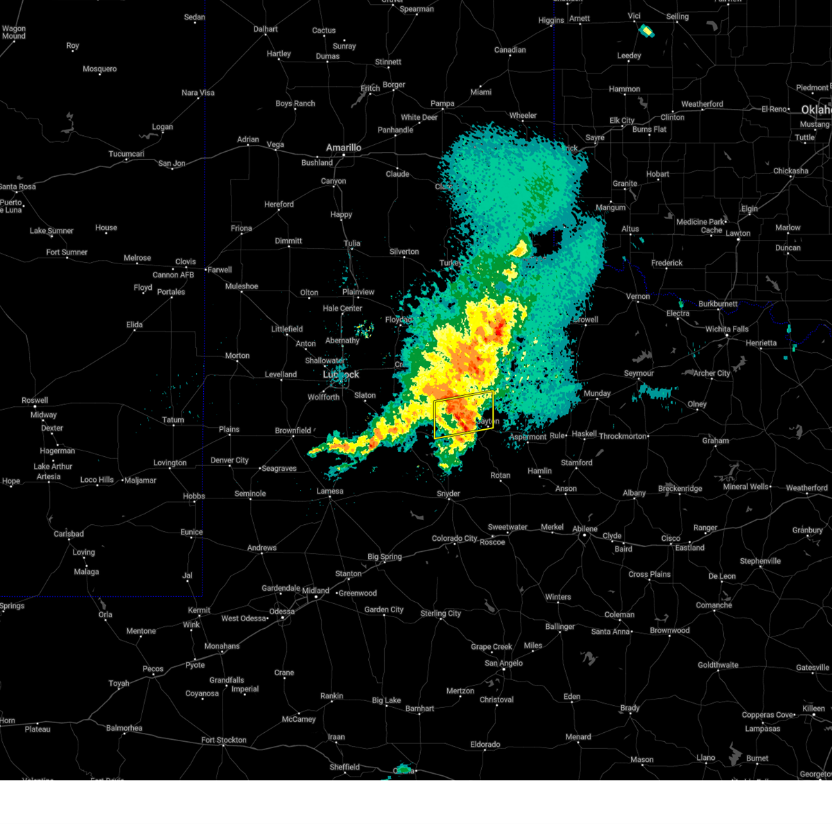
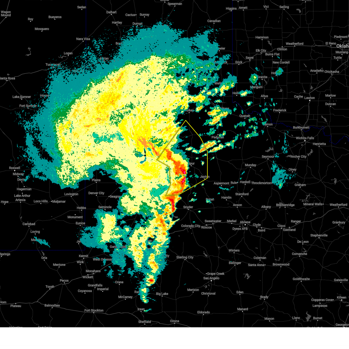
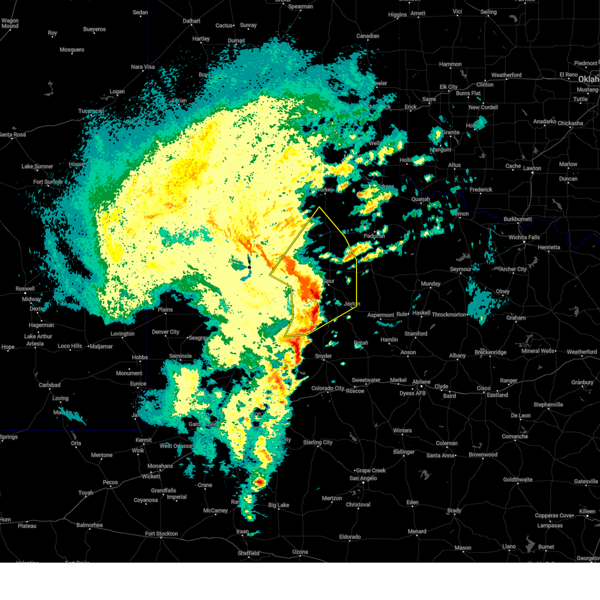
| 6/8/2025 11:46 PM CDT | At 1146 pm cdt, a severe thunderstorm was located 9 miles northwest of rotan, or 20 miles south of jayton, moving southeast at 40 mph (radar indicated). Hazards include 60 mph wind gusts and quarter size hail. Hail damage to vehicles is expected. expect wind damage to roofs, siding, and trees. Locations impacted include, aspermont, jayton, peacock, and swenson. |
| 6/8/2025 11:24 PM CDT | the severe thunderstorm warning has been cancelled and is no longer in effect |
| 6/8/2025 11:24 PM CDT | At 1124 pm cdt, a severe thunderstorm was located 4 miles east of clairemont, or 7 miles southwest of jayton, moving east at 45 mph (radar indicated). Hazards include 60 mph wind gusts and quarter size hail. Hail damage to vehicles is expected. expect wind damage to roofs, siding, and trees. Locations impacted include, aspermont, jayton, girard, peacock, old glory, swenson, clairemont, and us-380 near the haskell-stonewall county line. |
| 6/8/2025 11:14 PM CDT |
 Svrlub the national weather service in lubbock texas has issued a * severe thunderstorm warning for, kent county in northwestern texas, southeastern dickens county in northwestern texas, southeastern king county in northwestern texas, stonewall county in northwestern texas, * until 1215 am cdt. * at 1114 pm cdt, a severe thunderstorm was located 4 miles north of clairemont, or 11 miles west of jayton, moving east at 45 mph (radar indicated). Hazards include 60 mph wind gusts and quarter size hail. Hail damage to vehicles is expected. Expect wind damage to roofs, siding, and trees. Svrlub the national weather service in lubbock texas has issued a * severe thunderstorm warning for, kent county in northwestern texas, southeastern dickens county in northwestern texas, southeastern king county in northwestern texas, stonewall county in northwestern texas, * until 1215 am cdt. * at 1114 pm cdt, a severe thunderstorm was located 4 miles north of clairemont, or 11 miles west of jayton, moving east at 45 mph (radar indicated). Hazards include 60 mph wind gusts and quarter size hail. Hail damage to vehicles is expected. Expect wind damage to roofs, siding, and trees.
|
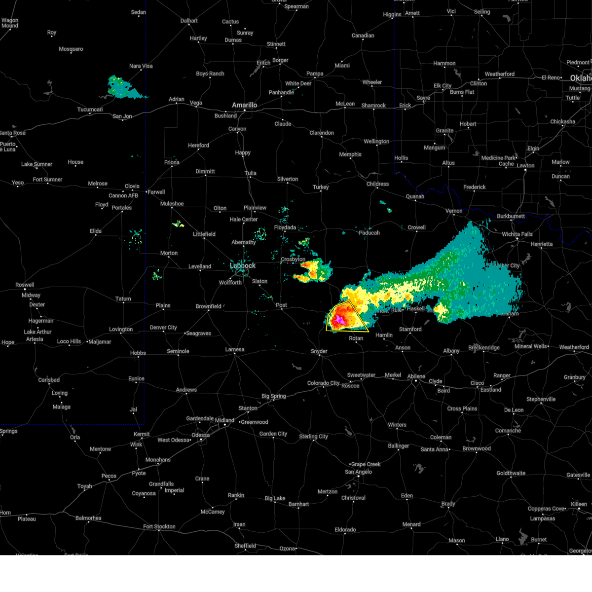
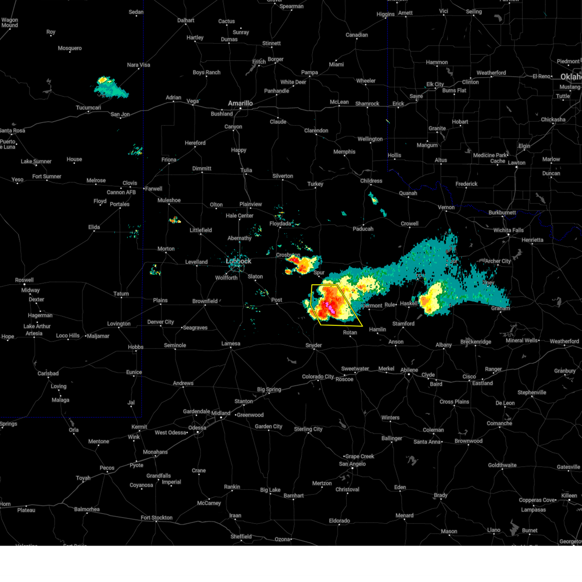
| 6/8/2025 8:29 PM CDT | Quarter sized hail reported 1 miles SSE of Jayton, TX, report from mping: quarter (1.00 in.). |
| 6/8/2025 7:46 PM CDT |
 At 745 pm cdt, a severe thunderstorm was located 7 miles southwest of peacock, or 13 miles southeast of jayton, moving southeast at 35 mph (radar indicated). Hazards include golf ball size hail and 70 mph wind gusts. People and animals outdoors will be injured. expect hail damage to roofs, siding, windows, and vehicles. expect considerable tree damage. wind damage is also likely to mobile homes, roofs, and outbuildings. Locations impacted include, aspermont, jayton, peacock, old glory, swenson, and us- 380 near the haskell-stonewall county line. At 745 pm cdt, a severe thunderstorm was located 7 miles southwest of peacock, or 13 miles southeast of jayton, moving southeast at 35 mph (radar indicated). Hazards include golf ball size hail and 70 mph wind gusts. People and animals outdoors will be injured. expect hail damage to roofs, siding, windows, and vehicles. expect considerable tree damage. wind damage is also likely to mobile homes, roofs, and outbuildings. Locations impacted include, aspermont, jayton, peacock, old glory, swenson, and us- 380 near the haskell-stonewall county line.
|
| 6/8/2025 7:41 PM CDT | The tornado threat has diminished and the tornado warning has been cancelled. however, large hail and damaging winds remain likely and a severe thunderstorm warning remains in effect for the area. however, small hail, gusty winds and heavy rain are still possible with this thunderstorm. a severe thunderstorm watch remains in effect until 1100 pm cdt for northwestern texas. remember, a severe thunderstorm warning still remains in effect for stonewall and kent counties until 8 pm. |
| 6/8/2025 7:31 PM CDT |
 At 730 pm cdt, a severe thunderstorm was located near peacock, or 7 miles southeast of jayton, moving east at 60 mph (radar indicated). Hazards include golf ball size hail and 70 mph wind gusts. People and animals outdoors will be injured. expect hail damage to roofs, siding, windows, and vehicles. expect considerable tree damage. wind damage is also likely to mobile homes, roofs, and outbuildings. Locations impacted include, aspermont, jayton, peacock, old glory, swenson, clairemont, and us- 380 near the haskell-stonewall county line. At 730 pm cdt, a severe thunderstorm was located near peacock, or 7 miles southeast of jayton, moving east at 60 mph (radar indicated). Hazards include golf ball size hail and 70 mph wind gusts. People and animals outdoors will be injured. expect hail damage to roofs, siding, windows, and vehicles. expect considerable tree damage. wind damage is also likely to mobile homes, roofs, and outbuildings. Locations impacted include, aspermont, jayton, peacock, old glory, swenson, clairemont, and us- 380 near the haskell-stonewall county line.
|
| 6/8/2025 7:31 PM CDT |
 the severe thunderstorm warning has been cancelled and is no longer in effect the severe thunderstorm warning has been cancelled and is no longer in effect
|
| 6/8/2025 7:30 PM CDT | Half Dollar sized hail reported 1 miles SSE of Jayton, TX, report from mping: half dollar (1.25 in.). |
| 6/8/2025 7:25 PM CDT |
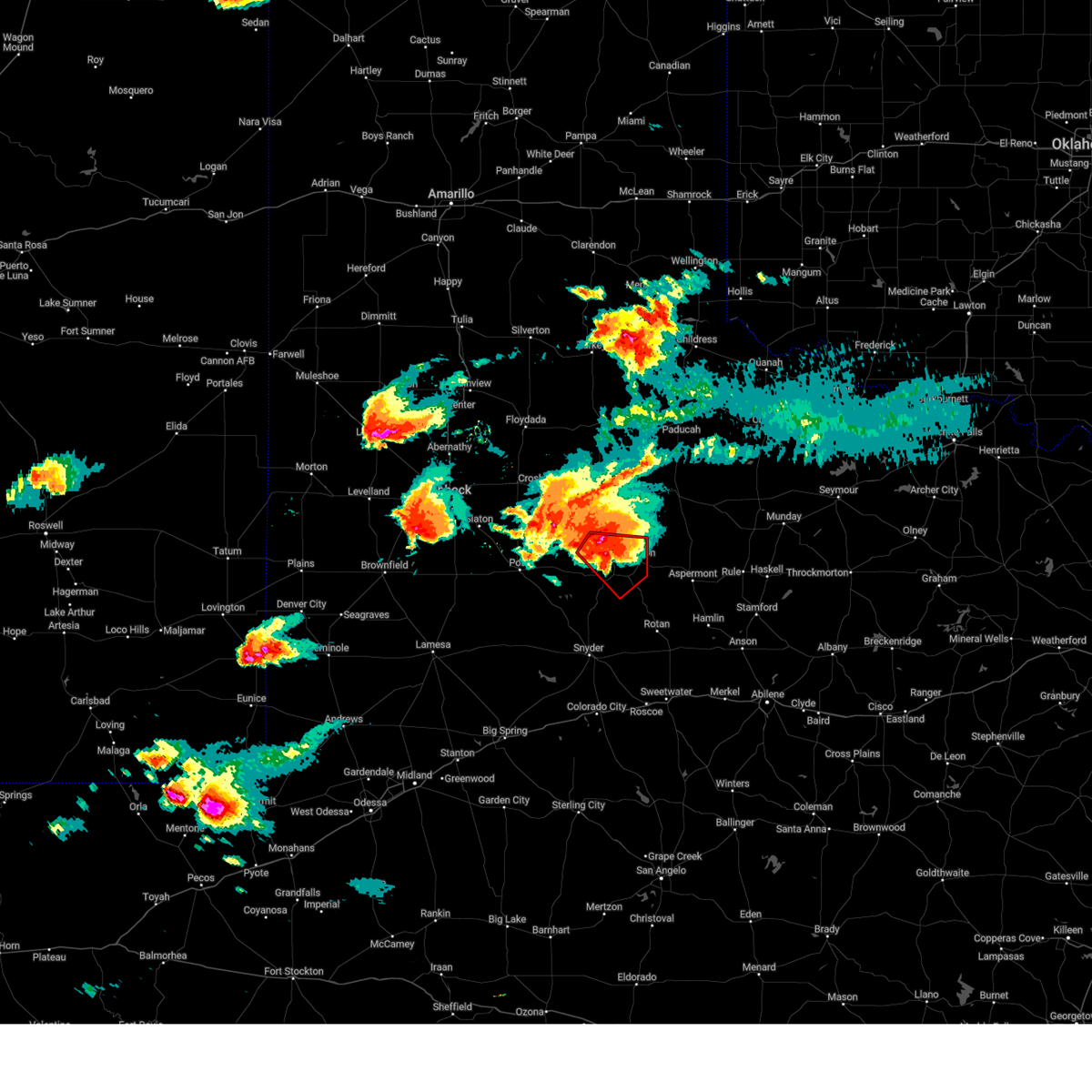
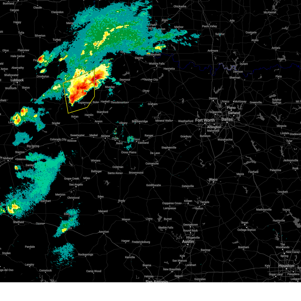
 At 725 pm cdt, a severe thunderstorm capable of producing a tornado was located 4 miles east of clairemont, or 8 miles southwest of jayton, moving southeast at 25 mph (radar indicated rotation). Hazards include tornado and tennis ball size hail. Flying debris will be dangerous to those caught without shelter. mobile homes will be damaged or destroyed. damage to roofs, windows, and vehicles will occur. tree damage is likely. This tornadic thunderstorm will remain over mainly rural areas of southeastern kent and southwestern stonewall counties. At 725 pm cdt, a severe thunderstorm capable of producing a tornado was located 4 miles east of clairemont, or 8 miles southwest of jayton, moving southeast at 25 mph (radar indicated rotation). Hazards include tornado and tennis ball size hail. Flying debris will be dangerous to those caught without shelter. mobile homes will be damaged or destroyed. damage to roofs, windows, and vehicles will occur. tree damage is likely. This tornadic thunderstorm will remain over mainly rural areas of southeastern kent and southwestern stonewall counties.
|
| 6/8/2025 7:22 PM CDT |
 At 721 pm cdt, a severe thunderstorm was located over jayton, moving southeast at 40 mph (radar indicated). Hazards include tennis ball size hail and 70 mph wind gusts. People and animals outdoors will be injured. expect hail damage to roofs, siding, windows, and vehicles. expect considerable tree damage. wind damage is also likely to mobile homes, roofs, and outbuildings. Locations impacted include, aspermont, jayton, girard, peacock, old glory, swenson, clairemont, and us-380 near the haskell-stonewall county line. At 721 pm cdt, a severe thunderstorm was located over jayton, moving southeast at 40 mph (radar indicated). Hazards include tennis ball size hail and 70 mph wind gusts. People and animals outdoors will be injured. expect hail damage to roofs, siding, windows, and vehicles. expect considerable tree damage. wind damage is also likely to mobile homes, roofs, and outbuildings. Locations impacted include, aspermont, jayton, girard, peacock, old glory, swenson, clairemont, and us-380 near the haskell-stonewall county line.
|
| 6/8/2025 7:11 PM CDT |
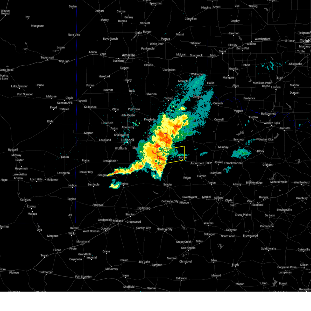
 Torlub the national weather service in lubbock texas has issued a * tornado warning for, eastern kent county in northwestern texas, southwestern stonewall county in northwestern texas, * until 745 pm cdt. * at 711 pm cdt, a severe thunderstorm capable of producing a tornado was located over clairemont, or 9 miles west of jayton, moving southeast at 35 mph (radar indicated rotation). Hazards include tornado and tennis ball size hail. Flying debris will be dangerous to those caught without shelter. mobile homes will be damaged or destroyed. damage to roofs, windows, and vehicles will occur. tree damage is likely. This dangerous storm will be near, clairemont around 715 pm cdt. Torlub the national weather service in lubbock texas has issued a * tornado warning for, eastern kent county in northwestern texas, southwestern stonewall county in northwestern texas, * until 745 pm cdt. * at 711 pm cdt, a severe thunderstorm capable of producing a tornado was located over clairemont, or 9 miles west of jayton, moving southeast at 35 mph (radar indicated rotation). Hazards include tornado and tennis ball size hail. Flying debris will be dangerous to those caught without shelter. mobile homes will be damaged or destroyed. damage to roofs, windows, and vehicles will occur. tree damage is likely. This dangerous storm will be near, clairemont around 715 pm cdt.
|
| 6/8/2025 7:05 PM CDT |
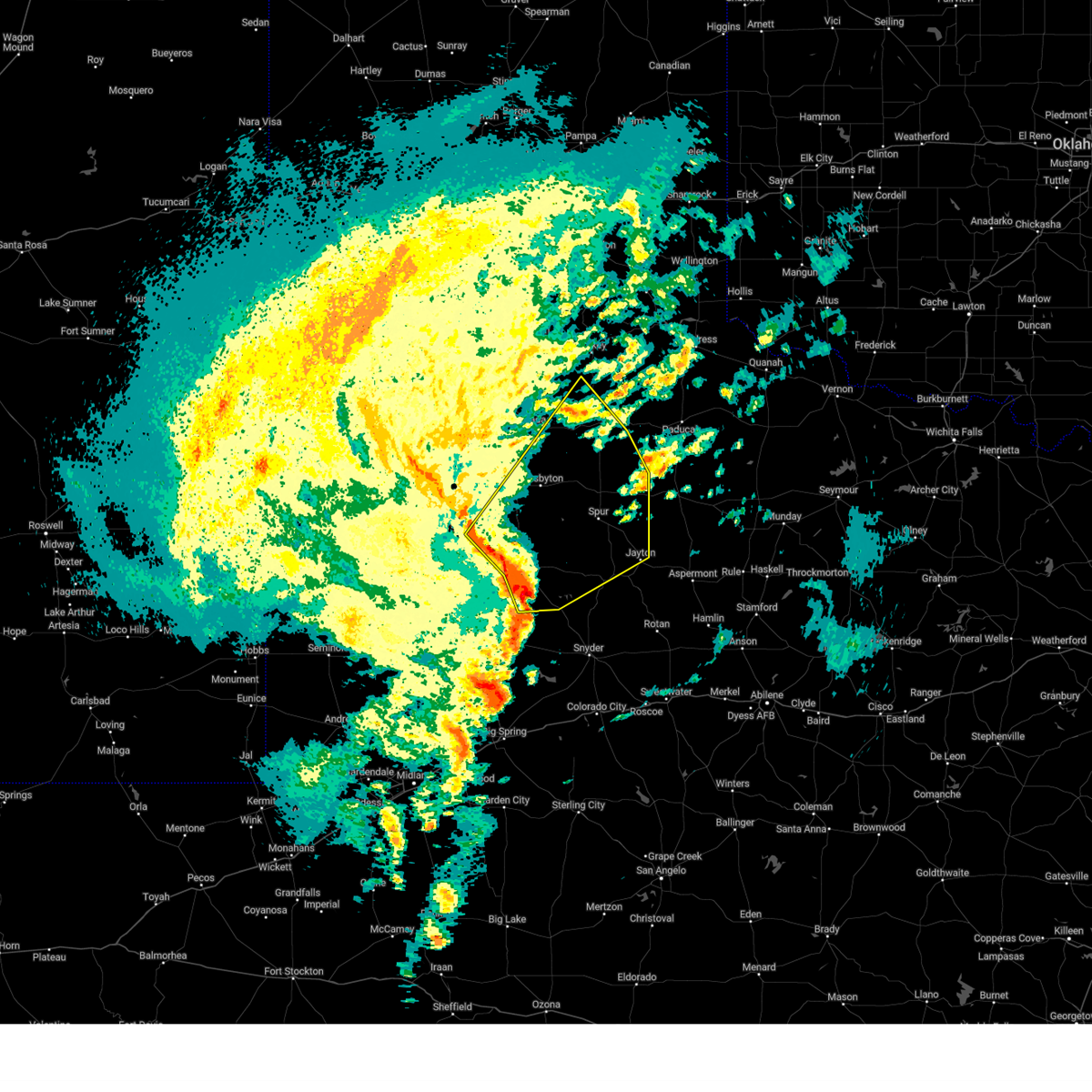
 Svrlub the national weather service in lubbock texas has issued a * severe thunderstorm warning for, northeastern kent county in northwestern texas, south central dickens county in northwestern texas, stonewall county in northwestern texas, * until 800 pm cdt. * at 704 pm cdt, a severe thunderstorm was located 5 miles southwest of girard, or 7 miles west of jayton, moving east at 60 mph (radar indicated). Hazards include tennis ball size hail and 70 mph wind gusts. People and animals outdoors will be injured. expect hail damage to roofs, siding, windows, and vehicles. expect considerable tree damage. Wind damage is also likely to mobile homes, roofs, and outbuildings. Svrlub the national weather service in lubbock texas has issued a * severe thunderstorm warning for, northeastern kent county in northwestern texas, south central dickens county in northwestern texas, stonewall county in northwestern texas, * until 800 pm cdt. * at 704 pm cdt, a severe thunderstorm was located 5 miles southwest of girard, or 7 miles west of jayton, moving east at 60 mph (radar indicated). Hazards include tennis ball size hail and 70 mph wind gusts. People and animals outdoors will be injured. expect hail damage to roofs, siding, windows, and vehicles. expect considerable tree damage. Wind damage is also likely to mobile homes, roofs, and outbuildings.
|
| 6/8/2025 6:40 PM CDT | Golf Ball sized hail reported 20.9 miles ESE of Jayton, TX, report from mping: golf ball (1.75 in.). |
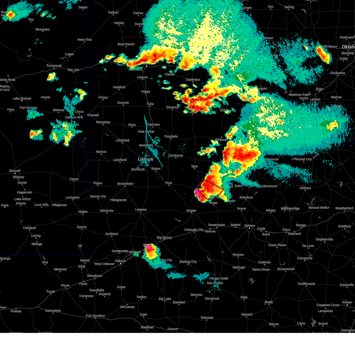
| 6/8/2025 7:37 AM CDT |
 At 737 am cdt, a severe thunderstorm was located 10 miles southeast of clairemont, or 13 miles south of jayton, moving southeast at 30 mph (radar indicated). Hazards include ping pong ball size hail and 60 mph wind gusts. People and animals outdoors will be injured. expect hail damage to roofs, siding, windows, and vehicles. expect wind damage to roofs, siding, and trees. Locations impacted include, jayton and clairemont. At 737 am cdt, a severe thunderstorm was located 10 miles southeast of clairemont, or 13 miles south of jayton, moving southeast at 30 mph (radar indicated). Hazards include ping pong ball size hail and 60 mph wind gusts. People and animals outdoors will be injured. expect hail damage to roofs, siding, windows, and vehicles. expect wind damage to roofs, siding, and trees. Locations impacted include, jayton and clairemont.
|
| 6/8/2025 7:20 AM CDT |
 At 719 am cdt, a severe thunderstorm was located near clairemont, or 11 miles southwest of jayton, moving southeast at 20 mph (radar indicated). Hazards include ping pong ball size hail and 60 mph wind gusts. People and animals outdoors will be injured. expect hail damage to roofs, siding, windows, and vehicles. expect wind damage to roofs, siding, and trees. Locations impacted include, jayton, girard, and clairemont. At 719 am cdt, a severe thunderstorm was located near clairemont, or 11 miles southwest of jayton, moving southeast at 20 mph (radar indicated). Hazards include ping pong ball size hail and 60 mph wind gusts. People and animals outdoors will be injured. expect hail damage to roofs, siding, windows, and vehicles. expect wind damage to roofs, siding, and trees. Locations impacted include, jayton, girard, and clairemont.
|
| 6/8/2025 7:09 AM CDT |
 At 707 am cdt, a severe thunderstorm was located 8 miles northwest of clairemont, or 14 miles south of spur, moving southeast at 30 mph (radar indicated). Hazards include ping pong ball size hail and 60 mph wind gusts. People and animals outdoors will be injured. expect hail damage to roofs, siding, windows, and vehicles. expect wind damage to roofs, siding, and trees. Locations impacted include, jayton, girard, and clairemont. At 707 am cdt, a severe thunderstorm was located 8 miles northwest of clairemont, or 14 miles south of spur, moving southeast at 30 mph (radar indicated). Hazards include ping pong ball size hail and 60 mph wind gusts. People and animals outdoors will be injured. expect hail damage to roofs, siding, windows, and vehicles. expect wind damage to roofs, siding, and trees. Locations impacted include, jayton, girard, and clairemont.
|
| 6/8/2025 6:54 AM CDT |
 Svrlub the national weather service in lubbock texas has issued a * severe thunderstorm warning for, kent county in northwestern texas, southwestern stonewall county in northwestern texas, * until 815 am cdt. * at 654 am cdt, a severe thunderstorm was located 12 miles southwest of spur, moving southeast at 30 mph (radar indicated). Hazards include 60 mph wind gusts and quarter size hail. Hail damage to vehicles is expected. Expect wind damage to roofs, siding, and trees. Svrlub the national weather service in lubbock texas has issued a * severe thunderstorm warning for, kent county in northwestern texas, southwestern stonewall county in northwestern texas, * until 815 am cdt. * at 654 am cdt, a severe thunderstorm was located 12 miles southwest of spur, moving southeast at 30 mph (radar indicated). Hazards include 60 mph wind gusts and quarter size hail. Hail damage to vehicles is expected. Expect wind damage to roofs, siding, and trees.
|
| 6/6/2025 10:52 PM CDT |
 Svrlub the national weather service in lubbock texas has issued a * severe thunderstorm warning for, northeastern kent county in northwestern texas, southeastern dickens county in northwestern texas, southwestern king county in northwestern texas, northwestern stonewall county in northwestern texas, * until 1130 pm cdt. * at 1051 pm cdt, a severe thunderstorm was located 5 miles northeast of jayton, moving east at 30 mph (radar indicated). Hazards include ping pong ball size hail and 60 mph wind gusts. People and animals outdoors will be injured. expect hail damage to roofs, siding, windows, and vehicles. Expect wind damage to roofs, siding, and trees. Svrlub the national weather service in lubbock texas has issued a * severe thunderstorm warning for, northeastern kent county in northwestern texas, southeastern dickens county in northwestern texas, southwestern king county in northwestern texas, northwestern stonewall county in northwestern texas, * until 1130 pm cdt. * at 1051 pm cdt, a severe thunderstorm was located 5 miles northeast of jayton, moving east at 30 mph (radar indicated). Hazards include ping pong ball size hail and 60 mph wind gusts. People and animals outdoors will be injured. expect hail damage to roofs, siding, windows, and vehicles. Expect wind damage to roofs, siding, and trees.
|
| 6/6/2025 9:27 PM CDT |
 At 926 pm cdt, a severe thunderstorm was located near swenson, or near aspermont, moving east at 35 mph (radar indicated). Hazards include tennis ball size hail and 60 mph wind gusts. People and animals outdoors will be injured. expect hail damage to roofs, siding, windows, and vehicles. expect wind damage to roofs, siding, and trees. Locations impacted include, aspermont, jayton, peacock, old glory, swenson, and us- 380 near the haskell-stonewall county line. At 926 pm cdt, a severe thunderstorm was located near swenson, or near aspermont, moving east at 35 mph (radar indicated). Hazards include tennis ball size hail and 60 mph wind gusts. People and animals outdoors will be injured. expect hail damage to roofs, siding, windows, and vehicles. expect wind damage to roofs, siding, and trees. Locations impacted include, aspermont, jayton, peacock, old glory, swenson, and us- 380 near the haskell-stonewall county line.
|
| 6/6/2025 9:17 PM CDT |
 At 917 pm cdt, a severe thunderstorm was located over peacock, or 9 miles west of aspermont, moving east at 20 mph (radar indicated). Hazards include two inch hail and 60 mph wind gusts. People and animals outdoors will be injured. expect hail damage to roofs, siding, windows, and vehicles. expect wind damage to roofs, siding, and trees. Locations impacted include, aspermont, jayton, peacock, old glory, swenson, and us- 380 near the haskell-stonewall county line. At 917 pm cdt, a severe thunderstorm was located over peacock, or 9 miles west of aspermont, moving east at 20 mph (radar indicated). Hazards include two inch hail and 60 mph wind gusts. People and animals outdoors will be injured. expect hail damage to roofs, siding, windows, and vehicles. expect wind damage to roofs, siding, and trees. Locations impacted include, aspermont, jayton, peacock, old glory, swenson, and us- 380 near the haskell-stonewall county line.
|
| 6/6/2025 9:05 PM CDT |
 At 905 pm cdt, a severe thunderstorm was located over swenson, or 8 miles northwest of aspermont, moving east at 15 mph (radar indicated). Hazards include golf ball size hail and 60 mph wind gusts. People and animals outdoors will be injured. expect hail damage to roofs, siding, windows, and vehicles. expect wind damage to roofs, siding, and trees. Locations impacted include, aspermont, jayton, peacock, old glory, swenson, and us- 380 near the haskell-stonewall county line. At 905 pm cdt, a severe thunderstorm was located over swenson, or 8 miles northwest of aspermont, moving east at 15 mph (radar indicated). Hazards include golf ball size hail and 60 mph wind gusts. People and animals outdoors will be injured. expect hail damage to roofs, siding, windows, and vehicles. expect wind damage to roofs, siding, and trees. Locations impacted include, aspermont, jayton, peacock, old glory, swenson, and us- 380 near the haskell-stonewall county line.
|
| 6/6/2025 8:59 PM CDT | Svrlub the national weather service in lubbock texas has issued a * severe thunderstorm warning for, southeastern kent county in northwestern texas, stonewall county in northwestern texas, * until 1000 pm cdt. * at 859 pm cdt, a severe thunderstorm was located near peacock, or 9 miles southeast of jayton, moving east at 35 mph (radar indicated). Hazards include 60 mph wind gusts and quarter size hail. Hail damage to vehicles is expected. Expect wind damage to roofs, siding, and trees. |
| 6/6/2025 8:28 PM CDT |
 The tornado warning that was previously in effect has been reissued for kent and stonewall counties and is in effect until 9 pm. please refer to that bulletin for the latest severe weather information. however, small hail, gusty winds and heavy rain are still possible with this thunderstorm. a tornado watch remains in effect until 1100 pm cdt for northwestern texas. remember, a tornado warning still remains in effect for kent and stonewall counties and is in effect until 9 pm. The tornado warning that was previously in effect has been reissued for kent and stonewall counties and is in effect until 9 pm. please refer to that bulletin for the latest severe weather information. however, small hail, gusty winds and heavy rain are still possible with this thunderstorm. a tornado watch remains in effect until 1100 pm cdt for northwestern texas. remember, a tornado warning still remains in effect for kent and stonewall counties and is in effect until 9 pm.
|
| 6/6/2025 8:25 PM CDT |
 Torlub the national weather service in lubbock texas has issued a * tornado warning for, southeastern kent county in northwestern texas, southwestern stonewall county in northwestern texas, * until 900 pm cdt. * at 825 pm cdt, a severe thunderstorm capable of producing a tornado was located 6 miles southeast of jayton, moving southeast at 30 mph (radar indicated rotation). Hazards include tornado and hail up to two inches in diameter. Flying debris will be dangerous to those caught without shelter. mobile homes will be damaged or destroyed. damage to roofs, windows, and vehicles will occur. tree damage is likely. This tornadic thunderstorm will remain over mainly rural areas of southeastern kent and southwestern stonewall counties. Torlub the national weather service in lubbock texas has issued a * tornado warning for, southeastern kent county in northwestern texas, southwestern stonewall county in northwestern texas, * until 900 pm cdt. * at 825 pm cdt, a severe thunderstorm capable of producing a tornado was located 6 miles southeast of jayton, moving southeast at 30 mph (radar indicated rotation). Hazards include tornado and hail up to two inches in diameter. Flying debris will be dangerous to those caught without shelter. mobile homes will be damaged or destroyed. damage to roofs, windows, and vehicles will occur. tree damage is likely. This tornadic thunderstorm will remain over mainly rural areas of southeastern kent and southwestern stonewall counties.
|
| 6/6/2025 8:15 PM CDT |
 At 814 pm cdt, a severe thunderstorm capable of producing a tornado was located 5 miles southwest of jayton, moving east at 25 mph (radar indicated rotation). Hazards include tornado and tennis ball size hail. Flying debris will be dangerous to those caught without shelter. mobile homes will be damaged or destroyed. damage to roofs, windows, and vehicles will occur. tree damage is likely. Locations impacted include, jayton. At 814 pm cdt, a severe thunderstorm capable of producing a tornado was located 5 miles southwest of jayton, moving east at 25 mph (radar indicated rotation). Hazards include tornado and tennis ball size hail. Flying debris will be dangerous to those caught without shelter. mobile homes will be damaged or destroyed. damage to roofs, windows, and vehicles will occur. tree damage is likely. Locations impacted include, jayton.
|
| 6/6/2025 8:09 PM CDT | At 808 pm cdt, a severe thunderstorm capable of producing a tornado was located 5 miles southwest of jayton, moving southeast at 35 mph (radar indicated rotation). Hazards include tornado and two inch hail. Flying debris will be dangerous to those caught without shelter. mobile homes will be damaged or destroyed. damage to roofs, windows, and vehicles will occur. tree damage is likely. This tornadic thunderstorm will remain over mainly rural areas of central kent county. |
| 6/6/2025 8:09 PM CDT | the tornado warning has been cancelled and is no longer in effect |
| 6/6/2025 7:55 PM CDT |
 Torlub the national weather service in lubbock texas has issued a * tornado warning for, northeastern kent county in northwestern texas, southwestern dickens county in northwestern texas, * until 830 pm cdt. * at 754 pm cdt, a severe thunderstorm capable of producing a tornado was located 7 miles southwest of girard, or 11 miles west of jayton, moving east at 45 mph (radar indicated rotation). Hazards include tornado and golf ball size hail. Flying debris will be dangerous to those caught without shelter. mobile homes will be damaged or destroyed. damage to roofs, windows, and vehicles will occur. tree damage is likely. This dangerous storm will be near, jayton around 805 pm cdt. Torlub the national weather service in lubbock texas has issued a * tornado warning for, northeastern kent county in northwestern texas, southwestern dickens county in northwestern texas, * until 830 pm cdt. * at 754 pm cdt, a severe thunderstorm capable of producing a tornado was located 7 miles southwest of girard, or 11 miles west of jayton, moving east at 45 mph (radar indicated rotation). Hazards include tornado and golf ball size hail. Flying debris will be dangerous to those caught without shelter. mobile homes will be damaged or destroyed. damage to roofs, windows, and vehicles will occur. tree damage is likely. This dangerous storm will be near, jayton around 805 pm cdt.
|
| 6/5/2025 10:44 PM CDT |
 The storm which prompted the warning has weakened below severe limits, and no longer poses an immediate threat to life or property. therefore, the warning will be allowed to expire. The storm which prompted the warning has weakened below severe limits, and no longer poses an immediate threat to life or property. therefore, the warning will be allowed to expire.
|
| 6/5/2025 10:30 PM CDT |
 At 1030 pm cdt, a severe thunderstorm was located 5 miles northwest of girard, or 7 miles southeast of spur, moving east at 25 mph (radar indicated). Hazards include 60 mph wind gusts and quarter size hail. Hail damage to vehicles is expected. expect wind damage to roofs, siding, and trees. Locations impacted include, spur, jayton, and girard. At 1030 pm cdt, a severe thunderstorm was located 5 miles northwest of girard, or 7 miles southeast of spur, moving east at 25 mph (radar indicated). Hazards include 60 mph wind gusts and quarter size hail. Hail damage to vehicles is expected. expect wind damage to roofs, siding, and trees. Locations impacted include, spur, jayton, and girard.
|
| 6/5/2025 10:17 PM CDT |
 At 1017 pm cdt, a severe thunderstorm was located 5 miles southeast of spur, moving east at 25 mph (radar indicated). Hazards include 60 mph wind gusts and quarter size hail. Hail damage to vehicles is expected. expect wind damage to roofs, siding, and trees. Locations impacted include, spur, jayton, and girard. At 1017 pm cdt, a severe thunderstorm was located 5 miles southeast of spur, moving east at 25 mph (radar indicated). Hazards include 60 mph wind gusts and quarter size hail. Hail damage to vehicles is expected. expect wind damage to roofs, siding, and trees. Locations impacted include, spur, jayton, and girard.
|
| 6/5/2025 10:09 PM CDT |
 the severe thunderstorm warning has been cancelled and is no longer in effect the severe thunderstorm warning has been cancelled and is no longer in effect
|
| 6/5/2025 10:09 PM CDT |
 At 1009 pm cdt, a severe thunderstorm was located 8 miles south of spur, moving east at 30 mph (radar indicated). Hazards include 60 mph wind gusts and quarter size hail. Hail damage to vehicles is expected. expect wind damage to roofs, siding, and trees. Locations impacted include, spur, jayton, girard, and clairemont. At 1009 pm cdt, a severe thunderstorm was located 8 miles south of spur, moving east at 30 mph (radar indicated). Hazards include 60 mph wind gusts and quarter size hail. Hail damage to vehicles is expected. expect wind damage to roofs, siding, and trees. Locations impacted include, spur, jayton, girard, and clairemont.
|
| 6/5/2025 10:01 PM CDT |
 At 1001 pm cdt, a severe thunderstorm was located 10 miles southwest of spur, moving east at 30 mph (radar indicated). Hazards include golf ball size hail and 70 mph wind gusts. People and animals outdoors will be injured. expect hail damage to roofs, siding, windows, and vehicles. expect considerable tree damage. wind damage is also likely to mobile homes, roofs, and outbuildings. Locations impacted include, spur, jayton, white river lake, girard, and clairemont. At 1001 pm cdt, a severe thunderstorm was located 10 miles southwest of spur, moving east at 30 mph (radar indicated). Hazards include golf ball size hail and 70 mph wind gusts. People and animals outdoors will be injured. expect hail damage to roofs, siding, windows, and vehicles. expect considerable tree damage. wind damage is also likely to mobile homes, roofs, and outbuildings. Locations impacted include, spur, jayton, white river lake, girard, and clairemont.
|
| 6/5/2025 9:52 PM CDT |
 At 952 pm cdt, a severe thunderstorm was located 8 miles southeast of kalgary, or 10 miles south of white river lake, moving east at 25 mph (radar indicated). Hazards include two inch hail and 70 mph wind gusts. People and animals outdoors will be injured. expect hail damage to roofs, siding, windows, and vehicles. expect considerable tree damage. wind damage is also likely to mobile homes, roofs, and outbuildings. Locations impacted include, spur, jayton, white river lake, kalgary, girard, and clairemont. At 952 pm cdt, a severe thunderstorm was located 8 miles southeast of kalgary, or 10 miles south of white river lake, moving east at 25 mph (radar indicated). Hazards include two inch hail and 70 mph wind gusts. People and animals outdoors will be injured. expect hail damage to roofs, siding, windows, and vehicles. expect considerable tree damage. wind damage is also likely to mobile homes, roofs, and outbuildings. Locations impacted include, spur, jayton, white river lake, kalgary, girard, and clairemont.
|
| 6/5/2025 9:45 PM CDT |
 Svrlub the national weather service in lubbock texas has issued a * severe thunderstorm warning for, kent county in northwestern texas, southern dickens county in northwestern texas, northeastern garza county in northwestern texas, southeastern crosby county in northwestern texas, * until 1045 pm cdt. * at 944 pm cdt, a severe thunderstorm was located 6 miles southeast of kalgary, or 9 miles south of white river lake, moving east at 30 mph. this is a destructive storm for white river lake and spur (radar indicated). Hazards include 80 mph wind gusts and three inch hail. Flying debris will be dangerous to those caught without shelter. mobile homes will be heavily damaged. expect considerable damage to roofs, windows, and vehicles. Extensive tree damage and power outages are likely. Svrlub the national weather service in lubbock texas has issued a * severe thunderstorm warning for, kent county in northwestern texas, southern dickens county in northwestern texas, northeastern garza county in northwestern texas, southeastern crosby county in northwestern texas, * until 1045 pm cdt. * at 944 pm cdt, a severe thunderstorm was located 6 miles southeast of kalgary, or 9 miles south of white river lake, moving east at 30 mph. this is a destructive storm for white river lake and spur (radar indicated). Hazards include 80 mph wind gusts and three inch hail. Flying debris will be dangerous to those caught without shelter. mobile homes will be heavily damaged. expect considerable damage to roofs, windows, and vehicles. Extensive tree damage and power outages are likely.
|
| 5/24/2025 11:05 PM CDT |
 The storms which prompted the warning have weakened below severe limits, and no longer pose an immediate threat to life or property. therefore, the warning will be allowed to expire. however, small hail, gusty winds and heavy rain are still possible with these thunderstorms. to report severe weather, contact your nearest law enforcement agency. they will relay your report to the national weather service lubbock texas. The storms which prompted the warning have weakened below severe limits, and no longer pose an immediate threat to life or property. therefore, the warning will be allowed to expire. however, small hail, gusty winds and heavy rain are still possible with these thunderstorms. to report severe weather, contact your nearest law enforcement agency. they will relay your report to the national weather service lubbock texas.
|
| 5/24/2025 10:58 PM CDT |
 At 1058 pm cdt, severe thunderstorms were located along a line extending from 3 miles southeast of girard to 6 miles south of jayton to 12 miles northwest of rotan, moving east at 25 mph (radar indicated). Hazards include 60 mph wind gusts and half dollar size hail. Hail damage to vehicles is expected. expect wind damage to roofs, siding, and trees. Locations impacted include, jayton and clairemont. At 1058 pm cdt, severe thunderstorms were located along a line extending from 3 miles southeast of girard to 6 miles south of jayton to 12 miles northwest of rotan, moving east at 25 mph (radar indicated). Hazards include 60 mph wind gusts and half dollar size hail. Hail damage to vehicles is expected. expect wind damage to roofs, siding, and trees. Locations impacted include, jayton and clairemont.
|
| 5/24/2025 10:49 PM CDT |
 Svrlub the national weather service in lubbock texas has issued a * severe thunderstorm warning for, eastern kent county in northwestern texas, * until 1115 pm cdt. * at 1049 pm cdt, severe thunderstorms were located along a line extending from 4 miles southwest of girard to 6 miles east of clairemont to 14 miles northwest of hobbs, moving east at 25 mph (radar indicated). Hazards include 60 mph wind gusts and half dollar size hail. Hail damage to vehicles is expected. Expect wind damage to roofs, siding, and trees. Svrlub the national weather service in lubbock texas has issued a * severe thunderstorm warning for, eastern kent county in northwestern texas, * until 1115 pm cdt. * at 1049 pm cdt, severe thunderstorms were located along a line extending from 4 miles southwest of girard to 6 miles east of clairemont to 14 miles northwest of hobbs, moving east at 25 mph (radar indicated). Hazards include 60 mph wind gusts and half dollar size hail. Hail damage to vehicles is expected. Expect wind damage to roofs, siding, and trees.
|
| 5/24/2025 10:13 PM CDT |
 At 1013 pm cdt, severe thunderstorms were located along a line extending from 3 miles east of girard to jayton to 3 miles northeast of clairemont, moving east at 10 mph (radar indicated). Hazards include 60 mph wind gusts and quarter size hail. Hail damage to vehicles is expected. expect wind damage to roofs, siding, and trees. Locations impacted include, jayton. At 1013 pm cdt, severe thunderstorms were located along a line extending from 3 miles east of girard to jayton to 3 miles northeast of clairemont, moving east at 10 mph (radar indicated). Hazards include 60 mph wind gusts and quarter size hail. Hail damage to vehicles is expected. expect wind damage to roofs, siding, and trees. Locations impacted include, jayton.
|
| 5/24/2025 10:13 PM CDT |
 the severe thunderstorm warning has been cancelled and is no longer in effect the severe thunderstorm warning has been cancelled and is no longer in effect
|
| 5/24/2025 10:04 PM CDT |
 the severe thunderstorm warning has been cancelled and is no longer in effect the severe thunderstorm warning has been cancelled and is no longer in effect
|
| 5/24/2025 10:04 PM CDT |
 At 1003 pm cdt, severe thunderstorms were located along a line extending from 13 miles north of swenson to near jayton to 3 miles north of clairemont, moving east at 15 mph (radar indicated). Hazards include 60 mph wind gusts and quarter size hail. Hail damage to vehicles is expected. expect wind damage to roofs, siding, and trees. Locations impacted include, jayton and girard. At 1003 pm cdt, severe thunderstorms were located along a line extending from 13 miles north of swenson to near jayton to 3 miles north of clairemont, moving east at 15 mph (radar indicated). Hazards include 60 mph wind gusts and quarter size hail. Hail damage to vehicles is expected. expect wind damage to roofs, siding, and trees. Locations impacted include, jayton and girard.
|
| 5/24/2025 9:57 PM CDT |
 At 957 pm cdt, severe thunderstorms were located along a line extending from 9 miles south of guthrie to 9 miles northwest of swenson to 4 miles north of clairemont, moving east at 15 mph (radar indicated). Hazards include 60 mph wind gusts and quarter size hail. Hail damage to vehicles is expected. expect wind damage to roofs, siding, and trees. Locations impacted include, jayton and girard. At 957 pm cdt, severe thunderstorms were located along a line extending from 9 miles south of guthrie to 9 miles northwest of swenson to 4 miles north of clairemont, moving east at 15 mph (radar indicated). Hazards include 60 mph wind gusts and quarter size hail. Hail damage to vehicles is expected. expect wind damage to roofs, siding, and trees. Locations impacted include, jayton and girard.
|
| 5/24/2025 9:47 PM CDT |
 At 947 pm cdt, severe thunderstorms were located along a line extending from 6 miles southeast of guthrie to 12 miles north of swenson to 4 miles northwest of clairemont, moving east at 20 mph (radar indicated). Hazards include 60 mph wind gusts and quarter size hail. Hail damage to vehicles is expected. expect wind damage to roofs, siding, and trees. Locations impacted include, jayton and girard. At 947 pm cdt, severe thunderstorms were located along a line extending from 6 miles southeast of guthrie to 12 miles north of swenson to 4 miles northwest of clairemont, moving east at 20 mph (radar indicated). Hazards include 60 mph wind gusts and quarter size hail. Hail damage to vehicles is expected. expect wind damage to roofs, siding, and trees. Locations impacted include, jayton and girard.
|
| 5/24/2025 9:36 PM CDT |
 the severe thunderstorm warning has been cancelled and is no longer in effect the severe thunderstorm warning has been cancelled and is no longer in effect
|
| 5/24/2025 9:36 PM CDT |
 At 936 pm cdt, severe thunderstorms were located along a line extending from 6 miles northeast of guthrie to 12 miles northeast of jayton to 5 miles north of clairemont, moving east at 20 mph (radar indicated). Hazards include 60 mph wind gusts and quarter size hail. Hail damage to vehicles is expected. expect wind damage to roofs, siding, and trees. Locations impacted include, jayton, guthrie, and girard. At 936 pm cdt, severe thunderstorms were located along a line extending from 6 miles northeast of guthrie to 12 miles northeast of jayton to 5 miles north of clairemont, moving east at 20 mph (radar indicated). Hazards include 60 mph wind gusts and quarter size hail. Hail damage to vehicles is expected. expect wind damage to roofs, siding, and trees. Locations impacted include, jayton, guthrie, and girard.
|
| 5/24/2025 9:24 PM CDT |
 Svrlub the national weather service in lubbock texas has issued a * severe thunderstorm warning for, northern kent county in northwestern texas, southeastern dickens county in northwestern texas, eastern garza county in northwestern texas, king county in northwestern texas, northern stonewall county in northwestern texas, * until 1030 pm cdt. * at 923 pm cdt, severe thunderstorms were located along a line extending from 4 miles north of guthrie to 9 miles east of girard to 10 miles west of clairemont, moving east at 20 mph (radar indicated). Hazards include 60 mph wind gusts and quarter size hail. Hail damage to vehicles is expected. Expect wind damage to roofs, siding, and trees. Svrlub the national weather service in lubbock texas has issued a * severe thunderstorm warning for, northern kent county in northwestern texas, southeastern dickens county in northwestern texas, eastern garza county in northwestern texas, king county in northwestern texas, northern stonewall county in northwestern texas, * until 1030 pm cdt. * at 923 pm cdt, severe thunderstorms were located along a line extending from 4 miles north of guthrie to 9 miles east of girard to 10 miles west of clairemont, moving east at 20 mph (radar indicated). Hazards include 60 mph wind gusts and quarter size hail. Hail damage to vehicles is expected. Expect wind damage to roofs, siding, and trees.
|
| 4/30/2025 6:09 PM CDT |
 At 609 pm cdt, a severe thunderstorm was located near jayton, moving southeast at 35 mph (radar indicated). Hazards include 60 mph wind gusts and quarter size hail. Hail damage to vehicles is expected. expect wind damage to roofs, siding, and trees. Locations impacted include, peacock, swenson, jayton, and aspermont. At 609 pm cdt, a severe thunderstorm was located near jayton, moving southeast at 35 mph (radar indicated). Hazards include 60 mph wind gusts and quarter size hail. Hail damage to vehicles is expected. expect wind damage to roofs, siding, and trees. Locations impacted include, peacock, swenson, jayton, and aspermont.
|
| 4/30/2025 5:55 PM CDT | Svrlub the national weather service in lubbock texas has issued a * severe thunderstorm warning for, northeastern kent county in northwestern texas, stonewall county in northwestern texas, * until 645 pm cdt. * at 555 pm cdt, a severe thunderstorm was located near girard, or 5 miles northwest of jayton, moving southeast at 40 mph (radar indicated). Hazards include 60 mph wind gusts and quarter size hail. Hail damage to vehicles is expected. Expect wind damage to roofs, siding, and trees. |
| 4/30/2025 3:15 AM CDT |
 At 315 am cdt, a severe thunderstorm was located 4 miles northeast of jayton, moving east at 40 mph (radar indicated). Hazards include 60 mph wind gusts and quarter size hail. Hail damage to vehicles is expected. expect wind damage to roofs, siding, and trees. Locations impacted include, peacock, old glory, swenson, jayton, aspermont, and us- 380 near the haskell-stonewall county line. At 315 am cdt, a severe thunderstorm was located 4 miles northeast of jayton, moving east at 40 mph (radar indicated). Hazards include 60 mph wind gusts and quarter size hail. Hail damage to vehicles is expected. expect wind damage to roofs, siding, and trees. Locations impacted include, peacock, old glory, swenson, jayton, aspermont, and us- 380 near the haskell-stonewall county line.
|
| 4/30/2025 2:55 AM CDT |
 Svrlub the national weather service in lubbock texas has issued a * severe thunderstorm warning for, eastern kent county in northwestern texas, southeastern dickens county in northwestern texas, southern king county in northwestern texas, stonewall county in northwestern texas, * until 400 am cdt. * at 254 am cdt, a severe thunderstorm was located 4 miles northeast of clairemont, or 7 miles southwest of jayton, moving northeast at 40 mph (radar indicated). Hazards include 60 mph wind gusts and quarter size hail. Hail damage to vehicles is expected. Expect wind damage to roofs, siding, and trees. Svrlub the national weather service in lubbock texas has issued a * severe thunderstorm warning for, eastern kent county in northwestern texas, southeastern dickens county in northwestern texas, southern king county in northwestern texas, stonewall county in northwestern texas, * until 400 am cdt. * at 254 am cdt, a severe thunderstorm was located 4 miles northeast of clairemont, or 7 miles southwest of jayton, moving northeast at 40 mph (radar indicated). Hazards include 60 mph wind gusts and quarter size hail. Hail damage to vehicles is expected. Expect wind damage to roofs, siding, and trees.
|
| 4/29/2025 5:28 PM CDT |
 Svrlub the national weather service in lubbock texas has issued a * severe thunderstorm warning for, eastern kent county in northwestern texas, southeastern dickens county in northwestern texas, king county in northwestern texas, stonewall county in northwestern texas, * until 630 pm cdt. * at 526 pm cdt, a severe thunderstorm was located 11 miles south of guthrie, moving east at 30 mph. this is a destructive storm for jayton and peacock (radar indicated). Hazards include softball size hail and 60 mph wind gusts. People and animals outdoors will be severely injured. Expect shattered windows, extensive damage to roofs, siding, and vehicles. Svrlub the national weather service in lubbock texas has issued a * severe thunderstorm warning for, eastern kent county in northwestern texas, southeastern dickens county in northwestern texas, king county in northwestern texas, stonewall county in northwestern texas, * until 630 pm cdt. * at 526 pm cdt, a severe thunderstorm was located 11 miles south of guthrie, moving east at 30 mph. this is a destructive storm for jayton and peacock (radar indicated). Hazards include softball size hail and 60 mph wind gusts. People and animals outdoors will be severely injured. Expect shattered windows, extensive damage to roofs, siding, and vehicles.
|
| 4/29/2025 5:22 PM CDT |
 At 520 pm cdt, a severe thunderstorm was located 12 miles southwest of guthrie, moving east at 30 mph. this is a destructive storm for rural areas (radar indicated). Hazards include softball size hail and 60 mph wind gusts. People and animals outdoors will be severely injured. expect shattered windows, extensive damage to roofs, siding, and vehicles. Locations impacted include, peacock, girard, and jayton. At 520 pm cdt, a severe thunderstorm was located 12 miles southwest of guthrie, moving east at 30 mph. this is a destructive storm for rural areas (radar indicated). Hazards include softball size hail and 60 mph wind gusts. People and animals outdoors will be severely injured. expect shattered windows, extensive damage to roofs, siding, and vehicles. Locations impacted include, peacock, girard, and jayton.
|
| 4/29/2025 5:07 PM CDT |
 At 506 pm cdt, a severe thunderstorm was located 7 miles northeast of girard, or 13 miles north of jayton, moving east at 30 mph. this is a destructive storm for spur (radar indicated). Hazards include baseball size hail and 60 mph wind gusts. People and animals outdoors will be severely injured. expect shattered windows, extensive damage to roofs, siding, and vehicles. Locations impacted include, peacock, spur, clairemont, girard, and jayton. At 506 pm cdt, a severe thunderstorm was located 7 miles northeast of girard, or 13 miles north of jayton, moving east at 30 mph. this is a destructive storm for spur (radar indicated). Hazards include baseball size hail and 60 mph wind gusts. People and animals outdoors will be severely injured. expect shattered windows, extensive damage to roofs, siding, and vehicles. Locations impacted include, peacock, spur, clairemont, girard, and jayton.
|
| 4/29/2025 4:53 PM CDT |
 At 451 pm cdt, a severe thunderstorm was located near girard, or 10 miles east of spur, moving east at 30 mph. this is a destructive storm for girard (law enforcement. at 451 pm softball size hail was reported at girard). Hazards include softball size hail and 60 mph wind gusts. People and animals outdoors will be severely injured. expect shattered windows, extensive damage to roofs, siding, and vehicles. Locations impacted include, peacock, spur, clairemont, girard, jayton, and dickens. At 451 pm cdt, a severe thunderstorm was located near girard, or 10 miles east of spur, moving east at 30 mph. this is a destructive storm for girard (law enforcement. at 451 pm softball size hail was reported at girard). Hazards include softball size hail and 60 mph wind gusts. People and animals outdoors will be severely injured. expect shattered windows, extensive damage to roofs, siding, and vehicles. Locations impacted include, peacock, spur, clairemont, girard, jayton, and dickens.
|
| 4/29/2025 4:48 PM CDT | At 447 pm cdt, a severe thunderstorm was located near girard, or 9 miles southeast of spur, moving east at 30 mph (radar indicated). Hazards include two inch hail and 60 mph wind gusts. People and animals outdoors will be injured. expect hail damage to roofs, siding, windows, and vehicles. expect wind damage to roofs, siding, and trees. Locations impacted include, peacock, spur, clairemont, girard, jayton, and dickens. |
| 4/29/2025 4:34 PM CDT |
 Svrlub the national weather service in lubbock texas has issued a * severe thunderstorm warning for, northern kent county in northwestern texas, southern dickens county in northwestern texas, southwestern king county in northwestern texas, northwestern stonewall county in northwestern texas, * until 530 pm cdt. * at 433 pm cdt, a severe thunderstorm was located 8 miles south of spur, moving east at 25 mph (radar indicated). Hazards include two inch hail and 60 mph wind gusts. People and animals outdoors will be injured. expect hail damage to roofs, siding, windows, and vehicles. Expect wind damage to roofs, siding, and trees. Svrlub the national weather service in lubbock texas has issued a * severe thunderstorm warning for, northern kent county in northwestern texas, southern dickens county in northwestern texas, southwestern king county in northwestern texas, northwestern stonewall county in northwestern texas, * until 530 pm cdt. * at 433 pm cdt, a severe thunderstorm was located 8 miles south of spur, moving east at 25 mph (radar indicated). Hazards include two inch hail and 60 mph wind gusts. People and animals outdoors will be injured. expect hail damage to roofs, siding, windows, and vehicles. Expect wind damage to roofs, siding, and trees.
|
| 4/29/2025 3:48 PM CDT |
 Svrlub the national weather service in lubbock texas has issued a * severe thunderstorm warning for, northeastern kent county in northwestern texas, southeastern dickens county in northwestern texas, southern king county in northwestern texas, northern stonewall county in northwestern texas, * until 430 pm cdt. * at 348 pm cdt, a severe thunderstorm was located 10 miles northeast of jayton, moving northeast at 30 mph (radar indicated). Hazards include 60 mph wind gusts and quarter size hail. Hail damage to vehicles is expected. Expect wind damage to roofs, siding, and trees. Svrlub the national weather service in lubbock texas has issued a * severe thunderstorm warning for, northeastern kent county in northwestern texas, southeastern dickens county in northwestern texas, southern king county in northwestern texas, northern stonewall county in northwestern texas, * until 430 pm cdt. * at 348 pm cdt, a severe thunderstorm was located 10 miles northeast of jayton, moving northeast at 30 mph (radar indicated). Hazards include 60 mph wind gusts and quarter size hail. Hail damage to vehicles is expected. Expect wind damage to roofs, siding, and trees.
|
| 4/29/2025 2:21 AM CDT |
 Svrlub the national weather service in lubbock texas has issued a * severe thunderstorm warning for, northeastern kent county in northwestern texas, southeastern dickens county in northwestern texas, king county in northwestern texas, cottle county in northwestern texas, northern stonewall county in northwestern texas, * until 300 am cdt. * at 220 am cdt, severe thunderstorms were located along a line extending from near paducah to 3 miles southwest of guthrie to 3 miles west of jayton, moving east at 50 mph (west texas mesonet). Hazards include 60 mph wind gusts and penny size hail. expect damage to roofs, siding, and trees Svrlub the national weather service in lubbock texas has issued a * severe thunderstorm warning for, northeastern kent county in northwestern texas, southeastern dickens county in northwestern texas, king county in northwestern texas, cottle county in northwestern texas, northern stonewall county in northwestern texas, * until 300 am cdt. * at 220 am cdt, severe thunderstorms were located along a line extending from near paducah to 3 miles southwest of guthrie to 3 miles west of jayton, moving east at 50 mph (west texas mesonet). Hazards include 60 mph wind gusts and penny size hail. expect damage to roofs, siding, and trees
|
| 4/29/2025 2:16 AM CDT |
 At 216 am cdt, a severe thunderstorm was located 5 miles north of girard, or 11 miles east of spur, moving northeast at 50 mph (radar indicated). Hazards include 60 mph wind gusts and penny size hail. Expect damage to roofs, siding, and trees. Locations impacted include, girard, jayton, and spur. At 216 am cdt, a severe thunderstorm was located 5 miles north of girard, or 11 miles east of spur, moving northeast at 50 mph (radar indicated). Hazards include 60 mph wind gusts and penny size hail. Expect damage to roofs, siding, and trees. Locations impacted include, girard, jayton, and spur.
|
| 4/29/2025 2:16 AM CDT |
 the severe thunderstorm warning has been cancelled and is no longer in effect the severe thunderstorm warning has been cancelled and is no longer in effect
|
| 4/29/2025 1:51 AM CDT |
 Svrlub the national weather service in lubbock texas has issued a * severe thunderstorm warning for, northern kent county in northwestern texas, southern dickens county in northwestern texas, northeastern garza county in northwestern texas, * until 230 am cdt. * at 151 am cdt, a severe thunderstorm was located 9 miles southeast of kalgary, or 11 miles south of white river lake, moving northeast at 50 mph (radar indicated). Hazards include 60 mph wind gusts and nickel size hail. expect damage to roofs, siding, and trees Svrlub the national weather service in lubbock texas has issued a * severe thunderstorm warning for, northern kent county in northwestern texas, southern dickens county in northwestern texas, northeastern garza county in northwestern texas, * until 230 am cdt. * at 151 am cdt, a severe thunderstorm was located 9 miles southeast of kalgary, or 11 miles south of white river lake, moving northeast at 50 mph (radar indicated). Hazards include 60 mph wind gusts and nickel size hail. expect damage to roofs, siding, and trees
|
| 4/3/2025 4:30 AM CDT | At 429 am cdt, a severe thunderstorm was located over peacock, or 10 miles northwest of aspermont, moving northeast at 45 mph (radar indicated). Hazards include 60 mph wind gusts and quarter size hail. Hail damage to vehicles is expected. expect wind damage to roofs, siding, and trees. Locations impacted include, peacock, old glory, swenson, aspermont, us-380 near the haskell- stonewall county line, and jayton. |
| 4/3/2025 4:20 AM CDT |
 Svrlub the national weather service in lubbock texas has issued a * severe thunderstorm warning for, southeastern kent county in northwestern texas, stonewall county in northwestern texas, * until 500 am cdt. * at 420 am cdt, a severe thunderstorm was located 9 miles southwest of peacock, or 11 miles south of jayton, moving northeast at 40 mph (radar indicated). Hazards include 70 mph wind gusts and quarter size hail. Hail damage to vehicles is expected. expect considerable tree damage. Wind damage is also likely to mobile homes, roofs, and outbuildings. Svrlub the national weather service in lubbock texas has issued a * severe thunderstorm warning for, southeastern kent county in northwestern texas, stonewall county in northwestern texas, * until 500 am cdt. * at 420 am cdt, a severe thunderstorm was located 9 miles southwest of peacock, or 11 miles south of jayton, moving northeast at 40 mph (radar indicated). Hazards include 70 mph wind gusts and quarter size hail. Hail damage to vehicles is expected. expect considerable tree damage. Wind damage is also likely to mobile homes, roofs, and outbuildings.
|
| 11/18/2024 1:55 AM CST |
 At 155 am cst, severe thunderstorms were located along a line extending from 6 miles west of northfield to 9 miles northwest of paducah to 3 miles northeast of delwin to 4 miles southwest of finney to near girard, moving northeast at 55 mph (radar indicated). Hazards include 70 mph wind gusts. Expect considerable tree damage. damage is likely to mobile homes, roofs, and outbuildings. Locations impacted include, childress, paducah, jayton, guthrie, girard, cee vee, swearingen, grow, dumont, tell, northfield, finney, delwin, chalk, hackberry, and estelline. At 155 am cst, severe thunderstorms were located along a line extending from 6 miles west of northfield to 9 miles northwest of paducah to 3 miles northeast of delwin to 4 miles southwest of finney to near girard, moving northeast at 55 mph (radar indicated). Hazards include 70 mph wind gusts. Expect considerable tree damage. damage is likely to mobile homes, roofs, and outbuildings. Locations impacted include, childress, paducah, jayton, guthrie, girard, cee vee, swearingen, grow, dumont, tell, northfield, finney, delwin, chalk, hackberry, and estelline.
|
| 11/18/2024 1:41 AM CST |
 At 140 am cst, severe thunderstorms were located along a line extending from 9 miles southeast of flomot to 11 miles west of delwin to near dumont to 14 miles west of guthrie to 3 miles north of clairemont, moving northeast at 55 mph (radar indicated). Hazards include 60 mph wind gusts. Expect damage to roofs, siding, and trees. Locations impacted include, childress, paducah, matador, jayton, guthrie, girard, cee vee, clairemont, swearingen, grow, dumont, tell, northfield, finney, delwin, chalk, hackberry, and estelline. At 140 am cst, severe thunderstorms were located along a line extending from 9 miles southeast of flomot to 11 miles west of delwin to near dumont to 14 miles west of guthrie to 3 miles north of clairemont, moving northeast at 55 mph (radar indicated). Hazards include 60 mph wind gusts. Expect damage to roofs, siding, and trees. Locations impacted include, childress, paducah, matador, jayton, guthrie, girard, cee vee, clairemont, swearingen, grow, dumont, tell, northfield, finney, delwin, chalk, hackberry, and estelline.
|
| 11/18/2024 1:15 AM CST |
 Svrlub the national weather service in lubbock texas has issued a * severe thunderstorm warning for, central kent county in northwestern texas, dickens county in northwestern texas, southwestern childress county in the panhandle of texas, king county in northwestern texas, cottle county in northwestern texas, motley county in northwestern texas, eastern hall county in the panhandle of texas, northwestern stonewall county in northwestern texas, * until 215 am cst. * at 114 am cst, severe thunderstorms were located along a line extending from near dougherty to 3 miles north of dickens to 7 miles northeast of spur to 8 miles west of girard to 8 miles southeast of lake alan henry, moving northeast at 55 mph (radar indicated). Hazards include 60 mph wind gusts. expect damage to roofs, siding, and trees Svrlub the national weather service in lubbock texas has issued a * severe thunderstorm warning for, central kent county in northwestern texas, dickens county in northwestern texas, southwestern childress county in the panhandle of texas, king county in northwestern texas, cottle county in northwestern texas, motley county in northwestern texas, eastern hall county in the panhandle of texas, northwestern stonewall county in northwestern texas, * until 215 am cst. * at 114 am cst, severe thunderstorms were located along a line extending from near dougherty to 3 miles north of dickens to 7 miles northeast of spur to 8 miles west of girard to 8 miles southeast of lake alan henry, moving northeast at 55 mph (radar indicated). Hazards include 60 mph wind gusts. expect damage to roofs, siding, and trees
|
| 11/18/2024 12:57 AM CST |
 At 1256 am cst, severe thunderstorms were located along a line extending from 6 miles east of cone to 6 miles northeast of white river lake to 12 miles south of spur to 3 miles west of lake alan henry, moving northeast at 65 mph. at 1248 am cst, west texas mesonet site at ralls gusted to 64 mph (west texas mesonet). Hazards include 60 mph wind gusts. Expect damage to roofs, siding, and trees. Locations impacted include, crosbyton, spur, matador, jayton, dickens, lake alan henry, white river lake, ralls, kalgary, girard, dougherty, justiceburg, afton, clairemont, flomot, mcadoo, and roaring springs. At 1256 am cst, severe thunderstorms were located along a line extending from 6 miles east of cone to 6 miles northeast of white river lake to 12 miles south of spur to 3 miles west of lake alan henry, moving northeast at 65 mph. at 1248 am cst, west texas mesonet site at ralls gusted to 64 mph (west texas mesonet). Hazards include 60 mph wind gusts. Expect damage to roofs, siding, and trees. Locations impacted include, crosbyton, spur, matador, jayton, dickens, lake alan henry, white river lake, ralls, kalgary, girard, dougherty, justiceburg, afton, clairemont, flomot, mcadoo, and roaring springs.
|
| 11/18/2024 12:54 AM CST |
 At 1254 am cst, severe thunderstorms were located along a line extending from 7 miles east of cone to 7 miles north of white river lake to 12 miles south of spur to 3 miles west of lake alan henry, moving northeast at 60 mph (radar indicated). Hazards include 60 mph wind gusts. Expect damage to roofs, siding, and trees. Locations impacted include, crosbyton, spur, matador, jayton, dickens, lake alan henry, white river lake, ralls, kalgary, girard, dougherty, justiceburg, afton, clairemont, flomot, mcadoo, and roaring springs. At 1254 am cst, severe thunderstorms were located along a line extending from 7 miles east of cone to 7 miles north of white river lake to 12 miles south of spur to 3 miles west of lake alan henry, moving northeast at 60 mph (radar indicated). Hazards include 60 mph wind gusts. Expect damage to roofs, siding, and trees. Locations impacted include, crosbyton, spur, matador, jayton, dickens, lake alan henry, white river lake, ralls, kalgary, girard, dougherty, justiceburg, afton, clairemont, flomot, mcadoo, and roaring springs.
|
| 11/18/2024 12:54 AM CST |
 the severe thunderstorm warning has been cancelled and is no longer in effect the severe thunderstorm warning has been cancelled and is no longer in effect
|
| 11/18/2024 12:48 AM CST |
 At 1247 am cst, severe thunderstorms were located along a line extending from 7 miles north of crosbyton to 8 miles north of white river lake to 6 miles southwest of spur, moving northeast at 65 mph (radar indicated). Hazards include 60 mph wind gusts. Expect damage to roofs, siding, and trees. Locations impacted include, crosbyton, spur, matador, jayton, dickens, lake alan henry, white river lake, ralls, kalgary, girard, dougherty, justiceburg, afton, clairemont, flomot, mcadoo, and roaring springs. At 1247 am cst, severe thunderstorms were located along a line extending from 7 miles north of crosbyton to 8 miles north of white river lake to 6 miles southwest of spur, moving northeast at 65 mph (radar indicated). Hazards include 60 mph wind gusts. Expect damage to roofs, siding, and trees. Locations impacted include, crosbyton, spur, matador, jayton, dickens, lake alan henry, white river lake, ralls, kalgary, girard, dougherty, justiceburg, afton, clairemont, flomot, mcadoo, and roaring springs.
|
| 11/18/2024 12:48 AM CST |
 the severe thunderstorm warning has been cancelled and is no longer in effect the severe thunderstorm warning has been cancelled and is no longer in effect
|
| 11/18/2024 12:18 AM CST |
 Svrlub the national weather service in lubbock texas has issued a * severe thunderstorm warning for, kent county in northwestern texas, southeastern lubbock county in northwestern texas, northeastern lynn county in northwestern texas, dickens county in northwestern texas, garza county in northwestern texas, southeastern floyd county in northwestern texas, crosby county in northwestern texas, western motley county in northwestern texas, * until 115 am cst. * at 1217 am cst, severe thunderstorms were located along a line extending from 4 miles south of slaton to 3 miles northwest of post to 4 miles west of justiceburg, moving northeast at 65 mph. west texas mesonet at graham gusted to 59 mph at 1206 pm cst (west texas mesonet). Hazards include 60 mph wind gusts. expect damage to roofs, siding, and trees Svrlub the national weather service in lubbock texas has issued a * severe thunderstorm warning for, kent county in northwestern texas, southeastern lubbock county in northwestern texas, northeastern lynn county in northwestern texas, dickens county in northwestern texas, garza county in northwestern texas, southeastern floyd county in northwestern texas, crosby county in northwestern texas, western motley county in northwestern texas, * until 115 am cst. * at 1217 am cst, severe thunderstorms were located along a line extending from 4 miles south of slaton to 3 miles northwest of post to 4 miles west of justiceburg, moving northeast at 65 mph. west texas mesonet at graham gusted to 59 mph at 1206 pm cst (west texas mesonet). Hazards include 60 mph wind gusts. expect damage to roofs, siding, and trees
|
| 7/7/2024 8:50 PM CDT | Storm damage reported in kent county TX, 1.2 miles NNW of Jayton, TX |
| 7/7/2024 8:40 PM CDT |
 At 837 pm cdt, severe thunderstorms were located along a line extending from near grow to 3 miles northwest of jayton, moving east at 25 mph (radar indicated). Hazards include 60 mph wind gusts and quarter size hail. Hail damage to vehicles is expected. expect wind damage to roofs, siding, and trees. Locations impacted include, aspermont, jayton, guthrie, girard, grow, peacock, finney, and swenson. At 837 pm cdt, severe thunderstorms were located along a line extending from near grow to 3 miles northwest of jayton, moving east at 25 mph (radar indicated). Hazards include 60 mph wind gusts and quarter size hail. Hail damage to vehicles is expected. expect wind damage to roofs, siding, and trees. Locations impacted include, aspermont, jayton, guthrie, girard, grow, peacock, finney, and swenson.
|
| 7/7/2024 8:40 PM CDT |
 the severe thunderstorm warning has been cancelled and is no longer in effect the severe thunderstorm warning has been cancelled and is no longer in effect
|
| 7/7/2024 8:12 PM CDT |
 Svrlub the national weather service in lubbock texas has issued a * severe thunderstorm warning for, northeastern kent county in northwestern texas, southern dickens county in northwestern texas, king county in northwestern texas, southwestern cottle county in northwestern texas, stonewall county in northwestern texas, * until 915 pm cdt. * at 812 pm cdt, severe thunderstorms were located along a line extending from near finney to 7 miles south of spur, moving southeast at 30 mph (radar indicated). Hazards include 60 mph wind gusts and quarter size hail. Hail damage to vehicles is expected. Expect wind damage to roofs, siding, and trees. Svrlub the national weather service in lubbock texas has issued a * severe thunderstorm warning for, northeastern kent county in northwestern texas, southern dickens county in northwestern texas, king county in northwestern texas, southwestern cottle county in northwestern texas, stonewall county in northwestern texas, * until 915 pm cdt. * at 812 pm cdt, severe thunderstorms were located along a line extending from near finney to 7 miles south of spur, moving southeast at 30 mph (radar indicated). Hazards include 60 mph wind gusts and quarter size hail. Hail damage to vehicles is expected. Expect wind damage to roofs, siding, and trees.
|
| 6/1/2024 1:05 AM CDT |
 The storms which prompted the warning have weakened below severe limits, and no longer pose an immediate threat to life or property. therefore, the warning will be allowed to expire. however, small hail, gusty winds and heavy rain are still possible with these thunderstorms. a severe thunderstorm watch remains in effect until 300 am cdt for northwestern texas. to report severe weather, contact your nearest law enforcement agency. they will relay your report to the national weather service lubbock texas. The storms which prompted the warning have weakened below severe limits, and no longer pose an immediate threat to life or property. therefore, the warning will be allowed to expire. however, small hail, gusty winds and heavy rain are still possible with these thunderstorms. a severe thunderstorm watch remains in effect until 300 am cdt for northwestern texas. to report severe weather, contact your nearest law enforcement agency. they will relay your report to the national weather service lubbock texas.
|
| 6/1/2024 12:59 AM CDT |
 At 1259 am cdt, severe thunderstorms were located along a line extending from 4 miles northwest of delwin to 5 miles east of girard to 5 miles northwest of snyder, moving east at 30 mph (radar indicated). Hazards include 60 mph wind gusts and penny size hail. Expect damage to roofs, siding, and trees. Locations impacted include, paducah, jayton, girard, dumont, finney, delwin, and clairemont. At 1259 am cdt, severe thunderstorms were located along a line extending from 4 miles northwest of delwin to 5 miles east of girard to 5 miles northwest of snyder, moving east at 30 mph (radar indicated). Hazards include 60 mph wind gusts and penny size hail. Expect damage to roofs, siding, and trees. Locations impacted include, paducah, jayton, girard, dumont, finney, delwin, and clairemont.
|
| 6/1/2024 12:51 AM CDT |
 At 1250 am cdt, severe thunderstorms were located along a line extending from 8 miles northwest of delwin to girard to 8 miles northwest of snyder, moving east at 30 mph (radar indicated). Hazards include 60 mph wind gusts and penny size hail. Expect damage to roofs, siding, and trees. Locations impacted include, spur, paducah, matador, jayton, dickens, lake alan henry, girard, dumont, finney, delwin, afton, and clairemont. At 1250 am cdt, severe thunderstorms were located along a line extending from 8 miles northwest of delwin to girard to 8 miles northwest of snyder, moving east at 30 mph (radar indicated). Hazards include 60 mph wind gusts and penny size hail. Expect damage to roofs, siding, and trees. Locations impacted include, spur, paducah, matador, jayton, dickens, lake alan henry, girard, dumont, finney, delwin, afton, and clairemont.
|
| 6/1/2024 12:33 AM CDT |
 At 1233 am cdt, severe thunderstorms were located along a line extending from 10 miles east of matador to 6 miles northwest of girard to near fluvanna, moving east at 30 mph (radar indicated). Hazards include 60 mph wind gusts and penny size hail. Expect damage to roofs, siding, and trees. Locations impacted include, spur, paducah, matador, jayton, dickens, lake alan henry, girard, justiceburg, afton, clairemont, dumont, finney, delwin, and roaring springs. At 1233 am cdt, severe thunderstorms were located along a line extending from 10 miles east of matador to 6 miles northwest of girard to near fluvanna, moving east at 30 mph (radar indicated). Hazards include 60 mph wind gusts and penny size hail. Expect damage to roofs, siding, and trees. Locations impacted include, spur, paducah, matador, jayton, dickens, lake alan henry, girard, justiceburg, afton, clairemont, dumont, finney, delwin, and roaring springs.
|
| 6/1/2024 12:33 AM CDT |
 the severe thunderstorm warning has been cancelled and is no longer in effect the severe thunderstorm warning has been cancelled and is no longer in effect
|
| 6/1/2024 12:21 AM CDT |
 At 1220 am cdt, severe thunderstorms were located along a line extending from 4 miles east of matador to spur to 6 miles west of fluvanna, moving east at 35 mph (radar indicated). Hazards include 60 mph wind gusts and penny size hail. Expect damage to roofs, siding, and trees. Locations impacted include, spur, paducah, matador, jayton, dickens, lake alan henry, white river lake, kalgary, girard, justiceburg, afton, clairemont, dumont, finney, delwin, mcadoo, and roaring springs. At 1220 am cdt, severe thunderstorms were located along a line extending from 4 miles east of matador to spur to 6 miles west of fluvanna, moving east at 35 mph (radar indicated). Hazards include 60 mph wind gusts and penny size hail. Expect damage to roofs, siding, and trees. Locations impacted include, spur, paducah, matador, jayton, dickens, lake alan henry, white river lake, kalgary, girard, justiceburg, afton, clairemont, dumont, finney, delwin, mcadoo, and roaring springs.
|
| 6/1/2024 12:09 AM CDT |
 Svrlub the national weather service in lubbock texas has issued a * severe thunderstorm warning for, kent county in northwestern texas, dickens county in northwestern texas, eastern garza county in northwestern texas, western king county in northwestern texas, southeastern crosby county in northwestern texas, southwestern cottle county in northwestern texas, southern motley county in northwestern texas, northwestern stonewall county in northwestern texas, * until 115 am cdt. * at 1209 am cdt, severe thunderstorms were located along a line extending from 3 miles northwest of matador to 5 miles west of spur to 11 miles northeast of gail, moving east at 30 mph (radar indicated). Hazards include 60 mph wind gusts and nickel size hail. expect damage to roofs, siding, and trees Svrlub the national weather service in lubbock texas has issued a * severe thunderstorm warning for, kent county in northwestern texas, dickens county in northwestern texas, eastern garza county in northwestern texas, western king county in northwestern texas, southeastern crosby county in northwestern texas, southwestern cottle county in northwestern texas, southern motley county in northwestern texas, northwestern stonewall county in northwestern texas, * until 115 am cdt. * at 1209 am cdt, severe thunderstorms were located along a line extending from 3 miles northwest of matador to 5 miles west of spur to 11 miles northeast of gail, moving east at 30 mph (radar indicated). Hazards include 60 mph wind gusts and nickel size hail. expect damage to roofs, siding, and trees
|
| 5/4/2024 6:53 PM CDT |
 Svrlub the national weather service in lubbock texas has issued a * severe thunderstorm warning for, east central kent county in northwestern texas, south central king county in northwestern texas, stonewall county in northwestern texas, * until 800 pm cdt. * at 653 pm cdt, a severe thunderstorm was located 4 miles west of aspermont, moving northeast at 30 mph (radar indicated). Hazards include 60 mph wind gusts and half dollar size hail. Hail damage to vehicles is expected. Expect wind damage to roofs, siding, and trees. Svrlub the national weather service in lubbock texas has issued a * severe thunderstorm warning for, east central kent county in northwestern texas, south central king county in northwestern texas, stonewall county in northwestern texas, * until 800 pm cdt. * at 653 pm cdt, a severe thunderstorm was located 4 miles west of aspermont, moving northeast at 30 mph (radar indicated). Hazards include 60 mph wind gusts and half dollar size hail. Hail damage to vehicles is expected. Expect wind damage to roofs, siding, and trees.
|
| 5/1/2024 9:03 PM CDT |
 At 903 pm cdt, a severe thunderstorm was located 11 miles southwest of peacock, or 12 miles south of jayton, moving east at 40 mph. this is a destructive storm for eastern kent and western stonewall counties (radar indicated). Hazards include 80 mph wind gusts and quarter size hail. Flying debris will be dangerous to those caught without shelter. mobile homes will be heavily damaged. expect considerable damage to roofs, windows, and vehicles. extensive tree damage and power outages are likely. Locations impacted include, aspermont, jayton, peacock, old glory, swenson, and us- 380 near the haskell-stonewall county line. At 903 pm cdt, a severe thunderstorm was located 11 miles southwest of peacock, or 12 miles south of jayton, moving east at 40 mph. this is a destructive storm for eastern kent and western stonewall counties (radar indicated). Hazards include 80 mph wind gusts and quarter size hail. Flying debris will be dangerous to those caught without shelter. mobile homes will be heavily damaged. expect considerable damage to roofs, windows, and vehicles. extensive tree damage and power outages are likely. Locations impacted include, aspermont, jayton, peacock, old glory, swenson, and us- 380 near the haskell-stonewall county line.
|
| 5/1/2024 8:59 PM CDT |
 Svrlub the national weather service in lubbock texas has issued a * severe thunderstorm warning for, southeastern kent county in northwestern texas, southern stonewall county in northwestern texas, * until 945 pm cdt. * at 859 pm cdt, a severe thunderstorm was located 11 miles southeast of clairemont, or 12 miles south of jayton, moving east at 40 mph (radar indicated). Hazards include 60 mph wind gusts and quarter size hail. Hail damage to vehicles is expected. Expect wind damage to roofs, siding, and trees. Svrlub the national weather service in lubbock texas has issued a * severe thunderstorm warning for, southeastern kent county in northwestern texas, southern stonewall county in northwestern texas, * until 945 pm cdt. * at 859 pm cdt, a severe thunderstorm was located 11 miles southeast of clairemont, or 12 miles south of jayton, moving east at 40 mph (radar indicated). Hazards include 60 mph wind gusts and quarter size hail. Hail damage to vehicles is expected. Expect wind damage to roofs, siding, and trees.
|
| 5/1/2024 8:54 PM CDT | Storm damage reported in kent county TX, 0.6 miles NW of Jayton, TX |
| 4/26/2024 1:25 AM CDT |
 At 125 am cdt, a severe thunderstorm was located 7 miles west of girard, or 7 miles southeast of spur, moving east at 45 mph (radar indicated). Hazards include 60 mph wind gusts and half dollar size hail. Hail damage to vehicles is expected. expect wind damage to roofs, siding, and trees. Locations impacted include, spur, jayton, and girard. At 125 am cdt, a severe thunderstorm was located 7 miles west of girard, or 7 miles southeast of spur, moving east at 45 mph (radar indicated). Hazards include 60 mph wind gusts and half dollar size hail. Hail damage to vehicles is expected. expect wind damage to roofs, siding, and trees. Locations impacted include, spur, jayton, and girard.
|
| 4/26/2024 1:18 AM CDT |
 At 117 am cdt, a severe thunderstorm was located 7 miles south of spur, moving east at 45 mph (radar indicated). Hazards include 60 mph wind gusts and half dollar size hail. Hail damage to vehicles is expected. expect wind damage to roofs, siding, and trees. Locations impacted include, spur, jayton, and girard. At 117 am cdt, a severe thunderstorm was located 7 miles south of spur, moving east at 45 mph (radar indicated). Hazards include 60 mph wind gusts and half dollar size hail. Hail damage to vehicles is expected. expect wind damage to roofs, siding, and trees. Locations impacted include, spur, jayton, and girard.
|
| 4/26/2024 1:12 AM CDT |
 the severe thunderstorm warning has been cancelled and is no longer in effect the severe thunderstorm warning has been cancelled and is no longer in effect
|
| 4/26/2024 1:12 AM CDT |
 At 112 am cdt, a severe thunderstorm was located 9 miles south of spur, moving east at 45 mph (radar indicated). Hazards include 60 mph wind gusts and quarter size hail. Hail damage to vehicles is expected. expect wind damage to roofs, siding, and trees. Locations impacted include, spur, jayton, and girard. At 112 am cdt, a severe thunderstorm was located 9 miles south of spur, moving east at 45 mph (radar indicated). Hazards include 60 mph wind gusts and quarter size hail. Hail damage to vehicles is expected. expect wind damage to roofs, siding, and trees. Locations impacted include, spur, jayton, and girard.
|
| 4/26/2024 1:01 AM CDT |
 Svrlub the national weather service in lubbock texas has issued a * severe thunderstorm warning for, northern kent county in northwestern texas, southern dickens county in northwestern texas, northeastern garza county in northwestern texas, southeastern crosby county in northwestern texas, * until 200 am cdt. * at 101 am cdt, a severe thunderstorm was located 9 miles southeast of kalgary, or 10 miles southeast of white river lake, moving east at 45 mph (radar indicated). Hazards include 60 mph wind gusts and quarter size hail. Hail damage to vehicles is expected. Expect wind damage to roofs, siding, and trees. Svrlub the national weather service in lubbock texas has issued a * severe thunderstorm warning for, northern kent county in northwestern texas, southern dickens county in northwestern texas, northeastern garza county in northwestern texas, southeastern crosby county in northwestern texas, * until 200 am cdt. * at 101 am cdt, a severe thunderstorm was located 9 miles southeast of kalgary, or 10 miles southeast of white river lake, moving east at 45 mph (radar indicated). Hazards include 60 mph wind gusts and quarter size hail. Hail damage to vehicles is expected. Expect wind damage to roofs, siding, and trees.
|
| 4/9/2024 7:50 AM CDT |
 At 750 am cdt, a severe thunderstorm was located 4 miles north of jayton, moving east at 30 mph (west texas mesonet at lake alan henry measured 69 mph at 6:48am cdt). Hazards include 70 mph wind gusts and ping pong ball size hail. People and animals outdoors will be injured. expect hail damage to roofs, siding, windows, and vehicles. expect considerable tree damage. wind damage is also likely to mobile homes, roofs, and outbuildings. Locations impacted include, jayton. At 750 am cdt, a severe thunderstorm was located 4 miles north of jayton, moving east at 30 mph (west texas mesonet at lake alan henry measured 69 mph at 6:48am cdt). Hazards include 70 mph wind gusts and ping pong ball size hail. People and animals outdoors will be injured. expect hail damage to roofs, siding, windows, and vehicles. expect considerable tree damage. wind damage is also likely to mobile homes, roofs, and outbuildings. Locations impacted include, jayton.
|
| 4/9/2024 7:50 AM CDT |
 the severe thunderstorm warning has been cancelled and is no longer in effect the severe thunderstorm warning has been cancelled and is no longer in effect
|
| 4/9/2024 7:45 AM CDT |
 Svrlub the national weather service in lubbock texas has issued a * severe thunderstorm warning for, northeastern kent county in northwestern texas, southeastern dickens county in northwestern texas, western king county in northwestern texas, northern stonewall county in northwestern texas, * until 845 am cdt. * at 744 am cdt, a severe thunderstorm was located 4 miles north of girard, or 12 miles east of spur, moving northeast at 35 mph (west texas mesonet at lake alan henry measured 69 mph at 6:48am cdt). Hazards include 70 mph wind gusts and ping pong ball size hail. People and animals outdoors will be injured. expect hail damage to roofs, siding, windows, and vehicles. expect considerable tree damage. Wind damage is also likely to mobile homes, roofs, and outbuildings. Svrlub the national weather service in lubbock texas has issued a * severe thunderstorm warning for, northeastern kent county in northwestern texas, southeastern dickens county in northwestern texas, western king county in northwestern texas, northern stonewall county in northwestern texas, * until 845 am cdt. * at 744 am cdt, a severe thunderstorm was located 4 miles north of girard, or 12 miles east of spur, moving northeast at 35 mph (west texas mesonet at lake alan henry measured 69 mph at 6:48am cdt). Hazards include 70 mph wind gusts and ping pong ball size hail. People and animals outdoors will be injured. expect hail damage to roofs, siding, windows, and vehicles. expect considerable tree damage. Wind damage is also likely to mobile homes, roofs, and outbuildings.
|
| 4/9/2024 7:24 AM CDT |
 At 723 am cdt, a severe thunderstorm was located 5 miles north of clairemont, or 11 miles west of jayton, moving east at 30 mph (west texas mesonet at lake alan henry measured 69 mph at 6:48am cdt). Hazards include 70 mph wind gusts and ping pong ball size hail. People and animals outdoors will be injured. expect hail damage to roofs, siding, windows, and vehicles. expect considerable tree damage. wind damage is also likely to mobile homes, roofs, and outbuildings. Locations impacted include, spur, jayton, white river lake, and clairemont. At 723 am cdt, a severe thunderstorm was located 5 miles north of clairemont, or 11 miles west of jayton, moving east at 30 mph (west texas mesonet at lake alan henry measured 69 mph at 6:48am cdt). Hazards include 70 mph wind gusts and ping pong ball size hail. People and animals outdoors will be injured. expect hail damage to roofs, siding, windows, and vehicles. expect considerable tree damage. wind damage is also likely to mobile homes, roofs, and outbuildings. Locations impacted include, spur, jayton, white river lake, and clairemont.
|
| 4/9/2024 7:02 AM CDT | At 701 am cdt, a severe thunderstorm was located 11 miles northeast of lake alan henry, moving east at 30 mph (west texas mesonet at lake alan henry measured 69 mph at 6:48am cdt). Hazards include 70 mph wind gusts and ping pong ball size hail. People and animals outdoors will be injured. expect hail damage to roofs, siding, windows, and vehicles. expect considerable tree damage. wind damage is also likely to mobile homes, roofs, and outbuildings. Locations impacted include, spur, jayton, white river lake, lake alan henry, kalgary, and clairemont. |
| 4/9/2024 6:56 AM CDT |
 Svrlub the national weather service in lubbock texas has issued a * severe thunderstorm warning for, kent county in northwestern texas, southwestern dickens county in northwestern texas, northeastern garza county in northwestern texas, southeastern crosby county in northwestern texas, * until 800 am cdt. * at 656 am cdt, a severe thunderstorm was located 8 miles north of lake alan henry, moving east at 30 mph (radar indicated). Hazards include ping pong ball size hail and 60 mph wind gusts. People and animals outdoors will be injured. expect hail damage to roofs, siding, windows, and vehicles. Expect wind damage to roofs, siding, and trees. Svrlub the national weather service in lubbock texas has issued a * severe thunderstorm warning for, kent county in northwestern texas, southwestern dickens county in northwestern texas, northeastern garza county in northwestern texas, southeastern crosby county in northwestern texas, * until 800 am cdt. * at 656 am cdt, a severe thunderstorm was located 8 miles north of lake alan henry, moving east at 30 mph (radar indicated). Hazards include ping pong ball size hail and 60 mph wind gusts. People and animals outdoors will be injured. expect hail damage to roofs, siding, windows, and vehicles. Expect wind damage to roofs, siding, and trees.
|
| 4/8/2024 10:49 PM CDT |
 the severe thunderstorm warning has been cancelled and is no longer in effect the severe thunderstorm warning has been cancelled and is no longer in effect
|
| 4/8/2024 10:31 PM CDT |
 At 1031 pm cdt, a severe thunderstorm was located 11 miles southwest of peacock, or 14 miles south of jayton, moving east at 35 mph (radar indicated). Hazards include 60 mph wind gusts and quarter size hail. Hail damage to vehicles is expected. expect wind damage to roofs, siding, and trees. Locations impacted include, jayton and peacock. At 1031 pm cdt, a severe thunderstorm was located 11 miles southwest of peacock, or 14 miles south of jayton, moving east at 35 mph (radar indicated). Hazards include 60 mph wind gusts and quarter size hail. Hail damage to vehicles is expected. expect wind damage to roofs, siding, and trees. Locations impacted include, jayton and peacock.
|
| 4/8/2024 10:13 PM CDT |
 Svrlub the national weather service in lubbock texas has issued a * severe thunderstorm warning for, southeastern kent county in northwestern texas, southwestern stonewall county in northwestern texas, * until 1115 pm cdt. * at 1012 pm cdt, a severe thunderstorm was located 11 miles southeast of clairemont, or 16 miles south of jayton, moving east at 30 mph (radar indicated). Hazards include 60 mph wind gusts and quarter size hail. Hail damage to vehicles is expected. Expect wind damage to roofs, siding, and trees. Svrlub the national weather service in lubbock texas has issued a * severe thunderstorm warning for, southeastern kent county in northwestern texas, southwestern stonewall county in northwestern texas, * until 1115 pm cdt. * at 1012 pm cdt, a severe thunderstorm was located 11 miles southeast of clairemont, or 16 miles south of jayton, moving east at 30 mph (radar indicated). Hazards include 60 mph wind gusts and quarter size hail. Hail damage to vehicles is expected. Expect wind damage to roofs, siding, and trees.
|
| 4/8/2024 7:58 PM CDT |
 Svrlub the national weather service in lubbock texas has issued a * severe thunderstorm warning for, southeastern kent county in northwestern texas, stonewall county in northwestern texas, * until 915 pm cdt. * at 758 pm cdt, a severe thunderstorm was located 10 miles southwest of peacock, or 11 miles south of jayton, moving east at 20 mph (radar indicated). Hazards include ping pong ball size hail and 60 mph wind gusts. People and animals outdoors will be injured. expect hail damage to roofs, siding, windows, and vehicles. Expect wind damage to roofs, siding, and trees. Svrlub the national weather service in lubbock texas has issued a * severe thunderstorm warning for, southeastern kent county in northwestern texas, stonewall county in northwestern texas, * until 915 pm cdt. * at 758 pm cdt, a severe thunderstorm was located 10 miles southwest of peacock, or 11 miles south of jayton, moving east at 20 mph (radar indicated). Hazards include ping pong ball size hail and 60 mph wind gusts. People and animals outdoors will be injured. expect hail damage to roofs, siding, windows, and vehicles. Expect wind damage to roofs, siding, and trees.
|
| 4/8/2024 7:50 PM CDT |
 At 750 pm cdt, a severe thunderstorm was located 11 miles southeast of clairemont, or 11 miles south of jayton, moving east at 20 mph (radar indicated). Hazards include ping pong ball size hail and 60 mph wind gusts. People and animals outdoors will be injured. expect hail damage to roofs, siding, windows, and vehicles. expect wind damage to roofs, siding, and trees. Locations impacted include, jayton and peacock. At 750 pm cdt, a severe thunderstorm was located 11 miles southeast of clairemont, or 11 miles south of jayton, moving east at 20 mph (radar indicated). Hazards include ping pong ball size hail and 60 mph wind gusts. People and animals outdoors will be injured. expect hail damage to roofs, siding, windows, and vehicles. expect wind damage to roofs, siding, and trees. Locations impacted include, jayton and peacock.
|
| 4/8/2024 7:36 PM CDT |
 At 736 pm cdt, a severe thunderstorm was located 9 miles southeast of clairemont, or 12 miles south of jayton, moving east at 30 mph (radar indicated). Hazards include golf ball size hail and 60 mph wind gusts. People and animals outdoors will be injured. expect hail damage to roofs, siding, windows, and vehicles. expect wind damage to roofs, siding, and trees. Locations impacted include, jayton, peacock, and clairemont. At 736 pm cdt, a severe thunderstorm was located 9 miles southeast of clairemont, or 12 miles south of jayton, moving east at 30 mph (radar indicated). Hazards include golf ball size hail and 60 mph wind gusts. People and animals outdoors will be injured. expect hail damage to roofs, siding, windows, and vehicles. expect wind damage to roofs, siding, and trees. Locations impacted include, jayton, peacock, and clairemont.
|
| 4/8/2024 7:30 PM CDT |
 At 730 pm cdt, a severe thunderstorm was located 7 miles southeast of clairemont, or 13 miles southwest of jayton, moving east at 25 mph (radar indicated). Hazards include ping pong ball size hail and 60 mph wind gusts. People and animals outdoors will be injured. expect hail damage to roofs, siding, windows, and vehicles. expect wind damage to roofs, siding, and trees. Locations impacted include, jayton, peacock, and clairemont. At 730 pm cdt, a severe thunderstorm was located 7 miles southeast of clairemont, or 13 miles southwest of jayton, moving east at 25 mph (radar indicated). Hazards include ping pong ball size hail and 60 mph wind gusts. People and animals outdoors will be injured. expect hail damage to roofs, siding, windows, and vehicles. expect wind damage to roofs, siding, and trees. Locations impacted include, jayton, peacock, and clairemont.
|
| 4/8/2024 7:16 PM CDT |
 Svrlub the national weather service in lubbock texas has issued a * severe thunderstorm warning for, southern kent county in northwestern texas, western stonewall county in northwestern texas, * until 800 pm cdt. * at 716 pm cdt, a severe thunderstorm was located 7 miles south of clairemont, or 17 miles southwest of jayton, moving east at 30 mph (radar indicated). Hazards include ping pong ball size hail and 60 mph wind gusts. People and animals outdoors will be injured. expect hail damage to roofs, siding, windows, and vehicles. Expect wind damage to roofs, siding, and trees. Svrlub the national weather service in lubbock texas has issued a * severe thunderstorm warning for, southern kent county in northwestern texas, western stonewall county in northwestern texas, * until 800 pm cdt. * at 716 pm cdt, a severe thunderstorm was located 7 miles south of clairemont, or 17 miles southwest of jayton, moving east at 30 mph (radar indicated). Hazards include ping pong ball size hail and 60 mph wind gusts. People and animals outdoors will be injured. expect hail damage to roofs, siding, windows, and vehicles. Expect wind damage to roofs, siding, and trees.
|
| 3/7/2024 7:02 PM CST |
 the severe thunderstorm warning has been cancelled and is no longer in effect the severe thunderstorm warning has been cancelled and is no longer in effect
|
| 3/7/2024 6:44 PM CST |
 Svrlub the national weather service in lubbock texas has issued a * severe thunderstorm warning for, southern kent county in northwestern texas, * until 730 pm cst. * at 644 pm cst, a severe thunderstorm was located 9 miles northeast of lake alan henry, moving east at 30 mph (radar indicated). Hazards include 60 mph wind gusts and quarter size hail. Hail damage to vehicles is expected. Expect wind damage to roofs, siding, and trees. Svrlub the national weather service in lubbock texas has issued a * severe thunderstorm warning for, southern kent county in northwestern texas, * until 730 pm cst. * at 644 pm cst, a severe thunderstorm was located 9 miles northeast of lake alan henry, moving east at 30 mph (radar indicated). Hazards include 60 mph wind gusts and quarter size hail. Hail damage to vehicles is expected. Expect wind damage to roofs, siding, and trees.
|
| 7/16/2023 4:07 AM CDT |
 At 407 am cdt, severe thunderstorms were located along a line extending from 13 miles southeast of guthrie to aspermont to 7 miles north of rotan, moving east at 40 mph (radar indicated). Hazards include 60 mph wind gusts. Expect damage to roofs, siding, and trees. locations impacted include, aspermont, jayton, peacock, old glory, swenson and us- 380 near the haskell-stonewall county line. hail threat, radar indicated max hail size, <. 75 in wind threat, radar indicated max wind gust, 60 mph. At 407 am cdt, severe thunderstorms were located along a line extending from 13 miles southeast of guthrie to aspermont to 7 miles north of rotan, moving east at 40 mph (radar indicated). Hazards include 60 mph wind gusts. Expect damage to roofs, siding, and trees. locations impacted include, aspermont, jayton, peacock, old glory, swenson and us- 380 near the haskell-stonewall county line. hail threat, radar indicated max hail size, <. 75 in wind threat, radar indicated max wind gust, 60 mph.
|
| 7/16/2023 3:31 AM CDT |
 At 331 am cdt, severe thunderstorms were located along a line extending from 7 miles south of guthrie to jayton to 5 miles northeast of fluvanna, moving east at 15 mph (radar indicated). Hazards include 60 mph wind gusts. expect damage to roofs, siding, and trees At 331 am cdt, severe thunderstorms were located along a line extending from 7 miles south of guthrie to jayton to 5 miles northeast of fluvanna, moving east at 15 mph (radar indicated). Hazards include 60 mph wind gusts. expect damage to roofs, siding, and trees
|
| 7/10/2023 7:49 PM CDT |
 At 748 pm cdt, a severe thunderstorm was located 10 miles southwest of peacock, or 13 miles south of jayton, moving east at 25 mph (radar indicated). Hazards include 60 mph wind gusts and quarter size hail. Hail damage to vehicles is expected. expect wind damage to roofs, siding, and trees. locations impacted include, jayton, peacock and swenson. hail threat, radar indicated max hail size, 1. 00 in wind threat, radar indicated max wind gust, 60 mph. At 748 pm cdt, a severe thunderstorm was located 10 miles southwest of peacock, or 13 miles south of jayton, moving east at 25 mph (radar indicated). Hazards include 60 mph wind gusts and quarter size hail. Hail damage to vehicles is expected. expect wind damage to roofs, siding, and trees. locations impacted include, jayton, peacock and swenson. hail threat, radar indicated max hail size, 1. 00 in wind threat, radar indicated max wind gust, 60 mph.
|
| 7/10/2023 7:36 PM CDT |
 At 736 pm cdt, a severe thunderstorm was located 11 miles southeast of clairemont, or 14 miles south of jayton, moving east at 25 mph (radar indicated). Hazards include 60 mph wind gusts and quarter size hail. Hail damage to vehicles is expected. Expect wind damage to roofs, siding, and trees. At 736 pm cdt, a severe thunderstorm was located 11 miles southeast of clairemont, or 14 miles south of jayton, moving east at 25 mph (radar indicated). Hazards include 60 mph wind gusts and quarter size hail. Hail damage to vehicles is expected. Expect wind damage to roofs, siding, and trees.
|
| 6/30/2023 8:41 PM CDT |
 The severe thunderstorm warning for eastern kent, southeastern dickens, southern king and stonewall counties will expire at 845 pm cdt, the storms which prompted the warning have weakened below severe limits, and no longer pose an immediate threat to life or property. therefore, the warning will be allowed to expire. however gusty winds and heavy rain are still possible with these thunderstorms. The severe thunderstorm warning for eastern kent, southeastern dickens, southern king and stonewall counties will expire at 845 pm cdt, the storms which prompted the warning have weakened below severe limits, and no longer pose an immediate threat to life or property. therefore, the warning will be allowed to expire. however gusty winds and heavy rain are still possible with these thunderstorms.
|
| 6/30/2023 8:30 PM CDT |
 At 830 pm cdt, severe thunderstorms were located along a line extending from 8 miles west of guthrie to 5 miles north of swenson to 12 miles northwest of rotan, moving east at 30 mph (radar indicated). Hazards include 60 mph wind gusts and penny size hail. Expect damage to roofs, siding, and trees. locations impacted include, aspermont, jayton, dickens, guthrie, girard, peacock and swenson. hail threat, radar indicated max hail size, 0. 75 in wind threat, radar indicated max wind gust, 60 mph. At 830 pm cdt, severe thunderstorms were located along a line extending from 8 miles west of guthrie to 5 miles north of swenson to 12 miles northwest of rotan, moving east at 30 mph (radar indicated). Hazards include 60 mph wind gusts and penny size hail. Expect damage to roofs, siding, and trees. locations impacted include, aspermont, jayton, dickens, guthrie, girard, peacock and swenson. hail threat, radar indicated max hail size, 0. 75 in wind threat, radar indicated max wind gust, 60 mph.
|
| 6/30/2023 8:04 PM CDT |
 At 803 pm cdt, severe thunderstorms were located along a line extending from 14 miles east of dickens to 3 miles northeast of jayton to 8 miles south of clairemont, moving east at 30 mph (radar indicated). Hazards include 60 mph wind gusts and penny size hail. Expect damage to roofs, siding, and trees. locations impacted include, spur, aspermont, jayton, dickens, guthrie, girard, peacock, swenson and clairemont. hail threat, radar indicated max hail size, 0. 75 in wind threat, radar indicated max wind gust, 60 mph. At 803 pm cdt, severe thunderstorms were located along a line extending from 14 miles east of dickens to 3 miles northeast of jayton to 8 miles south of clairemont, moving east at 30 mph (radar indicated). Hazards include 60 mph wind gusts and penny size hail. Expect damage to roofs, siding, and trees. locations impacted include, spur, aspermont, jayton, dickens, guthrie, girard, peacock, swenson and clairemont. hail threat, radar indicated max hail size, 0. 75 in wind threat, radar indicated max wind gust, 60 mph.
|
| 6/30/2023 7:40 PM CDT |
 At 739 pm cdt, severe thunderstorms were located along a line extending from 12 miles east of dickens to 6 miles east of lake alan henry, moving east at 30 mph (radar indicated). Hazards include 60 mph wind gusts and penny size hail. expect damage to roofs, siding, and trees At 739 pm cdt, severe thunderstorms were located along a line extending from 12 miles east of dickens to 6 miles east of lake alan henry, moving east at 30 mph (radar indicated). Hazards include 60 mph wind gusts and penny size hail. expect damage to roofs, siding, and trees
|
| 6/23/2023 9:18 PM CDT |
 At 917 pm cdt, a severe thunderstorm was located over peacock, or 9 miles west of aspermont, moving northeast at 20 mph. a second core was loccated south of jayton and the jayton mesonet gusted to 60 mph at 910pm (west texas mesonet). Hazards include golf ball size hail and 70 mph wind gusts. People and animals outdoors will be injured. expect hail damage to roofs, siding, windows, and vehicles. expect considerable tree damage. wind damage is also likely to mobile homes, roofs, and outbuildings. locations impacted include, aspermont, jayton, peacock and swenson. thunderstorm damage threat, considerable hail threat, radar indicated max hail size, 1. 75 in wind threat, radar indicated max wind gust, 70 mph. At 917 pm cdt, a severe thunderstorm was located over peacock, or 9 miles west of aspermont, moving northeast at 20 mph. a second core was loccated south of jayton and the jayton mesonet gusted to 60 mph at 910pm (west texas mesonet). Hazards include golf ball size hail and 70 mph wind gusts. People and animals outdoors will be injured. expect hail damage to roofs, siding, windows, and vehicles. expect considerable tree damage. wind damage is also likely to mobile homes, roofs, and outbuildings. locations impacted include, aspermont, jayton, peacock and swenson. thunderstorm damage threat, considerable hail threat, radar indicated max hail size, 1. 75 in wind threat, radar indicated max wind gust, 70 mph.
|
| 6/23/2023 9:10 PM CDT | West texas mesone in kent county TX, 1.2 miles NNW of Jayton, TX |
| 6/23/2023 9:08 PM CDT |
 At 907 pm cdt, a severe thunderstorm was located near peacock, or 9 miles southeast of jayton, moving east at 25 mph (radar indicated). Hazards include ping pong ball size hail and 60 mph wind gusts. People and animals outdoors will be injured. expect hail damage to roofs, siding, windows, and vehicles. expect wind damage to roofs, siding, and trees. locations impacted include, aspermont, jayton, peacock and swenson. hail threat, radar indicated max hail size, 1. 50 in wind threat, radar indicated max wind gust, 60 mph. At 907 pm cdt, a severe thunderstorm was located near peacock, or 9 miles southeast of jayton, moving east at 25 mph (radar indicated). Hazards include ping pong ball size hail and 60 mph wind gusts. People and animals outdoors will be injured. expect hail damage to roofs, siding, windows, and vehicles. expect wind damage to roofs, siding, and trees. locations impacted include, aspermont, jayton, peacock and swenson. hail threat, radar indicated max hail size, 1. 50 in wind threat, radar indicated max wind gust, 60 mph.
|
| 6/23/2023 8:56 PM CDT |
 At 856 pm cdt, a severe thunderstorm was located 6 miles south of jayton, moving east at 25 mph (radar indicated). Hazards include 60 mph wind gusts and half dollar size hail. Hail damage to vehicles is expected. Expect wind damage to roofs, siding, and trees. At 856 pm cdt, a severe thunderstorm was located 6 miles south of jayton, moving east at 25 mph (radar indicated). Hazards include 60 mph wind gusts and half dollar size hail. Hail damage to vehicles is expected. Expect wind damage to roofs, siding, and trees.
|
| 6/21/2023 10:12 PM CDT |
 At 1008 pm cdt, a severe thunderstorm capable of producing a tornado was located 2 miles southeast of jayton, moving south at 30 mph. this storm produced measured wind gusts up to 104 mph by the jayton west texas mesonet between 1000 pm and 1005 pm (radar indicated rotation). Hazards include tornado and softball size hail. Flying debris will be dangerous to those caught without shelter. mobile homes will be damaged or destroyed. damage to roofs, windows, and vehicles will occur. tree damage is likely. Locations impacted include, jayton, girard, peacock and swenson. At 1008 pm cdt, a severe thunderstorm capable of producing a tornado was located 2 miles southeast of jayton, moving south at 30 mph. this storm produced measured wind gusts up to 104 mph by the jayton west texas mesonet between 1000 pm and 1005 pm (radar indicated rotation). Hazards include tornado and softball size hail. Flying debris will be dangerous to those caught without shelter. mobile homes will be damaged or destroyed. damage to roofs, windows, and vehicles will occur. tree damage is likely. Locations impacted include, jayton, girard, peacock and swenson.
|
| 6/21/2023 10:10 PM CDT | Grapefruit sized hail reported 0.4 miles SW of Jayton, TX |
| 6/21/2023 10:07 PM CDT | Storm damage reported in kent county TX, 1.2 miles NNW of Jayton, TX |
| 6/21/2023 10:04 PM CDT |
 At 1003 pm cdt, a severe thunderstorm capable of producing a tornado was located over jayton, moving south at 30 mph (radar indicated rotation). Hazards include tornado and softball size hail. Flying debris will be dangerous to those caught without shelter. mobile homes will be damaged or destroyed. damage to roofs, windows, and vehicles will occur. tree damage is likely. Locations impacted include, aspermont, jayton, girard, peacock and swenson. At 1003 pm cdt, a severe thunderstorm capable of producing a tornado was located over jayton, moving south at 30 mph (radar indicated rotation). Hazards include tornado and softball size hail. Flying debris will be dangerous to those caught without shelter. mobile homes will be damaged or destroyed. damage to roofs, windows, and vehicles will occur. tree damage is likely. Locations impacted include, aspermont, jayton, girard, peacock and swenson.
|
| 6/21/2023 10:00 PM CDT | Roofs removed from homes... trees uprooted and downed power lines reported. time estimate in kent county TX, 2.1 miles ENE of Jayton, TX |
| 6/21/2023 10:00 PM CDT | Storm damage reported in kent county TX, 0.6 miles NW of Jayton, TX |
| 6/21/2023 9:57 PM CDT |
 At 955 pm cdt, a severe thunderstorm capable of producing a tornado was located 9 miles northeast of jayton, moving southeast at 25 mph. a second, possibly tornadic rotation, was located near jayton (radar indicated rotation). Hazards include tornado and two inch hail. Flying debris will be dangerous to those caught without shelter. mobile homes will be damaged or destroyed. damage to roofs, windows, and vehicles will occur. tree damage is likely. Locations impacted include, aspermont, jayton, girard, peacock and swenson. At 955 pm cdt, a severe thunderstorm capable of producing a tornado was located 9 miles northeast of jayton, moving southeast at 25 mph. a second, possibly tornadic rotation, was located near jayton (radar indicated rotation). Hazards include tornado and two inch hail. Flying debris will be dangerous to those caught without shelter. mobile homes will be damaged or destroyed. damage to roofs, windows, and vehicles will occur. tree damage is likely. Locations impacted include, aspermont, jayton, girard, peacock and swenson.
|
| 6/21/2023 9:51 PM CDT |
 At 949 pm cdt, a severe thunderstorm capable of producing a tornado was located 8 miles east of girard, or 10 miles north of jayton, moving southeast at 25 mph. in addition to the tornado threat near the four corners of kent, dickens, king, and stonewall counties, areas along highway 70 between spur and jayton will experience wind speeds likely in excess of 70 mph (radar indicated rotation). Hazards include tornado and two inch hail. Flying debris will be dangerous to those caught without shelter. mobile homes will be damaged or destroyed. damage to roofs, windows, and vehicles will occur. tree damage is likely. Locations impacted include, aspermont, jayton, girard, peacock and swenson. At 949 pm cdt, a severe thunderstorm capable of producing a tornado was located 8 miles east of girard, or 10 miles north of jayton, moving southeast at 25 mph. in addition to the tornado threat near the four corners of kent, dickens, king, and stonewall counties, areas along highway 70 between spur and jayton will experience wind speeds likely in excess of 70 mph (radar indicated rotation). Hazards include tornado and two inch hail. Flying debris will be dangerous to those caught without shelter. mobile homes will be damaged or destroyed. damage to roofs, windows, and vehicles will occur. tree damage is likely. Locations impacted include, aspermont, jayton, girard, peacock and swenson.
|
| 6/21/2023 9:41 PM CDT |
 At 940 pm cdt, a severe thunderstorm capable of producing a tornado was located 9 miles northeast of girard, or 14 miles north of jayton, moving southeast at 25 mph. this storm has a history of producing several confirmed tornadoes (radar indicated rotation). Hazards include tornado and ping pong ball size hail. Flying debris will be dangerous to those caught without shelter. mobile homes will be damaged or destroyed. damage to roofs, windows, and vehicles will occur. Tree damage is likely. At 940 pm cdt, a severe thunderstorm capable of producing a tornado was located 9 miles northeast of girard, or 14 miles north of jayton, moving southeast at 25 mph. this storm has a history of producing several confirmed tornadoes (radar indicated rotation). Hazards include tornado and ping pong ball size hail. Flying debris will be dangerous to those caught without shelter. mobile homes will be damaged or destroyed. damage to roofs, windows, and vehicles will occur. Tree damage is likely.
|
| 6/17/2023 5:55 PM CDT |
 At 554 pm cdt, a severe thunderstorm was located 6 miles south of jayton, moving east at 25 mph (radar indicated). Hazards include 60 mph wind gusts and quarter size hail. Hail damage to vehicles is expected. Expect wind damage to roofs, siding, and trees. At 554 pm cdt, a severe thunderstorm was located 6 miles south of jayton, moving east at 25 mph (radar indicated). Hazards include 60 mph wind gusts and quarter size hail. Hail damage to vehicles is expected. Expect wind damage to roofs, siding, and trees.
|
| 6/17/2023 5:48 PM CDT |
 At 548 pm cdt, a severe thunderstorm was located 6 miles southwest of jayton, moving east at 25 mph (radar indicated). Hazards include 60 mph wind gusts and quarter size hail. Hail damage to vehicles is expected. expect wind damage to roofs, siding, and trees. locations impacted include, jayton. hail threat, radar indicated max hail size, 1. 00 in wind threat, radar indicated max wind gust, 60 mph. At 548 pm cdt, a severe thunderstorm was located 6 miles southwest of jayton, moving east at 25 mph (radar indicated). Hazards include 60 mph wind gusts and quarter size hail. Hail damage to vehicles is expected. expect wind damage to roofs, siding, and trees. locations impacted include, jayton. hail threat, radar indicated max hail size, 1. 00 in wind threat, radar indicated max wind gust, 60 mph.
|
| 6/17/2023 5:41 PM CDT |
 At 541 pm cdt, a severe thunderstorm was located 5 miles east of clairemont, or 7 miles southwest of jayton, moving east at 25 mph (radar indicated). Hazards include ping pong ball size hail and 60 mph wind gusts. People and animals outdoors will be injured. expect hail damage to roofs, siding, windows, and vehicles. expect wind damage to roofs, siding, and trees. locations impacted include, jayton and clairemont. hail threat, radar indicated max hail size, 1. 50 in wind threat, radar indicated max wind gust, 60 mph. At 541 pm cdt, a severe thunderstorm was located 5 miles east of clairemont, or 7 miles southwest of jayton, moving east at 25 mph (radar indicated). Hazards include ping pong ball size hail and 60 mph wind gusts. People and animals outdoors will be injured. expect hail damage to roofs, siding, windows, and vehicles. expect wind damage to roofs, siding, and trees. locations impacted include, jayton and clairemont. hail threat, radar indicated max hail size, 1. 50 in wind threat, radar indicated max wind gust, 60 mph.
|
| 6/17/2023 5:34 PM CDT |
 At 534 pm cdt, a severe thunderstorm was located near clairemont, or 7 miles southwest of jayton, moving east at 25 mph (radar indicated). Hazards include ping pong ball size hail and 60 mph wind gusts. People and animals outdoors will be injured. expect hail damage to roofs, siding, windows, and vehicles. expect wind damage to roofs, siding, and trees. locations impacted include, jayton and clairemont. hail threat, radar indicated max hail size, 1. 50 in wind threat, radar indicated max wind gust, 60 mph. At 534 pm cdt, a severe thunderstorm was located near clairemont, or 7 miles southwest of jayton, moving east at 25 mph (radar indicated). Hazards include ping pong ball size hail and 60 mph wind gusts. People and animals outdoors will be injured. expect hail damage to roofs, siding, windows, and vehicles. expect wind damage to roofs, siding, and trees. locations impacted include, jayton and clairemont. hail threat, radar indicated max hail size, 1. 50 in wind threat, radar indicated max wind gust, 60 mph.
|
| 6/17/2023 5:30 PM CDT |
 At 529 pm cdt, a severe thunderstorm was located over clairemont, or 10 miles west of jayton, moving east at 25 mph (radar indicated). Hazards include 60 mph wind gusts and quarter size hail. Hail damage to vehicles is expected. expect wind damage to roofs, siding, and trees. locations impacted include, jayton and clairemont. hail threat, radar indicated max hail size, 1. 00 in wind threat, radar indicated max wind gust, 60 mph. At 529 pm cdt, a severe thunderstorm was located over clairemont, or 10 miles west of jayton, moving east at 25 mph (radar indicated). Hazards include 60 mph wind gusts and quarter size hail. Hail damage to vehicles is expected. expect wind damage to roofs, siding, and trees. locations impacted include, jayton and clairemont. hail threat, radar indicated max hail size, 1. 00 in wind threat, radar indicated max wind gust, 60 mph.
|
| 6/17/2023 5:19 PM CDT |
 At 519 pm cdt, a severe thunderstorm was located 5 miles northwest of clairemont, or 15 miles west of jayton, moving east at 20 mph (radar indicated). Hazards include 60 mph wind gusts and quarter size hail. Hail damage to vehicles is expected. expect wind damage to roofs, siding, and trees. locations impacted include, jayton and clairemont. hail threat, radar indicated max hail size, 1. 00 in wind threat, radar indicated max wind gust, 60 mph. At 519 pm cdt, a severe thunderstorm was located 5 miles northwest of clairemont, or 15 miles west of jayton, moving east at 20 mph (radar indicated). Hazards include 60 mph wind gusts and quarter size hail. Hail damage to vehicles is expected. expect wind damage to roofs, siding, and trees. locations impacted include, jayton and clairemont. hail threat, radar indicated max hail size, 1. 00 in wind threat, radar indicated max wind gust, 60 mph.
|
| 6/17/2023 5:05 PM CDT |
 At 505 pm cdt, a severe thunderstorm was located 9 miles west of clairemont, or 13 miles northeast of lake alan henry, moving east at 25 mph (radar indicated). Hazards include 60 mph wind gusts and quarter size hail. Hail damage to vehicles is expected. Expect wind damage to roofs, siding, and trees. At 505 pm cdt, a severe thunderstorm was located 9 miles west of clairemont, or 13 miles northeast of lake alan henry, moving east at 25 mph (radar indicated). Hazards include 60 mph wind gusts and quarter size hail. Hail damage to vehicles is expected. Expect wind damage to roofs, siding, and trees.
|
| 6/2/2023 7:04 PM CDT |
 At 704 pm cdt, severe thunderstorms were located along a line extending from 3 miles southeast of paducah to 8 miles north of swenson to 11 miles north of rotan, moving east at 25 mph (radar indicated). Hazards include 70 mph wind gusts and penny size hail. Expect considerable tree damage. damage is likely to mobile homes, roofs, and outbuildings. locations impacted include, aspermont, jayton, guthrie, grow, peacock, dumont, finney, delwin, chalk and swenson. thunderstorm damage threat, considerable hail threat, radar indicated max hail size, 0. 75 in wind threat, radar indicated max wind gust, 70 mph. At 704 pm cdt, severe thunderstorms were located along a line extending from 3 miles southeast of paducah to 8 miles north of swenson to 11 miles north of rotan, moving east at 25 mph (radar indicated). Hazards include 70 mph wind gusts and penny size hail. Expect considerable tree damage. damage is likely to mobile homes, roofs, and outbuildings. locations impacted include, aspermont, jayton, guthrie, grow, peacock, dumont, finney, delwin, chalk and swenson. thunderstorm damage threat, considerable hail threat, radar indicated max hail size, 0. 75 in wind threat, radar indicated max wind gust, 70 mph.
|
| 6/2/2023 6:51 PM CDT |
 At 650 pm cdt, severe thunderstorms were located along a line extending from 3 miles south of paducah to 11 miles northeast of jayton to 10 miles south of clairemont, moving east at 15 mph (west texas mesonet. the west texas mesonet station in jayton measured a wind gust to 64 mph). Hazards include 70 mph wind gusts and penny size hail. Expect considerable tree damage. damage is likely to mobile homes, roofs, and outbuildings. locations impacted include, aspermont, jayton, guthrie, girard, grow, peacock, dumont, finney, delwin, chalk, swenson and clairemont. thunderstorm damage threat, considerable hail threat, radar indicated max hail size, 0. 75 in wind threat, observed max wind gust, 70 mph. At 650 pm cdt, severe thunderstorms were located along a line extending from 3 miles south of paducah to 11 miles northeast of jayton to 10 miles south of clairemont, moving east at 15 mph (west texas mesonet. the west texas mesonet station in jayton measured a wind gust to 64 mph). Hazards include 70 mph wind gusts and penny size hail. Expect considerable tree damage. damage is likely to mobile homes, roofs, and outbuildings. locations impacted include, aspermont, jayton, guthrie, girard, grow, peacock, dumont, finney, delwin, chalk, swenson and clairemont. thunderstorm damage threat, considerable hail threat, radar indicated max hail size, 0. 75 in wind threat, observed max wind gust, 70 mph.
|
| 6/2/2023 6:45 PM CDT |
 At 645 pm cdt, severe thunderstorms were located along a line extending from 4 miles north of delwin to 10 miles northeast of jayton to 10 miles south of clairemont, moving east at 15 mph (radar indicated). Hazards include 60 mph wind gusts and penny size hail. Expect damage to roofs, siding, and trees. locations impacted include, aspermont, jayton, guthrie, girard, grow, peacock, dumont, finney, delwin, chalk, swenson and clairemont. hail threat, radar indicated max hail size, 0. 75 in wind threat, radar indicated max wind gust, 60 mph. At 645 pm cdt, severe thunderstorms were located along a line extending from 4 miles north of delwin to 10 miles northeast of jayton to 10 miles south of clairemont, moving east at 15 mph (radar indicated). Hazards include 60 mph wind gusts and penny size hail. Expect damage to roofs, siding, and trees. locations impacted include, aspermont, jayton, guthrie, girard, grow, peacock, dumont, finney, delwin, chalk, swenson and clairemont. hail threat, radar indicated max hail size, 0. 75 in wind threat, radar indicated max wind gust, 60 mph.
|
| 6/2/2023 6:40 PM CDT | West texas mesonet in kent county TX, 1.2 miles NNW of Jayton, TX |
| 6/2/2023 6:29 PM CDT |
 At 629 pm cdt, severe thunderstorms were located along a line extending from 10 miles northeast of afton to 7 miles northeast of girard to 7 miles southeast of lake alan henry, moving east at 15 mph (radar indicated). Hazards include 60 mph wind gusts. expect damage to roofs, siding, and trees At 629 pm cdt, severe thunderstorms were located along a line extending from 10 miles northeast of afton to 7 miles northeast of girard to 7 miles southeast of lake alan henry, moving east at 15 mph (radar indicated). Hazards include 60 mph wind gusts. expect damage to roofs, siding, and trees
|
| 5/23/2023 8:27 PM CDT |
 The severe thunderstorm warning for kent county will expire at 830 pm cdt, the storms which prompted the warning have weakened below severe limits, and no longer pose an immediate threat to life or property. therefore, the warning will be allowed to expire. however, gusty winds are still possible with these thunderstorms. a severe thunderstorm watch remains in effect until 200 am cdt for northwestern texas. The severe thunderstorm warning for kent county will expire at 830 pm cdt, the storms which prompted the warning have weakened below severe limits, and no longer pose an immediate threat to life or property. therefore, the warning will be allowed to expire. however, gusty winds are still possible with these thunderstorms. a severe thunderstorm watch remains in effect until 200 am cdt for northwestern texas.
|
| 5/23/2023 8:00 PM CDT |
 At 800 pm cdt, severe thunderstorms were located along a line extending from 13 miles southeast of kalgary to 10 miles southwest of clairemont to 12 miles north of snyder, moving east at 40 mph (radar indicated). Hazards include 60 mph wind gusts and quarter size hail. Hail damage to vehicles is expected. expect wind damage to roofs, siding, and trees. locations impacted include, jayton, lake alan henry, girard and clairemont. hail threat, radar indicated max hail size, 1. 00 in wind threat, radar indicated max wind gust, 60 mph. At 800 pm cdt, severe thunderstorms were located along a line extending from 13 miles southeast of kalgary to 10 miles southwest of clairemont to 12 miles north of snyder, moving east at 40 mph (radar indicated). Hazards include 60 mph wind gusts and quarter size hail. Hail damage to vehicles is expected. expect wind damage to roofs, siding, and trees. locations impacted include, jayton, lake alan henry, girard and clairemont. hail threat, radar indicated max hail size, 1. 00 in wind threat, radar indicated max wind gust, 60 mph.
|
| 5/23/2023 7:46 PM CDT |
 At 745 pm cdt, severe thunderstorms were located along a line extending from 5 miles southeast of kalgary to 6 miles northeast of lake alan henry to fluvanna, moving east at 40 mph (radar indicated). Hazards include 60 mph wind gusts and quarter size hail. Hail damage to vehicles is expected. expect wind damage to roofs, siding, and trees. locations impacted include, jayton, lake alan henry, girard, justiceburg, and clairemont. hail threat, radar indicated max hail size, 1. 00 in wind threat, radar indicated max wind gust, 60 mph. At 745 pm cdt, severe thunderstorms were located along a line extending from 5 miles southeast of kalgary to 6 miles northeast of lake alan henry to fluvanna, moving east at 40 mph (radar indicated). Hazards include 60 mph wind gusts and quarter size hail. Hail damage to vehicles is expected. expect wind damage to roofs, siding, and trees. locations impacted include, jayton, lake alan henry, girard, justiceburg, and clairemont. hail threat, radar indicated max hail size, 1. 00 in wind threat, radar indicated max wind gust, 60 mph.
|
| 5/23/2023 7:31 PM CDT |
 At 730 pm cdt, severe thunderstorms were located along a line extending from 7 miles southwest of kalgary to 4 miles northwest of lake alan henry to 8 miles west of fluvanna, moving east at 40 mph (radar indicated). Hazards include 70 mph wind gusts and quarter size hail. Hail damage to vehicles is expected. expect considerable tree damage. Wind damage is also likely to mobile homes, roofs, and outbuildings. At 730 pm cdt, severe thunderstorms were located along a line extending from 7 miles southwest of kalgary to 4 miles northwest of lake alan henry to 8 miles west of fluvanna, moving east at 40 mph (radar indicated). Hazards include 70 mph wind gusts and quarter size hail. Hail damage to vehicles is expected. expect considerable tree damage. Wind damage is also likely to mobile homes, roofs, and outbuildings.
|
| 2/26/2023 7:31 PM CST |
 At 730 pm cst, severe thunderstorms were located along a line extending from 9 miles south of swearingen to 14 miles northeast of swenson to 11 miles northwest of hobbs, moving east at 65 mph (radar indicated). Hazards include 70 mph wind gusts and quarter size hail. Hail damage to vehicles is expected. expect considerable tree damage. wind damage is also likely to mobile homes, roofs, and outbuildings. Locations impacted include, aspermont, jayton, guthrie, grow, peacock, old glory, and swenson. At 730 pm cst, severe thunderstorms were located along a line extending from 9 miles south of swearingen to 14 miles northeast of swenson to 11 miles northwest of hobbs, moving east at 65 mph (radar indicated). Hazards include 70 mph wind gusts and quarter size hail. Hail damage to vehicles is expected. expect considerable tree damage. wind damage is also likely to mobile homes, roofs, and outbuildings. Locations impacted include, aspermont, jayton, guthrie, grow, peacock, old glory, and swenson.
|
| 2/26/2023 7:24 PM CST | Measured by the west texas mesonet as a broken line of showers and thunderstorms went throug in kent county TX, 1.2 miles NNW of Jayton, TX |
| 2/26/2023 7:19 PM CST |
 At 718 pm cst, severe thunderstorms were located along a line extending from paducah to 13 miles northeast of jayton to 10 miles east of fluvanna, moving east at 65 mph (radar indicated). Hazards include 70 mph wind gusts and quarter size hail. Hail damage to vehicles is expected. expect considerable tree damage. Wind damage is also likely to mobile homes, roofs, and outbuildings. At 718 pm cst, severe thunderstorms were located along a line extending from paducah to 13 miles northeast of jayton to 10 miles east of fluvanna, moving east at 65 mph (radar indicated). Hazards include 70 mph wind gusts and quarter size hail. Hail damage to vehicles is expected. expect considerable tree damage. Wind damage is also likely to mobile homes, roofs, and outbuildings.
|
| 6/8/2022 9:57 AM CDT |
 The severe thunderstorm warning for kent, garza and stonewall counties will expire at 1000 am cdt, the storms which prompted the warning have weakened below severe limits, and no longer pose an immediate threat to life or property. therefore, the warning will be allowed to expire. however gusty winds are still possible with these thunderstorms. a severe thunderstorm watch remains in effect until 100 pm cdt for northwestern texas. The severe thunderstorm warning for kent, garza and stonewall counties will expire at 1000 am cdt, the storms which prompted the warning have weakened below severe limits, and no longer pose an immediate threat to life or property. therefore, the warning will be allowed to expire. however gusty winds are still possible with these thunderstorms. a severe thunderstorm watch remains in effect until 100 pm cdt for northwestern texas.
|
| 6/8/2022 9:46 AM CDT |
 At 946 am cdt, severe thunderstorms were located along a line extending from 5 miles northwest of old glory to 3 miles east of post, moving south at 50 mph (radar indicated. at 940 am the west texas mesonet in jayton reported a wind gust of 62 mph ). Hazards include 60 mph wind gusts. Expect damage to roofs, siding, and trees. locations impacted include, post, aspermont, jayton, lake alan henry, girard, peacock, justiceburg, old glory, swenson, clairemont and us- 380 near the haskell-stonewall county line. hail threat, radar indicated max hail size, <. 75 in wind threat, radar indicated max wind gust, 60 mph. At 946 am cdt, severe thunderstorms were located along a line extending from 5 miles northwest of old glory to 3 miles east of post, moving south at 50 mph (radar indicated. at 940 am the west texas mesonet in jayton reported a wind gust of 62 mph ). Hazards include 60 mph wind gusts. Expect damage to roofs, siding, and trees. locations impacted include, post, aspermont, jayton, lake alan henry, girard, peacock, justiceburg, old glory, swenson, clairemont and us- 380 near the haskell-stonewall county line. hail threat, radar indicated max hail size, <. 75 in wind threat, radar indicated max wind gust, 60 mph.
|
| 6/8/2022 9:42 AM CDT |
 At 942 am cdt, severe thunderstorms were located along a line extending from 6 miles northwest of old glory to 3 miles northeast of post, moving south at 50 mph (radar indicated). Hazards include 60 mph wind gusts. Expect damage to roofs, siding, and trees. locations impacted include, post, aspermont, jayton, lake alan henry, girard, peacock, justiceburg, old glory, swenson, clairemont and us- 380 near the haskell-stonewall county line. hail threat, radar indicated max hail size, <. 75 in wind threat, radar indicated max wind gust, 60 mph. At 942 am cdt, severe thunderstorms were located along a line extending from 6 miles northwest of old glory to 3 miles northeast of post, moving south at 50 mph (radar indicated). Hazards include 60 mph wind gusts. Expect damage to roofs, siding, and trees. locations impacted include, post, aspermont, jayton, lake alan henry, girard, peacock, justiceburg, old glory, swenson, clairemont and us- 380 near the haskell-stonewall county line. hail threat, radar indicated max hail size, <. 75 in wind threat, radar indicated max wind gust, 60 mph.
|
| 6/8/2022 9:40 AM CDT | West texas mesonet. severe gust occurred well ahead of the thunderstorm in kent county TX, 0.6 miles NW of Jayton, TX |
| 6/8/2022 9:18 AM CDT |
 At 918 am cdt, severe thunderstorms were located along a line extending from 14 miles northwest of o`brien to 7 miles east of caprock, moving south at 50 mph (radar indicated). Hazards include 70 mph wind gusts. Expect considerable tree damage. Damage is likely to mobile homes, roofs, and outbuildings. At 918 am cdt, severe thunderstorms were located along a line extending from 14 miles northwest of o`brien to 7 miles east of caprock, moving south at 50 mph (radar indicated). Hazards include 70 mph wind gusts. Expect considerable tree damage. Damage is likely to mobile homes, roofs, and outbuildings.
|
| 5/28/2022 9:01 PM CDT |
 At 901 pm cdt, a severe thunderstorm was located 9 miles northeast of jayton, moving east at 15 mph. this is a destructive storm for locations between guthrie south into aspermont (radar indicated). Hazards include 80 mph wind gusts and ping pong ball size hail. Flying debris will be dangerous to those caught without shelter. mobile homes will be heavily damaged. expect considerable damage to roofs, windows, and vehicles. extensive tree damage and power outages are likely. locations impacted include, jayton and swenson. thunderstorm damage threat, destructive hail threat, radar indicated max hail size, 1. 50 in wind threat, radar indicated max wind gust, 80 mph. At 901 pm cdt, a severe thunderstorm was located 9 miles northeast of jayton, moving east at 15 mph. this is a destructive storm for locations between guthrie south into aspermont (radar indicated). Hazards include 80 mph wind gusts and ping pong ball size hail. Flying debris will be dangerous to those caught without shelter. mobile homes will be heavily damaged. expect considerable damage to roofs, windows, and vehicles. extensive tree damage and power outages are likely. locations impacted include, jayton and swenson. thunderstorm damage threat, destructive hail threat, radar indicated max hail size, 1. 50 in wind threat, radar indicated max wind gust, 80 mph.
|
| 5/28/2022 8:46 PM CDT |
 At 845 pm cdt, a severe thunderstorm was located 6 miles northeast of jayton, moving east at 25 mph. this is a destructive storm for jayton and areas five to ten miles north and northeast of jayton. (radar indicated). Hazards include 80 mph wind gusts and ping pong ball size hail. Flying debris will be dangerous to those caught without shelter. mobile homes will be heavily damaged. expect considerable damage to roofs, windows, and vehicles. extensive tree damage and power outages are likely. locations impacted include, jayton and swenson. thunderstorm damage threat, destructive hail threat, radar indicated max hail size, 1. 50 in wind threat, radar indicated max wind gust, 80 mph. At 845 pm cdt, a severe thunderstorm was located 6 miles northeast of jayton, moving east at 25 mph. this is a destructive storm for jayton and areas five to ten miles north and northeast of jayton. (radar indicated). Hazards include 80 mph wind gusts and ping pong ball size hail. Flying debris will be dangerous to those caught without shelter. mobile homes will be heavily damaged. expect considerable damage to roofs, windows, and vehicles. extensive tree damage and power outages are likely. locations impacted include, jayton and swenson. thunderstorm damage threat, destructive hail threat, radar indicated max hail size, 1. 50 in wind threat, radar indicated max wind gust, 80 mph.
|
| 5/28/2022 8:36 PM CDT |
 At 835 pm cdt, a severe thunderstorm was located over girard, or 7 miles northwest of jayton, moving east at 15 mph. this is a destructive storm for locations between girard south into jayton (radar indicated). Hazards include 80 mph wind gusts and ping pong ball size hail. Flying debris will be dangerous to those caught without shelter. mobile homes will be heavily damaged. expect considerable damage to roofs, windows, and vehicles. extensive tree damage and power outages are likely. locations impacted include, jayton, girard and swenson. thunderstorm damage threat, destructive hail threat, radar indicated max hail size, 1. 50 in wind threat, radar indicated max wind gust, 80 mph. At 835 pm cdt, a severe thunderstorm was located over girard, or 7 miles northwest of jayton, moving east at 15 mph. this is a destructive storm for locations between girard south into jayton (radar indicated). Hazards include 80 mph wind gusts and ping pong ball size hail. Flying debris will be dangerous to those caught without shelter. mobile homes will be heavily damaged. expect considerable damage to roofs, windows, and vehicles. extensive tree damage and power outages are likely. locations impacted include, jayton, girard and swenson. thunderstorm damage threat, destructive hail threat, radar indicated max hail size, 1. 50 in wind threat, radar indicated max wind gust, 80 mph.
|
| 5/28/2022 8:22 PM CDT |
 At 822 pm cdt, a severe thunderstorm was located 4 miles southwest of girard, or 9 miles northwest of jayton, moving east at 15 mph (radar indicated). Hazards include 70 mph wind gusts and quarter size hail. Hail damage to vehicles is expected. expect considerable tree damage. wind damage is also likely to mobile homes, roofs, and outbuildings. locations impacted include, jayton, girard and swenson. thunderstorm damage threat, considerable hail threat, radar indicated max hail size, 1. 00 in wind threat, radar indicated max wind gust, 70 mph. At 822 pm cdt, a severe thunderstorm was located 4 miles southwest of girard, or 9 miles northwest of jayton, moving east at 15 mph (radar indicated). Hazards include 70 mph wind gusts and quarter size hail. Hail damage to vehicles is expected. expect considerable tree damage. wind damage is also likely to mobile homes, roofs, and outbuildings. locations impacted include, jayton, girard and swenson. thunderstorm damage threat, considerable hail threat, radar indicated max hail size, 1. 00 in wind threat, radar indicated max wind gust, 70 mph.
|
| 5/28/2022 8:14 PM CDT |
 At 814 pm cdt, a severe thunderstorm was located 6 miles southwest of girard, or 11 miles west of jayton, moving east at 15 mph (radar indicated). Hazards include 70 mph wind gusts and quarter size hail. Hail damage to vehicles is expected. expect considerable tree damage. Wind damage is also likely to mobile homes, roofs, and outbuildings. At 814 pm cdt, a severe thunderstorm was located 6 miles southwest of girard, or 11 miles west of jayton, moving east at 15 mph (radar indicated). Hazards include 70 mph wind gusts and quarter size hail. Hail damage to vehicles is expected. expect considerable tree damage. Wind damage is also likely to mobile homes, roofs, and outbuildings.
|
| 5/24/2022 7:00 PM CDT |
 At 659 pm cdt, a severe thunderstorm was located 5 miles west of girard, or 8 miles southeast of spur, moving east at 30 mph (radar indicated). Hazards include 70 mph wind gusts and quarter size hail. Hail damage to vehicles is expected. expect considerable tree damage. wind damage is also likely to mobile homes, roofs, and outbuildings. locations impacted include, spur, jayton, guthrie, girard, grow, dumont, finney and clairemont. thunderstorm damage threat, considerable hail threat, radar indicated max hail size, 1. 00 in wind threat, radar indicated max wind gust, 70 mph. At 659 pm cdt, a severe thunderstorm was located 5 miles west of girard, or 8 miles southeast of spur, moving east at 30 mph (radar indicated). Hazards include 70 mph wind gusts and quarter size hail. Hail damage to vehicles is expected. expect considerable tree damage. wind damage is also likely to mobile homes, roofs, and outbuildings. locations impacted include, spur, jayton, guthrie, girard, grow, dumont, finney and clairemont. thunderstorm damage threat, considerable hail threat, radar indicated max hail size, 1. 00 in wind threat, radar indicated max wind gust, 70 mph.
|
| 5/24/2022 6:44 PM CDT |
 At 644 pm cdt, a severe thunderstorm was located 8 miles south of spur, moving east at 30 mph (radar indicated). Hazards include 70 mph wind gusts and quarter size hail. Hail damage to vehicles is expected. expect considerable tree damage. Wind damage is also likely to mobile homes, roofs, and outbuildings. At 644 pm cdt, a severe thunderstorm was located 8 miles south of spur, moving east at 30 mph (radar indicated). Hazards include 70 mph wind gusts and quarter size hail. Hail damage to vehicles is expected. expect considerable tree damage. Wind damage is also likely to mobile homes, roofs, and outbuildings.
|
| 5/16/2022 10:01 PM CDT |
 At 1000 pm cdt, severe thunderstorms were located along a line extending from 9 miles east of flomot to 9 miles northwest of dumont to 8 miles northwest of clairemont, moving east at 45 mph (radar indicated). Hazards include 60 mph wind gusts. Expect damage to roofs, siding, and trees. locations impacted include, spur, matador, jayton, dickens, white river lake, kalgary, girard, flomot, dougherty, afton, mcadoo and roaring springs. hail threat, radar indicated max hail size, <. 75 in wind threat, observed max wind gust, 60 mph. At 1000 pm cdt, severe thunderstorms were located along a line extending from 9 miles east of flomot to 9 miles northwest of dumont to 8 miles northwest of clairemont, moving east at 45 mph (radar indicated). Hazards include 60 mph wind gusts. Expect damage to roofs, siding, and trees. locations impacted include, spur, matador, jayton, dickens, white river lake, kalgary, girard, flomot, dougherty, afton, mcadoo and roaring springs. hail threat, radar indicated max hail size, <. 75 in wind threat, observed max wind gust, 60 mph.
|
| 5/16/2022 9:49 PM CDT |
 At 945 pm cdt, severe thunderstorms were located along a line extending from 8 miles southwest of flomot to 6 miles north of afton to 12 miles south of kalgary, moving northeast at 55 mph (radar indicated). Hazards include 70 mph wind gusts and penny size hail. Expect considerable tree damage. damage is likely to mobile homes, roofs, and outbuildings. locations impacted include, post, floydada, crosbyton, spur, matador, jayton, dickens, lake alan henry, white river lake, ralls, lockney, kalgary, girard, cone, south plains, dougherty, justiceburg, afton, clairemont and flomot. thunderstorm damage threat, considerable hail threat, radar indicated max hail size, 0. 75 in wind threat, observed max wind gust, 70 mph. At 945 pm cdt, severe thunderstorms were located along a line extending from 8 miles southwest of flomot to 6 miles north of afton to 12 miles south of kalgary, moving northeast at 55 mph (radar indicated). Hazards include 70 mph wind gusts and penny size hail. Expect considerable tree damage. damage is likely to mobile homes, roofs, and outbuildings. locations impacted include, post, floydada, crosbyton, spur, matador, jayton, dickens, lake alan henry, white river lake, ralls, lockney, kalgary, girard, cone, south plains, dougherty, justiceburg, afton, clairemont and flomot. thunderstorm damage threat, considerable hail threat, radar indicated max hail size, 0. 75 in wind threat, observed max wind gust, 70 mph.
|
| 5/16/2022 9:30 PM CDT |
 At 930 pm cdt, severe thunderstorms were located along a line extending from 8 miles northeast of floydada to mcadoo to 3 miles northwest of justiceburg, moving northeast at 55 mph (radar indicated). Hazards include 70 mph wind gusts and penny size hail. Expect considerable tree damage. damage is likely to mobile homes, roofs, and outbuildings. locations impacted include, post, floydada, crosbyton, spur, matador, jayton, dickens, lake alan henry, white river lake, ralls, lockney, kalgary, girard, cone, south plains, dougherty, justiceburg, afton, clairemont and flomot. thunderstorm damage threat, considerable hail threat, radar indicated max hail size, 0. 75 in wind threat, observed max wind gust, 70 mph. At 930 pm cdt, severe thunderstorms were located along a line extending from 8 miles northeast of floydada to mcadoo to 3 miles northwest of justiceburg, moving northeast at 55 mph (radar indicated). Hazards include 70 mph wind gusts and penny size hail. Expect considerable tree damage. damage is likely to mobile homes, roofs, and outbuildings. locations impacted include, post, floydada, crosbyton, spur, matador, jayton, dickens, lake alan henry, white river lake, ralls, lockney, kalgary, girard, cone, south plains, dougherty, justiceburg, afton, clairemont and flomot. thunderstorm damage threat, considerable hail threat, radar indicated max hail size, 0. 75 in wind threat, observed max wind gust, 70 mph.
|
| 5/16/2022 9:10 PM CDT |
 At 909 pm cdt, severe thunderstorms were located along a line extending from 7 miles south of lockney to 3 miles southwest of crosbyton to 7 miles west of justiceburg, moving east at 40 mph (radar indicated). Hazards include 70 mph wind gusts and penny size hail. Expect considerable tree damage. Damage is likely to mobile homes, roofs, and outbuildings. At 909 pm cdt, severe thunderstorms were located along a line extending from 7 miles south of lockney to 3 miles southwest of crosbyton to 7 miles west of justiceburg, moving east at 40 mph (radar indicated). Hazards include 70 mph wind gusts and penny size hail. Expect considerable tree damage. Damage is likely to mobile homes, roofs, and outbuildings.
|
| 4/4/2022 3:34 PM CDT |
 At 334 pm cdt, a severe thunderstorm was located 7 miles south of jayton, moving east at 45 mph (radar indicated). Hazards include 60 mph wind gusts and quarter size hail. Hail damage to vehicles is expected. Expect wind damage to roofs, siding, and trees. At 334 pm cdt, a severe thunderstorm was located 7 miles south of jayton, moving east at 45 mph (radar indicated). Hazards include 60 mph wind gusts and quarter size hail. Hail damage to vehicles is expected. Expect wind damage to roofs, siding, and trees.
|
| 10/26/2021 8:01 PM CDT |
 At 800 pm cdt, a severe thunderstorm was located 6 miles east of girard, or 9 miles north of jayton, moving northeast at 50 mph (radar indicated). Hazards include 60 mph wind gusts and half dollar size hail. Hail damage to vehicles is expected. expect wind damage to roofs, siding, and trees. locations impacted include, jayton and girard. hail threat, radar indicated max hail size, 1. 25 in wind threat, radar indicated max wind gust, 60 mph. At 800 pm cdt, a severe thunderstorm was located 6 miles east of girard, or 9 miles north of jayton, moving northeast at 50 mph (radar indicated). Hazards include 60 mph wind gusts and half dollar size hail. Hail damage to vehicles is expected. expect wind damage to roofs, siding, and trees. locations impacted include, jayton and girard. hail threat, radar indicated max hail size, 1. 25 in wind threat, radar indicated max wind gust, 60 mph.
|
| 10/26/2021 7:53 PM CDT |
 At 753 pm cdt, a severe thunderstorm was located near girard, or 7 miles northwest of jayton, moving northeast at 35 mph (radar indicated). Hazards include 60 mph wind gusts and quarter size hail. Hail damage to vehicles is expected. Expect wind damage to roofs, siding, and trees. At 753 pm cdt, a severe thunderstorm was located near girard, or 7 miles northwest of jayton, moving northeast at 35 mph (radar indicated). Hazards include 60 mph wind gusts and quarter size hail. Hail damage to vehicles is expected. Expect wind damage to roofs, siding, and trees.
|
| 10/26/2021 7:38 PM CDT | Ping Pong Ball sized hail reported 12.5 miles ENE of Jayton, TX, picture of hail compared to a ruler posted on twitter...time estimated by radar... |
| 6/26/2021 11:14 PM CDT |
 At 1113 pm cdt, severe thunderstorms were located along a line extending from near matador to 4 miles west of clairemont, moving east at 30 mph (radar indicated). Hazards include 70 mph wind gusts and quarter size hail. Hail damage to vehicles is expected. expect considerable tree damage. wind damage is also likely to mobile homes, roofs, and outbuildings. Locations impacted include, spur, jayton, dickens, girard, afton and mcadoo. At 1113 pm cdt, severe thunderstorms were located along a line extending from near matador to 4 miles west of clairemont, moving east at 30 mph (radar indicated). Hazards include 70 mph wind gusts and quarter size hail. Hail damage to vehicles is expected. expect considerable tree damage. wind damage is also likely to mobile homes, roofs, and outbuildings. Locations impacted include, spur, jayton, dickens, girard, afton and mcadoo.
|
| 6/26/2021 10:57 PM CDT |
 At 1056 pm cdt, severe thunderstorms were located along a line extending from 8 miles west of matador to 9 miles northeast of lake alan henry, moving east at 30 mph (radar indicated). Hazards include 70 mph wind gusts and quarter size hail. Hail damage to vehicles is expected. expect considerable tree damage. Wind damage is also likely to mobile homes, roofs, and outbuildings. At 1056 pm cdt, severe thunderstorms were located along a line extending from 8 miles west of matador to 9 miles northeast of lake alan henry, moving east at 30 mph (radar indicated). Hazards include 70 mph wind gusts and quarter size hail. Hail damage to vehicles is expected. expect considerable tree damage. Wind damage is also likely to mobile homes, roofs, and outbuildings.
|
| 5/31/2021 1:53 AM CDT |
 The severe thunderstorm warning for southeastern kent county will expire at 200 am cdt, the storm which prompted the warning has weakened below severe limits, and no longer poses an immediate threat to life or property. therefore, the warning will be allowed to expire. however small hail, gusty winds and heavy rain are still possible with this thunderstorm. to report severe weather, contact your nearest law enforcement agency. they will relay your report to the national weather service lubbock texas. The severe thunderstorm warning for southeastern kent county will expire at 200 am cdt, the storm which prompted the warning has weakened below severe limits, and no longer poses an immediate threat to life or property. therefore, the warning will be allowed to expire. however small hail, gusty winds and heavy rain are still possible with this thunderstorm. to report severe weather, contact your nearest law enforcement agency. they will relay your report to the national weather service lubbock texas.
|
| 5/31/2021 1:49 AM CDT |
 At 149 am cdt, a severe thunderstorm was located 7 miles south of jayton, moving northeast at 25 mph (radar indicated). Hazards include 60 mph wind gusts and quarter size hail. Hail damage to vehicles is expected. expect wind damage to roofs, siding, and trees. Locations impacted include, jayton. At 149 am cdt, a severe thunderstorm was located 7 miles south of jayton, moving northeast at 25 mph (radar indicated). Hazards include 60 mph wind gusts and quarter size hail. Hail damage to vehicles is expected. expect wind damage to roofs, siding, and trees. Locations impacted include, jayton.
|
| 5/31/2021 1:39 AM CDT |
 At 139 am cdt, a severe thunderstorm was located 8 miles southeast of clairemont, or 10 miles south of jayton, moving east at 20 mph (radar indicated). Hazards include ping pong ball size hail and 60 mph wind gusts. People and animals outdoors will be injured. expect hail damage to roofs, siding, windows, and vehicles. expect wind damage to roofs, siding, and trees. Locations impacted include, jayton. At 139 am cdt, a severe thunderstorm was located 8 miles southeast of clairemont, or 10 miles south of jayton, moving east at 20 mph (radar indicated). Hazards include ping pong ball size hail and 60 mph wind gusts. People and animals outdoors will be injured. expect hail damage to roofs, siding, windows, and vehicles. expect wind damage to roofs, siding, and trees. Locations impacted include, jayton.
|
| 5/31/2021 1:31 AM CDT |
 At 130 am cdt, a severe thunderstorm was located 7 miles southeast of clairemont, or 13 miles southwest of jayton, moving east at 15 mph (radar indicated). Hazards include ping pong ball size hail and 60 mph wind gusts. People and animals outdoors will be injured. expect hail damage to roofs, siding, windows, and vehicles. expect wind damage to roofs, siding, and trees. Locations impacted include, jayton. At 130 am cdt, a severe thunderstorm was located 7 miles southeast of clairemont, or 13 miles southwest of jayton, moving east at 15 mph (radar indicated). Hazards include ping pong ball size hail and 60 mph wind gusts. People and animals outdoors will be injured. expect hail damage to roofs, siding, windows, and vehicles. expect wind damage to roofs, siding, and trees. Locations impacted include, jayton.
|
| 5/31/2021 1:21 AM CDT |
 At 120 am cdt, a severe thunderstorm was located 6 miles southeast of clairemont, or 12 miles southwest of jayton, moving east at 25 mph (radar indicated). Hazards include 60 mph wind gusts and quarter size hail. Hail damage to vehicles is expected. expect wind damage to roofs, siding, and trees. Locations impacted include, jayton and clairemont. At 120 am cdt, a severe thunderstorm was located 6 miles southeast of clairemont, or 12 miles southwest of jayton, moving east at 25 mph (radar indicated). Hazards include 60 mph wind gusts and quarter size hail. Hail damage to vehicles is expected. expect wind damage to roofs, siding, and trees. Locations impacted include, jayton and clairemont.
|
| 5/31/2021 1:15 AM CDT |
 At 115 am cdt, a severe thunderstorm was located over clairemont, or 12 miles southwest of jayton, moving northeast at 25 mph (radar indicated). Hazards include 60 mph wind gusts and quarter size hail. Hail damage to vehicles is expected. expect wind damage to roofs, siding, and trees. Locations impacted include, jayton and clairemont. At 115 am cdt, a severe thunderstorm was located over clairemont, or 12 miles southwest of jayton, moving northeast at 25 mph (radar indicated). Hazards include 60 mph wind gusts and quarter size hail. Hail damage to vehicles is expected. expect wind damage to roofs, siding, and trees. Locations impacted include, jayton and clairemont.
|
| 5/31/2021 12:58 AM CDT |
 At 1258 am cdt, a severe thunderstorm was located 7 miles southwest of clairemont, or 13 miles east of lake alan henry, moving northeast at 25 mph (radar indicated). Hazards include 60 mph wind gusts and quarter size hail. Hail damage to vehicles is expected. Expect wind damage to roofs, siding, and trees. At 1258 am cdt, a severe thunderstorm was located 7 miles southwest of clairemont, or 13 miles east of lake alan henry, moving northeast at 25 mph (radar indicated). Hazards include 60 mph wind gusts and quarter size hail. Hail damage to vehicles is expected. Expect wind damage to roofs, siding, and trees.
|
| 5/25/2021 8:55 PM CDT |
 At 855 pm cdt, severe thunderstorms were located along a line extending from 4 miles southeast of girard to 9 miles south of peacock, moving east at 25 mph (radar indicated). Hazards include two inch hail and 70 mph wind gusts. People and animals outdoors will be injured. expect hail damage to roofs, siding, windows, and vehicles. expect considerable tree damage. wind damage is also likely to mobile homes, roofs, and outbuildings. Locations impacted include, aspermont, jayton, girard, peacock, old glory, swenson and us- 380 near the haskell-stonewall county line. At 855 pm cdt, severe thunderstorms were located along a line extending from 4 miles southeast of girard to 9 miles south of peacock, moving east at 25 mph (radar indicated). Hazards include two inch hail and 70 mph wind gusts. People and animals outdoors will be injured. expect hail damage to roofs, siding, windows, and vehicles. expect considerable tree damage. wind damage is also likely to mobile homes, roofs, and outbuildings. Locations impacted include, aspermont, jayton, girard, peacock, old glory, swenson and us- 380 near the haskell-stonewall county line.
|
| 5/25/2021 8:54 PM CDT |
 At 854 pm cdt, a severe thunderstorm was located over jayton, moving northeast at 20 mph (radar indicated). Hazards include two inch hail and 70 mph wind gusts. People and animals outdoors will be injured. expect hail damage to roofs, siding, windows, and vehicles. expect considerable tree damage. wind damage is also likely to mobile homes, roofs, and outbuildings. Locations impacted include, jayton. At 854 pm cdt, a severe thunderstorm was located over jayton, moving northeast at 20 mph (radar indicated). Hazards include two inch hail and 70 mph wind gusts. People and animals outdoors will be injured. expect hail damage to roofs, siding, windows, and vehicles. expect considerable tree damage. wind damage is also likely to mobile homes, roofs, and outbuildings. Locations impacted include, jayton.
|
| 5/25/2021 8:45 PM CDT |
 At 845 pm cdt, a severe thunderstorm was located 5 miles west of jayton, moving northeast at 20 mph (radar indicated). Hazards include two inch hail and 70 mph wind gusts. People and animals outdoors will be injured. expect hail damage to roofs, siding, windows, and vehicles. expect considerable tree damage. wind damage is also likely to mobile homes, roofs, and outbuildings. Locations impacted include, jayton and girard. At 845 pm cdt, a severe thunderstorm was located 5 miles west of jayton, moving northeast at 20 mph (radar indicated). Hazards include two inch hail and 70 mph wind gusts. People and animals outdoors will be injured. expect hail damage to roofs, siding, windows, and vehicles. expect considerable tree damage. wind damage is also likely to mobile homes, roofs, and outbuildings. Locations impacted include, jayton and girard.
|
| 5/25/2021 8:44 PM CDT |
 At 844 pm cdt, severe thunderstorms were located along a line extending from 3 miles south of girard to 10 miles south of peacock, moving east at 25 mph (radar indicated). Hazards include two inch hail and 70 mph wind gusts. People and animals outdoors will be injured. expect hail damage to roofs, siding, windows, and vehicles. expect considerable tree damage. Wind damage is also likely to mobile homes, roofs, and outbuildings. At 844 pm cdt, severe thunderstorms were located along a line extending from 3 miles south of girard to 10 miles south of peacock, moving east at 25 mph (radar indicated). Hazards include two inch hail and 70 mph wind gusts. People and animals outdoors will be injured. expect hail damage to roofs, siding, windows, and vehicles. expect considerable tree damage. Wind damage is also likely to mobile homes, roofs, and outbuildings.
|
| 5/25/2021 8:30 PM CDT |
 At 830 pm cdt, a severe thunderstorm was located over clairemont, or 9 miles west of jayton, moving northeast at 20 mph (radar indicated). Hazards include two inch hail and 70 mph wind gusts. People and animals outdoors will be injured. expect hail damage to roofs, siding, windows, and vehicles. expect considerable tree damage. wind damage is also likely to mobile homes, roofs, and outbuildings. Locations impacted include, jayton, girard and clairemont. At 830 pm cdt, a severe thunderstorm was located over clairemont, or 9 miles west of jayton, moving northeast at 20 mph (radar indicated). Hazards include two inch hail and 70 mph wind gusts. People and animals outdoors will be injured. expect hail damage to roofs, siding, windows, and vehicles. expect considerable tree damage. wind damage is also likely to mobile homes, roofs, and outbuildings. Locations impacted include, jayton, girard and clairemont.
|
| 5/25/2021 8:22 PM CDT |
 At 821 pm cdt, a severe thunderstorm was located over clairemont, or 12 miles west of jayton, moving northeast at 20 mph (radar indicated). Hazards include two inch hail and 70 mph wind gusts. People and animals outdoors will be injured. expect hail damage to roofs, siding, windows, and vehicles. expect considerable tree damage. wind damage is also likely to mobile homes, roofs, and outbuildings. Locations impacted include, jayton, girard and clairemont. At 821 pm cdt, a severe thunderstorm was located over clairemont, or 12 miles west of jayton, moving northeast at 20 mph (radar indicated). Hazards include two inch hail and 70 mph wind gusts. People and animals outdoors will be injured. expect hail damage to roofs, siding, windows, and vehicles. expect considerable tree damage. wind damage is also likely to mobile homes, roofs, and outbuildings. Locations impacted include, jayton, girard and clairemont.
|
| 5/25/2021 8:17 PM CDT |
 At 817 pm cdt, a severe thunderstorm was located over clairemont, or 13 miles southwest of jayton, moving northeast at 20 mph (radar indicated). Hazards include two inch hail and 70 mph wind gusts. People and animals outdoors will be injured. expect hail damage to roofs, siding, windows, and vehicles. expect considerable tree damage. wind damage is also likely to mobile homes, roofs, and outbuildings. Locations impacted include, jayton, girard and clairemont. At 817 pm cdt, a severe thunderstorm was located over clairemont, or 13 miles southwest of jayton, moving northeast at 20 mph (radar indicated). Hazards include two inch hail and 70 mph wind gusts. People and animals outdoors will be injured. expect hail damage to roofs, siding, windows, and vehicles. expect considerable tree damage. wind damage is also likely to mobile homes, roofs, and outbuildings. Locations impacted include, jayton, girard and clairemont.
|
| 5/25/2021 8:06 PM CDT |
 At 806 pm cdt, a severe thunderstorm was located 5 miles southwest of clairemont, or 15 miles northeast of lake alan henry, moving northeast at 20 mph (radar indicated). Hazards include two inch hail and 70 mph wind gusts. People and animals outdoors will be injured. expect hail damage to roofs, siding, windows, and vehicles. expect considerable tree damage. wind damage is also likely to mobile homes, roofs, and outbuildings. Locations impacted include, jayton, girard and clairemont. At 806 pm cdt, a severe thunderstorm was located 5 miles southwest of clairemont, or 15 miles northeast of lake alan henry, moving northeast at 20 mph (radar indicated). Hazards include two inch hail and 70 mph wind gusts. People and animals outdoors will be injured. expect hail damage to roofs, siding, windows, and vehicles. expect considerable tree damage. wind damage is also likely to mobile homes, roofs, and outbuildings. Locations impacted include, jayton, girard and clairemont.
|
| 5/25/2021 8:02 PM CDT |
 At 801 pm cdt, a severe thunderstorm was located 7 miles southwest of clairemont, or 13 miles northeast of lake alan henry, moving northeast at 20 mph (radar indicated). Hazards include two inch hail and 60 mph wind gusts. People and animals outdoors will be injured. expect hail damage to roofs, siding, windows, and vehicles. Expect wind damage to roofs, siding, and trees. At 801 pm cdt, a severe thunderstorm was located 7 miles southwest of clairemont, or 13 miles northeast of lake alan henry, moving northeast at 20 mph (radar indicated). Hazards include two inch hail and 60 mph wind gusts. People and animals outdoors will be injured. expect hail damage to roofs, siding, windows, and vehicles. Expect wind damage to roofs, siding, and trees.
|
| 5/17/2021 6:39 PM CDT |
 At 638 pm cdt, a severe thunderstorm was located 9 miles north of swenson, or 15 miles north of aspermont, moving east at 20 mph (law enforcement. ping pong ball to golf ball sized hail was reported in jayton). Hazards include two inch hail and 60 mph wind gusts. People and animals outdoors will be injured. expect hail damage to roofs, siding, windows, and vehicles. expect wind damage to roofs, siding, and trees. Locations impacted include, aspermont, jayton, peacock, old glory, swenson and us- 380 near the haskell-stonewall county line. At 638 pm cdt, a severe thunderstorm was located 9 miles north of swenson, or 15 miles north of aspermont, moving east at 20 mph (law enforcement. ping pong ball to golf ball sized hail was reported in jayton). Hazards include two inch hail and 60 mph wind gusts. People and animals outdoors will be injured. expect hail damage to roofs, siding, windows, and vehicles. expect wind damage to roofs, siding, and trees. Locations impacted include, aspermont, jayton, peacock, old glory, swenson and us- 380 near the haskell-stonewall county line.
|
| 5/17/2021 6:07 PM CDT |
 At 605 pm cdt, a severe thunderstorm was located 7 miles northeast of jayton, moving east at 20 mph. a severe thunderstorm was also located 16 miles north of aspermont, moving northeast at 25 mph (law enforcement. ping pong to golf ball size hail was reported in jayton). Hazards include two inch hail and 60 mph wind gusts. People and animals outdoors will be injured. expect hail damage to roofs, siding, windows, and vehicles. Expect wind damage to roofs, siding, and trees. At 605 pm cdt, a severe thunderstorm was located 7 miles northeast of jayton, moving east at 20 mph. a severe thunderstorm was also located 16 miles north of aspermont, moving northeast at 25 mph (law enforcement. ping pong to golf ball size hail was reported in jayton). Hazards include two inch hail and 60 mph wind gusts. People and animals outdoors will be injured. expect hail damage to roofs, siding, windows, and vehicles. Expect wind damage to roofs, siding, and trees.
|
| 5/17/2021 6:03 PM CDT | Ping Pong Ball sized hail reported 0.4 miles SW of Jayton, TX |
| 5/17/2021 6:01 PM CDT |
 At 559 pm cdt, a severe thunderstorm was located 8 miles east of girard, or 10 miles north of jayton, moving northeast at 15 mph (radar indicated. golf ball size hail was reported near jayton at 550 pm). Hazards include tennis ball size hail and 60 mph wind gusts. People and animals outdoors will be injured. expect hail damage to roofs, siding, windows, and vehicles. expect wind damage to roofs, siding, and trees. Locations impacted include, jayton and girard. At 559 pm cdt, a severe thunderstorm was located 8 miles east of girard, or 10 miles north of jayton, moving northeast at 15 mph (radar indicated. golf ball size hail was reported near jayton at 550 pm). Hazards include tennis ball size hail and 60 mph wind gusts. People and animals outdoors will be injured. expect hail damage to roofs, siding, windows, and vehicles. expect wind damage to roofs, siding, and trees. Locations impacted include, jayton and girard.
|
| 5/17/2021 5:54 PM CDT |
 At 554 pm cdt, a severe thunderstorm was located 7 miles east of girard, or 9 miles north of jayton, moving northeast at 15 mph (law enforcement. golf ball size hail was reported near jayton). Hazards include two inch hail and 60 mph wind gusts. People and animals outdoors will be injured. expect hail damage to roofs, siding, windows, and vehicles. expect wind damage to roofs, siding, and trees. Locations impacted include, jayton and girard. At 554 pm cdt, a severe thunderstorm was located 7 miles east of girard, or 9 miles north of jayton, moving northeast at 15 mph (law enforcement. golf ball size hail was reported near jayton). Hazards include two inch hail and 60 mph wind gusts. People and animals outdoors will be injured. expect hail damage to roofs, siding, windows, and vehicles. expect wind damage to roofs, siding, and trees. Locations impacted include, jayton and girard.
|
| 5/17/2021 5:51 PM CDT |
 At 550 pm cdt, a severe thunderstorm was located 5 miles east of girard, or 8 miles north of jayton, moving northeast at 15 mph (law enforcement. golf ball sized hail was reported near jayton). Hazards include two inch hail and 60 mph wind gusts. People and animals outdoors will be injured. expect hail damage to roofs, siding, windows, and vehicles. expect wind damage to roofs, siding, and trees. Locations impacted include, jayton and girard. At 550 pm cdt, a severe thunderstorm was located 5 miles east of girard, or 8 miles north of jayton, moving northeast at 15 mph (law enforcement. golf ball sized hail was reported near jayton). Hazards include two inch hail and 60 mph wind gusts. People and animals outdoors will be injured. expect hail damage to roofs, siding, windows, and vehicles. expect wind damage to roofs, siding, and trees. Locations impacted include, jayton and girard.
|
| 5/17/2021 5:48 PM CDT | Golf Ball sized hail reported 2.1 miles SE of Jayton, TX |
| 5/17/2021 5:47 PM CDT |
 At 547 pm cdt, a severe thunderstorm was located 4 miles east of girard, or 8 miles north of jayton, moving northeast at 15 mph (radar indicated). Hazards include two inch hail and 60 mph wind gusts. People and animals outdoors will be injured. expect hail damage to roofs, siding, windows, and vehicles. expect wind damage to roofs, siding, and trees. Locations impacted include, jayton and girard. At 547 pm cdt, a severe thunderstorm was located 4 miles east of girard, or 8 miles north of jayton, moving northeast at 15 mph (radar indicated). Hazards include two inch hail and 60 mph wind gusts. People and animals outdoors will be injured. expect hail damage to roofs, siding, windows, and vehicles. expect wind damage to roofs, siding, and trees. Locations impacted include, jayton and girard.
|
| 5/17/2021 5:43 PM CDT |
 At 543 pm cdt, a severe thunderstorm was located near girard, or 7 miles north of jayton, moving northeast at 15 mph (radar indicated). Hazards include two inch hail and 60 mph wind gusts. People and animals outdoors will be injured. expect hail damage to roofs, siding, windows, and vehicles. expect wind damage to roofs, siding, and trees. Locations impacted include, spur, jayton and girard. At 543 pm cdt, a severe thunderstorm was located near girard, or 7 miles north of jayton, moving northeast at 15 mph (radar indicated). Hazards include two inch hail and 60 mph wind gusts. People and animals outdoors will be injured. expect hail damage to roofs, siding, windows, and vehicles. expect wind damage to roofs, siding, and trees. Locations impacted include, spur, jayton and girard.
|
| 5/17/2021 5:31 PM CDT |
 At 530 pm cdt, a severe thunderstorm was located over girard, or 8 miles northwest of jayton, moving northeast at 15 mph (radar indicated). Hazards include two inch hail and 60 mph wind gusts. People and animals outdoors will be injured. expect hail damage to roofs, siding, windows, and vehicles. expect wind damage to roofs, siding, and trees. Locations impacted include, spur, jayton and girard. At 530 pm cdt, a severe thunderstorm was located over girard, or 8 miles northwest of jayton, moving northeast at 15 mph (radar indicated). Hazards include two inch hail and 60 mph wind gusts. People and animals outdoors will be injured. expect hail damage to roofs, siding, windows, and vehicles. expect wind damage to roofs, siding, and trees. Locations impacted include, spur, jayton and girard.
|
| 5/17/2021 5:09 PM CDT |
 At 508 pm cdt, a severe thunderstorm was located 6 miles southwest of girard, or 11 miles west of jayton, moving northeast at 15 mph (doppler radar indicated. emergency management reported one inch hail 2 miles south of spur). Hazards include two inch hail and 60 mph wind gusts. People and animals outdoors will be injured. expect hail damage to roofs, siding, windows, and vehicles. Expect wind damage to roofs, siding, and trees. At 508 pm cdt, a severe thunderstorm was located 6 miles southwest of girard, or 11 miles west of jayton, moving northeast at 15 mph (doppler radar indicated. emergency management reported one inch hail 2 miles south of spur). Hazards include two inch hail and 60 mph wind gusts. People and animals outdoors will be injured. expect hail damage to roofs, siding, windows, and vehicles. Expect wind damage to roofs, siding, and trees.
|
| 5/17/2021 4:55 PM CDT |
 At 455 pm cdt, a severe thunderstorm was located 7 miles west of girard, or 10 miles southeast of spur, moving northeast at 35 mph (radar indicated). Hazards include two inch hail and 60 mph wind gusts. People and animals outdoors will be injured. expect hail damage to roofs, siding, windows, and vehicles. expect wind damage to roofs, siding, and trees. Locations impacted include, spur, jayton and girard. At 455 pm cdt, a severe thunderstorm was located 7 miles west of girard, or 10 miles southeast of spur, moving northeast at 35 mph (radar indicated). Hazards include two inch hail and 60 mph wind gusts. People and animals outdoors will be injured. expect hail damage to roofs, siding, windows, and vehicles. expect wind damage to roofs, siding, and trees. Locations impacted include, spur, jayton and girard.
|
| 5/17/2021 4:47 PM CDT |
 At 447 pm cdt, a severe thunderstorm was located 9 miles northwest of clairemont, or 13 miles south of spur, moving northeast at 35 mph (radar indicated). Hazards include two inch hail and 60 mph wind gusts. People and animals outdoors will be injured. expect hail damage to roofs, siding, windows, and vehicles. expect wind damage to roofs, siding, and trees. Locations impacted include, spur, jayton and girard. At 447 pm cdt, a severe thunderstorm was located 9 miles northwest of clairemont, or 13 miles south of spur, moving northeast at 35 mph (radar indicated). Hazards include two inch hail and 60 mph wind gusts. People and animals outdoors will be injured. expect hail damage to roofs, siding, windows, and vehicles. expect wind damage to roofs, siding, and trees. Locations impacted include, spur, jayton and girard.
|
| 5/17/2021 4:43 PM CDT |
 At 443 pm cdt, a severe thunderstorm was located 9 miles northwest of clairemont, or 14 miles south of spur, moving northeast at 15 mph (radar indicated). Hazards include golf ball size hail and 60 mph wind gusts. People and animals outdoors will be injured. expect hail damage to roofs, siding, windows, and vehicles. expect wind damage to roofs, siding, and trees. Locations impacted include, spur, jayton and girard. At 443 pm cdt, a severe thunderstorm was located 9 miles northwest of clairemont, or 14 miles south of spur, moving northeast at 15 mph (radar indicated). Hazards include golf ball size hail and 60 mph wind gusts. People and animals outdoors will be injured. expect hail damage to roofs, siding, windows, and vehicles. expect wind damage to roofs, siding, and trees. Locations impacted include, spur, jayton and girard.
|
| 5/17/2021 4:39 PM CDT |
 At 428 pm cdt, a severe thunderstorm was located 7 miles west of girard, or 9 miles southeast of spur, moving northeast at 35 mph (radar indicated). Hazards include golf ball size hail and 60 mph wind gusts. People and animals outdoors will be injured. expect hail damage to roofs, siding, windows, and vehicles. expect wind damage to roofs, siding, and trees. Locations impacted include, spur, jayton and girard. At 428 pm cdt, a severe thunderstorm was located 7 miles west of girard, or 9 miles southeast of spur, moving northeast at 35 mph (radar indicated). Hazards include golf ball size hail and 60 mph wind gusts. People and animals outdoors will be injured. expect hail damage to roofs, siding, windows, and vehicles. expect wind damage to roofs, siding, and trees. Locations impacted include, spur, jayton and girard.
|
| 5/17/2021 4:28 PM CDT |
 At 428 pm cdt, a severe thunderstorm was located 7 miles west of girard, or 9 miles southeast of spur, moving northeast at 35 mph (radar indicated). Hazards include golf ball size hail and 60 mph wind gusts. People and animals outdoors will be injured. expect hail damage to roofs, siding, windows, and vehicles. expect wind damage to roofs, siding, and trees. Locations impacted include, spur, jayton and girard. At 428 pm cdt, a severe thunderstorm was located 7 miles west of girard, or 9 miles southeast of spur, moving northeast at 35 mph (radar indicated). Hazards include golf ball size hail and 60 mph wind gusts. People and animals outdoors will be injured. expect hail damage to roofs, siding, windows, and vehicles. expect wind damage to roofs, siding, and trees. Locations impacted include, spur, jayton and girard.
|
| 5/17/2021 4:20 PM CDT |
 At 419 pm cdt, a severe thunderstorm was located 10 miles northwest of clairemont, or 11 miles south of spur, moving northeast at 35 mph (radar indicated). Hazards include 60 mph wind gusts and quarter size hail. Hail damage to vehicles is expected. expect wind damage to roofs, siding, and trees. Locations impacted include, spur, jayton and girard. At 419 pm cdt, a severe thunderstorm was located 10 miles northwest of clairemont, or 11 miles south of spur, moving northeast at 35 mph (radar indicated). Hazards include 60 mph wind gusts and quarter size hail. Hail damage to vehicles is expected. expect wind damage to roofs, siding, and trees. Locations impacted include, spur, jayton and girard.
|
| 5/17/2021 4:07 PM CDT |
 At 407 pm cdt, a severe thunderstorm was located 11 miles west of clairemont, or 14 miles northeast of lake alan henry, moving northeast at 35 mph (radar indicated). Hazards include 60 mph wind gusts and quarter size hail. Hail damage to vehicles is expected. Expect wind damage to roofs, siding, and trees. At 407 pm cdt, a severe thunderstorm was located 11 miles west of clairemont, or 14 miles northeast of lake alan henry, moving northeast at 35 mph (radar indicated). Hazards include 60 mph wind gusts and quarter size hail. Hail damage to vehicles is expected. Expect wind damage to roofs, siding, and trees.
|
| 5/17/2021 2:00 AM CDT |
 At 159 am cdt, a severe thunderstorm was located 10 miles southwest of peacock, or 10 miles south of jayton, moving east at 20 mph (radar indicated). Hazards include 60 mph wind gusts and quarter size hail. Hail damage to vehicles is expected. expect wind damage to roofs, siding, and trees. Locations impacted include, jayton and peacock. At 159 am cdt, a severe thunderstorm was located 10 miles southwest of peacock, or 10 miles south of jayton, moving east at 20 mph (radar indicated). Hazards include 60 mph wind gusts and quarter size hail. Hail damage to vehicles is expected. expect wind damage to roofs, siding, and trees. Locations impacted include, jayton and peacock.
|
| 5/17/2021 1:50 AM CDT |
 At 150 am cdt, a severe thunderstorm was located 7 miles southeast of clairemont, or 10 miles south of jayton, moving east at 20 mph (radar indicated). Hazards include 60 mph wind gusts and quarter size hail. Hail damage to vehicles is expected. expect wind damage to roofs, siding, and trees. Locations impacted include, jayton, peacock and clairemont. At 150 am cdt, a severe thunderstorm was located 7 miles southeast of clairemont, or 10 miles south of jayton, moving east at 20 mph (radar indicated). Hazards include 60 mph wind gusts and quarter size hail. Hail damage to vehicles is expected. expect wind damage to roofs, siding, and trees. Locations impacted include, jayton, peacock and clairemont.
|
| 5/17/2021 1:40 AM CDT |
 At 139 am cdt, a severe thunderstorm was located near clairemont, or 12 miles southwest of jayton, moving east at 15 mph (radar indicated). Hazards include 60 mph wind gusts and quarter size hail. Hail damage to vehicles is expected. expect wind damage to roofs, siding, and trees. Locations impacted include, jayton, peacock and clairemont. At 139 am cdt, a severe thunderstorm was located near clairemont, or 12 miles southwest of jayton, moving east at 15 mph (radar indicated). Hazards include 60 mph wind gusts and quarter size hail. Hail damage to vehicles is expected. expect wind damage to roofs, siding, and trees. Locations impacted include, jayton, peacock and clairemont.
|
| 5/17/2021 1:22 AM CDT |
 At 122 am cdt, a severe thunderstorm was located over clairemont, or 13 miles southwest of jayton, moving northeast at 20 mph (radar indicated). Hazards include 60 mph wind gusts and quarter size hail. Hail damage to vehicles is expected. Expect wind damage to roofs, siding, and trees. At 122 am cdt, a severe thunderstorm was located over clairemont, or 13 miles southwest of jayton, moving northeast at 20 mph (radar indicated). Hazards include 60 mph wind gusts and quarter size hail. Hail damage to vehicles is expected. Expect wind damage to roofs, siding, and trees.
|
| 5/16/2021 11:07 PM CDT |
 The severe thunderstorm warning for kent, southern king and stonewall counties will expire at 1115 pm cdt, the storms which prompted the warning have weakened below severe limits, and no longer pose an immediate threat to life or property. therefore, the warning will be allowed to expire. however small hail, gusty winds and heavy rain are still possible with these thunderstorms. a severe thunderstorm watch remains in effect until 100 am cdt for northwestern texas. The severe thunderstorm warning for kent, southern king and stonewall counties will expire at 1115 pm cdt, the storms which prompted the warning have weakened below severe limits, and no longer pose an immediate threat to life or property. therefore, the warning will be allowed to expire. however small hail, gusty winds and heavy rain are still possible with these thunderstorms. a severe thunderstorm watch remains in effect until 100 am cdt for northwestern texas.
|
| 5/16/2021 10:42 PM CDT |
 At 1041 pm cdt, severe thunderstorms were located along a line extending from girard to 4 miles west of irby, moving northeast at 35 mph (radar indicated). Hazards include 60 mph wind gusts and quarter size hail. Hail damage to vehicles is expected. expect wind damage to roofs, siding, and trees. Locations impacted include, aspermont, jayton, lake alan henry, girard, peacock, old glory, swenson, clairemont and us-380 near the haskell- stonewall county line. At 1041 pm cdt, severe thunderstorms were located along a line extending from girard to 4 miles west of irby, moving northeast at 35 mph (radar indicated). Hazards include 60 mph wind gusts and quarter size hail. Hail damage to vehicles is expected. expect wind damage to roofs, siding, and trees. Locations impacted include, aspermont, jayton, lake alan henry, girard, peacock, old glory, swenson, clairemont and us-380 near the haskell- stonewall county line.
|
| 5/16/2021 10:17 PM CDT |
 At 1017 pm cdt, severe thunderstorms were located along a line extending from 7 miles northwest of clairemont to 6 miles west of paint creek, moving northeast at 35 mph (radar indicated). Hazards include 60 mph wind gusts and quarter size hail. Hail damage to vehicles is expected. Expect wind damage to roofs, siding, and trees. At 1017 pm cdt, severe thunderstorms were located along a line extending from 7 miles northwest of clairemont to 6 miles west of paint creek, moving northeast at 35 mph (radar indicated). Hazards include 60 mph wind gusts and quarter size hail. Hail damage to vehicles is expected. Expect wind damage to roofs, siding, and trees.
|
| 8/1/2020 4:41 PM CDT |
 A severe thunderstorm warning remains in effect until 515 pm cdt for northern kent county. at 440 pm cdt, a severe thunderstorm was located 8 miles south of spur, moving south at 25 mph. hazard. 60 mph wind gusts and quarter size hail. source. Radar indicated. A severe thunderstorm warning remains in effect until 515 pm cdt for northern kent county. at 440 pm cdt, a severe thunderstorm was located 8 miles south of spur, moving south at 25 mph. hazard. 60 mph wind gusts and quarter size hail. source. Radar indicated.
|
| 8/1/2020 4:20 PM CDT |
 At 420 pm cdt, a severe thunderstorm was located over spur, moving south at 25 mph (radar indicated). Hazards include 60 mph wind gusts and quarter size hail. Hail damage to vehicles is expected. Expect wind damage to roofs, siding, and trees. At 420 pm cdt, a severe thunderstorm was located over spur, moving south at 25 mph (radar indicated). Hazards include 60 mph wind gusts and quarter size hail. Hail damage to vehicles is expected. Expect wind damage to roofs, siding, and trees.
|
| 6/23/2020 12:58 AM CDT |
 At 1258 am cdt, severe thunderstorms were located along a line extending from 12 miles north of lake alan henry to 4 miles west of o`donnell, moving east at 45 mph (radar indicated). Hazards include 70 mph wind gusts. Expect considerable tree damage. Damage is likely to mobile homes, roofs, and outbuildings. At 1258 am cdt, severe thunderstorms were located along a line extending from 12 miles north of lake alan henry to 4 miles west of o`donnell, moving east at 45 mph (radar indicated). Hazards include 70 mph wind gusts. Expect considerable tree damage. Damage is likely to mobile homes, roofs, and outbuildings.
|
| 6/23/2020 12:17 AM CDT |
 At 1215 am cdt, severe thunderstorms were located along a line extending from 5 miles north of southland to white river lake to 9 miles northeast of girard, moving south at 20 mph (radar indicated. at 1205 am cdt, the west texas mesonet station 6 miles northwest of white river lake reported a wind gust to 68 mph. wind gusts above 65 mph continue to be reported at this station). Hazards include 70 mph wind gusts. Expect considerable tree damage. damage is likely to mobile homes, roofs, and outbuildings. Locations impacted include, post, crosbyton, spur, jayton, dickens, lake alan henry, white river lake, ralls, lorenzo, kalgary, girard, justiceburg, clairemont, caprock and southland. At 1215 am cdt, severe thunderstorms were located along a line extending from 5 miles north of southland to white river lake to 9 miles northeast of girard, moving south at 20 mph (radar indicated. at 1205 am cdt, the west texas mesonet station 6 miles northwest of white river lake reported a wind gust to 68 mph. wind gusts above 65 mph continue to be reported at this station). Hazards include 70 mph wind gusts. Expect considerable tree damage. damage is likely to mobile homes, roofs, and outbuildings. Locations impacted include, post, crosbyton, spur, jayton, dickens, lake alan henry, white river lake, ralls, lorenzo, kalgary, girard, justiceburg, clairemont, caprock and southland.
|
| 6/23/2020 12:06 AM CDT |
 At 1206 am cdt, severe thunderstorms were located along a line extending from 3 miles north of southland to white river lake to 13 miles northeast of girard, moving south at 35 mph (radar indicated). Hazards include 70 mph wind gusts. Expect considerable tree damage. Damage is likely to mobile homes, roofs, and outbuildings. At 1206 am cdt, severe thunderstorms were located along a line extending from 3 miles north of southland to white river lake to 13 miles northeast of girard, moving south at 35 mph (radar indicated). Hazards include 70 mph wind gusts. Expect considerable tree damage. Damage is likely to mobile homes, roofs, and outbuildings.
|
| 5/24/2020 8:07 PM CDT |
 At 807 pm cdt, severe thunderstorms were located along a line extending from girard to 5 miles northeast of jayton to 11 miles west of o`brien, moving north at 30 mph (radar indicated). Hazards include ping pong ball size hail and 60 mph wind gusts. People and animals outdoors will be injured. expect hail damage to roofs, siding, windows, and vehicles. expect wind damage to roofs, siding, and trees. Locations impacted include, aspermont, jayton, guthrie, girard, grow, peacock, dumont, finney and swenson. At 807 pm cdt, severe thunderstorms were located along a line extending from girard to 5 miles northeast of jayton to 11 miles west of o`brien, moving north at 30 mph (radar indicated). Hazards include ping pong ball size hail and 60 mph wind gusts. People and animals outdoors will be injured. expect hail damage to roofs, siding, windows, and vehicles. expect wind damage to roofs, siding, and trees. Locations impacted include, aspermont, jayton, guthrie, girard, grow, peacock, dumont, finney and swenson.
|
| 5/24/2020 7:49 PM CDT |
 At 749 pm cdt, severe thunderstorms were located along a line extending from 4 miles west of jayton to 6 miles west of peacock to 9 miles north of old glory, moving north at 30 mph. quarter size hail and wind gusts to 60 mph were reported in jayton at 740 pm (radar indicated). Hazards include 60 mph wind gusts and quarter size hail. Hail damage to vehicles is expected. Expect wind damage to roofs, siding, and trees. At 749 pm cdt, severe thunderstorms were located along a line extending from 4 miles west of jayton to 6 miles west of peacock to 9 miles north of old glory, moving north at 30 mph. quarter size hail and wind gusts to 60 mph were reported in jayton at 740 pm (radar indicated). Hazards include 60 mph wind gusts and quarter size hail. Hail damage to vehicles is expected. Expect wind damage to roofs, siding, and trees.
|
| 5/24/2020 7:42 PM CDT | Quarter sized hail reported 0.4 miles SW of Jayton, TX |
| 5/24/2020 6:52 PM CDT |
 At 652 pm cdt, a severe thunderstorm was located over lake alan henry, moving north at 20 mph (radar indicated). Hazards include two inch hail and 60 mph wind gusts. People and animals outdoors will be injured. expect hail damage to roofs, siding, windows, and vehicles. expect wind damage to roofs, siding, and trees. Locations impacted include, jayton, lake alan henry, girard and clairemont. At 652 pm cdt, a severe thunderstorm was located over lake alan henry, moving north at 20 mph (radar indicated). Hazards include two inch hail and 60 mph wind gusts. People and animals outdoors will be injured. expect hail damage to roofs, siding, windows, and vehicles. expect wind damage to roofs, siding, and trees. Locations impacted include, jayton, lake alan henry, girard and clairemont.
|
| 5/24/2020 6:24 PM CDT |
 At 623 pm cdt, a severe thunderstorm was located 7 miles northeast of fluvanna, or 8 miles south of lake alan henry, moving north at 20 mph (radar indicated). Hazards include two inch hail and 60 mph wind gusts. People and animals outdoors will be injured. expect hail damage to roofs, siding, windows, and vehicles. Expect wind damage to roofs, siding, and trees. At 623 pm cdt, a severe thunderstorm was located 7 miles northeast of fluvanna, or 8 miles south of lake alan henry, moving north at 20 mph (radar indicated). Hazards include two inch hail and 60 mph wind gusts. People and animals outdoors will be injured. expect hail damage to roofs, siding, windows, and vehicles. Expect wind damage to roofs, siding, and trees.
|
| 5/23/2020 8:59 PM CDT |
 At 859 pm cdt, severe thunderstorms were located along a line extending from 4 miles northwest of benjamin to 9 miles northwest of rotan, moving east at 35 mph (radar indicated). Hazards include 60 mph wind gusts and penny size hail. Expect damage to roofs, siding, and trees. Locations impacted include, aspermont, jayton, peacock, old glory and swenson. At 859 pm cdt, severe thunderstorms were located along a line extending from 4 miles northwest of benjamin to 9 miles northwest of rotan, moving east at 35 mph (radar indicated). Hazards include 60 mph wind gusts and penny size hail. Expect damage to roofs, siding, and trees. Locations impacted include, aspermont, jayton, peacock, old glory and swenson.
|
| 5/23/2020 8:47 PM CDT |
 At 846 pm cdt, severe thunderstorms were located along a line extending from 6 miles west of truscott to 7 miles southeast of clairemont, moving east at 15 mph (radar indicated). Hazards include 60 mph wind gusts and quarter size hail. Hail damage to vehicles is expected. expect wind damage to roofs, siding, and trees. Locations impacted include, aspermont, jayton, guthrie, lake alan henry, girard, peacock, old glory, swenson and clairemont. At 846 pm cdt, severe thunderstorms were located along a line extending from 6 miles west of truscott to 7 miles southeast of clairemont, moving east at 15 mph (radar indicated). Hazards include 60 mph wind gusts and quarter size hail. Hail damage to vehicles is expected. expect wind damage to roofs, siding, and trees. Locations impacted include, aspermont, jayton, guthrie, lake alan henry, girard, peacock, old glory, swenson and clairemont.
|
| 5/23/2020 8:30 PM CDT |
 At 830 pm cdt, severe thunderstorms were located along a line extending from 10 miles west of truscott to 4 miles southeast of clairemont, moving east at 20 mph (radar indicated). Hazards include ping pong ball size hail and 60 mph wind gusts. People and animals outdoors will be injured. expect hail damage to roofs, siding, windows, and vehicles. Expect wind damage to roofs, siding, and trees. At 830 pm cdt, severe thunderstorms were located along a line extending from 10 miles west of truscott to 4 miles southeast of clairemont, moving east at 20 mph (radar indicated). Hazards include ping pong ball size hail and 60 mph wind gusts. People and animals outdoors will be injured. expect hail damage to roofs, siding, windows, and vehicles. Expect wind damage to roofs, siding, and trees.
|
| 5/23/2020 8:25 PM CDT | Storm damage reported in kent county TX, 1.2 miles NNW of Jayton, TX |
| 5/20/2020 7:37 PM CDT |
 At 737 pm cdt, a severe thunderstorm was located 10 miles southeast of clairemont, or 13 miles south of jayton, moving northeast at 10 mph (radar indicated). Hazards include ping pong ball size hail and 60 mph wind gusts. People and animals outdoors will be injured. expect hail damage to roofs, siding, windows, and vehicles. Expect wind damage to roofs, siding, and trees. At 737 pm cdt, a severe thunderstorm was located 10 miles southeast of clairemont, or 13 miles south of jayton, moving northeast at 10 mph (radar indicated). Hazards include ping pong ball size hail and 60 mph wind gusts. People and animals outdoors will be injured. expect hail damage to roofs, siding, windows, and vehicles. Expect wind damage to roofs, siding, and trees.
|
| 5/15/2020 5:40 PM CDT |
 At 539 pm cdt, severe thunderstorms were located along a line extending from 14 miles south of guthrie to 13 miles southeast of clairemont, moving east at 35 mph (radar indicated). Hazards include 60 mph wind gusts and quarter size hail. Hail damage to vehicles is expected. expect wind damage to roofs, siding, and trees. Locations impacted include, aspermont, jayton, guthrie, girard, peacock, swenson and clairemont. At 539 pm cdt, severe thunderstorms were located along a line extending from 14 miles south of guthrie to 13 miles southeast of clairemont, moving east at 35 mph (radar indicated). Hazards include 60 mph wind gusts and quarter size hail. Hail damage to vehicles is expected. expect wind damage to roofs, siding, and trees. Locations impacted include, aspermont, jayton, guthrie, girard, peacock, swenson and clairemont.
|
| 5/15/2020 5:11 PM CDT |
 At 511 pm cdt, severe thunderstorms were located along a line extending from 9 miles east of girard to 11 miles southeast of lake alan henry, moving east at 35 mph (radar indicated). Hazards include 60 mph wind gusts and quarter size hail. Hail damage to vehicles is expected. expect wind damage to roofs, siding, and trees. Locations impacted include, aspermont, jayton, guthrie, girard, peacock, swenson and clairemont. At 511 pm cdt, severe thunderstorms were located along a line extending from 9 miles east of girard to 11 miles southeast of lake alan henry, moving east at 35 mph (radar indicated). Hazards include 60 mph wind gusts and quarter size hail. Hail damage to vehicles is expected. expect wind damage to roofs, siding, and trees. Locations impacted include, aspermont, jayton, guthrie, girard, peacock, swenson and clairemont.
|
| 5/15/2020 4:57 PM CDT |
 At 456 pm cdt, severe thunderstorms were located along a line extending from 3 miles northeast of girard to 6 miles southeast of lake alan henry, moving east at 35 mph (radar indicated). Hazards include 60 mph wind gusts and quarter size hail. Hail damage to vehicles is expected. Expect wind damage to roofs, siding, and trees. At 456 pm cdt, severe thunderstorms were located along a line extending from 3 miles northeast of girard to 6 miles southeast of lake alan henry, moving east at 35 mph (radar indicated). Hazards include 60 mph wind gusts and quarter size hail. Hail damage to vehicles is expected. Expect wind damage to roofs, siding, and trees.
|
| 5/15/2020 4:45 PM CDT | Storm damage reported in kent county TX, 1.2 miles NNW of Jayton, TX |
| 5/15/2020 4:42 PM CDT |
 At 442 pm cdt, a severe thunderstorm was located near girard, or 10 miles northwest of jayton, moving east at 15 mph (radar indicated). Hazards include 70 mph wind gusts and quarter size hail. Hail damage to vehicles is expected. expect considerable tree damage. wind damage is also likely to mobile homes, roofs, and outbuildings. Locations impacted include, spur, jayton and girard. At 442 pm cdt, a severe thunderstorm was located near girard, or 10 miles northwest of jayton, moving east at 15 mph (radar indicated). Hazards include 70 mph wind gusts and quarter size hail. Hail damage to vehicles is expected. expect considerable tree damage. wind damage is also likely to mobile homes, roofs, and outbuildings. Locations impacted include, spur, jayton and girard.
|
| 5/15/2020 4:38 PM CDT | Estimated winds of 60-70 mph with lots of rain reducing visibility to near 0 mile in kent county TX, 0.9 miles ESE of Jayton, TX |
| 5/15/2020 4:20 PM CDT |
 At 420 pm cdt, a severe thunderstorm was located 8 miles west of girard, or 10 miles south of spur, moving east at 15 mph (radar indicated). Hazards include 70 mph wind gusts and quarter size hail. Hail damage to vehicles is expected. expect considerable tree damage. wind damage is also likely to mobile homes, roofs, and outbuildings. Locations impacted include, spur, jayton and girard. At 420 pm cdt, a severe thunderstorm was located 8 miles west of girard, or 10 miles south of spur, moving east at 15 mph (radar indicated). Hazards include 70 mph wind gusts and quarter size hail. Hail damage to vehicles is expected. expect considerable tree damage. wind damage is also likely to mobile homes, roofs, and outbuildings. Locations impacted include, spur, jayton and girard.
|
| 5/15/2020 4:19 PM CDT | Quarter sized hail reported 20 miles E of Jayton, TX, mping report |
| 5/15/2020 3:56 PM CDT |
 At 356 pm cdt, a severe thunderstorm was located 10 miles south of spur, moving east at 15 mph (radar indicated). Hazards include 70 mph wind gusts and quarter size hail. Hail damage to vehicles is expected. expect considerable tree damage. Wind damage is also likely to mobile homes, roofs, and outbuildings. At 356 pm cdt, a severe thunderstorm was located 10 miles south of spur, moving east at 15 mph (radar indicated). Hazards include 70 mph wind gusts and quarter size hail. Hail damage to vehicles is expected. expect considerable tree damage. Wind damage is also likely to mobile homes, roofs, and outbuildings.
|
| 5/13/2020 9:39 PM CDT |
 The severe thunderstorm warning for northeastern kent, southeastern dickens, southwestern king and northwestern stonewall counties will expire at 945 pm cdt, the storms which prompted the warning have moved out of the area. therefore, the warning will be allowed to expire. a severe thunderstorm watch remains in effect until 1000 pm cdt for northwestern texas. The severe thunderstorm warning for northeastern kent, southeastern dickens, southwestern king and northwestern stonewall counties will expire at 945 pm cdt, the storms which prompted the warning have moved out of the area. therefore, the warning will be allowed to expire. a severe thunderstorm watch remains in effect until 1000 pm cdt for northwestern texas.
|
| 5/13/2020 9:31 PM CDT |
 At 929 pm cdt, severe thunderstorms were located along a line extending from 4 miles southeast of guthrie to 7 miles northeast of jayton, moving east at 35 mph (radar indicated). Hazards include 70 mph wind gusts and penny size hail. Expect considerable tree damage. damage is likely to mobile homes, roofs, and outbuildings. Locations impacted include, jayton and girard. At 929 pm cdt, severe thunderstorms were located along a line extending from 4 miles southeast of guthrie to 7 miles northeast of jayton, moving east at 35 mph (radar indicated). Hazards include 70 mph wind gusts and penny size hail. Expect considerable tree damage. damage is likely to mobile homes, roofs, and outbuildings. Locations impacted include, jayton and girard.
|
| 5/13/2020 9:27 PM CDT |
 At 927 pm cdt, severe thunderstorms were located along a line extending from 4 miles southeast of guthrie to 7 miles northeast of jayton, moving east at 35 mph (radar indicated). Hazards include 70 mph wind gusts and penny size hail. Expect considerable tree damage. Damage is likely to mobile homes, roofs, and outbuildings. At 927 pm cdt, severe thunderstorms were located along a line extending from 4 miles southeast of guthrie to 7 miles northeast of jayton, moving east at 35 mph (radar indicated). Hazards include 70 mph wind gusts and penny size hail. Expect considerable tree damage. Damage is likely to mobile homes, roofs, and outbuildings.
|
| 5/13/2020 9:13 PM CDT |
 At 911 pm cdt, severe thunderstorms were located along a line extending from 5 miles west of guthrie to girard moving east at 40 mph (radar indicated). Hazards include 70 mph wind gusts and quarter size hail. Hail damage to vehicles is expected. expect considerable tree damage. wind damage is also likely to mobile homes, roofs, and outbuildings. Locations impacted include, spur, jayton, dickens, girard, dumont and clairemont. At 911 pm cdt, severe thunderstorms were located along a line extending from 5 miles west of guthrie to girard moving east at 40 mph (radar indicated). Hazards include 70 mph wind gusts and quarter size hail. Hail damage to vehicles is expected. expect considerable tree damage. wind damage is also likely to mobile homes, roofs, and outbuildings. Locations impacted include, spur, jayton, dickens, girard, dumont and clairemont.
|
| 5/13/2020 8:46 PM CDT |
 At 844 pm cdt, severe thunderstorms were located along a line extending from near dumont to spur to post moving northeast at 30 mph (radar indicated). Hazards include ping pong ball size hail and 60 mph wind gusts. People and animals outdoors will be injured. expect hail damage to roofs, siding, windows, and vehicles. Expect wind damage to roofs, siding, and trees. At 844 pm cdt, severe thunderstorms were located along a line extending from near dumont to spur to post moving northeast at 30 mph (radar indicated). Hazards include ping pong ball size hail and 60 mph wind gusts. People and animals outdoors will be injured. expect hail damage to roofs, siding, windows, and vehicles. Expect wind damage to roofs, siding, and trees.
|
| 8/17/2019 6:42 PM CDT |
 At 626 pm cdt, severe thunderstorms were located along a line extending from 6 miles south of guthrie to 7 miles southwest of girard, moving southeast at 10 mph (radar indicated). Hazards include 60 mph wind gusts. Expect damage to roofs, siding, and trees. Locations impacted include, jayton, guthrie, girard and clairemont. At 626 pm cdt, severe thunderstorms were located along a line extending from 6 miles south of guthrie to 7 miles southwest of girard, moving southeast at 10 mph (radar indicated). Hazards include 60 mph wind gusts. Expect damage to roofs, siding, and trees. Locations impacted include, jayton, guthrie, girard and clairemont.
|
| 8/17/2019 6:27 PM CDT |
 At 626 pm cdt, severe thunderstorms were located along a line extending from 6 miles south of guthrie to 7 miles southwest of girard, moving southeast at 10 mph (radar indicated). Hazards include 60 mph wind gusts. Expect damage to roofs, siding, and trees. Locations impacted include, jayton, guthrie, girard and clairemont. At 626 pm cdt, severe thunderstorms were located along a line extending from 6 miles south of guthrie to 7 miles southwest of girard, moving southeast at 10 mph (radar indicated). Hazards include 60 mph wind gusts. Expect damage to roofs, siding, and trees. Locations impacted include, jayton, guthrie, girard and clairemont.
|
| 8/17/2019 6:08 PM CDT |
 At 607 pm cdt, severe thunderstorms were located along a line extending from 7 miles south of guthrie to 7 miles north of clairemont, moving southeast at 15 mph. this cluster of storms produced a wind gust of 66 mph at the spur west texas mesonet at 540 pm (radar indicated). Hazards include 60 mph wind gusts. Expect damage to roofs, siding, and trees. Locations impacted include, jayton, guthrie, girard and clairemont. At 607 pm cdt, severe thunderstorms were located along a line extending from 7 miles south of guthrie to 7 miles north of clairemont, moving southeast at 15 mph. this cluster of storms produced a wind gust of 66 mph at the spur west texas mesonet at 540 pm (radar indicated). Hazards include 60 mph wind gusts. Expect damage to roofs, siding, and trees. Locations impacted include, jayton, guthrie, girard and clairemont.
|
| 8/17/2019 5:48 PM CDT |
 At 547 pm cdt, severe thunderstorms were located along a line extending from 4 miles southwest of guthrie to 11 miles south of spur, moving southeast at 15 mph. at 540 pm, the spur west texas mesonet recorded a wind gust of 66 mph from this activity (radar indicated). Hazards include 60 mph wind gusts. expect damage to roofs, siding, and trees At 547 pm cdt, severe thunderstorms were located along a line extending from 4 miles southwest of guthrie to 11 miles south of spur, moving southeast at 15 mph. at 540 pm, the spur west texas mesonet recorded a wind gust of 66 mph from this activity (radar indicated). Hazards include 60 mph wind gusts. expect damage to roofs, siding, and trees
|
| 7/8/2019 4:54 PM CDT |
 At 454 pm cdt, a severe thunderstorm was located 4 miles east of jayton, moving east at 20 mph (radar indicated). Hazards include 60 mph wind gusts and penny size hail. Expect damage to roofs, siding, and trees. Locations impacted include, jayton, swenson and peacock. At 454 pm cdt, a severe thunderstorm was located 4 miles east of jayton, moving east at 20 mph (radar indicated). Hazards include 60 mph wind gusts and penny size hail. Expect damage to roofs, siding, and trees. Locations impacted include, jayton, swenson and peacock.
|
| 7/8/2019 4:46 PM CDT |
 At 445 pm cdt, a severe thunderstorm was located over jayton, moving east at 20 mph (radar indicated). Hazards include 60 mph wind gusts and penny size hail. Expect damage to roofs, siding, and trees. Locations impacted include, jayton, girard, peacock and swenson. At 445 pm cdt, a severe thunderstorm was located over jayton, moving east at 20 mph (radar indicated). Hazards include 60 mph wind gusts and penny size hail. Expect damage to roofs, siding, and trees. Locations impacted include, jayton, girard, peacock and swenson.
|
| 7/8/2019 4:25 PM CDT |
 At 425 pm cdt, a severe thunderstorm was located over jayton, moving east at 20 mph (radar indicated). Hazards include 60 mph wind gusts and penny size hail. expect damage to roofs, siding, and trees At 425 pm cdt, a severe thunderstorm was located over jayton, moving east at 20 mph (radar indicated). Hazards include 60 mph wind gusts and penny size hail. expect damage to roofs, siding, and trees
|
| 6/18/2019 10:01 PM CDT |
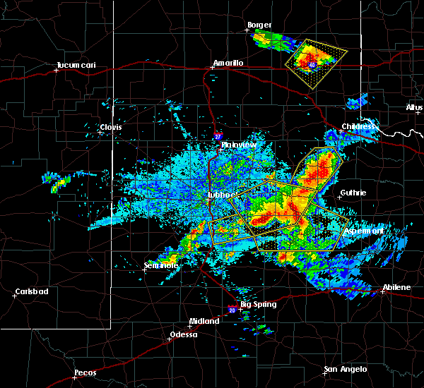 At 1001 pm cdt, a severe thunderstorm was located 6 miles north of clairemont, or 11 miles west of jayton, moving southeast at 25 mph (radar indicated). Hazards include 60 mph wind gusts and quarter size hail. Hail damage to vehicles is expected. Expect wind damage to roofs, siding, and trees. At 1001 pm cdt, a severe thunderstorm was located 6 miles north of clairemont, or 11 miles west of jayton, moving southeast at 25 mph (radar indicated). Hazards include 60 mph wind gusts and quarter size hail. Hail damage to vehicles is expected. Expect wind damage to roofs, siding, and trees.
|
| 6/5/2019 9:20 PM CDT |
 At 920 pm cdt, severe thunderstorms were located along a line extending from 13 miles west of truscott to 15 miles west of rochester to 8 miles north of rotan, moving east at 65 mph (radar indicated). Hazards include 70 mph wind gusts. Expect considerable tree damage. damage is likely to mobile homes, roofs, and outbuildings. Locations impacted include, aspermont, jayton, peacock, old glory and swenson. At 920 pm cdt, severe thunderstorms were located along a line extending from 13 miles west of truscott to 15 miles west of rochester to 8 miles north of rotan, moving east at 65 mph (radar indicated). Hazards include 70 mph wind gusts. Expect considerable tree damage. damage is likely to mobile homes, roofs, and outbuildings. Locations impacted include, aspermont, jayton, peacock, old glory and swenson.
|
| 6/5/2019 9:09 PM CDT |
 A severe thunderstorm warning remains in effect until 945 pm cdt for southeastern kent. king and stonewall counties. at 908 pm cdt, severe thunderstorms were located along a line extending from 6 miles southeast of grow to jayton to 11 miles southeast of clairemont, moving east at 30 mph. hazard. 70 mph wind gusts. A severe thunderstorm warning remains in effect until 945 pm cdt for southeastern kent. king and stonewall counties. at 908 pm cdt, severe thunderstorms were located along a line extending from 6 miles southeast of grow to jayton to 11 miles southeast of clairemont, moving east at 30 mph. hazard. 70 mph wind gusts.
|
| 6/5/2019 8:52 PM CDT |
 At 852 pm cdt, severe thunderstorms were located along a line extending from finney to 3 miles west of jayton to 11 miles south of clairemont, moving east at 35 mph (radar indicated). Hazards include 70 mph wind gusts. Expect considerable tree damage. damage is likely to mobile homes, roofs, and outbuildings. Locations impacted include, aspermont, jayton, guthrie, girard, grow, peacock, dumont, finney, old glory, swenson and clairemont. At 852 pm cdt, severe thunderstorms were located along a line extending from finney to 3 miles west of jayton to 11 miles south of clairemont, moving east at 35 mph (radar indicated). Hazards include 70 mph wind gusts. Expect considerable tree damage. damage is likely to mobile homes, roofs, and outbuildings. Locations impacted include, aspermont, jayton, guthrie, girard, grow, peacock, dumont, finney, old glory, swenson and clairemont.
|
| 6/5/2019 8:42 PM CDT |
 At 841 pm cdt, severe thunderstorms were located along a line extending from 3 miles southeast of dumont to 7 miles north of clairemont to 8 miles southeast of lake alan henry, moving east at 35 mph (radar indicated). Hazards include 70 mph wind gusts. Expect considerable tree damage. Damage is likely to mobile homes, roofs, and outbuildings. At 841 pm cdt, severe thunderstorms were located along a line extending from 3 miles southeast of dumont to 7 miles north of clairemont to 8 miles southeast of lake alan henry, moving east at 35 mph (radar indicated). Hazards include 70 mph wind gusts. Expect considerable tree damage. Damage is likely to mobile homes, roofs, and outbuildings.
|
| 5/20/2019 11:53 PM CDT |
 At 1152 pm cdt, severe thunderstorms were located along a line extending from 7 miles east of girard to near peacock to 11 miles north of rotan, moving northeast at 55 mph. these are very dangerous storms (radar indicated). Hazards include 80 mph wind gusts and quarter size hail. Flying debris will be dangerous to those caught without shelter. mobile homes will be heavily damaged. expect considerable damage to roofs, windows, and vehicles. extensive tree damage and power outages are likely. Locations impacted include, aspermont, jayton, girard, peacock, old glory and swenson. At 1152 pm cdt, severe thunderstorms were located along a line extending from 7 miles east of girard to near peacock to 11 miles north of rotan, moving northeast at 55 mph. these are very dangerous storms (radar indicated). Hazards include 80 mph wind gusts and quarter size hail. Flying debris will be dangerous to those caught without shelter. mobile homes will be heavily damaged. expect considerable damage to roofs, windows, and vehicles. extensive tree damage and power outages are likely. Locations impacted include, aspermont, jayton, girard, peacock, old glory and swenson.
|
| 5/20/2019 11:41 PM CDT | Quarter sized hail reported 0.4 miles SW of Jayton, TX, quarter size hail near jayton cemetary. |
| 5/20/2019 11:40 PM CDT |
 At 1139 pm cdt, severe thunderstorms were located along a line extending from 6 miles west of jayton to 8 miles northwest of rotan, moving northeast at 55 mph. these are very dangerous storms (radar indicated). Hazards include 80 mph wind gusts and quarter size hail. Flying debris will be dangerous to those caught without shelter. mobile homes will be heavily damaged. expect considerable damage to roofs, windows, and vehicles. Extensive tree damage and power outages are likely. At 1139 pm cdt, severe thunderstorms were located along a line extending from 6 miles west of jayton to 8 miles northwest of rotan, moving northeast at 55 mph. these are very dangerous storms (radar indicated). Hazards include 80 mph wind gusts and quarter size hail. Flying debris will be dangerous to those caught without shelter. mobile homes will be heavily damaged. expect considerable damage to roofs, windows, and vehicles. Extensive tree damage and power outages are likely.
|
| 5/3/2019 7:37 PM CDT | Golf Ball sized hail reported 5.6 miles NNE of Jayton, TX, us hwy 380 and fm 1083 |
| 5/3/2019 7:30 PM CDT |
 At 729 pm cdt, a severe thunderstorm was located 4 miles south of jayton, moving southeast at 25 mph (radar indicated). Hazards include ping pong ball size hail and 60 mph wind gusts. People and animals outdoors will be injured. expect hail damage to roofs, siding, windows, and vehicles. expect wind damage to roofs, siding, and trees. Locations impacted include, highway 380 between clairemont and jayton. At 729 pm cdt, a severe thunderstorm was located 4 miles south of jayton, moving southeast at 25 mph (radar indicated). Hazards include ping pong ball size hail and 60 mph wind gusts. People and animals outdoors will be injured. expect hail damage to roofs, siding, windows, and vehicles. expect wind damage to roofs, siding, and trees. Locations impacted include, highway 380 between clairemont and jayton.
|
| 5/3/2019 7:06 PM CDT |
 At 706 pm cdt, a severe thunderstorm was located 5 miles south of girard, or 7 miles west of jayton, moving southeast at 25 mph (radar indicated). Hazards include ping pong ball size hail and 60 mph wind gusts. People and animals outdoors will be injured. expect hail damage to roofs, siding, windows, and vehicles. Expect wind damage to roofs, siding, and trees. At 706 pm cdt, a severe thunderstorm was located 5 miles south of girard, or 7 miles west of jayton, moving southeast at 25 mph (radar indicated). Hazards include ping pong ball size hail and 60 mph wind gusts. People and animals outdoors will be injured. expect hail damage to roofs, siding, windows, and vehicles. Expect wind damage to roofs, siding, and trees.
|
| 4/27/2019 6:51 PM CDT |
 At 651 pm cdt, a severe thunderstorm was located over peacock, or 10 miles east of jayton, moving southeast at 25 mph (radar indicated). Hazards include golf ball size hail and 60 mph wind gusts. People and animals outdoors will be injured. expect hail damage to roofs, siding, windows, and vehicles. expect wind damage to roofs, siding, and trees. Locations impacted include, aspermont, jayton, peacock and swenson. At 651 pm cdt, a severe thunderstorm was located over peacock, or 10 miles east of jayton, moving southeast at 25 mph (radar indicated). Hazards include golf ball size hail and 60 mph wind gusts. People and animals outdoors will be injured. expect hail damage to roofs, siding, windows, and vehicles. expect wind damage to roofs, siding, and trees. Locations impacted include, aspermont, jayton, peacock and swenson.
|
| 4/27/2019 6:45 PM CDT | Baseball sized hail reported 1.9 miles NW of Jayton, TX |
| 4/27/2019 6:33 PM CDT |
 At 633 pm cdt, a severe thunderstorm was located 7 miles northeast of jayton, moving east at 20 mph (radar indicated). Hazards include 60 mph wind gusts and quarter size hail. Hail damage to vehicles is expected. Expect wind damage to roofs, siding, and trees. At 633 pm cdt, a severe thunderstorm was located 7 miles northeast of jayton, moving east at 20 mph (radar indicated). Hazards include 60 mph wind gusts and quarter size hail. Hail damage to vehicles is expected. Expect wind damage to roofs, siding, and trees.
|
| 4/27/2019 6:30 PM CDT | Storm damage reported in kent county TX, 1.2 miles NNW of Jayton, TX |
| 4/6/2019 1:24 AM CDT |
 The severe thunderstorm warning for northeastern kent, southeastern dickens, southwestern king and northwestern stonewall counties will expire at 130 am cdt, the storm which prompted the warning has weakened below severe limits, and no longer poses an immediate threat to life or property. therefore, the warning will be allowed to expire. however heavy rain is still possible with this thunderstorm. The severe thunderstorm warning for northeastern kent, southeastern dickens, southwestern king and northwestern stonewall counties will expire at 130 am cdt, the storm which prompted the warning has weakened below severe limits, and no longer poses an immediate threat to life or property. therefore, the warning will be allowed to expire. however heavy rain is still possible with this thunderstorm.
|
| 4/6/2019 1:01 AM CDT |
 At 101 am cdt, a severe thunderstorm was located 5 miles northeast of jayton, moving northeast at 40 mph (radar indicated). Hazards include 70 mph wind gusts and ping pong ball size hail. People and animals outdoors will be injured. expect hail damage to roofs, siding, windows, and vehicles. expect considerable tree damage. wind damage is also likely to mobile homes, roofs, and outbuildings. Locations impacted include, jayton. At 101 am cdt, a severe thunderstorm was located 5 miles northeast of jayton, moving northeast at 40 mph (radar indicated). Hazards include 70 mph wind gusts and ping pong ball size hail. People and animals outdoors will be injured. expect hail damage to roofs, siding, windows, and vehicles. expect considerable tree damage. wind damage is also likely to mobile homes, roofs, and outbuildings. Locations impacted include, jayton.
|
| 4/6/2019 12:53 AM CDT |
 At 1253 am cdt, a severe thunderstorm was located 5 miles north of jayton, moving northeast at 30 mph (radar indicated). Hazards include 70 mph wind gusts and nickel size hail. Expect considerable tree damage. damage is likely to mobile homes, roofs, and outbuildings. Locations impacted include, jayton. At 1253 am cdt, a severe thunderstorm was located 5 miles north of jayton, moving northeast at 30 mph (radar indicated). Hazards include 70 mph wind gusts and nickel size hail. Expect considerable tree damage. damage is likely to mobile homes, roofs, and outbuildings. Locations impacted include, jayton.
|
| 4/6/2019 12:38 AM CDT |
 At 1238 am cdt, a severe thunderstorm was located near jayton, moving northeast at 30 mph (radar indicated). Hazards include 70 mph wind gusts and nickel size hail. Expect considerable tree damage. Damage is likely to mobile homes, roofs, and outbuildings. At 1238 am cdt, a severe thunderstorm was located near jayton, moving northeast at 30 mph (radar indicated). Hazards include 70 mph wind gusts and nickel size hail. Expect considerable tree damage. Damage is likely to mobile homes, roofs, and outbuildings.
|
| 4/5/2019 11:50 PM CDT | Report of trees uprooted and transformers blown in jayto in kent county TX, 0.4 miles SW of Jayton, TX |
| 4/5/2019 10:04 PM CDT |
 At 1003 pm cdt, a severe thunderstorm was located 6 miles southeast of spur, moving northeast at 35 mph (radar indicated). Hazards include 60 mph wind gusts and quarter size hail. Hail damage to vehicles is expected. expect wind damage to roofs, siding, and trees. Locations impacted include, jayton and clairemont. At 1003 pm cdt, a severe thunderstorm was located 6 miles southeast of spur, moving northeast at 35 mph (radar indicated). Hazards include 60 mph wind gusts and quarter size hail. Hail damage to vehicles is expected. expect wind damage to roofs, siding, and trees. Locations impacted include, jayton and clairemont.
|
| 4/5/2019 9:52 PM CDT |
 At 950 pm cdt, a severe thunderstorm was located 6 miles west of clairemont, or 11 miles northeast of lake alan henry, moving northeast at 20 mph. a circulation was observed developing about 6 mile west of clairemont near highway 380 and tornado formation is possible (radar indicated). Hazards include 60 mph wind gusts and quarter size hail. Hail damage to vehicles is expected. expect wind damage to roofs, siding, and trees. Locations impacted include, spur, jayton, white river lake, kalgary and clairemont. At 950 pm cdt, a severe thunderstorm was located 6 miles west of clairemont, or 11 miles northeast of lake alan henry, moving northeast at 20 mph. a circulation was observed developing about 6 mile west of clairemont near highway 380 and tornado formation is possible (radar indicated). Hazards include 60 mph wind gusts and quarter size hail. Hail damage to vehicles is expected. expect wind damage to roofs, siding, and trees. Locations impacted include, spur, jayton, white river lake, kalgary and clairemont.
|
| 4/5/2019 9:39 PM CDT |
 At 939 pm cdt, a severe thunderstorm was located 12 miles north of lake alan henry, moving northeast at 35 mph (radar indicated). Hazards include 60 mph wind gusts and quarter size hail. half dollar size hail was reported near lake alan henry with this storm. Hail damage to vehicles is expected. expect wind damage to roofs, siding, and trees. Locations impacted include, spur, jayton, white river lake, kalgary and clairemont. At 939 pm cdt, a severe thunderstorm was located 12 miles north of lake alan henry, moving northeast at 35 mph (radar indicated). Hazards include 60 mph wind gusts and quarter size hail. half dollar size hail was reported near lake alan henry with this storm. Hail damage to vehicles is expected. expect wind damage to roofs, siding, and trees. Locations impacted include, spur, jayton, white river lake, kalgary and clairemont.
|
| 4/5/2019 9:20 PM CDT |
 At 920 pm cdt, a severe thunderstorm was located 4 miles northwest of lake alan henry, moving northeast at 35 mph (radar indicated). Hazards include 60 mph wind gusts and half dollar size hail. this storm produced quarter size hail at lake alan henry. Hail damage to vehicles is expected. expect wind damage to roofs, siding, and trees. Locations impacted include, spur, jayton, lake alan henry, white river lake, kalgary, justiceburg and clairemont. At 920 pm cdt, a severe thunderstorm was located 4 miles northwest of lake alan henry, moving northeast at 35 mph (radar indicated). Hazards include 60 mph wind gusts and half dollar size hail. this storm produced quarter size hail at lake alan henry. Hail damage to vehicles is expected. expect wind damage to roofs, siding, and trees. Locations impacted include, spur, jayton, lake alan henry, white river lake, kalgary, justiceburg and clairemont.
|
| 4/5/2019 9:11 PM CDT |
 At 910 pm cdt, a severe thunderstorm was located near justiceburg, or 5 miles west of lake alan henry, moving northeast at 35 mph (radar indicated). Hazards include 60 mph wind gusts and half dollar size hail. Hail damage to vehicles is expected. Expect wind damage to roofs, siding, and trees. At 910 pm cdt, a severe thunderstorm was located near justiceburg, or 5 miles west of lake alan henry, moving northeast at 35 mph (radar indicated). Hazards include 60 mph wind gusts and half dollar size hail. Hail damage to vehicles is expected. Expect wind damage to roofs, siding, and trees.
|
| 3/13/2019 12:14 AM CDT |
 At 1214 am cdt, severe thunderstorms were located along a line extending from near afton to 8 miles southwest of clairemont, moving east at 50 mph (radar indicated). Hazards include 60 mph wind gusts. Expect damage to roofs, siding, and trees. Locations impacted include, crosbyton, spur, jayton, dickens, lake alan henry, white river lake, kalgary, girard, afton, mcadoo and clairemont. At 1214 am cdt, severe thunderstorms were located along a line extending from near afton to 8 miles southwest of clairemont, moving east at 50 mph (radar indicated). Hazards include 60 mph wind gusts. Expect damage to roofs, siding, and trees. Locations impacted include, crosbyton, spur, jayton, dickens, lake alan henry, white river lake, kalgary, girard, afton, mcadoo and clairemont.
|
| 3/12/2019 11:57 PM CDT |
 At 1157 pm cdt, severe thunderstorms were located along a line extending from 10 miles northwest of mcadoo to 6 miles northeast of white river lake to near lake alan henry, moving northeast at 55 mph (radar indicated). Hazards include 60 mph wind gusts. Expect damage to roofs, siding, and trees. Locations impacted include, post, crosbyton, spur, jayton, dickens, lake alan henry, white river lake, ralls, kalgary, girard, justiceburg, afton, clairemont, caprock and mcadoo. At 1157 pm cdt, severe thunderstorms were located along a line extending from 10 miles northwest of mcadoo to 6 miles northeast of white river lake to near lake alan henry, moving northeast at 55 mph (radar indicated). Hazards include 60 mph wind gusts. Expect damage to roofs, siding, and trees. Locations impacted include, post, crosbyton, spur, jayton, dickens, lake alan henry, white river lake, ralls, kalgary, girard, justiceburg, afton, clairemont, caprock and mcadoo.
|
| 3/12/2019 11:40 PM CDT |
 At 1140 pm cdt, severe thunderstorms were located along a line extending from 7 miles northwest of caprock, moving northeast at 55 mph (radar indicated). Hazards include 60 mph wind gusts. Expect damage to roofs. Siding and trees. At 1140 pm cdt, severe thunderstorms were located along a line extending from 7 miles northwest of caprock, moving northeast at 55 mph (radar indicated). Hazards include 60 mph wind gusts. Expect damage to roofs. Siding and trees.
|
| 3/11/2019 7:45 PM CDT |
 At 744 pm cdt, a severe thunderstorm was located 5 miles northwest of clairemont, or 15 miles west of jayton, moving northeast at 30 mph (radar indicated). Hazards include quarter size hail. Damage to vehicles is expected. Locations impacted include, jayton, girard and clairemont. At 744 pm cdt, a severe thunderstorm was located 5 miles northwest of clairemont, or 15 miles west of jayton, moving northeast at 30 mph (radar indicated). Hazards include quarter size hail. Damage to vehicles is expected. Locations impacted include, jayton, girard and clairemont.
|
| 3/11/2019 7:31 PM CDT |
 At 731 pm cdt, a severe thunderstorm was located 9 miles northeast of lake alan henry, moving northeast at 30 mph (radar indicated). Hazards include quarter size hail. damage to vehicles is expected At 731 pm cdt, a severe thunderstorm was located 9 miles northeast of lake alan henry, moving northeast at 30 mph (radar indicated). Hazards include quarter size hail. damage to vehicles is expected
|
| 6/10/2018 9:11 PM CDT |
 At 910 pm cdt, a severe thunderstorm was located near jayton, moving east at 55 mph (radar indicated). Hazards include 60 mph wind gusts and nickel size hail. Expect damage to roofs, siding, and trees. Locations impacted include, jayton, girard and swenson. At 910 pm cdt, a severe thunderstorm was located near jayton, moving east at 55 mph (radar indicated). Hazards include 60 mph wind gusts and nickel size hail. Expect damage to roofs, siding, and trees. Locations impacted include, jayton, girard and swenson.
|
| 6/10/2018 8:43 PM CDT |
 At 843 pm cdt, a severe thunderstorm was located near girard, or 9 miles northwest of jayton, moving east at 40 mph (radar indicated). Hazards include 60 mph wind gusts and half dollar size hail. Hail damage to vehicles is expected. Expect wind damage to roofs, siding, and trees. At 843 pm cdt, a severe thunderstorm was located near girard, or 9 miles northwest of jayton, moving east at 40 mph (radar indicated). Hazards include 60 mph wind gusts and half dollar size hail. Hail damage to vehicles is expected. Expect wind damage to roofs, siding, and trees.
|
| 6/10/2018 6:30 PM CDT |
 At 629 pm cdt, a severe thunderstorm was located over spur, moving east at 40 mph (radar indicated). Hazards include 60 mph wind gusts and quarter size hail. Hail damage to vehicles is expected. expect wind damage to roofs, siding, and trees. Locations impacted include, spur, jayton, dickens and girard. At 629 pm cdt, a severe thunderstorm was located over spur, moving east at 40 mph (radar indicated). Hazards include 60 mph wind gusts and quarter size hail. Hail damage to vehicles is expected. expect wind damage to roofs, siding, and trees. Locations impacted include, spur, jayton, dickens and girard.
|
| 6/10/2018 6:11 PM CDT |
 At 611 pm cdt, a severe thunderstorm was located near white river lake, moving east at 40 mph (radar indicated). Hazards include 70 mph wind gusts and half dollar size hail. Hail damage to vehicles is expected. expect considerable tree damage. Wind damage is also likely to mobile homes, roofs, and outbuildings. At 611 pm cdt, a severe thunderstorm was located near white river lake, moving east at 40 mph (radar indicated). Hazards include 70 mph wind gusts and half dollar size hail. Hail damage to vehicles is expected. expect considerable tree damage. Wind damage is also likely to mobile homes, roofs, and outbuildings.
|
| 6/7/2018 8:32 PM CDT |
 At 828 pm cdt, a severe thunderstorm was located 10 miles southeast of clairemont, or 11 miles south of jayton, moving east at 10 mph. two additional strong to severe storms were located 10 miles southwest of aspermont and 10 miles south of old glory, moving east to northeast at 15 mph (radar indicated). Hazards include 60 mph wind gusts and half dollar size hail. Hail damage to vehicles is expected. expect wind damage to roofs, siding, and trees. Locations impacted include, aspermont, jayton, peacock, old glory, swenson and clairemont. At 828 pm cdt, a severe thunderstorm was located 10 miles southeast of clairemont, or 11 miles south of jayton, moving east at 10 mph. two additional strong to severe storms were located 10 miles southwest of aspermont and 10 miles south of old glory, moving east to northeast at 15 mph (radar indicated). Hazards include 60 mph wind gusts and half dollar size hail. Hail damage to vehicles is expected. expect wind damage to roofs, siding, and trees. Locations impacted include, aspermont, jayton, peacock, old glory, swenson and clairemont.
|
| 6/7/2018 8:07 PM CDT |
 At 804 pm cdt, a severe thunderstorm was located 8 miles north of aspermont, moving northeast at 15 mph. additional strong to severe storms were embedded in the larger cluster of storms. one more intense storm was located between jayton and clairemont and another was 10 miles southwest of guthrie (radar indicated). Hazards include 60 mph wind gusts and quarter size hail. Hail damage to vehicles is expected. expect wind damage to roofs, siding, and trees. Locations impacted include, aspermont, jayton, guthrie, girard, peacock, old glory, swenson and clairemont. At 804 pm cdt, a severe thunderstorm was located 8 miles north of aspermont, moving northeast at 15 mph. additional strong to severe storms were embedded in the larger cluster of storms. one more intense storm was located between jayton and clairemont and another was 10 miles southwest of guthrie (radar indicated). Hazards include 60 mph wind gusts and quarter size hail. Hail damage to vehicles is expected. expect wind damage to roofs, siding, and trees. Locations impacted include, aspermont, jayton, guthrie, girard, peacock, old glory, swenson and clairemont.
|
| 6/7/2018 7:43 PM CDT |
 At 742 pm cdt, a severe thunderstorm was located 7 miles southeast of clairemont, or 12 miles southwest of jayton, moving east at 30 mph. additional severe storms were located near swenson and 5 miles east of guthrie (radar indicated). Hazards include 60 mph wind gusts and quarter size hail. Hail damage to vehicles is expected. Expect wind damage to roofs, siding, and trees. At 742 pm cdt, a severe thunderstorm was located 7 miles southeast of clairemont, or 12 miles southwest of jayton, moving east at 30 mph. additional severe storms were located near swenson and 5 miles east of guthrie (radar indicated). Hazards include 60 mph wind gusts and quarter size hail. Hail damage to vehicles is expected. Expect wind damage to roofs, siding, and trees.
|
| 6/1/2018 9:00 PM CDT | Ping Pong Ball sized hail reported 6.1 miles WNW of Jayton, TX |
| 6/1/2018 8:56 PM CDT | Storm damage reported in stonewall county TX, 5.3 miles WNW of Jayton, TX |
| 6/1/2018 8:52 PM CDT |
 At 852 pm cdt, a severe thunderstorm was located near peacock, or 8 miles southeast of jayton, moving southeast at 30 mph (radar indicated). Hazards include two inch hail and 70 mph wind gusts. People and animals outdoors will be injured. expect hail damage to roofs, siding, windows, and vehicles. expect considerable tree damage. Wind damage is also likely to mobile homes, roofs, and outbuildings. At 852 pm cdt, a severe thunderstorm was located near peacock, or 8 miles southeast of jayton, moving southeast at 30 mph (radar indicated). Hazards include two inch hail and 70 mph wind gusts. People and animals outdoors will be injured. expect hail damage to roofs, siding, windows, and vehicles. expect considerable tree damage. Wind damage is also likely to mobile homes, roofs, and outbuildings.
|
| 6/1/2018 8:41 PM CDT |
 At 841 pm cdt, a severe thunderstorm was located 7 miles south of jayton, moving southeast at 30 mph (radar indicated). Hazards include tennis ball size hail and 70 mph wind gusts. People and animals outdoors will be injured. expect hail damage to roofs, siding, windows, and vehicles. expect considerable tree damage. Wind damage is also likely to mobile homes, roofs, and outbuildings. At 841 pm cdt, a severe thunderstorm was located 7 miles south of jayton, moving southeast at 30 mph (radar indicated). Hazards include tennis ball size hail and 70 mph wind gusts. People and animals outdoors will be injured. expect hail damage to roofs, siding, windows, and vehicles. expect considerable tree damage. Wind damage is also likely to mobile homes, roofs, and outbuildings.
|
| 6/1/2018 8:25 PM CDT |
 At 825 pm cdt, a severe thunderstorm was located near clairemont, or near jayton, moving east at 35 mph (law enforcement). Hazards include golf ball size hail and 70 mph wind gusts. People and animals outdoors will be injured. expect hail damage to roofs, siding, windows, and vehicles. expect considerable tree damage. wind damage is also likely to mobile homes, roofs, and outbuildings. Locations impacted include, jayton and girard. At 825 pm cdt, a severe thunderstorm was located near clairemont, or near jayton, moving east at 35 mph (law enforcement). Hazards include golf ball size hail and 70 mph wind gusts. People and animals outdoors will be injured. expect hail damage to roofs, siding, windows, and vehicles. expect considerable tree damage. wind damage is also likely to mobile homes, roofs, and outbuildings. Locations impacted include, jayton and girard.
|
| 6/1/2018 8:20 PM CDT |
 At 819 pm cdt, a severe thunderstorm was located 7 miles north of clairemont, or 11 miles west of jayton, moving east at 25 mph. golf ball size hail was reported 6 miles north northeast of claremont at 815 pm (law enforcement indicated). Hazards include golf ball size hail and 70 mph wind gusts. People and animals outdoors will be injured. expect hail damage to roofs, siding, windows, and vehicles. expect considerable tree damage. wind damage is also likely to mobile homes, roofs, and outbuildings. Locations impacted include, jayton and girard. At 819 pm cdt, a severe thunderstorm was located 7 miles north of clairemont, or 11 miles west of jayton, moving east at 25 mph. golf ball size hail was reported 6 miles north northeast of claremont at 815 pm (law enforcement indicated). Hazards include golf ball size hail and 70 mph wind gusts. People and animals outdoors will be injured. expect hail damage to roofs, siding, windows, and vehicles. expect considerable tree damage. wind damage is also likely to mobile homes, roofs, and outbuildings. Locations impacted include, jayton and girard.
|
| 6/1/2018 8:15 PM CDT |
 At 815 pm cdt, a severe thunderstorm was located 7 miles north of clairemont, or 12 miles west of jayton, moving east at 25 mph (radar indicated). Hazards include 70 mph wind gusts and half dollar size hail. Hail damage to vehicles is expected. expect considerable tree damage. wind damage is also likely to mobile homes, roofs, and outbuildings. Locations impacted include, jayton and girard. At 815 pm cdt, a severe thunderstorm was located 7 miles north of clairemont, or 12 miles west of jayton, moving east at 25 mph (radar indicated). Hazards include 70 mph wind gusts and half dollar size hail. Hail damage to vehicles is expected. expect considerable tree damage. wind damage is also likely to mobile homes, roofs, and outbuildings. Locations impacted include, jayton and girard.
|
| 6/1/2018 8:14 PM CDT | Golf Ball sized hail reported 16.5 miles E of Jayton, TX, reported by coop observer. |
| 6/1/2018 8:02 PM CDT |
 At 801 pm cdt, a severe thunderstorm was located near girard, or near jayton, moving southeast at 20 mph. a second storm was located 7 miles northwest of claremont moving northeast near 30 mph (radar indicated). Hazards include 70 mph wind gusts and quarter size hail. Hail damage to vehicles is expected. expect considerable tree damage. Wind damage is also likely to mobile homes, roofs, and outbuildings. At 801 pm cdt, a severe thunderstorm was located near girard, or near jayton, moving southeast at 20 mph. a second storm was located 7 miles northwest of claremont moving northeast near 30 mph (radar indicated). Hazards include 70 mph wind gusts and quarter size hail. Hail damage to vehicles is expected. expect considerable tree damage. Wind damage is also likely to mobile homes, roofs, and outbuildings.
|
| 6/1/2018 7:54 PM CDT |
 At 753 pm cdt, a severe thunderstorm was located near girard, or near jayton, moving southeast at 20 mph (radar indicated). Hazards include 70 mph wind gusts and quarter size hail. Hail damage to vehicles is expected. expect considerable tree damage. wind damage is also likely to mobile homes, roofs, and outbuildings. Locations impacted include, jayton and girard. At 753 pm cdt, a severe thunderstorm was located near girard, or near jayton, moving southeast at 20 mph (radar indicated). Hazards include 70 mph wind gusts and quarter size hail. Hail damage to vehicles is expected. expect considerable tree damage. wind damage is also likely to mobile homes, roofs, and outbuildings. Locations impacted include, jayton and girard.
|
| 6/1/2018 7:43 PM CDT |
 At 742 pm cdt, a severe thunderstorm was located near girard, or near jayton, moving southeast at 25 mph. this storm has a history of large hail and damaging winds (radar indicated). Hazards include golf ball size hail and 70 mph wind gusts. People and animals outdoors will be injured. expect hail damage to roofs, siding, windows, and vehicles. expect considerable tree damage. wind damage is also likely to mobile homes, roofs, and outbuildings. Locations impacted include, jayton and girard. At 742 pm cdt, a severe thunderstorm was located near girard, or near jayton, moving southeast at 25 mph. this storm has a history of large hail and damaging winds (radar indicated). Hazards include golf ball size hail and 70 mph wind gusts. People and animals outdoors will be injured. expect hail damage to roofs, siding, windows, and vehicles. expect considerable tree damage. wind damage is also likely to mobile homes, roofs, and outbuildings. Locations impacted include, jayton and girard.
|
| 6/1/2018 7:36 PM CDT |
 At 735 pm cdt, a severe thunderstorm was located near girard, or 9 miles northwest of jayton, moving southeast at 25 mph. an elevated low level circulation is located about 4 miles west of girard. a short lived tornado is possible (radar indicated). Hazards include 70 mph wind gusts and ping pong ball size hail. People and animals outdoors will be injured. expect hail damage to roofs, siding, windows, and vehicles. expect considerable tree damage. wind damage is also likely to mobile homes, roofs, and outbuildings. Locations impacted include, spur, jayton and girard. At 735 pm cdt, a severe thunderstorm was located near girard, or 9 miles northwest of jayton, moving southeast at 25 mph. an elevated low level circulation is located about 4 miles west of girard. a short lived tornado is possible (radar indicated). Hazards include 70 mph wind gusts and ping pong ball size hail. People and animals outdoors will be injured. expect hail damage to roofs, siding, windows, and vehicles. expect considerable tree damage. wind damage is also likely to mobile homes, roofs, and outbuildings. Locations impacted include, spur, jayton and girard.
|
| 6/1/2018 7:25 PM CDT |
 At 724 pm cdt, a severe thunderstorm was located near girard, or 8 miles southeast of spur, moving southeast at 25 mph. this storm continues to show a low level circulation about 5 miles west of girard (radar indicated). Hazards include golf ball size hail and 70 mph wind gusts. People and animals outdoors will be injured. expect hail damage to roofs, siding, windows, and vehicles. expect considerable tree damage. wind damage is also likely to mobile homes, roofs, and outbuildings. Locations impacted include, spur, jayton and girard. At 724 pm cdt, a severe thunderstorm was located near girard, or 8 miles southeast of spur, moving southeast at 25 mph. this storm continues to show a low level circulation about 5 miles west of girard (radar indicated). Hazards include golf ball size hail and 70 mph wind gusts. People and animals outdoors will be injured. expect hail damage to roofs, siding, windows, and vehicles. expect considerable tree damage. wind damage is also likely to mobile homes, roofs, and outbuildings. Locations impacted include, spur, jayton and girard.
|
| 6/1/2018 7:16 PM CDT |
 At 713 pm cdt, a severe thunderstorm was located near spur, moving southeast at 25 mph. a low level circulation was locate 2 miles southwest of spur. this storm has a history of large hail near spur (law enforcement reported). Hazards include 70 mph wind gusts and half dollar size hail. Hail damage to vehicles is expected. expect considerable tree damage. wind damage is also likely to mobile homes, roofs, and outbuildings. Locations impacted include, spur, jayton, dickens and girard. At 713 pm cdt, a severe thunderstorm was located near spur, moving southeast at 25 mph. a low level circulation was locate 2 miles southwest of spur. this storm has a history of large hail near spur (law enforcement reported). Hazards include 70 mph wind gusts and half dollar size hail. Hail damage to vehicles is expected. expect considerable tree damage. wind damage is also likely to mobile homes, roofs, and outbuildings. Locations impacted include, spur, jayton, dickens and girard.
|
| 6/1/2018 7:11 PM CDT |
 At 710 pm cdt, a severe thunderstorm was located over spur, moving southeast at 25 mph. this storm has a history of large hail and damaging winds (radar indicated). Hazards include 70 mph wind gusts and quarter size hail. Hail damage to vehicles is expected. expect considerable tree damage. Wind damage is also likely to mobile homes, roofs, and outbuildings. At 710 pm cdt, a severe thunderstorm was located over spur, moving southeast at 25 mph. this storm has a history of large hail and damaging winds (radar indicated). Hazards include 70 mph wind gusts and quarter size hail. Hail damage to vehicles is expected. expect considerable tree damage. Wind damage is also likely to mobile homes, roofs, and outbuildings.
|
| 5/20/2018 12:07 AM CDT |
 The severe thunderstorm warning for eastern kent, southeastern dickens, southwestern king and western stonewall counties will expire at 1215 am cdt, the storm which prompted the warning has weakened below severe limits, and no longer poses an immediate threat to life or property. therefore the warning will be allowed to expire. however small hail, gusty winds and heavy rain are still possible with this thunderstorm. a severe thunderstorm watch remains in effect until 100 am cdt for northwestern texas. The severe thunderstorm warning for eastern kent, southeastern dickens, southwestern king and western stonewall counties will expire at 1215 am cdt, the storm which prompted the warning has weakened below severe limits, and no longer poses an immediate threat to life or property. therefore the warning will be allowed to expire. however small hail, gusty winds and heavy rain are still possible with this thunderstorm. a severe thunderstorm watch remains in effect until 100 am cdt for northwestern texas.
|
| 5/19/2018 11:50 PM CDT |
 At 1150 pm cdt, a severe thunderstorm was located over jayton, moving east at 25 mph (radar indicated). Hazards include 60 mph wind gusts and half dollar size hail. Hail damage to vehicles is expected. expect wind damage to roofs, siding, and trees. Locations impacted include, jayton, girard, peacock and clairemont. At 1150 pm cdt, a severe thunderstorm was located over jayton, moving east at 25 mph (radar indicated). Hazards include 60 mph wind gusts and half dollar size hail. Hail damage to vehicles is expected. expect wind damage to roofs, siding, and trees. Locations impacted include, jayton, girard, peacock and clairemont.
|
| 5/19/2018 11:35 PM CDT |
 At 1135 pm cdt, a severe thunderstorm was located near jayton, moving east at 20 mph (radar indicated). Hazards include 60 mph wind gusts and half dollar size hail. Hail damage to vehicles is expected. expect wind damage to roofs, siding, and trees. Locations impacted include, jayton, girard, peacock and clairemont. At 1135 pm cdt, a severe thunderstorm was located near jayton, moving east at 20 mph (radar indicated). Hazards include 60 mph wind gusts and half dollar size hail. Hail damage to vehicles is expected. expect wind damage to roofs, siding, and trees. Locations impacted include, jayton, girard, peacock and clairemont.
|
| 5/19/2018 11:14 PM CDT |
 At 1112 pm cdt, a severe thunderstorm was located 7 miles north of clairemont, or 11 miles west of jayton, moving east at 25 mph (radar indicated). Hazards include 60 mph wind gusts and half dollar size hail. Hail damage to vehicles is expected. Expect wind damage to roofs, siding, and trees. At 1112 pm cdt, a severe thunderstorm was located 7 miles north of clairemont, or 11 miles west of jayton, moving east at 25 mph (radar indicated). Hazards include 60 mph wind gusts and half dollar size hail. Hail damage to vehicles is expected. Expect wind damage to roofs, siding, and trees.
|
| 5/19/2018 10:58 PM CDT |
 At 1058 pm cdt, a severe thunderstorm was located 8 miles south of spur, moving east at 20 mph (radar indicated). Hazards include ping pong ball size hail and 60 mph wind gusts. People and animals outdoors will be injured. expect hail damage to roofs, siding, windows, and vehicles. expect wind damage to roofs, siding, and trees. Locations impacted include, spur, jayton, girard and clairemont. At 1058 pm cdt, a severe thunderstorm was located 8 miles south of spur, moving east at 20 mph (radar indicated). Hazards include ping pong ball size hail and 60 mph wind gusts. People and animals outdoors will be injured. expect hail damage to roofs, siding, windows, and vehicles. expect wind damage to roofs, siding, and trees. Locations impacted include, spur, jayton, girard and clairemont.
|
| 5/19/2018 10:45 PM CDT |
 At 1045 pm cdt, a severe thunderstorm was located 9 miles southwest of spur, moving east at 30 mph (radar indicated). Hazards include ping pong ball size hail and 60 mph wind gusts. People and animals outdoors will be injured. expect hail damage to roofs, siding, windows, and vehicles. Expect wind damage to roofs, siding, and trees. At 1045 pm cdt, a severe thunderstorm was located 9 miles southwest of spur, moving east at 30 mph (radar indicated). Hazards include ping pong ball size hail and 60 mph wind gusts. People and animals outdoors will be injured. expect hail damage to roofs, siding, windows, and vehicles. Expect wind damage to roofs, siding, and trees.
|
| 5/14/2018 4:55 PM CDT |
 At 455 pm cdt, a severe thunderstorm was located 7 miles north of clairemont, or 11 miles west of jayton, moving northeast at 15 mph (radar indicated). Hazards include ping pong ball size hail and 60 mph wind gusts. People and animals outdoors will be injured. expect hail damage to roofs, siding, windows, and vehicles. expect wind damage to roofs, siding, and trees. Locations impacted include, jayton, girard and clairemont. At 455 pm cdt, a severe thunderstorm was located 7 miles north of clairemont, or 11 miles west of jayton, moving northeast at 15 mph (radar indicated). Hazards include ping pong ball size hail and 60 mph wind gusts. People and animals outdoors will be injured. expect hail damage to roofs, siding, windows, and vehicles. expect wind damage to roofs, siding, and trees. Locations impacted include, jayton, girard and clairemont.
|
| 5/14/2018 4:35 PM CDT |
 At 435 pm cdt, a severe thunderstorm was located near girard, or 8 miles southeast of spur, moving northeast at 20 mph (radar indicated). Hazards include 60 mph wind gusts and quarter size hail. Hail damage to vehicles is expected. expect wind damage to roofs, siding, and trees. Locations impacted include, jayton, girard and clairemont. At 435 pm cdt, a severe thunderstorm was located near girard, or 8 miles southeast of spur, moving northeast at 20 mph (radar indicated). Hazards include 60 mph wind gusts and quarter size hail. Hail damage to vehicles is expected. expect wind damage to roofs, siding, and trees. Locations impacted include, jayton, girard and clairemont.
|
| 5/14/2018 4:17 PM CDT |
 At 416 pm cdt, a severe thunderstorm was located 9 miles west of girard, or 11 miles south of spur, moving northeast at 20 mph (radar indicated). Hazards include 60 mph wind gusts and half dollar size hail. Hail damage to vehicles is expected. Expect wind damage to roofs, siding, and trees. At 416 pm cdt, a severe thunderstorm was located 9 miles west of girard, or 11 miles south of spur, moving northeast at 20 mph (radar indicated). Hazards include 60 mph wind gusts and half dollar size hail. Hail damage to vehicles is expected. Expect wind damage to roofs, siding, and trees.
|
| 7/4/2017 7:39 PM CDT |
 At 738 pm cdt, a severe thunderstorm was located over jayton, moving east at 5 mph. a cooperative observer in jayton reported half dollar size hail at 737pm (trained weather spotters). Hazards include 60 mph wind gusts and half dollar size hail. Hail damage to vehicles is expected. expect wind damage to roofs, siding, and trees. Locations impacted include, jayton. At 738 pm cdt, a severe thunderstorm was located over jayton, moving east at 5 mph. a cooperative observer in jayton reported half dollar size hail at 737pm (trained weather spotters). Hazards include 60 mph wind gusts and half dollar size hail. Hail damage to vehicles is expected. expect wind damage to roofs, siding, and trees. Locations impacted include, jayton.
|
| 7/4/2017 7:37 PM CDT | Half Dollar sized hail reported 0.4 miles SW of Jayton, TX, pea to half dollar size hail. reported by nws cooperative observer. |
| 7/4/2017 7:22 PM CDT |
 At 717 pm cdt, a severe thunderstorm was located over jayton, moving east at 15 mph (radar indicated). Hazards include 60 mph wind gusts and quarter size hail. Hail damage to vehicles is expected. expect wind damage to roofs, siding, and trees. Locations impacted include, jayton. At 717 pm cdt, a severe thunderstorm was located over jayton, moving east at 15 mph (radar indicated). Hazards include 60 mph wind gusts and quarter size hail. Hail damage to vehicles is expected. expect wind damage to roofs, siding, and trees. Locations impacted include, jayton.
|
| 7/4/2017 7:03 PM CDT |
 At 702 pm cdt, a severe thunderstorm was located near jayton, moving northeast at 10 mph (radar indicated). Hazards include 60 mph wind gusts and quarter size hail. Hail damage to vehicles is expected. Expect wind damage to roofs, siding, and trees. At 702 pm cdt, a severe thunderstorm was located near jayton, moving northeast at 10 mph (radar indicated). Hazards include 60 mph wind gusts and quarter size hail. Hail damage to vehicles is expected. Expect wind damage to roofs, siding, and trees.
|
| 7/3/2017 9:48 PM CDT |
 At 947 pm cdt, severe thunderstorms were located along a line extending from 6 miles east of guthrie to 11 miles northeast of jayton to 7 miles northeast of lake alan henry, moving southeast at 55 mph (radar indicated). Hazards include 60 mph wind gusts. Expect damage to roofs, siding, and trees. Locations impacted include, spur, jayton, guthrie, lake alan henry, girard, peacock, swenson and clairemont. At 947 pm cdt, severe thunderstorms were located along a line extending from 6 miles east of guthrie to 11 miles northeast of jayton to 7 miles northeast of lake alan henry, moving southeast at 55 mph (radar indicated). Hazards include 60 mph wind gusts. Expect damage to roofs, siding, and trees. Locations impacted include, spur, jayton, guthrie, lake alan henry, girard, peacock, swenson and clairemont.
|
| 7/3/2017 9:34 PM CDT |
 At 934 pm cdt, severe thunderstorms were located along a line extending from near guthrie to 10 miles north of lake alan henry, moving east at 30 mph (radar indicated). Hazards include 70 mph wind gusts. Expect considerable tree damage. Damage is likely to mobile homes, roofs, and outbuildings. At 934 pm cdt, severe thunderstorms were located along a line extending from near guthrie to 10 miles north of lake alan henry, moving east at 30 mph (radar indicated). Hazards include 70 mph wind gusts. Expect considerable tree damage. Damage is likely to mobile homes, roofs, and outbuildings.
|
| 6/30/2017 7:48 PM CDT |
 At 748 pm cdt, a severe thunderstorm was located near girard, or near jayton, moving northeast at 10 mph (radar indicated). Hazards include 60 mph wind gusts and quarter size hail. Hail damage to vehicles is expected. expect wind damage to roofs, siding, and trees. Locations impacted include, jayton, girard, peacock and swenson. At 748 pm cdt, a severe thunderstorm was located near girard, or near jayton, moving northeast at 10 mph (radar indicated). Hazards include 60 mph wind gusts and quarter size hail. Hail damage to vehicles is expected. expect wind damage to roofs, siding, and trees. Locations impacted include, jayton, girard, peacock and swenson.
|
| 6/30/2017 7:33 PM CDT |
 At 733 pm cdt, a severe thunderstorm was located near jayton, moving northeast at 10 mph (radar indicated). Hazards include 60 mph wind gusts and quarter size hail. Hail damage to vehicles is expected. Expect wind damage to roofs, siding, and trees. At 733 pm cdt, a severe thunderstorm was located near jayton, moving northeast at 10 mph (radar indicated). Hazards include 60 mph wind gusts and quarter size hail. Hail damage to vehicles is expected. Expect wind damage to roofs, siding, and trees.
|
| 6/30/2017 7:27 PM CDT | Quarter sized hail reported 0.4 miles SW of Jayton, TX, from the kent county s.o. |
| 6/30/2017 6:55 PM CDT |
 A severe thunderstorm warning remains in effect until 715 pm cdt for east central kent and western stonewall counties. at 655 pm cdt, a severe thunderstorm was located near jayton, moving east at 15 mph. hazard. 60 mph wind gusts and quarter size hail. source. Radar indicated. A severe thunderstorm warning remains in effect until 715 pm cdt for east central kent and western stonewall counties. at 655 pm cdt, a severe thunderstorm was located near jayton, moving east at 15 mph. hazard. 60 mph wind gusts and quarter size hail. source. Radar indicated.
|
| 6/30/2017 6:45 PM CDT |
 At 645 pm cdt, a severe thunderstorm was located near jayton, moving east at 15 mph (radar indicated). Hazards include 60 mph wind gusts and quarter size hail. Hail damage to vehicles is expected. Expect wind damage to roofs, siding, and trees. At 645 pm cdt, a severe thunderstorm was located near jayton, moving east at 15 mph (radar indicated). Hazards include 60 mph wind gusts and quarter size hail. Hail damage to vehicles is expected. Expect wind damage to roofs, siding, and trees.
|
| 6/14/2017 8:03 PM CDT |
 At 803 pm cdt, a severe thunderstorm was located near jayton, moving east at 45 mph (radar indicated). Hazards include golf ball size hail and 60 mph wind gusts. People and animals outdoors will be injured. expect hail damage to roofs, siding, windows, and vehicles. expect wind damage to roofs, siding, and trees. Locations impacted include, jayton, girard and swenson. At 803 pm cdt, a severe thunderstorm was located near jayton, moving east at 45 mph (radar indicated). Hazards include golf ball size hail and 60 mph wind gusts. People and animals outdoors will be injured. expect hail damage to roofs, siding, windows, and vehicles. expect wind damage to roofs, siding, and trees. Locations impacted include, jayton, girard and swenson.
|
| 6/14/2017 7:49 PM CDT |
 At 748 pm cdt, a severe thunderstorm was located near girard, or 9 miles northwest of jayton, moving northeast at 35 mph (radar indicated). Hazards include golf ball size hail and 60 mph wind gusts. People and animals outdoors will be injured. expect hail damage to roofs, siding, windows, and vehicles. Expect wind damage to roofs, siding, and trees. At 748 pm cdt, a severe thunderstorm was located near girard, or 9 miles northwest of jayton, moving northeast at 35 mph (radar indicated). Hazards include golf ball size hail and 60 mph wind gusts. People and animals outdoors will be injured. expect hail damage to roofs, siding, windows, and vehicles. Expect wind damage to roofs, siding, and trees.
|
| 5/22/2017 5:48 PM CDT |
 At 548 pm cdt, a severe thunderstorm was located 8 miles southwest of peacock, or 9 miles south of jayton, moving east at 30 mph. this is a very dangerous storm (radar indicated). Hazards include baseball size hail and 60 mph wind gusts. People and animals outdoors will be severely injured. expect shattered windows, extensive damage to roofs, siding, and vehicles. Locations impacted include, jayton and peacock. At 548 pm cdt, a severe thunderstorm was located 8 miles southwest of peacock, or 9 miles south of jayton, moving east at 30 mph. this is a very dangerous storm (radar indicated). Hazards include baseball size hail and 60 mph wind gusts. People and animals outdoors will be severely injured. expect shattered windows, extensive damage to roofs, siding, and vehicles. Locations impacted include, jayton and peacock.
|
| 5/22/2017 5:42 PM CDT |
 At 541 pm cdt, a severe thunderstorm was located 8 miles south of jayton, moving east at 30 mph. this is a very dangerous storm (trained weather spotters). Hazards include baseball size hail and 60 mph wind gusts. People and animals outdoors will be severely injured. expect shattered windows, extensive damage to roofs, siding, and vehicles. Locations impacted include, jayton, peacock and clairemont. At 541 pm cdt, a severe thunderstorm was located 8 miles south of jayton, moving east at 30 mph. this is a very dangerous storm (trained weather spotters). Hazards include baseball size hail and 60 mph wind gusts. People and animals outdoors will be severely injured. expect shattered windows, extensive damage to roofs, siding, and vehicles. Locations impacted include, jayton, peacock and clairemont.
|
| 5/22/2017 5:36 PM CDT |
 At 535 pm cdt, a severe thunderstorm was located near jayton, moving east at 30 mph (trained weather spotters). Hazards include tennis ball size hail and 60 mph wind gusts. People and animals outdoors will be injured. expect hail damage to roofs, siding, windows, and vehicles. expect wind damage to roofs, siding, and trees. Locations impacted include, jayton, peacock and clairemont. At 535 pm cdt, a severe thunderstorm was located near jayton, moving east at 30 mph (trained weather spotters). Hazards include tennis ball size hail and 60 mph wind gusts. People and animals outdoors will be injured. expect hail damage to roofs, siding, windows, and vehicles. expect wind damage to roofs, siding, and trees. Locations impacted include, jayton, peacock and clairemont.
|
| 5/22/2017 5:29 PM CDT |
 At 528 pm cdt, a severe thunderstorm was located near clairemont, or near jayton, moving east at 30 mph (trained weather spotters. at 527 pm 1.5 inch hail was reported 3 miles east of clairemont). Hazards include two inch hail and 60 mph wind gusts. People and animals outdoors will be injured. expect hail damage to roofs, siding, windows, and vehicles. expect wind damage to roofs, siding, and trees. Locations impacted include, jayton, girard, peacock and clairemont. At 528 pm cdt, a severe thunderstorm was located near clairemont, or near jayton, moving east at 30 mph (trained weather spotters. at 527 pm 1.5 inch hail was reported 3 miles east of clairemont). Hazards include two inch hail and 60 mph wind gusts. People and animals outdoors will be injured. expect hail damage to roofs, siding, windows, and vehicles. expect wind damage to roofs, siding, and trees. Locations impacted include, jayton, girard, peacock and clairemont.
|
| 5/22/2017 5:20 PM CDT |
 At 520 pm cdt, a severe thunderstorm was located near clairemont, or 9 miles west of jayton, moving east at 30 mph (radar indicated). Hazards include two inch hail and 60 mph wind gusts. People and animals outdoors will be injured. expect hail damage to roofs, siding, windows, and vehicles. expect wind damage to roofs, siding, and trees. Locations impacted include, jayton, girard, peacock and clairemont. At 520 pm cdt, a severe thunderstorm was located near clairemont, or 9 miles west of jayton, moving east at 30 mph (radar indicated). Hazards include two inch hail and 60 mph wind gusts. People and animals outdoors will be injured. expect hail damage to roofs, siding, windows, and vehicles. expect wind damage to roofs, siding, and trees. Locations impacted include, jayton, girard, peacock and clairemont.
|
| 5/22/2017 5:14 PM CDT |
 At 514 pm cdt, a severe thunderstorm was located near clairemont, or 12 miles west of jayton, moving east at 30 mph (radar indicated). Hazards include golf ball size hail and 60 mph wind gusts. People and animals outdoors will be injured. expect hail damage to roofs, siding, windows, and vehicles. Expect wind damage to roofs, siding, and trees. At 514 pm cdt, a severe thunderstorm was located near clairemont, or 12 miles west of jayton, moving east at 30 mph (radar indicated). Hazards include golf ball size hail and 60 mph wind gusts. People and animals outdoors will be injured. expect hail damage to roofs, siding, windows, and vehicles. Expect wind damage to roofs, siding, and trees.
|
| 5/22/2017 5:05 PM CDT | Quarter sized hail reported 17.8 miles E of Jayton, TX, time estimated from radar. |
| 5/22/2017 5:04 PM CDT |
 At 503 pm cdt, a severe thunderstorm was located near clairemont, or 9 miles west of jayton, moving east at 30 mph (radar indicated). Hazards include two inch hail and 60 mph wind gusts. People and animals outdoors will be injured. expect hail damage to roofs, siding, windows, and vehicles. expect wind damage to roofs, siding, and trees. Locations impacted include, jayton, girard and clairemont. At 503 pm cdt, a severe thunderstorm was located near clairemont, or 9 miles west of jayton, moving east at 30 mph (radar indicated). Hazards include two inch hail and 60 mph wind gusts. People and animals outdoors will be injured. expect hail damage to roofs, siding, windows, and vehicles. expect wind damage to roofs, siding, and trees. Locations impacted include, jayton, girard and clairemont.
|
| 5/22/2017 4:58 PM CDT |
 At 457 pm cdt, a severe thunderstorm was located near clairemont, or 12 miles west of jayton, moving east at 30 mph (radar indicated). Hazards include golf ball size hail and 60 mph wind gusts. People and animals outdoors will be injured. expect hail damage to roofs, siding, windows, and vehicles. expect wind damage to roofs, siding, and trees. Locations impacted include, jayton, girard and clairemont. At 457 pm cdt, a severe thunderstorm was located near clairemont, or 12 miles west of jayton, moving east at 30 mph (radar indicated). Hazards include golf ball size hail and 60 mph wind gusts. People and animals outdoors will be injured. expect hail damage to roofs, siding, windows, and vehicles. expect wind damage to roofs, siding, and trees. Locations impacted include, jayton, girard and clairemont.
|
| 5/22/2017 4:51 PM CDT |
 At 451 pm cdt, a severe thunderstorm was located 8 miles northwest of clairemont, or 14 miles south of spur, moving east at 30 mph (radar indicated). Hazards include 60 mph wind gusts and half dollar size hail. Hail damage to vehicles is expected. Expect wind damage to roofs, siding, and trees. At 451 pm cdt, a severe thunderstorm was located 8 miles northwest of clairemont, or 14 miles south of spur, moving east at 30 mph (radar indicated). Hazards include 60 mph wind gusts and half dollar size hail. Hail damage to vehicles is expected. Expect wind damage to roofs, siding, and trees.
|
| 5/16/2017 10:34 PM CDT |
 At 1034 pm cdt, severe thunderstorms were located along a line extending from 11 miles south of dumont to 9 miles southeast of lake alan henry, moving northeast at 45 mph (radar indicated). Hazards include 60 mph wind gusts and quarter size hail. Hail damage to vehicles is expected. expect wind damage to roofs, siding, and trees. Locations impacted include, jayton, guthrie, girard and clairemont. At 1034 pm cdt, severe thunderstorms were located along a line extending from 11 miles south of dumont to 9 miles southeast of lake alan henry, moving northeast at 45 mph (radar indicated). Hazards include 60 mph wind gusts and quarter size hail. Hail damage to vehicles is expected. expect wind damage to roofs, siding, and trees. Locations impacted include, jayton, guthrie, girard and clairemont.
|
| 5/16/2017 10:10 PM CDT |
 At 1009 pm cdt, severe thunderstorms were located along a line extending from 7 miles southeast of dickens to near lake alan henry, moving northeast at 50 mph (radar indicated). Hazards include 60 mph wind gusts and half dollar size hail. Hail damage to vehicles is expected. Expect wind damage to roofs, siding, and trees. At 1009 pm cdt, severe thunderstorms were located along a line extending from 7 miles southeast of dickens to near lake alan henry, moving northeast at 50 mph (radar indicated). Hazards include 60 mph wind gusts and half dollar size hail. Hail damage to vehicles is expected. Expect wind damage to roofs, siding, and trees.
|
| 5/16/2017 9:36 PM CDT |
 At 935 pm cdt, a severe thunderstorm was located near girard, or 10 miles west of jayton, moving northeast at 55 mph (radar indicated). Hazards include 60 mph wind gusts and quarter size hail. Hail damage to vehicles is expected. expect wind damage to roofs, siding, and trees. locations impacted include, jayton and girard. A tornado watch remains in effect until 1000 pm cdt for northwestern texas. At 935 pm cdt, a severe thunderstorm was located near girard, or 10 miles west of jayton, moving northeast at 55 mph (radar indicated). Hazards include 60 mph wind gusts and quarter size hail. Hail damage to vehicles is expected. expect wind damage to roofs, siding, and trees. locations impacted include, jayton and girard. A tornado watch remains in effect until 1000 pm cdt for northwestern texas.
|
| 5/16/2017 9:20 PM CDT |
 At 919 pm cdt, a severe thunderstorm was located 9 miles northeast of lake alan henry, moving northeast at 55 mph (radar indicated). Hazards include 60 mph wind gusts and quarter size hail. Hail damage to vehicles is expected. Expect wind damage to roofs, siding, and trees. At 919 pm cdt, a severe thunderstorm was located 9 miles northeast of lake alan henry, moving northeast at 55 mph (radar indicated). Hazards include 60 mph wind gusts and quarter size hail. Hail damage to vehicles is expected. Expect wind damage to roofs, siding, and trees.
|
| 5/16/2017 8:15 PM CDT |
 At 814 pm cdt, a severe thunderstorm was located near girard, or 10 miles southeast of spur, moving northeast at 50 mph (radar indicated). Hazards include ping pong ball size hail and 60 mph wind gusts. People and animals outdoors will be injured. expect hail damage to roofs, siding, windows, and vehicles. Expect wind damage to roofs, siding, and trees. At 814 pm cdt, a severe thunderstorm was located near girard, or 10 miles southeast of spur, moving northeast at 50 mph (radar indicated). Hazards include ping pong ball size hail and 60 mph wind gusts. People and animals outdoors will be injured. expect hail damage to roofs, siding, windows, and vehicles. Expect wind damage to roofs, siding, and trees.
|
| 5/16/2017 7:20 PM CDT |
 At 719 pm cdt, a severe thunderstorm was located 8 miles south of jayton, moving northeast at 45 mph (radar indicated). Hazards include tennis ball size hail and 60 mph wind gusts. People and animals outdoors will be injured. expect hail damage to roofs, siding, windows, and vehicles. expect wind damage to roofs, siding, and trees. Locations impacted include, aspermont, jayton, peacock and swenson. At 719 pm cdt, a severe thunderstorm was located 8 miles south of jayton, moving northeast at 45 mph (radar indicated). Hazards include tennis ball size hail and 60 mph wind gusts. People and animals outdoors will be injured. expect hail damage to roofs, siding, windows, and vehicles. expect wind damage to roofs, siding, and trees. Locations impacted include, aspermont, jayton, peacock and swenson.
|
| 5/16/2017 7:12 PM CDT |
 At 711 pm cdt, a severe thunderstorm was located 8 miles southeast of clairemont, or 13 miles southwest of jayton, moving northeast at 45 mph (radar indicated). Hazards include ping pong ball size hail and 60 mph wind gusts. People and animals outdoors will be injured. expect hail damage to roofs, siding, windows, and vehicles. Expect wind damage to roofs, siding, and trees. At 711 pm cdt, a severe thunderstorm was located 8 miles southeast of clairemont, or 13 miles southwest of jayton, moving northeast at 45 mph (radar indicated). Hazards include ping pong ball size hail and 60 mph wind gusts. People and animals outdoors will be injured. expect hail damage to roofs, siding, windows, and vehicles. Expect wind damage to roofs, siding, and trees.
|
| 3/28/2017 4:30 PM CDT |
 At 429 pm cdt, a severe thunderstorm capable of producing a tornado was located 14 miles east of dickens, moving northeast at 45 mph. an additional strong circulation was indicated just northeast of jayton (radar indicated rotation). Hazards include tornado. Flying debris will be dangerous to those caught without shelter. mobile homes will be damaged or destroyed. damage to roofs, windows, and vehicles will occur. tree damage is likely. Locations impacted include, jayton, guthrie and girard. At 429 pm cdt, a severe thunderstorm capable of producing a tornado was located 14 miles east of dickens, moving northeast at 45 mph. an additional strong circulation was indicated just northeast of jayton (radar indicated rotation). Hazards include tornado. Flying debris will be dangerous to those caught without shelter. mobile homes will be damaged or destroyed. damage to roofs, windows, and vehicles will occur. tree damage is likely. Locations impacted include, jayton, guthrie and girard.
|
| 3/28/2017 4:24 PM CDT |
 At 423 pm cdt, a severe thunderstorm capable of producing a tornado was located over jayton, moving northeast at 35 mph. a possible second tornado was developing about 10 miles east of dickens. a third circulation of concern was located 12 miles northwest of aspermont (radar indicated rotation). Hazards include tornado. Flying debris will be dangerous to those caught without shelter. mobile homes will be damaged or destroyed. damage to roofs, windows, and vehicles will occur. tree damage is likely. This tornadic thunderstorm will remain over mainly rural areas of northeastern kent, eastern dickens, southern king and northwestern stonewall counties. At 423 pm cdt, a severe thunderstorm capable of producing a tornado was located over jayton, moving northeast at 35 mph. a possible second tornado was developing about 10 miles east of dickens. a third circulation of concern was located 12 miles northwest of aspermont (radar indicated rotation). Hazards include tornado. Flying debris will be dangerous to those caught without shelter. mobile homes will be damaged or destroyed. damage to roofs, windows, and vehicles will occur. tree damage is likely. This tornadic thunderstorm will remain over mainly rural areas of northeastern kent, eastern dickens, southern king and northwestern stonewall counties.
|
| 11/2/2016 6:09 PM CDT |
 At 607 pm cdt, a severe thunderstorm was located just east of girard and extended southwest to jayton, and was moving northeast at 40 mph (trained weather spotters reported wind damage in jayton). Hazards include 60 mph wind gusts and quarter size hail. Hail damage to vehicles is expected. expect wind damage to roofs, siding and trees. Locations impacted include, jayton, guthrie, girard and clairemont. At 607 pm cdt, a severe thunderstorm was located just east of girard and extended southwest to jayton, and was moving northeast at 40 mph (trained weather spotters reported wind damage in jayton). Hazards include 60 mph wind gusts and quarter size hail. Hail damage to vehicles is expected. expect wind damage to roofs, siding and trees. Locations impacted include, jayton, guthrie, girard and clairemont.
|
| 11/2/2016 6:00 PM CDT | Large tree limb down. hail up to 0.5 inch diameter and heavy rai in kent county TX, 0.4 miles SW of Jayton, TX |
| 11/2/2016 5:47 PM CDT |
 At 547 pm cdt, a severe thunderstorm was located over girard, moving northeast at 40 mph (radar indicated). Hazards include 60 mph wind gusts and quarter size hail. Hail damage to vehicles is expected. Expect wind damage to roofs, siding and trees. At 547 pm cdt, a severe thunderstorm was located over girard, moving northeast at 40 mph (radar indicated). Hazards include 60 mph wind gusts and quarter size hail. Hail damage to vehicles is expected. Expect wind damage to roofs, siding and trees.
|
| 7/14/2016 8:14 PM CDT |
 At 813 pm cdt, severe thunderstorms were located along a line extending from near paducah to 10 miles northeast of girard to near hudd, moving east at 50 mph. these are very dangerous storms (radar indicated). Hazards include 80 mph wind gusts. Mobile homes will be heavily damaged. flying debris will be dangerous to people and animals. expect considerable damage to roofs, windows and vehicles. extensive tree damage and power outages are likely. Locations impacted include, paducah, aspermont, jayton, guthrie, girard, dumont, clairemont, grow, finney, chalk, delwin, peacock, old glory and swenson. At 813 pm cdt, severe thunderstorms were located along a line extending from near paducah to 10 miles northeast of girard to near hudd, moving east at 50 mph. these are very dangerous storms (radar indicated). Hazards include 80 mph wind gusts. Mobile homes will be heavily damaged. flying debris will be dangerous to people and animals. expect considerable damage to roofs, windows and vehicles. extensive tree damage and power outages are likely. Locations impacted include, paducah, aspermont, jayton, guthrie, girard, dumont, clairemont, grow, finney, chalk, delwin, peacock, old glory and swenson.
|
| 7/14/2016 7:56 PM CDT |
 At 755 pm cdt, severe thunderstorms were located along a line extending from near paducah to 6 miles east of spur to 9 miles northwest of hudd, moving east at 50 mph (radar indicated). Hazards include 70 mph wind gusts. Expect considerable tree damage. Damage is likely to mobile homes, roofs and outbuildings. At 755 pm cdt, severe thunderstorms were located along a line extending from near paducah to 6 miles east of spur to 9 miles northwest of hudd, moving east at 50 mph (radar indicated). Hazards include 70 mph wind gusts. Expect considerable tree damage. Damage is likely to mobile homes, roofs and outbuildings.
|
| 7/8/2016 6:38 PM CDT |
 At 638 pm cdt, a severe thunderstorm was located near jayton, moving southwest at 20 mph (radar indicated). Hazards include 70 mph wind gusts and half dollar size hail. Hail damage to vehicles is expected. expect considerable tree damage. wind damage is also likely to mobile homes, roofs and outbuildings. Locations impacted include, jayton, girard, clairemont and peacock. At 638 pm cdt, a severe thunderstorm was located near jayton, moving southwest at 20 mph (radar indicated). Hazards include 70 mph wind gusts and half dollar size hail. Hail damage to vehicles is expected. expect considerable tree damage. wind damage is also likely to mobile homes, roofs and outbuildings. Locations impacted include, jayton, girard, clairemont and peacock.
|
| 7/8/2016 6:29 PM CDT |
 At 629 pm cdt, a severe thunderstorm was located near girard, or 7 miles north of jayton, moving southwest at 20 mph (radar indicated). Hazards include 70 mph wind gusts and ping pong ball size hail. People and animals outdoors will be injured. expect hail damage to roofs, siding, windows and vehicles. expect considerable tree damage. Wind damage is also likely to mobile homes, roofs and outbuildings. At 629 pm cdt, a severe thunderstorm was located near girard, or 7 miles north of jayton, moving southwest at 20 mph (radar indicated). Hazards include 70 mph wind gusts and ping pong ball size hail. People and animals outdoors will be injured. expect hail damage to roofs, siding, windows and vehicles. expect considerable tree damage. Wind damage is also likely to mobile homes, roofs and outbuildings.
|
| 5/13/2016 9:22 PM CDT |
 At 920 pm cdt, a severe thunderstorm was located 8 miles south of guthrie, moving south-southeast at 25 mph. another severe storm was about 13 miles southwest of guthrie, also moving southeast at 25 mph (radar indicated). Hazards include ping pong ball size hail and 60 mph wind gusts. Expect hail damage to roofs. siding. windows and vehicles. expect wind damage to roofs, siding and trees. Locations impacted include, jayton, peacock and swenson. At 920 pm cdt, a severe thunderstorm was located 8 miles south of guthrie, moving south-southeast at 25 mph. another severe storm was about 13 miles southwest of guthrie, also moving southeast at 25 mph (radar indicated). Hazards include ping pong ball size hail and 60 mph wind gusts. Expect hail damage to roofs. siding. windows and vehicles. expect wind damage to roofs, siding and trees. Locations impacted include, jayton, peacock and swenson.
|
| 5/13/2016 9:08 PM CDT |
 At 907 pm cdt, a severe thunderstorm was located 13 miles southwest of guthrie, moving southeast at 35 mph. this is a very dangerous storm! (radar indicated). Hazards include 80 mph wind gusts and three inch hail. Mobile homes will be heavily damaged. flying debris will be dangerous to people and animals. expect considerable damage to roofs, windows and vehicles. extensive tree damage and power outages are likely. Locations impacted include, jayton, girard, peacock and swenson. At 907 pm cdt, a severe thunderstorm was located 13 miles southwest of guthrie, moving southeast at 35 mph. this is a very dangerous storm! (radar indicated). Hazards include 80 mph wind gusts and three inch hail. Mobile homes will be heavily damaged. flying debris will be dangerous to people and animals. expect considerable damage to roofs, windows and vehicles. extensive tree damage and power outages are likely. Locations impacted include, jayton, girard, peacock and swenson.
|
| 5/13/2016 8:59 PM CDT |
 At 858 pm cdt, a severe thunderstorm was located 15 miles west of guthrie and moving southeast at 25 mph (radar indicated). Hazards include two inch hail and 70 mph wind gusts. People and animals outdoors will be injured. expect hail damage to roofs, siding, windows and vehicles. expect considerable tree damage. Wind damage is also likely to mobile homes, roofs and outbuildings. At 858 pm cdt, a severe thunderstorm was located 15 miles west of guthrie and moving southeast at 25 mph (radar indicated). Hazards include two inch hail and 70 mph wind gusts. People and animals outdoors will be injured. expect hail damage to roofs, siding, windows and vehicles. expect considerable tree damage. Wind damage is also likely to mobile homes, roofs and outbuildings.
|
| 5/11/2016 4:29 PM CDT |
 At 427 pm cdt, a severe thunderstorm was located near peacock, moving east at 25 mph. at 420 pm, law enforcement in jayton reported hail up to quarter size (law enforcement). Hazards include 60 mph wind gusts and quarter size hail. Hail damage to vehicles is expected. expect wind damage to roofs, siding and trees. Locations impacted include, jayton, clairemont and peacock. At 427 pm cdt, a severe thunderstorm was located near peacock, moving east at 25 mph. at 420 pm, law enforcement in jayton reported hail up to quarter size (law enforcement). Hazards include 60 mph wind gusts and quarter size hail. Hail damage to vehicles is expected. expect wind damage to roofs, siding and trees. Locations impacted include, jayton, clairemont and peacock.
|
| 5/11/2016 4:20 PM CDT | Quarter sized hail reported 0.4 miles SW of Jayton, TX, pea to quarter size hail reported in jayton by kent county so |
| 5/11/2016 4:14 PM CDT |
 At 414 pm cdt, a severe thunderstorm was located over jayton, moving east at 30 mph (radar indicated). Hazards include 70 mph wind gusts and quarter size hail. Hail damage to vehicles is expected. expect considerable tree damage. Wind damage is also likely to mobile homes, roofs and outbuildings. At 414 pm cdt, a severe thunderstorm was located over jayton, moving east at 30 mph (radar indicated). Hazards include 70 mph wind gusts and quarter size hail. Hail damage to vehicles is expected. expect considerable tree damage. Wind damage is also likely to mobile homes, roofs and outbuildings.
|
| 5/11/2016 4:08 PM CDT |
 At 408 pm cdt, a severe thunderstorm was located over jayton, moving east at 25 mph (radar indicated). Hazards include 60 mph wind gusts and half dollar size hail. Hail damage to vehicles is expected. expect wind damage to roofs, siding and trees. Locations impacted include, jayton. At 408 pm cdt, a severe thunderstorm was located over jayton, moving east at 25 mph (radar indicated). Hazards include 60 mph wind gusts and half dollar size hail. Hail damage to vehicles is expected. expect wind damage to roofs, siding and trees. Locations impacted include, jayton.
|
| 5/11/2016 3:59 PM CDT |
 At 358 pm cdt, a severe thunderstorm was located 5 miles west of jayton, moving east at 35 mph (radar indicated). Hazards include 60 mph wind gusts and half dollar size hail. Hail damage to vehicles is expected. expect wind damage to roofs, siding and trees. Locations impacted include, jayton, girard and clairemont. At 358 pm cdt, a severe thunderstorm was located 5 miles west of jayton, moving east at 35 mph (radar indicated). Hazards include 60 mph wind gusts and half dollar size hail. Hail damage to vehicles is expected. expect wind damage to roofs, siding and trees. Locations impacted include, jayton, girard and clairemont.
|
| 5/11/2016 3:47 PM CDT |
 At 347 pm cdt, a severe thunderstorm was located near clairemont, or 13 miles west of jayton, moving east at 20 mph (radar indicated). Hazards include 60 mph wind gusts and half dollar size hail. Hail damage to vehicles is expected. Expect wind damage to roofs, siding and trees. At 347 pm cdt, a severe thunderstorm was located near clairemont, or 13 miles west of jayton, moving east at 20 mph (radar indicated). Hazards include 60 mph wind gusts and half dollar size hail. Hail damage to vehicles is expected. Expect wind damage to roofs, siding and trees.
|
| 4/20/2016 11:50 PM CDT |
 At 1150 pm cdt, severe thunderstorms were located along a line extending from 11 miles north of swenson to near jayton, moving southeast at 30 mph (radar indicated). Hazards include quarter size hail. Damage to vehicles is expected. Locations impacted include, jayton, girard and clairemont. At 1150 pm cdt, severe thunderstorms were located along a line extending from 11 miles north of swenson to near jayton, moving southeast at 30 mph (radar indicated). Hazards include quarter size hail. Damage to vehicles is expected. Locations impacted include, jayton, girard and clairemont.
|
| 4/20/2016 11:45 PM CDT |
 At 1145 pm cdt, severe thunderstorms were located along a line extending from 12 miles north of swenson to near jayton, moving southeast at 30 mph (radar indicated). Hazards include quarter size hail. Damage to vehicles is expected. Locations impacted include, jayton, girard and clairemont. At 1145 pm cdt, severe thunderstorms were located along a line extending from 12 miles north of swenson to near jayton, moving southeast at 30 mph (radar indicated). Hazards include quarter size hail. Damage to vehicles is expected. Locations impacted include, jayton, girard and clairemont.
|
| 4/20/2016 11:37 PM CDT |
 At 1137 pm cdt, severe thunderstorms were located along a line extending from 14 miles north of swenson to near girard, moving southeast at 25 mph (radar indicated). Hazards include half dollar size hail. Damage to vehicles is expected. Locations impacted include, jayton, girard and clairemont. At 1137 pm cdt, severe thunderstorms were located along a line extending from 14 miles north of swenson to near girard, moving southeast at 25 mph (radar indicated). Hazards include half dollar size hail. Damage to vehicles is expected. Locations impacted include, jayton, girard and clairemont.
|
| 4/20/2016 11:30 PM CDT |
 At 1130 pm cdt, a severe thunderstorm was located near girard, or 8 miles north of jayton, moving southeast at 30 mph (radar indicated). Hazards include ping pong ball size hail. People and animals outdoors will be injured. Expect damage to roofs, siding, windows and vehicles. At 1130 pm cdt, a severe thunderstorm was located near girard, or 8 miles north of jayton, moving southeast at 30 mph (radar indicated). Hazards include ping pong ball size hail. People and animals outdoors will be injured. Expect damage to roofs, siding, windows and vehicles.
|
| 4/19/2016 8:28 PM CDT |
 At 827 pm cdt, a severe thunderstorm was located near clairemont, or 8 miles southwest of jayton, moving east at 40 mph (radar indicated). Hazards include golf ball size hail and 60 mph wind gusts. People and animals outdoors will be injured. expect hail damage to roofs, siding, windows and vehicles. expect wind damage to roofs, siding and trees. Locations impacted include, jayton, clairemont and peacock. At 827 pm cdt, a severe thunderstorm was located near clairemont, or 8 miles southwest of jayton, moving east at 40 mph (radar indicated). Hazards include golf ball size hail and 60 mph wind gusts. People and animals outdoors will be injured. expect hail damage to roofs, siding, windows and vehicles. expect wind damage to roofs, siding and trees. Locations impacted include, jayton, clairemont and peacock.
|
| 4/19/2016 8:14 PM CDT |
 At 814 pm cdt, a severe thunderstorm was located over clairemont, or 13 miles southwest of jayton, moving east at 30 mph (radar indicated). Hazards include 60 mph wind gusts and quarter size hail. Hail damage to vehicles is expected. Expect wind damage to roofs, siding and trees. At 814 pm cdt, a severe thunderstorm was located over clairemont, or 13 miles southwest of jayton, moving east at 30 mph (radar indicated). Hazards include 60 mph wind gusts and quarter size hail. Hail damage to vehicles is expected. Expect wind damage to roofs, siding and trees.
|
| 4/19/2016 7:59 PM CDT |
 At 758 pm cdt, a severe thunderstorm was located near girard, just north of jayton, and moving to the east at 30 mph (radar indicated). Hazards include 60 mph wind gusts and quarter size hail. Hail damage to vehicles is expected. Expect wind damage to roofs, siding and trees. At 758 pm cdt, a severe thunderstorm was located near girard, just north of jayton, and moving to the east at 30 mph (radar indicated). Hazards include 60 mph wind gusts and quarter size hail. Hail damage to vehicles is expected. Expect wind damage to roofs, siding and trees.
|
| 4/19/2016 7:52 PM CDT |
 At 751 pm cdt, a severe thunderstorm was located near girard, or 10 miles northeast of jayton, moving east at 35 mph (trained weather spotters). Hazards include quarter size hail. Damage to vehicles is expected. Locations impacted include, jayton and girard. At 751 pm cdt, a severe thunderstorm was located near girard, or 10 miles northeast of jayton, moving east at 35 mph (trained weather spotters). Hazards include quarter size hail. Damage to vehicles is expected. Locations impacted include, jayton and girard.
|
| 4/19/2016 7:35 PM CDT |
 At 735 pm cdt, a severe thunderstorm was located near girard, or 12 miles northwest of jayton, moving east at 50 mph (radar indicated). Hazards include 60 mph wind gusts and quarter size hail. Hail damage to vehicles is expected. Expect wind damage to roofs, siding and trees. At 735 pm cdt, a severe thunderstorm was located near girard, or 12 miles northwest of jayton, moving east at 50 mph (radar indicated). Hazards include 60 mph wind gusts and quarter size hail. Hail damage to vehicles is expected. Expect wind damage to roofs, siding and trees.
|
| 5/28/2015 3:27 PM CDT | At 327 pm cdt, a severe thunderstorm was located near clairemont, or 13 miles west of jayton, moving east at 10 mph (radar indicated). Hazards include 60 mph wind gusts and quarter size hail. Hail damage to vehicles is expected. Expect wind damage to roofs, siding and trees. |
| 5/8/2015 4:10 PM CDT | At 410 pm cdt, a severe thunderstorm was located near girard, or 14 miles north of jayton, moving east at 50 mph (radar indicated). Hazards include 70 mph wind gusts and ping pong ball size hail. People and animals outdoors will be injured. expect hail damage to roofs, siding, windows and vehicles. expect considerable tree damage. Wind damage is also likely to mobile homes, roofs and outbuildings. |
| 4/16/2015 9:15 PM CDT | Quarter sized hail reported 0.4 miles SW of Jayton, TX, pea to quarter size hail |
| 4/8/2015 9:02 PM CDT | A severe thunderstorm warning remains in effect until 915 pm cdt for stonewall. king. eastern kent and eastern dickens counties. at 850 pm cst. the west texas mesonet site 10 miles southwest of guthrie reported a 64 mph wind gust at 850 pm. at 858 pm cdt. Severe thunderstorms were located along a line extending from near finney to 9 miles south of guthrie to 9 miles northeast of. |
| 4/8/2015 8:50 PM CDT | A severe thunderstorm warning remains in effect until 900 pm cdt for eastern kent county. at 849 pm cdt. severe thunderstorms were located along a line extending from 10 miles east of girard to near hudd. moving east at 60 mph. hazard. Quarter size hail and 70 mph wind gusts. |
| 4/8/2015 8:45 PM CDT | The national weather service in lubbock has issued a * severe thunderstorm warning for. stonewall county in northwestern texas. king county in northwestern texas. eastern kent county in northwestern texas. Eastern dickens county in northwestern texas. |
| 4/8/2015 8:36 PM CDT | A severe thunderstorm warning remains in effect until 900 pm cdt for kent county. at 834 pm cdt. severe thunderstorms were located along a line extending from near girard to 10 miles west of hudd. moving east at 55 mph. hazard. Quarter size hail and 70 mph wind gusts. |
| 4/8/2015 8:14 PM CDT | The national weather service in lubbock has issued a * severe thunderstorm warning for. kent county in northwestern texas. eastern garza county in northwestern texas. until 900 pm cdt * at 812 pm cdt. Radar indicated severe thunderstorms along a line. |
| 6/25/2014 9:19 PM CDT | Golf Ball sized hail reported 2 miles E of Jayton, TX |
| 5/23/2013 5:25 PM CDT | Power lines down..dumpsters moved in kent county TX, 0.4 miles SW of Jayton, TX |
| 5/23/2013 5:20 PM CDT | Storm damage reported in kent county TX, 0.6 miles NW of Jayton, TX |
| 5/23/2013 5:17 PM CDT | Chaser relayed by media in kent county TX, 0.4 miles SW of Jayton, TX |
| 5/23/2013 5:05 PM CDT | Storm damage reported in kent county TX, 0.6 miles NW of Jayton, TX |
| 5/23/2013 5:02 PM CDT | Storm damage reported in kent county TX, 0.6 miles NW of Jayton, TX |
| 2/24/2013 10:05 PM CST | Quarter sized hail reported 0.4 miles SW of Jayton, TX |
| 2/24/2013 10:02 PM CST | Half Dollar sized hail reported 0.9 miles WSW of Jayton, TX, at the intersection of hywy 380 and 70... received quarter and half-dollar sized hail. |
| 2/24/2013 10:02 PM CST | Half Dollar sized hail reported 0.9 miles ESE of Jayton, TX, at the intersection of hywy 380 and 70... received quarter and half-dollar sized hail. |
| 4/28/2012 8:33 PM CDT | Quarter sized hail reported 2.7 miles NE of Jayton, TX |
| 4/28/2012 8:33 PM CDT | Half Dollar sized hail reported 3.7 miles E of Jayton, TX |
| 4/28/2012 8:28 PM CDT | Quarter sized hail reported 5.8 miles NE of Jayton, TX |
| 1/1/0001 12:00 AM | Indicated tree limbs dow in kent county TX, 11.4 miles ENE of Jayton, TX |
Hail Maps for Jayton, TX


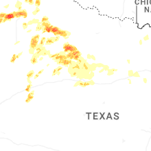
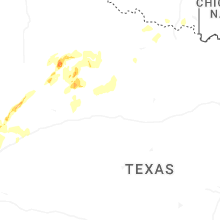


Connect with Interactive Hail Maps