

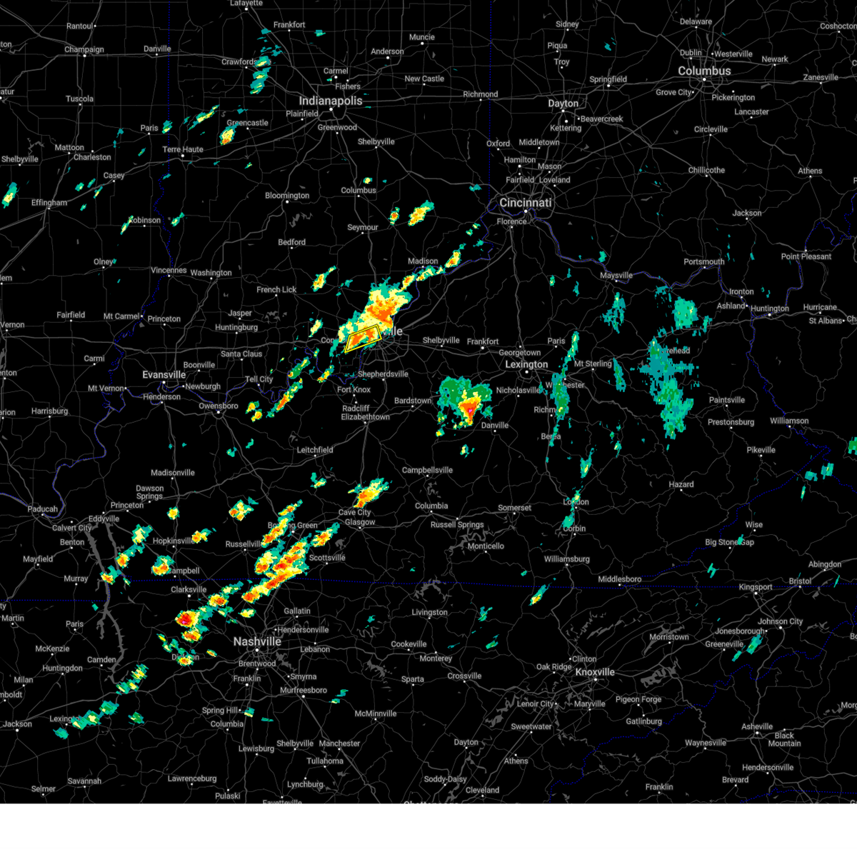
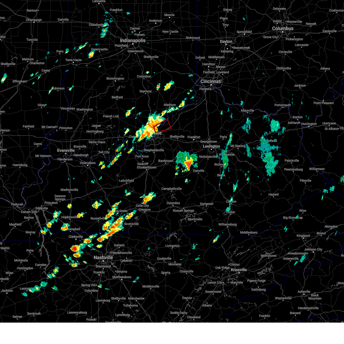
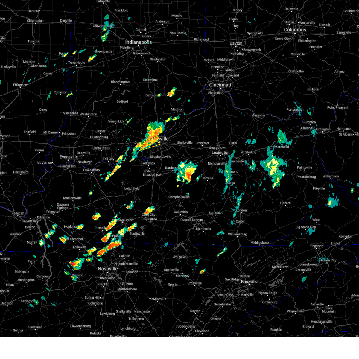
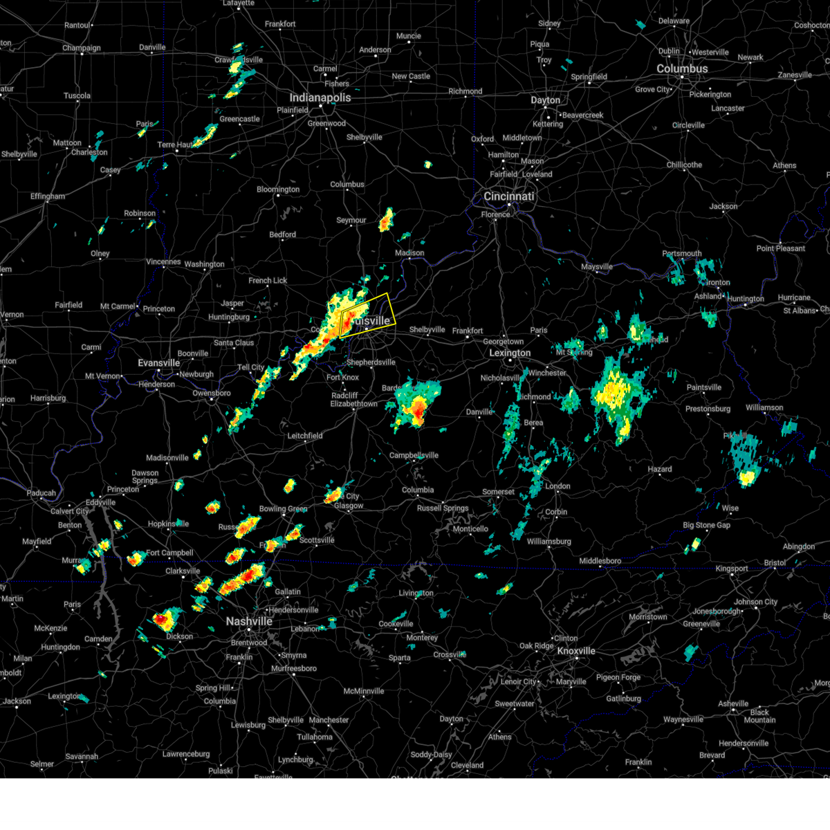
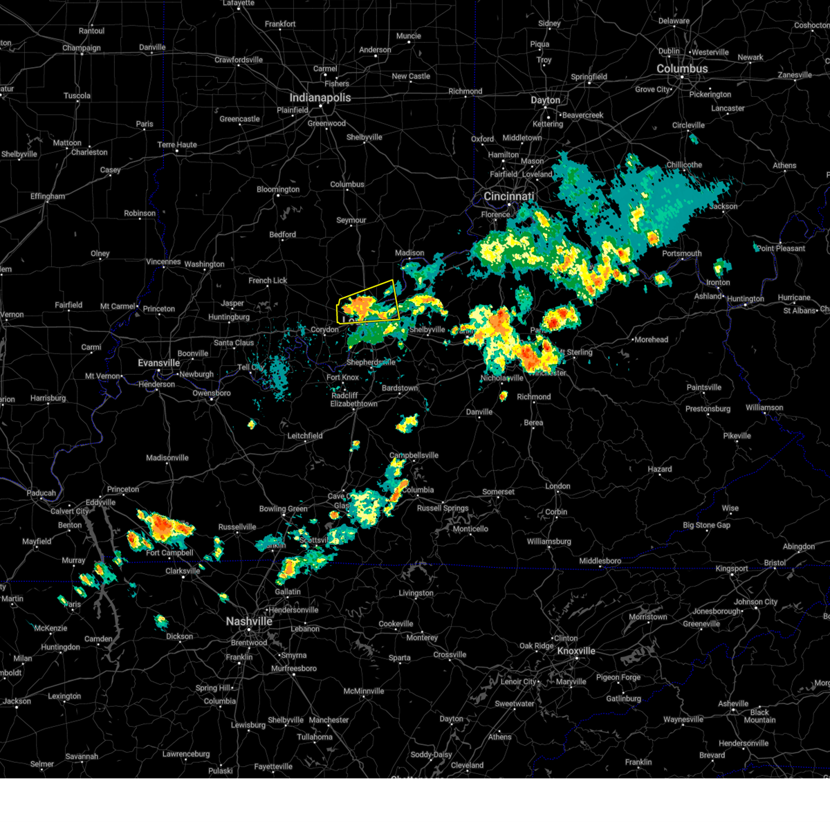
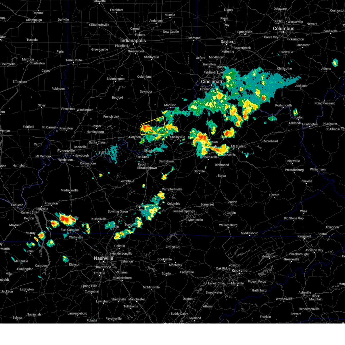
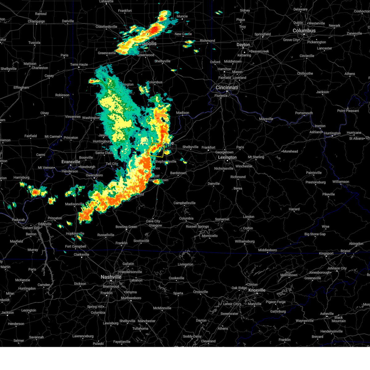
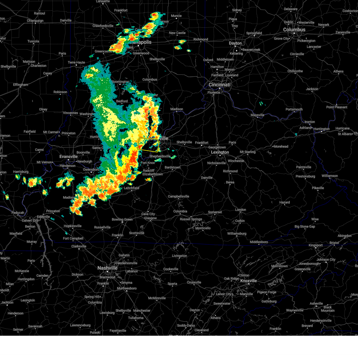
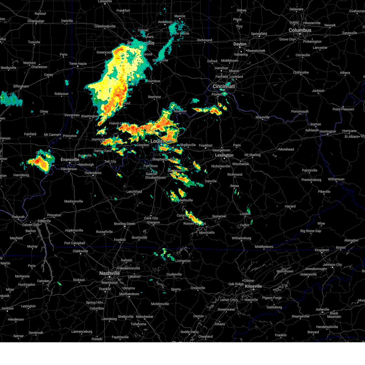
Hail Map for Jeffersonville, IN
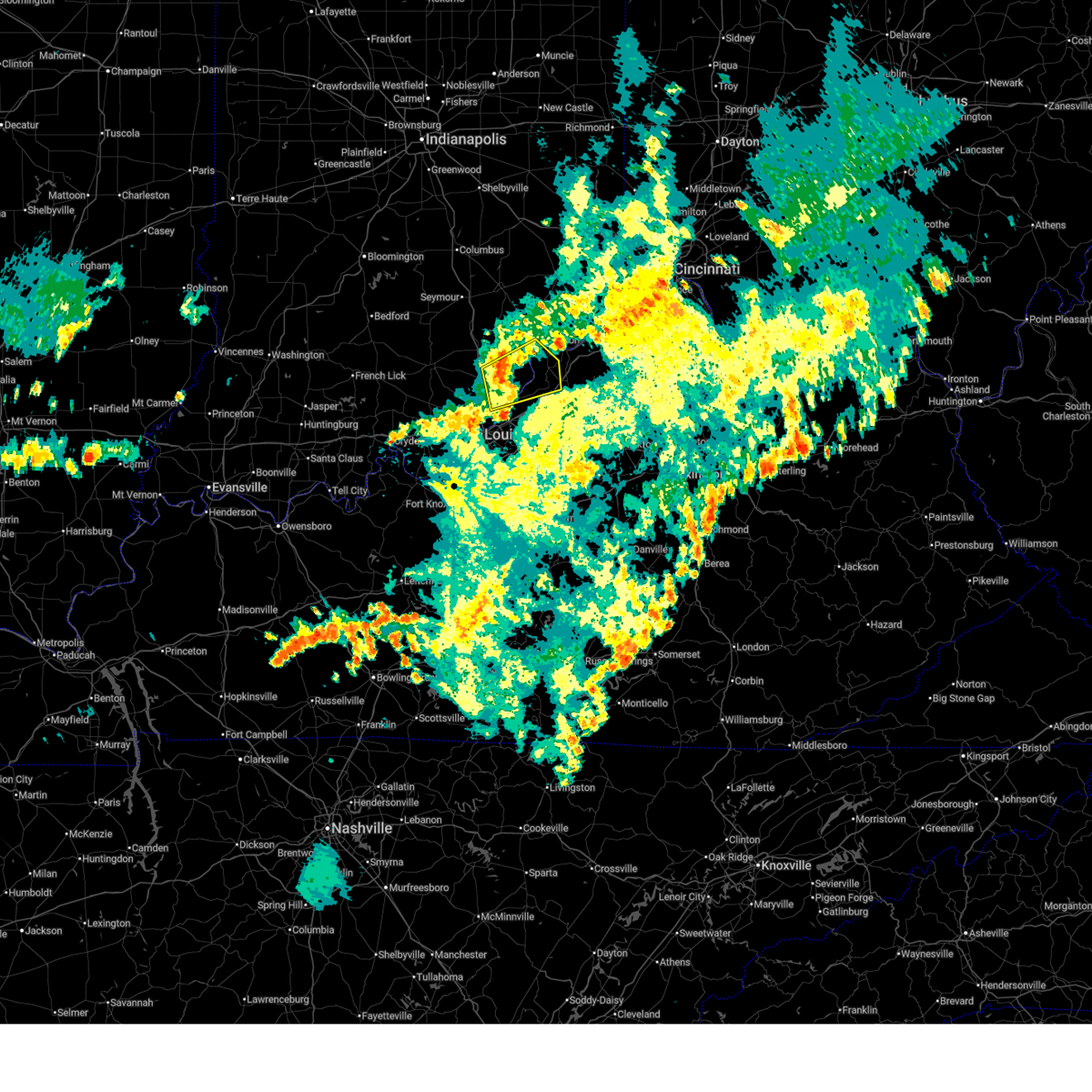
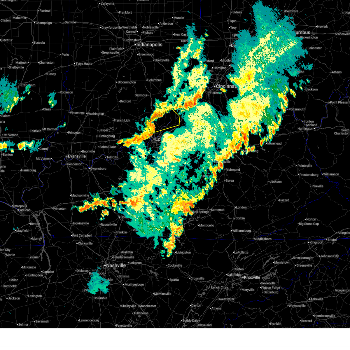
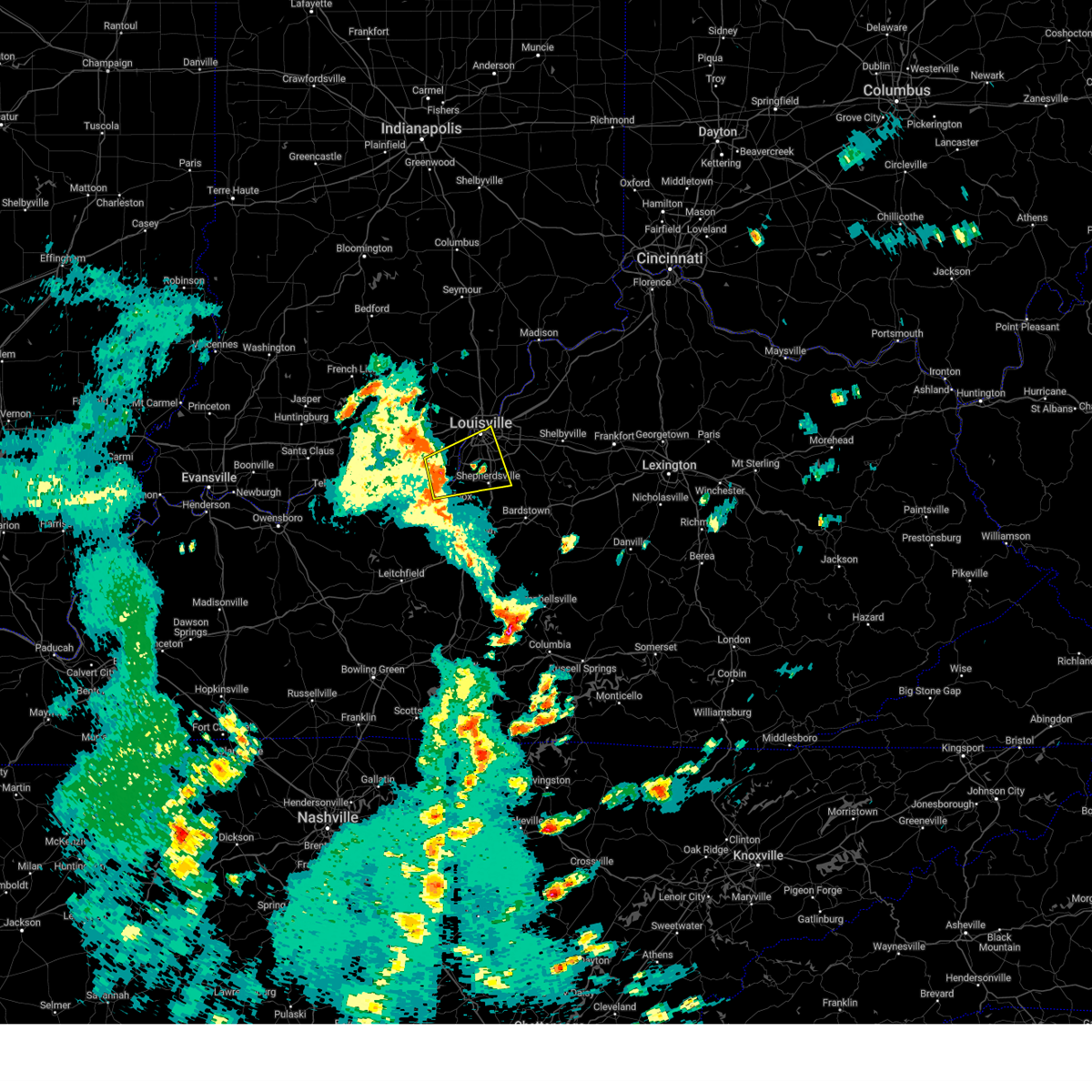
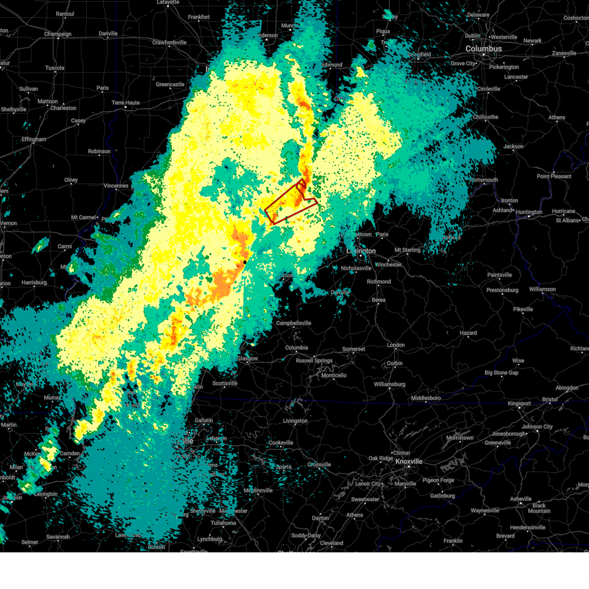
The Jeffersonville, IN area has had 9 reports of on-the-ground hail by trained spotters, and has been under severe weather warnings 57 times during the past 12 months. Doppler radar has detected hail at or near Jeffersonville, IN on 82 occasions, including 1 occasion during the past year.
| Name: | Jeffersonville, IN |
| Where Located: | 25.1 miles N of Louisville, KY |
| Map: | Google Map for Jeffersonville, IN |
| Population: | 44953 |
| Housing Units: | 19991 |
| More Info: | Search Google for Jeffersonville, IN |
1
The Top Recent Hail Date for Jeffersonville, IN is Tuesday, September 24, 2024 (36th out of 82)

Hail and Wind Damage Spotted near Jeffersonville, IN
| Date / Time | Report Details |
|---|---|
| 6/18/2025 10:59 PM EDT |
 The storm which prompted the warning has weakened below severe limits, and has exited the warned area. therefore, the warning will be allowed to expire. however, gusty winds and heavy rain are still possible with this thunderstorm. a severe thunderstorm watch remains in effect until 100 am edt for central kentucky. to report severe weather, contact your nearest law enforcement agency. they will relay your report to the national weather service louisville. The storm which prompted the warning has weakened below severe limits, and has exited the warned area. therefore, the warning will be allowed to expire. however, gusty winds and heavy rain are still possible with this thunderstorm. a severe thunderstorm watch remains in effect until 100 am edt for central kentucky. to report severe weather, contact your nearest law enforcement agency. they will relay your report to the national weather service louisville.
|
| 6/18/2025 10:48 PM EDT |
 the severe thunderstorm warning has been cancelled and is no longer in effect the severe thunderstorm warning has been cancelled and is no longer in effect
|
| 6/18/2025 10:48 PM EDT |
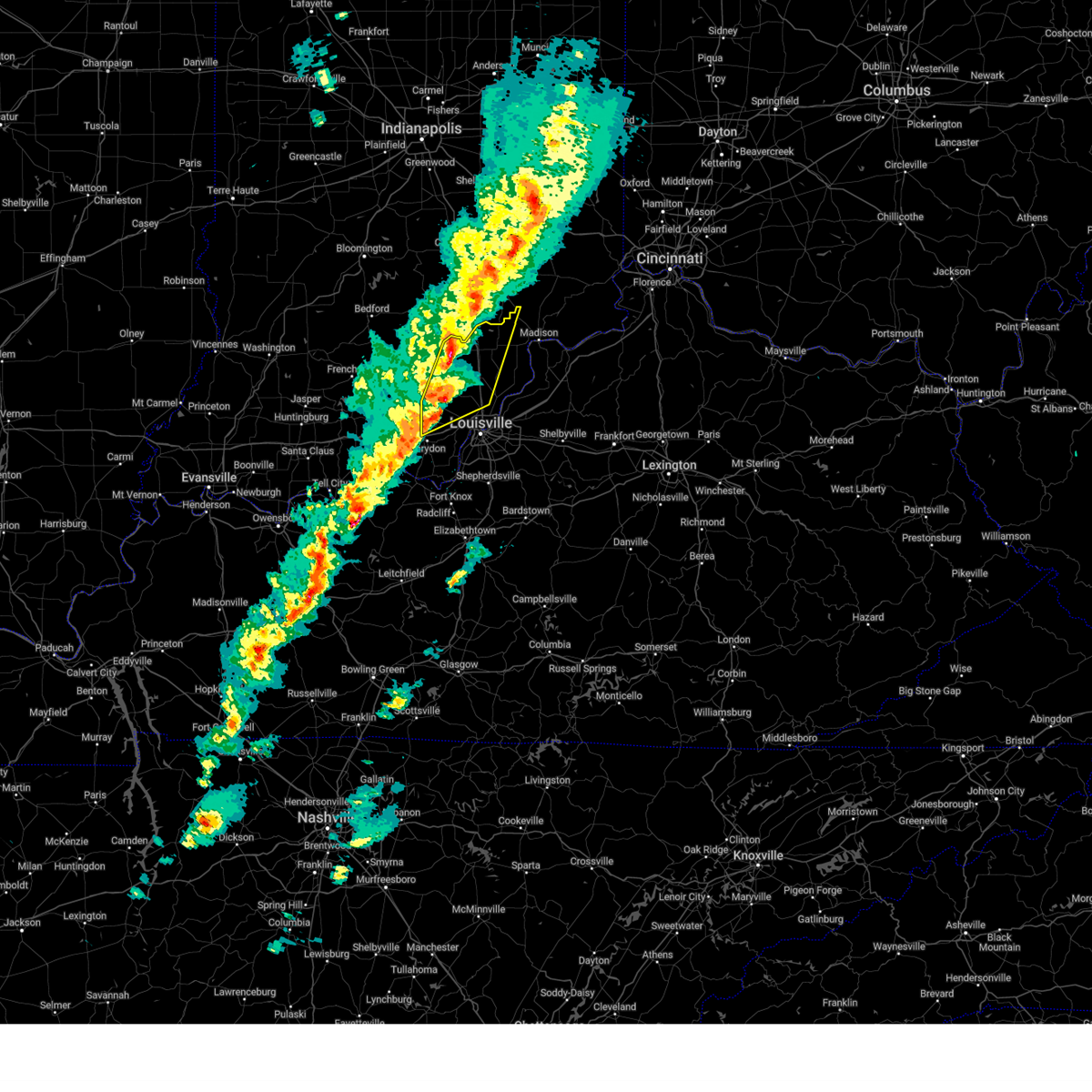
 At 1048 pm edt, a severe thunderstorm was located 11 miles west of bedford, moving east at 50 mph (radar indicated). Hazards include 60 mph wind gusts. Expect damage to roofs, siding, and trees. Locations impacted include, madison, bedford, pendleton, charlestown, hanover, saluda, owen, goshen, bethlehem, and milton. At 1048 pm edt, a severe thunderstorm was located 11 miles west of bedford, moving east at 50 mph (radar indicated). Hazards include 60 mph wind gusts. Expect damage to roofs, siding, and trees. Locations impacted include, madison, bedford, pendleton, charlestown, hanover, saluda, owen, goshen, bethlehem, and milton.
|
| 6/18/2025 10:32 PM EDT |
 Svrlmk the national weather service in louisville has issued a * severe thunderstorm warning for, south central jefferson county in south central indiana, clark county in south central indiana, northeastern floyd county in south central indiana, southeastern scott county in south central indiana, east central washington county in south central indiana, northern oldham county in central kentucky, trimble county in central kentucky, west central henry county in central kentucky, * until 1100 pm edt. * at 1032 pm edt, a severe thunderstorm was located 11 miles north of jeffersonville, moving east at 50 mph (radar indicated). Hazards include 60 mph wind gusts. expect damage to roofs, siding, and trees Svrlmk the national weather service in louisville has issued a * severe thunderstorm warning for, south central jefferson county in south central indiana, clark county in south central indiana, northeastern floyd county in south central indiana, southeastern scott county in south central indiana, east central washington county in south central indiana, northern oldham county in central kentucky, trimble county in central kentucky, west central henry county in central kentucky, * until 1100 pm edt. * at 1032 pm edt, a severe thunderstorm was located 11 miles north of jeffersonville, moving east at 50 mph (radar indicated). Hazards include 60 mph wind gusts. expect damage to roofs, siding, and trees
|
| 5/16/2025 9:55 PM EDT | Svrlmk the national weather service in louisville has issued a * severe thunderstorm warning for, southeastern harrison county in south central indiana, south central clark county in south central indiana, southern floyd county in south central indiana, south central oldham county in central kentucky, western spencer county in central kentucky, west central shelby county in central kentucky, northwestern nelson county in central kentucky, southeastern meade county in central kentucky, jefferson county in central kentucky, bullitt county in central kentucky, northeastern hardin county in central kentucky, * until 1030 pm edt. * at 954 pm edt, a severe thunderstorm was located 9 miles northeast of brandenburg, moving east at 75 mph (radar indicated). Hazards include 70 mph wind gusts and quarter size hail. Hail damage to vehicles is expected. expect considerable tree damage. Wind damage is also likely to mobile homes, roofs, and outbuildings. |
| 5/2/2025 4:38 PM EDT | The storm which prompted the warning has moved out of the area. therefore, the warning will be allowed to expire. however, small hail, gusty winds and heavy rain are still possible with this thunderstorm. a severe thunderstorm watch remains in effect until 900 pm edt for south central indiana, and central kentucky. to report severe weather, contact your nearest law enforcement agency. they will relay your report to the national weather service louisville. |
| 5/2/2025 4:29 PM EDT | the severe thunderstorm warning has been cancelled and is no longer in effect |
| 5/2/2025 4:29 PM EDT | At 429 pm edt, a severe thunderstorm was located near middletown, moving northeast at 40 mph (radar indicated). Hazards include 60 mph wind gusts and quarter size hail. Hail damage to vehicles is expected. expect wind damage to roofs, siding, and trees. locations impacted include, louisville, jeffersonville, jeffersontown, st. Matthews, lyndon, la grange, middletown, douglass hills, prospect, and hurstbourne. |
| 5/2/2025 4:27 PM EDT | The storm which prompted the warning has weakened below severe limits, and has exited the warned area. therefore, the warning will be allowed to expire. however, gusty winds and heavy rain are still possible with this thunderstorm. a severe thunderstorm watch remains in effect until 900 pm edt for south central indiana, and central kentucky. to report severe weather, contact your nearest law enforcement agency. they will relay your report to the national weather service louisville. |
| 5/2/2025 4:14 PM EDT | Tree down across the road at the intersection of lexington road and payne stree in jefferson county KY, 7.1 miles N of Jeffersonville, IN |
| 5/2/2025 4:11 PM EDT | Svrlmk the national weather service in louisville has issued a * severe thunderstorm warning for, southern oldham county in central kentucky, northwestern spencer county in central kentucky, western shelby county in central kentucky, jefferson county in central kentucky, northeastern bullitt county in central kentucky, * until 445 pm edt. * at 411 pm edt, a severe thunderstorm was located over lynnview, moving northeast at 35 mph (radar indicated). Hazards include 60 mph wind gusts and penny size hail. expect damage to roofs, siding, and trees |
| 5/2/2025 4:07 PM EDT | the severe thunderstorm warning has been cancelled and is no longer in effect |
| 5/2/2025 4:07 PM EDT | At 407 pm edt, a severe thunderstorm was located over south park view, moving east at 35 mph (radar indicated). Hazards include 60 mph wind gusts and quarter size hail. Hail damage to vehicles is expected. expect wind damage to roofs, siding, and trees. Locations impacted include, louisville, jeffersonville, shively, shepherdsville, pioneer village, audubon park, west buechel, watterson park, lynnview, and seneca gardens. |
| 5/2/2025 4:06 PM EDT | At 406 pm edt, a severe thunderstorm was located over new albany, moving northeast at 40 mph (radar indicated). Hazards include 60 mph wind gusts and quarter size hail. Hail damage to vehicles is expected. expect wind damage to roofs, siding, and trees. Locations impacted include, louisville, jeffersonville, new albany, prospect, green spring, glenview, clarksville, charlestown, sellersburg, and indian hills. |
| 5/2/2025 4:06 PM EDT | the severe thunderstorm warning has been cancelled and is no longer in effect |
| 5/2/2025 3:56 PM EDT | At 356 pm edt, a severe thunderstorm was located over valley station, moving east at 35 mph (radar indicated). Hazards include 60 mph wind gusts and quarter size hail. Hail damage to vehicles is expected. expect wind damage to roofs, siding, and trees. Locations impacted include, louisville, jeffersonville, shively, shepherdsville, pioneer village, audubon park, west buechel, watterson park, lynnview, and seneca gardens. |
| 5/2/2025 3:56 PM EDT | the severe thunderstorm warning has been cancelled and is no longer in effect |
| 5/2/2025 3:53 PM EDT | Svrlmk the national weather service in louisville has issued a * severe thunderstorm warning for, northeastern harrison county in south central indiana, south central clark county in south central indiana, floyd county in south central indiana, southwestern oldham county in central kentucky, northwestern jefferson county in central kentucky, * until 430 pm edt. * at 353 pm edt, a severe thunderstorm was located near new albany, moving northeast at 45 mph (radar indicated). Hazards include 60 mph wind gusts and quarter size hail. Hail damage to vehicles is expected. Expect wind damage to roofs, siding, and trees. |
| 5/2/2025 3:40 PM EDT |
 Svrlmk the national weather service in louisville has issued a * severe thunderstorm warning for, southeastern harrison county in south central indiana, south central floyd county in south central indiana, east central meade county in central kentucky, southwestern jefferson county in central kentucky, northwestern bullitt county in central kentucky, north central hardin county in central kentucky, * until 415 pm edt. * at 339 pm edt, a severe thunderstorm was located 9 miles southwest of valley station, moving east at 35 mph (radar indicated). Hazards include 60 mph wind gusts and quarter size hail. Hail damage to vehicles is expected. Expect wind damage to roofs, siding, and trees. Svrlmk the national weather service in louisville has issued a * severe thunderstorm warning for, southeastern harrison county in south central indiana, south central floyd county in south central indiana, east central meade county in central kentucky, southwestern jefferson county in central kentucky, northwestern bullitt county in central kentucky, north central hardin county in central kentucky, * until 415 pm edt. * at 339 pm edt, a severe thunderstorm was located 9 miles southwest of valley station, moving east at 35 mph (radar indicated). Hazards include 60 mph wind gusts and quarter size hail. Hail damage to vehicles is expected. Expect wind damage to roofs, siding, and trees.
|
| 4/3/2025 12:22 AM EDT | The tornado threat has diminished and the tornado warning has been cancelled. however, large hail and damaging winds remain likely and a severe thunderstorm warning remains in effect for the area. however, gusty winds and heavy rain are still possible with this thunderstorm. a tornado watch remains in effect until 200 am edt for south central indiana, and central kentucky. to report severe weather, contact your nearest law enforcement agency. they will relay your report to the national weather service louisville. |
| 4/3/2025 12:21 AM EDT | The storms which prompted the warning have weakened below severe limits, and have exited the warned area. therefore, the warning will be allowed to expire. however, gusty winds and heavy rain are still possible with these thunderstorms. a tornado watch remains in effect until 200 am edt for south central indiana, and central kentucky. to report severe weather, contact your nearest law enforcement agency. they will relay your report to the national weather service louisville. |
| 4/3/2025 12:10 AM EDT |
 the tornado warning has been cancelled and is no longer in effect the tornado warning has been cancelled and is no longer in effect
|
| 4/3/2025 12:10 AM EDT |
 At 1210 am edt, a severe thunderstorm capable of producing a tornado was located near prospect, moving northeast at 55 mph (radar indicated rotation). Hazards include tornado. Flying debris will be dangerous to those caught without shelter. mobile homes will be damaged or destroyed. damage to roofs, windows, and vehicles will occur. tree damage is likely. this dangerous storm will be near, bedford around 1225 am edt. Other locations impacted by this tornadic thunderstorm include oldham, campbellsburg, clark siding, harmony village, sulphur, monitor, owen, lacie, vesta, and wises landing. At 1210 am edt, a severe thunderstorm capable of producing a tornado was located near prospect, moving northeast at 55 mph (radar indicated rotation). Hazards include tornado. Flying debris will be dangerous to those caught without shelter. mobile homes will be damaged or destroyed. damage to roofs, windows, and vehicles will occur. tree damage is likely. this dangerous storm will be near, bedford around 1225 am edt. Other locations impacted by this tornadic thunderstorm include oldham, campbellsburg, clark siding, harmony village, sulphur, monitor, owen, lacie, vesta, and wises landing.
|
| 4/3/2025 12:03 AM EDT |
 The storm which prompted the warning has moved out of the area. therefore, the warning has been allowed to expire. however, gusty winds and heavy rain are still possible with this thunderstorm. a tornado watch remains in effect until 200 am edt for south central indiana, and central kentucky. to report severe weather, contact your nearest law enforcement agency. they will relay your report to the national weather service louisville. The storm which prompted the warning has moved out of the area. therefore, the warning has been allowed to expire. however, gusty winds and heavy rain are still possible with this thunderstorm. a tornado watch remains in effect until 200 am edt for south central indiana, and central kentucky. to report severe weather, contact your nearest law enforcement agency. they will relay your report to the national weather service louisville.
|
| 4/3/2025 12:00 AM EDT |
 Torlmk the national weather service in louisville has issued a * tornado warning for, southeastern jefferson county in south central indiana, central clark county in south central indiana, northeastern floyd county in south central indiana, central oldham county in central kentucky, trimble county in central kentucky, northwestern henry county in central kentucky, north central jefferson county in central kentucky, * until 1230 am edt. * at 1200 am edt, a severe thunderstorm capable of producing a tornado was located near jeffersonville, moving northeast at 55 mph (radar indicated rotation). Hazards include tornado. Flying debris will be dangerous to those caught without shelter. mobile homes will be damaged or destroyed. damage to roofs, windows, and vehicles will occur. tree damage is likely. this dangerous storm will be near, prospect around 1205 am edt. bedford around 1225 am edt. Other locations impacted by this tornadic thunderstorm include saint joseph, oldham, clarksville, campbellsburg, clark siding, harmony village, watson, utica, sulphur, and river ridge. Torlmk the national weather service in louisville has issued a * tornado warning for, southeastern jefferson county in south central indiana, central clark county in south central indiana, northeastern floyd county in south central indiana, central oldham county in central kentucky, trimble county in central kentucky, northwestern henry county in central kentucky, north central jefferson county in central kentucky, * until 1230 am edt. * at 1200 am edt, a severe thunderstorm capable of producing a tornado was located near jeffersonville, moving northeast at 55 mph (radar indicated rotation). Hazards include tornado. Flying debris will be dangerous to those caught without shelter. mobile homes will be damaged or destroyed. damage to roofs, windows, and vehicles will occur. tree damage is likely. this dangerous storm will be near, prospect around 1205 am edt. bedford around 1225 am edt. Other locations impacted by this tornadic thunderstorm include saint joseph, oldham, clarksville, campbellsburg, clark siding, harmony village, watson, utica, sulphur, and river ridge.
|
| 4/2/2025 11:53 PM EDT | the tornado warning has been cancelled and is no longer in effect |
| 4/2/2025 11:53 PM EDT | At 1152 pm edt, a severe thunderstorm capable of producing a tornado was located over new albany, moving northeast at 60 mph (radar indicated rotation). Hazards include tornado. Flying debris will be dangerous to those caught without shelter. mobile homes will be damaged or destroyed. damage to roofs, windows, and vehicles will occur. tree damage is likely. this dangerous storm will be near, jeffersonville around 1200 am edt. Other locations impacted by this tornadic thunderstorm include navilleton, speed, saint joseph, clarksville, sellersburg, starlight, carwood, wilson, prather, and watson. |
| 4/2/2025 11:45 PM EDT | At 1144 pm edt, a severe thunderstorm capable of producing a tornado was located 7 miles northwest of st. dennis, moving northeast at 60 mph (radar indicated rotation). Hazards include tornado. Flying debris will be dangerous to those caught without shelter. mobile homes will be damaged or destroyed. damage to roofs, windows, and vehicles will occur. tree damage is likely. this dangerous storm will be near, new albany around 1150 pm edt. jeffersonville around 1155 pm edt. Other locations impacted by this tornadic thunderstorm include navilleton, speed, saint joseph, crandall, clarksville, sellersburg, starlight, carwood, wilson, and prather. |
| 4/2/2025 11:39 PM EDT |
 Svrlmk the national weather service in louisville has issued a * severe thunderstorm warning for, southeastern harrison county in south central indiana, jefferson county in south central indiana, clark county in south central indiana, floyd county in south central indiana, scott county in south central indiana, oldham county in central kentucky, trimble county in central kentucky, central jefferson county in central kentucky, * until 1230 am edt. * at 1139 pm edt, severe thunderstorms were located along a line extending from 9 miles south of scottsburg to 7 miles west of pleasure ridge park, moving northeast at 75 mph (radar indicated). Hazards include 60 mph wind gusts. expect damage to roofs, siding, and trees Svrlmk the national weather service in louisville has issued a * severe thunderstorm warning for, southeastern harrison county in south central indiana, jefferson county in south central indiana, clark county in south central indiana, floyd county in south central indiana, scott county in south central indiana, oldham county in central kentucky, trimble county in central kentucky, central jefferson county in central kentucky, * until 1230 am edt. * at 1139 pm edt, severe thunderstorms were located along a line extending from 9 miles south of scottsburg to 7 miles west of pleasure ridge park, moving northeast at 75 mph (radar indicated). Hazards include 60 mph wind gusts. expect damage to roofs, siding, and trees
|
| 4/2/2025 11:32 PM EDT |
 Torlmk the national weather service in louisville has issued a * tornado warning for, central harrison county in south central indiana, central clark county in south central indiana, floyd county in south central indiana, * until midnight edt. * at 1132 pm edt, a severe thunderstorm capable of producing a tornado was located near corydon, moving northeast at 60 mph (radar indicated rotation). Hazards include tornado. Flying debris will be dangerous to those caught without shelter. mobile homes will be damaged or destroyed. damage to roofs, windows, and vehicles will occur. tree damage is likely. this dangerous storm will be near, corydon around 1135 pm edt. georgetown around 1140 pm edt. new albany around 1145 pm edt. jeffersonville around 1150 pm edt. Other locations impacted by this tornadic thunderstorm include saint joseph, crandall, clarksville, starlight, watson, floyds knobs, edwardsville, breckenridge, galena, and bennettsville. Torlmk the national weather service in louisville has issued a * tornado warning for, central harrison county in south central indiana, central clark county in south central indiana, floyd county in south central indiana, * until midnight edt. * at 1132 pm edt, a severe thunderstorm capable of producing a tornado was located near corydon, moving northeast at 60 mph (radar indicated rotation). Hazards include tornado. Flying debris will be dangerous to those caught without shelter. mobile homes will be damaged or destroyed. damage to roofs, windows, and vehicles will occur. tree damage is likely. this dangerous storm will be near, corydon around 1135 pm edt. georgetown around 1140 pm edt. new albany around 1145 pm edt. jeffersonville around 1150 pm edt. Other locations impacted by this tornadic thunderstorm include saint joseph, crandall, clarksville, starlight, watson, floyds knobs, edwardsville, breckenridge, galena, and bennettsville.
|
| 3/19/2025 10:53 PM EDT |
 At 1053 pm edt, a severe thunderstorm was located over coldstream, moving northeast at 60 mph (radar indicated). Hazards include 60 mph wind gusts and penny size hail. Expect damage to roofs, siding, and trees. locations impacted include, louisville, jeffersontown, st. Matthews, lyndon, la grange, middletown, douglass hills, prospect, hurstbourne, and graymoor-devondale. At 1053 pm edt, a severe thunderstorm was located over coldstream, moving northeast at 60 mph (radar indicated). Hazards include 60 mph wind gusts and penny size hail. Expect damage to roofs, siding, and trees. locations impacted include, louisville, jeffersontown, st. Matthews, lyndon, la grange, middletown, douglass hills, prospect, hurstbourne, and graymoor-devondale.
|
| 3/19/2025 10:51 PM EDT |
 At 1050 pm edt, a severe thunderstorm was located over worthington hills, moving northeast at 70 mph (radar indicated). Hazards include 70 mph wind gusts and quarter size hail. Hail damage to vehicles is expected. expect considerable tree damage. wind damage is also likely to mobile homes, roofs, and outbuildings. locations impacted include, louisville, jeffersontown, st. Matthews, shively, lyndon, la grange, middletown, douglass hills, prospect, and hurstbourne. At 1050 pm edt, a severe thunderstorm was located over worthington hills, moving northeast at 70 mph (radar indicated). Hazards include 70 mph wind gusts and quarter size hail. Hail damage to vehicles is expected. expect considerable tree damage. wind damage is also likely to mobile homes, roofs, and outbuildings. locations impacted include, louisville, jeffersontown, st. Matthews, shively, lyndon, la grange, middletown, douglass hills, prospect, and hurstbourne.
|
| 3/19/2025 10:41 PM EDT |
 Svrlmk the national weather service in louisville has issued a * severe thunderstorm warning for, oldham county in central kentucky, northwestern shelby county in central kentucky, southeastern trimble county in central kentucky, western henry county in central kentucky, central jefferson county in central kentucky, * until 1115 pm edt. * at 1041 pm edt, a severe thunderstorm was located over strathmoor manor, moving northeast at 65 mph (radar indicated). Hazards include 60 mph wind gusts and penny size hail. expect damage to roofs, siding, and trees Svrlmk the national weather service in louisville has issued a * severe thunderstorm warning for, oldham county in central kentucky, northwestern shelby county in central kentucky, southeastern trimble county in central kentucky, western henry county in central kentucky, central jefferson county in central kentucky, * until 1115 pm edt. * at 1041 pm edt, a severe thunderstorm was located over strathmoor manor, moving northeast at 65 mph (radar indicated). Hazards include 60 mph wind gusts and penny size hail. expect damage to roofs, siding, and trees
|
| 3/19/2025 9:38 PM EDT |
 At 938 pm edt, a severe thunderstorm was located near scottsburg, moving northeast at 60 mph (radar indicated). Hazards include 60 mph wind gusts and quarter size hail. Hail damage to vehicles is expected. expect wind damage to roofs, siding, and trees. Locations impacted include, new albany, scottsburg, clarksville, vienna, sellersburg, austin, lexington, galena, blue river, and new pekin. At 938 pm edt, a severe thunderstorm was located near scottsburg, moving northeast at 60 mph (radar indicated). Hazards include 60 mph wind gusts and quarter size hail. Hail damage to vehicles is expected. expect wind damage to roofs, siding, and trees. Locations impacted include, new albany, scottsburg, clarksville, vienna, sellersburg, austin, lexington, galena, blue river, and new pekin.
|
| 3/19/2025 9:26 PM EDT |
 At 926 pm edt, a severe thunderstorm was located near scottsburg, moving northeast at 60 mph (radar indicated). Hazards include 60 mph wind gusts and quarter size hail. Hail damage to vehicles is expected. expect wind damage to roofs, siding, and trees. Locations impacted include, new albany, scottsburg, salem, clarksville, vienna, sellersburg, austin, lexington, galena, and blue river. At 926 pm edt, a severe thunderstorm was located near scottsburg, moving northeast at 60 mph (radar indicated). Hazards include 60 mph wind gusts and quarter size hail. Hail damage to vehicles is expected. expect wind damage to roofs, siding, and trees. Locations impacted include, new albany, scottsburg, salem, clarksville, vienna, sellersburg, austin, lexington, galena, and blue river.
|
| 3/19/2025 9:26 PM EDT |
 the severe thunderstorm warning has been cancelled and is no longer in effect the severe thunderstorm warning has been cancelled and is no longer in effect
|
| 3/19/2025 9:12 PM EDT |
 Svrlmk the national weather service in louisville has issued a * severe thunderstorm warning for, northern harrison county in south central indiana, northwestern jefferson county in south central indiana, northwestern clark county in south central indiana, northeastern crawford county in south central indiana, northern floyd county in south central indiana, southeastern orange county in south central indiana, scott county in south central indiana, washington county in south central indiana, * until 1000 pm edt. * at 912 pm edt, a severe thunderstorm was located near salem, moving northeast at 60 mph (radar indicated). Hazards include 60 mph wind gusts and quarter size hail. Hail damage to vehicles is expected. Expect wind damage to roofs, siding, and trees. Svrlmk the national weather service in louisville has issued a * severe thunderstorm warning for, northern harrison county in south central indiana, northwestern jefferson county in south central indiana, northwestern clark county in south central indiana, northeastern crawford county in south central indiana, northern floyd county in south central indiana, southeastern orange county in south central indiana, scott county in south central indiana, washington county in south central indiana, * until 1000 pm edt. * at 912 pm edt, a severe thunderstorm was located near salem, moving northeast at 60 mph (radar indicated). Hazards include 60 mph wind gusts and quarter size hail. Hail damage to vehicles is expected. Expect wind damage to roofs, siding, and trees.
|
| 3/15/2025 7:44 AM EDT |
 The storm which prompted the warning has moved out of the area. therefore, the warning will be allowed to expire. a tornado watch remains in effect until 1000 am edt for south central indiana, and central kentucky. remember, a severe thunderstorm warning still remains in effect for portions of clark and oldham county until 815 am edt. The storm which prompted the warning has moved out of the area. therefore, the warning will be allowed to expire. a tornado watch remains in effect until 1000 am edt for south central indiana, and central kentucky. remember, a severe thunderstorm warning still remains in effect for portions of clark and oldham county until 815 am edt.
|
| 3/15/2025 7:38 AM EDT |
 At 737 am edt, a severe thunderstorm was located over west buechel, moving northeast at 60 mph (muhammad ali international airport reported 69 mph wind gusts). Hazards include 70 mph wind gusts and quarter size hail. Hail damage to vehicles is expected. expect considerable tree damage. wind damage is also likely to mobile homes, roofs, and outbuildings. locations impacted include, louisville, jeffersonville, jeffersontown, st. Matthews, shively, lyndon, middletown, douglass hills, prospect, and hurstbourne. At 737 am edt, a severe thunderstorm was located over west buechel, moving northeast at 60 mph (muhammad ali international airport reported 69 mph wind gusts). Hazards include 70 mph wind gusts and quarter size hail. Hail damage to vehicles is expected. expect considerable tree damage. wind damage is also likely to mobile homes, roofs, and outbuildings. locations impacted include, louisville, jeffersonville, jeffersontown, st. Matthews, shively, lyndon, middletown, douglass hills, prospect, and hurstbourne.
|
| 3/15/2025 7:38 AM EDT |
 the severe thunderstorm warning has been cancelled and is no longer in effect the severe thunderstorm warning has been cancelled and is no longer in effect
|
| 3/15/2025 7:37 AM EDT |
 the severe thunderstorm warning has been cancelled and is no longer in effect the severe thunderstorm warning has been cancelled and is no longer in effect
|
| 3/15/2025 7:37 AM EDT |
 At 736 am edt, a severe thunderstorm was located near prospect, moving northeast at 60 mph (radar indicated). Hazards include golf ball size hail and 60 mph wind gusts. People and animals outdoors will be injured. expect hail damage to roofs, siding, windows, and vehicles. expect wind damage to roofs, siding, and trees. Locations impacted include, jeffersonville, la grange, prospect, charlestown, owen, goshen, utica, river bluff, westport, and greenhaven. At 736 am edt, a severe thunderstorm was located near prospect, moving northeast at 60 mph (radar indicated). Hazards include golf ball size hail and 60 mph wind gusts. People and animals outdoors will be injured. expect hail damage to roofs, siding, windows, and vehicles. expect wind damage to roofs, siding, and trees. Locations impacted include, jeffersonville, la grange, prospect, charlestown, owen, goshen, utica, river bluff, westport, and greenhaven.
|
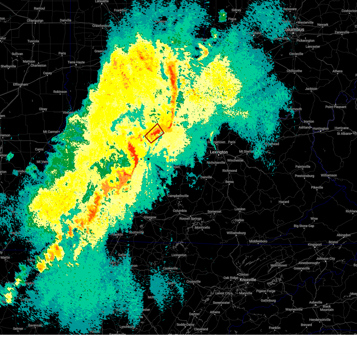
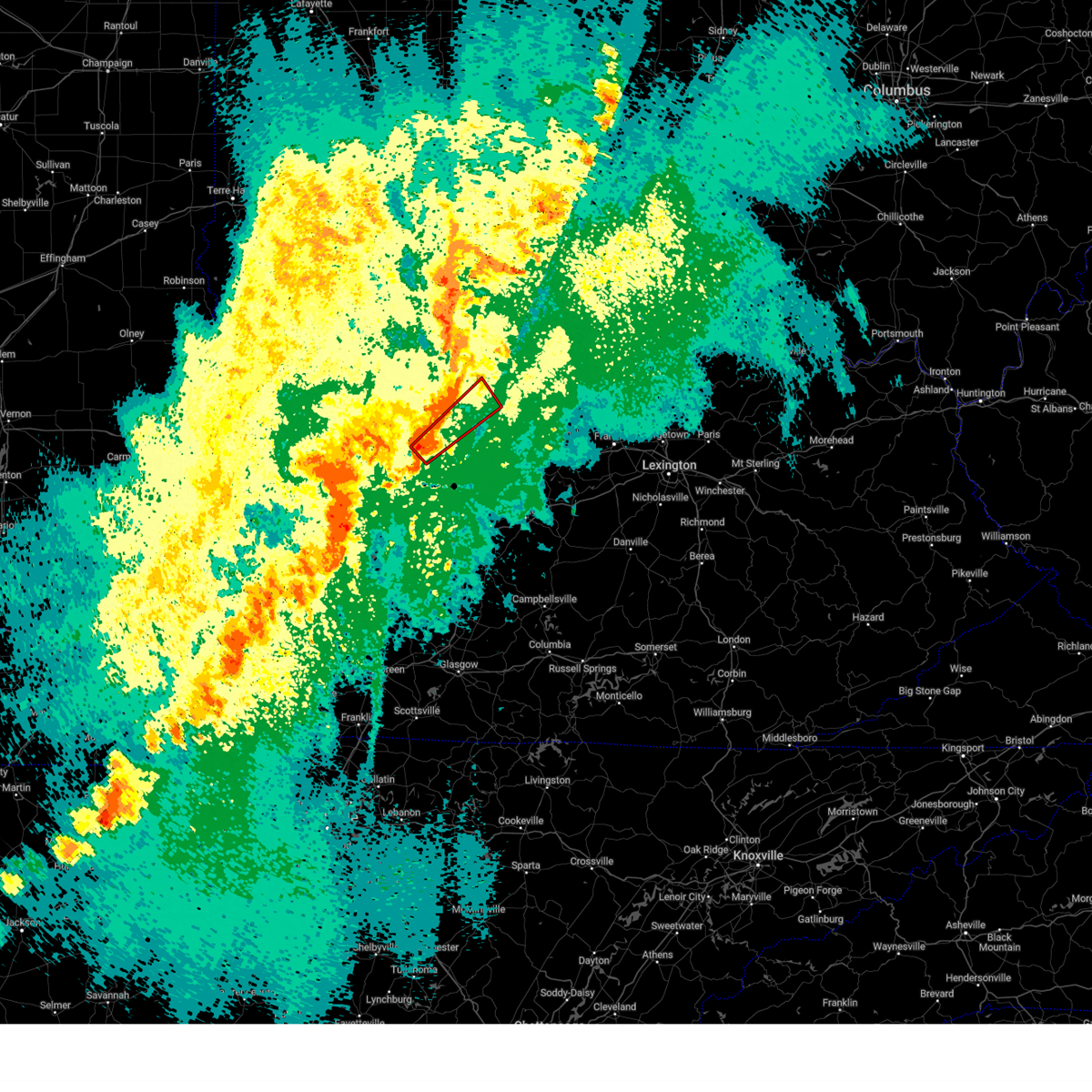
| 3/15/2025 7:28 AM EDT | Half Dollar sized hail reported 3.9 miles NNE of Jeffersonville, IN |
| 3/15/2025 7:25 AM EDT |
 Svrlmk the national weather service in louisville has issued a * severe thunderstorm warning for, south central clark county in south central indiana, south central floyd county in south central indiana, southwestern oldham county in central kentucky, northwestern shelby county in central kentucky, jefferson county in central kentucky, northwestern bullitt county in central kentucky, * until 800 am edt. * at 725 am edt, a severe thunderstorm was located over pleasure ridge park, moving northeast at 60 mph (radar indicated). Hazards include 60 mph wind gusts and quarter size hail. Hail damage to vehicles is expected. Expect wind damage to roofs, siding, and trees. Svrlmk the national weather service in louisville has issued a * severe thunderstorm warning for, south central clark county in south central indiana, south central floyd county in south central indiana, southwestern oldham county in central kentucky, northwestern shelby county in central kentucky, jefferson county in central kentucky, northwestern bullitt county in central kentucky, * until 800 am edt. * at 725 am edt, a severe thunderstorm was located over pleasure ridge park, moving northeast at 60 mph (radar indicated). Hazards include 60 mph wind gusts and quarter size hail. Hail damage to vehicles is expected. Expect wind damage to roofs, siding, and trees.
|
| 3/15/2025 7:16 AM EDT |
 Svrlmk the national weather service in louisville has issued a * severe thunderstorm warning for, central clark county in south central indiana, floyd county in south central indiana, northwestern oldham county in central kentucky, northwestern jefferson county in central kentucky, * until 745 am edt. * at 715 am edt, a severe thunderstorm was located 7 miles west of new albany, moving northeast at 60 mph (radar indicated). Hazards include golf ball size hail and 60 mph wind gusts. People and animals outdoors will be injured. expect hail damage to roofs, siding, windows, and vehicles. Expect wind damage to roofs, siding, and trees. Svrlmk the national weather service in louisville has issued a * severe thunderstorm warning for, central clark county in south central indiana, floyd county in south central indiana, northwestern oldham county in central kentucky, northwestern jefferson county in central kentucky, * until 745 am edt. * at 715 am edt, a severe thunderstorm was located 7 miles west of new albany, moving northeast at 60 mph (radar indicated). Hazards include golf ball size hail and 60 mph wind gusts. People and animals outdoors will be injured. expect hail damage to roofs, siding, windows, and vehicles. Expect wind damage to roofs, siding, and trees.
|
| 9/24/2024 2:06 PM EDT |
 The storm which prompted the warning has weakened below severe limits, and no longer poses an immediate threat to life or property. therefore, the warning will be allowed to expire. a severe thunderstorm watch remains in effect until 800 pm edt for south central indiana, and central kentucky. The storm which prompted the warning has weakened below severe limits, and no longer poses an immediate threat to life or property. therefore, the warning will be allowed to expire. a severe thunderstorm watch remains in effect until 800 pm edt for south central indiana, and central kentucky.
|
| 9/24/2024 1:59 PM EDT |
 At 159 pm edt, a severe thunderstorm was located over new albany, moving east at 30 mph (radar indicated). Hazards include 60 mph wind gusts and quarter size hail. Hail damage to vehicles is expected. expect wind damage to roofs, siding, and trees. Locations impacted include, louisville, jeffersonville, new albany, clarksville, and edwardsville. At 159 pm edt, a severe thunderstorm was located over new albany, moving east at 30 mph (radar indicated). Hazards include 60 mph wind gusts and quarter size hail. Hail damage to vehicles is expected. expect wind damage to roofs, siding, and trees. Locations impacted include, louisville, jeffersonville, new albany, clarksville, and edwardsville.
|
| 9/24/2024 1:58 PM EDT |
 The storm which prompted the warning has moved out of the area. therefore, the warning will be allowed to expire. a severe thunderstorm watch remains in effect until 800 pm edt for south central indiana, and central kentucky. remember, a severe thunderstorm warning still remains in effect for oldham county. The storm which prompted the warning has moved out of the area. therefore, the warning will be allowed to expire. a severe thunderstorm watch remains in effect until 800 pm edt for south central indiana, and central kentucky. remember, a severe thunderstorm warning still remains in effect for oldham county.
|
| 9/24/2024 1:53 PM EDT |
 At 152 pm edt, a severe thunderstorm was located near st. dennis, moving northeast at 30 mph (radar indicated). Hazards include 60 mph wind gusts and quarter size hail. Hail damage to vehicles is expected. expect wind damage to roofs, siding, and trees. Locations impacted include, louisville, jeffersonville, new albany, clarksville, lanesville, and edwardsville. At 152 pm edt, a severe thunderstorm was located near st. dennis, moving northeast at 30 mph (radar indicated). Hazards include 60 mph wind gusts and quarter size hail. Hail damage to vehicles is expected. expect wind damage to roofs, siding, and trees. Locations impacted include, louisville, jeffersonville, new albany, clarksville, lanesville, and edwardsville.
|
| 9/24/2024 1:53 PM EDT |
 Svrlmk the national weather service in louisville has issued a * severe thunderstorm warning for, south central jefferson county in south central indiana, eastern clark county in south central indiana, oldham county in central kentucky, southwestern trimble county in central kentucky, west central henry county in central kentucky, north central jefferson county in central kentucky, * until 230 pm edt. * at 153 pm edt, a severe thunderstorm was located near prospect, moving northeast at 45 mph (radar indicated). Hazards include 60 mph wind gusts and quarter size hail. Hail damage to vehicles is expected. Expect wind damage to roofs, siding, and trees. Svrlmk the national weather service in louisville has issued a * severe thunderstorm warning for, south central jefferson county in south central indiana, eastern clark county in south central indiana, oldham county in central kentucky, southwestern trimble county in central kentucky, west central henry county in central kentucky, north central jefferson county in central kentucky, * until 230 pm edt. * at 153 pm edt, a severe thunderstorm was located near prospect, moving northeast at 45 mph (radar indicated). Hazards include 60 mph wind gusts and quarter size hail. Hail damage to vehicles is expected. Expect wind damage to roofs, siding, and trees.
|
| 9/24/2024 1:52 PM EDT |
 Torlmk the national weather service in louisville has issued a * tornado warning for, southeastern clark county in south central indiana, central oldham county in central kentucky, northern jefferson county in central kentucky, * until 215 pm edt. * at 152 pm edt, a severe thunderstorm capable of producing a tornado was located near prospect, moving east at 30 mph (radar indicated rotation). Hazards include tornado and quarter size hail. Flying debris will be dangerous to those caught without shelter. mobile homes will be damaged or destroyed. damage to roofs, windows, and vehicles will occur. tree damage is likely. this dangerous storm will be near, prospect around 155 pm edt. Other locations impacted by this tornadic thunderstorm include westport, oldham, greenhaven, demplytown, buckner, russell corner, prather, harmony village, skylight, and utica. Torlmk the national weather service in louisville has issued a * tornado warning for, southeastern clark county in south central indiana, central oldham county in central kentucky, northern jefferson county in central kentucky, * until 215 pm edt. * at 152 pm edt, a severe thunderstorm capable of producing a tornado was located near prospect, moving east at 30 mph (radar indicated rotation). Hazards include tornado and quarter size hail. Flying debris will be dangerous to those caught without shelter. mobile homes will be damaged or destroyed. damage to roofs, windows, and vehicles will occur. tree damage is likely. this dangerous storm will be near, prospect around 155 pm edt. Other locations impacted by this tornadic thunderstorm include westport, oldham, greenhaven, demplytown, buckner, russell corner, prather, harmony village, skylight, and utica.
|
| 9/24/2024 1:46 PM EDT | A few trees down near pine view cour in clark county IN, 1.3 miles S of Jeffersonville, IN |
| 9/24/2024 1:40 PM EDT |
 Svrlmk the national weather service in louisville has issued a * severe thunderstorm warning for, east central harrison county in south central indiana, southwestern clark county in south central indiana, southern floyd county in south central indiana, west central jefferson county in central kentucky, * until 215 pm edt. * at 139 pm edt, a severe thunderstorm was located 7 miles east of corydon, moving east at 30 mph (radar indicated). Hazards include 60 mph wind gusts and quarter size hail. Hail damage to vehicles is expected. Expect wind damage to roofs, siding, and trees. Svrlmk the national weather service in louisville has issued a * severe thunderstorm warning for, east central harrison county in south central indiana, southwestern clark county in south central indiana, southern floyd county in south central indiana, west central jefferson county in central kentucky, * until 215 pm edt. * at 139 pm edt, a severe thunderstorm was located 7 miles east of corydon, moving east at 30 mph (radar indicated). Hazards include 60 mph wind gusts and quarter size hail. Hail damage to vehicles is expected. Expect wind damage to roofs, siding, and trees.
|
| 9/24/2024 1:26 PM EDT |
 Svrlmk the national weather service in louisville has issued a * severe thunderstorm warning for, northeastern harrison county in south central indiana, southwestern clark county in south central indiana, floyd county in south central indiana, southwestern oldham county in central kentucky, northern jefferson county in central kentucky, * until 200 pm edt. * at 126 pm edt, a severe thunderstorm was located near new albany, moving east at 40 mph (radar indicated). Hazards include 60 mph wind gusts and quarter size hail. Hail damage to vehicles is expected. Expect wind damage to roofs, siding, and trees. Svrlmk the national weather service in louisville has issued a * severe thunderstorm warning for, northeastern harrison county in south central indiana, southwestern clark county in south central indiana, floyd county in south central indiana, southwestern oldham county in central kentucky, northern jefferson county in central kentucky, * until 200 pm edt. * at 126 pm edt, a severe thunderstorm was located near new albany, moving east at 40 mph (radar indicated). Hazards include 60 mph wind gusts and quarter size hail. Hail damage to vehicles is expected. Expect wind damage to roofs, siding, and trees.
|
| 9/6/2024 7:06 PM EDT |
 the severe thunderstorm warning has been cancelled and is no longer in effect the severe thunderstorm warning has been cancelled and is no longer in effect
|
| 9/6/2024 6:53 PM EDT |
 Svrlmk the national weather service in louisville has issued a * severe thunderstorm warning for, clark county in south central indiana, floyd county in south central indiana, southwestern oldham county in central kentucky, northern jefferson county in central kentucky, * until 730 pm edt. * at 652 pm edt, a severe thunderstorm was located near new albany, moving east at 25 mph (radar indicated). Hazards include 60 mph wind gusts and nickel size hail. expect damage to roofs, siding, and trees Svrlmk the national weather service in louisville has issued a * severe thunderstorm warning for, clark county in south central indiana, floyd county in south central indiana, southwestern oldham county in central kentucky, northern jefferson county in central kentucky, * until 730 pm edt. * at 652 pm edt, a severe thunderstorm was located near new albany, moving east at 25 mph (radar indicated). Hazards include 60 mph wind gusts and nickel size hail. expect damage to roofs, siding, and trees
|
| 8/1/2024 5:04 PM EDT |
 Svrlmk the national weather service in louisville has issued a * severe thunderstorm warning for, jefferson county in central kentucky, * until 530 pm edt. * at 504 pm edt, a severe thunderstorm was located over audubon park, moving east at 45 mph (radar indicated). Hazards include 60 mph wind gusts. expect damage to roofs, siding, and trees Svrlmk the national weather service in louisville has issued a * severe thunderstorm warning for, jefferson county in central kentucky, * until 530 pm edt. * at 504 pm edt, a severe thunderstorm was located over audubon park, moving east at 45 mph (radar indicated). Hazards include 60 mph wind gusts. expect damage to roofs, siding, and trees
|
| 8/1/2024 4:59 PM EDT |
 At 459 pm edt, a severe thunderstorm was located over st. dennis, moving east at 45 mph (radar indicated). Hazards include 60 mph wind gusts. Expect damage to roofs, siding, and trees. locations impacted include, louisville, new albany, shively, valley station, st. Dennis, pleasure ridge par, pleasure ridge park, fairdale, clarksville, and lanesville. At 459 pm edt, a severe thunderstorm was located over st. dennis, moving east at 45 mph (radar indicated). Hazards include 60 mph wind gusts. Expect damage to roofs, siding, and trees. locations impacted include, louisville, new albany, shively, valley station, st. Dennis, pleasure ridge par, pleasure ridge park, fairdale, clarksville, and lanesville.
|
| 8/1/2024 4:44 PM EDT |
 Svrlmk the national weather service in louisville has issued a * severe thunderstorm warning for, northeastern harrison county in south central indiana, southern floyd county in south central indiana, west central jefferson county in central kentucky, * until 515 pm edt. * at 444 pm edt, a severe thunderstorm was located near corydon, moving east at 45 mph (radar indicated). Hazards include 60 mph wind gusts. expect damage to roofs, siding, and trees Svrlmk the national weather service in louisville has issued a * severe thunderstorm warning for, northeastern harrison county in south central indiana, southern floyd county in south central indiana, west central jefferson county in central kentucky, * until 515 pm edt. * at 444 pm edt, a severe thunderstorm was located near corydon, moving east at 45 mph (radar indicated). Hazards include 60 mph wind gusts. expect damage to roofs, siding, and trees
|
| 7/31/2024 3:24 PM EDT | Tree dow in clark county IN, 3.9 miles NNE of Jeffersonville, IN |
| 7/31/2024 2:57 PM EDT |
 Svrlmk the national weather service in louisville has issued a * severe thunderstorm warning for, clark county in south central indiana, northeastern floyd county in south central indiana, southern scott county in south central indiana, southeastern washington county in south central indiana, western oldham county in central kentucky, northeastern jefferson county in central kentucky, * until 330 pm edt. * at 257 pm edt, a severe thunderstorm was located 10 miles south of scottsburg, moving southeast at 20 mph (radar indicated). Hazards include 60 mph wind gusts and quarter size hail. Hail damage to vehicles is expected. Expect wind damage to roofs, siding, and trees. Svrlmk the national weather service in louisville has issued a * severe thunderstorm warning for, clark county in south central indiana, northeastern floyd county in south central indiana, southern scott county in south central indiana, southeastern washington county in south central indiana, western oldham county in central kentucky, northeastern jefferson county in central kentucky, * until 330 pm edt. * at 257 pm edt, a severe thunderstorm was located 10 miles south of scottsburg, moving southeast at 20 mph (radar indicated). Hazards include 60 mph wind gusts and quarter size hail. Hail damage to vehicles is expected. Expect wind damage to roofs, siding, and trees.
|
| 6/25/2024 4:50 PM EDT |
 Svrlmk the national weather service in louisville has issued a * severe thunderstorm warning for, southwestern jefferson county in south central indiana, clark county in south central indiana, scott county in south central indiana, northeastern washington county in south central indiana, * until 515 pm edt. * at 450 pm edt, a severe thunderstorm was located 8 miles west of scottsburg, moving southeast at 45 mph (radar indicated). Hazards include 60 mph wind gusts and penny size hail. expect damage to roofs, siding, and trees Svrlmk the national weather service in louisville has issued a * severe thunderstorm warning for, southwestern jefferson county in south central indiana, clark county in south central indiana, scott county in south central indiana, northeastern washington county in south central indiana, * until 515 pm edt. * at 450 pm edt, a severe thunderstorm was located 8 miles west of scottsburg, moving southeast at 45 mph (radar indicated). Hazards include 60 mph wind gusts and penny size hail. expect damage to roofs, siding, and trees
|
| 5/26/2024 11:24 PM EDT |
 the severe thunderstorm warning has been cancelled and is no longer in effect the severe thunderstorm warning has been cancelled and is no longer in effect
|
| 5/26/2024 11:24 PM EDT |
 At 1124 pm edt, severe thunderstorms were located along a line extending from jeffersonville to 6 miles southwest of shepherdsville, moving east at 70 mph (radar indicated). Hazards include 60 mph wind gusts and penny size hail. Expect damage to roofs, siding, and trees. locations impacted include, louisville, jeffersonville, new albany, jeffersontown, st. Matthews, shively, shelbyville, shepherdsville, lyndon, and la grange. At 1124 pm edt, severe thunderstorms were located along a line extending from jeffersonville to 6 miles southwest of shepherdsville, moving east at 70 mph (radar indicated). Hazards include 60 mph wind gusts and penny size hail. Expect damage to roofs, siding, and trees. locations impacted include, louisville, jeffersonville, new albany, jeffersontown, st. Matthews, shively, shelbyville, shepherdsville, lyndon, and la grange.
|
| 5/26/2024 11:09 PM EDT |
 Svrlmk the national weather service in louisville has issued a * severe thunderstorm warning for, southeastern harrison county in south central indiana, south central clark county in south central indiana, southeastern floyd county in south central indiana, oldham county in central kentucky, spencer county in central kentucky, western shelby county in central kentucky, northeastern nelson county in central kentucky, southeastern meade county in central kentucky, jefferson county in central kentucky, bullitt county in central kentucky, northeastern hardin county in central kentucky, * until midnight edt. * at 1109 pm edt, severe thunderstorms were located along a line extending from 7 miles east of corydon to 9 miles southeast of brandenburg, moving east at 70 mph (radar indicated). Hazards include 60 mph wind gusts and penny size hail. expect damage to roofs, siding, and trees Svrlmk the national weather service in louisville has issued a * severe thunderstorm warning for, southeastern harrison county in south central indiana, south central clark county in south central indiana, southeastern floyd county in south central indiana, oldham county in central kentucky, spencer county in central kentucky, western shelby county in central kentucky, northeastern nelson county in central kentucky, southeastern meade county in central kentucky, jefferson county in central kentucky, bullitt county in central kentucky, northeastern hardin county in central kentucky, * until midnight edt. * at 1109 pm edt, severe thunderstorms were located along a line extending from 7 miles east of corydon to 9 miles southeast of brandenburg, moving east at 70 mph (radar indicated). Hazards include 60 mph wind gusts and penny size hail. expect damage to roofs, siding, and trees
|
| 5/26/2024 12:17 PM EDT |
 At 1216 pm edt, a severe thunderstorm was located near prospect, moving northeast at 60 mph (radar indicated). Hazards include 75 mph wind gusts. Expect considerable tree damage. damage is likely to mobile homes, roofs, and outbuildings. Locations impacted include, louisville, jeffersonville, lyndon, la grange, prospect, graymoor-devondale, windy hills, anchorage, worthington hills, and barbourmeade. At 1216 pm edt, a severe thunderstorm was located near prospect, moving northeast at 60 mph (radar indicated). Hazards include 75 mph wind gusts. Expect considerable tree damage. damage is likely to mobile homes, roofs, and outbuildings. Locations impacted include, louisville, jeffersonville, lyndon, la grange, prospect, graymoor-devondale, windy hills, anchorage, worthington hills, and barbourmeade.
|
| 5/26/2024 12:10 PM EDT | Tree down on road at the intersection of hamburg pike and dutch lan in clark county IN, 4.5 miles NE of Jeffersonville, IN |
| 5/26/2024 12:07 PM EDT |
 At 1206 pm edt, a severe thunderstorm was located near jeffersonville, moving east at 45 mph. this is a destructive storm for southern indiana (radar indicated). Hazards include 80 mph wind gusts. Flying debris will be dangerous to those caught without shelter. mobile homes will be heavily damaged. expect considerable damage to roofs, windows, and vehicles. extensive tree damage and power outages are likely. locations impacted include, louisville, jeffersonville, new albany, st. Matthews, lyndon, la grange, prospect, graymoor-devondale, windy hills, and anchorage. At 1206 pm edt, a severe thunderstorm was located near jeffersonville, moving east at 45 mph. this is a destructive storm for southern indiana (radar indicated). Hazards include 80 mph wind gusts. Flying debris will be dangerous to those caught without shelter. mobile homes will be heavily damaged. expect considerable damage to roofs, windows, and vehicles. extensive tree damage and power outages are likely. locations impacted include, louisville, jeffersonville, new albany, st. Matthews, lyndon, la grange, prospect, graymoor-devondale, windy hills, and anchorage.
|
| 5/26/2024 12:00 PM EDT |
 Svrlmk the national weather service in louisville has issued a * severe thunderstorm warning for, south central jefferson county in south central indiana, clark county in south central indiana, floyd county in south central indiana, southern scott county in south central indiana, southeastern washington county in south central indiana, oldham county in central kentucky, northern shelby county in central kentucky, trimble county in central kentucky, western henry county in central kentucky, northern jefferson county in central kentucky, * until 1230 pm edt. * at 1159 am edt, a severe thunderstorm was located over louisville, moving northeast at 65 mph (radar indicated). Hazards include 70 mph wind gusts. Expect considerable tree damage. Damage is likely to mobile homes, roofs, and outbuildings. Svrlmk the national weather service in louisville has issued a * severe thunderstorm warning for, south central jefferson county in south central indiana, clark county in south central indiana, floyd county in south central indiana, southern scott county in south central indiana, southeastern washington county in south central indiana, oldham county in central kentucky, northern shelby county in central kentucky, trimble county in central kentucky, western henry county in central kentucky, northern jefferson county in central kentucky, * until 1230 pm edt. * at 1159 am edt, a severe thunderstorm was located over louisville, moving northeast at 65 mph (radar indicated). Hazards include 70 mph wind gusts. Expect considerable tree damage. Damage is likely to mobile homes, roofs, and outbuildings.
|
| 5/22/2024 8:01 PM EDT |
 The storm which prompted the warning has weakened below severe limits, and has exited the warned area. therefore, the warning has been allowed to expire. to report severe weather, contact your nearest law enforcement agency. they will relay your report to the national weather service louisville. The storm which prompted the warning has weakened below severe limits, and has exited the warned area. therefore, the warning has been allowed to expire. to report severe weather, contact your nearest law enforcement agency. they will relay your report to the national weather service louisville.
|
| 5/22/2024 7:44 PM EDT |
 At 744 pm edt, a severe thunderstorm was located over prospect, moving east at 25 mph (radar indicated). Hazards include 60 mph wind gusts. Expect damage to roofs, siding, and trees. locations impacted include, louisville, jeffersonville, new albany, st. Matthews, shively, prospect, graymoor-devondale, windy hills, audubon park, and beechwood village. At 744 pm edt, a severe thunderstorm was located over prospect, moving east at 25 mph (radar indicated). Hazards include 60 mph wind gusts. Expect damage to roofs, siding, and trees. locations impacted include, louisville, jeffersonville, new albany, st. Matthews, shively, prospect, graymoor-devondale, windy hills, audubon park, and beechwood village.
|
| 5/22/2024 7:28 PM EDT |
 Svrlmk the national weather service in louisville has issued a * severe thunderstorm warning for, southwestern clark county in south central indiana, eastern floyd county in south central indiana, southwestern oldham county in central kentucky, northwestern jefferson county in central kentucky, * until 800 pm edt. * at 727 pm edt, a severe thunderstorm was located near new albany, moving east at 25 mph (radar indicated). Hazards include 60 mph wind gusts. expect damage to roofs, siding, and trees Svrlmk the national weather service in louisville has issued a * severe thunderstorm warning for, southwestern clark county in south central indiana, eastern floyd county in south central indiana, southwestern oldham county in central kentucky, northwestern jefferson county in central kentucky, * until 800 pm edt. * at 727 pm edt, a severe thunderstorm was located near new albany, moving east at 25 mph (radar indicated). Hazards include 60 mph wind gusts. expect damage to roofs, siding, and trees
|
| 4/19/2024 12:28 AM EDT |
 The storms which prompted the warning have weakened below severe limits, and no longer pose an immediate threat to life or property. therefore, the warning will be allowed to expire. however, gusty winds and heavy rain are still possible with these thunderstorms. a severe thunderstorm watch remains in effect until 300 am edt for south central indiana, and central kentucky. The storms which prompted the warning have weakened below severe limits, and no longer pose an immediate threat to life or property. therefore, the warning will be allowed to expire. however, gusty winds and heavy rain are still possible with these thunderstorms. a severe thunderstorm watch remains in effect until 300 am edt for south central indiana, and central kentucky.
|
| 4/19/2024 12:20 AM EDT |
 the severe thunderstorm warning has been cancelled and is no longer in effect the severe thunderstorm warning has been cancelled and is no longer in effect
|
| 4/19/2024 12:20 AM EDT |
 At 1219 am edt, severe thunderstorms were located along a line extending from near jeffersonville to lynnview to near hollyvilla, moving east at 45 mph (at 1212 am edt...louisville airport reported a gust to 62 mph). Hazards include 60 mph wind gusts and penny size hail. Expect damage to roofs, siding, and trees. locations impacted include, louisville, jeffersonville, jeffersontown, st. Matthews, lyndon, middletown, douglass hills, prospect, hurstbourne, and graymoor-devondale. At 1219 am edt, severe thunderstorms were located along a line extending from near jeffersonville to lynnview to near hollyvilla, moving east at 45 mph (at 1212 am edt...louisville airport reported a gust to 62 mph). Hazards include 60 mph wind gusts and penny size hail. Expect damage to roofs, siding, and trees. locations impacted include, louisville, jeffersonville, jeffersontown, st. Matthews, lyndon, middletown, douglass hills, prospect, hurstbourne, and graymoor-devondale.
|
| 4/19/2024 12:08 AM EDT |
 At 1208 am edt, severe thunderstorms were located along a line extending from new albany to pleasure ridge par to near valley station, moving east at 45 mph (radar indicated). Hazards include 60 mph wind gusts and penny size hail. Expect damage to roofs, siding, and trees. locations impacted include, louisville, jeffersonville, new albany, jeffersontown, st. Matthews, shively, shepherdsville, lyndon, middletown, and douglass hills. At 1208 am edt, severe thunderstorms were located along a line extending from new albany to pleasure ridge par to near valley station, moving east at 45 mph (radar indicated). Hazards include 60 mph wind gusts and penny size hail. Expect damage to roofs, siding, and trees. locations impacted include, louisville, jeffersonville, new albany, jeffersontown, st. Matthews, shively, shepherdsville, lyndon, middletown, and douglass hills.
|
| 4/19/2024 12:08 AM EDT |
 the severe thunderstorm warning has been cancelled and is no longer in effect the severe thunderstorm warning has been cancelled and is no longer in effect
|
| 4/18/2024 11:53 PM EDT |
 Svrlmk the national weather service in louisville has issued a * severe thunderstorm warning for, southeastern harrison county in south central indiana, south central clark county in south central indiana, floyd county in south central indiana, southwestern oldham county in central kentucky, jefferson county in central kentucky, northwestern bullitt county in central kentucky, * until 1230 am edt. * at 1152 pm edt, severe thunderstorms were located along a line extending from 11 miles west of new albany to 8 miles southeast of corydon to near brandenburg, moving east at 45 mph (radar indicated). Hazards include 60 mph wind gusts and penny size hail. expect damage to roofs, siding, and trees Svrlmk the national weather service in louisville has issued a * severe thunderstorm warning for, southeastern harrison county in south central indiana, south central clark county in south central indiana, floyd county in south central indiana, southwestern oldham county in central kentucky, jefferson county in central kentucky, northwestern bullitt county in central kentucky, * until 1230 am edt. * at 1152 pm edt, severe thunderstorms were located along a line extending from 11 miles west of new albany to 8 miles southeast of corydon to near brandenburg, moving east at 45 mph (radar indicated). Hazards include 60 mph wind gusts and penny size hail. expect damage to roofs, siding, and trees
|
| 4/2/2024 5:41 PM EDT |
 the tornado warning has been cancelled and is no longer in effect the tornado warning has been cancelled and is no longer in effect
|
| 4/2/2024 5:41 PM EDT |
 At 541 pm edt, a confirmed large and extremely dangerous tornado was located over prospect, moving east at 45 mph. this is a particularly dangerous situation. take cover now! (emergency management confirmed tornado). Hazards include damaging tornado. You are in a life-threatening situation. flying debris may be deadly to those caught without shelter. mobile homes will be destroyed. considerable damage to homes, businesses, and vehicles is likely and complete destruction is possible. the tornado will be near, prospect around 545 pm edt. la grange around 555 pm edt. Other locations impacted by this tornadic thunderstorm include pendleton, greenhaven, demplytown, buckner, russell corner, skylight, ballardsville, river bluff, brownsboro, and belknap beach. At 541 pm edt, a confirmed large and extremely dangerous tornado was located over prospect, moving east at 45 mph. this is a particularly dangerous situation. take cover now! (emergency management confirmed tornado). Hazards include damaging tornado. You are in a life-threatening situation. flying debris may be deadly to those caught without shelter. mobile homes will be destroyed. considerable damage to homes, businesses, and vehicles is likely and complete destruction is possible. the tornado will be near, prospect around 545 pm edt. la grange around 555 pm edt. Other locations impacted by this tornadic thunderstorm include pendleton, greenhaven, demplytown, buckner, russell corner, skylight, ballardsville, river bluff, brownsboro, and belknap beach.
|
| 4/2/2024 5:38 PM EDT |
 Torlmk the national weather service in louisville has issued a * tornado warning for, south central clark county in south central indiana, oldham county in central kentucky, north central shelby county in central kentucky, southwestern henry county in central kentucky, northern jefferson county in central kentucky, * until 600 pm edt. * at 538 pm edt, a confirmed large and extremely dangerous tornado was located over prospect, moving east at 45 mph. this is a particularly dangerous situation. take cover now! (radar confirmed tornado). Hazards include damaging tornado. You are in a life-threatening situation. flying debris may be deadly to those caught without shelter. mobile homes will be destroyed. considerable damage to homes, businesses, and vehicles is likely and complete destruction is possible. the tornado will be near, la grange around 550 pm edt. Other locations impacted by this tornadic thunderstorm include buckner, harmony village, watson, ballardsville, utica, river ridge, centerfield, crestwood, orchard grass hills, and tarascon. Torlmk the national weather service in louisville has issued a * tornado warning for, south central clark county in south central indiana, oldham county in central kentucky, north central shelby county in central kentucky, southwestern henry county in central kentucky, northern jefferson county in central kentucky, * until 600 pm edt. * at 538 pm edt, a confirmed large and extremely dangerous tornado was located over prospect, moving east at 45 mph. this is a particularly dangerous situation. take cover now! (radar confirmed tornado). Hazards include damaging tornado. You are in a life-threatening situation. flying debris may be deadly to those caught without shelter. mobile homes will be destroyed. considerable damage to homes, businesses, and vehicles is likely and complete destruction is possible. the tornado will be near, la grange around 550 pm edt. Other locations impacted by this tornadic thunderstorm include buckner, harmony village, watson, ballardsville, utica, river ridge, centerfield, crestwood, orchard grass hills, and tarascon.
|
| 4/2/2024 5:35 PM EDT | Multiple structures damaged along a path from sr/62 at roundabout east to 8039 lakeside quarry driv in clark county IN, 1.1 miles W of Jeffersonville, IN |
| 4/2/2024 5:35 PM EDT |
 Torlmk the national weather service in louisville has issued a * tornado warning for, south central clark county in south central indiana, oldham county in central kentucky, north central shelby county in central kentucky, southwestern henry county in central kentucky, northern jefferson county in central kentucky, * until 600 pm edt. * at 535 pm edt, a severe thunderstorm capable of producing a tornado was located near prospect, moving east at 45 mph (radar indicated rotation). Hazards include tornado. Flying debris will be dangerous to those caught without shelter. mobile homes will be damaged or destroyed. damage to roofs, windows, and vehicles will occur. tree damage is likely. this dangerous storm will be near, prospect around 540 pm edt. la grange around 550 pm edt. Other locations impacted by this tornadic thunderstorm include buckner, harmony village, watson, ballardsville, utica, river ridge, centerfield, crestwood, orchard grass hills, and tarascon. Torlmk the national weather service in louisville has issued a * tornado warning for, south central clark county in south central indiana, oldham county in central kentucky, north central shelby county in central kentucky, southwestern henry county in central kentucky, northern jefferson county in central kentucky, * until 600 pm edt. * at 535 pm edt, a severe thunderstorm capable of producing a tornado was located near prospect, moving east at 45 mph (radar indicated rotation). Hazards include tornado. Flying debris will be dangerous to those caught without shelter. mobile homes will be damaged or destroyed. damage to roofs, windows, and vehicles will occur. tree damage is likely. this dangerous storm will be near, prospect around 540 pm edt. la grange around 550 pm edt. Other locations impacted by this tornadic thunderstorm include buckner, harmony village, watson, ballardsville, utica, river ridge, centerfield, crestwood, orchard grass hills, and tarascon.
|
| 4/2/2024 5:32 PM EDT |
 Svrlmk the national weather service in louisville has issued a * severe thunderstorm warning for, central clark county in south central indiana, oldham county in central kentucky, northwestern shelby county in central kentucky, southern trimble county in central kentucky, western henry county in central kentucky, northeastern jefferson county in central kentucky, * until 600 pm edt. * at 532 pm edt, severe thunderstorms were located along a line extending from 9 miles north of prospect to louisville, moving east at 50 mph (radar indicated). Hazards include 60 mph wind gusts and nickel size hail. expect damage to roofs, siding, and trees Svrlmk the national weather service in louisville has issued a * severe thunderstorm warning for, central clark county in south central indiana, oldham county in central kentucky, northwestern shelby county in central kentucky, southern trimble county in central kentucky, western henry county in central kentucky, northeastern jefferson county in central kentucky, * until 600 pm edt. * at 532 pm edt, severe thunderstorms were located along a line extending from 9 miles north of prospect to louisville, moving east at 50 mph (radar indicated). Hazards include 60 mph wind gusts and nickel size hail. expect damage to roofs, siding, and trees
|
| 4/2/2024 5:24 PM EDT |
 At 524 pm edt, severe thunderstorms were located along a line extending from 11 miles northwest of prospect to near st. dennis, moving east at 55 mph (radar indicated). Hazards include 60 mph wind gusts and penny size hail. Expect damage to roofs, siding, and trees. Locations impacted include, louisville, jeffersonville, new albany, mockingbird valley, clarksville, charlestown, sellersburg, indian hills, galena, and utica. At 524 pm edt, severe thunderstorms were located along a line extending from 11 miles northwest of prospect to near st. dennis, moving east at 55 mph (radar indicated). Hazards include 60 mph wind gusts and penny size hail. Expect damage to roofs, siding, and trees. Locations impacted include, louisville, jeffersonville, new albany, mockingbird valley, clarksville, charlestown, sellersburg, indian hills, galena, and utica.
|
| 4/2/2024 5:24 PM EDT |
 the severe thunderstorm warning has been cancelled and is no longer in effect the severe thunderstorm warning has been cancelled and is no longer in effect
|
| 4/2/2024 5:13 PM EDT |
 Svrlmk the national weather service in louisville has issued a * severe thunderstorm warning for, northeastern harrison county in south central indiana, clark county in south central indiana, floyd county in south central indiana, northwestern jefferson county in central kentucky, * until 545 pm edt. * at 513 pm edt, severe thunderstorms were located along a line extending from 12 miles northwest of new albany to near corydon, moving east at 50 mph (radar indicated). Hazards include 60 mph wind gusts and penny size hail. expect damage to roofs, siding, and trees Svrlmk the national weather service in louisville has issued a * severe thunderstorm warning for, northeastern harrison county in south central indiana, clark county in south central indiana, floyd county in south central indiana, northwestern jefferson county in central kentucky, * until 545 pm edt. * at 513 pm edt, severe thunderstorms were located along a line extending from 12 miles northwest of new albany to near corydon, moving east at 50 mph (radar indicated). Hazards include 60 mph wind gusts and penny size hail. expect damage to roofs, siding, and trees
|
| 3/15/2024 12:04 AM EDT |
 At 1204 am edt, severe thunderstorms were located along a line extending from lyndon to near shepherdsville, moving east at 55 mph (radar indicated). Hazards include 60 mph wind gusts. Expect damage to roofs, siding, and trees. locations impacted include, louisville, jeffersonville, jeffersontown, st. Matthews, shively, shepherdsville, lyndon, middletown, douglass hills, and prospect. At 1204 am edt, severe thunderstorms were located along a line extending from lyndon to near shepherdsville, moving east at 55 mph (radar indicated). Hazards include 60 mph wind gusts. Expect damage to roofs, siding, and trees. locations impacted include, louisville, jeffersonville, jeffersontown, st. Matthews, shively, shepherdsville, lyndon, middletown, douglass hills, and prospect.
|
| 3/15/2024 12:04 AM EDT |
 the severe thunderstorm warning has been cancelled and is no longer in effect the severe thunderstorm warning has been cancelled and is no longer in effect
|
| 3/14/2024 11:57 PM EDT |
 the severe thunderstorm warning has been cancelled and is no longer in effect the severe thunderstorm warning has been cancelled and is no longer in effect
|
| 3/14/2024 11:57 PM EDT |
 At 1156 pm edt, severe thunderstorms were located along a line extending from seneca gardens to 7 miles south of valley station, moving east at 55 mph (radar indicated). Hazards include 60 mph wind gusts. Expect damage to roofs, siding, and trees. locations impacted include, louisville, jeffersonville, new albany, jeffersontown, st. Matthews, shively, shepherdsville, lyndon, middletown, and douglass hills. At 1156 pm edt, severe thunderstorms were located along a line extending from seneca gardens to 7 miles south of valley station, moving east at 55 mph (radar indicated). Hazards include 60 mph wind gusts. Expect damage to roofs, siding, and trees. locations impacted include, louisville, jeffersonville, new albany, jeffersontown, st. Matthews, shively, shepherdsville, lyndon, middletown, and douglass hills.
|
| 3/14/2024 11:41 PM EDT |
 Svrlmk the national weather service in louisville has issued a * severe thunderstorm warning for, southeastern harrison county in south central indiana, south central clark county in south central indiana, southern floyd county in south central indiana, east central meade county in central kentucky, jefferson county in central kentucky, bullitt county in central kentucky, north central hardin county in central kentucky, * until 1215 am edt. * at 1141 pm edt, severe thunderstorms were located along a line extending from 7 miles west of new albany to near brandenburg, moving east at 55 mph (radar indicated). Hazards include 60 mph wind gusts. expect damage to roofs, siding, and trees Svrlmk the national weather service in louisville has issued a * severe thunderstorm warning for, southeastern harrison county in south central indiana, south central clark county in south central indiana, southern floyd county in south central indiana, east central meade county in central kentucky, jefferson county in central kentucky, bullitt county in central kentucky, north central hardin county in central kentucky, * until 1215 am edt. * at 1141 pm edt, severe thunderstorms were located along a line extending from 7 miles west of new albany to near brandenburg, moving east at 55 mph (radar indicated). Hazards include 60 mph wind gusts. expect damage to roofs, siding, and trees
|
| 3/14/2024 11:35 PM EDT |
 The storm which prompted the warning has weakened below severe limits, and no longer poses an immediate threat to life or property. therefore, the warning will be allowed to expire. however, gusty winds and heavy rain are still possible with this thunderstorm. a tornado watch remains in effect until 400 am edt for south central indiana, and central kentucky. The storm which prompted the warning has weakened below severe limits, and no longer poses an immediate threat to life or property. therefore, the warning will be allowed to expire. however, gusty winds and heavy rain are still possible with this thunderstorm. a tornado watch remains in effect until 400 am edt for south central indiana, and central kentucky.
|
| 3/14/2024 11:28 PM EDT |
 At 1128 pm edt, a severe thunderstorm was located 9 miles north of jeffersonville, moving east at 45 mph (radar indicated). Hazards include 60 mph wind gusts and quarter size hail. Hail damage to vehicles is expected. expect wind damage to roofs, siding, and trees. Locations impacted include, clarksville, charlestown, sellersburg, goshen, river bluff, speed, saint joseph, henryville, clark siding, and wilson. At 1128 pm edt, a severe thunderstorm was located 9 miles north of jeffersonville, moving east at 45 mph (radar indicated). Hazards include 60 mph wind gusts and quarter size hail. Hail damage to vehicles is expected. expect wind damage to roofs, siding, and trees. Locations impacted include, clarksville, charlestown, sellersburg, goshen, river bluff, speed, saint joseph, henryville, clark siding, and wilson.
|
| 3/14/2024 11:20 PM EDT |
 At 1119 pm edt, a severe thunderstorm was located 9 miles north of new albany, moving east at 45 mph (radar indicated). Hazards include 60 mph wind gusts and quarter size hail. Hail damage to vehicles is expected. expect wind damage to roofs, siding, and trees. Locations impacted include, clarksville, charlestown, sellersburg, goshen, borden, greenville, river bluff, saint joseph, henryville, and starlight. At 1119 pm edt, a severe thunderstorm was located 9 miles north of new albany, moving east at 45 mph (radar indicated). Hazards include 60 mph wind gusts and quarter size hail. Hail damage to vehicles is expected. expect wind damage to roofs, siding, and trees. Locations impacted include, clarksville, charlestown, sellersburg, goshen, borden, greenville, river bluff, saint joseph, henryville, and starlight.
|
| 3/14/2024 11:20 PM EDT |
 the severe thunderstorm warning has been cancelled and is no longer in effect the severe thunderstorm warning has been cancelled and is no longer in effect
|
| 3/14/2024 11:11 PM EDT |
 Svrlmk the national weather service in louisville has issued a * severe thunderstorm warning for, clark county in south central indiana, northern floyd county in south central indiana, southeastern washington county in south central indiana, west central oldham county in central kentucky, * until 1145 pm edt. * at 1111 pm edt, a severe thunderstorm was located 11 miles northwest of new albany, moving east at 45 mph (radar indicated). Hazards include 60 mph wind gusts and quarter size hail. Hail damage to vehicles is expected. Expect wind damage to roofs, siding, and trees. Svrlmk the national weather service in louisville has issued a * severe thunderstorm warning for, clark county in south central indiana, northern floyd county in south central indiana, southeastern washington county in south central indiana, west central oldham county in central kentucky, * until 1145 pm edt. * at 1111 pm edt, a severe thunderstorm was located 11 miles northwest of new albany, moving east at 45 mph (radar indicated). Hazards include 60 mph wind gusts and quarter size hail. Hail damage to vehicles is expected. Expect wind damage to roofs, siding, and trees.
|
| 8/25/2023 8:34 PM EDT |
 At 833 pm edt, a severe thunderstorm was located over louisville, moving southeast at 15 mph (radar indicated). Hazards include 60 mph wind gusts and quarter size hail. Hail damage to vehicles is expected. expect wind damage to roofs, siding, and trees. locations impacted include, louisville, jeffersonville, new albany, jeffersontown, st. matthews, shively, lyndon, middletown, douglass hills and prospect. hail threat, radar indicated max hail size, 1. 00 in wind threat, radar indicated max wind gust, 60 mph. At 833 pm edt, a severe thunderstorm was located over louisville, moving southeast at 15 mph (radar indicated). Hazards include 60 mph wind gusts and quarter size hail. Hail damage to vehicles is expected. expect wind damage to roofs, siding, and trees. locations impacted include, louisville, jeffersonville, new albany, jeffersontown, st. matthews, shively, lyndon, middletown, douglass hills and prospect. hail threat, radar indicated max hail size, 1. 00 in wind threat, radar indicated max wind gust, 60 mph.
|
| 8/25/2023 8:28 PM EDT | Delayed report of trees down on perrin lane in jeffersonvill in clark county IN, 3.6 miles N of Jeffersonville, IN |
| 8/25/2023 8:08 PM EDT |
 At 808 pm edt, a severe thunderstorm was located over jeffersonville, moving southeast at 20 mph (radar indicated). Hazards include 60 mph wind gusts and penny size hail. expect damage to roofs, siding, and trees At 808 pm edt, a severe thunderstorm was located over jeffersonville, moving southeast at 20 mph (radar indicated). Hazards include 60 mph wind gusts and penny size hail. expect damage to roofs, siding, and trees
|
| 8/12/2023 10:46 AM EDT |
 At 1046 am edt, a severe thunderstorm was located over louisville, moving southeast at 30 mph (radar indicated). Hazards include 60 mph wind gusts and quarter size hail. Hail damage to vehicles is expected. Expect wind damage to roofs, siding, and trees. At 1046 am edt, a severe thunderstorm was located over louisville, moving southeast at 30 mph (radar indicated). Hazards include 60 mph wind gusts and quarter size hail. Hail damage to vehicles is expected. Expect wind damage to roofs, siding, and trees.
|
| 8/7/2023 2:06 AM EDT |
 The severe thunderstorm warning for central clark, southeastern floyd, oldham, northwestern shelby, southwestern trimble and central jefferson counties will expire at 215 am edt, the storms which prompted the warning have weakened below severe limits, and no longer pose an immediate threat to life or property. therefore, the warning will be allowed to expire. however, gusty winds are still possible with these thunderstorms. a tornado watch remains in effect until 500 am edt for south central indiana, and central kentucky. The severe thunderstorm warning for central clark, southeastern floyd, oldham, northwestern shelby, southwestern trimble and central jefferson counties will expire at 215 am edt, the storms which prompted the warning have weakened below severe limits, and no longer pose an immediate threat to life or property. therefore, the warning will be allowed to expire. however, gusty winds are still possible with these thunderstorms. a tornado watch remains in effect until 500 am edt for south central indiana, and central kentucky.
|
| 8/7/2023 1:50 AM EDT |
 At 149 am edt, severe thunderstorms were located along a line extending from 8 miles north of prospect to glenview to louisville, moving east at 50 mph (radar indicated). Hazards include 60 mph wind gusts. Expect damage to roofs, siding, and trees. locations impacted include, louisville, jeffersonville, new albany, jeffersontown, st. matthews, shively, lyndon, la grange, middletown and douglass hills. hail threat, radar indicated max hail size, <. 75 in wind threat, radar indicated max wind gust, 60 mph. At 149 am edt, severe thunderstorms were located along a line extending from 8 miles north of prospect to glenview to louisville, moving east at 50 mph (radar indicated). Hazards include 60 mph wind gusts. Expect damage to roofs, siding, and trees. locations impacted include, louisville, jeffersonville, new albany, jeffersontown, st. matthews, shively, lyndon, la grange, middletown and douglass hills. hail threat, radar indicated max hail size, <. 75 in wind threat, radar indicated max wind gust, 60 mph.
|
| 8/7/2023 1:30 AM EDT |
 At 129 am edt, severe thunderstorms were located along a line extending from 13 miles southeast of salem to 6 miles northwest of new albany to 7 miles northeast of corydon, moving east at 50 mph (radar indicated). Hazards include 60 mph wind gusts. expect damage to roofs, siding, and trees At 129 am edt, severe thunderstorms were located along a line extending from 13 miles southeast of salem to 6 miles northwest of new albany to 7 miles northeast of corydon, moving east at 50 mph (radar indicated). Hazards include 60 mph wind gusts. expect damage to roofs, siding, and trees
|
| 7/24/2023 6:14 PM EDT |
 At 614 pm edt, a severe thunderstorm was located near prospect, moving southeast at 30 mph (radar indicated). Hazards include 60 mph wind gusts and quarter size hail. Hail damage to vehicles is expected. Expect wind damage to roofs, siding, and trees. At 614 pm edt, a severe thunderstorm was located near prospect, moving southeast at 30 mph (radar indicated). Hazards include 60 mph wind gusts and quarter size hail. Hail damage to vehicles is expected. Expect wind damage to roofs, siding, and trees.
|
| 7/18/2023 1:52 AM EDT |
 At 152 am edt, a severe thunderstorm was located over northfield, moving southeast at 45 mph (radar indicated). Hazards include 60 mph wind gusts and quarter size hail. Hail damage to vehicles is expected. Expect wind damage to roofs, siding, and trees. At 152 am edt, a severe thunderstorm was located over northfield, moving southeast at 45 mph (radar indicated). Hazards include 60 mph wind gusts and quarter size hail. Hail damage to vehicles is expected. Expect wind damage to roofs, siding, and trees.
|
| 6/29/2023 4:57 PM EDT |
 The severe thunderstorm warning for jefferson, clark, floyd and scott counties will expire at 500 pm edt, the storms which prompted the warning have weakened below severe limits, and no longer pose an immediate threat to life or property. therefore, the warning will be allowed to expire. however gusty winds are still possible with these thunderstorms. a severe thunderstorm watch remains in effect until 800 pm edt for south central indiana. a severe thunderstorm watch also remains in effect until 900 pm edt for south central indiana, and central kentucky. The severe thunderstorm warning for jefferson, clark, floyd and scott counties will expire at 500 pm edt, the storms which prompted the warning have weakened below severe limits, and no longer pose an immediate threat to life or property. therefore, the warning will be allowed to expire. however gusty winds are still possible with these thunderstorms. a severe thunderstorm watch remains in effect until 800 pm edt for south central indiana. a severe thunderstorm watch also remains in effect until 900 pm edt for south central indiana, and central kentucky.
|
| 6/29/2023 4:48 PM EDT |
 At 447 pm edt, severe thunderstorms were located along a line extending from 9 miles north of madison to near new albany, moving southeast at 60 mph (radar indicated). Hazards include 60 mph wind gusts. Expect damage to roofs, siding, and trees. locations impacted include, louisville, jeffersonville, new albany, madison, scottsburg, clarksville, vienna, charlestown, sellersburg and lexington. hail threat, radar indicated max hail size, <. 75 in wind threat, radar indicated max wind gust, 60 mph. At 447 pm edt, severe thunderstorms were located along a line extending from 9 miles north of madison to near new albany, moving southeast at 60 mph (radar indicated). Hazards include 60 mph wind gusts. Expect damage to roofs, siding, and trees. locations impacted include, louisville, jeffersonville, new albany, madison, scottsburg, clarksville, vienna, charlestown, sellersburg and lexington. hail threat, radar indicated max hail size, <. 75 in wind threat, radar indicated max wind gust, 60 mph.
|
| 6/29/2023 4:15 PM EDT |
 At 414 pm edt, severe thunderstorms were located along a line extending from 8 miles northwest of seymour to near paoli, moving southeast at 60 mph (radar indicated). Hazards include 60 mph wind gusts and penny size hail. expect damage to roofs, siding, and trees At 414 pm edt, severe thunderstorms were located along a line extending from 8 miles northwest of seymour to near paoli, moving southeast at 60 mph (radar indicated). Hazards include 60 mph wind gusts and penny size hail. expect damage to roofs, siding, and trees
|
| 6/25/2023 8:52 PM EDT | Half Dollar sized hail reported 5.4 miles NNE of Jeffersonville, IN, multiple reports of 1 to 1.25 inch sized hail from social media. |
| 6/25/2023 8:46 PM EDT |
 At 846 pm edt, a severe thunderstorm was located over louisville, moving southeast at 50 mph (radar indicated). Hazards include ping pong ball size hail and 60 mph wind gusts. People and animals outdoors will be injured. expect hail damage to roofs, siding, windows, and vehicles. Expect wind damage to roofs, siding, and trees. At 846 pm edt, a severe thunderstorm was located over louisville, moving southeast at 50 mph (radar indicated). Hazards include ping pong ball size hail and 60 mph wind gusts. People and animals outdoors will be injured. expect hail damage to roofs, siding, windows, and vehicles. Expect wind damage to roofs, siding, and trees.
|
| 6/25/2023 8:24 PM EDT |
 The severe thunderstorm warning for central clark county will expire at 830 pm edt, the storm which prompted the warning has moved out of the area. therefore, the warning will be allowed to expire. a tornado watch remains in effect until 1100 pm edt for south central indiana, and central kentucky. to report severe weather, contact your nearest law enforcement agency. they will relay your report to the national weather service louisville. The severe thunderstorm warning for central clark county will expire at 830 pm edt, the storm which prompted the warning has moved out of the area. therefore, the warning will be allowed to expire. a tornado watch remains in effect until 1100 pm edt for south central indiana, and central kentucky. to report severe weather, contact your nearest law enforcement agency. they will relay your report to the national weather service louisville.
|
| 6/25/2023 8:21 PM EDT |
 At 821 pm edt, a severe thunderstorm was located over creekside, moving east at 55 mph (radar indicated). Hazards include golf ball size hail and 60 mph wind gusts. People and animals outdoors will be injured. expect hail damage to roofs, siding, windows, and vehicles. Expect wind damage to roofs, siding, and trees. At 821 pm edt, a severe thunderstorm was located over creekside, moving east at 55 mph (radar indicated). Hazards include golf ball size hail and 60 mph wind gusts. People and animals outdoors will be injured. expect hail damage to roofs, siding, windows, and vehicles. Expect wind damage to roofs, siding, and trees.
|
| 6/25/2023 8:15 PM EDT | Firework tent damage and a tree fallen onto a power line near the white castl in clark county IN, 3.9 miles NNE of Jeffersonville, IN |
| 6/25/2023 8:14 PM EDT |
 At 814 pm edt, a severe thunderstorm was located near prospect, moving east at 40 mph (radar indicated). Hazards include 60 mph wind gusts and half dollar size hail. Hail damage to vehicles is expected. Expect wind damage to roofs, siding, and trees. At 814 pm edt, a severe thunderstorm was located near prospect, moving east at 40 mph (radar indicated). Hazards include 60 mph wind gusts and half dollar size hail. Hail damage to vehicles is expected. Expect wind damage to roofs, siding, and trees.
|
| 6/25/2023 8:06 PM EDT |
 At 806 pm edt, a severe thunderstorm was located 9 miles northwest of prospect, moving east at 45 mph (radar indicated). Hazards include half dollar size hail. Damage to vehicles is expected. locations impacted include, charlestown, sellersburg, bethlehem, speed, saint joseph, henryville, clark siding, prather, river ridge and otisco. hail threat, radar indicated max hail size, 1. 25 in wind threat, radar indicated max wind gust, <50 mph. At 806 pm edt, a severe thunderstorm was located 9 miles northwest of prospect, moving east at 45 mph (radar indicated). Hazards include half dollar size hail. Damage to vehicles is expected. locations impacted include, charlestown, sellersburg, bethlehem, speed, saint joseph, henryville, clark siding, prather, river ridge and otisco. hail threat, radar indicated max hail size, 1. 25 in wind threat, radar indicated max wind gust, <50 mph.
|
| 6/25/2023 7:53 PM EDT |
 At 752 pm edt, a severe thunderstorm was located 12 miles south of scottsburg, moving east at 40 mph (radar indicated). Hazards include ping pong ball size hail. People and animals outdoors will be injured. Expect damage to roofs, siding, windows, and vehicles. At 752 pm edt, a severe thunderstorm was located 12 miles south of scottsburg, moving east at 40 mph (radar indicated). Hazards include ping pong ball size hail. People and animals outdoors will be injured. Expect damage to roofs, siding, windows, and vehicles.
|
| 6/25/2023 6:50 PM EDT |
 At 650 pm edt, a severe thunderstorm was located over fairdale, moving southeast at 35 mph (radar indicated). Hazards include two inch hail and 70 mph wind gusts. People and animals outdoors will be injured. expect hail damage to roofs, siding, windows, and vehicles. expect considerable tree damage. wind damage is also likely to mobile homes, roofs, and outbuildings. locations impacted include, louisville, jeffersonville, new albany, jeffersontown, st. matthews, shively, shepherdsville, lyndon, douglass hills and hurstbourne. thunderstorm damage threat, considerable hail threat, radar indicated max hail size, 2. 00 in wind threat, radar indicated max wind gust, 70 mph. At 650 pm edt, a severe thunderstorm was located over fairdale, moving southeast at 35 mph (radar indicated). Hazards include two inch hail and 70 mph wind gusts. People and animals outdoors will be injured. expect hail damage to roofs, siding, windows, and vehicles. expect considerable tree damage. wind damage is also likely to mobile homes, roofs, and outbuildings. locations impacted include, louisville, jeffersonville, new albany, jeffersontown, st. matthews, shively, shepherdsville, lyndon, douglass hills and hurstbourne. thunderstorm damage threat, considerable hail threat, radar indicated max hail size, 2. 00 in wind threat, radar indicated max wind gust, 70 mph.
|
| 6/25/2023 6:37 PM EDT |
 At 636 pm edt, a severe thunderstorm was located over st. dennis, moving southeast at 35 mph (radar indicated). Hazards include two inch hail and 70 mph wind gusts. People and animals outdoors will be injured. expect hail damage to roofs, siding, windows, and vehicles. expect considerable tree damage. wind damage is also likely to mobile homes, roofs, and outbuildings. locations impacted include, louisville, jeffersonville, new albany, jeffersontown, st. matthews, shively, shepherdsville, lyndon, douglass hills and hurstbourne. thunderstorm damage threat, considerable hail threat, radar indicated max hail size, 2. 00 in wind threat, radar indicated max wind gust, 70 mph. At 636 pm edt, a severe thunderstorm was located over st. dennis, moving southeast at 35 mph (radar indicated). Hazards include two inch hail and 70 mph wind gusts. People and animals outdoors will be injured. expect hail damage to roofs, siding, windows, and vehicles. expect considerable tree damage. wind damage is also likely to mobile homes, roofs, and outbuildings. locations impacted include, louisville, jeffersonville, new albany, jeffersontown, st. matthews, shively, shepherdsville, lyndon, douglass hills and hurstbourne. thunderstorm damage threat, considerable hail threat, radar indicated max hail size, 2. 00 in wind threat, radar indicated max wind gust, 70 mph.
|
| 6/25/2023 6:32 PM EDT |
 At 632 pm edt, a severe thunderstorm was located near st. dennis, moving southeast at 35 mph (radar indicated). Hazards include 70 mph wind gusts and half dollar size hail. Hail damage to vehicles is expected. expect considerable tree damage. wind damage is also likely to mobile homes, roofs, and outbuildings. locations impacted include, louisville, jeffersonville, new albany, jeffersontown, st. matthews, shively, shepherdsville, lyndon, douglass hills and hurstbourne. thunderstorm damage threat, considerable hail threat, radar indicated max hail size, 1. 25 in wind threat, radar indicated max wind gust, 70 mph. At 632 pm edt, a severe thunderstorm was located near st. dennis, moving southeast at 35 mph (radar indicated). Hazards include 70 mph wind gusts and half dollar size hail. Hail damage to vehicles is expected. expect considerable tree damage. wind damage is also likely to mobile homes, roofs, and outbuildings. locations impacted include, louisville, jeffersonville, new albany, jeffersontown, st. matthews, shively, shepherdsville, lyndon, douglass hills and hurstbourne. thunderstorm damage threat, considerable hail threat, radar indicated max hail size, 1. 25 in wind threat, radar indicated max wind gust, 70 mph.
|
| 6/25/2023 6:29 PM EDT |
 At 629 pm edt, a severe thunderstorm was located near st. dennis, moving southeast at 35 mph (radar indicated). Hazards include 60 mph wind gusts and quarter size hail. Hail damage to vehicles is expected. Expect wind damage to roofs, siding, and trees. At 629 pm edt, a severe thunderstorm was located near st. dennis, moving southeast at 35 mph (radar indicated). Hazards include 60 mph wind gusts and quarter size hail. Hail damage to vehicles is expected. Expect wind damage to roofs, siding, and trees.
|
| 6/25/2023 6:06 PM EDT |
 At 606 pm edt, a severe thunderstorm was located near st. dennis, moving southeast at 35 mph (radar indicated). Hazards include 60 mph wind gusts and quarter size hail. Hail damage to vehicles is expected. Expect wind damage to roofs, siding, and trees. At 606 pm edt, a severe thunderstorm was located near st. dennis, moving southeast at 35 mph (radar indicated). Hazards include 60 mph wind gusts and quarter size hail. Hail damage to vehicles is expected. Expect wind damage to roofs, siding, and trees.
|
| 6/25/2023 5:48 PM EDT |
 At 548 pm edt, a severe thunderstorm was located over corydon, moving southeast at 35 mph (radar indicated). Hazards include golf ball size hail and 60 mph wind gusts. People and animals outdoors will be injured. expect hail damage to roofs, siding, windows, and vehicles. Expect wind damage to roofs, siding, and trees. At 548 pm edt, a severe thunderstorm was located over corydon, moving southeast at 35 mph (radar indicated). Hazards include golf ball size hail and 60 mph wind gusts. People and animals outdoors will be injured. expect hail damage to roofs, siding, windows, and vehicles. Expect wind damage to roofs, siding, and trees.
|
| 5/9/2023 3:40 AM EDT |
 At 340 am edt, a severe thunderstorm was located near shively, moving east at 35 mph (radar indicated). Hazards include ping pong ball size hail and 60 mph wind gusts. People and animals outdoors will be injured. expect hail damage to roofs, siding, windows, and vehicles. expect wind damage to roofs, siding, and trees. locations impacted include, louisville, jeffersontown, st. matthews, shively, lyndon, hurstbourne, graymoor-devondale, windy hills, pioneer village and hurstbourne acres. hail threat, radar indicated max hail size, 1. 50 in wind threat, radar indicated max wind gust, 60 mph. At 340 am edt, a severe thunderstorm was located near shively, moving east at 35 mph (radar indicated). Hazards include ping pong ball size hail and 60 mph wind gusts. People and animals outdoors will be injured. expect hail damage to roofs, siding, windows, and vehicles. expect wind damage to roofs, siding, and trees. locations impacted include, louisville, jeffersontown, st. matthews, shively, lyndon, hurstbourne, graymoor-devondale, windy hills, pioneer village and hurstbourne acres. hail threat, radar indicated max hail size, 1. 50 in wind threat, radar indicated max wind gust, 60 mph.
|
| 5/9/2023 3:29 AM EDT |
 At 329 am edt, a severe thunderstorm was located over pleasure ridge park, moving east at 35 mph (radar indicated). Hazards include ping pong ball size hail and 60 mph wind gusts. People and animals outdoors will be injured. expect hail damage to roofs, siding, windows, and vehicles. Expect wind damage to roofs, siding, and trees. At 329 am edt, a severe thunderstorm was located over pleasure ridge park, moving east at 35 mph (radar indicated). Hazards include ping pong ball size hail and 60 mph wind gusts. People and animals outdoors will be injured. expect hail damage to roofs, siding, windows, and vehicles. Expect wind damage to roofs, siding, and trees.
|
| 5/7/2023 9:12 AM EDT |
 The severe thunderstorm warning for east central harrison, southeastern clark, southeastern floyd, oldham, northwestern shelby, southwestern henry and jefferson counties will expire at 915 am edt, the storms which prompted the warning have weakened below severe limits, and no longer pose an immediate threat to life or property. therefore, the warning will be allowed to expire. however gusty winds are still possible with these thunderstorms. The severe thunderstorm warning for east central harrison, southeastern clark, southeastern floyd, oldham, northwestern shelby, southwestern henry and jefferson counties will expire at 915 am edt, the storms which prompted the warning have weakened below severe limits, and no longer pose an immediate threat to life or property. therefore, the warning will be allowed to expire. however gusty winds are still possible with these thunderstorms.
|
| 5/7/2023 8:51 AM EDT |
 At 851 am edt, severe thunderstorms were located along a line extending from 9 miles northeast of prospect to near st. dennis, moving southeast at 45 mph (radar indicated). Hazards include 60 mph wind gusts and quarter size hail. Hail damage to vehicles is expected. Expect wind damage to roofs, siding, and trees. At 851 am edt, severe thunderstorms were located along a line extending from 9 miles northeast of prospect to near st. dennis, moving southeast at 45 mph (radar indicated). Hazards include 60 mph wind gusts and quarter size hail. Hail damage to vehicles is expected. Expect wind damage to roofs, siding, and trees.
|
| 4/5/2023 5:08 PM EDT |
 At 507 pm edt, severe thunderstorms were located along a line extending from 8 miles north of jeffersonville to minor lane heights to 6 miles south of shepherdsville, moving northeast at 70 mph. these are destructive storms for the louisville metro (radar indicated). Hazards include 80 mph wind gusts. Flying debris will be dangerous to those caught without shelter. mobile homes will be heavily damaged. expect considerable damage to roofs, windows, and vehicles. extensive tree damage and power outages are likely. At 504 pm edt, louisville airport reported a gust to 78 mph!. At 507 pm edt, severe thunderstorms were located along a line extending from 8 miles north of jeffersonville to minor lane heights to 6 miles south of shepherdsville, moving northeast at 70 mph. these are destructive storms for the louisville metro (radar indicated). Hazards include 80 mph wind gusts. Flying debris will be dangerous to those caught without shelter. mobile homes will be heavily damaged. expect considerable damage to roofs, windows, and vehicles. extensive tree damage and power outages are likely. At 504 pm edt, louisville airport reported a gust to 78 mph!.
|
| 4/5/2023 5:00 PM EDT |
 At 459 pm edt, severe thunderstorms were located along a line extending from near st. dennis to 12 miles southwest of shepherdsville to 8 miles northwest of elizabethtown, moving east at 60 mph (radar indicated). Hazards include 70 mph wind gusts. Expect considerable tree damage. damage is likely to mobile homes, roofs, and outbuildings. locations impacted include, louisville, elizabethtown, jeffersonville, new albany, jeffersontown, st. Matthews, shively, shepherdsville, lyndon and middletown. At 459 pm edt, severe thunderstorms were located along a line extending from near st. dennis to 12 miles southwest of shepherdsville to 8 miles northwest of elizabethtown, moving east at 60 mph (radar indicated). Hazards include 70 mph wind gusts. Expect considerable tree damage. damage is likely to mobile homes, roofs, and outbuildings. locations impacted include, louisville, elizabethtown, jeffersonville, new albany, jeffersontown, st. Matthews, shively, shepherdsville, lyndon and middletown.
|
| 4/5/2023 4:49 PM EDT |
 At 449 pm edt, severe thunderstorms were located along a line extending from near corydon to 10 miles southeast of brandenburg to 14 miles west of elizabethtown, moving east at 60 mph (radar indicated). Hazards include 60 mph wind gusts. Expect damage to roofs, siding, and trees. severe thunderstorms will be near, elizabethtown, st. dennis, pleasure ridge park and valley station around 500 pm edt. louisville, new albany, shively, audubon park, lynnview, parkway village, poplar hills, newburg and okolona around 505 pm edt. other locations in the path of these severe thunderstorms include jeffersonville, shepherdsville, st. regis park, west buechel, watterson park, woodlawn park, seneca gardens, strathmoor village, rolling fields, houston acres, jeffersontown, st. Matthews, lyndon, middletown, douglass hills, prospect, hurstbourne, graymoor-devondale, windy hills and anchorage. At 449 pm edt, severe thunderstorms were located along a line extending from near corydon to 10 miles southeast of brandenburg to 14 miles west of elizabethtown, moving east at 60 mph (radar indicated). Hazards include 60 mph wind gusts. Expect damage to roofs, siding, and trees. severe thunderstorms will be near, elizabethtown, st. dennis, pleasure ridge park and valley station around 500 pm edt. louisville, new albany, shively, audubon park, lynnview, parkway village, poplar hills, newburg and okolona around 505 pm edt. other locations in the path of these severe thunderstorms include jeffersonville, shepherdsville, st. regis park, west buechel, watterson park, woodlawn park, seneca gardens, strathmoor village, rolling fields, houston acres, jeffersontown, st. Matthews, lyndon, middletown, douglass hills, prospect, hurstbourne, graymoor-devondale, windy hills and anchorage.
|
| 3/3/2023 3:12 PM EST |
 The severe thunderstorm warning for clark, floyd, scott, washington and northwestern jefferson counties will expire at 315 pm est, the storms which prompted the warning have weakened below severe limits, and no longer pose an immediate threat to life or property. therefore, the warning will be allowed to expire. a tornado watch remains in effect until 500 pm est for south central indiana, and central kentucky. The severe thunderstorm warning for clark, floyd, scott, washington and northwestern jefferson counties will expire at 315 pm est, the storms which prompted the warning have weakened below severe limits, and no longer pose an immediate threat to life or property. therefore, the warning will be allowed to expire. a tornado watch remains in effect until 500 pm est for south central indiana, and central kentucky.
|
| 3/3/2023 3:05 PM EST |
 At 304 pm est, severe thunderstorms were located along a line extending from 6 miles northeast of bedford to new albany, moving northeast at 60 mph (trained weather spotters). Hazards include 60 mph wind gusts. Expect damage to roofs, siding, and trees. These severe thunderstorms will remain over mainly rural areas of clark, floyd, scott, washington and northwestern jefferson counties, including the following locations, clarksville, campbellsburg, smedley, shorts corner, clark siding, watson, austin, floyds knobs, lexington and new liberty. At 304 pm est, severe thunderstorms were located along a line extending from 6 miles northeast of bedford to new albany, moving northeast at 60 mph (trained weather spotters). Hazards include 60 mph wind gusts. Expect damage to roofs, siding, and trees. These severe thunderstorms will remain over mainly rural areas of clark, floyd, scott, washington and northwestern jefferson counties, including the following locations, clarksville, campbellsburg, smedley, shorts corner, clark siding, watson, austin, floyds knobs, lexington and new liberty.
|
| 3/3/2023 2:45 PM EST |
 At 245 pm est, severe thunderstorms were located along a line extending from 9 miles southwest of bedford to 8 miles west of valley station, moving northeast at 70 mph (trained weather spotters and weather observing stations). Hazards include 70 mph wind gusts. Expect considerable tree damage. damage is likely to mobile homes, roofs, and outbuildings. severe thunderstorms will be near, shively around 255 pm est. Louisville, jeffersonville and new albany around 300 pm est. At 245 pm est, severe thunderstorms were located along a line extending from 9 miles southwest of bedford to 8 miles west of valley station, moving northeast at 70 mph (trained weather spotters and weather observing stations). Hazards include 70 mph wind gusts. Expect considerable tree damage. damage is likely to mobile homes, roofs, and outbuildings. severe thunderstorms will be near, shively around 255 pm est. Louisville, jeffersonville and new albany around 300 pm est.
|
| 3/1/2023 7:07 PM EST |
 At 707 pm est, a severe thunderstorm was located near prospect, moving east at 30 mph (radar indicated). Hazards include 60 mph wind gusts and quarter size hail. Hail damage to vehicles is expected. Expect wind damage to roofs, siding, and trees. At 707 pm est, a severe thunderstorm was located near prospect, moving east at 30 mph (radar indicated). Hazards include 60 mph wind gusts and quarter size hail. Hail damage to vehicles is expected. Expect wind damage to roofs, siding, and trees.
|
| 3/1/2023 6:52 PM EST |
 At 652 pm est, a severe thunderstorm was located 8 miles north of corydon, moving northeast at 50 mph (radar indicated). Hazards include 60 mph wind gusts and half dollar size hail. Hail damage to vehicles is expected. expect wind damage to roofs, siding, and trees. this severe thunderstorm will be near, new albany around 710 pm est. hail threat, radar indicated max hail size, 1. 25 in wind threat, radar indicated max wind gust, 60 mph. At 652 pm est, a severe thunderstorm was located 8 miles north of corydon, moving northeast at 50 mph (radar indicated). Hazards include 60 mph wind gusts and half dollar size hail. Hail damage to vehicles is expected. expect wind damage to roofs, siding, and trees. this severe thunderstorm will be near, new albany around 710 pm est. hail threat, radar indicated max hail size, 1. 25 in wind threat, radar indicated max wind gust, 60 mph.
|
| 1/12/2023 5:29 AM EST |
 At 528 am est, a severe thunderstorm was located near prospect, moving northeast at 50 mph (radar indicated). Hazards include quarter size hail. Damage to vehicles is expected. locations impacted include, bedford. hail threat, radar indicated max hail size, 1. 00 in wind threat, radar indicated max wind gust, <50 mph. At 528 am est, a severe thunderstorm was located near prospect, moving northeast at 50 mph (radar indicated). Hazards include quarter size hail. Damage to vehicles is expected. locations impacted include, bedford. hail threat, radar indicated max hail size, 1. 00 in wind threat, radar indicated max wind gust, <50 mph.
|
| 1/12/2023 5:21 AM EST |
 At 521 am est, a severe thunderstorm was located near jeffersonville, moving northeast at 50 mph (radar indicated). Hazards include quarter size hail. Damage to vehicles is expected. this severe thunderstorm will be near, green spring, spring valley, glenview hills, glenview manor, thornhill and hills and dales around 525 am est. prospect around 530 am est. hail threat, radar indicated max hail size, 1. 00 in wind threat, radar indicated max wind gust, <50 mph. At 521 am est, a severe thunderstorm was located near jeffersonville, moving northeast at 50 mph (radar indicated). Hazards include quarter size hail. Damage to vehicles is expected. this severe thunderstorm will be near, green spring, spring valley, glenview hills, glenview manor, thornhill and hills and dales around 525 am est. prospect around 530 am est. hail threat, radar indicated max hail size, 1. 00 in wind threat, radar indicated max wind gust, <50 mph.
|
| 8/20/2022 5:54 PM EDT |
 At 553 pm edt, a severe thunderstorm was located 10 miles north of prospect, moving northeast at 40 mph (radar indicated). Hazards include 60 mph wind gusts and quarter size hail. Hail damage to vehicles is expected. expect wind damage to roofs, siding, and trees. locations impacted include, charlestown, owen, harmony village, clark siding and halls landing. hail threat, radar indicated max hail size, 1. 00 in wind threat, radar indicated max wind gust, 60 mph. At 553 pm edt, a severe thunderstorm was located 10 miles north of prospect, moving northeast at 40 mph (radar indicated). Hazards include 60 mph wind gusts and quarter size hail. Hail damage to vehicles is expected. expect wind damage to roofs, siding, and trees. locations impacted include, charlestown, owen, harmony village, clark siding and halls landing. hail threat, radar indicated max hail size, 1. 00 in wind threat, radar indicated max wind gust, 60 mph.
|
| 8/20/2022 5:33 PM EDT |
 At 533 pm edt, a severe thunderstorm was located near new albany, moving northeast at 40 mph (radar indicated). Hazards include 60 mph wind gusts and half dollar size hail. Hail damage to vehicles is expected. expect wind damage to roofs, siding, and trees. this severe thunderstorm will remain over mainly rural areas of central clark, northeastern floyd and west central oldham counties, including the following locations, speed, saint joseph, sellersburg, clark siding, prather, harmony village, clark regional airport, cementville, floyds knobs and owen. hail threat, radar indicated max hail size, 1. 25 in wind threat, radar indicated max wind gust, 60 mph. At 533 pm edt, a severe thunderstorm was located near new albany, moving northeast at 40 mph (radar indicated). Hazards include 60 mph wind gusts and half dollar size hail. Hail damage to vehicles is expected. expect wind damage to roofs, siding, and trees. this severe thunderstorm will remain over mainly rural areas of central clark, northeastern floyd and west central oldham counties, including the following locations, speed, saint joseph, sellersburg, clark siding, prather, harmony village, clark regional airport, cementville, floyds knobs and owen. hail threat, radar indicated max hail size, 1. 25 in wind threat, radar indicated max wind gust, 60 mph.
|
| 7/6/2022 3:27 PM EDT |
 The severe thunderstorm warning for south central clark and central jefferson counties will expire at 330 pm edt, the storm which prompted the warning has weakened below severe limits, and no longer poses an immediate threat to life or property. therefore, the warning will be allowed to expire. a severe thunderstorm watch remains in effect until 700 pm edt for south central indiana, and central kentucky. remember, a severe thunderstorm warning still remains in effect for portions of northeastern jefferson county, kentucky, until 400 pm edt. The severe thunderstorm warning for south central clark and central jefferson counties will expire at 330 pm edt, the storm which prompted the warning has weakened below severe limits, and no longer poses an immediate threat to life or property. therefore, the warning will be allowed to expire. a severe thunderstorm watch remains in effect until 700 pm edt for south central indiana, and central kentucky. remember, a severe thunderstorm warning still remains in effect for portions of northeastern jefferson county, kentucky, until 400 pm edt.
|
| 7/6/2022 3:16 PM EDT |
 At 315 pm edt, a severe thunderstorm was located over louisville, moving southeast at 15 mph (radar indicated). Hazards include 60 mph wind gusts. Expect damage to roofs, siding, and trees. this severe storm will be near, louisville around 320 pm edt. other locations in the path of this severe thunderstorm include audubon park, parkway village, mockingbird valley, rolling fields, glenview, riverwood, brownsboro village, druid hills, newburg, windy hills, northfield, watterson park, lynnview, seneca gardens, strathmoor village, kingsley, strathmoor manor, bellewood, glenview hills, jeffersontown, st. matthews, lyndon, douglass hills, hurstbourne, graymoor-devondale, hurstbourne acres, st. regis park, beechwood village and west buechel. hail threat, radar indicated max hail size, <. 75 in wind threat, radar indicated max wind gust, 60 mph. At 315 pm edt, a severe thunderstorm was located over louisville, moving southeast at 15 mph (radar indicated). Hazards include 60 mph wind gusts. Expect damage to roofs, siding, and trees. this severe storm will be near, louisville around 320 pm edt. other locations in the path of this severe thunderstorm include audubon park, parkway village, mockingbird valley, rolling fields, glenview, riverwood, brownsboro village, druid hills, newburg, windy hills, northfield, watterson park, lynnview, seneca gardens, strathmoor village, kingsley, strathmoor manor, bellewood, glenview hills, jeffersontown, st. matthews, lyndon, douglass hills, hurstbourne, graymoor-devondale, hurstbourne acres, st. regis park, beechwood village and west buechel. hail threat, radar indicated max hail size, <. 75 in wind threat, radar indicated max wind gust, 60 mph.
|
| 7/6/2022 3:14 PM EDT | Tree down on a house on hertzsch rd in jeffersonville. numerous other reports of trees and powerlines down in clark count in clark county IN, 4.3 miles N of Jeffersonville, IN |
| 7/6/2022 3:07 PM EDT |
 At 307 pm edt, a severe thunderstorm was located over new albany, moving southeast at 10 mph (radar indicated). Hazards include 60 mph wind gusts and penny size hail. Expect damage to roofs, siding, and trees. this severe thunderstorm will be near, jeffersonville around 310 pm edt. louisville around 315 pm edt. shively around 320 pm edt. other locations in the path of this severe thunderstorm include st. matthews, hurstbourne, graymoor-devondale, windy hills, hurstbourne acres, audubon park, st. regis park, beechwood village, west buechel and northfield. hail threat, radar indicated max hail size, 0. 75 in wind threat, radar indicated max wind gust, 60 mph. At 307 pm edt, a severe thunderstorm was located over new albany, moving southeast at 10 mph (radar indicated). Hazards include 60 mph wind gusts and penny size hail. Expect damage to roofs, siding, and trees. this severe thunderstorm will be near, jeffersonville around 310 pm edt. louisville around 315 pm edt. shively around 320 pm edt. other locations in the path of this severe thunderstorm include st. matthews, hurstbourne, graymoor-devondale, windy hills, hurstbourne acres, audubon park, st. regis park, beechwood village, west buechel and northfield. hail threat, radar indicated max hail size, 0. 75 in wind threat, radar indicated max wind gust, 60 mph.
|
| 6/22/2022 4:39 PM EDT |
 At 438 pm edt, severe thunderstorms were from graymoor-devondale to near fairdale to 6 miles southwest of valley station, moving southeast at 25 mph. multiple trees were blown down at the junction of zorn avenue and interstate 71 in louisville with these storms (radar indicated). Hazards include 60 mph wind gusts and quarter size hail. Hail damage to vehicles is expected. expect wind damage to roofs, siding, and trees. locations impacted include, louisville, jeffersonville, jeffersontown, st. matthews, shively, lyndon, middletown, douglass hills, prospect and hurstbourne. hail threat, radar indicated max hail size, 1. 00 in wind threat, radar indicated max wind gust, 60 mph. At 438 pm edt, severe thunderstorms were from graymoor-devondale to near fairdale to 6 miles southwest of valley station, moving southeast at 25 mph. multiple trees were blown down at the junction of zorn avenue and interstate 71 in louisville with these storms (radar indicated). Hazards include 60 mph wind gusts and quarter size hail. Hail damage to vehicles is expected. expect wind damage to roofs, siding, and trees. locations impacted include, louisville, jeffersonville, jeffersontown, st. matthews, shively, lyndon, middletown, douglass hills, prospect and hurstbourne. hail threat, radar indicated max hail size, 1. 00 in wind threat, radar indicated max wind gust, 60 mph.
|
| 6/22/2022 4:31 PM EDT |
 At 430 pm edt, severe thunderstorms were from glenview to shively to 7 miles southwest of valley station, moving east at 25 mph (radar indicated). Hazards include 60 mph wind gusts and quarter size hail. Hail damage to vehicles is expected. Expect wind damage to roofs, siding, and trees. At 430 pm edt, severe thunderstorms were from glenview to shively to 7 miles southwest of valley station, moving east at 25 mph (radar indicated). Hazards include 60 mph wind gusts and quarter size hail. Hail damage to vehicles is expected. Expect wind damage to roofs, siding, and trees.
|
| 6/22/2022 4:22 PM EDT |
 At 421 pm edt, the leading edge of strong gusty winds from severe thunderstorms was from near jeffersonville to shively to 8 miles west of valley station to 8 miles south of brandenburg, moving southeast at 35 mph (radar indicated). Hazards include 60 mph wind gusts and nickel size hail. Expect damage to roofs, siding, and trees. locations impacted include, louisville, jeffersonville, new albany, shively, brandenburg, glenview, pleasure ridge park, and st. dennis. hail threat, radar indicated max hail size, 0. 88 in wind threat, radar indicated max wind gust, 60 mph. At 421 pm edt, the leading edge of strong gusty winds from severe thunderstorms was from near jeffersonville to shively to 8 miles west of valley station to 8 miles south of brandenburg, moving southeast at 35 mph (radar indicated). Hazards include 60 mph wind gusts and nickel size hail. Expect damage to roofs, siding, and trees. locations impacted include, louisville, jeffersonville, new albany, shively, brandenburg, glenview, pleasure ridge park, and st. dennis. hail threat, radar indicated max hail size, 0. 88 in wind threat, radar indicated max wind gust, 60 mph.
|
| 6/22/2022 4:19 PM EDT |
 At 418 pm edt, severe thunderstorms were from near bedford to 9 miles northwest of la grange to near prospect, moving east at 15 mph (radar indicated). Hazards include 60 mph wind gusts and quarter size hail. Hail damage to vehicles is expected. Expect wind damage to roofs, siding, and trees. At 418 pm edt, severe thunderstorms were from near bedford to 9 miles northwest of la grange to near prospect, moving east at 15 mph (radar indicated). Hazards include 60 mph wind gusts and quarter size hail. Hail damage to vehicles is expected. Expect wind damage to roofs, siding, and trees.
|
| 6/22/2022 4:13 PM EDT |
 At 413 pm edt, severe thunderstorms were from near new albany to near corydon to 9 miles southwest of brandenburg, moving east at 25 mph (radar indicated). Hazards include 60 mph wind gusts and quarter size hail. Hail damage to vehicles is expected. Expect wind damage to roofs, siding, and trees. At 413 pm edt, severe thunderstorms were from near new albany to near corydon to 9 miles southwest of brandenburg, moving east at 25 mph (radar indicated). Hazards include 60 mph wind gusts and quarter size hail. Hail damage to vehicles is expected. Expect wind damage to roofs, siding, and trees.
|
| 6/22/2022 4:10 PM EDT |
 At 409 pm edt, severe thunderstorms were from 11 miles southeast of scottsburg to 10 miles north of prospect to 6 miles north of new albany, moving east at 25 mph (radar indicated). Hazards include 60 mph wind gusts and nickel size hail. Expect damage to roofs, siding, and trees. locations impacted include, new albany, clarksville, charlestown, sellersburg, lexington, owen, speed, saint joseph, henryville and clark siding. hail threat, radar indicated max hail size, 0. 88 in wind threat, radar indicated max wind gust, 60 mph. At 409 pm edt, severe thunderstorms were from 11 miles southeast of scottsburg to 10 miles north of prospect to 6 miles north of new albany, moving east at 25 mph (radar indicated). Hazards include 60 mph wind gusts and nickel size hail. Expect damage to roofs, siding, and trees. locations impacted include, new albany, clarksville, charlestown, sellersburg, lexington, owen, speed, saint joseph, henryville and clark siding. hail threat, radar indicated max hail size, 0. 88 in wind threat, radar indicated max wind gust, 60 mph.
|
| 6/22/2022 3:54 PM EDT |
 At 353 pm edt, severe thunderstorms were from near scottsburg to 14 miles northwest of prospect to 12 miles northwest of new albany, moving east at 20 mph (radar indicated). Hazards include 60 mph wind gusts and quarter size hail. Hail damage to vehicles is expected. Expect wind damage to roofs, siding, and trees. At 353 pm edt, severe thunderstorms were from near scottsburg to 14 miles northwest of prospect to 12 miles northwest of new albany, moving east at 20 mph (radar indicated). Hazards include 60 mph wind gusts and quarter size hail. Hail damage to vehicles is expected. Expect wind damage to roofs, siding, and trees.
|
| 5/21/2022 5:09 PM EDT |
 The severe thunderstorm warning for south central jefferson, eastern clark, western oldham and central jefferson counties will expire at 515 pm edt, the storms which prompted the warning have weakened below severe limits, and no longer pose an immediate threat to life or property. therefore, the warning will be allowed to expire. however small hail and gusty winds are still possible with these thunderstorms. a severe thunderstorm watch remains in effect until 700 pm edt for south central indiana, and central kentucky. The severe thunderstorm warning for south central jefferson, eastern clark, western oldham and central jefferson counties will expire at 515 pm edt, the storms which prompted the warning have weakened below severe limits, and no longer pose an immediate threat to life or property. therefore, the warning will be allowed to expire. however small hail and gusty winds are still possible with these thunderstorms. a severe thunderstorm watch remains in effect until 700 pm edt for south central indiana, and central kentucky.
|
| 5/21/2022 5:00 PM EDT |
 At 458 pm edt, severe thunderstorms were located along a line extending from 9 miles southwest of madison to louisville, moving east at 45 mph. a 60 mph gust was recorded at bowman field in louisville, kentucky (automated weather station). Hazards include 60 mph wind gusts. Expect damage to roofs, siding, and trees. locations impacted include, louisville, jeffersonville, jeffersontown, st. matthews, lyndon, middletown, douglass hills, prospect, hurstbourne and graymoor-devondale. hail threat, radar indicated max hail size, <. 75 in wind threat, observed max wind gust, 60 mph. At 458 pm edt, severe thunderstorms were located along a line extending from 9 miles southwest of madison to louisville, moving east at 45 mph. a 60 mph gust was recorded at bowman field in louisville, kentucky (automated weather station). Hazards include 60 mph wind gusts. Expect damage to roofs, siding, and trees. locations impacted include, louisville, jeffersonville, jeffersontown, st. matthews, lyndon, middletown, douglass hills, prospect, hurstbourne and graymoor-devondale. hail threat, radar indicated max hail size, <. 75 in wind threat, observed max wind gust, 60 mph.
|
| 5/21/2022 4:54 PM EDT | Spotter reports tree down on story avenue in louisville. picture received via social media. time estimated from rada in jefferson county KY, 6.4 miles N of Jeffersonville, IN |
| 5/21/2022 4:53 PM EDT |
 At 452 pm edt, severe thunderstorms were located along a line extending from 8 miles west of madison, indiana, to louisville, kentucky moving east at 45 mph (radar indicated). Hazards include 60 mph wind gusts. Expect damage to roofs, siding, and trees. locations impacted include, graymoor-devondale, northfield, glenview, bancroft, old brownsboro place, glenview hills, glenview manor, thornhill, hills and dales, minor lane heights, jeffersontown, lyndon, douglass hills, hurstbourne, barbourmeade, rolling hills, langdon place, bellemeade, plantation, blue ridge manor, middletown, anchorage, worthington hills, coldstream and woodland hills. hail threat, radar indicated max hail size, <. 75 in wind threat, radar indicated max wind gust, 60 mph. At 452 pm edt, severe thunderstorms were located along a line extending from 8 miles west of madison, indiana, to louisville, kentucky moving east at 45 mph (radar indicated). Hazards include 60 mph wind gusts. Expect damage to roofs, siding, and trees. locations impacted include, graymoor-devondale, northfield, glenview, bancroft, old brownsboro place, glenview hills, glenview manor, thornhill, hills and dales, minor lane heights, jeffersontown, lyndon, douglass hills, hurstbourne, barbourmeade, rolling hills, langdon place, bellemeade, plantation, blue ridge manor, middletown, anchorage, worthington hills, coldstream and woodland hills. hail threat, radar indicated max hail size, <. 75 in wind threat, radar indicated max wind gust, 60 mph.
|
| 5/21/2022 4:24 PM EDT |
 At 423 pm edt, severe thunderstorms were located along a line extending from 9 miles west of scottsburg to near corydon, moving east at 40 mph (radar indicated). Hazards include 60 mph wind gusts. Expect damage to roofs, siding, and trees. severe thunderstorms will be near, scottsburg around 435 pm edt. other locations in the path of these severe thunderstorms include st. dennis, pleasure ridge park, valley station, shively, fairdale, louisville, audubon park, watterson park, lynnview, parkway village, poplar hills, newburg, okolona, west buechel, hollow creek, seneca gardens, strathmoor village, rolling fields, riverwood, norbourne estates, kingsley, strathmoor manor, bellewood, st. matthews, madison, hurstbourne, graymoor-devondale, windy hills, hurstbourne acres, st. regis park, beechwood village, barbourmeade, northfield, jeffersontown, lyndon, middletown, douglass hills, anchorage, worthington hills, coldstream, rolling hills, langdon place and plantation. hail threat, radar indicated max hail size, <. 75 in wind threat, radar indicated max wind gust, 60 mph. At 423 pm edt, severe thunderstorms were located along a line extending from 9 miles west of scottsburg to near corydon, moving east at 40 mph (radar indicated). Hazards include 60 mph wind gusts. Expect damage to roofs, siding, and trees. severe thunderstorms will be near, scottsburg around 435 pm edt. other locations in the path of these severe thunderstorms include st. dennis, pleasure ridge park, valley station, shively, fairdale, louisville, audubon park, watterson park, lynnview, parkway village, poplar hills, newburg, okolona, west buechel, hollow creek, seneca gardens, strathmoor village, rolling fields, riverwood, norbourne estates, kingsley, strathmoor manor, bellewood, st. matthews, madison, hurstbourne, graymoor-devondale, windy hills, hurstbourne acres, st. regis park, beechwood village, barbourmeade, northfield, jeffersontown, lyndon, middletown, douglass hills, anchorage, worthington hills, coldstream, rolling hills, langdon place and plantation. hail threat, radar indicated max hail size, <. 75 in wind threat, radar indicated max wind gust, 60 mph.
|
| 5/14/2022 3:55 PM EDT |
 The severe thunderstorm warning for south central clark, southeastern floyd and west central jefferson counties will expire at 400 pm edt, the storm which prompted the warning has weakened below severe limits, and no longer poses an immediate threat to life or property. therefore, the warning will be allowed to expire. however small hail, gusty winds and heavy rain are still possible with this thunderstorm. The severe thunderstorm warning for south central clark, southeastern floyd and west central jefferson counties will expire at 400 pm edt, the storm which prompted the warning has weakened below severe limits, and no longer poses an immediate threat to life or property. therefore, the warning will be allowed to expire. however small hail, gusty winds and heavy rain are still possible with this thunderstorm.
|
| 5/14/2022 3:37 PM EDT |
 At 337 pm edt, a severe thunderstorm was located over new albany, moving south at 10 mph (radar indicated). Hazards include 60 mph wind gusts and nickel size hail. Expect damage to roofs, siding, and trees. this severe thunderstorm will be near, louisville around 345 pm edt. other locations in the path of this severe thunderstorm include shively. hail threat, radar indicated max hail size, 0. 88 in wind threat, radar indicated max wind gust, 60 mph. At 337 pm edt, a severe thunderstorm was located over new albany, moving south at 10 mph (radar indicated). Hazards include 60 mph wind gusts and nickel size hail. Expect damage to roofs, siding, and trees. this severe thunderstorm will be near, louisville around 345 pm edt. other locations in the path of this severe thunderstorm include shively. hail threat, radar indicated max hail size, 0. 88 in wind threat, radar indicated max wind gust, 60 mph.
|
| 4/13/2022 8:24 PM EDT |
 At 824 pm edt, a severe thunderstorm was located near woodland hills, moving northeast at 70 mph. this is a destructive storm for louisville (radar indicated). Hazards include 80 mph wind gusts and quarter size hail. Flying debris will be dangerous to those caught without shelter. mobile homes will be heavily damaged. expect considerable damage to roofs, windows, and vehicles. extensive tree damage and power outages are likely. This severe thunderstorm will remain over mainly rural areas of east central harrison, south central clark, southeastern floyd, northwestern spencer, southwestern oldham, southwestern shelby, jefferson, northeastern hardin and bullitt counties, including the following locations, yoder, clarksville, montclair, waterford, louisville bowman field, bardstown junction, hobbs, smithville, belmont and watson. At 824 pm edt, a severe thunderstorm was located near woodland hills, moving northeast at 70 mph. this is a destructive storm for louisville (radar indicated). Hazards include 80 mph wind gusts and quarter size hail. Flying debris will be dangerous to those caught without shelter. mobile homes will be heavily damaged. expect considerable damage to roofs, windows, and vehicles. extensive tree damage and power outages are likely. This severe thunderstorm will remain over mainly rural areas of east central harrison, south central clark, southeastern floyd, northwestern spencer, southwestern oldham, southwestern shelby, jefferson, northeastern hardin and bullitt counties, including the following locations, yoder, clarksville, montclair, waterford, louisville bowman field, bardstown junction, hobbs, smithville, belmont and watson.
|
| 4/13/2022 8:11 PM EDT |
 At 811 pm edt, a severe thunderstorm was located over hollyvilla, moving northeast at 70 mph (radar indicated). Hazards include 70 mph wind gusts and quarter size hail. Hail damage to vehicles is expected. expect considerable tree damage. wind damage is also likely to mobile homes, roofs, and outbuildings. this severe thunderstorm will be near, audubon park, lynnview, okolona and newburg around 815 pm edt. st. regis park, west buechel, watterson park, hollow creek, seneca gardens, strathmoor village, houston acres, norbourne estates, kingsley and meadowview estates around 820 pm edt. jeffersontown, lyndon, middletown, douglass hills, hurstbourne, anchorage, hurstbourne acres, beechwood village, rolling hills and langdon place around 825 pm edt. Worthington hills around 830 pm edt. At 811 pm edt, a severe thunderstorm was located over hollyvilla, moving northeast at 70 mph (radar indicated). Hazards include 70 mph wind gusts and quarter size hail. Hail damage to vehicles is expected. expect considerable tree damage. wind damage is also likely to mobile homes, roofs, and outbuildings. this severe thunderstorm will be near, audubon park, lynnview, okolona and newburg around 815 pm edt. st. regis park, west buechel, watterson park, hollow creek, seneca gardens, strathmoor village, houston acres, norbourne estates, kingsley and meadowview estates around 820 pm edt. jeffersontown, lyndon, middletown, douglass hills, hurstbourne, anchorage, hurstbourne acres, beechwood village, rolling hills and langdon place around 825 pm edt. Worthington hills around 830 pm edt.
|
| 8/26/2021 8:27 PM EDT |
 The severe thunderstorm warning for southern clark and west central jefferson counties will expire at 830 pm edt, the storm which prompted the warning has weakened below severe limits, and no longer poses an immediate threat to life or property. therefore, the warning will be allowed to expire. however heavy rain is still possible with this thunderstorm and may cause flash flooding. to report severe weather, contact your nearest law enforcement agency. they will relay your report to the national weather service louisville. The severe thunderstorm warning for southern clark and west central jefferson counties will expire at 830 pm edt, the storm which prompted the warning has weakened below severe limits, and no longer poses an immediate threat to life or property. therefore, the warning will be allowed to expire. however heavy rain is still possible with this thunderstorm and may cause flash flooding. to report severe weather, contact your nearest law enforcement agency. they will relay your report to the national weather service louisville.
|
| 8/26/2021 8:18 PM EDT |
 At 818 pm edt, a severe thunderstorm was located over louisville, and is nearly stationary (radar indicated). Hazards include 60 mph wind gusts and nickel size hail. Expect damage to roofs, siding, and trees. locations impacted include, louisville, shively, audubon park, west buechel, watterson park, lynnview, seneca gardens, parkway village, strathmoor village, kingsley and poplar hills. hail threat, radar indicated max hail size, 0. 88 in wind threat, radar indicated max wind gust, 60 mph. At 818 pm edt, a severe thunderstorm was located over louisville, and is nearly stationary (radar indicated). Hazards include 60 mph wind gusts and nickel size hail. Expect damage to roofs, siding, and trees. locations impacted include, louisville, shively, audubon park, west buechel, watterson park, lynnview, seneca gardens, parkway village, strathmoor village, kingsley and poplar hills. hail threat, radar indicated max hail size, 0. 88 in wind threat, radar indicated max wind gust, 60 mph.
|
| 8/26/2021 8:00 PM EDT |
 At 800 pm edt, a severe thunderstorm was located over louisville, and is nearly stationary (radar indicated). Hazards include 60 mph wind gusts and quarter size hail. Hail damage to vehicles is expected. expect wind damage to roofs, siding, and trees. this severe thunderstorm will be near, louisville around 805 pm edt. other locations in the path of this severe thunderstorm include shively, audubon park, west buechel, watterson park, lynnview, seneca gardens, parkway village, strathmoor village, kingsley and poplar hills. hail threat, radar indicated max hail size, 1. 00 in wind threat, radar indicated max wind gust, 60 mph. At 800 pm edt, a severe thunderstorm was located over louisville, and is nearly stationary (radar indicated). Hazards include 60 mph wind gusts and quarter size hail. Hail damage to vehicles is expected. expect wind damage to roofs, siding, and trees. this severe thunderstorm will be near, louisville around 805 pm edt. other locations in the path of this severe thunderstorm include shively, audubon park, west buechel, watterson park, lynnview, seneca gardens, parkway village, strathmoor village, kingsley and poplar hills. hail threat, radar indicated max hail size, 1. 00 in wind threat, radar indicated max wind gust, 60 mph.
|
| 7/10/2021 7:05 PM EDT |
 At 704 pm edt, a severe thunderstorm was located 3 miles southwest of downtown new albany, moving northeast at 20 mph (radar indicated). Hazards include 60 mph wind gusts. Expect damage to roofs, siding, and trees. locations impacted include, louisville, new albany, shively, st. Dennis and clarksville. At 704 pm edt, a severe thunderstorm was located 3 miles southwest of downtown new albany, moving northeast at 20 mph (radar indicated). Hazards include 60 mph wind gusts. Expect damage to roofs, siding, and trees. locations impacted include, louisville, new albany, shively, st. Dennis and clarksville.
|
| 7/10/2021 6:56 PM EDT |
 At 655 pm edt, a severe thunderstorm was located over st. dennis, moving northeast at 15 mph (radar indicated). Hazards include 60 mph wind gusts. expect damage to roofs, siding, and trees At 655 pm edt, a severe thunderstorm was located over st. dennis, moving northeast at 15 mph (radar indicated). Hazards include 60 mph wind gusts. expect damage to roofs, siding, and trees
|
| 7/8/2021 7:26 PM EDT | Tree down over park lane in jeffersonvill in clark county IN, 3.6 miles N of Jeffersonville, IN |
| 7/8/2021 7:26 PM EDT | Tree down on crums lane in jeffersonvill in clark county IN, 1.8 miles ENE of Jeffersonville, IN |
| 7/8/2021 7:26 PM EDT | Tree down on rolling ridge way in jeffersonvill in clark county IN, 1.6 miles NNE of Jeffersonville, IN |
| 7/8/2021 7:26 PM EDT | Tree down on hamburg pike and bishop rd. in jeffersonvill in clark county IN, 2.6 miles NE of Jeffersonville, IN |
| 7/8/2021 7:25 PM EDT |
 The severe thunderstorm warning for south central clark and northwestern jefferson counties will expire at 730 pm edt, the storm which prompted the warning has weakened below severe limits, and no longer poses an immediate threat to life or property. therefore, the warning will be allowed to expire. however heavy rain and frequent lightning are still possible with this thunderstorm. The severe thunderstorm warning for south central clark and northwestern jefferson counties will expire at 730 pm edt, the storm which prompted the warning has weakened below severe limits, and no longer poses an immediate threat to life or property. therefore, the warning will be allowed to expire. however heavy rain and frequent lightning are still possible with this thunderstorm.
|
| 7/8/2021 7:20 PM EDT |
 At 720 pm edt, a severe thunderstorm was located over windy hills, moving east at 35 mph (radar indicated). Hazards include 60 mph wind gusts and penny size hail. Expect damage to roofs, siding, and trees. This severe thunderstorm will remain over mainly rural areas of south central clark and northwestern jefferson counties, including the following locations, clarksville, louisville bowman field, oak park, watson, clark regional airport, cementville, utica and sellersburg. At 720 pm edt, a severe thunderstorm was located over windy hills, moving east at 35 mph (radar indicated). Hazards include 60 mph wind gusts and penny size hail. Expect damage to roofs, siding, and trees. This severe thunderstorm will remain over mainly rural areas of south central clark and northwestern jefferson counties, including the following locations, clarksville, louisville bowman field, oak park, watson, clark regional airport, cementville, utica and sellersburg.
|
| 7/8/2021 7:03 PM EDT |
 At 703 pm edt, a severe thunderstorm was located over new albany, moving east at 35 mph (radar indicated). Hazards include 60 mph wind gusts and penny size hail. Expect damage to roofs, siding, and trees. this severe thunderstorm will be near, louisville and jeffersonville around 710 pm edt. audubon park, parkway village, rolling fields, mockingbird valley and newburg around 715 pm edt. st. matthews, prospect, windy hills, west buechel, northfield, watterson park, woodlawn park, lynnview, green spring and seneca gardens around 720 pm edt. Other locations in the path of this severe thunderstorm include graymoor-devondale, beechwood village, barbourmeade, spring valley, brownsboro farm, meadowview estates and old brownsboro place. At 703 pm edt, a severe thunderstorm was located over new albany, moving east at 35 mph (radar indicated). Hazards include 60 mph wind gusts and penny size hail. Expect damage to roofs, siding, and trees. this severe thunderstorm will be near, louisville and jeffersonville around 710 pm edt. audubon park, parkway village, rolling fields, mockingbird valley and newburg around 715 pm edt. st. matthews, prospect, windy hills, west buechel, northfield, watterson park, woodlawn park, lynnview, green spring and seneca gardens around 720 pm edt. Other locations in the path of this severe thunderstorm include graymoor-devondale, beechwood village, barbourmeade, spring valley, brownsboro farm, meadowview estates and old brownsboro place.
|
| 7/6/2021 4:52 PM EDT |
 At 451 pm edt, a severe thunderstorm was located 8 miles northwest of prospect, and is nearly stationary (radar indicated). Hazards include 60 mph wind gusts. Expect damage to roofs, siding, and trees. Locations impacted include, clarksville, sellersburg, speed, saint joseph, wilson, bennettsville and memphis. At 451 pm edt, a severe thunderstorm was located 8 miles northwest of prospect, and is nearly stationary (radar indicated). Hazards include 60 mph wind gusts. Expect damage to roofs, siding, and trees. Locations impacted include, clarksville, sellersburg, speed, saint joseph, wilson, bennettsville and memphis.
|
| 7/6/2021 4:37 PM EDT |
 At 436 pm edt, a severe thunderstorm was located 8 miles northwest of prospect, and is nearly stationary (radar indicated). Hazards include 60 mph wind gusts and nickel size hail. Expect damage to roofs, siding, and trees. This severe thunderstorm will remain over mainly rural areas of central clark and northeastern floyd counties, including the following locations, speed, saint joseph, sellersburg, wilson, prather, watson, clark regional airport, cementville, river ridge and bennettsville. At 436 pm edt, a severe thunderstorm was located 8 miles northwest of prospect, and is nearly stationary (radar indicated). Hazards include 60 mph wind gusts and nickel size hail. Expect damage to roofs, siding, and trees. This severe thunderstorm will remain over mainly rural areas of central clark and northeastern floyd counties, including the following locations, speed, saint joseph, sellersburg, wilson, prather, watson, clark regional airport, cementville, river ridge and bennettsville.
|
| 6/29/2021 6:05 PM EDT | Broacast media tweeted a picture of a large limb and power pole down in clarksville. time estimated from rada in clark county IN, 5 miles NNE of Jeffersonville, IN |
| 4/7/2021 6:41 PM EDT |
 The severe thunderstorm warning for south central clark, southeastern floyd and northwestern jefferson counties will expire at 645 pm edt, the storm which prompted the warning has weakened below severe limits, and no longer poses an immediate threat to life or property. therefore, the warning will be allowed to expire. however gusty winds are still possible with this thunderstorm. report severe weather to local law enforcement, post your report to the national weather service louisville facebook page, or tweet your report using hashtag l, m, k, spotter. The severe thunderstorm warning for south central clark, southeastern floyd and northwestern jefferson counties will expire at 645 pm edt, the storm which prompted the warning has weakened below severe limits, and no longer poses an immediate threat to life or property. therefore, the warning will be allowed to expire. however gusty winds are still possible with this thunderstorm. report severe weather to local law enforcement, post your report to the national weather service louisville facebook page, or tweet your report using hashtag l, m, k, spotter.
|
| 4/7/2021 6:41 PM EDT |
 At 620 pm edt, a severe thunderstorm was located over st. dennis, moving northeast at 30 mph (radar indicated). Hazards include 60 mph wind gusts and penny size hail. expect damage to roofs, siding, and trees At 620 pm edt, a severe thunderstorm was located over st. dennis, moving northeast at 30 mph (radar indicated). Hazards include 60 mph wind gusts and penny size hail. expect damage to roofs, siding, and trees
|
| 4/7/2021 6:21 PM EDT |
 At 620 pm edt, a severe thunderstorm was located over st. dennis, moving northeast at 30 mph (radar indicated). Hazards include 60 mph wind gusts and penny size hail. expect damage to roofs, siding, and trees At 620 pm edt, a severe thunderstorm was located over st. dennis, moving northeast at 30 mph (radar indicated). Hazards include 60 mph wind gusts and penny size hail. expect damage to roofs, siding, and trees
|
| 10/23/2020 5:58 PM EDT |
 The severe thunderstorm warning for central clark and northeastern floyd counties will expire at 600 pm edt, the storm which prompted the warning has weakened below severe limits, and no longer poses an immediate threat to life or property. therefore, the warning will be allowed to expire. however small hail, gusty winds and heavy rain are still possible with this thunderstorm. report severe weather to local law enforcement, post your report to the national weather service louisville facebook page, or tweet your report using hashtag l, m, k, spotter. The severe thunderstorm warning for central clark and northeastern floyd counties will expire at 600 pm edt, the storm which prompted the warning has weakened below severe limits, and no longer poses an immediate threat to life or property. therefore, the warning will be allowed to expire. however small hail, gusty winds and heavy rain are still possible with this thunderstorm. report severe weather to local law enforcement, post your report to the national weather service louisville facebook page, or tweet your report using hashtag l, m, k, spotter.
|
| 10/23/2020 5:41 PM EDT |
 At 541 pm edt, a severe thunderstorm was located 9 miles northwest of prospect, moving east at 20 mph (radar indicated). Hazards include 60 mph wind gusts and quarter size hail. Hail damage to vehicles is expected. expect wind damage to roofs, siding, and trees. Locations impacted include, clarksville, charlestown, sellersburg, speed, saint joseph, starlight, clark siding, wilson, prather and bennettsville. At 541 pm edt, a severe thunderstorm was located 9 miles northwest of prospect, moving east at 20 mph (radar indicated). Hazards include 60 mph wind gusts and quarter size hail. Hail damage to vehicles is expected. expect wind damage to roofs, siding, and trees. Locations impacted include, clarksville, charlestown, sellersburg, speed, saint joseph, starlight, clark siding, wilson, prather and bennettsville.
|
| 10/23/2020 5:29 PM EDT |
 At 529 pm edt, a severe thunderstorm was located 8 miles north of new albany, moving east at 20 mph (radar indicated). Hazards include 60 mph wind gusts and quarter size hail. Hail damage to vehicles is expected. Expect wind damage to roofs, siding, and trees. At 529 pm edt, a severe thunderstorm was located 8 miles north of new albany, moving east at 20 mph (radar indicated). Hazards include 60 mph wind gusts and quarter size hail. Hail damage to vehicles is expected. Expect wind damage to roofs, siding, and trees.
|
| 10/23/2020 5:04 PM EDT |
 At 504 pm edt, a severe thunderstorm was located 12 miles northwest of new albany, moving east at 25 mph (radar indicated). Hazards include 60 mph wind gusts and nickel size hail. expect damage to roofs, siding, and trees At 504 pm edt, a severe thunderstorm was located 12 miles northwest of new albany, moving east at 25 mph (radar indicated). Hazards include 60 mph wind gusts and nickel size hail. expect damage to roofs, siding, and trees
|
| 7/11/2020 9:03 PM EDT |
 At 902 pm edt, severe thunderstorms were from near carefree town to near hollyvilla, moving southeast at 35 mph (radar indicated). Hazards include 60 mph wind gusts. Expect damage to roofs, siding, and trees. locations impacted include, louisville, jeffersonville, new albany, jeffersontown, st. Matthews, shively, shepherdsville, lyndon, hurstbourne, and corydon. At 902 pm edt, severe thunderstorms were from near carefree town to near hollyvilla, moving southeast at 35 mph (radar indicated). Hazards include 60 mph wind gusts. Expect damage to roofs, siding, and trees. locations impacted include, louisville, jeffersonville, new albany, jeffersontown, st. Matthews, shively, shepherdsville, lyndon, hurstbourne, and corydon.
|
| 7/11/2020 8:40 PM EDT |
 At 840 pm edt, severe thunderstorms were from near english to near pleasure ridge park, moving southeast at 35 mph (radar indicated). Hazards include 60 mph wind gusts and penny size hail. expect damage to roofs, siding, and trees At 840 pm edt, severe thunderstorms were from near english to near pleasure ridge park, moving southeast at 35 mph (radar indicated). Hazards include 60 mph wind gusts and penny size hail. expect damage to roofs, siding, and trees
|
| 7/11/2020 8:27 PM EDT |
 At 827 pm edt, severe thunderstorms were from near coldstream to fern creek to near corydon, moving southeast at 45 mph (radar indicated). Hazards include 60 mph wind gusts and nickel size hail. Expect damage to roofs, siding, and trees. locations impacted include, louisville, jeffersonville, new albany, jeffersontown, st. Matthews, shively, shepherdsville, lyndon, middletown, and douglass hills. At 827 pm edt, severe thunderstorms were from near coldstream to fern creek to near corydon, moving southeast at 45 mph (radar indicated). Hazards include 60 mph wind gusts and nickel size hail. Expect damage to roofs, siding, and trees. locations impacted include, louisville, jeffersonville, new albany, jeffersontown, st. Matthews, shively, shepherdsville, lyndon, middletown, and douglass hills.
|
| 7/11/2020 8:20 PM EDT | Social media report of trees down between crown ridge ln and 10th street. report also states that other very large limbs are down further along the stree in clark county IN, 1.6 miles NNE of Jeffersonville, IN |
| 7/11/2020 8:10 PM EDT | Report of large branches down. estimated 50 mph wind gust in clark county IN, 3.9 miles NNE of Jeffersonville, IN |
| 7/11/2020 8:09 PM EDT |
 At 807 pm edt, severe thunderstorms were from 10 miles north of prospect to near jeffersonville to 6 miles north of corydon, moving southeast at 45 mph (radar indicated). Hazards include 60 mph wind gusts and nickel size hail. Expect damage to roofs, siding, and trees. severe thunderstorms will be near, louisville around 815 pm edt. jeffersontown around 820 pm edt. anchorage around 825 pm edt. middletown around 830 pm edt. Other locations impacted by these severe thunderstorms include crandall, clarksville, bradford, clark siding, buckner, watson, floyds knobs, and utica. At 807 pm edt, severe thunderstorms were from 10 miles north of prospect to near jeffersonville to 6 miles north of corydon, moving southeast at 45 mph (radar indicated). Hazards include 60 mph wind gusts and nickel size hail. Expect damage to roofs, siding, and trees. severe thunderstorms will be near, louisville around 815 pm edt. jeffersontown around 820 pm edt. anchorage around 825 pm edt. middletown around 830 pm edt. Other locations impacted by these severe thunderstorms include crandall, clarksville, bradford, clark siding, buckner, watson, floyds knobs, and utica.
|
| 7/11/2020 8:02 PM EDT |
 At 801 pm edt, severe thunderstorms were from 9 miles southeast of scottsburg to 9 miles north of new albany to 12 miles southeast of paoli, moving southeast at 50 mph (radar indicated). Hazards include 60 mph wind gusts and quarter size hail. Hail damage to vehicles is expected. expect wind damage to roofs, siding, and trees. Locations impacted include, new albany, scottsburg, salem, clarksville, vienna, charlestown, sellersburg, austin, galena, and blue river. At 801 pm edt, severe thunderstorms were from 9 miles southeast of scottsburg to 9 miles north of new albany to 12 miles southeast of paoli, moving southeast at 50 mph (radar indicated). Hazards include 60 mph wind gusts and quarter size hail. Hail damage to vehicles is expected. expect wind damage to roofs, siding, and trees. Locations impacted include, new albany, scottsburg, salem, clarksville, vienna, charlestown, sellersburg, austin, galena, and blue river.
|
| 7/11/2020 7:40 PM EDT |
 At 739 pm edt, severe thunderstorms were from near scottsburg to 6 miles east of salem to 9 miles east of paoli, moving southeast at 45 mph (radar indicated). Hazards include 60 mph wind gusts and quarter size hail. Hail damage to vehicles is expected. Expect wind damage to roofs, siding, and trees. At 739 pm edt, severe thunderstorms were from near scottsburg to 6 miles east of salem to 9 miles east of paoli, moving southeast at 45 mph (radar indicated). Hazards include 60 mph wind gusts and quarter size hail. Hail damage to vehicles is expected. Expect wind damage to roofs, siding, and trees.
|
| 7/8/2020 4:04 PM EDT |
 At 404 pm edt, a severe thunderstorm was located over meadow vale, and is nearly stationary (radar indicated). Hazards include 60 mph wind gusts. Expect damage to roofs, siding, and trees. locations impacted include, louisville, jeffersontown, st. Matthews, lyndon, middletown, douglass hills, prospect, hurstbourne, graymoor-devondale and windy hills. At 404 pm edt, a severe thunderstorm was located over meadow vale, and is nearly stationary (radar indicated). Hazards include 60 mph wind gusts. Expect damage to roofs, siding, and trees. locations impacted include, louisville, jeffersontown, st. Matthews, lyndon, middletown, douglass hills, prospect, hurstbourne, graymoor-devondale and windy hills.
|
| 7/8/2020 3:42 PM EDT |
 At 342 pm edt, a severe thunderstorm was located over hickory hill, and is nearly stationary (radar indicated). Hazards include 60 mph wind gusts and quarter size hail. Hail damage to vehicles is expected. Expect wind damage to roofs, siding, and trees. At 342 pm edt, a severe thunderstorm was located over hickory hill, and is nearly stationary (radar indicated). Hazards include 60 mph wind gusts and quarter size hail. Hail damage to vehicles is expected. Expect wind damage to roofs, siding, and trees.
|
| 6/29/2020 8:32 PM EDT |
 At 832 pm edt, severe thunderstorms were located along a line extending from anchorage to 6 miles east of fern creek, moving east at 10 mph (radar indicated). Hazards include 60 mph wind gusts and penny size hail. Expect damage to roofs, siding, and trees. locations impacted include, louisville, jeffersonville, jeffersontown, st. Matthews, lyndon, middletown, douglass hills, prospect, hurstbourne and graymoor-devondale. At 832 pm edt, severe thunderstorms were located along a line extending from anchorage to 6 miles east of fern creek, moving east at 10 mph (radar indicated). Hazards include 60 mph wind gusts and penny size hail. Expect damage to roofs, siding, and trees. locations impacted include, louisville, jeffersonville, jeffersontown, st. Matthews, lyndon, middletown, douglass hills, prospect, hurstbourne and graymoor-devondale.
|
| 6/29/2020 8:15 PM EDT |
 At 815 pm edt, severe thunderstorms were located along a line extending from keeneland to near fern creek, moving east at 5 mph (radar indicated). Hazards include 60 mph wind gusts and penny size hail. expect damage to roofs, siding, and trees At 815 pm edt, severe thunderstorms were located along a line extending from keeneland to near fern creek, moving east at 5 mph (radar indicated). Hazards include 60 mph wind gusts and penny size hail. expect damage to roofs, siding, and trees
|
| 4/8/2020 10:56 PM EDT |
 At 1055 pm edt, severe thunderstorms were located along a line extending from 8 miles north of new castle to near la grange to 8 miles east of brandenburg, moving east at 50 mph (radar indicated). Hazards include 60 mph wind gusts. Expect damage to roofs, siding, and trees. locations impacted include, louisville, jeffersonville, jeffersontown, st. Matthews, shively, shepherdsville, lyndon, la grange, middletown and douglass hills. At 1055 pm edt, severe thunderstorms were located along a line extending from 8 miles north of new castle to near la grange to 8 miles east of brandenburg, moving east at 50 mph (radar indicated). Hazards include 60 mph wind gusts. Expect damage to roofs, siding, and trees. locations impacted include, louisville, jeffersonville, jeffersontown, st. Matthews, shively, shepherdsville, lyndon, la grange, middletown and douglass hills.
|
| 4/8/2020 10:28 PM EDT |
 At 1028 pm edt, severe thunderstorms were located along a line extending from 8 miles southwest of madison to 10 miles northwest of prospect to 8 miles south of carefree town, moving east at 50 mph (radar indicated). Hazards include 70 mph wind gusts. Expect considerable tree damage. Damage is likely to mobile homes, roofs, and outbuildings. At 1028 pm edt, severe thunderstorms were located along a line extending from 8 miles southwest of madison to 10 miles northwest of prospect to 8 miles south of carefree town, moving east at 50 mph (radar indicated). Hazards include 70 mph wind gusts. Expect considerable tree damage. Damage is likely to mobile homes, roofs, and outbuildings.
|
| 4/8/2020 10:04 PM EDT |
 At 1004 pm edt, a severe thunderstorm was located near salem, moving southeast at 70 mph (radar indicated). Hazards include 70 mph wind gusts. Expect considerable tree damage. Damage is likely to mobile homes, roofs, and outbuildings. At 1004 pm edt, a severe thunderstorm was located near salem, moving southeast at 70 mph (radar indicated). Hazards include 70 mph wind gusts. Expect considerable tree damage. Damage is likely to mobile homes, roofs, and outbuildings.
|
| 3/28/2020 11:20 PM EDT |
 At 1120 pm edt, a severe thunderstorm was located over sycamore, moving east at 50 mph (radar indicated). Hazards include 60 mph wind gusts and penny size hail. Expect damage to roofs, siding, and trees. locations impacted include, louisville, jeffersonville, jeffersontown, st. Matthews, lyndon, middletown, douglass hills, hurstbourne, graymoor-devondale and windy hills. At 1120 pm edt, a severe thunderstorm was located over sycamore, moving east at 50 mph (radar indicated). Hazards include 60 mph wind gusts and penny size hail. Expect damage to roofs, siding, and trees. locations impacted include, louisville, jeffersonville, jeffersontown, st. Matthews, lyndon, middletown, douglass hills, hurstbourne, graymoor-devondale and windy hills.
|
| 3/28/2020 11:02 PM EDT |
 At 1101 pm edt, a severe thunderstorm was located over shively, moving east at 50 mph (radar indicated). Hazards include 60 mph wind gusts. expect damage to roofs, siding, and trees At 1101 pm edt, a severe thunderstorm was located over shively, moving east at 50 mph (radar indicated). Hazards include 60 mph wind gusts. expect damage to roofs, siding, and trees
|
| 1/11/2020 10:47 AM EST |
 At 1047 am est, severe thunderstorms were located along a line extending from 11 miles southwest of scottsburg to 11 miles northwest of jeffersonville to near new albany, moving northeast at 45 mph (radar indicated). Hazards include 60 mph wind gusts. Expect damage to roofs, siding, and trees. Locations impacted include, new albany, clarksville, charlestown, sellersburg, speed, saint joseph, henryville, carwood, wilson and prather. At 1047 am est, severe thunderstorms were located along a line extending from 11 miles southwest of scottsburg to 11 miles northwest of jeffersonville to near new albany, moving northeast at 45 mph (radar indicated). Hazards include 60 mph wind gusts. Expect damage to roofs, siding, and trees. Locations impacted include, new albany, clarksville, charlestown, sellersburg, speed, saint joseph, henryville, carwood, wilson and prather.
|
| 1/11/2020 10:36 AM EST |
 At 1036 am est, severe thunderstorms were located along a line extending from 11 miles southeast of salem to 9 miles northwest of new albany to near corydon, moving east at 45 mph (radar indicated). Hazards include 60 mph wind gusts. expect damage to roofs, siding, and trees At 1036 am est, severe thunderstorms were located along a line extending from 11 miles southeast of salem to 9 miles northwest of new albany to near corydon, moving east at 45 mph (radar indicated). Hazards include 60 mph wind gusts. expect damage to roofs, siding, and trees
|
| 6/30/2019 5:37 PM EDT |
 At 537 pm edt, severe thunderstorms were located along a line extending from 7 miles south of scottsburg to 10 miles north of green spring to 7 miles northeast of prospect, moving south at 15 mph (radar indicated). Hazards include 60 mph wind gusts and penny size hail. Expect damage to roofs, siding, and trees. Locations impacted include, charlestown, owen, goshen, river bluff, henryville, underwood, clark siding, harmony village, skylight and new liberty. At 537 pm edt, severe thunderstorms were located along a line extending from 7 miles south of scottsburg to 10 miles north of green spring to 7 miles northeast of prospect, moving south at 15 mph (radar indicated). Hazards include 60 mph wind gusts and penny size hail. Expect damage to roofs, siding, and trees. Locations impacted include, charlestown, owen, goshen, river bluff, henryville, underwood, clark siding, harmony village, skylight and new liberty.
|
| 6/30/2019 5:16 PM EDT |
 At 516 pm edt, severe thunderstorms were located along a line extending from near scottsburg to 12 miles north of prospect to 8 miles northwest of la grange, moving south at 15 mph (radar indicated). Hazards include 60 mph wind gusts and penny size hail. expect damage to roofs, siding, and trees At 516 pm edt, severe thunderstorms were located along a line extending from near scottsburg to 12 miles north of prospect to 8 miles northwest of la grange, moving south at 15 mph (radar indicated). Hazards include 60 mph wind gusts and penny size hail. expect damage to roofs, siding, and trees
|
| 6/23/2019 4:58 PM EDT |
 At 458 pm edt, severe thunderstorms were located along a line extending from 11 miles northwest of la grange to near jeffersontown to near pioneer village, moving east at 45 mph (radar indicated). Hazards include 60 mph wind gusts. expect damage to roofs, siding, and trees At 458 pm edt, severe thunderstorms were located along a line extending from 11 miles northwest of la grange to near jeffersontown to near pioneer village, moving east at 45 mph (radar indicated). Hazards include 60 mph wind gusts. expect damage to roofs, siding, and trees
|
| 6/23/2019 4:47 PM EDT |
 At 446 pm edt, severe thunderstorms were located along a line extending from 8 miles northwest of prospect to audubon park to 7 miles south of valley station, moving east at 50 mph (radar indicated). Hazards include 60 mph wind gusts and penny size hail. Expect damage to roofs, siding, and trees. locations impacted include, louisville, jeffersonville, new albany, jeffersontown, st. Matthews, shively, shepherdsville, lyndon, middletown and douglass hills. At 446 pm edt, severe thunderstorms were located along a line extending from 8 miles northwest of prospect to audubon park to 7 miles south of valley station, moving east at 50 mph (radar indicated). Hazards include 60 mph wind gusts and penny size hail. Expect damage to roofs, siding, and trees. locations impacted include, louisville, jeffersonville, new albany, jeffersontown, st. Matthews, shively, shepherdsville, lyndon, middletown and douglass hills.
|
| 6/23/2019 4:23 PM EDT |
 At 423 pm edt, severe thunderstorms were located along a line extending from 9 miles south of borden to 8 miles west of valley station to near brandenburg, moving east at 50 mph (radar indicated). Hazards include 60 mph wind gusts and penny size hail. expect damage to roofs, siding, and trees At 423 pm edt, severe thunderstorms were located along a line extending from 9 miles south of borden to 8 miles west of valley station to near brandenburg, moving east at 50 mph (radar indicated). Hazards include 60 mph wind gusts and penny size hail. expect damage to roofs, siding, and trees
|
| 6/16/2019 4:32 PM EDT |
 At 416 pm edt, a severe thunderstorm was located 7 miles northwest of prospect, moving east at 30 mph (radar indicated). Hazards include 60 mph wind gusts and quarter size hail. Hail damage to vehicles is expected. Expect wind damage to roofs, siding, and trees. At 416 pm edt, a severe thunderstorm was located 7 miles northwest of prospect, moving east at 30 mph (radar indicated). Hazards include 60 mph wind gusts and quarter size hail. Hail damage to vehicles is expected. Expect wind damage to roofs, siding, and trees.
|
| 6/16/2019 4:16 PM EDT |
 At 416 pm edt, a severe thunderstorm was located 7 miles northwest of prospect, moving east at 30 mph (radar indicated). Hazards include 60 mph wind gusts and quarter size hail. Hail damage to vehicles is expected. Expect wind damage to roofs, siding, and trees. At 416 pm edt, a severe thunderstorm was located 7 miles northwest of prospect, moving east at 30 mph (radar indicated). Hazards include 60 mph wind gusts and quarter size hail. Hail damage to vehicles is expected. Expect wind damage to roofs, siding, and trees.
|
| 6/16/2019 4:10 PM EDT |
 The severe thunderstorm warning for northwestern clark and northeastern floyd counties will expire at 415 pm edt, the storm which prompted the warning has weakened below severe limits, and no longer poses an immediate threat to life or property. therefore, the warning will be allowed to expire. however small hail, gusty winds and heavy rain are still possible with this thunderstorm. a severe thunderstorm watch remains in effect until 1100 pm edt for south central indiana. report severe weather to local law enforcement, post your report to the national weather service louisville facebook page, or tweet your report using hashtag l, m, k, spotter. The severe thunderstorm warning for northwestern clark and northeastern floyd counties will expire at 415 pm edt, the storm which prompted the warning has weakened below severe limits, and no longer poses an immediate threat to life or property. therefore, the warning will be allowed to expire. however small hail, gusty winds and heavy rain are still possible with this thunderstorm. a severe thunderstorm watch remains in effect until 1100 pm edt for south central indiana. report severe weather to local law enforcement, post your report to the national weather service louisville facebook page, or tweet your report using hashtag l, m, k, spotter.
|
| 6/16/2019 4:01 PM EDT |
 At 401 pm edt, a severe thunderstorm was located near new providence town, moving east at 30 mph (radar indicated). Hazards include 60 mph wind gusts and quarter size hail. Hail damage to vehicles is expected. expect wind damage to roofs, siding, and trees. Locations impacted include, new providence town, clarksville, charlestown, sellersburg, galena, borden, greenville, navilleton, speed and saint joseph. At 401 pm edt, a severe thunderstorm was located near new providence town, moving east at 30 mph (radar indicated). Hazards include 60 mph wind gusts and quarter size hail. Hail damage to vehicles is expected. expect wind damage to roofs, siding, and trees. Locations impacted include, new providence town, clarksville, charlestown, sellersburg, galena, borden, greenville, navilleton, speed and saint joseph.
|
| 6/16/2019 3:50 PM EDT |
 At 350 pm edt, a severe thunderstorm was located near new providence town, moving east at 35 mph (radar indicated). Hazards include 60 mph wind gusts and quarter size hail. Hail damage to vehicles is expected. Expect wind damage to roofs, siding, and trees. At 350 pm edt, a severe thunderstorm was located near new providence town, moving east at 35 mph (radar indicated). Hazards include 60 mph wind gusts and quarter size hail. Hail damage to vehicles is expected. Expect wind damage to roofs, siding, and trees.
|
| 6/5/2019 9:50 PM EDT |
 At 949 pm edt, severe thunderstorms were located along a line extending from richlawn to south park view, moving east at 40 mph (radar indicated). Hazards include 60 mph wind gusts. Expect damage to roofs, siding, and trees. locations impacted include, louisville, jeffersonville, jeffersontown, st. Matthews, shively, shepherdsville, lyndon, middletown, douglass hills and prospect. At 949 pm edt, severe thunderstorms were located along a line extending from richlawn to south park view, moving east at 40 mph (radar indicated). Hazards include 60 mph wind gusts. Expect damage to roofs, siding, and trees. locations impacted include, louisville, jeffersonville, jeffersontown, st. Matthews, shively, shepherdsville, lyndon, middletown, douglass hills and prospect.
|
| 6/5/2019 9:28 PM EDT |
 At 928 pm edt, severe thunderstorms were located along a line extending from near new albany to near st. dennis, moving southeast at 40 mph (radar indicated). Hazards include 60 mph wind gusts. expect damage to roofs, siding, and trees At 928 pm edt, severe thunderstorms were located along a line extending from near new albany to near st. dennis, moving southeast at 40 mph (radar indicated). Hazards include 60 mph wind gusts. expect damage to roofs, siding, and trees
|
| 6/5/2019 7:51 PM EDT |
 The severe thunderstorm warning for southwestern oldham and north central jefferson counties will expire at 800 pm edt, the storm which prompted the warning has weakened below severe limits, and no longer poses an immediate threat to life or property. therefore, the warning will be allowed to expire. however gusty winds are still possible with this thunderstorm. a severe thunderstorm watch remains in effect until 1100 pm edt for south central indiana, and central kentucky. The severe thunderstorm warning for southwestern oldham and north central jefferson counties will expire at 800 pm edt, the storm which prompted the warning has weakened below severe limits, and no longer poses an immediate threat to life or property. therefore, the warning will be allowed to expire. however gusty winds are still possible with this thunderstorm. a severe thunderstorm watch remains in effect until 1100 pm edt for south central indiana, and central kentucky.
|
| 6/5/2019 7:46 PM EDT |
 At 746 pm edt, a severe thunderstorm was located over hills and dales, moving southeast at 25 mph (radar indicated). Hazards include 60 mph wind gusts and penny size hail. Expect damage to roofs, siding, and trees. locations impacted include, louisville, st. matthews, lyndon, prospect, hurstbourne, graymoor-devondale, windy hills, st. Regis park, worthington hills and beechwood village. At 746 pm edt, a severe thunderstorm was located over hills and dales, moving southeast at 25 mph (radar indicated). Hazards include 60 mph wind gusts and penny size hail. Expect damage to roofs, siding, and trees. locations impacted include, louisville, st. matthews, lyndon, prospect, hurstbourne, graymoor-devondale, windy hills, st. Regis park, worthington hills and beechwood village.
|
| 6/5/2019 7:24 PM EDT |
 At 723 pm edt, a severe thunderstorm was located near new albany, moving southeast at 25 mph (radar indicated). Hazards include 60 mph wind gusts and quarter size hail. Hail damage to vehicles is expected. Expect wind damage to roofs, siding, and trees. At 723 pm edt, a severe thunderstorm was located near new albany, moving southeast at 25 mph (radar indicated). Hazards include 60 mph wind gusts and quarter size hail. Hail damage to vehicles is expected. Expect wind damage to roofs, siding, and trees.
|
| 5/16/2019 9:09 PM EDT |
 At 909 pm edt, severe thunderstorms were located along a line extending from near coldstream to anchorage to riverwood, moving southeast at 30 mph (radar indicated). Hazards include 60 mph wind gusts and quarter size hail. Hail damage to vehicles is expected. Expect wind damage to roofs, siding, and trees. At 909 pm edt, severe thunderstorms were located along a line extending from near coldstream to anchorage to riverwood, moving southeast at 30 mph (radar indicated). Hazards include 60 mph wind gusts and quarter size hail. Hail damage to vehicles is expected. Expect wind damage to roofs, siding, and trees.
|
| 5/16/2019 8:48 PM EDT |
 At 847 pm edt, a severe thunderstorm was located near charlestown, moving southeast at 30 mph (radar indicated). Hazards include 60 mph wind gusts and quarter size hail. Hail damage to vehicles is expected. Expect wind damage to roofs, siding, and trees. At 847 pm edt, a severe thunderstorm was located near charlestown, moving southeast at 30 mph (radar indicated). Hazards include 60 mph wind gusts and quarter size hail. Hail damage to vehicles is expected. Expect wind damage to roofs, siding, and trees.
|
| 4/12/2019 6:43 AM EDT |
 At 643 am edt, a severe thunderstorm was located over green spring, moving northeast at 55 mph (radar indicated). Hazards include 60 mph wind gusts. Expect damage to roofs, siding, and trees. locations impacted include, louisville, jeffersontown, st. Matthews, lyndon, middletown, douglass hills, prospect, hurstbourne, graymoor-devondale and windy hills. At 643 am edt, a severe thunderstorm was located over green spring, moving northeast at 55 mph (radar indicated). Hazards include 60 mph wind gusts. Expect damage to roofs, siding, and trees. locations impacted include, louisville, jeffersontown, st. Matthews, lyndon, middletown, douglass hills, prospect, hurstbourne, graymoor-devondale and windy hills.
|
| 4/12/2019 6:35 AM EDT |
 At 634 am edt, a severe thunderstorm was located over strathmoor manor, moving northeast at 55 mph. louisville international airport just reported a gust to 59 mph (radar indicated). Hazards include 60 mph wind gusts. expect damage to roofs, siding, and trees At 634 am edt, a severe thunderstorm was located over strathmoor manor, moving northeast at 55 mph. louisville international airport just reported a gust to 59 mph (radar indicated). Hazards include 60 mph wind gusts. expect damage to roofs, siding, and trees
|
| 12/31/2018 3:38 PM EST |
 At 338 pm est, a severe thunderstorm was located 8 miles southeast of corydon, moving east at 55 mph (radar indicated). Hazards include 70 mph wind gusts. Expect considerable tree damage. Damage is likely to mobile homes, roofs, and outbuildings. At 338 pm est, a severe thunderstorm was located 8 miles southeast of corydon, moving east at 55 mph (radar indicated). Hazards include 70 mph wind gusts. Expect considerable tree damage. Damage is likely to mobile homes, roofs, and outbuildings.
|
| 7/20/2018 9:32 PM EDT |
 At 932 pm edt, a severe thunderstorm was located over jeffersonville, moving southeast at 55 mph (radar indicated). Hazards include ping pong ball size hail and 60 mph wind gusts. People and animals outdoors will be injured. expect hail damage to roofs, siding, windows, and vehicles. Expect wind damage to roofs, siding, and trees. At 932 pm edt, a severe thunderstorm was located over jeffersonville, moving southeast at 55 mph (radar indicated). Hazards include ping pong ball size hail and 60 mph wind gusts. People and animals outdoors will be injured. expect hail damage to roofs, siding, windows, and vehicles. Expect wind damage to roofs, siding, and trees.
|
| 7/20/2018 7:45 PM EDT |
 At 745 pm edt, a severe thunderstorm was located 9 miles north of prospect, moving east at 40 mph (radar indicated). Hazards include 60 mph wind gusts and quarter size hail. Hail damage to vehicles is expected. Expect wind damage to roofs, siding, and trees. At 745 pm edt, a severe thunderstorm was located 9 miles north of prospect, moving east at 40 mph (radar indicated). Hazards include 60 mph wind gusts and quarter size hail. Hail damage to vehicles is expected. Expect wind damage to roofs, siding, and trees.
|
| 7/20/2018 7:18 PM EDT |
 At 718 pm edt, a severe thunderstorm was located 9 miles northwest of prospect, moving east at 25 mph (radar indicated). Hazards include 60 mph wind gusts and quarter size hail. Hail damage to vehicles is expected. Expect wind damage to roofs, siding, and trees. At 718 pm edt, a severe thunderstorm was located 9 miles northwest of prospect, moving east at 25 mph (radar indicated). Hazards include 60 mph wind gusts and quarter size hail. Hail damage to vehicles is expected. Expect wind damage to roofs, siding, and trees.
|
| 7/20/2018 2:20 PM EDT |
 At 220 pm edt, a severe thunderstorm was located near corydon, moving east at 30 mph (radar indicated). Hazards include tennis ball size hail and 70 mph wind gusts. People and animals outdoors will be injured. expect hail damage to roofs, siding, windows, and vehicles. expect considerable tree damage. Wind damage is also likely to mobile homes, roofs, and outbuildings. At 220 pm edt, a severe thunderstorm was located near corydon, moving east at 30 mph (radar indicated). Hazards include tennis ball size hail and 70 mph wind gusts. People and animals outdoors will be injured. expect hail damage to roofs, siding, windows, and vehicles. expect considerable tree damage. Wind damage is also likely to mobile homes, roofs, and outbuildings.
|
| 7/2/2018 7:25 PM EDT | Trees down along pratt st. in jeffersonville. some minor street flooding also occurrin in clark county IN, 5.2 miles NNE of Jeffersonville, IN |
| 7/2/2018 7:07 PM EDT | Report of large trees down along with power lines in jeffersonville. duke energy reports 3000 power outages in clark count in clark county IN, 3.1 miles NNE of Jeffersonville, IN |
| 6/26/2018 3:40 PM EDT | Power down from trees in many parts of louisville. time earlier in da in jefferson county KY, 7.7 miles NNE of Jeffersonville, IN |
| 6/26/2018 1:34 PM EDT |
 At 134 pm edt, severe thunderstorms were located along a line extending from 9 miles northwest of prospect to woodland hills to 7 miles northwest of bardstown, moving east at 25 mph (radar indicated). Hazards include 60 mph wind gusts. expect damage to roofs, siding, and trees At 134 pm edt, severe thunderstorms were located along a line extending from 9 miles northwest of prospect to woodland hills to 7 miles northwest of bardstown, moving east at 25 mph (radar indicated). Hazards include 60 mph wind gusts. expect damage to roofs, siding, and trees
|
| 6/26/2018 1:04 PM EDT |
 At 103 pm edt, severe thunderstorms were located along a line extending from near salem to 7 miles west of pleasure ridge park to 10 miles southeast of brandenburg, moving east at 40 mph (radar indicated). Hazards include 60 mph wind gusts. expect damage to roofs, siding, and trees At 103 pm edt, severe thunderstorms were located along a line extending from near salem to 7 miles west of pleasure ridge park to 10 miles southeast of brandenburg, moving east at 40 mph (radar indicated). Hazards include 60 mph wind gusts. expect damage to roofs, siding, and trees
|
| 5/31/2018 3:38 PM EDT | Trees down along river road just ne of downtow in jefferson county KY, 5.6 miles N of Jeffersonville, IN |
| 5/31/2018 2:38 PM EDT | Corrected time. trees down along river road just ne of downtow in jefferson county KY, 5.6 miles N of Jeffersonville, IN |
| 5/31/2018 2:35 PM EDT |
 At 235 pm edt, severe thunderstorms were located along a line extending from 9 miles south of vernon to brownsboro village, moving northeast at 50 mph (radar indicated). Hazards include 70 mph wind gusts. Expect considerable tree damage. Damage is likely to mobile homes, roofs, and outbuildings. At 235 pm edt, severe thunderstorms were located along a line extending from 9 miles south of vernon to brownsboro village, moving northeast at 50 mph (radar indicated). Hazards include 70 mph wind gusts. Expect considerable tree damage. Damage is likely to mobile homes, roofs, and outbuildings.
|
| 5/31/2018 2:33 PM EDT | Metal barn destroyed near prather schoolhous in clark county IN, 2 miles SSW of Jeffersonville, IN |
| 4/3/2018 7:53 PM EDT |
 At 753 pm edt, a severe thunderstorm was located over mockingbird valley, moving northeast at 70 mph (radar indicated). Hazards include 60 mph wind gusts and nickel size hail. expect damage to roofs, siding, and trees At 753 pm edt, a severe thunderstorm was located over mockingbird valley, moving northeast at 70 mph (radar indicated). Hazards include 60 mph wind gusts and nickel size hail. expect damage to roofs, siding, and trees
|
| 2/24/2018 10:53 PM EST |
 The severe thunderstorm warning for southern harrison, south central floyd, southeastern meade, west central jefferson and northeastern breckinridge counties will expire at 1100 pm est/1000 pm cst/, the storms which prompted the warning are moving out of the warned area. therefore, the warning will be allowed to expire at 1100 pm est. report any severe weather to local law enforcement, post your report to the national weather service louisville facebook page, or tweet your report using hashtag l, m, k, spotter. The severe thunderstorm warning for southern harrison, south central floyd, southeastern meade, west central jefferson and northeastern breckinridge counties will expire at 1100 pm est/1000 pm cst/, the storms which prompted the warning are moving out of the warned area. therefore, the warning will be allowed to expire at 1100 pm est. report any severe weather to local law enforcement, post your report to the national weather service louisville facebook page, or tweet your report using hashtag l, m, k, spotter.
|
| 2/24/2018 10:53 PM EST |
 At 1025 pm est/925 pm cst/, severe thunderstorms were located along a line extending from near corydon to 7 miles northeast of hardinsburg, moving east at 60 to 65 mph (radar indicated). Hazards include 60 mph wind gusts. expect damage to roofs, siding, and trees At 1025 pm est/925 pm cst/, severe thunderstorms were located along a line extending from near corydon to 7 miles northeast of hardinsburg, moving east at 60 to 65 mph (radar indicated). Hazards include 60 mph wind gusts. expect damage to roofs, siding, and trees
|
| 2/24/2018 10:26 PM EST |
 The national weather service in louisville has issued a * severe thunderstorm warning for. southern harrison county in south central indiana. south central floyd county in south central indiana. southeastern meade county in central kentucky. West central jefferson county in central kentucky. The national weather service in louisville has issued a * severe thunderstorm warning for. southern harrison county in south central indiana. south central floyd county in south central indiana. southeastern meade county in central kentucky. West central jefferson county in central kentucky.
|
| 2/24/2018 10:26 PM EST |
 At 1025 pm est/925 pm cst/, severe thunderstorms were located along a line extending from near corydon to 7 miles northeast of hardinsburg, moving east at 60 to 65 mph (radar indicated). Hazards include 60 mph wind gusts. expect damage to roofs, siding, and trees At 1025 pm est/925 pm cst/, severe thunderstorms were located along a line extending from near corydon to 7 miles northeast of hardinsburg, moving east at 60 to 65 mph (radar indicated). Hazards include 60 mph wind gusts. expect damage to roofs, siding, and trees
|
| 7/23/2017 2:22 AM EDT | Tree dow in clark county IN, 5.4 miles NNE of Jeffersonville, IN |
| 7/7/2017 9:06 PM EDT |
 At 906 pm edt, a severe thunderstorm was located 12 miles west of new providence town, moving southeast at 50 mph (radar indicated). Hazards include 60 mph wind gusts. expect damage to roofs, siding, and trees At 906 pm edt, a severe thunderstorm was located 12 miles west of new providence town, moving southeast at 50 mph (radar indicated). Hazards include 60 mph wind gusts. expect damage to roofs, siding, and trees
|
| 7/7/2017 8:47 PM EDT |
 At 847 pm edt, a severe thunderstorm was located over meadowview estates, moving southeast at 55 mph (radar indicated). Hazards include 60 mph wind gusts. Expect damage to roofs, siding, and trees. locations impacted include, louisville, jeffersonville, new albany, jeffersontown, st. Matthews, shively, lyndon, middletown, douglass hills and prospect. At 847 pm edt, a severe thunderstorm was located over meadowview estates, moving southeast at 55 mph (radar indicated). Hazards include 60 mph wind gusts. Expect damage to roofs, siding, and trees. locations impacted include, louisville, jeffersonville, new albany, jeffersontown, st. Matthews, shively, lyndon, middletown, douglass hills and prospect.
|
| 7/7/2017 8:30 PM EDT |
 At 830 pm edt, a severe thunderstorm was located 7 miles east of new providence town, moving south at 40 mph (radar indicated). Hazards include 60 mph wind gusts. expect damage to roofs, siding, and trees At 830 pm edt, a severe thunderstorm was located 7 miles east of new providence town, moving south at 40 mph (radar indicated). Hazards include 60 mph wind gusts. expect damage to roofs, siding, and trees
|
| 7/7/2017 8:21 PM EDT |
 At 821 pm edt, severe thunderstorms were located along a line extending from 8 miles north of prospect to 7 miles south of salem, moving southeast at 45 mph (radar indicated). Hazards include 70 mph wind gusts and nickel size hail. Expect considerable tree damage. damage is likely to mobile homes, roofs, and outbuildings. Locations impacted include, new providence town, vienna, charlestown, sellersburg, blue river, new pekin, owen, borden, saint joseph and henryville. At 821 pm edt, severe thunderstorms were located along a line extending from 8 miles north of prospect to 7 miles south of salem, moving southeast at 45 mph (radar indicated). Hazards include 70 mph wind gusts and nickel size hail. Expect considerable tree damage. damage is likely to mobile homes, roofs, and outbuildings. Locations impacted include, new providence town, vienna, charlestown, sellersburg, blue river, new pekin, owen, borden, saint joseph and henryville.
|
| 7/7/2017 7:49 PM EDT |
 At 748 pm edt, severe thunderstorms were located along a line extending from 7 miles northwest of scottsburg to 7 miles southeast of bedford, moving southeast at 45 mph (radar indicated). Hazards include 60 mph wind gusts and nickel size hail. expect damage to roofs, siding, and trees At 748 pm edt, severe thunderstorms were located along a line extending from 7 miles northwest of scottsburg to 7 miles southeast of bedford, moving southeast at 45 mph (radar indicated). Hazards include 60 mph wind gusts and nickel size hail. expect damage to roofs, siding, and trees
|
| 6/5/2017 6:35 PM EDT |
 At 634 pm edt, a severe thunderstorm was located near new albany, moving south at 15 mph (radar indicated). Hazards include 60 mph wind gusts and quarter size hail. Hail damage to vehicles is expected. expect wind damage to roofs, siding, and trees. locations impacted include, louisville, jeffersonville, new albany, jeffersontown, st. Matthews, shively, lyndon, middletown, douglass hills and prospect. At 634 pm edt, a severe thunderstorm was located near new albany, moving south at 15 mph (radar indicated). Hazards include 60 mph wind gusts and quarter size hail. Hail damage to vehicles is expected. expect wind damage to roofs, siding, and trees. locations impacted include, louisville, jeffersonville, new albany, jeffersontown, st. Matthews, shively, lyndon, middletown, douglass hills and prospect.
|
| 6/5/2017 6:14 PM EDT |
 At 614 pm edt, a severe thunderstorm was located 8 miles east of new providence town, moving south at 15 mph (radar indicated). Hazards include 60 mph wind gusts and quarter size hail. Hail damage to vehicles is expected. Expect wind damage to roofs, siding, and trees. At 614 pm edt, a severe thunderstorm was located 8 miles east of new providence town, moving south at 15 mph (radar indicated). Hazards include 60 mph wind gusts and quarter size hail. Hail damage to vehicles is expected. Expect wind damage to roofs, siding, and trees.
|
| 5/20/2017 7:27 PM EDT |
 The severe thunderstorm warning for central jefferson county will expire at 730 pm edt, the storm which prompted the warning has weakened below severe limits, and no longer poses an immediate threat to life or property. therefore the warning will be allowed to expire. however heavy rain is still possible with this thunderstorm. a severe thunderstorm watch remains in effect until 1100 pm edt for south central indiana, and central kentucky. report severe weather to local law enforcement, post your report to the national weather service louisville facebook page, or tweet your report using hashtag l, m, k, spotter. The severe thunderstorm warning for central jefferson county will expire at 730 pm edt, the storm which prompted the warning has weakened below severe limits, and no longer poses an immediate threat to life or property. therefore the warning will be allowed to expire. however heavy rain is still possible with this thunderstorm. a severe thunderstorm watch remains in effect until 1100 pm edt for south central indiana, and central kentucky. report severe weather to local law enforcement, post your report to the national weather service louisville facebook page, or tweet your report using hashtag l, m, k, spotter.
|
| 5/20/2017 7:22 PM EDT |
 At 722 pm edt, a severe thunderstorm was located over jeffersontown, moving northeast at 55 mph (radar indicated). Hazards include 60 mph wind gusts and penny size hail. Expect damage to roofs, siding, and trees. locations impacted include, louisville, jeffersonville, jeffersontown, st. Matthews, lyndon, middletown, douglass hills, prospect, hurstbourne and graymoor-devondale. At 722 pm edt, a severe thunderstorm was located over jeffersontown, moving northeast at 55 mph (radar indicated). Hazards include 60 mph wind gusts and penny size hail. Expect damage to roofs, siding, and trees. locations impacted include, louisville, jeffersonville, jeffersontown, st. Matthews, lyndon, middletown, douglass hills, prospect, hurstbourne and graymoor-devondale.
|
| 5/20/2017 7:14 PM EDT |
 At 713 pm edt, a severe thunderstorm was located over okolona, moving northeast at 55 mph. a second thunderstorm with strong winds was located about 3 miles southeast of jeffersontown and moving northeast at 55 mph (radar indicated). Hazards include 60 mph wind gusts and penny size hail. Expect damage to roofs, siding, and trees. locations impacted include, louisville, jeffersonville, jeffersontown, st. Matthews, shively, lyndon, middletown, douglass hills, prospect and hurstbourne. At 713 pm edt, a severe thunderstorm was located over okolona, moving northeast at 55 mph. a second thunderstorm with strong winds was located about 3 miles southeast of jeffersontown and moving northeast at 55 mph (radar indicated). Hazards include 60 mph wind gusts and penny size hail. Expect damage to roofs, siding, and trees. locations impacted include, louisville, jeffersonville, jeffersontown, st. Matthews, shively, lyndon, middletown, douglass hills, prospect and hurstbourne.
|
| 5/20/2017 7:00 PM EDT |
 At 700 pm edt, a severe thunderstorm was located over valley station, moving northeast at 55 mph (radar indicated). Hazards include 60 mph wind gusts and penny size hail. expect damage to roofs, siding, and trees At 700 pm edt, a severe thunderstorm was located over valley station, moving northeast at 55 mph (radar indicated). Hazards include 60 mph wind gusts and penny size hail. expect damage to roofs, siding, and trees
|
| 5/20/2017 6:36 PM EDT |
 The severe thunderstorm warning for central clark and northeastern floyd counties will expire at 645 pm edt, the storm which prompted the warning has moved out of the area. therefore the warning will be allowed to expire. however gusty winds and heavy rain are still possible with this thunderstorm. a severe thunderstorm watch remains in effect until 1100 pm edt for south central indiana. report severe weather to local law enforcement, post your report to the national weather service louisville facebook page, or tweet your report using hashtag l, m, k, spotter. The severe thunderstorm warning for central clark and northeastern floyd counties will expire at 645 pm edt, the storm which prompted the warning has moved out of the area. therefore the warning will be allowed to expire. however gusty winds and heavy rain are still possible with this thunderstorm. a severe thunderstorm watch remains in effect until 1100 pm edt for south central indiana. report severe weather to local law enforcement, post your report to the national weather service louisville facebook page, or tweet your report using hashtag l, m, k, spotter.
|
| 5/20/2017 6:22 PM EDT |
 At 622 pm edt, a severe thunderstorm was located 7 miles north of jeffersonville, moving northeast at 15 mph (radar indicated). Hazards include 60 mph wind gusts and quarter size hail. Hail damage to vehicles is expected. expect wind damage to roofs, siding, and trees. Locations impacted include, new albany, clarksville, sellersburg, speed, saint joseph and memphis. At 622 pm edt, a severe thunderstorm was located 7 miles north of jeffersonville, moving northeast at 15 mph (radar indicated). Hazards include 60 mph wind gusts and quarter size hail. Hail damage to vehicles is expected. expect wind damage to roofs, siding, and trees. Locations impacted include, new albany, clarksville, sellersburg, speed, saint joseph and memphis.
|
| 5/20/2017 6:08 PM EDT |
 At 608 pm edt, a severe thunderstorm was located near new albany, moving northeast at 25 mph (radar indicated). Hazards include 60 mph wind gusts and quarter size hail. Hail damage to vehicles is expected. Expect wind damage to roofs, siding, and trees. At 608 pm edt, a severe thunderstorm was located near new albany, moving northeast at 25 mph (radar indicated). Hazards include 60 mph wind gusts and quarter size hail. Hail damage to vehicles is expected. Expect wind damage to roofs, siding, and trees.
|
| 5/19/2017 6:27 PM EDT |
 At 626 pm edt, a severe thunderstorm was located over new providence town, moving southeast at 45 mph (radar indicated). Hazards include 60 mph wind gusts. expect damage to roofs, siding, and trees At 626 pm edt, a severe thunderstorm was located over new providence town, moving southeast at 45 mph (radar indicated). Hazards include 60 mph wind gusts. expect damage to roofs, siding, and trees
|
| 4/29/2017 12:27 AM EDT |
 The severe thunderstorm warning for northeastern harrison, western clark, northern floyd and southeastern washington counties will expire at 1230 am edt, the storm which prompted the warning has weakened below severe limits, and no longer poses an immediate threat to life or property. therefore the warning will be allowed to expire. however torrential rain is still possible with thunderstorms moving through the region. a tornado watch remains in effect until 200 am edt for south central indiana. report severe weather to local law enforcement, post your report to the national weather service louisville facebook page, or tweet your report using hashtag l, m, k, spotter. The severe thunderstorm warning for northeastern harrison, western clark, northern floyd and southeastern washington counties will expire at 1230 am edt, the storm which prompted the warning has weakened below severe limits, and no longer poses an immediate threat to life or property. therefore the warning will be allowed to expire. however torrential rain is still possible with thunderstorms moving through the region. a tornado watch remains in effect until 200 am edt for south central indiana. report severe weather to local law enforcement, post your report to the national weather service louisville facebook page, or tweet your report using hashtag l, m, k, spotter.
|
| 4/29/2017 12:04 AM EDT |
 At 1204 am edt, a severe thunderstorm was located 8 miles southwest of new providence town, moving east at 45 mph (radar indicated). Hazards include 60 mph wind gusts and quarter size hail. Hail damage to vehicles is expected. Expect wind damage to roofs, siding, and trees. At 1204 am edt, a severe thunderstorm was located 8 miles southwest of new providence town, moving east at 45 mph (radar indicated). Hazards include 60 mph wind gusts and quarter size hail. Hail damage to vehicles is expected. Expect wind damage to roofs, siding, and trees.
|
| 4/28/2017 11:58 PM EDT |
 At 1158 pm edt, a severe thunderstorm was located near prospect, moving east at 30 mph (radar indicated). Hazards include 60 mph wind gusts and quarter size hail. Hail damage to vehicles is expected. Expect wind damage to roofs, siding, and trees. At 1158 pm edt, a severe thunderstorm was located near prospect, moving east at 30 mph (radar indicated). Hazards include 60 mph wind gusts and quarter size hail. Hail damage to vehicles is expected. Expect wind damage to roofs, siding, and trees.
|
| 4/5/2017 6:10 PM EDT |
 At 610 pm edt, a severe thunderstorm was located near corydon, moving northeast at 65 mph (radar indicated). Hazards include quarter size hail. damage to vehicles is expected At 610 pm edt, a severe thunderstorm was located near corydon, moving northeast at 65 mph (radar indicated). Hazards include quarter size hail. damage to vehicles is expected
|
| 4/5/2017 4:58 PM EDT |
 The severe thunderstorm warning for central clark and floyd counties will expire at 500 pm edt, the storm likely is continuing to produce large hail over clark county, and a new warning has been issued. report severe weather to local law enforcement, post your report to the national weather service louisville facebook page, or tweet your report using hashtag l, m, k, spotter. The severe thunderstorm warning for central clark and floyd counties will expire at 500 pm edt, the storm likely is continuing to produce large hail over clark county, and a new warning has been issued. report severe weather to local law enforcement, post your report to the national weather service louisville facebook page, or tweet your report using hashtag l, m, k, spotter.
|
| 4/5/2017 4:43 PM EDT |
 At 443 pm edt, a severe thunderstorm was located near new albany, moving northeast at 50 mph (broadcast media). Hazards include golf ball size hail and 60 mph wind gusts. People and animals outdoors will be injured. expect hail damage to roofs, siding, windows, and vehicles. expect wind damage to roofs, siding, and trees. locations impacted include, jeffersonville, new albany, new providence town, clarksville, charlestown, sellersburg, galena, navilleton, speed and saint joseph. A tornado watch remains in effect until 1000 pm edt for south central indiana, and central kentucky. At 443 pm edt, a severe thunderstorm was located near new albany, moving northeast at 50 mph (broadcast media). Hazards include golf ball size hail and 60 mph wind gusts. People and animals outdoors will be injured. expect hail damage to roofs, siding, windows, and vehicles. expect wind damage to roofs, siding, and trees. locations impacted include, jeffersonville, new albany, new providence town, clarksville, charlestown, sellersburg, galena, navilleton, speed and saint joseph. A tornado watch remains in effect until 1000 pm edt for south central indiana, and central kentucky.
|
| 4/5/2017 4:34 PM EDT |
 At 434 pm edt, a severe thunderstorm was located 7 miles northwest of st. dennis, moving northeast at 50 mph (radar indicated). Hazards include quarter size hail. damage to vehicles is expected At 434 pm edt, a severe thunderstorm was located 7 miles northwest of st. dennis, moving northeast at 50 mph (radar indicated). Hazards include quarter size hail. damage to vehicles is expected
|
| 3/30/2017 9:31 PM EDT | Quarter sized hail reported 2.2 miles SSW of Jeffersonville, IN, . |
| 3/30/2017 9:19 PM EDT |
 At 918 pm edt, a severe thunderstorm was located over spring valley, moving northeast at 55 mph (radar indicated). Hazards include 60 mph wind gusts and quarter size hail. Hail damage to vehicles is expected. expect wind damage to roofs, siding, and trees. pea to dime size hail has been reported in the louisville metro. locations impacted include, louisville, jeffersonville, jeffersontown, st. Matthews, lyndon, la grange, middletown, douglass hills, prospect and hurstbourne. At 918 pm edt, a severe thunderstorm was located over spring valley, moving northeast at 55 mph (radar indicated). Hazards include 60 mph wind gusts and quarter size hail. Hail damage to vehicles is expected. expect wind damage to roofs, siding, and trees. pea to dime size hail has been reported in the louisville metro. locations impacted include, louisville, jeffersonville, jeffersontown, st. Matthews, lyndon, la grange, middletown, douglass hills, prospect and hurstbourne.
|
| 3/30/2017 9:04 PM EDT |
 At 904 pm edt, a severe thunderstorm was located over fairdale, moving northeast at 55 mph (radar indicated). Hazards include 60 mph wind gusts and quarter size hail. Hail damage to vehicles is expected. Expect wind damage to roofs, siding, and trees. At 904 pm edt, a severe thunderstorm was located over fairdale, moving northeast at 55 mph (radar indicated). Hazards include 60 mph wind gusts and quarter size hail. Hail damage to vehicles is expected. Expect wind damage to roofs, siding, and trees.
|
| 3/1/2017 6:22 AM EST |
 At 621 am est, severe thunderstorms were located along a line extending from 8 miles north of brooksburg to 7 miles southwest of brandenburg, moving east at 55 mph (radar indicated). Hazards include 60 mph wind gusts. expect damage to roofs, siding, and trees At 621 am est, severe thunderstorms were located along a line extending from 8 miles north of brooksburg to 7 miles southwest of brandenburg, moving east at 55 mph (radar indicated). Hazards include 60 mph wind gusts. expect damage to roofs, siding, and trees
|
| 3/1/2017 6:15 AM EST |
 At 615 am est, a severe thunderstorm capable of producing a tornado was located 8 miles northwest of prospect, moving east at 60 mph (radar indicated rotation). Hazards include tornado. Flying debris will be dangerous to those caught without shelter. mobile homes will be damaged or destroyed. damage to roofs, windows, and vehicles will occur. tree damage is likely. Locations impacted include, charlestown, sellersburg, speed, clark siding, prather, river ridge and memphis. At 615 am est, a severe thunderstorm capable of producing a tornado was located 8 miles northwest of prospect, moving east at 60 mph (radar indicated rotation). Hazards include tornado. Flying debris will be dangerous to those caught without shelter. mobile homes will be damaged or destroyed. damage to roofs, windows, and vehicles will occur. tree damage is likely. Locations impacted include, charlestown, sellersburg, speed, clark siding, prather, river ridge and memphis.
|
| 3/1/2017 6:04 AM EST |
 At 603 am est, a severe thunderstorm capable of producing a tornado was located over new providence town, moving east at 60 mph (radar indicated rotation). Hazards include tornado. Flying debris will be dangerous to those caught without shelter. mobile homes will be damaged or destroyed. damage to roofs, windows, and vehicles will occur. Tree damage is likely. At 603 am est, a severe thunderstorm capable of producing a tornado was located over new providence town, moving east at 60 mph (radar indicated rotation). Hazards include tornado. Flying debris will be dangerous to those caught without shelter. mobile homes will be damaged or destroyed. damage to roofs, windows, and vehicles will occur. Tree damage is likely.
|
| 3/1/2017 5:57 AM EST |
 At 556 am est/456 am cst/, severe thunderstorms were located along a line extending from 9 miles northwest of scottsburg to 10 miles southwest of carefree town, moving east at 55 mph (radar indicated). Hazards include 60 mph wind gusts. expect damage to roofs, siding, and trees At 556 am est/456 am cst/, severe thunderstorms were located along a line extending from 9 miles northwest of scottsburg to 10 miles southwest of carefree town, moving east at 55 mph (radar indicated). Hazards include 60 mph wind gusts. expect damage to roofs, siding, and trees
|
| 3/1/2017 3:28 AM EST | 2 trees down on mellwood ave east of downtow in jefferson county KY, 5.6 miles N of Jeffersonville, IN |
| 2/24/2017 6:49 PM EST |
 At 648 pm est, severe thunderstorms were located along a line extending from riverwood to near shepherdsville, moving east at 35 mph (radar indicated). Hazards include 60 mph wind gusts and quarter size hail. Hail damage to vehicles is expected. Expect wind damage to roofs, siding, and trees. At 648 pm est, severe thunderstorms were located along a line extending from riverwood to near shepherdsville, moving east at 35 mph (radar indicated). Hazards include 60 mph wind gusts and quarter size hail. Hail damage to vehicles is expected. Expect wind damage to roofs, siding, and trees.
|
| 2/24/2017 6:44 PM EST |
 At 644 pm est, severe thunderstorms were located along a line extending from near louisville to near valley station, moving northeast at 40 mph (radar indicated). Hazards include 60 mph wind gusts and quarter size hail. Hail damage to vehicles is expected. expect wind damage to roofs, siding, and trees. locations impacted include, louisville, jeffersonville, st. Matthews, shively, windy hills, audubon park, west buechel, northfield, watterson park and lynnview. At 644 pm est, severe thunderstorms were located along a line extending from near louisville to near valley station, moving northeast at 40 mph (radar indicated). Hazards include 60 mph wind gusts and quarter size hail. Hail damage to vehicles is expected. expect wind damage to roofs, siding, and trees. locations impacted include, louisville, jeffersonville, st. Matthews, shively, windy hills, audubon park, west buechel, northfield, watterson park and lynnview.
|
| 2/24/2017 6:25 PM EST |
 At 624 pm est, severe thunderstorms were located along a line extending from near pleasure ridge park to 9 miles east of brandenburg, moving northeast at 40 mph (radar indicated). Hazards include 60 mph wind gusts and quarter size hail. Hail damage to vehicles is expected. Expect wind damage to roofs, siding, and trees. At 624 pm est, severe thunderstorms were located along a line extending from near pleasure ridge park to 9 miles east of brandenburg, moving northeast at 40 mph (radar indicated). Hazards include 60 mph wind gusts and quarter size hail. Hail damage to vehicles is expected. Expect wind damage to roofs, siding, and trees.
|
| 9/10/2016 3:21 PM EDT |
 At 321 pm edt, severe thunderstorms were located along a line extending from near corydon to 9 miles southwest of brandenburg, moving east at 35 mph (radar indicated). Hazards include 60 mph wind gusts. Expect damage to roofs. siding. And trees. At 321 pm edt, severe thunderstorms were located along a line extending from near corydon to 9 miles southwest of brandenburg, moving east at 35 mph (radar indicated). Hazards include 60 mph wind gusts. Expect damage to roofs. siding. And trees.
|
| 7/8/2016 11:13 AM EDT |
 At 1110 am edt, a severe thunderstorm was located 11 miles northwest of la grange, moving east at 50 mph. at 1100 am trees were reported down in sellersburg (law enforcement). Hazards include 60 mph wind gusts. Expect damage to roofs. siding. and trees. Locations impacted include, bedford, brooksburg, charlestown, saluda, owen, bethlehem, milton, prather, wises landing and chelsea. At 1110 am edt, a severe thunderstorm was located 11 miles northwest of la grange, moving east at 50 mph. at 1100 am trees were reported down in sellersburg (law enforcement). Hazards include 60 mph wind gusts. Expect damage to roofs. siding. and trees. Locations impacted include, bedford, brooksburg, charlestown, saluda, owen, bethlehem, milton, prather, wises landing and chelsea.
|
| 7/8/2016 10:58 AM EDT |
 At 1057 am edt, a severe thunderstorm was located 11 miles south of scottsburg, moving northeast at 50 mph (radar indicated). Hazards include 60 mph wind gusts. Expect damage to roofs. siding. And trees. At 1057 am edt, a severe thunderstorm was located 11 miles south of scottsburg, moving northeast at 50 mph (radar indicated). Hazards include 60 mph wind gusts. Expect damage to roofs. siding. And trees.
|
| 7/8/2016 10:41 AM EDT |
 At 1039 am edt, a severe thunderstorm was located 8 miles southwest of new providence town, moving northeast at 45 mph. at 1030 am trees were reported down between palymra and corydon (radar indicated). Hazards include 60 mph wind gusts. Expect damage to roofs. siding. and trees. Locations impacted include, new albany, corydon, new providence town, clarksville, charlestown, sellersburg, galena, blue river, new pekin and palmyra. At 1039 am edt, a severe thunderstorm was located 8 miles southwest of new providence town, moving northeast at 45 mph. at 1030 am trees were reported down between palymra and corydon (radar indicated). Hazards include 60 mph wind gusts. Expect damage to roofs. siding. and trees. Locations impacted include, new albany, corydon, new providence town, clarksville, charlestown, sellersburg, galena, blue river, new pekin and palmyra.
|
| 7/8/2016 10:21 AM EDT |
 At 1020 am edt, a severe thunderstorm was located near corydon, moving east at 55 mph (radar indicated). Hazards include 60 mph wind gusts and penny size hail. Expect damage to roofs. siding. And trees. At 1020 am edt, a severe thunderstorm was located near corydon, moving east at 55 mph (radar indicated). Hazards include 60 mph wind gusts and penny size hail. Expect damage to roofs. siding. And trees.
|
| 6/23/2016 5:12 PM EDT | Tree reported dow in jefferson county KY, 7.1 miles N of Jeffersonville, IN |
| 6/23/2016 5:01 PM EDT |
 At 500 pm edt, a severe thunderstorm was located over newburg, moving east at 50 mph (radar indicated). Hazards include 60 mph wind gusts and penny size hail. Expect damage to roofs. siding. and trees. locations impacted include, louisville, jeffersonville, new albany, jeffersontown, st. Matthews, shively, shepherdsville, lyndon, middletown and douglass hills. At 500 pm edt, a severe thunderstorm was located over newburg, moving east at 50 mph (radar indicated). Hazards include 60 mph wind gusts and penny size hail. Expect damage to roofs. siding. and trees. locations impacted include, louisville, jeffersonville, new albany, jeffersontown, st. Matthews, shively, shepherdsville, lyndon, middletown and douglass hills.
|
| 6/23/2016 4:49 PM EDT |
 At 449 pm edt, a severe thunderstorm was located near corydon, moving southeast at 30 mph (radar indicated). Hazards include 60 mph wind gusts and quarter size hail. Hail damage to vehicles is expected. Expect wind damage to roofs, siding, and trees. At 449 pm edt, a severe thunderstorm was located near corydon, moving southeast at 30 mph (radar indicated). Hazards include 60 mph wind gusts and quarter size hail. Hail damage to vehicles is expected. Expect wind damage to roofs, siding, and trees.
|
| 6/23/2016 4:27 PM EDT | The severe thunderstorm warning for southeastern washington and western clark counties will expire at 430 pm edt, the storm which prompted the warning has weakened below severe limits, and no longer pose an immediate threat to life or property. therefore the warning will be allowed to expire. however gusty winds are still possible with this thunderstorm. a severe thunderstorm watch remains in effect until 1100 pm edt for south central indiana. |
| 6/23/2016 4:03 PM EDT |
 At 403 pm edt, a severe thunderstorm was located near new providence town, moving east at 35 mph (radar indicated). Hazards include 60 mph wind gusts and quarter size hail. Hail damage to vehicles is expected. Expect wind damage to roofs, siding, and trees. At 403 pm edt, a severe thunderstorm was located near new providence town, moving east at 35 mph (radar indicated). Hazards include 60 mph wind gusts and quarter size hail. Hail damage to vehicles is expected. Expect wind damage to roofs, siding, and trees.
|
| 6/12/2016 6:45 PM EDT |
 At 643 pm edt, a severe thunderstorm was located over lynnview, moving south at 20 mph. the strongest winds are along interstate 65 south of louisville international airport. multiple reports of wind damage have been received from law enforcement and broadcast media (law enforcement). Hazards include 60 mph wind gusts. Expect damage to roofs. siding. and trees. locations impacted include, louisville, jeffersontown, st. matthews, shively, hurstbourne acres, audubon park, st. Regis park, west buechel, watterson park and lynnview. At 643 pm edt, a severe thunderstorm was located over lynnview, moving south at 20 mph. the strongest winds are along interstate 65 south of louisville international airport. multiple reports of wind damage have been received from law enforcement and broadcast media (law enforcement). Hazards include 60 mph wind gusts. Expect damage to roofs. siding. and trees. locations impacted include, louisville, jeffersontown, st. matthews, shively, hurstbourne acres, audubon park, st. Regis park, west buechel, watterson park and lynnview.
|
| 6/12/2016 6:25 PM EDT |
 At 624 pm edt, a severe thunderstorm was located over just north of mockingbird valley, moving south at 15 mph (radar indicated). Hazards include 60 mph wind gusts. Expect damage to roofs. siding. And trees. At 624 pm edt, a severe thunderstorm was located over just north of mockingbird valley, moving south at 15 mph (radar indicated). Hazards include 60 mph wind gusts. Expect damage to roofs. siding. And trees.
|
| 5/11/2016 9:22 PM EDT |
 The severe thunderstorm warning for northeastern floyd and central clark counties will expire at 930 pm edt, the storm which prompted the warning has moved out of the area. therefore the warning will be allowed to expire. a severe thunderstorm watch remains in effect until 100 am edt for south central indiana, and central kentucky. remember, a severe thunderstorm warning still remains in effect for eastern portions of clark county. The severe thunderstorm warning for northeastern floyd and central clark counties will expire at 930 pm edt, the storm which prompted the warning has moved out of the area. therefore the warning will be allowed to expire. a severe thunderstorm watch remains in effect until 100 am edt for south central indiana, and central kentucky. remember, a severe thunderstorm warning still remains in effect for eastern portions of clark county.
|
| 5/11/2016 9:05 PM EDT |
 At 904 pm edt, a severe thunderstorm was located near sellersburg, moving northeast at 35 mph (radar indicated). Hazards include 60 mph wind gusts. Expect damage to roofs. siding. And trees. At 904 pm edt, a severe thunderstorm was located near sellersburg, moving northeast at 35 mph (radar indicated). Hazards include 60 mph wind gusts. Expect damage to roofs. siding. And trees.
|
| 5/11/2016 8:55 PM EDT | Parts of louisville gardens roof damage in jefferson county KY, 7.3 miles NNE of Jeffersonville, IN |
| 5/11/2016 8:33 PM EDT |
 At 831 pm edt, a severe thunderstorm was located 8 miles northeast of corydon, moving east at 35 mph (radar indicated). Hazards include 60 mph wind gusts and quarter size hail. Hail damage to vehicles is expected. Expect wind damage to roofs, siding, and trees. At 831 pm edt, a severe thunderstorm was located 8 miles northeast of corydon, moving east at 35 mph (radar indicated). Hazards include 60 mph wind gusts and quarter size hail. Hail damage to vehicles is expected. Expect wind damage to roofs, siding, and trees.
|
| 5/10/2016 7:24 PM EDT |
 At 724 pm edt, a severe thunderstorm was located over moorland, moving east at 40 mph (radar indicated). Hazards include 60 mph wind gusts and quarter size hail. Hail damage to vehicles is expected. Expect wind damage to roofs, siding, and trees. At 724 pm edt, a severe thunderstorm was located over moorland, moving east at 40 mph (radar indicated). Hazards include 60 mph wind gusts and quarter size hail. Hail damage to vehicles is expected. Expect wind damage to roofs, siding, and trees.
|
| 5/7/2016 9:55 PM EDT |
 The severe thunderstorm warning for eastern harrison, floyd, southwestern clark, jefferson, east central meade, southwestern oldham, north central hardin and bullitt counties will expire at 1000 pm edt, the storms which prompted the warning have weakened. therefore the warning will be allowed to expire. a severe thunderstorm watch remains in effect until 200 am edt for south central indiana, and central kentucky. The severe thunderstorm warning for eastern harrison, floyd, southwestern clark, jefferson, east central meade, southwestern oldham, north central hardin and bullitt counties will expire at 1000 pm edt, the storms which prompted the warning have weakened. therefore the warning will be allowed to expire. a severe thunderstorm watch remains in effect until 200 am edt for south central indiana, and central kentucky.
|
| 5/7/2016 9:55 PM EDT | The severe thunderstorm warning for eastern harrison, floyd, southwestern clark, jefferson, east central meade, southwestern oldham, north central hardin and bullitt counties will expire at 1000 pm edt, the storms which prompted the warning have weakened. therefore the warning will be allowed to expire. a severe thunderstorm watch remains in effect until 200 am edt for south central indiana, and central kentucky. |
| 5/7/2016 9:40 PM EDT |
 At 940 pm edt, severe thunderstorms were located along a line extending from 8 miles southeast of new providence town to 9 miles west of shepherdsville, moving east at 60 mph (trained weather spotters). Hazards include 60 mph wind gusts and quarter size hail. Hail damage to vehicles is expected. expect wind damage to roofs, siding, and trees. locations impacted include, louisville, jeffersonville, new albany, jeffersontown, st. Matthews, shively, shepherdsville, lyndon, middletown and douglass hills. At 940 pm edt, severe thunderstorms were located along a line extending from 8 miles southeast of new providence town to 9 miles west of shepherdsville, moving east at 60 mph (trained weather spotters). Hazards include 60 mph wind gusts and quarter size hail. Hail damage to vehicles is expected. expect wind damage to roofs, siding, and trees. locations impacted include, louisville, jeffersonville, new albany, jeffersontown, st. Matthews, shively, shepherdsville, lyndon, middletown and douglass hills.
|
| 5/7/2016 9:18 PM EDT |
 At 917 pm edt/817 pm cdt/, severe thunderstorms were located along a line extending from 9 miles southwest of salem to 10 miles northeast of hardinsburg, moving east at 60 mph (trained weather spotters. these line of storms has a history of producing wind damage and 60 mph gusts). Hazards include 60 mph wind gusts and quarter size hail. Hail damage to vehicles is expected. Expect wind damage to roofs, siding, and trees. At 917 pm edt/817 pm cdt/, severe thunderstorms were located along a line extending from 9 miles southwest of salem to 10 miles northeast of hardinsburg, moving east at 60 mph (trained weather spotters. these line of storms has a history of producing wind damage and 60 mph gusts). Hazards include 60 mph wind gusts and quarter size hail. Hail damage to vehicles is expected. Expect wind damage to roofs, siding, and trees.
|
| 5/7/2016 9:14 PM EDT |
 At 914 pm edt, a severe thunderstorm was located near taylorsville, moving east at 55 mph (radar indicated). Hazards include 60 mph wind gusts and quarter size hail. Hail damage to vehicles is expected. expect wind damage to roofs, siding, and trees. locations impacted include, louisville, jeffersonville, new albany, jeffersontown, st. Matthews, shively, shelbyville, shepherdsville, lyndon and middletown. At 914 pm edt, a severe thunderstorm was located near taylorsville, moving east at 55 mph (radar indicated). Hazards include 60 mph wind gusts and quarter size hail. Hail damage to vehicles is expected. expect wind damage to roofs, siding, and trees. locations impacted include, louisville, jeffersonville, new albany, jeffersontown, st. Matthews, shively, shelbyville, shepherdsville, lyndon and middletown.
|
| 5/7/2016 8:59 PM EDT |
 At 858 pm edt, a severe thunderstorm was located over okolona, moving east at 55 mph (radar indicated). Hazards include 60 mph wind gusts and quarter size hail. Hail damage to vehicles is expected. Expect wind damage to roofs, siding, and trees. At 858 pm edt, a severe thunderstorm was located over okolona, moving east at 55 mph (radar indicated). Hazards include 60 mph wind gusts and quarter size hail. Hail damage to vehicles is expected. Expect wind damage to roofs, siding, and trees.
|
| 5/7/2016 8:50 PM EDT |
 At 849 pm edt, a severe thunderstorm was located near st. dennis, moving southeast at 55 mph (radar indicated). Hazards include 60 mph wind gusts and quarter size hail. Hail damage to vehicles is expected. expect wind damage to roofs, siding, and trees. locations impacted include, louisville, jeffersonville, new albany, shively, corydon, pleasure ridge par, pleasure ridge park, st. dennis, valley station and fairdale. those attending outdoor events in the path of this storm should prepare for imminent dangerous weather conditions. Seek shelter now!. At 849 pm edt, a severe thunderstorm was located near st. dennis, moving southeast at 55 mph (radar indicated). Hazards include 60 mph wind gusts and quarter size hail. Hail damage to vehicles is expected. expect wind damage to roofs, siding, and trees. locations impacted include, louisville, jeffersonville, new albany, shively, corydon, pleasure ridge par, pleasure ridge park, st. dennis, valley station and fairdale. those attending outdoor events in the path of this storm should prepare for imminent dangerous weather conditions. Seek shelter now!.
|
| 5/7/2016 8:36 PM EDT |
 At 836 pm edt, a severe thunderstorm was located over corydon, moving southeast at 55 mph (radar indicated). Hazards include 60 mph wind gusts and quarter size hail. Hail damage to vehicles is expected. Expect wind damage to roofs, siding, and trees. At 836 pm edt, a severe thunderstorm was located over corydon, moving southeast at 55 mph (radar indicated). Hazards include 60 mph wind gusts and quarter size hail. Hail damage to vehicles is expected. Expect wind damage to roofs, siding, and trees.
|
| 5/1/2016 5:28 PM EDT |
 At 526 pm edt, a severe thunderstorm was located 9 miles north of prospect, moving northeast at 40 mph (radar indicated). Hazards include 60 mph wind gusts and quarter size hail. Hail damage to vehicles is expected. expect wind damage to roofs, siding, and trees. Locations impacted include, charlestown, sellersburg, owen, bethlehem, prather, hibernia, wises landing, vesta, new washington and westport. At 526 pm edt, a severe thunderstorm was located 9 miles north of prospect, moving northeast at 40 mph (radar indicated). Hazards include 60 mph wind gusts and quarter size hail. Hail damage to vehicles is expected. expect wind damage to roofs, siding, and trees. Locations impacted include, charlestown, sellersburg, owen, bethlehem, prather, hibernia, wises landing, vesta, new washington and westport.
|
| 5/1/2016 5:20 PM EDT |
 At 519 pm edt, a severe thunderstorm was located 8 miles northwest of prospect, moving northeast at 35 mph (radar indicated). Hazards include 60 mph wind gusts and quarter size hail. Hail damage to vehicles is expected. expect wind damage to roofs, siding, and trees. Locations impacted include, clarksville, charlestown, sellersburg, owen, bethlehem, prather, hibernia, wises landing, vesta and hamburg. At 519 pm edt, a severe thunderstorm was located 8 miles northwest of prospect, moving northeast at 35 mph (radar indicated). Hazards include 60 mph wind gusts and quarter size hail. Hail damage to vehicles is expected. expect wind damage to roofs, siding, and trees. Locations impacted include, clarksville, charlestown, sellersburg, owen, bethlehem, prather, hibernia, wises landing, vesta and hamburg.
|
| 5/1/2016 4:56 PM EDT |
 At 455 pm edt, a severe thunderstorm was located near new albany, moving northeast at 40 mph (radar indicated). Hazards include 60 mph wind gusts and quarter size hail. Hail damage to vehicles is expected. Expect wind damage to roofs, siding, and trees. At 455 pm edt, a severe thunderstorm was located near new albany, moving northeast at 40 mph (radar indicated). Hazards include 60 mph wind gusts and quarter size hail. Hail damage to vehicles is expected. Expect wind damage to roofs, siding, and trees.
|
| 4/26/2016 9:09 PM EDT |
 At 909 pm edt, severe thunderstorms were located along a line extending from near new albany to valley station, moving east at 30 mph (radar indicated). Hazards include 60 mph wind gusts and quarter size hail. Hail damage to vehicles is expected. expect wind damage to roofs, siding, and trees. locations impacted include, louisville, jeffersonville, new albany, shively, audubon park, lynnview, parkway village, pleasure ridge par, st. Dennis and pleasure ridge park. At 909 pm edt, severe thunderstorms were located along a line extending from near new albany to valley station, moving east at 30 mph (radar indicated). Hazards include 60 mph wind gusts and quarter size hail. Hail damage to vehicles is expected. expect wind damage to roofs, siding, and trees. locations impacted include, louisville, jeffersonville, new albany, shively, audubon park, lynnview, parkway village, pleasure ridge par, st. Dennis and pleasure ridge park.
|
| 4/26/2016 8:47 PM EDT |
 At 847 pm edt, severe thunderstorms were located along a line extending from 11 miles west of new albany to near corydon, moving northeast at 35 mph (radar indicated). Hazards include 60 mph wind gusts and quarter size hail. Hail damage to vehicles is expected. Expect wind damage to roofs, siding, and trees. At 847 pm edt, severe thunderstorms were located along a line extending from 11 miles west of new albany to near corydon, moving northeast at 35 mph (radar indicated). Hazards include 60 mph wind gusts and quarter size hail. Hail damage to vehicles is expected. Expect wind damage to roofs, siding, and trees.
|
| 3/31/2016 4:34 PM EDT |
 At 434 pm edt, a severe thunderstorm was located over middletown, moving east at 65 mph (radar indicated). Hazards include 60 mph wind gusts. Expect damage to roofs. siding. and trees. locations impacted include, louisville, jeffersonville, jeffersontown, st. Matthews, lyndon, middletown, douglass hills, prospect, hurstbourne and graymoor-devondale. At 434 pm edt, a severe thunderstorm was located over middletown, moving east at 65 mph (radar indicated). Hazards include 60 mph wind gusts. Expect damage to roofs. siding. and trees. locations impacted include, louisville, jeffersonville, jeffersontown, st. Matthews, lyndon, middletown, douglass hills, prospect, hurstbourne and graymoor-devondale.
|
| 3/31/2016 4:30 PM EDT | Hollow tree blown down/apart on cedarview driv in clark county IN, 3.9 miles NNE of Jeffersonville, IN |
| 3/31/2016 4:27 PM EDT | Tree on a hous in clark county IN, 2.6 miles NW of Jeffersonville, IN |
| 3/31/2016 4:24 PM EDT |
 At 424 pm edt, a severe thunderstorm was located over jeffersonville, moving northeast at 70 mph (radar indicated). Hazards include 60 mph wind gusts. Expect damage to roofs. siding. And trees. At 424 pm edt, a severe thunderstorm was located over jeffersonville, moving northeast at 70 mph (radar indicated). Hazards include 60 mph wind gusts. Expect damage to roofs. siding. And trees.
|
| 3/31/2016 4:11 PM EDT |
 At 410 pm edt, a severe thunderstorm was located near valley station, moving east at 60 mph (radar indicated). Hazards include 70 mph wind gusts. Expect considerable tree damage. Damage is likely to mobile homes, roofs, and outbuildings. At 410 pm edt, a severe thunderstorm was located near valley station, moving east at 60 mph (radar indicated). Hazards include 70 mph wind gusts. Expect considerable tree damage. Damage is likely to mobile homes, roofs, and outbuildings.
|
| 3/27/2016 9:56 PM EDT |
 At 956 pm edt, a severe thunderstorm was located over prospect, moving northeast at 50 mph (radar indicated). Hazards include 60 mph wind gusts. Expect damage to roofs. siding. And trees. At 956 pm edt, a severe thunderstorm was located over prospect, moving northeast at 50 mph (radar indicated). Hazards include 60 mph wind gusts. Expect damage to roofs. siding. And trees.
|
| 12/23/2015 7:05 PM EST | At 705 pm est, a severe thunderstorm was located over worthington hills, moving northeast at 55 mph (radar indicated). Hazards include 60 mph wind gusts and quarter size hail. Hail damage to vehicles is expected. Expect wind damage to roofs, siding and trees. |
| 12/23/2015 7:05 PM EST | At 705 pm est, a severe thunderstorm was located over worthington hills, moving northeast at 55 mph (radar indicated). Hazards include 60 mph wind gusts and quarter size hail. Hail damage to vehicles is expected. Expect wind damage to roofs, siding and trees. |
| 12/23/2015 6:59 PM EST | Power poles dow in clark county IN, 5.2 miles NNE of Jeffersonville, IN |
| 12/23/2015 6:41 PM EST | At 641 pm est, a severe thunderstorm was located 7 miles northwest of st. dennis, moving northeast at 70 mph (radar indicated). Hazards include 60 mph wind gusts. Expect damage to roofs. Siding and trees. |
| 12/23/2015 6:41 PM EST | At 641 pm est, a severe thunderstorm was located 7 miles northwest of st. dennis, moving northeast at 70 mph (radar indicated). Hazards include 60 mph wind gusts. Expect damage to roofs. Siding and trees. |
| 12/23/2015 4:03 PM EST | At 403 pm est, severe thunderstorms were located along a line extending from 10 miles east of salem to near new providence town to 7 miles north of corydon, moving northeast at 55 mph (radar indicated). Hazards include 60 mph wind gusts. Expect damage to roofs. Siding and trees. |
| 9/1/2015 8:17 PM EDT |
 At 815 pm edt, a severe thunderstorm was located over green spring, near prospect, and is nearly stationary (radar indicated). Hazards include 60 mph wind gusts. Expect damage to roofs. siding and trees. Locations impacted include, prospect, northfield, green spring, spring valley, brownsboro farm, glenview, bancroft and riverwood. At 815 pm edt, a severe thunderstorm was located over green spring, near prospect, and is nearly stationary (radar indicated). Hazards include 60 mph wind gusts. Expect damage to roofs. siding and trees. Locations impacted include, prospect, northfield, green spring, spring valley, brownsboro farm, glenview, bancroft and riverwood.
|
| 9/1/2015 8:01 PM EDT |
 At 800 pm edt, a severe thunderstorm was located over glenview, and is nearly stationary (radar indicated). Hazards include 60 mph wind gusts. Expect damage to roofs. Siding and trees. At 800 pm edt, a severe thunderstorm was located over glenview, and is nearly stationary (radar indicated). Hazards include 60 mph wind gusts. Expect damage to roofs. Siding and trees.
|
| 7/29/2015 6:27 PM EDT | The severe thunderstorm warning for southwestern henry, northeastern bullitt, northwestern spencer, northwestern shelby, oldham and jefferson counties will expire at 630 pm edt/530 pm cdt/, the storm which prompted the warning has weakened and moved out of the warned area. however, heavy rain is still possible with this thunderstorm. to report severe weather, contact your nearest law enforcement agency. they will relay your report to the national weather service in louisville. |
| 7/29/2015 6:18 PM EDT | Trees down frankfort avenue and story avenu in jefferson county KY, 6.4 miles N of Jeffersonville, IN |
| 7/29/2015 6:12 PM EDT |
 At 611 pm edt, a severe thunderstorm was located near anchorage, and moving southeast at 25 mph (radar indicated). Hazards include 60 mph wind gusts. Expect damage to roofs. siding and trees. Locations impacted include, jeffersontown, middletown, highview, fern creek, floydsburg, centerfield, liro, tarascon, hunters hollow, ballardsville, jericho, smithfield, fisherville, thixton, todds point, l s park, conner, simpsonville, routt and wilsonville. At 611 pm edt, a severe thunderstorm was located near anchorage, and moving southeast at 25 mph (radar indicated). Hazards include 60 mph wind gusts. Expect damage to roofs. siding and trees. Locations impacted include, jeffersontown, middletown, highview, fern creek, floydsburg, centerfield, liro, tarascon, hunters hollow, ballardsville, jericho, smithfield, fisherville, thixton, todds point, l s park, conner, simpsonville, routt and wilsonville.
|
| 7/29/2015 5:52 PM EDT |
 At 550 pm edt, a severe thunderstorm was located 7 miles west of prospect, and moving southeast at 30 mph (radar indicated). Hazards include 60 mph wind gusts. Expect damage to roofs. Siding and trees. At 550 pm edt, a severe thunderstorm was located 7 miles west of prospect, and moving southeast at 30 mph (radar indicated). Hazards include 60 mph wind gusts. Expect damage to roofs. Siding and trees.
|
| 7/17/2015 10:45 PM EDT |
 At 1043 pm edt, a severe thunderstorm was located 8 miles south of la grange, and moving southeast at 45 mph (radar indicated). Hazards include 60 mph wind gusts. Expect damage to roofs. Siding and trees. At 1043 pm edt, a severe thunderstorm was located 8 miles south of la grange, and moving southeast at 45 mph (radar indicated). Hazards include 60 mph wind gusts. Expect damage to roofs. Siding and trees.
|
| 7/17/2015 10:35 PM EDT |
 At 1034 pm edt, severe thunderstorms were located along a line extending from 7 miles southeast of la grange to lyndon to jeffersonville, and moving southeast at 30 mph (radar indicated). Hazards include 60 mph wind gusts. Expect damage to roofs. siding and trees. Locations impacted include, louisville, todds point and louisville bowman field. At 1034 pm edt, severe thunderstorms were located along a line extending from 7 miles southeast of la grange to lyndon to jeffersonville, and moving southeast at 30 mph (radar indicated). Hazards include 60 mph wind gusts. Expect damage to roofs. siding and trees. Locations impacted include, louisville, todds point and louisville bowman field.
|
| 7/17/2015 10:23 PM EDT |
 At 1020 pm edt, severe thunderstorms were located along a line extending from la grange to prospect to new albany, and moving southeast at 30 mph (radar indicated). Hazards include 60 mph wind gusts. Expect damage to roofs. siding and trees. locations impacted include, louisville, new albany, jeffersonville, lyndon, anchorage, st. matthews, middletown, tarascon, liro, oak park, jericho, clarksville, park lake, orchard grass hills, centerfield, crestwood, pewee valley, ballardsville, smithfield and floydsburg. Everyone at forecastle event on the louisville riverfront are in the path of these storms and should prepare for dangerous weather conditions. At 1020 pm edt, severe thunderstorms were located along a line extending from la grange to prospect to new albany, and moving southeast at 30 mph (radar indicated). Hazards include 60 mph wind gusts. Expect damage to roofs. siding and trees. locations impacted include, louisville, new albany, jeffersonville, lyndon, anchorage, st. matthews, middletown, tarascon, liro, oak park, jericho, clarksville, park lake, orchard grass hills, centerfield, crestwood, pewee valley, ballardsville, smithfield and floydsburg. Everyone at forecastle event on the louisville riverfront are in the path of these storms and should prepare for dangerous weather conditions.
|
| 7/17/2015 10:08 PM EDT |
 At 1006 pm edt, severe thunderstorms were located along a line extending from 7 miles southwest of bedford to 7 miles northwest of prospect to 11 miles northwest of new albany, and moving southeast at 30 mph (radar indicated). Hazards include 60 mph wind gusts. Expect damage to roofs. Siding and trees. At 1006 pm edt, severe thunderstorms were located along a line extending from 7 miles southwest of bedford to 7 miles northwest of prospect to 11 miles northwest of new albany, and moving southeast at 30 mph (radar indicated). Hazards include 60 mph wind gusts. Expect damage to roofs. Siding and trees.
|
| 7/14/2015 4:35 AM EDT |
 At 433 am edt, a severe thunderstorm was located near prospect, and moving southeast at 50 mph (radar indicated). Hazards include 60 mph wind gusts. Expect damage to roofs. Siding and trees. At 433 am edt, a severe thunderstorm was located near prospect, and moving southeast at 50 mph (radar indicated). Hazards include 60 mph wind gusts. Expect damage to roofs. Siding and trees.
|
| 7/14/2015 2:43 AM EDT |
 At 240 am edt, severe thunderstorms were located along a line extending from 6 miles northwest of prospect to prospect to 6 miles southwest of la grange, and moving southeast at 40 mph (radar indicated). Hazards include 60 mph wind gusts and penny size hail. Expect damage to roofs. siding and trees. severe thunderstorms will be near, anchorage around 255 am edt. lyndon and middletown around 300 am edt. jeffersontown around 305 am edt. Other locations in the warning include orchard grass hills, pewee valley, todds point, simpsonville, fisherville, veech and finchville. At 240 am edt, severe thunderstorms were located along a line extending from 6 miles northwest of prospect to prospect to 6 miles southwest of la grange, and moving southeast at 40 mph (radar indicated). Hazards include 60 mph wind gusts and penny size hail. Expect damage to roofs. siding and trees. severe thunderstorms will be near, anchorage around 255 am edt. lyndon and middletown around 300 am edt. jeffersontown around 305 am edt. Other locations in the warning include orchard grass hills, pewee valley, todds point, simpsonville, fisherville, veech and finchville.
|
| 7/14/2015 2:33 AM EDT |
 At 230 am edt, a severe thunderstorm capable of producing a tornado was located just northwest of charlestown, moving southeast at 45 mph (radar indicated rotation). Hazards include tornado. Flying debris will be dangerous to those caught without shelter. mobile homes will be damaged or destroyed. damage to roofs, windows and vehicles will occur. Charlestown is in the path of this storm. At 230 am edt, a severe thunderstorm capable of producing a tornado was located just northwest of charlestown, moving southeast at 45 mph (radar indicated rotation). Hazards include tornado. Flying debris will be dangerous to those caught without shelter. mobile homes will be damaged or destroyed. damage to roofs, windows and vehicles will occur. Charlestown is in the path of this storm.
|
| 7/14/2015 2:25 AM EDT |
 At 222 am edt, a severe thunderstorm capable of producing a tornado was located over henryville, moving southeast at 40 mph (radar indicated rotation). Hazards include tornado. Flying debris will be dangerous to those caught without shelter. mobile homes will be damaged or destroyed. damage to roofs, windows and vehicles will occur. Locations impacted include, otisco, clark siding, charlestown, rolling hills, vesta and owen. At 222 am edt, a severe thunderstorm capable of producing a tornado was located over henryville, moving southeast at 40 mph (radar indicated rotation). Hazards include tornado. Flying debris will be dangerous to those caught without shelter. mobile homes will be damaged or destroyed. damage to roofs, windows and vehicles will occur. Locations impacted include, otisco, clark siding, charlestown, rolling hills, vesta and owen.
|
| 7/14/2015 2:16 AM EDT |
 At 214 am edt, a severe thunderstorm capable of producing a tornado was located 8 miles south of scottsburg, and moving southeast at 40 mph (radar indicated rotation). Hazards include tornado. Flying debris will be dangerous to those caught without shelter. mobile homes will be damaged or destroyed. damage to roofs, windows and vehicles will occur. This dangerous storm will affect mthe following locations, memphis, otisco, clark siding, charlestown, rolling hills, vesta and owen. At 214 am edt, a severe thunderstorm capable of producing a tornado was located 8 miles south of scottsburg, and moving southeast at 40 mph (radar indicated rotation). Hazards include tornado. Flying debris will be dangerous to those caught without shelter. mobile homes will be damaged or destroyed. damage to roofs, windows and vehicles will occur. This dangerous storm will affect mthe following locations, memphis, otisco, clark siding, charlestown, rolling hills, vesta and owen.
|
| 7/13/2015 2:20 PM EDT | Tree down in roadway charlestown pike and us 62 in clark county IN, 1 miles NE of Jeffersonville, IN |
| 7/13/2015 2:13 PM EDT |
 At 212 pm edt, severe thunderstorms were located along a line extending from 7 miles east of bedford to 6 miles northwest of prospect to 8 miles south of salem, and moving southeast at 40 mph (radar indicated). Hazards include 60 mph wind gusts. Expect damage to roofs. Siding and trees. At 212 pm edt, severe thunderstorms were located along a line extending from 7 miles east of bedford to 6 miles northwest of prospect to 8 miles south of salem, and moving southeast at 40 mph (radar indicated). Hazards include 60 mph wind gusts. Expect damage to roofs. Siding and trees.
|
| 7/13/2015 1:39 PM EDT |
 At 137 pm edt, severe thunderstorms were located along a line extending from 11 miles north of vevay to scottsburg to 12 miles southwest of brownstown, and moving southeast at 45 mph (radar indicated). Hazards include 70 mph wind gusts. Expect considerable tree damage. Damage is likely to mobile homes, roofs and outbuildings. At 137 pm edt, severe thunderstorms were located along a line extending from 11 miles north of vevay to scottsburg to 12 miles southwest of brownstown, and moving southeast at 45 mph (radar indicated). Hazards include 70 mph wind gusts. Expect considerable tree damage. Damage is likely to mobile homes, roofs and outbuildings.
|
| 6/26/2015 6:21 PM EDT | The severe thunderstorm warning for eastern clark county will expire at 625 pm edt/525 pm cdt/, the storm which prompted the warning has weakened and moved out of the warned area. however, heavy rain and flooding are still possible with this thunderstorm. |
| 6/26/2015 6:06 PM EDT | At 603 pm edt, a severe thunderstorm was located just northeast of sellersburg, and moving northeast at 30 mph (radar indicated). Hazards include 60 mph wind gusts. Expect damage to roofs. siding and trees. Locations impacted include, memphis, charlestown, clark siding, rolling hills, otisco, vesta, new market and hibernia. |
| 6/26/2015 5:56 PM EDT | At 553 pm edt, a severe thunderstorm was located 6 miles north of new albany, and moving northeast at 30 mph (radar indicated). Hazards include 60 mph wind gusts. Expect damage to roofs. Siding and trees. |
| 6/26/2015 5:40 PM EDT | At 537 pm edt, a severe thunderstorm was located near okolona, and moving northeast at 40 mph. at 536 pm a 58 mph wind gusts was observed by the louisville international airport by asos (radar indicated). Hazards include 60 mph wind gusts. Expect damage to roofs. siding and trees. locations impacted include, new albany, jeffersontown, jeffersonville, st. Matthews, lyndon, middletown, anchorage, prospect, louisville bowman field, floyds knobs, fisherville, clarksville, oak park, utica, watson, cementville and clark regional airport. |
| 6/26/2015 5:40 PM EDT | At 537 pm edt, a severe thunderstorm was located near okolona, and moving northeast at 40 mph. at 536 pm a 58 mph wind gusts was observed by the louisville international airport by asos (radar indicated). Hazards include 60 mph wind gusts. Expect damage to roofs. siding and trees. locations impacted include, new albany, jeffersontown, jeffersonville, st. Matthews, lyndon, middletown, anchorage, prospect, louisville bowman field, floyds knobs, fisherville, clarksville, oak park, utica, watson, cementville and clark regional airport. |
| 6/26/2015 5:22 PM EDT | At 520 pm edt, a severe thunderstorm was located 6 miles southeast of valley station, and moving northeast at 40 mph (radar indicated). Hazards include 60 mph wind gusts. Expect damage to roofs. Siding and trees. |
| 6/26/2015 5:22 PM EDT | At 520 pm edt, a severe thunderstorm was located 6 miles southeast of valley station, and moving northeast at 40 mph (radar indicated). Hazards include 60 mph wind gusts. Expect damage to roofs. Siding and trees. |
| 6/18/2015 5:02 PM EDT | At 459 pm edt, a severe thunderstorm was located near st. matthews, and moving east at 20 mph (radar indicated). Hazards include 60 mph wind gusts. Expect damage to roofs. siding and trees. Locations impacted include, fern creek, lyndon, jeffersontown, anchorage and middletown. |
| 6/18/2015 4:49 PM EDT | At 447 pm edt, a severe thunderstorm was located near louisville, and moving east at 20 mph (radar indicated). Hazards include 60 mph wind gusts. Expect damage to roofs. Siding and trees. |
| 6/17/2015 4:38 PM EDT | Large tree limb dow in clark county IN, 3.9 miles NNE of Jeffersonville, IN |
| 5/30/2015 4:27 PM EDT | At 425 pm edt, severe thunderstorms were located along a line extending from louisville to okolona, moving northeast at 30 mph (radar indicated). Hazards include 65 mph wind gusts and penny size hail. Expect damage to roofs. Siding and trees. |
| 5/27/2015 2:11 PM EDT | At 210 pm edt, a severe thunderstorm was located near okolona, and moving east at 40 mph (spotter reported one inch hail in prp). Hazards include 60 mph wind gusts and quarter size hail. Hail damage to vehicles is expected. expect wind damage to roofs, siding and trees. locations impacted include, highview, st. Matthews, fern creek, jeffersontown, lyndon, prospect, middletown, anchorage, louisville bowman field and fisherville. |
| 5/27/2015 2:05 PM EDT | At 202 pm edt, a severe thunderstorm was located near pleasure ridge park, and moving east at 40 mph (radar indicated). Hazards include 60 mph wind gusts. Expect damage to roofs. siding and trees. locations impacted include, louisville, fairdale, okolona, highview, st. Matthews, fern creek, jeffersontown, lyndon, middletown, anchorage, prospect, louisville international airport, louisville bowman field and fisherville. |
| 5/27/2015 1:54 PM EDT | At 151 pm edt, a severe thunderstorm was located 5 miles west of pleasure ridge park, and moving east at 40 mph (radar indicated). Hazards include 60 mph wind gusts. Expect damage to roofs. Siding and trees. |
| 5/27/2015 1:54 PM EDT | At 151 pm edt, a severe thunderstorm was located 5 miles west of pleasure ridge park, and moving east at 40 mph (radar indicated). Hazards include 60 mph wind gusts. Expect damage to roofs. Siding and trees. |
| 4/25/2015 7:41 PM EDT | At 739 pm edt, a severe thunderstorm was located near st. matthews, and moving east at 40 mph (radar indicated). Hazards include 60 mph wind gusts and quarter size hail. Hail damage to vehicles is expected. expect wind damage to roofs, siding and trees. locations impacted include, lyndon, jeffersontown, anchorage, middletown, orchard grass hills, pewee valley, crestwood, park lake and floydsburg. 1. 00in. |
| 4/25/2015 7:33 PM EDT | At 730 pm edt, a severe thunderstorm was located near jeffersonville, and moving east at 40 mph (radar indicated). Hazards include 60 mph wind gusts and quarter size hail. Hail damage to vehicles is expected. Expect wind damage to roofs, siding and trees. |
| 4/25/2015 7:33 PM EDT | At 730 pm edt, a severe thunderstorm was located near jeffersonville, and moving east at 40 mph (radar indicated). Hazards include 60 mph wind gusts and quarter size hail. Hail damage to vehicles is expected. Expect wind damage to roofs, siding and trees. |
| 4/7/2015 5:57 PM EDT | The severe thunderstorm warning for jefferson county will expire at 605 pm edt. the storm which prompted the warning has weakened below severe limits. and no longer poses an immediate threat to life or property. however. Heavy rain and flash flooding remain possible with this thunderstorm. |
| 4/7/2015 5:42 PM EDT | A severe thunderstorm warning remains in effect for jefferson county until 605 pm edt. at 540 pm edt. a severe thunderstorm was located near louisville. and moving east at 40 mph. hazard. 60 mph wind gusts. source. Radar indicated. |
| 4/7/2015 5:33 PM EDT | The national weather service in louisville has issued a * severe thunderstorm warning for. southeastern floyd county in south central indiana. east central harrison county in south central indiana. jefferson county in north central kentucky. Until 605 pm edt. |
| 4/7/2015 5:33 PM EDT | The national weather service in louisville has issued a * severe thunderstorm warning for. southeastern floyd county in south central indiana. east central harrison county in south central indiana. jefferson county in north central kentucky. Until 605 pm edt. |
| 4/7/2015 5:26 PM EDT | A severe thunderstorm warning remains in effect for oldham and north central jefferson counties until 540 pm edt. at 524 pm edt. a severe thunderstorm was located near prospect. and moving east at 30 mph. hazard. 60 mph wind gusts and quarter size hail. source. Radar indicated. |
| 4/7/2015 5:12 PM EDT | The national weather service in louisville has issued a * severe thunderstorm warning for. southeastern clark county in south central indiana. northeastern jefferson county in north central kentucky. oldham county in north central kentucky. Until 540 pm edt. |
| 4/7/2015 5:12 PM EDT | The national weather service in louisville has issued a * severe thunderstorm warning for. southeastern clark county in south central indiana. northeastern jefferson county in north central kentucky. oldham county in north central kentucky. Until 540 pm edt. |
| 4/2/2015 3:46 PM EDT | A severe thunderstorm warning remains in effect for jefferson. south central floyd and southeastern harrison counties until 425 pm edt. at 343 pm edt. severe thunderstorms were located along a line extending from anchorage to okolona to valley station to 9 miles east of brandenburg. And moving east at 40 mph. |
| 4/2/2015 3:46 PM EDT | A severe thunderstorm warning remains in effect for jefferson. south central floyd and southeastern harrison counties until 425 pm edt. at 343 pm edt. severe thunderstorms were located along a line extending from anchorage to okolona to valley station to 9 miles east of brandenburg. And moving east at 40 mph. |
| 4/2/2015 3:46 PM EDT | A severe thunderstorm warning remains in effect for jefferson. south central floyd and southeastern harrison counties until 425 pm edt. at 343 pm edt. severe thunderstorms were located along a line extending from anchorage to okolona to valley station to 9 miles east of brandenburg. And moving east at 40 mph. |
| 4/2/2015 3:43 PM EDT | A severe thunderstorm warning remains in effect for southwestern oldham. northern part of jefferson. south central clark and southeastern floyd counties until 345 pm edt. at 340 pm edt. a severe thunderstorm was located near st. matthews. and moving east at 40 mph. hazard. 60 mph wind gusts and golf ball size hail. |
| 4/2/2015 3:43 PM EDT | A severe thunderstorm warning remains in effect for southwestern oldham. northern part of jefferson. south central clark and southeastern floyd counties until 345 pm edt. at 340 pm edt. a severe thunderstorm was located near st. matthews. and moving east at 40 mph. hazard. 60 mph wind gusts and golf ball size hail. |
| 4/2/2015 2:42 PM EST | Ping Pong Ball sized hail reported 5.6 miles NNE of Jeffersonville, IN |
| 4/2/2015 2:35 PM EST | Golf Ball sized hail reported 7.3 miles NNE of Jeffersonville, IN |
| 4/2/2015 3:33 PM EDT | The national weather service in louisville has issued a * severe thunderstorm warning for. south central floyd county in south central indiana. southeastern harrison county in south central indiana. jefferson county in north central kentucky. Until 425 pm edt. |
| 4/2/2015 3:33 PM EDT | The national weather service in louisville has issued a * severe thunderstorm warning for. south central floyd county in south central indiana. southeastern harrison county in south central indiana. jefferson county in north central kentucky. Until 425 pm edt. |
| 4/2/2015 3:29 PM EDT | A severe thunderstorm warning remains in effect for southwestern oldham. northern part of jefferson. southern clark. floyd and central harrison counties until 345 pm edt. at 326 pm edt. a severe thunderstorm was located near shively. and moving east at 40 mph. hazard. 60 mph wind gusts and half dollar size hail. |
| 4/2/2015 3:29 PM EDT | A severe thunderstorm warning remains in effect for southwestern oldham. northern part of jefferson. southern clark. floyd and central harrison counties until 345 pm edt. at 326 pm edt. a severe thunderstorm was located near shively. and moving east at 40 mph. hazard. 60 mph wind gusts and half dollar size hail. |
| 4/2/2015 3:29 PM EDT | A severe thunderstorm warning remains in effect for southwestern oldham. northern part of jefferson. southern clark. floyd and central harrison counties until 345 pm edt. at 326 pm edt. a severe thunderstorm was located near shively. and moving east at 40 mph. hazard. 60 mph wind gusts and half dollar size hail. |
| 4/2/2015 3:15 PM EDT | A severe thunderstorm warning remains in effect for southwestern oldham. northern part of jefferson. southern clark. floyd and central harrison counties until 345 pm edt. at 311 pm edt. a severe thunderstorm was located 8 miles east of corydon. and moving east at 50 mph. hazard. 60 mph wind gusts and half dollar size hail. |
| 4/2/2015 3:15 PM EDT | A severe thunderstorm warning remains in effect for southwestern oldham. northern part of jefferson. southern clark. floyd and central harrison counties until 345 pm edt. at 311 pm edt. a severe thunderstorm was located 8 miles east of corydon. and moving east at 50 mph. hazard. 60 mph wind gusts and half dollar size hail. |
| 4/2/2015 3:00 PM EDT | The national weather service in louisville has issued a * severe thunderstorm warning for. southern clark county in south central indiana. floyd county in south central indiana. central harrison county in south central indiana. Northern jefferson county in north central kentucky. |
| 4/2/2015 3:00 PM EDT | The national weather service in louisville has issued a * severe thunderstorm warning for. southern clark county in south central indiana. floyd county in south central indiana. central harrison county in south central indiana. Northern jefferson county in north central kentucky. |
| 5/10/2014 2:52 PM EDT | Quarter sized hail reported 3.9 miles NNE of Jeffersonville, IN |
| 6/17/2013 5:09 PM EDT | Quarter sized hail reported 4.4 miles NNE of Jeffersonville, IN |
| 9/5/2012 4:00 PM EDT | Two trees down in the east end of oak park along with estimated 60 mile an hour wind gust in clark county IN, 3.9 miles NNE of Jeffersonville, IN |
| 7/19/2012 5:07 PM EDT | Ping Pong Ball sized hail reported 2.6 miles NW of Jeffersonville, IN, walnut sized hail reported by espotter |
| 7/18/2012 4:54 PM EDT | Quarter sized hail reported 6.3 miles N of Jeffersonville, IN, quarter sized hail reported in crescent hill |
| 1/1/0001 12:00 AM | Sections of roof removed from homes in the meadows subdivision off of hamburg pike and armstrong farms subdivsion off of veterans parkwa in clark county IN, 1.7 miles ESE of Jeffersonville, IN |
| 1/1/0001 12:00 AM | Tornado seen crossing i-65 near 4 mile marker. signs and vechicles damaged. large dumpster move in clark county IN, 1.7 miles ESE of Jeffersonville, IN |
| 1/1/0001 12:00 AM | Outbuildings on farm blown over... home under contruction destroyed near corner of holmans lane and veterans parkwa in clark county IN, 1.8 miles ENE of Jeffersonville, IN |
| 1/1/0001 12:00 AM | Storm damage reported in clark county IN, 3.9 miles NNE of Jeffersonville, IN |
| 1/1/0001 12:00 AM | Storm damage reported in clark county IN, 3.9 miles NNE of Jeffersonville, IN |
| 1/1/0001 12:00 AM | 70 mile an hour wind gusts in downtown louisville in jefferson county KY, 7.3 miles NNE of Jeffersonville, IN |
| 1/1/0001 12:00 AM | Tree down at the intersection of allison lane and middle roa in clark county IN, 3.9 miles NNE of Jeffersonville, IN |
| 1/1/0001 12:00 AM | Wind damage at the 3100 block of holmans lane. two mobile homes destroyed at the sunset mobile home park. other trailers were off their foundations. structural damage t in clark county IN, 3.9 miles NNE of Jeffersonville, IN |
| 1/1/0001 12:00 AM | Power outages reported in jeffersonvill in clark county IN, 3.9 miles NNE of Jeffersonville, IN |
Hail Maps for Jeffersonville, IN


Connect with Interactive Hail Maps