

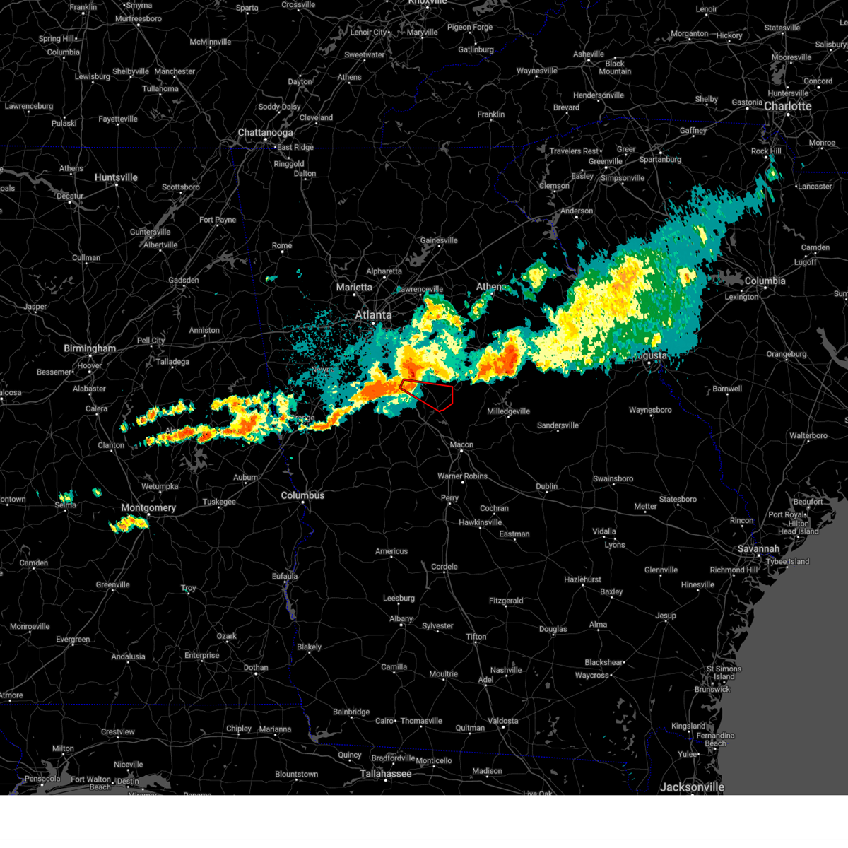
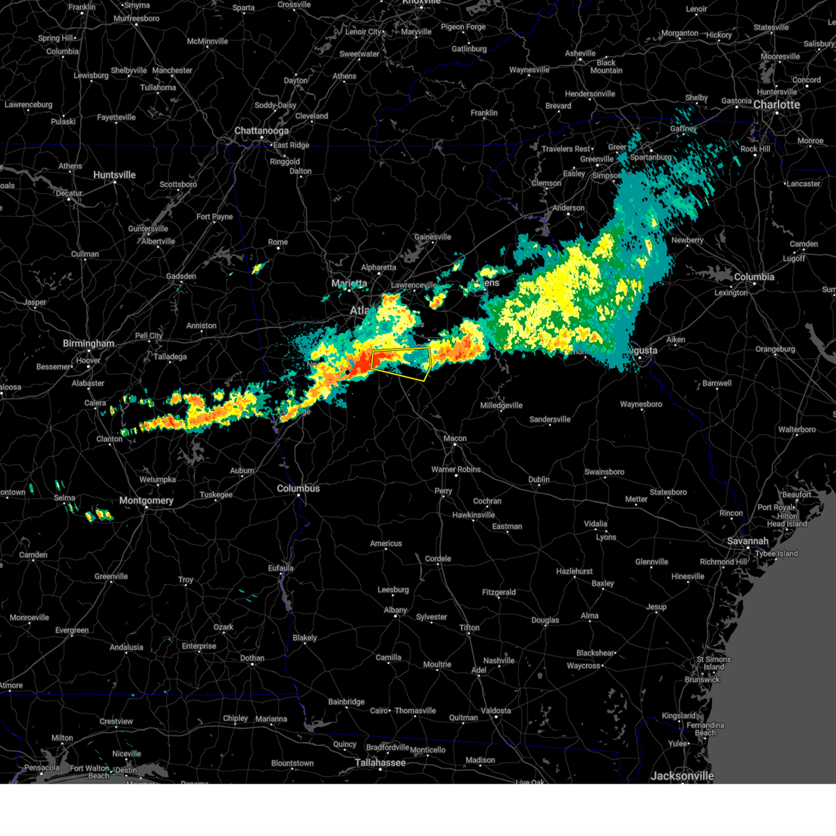
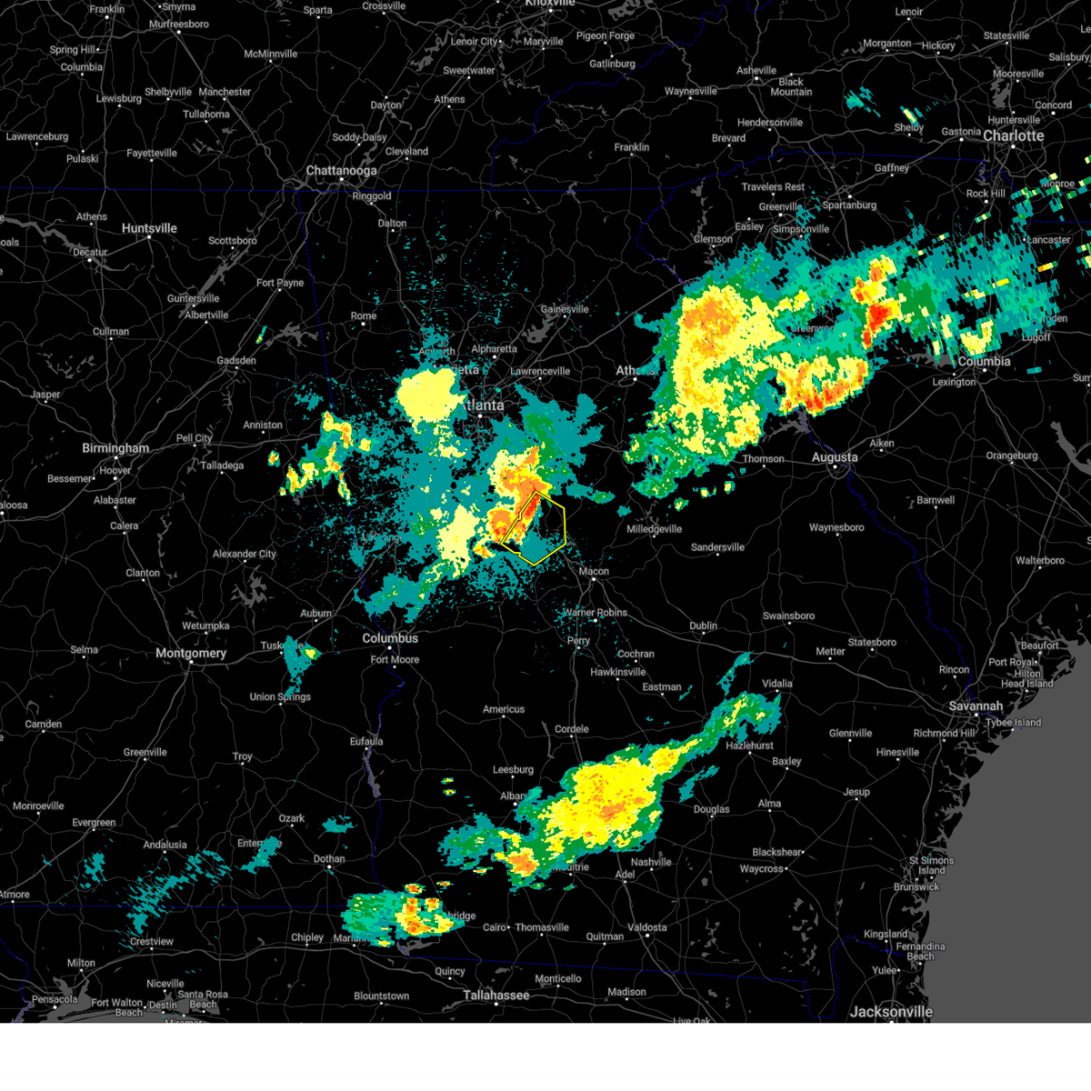
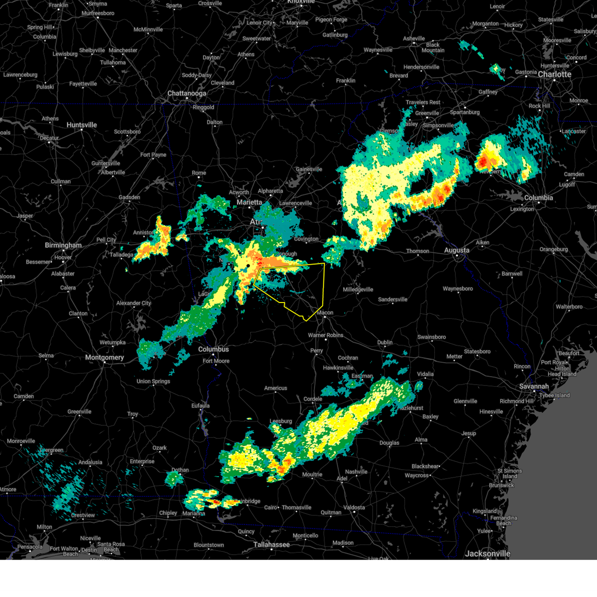
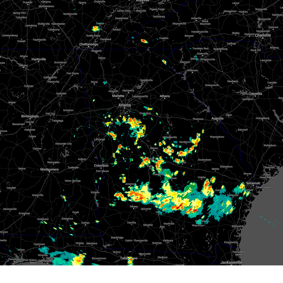
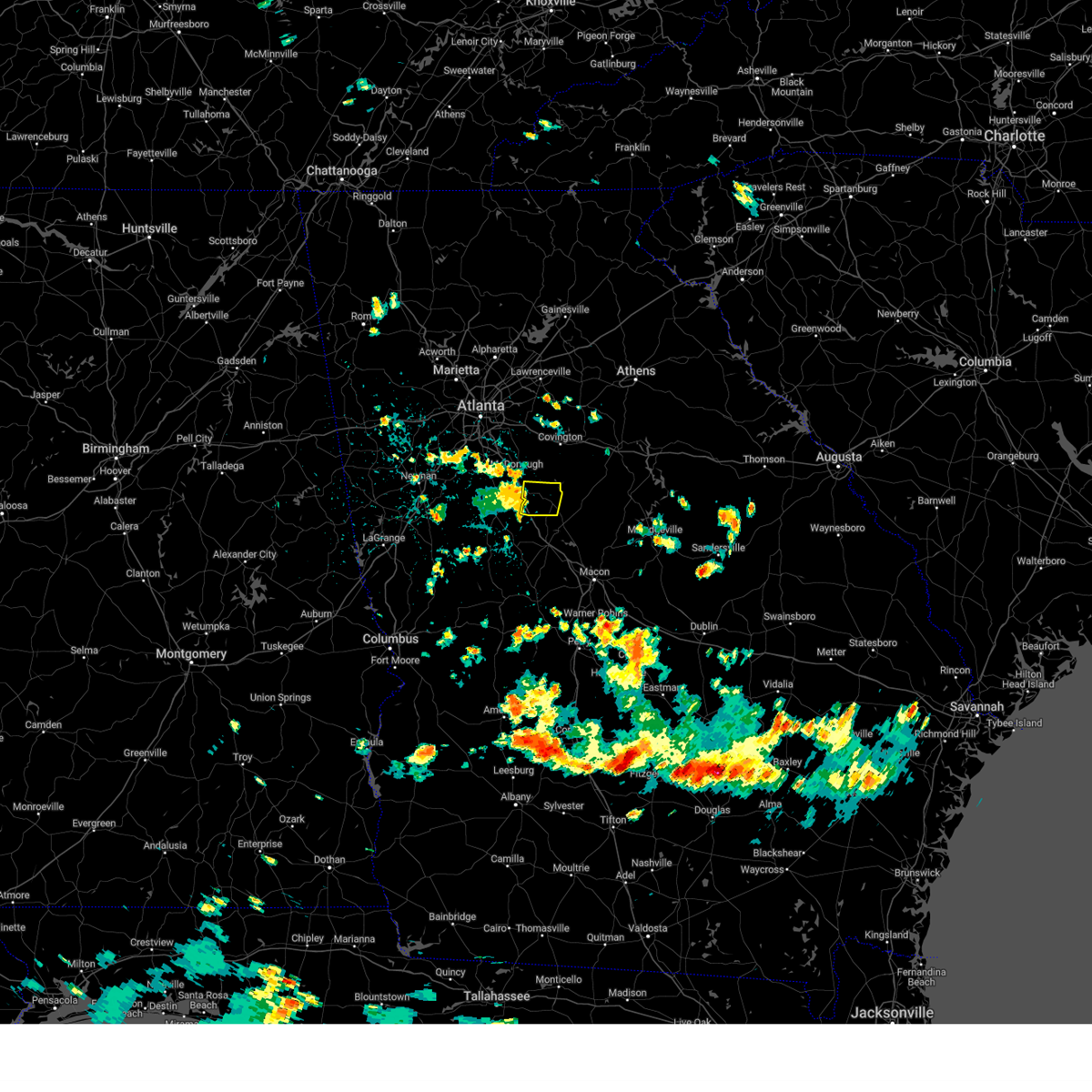
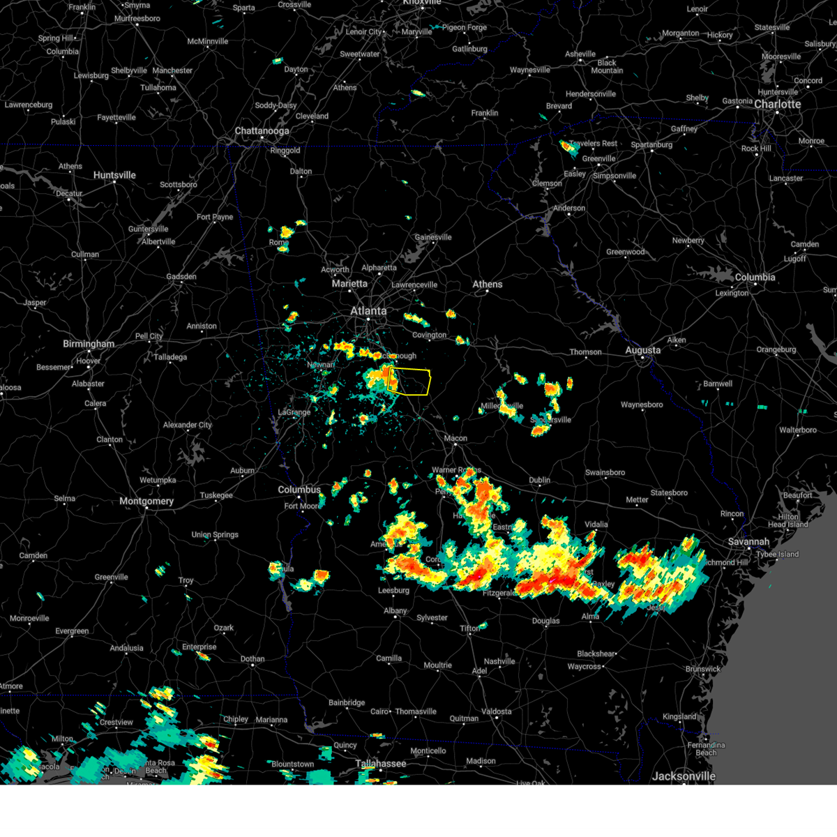
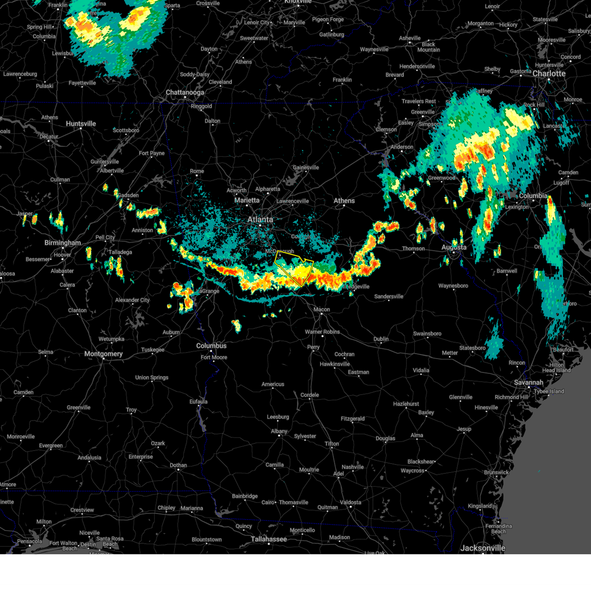
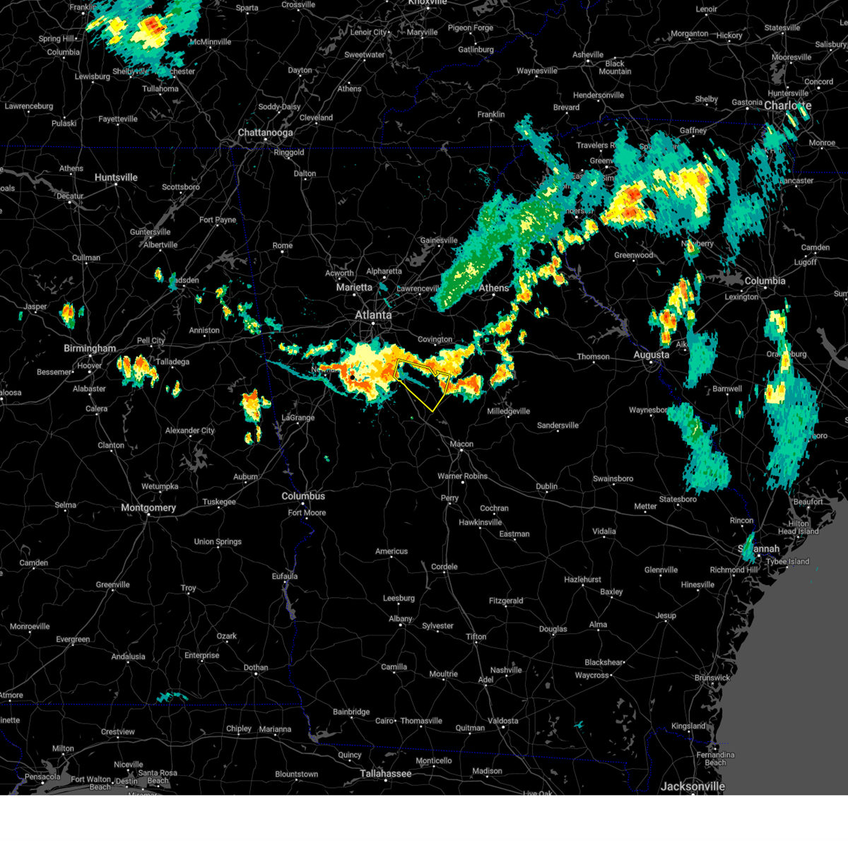
Hail Map for Jenkinsburg, GA
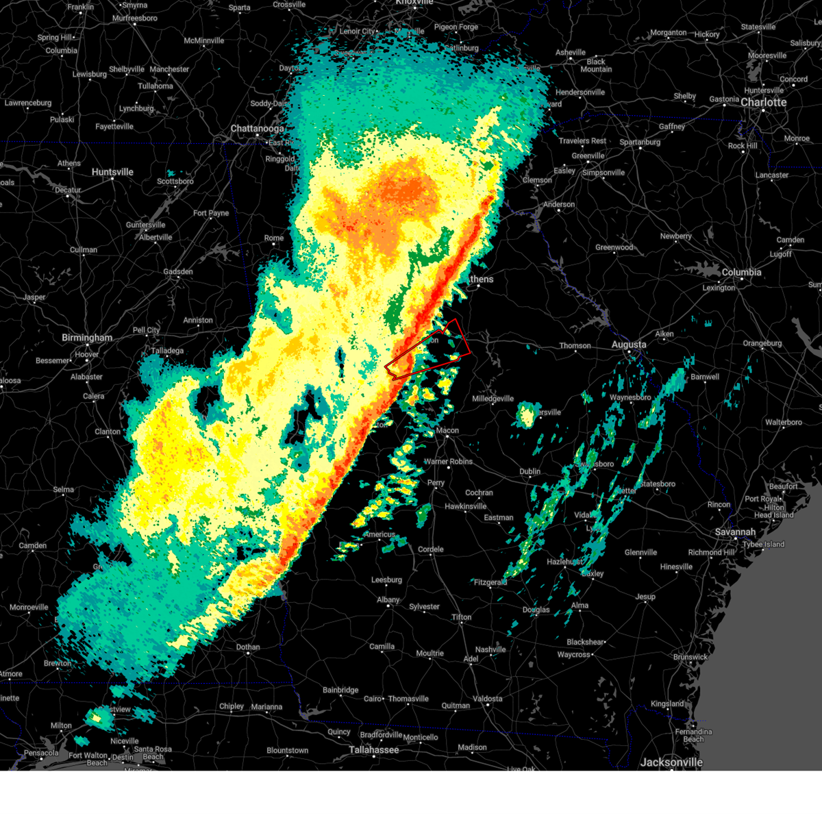
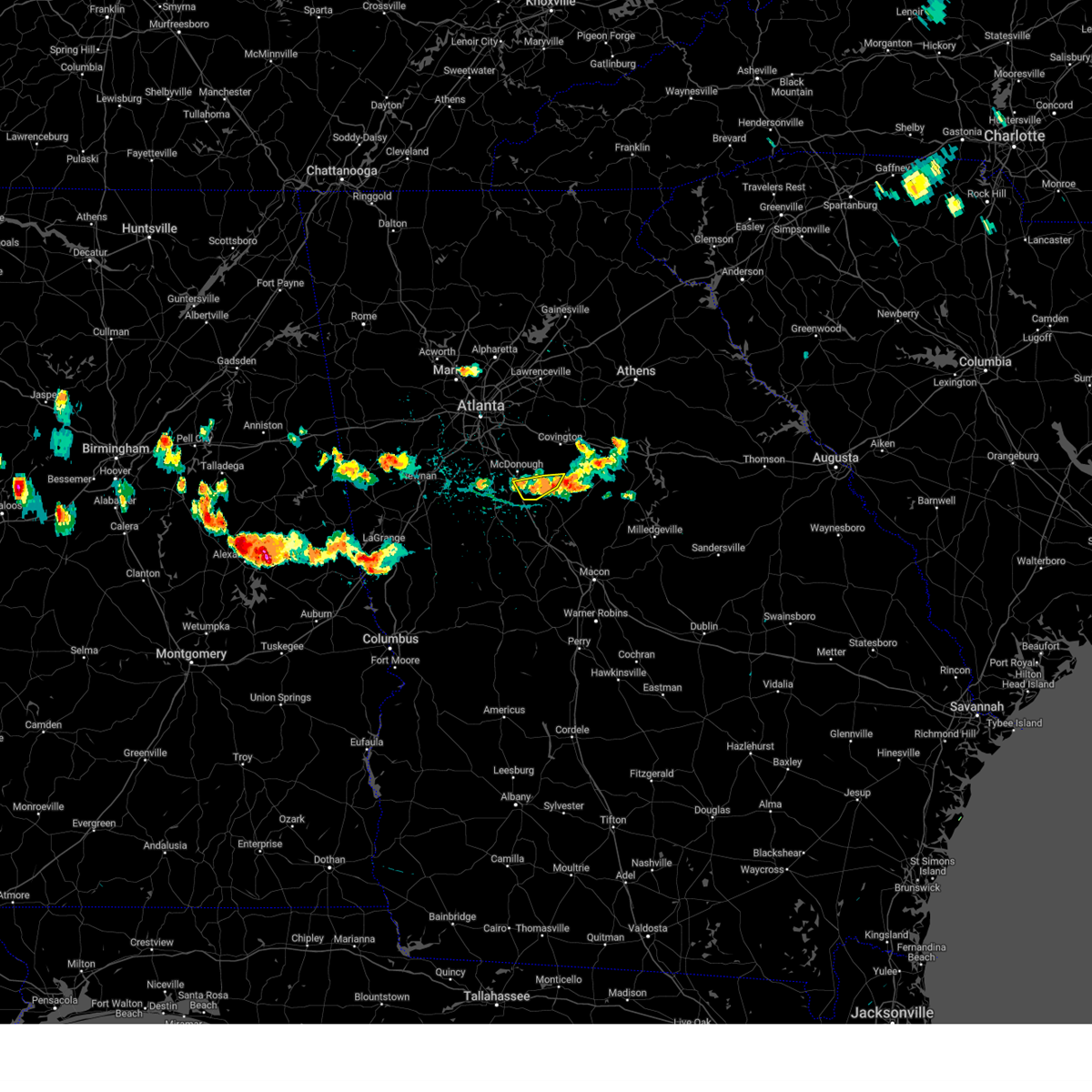
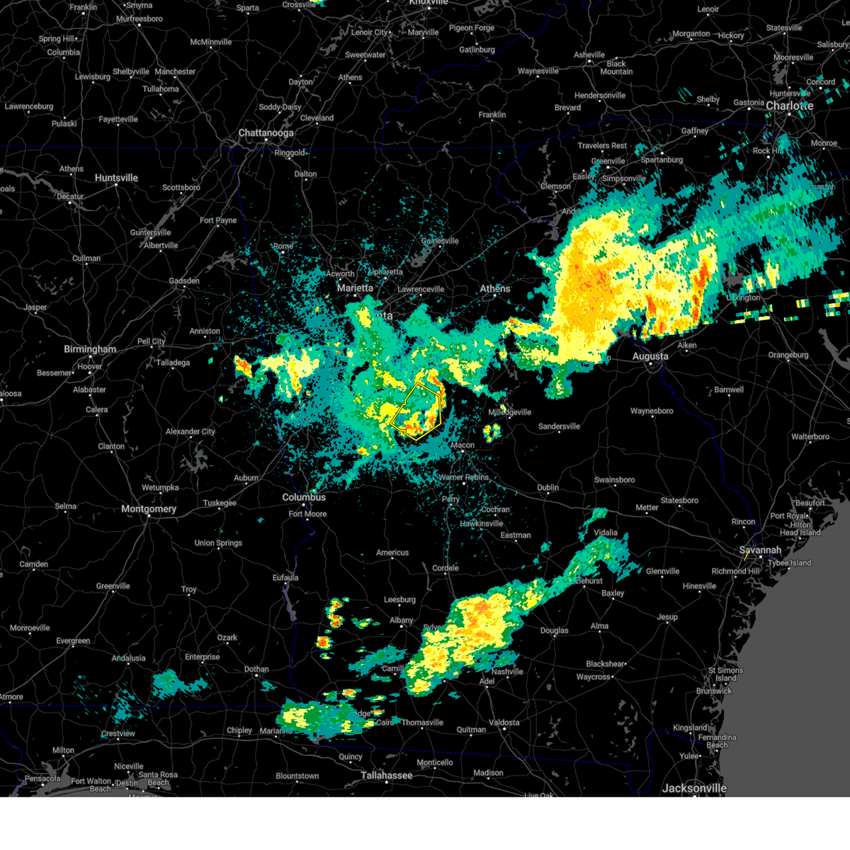
The Jenkinsburg, GA area has had 1 report of on-the-ground hail by trained spotters, and has been under severe weather warnings 47 times during the past 12 months. Doppler radar has detected hail at or near Jenkinsburg, GA on 36 occasions, including 4 occasions during the past year.
| Name: | Jenkinsburg, GA |
| Where Located: | 35.7 miles SE of Atlanta, GA |
| Map: | Google Map for Jenkinsburg, GA |
| Population: | 370 |
| Housing Units: | 141 |
| More Info: | Search Google for Jenkinsburg, GA |
5
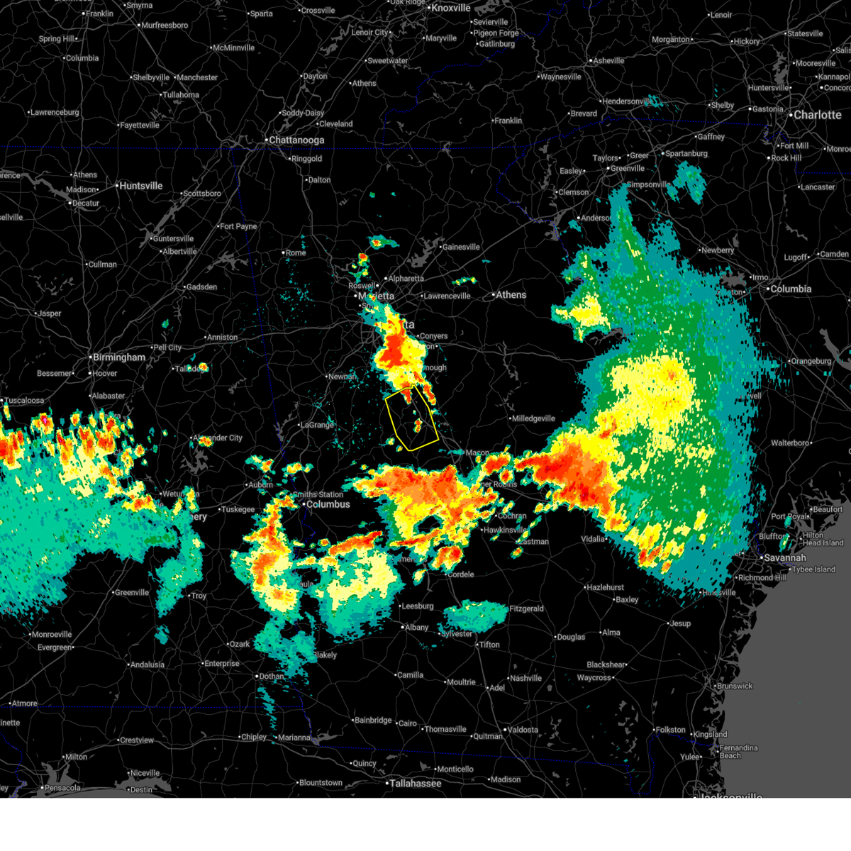
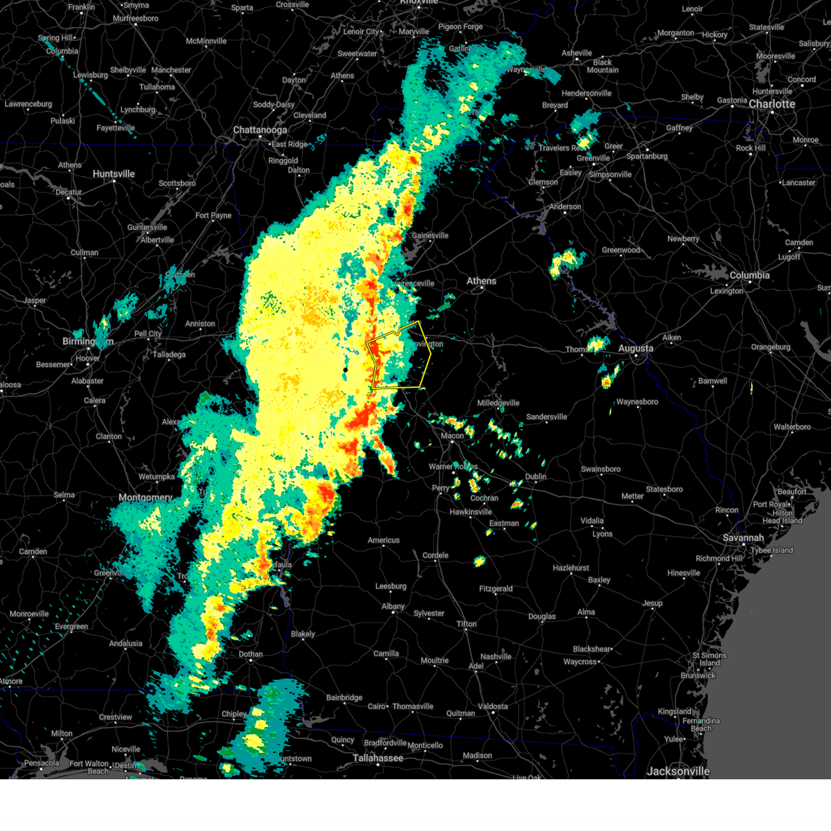
The Top Recent Hail Date for Jenkinsburg, GA is Thursday, April 10, 2025 (2nd out of 36)

Hail and Wind Damage Spotted near Jenkinsburg, GA
| Date / Time | Report Details |
|---|---|
| 6/26/2025 12:41 AM EDT |
 Svrffc the national weather service in peachtree city has issued a * severe thunderstorm warning for, southeastern spalding county in west central georgia, northeastern pike county in west central georgia, western monroe county in central georgia, northeastern upson county in west central georgia, southwestern butts county in central georgia, lamar county in west central georgia, * until 115 am edt. * at 1240 am edt, severe thunderstorms were located along a line extending from near mckibben to near high falls state park to near brent, moving southwest at 10 mph (radar indicated). Hazards include 60 mph wind gusts and quarter size hail. Hail damage to vehicles is expected. Expect wind damage to roofs, siding, and trees. Svrffc the national weather service in peachtree city has issued a * severe thunderstorm warning for, southeastern spalding county in west central georgia, northeastern pike county in west central georgia, western monroe county in central georgia, northeastern upson county in west central georgia, southwestern butts county in central georgia, lamar county in west central georgia, * until 115 am edt. * at 1240 am edt, severe thunderstorms were located along a line extending from near mckibben to near high falls state park to near brent, moving southwest at 10 mph (radar indicated). Hazards include 60 mph wind gusts and quarter size hail. Hail damage to vehicles is expected. Expect wind damage to roofs, siding, and trees.
|
| 6/25/2025 11:33 PM EDT |
 Svrffc the national weather service in peachtree city has issued a * severe thunderstorm warning for, southeastern henry county in north central georgia, northeastern butts county in central georgia, southwestern newton county in north central georgia, * until midnight edt. * at 1133 pm edt, a severe thunderstorm was located over ola, or near mcdonough, moving south at 5 mph (radar indicated). Hazards include 60 mph wind gusts and quarter size hail. Hail damage to vehicles is expected. Expect wind damage to roofs, siding, and trees. Svrffc the national weather service in peachtree city has issued a * severe thunderstorm warning for, southeastern henry county in north central georgia, northeastern butts county in central georgia, southwestern newton county in north central georgia, * until midnight edt. * at 1133 pm edt, a severe thunderstorm was located over ola, or near mcdonough, moving south at 5 mph (radar indicated). Hazards include 60 mph wind gusts and quarter size hail. Hail damage to vehicles is expected. Expect wind damage to roofs, siding, and trees.
|
| 5/21/2025 4:11 AM EDT |
 The tornado warning that was previously in effect has been reissued for eastern butts and western jasper counties and is in effect until 445 am. please refer to that bulletin for the latest severe weather information. The tornado warning that was previously in effect has been reissued for eastern butts and western jasper counties and is in effect until 445 am. please refer to that bulletin for the latest severe weather information.
|
| 5/21/2025 4:10 AM EDT |
 The tornado warning that was previously in effect has been reissued for eastern butts and western jasper counties and is in effect until 445 am. please refer to that bulletin for the latest severe weather information. The tornado warning that was previously in effect has been reissued for eastern butts and western jasper counties and is in effect until 445 am. please refer to that bulletin for the latest severe weather information.
|
| 5/21/2025 4:04 AM EDT |
 At 404 am edt, a severe thunderstorm capable of producing a tornado was located over flovilla, or near jackson, moving east at 45 mph (radar indicated rotation). Hazards include tornado. Flying debris will be dangerous to those caught without shelter. mobile homes will be damaged or destroyed. damage to roofs, windows, and vehicles will occur. tree damage is likely. Locations impacted include, jackson, flovilla, jenkinsburg, and mcelheneys crossroads. At 404 am edt, a severe thunderstorm capable of producing a tornado was located over flovilla, or near jackson, moving east at 45 mph (radar indicated rotation). Hazards include tornado. Flying debris will be dangerous to those caught without shelter. mobile homes will be damaged or destroyed. damage to roofs, windows, and vehicles will occur. tree damage is likely. Locations impacted include, jackson, flovilla, jenkinsburg, and mcelheneys crossroads.
|
| 5/21/2025 4:03 AM EDT |
 At 403 am edt, a severe thunderstorm capable of producing a tornado was located over stark, or near jackson, moving east at 40 mph (radar indicated rotation). Hazards include tornado. Flying debris will be dangerous to those caught without shelter. mobile homes will be damaged or destroyed. damage to roofs, windows, and vehicles will occur. tree damage is likely. Locations impacted include, jackson, monticello, flovilla, jenkinsburg, turtle cove, mcelheneys crossroads, and stark. At 403 am edt, a severe thunderstorm capable of producing a tornado was located over stark, or near jackson, moving east at 40 mph (radar indicated rotation). Hazards include tornado. Flying debris will be dangerous to those caught without shelter. mobile homes will be damaged or destroyed. damage to roofs, windows, and vehicles will occur. tree damage is likely. Locations impacted include, jackson, monticello, flovilla, jenkinsburg, turtle cove, mcelheneys crossroads, and stark.
|
| 5/21/2025 3:59 AM EDT |
 The storm which prompted the warning has weakened below severe limits, and has exited the warned area. therefore, the warning will be allowed to expire. remember, a severe thunderstorm warning still remains in effect for butts and jasper county. remember, a tornado warning still remains in effect for butts and jasper county. The storm which prompted the warning has weakened below severe limits, and has exited the warned area. therefore, the warning will be allowed to expire. remember, a severe thunderstorm warning still remains in effect for butts and jasper county. remember, a tornado warning still remains in effect for butts and jasper county.
|
| 5/21/2025 3:58 AM EDT |
 At 358 am edt, a confirmed tornado was located over indian springs state park, or over jackson, moving east at 45 mph (radar confirmed tornado). Hazards include damaging tornado. Flying debris will be dangerous to those caught without shelter. mobile homes will be damaged or destroyed. damage to roofs, windows, and vehicles will occur. tree damage is likely. Locations impacted include, jackson, flovilla, jenkinsburg, mcelheneys crossroads, and indian springs state park. At 358 am edt, a confirmed tornado was located over indian springs state park, or over jackson, moving east at 45 mph (radar confirmed tornado). Hazards include damaging tornado. Flying debris will be dangerous to those caught without shelter. mobile homes will be damaged or destroyed. damage to roofs, windows, and vehicles will occur. tree damage is likely. Locations impacted include, jackson, flovilla, jenkinsburg, mcelheneys crossroads, and indian springs state park.
|
| 5/21/2025 3:58 AM EDT |
 the tornado warning has been cancelled and is no longer in effect the tornado warning has been cancelled and is no longer in effect
|
| 5/21/2025 3:57 AM EDT |
 Torffc the national weather service in peachtree city has issued a * tornado warning for, central butts county in central georgia, west central jasper county in central georgia, * until 415 am edt. * at 357 am edt, a tornado producing storm was located over jackson, moving east at 40 mph (radar confirmed tornado). Hazards include damaging tornado. Flying debris will be dangerous to those caught without shelter. mobile homes will be damaged or destroyed. damage to roofs, windows, and vehicles will occur. Tree damage is likely. Torffc the national weather service in peachtree city has issued a * tornado warning for, central butts county in central georgia, west central jasper county in central georgia, * until 415 am edt. * at 357 am edt, a tornado producing storm was located over jackson, moving east at 40 mph (radar confirmed tornado). Hazards include damaging tornado. Flying debris will be dangerous to those caught without shelter. mobile homes will be damaged or destroyed. damage to roofs, windows, and vehicles will occur. Tree damage is likely.
|
| 5/21/2025 3:51 AM EDT |
 At 351 am edt, a confirmed tornado was located over mckibben, or near jackson, moving east at 45 mph (radar confirmed tornado). Hazards include damaging tornado. Flying debris will be dangerous to those caught without shelter. mobile homes will be damaged or destroyed. damage to roofs, windows, and vehicles will occur. tree damage is likely. Locations impacted include, jackson, locust grove, flovilla, jenkinsburg, mcelheneys crossroads, berner, mckibben, and indian springs state park. At 351 am edt, a confirmed tornado was located over mckibben, or near jackson, moving east at 45 mph (radar confirmed tornado). Hazards include damaging tornado. Flying debris will be dangerous to those caught without shelter. mobile homes will be damaged or destroyed. damage to roofs, windows, and vehicles will occur. tree damage is likely. Locations impacted include, jackson, locust grove, flovilla, jenkinsburg, mcelheneys crossroads, berner, mckibben, and indian springs state park.
|
| 5/21/2025 3:47 AM EDT |
 At 347 am edt, a severe thunderstorm was located over ola, or near mcdonough, moving east at 30 mph (radar indicated). Hazards include 60 mph wind gusts and quarter size hail. Hail damage to vehicles is expected. expect wind damage to roofs, siding, and trees. Locations impacted include, mcdonough, locust grove, jenkinsburg, stewart, blacksville, ola, worthville, fincherville, stark, and rocky plains. At 347 am edt, a severe thunderstorm was located over ola, or near mcdonough, moving east at 30 mph (radar indicated). Hazards include 60 mph wind gusts and quarter size hail. Hail damage to vehicles is expected. expect wind damage to roofs, siding, and trees. Locations impacted include, mcdonough, locust grove, jenkinsburg, stewart, blacksville, ola, worthville, fincherville, stark, and rocky plains.
|
| 5/21/2025 3:47 AM EDT |
 the severe thunderstorm warning has been cancelled and is no longer in effect the severe thunderstorm warning has been cancelled and is no longer in effect
|
| 5/21/2025 3:45 AM EDT |
 Torffc the national weather service in peachtree city has issued a * tornado warning for, eastern spalding county in west central georgia, north central monroe county in central georgia, south central henry county in north central georgia, butts county in central georgia, southwestern jasper county in central georgia, * until 415 am edt. * at 345 am edt, a severe thunderstorm capable of producing a tornado was located over locust grove, or 7 miles west of jackson, moving east at 45 mph (radar indicated rotation). Hazards include tornado. Flying debris will be dangerous to those caught without shelter. mobile homes will be damaged or destroyed. damage to roofs, windows, and vehicles will occur. Tree damage is likely. Torffc the national weather service in peachtree city has issued a * tornado warning for, eastern spalding county in west central georgia, north central monroe county in central georgia, south central henry county in north central georgia, butts county in central georgia, southwestern jasper county in central georgia, * until 415 am edt. * at 345 am edt, a severe thunderstorm capable of producing a tornado was located over locust grove, or 7 miles west of jackson, moving east at 45 mph (radar indicated rotation). Hazards include tornado. Flying debris will be dangerous to those caught without shelter. mobile homes will be damaged or destroyed. damage to roofs, windows, and vehicles will occur. Tree damage is likely.
|
| 5/21/2025 3:42 AM EDT |
 Svrffc the national weather service in peachtree city has issued a * severe thunderstorm warning for, northeastern spalding county in west central georgia, northeastern monroe county in central georgia, southeastern henry county in north central georgia, butts county in central georgia, northwestern jones county in central georgia, southwestern jasper county in central georgia, * until 415 am edt. * at 342 am edt, a severe thunderstorm was located over locust grove, or 8 miles south of mcdonough, moving east at 45 mph (radar indicated). Hazards include 60 mph wind gusts and penny size hail. expect damage to roofs, siding, and trees Svrffc the national weather service in peachtree city has issued a * severe thunderstorm warning for, northeastern spalding county in west central georgia, northeastern monroe county in central georgia, southeastern henry county in north central georgia, butts county in central georgia, northwestern jones county in central georgia, southwestern jasper county in central georgia, * until 415 am edt. * at 342 am edt, a severe thunderstorm was located over locust grove, or 8 miles south of mcdonough, moving east at 45 mph (radar indicated). Hazards include 60 mph wind gusts and penny size hail. expect damage to roofs, siding, and trees
|
| 5/21/2025 3:31 AM EDT |
 At 331 am edt, a severe thunderstorm was located over flippen, or near mcdonough, moving east at 30 mph (radar indicated). Hazards include 60 mph wind gusts and quarter size hail. Hail damage to vehicles is expected. expect wind damage to roofs, siding, and trees. Locations impacted include, mcdonough, stockbridge, hampton, lovejoy, locust grove, jenkinsburg, stewart, lake spivey, blacksville, ola, worthville, bonanza, atlanta motor speedway, flippen, fincherville, eagles landing, stark, rocky plains, and irondale. At 331 am edt, a severe thunderstorm was located over flippen, or near mcdonough, moving east at 30 mph (radar indicated). Hazards include 60 mph wind gusts and quarter size hail. Hail damage to vehicles is expected. expect wind damage to roofs, siding, and trees. Locations impacted include, mcdonough, stockbridge, hampton, lovejoy, locust grove, jenkinsburg, stewart, lake spivey, blacksville, ola, worthville, bonanza, atlanta motor speedway, flippen, fincherville, eagles landing, stark, rocky plains, and irondale.
|
| 5/21/2025 3:26 AM EDT |
 Svrffc the national weather service in peachtree city has issued a * severe thunderstorm warning for, henry county in north central georgia, northeastern butts county in central georgia, southeastern clayton county in north central georgia, southwestern newton county in north central georgia, * until 400 am edt. * at 325 am edt, a severe thunderstorm was located over lovejoy, or near jonesboro, moving east at 30 mph (radar indicated). Hazards include 60 mph wind gusts and quarter size hail. Hail damage to vehicles is expected. Expect wind damage to roofs, siding, and trees. Svrffc the national weather service in peachtree city has issued a * severe thunderstorm warning for, henry county in north central georgia, northeastern butts county in central georgia, southeastern clayton county in north central georgia, southwestern newton county in north central georgia, * until 400 am edt. * at 325 am edt, a severe thunderstorm was located over lovejoy, or near jonesboro, moving east at 30 mph (radar indicated). Hazards include 60 mph wind gusts and quarter size hail. Hail damage to vehicles is expected. Expect wind damage to roofs, siding, and trees.
|
| 4/25/2025 10:34 PM EDT |
 At 1034 pm edt, a severe thunderstorm was located over luella, or near mcdonough, moving east at 45 mph (radar indicated). Hazards include 60 mph wind gusts and quarter size hail. Hail damage to vehicles is expected. expect wind damage to roofs, siding, and trees. Locations impacted include, highland mills, blacksville, towalaga, ola, experiment, walker mill, mckibben, east griffin, sunny side, mcdonough, hampton, locust grove, luella, flippen, griffin, jenkinsburg, jackson, and stockbridge. At 1034 pm edt, a severe thunderstorm was located over luella, or near mcdonough, moving east at 45 mph (radar indicated). Hazards include 60 mph wind gusts and quarter size hail. Hail damage to vehicles is expected. expect wind damage to roofs, siding, and trees. Locations impacted include, highland mills, blacksville, towalaga, ola, experiment, walker mill, mckibben, east griffin, sunny side, mcdonough, hampton, locust grove, luella, flippen, griffin, jenkinsburg, jackson, and stockbridge.
|
| 4/25/2025 10:34 PM EDT |
 the severe thunderstorm warning has been cancelled and is no longer in effect the severe thunderstorm warning has been cancelled and is no longer in effect
|
| 4/25/2025 10:24 PM EDT |
 Svrffc the national weather service in peachtree city has issued a * severe thunderstorm warning for, spalding county in west central georgia, henry county in north central georgia, southwestern butts county in central georgia, southeastern clayton county in north central georgia, * until 1115 pm edt. * at 1023 pm edt, a severe thunderstorm was located over atlanta motor speedway, or 9 miles north of griffin, moving east at 35 mph (radar indicated). Hazards include 60 mph wind gusts and quarter size hail. Hail damage to vehicles is expected. Expect wind damage to roofs, siding, and trees. Svrffc the national weather service in peachtree city has issued a * severe thunderstorm warning for, spalding county in west central georgia, henry county in north central georgia, southwestern butts county in central georgia, southeastern clayton county in north central georgia, * until 1115 pm edt. * at 1023 pm edt, a severe thunderstorm was located over atlanta motor speedway, or 9 miles north of griffin, moving east at 35 mph (radar indicated). Hazards include 60 mph wind gusts and quarter size hail. Hail damage to vehicles is expected. Expect wind damage to roofs, siding, and trees.
|
| 4/10/2025 9:50 PM EDT |
 Svrffc the national weather service in peachtree city has issued a * severe thunderstorm warning for, spalding county in west central georgia, northeastern meriwether county in west central georgia, pike county in west central georgia, monroe county in central georgia, upson county in west central georgia, butts county in central georgia, northwestern jones county in central georgia, southwestern newton county in north central georgia, southwestern rockdale county in north central georgia, henry county in north central georgia, northwestern crawford county in central georgia, jasper county in central georgia, lamar county in west central georgia, * until 1030 pm edt. * at 949 pm edt, severe thunderstorms were located along a line extending from near kelleytown to near highland mills to near wooster, moving southeast at 40 mph (public). Hazards include half dollar size hail. damage to vehicles is expected Svrffc the national weather service in peachtree city has issued a * severe thunderstorm warning for, spalding county in west central georgia, northeastern meriwether county in west central georgia, pike county in west central georgia, monroe county in central georgia, upson county in west central georgia, butts county in central georgia, northwestern jones county in central georgia, southwestern newton county in north central georgia, southwestern rockdale county in north central georgia, henry county in north central georgia, northwestern crawford county in central georgia, jasper county in central georgia, lamar county in west central georgia, * until 1030 pm edt. * at 949 pm edt, severe thunderstorms were located along a line extending from near kelleytown to near highland mills to near wooster, moving southeast at 40 mph (public). Hazards include half dollar size hail. damage to vehicles is expected
|
| 3/31/2025 1:23 PM EDT |
 Svrffc the national weather service in peachtree city has issued a * severe thunderstorm warning for, southeastern dekalb county in north central georgia, clarke county in northeastern georgia, northwestern monroe county in central georgia, butts county in central georgia, newton county in north central georgia, rockdale county in north central georgia, oconee county in northeastern georgia, morgan county in north central georgia, putnam county in central georgia, southeastern henry county in north central georgia, walton county in north central georgia, northwestern greene county in east central georgia, jasper county in central georgia, northeastern lamar county in west central georgia, * until 215 pm edt. * at 123 pm edt, severe thunderstorms were located along a line extending from near lithonia to oak hill to jenkinsburg, moving east at 65 mph (radar indicated). Hazards include 60 mph wind gusts. expect damage to roofs, siding, and trees Svrffc the national weather service in peachtree city has issued a * severe thunderstorm warning for, southeastern dekalb county in north central georgia, clarke county in northeastern georgia, northwestern monroe county in central georgia, butts county in central georgia, newton county in north central georgia, rockdale county in north central georgia, oconee county in northeastern georgia, morgan county in north central georgia, putnam county in central georgia, southeastern henry county in north central georgia, walton county in north central georgia, northwestern greene county in east central georgia, jasper county in central georgia, northeastern lamar county in west central georgia, * until 215 pm edt. * at 123 pm edt, severe thunderstorms were located along a line extending from near lithonia to oak hill to jenkinsburg, moving east at 65 mph (radar indicated). Hazards include 60 mph wind gusts. expect damage to roofs, siding, and trees
|
| 3/31/2025 1:07 PM EDT |
 the severe thunderstorm warning has been cancelled and is no longer in effect the severe thunderstorm warning has been cancelled and is no longer in effect
|
| 3/31/2025 1:07 PM EDT |
 At 107 pm edt, severe thunderstorms were located along a line extending from near lake spivey to near hampton to experiment, moving east at 55 mph (radar indicated). Hazards include 60 mph wind gusts and penny size hail. Expect damage to roofs, siding, and trees. Locations impacted include, lake spivey, blacksville, porterdale, rex, ola, worthville, walker mill, mcdonough, jackson, stewart, locust grove, hidden valley park, luella, jonesboro, flippen, fincherville, kelleytown, conyers, oak hill, and jenkinsburg. At 107 pm edt, severe thunderstorms were located along a line extending from near lake spivey to near hampton to experiment, moving east at 55 mph (radar indicated). Hazards include 60 mph wind gusts and penny size hail. Expect damage to roofs, siding, and trees. Locations impacted include, lake spivey, blacksville, porterdale, rex, ola, worthville, walker mill, mcdonough, jackson, stewart, locust grove, hidden valley park, luella, jonesboro, flippen, fincherville, kelleytown, conyers, oak hill, and jenkinsburg.
|
| 3/31/2025 12:49 PM EDT | Svrffc the national weather service in peachtree city has issued a * severe thunderstorm warning for, rockdale county in north central georgia, spalding county in west central georgia, fayette county in north central georgia, henry county in north central georgia, butts county in central georgia, central clayton county in north central georgia, western newton county in north central georgia, * until 130 pm edt. * at 1249 pm edt, severe thunderstorms were located along a line extending from sandy creek to near starrs mill to haralson, moving east at 55 mph (radar indicated). Hazards include 60 mph wind gusts and penny size hail. expect damage to roofs, siding, and trees |
| 2/16/2025 5:07 AM EST |
 Torffc the national weather service in peachtree city has issued a * tornado warning for, southwestern morgan county in north central georgia, southeastern henry county in north central georgia, central butts county in central georgia, northern jasper county in central georgia, southeastern newton county in north central georgia, * until 545 am est. * at 507 am est, a severe thunderstorm capable of producing a tornado was located over locust grove, or 8 miles west of jackson, moving northeast at 65 mph (radar indicated rotation). Hazards include tornado. Flying debris will be dangerous to those caught without shelter. mobile homes will be damaged or destroyed. damage to roofs, windows, and vehicles will occur. Tree damage is likely. Torffc the national weather service in peachtree city has issued a * tornado warning for, southwestern morgan county in north central georgia, southeastern henry county in north central georgia, central butts county in central georgia, northern jasper county in central georgia, southeastern newton county in north central georgia, * until 545 am est. * at 507 am est, a severe thunderstorm capable of producing a tornado was located over locust grove, or 8 miles west of jackson, moving northeast at 65 mph (radar indicated rotation). Hazards include tornado. Flying debris will be dangerous to those caught without shelter. mobile homes will be damaged or destroyed. damage to roofs, windows, and vehicles will occur. Tree damage is likely.
|
| 2/16/2025 5:05 AM EST | Svrffc the national weather service in peachtree city has issued a * severe thunderstorm warning for, eastern spalding county in west central georgia, bibb county in central georgia, southeastern pike county in west central georgia, monroe county in central georgia, upson county in west central georgia, butts county in central georgia, jones county in central georgia, south central newton county in north central georgia, northwestern baldwin county in central georgia, putnam county in central georgia, southeastern henry county in north central georgia, northern crawford county in central georgia, jasper county in central georgia, lamar county in west central georgia, * until 600 am est. * at 505 am est, severe thunderstorms were located along a line extending from blacksville to walker mill to near milner to sprewell bluff state park, moving east at 55 mph (radar indicated). Hazards include 70 mph wind gusts. Expect considerable tree damage. Damage is likely to mobile homes, roofs, and outbuildings. |
| 12/29/2024 4:53 AM EST |
 Svrffc the national weather service in peachtree city has issued a * severe thunderstorm warning for, bibb county in central georgia, monroe county in central georgia, northeastern houston county in central georgia, butts county in central georgia, jones county in central georgia, newton county in north central georgia, rockdale county in north central georgia, northwestern wilkinson county in central georgia, western baldwin county in central georgia, morgan county in north central georgia, twiggs county in central georgia, putnam county in central georgia, henry county in north central georgia, walton county in north central georgia, peach county in central georgia, crawford county in central georgia, jasper county in central georgia, northeastern taylor county in west central georgia, northeastern lamar county in west central georgia, * until 600 am est. * at 452 am est, severe thunderstorms were located along a line extending from stockbridge to high falls state park to brent to near reynolds, moving east at 50 mph (radar indicated). Hazards include 60 mph wind gusts. expect damage to roofs, siding, and trees Svrffc the national weather service in peachtree city has issued a * severe thunderstorm warning for, bibb county in central georgia, monroe county in central georgia, northeastern houston county in central georgia, butts county in central georgia, jones county in central georgia, newton county in north central georgia, rockdale county in north central georgia, northwestern wilkinson county in central georgia, western baldwin county in central georgia, morgan county in north central georgia, twiggs county in central georgia, putnam county in central georgia, henry county in north central georgia, walton county in north central georgia, peach county in central georgia, crawford county in central georgia, jasper county in central georgia, northeastern taylor county in west central georgia, northeastern lamar county in west central georgia, * until 600 am est. * at 452 am est, severe thunderstorms were located along a line extending from stockbridge to high falls state park to brent to near reynolds, moving east at 50 mph (radar indicated). Hazards include 60 mph wind gusts. expect damage to roofs, siding, and trees
|
| 12/29/2024 4:35 AM EST |
 the severe thunderstorm warning has been cancelled and is no longer in effect the severe thunderstorm warning has been cancelled and is no longer in effect
|
| 12/29/2024 4:35 AM EST |
 At 435 am est, severe thunderstorms were located along a line extending from near inman to griffin to near the rock to near howard, moving northeast at 55 mph (radar indicated). Hazards include 60 mph wind gusts. Expect damage to roofs, siding, and trees. Locations impacted include, griffin, mcdonough, fayetteville, thomaston, barnesville, jackson, forsyth, butler, zebulon, roberta, peachtree city, stockbridge, hampton, lovejoy, locust grove, reynolds, flovilla, milner, brooks, and jenkinsburg. At 435 am est, severe thunderstorms were located along a line extending from near inman to griffin to near the rock to near howard, moving northeast at 55 mph (radar indicated). Hazards include 60 mph wind gusts. Expect damage to roofs, siding, and trees. Locations impacted include, griffin, mcdonough, fayetteville, thomaston, barnesville, jackson, forsyth, butler, zebulon, roberta, peachtree city, stockbridge, hampton, lovejoy, locust grove, reynolds, flovilla, milner, brooks, and jenkinsburg.
|
| 12/29/2024 4:02 AM EST |
 Svrffc the national weather service in peachtree city has issued a * severe thunderstorm warning for, spalding county in west central georgia, southern fayette county in north central georgia, meriwether county in west central georgia, pike county in west central georgia, monroe county in central georgia, upson county in west central georgia, southwestern butts county in central georgia, henry county in north central georgia, crawford county in central georgia, southeastern coweta county in west central georgia, southeastern clayton county in north central georgia, central talbot county in west central georgia, taylor county in west central georgia, lamar county in west central georgia, * until 500 am est. * at 401 am est, severe thunderstorms were located along a line extending from near hogansville to near woodland to near eelbeck/west fort moore, moving east at 45 mph (radar indicated). Hazards include 60 mph wind gusts. expect damage to roofs, siding, and trees Svrffc the national weather service in peachtree city has issued a * severe thunderstorm warning for, spalding county in west central georgia, southern fayette county in north central georgia, meriwether county in west central georgia, pike county in west central georgia, monroe county in central georgia, upson county in west central georgia, southwestern butts county in central georgia, henry county in north central georgia, crawford county in central georgia, southeastern coweta county in west central georgia, southeastern clayton county in north central georgia, central talbot county in west central georgia, taylor county in west central georgia, lamar county in west central georgia, * until 500 am est. * at 401 am est, severe thunderstorms were located along a line extending from near hogansville to near woodland to near eelbeck/west fort moore, moving east at 45 mph (radar indicated). Hazards include 60 mph wind gusts. expect damage to roofs, siding, and trees
|
| 8/18/2024 5:05 PM EDT |
 At 505 pm edt, severe thunderstorms were located along a line extending from near turtle cove to indian springs state park to near chappel mill, moving southeast at 35 mph (radar indicated). Hazards include 60 mph wind gusts. Expect damage to roofs, siding, and trees. Locations impacted include, jackson, locust grove, jenkinsburg, stewart, fincherville, and worthville. At 505 pm edt, severe thunderstorms were located along a line extending from near turtle cove to indian springs state park to near chappel mill, moving southeast at 35 mph (radar indicated). Hazards include 60 mph wind gusts. Expect damage to roofs, siding, and trees. Locations impacted include, jackson, locust grove, jenkinsburg, stewart, fincherville, and worthville.
|
| 8/18/2024 5:05 PM EDT |
 the severe thunderstorm warning has been cancelled and is no longer in effect the severe thunderstorm warning has been cancelled and is no longer in effect
|
| 8/18/2024 4:35 PM EDT | Svrffc the national weather service in peachtree city has issued a * severe thunderstorm warning for, northeastern spalding county in west central georgia, southern henry county in north central georgia, northern butts county in central georgia, southwestern newton county in north central georgia, * until 515 pm edt. * at 434 pm edt, severe thunderstorms were located along a line extending from oak hill to near mcdonough to near hampton, moving southeast at 35 mph (radar indicated). Hazards include 60 mph wind gusts. this line of storms has a history of producing tree and powerlines damage. expect damage to roofs, siding, and trees |
| 8/17/2024 9:55 PM EDT |
 The storm which prompted the warning has weakened below severe limits, and no longer poses an immediate threat to life or property. therefore, the warning will be allowed to expire. however, heavy rain is still possible with this thunderstorm. The storm which prompted the warning has weakened below severe limits, and no longer poses an immediate threat to life or property. therefore, the warning will be allowed to expire. however, heavy rain is still possible with this thunderstorm.
|
| 8/17/2024 9:30 PM EDT |
 Svrffc the national weather service in peachtree city has issued a * severe thunderstorm warning for, western monroe county in central georgia, southern butts county in central georgia, lamar county in west central georgia, * until 1000 pm edt. * at 928 pm edt, a severe thunderstorm was located over high falls state park, or 9 miles southwest of jackson, moving southeast at 25 mph (radar indicated). Hazards include 60 mph wind gusts. expect damage to roofs, siding, and trees Svrffc the national weather service in peachtree city has issued a * severe thunderstorm warning for, western monroe county in central georgia, southern butts county in central georgia, lamar county in west central georgia, * until 1000 pm edt. * at 928 pm edt, a severe thunderstorm was located over high falls state park, or 9 miles southwest of jackson, moving southeast at 25 mph (radar indicated). Hazards include 60 mph wind gusts. expect damage to roofs, siding, and trees
|
| 8/17/2024 8:50 PM EDT |
 Svrffc the national weather service in peachtree city has issued a * severe thunderstorm warning for, spalding county in west central georgia, southeastern fayette county in north central georgia, northwestern bibb county in central georgia, northern pike county in west central georgia, monroe county in central georgia, south central henry county in north central georgia, butts county in central georgia, northwestern jones county in central georgia, southwestern jasper county in central georgia, lamar county in west central georgia, * until 930 pm edt. * at 850 pm edt, a severe thunderstorm was located over zetella, or near griffin, moving southeast at 45 mph (radar indicated). Hazards include 60 mph wind gusts. expect damage to roofs, siding, and trees Svrffc the national weather service in peachtree city has issued a * severe thunderstorm warning for, spalding county in west central georgia, southeastern fayette county in north central georgia, northwestern bibb county in central georgia, northern pike county in west central georgia, monroe county in central georgia, south central henry county in north central georgia, butts county in central georgia, northwestern jones county in central georgia, southwestern jasper county in central georgia, lamar county in west central georgia, * until 930 pm edt. * at 850 pm edt, a severe thunderstorm was located over zetella, or near griffin, moving southeast at 45 mph (radar indicated). Hazards include 60 mph wind gusts. expect damage to roofs, siding, and trees
|
| 7/31/2024 4:18 PM EDT |
 the severe thunderstorm warning has been cancelled and is no longer in effect the severe thunderstorm warning has been cancelled and is no longer in effect
|
| 7/31/2024 3:52 PM EDT |
 the severe thunderstorm warning has been cancelled and is no longer in effect the severe thunderstorm warning has been cancelled and is no longer in effect
|
| 7/31/2024 3:52 PM EDT |
 At 352 pm edt, a severe thunderstorm was located over jenkinsburg, or near jackson, moving east at 20 mph (radar indicated). Hazards include 60 mph wind gusts and quarter size hail. Hail damage to vehicles is expected. expect wind damage to roofs, siding, and trees. Locations impacted include, jackson, locust grove, flovilla, jenkinsburg, mckibben, indian springs state park, and stark. At 352 pm edt, a severe thunderstorm was located over jenkinsburg, or near jackson, moving east at 20 mph (radar indicated). Hazards include 60 mph wind gusts and quarter size hail. Hail damage to vehicles is expected. expect wind damage to roofs, siding, and trees. Locations impacted include, jackson, locust grove, flovilla, jenkinsburg, mckibben, indian springs state park, and stark.
|
| 7/31/2024 3:38 PM EDT |
 Svrffc the national weather service in peachtree city has issued a * severe thunderstorm warning for, northeastern spalding county in west central georgia, southeastern henry county in north central georgia, butts county in central georgia, * until 430 pm edt. * at 338 pm edt, a severe thunderstorm was located over locust grove, or 9 miles west of jackson, moving east at 20 mph (radar indicated). Hazards include 60 mph wind gusts and quarter size hail. Hail damage to vehicles is expected. Expect wind damage to roofs, siding, and trees. Svrffc the national weather service in peachtree city has issued a * severe thunderstorm warning for, northeastern spalding county in west central georgia, southeastern henry county in north central georgia, butts county in central georgia, * until 430 pm edt. * at 338 pm edt, a severe thunderstorm was located over locust grove, or 9 miles west of jackson, moving east at 20 mph (radar indicated). Hazards include 60 mph wind gusts and quarter size hail. Hail damage to vehicles is expected. Expect wind damage to roofs, siding, and trees.
|
| 7/30/2024 10:03 PM EDT |
 the severe thunderstorm warning has been cancelled and is no longer in effect the severe thunderstorm warning has been cancelled and is no longer in effect
|
| 7/30/2024 9:28 PM EDT |
 Svrffc the national weather service in peachtree city has issued a * severe thunderstorm warning for, north central monroe county in central georgia, southeastern henry county in north central georgia, butts county in central georgia, west central jasper county in central georgia, * until 1015 pm edt. * at 927 pm edt, a severe thunderstorm was located over locust grove, or near mcdonough, moving southeast at 30 mph (radar indicated). Hazards include 60 mph wind gusts and quarter size hail. Hail damage to vehicles is expected. Expect wind damage to roofs, siding, and trees. Svrffc the national weather service in peachtree city has issued a * severe thunderstorm warning for, north central monroe county in central georgia, southeastern henry county in north central georgia, butts county in central georgia, west central jasper county in central georgia, * until 1015 pm edt. * at 927 pm edt, a severe thunderstorm was located over locust grove, or near mcdonough, moving southeast at 30 mph (radar indicated). Hazards include 60 mph wind gusts and quarter size hail. Hail damage to vehicles is expected. Expect wind damage to roofs, siding, and trees.
|
| 7/30/2024 9:15 PM EDT |
 Svrffc the national weather service in peachtree city has issued a * severe thunderstorm warning for, spalding county in west central georgia, southern fayette county in north central georgia, northeastern meriwether county in west central georgia, pike county in west central georgia, northwestern monroe county in central georgia, southwestern henry county in north central georgia, northeastern upson county in west central georgia, southwestern butts county in central georgia, eastern coweta county in west central georgia, south central clayton county in north central georgia, lamar county in west central georgia, * until 1000 pm edt. * at 915 pm edt, severe thunderstorms were located along a line extending from blacksville to near rover to near sharpsburg, moving southeast at 40 mph (radar indicated). Hazards include 60 mph wind gusts and quarter size hail. Hail damage to vehicles is expected. Expect wind damage to roofs, siding, and trees. Svrffc the national weather service in peachtree city has issued a * severe thunderstorm warning for, spalding county in west central georgia, southern fayette county in north central georgia, northeastern meriwether county in west central georgia, pike county in west central georgia, northwestern monroe county in central georgia, southwestern henry county in north central georgia, northeastern upson county in west central georgia, southwestern butts county in central georgia, eastern coweta county in west central georgia, south central clayton county in north central georgia, lamar county in west central georgia, * until 1000 pm edt. * at 915 pm edt, severe thunderstorms were located along a line extending from blacksville to near rover to near sharpsburg, moving southeast at 40 mph (radar indicated). Hazards include 60 mph wind gusts and quarter size hail. Hail damage to vehicles is expected. Expect wind damage to roofs, siding, and trees.
|
| 7/23/2024 9:44 PM EDT |
 the severe thunderstorm warning has been cancelled and is no longer in effect the severe thunderstorm warning has been cancelled and is no longer in effect
|
| 7/23/2024 9:44 PM EDT |
 At 943 pm edt, severe thunderstorms were located along a line extending from near flippen to near ola to worthville, moving northeast at 30 mph (radar indicated). Hazards include 60 mph wind gusts. Expect damage to roofs, siding, and trees. Locations impacted include, mcdonough, jackson, jonesboro, stockbridge, hampton, lovejoy, locust grove, jenkinsburg, lake spivey, blacksville, ola, worthville, bonanza, flippen, fincherville, eagles landing, stark, and irondale. At 943 pm edt, severe thunderstorms were located along a line extending from near flippen to near ola to worthville, moving northeast at 30 mph (radar indicated). Hazards include 60 mph wind gusts. Expect damage to roofs, siding, and trees. Locations impacted include, mcdonough, jackson, jonesboro, stockbridge, hampton, lovejoy, locust grove, jenkinsburg, lake spivey, blacksville, ola, worthville, bonanza, flippen, fincherville, eagles landing, stark, and irondale.
|
| 7/23/2024 9:27 PM EDT |
 Svrffc the national weather service in peachtree city has issued a * severe thunderstorm warning for, northeastern spalding county in west central georgia, henry county in north central georgia, butts county in central georgia, southeastern clayton county in north central georgia, * until 1000 pm edt. * at 927 pm edt, severe thunderstorms were located along a line extending from atlanta motor speedway to blacksville to near jackson, moving northeast at 30 mph (radar indicated). Hazards include 60 mph wind gusts. expect damage to roofs, siding, and trees Svrffc the national weather service in peachtree city has issued a * severe thunderstorm warning for, northeastern spalding county in west central georgia, henry county in north central georgia, butts county in central georgia, southeastern clayton county in north central georgia, * until 1000 pm edt. * at 927 pm edt, severe thunderstorms were located along a line extending from atlanta motor speedway to blacksville to near jackson, moving northeast at 30 mph (radar indicated). Hazards include 60 mph wind gusts. expect damage to roofs, siding, and trees
|
| 5/27/2024 6:56 PM EDT |
 The storm which prompted the warning has weakened below severe limits, and has exited the warned area. therefore, the warning will be allowed to expire. a severe thunderstorm watch remains in effect until 1000 pm edt for central and west central georgia. to report severe weather, contact your nearest law enforcement agency. they will relay your report to the national weather service peachtree city. The storm which prompted the warning has weakened below severe limits, and has exited the warned area. therefore, the warning will be allowed to expire. a severe thunderstorm watch remains in effect until 1000 pm edt for central and west central georgia. to report severe weather, contact your nearest law enforcement agency. they will relay your report to the national weather service peachtree city.
|
| 5/27/2024 6:20 PM EDT |
 Svrffc the national weather service in peachtree city has issued a * severe thunderstorm warning for, spalding county in west central georgia, southeastern fayette county in north central georgia, southern henry county in north central georgia, southwestern butts county in central georgia, southeastern coweta county in west central georgia, southern clayton county in north central georgia, * until 700 pm edt. * at 619 pm edt, a severe thunderstorm was located over starrs mill, or 8 miles south of fayetteville, moving east at 25 mph (radar indicated). Hazards include 60 mph wind gusts and half dollar size hail. Hail damage to vehicles is expected. Expect wind damage to roofs, siding, and trees. Svrffc the national weather service in peachtree city has issued a * severe thunderstorm warning for, spalding county in west central georgia, southeastern fayette county in north central georgia, southern henry county in north central georgia, southwestern butts county in central georgia, southeastern coweta county in west central georgia, southern clayton county in north central georgia, * until 700 pm edt. * at 619 pm edt, a severe thunderstorm was located over starrs mill, or 8 miles south of fayetteville, moving east at 25 mph (radar indicated). Hazards include 60 mph wind gusts and half dollar size hail. Hail damage to vehicles is expected. Expect wind damage to roofs, siding, and trees.
|
| 2/28/2024 4:37 PM EST |
 The storms which prompted the warning have weakened below severe limits, and no longer pose an immediate threat to life or property. therefore, the warning will be allowed to expire. however, gusty winds are still possible with these thunderstorms. The storms which prompted the warning have weakened below severe limits, and no longer pose an immediate threat to life or property. therefore, the warning will be allowed to expire. however, gusty winds are still possible with these thunderstorms.
|
| 2/28/2024 4:29 PM EST |
 At 429 pm est, severe thunderstorms were located along a line extending from ola to near digbey to near imlac, moving east at 50 mph (radar indicated). Hazards include 60 mph wind gusts. Expect damage to roofs, siding, and trees. Locations impacted include, griffin, mcdonough, jackson, zebulon, stockbridge, hampton, locust grove, jenkinsburg, molena, williamson, orchard hill, sunny side, gay, east griffin, concord, blacksville, ola, worthville, hilltop, and walker mill. At 429 pm est, severe thunderstorms were located along a line extending from ola to near digbey to near imlac, moving east at 50 mph (radar indicated). Hazards include 60 mph wind gusts. Expect damage to roofs, siding, and trees. Locations impacted include, griffin, mcdonough, jackson, zebulon, stockbridge, hampton, locust grove, jenkinsburg, molena, williamson, orchard hill, sunny side, gay, east griffin, concord, blacksville, ola, worthville, hilltop, and walker mill.
|
| 2/28/2024 4:09 PM EST |
 At 408 pm est, severe thunderstorms were located along a line extending from bonanza to near moreland to near louise, moving east at 50 mph (radar indicated). Hazards include 60 mph wind gusts. Expect damage to roofs, siding, and trees. Locations impacted include, newnan, griffin, mcdonough, fayetteville, jackson, jonesboro, zebulon, greenville, peachtree city, stockbridge, hampton, tyrone, lovejoy, locust grove, senoia, hogansville, grantville, luthersville, brooks, and moreland. At 408 pm est, severe thunderstorms were located along a line extending from bonanza to near moreland to near louise, moving east at 50 mph (radar indicated). Hazards include 60 mph wind gusts. Expect damage to roofs, siding, and trees. Locations impacted include, newnan, griffin, mcdonough, fayetteville, jackson, jonesboro, zebulon, greenville, peachtree city, stockbridge, hampton, tyrone, lovejoy, locust grove, senoia, hogansville, grantville, luthersville, brooks, and moreland.
|
| 2/28/2024 3:55 PM EST |
 Svrffc the national weather service in peachtree city has issued a * severe thunderstorm warning for, spalding county in west central georgia, fayette county in north central georgia, meriwether county in west central georgia, pike county in west central georgia, henry county in north central georgia, southeastern heard county in west central georgia, troup county in west central georgia, central butts county in central georgia, coweta county in west central georgia, southern clayton county in north central georgia, * until 445 pm est. * at 354 pm est, severe thunderstorms were located along a line extending from near fayetteville to near corinth to near abbottsford, moving east at 50 mph (radar indicated). Hazards include 60 mph wind gusts. expect damage to roofs, siding, and trees Svrffc the national weather service in peachtree city has issued a * severe thunderstorm warning for, spalding county in west central georgia, fayette county in north central georgia, meriwether county in west central georgia, pike county in west central georgia, henry county in north central georgia, southeastern heard county in west central georgia, troup county in west central georgia, central butts county in central georgia, coweta county in west central georgia, southern clayton county in north central georgia, * until 445 pm est. * at 354 pm est, severe thunderstorms were located along a line extending from near fayetteville to near corinth to near abbottsford, moving east at 50 mph (radar indicated). Hazards include 60 mph wind gusts. expect damage to roofs, siding, and trees
|
| 8/15/2023 4:07 PM EDT |
 At 406 pm edt, severe thunderstorms were located along a line extending from near flovilla to piedmont, moving southeast at 15 mph (radar indicated). Hazards include 60 mph wind gusts. Expect damage to roofs, siding, and trees. locations impacted include, barnesville, jackson, forsyth, monticello, flovilla, milner, jenkinsburg, meansville, aldora, blount, liberty hill, mcelheneys crossroads, collier, johnstonville, goggins, berner, mckibben, lifsey springs, brent, and chappel mill. hail threat, radar indicated max hail size, <. 75 in wind threat, radar indicated max wind gust, 60 mph. At 406 pm edt, severe thunderstorms were located along a line extending from near flovilla to piedmont, moving southeast at 15 mph (radar indicated). Hazards include 60 mph wind gusts. Expect damage to roofs, siding, and trees. locations impacted include, barnesville, jackson, forsyth, monticello, flovilla, milner, jenkinsburg, meansville, aldora, blount, liberty hill, mcelheneys crossroads, collier, johnstonville, goggins, berner, mckibben, lifsey springs, brent, and chappel mill. hail threat, radar indicated max hail size, <. 75 in wind threat, radar indicated max wind gust, 60 mph.
|
| 8/15/2023 3:54 PM EDT |
 The severe thunderstorm warning for northeastern spalding, south central henry and southwestern butts counties will expire at 400 pm edt, the storm which prompted the warning will continue to move out of the area. therefore, the warning will be allowed to expire. however, heavy rain and lightning is still possible with this thunderstorm, mainly over northeast spalding and northwest butts county. to report severe weather, contact your nearest law enforcement agency. they will relay your report to the national weather service peachtree city. The severe thunderstorm warning for northeastern spalding, south central henry and southwestern butts counties will expire at 400 pm edt, the storm which prompted the warning will continue to move out of the area. therefore, the warning will be allowed to expire. however, heavy rain and lightning is still possible with this thunderstorm, mainly over northeast spalding and northwest butts county. to report severe weather, contact your nearest law enforcement agency. they will relay your report to the national weather service peachtree city.
|
| 8/15/2023 3:48 PM EDT |
 At 347 pm edt, a severe thunderstorm was located over jenkinsburg, or over jackson, moving east at 35 mph (radar indicated). Hazards include 60 mph wind gusts and quarter size hail. Hail damage to vehicles is expected. expect wind damage to roofs, siding, and trees. locations impacted include, mcdonough, locust grove, jenkinsburg, walker mill, mckibben, and blacksville. hail threat, radar indicated max hail size, 1. 00 in wind threat, radar indicated max wind gust, 60 mph. At 347 pm edt, a severe thunderstorm was located over jenkinsburg, or over jackson, moving east at 35 mph (radar indicated). Hazards include 60 mph wind gusts and quarter size hail. Hail damage to vehicles is expected. expect wind damage to roofs, siding, and trees. locations impacted include, mcdonough, locust grove, jenkinsburg, walker mill, mckibben, and blacksville. hail threat, radar indicated max hail size, 1. 00 in wind threat, radar indicated max wind gust, 60 mph.
|
| 8/15/2023 3:46 PM EDT |
 At 346 pm edt, severe thunderstorms were located along a line extending from jackson to near lifsey springs, moving southeast at 15 mph (radar indicated). Hazards include 60 mph wind gusts. expect damage to roofs, siding, and trees At 346 pm edt, severe thunderstorms were located along a line extending from jackson to near lifsey springs, moving southeast at 15 mph (radar indicated). Hazards include 60 mph wind gusts. expect damage to roofs, siding, and trees
|
| 8/15/2023 3:41 PM EDT |
 At 340 pm edt, a severe thunderstorm was located over jenkinsburg, or near jackson, moving east at 35 mph (radar indicated). Hazards include 60 mph wind gusts and quarter size hail. Hail damage to vehicles is expected. expect wind damage to roofs, siding, and trees. locations impacted include, griffin, mcdonough, hampton, locust grove, jenkinsburg, sunny side, highland mills, blacksville, towalaga, experiment, walker mill, mckibben, and luella. hail threat, radar indicated max hail size, 1. 00 in wind threat, radar indicated max wind gust, 60 mph. At 340 pm edt, a severe thunderstorm was located over jenkinsburg, or near jackson, moving east at 35 mph (radar indicated). Hazards include 60 mph wind gusts and quarter size hail. Hail damage to vehicles is expected. expect wind damage to roofs, siding, and trees. locations impacted include, griffin, mcdonough, hampton, locust grove, jenkinsburg, sunny side, highland mills, blacksville, towalaga, experiment, walker mill, mckibben, and luella. hail threat, radar indicated max hail size, 1. 00 in wind threat, radar indicated max wind gust, 60 mph.
|
| 8/15/2023 3:30 PM EDT |
 At 330 pm edt, a severe thunderstorm was located over luella, or 7 miles south of mcdonough, moving east at 35 mph (radar indicated). Hazards include 60 mph wind gusts and quarter size hail. Hail damage to vehicles is expected. expect wind damage to roofs, siding, and trees. locations impacted include, griffin, mcdonough, hampton, lovejoy, locust grove, jenkinsburg, sunny side, highland mills, blacksville, towalaga, experiment, walker mill, birdie, mckibben, vaughn, luella, atlanta motor speedway, and jw smith reservoir. hail threat, radar indicated max hail size, 1. 00 in wind threat, radar indicated max wind gust, 60 mph. At 330 pm edt, a severe thunderstorm was located over luella, or 7 miles south of mcdonough, moving east at 35 mph (radar indicated). Hazards include 60 mph wind gusts and quarter size hail. Hail damage to vehicles is expected. expect wind damage to roofs, siding, and trees. locations impacted include, griffin, mcdonough, hampton, lovejoy, locust grove, jenkinsburg, sunny side, highland mills, blacksville, towalaga, experiment, walker mill, birdie, mckibben, vaughn, luella, atlanta motor speedway, and jw smith reservoir. hail threat, radar indicated max hail size, 1. 00 in wind threat, radar indicated max wind gust, 60 mph.
|
| 8/15/2023 3:14 PM EDT |
 At 314 pm edt, a severe thunderstorm was located over birdie, or 8 miles northwest of griffin, moving east at 35 mph (radar indicated). Hazards include 60 mph wind gusts and quarter size hail. Hail damage to vehicles is expected. Expect wind damage to roofs, siding, and trees. At 314 pm edt, a severe thunderstorm was located over birdie, or 8 miles northwest of griffin, moving east at 35 mph (radar indicated). Hazards include 60 mph wind gusts and quarter size hail. Hail damage to vehicles is expected. Expect wind damage to roofs, siding, and trees.
|
| 8/12/2023 5:49 PM EDT |
 At 549 pm edt, severe thunderstorms were located along a line extending from gum creek to near walker mill, moving southeast at 15 mph (radar indicated). Hazards include 60 mph wind gusts. Expect damage to roofs, siding, and trees. locations impacted include, mcdonough, conyers, monroe, covington, jackson, loganville, locust grove, social circle, oxford, porterdale, walnut grove, jenkinsburg, between, jersey, georgia international horse park, lakeview estates, stewart, ola, worthville, and walker mill. hail threat, radar indicated max hail size, <. 75 in wind threat, radar indicated max wind gust, 60 mph. At 549 pm edt, severe thunderstorms were located along a line extending from gum creek to near walker mill, moving southeast at 15 mph (radar indicated). Hazards include 60 mph wind gusts. Expect damage to roofs, siding, and trees. locations impacted include, mcdonough, conyers, monroe, covington, jackson, loganville, locust grove, social circle, oxford, porterdale, walnut grove, jenkinsburg, between, jersey, georgia international horse park, lakeview estates, stewart, ola, worthville, and walker mill. hail threat, radar indicated max hail size, <. 75 in wind threat, radar indicated max wind gust, 60 mph.
|
| 8/12/2023 5:16 PM EDT |
 At 515 pm edt, severe thunderstorms were located along a line extending from near rosebud to experiment, moving southeast at 15 mph (radar indicated). Hazards include 60 mph wind gusts. expect damage to roofs, siding, and trees At 515 pm edt, severe thunderstorms were located along a line extending from near rosebud to experiment, moving southeast at 15 mph (radar indicated). Hazards include 60 mph wind gusts. expect damage to roofs, siding, and trees
|
| 8/6/2023 3:53 PM EDT |
 At 353 pm edt, severe thunderstorms were located along a line extending from worthville to near mckibben to near milner, moving east at 30 mph (radar indicated). Hazards include 60 mph wind gusts and penny size hail. expect damage to roofs, siding, and trees At 353 pm edt, severe thunderstorms were located along a line extending from worthville to near mckibben to near milner, moving east at 30 mph (radar indicated). Hazards include 60 mph wind gusts and penny size hail. expect damage to roofs, siding, and trees
|
| 8/6/2023 3:37 PM EDT |
 At 337 pm edt, severe thunderstorms were located along a line extending from near hampton to near highland mills to near hilltop, moving southeast at 20 mph (radar indicated). Hazards include 60 mph wind gusts and penny size hail. Expect damage to roofs, siding, and trees. locations impacted include, griffin, mcdonough, zebulon, hampton, locust grove, milner, williamson, orchard hill, meansville, sunny side, east griffin, concord, highland mills, blacksville, towalaga, experiment, hilltop, walker mill, hollonville, and rover. hail threat, radar indicated max hail size, 0. 75 in wind threat, radar indicated max wind gust, 60 mph. At 337 pm edt, severe thunderstorms were located along a line extending from near hampton to near highland mills to near hilltop, moving southeast at 20 mph (radar indicated). Hazards include 60 mph wind gusts and penny size hail. Expect damage to roofs, siding, and trees. locations impacted include, griffin, mcdonough, zebulon, hampton, locust grove, milner, williamson, orchard hill, meansville, sunny side, east griffin, concord, highland mills, blacksville, towalaga, experiment, hilltop, walker mill, hollonville, and rover. hail threat, radar indicated max hail size, 0. 75 in wind threat, radar indicated max wind gust, 60 mph.
|
| 8/6/2023 3:26 PM EDT |
 At 326 pm edt, severe thunderstorms were located along a line extending from lovejoy to vaughn to near hollonville, moving southeast at 20 mph (radar indicated). Hazards include 60 mph wind gusts and penny size hail. expect damage to roofs, siding, and trees At 326 pm edt, severe thunderstorms were located along a line extending from lovejoy to vaughn to near hollonville, moving southeast at 20 mph (radar indicated). Hazards include 60 mph wind gusts and penny size hail. expect damage to roofs, siding, and trees
|
| 7/2/2023 9:02 PM EDT |
 At 902 pm edt, a severe thunderstorm was located over walker mill, or 7 miles east of griffin, moving northeast at 10 mph (radar indicated). Hazards include 60 mph wind gusts. expect damage to roofs, siding, and trees At 902 pm edt, a severe thunderstorm was located over walker mill, or 7 miles east of griffin, moving northeast at 10 mph (radar indicated). Hazards include 60 mph wind gusts. expect damage to roofs, siding, and trees
|
| 6/25/2023 7:35 PM EDT |
 At 734 pm edt, severe thunderstorms were located along a line extending from near lifsey springs to near bradley, moving southeast at 45 mph (radar indicated). Hazards include 60 mph wind gusts. Expect damage to roofs, siding, and trees. locations impacted include, griffin, mcdonough, fayetteville, barnesville, jackson, forsyth, monticello, zebulon, peachtree city, hampton, tyrone, lovejoy, locust grove, senoia, flovilla, milner, brooks, jenkinsburg, molena and williamson. hail threat, radar indicated max hail size, <. 75 in wind threat, radar indicated max wind gust, 60 mph. At 734 pm edt, severe thunderstorms were located along a line extending from near lifsey springs to near bradley, moving southeast at 45 mph (radar indicated). Hazards include 60 mph wind gusts. Expect damage to roofs, siding, and trees. locations impacted include, griffin, mcdonough, fayetteville, barnesville, jackson, forsyth, monticello, zebulon, peachtree city, hampton, tyrone, lovejoy, locust grove, senoia, flovilla, milner, brooks, jenkinsburg, molena and williamson. hail threat, radar indicated max hail size, <. 75 in wind threat, radar indicated max wind gust, 60 mph.
|
| 6/25/2023 7:10 PM EDT |
 At 710 pm edt, severe thunderstorms were located along a line extending from near digbey to monticello, moving southeast at 45 mph (radar indicated). Hazards include 60 mph wind gusts. expect damage to roofs, siding, and trees At 710 pm edt, severe thunderstorms were located along a line extending from near digbey to monticello, moving southeast at 45 mph (radar indicated). Hazards include 60 mph wind gusts. expect damage to roofs, siding, and trees
|
| 6/25/2023 6:32 PM EDT |
 At 631 pm edt, severe thunderstorms were located along a line extending from near gum creek to near ellenwood to near city of south fulton, moving southeast at 45 mph (radar indicated). Hazards include 60 mph wind gusts. expect damage to roofs, siding, and trees At 631 pm edt, severe thunderstorms were located along a line extending from near gum creek to near ellenwood to near city of south fulton, moving southeast at 45 mph (radar indicated). Hazards include 60 mph wind gusts. expect damage to roofs, siding, and trees
|
| 6/14/2023 3:35 PM EDT |
 The severe thunderstorm warning for butts and south central newton counties will expire at 345 pm edt, the storm which prompted the warning has weakened below severe limits, and no longer poses an immediate threat to life or property. therefore, the warning will be allowed to expire. The severe thunderstorm warning for butts and south central newton counties will expire at 345 pm edt, the storm which prompted the warning has weakened below severe limits, and no longer poses an immediate threat to life or property. therefore, the warning will be allowed to expire.
|
| 6/14/2023 3:24 PM EDT |
 At 323 pm edt, a severe thunderstorm was located over turtle cove, or 7 miles northeast of jackson, moving east at 55 mph (radar indicated). Hazards include 60 mph wind gusts. Expect damage to roofs, siding, and trees. locations impacted include, jackson, flovilla, jenkinsburg, stewart, worthville, mckibben, indian springs state park, fincherville and stark. hail threat, radar indicated max hail size, <. 75 in wind threat, radar indicated max wind gust, 60 mph. At 323 pm edt, a severe thunderstorm was located over turtle cove, or 7 miles northeast of jackson, moving east at 55 mph (radar indicated). Hazards include 60 mph wind gusts. Expect damage to roofs, siding, and trees. locations impacted include, jackson, flovilla, jenkinsburg, stewart, worthville, mckibben, indian springs state park, fincherville and stark. hail threat, radar indicated max hail size, <. 75 in wind threat, radar indicated max wind gust, 60 mph.
|
| 6/14/2023 3:22 PM EDT |
 The severe thunderstorm warning for henry county will expire at 330 pm edt, the storm which prompted the warning has weakened below severe limits, and no longer poses an immediate threat to life or property. therefore, the warning will be allowed to expire. The severe thunderstorm warning for henry county will expire at 330 pm edt, the storm which prompted the warning has weakened below severe limits, and no longer poses an immediate threat to life or property. therefore, the warning will be allowed to expire.
|
| 6/14/2023 3:02 PM EDT |
 At 302 pm edt, a severe thunderstorm was located over jenkinsburg, or near jackson, moving southeast at 40 mph (radar indicated). Hazards include 60 mph wind gusts. expect damage to roofs, siding, and trees At 302 pm edt, a severe thunderstorm was located over jenkinsburg, or near jackson, moving southeast at 40 mph (radar indicated). Hazards include 60 mph wind gusts. expect damage to roofs, siding, and trees
|
| 6/14/2023 2:43 PM EDT |
 At 243 pm edt, a severe thunderstorm was located near flippen, or near mcdonough, moving east at 40 mph (radar indicated). Hazards include 60 mph wind gusts. expect damage to roofs, siding, and trees At 243 pm edt, a severe thunderstorm was located near flippen, or near mcdonough, moving east at 40 mph (radar indicated). Hazards include 60 mph wind gusts. expect damage to roofs, siding, and trees
|
| 3/27/2023 12:12 AM EDT |
 At 1212 am edt, severe thunderstorms were located along a line extending from starrsville to near mckibben, moving east at 40 mph (radar indicated). Hazards include 60 mph wind gusts and penny size hail. expect damage to roofs, siding, and trees At 1212 am edt, severe thunderstorms were located along a line extending from starrsville to near mckibben, moving east at 40 mph (radar indicated). Hazards include 60 mph wind gusts and penny size hail. expect damage to roofs, siding, and trees
|
| 3/26/2023 11:50 PM EDT |
 At 1150 pm edt, severe thunderstorms were located along a line extending from lake spivey to near luella to near walker mill, moving northeast at 60 mph (radar indicated). Hazards include 60 mph wind gusts and nickel size hail. expect damage to roofs, siding, and trees At 1150 pm edt, severe thunderstorms were located along a line extending from lake spivey to near luella to near walker mill, moving northeast at 60 mph (radar indicated). Hazards include 60 mph wind gusts and nickel size hail. expect damage to roofs, siding, and trees
|
| 3/26/2023 7:33 AM EDT |
 At 733 am edt, a severe thunderstorm was located over east griffin, or near griffin, moving northeast at 35 mph (radar indicated). Hazards include 60 mph wind gusts and quarter size hail. Hail damage to vehicles is expected. expect wind damage to roofs, siding, and trees. locations impacted include, griffin, jackson, locust grove, flovilla, milner, jenkinsburg, orchard hill, east griffin, towalaga, worthville, experiment, berner, walker mill, mckibben, chappel mill, high falls state park, blount, liberty hill, indian springs state park and fincherville. hail threat, radar indicated max hail size, 1. 00 in wind threat, radar indicated max wind gust, 60 mph. At 733 am edt, a severe thunderstorm was located over east griffin, or near griffin, moving northeast at 35 mph (radar indicated). Hazards include 60 mph wind gusts and quarter size hail. Hail damage to vehicles is expected. expect wind damage to roofs, siding, and trees. locations impacted include, griffin, jackson, locust grove, flovilla, milner, jenkinsburg, orchard hill, east griffin, towalaga, worthville, experiment, berner, walker mill, mckibben, chappel mill, high falls state park, blount, liberty hill, indian springs state park and fincherville. hail threat, radar indicated max hail size, 1. 00 in wind threat, radar indicated max wind gust, 60 mph.
|
| 3/26/2023 7:23 AM EDT |
 At 723 am edt, a severe thunderstorm was located over rover, or near griffin, moving northeast at 35 mph (radar indicated). Hazards include 60 mph wind gusts and quarter size hail. Hail damage to vehicles is expected. Expect wind damage to roofs, siding, and trees. At 723 am edt, a severe thunderstorm was located over rover, or near griffin, moving northeast at 35 mph (radar indicated). Hazards include 60 mph wind gusts and quarter size hail. Hail damage to vehicles is expected. Expect wind damage to roofs, siding, and trees.
|
| 3/26/2023 6:41 AM EDT |
 The severe thunderstorm warning for southeastern henry and central butts counties will expire at 645 am edt, the storm which prompted the warning has moved out of the area. therefore, the warning will be allowed to expire. however heavy rain is still possible with this thunderstorm. a severe thunderstorm watch remains in effect until 900 am edt for central and north central georgia. to report severe weather, contact your nearest law enforcement agency. they will relay your report to the national weather service peachtree city. The severe thunderstorm warning for southeastern henry and central butts counties will expire at 645 am edt, the storm which prompted the warning has moved out of the area. therefore, the warning will be allowed to expire. however heavy rain is still possible with this thunderstorm. a severe thunderstorm watch remains in effect until 900 am edt for central and north central georgia. to report severe weather, contact your nearest law enforcement agency. they will relay your report to the national weather service peachtree city.
|
| 3/26/2023 6:35 AM EDT |
 At 634 am edt, a severe thunderstorm was located over worthville, or near jackson, moving east at 40 mph (radar indicated). Hazards include 60 mph wind gusts and quarter size hail. Hail damage to vehicles is expected. expect wind damage to roofs, siding, and trees. locations impacted include, jackson, jenkinsburg, fincherville, ola, worthville and stark. hail threat, observed max hail size, 1. 00 in wind threat, radar indicated max wind gust, 60 mph. At 634 am edt, a severe thunderstorm was located over worthville, or near jackson, moving east at 40 mph (radar indicated). Hazards include 60 mph wind gusts and quarter size hail. Hail damage to vehicles is expected. expect wind damage to roofs, siding, and trees. locations impacted include, jackson, jenkinsburg, fincherville, ola, worthville and stark. hail threat, observed max hail size, 1. 00 in wind threat, radar indicated max wind gust, 60 mph.
|
| 3/26/2023 6:05 AM EDT |
 At 605 am edt, a severe thunderstorm was located over experiment, or near griffin, moving east at 40 mph (radar indicated). Hazards include 60 mph wind gusts and quarter size hail. Hail damage to vehicles is expected. Expect wind damage to roofs, siding, and trees. At 605 am edt, a severe thunderstorm was located over experiment, or near griffin, moving east at 40 mph (radar indicated). Hazards include 60 mph wind gusts and quarter size hail. Hail damage to vehicles is expected. Expect wind damage to roofs, siding, and trees.
|
| 1/12/2023 4:32 PM EST |
 At 432 pm est, a tornado producing storm was located over walker mill, or 7 miles northeast of griffin, moving northeast at 65 mph (radar confirmed tornado). Hazards include damaging tornado. Flying debris will be dangerous to those caught without shelter. mobile homes will be damaged or destroyed. damage to roofs, windows, and vehicles will occur. Tree damage is likely. At 432 pm est, a tornado producing storm was located over walker mill, or 7 miles northeast of griffin, moving northeast at 65 mph (radar confirmed tornado). Hazards include damaging tornado. Flying debris will be dangerous to those caught without shelter. mobile homes will be damaged or destroyed. damage to roofs, windows, and vehicles will occur. Tree damage is likely.
|
| 1/12/2023 4:22 PM EST |
 At 422 pm est, severe thunderstorms were located along a line extending from near arabia mountain to near rex to near atlanta motor speedway to near zetella, moving northeast at 65 mph (radar indicated). Hazards include 60 mph wind gusts. expect damage to roofs, siding, and trees At 422 pm est, severe thunderstorms were located along a line extending from near arabia mountain to near rex to near atlanta motor speedway to near zetella, moving northeast at 65 mph (radar indicated). Hazards include 60 mph wind gusts. expect damage to roofs, siding, and trees
|
| 7/3/2022 5:37 PM EDT |
 At 537 pm edt, a severe thunderstorm was located over jenkinsburg, or near jackson, and is nearly stationary (radar indicated). Hazards include 60 mph wind gusts and quarter size hail. Hail damage to vehicles is expected. Expect wind damage to roofs, siding, and trees. At 537 pm edt, a severe thunderstorm was located over jenkinsburg, or near jackson, and is nearly stationary (radar indicated). Hazards include 60 mph wind gusts and quarter size hail. Hail damage to vehicles is expected. Expect wind damage to roofs, siding, and trees.
|
| 6/14/2021 4:54 PM EDT | Approximatly five trees were reported down near the intersection england capel rd and county line rd. one tree was reported on a powerlin in butts county GA, 1.6 miles N of Jenkinsburg, GA |
| 6/14/2021 4:15 PM EDT |
 At 414 pm edt, a severe thunderstorm was located near luella, or 7 miles southwest of mcdonough, moving southeast at 15 mph (radar indicated). Hazards include 60 mph wind gusts and quarter size hail. Hail damage to vehicles is expected. Expect wind damage to roofs, siding, and trees. At 414 pm edt, a severe thunderstorm was located near luella, or 7 miles southwest of mcdonough, moving southeast at 15 mph (radar indicated). Hazards include 60 mph wind gusts and quarter size hail. Hail damage to vehicles is expected. Expect wind damage to roofs, siding, and trees.
|
| 5/11/2021 3:52 PM EDT |
 At 338 pm edt, a severe thunderstorm was located over locust grove, or 8 miles south of mcdonough, and is nearly stationary (radar indicated). Hazards include 60 mph wind gusts and half dollar size hail. Hail damage to vehicles is expected. expect wind damage to roofs, siding, and trees. Locations impacted include, griffin, jackson, hampton, locust grove, jenkinsburg, towalaga, luella, walker mill, mckibben and experiment. At 338 pm edt, a severe thunderstorm was located over locust grove, or 8 miles south of mcdonough, and is nearly stationary (radar indicated). Hazards include 60 mph wind gusts and half dollar size hail. Hail damage to vehicles is expected. expect wind damage to roofs, siding, and trees. Locations impacted include, griffin, jackson, hampton, locust grove, jenkinsburg, towalaga, luella, walker mill, mckibben and experiment.
|
| 5/11/2021 3:38 PM EDT |
 At 338 pm edt, a severe thunderstorm was located over locust grove, or 8 miles south of mcdonough, and is nearly stationary (radar indicated). Hazards include 60 mph wind gusts and half dollar size hail. Hail damage to vehicles is expected. expect wind damage to roofs, siding, and trees. Locations impacted include, griffin, jackson, hampton, locust grove, jenkinsburg, towalaga, luella, walker mill, mckibben and experiment. At 338 pm edt, a severe thunderstorm was located over locust grove, or 8 miles south of mcdonough, and is nearly stationary (radar indicated). Hazards include 60 mph wind gusts and half dollar size hail. Hail damage to vehicles is expected. expect wind damage to roofs, siding, and trees. Locations impacted include, griffin, jackson, hampton, locust grove, jenkinsburg, towalaga, luella, walker mill, mckibben and experiment.
|
| 5/11/2021 3:34 PM EDT |
 At 332 pm edt, a severe thunderstorm was located over towalaga, or near griffin, moving east at 30 mph (radar indicated). Hazards include 60 mph wind gusts and penny size hail. expect damage to roofs, siding, and trees At 332 pm edt, a severe thunderstorm was located over towalaga, or near griffin, moving east at 30 mph (radar indicated). Hazards include 60 mph wind gusts and penny size hail. expect damage to roofs, siding, and trees
|
| 5/3/2021 1:03 PM EDT |
 At 103 pm edt, a severe thunderstorm was located near chappel mill, or 7 miles east of griffin, moving east at 35 mph (radar indicated). Hazards include 60 mph wind gusts. expect damage to roofs, siding, and trees At 103 pm edt, a severe thunderstorm was located near chappel mill, or 7 miles east of griffin, moving east at 35 mph (radar indicated). Hazards include 60 mph wind gusts. expect damage to roofs, siding, and trees
|
| 4/24/2021 9:21 PM EDT |
 At 921 pm edt, severe thunderstorms were located along a line extending from near gratis to mansfield to east griffin, moving east at 65 mph (radar indicated). Hazards include 60 mph wind gusts and quarter size hail. Hail damage to vehicles is expected. expect wind damage to roofs, siding, and trees. Locations impacted include, griffin, monroe, covington, jackson, madison, watkinsville, monticello, locust grove, social circle, oxford, walnut grove, rutledge, newborn, flovilla, north high shoals, mansfield, jenkinsburg, bostwick, between and good hope. At 921 pm edt, severe thunderstorms were located along a line extending from near gratis to mansfield to east griffin, moving east at 65 mph (radar indicated). Hazards include 60 mph wind gusts and quarter size hail. Hail damage to vehicles is expected. expect wind damage to roofs, siding, and trees. Locations impacted include, griffin, monroe, covington, jackson, madison, watkinsville, monticello, locust grove, social circle, oxford, walnut grove, rutledge, newborn, flovilla, north high shoals, mansfield, jenkinsburg, bostwick, between and good hope.
|
| 4/24/2021 9:03 PM EDT |
 At 903 pm edt, severe thunderstorms were located along a line extending from near rosebud to near oak hill to near digbey, moving east at 65 mph (radar indicated). Hazards include 60 mph wind gusts and quarter size hail. Hail damage to vehicles is expected. Expect wind damage to roofs, siding, and trees. At 903 pm edt, severe thunderstorms were located along a line extending from near rosebud to near oak hill to near digbey, moving east at 65 mph (radar indicated). Hazards include 60 mph wind gusts and quarter size hail. Hail damage to vehicles is expected. Expect wind damage to roofs, siding, and trees.
|
| 3/28/2021 12:56 PM EDT |
 At 1255 pm edt, a severe thunderstorm was located over indian springs state park, or over jackson, moving east at 50 mph (radar indicated). Hazards include 60 mph wind gusts. Expect damage to roofs, siding, and trees. Locations impacted include, jackson, monticello, flovilla, jenkinsburg, turtle cove, berner, mckibben, chappel mill, high falls state park, blount, mcelheneys crossroads, indian springs state park and stark. At 1255 pm edt, a severe thunderstorm was located over indian springs state park, or over jackson, moving east at 50 mph (radar indicated). Hazards include 60 mph wind gusts. Expect damage to roofs, siding, and trees. Locations impacted include, jackson, monticello, flovilla, jenkinsburg, turtle cove, berner, mckibben, chappel mill, high falls state park, blount, mcelheneys crossroads, indian springs state park and stark.
|
| 3/28/2021 12:45 PM EDT |
 At 1245 pm edt, a severe thunderstorm was located near walker mill, or 8 miles east of griffin, moving east at 50 mph (radar indicated). Hazards include 60 mph wind gusts. expect damage to roofs, siding, and trees At 1245 pm edt, a severe thunderstorm was located near walker mill, or 8 miles east of griffin, moving east at 50 mph (radar indicated). Hazards include 60 mph wind gusts. expect damage to roofs, siding, and trees
|
| 3/28/2021 12:34 PM EDT |
 At 1234 pm edt, a severe thunderstorm was located over griffin, moving east at 45 mph (radar indicated). Hazards include 60 mph wind gusts and penny size hail. Expect damage to roofs, siding, and trees. Locations impacted include, griffin, locust grove, orchard hill, sunny side, east griffin, highland mills, towalaga, experiment, walker mill, birdie, mckibben, vaughn, chappel mill, rover, luella and zetella. At 1234 pm edt, a severe thunderstorm was located over griffin, moving east at 45 mph (radar indicated). Hazards include 60 mph wind gusts and penny size hail. Expect damage to roofs, siding, and trees. Locations impacted include, griffin, locust grove, orchard hill, sunny side, east griffin, highland mills, towalaga, experiment, walker mill, birdie, mckibben, vaughn, chappel mill, rover, luella and zetella.
|
| 3/28/2021 12:26 PM EDT |
 At 1226 pm edt, a severe thunderstorm was located over zetella, or near griffin, moving east at 45 mph (radar indicated). Hazards include 60 mph wind gusts and penny size hail. Expect damage to roofs, siding, and trees. Locations impacted include, griffin, locust grove, brooks, orchard hill, sunny side, east griffin, highland mills, towalaga, experiment, walker mill, birdie, mckibben, vaughn, chappel mill, rover, luella, liberty hill, digbey, lake horton and zetella. At 1226 pm edt, a severe thunderstorm was located over zetella, or near griffin, moving east at 45 mph (radar indicated). Hazards include 60 mph wind gusts and penny size hail. Expect damage to roofs, siding, and trees. Locations impacted include, griffin, locust grove, brooks, orchard hill, sunny side, east griffin, highland mills, towalaga, experiment, walker mill, birdie, mckibben, vaughn, chappel mill, rover, luella, liberty hill, digbey, lake horton and zetella.
|
| 3/28/2021 12:22 PM EDT |
 At 1222 pm edt, a severe thunderstorm was located near brooks, or 10 miles west of griffin, moving east at 45 mph (radar indicated). Hazards include 60 mph wind gusts and penny size hail. expect damage to roofs, siding, and trees At 1222 pm edt, a severe thunderstorm was located near brooks, or 10 miles west of griffin, moving east at 45 mph (radar indicated). Hazards include 60 mph wind gusts and penny size hail. expect damage to roofs, siding, and trees
|
| 10/10/2020 7:53 PM EDT |
 The tornado warning for southeastern henry and central butts counties will expire at 800 pm edt, the storm which prompted the warning has weakened below severe limits, and has exited the warned area. therefore, the warning will be allowed to expire. a tornado watch remains in effect until 900 pm edt for central, north central and west central georgia. The tornado warning for southeastern henry and central butts counties will expire at 800 pm edt, the storm which prompted the warning has weakened below severe limits, and has exited the warned area. therefore, the warning will be allowed to expire. a tornado watch remains in effect until 900 pm edt for central, north central and west central georgia.
|
| 10/10/2020 7:34 PM EDT |
 At 734 pm edt, a severe thunderstorm capable of producing a tornado was located over mckibben, or near jackson, moving north at 20 mph (radar indicated rotation). Hazards include tornado. Flying debris will be dangerous to those caught without shelter. mobile homes will be damaged or destroyed. damage to roofs, windows, and vehicles will occur. tree damage is likely. Locations impacted include, jackson, locust grove, jenkinsburg and mckibben. At 734 pm edt, a severe thunderstorm capable of producing a tornado was located over mckibben, or near jackson, moving north at 20 mph (radar indicated rotation). Hazards include tornado. Flying debris will be dangerous to those caught without shelter. mobile homes will be damaged or destroyed. damage to roofs, windows, and vehicles will occur. tree damage is likely. Locations impacted include, jackson, locust grove, jenkinsburg and mckibben.
|
| 10/10/2020 7:24 PM EDT |
 At 724 pm edt, a severe thunderstorm capable of producing a tornado was located near mckibben, or near jackson, moving north at 30 mph (radar indicated rotation). Hazards include tornado. Flying debris will be dangerous to those caught without shelter. mobile homes will be damaged or destroyed. damage to roofs, windows, and vehicles will occur. Tree damage is likely. At 724 pm edt, a severe thunderstorm capable of producing a tornado was located near mckibben, or near jackson, moving north at 30 mph (radar indicated rotation). Hazards include tornado. Flying debris will be dangerous to those caught without shelter. mobile homes will be damaged or destroyed. damage to roofs, windows, and vehicles will occur. Tree damage is likely.
|
| 10/10/2020 7:05 PM EDT |
 At 705 pm edt, a severe thunderstorm capable of producing a tornado was located over east griffin, or over griffin, moving northeast at 30 mph (radar indicated rotation). Hazards include tornado. Flying debris will be dangerous to those caught without shelter. mobile homes will be damaged or destroyed. damage to roofs, windows, and vehicles will occur. Tree damage is likely. At 705 pm edt, a severe thunderstorm capable of producing a tornado was located over east griffin, or over griffin, moving northeast at 30 mph (radar indicated rotation). Hazards include tornado. Flying debris will be dangerous to those caught without shelter. mobile homes will be damaged or destroyed. damage to roofs, windows, and vehicles will occur. Tree damage is likely.
|
| 8/10/2020 4:21 PM EDT |
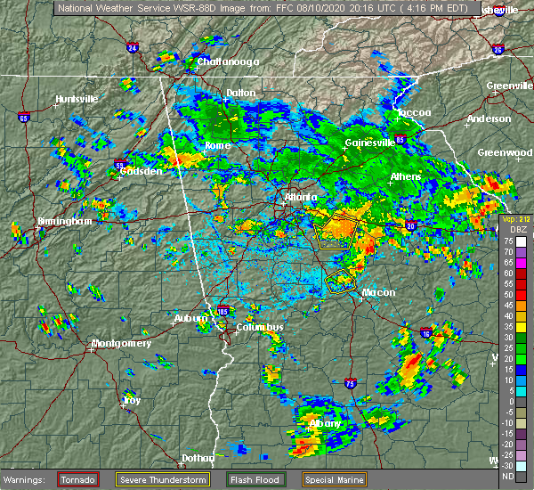 The severe thunderstorm warning for southeastern henry, northeastern butts, northwestern jasper and newton counties will expire at 430 pm edt, the storms which prompted the warning are weakening below severe limits, and will no longer pose an immediate threat to life or property, therefore, the warning will be allowed to expire at 430 pm edt. however, gusty winds and heavy rain are still likely with these thunderstorms. The severe thunderstorm warning for southeastern henry, northeastern butts, northwestern jasper and newton counties will expire at 430 pm edt, the storms which prompted the warning are weakening below severe limits, and will no longer pose an immediate threat to life or property, therefore, the warning will be allowed to expire at 430 pm edt. however, gusty winds and heavy rain are still likely with these thunderstorms.
|
| 8/10/2020 4:13 PM EDT |
 At 413 pm edt, severe thunderstorms were located along a line extending from brick store to near rocky plains to ola, moving southeast at 15 mph (radar indicated). Hazards include 60 mph wind gusts and nickel size hail. Expect damage to roofs, siding, and trees. Locations impacted include, covington, oxford, porterdale, mansfield, jenkinsburg, stewart, turtle cove, ola, worthville, almon, starrsville, brick store, eudora, north alcovy, fincherville, kelleytown, oak hill, stark and rocky plains. At 413 pm edt, severe thunderstorms were located along a line extending from brick store to near rocky plains to ola, moving southeast at 15 mph (radar indicated). Hazards include 60 mph wind gusts and nickel size hail. Expect damage to roofs, siding, and trees. Locations impacted include, covington, oxford, porterdale, mansfield, jenkinsburg, stewart, turtle cove, ola, worthville, almon, starrsville, brick store, eudora, north alcovy, fincherville, kelleytown, oak hill, stark and rocky plains.
|
| 8/10/2020 3:46 PM EDT |
 At 346 pm edt, a severe thunderstorm was located over magnet, moving southeast at 30 mph (radar indicated). Hazards include 60 mph wind gusts and quarter size hail. Hail damage to vehicles is expected. Expect wind damage to roofs, siding, and trees. At 346 pm edt, a severe thunderstorm was located over magnet, moving southeast at 30 mph (radar indicated). Hazards include 60 mph wind gusts and quarter size hail. Hail damage to vehicles is expected. Expect wind damage to roofs, siding, and trees.
|
| 8/5/2020 4:30 PM EDT | Approx half a dozen trees reported down in sw butts county... just east of i-75. several of the trees were large oaks downed across roadway in butts county GA, 2.3 miles N of Jenkinsburg, GA |
| 7/25/2020 4:52 PM EDT |
 The severe thunderstorm warning for eastern spalding, north central monroe, southwestern butts and northern lamar counties will expire at 500 pm edt, the storm which prompted the warning has weakened below severe limits, and no longer poses an immediate threat to life or property. therefore, the warning will be allowed to expire. however small hail and gusty winds are still possible with this thunderstorm. The severe thunderstorm warning for eastern spalding, north central monroe, southwestern butts and northern lamar counties will expire at 500 pm edt, the storm which prompted the warning has weakened below severe limits, and no longer poses an immediate threat to life or property. therefore, the warning will be allowed to expire. however small hail and gusty winds are still possible with this thunderstorm.
|
| 7/25/2020 4:13 PM EDT |
 At 413 pm edt, a severe thunderstorm was located near chappel mill, or 8 miles east of griffin, moving south at 10 mph (radar indicated). Hazards include 60 mph wind gusts and quarter size hail. Hail damage to vehicles is expected. Expect wind damage to roofs, siding, and trees. At 413 pm edt, a severe thunderstorm was located near chappel mill, or 8 miles east of griffin, moving south at 10 mph (radar indicated). Hazards include 60 mph wind gusts and quarter size hail. Hail damage to vehicles is expected. Expect wind damage to roofs, siding, and trees.
|
| 3/31/2020 11:53 AM EDT |
 At 1153 am edt, a severe thunderstorm was located over kelleytown, or near mcdonough, moving east at 60 mph (radar indicated). Hazards include 70 mph wind gusts. Expect considerable tree damage. damage is likely to mobile homes, roofs, and outbuildings. Locations impacted include, griffin, mcdonough, jackson, stockbridge, hampton, lovejoy, locust grove, lithonia, brooks, jenkinsburg, orchard hill, sunny side, east griffin, blacksville, ola, walker mill, arabia mountain, hidden valley park, rover and luella. At 1153 am edt, a severe thunderstorm was located over kelleytown, or near mcdonough, moving east at 60 mph (radar indicated). Hazards include 70 mph wind gusts. Expect considerable tree damage. damage is likely to mobile homes, roofs, and outbuildings. Locations impacted include, griffin, mcdonough, jackson, stockbridge, hampton, lovejoy, locust grove, lithonia, brooks, jenkinsburg, orchard hill, sunny side, east griffin, blacksville, ola, walker mill, arabia mountain, hidden valley park, rover and luella.
|
| 3/31/2020 11:52 AM EDT |
 At 1152 am edt, severe thunderstorms were located along a line extending from near arabia mountain to luella, moving east at 60 mph (radar indicated). Hazards include 70 mph wind gusts. Expect considerable tree damage. Damage is likely to mobile homes, roofs, and outbuildings. At 1152 am edt, severe thunderstorms were located along a line extending from near arabia mountain to luella, moving east at 60 mph (radar indicated). Hazards include 70 mph wind gusts. Expect considerable tree damage. Damage is likely to mobile homes, roofs, and outbuildings.
|
| 3/31/2020 11:43 AM EDT |
 At 1143 am edt, a severe thunderstorm was located over eagles landing, or near mcdonough, moving east at 60 mph (radar indicated). Hazards include 70 mph wind gusts. Expect considerable tree damage. damage is likely to mobile homes, roofs, and outbuildings. Locations impacted include, atlanta, griffin, mcdonough, fayetteville, jackson, jonesboro, peachtree city, stockbridge, forest park, riverdale, hampton, morrow, lovejoy, hapeville, locust grove, senoia, lake city, lithonia, brooks and jenkinsburg. At 1143 am edt, a severe thunderstorm was located over eagles landing, or near mcdonough, moving east at 60 mph (radar indicated). Hazards include 70 mph wind gusts. Expect considerable tree damage. damage is likely to mobile homes, roofs, and outbuildings. Locations impacted include, atlanta, griffin, mcdonough, fayetteville, jackson, jonesboro, peachtree city, stockbridge, forest park, riverdale, hampton, morrow, lovejoy, hapeville, locust grove, senoia, lake city, lithonia, brooks and jenkinsburg.
|
| 3/31/2020 11:16 AM EDT |
 At 1115 am edt, a severe thunderstorm was located over thomas crossroads, or near newnan, moving east at 60 mph (radar indicated). Hazards include 70 mph wind gusts. Expect considerable tree damage. Damage is likely to mobile homes, roofs, and outbuildings. At 1115 am edt, a severe thunderstorm was located over thomas crossroads, or near newnan, moving east at 60 mph (radar indicated). Hazards include 70 mph wind gusts. Expect considerable tree damage. Damage is likely to mobile homes, roofs, and outbuildings.
|
| 2/6/2020 12:49 PM EST |
 At 1248 pm est, a severe thunderstorm was located over liberty hill, or 7 miles north of barnesville, moving northeast at 55 mph (radar indicated). Hazards include 60 mph wind gusts. expect damage to roofs, siding, and trees At 1248 pm est, a severe thunderstorm was located over liberty hill, or 7 miles north of barnesville, moving northeast at 55 mph (radar indicated). Hazards include 60 mph wind gusts. expect damage to roofs, siding, and trees
|
| 1/14/2020 12:45 AM EST |
 At 1245 am est, a severe thunderstorm was located over jenkinsburg, or near jackson, moving northeast at 30 mph (radar indicated). Hazards include 60 mph wind gusts. Expect damage to roofs, siding, and trees. Locations impacted include, jackson, monticello, locust grove, flovilla, jenkinsburg, stewart, turtle cove, worthville, mckibben, starrsville, calvin, eudora, north alcovy, indian springs state park, fincherville, stark and rocky plains. At 1245 am est, a severe thunderstorm was located over jenkinsburg, or near jackson, moving northeast at 30 mph (radar indicated). Hazards include 60 mph wind gusts. Expect damage to roofs, siding, and trees. Locations impacted include, jackson, monticello, locust grove, flovilla, jenkinsburg, stewart, turtle cove, worthville, mckibben, starrsville, calvin, eudora, north alcovy, indian springs state park, fincherville, stark and rocky plains.
|
| 1/14/2020 12:34 AM EST |
 At 1233 am est, a severe thunderstorm was located over mckibben, or 7 miles west of jackson, moving northeast at 30 mph (radar indicated). Hazards include 60 mph wind gusts. expect damage to roofs, siding, and trees At 1233 am est, a severe thunderstorm was located over mckibben, or 7 miles west of jackson, moving northeast at 30 mph (radar indicated). Hazards include 60 mph wind gusts. expect damage to roofs, siding, and trees
|
| 1/11/2020 6:31 PM EST |
 At 631 pm est, severe thunderstorms were located along a line extending from big haynes creek park to near blount, moving east at 40 mph (radar indicated). Hazards include 60 mph wind gusts. Expect damage to roofs, siding, and trees. Locations impacted include, conyers, covington, jackson, stone mountain, social circle, oxford, lithonia, porterdale, newborn, flovilla, mansfield, jenkinsburg, lakeview estates, georgia international horse park, stewart, mountain park, turtle cove, worthville, belmont and arabia mountain. At 631 pm est, severe thunderstorms were located along a line extending from big haynes creek park to near blount, moving east at 40 mph (radar indicated). Hazards include 60 mph wind gusts. Expect damage to roofs, siding, and trees. Locations impacted include, conyers, covington, jackson, stone mountain, social circle, oxford, lithonia, porterdale, newborn, flovilla, mansfield, jenkinsburg, lakeview estates, georgia international horse park, stewart, mountain park, turtle cove, worthville, belmont and arabia mountain.
|
| 1/11/2020 6:12 PM EST |
 At 612 pm est, severe thunderstorms were located along a line extending from near stone mountain to orchard hill, moving east at 40 mph (radar indicated). Hazards include 60 mph wind gusts. expect damage to roofs, siding, and trees At 612 pm est, severe thunderstorms were located along a line extending from near stone mountain to orchard hill, moving east at 40 mph (radar indicated). Hazards include 60 mph wind gusts. expect damage to roofs, siding, and trees
|
| 6/24/2019 8:21 PM EDT |
 At 820 pm edt, a severe thunderstorm was located over rocky plains, or 10 miles southwest of covington, moving east at 55 mph (radar indicated). Hazards include 60 mph wind gusts. Expect damage to roofs, siding, and trees. Locations impacted include, griffin, mcdonough, stockbridge, hampton, lovejoy, locust grove, jenkinsburg, sunny side, east griffin, highland mills, blacksville, towalaga, ola, experiment, walker mill, mckibben, luella, atlanta motor speedway, flippen and kelleytown. At 820 pm edt, a severe thunderstorm was located over rocky plains, or 10 miles southwest of covington, moving east at 55 mph (radar indicated). Hazards include 60 mph wind gusts. Expect damage to roofs, siding, and trees. Locations impacted include, griffin, mcdonough, stockbridge, hampton, lovejoy, locust grove, jenkinsburg, sunny side, east griffin, highland mills, blacksville, towalaga, ola, experiment, walker mill, mckibben, luella, atlanta motor speedway, flippen and kelleytown.
|
| 6/24/2019 8:12 PM EDT |
 At 812 pm edt, a severe thunderstorm was located over ola, or near mcdonough, moving east at 55 mph (radar indicated). Hazards include 60 mph wind gusts. Expect damage to roofs, siding, and trees. Locations impacted include, griffin, mcdonough, fayetteville, jonesboro, peachtree city, stockbridge, riverdale, hampton, tyrone, lovejoy, locust grove, senoia, brooks, jenkinsburg, woolsey, sunny side, east griffin, lake spivey, blacksville and ola. At 812 pm edt, a severe thunderstorm was located over ola, or near mcdonough, moving east at 55 mph (radar indicated). Hazards include 60 mph wind gusts. Expect damage to roofs, siding, and trees. Locations impacted include, griffin, mcdonough, fayetteville, jonesboro, peachtree city, stockbridge, riverdale, hampton, tyrone, lovejoy, locust grove, senoia, brooks, jenkinsburg, woolsey, sunny side, east griffin, lake spivey, blacksville and ola.
|
| 6/24/2019 7:59 PM EDT |
 At 759 pm edt, a severe thunderstorm was located over lovejoy, or 8 miles south of jonesboro, moving east at 55 mph (radar indicated). Hazards include 60 mph wind gusts. expect damage to roofs, siding, and trees At 759 pm edt, a severe thunderstorm was located over lovejoy, or 8 miles south of jonesboro, moving east at 55 mph (radar indicated). Hazards include 60 mph wind gusts. expect damage to roofs, siding, and trees
|
| 4/14/2019 12:07 PM EDT |
 The severe thunderstorm warning for eastern spalding, east central pike, southeastern henry, butts and northern lamar counties will expire at 1215 pm edt, the storm which prompted the warning has moved out of the area. therefore, the warning will be allowed to expire. a tornado watch remains in effect until 200 pm edt for central, north central and west central georgia. The severe thunderstorm warning for eastern spalding, east central pike, southeastern henry, butts and northern lamar counties will expire at 1215 pm edt, the storm which prompted the warning has moved out of the area. therefore, the warning will be allowed to expire. a tornado watch remains in effect until 200 pm edt for central, north central and west central georgia.
|
| 4/14/2019 12:01 PM EDT |
 At 1201 pm edt, a severe thunderstorm capable of producing a tornado was located over jenkinsburg, or near jackson, moving northeast at 55 mph (radar indicated rotation). Hazards include tornado. Flying debris will be dangerous to those caught without shelter. mobile homes will be damaged or destroyed. damage to roofs, windows, and vehicles will occur. tree damage is likely. Locations impacted include, jackson, jenkinsburg, mckibben, fincherville and worthville. At 1201 pm edt, a severe thunderstorm capable of producing a tornado was located over jenkinsburg, or near jackson, moving northeast at 55 mph (radar indicated rotation). Hazards include tornado. Flying debris will be dangerous to those caught without shelter. mobile homes will be damaged or destroyed. damage to roofs, windows, and vehicles will occur. tree damage is likely. Locations impacted include, jackson, jenkinsburg, mckibben, fincherville and worthville.
|
| 4/14/2019 11:53 AM EDT |
 At 1153 am edt, a confirmed large and extremely dangerous tornado was located near chappel mill, or 8 miles east of griffin, moving northeast at 55 mph. this is a particularly dangerous situation. take cover now! (radar confirmed tornado). Hazards include damaging tornado. You are in a life-threatening situation. flying debris may be deadly to those caught without shelter. mobile homes will be destroyed. Considerable damage to homes, businesses, and vehicles is likely and complete destruction is possible. At 1153 am edt, a confirmed large and extremely dangerous tornado was located near chappel mill, or 8 miles east of griffin, moving northeast at 55 mph. this is a particularly dangerous situation. take cover now! (radar confirmed tornado). Hazards include damaging tornado. You are in a life-threatening situation. flying debris may be deadly to those caught without shelter. mobile homes will be destroyed. Considerable damage to homes, businesses, and vehicles is likely and complete destruction is possible.
|
| 4/14/2019 11:40 AM EDT |
 At 1140 am edt, a severe thunderstorm was located near milner, or near barnesville, moving northeast at 55 mph (radar indicated). Hazards include 60 mph wind gusts. expect damage to roofs, siding, and trees At 1140 am edt, a severe thunderstorm was located near milner, or near barnesville, moving northeast at 55 mph (radar indicated). Hazards include 60 mph wind gusts. expect damage to roofs, siding, and trees
|
| 9/27/2018 4:32 PM EDT |
 The national weather service in peachtree city has issued a * severe thunderstorm warning for. rockdale county in north central georgia. southeastern dekalb county in north central georgia. southwestern morgan county in north central georgia. South central gwinnett county in north central georgia. The national weather service in peachtree city has issued a * severe thunderstorm warning for. rockdale county in north central georgia. southeastern dekalb county in north central georgia. southwestern morgan county in north central georgia. South central gwinnett county in north central georgia.
|
| 6/22/2018 7:53 PM EDT |
 At 753 pm edt, severe thunderstorms were located along a line extending from kelleytown to near ola to jenkinsburg, moving east at 50 mph (radar indicated). Hazards include 60 mph wind gusts. Expect damage to roofs, siding, and trees. Locations impacted include, mcdonough, covington, stockbridge, locust grove, oxford, porterdale, jenkinsburg, stewart, blacksville, ola, magnet, worthville, almon, flippen, fincherville, kelleytown, oak hill and rocky plains. At 753 pm edt, severe thunderstorms were located along a line extending from kelleytown to near ola to jenkinsburg, moving east at 50 mph (radar indicated). Hazards include 60 mph wind gusts. Expect damage to roofs, siding, and trees. Locations impacted include, mcdonough, covington, stockbridge, locust grove, oxford, porterdale, jenkinsburg, stewart, blacksville, ola, magnet, worthville, almon, flippen, fincherville, kelleytown, oak hill and rocky plains.
|
| 6/22/2018 7:22 PM EDT |
 At 722 pm edt, severe thunderstorms were located along a line extending from fayetteville to woolsey to near digbey, moving east at 45 mph (radar indicated). Hazards include 60 mph wind gusts. expect damage to roofs, siding, and trees At 722 pm edt, severe thunderstorms were located along a line extending from fayetteville to woolsey to near digbey, moving east at 45 mph (radar indicated). Hazards include 60 mph wind gusts. expect damage to roofs, siding, and trees
|
| 6/3/2018 7:47 PM EDT |
 At 747 pm edt, a severe thunderstorm was located over adgateville, or near monticello, moving southeast at 35 mph (radar indicated). Hazards include 60 mph wind gusts and quarter size hail. Hail damage to vehicles is expected. Expect wind damage to roofs, siding, and trees. At 747 pm edt, a severe thunderstorm was located over adgateville, or near monticello, moving southeast at 35 mph (radar indicated). Hazards include 60 mph wind gusts and quarter size hail. Hail damage to vehicles is expected. Expect wind damage to roofs, siding, and trees.
|
| 6/3/2018 7:20 PM EDT |
 At 720 pm edt, a severe thunderstorm was located over turtle cove, or 8 miles northeast of jackson, moving southeast at 35 mph (radar indicated). Hazards include 60 mph wind gusts and quarter size hail. Hail damage to vehicles is expected. Expect wind damage to roofs, siding, and trees. At 720 pm edt, a severe thunderstorm was located over turtle cove, or 8 miles northeast of jackson, moving southeast at 35 mph (radar indicated). Hazards include 60 mph wind gusts and quarter size hail. Hail damage to vehicles is expected. Expect wind damage to roofs, siding, and trees.
|
| 6/1/2018 4:53 PM EDT |
 At 453 pm edt, severe thunderstorms were located along a line extending from willard to locust grove, moving southeast at 20 mph (radar indicated). Hazards include 60 mph wind gusts. expect damage to roofs, siding, and trees At 453 pm edt, severe thunderstorms were located along a line extending from willard to locust grove, moving southeast at 20 mph (radar indicated). Hazards include 60 mph wind gusts. expect damage to roofs, siding, and trees
|
| 3/20/2018 12:32 AM EDT |
 At 1231 am edt, a severe thunderstorm was located over shady dale, or 8 miles northeast of monticello, moving east at 45 mph (radar indicated). Hazards include 60 mph wind gusts and quarter size hail. Hail damage to vehicles is expected. expect wind damage to roofs, siding, and trees. locations impacted include, griffin, jackson, madison, monticello, newborn, flovilla, mansfield, jenkinsburg, shady dale, east griffin, stewart, turtle cove, worthville, mckibben, calvin, farrar, eudora, north alcovy, mcelheneys crossroads and indian springs state park. A tornado watch remains in effect until 400 am edt for central, north central and west central georgia. At 1231 am edt, a severe thunderstorm was located over shady dale, or 8 miles northeast of monticello, moving east at 45 mph (radar indicated). Hazards include 60 mph wind gusts and quarter size hail. Hail damage to vehicles is expected. expect wind damage to roofs, siding, and trees. locations impacted include, griffin, jackson, madison, monticello, newborn, flovilla, mansfield, jenkinsburg, shady dale, east griffin, stewart, turtle cove, worthville, mckibben, calvin, farrar, eudora, north alcovy, mcelheneys crossroads and indian springs state park. A tornado watch remains in effect until 400 am edt for central, north central and west central georgia.
|
| 3/20/2018 12:20 AM EDT |
 At 1218 am edt, a severe thunderstorm was located over north alcovy, or 10 miles southeast of covington, moving east at 45 mph (radar indicated). Hazards include 60 mph wind gusts and quarter size hail. Hail damage to vehicles is expected. expect wind damage to roofs, siding, and trees. locations impacted include, griffin, mcdonough, covington, jackson, madison, monticello, hampton, locust grove, oxford, porterdale, newborn, flovilla, mansfield, jenkinsburg, shady dale, sunny side, east griffin, stewart, blacksville and ola. A tornado watch remains in effect until 400 am edt for central, north central and west central georgia. At 1218 am edt, a severe thunderstorm was located over north alcovy, or 10 miles southeast of covington, moving east at 45 mph (radar indicated). Hazards include 60 mph wind gusts and quarter size hail. Hail damage to vehicles is expected. expect wind damage to roofs, siding, and trees. locations impacted include, griffin, mcdonough, covington, jackson, madison, monticello, hampton, locust grove, oxford, porterdale, newborn, flovilla, mansfield, jenkinsburg, shady dale, sunny side, east griffin, stewart, blacksville and ola. A tornado watch remains in effect until 400 am edt for central, north central and west central georgia.
|
| 3/19/2018 11:58 PM EDT |
 At 1158 pm edt, a severe thunderstorm was located near oak hill, or 7 miles northeast of mcdonough, moving east at 40 mph (radar indicated). Hazards include 60 mph wind gusts and quarter size hail. Hail damage to vehicles is expected. Expect wind damage to roofs, siding, and trees. At 1158 pm edt, a severe thunderstorm was located near oak hill, or 7 miles northeast of mcdonough, moving east at 40 mph (radar indicated). Hazards include 60 mph wind gusts and quarter size hail. Hail damage to vehicles is expected. Expect wind damage to roofs, siding, and trees.
|
| 3/19/2018 11:31 PM EDT |
 At 1130 pm edt, severe thunderstorms were located along a line extending from big haynes creek park to near alvaton, moving southeast at 50 mph (radar indicated). Hazards include ping pong ball size hail and 60 mph wind gusts. People and animals outdoors will be injured. expect hail damage to roofs, siding, windows, and vehicles. Expect wind damage to roofs, siding, and trees. At 1130 pm edt, severe thunderstorms were located along a line extending from big haynes creek park to near alvaton, moving southeast at 50 mph (radar indicated). Hazards include ping pong ball size hail and 60 mph wind gusts. People and animals outdoors will be injured. expect hail damage to roofs, siding, windows, and vehicles. Expect wind damage to roofs, siding, and trees.
|
| 7/24/2017 4:53 PM EDT |
 The severe thunderstorm warning for henry, central butts and southwestern newton counties will expire at 500 pm edt, the storm which prompted the warning has weakened below severe limits and no longer poses an immediate threat to life or property, therefore, the warning will be allowed to expire. however small hail, gusty winds and very heavy rain are still likely with this thunderstorm. to report severe weather, contact your nearest law enforcement agency. they will relay your report to the national weather service peachtree city. The severe thunderstorm warning for henry, central butts and southwestern newton counties will expire at 500 pm edt, the storm which prompted the warning has weakened below severe limits and no longer poses an immediate threat to life or property, therefore, the warning will be allowed to expire. however small hail, gusty winds and very heavy rain are still likely with this thunderstorm. to report severe weather, contact your nearest law enforcement agency. they will relay your report to the national weather service peachtree city.
|
| 7/24/2017 4:22 PM EDT |
 At 421 pm edt, a severe thunderstorm was located over mcdonough, moving east at 10 mph (radar indicated). Hazards include 60 mph wind gusts and quarter size hail. Hail damage to vehicles is expected. Expect wind damage to roofs, siding, and trees. At 421 pm edt, a severe thunderstorm was located over mcdonough, moving east at 10 mph (radar indicated). Hazards include 60 mph wind gusts and quarter size hail. Hail damage to vehicles is expected. Expect wind damage to roofs, siding, and trees.
|
| 7/7/2017 6:10 PM EDT | Part of metal roof blown off apartment building on england chapel rd leading to partial collapse of porch roof in butts county GA, 0.2 miles NNE of Jenkinsburg, GA |
| 5/30/2017 5:07 PM EDT | A tree was reported down on high falls roa in butts county GA, 1.6 miles NNW of Jenkinsburg, GA |
| 5/30/2017 4:45 PM EDT |
 At 445 pm edt, a severe thunderstorm was located over walker mill, or near griffin, moving east at 30 mph (radar indicated). Hazards include 60 mph wind gusts and quarter size hail. Hail damage to vehicles is expected. Expect wind damage to roofs, siding, and trees. At 445 pm edt, a severe thunderstorm was located over walker mill, or near griffin, moving east at 30 mph (radar indicated). Hazards include 60 mph wind gusts and quarter size hail. Hail damage to vehicles is expected. Expect wind damage to roofs, siding, and trees.
|
| 4/3/2017 12:53 PM EDT |
 At 1253 pm edt, a severe thunderstorm was located near locust grove, or 7 miles southeast of mcdonough, moving northeast at 45 mph (radar indicated. this storm has a history of producing damage possibly from a brief tornado, near griffin). Hazards include 60 mph wind gusts. expect damage to roofs, siding, and trees At 1253 pm edt, a severe thunderstorm was located near locust grove, or 7 miles southeast of mcdonough, moving northeast at 45 mph (radar indicated. this storm has a history of producing damage possibly from a brief tornado, near griffin). Hazards include 60 mph wind gusts. expect damage to roofs, siding, and trees
|
| 4/3/2017 12:47 PM EDT |
 At 1247 pm edt, a severe thunderstorm capable of producing a tornado was located over locust grove, or near mcdonough, moving northeast at 45 mph (radar indicated rotation. trees and powerlines have been reported down in griffin). Hazards include tornado. Flying debris will be dangerous to those caught without shelter. mobile homes will be damaged or destroyed. damage to roofs, windows, and vehicles will occur. tree damage is likely. Locations impacted include, mcdonough, hampton, locust grove, blacksville, towalaga, luella and walker mill. At 1247 pm edt, a severe thunderstorm capable of producing a tornado was located over locust grove, or near mcdonough, moving northeast at 45 mph (radar indicated rotation. trees and powerlines have been reported down in griffin). Hazards include tornado. Flying debris will be dangerous to those caught without shelter. mobile homes will be damaged or destroyed. damage to roofs, windows, and vehicles will occur. tree damage is likely. Locations impacted include, mcdonough, hampton, locust grove, blacksville, towalaga, luella and walker mill.
|
| 4/3/2017 12:32 PM EDT |
 At 1232 pm edt, a severe thunderstorm capable of producing a tornado was located over experiment, or over griffin, moving northeast at 45 mph (radar indicated rotation). Hazards include tornado. Flying debris will be dangerous to those caught without shelter. mobile homes will be damaged or destroyed. damage to roofs, windows, and vehicles will occur. Tree damage is likely. At 1232 pm edt, a severe thunderstorm capable of producing a tornado was located over experiment, or over griffin, moving northeast at 45 mph (radar indicated rotation). Hazards include tornado. Flying debris will be dangerous to those caught without shelter. mobile homes will be damaged or destroyed. damage to roofs, windows, and vehicles will occur. Tree damage is likely.
|
| 11/30/2016 3:21 PM EST |
 At 321 pm est, severe thunderstorms were located along a line extending from near blacksville to jenkinsburg to near chappel mill, moving northeast at 70 mph (radar indicated). Hazards include 60 mph wind gusts. Expect damage to roofs. siding. And trees. At 321 pm est, severe thunderstorms were located along a line extending from near blacksville to jenkinsburg to near chappel mill, moving northeast at 70 mph (radar indicated). Hazards include 60 mph wind gusts. Expect damage to roofs. siding. And trees.
|
| 6/14/2016 2:35 PM EDT |
 At 235 pm edt, a severe thunderstorm was located near jenkinsburg, or 7 miles north of jackson, moving northeast at 15 mph (radar indicated). Hazards include 60 mph wind gusts and quarter size hail. Hail damage to vehicles is expected. expect wind damage to roofs, siding, and trees. Other locations in the warning include but are not limited to jackson, jenkinsburg, stewart, worthville, stark, rocky plains, ola and fincherville. At 235 pm edt, a severe thunderstorm was located near jenkinsburg, or 7 miles north of jackson, moving northeast at 15 mph (radar indicated). Hazards include 60 mph wind gusts and quarter size hail. Hail damage to vehicles is expected. expect wind damage to roofs, siding, and trees. Other locations in the warning include but are not limited to jackson, jenkinsburg, stewart, worthville, stark, rocky plains, ola and fincherville.
|
| 4/7/2016 12:43 AM EDT |
 At 1243 am edt, severe thunderstorms were located along a line extending from near hampton to near haralson, moving east at 45 mph (radar indicated). Hazards include 60 mph wind gusts and penny size hail. Expect damage to roofs. siding. and trees. Other locations in the warning include but are not limited to griffin, barnesville, jackson, forsyth, locust grove, flovilla, milner, jenkinsburg, yatesville, orchard hill, aldora, east griffin, the rock, collier, chappel mill, johnstonville, mcelheneys crossroads, walker mill, goggins and indian springs state park. At 1243 am edt, severe thunderstorms were located along a line extending from near hampton to near haralson, moving east at 45 mph (radar indicated). Hazards include 60 mph wind gusts and penny size hail. Expect damage to roofs. siding. and trees. Other locations in the warning include but are not limited to griffin, barnesville, jackson, forsyth, locust grove, flovilla, milner, jenkinsburg, yatesville, orchard hill, aldora, east griffin, the rock, collier, chappel mill, johnstonville, mcelheneys crossroads, walker mill, goggins and indian springs state park.
|
| 8/10/2015 6:45 PM EDT |
 At 645 pm edt, a severe thunderstorm was located over jackson, moving east at 5 mph (radar indicated). Hazards include 60 mph wind gusts and nickel size hail. Expect damage to roofs. siding and trees. Other locations in the warning include but are not limited to jackson, flovilla, jenkinsburg, worthville, mckibben, stark, indian springs state park and fincherville. At 645 pm edt, a severe thunderstorm was located over jackson, moving east at 5 mph (radar indicated). Hazards include 60 mph wind gusts and nickel size hail. Expect damage to roofs. siding and trees. Other locations in the warning include but are not limited to jackson, flovilla, jenkinsburg, worthville, mckibben, stark, indian springs state park and fincherville.
|
| 7/3/2015 10:47 AM EDT |
 At 1046 am edt, a severe thunderstorm was located near flovilla, or 7 miles west of monticello, moving southeast at 45 mph (radar indicated). Hazards include 60 mph wind gusts. Expect damage to roofs. siding and trees. Other locations in the warning include but are not limited to milledgeville, eatonton, jackson, madison, gray, monticello, sparta, rutledge, flovilla, jenkinsburg, shady dale, phoenix, reynolds plantation, midway-hardwick, liberty, meriwether, calvin, scottsboro, jarrell plantation and warfield. At 1046 am edt, a severe thunderstorm was located near flovilla, or 7 miles west of monticello, moving southeast at 45 mph (radar indicated). Hazards include 60 mph wind gusts. Expect damage to roofs. siding and trees. Other locations in the warning include but are not limited to milledgeville, eatonton, jackson, madison, gray, monticello, sparta, rutledge, flovilla, jenkinsburg, shady dale, phoenix, reynolds plantation, midway-hardwick, liberty, meriwether, calvin, scottsboro, jarrell plantation and warfield.
|
| 7/3/2015 10:07 AM EDT |
 At 1006 am edt, a severe thunderstorm was located over hampton, or 8 miles southwest of mcdonough, moving southeast at 45 mph (radar indicated). Hazards include 60 mph wind gusts. Expect damage to roofs. siding and trees. Other locations in the warning include but are not limited to griffin, mcdonough, jackson, forsyth, monticello, stockbridge, hampton, lovejoy, locust grove, porterdale, newborn, flovilla, mansfield, jenkinsburg, shady dale, woolsey, sunny side, east griffin, stewart and chappel mill. At 1006 am edt, a severe thunderstorm was located over hampton, or 8 miles southwest of mcdonough, moving southeast at 45 mph (radar indicated). Hazards include 60 mph wind gusts. Expect damage to roofs. siding and trees. Other locations in the warning include but are not limited to griffin, mcdonough, jackson, forsyth, monticello, stockbridge, hampton, lovejoy, locust grove, porterdale, newborn, flovilla, mansfield, jenkinsburg, shady dale, woolsey, sunny side, east griffin, stewart and chappel mill.
|
| 5/26/2015 4:39 PM EDT | At 439 pm edt, severe thunderstorms were located along a line extending from near locust grove to 6 miles east of east griffin, moving northeast at 40 mph (radar indicated). Hazards include 60 mph wind gusts and quarter size hail. Hail damage to vehicles is expected. expect wind damage to roofs, siding and trees. Other locations in the warning include but are not limited to mcdonough, covington, jackson, locust grove, social circle, oxford, porterdale, newborn, mansfield, jenkinsburg, stewart, oak hill, almon, eudora, worthville, brick store, walker mill, ola, north alcovy and fincherville. |
| 6/13/2013 8:59 PM EDT | Several trees are reported down across shiloh road and highway 4 in butts county GA, 0.5 miles WNW of Jenkinsburg, GA |
| 6/12/2013 4:50 PM EDT | Quarter sized hail reported 2.5 miles SW of Jenkinsburg, GA, quarter sized hail was reported along old jackson road near the butts and henry county line by a member of the public. |
Hail Maps for Jenkinsburg, GA


Connect with Interactive Hail Maps