

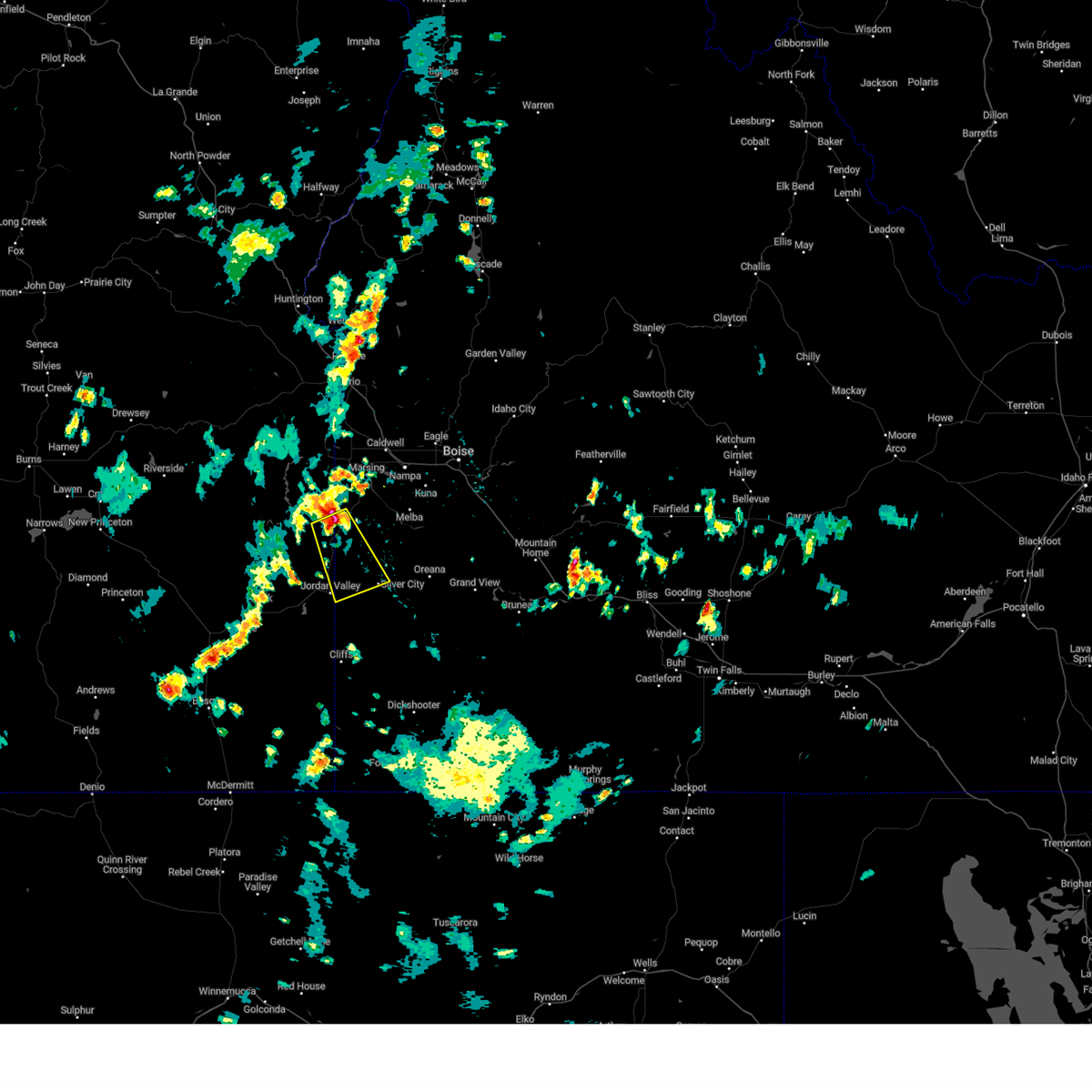
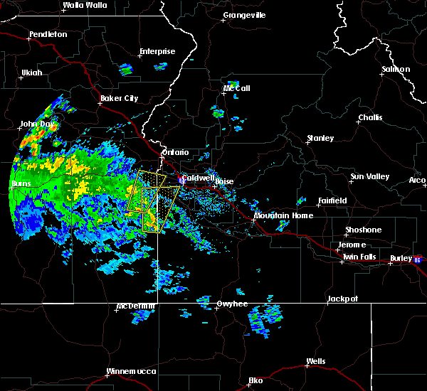
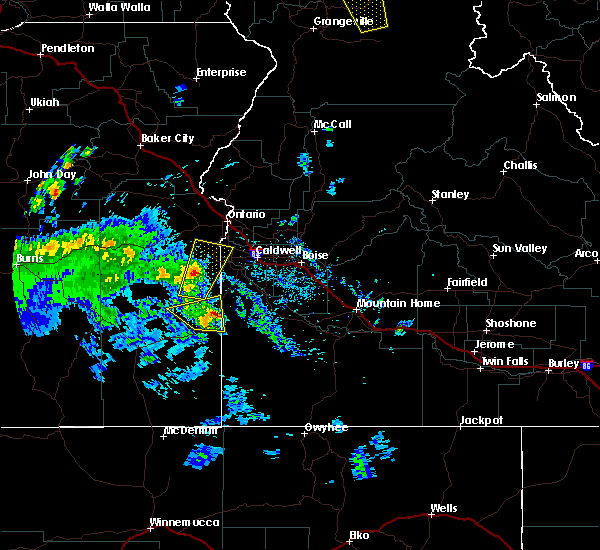
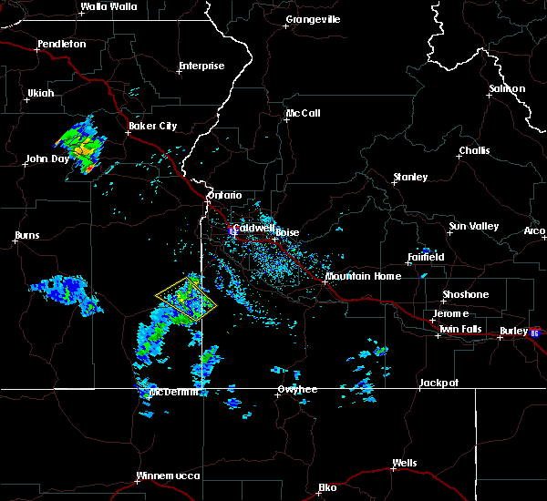
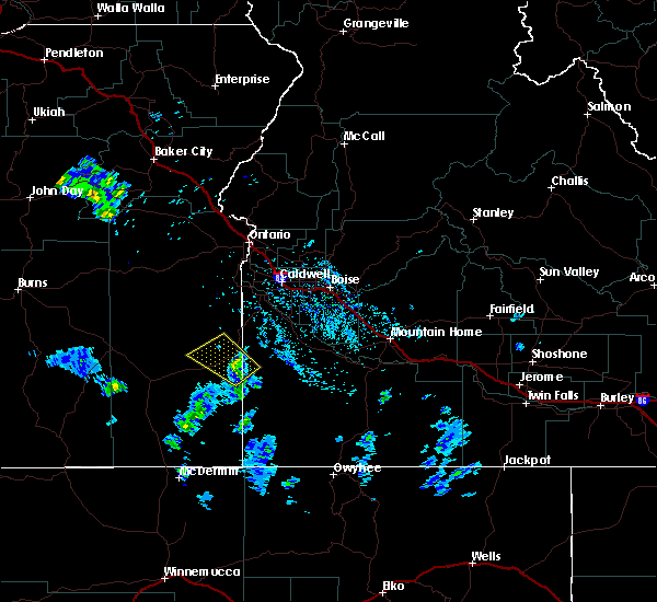
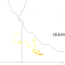
Hail Map for Jordan Valley, OR
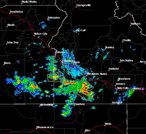
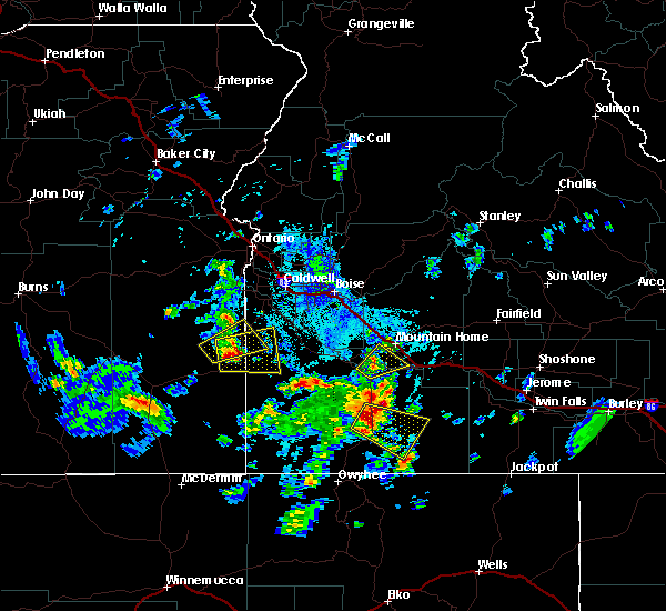
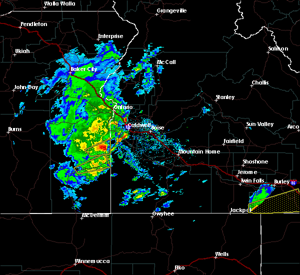
The Jordan Valley, OR area has had 1 report of on-the-ground hail by trained spotters, and has been under severe weather warnings 0 times during the past 12 months. Doppler radar has detected hail at or near Jordan Valley, OR on 5 occasions.
| Name: | Jordan Valley, OR |
| Where Located: | 61.4 miles SW of Boise, ID |
| Map: | Google Map for Jordan Valley, OR |
| Population: | 181 |
| Housing Units: | 149 |
| More Info: | Search Google for Jordan Valley, OR |
0
The Top Recent Hail Date for Jordan Valley, OR is Sunday, June 11, 2023 (5th out of 5)

Hail and Wind Damage Spotted near Jordan Valley, OR
| Date / Time | Report Details |
|---|---|
| 7/4/2025 7:24 PM MDT | Mesonet station gsfo3 grassy mountai in malheur county OR, 29.8 miles NE of Jordan Valley, OR |
| 9/16/2024 7:29 PM MDT | Storm damage reported in malheur county OR, 41.5 miles ENE of Jordan Valley, OR |
| 4/3/2024 6:08 PM MDT | Asos station kreo rom in malheur county OR, 49.6 miles NE of Jordan Valley, OR |
| 6/13/2023 4:17 PM MDT |
 At 416 pm mdt, a severe thunderstorm was located near malloy ranch, or 31 miles southwest of nampa, moving southeast at 30 mph. it will pass over highway 95 near the idaho nevada border (radar indicated). Hazards include 60 mph wind gusts and half dollar size hail. Hail damage to vehicles is expected. expect wind damage to roofs, siding, and trees. this severe thunderstorm will be near, squaw butte around 420 pm mdt. succor creek reservoir and sheaville around 430 pm mdt. delamar mine and jordan valley around 450 pm mdt. silver city around 500 pm mdt. hail threat, radar indicated max hail size, 1. 25 in wind threat, radar indicated max wind gust, 60 mph. At 416 pm mdt, a severe thunderstorm was located near malloy ranch, or 31 miles southwest of nampa, moving southeast at 30 mph. it will pass over highway 95 near the idaho nevada border (radar indicated). Hazards include 60 mph wind gusts and half dollar size hail. Hail damage to vehicles is expected. expect wind damage to roofs, siding, and trees. this severe thunderstorm will be near, squaw butte around 420 pm mdt. succor creek reservoir and sheaville around 430 pm mdt. delamar mine and jordan valley around 450 pm mdt. silver city around 500 pm mdt. hail threat, radar indicated max hail size, 1. 25 in wind threat, radar indicated max wind gust, 60 mph.
|
| 9/7/2022 6:08 PM MDT |
 At 606 pm mdt/506 pm pdt/, severe thunderstorms were located along a line extending from near brogan to castro ridge, moving east at 60 mph (radar indicated). Hazards include 70 mph wind gusts. Expect considerable tree damage. damage is likely to mobile homes, roofs, and outbuildings. severe thunderstorms will be near, castro ridge, parsnip peak, little grassy reservoir and antelope reservoir around 610 pm mdt. reynolds, south mountain, henley basin and black warrior mountain around 620 pm mdt. weiser, silver city, murphy and melba around 630 pm mdt. payette, ontario, parma and emmett around 640 pm mdt. thunderstorm damage threat, considerable hail threat, radar indicated max hail size, <. 75 in wind threat, radar indicated max wind gust, 70 mph. At 606 pm mdt/506 pm pdt/, severe thunderstorms were located along a line extending from near brogan to castro ridge, moving east at 60 mph (radar indicated). Hazards include 70 mph wind gusts. Expect considerable tree damage. damage is likely to mobile homes, roofs, and outbuildings. severe thunderstorms will be near, castro ridge, parsnip peak, little grassy reservoir and antelope reservoir around 610 pm mdt. reynolds, south mountain, henley basin and black warrior mountain around 620 pm mdt. weiser, silver city, murphy and melba around 630 pm mdt. payette, ontario, parma and emmett around 640 pm mdt. thunderstorm damage threat, considerable hail threat, radar indicated max hail size, <. 75 in wind threat, radar indicated max wind gust, 70 mph.
|
| 9/7/2022 5:07 PM MDT | Storm damage reported in malheur county OR, 30.6 miles ENE of Jordan Valley, OR |
| 7/23/2020 5:00 PM MDT | Numerous tree branches down and garbage cans knocked ove in malheur county OR, 30.5 miles ENE of Jordan Valley, OR |
| 7/23/2020 4:47 PM MDT |
 At 447 pm mdt, a severe thunderstorm was located near delamar mine, or 38 miles southwest of nampa, moving east at 35 mph (radar indicated). Hazards include 60 mph wind gusts and quarter size hail. Hail damage to vehicles is expected. expect wind damage to roofs, siding, and trees. Locations impacted include, silver city, jordan valley, succor creek reservoir, malloy ranch, sheaville, delamar mine, squaw butte and black warrior mountain. At 447 pm mdt, a severe thunderstorm was located near delamar mine, or 38 miles southwest of nampa, moving east at 35 mph (radar indicated). Hazards include 60 mph wind gusts and quarter size hail. Hail damage to vehicles is expected. expect wind damage to roofs, siding, and trees. Locations impacted include, silver city, jordan valley, succor creek reservoir, malloy ranch, sheaville, delamar mine, squaw butte and black warrior mountain.
|
| 7/23/2020 4:24 PM MDT |
 At 424 pm mdt, a severe thunderstorm was located near jordan valley, or 27 miles northeast of rome, moving east at 35 mph (radar indicated). Hazards include 60 mph wind gusts and quarter size hail. Hail damage to vehicles is expected. Expect wind damage to roofs, siding, and trees. At 424 pm mdt, a severe thunderstorm was located near jordan valley, or 27 miles northeast of rome, moving east at 35 mph (radar indicated). Hazards include 60 mph wind gusts and quarter size hail. Hail damage to vehicles is expected. Expect wind damage to roofs, siding, and trees.
|
| 4/30/2020 1:38 PM MDT |
 At 137 pm mdt, a severe thunderstorm was located over danner, or 17 miles northeast of rome, moving northeast at 45 mph (radar indicated). Hazards include 60 mph wind gusts and quarter size hail. Hail damage to vehicles is expected. expect wind damage to roofs, siding, and trees. this severe storm will be near, antelope reservoir around 140 pm mdt. cow lakes around 150 pm mdt. Jordan valley around 200 pm mdt. At 137 pm mdt, a severe thunderstorm was located over danner, or 17 miles northeast of rome, moving northeast at 45 mph (radar indicated). Hazards include 60 mph wind gusts and quarter size hail. Hail damage to vehicles is expected. expect wind damage to roofs, siding, and trees. this severe storm will be near, antelope reservoir around 140 pm mdt. cow lakes around 150 pm mdt. Jordan valley around 200 pm mdt.
|
| 4/30/2020 1:13 PM MDT |
 At 112 pm mdt, a severe thunderstorm was located over rome, moving northeast at 40 mph (radar indicated). Hazards include 60 mph wind gusts and quarter size hail. Hail damage to vehicles is expected. expect wind damage to roofs, siding, and trees. this severe thunderstorm will be near, arock around 120 pm mdt. danner and antelope reservoir around 140 pm mdt. cow lakes around 150 pm mdt. Jordan valley around 200 pm mdt. At 112 pm mdt, a severe thunderstorm was located over rome, moving northeast at 40 mph (radar indicated). Hazards include 60 mph wind gusts and quarter size hail. Hail damage to vehicles is expected. expect wind damage to roofs, siding, and trees. this severe thunderstorm will be near, arock around 120 pm mdt. danner and antelope reservoir around 140 pm mdt. cow lakes around 150 pm mdt. Jordan valley around 200 pm mdt.
|
| 5/25/2018 6:01 PM MDT |
 At 600 pm mdt, a severe thunderstorm was located over malloy ranch, or 34 miles southwest of nampa, moving north at 25 mph (radar indicated). Hazards include 60 mph wind gusts and quarter size hail. Hail damage to vehicles is expected. expect wind damage to roofs, siding, and trees. this severe thunderstorm will be near, rockville around 620 pm mdt. succor creek campground, elephant butte and board corral mountain around 640 pm mdt. Homedale, marsing and lake lowell around 700 pm mdt. At 600 pm mdt, a severe thunderstorm was located over malloy ranch, or 34 miles southwest of nampa, moving north at 25 mph (radar indicated). Hazards include 60 mph wind gusts and quarter size hail. Hail damage to vehicles is expected. expect wind damage to roofs, siding, and trees. this severe thunderstorm will be near, rockville around 620 pm mdt. succor creek campground, elephant butte and board corral mountain around 640 pm mdt. Homedale, marsing and lake lowell around 700 pm mdt.
|
| 5/25/2018 5:44 PM MDT |
 At 544 pm mdt, a severe thunderstorm was located near cow lakes, or 26 miles northeast of rome, moving north at 20 mph (radar indicated). Hazards include 60 mph wind gusts and quarter size hail. Hail damage to vehicles is expected. expect wind damage to roofs, siding, and trees. This severe storm will be near, cow lakes, malloy ranch and coffeepot crater around 600 pm mdt. At 544 pm mdt, a severe thunderstorm was located near cow lakes, or 26 miles northeast of rome, moving north at 20 mph (radar indicated). Hazards include 60 mph wind gusts and quarter size hail. Hail damage to vehicles is expected. expect wind damage to roofs, siding, and trees. This severe storm will be near, cow lakes, malloy ranch and coffeepot crater around 600 pm mdt.
|
| 5/25/2018 5:18 PM MDT |
 At 517 pm mdt, a severe thunderstorm was located near antelope reservoir, or 25 miles east of rome, moving north at 20 mph (radar indicated). Hazards include 60 mph wind gusts and quarter size hail. Hail damage to vehicles is expected. expect wind damage to roofs, siding, and trees. this severe thunderstorm will be near, jordan valley and danner around 530 pm mdt. sheaville around 550 pm mdt. Cow lakes, malloy ranch and coffeepot crater around 600 pm mdt. At 517 pm mdt, a severe thunderstorm was located near antelope reservoir, or 25 miles east of rome, moving north at 20 mph (radar indicated). Hazards include 60 mph wind gusts and quarter size hail. Hail damage to vehicles is expected. expect wind damage to roofs, siding, and trees. this severe thunderstorm will be near, jordan valley and danner around 530 pm mdt. sheaville around 550 pm mdt. Cow lakes, malloy ranch and coffeepot crater around 600 pm mdt.
|
| 5/25/2018 5:18 PM MDT |
 The national weather service in boise has issued a * severe thunderstorm warning for. northwestern owyhee county in southwestern idaho. east central malheur county in southeastern oregon. until 600 pm mdt. At 517 pm mdt, a severe thunderstorm was located near antelope. The national weather service in boise has issued a * severe thunderstorm warning for. northwestern owyhee county in southwestern idaho. east central malheur county in southeastern oregon. until 600 pm mdt. At 517 pm mdt, a severe thunderstorm was located near antelope.
|
| 5/5/2016 4:55 PM MDT |
 The severe thunderstorm warning for west central owyhee and east central malheur counties will expire at 500 pm mdt, the storm which prompted the warning has weakened below severe limits, and no longer poses an immediate threat to life or property. therefore the warning will be allowed to expire. however gusty winds are still possible with this thunderstorm. when safe to do so, please relay storm reports to the national weather service in boise idaho via local law enforcement, or national weather service boise facebook and twitter accounts. The severe thunderstorm warning for west central owyhee and east central malheur counties will expire at 500 pm mdt, the storm which prompted the warning has weakened below severe limits, and no longer poses an immediate threat to life or property. therefore the warning will be allowed to expire. however gusty winds are still possible with this thunderstorm. when safe to do so, please relay storm reports to the national weather service in boise idaho via local law enforcement, or national weather service boise facebook and twitter accounts.
|
| 5/5/2016 4:45 PM MDT |
 At 445 pm mdt, doppler radar indicated a severe thunderstorm capable of producing damaging winds in excess of 60 mph. this storm was located near antelope reservoir, or 22 miles east of rome, moving northwest at 25 mph. this severe storm will be near, danner and cow lakes around 500 pm mdt. At 445 pm mdt, doppler radar indicated a severe thunderstorm capable of producing damaging winds in excess of 60 mph. this storm was located near antelope reservoir, or 22 miles east of rome, moving northwest at 25 mph. this severe storm will be near, danner and cow lakes around 500 pm mdt.
|
| 5/5/2016 4:19 PM MDT |
 At 419 pm mdt, doppler radar indicated a severe thunderstorm capable of producing quarter size hail and damaging winds in excess of 60 mph. this storm was located over parsnip peak, or 28 miles east of rome, and moving northwest at 25 mph. * this severe thunderstorm will be near, parsnip peak around 420 pm mdt. antelope reservoir and jordan valley around 440 pm mdt. danner and cow lakes around 500 pm mdt. At 419 pm mdt, doppler radar indicated a severe thunderstorm capable of producing quarter size hail and damaging winds in excess of 60 mph. this storm was located over parsnip peak, or 28 miles east of rome, and moving northwest at 25 mph. * this severe thunderstorm will be near, parsnip peak around 420 pm mdt. antelope reservoir and jordan valley around 440 pm mdt. danner and cow lakes around 500 pm mdt.
|
| 9/5/2013 2:26 PM MDT | Golf Ball sized hail reported 0.5 miles WNW of Jordan Valley, OR, estimated golf ball size hail from photo. |
Hail Maps for Jordan Valley, OR


Connect with Interactive Hail Maps