

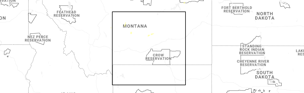
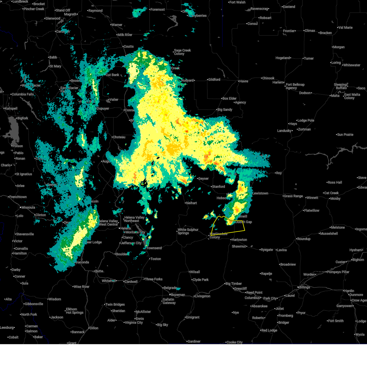
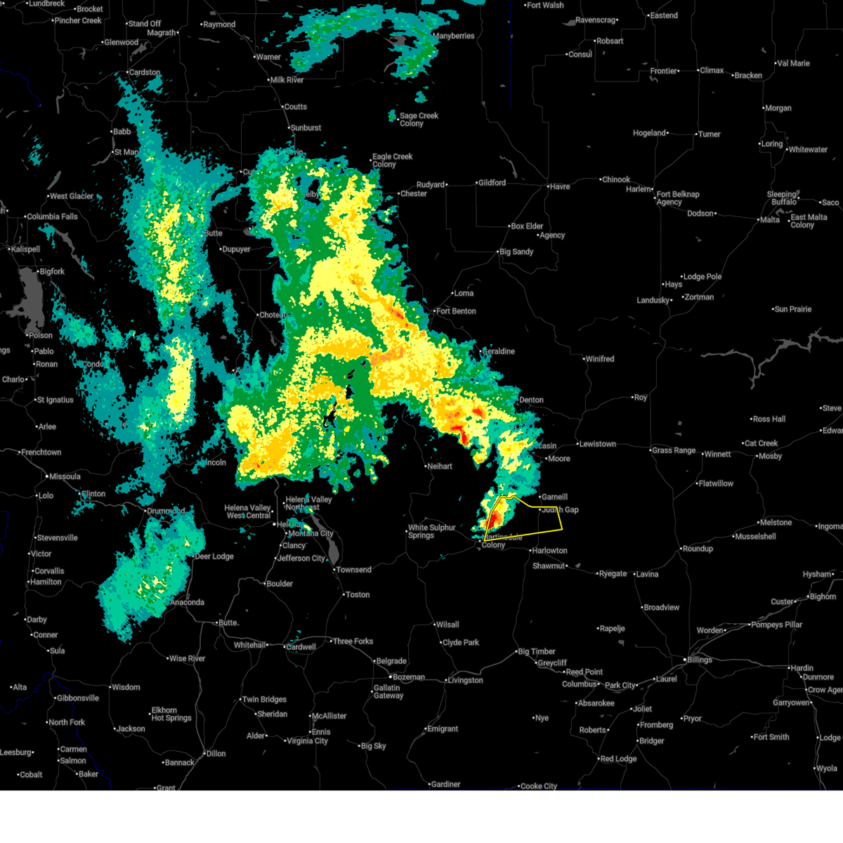
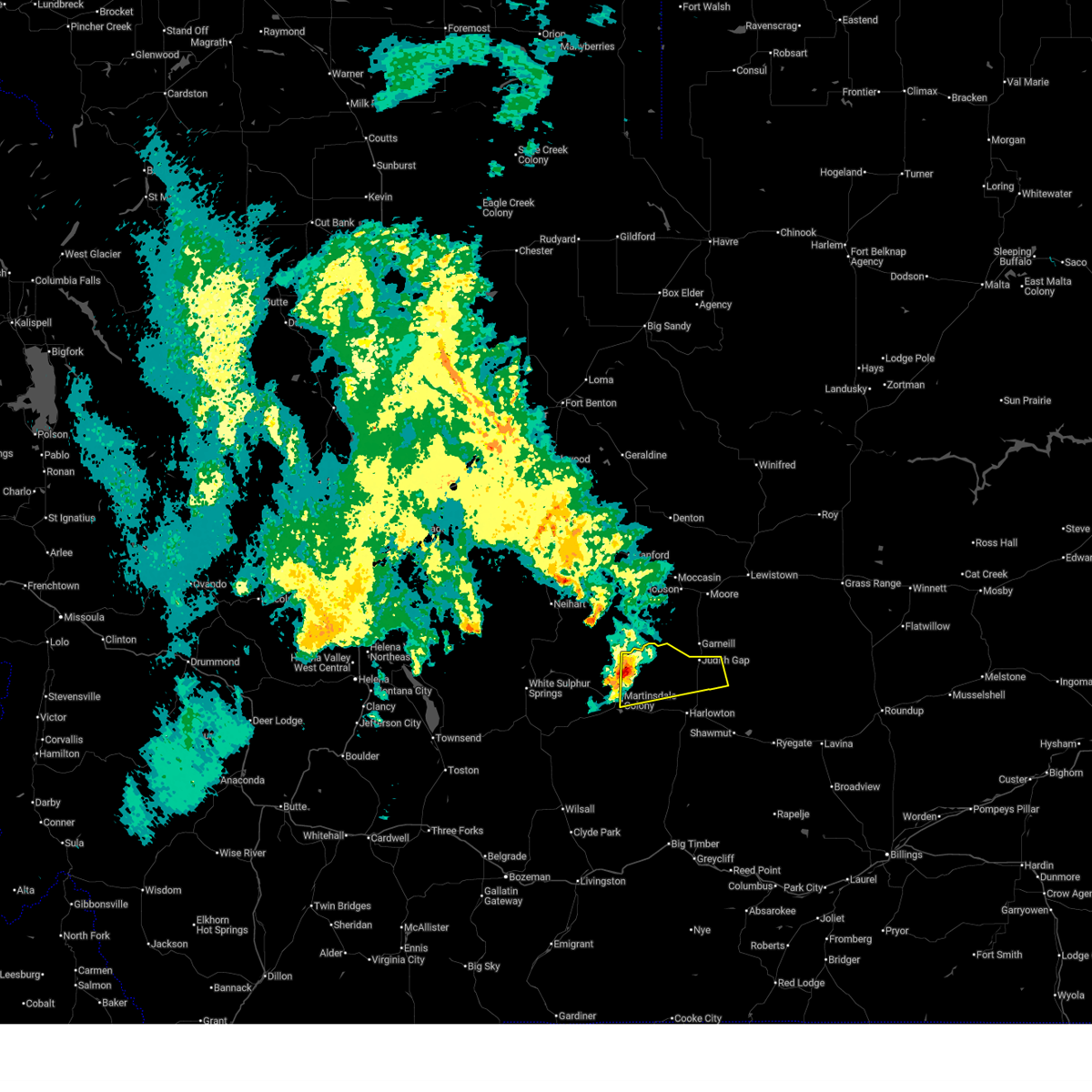
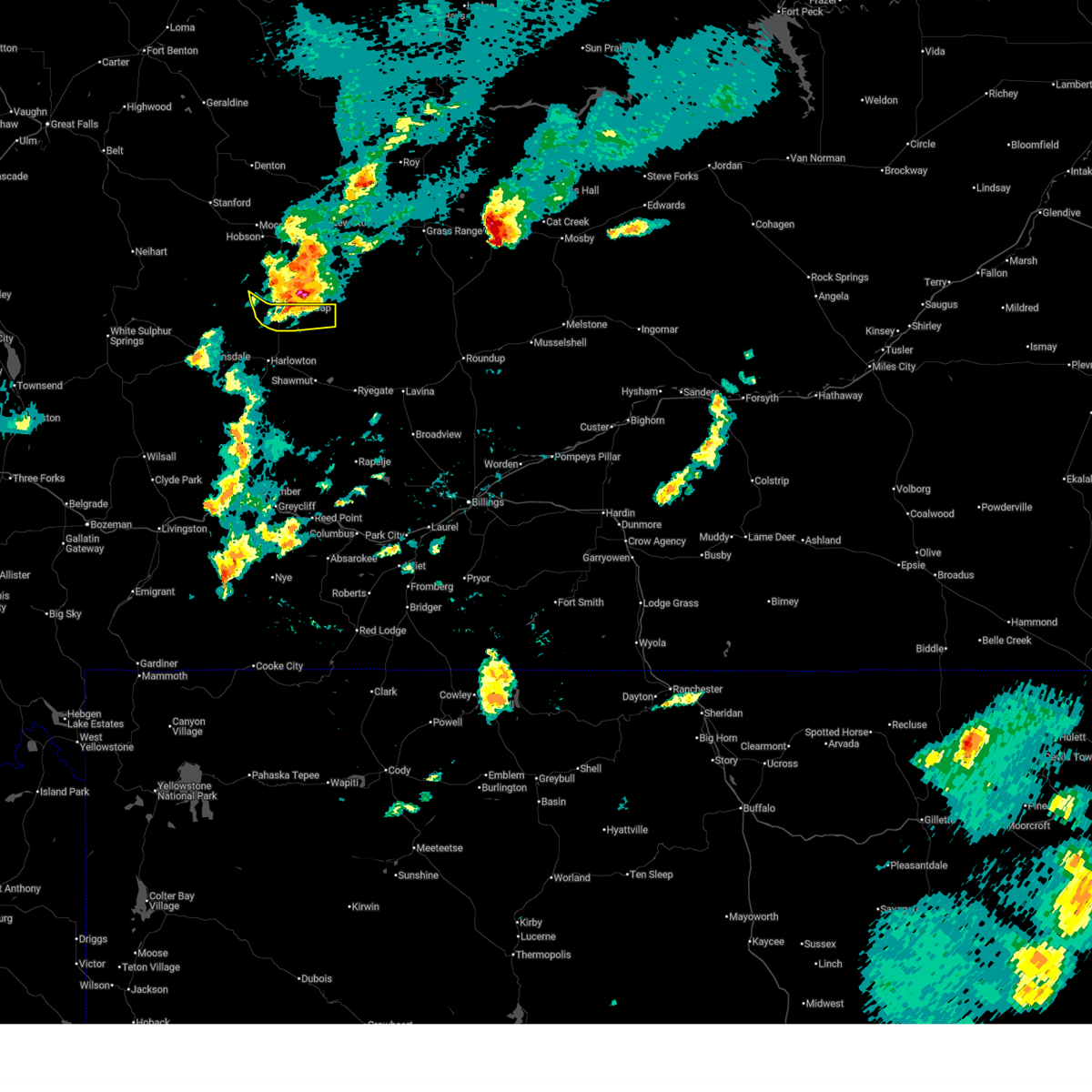
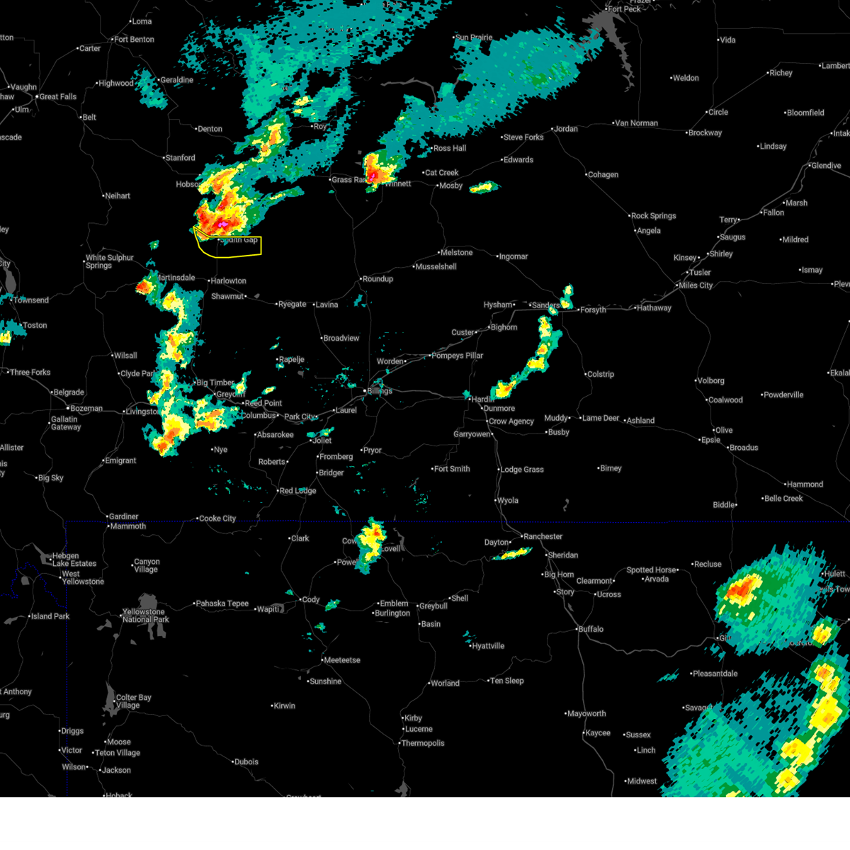
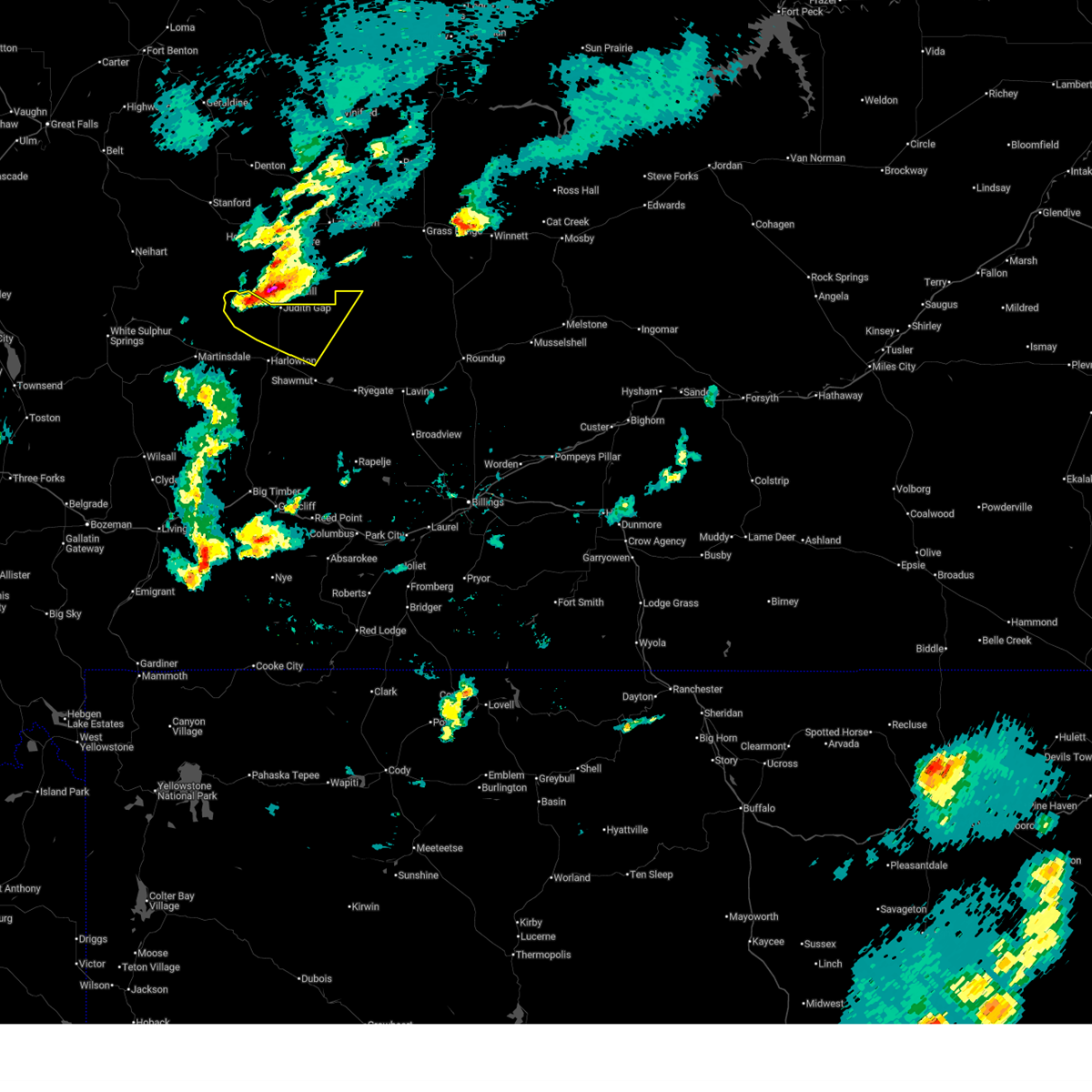
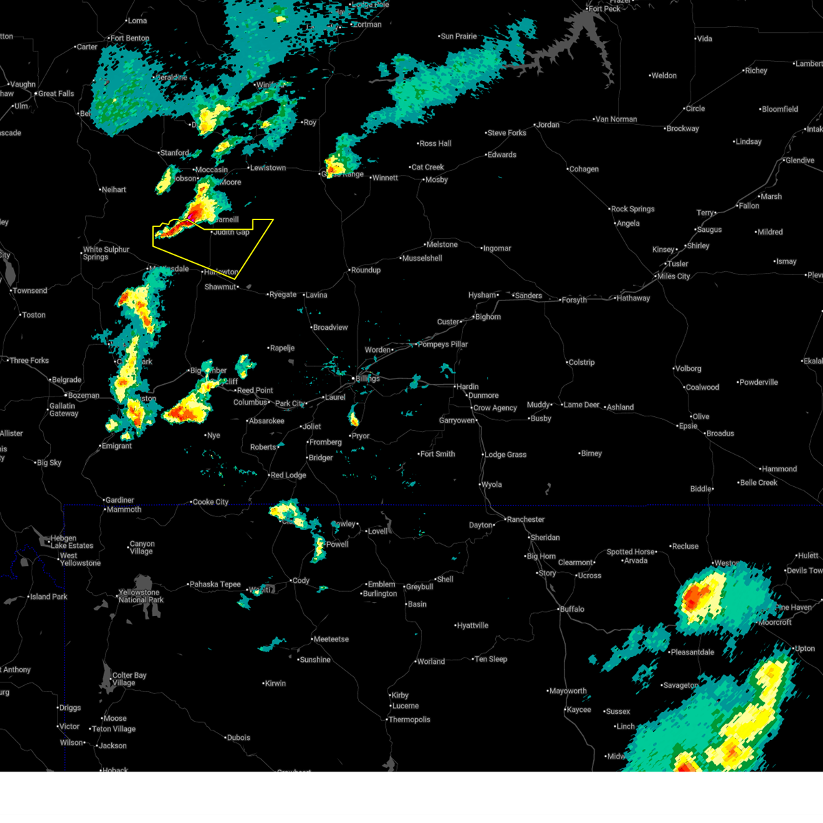
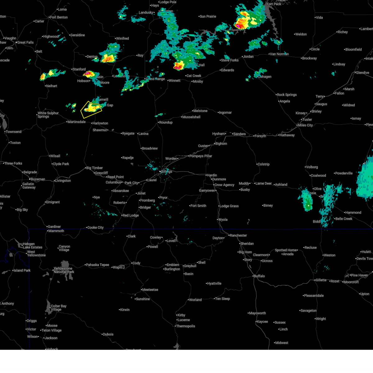
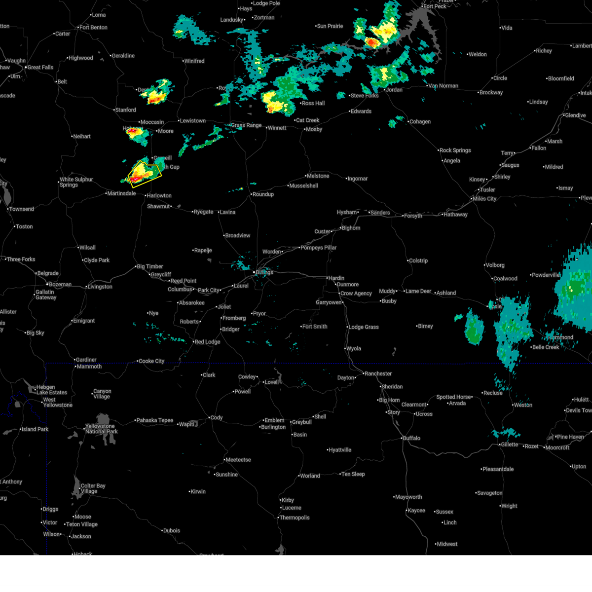
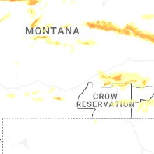
Hail Map for Judith Gap, MT
The Judith Gap, MT area has had 2 reports of on-the-ground hail by trained spotters, and has been under severe weather warnings 10 times during the past 12 months. Doppler radar has detected hail at or near Judith Gap, MT on 23 occasions, including 2 occasions during the past year.
| Name: | Judith Gap, MT |
| Where Located: | 86 miles NW of Billings, MT |
| Map: | Google Map for Judith Gap, MT |
| Population: | 126 |
| Housing Units: | 83 |
| More Info: | Search Google for Judith Gap, MT |
0
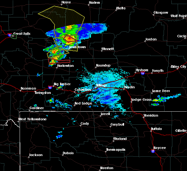
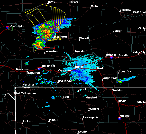
The Top Recent Hail Date for Judith Gap, MT is Thursday, June 26, 2025 (7th out of 23)
Hail and Wind Damage Spotted near Judith Gap, MT
| Date / Time | Report Details |
|---|---|
| 6/20/2025 5:30 PM MDT |
 The storm which prompted the warning has weakened below severe limits, and no longer poses an immediate threat to life or property. therefore, the warning has been allowed to expire. however, small hail and gusty winds are still possible with this thunderstorm as it moves into judith gap. The storm which prompted the warning has weakened below severe limits, and no longer poses an immediate threat to life or property. therefore, the warning has been allowed to expire. however, small hail and gusty winds are still possible with this thunderstorm as it moves into judith gap.
|
| 6/20/2025 5:04 PM MDT |
 At 504 pm mdt, a severe thunderstorm was located 18 miles northwest of harlowton, moving east at 30 mph (radar indicated). Hazards include 60 mph wind gusts and quarter size hail. Hail damage to vehicles is expected. expect wind damage to roofs, siding, and trees. Locations impacted include, judith gap. At 504 pm mdt, a severe thunderstorm was located 18 miles northwest of harlowton, moving east at 30 mph (radar indicated). Hazards include 60 mph wind gusts and quarter size hail. Hail damage to vehicles is expected. expect wind damage to roofs, siding, and trees. Locations impacted include, judith gap.
|
| 6/20/2025 4:41 PM MDT |
 Svrbyz the national weather service in billings has issued a * severe thunderstorm warning for, northern wheatland county in central montana, * until 530 pm mdt. * at 441 pm mdt, a severe thunderstorm was located 23 miles northwest of harlowton, moving east at 30 mph (radar indicated). Hazards include ping pong ball size hail and 60 mph wind gusts. People and animals outdoors will be injured. expect hail damage to roofs, siding, windows, and vehicles. Expect wind damage to roofs, siding, and trees. Svrbyz the national weather service in billings has issued a * severe thunderstorm warning for, northern wheatland county in central montana, * until 530 pm mdt. * at 441 pm mdt, a severe thunderstorm was located 23 miles northwest of harlowton, moving east at 30 mph (radar indicated). Hazards include ping pong ball size hail and 60 mph wind gusts. People and animals outdoors will be injured. expect hail damage to roofs, siding, windows, and vehicles. Expect wind damage to roofs, siding, and trees.
|
| 6/15/2025 6:45 PM MDT |
 the severe thunderstorm warning has been cancelled and is no longer in effect the severe thunderstorm warning has been cancelled and is no longer in effect
|
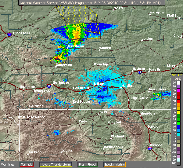
| 6/15/2025 6:40 PM MDT | Quarter sized hail reported 7.6 miles S of Judith Gap, MT, trained spotter reports quarter size hail. |
| 6/15/2025 6:32 PM MDT |
 the severe thunderstorm warning has been cancelled and is no longer in effect the severe thunderstorm warning has been cancelled and is no longer in effect
|
| 6/15/2025 6:32 PM MDT |
 At 632 pm mdt, a severe thunderstorm was located 18 miles north of harlowton, moving east at 25 mph (radar indicated). Hazards include tennis ball size hail and 60 mph wind gusts. People and animals outdoors will be injured. expect hail damage to roofs, siding, windows, and vehicles. expect wind damage to roofs, siding, and trees. Locations impacted include, judith gap. At 632 pm mdt, a severe thunderstorm was located 18 miles north of harlowton, moving east at 25 mph (radar indicated). Hazards include tennis ball size hail and 60 mph wind gusts. People and animals outdoors will be injured. expect hail damage to roofs, siding, windows, and vehicles. expect wind damage to roofs, siding, and trees. Locations impacted include, judith gap.
|
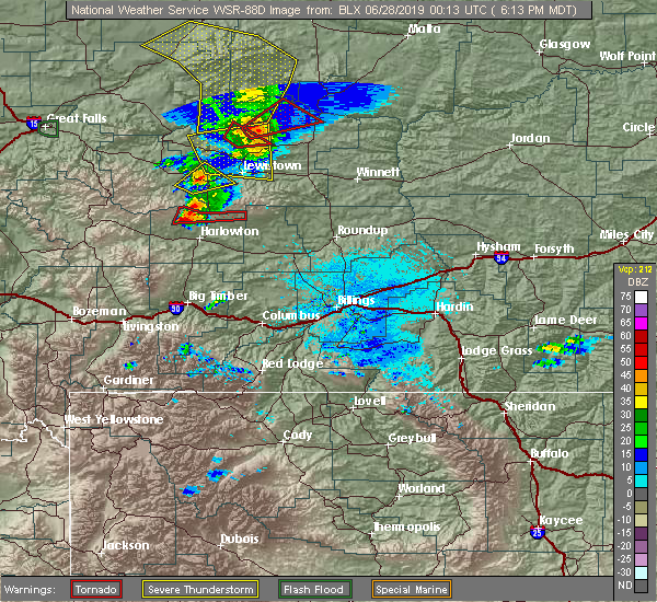
| 6/15/2025 6:20 PM MDT |
 At 620 pm mdt, a severe thunderstorm was located 19 miles north of harlowton, moving east at 25 mph (radar indicated). Hazards include tennis ball size hail and 60 mph wind gusts. People and animals outdoors will be injured. expect hail damage to roofs, siding, windows, and vehicles. expect wind damage to roofs, siding, and trees. Locations impacted include, judith gap. At 620 pm mdt, a severe thunderstorm was located 19 miles north of harlowton, moving east at 25 mph (radar indicated). Hazards include tennis ball size hail and 60 mph wind gusts. People and animals outdoors will be injured. expect hail damage to roofs, siding, windows, and vehicles. expect wind damage to roofs, siding, and trees. Locations impacted include, judith gap.
|
| 6/15/2025 6:04 PM MDT |
 Svrbyz the national weather service in billings has issued a * severe thunderstorm warning for, north central golden valley county in central montana, northern wheatland county in central montana, * until 700 pm mdt. * at 604 pm mdt, a severe thunderstorm was located 21 miles north of harlowton, moving east at 25 mph (radar indicated). Hazards include ping pong ball size hail and 60 mph wind gusts. People and animals outdoors will be injured. expect hail damage to roofs, siding, windows, and vehicles. Expect wind damage to roofs, siding, and trees. Svrbyz the national weather service in billings has issued a * severe thunderstorm warning for, north central golden valley county in central montana, northern wheatland county in central montana, * until 700 pm mdt. * at 604 pm mdt, a severe thunderstorm was located 21 miles north of harlowton, moving east at 25 mph (radar indicated). Hazards include ping pong ball size hail and 60 mph wind gusts. People and animals outdoors will be injured. expect hail damage to roofs, siding, windows, and vehicles. Expect wind damage to roofs, siding, and trees.
|
| 6/14/2025 11:59 PM MDT |
 the severe thunderstorm warning has been cancelled and is no longer in effect the severe thunderstorm warning has been cancelled and is no longer in effect
|
| 6/14/2025 11:43 PM MDT |
 Svrbyz the national weather service in billings has issued a * severe thunderstorm warning for, north central wheatland county in central montana, * until 1230 am mdt. * at 1143 pm mdt, a severe thunderstorm was located 11 miles northwest of harlowton, moving east at 15 mph (radar indicated). Hazards include ping pong ball size hail and 60 mph wind gusts. People and animals outdoors will be injured. expect hail damage to roofs, siding, windows, and vehicles. Expect wind damage to roofs, siding, and trees. Svrbyz the national weather service in billings has issued a * severe thunderstorm warning for, north central wheatland county in central montana, * until 1230 am mdt. * at 1143 pm mdt, a severe thunderstorm was located 11 miles northwest of harlowton, moving east at 15 mph (radar indicated). Hazards include ping pong ball size hail and 60 mph wind gusts. People and animals outdoors will be injured. expect hail damage to roofs, siding, windows, and vehicles. Expect wind damage to roofs, siding, and trees.
|
| 7/11/2024 8:40 PM MDT | Awos station k1lm judith ga in fergus county MT, 1 miles SW of Judith Gap, MT |
| 7/15/2022 2:06 PM MDT |
 The severe thunderstorm warning for eastern wheatland county will expire at 215 pm mdt, the storm which prompted the warning has weakened below severe limits, and no longer poses an immediate threat to life or property. therefore, the warning will be allowed to expire. a severe thunderstorm watch remains in effect until 700 pm mdt for central montana. The severe thunderstorm warning for eastern wheatland county will expire at 215 pm mdt, the storm which prompted the warning has weakened below severe limits, and no longer poses an immediate threat to life or property. therefore, the warning will be allowed to expire. a severe thunderstorm watch remains in effect until 700 pm mdt for central montana.
|
| 7/15/2022 1:45 PM MDT |
 At 144 pm mdt, a severe thunderstorm was located 8 miles south of harlowton, moving northeast at 45 mph (trained weather spotters). Hazards include 60 mph wind gusts. Expect damage to roofs, siding, and trees. locations impacted include, harlowton, deadmans basin reservoir and shawmut. hail threat, radar indicated max hail size, <. 75 in wind threat, observed max wind gust, 60 mph. At 144 pm mdt, a severe thunderstorm was located 8 miles south of harlowton, moving northeast at 45 mph (trained weather spotters). Hazards include 60 mph wind gusts. Expect damage to roofs, siding, and trees. locations impacted include, harlowton, deadmans basin reservoir and shawmut. hail threat, radar indicated max hail size, <. 75 in wind threat, observed max wind gust, 60 mph.
|
| 7/15/2022 1:17 PM MDT |
 At 116 pm mdt, a severe thunderstorm was located 12 miles west of harlowton, moving northeast at 35 mph (trained weather spotters). Hazards include 60 mph wind gusts. expect damage to roofs, siding, and trees At 116 pm mdt, a severe thunderstorm was located 12 miles west of harlowton, moving northeast at 35 mph (trained weather spotters). Hazards include 60 mph wind gusts. expect damage to roofs, siding, and trees
|
| 7/13/2022 4:19 PM MDT | Storm damage reported in wheatland county MT, 0.7 miles SSW of Judith Gap, MT |
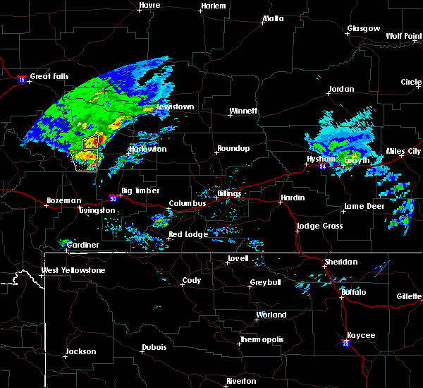
| 7/9/2022 6:26 PM MDT |
 At 625 pm mdt, severe thunderstorms were located along a line extending from 18 miles south of moore to 7 miles east of harlowton, moving east at 35 mph (radar indicated). Hazards include ping pong ball size hail and 60 mph wind gusts. People and animals outdoors will be injured. expect hail and wind damage to roofs, siding, windows, and vehicles. severe thunderstorms will be near, deadmans basin reservoir around 645 pm mdt. other locations impacted by these severe thunderstorms include franklin, judith gap and shawmut. this replaces the warning previously in effect for this area. hail threat, radar indicated max hail size, 1. 50 in wind threat, radar indicated max wind gust, 60 mph. At 625 pm mdt, severe thunderstorms were located along a line extending from 18 miles south of moore to 7 miles east of harlowton, moving east at 35 mph (radar indicated). Hazards include ping pong ball size hail and 60 mph wind gusts. People and animals outdoors will be injured. expect hail and wind damage to roofs, siding, windows, and vehicles. severe thunderstorms will be near, deadmans basin reservoir around 645 pm mdt. other locations impacted by these severe thunderstorms include franklin, judith gap and shawmut. this replaces the warning previously in effect for this area. hail threat, radar indicated max hail size, 1. 50 in wind threat, radar indicated max wind gust, 60 mph.
|
| 7/7/2021 6:15 PM MDT | Storm damage reported in wheatland county MT, 0.7 miles SSW of Judith Gap, MT |
| 7/23/2020 5:04 PM MDT | Storm damage reported in wheatland county MT, 0.7 miles SSW of Judith Gap, MT |
| 7/7/2020 3:10 PM MDT | Grain bins put on their side and buildings damaged. trees stripped of vegetaio in wheatland county MT, 13.3 miles WNW of Judith Gap, MT |
| 7/7/2020 2:43 PM MDT |
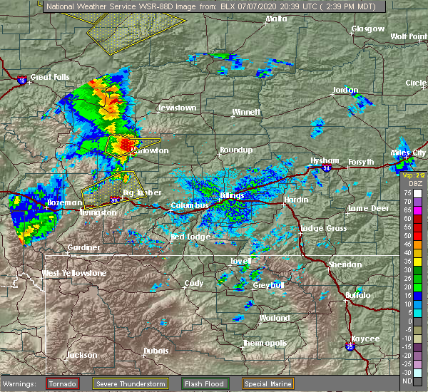 At 243 pm mdt, a severe thunderstorm was located 11 miles north of harlowton, moving northeast at 40 mph (radar indicated). Hazards include quarter size hail. damage to vehicles is expected At 243 pm mdt, a severe thunderstorm was located 11 miles north of harlowton, moving northeast at 40 mph (radar indicated). Hazards include quarter size hail. damage to vehicles is expected
|
| 7/7/2020 2:25 PM MDT |
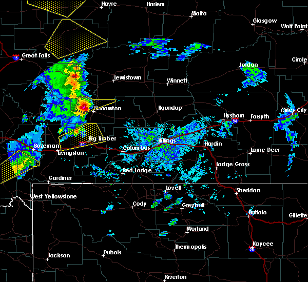 At 224 pm mdt, a severe thunderstorm was located 12 miles northwest of harlowton, moving northeast at 45 mph (radar indicated). Hazards include ping pong ball size hail and 60 mph wind gusts. People and animals outdoors will be injured. expect hail damage to roofs, siding, windows, and vehicles. expect wind damage to roofs, siding, and trees. Locations impacted include, judith gap. At 224 pm mdt, a severe thunderstorm was located 12 miles northwest of harlowton, moving northeast at 45 mph (radar indicated). Hazards include ping pong ball size hail and 60 mph wind gusts. People and animals outdoors will be injured. expect hail damage to roofs, siding, windows, and vehicles. expect wind damage to roofs, siding, and trees. Locations impacted include, judith gap.
|
| 7/7/2020 2:02 PM MDT |
 The national weather service in billings has issued a * severe thunderstorm warning for. northern wheatland county in central montana. until 245 pm mdt. At 201 pm mdt, a severe thunderstorm was located 24 miles west of harlowton, moving northeast at 45 mph. The national weather service in billings has issued a * severe thunderstorm warning for. northern wheatland county in central montana. until 245 pm mdt. At 201 pm mdt, a severe thunderstorm was located 24 miles west of harlowton, moving northeast at 45 mph.
|
| 8/10/2019 9:29 PM MDT | Storm damage reported in wheatland county MT, 0.7 miles SSW of Judith Gap, MT |
| 8/10/2019 9:22 PM MDT | Awos station k1lm lim in fergus county MT, 1.8 miles SW of Judith Gap, MT |
| 8/10/2019 8:55 PM MDT |
 At 855 pm mdt, severe thunderstorms were located along a line extending from 20 miles south of hobson to 13 miles southwest of harlowton, moving east at 25 mph (radar indicated). Hazards include 60 mph wind gusts and half dollar size hail. Hail damage to vehicles is expected. Expect wind damage to roofs, siding, and trees. At 855 pm mdt, severe thunderstorms were located along a line extending from 20 miles south of hobson to 13 miles southwest of harlowton, moving east at 25 mph (radar indicated). Hazards include 60 mph wind gusts and half dollar size hail. Hail damage to vehicles is expected. Expect wind damage to roofs, siding, and trees.
|
| 8/10/2019 8:48 PM MDT |
 At 848 pm mdt, severe thunderstorms were located along a line extending from 16 miles south of moore to 11 miles southwest of harlowton, moving east at 40 mph (radar indicated). Hazards include 60 mph wind gusts and half dollar size hail. Hail damage to vehicles is expected. expect wind damage to roofs, siding, and trees. Locations impacted include, harlowton, judith gap and twodot. At 848 pm mdt, severe thunderstorms were located along a line extending from 16 miles south of moore to 11 miles southwest of harlowton, moving east at 40 mph (radar indicated). Hazards include 60 mph wind gusts and half dollar size hail. Hail damage to vehicles is expected. expect wind damage to roofs, siding, and trees. Locations impacted include, harlowton, judith gap and twodot.
|
| 8/10/2019 8:29 PM MDT |
 At 829 pm mdt, severe thunderstorms were located along a line extending from 20 miles northwest of harlowton to 31 miles northeast of clyde park, moving east at 40 mph (radar indicated). Hazards include 60 mph wind gusts and half dollar size hail. Hail damage to vehicles is expected. Expect wind damage to roofs, siding, and trees. At 829 pm mdt, severe thunderstorms were located along a line extending from 20 miles northwest of harlowton to 31 miles northeast of clyde park, moving east at 40 mph (radar indicated). Hazards include 60 mph wind gusts and half dollar size hail. Hail damage to vehicles is expected. Expect wind damage to roofs, siding, and trees.
|
| 7/14/2019 5:45 PM MDT | Storm damage reported in wheatland county MT, 0.7 miles SSW of Judith Gap, MT |
| 7/14/2019 5:36 PM MDT | Awos station k1lm lim in fergus county MT, 1.8 miles SW of Judith Gap, MT |
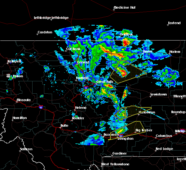
| 6/27/2019 7:12 PM MDT | Ping Pong Ball sized hail reported 14.3 miles WNW of Judith Gap, MT, dime to ping-pong ball sized hail. |
| 6/27/2019 6:29 PM MDT |
 At 628 pm mdt, severe thunderstorms were located along a line extending from 14 miles south of moore to 11 miles north of harlowton, moving east at 25 mph (radar indicated). Hazards include 60 mph wind gusts and quarter size hail. Hail damage to vehicles is expected. expect wind damage to roofs, siding, and trees. locations impacted include, judith gap. These storms could produce a tornado with little warning. At 628 pm mdt, severe thunderstorms were located along a line extending from 14 miles south of moore to 11 miles north of harlowton, moving east at 25 mph (radar indicated). Hazards include 60 mph wind gusts and quarter size hail. Hail damage to vehicles is expected. expect wind damage to roofs, siding, and trees. locations impacted include, judith gap. These storms could produce a tornado with little warning.
|
| 6/27/2019 6:13 PM MDT |
 At 610 pm mdt, severe thunderstorms were located along a line extending from 18 miles south of hobson to 12 miles northwest of harlowton, moving northeast at 20 mph (radar indicated). Hazards include 60 mph wind gusts and quarter size hail. Hail damage to vehicles is expected. Expect wind damage to roofs, siding, and trees. At 610 pm mdt, severe thunderstorms were located along a line extending from 18 miles south of hobson to 12 miles northwest of harlowton, moving northeast at 20 mph (radar indicated). Hazards include 60 mph wind gusts and quarter size hail. Hail damage to vehicles is expected. Expect wind damage to roofs, siding, and trees.
|
| 6/27/2019 6:04 PM MDT |
 At 602 pm mdt, a confirmed tornado was located 16 miles north of harlowton, moving east at 25 mph (weather spotters confirmed tornado). Hazards include damaging tornado and quarter size hail. Flying debris will be dangerous to those caught without shelter. mobile homes will be damaged or destroyed. damage to roofs, windows, and vehicles will occur. tree damage is likely. Locations impacted include, judith gap. At 602 pm mdt, a confirmed tornado was located 16 miles north of harlowton, moving east at 25 mph (weather spotters confirmed tornado). Hazards include damaging tornado and quarter size hail. Flying debris will be dangerous to those caught without shelter. mobile homes will be damaged or destroyed. damage to roofs, windows, and vehicles will occur. tree damage is likely. Locations impacted include, judith gap.
|
| 6/27/2019 5:42 PM MDT |
 At 541 pm mdt, a confirmed tornado was located 19 miles northwest of harlowton, moving east at 45 mph (weather spotters confirmed tornado). Hazards include damaging tornado and quarter size hail. Flying debris will be dangerous to those caught without shelter. mobile homes will be damaged or destroyed. damage to roofs, windows, and vehicles will occur. tree damage is likely. This tornadic thunderstorm will remain over mainly rural areas of northeastern wheatland county, including the following locations, judith gap. At 541 pm mdt, a confirmed tornado was located 19 miles northwest of harlowton, moving east at 45 mph (weather spotters confirmed tornado). Hazards include damaging tornado and quarter size hail. Flying debris will be dangerous to those caught without shelter. mobile homes will be damaged or destroyed. damage to roofs, windows, and vehicles will occur. tree damage is likely. This tornadic thunderstorm will remain over mainly rural areas of northeastern wheatland county, including the following locations, judith gap.
|
| 7/5/2017 8:19 PM MDT | Storm damage reported in wheatland county MT, 0.7 miles SSW of Judith Gap, MT |
| 6/1/2015 6:58 PM MDT | Storm damage reported in wheatland county MT, 0.7 miles SSW of Judith Gap, MT |
| 6/1/2015 6:29 PM MDT | At 626 pm mdt, a severe thunderstorm was located just west of harlowton, moving northeast at 30 mph (trained weather spotters). Hazards include 70 mph wind gusts have been reported near two dot with considerable small hail. damaging wind and hail are likely. Wind damage is likely to mobile homes. roofs and outbuildings. Hail is also likely. |
| 6/19/2013 7:31 PM MDT | Judith gap dot in wheatland county MT, 0.7 miles SSW of Judith Gap, MT |
| 7/20/2012 7:49 PM MDT | Judith gap dot in wheatland county MT, 0.2 miles WSW of Judith Gap, MT |
Hail Maps for Judith Gap, MT


Connect with Interactive Hail Maps