

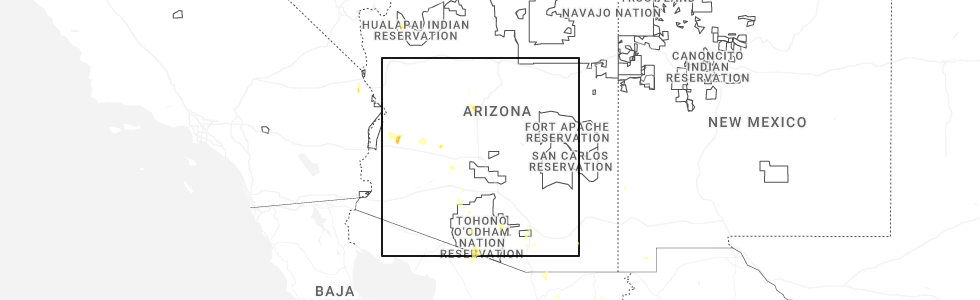
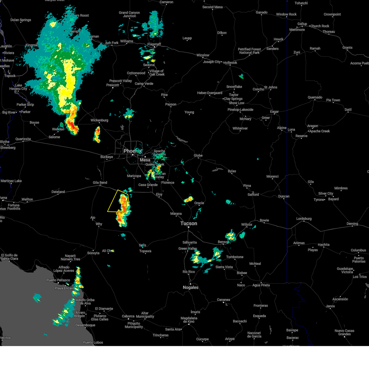
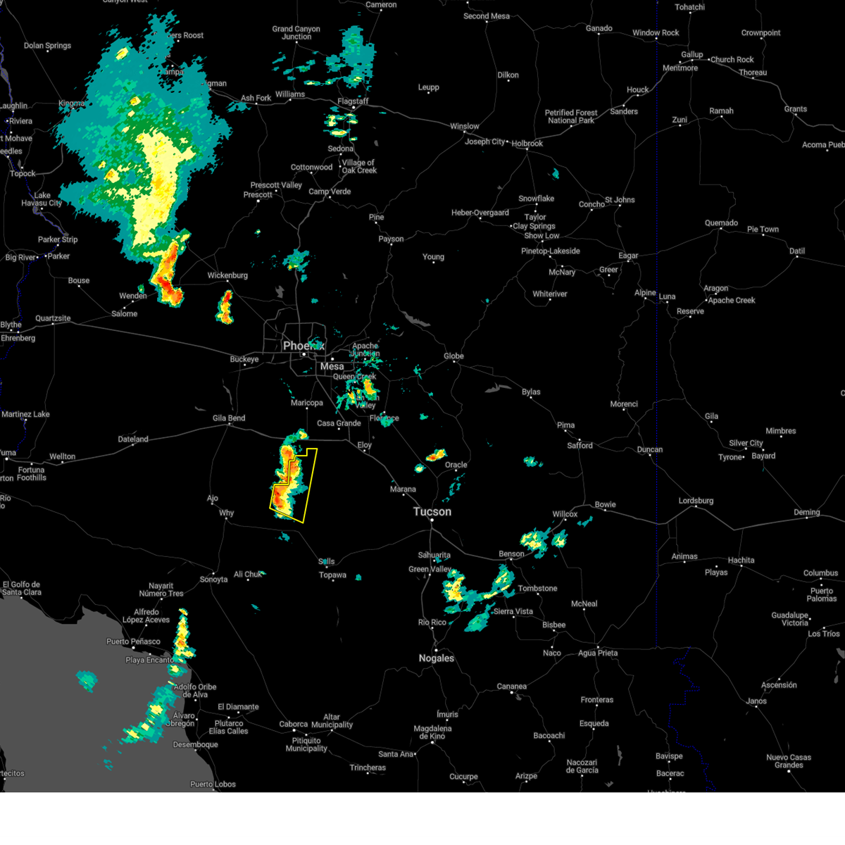
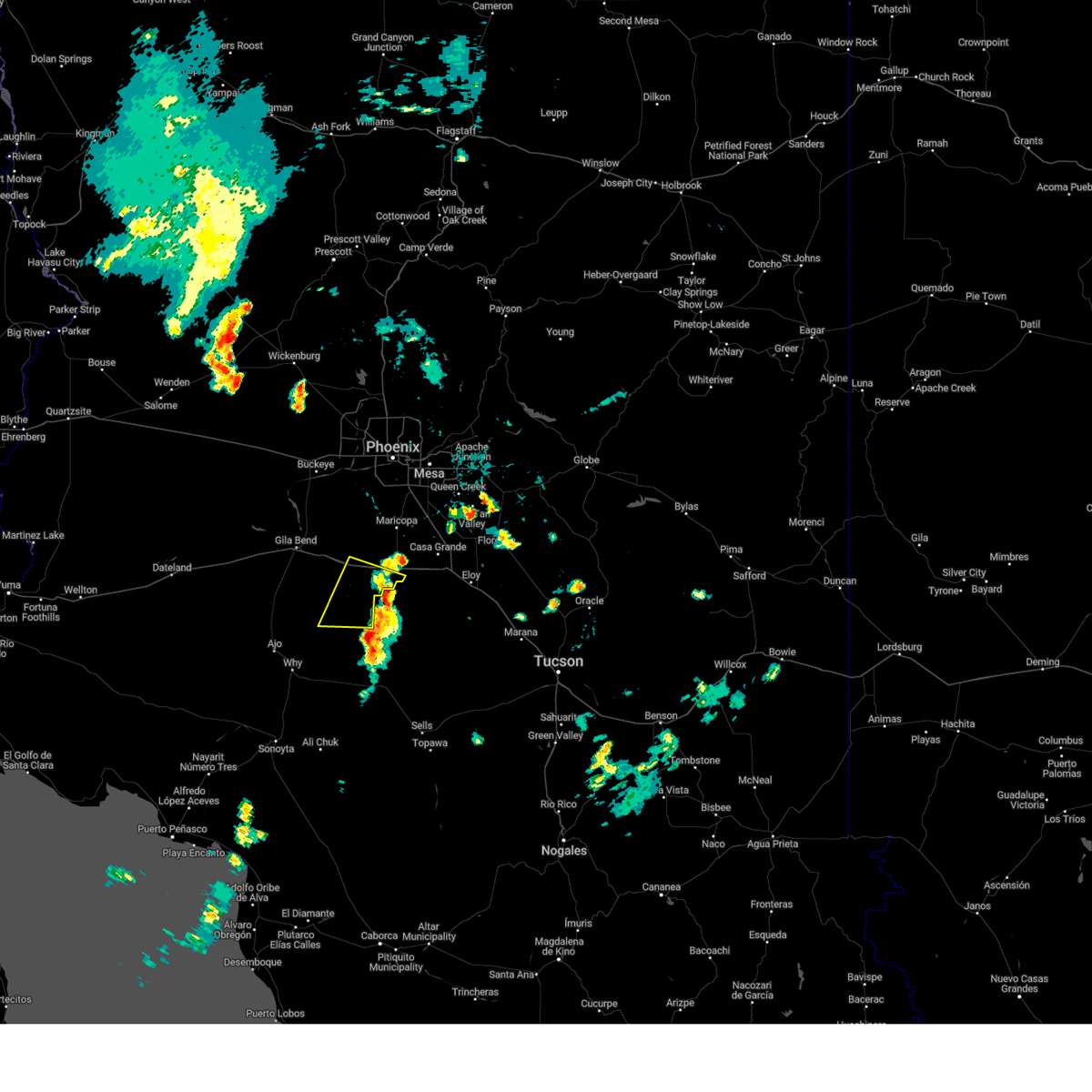
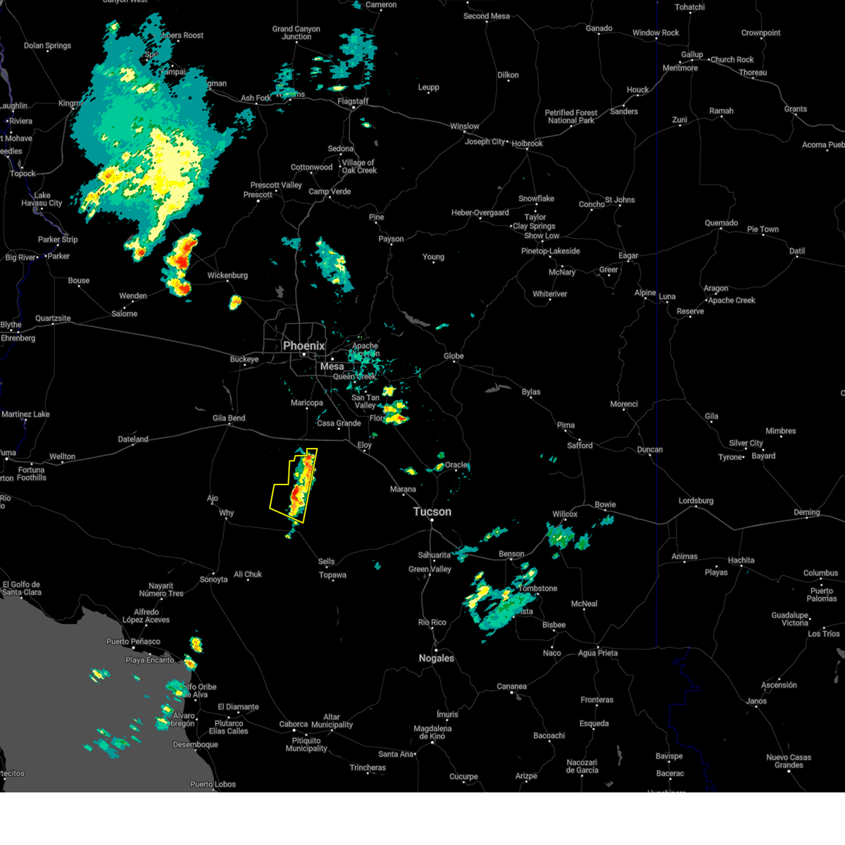
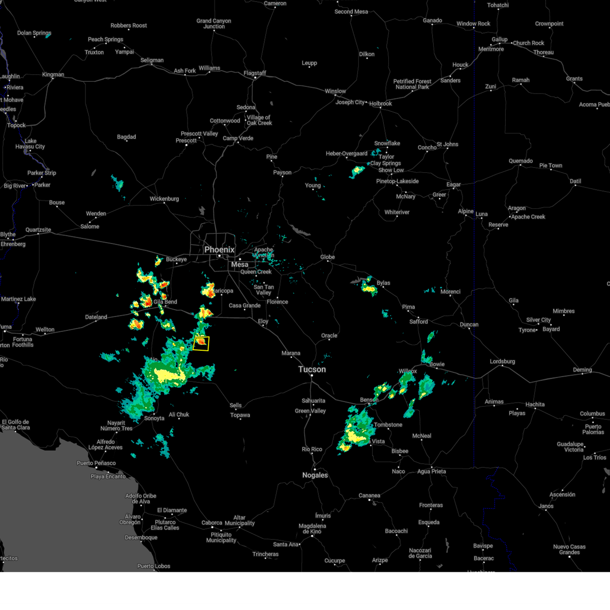
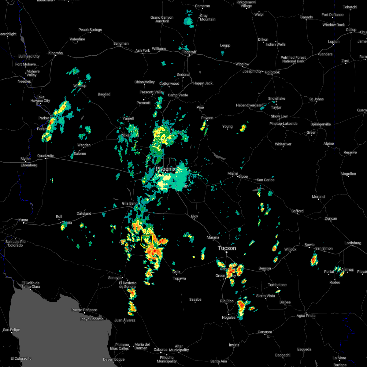
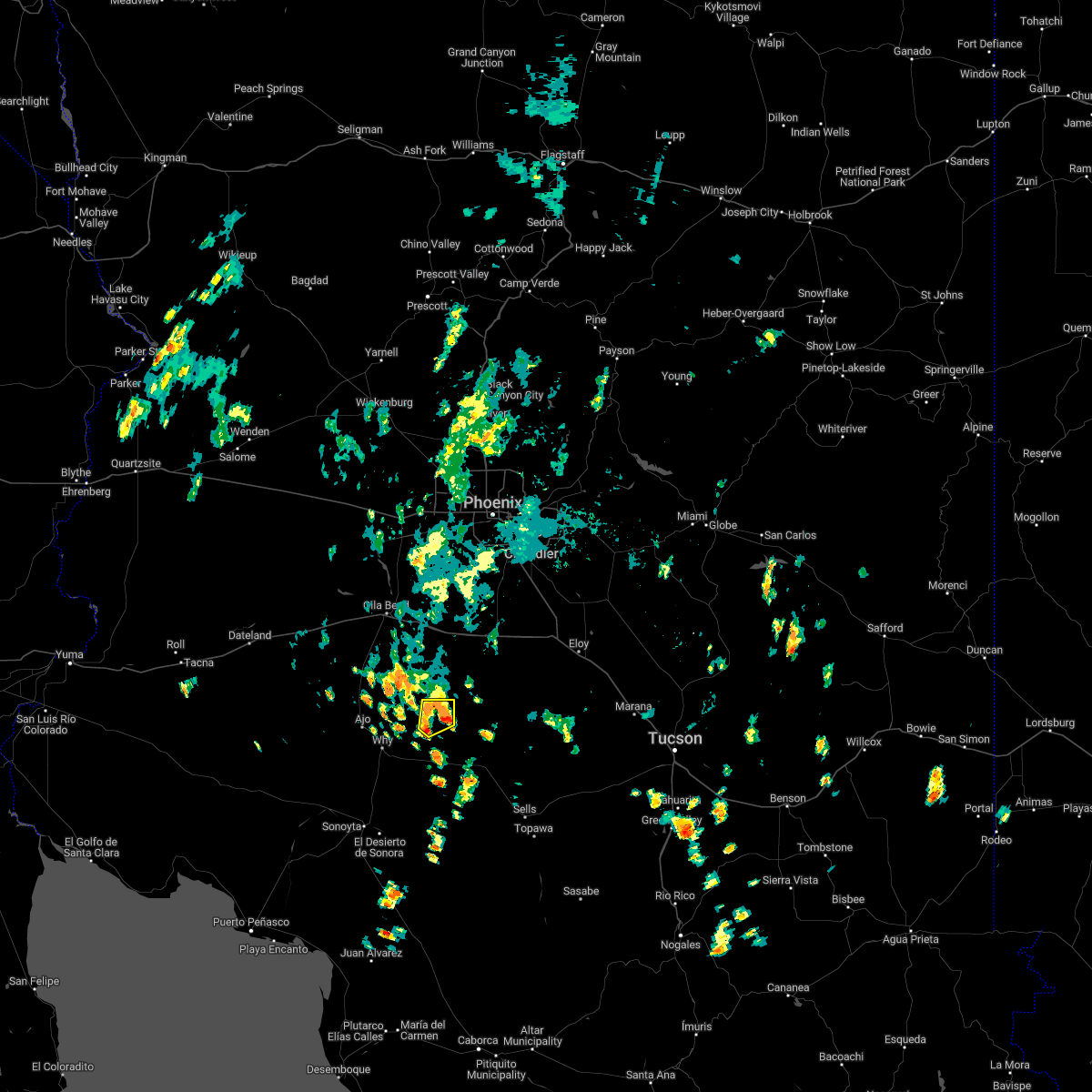
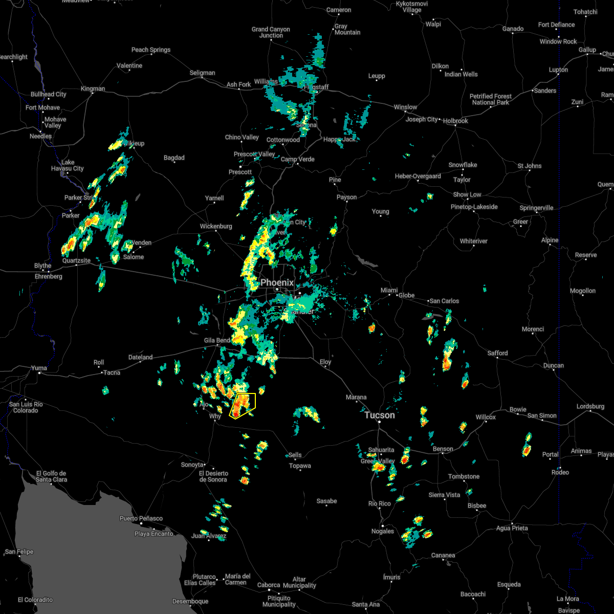
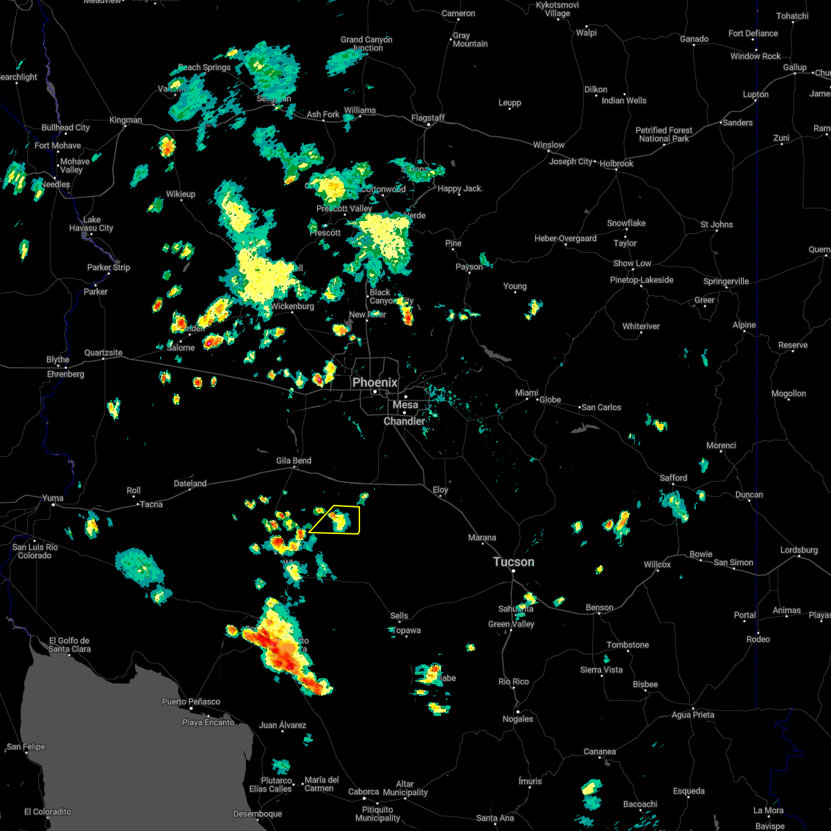
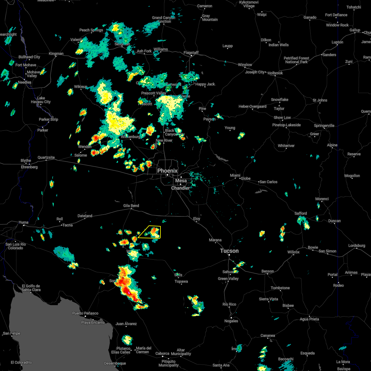
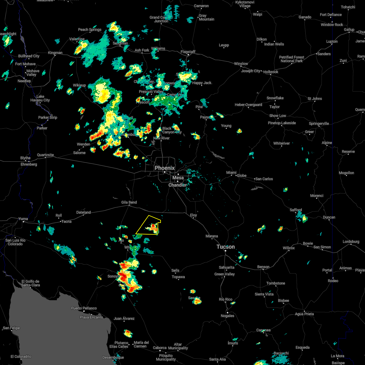
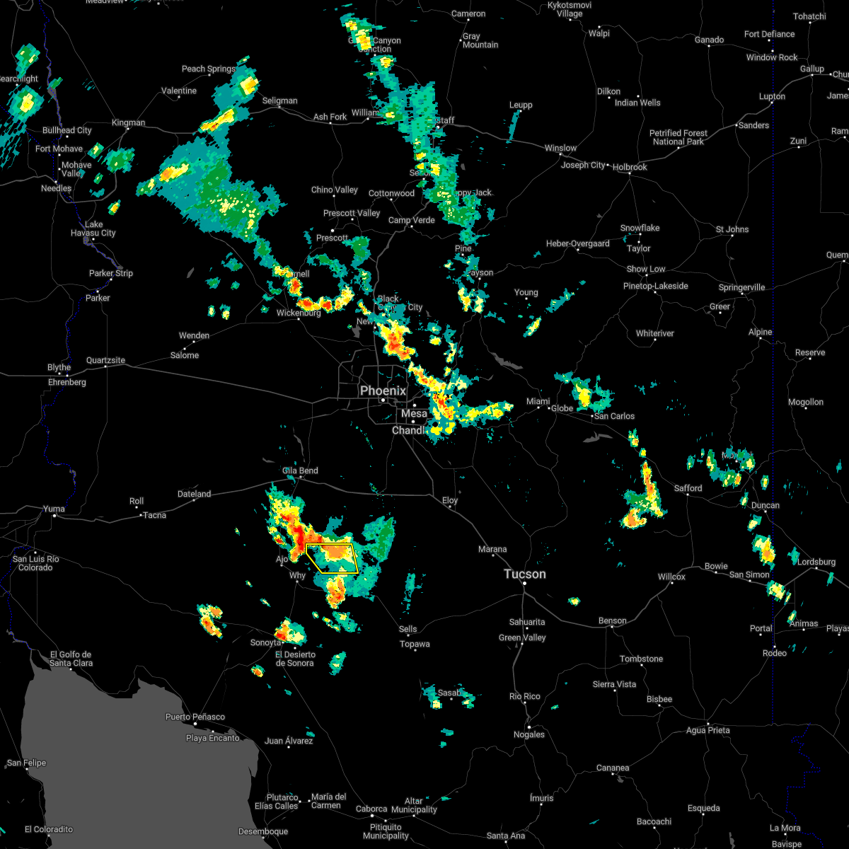
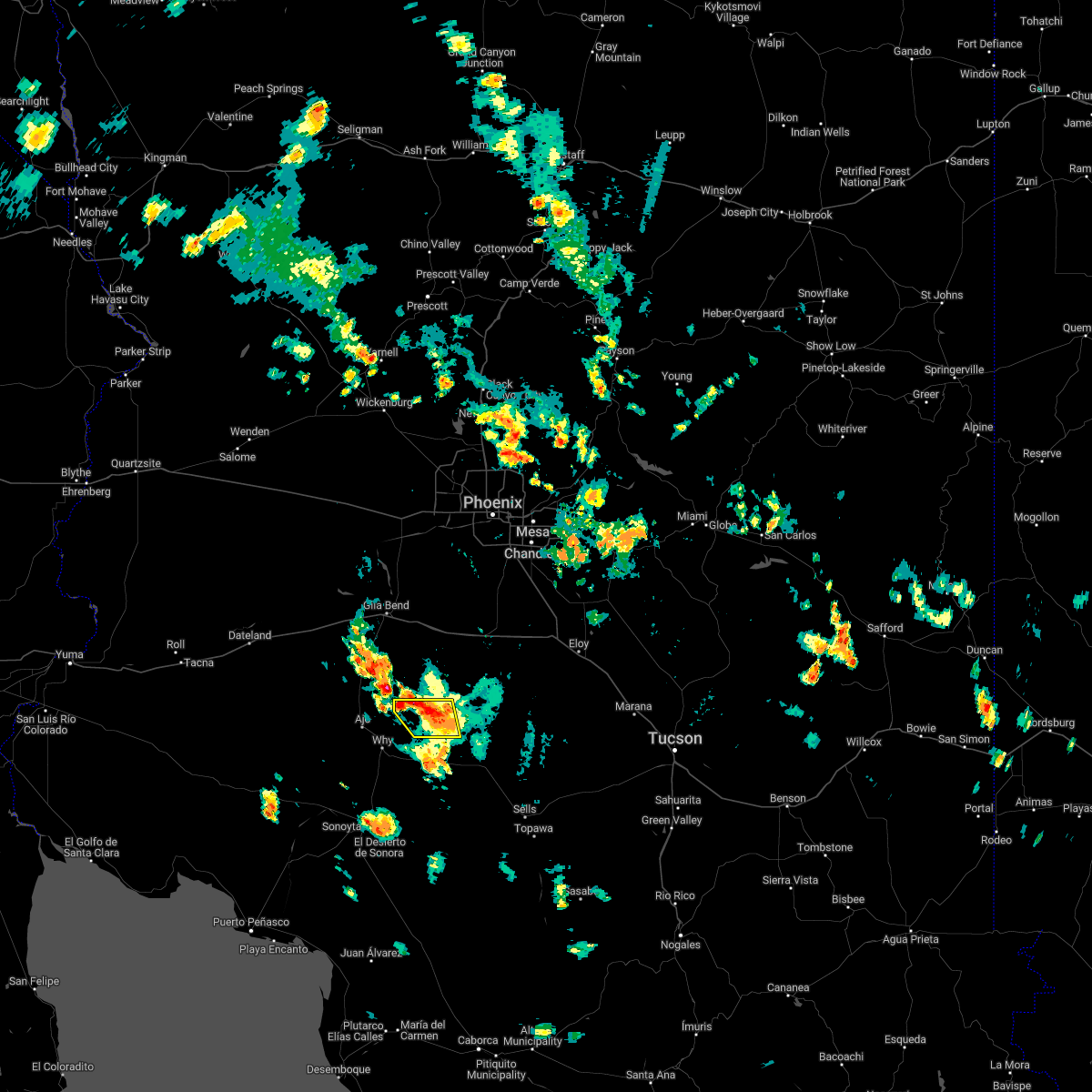
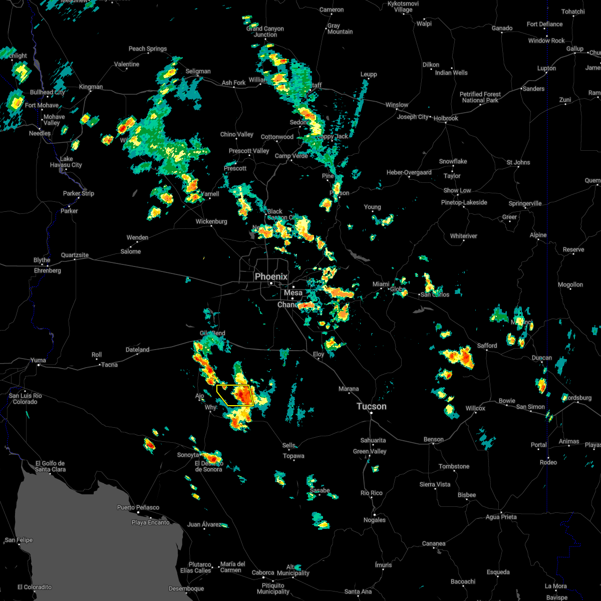
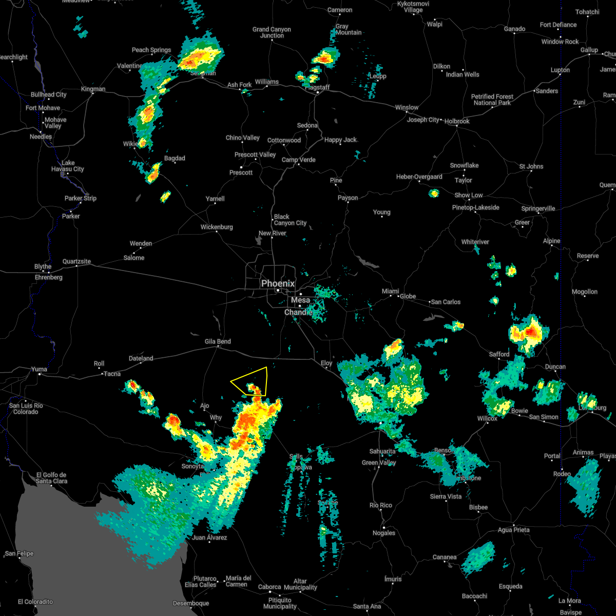
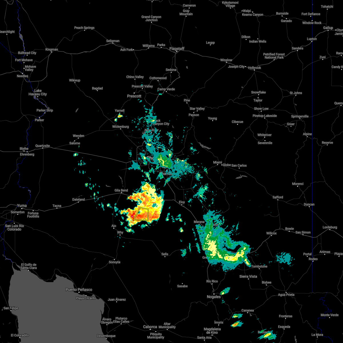
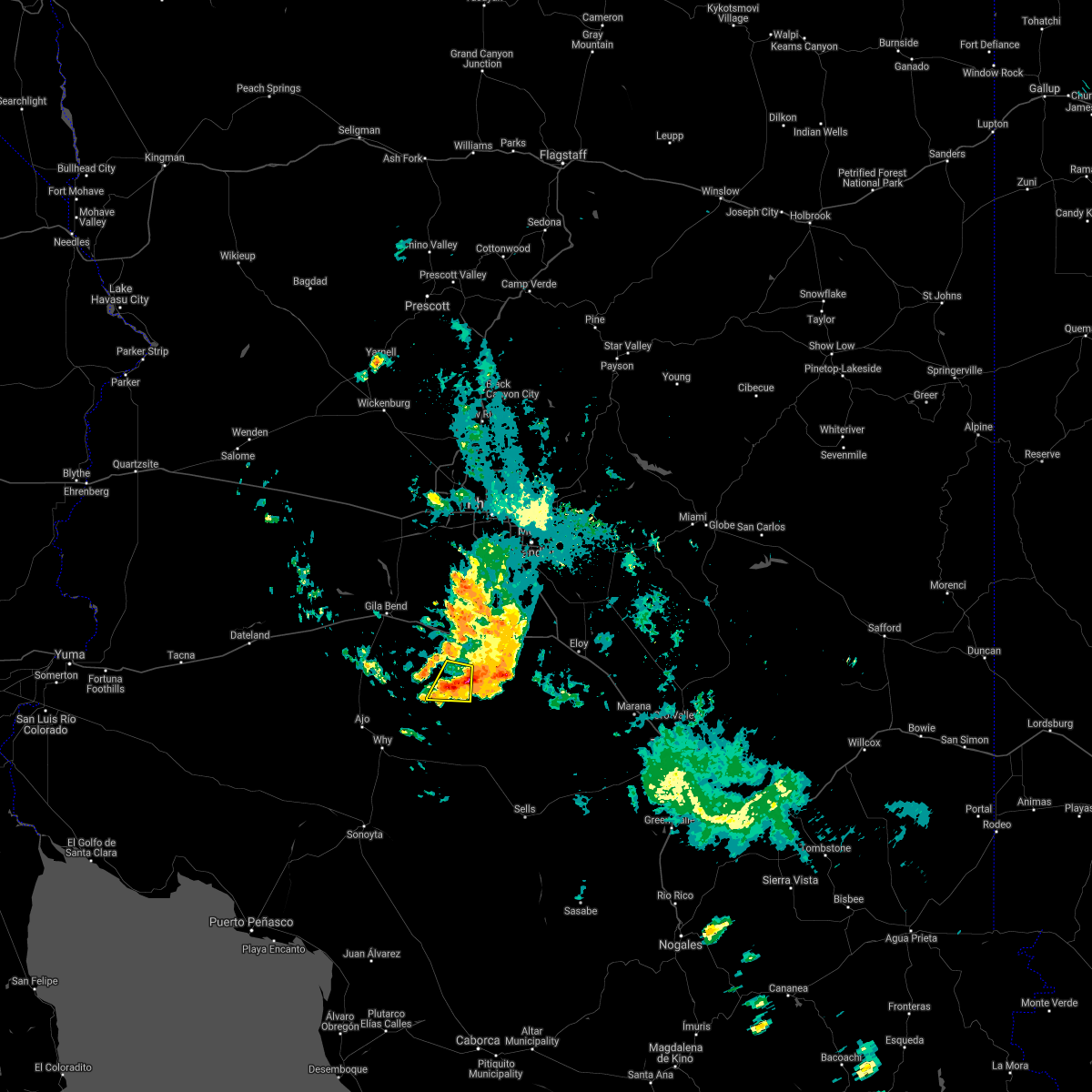
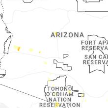
Hail Map for Kaka, AZ
The Kaka, AZ area has had 0 reports of on-the-ground hail by trained spotters, and has been under severe weather warnings 11 times during the past 12 months. Doppler radar has detected hail at or near Kaka, AZ on 31 occasions, including 1 occasion during the past year.
| Name: | Kaka, AZ |
| Where Located: | 66.1 miles SSW of Phoenix, AZ |
| Map: | Google Map for Kaka, AZ |
| Population: | 141 |
| Housing Units: | 57 |
| More Info: | Search Google for Kaka, AZ |
0
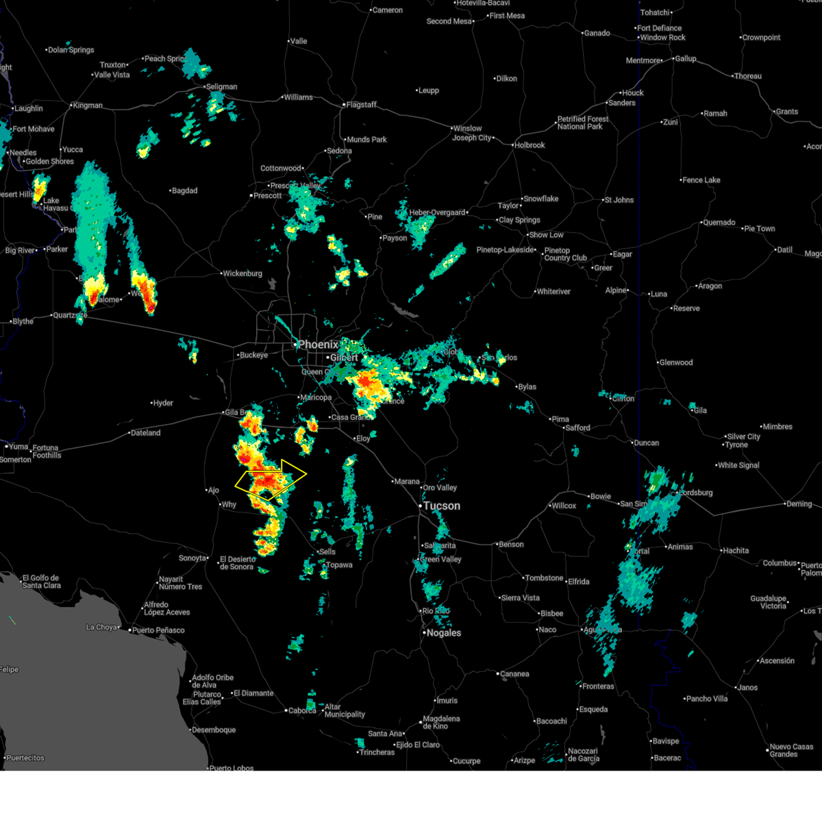
The Top Recent Hail Date for Kaka, AZ is Wednesday, July 2, 2025 (10th out of 31)
Hail and Wind Damage Spotted near Kaka, AZ
| Date / Time | Report Details |
|---|---|
| 7/2/2025 7:10 PM MST |
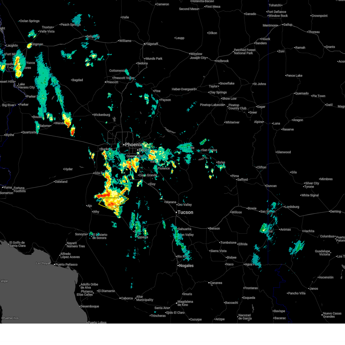 The storm which prompted the warning has weakened below severe limits, and has exited the warned area. therefore, the warning will be allowed to expire. however, heavy rain is still possible with this thunderstorm. The storm which prompted the warning has weakened below severe limits, and has exited the warned area. therefore, the warning will be allowed to expire. however, heavy rain is still possible with this thunderstorm.
|
| 7/2/2025 6:30 PM MST |
 Svrtwc the national weather service in tucson has issued a * severe thunderstorm warning for, northern hickiwan district in tohono oodham nation, southwestern sif oidak district in tohono oodham nation, * until 715 pm mst. * at 630 pm mst, a severe thunderstorm was located 12 miles northeast of hickiwan, moving northeast at 10 mph (radar indicated). Hazards include 60 mph wind gusts and small hail. expect damage to roofs, siding, and trees Svrtwc the national weather service in tucson has issued a * severe thunderstorm warning for, northern hickiwan district in tohono oodham nation, southwestern sif oidak district in tohono oodham nation, * until 715 pm mst. * at 630 pm mst, a severe thunderstorm was located 12 miles northeast of hickiwan, moving northeast at 10 mph (radar indicated). Hazards include 60 mph wind gusts and small hail. expect damage to roofs, siding, and trees
|
| 8/6/2024 8:17 PM MST |
 The storms which prompted the warning have weakened below severe limits, and no longer pose an immediate threat to life or property. therefore, the warning has been allowed to expire. The storms which prompted the warning have weakened below severe limits, and no longer pose an immediate threat to life or property. therefore, the warning has been allowed to expire.
|
| 8/6/2024 7:52 PM MST |
 At 752 pm mst, severe thunderstorms were located along a line extending from 8 miles southeast of freeman to kaka, moving west at 15 mph (radar indicated). Hazards include 60 mph wind gusts. Expect damage to roofs, siding, and trees. locations impacted include, kaka. This includes az interstate 8 between mile markers 138 and 140. At 752 pm mst, severe thunderstorms were located along a line extending from 8 miles southeast of freeman to kaka, moving west at 15 mph (radar indicated). Hazards include 60 mph wind gusts. Expect damage to roofs, siding, and trees. locations impacted include, kaka. This includes az interstate 8 between mile markers 138 and 140.
|
| 8/6/2024 7:44 PM MST |
 The storm which prompted the warning has moved out of the area. therefore, the warning will be allowed to expire. however, gusty winds and heavy rain are still possible with this thunderstorm. The storm which prompted the warning has moved out of the area. therefore, the warning will be allowed to expire. however, gusty winds and heavy rain are still possible with this thunderstorm.
|
| 8/6/2024 7:34 PM MST |
 Svrpsr the national weather service in phoenix has issued a * severe thunderstorm warning for, maricopa county in south central arizona, pinal county in southeastern arizona, * until 815 pm mst. * at 734 pm mst, severe thunderstorms were located along a line extending from 12 miles southeast of freeman to near kaka, moving west at 15 mph (radar indicated). Hazards include 60 mph wind gusts. expect damage to roofs, siding, and trees Svrpsr the national weather service in phoenix has issued a * severe thunderstorm warning for, maricopa county in south central arizona, pinal county in southeastern arizona, * until 815 pm mst. * at 734 pm mst, severe thunderstorms were located along a line extending from 12 miles southeast of freeman to near kaka, moving west at 15 mph (radar indicated). Hazards include 60 mph wind gusts. expect damage to roofs, siding, and trees
|
| 8/6/2024 7:27 PM MST |
 At 726 pm mst, a severe thunderstorm was located near kaka, or 38 miles east of ajo, moving west at 20 mph (radar indicated). Hazards include 60 mph wind gusts and penny size hail. Expect damage to roofs, siding, and trees. Locations impacted include, santa rosa, kohatk, ventana, and vaya chin. At 726 pm mst, a severe thunderstorm was located near kaka, or 38 miles east of ajo, moving west at 20 mph (radar indicated). Hazards include 60 mph wind gusts and penny size hail. Expect damage to roofs, siding, and trees. Locations impacted include, santa rosa, kohatk, ventana, and vaya chin.
|
| 8/6/2024 7:16 PM MST |
 Svrtwc the national weather service in tucson has issued a * severe thunderstorm warning for, north central pima county in southeastern arizona, southwestern pinal county in southeastern arizona, * until 745 pm mst. * at 716 pm mst, a severe thunderstorm was located 9 miles southeast of kaka, or 40 miles northwest of sells, moving west at 20 mph (radar indicated). Hazards include 60 mph wind gusts and penny size hail. expect damage to roofs, siding, and trees Svrtwc the national weather service in tucson has issued a * severe thunderstorm warning for, north central pima county in southeastern arizona, southwestern pinal county in southeastern arizona, * until 745 pm mst. * at 716 pm mst, a severe thunderstorm was located 9 miles southeast of kaka, or 40 miles northwest of sells, moving west at 20 mph (radar indicated). Hazards include 60 mph wind gusts and penny size hail. expect damage to roofs, siding, and trees
|
| 8/3/2024 7:44 PM MST |
 the severe thunderstorm warning has been cancelled and is no longer in effect the severe thunderstorm warning has been cancelled and is no longer in effect
|
| 8/3/2024 7:32 PM MST |
 Svrpsr the national weather service in phoenix has issued a * severe thunderstorm warning for, maricopa county in south central arizona, * until 815 pm mst. * at 732 pm mst, a severe thunderstorm was located near kaka, or 36 miles southeast of gila bend, moving southwest at 10 mph (radar indicated). Hazards include 60 mph wind gusts and penny size hail. expect damage to roofs, siding, and trees Svrpsr the national weather service in phoenix has issued a * severe thunderstorm warning for, maricopa county in south central arizona, * until 815 pm mst. * at 732 pm mst, a severe thunderstorm was located near kaka, or 36 miles southeast of gila bend, moving southwest at 10 mph (radar indicated). Hazards include 60 mph wind gusts and penny size hail. expect damage to roofs, siding, and trees
|
| 8/3/2024 5:38 PM MST |
 Svrtwc the national weather service in tucson has issued a * severe thunderstorm warning for, northwestern pima county in southeastern arizona, * until 700 pm mst. * at 538 pm mst, severe thunderstorms were located along a line extending from near hickiwan to near guvo, moving west at 25 mph (radar indicated). Hazards include 60 mph wind gusts and quarter size hail. Hail damage to vehicles is expected. Expect wind damage to roofs, siding, and trees. Svrtwc the national weather service in tucson has issued a * severe thunderstorm warning for, northwestern pima county in southeastern arizona, * until 700 pm mst. * at 538 pm mst, severe thunderstorms were located along a line extending from near hickiwan to near guvo, moving west at 25 mph (radar indicated). Hazards include 60 mph wind gusts and quarter size hail. Hail damage to vehicles is expected. Expect wind damage to roofs, siding, and trees.
|
| 8/18/2023 4:43 PM MST |
 At 443 pm mst, a severe thunderstorm was located near ajo, moving north at 40 mph (radar indicated). Hazards include 70 mph wind gusts and quarter size hail. Hail damage to vehicles is expected. expect considerable tree damage. Wind damage is also likely to mobile homes, roofs, and outbuildings. At 443 pm mst, a severe thunderstorm was located near ajo, moving north at 40 mph (radar indicated). Hazards include 70 mph wind gusts and quarter size hail. Hail damage to vehicles is expected. expect considerable tree damage. Wind damage is also likely to mobile homes, roofs, and outbuildings.
|
| 9/21/2022 2:52 PM MST |
 The severe thunderstorm warning for northwestern pima county will expire at 300 pm mst, the storm which prompted the warning has weakened below severe limits, and no longer poses an immediate threat to life or property. therefore, the warning will be allowed to expire. however gusty winds and heavy rain are still possible with this thunderstorm. The severe thunderstorm warning for northwestern pima county will expire at 300 pm mst, the storm which prompted the warning has weakened below severe limits, and no longer poses an immediate threat to life or property. therefore, the warning will be allowed to expire. however gusty winds and heavy rain are still possible with this thunderstorm.
|
| 9/21/2022 2:33 PM MST |
 At 233 pm mst, a severe thunderstorm was located over hickiwan, or 23 miles east of ajo, moving northeast at 15 mph (radar indicated). Hazards include 60 mph wind gusts and nickel size hail. Expect damage to roofs, siding, and trees. locations impacted include, hickiwan. hail threat, radar indicated max hail size, 0. 88 in wind threat, radar indicated max wind gust, 60 mph. At 233 pm mst, a severe thunderstorm was located over hickiwan, or 23 miles east of ajo, moving northeast at 15 mph (radar indicated). Hazards include 60 mph wind gusts and nickel size hail. Expect damage to roofs, siding, and trees. locations impacted include, hickiwan. hail threat, radar indicated max hail size, 0. 88 in wind threat, radar indicated max wind gust, 60 mph.
|
| 9/21/2022 2:14 PM MST |
 At 214 pm mst, a severe thunderstorm was located over hickiwan, or 20 miles east of ajo, moving northeast at 15 mph (radar indicated). Hazards include 60 mph wind gusts and quarter size hail. Hail damage to vehicles is expected. Expect wind damage to roofs, siding, and trees. At 214 pm mst, a severe thunderstorm was located over hickiwan, or 20 miles east of ajo, moving northeast at 15 mph (radar indicated). Hazards include 60 mph wind gusts and quarter size hail. Hail damage to vehicles is expected. Expect wind damage to roofs, siding, and trees.
|
| 8/17/2022 3:54 PM MST |
 The severe thunderstorm warning for maricopa county will expire at 400 pm mst, the storm which prompted the warning has weakened below severe limits, and no longer poses an immediate threat to life or property. therefore, the warning will be allowed to expire. however gusty winds are still possible with this thunderstorm. The severe thunderstorm warning for maricopa county will expire at 400 pm mst, the storm which prompted the warning has weakened below severe limits, and no longer poses an immediate threat to life or property. therefore, the warning will be allowed to expire. however gusty winds are still possible with this thunderstorm.
|
| 8/17/2022 3:38 PM MST |
 At 337 pm mst, a severe thunderstorm was located near kaka, or 32 miles southeast of gila bend, moving southwest at 10 mph (radar indicated). Hazards include 60 mph wind gusts. Expect damage to roofs, siding, and trees. locations impacted include, kaka. hail threat, radar indicated max hail size, <. 75 in wind threat, radar indicated max wind gust, 60 mph. At 337 pm mst, a severe thunderstorm was located near kaka, or 32 miles southeast of gila bend, moving southwest at 10 mph (radar indicated). Hazards include 60 mph wind gusts. Expect damage to roofs, siding, and trees. locations impacted include, kaka. hail threat, radar indicated max hail size, <. 75 in wind threat, radar indicated max wind gust, 60 mph.
|
| 8/17/2022 3:19 PM MST |
 At 319 pm mst, a severe thunderstorm was located 8 miles north of kaka, or 31 miles southeast of gila bend, moving southwest at 10 mph (radar indicated). Hazards include 60 mph wind gusts and penny size hail. expect damage to roofs, siding, and trees At 319 pm mst, a severe thunderstorm was located 8 miles north of kaka, or 31 miles southeast of gila bend, moving southwest at 10 mph (radar indicated). Hazards include 60 mph wind gusts and penny size hail. expect damage to roofs, siding, and trees
|
| 8/12/2022 3:07 PM MST |
 The severe thunderstorm warning for northwestern pima county will expire at 315 pm mst, the storm which prompted the warning has weakened below severe limits, and has exited the warned area. therefore, the warning will be allowed to expire. The severe thunderstorm warning for northwestern pima county will expire at 315 pm mst, the storm which prompted the warning has weakened below severe limits, and has exited the warned area. therefore, the warning will be allowed to expire.
|
| 8/12/2022 2:43 PM MST |
 At 241 pm mst, a severe thunderstorm was located near hickiwan, or 22 miles east of ajo, moving west at 10 mph. the storm will likely impact the village of emika and portions of route 13 north of hickiwan (radar indicated). Hazards include 60 mph wind gusts and quarter size hail. Hail damage to vehicles is expected. expect wind damage to roofs, siding, and trees. locations impacted include, emika, hickiwan and vaya chin. hail threat, radar indicated max hail size, 1. 00 in wind threat, radar indicated max wind gust, 60 mph. At 241 pm mst, a severe thunderstorm was located near hickiwan, or 22 miles east of ajo, moving west at 10 mph. the storm will likely impact the village of emika and portions of route 13 north of hickiwan (radar indicated). Hazards include 60 mph wind gusts and quarter size hail. Hail damage to vehicles is expected. expect wind damage to roofs, siding, and trees. locations impacted include, emika, hickiwan and vaya chin. hail threat, radar indicated max hail size, 1. 00 in wind threat, radar indicated max wind gust, 60 mph.
|
| 8/12/2022 2:31 PM MST |
 At 231 pm mst, a severe thunderstorm was located near hickiwan, or 22 miles east of ajo, moving west at 15 mph (radar indicated). Hazards include 60 mph wind gusts and quarter size hail. Hail damage to vehicles is expected. Expect wind damage to roofs, siding, and trees. At 231 pm mst, a severe thunderstorm was located near hickiwan, or 22 miles east of ajo, moving west at 15 mph (radar indicated). Hazards include 60 mph wind gusts and quarter size hail. Hail damage to vehicles is expected. Expect wind damage to roofs, siding, and trees.
|
| 7/24/2022 5:14 PM MST |
 At 514 pm mst, a severe thunderstorm was located near kaka, or 33 miles southeast of gila bend, moving north at 5 mph (radar indicated). Hazards include 60 mph wind gusts and nickel size hail. expect damage to roofs, siding, and trees At 514 pm mst, a severe thunderstorm was located near kaka, or 33 miles southeast of gila bend, moving north at 5 mph (radar indicated). Hazards include 60 mph wind gusts and nickel size hail. expect damage to roofs, siding, and trees
|
| 7/13/2022 6:52 PM MST |
 The severe thunderstorm warning for northwestern pima and southwestern pinal counties will expire at 700 pm mst, the storm which prompted the warning has weakened below severe limits, and has exited the warned area. therefore, the warning will be allowed to expire. however gusty winds and heavy rain are still possible with this thunderstorm. The severe thunderstorm warning for northwestern pima and southwestern pinal counties will expire at 700 pm mst, the storm which prompted the warning has weakened below severe limits, and has exited the warned area. therefore, the warning will be allowed to expire. however gusty winds and heavy rain are still possible with this thunderstorm.
|
| 7/13/2022 6:35 PM MST |
 At 635 pm mst, a severe thunderstorm was located near kaka, or 37 miles east of ajo, and is nearly stationary (radar indicated). Hazards include 60 mph wind gusts and quarter size hail. Hail damage to vehicles is expected. expect wind damage to roofs, siding, and trees. locations impacted include, ventana. hail threat, radar indicated max hail size, 1. 00 in wind threat, radar indicated max wind gust, 60 mph. At 635 pm mst, a severe thunderstorm was located near kaka, or 37 miles east of ajo, and is nearly stationary (radar indicated). Hazards include 60 mph wind gusts and quarter size hail. Hail damage to vehicles is expected. expect wind damage to roofs, siding, and trees. locations impacted include, ventana. hail threat, radar indicated max hail size, 1. 00 in wind threat, radar indicated max wind gust, 60 mph.
|
| 7/13/2022 6:15 PM MST |
 At 615 pm mst, a severe thunderstorm was located 7 miles east of kaka, or 39 miles east of ajo, and is nearly stationary (radar indicated). Hazards include 60 mph wind gusts and quarter size hail. Hail damage to vehicles is expected. Expect wind damage to roofs, siding, and trees. At 615 pm mst, a severe thunderstorm was located 7 miles east of kaka, or 39 miles east of ajo, and is nearly stationary (radar indicated). Hazards include 60 mph wind gusts and quarter size hail. Hail damage to vehicles is expected. Expect wind damage to roofs, siding, and trees.
|
| 8/17/2021 12:09 AM MST |
 At 1209 am mst, severe thunderstorms were located along a line extending from near palo verde nuclear generation station to near cotton center to near gila bend to 9 miles southwest of big horn to near kaka, moving southwest at 35 mph (radar indicated). Hazards include 60 mph wind gusts. Expect damage to roofs, siding, and trees. locations impacted include, avondale, goodyear, buckeye, gila bend, maricopa, estrella, palo verde, big horn, cotton center, liberty, estrella sailport, estrella mountain park, palo verde nuclear generation station, estrella mountain ranch and bosque. this includes the following highways, az interstate 8 between mile markers 100 and 173. az route 238 between mile markers 1 and 41. az route 85 between mile markers 1 and 16, and between mile markers 119 and 153. hail threat, radar indicated max hail size, <. 75 in wind threat, radar indicated max wind gust, 60 mph. At 1209 am mst, severe thunderstorms were located along a line extending from near palo verde nuclear generation station to near cotton center to near gila bend to 9 miles southwest of big horn to near kaka, moving southwest at 35 mph (radar indicated). Hazards include 60 mph wind gusts. Expect damage to roofs, siding, and trees. locations impacted include, avondale, goodyear, buckeye, gila bend, maricopa, estrella, palo verde, big horn, cotton center, liberty, estrella sailport, estrella mountain park, palo verde nuclear generation station, estrella mountain ranch and bosque. this includes the following highways, az interstate 8 between mile markers 100 and 173. az route 238 between mile markers 1 and 41. az route 85 between mile markers 1 and 16, and between mile markers 119 and 153. hail threat, radar indicated max hail size, <. 75 in wind threat, radar indicated max wind gust, 60 mph.
|
| 8/16/2021 11:41 PM MST |
 At 1140 pm mst, severe thunderstorms were located along a line extending from near white tank mountain park to near palo verde to 10 miles northeast of cotton center to near estrella to 11 miles west of chui-chu, moving southwest at 35 mph (radar indicated). Hazards include 70 mph wind gusts and nickel size hail. Expect considerable tree damage. Damage is likely to mobile homes, roofs, and outbuildings. At 1140 pm mst, severe thunderstorms were located along a line extending from near white tank mountain park to near palo verde to 10 miles northeast of cotton center to near estrella to 11 miles west of chui-chu, moving southwest at 35 mph (radar indicated). Hazards include 70 mph wind gusts and nickel size hail. Expect considerable tree damage. Damage is likely to mobile homes, roofs, and outbuildings.
|
| 7/2/2021 7:57 PM MST |
 The severe thunderstorm warning for north central pima county will expire at 800 pm mst, the storm which prompted the warning has weakened below severe limits, and no longer poses an immediate threat to life or property. therefore, the warning will be allowed to expire. however gusty winds and brief heavy rain are still possible with this thunderstorm. The severe thunderstorm warning for north central pima county will expire at 800 pm mst, the storm which prompted the warning has weakened below severe limits, and no longer poses an immediate threat to life or property. therefore, the warning will be allowed to expire. however gusty winds and brief heavy rain are still possible with this thunderstorm.
|
| 7/2/2021 7:41 PM MST |
 At 741 pm mst, a severe thunderstorm was located near kaka, or 28 miles east of ajo, moving southwest at 10 mph (radar indicated). Hazards include 60 mph wind gusts and quarter size hail. Hail damage to vehicles is expected. expect wind damage to roofs, siding, and trees. Locations impacted include, hickiwan, ventana and vaya chin. At 741 pm mst, a severe thunderstorm was located near kaka, or 28 miles east of ajo, moving southwest at 10 mph (radar indicated). Hazards include 60 mph wind gusts and quarter size hail. Hail damage to vehicles is expected. expect wind damage to roofs, siding, and trees. Locations impacted include, hickiwan, ventana and vaya chin.
|
| 7/2/2021 7:13 PM MST |
 At 712 pm mst, a severe thunderstorm was located near kaka, or 33 miles east of ajo, moving west at 25 mph (radar indicated). Hazards include 60 mph wind gusts and quarter size hail. Hail damage to vehicles is expected. Expect wind damage to roofs, siding, and trees. At 712 pm mst, a severe thunderstorm was located near kaka, or 33 miles east of ajo, moving west at 25 mph (radar indicated). Hazards include 60 mph wind gusts and quarter size hail. Hail damage to vehicles is expected. Expect wind damage to roofs, siding, and trees.
|
| 8/20/2020 10:05 PM MST |
 At 1005 pm mst, a severe thunderstorm was located near kaka, or 36 miles east of ajo, moving southwest at 15 mph (radar indicated). Hazards include 60 mph wind gusts and quarter size hail. Hail damage to vehicles is expected. expect wind damage to roofs, siding, and trees. Locations impacted include, kaka. At 1005 pm mst, a severe thunderstorm was located near kaka, or 36 miles east of ajo, moving southwest at 15 mph (radar indicated). Hazards include 60 mph wind gusts and quarter size hail. Hail damage to vehicles is expected. expect wind damage to roofs, siding, and trees. Locations impacted include, kaka.
|
| 8/20/2020 9:48 PM MST |
 At 948 pm mst, a severe thunderstorm was located 8 miles northeast of kaka, or 34 miles southwest of casa grande, moving southwest at 15 mph (radar indicated). Hazards include 70 mph wind gusts and ping pong ball size hail. People and animals outdoors will be injured. expect hail damage to roofs, siding, windows, and vehicles. expect considerable tree damage. Wind damage is also likely to mobile homes, roofs, and outbuildings. At 948 pm mst, a severe thunderstorm was located 8 miles northeast of kaka, or 34 miles southwest of casa grande, moving southwest at 15 mph (radar indicated). Hazards include 70 mph wind gusts and ping pong ball size hail. People and animals outdoors will be injured. expect hail damage to roofs, siding, windows, and vehicles. expect considerable tree damage. Wind damage is also likely to mobile homes, roofs, and outbuildings.
|
| 8/20/2020 9:17 PM MST |
 At 916 pm mst, a severe thunderstorm was located 15 miles southeast of freeman, or 24 miles southwest of casa grande, moving southwest at 45 mph (radar indicated). Hazards include 60 mph wind gusts and penny size hail. expect damage to roofs, siding, and trees At 916 pm mst, a severe thunderstorm was located 15 miles southeast of freeman, or 24 miles southwest of casa grande, moving southwest at 45 mph (radar indicated). Hazards include 60 mph wind gusts and penny size hail. expect damage to roofs, siding, and trees
|
| 7/25/2019 7:38 PM MST |
 The severe thunderstorm warning for north central pima and southwestern pinal counties will expire at 745 pm mst, the storm which prompted the warning over northern portions of the tohono o`odham nation north of sells has weakened moved out of the area. therefore, the warning will be allowed to expire. however heavy rain is still possible with this thunderstorm. The severe thunderstorm warning for north central pima and southwestern pinal counties will expire at 745 pm mst, the storm which prompted the warning over northern portions of the tohono o`odham nation north of sells has weakened moved out of the area. therefore, the warning will be allowed to expire. however heavy rain is still possible with this thunderstorm.
|
| 7/25/2019 6:56 PM MST |
 At 655 pm mst, a severe thunderstorm was located 10 miles north of santa rosa, or 25 to 30 miles southwest of casa grande, moving northwest at 15 mph (radar indicated). Hazards include 60 mph wind gusts and penny size hail along with heavy rain. expect damage to roofs, siding, and trees At 655 pm mst, a severe thunderstorm was located 10 miles north of santa rosa, or 25 to 30 miles southwest of casa grande, moving northwest at 15 mph (radar indicated). Hazards include 60 mph wind gusts and penny size hail along with heavy rain. expect damage to roofs, siding, and trees
|
| 7/22/2019 7:17 PM MST |
 At 717 pm mst, a severe thunderstorm was located 11 miles southwest of santa rosa, or 27 miles northwest of sells, moving northwest at 10 mph. it has just passed covered wells. the storm is weakening and hail is no longer a threat but strong gusty winds may remain, therefore the warning will be allowed to run through 730 pm (radar indicated). Hazards include 60 mph wind gusts. Expect damage to roofs, siding, and trees. locations impacted include, santa rosa, pisinemo, gu vo, hickiwan, covered wells, san simon, palo verde stand, ventana, vaya chin, mountain village, san luis, santa rosa school and san simon west. This includes route 86 between mile markers 65 and 93. At 717 pm mst, a severe thunderstorm was located 11 miles southwest of santa rosa, or 27 miles northwest of sells, moving northwest at 10 mph. it has just passed covered wells. the storm is weakening and hail is no longer a threat but strong gusty winds may remain, therefore the warning will be allowed to run through 730 pm (radar indicated). Hazards include 60 mph wind gusts. Expect damage to roofs, siding, and trees. locations impacted include, santa rosa, pisinemo, gu vo, hickiwan, covered wells, san simon, palo verde stand, ventana, vaya chin, mountain village, san luis, santa rosa school and san simon west. This includes route 86 between mile markers 65 and 93.
|
| 7/22/2019 6:48 PM MST |
 At 647 pm mst, a severe thunderstorm was located 12 miles southwest of santa rosa, or 26 miles northwest of sells, moving northwest at 35 mph (radar indicated). Hazards include 70 mph wind gusts and penny size hail. Expect considerable tree damage. Damage is likely to mobile homes, roofs, and outbuildings. At 647 pm mst, a severe thunderstorm was located 12 miles southwest of santa rosa, or 26 miles northwest of sells, moving northwest at 35 mph (radar indicated). Hazards include 70 mph wind gusts and penny size hail. Expect considerable tree damage. Damage is likely to mobile homes, roofs, and outbuildings.
|
Hail Maps for Kaka, AZ


Connect with Interactive Hail Maps