

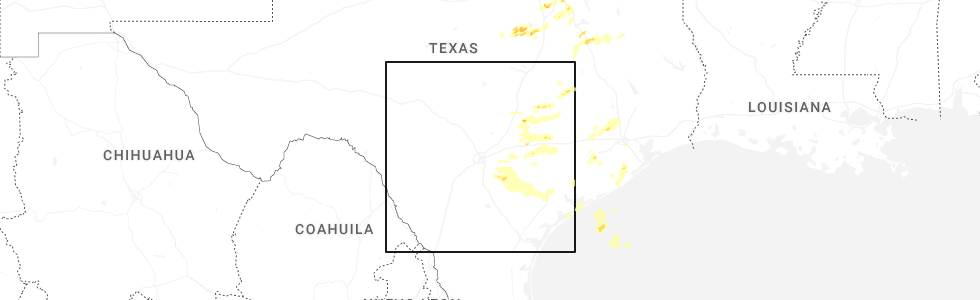
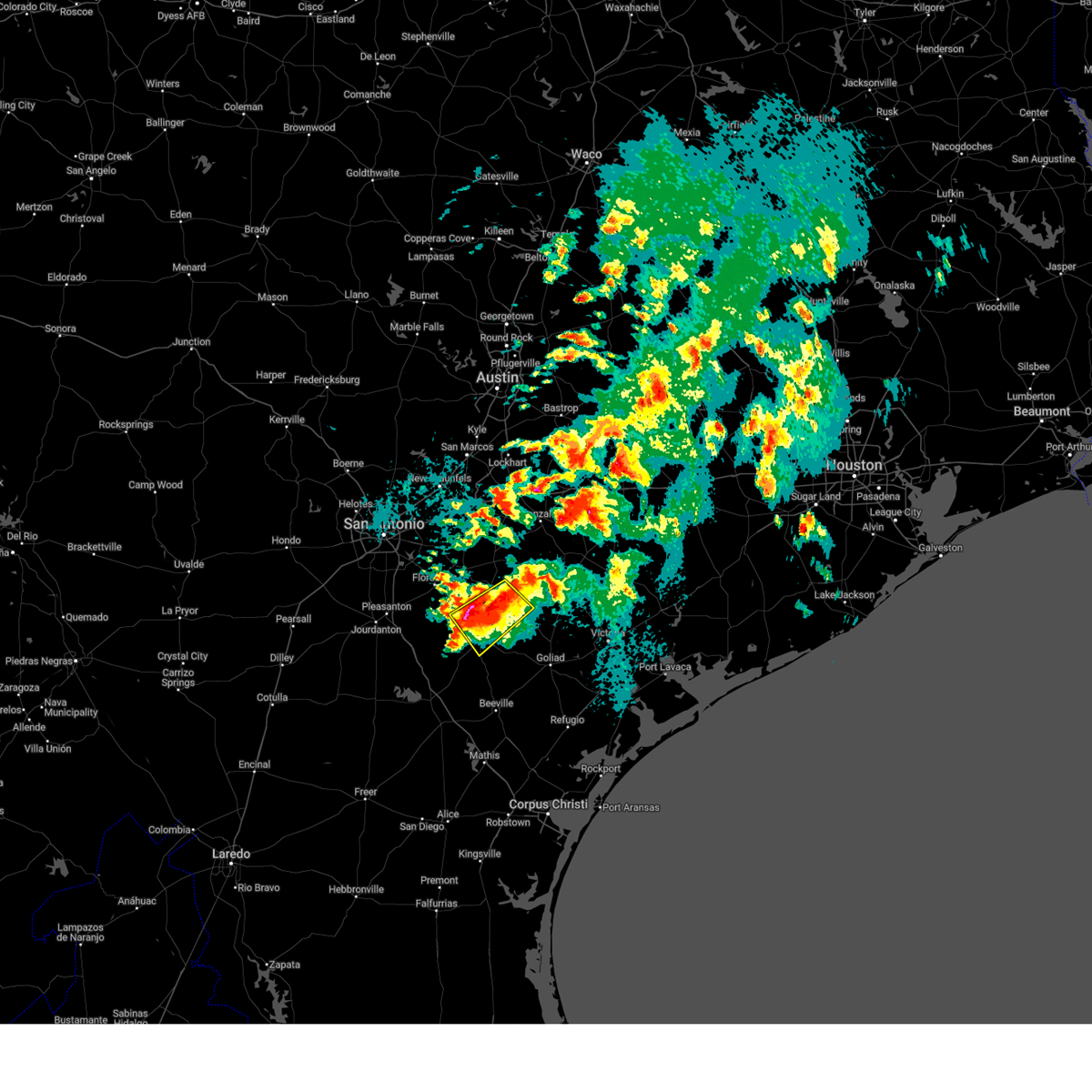
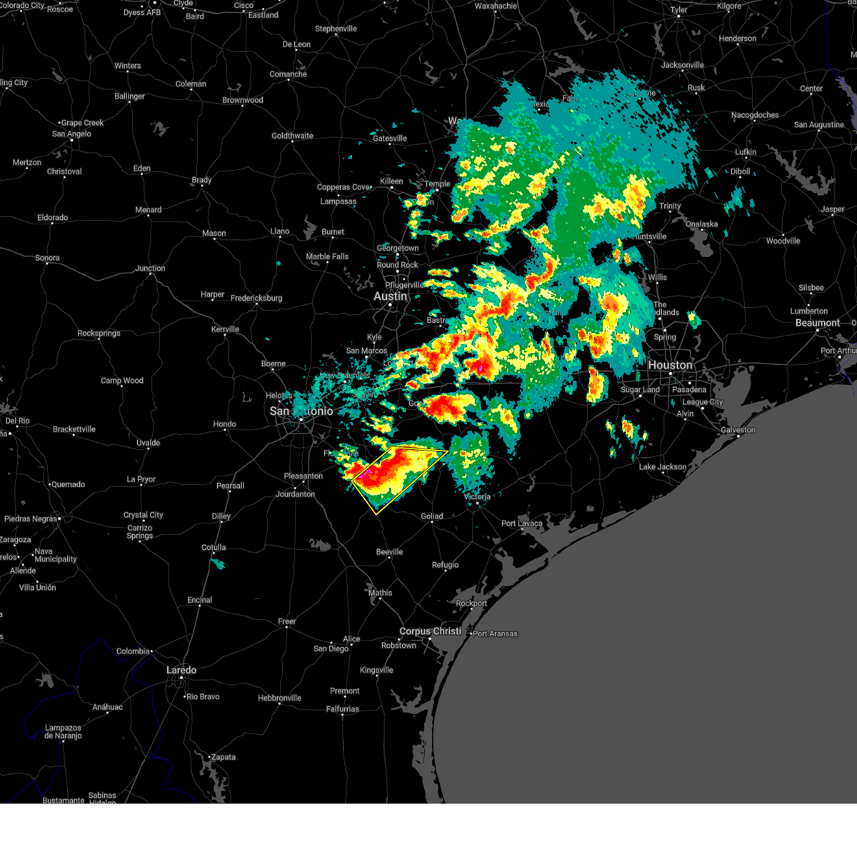
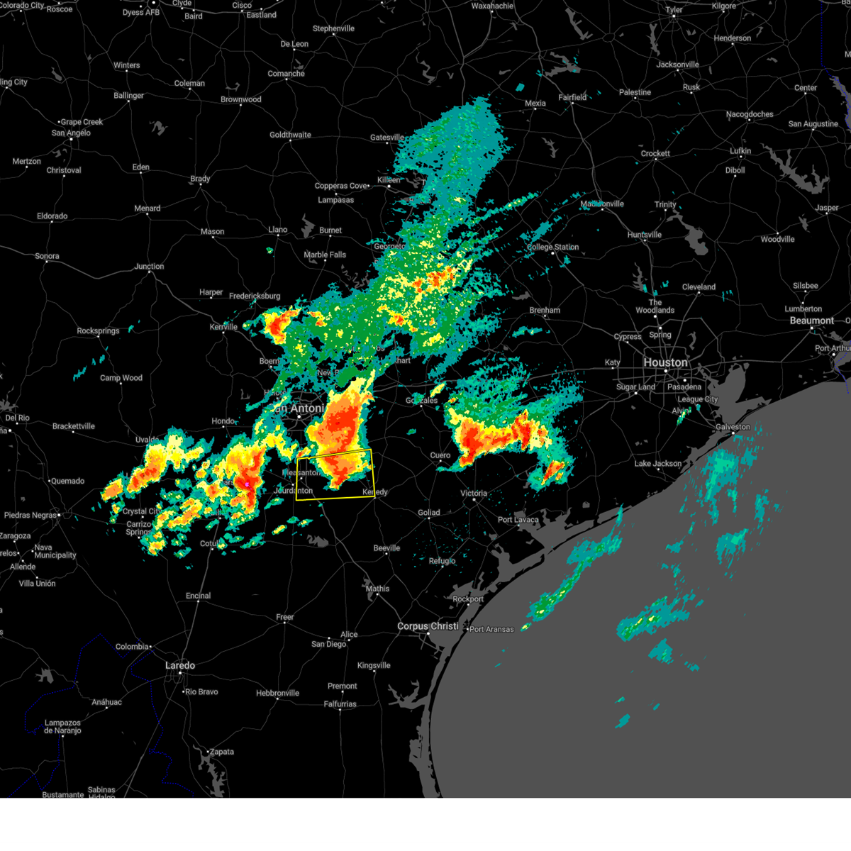
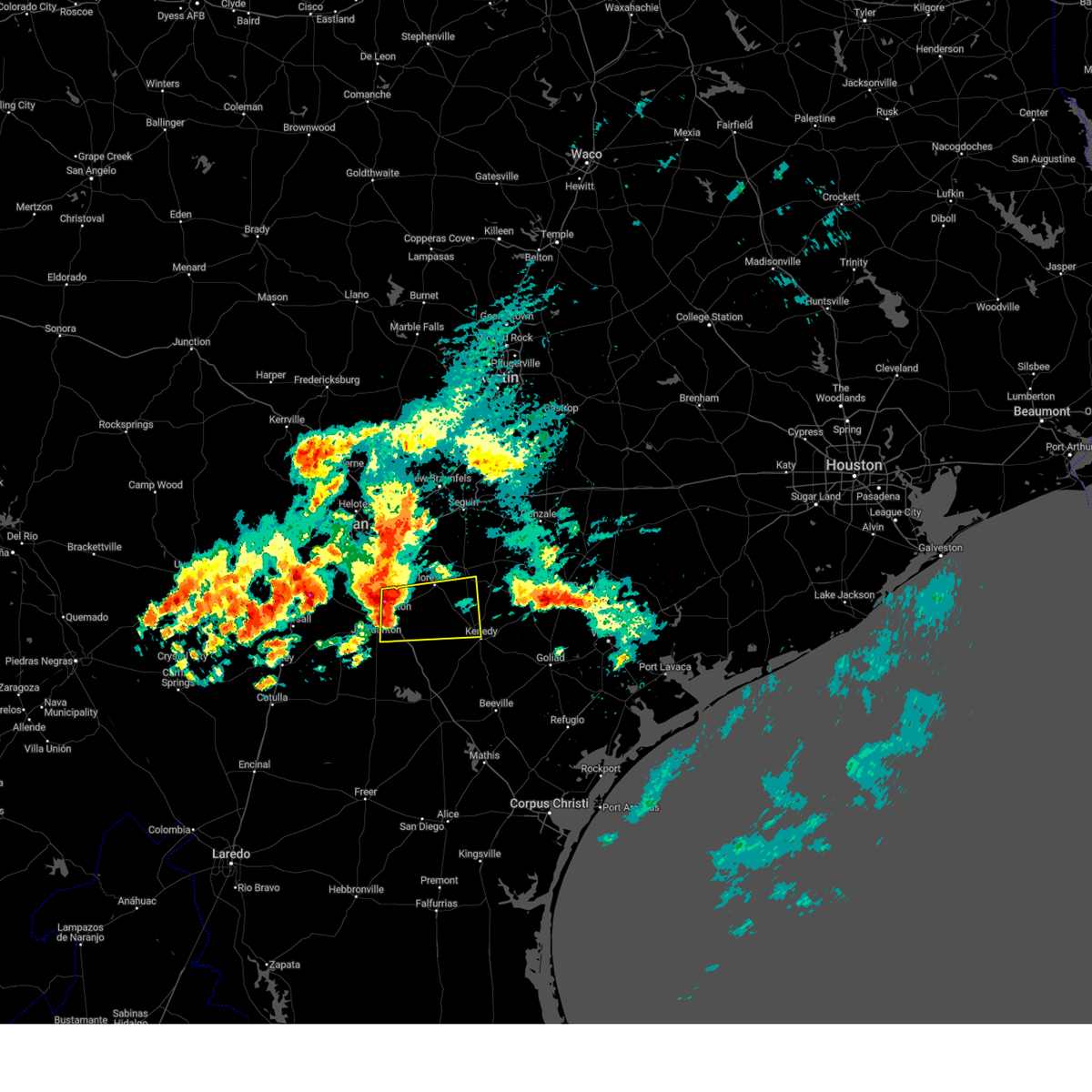
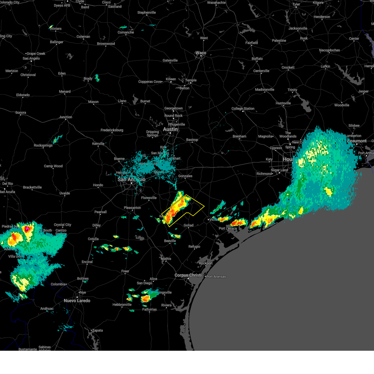
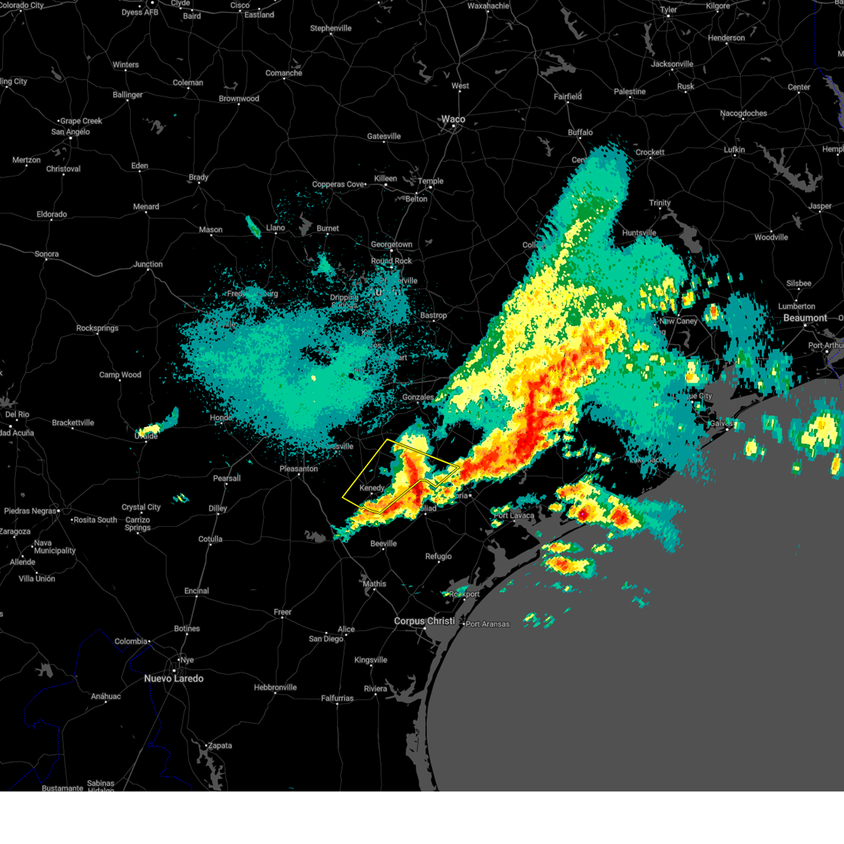
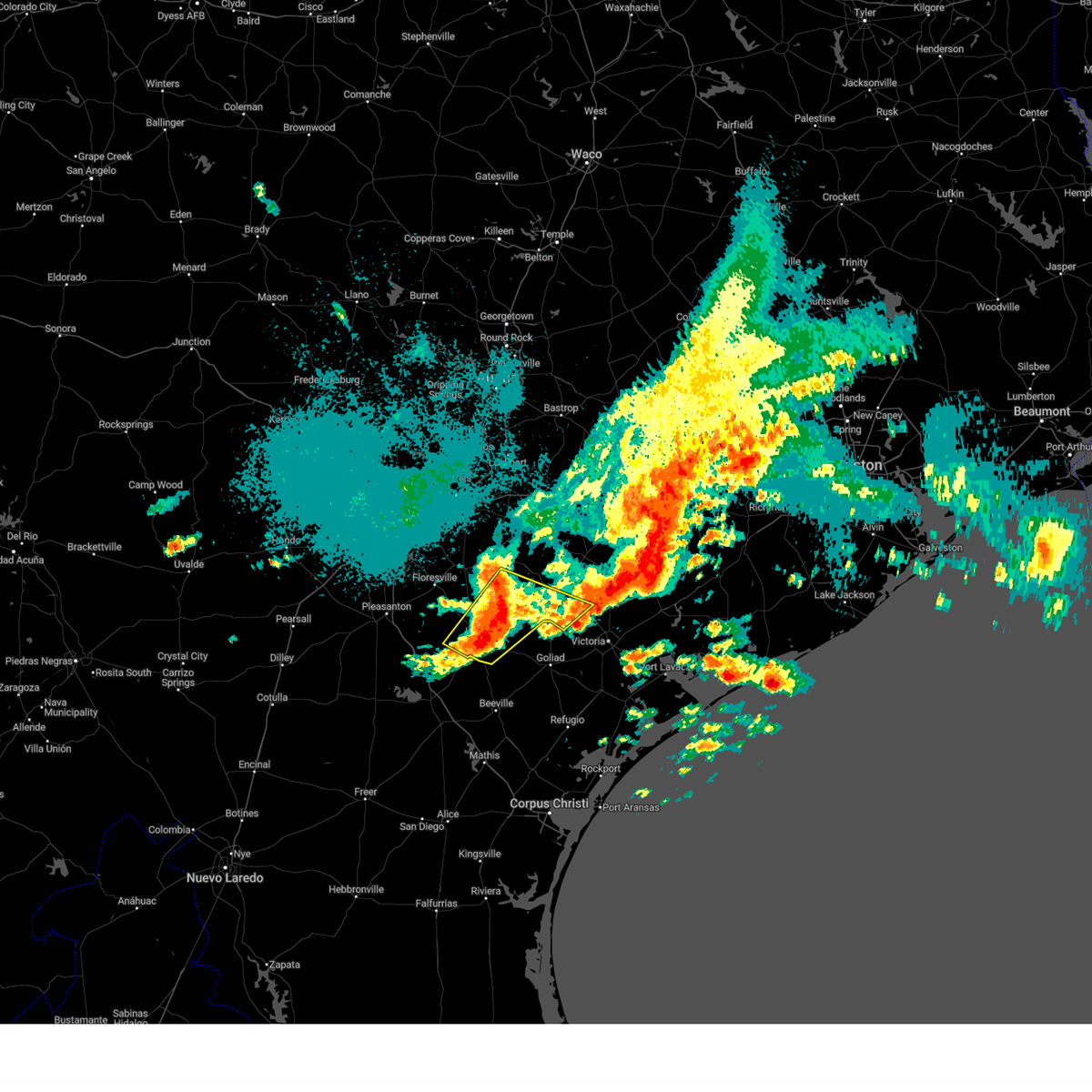
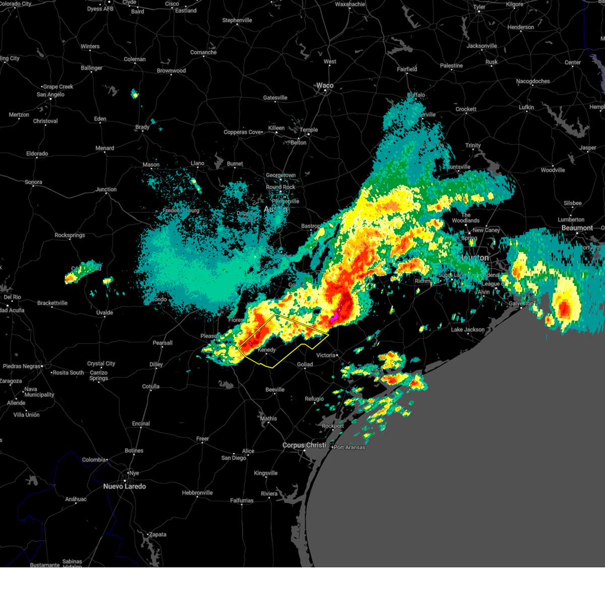
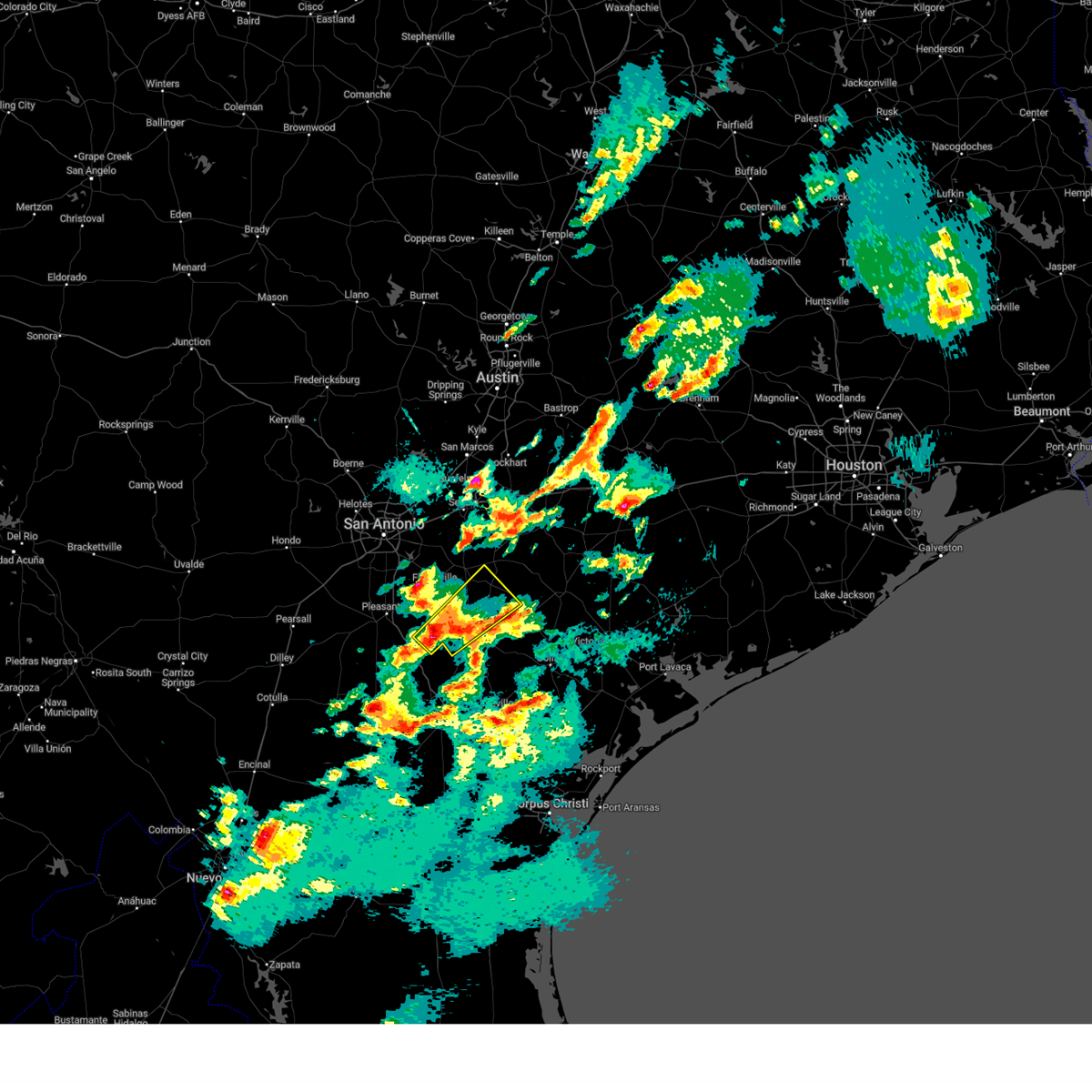
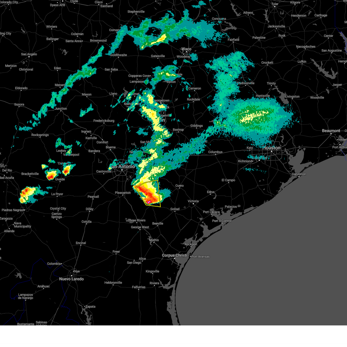
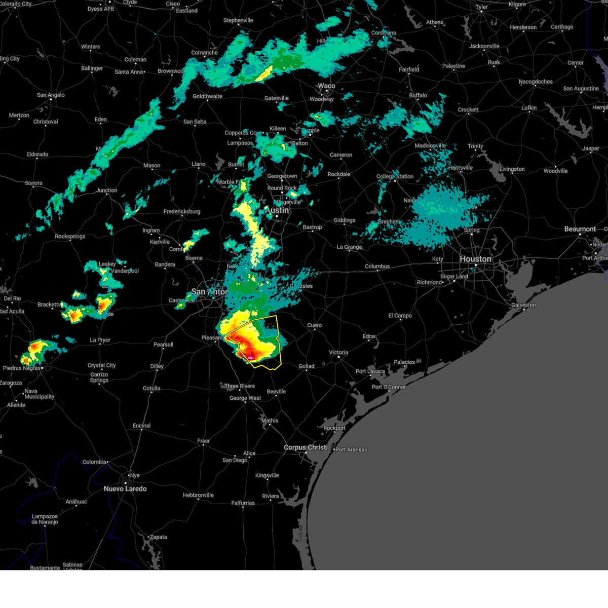
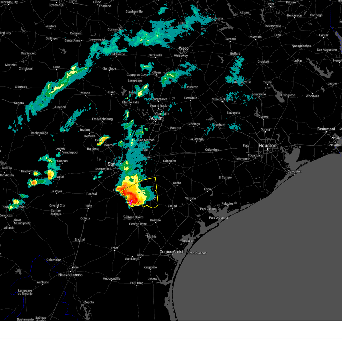
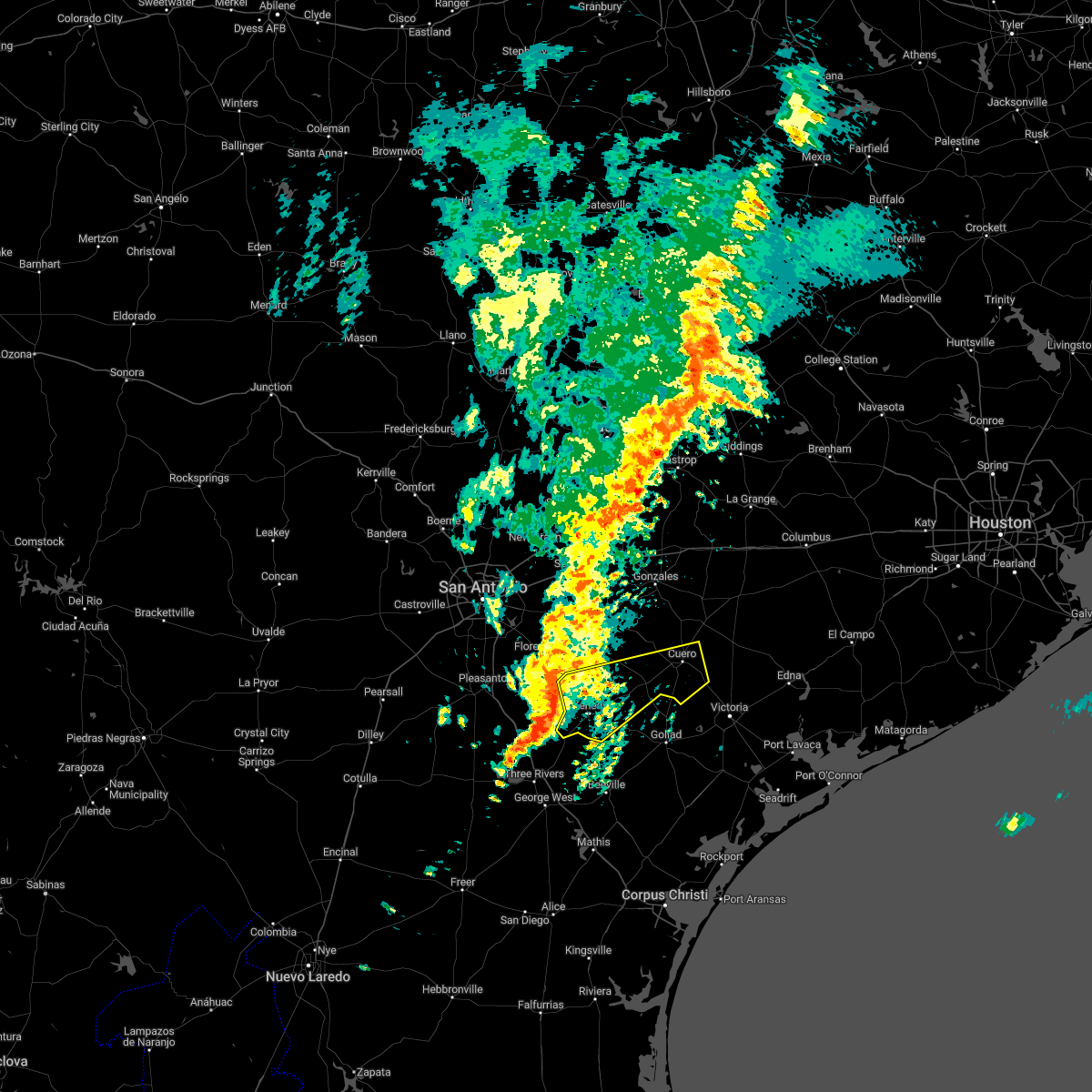
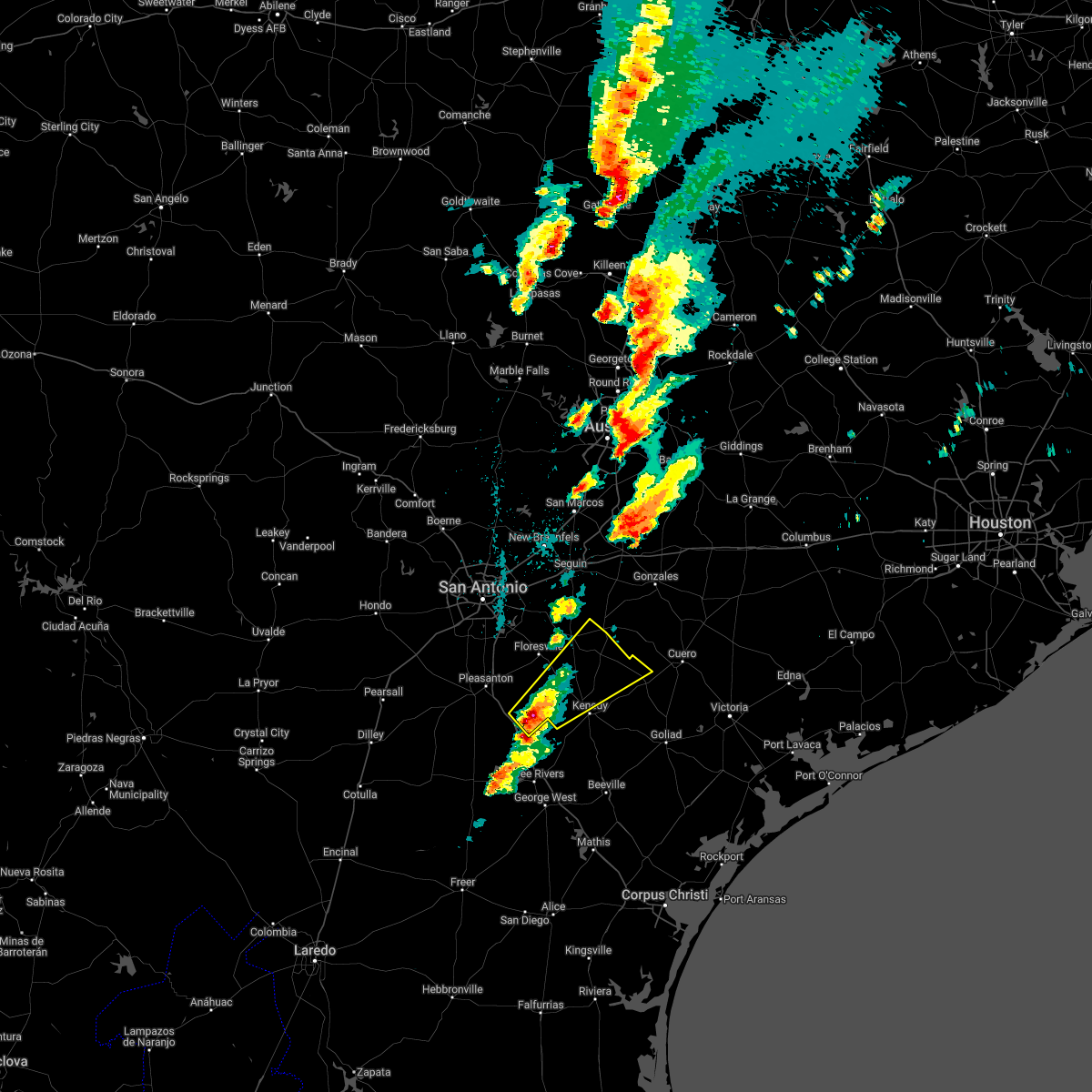
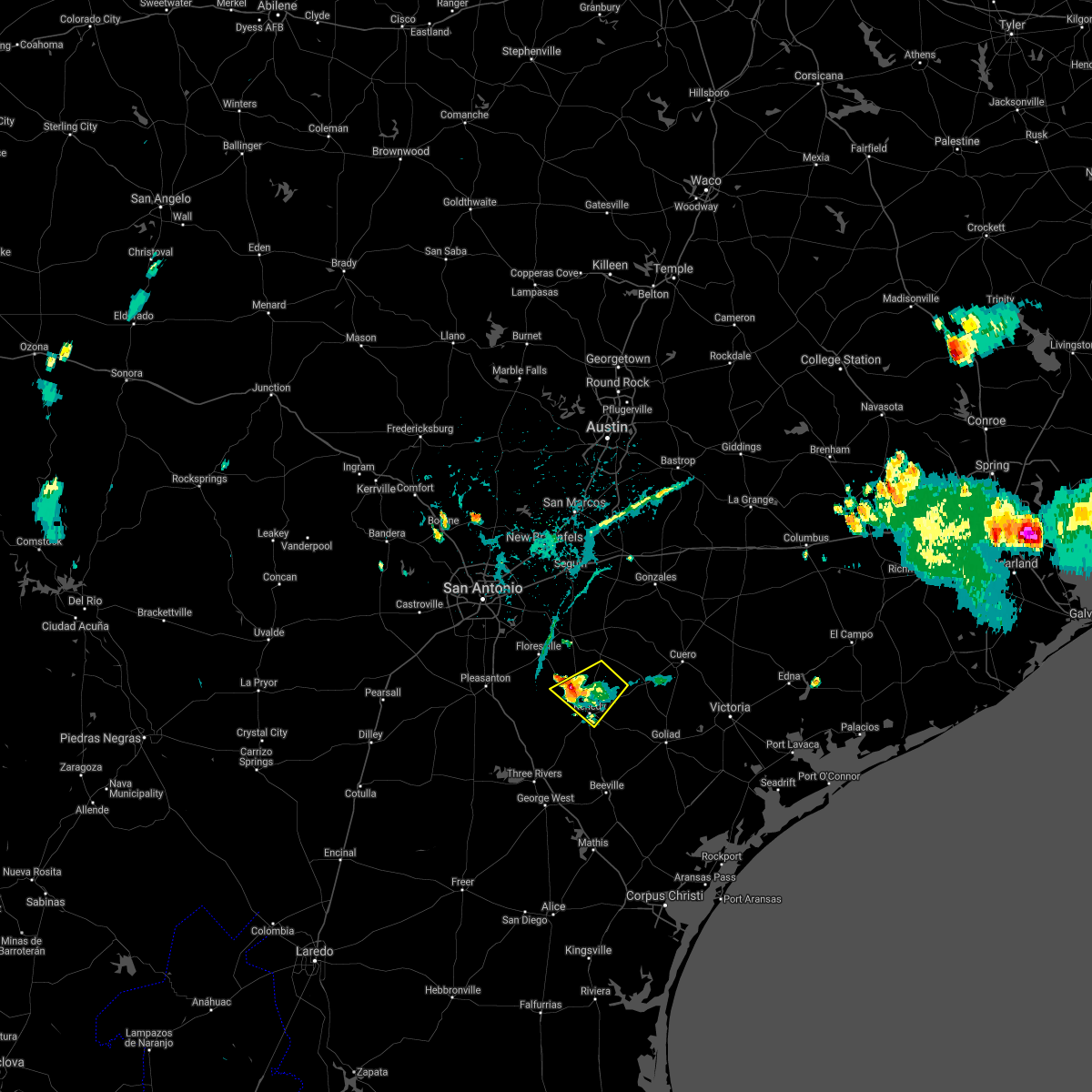
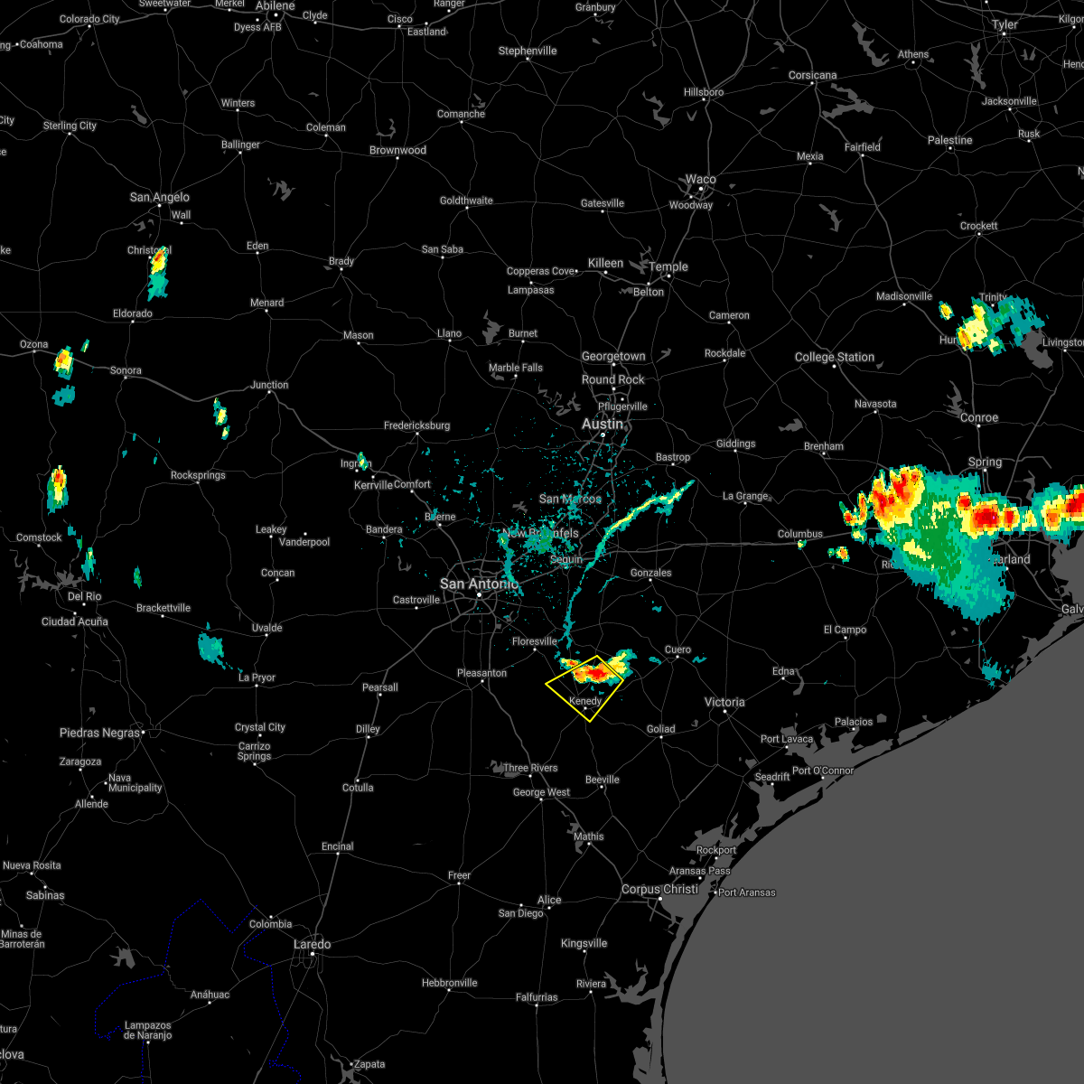
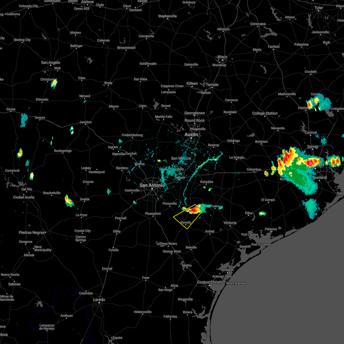
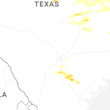
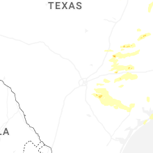
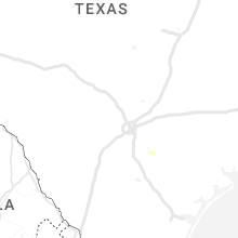
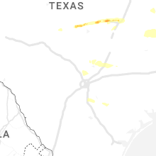
Hail Map for Karnes City, TX
The Karnes City, TX area has had 1 report of on-the-ground hail by trained spotters, and has been under severe weather warnings 6 times during the past 12 months. Doppler radar has detected hail at or near Karnes City, TX on 32 occasions, including 2 occasions during the past year.
| Name: | Karnes City, TX |
| Where Located: | 51.7 miles SE of San Antonio, TX |
| Map: | Google Map for Karnes City, TX |
| Population: | 3042 |
| Housing Units: | 1123 |
| More Info: | Search Google for Karnes City, TX |
5
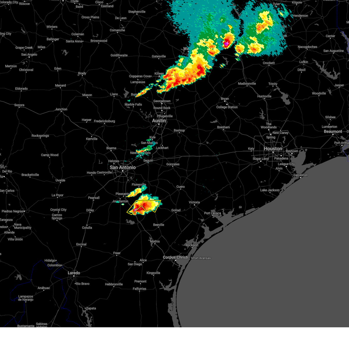
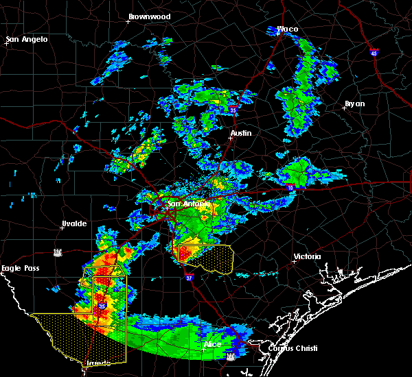
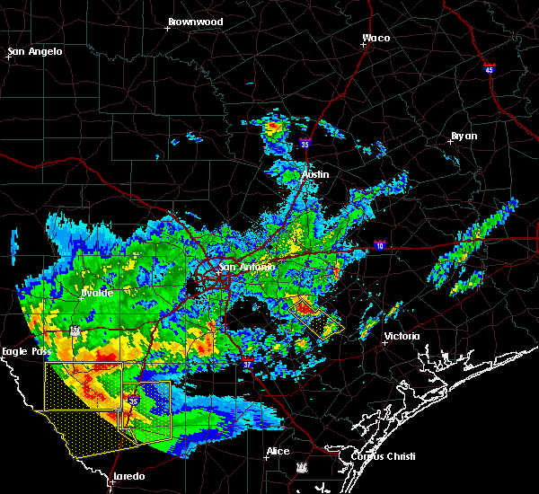
The Top Recent Hail Date for Karnes City, TX is Tuesday, December 24, 2024 (6th out of 32)
Hail and Wind Damage Spotted near Karnes City, TX
| Date / Time | Report Details |
|---|---|
| 4/30/2025 7:37 PM CDT |
 Svrewx the national weather service in austin san antonio has issued a * severe thunderstorm warning for, southern karnes county in south central texas, southeastern atascosa county in south central texas, * until 800 pm cdt. * at 736 pm cdt, a severe thunderstorm was located over nell, or 12 miles southwest of kenedy, moving east at 25 mph (radar indicated). Hazards include two inch hail and 60 mph wind gusts. People and animals outdoors will be injured. expect hail damage to roofs, siding, windows, and vehicles. expect wind damage to roofs, siding, and trees. This severe thunderstorm will remain over mainly rural areas of southern karnes and southeastern atascosa counties, including the following locations, coy city, el oso, peggy, fashing, and zunkerville. Svrewx the national weather service in austin san antonio has issued a * severe thunderstorm warning for, southern karnes county in south central texas, southeastern atascosa county in south central texas, * until 800 pm cdt. * at 736 pm cdt, a severe thunderstorm was located over nell, or 12 miles southwest of kenedy, moving east at 25 mph (radar indicated). Hazards include two inch hail and 60 mph wind gusts. People and animals outdoors will be injured. expect hail damage to roofs, siding, windows, and vehicles. expect wind damage to roofs, siding, and trees. This severe thunderstorm will remain over mainly rural areas of southern karnes and southeastern atascosa counties, including the following locations, coy city, el oso, peggy, fashing, and zunkerville.
|
| 12/25/2024 12:20 AM CST |
 The storms which prompted the warning have weakened below severe limits, and have exited the warned area. therefore, the warning will be allowed to expire. however small hail, gusty winds and heavy rain are still possible with these thunderstorms. a severe thunderstorm watch remains in effect until 600 am cst for south central texas. The storms which prompted the warning have weakened below severe limits, and have exited the warned area. therefore, the warning will be allowed to expire. however small hail, gusty winds and heavy rain are still possible with these thunderstorms. a severe thunderstorm watch remains in effect until 600 am cst for south central texas.
|
| 12/24/2024 11:25 PM CST |
 Svrewx the national weather service in austin san antonio has issued a * severe thunderstorm warning for, southwestern dewitt county in south central texas, southeastern karnes county in south central texas, * until 1230 am cst. * at 1124 pm cst, severe thunderstorms were located along a line extending from near karnes city to near runge to near nordheim, moving south at 25 mph (radar indicated). Hazards include ping pong ball size hail and 60 mph wind gusts. People and animals outdoors will be injured. expect hail damage to roofs, siding, windows, and vehicles. Expect wind damage to roofs, siding, and trees. Svrewx the national weather service in austin san antonio has issued a * severe thunderstorm warning for, southwestern dewitt county in south central texas, southeastern karnes county in south central texas, * until 1230 am cst. * at 1124 pm cst, severe thunderstorms were located along a line extending from near karnes city to near runge to near nordheim, moving south at 25 mph (radar indicated). Hazards include ping pong ball size hail and 60 mph wind gusts. People and animals outdoors will be injured. expect hail damage to roofs, siding, windows, and vehicles. Expect wind damage to roofs, siding, and trees.
|
| 12/24/2024 11:06 PM CST |
 the severe thunderstorm warning has been cancelled and is no longer in effect the severe thunderstorm warning has been cancelled and is no longer in effect
|
| 12/24/2024 11:06 PM CST |
 At 1106 pm cst, severe thunderstorms were located along a line extending from near cestohowa to 8 miles northwest of nordheim to 7 miles southwest of westhoff, moving east at 15 mph (radar indicated). Hazards include ping pong ball size hail and 60 mph wind gusts. People and animals outdoors will be injured. expect hail damage to roofs, siding, windows, and vehicles. expect wind damage to roofs, siding, and trees. Locations impacted include, kenedy, karnes city, yorktown, runge, falls city, nordheim, cestohowa, cotton patch, new davy, hobson, ecleto, helena, and pana maria. At 1106 pm cst, severe thunderstorms were located along a line extending from near cestohowa to 8 miles northwest of nordheim to 7 miles southwest of westhoff, moving east at 15 mph (radar indicated). Hazards include ping pong ball size hail and 60 mph wind gusts. People and animals outdoors will be injured. expect hail damage to roofs, siding, windows, and vehicles. expect wind damage to roofs, siding, and trees. Locations impacted include, kenedy, karnes city, yorktown, runge, falls city, nordheim, cestohowa, cotton patch, new davy, hobson, ecleto, helena, and pana maria.
|
| 12/24/2024 10:42 PM CST |
 Svrewx the national weather service in austin san antonio has issued a * severe thunderstorm warning for, southwestern dewitt county in south central texas, karnes county in south central texas, south central gonzales county in south central texas, * until 1145 pm cst. * at 1042 pm cst, severe thunderstorms were located along a line extending from cestohowa to 6 miles south of gillett to 8 miles south of smiley, moving east at 15 mph (radar indicated). Hazards include ping pong ball size hail and 60 mph wind gusts. People and animals outdoors will be injured. expect hail damage to roofs, siding, windows, and vehicles. Expect wind damage to roofs, siding, and trees. Svrewx the national weather service in austin san antonio has issued a * severe thunderstorm warning for, southwestern dewitt county in south central texas, karnes county in south central texas, south central gonzales county in south central texas, * until 1145 pm cst. * at 1042 pm cst, severe thunderstorms were located along a line extending from cestohowa to 6 miles south of gillett to 8 miles south of smiley, moving east at 15 mph (radar indicated). Hazards include ping pong ball size hail and 60 mph wind gusts. People and animals outdoors will be injured. expect hail damage to roofs, siding, windows, and vehicles. Expect wind damage to roofs, siding, and trees.
|
| 5/13/2024 12:34 PM CDT |
 the severe thunderstorm warning has been cancelled and is no longer in effect the severe thunderstorm warning has been cancelled and is no longer in effect
|
| 5/13/2024 11:58 AM CDT |
 Svrewx the national weather service in austin san antonio has issued a * severe thunderstorm warning for, northwestern karnes county in south central texas, central atascosa county in south central texas, southern wilson county in south central texas, * until 100 pm cdt. * at 1158 am cdt, a severe thunderstorm was located over leming, or near pleasanton, moving east at 35 mph (radar indicated). Hazards include 60 mph wind gusts and quarter size hail. Hail damage to vehicles is expected. Expect wind damage to roofs, siding, and trees. Svrewx the national weather service in austin san antonio has issued a * severe thunderstorm warning for, northwestern karnes county in south central texas, central atascosa county in south central texas, southern wilson county in south central texas, * until 100 pm cdt. * at 1158 am cdt, a severe thunderstorm was located over leming, or near pleasanton, moving east at 35 mph (radar indicated). Hazards include 60 mph wind gusts and quarter size hail. Hail damage to vehicles is expected. Expect wind damage to roofs, siding, and trees.
|
| 9/15/2023 6:02 PM CDT |
 At 601 pm cdt, severe thunderstorms were located along a line extending from near westhoff to near nordheim to near kenedy, moving southeast at 25 mph (radar indicated). Hazards include 60 mph wind gusts and nickel size hail. Expect damage to roofs, siding, and trees. locations impacted include, cuero, kenedy, karnes city, yorktown, runge, nordheim, thomaston, westhoff, cotton patch, gruenau, new davy, choate, meyersville, arneckville, and helena. hail threat, radar indicated max hail size, 0. 88 in wind threat, radar indicated max wind gust, 60 mph. At 601 pm cdt, severe thunderstorms were located along a line extending from near westhoff to near nordheim to near kenedy, moving southeast at 25 mph (radar indicated). Hazards include 60 mph wind gusts and nickel size hail. Expect damage to roofs, siding, and trees. locations impacted include, cuero, kenedy, karnes city, yorktown, runge, nordheim, thomaston, westhoff, cotton patch, gruenau, new davy, choate, meyersville, arneckville, and helena. hail threat, radar indicated max hail size, 0. 88 in wind threat, radar indicated max wind gust, 60 mph.
|
| 9/15/2023 5:56 PM CDT |
 At 556 pm cdt, severe thunderstorms were located along a line extending from near westhoff to nordheim to near runge, moving southeast at 20 mph (radar indicated). Hazards include 60 mph wind gusts. expect damage to roofs, siding, and trees At 556 pm cdt, severe thunderstorms were located along a line extending from near westhoff to nordheim to near runge, moving southeast at 20 mph (radar indicated). Hazards include 60 mph wind gusts. expect damage to roofs, siding, and trees
|
| 4/28/2023 8:13 PM CDT |
 At 812 pm cdt, severe thunderstorms were located along a line extending from near sublime to 7 miles southeast of kenedy, moving southeast at 35 mph (radar indicated). Hazards include 60 mph wind gusts and quarter size hail. Hail damage to vehicles is expected. expect wind damage to roofs, siding, and trees. locations impacted include, cuero, yoakum, kenedy, karnes city, hallettsville, yorktown, shiner, moulton, runge, nordheim, sublime, cheapside, thomaston, ezzell, hochheim, speaks, westhoff, komensky, worthing and henkhaus. hail threat, radar indicated max hail size, 1. 00 in wind threat, radar indicated max wind gust, 60 mph. At 812 pm cdt, severe thunderstorms were located along a line extending from near sublime to 7 miles southeast of kenedy, moving southeast at 35 mph (radar indicated). Hazards include 60 mph wind gusts and quarter size hail. Hail damage to vehicles is expected. expect wind damage to roofs, siding, and trees. locations impacted include, cuero, yoakum, kenedy, karnes city, hallettsville, yorktown, shiner, moulton, runge, nordheim, sublime, cheapside, thomaston, ezzell, hochheim, speaks, westhoff, komensky, worthing and henkhaus. hail threat, radar indicated max hail size, 1. 00 in wind threat, radar indicated max wind gust, 60 mph.
|
| 4/28/2023 7:54 PM CDT |
 At 753 pm cdt, severe thunderstorms were located along a line extending from near schulenburg to karnes city, moving southeast at 35 mph (radar indicated). Hazards include 60 mph wind gusts and quarter size hail. Hail damage to vehicles is expected. Expect wind damage to roofs, siding, and trees. At 753 pm cdt, severe thunderstorms were located along a line extending from near schulenburg to karnes city, moving southeast at 35 mph (radar indicated). Hazards include 60 mph wind gusts and quarter size hail. Hail damage to vehicles is expected. Expect wind damage to roofs, siding, and trees.
|
| 4/21/2023 3:09 AM CDT |
 The severe thunderstorm warning for southern dewitt, karnes and south central gonzales counties will expire at 315 am cdt, the storms which prompted the warning have moved out of the area. therefore, the warning will be allowed to expire. a severe thunderstorm watch remains in effect until 700 am cdt for south central texas. a severe thunderstorm watch also remains in effect until 700 am cdt for south central texas. The severe thunderstorm warning for southern dewitt, karnes and south central gonzales counties will expire at 315 am cdt, the storms which prompted the warning have moved out of the area. therefore, the warning will be allowed to expire. a severe thunderstorm watch remains in effect until 700 am cdt for south central texas. a severe thunderstorm watch also remains in effect until 700 am cdt for south central texas.
|
| 4/21/2023 2:48 AM CDT |
 At 248 am cdt, severe thunderstorms were located along a line extending from near westhoff to near kenedy, moving east at 40 mph (radar indicated). Hazards include 60 mph wind gusts and quarter size hail. Hail damage to vehicles is expected. expect wind damage to roofs, siding, and trees. locations impacted include, cuero, kenedy, karnes city, yorktown, runge, nordheim, thomaston, gillett, coy city, cotton patch, gruenau, new davy, choate, meyersville, arneckville, ecleto, helena and pana maria. hail threat, radar indicated max hail size, 1. 00 in wind threat, radar indicated max wind gust, 60 mph. At 248 am cdt, severe thunderstorms were located along a line extending from near westhoff to near kenedy, moving east at 40 mph (radar indicated). Hazards include 60 mph wind gusts and quarter size hail. Hail damage to vehicles is expected. expect wind damage to roofs, siding, and trees. locations impacted include, cuero, kenedy, karnes city, yorktown, runge, nordheim, thomaston, gillett, coy city, cotton patch, gruenau, new davy, choate, meyersville, arneckville, ecleto, helena and pana maria. hail threat, radar indicated max hail size, 1. 00 in wind threat, radar indicated max wind gust, 60 mph.
|
| 4/21/2023 2:21 AM CDT |
 At 220 am cdt, severe thunderstorms were located along a line extending from near gillett to 11 miles southwest of falls city, moving east at 40 mph (radar indicated). Hazards include 60 mph wind gusts and quarter size hail. Hail damage to vehicles is expected. Expect wind damage to roofs, siding, and trees. At 220 am cdt, severe thunderstorms were located along a line extending from near gillett to 11 miles southwest of falls city, moving east at 40 mph (radar indicated). Hazards include 60 mph wind gusts and quarter size hail. Hail damage to vehicles is expected. Expect wind damage to roofs, siding, and trees.
|
| 4/5/2023 11:00 PM CDT |
 At 1059 pm cdt, a severe thunderstorm was located over cestohowa, or near kosciusko, moving northeast at 55 mph (radar indicated). Hazards include half dollar size hail. Damage to vehicles is expected. locations impacted include, kenedy, karnes city, kosciusko, falls city, gillett, cestohowa, coy city, paweleville, fashing, hobson, peggy, ecleto, helena, deweesville and pana maria. hail threat, radar indicated max hail size, 1. 25 in wind threat, radar indicated max wind gust, <50 mph. At 1059 pm cdt, a severe thunderstorm was located over cestohowa, or near kosciusko, moving northeast at 55 mph (radar indicated). Hazards include half dollar size hail. Damage to vehicles is expected. locations impacted include, kenedy, karnes city, kosciusko, falls city, gillett, cestohowa, coy city, paweleville, fashing, hobson, peggy, ecleto, helena, deweesville and pana maria. hail threat, radar indicated max hail size, 1. 25 in wind threat, radar indicated max wind gust, <50 mph.
|
| 4/5/2023 10:38 PM CDT | At 1038 pm cdt, a severe thunderstorm was located 8 miles north of esseville, or 8 miles northeast of campbellton, moving northeast at 55 mph (radar indicated). Hazards include half dollar size hail. damage to vehicles is expected |
| 3/2/2023 12:38 AM CST |
 At 1238 am cst, a severe thunderstorm was located near runge, or near kenedy, moving east at 45 mph (radar indicated). Hazards include golf ball size hail. People and animals outdoors will be injured. Expect damage to roofs, siding, windows, and vehicles. At 1238 am cst, a severe thunderstorm was located near runge, or near kenedy, moving east at 45 mph (radar indicated). Hazards include golf ball size hail. People and animals outdoors will be injured. Expect damage to roofs, siding, windows, and vehicles.
|
| 3/2/2023 12:27 AM CST |
 At 1226 am cst, a severe thunderstorm was located near karnes city, moving east at 45 mph (radar indicated). Hazards include golf ball size hail and 60 mph wind gusts. People and animals outdoors will be injured. expect hail damage to roofs, siding, windows, and vehicles. expect wind damage to roofs, siding, and trees. locations impacted include, floresville, kenedy, karnes city, poth, kosciusko, runge, falls city, gillett, cestohowa, paweleville, choate, hobson, ecleto, helena and pana maria. thunderstorm damage threat, considerable hail threat, radar indicated max hail size, 1. 75 in wind threat, radar indicated max wind gust, 60 mph. At 1226 am cst, a severe thunderstorm was located near karnes city, moving east at 45 mph (radar indicated). Hazards include golf ball size hail and 60 mph wind gusts. People and animals outdoors will be injured. expect hail damage to roofs, siding, windows, and vehicles. expect wind damage to roofs, siding, and trees. locations impacted include, floresville, kenedy, karnes city, poth, kosciusko, runge, falls city, gillett, cestohowa, paweleville, choate, hobson, ecleto, helena and pana maria. thunderstorm damage threat, considerable hail threat, radar indicated max hail size, 1. 75 in wind threat, radar indicated max wind gust, 60 mph.
|
| 3/2/2023 12:17 AM CST |
 At 1216 am cst, a severe thunderstorm was located 7 miles northeast of nell, or 9 miles southwest of karnes city, moving east at 50 mph (radar indicated). Hazards include two inch hail and 60 mph wind gusts. People and animals outdoors will be injured. expect hail damage to roofs, siding, windows, and vehicles. expect wind damage to roofs, siding, and trees. locations impacted include, floresville, kenedy, karnes city, poth, kosciusko, runge, falls city, gillett, cestohowa, coy city, zunkerville, paweleville, choate, hobson, el oso, ecleto, helena, deweesville and pana maria. thunderstorm damage threat, considerable hail threat, radar indicated max hail size, 2. 00 in wind threat, radar indicated max wind gust, 60 mph. At 1216 am cst, a severe thunderstorm was located 7 miles northeast of nell, or 9 miles southwest of karnes city, moving east at 50 mph (radar indicated). Hazards include two inch hail and 60 mph wind gusts. People and animals outdoors will be injured. expect hail damage to roofs, siding, windows, and vehicles. expect wind damage to roofs, siding, and trees. locations impacted include, floresville, kenedy, karnes city, poth, kosciusko, runge, falls city, gillett, cestohowa, coy city, zunkerville, paweleville, choate, hobson, el oso, ecleto, helena, deweesville and pana maria. thunderstorm damage threat, considerable hail threat, radar indicated max hail size, 2. 00 in wind threat, radar indicated max wind gust, 60 mph.
|
| 3/2/2023 12:15 AM CST | Golf Ball sized hail reported 12.5 miles ENE of Karnes City, TX |
| 3/2/2023 12:02 AM CST |
 At 1202 am cst, a severe thunderstorm was located near campbellton, moving east at 35 mph (radar indicated). Hazards include tennis ball size hail and 60 mph wind gusts. People and animals outdoors will be injured. expect hail damage to roofs, siding, windows, and vehicles. expect wind damage to roofs, siding, and trees. locations impacted include, floresville, kenedy, karnes city, poth, kosciusko, campbellton, runge, falls city, gillett, cestohowa, coy city, zunkerville, paweleville, choate, fashing, coughran, hobson, el oso, peggy and ecleto. thunderstorm damage threat, considerable hail threat, radar indicated max hail size, 2. 50 in wind threat, radar indicated max wind gust, 60 mph. At 1202 am cst, a severe thunderstorm was located near campbellton, moving east at 35 mph (radar indicated). Hazards include tennis ball size hail and 60 mph wind gusts. People and animals outdoors will be injured. expect hail damage to roofs, siding, windows, and vehicles. expect wind damage to roofs, siding, and trees. locations impacted include, floresville, kenedy, karnes city, poth, kosciusko, campbellton, runge, falls city, gillett, cestohowa, coy city, zunkerville, paweleville, choate, fashing, coughran, hobson, el oso, peggy and ecleto. thunderstorm damage threat, considerable hail threat, radar indicated max hail size, 2. 50 in wind threat, radar indicated max wind gust, 60 mph.
|
| 3/1/2023 11:39 PM CST |
 At 1139 pm cst, a severe thunderstorm was located near christine, moving east at 45 mph (radar indicated). Hazards include two inch hail and 60 mph wind gusts. People and animals outdoors will be injured. expect hail damage to roofs, siding, windows, and vehicles. Expect wind damage to roofs, siding, and trees. At 1139 pm cst, a severe thunderstorm was located near christine, moving east at 45 mph (radar indicated). Hazards include two inch hail and 60 mph wind gusts. People and animals outdoors will be injured. expect hail damage to roofs, siding, windows, and vehicles. Expect wind damage to roofs, siding, and trees.
|
| 10/28/2022 9:08 AM CDT |
 At 908 am cdt, severe thunderstorms were located along a line extending from near cestohowa to near karnes city to near nell, moving east at 50 mph (radar indicated). Hazards include 60 mph wind gusts. expect damage to roofs, siding, and trees At 908 am cdt, severe thunderstorms were located along a line extending from near cestohowa to near karnes city to near nell, moving east at 50 mph (radar indicated). Hazards include 60 mph wind gusts. expect damage to roofs, siding, and trees
|
| 10/24/2022 11:58 PM CDT |
 At 1157 pm cdt, a severe thunderstorm was located over kenedy, moving east at 40 mph (radar indicated). Hazards include 60 mph wind gusts and penny size hail. Expect damage to roofs, siding, and trees. locations impacted include, kenedy, karnes city, yorktown, runge, falls city, nordheim, cestohowa, cotton patch, gruenau, new davy, paweleville, choate, hobson, ecleto, helena, pana maria and coy city. hail threat, radar indicated max hail size, 0. 75 in wind threat, radar indicated max wind gust, 60 mph. At 1157 pm cdt, a severe thunderstorm was located over kenedy, moving east at 40 mph (radar indicated). Hazards include 60 mph wind gusts and penny size hail. Expect damage to roofs, siding, and trees. locations impacted include, kenedy, karnes city, yorktown, runge, falls city, nordheim, cestohowa, cotton patch, gruenau, new davy, paweleville, choate, hobson, ecleto, helena, pana maria and coy city. hail threat, radar indicated max hail size, 0. 75 in wind threat, radar indicated max wind gust, 60 mph.
|
| 10/24/2022 11:42 PM CDT |
 At 1142 pm cdt, a severe thunderstorm was located near falls city, or 9 miles west of karnes city, moving east at 40 mph (radar indicated). Hazards include 60 mph wind gusts and penny size hail. Expect damage to roofs, siding, and trees. locations impacted include, kenedy, karnes city, yorktown, runge, falls city, nordheim, cestohowa, coy city, cotton patch, gruenau, new davy, paweleville, choate, fashing, hobson, ecleto, helena, deweesville and pana maria. hail threat, radar indicated max hail size, 0. 75 in wind threat, radar indicated max wind gust, 60 mph. At 1142 pm cdt, a severe thunderstorm was located near falls city, or 9 miles west of karnes city, moving east at 40 mph (radar indicated). Hazards include 60 mph wind gusts and penny size hail. Expect damage to roofs, siding, and trees. locations impacted include, kenedy, karnes city, yorktown, runge, falls city, nordheim, cestohowa, coy city, cotton patch, gruenau, new davy, paweleville, choate, fashing, hobson, ecleto, helena, deweesville and pana maria. hail threat, radar indicated max hail size, 0. 75 in wind threat, radar indicated max wind gust, 60 mph.
|
| 10/24/2022 11:22 PM CDT |
 At 1122 pm cdt, a severe thunderstorm was located 13 miles southwest of poth, moving east at 40 mph (radar indicated). Hazards include 60 mph wind gusts and quarter size hail. Hail damage to vehicles is expected. Expect wind damage to roofs, siding, and trees. At 1122 pm cdt, a severe thunderstorm was located 13 miles southwest of poth, moving east at 40 mph (radar indicated). Hazards include 60 mph wind gusts and quarter size hail. Hail damage to vehicles is expected. Expect wind damage to roofs, siding, and trees.
|
| 5/25/2022 1:40 AM CDT |
 The severe thunderstorm warning for dewitt, southern karnes, frio, southern atascosa and lavaca counties will expire at 145 am cdt, the storms which prompted the warning have weakened below severe limits, and have exited the warned area. therefore, the warning will be allowed to expire. however gusty winds and heavy rain are still possible with these thunderstorms. a severe thunderstorm watch remains in effect until 300 am cdt for south central texas. a severe thunderstorm watch also remains in effect until 500 am cdt for south central texas. The severe thunderstorm warning for dewitt, southern karnes, frio, southern atascosa and lavaca counties will expire at 145 am cdt, the storms which prompted the warning have weakened below severe limits, and have exited the warned area. therefore, the warning will be allowed to expire. however gusty winds and heavy rain are still possible with these thunderstorms. a severe thunderstorm watch remains in effect until 300 am cdt for south central texas. a severe thunderstorm watch also remains in effect until 500 am cdt for south central texas.
|
| 5/25/2022 1:22 AM CDT |
 At 121 am cdt, severe thunderstorms were located along a line extending from near shiner to near cuero to near runge to near campbellton to 7 miles southeast of derby, moving south at 50 mph (radar indicated). Hazards include 60 mph wind gusts and penny size hail. Expect damage to roofs, siding, and trees. locations impacted include, pearsall, cuero, yoakum, jourdanton, dilley, kenedy, karnes city, hallettsville, yorktown, shiner, charlotte, moulton, christine, campbellton, runge, north pearsall, nordheim, goldfinch, sublime and bluff. hail threat, radar indicated max hail size, 0. 75 in wind threat, radar indicated max wind gust, 60 mph. At 121 am cdt, severe thunderstorms were located along a line extending from near shiner to near cuero to near runge to near campbellton to 7 miles southeast of derby, moving south at 50 mph (radar indicated). Hazards include 60 mph wind gusts and penny size hail. Expect damage to roofs, siding, and trees. locations impacted include, pearsall, cuero, yoakum, jourdanton, dilley, kenedy, karnes city, hallettsville, yorktown, shiner, charlotte, moulton, christine, campbellton, runge, north pearsall, nordheim, goldfinch, sublime and bluff. hail threat, radar indicated max hail size, 0. 75 in wind threat, radar indicated max wind gust, 60 mph.
|
| 5/25/2022 12:55 AM CDT |
 At 1254 am cdt, severe thunderstorms were located along a line extending from 7 miles northeast of gonzales to 8 miles southwest of poth to near pearsall, moving southeast at 45 mph (radar indicated). Hazards include 60 mph wind gusts. Expect damage to roofs, siding, and trees. locations impacted include, pleasanton, pearsall, cuero, gonzales, floresville, yoakum, jourdanton, dilley, poteet, kenedy, karnes city, hallettsville, poth, yorktown, shiner, charlotte, stockdale, moulton, christine and kosciusko. hail threat, radar indicated max hail size, <. 75 in wind threat, radar indicated max wind gust, 60 mph. At 1254 am cdt, severe thunderstorms were located along a line extending from 7 miles northeast of gonzales to 8 miles southwest of poth to near pearsall, moving southeast at 45 mph (radar indicated). Hazards include 60 mph wind gusts. Expect damage to roofs, siding, and trees. locations impacted include, pleasanton, pearsall, cuero, gonzales, floresville, yoakum, jourdanton, dilley, poteet, kenedy, karnes city, hallettsville, poth, yorktown, shiner, charlotte, stockdale, moulton, christine and kosciusko. hail threat, radar indicated max hail size, <. 75 in wind threat, radar indicated max wind gust, 60 mph.
|
| 5/25/2022 12:37 AM CDT |
 At 1237 am cdt, severe thunderstorms were located along a line extending from 6 miles southwest of waelder to 7 miles west of floresville to near bluff, moving southeast at 45 mph (radar indicated). Hazards include 60 mph wind gusts. expect damage to roofs, siding, and trees At 1237 am cdt, severe thunderstorms were located along a line extending from 6 miles southwest of waelder to 7 miles west of floresville to near bluff, moving southeast at 45 mph (radar indicated). Hazards include 60 mph wind gusts. expect damage to roofs, siding, and trees
|
| 3/21/2022 6:17 PM CDT |
 At 617 pm cdt, a severe thunderstorm was located 9 miles southwest of falls city, or 13 miles northeast of campbellton, moving northeast at 55 mph (radar indicated). Hazards include 60 mph wind gusts and quarter size hail. Hail damage to vehicles is expected. Expect wind damage to roofs, siding, and trees. At 617 pm cdt, a severe thunderstorm was located 9 miles southwest of falls city, or 13 miles northeast of campbellton, moving northeast at 55 mph (radar indicated). Hazards include 60 mph wind gusts and quarter size hail. Hail damage to vehicles is expected. Expect wind damage to roofs, siding, and trees.
|
| 6/15/2021 6:20 PM CDT |
 The severe thunderstorm warning for west central dewitt and central karnes counties will expire at 630 pm cdt, the storm which prompted the warning has weakened below severe limits, and no longer poses an immediate threat to life or property. therefore, the warning will be allowed to expire. however gusty winds are still possible with this thunderstorm. The severe thunderstorm warning for west central dewitt and central karnes counties will expire at 630 pm cdt, the storm which prompted the warning has weakened below severe limits, and no longer poses an immediate threat to life or property. therefore, the warning will be allowed to expire. however gusty winds are still possible with this thunderstorm.
|
| 6/15/2021 5:56 PM CDT |
 At 556 pm cdt, a severe thunderstorm was located 7 miles east of cestohowa, or 8 miles northeast of karnes city, moving southwest at 25 mph (radar indicated). Hazards include 60 mph wind gusts and nickel size hail. Expect damage to roofs, siding, and trees. Locations impacted include, kenedy, karnes city, runge, falls city, cestohowa, hobson, ecleto, helena and pana maria. At 556 pm cdt, a severe thunderstorm was located 7 miles east of cestohowa, or 8 miles northeast of karnes city, moving southwest at 25 mph (radar indicated). Hazards include 60 mph wind gusts and nickel size hail. Expect damage to roofs, siding, and trees. Locations impacted include, kenedy, karnes city, runge, falls city, cestohowa, hobson, ecleto, helena and pana maria.
|
| 6/15/2021 5:37 PM CDT |
 At 536 pm cdt, a severe thunderstorm was located near gillett, or 13 miles northwest of yorktown, moving southwest at 25 mph (radar indicated). Hazards include 60 mph wind gusts and quarter size hail. Hail damage to vehicles is expected. Expect wind damage to roofs, siding, and trees. At 536 pm cdt, a severe thunderstorm was located near gillett, or 13 miles northwest of yorktown, moving southwest at 25 mph (radar indicated). Hazards include 60 mph wind gusts and quarter size hail. Hail damage to vehicles is expected. Expect wind damage to roofs, siding, and trees.
|
| 5/28/2021 10:23 PM CDT |
 At 1022 pm cdt, severe thunderstorms were located along a line extending from near zorn to 8 miles southeast of seguin to near kosciusko to near pleasanton, moving east at 45 mph (radar indicated). Hazards include 60 mph wind gusts. expect damage to roofs, siding, and trees At 1022 pm cdt, severe thunderstorms were located along a line extending from near zorn to 8 miles southeast of seguin to near kosciusko to near pleasanton, moving east at 45 mph (radar indicated). Hazards include 60 mph wind gusts. expect damage to roofs, siding, and trees
|
| 5/27/2020 10:42 PM CDT |
 At 1041 pm cdt, a severe thunderstorm was located 10 miles southwest of falls city, or 13 miles northeast of campbellton, moving southeast at 30 mph (radar indicated). Hazards include golf ball size hail and 60 mph wind gusts. People and animals outdoors will be injured. expect hail damage to roofs, siding, windows, and vehicles. expect wind damage to roofs, siding, and trees. Locations impacted include, karnes city, poth, campbellton, falls city, coughran, hobson, coy city, deweesville, mccoy and fashing. At 1041 pm cdt, a severe thunderstorm was located 10 miles southwest of falls city, or 13 miles northeast of campbellton, moving southeast at 30 mph (radar indicated). Hazards include golf ball size hail and 60 mph wind gusts. People and animals outdoors will be injured. expect hail damage to roofs, siding, windows, and vehicles. expect wind damage to roofs, siding, and trees. Locations impacted include, karnes city, poth, campbellton, falls city, coughran, hobson, coy city, deweesville, mccoy and fashing.
|
| 5/27/2020 10:27 PM CDT |
 At 1026 pm cdt, a severe thunderstorm was located 11 miles southwest of floresville, moving southeast at 35 mph (radar indicated). Hazards include two inch hail and 60 mph wind gusts. People and animals outdoors will be injured. expect hail damage to roofs, siding, windows, and vehicles. expect wind damage to roofs, siding, and trees. Locations impacted include, floresville, karnes city, poth, campbellton, falls city, leming, coy city, graytown, fashing, coughran, hobson, deweesville and mccoy. At 1026 pm cdt, a severe thunderstorm was located 11 miles southwest of floresville, moving southeast at 35 mph (radar indicated). Hazards include two inch hail and 60 mph wind gusts. People and animals outdoors will be injured. expect hail damage to roofs, siding, windows, and vehicles. expect wind damage to roofs, siding, and trees. Locations impacted include, floresville, karnes city, poth, campbellton, falls city, leming, coy city, graytown, fashing, coughran, hobson, deweesville and mccoy.
|
| 5/27/2020 9:57 PM CDT |
 At 956 pm cdt, severe thunderstorms were located along a line extending from near elmendorf to 6 miles southeast of somerset, moving southeast at 30 mph (radar indicated). Hazards include 60 mph wind gusts and quarter size hail. Hail damage to vehicles is expected. Expect wind damage to roofs, siding, and trees. At 956 pm cdt, severe thunderstorms were located along a line extending from near elmendorf to 6 miles southeast of somerset, moving southeast at 30 mph (radar indicated). Hazards include 60 mph wind gusts and quarter size hail. Hail damage to vehicles is expected. Expect wind damage to roofs, siding, and trees.
|
| 5/24/2020 10:31 PM CDT |
 At 1030 pm cdt, severe thunderstorms were located along a line extending from 6 miles north of nixon to pawnee, moving east at 35 mph (radar indicated). Hazards include 60 mph wind gusts. Expect damage to roofs, siding, and trees. Locations impacted include, kenedy, karnes city, poth, stockdale, kosciusko, nixon, runge, falls city, smiley, nordheim, pandora, gillett, cestohowa, coy city, cotton patch, choate, el oso, ecleto, helena and pana maria. At 1030 pm cdt, severe thunderstorms were located along a line extending from 6 miles north of nixon to pawnee, moving east at 35 mph (radar indicated). Hazards include 60 mph wind gusts. Expect damage to roofs, siding, and trees. Locations impacted include, kenedy, karnes city, poth, stockdale, kosciusko, nixon, runge, falls city, smiley, nordheim, pandora, gillett, cestohowa, coy city, cotton patch, choate, el oso, ecleto, helena and pana maria.
|
| 5/24/2020 10:04 PM CDT |
 At 1004 pm cdt, severe thunderstorms were located along a line extending from near sutherland springs to near whitsett, moving east at 35 mph (radar indicated). Hazards include 60 mph wind gusts. expect damage to roofs, siding, and trees At 1004 pm cdt, severe thunderstorms were located along a line extending from near sutherland springs to near whitsett, moving east at 35 mph (radar indicated). Hazards include 60 mph wind gusts. expect damage to roofs, siding, and trees
|
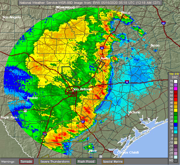
| 5/16/2020 12:46 AM CDT |
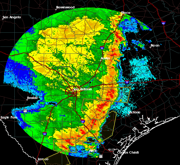 At 1246 am cdt, a severe thunderstorm was located near nordheim, or 11 miles southwest of yorktown, moving east at 40 mph (radar indicated). Hazards include 60 mph wind gusts and quarter size hail. Hail damage to vehicles is expected. expect wind damage to roofs, siding, and trees. Locations impacted include, kenedy, karnes city, yorktown, runge, nordheim, gillett, westhoff, coy city, cotton patch, gruenau, new davy, zunkerville, choate, el oso, ecleto, helena, and pana maria. At 1246 am cdt, a severe thunderstorm was located near nordheim, or 11 miles southwest of yorktown, moving east at 40 mph (radar indicated). Hazards include 60 mph wind gusts and quarter size hail. Hail damage to vehicles is expected. expect wind damage to roofs, siding, and trees. Locations impacted include, kenedy, karnes city, yorktown, runge, nordheim, gillett, westhoff, coy city, cotton patch, gruenau, new davy, zunkerville, choate, el oso, ecleto, helena, and pana maria.
|
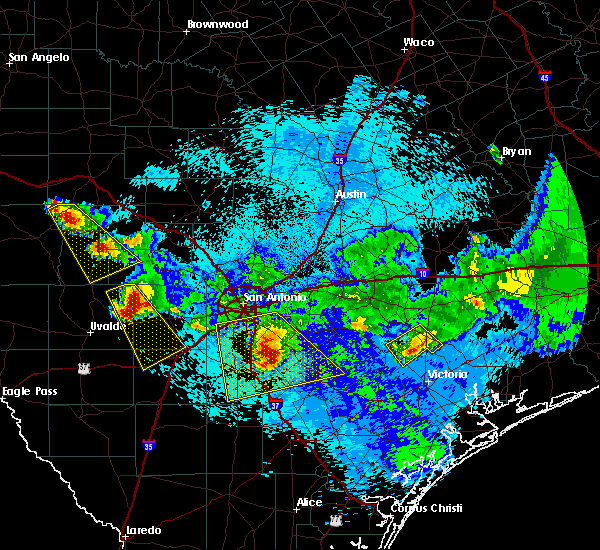
| 5/16/2020 12:20 AM CDT |
 At 1220 am cdt, a severe thunderstorm was located over karnes city, moving east at 40 mph (radar indicated). Hazards include 60 mph wind gusts and quarter size hail. Hail damage to vehicles is expected. expect wind damage to roofs, siding, and trees. Locations impacted include, floresville, kenedy, karnes city, poth, yorktown, stockdale, kosciusko, runge, falls city, nordheim, gillett, cestohowa, westhoff, coy city, cotton patch, choate, el oso, ecleto, helena, and pana maria. At 1220 am cdt, a severe thunderstorm was located over karnes city, moving east at 40 mph (radar indicated). Hazards include 60 mph wind gusts and quarter size hail. Hail damage to vehicles is expected. expect wind damage to roofs, siding, and trees. Locations impacted include, floresville, kenedy, karnes city, poth, yorktown, stockdale, kosciusko, runge, falls city, nordheim, gillett, cestohowa, westhoff, coy city, cotton patch, choate, el oso, ecleto, helena, and pana maria.
|
| 5/15/2020 11:54 PM CDT |
 At 1153 pm cdt, a severe thunderstorm was located 10 miles west of falls city, or 12 miles southwest of poth, moving east at 40 mph (radar indicated). Hazards include 60 mph wind gusts and quarter size hail. Hail damage to vehicles is expected. Expect wind damage to roofs, siding, and trees. At 1153 pm cdt, a severe thunderstorm was located 10 miles west of falls city, or 12 miles southwest of poth, moving east at 40 mph (radar indicated). Hazards include 60 mph wind gusts and quarter size hail. Hail damage to vehicles is expected. Expect wind damage to roofs, siding, and trees.
|
| 4/9/2020 7:57 PM CDT |
 At 756 pm cdt, a severe thunderstorm was located 9 miles southwest of falls city, or 13 miles south of poth, moving east at 40 mph (radar indicated). Hazards include golf ball size hail and 60 mph wind gusts. People and animals outdoors will be injured. expect hail damage to roofs, siding, windows, and vehicles. expect wind damage to roofs, siding, and trees. Locations impacted include, kenedy, karnes city, runge, falls city, coy city, zunkerville, choate, fashing, hobson, el oso, helena, deweesville and pana maria. At 756 pm cdt, a severe thunderstorm was located 9 miles southwest of falls city, or 13 miles south of poth, moving east at 40 mph (radar indicated). Hazards include golf ball size hail and 60 mph wind gusts. People and animals outdoors will be injured. expect hail damage to roofs, siding, windows, and vehicles. expect wind damage to roofs, siding, and trees. Locations impacted include, kenedy, karnes city, runge, falls city, coy city, zunkerville, choate, fashing, hobson, el oso, helena, deweesville and pana maria.
|
| 4/9/2020 7:34 PM CDT |
 At 734 pm cdt, a severe thunderstorm was located near pleasanton, moving east at 40 mph (radar indicated). Hazards include 60 mph wind gusts and half dollar size hail. Hail damage to vehicles is expected. Expect wind damage to roofs, siding, and trees. At 734 pm cdt, a severe thunderstorm was located near pleasanton, moving east at 40 mph (radar indicated). Hazards include 60 mph wind gusts and half dollar size hail. Hail damage to vehicles is expected. Expect wind damage to roofs, siding, and trees.
|
| 6/17/2019 2:07 AM CDT |
 At 205 am cdt, severe thunderstorms were located along a line extending from palmeto state park to 8 miles northeast of smiley to near westhoff to 6 miles southeast of gillett to near cestohowa, moving southeast at 40 mph (radar indicated). Hazards include 60 mph wind gusts. expect damage to roofs, siding, and trees At 205 am cdt, severe thunderstorms were located along a line extending from palmeto state park to 8 miles northeast of smiley to near westhoff to 6 miles southeast of gillett to near cestohowa, moving southeast at 40 mph (radar indicated). Hazards include 60 mph wind gusts. expect damage to roofs, siding, and trees
|
| 6/17/2019 1:46 AM CDT |
 At 146 am cdt, severe thunderstorms were located along a line extending from 6 miles southeast of kingsbury to 11 miles northwest of smiley to near nixon to near kosciusko to near elmendorf, moving southeast at 40 mph (radar indicated). Hazards include 60 mph wind gusts. Expect damage to roofs, siding, and trees. Locations impacted include, seguin, gonzales, floresville, luling, karnes city, poth, yorktown, stockdale, kosciusko, mcqueeney, nixon, la vernia, kingsbury, falls city, smiley, new berlin, nordheim, staples, cestohowa and cheapside. At 146 am cdt, severe thunderstorms were located along a line extending from 6 miles southeast of kingsbury to 11 miles northwest of smiley to near nixon to near kosciusko to near elmendorf, moving southeast at 40 mph (radar indicated). Hazards include 60 mph wind gusts. Expect damage to roofs, siding, and trees. Locations impacted include, seguin, gonzales, floresville, luling, karnes city, poth, yorktown, stockdale, kosciusko, mcqueeney, nixon, la vernia, kingsbury, falls city, smiley, new berlin, nordheim, staples, cestohowa and cheapside.
|
| 6/17/2019 1:35 AM CDT |
 At 134 am cdt, severe thunderstorms were located along a line extending from near kingsbury to 10 miles southeast of seguin to near pandora to near floresville to 6 miles west of elmendorf, moving southeast at 40 mph (radar indicated). Hazards include 60 mph wind gusts and nickel size hail. Expect damage to roofs, siding, and trees. locations impacted include, san antonio, new braunfels, schertz, seguin, cibolo, gonzales, floresville, luling, poteet, karnes city, poth, yorktown, stockdale, kosciusko, stinson municipal airport, randolph afb, lytle, mcqueeney, nixon and st. Hedwig. At 134 am cdt, severe thunderstorms were located along a line extending from near kingsbury to 10 miles southeast of seguin to near pandora to near floresville to 6 miles west of elmendorf, moving southeast at 40 mph (radar indicated). Hazards include 60 mph wind gusts and nickel size hail. Expect damage to roofs, siding, and trees. locations impacted include, san antonio, new braunfels, schertz, seguin, cibolo, gonzales, floresville, luling, poteet, karnes city, poth, yorktown, stockdale, kosciusko, stinson municipal airport, randolph afb, lytle, mcqueeney, nixon and st. Hedwig.
|
| 6/17/2019 1:15 AM CDT |
 At 115 am cdt, severe thunderstorms were located along a line extending from near new braunfels to near seguin to near la vernia to near calaveras lake to near somerset, moving southeast at 40 mph (radar indicated). Hazards include 60 mph wind gusts and nickel size hail. expect damage to roofs, siding, and trees At 115 am cdt, severe thunderstorms were located along a line extending from near new braunfels to near seguin to near la vernia to near calaveras lake to near somerset, moving southeast at 40 mph (radar indicated). Hazards include 60 mph wind gusts and nickel size hail. expect damage to roofs, siding, and trees
|
| 5/3/2019 9:51 PM CDT |
 At 951 pm cdt, severe thunderstorms were located along a line extending from 7 miles north of runge to 11 miles southwest of falls city to charlotte to near dilley, moving southeast at 35 mph (radar indicated). Hazards include 60 mph wind gusts and penny size hail. Expect damage to roofs, siding, and trees. Locations impacted include, pleasanton, pearsall, floresville, jourdanton, dilley, poteet, kenedy, karnes city, poth, charlotte, christine, campbellton, kosciusko, runge, falls city, north pearsall, goldfinch, cestohowa, schattel and derby. At 951 pm cdt, severe thunderstorms were located along a line extending from 7 miles north of runge to 11 miles southwest of falls city to charlotte to near dilley, moving southeast at 35 mph (radar indicated). Hazards include 60 mph wind gusts and penny size hail. Expect damage to roofs, siding, and trees. Locations impacted include, pleasanton, pearsall, floresville, jourdanton, dilley, poteet, kenedy, karnes city, poth, charlotte, christine, campbellton, kosciusko, runge, falls city, north pearsall, goldfinch, cestohowa, schattel and derby.
|
| 5/3/2019 9:27 PM CDT |
 At 927 pm cdt, severe thunderstorms were located along a line extending from near kosciusko to near schattel to near woodward, moving southeast at 30 mph (radar indicated). Hazards include 60 mph wind gusts and nickel size hail. expect damage to roofs, siding, and trees At 927 pm cdt, severe thunderstorms were located along a line extending from near kosciusko to near schattel to near woodward, moving southeast at 30 mph (radar indicated). Hazards include 60 mph wind gusts and nickel size hail. expect damage to roofs, siding, and trees
|
| 4/24/2019 5:30 PM CDT |
 At 530 pm cdt, a severe thunderstorm was located 7 miles north of runge, or 11 miles northeast of karnes city, moving east at 35 mph (radar indicated). Hazards include 60 mph wind gusts and quarter size hail. Hail damage to vehicles is expected. Expect wind damage to roofs, siding, and trees. At 530 pm cdt, a severe thunderstorm was located 7 miles north of runge, or 11 miles northeast of karnes city, moving east at 35 mph (radar indicated). Hazards include 60 mph wind gusts and quarter size hail. Hail damage to vehicles is expected. Expect wind damage to roofs, siding, and trees.
|
| 2/25/2018 6:29 AM CST |
 At 628 am cst, a severe thunderstorm was located near falls city, or near poth, moving east at 35 mph (radar indicated). Hazards include 60 mph wind gusts and half dollar size hail. Hail damage to vehicles is expected. expect wind damage to roofs, siding, and trees. Locations impacted include, karnes city, poth, kosciusko, falls city, cestohowa, hobson, paweleville, deweesville and pana maria. At 628 am cst, a severe thunderstorm was located near falls city, or near poth, moving east at 35 mph (radar indicated). Hazards include 60 mph wind gusts and half dollar size hail. Hail damage to vehicles is expected. expect wind damage to roofs, siding, and trees. Locations impacted include, karnes city, poth, kosciusko, falls city, cestohowa, hobson, paweleville, deweesville and pana maria.
|
| 2/25/2018 6:10 AM CST |
 At 610 am cst, a severe thunderstorm was located 13 miles southwest of poth, moving east at 35 mph (radar indicated). Hazards include ping pong ball size hail and 60 mph wind gusts. People and animals outdoors will be injured. expect hail damage to roofs, siding, windows, and vehicles. Expect wind damage to roofs, siding, and trees. At 610 am cst, a severe thunderstorm was located 13 miles southwest of poth, moving east at 35 mph (radar indicated). Hazards include ping pong ball size hail and 60 mph wind gusts. People and animals outdoors will be injured. expect hail damage to roofs, siding, windows, and vehicles. Expect wind damage to roofs, siding, and trees.
|
| 6/4/2017 12:52 AM CDT |
 At 1252 am cdt, a severe thunderstorm was located near nell, or 11 miles southwest of karnes city, moving east at 20 mph (radar indicated). Hazards include 60 mph wind gusts and quarter size hail. Hail damage to vehicles is expected. Expect wind damage to roofs, siding, and trees. At 1252 am cdt, a severe thunderstorm was located near nell, or 11 miles southwest of karnes city, moving east at 20 mph (radar indicated). Hazards include 60 mph wind gusts and quarter size hail. Hail damage to vehicles is expected. Expect wind damage to roofs, siding, and trees.
|
| 4/29/2017 9:44 PM CDT |
 At 944 pm cdt, a severe thunderstorm was located near esseville, or near campbellton, moving east at 25 mph (radar indicated). Hazards include 60 mph wind gusts and half dollar size hail. Hail damage to vehicles is expected. expect wind damage to roofs, siding, and trees. Locations impacted include, karnes city, campbellton, falls city, hobson, coy city, peggy, deweesville and fashing. At 944 pm cdt, a severe thunderstorm was located near esseville, or near campbellton, moving east at 25 mph (radar indicated). Hazards include 60 mph wind gusts and half dollar size hail. Hail damage to vehicles is expected. expect wind damage to roofs, siding, and trees. Locations impacted include, karnes city, campbellton, falls city, hobson, coy city, peggy, deweesville and fashing.
|
| 4/29/2017 9:24 PM CDT |
 At 923 pm cdt, a severe thunderstorm was located near campbellton, moving northeast at 35 mph (radar indicated). Hazards include 60 mph wind gusts and half dollar size hail. Hail damage to vehicles is expected. Expect wind damage to roofs, siding, and trees. At 923 pm cdt, a severe thunderstorm was located near campbellton, moving northeast at 35 mph (radar indicated). Hazards include 60 mph wind gusts and half dollar size hail. Hail damage to vehicles is expected. Expect wind damage to roofs, siding, and trees.
|
| 5/31/2016 5:14 PM CDT |
 At 514 pm cdt, a severe thunderstorm was located 8 miles southwest of falls city, or 11 miles west of karnes city, moving east at 15 mph (radar indicated). Hazards include 60 mph wind gusts and quarter size hail. Hail damage to vehicles is expected. expect wind damage to roofs, siding, and trees. Locations impacted include, karnes city, falls city, cestohowa, coy city, hobson, pana maria, deweesville, paweleville and helena. At 514 pm cdt, a severe thunderstorm was located 8 miles southwest of falls city, or 11 miles west of karnes city, moving east at 15 mph (radar indicated). Hazards include 60 mph wind gusts and quarter size hail. Hail damage to vehicles is expected. expect wind damage to roofs, siding, and trees. Locations impacted include, karnes city, falls city, cestohowa, coy city, hobson, pana maria, deweesville, paweleville and helena.
|
| 5/31/2016 4:56 PM CDT |
 At 456 pm cdt, a severe thunderstorm was located 9 miles southwest of falls city, or 12 miles south of poth, moving east at 20 mph (radar indicated). Hazards include 60 mph wind gusts and quarter size hail. Hail damage to vehicles is expected. Expect wind damage to roofs, siding, and trees. At 456 pm cdt, a severe thunderstorm was located 9 miles southwest of falls city, or 12 miles south of poth, moving east at 20 mph (radar indicated). Hazards include 60 mph wind gusts and quarter size hail. Hail damage to vehicles is expected. Expect wind damage to roofs, siding, and trees.
|
| 3/18/2016 9:17 PM CDT |
 At 916 pm cdt, a severe thunderstorm was located near gillett, or near kosciusko, moving southeast at 30 mph. this storm has a history of producing quarter size hail, including a report four miles southwest of floresville (trained weather spotters). Hazards include 60 mph wind gusts and quarter size hail. Hail damage to vehicles is expected. Expect wind damage to roofs, siding, and trees. At 916 pm cdt, a severe thunderstorm was located near gillett, or near kosciusko, moving southeast at 30 mph. this storm has a history of producing quarter size hail, including a report four miles southwest of floresville (trained weather spotters). Hazards include 60 mph wind gusts and quarter size hail. Hail damage to vehicles is expected. Expect wind damage to roofs, siding, and trees.
|
| 5/25/2015 9:19 PM CDT | At 919 pm cdt, a severe thunderstorm was located near kenedy, moving east at 20 mph (radar indicated). Hazards include 60 mph wind gusts and quarter size hail. Hail damage to vehicles is expected. Expect wind damage to roofs, siding and trees. |
| 4/27/2015 3:06 AM CDT | At 306 am cdt, a severe thunderstorm was located over cestohowa, or near kosciusko, moving east at 35 mph (radar indicated). Hazards include 60 mph wind gusts and quarter size hail. Hail damage to vehicles is expected. expect wind damage to roofs, siding and trees. locations impacted include, karnes city, yorktown, kosciusko, runge, falls city, nordheim, gillett, westhoff, cestohowa, pana maria, cotton patch, new davy, helena, gruenau, hobson, ecleto and paweleville. a tornado watch remains in effect until 900 am cdt for south central texas. 1. 00in. |
| 4/27/2015 3:06 AM CDT | At 306 am cdt, a severe thunderstorm was located over cestohowa, or near kosciusko, moving east at 35 mph (radar indicated). Hazards include 60 mph wind gusts and quarter size hail. Hail damage to vehicles is expected. expect wind damage to roofs, siding and trees. locations impacted include, karnes city, yorktown, kosciusko, runge, falls city, nordheim, gillett, westhoff, cestohowa, pana maria, cotton patch, new davy, helena, gruenau, hobson, ecleto and paweleville. a tornado watch remains in effect until 900 am cdt for south central texas. 1. 00in. |
| 4/27/2015 3:00 AM CDT | At 300 am cdt, a severe thunderstorm was located over cestohowa, or 7 miles south of kosciusko, moving east at 35 mph (radar indicated). Hazards include 60 mph wind gusts. Expect damage to roofs. Siding and trees. |
| 4/24/2015 10:20 PM CDT | At 1019 pm cdt, a severe thunderstorm was located 9 miles southwest of poth, moving east at 50 mph (radar indicated). Hazards include 60 mph wind gusts and quarter size hail. Hail damage to vehicles is expected. expect wind damage to roofs, siding and trees. locations impacted include, pleasanton, floresville, karnes city, poth, stockdale, kosciusko, falls city, cestohowa, pana maria, hobson, coughran, deweesville, paweleville and graytown. 1. 00in. |
| 4/24/2015 10:05 PM CDT | At 1005 pm cdt, a severe thunderstorm was located near pleasanton, moving east at 40 mph (radar indicated). Hazards include 60 mph wind gusts and half dollar size hail. Hail damage to vehicles is expected. expect wind damage to roofs, siding and trees. locations impacted include, pleasanton, floresville, jourdanton, kenedy, karnes city, poth, stockdale, christine, kosciusko, falls city, cestohowa, fairview, pana maria, mccoy, coy city, hobson, coughran, deweesville, paweleville and graytown. 1. 25in. |
| 4/24/2015 9:55 PM CDT | At 954 pm cdt, a severe thunderstorm was located near jourdanton, moving east at 40 mph (radar indicated). Hazards include 60 mph wind gusts and quarter size hail. Hail damage to vehicles is expected. Expect wind damage to roofs, siding and trees. |
| 4/17/2015 4:46 PM CDT | At 445 pm cdt, severe thunderstorms were located along a line extending from 7 miles north of smiley to near westhoff to 7 miles west of cuero to near weesatche to near charco, moving east at 45 mph (radar indicated). Hazards include 60 mph wind gusts and penny size hail. Expect damage to roofs. siding and trees. locations impacted include, gonzales, cuero, yoakum, kenedy, karnes city, yorktown, shiner, moulton, nixon, runge, smiley, nordheim, thomaston, gillett, hochheim, pandora, cheapside, ezzell, westhoff and sweet home. 0. 75in. |
| 4/17/2015 4:20 PM CDT | At 419 pm cdt, severe thunderstorms were located along a line extending from near stockdale to gillett to 7 miles northwest of nordheim to near runge to near tulsita, moving east at 45 mph (radar indicated). Hazards include 60 mph wind gusts and penny size hail. Expect damage to roofs. Siding and trees. |
| 4/17/2015 4:12 PM CDT | At 411 pm cdt, severe thunderstorms were located along a line extending from near stockdale to near kosciusko to near kenedy to 7 miles northeast of pawnee, moving northeast at 25 mph (radar indicated). Hazards include 60 mph wind gusts and penny size hail. Expect damage to roofs. siding and trees. locations impacted include, floresville, kenedy, karnes city, poth, stockdale, campbellton, kosciusko, runge, falls city, gillett, pandora, cestohowa, fairview, el oso, pana maria, choate, hobson, paweleville, fashing and mccoy. 0. 75in. |
| 4/17/2015 3:52 PM CDT | At 351 pm cdt, severe thunderstorms were located along a line extending from near gillett to near nordheim to near charco to 7 miles northwest of berclair, moving east at 40 mph (radar indicated). Hazards include 60 mph wind gusts and penny size hail. Expect damage to roofs. siding and trees. locations impacted include, floresville, kenedy, karnes city, poth, stockdale, campbellton, kosciusko, runge, falls city, gillett, pandora, cestohowa, fairview, el oso, pana maria, choate, hobson, paweleville, fashing and mccoy. 0. 75in. |
| 4/17/2015 3:45 PM CDT | At 344 pm cdt, severe thunderstorms were located along a line extending from near elmendorf to fashing to whitsett, moving east at 40 mph (radar indicated). Hazards include 60 mph wind gusts and penny size hail. Expect damage to roofs. Siding and trees. |
Hail Maps for Karnes City, TX


Connect with Interactive Hail Maps