

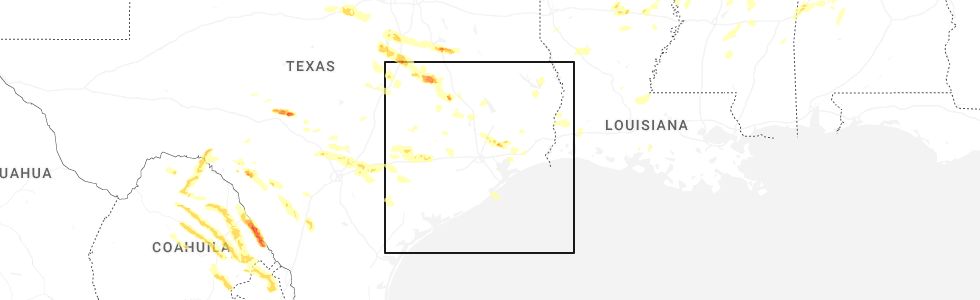
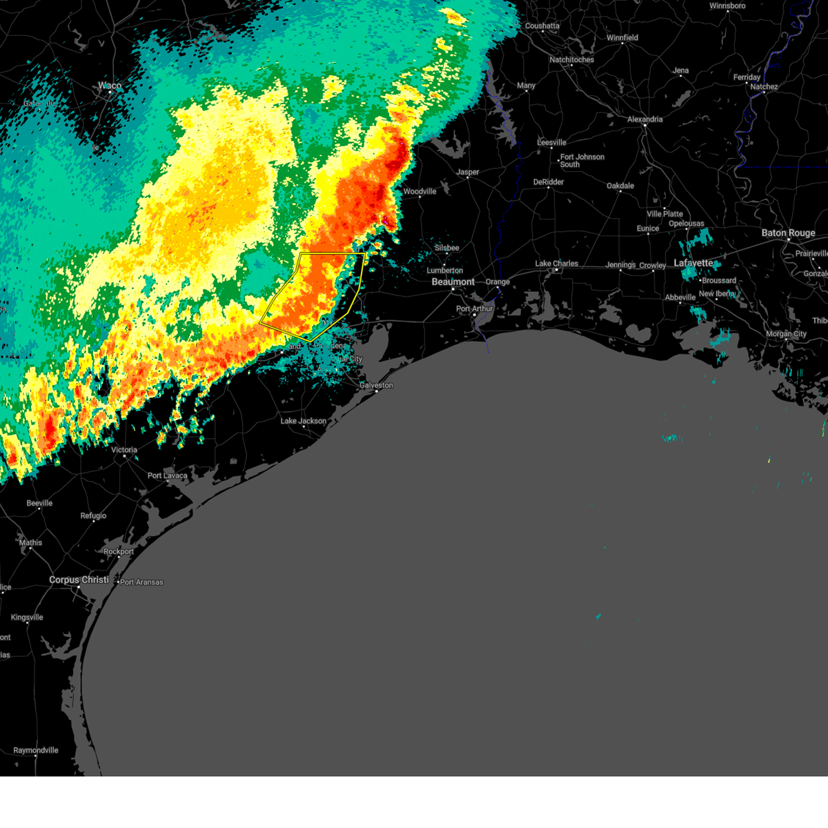
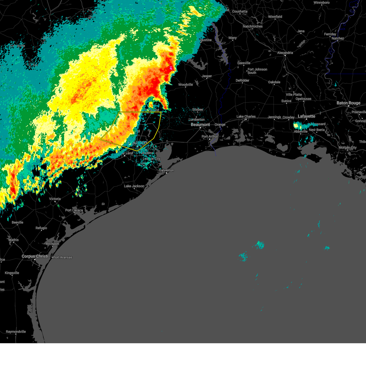
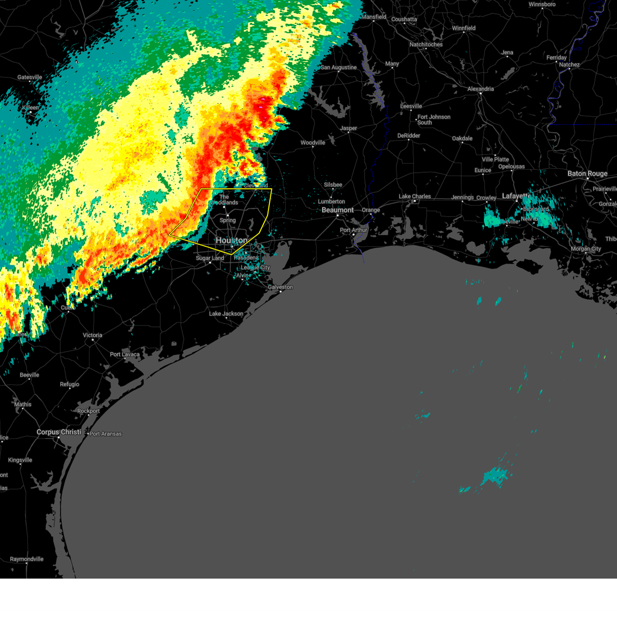
Hail Map for Katy, TX
The Katy, TX area has had 15 reports of on-the-ground hail by trained spotters, and has been under severe weather warnings 4 times during the past 12 months. Doppler radar has detected hail at or near Katy, TX on 57 occasions, including 3 occasions during the past year.
| Name: | Katy, TX |
| Where Located: | 27.5 miles W of Houston, TX |
| Map: | Google Map for Katy, TX |
| Population: | 14102 |
| Housing Units: | 4972 |
| More Info: | Search Google for Katy, TX |
0
The Top Recent Hail Date for Katy, TX is Friday, May 2, 2025 (50th out of 57)
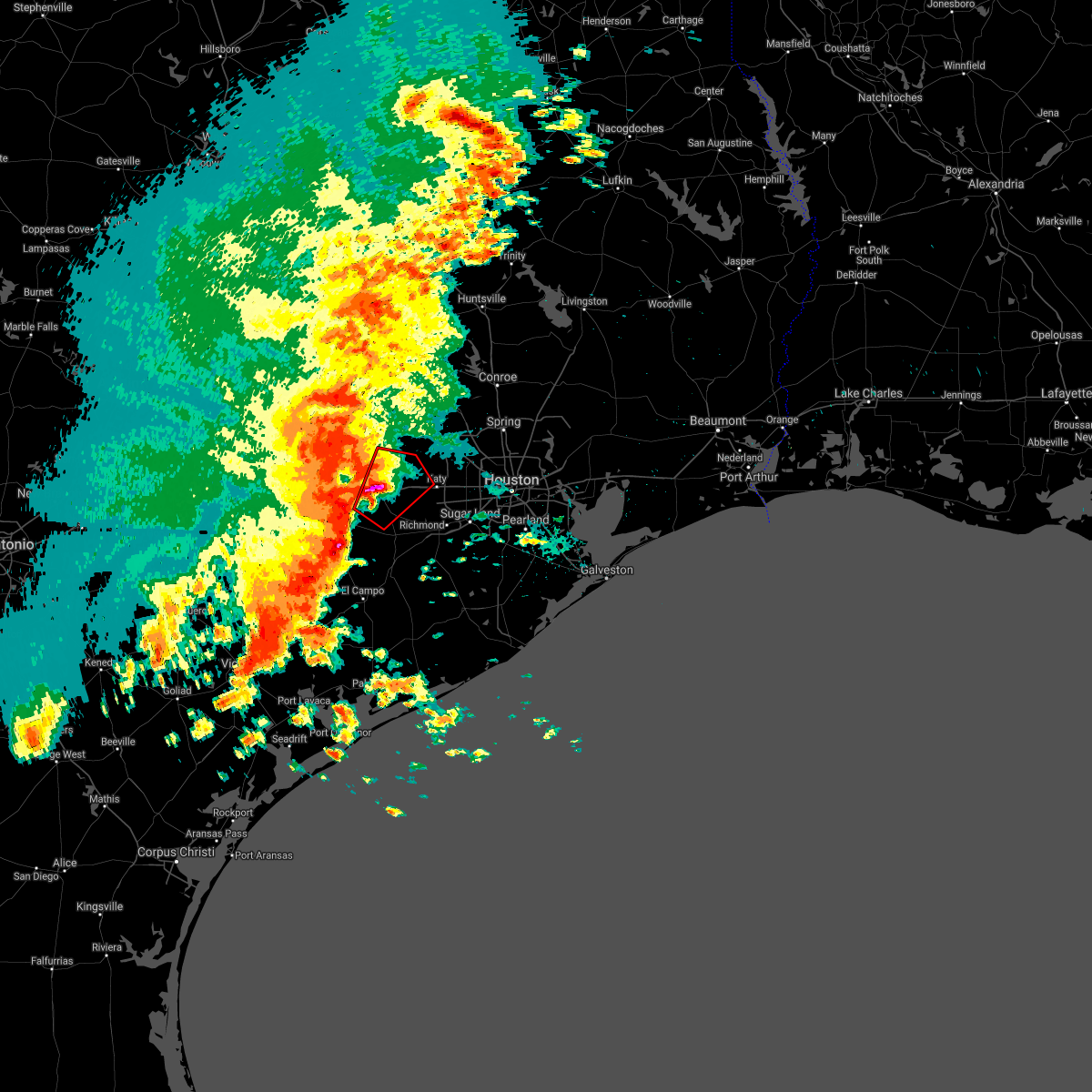
Hail and Wind Damage Spotted near Katy, TX
| Date / Time | Report Details |
|---|---|
| 5/27/2025 12:31 AM CDT |
 the severe thunderstorm warning has been cancelled and is no longer in effect the severe thunderstorm warning has been cancelled and is no longer in effect
|
| 5/27/2025 12:31 AM CDT |
 At 1231 am cdt, severe thunderstorms were located along a line extending from near cut and shoot to porter heights to near greater greenspoint to near westbranch, moving east at 45 mph (radar indicated). Hazards include 60 mph wind gusts. Expect damage to roofs, siding, and trees. Locations impacted include, conroe, bellaire, humble, west university place, katy, tomball, jacinto city, cleveland, jersey village, hunters creek village, bunker hill village, piney point village, downtown houston, greenway / upper kirby area, kingwood, spring branch north, second ward, the woodlands, greater greenspoint, and spring. At 1231 am cdt, severe thunderstorms were located along a line extending from near cut and shoot to porter heights to near greater greenspoint to near westbranch, moving east at 45 mph (radar indicated). Hazards include 60 mph wind gusts. Expect damage to roofs, siding, and trees. Locations impacted include, conroe, bellaire, humble, west university place, katy, tomball, jacinto city, cleveland, jersey village, hunters creek village, bunker hill village, piney point village, downtown houston, greenway / upper kirby area, kingwood, spring branch north, second ward, the woodlands, greater greenspoint, and spring.
|
| 5/27/2025 12:11 AM CDT |
 At 1210 am cdt, severe thunderstorms were located along a line extending from near lake conroe dam to 6 miles east of pinehurst to near cypress to 7 miles northeast of pattison, moving east at 40 mph. houston hooks airport received a gust to 67 mph at 1202 am (radar indicated). Hazards include 70 mph wind gusts. Expect considerable tree damage. damage is likely to mobile homes, roofs, and outbuildings. Locations impacted include, conroe, bellaire, humble, west university place, katy, tomball, jacinto city, cleveland, jersey village, hunters creek village, bunker hill village, piney point village, pinehurst, downtown houston, greenway / upper kirby area, kingwood, spring branch north, second ward, the woodlands, and greater greenspoint. At 1210 am cdt, severe thunderstorms were located along a line extending from near lake conroe dam to 6 miles east of pinehurst to near cypress to 7 miles northeast of pattison, moving east at 40 mph. houston hooks airport received a gust to 67 mph at 1202 am (radar indicated). Hazards include 70 mph wind gusts. Expect considerable tree damage. damage is likely to mobile homes, roofs, and outbuildings. Locations impacted include, conroe, bellaire, humble, west university place, katy, tomball, jacinto city, cleveland, jersey village, hunters creek village, bunker hill village, piney point village, pinehurst, downtown houston, greenway / upper kirby area, kingwood, spring branch north, second ward, the woodlands, and greater greenspoint.
|
| 5/26/2025 11:46 PM CDT |
 Svrhgx the national weather service in league city has issued a * severe thunderstorm warning for, eastern austin county in southeastern texas, montgomery county in southeastern texas, south central san jacinto county in southeastern texas, southwestern liberty county in southeastern texas, southern waller county in southeastern texas, harris county in southeastern texas, * until 1245 am cdt. * at 1146 pm cdt, severe thunderstorms were located along a line extending from near montgomery to magnolia to hockley to 7 miles northwest of pattison, moving east at 40 mph (radar indicated). Hazards include 60 mph wind gusts. expect damage to roofs, siding, and trees Svrhgx the national weather service in league city has issued a * severe thunderstorm warning for, eastern austin county in southeastern texas, montgomery county in southeastern texas, south central san jacinto county in southeastern texas, southwestern liberty county in southeastern texas, southern waller county in southeastern texas, harris county in southeastern texas, * until 1245 am cdt. * at 1146 pm cdt, severe thunderstorms were located along a line extending from near montgomery to magnolia to hockley to 7 miles northwest of pattison, moving east at 40 mph (radar indicated). Hazards include 60 mph wind gusts. expect damage to roofs, siding, and trees
|
| 5/31/2024 6:22 AM CDT |
 Svrhgx the national weather service in league city has issued a * severe thunderstorm warning for, central trinity county in southeastern texas, east central colorado county in southeastern texas, northeastern wharton county in southeastern texas, southeastern austin county in southeastern texas, northwestern fort bend county in southeastern texas, central montgomery county in southeastern texas, western san jacinto county in southeastern texas, east central houston county in southeastern texas, southeastern waller county in southeastern texas, west central polk county in southeastern texas, southeastern walker county in southeastern texas, central harris county in southeastern texas, * until 645 am cdt. * at 621 am cdt, severe thunderstorms were located along a line extending from near point blank to near eagle lake, moving southeast at around 50 mph (radar indicated). Hazards include 60 mph wind gusts and penny size hail. expect damage to roofs, siding, and trees Svrhgx the national weather service in league city has issued a * severe thunderstorm warning for, central trinity county in southeastern texas, east central colorado county in southeastern texas, northeastern wharton county in southeastern texas, southeastern austin county in southeastern texas, northwestern fort bend county in southeastern texas, central montgomery county in southeastern texas, western san jacinto county in southeastern texas, east central houston county in southeastern texas, southeastern waller county in southeastern texas, west central polk county in southeastern texas, southeastern walker county in southeastern texas, central harris county in southeastern texas, * until 645 am cdt. * at 621 am cdt, severe thunderstorms were located along a line extending from near point blank to near eagle lake, moving southeast at around 50 mph (radar indicated). Hazards include 60 mph wind gusts and penny size hail. expect damage to roofs, siding, and trees
|
| 5/16/2024 6:00 PM CDT | Trees downe in harris county TX, 0.4 miles WSW of Katy, TX |
| 5/16/2024 5:57 PM CDT |
 Torhgx the national weather service in league city has issued a * tornado warning for, east central waller county in southeastern texas, northwestern harris county in southeastern texas, * until 630 pm cdt. * at 555 pm cdt, a severe thunderstorm capable of producing a tornado was located near hockley, or 10 miles southeast of prairie view, moving east at 40 mph (radar indicated rotation). Hazards include tornado. Flying debris will be dangerous to those caught without shelter. mobile homes will be damaged or destroyed. damage to roofs, windows, and vehicles will occur. tree damage is likely. this dangerous storm will be near, cypress around 600 pm cdt. jersey village and addicks park ten around 610 pm cdt. spring branch west, northern eldridge / west oaks, and willowbrook around 615 pm cdt. Other locations impacted by this tornadic thunderstorm include addicks and memorial. Torhgx the national weather service in league city has issued a * tornado warning for, east central waller county in southeastern texas, northwestern harris county in southeastern texas, * until 630 pm cdt. * at 555 pm cdt, a severe thunderstorm capable of producing a tornado was located near hockley, or 10 miles southeast of prairie view, moving east at 40 mph (radar indicated rotation). Hazards include tornado. Flying debris will be dangerous to those caught without shelter. mobile homes will be damaged or destroyed. damage to roofs, windows, and vehicles will occur. tree damage is likely. this dangerous storm will be near, cypress around 600 pm cdt. jersey village and addicks park ten around 610 pm cdt. spring branch west, northern eldridge / west oaks, and willowbrook around 615 pm cdt. Other locations impacted by this tornadic thunderstorm include addicks and memorial.
|
| 5/16/2024 5:50 PM CDT |
 At 550 pm cdt, a severe thunderstorm capable of producing a tornado was located near waller, or 8 miles southeast of prairie view, moving east at 60 mph (radar indicated rotation). Hazards include tornado and ping pong ball size hail. Flying debris will be dangerous to those caught without shelter. mobile homes will be damaged or destroyed. damage to roofs, windows, and vehicles will occur. tree damage is likely. This dangerous storm will be near, hockley around 555 pm cdt. At 550 pm cdt, a severe thunderstorm capable of producing a tornado was located near waller, or 8 miles southeast of prairie view, moving east at 60 mph (radar indicated rotation). Hazards include tornado and ping pong ball size hail. Flying debris will be dangerous to those caught without shelter. mobile homes will be damaged or destroyed. damage to roofs, windows, and vehicles will occur. tree damage is likely. This dangerous storm will be near, hockley around 555 pm cdt.
|
| 5/16/2024 5:50 PM CDT |
 the tornado warning has been cancelled and is no longer in effect the tornado warning has been cancelled and is no longer in effect
|
| 5/16/2024 5:49 PM CDT |
 Svrhgx the national weather service in league city has issued a * severe thunderstorm warning for, southeastern austin county in southeastern texas, northwestern fort bend county in southeastern texas, southwestern montgomery county in southeastern texas, southeastern waller county in southeastern texas, northwestern harris county in southeastern texas, * until 615 pm cdt. * at 548 pm cdt, severe thunderstorms were located along a line extending from near todd mission to near pattison to near sealy, moving east at 70 mph (radar indicated). Hazards include 70 mph wind gusts. Expect considerable tree damage. Damage is likely to mobile homes, roofs, and outbuildings. Svrhgx the national weather service in league city has issued a * severe thunderstorm warning for, southeastern austin county in southeastern texas, northwestern fort bend county in southeastern texas, southwestern montgomery county in southeastern texas, southeastern waller county in southeastern texas, northwestern harris county in southeastern texas, * until 615 pm cdt. * at 548 pm cdt, severe thunderstorms were located along a line extending from near todd mission to near pattison to near sealy, moving east at 70 mph (radar indicated). Hazards include 70 mph wind gusts. Expect considerable tree damage. Damage is likely to mobile homes, roofs, and outbuildings.
|
| 5/16/2024 5:43 PM CDT |
 Torhgx the national weather service in league city has issued a * tornado warning for, northeastern austin county in southeastern texas, central waller county in southeastern texas, northwestern harris county in southeastern texas, * until 600 pm cdt. * at 543 pm cdt, a severe thunderstorm capable of producing a tornado was located near pine island, or 7 miles south of prairie view, moving east at 60 mph (radar indicated rotation). Hazards include tornado. Flying debris will be dangerous to those caught without shelter. mobile homes will be damaged or destroyed. damage to roofs, windows, and vehicles will occur. tree damage is likely. this dangerous storm will be near, hockley and waller around 550 pm cdt. Other locations impacted by this tornadic thunderstorm include monaville. Torhgx the national weather service in league city has issued a * tornado warning for, northeastern austin county in southeastern texas, central waller county in southeastern texas, northwestern harris county in southeastern texas, * until 600 pm cdt. * at 543 pm cdt, a severe thunderstorm capable of producing a tornado was located near pine island, or 7 miles south of prairie view, moving east at 60 mph (radar indicated rotation). Hazards include tornado. Flying debris will be dangerous to those caught without shelter. mobile homes will be damaged or destroyed. damage to roofs, windows, and vehicles will occur. tree damage is likely. this dangerous storm will be near, hockley and waller around 550 pm cdt. Other locations impacted by this tornadic thunderstorm include monaville.
|
| 4/10/2024 3:06 AM CDT |
 The storm which prompted the warning has weakened below severe limits, and no longer poses an immediate threat to life or property. therefore, the warning will be allowed to expire. however, gusty winds are still possible with this thunderstorm. a severe thunderstorm watch remains in effect until 700 am cdt for southeastern texas. The storm which prompted the warning has weakened below severe limits, and no longer poses an immediate threat to life or property. therefore, the warning will be allowed to expire. however, gusty winds are still possible with this thunderstorm. a severe thunderstorm watch remains in effect until 700 am cdt for southeastern texas.
|
| 4/10/2024 2:45 AM CDT | Severe thunderstorm wind gusts damaged some buildings and also downed utility lines and some business signs in and around the south mason road and kingsland blvd inters in harris county TX, 4.6 miles W of Katy, TX |
| 4/10/2024 2:44 AM CDT |
 Svrhgx the national weather service in league city has issued a * severe thunderstorm warning for, north central fort bend county in southeastern texas, southeastern waller county in southeastern texas, northwestern harris county in southeastern texas, * until 315 am cdt. * at 244 am cdt, a severe thunderstorm was located near katy, moving northeast at 35 mph (radar indicated). Hazards include 60 mph wind gusts and penny size hail. expect damage to roofs, siding, and trees Svrhgx the national weather service in league city has issued a * severe thunderstorm warning for, north central fort bend county in southeastern texas, southeastern waller county in southeastern texas, northwestern harris county in southeastern texas, * until 315 am cdt. * at 244 am cdt, a severe thunderstorm was located near katy, moving northeast at 35 mph (radar indicated). Hazards include 60 mph wind gusts and penny size hail. expect damage to roofs, siding, and trees
|
| 4/10/2024 2:14 AM CDT |
 the severe thunderstorm warning has been cancelled and is no longer in effect the severe thunderstorm warning has been cancelled and is no longer in effect
|
| 4/10/2024 1:58 AM CDT |
 At 158 am cdt, a severe thunderstorm was located over wallis, or 8 miles southeast of sealy, moving northeast at 30 mph (radar indicated). Hazards include quarter size hail. Damage to vehicles is expected. Locations impacted include, katy, sealy, brookshire, east bernard, wallis, fulshear, simonton, san felipe, pattison, orchard, weston lakes, and cinco ranch. At 158 am cdt, a severe thunderstorm was located over wallis, or 8 miles southeast of sealy, moving northeast at 30 mph (radar indicated). Hazards include quarter size hail. Damage to vehicles is expected. Locations impacted include, katy, sealy, brookshire, east bernard, wallis, fulshear, simonton, san felipe, pattison, orchard, weston lakes, and cinco ranch.
|
| 4/10/2024 1:41 AM CDT |
 Svrhgx the national weather service in league city has issued a * severe thunderstorm warning for, eastern colorado county in southeastern texas, north central wharton county in southeastern texas, southeastern austin county in southeastern texas, northwestern fort bend county in southeastern texas, southern waller county in southeastern texas, western harris county in southeastern texas, * until 230 am cdt. * at 141 am cdt, a severe thunderstorm was located over wallis, or 10 miles southeast of sealy, moving northeast at 20 mph (radar indicated). Hazards include quarter size hail. damage to vehicles is expected Svrhgx the national weather service in league city has issued a * severe thunderstorm warning for, eastern colorado county in southeastern texas, north central wharton county in southeastern texas, southeastern austin county in southeastern texas, northwestern fort bend county in southeastern texas, southern waller county in southeastern texas, western harris county in southeastern texas, * until 230 am cdt. * at 141 am cdt, a severe thunderstorm was located over wallis, or 10 miles southeast of sealy, moving northeast at 20 mph (radar indicated). Hazards include quarter size hail. damage to vehicles is expected
|
| 3/21/2024 6:00 PM CDT |
 Svrhgx the national weather service in league city has issued a * severe thunderstorm warning for, eastern waller county in southeastern texas, west central harris county in southeastern texas, * until 630 pm cdt. * at 559 pm cdt, a severe thunderstorm was located 7 miles northeast of katy, moving east at 30 mph (radar indicated). Hazards include 60 mph wind gusts and nickel to quarter size hail. Hail damage to vehicles is expected. Expect wind damage to roofs, siding, and trees. Svrhgx the national weather service in league city has issued a * severe thunderstorm warning for, eastern waller county in southeastern texas, west central harris county in southeastern texas, * until 630 pm cdt. * at 559 pm cdt, a severe thunderstorm was located 7 miles northeast of katy, moving east at 30 mph (radar indicated). Hazards include 60 mph wind gusts and nickel to quarter size hail. Hail damage to vehicles is expected. Expect wind damage to roofs, siding, and trees.
|
| 2/2/2024 11:45 PM CST |
 At 1145 pm cst, severe thunderstorms were located along a line extending from 7 miles south of fayetteville to near columbus to 12 miles southwest of eagle lake to near speaks, moving northeast at 50 mph (radar indicated). Hazards include 60 mph wind gusts. expect damage to roofs, siding, and trees At 1145 pm cst, severe thunderstorms were located along a line extending from 7 miles south of fayetteville to near columbus to 12 miles southwest of eagle lake to near speaks, moving northeast at 50 mph (radar indicated). Hazards include 60 mph wind gusts. expect damage to roofs, siding, and trees
|
| 7/24/2023 6:25 PM CDT |
 At 625 pm cdt, a severe thunderstorm was located over hockley, or 11 miles southeast of prairie view, moving west at 15 mph (radar indicated). Hazards include 60 mph wind gusts and quarter size hail. Hail damage to vehicles is expected. expect wind damage to roofs, siding, and trees. locations impacted include, hempstead, prairie view, brookshire, hockley, waller, pine island and pattison. hail threat, radar indicated max hail size, 1. 00 in wind threat, radar indicated max wind gust, 60 mph. At 625 pm cdt, a severe thunderstorm was located over hockley, or 11 miles southeast of prairie view, moving west at 15 mph (radar indicated). Hazards include 60 mph wind gusts and quarter size hail. Hail damage to vehicles is expected. expect wind damage to roofs, siding, and trees. locations impacted include, hempstead, prairie view, brookshire, hockley, waller, pine island and pattison. hail threat, radar indicated max hail size, 1. 00 in wind threat, radar indicated max wind gust, 60 mph.
|
| 7/24/2023 6:14 PM CDT |
 At 613 pm cdt, a severe thunderstorm was located near hockley, or 12 miles southwest of tomball, moving west at 15 mph (radar indicated). Hazards include 60 mph wind gusts and quarter size hail. Hail damage to vehicles is expected. Expect wind damage to roofs, siding, and trees. At 613 pm cdt, a severe thunderstorm was located near hockley, or 12 miles southwest of tomball, moving west at 15 mph (radar indicated). Hazards include 60 mph wind gusts and quarter size hail. Hail damage to vehicles is expected. Expect wind damage to roofs, siding, and trees.
|
| 7/24/2023 5:46 PM CDT |
 At 546 pm cdt, a severe thunderstorm was located near cypress, or near tomball, moving west at 15 mph (radar indicated). Hazards include 60 mph wind gusts and quarter size hail. Hail damage to vehicles is expected. Expect wind damage to roofs, siding, and trees. At 546 pm cdt, a severe thunderstorm was located near cypress, or near tomball, moving west at 15 mph (radar indicated). Hazards include 60 mph wind gusts and quarter size hail. Hail damage to vehicles is expected. Expect wind damage to roofs, siding, and trees.
|
| 6/23/2023 9:42 PM CDT |
 At 941 pm cdt, a severe thunderstorm was located near prairie view, moving northwest at 20 mph (radar indicated). Hazards include 60 mph wind gusts and quarter size hail. Hail damage to vehicles is expected. Expect wind damage to roofs, siding, and trees. At 941 pm cdt, a severe thunderstorm was located near prairie view, moving northwest at 20 mph (radar indicated). Hazards include 60 mph wind gusts and quarter size hail. Hail damage to vehicles is expected. Expect wind damage to roofs, siding, and trees.
|
| 6/23/2023 9:16 PM CDT |
 At 915 pm cdt, a severe thunderstorm was located near addicks park ten, moving west at 10 mph (trained weather spotters). Hazards include ping pong ball size hail and 60 mph wind gusts. People and animals outdoors will be injured. expect hail damage to roofs, siding, windows, and vehicles. expect wind damage to roofs, siding, and trees. locations impacted include, katy, jersey village, hempstead, prairie view, hunters creek village, pinehurst, spring branch west, addicks park ten, spring valley, spring branch north, northern eldridge / west oaks, hockley, hedwig village, waller, pine island, stagecoach, westbranch, cypress, carverdale and spring branch central. hail threat, observed max hail size, 1. 50 in wind threat, radar indicated max wind gust, 60 mph. At 915 pm cdt, a severe thunderstorm was located near addicks park ten, moving west at 10 mph (trained weather spotters). Hazards include ping pong ball size hail and 60 mph wind gusts. People and animals outdoors will be injured. expect hail damage to roofs, siding, windows, and vehicles. expect wind damage to roofs, siding, and trees. locations impacted include, katy, jersey village, hempstead, prairie view, hunters creek village, pinehurst, spring branch west, addicks park ten, spring valley, spring branch north, northern eldridge / west oaks, hockley, hedwig village, waller, pine island, stagecoach, westbranch, cypress, carverdale and spring branch central. hail threat, observed max hail size, 1. 50 in wind threat, radar indicated max wind gust, 60 mph.
|
| 6/23/2023 8:58 PM CDT |
 At 858 pm cdt, a severe thunderstorm was located near addicks park ten, moving west at 10 mph (trained weather spotters). Hazards include two inch hail and 60 mph wind gusts. People and animals outdoors will be injured. expect hail damage to roofs, siding, windows, and vehicles. Expect wind damage to roofs, siding, and trees. At 858 pm cdt, a severe thunderstorm was located near addicks park ten, moving west at 10 mph (trained weather spotters). Hazards include two inch hail and 60 mph wind gusts. People and animals outdoors will be injured. expect hail damage to roofs, siding, windows, and vehicles. Expect wind damage to roofs, siding, and trees.
|
| 6/21/2023 8:52 PM CDT |
 At 851 pm cdt, severe thunderstorms were located along a line extending from near kingwood to simonton, moving southeast at 50 mph. wind gusts of 60 to 70 mph are possible with these storms (radar indicated). Hazards include 70 mph wind gusts and nickel size hail. Expect considerable tree damage. damage is likely to mobile homes, roofs, and outbuildings. locations impacted include, bellaire, humble, katy, tomball, jersey village, sealy, hempstead, prairie view, brookshire, hunters creek village, bunker hill village, piney point village, pinehurst, downtown houston, greenway / upper kirby area, kingwood, spring branch north, the woodlands, greater greenspoint and spring. thunderstorm damage threat, considerable hail threat, radar indicated max hail size, 0. 88 in wind threat, radar indicated max wind gust, 70 mph. At 851 pm cdt, severe thunderstorms were located along a line extending from near kingwood to simonton, moving southeast at 50 mph. wind gusts of 60 to 70 mph are possible with these storms (radar indicated). Hazards include 70 mph wind gusts and nickel size hail. Expect considerable tree damage. damage is likely to mobile homes, roofs, and outbuildings. locations impacted include, bellaire, humble, katy, tomball, jersey village, sealy, hempstead, prairie view, brookshire, hunters creek village, bunker hill village, piney point village, pinehurst, downtown houston, greenway / upper kirby area, kingwood, spring branch north, the woodlands, greater greenspoint and spring. thunderstorm damage threat, considerable hail threat, radar indicated max hail size, 0. 88 in wind threat, radar indicated max wind gust, 70 mph.
|
| 6/21/2023 8:35 PM CDT |
 At 834 pm cdt, severe thunderstorms were located along a line extending from near splendora to san felipe, moving southeast at 55 mph (radar indicated). Hazards include 60 mph wind gusts and nickel size hail. expect damage to roofs, siding, and trees At 834 pm cdt, severe thunderstorms were located along a line extending from near splendora to san felipe, moving southeast at 55 mph (radar indicated). Hazards include 60 mph wind gusts and nickel size hail. expect damage to roofs, siding, and trees
|
| 6/4/2023 1:12 AM CDT |
 At 111 am cdt, severe thunderstorms were located along a line extending from near hooks airport to greater uptown to near needville, moving east at 25 mph (radar indicated). Hazards include 60 mph wind gusts and quarter size hail. Hail damage to vehicles is expected. Expect wind damage to roofs, siding, and trees. At 111 am cdt, severe thunderstorms were located along a line extending from near hooks airport to greater uptown to near needville, moving east at 25 mph (radar indicated). Hazards include 60 mph wind gusts and quarter size hail. Hail damage to vehicles is expected. Expect wind damage to roofs, siding, and trees.
|
| 4/20/2023 8:14 PM CDT |
 At 813 pm cdt, severe thunderstorms were located along a line extending from 10 miles south of camp creek lake to 8 miles northeast of wixon valley to near kurten to 6 miles east of kyle field to near college station to near snook to 9 miles northeast of somerville, moving east at 30 mph (radar indicated). Hazards include 60 mph wind gusts and quarter size hail. Hail damage to vehicles is expected. Expect wind damage to roofs, siding, and trees. At 813 pm cdt, severe thunderstorms were located along a line extending from 10 miles south of camp creek lake to 8 miles northeast of wixon valley to near kurten to 6 miles east of kyle field to near college station to near snook to 9 miles northeast of somerville, moving east at 30 mph (radar indicated). Hazards include 60 mph wind gusts and quarter size hail. Hail damage to vehicles is expected. Expect wind damage to roofs, siding, and trees.
|
| 4/5/2023 6:06 PM CDT | Hen Egg sized hail reported 6.4 miles W of Katy, TX, quarter to egg sized hail near the i-10 and fry road intersection. |
| 4/5/2023 6:05 PM CDT | Hen Egg sized hail reported 5.2 miles W of Katy, TX, quarter to egg sized hail near franz road and north westgreen blvd intersection. |
| 4/5/2023 6:04 PM CDT | Quarter sized hail reported 0.8 miles SSW of Katy, TX, quarter sized hail in katy. |
| 4/5/2023 6:01 PM CDT | Ping Pong Ball sized hail reported 3.7 miles NNW of Katy, TX, ping pong sized hail near falcon landing blvd. |
| 4/5/2023 5:59 PM CDT |
 At 558 pm cdt, a severe thunderstorm was located near eldridge / west oaks, moving northeast at 50 mph (trained weather spotters. at 557pm cdt half dollar size hail was reported near cinco ranch). Hazards include half dollar size hail. damage to vehicles is expected At 558 pm cdt, a severe thunderstorm was located near eldridge / west oaks, moving northeast at 50 mph (trained weather spotters. at 557pm cdt half dollar size hail was reported near cinco ranch). Hazards include half dollar size hail. damage to vehicles is expected
|
| 3/28/2023 2:48 AM CDT |
 At 248 am cdt, a severe thunderstorm was located over simonton, or 7 miles southwest of brookshire, moving east at 30 mph (radar indicated). Hazards include quarter size hail. Damage to vehicles is expected. locations impacted include, northwestern rosenberg, brookshire, wallis, fulshear, simonton, orchard, weston lakes and cinco ranch. hail threat, radar indicated max hail size, 1. 00 in wind threat, radar indicated max wind gust, <50 mph. At 248 am cdt, a severe thunderstorm was located over simonton, or 7 miles southwest of brookshire, moving east at 30 mph (radar indicated). Hazards include quarter size hail. Damage to vehicles is expected. locations impacted include, northwestern rosenberg, brookshire, wallis, fulshear, simonton, orchard, weston lakes and cinco ranch. hail threat, radar indicated max hail size, 1. 00 in wind threat, radar indicated max wind gust, <50 mph.
|
| 3/28/2023 2:37 AM CDT |
 At 237 am cdt, a severe thunderstorm was located near sealy, moving east at 30 mph (radar indicated). Hazards include quarter size hail. damage to vehicles is expected At 237 am cdt, a severe thunderstorm was located near sealy, moving east at 30 mph (radar indicated). Hazards include quarter size hail. damage to vehicles is expected
|
| 1/24/2023 12:19 PM CST |
 At 1219 pm cst, a severe thunderstorm capable of producing a tornado was located near addicks park ten, moving northeast at 50 mph (radar indicated rotation). Hazards include tornado. Flying debris will be dangerous to those caught without shelter. mobile homes will be damaged or destroyed. damage to roofs, windows, and vehicles will occur. tree damage is likely. this dangerous storm will be near, jersey village, spring branch west, carverdale, fairbanks / northwest crossing and westbranch around 1230 pm cst. willowbrook, greater inwood and central northwest around 1235 pm cst. hidden valley and acres home around 1240 pm cst. Other locations impacted by this tornadic thunderstorm include addicks and memorial. At 1219 pm cst, a severe thunderstorm capable of producing a tornado was located near addicks park ten, moving northeast at 50 mph (radar indicated rotation). Hazards include tornado. Flying debris will be dangerous to those caught without shelter. mobile homes will be damaged or destroyed. damage to roofs, windows, and vehicles will occur. tree damage is likely. this dangerous storm will be near, jersey village, spring branch west, carverdale, fairbanks / northwest crossing and westbranch around 1230 pm cst. willowbrook, greater inwood and central northwest around 1235 pm cst. hidden valley and acres home around 1240 pm cst. Other locations impacted by this tornadic thunderstorm include addicks and memorial.
|
| 1/24/2023 12:11 PM CST |
 At 1210 pm cst, a severe thunderstorm capable of producing a tornado was located over katy, moving northeast at 50 mph (radar indicated rotation). Hazards include tornado. Flying debris will be dangerous to those caught without shelter. mobile homes will be damaged or destroyed. damage to roofs, windows, and vehicles will occur. tree damage is likely. this dangerous storm will be near, northwestern eldridge / west oaks around 1220 pm cst. addicks park ten and cypress around 1225 pm cst. jersey village, spring branch west, carverdale, fairbanks / northwest crossing and westbranch around 1230 pm cst. willowbrook, greater inwood, central northwest and langwood around 1235 pm cst. hidden valley and acres home around 1240 pm cst. Other locations impacted by this tornadic thunderstorm include addicks and memorial. At 1210 pm cst, a severe thunderstorm capable of producing a tornado was located over katy, moving northeast at 50 mph (radar indicated rotation). Hazards include tornado. Flying debris will be dangerous to those caught without shelter. mobile homes will be damaged or destroyed. damage to roofs, windows, and vehicles will occur. tree damage is likely. this dangerous storm will be near, northwestern eldridge / west oaks around 1220 pm cst. addicks park ten and cypress around 1225 pm cst. jersey village, spring branch west, carverdale, fairbanks / northwest crossing and westbranch around 1230 pm cst. willowbrook, greater inwood, central northwest and langwood around 1235 pm cst. hidden valley and acres home around 1240 pm cst. Other locations impacted by this tornadic thunderstorm include addicks and memorial.
|
| 1/24/2023 12:07 PM CST |
 At 1207 pm cst, a severe thunderstorm was located near katy, moving northeast at 40 mph (radar indicated). Hazards include 60 mph wind gusts and quarter size hail. Hail damage to vehicles is expected. Expect wind damage to roofs, siding, and trees. At 1207 pm cst, a severe thunderstorm was located near katy, moving northeast at 40 mph (radar indicated). Hazards include 60 mph wind gusts and quarter size hail. Hail damage to vehicles is expected. Expect wind damage to roofs, siding, and trees.
|
| 1/24/2023 11:51 AM CST |
 At 1150 am cst, a severe thunderstorm was located near wallis, or 7 miles south of sealy, moving northeast at 45 mph (radar indicated). Hazards include 60 mph wind gusts and quarter size hail. Hail damage to vehicles is expected. Expect wind damage to roofs, siding, and trees. At 1150 am cst, a severe thunderstorm was located near wallis, or 7 miles south of sealy, moving northeast at 45 mph (radar indicated). Hazards include 60 mph wind gusts and quarter size hail. Hail damage to vehicles is expected. Expect wind damage to roofs, siding, and trees.
|
| 1/24/2023 11:27 AM CST |
 The tornado warning for southeastern austin, north central fort bend, southeastern waller and west central harris counties will expire at 1130 am cst, the storm which prompted the warning has moved out of the area. therefore, the warning will be allowed to expire. a tornado watch remains in effect until 600 pm cst for southeastern texas. The tornado warning for southeastern austin, north central fort bend, southeastern waller and west central harris counties will expire at 1130 am cst, the storm which prompted the warning has moved out of the area. therefore, the warning will be allowed to expire. a tornado watch remains in effect until 600 pm cst for southeastern texas.
|
| 1/24/2023 11:27 AM CST |
 At 1130 am cst, a severe thunderstorm was located near cypress, or 10 miles north of katy, moving northeast at 45 mph (radar indicated). Hazards include 60 mph wind gusts and quarter size hail. Hail damage to vehicles is expected. Expect wind damage to roofs, siding, and trees. At 1130 am cst, a severe thunderstorm was located near cypress, or 10 miles north of katy, moving northeast at 45 mph (radar indicated). Hazards include 60 mph wind gusts and quarter size hail. Hail damage to vehicles is expected. Expect wind damage to roofs, siding, and trees.
|
| 1/24/2023 11:10 AM CST |
 At 1110 am cst, a severe thunderstorm capable of producing a tornado was located over brookshire, moving northeast at 40 mph (radar indicated rotation). Hazards include tornado. Flying debris will be dangerous to those caught without shelter. mobile homes will be damaged or destroyed. damage to roofs, windows, and vehicles will occur. tree damage is likely. This dangerous storm will be near, katy around 1120 am cst. At 1110 am cst, a severe thunderstorm capable of producing a tornado was located over brookshire, moving northeast at 40 mph (radar indicated rotation). Hazards include tornado. Flying debris will be dangerous to those caught without shelter. mobile homes will be damaged or destroyed. damage to roofs, windows, and vehicles will occur. tree damage is likely. This dangerous storm will be near, katy around 1120 am cst.
|
| 1/24/2023 11:02 AM CST |
 At 1102 am cst, a severe thunderstorm capable of producing a tornado was located near brookshire, moving northeast at 40 mph (radar indicated rotation). Hazards include tornado. Flying debris will be dangerous to those caught without shelter. mobile homes will be damaged or destroyed. damage to roofs, windows, and vehicles will occur. tree damage is likely. this dangerous storm will be near, brookshire, fulshear and pattison around 1110 am cst. Katy around 1120 am cst. At 1102 am cst, a severe thunderstorm capable of producing a tornado was located near brookshire, moving northeast at 40 mph (radar indicated rotation). Hazards include tornado. Flying debris will be dangerous to those caught without shelter. mobile homes will be damaged or destroyed. damage to roofs, windows, and vehicles will occur. tree damage is likely. this dangerous storm will be near, brookshire, fulshear and pattison around 1110 am cst. Katy around 1120 am cst.
|
| 1/24/2023 10:56 AM CST |
 At 1055 am cst, a severe thunderstorm was located near pattison, or near brookshire, moving northeast at 55 mph (radar indicated). Hazards include 60 mph wind gusts and quarter size hail. Hail damage to vehicles is expected. expect wind damage to roofs, siding, and trees. Locations impacted include, katy, sealy, brookshire, eldridge / west oaks, southwestern addicks park ten, wallis, fulshear, pine island, simonton, san felipe, pattison, cinco ranch, weston lakes and monaville. At 1055 am cst, a severe thunderstorm was located near pattison, or near brookshire, moving northeast at 55 mph (radar indicated). Hazards include 60 mph wind gusts and quarter size hail. Hail damage to vehicles is expected. expect wind damage to roofs, siding, and trees. Locations impacted include, katy, sealy, brookshire, eldridge / west oaks, southwestern addicks park ten, wallis, fulshear, pine island, simonton, san felipe, pattison, cinco ranch, weston lakes and monaville.
|
| 1/24/2023 10:44 AM CST |
 At 1044 am cst, a severe thunderstorm was located near wallis, or near sealy, moving northeast at 55 mph (radar indicated). Hazards include 60 mph wind gusts and quarter size hail. Hail damage to vehicles is expected. Expect wind damage to roofs, siding, and trees. At 1044 am cst, a severe thunderstorm was located near wallis, or near sealy, moving northeast at 55 mph (radar indicated). Hazards include 60 mph wind gusts and quarter size hail. Hail damage to vehicles is expected. Expect wind damage to roofs, siding, and trees.
|
| 1/7/2023 11:01 PM CST |
 At 1101 pm cst, severe thunderstorms were located along a line extending from near willowbrook to near jersey village to near katy, moving southeast at 10 mph (radar indicated). Hazards include quarter size hail. Damage to vehicles is expected. locations impacted include, katy, jersey village, bunker hill village, spring branch north, eldridge / west oaks, greater greenspoint, spring branch west, addicks park ten, spring valley, mission bend, hedwig village, hilshire village, spring branch east, spring branch central, fairbanks / northwest crossing, langwood, willowbrook, acres home, westbranch and greater inwood. hail threat, radar indicated max hail size, 1. 00 in wind threat, radar indicated max wind gust, <50 mph. At 1101 pm cst, severe thunderstorms were located along a line extending from near willowbrook to near jersey village to near katy, moving southeast at 10 mph (radar indicated). Hazards include quarter size hail. Damage to vehicles is expected. locations impacted include, katy, jersey village, bunker hill village, spring branch north, eldridge / west oaks, greater greenspoint, spring branch west, addicks park ten, spring valley, mission bend, hedwig village, hilshire village, spring branch east, spring branch central, fairbanks / northwest crossing, langwood, willowbrook, acres home, westbranch and greater inwood. hail threat, radar indicated max hail size, 1. 00 in wind threat, radar indicated max wind gust, <50 mph.
|
| 1/7/2023 10:42 PM CST |
 At 1042 pm cst, severe thunderstorms were located along a line extending from 6 miles southwest of hooks airport to near cypress to near katy, moving southeast at 10 mph (radar indicated). Hazards include quarter size hail. damage to vehicles is expected At 1042 pm cst, severe thunderstorms were located along a line extending from 6 miles southwest of hooks airport to near cypress to near katy, moving southeast at 10 mph (radar indicated). Hazards include quarter size hail. damage to vehicles is expected
|
| 8/10/2022 7:56 PM CDT |
 The severe thunderstorm warning for southeastern austin, northwestern fort bend, southern waller and west central harris counties will expire at 800 pm cdt, the storms which prompted the warning have weakened below severe limits, and no longer pose an immediate threat to life or property. therefore, the warning will be allowed to expire. however gusty winds are still possible with these thunderstorms. The severe thunderstorm warning for southeastern austin, northwestern fort bend, southern waller and west central harris counties will expire at 800 pm cdt, the storms which prompted the warning have weakened below severe limits, and no longer pose an immediate threat to life or property. therefore, the warning will be allowed to expire. however gusty winds are still possible with these thunderstorms.
|
| 8/10/2022 7:41 PM CDT |
 At 741 pm cdt, severe thunderstorms were located along a line extending from spring branch north to near katy to near san felipe, moving south at 10 mph. a 58 mph wind gust was recorded at houston executive airport at 715pm (radar indicated). Hazards include 60 mph wind gusts. Expect damage to roofs, siding, and trees. locations impacted include, katy, sealy, brookshire, addicks park ten, mission bend, eldridge / west oaks, spring branch west, wallis, fulshear, simonton, san felipe, pattison, westchase, sharpstown, cinco ranch, briar forest, weston lakes, alief, four corners and mid west. hail threat, radar indicated max hail size, <. 75 in wind threat, observed max wind gust, 60 mph. At 741 pm cdt, severe thunderstorms were located along a line extending from spring branch north to near katy to near san felipe, moving south at 10 mph. a 58 mph wind gust was recorded at houston executive airport at 715pm (radar indicated). Hazards include 60 mph wind gusts. Expect damage to roofs, siding, and trees. locations impacted include, katy, sealy, brookshire, addicks park ten, mission bend, eldridge / west oaks, spring branch west, wallis, fulshear, simonton, san felipe, pattison, westchase, sharpstown, cinco ranch, briar forest, weston lakes, alief, four corners and mid west. hail threat, radar indicated max hail size, <. 75 in wind threat, observed max wind gust, 60 mph.
|
| 8/10/2022 7:26 PM CDT |
 The tornado warning for north central fort bend, southeastern waller and western harris counties will expire at 730 pm cdt, the tornado threat has diminished and the tornado warning will be allowed to expire. however, large hail and damaging winds remain likely and a severe thunderstorm warning remains in effect for the area until 8pm!. The tornado warning for north central fort bend, southeastern waller and western harris counties will expire at 730 pm cdt, the tornado threat has diminished and the tornado warning will be allowed to expire. however, large hail and damaging winds remain likely and a severe thunderstorm warning remains in effect for the area until 8pm!.
|
| 8/10/2022 7:24 PM CDT | Large trees dow in harris county TX, 0.8 miles SSW of Katy, TX |
| 8/10/2022 7:17 PM CDT |
 At 716 pm cdt, a severe thunderstorm capable of producing a tornado was located near katy, moving south at 15 mph (radar indicated rotation). Hazards include tornado. Flying debris will be dangerous to those caught without shelter. mobile homes will be damaged or destroyed. damage to roofs, windows, and vehicles will occur. tree damage is likely. This dangerous storm will be near, fulshear and cinco ranch around 730 pm cdt. At 716 pm cdt, a severe thunderstorm capable of producing a tornado was located near katy, moving south at 15 mph (radar indicated rotation). Hazards include tornado. Flying debris will be dangerous to those caught without shelter. mobile homes will be damaged or destroyed. damage to roofs, windows, and vehicles will occur. tree damage is likely. This dangerous storm will be near, fulshear and cinco ranch around 730 pm cdt.
|
| 8/10/2022 7:12 PM CDT |
 At 711 pm cdt, severe thunderstorms were located along a line extending from near willowbrook to 6 miles southwest of cypress to near san felipe, moving south at 10 mph (radar indicated). Hazards include 60 mph wind gusts. expect damage to roofs, siding, and trees At 711 pm cdt, severe thunderstorms were located along a line extending from near willowbrook to 6 miles southwest of cypress to near san felipe, moving south at 10 mph (radar indicated). Hazards include 60 mph wind gusts. expect damage to roofs, siding, and trees
|
| 5/25/2022 2:08 AM CDT |
 At 207 am cdt, severe thunderstorms were located along a line extending from wallis to near east bernard to 7 miles northwest of wharton, moving east at 25 mph (radar indicated). Hazards include 60 mph wind gusts. expect damage to roofs, siding, and trees At 207 am cdt, severe thunderstorms were located along a line extending from wallis to near east bernard to 7 miles northwest of wharton, moving east at 25 mph (radar indicated). Hazards include 60 mph wind gusts. expect damage to roofs, siding, and trees
|
| 5/25/2022 1:29 AM CDT |
 At 127 am cdt, severe thunderstorms were located along a line extending from 10 miles southwest of centerville to near bedias to near navasota to 9 miles north of bellville to sublime, moving southeast at 50 mph (radar indicated). Hazards include 60 mph wind gusts. expect damage to roofs, siding, and trees At 127 am cdt, severe thunderstorms were located along a line extending from 10 miles southwest of centerville to near bedias to near navasota to 9 miles north of bellville to sublime, moving southeast at 50 mph (radar indicated). Hazards include 60 mph wind gusts. expect damage to roofs, siding, and trees
|
| 3/22/2022 6:53 AM CDT |
 The severe thunderstorm warning for central fort bend, south central montgomery, northern brazoria and central harris counties will expire at 700 am cdt, the storms which prompted the warning have moved out of the area. therefore, the warning will be allowed to expire. however heavy rain is still possible with these thunderstorms. a tornado watch remains in effect until 800 am cdt for southeastern texas. to report severe weather, contact your nearest law enforcement agency. they will relay your report to the national weather service league city. The severe thunderstorm warning for central fort bend, south central montgomery, northern brazoria and central harris counties will expire at 700 am cdt, the storms which prompted the warning have moved out of the area. therefore, the warning will be allowed to expire. however heavy rain is still possible with these thunderstorms. a tornado watch remains in effect until 800 am cdt for southeastern texas. to report severe weather, contact your nearest law enforcement agency. they will relay your report to the national weather service league city.
|
| 3/22/2022 6:25 AM CDT |
 At 624 am cdt, severe thunderstorms were located along a line extending from tomball to addicks park ten to rosenberg, moving northeast at 40 mph (radar indicated). Hazards include 70 mph wind gusts. Expect considerable tree damage. damage is likely to mobile homes, roofs, and outbuildings. locations impacted include, northwestern pearland, sugar land, missouri city, eastern rosenberg, stafford, south houston, bellaire, humble, west university place, katy, richmond, galena park, tomball, jacinto city, jersey village, hunters creek village, bunker hill village, piney point village, downtown houston and greenway / upper kirby area. thunderstorm damage threat, considerable hail threat, radar indicated max hail size, <. 75 in wind threat, radar indicated max wind gust, 70 mph. At 624 am cdt, severe thunderstorms were located along a line extending from tomball to addicks park ten to rosenberg, moving northeast at 40 mph (radar indicated). Hazards include 70 mph wind gusts. Expect considerable tree damage. damage is likely to mobile homes, roofs, and outbuildings. locations impacted include, northwestern pearland, sugar land, missouri city, eastern rosenberg, stafford, south houston, bellaire, humble, west university place, katy, richmond, galena park, tomball, jacinto city, jersey village, hunters creek village, bunker hill village, piney point village, downtown houston and greenway / upper kirby area. thunderstorm damage threat, considerable hail threat, radar indicated max hail size, <. 75 in wind threat, radar indicated max wind gust, 70 mph.
|
| 3/22/2022 5:57 AM CDT |
 At 556 am cdt, severe thunderstorms were located along a line extending from near hockley to near fulshear to near kendleton, moving northeast at 40 mph (radar indicated). Hazards include 60 mph wind gusts. expect damage to roofs, siding, and trees At 556 am cdt, severe thunderstorms were located along a line extending from near hockley to near fulshear to near kendleton, moving northeast at 40 mph (radar indicated). Hazards include 60 mph wind gusts. expect damage to roofs, siding, and trees
|
| 3/22/2022 5:28 AM CDT |
 At 527 am cdt, severe thunderstorms were located along a line extending from 7 miles east of brenham to near sealy to near pierce, moving northeast at 45 mph (radar indicated). Hazards include 60 mph wind gusts. expect damage to roofs, siding, and trees At 527 am cdt, severe thunderstorms were located along a line extending from 7 miles east of brenham to near sealy to near pierce, moving northeast at 45 mph (radar indicated). Hazards include 60 mph wind gusts. expect damage to roofs, siding, and trees
|
| 5/28/2021 11:02 PM CDT |
 At 1056 pm cdt, a severe thunderstorm was located over gulfton, or over bellaire, moving east at 35 mph (radar indicated. at 10:55 pm cdt, trained spotter reported damaging winds causing power flashes 3 miles ene mission bend). Hazards include 60 mph wind gusts. Expect damage to roofs, siding, and trees. Locations impacted include, pearland, sugar land, missouri city, northern rosenberg, stafford, bellaire, west university place, katy, richmond, galena park, jacinto city, manvel, hunters creek village, bunker hill village, piney point village, downtown houston, greenway / upper kirby area, spring branch north, second ward and greater heights. At 1056 pm cdt, a severe thunderstorm was located over gulfton, or over bellaire, moving east at 35 mph (radar indicated. at 10:55 pm cdt, trained spotter reported damaging winds causing power flashes 3 miles ene mission bend). Hazards include 60 mph wind gusts. Expect damage to roofs, siding, and trees. Locations impacted include, pearland, sugar land, missouri city, northern rosenberg, stafford, bellaire, west university place, katy, richmond, galena park, jacinto city, manvel, hunters creek village, bunker hill village, piney point village, downtown houston, greenway / upper kirby area, spring branch north, second ward and greater heights.
|
| 5/28/2021 10:42 PM CDT |
 At 1041 pm cdt, a severe thunderstorm was located over southeastern eldridge / west oaks, moving east at 35 mph (radar indicated). Hazards include 60 mph wind gusts. expect damage to roofs, siding, and trees At 1041 pm cdt, a severe thunderstorm was located over southeastern eldridge / west oaks, moving east at 35 mph (radar indicated). Hazards include 60 mph wind gusts. expect damage to roofs, siding, and trees
|
| 5/18/2021 9:51 PM CDT |
 At 951 pm cdt, severe thunderstorms were located along a line extending from fairbanks / northwest crossing to near sienna plantation, moving east at 40 mph (radar indicated). Hazards include 60 mph wind gusts. expect damage to roofs, siding, and trees At 951 pm cdt, severe thunderstorms were located along a line extending from fairbanks / northwest crossing to near sienna plantation, moving east at 40 mph (radar indicated). Hazards include 60 mph wind gusts. expect damage to roofs, siding, and trees
|
| 5/18/2021 9:30 PM CDT |
 At 930 pm cdt, a severe thunderstorm capable of producing a tornado was located over katy, moving east at 30 mph (radar indicated rotation). Hazards include tornado and quarter size hail. Flying debris will be dangerous to those caught without shelter. mobile homes will be damaged or destroyed. damage to roofs, windows, and vehicles will occur. tree damage is likely. this dangerous storm will be near, eldridge / west oaks around 945 pm cdt. addicks park ten around 950 pm cdt. spring branch west around 955 pm cdt. Other locations impacted by this tornadic thunderstorm include addicks and memorial. At 930 pm cdt, a severe thunderstorm capable of producing a tornado was located over katy, moving east at 30 mph (radar indicated rotation). Hazards include tornado and quarter size hail. Flying debris will be dangerous to those caught without shelter. mobile homes will be damaged or destroyed. damage to roofs, windows, and vehicles will occur. tree damage is likely. this dangerous storm will be near, eldridge / west oaks around 945 pm cdt. addicks park ten around 950 pm cdt. spring branch west around 955 pm cdt. Other locations impacted by this tornadic thunderstorm include addicks and memorial.
|
| 5/18/2021 9:12 PM CDT |
 At 912 pm cdt, a severe thunderstorm capable of producing a tornado was located over brookshire, moving east at 30 mph (radar indicated rotation). Hazards include tornado and quarter size hail. Flying debris will be dangerous to those caught without shelter. mobile homes will be damaged or destroyed. damage to roofs, windows, and vehicles will occur. tree damage is likely. this dangerous storm will be near, fulshear around 915 pm cdt. katy around 925 pm cdt. cinco ranch around 935 pm cdt. eldridge / west oaks, addicks park ten and spring branch west around 945 pm cdt. Other locations impacted by this tornadic thunderstorm include addicks and memorial. At 912 pm cdt, a severe thunderstorm capable of producing a tornado was located over brookshire, moving east at 30 mph (radar indicated rotation). Hazards include tornado and quarter size hail. Flying debris will be dangerous to those caught without shelter. mobile homes will be damaged or destroyed. damage to roofs, windows, and vehicles will occur. tree damage is likely. this dangerous storm will be near, fulshear around 915 pm cdt. katy around 925 pm cdt. cinco ranch around 935 pm cdt. eldridge / west oaks, addicks park ten and spring branch west around 945 pm cdt. Other locations impacted by this tornadic thunderstorm include addicks and memorial.
|
| 5/18/2021 9:10 PM CDT |
 At 910 pm cdt, severe thunderstorms were located along a line extending from pine island to brookshire to near east bernard, moving east at 30 mph (radar indicated). Hazards include 60 mph wind gusts and quarter size hail. Hail damage to vehicles is expected. Expect wind damage to roofs, siding, and trees. At 910 pm cdt, severe thunderstorms were located along a line extending from pine island to brookshire to near east bernard, moving east at 30 mph (radar indicated). Hazards include 60 mph wind gusts and quarter size hail. Hail damage to vehicles is expected. Expect wind damage to roofs, siding, and trees.
|
| 5/18/2021 8:24 PM CDT |
 At 824 pm cdt, a severe thunderstorm capable of producing a tornado was located near sealy, moving northeast at 30 mph (radar indicated rotation). Hazards include tornado and quarter size hail. Flying debris will be dangerous to those caught without shelter. mobile homes will be damaged or destroyed. damage to roofs, windows, and vehicles will occur. tree damage is likely. this dangerous storm will be near, sealy around 840 pm cdt. san felipe around 845 pm cdt. brookshire and pattison around 855 pm cdt. Other locations impacted by this tornadic thunderstorm include monaville. At 824 pm cdt, a severe thunderstorm capable of producing a tornado was located near sealy, moving northeast at 30 mph (radar indicated rotation). Hazards include tornado and quarter size hail. Flying debris will be dangerous to those caught without shelter. mobile homes will be damaged or destroyed. damage to roofs, windows, and vehicles will occur. tree damage is likely. this dangerous storm will be near, sealy around 840 pm cdt. san felipe around 845 pm cdt. brookshire and pattison around 855 pm cdt. Other locations impacted by this tornadic thunderstorm include monaville.
|
| 10/23/2020 2:25 PM CDT |
 At 222 pm cdt, thunderstorms along a cold front have produced a outflow producing winds up to 60 mph. this boundary was located along a line extending from atascocita to hidden valley to near westbranch to katy, moving south at 30 mph (radar indicated). Hazards include 60 mph wind gusts. expect damage to roofs, siding, and trees At 222 pm cdt, thunderstorms along a cold front have produced a outflow producing winds up to 60 mph. this boundary was located along a line extending from atascocita to hidden valley to near westbranch to katy, moving south at 30 mph (radar indicated). Hazards include 60 mph wind gusts. expect damage to roofs, siding, and trees
|
| 5/27/2020 4:28 PM CDT |
 At 428 pm cdt, severe thunderstorms were located along a line extending from near nome to liberty to 6 miles northwest of dayton to near woodbranch to near the woodlands to near tomball to near jersey village to near katy to near brookshire to 9 miles north of eagle lake, moving southeast at 20 mph (radar indicated). Hazards include 60 mph wind gusts. expect damage to roofs, siding, and trees At 428 pm cdt, severe thunderstorms were located along a line extending from near nome to liberty to 6 miles northwest of dayton to near woodbranch to near the woodlands to near tomball to near jersey village to near katy to near brookshire to 9 miles north of eagle lake, moving southeast at 20 mph (radar indicated). Hazards include 60 mph wind gusts. expect damage to roofs, siding, and trees
|
| 5/27/2020 4:25 PM CDT | Power lines down in the katy are in fort bend county TX, 0.7 miles NNW of Katy, TX |
| 5/27/2020 3:54 PM CDT |
 At 354 pm cdt, severe thunderstorms were located along a line extending from near hockley to 8 miles northeast of pattison to near san felipe, moving southeast at 45 mph (radar indicated). Hazards include 60 mph wind gusts and half dollar size hail. Hail damage to vehicles is expected. Expect wind damage to roofs, siding, and trees. At 354 pm cdt, severe thunderstorms were located along a line extending from near hockley to 8 miles northeast of pattison to near san felipe, moving southeast at 45 mph (radar indicated). Hazards include 60 mph wind gusts and half dollar size hail. Hail damage to vehicles is expected. Expect wind damage to roofs, siding, and trees.
|
| 4/29/2020 5:18 AM CDT |
 At 516 am cdt, severe thunderstorms were located along a line extending from near winnie to near shoreacres to near pearland to thompsons to near wallis, moving south at 45 mph (radar indicated. this storm has produced a gust to 56 mph at hobby airport, along with reports of small hail). Hazards include 60 mph wind gusts and penny size hail. Expect damage to roofs, siding, and trees. Locations impacted include, pasadena, pearland, league city, sugar land, baytown, missouri city, galveston island west end, galveston causeway, texas city, friendswood, la porte, deer park, rosenberg, lake jackson, alvin, angleton, dickinson, stafford, south houston and bellaire. At 516 am cdt, severe thunderstorms were located along a line extending from near winnie to near shoreacres to near pearland to thompsons to near wallis, moving south at 45 mph (radar indicated. this storm has produced a gust to 56 mph at hobby airport, along with reports of small hail). Hazards include 60 mph wind gusts and penny size hail. Expect damage to roofs, siding, and trees. Locations impacted include, pasadena, pearland, league city, sugar land, baytown, missouri city, galveston island west end, galveston causeway, texas city, friendswood, la porte, deer park, rosenberg, lake jackson, alvin, angleton, dickinson, stafford, south houston and bellaire.
|
| 4/29/2020 5:03 AM CDT |
 At 502 am cdt, severe thunderstorms were located along a line extending from 6 miles southwest of nome to highlands to greater heights to 6 miles north of pattison to near lake somerville state park & trailway, moving south at 40 mph (radar indicated. this storm has produced several observations at airports of gusts over 45 mph and reports of small hail). Hazards include 60 mph wind gusts and penny size hail. Expect damage to trees. Locations impacted include, northwestern pasadena, northern baytown, deer park, bellaire, humble, west university place, katy, galena park, jacinto city, liberty, jersey village, dayton, hempstead, prairie view, hunters creek village, bunker hill village, piney point village, cloverleaf, downtown houston and greenway / upper kirby area. At 502 am cdt, severe thunderstorms were located along a line extending from 6 miles southwest of nome to highlands to greater heights to 6 miles north of pattison to near lake somerville state park & trailway, moving south at 40 mph (radar indicated. this storm has produced several observations at airports of gusts over 45 mph and reports of small hail). Hazards include 60 mph wind gusts and penny size hail. Expect damage to trees. Locations impacted include, northwestern pasadena, northern baytown, deer park, bellaire, humble, west university place, katy, galena park, jacinto city, liberty, jersey village, dayton, hempstead, prairie view, hunters creek village, bunker hill village, piney point village, cloverleaf, downtown houston and greenway / upper kirby area.
|
| 4/29/2020 4:59 AM CDT |
 The national weather service in league city has issued a * severe thunderstorm warning for. eastern austin county in southeastern texas. galveston county in southeastern texas. fort bend county in southeastern texas. Brazoria county in southeastern texas. The national weather service in league city has issued a * severe thunderstorm warning for. eastern austin county in southeastern texas. galveston county in southeastern texas. fort bend county in southeastern texas. Brazoria county in southeastern texas.
|
| 4/29/2020 4:55 AM CDT |
 At 455 am cdt, severe thunderstorms were located along a line extending from near nome to barrett to northside / northline to 7 miles south of waller to near lake somerville state park & trailway, moving south at 40 mph (radar indicated). Hazards include 60 mph wind gusts and penny size hail. Expect damage to roofs, siding, and trees. Locations impacted include, northwestern pasadena, northern baytown, deer park, bellaire, humble, west university place, katy, galena park, tomball, jacinto city, liberty, jersey village, dayton, hempstead, prairie view, hunters creek village, bunker hill village, piney point village, pinehurst and cloverleaf. At 455 am cdt, severe thunderstorms were located along a line extending from near nome to barrett to northside / northline to 7 miles south of waller to near lake somerville state park & trailway, moving south at 40 mph (radar indicated). Hazards include 60 mph wind gusts and penny size hail. Expect damage to roofs, siding, and trees. Locations impacted include, northwestern pasadena, northern baytown, deer park, bellaire, humble, west university place, katy, galena park, tomball, jacinto city, liberty, jersey village, dayton, hempstead, prairie view, hunters creek village, bunker hill village, piney point village, pinehurst and cloverleaf.
|
| 4/29/2020 4:11 AM CDT |
 At 410 am cdt, severe thunderstorms were located along a line extending from near honey island to near splendora to near woodloch to near navasota to 9 miles north of caldwell, moving south at 40 mph (radar indicated). Hazards include 60 mph wind gusts and quarter size hail. Hail damage to vehicles is expected. Expect wind damage to roofs, siding, and trees. At 410 am cdt, severe thunderstorms were located along a line extending from near honey island to near splendora to near woodloch to near navasota to 9 miles north of caldwell, moving south at 40 mph (radar indicated). Hazards include 60 mph wind gusts and quarter size hail. Hail damage to vehicles is expected. Expect wind damage to roofs, siding, and trees.
|
| 4/19/2020 9:44 AM CDT |
 At 943 am cdt, a cluster of severe thunderstorms were located along a line extending from sheldon to near cypress, moving east at 35 mph. these storms have had a history of producing golf ball sized hail (radar indicated). Hazards include ping pong ball size hail. People and animals outdoors will be injured. Expect damage to roofs, siding, windows, and vehicles. At 943 am cdt, a cluster of severe thunderstorms were located along a line extending from sheldon to near cypress, moving east at 35 mph. these storms have had a history of producing golf ball sized hail (radar indicated). Hazards include ping pong ball size hail. People and animals outdoors will be injured. Expect damage to roofs, siding, windows, and vehicles.
|
| 4/19/2020 9:40 AM CDT | Ping Pong Ball sized hail reported 9 miles WSW of Katy, TX, photo of hail shared by broadcast media. time estimated by radar. |
| 4/19/2020 9:27 AM CDT |
 At 927 am cdt, a severe thunderstorm was located near katy, moving northeast at 40 mph (radar indicated). Hazards include half dollar size hail. Damage to vehicles is expected. Locations impacted include, bellaire, katy, galena park, jacinto city, jersey village, hunters creek village, bunker hill village, piney point village, midtown houston, downtown houston, northside / northline, greenway / upper kirby area, spring branch north, second ward, greater greenspoint, greater heights, mission bend, neartown / montrose, near northside houston and greater fifth ward. At 927 am cdt, a severe thunderstorm was located near katy, moving northeast at 40 mph (radar indicated). Hazards include half dollar size hail. Damage to vehicles is expected. Locations impacted include, bellaire, katy, galena park, jacinto city, jersey village, hunters creek village, bunker hill village, piney point village, midtown houston, downtown houston, northside / northline, greenway / upper kirby area, spring branch north, second ward, greater greenspoint, greater heights, mission bend, neartown / montrose, near northside houston and greater fifth ward.
|
| 4/19/2020 9:25 AM CDT | Golf Ball sized hail reported 4.3 miles SSW of Katy, TX, golf ball sized hail reported at waller harris county esd 200 fire station. |
| 4/19/2020 9:23 AM CDT | Quarter sized hail reported 1.6 miles ESE of Katy, TX, photo on social media of hail off cane island parkway... north of us 90. most hail was pea to nickel size... but a few matched the width of the 1 inch wide stripe on re |
| 4/19/2020 9:08 AM CDT |
 At 908 am cdt, a severe thunderstorm was located over brookshire, moving east at 50 mph (radar indicated). Hazards include quarter size hail. damage to vehicles is expected At 908 am cdt, a severe thunderstorm was located over brookshire, moving east at 50 mph (radar indicated). Hazards include quarter size hail. damage to vehicles is expected
|
| 4/18/2020 3:40 PM CDT | Quarter sized hail reported 0.8 miles SSW of Katy, TX, quarter size hail image from social media near legacy stadium. |
| 4/18/2020 3:40 PM CDT | Golf Ball sized hail reported 0.8 miles SSW of Katy, TX, penny to golfball size hail. |
| 4/18/2020 3:37 PM CDT | Ping Pong Ball sized hail reported 2.9 miles WSW of Katy, TX |
| 4/18/2020 3:35 PM CDT |
 At 335 pm cdt, a severe thunderstorm was located over katy, moving northeast at 20 mph (radar indicated). Hazards include 60 mph wind gusts and quarter size hail. Hail damage to vehicles is expected. Expect wind damage to roofs, siding, and trees. At 335 pm cdt, a severe thunderstorm was located over katy, moving northeast at 20 mph (radar indicated). Hazards include 60 mph wind gusts and quarter size hail. Hail damage to vehicles is expected. Expect wind damage to roofs, siding, and trees.
|
| 1/10/2020 11:38 PM CST |
 At 1138 pm cst, severe thunderstorms were located along a line extending from near point blank to 9 miles east of new waverly to near woodloch to near hooks airport to near jersey village, moving northeast at 40 mph (radar indicated). Hazards include 60 mph wind gusts. Expect damage to roofs, siding, and trees. Locations impacted include, conroe, southeastern huntsville, katy, tomball, jersey village, willis, pinehurst, the woodlands, greater greenspoint, spring, northern addicks park ten, oak ridge north, panorama village, shenandoah, cut and shoot, new waverly, coldspring, point blank, stagecoach and woodloch. At 1138 pm cst, severe thunderstorms were located along a line extending from near point blank to 9 miles east of new waverly to near woodloch to near hooks airport to near jersey village, moving northeast at 40 mph (radar indicated). Hazards include 60 mph wind gusts. Expect damage to roofs, siding, and trees. Locations impacted include, conroe, southeastern huntsville, katy, tomball, jersey village, willis, pinehurst, the woodlands, greater greenspoint, spring, northern addicks park ten, oak ridge north, panorama village, shenandoah, cut and shoot, new waverly, coldspring, point blank, stagecoach and woodloch.
|
| 1/10/2020 11:22 PM CST |
 At 1121 pm cst, severe thunderstorms were located along a line extending from 8 miles south of riverside to near new waverly to 6 miles east of pinehurst to near cypress to near katy, moving northeast at 35 mph (radar indicated). Hazards include 60 mph wind gusts. expect damage to roofs, siding, and trees At 1121 pm cst, severe thunderstorms were located along a line extending from 8 miles south of riverside to near new waverly to 6 miles east of pinehurst to near cypress to near katy, moving northeast at 35 mph (radar indicated). Hazards include 60 mph wind gusts. expect damage to roofs, siding, and trees
|
| 6/6/2019 6:09 PM CDT |
 At 609 pm cdt, a severe thunderstorm was located over simonton, or 9 miles south of brookshire, moving east at 40 mph (radar indicated). Hazards include 60 mph wind gusts and quarter size hail. this storm has had a history of producing damaging winds. Hail damage to vehicles is expected. expect wind damage to roofs, siding, and trees. Locations impacted include, western rosenberg, katy, sealy, brookshire, east bernard, wallis, fulshear, simonton, san felipe, beasley, pattison, kendleton, orchard, weston lakes, cinco ranch and hungerford. At 609 pm cdt, a severe thunderstorm was located over simonton, or 9 miles south of brookshire, moving east at 40 mph (radar indicated). Hazards include 60 mph wind gusts and quarter size hail. this storm has had a history of producing damaging winds. Hail damage to vehicles is expected. expect wind damage to roofs, siding, and trees. Locations impacted include, western rosenberg, katy, sealy, brookshire, east bernard, wallis, fulshear, simonton, san felipe, beasley, pattison, kendleton, orchard, weston lakes, cinco ranch and hungerford.
|
| 6/6/2019 5:45 PM CDT |
 At 542 pm cdt, a severe thunderstorm was located 8 miles northeast of eagle lake, moving east at 45 mph. law enforcement has reported trees down near columbus (radar indicated). Hazards include 60 mph wind gusts and quarter size hail. this storm has had a history of producing damaging winds. Hail damage to vehicles is expected. Expect wind damage to roofs, siding, and trees. At 542 pm cdt, a severe thunderstorm was located 8 miles northeast of eagle lake, moving east at 45 mph. law enforcement has reported trees down near columbus (radar indicated). Hazards include 60 mph wind gusts and quarter size hail. this storm has had a history of producing damaging winds. Hail damage to vehicles is expected. Expect wind damage to roofs, siding, and trees.
|
| 5/9/2019 9:56 PM CDT | Tennis Ball sized hail reported 5 miles NNW of Katy, TX |
| 5/9/2019 9:09 PM CDT |
 At 908 pm cdt, a severe thunderstorm was located near east bernard, or 13 miles west of rosenberg, moving northeast at 30 mph (radar indicated). Hazards include two inch hail. People and animals outdoors will be injured. Expect damage to roofs, siding, windows, and vehicles. At 908 pm cdt, a severe thunderstorm was located near east bernard, or 13 miles west of rosenberg, moving northeast at 30 mph (radar indicated). Hazards include two inch hail. People and animals outdoors will be injured. Expect damage to roofs, siding, windows, and vehicles.
|
| 5/9/2019 8:24 PM CDT | Tennis Ball sized hail reported 5.2 miles NW of Katy, TX |
| 5/9/2019 8:15 PM CDT | Ping Pong Ball sized hail reported 3.4 miles NW of Katy, TX, reported by public |
| 5/9/2019 8:13 PM CDT |
 At 812 pm cdt, a severe thunderstorm was located over cinco ranch, or near pecan grove, moving northeast at 15 mph (radar indicated). Hazards include golf ball size hail. People and animals outdoors will be injured. Expect damage to roofs, siding, windows, and vehicles. At 812 pm cdt, a severe thunderstorm was located over cinco ranch, or near pecan grove, moving northeast at 15 mph (radar indicated). Hazards include golf ball size hail. People and animals outdoors will be injured. Expect damage to roofs, siding, windows, and vehicles.
|
| 4/7/2019 12:35 PM CDT |
 At 1235 pm cdt, severe thunderstorms were located along a line extending from pinehurst to friendswood, moving northeast at 50 mph. pea size hail has been reported with these storms. some of the storms show weak rotation and funnel clouds could be possible. weak tornadoes could form with little to no warning (radar indicated). Hazards include 60 mph wind gusts and penny size hail. expect damage to roofs, siding, and trees At 1235 pm cdt, severe thunderstorms were located along a line extending from pinehurst to friendswood, moving northeast at 50 mph. pea size hail has been reported with these storms. some of the storms show weak rotation and funnel clouds could be possible. weak tornadoes could form with little to no warning (radar indicated). Hazards include 60 mph wind gusts and penny size hail. expect damage to roofs, siding, and trees
|
| 4/7/2019 12:04 PM CDT |
 At 1204 pm cdt, severe thunderstorms were located along a line extending from 6 miles northwest of katy to near danbury, moving northeast at 55 mph (radar indicated). Hazards include 60 mph wind gusts. expect damage to roofs, siding, and trees At 1204 pm cdt, severe thunderstorms were located along a line extending from 6 miles northwest of katy to near danbury, moving northeast at 55 mph (radar indicated). Hazards include 60 mph wind gusts. expect damage to roofs, siding, and trees
|
| 4/7/2019 11:45 AM CDT |
 At 1144 am cdt, severe thunderstorms were located along a line extending from near brookshire to 6 miles southwest of brazos bend state park, moving northeast at 50 mph. in excess of 70 mph winds approaching southern fort bend county (radar indicated). Hazards include 60 mph wind gusts. Expect damage to roofs, siding, and trees. Locations impacted include, sugar land, southwestern missouri city, rosenberg, lake jackson, angleton, stafford, eastern bay city, katy, freeport, richmond, clute, wharton, sealy, prairie view, brookshire, west columbia, sweeny, surfside beach, mission bend and town west. At 1144 am cdt, severe thunderstorms were located along a line extending from near brookshire to 6 miles southwest of brazos bend state park, moving northeast at 50 mph. in excess of 70 mph winds approaching southern fort bend county (radar indicated). Hazards include 60 mph wind gusts. Expect damage to roofs, siding, and trees. Locations impacted include, sugar land, southwestern missouri city, rosenberg, lake jackson, angleton, stafford, eastern bay city, katy, freeport, richmond, clute, wharton, sealy, prairie view, brookshire, west columbia, sweeny, surfside beach, mission bend and town west.
|
| 4/7/2019 11:23 AM CDT |
 At 1122 am cdt, severe thunderstorms were located along a line extending from near east bernard to near van vleck, moving northeast at 50 mph (radar indicated). Hazards include 60 mph wind gusts. expect damage to roofs, siding, and trees At 1122 am cdt, severe thunderstorms were located along a line extending from near east bernard to near van vleck, moving northeast at 50 mph (radar indicated). Hazards include 60 mph wind gusts. expect damage to roofs, siding, and trees
|
| 10/31/2018 4:52 PM CDT |
 At 452 pm cdt, a severe thunderstorm capable of producing a tornado was located near katy, moving northeast at 15 mph. the storm has a history of producing tornadoes (radar indicated rotation). Hazards include tornado. Flying debris will be dangerous to those caught without shelter. mobile homes will be damaged or destroyed. damage to roofs, windows, and vehicles will occur. tree damage is likely. This dangerous storm will be near, katy around 505 pm cdt. At 452 pm cdt, a severe thunderstorm capable of producing a tornado was located near katy, moving northeast at 15 mph. the storm has a history of producing tornadoes (radar indicated rotation). Hazards include tornado. Flying debris will be dangerous to those caught without shelter. mobile homes will be damaged or destroyed. damage to roofs, windows, and vehicles will occur. tree damage is likely. This dangerous storm will be near, katy around 505 pm cdt.
|
| 10/31/2018 4:43 PM CDT |
 At 443 pm cdt, a severe thunderstorm capable of producing a tornado was located over brookshire, moving northeast at 15 mph. this storm has a history of producing tornadoes (radar indicated rotation). Hazards include tornado. Flying debris will be dangerous to those caught without shelter. mobile homes will be damaged or destroyed. damage to roofs, windows, and vehicles will occur. tree damage is likely. This dangerous storm will be near, katy around 505 pm cdt. At 443 pm cdt, a severe thunderstorm capable of producing a tornado was located over brookshire, moving northeast at 15 mph. this storm has a history of producing tornadoes (radar indicated rotation). Hazards include tornado. Flying debris will be dangerous to those caught without shelter. mobile homes will be damaged or destroyed. damage to roofs, windows, and vehicles will occur. tree damage is likely. This dangerous storm will be near, katy around 505 pm cdt.
|
| 10/31/2018 4:27 PM CDT |
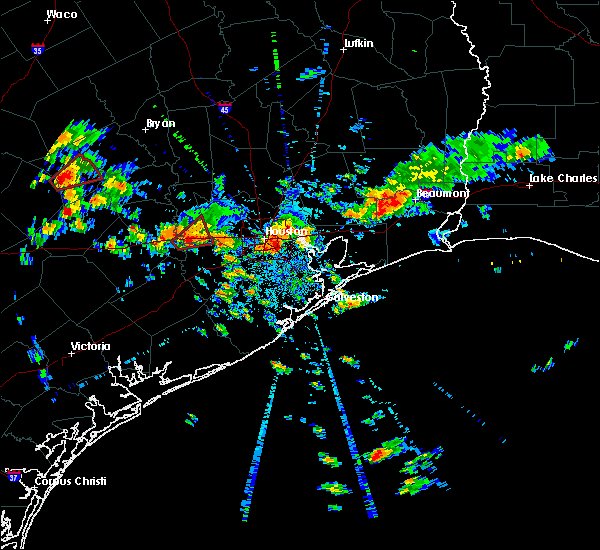 At 426 pm cdt, a severe thunderstorm capable of producing a tornado was located just southwest of brookshire, moving northeast at 20 mph. this storm has a history of producing tornadoes (radar indicated rotation). Hazards include tornado. Flying debris will be dangerous to those caught without shelter. mobile homes will be damaged or destroyed. damage to roofs, windows, and vehicles will occur. tree damage is likely. this dangerous storm will be near, fulshear and pattison around 435 pm cdt. brookshire around 440 pm cdt. Katy around 445 pm cdt. At 426 pm cdt, a severe thunderstorm capable of producing a tornado was located just southwest of brookshire, moving northeast at 20 mph. this storm has a history of producing tornadoes (radar indicated rotation). Hazards include tornado. Flying debris will be dangerous to those caught without shelter. mobile homes will be damaged or destroyed. damage to roofs, windows, and vehicles will occur. tree damage is likely. this dangerous storm will be near, fulshear and pattison around 435 pm cdt. brookshire around 440 pm cdt. Katy around 445 pm cdt.
|
| 10/31/2018 4:11 PM CDT |
 At 410 pm cdt, a severe thunderstorm capable of producing a tornado was located near simonton, or near brookshire, moving northeast at 20 mph. this storm has a history of producing tornadoes confirmed by emergency management (radar indicated rotation). Hazards include tornado. Flying debris will be dangerous to those caught without shelter. mobile homes will be damaged or destroyed. damage to roofs, windows, and vehicles will occur. tree damage is likely. this dangerous storm will be near, pattison around 430 pm cdt. brookshire and fulshear around 435 pm cdt. Katy around 445 pm cdt. At 410 pm cdt, a severe thunderstorm capable of producing a tornado was located near simonton, or near brookshire, moving northeast at 20 mph. this storm has a history of producing tornadoes confirmed by emergency management (radar indicated rotation). Hazards include tornado. Flying debris will be dangerous to those caught without shelter. mobile homes will be damaged or destroyed. damage to roofs, windows, and vehicles will occur. tree damage is likely. this dangerous storm will be near, pattison around 430 pm cdt. brookshire and fulshear around 435 pm cdt. Katy around 445 pm cdt.
|
| 10/31/2018 4:02 PM CDT |
 At 402 pm cdt, a storm with a history of a confirmed tornado was located near sealy, moving northeast at 20 mph (emergency management confirmed tornado). Hazards include damaging tornado. Flying debris will be dangerous to those caught without shelter. mobile homes will be damaged or destroyed. damage to roofs, windows, and vehicles will occur. tree damage is likely. the tornado will be near, san felipe around 410 pm cdt. simonton around 415 pm cdt. northern weston lakes around 425 pm cdt. pattison around 430 pm cdt. brookshire and fulshear around 435 pm cdt. Katy around 445 pm cdt. At 402 pm cdt, a storm with a history of a confirmed tornado was located near sealy, moving northeast at 20 mph (emergency management confirmed tornado). Hazards include damaging tornado. Flying debris will be dangerous to those caught without shelter. mobile homes will be damaged or destroyed. damage to roofs, windows, and vehicles will occur. tree damage is likely. the tornado will be near, san felipe around 410 pm cdt. simonton around 415 pm cdt. northern weston lakes around 425 pm cdt. pattison around 430 pm cdt. brookshire and fulshear around 435 pm cdt. Katy around 445 pm cdt.
|
| 4/3/2018 10:44 PM CDT |
 At 1043 pm cdt, severe thunderstorms were located along a line extending from near katy to wallis, moving southeast at 25 mph (radar indicated). Hazards include quarter size hail. Damage to vehicles is expected. Locations impacted include, northern sugar land, rosenberg, katy, richmond, sealy, brookshire, hunters creek village, bunker hill village, piney point village, town west, pecan grove, spring branch north, eldridge / west oaks, spring branch west, addicks park ten, spring valley, mission bend, hedwig village, wallis and fulshear. At 1043 pm cdt, severe thunderstorms were located along a line extending from near katy to wallis, moving southeast at 25 mph (radar indicated). Hazards include quarter size hail. Damage to vehicles is expected. Locations impacted include, northern sugar land, rosenberg, katy, richmond, sealy, brookshire, hunters creek village, bunker hill village, piney point village, town west, pecan grove, spring branch north, eldridge / west oaks, spring branch west, addicks park ten, spring valley, mission bend, hedwig village, wallis and fulshear.
|
| 4/3/2018 10:29 PM CDT |
 At 1027 pm cdt, severe thunderstorms were located along a line extending from 7 miles northeast of pattison to 6 miles northwest of wallis, moving east at 30 mph (radar indicated). Hazards include quarter size hail. damage to vehicles is expected At 1027 pm cdt, severe thunderstorms were located along a line extending from 7 miles northeast of pattison to 6 miles northwest of wallis, moving east at 30 mph (radar indicated). Hazards include quarter size hail. damage to vehicles is expected
|
| 4/3/2018 10:15 PM CDT |
 At 1015 pm cdt, severe thunderstorms were located along a line extending from near pattison to 8 miles north of eagle lake, moving east at 30 mph (radar indicated). Hazards include quarter size hail. Damage to vehicles is expected. Locations impacted include, katy, sealy, brookshire, eagle lake, southwestern eldridge / west oaks, east bernard, wallis, fulshear, pine island, simonton, san felipe, pattison, orchard, cinco ranch, weston lakes, monaville and egypt. At 1015 pm cdt, severe thunderstorms were located along a line extending from near pattison to 8 miles north of eagle lake, moving east at 30 mph (radar indicated). Hazards include quarter size hail. Damage to vehicles is expected. Locations impacted include, katy, sealy, brookshire, eagle lake, southwestern eldridge / west oaks, east bernard, wallis, fulshear, pine island, simonton, san felipe, pattison, orchard, cinco ranch, weston lakes, monaville and egypt.
|
| 4/3/2018 10:01 PM CDT |
 At 1001 pm cdt, severe thunderstorms were located along a line extending from near san felipe to 9 miles east of columbus, moving east at 35 mph (radar indicated). Hazards include quarter size hail. damage to vehicles is expected At 1001 pm cdt, severe thunderstorms were located along a line extending from near san felipe to 9 miles east of columbus, moving east at 35 mph (radar indicated). Hazards include quarter size hail. damage to vehicles is expected
|
| 3/28/2018 4:54 PM CDT |
 At 437 pm cdt, a severe thunderstorm was located near katy, moving east at 45 mph (radar indicated). Hazards include 60 mph wind gusts and nickel size hail. expect damage to roofs, siding, and trees At 437 pm cdt, a severe thunderstorm was located near katy, moving east at 45 mph (radar indicated). Hazards include 60 mph wind gusts and nickel size hail. expect damage to roofs, siding, and trees
|
| 3/28/2018 4:37 PM CDT |
 At 437 pm cdt, a severe thunderstorm was located near katy, moving east at 45 mph (radar indicated). Hazards include 60 mph wind gusts and nickel size hail. expect damage to roofs, siding, and trees At 437 pm cdt, a severe thunderstorm was located near katy, moving east at 45 mph (radar indicated). Hazards include 60 mph wind gusts and nickel size hail. expect damage to roofs, siding, and trees
|
| 8/27/2017 7:14 PM CDT |
 At 714 pm cdt, a severe thunderstorm capable of producing a tornado was located over pecan grove, moving northwest at 15 mph (radar indicated rotation). Hazards include tornado. Flying debris will be dangerous to those caught without shelter. mobile homes will be damaged or destroyed. damage to roofs, windows, and vehicles will occur. Tree damage is likely. At 714 pm cdt, a severe thunderstorm capable of producing a tornado was located over pecan grove, moving northwest at 15 mph (radar indicated rotation). Hazards include tornado. Flying debris will be dangerous to those caught without shelter. mobile homes will be damaged or destroyed. damage to roofs, windows, and vehicles will occur. Tree damage is likely.
|
| 8/27/2017 6:19 PM CDT |
 At 619 pm cdt, a severe thunderstorm capable of producing a tornado was located over cinco ranch, or near mission bend, moving northwest at 20 mph (radar indicated rotation). Hazards include tornado. Flying debris will be dangerous to those caught without shelter. mobile homes will be damaged or destroyed. damage to roofs, windows, and vehicles will occur. Tree damage is likely. At 619 pm cdt, a severe thunderstorm capable of producing a tornado was located over cinco ranch, or near mission bend, moving northwest at 20 mph (radar indicated rotation). Hazards include tornado. Flying debris will be dangerous to those caught without shelter. mobile homes will be damaged or destroyed. damage to roofs, windows, and vehicles will occur. Tree damage is likely.
|
| 8/27/2017 3:41 PM CDT |
 At 341 pm cdt, a severe thunderstorm capable of producing a tornado was located over northern eldridge / west oaks, moving northwest at 20 mph (radar indicated rotation). Hazards include tornado. Flying debris will be dangerous to those caught without shelter. mobile homes will be damaged or destroyed. damage to roofs, windows, and vehicles will occur. tree damage is likely. Locations impacted include, katy, addicks park ten, mission bend, eldridge / west oaks, spring branch west, cinco ranch, briar forest, cypress, westchase, four corners, alief, addicks and memorial. At 341 pm cdt, a severe thunderstorm capable of producing a tornado was located over northern eldridge / west oaks, moving northwest at 20 mph (radar indicated rotation). Hazards include tornado. Flying debris will be dangerous to those caught without shelter. mobile homes will be damaged or destroyed. damage to roofs, windows, and vehicles will occur. tree damage is likely. Locations impacted include, katy, addicks park ten, mission bend, eldridge / west oaks, spring branch west, cinco ranch, briar forest, cypress, westchase, four corners, alief, addicks and memorial.
|
| 8/27/2017 3:28 PM CDT |
 At 328 pm cdt, a severe thunderstorm capable of producing a tornado was located over mission bend, moving northwest at 20 mph (radar indicated rotation). Hazards include tornado. Flying debris will be dangerous to those caught without shelter. mobile homes will be damaged or destroyed. damage to roofs, windows, and vehicles will occur. Tree damage is likely. At 328 pm cdt, a severe thunderstorm capable of producing a tornado was located over mission bend, moving northwest at 20 mph (radar indicated rotation). Hazards include tornado. Flying debris will be dangerous to those caught without shelter. mobile homes will be damaged or destroyed. damage to roofs, windows, and vehicles will occur. Tree damage is likely.
|
| 8/27/2017 2:12 PM CDT |
 At 211 pm cdt, a severe thunderstorm capable of producing a tornado was located over fulshear, or 8 miles south of brookshire, moving northwest at 20 mph (radar indicated rotation). Hazards include tornado. Flying debris will be dangerous to those caught without shelter. mobile homes will be damaged or destroyed. damage to roofs, windows, and vehicles will occur. tree damage is likely. Locations impacted include, katy, brookshire, fulshear, simonton, san felipe, pattison, weston lakes and cinco ranch. At 211 pm cdt, a severe thunderstorm capable of producing a tornado was located over fulshear, or 8 miles south of brookshire, moving northwest at 20 mph (radar indicated rotation). Hazards include tornado. Flying debris will be dangerous to those caught without shelter. mobile homes will be damaged or destroyed. damage to roofs, windows, and vehicles will occur. tree damage is likely. Locations impacted include, katy, brookshire, fulshear, simonton, san felipe, pattison, weston lakes and cinco ranch.
|
| 8/27/2017 1:53 PM CDT |
 At 153 pm cdt, a severe thunderstorm capable of producing a tornado was located near cumings, or near rosenberg, moving north at 20 mph (radar indicated rotation). Hazards include tornado. Flying debris will be dangerous to those caught without shelter. mobile homes will be damaged or destroyed. damage to roofs, windows, and vehicles will occur. Tree damage is likely. At 153 pm cdt, a severe thunderstorm capable of producing a tornado was located near cumings, or near rosenberg, moving north at 20 mph (radar indicated rotation). Hazards include tornado. Flying debris will be dangerous to those caught without shelter. mobile homes will be damaged or destroyed. damage to roofs, windows, and vehicles will occur. Tree damage is likely.
|
| 8/27/2017 12:40 PM CDT |
 At 1239 pm cdt, a severe thunderstorm capable of producing a tornado was located over western rosenberg, moving north at 25 mph (radar indicated rotation). Hazards include tornado. Flying debris will be dangerous to those caught without shelter. mobile homes will be damaged or destroyed. damage to roofs, windows, and vehicles will occur. Tree damage is likely. At 1239 pm cdt, a severe thunderstorm capable of producing a tornado was located over western rosenberg, moving north at 25 mph (radar indicated rotation). Hazards include tornado. Flying debris will be dangerous to those caught without shelter. mobile homes will be damaged or destroyed. damage to roofs, windows, and vehicles will occur. Tree damage is likely.
|
| 8/27/2017 7:27 AM CDT |
 At 727 am cdt, a severe thunderstorm capable of producing a tornado was located over new territory, or over pecan grove, moving north at 25 mph (radar indicated rotation). Hazards include tornado. Flying debris will be dangerous to those caught without shelter. mobile homes will be damaged or destroyed. damage to roofs, windows, and vehicles will occur. Tree damage is likely. At 727 am cdt, a severe thunderstorm capable of producing a tornado was located over new territory, or over pecan grove, moving north at 25 mph (radar indicated rotation). Hazards include tornado. Flying debris will be dangerous to those caught without shelter. mobile homes will be damaged or destroyed. damage to roofs, windows, and vehicles will occur. Tree damage is likely.
|
| 8/27/2017 3:28 AM CDT |
 At 327 am cdt, a severe thunderstorm capable of producing a tornado was located near fulshear, or near pecan grove, moving north at 30 mph (radar indicated rotation). Hazards include tornado. Flying debris will be dangerous to those caught without shelter. mobile homes will be damaged or destroyed. damage to roofs, windows, and vehicles will occur. Tree damage is likely. At 327 am cdt, a severe thunderstorm capable of producing a tornado was located near fulshear, or near pecan grove, moving north at 30 mph (radar indicated rotation). Hazards include tornado. Flying debris will be dangerous to those caught without shelter. mobile homes will be damaged or destroyed. damage to roofs, windows, and vehicles will occur. Tree damage is likely.
|
| 8/27/2017 3:15 AM CDT |
 At 315 am cdt, a severe thunderstorm capable of producing a tornado was located over cumings, or over rosenberg, moving north at 35 mph (radar indicated rotation). Hazards include tornado. Flying debris will be dangerous to those caught without shelter. mobile homes will be damaged or destroyed. damage to roofs, windows, and vehicles will occur. Tree damage is likely. At 315 am cdt, a severe thunderstorm capable of producing a tornado was located over cumings, or over rosenberg, moving north at 35 mph (radar indicated rotation). Hazards include tornado. Flying debris will be dangerous to those caught without shelter. mobile homes will be damaged or destroyed. damage to roofs, windows, and vehicles will occur. Tree damage is likely.
|
| 8/27/2017 2:53 AM CDT |
 At 253 am cdt, a severe thunderstorm capable of producing a tornado was located near pattison, or 7 miles north of brookshire, moving north at 30 mph (radar indicated rotation). Hazards include tornado. Flying debris will be dangerous to those caught without shelter. mobile homes will be damaged or destroyed. damage to roofs, windows, and vehicles will occur. Tree damage is likely. At 253 am cdt, a severe thunderstorm capable of producing a tornado was located near pattison, or 7 miles north of brookshire, moving north at 30 mph (radar indicated rotation). Hazards include tornado. Flying debris will be dangerous to those caught without shelter. mobile homes will be damaged or destroyed. damage to roofs, windows, and vehicles will occur. Tree damage is likely.
|
| 8/27/2017 2:27 AM CDT |
 At 226 am cdt, a severe thunderstorm capable of producing a tornado was located over fulshear, or near brookshire, moving north at 30 mph (radar indicated rotation). Hazards include tornado. Flying debris will be dangerous to those caught without shelter. mobile homes will be damaged or destroyed. damage to roofs, windows, and vehicles will occur. Tree damage is likely. At 226 am cdt, a severe thunderstorm capable of producing a tornado was located over fulshear, or near brookshire, moving north at 30 mph (radar indicated rotation). Hazards include tornado. Flying debris will be dangerous to those caught without shelter. mobile homes will be damaged or destroyed. damage to roofs, windows, and vehicles will occur. Tree damage is likely.
|
| 8/27/2017 2:08 AM CDT |
 At 208 am cdt, a severe thunderstorm capable of producing a tornado was located near orchard, or 7 miles west of rosenberg, moving north at 30 mph (radar indicated rotation). Hazards include tornado. Flying debris will be dangerous to those caught without shelter. mobile homes will be damaged or destroyed. damage to roofs, windows, and vehicles will occur. Tree damage is likely. At 208 am cdt, a severe thunderstorm capable of producing a tornado was located near orchard, or 7 miles west of rosenberg, moving north at 30 mph (radar indicated rotation). Hazards include tornado. Flying debris will be dangerous to those caught without shelter. mobile homes will be damaged or destroyed. damage to roofs, windows, and vehicles will occur. Tree damage is likely.
|
| 8/26/2017 8:13 PM CDT |
 At 813 pm cdt, a severe thunderstorm capable of producing a tornado was located near addicks park ten, moving north at 25 mph (radar indicated rotation). Hazards include tornado. Flying debris will be dangerous to those caught without shelter. mobile homes will be damaged or destroyed. damage to roofs, windows, and vehicles will occur. Tree damage is likely. At 813 pm cdt, a severe thunderstorm capable of producing a tornado was located near addicks park ten, moving north at 25 mph (radar indicated rotation). Hazards include tornado. Flying debris will be dangerous to those caught without shelter. mobile homes will be damaged or destroyed. damage to roofs, windows, and vehicles will occur. Tree damage is likely.
|
| 8/26/2017 7:56 PM CDT |
 The tornado warning for north central fort bend, southeastern waller and west central harris counties will expire at 800 pm cdt, the storm which prompted the warning has weakened below severe limits, and has exited the warned area. therefore, the warning will be allowed to expire. however heavy rain is still possible with this thunderstorm. a tornado watch remains in effect until 200 am cdt for southeastern texas. The tornado warning for north central fort bend, southeastern waller and west central harris counties will expire at 800 pm cdt, the storm which prompted the warning has weakened below severe limits, and has exited the warned area. therefore, the warning will be allowed to expire. however heavy rain is still possible with this thunderstorm. a tornado watch remains in effect until 200 am cdt for southeastern texas.
|
| 8/26/2017 7:34 PM CDT |
 At 734 pm cdt, a severe thunderstorm capable of producing a tornado was located over southwestern sugar land, moving north at 35 mph (radar indicated rotation). Hazards include tornado. Flying debris will be dangerous to those caught without shelter. mobile homes will be damaged or destroyed. damage to roofs, windows, and vehicles will occur. tree damage is likely. Locations impacted include, sugar land, katy, richmond, mission bend, pecan grove, eldridge / west oaks, southwestern addicks park ten, four corners, greatwood, new territory and cinco ranch. At 734 pm cdt, a severe thunderstorm capable of producing a tornado was located over southwestern sugar land, moving north at 35 mph (radar indicated rotation). Hazards include tornado. Flying debris will be dangerous to those caught without shelter. mobile homes will be damaged or destroyed. damage to roofs, windows, and vehicles will occur. tree damage is likely. Locations impacted include, sugar land, katy, richmond, mission bend, pecan grove, eldridge / west oaks, southwestern addicks park ten, four corners, greatwood, new territory and cinco ranch.
|
| 8/26/2017 7:21 PM CDT |
 At 721 pm cdt, a severe thunderstorm capable of producing a tornado was located over greatwood, or near richmond, moving north at 35 mph (radar indicated rotation). Hazards include tornado. Flying debris will be dangerous to those caught without shelter. mobile homes will be damaged or destroyed. damage to roofs, windows, and vehicles will occur. Tree damage is likely. At 721 pm cdt, a severe thunderstorm capable of producing a tornado was located over greatwood, or near richmond, moving north at 35 mph (radar indicated rotation). Hazards include tornado. Flying debris will be dangerous to those caught without shelter. mobile homes will be damaged or destroyed. damage to roofs, windows, and vehicles will occur. Tree damage is likely.
|
| 8/26/2017 6:44 PM CDT |
 At 644 pm cdt, a severe thunderstorm capable of producing a tornado was located near fairchilds, or near rosenberg, moving north at 30 mph (radar indicated rotation). Hazards include tornado. Flying debris will be dangerous to those caught without shelter. mobile homes will be damaged or destroyed. damage to roofs, windows, and vehicles will occur. Tree damage is likely. At 644 pm cdt, a severe thunderstorm capable of producing a tornado was located near fairchilds, or near rosenberg, moving north at 30 mph (radar indicated rotation). Hazards include tornado. Flying debris will be dangerous to those caught without shelter. mobile homes will be damaged or destroyed. damage to roofs, windows, and vehicles will occur. Tree damage is likely.
|
| 8/26/2017 6:37 PM CDT |
 At 636 pm cdt, a severe thunderstorm capable of producing a tornado was located near fairchilds, or 8 miles southeast of rosenberg, moving north at 35 mph. additional thunderstorms within this line may also be capable of brief tornadoes (radar indicated rotation). Hazards include tornado. Flying debris will be dangerous to those caught without shelter. mobile homes will be damaged or destroyed. damage to roofs, windows, and vehicles will occur. tree damage is likely. Locations impacted include, rosenberg, katy, richmond, brookshire, pecan grove, southwestern eldridge / west oaks, needville, fulshear, pleak, simonton, fairchilds, pattison, cinco ranch, weston lakes, cumings, new territory and greatwood. At 636 pm cdt, a severe thunderstorm capable of producing a tornado was located near fairchilds, or 8 miles southeast of rosenberg, moving north at 35 mph. additional thunderstorms within this line may also be capable of brief tornadoes (radar indicated rotation). Hazards include tornado. Flying debris will be dangerous to those caught without shelter. mobile homes will be damaged or destroyed. damage to roofs, windows, and vehicles will occur. tree damage is likely. Locations impacted include, rosenberg, katy, richmond, brookshire, pecan grove, southwestern eldridge / west oaks, needville, fulshear, pleak, simonton, fairchilds, pattison, cinco ranch, weston lakes, cumings, new territory and greatwood.
|
| 8/26/2017 6:18 PM CDT |
 At 617 pm cdt, a severe thunderstorm capable of producing tornadoes was moving north at 35 mph. thunderstorms capable of producing tornadoes were located 14 miles southeast of sugar land and 10 miles west of sugar land respectively (radar indicated rotation). Hazards include tornado. Flying debris will be dangerous to those caught without shelter. mobile homes will be damaged or destroyed. damage to roofs, windows, and vehicles will occur. Tree damage is likely. At 617 pm cdt, a severe thunderstorm capable of producing tornadoes was moving north at 35 mph. thunderstorms capable of producing tornadoes were located 14 miles southeast of sugar land and 10 miles west of sugar land respectively (radar indicated rotation). Hazards include tornado. Flying debris will be dangerous to those caught without shelter. mobile homes will be damaged or destroyed. damage to roofs, windows, and vehicles will occur. Tree damage is likely.
|
| 8/26/2017 12:53 PM CDT |
 At 1252 pm cdt, a severe thunderstorm capable of producing a tornado was located near fulshear, or 7 miles northwest of richmond, moving north at 40 mph (radar indicated rotation). Hazards include tornado. Flying debris will be dangerous to those caught without shelter. mobile homes will be damaged or destroyed. damage to roofs, windows, and vehicles will occur. Tree damage is likely. At 1252 pm cdt, a severe thunderstorm capable of producing a tornado was located near fulshear, or 7 miles northwest of richmond, moving north at 40 mph (radar indicated rotation). Hazards include tornado. Flying debris will be dangerous to those caught without shelter. mobile homes will be damaged or destroyed. damage to roofs, windows, and vehicles will occur. Tree damage is likely.
|
| 8/26/2017 4:57 AM CDT |
 At 457 am cdt, a severe thunderstorm capable of producing a tornado was located near katy, moving northwest at 25 mph (radar indicated rotation). Hazards include tornado. Flying debris will be dangerous to those caught without shelter. mobile homes will be damaged or destroyed. damage to roofs, windows, and vehicles will occur. Tree damage is likely. At 457 am cdt, a severe thunderstorm capable of producing a tornado was located near katy, moving northwest at 25 mph (radar indicated rotation). Hazards include tornado. Flying debris will be dangerous to those caught without shelter. mobile homes will be damaged or destroyed. damage to roofs, windows, and vehicles will occur. Tree damage is likely.
|
| 8/26/2017 2:10 AM CDT |
 At 210 am cdt, a severe thunderstorm capable of producing a tornado was located over greatwood, or over first colony, moving northwest at 55 mph (radar indicated rotation). Hazards include tornado. Flying debris will be dangerous to those caught without shelter. mobile homes will be damaged or destroyed. damage to roofs, windows, and vehicles will occur. Tree damage is likely. At 210 am cdt, a severe thunderstorm capable of producing a tornado was located over greatwood, or over first colony, moving northwest at 55 mph (radar indicated rotation). Hazards include tornado. Flying debris will be dangerous to those caught without shelter. mobile homes will be damaged or destroyed. damage to roofs, windows, and vehicles will occur. Tree damage is likely.
|
| 5/23/2017 7:27 PM CDT |
 At 725 pm cdt, a severe thunderstorm was located near orchard, or 7 miles west of rosenberg, moving southeast at 55 mph. an off duty nws meteorologist reported 60mph winds, tree limbs and fences down near sealy (radar indicated). Hazards include 60 mph wind gusts and quarter size hail. Hail damage to vehicles is expected. expect wind damage to roofs, siding, and trees. Locations impacted include, sugar land, missouri city, rosenberg, stafford, katy, richmond, brookshire, town west, pecan grove, first colony, mission bend, southwestern eldridge / west oaks, fresno, meadows place, needville, east bernard, wallis, fulshear, pleak and simonton. At 725 pm cdt, a severe thunderstorm was located near orchard, or 7 miles west of rosenberg, moving southeast at 55 mph. an off duty nws meteorologist reported 60mph winds, tree limbs and fences down near sealy (radar indicated). Hazards include 60 mph wind gusts and quarter size hail. Hail damage to vehicles is expected. expect wind damage to roofs, siding, and trees. Locations impacted include, sugar land, missouri city, rosenberg, stafford, katy, richmond, brookshire, town west, pecan grove, first colony, mission bend, southwestern eldridge / west oaks, fresno, meadows place, needville, east bernard, wallis, fulshear, pleak and simonton.
|
| 5/23/2017 7:14 PM CDT |
 At 714 pm cdt, a severe thunderstorm was located over wallis, or 9 miles southwest of brookshire, moving southeast at 50 mph (radar indicated). Hazards include 60 mph wind gusts and quarter size hail. Hail damage to vehicles is expected. Expect wind damage to roofs, siding, and trees. At 714 pm cdt, a severe thunderstorm was located over wallis, or 9 miles southwest of brookshire, moving southeast at 50 mph (radar indicated). Hazards include 60 mph wind gusts and quarter size hail. Hail damage to vehicles is expected. Expect wind damage to roofs, siding, and trees.
|
| 5/23/2017 7:03 PM CDT |
 At 701 pm cdt, a severe thunderstorm was located near sealy, moving southeast at 65 mph. large tree reported down in frelsburg on fm 109 (radar indicated). Hazards include 60 mph wind gusts and quarter size hail. Hail damage to vehicles is expected. expect wind damage to roofs, siding, and trees. Locations impacted include, northwestern rosenberg, katy, sealy, brookshire, bellville, eagle lake, southwestern addicks park ten, east bernard, wallis, fulshear, simonton, san felipe, pattison, orchard, cinco ranch, weston lakes, egypt, cat spring and hungerford. At 701 pm cdt, a severe thunderstorm was located near sealy, moving southeast at 65 mph. large tree reported down in frelsburg on fm 109 (radar indicated). Hazards include 60 mph wind gusts and quarter size hail. Hail damage to vehicles is expected. expect wind damage to roofs, siding, and trees. Locations impacted include, northwestern rosenberg, katy, sealy, brookshire, bellville, eagle lake, southwestern addicks park ten, east bernard, wallis, fulshear, simonton, san felipe, pattison, orchard, cinco ranch, weston lakes, egypt, cat spring and hungerford.
|
| 5/23/2017 6:55 PM CDT |
 At 654 pm cdt, a severe thunderstorm was located 7 miles west of sealy, moving southeast at 60 mph (radar indicated). Hazards include 60 mph wind gusts and quarter size hail. Hail damage to vehicles is expected. Expect wind damage to roofs, siding, and trees. At 654 pm cdt, a severe thunderstorm was located 7 miles west of sealy, moving southeast at 60 mph (radar indicated). Hazards include 60 mph wind gusts and quarter size hail. Hail damage to vehicles is expected. Expect wind damage to roofs, siding, and trees.
|
| 3/29/2017 9:16 AM CDT |
 At 915 am cdt, a severe thunderstorm was located near katy, moving northeast at 25 mph (radar indicated). Hazards include 60 mph wind gusts. Expect damage to roofs, siding, and trees. Locations impacted include, katy, jersey village, addicks park ten, cypress, carverdale and westbranch. At 915 am cdt, a severe thunderstorm was located near katy, moving northeast at 25 mph (radar indicated). Hazards include 60 mph wind gusts. Expect damage to roofs, siding, and trees. Locations impacted include, katy, jersey village, addicks park ten, cypress, carverdale and westbranch.
|
| 3/29/2017 8:57 AM CDT |
 At 856 am cdt, a severe thunderstorm was located near katy, moving northeast at 25 mph (radar indicated). Hazards include 60 mph wind gusts and penny size hail. expect damage to roofs, siding, and trees At 856 am cdt, a severe thunderstorm was located near katy, moving northeast at 25 mph (radar indicated). Hazards include 60 mph wind gusts and penny size hail. expect damage to roofs, siding, and trees
|
| 3/29/2017 8:27 AM CDT |
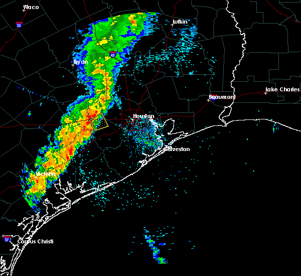 At 826 am cdt, a severe thunderstorm was located near simonton, or near brookshire, moving northeast at 35 mph (radar indicated). Hazards include 60 mph wind gusts and penny size hail. Expect damage to roofs, siding, and trees. Locations impacted include, katy, brookshire, fulshear, simonton, pattison, orchard, weston lakes and cinco ranch. At 826 am cdt, a severe thunderstorm was located near simonton, or near brookshire, moving northeast at 35 mph (radar indicated). Hazards include 60 mph wind gusts and penny size hail. Expect damage to roofs, siding, and trees. Locations impacted include, katy, brookshire, fulshear, simonton, pattison, orchard, weston lakes and cinco ranch.
|
| 3/29/2017 8:09 AM CDT |
 At 809 am cdt, a severe thunderstorm was located near wallis, or 9 miles south of sealy, moving east at 40 mph (radar indicated). Hazards include 60 mph wind gusts and penny size hail. expect damage to roofs, siding, and trees At 809 am cdt, a severe thunderstorm was located near wallis, or 9 miles south of sealy, moving east at 40 mph (radar indicated). Hazards include 60 mph wind gusts and penny size hail. expect damage to roofs, siding, and trees
|
| 2/20/2017 5:48 AM CST |
 At 547 am cst, severe thunderstorms were located along a line extending from waller to pecan grove, moving northeast at 50 mph (radar indicated). Hazards include 60 mph wind gusts. expect damage to roofs, siding, and trees At 547 am cst, severe thunderstorms were located along a line extending from waller to pecan grove, moving northeast at 50 mph (radar indicated). Hazards include 60 mph wind gusts. expect damage to roofs, siding, and trees
|
| 2/20/2017 5:09 AM CST |
 At 509 am cst, severe thunderstorms were located along a line extending from 10 miles east of columbus to 7 miles east of eagle lake to 6 miles northwest of wharton, moving northeast at 45 mph (radar indicated). Hazards include 60 mph wind gusts. expect damage to roofs, siding, and trees At 509 am cst, severe thunderstorms were located along a line extending from 10 miles east of columbus to 7 miles east of eagle lake to 6 miles northwest of wharton, moving northeast at 45 mph (radar indicated). Hazards include 60 mph wind gusts. expect damage to roofs, siding, and trees
|
| 2/14/2017 8:16 AM CST |
 At 816 am cst, severe thunderstorms were located along a line extending from 8 miles southwest of huntsville state park to 7 miles southwest of lake conroe dam to 6 miles southwest of cypress to near cumings, moving east at 25 mph (radar indicated). Hazards include 60 mph wind gusts. expect damage to roofs, siding, and trees At 816 am cst, severe thunderstorms were located along a line extending from 8 miles southwest of huntsville state park to 7 miles southwest of lake conroe dam to 6 miles southwest of cypress to near cumings, moving east at 25 mph (radar indicated). Hazards include 60 mph wind gusts. expect damage to roofs, siding, and trees
|
| 1/16/2017 8:56 AM CST |
 The tornado warning for southeastern waller, west central harris and north central fort bend counties will expire at 900 am cst, the storm which prompted the warning has weakened below severe limits, and no longer appears capable of producing a tornado. therefore the warning will be allowed to expire. to report severe weather, contact your nearest law enforcement agency. they will relay your report to the national weather service league city. The tornado warning for southeastern waller, west central harris and north central fort bend counties will expire at 900 am cst, the storm which prompted the warning has weakened below severe limits, and no longer appears capable of producing a tornado. therefore the warning will be allowed to expire. to report severe weather, contact your nearest law enforcement agency. they will relay your report to the national weather service league city.
|
| 1/16/2017 8:44 AM CST |
 At 843 am cst, a severe thunderstorm capable of producing a tornado was located over brookshire, moving northeast at 25 mph (radar indicated rotation). Hazards include tornado. Expect damage to mobile homes, roofs, and vehicles. Locations impacted include, katy, brookshire and pattison. At 843 am cst, a severe thunderstorm capable of producing a tornado was located over brookshire, moving northeast at 25 mph (radar indicated rotation). Hazards include tornado. Expect damage to mobile homes, roofs, and vehicles. Locations impacted include, katy, brookshire and pattison.
|
| 1/16/2017 8:25 AM CST |
 At 825 am cst, a severe thunderstorm capable of producing a tornado was located over simonton, or 8 miles south of brookshire, moving northeast at 30 mph (radar indicated rotation). Hazards include tornado. expect damage to mobile homes, roofs, and vehicles At 825 am cst, a severe thunderstorm capable of producing a tornado was located over simonton, or 8 miles south of brookshire, moving northeast at 30 mph (radar indicated rotation). Hazards include tornado. expect damage to mobile homes, roofs, and vehicles
|
| 1/16/2017 6:46 AM CST |
 At 646 am cst, a severe thunderstorm capable of producing a tornado was located over cinco ranch, or near katy, moving northeast at 20 mph (radar indicated rotation). Hazards include tornado. expect damage to mobile homes, roofs, and vehicles At 646 am cst, a severe thunderstorm capable of producing a tornado was located over cinco ranch, or near katy, moving northeast at 20 mph (radar indicated rotation). Hazards include tornado. expect damage to mobile homes, roofs, and vehicles
|
| 1/16/2017 6:35 AM CST | Trees and fences down in cinco ranch in fort bend county TX, 3.4 miles NW of Katy, TX |
| 1/16/2017 6:29 AM CST | 3 mangled trampolines... one displaced in another yard... and also downed fence in fort bend county TX, 3.9 miles NNE of Katy, TX |
| 1/16/2017 6:27 AM CST |
 At 626 am cst, a severe thunderstorm capable of producing a tornado was located near katy, moving northeast at 25 mph (radar indicated rotation). Hazards include tornado. Flying debris will be dangerous to those caught without shelter. mobile homes will be damaged or destroyed. damage to roofs, windows, and vehicles will occur. tree damage is likely. Locations impacted include, katy, southwestern addicks park ten, northwestern eldridge / west oaks, fulshear, cinco ranch and memorial. At 626 am cst, a severe thunderstorm capable of producing a tornado was located near katy, moving northeast at 25 mph (radar indicated rotation). Hazards include tornado. Flying debris will be dangerous to those caught without shelter. mobile homes will be damaged or destroyed. damage to roofs, windows, and vehicles will occur. tree damage is likely. Locations impacted include, katy, southwestern addicks park ten, northwestern eldridge / west oaks, fulshear, cinco ranch and memorial.
|
| 1/16/2017 6:12 AM CST |
 At 612 am cst, a severe thunderstorm capable of producing a tornado was located over fulshear, or near brookshire, moving northeast at 20 mph (radar indicated rotation). Hazards include tornado. Flying debris will be dangerous to those caught without shelter. mobile homes will be damaged or destroyed. damage to roofs, windows, and vehicles will occur. Tree damage is likely. At 612 am cst, a severe thunderstorm capable of producing a tornado was located over fulshear, or near brookshire, moving northeast at 20 mph (radar indicated rotation). Hazards include tornado. Flying debris will be dangerous to those caught without shelter. mobile homes will be damaged or destroyed. damage to roofs, windows, and vehicles will occur. Tree damage is likely.
|
| 1/16/2017 6:07 AM CST |
 At 607 am cst, a severe thunderstorm capable of producing a tornado was located over weston lakes, or east of simonton near brookshire, moving northeast at 25 mph (radar indicated rotation). Hazards include tornado. Flying debris will be dangerous to those caught without shelter. mobile homes will be damaged or destroyed. damage to roofs, windows, and vehicles will occur. tree damage is likely. Locations impacted include, katy, brookshire, fulshear, simonton, orchard, weston lakes and cinco ranch. At 607 am cst, a severe thunderstorm capable of producing a tornado was located over weston lakes, or east of simonton near brookshire, moving northeast at 25 mph (radar indicated rotation). Hazards include tornado. Flying debris will be dangerous to those caught without shelter. mobile homes will be damaged or destroyed. damage to roofs, windows, and vehicles will occur. tree damage is likely. Locations impacted include, katy, brookshire, fulshear, simonton, orchard, weston lakes and cinco ranch.
|
| 1/16/2017 5:47 AM CST |
 At 546 am cst, a severe thunderstorm capable of producing a tornado was located over wallis, or 11 miles southwest of brookshire, moving northeast at 25 mph (radar indicated rotation). Hazards include tornado. Flying debris will be dangerous to those caught without shelter. mobile homes will be damaged or destroyed. damage to roofs, windows, and vehicles will occur. Tree damage is likely. At 546 am cst, a severe thunderstorm capable of producing a tornado was located over wallis, or 11 miles southwest of brookshire, moving northeast at 25 mph (radar indicated rotation). Hazards include tornado. Flying debris will be dangerous to those caught without shelter. mobile homes will be damaged or destroyed. damage to roofs, windows, and vehicles will occur. Tree damage is likely.
|
| 1/2/2017 7:45 AM CST |
 At 745 am cst, severe thunderstorms were located along a line extending from near apple springs to 6 miles north of hockley to weston lakes, moving east at 35 mph (radar indicated). Hazards include 60 mph wind gusts and penny size hail. expect damage to roofs, siding, and trees At 745 am cst, severe thunderstorms were located along a line extending from near apple springs to 6 miles north of hockley to weston lakes, moving east at 35 mph (radar indicated). Hazards include 60 mph wind gusts and penny size hail. expect damage to roofs, siding, and trees
|
| 1/2/2017 5:25 AM CST |
 At 524 am cst, a severe thunderstorm was located near addicks park ten, moving northeast at 55 mph (radar indicated). Hazards include 60 mph wind gusts and quarter size hail. Hail damage to vehicles is expected. Expect wind damage to roofs, siding, and trees. At 524 am cst, a severe thunderstorm was located near addicks park ten, moving northeast at 55 mph (radar indicated). Hazards include 60 mph wind gusts and quarter size hail. Hail damage to vehicles is expected. Expect wind damage to roofs, siding, and trees.
|
| 6/28/2016 2:38 PM CDT |
 At 236 pm cdt, severe thunderstorms were located along a line extending from near cypress to westbranch to near northside houston to jacinto city to channelview, moving south at 15 mph. radar estimates 65 mph wind just above the ground and this may mix to the surface to produce wind damage (radar indicated). Hazards include 60 mph wind gusts. Expect damage to roofs. siding. And trees. At 236 pm cdt, severe thunderstorms were located along a line extending from near cypress to westbranch to near northside houston to jacinto city to channelview, moving south at 15 mph. radar estimates 65 mph wind just above the ground and this may mix to the surface to produce wind damage (radar indicated). Hazards include 60 mph wind gusts. Expect damage to roofs. siding. And trees.
|
| 5/27/2016 4:42 AM CDT |
 At 441 am cdt, severe thunderstorms were located along a line extending from willis to near chateau woods to near katy, moving east at 50 mph (radar indicated). Hazards include 60 mph wind gusts. Expect damage to roofs. siding. and trees. Locations impacted include, conroe, humble, katy, tomball, cleveland, jersey village, willis, pinehurst, greater greenspoint, spring, kingwood, northside / northline, the woodlands, aldine, northern addicks park ten, hockley, oak ridge north, panorama village, shenandoah and splendora. At 441 am cdt, severe thunderstorms were located along a line extending from willis to near chateau woods to near katy, moving east at 50 mph (radar indicated). Hazards include 60 mph wind gusts. Expect damage to roofs. siding. and trees. Locations impacted include, conroe, humble, katy, tomball, cleveland, jersey village, willis, pinehurst, greater greenspoint, spring, kingwood, northside / northline, the woodlands, aldine, northern addicks park ten, hockley, oak ridge north, panorama village, shenandoah and splendora.
|
| 5/27/2016 4:24 AM CDT |
 At 423 am cdt, severe thunderstorms were located along a line extending from near montgomery to near tomball to near brookshire, moving east at 40 mph (radar indicated). Hazards include 60 mph wind gusts. Expect damage to roofs. siding. and trees. Locations impacted include, conroe, humble, katy, tomball, cleveland, jersey village, willis, prairie view, pinehurst, greater greenspoint, addicks park ten, spring, kingwood, northside / northline, the woodlands, aldine, spring branch north, spring branch west, northern greater heights and near northside houston. At 423 am cdt, severe thunderstorms were located along a line extending from near montgomery to near tomball to near brookshire, moving east at 40 mph (radar indicated). Hazards include 60 mph wind gusts. Expect damage to roofs. siding. and trees. Locations impacted include, conroe, humble, katy, tomball, cleveland, jersey village, willis, prairie view, pinehurst, greater greenspoint, addicks park ten, spring, kingwood, northside / northline, the woodlands, aldine, spring branch north, spring branch west, northern greater heights and near northside houston.
|
| 5/27/2016 4:08 AM CDT |
 At 408 am cdt, severe thunderstorms were located along a line extending from 8 miles north of todd mission to 6 miles west of stagecoach to pattison, moving east at 40 mph (radar indicated). Hazards include 60 mph wind gusts and penny size hail. Expect damage to roofs. siding. And trees. At 408 am cdt, severe thunderstorms were located along a line extending from 8 miles north of todd mission to 6 miles west of stagecoach to pattison, moving east at 40 mph (radar indicated). Hazards include 60 mph wind gusts and penny size hail. Expect damage to roofs. siding. And trees.
|
| 5/27/2016 3:55 AM CDT |
 At 355 am cdt, severe thunderstorms were located along a line extending from near navasota to prairie view to sealy, moving east at 40 mph (radar indicated). Hazards include 70 mph wind gusts and quarter size hail. Hail damage to vehicles is expected. expect considerable tree damage. wind damage is also likely to mobile homes, roofs, and outbuildings. Locations impacted include, katy, navasota, sealy, hempstead, prairie view, brookshire, bellville, pinehurst, washington, hockley, waller, magnolia, pine island, san felipe, stagecoach, pattison, todd mission, dobbin, monaville and cat spring. At 355 am cdt, severe thunderstorms were located along a line extending from near navasota to prairie view to sealy, moving east at 40 mph (radar indicated). Hazards include 70 mph wind gusts and quarter size hail. Hail damage to vehicles is expected. expect considerable tree damage. wind damage is also likely to mobile homes, roofs, and outbuildings. Locations impacted include, katy, navasota, sealy, hempstead, prairie view, brookshire, bellville, pinehurst, washington, hockley, waller, magnolia, pine island, san felipe, stagecoach, pattison, todd mission, dobbin, monaville and cat spring.
|
| 5/27/2016 3:34 AM CDT |
 At 333 am cdt, severe thunderstorms were located along a line extending from near washington to 7 miles west of hempstead to 12 miles northeast of columbus, moving east at 40 mph. the storm has intensified recently (radar indicated). Hazards include 70 mph wind gusts and quarter size hail. Hail damage to vehicles is expected. expect considerable tree damage. wind damage is also likely to mobile homes, roofs, and outbuildings. Locations impacted include, brenham, katy, navasota, sealy, hempstead, prairie view, brookshire, bellville, pinehurst, washington, hockley, waller, magnolia, pine island, san felipe, stagecoach, pattison, todd mission, dobbin and monaville. At 333 am cdt, severe thunderstorms were located along a line extending from near washington to 7 miles west of hempstead to 12 miles northeast of columbus, moving east at 40 mph. the storm has intensified recently (radar indicated). Hazards include 70 mph wind gusts and quarter size hail. Hail damage to vehicles is expected. expect considerable tree damage. wind damage is also likely to mobile homes, roofs, and outbuildings. Locations impacted include, brenham, katy, navasota, sealy, hempstead, prairie view, brookshire, bellville, pinehurst, washington, hockley, waller, magnolia, pine island, san felipe, stagecoach, pattison, todd mission, dobbin and monaville.
|
| 5/27/2016 3:28 AM CDT |
 At 328 am cdt, severe thunderstorms were located along a line extending from 8 miles west of washington to 9 miles southeast of brenham to 9 miles northeast of columbus, moving east at 40 mph (radar indicated). Hazards include 60 mph wind gusts and nickel size hail. Expect damage to roofs. siding. And trees. At 328 am cdt, severe thunderstorms were located along a line extending from 8 miles west of washington to 9 miles southeast of brenham to 9 miles northeast of columbus, moving east at 40 mph (radar indicated). Hazards include 60 mph wind gusts and nickel size hail. Expect damage to roofs. siding. And trees.
|
| 5/12/2016 9:07 PM CDT | Quarter sized hail reported 6.4 miles W of Katy, TX, quarter size hail |
| 4/30/2016 7:13 AM CDT |
 At 711 am cdt, severe thunderstorms were located along a line extending from 6 miles south of bedias to 7 miles west of todd mission to waller, moving northeast at 40 mph (radar indicated winds in excess of 55 knots just off the surface with these storms). Hazards include 60 mph wind gusts and penny size hail. Expect damage to roofs. siding. and trees. Toppled trees. At 711 am cdt, severe thunderstorms were located along a line extending from 6 miles south of bedias to 7 miles west of todd mission to waller, moving northeast at 40 mph (radar indicated winds in excess of 55 knots just off the surface with these storms). Hazards include 60 mph wind gusts and penny size hail. Expect damage to roofs. siding. and trees. Toppled trees.
|
| 4/27/2016 4:25 AM CDT |
 At 425 am cdt, severe thunderstorms were located along a line extending from near huntsville state park to near todd mission to 8 miles east of columbus, moving northeast at 145 mph (radar indicated). Hazards include 60 mph wind gusts and nickel size hail. Expect damage to roofs. siding. And trees. At 425 am cdt, severe thunderstorms were located along a line extending from near huntsville state park to near todd mission to 8 miles east of columbus, moving northeast at 145 mph (radar indicated). Hazards include 60 mph wind gusts and nickel size hail. Expect damage to roofs. siding. And trees.
|
| 4/13/2016 1:33 AM CDT |
 At 133 am cdt, severe thunderstorms were located along a line extending from 7 miles east of hockley to near cypress to westbranch to sugar land to pleak, moving east at 60 mph (radar indicated). Hazards include 60 mph wind gusts and quarter size hail. Hail damage to vehicles is expected. expect wind damage to roofs, siding, and trees. Locations impacted include, sugar land, missouri city, rosenberg, stafford, bellaire, west university place, richmond, tomball, jersey village, hunters creek village, bunker hill village, piney point village, astrodome area, spring valley, fourth ward, town west, pecan grove, first colony, spring branch west and neartown / montrose. At 133 am cdt, severe thunderstorms were located along a line extending from 7 miles east of hockley to near cypress to westbranch to sugar land to pleak, moving east at 60 mph (radar indicated). Hazards include 60 mph wind gusts and quarter size hail. Hail damage to vehicles is expected. expect wind damage to roofs, siding, and trees. Locations impacted include, sugar land, missouri city, rosenberg, stafford, bellaire, west university place, richmond, tomball, jersey village, hunters creek village, bunker hill village, piney point village, astrodome area, spring valley, fourth ward, town west, pecan grove, first colony, spring branch west and neartown / montrose.
|
| 4/13/2016 12:59 AM CDT |
 At 1259 am cdt, severe thunderstorms were located along a line extending from 8 miles southwest of pine island to 7 miles northwest of pattison to brookshire to near orchard to 10 miles northwest of wharton, moving east at 60 mph (radar indicated). Hazards include 60 mph wind gusts and quarter size hail. Hail damage to vehicles is expected. Expect wind damage to roofs, siding, and trees. At 1259 am cdt, severe thunderstorms were located along a line extending from 8 miles southwest of pine island to 7 miles northwest of pattison to brookshire to near orchard to 10 miles northwest of wharton, moving east at 60 mph (radar indicated). Hazards include 60 mph wind gusts and quarter size hail. Hail damage to vehicles is expected. Expect wind damage to roofs, siding, and trees.
|
| 3/9/2016 12:37 PM CST |
 The severe thunderstorm warning for southeastern waller and northwestern fort bend counties will expire at 1245 pm cst, the storm which prompted the warning has weakened below severe limits, and no longer pose an immediate threat to life or property. therefore the warning will be allowed to expire. however heavy rain is still possible with this thunderstorm. The severe thunderstorm warning for southeastern waller and northwestern fort bend counties will expire at 1245 pm cst, the storm which prompted the warning has weakened below severe limits, and no longer pose an immediate threat to life or property. therefore the warning will be allowed to expire. however heavy rain is still possible with this thunderstorm.
|
| 3/9/2016 12:17 PM CST |
 At 1217 pm cst, a severe thunderstorm was located over orchard, or 11 miles south of brookshire, moving northeast at 30 mph (radar indicated). Hazards include 60 mph wind gusts. Expect damage to roofs. siding. And trees. At 1217 pm cst, a severe thunderstorm was located over orchard, or 11 miles south of brookshire, moving northeast at 30 mph (radar indicated). Hazards include 60 mph wind gusts. Expect damage to roofs. siding. And trees.
|
| 5/27/2015 5:28 AM CDT | At 527 am cdt, doppler radar indicated a line of severe thunderstorms capable of producing damaging winds in excess of 60 mph. these storms were located along a line extending from near sour lake to near waller. these storms were nearly stationary. locations impacted include, northwestern pasadena, baytown, deer park, bellaire, humble, west university place, katy, galena park, tomball, jacinto city, liberty, jersey village, dayton, sealy, brookshire, hunters creek village, bunker hill village, piney point village, beach city and astrodome area. |
| 5/27/2015 5:21 AM CDT | At 520 am cdt, doppler radar indicated a line of severe thunderstorms capable of producing damaging winds in excess of 60 mph. these storms were located along a line extending from sour lake to near waller, and moving south at 25 mph. frequent lightning and torrential rainfall is also occurring with this line. |
| 5/25/2015 10:18 PM CDT | At 1017 pm cdt, doppler radar indicated a severe thunderstorm capable of producing damaging winds in excess of 60 mph. this storm was located over cloverleaf, moving east at 25 mph. locations impacted include, pasadena, pearland, sugar land, missouri city, northern friendswood, deer park, stafford, south houston, bellaire, humble, west university place, katy, northwestern seabrook, galena park, jacinto city, jersey village, hunters creek village, bunker hill village, piney point village and astrodome area. a tornado watch remains in effect until 1100 pm cdt for southeastern texas. a tornado watch also remains in effect until 200 am cdt for southeastern texas. |
| 5/25/2015 9:41 PM CDT | At 941 pm cdt, doppler radar indicated a severe thunderstorm capable of producing quarter size hail and damaging winds in excess of 60 mph. this storm was located over lazybrook / timbergrove, or over memorial park, and moving east at 25 mph. |
| 5/25/2015 9:13 PM CDT | At 913 pm cdt, doppler radar indicated a severe thunderstorm capable of producing half dollar size hail and damaging winds in excess of 60 mph. this storm was located over sharpstown, or near bellaire, and moving northeast at 25 mph. |
| 5/25/2015 8:41 PM CDT | At 840 pm cdt, doppler radar indicated a severe thunderstorm capable of producing quarter size hail and damaging winds in excess of 60 mph. this storm was located near waller, or near prairie view, and moving east at 40 mph. |
| 5/24/2015 6:14 AM CDT | At 612 am cdt, doppler radar indicated 2 severe thunderstorms capable of producing a tornado. one dangerous storm was located just west of mission bend. the other was near highway 6 west of jersey village. both are moving north at 40 mph. locations impacted include, northern sugar land, katy, tomball, jersey village, eldridge / west oaks, addicks park ten, mission bend, town west, pecan grove, spring branch west, hockley, cypress, four corners, hooks airport, cinco ranch, willowbrook, addicks and memorial. |
| 5/24/2015 6:02 AM CDT | At 600 am cdt, doppler radar indicated 2 severe thunderstorms capable of producing a tornado. one storm was located over pecan grove, and the second one was just north of interstate 10 and north of addicks. both were moving north at 40 mph. |
| 5/24/2015 5:39 AM CDT | At 535 am cdt, doppler radar indicated a line of severe thunderstorms capable of producing damaging winds in excess of 60 mph. these storms were located along a line extending from near bellville to near san felipe to kendleton to 7 miles west of sargent to 25 miles southeast of matagorda, moving east northeast at 20 mph. the segment of the line between bellville to simonton to wallis appears to be bowing out which signals potentially damaging winds as the line pushes through austin, waller, northern fort bend and western harris counties. locations impacted include, sugar land, missouri city, rosenberg, lake jackson, angleton, stafford, eastern bay city, katy, freeport, richmond, clute, sealy, hempstead, prairie view, brookshire, bellville, west columbia, sweeny, surfside beach and town west. |
| 5/24/2015 5:16 AM CDT | At 516 am cdt, doppler radar indicated a line of severe thunderstorms capable of producing damaging winds in excess of 60 mph. these storms were located along a line extending from near bellville to near sealy to near kendleton to 11 miles west of sargent to 23 miles southeast of matagorda, and moving northeast at 20 mph. |
| 5/24/2015 4:20 AM CDT | At 419 am cdt, doppler radar indicated a line of severe thunderstorms capable of producing damaging winds in excess of 60 mph. these storms were located along a line extending from near weimar to 7 miles west of eagle lake to 13 miles northwest of wharton to 8 miles southwest of el campo to 17 miles east of port oconnor, and moving east northeast at 40 mph. |
| 4/27/2015 4:16 AM CDT | At 415 am cdt, doppler radar indicated a line of severe thunderstorms capable of producing damaging winds in excess of 60 mph. these storms were located along a line extending from 9 miles northeast of anderson to near magnolia to near pattison, moving east at 50 mph. locations impacted include, conroe, katy, tomball, jersey village, navasota, sealy, hempstead, willis, prairie view, brookshire, hunters creek village, bunker hill village, piney point village, pinehurst, spring valley, spring branch west, greater greenspoint, addicks park ten, spring and the woodlands. a tornado watch remains in effect until 900 am cdt for southeastern texas. |
| 4/27/2015 3:52 AM CDT | At 352 am cdt, doppler radar indicated a line of severe thunderstorms capable of producing damaging winds in excess of 60 mph. these storms were located along a line extending from near snook to 9 miles east of brenham to 7 miles east of columbus, and moving east at 55 mph. they have a history of producing wind damage. |
| 4/25/2015 7:11 AM CDT | At 710 am cdt, a trained weather spotters reported destructive wind gusts of 69 mph in katy at franz road and highway 99. these storms were located along a line extending from near stagecoach to near addicks park ten, moving east at 55 mph. locations impacted include, southeastern conroe, humble, katy, tomball, jacinto city, southwestern liberty, jersey village, dayton, hunters creek village, piney point village, pinehurst, spring valley, barrett, greater fifth ward, spring branch west, greater greenspoint, addicks park ten, greater heights, near northside houston and spring. |
| 4/25/2015 7:05 AM CDT | At 705 am cdt, doppler radar indicated a line of severe thunderstorms capable of producing destructive winds in excess of 70 mph. these storms were located along a line extending from near hockley to near addicks park ten, and moving east at 55 mph. |
| 4/25/2015 6:59 AM CDT | At 658 am cdt, doppler radar indicated a severe thunderstorm capable of producing destructive winds in excess of 70 mph. this storm was located near pattison, or near brookshire, moving east at 55 mph. locations impacted include, katy, jersey village, brookshire, bunker hill village, piney point village, spring branch west, spring branch north, addicks park ten, northern eldridge / west oaks, hedwig village, pattison, cypress, willowbrook, carverdale, westbranch, briar forest, fairbanks / northwest crossing, cinco ranch, addicks and memorial. |
| 4/25/2015 6:42 AM CDT | At 641 am cdt, doppler radar indicated a severe thunderstorm capable of producing damaging winds in excess of 60 mph. this storm was located near san felipe, or near sealy, and moving east at 55 mph. |
| 4/19/2015 7:44 PM CDT | The national weather service in league city has issued a * severe thunderstorm warning for. southern harris county in southeastern texas. until 815 pm cdt * at 742 pm cdt. Doppler radar indicated a line of severe thunderstorms capable of producing quarter size hail and damaging. |
| 4/19/2015 7:35 PM CDT | At 732 pm cdt, doppler radar indicated a line of severe thunderstorms capable of producing quarter size hail along the interstate 10 corridor moving southeast 25 mph. these storms have a history of producing penny to golfball size hail. locations impacted include, northwestern pasadena, northern missouri city, south houston, bellaire, humble, west university place, katy, galena park, jacinto city, jersey village, hunters creek village, bunker hill village, piney point village, astrodome area, spring valley, barrett, greater fifth ward, spring branch west, neartown / montrose and second ward. |
| 4/19/2015 7:29 PM CDT | At 729 pm cdt, doppler radar indicated a severe thunderstorm capable of producing quarter size hail. this storm was located over fulshear, or near brookshire, and moving southeast at 25 mph. |
| 4/19/2015 7:16 PM CDT | At 715 pm cdt, doppler radar indicated a severe thunderstorm capable of producing quarter size hail. this storm was located over brookshire, moving east at 45 mph. locations impacted include, katy, brookshire, fulshear, simonton and pattison. |
| 4/19/2015 6:59 PM CDT | The national weather service in league city has issued a * severe thunderstorm warning for. west central harris county in southeastern texas. southeastern austin county in southeastern texas. southern waller county in southeastern texas. Northwestern fort bend county in southeastern texas. |
| 4/19/2015 6:58 PM CDT | The national weather service in league city has issued a * severe thunderstorm warning for. harris county in southeastern texas. until 745 pm cdt * at 654 pm cdt. Doppler radar indicated several clusters of strong to severe thunderstorms across northern and western harris county. |
| 4/17/2015 6:56 PM CDT | At 655 pm cdt, doppler radar indicated a line of severe thunderstorms capable of producing damaging winds in excess of 60 mph. these storms were located along a line extending from near east bernard to near brazoria, and moving northeast at 35 mph. |
| 4/16/2015 9:24 PM CDT | At 921 pm cdt, doppler radar indicated a line of strong to severe thunderstorms capable of producing quarter size hail and damaging winds in excess of 60 mph. the strongest storm was located near east bernard , moving east at 30 mph. locations impacted include, western rosenberg, sealy, brookshire, east bernard, wallis, fulshear, simonton, san felipe, beasley, pattison, kendleton, orchard and hungerford. a tornado watch remains in effect until midnight cdt for southeastern texas. |
| 4/16/2015 8:57 PM CDT | At 855 pm cdt, doppler radar indicated a line of severe thunderstorms capable of producing quarter size hail and damaging winds in excess of 60 mph. the line was centered 8 miles southwest of sealy, and moving east at 30 mph. |
| 7/5/2014 2:05 PM CDT | Small trees and one medium tree knocked down by thunderstorm wind estimated around 50mp in fort bend county TX, 3 miles NNE of Katy, TX |
| 6/6/2013 7:05 PM CDT | Golf Ball sized hail reported 8 miles SW of Katy, TX, golfball size hail reported on fry road between little york and fm 529. |
Hail Maps for Katy, TX


Connect with Interactive Hail Maps