

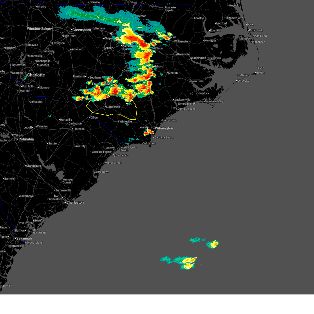
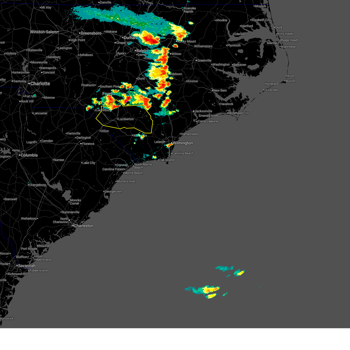
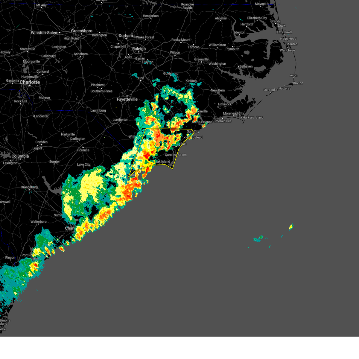
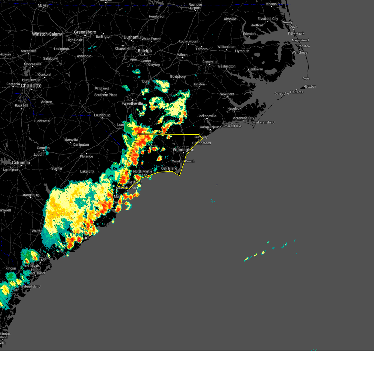
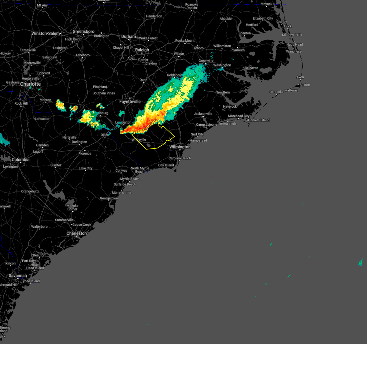
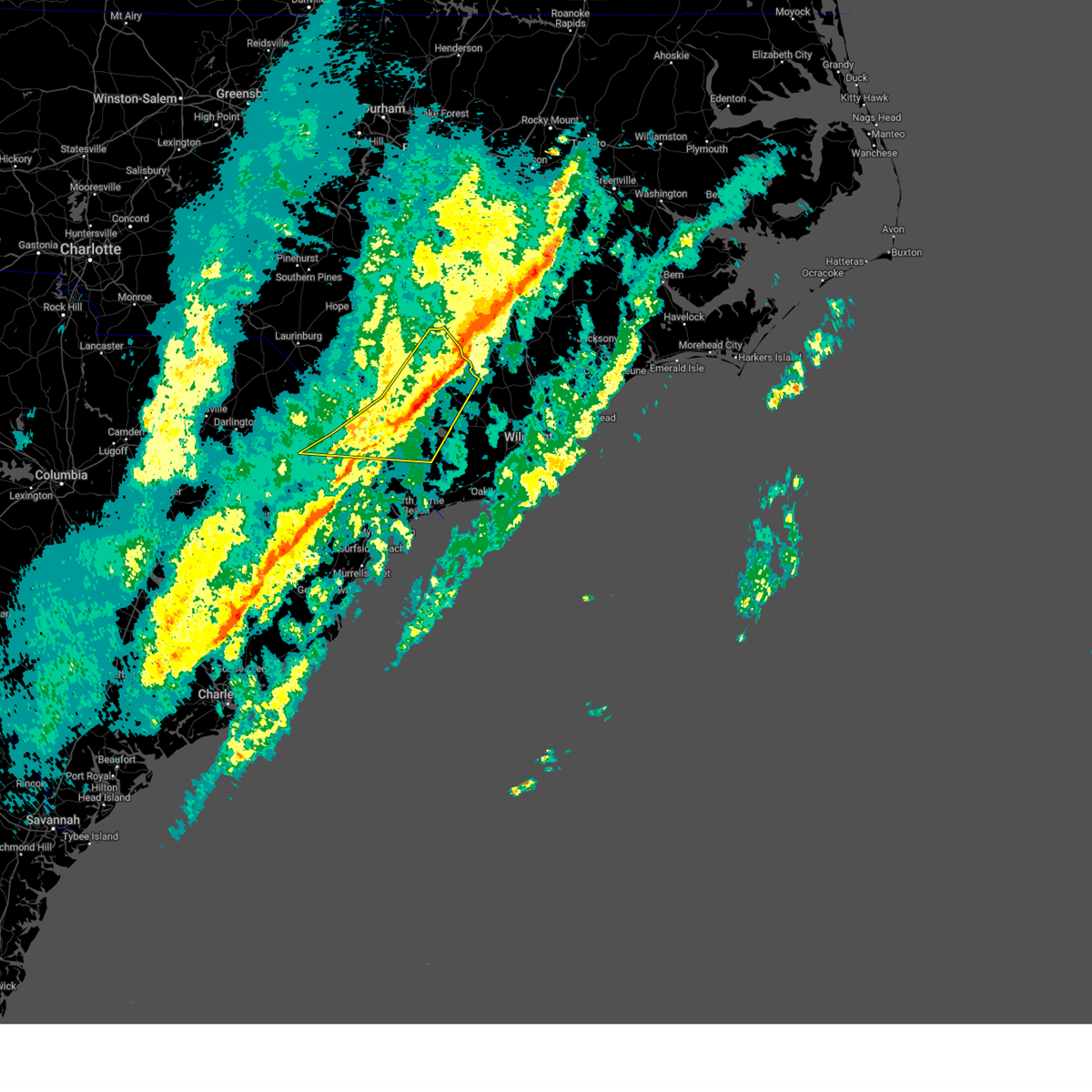
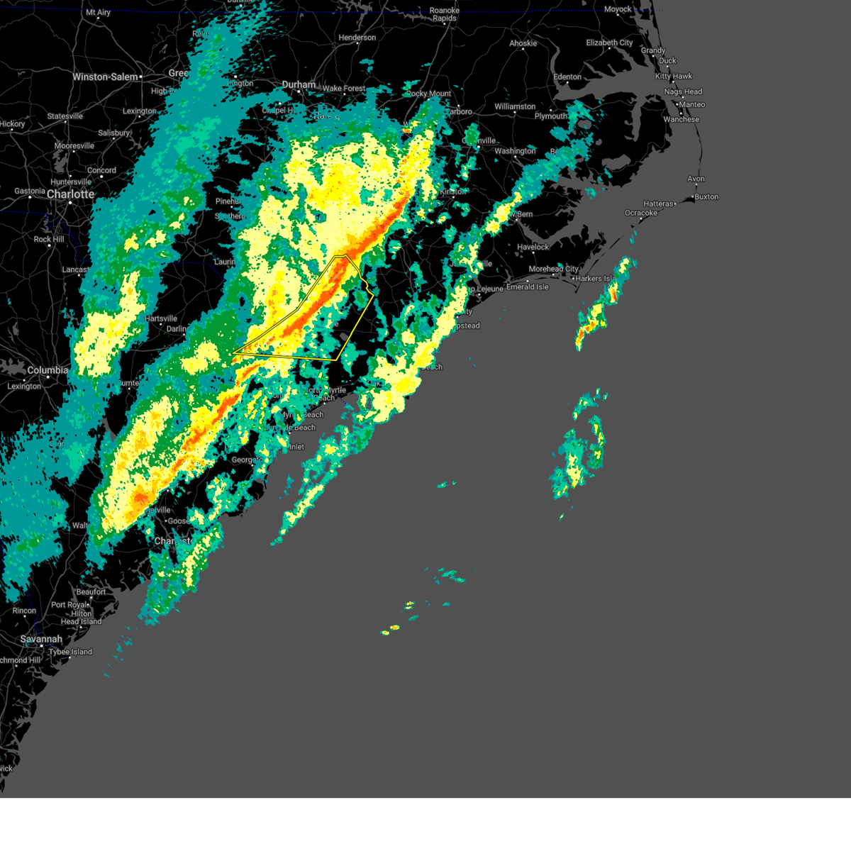
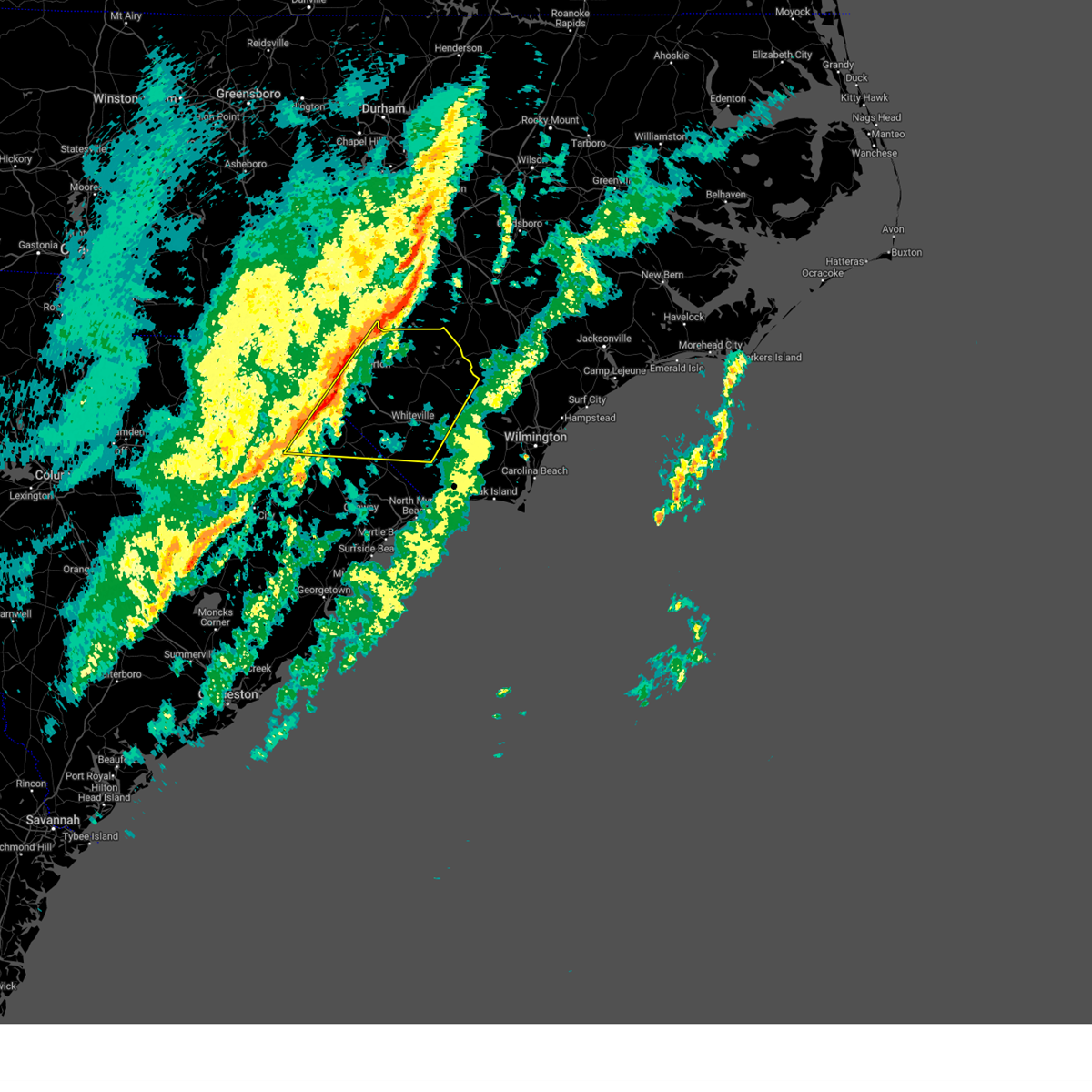
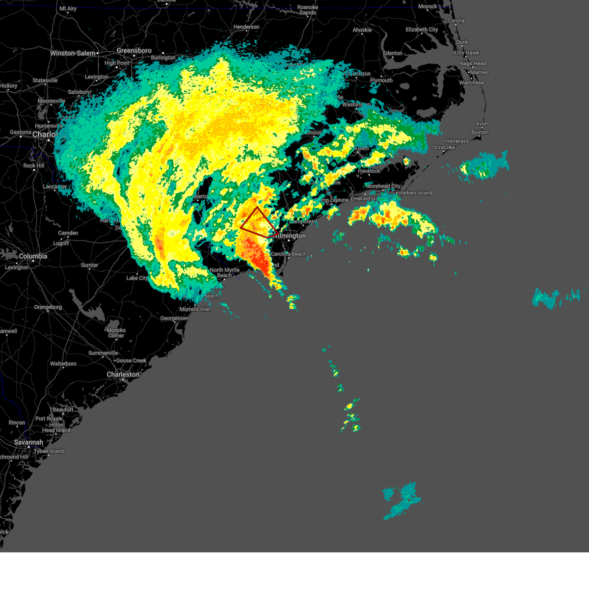
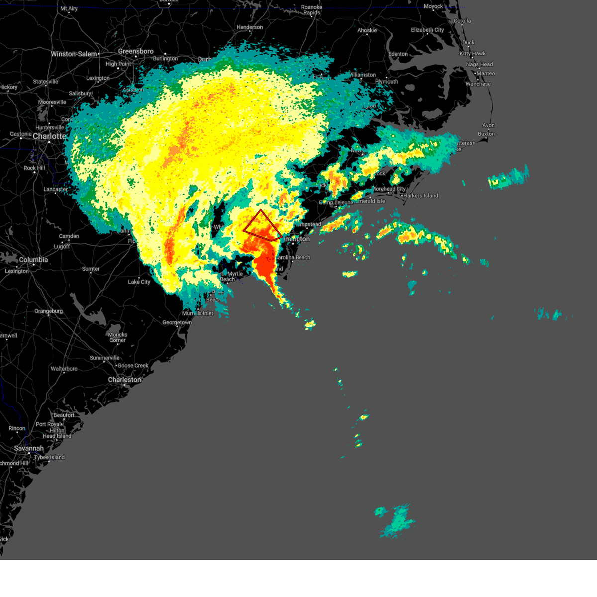
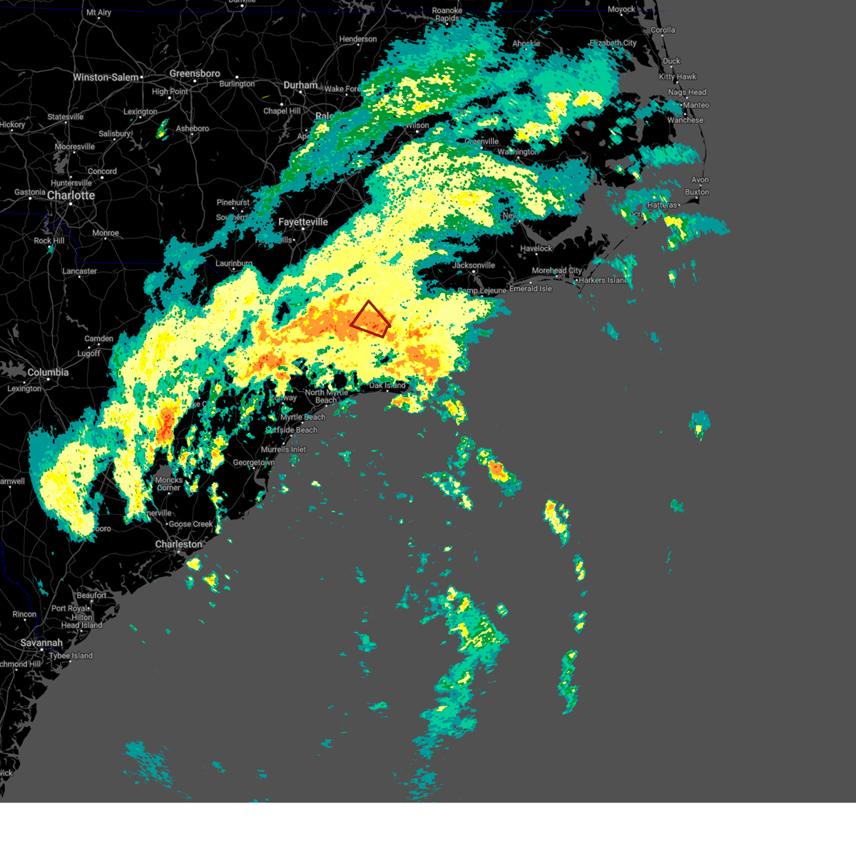
Hail Map for Kelly, NC
The Kelly, NC area has had 3 reports of on-the-ground hail by trained spotters, and has been under severe weather warnings 19 times during the past 12 months. Doppler radar has detected hail at or near Kelly, NC on 54 occasions, including 4 occasions during the past year.
| Name: | Kelly, NC |
| Where Located: | 26.2 miles NW of Wilmington, NC |
| Map: | Google Map for Kelly, NC |
| Population: | 544 |
| Housing Units: | 312 |
| More Info: | Search Google for Kelly, NC |
0
The Top Recent Hail Date for Kelly, NC is Sunday, June 8, 2025 (54th out of 54)

Hail and Wind Damage Spotted near Kelly, NC
| Date / Time | Report Details |
|---|---|
| 6/25/2025 4:16 PM EDT | At 416 pm edt, severe thunderstorms were located along a line extending from 8 miles southeast of ammon to near wakulla, moving southwest at 20 mph. a recent public report indicated quarter size hail was falling in red springs, nc (radar indicated). Hazards include 60 mph wind gusts and quarter size hail. Minor hail damage to vehicles is possible. expect wind damage to trees and power lines. locations impacted include, lumberton, elizabethtown, red springs, pembroke, fairmont, maxton, st. Pauls, bladenboro, rowland, rex, ammon, hestertown, shannon, white oak, carvers, smiths, howellsville, raemon, lisbon, and elkton. |
| 6/25/2025 4:01 PM EDT |
 At 400 pm edt, severe thunderstorms were located along a line extending from garland to near jerome to red springs, moving south at 20 mph (radar indicated). Hazards include 60 mph wind gusts. Expect wind damage to trees and power lines. locations impacted include, lumberton, elizabethtown, red springs, pembroke, fairmont, maxton, st. Pauls, bladenboro, rowland, rex, ammon, hestertown, shannon, white oak, carvers, smiths, howellsville, raemon, lisbon, and elkton. At 400 pm edt, severe thunderstorms were located along a line extending from garland to near jerome to red springs, moving south at 20 mph (radar indicated). Hazards include 60 mph wind gusts. Expect wind damage to trees and power lines. locations impacted include, lumberton, elizabethtown, red springs, pembroke, fairmont, maxton, st. Pauls, bladenboro, rowland, rex, ammon, hestertown, shannon, white oak, carvers, smiths, howellsville, raemon, lisbon, and elkton.
|
| 6/25/2025 3:41 PM EDT |
 Svrilm the national weather service in wilmington has issued a * severe thunderstorm warning for, robeson county in southeastern north carolina, bladen county in southeastern north carolina, * until 500 pm edt. * at 340 pm edt, severe thunderstorms were located along a line extending from 11 miles northwest of harrells to antioch, moving south at 25 mph (radar indicated). Hazards include 60 mph wind gusts. expect wind damage to trees and power lines Svrilm the national weather service in wilmington has issued a * severe thunderstorm warning for, robeson county in southeastern north carolina, bladen county in southeastern north carolina, * until 500 pm edt. * at 340 pm edt, severe thunderstorms were located along a line extending from 11 miles northwest of harrells to antioch, moving south at 25 mph (radar indicated). Hazards include 60 mph wind gusts. expect wind damage to trees and power lines
|
| 6/8/2025 2:09 PM EDT |
 At 207 pm edt, severe thunderstorms were located along a line extending from near the borough to near honey island to near little river entrance, moving east at 50 mph (radar indicated). Hazards include 60 mph wind gusts and quarter size hail. Minor hail damage to vehicles is possible. expect wind damage to trees and power lines. Locations impacted include, wilmington, myrtle beach, north myrtle beach, leland, oak island, carolina beach, shallotte, sunset beach, wrightsville beach, kure beach, surf city, holden beach, ocean isle beach, caswell beach, bald head island, snows cut, little river entrance, south masonboro island, ocean crest pier, and figure eight island. At 207 pm edt, severe thunderstorms were located along a line extending from near the borough to near honey island to near little river entrance, moving east at 50 mph (radar indicated). Hazards include 60 mph wind gusts and quarter size hail. Minor hail damage to vehicles is possible. expect wind damage to trees and power lines. Locations impacted include, wilmington, myrtle beach, north myrtle beach, leland, oak island, carolina beach, shallotte, sunset beach, wrightsville beach, kure beach, surf city, holden beach, ocean isle beach, caswell beach, bald head island, snows cut, little river entrance, south masonboro island, ocean crest pier, and figure eight island.
|
| 6/8/2025 1:43 PM EDT |
 Svrilm the national weather service in wilmington has issued a * severe thunderstorm warning for, new hanover county in southeastern north carolina, southern pender county in southeastern north carolina, southern bladen county in southeastern north carolina, brunswick county in southeastern north carolina, columbus county in southeastern north carolina, central horry county in northeastern south carolina, * until 300 pm edt. * at 142 pm edt, severe thunderstorms were located along a line extending from near council to near williams to forestbrook, moving east at 45 mph (radar indicated). Hazards include 60 mph wind gusts and quarter size hail. Minor hail damage to vehicles is possible. Expect wind damage to trees and power lines. Svrilm the national weather service in wilmington has issued a * severe thunderstorm warning for, new hanover county in southeastern north carolina, southern pender county in southeastern north carolina, southern bladen county in southeastern north carolina, brunswick county in southeastern north carolina, columbus county in southeastern north carolina, central horry county in northeastern south carolina, * until 300 pm edt. * at 142 pm edt, severe thunderstorms were located along a line extending from near council to near williams to forestbrook, moving east at 45 mph (radar indicated). Hazards include 60 mph wind gusts and quarter size hail. Minor hail damage to vehicles is possible. Expect wind damage to trees and power lines.
|
| 6/1/2025 7:46 PM EDT |
 Svrilm the national weather service in wilmington has issued a * severe thunderstorm warning for, southwestern pender county in southeastern north carolina, southern bladen county in southeastern north carolina, northeastern columbus county in southeastern north carolina, * until 845 pm edt. * at 745 pm edt, severe thunderstorms were located along a line extending from 7 miles northeast of lagoon to near elkton to near bladenboro, moving southeast at 30 mph (radar indicated). Hazards include 60 mph wind gusts and penny size hail. expect wind damage to trees and power lines Svrilm the national weather service in wilmington has issued a * severe thunderstorm warning for, southwestern pender county in southeastern north carolina, southern bladen county in southeastern north carolina, northeastern columbus county in southeastern north carolina, * until 845 pm edt. * at 745 pm edt, severe thunderstorms were located along a line extending from 7 miles northeast of lagoon to near elkton to near bladenboro, moving southeast at 30 mph (radar indicated). Hazards include 60 mph wind gusts and penny size hail. expect wind damage to trees and power lines
|
| 4/23/2025 7:04 PM EDT |
 the severe thunderstorm warning has been cancelled and is no longer in effect the severe thunderstorm warning has been cancelled and is no longer in effect
|
| 4/23/2025 6:55 PM EDT |
 At 655 pm edt, a severe thunderstorm was located over kelly, or 20 miles southeast of elizabethtown, moving east at 15 mph (radar indicated). Hazards include 60 mph wind gusts. Expect damage to trees and powerlines. Locations impacted include: rowan, carvers, sandyfield, east arcadia, kelly, and bolton. At 655 pm edt, a severe thunderstorm was located over kelly, or 20 miles southeast of elizabethtown, moving east at 15 mph (radar indicated). Hazards include 60 mph wind gusts. Expect damage to trees and powerlines. Locations impacted include: rowan, carvers, sandyfield, east arcadia, kelly, and bolton.
|
| 4/23/2025 6:37 PM EDT |
 At 637 pm edt, a severe thunderstorm was located near council, or 16 miles east of whiteville, moving east at 15 mph (radar indicated). Hazards include 60 mph wind gusts and quarter size hail. Minor hail damage to vehicles is possible. expect wind damage to trees and powerlines. Locations impacted include: rowan, carvers, sandyfield, east arcadia, bolton, council, emerson, kelly, and lake waccamaw. At 637 pm edt, a severe thunderstorm was located near council, or 16 miles east of whiteville, moving east at 15 mph (radar indicated). Hazards include 60 mph wind gusts and quarter size hail. Minor hail damage to vehicles is possible. expect wind damage to trees and powerlines. Locations impacted include: rowan, carvers, sandyfield, east arcadia, bolton, council, emerson, kelly, and lake waccamaw.
|
| 4/23/2025 6:21 PM EDT |
 Svrilm the national weather service in wilmington has issued a * severe thunderstorm warning for portions of, southeastern bladen county in southeastern north carolina, northeastern columbus county in southeastern north carolina, * until 715 pm edt. * at 621 pm edt, a severe thunderstorm was located near council, or 12 miles east of whiteville, moving northeast at 20 mph (radar indicated). Hazards include 60 mph wind gusts and quarter size hail. Minor hail damage to vehicles is possible. expect wind damage to trees and powerlines. Locations impacted include: rowan, carvers, sandyfield, hallsboro, east arcadia, redbug, council, emerson, kelly, bolton, and lake waccamaw. Svrilm the national weather service in wilmington has issued a * severe thunderstorm warning for portions of, southeastern bladen county in southeastern north carolina, northeastern columbus county in southeastern north carolina, * until 715 pm edt. * at 621 pm edt, a severe thunderstorm was located near council, or 12 miles east of whiteville, moving northeast at 20 mph (radar indicated). Hazards include 60 mph wind gusts and quarter size hail. Minor hail damage to vehicles is possible. expect wind damage to trees and powerlines. Locations impacted include: rowan, carvers, sandyfield, hallsboro, east arcadia, redbug, council, emerson, kelly, bolton, and lake waccamaw.
|
| 2/16/2025 10:30 AM EST |
 The storms which prompted the warning have weakened below severe limits, and no longer pose an immediate threat to life or property. therefore, the warning has been allowed to expire. a severe thunderstorm watch remains in effect until 300 pm est for southeastern north carolina. please send your reports of hail and/or wind damage, including trees or large limbs downed, by calling the national weather service office in wilmington at 1-800-697-3901. The storms which prompted the warning have weakened below severe limits, and no longer pose an immediate threat to life or property. therefore, the warning has been allowed to expire. a severe thunderstorm watch remains in effect until 300 pm est for southeastern north carolina. please send your reports of hail and/or wind damage, including trees or large limbs downed, by calling the national weather service office in wilmington at 1-800-697-3901.
|
| 2/16/2025 10:12 AM EST |
 At 1011 am est, severe thunderstorms were located along a line extending from 6 miles northeast of ammon to abbottsburg to near cherry grove, moving east at 45 mph (radar indicated). Hazards include 60 mph wind gusts. Expect wind damage to trees and power lines. Locations impacted include, marion, whiteville, mullins, elizabethtown, tabor city, chadbourn, bladenboro, lake waccamaw, fair bluff, boardman, hallsboro, bladen community college, ammon, nakina, redbug, council, southeastern community college, williams, carvers, and abbottsburg. At 1011 am est, severe thunderstorms were located along a line extending from 6 miles northeast of ammon to abbottsburg to near cherry grove, moving east at 45 mph (radar indicated). Hazards include 60 mph wind gusts. Expect wind damage to trees and power lines. Locations impacted include, marion, whiteville, mullins, elizabethtown, tabor city, chadbourn, bladenboro, lake waccamaw, fair bluff, boardman, hallsboro, bladen community college, ammon, nakina, redbug, council, southeastern community college, williams, carvers, and abbottsburg.
|
| 2/16/2025 9:35 AM EST |
 Svrilm the national weather service in wilmington has issued a * severe thunderstorm warning for, eastern robeson county in southeastern north carolina, bladen county in southeastern north carolina, columbus county in southeastern north carolina, southeastern dillon county in northeastern south carolina, northwestern horry county in northeastern south carolina, northern marion county in northeastern south carolina, * until 1030 am est. * at 935 am est, severe thunderstorms were located along a line extending from near tobermory to fairmont to near marion, moving east at 45 mph (radar indicated). Hazards include 60 mph wind gusts. expect wind damage to trees and power lines Svrilm the national weather service in wilmington has issued a * severe thunderstorm warning for, eastern robeson county in southeastern north carolina, bladen county in southeastern north carolina, columbus county in southeastern north carolina, southeastern dillon county in northeastern south carolina, northwestern horry county in northeastern south carolina, northern marion county in northeastern south carolina, * until 1030 am est. * at 935 am est, severe thunderstorms were located along a line extending from near tobermory to fairmont to near marion, moving east at 45 mph (radar indicated). Hazards include 60 mph wind gusts. expect wind damage to trees and power lines
|
| 9/16/2024 12:49 PM EDT |
 the tornado warning has been cancelled and is no longer in effect the tornado warning has been cancelled and is no longer in effect
|
| 9/16/2024 12:28 PM EDT |
 Torilm the national weather service in wilmington has issued a * tornado warning for, southwestern pender county in southeastern north carolina, southeastern bladen county in southeastern north carolina, northeastern brunswick county in southeastern north carolina, northeastern columbus county in southeastern north carolina, * until 100 pm edt. * at 1227 pm edt, a severe thunderstorm capable of producing a tornado was located over phoenix, or near leland, moving northwest at 25 mph (radar indicated rotation). Hazards include tornado. Flying debris will be dangerous to those caught without shelter. mobile homes will be damaged or destroyed. damage to roofs, windows, and vehicles will occur. tree damage is likely. this dangerous storm will be near, northwest, riegelwood, and delco around 1235 pm edt. sandyfield and freeman around 1245 pm edt. Other locations impacted by this tornadic thunderstorm include sandy creek, bolton, and east arcadia. Torilm the national weather service in wilmington has issued a * tornado warning for, southwestern pender county in southeastern north carolina, southeastern bladen county in southeastern north carolina, northeastern brunswick county in southeastern north carolina, northeastern columbus county in southeastern north carolina, * until 100 pm edt. * at 1227 pm edt, a severe thunderstorm capable of producing a tornado was located over phoenix, or near leland, moving northwest at 25 mph (radar indicated rotation). Hazards include tornado. Flying debris will be dangerous to those caught without shelter. mobile homes will be damaged or destroyed. damage to roofs, windows, and vehicles will occur. tree damage is likely. this dangerous storm will be near, northwest, riegelwood, and delco around 1235 pm edt. sandyfield and freeman around 1245 pm edt. Other locations impacted by this tornadic thunderstorm include sandy creek, bolton, and east arcadia.
|
| 8/7/2024 9:09 PM EDT |
 The storm which prompted the warning is starting to move out of the warned area. however, rotation continues in this storm with varying intensity. a new warning may be needed. a tornado watch remains in effect until 1100 pm edt for southeastern north carolina. please send your reports of hail and/or wind damage, including trees or large limbs downed, by calling the national weather service office in wilmington at 1-800-697-3901. The storm which prompted the warning is starting to move out of the warned area. however, rotation continues in this storm with varying intensity. a new warning may be needed. a tornado watch remains in effect until 1100 pm edt for southeastern north carolina. please send your reports of hail and/or wind damage, including trees or large limbs downed, by calling the national weather service office in wilmington at 1-800-697-3901.
|
| 8/7/2024 8:47 PM EDT |
 Torilm the national weather service in wilmington has issued a * tornado warning for, southeastern bladen county in southeastern north carolina, * until 915 pm edt. * at 847 pm edt, a severe thunderstorm capable of producing a tornado was located near kelly, or 19 miles west of burgaw, moving northwest at 25 mph (radar indicated rotation). Hazards include tornado. Flying debris will be dangerous to those caught without shelter. mobile homes will be damaged or destroyed. damage to roofs, windows, and vehicles will occur. tree damage is likely. this dangerous storm will be near, rowan and kelly around 850 pm edt. Lagoon around 905 pm edt. Torilm the national weather service in wilmington has issued a * tornado warning for, southeastern bladen county in southeastern north carolina, * until 915 pm edt. * at 847 pm edt, a severe thunderstorm capable of producing a tornado was located near kelly, or 19 miles west of burgaw, moving northwest at 25 mph (radar indicated rotation). Hazards include tornado. Flying debris will be dangerous to those caught without shelter. mobile homes will be damaged or destroyed. damage to roofs, windows, and vehicles will occur. tree damage is likely. this dangerous storm will be near, rowan and kelly around 850 pm edt. Lagoon around 905 pm edt.
|
| 8/7/2024 7:53 PM EDT |
 The storm which prompted the warning has weakened below severe limits, and no longer appears capable of producing a tornado. therefore, the warning will be allowed to expire. a tornado watch remains in effect until 1100 pm edt for southeastern north carolina. please send your reports of hail and/or wind damage, including trees or large limbs downed, by calling the national weather service office in wilmington at 1-800-697-3901. The storm which prompted the warning has weakened below severe limits, and no longer appears capable of producing a tornado. therefore, the warning will be allowed to expire. a tornado watch remains in effect until 1100 pm edt for southeastern north carolina. please send your reports of hail and/or wind damage, including trees or large limbs downed, by calling the national weather service office in wilmington at 1-800-697-3901.
|
| 8/7/2024 7:23 PM EDT |
 Torilm the national weather service in wilmington has issued a * tornado warning for, western pender county in southeastern north carolina, southeastern bladen county in southeastern north carolina, northeastern columbus county in southeastern north carolina, * until 800 pm edt. * at 723 pm edt, a severe thunderstorm capable of producing a tornado was located over riegelwood, or 12 miles northwest of leland, moving northwest at 25 mph (radar indicated rotation). Hazards include tornado. Flying debris will be dangerous to those caught without shelter. mobile homes will be damaged or destroyed. damage to roofs, windows, and vehicles will occur. tree damage is likely. this dangerous storm will be near, sandyfield around 730 pm edt. kelly around 740 pm edt. Other locations impacted by this tornadic thunderstorm include east arcadia. Torilm the national weather service in wilmington has issued a * tornado warning for, western pender county in southeastern north carolina, southeastern bladen county in southeastern north carolina, northeastern columbus county in southeastern north carolina, * until 800 pm edt. * at 723 pm edt, a severe thunderstorm capable of producing a tornado was located over riegelwood, or 12 miles northwest of leland, moving northwest at 25 mph (radar indicated rotation). Hazards include tornado. Flying debris will be dangerous to those caught without shelter. mobile homes will be damaged or destroyed. damage to roofs, windows, and vehicles will occur. tree damage is likely. this dangerous storm will be near, sandyfield around 730 pm edt. kelly around 740 pm edt. Other locations impacted by this tornadic thunderstorm include east arcadia.
|
| 5/15/2024 8:08 PM EDT |
 The storms which prompted the warning are weakening and no longer pose an immediate significant threat to life or property. therefore, the warning will be allowed to expire. however, gusty winds are still possible. a severe thunderstorm watch remains in effect until 900 pm edt for southeastern north carolina. please send your reports of hail and/or wind damage, including trees or large limbs downed, by calling the national weather service office in wilmington at 1-800-697-3901. The storms which prompted the warning are weakening and no longer pose an immediate significant threat to life or property. therefore, the warning will be allowed to expire. however, gusty winds are still possible. a severe thunderstorm watch remains in effect until 900 pm edt for southeastern north carolina. please send your reports of hail and/or wind damage, including trees or large limbs downed, by calling the national weather service office in wilmington at 1-800-697-3901.
|
| 5/15/2024 7:14 PM EDT |
 At 714 pm edt, a severe thunderstorm was located over elizabethtown, moving east at 30 mph (radar indicated). Hazards include two inch hail and 60 mph wind gusts. People and animals outdoors will be injured. expect hail damage to roofs, siding, windows, and vehicles. expect wind damage to trees and power lines. Locations impacted include, elizabethtown, rowan, carvers, abbottsburg, lisbon, lagoon, elkton, emerson, council, kelly, clarkton, white lake, east arcadia, and bladen county hospital. At 714 pm edt, a severe thunderstorm was located over elizabethtown, moving east at 30 mph (radar indicated). Hazards include two inch hail and 60 mph wind gusts. People and animals outdoors will be injured. expect hail damage to roofs, siding, windows, and vehicles. expect wind damage to trees and power lines. Locations impacted include, elizabethtown, rowan, carvers, abbottsburg, lisbon, lagoon, elkton, emerson, council, kelly, clarkton, white lake, east arcadia, and bladen county hospital.
|
| 5/15/2024 7:08 PM EDT |
 Svrilm the national weather service in wilmington has issued a * severe thunderstorm warning for, southern bladen county in southeastern north carolina, * until 815 pm edt. * at 708 pm edt, a severe thunderstorm was located over elizabethtown, moving east at 30 mph (radar indicated). Hazards include 60 mph wind gusts and quarter size hail. Minor hail damage to vehicles is possible. Expect wind damage to trees and power lines. Svrilm the national weather service in wilmington has issued a * severe thunderstorm warning for, southern bladen county in southeastern north carolina, * until 815 pm edt. * at 708 pm edt, a severe thunderstorm was located over elizabethtown, moving east at 30 mph (radar indicated). Hazards include 60 mph wind gusts and quarter size hail. Minor hail damage to vehicles is possible. Expect wind damage to trees and power lines.
|
| 5/14/2024 8:46 PM EDT |
 the tornado warning has been cancelled and is no longer in effect the tornado warning has been cancelled and is no longer in effect
|
| 5/14/2024 8:30 PM EDT |
 Torilm the national weather service in wilmington has issued a * tornado warning for, southeastern bladen county in southeastern north carolina, * until 900 pm edt. * at 828 pm edt, a severe thunderstorm capable of producing a tornado was located over lisbon, or 9 miles southeast of elizabethtown, moving east at 25 mph (radar indicated rotation. a tornado was reported earlier by emergency management north of whiteville). Hazards include tornado. Flying debris will be dangerous to those caught without shelter. mobile homes will be damaged or destroyed. damage to roofs, windows, and vehicles will occur. tree damage is likely. This dangerous storm will be near, lagoon around 835 pm edt. Torilm the national weather service in wilmington has issued a * tornado warning for, southeastern bladen county in southeastern north carolina, * until 900 pm edt. * at 828 pm edt, a severe thunderstorm capable of producing a tornado was located over lisbon, or 9 miles southeast of elizabethtown, moving east at 25 mph (radar indicated rotation. a tornado was reported earlier by emergency management north of whiteville). Hazards include tornado. Flying debris will be dangerous to those caught without shelter. mobile homes will be damaged or destroyed. damage to roofs, windows, and vehicles will occur. tree damage is likely. This dangerous storm will be near, lagoon around 835 pm edt.
|
| 5/10/2024 8:54 PM EDT |
 the severe thunderstorm warning has been cancelled and is no longer in effect the severe thunderstorm warning has been cancelled and is no longer in effect
|
| 5/10/2024 8:42 PM EDT |
 At 841 pm edt, a severe thunderstorm was located near lagoon, or 10 miles southeast of elizabethtown, moving southeast at 40 mph (radar indicated). Hazards include 60 mph wind gusts. Expect wind damage to trees and power lines. this severe storm will be near, carvers and lagoon around 845 pm edt. kelly around 850 pm edt. Other locations impacted by this severe thunderstorm include clarkton. At 841 pm edt, a severe thunderstorm was located near lagoon, or 10 miles southeast of elizabethtown, moving southeast at 40 mph (radar indicated). Hazards include 60 mph wind gusts. Expect wind damage to trees and power lines. this severe storm will be near, carvers and lagoon around 845 pm edt. kelly around 850 pm edt. Other locations impacted by this severe thunderstorm include clarkton.
|
| 5/10/2024 8:32 PM EDT |
 At 832 pm edt, a severe thunderstorm was located near elizabethtown, moving southeast at 40 mph (radar indicated). Hazards include 60 mph wind gusts and penny size hail. Expect wind damage to trees and power lines. this severe storm will be near, lisbon and lagoon around 840 pm edt. kelly around 850 pm edt. rowan around 855 pm edt. Other locations impacted by this severe thunderstorm include clarkton, white lake, and bladen county hospital. At 832 pm edt, a severe thunderstorm was located near elizabethtown, moving southeast at 40 mph (radar indicated). Hazards include 60 mph wind gusts and penny size hail. Expect wind damage to trees and power lines. this severe storm will be near, lisbon and lagoon around 840 pm edt. kelly around 850 pm edt. rowan around 855 pm edt. Other locations impacted by this severe thunderstorm include clarkton, white lake, and bladen county hospital.
|
| 5/10/2024 8:17 PM EDT |
 Svrilm the national weather service in wilmington has issued a * severe thunderstorm warning for, bladen county in southeastern north carolina, * until 915 pm edt. * at 817 pm edt, a severe thunderstorm was located near bladen community college, or 8 miles west of elizabethtown, moving southeast at 35 mph (radar indicated). Hazards include 60 mph wind gusts and penny size hail. Expect wind damage to trees and power lines. this severe thunderstorm will be near, bladen community college around 820 pm edt. elizabethtown around 825 pm edt. lisbon around 840 pm edt. lagoon around 845 pm edt. carvers around 850 pm edt. kelly around 900 pm edt. Other locations impacted by this severe thunderstorm include dublin, tar heel, clarkton, white lake, and bladen county hospital. Svrilm the national weather service in wilmington has issued a * severe thunderstorm warning for, bladen county in southeastern north carolina, * until 915 pm edt. * at 817 pm edt, a severe thunderstorm was located near bladen community college, or 8 miles west of elizabethtown, moving southeast at 35 mph (radar indicated). Hazards include 60 mph wind gusts and penny size hail. Expect wind damage to trees and power lines. this severe thunderstorm will be near, bladen community college around 820 pm edt. elizabethtown around 825 pm edt. lisbon around 840 pm edt. lagoon around 845 pm edt. carvers around 850 pm edt. kelly around 900 pm edt. Other locations impacted by this severe thunderstorm include dublin, tar heel, clarkton, white lake, and bladen county hospital.
|
| 5/8/2024 6:58 PM EDT |
 Svrilm the national weather service in wilmington has issued a * severe thunderstorm warning for, southwestern pender county in southeastern north carolina, southeastern bladen county in southeastern north carolina, northeastern brunswick county in southeastern north carolina, northeastern columbus county in southeastern north carolina, * until 745 pm edt. * at 657 pm edt, a severe thunderstorm was located near sandyfield, or 21 miles east of whiteville, moving east at 20 to 25 mph (radar indicated). Hazards include 60 mph wind gusts and quarter size hail. Minor hail damage to vehicles is possible. Expect wind damage to trees and power lines. Svrilm the national weather service in wilmington has issued a * severe thunderstorm warning for, southwestern pender county in southeastern north carolina, southeastern bladen county in southeastern north carolina, northeastern brunswick county in southeastern north carolina, northeastern columbus county in southeastern north carolina, * until 745 pm edt. * at 657 pm edt, a severe thunderstorm was located near sandyfield, or 21 miles east of whiteville, moving east at 20 to 25 mph (radar indicated). Hazards include 60 mph wind gusts and quarter size hail. Minor hail damage to vehicles is possible. Expect wind damage to trees and power lines.
|
| 5/8/2024 6:44 PM EDT |
 At 643 pm edt, severe thunderstorms were located along a line extending from carvers to near the borough, moving east at 25 mph. the strongest storm was located between council and east arcadia where hail up to the size of golf balls remains possible (radar indicated). Hazards include golf ball size hail and 60 mph wind gusts. People and animals outdoors will be injured. expect hail damage to roofs, siding, windows, and vehicles. expect wind damage to trees and power lines. Locations impacted include, rowan, bladenboro, sandyfield, boardman, point caswell, butters, council, currie, wards corner, the borough, riegelwood, carvers, abbottsburg, lisbon, lagoon, elkton, rooks, montague, malpass corner, and emerson. At 643 pm edt, severe thunderstorms were located along a line extending from carvers to near the borough, moving east at 25 mph. the strongest storm was located between council and east arcadia where hail up to the size of golf balls remains possible (radar indicated). Hazards include golf ball size hail and 60 mph wind gusts. People and animals outdoors will be injured. expect hail damage to roofs, siding, windows, and vehicles. expect wind damage to trees and power lines. Locations impacted include, rowan, bladenboro, sandyfield, boardman, point caswell, butters, council, currie, wards corner, the borough, riegelwood, carvers, abbottsburg, lisbon, lagoon, elkton, rooks, montague, malpass corner, and emerson.
|
| 5/8/2024 6:14 PM EDT |
 At 613 pm edt, severe thunderstorms were located along a line extending from abbottsburg to sandyfield, moving east at 35 mph. the most intense thunderstorm cell was located near east arcadia where hail of golf ball size is possible (radar indicated). Hazards include golf ball size hail and 60 mph wind gusts. People and animals outdoors will be injured. expect hail damage to roofs, siding, windows, and vehicles. expect wind damage to trees and power lines. Locations impacted include, rowan, bladenboro, sandyfield, boardman, point caswell, butters, council, currie, wards corner, the borough, riegelwood, carvers, abbottsburg, lisbon, lagoon, elkton, rooks, montague, malpass corner, and emerson. At 613 pm edt, severe thunderstorms were located along a line extending from abbottsburg to sandyfield, moving east at 35 mph. the most intense thunderstorm cell was located near east arcadia where hail of golf ball size is possible (radar indicated). Hazards include golf ball size hail and 60 mph wind gusts. People and animals outdoors will be injured. expect hail damage to roofs, siding, windows, and vehicles. expect wind damage to trees and power lines. Locations impacted include, rowan, bladenboro, sandyfield, boardman, point caswell, butters, council, currie, wards corner, the borough, riegelwood, carvers, abbottsburg, lisbon, lagoon, elkton, rooks, montague, malpass corner, and emerson.
|
| 5/8/2024 6:03 PM EDT |
 At 602 pm edt, severe thunderstorms were located along a line extending from bladenboro to near carvers, moving east at 25 mph (radar indicated). Hazards include 60 mph wind gusts and quarter size hail. Minor hail damage to vehicles is possible. expect wind damage to trees and power lines. Locations impacted include, rowan, bladenboro, sandyfield, boardman, point caswell, butters, council, currie, wards corner, the borough, riegelwood, carvers, abbottsburg, lisbon, lagoon, elkton, rooks, montague, malpass corner, and emerson. At 602 pm edt, severe thunderstorms were located along a line extending from bladenboro to near carvers, moving east at 25 mph (radar indicated). Hazards include 60 mph wind gusts and quarter size hail. Minor hail damage to vehicles is possible. expect wind damage to trees and power lines. Locations impacted include, rowan, bladenboro, sandyfield, boardman, point caswell, butters, council, currie, wards corner, the borough, riegelwood, carvers, abbottsburg, lisbon, lagoon, elkton, rooks, montague, malpass corner, and emerson.
|
| 5/8/2024 5:53 PM EDT |
 Svrilm the national weather service in wilmington has issued a * severe thunderstorm warning for, southwestern pender county in southeastern north carolina, southern bladen county in southeastern north carolina, northeastern columbus county in southeastern north carolina, * until 700 pm edt. * at 552 pm edt, severe thunderstorms were located along a line extending from near butters to near carvers, moving east at 35 mph (radar indicated). Hazards include 60 mph wind gusts and quarter size hail. Minor hail damage to vehicles is possible. Expect wind damage to trees and power lines. Svrilm the national weather service in wilmington has issued a * severe thunderstorm warning for, southwestern pender county in southeastern north carolina, southern bladen county in southeastern north carolina, northeastern columbus county in southeastern north carolina, * until 700 pm edt. * at 552 pm edt, severe thunderstorms were located along a line extending from near butters to near carvers, moving east at 35 mph (radar indicated). Hazards include 60 mph wind gusts and quarter size hail. Minor hail damage to vehicles is possible. Expect wind damage to trees and power lines.
|
| 4/20/2024 6:09 PM EDT |
 Svrilm the national weather service in wilmington has issued a * severe thunderstorm warning for, new hanover county in southeastern north carolina, southwestern pender county in southeastern north carolina, southeastern bladen county in southeastern north carolina, northern brunswick county in southeastern north carolina, central columbus county in southeastern north carolina, * until 715 pm edt. * at 609 pm edt, severe thunderstorms were located along a line extending from near redbug to near silver lake, moving east at 15 mph (radar indicated). Hazards include 60 mph wind gusts and quarter size hail. Minor hail damage to vehicles is possible. Expect wind damage to trees and power lines. Svrilm the national weather service in wilmington has issued a * severe thunderstorm warning for, new hanover county in southeastern north carolina, southwestern pender county in southeastern north carolina, southeastern bladen county in southeastern north carolina, northern brunswick county in southeastern north carolina, central columbus county in southeastern north carolina, * until 715 pm edt. * at 609 pm edt, severe thunderstorms were located along a line extending from near redbug to near silver lake, moving east at 15 mph (radar indicated). Hazards include 60 mph wind gusts and quarter size hail. Minor hail damage to vehicles is possible. Expect wind damage to trees and power lines.
|
| 4/20/2024 5:57 PM EDT |
 the severe thunderstorm warning has been cancelled and is no longer in effect the severe thunderstorm warning has been cancelled and is no longer in effect
|
| 4/20/2024 5:57 PM EDT |
 At 556 pm edt, a severe thunderstorm was located near abbottsburg, or 7 miles north of whiteville, moving southeast at 35 mph (radar indicated). Hazards include 60 mph wind gusts and quarter size hail. Minor hail damage to vehicles is possible. expect wind damage to trees and power lines. Locations impacted include, whiteville, elizabethtown, rowan, chadbourn, bladenboro, fair bluff, boardman, carvers, abbottsburg, lisbon, cherry grove, lagoon, elkton, emerson, council, southeastern community college, evergreen, brunswick, clarkton, and cerro gordo. At 556 pm edt, a severe thunderstorm was located near abbottsburg, or 7 miles north of whiteville, moving southeast at 35 mph (radar indicated). Hazards include 60 mph wind gusts and quarter size hail. Minor hail damage to vehicles is possible. expect wind damage to trees and power lines. Locations impacted include, whiteville, elizabethtown, rowan, chadbourn, bladenboro, fair bluff, boardman, carvers, abbottsburg, lisbon, cherry grove, lagoon, elkton, emerson, council, southeastern community college, evergreen, brunswick, clarkton, and cerro gordo.
|
| 4/20/2024 5:15 PM EDT |
 Svrilm the national weather service in wilmington has issued a * severe thunderstorm warning for, northwestern pender county in southeastern north carolina, southeastern robeson county in southeastern north carolina, bladen county in southeastern north carolina, northwestern columbus county in southeastern north carolina, * until 630 pm edt. * at 513 pm edt, severe thunderstorms were located along a line extending from ammon to lumberton, moving southeast at 30 mph (public. golf ball size hail was recently reported near pembroke). Hazards include ping pong ball size hail and 60 mph wind gusts. People and animals outdoors will be injured. expect hail damage to roofs, siding, windows, and vehicles. Expect wind damage to trees and power lines. Svrilm the national weather service in wilmington has issued a * severe thunderstorm warning for, northwestern pender county in southeastern north carolina, southeastern robeson county in southeastern north carolina, bladen county in southeastern north carolina, northwestern columbus county in southeastern north carolina, * until 630 pm edt. * at 513 pm edt, severe thunderstorms were located along a line extending from ammon to lumberton, moving southeast at 30 mph (public. golf ball size hail was recently reported near pembroke). Hazards include ping pong ball size hail and 60 mph wind gusts. People and animals outdoors will be injured. expect hail damage to roofs, siding, windows, and vehicles. Expect wind damage to trees and power lines.
|
| 4/12/2024 7:43 PM EDT |
 the severe thunderstorm warning has been cancelled and is no longer in effect the severe thunderstorm warning has been cancelled and is no longer in effect
|
| 4/12/2024 7:06 PM EDT |
 Svrilm the national weather service in wilmington has issued a * severe thunderstorm warning for, southern bladen county in southeastern north carolina, * until 800 pm edt. * at 705 pm edt, a severe thunderstorm was located over elizabethtown, moving east, southeast at 40 mph. numerous reports of trees down and power outages have been reported with this activity (radar indicated). Hazards include 60 mph wind gusts and quarter size hail. Minor hail damage to vehicles is possible. Expect wind damage to trees and power lines. Svrilm the national weather service in wilmington has issued a * severe thunderstorm warning for, southern bladen county in southeastern north carolina, * until 800 pm edt. * at 705 pm edt, a severe thunderstorm was located over elizabethtown, moving east, southeast at 40 mph. numerous reports of trees down and power outages have been reported with this activity (radar indicated). Hazards include 60 mph wind gusts and quarter size hail. Minor hail damage to vehicles is possible. Expect wind damage to trees and power lines.
|
| 1/9/2024 7:30 PM EST |
 At 728 pm est, severe thunderstorms were located along a line extending from near bowdens to 12 miles south of holden beach, moving east at 45 mph. the wilmington international airport recently observed a gust to 73 miles per hour. these are destructive storms for new hanover and pender counties (radar confirmed by automated surface observing station). Hazards include 80 mph wind gusts. Flying debris will be dangerous to those caught without shelter. mobile homes will be heavily damaged. expect considerable damage to roofs, windows, and vehicles. extensive tree damage and power outages are likely. Locations impacted include, wilmington, leland, oak island, carolina beach, burgaw, shallotte, sunset beach, wrightsville beach, kure beach, surf city, holden beach, ocean isle beach, caswell beach, bald head island, snows cut, south masonboro island, ocean crest pier, figure eight island, yaupon beach, and rich inlet. At 728 pm est, severe thunderstorms were located along a line extending from near bowdens to 12 miles south of holden beach, moving east at 45 mph. the wilmington international airport recently observed a gust to 73 miles per hour. these are destructive storms for new hanover and pender counties (radar confirmed by automated surface observing station). Hazards include 80 mph wind gusts. Flying debris will be dangerous to those caught without shelter. mobile homes will be heavily damaged. expect considerable damage to roofs, windows, and vehicles. extensive tree damage and power outages are likely. Locations impacted include, wilmington, leland, oak island, carolina beach, burgaw, shallotte, sunset beach, wrightsville beach, kure beach, surf city, holden beach, ocean isle beach, caswell beach, bald head island, snows cut, south masonboro island, ocean crest pier, figure eight island, yaupon beach, and rich inlet.
|
| 1/9/2024 7:18 PM EST |
 At 718 pm est, severe thunderstorms were located along a line extending from near bowdens to 13 miles south of ocean isle beach, moving east at 40 mph (radar indicated). Hazards include 70 mph wind gusts. Expect considerable tree damage. damage is likely to mobile homes, roofs, and outbuildings. Locations impacted include, wilmington, leland, oak island, carolina beach, burgaw, shallotte, sunset beach, wrightsville beach, kure beach, surf city, holden beach, ocean isle beach, caswell beach, bald head island, snows cut, south masonboro island, ocean crest pier, figure eight island, yaupon beach, and rich inlet. At 718 pm est, severe thunderstorms were located along a line extending from near bowdens to 13 miles south of ocean isle beach, moving east at 40 mph (radar indicated). Hazards include 70 mph wind gusts. Expect considerable tree damage. damage is likely to mobile homes, roofs, and outbuildings. Locations impacted include, wilmington, leland, oak island, carolina beach, burgaw, shallotte, sunset beach, wrightsville beach, kure beach, surf city, holden beach, ocean isle beach, caswell beach, bald head island, snows cut, south masonboro island, ocean crest pier, figure eight island, yaupon beach, and rich inlet.
|
| 1/9/2024 7:01 PM EST |
 At 701 pm est, severe thunderstorms were located along a line extending from 7 miles southwest of warsaw to 9 miles south of cherry grove beach, moving east at 45 mph (radar indicated). Hazards include 70 mph wind gusts. Expect considerable tree damage. damage is likely to mobile homes, roofs, and outbuildings. Locations impacted include, wilmington, north myrtle beach, leland, oak island, carolina beach, burgaw, shallotte, sunset beach, wrightsville beach, kure beach, surf city, holden beach, ocean isle beach, caswell beach, bald head island, snows cut, little river entrance, south masonboro island, ocean crest pier, and figure eight island. At 701 pm est, severe thunderstorms were located along a line extending from 7 miles southwest of warsaw to 9 miles south of cherry grove beach, moving east at 45 mph (radar indicated). Hazards include 70 mph wind gusts. Expect considerable tree damage. damage is likely to mobile homes, roofs, and outbuildings. Locations impacted include, wilmington, north myrtle beach, leland, oak island, carolina beach, burgaw, shallotte, sunset beach, wrightsville beach, kure beach, surf city, holden beach, ocean isle beach, caswell beach, bald head island, snows cut, little river entrance, south masonboro island, ocean crest pier, and figure eight island.
|
| 1/9/2024 6:23 PM EST |
 At 623 pm est, a severe thunderstorm was located near lagoon, or 15 miles east of elizabethtown, moving northeast at 65 mph (radar indicated). Hazards include 60 mph wind gusts. expect wind damage to trees and power lines At 623 pm est, a severe thunderstorm was located near lagoon, or 15 miles east of elizabethtown, moving northeast at 65 mph (radar indicated). Hazards include 60 mph wind gusts. expect wind damage to trees and power lines
|
| 1/9/2024 4:23 PM EST |
 The severe thunderstorm warning for western pender, southeastern bladen, north central brunswick and northeastern columbus counties will expire at 430 pm est, the storm which prompted the warning has weakened below severe limits, and has exited the warned area. therefore, the warning will be allowed to expire. however, gusty winds are still possible with this thunderstorm. a tornado watch remains in effect until 900 pm est for southeastern north carolina. The severe thunderstorm warning for western pender, southeastern bladen, north central brunswick and northeastern columbus counties will expire at 430 pm est, the storm which prompted the warning has weakened below severe limits, and has exited the warned area. therefore, the warning will be allowed to expire. however, gusty winds are still possible with this thunderstorm. a tornado watch remains in effect until 900 pm est for southeastern north carolina.
|
| 1/9/2024 4:05 PM EST |
 At 405 pm est, a severe thunderstorm was located near rowan, or 16 miles west of burgaw, moving northeast at 60 mph (radar indicated). Hazards include 60 mph wind gusts. Expect wind damage to trees and power lines. locations impacted include, rowan, northwest, sandyfield, penderlea, point caswell, honey island, montague, rooks, malpass corner, willard, kelly, currie, freeman, wards corner, the borough, delco, riegelwood, bolton, east arcadia, and atkinson. hail threat, radar indicated max hail size, <. 75 in wind threat, radar indicated max wind gust, 60 mph. At 405 pm est, a severe thunderstorm was located near rowan, or 16 miles west of burgaw, moving northeast at 60 mph (radar indicated). Hazards include 60 mph wind gusts. Expect wind damage to trees and power lines. locations impacted include, rowan, northwest, sandyfield, penderlea, point caswell, honey island, montague, rooks, malpass corner, willard, kelly, currie, freeman, wards corner, the borough, delco, riegelwood, bolton, east arcadia, and atkinson. hail threat, radar indicated max hail size, <. 75 in wind threat, radar indicated max wind gust, 60 mph.
|
| 1/9/2024 3:52 PM EST |
 At 352 pm est, a severe thunderstorm was located over sandyfield, or 19 miles northwest of leland, moving northeast at 60 mph (radar indicated). Hazards include 60 mph wind gusts. Expect wind damage to trees and power lines. locations impacted include, rowan, lake waccamaw, northwest, sandyfield, penderlea, makatoka, point caswell, freeland, exum, currie, wards corner, ash, the borough, riegelwood, carvers, honey island, montague, rooks, malpass corner, and willard. hail threat, radar indicated max hail size, <. 75 in wind threat, radar indicated max wind gust, 60 mph. At 352 pm est, a severe thunderstorm was located over sandyfield, or 19 miles northwest of leland, moving northeast at 60 mph (radar indicated). Hazards include 60 mph wind gusts. Expect wind damage to trees and power lines. locations impacted include, rowan, lake waccamaw, northwest, sandyfield, penderlea, makatoka, point caswell, freeland, exum, currie, wards corner, ash, the borough, riegelwood, carvers, honey island, montague, rooks, malpass corner, and willard. hail threat, radar indicated max hail size, <. 75 in wind threat, radar indicated max wind gust, 60 mph.
|
| 1/9/2024 3:34 PM EST |
 At 333 pm est, a severe thunderstorm was located over exum, or 12 miles north of shallotte, moving northeast at 60 mph (radar indicated). Hazards include 60 mph wind gusts. expect wind damage to trees and power lines At 333 pm est, a severe thunderstorm was located over exum, or 12 miles north of shallotte, moving northeast at 60 mph (radar indicated). Hazards include 60 mph wind gusts. expect wind damage to trees and power lines
|
| 12/17/2023 2:39 PM EST |
 At 239 pm est, severe thunderstorms were located along a line extending from elizabethtown to near council, moving north at 80 mph (radar indicated). Hazards include 60 mph wind gusts. expect wind damage to trees and power lines At 239 pm est, severe thunderstorms were located along a line extending from elizabethtown to near council, moving north at 80 mph (radar indicated). Hazards include 60 mph wind gusts. expect wind damage to trees and power lines
|
| 8/7/2023 9:03 PM EDT |
 At 903 pm edt, a severe thunderstorm was located over longwood, or 10 miles north of sunset beach, moving east at 55 mph (radar indicated). Hazards include 60 mph wind gusts and penny size hail. expect wind damage to trees and power lines At 903 pm edt, a severe thunderstorm was located over longwood, or 10 miles north of sunset beach, moving east at 55 mph (radar indicated). Hazards include 60 mph wind gusts and penny size hail. expect wind damage to trees and power lines
|
| 7/9/2023 3:56 PM EDT |
 The severe thunderstorm warning for northwestern pender, eastern bladen and northeastern columbus counties will expire at 400 pm edt, the storms which prompted the warning are likely below severe limits. therefore, the warning will be allowed to expire. however gusty winds and heavy rain are still possible and the storms could still re-strengthen. a severe thunderstorm watch remains in effect until 800 pm edt for southeastern north carolina. to report severe weather, contact your nearest law enforcement agency. they will relay your report to the national weather service wilmington. The severe thunderstorm warning for northwestern pender, eastern bladen and northeastern columbus counties will expire at 400 pm edt, the storms which prompted the warning are likely below severe limits. therefore, the warning will be allowed to expire. however gusty winds and heavy rain are still possible and the storms could still re-strengthen. a severe thunderstorm watch remains in effect until 800 pm edt for southeastern north carolina. to report severe weather, contact your nearest law enforcement agency. they will relay your report to the national weather service wilmington.
|
| 7/9/2023 3:41 PM EDT |
 At 340 pm edt, severe thunderstorms were located along a line extending from near rose hill to near hallsboro, moving east at 40 mph (radar indicated). Hazards include 60 mph wind gusts. Expect wind damage to trees and power lines. locations impacted include, rowan, sandyfield, penderlea, carvers, point caswell, lisbon, lagoon, elkton, rooks, emerson, council, willard, kelly, currie, freeman, wards corner, delco, riegelwood, white lake and bolton. hail threat, radar indicated max hail size, <. 75 in wind threat, radar indicated max wind gust, 60 mph. At 340 pm edt, severe thunderstorms were located along a line extending from near rose hill to near hallsboro, moving east at 40 mph (radar indicated). Hazards include 60 mph wind gusts. Expect wind damage to trees and power lines. locations impacted include, rowan, sandyfield, penderlea, carvers, point caswell, lisbon, lagoon, elkton, rooks, emerson, council, willard, kelly, currie, freeman, wards corner, delco, riegelwood, white lake and bolton. hail threat, radar indicated max hail size, <. 75 in wind threat, radar indicated max wind gust, 60 mph.
|
| 7/9/2023 3:08 PM EDT |
 At 307 pm edt, severe thunderstorms were located along a line extending from near ammon to near bladenboro, moving east at 45 mph (radar indicated). Hazards include 60 mph wind gusts. expect wind damage to trees and power lines At 307 pm edt, severe thunderstorms were located along a line extending from near ammon to near bladenboro, moving east at 45 mph (radar indicated). Hazards include 60 mph wind gusts. expect wind damage to trees and power lines
|
| 7/7/2023 7:40 PM EDT |
 At 740 pm edt, a severe thunderstorm was located over carvers, or 16 miles southeast of elizabethtown, moving southeast at 15 mph (radar indicated). Hazards include 60 mph wind gusts and quarter size hail. Minor hail damage to vehicles is possible. expect wind damage to trees and power lines. locations impacted include, carvers, lagoon, lisbon, council and kelly. hail threat, radar indicated max hail size, 1. 00 in wind threat, radar indicated max wind gust, 60 mph. At 740 pm edt, a severe thunderstorm was located over carvers, or 16 miles southeast of elizabethtown, moving southeast at 15 mph (radar indicated). Hazards include 60 mph wind gusts and quarter size hail. Minor hail damage to vehicles is possible. expect wind damage to trees and power lines. locations impacted include, carvers, lagoon, lisbon, council and kelly. hail threat, radar indicated max hail size, 1. 00 in wind threat, radar indicated max wind gust, 60 mph.
|
| 7/7/2023 7:15 PM EDT |
 At 714 pm edt, a severe thunderstorm was located over lisbon, or 10 miles southeast of elizabethtown, moving southeast at 15 mph (radar indicated). Hazards include 60 mph wind gusts and quarter size hail. Minor hail damage to vehicles is possible. Expect wind damage to trees and power lines. At 714 pm edt, a severe thunderstorm was located over lisbon, or 10 miles southeast of elizabethtown, moving southeast at 15 mph (radar indicated). Hazards include 60 mph wind gusts and quarter size hail. Minor hail damage to vehicles is possible. Expect wind damage to trees and power lines.
|
| 7/3/2023 2:51 PM EDT |
 At 250 pm edt, a severe thunderstorm was located over elkton, or 8 miles south of elizabethtown, moving to the east, northeast at 25 mph (radar indicated). Hazards include 60 mph wind gusts. expect wind damage to trees and power lines At 250 pm edt, a severe thunderstorm was located over elkton, or 8 miles south of elizabethtown, moving to the east, northeast at 25 mph (radar indicated). Hazards include 60 mph wind gusts. expect wind damage to trees and power lines
|
| 4/30/2023 3:17 PM EDT |
 At 315 pm edt, severe thunderstorms were located along a line extending from wards corner to little river entrance, moving east at 40 mph (radar indicated). Hazards include 60 mph wind gusts and quarter size hail. Minor hail damage to vehicles is possible. expect wind damage to trees and power lines. locations impacted include, wilmington, leland, oak island, burgaw, shallotte, sunset beach, holden beach, ocean isle beach, ocean crest pier, boiling spring lakes, st. james, northwest, sandyfield, penderlea, makatoka, point caswell, hightsville, long creek, exum and seaside. hail threat, radar indicated max hail size, 1. 00 in wind threat, radar indicated max wind gust, 60 mph. At 315 pm edt, severe thunderstorms were located along a line extending from wards corner to little river entrance, moving east at 40 mph (radar indicated). Hazards include 60 mph wind gusts and quarter size hail. Minor hail damage to vehicles is possible. expect wind damage to trees and power lines. locations impacted include, wilmington, leland, oak island, burgaw, shallotte, sunset beach, holden beach, ocean isle beach, ocean crest pier, boiling spring lakes, st. james, northwest, sandyfield, penderlea, makatoka, point caswell, hightsville, long creek, exum and seaside. hail threat, radar indicated max hail size, 1. 00 in wind threat, radar indicated max wind gust, 60 mph.
|
| 4/30/2023 2:49 PM EDT |
 At 249 pm edt, severe thunderstorms were located along a line extending from near rowan to near barefoot landing area of north myrtle beach, moving east at 40 mph (radar indicated). Hazards include 60 mph wind gusts and quarter size hail. Minor hail damage to vehicles is possible. Expect wind damage to trees and power lines. At 249 pm edt, severe thunderstorms were located along a line extending from near rowan to near barefoot landing area of north myrtle beach, moving east at 40 mph (radar indicated). Hazards include 60 mph wind gusts and quarter size hail. Minor hail damage to vehicles is possible. Expect wind damage to trees and power lines.
|
| 6/17/2022 9:06 PM EDT |
 At 905 pm edt, severe thunderstorms were located along a line extending from murray town to near exum to near pee dee crossroads, moving southeast at 45 mph (radar indicated). Hazards include 60 mph wind gusts. Expect wind damage to trees and power lines. locations impacted include, conway, leland, whiteville, burgaw, red hill, horry, iredell, rowan, tabor city, loris, chadbourn, bethel, johnsonville, lake waccamaw, northwest, sandyfield, hickory grove, penderlea, makatoka and maple hill. hail threat, radar indicated max hail size, <. 75 in wind threat, radar indicated max wind gust, 60 mph. At 905 pm edt, severe thunderstorms were located along a line extending from murray town to near exum to near pee dee crossroads, moving southeast at 45 mph (radar indicated). Hazards include 60 mph wind gusts. Expect wind damage to trees and power lines. locations impacted include, conway, leland, whiteville, burgaw, red hill, horry, iredell, rowan, tabor city, loris, chadbourn, bethel, johnsonville, lake waccamaw, northwest, sandyfield, hickory grove, penderlea, makatoka and maple hill. hail threat, radar indicated max hail size, <. 75 in wind threat, radar indicated max wind gust, 60 mph.
|
| 6/17/2022 8:46 PM EDT |
 At 845 pm edt, severe thunderstorms were located along a line extending from near penderlea to near redbug to near gresham, moving southeast at 45 mph (radar indicated). Hazards include 60 mph wind gusts. expect wind damage to trees and power lines At 845 pm edt, severe thunderstorms were located along a line extending from near penderlea to near redbug to near gresham, moving southeast at 45 mph (radar indicated). Hazards include 60 mph wind gusts. expect wind damage to trees and power lines
|
| 6/17/2022 8:15 PM EDT |
 At 814 pm edt, severe thunderstorms were located along a line extending from 9 miles northwest of harrells to near claussen, moving southeast at 35 mph (radar indicated). Hazards include 60 mph wind gusts. expect wind damage to trees and power lines At 814 pm edt, severe thunderstorms were located along a line extending from 9 miles northwest of harrells to near claussen, moving southeast at 35 mph (radar indicated). Hazards include 60 mph wind gusts. expect wind damage to trees and power lines
|
| 6/16/2022 3:41 PM EDT |
 The severe thunderstorm warning for southern bladen and northeastern columbus counties will expire at 345 pm edt, the storms which prompted the warning have weakened below severe limits, and no longer pose an immediate threat to life or property. therefore, the warning will be allowed to expire. The severe thunderstorm warning for southern bladen and northeastern columbus counties will expire at 345 pm edt, the storms which prompted the warning have weakened below severe limits, and no longer pose an immediate threat to life or property. therefore, the warning will be allowed to expire.
|
| 6/16/2022 3:22 PM EDT |
 At 322 pm edt, severe thunderstorms were located along a line extending from near southeastern community college to near whiteville to near council, moving south at 20 mph (radar indicated). Hazards include 60 mph wind gusts and quarter size hail. Minor hail damage to vehicles is possible. expect wind damage to trees and power lines. locations impacted include, whiteville, lake waccamaw, carvers, hallsboro, lisbon, redbug, elkton, emerson, council, kelly, brunswick, clarkton, bolton, east arcadia and columbus regional healthcare system. hail threat, radar indicated max hail size, 1. 00 in wind threat, radar indicated max wind gust, 60 mph. At 322 pm edt, severe thunderstorms were located along a line extending from near southeastern community college to near whiteville to near council, moving south at 20 mph (radar indicated). Hazards include 60 mph wind gusts and quarter size hail. Minor hail damage to vehicles is possible. expect wind damage to trees and power lines. locations impacted include, whiteville, lake waccamaw, carvers, hallsboro, lisbon, redbug, elkton, emerson, council, kelly, brunswick, clarkton, bolton, east arcadia and columbus regional healthcare system. hail threat, radar indicated max hail size, 1. 00 in wind threat, radar indicated max wind gust, 60 mph.
|
| 6/16/2022 3:09 PM EDT |
 At 309 pm edt, severe thunderstorms were located along a line extending from near whiteville to council to near rowan, moving south at 25 mph (radar indicated). Hazards include 60 mph wind gusts and quarter size hail. Minor hail damage to vehicles is possible. expect wind damage to trees and power lines. locations impacted include, whiteville, rowan, lake waccamaw, sandyfield, carvers, hallsboro, abbottsburg, lisbon, redbug, lagoon, elkton, emerson, council, kelly, freeman, delco, riegelwood, brunswick, clarkton and bolton. hail threat, radar indicated max hail size, 1. 00 in wind threat, radar indicated max wind gust, 60 mph. At 309 pm edt, severe thunderstorms were located along a line extending from near whiteville to council to near rowan, moving south at 25 mph (radar indicated). Hazards include 60 mph wind gusts and quarter size hail. Minor hail damage to vehicles is possible. expect wind damage to trees and power lines. locations impacted include, whiteville, rowan, lake waccamaw, sandyfield, carvers, hallsboro, abbottsburg, lisbon, redbug, lagoon, elkton, emerson, council, kelly, freeman, delco, riegelwood, brunswick, clarkton and bolton. hail threat, radar indicated max hail size, 1. 00 in wind threat, radar indicated max wind gust, 60 mph.
|
| 6/16/2022 2:59 PM EDT |
 At 259 pm edt, severe thunderstorms were located along a line extending from near abbottsburg to near rowan, moving south at 25 mph (radar indicated). Hazards include quarter size hail. minor damage to vehicles is possible At 259 pm edt, severe thunderstorms were located along a line extending from near abbottsburg to near rowan, moving south at 25 mph (radar indicated). Hazards include quarter size hail. minor damage to vehicles is possible
|
| 4/7/2022 5:39 PM EDT |
 The severe thunderstorm warning for southwestern pender, southeastern bladen and northeastern columbus counties will expire at 545 pm edt, the storm which prompted the warning has weakened below severe limits, and no longer poses an immediate threat to life or property. therefore, the warning will be allowed to expire. a severe thunderstorm watch remains in effect until 700 pm edt for southeastern north carolina. The severe thunderstorm warning for southwestern pender, southeastern bladen and northeastern columbus counties will expire at 545 pm edt, the storm which prompted the warning has weakened below severe limits, and no longer poses an immediate threat to life or property. therefore, the warning will be allowed to expire. a severe thunderstorm watch remains in effect until 700 pm edt for southeastern north carolina.
|
| 4/7/2022 5:30 PM EDT |
 At 528 pm edt, a severe thunderstorm was located over the borough, or 15 miles southwest of burgaw, moving northeast at 45 mph (radar indicated). Hazards include quarter size hail. Minor damage to vehicles is possible. locations impacted include, rowan, lake waccamaw, sandyfield, carvers, point caswell, hallsboro, long creek, montague, rooks, malpass corner, council, kelly, currie, freeman, wards corner, the borough, riegelwood, bolton, east arcadia and atkinson. hail threat, radar indicated max hail size, 1. 00 in wind threat, radar indicated max wind gust, <50 mph. At 528 pm edt, a severe thunderstorm was located over the borough, or 15 miles southwest of burgaw, moving northeast at 45 mph (radar indicated). Hazards include quarter size hail. Minor damage to vehicles is possible. locations impacted include, rowan, lake waccamaw, sandyfield, carvers, point caswell, hallsboro, long creek, montague, rooks, malpass corner, council, kelly, currie, freeman, wards corner, the borough, riegelwood, bolton, east arcadia and atkinson. hail threat, radar indicated max hail size, 1. 00 in wind threat, radar indicated max wind gust, <50 mph.
|
| 4/7/2022 5:03 PM EDT |
 At 502 pm edt, a severe thunderstorm was located near lake waccamaw, or 15 miles east of whiteville, moving northeast at 45 mph (radar indicated). Hazards include quarter size hail. minor damage to vehicles is possible At 502 pm edt, a severe thunderstorm was located near lake waccamaw, or 15 miles east of whiteville, moving northeast at 45 mph (radar indicated). Hazards include quarter size hail. minor damage to vehicles is possible
|
| 3/12/2022 9:55 AM EST |
 The severe thunderstorm warning for northwestern new hanover, pender, southeastern bladen, central brunswick, eastern columbus and east central horry counties will expire at 1000 am est, the storms which prompted the warning have moved out of the area. therefore, the warning will be allowed to expire. however gusty winds are still possible behind these thunderstorms. The severe thunderstorm warning for northwestern new hanover, pender, southeastern bladen, central brunswick, eastern columbus and east central horry counties will expire at 1000 am est, the storms which prompted the warning have moved out of the area. therefore, the warning will be allowed to expire. however gusty winds are still possible behind these thunderstorms.
|
| 3/12/2022 9:15 AM EST |
 At 914 am est, severe thunderstorms were located along a line extending from penderlea to near longs, moving east at 60 mph (radar indicated). Hazards include 70 mph wind gusts. Expect considerable tree damage. Damage is likely to mobile homes, roofs, and outbuildings. At 914 am est, severe thunderstorms were located along a line extending from penderlea to near longs, moving east at 60 mph (radar indicated). Hazards include 70 mph wind gusts. Expect considerable tree damage. Damage is likely to mobile homes, roofs, and outbuildings.
|
| 1/3/2022 6:50 AM EST |
 At 649 am est, severe thunderstorms were located along a line extending from rex to nixonville, moving east at 50 mph (radar indicated). Hazards include 60 mph wind gusts. expect wind damage to trees and power lines At 649 am est, severe thunderstorms were located along a line extending from rex to nixonville, moving east at 50 mph (radar indicated). Hazards include 60 mph wind gusts. expect wind damage to trees and power lines
|
| 8/1/2021 4:51 PM EDT |
 At 451 pm edt, a severe thunderstorm was located near bladenboro, or 11 miles northwest of whiteville, moving east at 55 mph (radar indicated). Hazards include 60 mph wind gusts and penny size hail. expect wind damage to trees and power lines At 451 pm edt, a severe thunderstorm was located near bladenboro, or 11 miles northwest of whiteville, moving east at 55 mph (radar indicated). Hazards include 60 mph wind gusts and penny size hail. expect wind damage to trees and power lines
|
| 5/29/2021 7:10 PM EDT |
 The severe thunderstorm warning for west central pender and southeastern bladen counties will expire at 715 pm edt, the storm which prompted the warning has weakened below severe limits, and no longer poses an immediate threat to life or property. therefore, the warning will be allowed to expire. The severe thunderstorm warning for west central pender and southeastern bladen counties will expire at 715 pm edt, the storm which prompted the warning has weakened below severe limits, and no longer poses an immediate threat to life or property. therefore, the warning will be allowed to expire.
|
| 5/29/2021 7:00 PM EDT |
 At 659 pm edt, a severe thunderstorm was located over kelly, or 17 miles southeast of elizabethtown, moving east at 15 mph (radar indicated). Hazards include 60 mph wind gusts and penny size hail. Expect wind damage to trees and power lines. Locations impacted include, rowan, point caswell, kelly and atkinson. At 659 pm edt, a severe thunderstorm was located over kelly, or 17 miles southeast of elizabethtown, moving east at 15 mph (radar indicated). Hazards include 60 mph wind gusts and penny size hail. Expect wind damage to trees and power lines. Locations impacted include, rowan, point caswell, kelly and atkinson.
|
| 5/29/2021 6:50 PM EDT |
 At 650 pm edt, a severe thunderstorm was located over carvers, or 16 miles southeast of elizabethtown, moving east at 15 mph (radar indicated). Hazards include 60 mph wind gusts and quarter size hail. Minor hail damage to vehicles is possible. Expect wind damage to trees and power lines. At 650 pm edt, a severe thunderstorm was located over carvers, or 16 miles southeast of elizabethtown, moving east at 15 mph (radar indicated). Hazards include 60 mph wind gusts and quarter size hail. Minor hail damage to vehicles is possible. Expect wind damage to trees and power lines.
|
| 8/3/2020 9:05 PM EDT |
 At 904 pm edt, a severe thunderstorm capable of producing a tornado was located over point caswell, or 15 miles southwest of burgaw, moving northwest at 50 mph (radar indicated rotation). Hazards include tornado. Flying debris will be dangerous to those caught without shelter. mobile homes will be damaged or destroyed. damage to roofs, windows, and vehicles will occur. tree damage is likely. this dangerous storm will be near, kelly around 910 pm edt. rowan around 915 pm edt. Other locations impacted by this tornadic thunderstorm include atkinson and east arcadia. At 904 pm edt, a severe thunderstorm capable of producing a tornado was located over point caswell, or 15 miles southwest of burgaw, moving northwest at 50 mph (radar indicated rotation). Hazards include tornado. Flying debris will be dangerous to those caught without shelter. mobile homes will be damaged or destroyed. damage to roofs, windows, and vehicles will occur. tree damage is likely. this dangerous storm will be near, kelly around 910 pm edt. rowan around 915 pm edt. Other locations impacted by this tornadic thunderstorm include atkinson and east arcadia.
|
| 8/3/2020 8:50 PM EDT |
 At 849 pm edt, a severe thunderstorm capable of producing a tornado was located over phoenix, or near leland, moving northwest at 50 mph (radar indicated rotation). Hazards include tornado. Flying debris will be dangerous to those caught without shelter. mobile homes will be damaged or destroyed. damage to roofs, windows, and vehicles will occur. tree damage is likely. this dangerous storm will be near, northwest around 855 pm edt. the borough, montague, riegelwood and delco around 900 pm edt. sandyfield, point caswell, rooks and currie around 905 pm edt. kelly around 910 pm edt. rowan around 915 pm edt. other locations impacted by this tornadic thunderstorm include sandy creek, navassa, atkinson and east arcadia. This includes the following highways, interstate 140 us route 74 between mile markers 414 and 433. At 849 pm edt, a severe thunderstorm capable of producing a tornado was located over phoenix, or near leland, moving northwest at 50 mph (radar indicated rotation). Hazards include tornado. Flying debris will be dangerous to those caught without shelter. mobile homes will be damaged or destroyed. damage to roofs, windows, and vehicles will occur. tree damage is likely. this dangerous storm will be near, northwest around 855 pm edt. the borough, montague, riegelwood and delco around 900 pm edt. sandyfield, point caswell, rooks and currie around 905 pm edt. kelly around 910 pm edt. rowan around 915 pm edt. other locations impacted by this tornadic thunderstorm include sandy creek, navassa, atkinson and east arcadia. This includes the following highways, interstate 140 us route 74 between mile markers 414 and 433.
|
| 7/28/2020 4:24 PM EDT |
 The severe thunderstorm warning for southeastern bladen and northeastern columbus counties will expire at 430 pm edt, the storm which prompted the warning has moved out of the area. therefore, the warning will be allowed to expire. The severe thunderstorm warning for southeastern bladen and northeastern columbus counties will expire at 430 pm edt, the storm which prompted the warning has moved out of the area. therefore, the warning will be allowed to expire.
|
| 7/28/2020 4:04 PM EDT |
 At 404 pm edt, a severe thunderstorm was located near lake waccamaw, or 11 miles east of whiteville, moving north at 20 mph (radar indicated). Hazards include 60 mph wind gusts. expect wind damage to trees and power lines At 404 pm edt, a severe thunderstorm was located near lake waccamaw, or 11 miles east of whiteville, moving north at 20 mph (radar indicated). Hazards include 60 mph wind gusts. expect wind damage to trees and power lines
|
| 5/22/2020 7:12 PM EDT |
 At 712 pm edt, severe thunderstorms were located along a line extending from 6 miles north of harrells to near hallsboro, moving east at 50 mph (radar indicated). Hazards include 60 mph wind gusts. Expect wind damage to trees and power lines. Locations impacted include, rowan, carvers, lisbon, lagoon, emerson, council, kelly, white lake and east arcadia. At 712 pm edt, severe thunderstorms were located along a line extending from 6 miles north of harrells to near hallsboro, moving east at 50 mph (radar indicated). Hazards include 60 mph wind gusts. Expect wind damage to trees and power lines. Locations impacted include, rowan, carvers, lisbon, lagoon, emerson, council, kelly, white lake and east arcadia.
|
| 5/22/2020 6:24 PM EDT |
 At 623 pm edt, severe thunderstorms were located along a line extending from near rex to near kemper, moving east at 50 mph (radar indicated). Hazards include 60 mph wind gusts. expect wind damage to trees and power lines At 623 pm edt, severe thunderstorms were located along a line extending from near rex to near kemper, moving east at 50 mph (radar indicated). Hazards include 60 mph wind gusts. expect wind damage to trees and power lines
|
| 4/13/2020 9:24 AM EDT |
 The severe thunderstorm warning for northwestern new hanover, pender, southeastern bladen, central brunswick and southeastern columbus counties will expire at 930 am edt, the storm which prompted the warning has moved out of the area. therefore, the warning will be allowed to expire. a tornado watch remains in effect until noon edt for southeastern north carolina, and northeastern south carolina. remember, a tornado warning still remains in effect for portions of pender county until 9:45 am edt. remember, a severe thunderstorm warning still remains in effect for portions of pender, new hanover, and brunswick county until 9:45 am edt. The severe thunderstorm warning for northwestern new hanover, pender, southeastern bladen, central brunswick and southeastern columbus counties will expire at 930 am edt, the storm which prompted the warning has moved out of the area. therefore, the warning will be allowed to expire. a tornado watch remains in effect until noon edt for southeastern north carolina, and northeastern south carolina. remember, a tornado warning still remains in effect for portions of pender county until 9:45 am edt. remember, a severe thunderstorm warning still remains in effect for portions of pender, new hanover, and brunswick county until 9:45 am edt.
|
| 4/13/2020 9:06 AM EDT |
 At 906 am edt, a severe thunderstorm was located over point caswell, or 16 miles southwest of burgaw, moving northeast at 65 mph (radar indicated). Hazards include 60 mph wind gusts. Expect wind damage to trees and power lines. Locations impacted include, leland, burgaw, shallotte, sunset beach, iredell, carolina shores, calabash, northwest, sandyfield, penderlea, makatoka, point caswell, freeland, maple hill, long creek, exum, longwood, ashton, rocky point and currie. At 906 am edt, a severe thunderstorm was located over point caswell, or 16 miles southwest of burgaw, moving northeast at 65 mph (radar indicated). Hazards include 60 mph wind gusts. Expect wind damage to trees and power lines. Locations impacted include, leland, burgaw, shallotte, sunset beach, iredell, carolina shores, calabash, northwest, sandyfield, penderlea, makatoka, point caswell, freeland, maple hill, long creek, exum, longwood, ashton, rocky point and currie.
|
| 4/13/2020 8:50 AM EDT |
 At 850 am edt, a severe thunderstorm capable of producing a tornado was located near freeman, or 19 miles east of whiteville, moving northeast at 70 mph (radar indicated rotation). Hazards include tornado. Flying debris will be dangerous to those caught without shelter. mobile homes will be damaged or destroyed. damage to roofs, windows, and vehicles will occur. tree damage is likely. this dangerous storm will be near, sandyfield, riegelwood and delco around 855 am edt. northwest around 900 am edt. the borough, currie, montague, point caswell and rooks around 905 am edt. malpass corner, long creek and wards corner around 910 am edt. ashton around 915 am edt. other locations impacted by this tornadic thunderstorm include bolton, atkinson, east arcadia and st. helena. this includes the following highways, interstate 40 between mile markers 406 and 409. Us route 74 between mile markers 407 and 424. At 850 am edt, a severe thunderstorm capable of producing a tornado was located near freeman, or 19 miles east of whiteville, moving northeast at 70 mph (radar indicated rotation). Hazards include tornado. Flying debris will be dangerous to those caught without shelter. mobile homes will be damaged or destroyed. damage to roofs, windows, and vehicles will occur. tree damage is likely. this dangerous storm will be near, sandyfield, riegelwood and delco around 855 am edt. northwest around 900 am edt. the borough, currie, montague, point caswell and rooks around 905 am edt. malpass corner, long creek and wards corner around 910 am edt. ashton around 915 am edt. other locations impacted by this tornadic thunderstorm include bolton, atkinson, east arcadia and st. helena. this includes the following highways, interstate 40 between mile markers 406 and 409. Us route 74 between mile markers 407 and 424.
|
| 4/13/2020 8:43 AM EDT |
 The tornado warning for west central pender, southeastern bladen and northeastern columbus counties will expire at 845 am edt, the storm which prompted the warning has weakened below severe limits, and has exited the warned area. therefore, the warning will be allowed to expire. a tornado watch remains in effect until noon edt for southeastern north carolina. remember, a severe thunderstorm warning still remains in effect for southeast bladen and columbus county until 9:30 am edt. The tornado warning for west central pender, southeastern bladen and northeastern columbus counties will expire at 845 am edt, the storm which prompted the warning has weakened below severe limits, and has exited the warned area. therefore, the warning will be allowed to expire. a tornado watch remains in effect until noon edt for southeastern north carolina. remember, a severe thunderstorm warning still remains in effect for southeast bladen and columbus county until 9:30 am edt.
|
| 4/13/2020 8:42 AM EDT |
 At 842 am edt, a severe thunderstorm was located over crusoe island, or 12 miles southeast of whiteville, moving northeast at 65 mph (radar indicated). Hazards include 60 mph wind gusts. expect wind damage to trees and power lines At 842 am edt, a severe thunderstorm was located over crusoe island, or 12 miles southeast of whiteville, moving northeast at 65 mph (radar indicated). Hazards include 60 mph wind gusts. expect wind damage to trees and power lines
|
| 4/13/2020 8:28 AM EDT |
 At 828 am edt, a confirmed tornado was located over carvers, or 15 miles southeast of elizabethtown, moving northeast at 55 mph (law enforcement confirmed tornado). Hazards include damaging tornado. Flying debris will be dangerous to those caught without shelter. mobile homes will be damaged or destroyed. damage to roofs, windows, and vehicles will occur. tree damage is likely. this tornado will be near, rowan around 840 am edt. Other locations impacted by this tornadic thunderstorm include atkinson. At 828 am edt, a confirmed tornado was located over carvers, or 15 miles southeast of elizabethtown, moving northeast at 55 mph (law enforcement confirmed tornado). Hazards include damaging tornado. Flying debris will be dangerous to those caught without shelter. mobile homes will be damaged or destroyed. damage to roofs, windows, and vehicles will occur. tree damage is likely. this tornado will be near, rowan around 840 am edt. Other locations impacted by this tornadic thunderstorm include atkinson.
|
| 4/13/2020 8:19 AM EDT |
 At 818 am edt, a severe thunderstorm was located over clarendon, or 14 miles southwest of whiteville, moving northeast at 65 mph (radar indicated). Hazards include 60 mph wind gusts. expect wind damage to trees and power lines At 818 am edt, a severe thunderstorm was located over clarendon, or 14 miles southwest of whiteville, moving northeast at 65 mph (radar indicated). Hazards include 60 mph wind gusts. expect wind damage to trees and power lines
|
| 4/13/2020 8:16 AM EDT |
 At 816 am edt, a severe thunderstorm capable of producing a tornado was located over hallsboro, or 8 miles east of whiteville, moving northeast at 55 mph (radar indicated rotation). Hazards include tornado. Flying debris will be dangerous to those caught without shelter. mobile homes will be damaged or destroyed. damage to roofs, windows, and vehicles will occur. tree damage is likely. this dangerous storm will be near, council around 825 am edt. carvers around 830 am edt. lagoon and kelly around 835 am edt. rowan around 840 am edt. Other locations impacted by this tornadic thunderstorm include atkinson. At 816 am edt, a severe thunderstorm capable of producing a tornado was located over hallsboro, or 8 miles east of whiteville, moving northeast at 55 mph (radar indicated rotation). Hazards include tornado. Flying debris will be dangerous to those caught without shelter. mobile homes will be damaged or destroyed. damage to roofs, windows, and vehicles will occur. tree damage is likely. this dangerous storm will be near, council around 825 am edt. carvers around 830 am edt. lagoon and kelly around 835 am edt. rowan around 840 am edt. Other locations impacted by this tornadic thunderstorm include atkinson.
|
| 4/13/2020 8:10 AM EDT |
 At 809 am edt, a severe thunderstorm capable of producing a tornado was located near redbug, or 7 miles southeast of whiteville, moving northeast at 55 mph (radar indicated rotation). Hazards include tornado. Flying debris will be dangerous to those caught without shelter. mobile homes will be damaged or destroyed. damage to roofs, windows, and vehicles will occur. tree damage is likely. this dangerous storm will be near, hallsboro around 815 am edt. lake waccamaw around 820 am edt. council and emerson around 825 am edt. carvers and lisbon around 830 am edt. kelly and lagoon around 835 am edt. rowan around 840 am edt. other locations impacted by this tornadic thunderstorm include brunswick, bolton, atkinson and east arcadia. This includes us route 74 between mile markers 394 and 411. At 809 am edt, a severe thunderstorm capable of producing a tornado was located near redbug, or 7 miles southeast of whiteville, moving northeast at 55 mph (radar indicated rotation). Hazards include tornado. Flying debris will be dangerous to those caught without shelter. mobile homes will be damaged or destroyed. damage to roofs, windows, and vehicles will occur. tree damage is likely. this dangerous storm will be near, hallsboro around 815 am edt. lake waccamaw around 820 am edt. council and emerson around 825 am edt. carvers and lisbon around 830 am edt. kelly and lagoon around 835 am edt. rowan around 840 am edt. other locations impacted by this tornadic thunderstorm include brunswick, bolton, atkinson and east arcadia. This includes us route 74 between mile markers 394 and 411.
|
| 2/6/2020 7:28 PM EST |
 The severe thunderstorm warning for northwestern pender and eastern bladen counties will expire at 730 pm est, the storm which prompted the warning has moved out of the area. therefore, the warning will be allowed to expire. however gusty winds are still possible with this line of storms. a tornado watch remains in effect until 100 am est for southeastern north carolina. The severe thunderstorm warning for northwestern pender and eastern bladen counties will expire at 730 pm est, the storm which prompted the warning has moved out of the area. therefore, the warning will be allowed to expire. however gusty winds are still possible with this line of storms. a tornado watch remains in effect until 100 am est for southeastern north carolina.
|
| 2/6/2020 6:57 PM EST |
 At 656 pm est, a severe thunderstorm was located near lagoon, or 7 miles east of elizabethtown, moving east at 65 mph (radar indicated). Hazards include 60 mph wind gusts. expect wind damage to trees and power lines At 656 pm est, a severe thunderstorm was located near lagoon, or 7 miles east of elizabethtown, moving east at 65 mph (radar indicated). Hazards include 60 mph wind gusts. expect wind damage to trees and power lines
|
| 9/9/2019 6:57 PM EDT | Quarter sized hail reported 0.7 miles SSE of Kelly, NC |
| 9/9/2019 6:52 PM EDT |
 At 652 pm edt, a severe thunderstorm was located over kelly, or 17 miles southeast of elizabethtown, moving west at 10 mph (radar indicated). Hazards include 60 mph wind gusts and quarter size hail. Minor hail damage to vehicles is possible. Expect wind damage to trees and power lines. At 652 pm edt, a severe thunderstorm was located over kelly, or 17 miles southeast of elizabethtown, moving west at 10 mph (radar indicated). Hazards include 60 mph wind gusts and quarter size hail. Minor hail damage to vehicles is possible. Expect wind damage to trees and power lines.
|
| 9/5/2019 7:38 AM EDT |
 The tornado warning for west central pender and southeastern bladen counties will expire at 745 am edt, the storm which prompted the warning has weakened below severe limits, and no longer appears capable of producing a tornado. therefore, the warning will be allowed to expire. a tornado watch remains in effect until 400 pm edt for southeastern north carolina. remember, another tornado warning still remains in effect for western pender and eastern bladen counties. The tornado warning for west central pender and southeastern bladen counties will expire at 745 am edt, the storm which prompted the warning has weakened below severe limits, and no longer appears capable of producing a tornado. therefore, the warning will be allowed to expire. a tornado watch remains in effect until 400 pm edt for southeastern north carolina. remember, another tornado warning still remains in effect for western pender and eastern bladen counties.
|
| 9/5/2019 7:10 AM EDT |
 At 710 am edt, a severe thunderstorm capable of producing a tornado was located near point caswell, or 18 miles west of burgaw, moving northwest at 40 mph (radar indicated rotation). Hazards include tornado. Flying debris will be dangerous to those caught without shelter. mobile homes will be damaged or destroyed. damage to roofs, windows, and vehicles will occur. tree damage is likely. this dangerous storm will be near, rowan and kelly around 715 am edt. carvers around 725 am edt. lagoon around 730 am edt. lisbon around 735 am edt. Other locations impacted by this tornadic thunderstorm include white lake and atkinson. At 710 am edt, a severe thunderstorm capable of producing a tornado was located near point caswell, or 18 miles west of burgaw, moving northwest at 40 mph (radar indicated rotation). Hazards include tornado. Flying debris will be dangerous to those caught without shelter. mobile homes will be damaged or destroyed. damage to roofs, windows, and vehicles will occur. tree damage is likely. this dangerous storm will be near, rowan and kelly around 715 am edt. carvers around 725 am edt. lagoon around 730 am edt. lisbon around 735 am edt. Other locations impacted by this tornadic thunderstorm include white lake and atkinson.
|
| 9/5/2019 6:59 AM EDT |
 At 658 am edt, a severe thunderstorm capable of producing a tornado was located over the borough, or 12 miles north of leland, moving northwest at 40 mph (radar indicated rotation). Hazards include tornado. Flying debris will be dangerous to those caught without shelter. mobile homes will be damaged or destroyed. damage to roofs, windows, and vehicles will occur. tree damage is likely. this dangerous storm will be near, point caswell and rooks around 705 am edt. rowan around 715 am edt. kelly around 720 am edt. carvers around 725 am edt. lagoon around 730 am edt. lisbon around 735 am edt. Other locations impacted by this tornadic thunderstorm include atkinson, east arcadia and white lake. At 658 am edt, a severe thunderstorm capable of producing a tornado was located over the borough, or 12 miles north of leland, moving northwest at 40 mph (radar indicated rotation). Hazards include tornado. Flying debris will be dangerous to those caught without shelter. mobile homes will be damaged or destroyed. damage to roofs, windows, and vehicles will occur. tree damage is likely. this dangerous storm will be near, point caswell and rooks around 705 am edt. rowan around 715 am edt. kelly around 720 am edt. carvers around 725 am edt. lagoon around 730 am edt. lisbon around 735 am edt. Other locations impacted by this tornadic thunderstorm include atkinson, east arcadia and white lake.
|
| 8/7/2019 6:15 PM EDT |
 At 615 pm edt, a severe thunderstorm was located near sandyfield, or 18 miles northwest of leland, moving northeast at 15 mph (radar indicated). Hazards include 60 mph wind gusts and quarter size hail. Minor hail damage to vehicles is possible. Expect wind damage to trees and power lines. At 615 pm edt, a severe thunderstorm was located near sandyfield, or 18 miles northwest of leland, moving northeast at 15 mph (radar indicated). Hazards include 60 mph wind gusts and quarter size hail. Minor hail damage to vehicles is possible. Expect wind damage to trees and power lines.
|
| 4/19/2019 5:25 PM EDT |
 At 524 pm edt, severe thunderstorms were located along a line extending from 9 miles north of lagoon to southport, moving northeast at 55 mph (radar indicated). Hazards include 60 mph wind gusts. expect wind damage to trees and power lines At 524 pm edt, severe thunderstorms were located along a line extending from 9 miles north of lagoon to southport, moving northeast at 55 mph (radar indicated). Hazards include 60 mph wind gusts. expect wind damage to trees and power lines
|
| 4/19/2019 5:12 PM EDT |
 At 512 pm edt, severe thunderstorms were located along a line extending from near ammon to supply, moving east at 50 mph (radar indicated). Hazards include 60 mph wind gusts. Expect wind damage to trees and power lines. locations impacted include, oak island, whiteville, shallotte, elizabethtown, holden beach, yaupon beach, rowan, st. James, bladenboro, lake waccamaw, northwest, sandyfield, makatoka, hallsboro, ammon, exum, white oak, carvers, lisbon and honey island. At 512 pm edt, severe thunderstorms were located along a line extending from near ammon to supply, moving east at 50 mph (radar indicated). Hazards include 60 mph wind gusts. Expect wind damage to trees and power lines. locations impacted include, oak island, whiteville, shallotte, elizabethtown, holden beach, yaupon beach, rowan, st. James, bladenboro, lake waccamaw, northwest, sandyfield, makatoka, hallsboro, ammon, exum, white oak, carvers, lisbon and honey island.
|
| 4/19/2019 4:57 PM EDT |
 At 457 pm edt, severe thunderstorms were located along a line extending from 6 miles northeast of jerome to near sunset beach, moving east at 45 mph (radar indicated). Hazards include 60 mph wind gusts. expect wind damage to trees and power lines At 457 pm edt, severe thunderstorms were located along a line extending from 6 miles northeast of jerome to near sunset beach, moving east at 45 mph (radar indicated). Hazards include 60 mph wind gusts. expect wind damage to trees and power lines
|
| 4/19/2019 2:18 PM EDT |
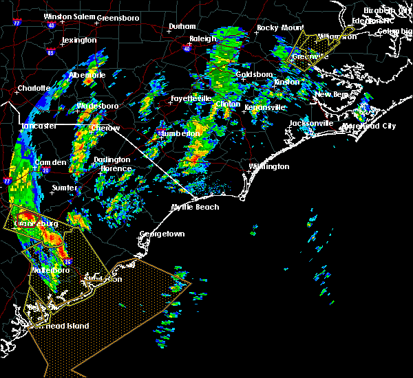 At 218 pm edt, a severe thunderstorm capable of producing a tornado was located near council, or 9 miles east of whiteville, moving north at 50 mph (radar indicated rotation). Hazards include tornado. Expect damage to mobile homes, roofs, and vehicles. this dangerous storm will be near, lisbon and carvers around 230 pm edt. lagoon around 235 pm edt. Other locations impacted by this tornadic thunderstorm include white lake. At 218 pm edt, a severe thunderstorm capable of producing a tornado was located near council, or 9 miles east of whiteville, moving north at 50 mph (radar indicated rotation). Hazards include tornado. Expect damage to mobile homes, roofs, and vehicles. this dangerous storm will be near, lisbon and carvers around 230 pm edt. lagoon around 235 pm edt. Other locations impacted by this tornadic thunderstorm include white lake.
|
| 4/19/2019 11:36 AM EDT |
 The severe thunderstorm warning for southeastern bladen, central brunswick and northeastern columbus counties will expire at 1145 am edt, the storm which prompted the warning has weakened below severe limits, and has exited the warned area. therefore, the warning will be allowed to expire. however gusty winds are still possible with this thunderstorm. The severe thunderstorm warning for southeastern bladen, central brunswick and northeastern columbus counties will expire at 1145 am edt, the storm which prompted the warning has weakened below severe limits, and has exited the warned area. therefore, the warning will be allowed to expire. however gusty winds are still possible with this thunderstorm.
|
| 4/19/2019 11:08 AM EDT |
 At 1108 am edt, a severe thunderstorm was located over honey island, or 11 miles north of shallotte, moving northeast at 45 mph (radar indicated). Hazards include 70 mph wind gusts. Expect considerable tree damage. damage is likely to mobile homes, roofs, and outbuildings. Locations impacted include, shallotte, elizabethtown, lake waccamaw, northwest, sandyfield, makatoka, hallsboro, redbug, exum, council, phoenix, riegelwood, carvers, lisbon, honey island, lagoon, elkton, emerson, kelly and batarora. At 1108 am edt, a severe thunderstorm was located over honey island, or 11 miles north of shallotte, moving northeast at 45 mph (radar indicated). Hazards include 70 mph wind gusts. Expect considerable tree damage. damage is likely to mobile homes, roofs, and outbuildings. Locations impacted include, shallotte, elizabethtown, lake waccamaw, northwest, sandyfield, makatoka, hallsboro, redbug, exum, council, phoenix, riegelwood, carvers, lisbon, honey island, lagoon, elkton, emerson, kelly and batarora.
|
| 4/19/2019 10:55 AM EDT |
 At 1054 am edt, a severe thunderstorm was located near longwood, or near shallotte, moving northeast at 45 mph (radar indicated). Hazards include 60 mph wind gusts. expect wind damage to trees and power lines At 1054 am edt, a severe thunderstorm was located near longwood, or near shallotte, moving northeast at 45 mph (radar indicated). Hazards include 60 mph wind gusts. expect wind damage to trees and power lines
|
| 12/28/2018 5:09 PM EST |
 At 509 pm est, potentially severe thunderstorms were located along a line extending from 9 miles southwest of clinton to 6 miles north of whiteville, moving northeast at 45 mph (radar indicated). Hazards include 60 mph wind gusts. Expect wind damage to trees and power lines. locations impacted include, whiteville, elizabethtown, rowan, carvers, lisbon, abbottsburg, ammon, lagoon, elkton, emerson, council, southeastern community college, kelly, clarkton, white lake. This includes us route 74 between mile markers 387 and 395. At 509 pm est, potentially severe thunderstorms were located along a line extending from 9 miles southwest of clinton to 6 miles north of whiteville, moving northeast at 45 mph (radar indicated). Hazards include 60 mph wind gusts. Expect wind damage to trees and power lines. locations impacted include, whiteville, elizabethtown, rowan, carvers, lisbon, abbottsburg, ammon, lagoon, elkton, emerson, council, southeastern community college, kelly, clarkton, white lake. This includes us route 74 between mile markers 387 and 395.
|
| 12/28/2018 4:56 PM EST |
 At 455 pm est, severe thunderstorms were located along a line extending from near jerome to near evergreen, moving northeast at 45 mph (radar indicated). Hazards include 60 mph wind gusts. Expect wind damage to trees and power lines. locations impacted include, whiteville, elizabethtown, rowan, chadbourn, bladenboro, bladen community college, ammon, butters, council, white oak, carvers, lisbon, abbottsburg, lagoon, elkton, emerson, kelly, ruskin and evergreen. This includes us route 74 between mile markers 378 and 395. At 455 pm est, severe thunderstorms were located along a line extending from near jerome to near evergreen, moving northeast at 45 mph (radar indicated). Hazards include 60 mph wind gusts. Expect wind damage to trees and power lines. locations impacted include, whiteville, elizabethtown, rowan, chadbourn, bladenboro, bladen community college, ammon, butters, council, white oak, carvers, lisbon, abbottsburg, lagoon, elkton, emerson, kelly, ruskin and evergreen. This includes us route 74 between mile markers 378 and 395.
|
| 12/28/2018 4:43 PM EST |
 At 443 pm est, severe thunderstorms were located along a line extending from near duart to fair bluff, moving northeast at 45 mph (radar indicated). Hazards include 60 mph wind gusts. expect wind damage to trees and power lines At 443 pm est, severe thunderstorms were located along a line extending from near duart to fair bluff, moving northeast at 45 mph (radar indicated). Hazards include 60 mph wind gusts. expect wind damage to trees and power lines
|
| 6/24/2018 10:40 PM EDT | Numerous trees down hwy 53 and 21 in bladen county NC, 2.5 miles W of Kelly, NC |
| 6/24/2018 10:29 PM EDT |
 At 1028 pm edt, severe thunderstorms extending from 7 miles northeast of rowan to near kelly to elkton, moving southeast at 30 mph (radar indicated). Hazards include 60 mph wind gusts. Expect damage to trees and power lines. locations impacted include, rowan, lake waccamaw, carvers, lisbon, lagoon, elkton, emerson, council, kelly, clarkton, white lake, bolton, east arcadia and atkinson. This includes us route 74 between mile markers 403 and 410. At 1028 pm edt, severe thunderstorms extending from 7 miles northeast of rowan to near kelly to elkton, moving southeast at 30 mph (radar indicated). Hazards include 60 mph wind gusts. Expect damage to trees and power lines. locations impacted include, rowan, lake waccamaw, carvers, lisbon, lagoon, elkton, emerson, council, kelly, clarkton, white lake, bolton, east arcadia and atkinson. This includes us route 74 between mile markers 403 and 410.
|
| 6/24/2018 9:57 PM EDT |
 At 957 pm edt, a severe thunderstorm was located over elizabethtown, moving southeast at 20 mph (radar indicated). Hazards include 60 mph wind gusts. expect damage to trees and power lines At 957 pm edt, a severe thunderstorm was located over elizabethtown, moving southeast at 20 mph (radar indicated). Hazards include 60 mph wind gusts. expect damage to trees and power lines
|
| 6/24/2018 9:13 PM EDT |
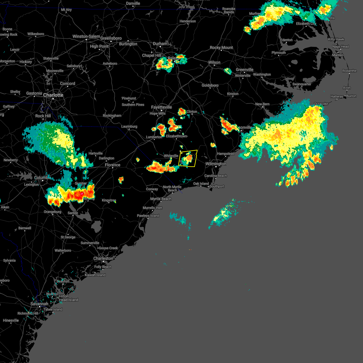 The severe thunderstorm warning for southeastern bladen and northeastern columbus counties will expire at 915 pm edt. the storm which prompted the warning has weakened below severe limits, and no longer poses an immediate threat to life or property. therefore, the warning will be allowed to expire. However gusty winds and heavy rain are still possible with this thunderstorm. The severe thunderstorm warning for southeastern bladen and northeastern columbus counties will expire at 915 pm edt. the storm which prompted the warning has weakened below severe limits, and no longer poses an immediate threat to life or property. therefore, the warning will be allowed to expire. However gusty winds and heavy rain are still possible with this thunderstorm.
|
| 6/24/2018 9:10 PM EDT | Public reported trees much greater than 3" in diameter down in the kelly community. also reported twisted limbs and bark off of trees. a trampoline was also reported to in bladen county NC, 4.3 miles W of Kelly, NC |
| 6/24/2018 9:03 PM EDT |
 At 902 pm edt, a severe thunderstorm was located near freeman, or 19 miles east of whiteville, moving east at 30 mph (radar indicated). Hazards include 60 mph wind gusts. Expect damage trees and power lines. locations impacted include, lake waccamaw, sandyfield, freeman, council, bolton and east arcadia. This includes us route 74 between mile markers 402 and 418. At 902 pm edt, a severe thunderstorm was located near freeman, or 19 miles east of whiteville, moving east at 30 mph (radar indicated). Hazards include 60 mph wind gusts. Expect damage trees and power lines. locations impacted include, lake waccamaw, sandyfield, freeman, council, bolton and east arcadia. This includes us route 74 between mile markers 402 and 418.
|
| 6/24/2018 8:34 PM EDT |
 At 834 pm edt, a severe thunderstorm was located over redbug, or near whiteville, moving east at 30 mph (radar indicated). Hazards include 60 mph wind gusts. expect damage trees and power lines At 834 pm edt, a severe thunderstorm was located over redbug, or near whiteville, moving east at 30 mph (radar indicated). Hazards include 60 mph wind gusts. expect damage trees and power lines
|
| 3/1/2018 6:12 PM EST |
 At 612 pm est, strong to severe thunderstorms were located along a line extending from near atkinson, delco, and pireway, moving east at 50 55 mph. although this line has shown some weakening, a few locations in the warned area may still receive a wind gust to 60 mph (radar indicated). Hazards include 60 mph wind gusts. Some downed trees and power lines possible. Locations impacted include, burgaw, shallotte, lake waccamaw, penderlea, makatoka, long creek, exum, longwood, currie, winnabow, and rooks. At 612 pm est, strong to severe thunderstorms were located along a line extending from near atkinson, delco, and pireway, moving east at 50 55 mph. although this line has shown some weakening, a few locations in the warned area may still receive a wind gust to 60 mph (radar indicated). Hazards include 60 mph wind gusts. Some downed trees and power lines possible. Locations impacted include, burgaw, shallotte, lake waccamaw, penderlea, makatoka, long creek, exum, longwood, currie, winnabow, and rooks.
|
| 3/1/2018 5:44 PM EST |
 At 543 pm est, severe thunderstorms were located along a line extending from 7 miles east of ammon to near elizabethtown, clarkton, whiteville and green sea, moving east at 50 to 55 mph. this line of storms has a history of producing wind damage (radar indicated). Hazards include 60 mph wind gusts. expect downed trees and power lines in those areas that receive the highest winds At 543 pm est, severe thunderstorms were located along a line extending from 7 miles east of ammon to near elizabethtown, clarkton, whiteville and green sea, moving east at 50 to 55 mph. this line of storms has a history of producing wind damage (radar indicated). Hazards include 60 mph wind gusts. expect downed trees and power lines in those areas that receive the highest winds
|
| 8/23/2017 8:41 PM EDT |
 The severe thunderstorm warning for southeastern bladen and central columbus counties will expire at 845 pm edt, the storms which prompted the warning have weakened below severe limits, and no longer pose an immediate threat to life or property. therefore the warning will be allowed to expire. however gusty winds are still possible with these thunderstorms. The severe thunderstorm warning for southeastern bladen and central columbus counties will expire at 845 pm edt, the storms which prompted the warning have weakened below severe limits, and no longer pose an immediate threat to life or property. therefore the warning will be allowed to expire. however gusty winds are still possible with these thunderstorms.
|
| 8/23/2017 8:29 PM EDT |
 At 829 pm edt, severe thunderstorms were located along a line extending from bethel to adrian, moving southeast at 20 mph (radar indicated). Hazards include 60 mph wind gusts and quarter size hail. Minor hail damage to vehicles is possible. expect wind damage to trees and power lines. locations impacted include, whiteville, rowan, tabor city, chadbourn, lake waccamaw, sandyfield, hallsboro, redbug, council, southeastern community college, williams, riegelwood, carvers, lisbon, cherry grove, mollie, lagoon, sidney, elkton and emerson. This includes us route 74 between mile markers 387 and 416. At 829 pm edt, severe thunderstorms were located along a line extending from bethel to adrian, moving southeast at 20 mph (radar indicated). Hazards include 60 mph wind gusts and quarter size hail. Minor hail damage to vehicles is possible. expect wind damage to trees and power lines. locations impacted include, whiteville, rowan, tabor city, chadbourn, lake waccamaw, sandyfield, hallsboro, redbug, council, southeastern community college, williams, riegelwood, carvers, lisbon, cherry grove, mollie, lagoon, sidney, elkton and emerson. This includes us route 74 between mile markers 387 and 416.
|
| 8/23/2017 8:03 PM EDT |
 At 802 pm edt, severe thunderstorms were located along a line extending from sidney to near bayboro, moving southeast at 20 mph (radar indicated). Hazards include 60 mph wind gusts and quarter size hail. Minor hail damage to vehicles is possible. expect wind damage to trees and power lines. locations impacted include, marion, whiteville, mullins, elizabethtown, rowan, tabor city, chadbourn, bladenboro, lake waccamaw, fair bluff, sandyfield, boardman, hallsboro, rains, southeastern community college, carvers, galivants ferry, lisbon, sidney and elkton. This includes us route 74 between mile markers 375 and 417. At 802 pm edt, severe thunderstorms were located along a line extending from sidney to near bayboro, moving southeast at 20 mph (radar indicated). Hazards include 60 mph wind gusts and quarter size hail. Minor hail damage to vehicles is possible. expect wind damage to trees and power lines. locations impacted include, marion, whiteville, mullins, elizabethtown, rowan, tabor city, chadbourn, bladenboro, lake waccamaw, fair bluff, sandyfield, boardman, hallsboro, rains, southeastern community college, carvers, galivants ferry, lisbon, sidney and elkton. This includes us route 74 between mile markers 375 and 417.
|
| 8/23/2017 7:10 PM EDT |
 At 710 pm edt, severe thunderstorms were located along a line extending from near barnesville to near zion, moving southeast at 20 mph (radar indicated). Hazards include 60 mph wind gusts and quarter size hail. Minor hail damage to vehicles is possible. Expect wind damage to trees and power lines. At 710 pm edt, severe thunderstorms were located along a line extending from near barnesville to near zion, moving southeast at 20 mph (radar indicated). Hazards include 60 mph wind gusts and quarter size hail. Minor hail damage to vehicles is possible. Expect wind damage to trees and power lines.
|
| 7/15/2017 7:49 PM EDT |
 At 749 pm edt, a severe thunderstorm was located near sandyfield, or 17 miles east of whiteville, moving east at 30 mph (radar indicated). Hazards include 60 mph wind gusts and nickel size hail. Expect damage trees and power lines. locations impacted include, whiteville, rowan, lake waccamaw, sandyfield, point caswell, hallsboro, redbug, council, riegelwood, carvers, lisbon, lagoon, elkton, rooks, emerson, kelly, freeman, delco, crusoe island and brunswick. This includes us route 74 between mile markers 392 and 422. At 749 pm edt, a severe thunderstorm was located near sandyfield, or 17 miles east of whiteville, moving east at 30 mph (radar indicated). Hazards include 60 mph wind gusts and nickel size hail. Expect damage trees and power lines. locations impacted include, whiteville, rowan, lake waccamaw, sandyfield, point caswell, hallsboro, redbug, council, riegelwood, carvers, lisbon, lagoon, elkton, rooks, emerson, kelly, freeman, delco, crusoe island and brunswick. This includes us route 74 between mile markers 392 and 422.
|
| 7/15/2017 7:24 PM EDT |
 At 724 pm edt, a severe thunderstorm was located over hallsboro, or near whiteville, moving east at 30 mph (radar indicated). Hazards include 60 mph wind gusts and nickel size hail. expect damage trees and power lines At 724 pm edt, a severe thunderstorm was located over hallsboro, or near whiteville, moving east at 30 mph (radar indicated). Hazards include 60 mph wind gusts and nickel size hail. expect damage trees and power lines
|
| 6/14/2017 7:30 PM EDT | Large limbs down blocking a portion of nc 53 near kelly. time estimated based off rada in bladen county NC, 7.7 miles SE of Kelly, NC |
| 4/5/2017 6:24 PM EDT |
 At 624 pm edt, a severe thunderstorm was located near lagoon, or 8 miles east of elizabethtown, moving northeast at 35 mph (radar indicated). Hazards include 60 mph wind gusts and quarter size hail. Hail damage to vehicles is expected. expect wind damage to roofs, siding, and trees. locations impacted include, elizabethtown, rowan, carvers, lisbon, ammon, lagoon, emerson, kelly, white lake and bladen county hospital. A tornado watch remains in effect until 800 pm edt for southeastern north carolina. At 624 pm edt, a severe thunderstorm was located near lagoon, or 8 miles east of elizabethtown, moving northeast at 35 mph (radar indicated). Hazards include 60 mph wind gusts and quarter size hail. Hail damage to vehicles is expected. expect wind damage to roofs, siding, and trees. locations impacted include, elizabethtown, rowan, carvers, lisbon, ammon, lagoon, emerson, kelly, white lake and bladen county hospital. A tornado watch remains in effect until 800 pm edt for southeastern north carolina.
|
| 4/5/2017 5:59 PM EDT |
 At 558 pm edt, a severe thunderstorm was located over abbottsburg, or 9 miles southwest of elizabethtown, moving east at 35 mph (radar indicated). Hazards include 60 mph wind gusts and quarter size hail. Hail damage to vehicles is expected. Expect wind damage to roofs, siding, and trees. At 558 pm edt, a severe thunderstorm was located over abbottsburg, or 9 miles southwest of elizabethtown, moving east at 35 mph (radar indicated). Hazards include 60 mph wind gusts and quarter size hail. Hail damage to vehicles is expected. Expect wind damage to roofs, siding, and trees.
|
| 3/18/2017 7:55 PM EDT |
 The severe thunderstorm warning for southeastern bladen county will expire at 800 pm edt, the storm which prompted the warning has moved out of the area. therefore the warning will be allowed to expire. The severe thunderstorm warning for southeastern bladen county will expire at 800 pm edt, the storm which prompted the warning has moved out of the area. therefore the warning will be allowed to expire.
|
| 3/18/2017 7:52 PM EDT |
 At 751 pm edt, a severe thunderstorm was located near rowan, or 19 miles east of elizabethtown, moving east at 40 mph (law enforcement). Hazards include 60 mph wind gusts and quarter size hail. Hail damage to vehicles is expected. expect wind damage to roofs, siding, and trees. Locations impacted include, rowan, kelly and east arcadia. At 751 pm edt, a severe thunderstorm was located near rowan, or 19 miles east of elizabethtown, moving east at 40 mph (law enforcement). Hazards include 60 mph wind gusts and quarter size hail. Hail damage to vehicles is expected. expect wind damage to roofs, siding, and trees. Locations impacted include, rowan, kelly and east arcadia.
|
| 3/18/2017 7:34 PM EDT |
 At 733 pm edt, a severe thunderstorm was located near lagoon, or near elizabethtown, moving east at 40 mph (law enforcement). Hazards include 60 mph wind gusts and quarter size hail. Hail damage to vehicles is expected. expect wind damage to roofs, siding, and trees. Locations impacted include, elizabethtown, rowan, carvers, lisbon, lagoon, elkton, emerson, council, kelly, clarkton, white lake, east arcadia and bladen county hospital. At 733 pm edt, a severe thunderstorm was located near lagoon, or near elizabethtown, moving east at 40 mph (law enforcement). Hazards include 60 mph wind gusts and quarter size hail. Hail damage to vehicles is expected. expect wind damage to roofs, siding, and trees. Locations impacted include, elizabethtown, rowan, carvers, lisbon, lagoon, elkton, emerson, council, kelly, clarkton, white lake, east arcadia and bladen county hospital.
|
| 3/18/2017 7:18 PM EDT |
 At 718 pm edt, a severe thunderstorm was located near bladen community college, or near elizabethtown, moving east at 40 mph (radar indicated). Hazards include 60 mph wind gusts and quarter size hail. Hail damage to vehicles is expected. expect wind damage to roofs, siding, and trees. Locations impacted include, elizabethtown, rowan, bladenboro, carvers, bladen community college, lisbon, abbottsburg, duart, ammon, butters, lagoon, elkton, emerson, council, kelly, tobermory, ruskin, white oak, clarkton and white lake. At 718 pm edt, a severe thunderstorm was located near bladen community college, or near elizabethtown, moving east at 40 mph (radar indicated). Hazards include 60 mph wind gusts and quarter size hail. Hail damage to vehicles is expected. expect wind damage to roofs, siding, and trees. Locations impacted include, elizabethtown, rowan, bladenboro, carvers, bladen community college, lisbon, abbottsburg, duart, ammon, butters, lagoon, elkton, emerson, council, kelly, tobermory, ruskin, white oak, clarkton and white lake.
|
| 3/18/2017 6:59 PM EDT |
 At 659 pm edt, a severe thunderstorm was located over smiths, or near lumberton, moving east at 40 mph (radar indicated). Hazards include 60 mph wind gusts and quarter size hail. Hail damage to vehicles is expected. Expect wind damage to roofs, siding, and trees. At 659 pm edt, a severe thunderstorm was located over smiths, or near lumberton, moving east at 40 mph (radar indicated). Hazards include 60 mph wind gusts and quarter size hail. Hail damage to vehicles is expected. Expect wind damage to roofs, siding, and trees.
|
| 3/1/2017 11:39 PM EST |
 The severe thunderstorm warning for central bladen county will expire at 1145 pm est, the storm which prompted the warning has weakened below severe limits, and no longer poses an immediate threat to life or property. therefore the warning will be allowed to expire. however gusty winds are still possible with this thunderstorm. The severe thunderstorm warning for central bladen county will expire at 1145 pm est, the storm which prompted the warning has weakened below severe limits, and no longer poses an immediate threat to life or property. therefore the warning will be allowed to expire. however gusty winds are still possible with this thunderstorm.
|
| 3/1/2017 11:23 PM EST |
 At 1123 pm est, a severe thunderstorm was located 9 miles west of harrells, or 15 miles northeast of elizabethtown, moving east at 55 mph (radar indicated). Hazards include 60 mph wind gusts and penny size hail. Expect damage to roofs, siding, and trees. Locations impacted include, elizabethtown, rowan, bladenboro, lisbon, lagoon, kelly, white lake and bladen county hospital. At 1123 pm est, a severe thunderstorm was located 9 miles west of harrells, or 15 miles northeast of elizabethtown, moving east at 55 mph (radar indicated). Hazards include 60 mph wind gusts and penny size hail. Expect damage to roofs, siding, and trees. Locations impacted include, elizabethtown, rowan, bladenboro, lisbon, lagoon, kelly, white lake and bladen county hospital.
|
| 3/1/2017 11:10 PM EST |
 At 1109 pm est, a severe thunderstorm was located near elizabethtown, moving east at 55 mph (radar indicated). Hazards include 60 mph wind gusts and penny size hail. Expect damage to roofs, siding, and trees. Locations impacted include, elizabethtown, rowan, bladenboro, bladen community college, lisbon, ammon, lagoon, kelly, ruskin, white oak, jerome, butters, white lake, dublin, tar heel and bladen county hospital. At 1109 pm est, a severe thunderstorm was located near elizabethtown, moving east at 55 mph (radar indicated). Hazards include 60 mph wind gusts and penny size hail. Expect damage to roofs, siding, and trees. Locations impacted include, elizabethtown, rowan, bladenboro, bladen community college, lisbon, ammon, lagoon, kelly, ruskin, white oak, jerome, butters, white lake, dublin, tar heel and bladen county hospital.
|
| 3/1/2017 10:55 PM EST |
 At 1055 pm est, a severe thunderstorm was located near smiths, or 10 miles east of lumberton, moving east at 55 mph (radar indicated). Hazards include 60 mph wind gusts and penny size hail. expect damage to roofs, siding, and trees At 1055 pm est, a severe thunderstorm was located near smiths, or 10 miles east of lumberton, moving east at 55 mph (radar indicated). Hazards include 60 mph wind gusts and penny size hail. expect damage to roofs, siding, and trees
|
| 10/8/2016 9:22 AM EDT |
 The tornado warning for bladen, northeastern columbus, eastern brunswick, western pender and east central robeson counties will expire at 930 am edt, the storm which prompted the warning has weakened below severe limits, and no longer appears capable of producing a tornado. therefore the warning will be allowed to expire. a tornado watch remains in effect until 400 pm edt for southeastern north carolina. The tornado warning for bladen, northeastern columbus, eastern brunswick, western pender and east central robeson counties will expire at 930 am edt, the storm which prompted the warning has weakened below severe limits, and no longer appears capable of producing a tornado. therefore the warning will be allowed to expire. a tornado watch remains in effect until 400 pm edt for southeastern north carolina.
|
| 10/8/2016 8:36 AM EDT |
 At 836 am edt, a severe thunderstorm capable of producing a tornado was located over boiling spring lakes, or 8 miles north of oak island, moving northwest at 45 mph (radar indicated rotation). Hazards include tornado...quarter size hail...and 60 mph wind gusts. Expect damage to mobile homes. roofs. and vehicles. this dangerous storm will be near, mill creek and brunswick county community college main campus around 840 am edt. winnabow, town creek and bishop around 845 am edt. batarora around 850 am edt. honey island around 855 am edt. freeman, delco and riegelwood around 900 am edt. sandyfield around 905 am edt. kelly around 910 am edt. carvers and council around 915 am edt. Other locations impacted by this tornadic thunderstorm include white lake, east arcadia, dublin, atkinson, clarkton, sandy creek, bolton, bolivia, bladen county hospital and navassa. At 836 am edt, a severe thunderstorm capable of producing a tornado was located over boiling spring lakes, or 8 miles north of oak island, moving northwest at 45 mph (radar indicated rotation). Hazards include tornado...quarter size hail...and 60 mph wind gusts. Expect damage to mobile homes. roofs. and vehicles. this dangerous storm will be near, mill creek and brunswick county community college main campus around 840 am edt. winnabow, town creek and bishop around 845 am edt. batarora around 850 am edt. honey island around 855 am edt. freeman, delco and riegelwood around 900 am edt. sandyfield around 905 am edt. kelly around 910 am edt. carvers and council around 915 am edt. Other locations impacted by this tornadic thunderstorm include white lake, east arcadia, dublin, atkinson, clarkton, sandy creek, bolton, bolivia, bladen county hospital and navassa.
|
| 10/8/2016 6:58 AM EDT |
 At 658 am edt, a severe thunderstorm capable of producing a tornado was located over phoenix, or near leland, moving northwest at 40 mph (radar indicated rotation). Hazards include tornado...quarter size hail...and 60 mph wind gusts. Expect damage to mobile homes. roofs. and vehicles. this dangerous storm will be near, northwest around 715 am edt. delco around 720 am edt. riegelwood around 725 am edt. sandyfield and freeman around 730 am edt. Other locations impacted by this tornadic thunderstorm include east arcadia and sandy creek. At 658 am edt, a severe thunderstorm capable of producing a tornado was located over phoenix, or near leland, moving northwest at 40 mph (radar indicated rotation). Hazards include tornado...quarter size hail...and 60 mph wind gusts. Expect damage to mobile homes. roofs. and vehicles. this dangerous storm will be near, northwest around 715 am edt. delco around 720 am edt. riegelwood around 725 am edt. sandyfield and freeman around 730 am edt. Other locations impacted by this tornadic thunderstorm include east arcadia and sandy creek.
|
| 10/8/2016 6:12 AM EDT |
 At 612 am edt, a severe thunderstorm capable of producing a tornado was located over winnabow, or 7 miles southwest of leland, moving northwest at 50 mph (radar indicated rotation). Hazards include tornado. Flying debris will be dangerous to those caught without shelter. mobile homes will be damaged or destroyed. damage to roofs, windows, and vehicles will occur. tree damage is likely. this dangerous storm will be near, freeman, delco and riegelwood around 630 am edt. sandyfield around 635 am edt. kelly around 640 am edt. lake waccamaw around 645 am edt. Other locations impacted by this tornadic thunderstorm include bolton, east arcadia and sandy creek. At 612 am edt, a severe thunderstorm capable of producing a tornado was located over winnabow, or 7 miles southwest of leland, moving northwest at 50 mph (radar indicated rotation). Hazards include tornado. Flying debris will be dangerous to those caught without shelter. mobile homes will be damaged or destroyed. damage to roofs, windows, and vehicles will occur. tree damage is likely. this dangerous storm will be near, freeman, delco and riegelwood around 630 am edt. sandyfield around 635 am edt. kelly around 640 am edt. lake waccamaw around 645 am edt. Other locations impacted by this tornadic thunderstorm include bolton, east arcadia and sandy creek.
|
| 7/31/2016 5:11 PM EDT |
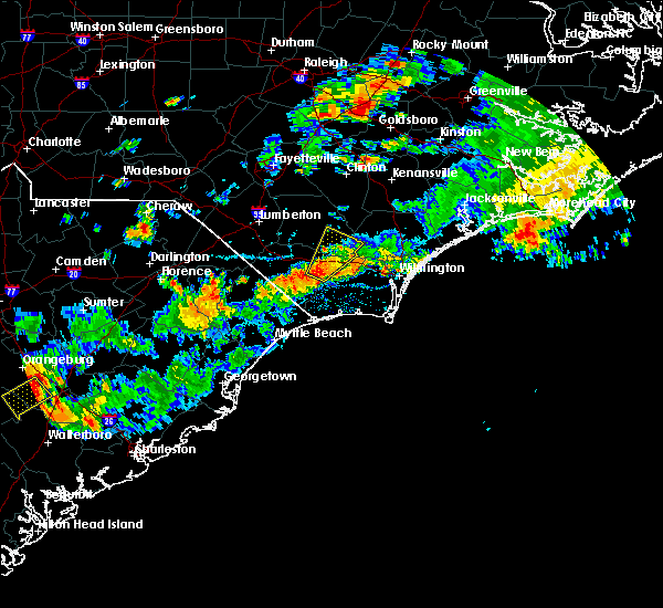 At 511 pm edt, a severe thunderstorm was located over council, or 14 miles east of whiteville, moving northeast at 25 mph (radar indicated). Hazards include 60 mph wind gusts and nickel size hail. Expect damage to roofs. siding. and trees. Locations impacted include, lake waccamaw, sandyfield, lagoon, carvers, council, kelly, crusoe island, bolton and east arcadia. At 511 pm edt, a severe thunderstorm was located over council, or 14 miles east of whiteville, moving northeast at 25 mph (radar indicated). Hazards include 60 mph wind gusts and nickel size hail. Expect damage to roofs. siding. and trees. Locations impacted include, lake waccamaw, sandyfield, lagoon, carvers, council, kelly, crusoe island, bolton and east arcadia.
|
| 7/31/2016 4:53 PM EDT |
 At 453 pm edt, a severe thunderstorm was located over lake waccamaw, or 9 miles east of whiteville, moving northeast at 25 mph (radar indicated). Hazards include 60 mph wind gusts and nickel size hail. Expect damage to roofs. siding. And trees. At 453 pm edt, a severe thunderstorm was located over lake waccamaw, or 9 miles east of whiteville, moving northeast at 25 mph (radar indicated). Hazards include 60 mph wind gusts and nickel size hail. Expect damage to roofs. siding. And trees.
|
| 7/31/2016 4:02 PM EDT |
 At 402 pm edt, a severe thunderstorm was located over point caswell, or 16 miles west of burgaw, moving northeast at 25 mph (radar indicated). Hazards include 60 mph wind gusts and quarter size hail. Hail damage to vehicles is expected. expect wind damage to roofs, siding, and trees. Locations impacted include, rowan, sandyfield, freeman, montague, currie, the borough, malpass corner, delco, wards corner, kelly, rooks, willard, riegelwood, penderlea, point caswell, east arcadia, atkinson and watha. At 402 pm edt, a severe thunderstorm was located over point caswell, or 16 miles west of burgaw, moving northeast at 25 mph (radar indicated). Hazards include 60 mph wind gusts and quarter size hail. Hail damage to vehicles is expected. expect wind damage to roofs, siding, and trees. Locations impacted include, rowan, sandyfield, freeman, montague, currie, the borough, malpass corner, delco, wards corner, kelly, rooks, willard, riegelwood, penderlea, point caswell, east arcadia, atkinson and watha.
|
| 7/31/2016 3:43 PM EDT |
 At 343 pm edt, a severe thunderstorm was located over sandyfield, or 16 miles northwest of leland, moving northeast at 25 mph (radar indicated). Hazards include 60 mph wind gusts and quarter size hail. Hail damage to vehicles is expected. Expect wind damage to roofs, siding, and trees. At 343 pm edt, a severe thunderstorm was located over sandyfield, or 16 miles northwest of leland, moving northeast at 25 mph (radar indicated). Hazards include 60 mph wind gusts and quarter size hail. Hail damage to vehicles is expected. Expect wind damage to roofs, siding, and trees.
|
| 7/9/2016 12:05 AM EDT |
 At 1204 am edt, a severe thunderstorm was located near lake waccamaw, or 12 miles southeast of whiteville, moving east, southeast at 40 mph (radar indicated). Hazards include 60 mph wind gusts and quarter size hail. Hail damage to vehicles is expected. Expect wind damage to roofs, siding, and trees. At 1204 am edt, a severe thunderstorm was located near lake waccamaw, or 12 miles southeast of whiteville, moving east, southeast at 40 mph (radar indicated). Hazards include 60 mph wind gusts and quarter size hail. Hail damage to vehicles is expected. Expect wind damage to roofs, siding, and trees.
|
| 7/9/2016 12:02 AM EDT | Tree fell on home in kelly... on pinewood road off of lightknot road in bladen county NC, 0.2 miles W of Kelly, NC |
| 6/14/2016 6:25 PM EDT |
 At 625 pm edt, a severe thunderstorm was located over council, or 16 miles northeast of whiteville, moving east at 30 mph (radar indicated). Hazards include 60 mph wind gusts and quarter size hail. Hail damage to vehicles is expected. Expect wind damage to roofs, siding, and trees. At 625 pm edt, a severe thunderstorm was located over council, or 16 miles northeast of whiteville, moving east at 30 mph (radar indicated). Hazards include 60 mph wind gusts and quarter size hail. Hail damage to vehicles is expected. Expect wind damage to roofs, siding, and trees.
|
| 6/5/2016 5:04 PM EDT |
 At 503 pm edt, a severe thunderstorm was located near lake waccamaw, or 10 miles east of whiteville, moving northeast at 25 mph (radar indicated). Hazards include 60 mph wind gusts and quarter size hail. Hail damage to vehicles is expected. expect wind damage to roofs, siding, and trees. Locations impacted include, whiteville, rowan, lake waccamaw, sandyfield, carvers, redbug, council, hallsboro, riegelwood, kelly, bolton and east arcadia. At 503 pm edt, a severe thunderstorm was located near lake waccamaw, or 10 miles east of whiteville, moving northeast at 25 mph (radar indicated). Hazards include 60 mph wind gusts and quarter size hail. Hail damage to vehicles is expected. expect wind damage to roofs, siding, and trees. Locations impacted include, whiteville, rowan, lake waccamaw, sandyfield, carvers, redbug, council, hallsboro, riegelwood, kelly, bolton and east arcadia.
|
| 6/5/2016 4:44 PM EDT |
 At 444 pm edt, a severe thunderstorm was located over hallsboro, or 7 miles east of whiteville, moving northeast at 35 mph (radar indicated). Hazards include 60 mph wind gusts and quarter size hail. Hail damage to vehicles is expected. Expect wind damage to roofs, siding, and trees. At 444 pm edt, a severe thunderstorm was located over hallsboro, or 7 miles east of whiteville, moving northeast at 35 mph (radar indicated). Hazards include 60 mph wind gusts and quarter size hail. Hail damage to vehicles is expected. Expect wind damage to roofs, siding, and trees.
|
| 5/3/2016 8:54 PM EDT |
 The severe thunderstorm warning for central bladen county will expire at 900 pm edt, the storm which prompted the warning has moved out of the area. therefore the warning will be allowed to expire. a severe thunderstorm watch remains in effect until 1100 pm edt for southeastern north carolina. The severe thunderstorm warning for central bladen county will expire at 900 pm edt, the storm which prompted the warning has moved out of the area. therefore the warning will be allowed to expire. a severe thunderstorm watch remains in effect until 1100 pm edt for southeastern north carolina.
|
| 5/3/2016 8:27 PM EDT |
 At 827 pm edt, a severe thunderstorm was located 7 miles north of lagoon, or 11 miles east of elizabethtown, moving east at 35 mph (radar indicated). Hazards include 60 mph wind gusts and quarter size hail. Hail damage to vehicles is expected. expect wind damage to roofs, siding, and trees. Locations impacted include, lagoon, ammon and white lake. At 827 pm edt, a severe thunderstorm was located 7 miles north of lagoon, or 11 miles east of elizabethtown, moving east at 35 mph (radar indicated). Hazards include 60 mph wind gusts and quarter size hail. Hail damage to vehicles is expected. expect wind damage to roofs, siding, and trees. Locations impacted include, lagoon, ammon and white lake.
|
| 5/3/2016 8:13 PM EDT |
 At 813 pm edt, a severe thunderstorm was located near ammon, or near elizabethtown, moving east at 35 mph (radar indicated). Hazards include 60 mph wind gusts and half dollar size hail. Hail damage to vehicles is expected. Expect wind damage to roofs, siding, and trees. At 813 pm edt, a severe thunderstorm was located near ammon, or near elizabethtown, moving east at 35 mph (radar indicated). Hazards include 60 mph wind gusts and half dollar size hail. Hail damage to vehicles is expected. Expect wind damage to roofs, siding, and trees.
|
| 5/3/2016 6:07 PM EDT |
 At 606 pm edt, a severe thunderstorm was located over lake waccamaw, or 11 miles east of whiteville, moving east at 15 mph (radar indicated). Hazards include 60 mph wind gusts and quarter size hail. Hail damage to vehicles is expected. expect wind damage to roofs, siding, and trees. Locations impacted include, lake waccamaw, sandyfield, carvers, redbug, council, freeman, hallsboro, riegelwood, bolton and east arcadia. At 606 pm edt, a severe thunderstorm was located over lake waccamaw, or 11 miles east of whiteville, moving east at 15 mph (radar indicated). Hazards include 60 mph wind gusts and quarter size hail. Hail damage to vehicles is expected. expect wind damage to roofs, siding, and trees. Locations impacted include, lake waccamaw, sandyfield, carvers, redbug, council, freeman, hallsboro, riegelwood, bolton and east arcadia.
|
| 5/3/2016 5:49 PM EDT |
 At 548 pm edt, a severe thunderstorm was located over hallsboro, or 7 miles east of whiteville, moving east at 30 mph (radar indicated). Hazards include 60 mph wind gusts and quarter size hail. Hail damage to vehicles is expected. expect wind damage to roofs, siding, and trees. Locations impacted include, lake waccamaw, northwest, sandyfield, redbug, council, freeman, hallsboro, delco, honey island, carvers, emerson, makatoka, riegelwood, kelly, bolton, east arcadia and sandy creek. At 548 pm edt, a severe thunderstorm was located over hallsboro, or 7 miles east of whiteville, moving east at 30 mph (radar indicated). Hazards include 60 mph wind gusts and quarter size hail. Hail damage to vehicles is expected. expect wind damage to roofs, siding, and trees. Locations impacted include, lake waccamaw, northwest, sandyfield, redbug, council, freeman, hallsboro, delco, honey island, carvers, emerson, makatoka, riegelwood, kelly, bolton, east arcadia and sandy creek.
|
| 5/3/2016 5:29 PM EDT |
 At 529 pm edt, a severe thunderstorm was located over whiteville, moving east at 30 mph (radar indicated). Hazards include 60 mph wind gusts and quarter size hail. Hail damage to vehicles is expected. Expect wind damage to roofs, siding, and trees. At 529 pm edt, a severe thunderstorm was located over whiteville, moving east at 30 mph (radar indicated). Hazards include 60 mph wind gusts and quarter size hail. Hail damage to vehicles is expected. Expect wind damage to roofs, siding, and trees.
|
| 5/3/2016 4:51 PM EDT |
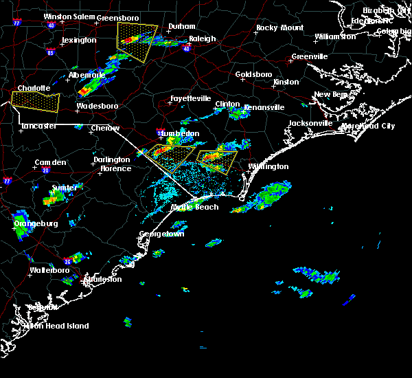 At 451 pm edt, a severe thunderstorm was located near council, or 17 miles east of whiteville, moving east at 25 mph (radar indicated). Hazards include 60 mph wind gusts and quarter size hail. Hail damage to vehicles is expected. expect wind damage to roofs, siding, and trees. Locations impacted include, northwest, sandyfield, freeman, montague, the borough, delco, riegelwood, batarora, bolton, east arcadia and sandy creek. At 451 pm edt, a severe thunderstorm was located near council, or 17 miles east of whiteville, moving east at 25 mph (radar indicated). Hazards include 60 mph wind gusts and quarter size hail. Hail damage to vehicles is expected. expect wind damage to roofs, siding, and trees. Locations impacted include, northwest, sandyfield, freeman, montague, the borough, delco, riegelwood, batarora, bolton, east arcadia and sandy creek.
|
| 5/3/2016 4:40 PM EDT |
 At 440 pm edt, a severe thunderstorm was located over council, or 14 miles east of whiteville, moving east at 25 mph (radar indicated). Hazards include 60 mph wind gusts and quarter size hail. Hail damage to vehicles is expected. expect wind damage to roofs, siding, and trees. Locations impacted include, northwest, sandyfield, council, freeman, montague, the borough, delco, batarora, kelly, carvers, riegelwood, currie, bolton, east arcadia and sandy creek. At 440 pm edt, a severe thunderstorm was located over council, or 14 miles east of whiteville, moving east at 25 mph (radar indicated). Hazards include 60 mph wind gusts and quarter size hail. Hail damage to vehicles is expected. expect wind damage to roofs, siding, and trees. Locations impacted include, northwest, sandyfield, council, freeman, montague, the borough, delco, batarora, kelly, carvers, riegelwood, currie, bolton, east arcadia and sandy creek.
|
| 5/3/2016 4:29 PM EDT |
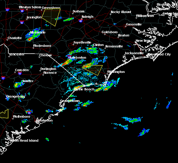 At 429 pm edt, a severe thunderstorm was located near council, or 11 miles northeast of whiteville, moving east at 25 mph (radar indicated). Hazards include 60 mph wind gusts and quarter size hail. Hail damage to vehicles is expected. Expect wind damage to roofs, siding, and trees. At 429 pm edt, a severe thunderstorm was located near council, or 11 miles northeast of whiteville, moving east at 25 mph (radar indicated). Hazards include 60 mph wind gusts and quarter size hail. Hail damage to vehicles is expected. Expect wind damage to roofs, siding, and trees.
|
| 4/7/2016 7:41 AM EDT |
 At 740 am edt, doppler radar indicated a severe thunderstorm capable of producing quarter size hail and damaging winds in excess of 60 mph. this storm was located near harrells, or 11 miles southwest of wallace, moving northeast at 45 mph. locations impacted include, rowan, rooks, willard, wards corner, penderlea, kelly, atkinson and watha. this includes interstate 40 between mile markers 389 and 394. At 740 am edt, doppler radar indicated a severe thunderstorm capable of producing quarter size hail and damaging winds in excess of 60 mph. this storm was located near harrells, or 11 miles southwest of wallace, moving northeast at 45 mph. locations impacted include, rowan, rooks, willard, wards corner, penderlea, kelly, atkinson and watha. this includes interstate 40 between mile markers 389 and 394.
|
| 4/7/2016 7:17 AM EDT |
 At 717 am edt, doppler radar indicated a severe thunderstorm capable of producing quarter size hail and damaging winds in excess of 60 mph. this storm was located over lagoon, or 10 miles southeast of elizabethtown, and moving northeast at 45 mph. At 717 am edt, doppler radar indicated a severe thunderstorm capable of producing quarter size hail and damaging winds in excess of 60 mph. this storm was located over lagoon, or 10 miles southeast of elizabethtown, and moving northeast at 45 mph.
|
| 2/24/2016 12:18 PM EST |
 At 1217 pm est, doppler radar indicated a severe thunderstorm capable of producing a tornado. this dangerous storm was located near warsaw, moving northeast at 60 mph. locations impacted include, elizabethtown, rowan, lagoon, elkton, carvers, lisbon, emerson, clarkton, white lake and bladen county hospital. At 1217 pm est, doppler radar indicated a severe thunderstorm capable of producing a tornado. this dangerous storm was located near warsaw, moving northeast at 60 mph. locations impacted include, elizabethtown, rowan, lagoon, elkton, carvers, lisbon, emerson, clarkton, white lake and bladen county hospital.
|
| 2/24/2016 12:03 PM EST |
 At 1203 pm est, doppler radar indicated a severe thunderstorm capable of producing a tornado. this dangerous storm was located near elkton, or 7 miles northeast of whiteville, and moving northeast at 60 mph. At 1203 pm est, doppler radar indicated a severe thunderstorm capable of producing a tornado. this dangerous storm was located near elkton, or 7 miles northeast of whiteville, and moving northeast at 60 mph.
|
| 2/24/2016 11:58 AM EST |
 At 1158 am est, doppler radar indicated a severe thunderstorm capable of producing quarter size hail and damaging winds in excess of 60 mph. this storm was located near whiteville, and moving northeast at 80 mph. At 1158 am est, doppler radar indicated a severe thunderstorm capable of producing quarter size hail and damaging winds in excess of 60 mph. this storm was located near whiteville, and moving northeast at 80 mph.
|
| 12/23/2015 7:58 AM EST | At 758 am est, doppler radar indicated a severe thunderstorm capable of producing a tornado. this dangerous storm was located near lagoon, or 15 miles southeast of elizabethtown, moving northeast at 30 mph. locations impacted include, rowan, lagoon, carvers, rooks, kelly and atkinson. |
| 12/23/2015 7:47 AM EST | At 746 am est, doppler radar indicated a severe thunderstorm capable of producing a tornado. this dangerous storm was located over carvers, or 14 miles southeast of elizabethtown, moving northeast at 30 mph. locations impacted include, rowan, lagoon, carvers, rooks, council, point caswell, kelly and atkinson. |
| 12/23/2015 7:34 AM EST | At 734 am est, doppler radar indicated a severe thunderstorm capable of producing a tornado. this dangerous storm was located over council, or 12 miles northeast of whiteville, and moving northeast at 30 mph. |
| 8/6/2015 5:58 PM EDT |
 At 558 pm edt, doppler radar indicated a severe thunderstorm capable of producing damaging winds in excess of 60 mph. this storm was located near elkton, or 7 miles northeast of whiteville, and moving east at 20 mph. At 558 pm edt, doppler radar indicated a severe thunderstorm capable of producing damaging winds in excess of 60 mph. this storm was located near elkton, or 7 miles northeast of whiteville, and moving east at 20 mph.
|
| 7/23/2015 4:39 PM EDT |
 The severe thunderstorm warning for southeastern bladen and northeastern columbus counties will expire at 445 pm edt, the storm which prompted the warning has weakened below severe limits, and no longer poses an immediate threat to life or property. therefore the warning will be allowed to expire. The severe thunderstorm warning for southeastern bladen and northeastern columbus counties will expire at 445 pm edt, the storm which prompted the warning has weakened below severe limits, and no longer poses an immediate threat to life or property. therefore the warning will be allowed to expire.
|
| 7/23/2015 4:23 PM EDT |
 At 422 pm edt, trained weather spotters reported a severe thunderstorm producing strong winds. a tree has been reported down near the intersection of campbell road and hwy 701. this storm was located over carvers, or 16 miles southeast of elizabethtown, moving east at 30 mph. locations impacted include, sandyfield, lagoon, elkton, carvers, lisbon, council, emerson, kelly, clarkton and east arcadia. At 422 pm edt, trained weather spotters reported a severe thunderstorm producing strong winds. a tree has been reported down near the intersection of campbell road and hwy 701. this storm was located over carvers, or 16 miles southeast of elizabethtown, moving east at 30 mph. locations impacted include, sandyfield, lagoon, elkton, carvers, lisbon, council, emerson, kelly, clarkton and east arcadia.
|
| 7/23/2015 3:48 PM EDT |
 At 347 pm edt, doppler radar indicated a severe thunderstorm capable of producing quarter size hail and damaging winds in excess of 60 mph. this storm was located near abbottsburg, or 8 miles north of whiteville, and moving east at 30 mph. At 347 pm edt, doppler radar indicated a severe thunderstorm capable of producing quarter size hail and damaging winds in excess of 60 mph. this storm was located near abbottsburg, or 8 miles north of whiteville, and moving east at 30 mph.
|
| 7/13/2015 1:31 PM EDT |
 At 131 pm edt, doppler radar indicated a severe thunderstorm capable of producing quarter size hail and damaging winds in excess of 60 mph. this storm was located near bladen community college, or 10 miles west of elizabethtown, and moving southeast at 35 mph. At 131 pm edt, doppler radar indicated a severe thunderstorm capable of producing quarter size hail and damaging winds in excess of 60 mph. this storm was located near bladen community college, or 10 miles west of elizabethtown, and moving southeast at 35 mph.
|
| 6/27/2015 9:27 PM EDT | The severe thunderstorm warning for southern bladen, southwestern brunswick, southeastern robeson, columbus and central horry counties will expire at 930 pm edt, the storm which prompted the warning has weakened below severe limits, and no longer poses an immediate threat to life or property. therefore the warning will be allowed to expire. however gusty winds are still possible with this thunderstorm. |
| 6/27/2015 9:27 PM EDT | The severe thunderstorm warning for southern bladen, southwestern brunswick, southeastern robeson, columbus and central horry counties will expire at 930 pm edt, the storm which prompted the warning has weakened below severe limits, and no longer poses an immediate threat to life or property. therefore the warning will be allowed to expire. however gusty winds are still possible with this thunderstorm. |
| 6/27/2015 9:07 PM EDT |
 At 906 pm edt, doppler radar indicated a severe thunderstorm capable of producing quarter size hail and damaging winds in excess of 60 mph. this storm was located over chadbourn, or near whiteville. this storm was nearly stationary. locations impacted include, whiteville, shallotte, sunset beach, ocean isle beach, little river, iredell, carolina shores, tabor city, loris, chadbourn, calabash, bladenboro, bethel, lake waccamaw, fair bluff, boardman, lagoon, allsbrook, williams and hallsboro. this includes the following highways, us route 74 between mile markers 366 and 413. us route 17 in brunswick county between mile markers 1 and 15. At 906 pm edt, doppler radar indicated a severe thunderstorm capable of producing quarter size hail and damaging winds in excess of 60 mph. this storm was located over chadbourn, or near whiteville. this storm was nearly stationary. locations impacted include, whiteville, shallotte, sunset beach, ocean isle beach, little river, iredell, carolina shores, tabor city, loris, chadbourn, calabash, bladenboro, bethel, lake waccamaw, fair bluff, boardman, lagoon, allsbrook, williams and hallsboro. this includes the following highways, us route 74 between mile markers 366 and 413. us route 17 in brunswick county between mile markers 1 and 15.
|
| 6/27/2015 8:44 PM EDT |
 At 843 pm edt, doppler radar indicated a severe thunderstorm capable of producing quarter size hail and damaging winds in excess of 60 mph. this storm was located near lake view, or 8 miles northeast of mullins, and moving east at 50 mph. At 843 pm edt, doppler radar indicated a severe thunderstorm capable of producing quarter size hail and damaging winds in excess of 60 mph. this storm was located near lake view, or 8 miles northeast of mullins, and moving east at 50 mph.
|
| 6/24/2015 8:53 PM EDT |
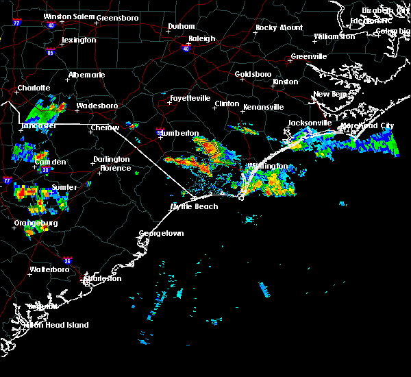 At 853 pm edt, doppler radar indicated a severe thunderstorm capable of producing quarter size hail and damaging winds in excess of 60 mph. this storm was located near carvers, moving south at 5 mph. locations impacted include, lagoon, carvers and kelly. At 853 pm edt, doppler radar indicated a severe thunderstorm capable of producing quarter size hail and damaging winds in excess of 60 mph. this storm was located near carvers, moving south at 5 mph. locations impacted include, lagoon, carvers and kelly.
|
| 6/24/2015 8:40 PM EDT | Report of tree fallen on powerlin in bladen county NC, 5.5 miles E of Kelly, NC |
| 6/24/2015 8:40 PM EDT |
 At 839 pm edt, doppler radar indicated a severe thunderstorm capable of producing quarter size hail and damaging winds in excess of 60 mph. this storm was located over carvers, or 16 miles southeast of elizabethtown, moving south at 5 mph. locations impacted include, lagoon, carvers and kelly. At 839 pm edt, doppler radar indicated a severe thunderstorm capable of producing quarter size hail and damaging winds in excess of 60 mph. this storm was located over carvers, or 16 miles southeast of elizabethtown, moving south at 5 mph. locations impacted include, lagoon, carvers and kelly.
|
| 6/24/2015 8:27 PM EDT |
 At 827 pm edt, doppler radar indicated a severe thunderstorm capable of producing quarter size hail and damaging winds in excess of 60 mph. this storm was located near lagoon, or 14 miles southeast of elizabethtown, and moving south at 5 mph. At 827 pm edt, doppler radar indicated a severe thunderstorm capable of producing quarter size hail and damaging winds in excess of 60 mph. this storm was located near lagoon, or 14 miles southeast of elizabethtown, and moving south at 5 mph.
|
| 6/22/2015 4:49 PM EDT |
 At 448 pm edt, doppler radar indicated a severe thunderstorm capable of producing quarter size hail and damaging winds in excess of 60 mph. this storm was located over whiteville, and moving northeast at 15 mph. At 448 pm edt, doppler radar indicated a severe thunderstorm capable of producing quarter size hail and damaging winds in excess of 60 mph. this storm was located over whiteville, and moving northeast at 15 mph.
|
| 6/9/2015 9:33 PM EDT |
 At 933 pm edt, doppler radar indicated a severe thunderstorm capable of producing quarter size hail and damaging winds in excess of 60 mph. this storm was located near phoenix, or 8 miles northwest of leland, moving southeast at 30 mph. locations impacted include, burgaw, rowan, northwest, sandyfield, montague, currie, the borough, malpass corner, phoenix, batarora, kelly, riegelwood, point caswell, freeman, delco, wards corner, carvers, rooks, long creek and council. this includes the following highways, interstate 40 near mile marker 400. us route 74 between mile markers 404 and 429. At 933 pm edt, doppler radar indicated a severe thunderstorm capable of producing quarter size hail and damaging winds in excess of 60 mph. this storm was located near phoenix, or 8 miles northwest of leland, moving southeast at 30 mph. locations impacted include, burgaw, rowan, northwest, sandyfield, montague, currie, the borough, malpass corner, phoenix, batarora, kelly, riegelwood, point caswell, freeman, delco, wards corner, carvers, rooks, long creek and council. this includes the following highways, interstate 40 near mile marker 400. us route 74 between mile markers 404 and 429.
|
| 6/9/2015 9:14 PM EDT |
 At 914 pm edt, doppler radar indicated a severe thunderstorm capable of producing quarter size hail and damaging winds in excess of 60 mph. this storm was located over lagoon, or 13 miles southeast of elizabethtown, and moving southeast at 30 mph. At 914 pm edt, doppler radar indicated a severe thunderstorm capable of producing quarter size hail and damaging winds in excess of 60 mph. this storm was located over lagoon, or 13 miles southeast of elizabethtown, and moving southeast at 30 mph.
|
| 5/21/2015 4:28 PM EDT | At 427 pm edt, doppler radar indicated a severe thunderstorm capable of producing quarter size hail and damaging winds in excess of 60 mph. this storm was located over riegelwood, or 13 miles northwest of leland, moving east at 25 mph. locations impacted include, sandyfield, rooks, freeman, currie, delco, riegelwood, point caswell, kelly, bolton and east arcadia. this includes us route 74 between mile markers 410 and 422. a tornado warning remains in effect until 445 pm for eastern columbus county. |
| 5/21/2015 4:10 PM EDT | At 409 pm edt, doppler radar indicated a severe thunderstorm capable of producing quarter size hail and destructive winds in excess of 70 mph. this storm was located near sandyfield, or 18 miles east of whiteville, moving southeast at 20 mph. locations impacted include, sandyfield, council, freeman, currie, delco, riegelwood, bolton and east arcadia. this includes us route 74 between mile markers 405 and 422. |
| 5/21/2015 3:59 PM EDT | At 358 pm edt, doppler radar indicated a severe thunderstorm capable of producing quarter size hail and damaging winds in excess of 60 mph. this storm was located near council, or 16 miles east of whiteville, and moving east at 25 mph. |
| 5/21/2015 3:42 PM EDT | At 341 pm edt, doppler radar indicated a severe thunderstorm capable of producing quarter size hail and damaging winds in excess of 60 mph. this storm was located over council, or 15 miles southeast of elizabethtown, moving east at 20 mph. locations impacted include, carvers, council, and kelly. |
| 5/21/2015 3:26 PM EDT | At 326 pm edt, doppler radar indicated a severe thunderstorm capable of producing half dollar size hail and damaging winds in excess of 60 mph. this storm was located over emerson, or 11 miles northeast of whiteville, and moving east at 20 mph. |
| 10/1/2012 6:28 PM EDT | A tree was reported down on a power line on elwell ferry road near the intersection with highway 211. damage may be the result of a brief tornado touchdown...but no con in bladen county NC, 7.3 miles E of Kelly, NC |
| 10/1/2012 6:25 PM EDT | A tree was reported down on a power line on elwell ferry road near the intersection with highway 211. damage may be the result of a brief tornado touchdown...but no con in bladen county NC, 7.3 miles E of Kelly, NC |
| 10/1/2012 6:25 PM EDT | A tree was reported down on a power line on elwell ferry road near the intersection with highway 211. damage may be the result of a brief tornado touchdown...but no con in bladen county NC, 7.3 miles E of Kelly, NC |
| 8/2/2012 6:27 PM EDT | Golf Ball sized hail reported 0.7 miles SSE of Kelly, NC, nickel size hail has increased to golf ball size |
| 7/1/2012 5:30 PM EDT | Tree down at hwy 53 e and hwy 210 e in bladen county NC, 2.5 miles W of Kelly, NC |
| 7/1/2012 5:20 PM EDT | Trees down on elwell ferry r in bladen county NC, 2.4 miles ESE of Kelly, NC |
| 3/25/2012 4:40 PM EDT | Quarter sized hail reported 0.7 miles SSE of Kelly, NC, dime to quarter size hail fell from 440 pm to 455 pm. |
| 1/1/0001 12:00 AM | Large limb down on hwy 210 one mile west of hwy 1 in bladen county NC, 4.9 miles W of Kelly, NC |
| 1/1/0001 12:00 AM | Wect reports multiple trees down about three quarters of a mile from the intersection of highway 210 and 53 near kelly. some trees were uprooted and some were snappe in bladen county NC, 0.7 miles SSE of Kelly, NC |
Hail Maps for Kelly, NC
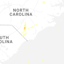
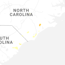


Connect with Interactive Hail Maps