

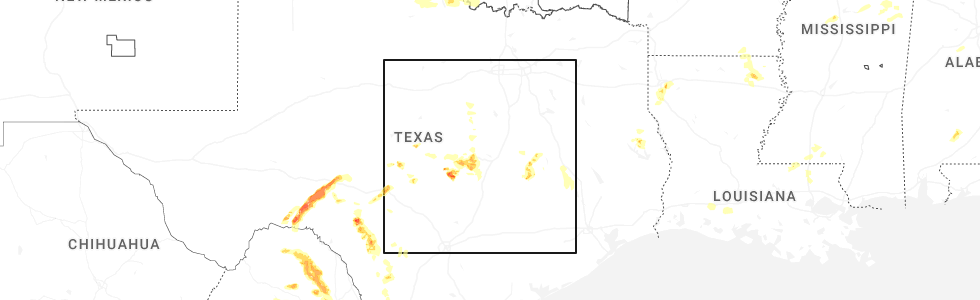
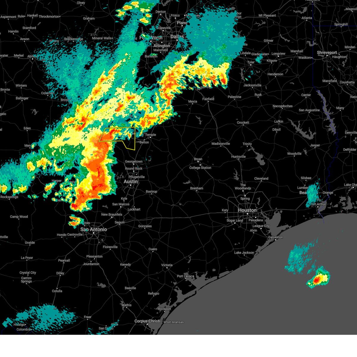
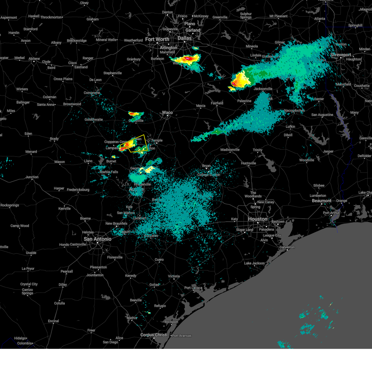
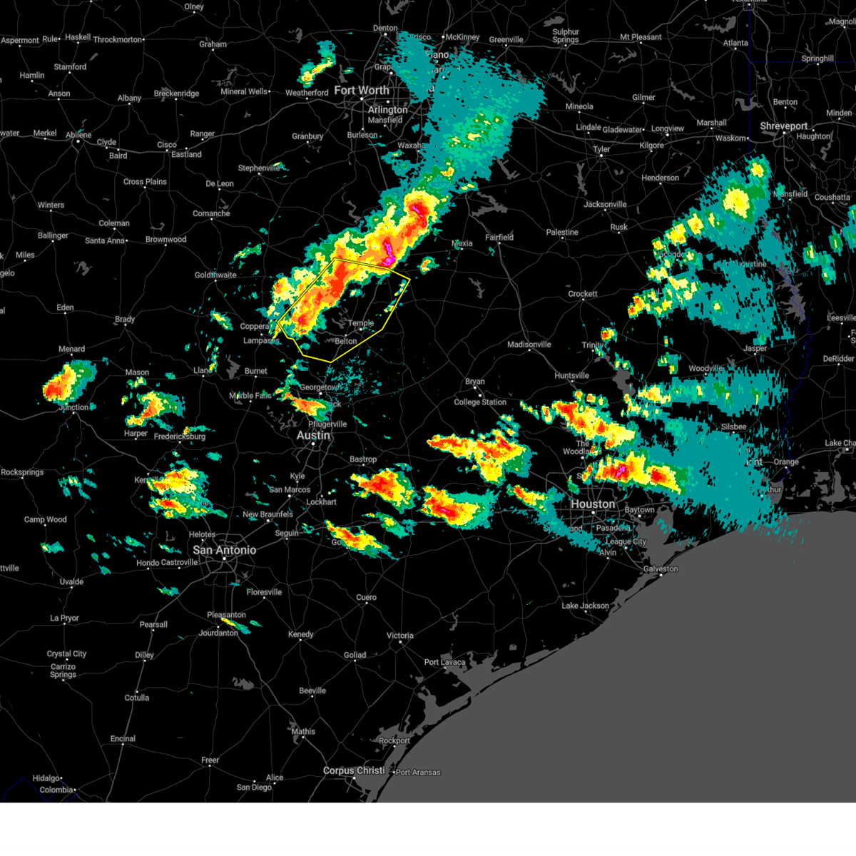
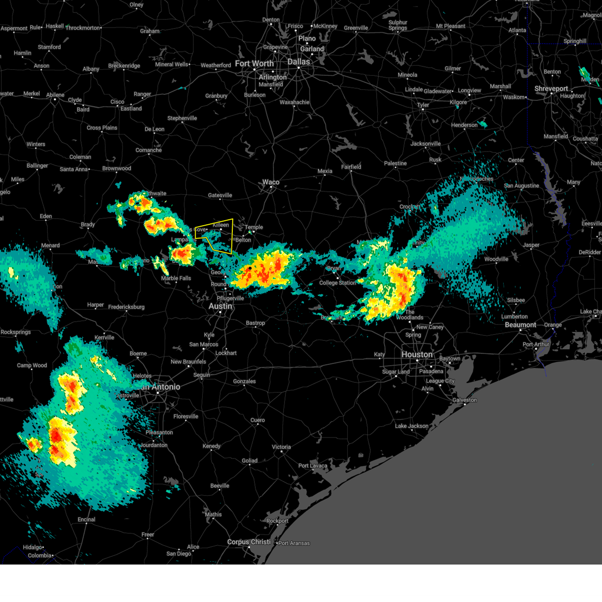
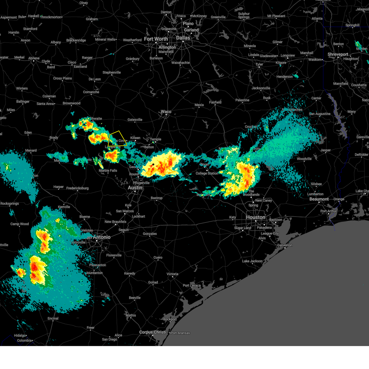
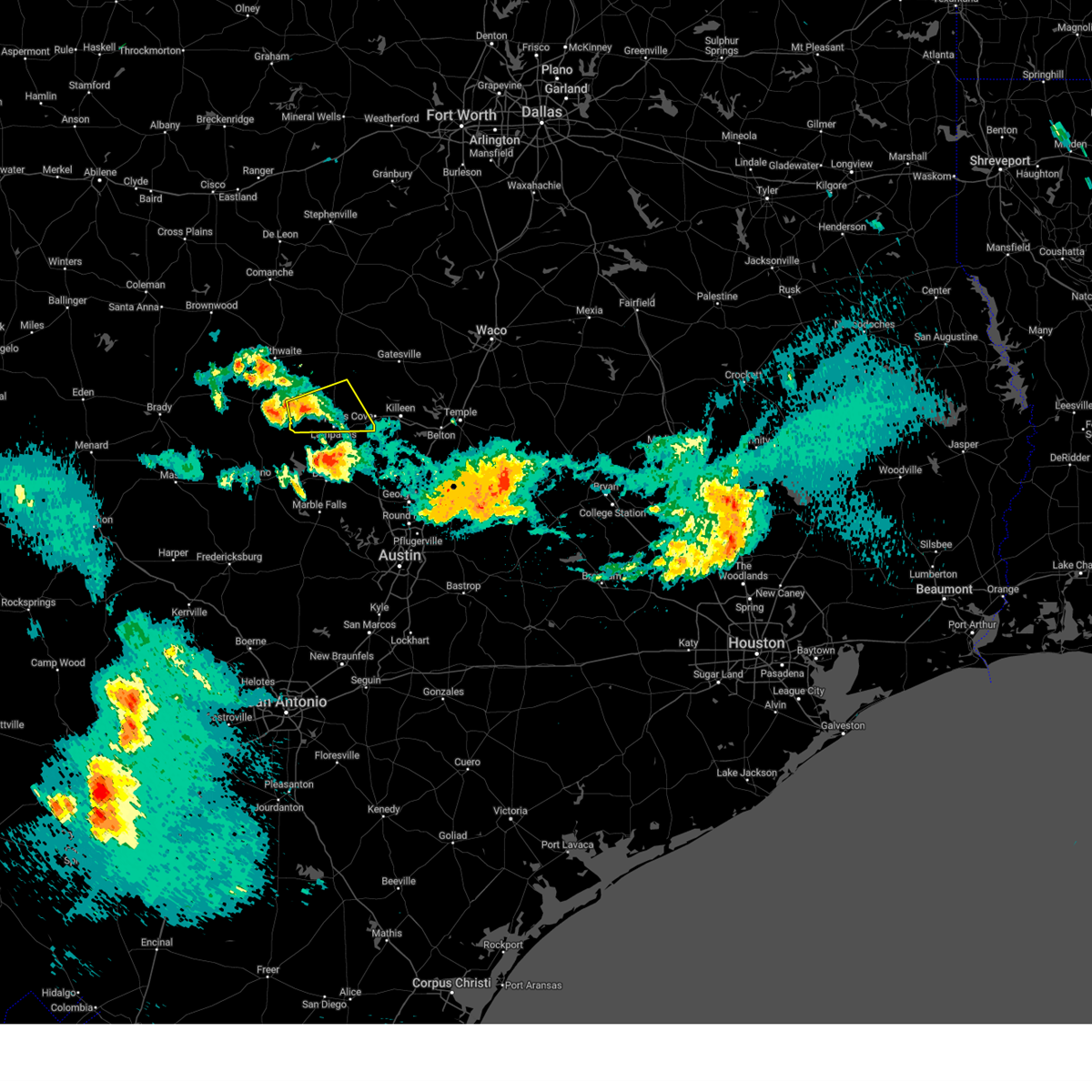
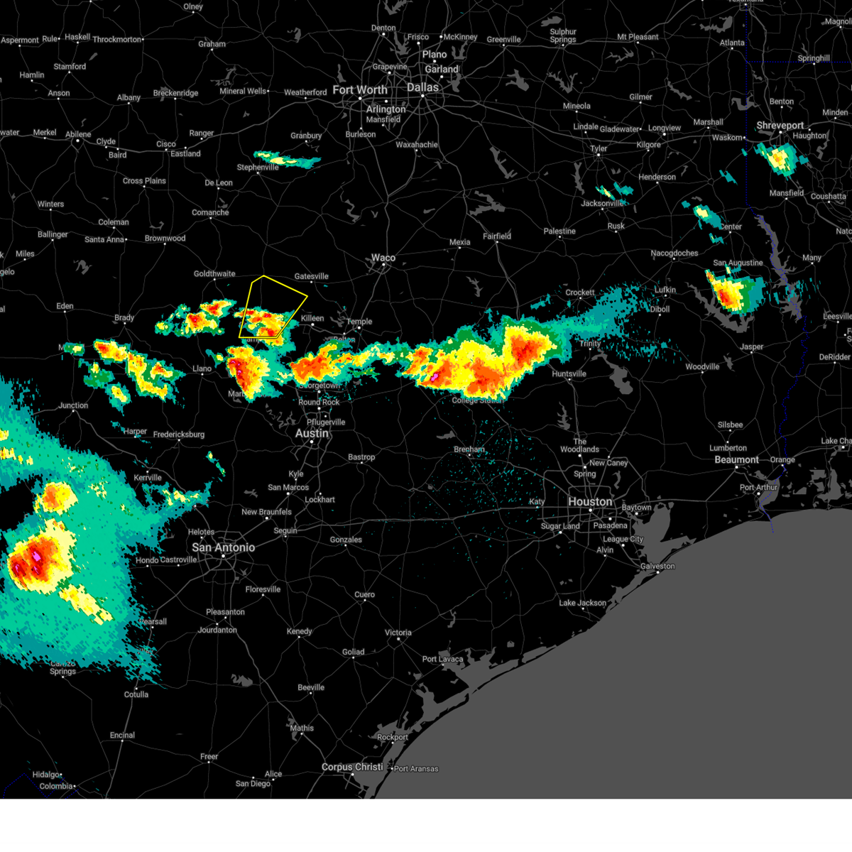
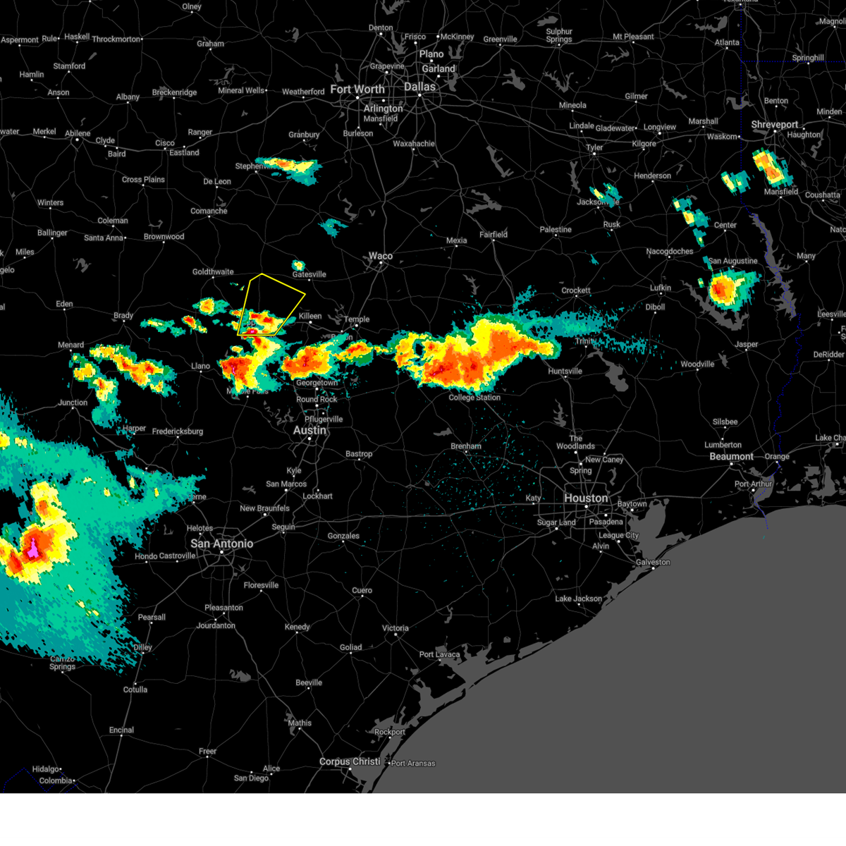
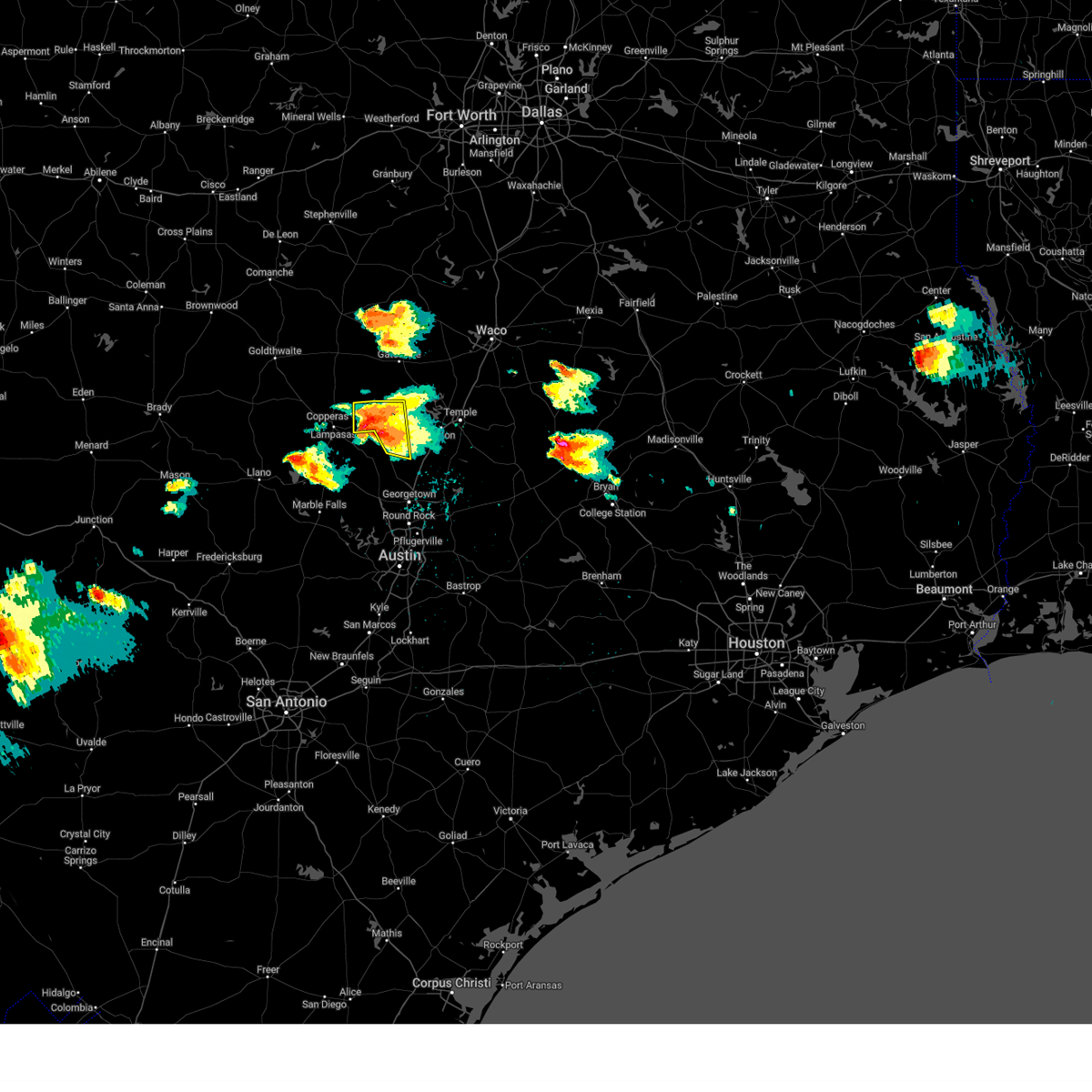
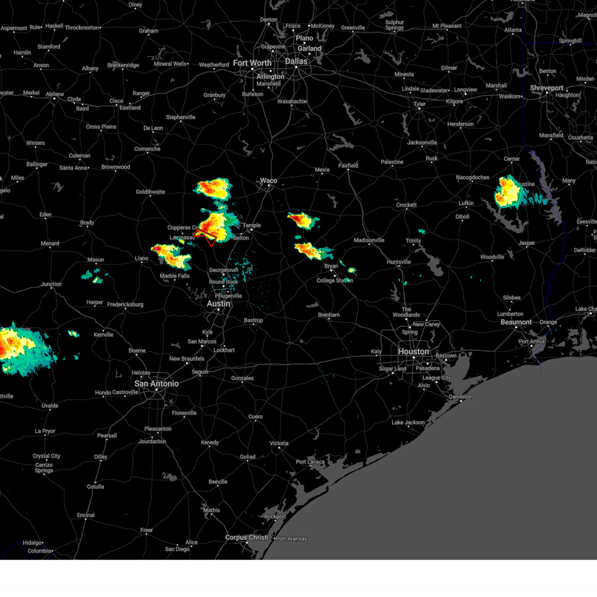
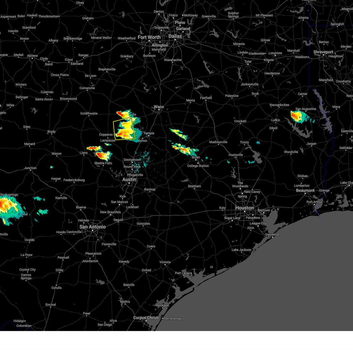
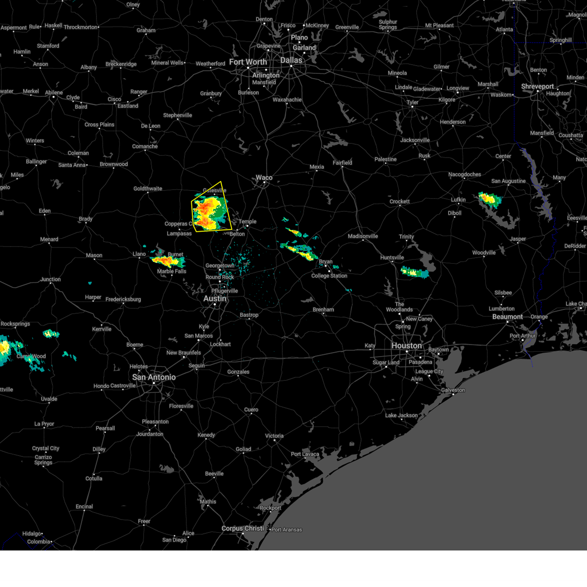
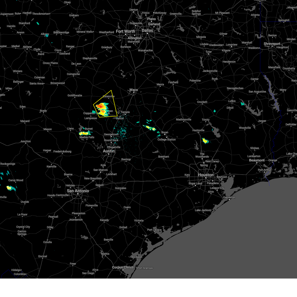
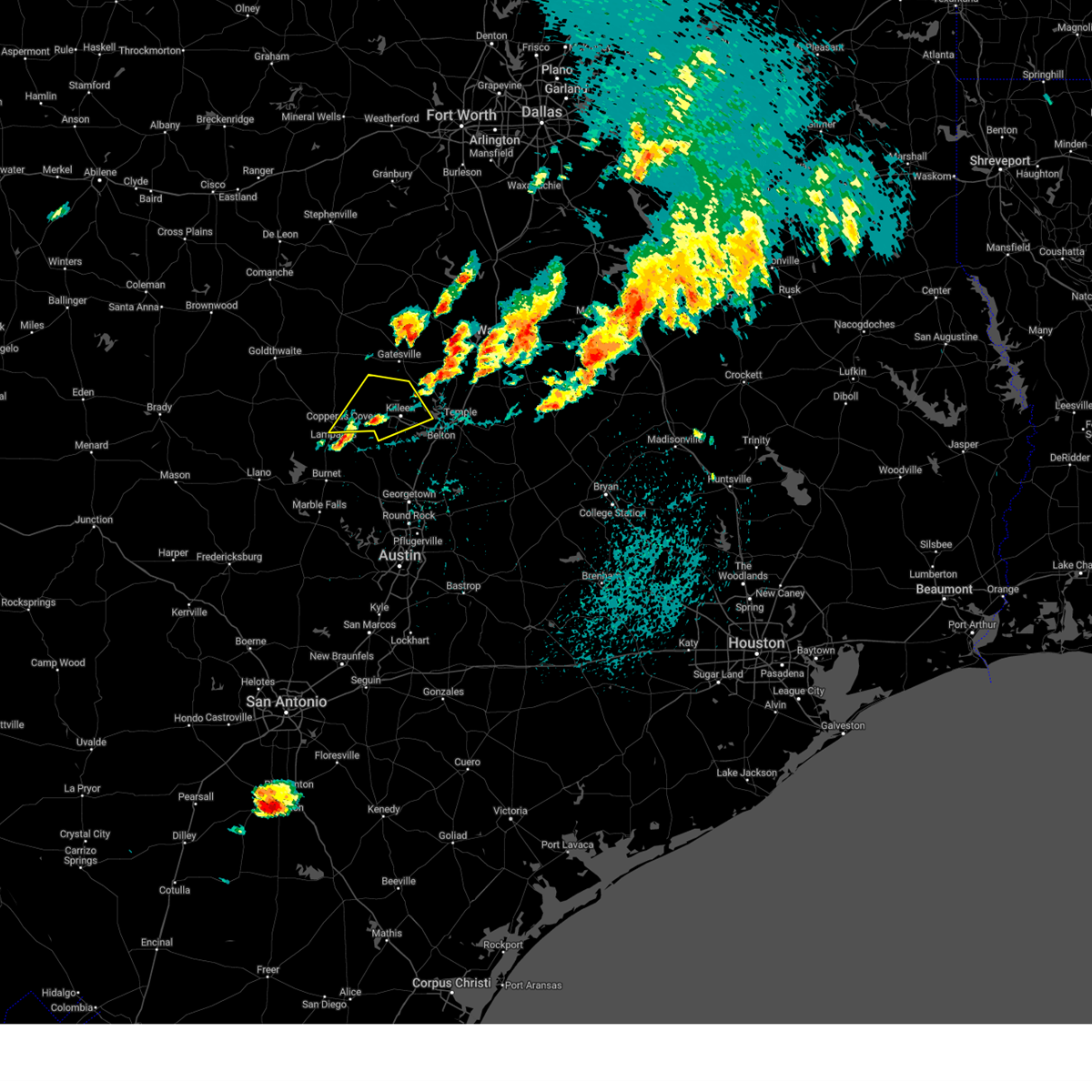
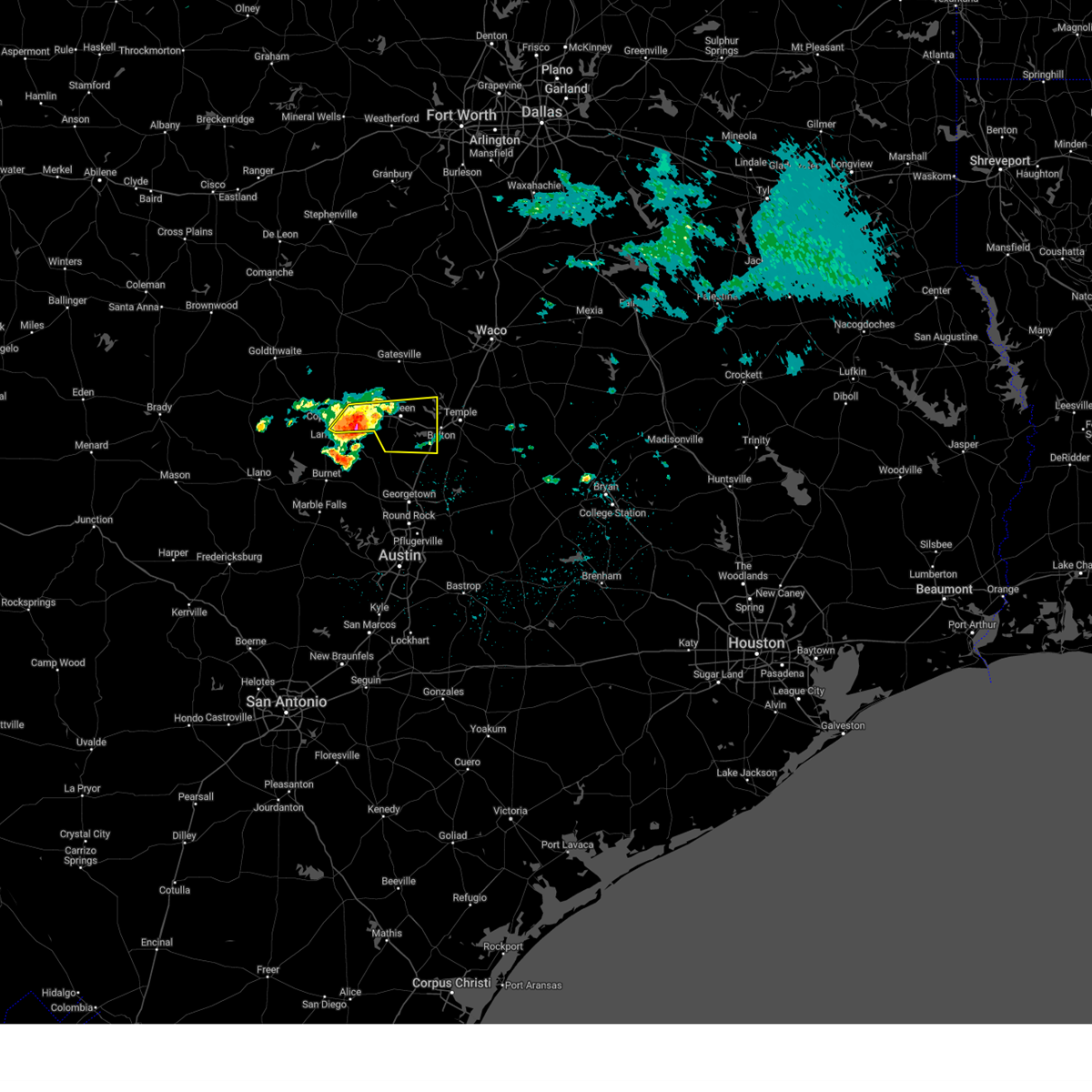
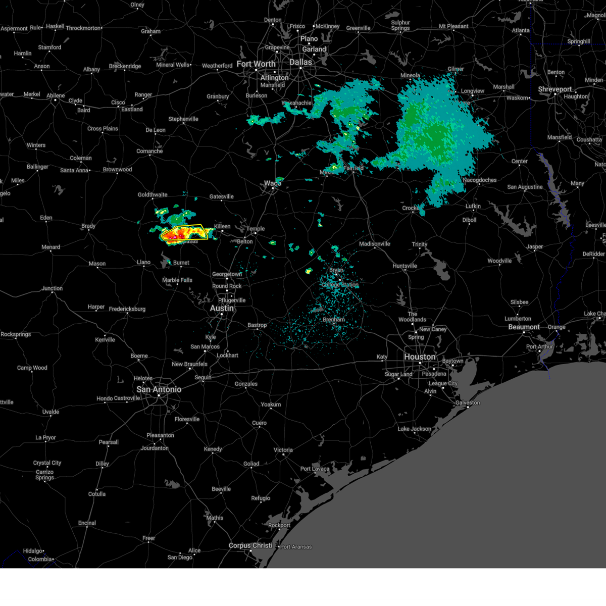
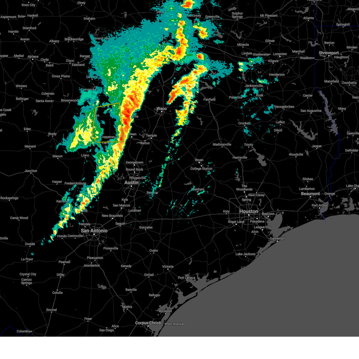
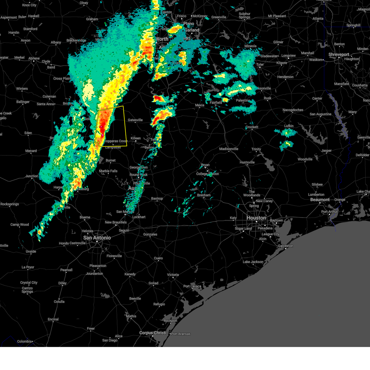
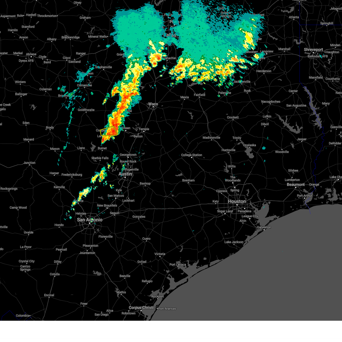
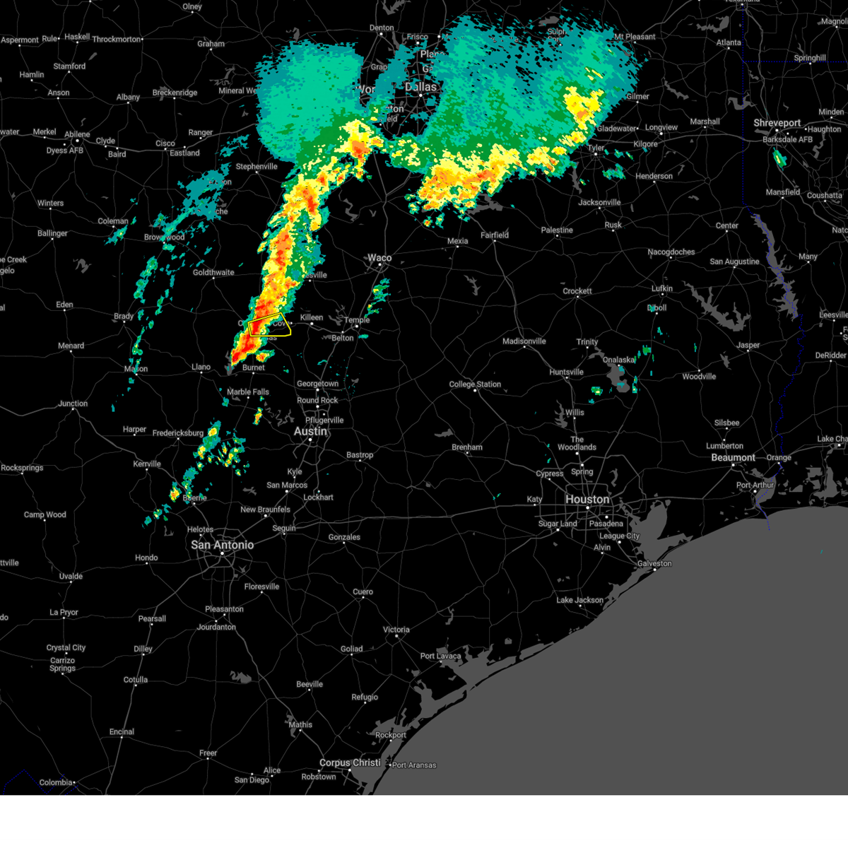
Hail Map for Kempner, TX
The Kempner, TX area has had 18 reports of on-the-ground hail by trained spotters, and has been under severe weather warnings 28 times during the past 12 months. Doppler radar has detected hail at or near Kempner, TX on 73 occasions, including 5 occasions during the past year.
| Name: | Kempner, TX |
| Where Located: | 15 miles WSW of Killeen, TX |
| Map: | Google Map for Kempner, TX |
| Population: | 1089 |
| Housing Units: | 480 |
| More Info: | Search Google for Kempner, TX |
3
The Top Recent Hail Date for Kempner, TX is Thursday, May 1, 2025 (5th out of 73)
Hail and Wind Damage Spotted near Kempner, TX
| Date / Time | Report Details |
|---|---|
| 6/9/2025 4:03 AM CDT |
 the severe thunderstorm warning has been cancelled and is no longer in effect the severe thunderstorm warning has been cancelled and is no longer in effect
|
| 6/9/2025 3:37 AM CDT |
 Svrfwd the national weather service in fort worth has issued a * severe thunderstorm warning for, coryell county in central texas, eastern lampasas county in central texas, central bell county in central texas, * until 430 am cdt. * at 336 am cdt, severe thunderstorms were located along a line extending from 7 miles south of clifton to 9 miles west of gatesville to 11 miles north of lampasas, moving southeast at 50 mph (radar indicated). Hazards include 60 mph wind gusts and nickel size hail. expect damage to roofs, siding, and trees Svrfwd the national weather service in fort worth has issued a * severe thunderstorm warning for, coryell county in central texas, eastern lampasas county in central texas, central bell county in central texas, * until 430 am cdt. * at 336 am cdt, severe thunderstorms were located along a line extending from 7 miles south of clifton to 9 miles west of gatesville to 11 miles north of lampasas, moving southeast at 50 mph (radar indicated). Hazards include 60 mph wind gusts and nickel size hail. expect damage to roofs, siding, and trees
|
| 5/26/2025 8:25 PM CDT |
 At 825 pm cdt, a severe thunderstorm was located 8 miles northeast of briggs, or 9 miles south of copperas cove, moving east at 40 mph (radar indicated). Hazards include 70 mph wind gusts and quarter size hail. Hail damage to vehicles is expected. expect considerable tree damage. wind damage is also likely to mobile homes, roofs, and outbuildings. this severe storm will be near, killeen around 830 pm cdt. stillhouse hollow lake around 835 pm cdt. harker heights around 840 pm cdt. Other locations impacted by this severe thunderstorm include cedar valley, youngsport, ding dong, and maxdale. At 825 pm cdt, a severe thunderstorm was located 8 miles northeast of briggs, or 9 miles south of copperas cove, moving east at 40 mph (radar indicated). Hazards include 70 mph wind gusts and quarter size hail. Hail damage to vehicles is expected. expect considerable tree damage. wind damage is also likely to mobile homes, roofs, and outbuildings. this severe storm will be near, killeen around 830 pm cdt. stillhouse hollow lake around 835 pm cdt. harker heights around 840 pm cdt. Other locations impacted by this severe thunderstorm include cedar valley, youngsport, ding dong, and maxdale.
|
| 5/26/2025 7:52 PM CDT |
 Svrfwd the national weather service in fort worth has issued a * severe thunderstorm warning for, southwestern coryell county in central texas, southeastern lampasas county in central texas, western bell county in central texas, * until 845 pm cdt. * at 752 pm cdt, a severe thunderstorm was located near lampasas, moving east at 20 mph (radar indicated). Hazards include 60 mph wind gusts and quarter size hail. Hail damage to vehicles is expected. expect wind damage to roofs, siding, and trees. this severe thunderstorm will be near, kempner around 800 pm cdt. copperas cove around 805 pm cdt. killeen and fort cavazos around 830 pm cdt. Other locations impacted by this severe thunderstorm include cedar valley, topsey, maxdale, rumley, youngsport, ding dong, and pidcoke. Svrfwd the national weather service in fort worth has issued a * severe thunderstorm warning for, southwestern coryell county in central texas, southeastern lampasas county in central texas, western bell county in central texas, * until 845 pm cdt. * at 752 pm cdt, a severe thunderstorm was located near lampasas, moving east at 20 mph (radar indicated). Hazards include 60 mph wind gusts and quarter size hail. Hail damage to vehicles is expected. expect wind damage to roofs, siding, and trees. this severe thunderstorm will be near, kempner around 800 pm cdt. copperas cove around 805 pm cdt. killeen and fort cavazos around 830 pm cdt. Other locations impacted by this severe thunderstorm include cedar valley, topsey, maxdale, rumley, youngsport, ding dong, and pidcoke.
|
| 5/16/2025 9:57 PM CDT |
 At 957 pm cdt, a severe thunderstorm was located near kempner, or 7 miles southwest of copperas cove, moving east at 25 mph (radar indicated). Hazards include 60 mph wind gusts and quarter size hail. Hail damage to vehicles is expected. expect wind damage to roofs, siding, and trees. Locations impacted include, copperas cove, stillhouse hollow lake, killeen, maxdale, nolanville, harker heights, union grove, ding dong, fort cavazos, kempner, salado, and belton lake. At 957 pm cdt, a severe thunderstorm was located near kempner, or 7 miles southwest of copperas cove, moving east at 25 mph (radar indicated). Hazards include 60 mph wind gusts and quarter size hail. Hail damage to vehicles is expected. expect wind damage to roofs, siding, and trees. Locations impacted include, copperas cove, stillhouse hollow lake, killeen, maxdale, nolanville, harker heights, union grove, ding dong, fort cavazos, kempner, salado, and belton lake.
|
| 5/16/2025 9:39 PM CDT | Svrfwd the national weather service in fort worth has issued a * severe thunderstorm warning for, southeastern coryell county in central texas, southeastern lampasas county in central texas, northwestern bell county in central texas, * until 1045 pm cdt. * at 938 pm cdt, a severe thunderstorm was located 5 miles southeast of lampasas, moving east at 30 mph (radar indicated). Hazards include 60 mph wind gusts and quarter size hail. Hail damage to vehicles is expected. Expect wind damage to roofs, siding, and trees. |
| 5/2/2025 2:58 PM CDT |
 Svrfwd the national weather service in fort worth has issued a * severe thunderstorm warning for, southern mclennan county in central texas, eastern coryell county in central texas, southeastern lampasas county in central texas, bell county in central texas, northwestern falls county in central texas, * until 330 pm cdt. * at 257 pm cdt, a severe thunderstorm was located near mother neff state park, or 7 miles southwest of mcgregor, moving southeast at 35 mph (radar indicated). Hazards include 65 mph wind gusts and quarter size hail. Hail damage to vehicles is expected. expect wind damage to roofs, siding, and trees. this severe thunderstorm will be near, mother neff state park and mcgregor around 305 pm cdt. moody around 310 pm cdt. bruceville-eddy around 315 pm cdt. lorena around 320 pm cdt. other locations impacted by this severe thunderstorm include cedar valley, whitson, moffat, willow grove, mooreville, oglesby, owl creek, prairie dell, asa, and meadow grove. This includes interstate 35 between mile markers 278 and 333. Svrfwd the national weather service in fort worth has issued a * severe thunderstorm warning for, southern mclennan county in central texas, eastern coryell county in central texas, southeastern lampasas county in central texas, bell county in central texas, northwestern falls county in central texas, * until 330 pm cdt. * at 257 pm cdt, a severe thunderstorm was located near mother neff state park, or 7 miles southwest of mcgregor, moving southeast at 35 mph (radar indicated). Hazards include 65 mph wind gusts and quarter size hail. Hail damage to vehicles is expected. expect wind damage to roofs, siding, and trees. this severe thunderstorm will be near, mother neff state park and mcgregor around 305 pm cdt. moody around 310 pm cdt. bruceville-eddy around 315 pm cdt. lorena around 320 pm cdt. other locations impacted by this severe thunderstorm include cedar valley, whitson, moffat, willow grove, mooreville, oglesby, owl creek, prairie dell, asa, and meadow grove. This includes interstate 35 between mile markers 278 and 333.
|
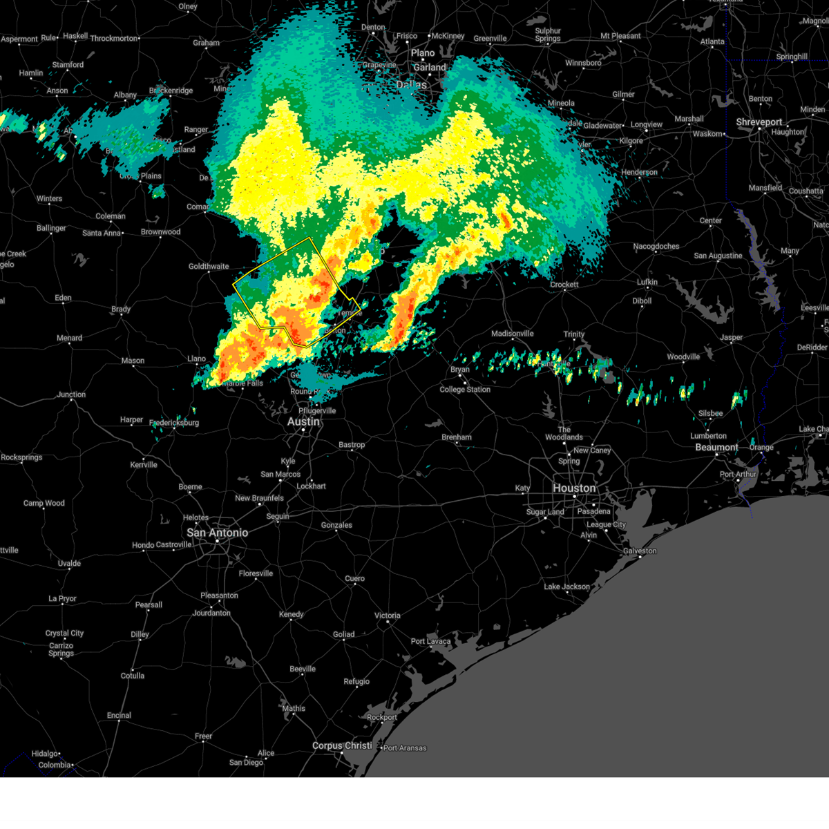
| 5/1/2025 10:26 PM CDT |
 Svrfwd the national weather service in fort worth has issued a * severe thunderstorm warning for, south central coryell county in central texas, southeastern lampasas county in central texas, western bell county in central texas, * until 1130 pm cdt. * at 1026 pm cdt, a severe thunderstorm was located over kempner, or near copperas cove, moving east at 15 mph (radar indicated). Hazards include 60 mph wind gusts and half dollar size hail. Hail damage to vehicles is expected. expect wind damage to roofs, siding, and trees. this severe thunderstorm will be near, copperas cove and kempner around 1030 pm cdt. killeen and fort cavazos around 1045 pm cdt. harker heights around 1115 pm cdt. Other locations impacted by this severe thunderstorm include cedar valley, youngsport, ding dong, maxdale, and union grove. Svrfwd the national weather service in fort worth has issued a * severe thunderstorm warning for, south central coryell county in central texas, southeastern lampasas county in central texas, western bell county in central texas, * until 1130 pm cdt. * at 1026 pm cdt, a severe thunderstorm was located over kempner, or near copperas cove, moving east at 15 mph (radar indicated). Hazards include 60 mph wind gusts and half dollar size hail. Hail damage to vehicles is expected. expect wind damage to roofs, siding, and trees. this severe thunderstorm will be near, copperas cove and kempner around 1030 pm cdt. killeen and fort cavazos around 1045 pm cdt. harker heights around 1115 pm cdt. Other locations impacted by this severe thunderstorm include cedar valley, youngsport, ding dong, maxdale, and union grove.
|
| 5/1/2025 9:42 PM CDT |
 Svrfwd the national weather service in fort worth has issued a * severe thunderstorm warning for, southwestern coryell county in central texas, southeastern lampasas county in central texas, west central bell county in central texas, * until 1030 pm cdt. * at 941 pm cdt, a severe thunderstorm was located near lampasas, moving northeast at 15 mph (radar indicated). Hazards include ping pong ball size hail and 60 mph wind gusts. People and animals outdoors will be injured. expect hail damage to roofs, siding, windows, and vehicles. expect wind damage to roofs, siding, and trees. this severe thunderstorm will be near, lampasas around 945 pm cdt. Other locations impacted by this severe thunderstorm include topsey and rumley. Svrfwd the national weather service in fort worth has issued a * severe thunderstorm warning for, southwestern coryell county in central texas, southeastern lampasas county in central texas, west central bell county in central texas, * until 1030 pm cdt. * at 941 pm cdt, a severe thunderstorm was located near lampasas, moving northeast at 15 mph (radar indicated). Hazards include ping pong ball size hail and 60 mph wind gusts. People and animals outdoors will be injured. expect hail damage to roofs, siding, windows, and vehicles. expect wind damage to roofs, siding, and trees. this severe thunderstorm will be near, lampasas around 945 pm cdt. Other locations impacted by this severe thunderstorm include topsey and rumley.
|
| 5/1/2025 9:21 PM CDT |
 At 920 pm cdt, a severe thunderstorm was located near lampasas, moving east at 20 mph (radar indicated). Hazards include 60 mph wind gusts and quarter size hail. Hail damage to vehicles is expected. expect wind damage to roofs, siding, and trees. Other locations impacted by this severe thunderstorm include rumley. At 920 pm cdt, a severe thunderstorm was located near lampasas, moving east at 20 mph (radar indicated). Hazards include 60 mph wind gusts and quarter size hail. Hail damage to vehicles is expected. expect wind damage to roofs, siding, and trees. Other locations impacted by this severe thunderstorm include rumley.
|
| 5/1/2025 8:44 PM CDT |
 Svrfwd the national weather service in fort worth has issued a * severe thunderstorm warning for, lampasas county in central texas, * until 945 pm cdt. * at 844 pm cdt, a severe thunderstorm was located 7 miles northeast of colorado bend state park, or 12 miles west of lampasas, moving east at 25 mph (radar indicated). Hazards include 60 mph wind gusts and half dollar size hail. Hail damage to vehicles is expected. expect wind damage to roofs, siding, and trees. this severe thunderstorm will be near, lampasas around 900 pm cdt. kempner around 935 pm cdt. Other locations impacted by this severe thunderstorm include adamsville, nix, izoro, lometa, and rumley. Svrfwd the national weather service in fort worth has issued a * severe thunderstorm warning for, lampasas county in central texas, * until 945 pm cdt. * at 844 pm cdt, a severe thunderstorm was located 7 miles northeast of colorado bend state park, or 12 miles west of lampasas, moving east at 25 mph (radar indicated). Hazards include 60 mph wind gusts and half dollar size hail. Hail damage to vehicles is expected. expect wind damage to roofs, siding, and trees. this severe thunderstorm will be near, lampasas around 900 pm cdt. kempner around 935 pm cdt. Other locations impacted by this severe thunderstorm include adamsville, nix, izoro, lometa, and rumley.
|
| 5/1/2025 6:57 PM CDT |
 the severe thunderstorm warning has been cancelled and is no longer in effect the severe thunderstorm warning has been cancelled and is no longer in effect
|
| 5/1/2025 6:39 PM CDT |
 Svrfwd the national weather service in fort worth has issued a * severe thunderstorm warning for, southwestern coryell county in central texas, lampasas county in central texas, * until 730 pm cdt. * at 639 pm cdt, a severe thunderstorm was located over lampasas, moving northeast at 35 mph (radar indicated). Hazards include 60 mph wind gusts and half dollar size hail. Hail damage to vehicles is expected. expect wind damage to roofs, siding, and trees. this severe thunderstorm will be near, lampasas around 645 pm cdt. Other locations impacted by this severe thunderstorm include pearl, king, bee house, topsey, izoro, rumley, adamsville, and pidcoke. Svrfwd the national weather service in fort worth has issued a * severe thunderstorm warning for, southwestern coryell county in central texas, lampasas county in central texas, * until 730 pm cdt. * at 639 pm cdt, a severe thunderstorm was located over lampasas, moving northeast at 35 mph (radar indicated). Hazards include 60 mph wind gusts and half dollar size hail. Hail damage to vehicles is expected. expect wind damage to roofs, siding, and trees. this severe thunderstorm will be near, lampasas around 645 pm cdt. Other locations impacted by this severe thunderstorm include pearl, king, bee house, topsey, izoro, rumley, adamsville, and pidcoke.
|
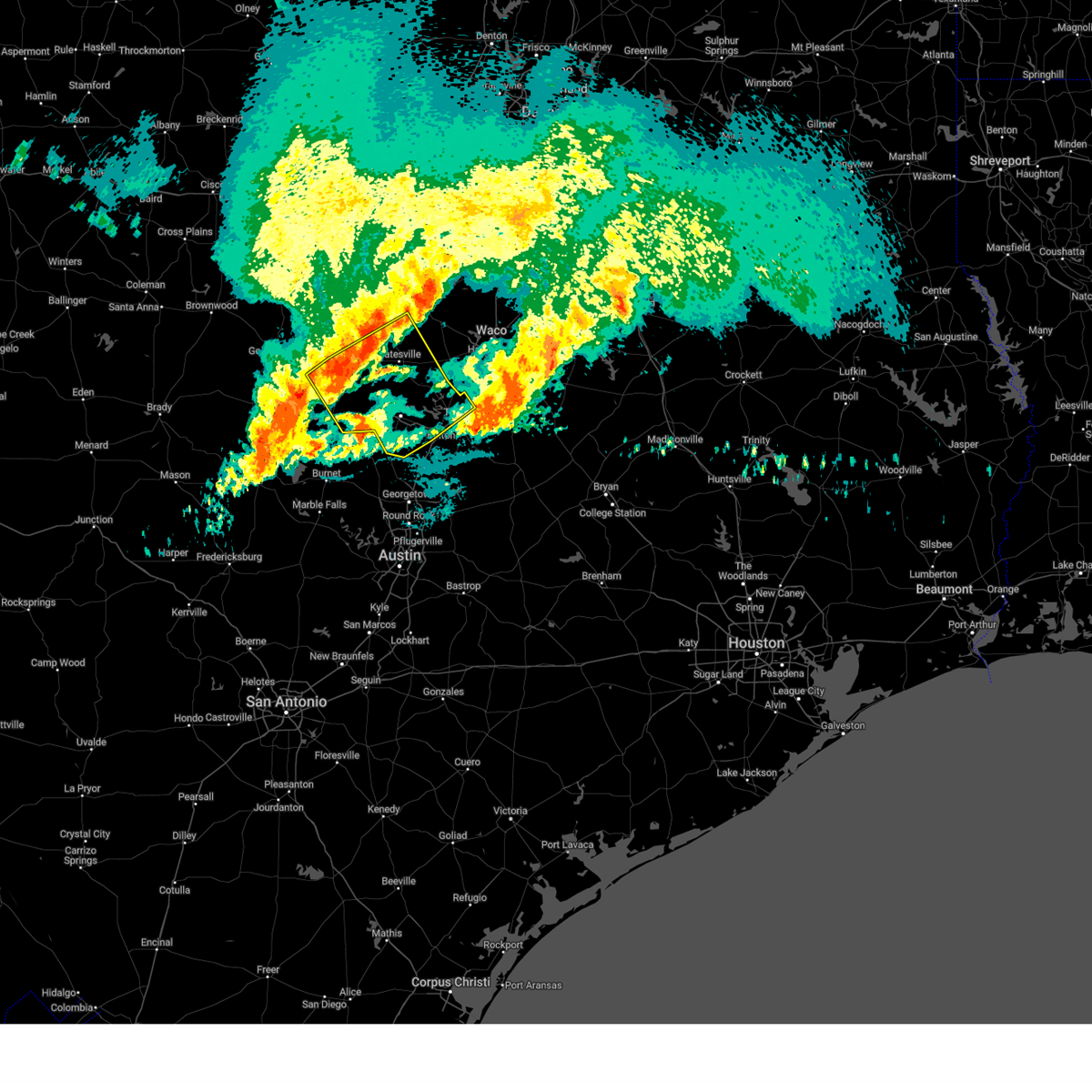
| 5/1/2025 4:41 PM CDT |
 Svrfwd the national weather service in fort worth has issued a * severe thunderstorm warning for, south central coryell county in central texas, southeastern lampasas county in central texas, southwestern bell county in central texas, * until 545 pm cdt. * at 440 pm cdt, a severe thunderstorm was located over kempner, or near copperas cove, moving south at 5 mph (radar indicated). Hazards include golf ball size hail and 60 mph wind gusts. People and animals outdoors will be injured. expect hail damage to roofs, siding, windows, and vehicles. expect wind damage to roofs, siding, and trees. this severe thunderstorm will be near, kempner around 445 pm cdt. Other locations impacted by this severe thunderstorm include cedar valley, youngsport, ding dong, and maxdale. Svrfwd the national weather service in fort worth has issued a * severe thunderstorm warning for, south central coryell county in central texas, southeastern lampasas county in central texas, southwestern bell county in central texas, * until 545 pm cdt. * at 440 pm cdt, a severe thunderstorm was located over kempner, or near copperas cove, moving south at 5 mph (radar indicated). Hazards include golf ball size hail and 60 mph wind gusts. People and animals outdoors will be injured. expect hail damage to roofs, siding, windows, and vehicles. expect wind damage to roofs, siding, and trees. this severe thunderstorm will be near, kempner around 445 pm cdt. Other locations impacted by this severe thunderstorm include cedar valley, youngsport, ding dong, and maxdale.
|
| 5/1/2025 4:24 PM CDT |
 At 424 pm cdt, a severe thunderstorm was located over kempner, or near copperas cove, moving southeast at 5 mph (public). Hazards include tennis ball size hail and 60 mph wind gusts. People and animals outdoors will be injured. expect hail damage to roofs, siding, windows, and vehicles. expect wind damage to roofs, siding, and trees. this severe storm will be near, copperas cove and kempner around 430 pm cdt. Other locations impacted by this severe thunderstorm include topsey. At 424 pm cdt, a severe thunderstorm was located over kempner, or near copperas cove, moving southeast at 5 mph (public). Hazards include tennis ball size hail and 60 mph wind gusts. People and animals outdoors will be injured. expect hail damage to roofs, siding, windows, and vehicles. expect wind damage to roofs, siding, and trees. this severe storm will be near, copperas cove and kempner around 430 pm cdt. Other locations impacted by this severe thunderstorm include topsey.
|
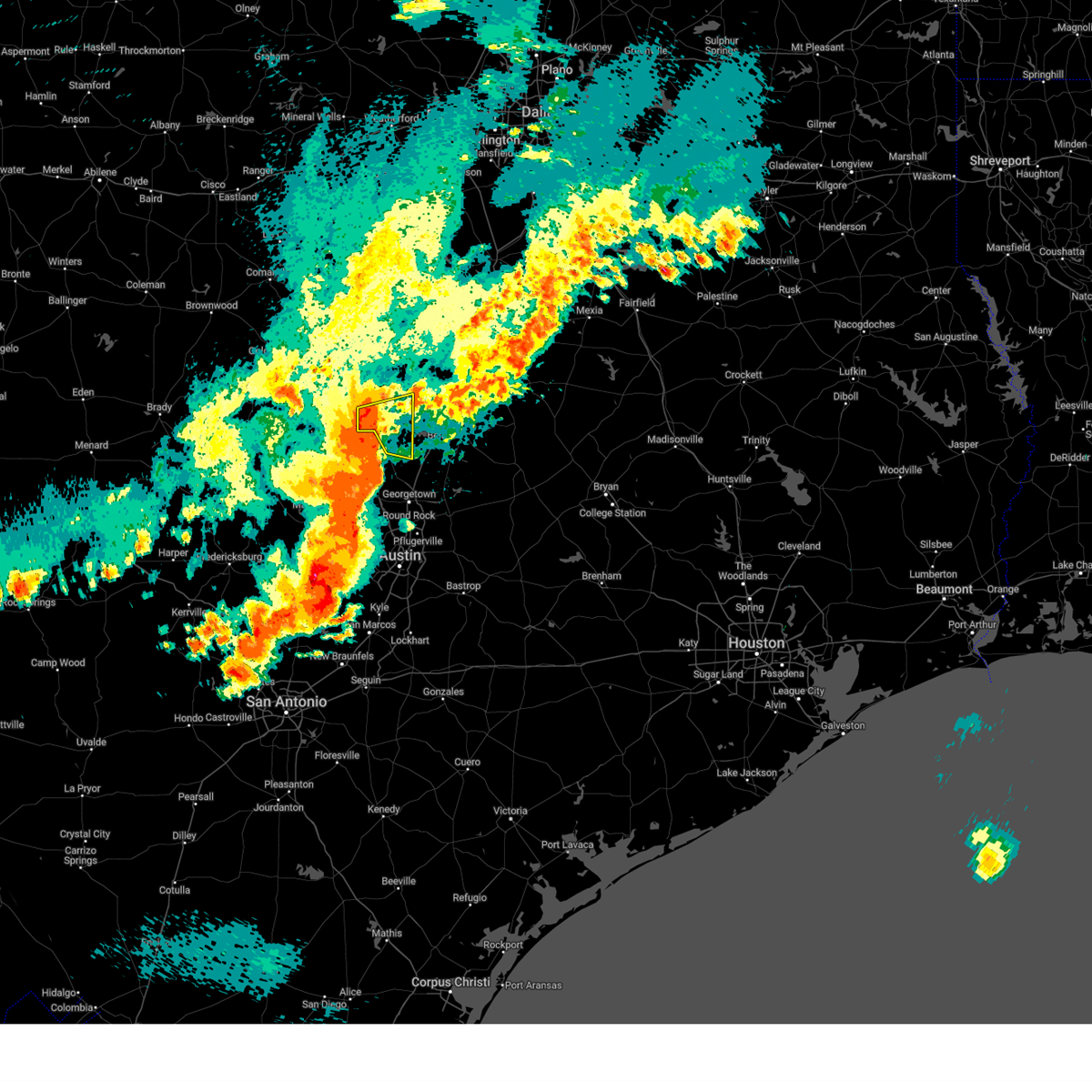
| 5/1/2025 4:22 PM CDT | Report from social media of shingle damage to a home south of kempner. home weather station measured 82 mph wind gus in lampasas county TX, 2.4 miles N of Kempner, TX |
| 5/1/2025 4:12 PM CDT |
 Torfwd the national weather service in fort worth has issued a * tornado warning for, southeastern lampasas county in central texas, west central bell county in central texas, * until 500 pm cdt. * at 411 pm cdt, a severe thunderstorm capable of producing a tornado was located over kempner, or near copperas cove, moving southeast at 10 mph (radar indicated rotation). Hazards include tornado and baseball size hail. Flying debris will be dangerous to those caught without shelter. mobile homes will be damaged or destroyed. damage to roofs, windows, and vehicles will occur. tree damage is likely. this dangerous storm will be near, kempner around 415 pm cdt. Other locations impacted by this tornadic thunderstorm include maxdale. Torfwd the national weather service in fort worth has issued a * tornado warning for, southeastern lampasas county in central texas, west central bell county in central texas, * until 500 pm cdt. * at 411 pm cdt, a severe thunderstorm capable of producing a tornado was located over kempner, or near copperas cove, moving southeast at 10 mph (radar indicated rotation). Hazards include tornado and baseball size hail. Flying debris will be dangerous to those caught without shelter. mobile homes will be damaged or destroyed. damage to roofs, windows, and vehicles will occur. tree damage is likely. this dangerous storm will be near, kempner around 415 pm cdt. Other locations impacted by this tornadic thunderstorm include maxdale.
|
| 5/1/2025 4:07 PM CDT |
 At 406 pm cdt, a severe thunderstorm was located over copperas cove, moving southeast at 10 mph. this is a destructive storm for copperas cove (trained weather spotters). Hazards include baseball size hail and 60 mph wind gusts. People and animals outdoors will be severely injured. expect shattered windows, extensive damage to roofs, siding, and vehicles. this severe storm will be near, fort cavazos, copperas cove, and kempner around 410 pm cdt. Other locations impacted by this severe thunderstorm include king, topsey, and pidcoke. At 406 pm cdt, a severe thunderstorm was located over copperas cove, moving southeast at 10 mph. this is a destructive storm for copperas cove (trained weather spotters). Hazards include baseball size hail and 60 mph wind gusts. People and animals outdoors will be severely injured. expect shattered windows, extensive damage to roofs, siding, and vehicles. this severe storm will be near, fort cavazos, copperas cove, and kempner around 410 pm cdt. Other locations impacted by this severe thunderstorm include king, topsey, and pidcoke.
|
| 5/1/2025 4:00 PM CDT |
 Svrfwd the national weather service in fort worth has issued a * severe thunderstorm warning for, southwestern coryell county in central texas, southeastern lampasas county in central texas, northwestern bell county in central texas, * until 445 pm cdt. * at 359 pm cdt, a severe thunderstorm was located over copperas cove, and is nearly stationary (trained weather spotters). Hazards include golf ball size hail and 60 mph wind gusts. People and animals outdoors will be injured. expect hail damage to roofs, siding, windows, and vehicles. expect wind damage to roofs, siding, and trees. this severe thunderstorm will be near, copperas cove around 405 pm cdt. Other locations impacted by this severe thunderstorm include king, topsey, and pidcoke. Svrfwd the national weather service in fort worth has issued a * severe thunderstorm warning for, southwestern coryell county in central texas, southeastern lampasas county in central texas, northwestern bell county in central texas, * until 445 pm cdt. * at 359 pm cdt, a severe thunderstorm was located over copperas cove, and is nearly stationary (trained weather spotters). Hazards include golf ball size hail and 60 mph wind gusts. People and animals outdoors will be injured. expect hail damage to roofs, siding, windows, and vehicles. expect wind damage to roofs, siding, and trees. this severe thunderstorm will be near, copperas cove around 405 pm cdt. Other locations impacted by this severe thunderstorm include king, topsey, and pidcoke.
|
| 5/1/2025 3:31 PM CDT |
 At 331 pm cdt, a severe thunderstorm was located over copperas cove, moving east at 10 mph (public). Hazards include 60 mph wind gusts and half dollar size hail. Hail damage to vehicles is expected. expect wind damage to roofs, siding, and trees. Locations impacted include, south mountain, harker heights, fort cavazos, copperas cove, killeen, king, topsey, nolanville, fort gates, mound, flat, gatesville, pidcoke, kempner, and belton lake. At 331 pm cdt, a severe thunderstorm was located over copperas cove, moving east at 10 mph (public). Hazards include 60 mph wind gusts and half dollar size hail. Hail damage to vehicles is expected. expect wind damage to roofs, siding, and trees. Locations impacted include, south mountain, harker heights, fort cavazos, copperas cove, killeen, king, topsey, nolanville, fort gates, mound, flat, gatesville, pidcoke, kempner, and belton lake.
|
| 5/1/2025 3:04 PM CDT |
 Svrfwd the national weather service in fort worth has issued a * severe thunderstorm warning for, central coryell county in central texas, southeastern lampasas county in central texas, northwestern bell county in central texas, * until 400 pm cdt. * at 304 pm cdt, a severe thunderstorm was located 9 miles north of copperas cove, moving northeast at 10 mph (radar indicated). Hazards include 60 mph wind gusts and half dollar size hail. Hail damage to vehicles is expected. expect wind damage to roofs, siding, and trees. This severe thunderstorm will remain over mainly rural areas of central coryell, southeastern lampasas and northwestern bell counties, including the following locations, king, topsey, izoro, south mountain, mound, flat, arnett, and pidcoke. Svrfwd the national weather service in fort worth has issued a * severe thunderstorm warning for, central coryell county in central texas, southeastern lampasas county in central texas, northwestern bell county in central texas, * until 400 pm cdt. * at 304 pm cdt, a severe thunderstorm was located 9 miles north of copperas cove, moving northeast at 10 mph (radar indicated). Hazards include 60 mph wind gusts and half dollar size hail. Hail damage to vehicles is expected. expect wind damage to roofs, siding, and trees. This severe thunderstorm will remain over mainly rural areas of central coryell, southeastern lampasas and northwestern bell counties, including the following locations, king, topsey, izoro, south mountain, mound, flat, arnett, and pidcoke.
|
| 4/30/2025 5:33 PM CDT |
 Svrfwd the national weather service in fort worth has issued a * severe thunderstorm warning for, southwestern coryell county in central texas, southeastern lampasas county in central texas, northwestern bell county in central texas, * until 630 pm cdt. * at 533 pm cdt, a severe thunderstorm was located near sunnylane, or near lampasas, moving northeast at 30 mph (radar indicated). Hazards include golf ball size hail. People and animals outdoors will be injured. expect damage to roofs, siding, windows, and vehicles. this severe thunderstorm will be near, kempner around 540 pm cdt. copperas cove around 545 pm cdt. fort cavazos around 605 pm cdt. Other locations impacted by this severe thunderstorm include topsey, pidcoke, and rumley. Svrfwd the national weather service in fort worth has issued a * severe thunderstorm warning for, southwestern coryell county in central texas, southeastern lampasas county in central texas, northwestern bell county in central texas, * until 630 pm cdt. * at 533 pm cdt, a severe thunderstorm was located near sunnylane, or near lampasas, moving northeast at 30 mph (radar indicated). Hazards include golf ball size hail. People and animals outdoors will be injured. expect damage to roofs, siding, windows, and vehicles. this severe thunderstorm will be near, kempner around 540 pm cdt. copperas cove around 545 pm cdt. fort cavazos around 605 pm cdt. Other locations impacted by this severe thunderstorm include topsey, pidcoke, and rumley.
|
| 3/30/2025 9:54 AM CDT |
 Svrfwd the national weather service in fort worth has issued a * severe thunderstorm warning for, south central coryell county in central texas, southeastern lampasas county in central texas, northwestern bell county in central texas, * until 1045 am cdt. * at 953 am cdt, a severe thunderstorm was located over kempner, or near copperas cove, moving east at 40 mph (radar indicated). Hazards include 60 mph wind gusts and quarter size hail. Hail damage to vehicles is expected. expect wind damage to roofs, siding, and trees. this severe thunderstorm will be near, killeen, fort cavazos, and copperas cove around 1000 am cdt. harker heights around 1010 am cdt. stillhouse hollow lake and nolanville around 1015 am cdt. belton around 1025 am cdt. belton lake around 1030 am cdt. other locations impacted by this severe thunderstorm include maxdale, rumley, union grove, owl creek, youngsport, ding dong, woodland, and moffat. This includes interstate 35 between mile markers 282 and 289. Svrfwd the national weather service in fort worth has issued a * severe thunderstorm warning for, south central coryell county in central texas, southeastern lampasas county in central texas, northwestern bell county in central texas, * until 1045 am cdt. * at 953 am cdt, a severe thunderstorm was located over kempner, or near copperas cove, moving east at 40 mph (radar indicated). Hazards include 60 mph wind gusts and quarter size hail. Hail damage to vehicles is expected. expect wind damage to roofs, siding, and trees. this severe thunderstorm will be near, killeen, fort cavazos, and copperas cove around 1000 am cdt. harker heights around 1010 am cdt. stillhouse hollow lake and nolanville around 1015 am cdt. belton around 1025 am cdt. belton lake around 1030 am cdt. other locations impacted by this severe thunderstorm include maxdale, rumley, union grove, owl creek, youngsport, ding dong, woodland, and moffat. This includes interstate 35 between mile markers 282 and 289.
|
| 3/30/2025 9:32 AM CDT |
 Svrfwd the national weather service in fort worth has issued a * severe thunderstorm warning for, southeastern lampasas county in central texas, * until 1000 am cdt. * at 932 am cdt, a severe thunderstorm was located over lampasas, moving east at 45 mph (radar indicated). Hazards include quarter size hail. Damage to vehicles is possible. this severe thunderstorm will be near, lampasas around 935 am cdt. kempner around 940 am cdt. copperas cove around 945 am cdt. Other locations impacted by this severe thunderstorm include nix and rumley. Svrfwd the national weather service in fort worth has issued a * severe thunderstorm warning for, southeastern lampasas county in central texas, * until 1000 am cdt. * at 932 am cdt, a severe thunderstorm was located over lampasas, moving east at 45 mph (radar indicated). Hazards include quarter size hail. Damage to vehicles is possible. this severe thunderstorm will be near, lampasas around 935 am cdt. kempner around 940 am cdt. copperas cove around 945 am cdt. Other locations impacted by this severe thunderstorm include nix and rumley.
|
| 3/4/2025 5:42 AM CST |
 The storms which prompted the warning have weakened below severe limits, and have exited the warned area. therefore the warning will be allowed to expire. a tornado watch remains in effect until 1100 am cst for central texas. The storms which prompted the warning have weakened below severe limits, and have exited the warned area. therefore the warning will be allowed to expire. a tornado watch remains in effect until 1100 am cst for central texas.
|
| 3/4/2025 5:06 AM CST |
 At 505 am cst, severe thunderstorms were located along a line extending from 14 miles northwest of evant to 11 miles northeast of bend to near colorado bend state park, moving east at 55 mph (radar indicated). Hazards include 60 mph wind gusts and quarter size hail. Hail damage to vehicles is expected. expect wind damage to roofs, siding, and trees. these severe storms will be near, lampasas and evant around 515 am cst. hamilton around 520 am cst. copperas cove and kempner around 530 am cst. Other locations impacted by these severe thunderstorms include shive, moline, izoro, rumley, purmela, adamsville, whiteway, aleman, pearl, and center city. At 505 am cst, severe thunderstorms were located along a line extending from 14 miles northwest of evant to 11 miles northeast of bend to near colorado bend state park, moving east at 55 mph (radar indicated). Hazards include 60 mph wind gusts and quarter size hail. Hail damage to vehicles is expected. expect wind damage to roofs, siding, and trees. these severe storms will be near, lampasas and evant around 515 am cst. hamilton around 520 am cst. copperas cove and kempner around 530 am cst. Other locations impacted by these severe thunderstorms include shive, moline, izoro, rumley, purmela, adamsville, whiteway, aleman, pearl, and center city.
|
| 3/4/2025 4:38 AM CST |
 Svrfwd the national weather service in fort worth has issued a * severe thunderstorm warning for, southwestern hamilton county in central texas, western coryell county in central texas, lampasas county in central texas, mills county in central texas, * until 545 am cst. * at 438 am cst, severe thunderstorms were located along a line extending from 8 miles southwest of mullin to near cherokee, moving east at 50 mph (radar indicated). Hazards include 60 mph wind gusts and quarter size hail. Hail damage to vehicles is expected. expect wind damage to roofs, siding, and trees. severe thunderstorms will be near, goldthwaite around 445 am cst. bend around 450 am cst. colorado bend state park around 455 am cst. lampasas and evant around 515 am cst. copperas cove and kempner around 530 am cst. Other locations impacted by these severe thunderstorms include regency, shive, moline, izoro, rumley, bozar, purmela, adamsville, whiteway, and aleman. Svrfwd the national weather service in fort worth has issued a * severe thunderstorm warning for, southwestern hamilton county in central texas, western coryell county in central texas, lampasas county in central texas, mills county in central texas, * until 545 am cst. * at 438 am cst, severe thunderstorms were located along a line extending from 8 miles southwest of mullin to near cherokee, moving east at 50 mph (radar indicated). Hazards include 60 mph wind gusts and quarter size hail. Hail damage to vehicles is expected. expect wind damage to roofs, siding, and trees. severe thunderstorms will be near, goldthwaite around 445 am cst. bend around 450 am cst. colorado bend state park around 455 am cst. lampasas and evant around 515 am cst. copperas cove and kempner around 530 am cst. Other locations impacted by these severe thunderstorms include regency, shive, moline, izoro, rumley, bozar, purmela, adamsville, whiteway, and aleman.
|
| 12/28/2024 9:06 AM CST |
 The storm which prompted the warning has weakened below severe limits. therefore the warning will be allowed to expire. however gusty winds and heavy rain are still possible with this thunderstorm. The storm which prompted the warning has weakened below severe limits. therefore the warning will be allowed to expire. however gusty winds and heavy rain are still possible with this thunderstorm.
|
| 12/28/2024 8:40 AM CST |
 Svrfwd the national weather service in fort worth has issued a * severe thunderstorm warning for, southeastern lampasas county in central texas, * until 915 am cst. * at 840 am cst, a severe thunderstorm was located over lampasas, moving east at 40 mph (radar indicated). Hazards include 60 mph wind gusts and half dollar size hail. Hail damage to vehicles is expected. expect wind damage to roofs, siding, and trees. this severe thunderstorm will be near, kempner around 850 am cst. copperas cove around 855 am cst. Other locations impacted by this severe thunderstorm include rumley. Svrfwd the national weather service in fort worth has issued a * severe thunderstorm warning for, southeastern lampasas county in central texas, * until 915 am cst. * at 840 am cst, a severe thunderstorm was located over lampasas, moving east at 40 mph (radar indicated). Hazards include 60 mph wind gusts and half dollar size hail. Hail damage to vehicles is expected. expect wind damage to roofs, siding, and trees. this severe thunderstorm will be near, kempner around 850 am cst. copperas cove around 855 am cst. Other locations impacted by this severe thunderstorm include rumley.
|
| 5/31/2024 3:15 AM CDT |
 At 314 am cdt, severe thunderstorms were located along a line extending from 8 miles northeast of meridian to 6 miles northwest of mother neff state park to 7 miles northeast of lampasas, moving east- southeast at 50 mph (radar indicated). Hazards include 65 mph wind gusts and nickel size hail. Expect damage to roofs, siding, and trees. these severe storms will be near, killeen, copperas cove, mcgregor, fort cavazos, moody, laguna park, valley mills, kempner, crawford, and mother neff state park around 320 am cdt. waco, woodway, bruceville-eddy, and lake waco around 325 am cdt. temple, harker heights, hewitt, nolanville, morgan's point resort, lorena, and troy around 330 am cdt. belton and stillhouse hollow lake around 335 am cdt. salado around 340 am cdt. Other locations impacted by these severe thunderstorms include cedar valley, whitson, rock creek, moffat, willow grove, cedar shores, oglesby, owl creek, meadow grove, and woodland. At 314 am cdt, severe thunderstorms were located along a line extending from 8 miles northeast of meridian to 6 miles northwest of mother neff state park to 7 miles northeast of lampasas, moving east- southeast at 50 mph (radar indicated). Hazards include 65 mph wind gusts and nickel size hail. Expect damage to roofs, siding, and trees. these severe storms will be near, killeen, copperas cove, mcgregor, fort cavazos, moody, laguna park, valley mills, kempner, crawford, and mother neff state park around 320 am cdt. waco, woodway, bruceville-eddy, and lake waco around 325 am cdt. temple, harker heights, hewitt, nolanville, morgan's point resort, lorena, and troy around 330 am cdt. belton and stillhouse hollow lake around 335 am cdt. salado around 340 am cdt. Other locations impacted by these severe thunderstorms include cedar valley, whitson, rock creek, moffat, willow grove, cedar shores, oglesby, owl creek, meadow grove, and woodland.
|
| 5/31/2024 3:15 AM CDT |
 the severe thunderstorm warning has been cancelled and is no longer in effect the severe thunderstorm warning has been cancelled and is no longer in effect
|
| 5/31/2024 2:46 AM CDT |
 Svrfwd the national weather service in fort worth has issued a * severe thunderstorm warning for, eastern hamilton county in central texas, western mclennan county in central texas, coryell county in central texas, lampasas county in central texas, bosque county in central texas, bell county in central texas, southwestern hill county in central texas, southeastern mills county in central texas, * until 330 am cdt. * at 245 am cdt, severe thunderstorms were located along a line extending from 6 miles northeast of hico to near evant to 7 miles east of san saba, moving southeast at 50 mph (radar indicated). Hazards include 65 mph wind gusts and nickel size hail. Expect damage to roofs, siding, and trees. severe thunderstorms will be near, iredell around 250 am cdt. cranfills gap around 255 am cdt. gatesville, lampasas, meridian, and meridian state park around 300 am cdt. fort gates around 305 am cdt. copperas cove, clifton, fort cavazos, and kempner around 310 am cdt. killeen, valley mills, and belton lake around 315 am cdt. harker heights, mcgregor, laguna park, crawford, and mother neff state park around 320 am cdt. nolanville and morgan's point resort around 325 am cdt. other locations impacted by these severe thunderstorms include pancake, moline, whitson, rock creek, moffat, oglesby, adamsville, whiteway, levita, and meadow grove. This includes interstate 35 between mile markers 285 and 312, and between mile markers 315 and 321. Svrfwd the national weather service in fort worth has issued a * severe thunderstorm warning for, eastern hamilton county in central texas, western mclennan county in central texas, coryell county in central texas, lampasas county in central texas, bosque county in central texas, bell county in central texas, southwestern hill county in central texas, southeastern mills county in central texas, * until 330 am cdt. * at 245 am cdt, severe thunderstorms were located along a line extending from 6 miles northeast of hico to near evant to 7 miles east of san saba, moving southeast at 50 mph (radar indicated). Hazards include 65 mph wind gusts and nickel size hail. Expect damage to roofs, siding, and trees. severe thunderstorms will be near, iredell around 250 am cdt. cranfills gap around 255 am cdt. gatesville, lampasas, meridian, and meridian state park around 300 am cdt. fort gates around 305 am cdt. copperas cove, clifton, fort cavazos, and kempner around 310 am cdt. killeen, valley mills, and belton lake around 315 am cdt. harker heights, mcgregor, laguna park, crawford, and mother neff state park around 320 am cdt. nolanville and morgan's point resort around 325 am cdt. other locations impacted by these severe thunderstorms include pancake, moline, whitson, rock creek, moffat, oglesby, adamsville, whiteway, levita, and meadow grove. This includes interstate 35 between mile markers 285 and 312, and between mile markers 315 and 321.
|
| 5/23/2024 10:24 AM CDT |
 Svrfwd the national weather service in fort worth has issued a * severe thunderstorm warning for, southern coryell county in central texas, southeastern lampasas county in central texas, northwestern bell county in central texas, * until 1130 am cdt. * at 1024 am cdt, a severe thunderstorm was located 10 miles northeast of lampasas, moving east at 40 mph (radar indicated). Hazards include 60 mph wind gusts and quarter size hail. Hail damage to vehicles is expected. expect wind damage to roofs, siding, and trees. this severe thunderstorm will be near, copperas cove around 1035 am cdt. fort cavazos around 1045 am cdt. belton lake around 1100 am cdt. morgan's point resort around 1110 am cdt. temple around 1115 am cdt. other locations impacted by this severe thunderstorm include whitson, moffat, izoro, rumley, oglesby, owl creek, leon junction, meadow grove, woodland, and topsey. This includes interstate 35 between mile markers 296 and 297. Svrfwd the national weather service in fort worth has issued a * severe thunderstorm warning for, southern coryell county in central texas, southeastern lampasas county in central texas, northwestern bell county in central texas, * until 1130 am cdt. * at 1024 am cdt, a severe thunderstorm was located 10 miles northeast of lampasas, moving east at 40 mph (radar indicated). Hazards include 60 mph wind gusts and quarter size hail. Hail damage to vehicles is expected. expect wind damage to roofs, siding, and trees. this severe thunderstorm will be near, copperas cove around 1035 am cdt. fort cavazos around 1045 am cdt. belton lake around 1100 am cdt. morgan's point resort around 1110 am cdt. temple around 1115 am cdt. other locations impacted by this severe thunderstorm include whitson, moffat, izoro, rumley, oglesby, owl creek, leon junction, meadow grove, woodland, and topsey. This includes interstate 35 between mile markers 296 and 297.
|
| 5/22/2024 5:53 PM CDT |
 Svrfwd the national weather service in fort worth has issued a * severe thunderstorm warning for, coryell county in central texas, southeastern lampasas county in central texas, bell county in central texas, * until 700 pm cdt. * at 553 pm cdt, a severe thunderstorm was located 11 miles southwest of fort gates, or 11 miles north of fort cavazos, moving southeast at 40 mph (radar indicated). Hazards include two inch hail and 70 mph wind gusts. People and animals outdoors will be injured. expect hail damage to roofs, siding, windows, and vehicles. expect considerable tree damage. wind damage is also likely to mobile homes, roofs, and outbuildings. this severe thunderstorm will be near, killeen, fort cavazos, and belton lake around 610 pm cdt. nolanville around 620 pm cdt. temple, belton, and morgan's point resort around 625 pm cdt. little river-academy around 640 pm cdt. other locations impacted by this severe thunderstorm include cedar valley, whitson, moffat, izoro, adamsville, owl creek, prairie dell, meadow grove, woodland, and oenaville. This includes interstate 35 between mile markers 277 and 308. Svrfwd the national weather service in fort worth has issued a * severe thunderstorm warning for, coryell county in central texas, southeastern lampasas county in central texas, bell county in central texas, * until 700 pm cdt. * at 553 pm cdt, a severe thunderstorm was located 11 miles southwest of fort gates, or 11 miles north of fort cavazos, moving southeast at 40 mph (radar indicated). Hazards include two inch hail and 70 mph wind gusts. People and animals outdoors will be injured. expect hail damage to roofs, siding, windows, and vehicles. expect considerable tree damage. wind damage is also likely to mobile homes, roofs, and outbuildings. this severe thunderstorm will be near, killeen, fort cavazos, and belton lake around 610 pm cdt. nolanville around 620 pm cdt. temple, belton, and morgan's point resort around 625 pm cdt. little river-academy around 640 pm cdt. other locations impacted by this severe thunderstorm include cedar valley, whitson, moffat, izoro, adamsville, owl creek, prairie dell, meadow grove, woodland, and oenaville. This includes interstate 35 between mile markers 277 and 308.
|
| 5/12/2024 8:17 AM CDT |
 At 816 am cdt, a severe thunderstorm was located near kempner, or 8 miles northeast of lampasas, moving east at 40 mph (radar indicated). Hazards include 60 mph wind gusts and quarter size hail. Hail damage to vehicles is expected. expect wind damage to roofs, siding, and trees. this severe storm will be near, copperas cove and kempner around 820 am cdt. fort cavazos around 830 am cdt. Other locations impacted by this severe thunderstorm include rumley and topsey. At 816 am cdt, a severe thunderstorm was located near kempner, or 8 miles northeast of lampasas, moving east at 40 mph (radar indicated). Hazards include 60 mph wind gusts and quarter size hail. Hail damage to vehicles is expected. expect wind damage to roofs, siding, and trees. this severe storm will be near, copperas cove and kempner around 820 am cdt. fort cavazos around 830 am cdt. Other locations impacted by this severe thunderstorm include rumley and topsey.
|
| 5/12/2024 8:03 AM CDT |
 Svrfwd the national weather service in fort worth has issued a * severe thunderstorm warning for, south central coryell county in central texas, southeastern lampasas county in central texas, * until 900 am cdt. * at 803 am cdt, a severe thunderstorm was located near lampasas, moving east at 35 mph (radar indicated). Hazards include quarter size hail. Damage to vehicles is possible. this severe thunderstorm will be near, lampasas around 810 am cdt. copperas cove and kempner around 820 am cdt. fort cavazos around 835 am cdt. Other locations impacted by this severe thunderstorm include rumley and topsey. Svrfwd the national weather service in fort worth has issued a * severe thunderstorm warning for, south central coryell county in central texas, southeastern lampasas county in central texas, * until 900 am cdt. * at 803 am cdt, a severe thunderstorm was located near lampasas, moving east at 35 mph (radar indicated). Hazards include quarter size hail. Damage to vehicles is possible. this severe thunderstorm will be near, lampasas around 810 am cdt. copperas cove and kempner around 820 am cdt. fort cavazos around 835 am cdt. Other locations impacted by this severe thunderstorm include rumley and topsey.
|
| 5/2/2024 10:58 PM CDT |
 At 1058 pm cdt, a severe thunderstorm was located near lampasas, moving east at 40 mph (radar indicated). Hazards include 65 mph wind gusts and nickel size hail. Expect damage to roofs, siding, and trees. this severe storm will be near, kempner around 1105 pm cdt. copperas cove around 1110 pm cdt. Other locations impacted by this severe thunderstorm include nix, lometa, and rumley. At 1058 pm cdt, a severe thunderstorm was located near lampasas, moving east at 40 mph (radar indicated). Hazards include 65 mph wind gusts and nickel size hail. Expect damage to roofs, siding, and trees. this severe storm will be near, kempner around 1105 pm cdt. copperas cove around 1110 pm cdt. Other locations impacted by this severe thunderstorm include nix, lometa, and rumley.
|
| 5/2/2024 10:32 PM CDT |
 Svrfwd the national weather service in fort worth has issued a * severe thunderstorm warning for, lampasas county in central texas, * until 1115 pm cdt. * at 1032 pm cdt, a severe thunderstorm was located 9 miles northeast of bend, or 16 miles northwest of lampasas, moving east at 35 mph (radar indicated). Hazards include 60 mph wind gusts and nickel size hail. Expect damage to roofs, siding, and trees. this severe thunderstorm will be near, copperas cove around 1115 pm cdt. Other locations impacted by this severe thunderstorm include adamsville, nix, izoro, lometa, and rumley. Svrfwd the national weather service in fort worth has issued a * severe thunderstorm warning for, lampasas county in central texas, * until 1115 pm cdt. * at 1032 pm cdt, a severe thunderstorm was located 9 miles northeast of bend, or 16 miles northwest of lampasas, moving east at 35 mph (radar indicated). Hazards include 60 mph wind gusts and nickel size hail. Expect damage to roofs, siding, and trees. this severe thunderstorm will be near, copperas cove around 1115 pm cdt. Other locations impacted by this severe thunderstorm include adamsville, nix, izoro, lometa, and rumley.
|
| 4/26/2024 10:59 AM CDT |
 At 1058 am cdt, a severe thunderstorm capable of producing a tornado was located near copperas cove, moving northeast at 40 mph (radar indicated rotation). Hazards include tornado and half dollar size hail. Flying debris will be dangerous to those caught without shelter. mobile homes will be damaged or destroyed. damage to roofs, windows, and vehicles will occur. tree damage is likely. This tornadic thunderstorm will remain over mainly rural areas of southern coryell, southeastern lampasas and northwestern bell counties, including the following locations, king, topsey, izoro, rumley, flat, pidcoke, the grove, and owl creek. At 1058 am cdt, a severe thunderstorm capable of producing a tornado was located near copperas cove, moving northeast at 40 mph (radar indicated rotation). Hazards include tornado and half dollar size hail. Flying debris will be dangerous to those caught without shelter. mobile homes will be damaged or destroyed. damage to roofs, windows, and vehicles will occur. tree damage is likely. This tornadic thunderstorm will remain over mainly rural areas of southern coryell, southeastern lampasas and northwestern bell counties, including the following locations, king, topsey, izoro, rumley, flat, pidcoke, the grove, and owl creek.
|
| 4/26/2024 10:44 AM CDT |
 Torfwd the national weather service in fort worth has issued a * tornado warning for, southern coryell county in central texas, southeastern lampasas county in central texas, northwestern bell county in central texas, * until 1130 am cdt. * at 1044 am cdt, a severe thunderstorm capable of producing a tornado was located near lampasas, moving northeast at 45 mph (radar indicated rotation). Hazards include tornado and half dollar size hail. Flying debris will be dangerous to those caught without shelter. mobile homes will be damaged or destroyed. damage to roofs, windows, and vehicles will occur. tree damage is likely. this dangerous storm will be near, copperas cove and kempner around 1050 am cdt. Other locations impacted by this tornadic thunderstorm include king, topsey, izoro, rumley, flat, pidcoke, the grove, and owl creek. Torfwd the national weather service in fort worth has issued a * tornado warning for, southern coryell county in central texas, southeastern lampasas county in central texas, northwestern bell county in central texas, * until 1130 am cdt. * at 1044 am cdt, a severe thunderstorm capable of producing a tornado was located near lampasas, moving northeast at 45 mph (radar indicated rotation). Hazards include tornado and half dollar size hail. Flying debris will be dangerous to those caught without shelter. mobile homes will be damaged or destroyed. damage to roofs, windows, and vehicles will occur. tree damage is likely. this dangerous storm will be near, copperas cove and kempner around 1050 am cdt. Other locations impacted by this tornadic thunderstorm include king, topsey, izoro, rumley, flat, pidcoke, the grove, and owl creek.
|
| 4/26/2024 10:38 AM CDT |
 Svrfwd the national weather service in fort worth has issued a * severe thunderstorm warning for, coryell county in central texas, eastern lampasas county in central texas, * until 1145 am cdt. * at 1038 am cdt, a severe thunderstorm was located 9 miles north of lampasas, moving northeast at 40 mph (radar indicated). Hazards include 60 mph wind gusts and half dollar size hail. Hail damage to vehicles is expected. expect wind damage to roofs, siding, and trees. this severe thunderstorm will be near, gatesville around 1110 am cdt. fort gates around 1115 am cdt. Other locations impacted by this severe thunderstorm include pancake, whitson, izoro, oglesby, adamsville, levita, hurst springs, south purmela, king, and bee house. Svrfwd the national weather service in fort worth has issued a * severe thunderstorm warning for, coryell county in central texas, eastern lampasas county in central texas, * until 1145 am cdt. * at 1038 am cdt, a severe thunderstorm was located 9 miles north of lampasas, moving northeast at 40 mph (radar indicated). Hazards include 60 mph wind gusts and half dollar size hail. Hail damage to vehicles is expected. expect wind damage to roofs, siding, and trees. this severe thunderstorm will be near, gatesville around 1110 am cdt. fort gates around 1115 am cdt. Other locations impacted by this severe thunderstorm include pancake, whitson, izoro, oglesby, adamsville, levita, hurst springs, south purmela, king, and bee house.
|
| 4/26/2024 10:04 AM CDT |
 Svrfwd the national weather service in fort worth has issued a * severe thunderstorm warning for, lampasas county in central texas, * until 1045 am cdt. * at 1004 am cdt, a severe thunderstorm was located near colorado bend state park, or 12 miles west of lampasas, moving northeast at 40 mph (radar indicated). Hazards include 60 mph wind gusts and half dollar size hail. Hail damage to vehicles is expected. expect wind damage to roofs, siding, and trees. this severe thunderstorm will be near, lampasas around 1015 am cdt. Other locations impacted by this severe thunderstorm include adamsville, nix, izoro, lometa, and rumley. Svrfwd the national weather service in fort worth has issued a * severe thunderstorm warning for, lampasas county in central texas, * until 1045 am cdt. * at 1004 am cdt, a severe thunderstorm was located near colorado bend state park, or 12 miles west of lampasas, moving northeast at 40 mph (radar indicated). Hazards include 60 mph wind gusts and half dollar size hail. Hail damage to vehicles is expected. expect wind damage to roofs, siding, and trees. this severe thunderstorm will be near, lampasas around 1015 am cdt. Other locations impacted by this severe thunderstorm include adamsville, nix, izoro, lometa, and rumley.
|
| 4/18/2024 7:19 PM CDT |
 the severe thunderstorm warning has been cancelled and is no longer in effect the severe thunderstorm warning has been cancelled and is no longer in effect
|
| 4/18/2024 6:57 PM CDT |
 Svrfwd the national weather service in fort worth has issued a * severe thunderstorm warning for, lampasas county in central texas, * until 745 pm cdt. * at 656 pm cdt, a severe thunderstorm was located 10 miles northwest of lampasas, moving southeast at 20 mph (radar indicated). Hazards include 70 mph wind gusts and half dollar size hail. Hail damage to vehicles is expected. expect considerable tree damage. wind damage is also likely to mobile homes, roofs, and outbuildings. this severe thunderstorm will be near, lampasas around 705 pm cdt. Other locations impacted by this severe thunderstorm include nix, rumley, and lometa. Svrfwd the national weather service in fort worth has issued a * severe thunderstorm warning for, lampasas county in central texas, * until 745 pm cdt. * at 656 pm cdt, a severe thunderstorm was located 10 miles northwest of lampasas, moving southeast at 20 mph (radar indicated). Hazards include 70 mph wind gusts and half dollar size hail. Hail damage to vehicles is expected. expect considerable tree damage. wind damage is also likely to mobile homes, roofs, and outbuildings. this severe thunderstorm will be near, lampasas around 705 pm cdt. Other locations impacted by this severe thunderstorm include nix, rumley, and lometa.
|
| 4/9/2024 6:54 PM CDT |
 The storm which prompted the warning has moved out of the area. therefore the warning will be allowed to expire. however small hail and gusty winds are still possible with this thunderstorm. a severe thunderstorm watch remains in effect until 1100 pm cdt for central texas. The storm which prompted the warning has moved out of the area. therefore the warning will be allowed to expire. however small hail and gusty winds are still possible with this thunderstorm. a severe thunderstorm watch remains in effect until 1100 pm cdt for central texas.
|
| 4/9/2024 6:43 PM CDT |
 At 643 pm cdt, a severe thunderstorm was located near lampasas, moving east at 40 mph (radar indicated). Hazards include ping pong ball size hail and 60 mph wind gusts. People and animals outdoors will be injured. expect hail damage to roofs, siding, windows, and vehicles. expect wind damage to roofs, siding, and trees. this severe storm will be near, copperas cove and kempner around 650 pm cdt. Other locations impacted by this severe thunderstorm include rumley. At 643 pm cdt, a severe thunderstorm was located near lampasas, moving east at 40 mph (radar indicated). Hazards include ping pong ball size hail and 60 mph wind gusts. People and animals outdoors will be injured. expect hail damage to roofs, siding, windows, and vehicles. expect wind damage to roofs, siding, and trees. this severe storm will be near, copperas cove and kempner around 650 pm cdt. Other locations impacted by this severe thunderstorm include rumley.
|
| 4/9/2024 5:59 PM CDT |
 Svrfwd the national weather service in fort worth has issued a * severe thunderstorm warning for, southern lampasas county in central texas, * until 700 pm cdt. * at 559 pm cdt, a severe thunderstorm was located near chappel, or 15 miles southeast of san saba, moving east at 30 mph (radar indicated). Hazards include ping pong ball size hail and 60 mph wind gusts. People and animals outdoors will be injured. expect hail damage to roofs, siding, windows, and vehicles. expect wind damage to roofs, siding, and trees. this severe thunderstorm will be near, colorado bend state park around 610 pm cdt. lampasas around 635 pm cdt. Other locations impacted by this severe thunderstorm include nix and rumley. Svrfwd the national weather service in fort worth has issued a * severe thunderstorm warning for, southern lampasas county in central texas, * until 700 pm cdt. * at 559 pm cdt, a severe thunderstorm was located near chappel, or 15 miles southeast of san saba, moving east at 30 mph (radar indicated). Hazards include ping pong ball size hail and 60 mph wind gusts. People and animals outdoors will be injured. expect hail damage to roofs, siding, windows, and vehicles. expect wind damage to roofs, siding, and trees. this severe thunderstorm will be near, colorado bend state park around 610 pm cdt. lampasas around 635 pm cdt. Other locations impacted by this severe thunderstorm include nix and rumley.
|
| 9/16/2023 11:16 AM CDT |
 At 1115 am cdt, a severe thunderstorm was located near copperas cove, moving east at 30 mph (radar indicated). Hazards include 60 mph wind gusts. Expect damage to roofs, siding, and trees. locations impacted include, killeen, copperas cove, harker heights, belton, fort cavazos, nolanville, morgan`s point resort, salado, kempner, stillhouse hollow lake, belton lake, union grove, ding dong, maxdale, cedar valley, youngsport, and woodland. hail threat, radar indicated max hail size, <. 75 in wind threat, radar indicated max wind gust, 60 mph. At 1115 am cdt, a severe thunderstorm was located near copperas cove, moving east at 30 mph (radar indicated). Hazards include 60 mph wind gusts. Expect damage to roofs, siding, and trees. locations impacted include, killeen, copperas cove, harker heights, belton, fort cavazos, nolanville, morgan`s point resort, salado, kempner, stillhouse hollow lake, belton lake, union grove, ding dong, maxdale, cedar valley, youngsport, and woodland. hail threat, radar indicated max hail size, <. 75 in wind threat, radar indicated max wind gust, 60 mph.
|
| 9/16/2023 11:00 AM CDT |
 At 1100 am cdt, a severe thunderstorm was located over kempner, or near copperas cove, moving east at 35 mph (radar indicated). Hazards include 60 mph wind gusts. expect damage to roofs, siding, and trees At 1100 am cdt, a severe thunderstorm was located over kempner, or near copperas cove, moving east at 35 mph (radar indicated). Hazards include 60 mph wind gusts. expect damage to roofs, siding, and trees
|
| 9/16/2023 10:46 AM CDT |
 At 1046 am cdt, a severe thunderstorm was located near lampasas, moving east at 35 mph (radar indicated). Hazards include 60 mph wind gusts. Expect damage to roofs, siding, and trees. locations impacted include, copperas cove, lampasas, kempner, nix, and rumley. hail threat, radar indicated max hail size, <. 75 in wind threat, radar indicated max wind gust, 60 mph. At 1046 am cdt, a severe thunderstorm was located near lampasas, moving east at 35 mph (radar indicated). Hazards include 60 mph wind gusts. Expect damage to roofs, siding, and trees. locations impacted include, copperas cove, lampasas, kempner, nix, and rumley. hail threat, radar indicated max hail size, <. 75 in wind threat, radar indicated max wind gust, 60 mph.
|
| 9/16/2023 10:21 AM CDT |
 At 1021 am cdt, a severe thunderstorm was located 8 miles east of colorado bend state park, or 9 miles west of lampasas, moving east at 35 mph (radar indicated). Hazards include 60 mph wind gusts. expect damage to roofs, siding, and trees At 1021 am cdt, a severe thunderstorm was located 8 miles east of colorado bend state park, or 9 miles west of lampasas, moving east at 35 mph (radar indicated). Hazards include 60 mph wind gusts. expect damage to roofs, siding, and trees
|
| 6/16/2023 7:49 PM CDT |
 At 748 pm cdt, a severe thunderstorm was located near kempner, or near copperas cove, moving east at 25 mph (radar indicated). Hazards include 60 mph wind gusts and quarter size hail. Hail damage to vehicles is expected. expect wind damage to roofs, siding, and trees. locations impacted include, killeen, copperas cove, fort cavazos, kempner, ding dong, maxdale, topsey and rumley. hail threat, radar indicated max hail size, 1. 00 in wind threat, radar indicated max wind gust, 60 mph. At 748 pm cdt, a severe thunderstorm was located near kempner, or near copperas cove, moving east at 25 mph (radar indicated). Hazards include 60 mph wind gusts and quarter size hail. Hail damage to vehicles is expected. expect wind damage to roofs, siding, and trees. locations impacted include, killeen, copperas cove, fort cavazos, kempner, ding dong, maxdale, topsey and rumley. hail threat, radar indicated max hail size, 1. 00 in wind threat, radar indicated max wind gust, 60 mph.
|
| 6/16/2023 7:09 PM CDT |
 At 709 pm cdt, severe thunderstorms were located along a line extending from near copperas cove to near lampasas to near colorado bend state park, moving southeast at 15 mph (radar indicated). Hazards include 60 mph wind gusts and half dollar size hail. Hail damage to vehicles is expected. Expect wind damage to roofs, siding, and trees. At 709 pm cdt, severe thunderstorms were located along a line extending from near copperas cove to near lampasas to near colorado bend state park, moving southeast at 15 mph (radar indicated). Hazards include 60 mph wind gusts and half dollar size hail. Hail damage to vehicles is expected. Expect wind damage to roofs, siding, and trees.
|
| 6/16/2023 6:13 PM CDT |
 At 613 pm cdt, a severe thunderstorm was located 11 miles northwest of copperas cove, moving south at 10 mph (radar indicated). Hazards include ping pong ball size hail and 60 mph wind gusts. People and animals outdoors will be injured. expect hail damage to roofs, siding, windows, and vehicles. Expect wind damage to roofs, siding, and trees. At 613 pm cdt, a severe thunderstorm was located 11 miles northwest of copperas cove, moving south at 10 mph (radar indicated). Hazards include ping pong ball size hail and 60 mph wind gusts. People and animals outdoors will be injured. expect hail damage to roofs, siding, windows, and vehicles. Expect wind damage to roofs, siding, and trees.
|
| 5/8/2023 7:37 PM CDT |
 At 733 pm cdt, a severe thunderstorm was located near kempner, or 8 miles east of lampasas, and drifting slowly to the north (radar indicated). Hazards include 60 mph wind gusts and nickel size hail. Expect damage to roofs, siding, and trees. this severe thunderstorm will remain over mainly rural areas of southeastern lampasas county, including rumley. hail threat, radar indicated max hail size, 0. 88 in wind threat, radar indicated max wind gust, 60 mph. At 733 pm cdt, a severe thunderstorm was located near kempner, or 8 miles east of lampasas, and drifting slowly to the north (radar indicated). Hazards include 60 mph wind gusts and nickel size hail. Expect damage to roofs, siding, and trees. this severe thunderstorm will remain over mainly rural areas of southeastern lampasas county, including rumley. hail threat, radar indicated max hail size, 0. 88 in wind threat, radar indicated max wind gust, 60 mph.
|
| 5/8/2023 7:21 PM CDT |
 At 720 pm cdt, a severe thunderstorm was located near kempner, or 8 miles east of lampasas, and is moving slowly to the north (radar indicated). Hazards include 60 mph wind gusts and quarter size hail. Hail damage to vehicles is expected. expect wind damage to roofs, siding, and trees. this severe thunderstorm will remain over mainly rural areas of southeastern lampasas county, including rumley. hail threat, radar indicated max hail size, 1. 00 in wind threat, radar indicated max wind gust, 60 mph. At 720 pm cdt, a severe thunderstorm was located near kempner, or 8 miles east of lampasas, and is moving slowly to the north (radar indicated). Hazards include 60 mph wind gusts and quarter size hail. Hail damage to vehicles is expected. expect wind damage to roofs, siding, and trees. this severe thunderstorm will remain over mainly rural areas of southeastern lampasas county, including rumley. hail threat, radar indicated max hail size, 1. 00 in wind threat, radar indicated max wind gust, 60 mph.
|
| 4/28/2023 3:35 PM CDT |
 At 334 pm cdt, a severe thunderstorm was located over fort hood, moving east at 50 mph (trained weather spotters). Hazards include 60 mph wind gusts and quarter size hail. Hail damage to vehicles is expected. expect wind damage to roofs, siding, and trees. locations impacted include, killeen, temple, copperas cove, harker heights, belton, fort hood, nolanville, morgan`s point resort, salado, little river-academy, troy, holland, kempner, belton lake, stillhouse hollow lake, sparks, union grove, ding dong, white hall and maxdale. hail threat, observed max hail size, 1. 00 in wind threat, radar indicated max wind gust, 60 mph. At 334 pm cdt, a severe thunderstorm was located over fort hood, moving east at 50 mph (trained weather spotters). Hazards include 60 mph wind gusts and quarter size hail. Hail damage to vehicles is expected. expect wind damage to roofs, siding, and trees. locations impacted include, killeen, temple, copperas cove, harker heights, belton, fort hood, nolanville, morgan`s point resort, salado, little river-academy, troy, holland, kempner, belton lake, stillhouse hollow lake, sparks, union grove, ding dong, white hall and maxdale. hail threat, observed max hail size, 1. 00 in wind threat, radar indicated max wind gust, 60 mph.
|
| 4/28/2023 3:15 PM CDT |
 At 315 pm cdt, a severe thunderstorm was located near copperas cove, moving east at 50 mph (radar indicated). Hazards include 60 mph wind gusts and quarter size hail. Hail damage to vehicles is expected. Expect wind damage to roofs, siding, and trees. At 315 pm cdt, a severe thunderstorm was located near copperas cove, moving east at 50 mph (radar indicated). Hazards include 60 mph wind gusts and quarter size hail. Hail damage to vehicles is expected. Expect wind damage to roofs, siding, and trees.
|
| 4/26/2023 7:28 PM CDT |
 At 728 pm cdt, a severe thunderstorm was located 11 miles southeast of evant, or 17 miles west of gatesville, moving east at 30 mph (radar indicated). Hazards include tennis ball size hail and 60 mph wind gusts. People and animals outdoors will be injured. expect hail damage to roofs, siding, windows, and vehicles. expect wind damage to roofs, siding, and trees. locations impacted include, copperas cove, gatesville, fort hood, kempner, arnett, izoro, rumley, purmela, adamsville, pearl, south purmela, bee house, king, topsey and pidcoke. thunderstorm damage threat, considerable hail threat, radar indicated max hail size, 2. 50 in wind threat, radar indicated max wind gust, 60 mph. At 728 pm cdt, a severe thunderstorm was located 11 miles southeast of evant, or 17 miles west of gatesville, moving east at 30 mph (radar indicated). Hazards include tennis ball size hail and 60 mph wind gusts. People and animals outdoors will be injured. expect hail damage to roofs, siding, windows, and vehicles. expect wind damage to roofs, siding, and trees. locations impacted include, copperas cove, gatesville, fort hood, kempner, arnett, izoro, rumley, purmela, adamsville, pearl, south purmela, bee house, king, topsey and pidcoke. thunderstorm damage threat, considerable hail threat, radar indicated max hail size, 2. 50 in wind threat, radar indicated max wind gust, 60 mph.
|
| 4/26/2023 7:06 PM CDT |
 At 706 pm cdt, a severe thunderstorm was located near evant, or 19 miles south of hamilton, moving east at 30 mph (radar indicated). Hazards include two inch hail and 60 mph wind gusts. People and animals outdoors will be injured. expect hail damage to roofs, siding, windows, and vehicles. Expect wind damage to roofs, siding, and trees. At 706 pm cdt, a severe thunderstorm was located near evant, or 19 miles south of hamilton, moving east at 30 mph (radar indicated). Hazards include two inch hail and 60 mph wind gusts. People and animals outdoors will be injured. expect hail damage to roofs, siding, windows, and vehicles. Expect wind damage to roofs, siding, and trees.
|
| 4/20/2023 5:26 PM CDT |
 At 526 pm cdt, a severe thunderstorm was located over kempner, or near copperas cove, moving east at 40 mph (radar indicated). Hazards include 60 mph wind gusts and quarter size hail. Hail damage to vehicles is expected. expect wind damage to roofs, siding, and trees. locations impacted include, copperas cove, lampasas, kempner, izoro and rumley. hail threat, radar indicated max hail size, 1. 00 in wind threat, radar indicated max wind gust, 60 mph. At 526 pm cdt, a severe thunderstorm was located over kempner, or near copperas cove, moving east at 40 mph (radar indicated). Hazards include 60 mph wind gusts and quarter size hail. Hail damage to vehicles is expected. expect wind damage to roofs, siding, and trees. locations impacted include, copperas cove, lampasas, kempner, izoro and rumley. hail threat, radar indicated max hail size, 1. 00 in wind threat, radar indicated max wind gust, 60 mph.
|
| 4/20/2023 5:16 PM CDT |
 At 516 pm cdt, a severe thunderstorm was located near lampasas, moving east at 20 mph (radar indicated). Hazards include 65 mph wind gusts and half dollar size hail. Hail damage to vehicles is expected. expect wind damage to roofs, siding, and trees. locations impacted include, copperas cove, lampasas, kempner, izoro, rumley, adamsville and nix. hail threat, radar indicated max hail size, 1. 25 in wind threat, radar indicated max wind gust, 65 mph. At 516 pm cdt, a severe thunderstorm was located near lampasas, moving east at 20 mph (radar indicated). Hazards include 65 mph wind gusts and half dollar size hail. Hail damage to vehicles is expected. expect wind damage to roofs, siding, and trees. locations impacted include, copperas cove, lampasas, kempner, izoro, rumley, adamsville and nix. hail threat, radar indicated max hail size, 1. 25 in wind threat, radar indicated max wind gust, 65 mph.
|
| 4/20/2023 4:42 PM CDT |
 At 440 pm cdt, a severe thunderstorm was located near the colorado bend state park, moving east at 20 mph (radar indicated). Hazards include half dollar size hail. damage to vehicles is possible At 440 pm cdt, a severe thunderstorm was located near the colorado bend state park, moving east at 20 mph (radar indicated). Hazards include half dollar size hail. damage to vehicles is possible
|
| 3/16/2023 7:51 PM CDT | Quarter sized hail reported 1 miles ESE of Kempner, TX |
| 3/16/2023 7:35 PM CDT |
 At 735 pm cdt, a severe thunderstorm was located near kempner, or 8 miles southwest of copperas cove, moving east at 25 mph (radar indicated). Hazards include ping pong ball size hail and 60 mph wind gusts. People and animals outdoors will be injured. expect hail damage to roofs, siding, windows, and vehicles. Expect wind damage to roofs, siding, and trees. At 735 pm cdt, a severe thunderstorm was located near kempner, or 8 miles southwest of copperas cove, moving east at 25 mph (radar indicated). Hazards include ping pong ball size hail and 60 mph wind gusts. People and animals outdoors will be injured. expect hail damage to roofs, siding, windows, and vehicles. Expect wind damage to roofs, siding, and trees.
|
| 3/16/2023 5:28 PM CDT |
 At 528 pm cdt, a severe thunderstorm was located 11 miles north of lampasas, moving east at 30 mph (radar indicated). Hazards include half dollar size hail. damage to vehicles is possible At 528 pm cdt, a severe thunderstorm was located 11 miles north of lampasas, moving east at 30 mph (radar indicated). Hazards include half dollar size hail. damage to vehicles is possible
|
| 3/2/2023 6:38 PM CST |
 At 637 pm cst, a severe thunderstorm capable of producing a tornado was located 7 miles northwest of kempner, or 9 miles west of copperas cove, moving east at 45 mph (radar indicated rotation). Hazards include tornado. Flying debris will be dangerous to those caught without shelter. mobile homes will be damaged or destroyed. damage to roofs, windows, and vehicles will occur. tree damage is likely. this dangerous storm will be near, copperas cove around 650 pm cst. fort hood around 655 pm cst. Other locations impacted by this tornadic thunderstorm include topsey, pidcoke and rumley. At 637 pm cst, a severe thunderstorm capable of producing a tornado was located 7 miles northwest of kempner, or 9 miles west of copperas cove, moving east at 45 mph (radar indicated rotation). Hazards include tornado. Flying debris will be dangerous to those caught without shelter. mobile homes will be damaged or destroyed. damage to roofs, windows, and vehicles will occur. tree damage is likely. this dangerous storm will be near, copperas cove around 650 pm cst. fort hood around 655 pm cst. Other locations impacted by this tornadic thunderstorm include topsey, pidcoke and rumley.
|
| 3/2/2023 5:56 PM CST |
 At 556 pm cst, severe thunderstorms were located along a line extending from near goldthwaite to near cherokee, moving east at 45 mph (radar indicated). Hazards include 60 mph wind gusts and penny size hail. expect damage to roofs, siding, and trees At 556 pm cst, severe thunderstorms were located along a line extending from near goldthwaite to near cherokee, moving east at 45 mph (radar indicated). Hazards include 60 mph wind gusts and penny size hail. expect damage to roofs, siding, and trees
|
| 11/11/2022 9:17 AM CST | Half Dollar sized hail reported 3.6 miles NE of Kempner, TX, mping report of half-dollar sized hail. |
| 11/11/2022 9:05 AM CST | Quarter sized hail reported 3.4 miles WNW of Kempner, TX, quarter sized hail reported by a cocorahs spotter near kempner. |
| 11/11/2022 9:04 AM CST |
 At 904 am cst, a severe thunderstorm was located near kempner, or 7 miles south of copperas cove, moving east at 45 mph (radar indicated). Hazards include half dollar size hail. Damage to vehicles is possible. locations impacted include, killeen, copperas cove, harker heights, fort hood, nolanville, kempner, stillhouse hollow lake, ding dong, maxdale, cedar valley and youngsport. hail threat, radar indicated max hail size, 1. 25 in wind threat, radar indicated max wind gust, <50 mph. At 904 am cst, a severe thunderstorm was located near kempner, or 7 miles south of copperas cove, moving east at 45 mph (radar indicated). Hazards include half dollar size hail. Damage to vehicles is possible. locations impacted include, killeen, copperas cove, harker heights, fort hood, nolanville, kempner, stillhouse hollow lake, ding dong, maxdale, cedar valley and youngsport. hail threat, radar indicated max hail size, 1. 25 in wind threat, radar indicated max wind gust, <50 mph.
|
| 11/11/2022 9:00 AM CST | Half Dollar sized hail reported 3.6 miles NE of Kempner, TX, corrects time of previous hail report from 9 sw copperas cove. mping report of half-dollar sized hail. |
| 11/11/2022 8:55 AM CST | Quarter sized hail reported 6.7 miles NNW of Kempner, TX, public report of dime to quarter sized hail in oakalla near the intersection of fm 963 and fm 2657. |
| 11/11/2022 8:49 AM CST |
 At 849 am cst, a severe thunderstorm was located near lampasas, moving east at 45 mph (radar indicated). Hazards include half dollar size hail. Damage to vehicles is possible. locations impacted include, killeen, copperas cove, harker heights, lampasas, fort hood, nolanville, kempner, stillhouse hollow lake, ding dong, maxdale, cedar valley, rumley, youngsport and topsey. hail threat, radar indicated max hail size, 1. 25 in wind threat, radar indicated max wind gust, <50 mph. At 849 am cst, a severe thunderstorm was located near lampasas, moving east at 45 mph (radar indicated). Hazards include half dollar size hail. Damage to vehicles is possible. locations impacted include, killeen, copperas cove, harker heights, lampasas, fort hood, nolanville, kempner, stillhouse hollow lake, ding dong, maxdale, cedar valley, rumley, youngsport and topsey. hail threat, radar indicated max hail size, 1. 25 in wind threat, radar indicated max wind gust, <50 mph.
|
| 11/11/2022 8:33 AM CST |
 At 833 am cst, a severe thunderstorm was located 7 miles west of lampasas, moving east at 45 mph (radar indicated). Hazards include quarter size hail. damage to vehicles is possible At 833 am cst, a severe thunderstorm was located 7 miles west of lampasas, moving east at 45 mph (radar indicated). Hazards include quarter size hail. damage to vehicles is possible
|
| 10/24/2022 8:12 PM CDT | Half Dollar sized hail reported 5.1 miles WNW of Kempner, TX, half dollar sized hail reported on boys ranch road. |
| 10/24/2022 7:55 PM CDT |
 At 754 pm cdt, a severe thunderstorm was located near kempner, or 7 miles east of lampasas, moving east at 35 mph (radar indicated). Hazards include 60 mph wind gusts and half dollar size hail. Hail damage to vehicles is expected. Expect wind damage to roofs, siding, and trees. At 754 pm cdt, a severe thunderstorm was located near kempner, or 7 miles east of lampasas, moving east at 35 mph (radar indicated). Hazards include 60 mph wind gusts and half dollar size hail. Hail damage to vehicles is expected. Expect wind damage to roofs, siding, and trees.
|
| 10/24/2022 7:23 PM CDT |
 At 723 pm cdt, a severe thunderstorm was located 8 miles east of colorado bend state park, or 9 miles west of lampasas, moving east at 35 mph (radar indicated). Hazards include 60 mph wind gusts and quarter size hail. Hail damage to vehicles is expected. Expect wind damage to roofs, siding, and trees. At 723 pm cdt, a severe thunderstorm was located 8 miles east of colorado bend state park, or 9 miles west of lampasas, moving east at 35 mph (radar indicated). Hazards include 60 mph wind gusts and quarter size hail. Hail damage to vehicles is expected. Expect wind damage to roofs, siding, and trees.
|
| 5/5/2022 12:48 PM CDT |
 At 1247 pm cdt, a severe thunderstorm was located near fort hood, moving east at 30 mph (radar indicated). Hazards include 60 mph wind gusts. Expect damage to roofs, siding, and trees. locations impacted include, killeen, copperas cove, harker heights, belton, fort hood, nolanville, salado and kempner. hail threat, radar indicated max hail size, <. 75 in wind threat, radar indicated max wind gust, 60 mph. At 1247 pm cdt, a severe thunderstorm was located near fort hood, moving east at 30 mph (radar indicated). Hazards include 60 mph wind gusts. Expect damage to roofs, siding, and trees. locations impacted include, killeen, copperas cove, harker heights, belton, fort hood, nolanville, salado and kempner. hail threat, radar indicated max hail size, <. 75 in wind threat, radar indicated max wind gust, 60 mph.
|
| 5/5/2022 12:03 PM CDT |
 At 1203 pm cdt, a severe thunderstorm was located near lampasas, moving east at 30 mph (radar indicated). Hazards include 60 mph wind gusts. expect damage to roofs, siding, and trees At 1203 pm cdt, a severe thunderstorm was located near lampasas, moving east at 30 mph (radar indicated). Hazards include 60 mph wind gusts. expect damage to roofs, siding, and trees
|
| 5/5/2022 9:58 AM CDT | Quarter sized hail reported 3.6 miles NE of Kempner, TX, report from mping: quarter (1.00 in.). |
| 5/5/2022 9:55 AM CDT |
 At 955 am cdt, two severe thunderstorm were located over kempner and south of gatesville respectively, moving northeast at 55 mph (radar indicated). Hazards include 60 mph wind gusts and quarter size hail. Hail damage to vehicles is expected. Expect wind damage to roofs, siding, and trees. At 955 am cdt, two severe thunderstorm were located over kempner and south of gatesville respectively, moving northeast at 55 mph (radar indicated). Hazards include 60 mph wind gusts and quarter size hail. Hail damage to vehicles is expected. Expect wind damage to roofs, siding, and trees.
|
| 4/12/2022 4:22 PM CDT | Ping Pong Ball sized hail reported 16.1 miles SSE of Kempner, TX, social media picture of near ping pong ball size hail in izoro near hwy 1690. |
| 3/21/2022 5:38 PM CDT |
 At 537 pm cdt, a severe thunderstorm was located 10 miles southeast of hamilton, moving northeast at 60 mph (radar indicated). Hazards include 60 mph wind gusts and half dollar size hail. Hail damage to vehicles is expected. expect wind damage to roofs, siding, and trees. locations impacted include, copperas cove, gatesville, hamilton, hico, kempner, evant, iredell, cranfills gap and meridian state park. hail threat, radar indicated max hail size, 1. 25 in wind threat, radar indicated max wind gust, 60 mph. At 537 pm cdt, a severe thunderstorm was located 10 miles southeast of hamilton, moving northeast at 60 mph (radar indicated). Hazards include 60 mph wind gusts and half dollar size hail. Hail damage to vehicles is expected. expect wind damage to roofs, siding, and trees. locations impacted include, copperas cove, gatesville, hamilton, hico, kempner, evant, iredell, cranfills gap and meridian state park. hail threat, radar indicated max hail size, 1. 25 in wind threat, radar indicated max wind gust, 60 mph.
|
| 3/21/2022 5:10 PM CDT |
 At 509 pm cdt, a cluster of severe thunderstorms was located from lampasas to just south of hamilton, moving northeast at 60 mph (radar indicated). Hazards include 60 mph wind gusts and half dollar size hail. Hail damage to vehicles is expected. Expect wind damage to roofs, siding, and trees. At 509 pm cdt, a cluster of severe thunderstorms was located from lampasas to just south of hamilton, moving northeast at 60 mph (radar indicated). Hazards include 60 mph wind gusts and half dollar size hail. Hail damage to vehicles is expected. Expect wind damage to roofs, siding, and trees.
|
| 5/17/2021 12:14 PM CDT |
 At 1213 pm cdt, a severe thunderstorm was located near lampasas, moving east at 25 mph (radar indicated). Hazards include quarter size hail. Damage to vehicles is possible. Locations impacted include, copperas cove, lampasas and kempner. At 1213 pm cdt, a severe thunderstorm was located near lampasas, moving east at 25 mph (radar indicated). Hazards include quarter size hail. Damage to vehicles is possible. Locations impacted include, copperas cove, lampasas and kempner.
|
| 5/17/2021 11:57 AM CDT |
 The national weather service in fort worth has issued a * severe thunderstorm warning for. southeastern lampasas county in central texas. until 100 pm cdt. At 1157 am cdt, a severe thunderstorm was located over lampasas, moving east at 20 mph. The national weather service in fort worth has issued a * severe thunderstorm warning for. southeastern lampasas county in central texas. until 100 pm cdt. At 1157 am cdt, a severe thunderstorm was located over lampasas, moving east at 20 mph.
|
| 5/17/2021 11:25 AM CDT |
 At 1124 am cdt, a severe thunderstorm was located 5 miles south of lometa, or 13 miles west of lampasas, moving east at 20 mph (radar indicated). Hazards include golf ball size hail. People and animals outdoors will be injured. expect damage to roofs, siding, windows, and vehicles. Locations impacted include, lampasas, ogles and lometa. At 1124 am cdt, a severe thunderstorm was located 5 miles south of lometa, or 13 miles west of lampasas, moving east at 20 mph (radar indicated). Hazards include golf ball size hail. People and animals outdoors will be injured. expect damage to roofs, siding, windows, and vehicles. Locations impacted include, lampasas, ogles and lometa.
|
| 5/17/2021 10:59 AM CDT |
 At 1057 am cdt, a severe thunderstorm was located over bend, or 13 miles southeast of san saba, moving east at 20 mph (radar indicated). Hazards include half dollar size hail. damage to vehicles is possible At 1057 am cdt, a severe thunderstorm was located over bend, or 13 miles southeast of san saba, moving east at 20 mph (radar indicated). Hazards include half dollar size hail. damage to vehicles is possible
|
| 5/3/2021 9:53 PM CDT |
 At 953 pm cdt, a severe thunderstorm was located near kempner, or near copperas cove, moving east at 25 mph (radar indicated). Hazards include 60 mph wind gusts and quarter size hail. Hail damage to vehicles is expected. Expect wind damage to roofs, siding, and trees. At 953 pm cdt, a severe thunderstorm was located near kempner, or near copperas cove, moving east at 25 mph (radar indicated). Hazards include 60 mph wind gusts and quarter size hail. Hail damage to vehicles is expected. Expect wind damage to roofs, siding, and trees.
|
| 4/23/2021 6:04 PM CDT |
 At 604 pm cdt, a severe thunderstorm was located 8 miles northwest of lampasas, moving east at 35 mph (radar indicated). Hazards include 60 mph wind gusts and quarter size hail. Hail damage to vehicles is expected. expect wind damage to roofs, siding, and trees. Locations impacted include, copperas cove, lampasas and kempner. At 604 pm cdt, a severe thunderstorm was located 8 miles northwest of lampasas, moving east at 35 mph (radar indicated). Hazards include 60 mph wind gusts and quarter size hail. Hail damage to vehicles is expected. expect wind damage to roofs, siding, and trees. Locations impacted include, copperas cove, lampasas and kempner.
|
| 4/23/2021 5:52 PM CDT |
 At 552 pm cdt, a severe thunderstorm was located 9 miles east of bend, or 12 miles northwest of lampasas, moving east at 35 mph (radar indicated). Hazards include 60 mph wind gusts and half dollar size hail. Hail damage to vehicles is expected. expect wind damage to roofs, siding, and trees. Locations impacted include, copperas cove, lampasas, kempner and lometa. At 552 pm cdt, a severe thunderstorm was located 9 miles east of bend, or 12 miles northwest of lampasas, moving east at 35 mph (radar indicated). Hazards include 60 mph wind gusts and half dollar size hail. Hail damage to vehicles is expected. expect wind damage to roofs, siding, and trees. Locations impacted include, copperas cove, lampasas, kempner and lometa.
|
| 4/23/2021 5:33 PM CDT |
 At 533 pm cdt, a severe thunderstorm was located over bend, or 14 miles east of san saba, moving east at 25 mph (radar indicated). Hazards include 60 mph wind gusts and half dollar size hail. Hail damage to vehicles is expected. Expect wind damage to roofs, siding, and trees. At 533 pm cdt, a severe thunderstorm was located over bend, or 14 miles east of san saba, moving east at 25 mph (radar indicated). Hazards include 60 mph wind gusts and half dollar size hail. Hail damage to vehicles is expected. Expect wind damage to roofs, siding, and trees.
|
| 5/27/2020 6:08 PM CDT | Ping Pong Ball sized hail reported 10.7 miles N of Kempner, TX |
| 4/29/2020 4:38 AM CDT |
 The severe thunderstorm warning for lampasas county will expire at 445 am cdt, the storms which prompted the warning have moved out of the area. therefore the warning will be allowed to expire. a severe thunderstorm watch remains in effect until 600 am cdt for central texas. The severe thunderstorm warning for lampasas county will expire at 445 am cdt, the storms which prompted the warning have moved out of the area. therefore the warning will be allowed to expire. a severe thunderstorm watch remains in effect until 600 am cdt for central texas.
|
| 4/29/2020 4:26 AM CDT |
 At 425 am cdt, severe thunderstorms were located along a line extending from kempner to near bend, moving southeast at 35 mph (radar indicated). Hazards include 60 mph wind gusts and quarter size hail. Hail damage to vehicles is expected. expect wind damage to roofs, siding, and trees. Locations impacted include, copperas cove, lampasas, kempner and lometa. At 425 am cdt, severe thunderstorms were located along a line extending from kempner to near bend, moving southeast at 35 mph (radar indicated). Hazards include 60 mph wind gusts and quarter size hail. Hail damage to vehicles is expected. expect wind damage to roofs, siding, and trees. Locations impacted include, copperas cove, lampasas, kempner and lometa.
|
| 4/29/2020 3:58 AM CDT |
 At 356 am cdt, severe thunderstorms were located along a line extending from adamsville to scallon, moving south at 30 mph (radar indicated). Hazards include 60 mph wind gusts and quarter size hail. Hail damage to vehicles is expected. expect wind damage to roofs, siding, and trees. Locations impacted include, copperas cove, lampasas, goldthwaite, kempner, bend and lometa. At 356 am cdt, severe thunderstorms were located along a line extending from adamsville to scallon, moving south at 30 mph (radar indicated). Hazards include 60 mph wind gusts and quarter size hail. Hail damage to vehicles is expected. expect wind damage to roofs, siding, and trees. Locations impacted include, copperas cove, lampasas, goldthwaite, kempner, bend and lometa.
|
| 4/29/2020 3:34 AM CDT |
 At 334 am cdt, severe thunderstorms were located along a line extending from near evant to near mullin, moving south at 30 mph (radar indicated). Hazards include 60 mph wind gusts and quarter size hail. Hail damage to vehicles is expected. Expect wind damage to roofs, siding, and trees. At 334 am cdt, severe thunderstorms were located along a line extending from near evant to near mullin, moving south at 30 mph (radar indicated). Hazards include 60 mph wind gusts and quarter size hail. Hail damage to vehicles is expected. Expect wind damage to roofs, siding, and trees.
|
| 4/12/2020 3:52 AM CDT |
 At 351 am cdt, a severe thunderstorm was located 8 miles northwest of lampasas or near ogles, moving northeast at 40 mph (radar indicated). Hazards include 65 mph wind gusts and quarter size hail. Hail damage to vehicles is expected. expect wind damage to roofs, siding, and trees. locations impacted include, adamsville, copperas cove, lampasas, ogles, kempner and lometa. A tornado watch remains in effect until 800 am cdt for central texas. At 351 am cdt, a severe thunderstorm was located 8 miles northwest of lampasas or near ogles, moving northeast at 40 mph (radar indicated). Hazards include 65 mph wind gusts and quarter size hail. Hail damage to vehicles is expected. expect wind damage to roofs, siding, and trees. locations impacted include, adamsville, copperas cove, lampasas, ogles, kempner and lometa. A tornado watch remains in effect until 800 am cdt for central texas.
|
| 4/12/2020 3:36 AM CDT |
 At 335 am cdt, a severe thunderstorm was located near bend, or 16 miles west of lampasas, moving northeast at 40 mph (radar indicated). Hazards include 65 mph wind gusts and quarter size hail. Hail damage to vehicles is expected. Expect wind damage to roofs, siding, and trees. At 335 am cdt, a severe thunderstorm was located near bend, or 16 miles west of lampasas, moving northeast at 40 mph (radar indicated). Hazards include 65 mph wind gusts and quarter size hail. Hail damage to vehicles is expected. Expect wind damage to roofs, siding, and trees.
|
| 1/10/2020 6:04 PM CST |
 At 604 pm cst, a severe thunderstorm was located 10 miles north of copperas cove, moving northeast at 50 mph (radar indicated). Hazards include 60 mph wind gusts and quarter size hail. Hail damage to vehicles is expected. Expect wind damage to roofs, siding, and trees. At 604 pm cst, a severe thunderstorm was located 10 miles north of copperas cove, moving northeast at 50 mph (radar indicated). Hazards include 60 mph wind gusts and quarter size hail. Hail damage to vehicles is expected. Expect wind damage to roofs, siding, and trees.
|
| 1/10/2020 5:44 PM CST |
 At 542 pm cst, a severe thunderstorm was located over lampasas, moving northeast at 40 mph (radar indicated). Hazards include 65 mph wind gusts and half dollar size hail. Hail damage to vehicles is expected. expect wind damage to roofs, siding, and trees. locations impacted include, copperas cove and kempner. A tornado watch remains in effect until 9 pm. At 542 pm cst, a severe thunderstorm was located over lampasas, moving northeast at 40 mph (radar indicated). Hazards include 65 mph wind gusts and half dollar size hail. Hail damage to vehicles is expected. expect wind damage to roofs, siding, and trees. locations impacted include, copperas cove and kempner. A tornado watch remains in effect until 9 pm.
|
| 1/10/2020 5:35 PM CST |
 At 534 pm cst, a severe thunderstorm was located over lampasas, moving east at 35 mph (radar indicated). Hazards include 65 mph wind gusts and half dollar size hail. Hail damage to vehicles is expected. Expect wind damage to roofs, siding, and trees. At 534 pm cst, a severe thunderstorm was located over lampasas, moving east at 35 mph (radar indicated). Hazards include 65 mph wind gusts and half dollar size hail. Hail damage to vehicles is expected. Expect wind damage to roofs, siding, and trees.
|
| 6/19/2019 10:24 PM CDT |
 At 1022 pm cdt, severe thunderstorms were located along a line extending from near copperas cove to near malone, moving southeast at 40 mph (trained weather spotters). Hazards include 65 mph wind gusts. Expect damage to roofs, siding, and trees. locations impacted include, killeen, waco, temple, copperas cove, harker heights, belton, gatesville, hewitt, robinson, bellmead, woodway, lampasas, lacy-lakeview, marlin, mcgregor, groesbeck, fort hood, nolanville, morgan`s point resort and west. A tornado watch remains in effect until midnight cdt for central and north central texas. At 1022 pm cdt, severe thunderstorms were located along a line extending from near copperas cove to near malone, moving southeast at 40 mph (trained weather spotters). Hazards include 65 mph wind gusts. Expect damage to roofs, siding, and trees. locations impacted include, killeen, waco, temple, copperas cove, harker heights, belton, gatesville, hewitt, robinson, bellmead, woodway, lampasas, lacy-lakeview, marlin, mcgregor, groesbeck, fort hood, nolanville, morgan`s point resort and west. A tornado watch remains in effect until midnight cdt for central and north central texas.
|
| 6/19/2019 10:03 PM CDT |
 At 1003 pm cdt, severe thunderstorms were located along a line extending from near west to 13 miles north of lampasas, moving southeast at 30 mph (radar indicated). Hazards include 65 mph wind gusts. expect damage to roofs, siding, and trees At 1003 pm cdt, severe thunderstorms were located along a line extending from near west to 13 miles north of lampasas, moving southeast at 30 mph (radar indicated). Hazards include 65 mph wind gusts. expect damage to roofs, siding, and trees
|
| 6/16/2019 10:04 PM CDT |
 At 1000 pm cdt, a severe thunderstorm was located near kempner in lampasas county. another severe storm was near harker heights in bell county. both storms were moving east at 20 mph (radar indicated). Hazards include quarter size hail. Damage to vehicles is possible. Other storms in bell, coryell, and lampasas counties will be capable of small hail and gusty winds. At 1000 pm cdt, a severe thunderstorm was located near kempner in lampasas county. another severe storm was near harker heights in bell county. both storms were moving east at 20 mph (radar indicated). Hazards include quarter size hail. Damage to vehicles is possible. Other storms in bell, coryell, and lampasas counties will be capable of small hail and gusty winds.
|
| 6/16/2019 9:32 PM CDT |
 At 930 pm cdt, a severe thunderstorm was located near kempner, or 7 miles northwest of copperas cove, moving east at 15 mph (radar indicated). Hazards include 60 mph wind gusts and half dollar size hail. Hail damage to vehicles is expected. expect wind damage to roofs, siding, and trees. this severe thunderstorm will be near, kempner around 935 pm cdt. copperas cove around 950 pm cdt. fort hood around 1015 pm cdt. killeen, harker heights, and nolanville around 1030 pm cdt. Other storms in lampasas, coryell, and bell counties will also be capable of hail and gusty winds. At 930 pm cdt, a severe thunderstorm was located near kempner, or 7 miles northwest of copperas cove, moving east at 15 mph (radar indicated). Hazards include 60 mph wind gusts and half dollar size hail. Hail damage to vehicles is expected. expect wind damage to roofs, siding, and trees. this severe thunderstorm will be near, kempner around 935 pm cdt. copperas cove around 950 pm cdt. fort hood around 1015 pm cdt. killeen, harker heights, and nolanville around 1030 pm cdt. Other storms in lampasas, coryell, and bell counties will also be capable of hail and gusty winds.
|
| 6/9/2019 5:43 PM CDT | Ping Pong Ball sized hail reported 1.5 miles ESE of Kempner, TX, delayed report...social media report of ping pong ball sized hail near kempner. time estimated via radar. |
| 6/9/2019 5:33 PM CDT |
 At 531 pm cdt, a thunderstorm with a history of producing a tornado was located over copperas cove, moving south at 40 mph (weather spotters confirmed tornado). Hazards include damaging tornado and golf ball size hail. Flying debris will be dangerous to those caught without shelter. mobile homes will be damaged or destroyed. damage to roofs, windows, and vehicles will occur. tree damage is likely. This tornadic thunderstorm will remain over mainly rural areas of southwestern coryell, southeastern lampasas and southwestern bell counties. At 531 pm cdt, a thunderstorm with a history of producing a tornado was located over copperas cove, moving south at 40 mph (weather spotters confirmed tornado). Hazards include damaging tornado and golf ball size hail. Flying debris will be dangerous to those caught without shelter. mobile homes will be damaged or destroyed. damage to roofs, windows, and vehicles will occur. tree damage is likely. This tornadic thunderstorm will remain over mainly rural areas of southwestern coryell, southeastern lampasas and southwestern bell counties.
|
| 6/9/2019 5:10 PM CDT |
 At 508 pm cdt, a severe thunderstorm was located 11 miles northwest of copperas cove, moving south at 40 mph (radar indicated). Hazards include golf ball size hail and 70 mph wind gusts. People and animals outdoors will be injured. expect hail damage to roofs, siding, windows, and vehicles. expect considerable tree damage. wind damage is also likely to mobile homes, roofs, and outbuildings. Locations impacted include, copperas cove, gatesville, lampasas, fort hood, kempner, evant, fort gates and south mountain. At 508 pm cdt, a severe thunderstorm was located 11 miles northwest of copperas cove, moving south at 40 mph (radar indicated). Hazards include golf ball size hail and 70 mph wind gusts. People and animals outdoors will be injured. expect hail damage to roofs, siding, windows, and vehicles. expect considerable tree damage. wind damage is also likely to mobile homes, roofs, and outbuildings. Locations impacted include, copperas cove, gatesville, lampasas, fort hood, kempner, evant, fort gates and south mountain.
|
| 6/9/2019 4:43 PM CDT |
 At 443 pm cdt, a severe thunderstorm was located near evant, or 13 miles south of hamilton, moving south at 40 mph (trained weather spotters). Hazards include golf ball size hail and 70 mph wind gusts. People and animals outdoors will be injured. expect hail damage to roofs, siding, windows, and vehicles. expect considerable tree damage. Wind damage is also likely to mobile homes, roofs, and outbuildings. At 443 pm cdt, a severe thunderstorm was located near evant, or 13 miles south of hamilton, moving south at 40 mph (trained weather spotters). Hazards include golf ball size hail and 70 mph wind gusts. People and animals outdoors will be injured. expect hail damage to roofs, siding, windows, and vehicles. expect considerable tree damage. Wind damage is also likely to mobile homes, roofs, and outbuildings.
|
| 6/6/2019 1:08 AM CDT |
 At 108 am cdt, a severe thunderstorm was located 9 miles northwest of lampasas, moving east at 35 mph (radar indicated). Hazards include 60 mph wind gusts and penny size hail. expect damage to roofs, siding, and trees At 108 am cdt, a severe thunderstorm was located 9 miles northwest of lampasas, moving east at 35 mph (radar indicated). Hazards include 60 mph wind gusts and penny size hail. expect damage to roofs, siding, and trees
|
| 5/8/2019 10:58 AM CDT |
 At 1058 am cdt, severe thunderstorms were located along a line extending from 6 miles northeast of evant to 10 miles north of copperas cove to near sunnylane, moving east at 40 mph (radar indicated). Hazards include 60 mph wind gusts. Expect damage to roofs, siding, and trees. Locations impacted include, copperas cove, gatesville, fort hood, kempner, fort gates and south mountain. At 1058 am cdt, severe thunderstorms were located along a line extending from 6 miles northeast of evant to 10 miles north of copperas cove to near sunnylane, moving east at 40 mph (radar indicated). Hazards include 60 mph wind gusts. Expect damage to roofs, siding, and trees. Locations impacted include, copperas cove, gatesville, fort hood, kempner, fort gates and south mountain.
|
| 5/8/2019 10:38 AM CDT |
 At 1037 am cdt, severe thunderstorms were located along a line extending from 8 miles northwest of evant to 19 miles northwest of kempner to 8 miles southwest of lampasas, moving east at 35 mph (radar indicated). Hazards include 60 mph wind gusts. Expect damage to roofs, siding, and trees. Locations impacted include, copperas cove, gatesville, lampasas, fort hood, kempner, evant, fort gates and south mountain. At 1037 am cdt, severe thunderstorms were located along a line extending from 8 miles northwest of evant to 19 miles northwest of kempner to 8 miles southwest of lampasas, moving east at 35 mph (radar indicated). Hazards include 60 mph wind gusts. Expect damage to roofs, siding, and trees. Locations impacted include, copperas cove, gatesville, lampasas, fort hood, kempner, evant, fort gates and south mountain.
|
| 5/8/2019 10:15 AM CDT |
 At 1014 am cdt, severe thunderstorms were located along a line extending from 7 miles northeast of goldthwaite to 15 miles northeast of bend to near chappel, moving east at 35 mph (radar indicated). Hazards include 60 mph wind gusts. expect damage to roofs, siding, and trees At 1014 am cdt, severe thunderstorms were located along a line extending from 7 miles northeast of goldthwaite to 15 miles northeast of bend to near chappel, moving east at 35 mph (radar indicated). Hazards include 60 mph wind gusts. expect damage to roofs, siding, and trees
|
| 4/17/2019 10:54 PM CDT |
 At 1053 pm cdt, a severe thunderstorm was located 9 miles south of evant, or 18 miles north of lampasas, moving east at 45 mph (radar indicated). Hazards include 60 mph wind gusts and quarter size hail. Hail damage to vehicles is expected. expect wind damage to roofs, siding, and trees. Locations impacted include, copperas cove, lampasas, kempner, evant and lometa. At 1053 pm cdt, a severe thunderstorm was located 9 miles south of evant, or 18 miles north of lampasas, moving east at 45 mph (radar indicated). Hazards include 60 mph wind gusts and quarter size hail. Hail damage to vehicles is expected. expect wind damage to roofs, siding, and trees. Locations impacted include, copperas cove, lampasas, kempner, evant and lometa.
|
| 4/17/2019 10:09 PM CDT |
 At 1009 pm cdt, a severe thunderstorm was located near san saba, moving east at 45 mph (radar indicated). Hazards include 60 mph wind gusts and quarter size hail. Hail damage to vehicles is expected. Expect wind damage to roofs, siding, and trees. At 1009 pm cdt, a severe thunderstorm was located near san saba, moving east at 45 mph (radar indicated). Hazards include 60 mph wind gusts and quarter size hail. Hail damage to vehicles is expected. Expect wind damage to roofs, siding, and trees.
|
| 10/9/2018 5:33 AM CDT |
 At 533 am cdt, a severe thunderstorm capable of producing a tornado was located over kempner, or near copperas cove, moving north at 20 mph (radar indicated rotation). Hazards include tornado. Flying debris will be dangerous to those caught without shelter. mobile homes will be damaged or destroyed. damage to roofs, windows, and vehicles will occur. tree damage is likely. This dangerous storm will be near, copperas cove around 555 am cdt. At 533 am cdt, a severe thunderstorm capable of producing a tornado was located over kempner, or near copperas cove, moving north at 20 mph (radar indicated rotation). Hazards include tornado. Flying debris will be dangerous to those caught without shelter. mobile homes will be damaged or destroyed. damage to roofs, windows, and vehicles will occur. tree damage is likely. This dangerous storm will be near, copperas cove around 555 am cdt.
|
| 5/15/2018 5:30 PM CDT | Quarter sized hail reported 1.5 miles ESE of Kempner, TX, quarter size hail near kempner. |
| 5/15/2018 5:30 PM CDT | Ping Pong Ball sized hail reported 1.5 miles ESE of Kempner, TX, social media report up to ping pong size hail near kempner |
| 5/15/2018 5:20 PM CDT | Delayed report: trained spotter reports widespread wind damage along fm 2313. multiple large trees uproote in lampasas county TX, 4.1 miles SE of Kempner, TX |
| 5/15/2018 5:20 PM CDT | Quarter sized hail reported 4.1 miles SE of Kempner, TX, delayed report: trained spotter reports wind-driven hail damage. north and east walls of a metal shed destroyed. |
| 5/15/2018 5:18 PM CDT |
 At 518 pm cdt, a severe thunderstorm was located near kempner, or 8 miles southwest of copperas cove, moving south at 30 mph (radar indicated). Hazards include tennis ball size hail and 70 mph wind gusts. People and animals outdoors will be injured. expect hail damage to roofs, siding, windows, and vehicles. expect considerable tree damage. wind damage is also likely to mobile homes, roofs, and outbuildings. Locations impacted include, copperas cove, lampasas, fort hood and kempner. At 518 pm cdt, a severe thunderstorm was located near kempner, or 8 miles southwest of copperas cove, moving south at 30 mph (radar indicated). Hazards include tennis ball size hail and 70 mph wind gusts. People and animals outdoors will be injured. expect hail damage to roofs, siding, windows, and vehicles. expect considerable tree damage. wind damage is also likely to mobile homes, roofs, and outbuildings. Locations impacted include, copperas cove, lampasas, fort hood and kempner.
|
| 5/15/2018 5:15 PM CDT | Multiple trees down near rumle in lampasas county TX, 8.7 miles SE of Kempner, TX |
| 5/15/2018 5:13 PM CDT |
 At 512 pm cdt, a severe thunderstorm was located just north of kempner or 8 miles west of copperas cove, moving south at 25 mph (radar indicated). Hazards include golf ball size hail and 70 mph wind gusts. People and animals outdoors will be injured. expect hail damage to roofs, siding, windows, and vehicles. expect considerable tree damage. wind damage is also likely to mobile homes, roofs, and outbuildings. Locations impacted include, copperas cove, lampasas, fort hood and kempner. At 512 pm cdt, a severe thunderstorm was located just north of kempner or 8 miles west of copperas cove, moving south at 25 mph (radar indicated). Hazards include golf ball size hail and 70 mph wind gusts. People and animals outdoors will be injured. expect hail damage to roofs, siding, windows, and vehicles. expect considerable tree damage. wind damage is also likely to mobile homes, roofs, and outbuildings. Locations impacted include, copperas cove, lampasas, fort hood and kempner.
|
| 5/15/2018 4:44 PM CDT |
 At 443 pm cdt, a severe thunderstorm was located 14 miles south of evant, or 14 miles northwest of copperas cove, moving south at 30 mph (public reported golf ball size hail in evant. radar continues to support golf ball size hail and 70 mph wind gusts). Hazards include golf ball size hail and 70 mph wind gusts. People and animals outdoors will be injured. expect hail damage to roofs, siding, windows, and vehicles. expect considerable tree damage. wind damage is also likely to mobile homes, roofs, and outbuildings. Locations impacted include, copperas cove, lampasas, fort hood and kempner. At 443 pm cdt, a severe thunderstorm was located 14 miles south of evant, or 14 miles northwest of copperas cove, moving south at 30 mph (public reported golf ball size hail in evant. radar continues to support golf ball size hail and 70 mph wind gusts). Hazards include golf ball size hail and 70 mph wind gusts. People and animals outdoors will be injured. expect hail damage to roofs, siding, windows, and vehicles. expect considerable tree damage. wind damage is also likely to mobile homes, roofs, and outbuildings. Locations impacted include, copperas cove, lampasas, fort hood and kempner.
|
| 5/15/2018 4:40 PM CDT |
 At 439 pm cdt, a severe thunderstorm was located 13 miles south of evant, or 15 miles northwest of copperas cove, moving south at 30 mph (public reported golf ball size hail in evant. radar continues to support golf ball size hail and 70 mph wind gusts). Hazards include 70 mph wind gusts and ping pong ball size hail. People and animals outdoors will be injured. expect hail damage to roofs, siding, windows, and vehicles. expect considerable tree damage. wind damage is also likely to mobile homes, roofs, and outbuildings. Locations impacted include, copperas cove, lampasas, fort hood and kempner. At 439 pm cdt, a severe thunderstorm was located 13 miles south of evant, or 15 miles northwest of copperas cove, moving south at 30 mph (public reported golf ball size hail in evant. radar continues to support golf ball size hail and 70 mph wind gusts). Hazards include 70 mph wind gusts and ping pong ball size hail. People and animals outdoors will be injured. expect hail damage to roofs, siding, windows, and vehicles. expect considerable tree damage. wind damage is also likely to mobile homes, roofs, and outbuildings. Locations impacted include, copperas cove, lampasas, fort hood and kempner.
|
| 5/15/2018 4:26 PM CDT |
 At 424 pm cdt, a severe thunderstorm was located near community of bee house, .9 miles south of evant, or 19 miles northwest of copperas cove, moving south at 30 mph (radar indicated). Hazards include 70 mph wind gusts and ping pong ball size hail. People and animals outdoors will be injured. expect hail damage to roofs, siding, windows, and vehicles. expect considerable tree damage. Wind damage is also likely to mobile homes, roofs, and outbuildings. At 424 pm cdt, a severe thunderstorm was located near community of bee house, .9 miles south of evant, or 19 miles northwest of copperas cove, moving south at 30 mph (radar indicated). Hazards include 70 mph wind gusts and ping pong ball size hail. People and animals outdoors will be injured. expect hail damage to roofs, siding, windows, and vehicles. expect considerable tree damage. Wind damage is also likely to mobile homes, roofs, and outbuildings.
|
| 4/6/2018 7:55 PM CDT | Golf Ball sized hail reported 5.3 miles NNW of Kempner, TX, delayed report of golf ball sized hail in northeastern burnet county. |
| 4/6/2018 7:51 PM CDT |
 At 749 pm cdt, a severe thunderstorm was located just northeast of gatesville, moving southeast at 30 mph (radar indicated). Hazards include 60 mph wind gusts and quarter size hail. Hail damage to vehicles is expected. expect wind damage to roofs, siding, and trees. This severe storm will be near, mcgregor, moody and mother neff state park around 815 pm cdt. At 749 pm cdt, a severe thunderstorm was located just northeast of gatesville, moving southeast at 30 mph (radar indicated). Hazards include 60 mph wind gusts and quarter size hail. Hail damage to vehicles is expected. expect wind damage to roofs, siding, and trees. This severe storm will be near, mcgregor, moody and mother neff state park around 815 pm cdt.
|
| 4/6/2018 7:35 PM CDT |
 At 734 pm cdt, a severe thunderstorm was located near kempner, or near lampasas, moving southeast at 30 mph (radar indicated). Hazards include 60 mph wind gusts and quarter size hail. Hail damage to vehicles is expected. expect wind damage to roofs, siding, and trees. Locations impacted include, killeen, copperas cove, harker heights, gatesville, lampasas, mcgregor, fort hood, bruceville-eddy, moody, kempner, mother neff state park, fort gates, oglesby and south mountain. At 734 pm cdt, a severe thunderstorm was located near kempner, or near lampasas, moving southeast at 30 mph (radar indicated). Hazards include 60 mph wind gusts and quarter size hail. Hail damage to vehicles is expected. expect wind damage to roofs, siding, and trees. Locations impacted include, killeen, copperas cove, harker heights, gatesville, lampasas, mcgregor, fort hood, bruceville-eddy, moody, kempner, mother neff state park, fort gates, oglesby and south mountain.
|
| 4/6/2018 7:11 PM CDT |
 At 710 pm cdt, a severe thunderstorm was located 8 miles north of lampasas, moving east at 25 mph (radar indicated). Hazards include 60 mph wind gusts and quarter size hail. Hail damage to vehicles is expected. Expect wind damage to roofs, siding, and trees. At 710 pm cdt, a severe thunderstorm was located 8 miles north of lampasas, moving east at 25 mph (radar indicated). Hazards include 60 mph wind gusts and quarter size hail. Hail damage to vehicles is expected. Expect wind damage to roofs, siding, and trees.
|
| 4/6/2018 7:02 PM CDT |
 At 701 pm cdt, a severe thunderstorm was located 9 miles northwest of lampasas, moving east at 15 mph (radar indicated). Hazards include 60 mph wind gusts and quarter size hail. Hail damage to vehicles is expected. expect wind damage to roofs, siding, and trees. The hail core may impact the city of lampasas. At 701 pm cdt, a severe thunderstorm was located 9 miles northwest of lampasas, moving east at 15 mph (radar indicated). Hazards include 60 mph wind gusts and quarter size hail. Hail damage to vehicles is expected. expect wind damage to roofs, siding, and trees. The hail core may impact the city of lampasas.
|
| 4/6/2018 6:49 PM CDT |
 At 648 pm cdt, severe thunderstorms were located 12 miles northwest of lampasas, 9 miles northwest of kempner, and 9 miles southwest of fort gates. the storms were generally moving east at 20 mph (radar indicated). Hazards include 60 mph wind gusts and quarter size hail. Hail damage to vehicles is expected. Expect wind damage to roofs, siding, and trees. At 648 pm cdt, severe thunderstorms were located 12 miles northwest of lampasas, 9 miles northwest of kempner, and 9 miles southwest of fort gates. the storms were generally moving east at 20 mph (radar indicated). Hazards include 60 mph wind gusts and quarter size hail. Hail damage to vehicles is expected. Expect wind damage to roofs, siding, and trees.
|
| 4/6/2018 6:15 PM CDT |
 At 615 pm cdt, a severe thunderstorm was located 12 miles north of lampasas, moving east at 25 mph (radar indicated). Hazards include 60 mph wind gusts and quarter size hail. Hail damage to vehicles is expected. Expect wind damage to roofs, siding, and trees. At 615 pm cdt, a severe thunderstorm was located 12 miles north of lampasas, moving east at 25 mph (radar indicated). Hazards include 60 mph wind gusts and quarter size hail. Hail damage to vehicles is expected. Expect wind damage to roofs, siding, and trees.
|
| 4/3/2018 12:17 PM CDT |
 At 1216 pm cdt, severe thunderstorms were located along a line extending from near moody to near lampasas, moving east at 40 mph (radar indicated). Hazards include 60 mph wind gusts and quarter size hail. Hail damage to vehicles is expected. Expect wind damage to roofs, siding, and trees. At 1216 pm cdt, severe thunderstorms were located along a line extending from near moody to near lampasas, moving east at 40 mph (radar indicated). Hazards include 60 mph wind gusts and quarter size hail. Hail damage to vehicles is expected. Expect wind damage to roofs, siding, and trees.
|
| 4/3/2018 11:41 AM CDT |
 The severe thunderstorm warning for lampasas county will expire at 1145 am cdt, the storms which prompted the warning have moved out of the area. therefore the warning will be allowed to expire. a severe thunderstorm watch remains in effect until 600 pm cdt for central texas. The severe thunderstorm warning for lampasas county will expire at 1145 am cdt, the storms which prompted the warning have moved out of the area. therefore the warning will be allowed to expire. a severe thunderstorm watch remains in effect until 600 pm cdt for central texas.
|
| 4/3/2018 11:03 AM CDT |
 At 1102 am cdt, two severe thunderstorms were located along a line extending from near chappel to near tow, moving northeast at 45 mph (trained weather spotters). Hazards include 60 mph wind gusts and quarter size hail. Hail damage to vehicles is expected. Expect wind damage to roofs, siding, and trees. At 1102 am cdt, two severe thunderstorms were located along a line extending from near chappel to near tow, moving northeast at 45 mph (trained weather spotters). Hazards include 60 mph wind gusts and quarter size hail. Hail damage to vehicles is expected. Expect wind damage to roofs, siding, and trees.
|
| 4/3/2018 10:27 AM CDT | Quarter sized hail reported 8.7 miles SE of Kempner, TX, quarter size on fm 580 |
| 4/3/2018 10:10 AM CDT |
 At 1009 am cdt, severe thunderstorms were located from 6 miles northwest of lampasas to near kempner, moving northeast at 40 mph (radar indicated). Hazards include 60 mph wind gusts and quarter size hail. Hail damage to vehicles is expected. Expect wind damage to roofs, siding, and trees. At 1009 am cdt, severe thunderstorms were located from 6 miles northwest of lampasas to near kempner, moving northeast at 40 mph (radar indicated). Hazards include 60 mph wind gusts and quarter size hail. Hail damage to vehicles is expected. Expect wind damage to roofs, siding, and trees.
|
| 3/17/2018 7:42 PM CDT | Tea Cup sized hail reported 7.7 miles NNE of Kempner, TX, public report via twitter with a picture of two hail stones around 3 inches in size. |
| 3/17/2018 7:05 PM CDT |
 At 704 pm cdt, a severe thunderstorm was located near lampasas, moving east at 25 mph (radar indicated). Hazards include 60 mph wind gusts and quarter size hail. Hail damage to vehicles is expected. expect wind damage to roofs, siding, and trees. Locations impacted include, lampasas and kempner. At 704 pm cdt, a severe thunderstorm was located near lampasas, moving east at 25 mph (radar indicated). Hazards include 60 mph wind gusts and quarter size hail. Hail damage to vehicles is expected. expect wind damage to roofs, siding, and trees. Locations impacted include, lampasas and kempner.
|
| 3/17/2018 6:31 PM CDT |
 At 630 pm cdt, a severe thunderstorm was located near bend, or 16 miles southeast of san saba, moving east at 25 mph (radar indicated). Hazards include 60 mph wind gusts and quarter size hail. Hail damage to vehicles is expected. Expect wind damage to roofs, siding, and trees. At 630 pm cdt, a severe thunderstorm was located near bend, or 16 miles southeast of san saba, moving east at 25 mph (radar indicated). Hazards include 60 mph wind gusts and quarter size hail. Hail damage to vehicles is expected. Expect wind damage to roofs, siding, and trees.
|
| 3/1/2018 12:02 AM CST |
 A severe thunderstorm warning remains in effect until 1230 am cst for eastern lampasas county. at 1202 am cst, a severe thunderstorm was located 10 miles north of kempner, or 10 miles northwest of copperas cove, moving east at 40 mph. hazard. Quarter size hail. A severe thunderstorm warning remains in effect until 1230 am cst for eastern lampasas county. at 1202 am cst, a severe thunderstorm was located 10 miles north of kempner, or 10 miles northwest of copperas cove, moving east at 40 mph. hazard. Quarter size hail.
|
| 2/28/2018 11:43 PM CST |
 At 1128 pm cst, a severe thunderstorm was located 8 miles north of bend, or 14 miles east of san saba, moving east at 45 mph (radar indicated). Hazards include quarter size hail. Damage to vehicles is possible. This severe thunderstorm will remain over mainly rural areas of lampasas county, including the following locations: lometa. At 1128 pm cst, a severe thunderstorm was located 8 miles north of bend, or 14 miles east of san saba, moving east at 45 mph (radar indicated). Hazards include quarter size hail. Damage to vehicles is possible. This severe thunderstorm will remain over mainly rural areas of lampasas county, including the following locations: lometa.
|
| 2/28/2018 11:28 PM CST |
 At 1128 pm cst, a severe thunderstorm was located 8 miles north of bend, or 14 miles east of san saba, moving east at 45 mph (radar indicated). Hazards include quarter size hail. Damage to vehicles is possible. This severe thunderstorm will remain over mainly rural areas of lampasas county, including the following locations: lometa. At 1128 pm cst, a severe thunderstorm was located 8 miles north of bend, or 14 miles east of san saba, moving east at 45 mph (radar indicated). Hazards include quarter size hail. Damage to vehicles is possible. This severe thunderstorm will remain over mainly rural areas of lampasas county, including the following locations: lometa.
|
| 5/28/2017 7:24 PM CDT |
 The severe thunderstorm warning for southern lampasas county will expire at 730 pm cdt, the storm which prompted the warning has weakened below severe limits. therefore the warning will be allowed to expire. however small hail and heavy rain are still possible with this thunderstorm. a severe thunderstorm watch remains in effect until 1000 pm cdt for central texas. The severe thunderstorm warning for southern lampasas county will expire at 730 pm cdt, the storm which prompted the warning has weakened below severe limits. therefore the warning will be allowed to expire. however small hail and heavy rain are still possible with this thunderstorm. a severe thunderstorm watch remains in effect until 1000 pm cdt for central texas.
|
| 5/28/2017 7:05 PM CDT |
 At 704 pm cdt, a severe thunderstorm was located over lampasas, moving east at 30 mph (radar indicated). Hazards include 60 mph wind gusts and quarter size hail. Hail damage to vehicles is expected. Expect wind damage to roofs, siding, and trees. At 704 pm cdt, a severe thunderstorm was located over lampasas, moving east at 30 mph (radar indicated). Hazards include 60 mph wind gusts and quarter size hail. Hail damage to vehicles is expected. Expect wind damage to roofs, siding, and trees.
|
| 4/11/2017 8:15 AM CDT |
 At 815 am cdt, a severe thunderstorm was located over kempner, or near copperas cove, moving east at 15 mph (radar indicated). Hazards include half dollar size hail. Damage to vehicles is possible. this severe thunderstorm will be near, fort hood around 845 am cdt. killeen around 905 am cdt. Harker heights and nolanville around 915 am cdt. At 815 am cdt, a severe thunderstorm was located over kempner, or near copperas cove, moving east at 15 mph (radar indicated). Hazards include half dollar size hail. Damage to vehicles is possible. this severe thunderstorm will be near, fort hood around 845 am cdt. killeen around 905 am cdt. Harker heights and nolanville around 915 am cdt.
|
| 4/2/2017 6:40 AM CDT |
 At 640 am cdt, a severe thunderstorm was located near lampasas, moving north at 20 mph (radar indicated). Hazards include quarter size hail. Damage to vehicles is possible. this severe storm will be near, evant around 730 am cdt. A tornado watch remains in effect until 100 pm cdt for central texas. At 640 am cdt, a severe thunderstorm was located near lampasas, moving north at 20 mph (radar indicated). Hazards include quarter size hail. Damage to vehicles is possible. this severe storm will be near, evant around 730 am cdt. A tornado watch remains in effect until 100 pm cdt for central texas.
|
| 4/2/2017 6:26 AM CDT |
 At 626 am cdt, a severe thunderstorm was located near lampasas, moving north at 25 mph (radar indicated). Hazards include 60 mph wind gusts and half dollar size hail. Hail damage to vehicles is expected. expect wind damage to roofs, siding, and trees. this severe thunderstorm will be near, evant around 730 am cdt. A tornado watch remains in effect until 100 pm cdt for central texas. At 626 am cdt, a severe thunderstorm was located near lampasas, moving north at 25 mph (radar indicated). Hazards include 60 mph wind gusts and half dollar size hail. Hail damage to vehicles is expected. expect wind damage to roofs, siding, and trees. this severe thunderstorm will be near, evant around 730 am cdt. A tornado watch remains in effect until 100 pm cdt for central texas.
|
| 1/2/2017 3:34 AM CST |
 At 333 am cst, severe thunderstorms were located along a line extending from 7 miles east of dublin to near hamilton to 8 miles northwest of kempner, moving east at 50 mph (radar indicated. at 330 am...winds exceeding 70 mph were reported near hamilton). Hazards include 70 mph wind gusts and quarter size hail. Hail damage to vehicles is expected. expect considerable tree damage. wind damage is also likely to mobile homes, roofs, and outbuildings. severe thunderstorms will be near, cranfills gap around 350 am cst. meridian state park and fort gates around 400 am cst. clifton, meridian and dinosaur valley state park around 405 am cst. glen rose around 410 am cst. mother neff state park around 415 am cst. mcgregor and moody around 425 am cst. Other locations impacted by these severe thunderstorms include morgan, walnut springs, oglesby, south mountain and gholson. At 333 am cst, severe thunderstorms were located along a line extending from 7 miles east of dublin to near hamilton to 8 miles northwest of kempner, moving east at 50 mph (radar indicated. at 330 am...winds exceeding 70 mph were reported near hamilton). Hazards include 70 mph wind gusts and quarter size hail. Hail damage to vehicles is expected. expect considerable tree damage. wind damage is also likely to mobile homes, roofs, and outbuildings. severe thunderstorms will be near, cranfills gap around 350 am cst. meridian state park and fort gates around 400 am cst. clifton, meridian and dinosaur valley state park around 405 am cst. glen rose around 410 am cst. mother neff state park around 415 am cst. mcgregor and moody around 425 am cst. Other locations impacted by these severe thunderstorms include morgan, walnut springs, oglesby, south mountain and gholson.
|
| 5/10/2016 8:39 PM CDT |
 At 838 pm cdt, a severe thunderstorm was located near lampasas, moving southeast at 15 mph (radar indicated). Hazards include 60 mph wind gusts and quarter size hail. Hail damage to vehicles is possible. wind damage to roofs, siding, and trees is possible. Locations impacted include, lampasas, kempner. At 838 pm cdt, a severe thunderstorm was located near lampasas, moving southeast at 15 mph (radar indicated). Hazards include 60 mph wind gusts and quarter size hail. Hail damage to vehicles is possible. wind damage to roofs, siding, and trees is possible. Locations impacted include, lampasas, kempner.
|
| 5/10/2016 8:08 PM CDT |
 At 807 pm cdt, a severe thunderstorm was located 10 miles northwest of lampasas or near lometa, moving east at 30 mph (radar indicated). Hazards include 60 mph wind gusts and quarter size hail. Hail damage to vehicles is expected. Expect wind damage to roofs, siding, and trees. At 807 pm cdt, a severe thunderstorm was located 10 miles northwest of lampasas or near lometa, moving east at 30 mph (radar indicated). Hazards include 60 mph wind gusts and quarter size hail. Hail damage to vehicles is expected. Expect wind damage to roofs, siding, and trees.
|
| 4/29/2016 10:13 PM CDT | The severe thunderstorm warning for southeastern lampasas county will expire at 1015 pm cdt, the storm which prompted the warning has weakened below severe limits, therefore the warning will be allowed to expire. a severe thunderstorm watch remains in effect until 500 am cdt for central texas. |
| 4/29/2016 9:44 PM CDT |
 At 944 pm cdt, a severe thunderstorm was located near lampasas, moving east at 20 mph (radar indicated). Hazards include quarter size hail. Damage to vehicles is possible. this severe storm will be near, kempner around 1000 pm cdt. copperas cove around 1010 pm cdt. A tornado watch remains in effect until 1000 pm cdt for central texas. At 944 pm cdt, a severe thunderstorm was located near lampasas, moving east at 20 mph (radar indicated). Hazards include quarter size hail. Damage to vehicles is possible. this severe storm will be near, kempner around 1000 pm cdt. copperas cove around 1010 pm cdt. A tornado watch remains in effect until 1000 pm cdt for central texas.
|
| 4/29/2016 9:14 PM CDT |
 At 914 pm cdt, a severe thunderstorm was located near lampasas, moving east at 20 mph (radar indicated). Hazards include 60 mph wind gusts and half dollar size hail. Hail damage to vehicles is expected. expect wind damage to roofs, siding, and trees. this severe thunderstorm will be near, lampasas around 925 pm cdt. kempner around 955 pm cdt. copperas cove around 1010 pm cdt. other locations impacted by this severe thunderstorm include lometa. A tornado watch remains in effect until 1000 pm cdt for central texas. At 914 pm cdt, a severe thunderstorm was located near lampasas, moving east at 20 mph (radar indicated). Hazards include 60 mph wind gusts and half dollar size hail. Hail damage to vehicles is expected. expect wind damage to roofs, siding, and trees. this severe thunderstorm will be near, lampasas around 925 pm cdt. kempner around 955 pm cdt. copperas cove around 1010 pm cdt. other locations impacted by this severe thunderstorm include lometa. A tornado watch remains in effect until 1000 pm cdt for central texas.
|
| 4/29/2016 8:46 PM CDT |
 At 845 pm cdt, a severe thunderstorm was located over copperas cove, moving east at 25 mph (radar indicated). Hazards include 65 mph wind gusts and half dollar size hail. Hail damage to vehicles is expected. expect wind damage to roofs, siding, and trees. this severe storm will be near, fort hood around 900 pm cdt. A tornado watch remains in effect until 1000 pm cdt for central texas. At 845 pm cdt, a severe thunderstorm was located over copperas cove, moving east at 25 mph (radar indicated). Hazards include 65 mph wind gusts and half dollar size hail. Hail damage to vehicles is expected. expect wind damage to roofs, siding, and trees. this severe storm will be near, fort hood around 900 pm cdt. A tornado watch remains in effect until 1000 pm cdt for central texas.
|
| 4/29/2016 8:11 PM CDT |
 At 809 pm cdt, a severe thunderstorm was located over lampasas, moving northeast at 15 mph (radar indicated). Hazards include golf ball size hail and 60 mph wind gusts. People and animals outdoors will be injured. expect hail damage to roofs, siding, windows, and vehicles. expect wind damage to roofs, siding, and trees. this severe thunderstorm will be near, kempner around 840 pm cdt. copperas cove around 905 pm cdt. A tornado watch remains in effect until 1000 pm cdt for central texas. At 809 pm cdt, a severe thunderstorm was located over lampasas, moving northeast at 15 mph (radar indicated). Hazards include golf ball size hail and 60 mph wind gusts. People and animals outdoors will be injured. expect hail damage to roofs, siding, windows, and vehicles. expect wind damage to roofs, siding, and trees. this severe thunderstorm will be near, kempner around 840 pm cdt. copperas cove around 905 pm cdt. A tornado watch remains in effect until 1000 pm cdt for central texas.
|
| 4/29/2016 7:42 PM CDT |
 At 742 pm cdt, a severe thunderstorm was located 7 miles west of lampasas, moving northeast at 15 mph (radar indicated). Hazards include golf ball size hail and 60 mph wind gusts. People and animals outdoors will be injured. expect hail damage to roofs, siding, windows, and vehicles. expect wind damage to roofs, siding, and trees. this severe storm will be near, lampasas around 810 pm cdt. other locations impacted by this severe thunderstorm include lometa. A tornado watch remains in effect until 1000 pm cdt for central texas. At 742 pm cdt, a severe thunderstorm was located 7 miles west of lampasas, moving northeast at 15 mph (radar indicated). Hazards include golf ball size hail and 60 mph wind gusts. People and animals outdoors will be injured. expect hail damage to roofs, siding, windows, and vehicles. expect wind damage to roofs, siding, and trees. this severe storm will be near, lampasas around 810 pm cdt. other locations impacted by this severe thunderstorm include lometa. A tornado watch remains in effect until 1000 pm cdt for central texas.
|
| 4/29/2016 7:11 PM CDT |
 At 710 pm cdt, a severe thunderstorm was located 9 miles northeast of tow, or 12 miles west of lampasas, moving northeast at 40 mph (radar indicated). Hazards include 60 mph wind gusts and half dollar size hail. Hail damage to vehicles is expected. expect wind damage to roofs, siding, and trees. this severe thunderstorm will be near, lampasas around 730 pm cdt. other locations impacted by this severe thunderstorm include lometa. A tornado watch remains in effect until 1000 pm cdt for central texas. At 710 pm cdt, a severe thunderstorm was located 9 miles northeast of tow, or 12 miles west of lampasas, moving northeast at 40 mph (radar indicated). Hazards include 60 mph wind gusts and half dollar size hail. Hail damage to vehicles is expected. expect wind damage to roofs, siding, and trees. this severe thunderstorm will be near, lampasas around 730 pm cdt. other locations impacted by this severe thunderstorm include lometa. A tornado watch remains in effect until 1000 pm cdt for central texas.
|
| 4/27/2016 12:26 AM CDT |
 At 1226 am cdt, a severe thunderstorm was located over lampasas, moving east at 35 mph (radar indicated). Hazards include 60 mph wind gusts and quarter size hail. Hail damage to vehicles is expected. expect wind damage to roofs, siding, and trees. this severe thunderstorm will be near, kempner around 1240 am cdt. copperas cove around 1250 am cdt. fort hood around 105 am cdt. Killeen around 115 am cdt. At 1226 am cdt, a severe thunderstorm was located over lampasas, moving east at 35 mph (radar indicated). Hazards include 60 mph wind gusts and quarter size hail. Hail damage to vehicles is expected. expect wind damage to roofs, siding, and trees. this severe thunderstorm will be near, kempner around 1240 am cdt. copperas cove around 1250 am cdt. fort hood around 105 am cdt. Killeen around 115 am cdt.
|
| 4/26/2016 11:59 PM CDT |
 At 1157 pm cdt, severe thunderstorms were located along a line extending from near south mountain to 6 miles east of fort gates to 9 miles south of gatesville to near kempner, moving east at 55 mph (radar indicated). Hazards include 60 mph wind gusts. Expect damage to roofs. siding. and trees. these severe storms will be near, mcgregor and mother neff state park around 1215 am cdt. Other locations impacted by these severe thunderstorms include oglesby and south mountain. At 1157 pm cdt, severe thunderstorms were located along a line extending from near south mountain to 6 miles east of fort gates to 9 miles south of gatesville to near kempner, moving east at 55 mph (radar indicated). Hazards include 60 mph wind gusts. Expect damage to roofs. siding. and trees. these severe storms will be near, mcgregor and mother neff state park around 1215 am cdt. Other locations impacted by these severe thunderstorms include oglesby and south mountain.
|
| 4/26/2016 11:15 PM CDT |
 At 1115 pm cdt, severe thunderstorms were located along a line extending from 6 miles northwest of evant to 22 miles east of goldthwaite to 17 miles northwest of lampasas to 8 miles northeast of bend, moving east at 55 mph (radar indicated). Hazards include 65 mph wind gusts. Expect damage to roofs. siding. and trees. severe thunderstorms will be near, evant around 1120 pm cdt. lampasas around 1130 pm cdt. copperas cove, gatesville and fort gates around 1150 pm cdt. fort hood around 1155 pm cdt. mcgregor and mother neff state park around 1210 am cdt. other locations impacted by these severe thunderstorms include oglesby and south mountain. A tornado watch remains in effect until midnight cdt for central texas. At 1115 pm cdt, severe thunderstorms were located along a line extending from 6 miles northwest of evant to 22 miles east of goldthwaite to 17 miles northwest of lampasas to 8 miles northeast of bend, moving east at 55 mph (radar indicated). Hazards include 65 mph wind gusts. Expect damage to roofs. siding. and trees. severe thunderstorms will be near, evant around 1120 pm cdt. lampasas around 1130 pm cdt. copperas cove, gatesville and fort gates around 1150 pm cdt. fort hood around 1155 pm cdt. mcgregor and mother neff state park around 1210 am cdt. other locations impacted by these severe thunderstorms include oglesby and south mountain. A tornado watch remains in effect until midnight cdt for central texas.
|
| 12/13/2015 1:32 AM CST |
 At 131 am cst, a severe thunderstorm was located near fort gates, or 7 miles southwest of gatesville, moving northeast at 60 mph (radar indicated). Hazards include 60 mph wind gusts. Expect damage to roofs. siding and trees. Locations impacted include, killeen, copperas cove, fort hood and kempner. At 131 am cst, a severe thunderstorm was located near fort gates, or 7 miles southwest of gatesville, moving northeast at 60 mph (radar indicated). Hazards include 60 mph wind gusts. Expect damage to roofs. siding and trees. Locations impacted include, killeen, copperas cove, fort hood and kempner.
|
| 12/13/2015 1:13 AM CST |
 At 112 am cst, a severe thunderstorm was located near kempner, or near copperas cove, moving northeast at 65 mph (radar indicated). Hazards include 60 mph wind gusts. Expect damage to roofs. siding and trees. Locations impacted include, killeen, copperas cove, lampasas, fort hood and kempner. At 112 am cst, a severe thunderstorm was located near kempner, or near copperas cove, moving northeast at 65 mph (radar indicated). Hazards include 60 mph wind gusts. Expect damage to roofs. siding and trees. Locations impacted include, killeen, copperas cove, lampasas, fort hood and kempner.
|
| 12/13/2015 12:52 AM CST |
 At 1251 am cst, a severe thunderstorm was located 8 miles west of lampasas, moving northeast at 60 mph (radar indicated). Hazards include 60 mph wind gusts. Expect damage to roofs. Siding and trees. At 1251 am cst, a severe thunderstorm was located 8 miles west of lampasas, moving northeast at 60 mph (radar indicated). Hazards include 60 mph wind gusts. Expect damage to roofs. Siding and trees.
|
| 5/28/2015 11:35 PM CDT | At 1135 pm cdt, a severe thunderstorm was located 12 miles north of copperas cove, moving east at 50 mph (radar indicated). Hazards include 60 mph wind gusts and penny size hail. Expect damage to roofs. siding and trees. Locations impacted include, copperas cove, gatesville, mcgregor, fort hood, kempner, evant, mother neff state park, fort gates, oglesby and south mountain. |
| 5/28/2015 11:19 PM CDT | At 1118 pm cdt, a severe thunderstorm was located 9 miles south of evant, or 19 miles north of lampasas, moving east at 50 mph (radar indicated). Hazards include 60 mph wind gusts and penny size hail. Expect damage to roofs. Siding and trees. |
| 5/25/2015 1:50 PM CDT | At 149 pm cdt, a confirmed large and dangerous tornado was located near kempner, or 7 miles west of copperas cove, moving northeast at 40 mph. this is a particularly dangerous situation (emergency management confirmed tornado). Hazards include damaging tornado. You are in a life threatening situation. flying debris may be deadly to those caught without shelter. mobile homes will be destroyed. considerable damage to homes, businesses and vehicles is likely and complete destruction is possible. The tornado will be near, just north of copperas cove around 200 pm cdt. |
| 5/25/2015 1:45 PM CDT | Roof damage to 5 houses. powerpoles snapped. numerous trees downe in lampasas county TX, 1.5 miles ESE of Kempner, TX |
| 5/25/2015 1:42 PM CDT | At 141 pm cdt, a potentially large and extremely dangerous tornado was located near lampasas, moving northeast at 30 mph. this is a particularly dangerous situation (radar indicated rotation). Hazards include damaging tornado. You are in a life threatening situation. flying debris may be deadly to those caught without shelter. mobile homes will be destroyed. considerable damage to homes, businesses and vehicles is likely and complete destruction is possible. The tornado will be near, copperas cove around 155 pm cdt. |
| 5/25/2015 1:24 PM CDT | At 123 pm cdt, a severe thunderstorm capable of producing a tornado was located 8 miles south of lampasas, moving north at 30 mph (radar indicated rotation). Hazards include tornado. Flying debris will be dangerous to those caught without shelter. mobile homes will be damaged or destroyed. damage to roofs, windows and vehicles will occur. tree damage is likely. This dangerous storm will be near, lampasas around 135 pm cdt. |
| 5/18/2015 5:05 PM CDT | At 504 pm cdt, a severe thunderstorm was located over lampasas, moving northeast at 10 mph (radar indicated). Hazards include 60 mph wind gusts. Expect damage to roofs. Siding and trees. |
| 4/23/2015 4:54 PM CDT | At 453 pm cdt, a severe thunderstorm was located near copperas cove, moving east at 25 mph (radar indicated). Hazards include 60 mph wind gusts and quarter size hail. Hail damage to vehicles is expected. Expect wind damage to roofs, siding and trees. |
| 4/18/2015 6:51 PM CDT | At 651 pm cdt, a severe thunderstorm was located near lampasas, moving east at 25 mph (radar indicated). Hazards include 60 mph wind gusts and quarter size hail. Hail damage to vehicles is expected. expect wind damage to roofs, siding and trees. locations impacted include, copperas cove, lampasas and kempner. 1. 00in. |
| 4/18/2015 6:00 PM CDT | At 600 pm cdt, a severe thunderstorm was located 9 miles north of bend, or 15 miles east of san saba, moving east at 20 mph (radar indicated). Hazards include 60 mph wind gusts and quarter size hail. Hail damage to vehicles is expected. Expect wind damage to roofs, siding and trees. |
| 1/1/0001 12:00 AM | Golf Ball sized hail reported 6.7 miles ESE of Kempner, TX |
| 1/1/0001 12:00 AM | Fences blown down 1 mi se of kempner in lampasas county TX, 1 miles ENE of Kempner, TX |
| 1/1/0001 12:00 AM | Golf Ball sized hail reported 1.5 miles ESE of Kempner, TX, golf ball size hail in kempner |
Hail Maps for Kempner, TX

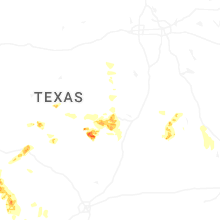

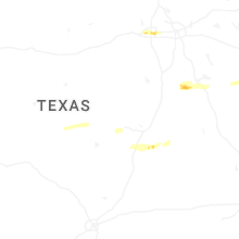
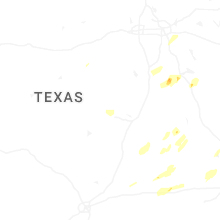


Connect with Interactive Hail Maps