

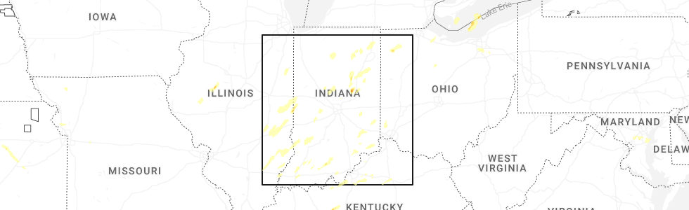
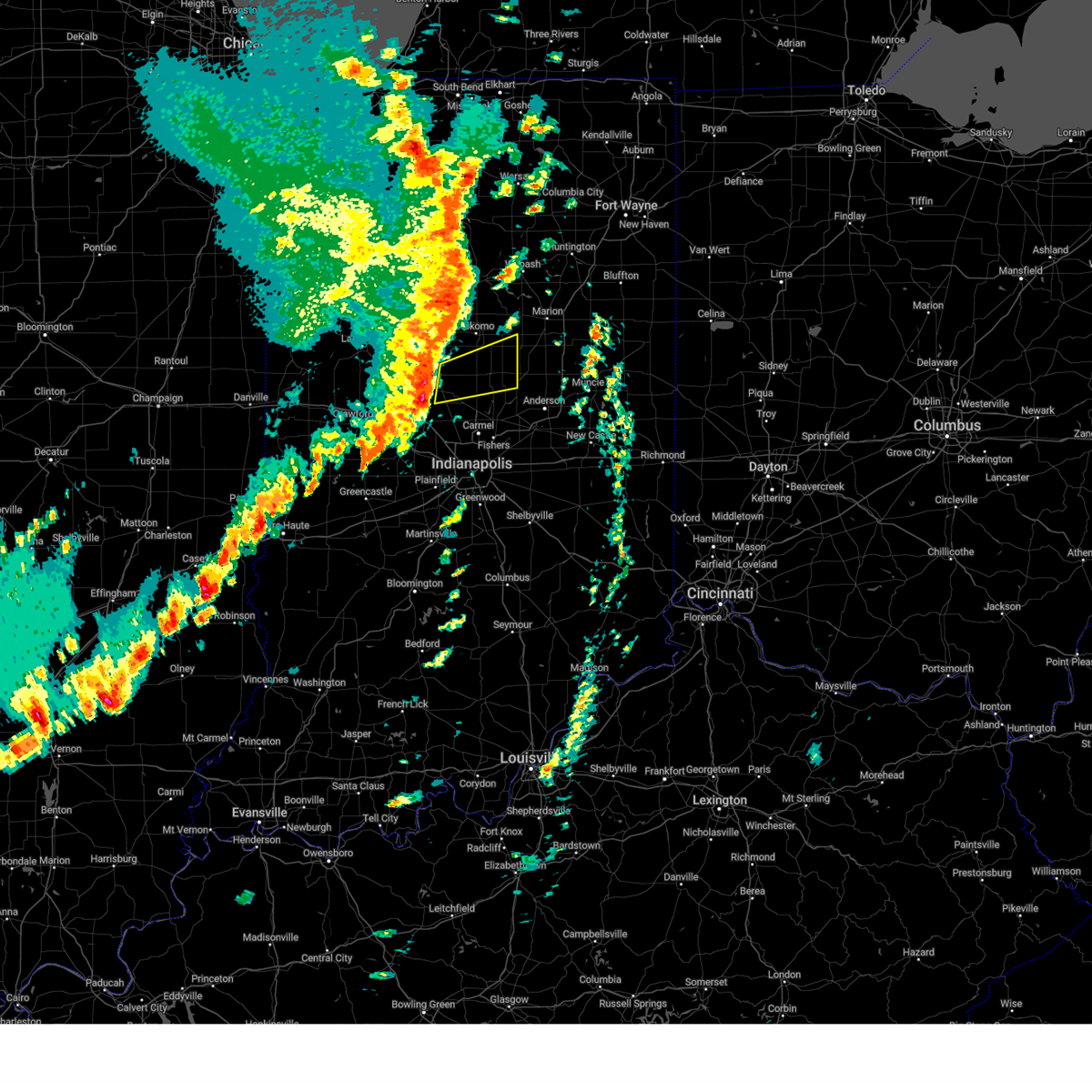
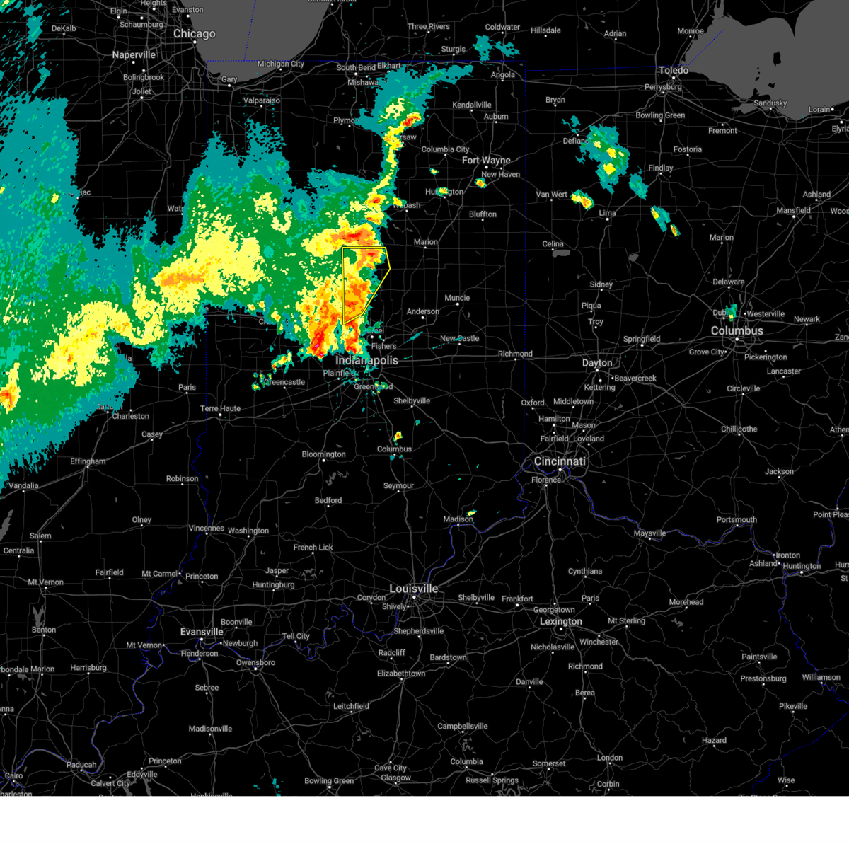
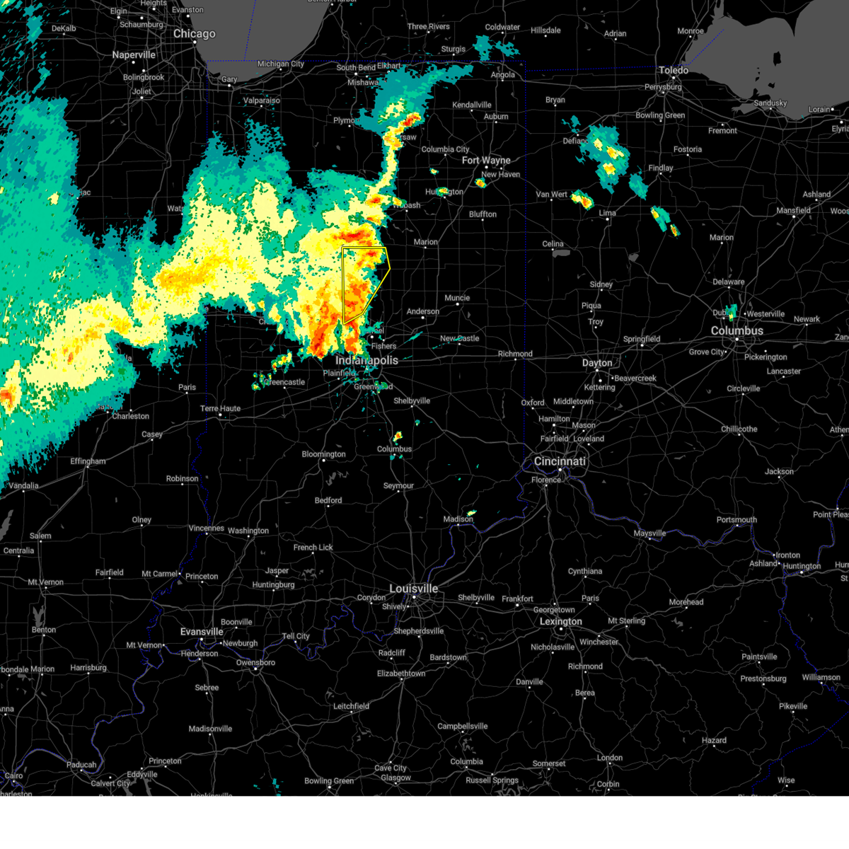
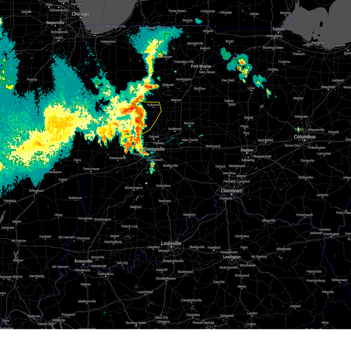
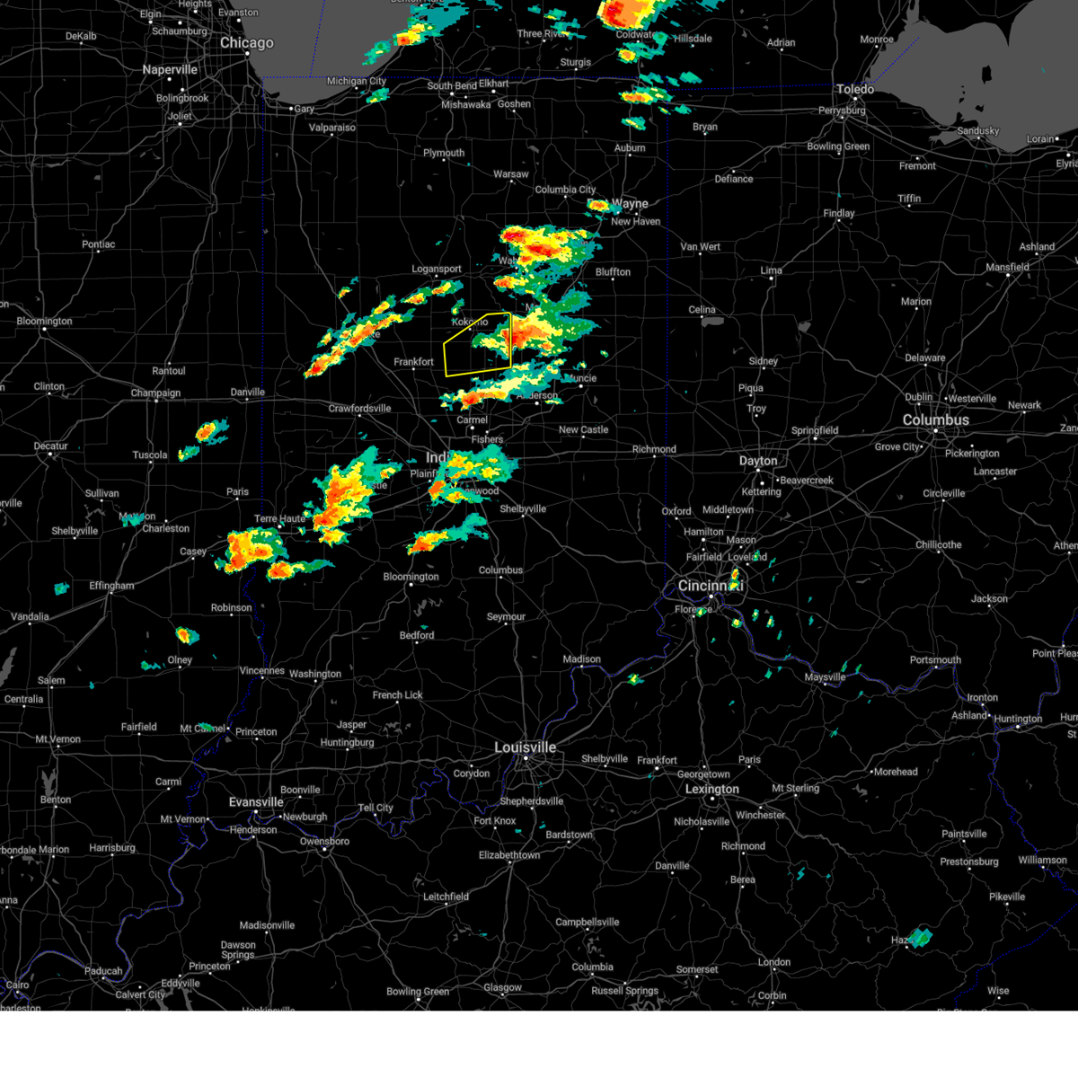
Hail Map for Kempton, IN
The Kempton, IN area has had 1 report of on-the-ground hail by trained spotters, and has been under severe weather warnings 31 times during the past 12 months. Doppler radar has detected hail at or near Kempton, IN on 46 occasions, including 4 occasions during the past year.
| Name: | Kempton, IN |
| Where Located: | 36.2 miles N of Indianapolis, IN |
| Map: | Google Map for Kempton, IN |
| Population: | 335 |
| Housing Units: | 154 |
| More Info: | Search Google for Kempton, IN |
2
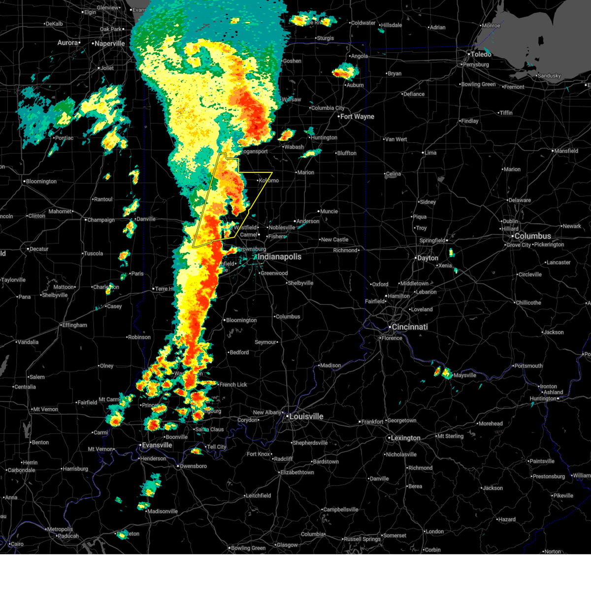
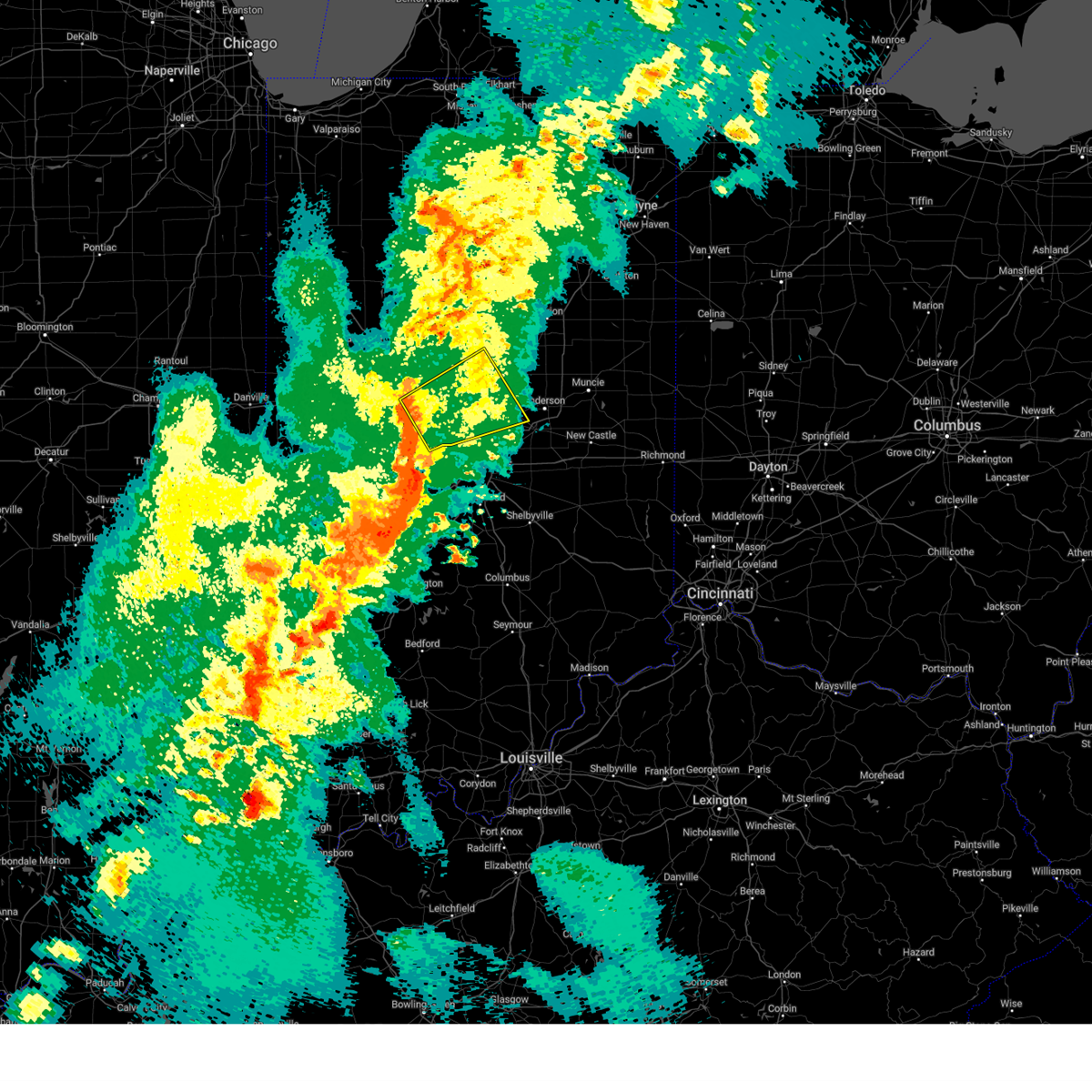
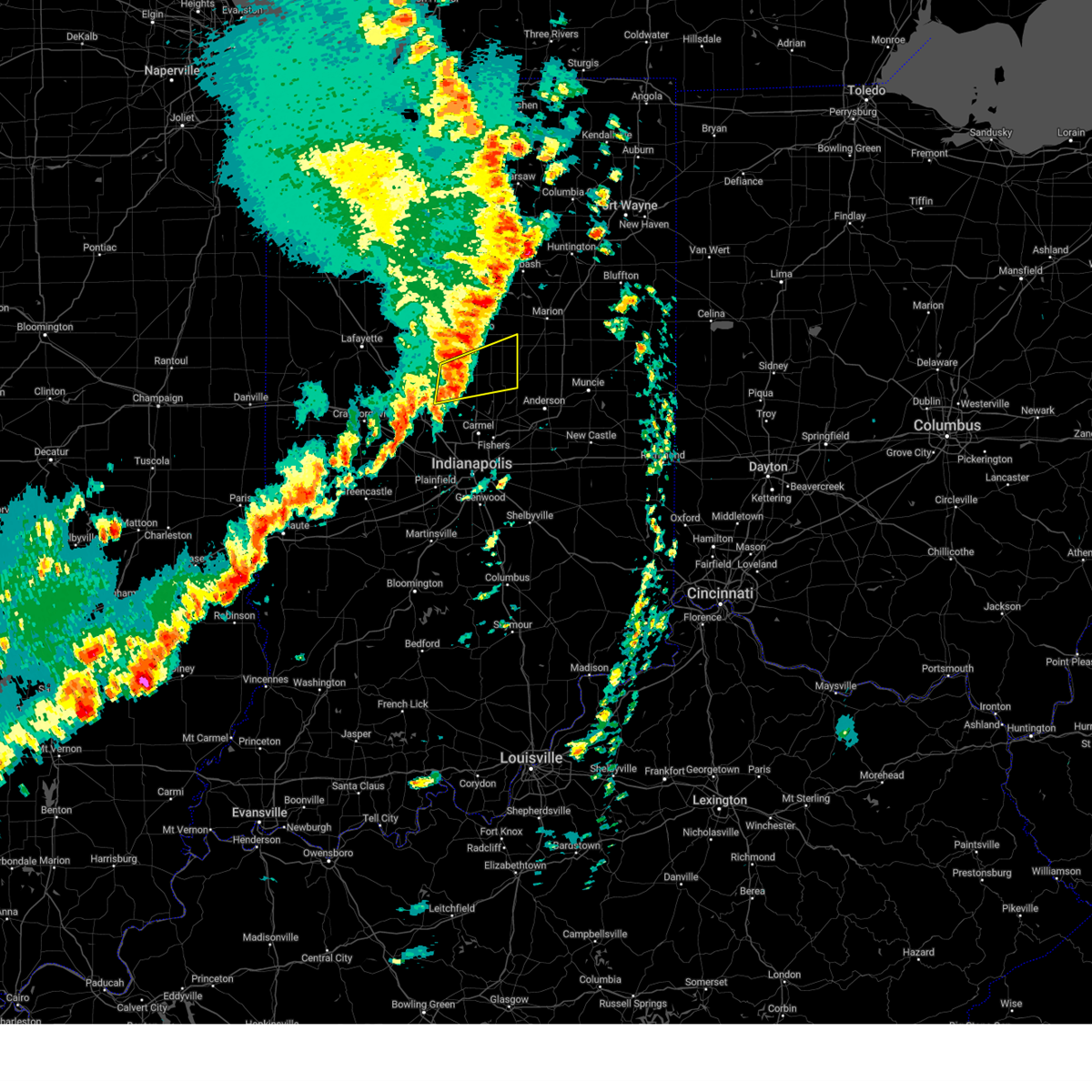
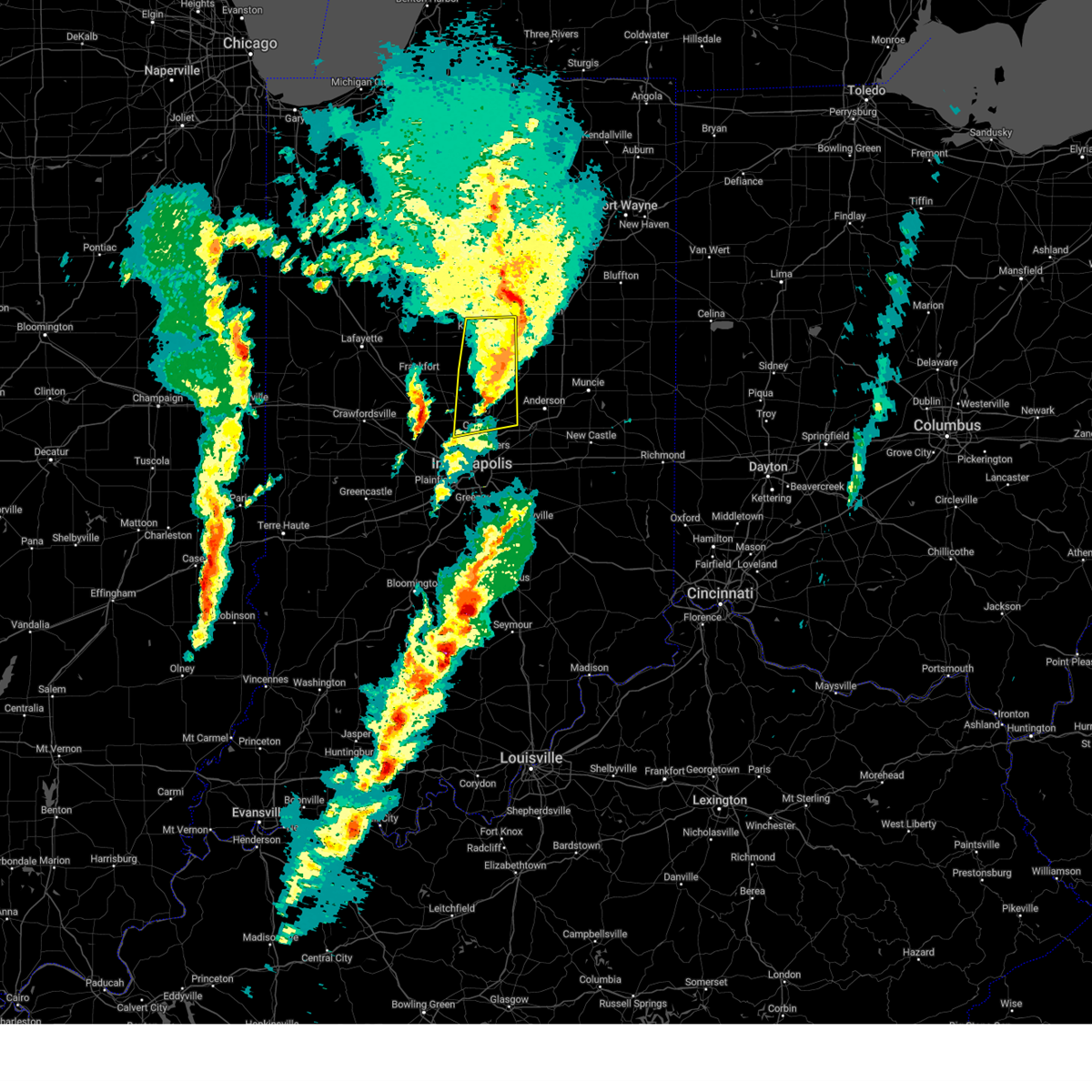
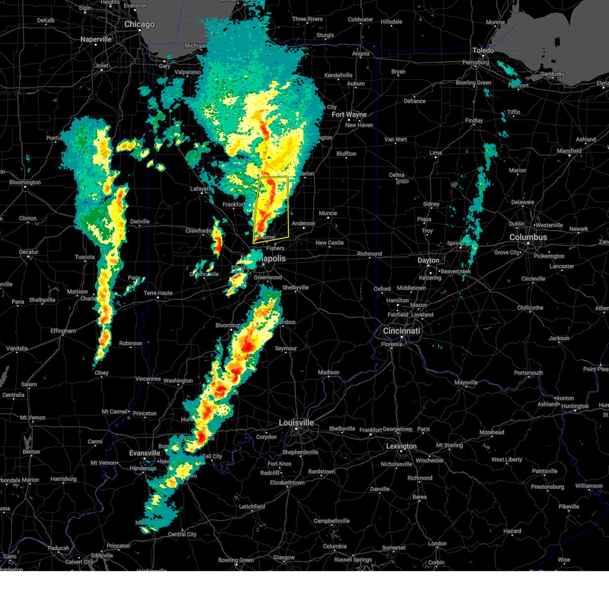
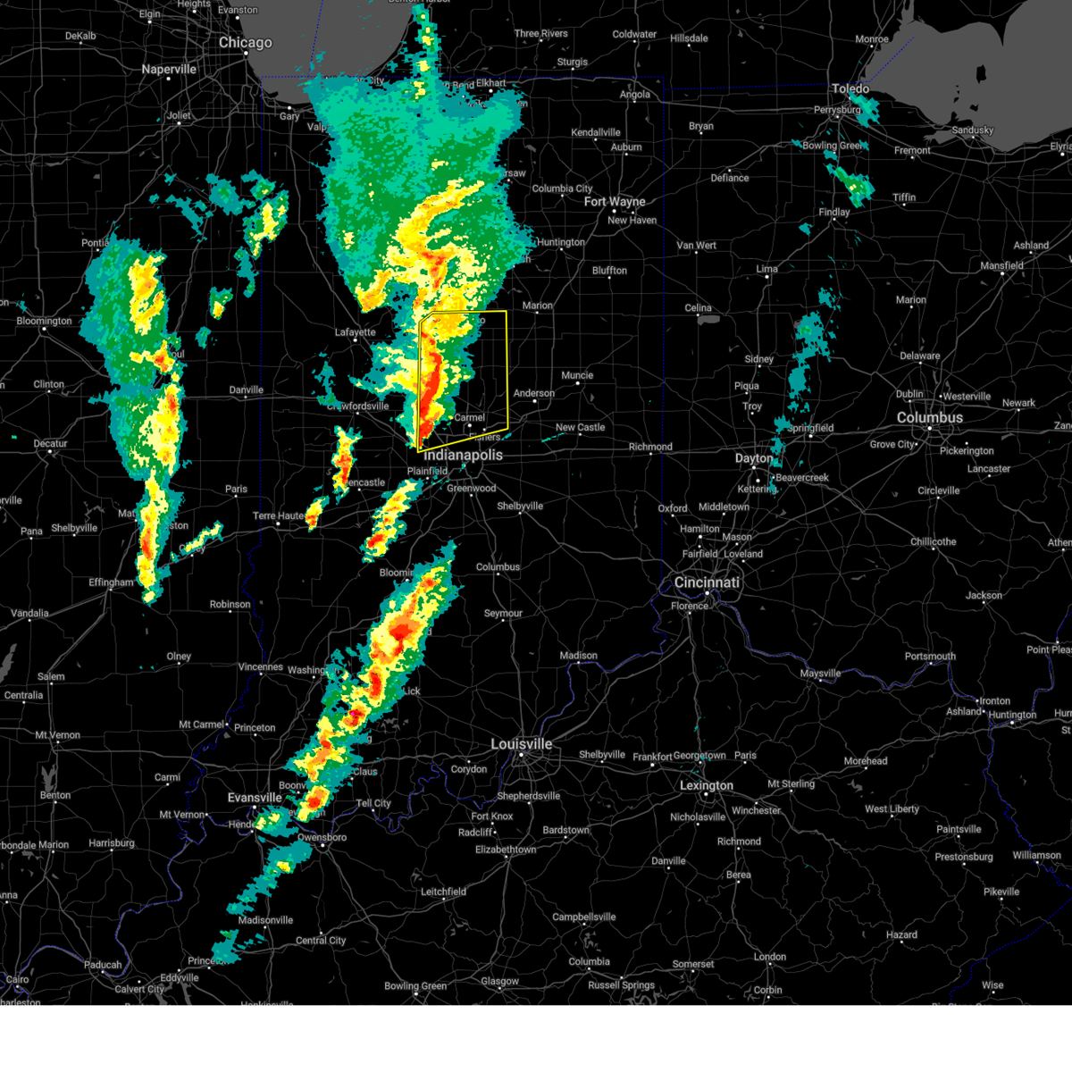
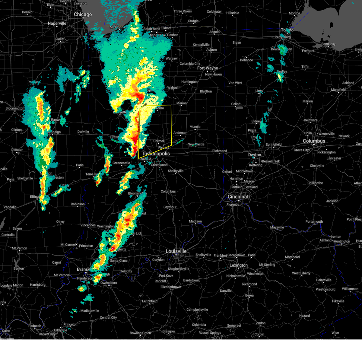
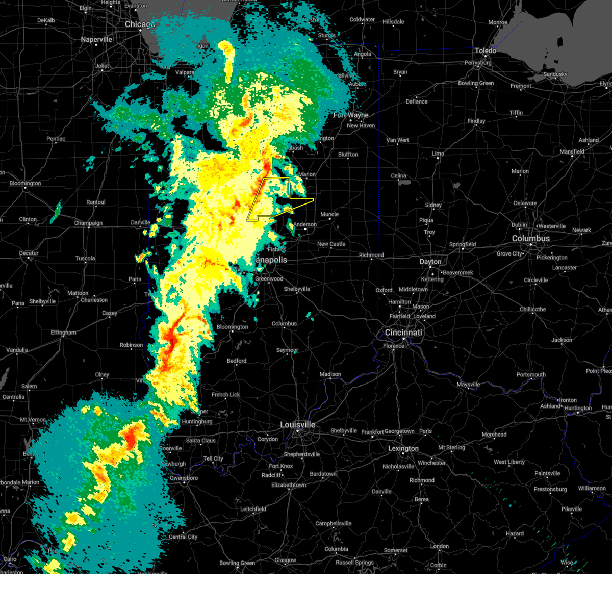
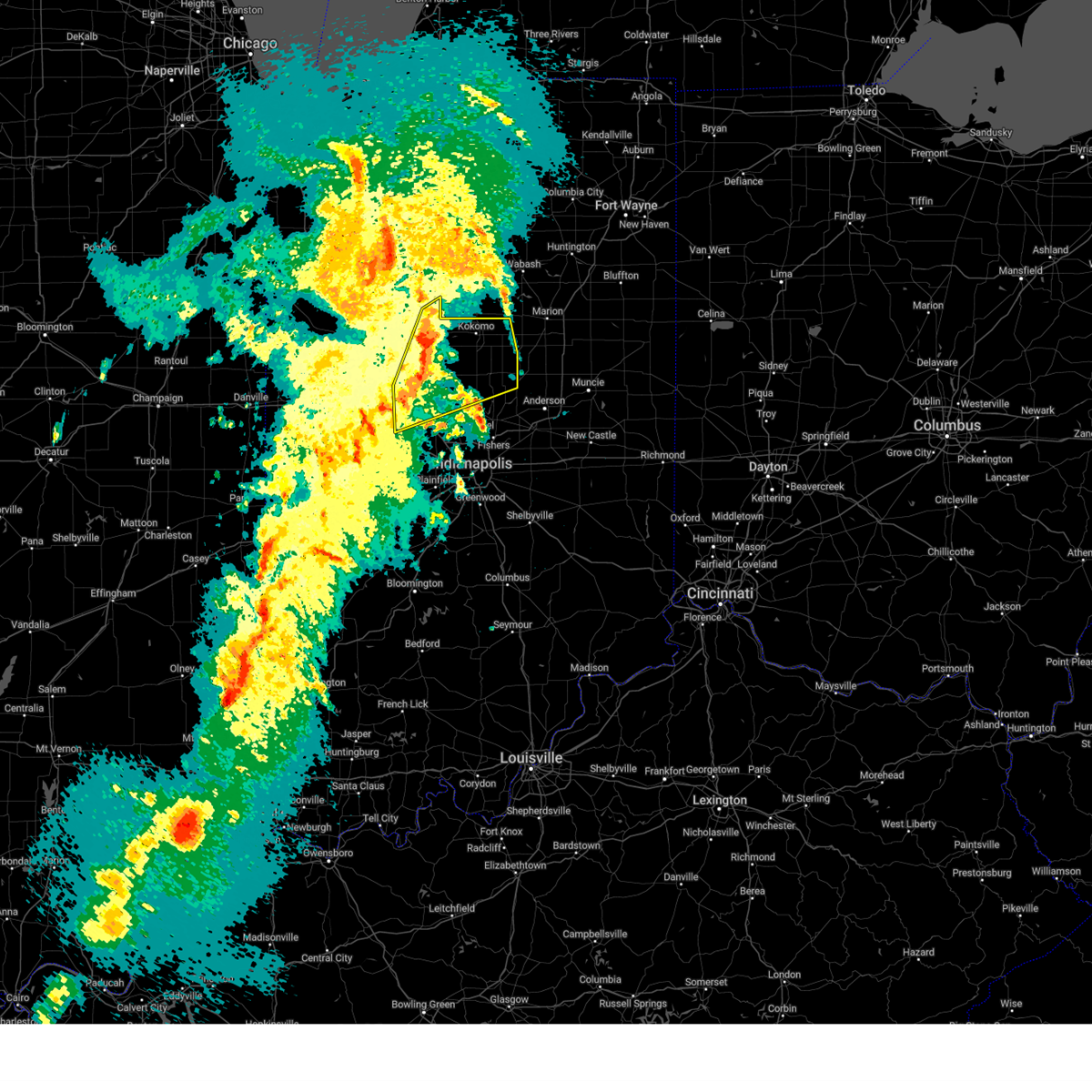
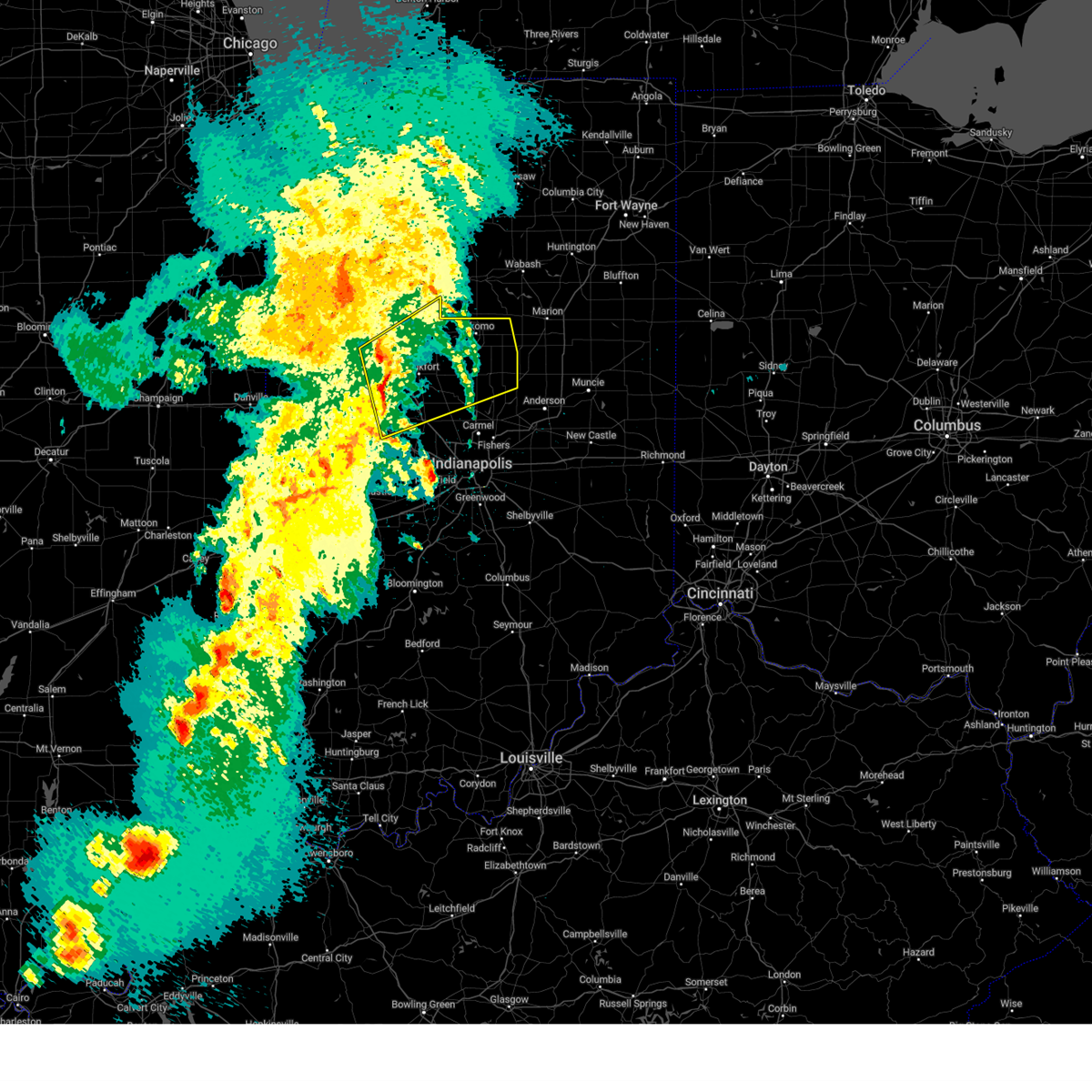
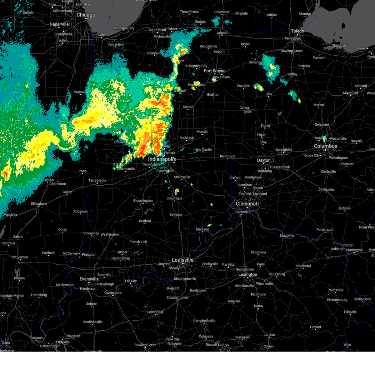
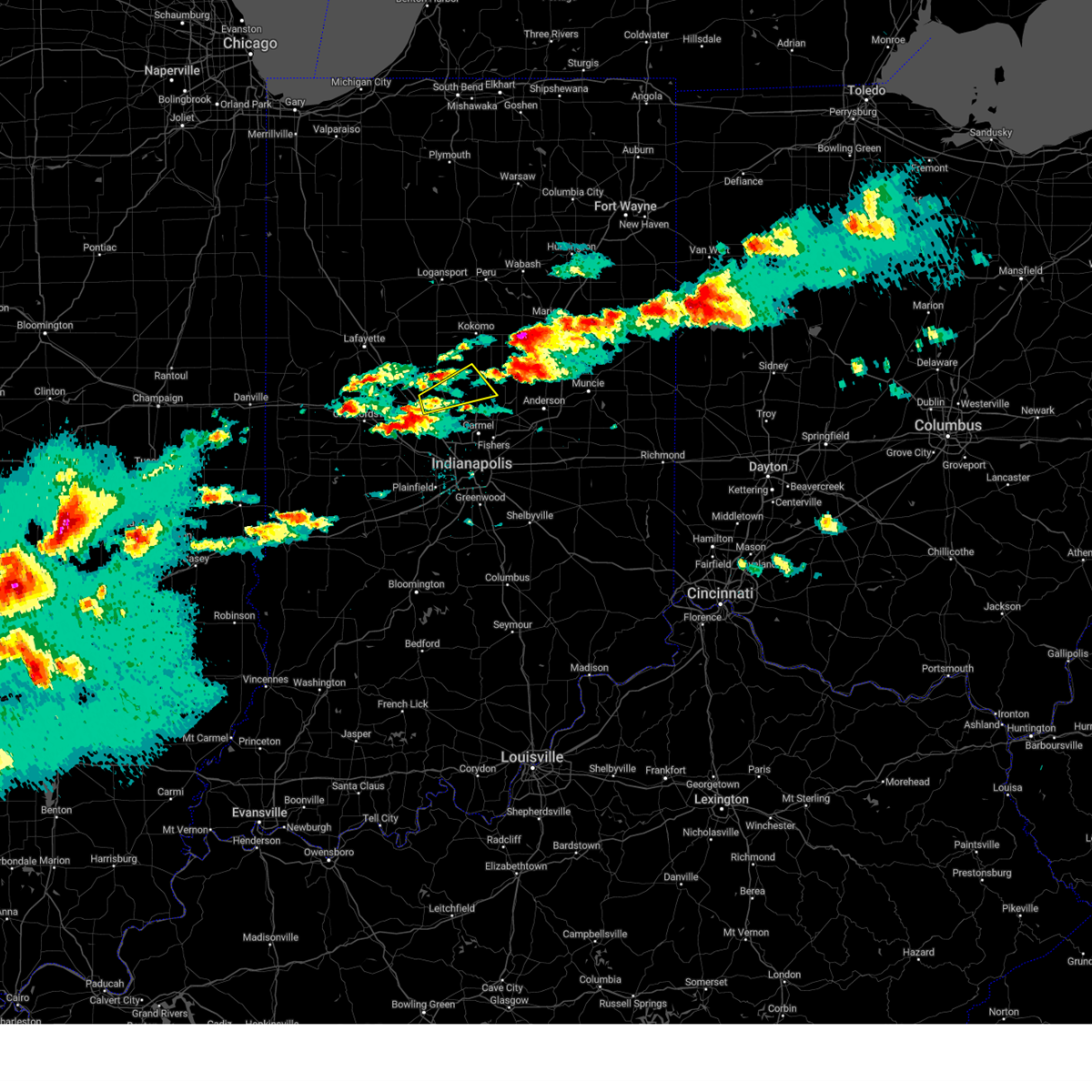
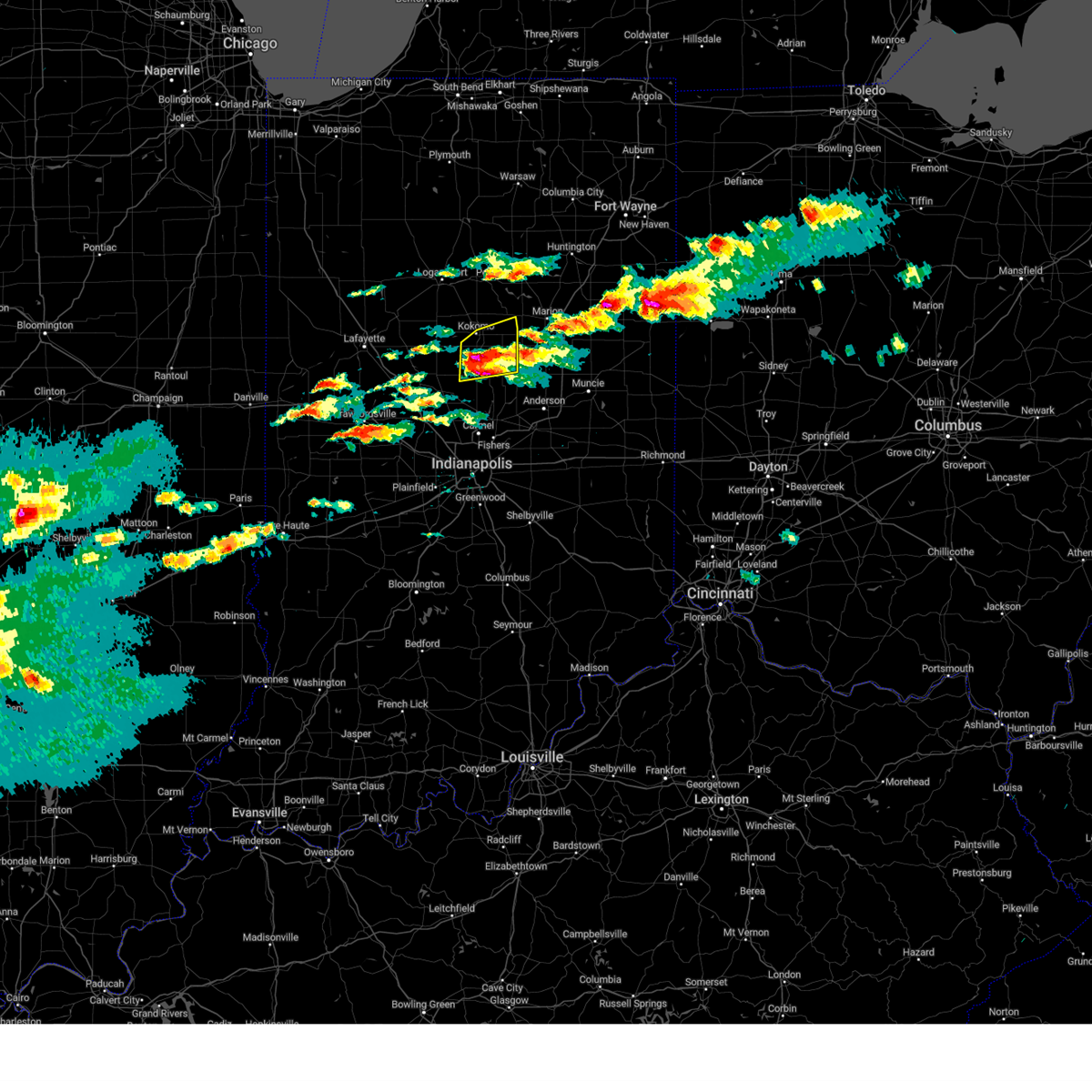
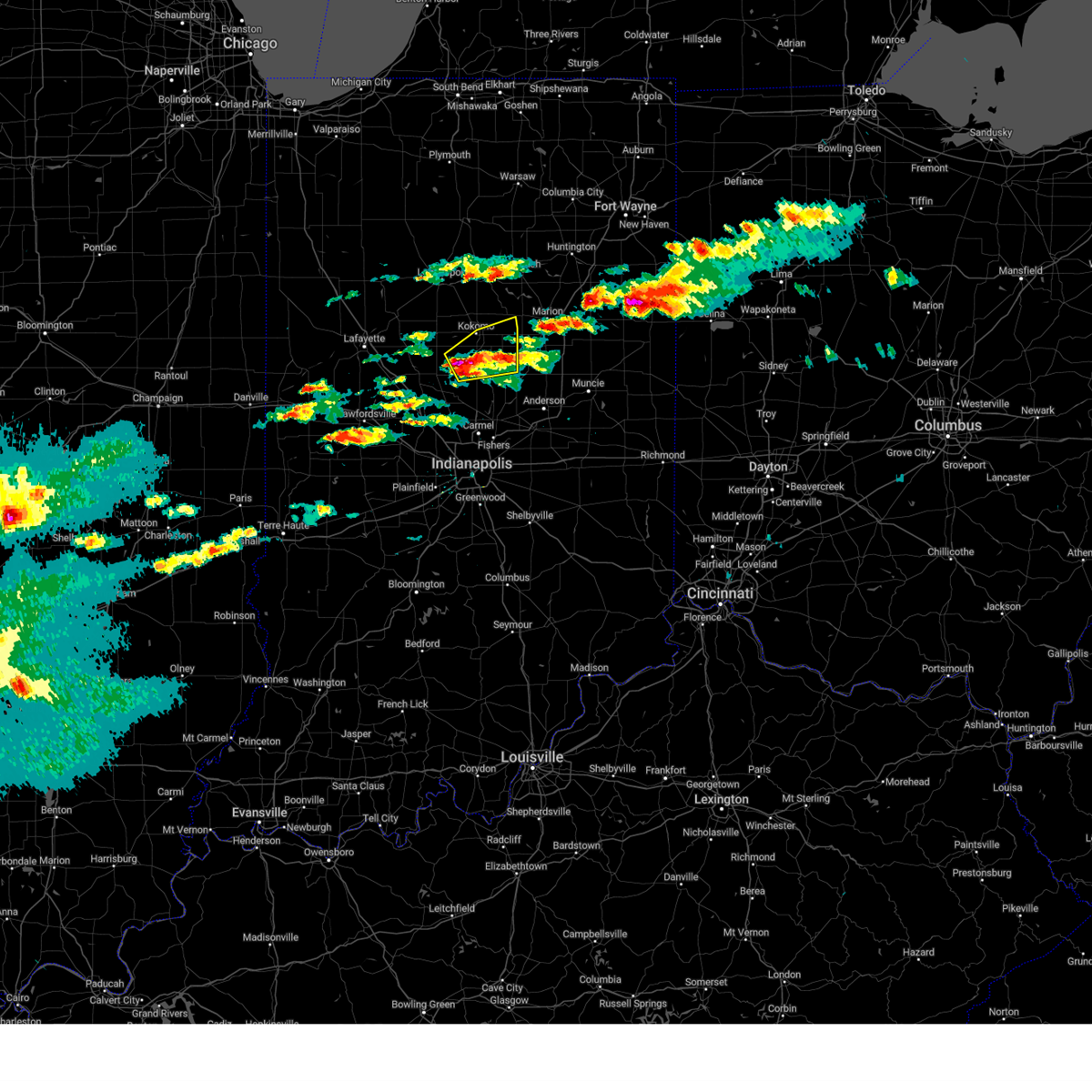
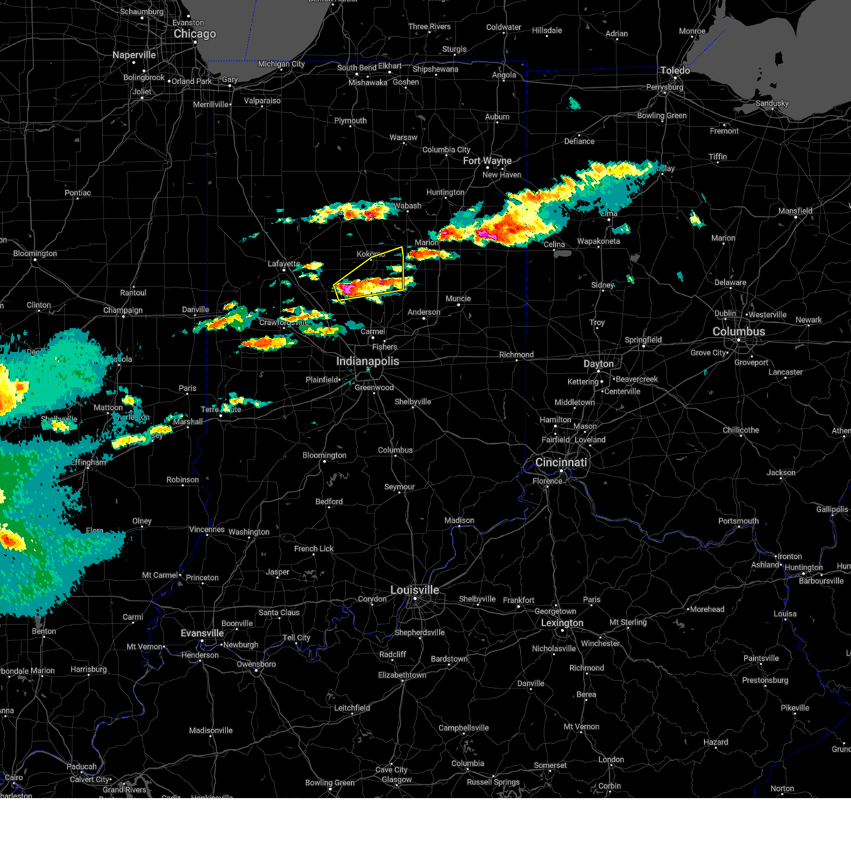
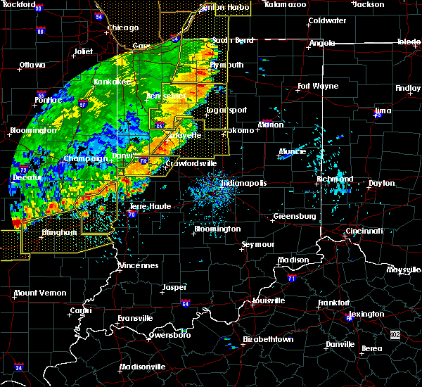
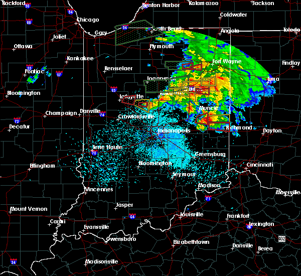
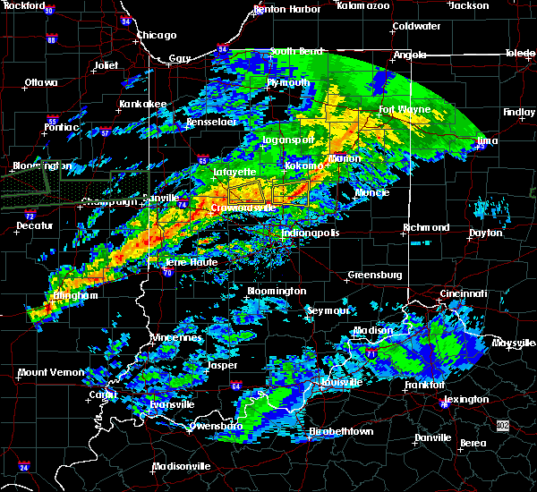
The Top Recent Hail Date for Kempton, IN is Wednesday, June 18, 2025 (13th out of 46)
Hail and Wind Damage Spotted near Kempton, IN
| Date / Time | Report Details |
|---|---|
| 6/18/2025 4:47 PM EDT | the severe thunderstorm warning has been cancelled and is no longer in effect |
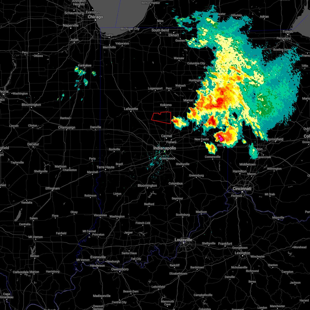
| 6/18/2025 4:47 PM EDT | At 446 pm edt, severe thunderstorms were located along a line extending from tipton to near lawrence, moving northeast at 65 mph (radar indicated). Hazards include 70 mph wind gusts and nickel size hail. Expect considerable tree damage. damage is likely to mobile homes, roofs, and outbuildings. locations impacted include, indianapolis, anderson, kokomo, carmel, fishers, noblesville, lawrence, greenfield, beech grove, zionsville, speedway, elwood, alexandria, tipton, southport, windfall, westfield, cumberland, cicero, and mccordsville. this includes the following highways, interstate 65 between mile markers 103 and 130. interstate 69 between mile markers 200 and 228. interstate 70 between mile markers 71 and 110. Interstate 74 between mile markers 70 and 98. |
| 6/18/2025 4:22 PM EDT | Svrind the national weather service in indianapolis has issued a * severe thunderstorm warning for, madison county in central indiana, hancock county in central indiana, northeastern morgan county in central indiana, southeastern clinton county in central indiana, eastern howard county in central indiana, eastern hendricks county in central indiana, marion county in central indiana, boone county in central indiana, hamilton county in central indiana, tipton county in central indiana, * until 500 pm edt. * at 421 pm edt, severe thunderstorms were located along a line extending from near lebanon to near mooresville, moving northeast at 65 mph (radar indicated). Hazards include 70 mph wind gusts and nickel size hail. Expect considerable tree damage. Damage is likely to mobile homes, roofs, and outbuildings. |
| 6/18/2025 4:10 PM EDT |
 At 410 pm edt, severe thunderstorms were located along a line extending from 6 miles east of delphi to 11 miles east of frankfort, moving northeast at 55 mph (radar indicated). Hazards include 60 mph wind gusts and penny size hail. Expect damage to roofs, siding, and trees. locations impacted include, kokomo, frankfort, lebanon, delphi, flora, rossville, thorntown, mulberry, russiaville, ladoga, jamestown, darlington, kirklin, colfax, camden, clarks hill, burlington, advance, michigantown, and new ross. this includes the following highways, interstate 65 between mile markers 134 and 164. Interstate 74 between mile markers 37 and 53. At 410 pm edt, severe thunderstorms were located along a line extending from 6 miles east of delphi to 11 miles east of frankfort, moving northeast at 55 mph (radar indicated). Hazards include 60 mph wind gusts and penny size hail. Expect damage to roofs, siding, and trees. locations impacted include, kokomo, frankfort, lebanon, delphi, flora, rossville, thorntown, mulberry, russiaville, ladoga, jamestown, darlington, kirklin, colfax, camden, clarks hill, burlington, advance, michigantown, and new ross. this includes the following highways, interstate 65 between mile markers 134 and 164. Interstate 74 between mile markers 37 and 53.
|
| 6/18/2025 4:10 PM EDT |
 the severe thunderstorm warning has been cancelled and is no longer in effect the severe thunderstorm warning has been cancelled and is no longer in effect
|
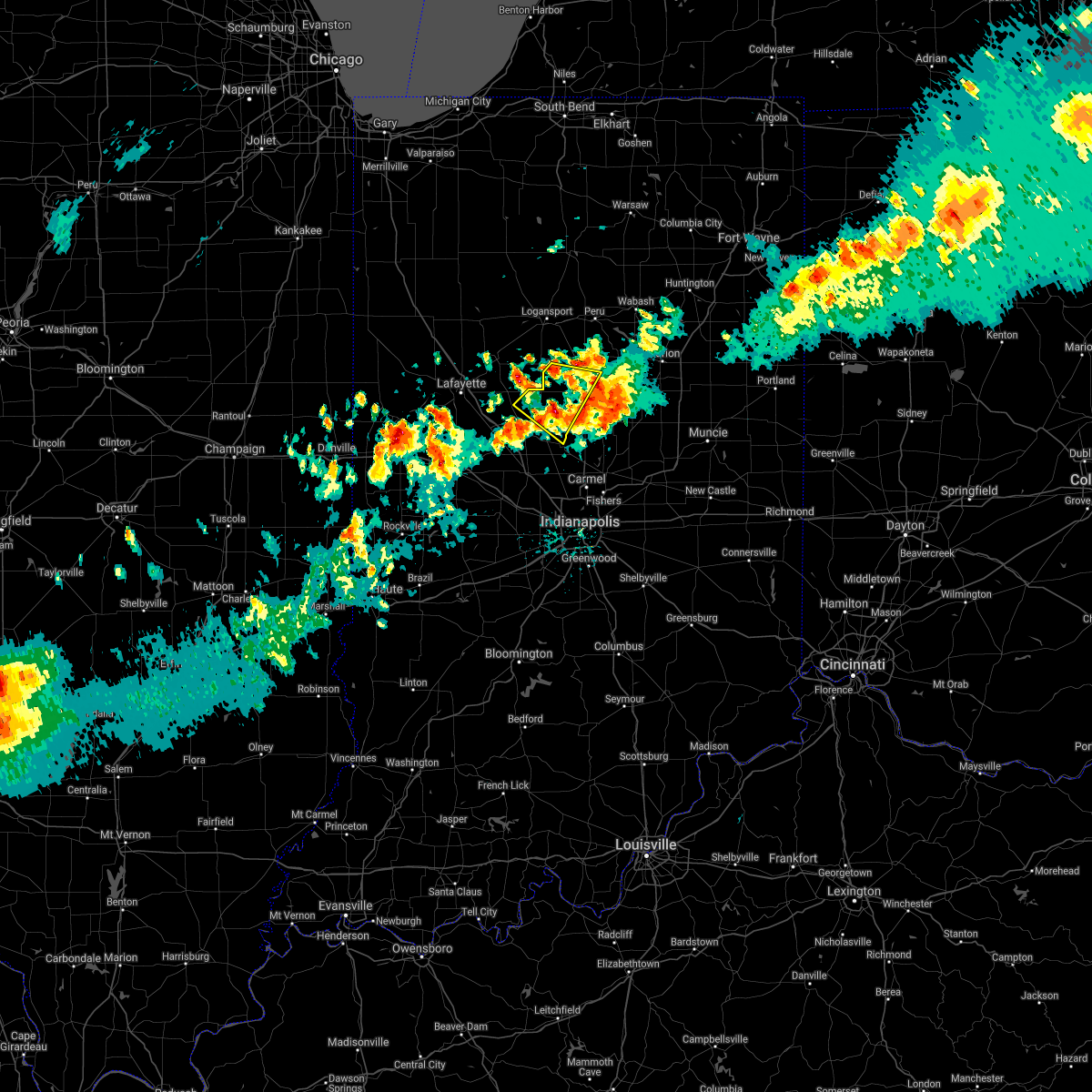
| 6/18/2025 3:43 PM EDT | Svrind the national weather service in indianapolis has issued a * severe thunderstorm warning for, carroll county in north central indiana, southeastern fountain county in west central indiana, eastern tippecanoe county in west central indiana, clinton county in central indiana, howard county in central indiana, northeastern parke county in west central indiana, boone county in central indiana, western tipton county in central indiana, montgomery county in west central indiana, * until 430 pm edt. * at 343 pm edt, severe thunderstorms were located along a line extending from 9 miles southwest of logansport to 7 miles south of crawfordsville, moving northeast at 45 mph (radar indicated). Hazards include 60 mph wind gusts and penny size hail. expect damage to roofs, siding, and trees |
| 5/16/2025 7:23 PM EDT | Svrind the national weather service in indianapolis has issued a * severe thunderstorm warning for, madison county in central indiana, southeastern carroll county in north central indiana, delaware county in east central indiana, northwestern randolph county in east central indiana, northeastern clinton county in central indiana, howard county in central indiana, northwestern henry county in east central indiana, hamilton county in central indiana, tipton county in central indiana, * until 815 pm edt. * at 722 pm edt, severe thunderstorms were located along a line extending from 10 miles southwest of walton to 6 miles east of fishers, moving east at 75 mph (public report of 60 mph winds). Hazards include 60 mph wind gusts. expect damage to roofs, siding, and trees |
| 4/2/2025 9:13 PM EDT |
 Svrind the national weather service in indianapolis has issued a * severe thunderstorm warning for, southwestern madison county in central indiana, southeastern clinton county in central indiana, northeastern hendricks county in central indiana, boone county in central indiana, hamilton county in central indiana, western tipton county in central indiana, * until 1000 pm edt. * at 913 pm edt, severe thunderstorms were located along a line extending from 8 miles northwest of lebanon to near brownsburg, moving northeast at 45 mph (radar indicated). Hazards include 70 mph wind gusts and penny size hail. Expect considerable tree damage. Damage is likely to mobile homes, roofs, and outbuildings. Svrind the national weather service in indianapolis has issued a * severe thunderstorm warning for, southwestern madison county in central indiana, southeastern clinton county in central indiana, northeastern hendricks county in central indiana, boone county in central indiana, hamilton county in central indiana, western tipton county in central indiana, * until 1000 pm edt. * at 913 pm edt, severe thunderstorms were located along a line extending from 8 miles northwest of lebanon to near brownsburg, moving northeast at 45 mph (radar indicated). Hazards include 70 mph wind gusts and penny size hail. Expect considerable tree damage. Damage is likely to mobile homes, roofs, and outbuildings.
|
| 3/30/2025 5:10 PM EDT | The storm which prompted the warning has weakened below severe limits, and no longer poses an immediate threat to life or property. therefore, the warning will be allowed to expire. a tornado watch remains in effect until 800 pm edt for central indiana. |
| 3/30/2025 4:47 PM EDT |
 At 446 pm edt, a severe thunderstorm was located near tipton, or 11 miles north of georgetown, moving east at 45 mph (radar indicated). Hazards include 60 mph wind gusts and penny size hail. Expect damage to roofs, siding, and trees. Locations impacted include, windfall, kirklin, tipton, atlanta, sharpsville, and kempton. At 446 pm edt, a severe thunderstorm was located near tipton, or 11 miles north of georgetown, moving east at 45 mph (radar indicated). Hazards include 60 mph wind gusts and penny size hail. Expect damage to roofs, siding, and trees. Locations impacted include, windfall, kirklin, tipton, atlanta, sharpsville, and kempton.
|
| 3/30/2025 4:45 PM EDT | Power pole snappe in tipton county IN, 0.1 miles S of Kempton, IN |
| 3/30/2025 4:31 PM EDT |
 Svrind the national weather service in indianapolis has issued a * severe thunderstorm warning for, southeastern clinton county in central indiana, southeastern howard county in central indiana, northeastern boone county in central indiana, northern hamilton county in central indiana, tipton county in central indiana, * until 515 pm edt. * at 431 pm edt, severe thunderstorms were located along a line extending from 11 miles southwest of kokomo to 6 miles northeast of lebanon, moving northeast at 50 mph (radar indicated). Hazards include 60 mph wind gusts and penny size hail. expect damage to roofs, siding, and trees Svrind the national weather service in indianapolis has issued a * severe thunderstorm warning for, southeastern clinton county in central indiana, southeastern howard county in central indiana, northeastern boone county in central indiana, northern hamilton county in central indiana, tipton county in central indiana, * until 515 pm edt. * at 431 pm edt, severe thunderstorms were located along a line extending from 11 miles southwest of kokomo to 6 miles northeast of lebanon, moving northeast at 50 mph (radar indicated). Hazards include 60 mph wind gusts and penny size hail. expect damage to roofs, siding, and trees
|
| 3/19/2025 8:58 PM EDT |
 The storms which prompted the warning have weakened below severe limits, and have exited the warned area. therefore, the warning will be allowed to expire. a severe thunderstorm watch remains in effect until 100 am edt for central indiana. The storms which prompted the warning have weakened below severe limits, and have exited the warned area. therefore, the warning will be allowed to expire. a severe thunderstorm watch remains in effect until 100 am edt for central indiana.
|
| 3/19/2025 8:46 PM EDT |
 At 846 pm edt, severe thunderstorms were located along a line extending from 10 miles southwest of kokomo to 8 miles west of tipton to 7 miles west of georgetown, moving east at 65 mph (radar indicated). Hazards include 60 mph wind gusts. Expect damage to roofs, siding, and trees. Locations impacted include, indian heights, sharpsville, kempton, and kokomo. At 846 pm edt, severe thunderstorms were located along a line extending from 10 miles southwest of kokomo to 8 miles west of tipton to 7 miles west of georgetown, moving east at 65 mph (radar indicated). Hazards include 60 mph wind gusts. Expect damage to roofs, siding, and trees. Locations impacted include, indian heights, sharpsville, kempton, and kokomo.
|
| 3/19/2025 8:46 PM EDT |
 the severe thunderstorm warning has been cancelled and is no longer in effect the severe thunderstorm warning has been cancelled and is no longer in effect
|
| 3/19/2025 8:39 PM EDT |
 At 838 pm edt, severe thunderstorms were located along a line extending from 6 miles east of frankfort to 11 miles west of georgetown to near lebanon, moving northeast at 65 mph (radar indicated). Hazards include 60 mph wind gusts. Expect damage to roofs, siding, and trees. locations impacted include, sheridan, kirklin, indian heights, kempton, michigantown, tipton, sharpsville, and kokomo. This includes interstate 65 between mile markers 136 and 137. At 838 pm edt, severe thunderstorms were located along a line extending from 6 miles east of frankfort to 11 miles west of georgetown to near lebanon, moving northeast at 65 mph (radar indicated). Hazards include 60 mph wind gusts. Expect damage to roofs, siding, and trees. locations impacted include, sheridan, kirklin, indian heights, kempton, michigantown, tipton, sharpsville, and kokomo. This includes interstate 65 between mile markers 136 and 137.
|
| 3/19/2025 8:31 PM EDT |
 Svrind the national weather service in indianapolis has issued a * severe thunderstorm warning for, southeastern clinton county in central indiana, south central howard county in central indiana, eastern boone county in central indiana, northwestern hamilton county in central indiana, tipton county in central indiana, * until 900 pm edt. * at 831 pm edt, severe thunderstorms were located along a line extending from near frankfort to near lebanon, moving northeast at 65 mph (radar indicated). Hazards include 60 mph wind gusts. expect damage to roofs, siding, and trees Svrind the national weather service in indianapolis has issued a * severe thunderstorm warning for, southeastern clinton county in central indiana, south central howard county in central indiana, eastern boone county in central indiana, northwestern hamilton county in central indiana, tipton county in central indiana, * until 900 pm edt. * at 831 pm edt, severe thunderstorms were located along a line extending from near frankfort to near lebanon, moving northeast at 65 mph (radar indicated). Hazards include 60 mph wind gusts. expect damage to roofs, siding, and trees
|
| 3/19/2025 8:26 PM EDT |
 The storms which prompted the warning have weakened below severe limits, and no longer pose an immediate threat to life or property. therefore, the warning will be allowed to expire. however, gusty winds are still possible with these thunderstorms. a severe thunderstorm watch remains in effect until 100 am edt for central indiana. The storms which prompted the warning have weakened below severe limits, and no longer pose an immediate threat to life or property. therefore, the warning will be allowed to expire. however, gusty winds are still possible with these thunderstorms. a severe thunderstorm watch remains in effect until 100 am edt for central indiana.
|
| 3/19/2025 8:18 PM EDT |
 At 818 pm edt, severe thunderstorms were located along a line extending from near peru to near georgetown, moving northeast at 70 mph (radar indicated). Hazards include 60 mph wind gusts and quarter size hail. Hail damage to vehicles is expected. expect wind damage to roofs, siding, and trees. Locations impacted include, greentown, noblesville, kokomo, tipton, westfield, morse reservoir, cicero, sheridan, indian heights, arcadia, atlanta, kempton, windfall, sharpsville, zionsville, and carmel. At 818 pm edt, severe thunderstorms were located along a line extending from near peru to near georgetown, moving northeast at 70 mph (radar indicated). Hazards include 60 mph wind gusts and quarter size hail. Hail damage to vehicles is expected. expect wind damage to roofs, siding, and trees. Locations impacted include, greentown, noblesville, kokomo, tipton, westfield, morse reservoir, cicero, sheridan, indian heights, arcadia, atlanta, kempton, windfall, sharpsville, zionsville, and carmel.
|
| 3/19/2025 8:08 PM EDT |
 At 808 pm edt, severe thunderstorms were located along a line extending from grissom afb to near zionsville, moving east at 70 mph (radar indicated). Hazards include 60 mph wind gusts and quarter size hail. Hail damage to vehicles is expected. expect wind damage to roofs, siding, and trees. locations impacted include, greentown, carmel, kirklin, noblesville, kokomo, whitestown, tipton, russiaville, zionsville, westfield, morse reservoir, cicero, sheridan, indian heights, arcadia, atlanta, kempton, windfall, sharpsville, and fishers. this includes the following highways, interstate 65 between mile markers 129 and 132. Interstate 69 between mile markers 206 and 213. At 808 pm edt, severe thunderstorms were located along a line extending from grissom afb to near zionsville, moving east at 70 mph (radar indicated). Hazards include 60 mph wind gusts and quarter size hail. Hail damage to vehicles is expected. expect wind damage to roofs, siding, and trees. locations impacted include, greentown, carmel, kirklin, noblesville, kokomo, whitestown, tipton, russiaville, zionsville, westfield, morse reservoir, cicero, sheridan, indian heights, arcadia, atlanta, kempton, windfall, sharpsville, and fishers. this includes the following highways, interstate 65 between mile markers 129 and 132. Interstate 69 between mile markers 206 and 213.
|
| 3/19/2025 8:08 PM EDT |
 the severe thunderstorm warning has been cancelled and is no longer in effect the severe thunderstorm warning has been cancelled and is no longer in effect
|
| 3/19/2025 8:00 PM EDT |
 At 759 pm edt, severe thunderstorms were located along a line extending from near walton to near brownsburg, moving east at 70 mph (radar indicated). Hazards include 70 mph wind gusts and quarter size hail. Hail damage to vehicles is expected. expect considerable tree damage. wind damage is also likely to mobile homes, roofs, and outbuildings. locations impacted include, pittsboro, greentown, carmel, kokomo, ulen, fishers, michigantown, whitestown, russiaville, zionsville, westfield, morse reservoir, indian heights, atlanta, burlington, kempton, sharpsville, kirklin, noblesville, and tipton. this includes the following highways, interstate 65 between mile markers 125 and 138. interstate 69 between mile markers 203 and 213. Interstate 74 between mile markers 62 and 66. At 759 pm edt, severe thunderstorms were located along a line extending from near walton to near brownsburg, moving east at 70 mph (radar indicated). Hazards include 70 mph wind gusts and quarter size hail. Hail damage to vehicles is expected. expect considerable tree damage. wind damage is also likely to mobile homes, roofs, and outbuildings. locations impacted include, pittsboro, greentown, carmel, kokomo, ulen, fishers, michigantown, whitestown, russiaville, zionsville, westfield, morse reservoir, indian heights, atlanta, burlington, kempton, sharpsville, kirklin, noblesville, and tipton. this includes the following highways, interstate 65 between mile markers 125 and 138. interstate 69 between mile markers 203 and 213. Interstate 74 between mile markers 62 and 66.
|
| 3/19/2025 7:47 PM EDT |
 Svrind the national weather service in indianapolis has issued a * severe thunderstorm warning for, southeastern carroll county in north central indiana, eastern clinton county in central indiana, howard county in central indiana, northeastern hendricks county in central indiana, northern marion county in central indiana, eastern boone county in central indiana, hamilton county in central indiana, tipton county in central indiana, * until 830 pm edt. * at 747 pm edt, severe thunderstorms were located along a line extending from 11 miles southeast of delphi to near danville, moving northeast at 70 mph (radar indicated). Hazards include 70 mph wind gusts and quarter size hail. Hail damage to vehicles is expected. expect considerable tree damage. Wind damage is also likely to mobile homes, roofs, and outbuildings. Svrind the national weather service in indianapolis has issued a * severe thunderstorm warning for, southeastern carroll county in north central indiana, eastern clinton county in central indiana, howard county in central indiana, northeastern hendricks county in central indiana, northern marion county in central indiana, eastern boone county in central indiana, hamilton county in central indiana, tipton county in central indiana, * until 830 pm edt. * at 747 pm edt, severe thunderstorms were located along a line extending from 11 miles southeast of delphi to near danville, moving northeast at 70 mph (radar indicated). Hazards include 70 mph wind gusts and quarter size hail. Hail damage to vehicles is expected. expect considerable tree damage. Wind damage is also likely to mobile homes, roofs, and outbuildings.
|
| 3/15/2025 3:41 AM EDT |
 Svrind the national weather service in indianapolis has issued a * severe thunderstorm warning for, northern madison county in central indiana, southeastern clinton county in central indiana, howard county in central indiana, tipton county in central indiana, * until 430 am edt. * at 340 am edt, severe thunderstorms were located along a line extending from near bunker hill to 12 miles northwest of georgetown, moving northeast at 55 mph. this line has a history of damaging wind gusts (radar indicated). Hazards include 60 mph wind gusts. expect damage to roofs, siding, and trees Svrind the national weather service in indianapolis has issued a * severe thunderstorm warning for, northern madison county in central indiana, southeastern clinton county in central indiana, howard county in central indiana, tipton county in central indiana, * until 430 am edt. * at 340 am edt, severe thunderstorms were located along a line extending from near bunker hill to 12 miles northwest of georgetown, moving northeast at 55 mph. this line has a history of damaging wind gusts (radar indicated). Hazards include 60 mph wind gusts. expect damage to roofs, siding, and trees
|
| 3/15/2025 3:37 AM EDT | At 336 am edt, severe thunderstorms were located along a line extending from near walton to 7 miles west of tipton, moving northeast at 55 mph (radar indicated). Hazards include 70 mph wind gusts. Expect considerable tree damage. damage is likely to mobile homes, roofs, and outbuildings. locations impacted include, greentown, kirklin, kokomo, thorntown, ulen, michigantown, tipton, russiaville, lebanon, sheridan, indian heights, arcadia, atlanta, kempton, windfall, frankfort, sharpsville, and advance. This includes interstate 65 between mile markers 140 and 153. |
| 3/15/2025 3:37 AM EDT | the severe thunderstorm warning has been cancelled and is no longer in effect |
| 3/15/2025 3:17 AM EDT |
 the severe thunderstorm warning has been cancelled and is no longer in effect the severe thunderstorm warning has been cancelled and is no longer in effect
|
| 3/15/2025 3:17 AM EDT |
 At 317 am edt, severe thunderstorms were located along a line extending from 9 miles southeast of delphi to 6 miles north of lebanon, moving northeast at 55 mph (radar indicated). Hazards include 70 mph wind gusts. Expect considerable tree damage. damage is likely to mobile homes, roofs, and outbuildings. locations impacted include, greentown, kirklin, kokomo, advance, thorntown, ulen, michigantown, tipton, russiaville, lebanon, sheridan, indian heights, arcadia, atlanta, burlington, kempton, windfall, frankfort, colfax, and sharpsville. This includes interstate 65 between mile markers 140 and 158. At 317 am edt, severe thunderstorms were located along a line extending from 9 miles southeast of delphi to 6 miles north of lebanon, moving northeast at 55 mph (radar indicated). Hazards include 70 mph wind gusts. Expect considerable tree damage. damage is likely to mobile homes, roofs, and outbuildings. locations impacted include, greentown, kirklin, kokomo, advance, thorntown, ulen, michigantown, tipton, russiaville, lebanon, sheridan, indian heights, arcadia, atlanta, burlington, kempton, windfall, frankfort, colfax, and sharpsville. This includes interstate 65 between mile markers 140 and 158.
|
| 3/15/2025 3:04 AM EDT |
 At 304 am edt, severe thunderstorms were located along a line extending from 7 miles east of lafayette to 7 miles west of lebanon, moving northeast at 55 mph (radar indicated). Hazards include 70 mph wind gusts. Expect considerable tree damage. damage is likely to mobile homes, roofs, and outbuildings. locations impacted include, greentown, kokomo, ulen, michigantown, darlington, russiaville, dayton, indian heights, atlanta, burlington, kempton, rossville, colfax, sharpsville, mulberry, kirklin, advance, thorntown, tipton, and lebanon. this includes the following highways, interstate 65 between mile markers 139 and 174. Interstate 74 between mile markers 42 and 48. At 304 am edt, severe thunderstorms were located along a line extending from 7 miles east of lafayette to 7 miles west of lebanon, moving northeast at 55 mph (radar indicated). Hazards include 70 mph wind gusts. Expect considerable tree damage. damage is likely to mobile homes, roofs, and outbuildings. locations impacted include, greentown, kokomo, ulen, michigantown, darlington, russiaville, dayton, indian heights, atlanta, burlington, kempton, rossville, colfax, sharpsville, mulberry, kirklin, advance, thorntown, tipton, and lebanon. this includes the following highways, interstate 65 between mile markers 139 and 174. Interstate 74 between mile markers 42 and 48.
|
| 3/15/2025 2:57 AM EDT |
 Svrind the national weather service in indianapolis has issued a * severe thunderstorm warning for, southern carroll county in north central indiana, southeastern tippecanoe county in west central indiana, clinton county in central indiana, howard county in central indiana, northern boone county in central indiana, northern hamilton county in central indiana, tipton county in central indiana, northeastern montgomery county in west central indiana, * until 345 am edt. * at 256 am edt, severe thunderstorms were located along a line extending from near lafayette to 8 miles east of crawfordsville, moving northeast at 55 mph (radar indicated). Hazards include 60 mph wind gusts. expect damage to roofs, siding, and trees Svrind the national weather service in indianapolis has issued a * severe thunderstorm warning for, southern carroll county in north central indiana, southeastern tippecanoe county in west central indiana, clinton county in central indiana, howard county in central indiana, northern boone county in central indiana, northern hamilton county in central indiana, tipton county in central indiana, northeastern montgomery county in west central indiana, * until 345 am edt. * at 256 am edt, severe thunderstorms were located along a line extending from near lafayette to 8 miles east of crawfordsville, moving northeast at 55 mph (radar indicated). Hazards include 60 mph wind gusts. expect damage to roofs, siding, and trees
|
| 7/16/2024 12:16 AM EDT |
 Svrind the national weather service in indianapolis has issued a * severe thunderstorm warning for, northwestern madison county in central indiana, carroll county in north central indiana, eastern tippecanoe county in west central indiana, clinton county in central indiana, howard county in central indiana, northern boone county in central indiana, northern hamilton county in central indiana, tipton county in central indiana, northern montgomery county in west central indiana, * until 1245 am edt. * at 1216 am edt, severe thunderstorms were located along a line extending from near logansport to 11 miles northeast of frankfort to 12 miles northwest of lebanon, moving east at 60 mph (radar indicated). Hazards include 70 mph wind gusts. Expect considerable tree damage. Damage is likely to mobile homes, roofs, and outbuildings. Svrind the national weather service in indianapolis has issued a * severe thunderstorm warning for, northwestern madison county in central indiana, carroll county in north central indiana, eastern tippecanoe county in west central indiana, clinton county in central indiana, howard county in central indiana, northern boone county in central indiana, northern hamilton county in central indiana, tipton county in central indiana, northern montgomery county in west central indiana, * until 1245 am edt. * at 1216 am edt, severe thunderstorms were located along a line extending from near logansport to 11 miles northeast of frankfort to 12 miles northwest of lebanon, moving east at 60 mph (radar indicated). Hazards include 70 mph wind gusts. Expect considerable tree damage. Damage is likely to mobile homes, roofs, and outbuildings.
|
| 7/14/2024 1:07 PM EDT |
 Svrind the national weather service in indianapolis has issued a * severe thunderstorm warning for, west central madison county in central indiana, southeastern clinton county in central indiana, northeastern boone county in central indiana, hamilton county in central indiana, southwestern tipton county in central indiana, * until 145 pm edt. * at 106 pm edt, a severe thunderstorm was located 9 miles east of frankfort, moving southeast at 45 mph (radar indicated). Hazards include 60 mph wind gusts. expect damage to roofs, siding, and trees Svrind the national weather service in indianapolis has issued a * severe thunderstorm warning for, west central madison county in central indiana, southeastern clinton county in central indiana, northeastern boone county in central indiana, hamilton county in central indiana, southwestern tipton county in central indiana, * until 145 pm edt. * at 106 pm edt, a severe thunderstorm was located 9 miles east of frankfort, moving southeast at 45 mph (radar indicated). Hazards include 60 mph wind gusts. expect damage to roofs, siding, and trees
|
| 5/24/2024 6:25 PM EDT |
 The storm which prompted the warning has weakened below severe limits, and no longer poses an immediate threat to life or property. therefore, the warning will be allowed to expire. The storm which prompted the warning has weakened below severe limits, and no longer poses an immediate threat to life or property. therefore, the warning will be allowed to expire.
|
| 5/24/2024 6:15 PM EDT |
 the severe thunderstorm warning has been cancelled and is no longer in effect the severe thunderstorm warning has been cancelled and is no longer in effect
|
| 5/24/2024 6:15 PM EDT |
 At 615 pm edt, a severe thunderstorm was located near kokomo, moving east at 30 mph (radar indicated). Hazards include 60 mph wind gusts. Expect damage to roofs, siding, and trees. Locations impacted include, kokomo, sheridan, russiaville, kirklin, sharpsville, kempton, and indian heights. At 615 pm edt, a severe thunderstorm was located near kokomo, moving east at 30 mph (radar indicated). Hazards include 60 mph wind gusts. Expect damage to roofs, siding, and trees. Locations impacted include, kokomo, sheridan, russiaville, kirklin, sharpsville, kempton, and indian heights.
|
| 5/24/2024 5:56 PM EDT |
 Svrind the national weather service in indianapolis has issued a * severe thunderstorm warning for, southeastern carroll county in north central indiana, eastern clinton county in central indiana, howard county in central indiana, northeastern boone county in central indiana, northwestern hamilton county in central indiana, western tipton county in central indiana, * until 630 pm edt. * at 556 pm edt, a severe thunderstorm was located 11 miles west of kokomo, moving northeast at 30 mph (radar indicated). Hazards include 60 mph wind gusts. expect damage to roofs, siding, and trees Svrind the national weather service in indianapolis has issued a * severe thunderstorm warning for, southeastern carroll county in north central indiana, eastern clinton county in central indiana, howard county in central indiana, northeastern boone county in central indiana, northwestern hamilton county in central indiana, western tipton county in central indiana, * until 630 pm edt. * at 556 pm edt, a severe thunderstorm was located 11 miles west of kokomo, moving northeast at 30 mph (radar indicated). Hazards include 60 mph wind gusts. expect damage to roofs, siding, and trees
|
| 5/7/2024 6:12 PM EDT |
 the severe thunderstorm warning has been cancelled and is no longer in effect the severe thunderstorm warning has been cancelled and is no longer in effect
|
| 5/7/2024 5:29 PM EDT |
 Svrind the national weather service in indianapolis has issued a * severe thunderstorm warning for, east central clinton county in central indiana, howard county in central indiana, tipton county in central indiana, * until 630 pm edt. * at 529 pm edt, a severe thunderstorm was located 11 miles east of frankfort, moving east at 40 mph (radar indicated). Hazards include golf ball size hail and 60 mph wind gusts. People and animals outdoors will be injured. expect hail damage to roofs, siding, windows, and vehicles. Expect wind damage to roofs, siding, and trees. Svrind the national weather service in indianapolis has issued a * severe thunderstorm warning for, east central clinton county in central indiana, howard county in central indiana, tipton county in central indiana, * until 630 pm edt. * at 529 pm edt, a severe thunderstorm was located 11 miles east of frankfort, moving east at 40 mph (radar indicated). Hazards include golf ball size hail and 60 mph wind gusts. People and animals outdoors will be injured. expect hail damage to roofs, siding, windows, and vehicles. Expect wind damage to roofs, siding, and trees.
|
| 3/14/2024 7:03 PM EDT |
 Svrind the national weather service in indianapolis has issued a * severe thunderstorm warning for, southeastern clinton county in central indiana, northeastern boone county in central indiana, northwestern hamilton county in central indiana, southwestern tipton county in central indiana, * until 730 pm edt. * at 703 pm edt, a severe thunderstorm was located 8 miles northeast of lebanon, or 11 miles southeast of frankfort, moving northeast at 50 mph (radar indicated). Hazards include ping pong ball size hail and 60 mph wind gusts. People and animals outdoors will be injured. expect hail damage to roofs, siding, windows, and vehicles. Expect wind damage to roofs, siding, and trees. Svrind the national weather service in indianapolis has issued a * severe thunderstorm warning for, southeastern clinton county in central indiana, northeastern boone county in central indiana, northwestern hamilton county in central indiana, southwestern tipton county in central indiana, * until 730 pm edt. * at 703 pm edt, a severe thunderstorm was located 8 miles northeast of lebanon, or 11 miles southeast of frankfort, moving northeast at 50 mph (radar indicated). Hazards include ping pong ball size hail and 60 mph wind gusts. People and animals outdoors will be injured. expect hail damage to roofs, siding, windows, and vehicles. Expect wind damage to roofs, siding, and trees.
|
| 3/14/2024 6:35 PM EDT |
 the severe thunderstorm warning has been cancelled and is no longer in effect the severe thunderstorm warning has been cancelled and is no longer in effect
|
| 3/14/2024 6:35 PM EDT |
 At 633 pm edt, a severe thunderstorm was located 7 miles northwest of tipton, or 7 miles south of kokomo, moving east at 50 mph. this is a destructive storm for sharpsville, indian heights, and north of tipton (radar indicated). Hazards include baseball size hail. People and animals outdoors will be severely injured. expect shattered windows, extensive damage to roofs, siding, and vehicles. Locations impacted include, kokomo, tipton, windfall, greentown, sharpsville, kempton, and indian heights. At 633 pm edt, a severe thunderstorm was located 7 miles northwest of tipton, or 7 miles south of kokomo, moving east at 50 mph. this is a destructive storm for sharpsville, indian heights, and north of tipton (radar indicated). Hazards include baseball size hail. People and animals outdoors will be severely injured. expect shattered windows, extensive damage to roofs, siding, and vehicles. Locations impacted include, kokomo, tipton, windfall, greentown, sharpsville, kempton, and indian heights.
|
| 3/14/2024 6:30 PM EDT |
 At 629 pm edt, a severe thunderstorm was located 8 miles south of kokomo, moving east at 50 mph. this is a destructive storm for sharpsville, kempton, indian heights and surrounding areas (radar indicated). Hazards include baseball size hail. People and animals outdoors will be severely injured. expect shattered windows, extensive damage to roofs, siding, and vehicles. Locations impacted include, kokomo, tipton, windfall, greentown, russiaville, sharpsville, kempton, and indian heights. At 629 pm edt, a severe thunderstorm was located 8 miles south of kokomo, moving east at 50 mph. this is a destructive storm for sharpsville, kempton, indian heights and surrounding areas (radar indicated). Hazards include baseball size hail. People and animals outdoors will be severely injured. expect shattered windows, extensive damage to roofs, siding, and vehicles. Locations impacted include, kokomo, tipton, windfall, greentown, russiaville, sharpsville, kempton, and indian heights.
|
| 3/14/2024 6:21 PM EDT |
 Svrind the national weather service in indianapolis has issued a * severe thunderstorm warning for, eastern clinton county in central indiana, southeastern howard county in central indiana, tipton county in central indiana, * until 700 pm edt. * at 620 pm edt, a severe thunderstorm was located 10 miles east of frankfort, moving east at 50 mph. this is a destructive storm for michigantown, sharpsville, indian heights and surrounding areas (radar indicated). Hazards include baseball size hail. People and animals outdoors will be severely injured. Expect shattered windows, extensive damage to roofs, siding, and vehicles. Svrind the national weather service in indianapolis has issued a * severe thunderstorm warning for, eastern clinton county in central indiana, southeastern howard county in central indiana, tipton county in central indiana, * until 700 pm edt. * at 620 pm edt, a severe thunderstorm was located 10 miles east of frankfort, moving east at 50 mph. this is a destructive storm for michigantown, sharpsville, indian heights and surrounding areas (radar indicated). Hazards include baseball size hail. People and animals outdoors will be severely injured. Expect shattered windows, extensive damage to roofs, siding, and vehicles.
|
| 3/14/2024 6:14 PM EDT |
 At 614 pm edt, a severe thunderstorm was located near tipton, or 10 miles south of kokomo, moving east at 45 mph (radar indicated). Hazards include 60 mph wind gusts and half dollar size hail. Hail damage to vehicles is expected. expect wind damage to roofs, siding, and trees. Locations impacted include, tipton, windfall, sharpsville, and kempton. At 614 pm edt, a severe thunderstorm was located near tipton, or 10 miles south of kokomo, moving east at 45 mph (radar indicated). Hazards include 60 mph wind gusts and half dollar size hail. Hail damage to vehicles is expected. expect wind damage to roofs, siding, and trees. Locations impacted include, tipton, windfall, sharpsville, and kempton.
|
| 3/14/2024 6:06 PM EDT |
 Svrind the national weather service in indianapolis has issued a * severe thunderstorm warning for, southeastern howard county in central indiana, tipton county in central indiana, * until 645 pm edt. * at 606 pm edt, a severe thunderstorm was located 8 miles west of tipton, or 12 miles south of kokomo, moving east at 45 mph (radar indicated). Hazards include 60 mph wind gusts and half dollar size hail. Hail damage to vehicles is expected. Expect wind damage to roofs, siding, and trees. Svrind the national weather service in indianapolis has issued a * severe thunderstorm warning for, southeastern howard county in central indiana, tipton county in central indiana, * until 645 pm edt. * at 606 pm edt, a severe thunderstorm was located 8 miles west of tipton, or 12 miles south of kokomo, moving east at 45 mph (radar indicated). Hazards include 60 mph wind gusts and half dollar size hail. Hail damage to vehicles is expected. Expect wind damage to roofs, siding, and trees.
|
| 6/29/2023 4:13 PM EDT |
 The severe thunderstorm warning for carroll, eastern tippecanoe, clinton, western howard, northeastern boone, northwestern hamilton and western tipton counties will expire at 415 pm edt, the storms which prompted the warning have moved out of the area. therefore, the warning will be allowed to expire. a severe thunderstorm watch remains in effect until 800 pm edt for central, north central and west central indiana. The severe thunderstorm warning for carroll, eastern tippecanoe, clinton, western howard, northeastern boone, northwestern hamilton and western tipton counties will expire at 415 pm edt, the storms which prompted the warning have moved out of the area. therefore, the warning will be allowed to expire. a severe thunderstorm watch remains in effect until 800 pm edt for central, north central and west central indiana.
|
| 6/29/2023 3:23 PM EDT |
 At 323 pm edt, severe thunderstorms were located along a line extending from near goodland to 13 miles northwest of danville, moving east at 65 mph (radar indicated). Hazards include 60 mph wind gusts and quarter size hail. Hail damage to vehicles is expected. Expect wind damage to roofs, siding, and trees. At 323 pm edt, severe thunderstorms were located along a line extending from near goodland to 13 miles northwest of danville, moving east at 65 mph (radar indicated). Hazards include 60 mph wind gusts and quarter size hail. Hail damage to vehicles is expected. Expect wind damage to roofs, siding, and trees.
|
| 7/23/2022 9:54 AM EDT |
 The severe thunderstorm warning for northern madison, clinton, southern howard and tipton counties will expire at 1000 am edt, the storm which prompted the warning has weakened below severe limits, and no longer poses an immediate threat to life or property. therefore, the warning will be allowed to expire. however gusty winds to near 45 mph are still possible with this thunderstorm. a severe thunderstorm watch remains in effect until 200 pm edt for central and north central indiana. The severe thunderstorm warning for northern madison, clinton, southern howard and tipton counties will expire at 1000 am edt, the storm which prompted the warning has weakened below severe limits, and no longer poses an immediate threat to life or property. therefore, the warning will be allowed to expire. however gusty winds to near 45 mph are still possible with this thunderstorm. a severe thunderstorm watch remains in effect until 200 pm edt for central and north central indiana.
|
| 7/23/2022 9:38 AM EDT |
 At 938 am edt, a severe thunderstorm was located over elwood, or 14 miles northwest of anderson, moving southeast at 30 mph (radar indicated). Hazards include 60 mph wind gusts. Expect damage to roofs, siding, and trees. locations impacted include, frankton, orestes and alexandria. hail threat, radar indicated max hail size, <. 75 in wind threat, radar indicated max wind gust, 60 mph. At 938 am edt, a severe thunderstorm was located over elwood, or 14 miles northwest of anderson, moving southeast at 30 mph (radar indicated). Hazards include 60 mph wind gusts. Expect damage to roofs, siding, and trees. locations impacted include, frankton, orestes and alexandria. hail threat, radar indicated max hail size, <. 75 in wind threat, radar indicated max wind gust, 60 mph.
|
| 7/23/2022 9:12 AM EDT |
 At 912 am edt, a severe thunderstorm was located near kokomo, moving southeast at 55 mph (radar indicated). Hazards include 60 mph wind gusts. Expect damage to roofs, siding, and trees. this severe thunderstorm will be near, tipton and windfall around 920 am edt. elwood around 930 am edt. other locations in the path of this severe thunderstorm include orestes, alexandria and frankton. hail threat, radar indicated max hail size, <. 75 in wind threat, radar indicated max wind gust, 60 mph. At 912 am edt, a severe thunderstorm was located near kokomo, moving southeast at 55 mph (radar indicated). Hazards include 60 mph wind gusts. Expect damage to roofs, siding, and trees. this severe thunderstorm will be near, tipton and windfall around 920 am edt. elwood around 930 am edt. other locations in the path of this severe thunderstorm include orestes, alexandria and frankton. hail threat, radar indicated max hail size, <. 75 in wind threat, radar indicated max wind gust, 60 mph.
|
| 3/6/2022 2:42 AM EST |
 At 241 am est, a severe thunderstorm was located 11 miles northwest of danville, or 17 miles southeast of crawfordsville, moving northeast at 75 mph (radar indicated). Hazards include 70 mph wind gusts. Expect considerable tree damage. damage is likely to mobile homes, roofs, and outbuildings. this severe thunderstorm will be near, jamestown around 245 am est. pittsboro and lizton around 250 am est. brownsburg around 255 am est. zionsville and whitestown around 300 am est. other locations in the path of this severe thunderstorm include meridian hills, williams creek, carmel, westfield, fishers, noblesville, cicero, arcadia and morse reservoir. this includes the following highways, interstate 65 between mile markers 123 and 152. interstate 69 between mile markers 205 and 210. interstate 74 between mile markers 44 and 68. thunderstorm damage threat, considerable hail threat, radar indicated max hail size, <. 75 in wind threat, radar indicated max wind gust, 70 mph. At 241 am est, a severe thunderstorm was located 11 miles northwest of danville, or 17 miles southeast of crawfordsville, moving northeast at 75 mph (radar indicated). Hazards include 70 mph wind gusts. Expect considerable tree damage. damage is likely to mobile homes, roofs, and outbuildings. this severe thunderstorm will be near, jamestown around 245 am est. pittsboro and lizton around 250 am est. brownsburg around 255 am est. zionsville and whitestown around 300 am est. other locations in the path of this severe thunderstorm include meridian hills, williams creek, carmel, westfield, fishers, noblesville, cicero, arcadia and morse reservoir. this includes the following highways, interstate 65 between mile markers 123 and 152. interstate 69 between mile markers 205 and 210. interstate 74 between mile markers 44 and 68. thunderstorm damage threat, considerable hail threat, radar indicated max hail size, <. 75 in wind threat, radar indicated max wind gust, 70 mph.
|
| 8/10/2020 7:28 PM EDT |
 The severe thunderstorm warning for southeastern carroll, clinton, howard and tipton counties will expire at 730 pm edt, the storm which prompted the warning has moved out of the area. therefore, the warning will be allowed to expire. a severe thunderstorm watch remains in effect until midnight edt for central, north central and west central indiana. The severe thunderstorm warning for southeastern carroll, clinton, howard and tipton counties will expire at 730 pm edt, the storm which prompted the warning has moved out of the area. therefore, the warning will be allowed to expire. a severe thunderstorm watch remains in effect until midnight edt for central, north central and west central indiana.
|
| 8/10/2020 6:54 PM EDT |
 At 654 pm edt, a severe thunderstorm was located 7 miles south of kokomo, moving east at 55 mph (radar indicated). Hazards include 60 mph wind gusts. Expect damage to roofs, siding, and trees. locations impacted include, kokomo, frankfort, tipton, windfall, greentown, mulberry, russiaville, kirklin, colfax, sharpsville, burlington, michigantown, kempton and indian heights. This includes interstate 65 between mile markers 151 and 160. At 654 pm edt, a severe thunderstorm was located 7 miles south of kokomo, moving east at 55 mph (radar indicated). Hazards include 60 mph wind gusts. Expect damage to roofs, siding, and trees. locations impacted include, kokomo, frankfort, tipton, windfall, greentown, mulberry, russiaville, kirklin, colfax, sharpsville, burlington, michigantown, kempton and indian heights. This includes interstate 65 between mile markers 151 and 160.
|
| 8/10/2020 6:42 PM EDT |
 At 641 pm edt, a severe thunderstorm was located 8 miles northwest of frankfort, moving east at 50 mph (radar indicated). Hazards include 60 mph wind gusts. expect damage to roofs, siding, and trees At 641 pm edt, a severe thunderstorm was located 8 miles northwest of frankfort, moving east at 50 mph (radar indicated). Hazards include 60 mph wind gusts. expect damage to roofs, siding, and trees
|
| 8/10/2020 6:35 PM EDT |
 At 635 pm edt, a severe thunderstorm was located 8 miles northeast of frankfort, moving east at 65 mph (radar indicated). Hazards include 70 mph wind gusts. Expect considerable tree damage. damage is likely to mobile homes, roofs, and outbuildings. locations impacted include, lafayette, kokomo, frankfort, tipton, delphi, flora, rossville, shadeland, dayton, mulberry, russiaville, kirklin, colfax, camden, clarks hill, sharpsville, burlington, michigantown, kempton and indian heights. this storm is producing power outages. This includes interstate 65 between mile markers 151 and 174. At 635 pm edt, a severe thunderstorm was located 8 miles northeast of frankfort, moving east at 65 mph (radar indicated). Hazards include 70 mph wind gusts. Expect considerable tree damage. damage is likely to mobile homes, roofs, and outbuildings. locations impacted include, lafayette, kokomo, frankfort, tipton, delphi, flora, rossville, shadeland, dayton, mulberry, russiaville, kirklin, colfax, camden, clarks hill, sharpsville, burlington, michigantown, kempton and indian heights. this storm is producing power outages. This includes interstate 65 between mile markers 151 and 174.
|
| 8/10/2020 6:15 PM EDT |
 At 614 pm edt, a severe thunderstorm was located 8 miles east of lafayette, moving east at 55 mph (radar indicated). Hazards include 70 mph wind gusts. Expect considerable tree damage. Damage is likely to mobile homes, roofs, and outbuildings. At 614 pm edt, a severe thunderstorm was located 8 miles east of lafayette, moving east at 55 mph (radar indicated). Hazards include 70 mph wind gusts. Expect considerable tree damage. Damage is likely to mobile homes, roofs, and outbuildings.
|
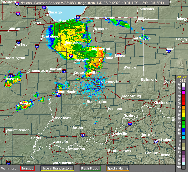
| 7/21/2020 3:10 PM EDT |
 The severe thunderstorm warning for eastern clinton, howard and western tipton counties will expire at 315 pm edt, the storms which prompted the warning have weakened below severe limits, and have exited the warned area. therefore, the warning will be allowed to expire. however gusty winds and heavy rain are still possible with these thunderstorms. a severe thunderstorm watch remains in effect until 500 pm edt for central and north central indiana. The severe thunderstorm warning for eastern clinton, howard and western tipton counties will expire at 315 pm edt, the storms which prompted the warning have weakened below severe limits, and have exited the warned area. therefore, the warning will be allowed to expire. however gusty winds and heavy rain are still possible with these thunderstorms. a severe thunderstorm watch remains in effect until 500 pm edt for central and north central indiana.
|
| 7/21/2020 2:52 PM EDT |
 At 251 pm edt, severe thunderstorms were located along a line extending from grissom afb to 11 miles east of frankfort, moving east at 45 mph (radar indicated). Hazards include 60 mph wind gusts. Expect damage to roofs, siding, and trees. Locations impacted include, kokomo, russiaville, kirklin, sharpsville, michigantown, kempton and indian heights. At 251 pm edt, severe thunderstorms were located along a line extending from grissom afb to 11 miles east of frankfort, moving east at 45 mph (radar indicated). Hazards include 60 mph wind gusts. Expect damage to roofs, siding, and trees. Locations impacted include, kokomo, russiaville, kirklin, sharpsville, michigantown, kempton and indian heights.
|
| 7/21/2020 2:38 PM EDT |
 At 238 pm edt, severe thunderstorms were located along a line extending from near walton to 6 miles southeast of frankfort, moving east at 40 mph (radar indicated). Hazards include 60 mph wind gusts. expect damage to roofs, siding, and trees At 238 pm edt, severe thunderstorms were located along a line extending from near walton to 6 miles southeast of frankfort, moving east at 40 mph (radar indicated). Hazards include 60 mph wind gusts. expect damage to roofs, siding, and trees
|
| 7/11/2020 4:25 PM EDT |
 The severe thunderstorm warning for southeastern clinton, northeastern boone, northern hamilton and southwestern tipton counties will expire at 430 pm edt, the storm which prompted the warning has weakened below severe limits, and no longer poses an immediate threat to life or property. therefore, the warning will be allowed to expire. The severe thunderstorm warning for southeastern clinton, northeastern boone, northern hamilton and southwestern tipton counties will expire at 430 pm edt, the storm which prompted the warning has weakened below severe limits, and no longer poses an immediate threat to life or property. therefore, the warning will be allowed to expire.
|
| 7/11/2020 4:13 PM EDT |
 At 413 pm edt, a severe thunderstorm was located 9 miles southeast of frankfort, moving southeast at 40 mph (radar indicated). Hazards include 60 mph wind gusts and penny size hail. Expect damage to roofs, siding, and trees. Locations impacted include, noblesville, westfield, cicero, sheridan, arcadia, kirklin, atlanta, kempton and morse reservoir. At 413 pm edt, a severe thunderstorm was located 9 miles southeast of frankfort, moving southeast at 40 mph (radar indicated). Hazards include 60 mph wind gusts and penny size hail. Expect damage to roofs, siding, and trees. Locations impacted include, noblesville, westfield, cicero, sheridan, arcadia, kirklin, atlanta, kempton and morse reservoir.
|
| 7/11/2020 4:01 PM EDT |
 At 401 pm edt, a severe thunderstorm was located near frankfort, moving southeast at 45 mph (radar indicated). Hazards include 60 mph wind gusts and penny size hail. expect damage to roofs, siding, and trees At 401 pm edt, a severe thunderstorm was located near frankfort, moving southeast at 45 mph (radar indicated). Hazards include 60 mph wind gusts and penny size hail. expect damage to roofs, siding, and trees
|
| 6/10/2020 1:30 PM EDT |
 At 129 pm edt, a severe thunderstorm was located 7 miles southwest of tipton, or 16 miles south of kokomo, moving northeast at 60 mph (radar indicated). Hazards include 60 mph wind gusts. Expect damage to roofs, siding, and trees. Locations impacted include, sheridan, sharpsville and kempton. At 129 pm edt, a severe thunderstorm was located 7 miles southwest of tipton, or 16 miles south of kokomo, moving northeast at 60 mph (radar indicated). Hazards include 60 mph wind gusts. Expect damage to roofs, siding, and trees. Locations impacted include, sheridan, sharpsville and kempton.
|
| 6/10/2020 1:23 PM EDT |
 At 122 pm edt, a severe thunderstorm was located 12 miles north of zionsville, or 16 miles southeast of frankfort, moving northeast at 70 mph (radar indicated). Hazards include 60 mph wind gusts. expect damage to roofs, siding, and trees At 122 pm edt, a severe thunderstorm was located 12 miles north of zionsville, or 16 miles southeast of frankfort, moving northeast at 70 mph (radar indicated). Hazards include 60 mph wind gusts. expect damage to roofs, siding, and trees
|
| 6/10/2020 12:54 PM EDT |
 At 1254 pm edt, a severe thunderstorm was located 10 miles west of tipton, or 12 miles southwest of kokomo, moving northeast at 60 mph (radar indicated). Hazards include 60 mph wind gusts. expect damage to roofs, siding, and trees At 1254 pm edt, a severe thunderstorm was located 10 miles west of tipton, or 12 miles southwest of kokomo, moving northeast at 60 mph (radar indicated). Hazards include 60 mph wind gusts. expect damage to roofs, siding, and trees
|
| 6/16/2019 2:57 AM EDT |
 The severe thunderstorm warning for clinton, boone, hamilton, southern tipton and eastern montgomery counties will expire at 300 am edt, the storm which prompted the warning has weakened below severe limits, and no longer poses an immediate threat to life or property. therefore, the warning will be allowed to expire. however gusty winds are still possible with this thunderstorm. The severe thunderstorm warning for clinton, boone, hamilton, southern tipton and eastern montgomery counties will expire at 300 am edt, the storm which prompted the warning has weakened below severe limits, and no longer poses an immediate threat to life or property. therefore, the warning will be allowed to expire. however gusty winds are still possible with this thunderstorm.
|
| 6/16/2019 2:37 AM EDT |
 At 237 am edt, a severe thunderstorm was located 9 miles west of lebanon, or 14 miles southwest of frankfort, moving east at 55 mph (radar indicated). Hazards include 60 mph wind gusts. expect damage to roofs, siding, and trees At 237 am edt, a severe thunderstorm was located 9 miles west of lebanon, or 14 miles southwest of frankfort, moving east at 55 mph (radar indicated). Hazards include 60 mph wind gusts. expect damage to roofs, siding, and trees
|
| 6/5/2019 2:06 PM EDT |
 At 205 pm edt, severe thunderstorms were located along a line extending from near otterbein to 12 miles north of frankfort, moving east at 60 mph (radar indicated). Hazards include 60 mph wind gusts and quarter size hail. Hail damage to vehicles is expected. Expect wind damage to roofs, siding, and trees. At 205 pm edt, severe thunderstorms were located along a line extending from near otterbein to 12 miles north of frankfort, moving east at 60 mph (radar indicated). Hazards include 60 mph wind gusts and quarter size hail. Hail damage to vehicles is expected. Expect wind damage to roofs, siding, and trees.
|
| 5/30/2019 6:53 PM EDT |
 The severe thunderstorm warning for southeastern clinton, northwestern hamilton and southwestern tipton counties will expire at 700 pm edt, the storm which prompted the warning has weakened below severe limits, and has exited the warned area. therefore, the warning will be allowed to expire. The severe thunderstorm warning for southeastern clinton, northwestern hamilton and southwestern tipton counties will expire at 700 pm edt, the storm which prompted the warning has weakened below severe limits, and has exited the warned area. therefore, the warning will be allowed to expire.
|
| 5/30/2019 6:39 PM EDT |
 At 639 pm edt, a severe thunderstorm was located 7 miles west of tipton, or 14 miles south of kokomo, moving east at 30 mph (radar indicated). Hazards include quarter size hail. Damage to vehicles is expected. Locations impacted include, tipton, sheridan and kempton. At 639 pm edt, a severe thunderstorm was located 7 miles west of tipton, or 14 miles south of kokomo, moving east at 30 mph (radar indicated). Hazards include quarter size hail. Damage to vehicles is expected. Locations impacted include, tipton, sheridan and kempton.
|
| 5/30/2019 6:18 PM EDT |
 The national weather service in indianapolis has issued a * severe thunderstorm warning for. eastern clinton county in central indiana. northwestern hamilton county in central indiana. southwestern tipton county in central indiana. Until 700 pm edt. The national weather service in indianapolis has issued a * severe thunderstorm warning for. eastern clinton county in central indiana. northwestern hamilton county in central indiana. southwestern tipton county in central indiana. Until 700 pm edt.
|
| 5/27/2019 9:27 PM EDT |
 The tornado warning for northeastern clinton and western tipton counties will expire at 930 pm edt, the storm which prompted the warning has moved out of the area. therefore, the warning will be allowed to expire. a tornado watch remains in effect until 1000 pm edt for central indiana. The tornado warning for northeastern clinton and western tipton counties will expire at 930 pm edt, the storm which prompted the warning has moved out of the area. therefore, the warning will be allowed to expire. a tornado watch remains in effect until 1000 pm edt for central indiana.
|
| 5/27/2019 9:14 PM EDT |
 At 914 pm edt, a severe thunderstorm was located 7 miles west of tipton, or 13 miles south of kokomo, moving east at 35 mph (radar indicated). Hazards include 60 mph wind gusts and quarter size hail. Hail damage to vehicles is expected. Expect wind damage to roofs, siding, and trees. At 914 pm edt, a severe thunderstorm was located 7 miles west of tipton, or 13 miles south of kokomo, moving east at 35 mph (radar indicated). Hazards include 60 mph wind gusts and quarter size hail. Hail damage to vehicles is expected. Expect wind damage to roofs, siding, and trees.
|
| 5/27/2019 9:02 PM EDT |
 At 902 pm edt, a severe thunderstorm capable of producing a tornado was located 7 miles northeast of frankfort, moving east at 30 mph (radar indicated rotation). Hazards include tornado. Flying debris will be dangerous to those caught without shelter. mobile homes will be damaged or destroyed. damage to roofs, windows, and vehicles will occur. tree damage is likely. this dangerous storm will be near, kempton around 920 pm edt. Tipton and sharpsville around 930 pm edt. At 902 pm edt, a severe thunderstorm capable of producing a tornado was located 7 miles northeast of frankfort, moving east at 30 mph (radar indicated rotation). Hazards include tornado. Flying debris will be dangerous to those caught without shelter. mobile homes will be damaged or destroyed. damage to roofs, windows, and vehicles will occur. tree damage is likely. this dangerous storm will be near, kempton around 920 pm edt. Tipton and sharpsville around 930 pm edt.
|
| 5/26/2019 4:28 AM EDT |
 At 428 am edt, severe thunderstorms were located along a line extending from 7 miles south of walton to 11 miles west of tipton to 9 miles north of greencastle, moving east at 45 mph (radar indicated). Hazards include 60 mph wind gusts and nickel size hail. Expect damage to roofs, siding, and trees. locations impacted include, kokomo, frankfort, brownsburg, lebanon, zionsville, danville, tipton, windfall, westfield, pittsboro, whitestown, sheridan, greentown, flora, rossville, thorntown, russiaville, ladoga, jamestown and roachdale. this includes the following highways, interstate 65 between mile markers 128 and 155. Interstate 74 between mile markers 41 and 67. At 428 am edt, severe thunderstorms were located along a line extending from 7 miles south of walton to 11 miles west of tipton to 9 miles north of greencastle, moving east at 45 mph (radar indicated). Hazards include 60 mph wind gusts and nickel size hail. Expect damage to roofs, siding, and trees. locations impacted include, kokomo, frankfort, brownsburg, lebanon, zionsville, danville, tipton, windfall, westfield, pittsboro, whitestown, sheridan, greentown, flora, rossville, thorntown, russiaville, ladoga, jamestown and roachdale. this includes the following highways, interstate 65 between mile markers 128 and 155. Interstate 74 between mile markers 41 and 67.
|
| 5/26/2019 4:09 AM EDT |
 At 406 am edt, severe thunderstorms were located along a line extending from 8 miles southeast of delphi to near frankfort to 8 miles east of rockville, moving east at 45 mph (radar indicated). Hazards include 60 mph wind gusts and nickel size hail. expect damage to roofs, siding, and trees At 406 am edt, severe thunderstorms were located along a line extending from 8 miles southeast of delphi to near frankfort to 8 miles east of rockville, moving east at 45 mph (radar indicated). Hazards include 60 mph wind gusts and nickel size hail. expect damage to roofs, siding, and trees
|
| 5/23/2019 5:12 AM EDT |
 The severe thunderstorm warning for southeastern clinton, central howard, eastern boone, northwestern hamilton and tipton counties will expire at 515 am edt, the storms which prompted the warning have moved out of the area. therefore, the warning will be allowed to expire. however gusty winds and heavy rain are still possible with these thunderstorms. a severe thunderstorm watch remains in effect until 1000 am edt for central indiana. to report severe weather, contact your nearest law enforcement agency. they will relay your report to the national weather service indianapolis. The severe thunderstorm warning for southeastern clinton, central howard, eastern boone, northwestern hamilton and tipton counties will expire at 515 am edt, the storms which prompted the warning have moved out of the area. therefore, the warning will be allowed to expire. however gusty winds and heavy rain are still possible with these thunderstorms. a severe thunderstorm watch remains in effect until 1000 am edt for central indiana. to report severe weather, contact your nearest law enforcement agency. they will relay your report to the national weather service indianapolis.
|
| 5/23/2019 5:05 AM EDT |
 At 504 am edt, severe thunderstorms were located along a line extending from 7 miles east of kokomo to near brownsburg, moving east at 50 mph (radar indicated). Hazards include 60 mph wind gusts and penny size hail. Expect damage to roofs, siding, and trees. locations impacted include, kokomo, zionsville, tipton, windfall, whitestown, sheridan, sharpsville, kempton and indian heights. This includes interstate 65 between mile markers 128 and 137. At 504 am edt, severe thunderstorms were located along a line extending from 7 miles east of kokomo to near brownsburg, moving east at 50 mph (radar indicated). Hazards include 60 mph wind gusts and penny size hail. Expect damage to roofs, siding, and trees. locations impacted include, kokomo, zionsville, tipton, windfall, whitestown, sheridan, sharpsville, kempton and indian heights. This includes interstate 65 between mile markers 128 and 137.
|
| 5/23/2019 4:42 AM EDT |
 At 441 am edt, severe thunderstorms were located along a line extending from near grissom afb to 11 miles southwest of kokomo to 10 miles southwest of lebanon, moving northeast at 60 mph (radar indicated). Hazards include 70 mph wind gusts and penny size hail. Expect considerable tree damage. damage is likely to mobile homes, roofs, and outbuildings. locations impacted include, kokomo, frankfort, lebanon, zionsville, tipton, windfall, whitestown, sheridan, greentown, thorntown, russiaville, ladoga, jamestown, kirklin, colfax, sharpsville, burlington, advance, michigantown and new ross. this includes the following highways, interstate 65 between mile markers 128 and 158. Interstate 74 between mile markers 40 and 54. At 441 am edt, severe thunderstorms were located along a line extending from near grissom afb to 11 miles southwest of kokomo to 10 miles southwest of lebanon, moving northeast at 60 mph (radar indicated). Hazards include 70 mph wind gusts and penny size hail. Expect considerable tree damage. damage is likely to mobile homes, roofs, and outbuildings. locations impacted include, kokomo, frankfort, lebanon, zionsville, tipton, windfall, whitestown, sheridan, greentown, thorntown, russiaville, ladoga, jamestown, kirklin, colfax, sharpsville, burlington, advance, michigantown and new ross. this includes the following highways, interstate 65 between mile markers 128 and 158. Interstate 74 between mile markers 40 and 54.
|
| 5/23/2019 4:13 AM EDT |
 The national weather service in indianapolis has issued a * severe thunderstorm warning for. carroll county in north central indiana. southeastern tippecanoe county in west central indiana. clinton county in central indiana. Howard county in central indiana. The national weather service in indianapolis has issued a * severe thunderstorm warning for. carroll county in north central indiana. southeastern tippecanoe county in west central indiana. clinton county in central indiana. Howard county in central indiana.
|
| 5/19/2019 5:53 PM EDT |
 At 552 pm edt, severe thunderstorms were located along a line extending from 11 miles northeast of frankfort to 9 miles northwest of tipton, moving east at 45 mph. this storm has weak rotation in southwest howard county (radar indicated). Hazards include 60 mph wind gusts and quarter size hail. Hail damage to vehicles is expected. Expect wind damage to roofs, siding, and trees. At 552 pm edt, severe thunderstorms were located along a line extending from 11 miles northeast of frankfort to 9 miles northwest of tipton, moving east at 45 mph. this storm has weak rotation in southwest howard county (radar indicated). Hazards include 60 mph wind gusts and quarter size hail. Hail damage to vehicles is expected. Expect wind damage to roofs, siding, and trees.
|
| 5/19/2019 5:53 PM EDT |
 The severe thunderstorm warning for southeastern clinton, central boone, northwestern hamilton and western tipton counties will expire at 600 pm edt, the storms which prompted the warning have moved out of the area. therefore, the warning will be allowed to expire. however gusty winds are still possible with these thunderstorms. a severe thunderstorm watch remains in effect until 1000 pm edt for central indiana. The severe thunderstorm warning for southeastern clinton, central boone, northwestern hamilton and western tipton counties will expire at 600 pm edt, the storms which prompted the warning have moved out of the area. therefore, the warning will be allowed to expire. however gusty winds are still possible with these thunderstorms. a severe thunderstorm watch remains in effect until 1000 pm edt for central indiana.
|
| 5/19/2019 5:42 PM EDT |
 At 542 pm edt, severe thunderstorms were located along a line extending from 8 miles east of frankfort to 7 miles southwest of lebanon, moving east at 45 mph. this storm has a history of causing tree damage and producing 60 mph winds (public). Hazards include 60 mph wind gusts and quarter size hail. Hail damage to vehicles is expected. expect wind damage to roofs, siding, and trees. locations impacted include, lebanon, whitestown, sheridan, kirklin, sharpsville, kempton and ulen. This includes interstate 65 between mile markers 135 and 149. At 542 pm edt, severe thunderstorms were located along a line extending from 8 miles east of frankfort to 7 miles southwest of lebanon, moving east at 45 mph. this storm has a history of causing tree damage and producing 60 mph winds (public). Hazards include 60 mph wind gusts and quarter size hail. Hail damage to vehicles is expected. expect wind damage to roofs, siding, and trees. locations impacted include, lebanon, whitestown, sheridan, kirklin, sharpsville, kempton and ulen. This includes interstate 65 between mile markers 135 and 149.
|
| 5/19/2019 5:30 PM EDT |
 At 529 pm edt, severe thunderstorms were located along a line extending from near frankfort to 11 miles southeast of crawfordsville, moving east at 45 mph. this storm has a history of producing 60 mph winds (public). Hazards include 60 mph wind gusts and quarter size hail. Hail damage to vehicles is expected. expect wind damage to roofs, siding, and trees. locations impacted include, frankfort, lebanon, whitestown, sheridan, thorntown, ladoga, jamestown, kirklin, colfax, sharpsville, advance, michigantown, new ross, kempton and ulen. this includes the following highways, interstate 65 between mile markers 130 and 159. Interstate 74 between mile markers 42 and 54. At 529 pm edt, severe thunderstorms were located along a line extending from near frankfort to 11 miles southeast of crawfordsville, moving east at 45 mph. this storm has a history of producing 60 mph winds (public). Hazards include 60 mph wind gusts and quarter size hail. Hail damage to vehicles is expected. expect wind damage to roofs, siding, and trees. locations impacted include, frankfort, lebanon, whitestown, sheridan, thorntown, ladoga, jamestown, kirklin, colfax, sharpsville, advance, michigantown, new ross, kempton and ulen. this includes the following highways, interstate 65 between mile markers 130 and 159. Interstate 74 between mile markers 42 and 54.
|
| 5/19/2019 5:11 PM EDT |
 At 511 pm edt, severe thunderstorms were located along a line extending from 15 miles southwest of frankfort to 10 miles south of crawfordsville, moving east at 45 mph (public). Hazards include 60 mph wind gusts and quarter size hail. Hail damage to vehicles is expected. Expect wind damage to roofs, siding, and trees. At 511 pm edt, severe thunderstorms were located along a line extending from 15 miles southwest of frankfort to 10 miles south of crawfordsville, moving east at 45 mph (public). Hazards include 60 mph wind gusts and quarter size hail. Hail damage to vehicles is expected. Expect wind damage to roofs, siding, and trees.
|
| 9/25/2018 11:28 AM EDT |
 At 1128 am edt, a severe thunderstorm was located 10 miles northeast of lebanon, or 10 miles southeast of frankfort, moving east at 35 mph (radar indicated). Hazards include 60 mph wind gusts. Expect damage to roofs, siding, and trees. Locations impacted include, frankfort, noblesville, lebanon, westfield, sheridan, kirklin, kempton and ulen. At 1128 am edt, a severe thunderstorm was located 10 miles northeast of lebanon, or 10 miles southeast of frankfort, moving east at 35 mph (radar indicated). Hazards include 60 mph wind gusts. Expect damage to roofs, siding, and trees. Locations impacted include, frankfort, noblesville, lebanon, westfield, sheridan, kirklin, kempton and ulen.
|
| 9/25/2018 11:13 AM EDT |
 At 1112 am edt, a severe thunderstorm was located 7 miles northwest of lebanon, or 9 miles south of frankfort, moving east at 25 mph (radar indicated). Hazards include 60 mph wind gusts. expect damage to roofs, siding, and trees At 1112 am edt, a severe thunderstorm was located 7 miles northwest of lebanon, or 9 miles south of frankfort, moving east at 25 mph (radar indicated). Hazards include 60 mph wind gusts. expect damage to roofs, siding, and trees
|
| 11/18/2017 12:27 PM EST |
 At 1227 pm est, a severe thunderstorm was located near tipton, or 19 miles south of kokomo, moving east at 45 mph (radar indicated). Hazards include 70 mph wind gusts. Expect considerable tree damage. damage is likely to mobile homes, roofs, and outbuildings. Locations impacted include, tipton, windfall, cicero, arcadia, atlanta and kempton. At 1227 pm est, a severe thunderstorm was located near tipton, or 19 miles south of kokomo, moving east at 45 mph (radar indicated). Hazards include 70 mph wind gusts. Expect considerable tree damage. damage is likely to mobile homes, roofs, and outbuildings. Locations impacted include, tipton, windfall, cicero, arcadia, atlanta and kempton.
|
| 11/18/2017 12:13 PM EST |
 The national weather service in indianapolis has issued a * severe thunderstorm warning for. northern hamilton county in central indiana. tipton county in central indiana. until 1245 pm est. At 1213 pm est, a severe thunderstorm was located 10 miles west of. The national weather service in indianapolis has issued a * severe thunderstorm warning for. northern hamilton county in central indiana. tipton county in central indiana. until 1245 pm est. At 1213 pm est, a severe thunderstorm was located 10 miles west of.
|
| 9/4/2017 7:57 PM EDT |
 The severe thunderstorm warning for eastern clinton, western howard and northwestern tipton counties will expire at 800 pm edt, the storm which prompted the warning has weakened below severe limits, and no longer poses an immediate threat to life or property. therefore the warning will be allowed to expire. however gusty winds are still possible with this thunderstorm. a severe thunderstorm watch remains in effect until 1100 pm edt for central and north central indiana. The severe thunderstorm warning for eastern clinton, western howard and northwestern tipton counties will expire at 800 pm edt, the storm which prompted the warning has weakened below severe limits, and no longer poses an immediate threat to life or property. therefore the warning will be allowed to expire. however gusty winds are still possible with this thunderstorm. a severe thunderstorm watch remains in effect until 1100 pm edt for central and north central indiana.
|
| 9/4/2017 7:38 PM EDT |
 At 737 pm edt, a severe thunderstorm was located 11 miles southwest of kokomo, moving southeast at 30 mph (radar indicated). Hazards include 60 mph wind gusts and quarter size hail. Hail damage to vehicles is expected. expect wind damage to roofs, siding, and trees. Locations impacted include, kokomo, russiaville, michigantown, kempton and indian heights. At 737 pm edt, a severe thunderstorm was located 11 miles southwest of kokomo, moving southeast at 30 mph (radar indicated). Hazards include 60 mph wind gusts and quarter size hail. Hail damage to vehicles is expected. expect wind damage to roofs, siding, and trees. Locations impacted include, kokomo, russiaville, michigantown, kempton and indian heights.
|
| 9/4/2017 7:18 PM EDT |
 The national weather service in indianapolis has issued a * severe thunderstorm warning for. southeastern carroll county in north central indiana. northeastern clinton county in central indiana. western howard county in central indiana. Western tipton county in central indiana. The national weather service in indianapolis has issued a * severe thunderstorm warning for. southeastern carroll county in north central indiana. northeastern clinton county in central indiana. western howard county in central indiana. Western tipton county in central indiana.
|
| 7/12/2017 4:34 PM EDT |
 At 434 pm edt, a severe thunderstorm was located 13 miles northeast of lebanon, or 13 miles southeast of frankfort, moving southeast at 30 mph (radar indicated). Hazards include 60 mph wind gusts. Expect damage to roofs, siding, and trees. locations impacted include, frankfort, thorntown, darlington, kirklin, colfax, michigantown and kempton. this includes the following highways, interstate 65 between mile markers 143 and 158. Interstate 74 near mile marker 47. At 434 pm edt, a severe thunderstorm was located 13 miles northeast of lebanon, or 13 miles southeast of frankfort, moving southeast at 30 mph (radar indicated). Hazards include 60 mph wind gusts. Expect damage to roofs, siding, and trees. locations impacted include, frankfort, thorntown, darlington, kirklin, colfax, michigantown and kempton. this includes the following highways, interstate 65 between mile markers 143 and 158. Interstate 74 near mile marker 47.
|
| 7/12/2017 4:19 PM EDT |
 At 419 pm edt, a severe thunderstorm was located 7 miles east of frankfort, moving southeast at 40 mph (radar indicated). Hazards include 60 mph wind gusts. expect damage to roofs, siding, and trees At 419 pm edt, a severe thunderstorm was located 7 miles east of frankfort, moving southeast at 40 mph (radar indicated). Hazards include 60 mph wind gusts. expect damage to roofs, siding, and trees
|
| 7/7/2017 4:10 PM EDT |
 At 410 pm edt, severe thunderstorms were located along a line extending from near windfall to 6 miles north of noblesville to 10 miles north of zionsville, moving southeast at 50 mph (radar indicated). Hazards include 60 mph wind gusts and quarter size hail. Hail damage to vehicles is expected. expect wind damage to roofs, siding, and trees. locations impacted include, carmel, fishers, noblesville, elwood, alexandria, tipton, windfall, westfield, cicero, sheridan, lapel, frankton, arcadia, kirklin, atlanta, orestes, kempton and morse reservoir. This includes interstate 65 between mile markers 148 and 153. At 410 pm edt, severe thunderstorms were located along a line extending from near windfall to 6 miles north of noblesville to 10 miles north of zionsville, moving southeast at 50 mph (radar indicated). Hazards include 60 mph wind gusts and quarter size hail. Hail damage to vehicles is expected. expect wind damage to roofs, siding, and trees. locations impacted include, carmel, fishers, noblesville, elwood, alexandria, tipton, windfall, westfield, cicero, sheridan, lapel, frankton, arcadia, kirklin, atlanta, orestes, kempton and morse reservoir. This includes interstate 65 between mile markers 148 and 153.
|
| 7/7/2017 3:59 PM EDT |
 The national weather service in indianapolis has issued a * severe thunderstorm warning for. northern madison county in central indiana. southern clinton county in central indiana. southeastern howard county in central indiana. Northeastern boone county in central indiana. The national weather service in indianapolis has issued a * severe thunderstorm warning for. northern madison county in central indiana. southern clinton county in central indiana. southeastern howard county in central indiana. Northeastern boone county in central indiana.
|
| 7/7/2017 3:50 PM EDT |
 At 331 pm edt, a severe thunderstorm was located near tipton, or 17 miles south of kokomo, moving southeast at 40 mph (radar indicated). Hazards include 60 mph wind gusts and quarter size hail. Hail damage to vehicles is expected. expect wind damage to roofs, siding, and trees. Locations impacted include, noblesville, tipton, windfall, cicero, sheridan, arcadia, russiaville, atlanta, sharpsville, kempton and morse reservoir. At 331 pm edt, a severe thunderstorm was located near tipton, or 17 miles south of kokomo, moving southeast at 40 mph (radar indicated). Hazards include 60 mph wind gusts and quarter size hail. Hail damage to vehicles is expected. expect wind damage to roofs, siding, and trees. Locations impacted include, noblesville, tipton, windfall, cicero, sheridan, arcadia, russiaville, atlanta, sharpsville, kempton and morse reservoir.
|
| 7/7/2017 3:31 PM EDT |
 At 331 pm edt, a severe thunderstorm was located near tipton, or 17 miles south of kokomo, moving southeast at 40 mph (radar indicated). Hazards include 60 mph wind gusts and quarter size hail. Hail damage to vehicles is expected. expect wind damage to roofs, siding, and trees. Locations impacted include, noblesville, tipton, windfall, cicero, sheridan, arcadia, russiaville, atlanta, sharpsville, kempton and morse reservoir. At 331 pm edt, a severe thunderstorm was located near tipton, or 17 miles south of kokomo, moving southeast at 40 mph (radar indicated). Hazards include 60 mph wind gusts and quarter size hail. Hail damage to vehicles is expected. expect wind damage to roofs, siding, and trees. Locations impacted include, noblesville, tipton, windfall, cicero, sheridan, arcadia, russiaville, atlanta, sharpsville, kempton and morse reservoir.
|
| 7/7/2017 3:10 PM EDT |
 At 309 pm edt, a severe thunderstorm was located 8 miles east of frankfort, moving southeast at 40 mph (radar indicated). Hazards include ping pong ball size hail and 60 mph wind gusts. People and animals outdoors will be injured. expect hail damage to roofs, siding, windows, and vehicles. Expect wind damage to roofs, siding, and trees. At 309 pm edt, a severe thunderstorm was located 8 miles east of frankfort, moving southeast at 40 mph (radar indicated). Hazards include ping pong ball size hail and 60 mph wind gusts. People and animals outdoors will be injured. expect hail damage to roofs, siding, windows, and vehicles. Expect wind damage to roofs, siding, and trees.
|
| 6/18/2017 1:10 AM EDT |
 The severe thunderstorm warning for southeastern clinton, northern boone, northwestern hamilton and western tipton counties will expire at 115 am edt, the storms which prompted the warning have weakened below severe limits, and no longer pose an immediate threat to life or property. therefore the warning will be allowed to expire. however gusty winds are still possible with these thunderstorms. a severe thunderstorm watch remains in effect until 700 am edt for central and west central indiana. The severe thunderstorm warning for southeastern clinton, northern boone, northwestern hamilton and western tipton counties will expire at 115 am edt, the storms which prompted the warning have weakened below severe limits, and no longer pose an immediate threat to life or property. therefore the warning will be allowed to expire. however gusty winds are still possible with these thunderstorms. a severe thunderstorm watch remains in effect until 700 am edt for central and west central indiana.
|
| 6/18/2017 1:01 AM EDT |
 At 100 am edt, severe thunderstorms were located along a line extending from 9 miles southwest of kokomo to 11 miles southeast of frankfort to near lebanon, moving east at 50 mph (radar indicated). Hazards include 60 mph wind gusts. Expect damage to roofs, siding, and trees. locations impacted include, frankfort, noblesville, tipton, westfield, cicero, sheridan, arcadia, thorntown, kirklin, atlanta, colfax, michigantown, kempton and morse reservoir. This includes interstate 65 between mile markers 145 and 154. At 100 am edt, severe thunderstorms were located along a line extending from 9 miles southwest of kokomo to 11 miles southeast of frankfort to near lebanon, moving east at 50 mph (radar indicated). Hazards include 60 mph wind gusts. Expect damage to roofs, siding, and trees. locations impacted include, frankfort, noblesville, tipton, westfield, cicero, sheridan, arcadia, thorntown, kirklin, atlanta, colfax, michigantown, kempton and morse reservoir. This includes interstate 65 between mile markers 145 and 154.
|
| 6/18/2017 12:42 AM EDT |
 At 1241 am edt, severe thunderstorms were located along a line extending from 15 miles southeast of delphi to 6 miles west of frankfort to 10 miles northeast of crawfordsville, moving east at 60 mph (radar indicated). Hazards include 60 mph wind gusts. expect damage to roofs, siding, and trees At 1241 am edt, severe thunderstorms were located along a line extending from 15 miles southeast of delphi to 6 miles west of frankfort to 10 miles northeast of crawfordsville, moving east at 60 mph (radar indicated). Hazards include 60 mph wind gusts. expect damage to roofs, siding, and trees
|
| 5/26/2017 8:34 PM EDT |
 At 834 pm edt, a severe thunderstorm was located 8 miles southeast of frankfort, moving east at 50 mph (trained weather spotters). Hazards include 70 mph wind gusts. Expect considerable tree damage. damage is likely to mobile homes, roofs, and outbuildings. locations impacted include, brownsburg, lebanon, pittsboro, whitestown, jamestown, kirklin, lizton, advance, kempton and ulen. this includes the following highways, interstate 65 between mile markers 128 and 148. interstate 74 between mile markers 50 and 64. A tornado watch remains in effect until 900 pm edt for central indiana. At 834 pm edt, a severe thunderstorm was located 8 miles southeast of frankfort, moving east at 50 mph (trained weather spotters). Hazards include 70 mph wind gusts. Expect considerable tree damage. damage is likely to mobile homes, roofs, and outbuildings. locations impacted include, brownsburg, lebanon, pittsboro, whitestown, jamestown, kirklin, lizton, advance, kempton and ulen. this includes the following highways, interstate 65 between mile markers 128 and 148. interstate 74 between mile markers 50 and 64. A tornado watch remains in effect until 900 pm edt for central indiana.
|
| 5/26/2017 8:20 PM EDT |
 At 817 pm edt, a severe thunderstorm was located 10 miles southwest of frankfort, moving east at 50 mph (trained weather spotters reported 70 mph winds 4 miles east and northeast of waynetown at 808 pm edt). Hazards include 70 mph wind gusts. Expect considerable tree damage. damage is likely to mobile homes, roofs, and outbuildings. locations impacted include, frankfort, brownsburg, lebanon, pittsboro, whitestown, thorntown, ladoga, jamestown, kirklin, colfax, new market, lizton, advance, new ross, kempton and ulen. this includes the following highways, interstate 65 between mile markers 128 and 160. interstate 74 between mile markers 39 and 64. A tornado watch remains in effect until 900 pm edt for central and west central indiana. At 817 pm edt, a severe thunderstorm was located 10 miles southwest of frankfort, moving east at 50 mph (trained weather spotters reported 70 mph winds 4 miles east and northeast of waynetown at 808 pm edt). Hazards include 70 mph wind gusts. Expect considerable tree damage. damage is likely to mobile homes, roofs, and outbuildings. locations impacted include, frankfort, brownsburg, lebanon, pittsboro, whitestown, thorntown, ladoga, jamestown, kirklin, colfax, new market, lizton, advance, new ross, kempton and ulen. this includes the following highways, interstate 65 between mile markers 128 and 160. interstate 74 between mile markers 39 and 64. A tornado watch remains in effect until 900 pm edt for central and west central indiana.
|
| 5/26/2017 8:06 PM EDT |
 At 805 pm edt, a severe thunderstorm was located 9 miles north of crawfordsville, moving east at 50 mph (radar indicated). Hazards include 60 mph wind gusts. expect damage to roofs, siding, and trees At 805 pm edt, a severe thunderstorm was located 9 miles north of crawfordsville, moving east at 50 mph (radar indicated). Hazards include 60 mph wind gusts. expect damage to roofs, siding, and trees
|
| 4/26/2017 7:36 PM EDT | Half Dollar sized hail reported 0.1 miles S of Kempton, IN |
| 4/26/2017 7:36 PM EDT | Wind estimated at 50-60 mp in tipton county IN, 0.1 miles S of Kempton, IN |
| 4/26/2017 7:35 PM EDT |
 At 734 pm edt, a severe thunderstorm was located 12 miles east of frankfort, moving northeast at 45 mph (trained weather spotters). Hazards include golf ball size hail and 70 mph wind gusts. People and animals outdoors will be injured. expect hail damage to roofs, siding, windows, and vehicles. expect considerable tree damage. wind damage is also likely to mobile homes, roofs, and outbuildings. Locations impacted include, kokomo, russiaville, sharpsville, michigantown, kempton and indian heights. At 734 pm edt, a severe thunderstorm was located 12 miles east of frankfort, moving northeast at 45 mph (trained weather spotters). Hazards include golf ball size hail and 70 mph wind gusts. People and animals outdoors will be injured. expect hail damage to roofs, siding, windows, and vehicles. expect considerable tree damage. wind damage is also likely to mobile homes, roofs, and outbuildings. Locations impacted include, kokomo, russiaville, sharpsville, michigantown, kempton and indian heights.
|
| 4/26/2017 7:18 PM EDT |
 At 718 pm edt, a severe thunderstorm was located 7 miles southeast of frankfort, moving northeast at 45 mph (trained weather spotters). Hazards include golf ball size hail and 70 mph wind gusts. People and animals outdoors will be injured. expect hail damage to roofs, siding, windows, and vehicles. expect considerable tree damage. Wind damage is also likely to mobile homes, roofs, and outbuildings. At 718 pm edt, a severe thunderstorm was located 7 miles southeast of frankfort, moving northeast at 45 mph (trained weather spotters). Hazards include golf ball size hail and 70 mph wind gusts. People and animals outdoors will be injured. expect hail damage to roofs, siding, windows, and vehicles. expect considerable tree damage. Wind damage is also likely to mobile homes, roofs, and outbuildings.
|
| 7/13/2016 4:08 PM EDT |
 At 408 pm edt, a severe thunderstorm was located 9 miles southwest of tipton, or 19 miles east of frankfort, moving east at 30 mph (radar indicated). Hazards include 60 mph wind gusts and quarter size hail. Hail damage to vehicles is expected. Expect wind damage to roofs, siding, and trees. At 408 pm edt, a severe thunderstorm was located 9 miles southwest of tipton, or 19 miles east of frankfort, moving east at 30 mph (radar indicated). Hazards include 60 mph wind gusts and quarter size hail. Hail damage to vehicles is expected. Expect wind damage to roofs, siding, and trees.
|
| 7/13/2016 3:54 PM EDT |
 At 354 pm edt, a severe thunderstorm was located 9 miles northeast of lebanon, or 12 miles southeast of frankfort, moving northeast at 20 mph (radar indicated). Hazards include 60 mph wind gusts and quarter size hail. Hail damage to vehicles is expected. expect wind damage to roofs, siding, and trees. Locations impacted include, cicero, sheridan, kirklin, kempton and morse reservoir. At 354 pm edt, a severe thunderstorm was located 9 miles northeast of lebanon, or 12 miles southeast of frankfort, moving northeast at 20 mph (radar indicated). Hazards include 60 mph wind gusts and quarter size hail. Hail damage to vehicles is expected. expect wind damage to roofs, siding, and trees. Locations impacted include, cicero, sheridan, kirklin, kempton and morse reservoir.
|
| 7/13/2016 3:38 PM EDT |
 At 338 pm edt, a severe thunderstorm was located near lebanon, or 12 miles south of frankfort, moving northeast at 30 mph (radar indicated). Hazards include 60 mph wind gusts and quarter size hail. Hail damage to vehicles is expected. Expect wind damage to roofs, siding, and trees. At 338 pm edt, a severe thunderstorm was located near lebanon, or 12 miles south of frankfort, moving northeast at 30 mph (radar indicated). Hazards include 60 mph wind gusts and quarter size hail. Hail damage to vehicles is expected. Expect wind damage to roofs, siding, and trees.
|
| 6/23/2016 1:09 AM EDT |
 At 109 am edt, a severe thunderstorm was located 9 miles northeast of noblesville, or 13 miles west of anderson, moving southeast at 55 mph. this is a very dangerous storm (trained weather spotters). Hazards include 90 mph wind gusts and quarter size hail. You are in a life-threatening situation. flying debris may be deadly to those caught without shelter. mobile homes will be heavily damaged or destroyed. homes and businesses will have substantial roof and window damage. expect extensive tree damage and power outages. locations impacted include, fishers, noblesville, tipton, cicero, arcadia, russiaville, atlanta, michigantown, kempton and morse reservoir. this includes interstate 69 between mile markers 210 and 213. A tornado watch remains in effect until 500 am edt for central indiana. At 109 am edt, a severe thunderstorm was located 9 miles northeast of noblesville, or 13 miles west of anderson, moving southeast at 55 mph. this is a very dangerous storm (trained weather spotters). Hazards include 90 mph wind gusts and quarter size hail. You are in a life-threatening situation. flying debris may be deadly to those caught without shelter. mobile homes will be heavily damaged or destroyed. homes and businesses will have substantial roof and window damage. expect extensive tree damage and power outages. locations impacted include, fishers, noblesville, tipton, cicero, arcadia, russiaville, atlanta, michigantown, kempton and morse reservoir. this includes interstate 69 between mile markers 210 and 213. A tornado watch remains in effect until 500 am edt for central indiana.
|
| 6/23/2016 1:07 AM EDT |
 At 107 am edt, a severe thunderstorm was located near noblesville, or 20 miles north of indianapolis, moving southeast at 50 mph. this is a very dangerous storm (trained weather spotters). Hazards include 90 mph wind gusts and quarter size hail. You are in a life-threatening situation. flying debris may be deadly to those caught without shelter. mobile homes will be heavily damaged or destroyed. homes and businesses will have substantial roof and window damage. expect extensive tree damage and power outages. locations impacted include, frankfort, carmel, fishers, noblesville, lebanon, zionsville, westfield, cicero, whitestown, sheridan, kirklin, michigantown, kempton, ulen and morse reservoir. this includes the following highways, interstate 65 between mile markers 129 and 158. interstate 69 between mile markers 204 and 211. A tornado watch remains in effect until 500 am edt for central indiana. At 107 am edt, a severe thunderstorm was located near noblesville, or 20 miles north of indianapolis, moving southeast at 50 mph. this is a very dangerous storm (trained weather spotters). Hazards include 90 mph wind gusts and quarter size hail. You are in a life-threatening situation. flying debris may be deadly to those caught without shelter. mobile homes will be heavily damaged or destroyed. homes and businesses will have substantial roof and window damage. expect extensive tree damage and power outages. locations impacted include, frankfort, carmel, fishers, noblesville, lebanon, zionsville, westfield, cicero, whitestown, sheridan, kirklin, michigantown, kempton, ulen and morse reservoir. this includes the following highways, interstate 65 between mile markers 129 and 158. interstate 69 between mile markers 204 and 211. A tornado watch remains in effect until 500 am edt for central indiana.
|
| 6/23/2016 12:58 AM EDT |
 At 1258 am edt, a severe thunderstorm was located near tipton, or 16 miles south of kokomo, moving southeast at 60 mph. this is a very dangerous storm (trained weather spotters). Hazards include 90 mph wind gusts and quarter size hail. You are in a life-threatening situation. flying debris may be deadly to those caught without shelter. mobile homes will be heavily damaged or destroyed. homes and businesses will have substantial roof and window damage. expect extensive tree damage and power outages. locations impacted include, fishers, noblesville, tipton, cicero, arcadia, russiaville, atlanta, michigantown, kempton and morse reservoir. this includes interstate 69 between mile markers 210 and 213. A tornado watch remains in effect until 500 am edt for central indiana. At 1258 am edt, a severe thunderstorm was located near tipton, or 16 miles south of kokomo, moving southeast at 60 mph. this is a very dangerous storm (trained weather spotters). Hazards include 90 mph wind gusts and quarter size hail. You are in a life-threatening situation. flying debris may be deadly to those caught without shelter. mobile homes will be heavily damaged or destroyed. homes and businesses will have substantial roof and window damage. expect extensive tree damage and power outages. locations impacted include, fishers, noblesville, tipton, cicero, arcadia, russiaville, atlanta, michigantown, kempton and morse reservoir. this includes interstate 69 between mile markers 210 and 213. A tornado watch remains in effect until 500 am edt for central indiana.
|
| 6/23/2016 12:55 AM EDT |
 At 1254 am edt, a severe thunderstorm was located 12 miles northwest of noblesville, or 16 miles southeast of frankfort, moving southeast at 55 mph. this is a very dangerous storm (trained weather spotters). Hazards include 90 mph wind gusts and quarter size hail. You are in a life-threatening situation. flying debris may be deadly to those caught without shelter. mobile homes will be heavily damaged or destroyed. homes and businesses will have substantial roof and window damage. expect extensive tree damage and power outages. locations impacted include, frankfort, carmel, fishers, noblesville, lebanon, zionsville, westfield, cicero, whitestown, sheridan, kirklin, michigantown, kempton, ulen and morse reservoir. this includes the following highways, interstate 65 between mile markers 129 and 158. interstate 69 between mile markers 204 and 211. A tornado watch remains in effect until 500 am edt for central indiana. At 1254 am edt, a severe thunderstorm was located 12 miles northwest of noblesville, or 16 miles southeast of frankfort, moving southeast at 55 mph. this is a very dangerous storm (trained weather spotters). Hazards include 90 mph wind gusts and quarter size hail. You are in a life-threatening situation. flying debris may be deadly to those caught without shelter. mobile homes will be heavily damaged or destroyed. homes and businesses will have substantial roof and window damage. expect extensive tree damage and power outages. locations impacted include, frankfort, carmel, fishers, noblesville, lebanon, zionsville, westfield, cicero, whitestown, sheridan, kirklin, michigantown, kempton, ulen and morse reservoir. this includes the following highways, interstate 65 between mile markers 129 and 158. interstate 69 between mile markers 204 and 211. A tornado watch remains in effect until 500 am edt for central indiana.
|
| 6/23/2016 12:53 AM EDT |
 At 1252 am edt, a severe thunderstorm was located 12 miles southwest of tipton, or 17 miles southeast of frankfort, moving southeast at 65 mph. this is a very dangerous storm (radar indicated). Hazards include 90 mph wind gusts and quarter size hail. You are in a life-threatening situation. flying debris may be deadly to those caught without shelter. mobile homes will be heavily damaged or destroyed. homes and businesses will have substantial roof and window damage. expect extensive tree damage and power outages. locations impacted include, frankfort, kirklin, colfax, burlington, michigantown and kempton. this includes interstate 65 between mile markers 151 and 156. A tornado watch remains in effect until 500 am edt for north central and central indiana. At 1252 am edt, a severe thunderstorm was located 12 miles southwest of tipton, or 17 miles southeast of frankfort, moving southeast at 65 mph. this is a very dangerous storm (radar indicated). Hazards include 90 mph wind gusts and quarter size hail. You are in a life-threatening situation. flying debris may be deadly to those caught without shelter. mobile homes will be heavily damaged or destroyed. homes and businesses will have substantial roof and window damage. expect extensive tree damage and power outages. locations impacted include, frankfort, kirklin, colfax, burlington, michigantown and kempton. this includes interstate 65 between mile markers 151 and 156. A tornado watch remains in effect until 500 am edt for north central and central indiana.
|
| 6/23/2016 12:53 AM EDT |
 At 1252 am edt, a severe thunderstorm was located 12 miles east of frankfort, moving southeast at 50 mph. this is a very dangerous storm (radar indicated). Hazards include 90 mph wind gusts and quarter size hail. You are in a life-threatening situation. flying debris may be deadly to those caught without shelter. mobile homes will be heavily damaged or destroyed. homes and businesses will have substantial roof and window damage. Expect extensive tree damage and power outages. At 1252 am edt, a severe thunderstorm was located 12 miles east of frankfort, moving southeast at 50 mph. this is a very dangerous storm (radar indicated). Hazards include 90 mph wind gusts and quarter size hail. You are in a life-threatening situation. flying debris may be deadly to those caught without shelter. mobile homes will be heavily damaged or destroyed. homes and businesses will have substantial roof and window damage. Expect extensive tree damage and power outages.
|
| 6/23/2016 12:48 AM EDT |
 At 1248 am edt, a severe thunderstorm was located 12 miles east of frankfort, moving southeast at 60 mph. this is a very dangerous storm (radar indicated). Hazards include 90 mph wind gusts and quarter size hail. You are in a life-threatening situation. flying debris may be deadly to those caught without shelter. mobile homes will be heavily damaged or destroyed. homes and businesses will have substantial roof and window damage. expect extensive tree damage and power outages. locations impacted include, lafayette, frankfort, flora, rossville, dayton, mulberry, kirklin, colfax, clarks hill, burlington, michigantown and kempton. this includes interstate 65 between mile markers 151 and 174. A tornado watch remains in effect until 500 am edt for north central, west central and central indiana. At 1248 am edt, a severe thunderstorm was located 12 miles east of frankfort, moving southeast at 60 mph. this is a very dangerous storm (radar indicated). Hazards include 90 mph wind gusts and quarter size hail. You are in a life-threatening situation. flying debris may be deadly to those caught without shelter. mobile homes will be heavily damaged or destroyed. homes and businesses will have substantial roof and window damage. expect extensive tree damage and power outages. locations impacted include, lafayette, frankfort, flora, rossville, dayton, mulberry, kirklin, colfax, clarks hill, burlington, michigantown and kempton. this includes interstate 65 between mile markers 151 and 174. A tornado watch remains in effect until 500 am edt for north central, west central and central indiana.
|
| 6/23/2016 12:43 AM EDT |
 At 1242 am edt, a severe thunderstorm was located near frankfort, moving southeast at 55 mph. this is a very dangerous storm (radar indicated). Hazards include 90 mph wind gusts and quarter size hail. You are in a life-threatening situation. flying debris may be deadly to those caught without shelter. mobile homes will be heavily damaged or destroyed. homes and businesses will have substantial roof and window damage. Expect extensive tree damage and power outages. At 1242 am edt, a severe thunderstorm was located near frankfort, moving southeast at 55 mph. this is a very dangerous storm (radar indicated). Hazards include 90 mph wind gusts and quarter size hail. You are in a life-threatening situation. flying debris may be deadly to those caught without shelter. mobile homes will be heavily damaged or destroyed. homes and businesses will have substantial roof and window damage. Expect extensive tree damage and power outages.
|
| 6/23/2016 12:33 AM EDT |
 At 1233 am edt, a severe thunderstorm was located near frankfort, moving southeast at 55 mph. this is a very dangerous storm (radar indicated). Hazards include 100 mph wind gusts and quarter size hail. You are in a life-threatening situation. flying debris may be deadly to those caught without shelter. mobile homes will be destroyed. expect considerable damage to homes and businesses. expect extensive tree damage and power outages. locations impacted include, lafayette, frankfort, flora, rossville, dayton, mulberry, kirklin, colfax, clarks hill, burlington, michigantown and kempton. this includes interstate 65 between mile markers 151 and 174. A tornado watch remains in effect until 500 am edt for north central, west central and central indiana. At 1233 am edt, a severe thunderstorm was located near frankfort, moving southeast at 55 mph. this is a very dangerous storm (radar indicated). Hazards include 100 mph wind gusts and quarter size hail. You are in a life-threatening situation. flying debris may be deadly to those caught without shelter. mobile homes will be destroyed. expect considerable damage to homes and businesses. expect extensive tree damage and power outages. locations impacted include, lafayette, frankfort, flora, rossville, dayton, mulberry, kirklin, colfax, clarks hill, burlington, michigantown and kempton. this includes interstate 65 between mile markers 151 and 174. A tornado watch remains in effect until 500 am edt for north central, west central and central indiana.
|
| 6/23/2016 12:26 AM EDT |
 At 1226 am edt, a severe thunderstorm was located 8 miles east of lafayette, moving southeast at 65 mph. this is a very dangerous storm (radar indicated). Hazards include 100 mph wind gusts and quarter size hail. You are in a life-threatening situation. flying debris may be deadly to those caught without shelter. mobile homes will be destroyed. expect considerable damage to homes and businesses. Expect extensive tree damage and power outages. At 1226 am edt, a severe thunderstorm was located 8 miles east of lafayette, moving southeast at 65 mph. this is a very dangerous storm (radar indicated). Hazards include 100 mph wind gusts and quarter size hail. You are in a life-threatening situation. flying debris may be deadly to those caught without shelter. mobile homes will be destroyed. expect considerable damage to homes and businesses. Expect extensive tree damage and power outages.
|
| 5/1/2016 9:54 PM EDT |
 At 953 pm edt, a severe thunderstorm was located near tipton, or 19 miles west of anderson, moving east at 35 mph (trained weather spotters). Hazards include golf ball size hail and 60 mph wind gusts. People and animals outdoors will be injured. expect hail damage to roofs, siding, windows, and vehicles. expect wind damage to roofs, siding, and trees. Locations impacted include, noblesville, tipton, windfall city, westfield, cicero, sheridan, arcadia, atlanta, kempton, windfall and morse reservoir. At 953 pm edt, a severe thunderstorm was located near tipton, or 19 miles west of anderson, moving east at 35 mph (trained weather spotters). Hazards include golf ball size hail and 60 mph wind gusts. People and animals outdoors will be injured. expect hail damage to roofs, siding, windows, and vehicles. expect wind damage to roofs, siding, and trees. Locations impacted include, noblesville, tipton, windfall city, westfield, cicero, sheridan, arcadia, atlanta, kempton, windfall and morse reservoir.
|
| 5/1/2016 9:51 PM EDT |
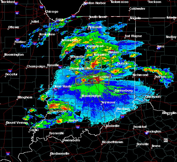 At 953 pm edt, a severe thunderstorm was located near tipton, or 19 miles west of anderson, moving east at 35 mph (trained weather spotters). Hazards include golf ball size hail and 60 mph wind gusts. People and animals outdoors will be injured. expect hail damage to roofs, siding, windows, and vehicles. expect wind damage to roofs, siding, and trees. Locations impacted include, noblesville, tipton, windfall city, westfield, cicero, sheridan, arcadia, atlanta, kempton, windfall and morse reservoir. At 953 pm edt, a severe thunderstorm was located near tipton, or 19 miles west of anderson, moving east at 35 mph (trained weather spotters). Hazards include golf ball size hail and 60 mph wind gusts. People and animals outdoors will be injured. expect hail damage to roofs, siding, windows, and vehicles. expect wind damage to roofs, siding, and trees. Locations impacted include, noblesville, tipton, windfall city, westfield, cicero, sheridan, arcadia, atlanta, kempton, windfall and morse reservoir.
|
| 5/1/2016 9:34 PM EDT |
 At 934 pm edt, a severe thunderstorm was located 13 miles northeast of lebanon, or 14 miles southeast of frankfort, moving east at 35 mph (law enforcement). Hazards include quarter size hail. Damage to vehicles is expected. Locations impacted include, noblesville, tipton, windfall city, westfield, cicero, sheridan, arcadia, kirklin, atlanta, kempton, windfall and morse reservoir. At 934 pm edt, a severe thunderstorm was located 13 miles northeast of lebanon, or 14 miles southeast of frankfort, moving east at 35 mph (law enforcement). Hazards include quarter size hail. Damage to vehicles is expected. Locations impacted include, noblesville, tipton, windfall city, westfield, cicero, sheridan, arcadia, kirklin, atlanta, kempton, windfall and morse reservoir.
|
| 5/1/2016 9:27 PM EDT |
 At 927 pm edt, a severe thunderstorm was located 10 miles southeast of frankfort, moving east at 35 mph (radar indicated). Hazards include quarter size hail. damage to vehicles is expected At 927 pm edt, a severe thunderstorm was located 10 miles southeast of frankfort, moving east at 35 mph (radar indicated). Hazards include quarter size hail. damage to vehicles is expected
|
| 7/13/2015 11:11 AM EDT |
 At 1108 am edt, severe thunderstorms were located along a line extending from 7 miles west of tipton to lebanon to crawfordsville, and moving southeast at 45 mph (radar indicated). Hazards include 60 mph wind gusts and penny size hail. Expect damage to roofs. Siding and trees. At 1108 am edt, severe thunderstorms were located along a line extending from 7 miles west of tipton to lebanon to crawfordsville, and moving southeast at 45 mph (radar indicated). Hazards include 60 mph wind gusts and penny size hail. Expect damage to roofs. Siding and trees.
|
| 6/21/2015 2:06 AM EDT |
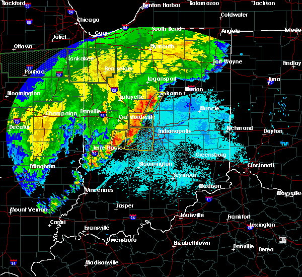 At 205 am edt, severe thunderstorms were located along a line extending from peru to 12 miles northwest of noblesville, and moving east at 35 mph (radar indicated). Hazards include 60 mph wind gusts. Expect damage to roofs. siding and trees. Locations impacted include, mainly rural areas of central howard county. At 205 am edt, severe thunderstorms were located along a line extending from peru to 12 miles northwest of noblesville, and moving east at 35 mph (radar indicated). Hazards include 60 mph wind gusts. Expect damage to roofs. siding and trees. Locations impacted include, mainly rural areas of central howard county.
|
| 6/21/2015 1:49 AM EDT |
 At 146 am edt, severe thunderstorms were located along a line extending from walton to lebanon, and moving east at 30 mph (radar indicated). Hazards include 60 mph wind gusts. Expect damage to roofs. siding and trees. locations impacted include, kokomo, kirklin, russiaville, kempton and indian heights. This includes interstate 65 between mile markers 149 and 159. At 146 am edt, severe thunderstorms were located along a line extending from walton to lebanon, and moving east at 30 mph (radar indicated). Hazards include 60 mph wind gusts. Expect damage to roofs. siding and trees. locations impacted include, kokomo, kirklin, russiaville, kempton and indian heights. This includes interstate 65 between mile markers 149 and 159.
|
| 6/21/2015 1:27 AM EDT |
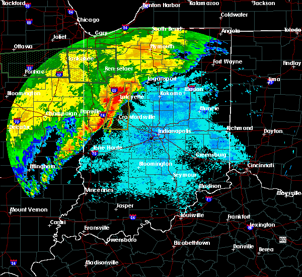 At 123 am edt, severe thunderstorms were located along a line extending from 8 miles southwest of logansport to 12 miles west of lebanon, and moving east at 30 mph (radar indicated). Hazards include 60 mph wind gusts. Expect damage to roofs. Siding and trees. At 123 am edt, severe thunderstorms were located along a line extending from 8 miles southwest of logansport to 12 miles west of lebanon, and moving east at 30 mph (radar indicated). Hazards include 60 mph wind gusts. Expect damage to roofs. Siding and trees.
|
| 6/12/2015 6:55 PM EDT |
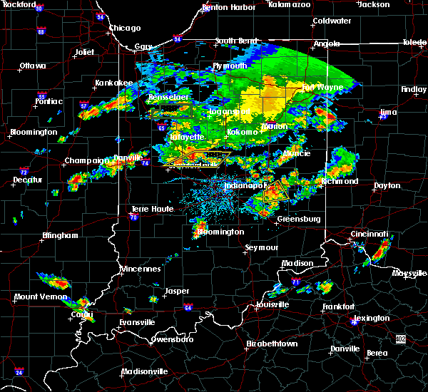 At 653 pm edt, severe thunderstorms were located along a line extending from 9 miles east of frankfort to 9 miles northeast of crawfordsville, and moving east at 35 mph (radar indicated). Hazards include 60 mph wind gusts. Expect damage to roofs. siding and trees. locations impacted include, thorntown, kempton, kirklin and sheridan. This includes interstate 65 between mile markers 144 and 156. At 653 pm edt, severe thunderstorms were located along a line extending from 9 miles east of frankfort to 9 miles northeast of crawfordsville, and moving east at 35 mph (radar indicated). Hazards include 60 mph wind gusts. Expect damage to roofs. siding and trees. locations impacted include, thorntown, kempton, kirklin and sheridan. This includes interstate 65 between mile markers 144 and 156.
|
| 6/12/2015 6:42 PM EDT |
 At 640 pm edt, severe thunderstorms were located along a line extending from frankfort to crawfordsville, and moving east at 35 mph (radar indicated). Hazards include 60 mph wind gusts. Expect damage to roofs. Siding and trees. At 640 pm edt, severe thunderstorms were located along a line extending from frankfort to crawfordsville, and moving east at 35 mph (radar indicated). Hazards include 60 mph wind gusts. Expect damage to roofs. Siding and trees.
|
| 6/12/2015 6:21 PM EDT |
 The severe thunderstorm warning for clinton, southern carroll, northwestern boone, northern hamilton, howard, northwestern madison and tipton counties will expire at 630 pm edt, the line of storms which prompted the warning has weakened and moved out of the warned area. The severe thunderstorm warning for clinton, southern carroll, northwestern boone, northern hamilton, howard, northwestern madison and tipton counties will expire at 630 pm edt, the line of storms which prompted the warning has weakened and moved out of the warned area.
|
| 6/12/2015 6:11 PM EDT |
 At 607 pm edt, severe thunderstorms were located along a line extending from 9 miles northwest of elwood to 6 miles southwest of crawfordsville, and moving south at 30 mph (radar indicated). Hazards include 60 mph wind gusts and quarter size hail. Hail damage to vehicles is expected. expect wind damage to roofs, siding and trees. locations impacted include, tipton, elwood, atlanta and frankton. This includes interstate 65 between mile markers 149 and 160. At 607 pm edt, severe thunderstorms were located along a line extending from 9 miles northwest of elwood to 6 miles southwest of crawfordsville, and moving south at 30 mph (radar indicated). Hazards include 60 mph wind gusts and quarter size hail. Hail damage to vehicles is expected. expect wind damage to roofs, siding and trees. locations impacted include, tipton, elwood, atlanta and frankton. This includes interstate 65 between mile markers 149 and 160.
|
| 6/12/2015 6:00 PM EDT |
 At 559 pm edt, severe thunderstorms were located along a line extending from 8 miles southwest of swayzee to 6 miles west of crawfordsville, and moving south at 30 mph (radar indicated). Hazards include 60 mph wind gusts and quarter size hail. Hail damage to vehicles is expected. expect wind damage to roofs, siding and trees. locations impacted include, tipton, elwood, kempton, windfall, kirklin, atlanta and frankton. This includes interstate 65 between mile markers 149 and 176. At 559 pm edt, severe thunderstorms were located along a line extending from 8 miles southwest of swayzee to 6 miles west of crawfordsville, and moving south at 30 mph (radar indicated). Hazards include 60 mph wind gusts and quarter size hail. Hail damage to vehicles is expected. expect wind damage to roofs, siding and trees. locations impacted include, tipton, elwood, kempton, windfall, kirklin, atlanta and frankton. This includes interstate 65 between mile markers 149 and 176.
|
| 6/12/2015 5:42 PM EDT |
 At 540 pm edt, severe thunderstorms were located along a line extending from 9 miles northwest of swayzee to 11 miles east of veedersburg, and moving southeast at 30 mph (radar indicated). Hazards include 60 mph wind gusts. Expect damage to roofs. Siding and trees. At 540 pm edt, severe thunderstorms were located along a line extending from 9 miles northwest of swayzee to 11 miles east of veedersburg, and moving southeast at 30 mph (radar indicated). Hazards include 60 mph wind gusts. Expect damage to roofs. Siding and trees.
|
| 6/7/2015 9:24 PM EDT | The severe thunderstorm warning for southern clinton, northern boone, northern hamilton, southeastern howard, northwestern madison, northeastern montgomery and tipton counties will expire at 930 pm edt/830 pm cdt/, the storm which prompted the warning has weakened below severe limits, and no longer poses an immediate threat to life or property. however, gusty winds are still possible with this thunderstorm. |
| 6/7/2015 9:03 PM EDT | At 902 pm edt, a severe thunderstorm was located 6 miles south of tipton, and moving east at 55 mph (radar indicated). Hazards include 60 mph wind gusts. Expect damage to roofs. siding and trees. locations impacted include, noblesville, elwood, windfall, arcadia and cicero. This includes interstate 65 between mile markers 141 and 158. |
| 6/7/2015 8:53 PM EDT | At 851 pm edt, a severe thunderstorm was located 13 miles southwest of tipton, and moving east at 50 mph (radar indicated). Hazards include 60 mph wind gusts. Expect damage to roofs. siding and trees. locations impacted include, tipton, noblesville, elwood, sheridan, indian heights, sharpsville, westfield, greentown, morse reservoir, atlanta, windfall, arcadia and cicero. this includes interstate 65 between mile markers 141 and 160. This includes interstate 74 between mile markers 32 and 39. |
| 6/7/2015 8:40 PM EDT | At 837 pm edt, a severe thunderstorm was located near frankfort, and moving east at 40 mph (radar indicated). Hazards include 60 mph wind gusts. Expect damage to roofs. Siding and trees. |
| 5/4/2015 6:42 PM EDT | At 639 pm edt, a severe thunderstorm was located 7 miles north of lebanon, and moving east at 25 mph (emergency management). Hazards include golf ball size hail. People and animals outdoors will be injured. expect damage to roofs, siding, windows and vehicles. locations impacted include, kirklin, sheridan, kempton and morse reservoir. this includes interstate 65 between mile markers 142 and 153. 1. 75in. |
| 5/4/2015 6:29 PM EDT | At 626 pm edt, a severe thunderstorm was located 8 miles northwest of lebanon, and moving east at 25 mph (radar indicated). Hazards include quarter size hail. damage to vehicles is expected |
| 4/8/2015 8:27 AM EDT | A severe thunderstorm warning remains in effect for southeastern clinton. northeastern boone. northern hamilton and tipton counties until 845 am edt. at 825 am edt. a severe thunderstorm was located 13 miles west of tipton. and moving east at 45 mph. hazard. Quarter size hail. |
| 4/8/2015 8:18 AM EDT | The national weather service in indianapolis has issued a * severe thunderstorm warning for. northeastern boone county in central indiana. southeastern clinton county in central indiana. northern hamilton county in central indiana. Tipton county in central indiana. |
| 1/1/0001 12:00 AM | Trees dow in tipton county IN, 0.1 miles S of Kempton, IN |
Hail Maps for Kempton, IN


Connect with Interactive Hail Maps