

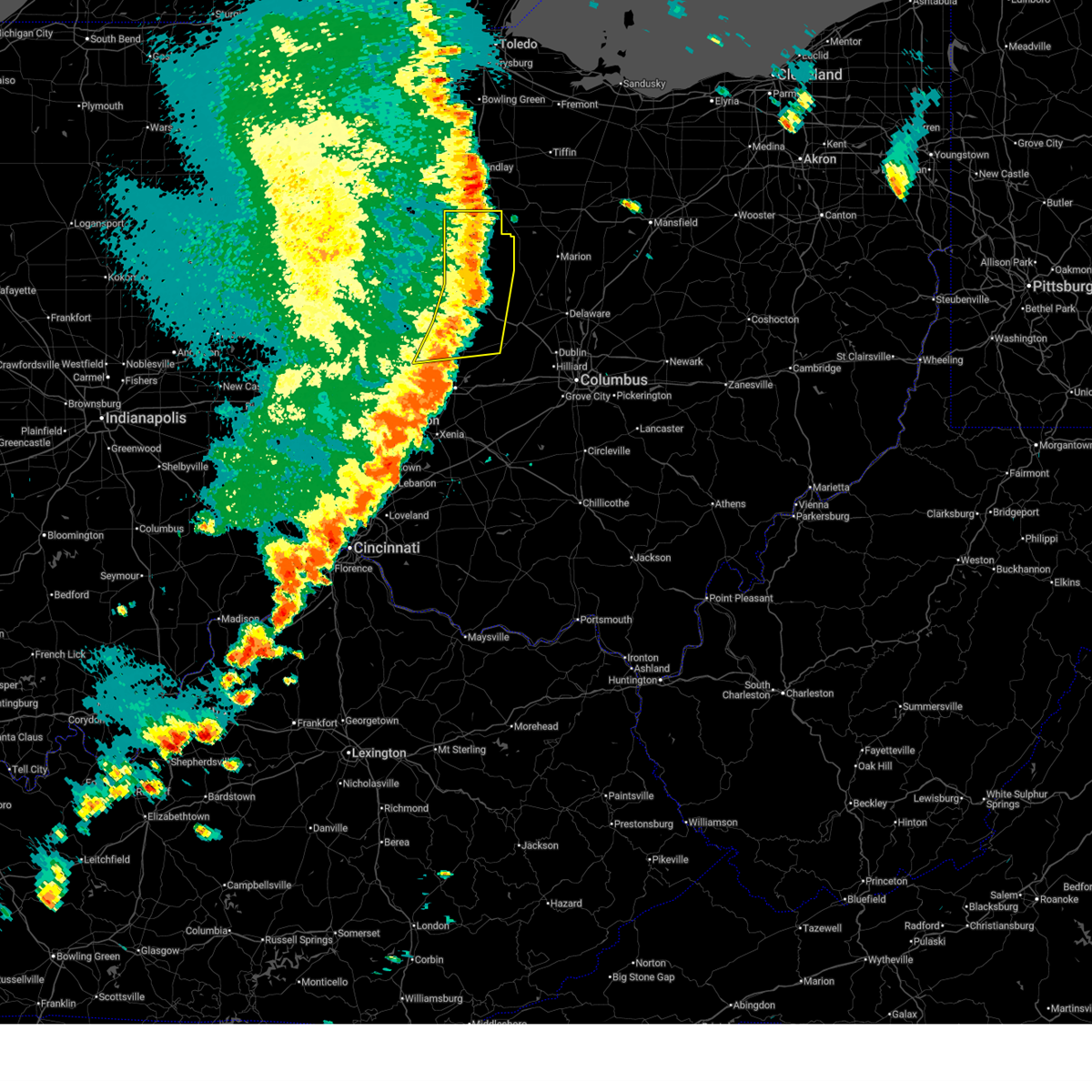
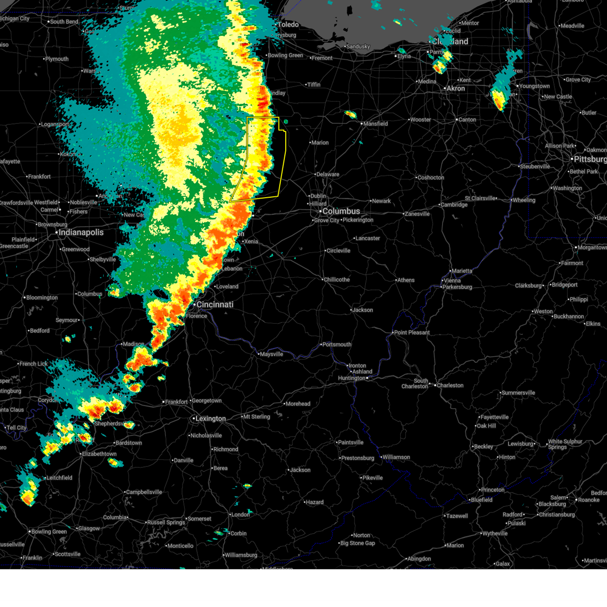
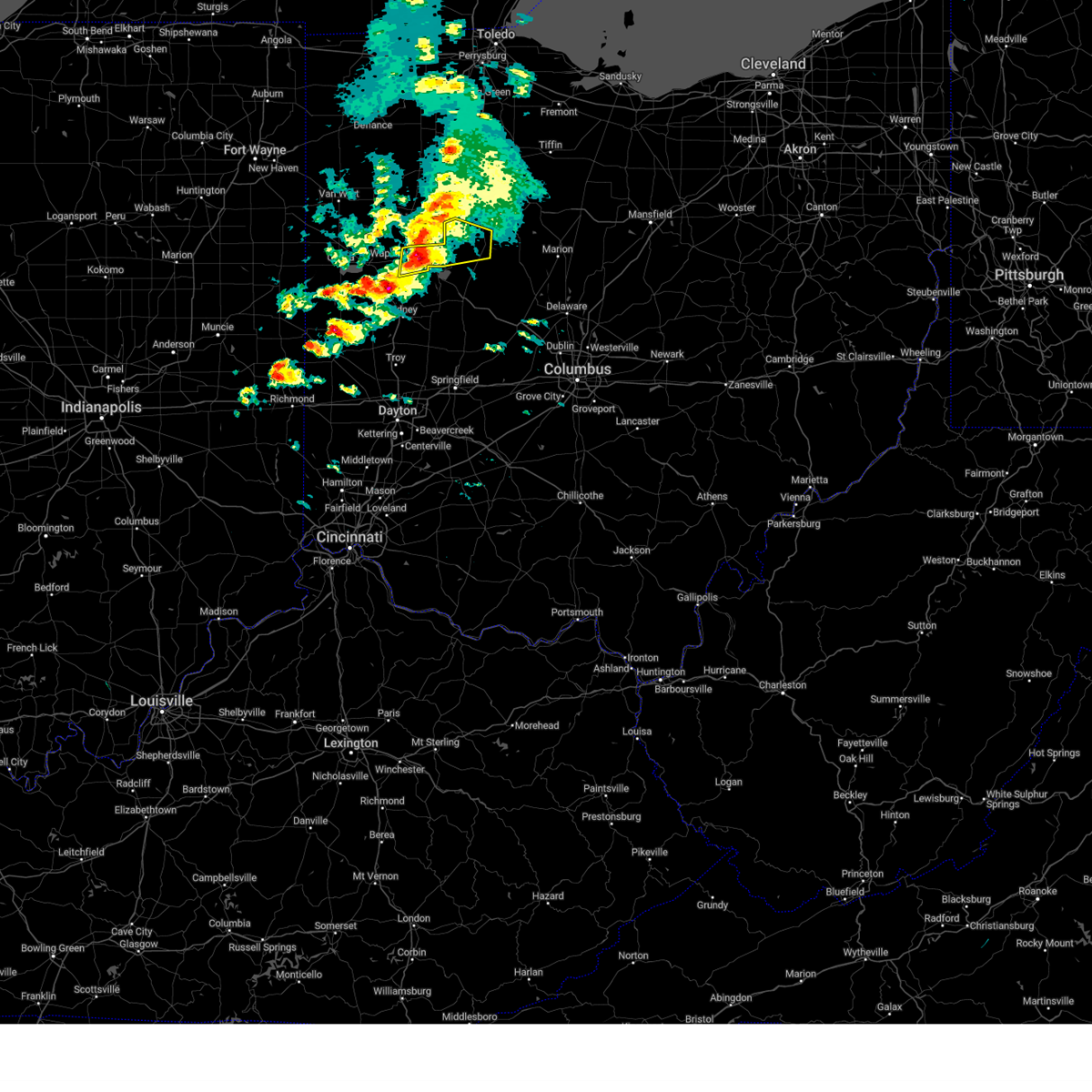
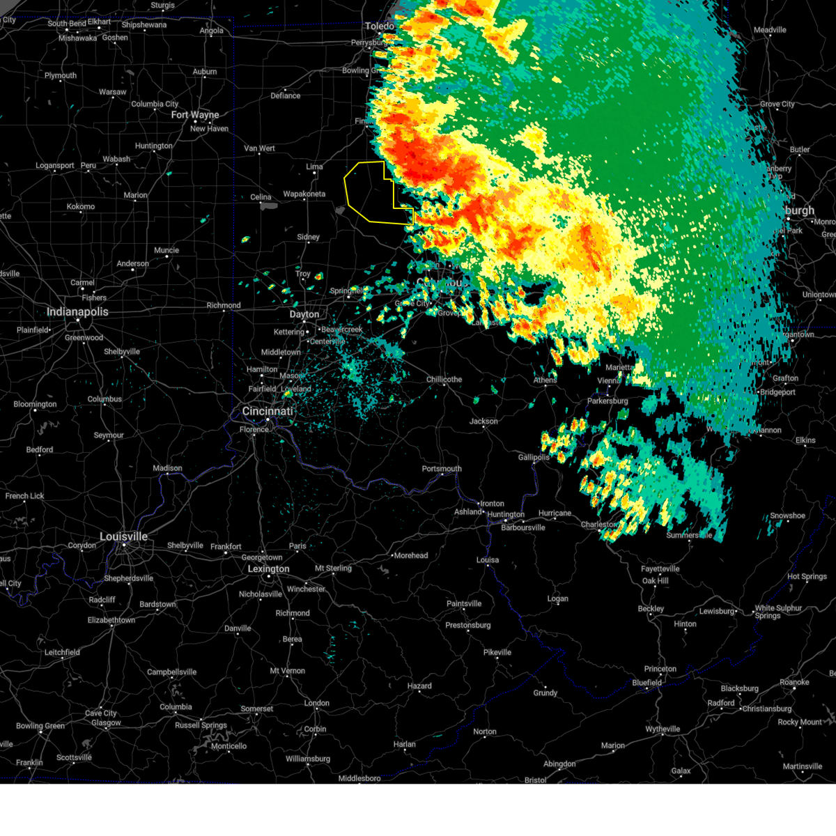
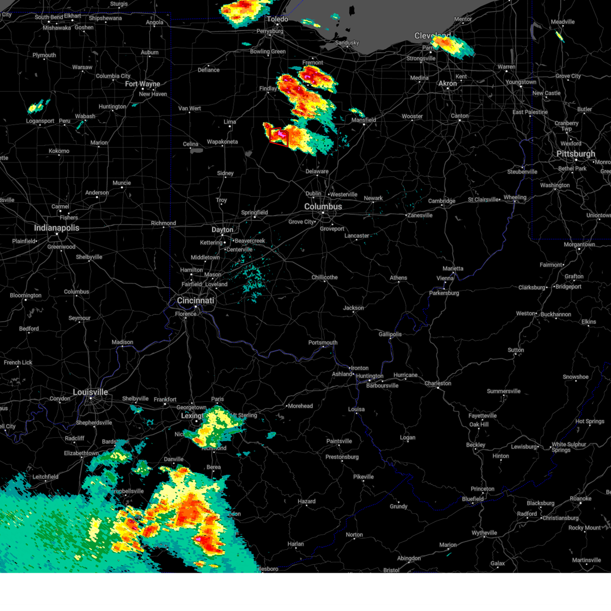
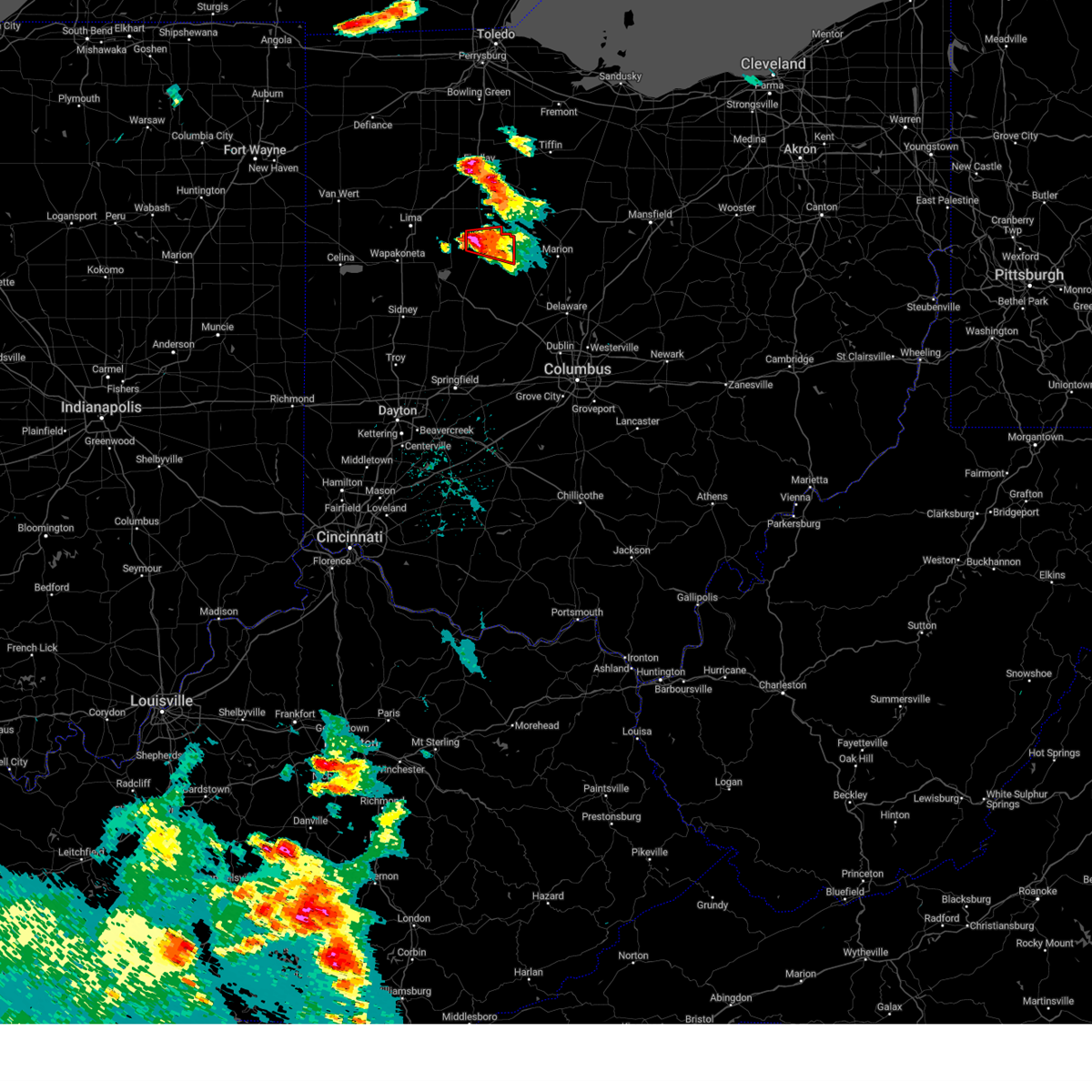
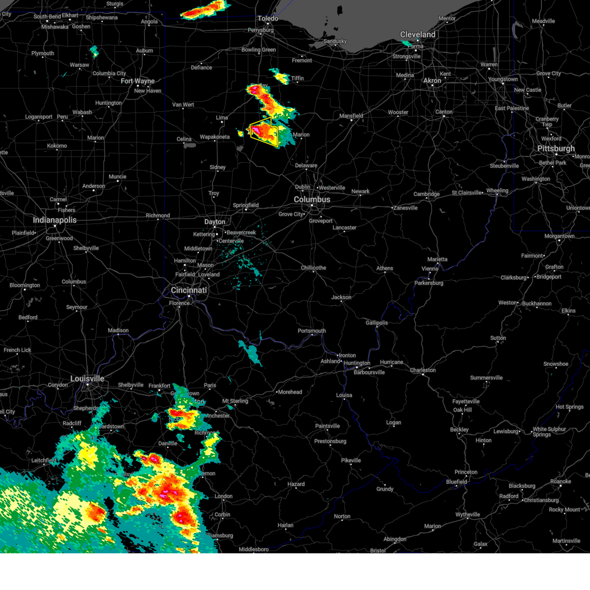
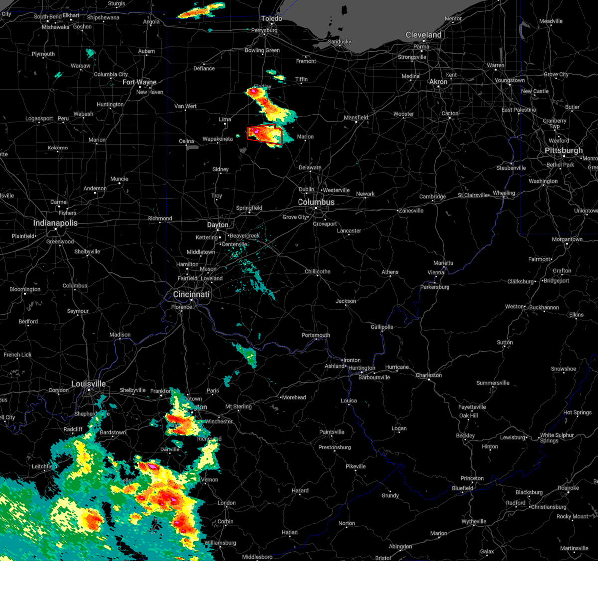
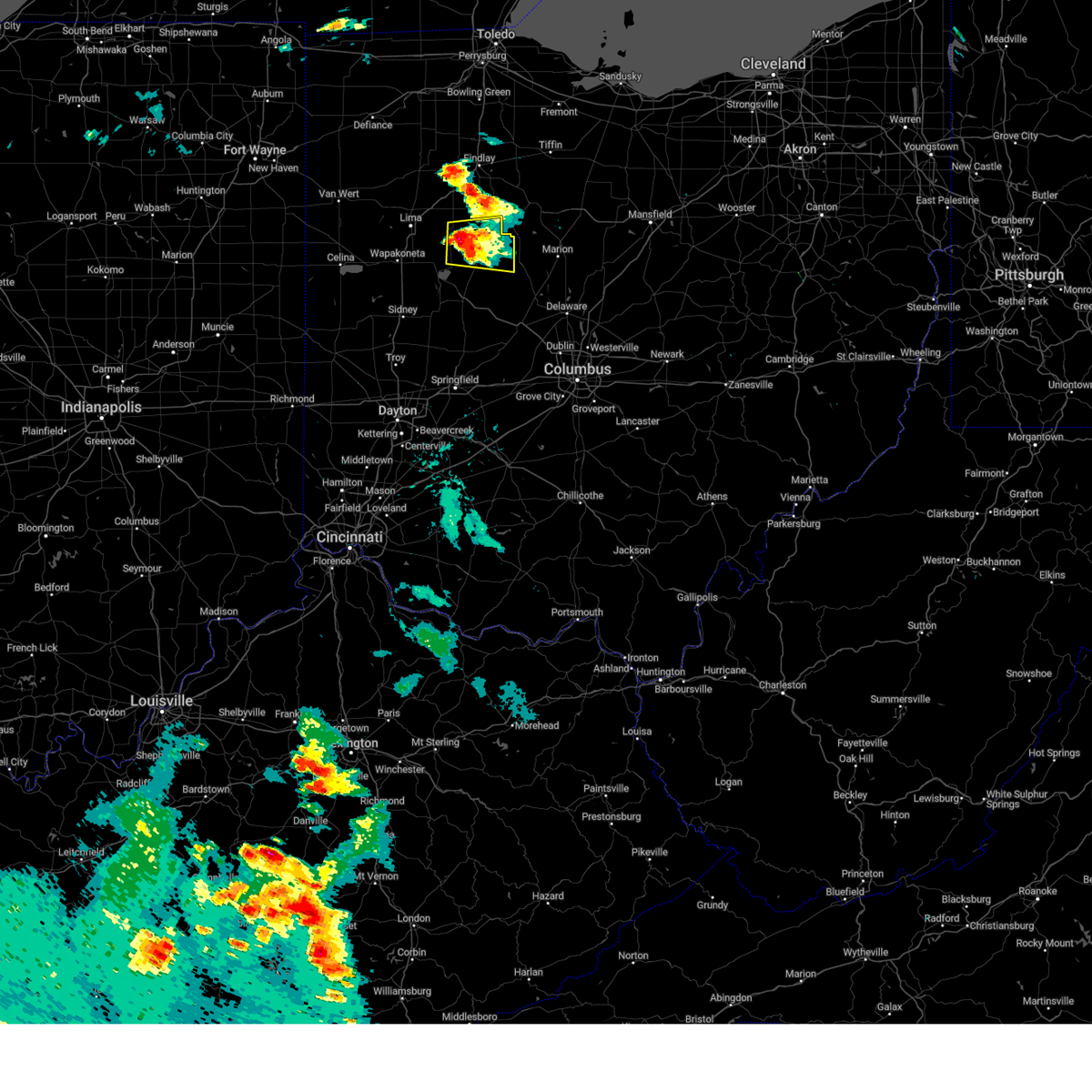
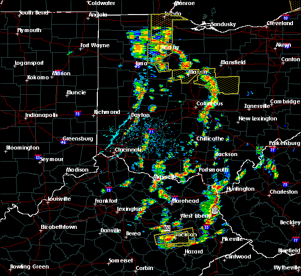
Hail Map for Kenton, OH
The Kenton, OH area has had 2 reports of on-the-ground hail by trained spotters, and has been under severe weather warnings 23 times during the past 12 months. Doppler radar has detected hail at or near Kenton, OH on 47 occasions.
| Name: | Kenton, OH |
| Where Located: | 57 miles NW of Columbus, OH |
| Map: | Google Map for Kenton, OH |
| Population: | 8262 |
| Housing Units: | 3773 |
| More Info: | Search Google for Kenton, OH |
4
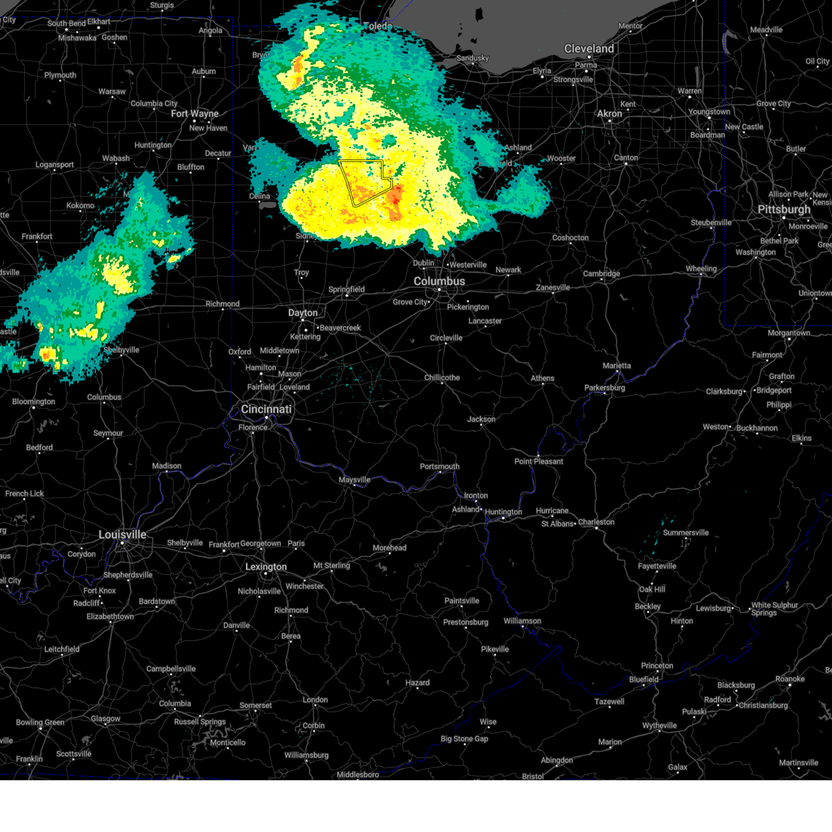
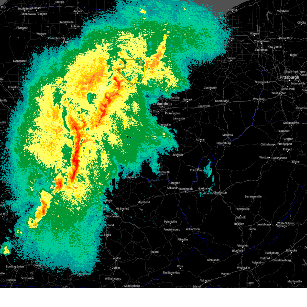
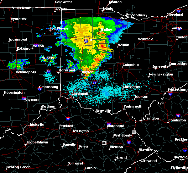
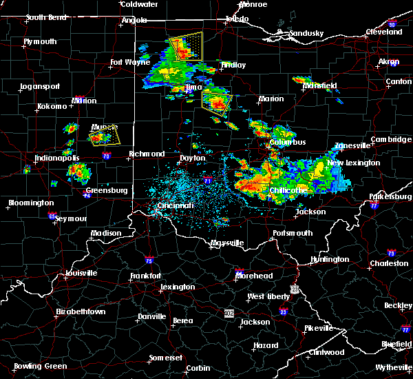
The Top Recent Hail Date for Kenton, OH is Saturday, August 12, 2023 (6th out of 47)

Hail and Wind Damage Spotted near Kenton, OH
| Date / Time | Report Details |
|---|---|
| 6/18/2025 7:14 PM EDT |
 At 714 pm edt, severe thunderstorms were located along a line extending from 6 miles southeast of alger to 6 miles west of northridge, moving east at 35 mph (radar indicated). Hazards include 60 mph wind gusts. Expect damage to trees and power lines. locations impacted include, bellefontaine, urbana, kenton, ada, st. Paris, west liberty, north lewisburg, forest, de graff, dunkirk, alger, belle center, west mansfield, chippewa park, northwood, blanchard, roundhead, mount victory, christiansburg, and rushsylvania. At 714 pm edt, severe thunderstorms were located along a line extending from 6 miles southeast of alger to 6 miles west of northridge, moving east at 35 mph (radar indicated). Hazards include 60 mph wind gusts. Expect damage to trees and power lines. locations impacted include, bellefontaine, urbana, kenton, ada, st. Paris, west liberty, north lewisburg, forest, de graff, dunkirk, alger, belle center, west mansfield, chippewa park, northwood, blanchard, roundhead, mount victory, christiansburg, and rushsylvania.
|
| 6/18/2025 7:14 PM EDT |
 the severe thunderstorm warning has been cancelled and is no longer in effect the severe thunderstorm warning has been cancelled and is no longer in effect
|
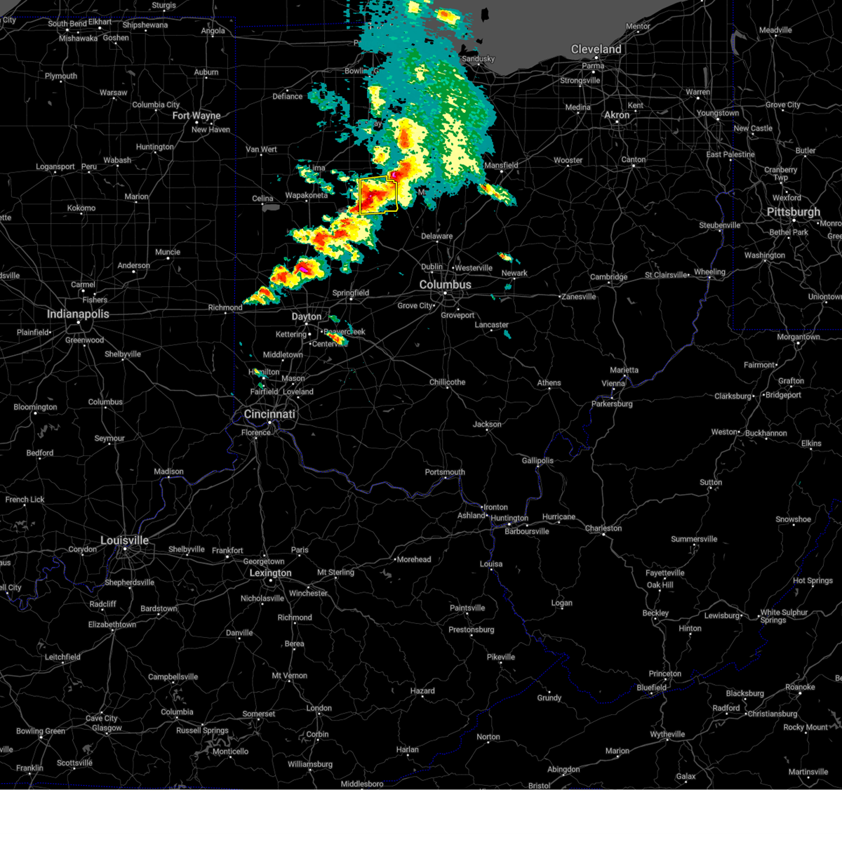
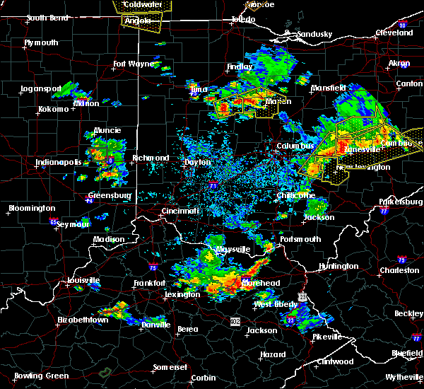
| 6/18/2025 6:43 PM EDT | Svriln the national weather service in wilmington has issued a * severe thunderstorm warning for, eastern shelby county in west central ohio, champaign county in west central ohio, logan county in west central ohio, western union county in central ohio, hardin county in west central ohio, northeastern auglaize county in west central ohio, northeastern miami county in west central ohio, * until 745 pm edt. * at 642 pm edt, severe thunderstorms were located along a line extending from cridersville to near tipp city, moving east at 35 mph (emergency management. at 620 pm structural damage was reported near montezuma in mercer county). Hazards include 60 mph wind gusts. expect damage to trees and power lines |
| 5/16/2025 9:41 PM EDT | The storm which prompted the warning has moved out of the area. therefore, the warning will be allowed to expire. however, a severe thunderstorm warning still exists in portions of logan and union counties. a tornado watch remains in effect until 300 am edt for central and west central ohio. please report previous wind damage or hail to the national weather service by going to our website at weather.gov/iln and submitting your report via social media. |
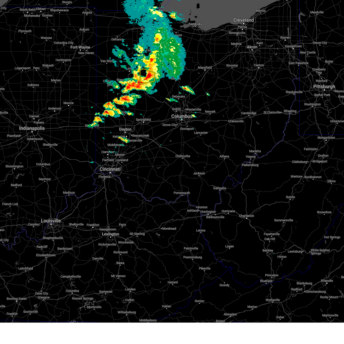
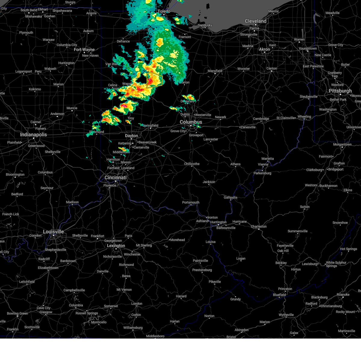
| 5/16/2025 9:28 PM EDT |
 At 928 pm edt, a severe thunderstorm was located over kenton, moving east at 45 mph (radar indicated). Hazards include 60 mph wind gusts. Expect damage to trees and power lines. Locations impacted include, grant, kenton, silver creek, patterson, ridgeway, pfeiffer, blanchard, hepburn, mount victory, mentzer, forest, big springs, and essex. At 928 pm edt, a severe thunderstorm was located over kenton, moving east at 45 mph (radar indicated). Hazards include 60 mph wind gusts. Expect damage to trees and power lines. Locations impacted include, grant, kenton, silver creek, patterson, ridgeway, pfeiffer, blanchard, hepburn, mount victory, mentzer, forest, big springs, and essex.
|
| 5/16/2025 9:08 PM EDT | Svriln the national weather service in wilmington has issued a * severe thunderstorm warning for, northeastern logan county in west central ohio, northwestern union county in central ohio, hardin county in west central ohio, * until 945 pm edt. * at 908 pm edt, a severe thunderstorm was located near alger, moving east at 50 mph (radar indicated). Hazards include 60 mph wind gusts. expect damage to trees and power lines |
| 5/2/2025 1:23 PM EDT | the severe thunderstorm warning has been cancelled and is no longer in effect |
| 5/2/2025 1:15 PM EDT | At 115 pm edt, a severe thunderstorm was located over belle center, moving east at 25 mph (trained weather spotters). Hazards include 60 mph wind gusts and quarter size hail. Minor hail damage to vehicles is possible. expect wind damage to trees and power lines. Locations impacted include, hepburn, mount victory, silver creek, mentzer, northwood, belle center, rushsylvania, byhalia, big springs, ridgeway, and pfeiffer. |
| 5/2/2025 1:05 PM EDT | At 104 pm edt, a severe thunderstorm was located near belle center, moving east at 25 mph (trained weather spotters). Hazards include 60 mph wind gusts and quarter size hail. Minor hail damage to vehicles is possible. expect wind damage to trees and power lines. Locations impacted include, huntsville, silver creek, belle center, rushsylvania, byhalia, ridgeway, pfeiffer, hepburn, mount victory, mentzer, northwood, big springs, and west mansfield. |
| 5/2/2025 12:55 PM EDT |
 Svriln the national weather service in wilmington has issued a * severe thunderstorm warning for, northern logan county in west central ohio, northwestern union county in central ohio, southern hardin county in west central ohio, * until 145 pm edt. * at 1254 pm edt, a severe thunderstorm was located over russells point, moving east at 35 mph (trained weather spotters. this storm has a history of producing hail larger than 1 inch in diameter). Hazards include 60 mph wind gusts and quarter size hail. Minor hail damage to vehicles is possible. Expect wind damage to trees and power lines. Svriln the national weather service in wilmington has issued a * severe thunderstorm warning for, northern logan county in west central ohio, northwestern union county in central ohio, southern hardin county in west central ohio, * until 145 pm edt. * at 1254 pm edt, a severe thunderstorm was located over russells point, moving east at 35 mph (trained weather spotters. this storm has a history of producing hail larger than 1 inch in diameter). Hazards include 60 mph wind gusts and quarter size hail. Minor hail damage to vehicles is possible. Expect wind damage to trees and power lines.
|
| 4/19/2025 7:40 AM EDT |
 The storms which prompted the warning have moved out of the area. therefore, the warning will be allowed to expire. please report previous wind damage or hail to the national weather service by going to our website at weather.gov/iln and submitting your report via social media. The storms which prompted the warning have moved out of the area. therefore, the warning will be allowed to expire. please report previous wind damage or hail to the national weather service by going to our website at weather.gov/iln and submitting your report via social media.
|
| 4/19/2025 7:25 AM EDT |
 the severe thunderstorm warning has been cancelled and is no longer in effect the severe thunderstorm warning has been cancelled and is no longer in effect
|
| 4/19/2025 7:25 AM EDT |
 At 724 am edt, severe thunderstorms were located along a line extending from near rawson to near belle center, moving northeast at 70 mph (radar indicated). Hazards include 60 mph wind gusts. Expect damage to trees and power lines. Locations impacted include, dola, grant, kenton, silver creek, jumbo, huntersville, patterson, pfeiffer, walton, blanchard, hepburn, mentzer, forest, dunkirk, mcguffey, and ada. At 724 am edt, severe thunderstorms were located along a line extending from near rawson to near belle center, moving northeast at 70 mph (radar indicated). Hazards include 60 mph wind gusts. Expect damage to trees and power lines. Locations impacted include, dola, grant, kenton, silver creek, jumbo, huntersville, patterson, pfeiffer, walton, blanchard, hepburn, mentzer, forest, dunkirk, mcguffey, and ada.
|
| 4/19/2025 7:16 AM EDT |
 the severe thunderstorm warning has been cancelled and is no longer in effect the severe thunderstorm warning has been cancelled and is no longer in effect
|
| 4/19/2025 7:16 AM EDT |
 At 716 am edt, severe thunderstorms were located along a line extending from near pandora to near chippewa park, moving east at 70 mph (radar indicated). Hazards include 60 mph wind gusts. Expect damage to trees and power lines. Locations impacted include, dola, huntersville, pfeiffer, state route 195 at state route 235, roundhead, grant, kenton, silver creek, jumbo, lakeview, patterson, waynesfield, walton, blanchard, alger, hepburn, russells point, mentzer, new hampshire, and forest. At 716 am edt, severe thunderstorms were located along a line extending from near pandora to near chippewa park, moving east at 70 mph (radar indicated). Hazards include 60 mph wind gusts. Expect damage to trees and power lines. Locations impacted include, dola, huntersville, pfeiffer, state route 195 at state route 235, roundhead, grant, kenton, silver creek, jumbo, lakeview, patterson, waynesfield, walton, blanchard, alger, hepburn, russells point, mentzer, new hampshire, and forest.
|
| 4/19/2025 7:04 AM EDT |
 Svriln the national weather service in wilmington has issued a * severe thunderstorm warning for, northeastern shelby county in west central ohio, northwestern logan county in west central ohio, hardin county in west central ohio, northeastern auglaize county in west central ohio, * until 745 am edt. * at 704 am edt, severe thunderstorms were located along a line extending from elida to near jackson center, moving northeast at 70 mph (radar indicated). Hazards include 60 mph wind gusts. expect damage to trees and power lines Svriln the national weather service in wilmington has issued a * severe thunderstorm warning for, northeastern shelby county in west central ohio, northwestern logan county in west central ohio, hardin county in west central ohio, northeastern auglaize county in west central ohio, * until 745 am edt. * at 704 am edt, severe thunderstorms were located along a line extending from elida to near jackson center, moving northeast at 70 mph (radar indicated). Hazards include 60 mph wind gusts. expect damage to trees and power lines
|
| 4/3/2025 12:51 AM EDT | the severe thunderstorm warning has been cancelled and is no longer in effect |
| 4/3/2025 12:23 AM EDT |
 Svriln the national weather service in wilmington has issued a * severe thunderstorm warning for, northeastern logan county in west central ohio, northwestern union county in central ohio, hardin county in west central ohio, northeastern auglaize county in west central ohio, * until 115 am edt. * at 1222 am edt, a severe thunderstorm was located over lakeview, moving northeast at 60 mph (radar indicated). Hazards include 60 mph wind gusts. expect damage to trees and power lines Svriln the national weather service in wilmington has issued a * severe thunderstorm warning for, northeastern logan county in west central ohio, northwestern union county in central ohio, hardin county in west central ohio, northeastern auglaize county in west central ohio, * until 115 am edt. * at 1222 am edt, a severe thunderstorm was located over lakeview, moving northeast at 60 mph (radar indicated). Hazards include 60 mph wind gusts. expect damage to trees and power lines
|
| 4/2/2025 11:39 PM EDT | The storm which prompted the warning has weakened below severe limits and has exited the warned area. therefore, the warning will be allowed to expire. however, gusty winds and heavy rain are still possible with this thunderstorm. a tornado watch remains in effect until 400 am edt for west central ohio. please report previous wind damage or hail to the national weather service by going to our website at weather.gov/iln and submitting your report via social media. |
| 4/2/2025 11:33 PM EDT | Svriln the national weather service in wilmington has issued a * severe thunderstorm warning for, eastern hardin county in west central ohio, * until midnight edt. * at 1133 pm edt, a severe thunderstorm was located near kenton, moving northeast at 55 mph (radar indicated). Hazards include 60 mph wind gusts. expect damage to trees and power lines |
| 4/2/2025 11:25 PM EDT | the severe thunderstorm warning has been cancelled and is no longer in effect |
| 4/2/2025 11:25 PM EDT | At 1125 pm edt, a severe thunderstorm was located near waynesfield, moving northeast at 55 mph (radar indicated). Hazards include 60 mph wind gusts and penny size hail. Expect damage to trees and power lines. locations impacted include, roundhead, dola, kenton, silver creek, belle center, jumbo, lakeview, huntersville, uniopolis, waynesfield, st. Johns, walton, blanchard, alger, mentzer, new hampshire, state route 195 at state route 235, mcguffey, ada, and chippewa park. |
| 4/2/2025 11:06 PM EDT | Svriln the national weather service in wilmington has issued a * severe thunderstorm warning for, northern shelby county in west central ohio, northwestern logan county in west central ohio, hardin county in west central ohio, auglaize county in west central ohio, * until 1145 pm edt. * at 1106 pm edt, a severe thunderstorm was located near botkins, moving northeast at 55 mph (radar indicated). Hazards include 60 mph wind gusts and penny size hail. expect damage to trees and power lines |
| 4/17/2024 3:38 PM EDT | Tree down near intersection of cr-144 and township road 199. time estimated from rada in hardin county OH, 4.6 miles WNW of Kenton, OH |
| 4/17/2024 3:34 PM EDT |
 Svriln the national weather service in wilmington has issued a * severe thunderstorm warning for, northeastern logan county in west central ohio, southeastern hardin county in west central ohio, * until 415 pm edt. * at 334 pm edt, a severe thunderstorm was located near kenton, moving east at 50 mph (radar indicated). Hazards include 60 mph wind gusts and quarter size hail. Minor hail damage to vehicles is possible. Expect wind damage to trees and power lines. Svriln the national weather service in wilmington has issued a * severe thunderstorm warning for, northeastern logan county in west central ohio, southeastern hardin county in west central ohio, * until 415 pm edt. * at 334 pm edt, a severe thunderstorm was located near kenton, moving east at 50 mph (radar indicated). Hazards include 60 mph wind gusts and quarter size hail. Minor hail damage to vehicles is possible. Expect wind damage to trees and power lines.
|
| 4/17/2024 3:12 PM EDT |
 The storm which prompted the warning has weakened below severe limits and no longer poses an immediate threat to life or property. therefore, the warning will be allowed to expire. a tornado watch remains in effect until 700 pm edt for west central ohio. please report previous wind damage or hail to the national weather service by going to our website at weather.gov/iln and submitting your report via social media. The storm which prompted the warning has weakened below severe limits and no longer poses an immediate threat to life or property. therefore, the warning will be allowed to expire. a tornado watch remains in effect until 700 pm edt for west central ohio. please report previous wind damage or hail to the national weather service by going to our website at weather.gov/iln and submitting your report via social media.
|
| 4/17/2024 2:55 PM EDT |
 the severe thunderstorm warning has been cancelled and is no longer in effect the severe thunderstorm warning has been cancelled and is no longer in effect
|
| 4/17/2024 2:55 PM EDT |
 At 255 pm edt, a severe thunderstorm was located near alger, moving east at 50 mph (radar indicated). Hazards include 60 mph wind gusts and quarter size hail. Minor hail damage to vehicles is possible. expect wind damage to trees and power lines. Locations impacted include, kenton, ada, alger, blanchard, roundhead, mcguffey, silver creek, mentzer, jumbo, huntersville, walton, and state route 195 at state route 235. At 255 pm edt, a severe thunderstorm was located near alger, moving east at 50 mph (radar indicated). Hazards include 60 mph wind gusts and quarter size hail. Minor hail damage to vehicles is possible. expect wind damage to trees and power lines. Locations impacted include, kenton, ada, alger, blanchard, roundhead, mcguffey, silver creek, mentzer, jumbo, huntersville, walton, and state route 195 at state route 235.
|
| 4/17/2024 2:40 PM EDT |
 At 240 pm edt, a severe thunderstorm was located over waynesfield, moving east at 50 mph (radar indicated). Hazards include 60 mph wind gusts and quarter size hail. Minor hail damage to vehicles is possible. expect wind damage to trees and power lines. locations impacted include, wapakoneta, kenton, ada, alger, waynesfield, blanchard, roundhead, mcguffey, uniopolis, fryburg, silver creek, jumbo, huntersville, st. johns, walton, mentzer, new hampshire, and state route 195 at state route 235. This includes i-75 in ohio between mile markers 107 and 111, and between mile markers 113 and 116. At 240 pm edt, a severe thunderstorm was located over waynesfield, moving east at 50 mph (radar indicated). Hazards include 60 mph wind gusts and quarter size hail. Minor hail damage to vehicles is possible. expect wind damage to trees and power lines. locations impacted include, wapakoneta, kenton, ada, alger, waynesfield, blanchard, roundhead, mcguffey, uniopolis, fryburg, silver creek, jumbo, huntersville, st. johns, walton, mentzer, new hampshire, and state route 195 at state route 235. This includes i-75 in ohio between mile markers 107 and 111, and between mile markers 113 and 116.
|
| 4/17/2024 2:27 PM EDT |
 Svriln the national weather service in wilmington has issued a * severe thunderstorm warning for, auglaize county in west central ohio, western hardin county in west central ohio, * until 315 pm edt. * at 227 pm edt, a severe thunderstorm was located over wapakoneta, moving east at 50 mph (radar indicated). Hazards include 60 mph wind gusts and quarter size hail. Minor hail damage to vehicles is possible. Expect wind damage to trees and power lines. Svriln the national weather service in wilmington has issued a * severe thunderstorm warning for, auglaize county in west central ohio, western hardin county in west central ohio, * until 315 pm edt. * at 227 pm edt, a severe thunderstorm was located over wapakoneta, moving east at 50 mph (radar indicated). Hazards include 60 mph wind gusts and quarter size hail. Minor hail damage to vehicles is possible. Expect wind damage to trees and power lines.
|
| 8/24/2023 2:33 AM EDT |
 At 233 am edt, a severe thunderstorm was located near la rue, moving south at 30 mph (radar indicated). Hazards include 60 mph wind gusts. Expect damage to trees and power lines. locations impacted include, kenton, richwood, forest, dunkirk, alger, belle center, blanchard, mount victory, rushsylvania, mcguffey, ridgeway, patterson, dola, grant, silver creek, jumbo, huntersville, byhalia, pfeiffer, and walton. hail threat, radar indicated max hail size, <. 75 in wind threat, radar indicated max wind gust, 60 mph. At 233 am edt, a severe thunderstorm was located near la rue, moving south at 30 mph (radar indicated). Hazards include 60 mph wind gusts. Expect damage to trees and power lines. locations impacted include, kenton, richwood, forest, dunkirk, alger, belle center, blanchard, mount victory, rushsylvania, mcguffey, ridgeway, patterson, dola, grant, silver creek, jumbo, huntersville, byhalia, pfeiffer, and walton. hail threat, radar indicated max hail size, <. 75 in wind threat, radar indicated max wind gust, 60 mph.
|
| 8/24/2023 2:18 AM EDT |
 At 218 am edt, a severe thunderstorm was located near la rue, moving south at 30 mph (radar indicated). Hazards include 60 mph wind gusts. Expect damage to trees and power lines. locations impacted include, kenton, ada, richwood, forest, dunkirk, alger, belle center, blanchard, mount victory, rushsylvania, mcguffey, ridgeway, patterson, dola, huntersville, pfeiffer, big springs, essex, grant, and silver creek. hail threat, radar indicated max hail size, <. 75 in wind threat, radar indicated max wind gust, 60 mph. At 218 am edt, a severe thunderstorm was located near la rue, moving south at 30 mph (radar indicated). Hazards include 60 mph wind gusts. Expect damage to trees and power lines. locations impacted include, kenton, ada, richwood, forest, dunkirk, alger, belle center, blanchard, mount victory, rushsylvania, mcguffey, ridgeway, patterson, dola, huntersville, pfeiffer, big springs, essex, grant, and silver creek. hail threat, radar indicated max hail size, <. 75 in wind threat, radar indicated max wind gust, 60 mph.
|
| 8/24/2023 2:01 AM EDT |
 At 201 am edt, a severe thunderstorm was located near upper sandusky, moving southwest at 20 mph (radar indicated). Hazards include 60 mph wind gusts. expect damage to trees and power lines At 201 am edt, a severe thunderstorm was located near upper sandusky, moving southwest at 20 mph (radar indicated). Hazards include 60 mph wind gusts. expect damage to trees and power lines
|
| 8/12/2023 12:57 PM EDT |
 At 1256 pm edt, radar indicated that a tornado-producing storm was located over kenton, moving east at 40 mph (law enforcement confirmed tornado. at 12:50 pm, a tornado was reported east of kenton). Hazards include damaging tornado and quarter size hail. Flying debris will be dangerous to those caught without shelter. mobile homes will be damaged or destroyed. damage to roofs, windows, and vehicles will occur. Tree damage is likely. At 1256 pm edt, radar indicated that a tornado-producing storm was located over kenton, moving east at 40 mph (law enforcement confirmed tornado. at 12:50 pm, a tornado was reported east of kenton). Hazards include damaging tornado and quarter size hail. Flying debris will be dangerous to those caught without shelter. mobile homes will be damaged or destroyed. damage to roofs, windows, and vehicles will occur. Tree damage is likely.
|
| 8/12/2023 12:55 PM EDT |
 At 1254 pm edt, radar indicated that a tornado-producing storm was located near marseilles, moving east at 40 mph (law enforcement confirmed tornado. at 12:50 pm, a tornado was reported east of kenton). Hazards include damaging tornado and quarter size hail. Flying debris will be dangerous to those caught without shelter. mobile homes will be damaged or destroyed. damage to roofs, windows, and vehicles will occur. tree damage is likely. Locations impacted include, kenton, hepburn, grant, mentzer and pfeiffer. At 1254 pm edt, radar indicated that a tornado-producing storm was located near marseilles, moving east at 40 mph (law enforcement confirmed tornado. at 12:50 pm, a tornado was reported east of kenton). Hazards include damaging tornado and quarter size hail. Flying debris will be dangerous to those caught without shelter. mobile homes will be damaged or destroyed. damage to roofs, windows, and vehicles will occur. tree damage is likely. Locations impacted include, kenton, hepburn, grant, mentzer and pfeiffer.
|
| 8/12/2023 12:38 PM EDT |
 At 1238 pm edt, a severe thunderstorm capable of producing a tornado was located over kenton, moving east at 40 mph (radar indicated rotation). Hazards include tornado and quarter size hail. Flying debris will be dangerous to those caught without shelter. mobile homes will be damaged or destroyed. damage to roofs, windows, and vehicles will occur. tree damage is likely. Locations impacted include, kenton, hepburn, grant, mentzer and pfeiffer. At 1238 pm edt, a severe thunderstorm capable of producing a tornado was located over kenton, moving east at 40 mph (radar indicated rotation). Hazards include tornado and quarter size hail. Flying debris will be dangerous to those caught without shelter. mobile homes will be damaged or destroyed. damage to roofs, windows, and vehicles will occur. tree damage is likely. Locations impacted include, kenton, hepburn, grant, mentzer and pfeiffer.
|
| 8/12/2023 12:36 PM EDT |
 At 1235 pm edt, a severe thunderstorm was located near kenton, moving east at 40 mph (radar indicated). Hazards include 60 mph wind gusts and quarter size hail. Minor hail damage to vehicles is possible. expect wind damage to trees and power lines. Locations impacted include, kenton, blanchard, mount victory, patterson, hepburn, grant, mentzer and pfeiffer. At 1235 pm edt, a severe thunderstorm was located near kenton, moving east at 40 mph (radar indicated). Hazards include 60 mph wind gusts and quarter size hail. Minor hail damage to vehicles is possible. expect wind damage to trees and power lines. Locations impacted include, kenton, blanchard, mount victory, patterson, hepburn, grant, mentzer and pfeiffer.
|
| 8/12/2023 12:27 PM EDT |
 At 1226 pm edt, a severe thunderstorm capable of producing a tornado was located 7 miles west of kenton, moving east at 40 mph (radar indicated rotation). Hazards include tornado and half dollar size hail. Flying debris will be dangerous to those caught without shelter. mobile homes will be damaged or destroyed. damage to roofs, windows, and vehicles will occur. Tree damage is likely. At 1226 pm edt, a severe thunderstorm capable of producing a tornado was located 7 miles west of kenton, moving east at 40 mph (radar indicated rotation). Hazards include tornado and half dollar size hail. Flying debris will be dangerous to those caught without shelter. mobile homes will be damaged or destroyed. damage to roofs, windows, and vehicles will occur. Tree damage is likely.
|
| 8/12/2023 12:17 PM EDT |
 At 1217 pm edt, a severe thunderstorm was located near alger, moving east at 40 mph (radar indicated). Hazards include 60 mph wind gusts and quarter size hail. Minor hail damage to vehicles is possible. Expect wind damage to trees and power lines. At 1217 pm edt, a severe thunderstorm was located near alger, moving east at 40 mph (radar indicated). Hazards include 60 mph wind gusts and quarter size hail. Minor hail damage to vehicles is possible. Expect wind damage to trees and power lines.
|
| 7/29/2023 4:42 AM EDT |
 The severe thunderstorm warning for logan and hardin counties will expire at 445 am edt, the storms which prompted the warning have weakened below severe limits, and have exited the warned area. therefore, the warning will be allowed to expire. a severe thunderstorm watch remains in effect until 1100 am edt for central and west central ohio. please report previous wind damage or hail to the national weather service by going to our website at weather.gov/iln and submitting your report via social media. The severe thunderstorm warning for logan and hardin counties will expire at 445 am edt, the storms which prompted the warning have weakened below severe limits, and have exited the warned area. therefore, the warning will be allowed to expire. a severe thunderstorm watch remains in effect until 1100 am edt for central and west central ohio. please report previous wind damage or hail to the national weather service by going to our website at weather.gov/iln and submitting your report via social media.
|
| 7/29/2023 4:18 AM EDT |
 At 418 am edt, severe thunderstorms were located along a line extending from dunkirk to russells point, moving east at 50 mph (radar indicated). Hazards include 60 mph wind gusts. Expect damage to trees and power lines. locations impacted include, bellefontaine, kenton, ada, west liberty, forest, russells point, de graff, lakeview, dunkirk, alger, belle center, west mansfield, chippewa park, northwood, blanchard, roundhead, quincy, mount victory, rushsylvania and mcguffey. hail threat, radar indicated max hail size, <. 75 in wind threat, radar indicated max wind gust, 60 mph. At 418 am edt, severe thunderstorms were located along a line extending from dunkirk to russells point, moving east at 50 mph (radar indicated). Hazards include 60 mph wind gusts. Expect damage to trees and power lines. locations impacted include, bellefontaine, kenton, ada, west liberty, forest, russells point, de graff, lakeview, dunkirk, alger, belle center, west mansfield, chippewa park, northwood, blanchard, roundhead, quincy, mount victory, rushsylvania and mcguffey. hail threat, radar indicated max hail size, <. 75 in wind threat, radar indicated max wind gust, 60 mph.
|
| 7/29/2023 4:05 AM EDT |
 At 405 am edt, severe thunderstorms were located along a line extending from near bluffton to near jackson center, moving east at 40 mph (radar indicated). Hazards include 60 mph wind gusts. expect damage to trees and power lines At 405 am edt, severe thunderstorms were located along a line extending from near bluffton to near jackson center, moving east at 40 mph (radar indicated). Hazards include 60 mph wind gusts. expect damage to trees and power lines
|
| 7/20/2023 6:38 PM EDT |
 At 637 pm edt, a severe thunderstorm was located near waynesfield, moving east at 40 mph (radar indicated). Hazards include ping pong ball size hail and 60 mph wind gusts. People and animals outdoors will be injured. expect hail damage to roofs, siding, windows, and vehicles. Expect wind damage to trees and power lines. At 637 pm edt, a severe thunderstorm was located near waynesfield, moving east at 40 mph (radar indicated). Hazards include ping pong ball size hail and 60 mph wind gusts. People and animals outdoors will be injured. expect hail damage to roofs, siding, windows, and vehicles. Expect wind damage to trees and power lines.
|
| 6/14/2022 3:52 AM EDT |
 At 351 am edt, a severe thunderstorm was located near dunkirk, moving southeast at 45 mph (radar indicated). Hazards include 60 mph wind gusts and quarter size hail. Minor hail damage to vehicles is possible. Expect wind damage to trees and power lines. At 351 am edt, a severe thunderstorm was located near dunkirk, moving southeast at 45 mph (radar indicated). Hazards include 60 mph wind gusts and quarter size hail. Minor hail damage to vehicles is possible. Expect wind damage to trees and power lines.
|
| 6/14/2022 12:13 AM EDT |
 At 1213 am edt, a severe thunderstorm was located near west liberty, moving southeast at 45 mph (radar indicated). Hazards include 70 mph wind gusts and nickel size hail. Expect considerable tree damage. damage is likely to mobile homes, roofs, and outbuildings. locations impacted include, marysville, bellefontaine, urbana, kenton, richwood, st. paris, west liberty, mechanicsburg, north lewisburg, de graff, west mansfield, northwood, milford center, quincy, mount victory, rushsylvania, ridgeway, woodstock, valley hi and zanesfield. thunderstorm damage threat, considerable hail threat, radar indicated max hail size, 0. 88 in wind threat, radar indicated max wind gust, 70 mph. At 1213 am edt, a severe thunderstorm was located near west liberty, moving southeast at 45 mph (radar indicated). Hazards include 70 mph wind gusts and nickel size hail. Expect considerable tree damage. damage is likely to mobile homes, roofs, and outbuildings. locations impacted include, marysville, bellefontaine, urbana, kenton, richwood, st. paris, west liberty, mechanicsburg, north lewisburg, de graff, west mansfield, northwood, milford center, quincy, mount victory, rushsylvania, ridgeway, woodstock, valley hi and zanesfield. thunderstorm damage threat, considerable hail threat, radar indicated max hail size, 0. 88 in wind threat, radar indicated max wind gust, 70 mph.
|
| 6/14/2022 12:03 AM EDT |
 At 1203 am edt, a severe thunderstorm was located near west liberty, moving southeast at 45 mph (radar indicated). Hazards include 70 mph wind gusts and nickel size hail. Expect considerable tree damage. damage is likely to mobile homes, roofs, and outbuildings. locations impacted include, marysville, sidney, bellefontaine, urbana, kenton, richwood, st. paris, newport, west liberty, mechanicsburg, north lewisburg, de graff, west mansfield, hardin, northwood, milford center, quincy, mount victory, rushsylvania and ridgeway. this includes i-75 in ohio between mile markers 85 and 93. thunderstorm damage threat, considerable hail threat, radar indicated max hail size, 0. 88 in wind threat, radar indicated max wind gust, 70 mph. At 1203 am edt, a severe thunderstorm was located near west liberty, moving southeast at 45 mph (radar indicated). Hazards include 70 mph wind gusts and nickel size hail. Expect considerable tree damage. damage is likely to mobile homes, roofs, and outbuildings. locations impacted include, marysville, sidney, bellefontaine, urbana, kenton, richwood, st. paris, newport, west liberty, mechanicsburg, north lewisburg, de graff, west mansfield, hardin, northwood, milford center, quincy, mount victory, rushsylvania and ridgeway. this includes i-75 in ohio between mile markers 85 and 93. thunderstorm damage threat, considerable hail threat, radar indicated max hail size, 0. 88 in wind threat, radar indicated max wind gust, 70 mph.
|
| 6/13/2022 11:49 PM EDT | At 1149 pm edt, a severe thunderstorm was located near jackson center, moving southeast at 45 mph (radar indicated). Hazards include 70 mph wind gusts and penny size hail. Expect considerable tree damage. Damage is likely to mobile homes, roofs, and outbuildings. |
| 6/13/2022 11:24 PM EDT |
 At 1123 pm edt, a severe thunderstorm was located near ashley, moving southeast at 50 mph (radar indicated). Hazards include 70 mph wind gusts and penny size hail. Expect considerable tree damage. damage is likely to mobile homes, roofs, and outbuildings. locations impacted include, dublin, westerville, delaware, kenton, powell, sunbury, richwood, ashley, polaris, radnor, shawnee hills, galena, ostrander, mount victory, ridgeway, magnetic springs, alum creek state park, delaware state park, olive green and pfeiffer. this includes i-71 in ohio between mile markers 122 and 138. thunderstorm damage threat, considerable hail threat, radar indicated max hail size, 0. 75 in wind threat, radar indicated max wind gust, 70 mph. At 1123 pm edt, a severe thunderstorm was located near ashley, moving southeast at 50 mph (radar indicated). Hazards include 70 mph wind gusts and penny size hail. Expect considerable tree damage. damage is likely to mobile homes, roofs, and outbuildings. locations impacted include, dublin, westerville, delaware, kenton, powell, sunbury, richwood, ashley, polaris, radnor, shawnee hills, galena, ostrander, mount victory, ridgeway, magnetic springs, alum creek state park, delaware state park, olive green and pfeiffer. this includes i-71 in ohio between mile markers 122 and 138. thunderstorm damage threat, considerable hail threat, radar indicated max hail size, 0. 75 in wind threat, radar indicated max wind gust, 70 mph.
|
| 6/13/2022 11:12 PM EDT |
 At 1111 pm edt, a severe thunderstorm was located near prospect, moving southeast at 50 mph (radar indicated). Hazards include 70 mph wind gusts and penny size hail. Expect considerable tree damage. Damage is likely to mobile homes, roofs, and outbuildings. At 1111 pm edt, a severe thunderstorm was located near prospect, moving southeast at 50 mph (radar indicated). Hazards include 70 mph wind gusts and penny size hail. Expect considerable tree damage. Damage is likely to mobile homes, roofs, and outbuildings.
|
| 6/13/2022 11:00 PM EDT | Numerous reports of trees and wires down throughout the county... but specifically in the ada... kenton... and mcguffey areas. time estimated from rada in hardin county OH, 0.3 miles NNW of Kenton, OH |
| 5/21/2022 5:21 PM EDT |
 At 521 pm edt, a severe thunderstorm was located 7 miles north of west mansfield, moving northeast at 50 mph (radar indicated). Hazards include 60 mph wind gusts and quarter size hail. Minor hail damage to vehicles is possible. expect wind damage to trees and power lines. locations impacted include, bellefontaine, urbana, kenton, st. paris, west liberty, mechanicsburg, north lewisburg, russells point, de graff, lakeview, belle center, west mansfield, chippewa park, northwood, roundhead, quincy, mount victory, christiansburg, rushsylvania and huntsville. hail threat, radar indicated max hail size, 1. 00 in wind threat, radar indicated max wind gust, 60 mph. At 521 pm edt, a severe thunderstorm was located 7 miles north of west mansfield, moving northeast at 50 mph (radar indicated). Hazards include 60 mph wind gusts and quarter size hail. Minor hail damage to vehicles is possible. expect wind damage to trees and power lines. locations impacted include, bellefontaine, urbana, kenton, st. paris, west liberty, mechanicsburg, north lewisburg, russells point, de graff, lakeview, belle center, west mansfield, chippewa park, northwood, roundhead, quincy, mount victory, christiansburg, rushsylvania and huntsville. hail threat, radar indicated max hail size, 1. 00 in wind threat, radar indicated max wind gust, 60 mph.
|
| 5/21/2022 4:48 PM EDT |
 At 448 pm edt, a severe thunderstorm was located over sidney, moving northeast at 25 mph (radar indicated). Hazards include 60 mph wind gusts and quarter size hail. Minor hail damage to vehicles is possible. Expect wind damage to trees and power lines. At 448 pm edt, a severe thunderstorm was located over sidney, moving northeast at 25 mph (radar indicated). Hazards include 60 mph wind gusts and quarter size hail. Minor hail damage to vehicles is possible. Expect wind damage to trees and power lines.
|
| 8/11/2021 4:08 PM EDT | Tree blown down on township rd 265 west of state route 31 in hardin county OH, 4.9 miles NNW of Kenton, OH |
| 8/11/2021 4:02 PM EDT |
 At 402 pm edt, severe thunderstorms were located along a line extending from marseilles to bellefontaine, moving east at 40 mph (radar indicated). Hazards include 60 mph wind gusts. Expect damage to trees and power lines. locations impacted include, kenton, russells point, belle center, northwood, mount victory, rushsylvania, huntsville, ridgeway, grant, silver creek, pfeiffer, hepburn, mentzer, bloom center, big springs and lewistown. hail threat, radar indicated max hail size, <. 75 in wind threat, radar indicated max wind gust, 60 mph. At 402 pm edt, severe thunderstorms were located along a line extending from marseilles to bellefontaine, moving east at 40 mph (radar indicated). Hazards include 60 mph wind gusts. Expect damage to trees and power lines. locations impacted include, kenton, russells point, belle center, northwood, mount victory, rushsylvania, huntsville, ridgeway, grant, silver creek, pfeiffer, hepburn, mentzer, bloom center, big springs and lewistown. hail threat, radar indicated max hail size, <. 75 in wind threat, radar indicated max wind gust, 60 mph.
|
| 8/11/2021 3:48 PM EDT |
 At 348 pm edt, severe thunderstorms were located along a line extending from forest to belle center, moving southeast at 50 mph (radar indicated). Hazards include 60 mph wind gusts. Expect damage to trees and power lines. locations impacted include, kenton, forest, russells point, lakeview, dunkirk, belle center, chippewa park, northwood, blanchard, roundhead, mount victory, rushsylvania, mcguffey, huntsville, ridgeway, patterson, dola, pfeiffer, bloom center and big springs. hail threat, radar indicated max hail size, <. 75 in wind threat, radar indicated max wind gust, 60 mph. At 348 pm edt, severe thunderstorms were located along a line extending from forest to belle center, moving southeast at 50 mph (radar indicated). Hazards include 60 mph wind gusts. Expect damage to trees and power lines. locations impacted include, kenton, forest, russells point, lakeview, dunkirk, belle center, chippewa park, northwood, blanchard, roundhead, mount victory, rushsylvania, mcguffey, huntsville, ridgeway, patterson, dola, pfeiffer, bloom center and big springs. hail threat, radar indicated max hail size, <. 75 in wind threat, radar indicated max wind gust, 60 mph.
|
| 8/11/2021 3:30 PM EDT |
 At 330 pm edt, severe thunderstorms were located along a line extending from bluffton to waynesfield, moving east at 45 mph (radar indicated). Hazards include 60 mph wind gusts. Expect damage to trees and power lines. locations impacted include, kenton, ada, forest, russells point, lakeview, dunkirk, alger, belle center, chippewa park, northwood, blanchard, roundhead, mount victory, rushsylvania, mcguffey, huntsville, ridgeway, patterson, dola and huntersville. hail threat, radar indicated max hail size, <. 75 in wind threat, radar indicated max wind gust, 60 mph. At 330 pm edt, severe thunderstorms were located along a line extending from bluffton to waynesfield, moving east at 45 mph (radar indicated). Hazards include 60 mph wind gusts. Expect damage to trees and power lines. locations impacted include, kenton, ada, forest, russells point, lakeview, dunkirk, alger, belle center, chippewa park, northwood, blanchard, roundhead, mount victory, rushsylvania, mcguffey, huntsville, ridgeway, patterson, dola and huntersville. hail threat, radar indicated max hail size, <. 75 in wind threat, radar indicated max wind gust, 60 mph.
|
| 8/11/2021 3:19 PM EDT |
 At 319 pm edt, severe thunderstorms were located along a line extending from bluffton to botkins, moving east at 50 mph (radar indicated). Hazards include 60 mph wind gusts. expect damage to trees and power lines At 319 pm edt, severe thunderstorms were located along a line extending from bluffton to botkins, moving east at 50 mph (radar indicated). Hazards include 60 mph wind gusts. expect damage to trees and power lines
|
| 11/15/2020 11:28 AM EST | Pine tree downed near eagles point apartment complex. time estimated by rada in hardin county OH, 1.6 miles SW of Kenton, OH |
| 11/15/2020 11:25 AM EST |
 At 1124 am est, severe thunderstorms were located along a line extending from near vanlue to near urbana, moving northeast at 55 mph (radar indicated). Hazards include 60 mph wind gusts. Expect damage to trees and power lines. locations impacted include, bellefontaine, urbana, kenton, st. Paris, west liberty, mechanicsburg, north lewisburg, forest, dunkirk, belle center, west mansfield, northwood, blanchard, mount victory, rushsylvania, huntsville, ridgeway, woodstock, valley hi and zanesfield. At 1124 am est, severe thunderstorms were located along a line extending from near vanlue to near urbana, moving northeast at 55 mph (radar indicated). Hazards include 60 mph wind gusts. Expect damage to trees and power lines. locations impacted include, bellefontaine, urbana, kenton, st. Paris, west liberty, mechanicsburg, north lewisburg, forest, dunkirk, belle center, west mansfield, northwood, blanchard, mount victory, rushsylvania, huntsville, ridgeway, woodstock, valley hi and zanesfield.
|
| 11/15/2020 11:09 AM EST |
 At 1109 am est, severe thunderstorms were located along a line extending from near dunkirk to near new carlisle, moving northeast at 55 mph (radar indicated). Hazards include 60 mph wind gusts. expect damage to trees and power lines At 1109 am est, severe thunderstorms were located along a line extending from near dunkirk to near new carlisle, moving northeast at 55 mph (radar indicated). Hazards include 60 mph wind gusts. expect damage to trees and power lines
|
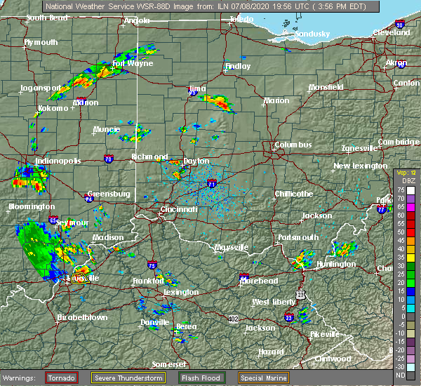
| 8/28/2020 1:40 PM EDT |
 At 140 pm edt, severe thunderstorms were located along a line extending from near kenton to near la rue, moving northeast at 10 mph (radar indicated). Hazards include 60 mph wind gusts. Expect damage to trees and power lines. Locations impacted include, kenton, forest, patterson, hepburn, grant and pfeiffer. At 140 pm edt, severe thunderstorms were located along a line extending from near kenton to near la rue, moving northeast at 10 mph (radar indicated). Hazards include 60 mph wind gusts. Expect damage to trees and power lines. Locations impacted include, kenton, forest, patterson, hepburn, grant and pfeiffer.
|
| 8/28/2020 1:30 PM EDT |
 At 130 pm edt, severe thunderstorms were located along a line extending from 6 miles south of kenton to near richwood, moving northeast at 30 mph (radar indicated). Hazards include 60 mph wind gusts. Expect damage to trees and power lines. Locations impacted include, kenton, richwood, forest, mount victory, ridgeway, patterson, grant, silver creek, byhalia, pfeiffer, hepburn, mentzer, big springs and essex. At 130 pm edt, severe thunderstorms were located along a line extending from 6 miles south of kenton to near richwood, moving northeast at 30 mph (radar indicated). Hazards include 60 mph wind gusts. Expect damage to trees and power lines. Locations impacted include, kenton, richwood, forest, mount victory, ridgeway, patterson, grant, silver creek, byhalia, pfeiffer, hepburn, mentzer, big springs and essex.
|
| 8/28/2020 1:11 PM EDT |
 At 111 pm edt, severe thunderstorms were located along a line extending from near belle center to near west mansfield, moving northeast at 30 mph (radar indicated). Hazards include 60 mph wind gusts and penny size hail. expect damage to trees and power lines At 111 pm edt, severe thunderstorms were located along a line extending from near belle center to near west mansfield, moving northeast at 30 mph (radar indicated). Hazards include 60 mph wind gusts and penny size hail. expect damage to trees and power lines
|
| 7/10/2020 1:23 PM EDT |
 At 123 pm edt, a severe thunderstorm was located near dunkirk, moving northeast at 20 mph (radar indicated). Hazards include 60 mph wind gusts and penny size hail. expect damage to trees and power lines At 123 pm edt, a severe thunderstorm was located near dunkirk, moving northeast at 20 mph (radar indicated). Hazards include 60 mph wind gusts and penny size hail. expect damage to trees and power lines
|
| 7/8/2020 4:26 PM EDT |
 The severe thunderstorm warning for south central hardin county will expire at 430 pm edt, the storm which prompted the warning has weakened below severe limits, and no longer poses an immediate threat to life or property. therefore, the warning will be allowed to expire. however gusty winds and heavy rain are still possible with this thunderstorm. please report previous wind damage or hail to the national weather service by going to our website at weather.gov/iln and submitting your report via social media. The severe thunderstorm warning for south central hardin county will expire at 430 pm edt, the storm which prompted the warning has weakened below severe limits, and no longer poses an immediate threat to life or property. therefore, the warning will be allowed to expire. however gusty winds and heavy rain are still possible with this thunderstorm. please report previous wind damage or hail to the national weather service by going to our website at weather.gov/iln and submitting your report via social media.
|
| 7/8/2020 4:14 PM EDT |
 At 414 pm edt, a severe thunderstorm was located 7 miles east of belle center, moving southeast at 5 mph (radar indicated). Hazards include 60 mph wind gusts. Expect damage to trees and power lines. Locations impacted include, kenton, mount victory, ridgeway, silver creek and mentzer. At 414 pm edt, a severe thunderstorm was located 7 miles east of belle center, moving southeast at 5 mph (radar indicated). Hazards include 60 mph wind gusts. Expect damage to trees and power lines. Locations impacted include, kenton, mount victory, ridgeway, silver creek and mentzer.
|
| 7/8/2020 3:58 PM EDT |
 At 357 pm edt, a severe thunderstorm was located between kenton and mount victory moving southeast at 5 mph (radar indicated). Hazards include 60 mph wind gusts and penny size hail. expect damage to trees and power lines At 357 pm edt, a severe thunderstorm was located between kenton and mount victory moving southeast at 5 mph (radar indicated). Hazards include 60 mph wind gusts and penny size hail. expect damage to trees and power lines
|
| 6/26/2020 6:06 PM EDT |
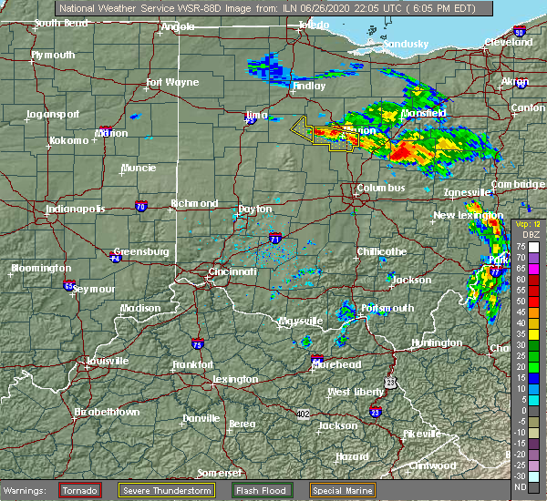 The severe thunderstorm warning for northeastern hardin county will expire at 615 pm edt, the storm which prompted the warning has moved out of hardin and into marion county. therefore, the warning will be allowed to expire. please report previous wind damage or hail to the national weather service by going to our website at weather.gov/iln and submitting your report via social media. The severe thunderstorm warning for northeastern hardin county will expire at 615 pm edt, the storm which prompted the warning has moved out of hardin and into marion county. therefore, the warning will be allowed to expire. please report previous wind damage or hail to the national weather service by going to our website at weather.gov/iln and submitting your report via social media.
|
| 6/26/2020 5:50 PM EDT |
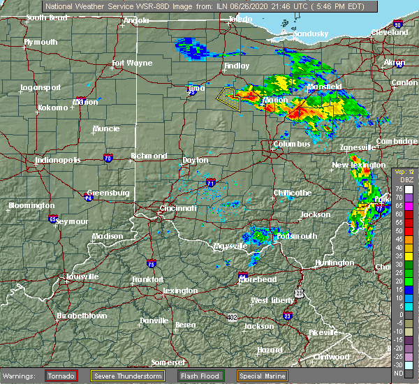 At 550 pm edt, a severe thunderstorm was located near marseilles, moving southeast at 30 mph (radar indicated). Hazards include 60 mph wind gusts and quarter size hail. Minor hail damage to vehicles is possible. expect wind damage to trees and power lines. Locations impacted include, kenton, forest, patterson, hepburn, grant and pfeiffer. At 550 pm edt, a severe thunderstorm was located near marseilles, moving southeast at 30 mph (radar indicated). Hazards include 60 mph wind gusts and quarter size hail. Minor hail damage to vehicles is possible. expect wind damage to trees and power lines. Locations impacted include, kenton, forest, patterson, hepburn, grant and pfeiffer.
|
| 6/26/2020 5:39 PM EDT |
 At 539 pm edt, a severe thunderstorm was located near kenton, moving southeast at 35 mph (radar indicated). Hazards include 60 mph wind gusts and half dollar size hail. Minor hail damage to vehicles is possible. Expect wind damage to trees and power lines. At 539 pm edt, a severe thunderstorm was located near kenton, moving southeast at 35 mph (radar indicated). Hazards include 60 mph wind gusts and half dollar size hail. Minor hail damage to vehicles is possible. Expect wind damage to trees and power lines.
|
| 6/10/2020 5:37 PM EDT |
 The severe thunderstorm warning for eastern hardin county will expire at 545 pm edt, the severe thunderstorm which prompted the warning has moved out of the warned area. therefore, the warning will be allowed to expire. a severe thunderstorm watch remains in effect until 1000 pm edt for west central ohio. please report previous wind damage or hail to the national weather service by going to our website at weather.gov/iln and submitting your report via social media. The severe thunderstorm warning for eastern hardin county will expire at 545 pm edt, the severe thunderstorm which prompted the warning has moved out of the warned area. therefore, the warning will be allowed to expire. a severe thunderstorm watch remains in effect until 1000 pm edt for west central ohio. please report previous wind damage or hail to the national weather service by going to our website at weather.gov/iln and submitting your report via social media.
|
| 6/10/2020 5:32 PM EDT |
 At 532 pm edt, a severe thunderstorm was located over kenton, moving northeast at 45 mph (radar indicated). Hazards include 60 mph wind gusts. expect damage to trees and power lines At 532 pm edt, a severe thunderstorm was located over kenton, moving northeast at 45 mph (radar indicated). Hazards include 60 mph wind gusts. expect damage to trees and power lines
|
| 6/10/2020 5:21 PM EDT |
 At 521 pm edt, a severe thunderstorm was located near kenton, moving northeast at 60 mph (radar indicated). Hazards include 70 mph wind gusts. Expect considerable tree damage. damage is likely to mobile homes, roofs, and outbuildings. Locations impacted include, kenton, ada, alger, belle center, blanchard, roundhead, mount victory, mcguffey, ridgeway, grant, silver creek, jumbo, huntersville, pfeiffer, walton, hepburn, mentzer, big springs and state route 195 at state route 235. At 521 pm edt, a severe thunderstorm was located near kenton, moving northeast at 60 mph (radar indicated). Hazards include 70 mph wind gusts. Expect considerable tree damage. damage is likely to mobile homes, roofs, and outbuildings. Locations impacted include, kenton, ada, alger, belle center, blanchard, roundhead, mount victory, mcguffey, ridgeway, grant, silver creek, jumbo, huntersville, pfeiffer, walton, hepburn, mentzer, big springs and state route 195 at state route 235.
|
| 6/10/2020 5:04 PM EDT |
 At 503 pm edt, a severe thunderstorm was located over bellefontaine, moving northeast at 60 mph (radar indicated). Hazards include 70 mph wind gusts. Expect considerable tree damage. damage is likely to mobile homes, roofs, and outbuildings. Locations impacted include, bellefontaine, kenton, ada, west liberty, russells point, de graff, lakeview, alger, belle center, chippewa park, northwood, blanchard, roundhead, quincy, mount victory, rushsylvania, mcguffey, huntsville, ridgeway and valley hi. At 503 pm edt, a severe thunderstorm was located over bellefontaine, moving northeast at 60 mph (radar indicated). Hazards include 70 mph wind gusts. Expect considerable tree damage. damage is likely to mobile homes, roofs, and outbuildings. Locations impacted include, bellefontaine, kenton, ada, west liberty, russells point, de graff, lakeview, alger, belle center, chippewa park, northwood, blanchard, roundhead, quincy, mount victory, rushsylvania, mcguffey, huntsville, ridgeway and valley hi.
|
| 6/10/2020 4:53 PM EDT |
 At 453 pm edt, a severe thunderstorm was located near de graff, moving northeast at 55 mph (radar indicated). Hazards include 70 mph wind gusts. Expect considerable tree damage. damage is likely to mobile homes, roofs, and outbuildings. locations impacted include, bellefontaine, kenton, ada, st. Paris, west liberty, russells point, de graff, lakeview, alger, belle center, chippewa park, northwood, blanchard, roundhead, quincy, mount victory, rushsylvania, mcguffey, huntsville and ridgeway. At 453 pm edt, a severe thunderstorm was located near de graff, moving northeast at 55 mph (radar indicated). Hazards include 70 mph wind gusts. Expect considerable tree damage. damage is likely to mobile homes, roofs, and outbuildings. locations impacted include, bellefontaine, kenton, ada, st. Paris, west liberty, russells point, de graff, lakeview, alger, belle center, chippewa park, northwood, blanchard, roundhead, quincy, mount victory, rushsylvania, mcguffey, huntsville and ridgeway.
|
| 6/10/2020 4:41 PM EDT |
 At 441 pm edt, a severe thunderstorm was located near st. paris, moving northeast at 60 mph (radar indicated). Hazards include 70 mph wind gusts. Expect considerable tree damage. Damage is likely to mobile homes, roofs, and outbuildings. At 441 pm edt, a severe thunderstorm was located near st. paris, moving northeast at 60 mph (radar indicated). Hazards include 70 mph wind gusts. Expect considerable tree damage. Damage is likely to mobile homes, roofs, and outbuildings.
|
| 5/10/2020 3:57 PM EDT |
 The severe thunderstorm warning for northern logan and hardin counties will expire at 400 pm edt, the storms which prompted the warning have weakened below severe limits, and no longer pose an immediate threat to life or property. therefore, the warning will be allowed to expire. please report previous wind damage or hail to the national weather service by going to our website at weather.gov/iln and submitting your report via social media. The severe thunderstorm warning for northern logan and hardin counties will expire at 400 pm edt, the storms which prompted the warning have weakened below severe limits, and no longer pose an immediate threat to life or property. therefore, the warning will be allowed to expire. please report previous wind damage or hail to the national weather service by going to our website at weather.gov/iln and submitting your report via social media.
|
| 5/10/2020 3:40 PM EDT |
 At 340 pm edt, severe thunderstorms were located along a line extending from near kenton to near bellefontaine, moving east at 55 mph (radar indicated). Hazards include 60 mph wind gusts. Expect damage to trees and power lines. Locations impacted include, bellefontaine, kenton, forest, russells point, dunkirk, belle center, west mansfield, chippewa park, northwood, blanchard, roundhead, mount victory, rushsylvania, mcguffey, huntsville, ridgeway, patterson, dola, new jerusalem and huntersville. At 340 pm edt, severe thunderstorms were located along a line extending from near kenton to near bellefontaine, moving east at 55 mph (radar indicated). Hazards include 60 mph wind gusts. Expect damage to trees and power lines. Locations impacted include, bellefontaine, kenton, forest, russells point, dunkirk, belle center, west mansfield, chippewa park, northwood, blanchard, roundhead, mount victory, rushsylvania, mcguffey, huntsville, ridgeway, patterson, dola, new jerusalem and huntersville.
|
| 5/10/2020 3:24 PM EDT |
 At 323 pm edt, severe thunderstorms were located along a line extending from near alger to near de graff, moving east at 40 mph (radar indicated). Hazards include 60 mph wind gusts. Expect damage to trees and power lines. Locations impacted include, bellefontaine, kenton, ada, jackson center, forest, russells point, lakeview, dunkirk, alger, waynesfield, belle center, west mansfield, chippewa park, northwood, blanchard, roundhead, mount victory, rushsylvania, mcguffey and huntsville. At 323 pm edt, severe thunderstorms were located along a line extending from near alger to near de graff, moving east at 40 mph (radar indicated). Hazards include 60 mph wind gusts. Expect damage to trees and power lines. Locations impacted include, bellefontaine, kenton, ada, jackson center, forest, russells point, lakeview, dunkirk, alger, waynesfield, belle center, west mansfield, chippewa park, northwood, blanchard, roundhead, mount victory, rushsylvania, mcguffey and huntsville.
|
| 5/10/2020 3:11 PM EDT |
 At 311 pm edt, severe thunderstorms were located along a line extending from 6 miles east of lima to near anna, moving east at 50 mph (radar indicated). Hazards include 60 mph wind gusts. expect damage to trees and power lines At 311 pm edt, severe thunderstorms were located along a line extending from 6 miles east of lima to near anna, moving east at 50 mph (radar indicated). Hazards include 60 mph wind gusts. expect damage to trees and power lines
|
| 3/29/2020 12:36 AM EDT |
 The severe thunderstorm warning for northern hardin county will expire at 1245 am edt, the storm which prompted the warning has weakened below severe limits, and no longer poses an immediate threat to life or property. therefore, the warning will be allowed to expire. however heavy rain is still possible with this thunderstorm. please report previous wind damage or hail to the national weather service by going to our website at weather.gov/iln and submitting your report via social media. The severe thunderstorm warning for northern hardin county will expire at 1245 am edt, the storm which prompted the warning has weakened below severe limits, and no longer poses an immediate threat to life or property. therefore, the warning will be allowed to expire. however heavy rain is still possible with this thunderstorm. please report previous wind damage or hail to the national weather service by going to our website at weather.gov/iln and submitting your report via social media.
|
| 3/29/2020 12:30 AM EDT |
 At 1230 am edt, a severe thunderstorm was located near dunkirk, moving northeast at 65 mph (radar indicated). Hazards include 60 mph wind gusts. Expect damage to trees and power lines. Locations impacted include, kenton, ada, forest, dunkirk, alger, blanchard, mcguffey, patterson, dola, grant, jumbo, huntersville, walton and state route 195 at state route 235. At 1230 am edt, a severe thunderstorm was located near dunkirk, moving northeast at 65 mph (radar indicated). Hazards include 60 mph wind gusts. Expect damage to trees and power lines. Locations impacted include, kenton, ada, forest, dunkirk, alger, blanchard, mcguffey, patterson, dola, grant, jumbo, huntersville, walton and state route 195 at state route 235.
|
| 3/29/2020 12:19 AM EDT |
 At 1218 am edt, a severe thunderstorm was located near waynesfield, moving northeast at 65 mph (radar indicated). Hazards include 60 mph wind gusts. expect damage to trees and power lines At 1218 am edt, a severe thunderstorm was located near waynesfield, moving northeast at 65 mph (radar indicated). Hazards include 60 mph wind gusts. expect damage to trees and power lines
|
| 7/16/2019 5:06 PM EDT |
 At 505 pm edt, a severe thunderstorm was located near kenton, moving northeast at 35 mph (radar indicated). Hazards include 60 mph wind gusts. expect damage to trees and power lines At 505 pm edt, a severe thunderstorm was located near kenton, moving northeast at 35 mph (radar indicated). Hazards include 60 mph wind gusts. expect damage to trees and power lines
|
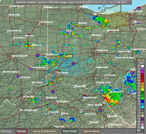
| 7/2/2019 8:20 PM EDT |
 The severe thunderstorm warning for northeastern logan and southern hardin counties will expire at 830 pm edt, the storm which prompted the warning has weakened below severe limits, and no longer poses an immediate threat to life or property. therefore, the warning will be allowed to expire. however gusty winds and heavy rain are still possible with this thunderstorm. please report previous wind damage or hail to the national weather service by going to our website at weather.gov/iln and submitting your report via social media. The severe thunderstorm warning for northeastern logan and southern hardin counties will expire at 830 pm edt, the storm which prompted the warning has weakened below severe limits, and no longer poses an immediate threat to life or property. therefore, the warning will be allowed to expire. however gusty winds and heavy rain are still possible with this thunderstorm. please report previous wind damage or hail to the national weather service by going to our website at weather.gov/iln and submitting your report via social media.
|
| 7/2/2019 7:42 PM EDT |
 At 742 pm edt, a severe thunderstorm was located near kenton, moving east at 15 mph (radar indicated). Hazards include 60 mph wind gusts and quarter size hail. Minor hail damage to vehicles is possible. Expect wind damage to trees and power lines. At 742 pm edt, a severe thunderstorm was located near kenton, moving east at 15 mph (radar indicated). Hazards include 60 mph wind gusts and quarter size hail. Minor hail damage to vehicles is possible. Expect wind damage to trees and power lines.
|
| 7/2/2019 4:36 PM EDT |
 The severe thunderstorm warning for central hardin county will expire at 445 pm edt, the storm which prompted the warning has weakened below severe limits, and no longer poses an immediate threat to life or property. therefore, the warning will be allowed to expire. however gusty winds are still possible with this thunderstorm. please report previous wind damage or hail to the national weather service by going to our website at weather.gov/iln and submitting your report via social media. The severe thunderstorm warning for central hardin county will expire at 445 pm edt, the storm which prompted the warning has weakened below severe limits, and no longer poses an immediate threat to life or property. therefore, the warning will be allowed to expire. however gusty winds are still possible with this thunderstorm. please report previous wind damage or hail to the national weather service by going to our website at weather.gov/iln and submitting your report via social media.
|
| 7/2/2019 4:17 PM EDT |
 At 417 pm edt, a severe thunderstorm was located near kenton, moving east at 20 mph (radar indicated). Hazards include 60 mph wind gusts. expect damage to trees and power lines At 417 pm edt, a severe thunderstorm was located near kenton, moving east at 20 mph (radar indicated). Hazards include 60 mph wind gusts. expect damage to trees and power lines
|
| 6/2/2019 12:03 AM EDT |
 At 1203 am edt, a severe thunderstorm was located near forest, moving east at 40 mph (radar indicated). Hazards include 60 mph wind gusts and quarter size hail. Minor hail damage to vehicles is possible. expect wind damage to trees and power lines. Locations impacted include, kenton, forest, patterson, hepburn, grant and pfeiffer. At 1203 am edt, a severe thunderstorm was located near forest, moving east at 40 mph (radar indicated). Hazards include 60 mph wind gusts and quarter size hail. Minor hail damage to vehicles is possible. expect wind damage to trees and power lines. Locations impacted include, kenton, forest, patterson, hepburn, grant and pfeiffer.
|
| 6/1/2019 11:55 PM EDT |
 The national weather service in wilmington has issued a * severe thunderstorm warning for. central hardin county in west central ohio. until 1230 am edt. At 1155 pm edt, a severe thunderstorm was located near dunkirk, moving east at 40 mph. The national weather service in wilmington has issued a * severe thunderstorm warning for. central hardin county in west central ohio. until 1230 am edt. At 1155 pm edt, a severe thunderstorm was located near dunkirk, moving east at 40 mph.
|
| 5/28/2019 6:06 PM EDT |
 The severe thunderstorm warning for northeastern auglaize and southwestern hardin counties will expire at 615 pm edt, the storm which prompted the warning has weakened below severe limits, and no longer poses an immediate threat to life or property. therefore, the warning will be allowed to expire. a severe thunderstorm watch remains in effect until 800 pm edt for west central ohio. please report previous wind damage or hail to the national weather service by going to our website at weather.gov/iln and submitting your report via social media. The severe thunderstorm warning for northeastern auglaize and southwestern hardin counties will expire at 615 pm edt, the storm which prompted the warning has weakened below severe limits, and no longer poses an immediate threat to life or property. therefore, the warning will be allowed to expire. a severe thunderstorm watch remains in effect until 800 pm edt for west central ohio. please report previous wind damage or hail to the national weather service by going to our website at weather.gov/iln and submitting your report via social media.
|
| 5/28/2019 5:49 PM EDT |
 At 549 pm edt, a severe thunderstorm was located over waynesfield, moving east at 30 mph (radar indicated). Hazards include 60 mph wind gusts and quarter size hail. Minor hail damage to vehicles is possible. expect wind damage to trees and power lines. locations impacted include, wapakoneta, kenton, fort shawnee, cridersville, alger, waynesfield, roundhead, mcguffey, uniopolis, fryburg, silver creek, jumbo, st. johns, walton, new hampshire and state route 195 at state route 235. This includes i-75 in ohio between mile markers 108 and 118. At 549 pm edt, a severe thunderstorm was located over waynesfield, moving east at 30 mph (radar indicated). Hazards include 60 mph wind gusts and quarter size hail. Minor hail damage to vehicles is possible. expect wind damage to trees and power lines. locations impacted include, wapakoneta, kenton, fort shawnee, cridersville, alger, waynesfield, roundhead, mcguffey, uniopolis, fryburg, silver creek, jumbo, st. johns, walton, new hampshire and state route 195 at state route 235. This includes i-75 in ohio between mile markers 108 and 118.
|
| 5/28/2019 5:36 PM EDT |
 At 536 pm edt, a severe thunderstorm was located near cridersville, moving east at 30 mph (radar indicated). Hazards include 60 mph wind gusts and quarter size hail. Minor hail damage to vehicles is possible. Expect wind damage to trees and power lines. At 536 pm edt, a severe thunderstorm was located near cridersville, moving east at 30 mph (radar indicated). Hazards include 60 mph wind gusts and quarter size hail. Minor hail damage to vehicles is possible. Expect wind damage to trees and power lines.
|
| 5/27/2019 11:51 PM EDT |
 The tornado warning for southeastern hardin county will expire at midnight edt, the storm which prompted the warning has weakened below severe limits, and has exited the warned area. therefore, the warning will be allowed to expire. however gusty winds are still possible with this thunderstorm. a tornado watch remains in effect until 200 am edt for west central ohio. please report previous tornadoes, wind damage or hail to the national weather service by going to our website at weather.gov/iln and submitting your report via social media. The tornado warning for southeastern hardin county will expire at midnight edt, the storm which prompted the warning has weakened below severe limits, and has exited the warned area. therefore, the warning will be allowed to expire. however gusty winds are still possible with this thunderstorm. a tornado watch remains in effect until 200 am edt for west central ohio. please report previous tornadoes, wind damage or hail to the national weather service by going to our website at weather.gov/iln and submitting your report via social media.
|
| 5/27/2019 11:37 PM EDT |
 At 1137 pm edt, a severe thunderstorm capable of producing a tornado was located near kenton, moving east at 35 mph (radar indicated rotation). Hazards include tornado and quarter size hail. Flying debris will be dangerous to those caught without shelter. mobile homes will be damaged or destroyed. damage to roofs, windows, and vehicles will occur. tree damage is likely. Locations impacted include, kenton, mount victory, ridgeway, hepburn, silver creek, mentzer and pfeiffer. At 1137 pm edt, a severe thunderstorm capable of producing a tornado was located near kenton, moving east at 35 mph (radar indicated rotation). Hazards include tornado and quarter size hail. Flying debris will be dangerous to those caught without shelter. mobile homes will be damaged or destroyed. damage to roofs, windows, and vehicles will occur. tree damage is likely. Locations impacted include, kenton, mount victory, ridgeway, hepburn, silver creek, mentzer and pfeiffer.
|
| 5/27/2019 11:25 PM EDT |
 At 1124 pm edt, a severe thunderstorm capable of producing a tornado was located near belle center, moving east at 35 mph (radar indicated rotation). Hazards include tornado. Flying debris will be dangerous to those caught without shelter. mobile homes will be damaged or destroyed. damage to roofs, windows, and vehicles will occur. Tree damage is likely. At 1124 pm edt, a severe thunderstorm capable of producing a tornado was located near belle center, moving east at 35 mph (radar indicated rotation). Hazards include tornado. Flying debris will be dangerous to those caught without shelter. mobile homes will be damaged or destroyed. damage to roofs, windows, and vehicles will occur. Tree damage is likely.
|
| 5/27/2019 11:07 PM EDT |
 At 1107 pm edt, a severe thunderstorm capable of producing a tornado was located near waynesfield, moving east at 35 mph. this storm previously produced a tornado and may generate another tornado at any time (radar indicated rotation). Hazards include tornado and quarter size hail. Flying debris will be dangerous to those caught without shelter. mobile homes will be damaged or destroyed. damage to roofs, windows, and vehicles will occur. tree damage is likely. Locations impacted include, kenton, lakeview, alger, waynesfield, belle center, chippewa park, blanchard, roundhead, mcguffey, ridgeway, silver creek, jumbo, huntersville, walton, mentzer, new hampshire and state route 195 at state route 235. At 1107 pm edt, a severe thunderstorm capable of producing a tornado was located near waynesfield, moving east at 35 mph. this storm previously produced a tornado and may generate another tornado at any time (radar indicated rotation). Hazards include tornado and quarter size hail. Flying debris will be dangerous to those caught without shelter. mobile homes will be damaged or destroyed. damage to roofs, windows, and vehicles will occur. tree damage is likely. Locations impacted include, kenton, lakeview, alger, waynesfield, belle center, chippewa park, blanchard, roundhead, mcguffey, ridgeway, silver creek, jumbo, huntersville, walton, mentzer, new hampshire and state route 195 at state route 235.
|
| 5/27/2019 10:54 PM EDT |
 At 1054 pm edt, a severe thunderstorm capable of producing a tornado was located near waynesfield, moving east at 35 mph. this storm previously produced a tornado and may generate another tornado at any time (radar indicated rotation). Hazards include tornado and quarter size hail. Flying debris will be dangerous to those caught without shelter. mobile homes will be damaged or destroyed. damage to roofs, windows, and vehicles will occur. Tree damage is likely. At 1054 pm edt, a severe thunderstorm capable of producing a tornado was located near waynesfield, moving east at 35 mph. this storm previously produced a tornado and may generate another tornado at any time (radar indicated rotation). Hazards include tornado and quarter size hail. Flying debris will be dangerous to those caught without shelter. mobile homes will be damaged or destroyed. damage to roofs, windows, and vehicles will occur. Tree damage is likely.
|
| 5/26/2019 6:56 AM EDT |
 At 655 am edt, a severe thunderstorm was located near kenton, moving east at 50 mph (radar indicated). Hazards include 60 mph wind gusts and quarter size hail. Minor hail damage to vehicles is possible. Expect wind damage to trees and power lines. At 655 am edt, a severe thunderstorm was located near kenton, moving east at 50 mph (radar indicated). Hazards include 60 mph wind gusts and quarter size hail. Minor hail damage to vehicles is possible. Expect wind damage to trees and power lines.
|
| 7/26/2018 6:46 PM EDT | Quarter sized hail reported 0.3 miles NNW of Kenton, OH, scattered pea to nickel sized hail. isolated quarter size hail also occurred. |
| 6/8/2018 3:08 PM EDT |
 The severe thunderstorm warning for northeastern logan and southern hardin counties will expire at 315 pm edt, the storm which prompted the warning has weakened below severe limits, and no longer poses an immediate threat to life or property. therefore, the warning will be allowed to expire. however gusty winds and heavy rain are still possible with this thunderstorm. please report previous wind damage or hail to the national weather service by going to our website at weather.gov/iln and submitting your report via social media. The severe thunderstorm warning for northeastern logan and southern hardin counties will expire at 315 pm edt, the storm which prompted the warning has weakened below severe limits, and no longer poses an immediate threat to life or property. therefore, the warning will be allowed to expire. however gusty winds and heavy rain are still possible with this thunderstorm. please report previous wind damage or hail to the national weather service by going to our website at weather.gov/iln and submitting your report via social media.
|
| 6/8/2018 2:43 PM EDT |
 At 243 pm edt, a severe thunderstorm was located near waynesfield, moving east at 20 mph (radar indicated). Hazards include 60 mph wind gusts and quarter size hail. Minor hail damage to vehicles is possible. expect wind damage to trees and power lines. Locations impacted include, kenton, alger, belle center, northwood, roundhead, rushsylvania, mcguffey, ridgeway, silver creek, jumbo, huntersville, walton, mentzer, big springs and state route 195 at state route 235. At 243 pm edt, a severe thunderstorm was located near waynesfield, moving east at 20 mph (radar indicated). Hazards include 60 mph wind gusts and quarter size hail. Minor hail damage to vehicles is possible. expect wind damage to trees and power lines. Locations impacted include, kenton, alger, belle center, northwood, roundhead, rushsylvania, mcguffey, ridgeway, silver creek, jumbo, huntersville, walton, mentzer, big springs and state route 195 at state route 235.
|
| 6/8/2018 2:24 PM EDT |
 At 224 pm edt, a severe thunderstorm was located over waynesfield, moving east at 20 mph (radar indicated). Hazards include 60 mph wind gusts and quarter size hail. Minor hail damage to vehicles is possible. Expect wind damage to trees and power lines. At 224 pm edt, a severe thunderstorm was located over waynesfield, moving east at 20 mph (radar indicated). Hazards include 60 mph wind gusts and quarter size hail. Minor hail damage to vehicles is possible. Expect wind damage to trees and power lines.
|
| 11/5/2017 5:36 PM EDT |
 At 436 pm est, a severe thunderstorm was located near marseilles, moving east at 60 mph (radar indicated). Hazards include 60 mph wind gusts and quarter size hail. Minor hail damage to vehicles is possible. expect wind damage to trees and power lines. locations impacted include, kenton, belle center, northwood, mount victory, ridgeway, hepburn, silver creek, mentzer, big springs, essex and pfeiffer. A tornado watch remains in effect until 700 pm est for central and west central ohio. At 436 pm est, a severe thunderstorm was located near marseilles, moving east at 60 mph (radar indicated). Hazards include 60 mph wind gusts and quarter size hail. Minor hail damage to vehicles is possible. expect wind damage to trees and power lines. locations impacted include, kenton, belle center, northwood, mount victory, ridgeway, hepburn, silver creek, mentzer, big springs, essex and pfeiffer. A tornado watch remains in effect until 700 pm est for central and west central ohio.
|
| 11/5/2017 5:27 PM EDT |
 The severe thunderstorm warning for northern shelby, northwestern logan, southern hardin and auglaize counties will expire at 430 pm est, the storm which prompted the warning has weakened below severe limits, and no longer poses an immediate threat to life or property. therefore, the warning will be allowed to expire. however heavy rain is still possible with this thunderstorm. a tornado watch remains in effect until 700 pm est for west central ohio. please report previous wind damage or hail to the national weather service by going to our website at weather.gov/iln and submitting your report via social media. The severe thunderstorm warning for northern shelby, northwestern logan, southern hardin and auglaize counties will expire at 430 pm est, the storm which prompted the warning has weakened below severe limits, and no longer poses an immediate threat to life or property. therefore, the warning will be allowed to expire. however heavy rain is still possible with this thunderstorm. a tornado watch remains in effect until 700 pm est for west central ohio. please report previous wind damage or hail to the national weather service by going to our website at weather.gov/iln and submitting your report via social media.
|
| 11/5/2017 5:22 PM EDT |
 At 421 pm est, a severe thunderstorm was located over kenton, moving east at 60 mph (radar indicated). Hazards include 60 mph wind gusts and penny size hail. expect damage to trees and power lines At 421 pm est, a severe thunderstorm was located over kenton, moving east at 60 mph (radar indicated). Hazards include 60 mph wind gusts and penny size hail. expect damage to trees and power lines
|
| 11/5/2017 4:49 PM EDT |
 At 349 pm est, a severe thunderstorm was located near st. marys, moving east at 60 mph (radar indicated). Hazards include 60 mph wind gusts and penny size hail. expect damage to trees and power lines At 349 pm est, a severe thunderstorm was located near st. marys, moving east at 60 mph (radar indicated). Hazards include 60 mph wind gusts and penny size hail. expect damage to trees and power lines
|
| 7/16/2017 7:16 PM EDT |
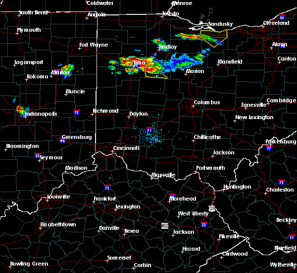 At 715 pm edt, a severe thunderstorm was located 7 miles southeast of alger, moving southeast at 25 mph. at 714 pm, there was a public report of quarter size hail mcguffey (public). Hazards include 60 mph wind gusts and quarter size hail. Minor hail damage to vehicles is possible. expect wind damage to trees and power lines. Locations impacted include, kenton, alger, roundhead, mount victory, mcguffey, ridgeway, silver creek, mentzer, jumbo, huntersville, walton and state route 195 at state route 235. At 715 pm edt, a severe thunderstorm was located 7 miles southeast of alger, moving southeast at 25 mph. at 714 pm, there was a public report of quarter size hail mcguffey (public). Hazards include 60 mph wind gusts and quarter size hail. Minor hail damage to vehicles is possible. expect wind damage to trees and power lines. Locations impacted include, kenton, alger, roundhead, mount victory, mcguffey, ridgeway, silver creek, mentzer, jumbo, huntersville, walton and state route 195 at state route 235.
|
| 7/16/2017 7:01 PM EDT |
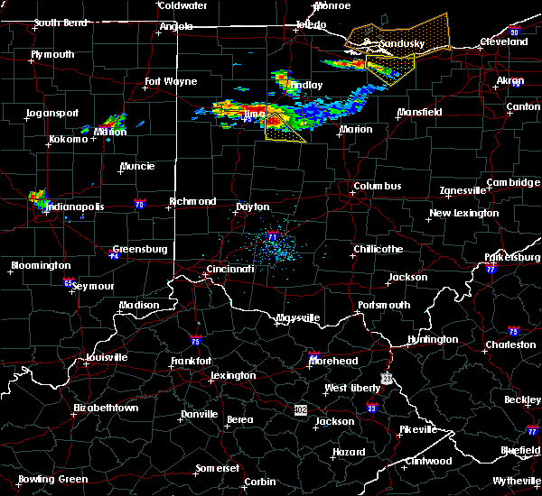 At 701 pm edt, a severe thunderstorm was located over alger, moving southeast at 25 mph (radar indicated). Hazards include 60 mph wind gusts and quarter size hail. Minor hail damage to vehicles is possible. Expect wind damage to trees and power lines. At 701 pm edt, a severe thunderstorm was located over alger, moving southeast at 25 mph (radar indicated). Hazards include 60 mph wind gusts and quarter size hail. Minor hail damage to vehicles is possible. Expect wind damage to trees and power lines.
|
| 7/16/2017 6:03 PM EDT |
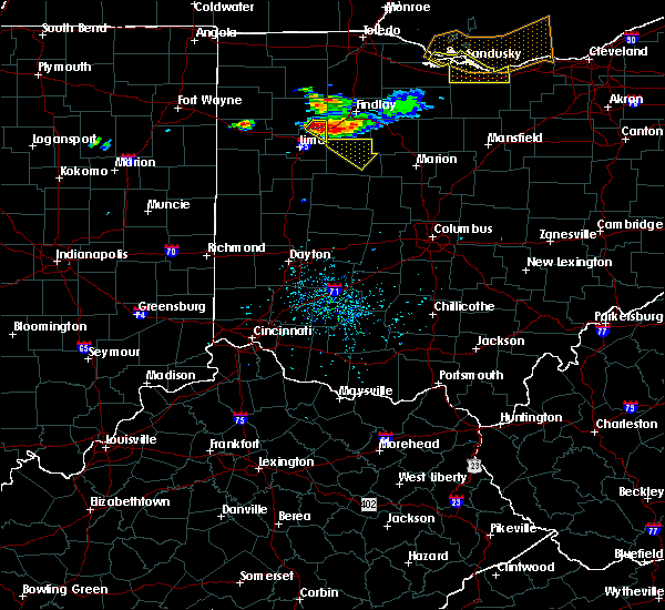 At 601 pm edt, a severe thunderstorm was located over bluffton, moving southeast at 25 mph (radar indicated. this storm has a history of producing 1 inch hail, reported in pandora, ohio). Hazards include 60 mph wind gusts and quarter size hail. Minor hail damage to vehicles is possible. Expect wind damage to trees and power lines. At 601 pm edt, a severe thunderstorm was located over bluffton, moving southeast at 25 mph (radar indicated. this storm has a history of producing 1 inch hail, reported in pandora, ohio). Hazards include 60 mph wind gusts and quarter size hail. Minor hail damage to vehicles is possible. Expect wind damage to trees and power lines.
|
| 7/11/2017 1:30 PM EDT | 4 1/2 inch diamter branches down. reports of power lines down throughout kenton. time estimated from rada in hardin county OH, 1.1 miles S of Kenton, OH |
| 7/11/2017 1:24 AM EDT | 1 tree limb knocked down in hardin county OH, 1.1 miles S of Kenton, OH |
| 6/13/2017 7:18 PM EDT | Tree down across road near intersection of sr 31 and county road 190. time estimated by rada in hardin county OH, 5.4 miles NW of Kenton, OH |
| 6/13/2017 6:56 PM EDT |
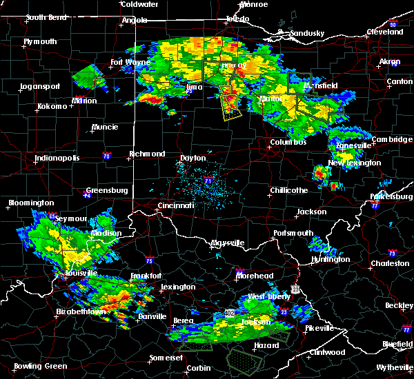 At 656 pm edt, a severe thunderstorm was located near kenton, moving south at 15 mph (radar indicated). Hazards include 60 mph wind gusts and quarter size hail. Hail damage to vehicles is expected. Expect wind damage to roofs, siding, and trees. At 656 pm edt, a severe thunderstorm was located near kenton, moving south at 15 mph (radar indicated). Hazards include 60 mph wind gusts and quarter size hail. Hail damage to vehicles is expected. Expect wind damage to roofs, siding, and trees.
|
| 4/19/2017 7:25 PM EDT |
 The severe thunderstorm warning for southeastern hardin county will expire at 730 pm edt, the storm which prompted the warning has weakened below severe limits, and no longer poses an immediate threat to life or property. therefore, the warning will be allowed to expire. however small hail and gusty winds are still possible with this thunderstorm. please report previous wind damage or hail to the national weather service by going to our website at weather.gov/iln and submitting your report via social media. The severe thunderstorm warning for southeastern hardin county will expire at 730 pm edt, the storm which prompted the warning has weakened below severe limits, and no longer poses an immediate threat to life or property. therefore, the warning will be allowed to expire. however small hail and gusty winds are still possible with this thunderstorm. please report previous wind damage or hail to the national weather service by going to our website at weather.gov/iln and submitting your report via social media.
|
| 4/19/2017 7:16 PM EDT |
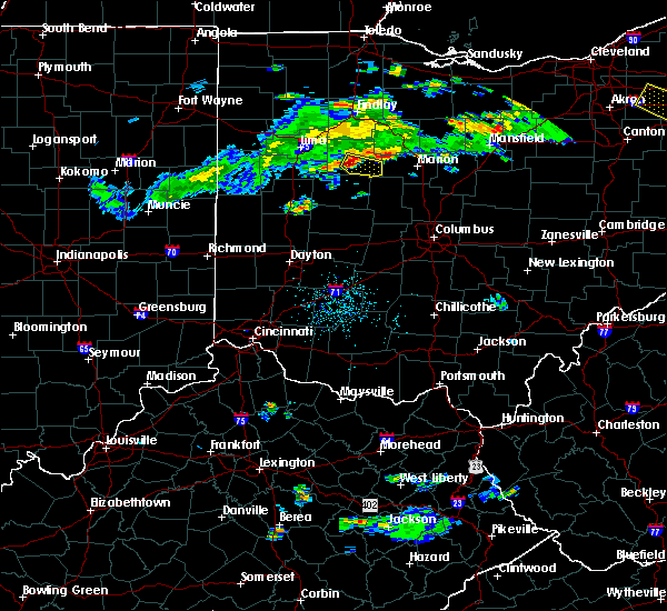 At 716 pm edt, a severe thunderstorm was located near kenton, moving east at 30 mph (radar indicated). Hazards include 60 mph wind gusts and quarter size hail. Hail damage to vehicles is expected. expect wind damage to roofs, siding, and trees. Locations impacted include, kenton, mount victory, ridgeway, hepburn, silver creek, mentzer, pfeiffer and jumbo. At 716 pm edt, a severe thunderstorm was located near kenton, moving east at 30 mph (radar indicated). Hazards include 60 mph wind gusts and quarter size hail. Hail damage to vehicles is expected. expect wind damage to roofs, siding, and trees. Locations impacted include, kenton, mount victory, ridgeway, hepburn, silver creek, mentzer, pfeiffer and jumbo.
|
| 4/19/2017 7:05 PM EDT |
 At 704 pm edt, a severe thunderstorm was located near belle center, moving east at 35 mph (radar indicated). Hazards include 60 mph wind gusts and quarter size hail. Hail damage to vehicles is expected. Expect wind damage to roofs, siding, and trees. At 704 pm edt, a severe thunderstorm was located near belle center, moving east at 35 mph (radar indicated). Hazards include 60 mph wind gusts and quarter size hail. Hail damage to vehicles is expected. Expect wind damage to roofs, siding, and trees.
|
| 4/19/2017 6:19 PM EDT |
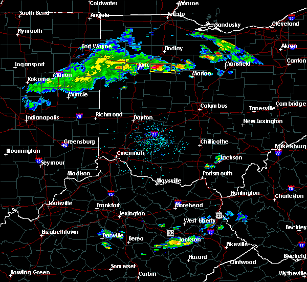 At 619 pm edt, a severe thunderstorm was located over ada, moving east at 25 mph (radar indicated). Hazards include 60 mph wind gusts and quarter size hail. Hail damage to vehicles is expected. Expect wind damage to roofs, siding, and trees. At 619 pm edt, a severe thunderstorm was located over ada, moving east at 25 mph (radar indicated). Hazards include 60 mph wind gusts and quarter size hail. Hail damage to vehicles is expected. Expect wind damage to roofs, siding, and trees.
|
| 6/23/2016 12:57 AM EDT | The severe thunderstorm warning for northeastern auglaize and hardin counties will expire at 100 am edt, the storm which prompted the warning has weakened below severe limits, and no longer poses an immediate threat to life or property. therefore the warning will be allowed to expire. however heavy rain is still occurring with this thunderstorm. a tornado watch remains in effect until 500 am edt for west central ohio. please report previous wind damage or hail to the national weather service by going to our website at weather.gov/iln and submitting your report via social media. |
| 6/23/2016 12:44 AM EDT |
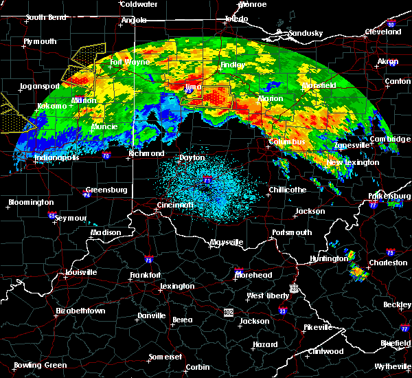 At 1243 am edt, a severe thunderstorm was located near kenton, moving east at 45 mph (radar indicated). Hazards include 60 mph wind gusts and nickel size hail. Expect damage to roofs. siding. and trees. locations impacted include, kenton, ada, forest, dunkirk, alger, waynesfield, blanchard, roundhead, mount victory, mcguffey, ridgeway, patterson, hepburn, pfeiffer, state route 195 at state route 235, mentzer, new hampshire, huntersville, silver creek and grant. A tornado watch remains in effect until 500 am edt for west central ohio. At 1243 am edt, a severe thunderstorm was located near kenton, moving east at 45 mph (radar indicated). Hazards include 60 mph wind gusts and nickel size hail. Expect damage to roofs. siding. and trees. locations impacted include, kenton, ada, forest, dunkirk, alger, waynesfield, blanchard, roundhead, mount victory, mcguffey, ridgeway, patterson, hepburn, pfeiffer, state route 195 at state route 235, mentzer, new hampshire, huntersville, silver creek and grant. A tornado watch remains in effect until 500 am edt for west central ohio.
|
| 6/23/2016 12:18 AM EDT |
 At 1218 am edt, a severe thunderstorm was located near lima, moving east at 45 mph (radar indicated). Hazards include 60 mph wind gusts and quarter size hail. Hail damage to vehicles is expected. Expect wind damage to roofs, siding, and trees. At 1218 am edt, a severe thunderstorm was located near lima, moving east at 45 mph (radar indicated). Hazards include 60 mph wind gusts and quarter size hail. Hail damage to vehicles is expected. Expect wind damage to roofs, siding, and trees.
|
| 9/4/2015 3:29 PM EDT |
 At 328 pm edt, radar indicated a severe thunderstorm located near kenton, moving northeast at 15 mph. storm hazards include, winds to 60 mph, quarter size hail, very heavy rain which may cause minor flooding, locations impacted include, kenton, hepburn, mentzer, grant and pfeiffer. At 328 pm edt, radar indicated a severe thunderstorm located near kenton, moving northeast at 15 mph. storm hazards include, winds to 60 mph, quarter size hail, very heavy rain which may cause minor flooding, locations impacted include, kenton, hepburn, mentzer, grant and pfeiffer.
|
| 9/4/2015 3:19 PM EDT |
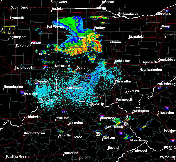 At 319 pm edt, radar indicated a severe thunderstorm located near kenton, moving northeast at 10 mph. storm hazards include, winds to 60 mph, quarter size hail, very heavy rain which may cause minor flooding,. At 319 pm edt, radar indicated a severe thunderstorm located near kenton, moving northeast at 10 mph. storm hazards include, winds to 60 mph, quarter size hail, very heavy rain which may cause minor flooding,.
|
| 7/14/2015 1:21 PM EDT |
 The severe thunderstorm warning for northwestern union, southeastern hardin and northern logan counties will expire at 130 pm edt, the storm which prompted the warning has moved out of the area. therefore the warning will be allowed to expire. another severe thunderstorm warning remains in effect for northern union county until 2 pm. please report previous wind damage or hail to the national weather service by going to our website at weather.gov/iln and submit your report via social media. The severe thunderstorm warning for northwestern union, southeastern hardin and northern logan counties will expire at 130 pm edt, the storm which prompted the warning has moved out of the area. therefore the warning will be allowed to expire. another severe thunderstorm warning remains in effect for northern union county until 2 pm. please report previous wind damage or hail to the national weather service by going to our website at weather.gov/iln and submit your report via social media.
|
| 7/14/2015 1:03 PM EDT |
 At 103 pm edt, radar indicated a severe thunderstorm located near belle center, moving southeast at 40 mph. storm hazards include, winds to 60 mph, quarter size hail, locations impacted include, bellefontaine, kenton, russells point, lakeview, belle center, west mansfield, northwood, mount victory, rushsylvania, huntsville, ridgeway, hepburn, pfeiffer, mentzer, big springs, new jerusalem, silver creek and byhalia. At 103 pm edt, radar indicated a severe thunderstorm located near belle center, moving southeast at 40 mph. storm hazards include, winds to 60 mph, quarter size hail, locations impacted include, bellefontaine, kenton, russells point, lakeview, belle center, west mansfield, northwood, mount victory, rushsylvania, huntsville, ridgeway, hepburn, pfeiffer, mentzer, big springs, new jerusalem, silver creek and byhalia.
|
| 7/14/2015 12:57 PM EDT | The severe thunderstorm warning for central hardin county will expire at 100 pm edt, an additional severe thunderstorm warning remains in effect for southern hardin county until 130 pm. please report previous wind damage or hail to the national weather service by going to our website at weather.gov/iln and submit your report via social media. |
| 7/14/2015 12:51 PM EDT |
 At 1250 pm edt, radar indicated a severe thunderstorm located near belle center, moving southeast at 40 mph. storm hazards include, winds to 60 mph, quarter size hail,. At 1250 pm edt, radar indicated a severe thunderstorm located near belle center, moving southeast at 40 mph. storm hazards include, winds to 60 mph, quarter size hail,.
|
| 7/14/2015 12:49 PM EDT |
 At 1248 pm edt, radar indicated a severe thunderstorm located near kenton, moving east at 35 mph. storm hazards include, winds to 60 mph, quarter size hail, locations impacted include, kenton, blanchard, huntersville, hepburn, grant and pfeiffer. At 1248 pm edt, radar indicated a severe thunderstorm located near kenton, moving east at 35 mph. storm hazards include, winds to 60 mph, quarter size hail, locations impacted include, kenton, blanchard, huntersville, hepburn, grant and pfeiffer.
|
| 7/14/2015 12:32 PM EDT |
 At 1232 pm edt, radar indicated a severe thunderstorm located near dunkirk, moving southeast at 30 mph. storm hazards include, winds to 60 mph, quarter size hail, locations impacted include, kenton, ada, forest, dunkirk, alger, blanchard, mcguffey, patterson, hepburn, huntersville, grant, pfeiffer and dola. At 1232 pm edt, radar indicated a severe thunderstorm located near dunkirk, moving southeast at 30 mph. storm hazards include, winds to 60 mph, quarter size hail, locations impacted include, kenton, ada, forest, dunkirk, alger, blanchard, mcguffey, patterson, hepburn, huntersville, grant, pfeiffer and dola.
|
| 7/14/2015 12:19 PM EDT |
 At 1219 pm edt, radar indicated a severe thunderstorm located over ada, moving east at 35 mph. storm hazards include, winds to 60 mph, quarter size hail,. At 1219 pm edt, radar indicated a severe thunderstorm located over ada, moving east at 35 mph. storm hazards include, winds to 60 mph, quarter size hail,.
|
| 5/26/2015 5:39 PM EDT | The severe thunderstorm warning for eastern hardin county will expire at 545 pm edt, the storm has moved out of the warned area and weakened below severe limits, therefore the severe thunderstorm warning will be allowed to expire. please report previous wind damage or hail to the national weather service by going to our website at weather.gov/iln and submitting your report via social media. |
| 5/26/2015 5:19 PM EDT | At 517 pm edt, radar indicated that the severe thunderstorm had weakened. this storm was located near silver creek, moving north at 50 mph. storm hazards include, winds to 60 mph, penny size hail, locations impacted include, kenton and forest. in addition, pfeiffer, hepburn, grant, blanchard and patterson are near the path of this storm. |
| 5/26/2015 4:56 PM EDT | At 454 pm edt, radar indicated a severe thunderstorm located near bellefontaine, moving northeast at 40 mph. storm hazards include, winds to 60 mph, quarter size hail,. |
| 10/31/2013 11:54 PM EDT | Roof damage in hardin county OH, 0.3 miles NNW of Kenton, OH |
| 10/31/2013 11:52 PM EDT | Numerous trees and power poles down on the northeast side of town. shingles and roof damage at a church. time is estimate in hardin county OH, 0.3 miles NNW of Kenton, OH |
| 10/31/2013 11:52 PM EDT | Numerous trees and power poles down on the northeast side of town. shingles and roof damage at a church. windows of bank blown out. radio tower down. roof damage to sev in hardin county OH, 0.3 miles NNW of Kenton, OH |
| 7/10/2013 3:18 PM EDT | Two trees blown down and structural damage to an abandoned farm in hardin county OH, 4.7 miles WSW of Kenton, OH |
| 6/13/2013 12:37 AM EDT | Trees and power poles down in hardin county OH, 0.3 miles NNW of Kenton, OH |
| 10/14/2012 6:40 PM EDT | Roof torn off a tr in hardin county OH, 5.2 miles NE of Kenton, OH |
| 7/4/2012 9:45 PM EDT | Lg tree down south side of town in hardin county OH, 0.3 miles NNW of Kenton, OH |
| 6/29/2012 4:15 PM EDT | Siding off homes...numerous tress down in hardin county OH, 0.3 miles NNW of Kenton, OH |
| 6/29/2012 4:14 PM EDT | Numerous trees down...some on car in hardin county OH, 0.3 miles NNW of Kenton, OH |
| 6/29/2012 4:05 PM EDT | Numerous large trees and large branches dow in hardin county OH, 0.3 miles NNW of Kenton, OH |
| 6/29/2012 4:03 PM EDT | Storm damage reported in hardin county OH, 0.9 miles N of Kenton, OH |
| 1/1/0001 12:00 AM | One tree down on goodin s in hardin county OH, 0.3 miles NNW of Kenton, OH |
| 1/1/0001 12:00 AM | Storm damage reported in hardin county OH, 3.2 miles S of Kenton, OH |
| 1/1/0001 12:00 AM | Quarter sized hail reported 0.3 miles NNW of Kenton, OH |
Hail Maps for Kenton, OH


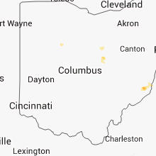


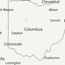


Connect with Interactive Hail Maps