

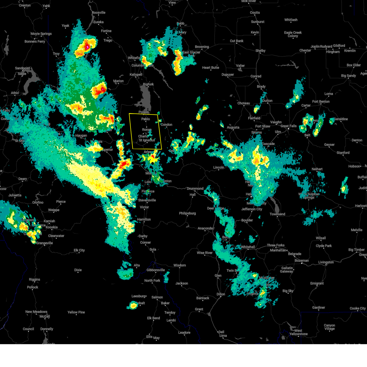
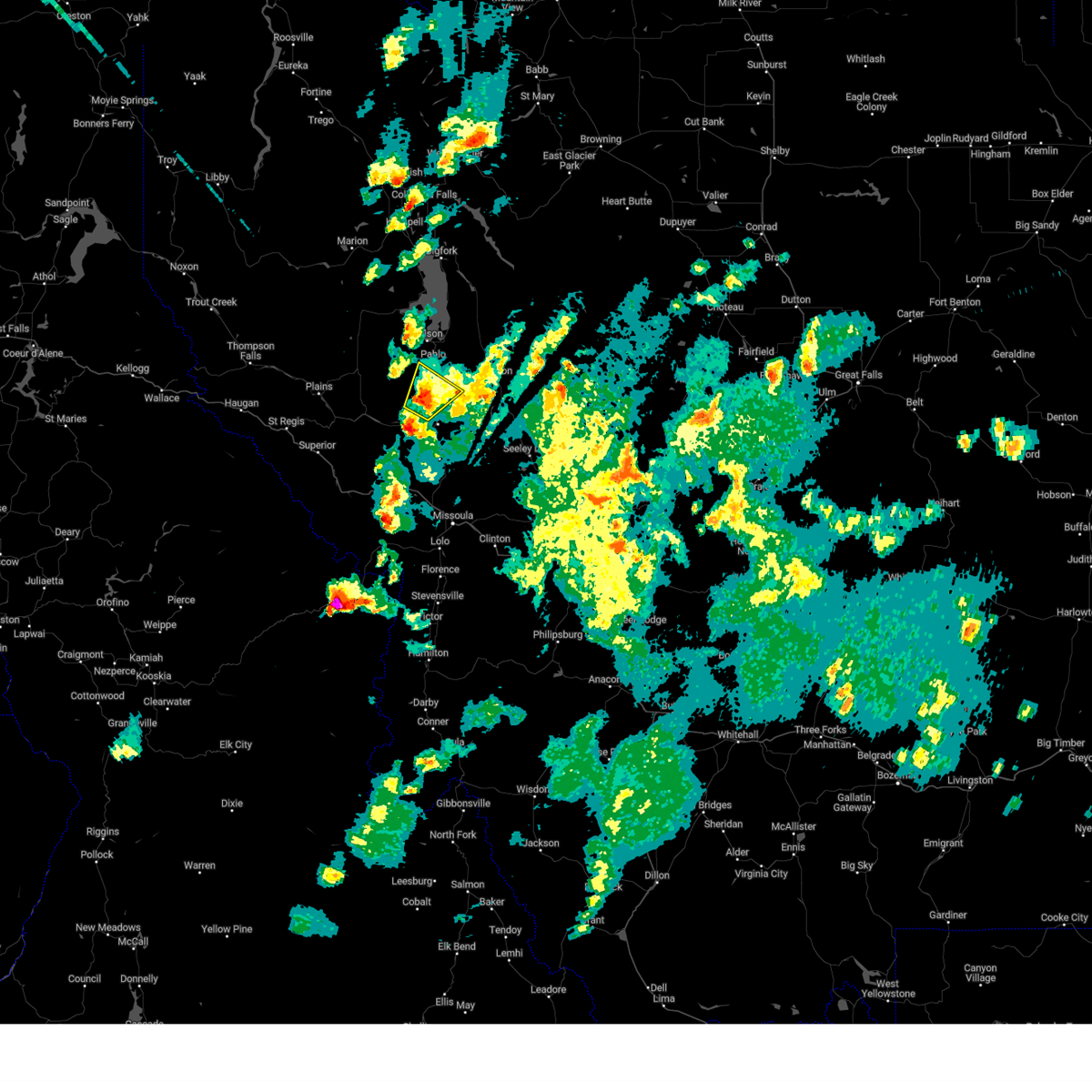
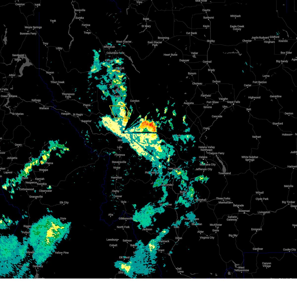
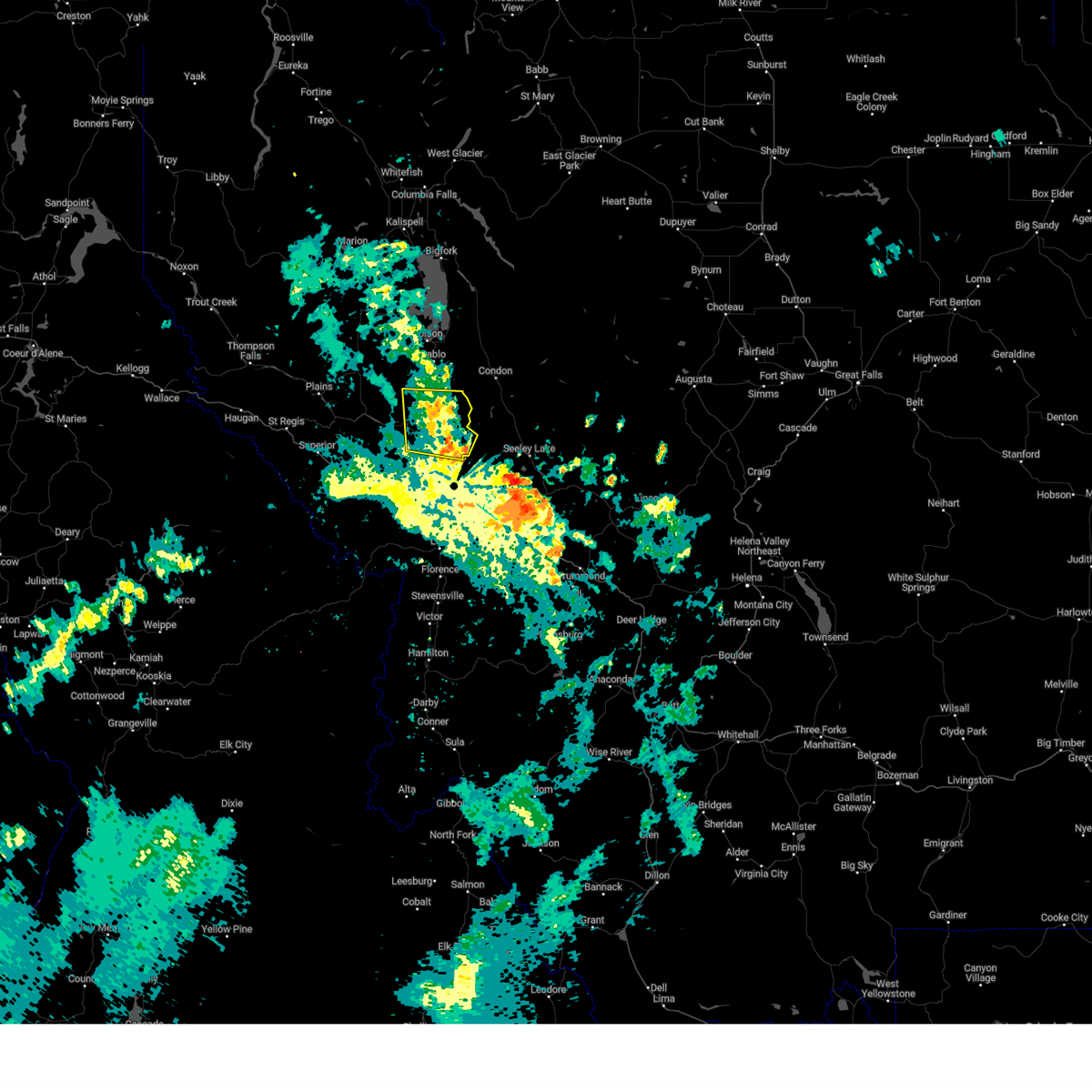
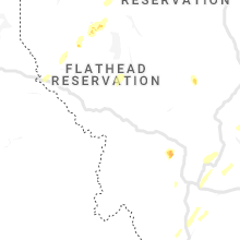
Hail Map for Kicking Horse, MT
The Kicking Horse, MT area has had 1 report of on-the-ground hail by trained spotters, and has been under severe weather warnings 5 times during the past 12 months. Doppler radar has detected hail at or near Kicking Horse, MT on 12 occasions, including 1 occasion during the past year.
| Name: | Kicking Horse, MT |
| Where Located: | 41 miles N of Missoula, MT |
| Map: | Google Map for Kicking Horse, MT |
| Population: | 286 |
| Housing Units: | 29 |
| More Info: | Search Google for Kicking Horse, MT |
0
The Top Recent Hail Date for Kicking Horse, MT is Monday, August 19, 2024 (11th out of 12)

Hail and Wind Damage Spotted near Kicking Horse, MT
| Date / Time | Report Details |
|---|---|
| 8/23/2024 4:55 PM MDT | Power line down across hi hi tah rd and allard r in lake county MT, 3.1 miles NW of Kicking Horse, MT |
| 8/23/2024 4:40 PM MDT |
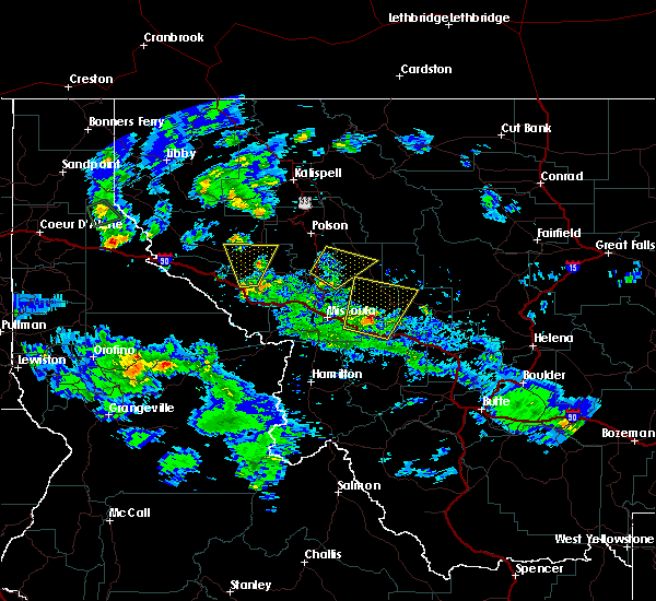
 Svrmso the national weather service in missoula has issued a * severe thunderstorm warning for, central lake county in northwestern montana, north central missoula county in west central montana, eastern sanders county in northwestern montana, * until 515 pm mdt. * at 439 pm mdt, severe thunderstorms were located along a line extending from 8 miles east of st. ignatius to old agency, moving north at 40 mph (radar indicated). Hazards include 60 mph wind gusts. expect damage to roofs, siding, and trees Svrmso the national weather service in missoula has issued a * severe thunderstorm warning for, central lake county in northwestern montana, north central missoula county in west central montana, eastern sanders county in northwestern montana, * until 515 pm mdt. * at 439 pm mdt, severe thunderstorms were located along a line extending from 8 miles east of st. ignatius to old agency, moving north at 40 mph (radar indicated). Hazards include 60 mph wind gusts. expect damage to roofs, siding, and trees
|
| 8/19/2024 5:55 PM MDT |
 Svrmso the national weather service in missoula has issued a * severe thunderstorm warning for, south central lake county in northwestern montana, northern missoula county in west central montana, southeastern sanders county in northwestern montana, * until 615 pm mdt. * at 555 pm mdt, a severe thunderstorm was located 7 miles southwest of ronan, or 17 miles south of polson, moving northeast at 15 mph (radar indicated). Hazards include quarter size hail. damage to vehicles is expected Svrmso the national weather service in missoula has issued a * severe thunderstorm warning for, south central lake county in northwestern montana, northern missoula county in west central montana, southeastern sanders county in northwestern montana, * until 615 pm mdt. * at 555 pm mdt, a severe thunderstorm was located 7 miles southwest of ronan, or 17 miles south of polson, moving northeast at 15 mph (radar indicated). Hazards include quarter size hail. damage to vehicles is expected
|
| 7/24/2024 9:56 PM MDT |
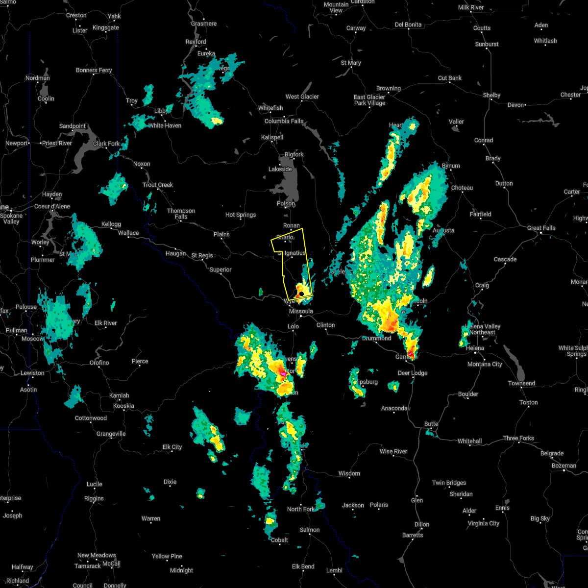
 The storm which prompted the warning has weakened below severe limits, and has exited the warned area. therefore, the warning will be allowed to expire. The storm which prompted the warning has weakened below severe limits, and has exited the warned area. therefore, the warning will be allowed to expire.
|
| 7/24/2024 9:52 PM MDT |
 At 952 pm mdt, a severe thunderstorm was located 7 miles east of st. ignatius, or 26 miles south of polson, moving northeast at 20 mph (radar indicated). Hazards include 60 mph wind gusts. Expect considerable tree damage. damage is likely to mobile homes, roofs, and outbuildings. locations impacted include, ravalli, st. Ignatius, allentown, kicking horse, charlo, and fort connah. At 952 pm mdt, a severe thunderstorm was located 7 miles east of st. ignatius, or 26 miles south of polson, moving northeast at 20 mph (radar indicated). Hazards include 60 mph wind gusts. Expect considerable tree damage. damage is likely to mobile homes, roofs, and outbuildings. locations impacted include, ravalli, st. Ignatius, allentown, kicking horse, charlo, and fort connah.
|
| 7/24/2024 9:31 PM MDT |
 Svrmso the national weather service in missoula has issued a * severe thunderstorm warning for, south central lake county in northwestern montana, eastern sanders county in northwestern montana, * until 1000 pm mdt. * at 931 pm mdt, a severe thunderstorm was located near arlee, or 24 miles north of missoula, moving northeast at 20 mph (radar indicated). Hazards include 70 mph wind gusts. Expect considerable tree damage. Damage is likely to mobile homes, roofs, and outbuildings. Svrmso the national weather service in missoula has issued a * severe thunderstorm warning for, south central lake county in northwestern montana, eastern sanders county in northwestern montana, * until 1000 pm mdt. * at 931 pm mdt, a severe thunderstorm was located near arlee, or 24 miles north of missoula, moving northeast at 20 mph (radar indicated). Hazards include 70 mph wind gusts. Expect considerable tree damage. Damage is likely to mobile homes, roofs, and outbuildings.
|
| 7/10/2023 6:02 PM MDT |
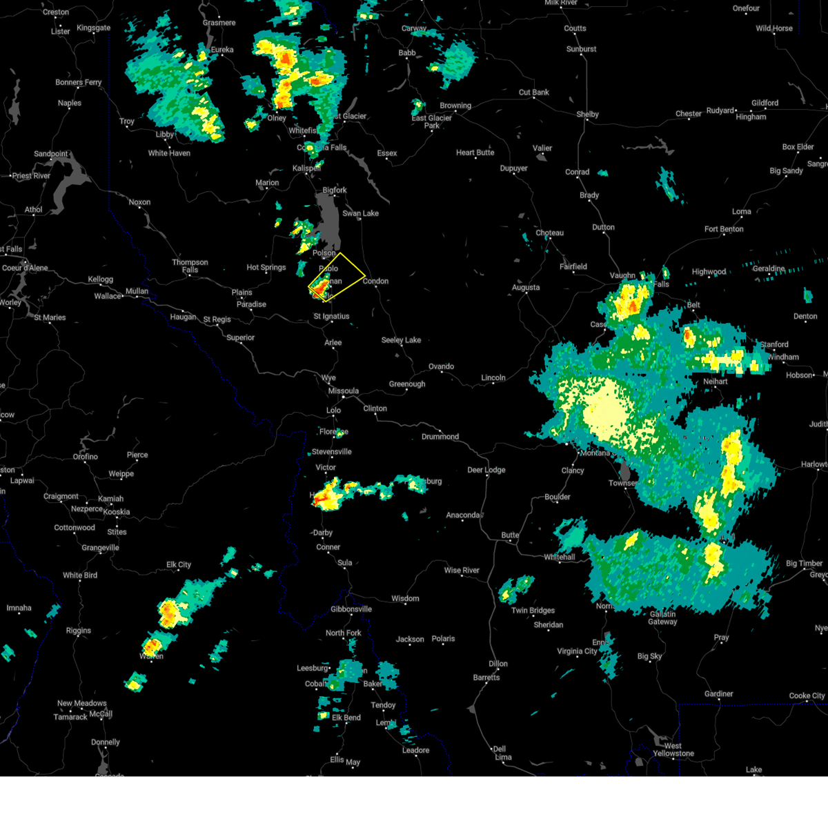 At 601 pm mdt, a severe thunderstorm was located over ronan, or 10 miles south of polson, moving northeast at 35 mph (radar indicated). Hazards include 60 mph wind gusts and half dollar size hail. Hail damage to vehicles is expected. Expect wind damage to roofs, siding, and trees. At 601 pm mdt, a severe thunderstorm was located over ronan, or 10 miles south of polson, moving northeast at 35 mph (radar indicated). Hazards include 60 mph wind gusts and half dollar size hail. Hail damage to vehicles is expected. Expect wind damage to roofs, siding, and trees.
|
| 8/25/2022 5:09 PM MDT | The severe thunderstorm warning for south central lake, northern missoula and southeastern sanders counties will expire at 515 pm mdt, the storm which prompted the warning has moved out of the area. therefore, the warning will be allowed to expire. |
| 8/25/2022 4:48 PM MDT | At 448 pm mdt, a severe thunderstorm was located near st. ignatius, or 23 miles south of polson, moving east at 15 mph (trained weather spotters). Hazards include ping pong ball size hail and 60 mph wind gusts. People and animals outdoors will be injured. expect hail damage to roofs, siding, windows, and vehicles. expect wind damage to roofs, siding, and trees. locations impacted include, st. ignatius, allentown, kicking horse, charlo and fort connah. hail threat, radar indicated max hail size, 1. 50 in wind threat, radar indicated max wind gust, 60 mph. |
| 8/25/2022 4:35 PM MDT | At 435 pm mdt, a severe thunderstorm was located near old agency, or 23 miles south of polson, moving east at 15 mph (radar indicated). Hazards include 60 mph wind gusts and half dollar size hail. Hail damage to vehicles is expected. Expect wind damage to roofs, siding, and trees. |
| 7/8/2022 4:30 PM MDT |
 At 430 pm mdt, a severe thunderstorm was located over ronan, or 13 miles south of polson, moving north at 20 mph (radar indicated). Hazards include golf ball size hail and 60 mph wind gusts. People and animals outdoors will be injured. expect hail damage to roofs, siding, windows, and vehicles. expect wind damage to roofs, siding, and trees. locations impacted include, ronan, pablo, allentown, kicking horse, charlo and fort connah. thunderstorm damage threat, considerable hail threat, radar indicated max hail size, 1. 75 in wind threat, radar indicated max wind gust, 60 mph. At 430 pm mdt, a severe thunderstorm was located over ronan, or 13 miles south of polson, moving north at 20 mph (radar indicated). Hazards include golf ball size hail and 60 mph wind gusts. People and animals outdoors will be injured. expect hail damage to roofs, siding, windows, and vehicles. expect wind damage to roofs, siding, and trees. locations impacted include, ronan, pablo, allentown, kicking horse, charlo and fort connah. thunderstorm damage threat, considerable hail threat, radar indicated max hail size, 1. 75 in wind threat, radar indicated max wind gust, 60 mph.
|
| 7/8/2022 4:21 PM MDT | Quarter sized hail reported 4.7 miles NNE of Kicking Horse, MT |
| 7/8/2022 4:12 PM MDT |
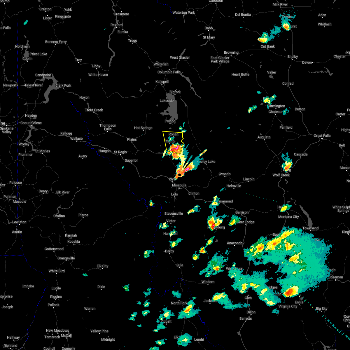 At 412 pm mdt, a severe thunderstorm was located near st. ignatius, or 19 miles south of polson, moving north at 20 mph (radar indicated). Hazards include 60 mph wind gusts and quarter size hail. Hail damage to vehicles is expected. Expect wind damage to roofs, siding, and trees. At 412 pm mdt, a severe thunderstorm was located near st. ignatius, or 19 miles south of polson, moving north at 20 mph (radar indicated). Hazards include 60 mph wind gusts and quarter size hail. Hail damage to vehicles is expected. Expect wind damage to roofs, siding, and trees.
|
| 7/8/2022 2:13 AM MDT |
 The severe thunderstorm warning for central lake county will expire at 215 am mdt, the storm which prompted the warning has weakened below severe limits, and no longer poses an immediate threat to life or property. therefore, the warning will be allowed to expire. The severe thunderstorm warning for central lake county will expire at 215 am mdt, the storm which prompted the warning has weakened below severe limits, and no longer poses an immediate threat to life or property. therefore, the warning will be allowed to expire.
|
| 7/8/2022 1:49 AM MDT |
 At 148 am mdt, a severe thunderstorm was located over ronan, or 14 miles south of polson, moving northeast at 30 mph (radar indicated). Hazards include half dollar size hail and gusts to 40 mph along with very heavy rain . damage to vehicles is expected At 148 am mdt, a severe thunderstorm was located over ronan, or 14 miles south of polson, moving northeast at 30 mph (radar indicated). Hazards include half dollar size hail and gusts to 40 mph along with very heavy rain . damage to vehicles is expected
|
| 6/18/2022 1:31 PM MDT |
 At 131 pm mdt, a severe thunderstorm was located near ravalli, or 26 miles north of missoula, moving north at 40 mph (radar indicated). Hazards include 60 mph wind gusts and quarter size hail. Hail damage to vehicles is expected. expect wind damage to roofs, siding, and trees. locations impacted include, ravalli, st. ignatius, arlee, allentown, moiese, kicking horse, charlo and fort connah. hail threat, radar indicated max hail size, 1. 00 in wind threat, radar indicated max wind gust, 60 mph. At 131 pm mdt, a severe thunderstorm was located near ravalli, or 26 miles north of missoula, moving north at 40 mph (radar indicated). Hazards include 60 mph wind gusts and quarter size hail. Hail damage to vehicles is expected. expect wind damage to roofs, siding, and trees. locations impacted include, ravalli, st. ignatius, arlee, allentown, moiese, kicking horse, charlo and fort connah. hail threat, radar indicated max hail size, 1. 00 in wind threat, radar indicated max wind gust, 60 mph.
|
| 6/18/2022 1:15 PM MDT |
 At 115 pm mdt, a severe thunderstorm was located near arlee, or 17 miles north of missoula, moving north at 45 mph (radar indicated). Hazards include 60 mph wind gusts and quarter size hail. Hail damage to vehicles is expected. Expect wind damage to roofs, siding, and trees. At 115 pm mdt, a severe thunderstorm was located near arlee, or 17 miles north of missoula, moving north at 45 mph (radar indicated). Hazards include 60 mph wind gusts and quarter size hail. Hail damage to vehicles is expected. Expect wind damage to roofs, siding, and trees.
|
| 6/8/2016 7:10 PM MDT |
 At 709 pm mdt, doppler radar indicated a severe thunderstorm capable of producing strong winds to 45 mph and quarter size hail. this storm was located near old agency, or 21 miles south of polson. this storm was nearly stationary. locations impacted include, polson, ronan, jette, pablo, kerr, turtle lake, finley point, fort connah, allentown, kicking horse, charlo and round butte. At 709 pm mdt, doppler radar indicated a severe thunderstorm capable of producing strong winds to 45 mph and quarter size hail. this storm was located near old agency, or 21 miles south of polson. this storm was nearly stationary. locations impacted include, polson, ronan, jette, pablo, kerr, turtle lake, finley point, fort connah, allentown, kicking horse, charlo and round butte.
|
| 6/8/2016 6:44 PM MDT |
 At 643 pm mdt, doppler radar indicated a severe thunderstorm capable of producing quarter size hail. this storm was located near old agency, or 20 miles south of polson. this storm was moving north - northeast at 20 miles an hour. At 643 pm mdt, doppler radar indicated a severe thunderstorm capable of producing quarter size hail. this storm was located near old agency, or 20 miles south of polson. this storm was moving north - northeast at 20 miles an hour.
|
| 6/8/2016 6:22 PM MDT |
 At 621 pm mdt, doppler radar indicated a severe thunderstorm capable of producing quarter size hail. this storm was located over st. ignatius, or 23 miles south of polson, and moving northeast at 55 mph. At 621 pm mdt, doppler radar indicated a severe thunderstorm capable of producing quarter size hail. this storm was located over st. ignatius, or 23 miles south of polson, and moving northeast at 55 mph.
|
| 8/10/2015 7:59 PM MDT | The severe thunderstorm warning for south central lake and northeastern missoula counties will expire at 800 pm mdt, the storm which prompted the warning has moved out of the area. therefore the warning will be allowed to expire. |
| 8/10/2015 7:50 PM MDT |
 At 748 pm mdt, a severe thunderstorm was located 14 miles east of st. ignatius, moving northeast at 10 mph (trained weather spotters). Hazards include 60 mph wind gusts. Expect damage to roofs. siding. trees and powerlines. new fire starts are possible from downed powerlines. Locations impacted include, fort connah and kicking horse. At 748 pm mdt, a severe thunderstorm was located 14 miles east of st. ignatius, moving northeast at 10 mph (trained weather spotters). Hazards include 60 mph wind gusts. Expect damage to roofs. siding. trees and powerlines. new fire starts are possible from downed powerlines. Locations impacted include, fort connah and kicking horse.
|
| 8/10/2015 7:18 PM MDT |
 At 717 pm mdt, a severe thunderstorm was located 7 miles southeast of st. ignatius, moving northeast at 15 mph (trained weather spotters reported wind gusts near 70 mph in arlee with this storm). Hazards include 70 mph wind gusts. Expect considerable tree damage. damage is likely to mobile homes, roofs, powerlines and outbuildings. New fire starts are possible from downed power lines. At 717 pm mdt, a severe thunderstorm was located 7 miles southeast of st. ignatius, moving northeast at 15 mph (trained weather spotters reported wind gusts near 70 mph in arlee with this storm). Hazards include 70 mph wind gusts. Expect considerable tree damage. damage is likely to mobile homes, roofs, powerlines and outbuildings. New fire starts are possible from downed power lines.
|
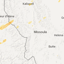
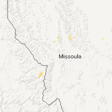
Hail Maps for Kicking Horse, MT


Connect with Interactive Hail Maps