

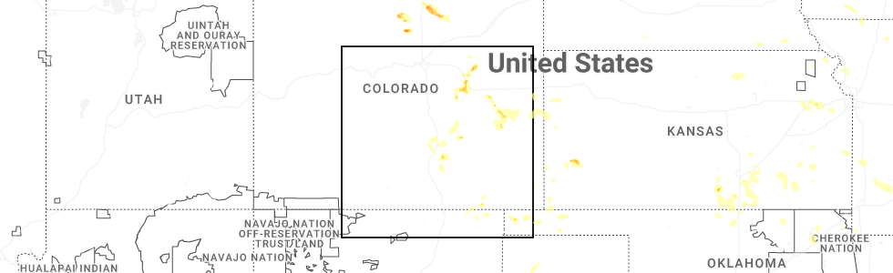
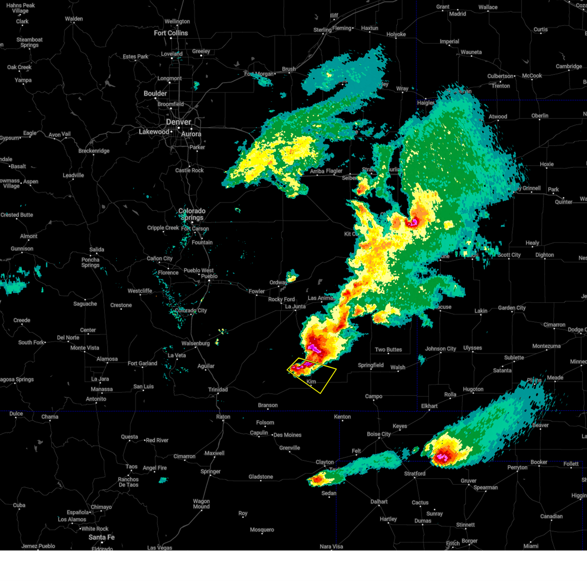
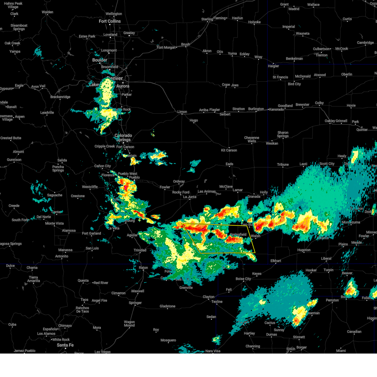
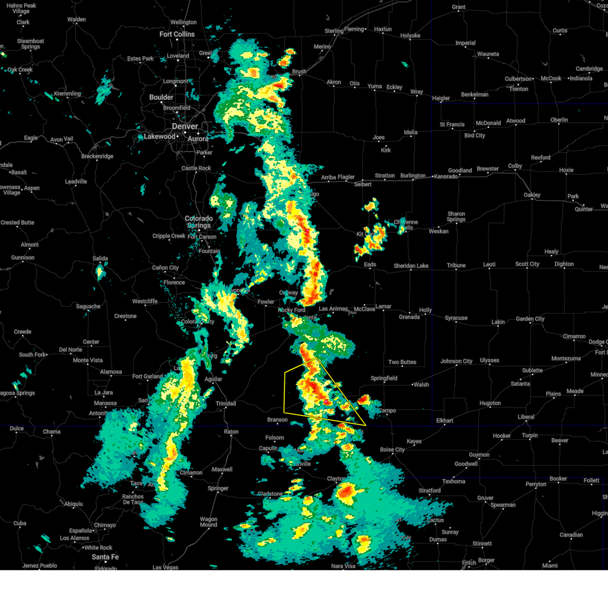
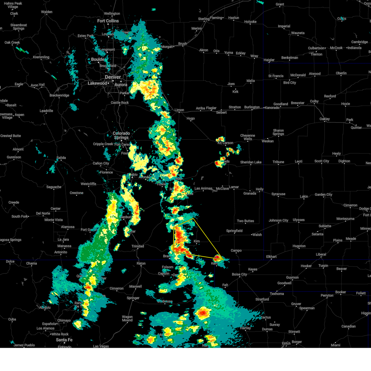
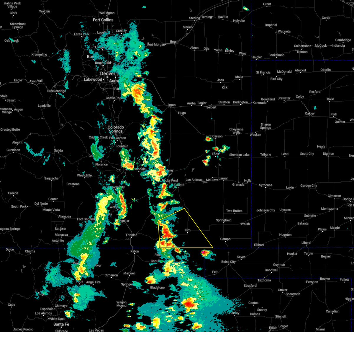
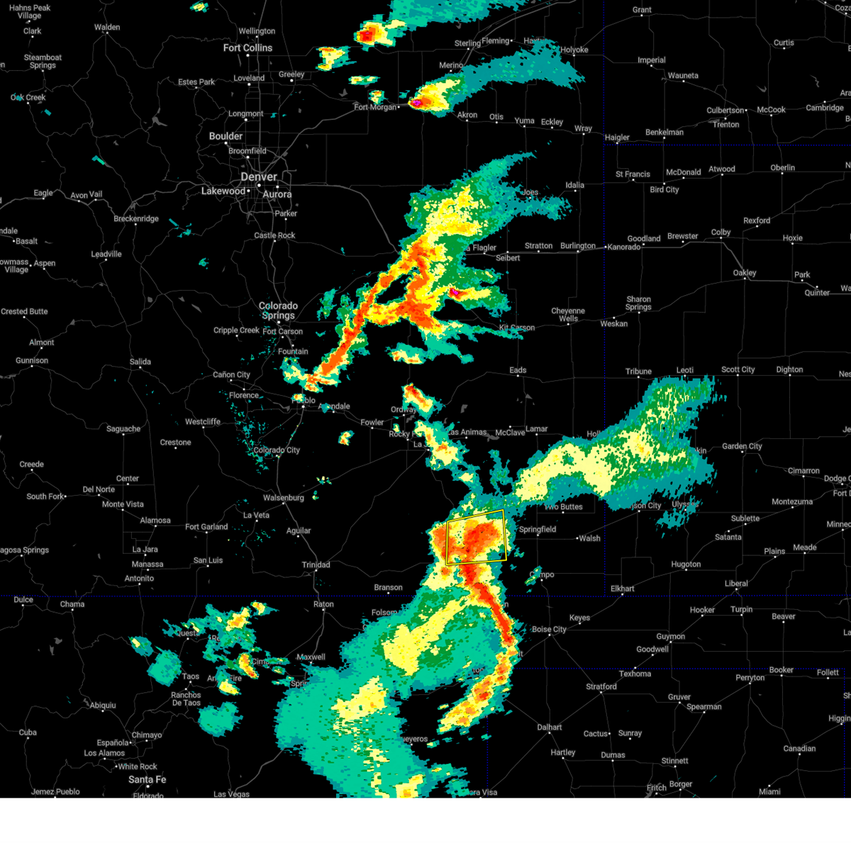
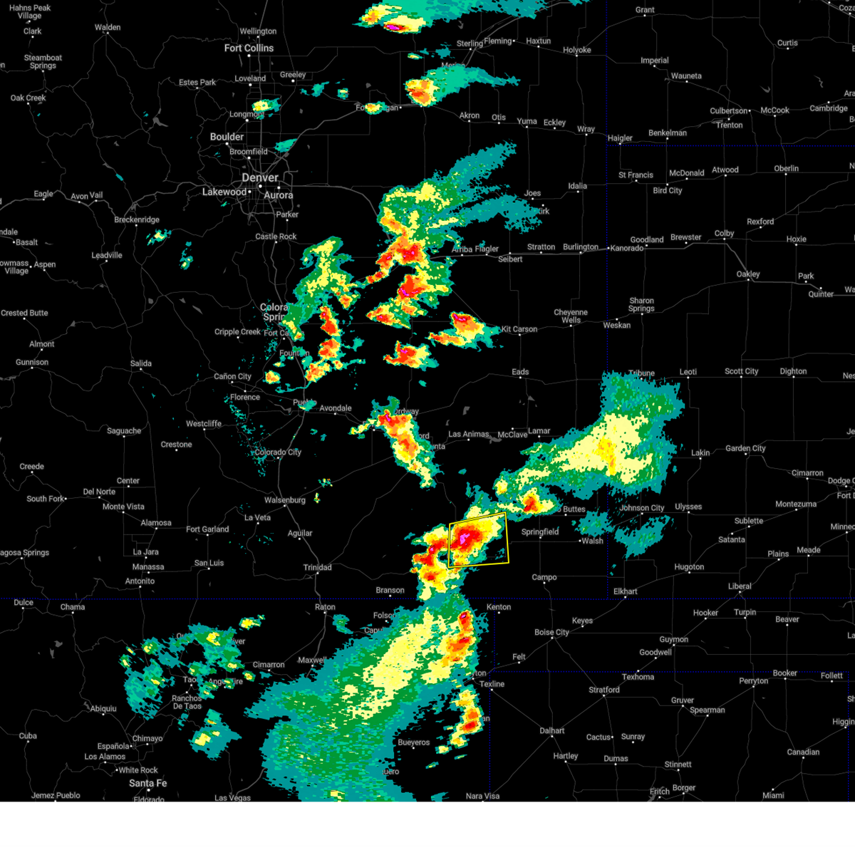
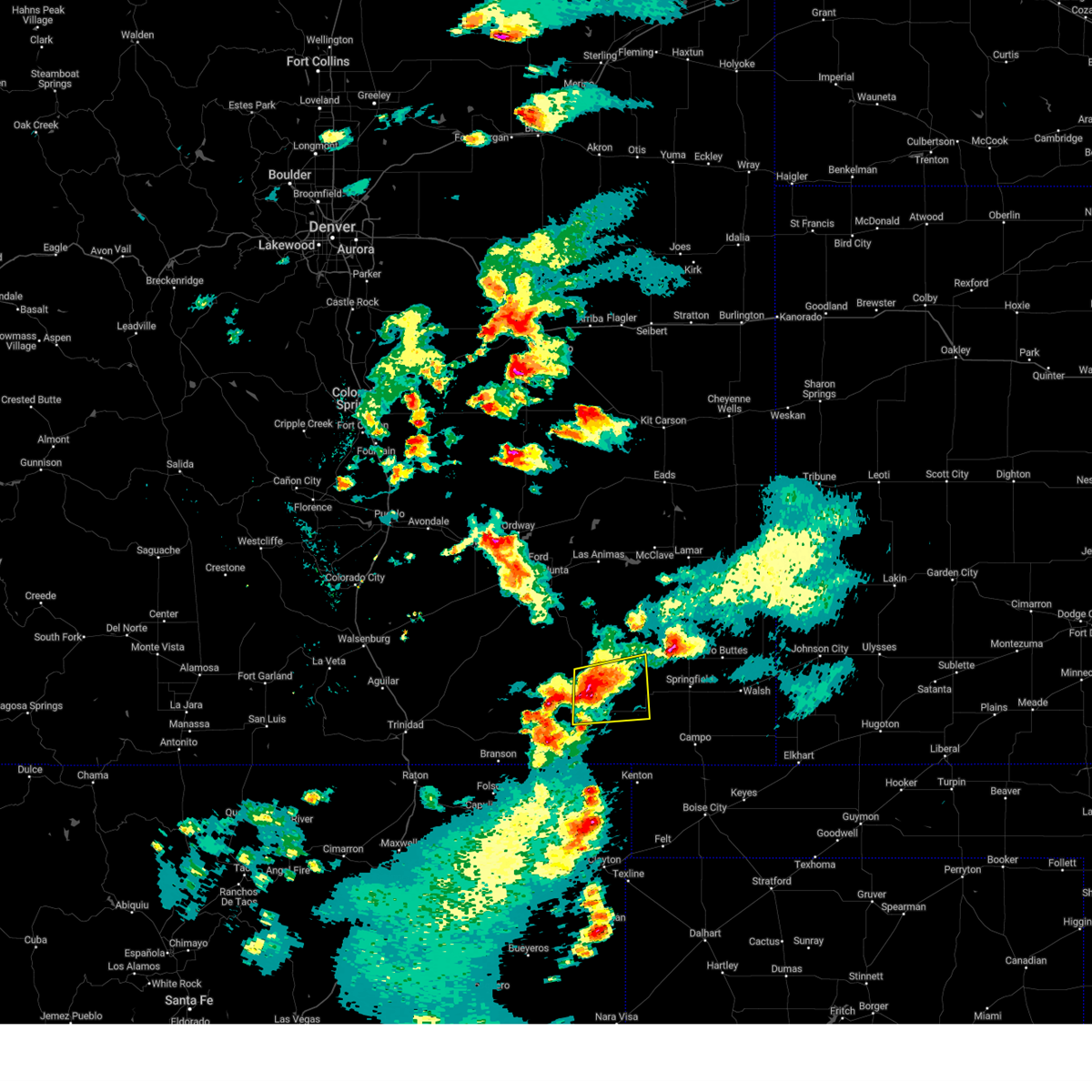
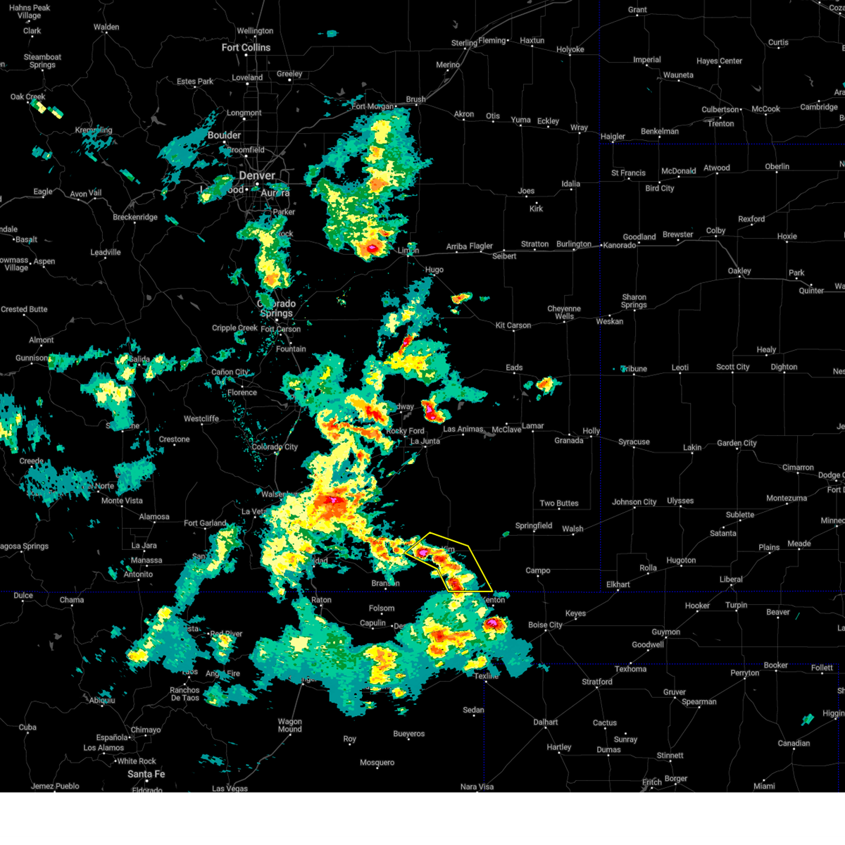
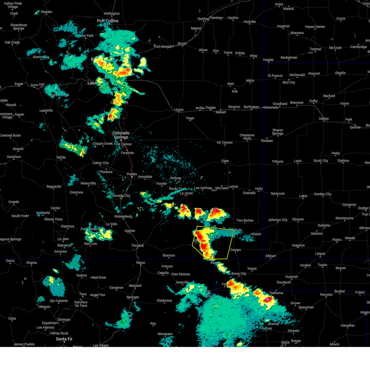
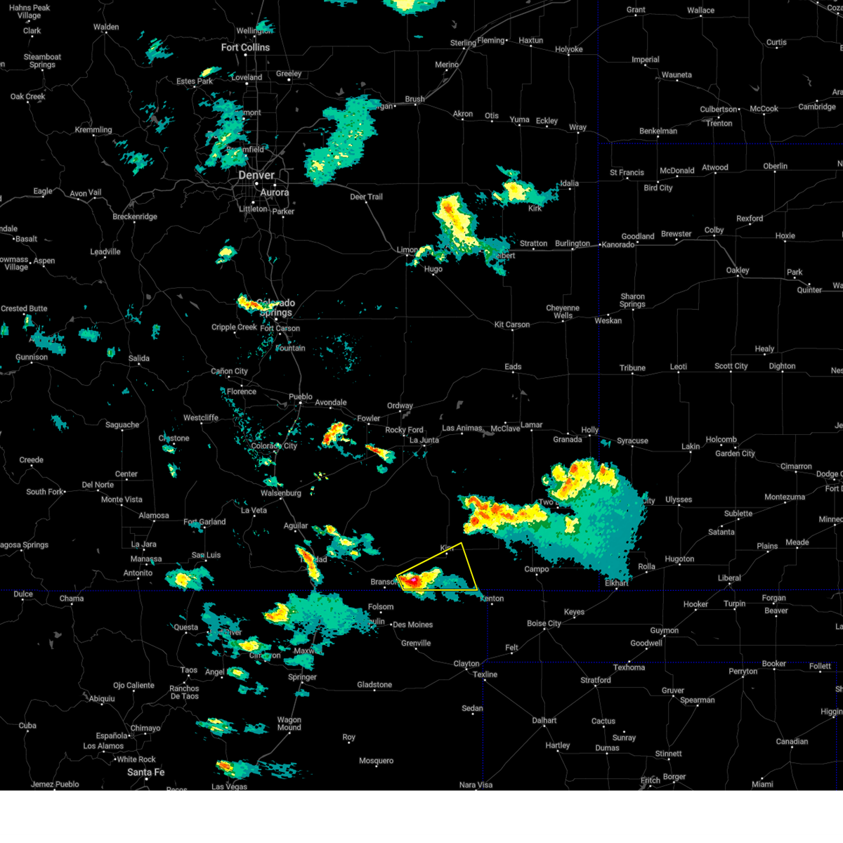
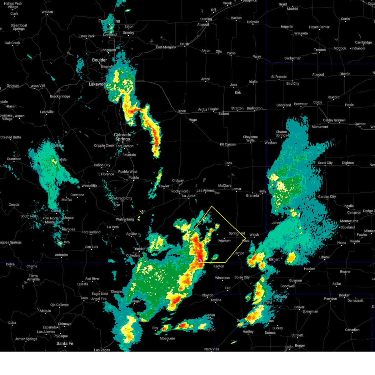
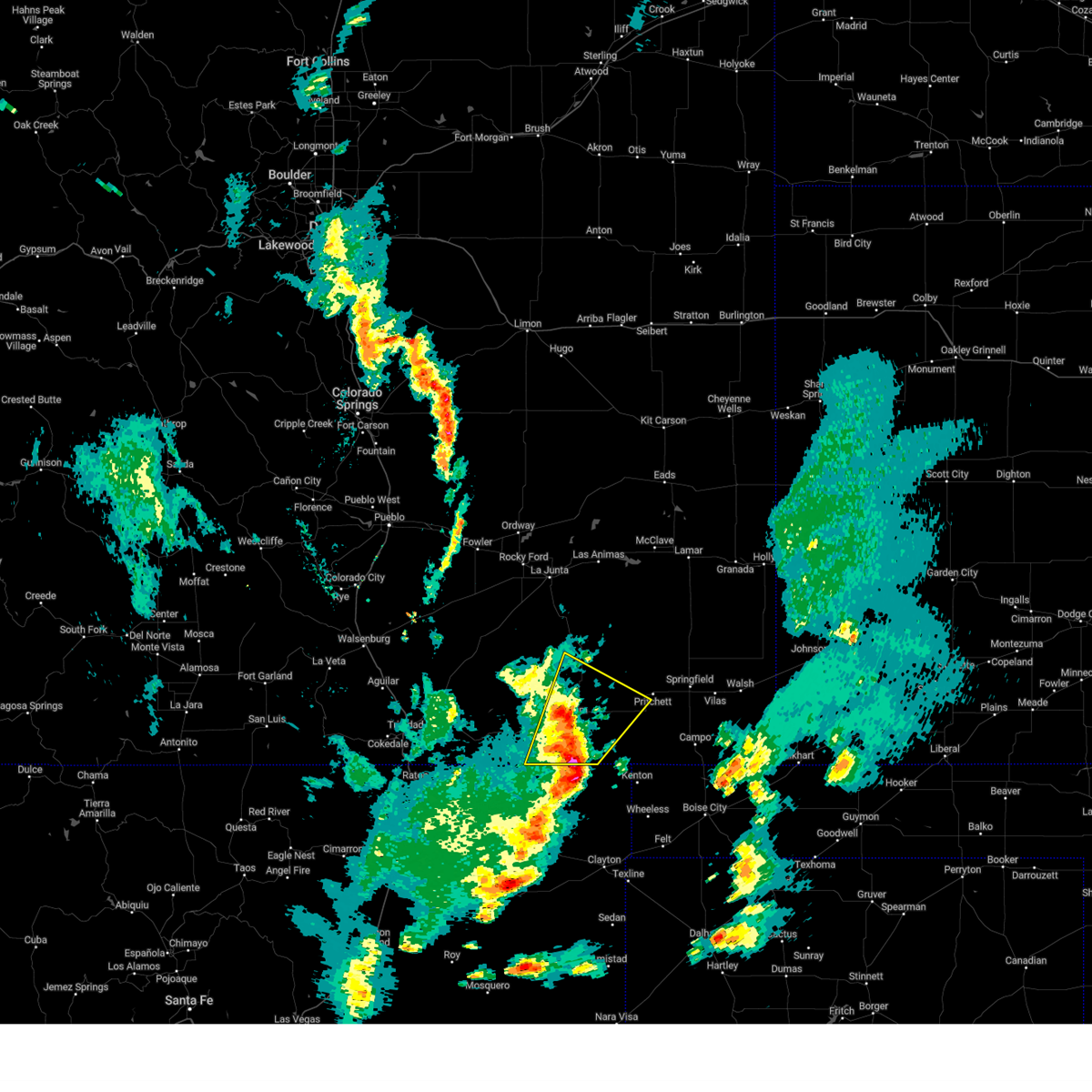
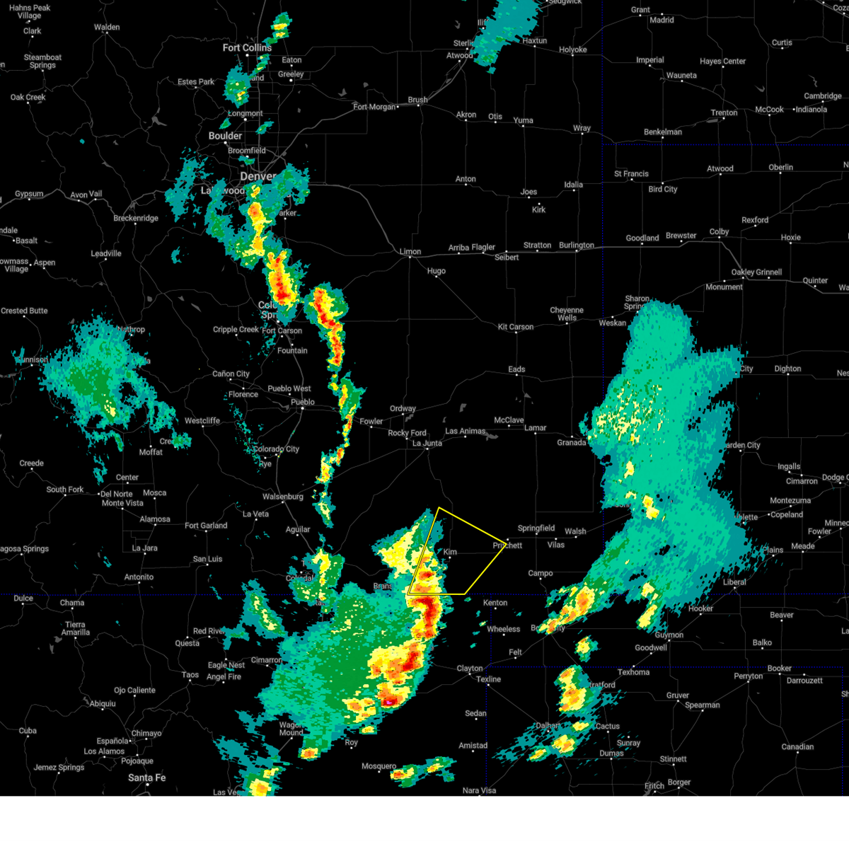
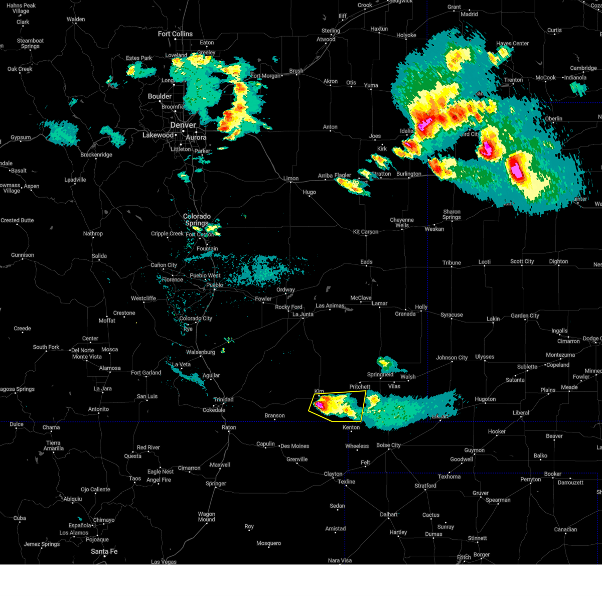
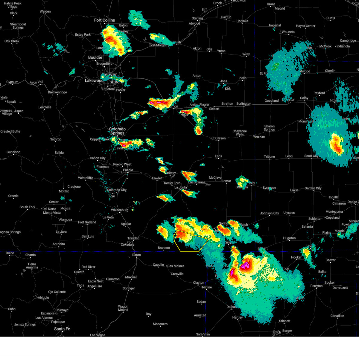
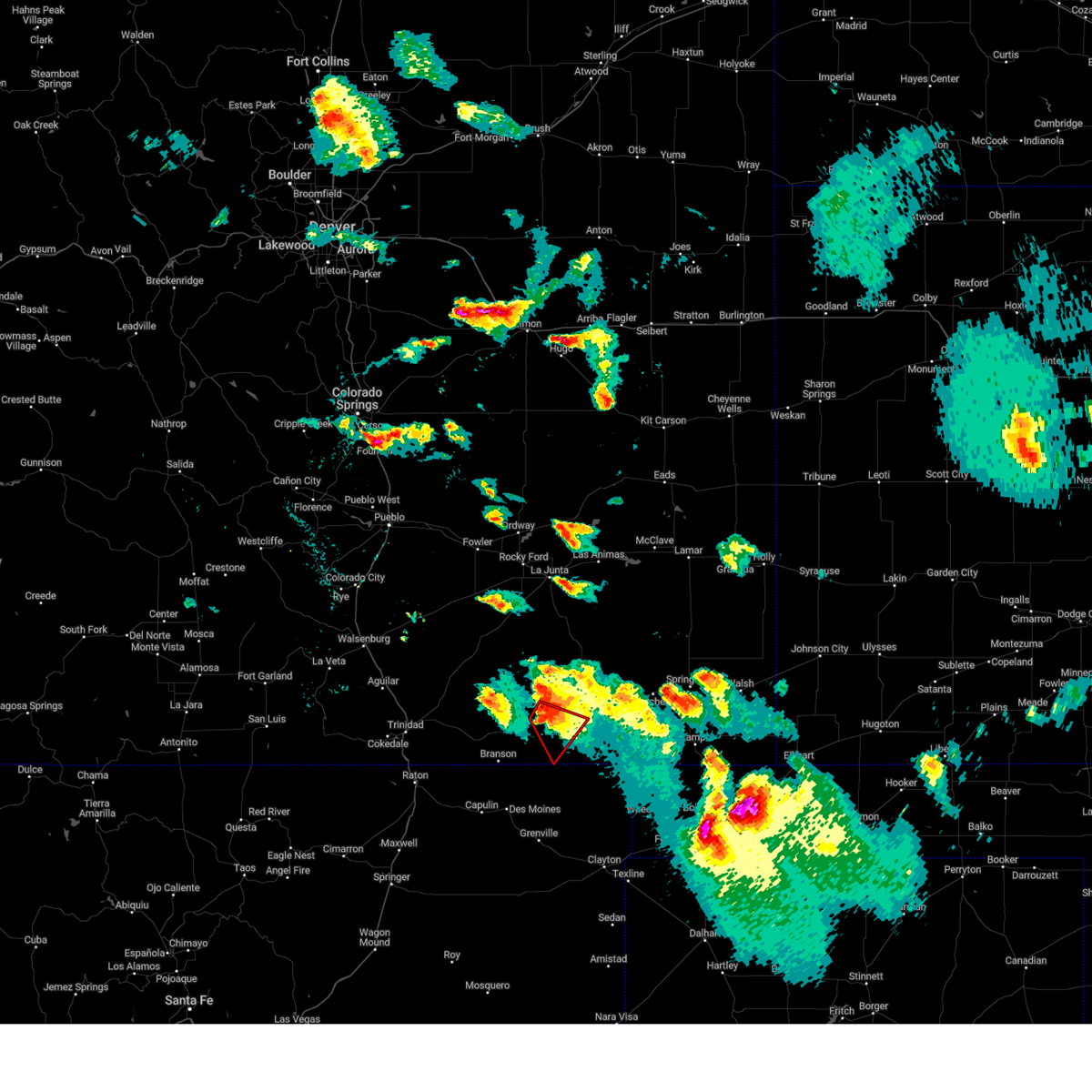
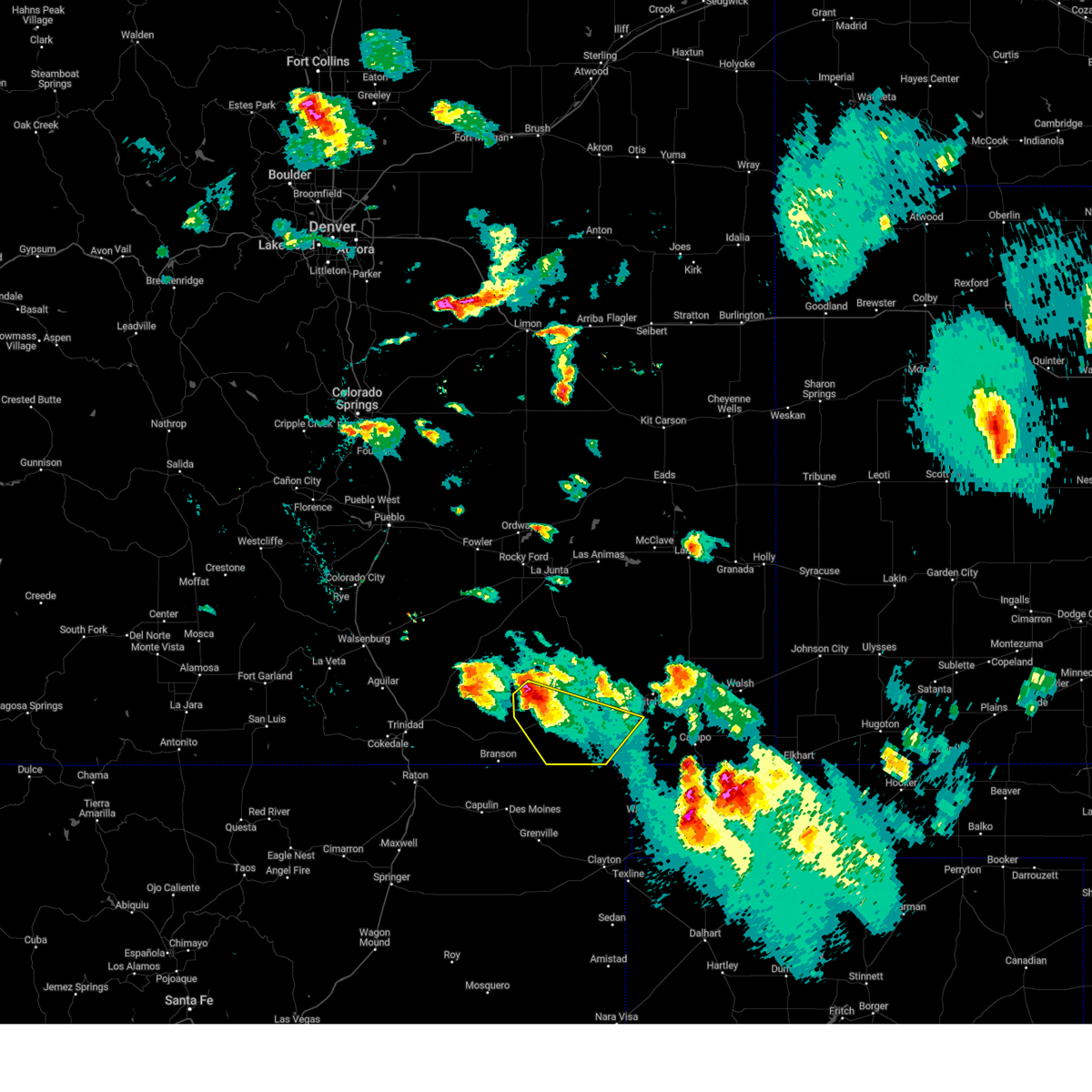
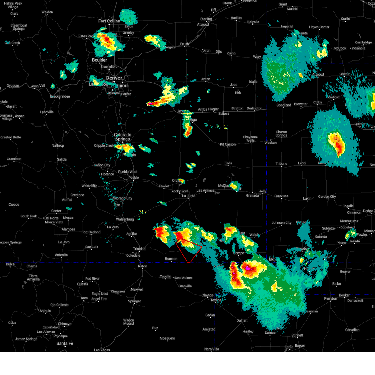
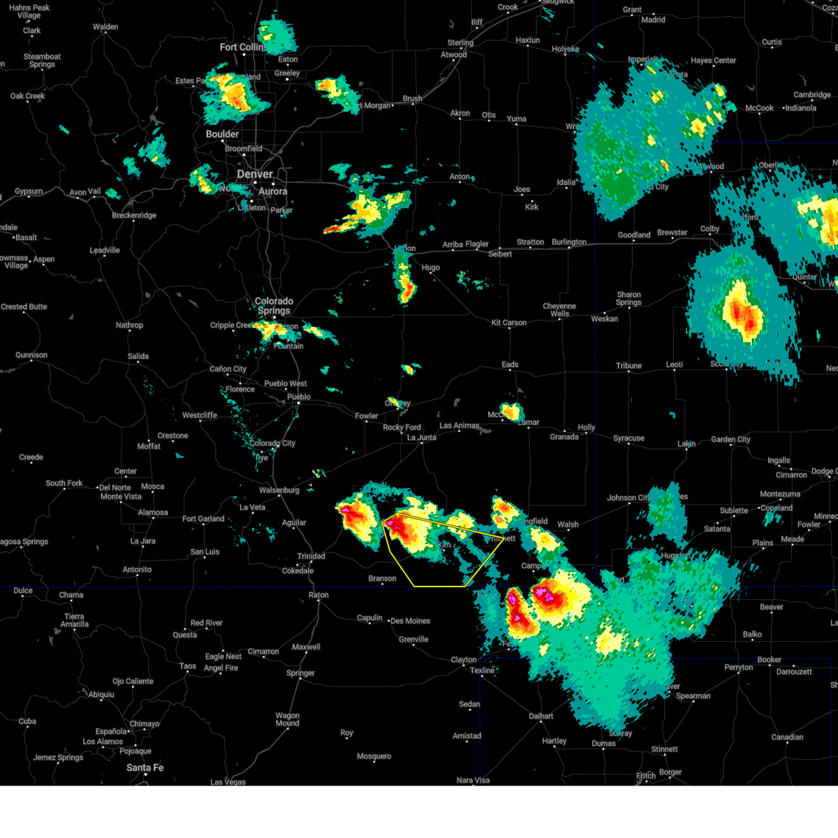
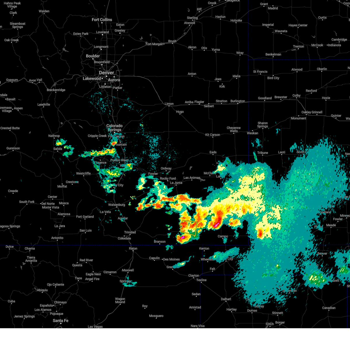
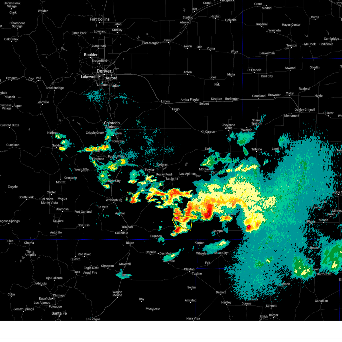
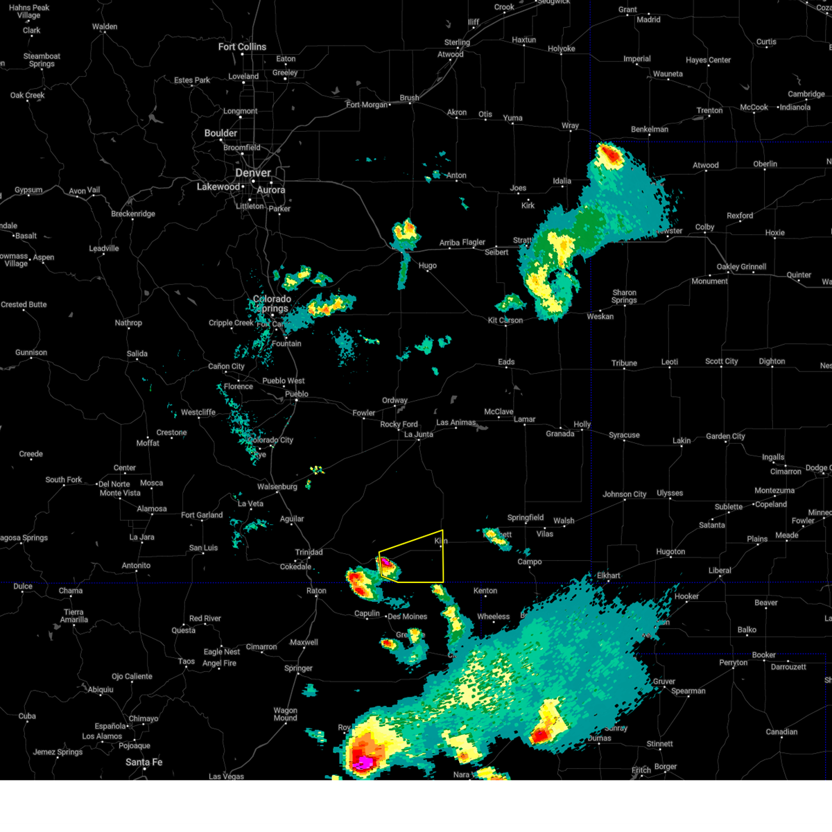
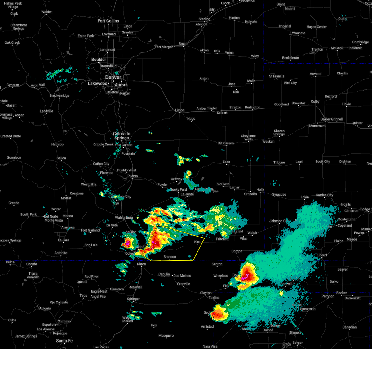
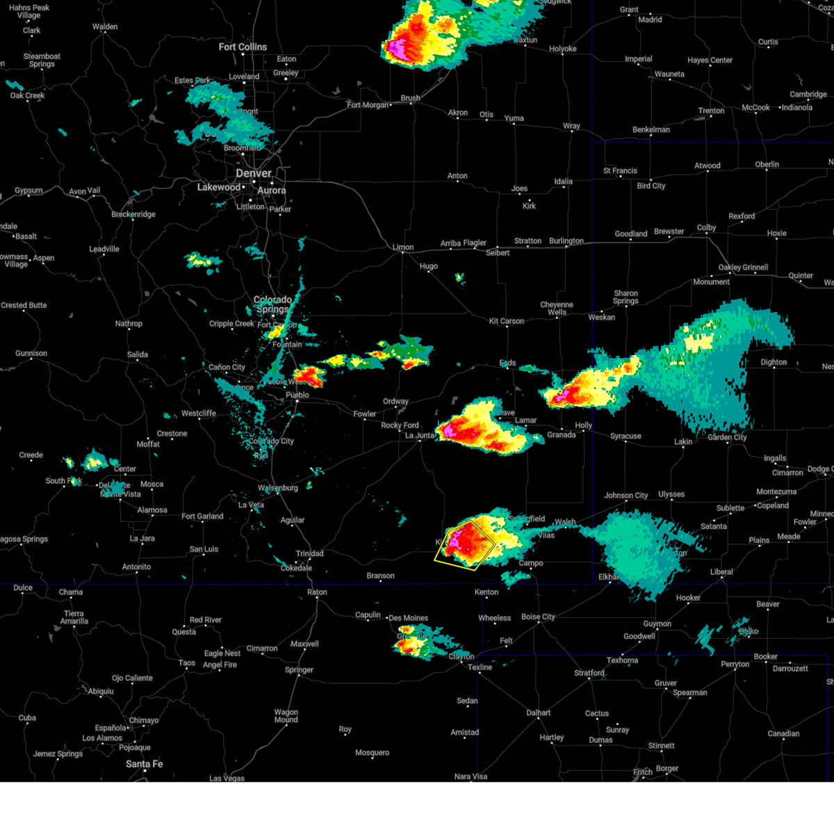
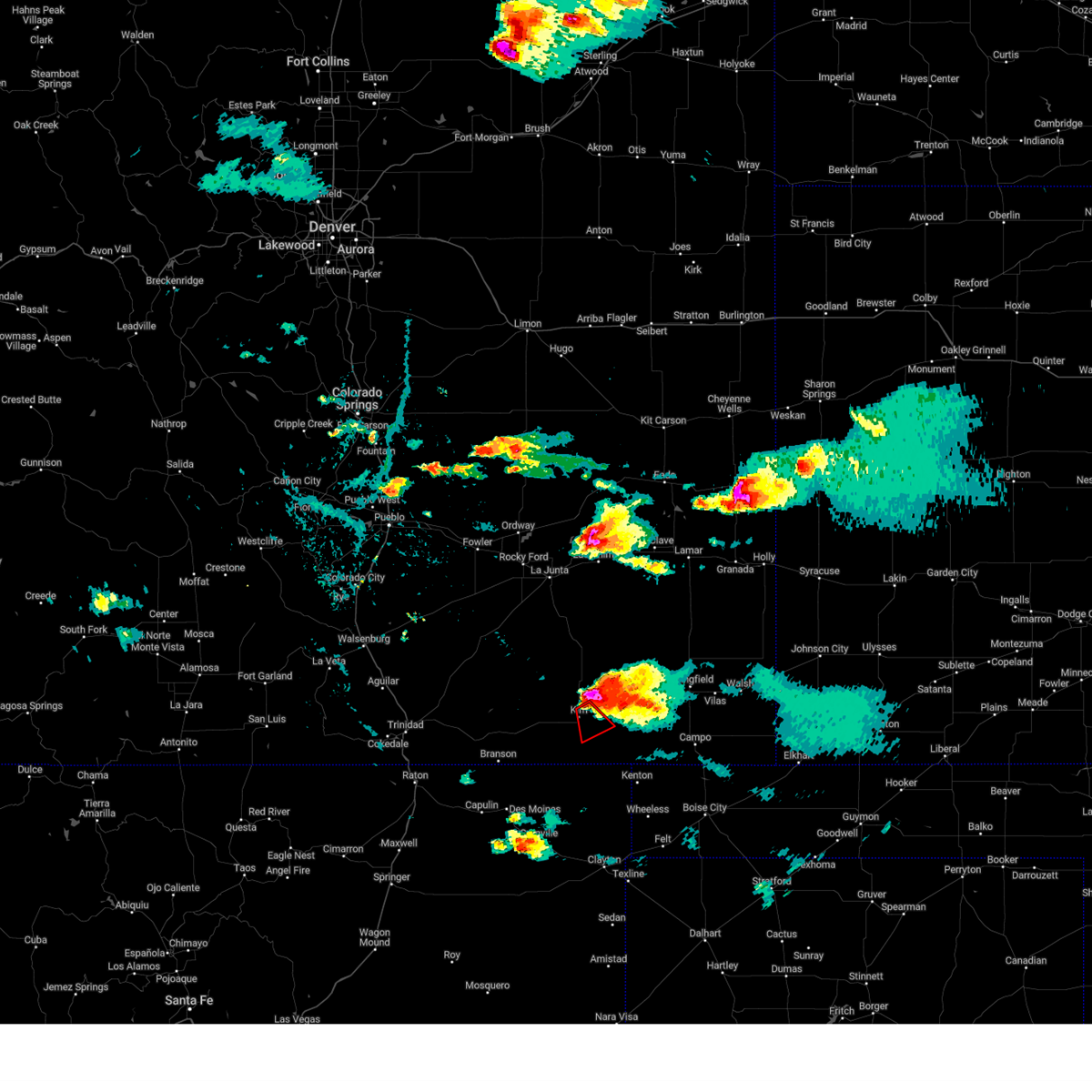
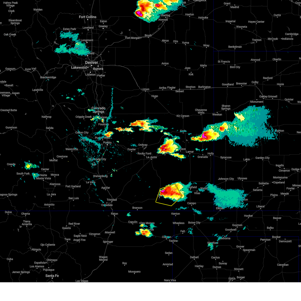
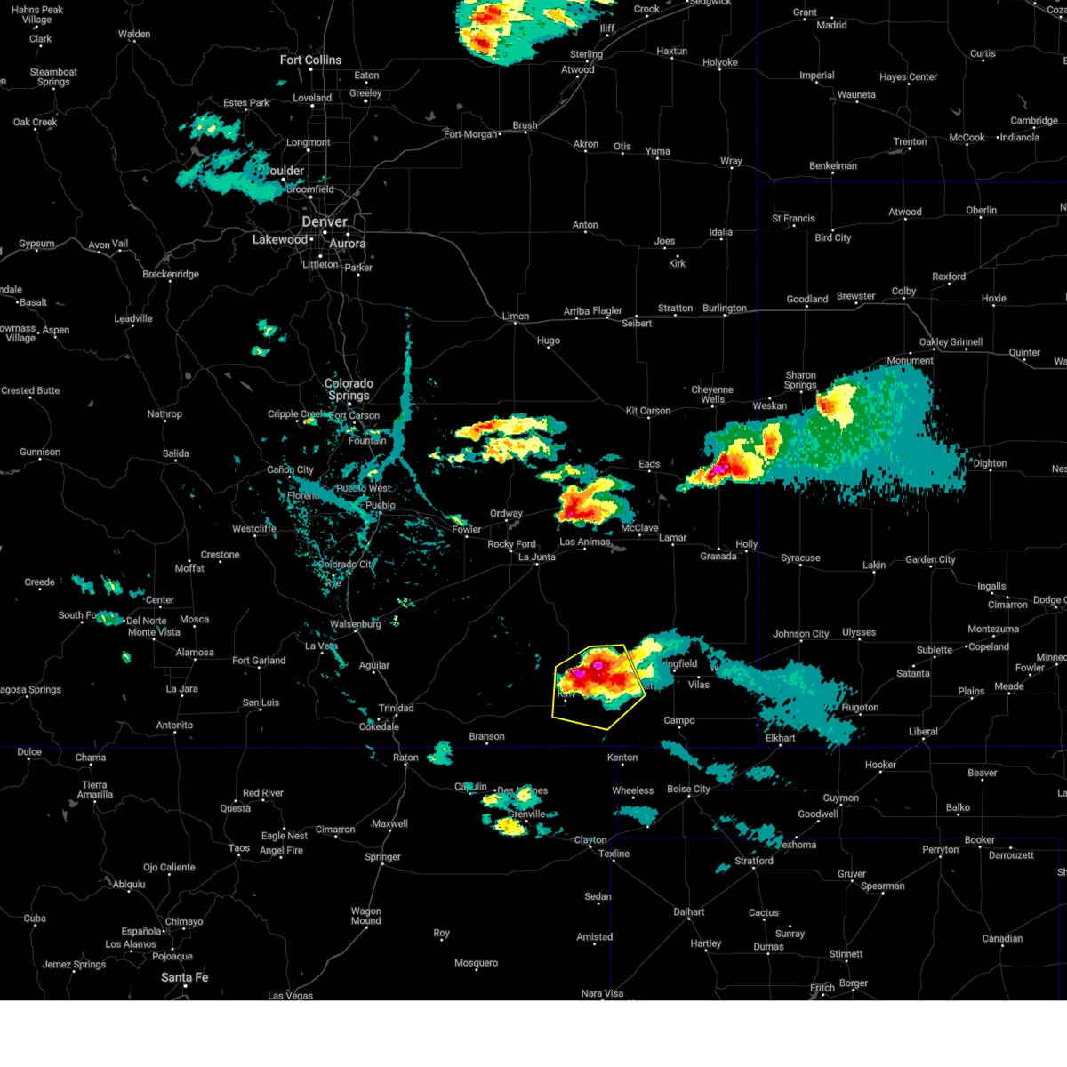
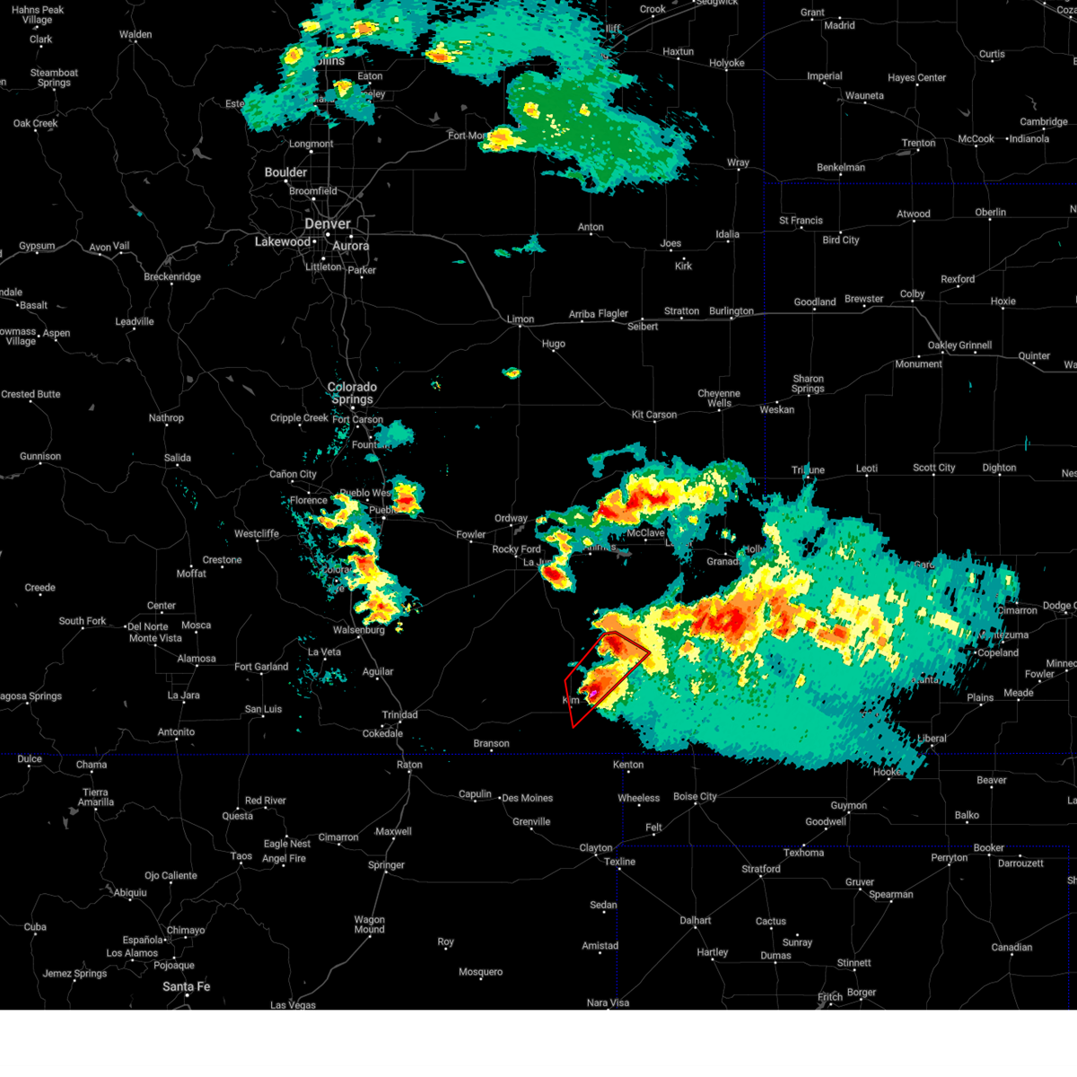
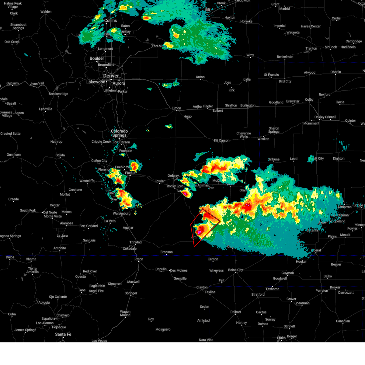
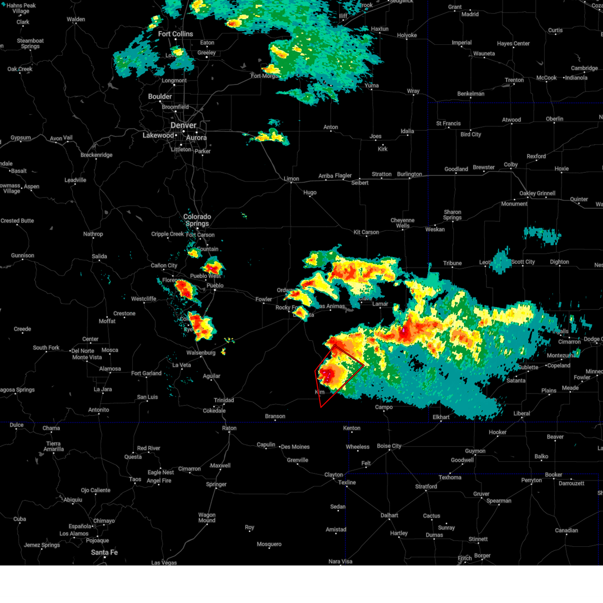
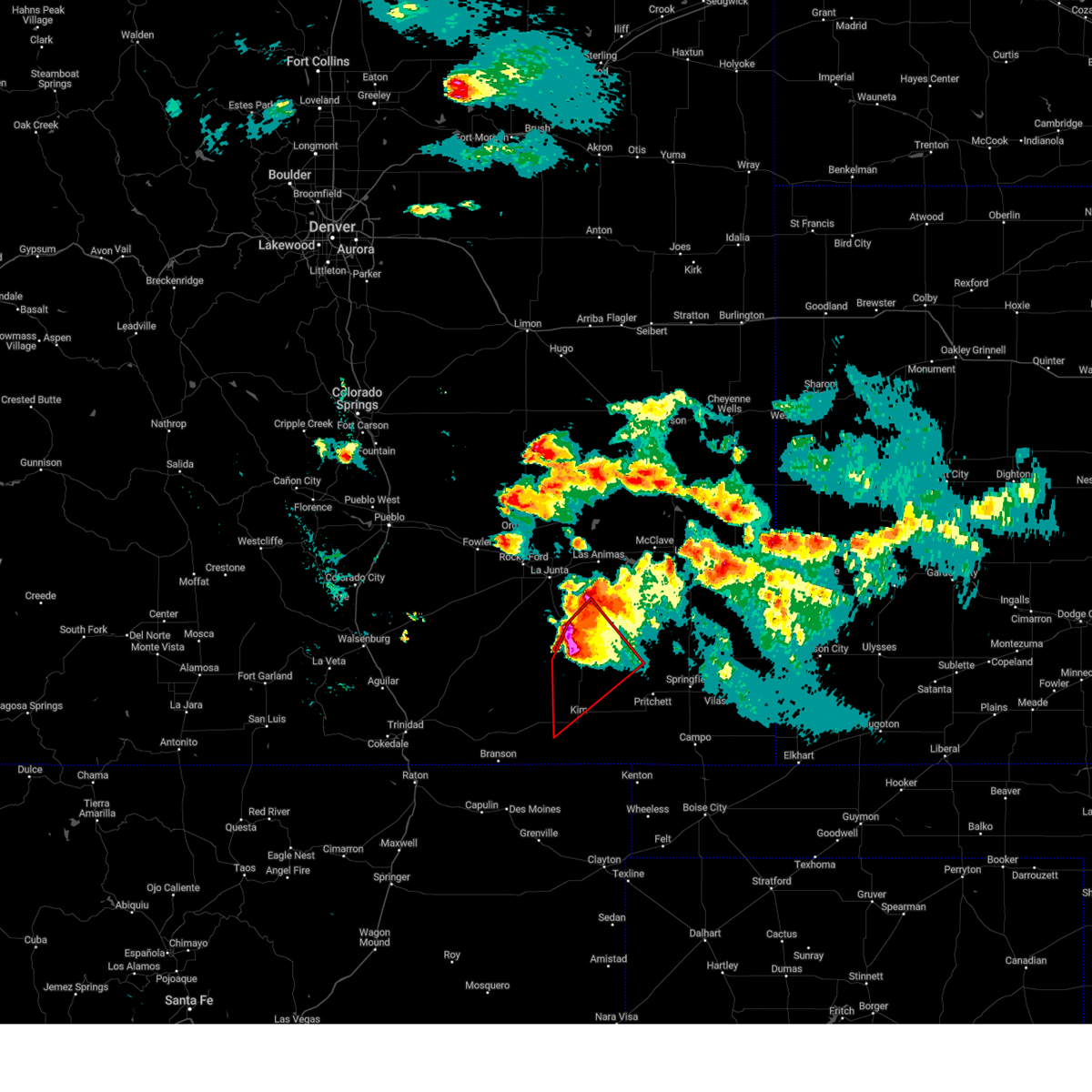
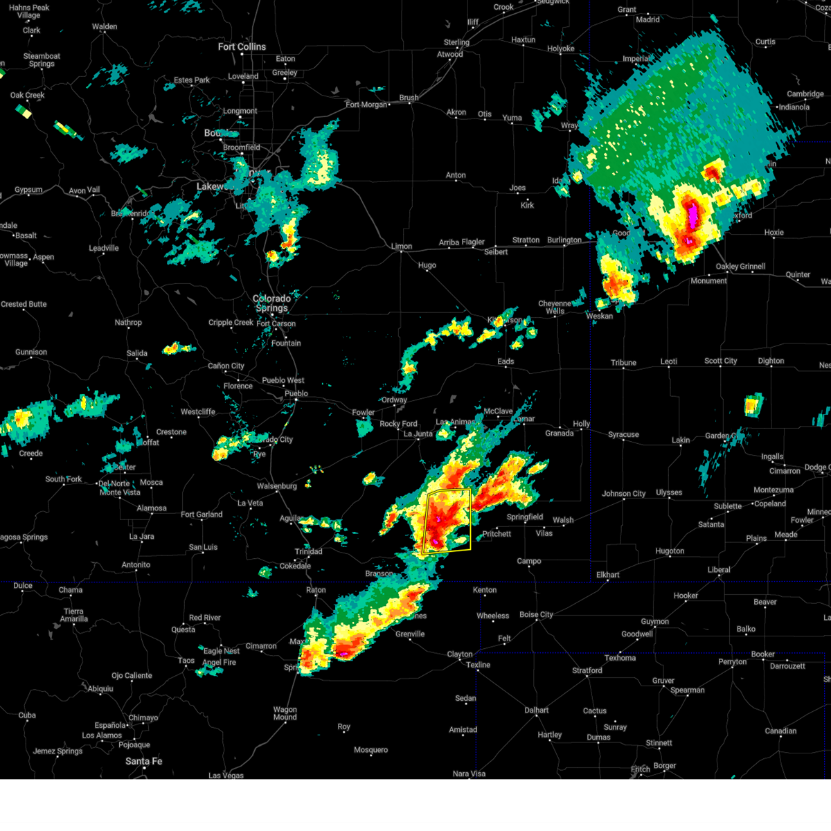
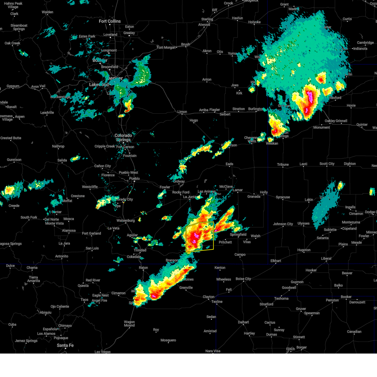
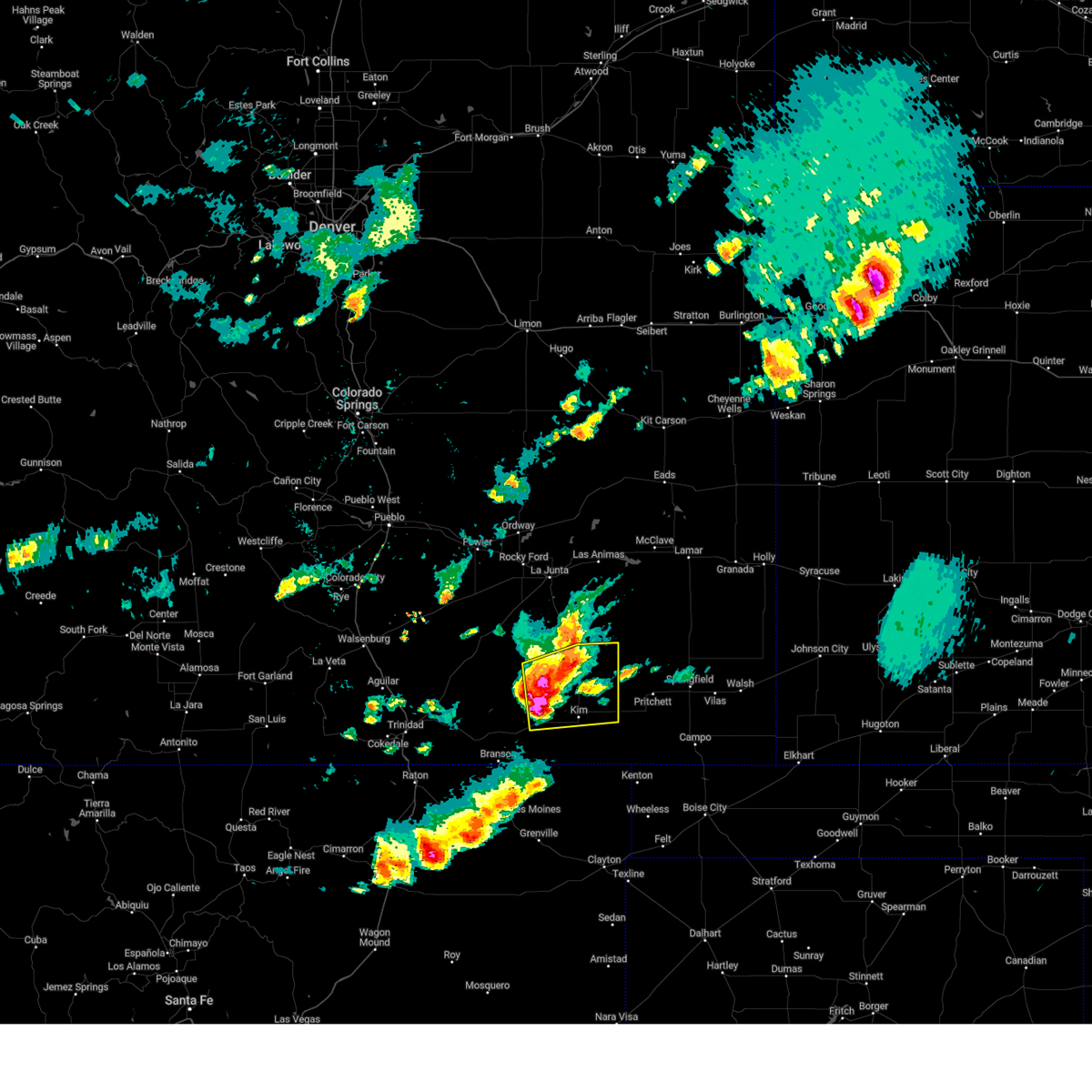
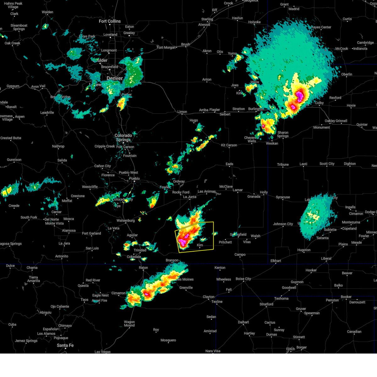
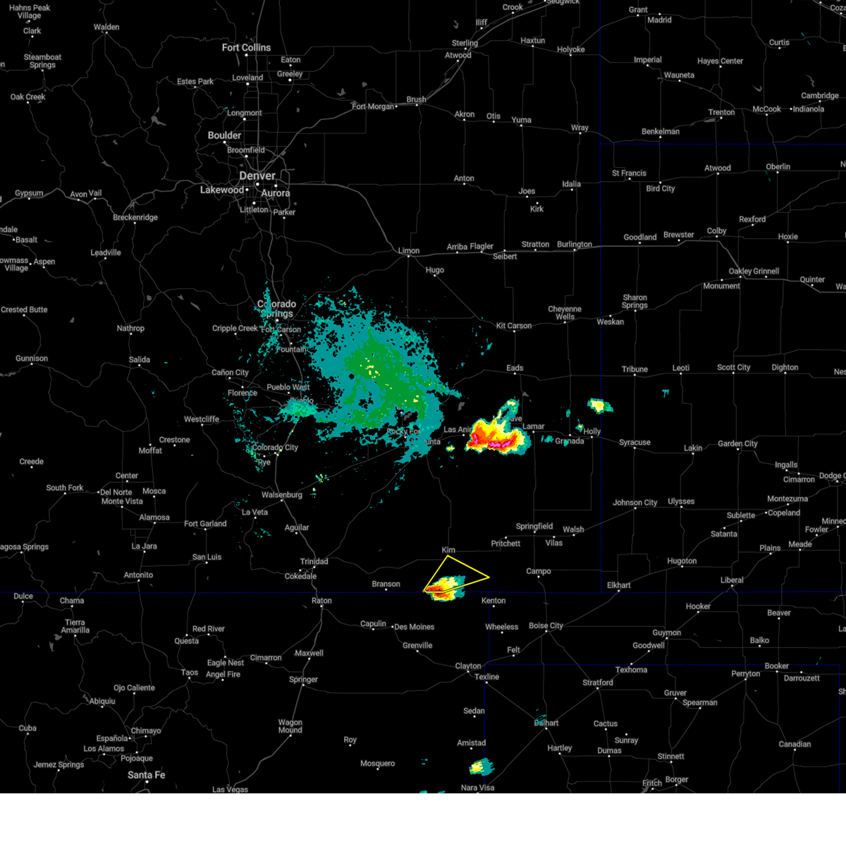
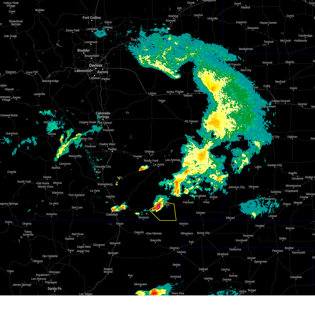
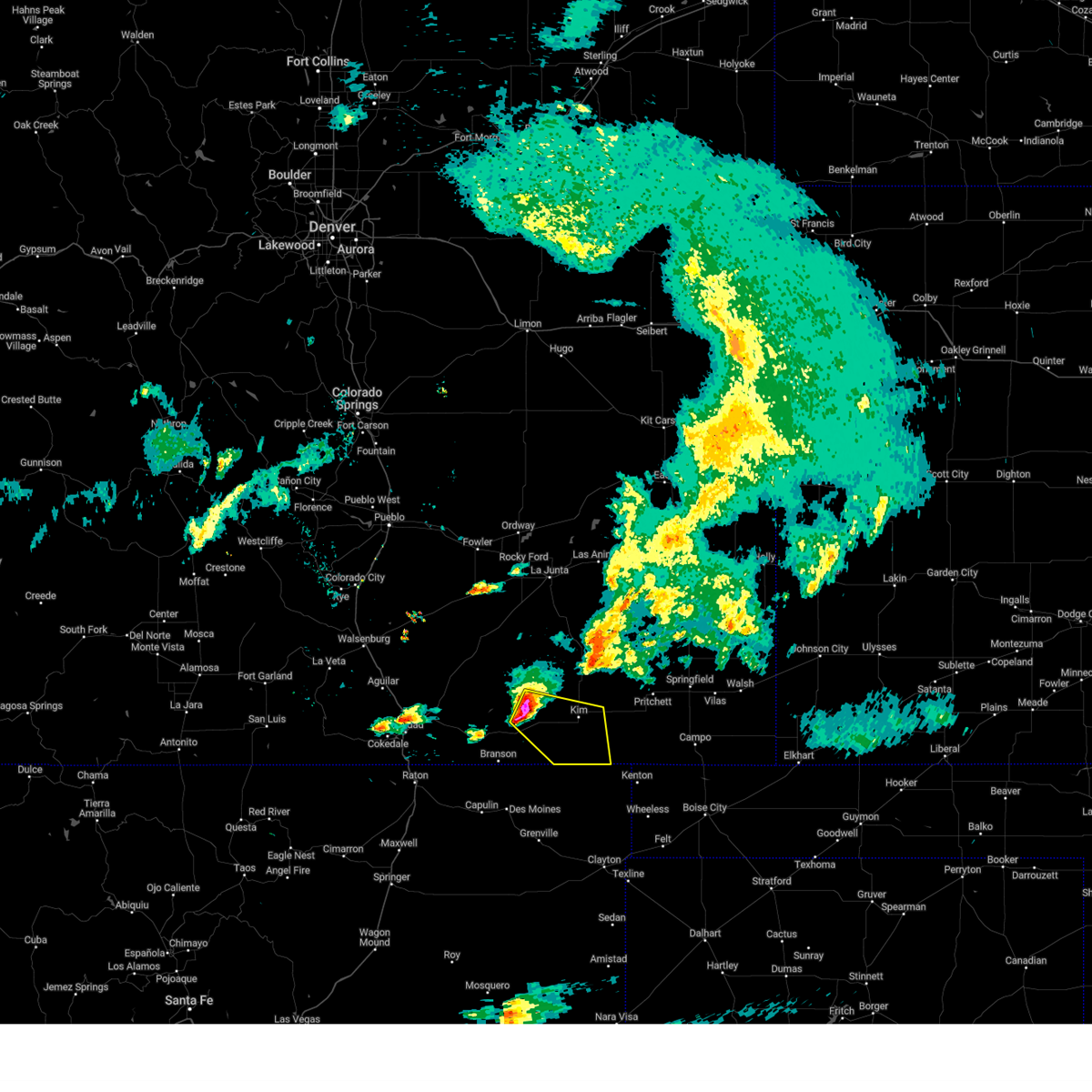
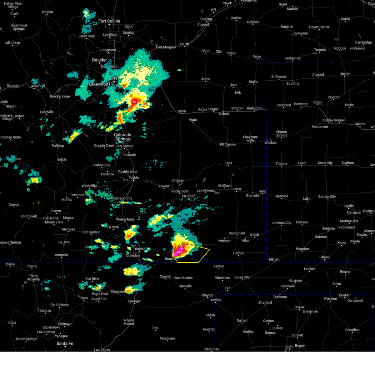
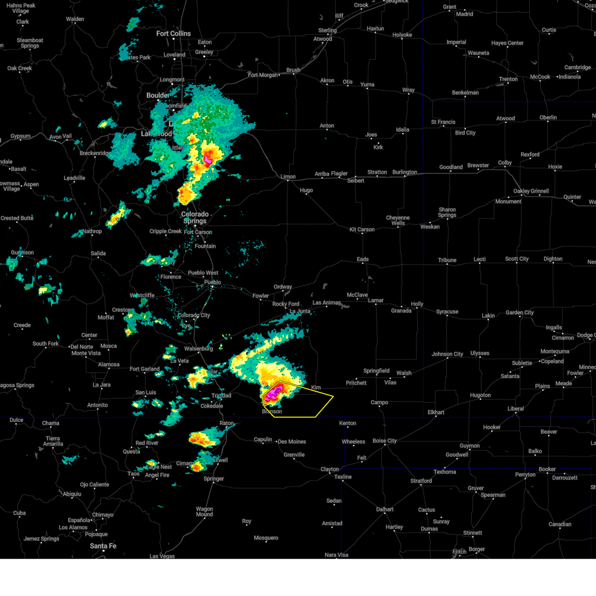
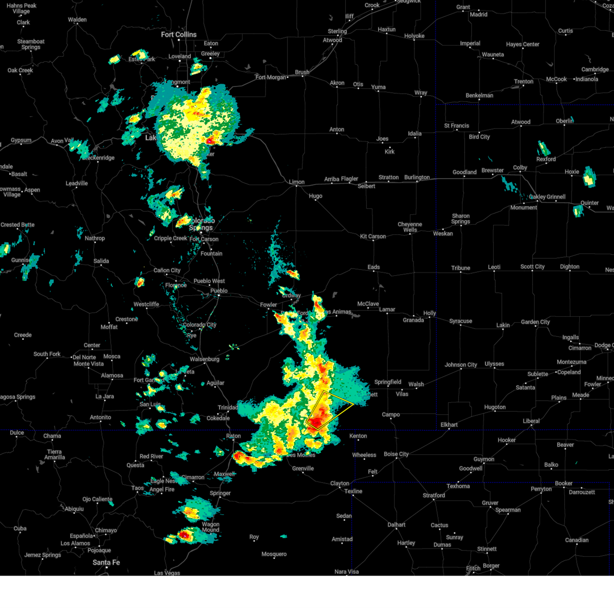
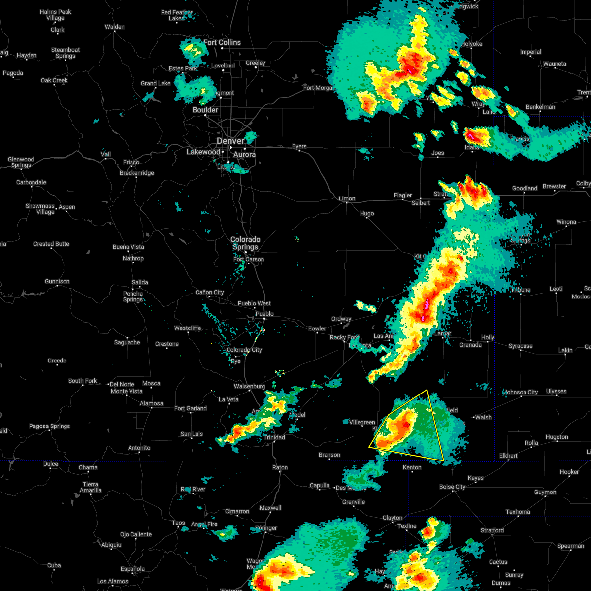
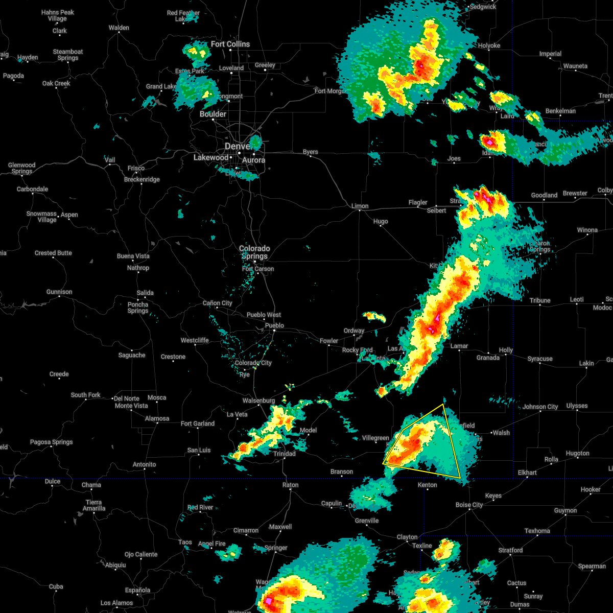
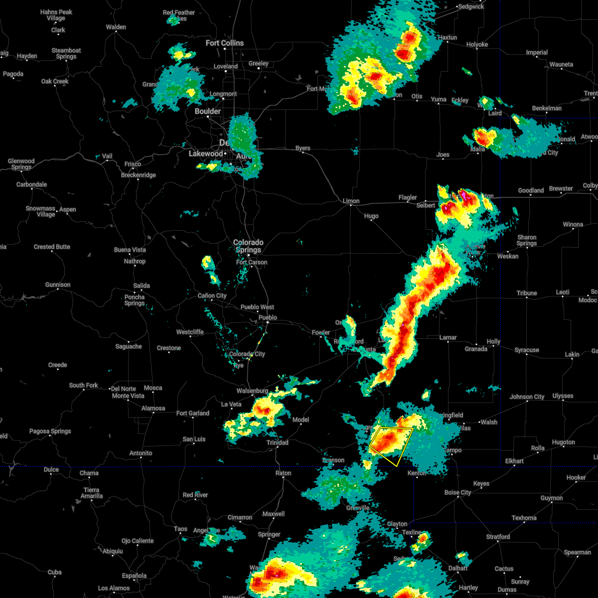
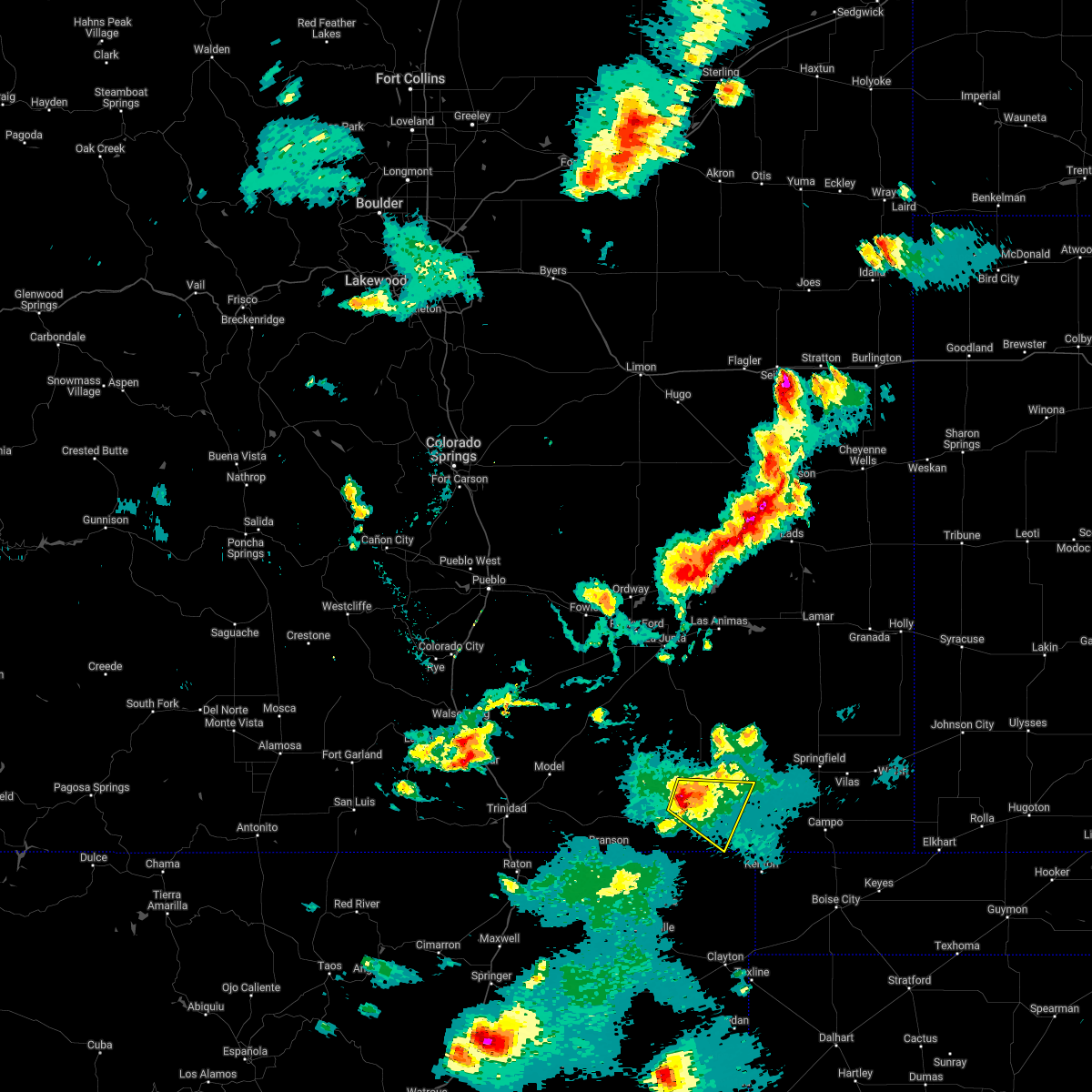
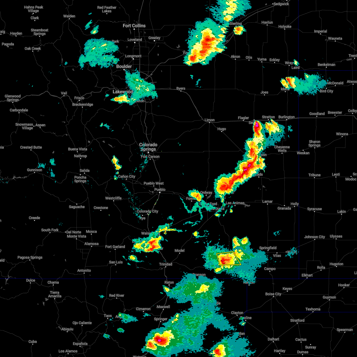
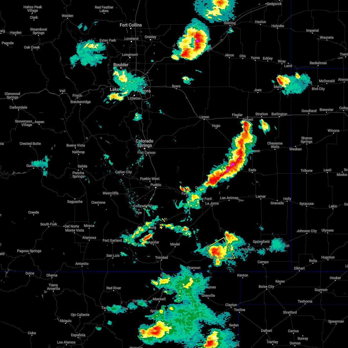
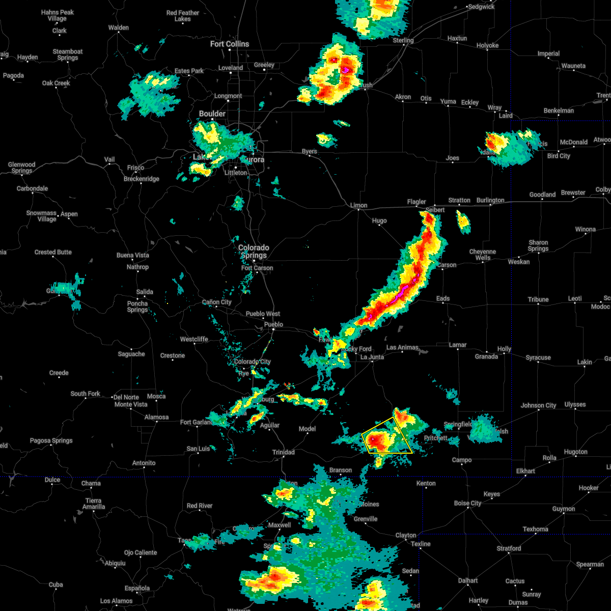
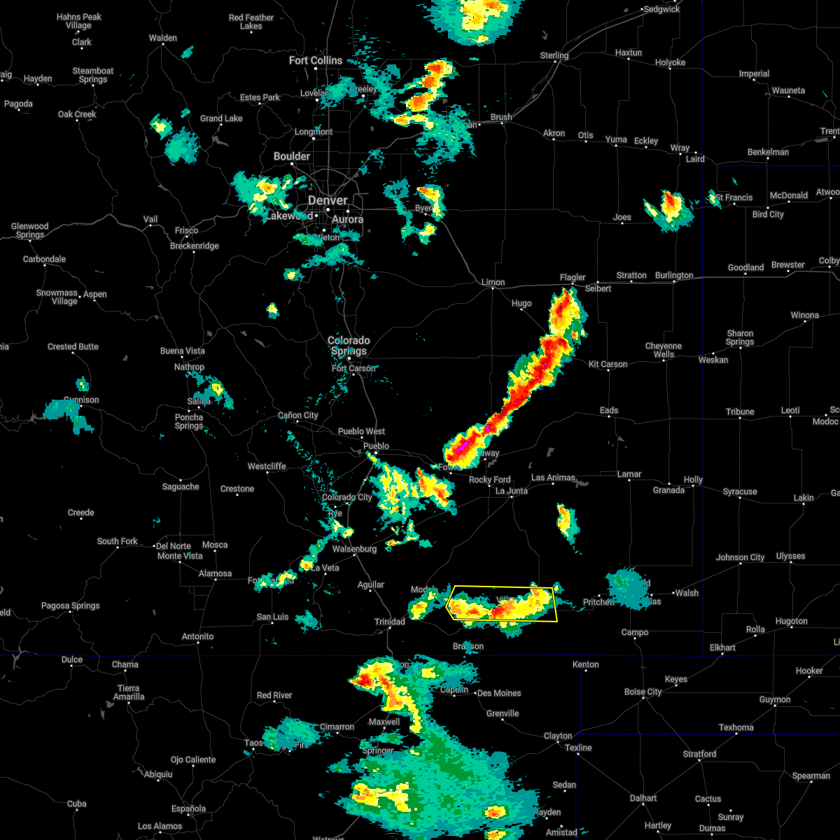
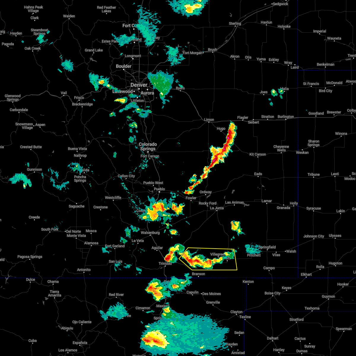
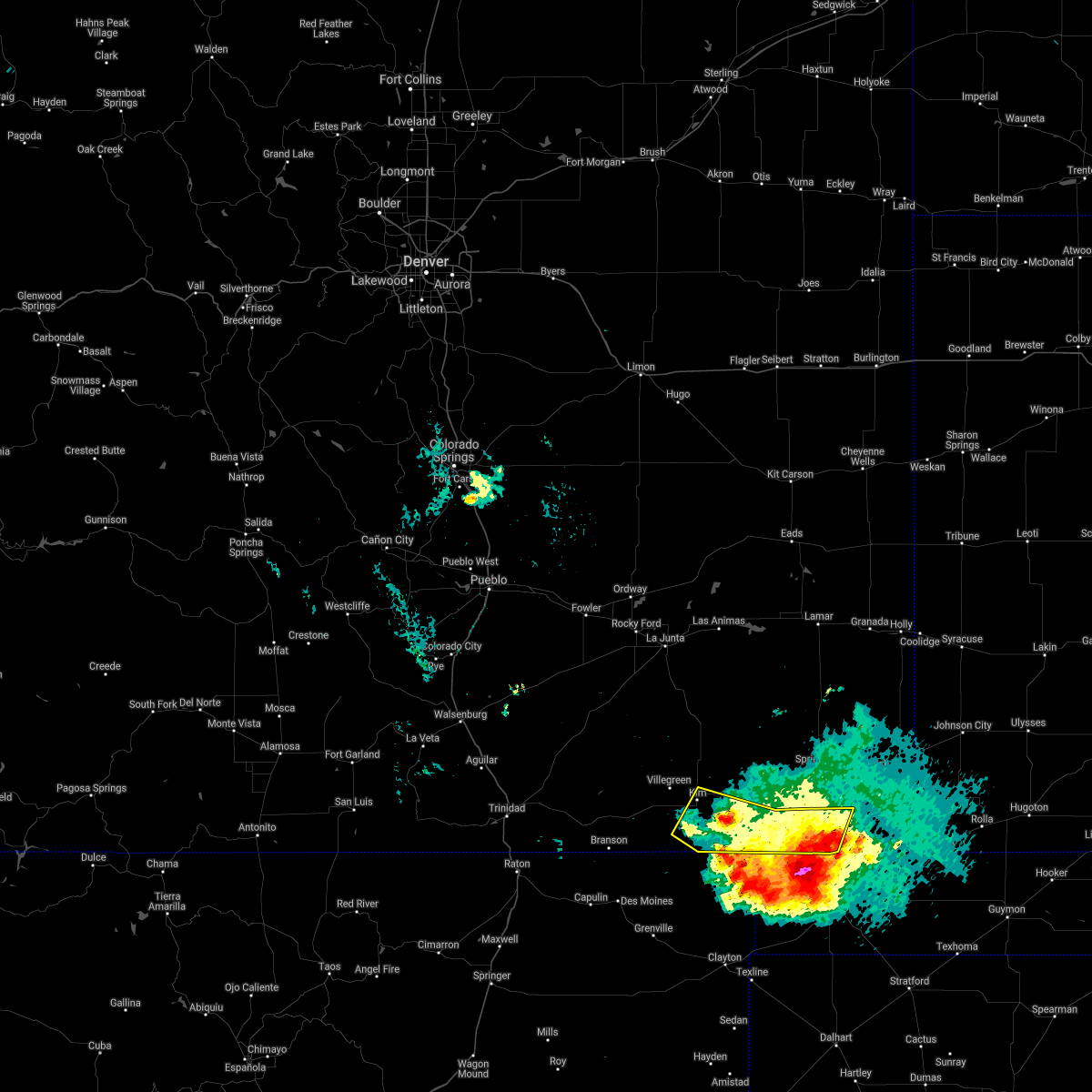
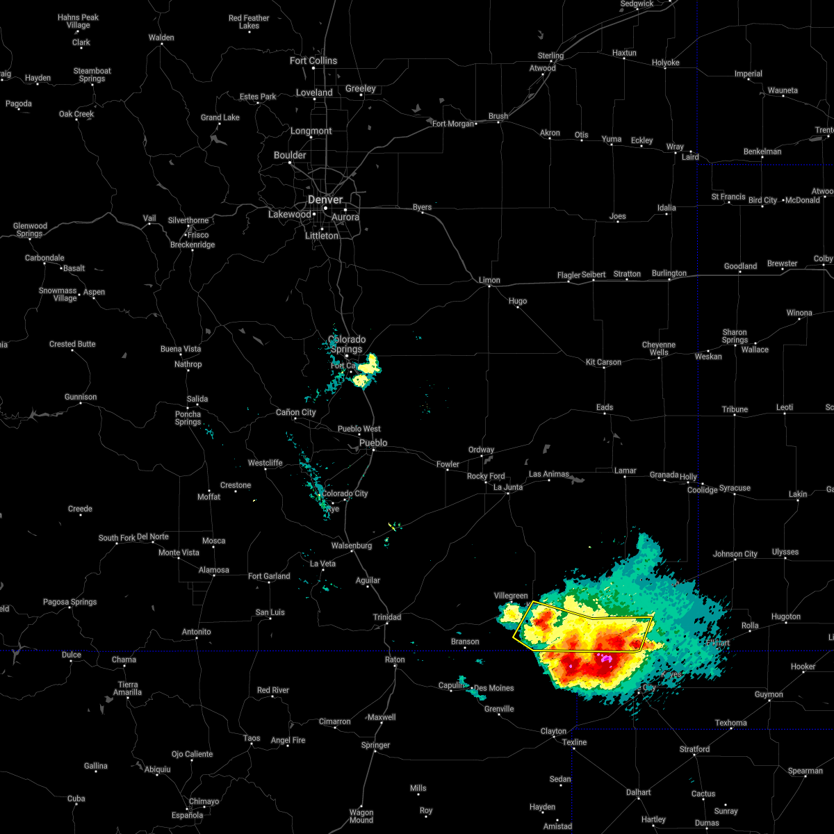
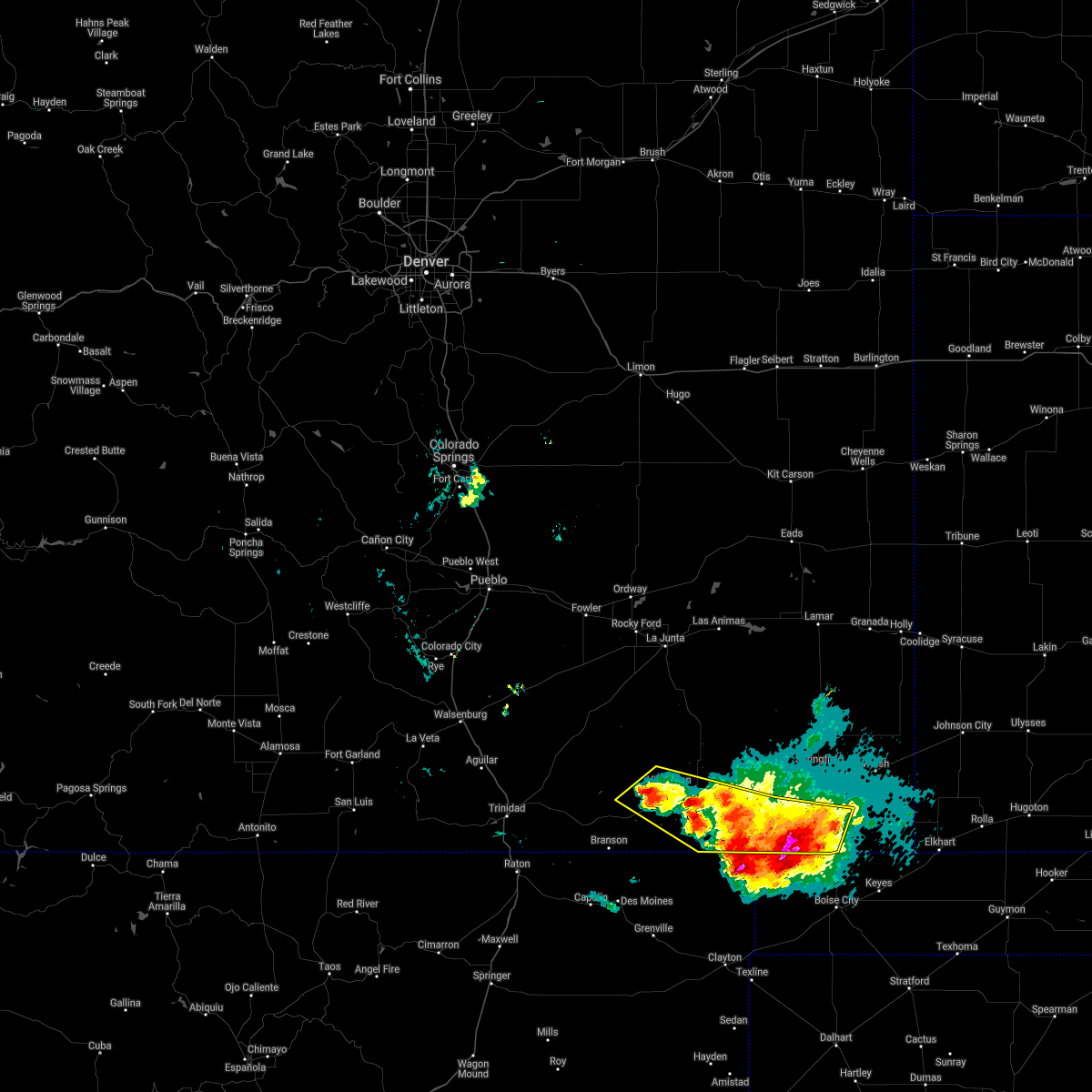
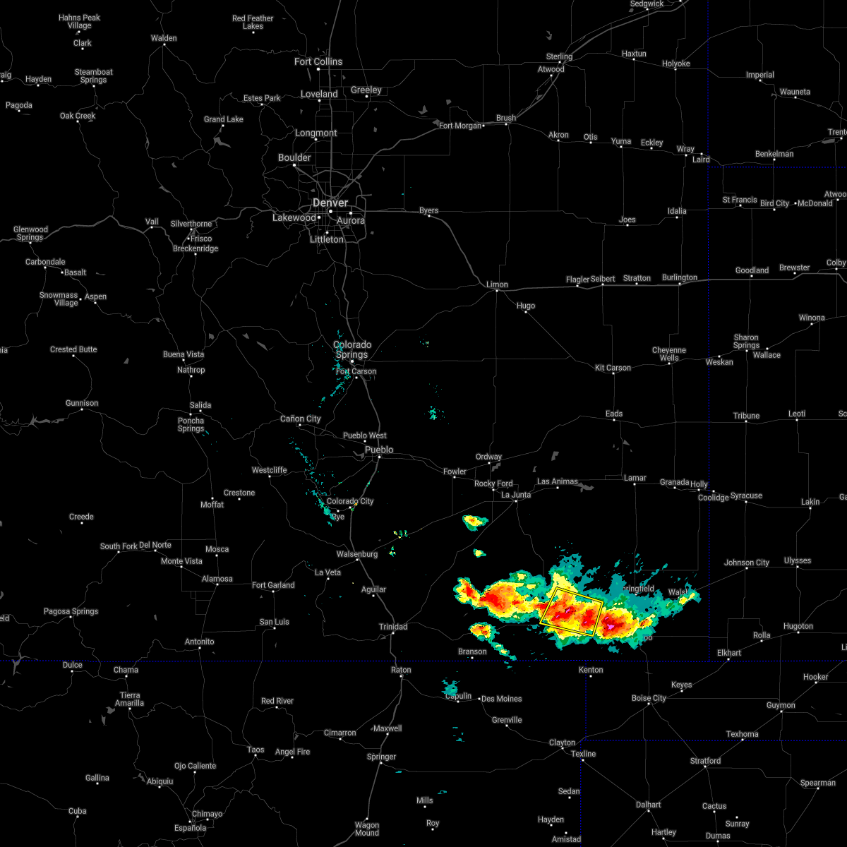
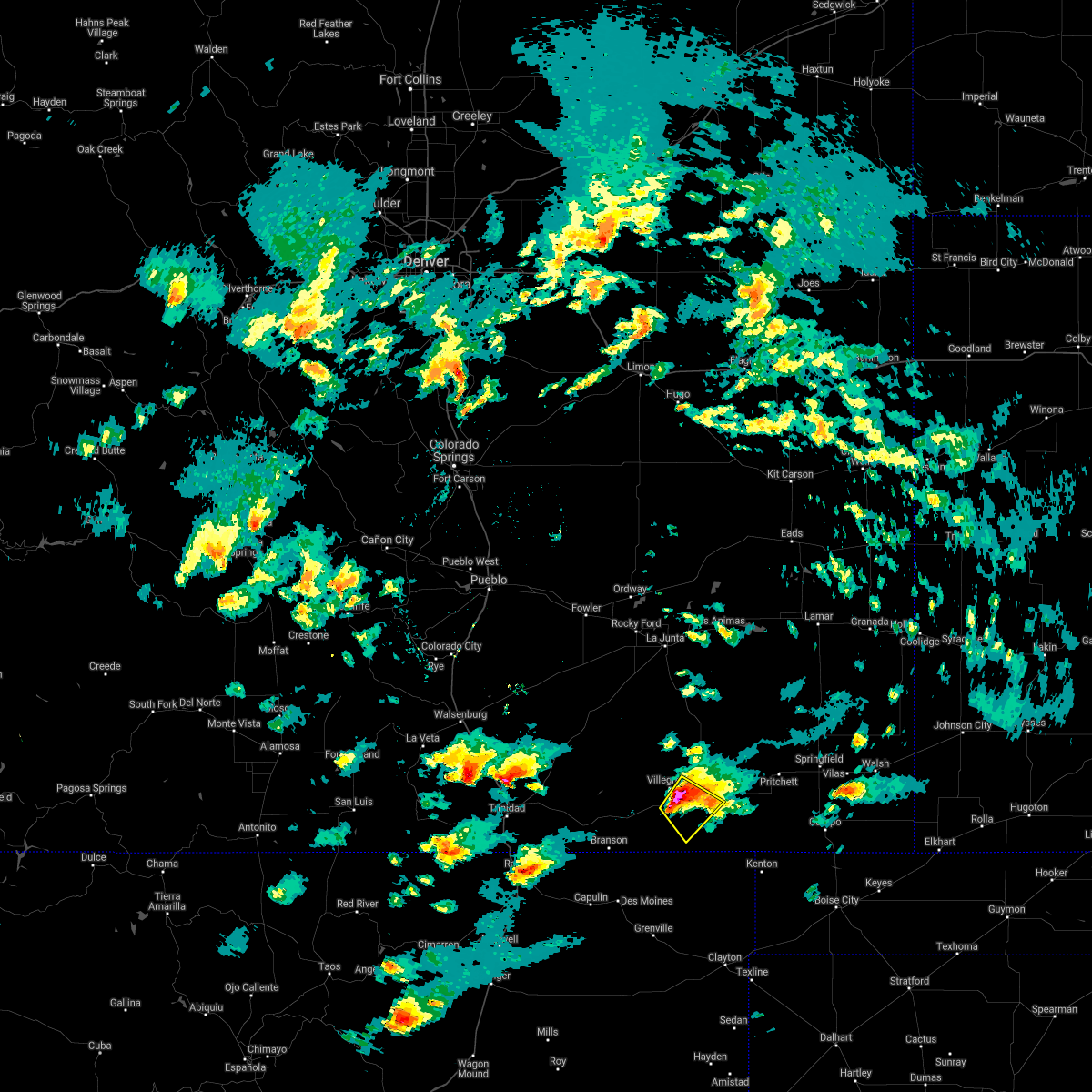
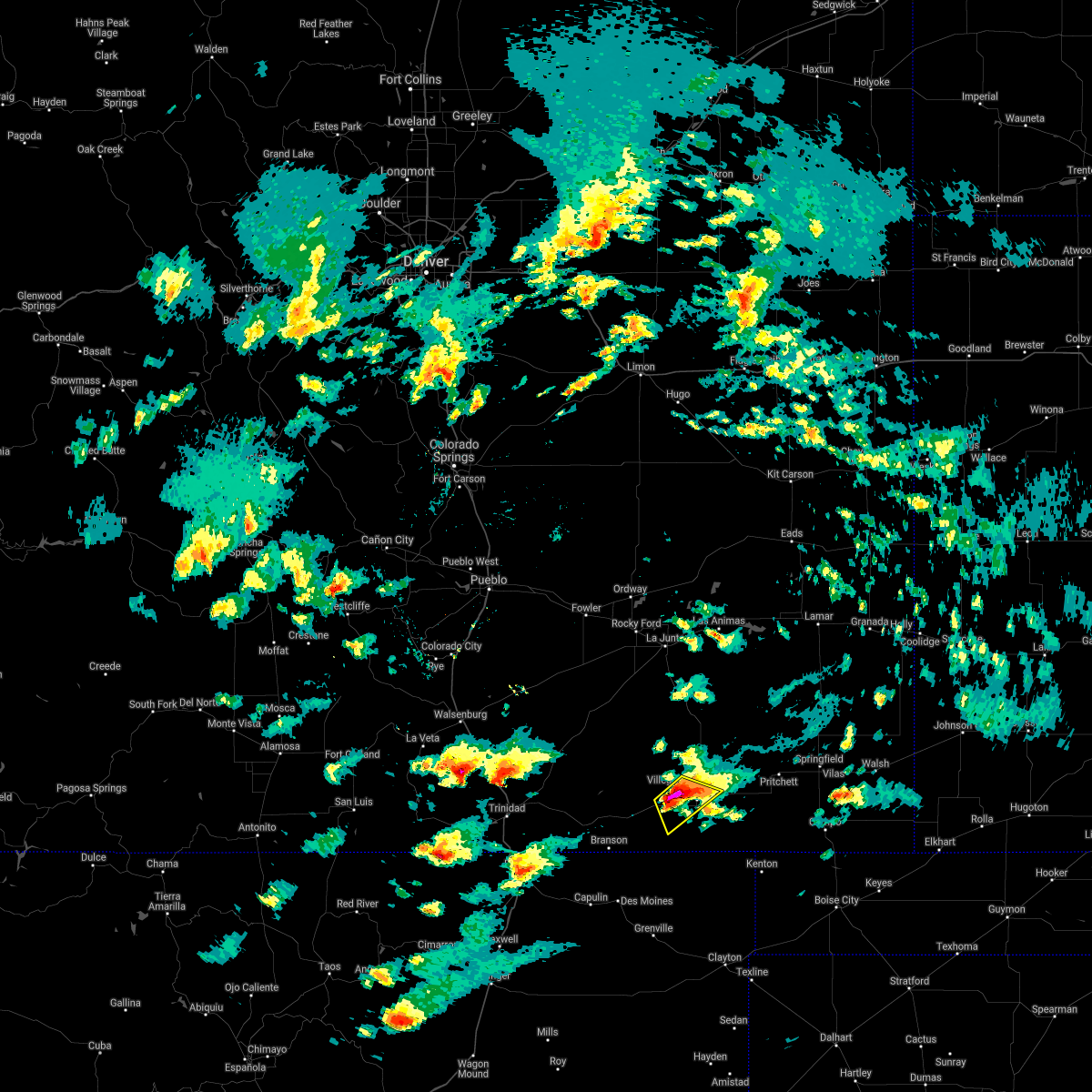
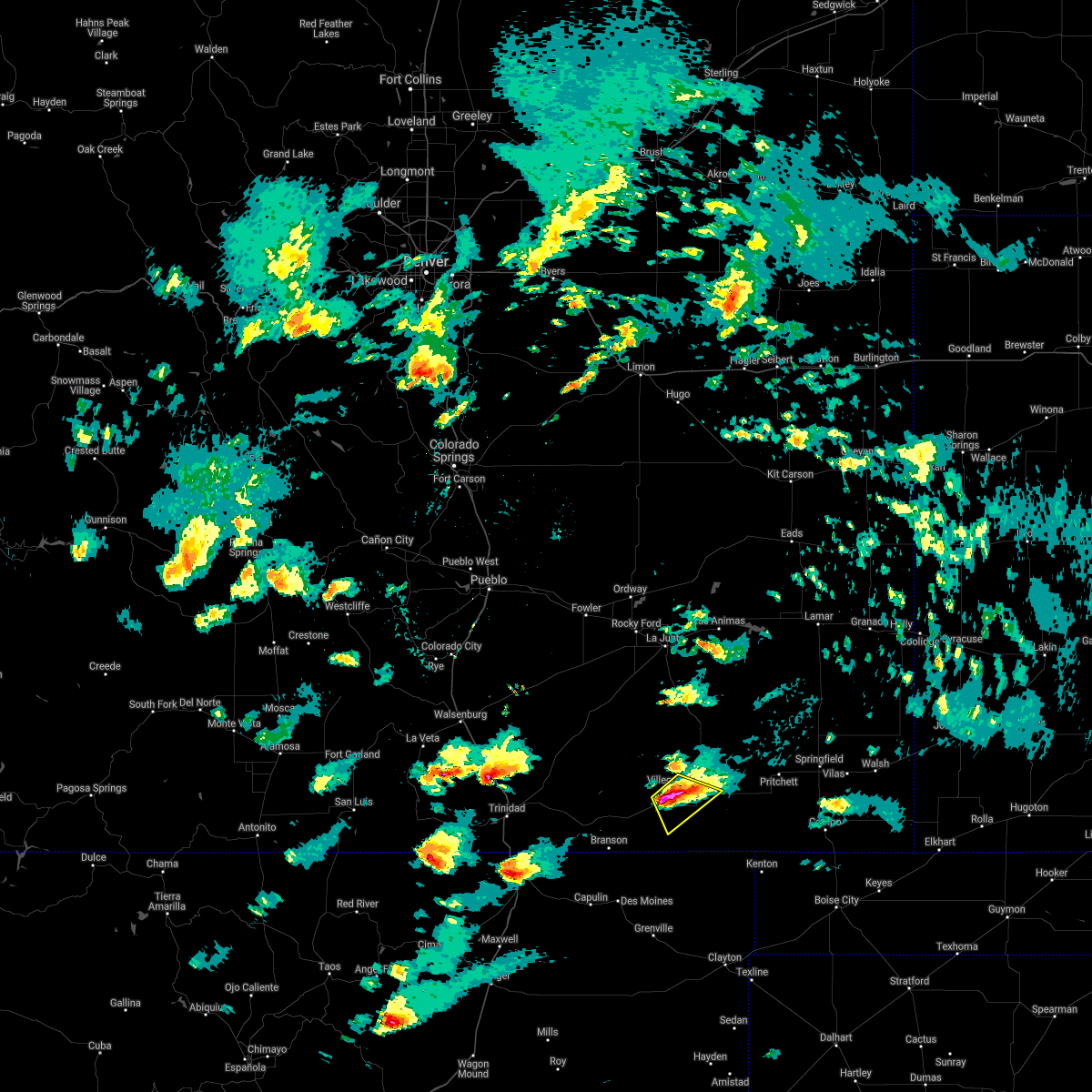
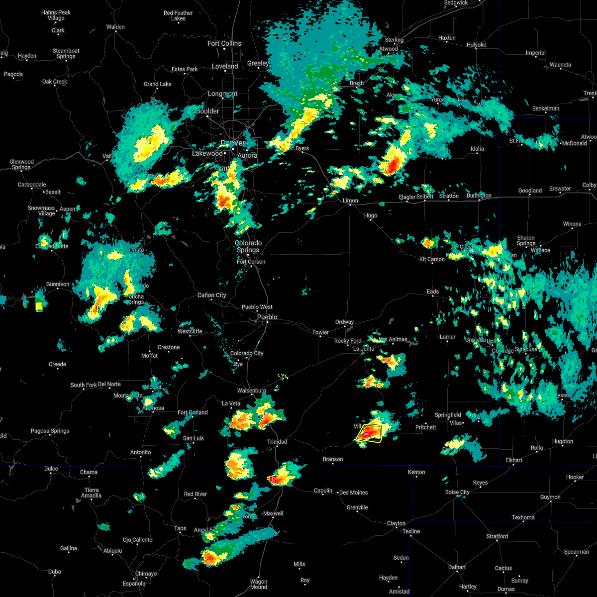
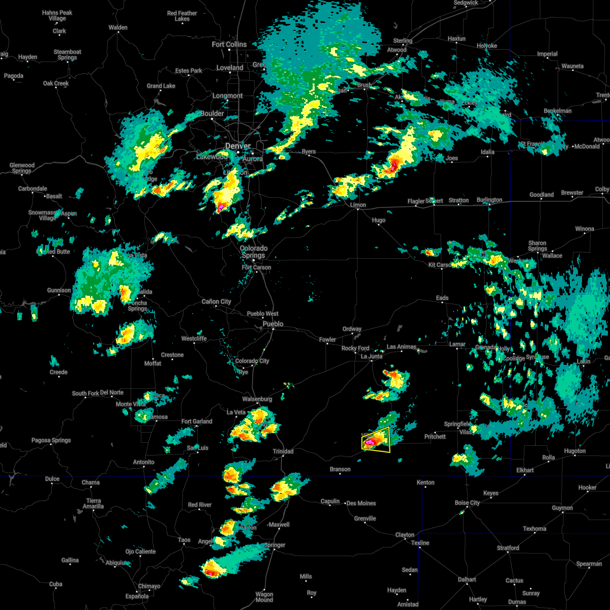
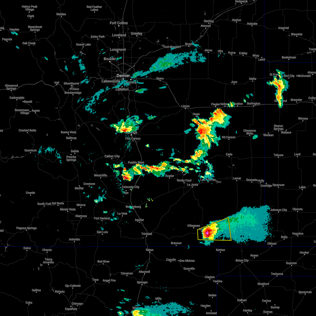
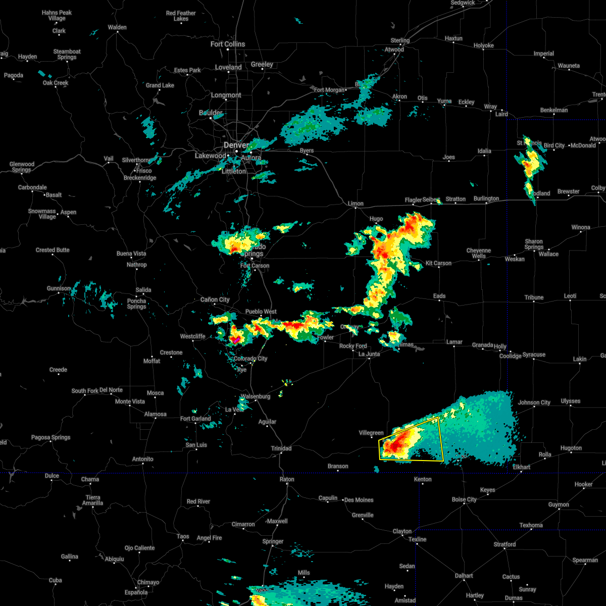
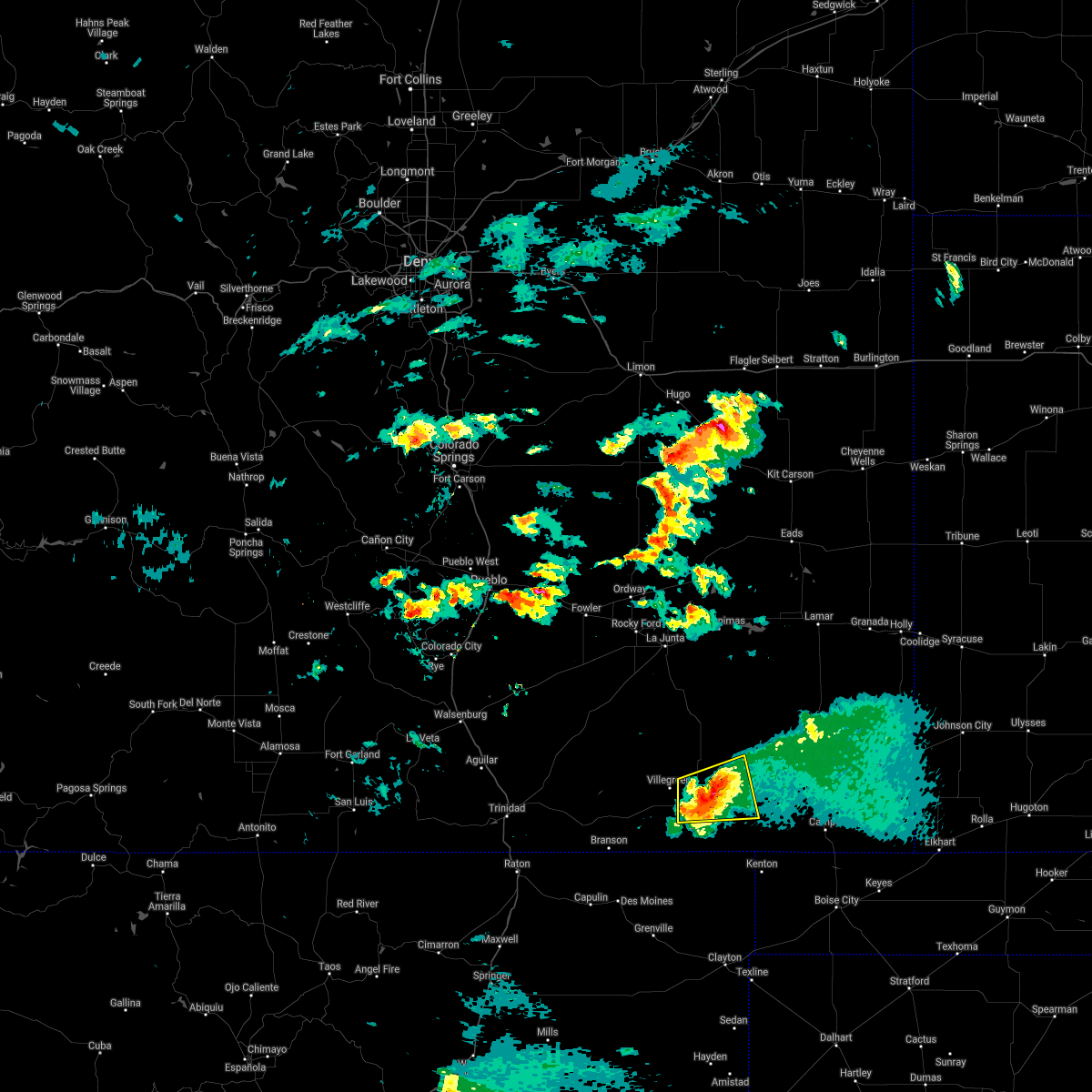
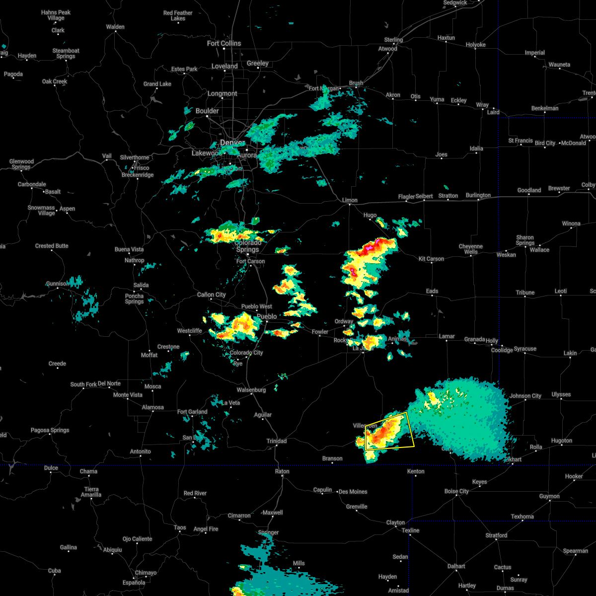
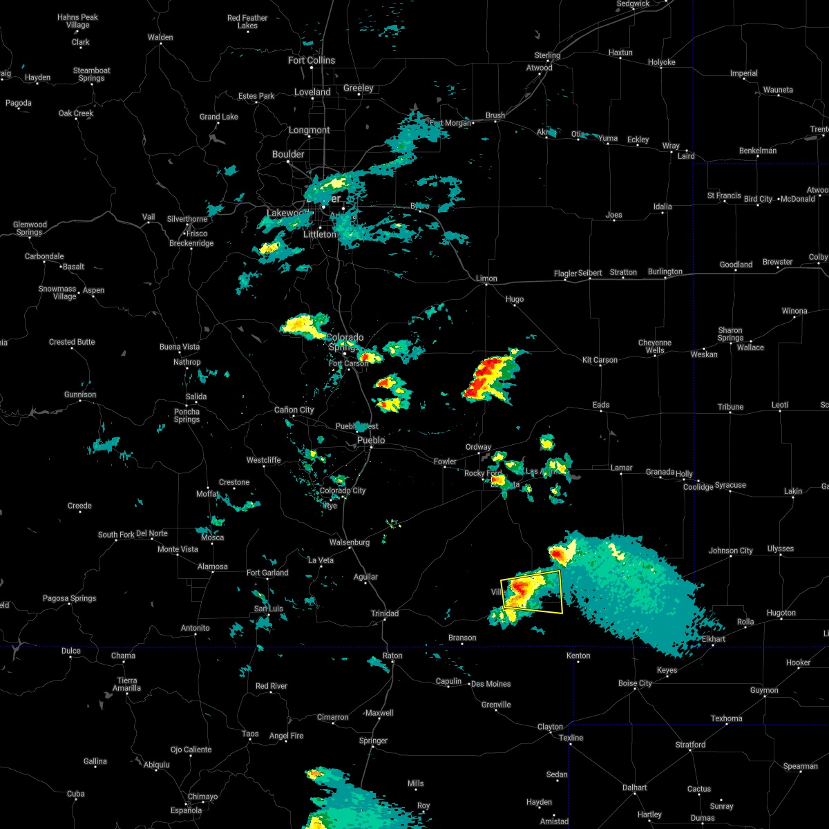
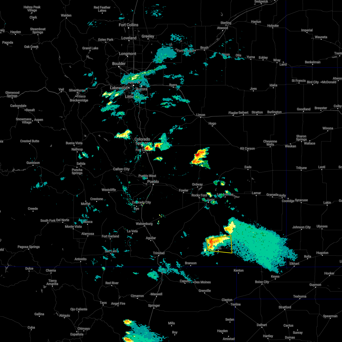
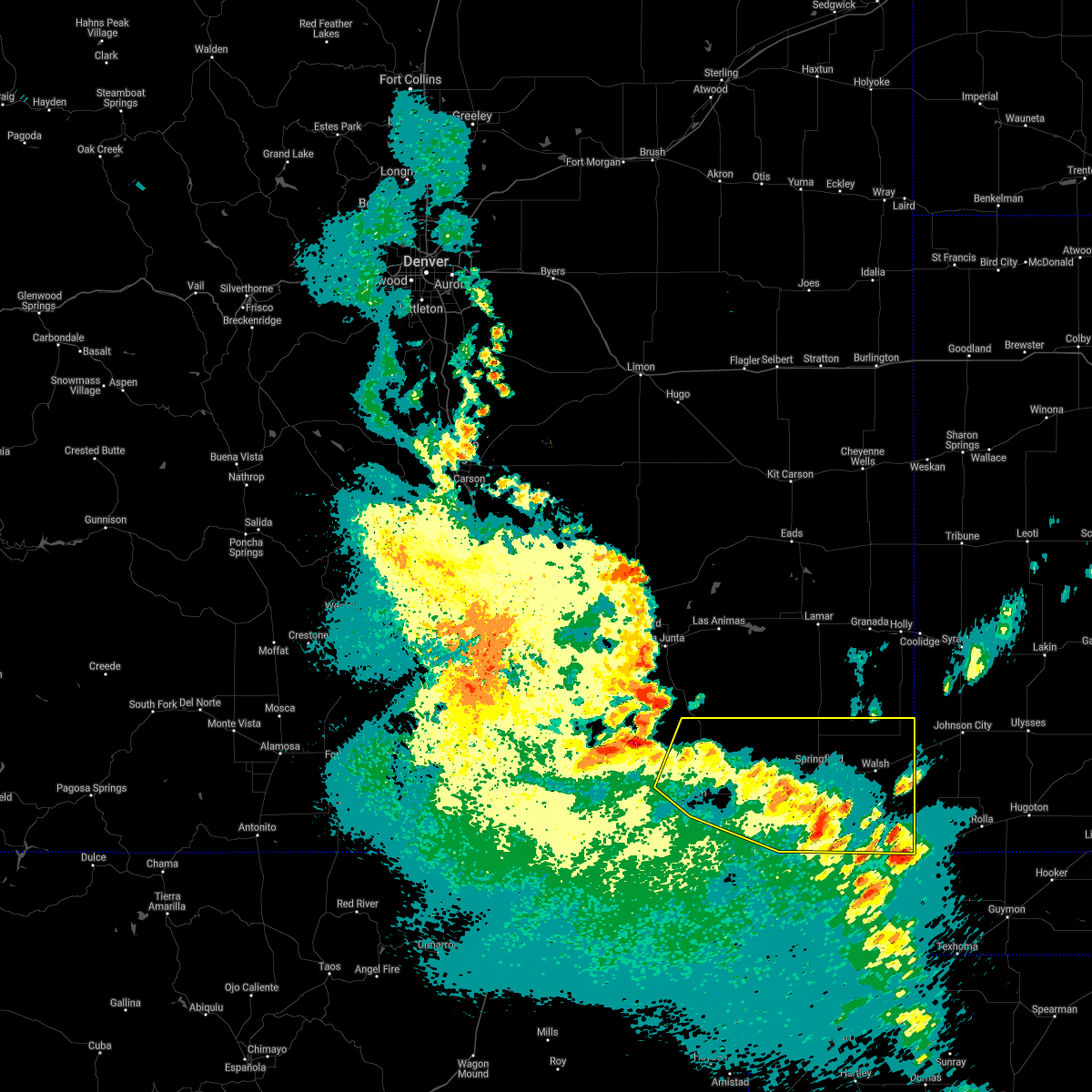
Hail Map for Kim, CO
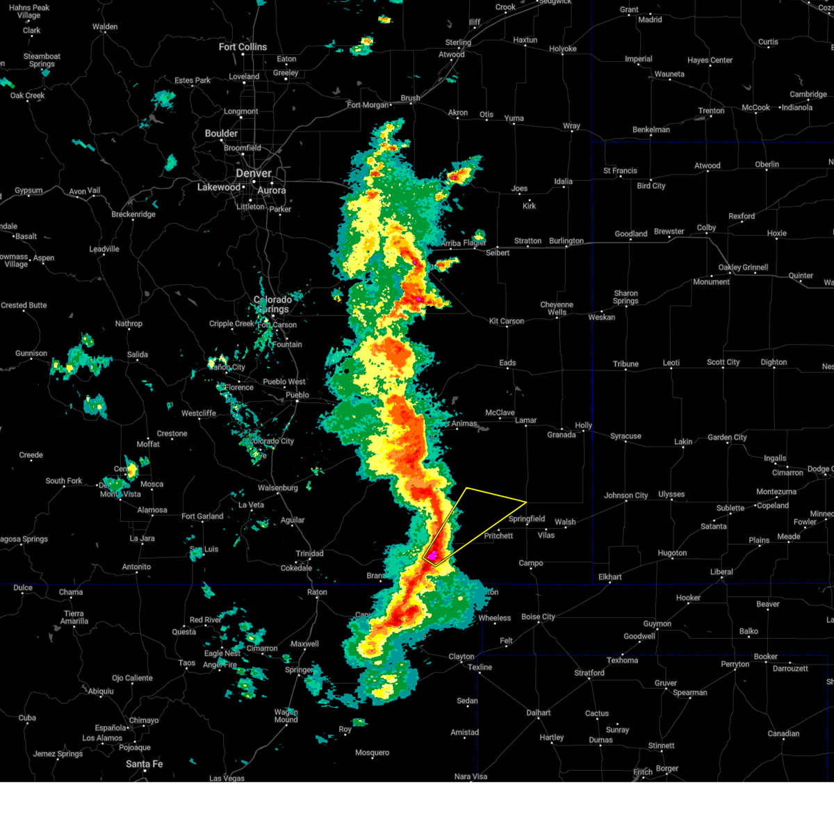
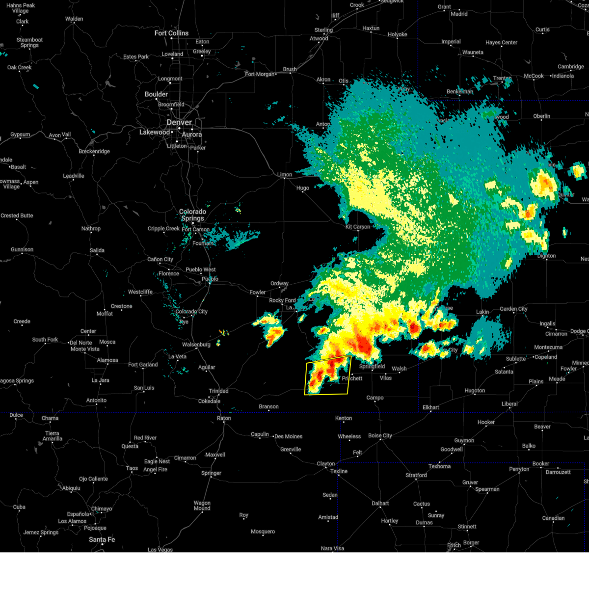
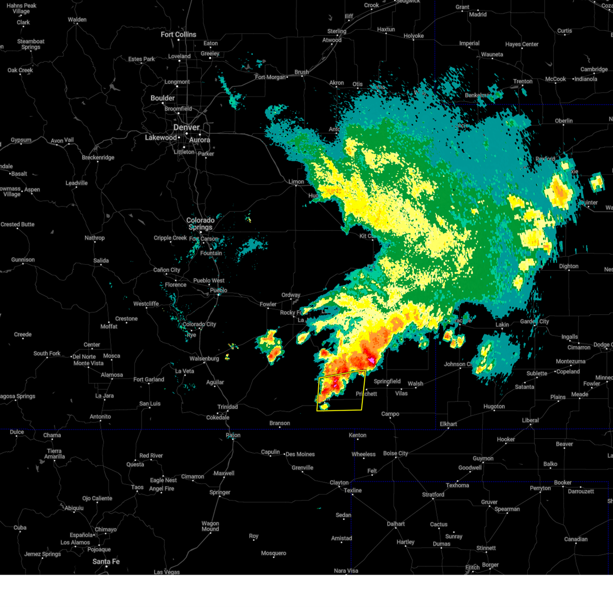
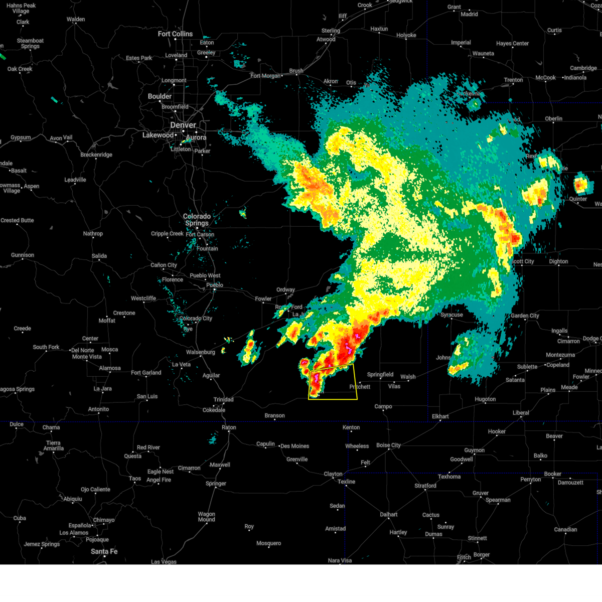
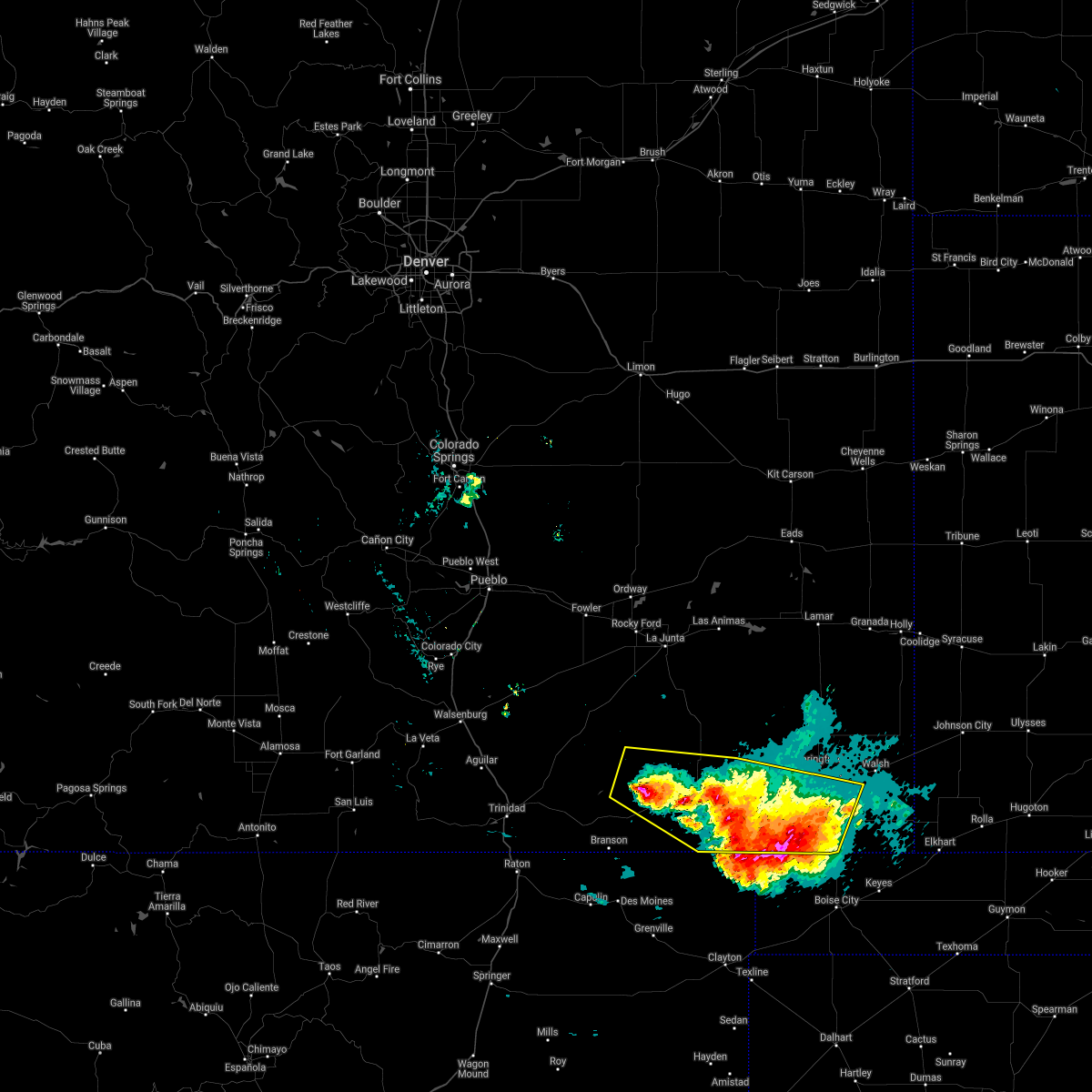
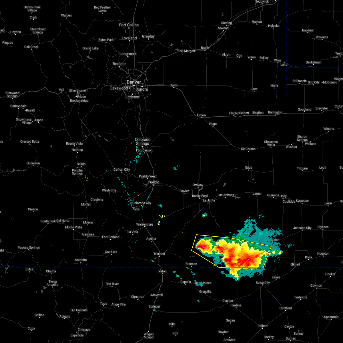
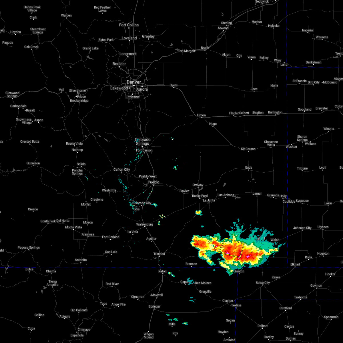
The Kim, CO area has had 18 reports of on-the-ground hail by trained spotters, and has been under severe weather warnings 18 times during the past 12 months. Doppler radar has detected hail at or near Kim, CO on 50 occasions, including 7 occasions during the past year.
| Name: | Kim, CO |
| Where Located: | 98.3 miles SE of Pueblo, CO |
| Map: | Google Map for Kim, CO |
| Population: | 74 |
| Housing Units: | 47 |
| More Info: | Search Google for Kim, CO |
0
The Top Recent Hail Date for Kim, CO is Sunday, June 29, 2025 (11th out of 50)
Hail and Wind Damage Spotted near Kim, CO
| Date / Time | Report Details |
|---|---|
| 6/6/2025 7:43 PM MDT |
 Svrpub the national weather service in pueblo has issued a * severe thunderstorm warning for, western baca county in southeastern colorado, southeastern las animas county in southeastern colorado, * until 815 pm mdt. * at 743 pm mdt, severe thunderstorms were located along a line extending from 6 miles north of pritchett to 12 miles southwest of springfield to near kim, moving southeast at 20 mph (radar indicated). Hazards include ping pong ball size hail and 60 mph wind gusts. People and animals outdoors will be injured. expect hail damage to roofs, siding, windows, and vehicles. Expect wind damage to roofs, siding, and trees. Svrpub the national weather service in pueblo has issued a * severe thunderstorm warning for, western baca county in southeastern colorado, southeastern las animas county in southeastern colorado, * until 815 pm mdt. * at 743 pm mdt, severe thunderstorms were located along a line extending from 6 miles north of pritchett to 12 miles southwest of springfield to near kim, moving southeast at 20 mph (radar indicated). Hazards include ping pong ball size hail and 60 mph wind gusts. People and animals outdoors will be injured. expect hail damage to roofs, siding, windows, and vehicles. Expect wind damage to roofs, siding, and trees.
|
| 6/6/2025 7:36 PM MDT |
 At 736 pm mdt, severe thunderstorms were located along a line extending from 21 miles west of two buttes reservoir to near pritchett to near kim, moving southeast at 35 mph (radar indicated). Hazards include ping pong ball size hail and 60 mph wind gusts. People and animals outdoors will be injured. expect hail damage to roofs, siding, windows, and vehicles. expect wind damage to roofs, siding, and trees. Locations impacted include, pritchett and kim. At 736 pm mdt, severe thunderstorms were located along a line extending from 21 miles west of two buttes reservoir to near pritchett to near kim, moving southeast at 35 mph (radar indicated). Hazards include ping pong ball size hail and 60 mph wind gusts. People and animals outdoors will be injured. expect hail damage to roofs, siding, windows, and vehicles. expect wind damage to roofs, siding, and trees. Locations impacted include, pritchett and kim.
|
| 6/6/2025 7:21 PM MDT |
 Svrpub the national weather service in pueblo has issued a * severe thunderstorm warning for, western baca county in southeastern colorado, southeastern las animas county in southeastern colorado, south central bent county in southeastern colorado, * until 745 pm mdt. * at 721 pm mdt, severe thunderstorms were located along a line extending from 22 miles east of higbee to 7 miles west of pritchett to near kim, moving southeast at 35 mph (radar indicated). Hazards include ping pong ball size hail and 60 mph wind gusts. People and animals outdoors will be injured. expect hail damage to roofs, siding, windows, and vehicles. Expect wind damage to roofs, siding, and trees. Svrpub the national weather service in pueblo has issued a * severe thunderstorm warning for, western baca county in southeastern colorado, southeastern las animas county in southeastern colorado, south central bent county in southeastern colorado, * until 745 pm mdt. * at 721 pm mdt, severe thunderstorms were located along a line extending from 22 miles east of higbee to 7 miles west of pritchett to near kim, moving southeast at 35 mph (radar indicated). Hazards include ping pong ball size hail and 60 mph wind gusts. People and animals outdoors will be injured. expect hail damage to roofs, siding, windows, and vehicles. Expect wind damage to roofs, siding, and trees.
|
| 6/6/2025 6:59 PM MDT |
 Svrpub the national weather service in pueblo has issued a * severe thunderstorm warning for, western baca county in southeastern colorado, east central las animas county in southeastern colorado, * until 730 pm mdt. * at 658 pm mdt, a severe thunderstorm was located 12 miles north of kim, or 38 miles south of north la junta, moving east at 30 mph (radar indicated). Hazards include golf ball size hail and 60 mph wind gusts. People and animals outdoors will be injured. expect hail damage to roofs, siding, windows, and vehicles. Expect wind damage to roofs, siding, and trees. Svrpub the national weather service in pueblo has issued a * severe thunderstorm warning for, western baca county in southeastern colorado, east central las animas county in southeastern colorado, * until 730 pm mdt. * at 658 pm mdt, a severe thunderstorm was located 12 miles north of kim, or 38 miles south of north la junta, moving east at 30 mph (radar indicated). Hazards include golf ball size hail and 60 mph wind gusts. People and animals outdoors will be injured. expect hail damage to roofs, siding, windows, and vehicles. Expect wind damage to roofs, siding, and trees.
|
| 6/6/2025 4:35 PM MDT | Hen Egg sized hail reported 0.6 miles NNW of Kim, CO |
| 6/6/2025 4:29 PM MDT |
 Svrpub the national weather service in pueblo has issued a * severe thunderstorm warning for, west central baca county in southeastern colorado, east central las animas county in southeastern colorado, * until 500 pm mdt. * at 428 pm mdt, a severe thunderstorm was located near kim, or 38 miles west of springfield, moving northeast at 20 mph (radar indicated). Hazards include 60 mph wind gusts and quarter size hail. Hail damage to vehicles is expected. Expect wind damage to roofs, siding, and trees. Svrpub the national weather service in pueblo has issued a * severe thunderstorm warning for, west central baca county in southeastern colorado, east central las animas county in southeastern colorado, * until 500 pm mdt. * at 428 pm mdt, a severe thunderstorm was located near kim, or 38 miles west of springfield, moving northeast at 20 mph (radar indicated). Hazards include 60 mph wind gusts and quarter size hail. Hail damage to vehicles is expected. Expect wind damage to roofs, siding, and trees.
|
| 6/6/2025 3:19 PM MDT |
 At 319 pm mdt, a severe thunderstorm was located over kim, or 39 miles west of springfield, moving northeast at 15 mph (radar indicated). Hazards include two inch hail and 60 mph wind gusts. People and animals outdoors will be injured. expect hail damage to roofs, siding, windows, and vehicles. expect wind damage to roofs, siding, and trees. This severe thunderstorm will remain over mainly rural areas of east central las animas county. At 319 pm mdt, a severe thunderstorm was located over kim, or 39 miles west of springfield, moving northeast at 15 mph (radar indicated). Hazards include two inch hail and 60 mph wind gusts. People and animals outdoors will be injured. expect hail damage to roofs, siding, windows, and vehicles. expect wind damage to roofs, siding, and trees. This severe thunderstorm will remain over mainly rural areas of east central las animas county.
|
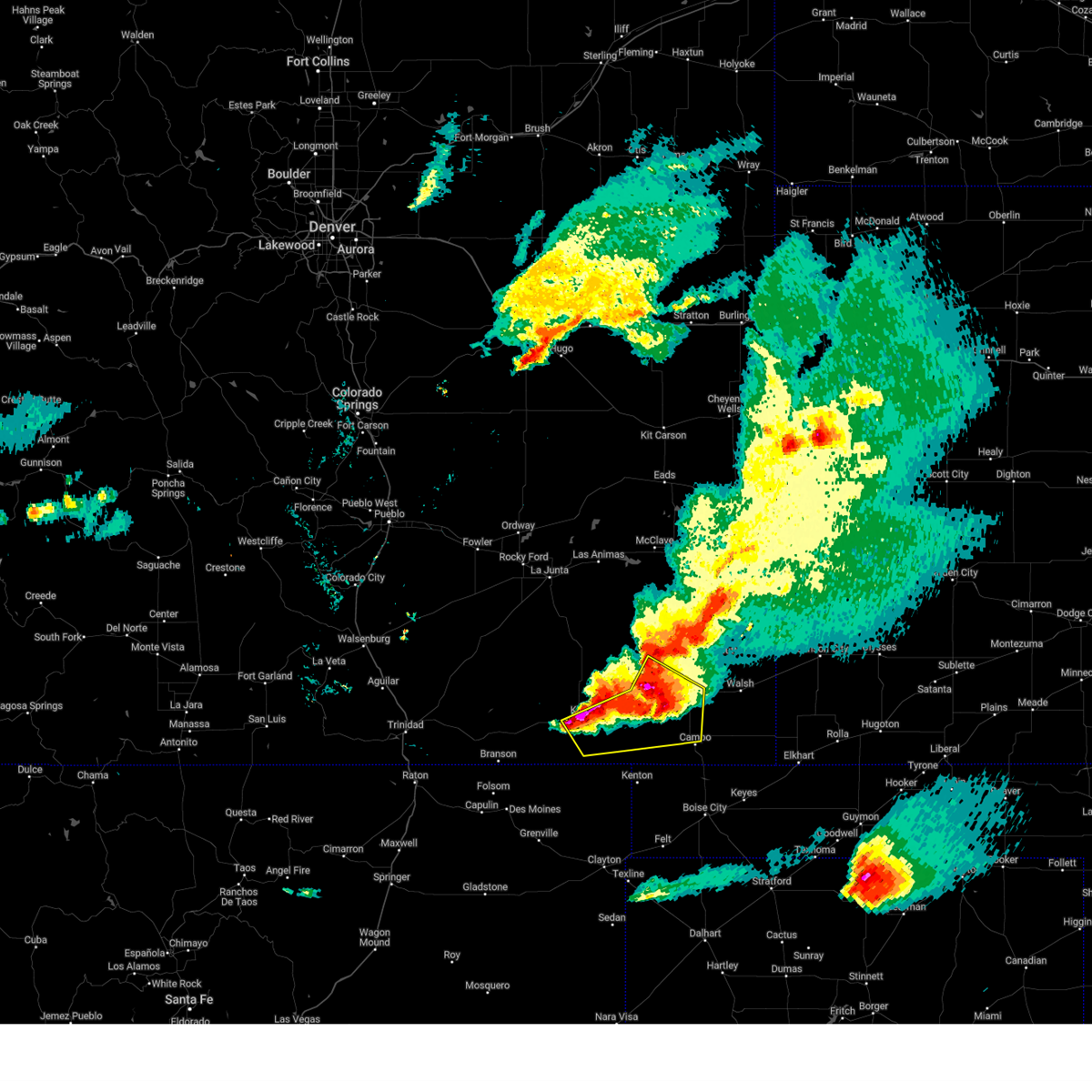
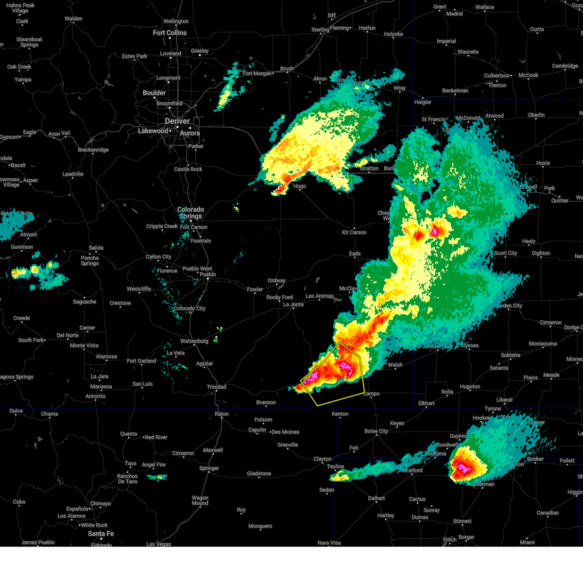
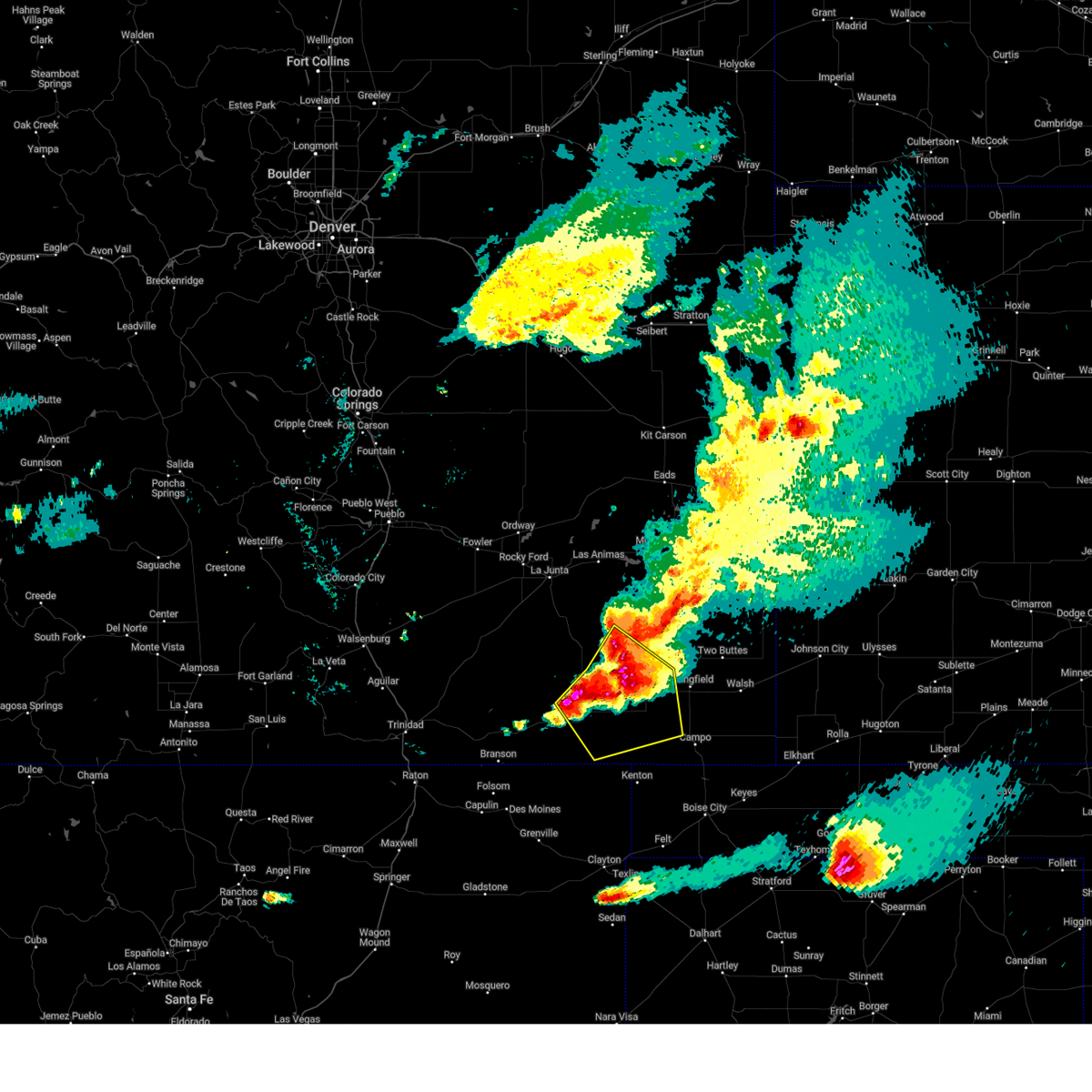
| 6/6/2025 3:05 PM MDT | Svrpub the national weather service in pueblo has issued a * severe thunderstorm warning for, east central las animas county in southeastern colorado, * until 345 pm mdt. * at 305 pm mdt, a severe thunderstorm was located over kim, or 41 miles northeast of des moines, moving northeast at 15 mph. this is a destructive storm for kim, colorado (radar indicated). Hazards include baseball size hail and 60 mph wind gusts. People and animals outdoors will be severely injured. Expect shattered windows, extensive damage to roofs, siding, and vehicles. |
| 6/6/2025 3:00 PM MDT | Tea Cup sized hail reported 3.2 miles NE of Kim, CO, reported to local media with pictures... then sent to us. |
| 6/6/2025 3:00 PM MDT | Hen Egg sized hail reported 0.6 miles NNW of Kim, CO, corrects previous hail report from 1 ssw kim. |
| 6/6/2025 2:57 PM MDT | At 257 pm mdt, a severe thunderstorm was located near kim, or 40 miles northeast of des moines, and is nearly stationary (radar indicated). Hazards include two inch hail and 60 mph wind gusts. People and animals outdoors will be injured. expect hail damage to roofs, siding, windows, and vehicles. expect wind damage to roofs, siding, and trees. Locations impacted include, kim. |
| 6/6/2025 2:47 PM MDT |
 At 247 pm mdt, a severe thunderstorm was located near kim, or 39 miles northeast of des moines, and is nearly stationary (radar indicated). Hazards include ping pong ball size hail and 60 mph wind gusts. People and animals outdoors will be injured. expect hail damage to roofs, siding, windows, and vehicles. expect wind damage to roofs, siding, and trees. Locations impacted include, kim. At 247 pm mdt, a severe thunderstorm was located near kim, or 39 miles northeast of des moines, and is nearly stationary (radar indicated). Hazards include ping pong ball size hail and 60 mph wind gusts. People and animals outdoors will be injured. expect hail damage to roofs, siding, windows, and vehicles. expect wind damage to roofs, siding, and trees. Locations impacted include, kim.
|
| 6/6/2025 2:40 PM MDT | Svrpub the national weather service in pueblo has issued a * severe thunderstorm warning for, east central las animas county in southeastern colorado, * until 315 pm mdt. * at 239 pm mdt, a severe thunderstorm was located near kim, or 38 miles northeast of des moines, and is nearly stationary (radar indicated). Hazards include 60 mph wind gusts and quarter size hail. Hail damage to vehicles is expected. Expect wind damage to roofs, siding, and trees. |
| 5/28/2025 6:59 PM MDT |
 Svrpub the national weather service in pueblo has issued a * severe thunderstorm warning for, northwestern baca county in southeastern colorado, east central las animas county in southeastern colorado, * until 730 pm mdt. * at 659 pm mdt, a severe thunderstorm was located 17 miles northeast of kim, or 32 miles west of springfield, moving southeast at 20 mph (radar indicated). Hazards include 60 mph wind gusts and quarter size hail. Hail damage to vehicles is expected. Expect wind damage to roofs, siding, and trees. Svrpub the national weather service in pueblo has issued a * severe thunderstorm warning for, northwestern baca county in southeastern colorado, east central las animas county in southeastern colorado, * until 730 pm mdt. * at 659 pm mdt, a severe thunderstorm was located 17 miles northeast of kim, or 32 miles west of springfield, moving southeast at 20 mph (radar indicated). Hazards include 60 mph wind gusts and quarter size hail. Hail damage to vehicles is expected. Expect wind damage to roofs, siding, and trees.
|
| 9/17/2024 4:29 PM MDT |
 The storm which prompted the warning has weakened below severe limits, and no longer poses an immediate threat to life or property. therefore, the warning will be allowed to expire. however, small hail, gusty winds and heavy rain are still possible with this thunderstorm. a severe thunderstorm watch remains in effect until 700 pm mdt for southeastern colorado. The storm which prompted the warning has weakened below severe limits, and no longer poses an immediate threat to life or property. therefore, the warning will be allowed to expire. however, small hail, gusty winds and heavy rain are still possible with this thunderstorm. a severe thunderstorm watch remains in effect until 700 pm mdt for southeastern colorado.
|
| 9/17/2024 4:10 PM MDT |
 At 410 pm mdt, a severe thunderstorm was located 12 miles northwest of kim, or 41 miles north of des moines, moving northeast at 45 mph (radar indicated). Hazards include 70 mph wind gusts. Expect considerable tree damage. damage is likely to mobile homes, roofs, and outbuildings. Locations impacted include, kim. At 410 pm mdt, a severe thunderstorm was located 12 miles northwest of kim, or 41 miles north of des moines, moving northeast at 45 mph (radar indicated). Hazards include 70 mph wind gusts. Expect considerable tree damage. damage is likely to mobile homes, roofs, and outbuildings. Locations impacted include, kim.
|
| 9/17/2024 3:56 PM MDT |
 Svrpub the national weather service in pueblo has issued a * severe thunderstorm warning for, southwestern baca county in southeastern colorado, southeastern las animas county in southeastern colorado, * until 430 pm mdt. * at 356 pm mdt, a severe thunderstorm was located 16 miles northeast of branson, or 32 miles north of des moines, moving northeast at 45 mph (radar indicated). Hazards include 70 mph wind gusts. Expect considerable tree damage. Damage is likely to mobile homes, roofs, and outbuildings. Svrpub the national weather service in pueblo has issued a * severe thunderstorm warning for, southwestern baca county in southeastern colorado, southeastern las animas county in southeastern colorado, * until 430 pm mdt. * at 356 pm mdt, a severe thunderstorm was located 16 miles northeast of branson, or 32 miles north of des moines, moving northeast at 45 mph (radar indicated). Hazards include 70 mph wind gusts. Expect considerable tree damage. Damage is likely to mobile homes, roofs, and outbuildings.
|
| 8/12/2024 6:54 PM MDT |
 The storm which prompted the warning has weakened below severe limits, and no longer poses an immediate threat to life or property. therefore, the warning will be allowed to expire. however, small hail, gusty winds and heavy rain are still possible with this thunderstorm. The storm which prompted the warning has weakened below severe limits, and no longer poses an immediate threat to life or property. therefore, the warning will be allowed to expire. however, small hail, gusty winds and heavy rain are still possible with this thunderstorm.
|
| 8/12/2024 6:22 PM MDT |
 At 622 pm mdt, a severe thunderstorm was located 12 miles northeast of kim, or 33 miles west of springfield, moving east at 20 mph (radar indicated). Hazards include 60 mph wind gusts and half dollar size hail. Hail damage to vehicles is expected. expect wind damage to roofs, siding, and trees. Locations impacted include, kim. At 622 pm mdt, a severe thunderstorm was located 12 miles northeast of kim, or 33 miles west of springfield, moving east at 20 mph (radar indicated). Hazards include 60 mph wind gusts and half dollar size hail. Hail damage to vehicles is expected. expect wind damage to roofs, siding, and trees. Locations impacted include, kim.
|
| 8/12/2024 6:16 PM MDT |
 Svrpub the national weather service in pueblo has issued a * severe thunderstorm warning for, northwestern baca county in southeastern colorado, east central las animas county in southeastern colorado, * until 700 pm mdt. * at 616 pm mdt, a severe thunderstorm was located 10 miles northeast of kim, or 35 miles west of springfield, moving east at 20 mph (radar indicated). Hazards include 60 mph wind gusts and half dollar size hail. Hail damage to vehicles is expected. Expect wind damage to roofs, siding, and trees. Svrpub the national weather service in pueblo has issued a * severe thunderstorm warning for, northwestern baca county in southeastern colorado, east central las animas county in southeastern colorado, * until 700 pm mdt. * at 616 pm mdt, a severe thunderstorm was located 10 miles northeast of kim, or 35 miles west of springfield, moving east at 20 mph (radar indicated). Hazards include 60 mph wind gusts and half dollar size hail. Hail damage to vehicles is expected. Expect wind damage to roofs, siding, and trees.
|
| 7/16/2024 4:11 PM MDT |
 Svrpub the national weather service in pueblo has issued a * severe thunderstorm warning for, southwestern baca county in southeastern colorado, southeastern las animas county in southeastern colorado, * until 500 pm mdt. * at 411 pm mdt, severe thunderstorms were located along a line extending from 24 miles northeast of branson to near kim to 18 miles northwest of kenton, moving northeast at 10 mph (radar indicated). Hazards include 60 mph wind gusts. expect damage to roofs, siding, and trees Svrpub the national weather service in pueblo has issued a * severe thunderstorm warning for, southwestern baca county in southeastern colorado, southeastern las animas county in southeastern colorado, * until 500 pm mdt. * at 411 pm mdt, severe thunderstorms were located along a line extending from 24 miles northeast of branson to near kim to 18 miles northwest of kenton, moving northeast at 10 mph (radar indicated). Hazards include 60 mph wind gusts. expect damage to roofs, siding, and trees
|
| 6/26/2024 5:10 PM MDT |
 Svrpub the national weather service in pueblo has issued a * severe thunderstorm warning for, southwestern baca county in southeastern colorado, southeastern las animas county in southeastern colorado, * until 615 pm mdt. * at 509 pm mdt, a severe thunderstorm was located 8 miles east of kim, or 33 miles west of springfield, moving southeast at 25 mph (radar indicated). Hazards include 70 mph wind gusts and quarter size hail. Hail damage to vehicles is expected. expect considerable tree damage. Wind damage is also likely to mobile homes, roofs, and outbuildings. Svrpub the national weather service in pueblo has issued a * severe thunderstorm warning for, southwestern baca county in southeastern colorado, southeastern las animas county in southeastern colorado, * until 615 pm mdt. * at 509 pm mdt, a severe thunderstorm was located 8 miles east of kim, or 33 miles west of springfield, moving southeast at 25 mph (radar indicated). Hazards include 70 mph wind gusts and quarter size hail. Hail damage to vehicles is expected. expect considerable tree damage. Wind damage is also likely to mobile homes, roofs, and outbuildings.
|
| 6/1/2024 3:37 PM MDT |
 Svrpub the national weather service in pueblo has issued a * severe thunderstorm warning for, southeastern las animas county in southeastern colorado, * until 415 pm mdt. * at 337 pm mdt, a severe thunderstorm was located 15 miles east of branson, or 24 miles northeast of des moines, moving east at 20 mph (radar indicated). Hazards include golf ball size hail and 60 mph wind gusts. People and animals outdoors will be injured. expect hail damage to roofs, siding, windows, and vehicles. Expect wind damage to roofs, siding, and trees. Svrpub the national weather service in pueblo has issued a * severe thunderstorm warning for, southeastern las animas county in southeastern colorado, * until 415 pm mdt. * at 337 pm mdt, a severe thunderstorm was located 15 miles east of branson, or 24 miles northeast of des moines, moving east at 20 mph (radar indicated). Hazards include golf ball size hail and 60 mph wind gusts. People and animals outdoors will be injured. expect hail damage to roofs, siding, windows, and vehicles. Expect wind damage to roofs, siding, and trees.
|
| 10/2/2023 6:20 PM MDT |
 At 619 pm mdt, severe thunderstorms were located along a line extending from 26 miles south of higbee to near kim to 19 miles northwest of kenton, moving northeast at 45 mph (radar indicated). Hazards include 70 mph wind gusts and ping pong ball size hail. People and animals outdoors will be injured. expect hail damage to roofs, siding, windows, and vehicles. expect considerable tree damage. Wind damage is also likely to mobile homes, roofs, and outbuildings. At 619 pm mdt, severe thunderstorms were located along a line extending from 26 miles south of higbee to near kim to 19 miles northwest of kenton, moving northeast at 45 mph (radar indicated). Hazards include 70 mph wind gusts and ping pong ball size hail. People and animals outdoors will be injured. expect hail damage to roofs, siding, windows, and vehicles. expect considerable tree damage. Wind damage is also likely to mobile homes, roofs, and outbuildings.
|
| 10/2/2023 6:09 PM MDT |
 At 609 pm mdt, a severe thunderstorm was located 14 miles south of kim, or 32 miles northeast of des moines, moving northeast at 40 mph (radar indicated). Hazards include 70 mph wind gusts and ping pong ball size hail. People and animals outdoors will be injured. expect hail damage to roofs, siding, windows, and vehicles. expect considerable tree damage. wind damage is also likely to mobile homes, roofs, and outbuildings. locations impacted include, kim. thunderstorm damage threat, considerable hail threat, radar indicated max hail size, 1. 50 in wind threat, radar indicated max wind gust, 70 mph. At 609 pm mdt, a severe thunderstorm was located 14 miles south of kim, or 32 miles northeast of des moines, moving northeast at 40 mph (radar indicated). Hazards include 70 mph wind gusts and ping pong ball size hail. People and animals outdoors will be injured. expect hail damage to roofs, siding, windows, and vehicles. expect considerable tree damage. wind damage is also likely to mobile homes, roofs, and outbuildings. locations impacted include, kim. thunderstorm damage threat, considerable hail threat, radar indicated max hail size, 1. 50 in wind threat, radar indicated max wind gust, 70 mph.
|
| 10/2/2023 5:58 PM MDT |
 At 558 pm mdt, a severe thunderstorm was located 17 miles southwest of kim, or 25 miles northeast of des moines, moving northeast at 45 mph (radar indicated). Hazards include 60 mph wind gusts and quarter size hail. Hail damage to vehicles is expected. Expect wind damage to roofs, siding, and trees. At 558 pm mdt, a severe thunderstorm was located 17 miles southwest of kim, or 25 miles northeast of des moines, moving northeast at 45 mph (radar indicated). Hazards include 60 mph wind gusts and quarter size hail. Hail damage to vehicles is expected. Expect wind damage to roofs, siding, and trees.
|
| 8/7/2023 5:11 PM MDT |
 At 510 pm mdt, a severe thunderstorm was located near kim, or 39 miles northeast of des moines, moving east at 25 mph (radar indicated). Hazards include 60 mph wind gusts and quarter size hail. Hail damage to vehicles is expected. Expect wind damage to roofs, siding, and trees. At 510 pm mdt, a severe thunderstorm was located near kim, or 39 miles northeast of des moines, moving east at 25 mph (radar indicated). Hazards include 60 mph wind gusts and quarter size hail. Hail damage to vehicles is expected. Expect wind damage to roofs, siding, and trees.
|
| 8/5/2023 7:52 PM MDT |
 At 752 pm mdt, a severe thunderstorm was located 11 miles southwest of kim, or 32 miles northeast of des moines, moving southeast at 40 mph (radar indicated). Hazards include 70 mph wind gusts and ping pong ball size hail. People and animals outdoors will be injured. expect hail damage to roofs, siding, windows, and vehicles. expect considerable tree damage. wind damage is also likely to mobile homes, roofs, and outbuildings. Locations impacted include, kim. At 752 pm mdt, a severe thunderstorm was located 11 miles southwest of kim, or 32 miles northeast of des moines, moving southeast at 40 mph (radar indicated). Hazards include 70 mph wind gusts and ping pong ball size hail. People and animals outdoors will be injured. expect hail damage to roofs, siding, windows, and vehicles. expect considerable tree damage. wind damage is also likely to mobile homes, roofs, and outbuildings. Locations impacted include, kim.
|
| 8/5/2023 7:48 PM MDT |
 At 748 pm mdt, a severe thunderstorm capable of producing a tornado was located 11 miles west of kim, or 33 miles northeast of des moines, moving southeast at 30 mph (radar indicated rotation). Hazards include tornado and ping pong ball size hail. Flying debris will be dangerous to those caught without shelter. mobile homes will be damaged or destroyed. damage to roofs, windows, and vehicles will occur. tree damage is likely. Locations impacted include, kim. At 748 pm mdt, a severe thunderstorm capable of producing a tornado was located 11 miles west of kim, or 33 miles northeast of des moines, moving southeast at 30 mph (radar indicated rotation). Hazards include tornado and ping pong ball size hail. Flying debris will be dangerous to those caught without shelter. mobile homes will be damaged or destroyed. damage to roofs, windows, and vehicles will occur. tree damage is likely. Locations impacted include, kim.
|
| 8/5/2023 7:36 PM MDT |
 At 736 pm mdt, a severe thunderstorm was located 13 miles west of kim, or 33 miles northeast of des moines, moving southeast at 40 mph (radar indicated). Hazards include golf ball size hail and 70 mph wind gusts. People and animals outdoors will be injured. expect hail damage to roofs, siding, windows, and vehicles. expect considerable tree damage. wind damage is also likely to mobile homes, roofs, and outbuildings. Locations impacted include, kim. At 736 pm mdt, a severe thunderstorm was located 13 miles west of kim, or 33 miles northeast of des moines, moving southeast at 40 mph (radar indicated). Hazards include golf ball size hail and 70 mph wind gusts. People and animals outdoors will be injured. expect hail damage to roofs, siding, windows, and vehicles. expect considerable tree damage. wind damage is also likely to mobile homes, roofs, and outbuildings. Locations impacted include, kim.
|
| 8/5/2023 7:25 PM MDT |
 At 725 pm mdt, a severe thunderstorm capable of producing a tornado was located 21 miles west of kim, or 38 miles north of des moines, moving southeast at 35 mph (radar indicated rotation). Hazards include tornado and golf ball size hail. Flying debris will be dangerous to those caught without shelter. mobile homes will be damaged or destroyed. damage to roofs, windows, and vehicles will occur. Tree damage is likely. At 725 pm mdt, a severe thunderstorm capable of producing a tornado was located 21 miles west of kim, or 38 miles north of des moines, moving southeast at 35 mph (radar indicated rotation). Hazards include tornado and golf ball size hail. Flying debris will be dangerous to those caught without shelter. mobile homes will be damaged or destroyed. damage to roofs, windows, and vehicles will occur. Tree damage is likely.
|
| 8/5/2023 7:17 PM MDT |
 At 717 pm mdt, a severe thunderstorm was located 21 miles southeast of thatcher, or 40 miles north of des moines, moving southeast at 40 mph (radar indicated). Hazards include golf ball size hail and 70 mph wind gusts. People and animals outdoors will be injured. expect hail damage to roofs, siding, windows, and vehicles. expect considerable tree damage. wind damage is also likely to mobile homes, roofs, and outbuildings. this severe thunderstorm will remain over mainly rural areas of west central baca and southeastern las animas counties. thunderstorm damage threat, considerable hail threat, radar indicated max hail size, 1. 75 in wind threat, radar indicated max wind gust, 70 mph. At 717 pm mdt, a severe thunderstorm was located 21 miles southeast of thatcher, or 40 miles north of des moines, moving southeast at 40 mph (radar indicated). Hazards include golf ball size hail and 70 mph wind gusts. People and animals outdoors will be injured. expect hail damage to roofs, siding, windows, and vehicles. expect considerable tree damage. wind damage is also likely to mobile homes, roofs, and outbuildings. this severe thunderstorm will remain over mainly rural areas of west central baca and southeastern las animas counties. thunderstorm damage threat, considerable hail threat, radar indicated max hail size, 1. 75 in wind threat, radar indicated max wind gust, 70 mph.
|
| 8/5/2023 6:10 PM MDT | Hen Egg sized hail reported 15.6 miles SW of Kim, CO, pictures via social media. |
| 7/21/2023 12:57 AM MDT |
 At 1256 am mdt, a severe thunderstorm was located near kim, or 40 miles west of springfield, moving east at 25 mph (radar indicated). Hazards include 60 mph wind gusts and quarter size hail. Hail damage to vehicles is expected. expect wind damage to roofs, siding, and trees. this severe storm will be near, kim around 100 am mdt. hail threat, radar indicated max hail size, 1. 00 in wind threat, radar indicated max wind gust, 60 mph. At 1256 am mdt, a severe thunderstorm was located near kim, or 40 miles west of springfield, moving east at 25 mph (radar indicated). Hazards include 60 mph wind gusts and quarter size hail. Hail damage to vehicles is expected. expect wind damage to roofs, siding, and trees. this severe storm will be near, kim around 100 am mdt. hail threat, radar indicated max hail size, 1. 00 in wind threat, radar indicated max wind gust, 60 mph.
|
| 7/21/2023 12:46 AM MDT |
 At 1246 am mdt, a severe thunderstorm was located 8 miles northwest of kim, or 43 miles south of north la junta, moving east at 25 mph (radar indicated). Hazards include 60 mph wind gusts and half dollar size hail. Hail damage to vehicles is expected. expect wind damage to roofs, siding, and trees. this severe thunderstorm will be near, kim around 100 am mdt. hail threat, radar indicated max hail size, 1. 25 in wind threat, radar indicated max wind gust, 60 mph. At 1246 am mdt, a severe thunderstorm was located 8 miles northwest of kim, or 43 miles south of north la junta, moving east at 25 mph (radar indicated). Hazards include 60 mph wind gusts and half dollar size hail. Hail damage to vehicles is expected. expect wind damage to roofs, siding, and trees. this severe thunderstorm will be near, kim around 100 am mdt. hail threat, radar indicated max hail size, 1. 25 in wind threat, radar indicated max wind gust, 60 mph.
|
| 7/15/2023 9:11 PM MDT |
 At 910 pm mdt, a severe thunderstorm was located 10 miles northeast of branson, or 27 miles north of des moines, moving east at 35 mph (radar indicated). Hazards include 60 mph wind gusts and quarter size hail. Hail damage to vehicles is expected. Expect wind damage to roofs, siding, and trees. At 910 pm mdt, a severe thunderstorm was located 10 miles northeast of branson, or 27 miles north of des moines, moving east at 35 mph (radar indicated). Hazards include 60 mph wind gusts and quarter size hail. Hail damage to vehicles is expected. Expect wind damage to roofs, siding, and trees.
|
| 7/13/2023 8:52 PM MDT |
 At 851 pm mdt, severe thunderstorms were located along a line extending from 14 miles east of model to near trinchera, moving southeast at 40 mph (radar indicated). Hazards include tennis ball size hail and 70 mph wind gusts. People and animals outdoors will be injured. expect hail damage to roofs, siding, windows, and vehicles. expect considerable tree damage. Wind damage is also likely to mobile homes, roofs, and outbuildings. At 851 pm mdt, severe thunderstorms were located along a line extending from 14 miles east of model to near trinchera, moving southeast at 40 mph (radar indicated). Hazards include tennis ball size hail and 70 mph wind gusts. People and animals outdoors will be injured. expect hail damage to roofs, siding, windows, and vehicles. expect considerable tree damage. Wind damage is also likely to mobile homes, roofs, and outbuildings.
|
| 7/13/2023 5:04 PM MDT |
 At 504 pm mdt, a severe thunderstorm was located 9 miles east of kim, or 32 miles west of springfield, moving southeast at 15 mph (radar indicated). Hazards include tennis ball size hail and 70 mph wind gusts. People and animals outdoors will be injured. expect hail damage to roofs, siding, windows, and vehicles. expect considerable tree damage. wind damage is also likely to mobile homes, roofs, and outbuildings. Locations impacted include, kim. At 504 pm mdt, a severe thunderstorm was located 9 miles east of kim, or 32 miles west of springfield, moving southeast at 15 mph (radar indicated). Hazards include tennis ball size hail and 70 mph wind gusts. People and animals outdoors will be injured. expect hail damage to roofs, siding, windows, and vehicles. expect considerable tree damage. wind damage is also likely to mobile homes, roofs, and outbuildings. Locations impacted include, kim.
|
| 7/13/2023 4:48 PM MDT |
 At 448 pm mdt, a severe thunderstorm capable of producing a tornado was located over kim, or 39 miles west of springfield, moving southeast at 15 mph (radar indicated rotation). Hazards include tornado and tennis ball size hail. Flying debris will be dangerous to those caught without shelter. mobile homes will be damaged or destroyed. damage to roofs, windows, and vehicles will occur. tree damage is likely. This tornadic thunderstorm will remain over mainly rural areas of east central las animas county. At 448 pm mdt, a severe thunderstorm capable of producing a tornado was located over kim, or 39 miles west of springfield, moving southeast at 15 mph (radar indicated rotation). Hazards include tornado and tennis ball size hail. Flying debris will be dangerous to those caught without shelter. mobile homes will be damaged or destroyed. damage to roofs, windows, and vehicles will occur. tree damage is likely. This tornadic thunderstorm will remain over mainly rural areas of east central las animas county.
|
| 7/13/2023 4:44 PM MDT |
 At 444 pm mdt, a severe thunderstorm was located 9 miles northeast of kim, or 33 miles west of springfield, moving southeast at 15 mph (radar indicated). Hazards include tennis ball size hail and 70 mph wind gusts. People and animals outdoors will be injured. expect hail damage to roofs, siding, windows, and vehicles. expect considerable tree damage. wind damage is also likely to mobile homes, roofs, and outbuildings. Locations impacted include, kim. At 444 pm mdt, a severe thunderstorm was located 9 miles northeast of kim, or 33 miles west of springfield, moving southeast at 15 mph (radar indicated). Hazards include tennis ball size hail and 70 mph wind gusts. People and animals outdoors will be injured. expect hail damage to roofs, siding, windows, and vehicles. expect considerable tree damage. wind damage is also likely to mobile homes, roofs, and outbuildings. Locations impacted include, kim.
|
| 7/13/2023 4:29 PM MDT |
 At 429 pm mdt, a severe thunderstorm was located 10 miles northeast of kim, or 34 miles west of springfield, moving southeast at 15 mph (radar indicated). Hazards include tennis ball size hail and 70 mph wind gusts. People and animals outdoors will be injured. expect hail damage to roofs, siding, windows, and vehicles. expect considerable tree damage. wind damage is also likely to mobile homes, roofs, and outbuildings. this severe thunderstorm will remain over mainly rural areas of west central baca and east central las animas counties. thunderstorm damage threat, considerable hail threat, radar indicated max hail size, 2. 50 in wind threat, radar indicated max wind gust, 70 mph. At 429 pm mdt, a severe thunderstorm was located 10 miles northeast of kim, or 34 miles west of springfield, moving southeast at 15 mph (radar indicated). Hazards include tennis ball size hail and 70 mph wind gusts. People and animals outdoors will be injured. expect hail damage to roofs, siding, windows, and vehicles. expect considerable tree damage. wind damage is also likely to mobile homes, roofs, and outbuildings. this severe thunderstorm will remain over mainly rural areas of west central baca and east central las animas counties. thunderstorm damage threat, considerable hail threat, radar indicated max hail size, 2. 50 in wind threat, radar indicated max wind gust, 70 mph.
|
| 7/8/2023 8:51 PM MDT |
 At 850 pm mdt, a confirmed tornado was located 9 miles northeast of kim, or 35 miles west of springfield, moving southeast at 20 mph (storm chaser confirmed tornado). Hazards include damaging tornado and half dollar size hail. Flying debris will be dangerous to those caught without shelter. mobile homes will be damaged or destroyed. damage to roofs, windows, and vehicles will occur. tree damage is likely. Locations impacted include, kim. At 850 pm mdt, a confirmed tornado was located 9 miles northeast of kim, or 35 miles west of springfield, moving southeast at 20 mph (storm chaser confirmed tornado). Hazards include damaging tornado and half dollar size hail. Flying debris will be dangerous to those caught without shelter. mobile homes will be damaged or destroyed. damage to roofs, windows, and vehicles will occur. tree damage is likely. Locations impacted include, kim.
|
| 7/8/2023 8:44 PM MDT |
 At 843 pm mdt, a confirmed tornado was located 10 miles north of kim, or 36 miles west of springfield, moving southeast at 20 mph (storm chaser confirmed tornado). Hazards include damaging tornado and half dollar size hail. Flying debris will be dangerous to those caught without shelter. mobile homes will be damaged or destroyed. damage to roofs, windows, and vehicles will occur. tree damage is likely. Locations impacted include, kim. At 843 pm mdt, a confirmed tornado was located 10 miles north of kim, or 36 miles west of springfield, moving southeast at 20 mph (storm chaser confirmed tornado). Hazards include damaging tornado and half dollar size hail. Flying debris will be dangerous to those caught without shelter. mobile homes will be damaged or destroyed. damage to roofs, windows, and vehicles will occur. tree damage is likely. Locations impacted include, kim.
|
| 7/8/2023 8:35 PM MDT |
 At 833 pm mdt, a severe thunderstorm capable of producing a tornado was located 13 miles north of kim, or 38 miles west of springfield, moving southeast at 20 mph. another storm 30 miles northeast of kim is also capable of producing a tornado (radar indicated rotation). Hazards include tornado and half dollar size hail. Flying debris will be dangerous to those caught without shelter. mobile homes will be damaged or destroyed. damage to roofs, windows, and vehicles will occur. Tree damage is likely. At 833 pm mdt, a severe thunderstorm capable of producing a tornado was located 13 miles north of kim, or 38 miles west of springfield, moving southeast at 20 mph. another storm 30 miles northeast of kim is also capable of producing a tornado (radar indicated rotation). Hazards include tornado and half dollar size hail. Flying debris will be dangerous to those caught without shelter. mobile homes will be damaged or destroyed. damage to roofs, windows, and vehicles will occur. Tree damage is likely.
|
| 7/8/2023 8:08 PM MDT |
 At 807 pm mdt, a severe thunderstorm capable of producing a tornado was located 16 miles south of higbee, or 31 miles south of north la junta, moving southeast at 30 mph. another intense thunderstorm with strong rotation was located south of higbee and was moving southeast at 30 mph (radar indicated rotation). Hazards include tornado and hail up to three inches in diameter. Flying debris will be dangerous to those caught without shelter. mobile homes will be damaged or destroyed. damage to roofs, windows, and vehicles will occur. Tree damage is likely. At 807 pm mdt, a severe thunderstorm capable of producing a tornado was located 16 miles south of higbee, or 31 miles south of north la junta, moving southeast at 30 mph. another intense thunderstorm with strong rotation was located south of higbee and was moving southeast at 30 mph (radar indicated rotation). Hazards include tornado and hail up to three inches in diameter. Flying debris will be dangerous to those caught without shelter. mobile homes will be damaged or destroyed. damage to roofs, windows, and vehicles will occur. Tree damage is likely.
|
| 6/30/2023 4:42 PM MDT |
 At 442 pm mdt, severe thunderstorms were located along a line extending from 9 miles southwest of granada to 11 miles northeast of kim, moving northeast at 130 mph (radar indicated). Hazards include 60 mph wind gusts and half dollar size hail. Hail damage to vehicles is expected. Expect wind damage to roofs, siding, and trees. At 442 pm mdt, severe thunderstorms were located along a line extending from 9 miles southwest of granada to 11 miles northeast of kim, moving northeast at 130 mph (radar indicated). Hazards include 60 mph wind gusts and half dollar size hail. Hail damage to vehicles is expected. Expect wind damage to roofs, siding, and trees.
|
| 6/30/2023 4:24 PM MDT |
 At 424 pm mdt, a severe thunderstorm was located 12 miles northeast of kim, or 34 miles west of springfield, moving east at 30 mph (radar indicated). Hazards include 60 mph wind gusts and half dollar size hail. Hail damage to vehicles is expected. expect wind damage to roofs, siding, and trees. Locations impacted include, kim. At 424 pm mdt, a severe thunderstorm was located 12 miles northeast of kim, or 34 miles west of springfield, moving east at 30 mph (radar indicated). Hazards include 60 mph wind gusts and half dollar size hail. Hail damage to vehicles is expected. expect wind damage to roofs, siding, and trees. Locations impacted include, kim.
|
| 6/30/2023 4:14 PM MDT |
 At 414 pm mdt, a severe thunderstorm was located 12 miles north of kim, or 39 miles south of north la junta, moving east at 30 mph (radar indicated). Hazards include 60 mph wind gusts and half dollar size hail. Hail damage to vehicles is expected. expect wind damage to roofs, siding, and trees. Locations impacted include, kim. At 414 pm mdt, a severe thunderstorm was located 12 miles north of kim, or 39 miles south of north la junta, moving east at 30 mph (radar indicated). Hazards include 60 mph wind gusts and half dollar size hail. Hail damage to vehicles is expected. expect wind damage to roofs, siding, and trees. Locations impacted include, kim.
|
| 6/30/2023 4:05 PM MDT |
 At 405 pm mdt, a severe thunderstorm was located 13 miles northwest of kim, or 39 miles south of north la junta, moving east at 25 mph (radar indicated). Hazards include ping pong ball size hail and 60 mph wind gusts. People and animals outdoors will be injured. expect hail damage to roofs, siding, windows, and vehicles. expect wind damage to roofs, siding, and trees. Locations impacted include, kim. At 405 pm mdt, a severe thunderstorm was located 13 miles northwest of kim, or 39 miles south of north la junta, moving east at 25 mph (radar indicated). Hazards include ping pong ball size hail and 60 mph wind gusts. People and animals outdoors will be injured. expect hail damage to roofs, siding, windows, and vehicles. expect wind damage to roofs, siding, and trees. Locations impacted include, kim.
|
| 6/30/2023 3:52 PM MDT |
 At 351 pm mdt, a severe thunderstorm was located 18 miles northwest of kim, or 39 miles south of north la junta, moving east at 25 mph (radar indicated). Hazards include ping pong ball size hail and 60 mph wind gusts. People and animals outdoors will be injured. expect hail damage to roofs, siding, windows, and vehicles. Expect wind damage to roofs, siding, and trees. At 351 pm mdt, a severe thunderstorm was located 18 miles northwest of kim, or 39 miles south of north la junta, moving east at 25 mph (radar indicated). Hazards include ping pong ball size hail and 60 mph wind gusts. People and animals outdoors will be injured. expect hail damage to roofs, siding, windows, and vehicles. Expect wind damage to roofs, siding, and trees.
|
| 6/23/2023 4:02 PM MDT |
 At 402 pm mdt, a severe thunderstorm was located 12 miles south of kim, or 31 miles northeast of des moines, moving northeast at 25 mph (radar indicated). Hazards include 60 mph wind gusts and quarter size hail. Hail damage to vehicles is expected. expect wind damage to roofs, siding, and trees. locations impacted include, kim. hail threat, radar indicated max hail size, 1. 00 in wind threat, radar indicated max wind gust, 60 mph. At 402 pm mdt, a severe thunderstorm was located 12 miles south of kim, or 31 miles northeast of des moines, moving northeast at 25 mph (radar indicated). Hazards include 60 mph wind gusts and quarter size hail. Hail damage to vehicles is expected. expect wind damage to roofs, siding, and trees. locations impacted include, kim. hail threat, radar indicated max hail size, 1. 00 in wind threat, radar indicated max wind gust, 60 mph.
|
| 6/23/2023 3:50 PM MDT |
 At 350 pm mdt, a severe thunderstorm was located 16 miles southwest of kim, or 27 miles northeast of des moines, moving northeast at 25 mph (radar indicated). Hazards include 60 mph wind gusts and quarter size hail. Hail damage to vehicles is expected. Expect wind damage to roofs, siding, and trees. At 350 pm mdt, a severe thunderstorm was located 16 miles southwest of kim, or 27 miles northeast of des moines, moving northeast at 25 mph (radar indicated). Hazards include 60 mph wind gusts and quarter size hail. Hail damage to vehicles is expected. Expect wind damage to roofs, siding, and trees.
|
| 6/17/2023 3:08 PM MDT |
 At 308 pm mdt, a severe thunderstorm was located near kim, or 39 miles northeast of des moines, moving northeast at 55 mph (radar indicated). Hazards include ping pong ball size hail and 60 mph wind gusts. People and animals outdoors will be injured. expect hail damage to roofs, siding, windows, and vehicles. Expect wind damage to roofs, siding, and trees. At 308 pm mdt, a severe thunderstorm was located near kim, or 39 miles northeast of des moines, moving northeast at 55 mph (radar indicated). Hazards include ping pong ball size hail and 60 mph wind gusts. People and animals outdoors will be injured. expect hail damage to roofs, siding, windows, and vehicles. Expect wind damage to roofs, siding, and trees.
|
| 6/16/2023 10:55 PM MDT |
 The severe thunderstorm warning for northwestern baca and east central las animas counties will expire at 1100 pm mdt, the storm which prompted the warning has weakened below severe limits, and no longer poses an immediate threat to life or property. therefore, the warning will be allowed to expire. The severe thunderstorm warning for northwestern baca and east central las animas counties will expire at 1100 pm mdt, the storm which prompted the warning has weakened below severe limits, and no longer poses an immediate threat to life or property. therefore, the warning will be allowed to expire.
|
| 6/16/2023 10:44 PM MDT |
 At 1044 pm mdt, a severe thunderstorm was located 13 miles west of pritchett, or 26 miles west of springfield, moving northeast at 35 mph (radar indicated). Hazards include ping pong ball size hail and 60 mph wind gusts. People and animals outdoors will be injured. expect hail damage to roofs, siding, windows, and vehicles. expect wind damage to roofs, siding, and trees. this severe thunderstorm will remain over mainly rural areas of northwestern baca and east central las animas counties. hail threat, radar indicated max hail size, 1. 50 in wind threat, radar indicated max wind gust, 60 mph. At 1044 pm mdt, a severe thunderstorm was located 13 miles west of pritchett, or 26 miles west of springfield, moving northeast at 35 mph (radar indicated). Hazards include ping pong ball size hail and 60 mph wind gusts. People and animals outdoors will be injured. expect hail damage to roofs, siding, windows, and vehicles. expect wind damage to roofs, siding, and trees. this severe thunderstorm will remain over mainly rural areas of northwestern baca and east central las animas counties. hail threat, radar indicated max hail size, 1. 50 in wind threat, radar indicated max wind gust, 60 mph.
|
| 6/16/2023 10:21 PM MDT |
 At 1021 pm mdt, a severe thunderstorm was located 8 miles north of kim, or 37 miles west of springfield, moving east at 35 mph (radar indicated). Hazards include 60 mph wind gusts and half dollar size hail. Hail damage to vehicles is expected. expect wind damage to roofs, siding, and trees. This severe thunderstorm will remain over mainly rural areas of west central baca and east central las animas counties. At 1021 pm mdt, a severe thunderstorm was located 8 miles north of kim, or 37 miles west of springfield, moving east at 35 mph (radar indicated). Hazards include 60 mph wind gusts and half dollar size hail. Hail damage to vehicles is expected. expect wind damage to roofs, siding, and trees. This severe thunderstorm will remain over mainly rural areas of west central baca and east central las animas counties.
|
| 6/12/2023 7:29 PM MDT |
 At 729 pm mdt, a severe thunderstorm was located 9 miles west of kim, or 36 miles northeast of des moines, moving southeast at 35 mph (radar indicated). Hazards include 60 mph wind gusts and quarter size hail. Hail damage to vehicles is expected. expect wind damage to roofs, siding, and trees. locations impacted include, kim. hail threat, radar indicated max hail size, 1. 00 in wind threat, radar indicated max wind gust, 60 mph. At 729 pm mdt, a severe thunderstorm was located 9 miles west of kim, or 36 miles northeast of des moines, moving southeast at 35 mph (radar indicated). Hazards include 60 mph wind gusts and quarter size hail. Hail damage to vehicles is expected. expect wind damage to roofs, siding, and trees. locations impacted include, kim. hail threat, radar indicated max hail size, 1. 00 in wind threat, radar indicated max wind gust, 60 mph.
|
| 6/12/2023 7:12 PM MDT |
 At 712 pm mdt, a severe thunderstorm was located 17 miles west of kim, or 36 miles north of des moines, moving southeast at 35 mph (radar indicated). Hazards include 60 mph wind gusts and quarter size hail. Hail damage to vehicles is expected. Expect wind damage to roofs, siding, and trees. At 712 pm mdt, a severe thunderstorm was located 17 miles west of kim, or 36 miles north of des moines, moving southeast at 35 mph (radar indicated). Hazards include 60 mph wind gusts and quarter size hail. Hail damage to vehicles is expected. Expect wind damage to roofs, siding, and trees.
|
| 6/11/2023 4:39 PM MDT | Half Dollar sized hail reported 18.9 miles ENE of Kim, CO |
| 6/11/2023 4:33 PM MDT |
 At 433 pm mdt, a severe thunderstorm was located 11 miles northeast of branson, or 27 miles north of des moines, moving southeast at 20 mph (radar indicated). Hazards include two inch hail and 60 mph wind gusts. People and animals outdoors will be injured. expect hail damage to roofs, siding, windows, and vehicles. expect wind damage to roofs, siding, and trees. this severe thunderstorm will remain over mainly rural areas of southeastern las animas county. thunderstorm damage threat, considerable hail threat, radar indicated max hail size, 2. 00 in wind threat, radar indicated max wind gust, 60 mph. At 433 pm mdt, a severe thunderstorm was located 11 miles northeast of branson, or 27 miles north of des moines, moving southeast at 20 mph (radar indicated). Hazards include two inch hail and 60 mph wind gusts. People and animals outdoors will be injured. expect hail damage to roofs, siding, windows, and vehicles. expect wind damage to roofs, siding, and trees. this severe thunderstorm will remain over mainly rural areas of southeastern las animas county. thunderstorm damage threat, considerable hail threat, radar indicated max hail size, 2. 00 in wind threat, radar indicated max wind gust, 60 mph.
|
| 6/11/2023 4:12 PM MDT |
 At 411 pm mdt, a severe thunderstorm was located 14 miles north of branson, or 31 miles north of des moines, moving southeast at 20 mph. this is a destructive storm for areas in the vicinity and north to northeast of branson, and rurals of southeastern las animas county (radar indicated). Hazards include three inch hail and 60 mph wind gusts. People and animals outdoors will be severely injured. expect shattered windows, extensive damage to roofs, siding, and vehicles. this severe thunderstorm will remain over mainly rural areas of southeastern las animas county. thunderstorm damage threat, destructive hail threat, radar indicated max hail size, 3. 00 in wind threat, radar indicated max wind gust, 60 mph. At 411 pm mdt, a severe thunderstorm was located 14 miles north of branson, or 31 miles north of des moines, moving southeast at 20 mph. this is a destructive storm for areas in the vicinity and north to northeast of branson, and rurals of southeastern las animas county (radar indicated). Hazards include three inch hail and 60 mph wind gusts. People and animals outdoors will be severely injured. expect shattered windows, extensive damage to roofs, siding, and vehicles. this severe thunderstorm will remain over mainly rural areas of southeastern las animas county. thunderstorm damage threat, destructive hail threat, radar indicated max hail size, 3. 00 in wind threat, radar indicated max wind gust, 60 mph.
|
| 5/25/2023 5:10 PM MDT |
 At 507 pm mdt, a severe thunderstorm was located 11 miles southwest of kim, or 31 miles northeast of des moines, moving northeast at 20 mph (radar indicated. public spotted a funnel cloud). Hazards include ping pong ball size hail and 60 mph wind gusts. People and animals outdoors will be injured. expect hail damage to roofs, siding, windows, and vehicles. Expect wind damage to roofs, siding, and trees. At 507 pm mdt, a severe thunderstorm was located 11 miles southwest of kim, or 31 miles northeast of des moines, moving northeast at 20 mph (radar indicated. public spotted a funnel cloud). Hazards include ping pong ball size hail and 60 mph wind gusts. People and animals outdoors will be injured. expect hail damage to roofs, siding, windows, and vehicles. Expect wind damage to roofs, siding, and trees.
|
| 6/3/2022 6:03 PM MDT |
 At 601 pm mdt, a severe thunderstorm was located 7 miles southwest of pritchett, or 21 miles west of springfield, moving east at 30 mph (radar indicated). Hazards include 70 mph wind gusts and half dollar size hail. Hail damage to vehicles is expected. expect considerable tree damage. wind damage is also likely to mobile homes, roofs, and outbuildings. locations impacted include, pritchett and kim. weather radar was showing this storm becoming better organized between 550 pm and 600 pm. thunderstorm damage threat, considerable hail threat, radar indicated max hail size, 1. 25 in wind threat, radar indicated max wind gust, 70 mph. At 601 pm mdt, a severe thunderstorm was located 7 miles southwest of pritchett, or 21 miles west of springfield, moving east at 30 mph (radar indicated). Hazards include 70 mph wind gusts and half dollar size hail. Hail damage to vehicles is expected. expect considerable tree damage. wind damage is also likely to mobile homes, roofs, and outbuildings. locations impacted include, pritchett and kim. weather radar was showing this storm becoming better organized between 550 pm and 600 pm. thunderstorm damage threat, considerable hail threat, radar indicated max hail size, 1. 25 in wind threat, radar indicated max wind gust, 70 mph.
|
| 6/3/2022 5:52 PM MDT |
 At 552 pm mdt, a severe thunderstorm was located 12 miles west of pritchett, or 25 miles west of springfield, moving east at 30 mph (radar indicated). Hazards include 60 mph wind gusts and quarter size hail. Hail damage to vehicles is expected. Expect wind damage to roofs, siding, and trees. At 552 pm mdt, a severe thunderstorm was located 12 miles west of pritchett, or 25 miles west of springfield, moving east at 30 mph (radar indicated). Hazards include 60 mph wind gusts and quarter size hail. Hail damage to vehicles is expected. Expect wind damage to roofs, siding, and trees.
|
| 6/3/2022 5:36 PM MDT |
 At 536 pm mdt, a severe thunderstorm was located near kim, or 40 miles west of springfield, moving southeast at 15 mph (radar indicated). Hazards include 60 mph wind gusts and half dollar size hail. Hail damage to vehicles is expected. expect wind damage to roofs, siding, and trees. Locations impacted include, kim. At 536 pm mdt, a severe thunderstorm was located near kim, or 40 miles west of springfield, moving southeast at 15 mph (radar indicated). Hazards include 60 mph wind gusts and half dollar size hail. Hail damage to vehicles is expected. expect wind damage to roofs, siding, and trees. Locations impacted include, kim.
|
| 6/3/2022 5:09 PM MDT |
 At 509 pm mdt, a severe thunderstorm was located near kim, or 40 miles northeast of des moines, moving southeast at 15 mph (radar indicated). Hazards include 70 mph wind gusts and ping pong ball size hail. People and animals outdoors will be injured. expect hail damage to roofs, siding, windows, and vehicles. expect considerable tree damage. Wind damage is also likely to mobile homes, roofs, and outbuildings. At 509 pm mdt, a severe thunderstorm was located near kim, or 40 miles northeast of des moines, moving southeast at 15 mph (radar indicated). Hazards include 70 mph wind gusts and ping pong ball size hail. People and animals outdoors will be injured. expect hail damage to roofs, siding, windows, and vehicles. expect considerable tree damage. Wind damage is also likely to mobile homes, roofs, and outbuildings.
|
| 6/3/2022 5:06 PM MDT |
 At 504 pm mdt, a severe thunderstorm was located near kim, or 39 miles northeast of des moines, moving east at 15 mph. Hazards include half dollar size hail was reported by the public at 5:01 pm west of kim. Hail damage to vehicles is expected. expect considerable tree damage. wind damage is also likely to mobile homes, roofs, and outbuildings. Locations impacted include, kim. At 504 pm mdt, a severe thunderstorm was located near kim, or 39 miles northeast of des moines, moving east at 15 mph. Hazards include half dollar size hail was reported by the public at 5:01 pm west of kim. Hail damage to vehicles is expected. expect considerable tree damage. wind damage is also likely to mobile homes, roofs, and outbuildings. Locations impacted include, kim.
|
| 6/3/2022 5:01 PM MDT | Half Dollar sized hail reported 5.6 miles ENE of Kim, CO, storm chaser reported via spotter network. |
| 6/3/2022 4:52 PM MDT |
 At 452 pm mdt, a severe thunderstorm was located near kim, or 39 miles northeast of des moines, moving east at 25 mph (radar indicated). Hazards include 70 mph wind gusts and ping pong ball size hail. People and animals outdoors will be injured. expect hail damage to roofs, siding, windows, and vehicles. expect considerable tree damage. wind damage is also likely to mobile homes, roofs, and outbuildings. Locations impacted include, kim. At 452 pm mdt, a severe thunderstorm was located near kim, or 39 miles northeast of des moines, moving east at 25 mph (radar indicated). Hazards include 70 mph wind gusts and ping pong ball size hail. People and animals outdoors will be injured. expect hail damage to roofs, siding, windows, and vehicles. expect considerable tree damage. wind damage is also likely to mobile homes, roofs, and outbuildings. Locations impacted include, kim.
|
| 6/3/2022 4:42 PM MDT |
 At 441 pm mdt, a severe thunderstorm was located 11 miles northwest of kim, or 41 miles northeast of des moines, moving east at 20 mph (radar indicated). Hazards include two inch hail and 70 mph wind gusts. People and animals outdoors will be injured. expect hail damage to roofs, siding, windows, and vehicles. expect considerable tree damage. Wind damage is also likely to mobile homes, roofs, and outbuildings. At 441 pm mdt, a severe thunderstorm was located 11 miles northwest of kim, or 41 miles northeast of des moines, moving east at 20 mph (radar indicated). Hazards include two inch hail and 70 mph wind gusts. People and animals outdoors will be injured. expect hail damage to roofs, siding, windows, and vehicles. expect considerable tree damage. Wind damage is also likely to mobile homes, roofs, and outbuildings.
|
| 6/3/2022 4:15 PM MDT |
 At 414 pm mdt, severe thunderstorms were located along a line extending from 16 miles west of kim to 21 miles northeast of branson to model, moving northeast at 20 mph (radar indicated). Hazards include 60 mph wind gusts and half dollar size hail. Hail damage to vehicles is expected. expect wind damage to roofs, siding, and trees. Locations impacted include, kim. At 414 pm mdt, severe thunderstorms were located along a line extending from 16 miles west of kim to 21 miles northeast of branson to model, moving northeast at 20 mph (radar indicated). Hazards include 60 mph wind gusts and half dollar size hail. Hail damage to vehicles is expected. expect wind damage to roofs, siding, and trees. Locations impacted include, kim.
|
| 6/3/2022 3:52 PM MDT |
 At 352 pm mdt, severe thunderstorms were located along a line extending from 11 miles west of kim to 13 miles north of branson to near model, moving northwest at 10 mph (radar indicated). Hazards include 60 mph wind gusts and half dollar size hail. Hail damage to vehicles is expected. expect wind damage to roofs, siding, and trees. These severe thunderstorms will remain over mainly rural areas of southeastern las animas county. At 352 pm mdt, severe thunderstorms were located along a line extending from 11 miles west of kim to 13 miles north of branson to near model, moving northwest at 10 mph (radar indicated). Hazards include 60 mph wind gusts and half dollar size hail. Hail damage to vehicles is expected. expect wind damage to roofs, siding, and trees. These severe thunderstorms will remain over mainly rural areas of southeastern las animas county.
|
| 6/12/2021 9:11 PM MDT |
 The severe thunderstorm warning for southwestern baca and southeastern las animas counties will expire at 915 pm mdt, the storms which prompted the warning have weakened below severe limits, and have exited the warned area. therefore, the warning will be allowed to expire. however small hail, gusty winds and heavy rain are still possible with these thunderstorms. a severe thunderstorm watch remains in effect until 1000 pm mdt for southeastern colorado. The severe thunderstorm warning for southwestern baca and southeastern las animas counties will expire at 915 pm mdt, the storms which prompted the warning have weakened below severe limits, and have exited the warned area. therefore, the warning will be allowed to expire. however small hail, gusty winds and heavy rain are still possible with these thunderstorms. a severe thunderstorm watch remains in effect until 1000 pm mdt for southeastern colorado.
|
| 6/12/2021 8:55 PM MDT |
 At 855 pm mdt, severe thunderstorms were located along a line extending from 7 miles southeast of kim to 12 miles southeast of campo, moving southeast at 50 mph (radar indicated). Hazards include ping pong ball size hail and 60 mph wind gusts. People and animals outdoors will be injured. expect hail damage to roofs, siding, windows, and vehicles. expect wind damage to roofs, siding, and trees. Locations impacted include, campo and kim. At 855 pm mdt, severe thunderstorms were located along a line extending from 7 miles southeast of kim to 12 miles southeast of campo, moving southeast at 50 mph (radar indicated). Hazards include ping pong ball size hail and 60 mph wind gusts. People and animals outdoors will be injured. expect hail damage to roofs, siding, windows, and vehicles. expect wind damage to roofs, siding, and trees. Locations impacted include, campo and kim.
|
| 6/12/2021 8:44 PM MDT |
 At 844 pm mdt, severe thunderstorms were located along a line extending from 13 miles west of kim to 8 miles south of campo, moving east at 40 mph. these are very dangerous storms (radar indicated). Hazards include 80 mph wind gusts and golf ball size hail. Flying debris will be dangerous to those caught without shelter. mobile homes will be heavily damaged. expect considerable damage to roofs, windows, and vehicles. extensive tree damage and power outages are likely. Locations impacted include, campo and kim. At 844 pm mdt, severe thunderstorms were located along a line extending from 13 miles west of kim to 8 miles south of campo, moving east at 40 mph. these are very dangerous storms (radar indicated). Hazards include 80 mph wind gusts and golf ball size hail. Flying debris will be dangerous to those caught without shelter. mobile homes will be heavily damaged. expect considerable damage to roofs, windows, and vehicles. extensive tree damage and power outages are likely. Locations impacted include, campo and kim.
|
| 6/12/2021 8:37 PM MDT |
 At 837 pm mdt, severe thunderstorms were located along a line extending from 17 miles west of kim to 6 miles south of campo, moving southeast at 30 mph (radar indicated). Hazards include 70 mph wind gusts and half dollar size hail. Hail damage to vehicles is expected. expect considerable tree damage. wind damage is also likely to mobile homes, roofs, and outbuildings. Locations impacted include, pritchett, campo and kim. At 837 pm mdt, severe thunderstorms were located along a line extending from 17 miles west of kim to 6 miles south of campo, moving southeast at 30 mph (radar indicated). Hazards include 70 mph wind gusts and half dollar size hail. Hail damage to vehicles is expected. expect considerable tree damage. wind damage is also likely to mobile homes, roofs, and outbuildings. Locations impacted include, pritchett, campo and kim.
|
| 6/12/2021 8:26 PM MDT |
 At 825 pm mdt, severe thunderstorms were located along a line extending from 18 miles west of kim to campo, moving southeast at 15 mph (radar indicated). Hazards include ping pong ball size hail and 60 mph wind gusts. People and animals outdoors will be injured. expect hail damage to roofs, siding, windows, and vehicles. Expect wind damage to roofs, siding, and trees. At 825 pm mdt, severe thunderstorms were located along a line extending from 18 miles west of kim to campo, moving southeast at 15 mph (radar indicated). Hazards include ping pong ball size hail and 60 mph wind gusts. People and animals outdoors will be injured. expect hail damage to roofs, siding, windows, and vehicles. Expect wind damage to roofs, siding, and trees.
|
| 6/12/2021 8:10 PM MDT |
 At 810 pm mdt, a severe thunderstorm was located 12 miles east of kim, or 29 miles west of springfield, and is nearly stationary (radar indicated). Hazards include 60 mph wind gusts and quarter size hail. Hail damage to vehicles is expected. expect wind damage to roofs, siding, and trees. Locations impacted include, kim. At 810 pm mdt, a severe thunderstorm was located 12 miles east of kim, or 29 miles west of springfield, and is nearly stationary (radar indicated). Hazards include 60 mph wind gusts and quarter size hail. Hail damage to vehicles is expected. expect wind damage to roofs, siding, and trees. Locations impacted include, kim.
|
| 6/12/2021 7:58 PM MDT |
 At 757 pm mdt, a severe thunderstorm was located 11 miles east of kim, or 30 miles west of springfield, and is nearly stationary (radar indicated). Hazards include 60 mph wind gusts and quarter size hail. Hail damage to vehicles is expected. Expect wind damage to roofs, siding, and trees. At 757 pm mdt, a severe thunderstorm was located 11 miles east of kim, or 30 miles west of springfield, and is nearly stationary (radar indicated). Hazards include 60 mph wind gusts and quarter size hail. Hail damage to vehicles is expected. Expect wind damage to roofs, siding, and trees.
|
| 5/30/2021 2:42 PM MDT |
 At 241 pm mdt, a severe thunderstorm was located near kim, or 38 miles northeast of des moines, moving southeast at 15 mph (radar indicated). Hazards include two inch hail and 60 mph wind gusts. People and animals outdoors will be injured. expect hail damage to roofs, siding, windows, and vehicles. expect wind damage to roofs, siding, and trees. Locations impacted include, kim. At 241 pm mdt, a severe thunderstorm was located near kim, or 38 miles northeast of des moines, moving southeast at 15 mph (radar indicated). Hazards include two inch hail and 60 mph wind gusts. People and animals outdoors will be injured. expect hail damage to roofs, siding, windows, and vehicles. expect wind damage to roofs, siding, and trees. Locations impacted include, kim.
|
| 5/30/2021 2:26 PM MDT | Ping Pong Ball sized hail reported 0.3 miles WSW of Kim, CO |
| 5/30/2021 2:23 PM MDT |
 At 223 pm mdt, a severe thunderstorm was located over kim, or 39 miles northeast of des moines, moving southeast at 15 mph (radar indicated). Hazards include tennis ball size hail and 60 mph wind gusts. People and animals outdoors will be injured. expect hail damage to roofs, siding, windows, and vehicles. Expect wind damage to roofs, siding, and trees. At 223 pm mdt, a severe thunderstorm was located over kim, or 39 miles northeast of des moines, moving southeast at 15 mph (radar indicated). Hazards include tennis ball size hail and 60 mph wind gusts. People and animals outdoors will be injured. expect hail damage to roofs, siding, windows, and vehicles. Expect wind damage to roofs, siding, and trees.
|
| 5/30/2021 2:11 PM MDT |
 At 211 pm mdt, a severe thunderstorm was located near kim, or 39 miles northeast of des moines, moving southeast at 10 mph (radar indicated). Hazards include tennis ball size hail and 60 mph wind gusts. People and animals outdoors will be injured. expect hail damage to roofs, siding, windows, and vehicles. expect wind damage to roofs, siding, and trees. Locations impacted include, kim. At 211 pm mdt, a severe thunderstorm was located near kim, or 39 miles northeast of des moines, moving southeast at 10 mph (radar indicated). Hazards include tennis ball size hail and 60 mph wind gusts. People and animals outdoors will be injured. expect hail damage to roofs, siding, windows, and vehicles. expect wind damage to roofs, siding, and trees. Locations impacted include, kim.
|
| 5/30/2021 1:57 PM MDT |
 At 157 pm mdt, a severe thunderstorm was located near kim, or 39 miles northeast of des moines, moving southeast at 10 mph (radar indicated). Hazards include golf ball size hail and 60 mph wind gusts. People and animals outdoors will be injured. expect hail damage to roofs, siding, windows, and vehicles. Expect wind damage to roofs, siding, and trees. At 157 pm mdt, a severe thunderstorm was located near kim, or 39 miles northeast of des moines, moving southeast at 10 mph (radar indicated). Hazards include golf ball size hail and 60 mph wind gusts. People and animals outdoors will be injured. expect hail damage to roofs, siding, windows, and vehicles. Expect wind damage to roofs, siding, and trees.
|
| 5/30/2021 1:44 PM MDT |
 At 144 pm mdt, a severe thunderstorm was located 8 miles west of kim, or 39 miles northeast of des moines, and is nearly stationary (radar indicated). Hazards include golf ball size hail and 60 mph wind gusts. People and animals outdoors will be injured. expect hail damage to roofs, siding, windows, and vehicles. expect wind damage to roofs, siding, and trees. Locations impacted include, kim. At 144 pm mdt, a severe thunderstorm was located 8 miles west of kim, or 39 miles northeast of des moines, and is nearly stationary (radar indicated). Hazards include golf ball size hail and 60 mph wind gusts. People and animals outdoors will be injured. expect hail damage to roofs, siding, windows, and vehicles. expect wind damage to roofs, siding, and trees. Locations impacted include, kim.
|
| 5/30/2021 1:31 PM MDT |
 At 131 pm mdt, a severe thunderstorm was located 8 miles west of kim, or 39 miles northeast of des moines, and is nearly stationary (radar indicated). Hazards include 60 mph wind gusts and half dollar size hail. Hail damage to vehicles is expected. Expect wind damage to roofs, siding, and trees. At 131 pm mdt, a severe thunderstorm was located 8 miles west of kim, or 39 miles northeast of des moines, and is nearly stationary (radar indicated). Hazards include 60 mph wind gusts and half dollar size hail. Hail damage to vehicles is expected. Expect wind damage to roofs, siding, and trees.
|
| 5/30/2021 1:19 PM MDT |
 At 118 pm mdt, a severe thunderstorm was located 9 miles west of kim, or 39 miles northeast of des moines, moving southeast at 10 mph (radar indicated). Hazards include 60 mph wind gusts and half dollar size hail. Hail damage to vehicles is expected. expect wind damage to roofs, siding, and trees. Locations impacted include, kim. At 118 pm mdt, a severe thunderstorm was located 9 miles west of kim, or 39 miles northeast of des moines, moving southeast at 10 mph (radar indicated). Hazards include 60 mph wind gusts and half dollar size hail. Hail damage to vehicles is expected. expect wind damage to roofs, siding, and trees. Locations impacted include, kim.
|
| 5/30/2021 1:02 PM MDT |
 At 101 pm mdt, a severe thunderstorm was located 12 miles west of kim, or 38 miles north of des moines, and is nearly stationary (radar indicated). Hazards include 60 mph wind gusts and half dollar size hail. Hail damage to vehicles is expected. Expect wind damage to roofs, siding, and trees. At 101 pm mdt, a severe thunderstorm was located 12 miles west of kim, or 38 miles north of des moines, and is nearly stationary (radar indicated). Hazards include 60 mph wind gusts and half dollar size hail. Hail damage to vehicles is expected. Expect wind damage to roofs, siding, and trees.
|
| 5/29/2021 6:03 PM MDT |
 At 602 pm mdt, a severe thunderstorm was located 10 miles east of kim, or 31 miles west of springfield, moving east at 30 mph (radar indicated). Hazards include two inch hail and 70 mph wind gusts. People and animals outdoors will be injured. expect hail damage to roofs, siding, windows, and vehicles. expect considerable tree damage. wind damage is also likely to mobile homes, roofs, and outbuildings. Locations impacted include, pritchett and kim. At 602 pm mdt, a severe thunderstorm was located 10 miles east of kim, or 31 miles west of springfield, moving east at 30 mph (radar indicated). Hazards include two inch hail and 70 mph wind gusts. People and animals outdoors will be injured. expect hail damage to roofs, siding, windows, and vehicles. expect considerable tree damage. wind damage is also likely to mobile homes, roofs, and outbuildings. Locations impacted include, pritchett and kim.
|
| 5/29/2021 5:53 PM MDT |
 At 553 pm mdt, a severe thunderstorm was located near kim, or 36 miles west of springfield, moving east at 30 mph (radar indicated). Hazards include ping pong ball size hail and 60 mph wind gusts. People and animals outdoors will be injured. expect hail damage to roofs, siding, windows, and vehicles. Expect wind damage to roofs, siding, and trees. At 553 pm mdt, a severe thunderstorm was located near kim, or 36 miles west of springfield, moving east at 30 mph (radar indicated). Hazards include ping pong ball size hail and 60 mph wind gusts. People and animals outdoors will be injured. expect hail damage to roofs, siding, windows, and vehicles. Expect wind damage to roofs, siding, and trees.
|
| 5/29/2021 5:38 PM MDT |
 At 538 pm mdt, a severe thunderstorm was located near kim, or 37 miles west of springfield, moving east at 20 mph (radar indicated). Hazards include 60 mph wind gusts and quarter size hail. Hail damage to vehicles is expected. expect wind damage to roofs, siding, and trees. Locations impacted include, kim. At 538 pm mdt, a severe thunderstorm was located near kim, or 37 miles west of springfield, moving east at 20 mph (radar indicated). Hazards include 60 mph wind gusts and quarter size hail. Hail damage to vehicles is expected. expect wind damage to roofs, siding, and trees. Locations impacted include, kim.
|
| 5/29/2021 5:24 PM MDT |
 At 524 pm mdt, a severe thunderstorm was located over kim, or 41 miles west of springfield, moving east at 20 mph (radar indicated). Hazards include 60 mph wind gusts and quarter size hail. Hail damage to vehicles is expected. Expect wind damage to roofs, siding, and trees. At 524 pm mdt, a severe thunderstorm was located over kim, or 41 miles west of springfield, moving east at 20 mph (radar indicated). Hazards include 60 mph wind gusts and quarter size hail. Hail damage to vehicles is expected. Expect wind damage to roofs, siding, and trees.
|
| 5/29/2021 4:56 PM MDT |
 At 456 pm mdt, a severe thunderstorm was located near kim, or 42 miles west of springfield, moving east at 15 mph (radar indicated). Hazards include ping pong ball size hail and 60 mph wind gusts. People and animals outdoors will be injured. expect hail damage to roofs, siding, windows, and vehicles. expect wind damage to roofs, siding, and trees. Locations impacted include, kim. At 456 pm mdt, a severe thunderstorm was located near kim, or 42 miles west of springfield, moving east at 15 mph (radar indicated). Hazards include ping pong ball size hail and 60 mph wind gusts. People and animals outdoors will be injured. expect hail damage to roofs, siding, windows, and vehicles. expect wind damage to roofs, siding, and trees. Locations impacted include, kim.
|
| 5/29/2021 4:46 PM MDT |
 At 445 pm mdt, a severe thunderstorm was located 8 miles northwest of kim, or 44 miles south of north la junta, moving east at 15 mph (radar indicated). Hazards include 60 mph wind gusts and quarter size hail. Hail damage to vehicles is expected. Expect wind damage to roofs, siding, and trees. At 445 pm mdt, a severe thunderstorm was located 8 miles northwest of kim, or 44 miles south of north la junta, moving east at 15 mph (radar indicated). Hazards include 60 mph wind gusts and quarter size hail. Hail damage to vehicles is expected. Expect wind damage to roofs, siding, and trees.
|
| 5/17/2021 7:38 PM MDT |
 At 738 pm mdt, severe thunderstorms were located along a line extending from 16 miles south of higbee to 12 miles southeast of stonington, moving northeast at 45 mph (radar indicated). Hazards include 60 mph wind gusts and penny size hail. Expect damage to roofs, siding, and trees. Locations impacted include, springfield, walsh, pritchett, vilas, campo, kim, two buttes, stonington and two buttes reservoir. At 738 pm mdt, severe thunderstorms were located along a line extending from 16 miles south of higbee to 12 miles southeast of stonington, moving northeast at 45 mph (radar indicated). Hazards include 60 mph wind gusts and penny size hail. Expect damage to roofs, siding, and trees. Locations impacted include, springfield, walsh, pritchett, vilas, campo, kim, two buttes, stonington and two buttes reservoir.
|
| 5/17/2021 7:30 PM MDT |
 At 730 pm mdt, severe thunderstorms were located along a line extending from 15 miles north of kim to 13 miles west of elkhart, moving north at 45 mph (radar indicated). Hazards include 60 mph wind gusts and quarter size hail. Hail damage to vehicles is expected. expect wind damage to roofs, siding, and trees. Locations impacted include, springfield, walsh, pritchett, vilas, campo, kim, two buttes, stonington and two buttes reservoir. At 730 pm mdt, severe thunderstorms were located along a line extending from 15 miles north of kim to 13 miles west of elkhart, moving north at 45 mph (radar indicated). Hazards include 60 mph wind gusts and quarter size hail. Hail damage to vehicles is expected. expect wind damage to roofs, siding, and trees. Locations impacted include, springfield, walsh, pritchett, vilas, campo, kim, two buttes, stonington and two buttes reservoir.
|
| 5/17/2021 7:20 PM MDT |
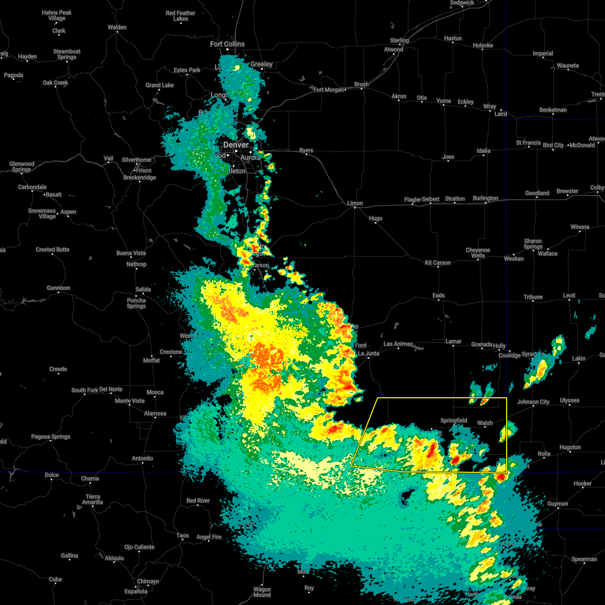 At 720 pm mdt, severe thunderstorms were located along a line extending from 9 miles north of kim to 11 miles west of elkhart, moving northeast at 60 mph (radar indicated). Hazards include 60 mph wind gusts and quarter size hail. Hail damage to vehicles is expected. expect wind damage to roofs, siding, and trees. Locations impacted include, springfield, walsh, pritchett, vilas, campo, kim, two buttes, stonington and two buttes reservoir. At 720 pm mdt, severe thunderstorms were located along a line extending from 9 miles north of kim to 11 miles west of elkhart, moving northeast at 60 mph (radar indicated). Hazards include 60 mph wind gusts and quarter size hail. Hail damage to vehicles is expected. expect wind damage to roofs, siding, and trees. Locations impacted include, springfield, walsh, pritchett, vilas, campo, kim, two buttes, stonington and two buttes reservoir.
|
| 5/17/2021 7:06 PM MDT |
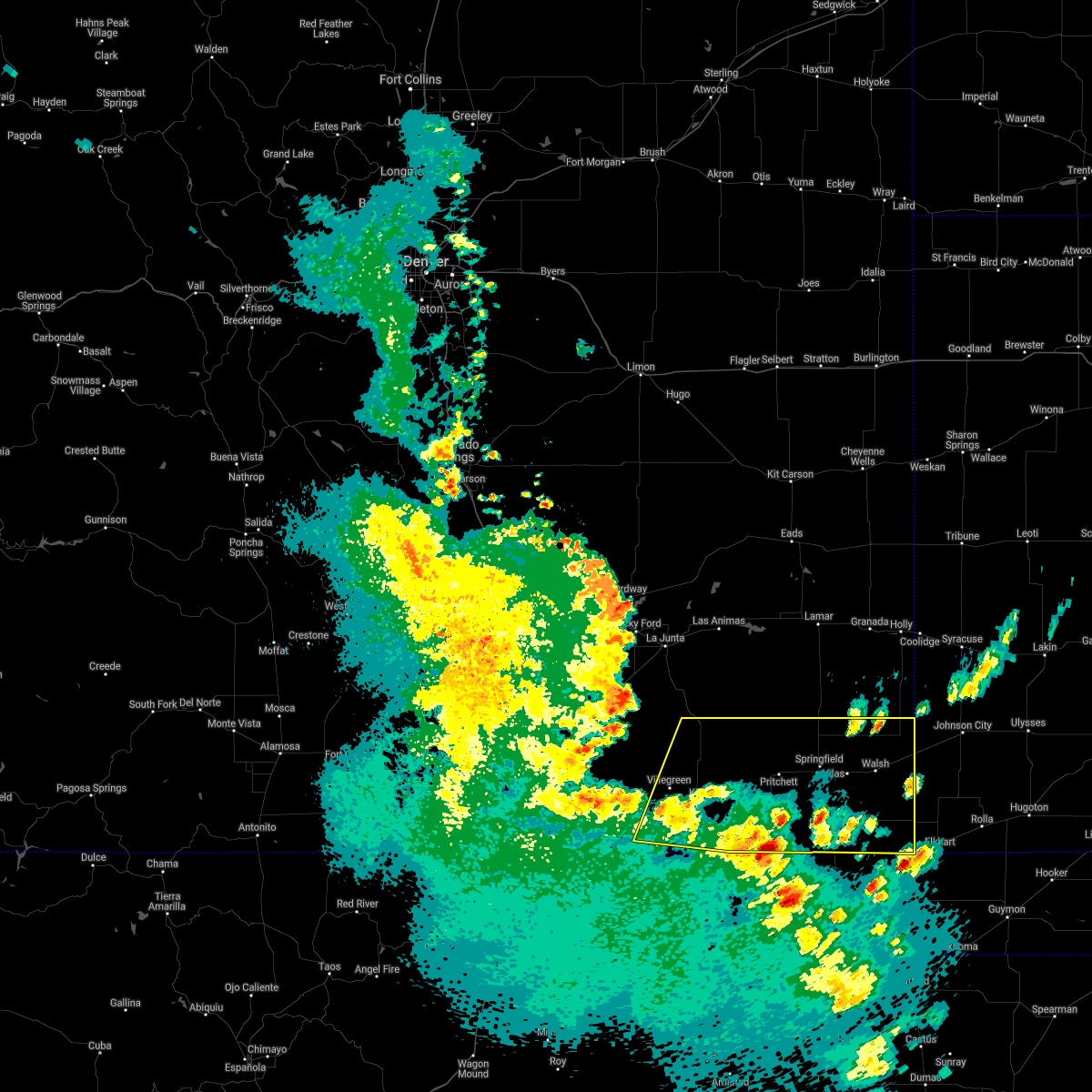 At 706 pm mdt, severe thunderstorms were located along a line extending from 8 miles southwest of kim to 7 miles northwest of boise city, moving northeast at 45 mph (radar indicated). Hazards include 60 mph wind gusts and quarter size hail. Hail damage to vehicles is expected. Expect wind damage to roofs, siding, and trees. At 706 pm mdt, severe thunderstorms were located along a line extending from 8 miles southwest of kim to 7 miles northwest of boise city, moving northeast at 45 mph (radar indicated). Hazards include 60 mph wind gusts and quarter size hail. Hail damage to vehicles is expected. Expect wind damage to roofs, siding, and trees.
|
| 5/16/2021 4:56 PM MDT |
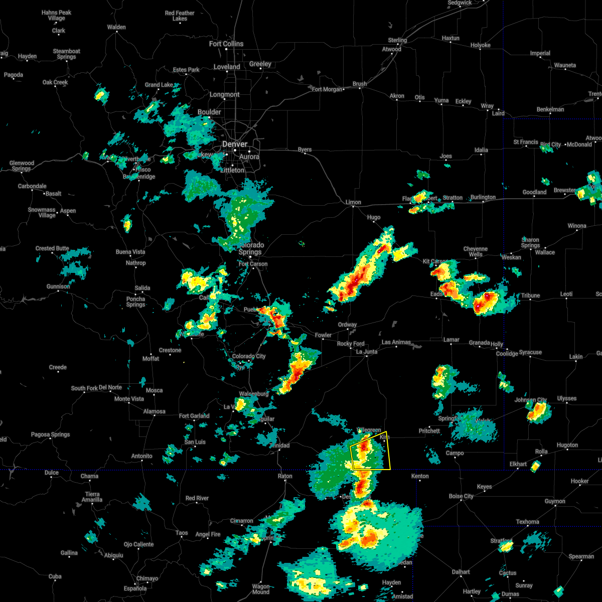 At 456 pm mdt, severe thunderstorms were located along a line extending from 11 miles west of kim to 16 miles east of branson, moving northeast at 25 mph (radar indicated). Hazards include 60 mph wind gusts and quarter size hail. Hail damage to vehicles is expected. expect wind damage to roofs, siding, and trees. Locations impacted include, kim. At 456 pm mdt, severe thunderstorms were located along a line extending from 11 miles west of kim to 16 miles east of branson, moving northeast at 25 mph (radar indicated). Hazards include 60 mph wind gusts and quarter size hail. Hail damage to vehicles is expected. expect wind damage to roofs, siding, and trees. Locations impacted include, kim.
|
| 5/16/2021 4:23 PM MDT |
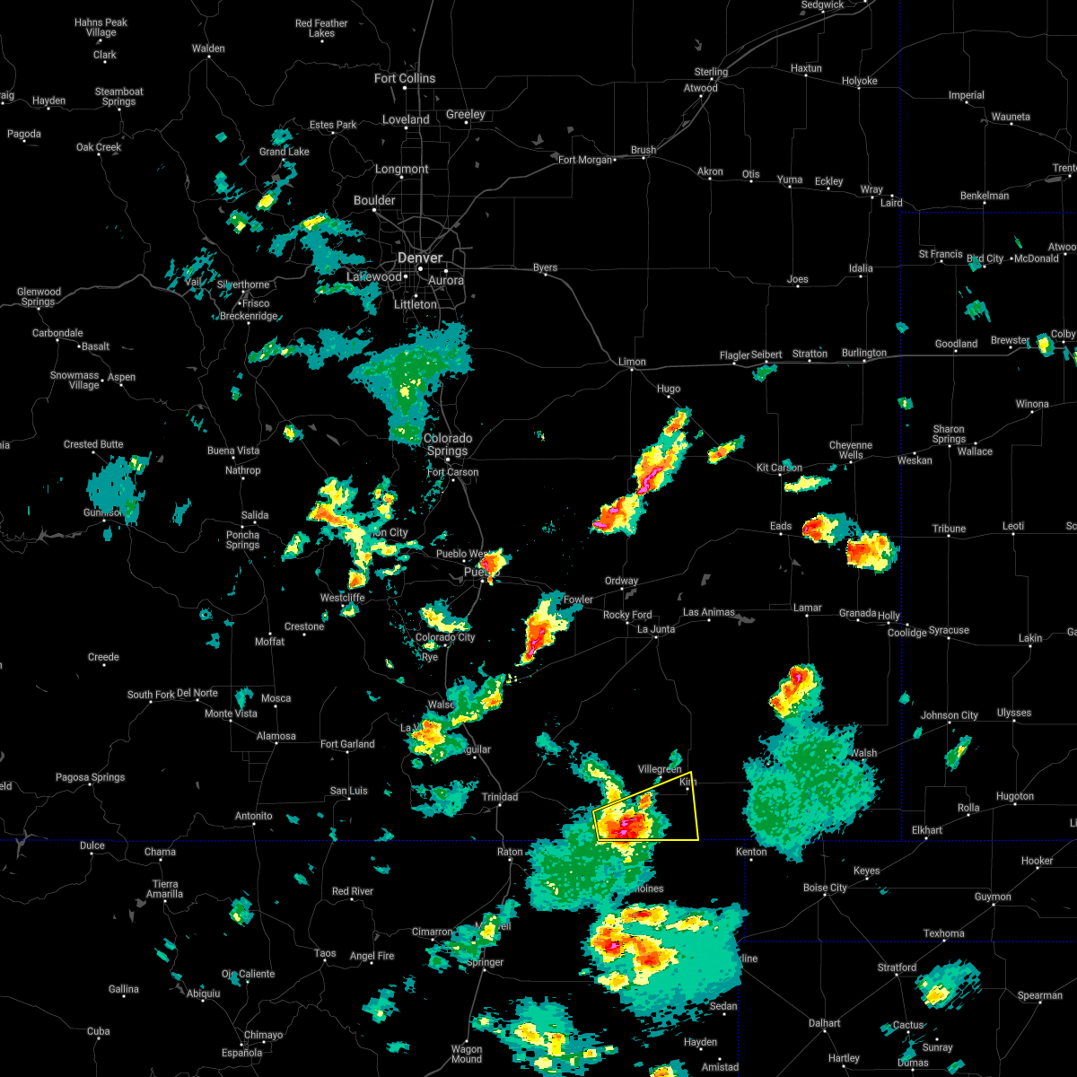 At 423 pm mdt, a severe thunderstorm was located 8 miles east of branson, or 19 miles north of des moines, moving northeast at 15 mph (radar indicated). Hazards include 60 mph wind gusts and quarter size hail. Hail damage to vehicles is expected. Expect wind damage to roofs, siding, and trees. At 423 pm mdt, a severe thunderstorm was located 8 miles east of branson, or 19 miles north of des moines, moving northeast at 15 mph (radar indicated). Hazards include 60 mph wind gusts and quarter size hail. Hail damage to vehicles is expected. Expect wind damage to roofs, siding, and trees.
|
| 7/20/2020 6:33 PM MDT |
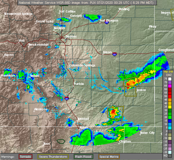 At 632 pm mdt, a severe thunderstorm was located 16 miles north of kim, or 35 miles south of north la junta, moving east at 25 mph (radar indicated). Hazards include 60 mph wind gusts and half dollar size hail. Hail damage to vehicles is expected. expect wind damage to roofs, siding, and trees. Locations impacted include, kim. At 632 pm mdt, a severe thunderstorm was located 16 miles north of kim, or 35 miles south of north la junta, moving east at 25 mph (radar indicated). Hazards include 60 mph wind gusts and half dollar size hail. Hail damage to vehicles is expected. expect wind damage to roofs, siding, and trees. Locations impacted include, kim.
|
| 7/20/2020 6:21 PM MDT |
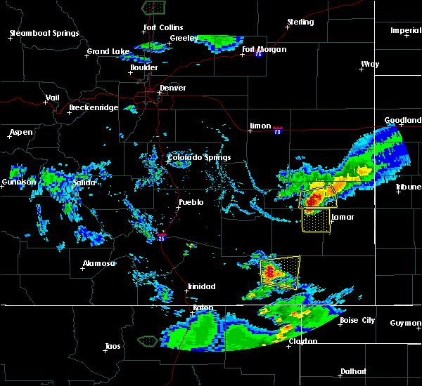 At 620 pm mdt, a severe thunderstorm was located 14 miles north of kim, or 37 miles south of north la junta, moving east at 25 mph (radar indicated). Hazards include ping pong ball size hail and 60 mph wind gusts. People and animals outdoors will be injured. expect hail damage to roofs, siding, windows, and vehicles. expect wind damage to roofs, siding, and trees. This severe thunderstorm will remain over mainly rural areas of northwestern baca and east central las animas counties. At 620 pm mdt, a severe thunderstorm was located 14 miles north of kim, or 37 miles south of north la junta, moving east at 25 mph (radar indicated). Hazards include ping pong ball size hail and 60 mph wind gusts. People and animals outdoors will be injured. expect hail damage to roofs, siding, windows, and vehicles. expect wind damage to roofs, siding, and trees. This severe thunderstorm will remain over mainly rural areas of northwestern baca and east central las animas counties.
|
| 7/13/2020 4:09 PM MDT |
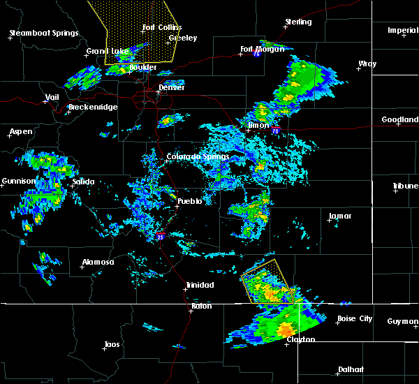 At 408 pm mdt, severe thunderstorms were located along a line extending from 11 miles northwest of kim to 19 miles northwest of kenton, moving east at 35 mph (radar indicated). Hazards include 60 mph wind gusts. Expect damage to roofs, siding, and trees. Locations impacted include, kim. At 408 pm mdt, severe thunderstorms were located along a line extending from 11 miles northwest of kim to 19 miles northwest of kenton, moving east at 35 mph (radar indicated). Hazards include 60 mph wind gusts. Expect damage to roofs, siding, and trees. Locations impacted include, kim.
|
| 7/13/2020 4:00 PM MDT | Storm damage reported in las animas county CO, 3.1 miles E of Kim, CO |
| 7/13/2020 3:58 PM MDT |
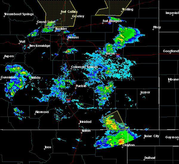 At 357 pm mdt, a severe thunderstorm was located near kim, or 39 miles northeast of des moines, moving east at 30 mph (radar indicated). Hazards include 60 mph wind gusts. Expect damage to roofs, siding, and trees. Locations impacted include, kim. At 357 pm mdt, a severe thunderstorm was located near kim, or 39 miles northeast of des moines, moving east at 30 mph (radar indicated). Hazards include 60 mph wind gusts. Expect damage to roofs, siding, and trees. Locations impacted include, kim.
|
| 7/13/2020 3:45 PM MDT |
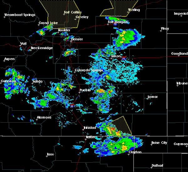 At 345 pm mdt, a severe thunderstorm was located 12 miles west of kim, or 34 miles northeast of des moines, moving east at 30 mph (radar indicated). Hazards include 70 mph wind gusts. Expect considerable tree damage. Damage is likely to mobile homes, roofs, and outbuildings. At 345 pm mdt, a severe thunderstorm was located 12 miles west of kim, or 34 miles northeast of des moines, moving east at 30 mph (radar indicated). Hazards include 70 mph wind gusts. Expect considerable tree damage. Damage is likely to mobile homes, roofs, and outbuildings.
|
| 7/2/2020 1:10 PM MDT |
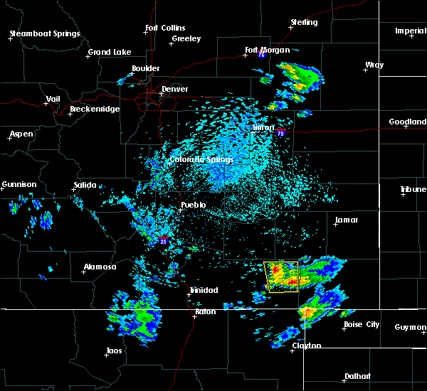 At 109 pm mdt, a severe thunderstorm was located 11 miles northeast of kim, or 31 miles west of springfield, moving northeast at 15 mph (radar indicated). Hazards include 60 mph wind gusts and quarter size hail. Hail damage to vehicles is expected. expect wind damage to roofs, siding, and trees. This severe thunderstorm will remain over mainly rural areas of east central las animas county. At 109 pm mdt, a severe thunderstorm was located 11 miles northeast of kim, or 31 miles west of springfield, moving northeast at 15 mph (radar indicated). Hazards include 60 mph wind gusts and quarter size hail. Hail damage to vehicles is expected. expect wind damage to roofs, siding, and trees. This severe thunderstorm will remain over mainly rural areas of east central las animas county.
|
| 7/2/2020 12:56 PM MDT |
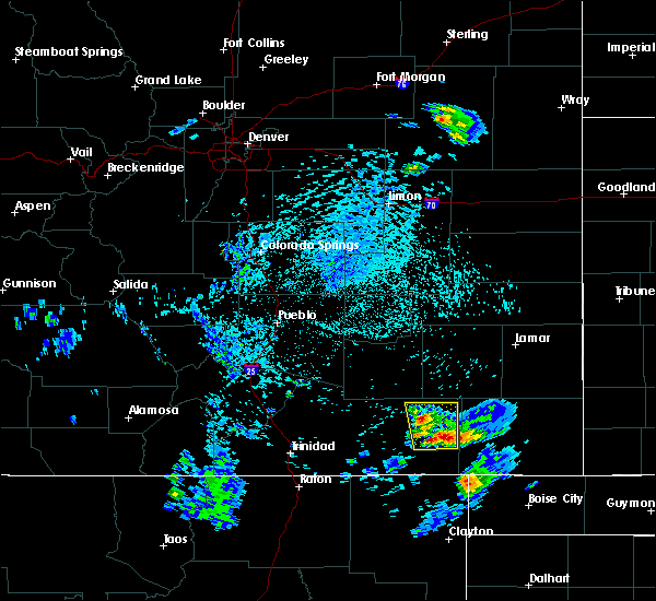 At 1256 pm mdt, a severe thunderstorm was located 8 miles northeast of kim, or 33 miles west of springfield, moving north at 10 mph (radar indicated). Hazards include 60 mph wind gusts and quarter size hail. Hail damage to vehicles is expected. Expect wind damage to roofs, siding, and trees. At 1256 pm mdt, a severe thunderstorm was located 8 miles northeast of kim, or 33 miles west of springfield, moving north at 10 mph (radar indicated). Hazards include 60 mph wind gusts and quarter size hail. Hail damage to vehicles is expected. Expect wind damage to roofs, siding, and trees.
|
| 6/22/2020 4:51 PM MDT |
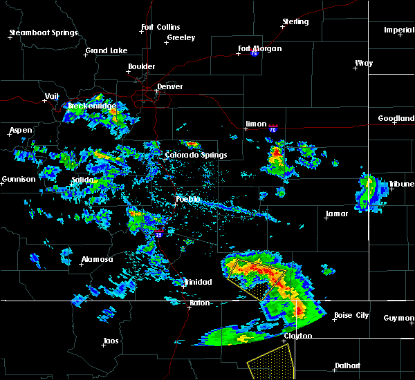 At 450 pm mdt, severe thunderstorms were located along a line extending from 20 miles southeast of thatcher to 26 miles south of higbee to 9 miles east of kim, moving east at 30 mph (radar indicated). Hazards include 60 mph wind gusts. Expect damage to roofs, siding, and trees. Locations impacted include, kim. At 450 pm mdt, severe thunderstorms were located along a line extending from 20 miles southeast of thatcher to 26 miles south of higbee to 9 miles east of kim, moving east at 30 mph (radar indicated). Hazards include 60 mph wind gusts. Expect damage to roofs, siding, and trees. Locations impacted include, kim.
|
| 6/22/2020 4:43 PM MDT |
 At 442 pm mdt, severe thunderstorms were located along a line extending from 17 miles southeast of thatcher to 25 miles south of higbee to near kim, moving east at 30 mph (radar indicated). Hazards include 60 mph wind gusts and penny size hail. Expect damage to roofs, siding, and trees. Locations impacted include, kim and open county of eastern las animas county. At 442 pm mdt, severe thunderstorms were located along a line extending from 17 miles southeast of thatcher to 25 miles south of higbee to near kim, moving east at 30 mph (radar indicated). Hazards include 60 mph wind gusts and penny size hail. Expect damage to roofs, siding, and trees. Locations impacted include, kim and open county of eastern las animas county.
|
| 6/22/2020 4:29 PM MDT |
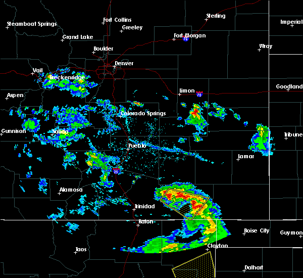 At 428 pm mdt, a severe thunderstorm was located 13 miles southeast of thatcher, or 39 miles northeast of trinidad, moving east at 25 mph (radar indicated). Hazards include 60 mph wind gusts and quarter size hail. Hail damage to vehicles is expected. Expect wind damage to roofs, siding, and trees. At 428 pm mdt, a severe thunderstorm was located 13 miles southeast of thatcher, or 39 miles northeast of trinidad, moving east at 25 mph (radar indicated). Hazards include 60 mph wind gusts and quarter size hail. Hail damage to vehicles is expected. Expect wind damage to roofs, siding, and trees.
|
| 5/24/2020 4:34 PM MDT |
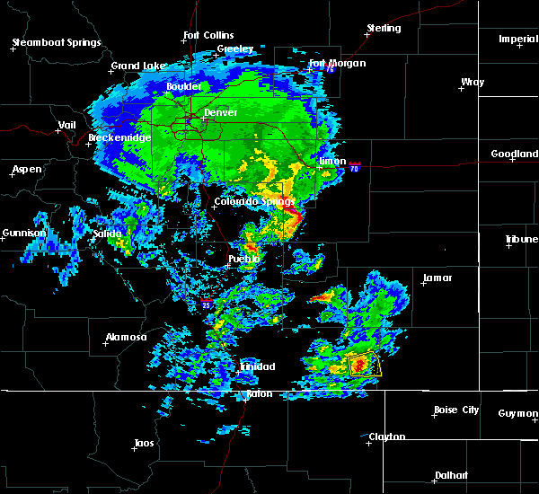 At 433 pm mdt, a rotating severe thunderstorm was located near kim, or 37 miles west of springfield, moving east at 20 mph (radar indicated). Hazards include 60 mph wind gusts and quarter size hail. Hail damage to vehicles is expected. expect wind damage to roofs, siding, and trees. Locations impacted include, mainly rural areas of eastern las animas and western baca counties. At 433 pm mdt, a rotating severe thunderstorm was located near kim, or 37 miles west of springfield, moving east at 20 mph (radar indicated). Hazards include 60 mph wind gusts and quarter size hail. Hail damage to vehicles is expected. expect wind damage to roofs, siding, and trees. Locations impacted include, mainly rural areas of eastern las animas and western baca counties.
|
| 5/24/2020 4:26 PM MDT |
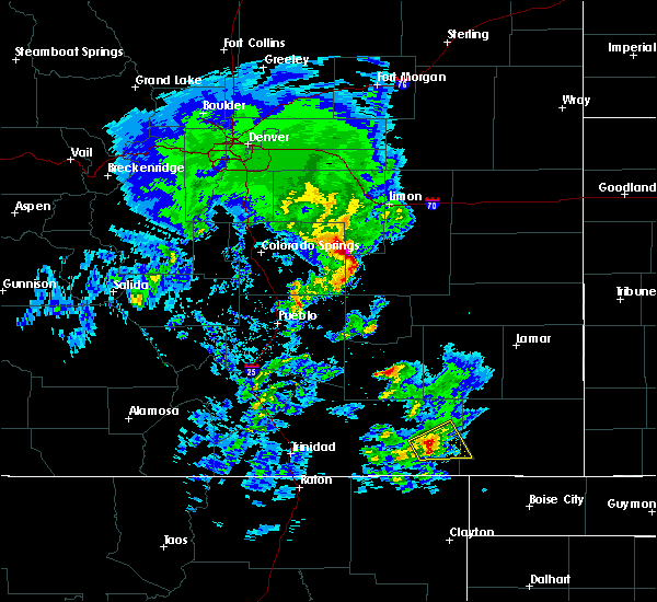 At 425 pm mdt, a severe thunderstorm, which has shown signs of rotation, was located over kim, or 40 miles west of springfield, moving northeast at 20 mph (radar indicated). Hazards include 60 mph wind gusts and quarter size hail. Hail damage to vehicles is expected. expect wind damage to roofs, siding, and trees. Locations impacted include, kim and rural areas of eastern las animas and western baca counties. At 425 pm mdt, a severe thunderstorm, which has shown signs of rotation, was located over kim, or 40 miles west of springfield, moving northeast at 20 mph (radar indicated). Hazards include 60 mph wind gusts and quarter size hail. Hail damage to vehicles is expected. expect wind damage to roofs, siding, and trees. Locations impacted include, kim and rural areas of eastern las animas and western baca counties.
|
| 5/24/2020 4:18 PM MDT |
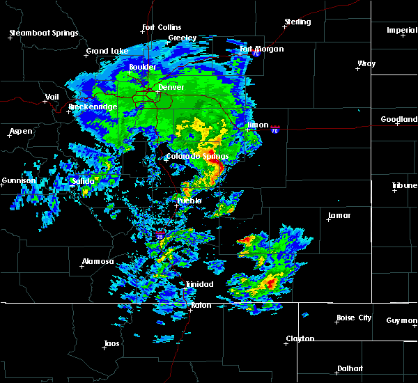 At 415 pm mdt, a severe thunderstorm was located over kim, or 41 miles northeast of des moines, moving northeast at 20 mph (radar indicated). Hazards include 60 mph wind gusts and quarter size hail. Hail damage to vehicles is expected. Expect wind damage to roofs, siding, and trees. At 415 pm mdt, a severe thunderstorm was located over kim, or 41 miles northeast of des moines, moving northeast at 20 mph (radar indicated). Hazards include 60 mph wind gusts and quarter size hail. Hail damage to vehicles is expected. Expect wind damage to roofs, siding, and trees.
|
| 5/14/2020 11:05 PM MDT | Quarter sized hail reported 24.9 miles SSE of Kim, CO |
| 6/22/2019 8:39 PM MDT |
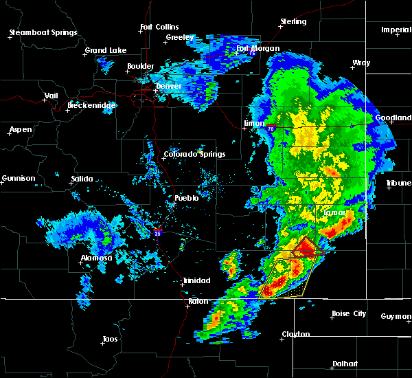 At 838 pm mdt, severe thunderstorms were located along a line extending from 6 miles north of pritchett to 11 miles south of kim, moving east at 45 mph (radar indicated). Hazards include golf ball size hail and 60 mph wind gusts. People and animals outdoors will be injured. expect hail damage to roofs, siding, windows, and vehicles. expect wind damage to roofs, siding, and trees. Locations impacted include, pritchett and kim. At 838 pm mdt, severe thunderstorms were located along a line extending from 6 miles north of pritchett to 11 miles south of kim, moving east at 45 mph (radar indicated). Hazards include golf ball size hail and 60 mph wind gusts. People and animals outdoors will be injured. expect hail damage to roofs, siding, windows, and vehicles. expect wind damage to roofs, siding, and trees. Locations impacted include, pritchett and kim.
|
| 6/22/2019 8:29 PM MDT |
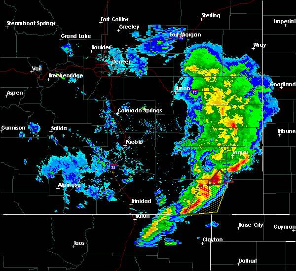 At 817 pm mdt, severe thunderstorms were located along a line extending from 18 miles northwest of pritchett to 13 miles south of kim, moving east at 50 mph (radar indicated). Hazards include golf ball size hail and 60 mph wind gusts. People and animals outdoors will be injured. expect hail damage to roofs, siding, windows, and vehicles. Expect wind damage to roofs, siding, and trees. At 817 pm mdt, severe thunderstorms were located along a line extending from 18 miles northwest of pritchett to 13 miles south of kim, moving east at 50 mph (radar indicated). Hazards include golf ball size hail and 60 mph wind gusts. People and animals outdoors will be injured. expect hail damage to roofs, siding, windows, and vehicles. Expect wind damage to roofs, siding, and trees.
|
| 6/22/2019 8:17 PM MDT |
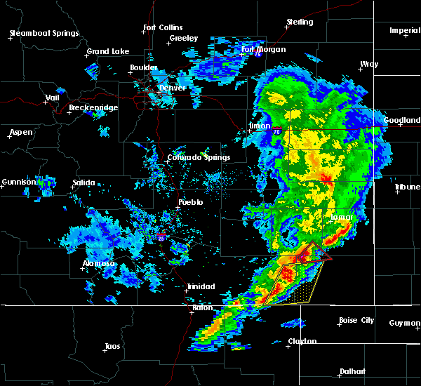 At 817 pm mdt, severe thunderstorms were located along a line extending from 18 miles northwest of pritchett to 13 miles south of kim, moving east at 50 mph (radar indicated). Hazards include golf ball size hail and 60 mph wind gusts. People and animals outdoors will be injured. expect hail damage to roofs, siding, windows, and vehicles. Expect wind damage to roofs, siding, and trees. At 817 pm mdt, severe thunderstorms were located along a line extending from 18 miles northwest of pritchett to 13 miles south of kim, moving east at 50 mph (radar indicated). Hazards include golf ball size hail and 60 mph wind gusts. People and animals outdoors will be injured. expect hail damage to roofs, siding, windows, and vehicles. Expect wind damage to roofs, siding, and trees.
|
| 6/22/2019 8:05 PM MDT |
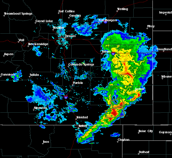 At 758 pm mdt, a severe thunderstorm was located 9 miles north of kim, or 37 miles west of springfield, moving east at 25 mph (radar indicated). Hazards include two inch hail and 60 mph wind gusts. People and animals outdoors will be injured. expect hail damage to roofs, siding, windows, and vehicles. expect wind damage to roofs, siding, and trees. Locations impacted include, kim. At 758 pm mdt, a severe thunderstorm was located 9 miles north of kim, or 37 miles west of springfield, moving east at 25 mph (radar indicated). Hazards include two inch hail and 60 mph wind gusts. People and animals outdoors will be injured. expect hail damage to roofs, siding, windows, and vehicles. expect wind damage to roofs, siding, and trees. Locations impacted include, kim.
|
| 6/22/2019 7:58 PM MDT |
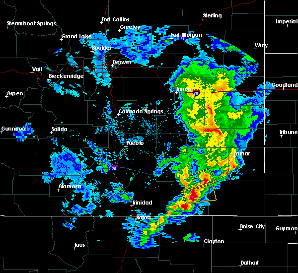 At 758 pm mdt, a severe thunderstorm was located 9 miles north of kim, or 37 miles west of springfield, moving east at 25 mph (radar indicated). Hazards include two inch hail and 60 mph wind gusts. People and animals outdoors will be injured. expect hail damage to roofs, siding, windows, and vehicles. expect wind damage to roofs, siding, and trees. Locations impacted include, kim. At 758 pm mdt, a severe thunderstorm was located 9 miles north of kim, or 37 miles west of springfield, moving east at 25 mph (radar indicated). Hazards include two inch hail and 60 mph wind gusts. People and animals outdoors will be injured. expect hail damage to roofs, siding, windows, and vehicles. expect wind damage to roofs, siding, and trees. Locations impacted include, kim.
|
| 6/22/2019 7:40 PM MDT |
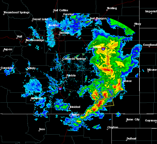 At 740 pm mdt, a severe thunderstorm was located 8 miles northwest of kim, or 44 miles south of north la junta, moving east at 25 mph (radar indicated). Hazards include ping pong ball size hail and 60 mph wind gusts. People and animals outdoors will be injured. expect hail damage to roofs, siding, windows, and vehicles. Expect wind damage to roofs, siding, and trees. At 740 pm mdt, a severe thunderstorm was located 8 miles northwest of kim, or 44 miles south of north la junta, moving east at 25 mph (radar indicated). Hazards include ping pong ball size hail and 60 mph wind gusts. People and animals outdoors will be injured. expect hail damage to roofs, siding, windows, and vehicles. Expect wind damage to roofs, siding, and trees.
|
| 6/22/2019 7:28 PM MDT | Hen Egg sized hail reported 27.1 miles S of Kim, CO |
| 6/2/2019 4:26 PM MDT |
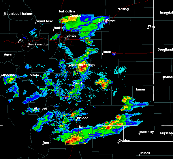 At 426 pm mdt, a severe thunderstorm was located 9 miles south of kim, or 36 miles northeast of des moines, moving northeast at 25 mph (radar indicated). Hazards include 60 mph wind gusts and half dollar size hail. Hail damage to vehicles is expected. Expect wind damage to roofs, siding, and trees. At 426 pm mdt, a severe thunderstorm was located 9 miles south of kim, or 36 miles northeast of des moines, moving northeast at 25 mph (radar indicated). Hazards include 60 mph wind gusts and half dollar size hail. Hail damage to vehicles is expected. Expect wind damage to roofs, siding, and trees.
|
| 5/26/2019 4:47 PM MDT |
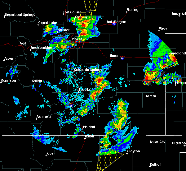 At 445 pm mdt, a severe thunderstorm was located near kim, or 38 miles northeast of des moines, moving northeast at 45 mph (radar indicated). Hazards include 60 mph wind gusts and quarter size hail. Hail damage to vehicles is possible. expect wind damage to roofs, siding, and trees. Locations impacted include, kim and open country of eastern las animas county. At 445 pm mdt, a severe thunderstorm was located near kim, or 38 miles northeast of des moines, moving northeast at 45 mph (radar indicated). Hazards include 60 mph wind gusts and quarter size hail. Hail damage to vehicles is possible. expect wind damage to roofs, siding, and trees. Locations impacted include, kim and open country of eastern las animas county.
|
| 5/26/2019 4:33 PM MDT |
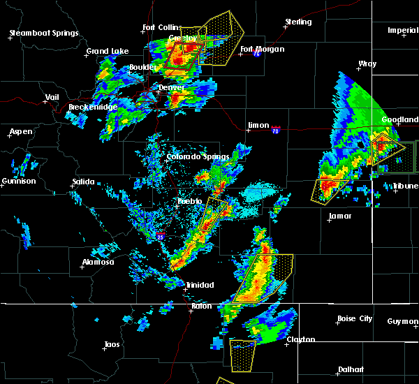 At 432 pm mdt, a severe thunderstorm was located 15 miles northeast of branson, or 27 miles northeast of des moines, moving northeast at 45 mph (radar indicated). Hazards include quarter size hail. Damage to vehicles is possible. Locations impacted include, kim. At 432 pm mdt, a severe thunderstorm was located 15 miles northeast of branson, or 27 miles northeast of des moines, moving northeast at 45 mph (radar indicated). Hazards include quarter size hail. Damage to vehicles is possible. Locations impacted include, kim.
|
| 5/26/2019 4:20 PM MDT |
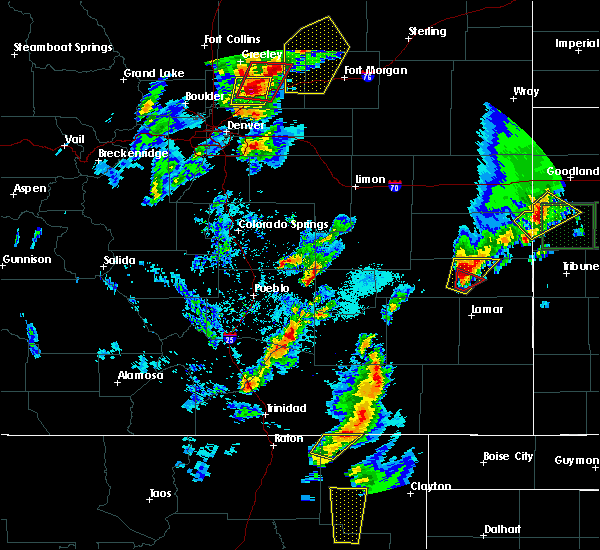 The national weather service in pueblo has issued a * severe thunderstorm warning for. eastern las animas county in southeastern colorado. until 515 pm mdt. at 418 pm mdt, a severe thunderstorm was located 15 miles west of kim, or 30 miles northeast of des moines. Another severe. The national weather service in pueblo has issued a * severe thunderstorm warning for. eastern las animas county in southeastern colorado. until 515 pm mdt. at 418 pm mdt, a severe thunderstorm was located 15 miles west of kim, or 30 miles northeast of des moines. Another severe.
|
| 5/6/2019 4:04 PM MDT |
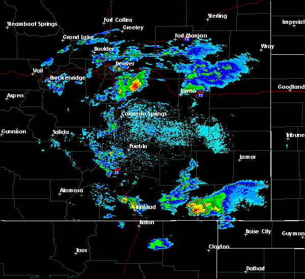 At 404 pm mdt, a severe thunderstorm was located near kim, or 39 miles northeast of des moines, moving east at 15 mph (radar indicated). Hazards include 60 mph wind gusts and quarter size hail. Hail damage to vehicles is expected. expect wind damage to roofs, siding, and trees. Locations impacted include, kim. At 404 pm mdt, a severe thunderstorm was located near kim, or 39 miles northeast of des moines, moving east at 15 mph (radar indicated). Hazards include 60 mph wind gusts and quarter size hail. Hail damage to vehicles is expected. expect wind damage to roofs, siding, and trees. Locations impacted include, kim.
|
| 5/6/2019 3:44 PM MDT |
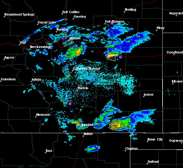 At 344 pm mdt, a severe thunderstorm was located 8 miles west of kim, or 35 miles northeast of des moines, moving northeast at 15 mph (radar indicated). Hazards include 60 mph wind gusts and half dollar size hail. Hail damage to vehicles is expected. Expect wind damage to roofs, siding, and trees. At 344 pm mdt, a severe thunderstorm was located 8 miles west of kim, or 35 miles northeast of des moines, moving northeast at 15 mph (radar indicated). Hazards include 60 mph wind gusts and half dollar size hail. Hail damage to vehicles is expected. Expect wind damage to roofs, siding, and trees.
|
| 5/6/2019 2:01 PM MDT |
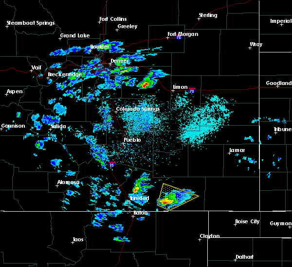 At 144 pm mdt, a severe thunderstorm was located 10 miles north of branson, or 27 miles north of des moines, moving north at 35 mph (radar indicated). Hazards include 60 mph wind gusts and quarter size hail. Hail damage to vehicles is expected. Expect wind damage to roofs, siding, and trees. At 144 pm mdt, a severe thunderstorm was located 10 miles north of branson, or 27 miles north of des moines, moving north at 35 mph (radar indicated). Hazards include 60 mph wind gusts and quarter size hail. Hail damage to vehicles is expected. Expect wind damage to roofs, siding, and trees.
|
| 5/6/2019 1:45 PM MDT |
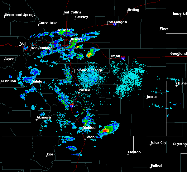 At 144 pm mdt, a severe thunderstorm was located 10 miles north of branson, or 27 miles north of des moines, moving north at 35 mph (radar indicated). Hazards include 60 mph wind gusts and quarter size hail. Hail damage to vehicles is expected. Expect wind damage to roofs, siding, and trees. At 144 pm mdt, a severe thunderstorm was located 10 miles north of branson, or 27 miles north of des moines, moving north at 35 mph (radar indicated). Hazards include 60 mph wind gusts and quarter size hail. Hail damage to vehicles is expected. Expect wind damage to roofs, siding, and trees.
|
| 9/17/2017 4:15 PM MDT |
 At 413 pm mdt, a severe thunderstorm was located near kim, or 41 miles west of springfield, moving east at 25 mph (trained spotter. at 351 pm, ping pong ball sized hail was reported 6 miles west of kim). Hazards include ping pong ball size hail and 60 mph wind gusts. People and animals outdoors will be injured. expect hail damage to roofs, siding, windows, and vehicles. expect wind damage to roofs, siding, and trees. Locations impacted include, kim and open country of southeastern las animas county. At 413 pm mdt, a severe thunderstorm was located near kim, or 41 miles west of springfield, moving east at 25 mph (trained spotter. at 351 pm, ping pong ball sized hail was reported 6 miles west of kim). Hazards include ping pong ball size hail and 60 mph wind gusts. People and animals outdoors will be injured. expect hail damage to roofs, siding, windows, and vehicles. expect wind damage to roofs, siding, and trees. Locations impacted include, kim and open country of southeastern las animas county.
|
| 9/17/2017 3:53 PM MDT |
 At 352 pm mdt, a severe thunderstorm was located near kim, or 39 miles northeast of des moines, moving east at 30 mph (radar indicated). Hazards include ping pong ball size hail and 60 mph wind gusts. People and animals outdoors will be injured. expect hail damage to roofs, siding, windows, and vehicles. Expect wind damage to roofs, siding, and trees. At 352 pm mdt, a severe thunderstorm was located near kim, or 39 miles northeast of des moines, moving east at 30 mph (radar indicated). Hazards include ping pong ball size hail and 60 mph wind gusts. People and animals outdoors will be injured. expect hail damage to roofs, siding, windows, and vehicles. Expect wind damage to roofs, siding, and trees.
|
| 9/17/2017 3:51 PM MDT | Ping Pong Ball sized hail reported 5.8 miles E of Kim, CO |
| 8/9/2017 10:17 PM MDT |
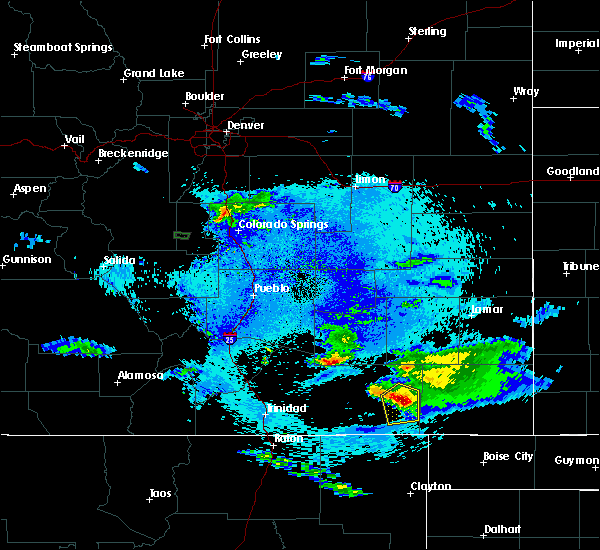 At 1017 pm mdt, a severe thunderstorm was located near kim, or 36 miles west of springfield, moving southeast at 25 mph (radar indicated). Hazards include 60 mph wind gusts and quarter size hail. Hail damage to vehicles is expected. expect wind damage to roofs, siding, and trees. Locations impacted include, kim. At 1017 pm mdt, a severe thunderstorm was located near kim, or 36 miles west of springfield, moving southeast at 25 mph (radar indicated). Hazards include 60 mph wind gusts and quarter size hail. Hail damage to vehicles is expected. expect wind damage to roofs, siding, and trees. Locations impacted include, kim.
|
| 8/9/2017 10:08 PM MDT |
 At 1007 pm mdt, a severe thunderstorm was located 7 miles north of kim, or 39 miles west of springfield, moving southeast at 20 mph (radar indicated). Hazards include 60 mph wind gusts and quarter size hail. Hail damage to vehicles is expected. expect wind damage to roofs, siding, and trees. Locations impacted include, kim. At 1007 pm mdt, a severe thunderstorm was located 7 miles north of kim, or 39 miles west of springfield, moving southeast at 20 mph (radar indicated). Hazards include 60 mph wind gusts and quarter size hail. Hail damage to vehicles is expected. expect wind damage to roofs, siding, and trees. Locations impacted include, kim.
|
| 8/9/2017 9:54 PM MDT |
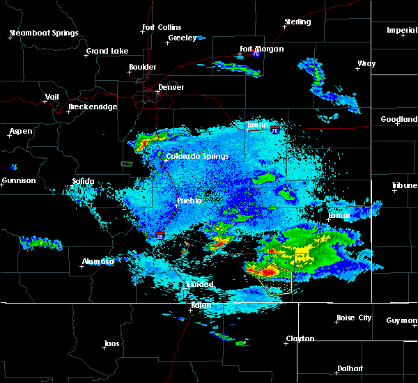 At 954 pm mdt, a severe thunderstorm was located 9 miles north of kim, or 42 miles south of north la junta, moving southeast at 25 mph (radar indicated). Hazards include 60 mph wind gusts and quarter size hail. Hail damage to vehicles is expected. expect wind damage to roofs, siding, and trees. Locations impacted include, kim. At 954 pm mdt, a severe thunderstorm was located 9 miles north of kim, or 42 miles south of north la junta, moving southeast at 25 mph (radar indicated). Hazards include 60 mph wind gusts and quarter size hail. Hail damage to vehicles is expected. expect wind damage to roofs, siding, and trees. Locations impacted include, kim.
|
| 8/9/2017 9:44 PM MDT |
 At 944 pm mdt, a severe thunderstorm was located 13 miles northwest of kim, or 39 miles south of north la junta, moving southeast at 25 mph (radar indicated). Hazards include 60 mph wind gusts and quarter size hail. Hail damage to vehicles is expected. Expect wind damage to roofs, siding, and trees. At 944 pm mdt, a severe thunderstorm was located 13 miles northwest of kim, or 39 miles south of north la junta, moving southeast at 25 mph (radar indicated). Hazards include 60 mph wind gusts and quarter size hail. Hail damage to vehicles is expected. Expect wind damage to roofs, siding, and trees.
|
| 8/4/2017 7:26 PM MDT |
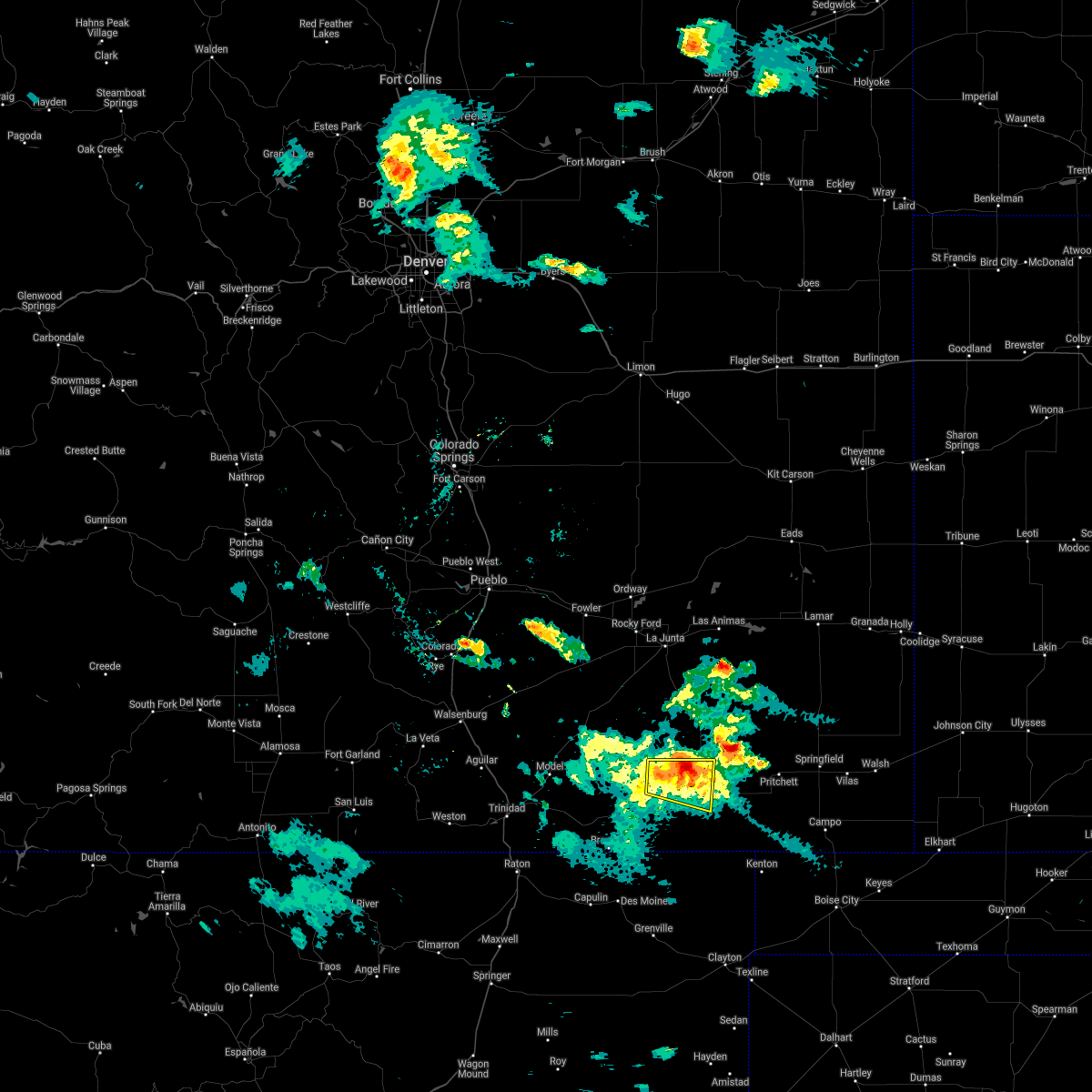 The severe thunderstorm warning for east central las animas county will expire at 730 pm mdt, the storm which prompted the warning has weakened below severe limits, and no longer poses an immediate threat to life or property. therefore the warning will be allowed to expire. however heavy rain is still possible with this thunderstorm. The severe thunderstorm warning for east central las animas county will expire at 730 pm mdt, the storm which prompted the warning has weakened below severe limits, and no longer poses an immediate threat to life or property. therefore the warning will be allowed to expire. however heavy rain is still possible with this thunderstorm.
|
| 8/4/2017 7:19 PM MDT |
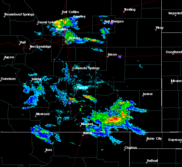 At 718 pm mdt, a severe thunderstorm was located 11 miles northwest of kim, or 43 miles northeast of des moines, moving east at 20 mph (radar indicated). Hazards include 60 mph wind gusts and quarter size hail. Hail damage to vehicles is expected. expect wind damage to roofs, siding, and trees. Locations impacted include, kim. At 718 pm mdt, a severe thunderstorm was located 11 miles northwest of kim, or 43 miles northeast of des moines, moving east at 20 mph (radar indicated). Hazards include 60 mph wind gusts and quarter size hail. Hail damage to vehicles is expected. expect wind damage to roofs, siding, and trees. Locations impacted include, kim.
|
| 8/4/2017 7:03 PM MDT |
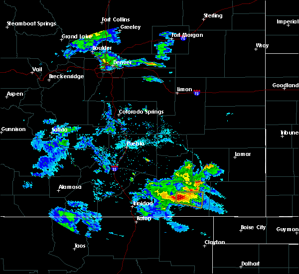 At 702 pm mdt, a severe thunderstorm was located 14 miles northwest of kim, or 41 miles north of des moines, moving east at 35 mph (radar indicated). Hazards include 60 mph wind gusts and half dollar size hail. Hail damage to vehicles is expected. Expect wind damage to roofs, siding, and trees. At 702 pm mdt, a severe thunderstorm was located 14 miles northwest of kim, or 41 miles north of des moines, moving east at 35 mph (radar indicated). Hazards include 60 mph wind gusts and half dollar size hail. Hail damage to vehicles is expected. Expect wind damage to roofs, siding, and trees.
|
| 7/16/2017 4:56 PM MDT |
 At 455 pm mdt, a severe thunderstorm was located 14 miles west of pritchett, or 27 miles west of springfield, moving southeast at 10 mph. another severe storm was located 3 miles west of kim, and was also moving southeast at 10 mph (radar indicated). Hazards include 60 mph wind gusts and quarter size hail. Hail damage to vehicles is expected. expect wind damage to roofs, siding, and trees. Locations impacted include, pritchett and kim. At 455 pm mdt, a severe thunderstorm was located 14 miles west of pritchett, or 27 miles west of springfield, moving southeast at 10 mph. another severe storm was located 3 miles west of kim, and was also moving southeast at 10 mph (radar indicated). Hazards include 60 mph wind gusts and quarter size hail. Hail damage to vehicles is expected. expect wind damage to roofs, siding, and trees. Locations impacted include, pritchett and kim.
|
| 7/16/2017 4:45 PM MDT |
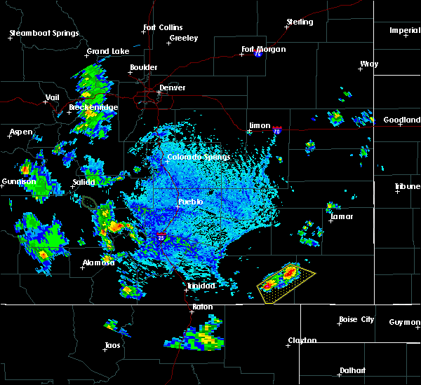 At 444 pm mdt, a severe thunderstorm was located 14 miles northeast of kim, or 30 miles west of springfield, moving southeast at 10 mph. another severe storm was located 2 miles west of kim and was also moving southeast at 10 mph (radar indicated). Hazards include 60 mph wind gusts and quarter size hail. Hail damage to vehicles is expected. Expect wind damage to roofs, siding, and trees. At 444 pm mdt, a severe thunderstorm was located 14 miles northeast of kim, or 30 miles west of springfield, moving southeast at 10 mph. another severe storm was located 2 miles west of kim and was also moving southeast at 10 mph (radar indicated). Hazards include 60 mph wind gusts and quarter size hail. Hail damage to vehicles is expected. Expect wind damage to roofs, siding, and trees.
|
| 7/16/2017 4:12 PM MDT |
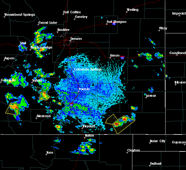 At 412 pm mdt, a severe thunderstorm was located 14 miles north of kim, or 35 miles west of springfield, moving east at 10 mph (radar indicated). Hazards include 60 mph wind gusts and quarter size hail. Hail damage to vehicles is expected. Expect wind damage to roofs, siding, and trees. At 412 pm mdt, a severe thunderstorm was located 14 miles north of kim, or 35 miles west of springfield, moving east at 10 mph (radar indicated). Hazards include 60 mph wind gusts and quarter size hail. Hail damage to vehicles is expected. Expect wind damage to roofs, siding, and trees.
|
| 7/1/2017 4:55 PM MDT |
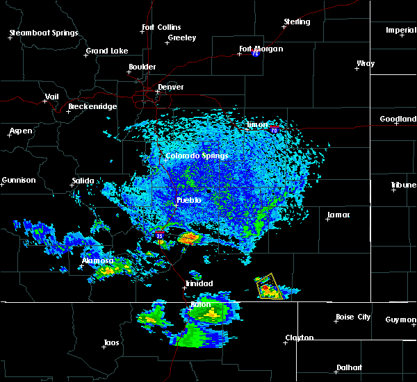 At 455 pm mdt, a severe thunderstorm was located 7 miles southwest of kim, or 35 miles northeast of des moines, moving northeast at 10 mph (radar indicated). Hazards include 60 mph wind gusts and quarter size hail. Hail damage to vehicles is expected. expect wind damage to roofs, siding, and trees. Locations impacted include, kim. At 455 pm mdt, a severe thunderstorm was located 7 miles southwest of kim, or 35 miles northeast of des moines, moving northeast at 10 mph (radar indicated). Hazards include 60 mph wind gusts and quarter size hail. Hail damage to vehicles is expected. expect wind damage to roofs, siding, and trees. Locations impacted include, kim.
|
| 7/1/2017 4:37 PM MDT |
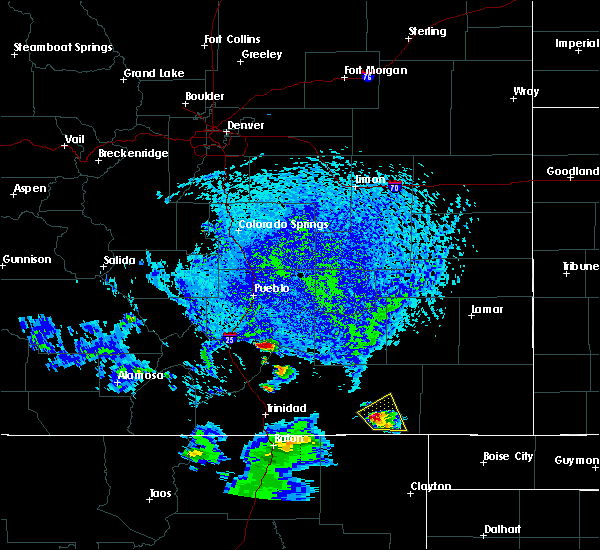 At 437 pm mdt, a severe thunderstorm was located 9 miles southwest of kim, or 33 miles northeast of des moines, moving northeast at 5 mph (radar indicated). Hazards include 60 mph wind gusts and quarter size hail. Hail damage to vehicles is expected. Expect wind damage to roofs, siding, and trees. At 437 pm mdt, a severe thunderstorm was located 9 miles southwest of kim, or 33 miles northeast of des moines, moving northeast at 5 mph (radar indicated). Hazards include 60 mph wind gusts and quarter size hail. Hail damage to vehicles is expected. Expect wind damage to roofs, siding, and trees.
|
| 5/27/2017 5:59 PM MDT |
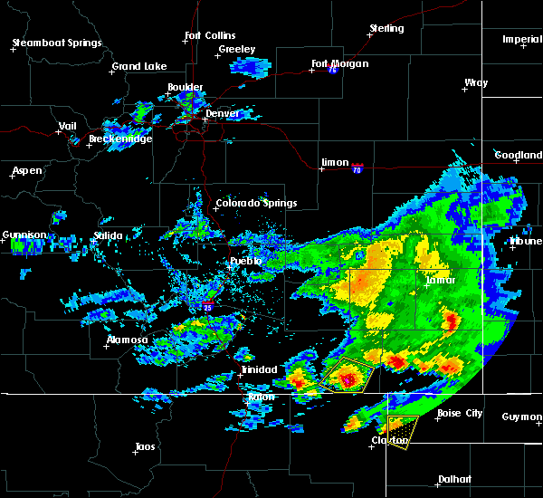 At 558 pm mdt, a severe thunderstorm was located 8 miles southwest of kim, or 34 miles northeast of des moines, moving southeast at 35 mph (radar indicated). Hazards include 70 mph wind gusts and ping pong ball size hail. People and animals outdoors will be injured. expect hail damage to roofs, siding, windows, and vehicles. expect considerable tree damage. wind damage is also likely to mobile homes, roofs, and outbuildings. Locations impacted include, open country south of kim. At 558 pm mdt, a severe thunderstorm was located 8 miles southwest of kim, or 34 miles northeast of des moines, moving southeast at 35 mph (radar indicated). Hazards include 70 mph wind gusts and ping pong ball size hail. People and animals outdoors will be injured. expect hail damage to roofs, siding, windows, and vehicles. expect considerable tree damage. wind damage is also likely to mobile homes, roofs, and outbuildings. Locations impacted include, open country south of kim.
|
| 5/27/2017 5:56 PM MDT |
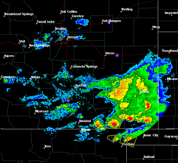 At 556 pm mdt, a severe thunderstorm was located 9 miles southwest of kim, or 34 miles northeast of des moines, moving southeast at 35 mph (radar indicated). Hazards include 70 mph wind gusts and ping pong ball size hail. People and animals outdoors will be injured. expect hail damage to roofs, siding, windows, and vehicles. expect considerable tree damage. wind damage is also likely to mobile homes, roofs, and outbuildings. Locations impacted include, kim. At 556 pm mdt, a severe thunderstorm was located 9 miles southwest of kim, or 34 miles northeast of des moines, moving southeast at 35 mph (radar indicated). Hazards include 70 mph wind gusts and ping pong ball size hail. People and animals outdoors will be injured. expect hail damage to roofs, siding, windows, and vehicles. expect considerable tree damage. wind damage is also likely to mobile homes, roofs, and outbuildings. Locations impacted include, kim.
|
| 5/27/2017 5:44 PM MDT |
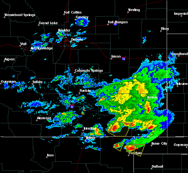 At 543 pm mdt, a severe thunderstorm was located 10 miles west of kim, or 34 miles northeast of des moines, moving southeast at 25 mph (radar indicated). Hazards include 70 mph wind gusts and half dollar size hail. Hail damage to vehicles is expected. expect considerable tree damage. wind damage is also likely to mobile homes, roofs, and outbuildings. Locations impacted include, highway 160 between mile markers 399 and 407, and open country southeast of kim. At 543 pm mdt, a severe thunderstorm was located 10 miles west of kim, or 34 miles northeast of des moines, moving southeast at 25 mph (radar indicated). Hazards include 70 mph wind gusts and half dollar size hail. Hail damage to vehicles is expected. expect considerable tree damage. wind damage is also likely to mobile homes, roofs, and outbuildings. Locations impacted include, highway 160 between mile markers 399 and 407, and open country southeast of kim.
|
| 5/27/2017 5:23 PM MDT |
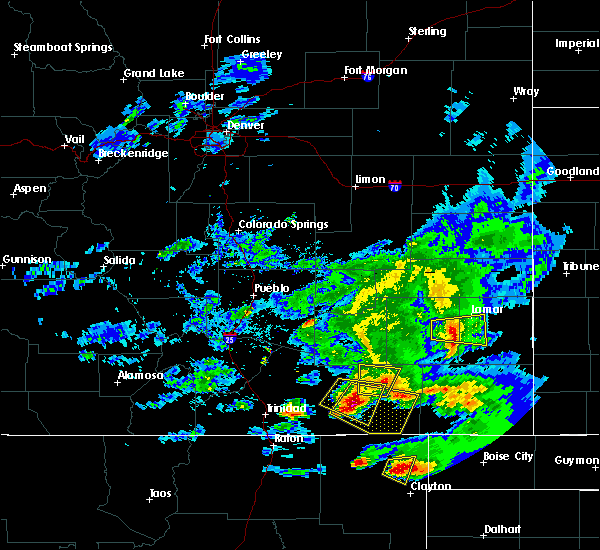 At 523 pm mdt, a severe thunderstorm was located 17 miles west of kim, or 37 miles north of des moines, moving east at 35 mph (radar indicated). Hazards include 70 mph wind gusts and half dollar size hail. Hail damage to vehicles is expected. expect considerable tree damage. Wind damage is also likely to mobile homes, roofs, and outbuildings. At 523 pm mdt, a severe thunderstorm was located 17 miles west of kim, or 37 miles north of des moines, moving east at 35 mph (radar indicated). Hazards include 70 mph wind gusts and half dollar size hail. Hail damage to vehicles is expected. expect considerable tree damage. Wind damage is also likely to mobile homes, roofs, and outbuildings.
|
| 5/8/2017 7:14 PM MDT | Golf Ball sized hail reported 13 miles E of Kim, CO |
| 5/16/2016 2:21 PM MDT |
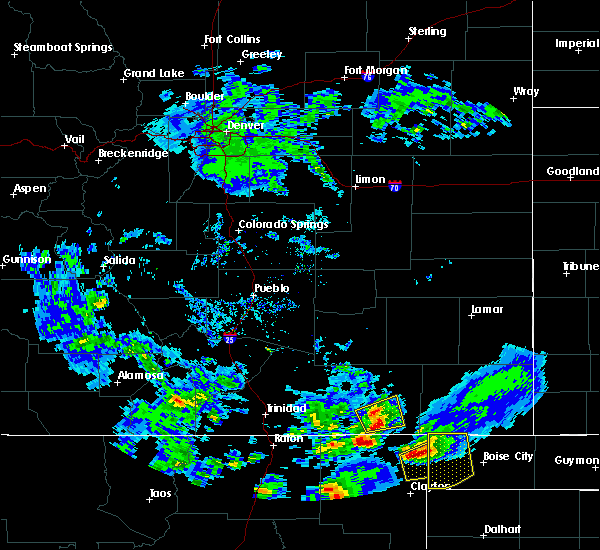 At 221 pm mdt, a severe thunderstorm was located 16 miles southwest of kim, or 26 miles northeast of des moines, moving southeast at 15 mph (radar indicated). Hazards include 60 mph wind gusts and quarter size hail. Hail damage to vehicles is expected. expect wind damage to roofs, siding, and trees. Locations impacted include, kim. At 221 pm mdt, a severe thunderstorm was located 16 miles southwest of kim, or 26 miles northeast of des moines, moving southeast at 15 mph (radar indicated). Hazards include 60 mph wind gusts and quarter size hail. Hail damage to vehicles is expected. expect wind damage to roofs, siding, and trees. Locations impacted include, kim.
|
| 5/16/2016 2:08 PM MDT |
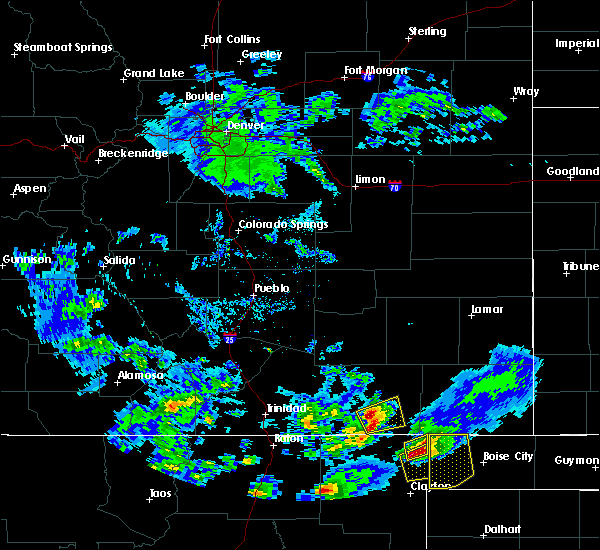 At 207 pm mdt, a severe thunderstorm was located 12 miles southwest of kim, or 31 miles northeast of des moines, moving east at 10 mph (radar indicated). Hazards include 60 mph wind gusts and quarter size hail. Hail damage to vehicles is expected. Expect wind damage to roofs, siding, and trees. At 207 pm mdt, a severe thunderstorm was located 12 miles southwest of kim, or 31 miles northeast of des moines, moving east at 10 mph (radar indicated). Hazards include 60 mph wind gusts and quarter size hail. Hail damage to vehicles is expected. Expect wind damage to roofs, siding, and trees.
|
| 6/11/2015 9:07 PM MDT |
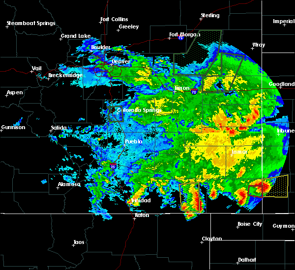 The severe thunderstorm warning for southeastern las animas county will expire at 915 pm mdt, the storms which prompted the warning have moved out of the area. therefore the warning will be allowed to expire. however gusty winds and heavy rain are still possible with these thunderstorms. to report severe weather, contact your nearest law enforcement agency. they will relay your report to the national weather service pueblo. The severe thunderstorm warning for southeastern las animas county will expire at 915 pm mdt, the storms which prompted the warning have moved out of the area. therefore the warning will be allowed to expire. however gusty winds and heavy rain are still possible with these thunderstorms. to report severe weather, contact your nearest law enforcement agency. they will relay your report to the national weather service pueblo.
|
| 6/11/2015 8:50 PM MDT |
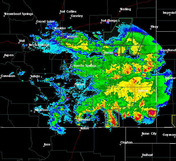 At 849 pm mdt, severe thunderstorms were located along a line extending from 10 miles north of kim to 31 miles southwest of pritchett, moving east at 25 mph (radar indicated). Hazards include 60 mph wind gusts and quarter size hail. Hail damage to vehicles is expected. expect wind damage to roofs, siding and trees. Locations impacted include, kim. At 849 pm mdt, severe thunderstorms were located along a line extending from 10 miles north of kim to 31 miles southwest of pritchett, moving east at 25 mph (radar indicated). Hazards include 60 mph wind gusts and quarter size hail. Hail damage to vehicles is expected. expect wind damage to roofs, siding and trees. Locations impacted include, kim.
|
| 6/11/2015 8:37 PM MDT |
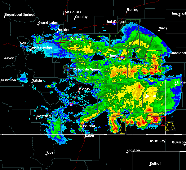 At 824 pm mdt, severe thunderstorms were located along a line extending from 24 miles south of higbee to 15 miles southwest of kim, moving east at 25 mph (radar indicated). Hazards include 60 mph wind gusts and quarter size hail. Hail damage to vehicles is expected. Expect wind damage to roofs, siding and trees. At 824 pm mdt, severe thunderstorms were located along a line extending from 24 miles south of higbee to 15 miles southwest of kim, moving east at 25 mph (radar indicated). Hazards include 60 mph wind gusts and quarter size hail. Hail damage to vehicles is expected. Expect wind damage to roofs, siding and trees.
|
| 6/11/2015 8:25 PM MDT |
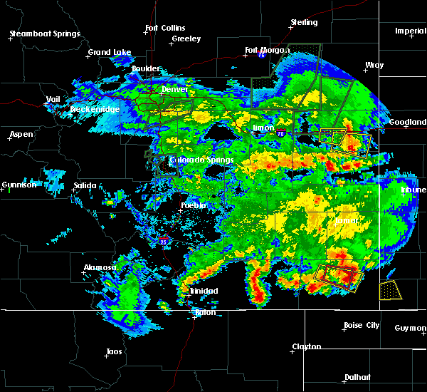 At 824 pm mdt, severe thunderstorms were located along a line extending from 24 miles south of higbee to 15 miles southwest of kim, moving east at 25 mph (radar indicated). Hazards include 60 mph wind gusts and quarter size hail. Hail damage to vehicles is expected. Expect wind damage to roofs, siding and trees. At 824 pm mdt, severe thunderstorms were located along a line extending from 24 miles south of higbee to 15 miles southwest of kim, moving east at 25 mph (radar indicated). Hazards include 60 mph wind gusts and quarter size hail. Hail damage to vehicles is expected. Expect wind damage to roofs, siding and trees.
|
| 6/5/2015 4:57 PM MDT | At 457 pm mdt, a severe thunderstorm was located near kim, or 38 miles west of springfield, moving northeast at 30 mph (radar indicated). Hazards include 60 mph wind gusts and quarter size hail. Hail damage to vehicles is expected. expect wind damage to roofs, siding and trees. locations impacted include, kim. A tornado watch remains in effect until 700 pm mdt for southeastern colorado. |
| 6/5/2015 4:47 PM MDT | At 447 pm mdt, a severe thunderstorm was located over kim, or 42 miles west of springfield, moving northeast at 25 mph (radar indicated). Hazards include 60 mph wind gusts and quarter size hail. Hail damage to vehicles is expected. expect wind damage to roofs, siding and trees. locations impacted include, kim. A tornado watch remains in effect until 700 pm mdt for southeastern colorado. |
| 6/5/2015 4:36 PM MDT | At 436 pm mdt, a severe thunderstorm was located near kim, or 43 miles northeast of des moines, moving northeast at 30 mph (radar indicated). Hazards include 60 mph wind gusts and quarter size hail. Hail damage to vehicles is expected. Expect wind damage to roofs, siding and trees. |
| 6/1/2015 5:18 PM MDT | At 517 pm mdt, a severe thunderstorm was located near kim, or 39 miles southwest of springfield, moving east at 55 mph (radar indicated). Hazards include 60 mph wind gusts and half dollar size hail. Hail damage to vehicles is expected. expect wind damage to roofs, siding and trees. Locations impacted include, areas around kim. |
| 6/1/2015 4:44 PM MDT | At 443 pm mdt, a severe thunderstorm was located 14 miles northeast of branson, or 26 miles northeast of des moines, moving east at 20 mph (radar indicated). Hazards include 60 mph wind gusts and half dollar size hail. Hail damage to vehicles is expected. Expect wind damage to roofs, siding and trees. |
| 5/28/2015 2:58 PM MDT | At 258 pm mdt, a severe thunderstorm capable of producing a tornado was located 14 miles south of kim, or 36 miles northeast of des moines, moving east at 20 mph (radar indicated rotation). Hazards include tornado and two inch hail. Flying debris will be dangerous to those caught without shelter. mobile homes will be damaged or destroyed. damage to roofs, windows and vehicles will occur. tree damage is likely. Locations impacted include, kim. |
| 5/28/2015 2:50 PM MDT | At 248 pm mdt, a confirmed tornado was located 7 miles south of kim, or 36 miles northeast of des moines, moving northeast at 10 mph. another tornadic circulation was located 6 miles west of kim. this circulation was also moving northeast at 10 mph (weather spotters confirmed tornado). Hazards include damaging tornado and golf ball size hail. Flying debris will be dangerous to those caught without shelter. mobile homes will be damaged or destroyed. damage to roofs, windows and vehicles will occur. tree damage is likely. Locations impacted include, kim. |
| 5/28/2015 2:43 PM MDT | At 242 pm mdt, a confirmed tornado was located 6 miles south of kim, or 35 miles northeast of des moines, moving northeast at 10 mph (weather spotters confirmed tornado). Hazards include damaging tornado and golf ball size hail. Flying debris will be dangerous to those caught without shelter. mobile homes will be damaged or destroyed. damage to roofs, windows and vehicles will occur. tree damage is likely. This tornadic thunderstorm will remain over mainly rural areas of southeastern las animas county. |
| 5/28/2015 2:33 PM MDT | At 233 pm mdt, a severe thunderstorm was located 8 miles south of kim, or 36 miles northeast of des moines, moving northeast at 15 mph (radar indicated). Hazards include 60 mph wind gusts and half dollar size hail. Hail damage to vehicles is expected. expect wind damage to roofs, siding and trees. Locations impacted include, kim. |
| 5/28/2015 2:21 PM MDT | At 220 pm mdt, a severe thunderstorm was located 11 miles south of kim, or 32 miles northeast of des moines, moving northeast at 15 mph (radar indicated). Hazards include 60 mph wind gusts and half dollar size hail. Hail damage to vehicles is expected. Expect wind damage to roofs, siding and trees. |
| 5/7/2015 3:31 PM MDT | At 330 pm mdt, a severe thunderstorm was located near kim, or 42 miles northeast of des moines, moving northeast at 20 mph (trained weather spotters). Hazards include two inch hail. People and animals outdoors will be injured. expect damage to roofs, siding, windows and vehicles. locations impacted include, kim. Possible. |
| 5/7/2015 3:20 PM MDT | Quarter sized hail reported 6.9 miles E of Kim, CO |
| 5/7/2015 3:11 PM MDT | At 311 pm mdt, a severe thunderstorm was located 7 miles west of kim, or 38 miles northeast of des moines, moving northeast at 30 mph (trained weather spotters). Hazards include two inch hail. People and animals outdoors will be injured. Expect damage to roofs, siding, windows and vehicles. |
| 5/7/2015 3:10 PM MDT | Hen Egg sized hail reported 4.7 miles E of Kim, CO |
| 5/7/2015 2:43 PM MDT | At 243 pm mdt, a severe thunderstorm was located 16 miles west of kim, or 34 miles north of des moines, moving east at 20 mph (radar indicated). Hazards include golf ball size hail and 60 mph wind gusts. People and animals outdoors will be injured. expect hail damage to roofs, siding, windows and vehicles. Expect wind damage to roofs, siding and trees. |
| 5/7/2015 2:29 PM MDT | At 213 pm mdt, a severe thunderstorm was located 17 miles north of branson, or 33 miles north of des moines, moving east at 40 mph (radar indicated). Hazards include golf ball size hail. People and animals outdoors will be injured. Expect damage to roofs, siding, windows and vehicles. |
| 5/7/2015 2:14 PM MDT | At 213 pm mdt, a severe thunderstorm was located 17 miles north of branson, or 33 miles north of des moines, moving east at 40 mph (radar indicated). Hazards include golf ball size hail. People and animals outdoors will be injured. Expect damage to roofs, siding, windows and vehicles. |
| 6/13/2014 5:55 PM MDT | Baseball sized hail reported 18.1 miles S of Kim, CO |
| 7/29/2013 4:50 PM MDT | Golf Ball sized hail reported 8 miles NNW of Kim, CO |
| 9/26/2012 3:05 PM MDT | Quarter sized hail reported 10.4 miles ESE of Kim, CO, 3/4 to 1 inch hail covering the ground to a depth of 3 inches. |
| 6/2/2012 2:33 PM MDT | Quarter sized hail reported 9.3 miles NE of Kim, CO |
| 4/11/2012 4:43 PM MDT | Quarter sized hail reported 18.8 miles S of Kim, CO, mix of penny to quarter size hail |
Hail Maps for Kim, CO
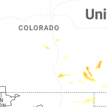


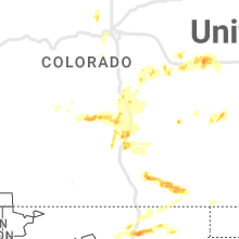


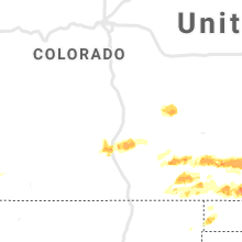


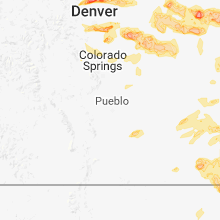


Connect with Interactive Hail Maps