

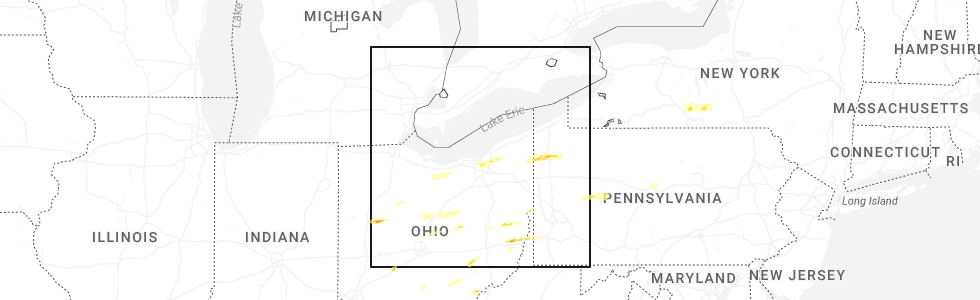
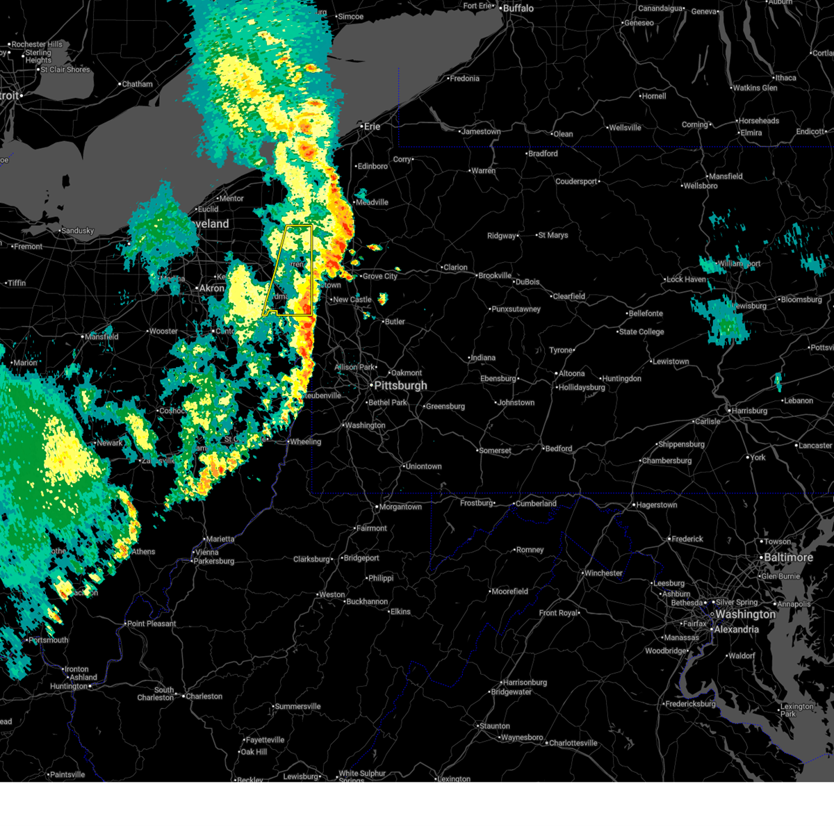
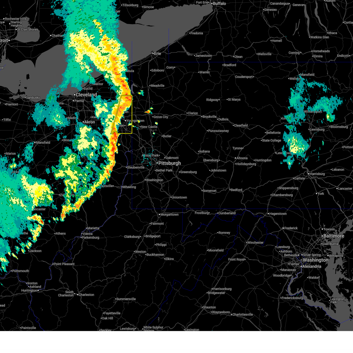
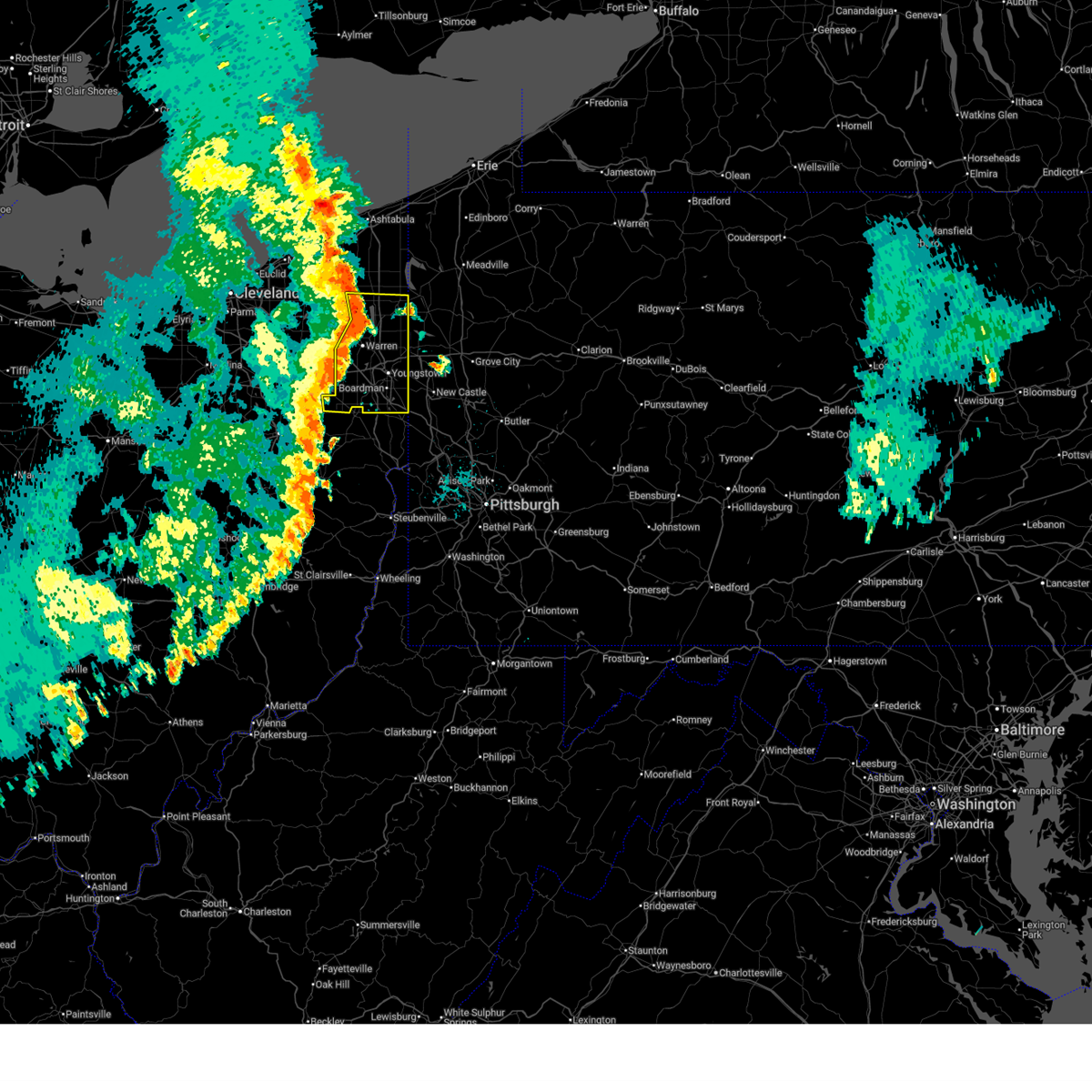
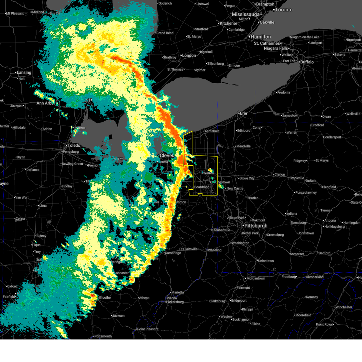
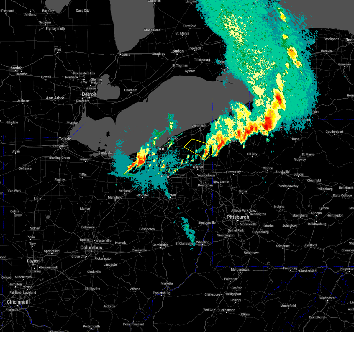
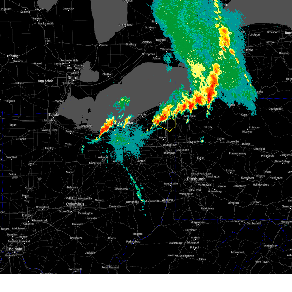
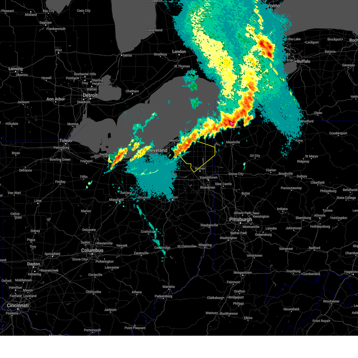
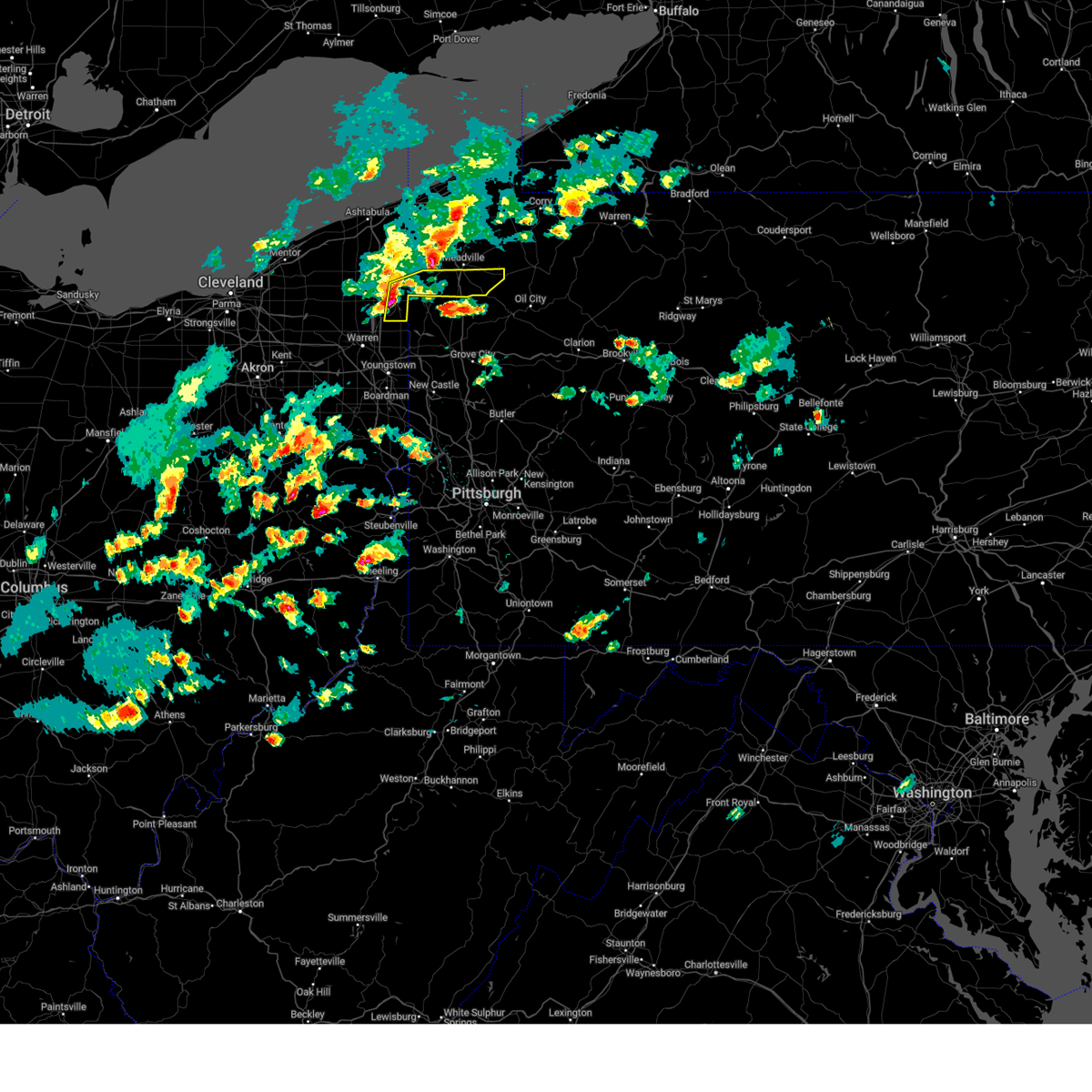
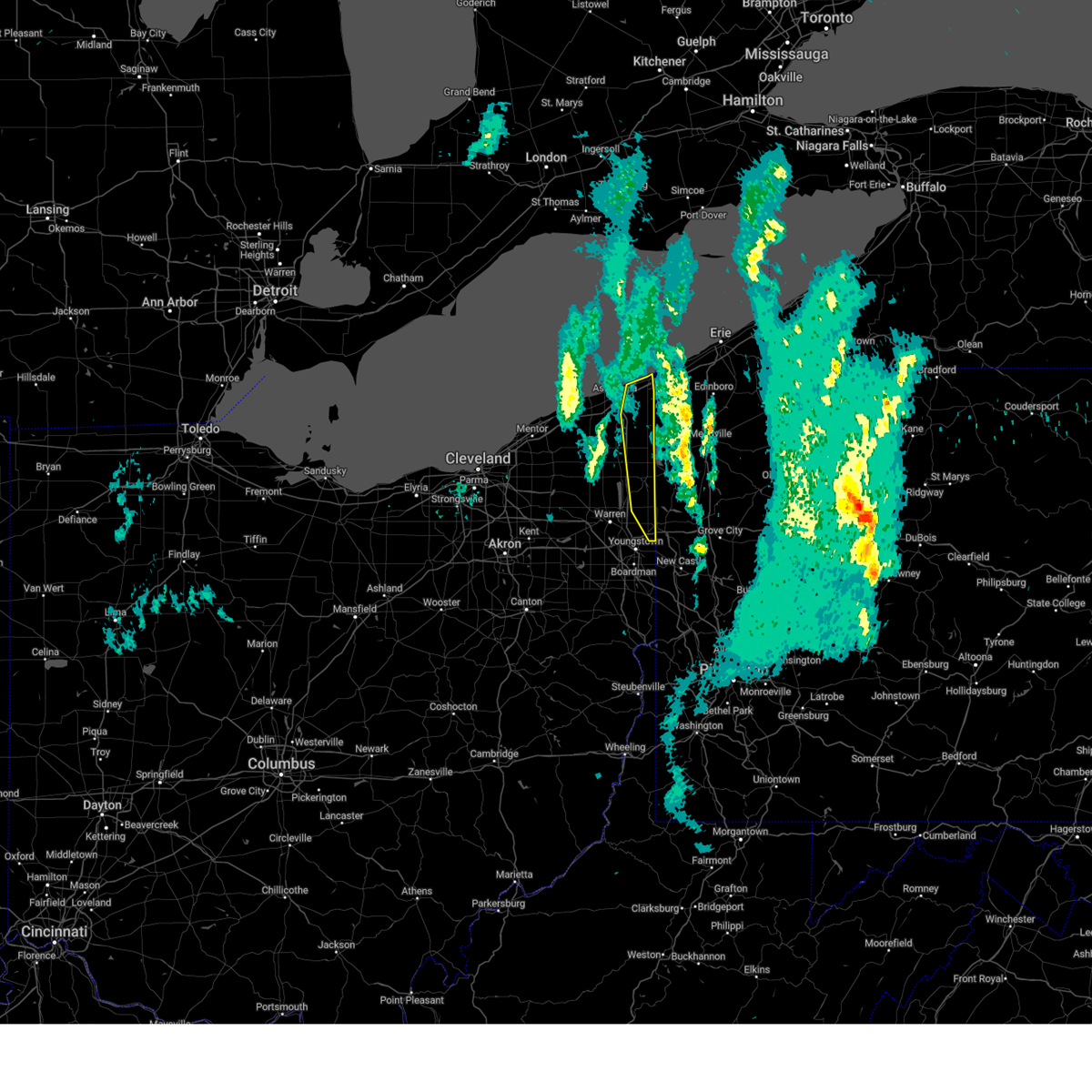
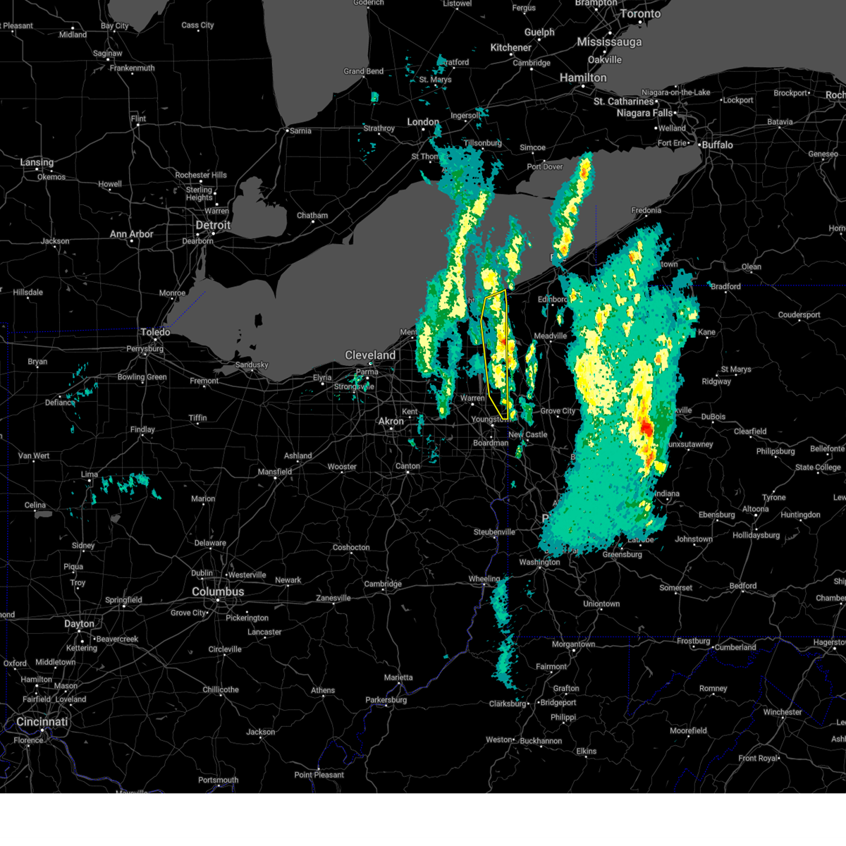
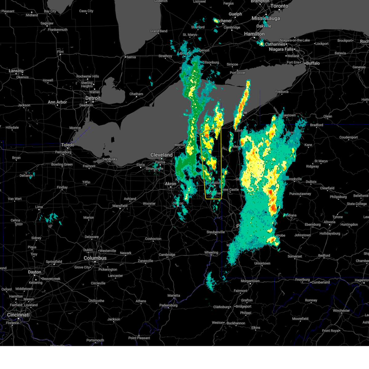
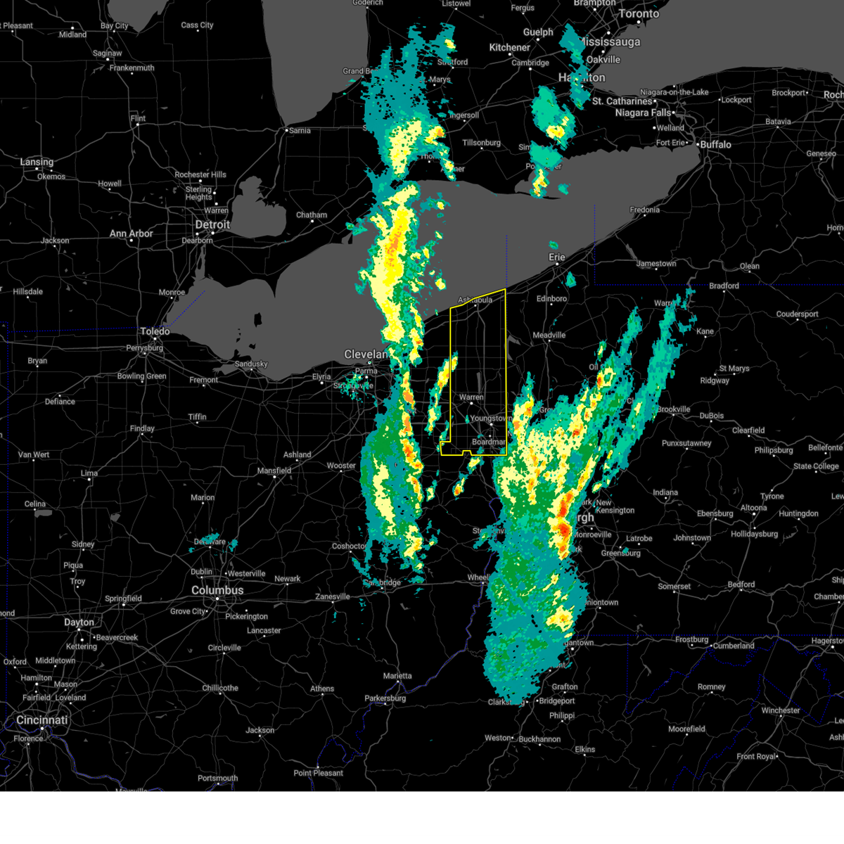
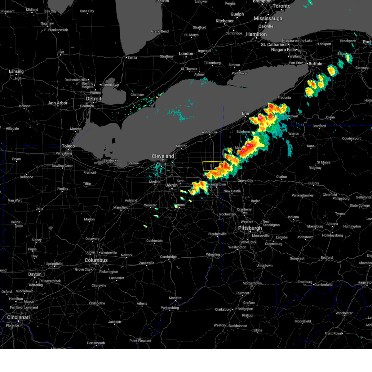
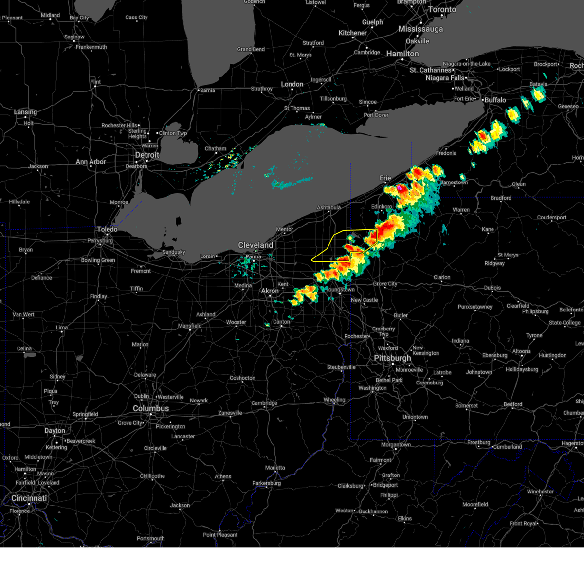
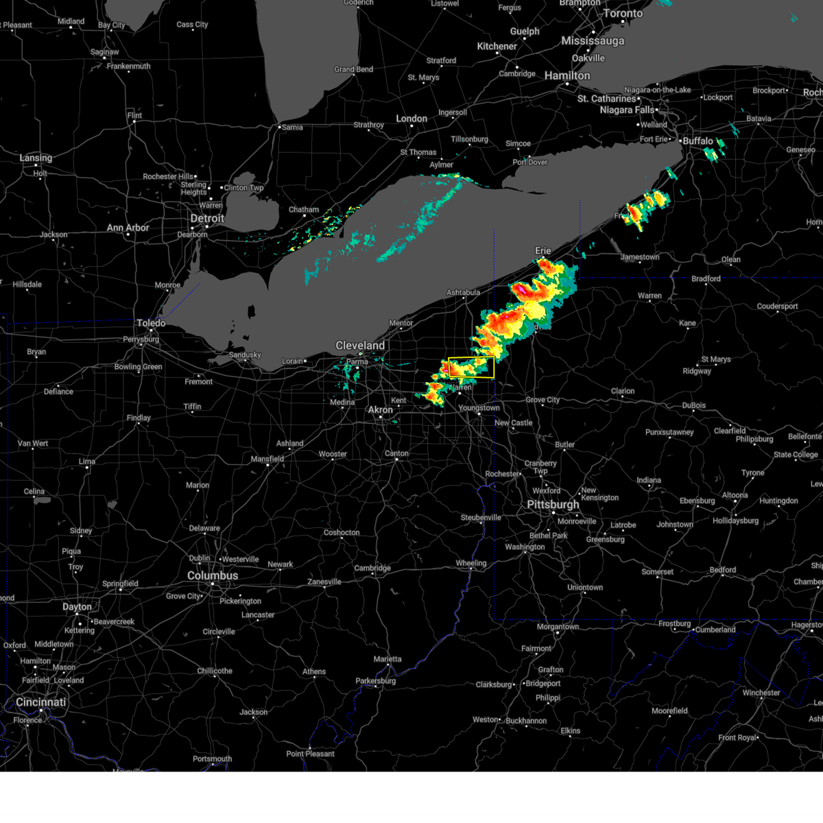
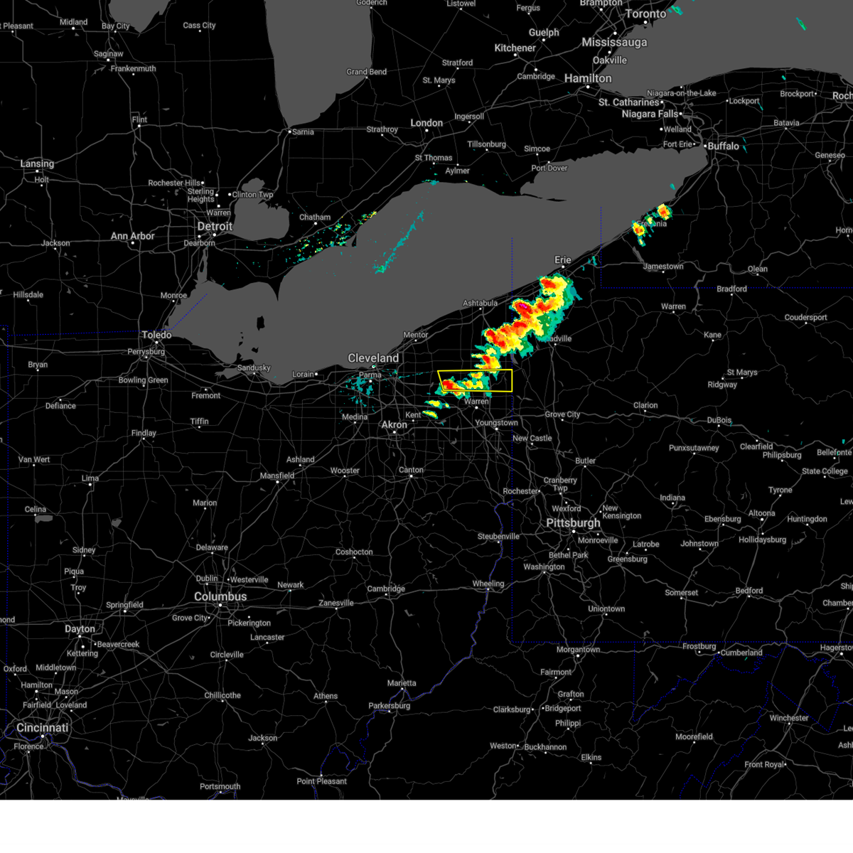
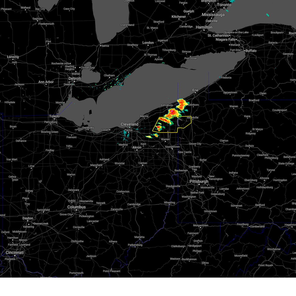
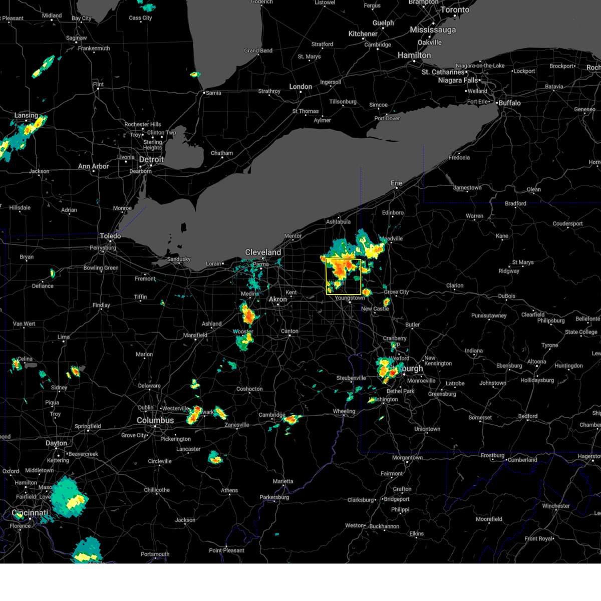
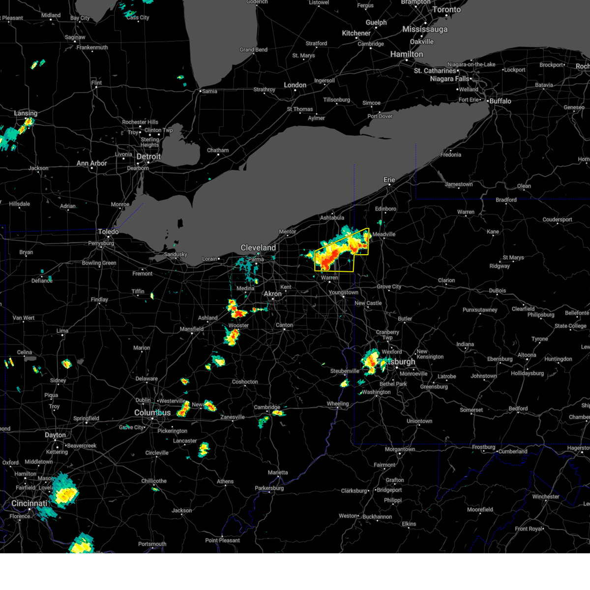
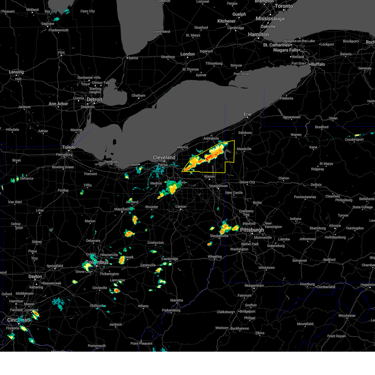
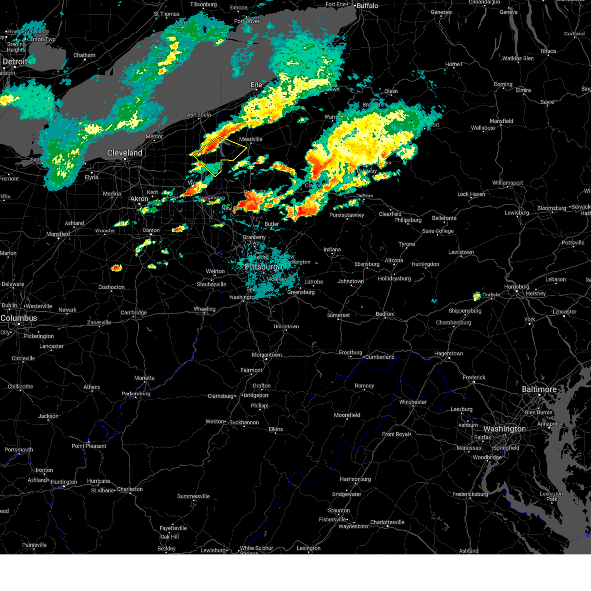
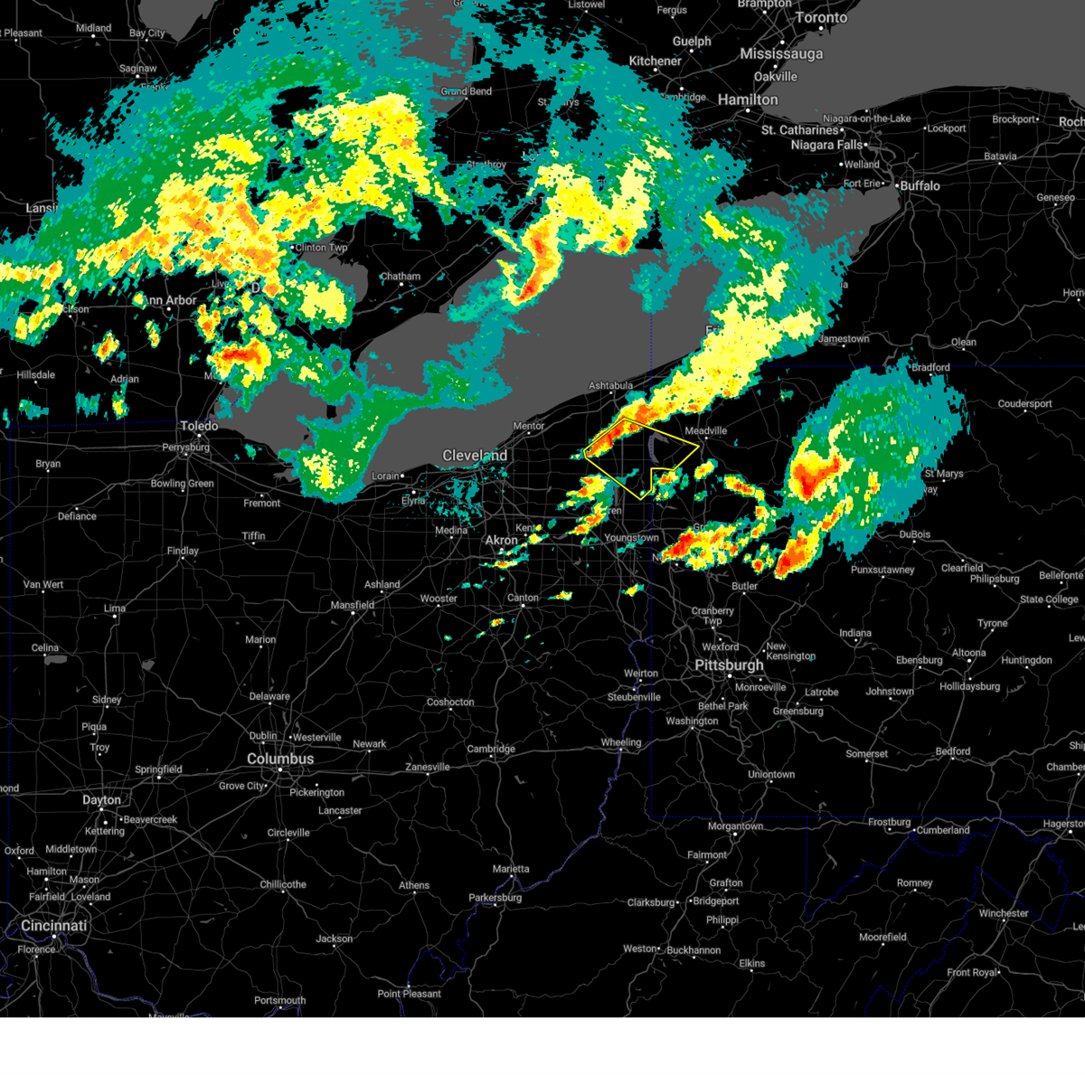
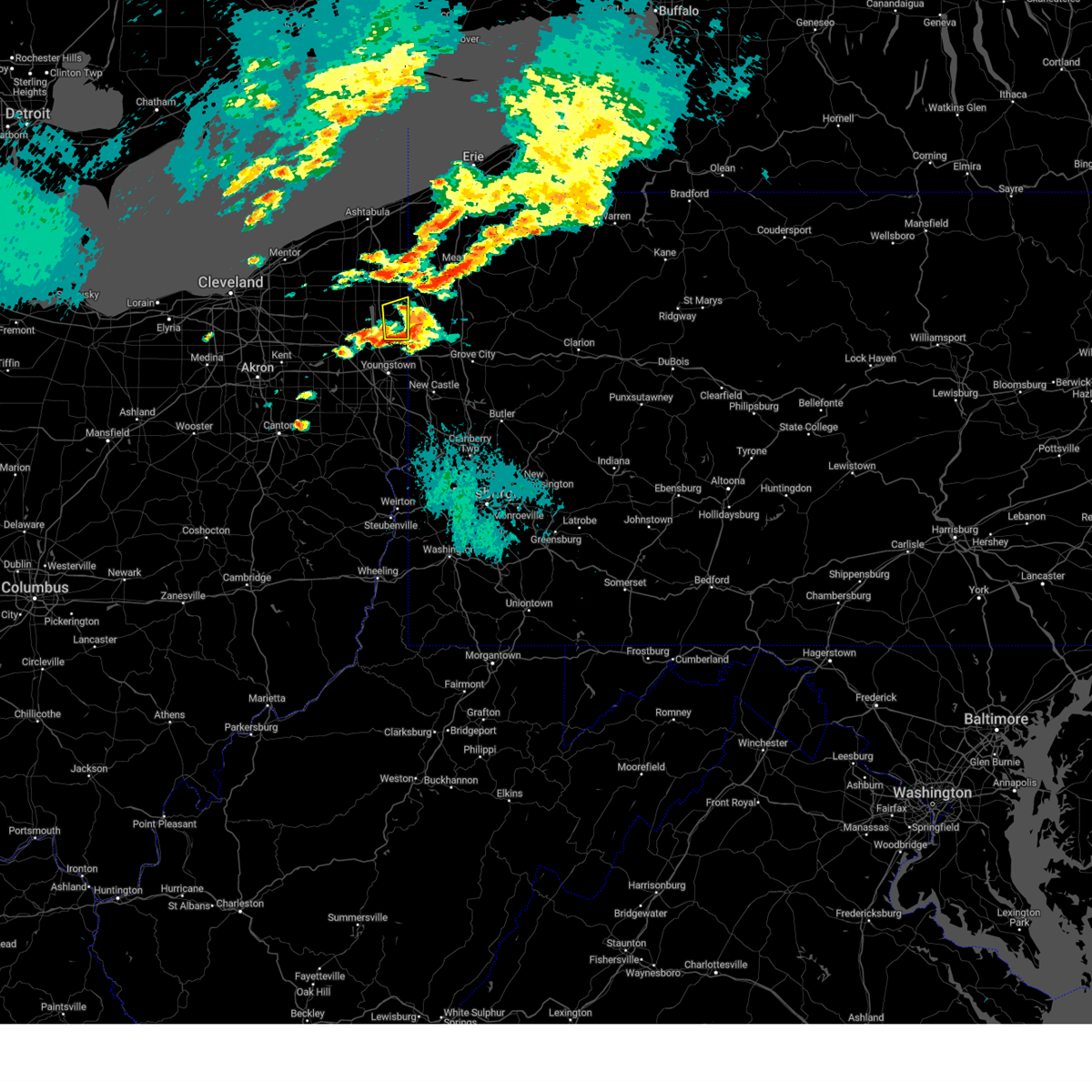
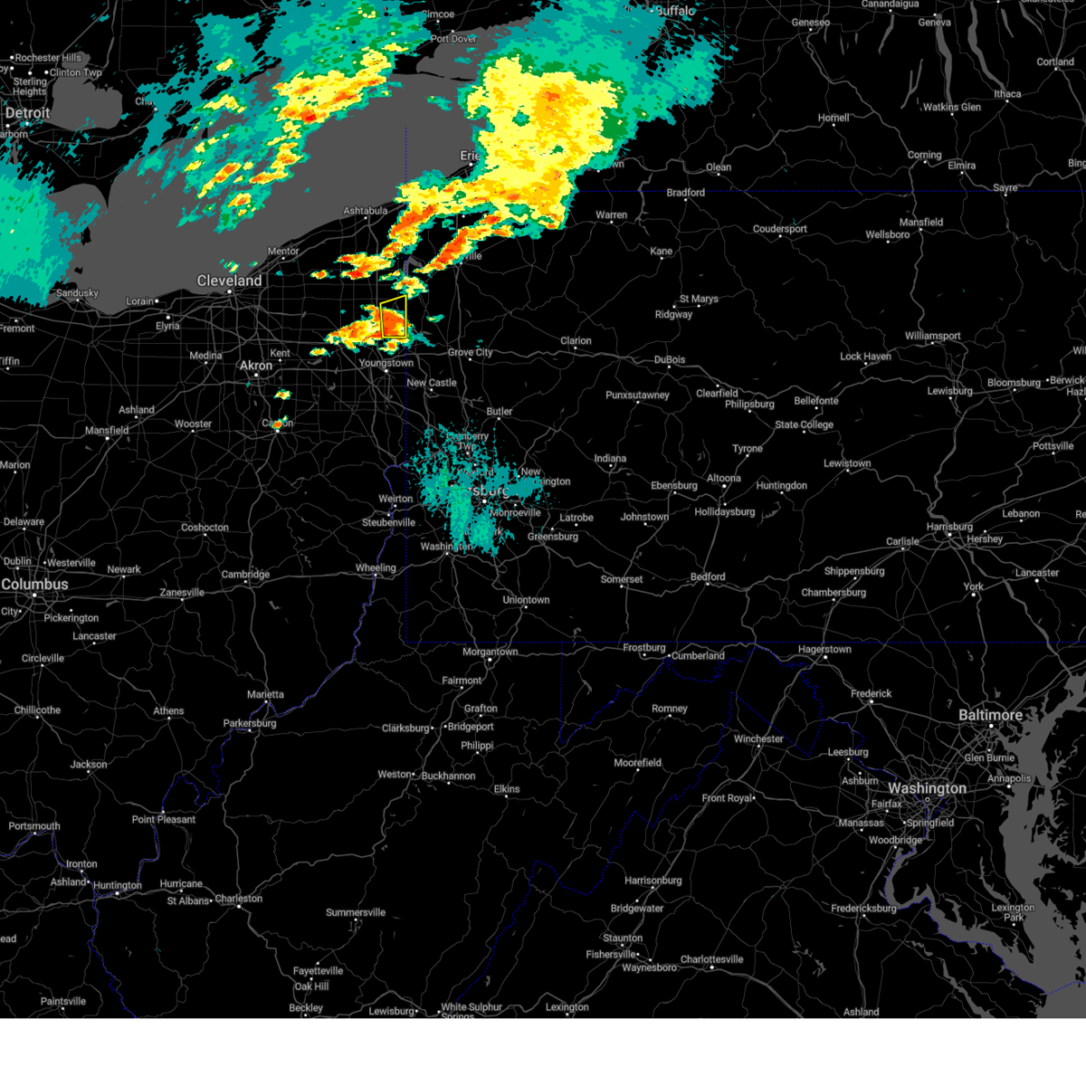
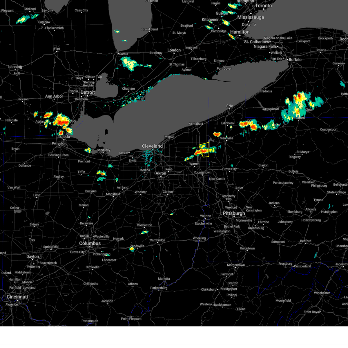
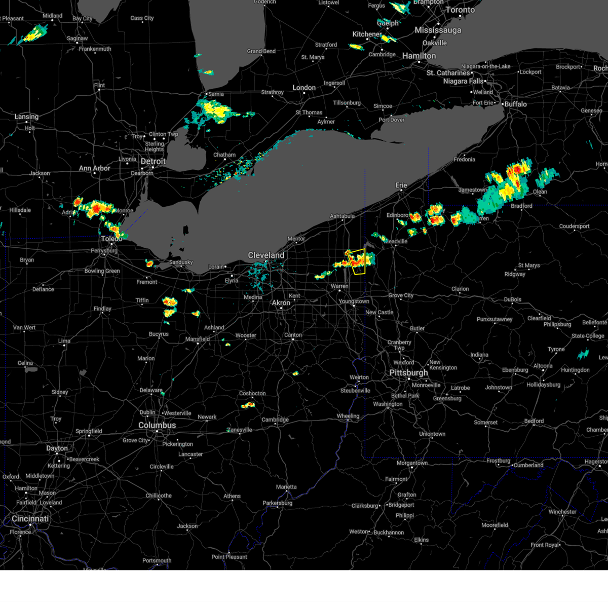
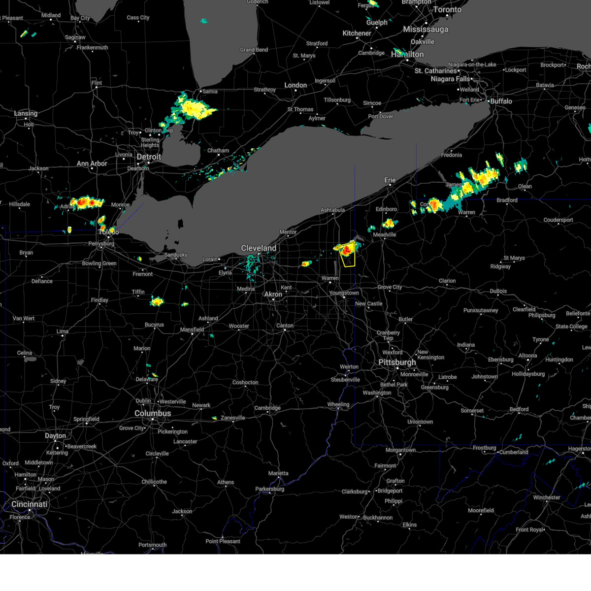
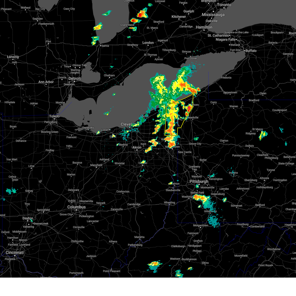
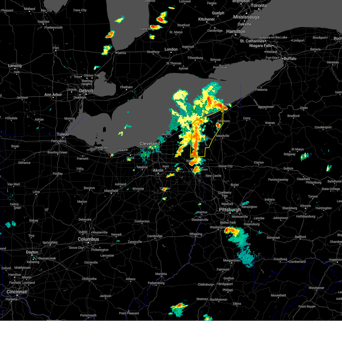
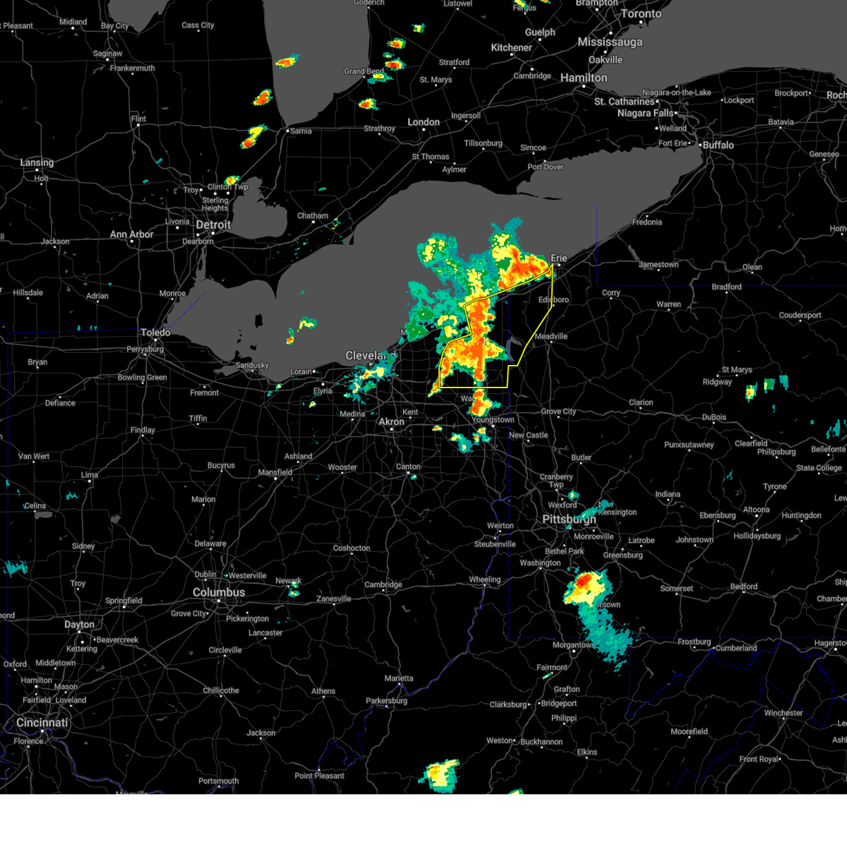
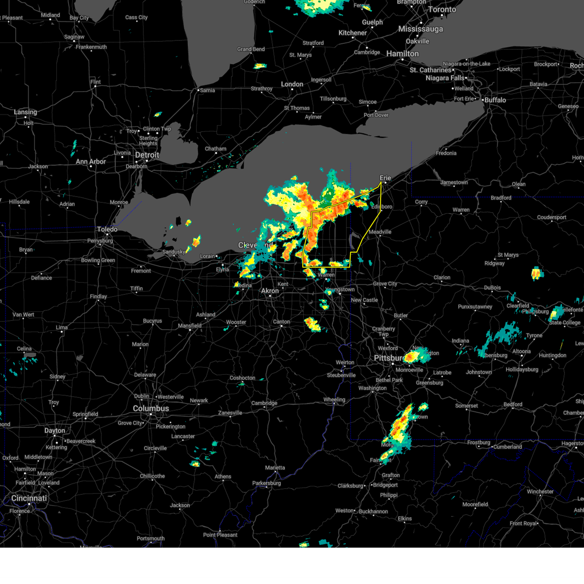
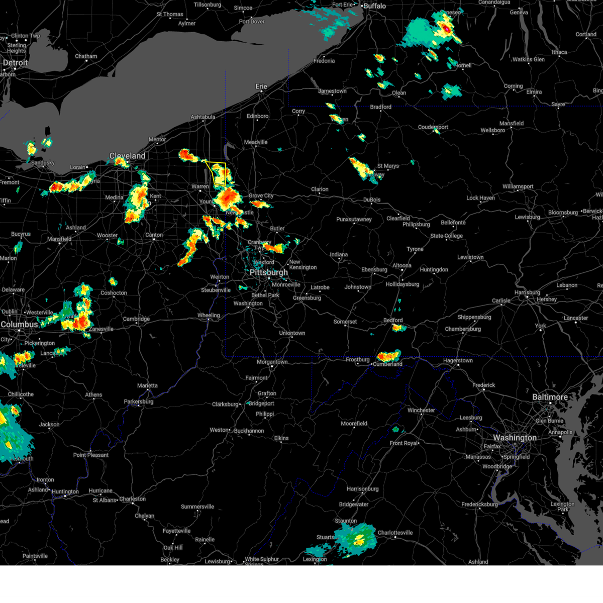
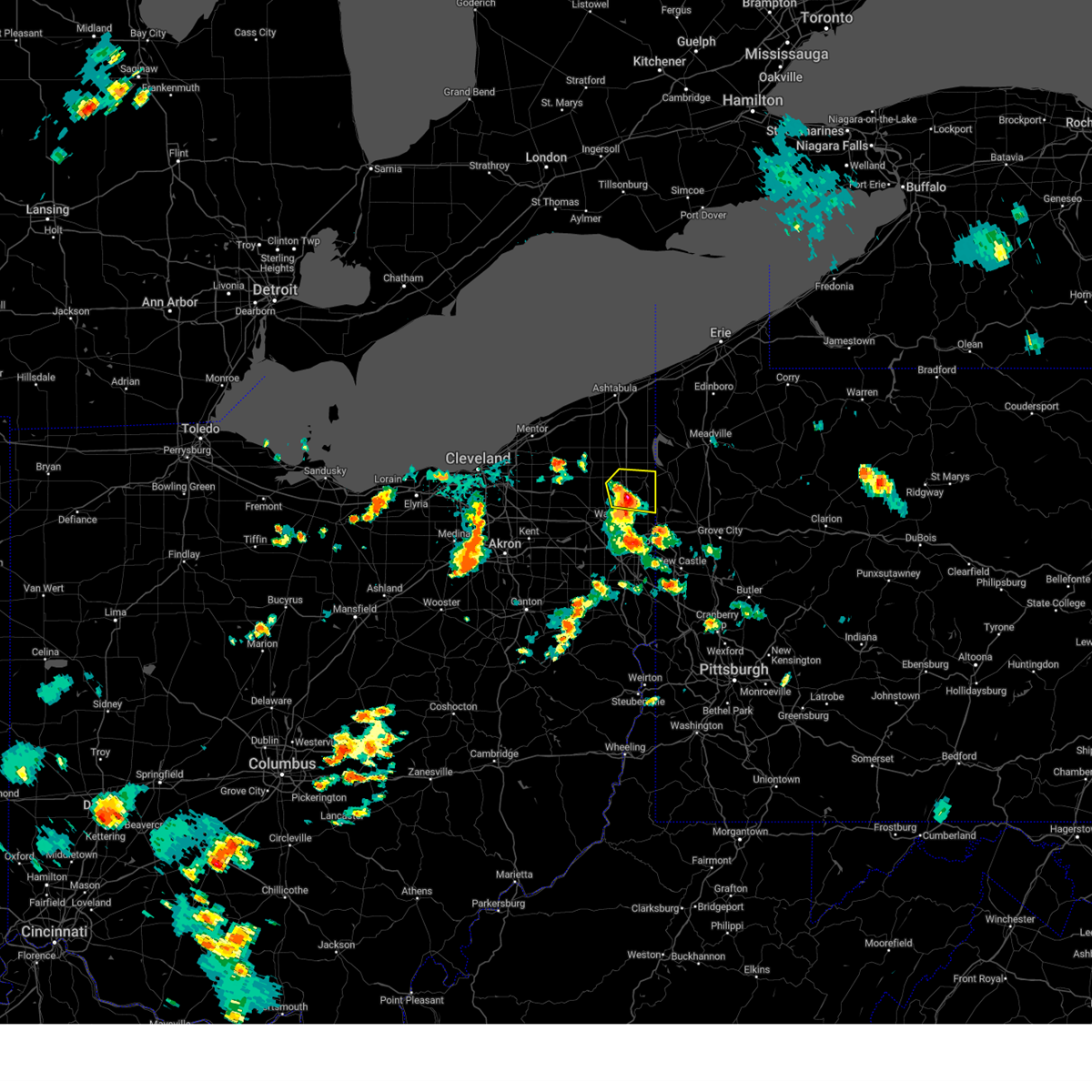
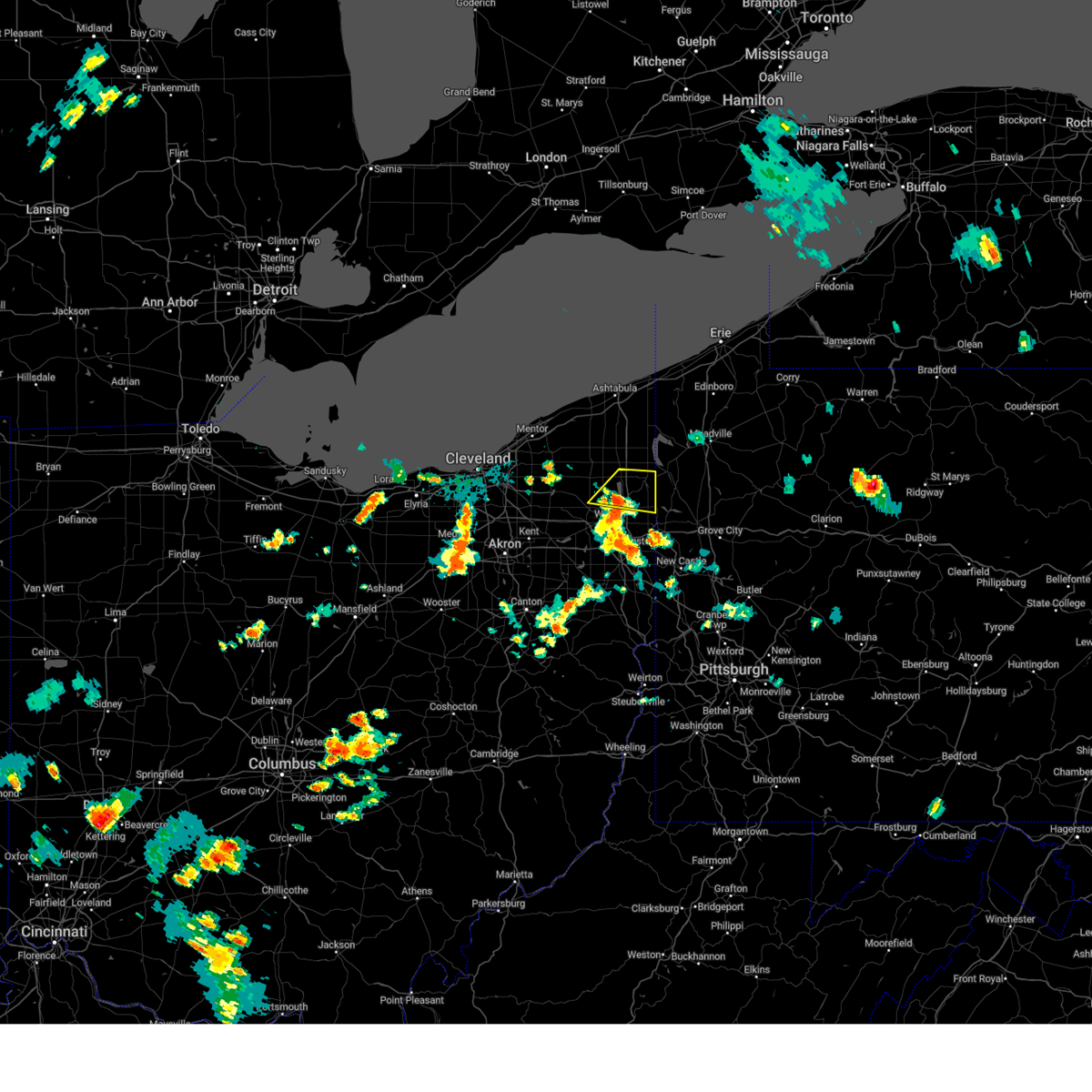
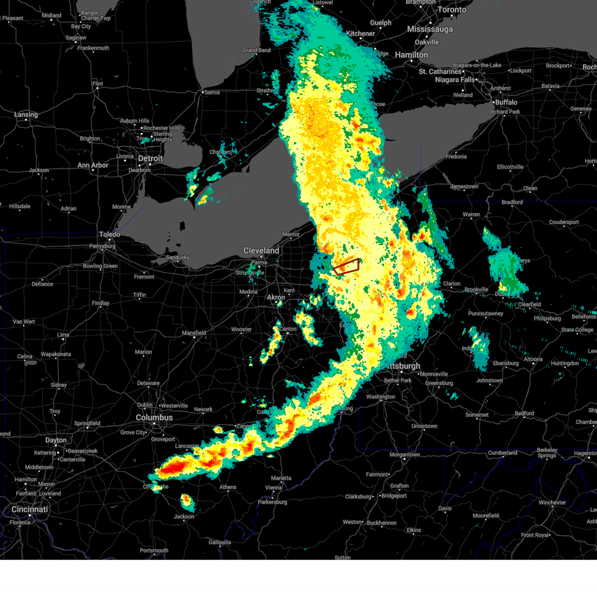
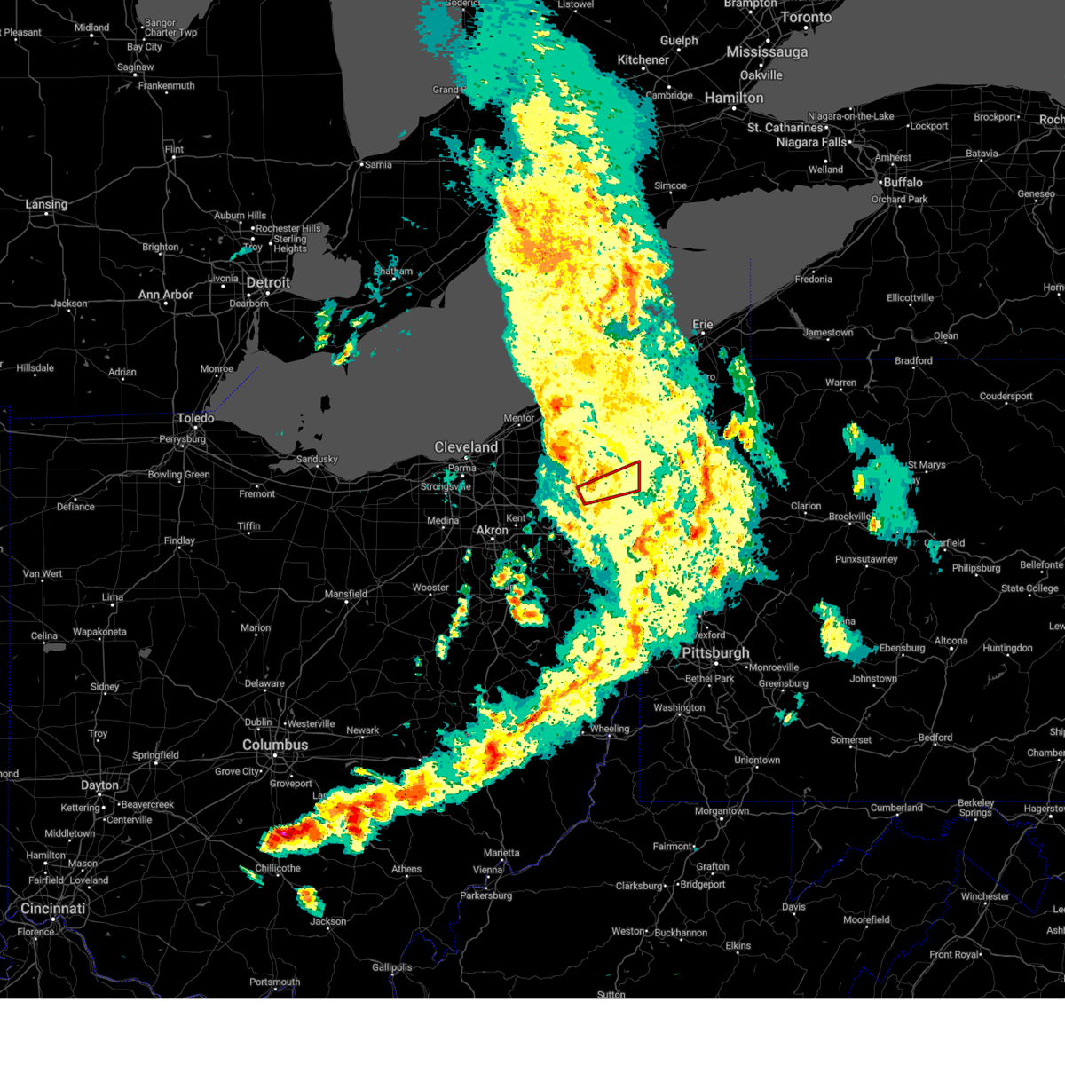
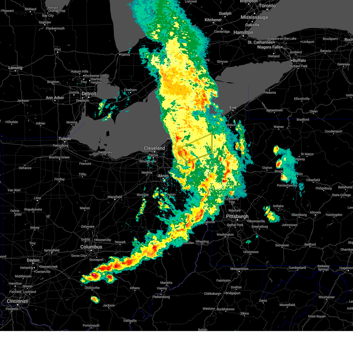
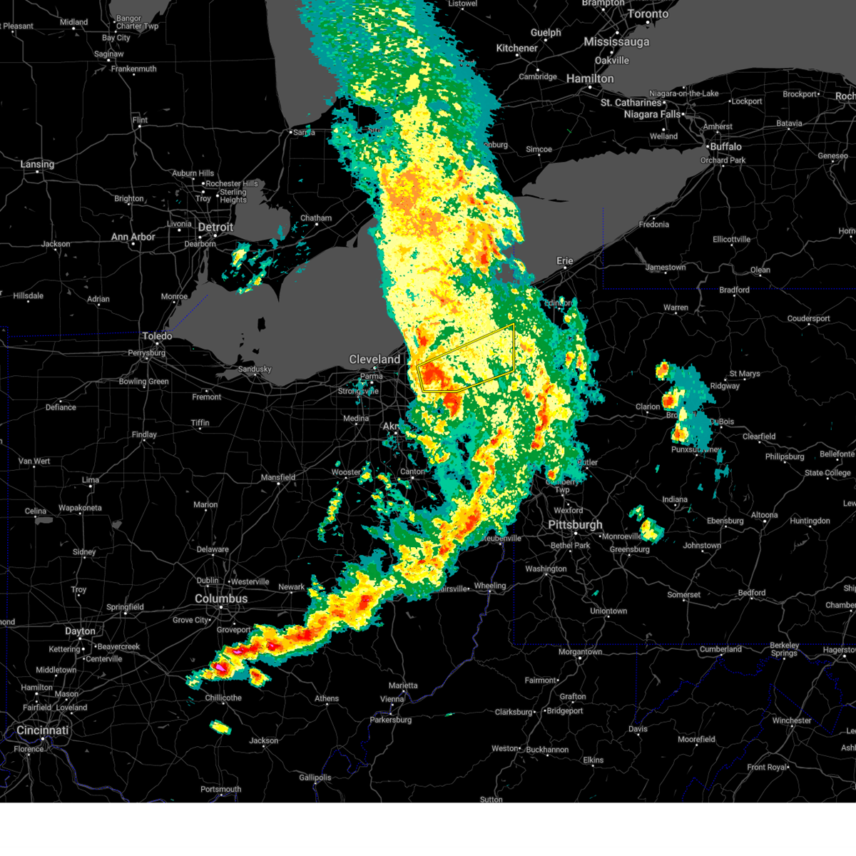
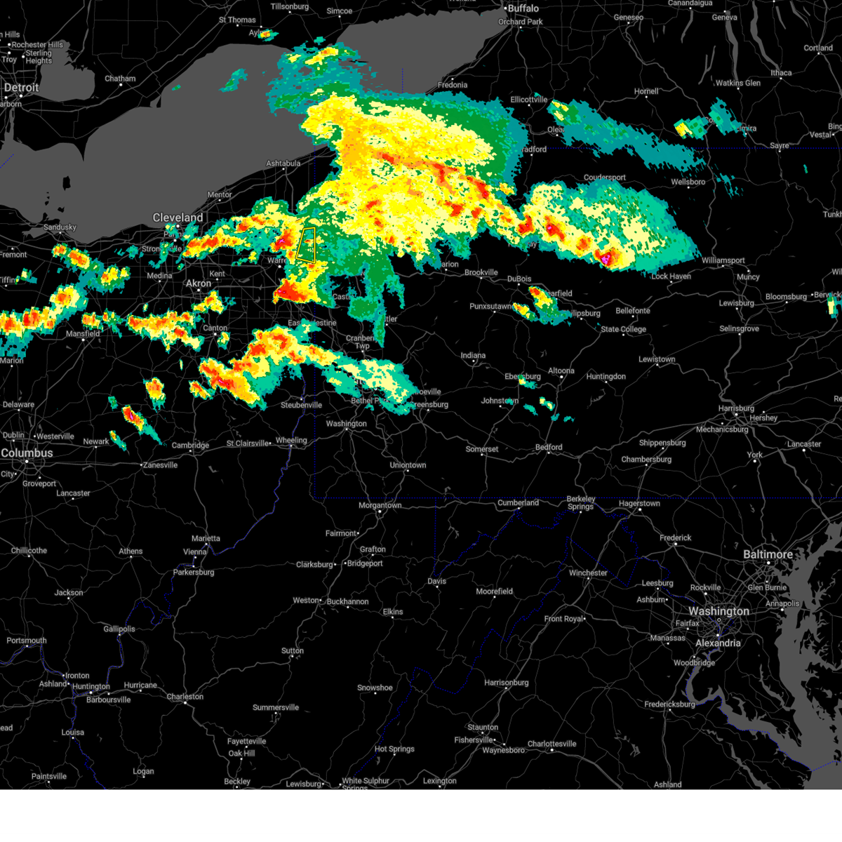
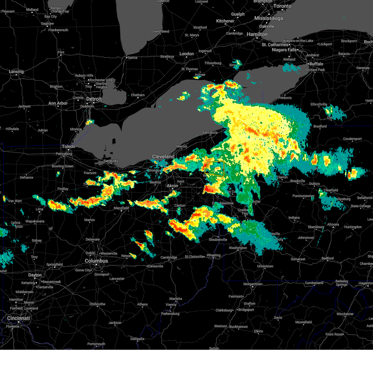
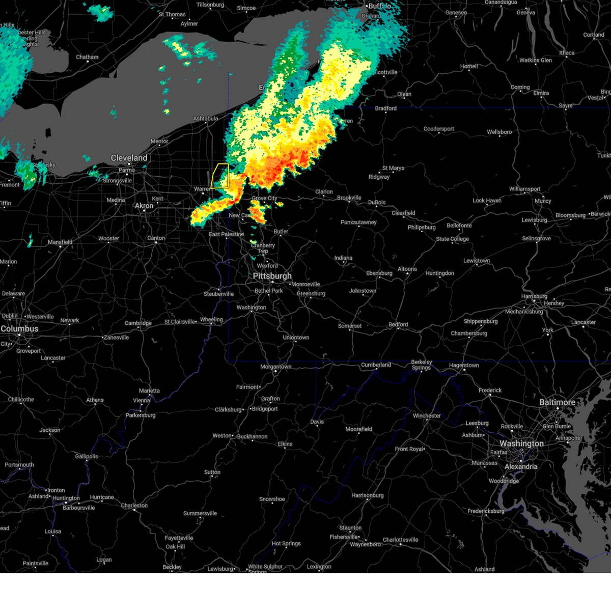
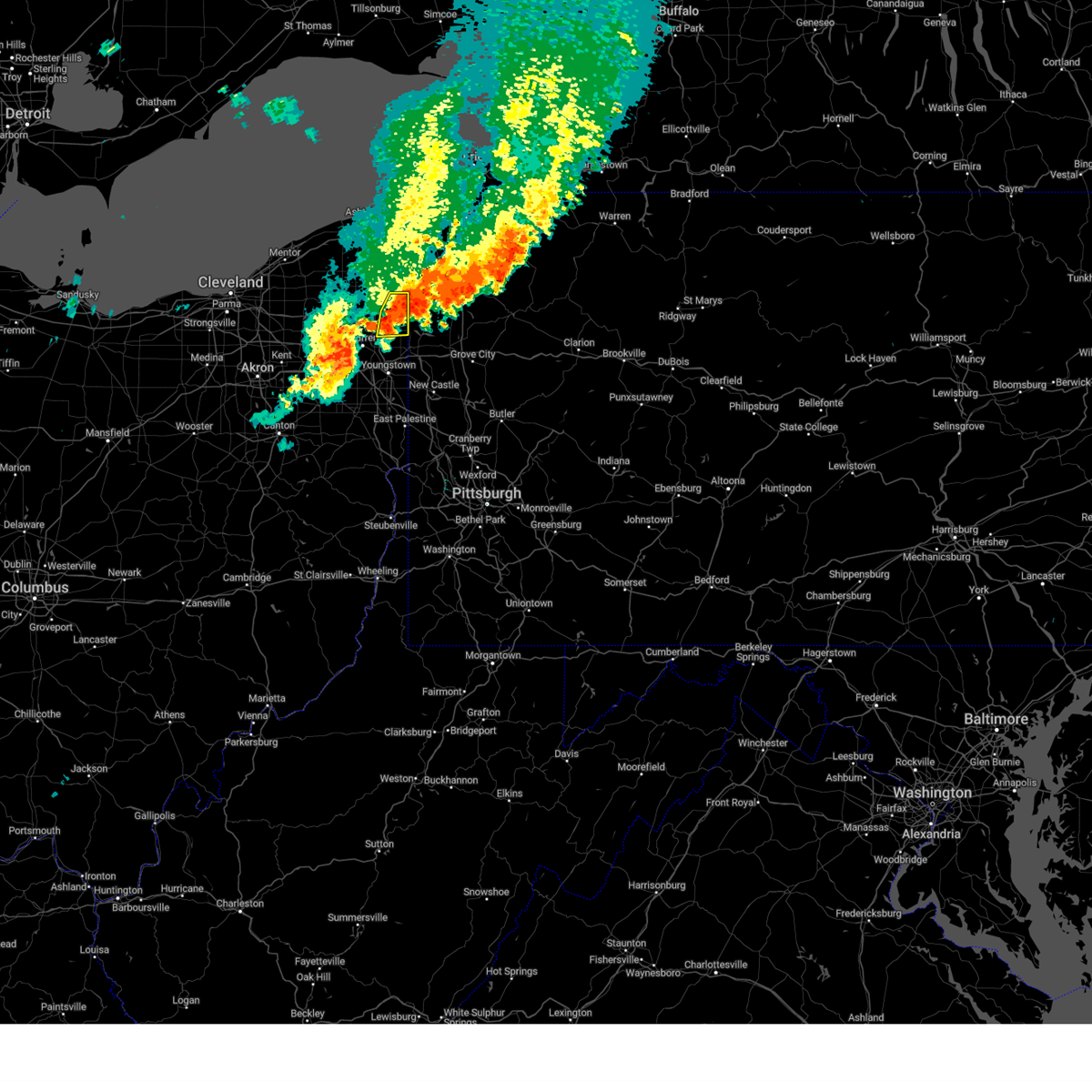
Hail Map for Kinsman Center, OH
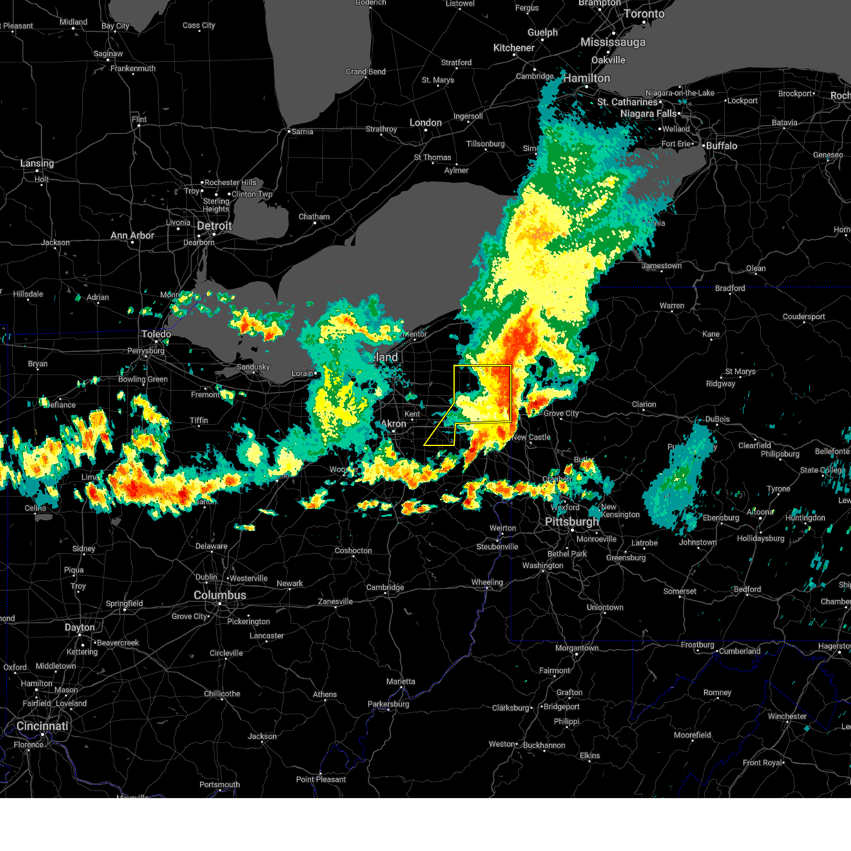
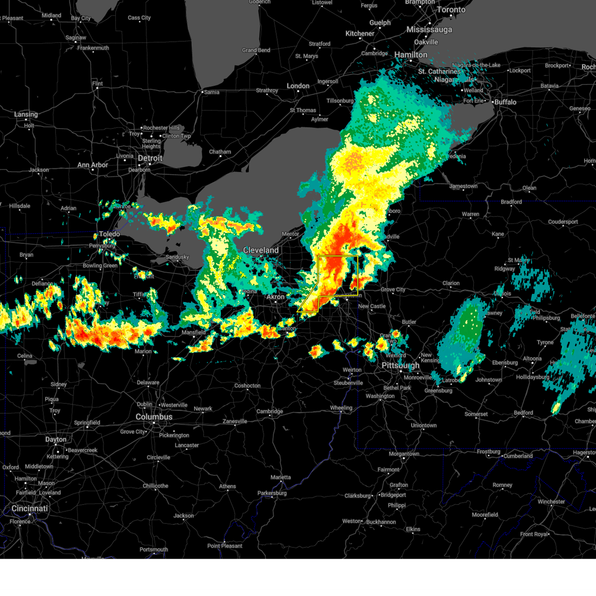
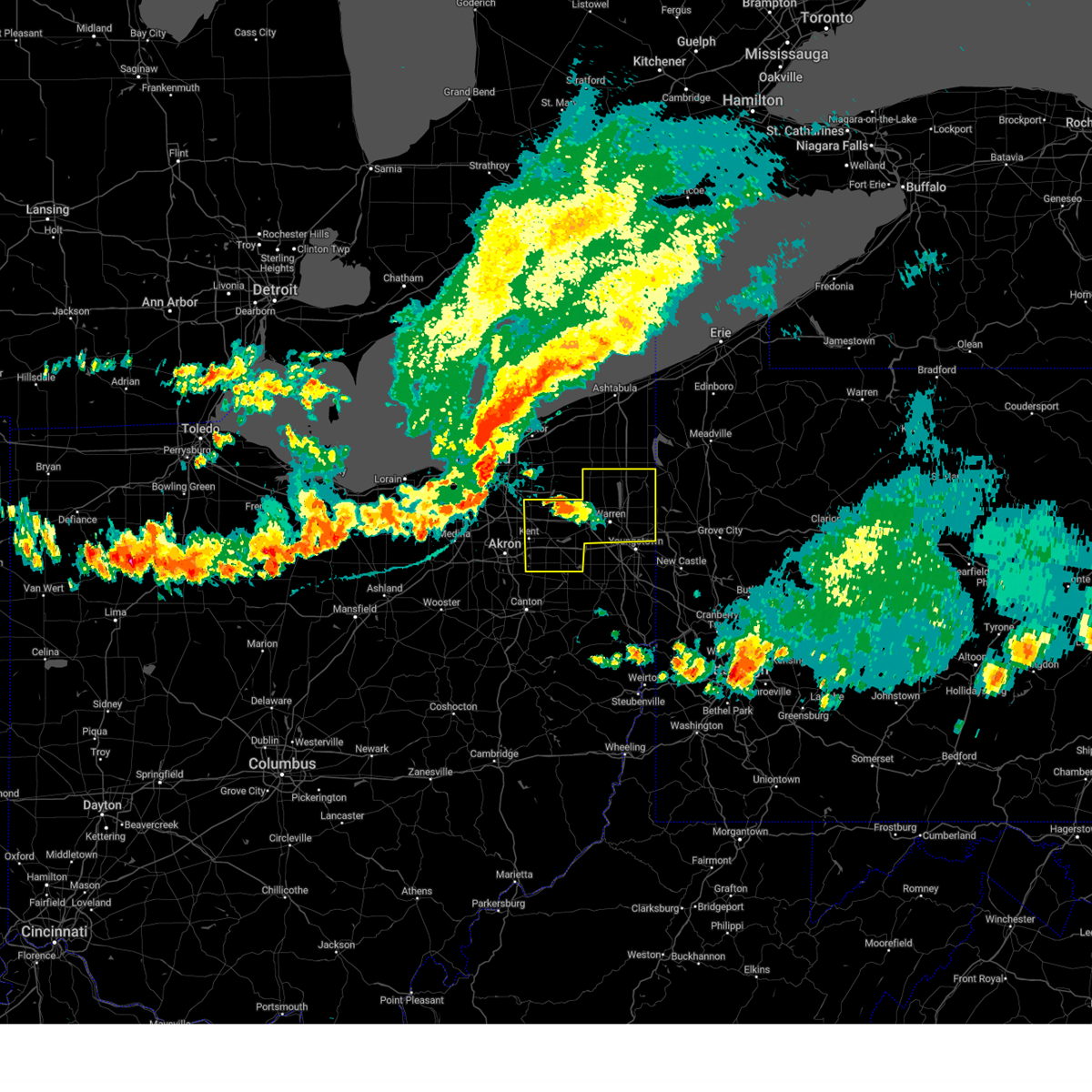
The Kinsman Center, OH area has had 5 reports of on-the-ground hail by trained spotters, and has been under severe weather warnings 48 times during the past 12 months. Doppler radar has detected hail at or near Kinsman Center, OH on 43 occasions, including 5 occasions during the past year.
| Name: | Kinsman Center, OH |
| Where Located: | 57.5 miles E of Cleveland, OH |
| Map: | Google Map for Kinsman Center, OH |
| Population: | 616 |
| Housing Units: | 303 |
| More Info: | Search Google for Kinsman Center, OH |
5
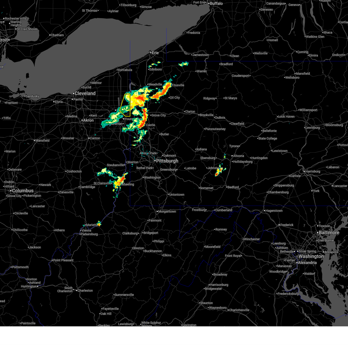
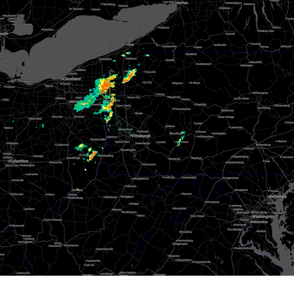
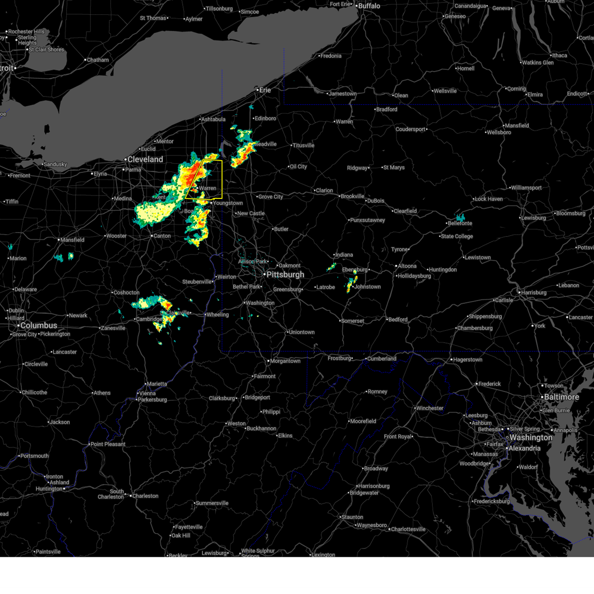
The Top Recent Hail Date for Kinsman Center, OH is Friday, May 2, 2025 (6th out of 43)
Hail and Wind Damage Spotted near Kinsman Center, OH
| Date / Time | Report Details |
|---|---|
| 6/28/2025 11:17 AM EDT |
 the severe thunderstorm warning has been cancelled and is no longer in effect the severe thunderstorm warning has been cancelled and is no longer in effect
|
| 6/28/2025 10:58 AM EDT |
 At 1057 am edt, severe thunderstorms were located along a line extending from near kinsman to 8 miles northwest of sharpsville to vienna center, moving east at 25 mph (radar indicated). Hazards include 60 mph wind gusts. Expect damage to trees and power lines. Locations impacted include, hubbard, kinsman, vienna center, maplewood park, girard, vienna, johnston, orangeville, yankee lake, brookfield center, west hill, churchill, and howland center. At 1057 am edt, severe thunderstorms were located along a line extending from near kinsman to 8 miles northwest of sharpsville to vienna center, moving east at 25 mph (radar indicated). Hazards include 60 mph wind gusts. Expect damage to trees and power lines. Locations impacted include, hubbard, kinsman, vienna center, maplewood park, girard, vienna, johnston, orangeville, yankee lake, brookfield center, west hill, churchill, and howland center.
|
| 6/28/2025 10:38 AM EDT |
 Svrcle the national weather service in cleveland has issued a * severe thunderstorm warning for, trumbull county in northeastern ohio, * until 1130 am edt. * at 1037 am edt, severe thunderstorms were located along a line extending from near kinsman to cortland to near warren, moving east at 25 mph (radar indicated). Hazards include 60 mph wind gusts and quarter size hail. Minor damage to vehicles is possible. Expect damage to trees and power lines. Svrcle the national weather service in cleveland has issued a * severe thunderstorm warning for, trumbull county in northeastern ohio, * until 1130 am edt. * at 1037 am edt, severe thunderstorms were located along a line extending from near kinsman to cortland to near warren, moving east at 25 mph (radar indicated). Hazards include 60 mph wind gusts and quarter size hail. Minor damage to vehicles is possible. Expect damage to trees and power lines.
|
| 6/18/2025 10:57 PM EDT |
 The storms which prompted the warning have moved out of the area. therefore, the warning will be allowed to expire. a severe thunderstorm watch remains in effect until 300 am edt for northeastern ohio. The storms which prompted the warning have moved out of the area. therefore, the warning will be allowed to expire. a severe thunderstorm watch remains in effect until 300 am edt for northeastern ohio.
|
| 6/18/2025 10:33 PM EDT |
 At 1033 pm edt, severe thunderstorms were located along a line extending from near kinsman to near sharpsville to campbell, moving east at 60 mph (radar indicated). Hazards include 60 mph wind gusts. Expect damage to trees and power lines. Locations impacted include, youngstown, warren, salem, columbiana, boardman, niles, campbell, hubbard, canfield, cortland, lordstown, kinsman, vienna center, hilltop, maplewood park, austintown, struthers, girard, vienna, and mcdonald. At 1033 pm edt, severe thunderstorms were located along a line extending from near kinsman to near sharpsville to campbell, moving east at 60 mph (radar indicated). Hazards include 60 mph wind gusts. Expect damage to trees and power lines. Locations impacted include, youngstown, warren, salem, columbiana, boardman, niles, campbell, hubbard, canfield, cortland, lordstown, kinsman, vienna center, hilltop, maplewood park, austintown, struthers, girard, vienna, and mcdonald.
|
| 6/18/2025 10:13 PM EDT |
 the severe thunderstorm warning has been cancelled and is no longer in effect the severe thunderstorm warning has been cancelled and is no longer in effect
|
| 6/18/2025 10:13 PM EDT |
 At 1013 pm edt, severe thunderstorms were located along a line extending from near north bloomfield to near niles to near salem, moving east at 60 mph (radar indicated). Hazards include 60 mph wind gusts. Expect damage to trees and power lines. Locations impacted include, youngstown, warren, salem, columbiana, boardman, niles, campbell, hubbard, canfield, cortland, newton falls, sebring, lordstown, kinsman, north bloomfield, vienna center, hilltop, maplewood park, bristolville, and leavittsburg. At 1013 pm edt, severe thunderstorms were located along a line extending from near north bloomfield to near niles to near salem, moving east at 60 mph (radar indicated). Hazards include 60 mph wind gusts. Expect damage to trees and power lines. Locations impacted include, youngstown, warren, salem, columbiana, boardman, niles, campbell, hubbard, canfield, cortland, newton falls, sebring, lordstown, kinsman, north bloomfield, vienna center, hilltop, maplewood park, bristolville, and leavittsburg.
|
| 6/18/2025 9:47 PM EDT |
 Svrcle the national weather service in cleveland has issued a * severe thunderstorm warning for, trumbull county in northeastern ohio, mahoning county in northeastern ohio, eastern geauga county in northeastern ohio, northeastern lake county in northeastern ohio, * until 1100 pm edt. * at 947 pm edt, severe thunderstorms were located along a line extending from near mantua to 6 miles southeast of ravenna to near north canton, moving east at 60 mph (radar indicated). Hazards include 60 mph wind gusts. expect damage to trees and power lines Svrcle the national weather service in cleveland has issued a * severe thunderstorm warning for, trumbull county in northeastern ohio, mahoning county in northeastern ohio, eastern geauga county in northeastern ohio, northeastern lake county in northeastern ohio, * until 1100 pm edt. * at 947 pm edt, severe thunderstorms were located along a line extending from near mantua to 6 miles southeast of ravenna to near north canton, moving east at 60 mph (radar indicated). Hazards include 60 mph wind gusts. expect damage to trees and power lines
|
| 5/16/2025 6:09 PM EDT | At 609 pm edt, a severe thunderstorm was located near kinsman, or 12 miles north of sharpsville, moving northeast at 30 mph (radar indicated). Hazards include 60 mph wind gusts and half dollar size hail. People and animals outdoors will be injured. expect hail damage to roofs, siding, windows, and vehicles. expect damage to trees and power lines. Locations impacted include, kinsman, andover, linesville, adamsville, pymatuning north, pymatuning central, atlantic, harmonsburg, conneaut lake, jamestown, conneaut lakeshore, geneva, and hartstown. |
| 5/16/2025 6:04 PM EDT | Svrcle the national weather service in cleveland has issued a * severe thunderstorm warning for, northeastern trumbull county in northeastern ohio, southeastern ashtabula county in northeastern ohio, southwestern crawford county in northwestern pennsylvania, * until 645 pm edt. * at 604 pm edt, a severe thunderstorm was located near kinsman, or 11 miles north of sharpsville, moving northeast at 30 mph (radar indicated). Hazards include quarter size hail. minor damage to vehicles is possible |
| 5/16/2025 5:20 AM EDT |
 The storm which prompted the warning has weakened below severe limits, and has exited the warned area. therefore, the warning will be allowed to expire. The storm which prompted the warning has weakened below severe limits, and has exited the warned area. therefore, the warning will be allowed to expire.
|
| 5/16/2025 4:56 AM EDT |
 At 455 am edt, a severe thunderstorm was located near orwell, or 19 miles south of geneva-on-the-lake, moving east at 35 mph (radar indicated). Hazards include 60 mph wind gusts and quarter size hail. Minor damage to vehicles is possible. expect damage to trees and power lines. Locations impacted include, kinsman, orwell, andover, montville, hartsgrove, roaming shores, cherry valley, and rock creek. At 455 am edt, a severe thunderstorm was located near orwell, or 19 miles south of geneva-on-the-lake, moving east at 35 mph (radar indicated). Hazards include 60 mph wind gusts and quarter size hail. Minor damage to vehicles is possible. expect damage to trees and power lines. Locations impacted include, kinsman, orwell, andover, montville, hartsgrove, roaming shores, cherry valley, and rock creek.
|
| 5/16/2025 4:56 AM EDT |
 the severe thunderstorm warning has been cancelled and is no longer in effect the severe thunderstorm warning has been cancelled and is no longer in effect
|
| 5/16/2025 4:40 AM EDT |
 Svrcle the national weather service in cleveland has issued a * severe thunderstorm warning for, northern trumbull county in northeastern ohio, eastern geauga county in northeastern ohio, east central lake county in northeastern ohio, southern ashtabula county in northeastern ohio, * until 530 am edt. * at 440 am edt, a severe thunderstorm was located 9 miles northwest of orwell, or 11 miles east of chardon, moving east at 35 mph (radar indicated). Hazards include 60 mph wind gusts and quarter size hail. Minor damage to vehicles is possible. Expect damage to trees and power lines. Svrcle the national weather service in cleveland has issued a * severe thunderstorm warning for, northern trumbull county in northeastern ohio, eastern geauga county in northeastern ohio, east central lake county in northeastern ohio, southern ashtabula county in northeastern ohio, * until 530 am edt. * at 440 am edt, a severe thunderstorm was located 9 miles northwest of orwell, or 11 miles east of chardon, moving east at 35 mph (radar indicated). Hazards include 60 mph wind gusts and quarter size hail. Minor damage to vehicles is possible. Expect damage to trees and power lines.
|
| 5/2/2025 4:00 PM EDT | A new severe thunderstorm warning has been issued for extreme northeastern trumbull county. otherwise, the storms have moved out of the warned area. a severe thunderstorm watch remains in effect until 700 pm edt for northeastern ohio. |
| 5/2/2025 3:57 PM EDT |
 Svrcle the national weather service in cleveland has issued a * severe thunderstorm warning for, northeastern trumbull county in northeastern ohio, southeastern ashtabula county in northeastern ohio, southwestern crawford county in northwestern pennsylvania, * until 445 pm edt. * at 356 pm edt, a severe thunderstorm was located over kinsman, or 15 miles northwest of sharpsville, moving east at 40 mph (radar indicated). Hazards include 60 mph wind gusts and quarter size hail. Minor damage to vehicles is possible. Expect damage to trees and power lines. Svrcle the national weather service in cleveland has issued a * severe thunderstorm warning for, northeastern trumbull county in northeastern ohio, southeastern ashtabula county in northeastern ohio, southwestern crawford county in northwestern pennsylvania, * until 445 pm edt. * at 356 pm edt, a severe thunderstorm was located over kinsman, or 15 miles northwest of sharpsville, moving east at 40 mph (radar indicated). Hazards include 60 mph wind gusts and quarter size hail. Minor damage to vehicles is possible. Expect damage to trees and power lines.
|
| 5/2/2025 3:43 PM EDT | At 342 pm edt, severe thunderstorms were located along a line extending from near orwell to 7 miles northeast of north bloomfield to near bristolville, moving east at 40 mph (radar indicated). Hazards include 60 mph wind gusts and penny size hail. Expect damage to trees and power lines. Locations impacted include, cortland, kinsman, north bloomfield, orwell, andover, bristolville, mecca, johnston, hartsgrove, roaming shores, and cherry valley. |
| 5/2/2025 3:43 PM EDT | the severe thunderstorm warning has been cancelled and is no longer in effect |
| 5/2/2025 3:29 PM EDT | the severe thunderstorm warning has been cancelled and is no longer in effect |
| 5/2/2025 3:29 PM EDT | At 328 pm edt, severe thunderstorms were located along a line extending from 7 miles northeast of middlefield to near north bloomfield to near south russell, moving east at 45 mph (radar indicated). Hazards include 60 mph wind gusts and quarter size hail. Minor damage to vehicles is possible. expect damage to trees and power lines. Locations impacted include, cortland, south russell, middlefield, kinsman, north bloomfield, orwell, burton, andover, west farmington, bristolville, parkman, huntsburg, claridon, mecca, montville, johnston, hartsgrove, roaming shores, cherry valley, and aquilla. |
| 5/2/2025 3:08 PM EDT | Svrcle the national weather service in cleveland has issued a * severe thunderstorm warning for, northern trumbull county in northeastern ohio, northern portage county in northeastern ohio, geauga county in northeastern ohio, east central cuyahoga county in northeastern ohio, northeastern summit county in northeastern ohio, southern ashtabula county in northeastern ohio, * until 400 pm edt. * at 308 pm edt, severe thunderstorms were located along a line extending from near chardon to near burton to macedonia, moving east at 40 mph (radar indicated). Hazards include 60 mph wind gusts and quarter size hail. Minor damage to vehicles is possible. Expect damage to trees and power lines. |
| 3/16/2025 1:38 PM EDT |
 The storms which prompted the warning have moved out of the area. therefore, the warning will be allowed to expire. to report severe weather, contact your nearest law enforcement agency. they will relay your report to the national weather service cleveland. The storms which prompted the warning have moved out of the area. therefore, the warning will be allowed to expire. to report severe weather, contact your nearest law enforcement agency. they will relay your report to the national weather service cleveland.
|
| 3/16/2025 1:27 PM EDT |
 At 126 pm edt, severe thunderstorms were located along a line extending from near north kingsville to near andover to near kinsman to near sharon, moving north at 80 mph (radar indicated. at 118 pm edt, a 63 mph wind gust was reported at youngstown-warren airport). Hazards include 60 mph wind gusts. Expect damage to trees and power lines. Locations impacted include, conneaut, hubbard, north kingsville, kinsman, andover, johnston, kingsville, pierpont, cherry valley, orangeville, yankee lake, brookfield center, west hill, kelloggsville, and edgewood. At 126 pm edt, severe thunderstorms were located along a line extending from near north kingsville to near andover to near kinsman to near sharon, moving north at 80 mph (radar indicated. at 118 pm edt, a 63 mph wind gust was reported at youngstown-warren airport). Hazards include 60 mph wind gusts. Expect damage to trees and power lines. Locations impacted include, conneaut, hubbard, north kingsville, kinsman, andover, johnston, kingsville, pierpont, cherry valley, orangeville, yankee lake, brookfield center, west hill, kelloggsville, and edgewood.
|
| 3/16/2025 1:27 PM EDT |
 the severe thunderstorm warning has been cancelled and is no longer in effect the severe thunderstorm warning has been cancelled and is no longer in effect
|
| 3/16/2025 1:13 PM EDT |
 At 113 pm edt, severe thunderstorms were located along a line extending from near ashtabula to near cortland to canfield, moving northeast at 50 mph (radar indicated). Hazards include 60 mph wind gusts. Expect damage to trees and power lines. Locations impacted include, youngstown, warren, ashtabula, conneaut, salem, columbiana, geneva-on-the-lake, boardman, niles, campbell, hubbard, canfield, cortland, geneva, lordstown, north kingsville, kinsman, north bloomfield, orwell, and andover. At 113 pm edt, severe thunderstorms were located along a line extending from near ashtabula to near cortland to canfield, moving northeast at 50 mph (radar indicated). Hazards include 60 mph wind gusts. Expect damage to trees and power lines. Locations impacted include, youngstown, warren, ashtabula, conneaut, salem, columbiana, geneva-on-the-lake, boardman, niles, campbell, hubbard, canfield, cortland, geneva, lordstown, north kingsville, kinsman, north bloomfield, orwell, and andover.
|
| 3/16/2025 1:11 PM EDT | Large tree limb down on jewell greenville roa in trumbull county OH, 4.7 miles NNE of Kinsman Center, OH |
| 3/16/2025 12:39 PM EDT |
 Svrcle the national weather service in cleveland has issued a * severe thunderstorm warning for, trumbull county in northeastern ohio, mahoning county in northeastern ohio, ashtabula county in northeastern ohio, * until 145 pm edt. * at 1238 pm edt, severe thunderstorms were located along a line extending from near fairport harbor to near streetsboro to hartville to near waynesburg, moving northeast at 60 mph (radar indicated). Hazards include 70 mph wind gusts. Expect considerable tree damage. Damage is likely to mobile homes, roofs, and outbuildings. Svrcle the national weather service in cleveland has issued a * severe thunderstorm warning for, trumbull county in northeastern ohio, mahoning county in northeastern ohio, ashtabula county in northeastern ohio, * until 145 pm edt. * at 1238 pm edt, severe thunderstorms were located along a line extending from near fairport harbor to near streetsboro to hartville to near waynesburg, moving northeast at 60 mph (radar indicated). Hazards include 70 mph wind gusts. Expect considerable tree damage. Damage is likely to mobile homes, roofs, and outbuildings.
|
| 10/6/2024 5:41 PM EDT |
 The storm which prompted the warning has moved out of the area. therefore, the warning will be allowed to expire. however, gusty winds and heavy rain are still possible with this thunderstorm. a severe thunderstorm watch remains in effect until 1100 pm edt for northeastern ohio. The storm which prompted the warning has moved out of the area. therefore, the warning will be allowed to expire. however, gusty winds and heavy rain are still possible with this thunderstorm. a severe thunderstorm watch remains in effect until 1100 pm edt for northeastern ohio.
|
| 10/6/2024 5:35 PM EDT |
 The storms which prompted the warning have weakened below severe limits, and have exited the warned area. therefore, the warning has been allowed to expire. however, gusty winds and heavy rain are still possible with these thunderstorms. a severe thunderstorm watch remains in effect until 1100 pm edt for northeastern ohio, and northwestern pennsylvania. The storms which prompted the warning have weakened below severe limits, and have exited the warned area. therefore, the warning has been allowed to expire. however, gusty winds and heavy rain are still possible with these thunderstorms. a severe thunderstorm watch remains in effect until 1100 pm edt for northeastern ohio, and northwestern pennsylvania.
|
| 10/6/2024 5:11 PM EDT |
 the severe thunderstorm warning has been cancelled and is no longer in effect the severe thunderstorm warning has been cancelled and is no longer in effect
|
| 10/6/2024 5:11 PM EDT |
 At 511 pm edt, a severe thunderstorm was located near bristolville, or 10 miles north of warren, moving east at 55 mph (radar indicated). Hazards include 60 mph wind gusts and quarter size hail. Minor damage to vehicles is possible. expect damage to trees and power lines. Locations impacted include, cortland, kinsman, north bloomfield, bristolville, mecca, johnston, and orangeville. At 511 pm edt, a severe thunderstorm was located near bristolville, or 10 miles north of warren, moving east at 55 mph (radar indicated). Hazards include 60 mph wind gusts and quarter size hail. Minor damage to vehicles is possible. expect damage to trees and power lines. Locations impacted include, cortland, kinsman, north bloomfield, bristolville, mecca, johnston, and orangeville.
|
| 10/6/2024 5:05 PM EDT |
 the severe thunderstorm warning has been cancelled and is no longer in effect the severe thunderstorm warning has been cancelled and is no longer in effect
|
| 10/6/2024 5:05 PM EDT |
 At 504 pm edt, severe thunderstorms were located along a line extending from near pymatuning north to near kinsman to west farmington, moving east at 35 mph (radar indicated). Hazards include 60 mph wind gusts and quarter size hail. Minor damage to vehicles is possible. expect damage to trees and power lines. Locations impacted include, kinsman, north bloomfield, andover, linesville, harmonsburg, adamsville, pymatuning north, pymatuning central, atlantic, cherry valley, conneaut lake, jamestown, conneaut lakeshore, geneva, and hartstown. At 504 pm edt, severe thunderstorms were located along a line extending from near pymatuning north to near kinsman to west farmington, moving east at 35 mph (radar indicated). Hazards include 60 mph wind gusts and quarter size hail. Minor damage to vehicles is possible. expect damage to trees and power lines. Locations impacted include, kinsman, north bloomfield, andover, linesville, harmonsburg, adamsville, pymatuning north, pymatuning central, atlantic, cherry valley, conneaut lake, jamestown, conneaut lakeshore, geneva, and hartstown.
|
| 10/6/2024 5:01 PM EDT |
 Svrcle the national weather service in cleveland has issued a * severe thunderstorm warning for, northern trumbull county in northeastern ohio, southeastern geauga county in northeastern ohio, * until 545 pm edt. * at 500 pm edt, a severe thunderstorm was located near west farmington, or 15 miles northwest of warren, moving east at 35 mph (radar indicated). Hazards include 60 mph wind gusts and quarter size hail. Minor damage to vehicles is possible. Expect damage to trees and power lines. Svrcle the national weather service in cleveland has issued a * severe thunderstorm warning for, northern trumbull county in northeastern ohio, southeastern geauga county in northeastern ohio, * until 545 pm edt. * at 500 pm edt, a severe thunderstorm was located near west farmington, or 15 miles northwest of warren, moving east at 35 mph (radar indicated). Hazards include 60 mph wind gusts and quarter size hail. Minor damage to vehicles is possible. Expect damage to trees and power lines.
|
| 10/6/2024 4:42 PM EDT |
 Svrcle the national weather service in cleveland has issued a * severe thunderstorm warning for, northern trumbull county in northeastern ohio, southeastern geauga county in northeastern ohio, southern ashtabula county in northeastern ohio, southwestern crawford county in northwestern pennsylvania, * until 530 pm edt. * at 442 pm edt, severe thunderstorms were located along a line extending from 6 miles northeast of orwell to near west farmington, moving east at 55 mph (radar indicated). Hazards include 60 mph wind gusts and quarter size hail. Minor damage to vehicles is possible. Expect damage to trees and power lines. Svrcle the national weather service in cleveland has issued a * severe thunderstorm warning for, northern trumbull county in northeastern ohio, southeastern geauga county in northeastern ohio, southern ashtabula county in northeastern ohio, southwestern crawford county in northwestern pennsylvania, * until 530 pm edt. * at 442 pm edt, severe thunderstorms were located along a line extending from 6 miles northeast of orwell to near west farmington, moving east at 55 mph (radar indicated). Hazards include 60 mph wind gusts and quarter size hail. Minor damage to vehicles is possible. Expect damage to trees and power lines.
|
| 8/30/2024 5:13 PM EDT |
 Svrcle the national weather service in cleveland has issued a * severe thunderstorm warning for, trumbull county in northeastern ohio, * until 615 pm edt. * at 513 pm edt, a severe thunderstorm was located near warren, moving east at 35 mph (radar indicated). Hazards include 60 mph wind gusts and quarter size hail. Minor damage to vehicles is possible. Expect damage to trees and power lines. Svrcle the national weather service in cleveland has issued a * severe thunderstorm warning for, trumbull county in northeastern ohio, * until 615 pm edt. * at 513 pm edt, a severe thunderstorm was located near warren, moving east at 35 mph (radar indicated). Hazards include 60 mph wind gusts and quarter size hail. Minor damage to vehicles is possible. Expect damage to trees and power lines.
|
| 8/30/2024 4:53 PM EDT |
 the severe thunderstorm warning has been cancelled and is no longer in effect the severe thunderstorm warning has been cancelled and is no longer in effect
|
| 8/30/2024 4:53 PM EDT |
 At 452 pm edt, severe thunderstorms were located along a line extending from near harmonsburg to near kinsman to bristolville, moving east at 40 mph (radar indicated). Hazards include 60 mph wind gusts and quarter size hail. Minor damage to vehicles is possible. expect damage to trees and power lines. Locations impacted include, cortland, kinsman, north bloomfield, orwell, andover, linesville, west farmington, bristolville, adamsville, pymatuning north, pymatuning central, mecca, johnston, cherry valley, jamestown, orangeville, hartstown, and conneaut lakeshore. At 452 pm edt, severe thunderstorms were located along a line extending from near harmonsburg to near kinsman to bristolville, moving east at 40 mph (radar indicated). Hazards include 60 mph wind gusts and quarter size hail. Minor damage to vehicles is possible. expect damage to trees and power lines. Locations impacted include, cortland, kinsman, north bloomfield, orwell, andover, linesville, west farmington, bristolville, adamsville, pymatuning north, pymatuning central, mecca, johnston, cherry valley, jamestown, orangeville, hartstown, and conneaut lakeshore.
|
| 8/30/2024 4:16 PM EDT |
 Svrcle the national weather service in cleveland has issued a * severe thunderstorm warning for, northern trumbull county in northeastern ohio, southeastern geauga county in northeastern ohio, southern ashtabula county in northeastern ohio, western crawford county in northwestern pennsylvania, * until 515 pm edt. * at 416 pm edt, severe thunderstorms were located along a line extending from near andover to near orwell to near south russell, moving east at 15 mph (radar indicated). Hazards include 60 mph wind gusts and quarter size hail. Minor damage to vehicles is possible. Expect damage to trees and power lines. Svrcle the national weather service in cleveland has issued a * severe thunderstorm warning for, northern trumbull county in northeastern ohio, southeastern geauga county in northeastern ohio, southern ashtabula county in northeastern ohio, western crawford county in northwestern pennsylvania, * until 515 pm edt. * at 416 pm edt, severe thunderstorms were located along a line extending from near andover to near orwell to near south russell, moving east at 15 mph (radar indicated). Hazards include 60 mph wind gusts and quarter size hail. Minor damage to vehicles is possible. Expect damage to trees and power lines.
|
| 8/6/2024 5:44 PM EDT |
 The storms which prompted the warning have moved out of the area. therefore, the warning will be allowed to expire. however, heavy rain and gusty winds are still possible with these thunderstorms. a severe thunderstorm watch remains in effect until 700 pm edt for northeastern ohio. The storms which prompted the warning have moved out of the area. therefore, the warning will be allowed to expire. however, heavy rain and gusty winds are still possible with these thunderstorms. a severe thunderstorm watch remains in effect until 700 pm edt for northeastern ohio.
|
| 8/6/2024 5:20 PM EDT |
 At 519 pm edt, severe thunderstorms were located along a line extending from 6 miles southeast of orwell to near niles to 6 miles northeast of hartville, moving east at 45 mph (trained weather spotters). Hazards include 70 mph wind gusts and quarter size hail. Minor damage to vehicles is possible. expect considerable tree damage. wind damage is also likely to mobile homes, roofs, and outbuildings. Locations impacted include, warren, niles, hubbard, cortland, newton falls, lordstown, kinsman, north bloomfield, west farmington, vienna center, hilltop, maplewood park, bristolville, leavittsburg, girard, vienna, mcdonald, atwater, mecca, and edinburg. At 519 pm edt, severe thunderstorms were located along a line extending from 6 miles southeast of orwell to near niles to 6 miles northeast of hartville, moving east at 45 mph (trained weather spotters). Hazards include 70 mph wind gusts and quarter size hail. Minor damage to vehicles is possible. expect considerable tree damage. wind damage is also likely to mobile homes, roofs, and outbuildings. Locations impacted include, warren, niles, hubbard, cortland, newton falls, lordstown, kinsman, north bloomfield, west farmington, vienna center, hilltop, maplewood park, bristolville, leavittsburg, girard, vienna, mcdonald, atwater, mecca, and edinburg.
|
| 8/6/2024 4:17 PM EDT |
 Svrcle the national weather service in cleveland has issued a * severe thunderstorm warning for, trumbull county in northeastern ohio, portage county in northeastern ohio, * until 545 pm edt. * at 416 pm edt, severe thunderstorms were located along a line extending from 6 miles northwest of euclid to near parma to 7 miles south of grafton, moving east at 45 mph (trained weather spotters). Hazards include 70 mph wind gusts and quarter size hail. Minor damage to vehicles is possible. expect considerable tree damage. Wind damage is also likely to mobile homes, roofs, and outbuildings. Svrcle the national weather service in cleveland has issued a * severe thunderstorm warning for, trumbull county in northeastern ohio, portage county in northeastern ohio, * until 545 pm edt. * at 416 pm edt, severe thunderstorms were located along a line extending from 6 miles northwest of euclid to near parma to 7 miles south of grafton, moving east at 45 mph (trained weather spotters). Hazards include 70 mph wind gusts and quarter size hail. Minor damage to vehicles is possible. expect considerable tree damage. Wind damage is also likely to mobile homes, roofs, and outbuildings.
|
| 8/6/2024 12:59 PM EDT |
 At 1258 pm edt, severe thunderstorms were located along a line extending from near andover to 7 miles east of orwell, moving east at 35 mph (radar indicated). Hazards include 60 mph wind gusts. Expect damage to trees and power lines. Locations impacted include, kinsman, orwell, andover, linesville, adamsville, pymatuning north, pymatuning central, atlantic, johnston, cherry valley, conneaut lake, jamestown, conneaut lakeshore, and hartstown. At 1258 pm edt, severe thunderstorms were located along a line extending from near andover to 7 miles east of orwell, moving east at 35 mph (radar indicated). Hazards include 60 mph wind gusts. Expect damage to trees and power lines. Locations impacted include, kinsman, orwell, andover, linesville, adamsville, pymatuning north, pymatuning central, atlantic, johnston, cherry valley, conneaut lake, jamestown, conneaut lakeshore, and hartstown.
|
| 8/6/2024 12:41 PM EDT |
 Svrcle the national weather service in cleveland has issued a * severe thunderstorm warning for, northeastern trumbull county in northeastern ohio, southern ashtabula county in northeastern ohio, southwestern crawford county in northwestern pennsylvania, * until 130 pm edt. * at 1241 pm edt, severe thunderstorms were located along a line extending from 10 miles northwest of andover to near orwell, moving southeast at 30 mph (radar indicated). Hazards include 60 mph wind gusts. expect damage to trees and power lines Svrcle the national weather service in cleveland has issued a * severe thunderstorm warning for, northeastern trumbull county in northeastern ohio, southern ashtabula county in northeastern ohio, southwestern crawford county in northwestern pennsylvania, * until 130 pm edt. * at 1241 pm edt, severe thunderstorms were located along a line extending from 10 miles northwest of andover to near orwell, moving southeast at 30 mph (radar indicated). Hazards include 60 mph wind gusts. expect damage to trees and power lines
|
| 8/6/2024 10:52 AM EDT |
 The storm which prompted the warning has moved out of the area. therefore, the warning will be allowed to expire. The storm which prompted the warning has moved out of the area. therefore, the warning will be allowed to expire.
|
| 8/6/2024 10:40 AM EDT |
 Svrcle the national weather service in cleveland has issued a * severe thunderstorm warning for, northeastern trumbull county in northeastern ohio, * until 1100 am edt. * at 1040 am edt, a severe thunderstorm was located near kinsman, or 9 miles northwest of sharpsville, moving east at 40 mph (radar indicated). Hazards include 60 mph wind gusts. expect damage to trees and power lines Svrcle the national weather service in cleveland has issued a * severe thunderstorm warning for, northeastern trumbull county in northeastern ohio, * until 1100 am edt. * at 1040 am edt, a severe thunderstorm was located near kinsman, or 9 miles northwest of sharpsville, moving east at 40 mph (radar indicated). Hazards include 60 mph wind gusts. expect damage to trees and power lines
|
| 7/24/2024 3:47 PM EDT | Tree dow in trumbull county OH, 0.9 miles NNE of Kinsman Center, OH |
| 7/24/2024 3:41 PM EDT |
 the severe thunderstorm warning has been cancelled and is no longer in effect the severe thunderstorm warning has been cancelled and is no longer in effect
|
| 7/24/2024 3:41 PM EDT |
 At 341 pm edt, severe thunderstorms were located along a line extending from near kinsman to near leavittsburg, moving east at 30 mph (radar indicated). Hazards include 60 mph wind gusts and penny size hail. Expect damage to trees and power lines. Locations impacted include, warren, niles, hubbard, cortland, newton falls, lordstown, kinsman, vienna center, hilltop, maplewood park, leavittsburg, girard, vienna, mcdonald, mecca, johnston, orangeville, yankee lake, churchill, and howland center. At 341 pm edt, severe thunderstorms were located along a line extending from near kinsman to near leavittsburg, moving east at 30 mph (radar indicated). Hazards include 60 mph wind gusts and penny size hail. Expect damage to trees and power lines. Locations impacted include, warren, niles, hubbard, cortland, newton falls, lordstown, kinsman, vienna center, hilltop, maplewood park, leavittsburg, girard, vienna, mcdonald, mecca, johnston, orangeville, yankee lake, churchill, and howland center.
|
| 7/24/2024 3:19 PM EDT |
 Svrcle the national weather service in cleveland has issued a * severe thunderstorm warning for, trumbull county in northeastern ohio, northeastern portage county in northeastern ohio, * until 415 pm edt. * at 318 pm edt, severe thunderstorms were located along a line extending from near north bloomfield to near garrettsville, moving east at 25 mph (radar indicated). Hazards include 60 mph wind gusts and penny size hail. expect damage to trees and power lines Svrcle the national weather service in cleveland has issued a * severe thunderstorm warning for, trumbull county in northeastern ohio, northeastern portage county in northeastern ohio, * until 415 pm edt. * at 318 pm edt, severe thunderstorms were located along a line extending from near north bloomfield to near garrettsville, moving east at 25 mph (radar indicated). Hazards include 60 mph wind gusts and penny size hail. expect damage to trees and power lines
|
| 6/29/2024 12:28 PM EDT |
 Svrcle the national weather service in cleveland has issued a * severe thunderstorm warning for, northern trumbull county in northeastern ohio, eastern geauga county in northeastern ohio, northeastern lake county in northeastern ohio, ashtabula county in northeastern ohio, * until 115 pm edt. * at 1228 pm edt, severe thunderstorms were located along a line extending from near madison to near burton, moving east at 55 mph (radar indicated). Hazards include 60 mph wind gusts. expect damage to trees and power lines Svrcle the national weather service in cleveland has issued a * severe thunderstorm warning for, northern trumbull county in northeastern ohio, eastern geauga county in northeastern ohio, northeastern lake county in northeastern ohio, ashtabula county in northeastern ohio, * until 115 pm edt. * at 1228 pm edt, severe thunderstorms were located along a line extending from near madison to near burton, moving east at 55 mph (radar indicated). Hazards include 60 mph wind gusts. expect damage to trees and power lines
|
| 6/21/2024 2:14 PM EDT |
 The storm which prompted the warning has weakened below severe limits, and no longer poses an immediate threat to life or property. therefore, the warning will be allowed to expire. however, small hail, gusty winds and heavy rain are still possible with this thunderstorm. The storm which prompted the warning has weakened below severe limits, and no longer poses an immediate threat to life or property. therefore, the warning will be allowed to expire. however, small hail, gusty winds and heavy rain are still possible with this thunderstorm.
|
| 6/21/2024 1:55 PM EDT |
 At 154 pm edt, a severe thunderstorm was located over kinsman, or 15 miles northwest of sharpsville, moving east at 15 mph (radar indicated). Hazards include 60 mph wind gusts and quarter size hail. Minor damage to vehicles is possible. expect damage to trees and power lines. Locations impacted include, kinsman and andover. At 154 pm edt, a severe thunderstorm was located over kinsman, or 15 miles northwest of sharpsville, moving east at 15 mph (radar indicated). Hazards include 60 mph wind gusts and quarter size hail. Minor damage to vehicles is possible. expect damage to trees and power lines. Locations impacted include, kinsman and andover.
|
| 6/21/2024 1:31 PM EDT |
 Svrcle the national weather service in cleveland has issued a * severe thunderstorm warning for, northeastern trumbull county in northeastern ohio, southeastern ashtabula county in northeastern ohio, * until 215 pm edt. * at 131 pm edt, a severe thunderstorm was located over kinsman, or 16 miles north of sharpsville, moving southeast at 10 mph (radar indicated). Hazards include 60 mph wind gusts and quarter size hail. Minor damage to vehicles is possible. Expect damage to trees and power lines. Svrcle the national weather service in cleveland has issued a * severe thunderstorm warning for, northeastern trumbull county in northeastern ohio, southeastern ashtabula county in northeastern ohio, * until 215 pm edt. * at 131 pm edt, a severe thunderstorm was located over kinsman, or 16 miles north of sharpsville, moving southeast at 10 mph (radar indicated). Hazards include 60 mph wind gusts and quarter size hail. Minor damage to vehicles is possible. Expect damage to trees and power lines.
|
| 6/18/2024 4:58 PM EDT |
 The storms which prompted the warning have weakened below severe limits, and no longer pose an immediate threat to life or property. therefore, the warning will be allowed to expire. however, gusty winds and heavy rain are still possible with these thunderstorms. The storms which prompted the warning have weakened below severe limits, and no longer pose an immediate threat to life or property. therefore, the warning will be allowed to expire. however, gusty winds and heavy rain are still possible with these thunderstorms.
|
| 6/18/2024 4:44 PM EDT |
 the severe thunderstorm warning has been cancelled and is no longer in effect the severe thunderstorm warning has been cancelled and is no longer in effect
|
| 6/18/2024 4:44 PM EDT |
 At 444 pm edt, severe thunderstorms were located along a line extending from north kingsville to 7 miles northwest of andover to near cortland, moving east at 20 mph (trained weather spotters. there have been multiple reports of downed trees in ashtabula and northern trumbull counties with this line of storms). Hazards include 60 mph wind gusts. Expect damage to trees and power lines. Locations impacted include, erie, ashtabula, conneaut, cortland, girard, north kingsville, kinsman, albion, andover, linesville, pymatuning central, pymatuning north, harmonsburg, lake city, mecca, johnston, kingsville, roaming shores, pierpont, and cherry valley. At 444 pm edt, severe thunderstorms were located along a line extending from north kingsville to 7 miles northwest of andover to near cortland, moving east at 20 mph (trained weather spotters. there have been multiple reports of downed trees in ashtabula and northern trumbull counties with this line of storms). Hazards include 60 mph wind gusts. Expect damage to trees and power lines. Locations impacted include, erie, ashtabula, conneaut, cortland, girard, north kingsville, kinsman, albion, andover, linesville, pymatuning central, pymatuning north, harmonsburg, lake city, mecca, johnston, kingsville, roaming shores, pierpont, and cherry valley.
|
| 6/18/2024 4:30 PM EDT |
 At 429 pm edt, severe thunderstorms were located along a line extending from ashtabula to 8 miles northwest of andover to near cortland, moving east at 25 mph (radar indicated). Hazards include 60 mph wind gusts. Expect damage to trees and power lines. Locations impacted include, erie, ashtabula, conneaut, cortland, girard, north kingsville, middlefield, kinsman, north bloomfield, orwell, albion, andover, linesville, west farmington, pymatuning central, bristolville, pymatuning north, harmonsburg, parkman, and huntsburg. At 429 pm edt, severe thunderstorms were located along a line extending from ashtabula to 8 miles northwest of andover to near cortland, moving east at 25 mph (radar indicated). Hazards include 60 mph wind gusts. Expect damage to trees and power lines. Locations impacted include, erie, ashtabula, conneaut, cortland, girard, north kingsville, middlefield, kinsman, north bloomfield, orwell, albion, andover, linesville, west farmington, pymatuning central, bristolville, pymatuning north, harmonsburg, parkman, and huntsburg.
|
| 6/18/2024 3:56 PM EDT |
 Svrcle the national weather service in cleveland has issued a * severe thunderstorm warning for, northern trumbull county in northeastern ohio, eastern geauga county in northeastern ohio, ashtabula county in northeastern ohio, southwestern erie county in northwestern pennsylvania, western crawford county in northwestern pennsylvania, * until 500 pm edt. * at 356 pm edt, severe thunderstorms were located along a line extending from near geneva-on-the-lake to 7 miles northwest of orwell to near garrettsville, moving east at 25 mph (radar indicated). Hazards include 60 mph wind gusts. expect damage to trees and power lines Svrcle the national weather service in cleveland has issued a * severe thunderstorm warning for, northern trumbull county in northeastern ohio, eastern geauga county in northeastern ohio, ashtabula county in northeastern ohio, southwestern erie county in northwestern pennsylvania, western crawford county in northwestern pennsylvania, * until 500 pm edt. * at 356 pm edt, severe thunderstorms were located along a line extending from near geneva-on-the-lake to 7 miles northwest of orwell to near garrettsville, moving east at 25 mph (radar indicated). Hazards include 60 mph wind gusts. expect damage to trees and power lines
|
| 6/17/2024 3:35 PM EDT |
 At 335 pm edt, a severe thunderstorm was located near kinsman, or 10 miles north of sharpsville, moving northeast at 15 mph (radar indicated). Hazards include 60 mph wind gusts and half dollar size hail. People and animals outdoors will be injured. expect hail damage to roofs, siding, windows, and vehicles. expect damage to trees and power lines. Locations impacted include, kinsman, johnston, and orangeville. At 335 pm edt, a severe thunderstorm was located near kinsman, or 10 miles north of sharpsville, moving northeast at 15 mph (radar indicated). Hazards include 60 mph wind gusts and half dollar size hail. People and animals outdoors will be injured. expect hail damage to roofs, siding, windows, and vehicles. expect damage to trees and power lines. Locations impacted include, kinsman, johnston, and orangeville.
|
| 6/17/2024 3:18 PM EDT |
 At 317 pm edt, a severe thunderstorm was located near cortland, or 9 miles northwest of sharpsville, moving east at 20 mph (radar indicated). Hazards include 60 mph wind gusts and half dollar size hail. People and animals outdoors will be injured. expect hail damage to roofs, siding, windows, and vehicles. expect damage to trees and power lines. Locations impacted include, cortland, kinsman, mecca, johnston, and orangeville. At 317 pm edt, a severe thunderstorm was located near cortland, or 9 miles northwest of sharpsville, moving east at 20 mph (radar indicated). Hazards include 60 mph wind gusts and half dollar size hail. People and animals outdoors will be injured. expect hail damage to roofs, siding, windows, and vehicles. expect damage to trees and power lines. Locations impacted include, cortland, kinsman, mecca, johnston, and orangeville.
|
| 6/17/2024 3:04 PM EDT |
 Svrcle the national weather service in cleveland has issued a * severe thunderstorm warning for, northern trumbull county in northeastern ohio, * until 345 pm edt. * at 304 pm edt, a severe thunderstorm was located over cortland, or 9 miles northeast of warren, moving east at 15 mph (radar indicated). Hazards include 60 mph wind gusts and half dollar size hail. People and animals outdoors will be injured. expect hail damage to roofs, siding, windows, and vehicles. Expect damage to trees and power lines. Svrcle the national weather service in cleveland has issued a * severe thunderstorm warning for, northern trumbull county in northeastern ohio, * until 345 pm edt. * at 304 pm edt, a severe thunderstorm was located over cortland, or 9 miles northeast of warren, moving east at 15 mph (radar indicated). Hazards include 60 mph wind gusts and half dollar size hail. People and animals outdoors will be injured. expect hail damage to roofs, siding, windows, and vehicles. Expect damage to trees and power lines.
|
| 5/22/2024 11:56 AM EDT |
 The storms which prompted the warning have moved out of this warning area. therefore, the warning will be allowed to expire. to report severe weather, contact your nearest law enforcement agency. they will relay your report to the national weather service cleveland. The storms which prompted the warning have moved out of this warning area. therefore, the warning will be allowed to expire. to report severe weather, contact your nearest law enforcement agency. they will relay your report to the national weather service cleveland.
|
| 5/22/2024 11:34 AM EDT |
 At 1133 am edt, severe thunderstorms were located along a line extending from near pymatuning north to near vienna center, moving northeast at 40 mph (radar indicated). Hazards include 60 mph wind gusts and quarter size hail. Minor damage to vehicles is possible. expect damage to trees and power lines. Locations impacted include, youngstown, warren, niles, hubbard, cortland, kinsman, andover, linesville, vienna center, hilltop, adamsville, maplewood park, pymatuning central, harmonsburg, pymatuning north, atlantic, girard, vienna, mcdonald, and mecca. At 1133 am edt, severe thunderstorms were located along a line extending from near pymatuning north to near vienna center, moving northeast at 40 mph (radar indicated). Hazards include 60 mph wind gusts and quarter size hail. Minor damage to vehicles is possible. expect damage to trees and power lines. Locations impacted include, youngstown, warren, niles, hubbard, cortland, kinsman, andover, linesville, vienna center, hilltop, adamsville, maplewood park, pymatuning central, harmonsburg, pymatuning north, atlantic, girard, vienna, mcdonald, and mecca.
|
| 5/22/2024 11:34 AM EDT |
 the severe thunderstorm warning has been cancelled and is no longer in effect the severe thunderstorm warning has been cancelled and is no longer in effect
|
| 5/22/2024 11:09 AM EDT |
 Svrcle the national weather service in cleveland has issued a * severe thunderstorm warning for, trumbull county in northeastern ohio, northern mahoning county in northeastern ohio, southeastern ashtabula county in northeastern ohio, western crawford county in northwestern pennsylvania, * until noon edt. * at 1109 am edt, severe thunderstorms were located along a line extending from 6 miles east of orwell to lordstown, moving east at 40 mph (radar indicated). Hazards include 60 mph wind gusts and quarter size hail. Minor damage to vehicles is possible. Expect damage to trees and power lines. Svrcle the national weather service in cleveland has issued a * severe thunderstorm warning for, trumbull county in northeastern ohio, northern mahoning county in northeastern ohio, southeastern ashtabula county in northeastern ohio, western crawford county in northwestern pennsylvania, * until noon edt. * at 1109 am edt, severe thunderstorms were located along a line extending from 6 miles east of orwell to lordstown, moving east at 40 mph (radar indicated). Hazards include 60 mph wind gusts and quarter size hail. Minor damage to vehicles is possible. Expect damage to trees and power lines.
|
| 4/17/2024 7:36 PM EDT |
 The storm which prompted the warning has weakened below severe limits, and no longer poses an immediate threat to life or property. therefore, the warning will be allowed to expire. however, gusty winds and heavy rain are still possible with this thunderstorm. a tornado watch remains in effect until midnight edt for northeastern ohio. The storm which prompted the warning has weakened below severe limits, and no longer poses an immediate threat to life or property. therefore, the warning will be allowed to expire. however, gusty winds and heavy rain are still possible with this thunderstorm. a tornado watch remains in effect until midnight edt for northeastern ohio.
|
| 4/17/2024 7:28 PM EDT |
 The storm which prompted the warning has weakened below severe limits, and no longer appears capable of producing a tornado. therefore, the warning will be allowed to expire. however, gusty winds are still possible with this thunderstorm. a tornado watch remains in effect until midnight edt for northeastern ohio. The storm which prompted the warning has weakened below severe limits, and no longer appears capable of producing a tornado. therefore, the warning will be allowed to expire. however, gusty winds are still possible with this thunderstorm. a tornado watch remains in effect until midnight edt for northeastern ohio.
|
| 4/17/2024 7:18 PM EDT |
 At 717 pm edt, a severe thunderstorm was located over orwell, or 19 miles east of chardon, moving east at 45 mph (radar indicated). Hazards include 70 mph wind gusts. Expect considerable tree damage. damage is likely to mobile homes, roofs, and outbuildings. Locations impacted include, orwell, andover, hartsgrove, roaming shores, pierpont, cherry valley, and rock creek. At 717 pm edt, a severe thunderstorm was located over orwell, or 19 miles east of chardon, moving east at 45 mph (radar indicated). Hazards include 70 mph wind gusts. Expect considerable tree damage. damage is likely to mobile homes, roofs, and outbuildings. Locations impacted include, orwell, andover, hartsgrove, roaming shores, pierpont, cherry valley, and rock creek.
|
| 4/17/2024 7:18 PM EDT |
 At 717 pm edt, a severe thunderstorm capable of producing a tornado was located near cortland, or 10 miles northeast of warren, moving northeast at 40 mph (radar indicated rotation). Hazards include tornado and quarter size hail. Flying debris will be dangerous to those caught without shelter. mobile homes will be damaged or destroyed. damage to roofs, windows, and vehicles will occur. tree damage is likely. this dangerous storm will be near, kinsman around 725 pm edt. Other locations impacted by this tornadic thunderstorm include mecca and johnston. At 717 pm edt, a severe thunderstorm capable of producing a tornado was located near cortland, or 10 miles northeast of warren, moving northeast at 40 mph (radar indicated rotation). Hazards include tornado and quarter size hail. Flying debris will be dangerous to those caught without shelter. mobile homes will be damaged or destroyed. damage to roofs, windows, and vehicles will occur. tree damage is likely. this dangerous storm will be near, kinsman around 725 pm edt. Other locations impacted by this tornadic thunderstorm include mecca and johnston.
|
| 4/17/2024 7:18 PM EDT |
 the severe thunderstorm warning has been cancelled and is no longer in effect the severe thunderstorm warning has been cancelled and is no longer in effect
|
| 4/17/2024 7:09 PM EDT |
 At 709 pm edt, a severe thunderstorm capable of producing a tornado was located near bristolville, or 7 miles north of warren, moving northeast at 40 mph (radar indicated rotation). Hazards include tornado and quarter size hail. Flying debris will be dangerous to those caught without shelter. mobile homes will be damaged or destroyed. damage to roofs, windows, and vehicles will occur. tree damage is likely. this dangerous storm will be near, cortland around 715 pm edt. kinsman around 725 pm edt. Other locations impacted by this tornadic thunderstorm include mecca, johnston, champion heights, and orangeville. At 709 pm edt, a severe thunderstorm capable of producing a tornado was located near bristolville, or 7 miles north of warren, moving northeast at 40 mph (radar indicated rotation). Hazards include tornado and quarter size hail. Flying debris will be dangerous to those caught without shelter. mobile homes will be damaged or destroyed. damage to roofs, windows, and vehicles will occur. tree damage is likely. this dangerous storm will be near, cortland around 715 pm edt. kinsman around 725 pm edt. Other locations impacted by this tornadic thunderstorm include mecca, johnston, champion heights, and orangeville.
|
| 4/17/2024 7:02 PM EDT |
 At 702 pm edt, a severe thunderstorm was located near middlefield, or 10 miles southeast of chardon, moving northeast at 35 mph (radar indicated). Hazards include 70 mph wind gusts. Expect considerable tree damage. damage is likely to mobile homes, roofs, and outbuildings. Locations impacted include, middlefield, north bloomfield, orwell, burton, andover, west farmington, parkman, huntsburg, claridon, hartsgrove, roaming shores, pierpont, cherry valley, rock creek, and aquilla. At 702 pm edt, a severe thunderstorm was located near middlefield, or 10 miles southeast of chardon, moving northeast at 35 mph (radar indicated). Hazards include 70 mph wind gusts. Expect considerable tree damage. damage is likely to mobile homes, roofs, and outbuildings. Locations impacted include, middlefield, north bloomfield, orwell, burton, andover, west farmington, parkman, huntsburg, claridon, hartsgrove, roaming shores, pierpont, cherry valley, rock creek, and aquilla.
|
| 4/17/2024 6:57 PM EDT |
 At 657 pm edt, a severe thunderstorm capable of producing a tornado was located near leavittsburg, or near warren, moving east at 50 mph (radar indicated rotation). Hazards include tornado and quarter size hail. Flying debris will be dangerous to those caught without shelter. mobile homes will be damaged or destroyed. damage to roofs, windows, and vehicles will occur. tree damage is likely. this dangerous storm will be near, warren and cortland around 705 pm edt. Other locations impacted by this tornadic thunderstorm include mecca, johnston, champion heights, orangeville, and howland center. At 657 pm edt, a severe thunderstorm capable of producing a tornado was located near leavittsburg, or near warren, moving east at 50 mph (radar indicated rotation). Hazards include tornado and quarter size hail. Flying debris will be dangerous to those caught without shelter. mobile homes will be damaged or destroyed. damage to roofs, windows, and vehicles will occur. tree damage is likely. this dangerous storm will be near, warren and cortland around 705 pm edt. Other locations impacted by this tornadic thunderstorm include mecca, johnston, champion heights, orangeville, and howland center.
|
| 4/17/2024 6:57 PM EDT |
 the tornado warning has been cancelled and is no longer in effect the tornado warning has been cancelled and is no longer in effect
|
| 4/17/2024 6:50 PM EDT |
 At 650 pm edt, a confirmed large and extremely dangerous tornado was located near garrettsville, or 10 miles west of warren, moving northeast at 45 mph. this is a particularly dangerous situation. take cover now! (radar confirmed tornado). Hazards include damaging tornado. You are in a life-threatening situation. flying debris may be deadly to those caught without shelter. mobile homes will be destroyed. considerable damage to homes, businesses, and vehicles is likely and complete destruction is possible. the tornado will be near, bristolville around 700 pm edt. cortland around 710 pm edt. kinsman around 720 pm edt. Other locations impacted by this tornadic thunderstorm include windham, mecca, champion heights, orangeville, vienna, howland center, yankee lake, johnston, turnpike interchange, and bolindale. At 650 pm edt, a confirmed large and extremely dangerous tornado was located near garrettsville, or 10 miles west of warren, moving northeast at 45 mph. this is a particularly dangerous situation. take cover now! (radar confirmed tornado). Hazards include damaging tornado. You are in a life-threatening situation. flying debris may be deadly to those caught without shelter. mobile homes will be destroyed. considerable damage to homes, businesses, and vehicles is likely and complete destruction is possible. the tornado will be near, bristolville around 700 pm edt. cortland around 710 pm edt. kinsman around 720 pm edt. Other locations impacted by this tornadic thunderstorm include windham, mecca, champion heights, orangeville, vienna, howland center, yankee lake, johnston, turnpike interchange, and bolindale.
|
| 4/17/2024 6:50 PM EDT |
 Svrcle the national weather service in cleveland has issued a * severe thunderstorm warning for, northern trumbull county in northeastern ohio, geauga county in northeastern ohio, southern ashtabula county in northeastern ohio, * until 745 pm edt. * at 650 pm edt, a severe thunderstorm was located over burton, or 8 miles south of chardon, moving east at 45 mph (radar indicated). Hazards include 60 mph wind gusts. expect damage to trees and power lines Svrcle the national weather service in cleveland has issued a * severe thunderstorm warning for, northern trumbull county in northeastern ohio, geauga county in northeastern ohio, southern ashtabula county in northeastern ohio, * until 745 pm edt. * at 650 pm edt, a severe thunderstorm was located over burton, or 8 miles south of chardon, moving east at 45 mph (radar indicated). Hazards include 60 mph wind gusts. expect damage to trees and power lines
|
| 4/17/2024 6:42 PM EDT |
 Torcle the national weather service in cleveland has issued a * tornado warning for, northeastern portage county in northeastern ohio, trumbull county in northeastern ohio, * until 730 pm edt. * at 642 pm edt, a severe thunderstorm capable of producing a tornado was located near garrettsville, or 8 miles northeast of ravenna, moving east at 50 mph (radar indicated rotation). Hazards include tornado and quarter size hail. Flying debris will be dangerous to those caught without shelter. mobile homes will be damaged or destroyed. damage to roofs, windows, and vehicles will occur. tree damage is likely. this dangerous storm will be near, warren, newton falls, lordstown, and leavittsburg around 650 pm edt. cortland and vienna center around 705 pm edt. Other locations impacted by this tornadic thunderstorm include windham, edinburg, mecca, wayland, brookfield center, south canal, girard, orangeville, churchill, and howland center. Torcle the national weather service in cleveland has issued a * tornado warning for, northeastern portage county in northeastern ohio, trumbull county in northeastern ohio, * until 730 pm edt. * at 642 pm edt, a severe thunderstorm capable of producing a tornado was located near garrettsville, or 8 miles northeast of ravenna, moving east at 50 mph (radar indicated rotation). Hazards include tornado and quarter size hail. Flying debris will be dangerous to those caught without shelter. mobile homes will be damaged or destroyed. damage to roofs, windows, and vehicles will occur. tree damage is likely. this dangerous storm will be near, warren, newton falls, lordstown, and leavittsburg around 650 pm edt. cortland and vienna center around 705 pm edt. Other locations impacted by this tornadic thunderstorm include windham, edinburg, mecca, wayland, brookfield center, south canal, girard, orangeville, churchill, and howland center.
|
| 4/14/2024 5:12 PM EDT |
 At 512 pm edt, severe thunderstorms were located along a line extending from near greenville to near bristolville to near mantua, moving southeast at 45 mph (radar indicated). Hazards include golf ball size hail and 60 mph wind gusts. People and animals outdoors will be injured. expect hail damage to roofs, siding, windows, and vehicles. expect damage to trees and power lines. Locations impacted include, warren, niles, hubbard, cortland, newton falls, lordstown, middlefield, garrettsville, kinsman, north bloomfield, mantua, west farmington, vienna center, hilltop, bristolville, leavittsburg, maplewood park, aurora, girard, and parkman. At 512 pm edt, severe thunderstorms were located along a line extending from near greenville to near bristolville to near mantua, moving southeast at 45 mph (radar indicated). Hazards include golf ball size hail and 60 mph wind gusts. People and animals outdoors will be injured. expect hail damage to roofs, siding, windows, and vehicles. expect damage to trees and power lines. Locations impacted include, warren, niles, hubbard, cortland, newton falls, lordstown, middlefield, garrettsville, kinsman, north bloomfield, mantua, west farmington, vienna center, hilltop, bristolville, leavittsburg, maplewood park, aurora, girard, and parkman.
|
| 4/14/2024 5:03 PM EDT |
 Svrcle the national weather service in cleveland has issued a * severe thunderstorm warning for, northern portage county in northeastern ohio, trumbull county in northeastern ohio, geauga county in northeastern ohio, * until 545 pm edt. * at 502 pm edt, severe thunderstorms were located along a line extending from near kinsman to near north bloomfield to south russell, moving east at 60 mph (radar indicated). Hazards include 60 mph wind gusts and quarter size hail. Minor damage to vehicles is possible. Expect damage to trees and power lines. Svrcle the national weather service in cleveland has issued a * severe thunderstorm warning for, northern portage county in northeastern ohio, trumbull county in northeastern ohio, geauga county in northeastern ohio, * until 545 pm edt. * at 502 pm edt, severe thunderstorms were located along a line extending from near kinsman to near north bloomfield to south russell, moving east at 60 mph (radar indicated). Hazards include 60 mph wind gusts and quarter size hail. Minor damage to vehicles is possible. Expect damage to trees and power lines.
|
| 8/25/2023 12:56 AM EDT |
 At 1256 am edt, severe thunderstorms were located along a line extending from 10 miles northwest of andover to near kinsman to near lordstown, moving east at 35 mph (radar indicated). Hazards include 70 mph wind gusts. Expect considerable tree damage. damage is likely to mobile homes, roofs, and outbuildings. Locations impacted include, youngstown, warren, meadville, boardman, niles, campbell, hubbard, cortland, titusville, lordstown, linesville, vienna center, hilltop, adamsville, maplewood park, pymatuning central, harmonsburg, guys mills, atlantic and pymatuning north. At 1256 am edt, severe thunderstorms were located along a line extending from 10 miles northwest of andover to near kinsman to near lordstown, moving east at 35 mph (radar indicated). Hazards include 70 mph wind gusts. Expect considerable tree damage. damage is likely to mobile homes, roofs, and outbuildings. Locations impacted include, youngstown, warren, meadville, boardman, niles, campbell, hubbard, cortland, titusville, lordstown, linesville, vienna center, hilltop, adamsville, maplewood park, pymatuning central, harmonsburg, guys mills, atlantic and pymatuning north.
|
| 8/25/2023 12:47 AM EDT |
 At 1247 am edt, severe thunderstorms were located along a line extending from 8 miles southeast of geneva to near cortland to newton falls, moving east at 35 mph (radar indicated). Hazards include 70 mph wind gusts. Expect considerable tree damage. damage is likely to mobile homes, roofs, and outbuildings. Locations impacted include, youngstown, warren, meadville, boardman, niles, campbell, hubbard, cortland, titusville, newton falls, lordstown, cambridge springs, kinsman, andover, linesville, vienna center, adamsville, pymatuning central, riceville and harmonsburg. At 1247 am edt, severe thunderstorms were located along a line extending from 8 miles southeast of geneva to near cortland to newton falls, moving east at 35 mph (radar indicated). Hazards include 70 mph wind gusts. Expect considerable tree damage. damage is likely to mobile homes, roofs, and outbuildings. Locations impacted include, youngstown, warren, meadville, boardman, niles, campbell, hubbard, cortland, titusville, newton falls, lordstown, cambridge springs, kinsman, andover, linesville, vienna center, adamsville, pymatuning central, riceville and harmonsburg.
|
| 8/25/2023 12:29 AM EDT |
 At 1229 am edt, severe thunderstorms were located along a line extending from near madison to near north bloomfield to near ravenna, moving east at 35 mph (radar indicated). Hazards include 70 mph wind gusts. Expect considerable tree damage. damage is likely to mobile homes, roofs, and outbuildings. Locations impacted include, youngstown, warren, ashtabula, meadville, conneaut, boardman, niles, campbell, hubbard, cortland, edinboro, titusville, newton falls, lordstown, north kingsville, middlefield, cambridge springs, garrettsville, kinsman and north bloomfield. At 1229 am edt, severe thunderstorms were located along a line extending from near madison to near north bloomfield to near ravenna, moving east at 35 mph (radar indicated). Hazards include 70 mph wind gusts. Expect considerable tree damage. damage is likely to mobile homes, roofs, and outbuildings. Locations impacted include, youngstown, warren, ashtabula, meadville, conneaut, boardman, niles, campbell, hubbard, cortland, edinboro, titusville, newton falls, lordstown, north kingsville, middlefield, cambridge springs, garrettsville, kinsman and north bloomfield.
|
| 8/25/2023 12:26 AM EDT |
 At 1226 am edt, severe thunderstorms were located along a line extending from near madison to near west farmington to near ravenna, moving east at 35 mph (radar indicated). Hazards include 60 mph wind gusts. expect damage to trees and power lines At 1226 am edt, severe thunderstorms were located along a line extending from near madison to near west farmington to near ravenna, moving east at 35 mph (radar indicated). Hazards include 60 mph wind gusts. expect damage to trees and power lines
|
| 8/12/2023 5:03 PM EDT |
 At 503 pm edt, a severe thunderstorm was located near kinsman, or 9 miles northwest of sharpsville, moving east at 50 mph (radar indicated). Hazards include 60 mph wind gusts and quarter size hail. Minor damage to vehicles is possible. expect damage to trees and power lines. locations impacted include, kinsman, orangeville and yankee lake. hail threat, radar indicated max hail size, 1. 00 in wind threat, radar indicated max wind gust, 60 mph. At 503 pm edt, a severe thunderstorm was located near kinsman, or 9 miles northwest of sharpsville, moving east at 50 mph (radar indicated). Hazards include 60 mph wind gusts and quarter size hail. Minor damage to vehicles is possible. expect damage to trees and power lines. locations impacted include, kinsman, orangeville and yankee lake. hail threat, radar indicated max hail size, 1. 00 in wind threat, radar indicated max wind gust, 60 mph.
|
| 8/12/2023 4:49 PM EDT |
 At 449 pm edt, a severe thunderstorm was located near bristolville, or 9 miles north of warren, moving east at 50 mph (radar indicated). Hazards include 60 mph wind gusts and quarter size hail. Minor damage to vehicles is possible. Expect damage to trees and power lines. At 449 pm edt, a severe thunderstorm was located near bristolville, or 9 miles north of warren, moving east at 50 mph (radar indicated). Hazards include 60 mph wind gusts and quarter size hail. Minor damage to vehicles is possible. Expect damage to trees and power lines.
|
| 7/26/2023 8:28 PM EDT |
 The severe thunderstorm warning for northeastern trumbull county will expire at 830 pm edt, the storm which prompted the warning has moved out of the area. therefore, the warning will be allowed to expire. The severe thunderstorm warning for northeastern trumbull county will expire at 830 pm edt, the storm which prompted the warning has moved out of the area. therefore, the warning will be allowed to expire.
|
| 7/26/2023 7:49 PM EDT |
 At 749 pm edt, a severe thunderstorm was located near kinsman, or 10 miles northwest of sharpsville, moving east at 45 mph (radar indicated). Hazards include 60 mph wind gusts and quarter size hail. Minor damage to vehicles is possible. Expect damage to trees and power lines. At 749 pm edt, a severe thunderstorm was located near kinsman, or 10 miles northwest of sharpsville, moving east at 45 mph (radar indicated). Hazards include 60 mph wind gusts and quarter size hail. Minor damage to vehicles is possible. Expect damage to trees and power lines.
|
| 7/20/2023 8:03 PM EDT |
 At 803 pm edt, severe thunderstorms were located along a line extending from sharon to near vienna center to near newton falls, moving east at 30 mph (radar indicated). Hazards include 60 mph wind gusts and quarter size hail. Minor damage to vehicles is possible. expect damage to trees and power lines. locations impacted include, warren, niles, hubbard, cortland, newton falls, lordstown, north bloomfield, west farmington, vienna center, hilltop, bristolville, leavittsburg, maplewood park, girard, vienna, mcdonald, mecca, johnston, orangeville and yankee lake. hail threat, radar indicated max hail size, 1. 00 in wind threat, radar indicated max wind gust, 60 mph. At 803 pm edt, severe thunderstorms were located along a line extending from sharon to near vienna center to near newton falls, moving east at 30 mph (radar indicated). Hazards include 60 mph wind gusts and quarter size hail. Minor damage to vehicles is possible. expect damage to trees and power lines. locations impacted include, warren, niles, hubbard, cortland, newton falls, lordstown, north bloomfield, west farmington, vienna center, hilltop, bristolville, leavittsburg, maplewood park, girard, vienna, mcdonald, mecca, johnston, orangeville and yankee lake. hail threat, radar indicated max hail size, 1. 00 in wind threat, radar indicated max wind gust, 60 mph.
|
| 7/20/2023 7:36 PM EDT |
 At 735 pm edt, severe thunderstorms were located along a line extending from near long point state park to 7 miles south of guys mills to cortland, moving southeast at 35 mph (radar indicated). Hazards include 60 mph wind gusts and quarter size hail. Minor damage to vehicles is possible. expect damage to trees and power lines. locations impacted include, warren, meadville, niles, hubbard, cortland, titusville, newton falls, lordstown, kinsman, north bloomfield, orwell, west farmington, vienna center, adamsville, pymatuning central, riceville, guys mills, leavittsburg, atlantic and hilltop. hail threat, radar indicated max hail size, 1. 00 in wind threat, radar indicated max wind gust, 60 mph. At 735 pm edt, severe thunderstorms were located along a line extending from near long point state park to 7 miles south of guys mills to cortland, moving southeast at 35 mph (radar indicated). Hazards include 60 mph wind gusts and quarter size hail. Minor damage to vehicles is possible. expect damage to trees and power lines. locations impacted include, warren, meadville, niles, hubbard, cortland, titusville, newton falls, lordstown, kinsman, north bloomfield, orwell, west farmington, vienna center, adamsville, pymatuning central, riceville, guys mills, leavittsburg, atlantic and hilltop. hail threat, radar indicated max hail size, 1. 00 in wind threat, radar indicated max wind gust, 60 mph.
|
| 7/20/2023 6:59 PM EDT |
 At 658 pm edt, severe thunderstorms were located along a line extending from 8 miles west of westfield to 7 miles north of harmonsburg to 7 miles west of orwell, moving southeast at 35 mph (radar indicated). Hazards include 70 mph wind gusts and quarter size hail. Minor damage to vehicles is possible. expect considerable tree damage. Wind damage is also likely to mobile homes, roofs, and outbuildings. At 658 pm edt, severe thunderstorms were located along a line extending from 8 miles west of westfield to 7 miles north of harmonsburg to 7 miles west of orwell, moving southeast at 35 mph (radar indicated). Hazards include 70 mph wind gusts and quarter size hail. Minor damage to vehicles is possible. expect considerable tree damage. Wind damage is also likely to mobile homes, roofs, and outbuildings.
|
| 4/1/2023 1:38 PM EDT |
 The severe thunderstorm warning for trumbull and mahoning counties will expire at 145 pm edt, the storms which prompted the warning have moved out of the area. therefore, the warning will be allowed to expire. wind gusts to 50 mph will continue for the next several hours and a wind advisory remains in effect until 800 pm edt. a severe thunderstorm watch remains in effect until 600 pm edt for northeastern ohio. The severe thunderstorm warning for trumbull and mahoning counties will expire at 145 pm edt, the storms which prompted the warning have moved out of the area. therefore, the warning will be allowed to expire. wind gusts to 50 mph will continue for the next several hours and a wind advisory remains in effect until 800 pm edt. a severe thunderstorm watch remains in effect until 600 pm edt for northeastern ohio.
|
| 4/1/2023 1:14 PM EDT |
 At 112 pm edt, severe thunderstorms were located along a line extending from 6 miles southeast of north kingsville to bristolville, moving east at 55 mph (radar indicated). Hazards include 70 mph wind gusts. the strongest winds are expected in northern trumbull county, where wind gusts to 75 mph are possible. Expect considerable tree damage. damage is likely to mobile homes, roofs, and outbuildings. locations impacted include, youngstown, warren, salem, columbiana, boardman, alliance, niles, campbell, hubbard, canfield, cortland, newton falls, sebring, lordstown, kinsman, north bloomfield, west farmington, vienna center, leavittsburg and hilltop. thunderstorm damage threat, considerable hail threat, radar indicated max hail size, <. 75 in wind threat, radar indicated max wind gust, 70 mph. At 112 pm edt, severe thunderstorms were located along a line extending from 6 miles southeast of north kingsville to bristolville, moving east at 55 mph (radar indicated). Hazards include 70 mph wind gusts. the strongest winds are expected in northern trumbull county, where wind gusts to 75 mph are possible. Expect considerable tree damage. damage is likely to mobile homes, roofs, and outbuildings. locations impacted include, youngstown, warren, salem, columbiana, boardman, alliance, niles, campbell, hubbard, canfield, cortland, newton falls, sebring, lordstown, kinsman, north bloomfield, west farmington, vienna center, leavittsburg and hilltop. thunderstorm damage threat, considerable hail threat, radar indicated max hail size, <. 75 in wind threat, radar indicated max wind gust, 70 mph.
|
| 4/1/2023 1:08 PM EDT | Pine tree fell on a house on kinsman roa in trumbull county OH, 0.9 miles WSW of Kinsman Center, OH |
| 4/1/2023 12:38 PM EDT |
 At 1237 pm edt, severe thunderstorms were located along a line extending from 6 miles northeast of middlefield to 7 miles south of ravenna, moving northeast at 65 mph (radar indicated). Hazards include 70 mph wind gusts and nickel size hail. Expect considerable tree damage. Damage is likely to mobile homes, roofs, and outbuildings. At 1237 pm edt, severe thunderstorms were located along a line extending from 6 miles northeast of middlefield to 7 miles south of ravenna, moving northeast at 65 mph (radar indicated). Hazards include 70 mph wind gusts and nickel size hail. Expect considerable tree damage. Damage is likely to mobile homes, roofs, and outbuildings.
|
| 3/25/2023 2:13 PM EDT |
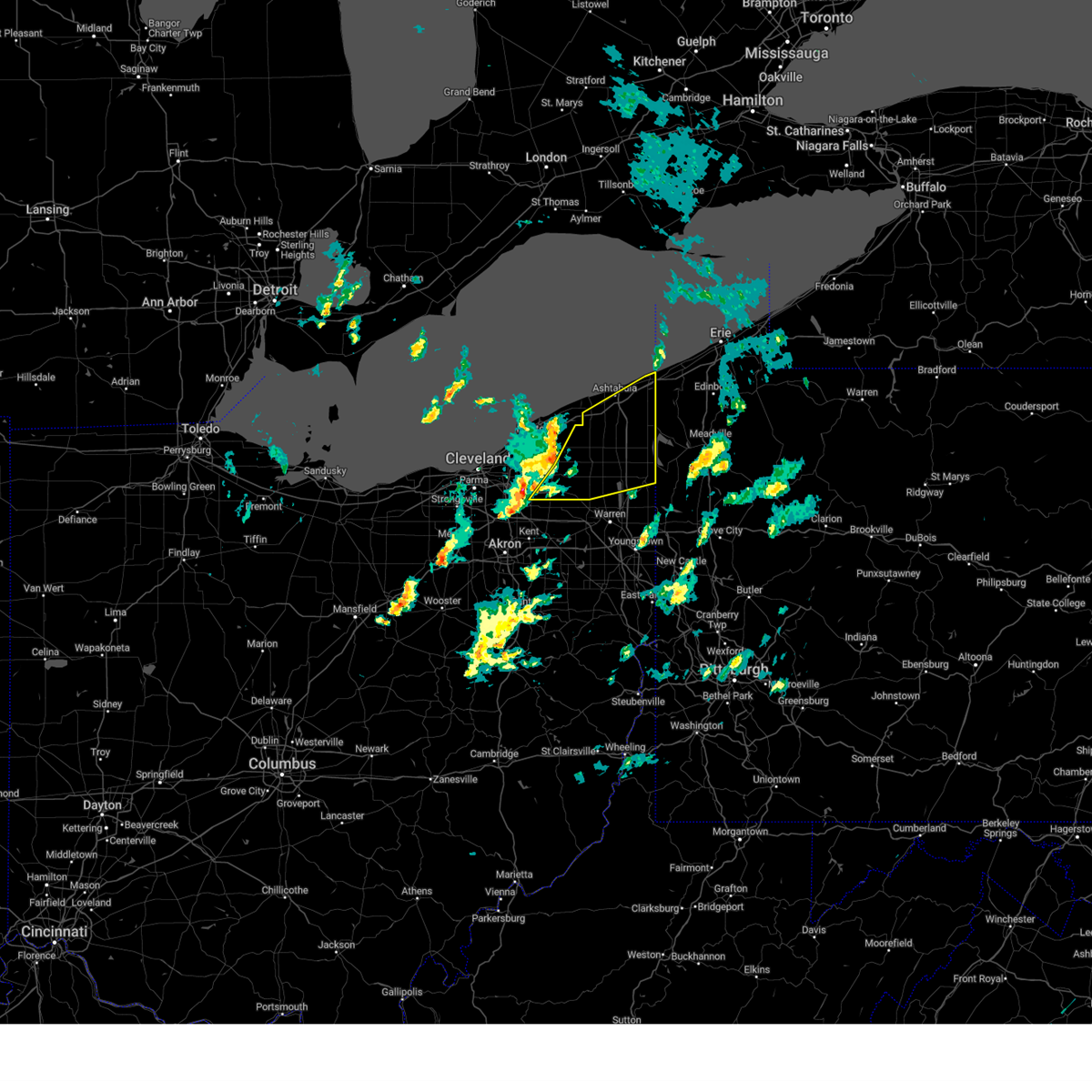 At 212 pm edt, severe thunderstorms were located along a line extending from near madison to near chardon to near twinsburg, moving northeast at 75 mph (radar indicated). Hazards include 70 mph wind gusts. Expect considerable tree damage. Damage is likely to mobile homes, roofs, and outbuildings. At 212 pm edt, severe thunderstorms were located along a line extending from near madison to near chardon to near twinsburg, moving northeast at 75 mph (radar indicated). Hazards include 70 mph wind gusts. Expect considerable tree damage. Damage is likely to mobile homes, roofs, and outbuildings.
|
| 7/25/2022 12:11 AM EDT |
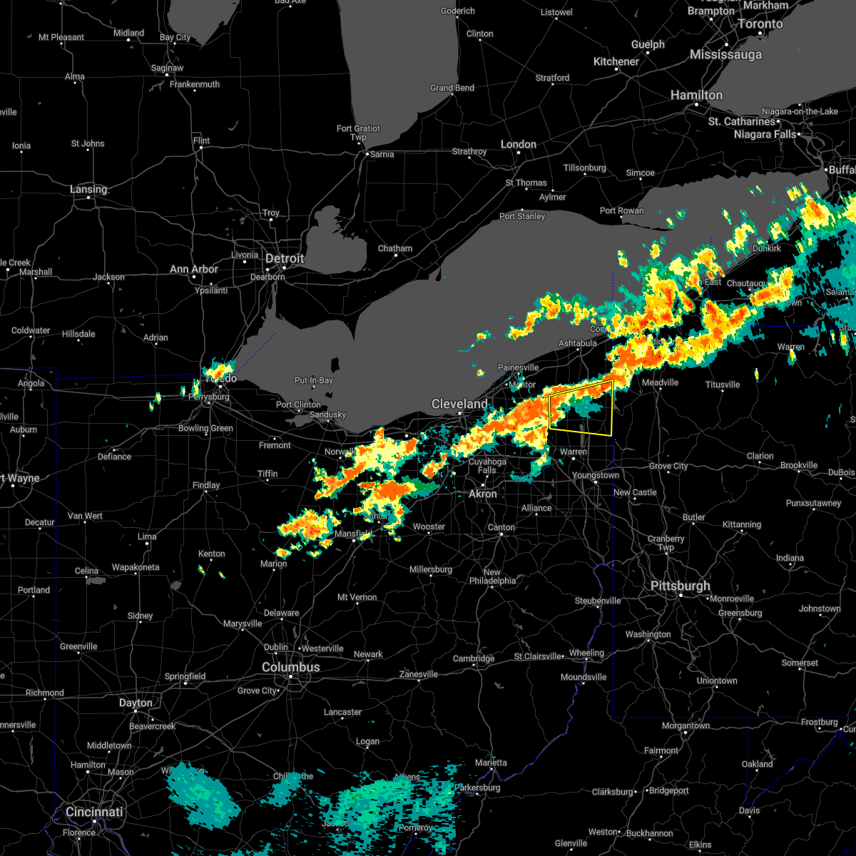 At 1210 am edt, severe thunderstorms were located along a line extending from 6 miles northeast of middlefield to burton, moving east at 45 mph (radar indicated). Hazards include 70 mph wind gusts. Expect considerable tree damage. Damage is likely to mobile homes, roofs, and outbuildings. At 1210 am edt, severe thunderstorms were located along a line extending from 6 miles northeast of middlefield to burton, moving east at 45 mph (radar indicated). Hazards include 70 mph wind gusts. Expect considerable tree damage. Damage is likely to mobile homes, roofs, and outbuildings.
|
| 6/16/2022 4:46 PM EDT |
 At 446 pm edt, a severe thunderstorm was located near adamsville, or 15 miles north of sharpsville, moving east at 40 mph (radar indicated). Hazards include golf ball size hail and 60 mph wind gusts. People and animals outdoors will be injured. expect hail damage to roofs, siding, windows, and vehicles. expect damage to trees and power lines. locations impacted include, kinsman, andover, linesville, harmonsburg, adamsville, pymatuning north, pymatuning central, atlantic, conneaut lake, jamestown, conneaut lakeshore, geneva and hartstown. thunderstorm damage threat, considerable hail threat, radar indicated max hail size, 1. 75 in wind threat, radar indicated max wind gust, 60 mph. At 446 pm edt, a severe thunderstorm was located near adamsville, or 15 miles north of sharpsville, moving east at 40 mph (radar indicated). Hazards include golf ball size hail and 60 mph wind gusts. People and animals outdoors will be injured. expect hail damage to roofs, siding, windows, and vehicles. expect damage to trees and power lines. locations impacted include, kinsman, andover, linesville, harmonsburg, adamsville, pymatuning north, pymatuning central, atlantic, conneaut lake, jamestown, conneaut lakeshore, geneva and hartstown. thunderstorm damage threat, considerable hail threat, radar indicated max hail size, 1. 75 in wind threat, radar indicated max wind gust, 60 mph.
|
| 6/16/2022 4:33 PM EDT | Numerous trees and wires down in the ne portion of trumbull county. time estimated from rada in trumbull county OH, 1.9 miles S of Kinsman Center, OH |
| 6/16/2022 4:18 PM EDT |
 At 417 pm edt, a severe thunderstorm was located near orwell, or 17 miles north of warren, moving east at 45 mph (radar indicated). Hazards include golf ball size hail and 60 mph wind gusts. People and animals outdoors will be injured. expect hail damage to roofs, siding, windows, and vehicles. Expect damage to trees and power lines. At 417 pm edt, a severe thunderstorm was located near orwell, or 17 miles north of warren, moving east at 45 mph (radar indicated). Hazards include golf ball size hail and 60 mph wind gusts. People and animals outdoors will be injured. expect hail damage to roofs, siding, windows, and vehicles. Expect damage to trees and power lines.
|
| 6/16/2022 3:33 PM EDT |
 At 333 pm edt, a severe thunderstorm was located over atlantic, or 14 miles southwest of meadville, moving east at 45 mph (radar indicated). Hazards include ping pong ball size hail and 60 mph wind gusts. People and animals outdoors will be injured. expect hail damage to roofs, siding, windows, and vehicles. expect damage to trees and power lines. locations impacted include, cortland, kinsman, north bloomfield, orwell, andover, mecca, johnston, cherry valley and orangeville. hail threat, radar indicated max hail size, 1. 50 in wind threat, radar indicated max wind gust, 60 mph. At 333 pm edt, a severe thunderstorm was located over atlantic, or 14 miles southwest of meadville, moving east at 45 mph (radar indicated). Hazards include ping pong ball size hail and 60 mph wind gusts. People and animals outdoors will be injured. expect hail damage to roofs, siding, windows, and vehicles. expect damage to trees and power lines. locations impacted include, cortland, kinsman, north bloomfield, orwell, andover, mecca, johnston, cherry valley and orangeville. hail threat, radar indicated max hail size, 1. 50 in wind threat, radar indicated max wind gust, 60 mph.
|
| 6/16/2022 3:12 PM EDT |
 At 312 pm edt, a severe thunderstorm was located near kinsman, or 19 miles northwest of sharpsville, moving east at 45 mph (radar indicated). Hazards include ping pong ball size hail and 60 mph wind gusts. People and animals outdoors will be injured. expect hail damage to roofs, siding, windows, and vehicles. expect damage to trees and power lines. locations impacted include, cortland, kinsman, north bloomfield, orwell, andover, mecca, johnston, roaming shores, cherry valley and orangeville. hail threat, radar indicated max hail size, 1. 50 in wind threat, radar indicated max wind gust, 60 mph. At 312 pm edt, a severe thunderstorm was located near kinsman, or 19 miles northwest of sharpsville, moving east at 45 mph (radar indicated). Hazards include ping pong ball size hail and 60 mph wind gusts. People and animals outdoors will be injured. expect hail damage to roofs, siding, windows, and vehicles. expect damage to trees and power lines. locations impacted include, cortland, kinsman, north bloomfield, orwell, andover, mecca, johnston, roaming shores, cherry valley and orangeville. hail threat, radar indicated max hail size, 1. 50 in wind threat, radar indicated max wind gust, 60 mph.
|
| 6/16/2022 2:50 PM EDT |
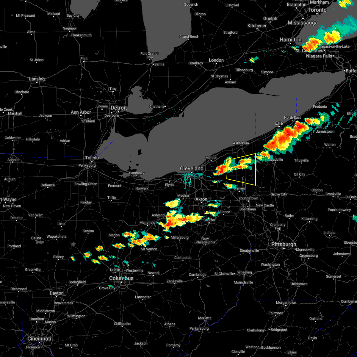 At 250 pm edt, a severe thunderstorm was located near middlefield, or 11 miles east of chardon, moving east at 45 mph (radar indicated). Hazards include ping pong ball size hail and 60 mph wind gusts. People and animals outdoors will be injured. expect hail damage to roofs, siding, windows, and vehicles. Expect damage to trees and power lines. At 250 pm edt, a severe thunderstorm was located near middlefield, or 11 miles east of chardon, moving east at 45 mph (radar indicated). Hazards include ping pong ball size hail and 60 mph wind gusts. People and animals outdoors will be injured. expect hail damage to roofs, siding, windows, and vehicles. Expect damage to trees and power lines.
|
| 6/1/2022 7:05 PM EDT |
 The severe thunderstorm warning for eastern trumbull county will expire at 715 pm edt, the storms which prompted the warning have moved out of the area. therefore, the warning will be allowed to expire. however heavy rain is still possible with these thunderstorms. a severe thunderstorm watch remains in effect until 1000 pm edt for northeastern ohio. The severe thunderstorm warning for eastern trumbull county will expire at 715 pm edt, the storms which prompted the warning have moved out of the area. therefore, the warning will be allowed to expire. however heavy rain is still possible with these thunderstorms. a severe thunderstorm watch remains in effect until 1000 pm edt for northeastern ohio.
|
| 6/1/2022 6:52 PM EDT |
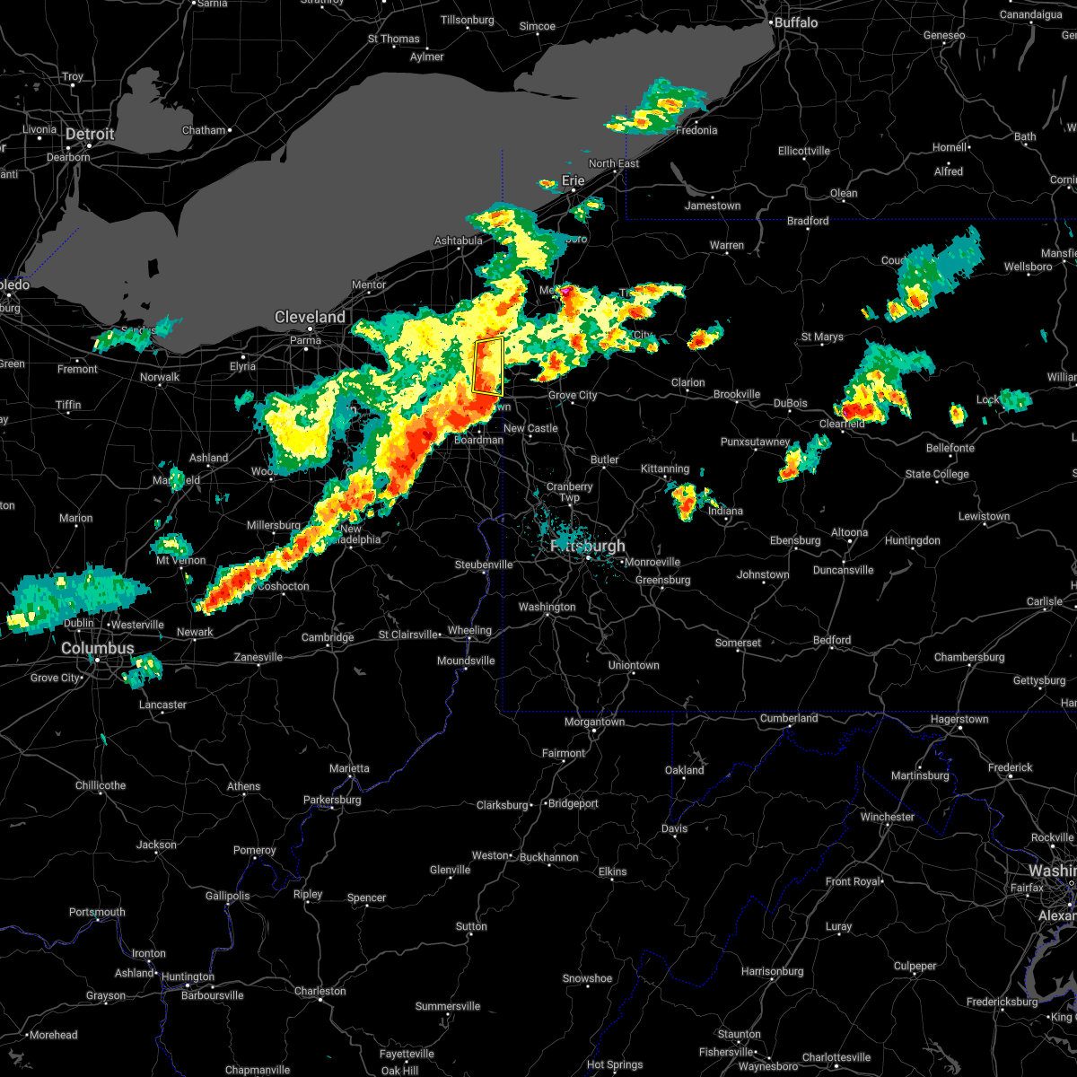 At 652 pm edt, severe thunderstorms were located along a line extending from near kinsman to near vienna center, moving east at 30 mph (radar indicated). Hazards include 60 mph wind gusts and penny size hail. Expect damage to trees and power lines. locations impacted include, vienna center, girard, vienna, johnston, orangeville, yankee lake, brookfield center and west hill. hail threat, radar indicated max hail size, 0. 75 in wind threat, radar indicated max wind gust, 60 mph. At 652 pm edt, severe thunderstorms were located along a line extending from near kinsman to near vienna center, moving east at 30 mph (radar indicated). Hazards include 60 mph wind gusts and penny size hail. Expect damage to trees and power lines. locations impacted include, vienna center, girard, vienna, johnston, orangeville, yankee lake, brookfield center and west hill. hail threat, radar indicated max hail size, 0. 75 in wind threat, radar indicated max wind gust, 60 mph.
|
| 6/1/2022 6:40 PM EDT |
 At 640 pm edt, severe thunderstorms were located along a line extending from 6 miles north of cortland to niles, moving east at 40 mph (radar indicated). Hazards include 60 mph wind gusts and quarter size hail. Minor damage to vehicles is possible. expect damage to trees and power lines. locations impacted include, warren, cortland, kinsman, vienna center, girard, vienna, mecca, johnston, orangeville, yankee lake, brookfield center, howland center, west hill and champion heights. hail threat, radar indicated max hail size, 1. 00 in wind threat, radar indicated max wind gust, 60 mph. At 640 pm edt, severe thunderstorms were located along a line extending from 6 miles north of cortland to niles, moving east at 40 mph (radar indicated). Hazards include 60 mph wind gusts and quarter size hail. Minor damage to vehicles is possible. expect damage to trees and power lines. locations impacted include, warren, cortland, kinsman, vienna center, girard, vienna, mecca, johnston, orangeville, yankee lake, brookfield center, howland center, west hill and champion heights. hail threat, radar indicated max hail size, 1. 00 in wind threat, radar indicated max wind gust, 60 mph.
|
| 6/1/2022 6:24 PM EDT |
 At 624 pm edt, a severe thunderstorm was located near garrettsville, or 12 miles northwest of warren, moving east at 30 mph (radar indicated). Hazards include 60 mph wind gusts and quarter size hail. Minor damage to vehicles is possible. expect damage to trees and power lines. locations impacted include, warren, cortland, kinsman, west farmington, bristolville, vienna center, leavittsburg, vienna, mecca, johnston, orangeville, yankee lake, brookfield center, howland center, west hill and champion heights. hail threat, radar indicated max hail size, 1. 00 in wind threat, radar indicated max wind gust, 60 mph. At 624 pm edt, a severe thunderstorm was located near garrettsville, or 12 miles northwest of warren, moving east at 30 mph (radar indicated). Hazards include 60 mph wind gusts and quarter size hail. Minor damage to vehicles is possible. expect damage to trees and power lines. locations impacted include, warren, cortland, kinsman, west farmington, bristolville, vienna center, leavittsburg, vienna, mecca, johnston, orangeville, yankee lake, brookfield center, howland center, west hill and champion heights. hail threat, radar indicated max hail size, 1. 00 in wind threat, radar indicated max wind gust, 60 mph.
|
| 6/1/2022 6:03 PM EDT |
 At 602 pm edt, a severe thunderstorm was located over garrettsville, or 13 miles northeast of ravenna, moving east at 30 mph (radar indicated). Hazards include 60 mph wind gusts and quarter size hail. Minor damage to vehicles is possible. Expect damage to trees and power lines. At 602 pm edt, a severe thunderstorm was located over garrettsville, or 13 miles northeast of ravenna, moving east at 30 mph (radar indicated). Hazards include 60 mph wind gusts and quarter size hail. Minor damage to vehicles is possible. Expect damage to trees and power lines.
|
| 6/1/2022 5:42 PM EDT |
 At 541 pm edt, a severe thunderstorm was located over kinsman, or 15 miles north of sharpsville, moving east at 30 mph (radar indicated). Hazards include 60 mph wind gusts and quarter size hail. Minor damage to vehicles is possible. expect damage to trees and power lines. locations impacted include, kinsman, adamsville, atlantic, pymatuning central, johnston, jamestown and hartstown. hail threat, radar indicated max hail size, 1. 00 in wind threat, radar indicated max wind gust, 60 mph. At 541 pm edt, a severe thunderstorm was located over kinsman, or 15 miles north of sharpsville, moving east at 30 mph (radar indicated). Hazards include 60 mph wind gusts and quarter size hail. Minor damage to vehicles is possible. expect damage to trees and power lines. locations impacted include, kinsman, adamsville, atlantic, pymatuning central, johnston, jamestown and hartstown. hail threat, radar indicated max hail size, 1. 00 in wind threat, radar indicated max wind gust, 60 mph.
|
| 6/1/2022 5:42 PM EDT |
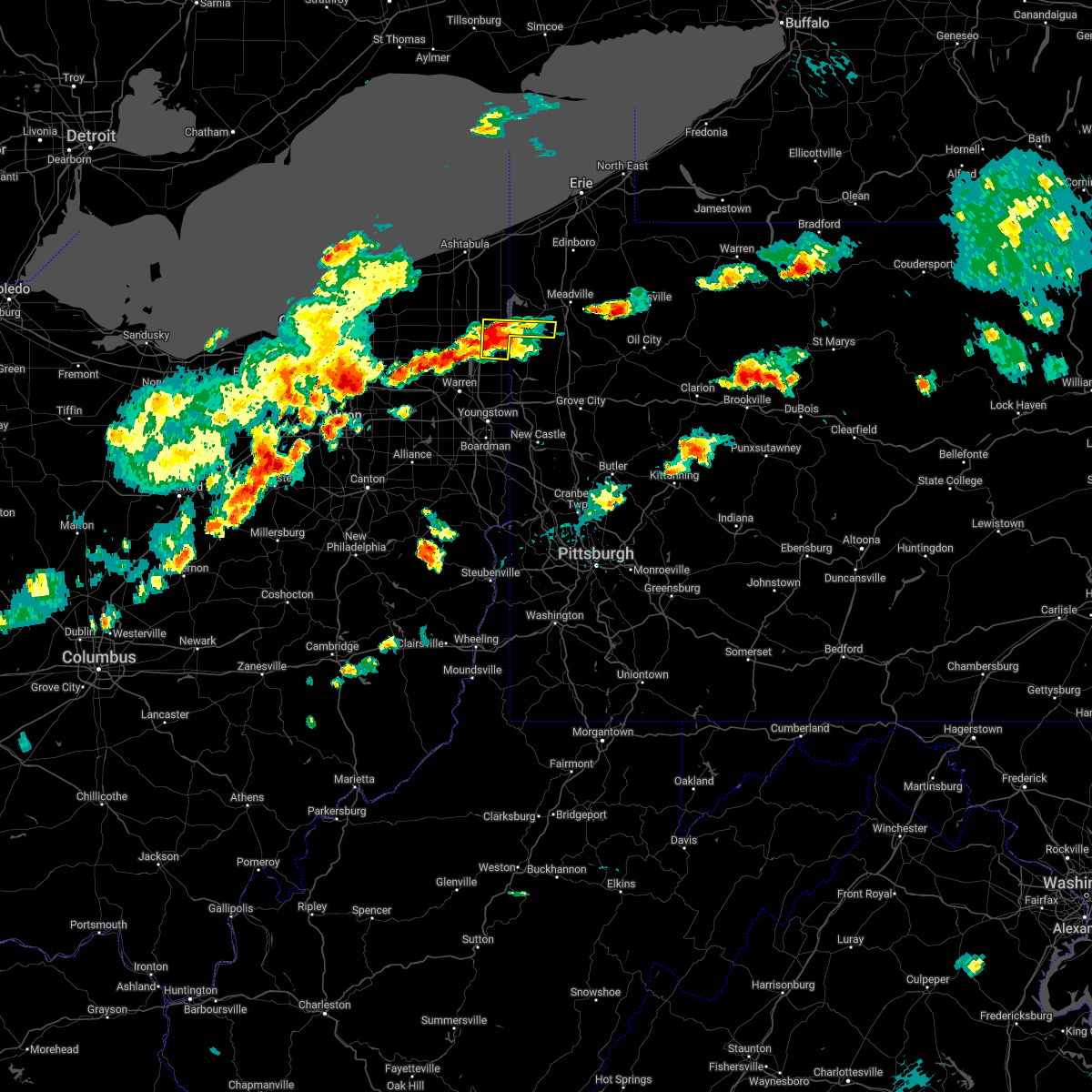 At 541 pm edt, a severe thunderstorm was located over kinsman, or 15 miles north of sharpsville, moving east at 30 mph (radar indicated). Hazards include 60 mph wind gusts and quarter size hail. Minor damage to vehicles is possible. expect damage to trees and power lines. locations impacted include, kinsman, adamsville, atlantic, pymatuning central, johnston, jamestown and hartstown. hail threat, radar indicated max hail size, 1. 00 in wind threat, radar indicated max wind gust, 60 mph. At 541 pm edt, a severe thunderstorm was located over kinsman, or 15 miles north of sharpsville, moving east at 30 mph (radar indicated). Hazards include 60 mph wind gusts and quarter size hail. Minor damage to vehicles is possible. expect damage to trees and power lines. locations impacted include, kinsman, adamsville, atlantic, pymatuning central, johnston, jamestown and hartstown. hail threat, radar indicated max hail size, 1. 00 in wind threat, radar indicated max wind gust, 60 mph.
|
| 6/1/2022 5:10 PM EDT |
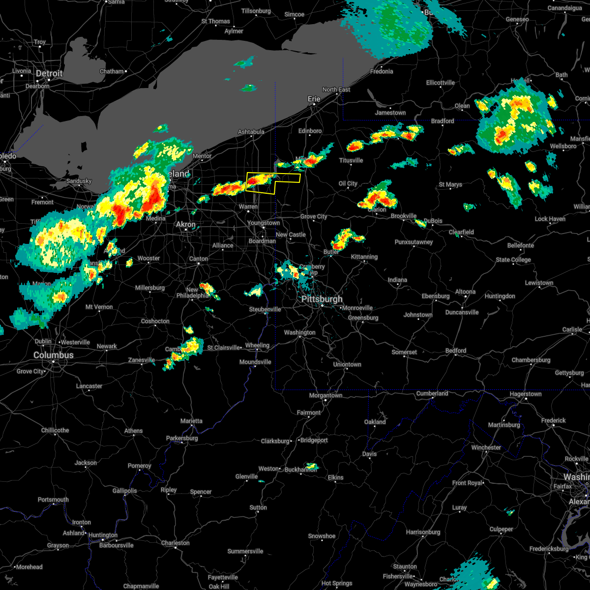 The national weather service in cleveland has issued a * severe thunderstorm warning for. northeastern trumbull county in northeastern ohio. southeastern ashtabula county in northeastern ohio. southwestern crawford county in northwestern pennsylvania. Until 600 pm edt. The national weather service in cleveland has issued a * severe thunderstorm warning for. northeastern trumbull county in northeastern ohio. southeastern ashtabula county in northeastern ohio. southwestern crawford county in northwestern pennsylvania. Until 600 pm edt.
|
| 6/1/2022 5:10 PM EDT |
 At 510 pm edt, a severe thunderstorm was located near kinsman, or 17 miles north of warren, moving east at 35 mph (radar indicated). Hazards include 60 mph wind gusts and quarter size hail. Minor damage to vehicles is possible. Expect damage to trees and power lines. At 510 pm edt, a severe thunderstorm was located near kinsman, or 17 miles north of warren, moving east at 35 mph (radar indicated). Hazards include 60 mph wind gusts and quarter size hail. Minor damage to vehicles is possible. Expect damage to trees and power lines.
|
| 12/11/2021 11:43 AM EST | Tree down. time estimated from rada in trumbull county OH, 0.3 miles NE of Kinsman Center, OH |
| 10/21/2021 6:32 PM EDT |
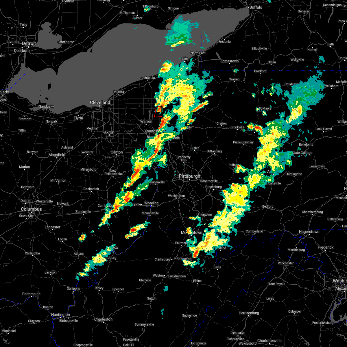 At 632 pm edt, a severe thunderstorm capable of producing a tornado was located near kinsman, or 10 miles north of sharpsville, moving east at 35 mph (radar indicated rotation). Hazards include tornado. Flying debris will be dangerous to those caught without shelter. mobile homes will be damaged or destroyed. damage to roofs, windows, and vehicles will occur. tree damage is likely. This tornadic thunderstorm will remain over mainly rural areas of northeastern trumbull county. At 632 pm edt, a severe thunderstorm capable of producing a tornado was located near kinsman, or 10 miles north of sharpsville, moving east at 35 mph (radar indicated rotation). Hazards include tornado. Flying debris will be dangerous to those caught without shelter. mobile homes will be damaged or destroyed. damage to roofs, windows, and vehicles will occur. tree damage is likely. This tornadic thunderstorm will remain over mainly rural areas of northeastern trumbull county.
|
| 10/21/2021 6:18 PM EDT |
 At 618 pm edt, a severe thunderstorm capable of producing a tornado was located near cortland, or 11 miles northeast of warren, moving east at 35 mph (radar indicated rotation). Hazards include tornado. Flying debris will be dangerous to those caught without shelter. mobile homes will be damaged or destroyed. damage to roofs, windows, and vehicles will occur. tree damage is likely. this dangerous storm will be near, kinsman around 630 pm edt. Other locations impacted by this tornadic thunderstorm include mecca and johnston. At 618 pm edt, a severe thunderstorm capable of producing a tornado was located near cortland, or 11 miles northeast of warren, moving east at 35 mph (radar indicated rotation). Hazards include tornado. Flying debris will be dangerous to those caught without shelter. mobile homes will be damaged or destroyed. damage to roofs, windows, and vehicles will occur. tree damage is likely. this dangerous storm will be near, kinsman around 630 pm edt. Other locations impacted by this tornadic thunderstorm include mecca and johnston.
|
| 9/22/2021 4:19 PM EDT |
 At 419 pm edt, a severe thunderstorm was located over north bloomfield, or 13 miles north of warren, moving northeast at 30 mph (radar indicated). Hazards include 60 mph wind gusts. Expect damage to trees and power lines. Locations impacted include, kinsman, north bloomfield, orwell, west farmington, bristolville, mecca and roaming shores. At 419 pm edt, a severe thunderstorm was located over north bloomfield, or 13 miles north of warren, moving northeast at 30 mph (radar indicated). Hazards include 60 mph wind gusts. Expect damage to trees and power lines. Locations impacted include, kinsman, north bloomfield, orwell, west farmington, bristolville, mecca and roaming shores.
|
| 9/22/2021 3:58 PM EDT |
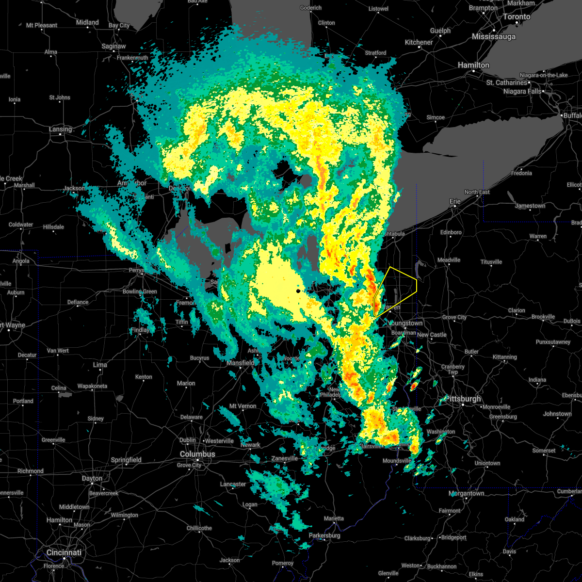 At 357 pm edt, a severe thunderstorm was located near leavittsburg, or 7 miles northwest of warren, moving northeast at 30 mph (radar indicated). Hazards include 60 mph wind gusts. expect damage to trees and power lines At 357 pm edt, a severe thunderstorm was located near leavittsburg, or 7 miles northwest of warren, moving northeast at 30 mph (radar indicated). Hazards include 60 mph wind gusts. expect damage to trees and power lines
|
| 8/12/2021 11:19 AM EDT |
 At 1119 am edt, severe thunderstorms were located along a line extending from kinsman to 6 miles northwest of sharpsville to near vienna center, moving east at 50 mph (radar indicated). Hazards include 60 mph wind gusts. Expect damage to trees and power lines. locations impacted include, warren, niles, hubbard, cortland, lordstown, kinsman, vienna center, girard, vienna, johnston, orangeville, yankee lake, brookfield center, churchill, howland center, bolindale and west hill. hail threat, radar indicated max hail size, <. 75 in wind threat, radar indicated max wind gust, 60 mph. At 1119 am edt, severe thunderstorms were located along a line extending from kinsman to 6 miles northwest of sharpsville to near vienna center, moving east at 50 mph (radar indicated). Hazards include 60 mph wind gusts. Expect damage to trees and power lines. locations impacted include, warren, niles, hubbard, cortland, lordstown, kinsman, vienna center, girard, vienna, johnston, orangeville, yankee lake, brookfield center, churchill, howland center, bolindale and west hill. hail threat, radar indicated max hail size, <. 75 in wind threat, radar indicated max wind gust, 60 mph.
|
| 8/12/2021 11:01 AM EDT |
 At 1101 am edt, severe thunderstorms were located along a line extending from near north bloomfield to near bristolville to near newton falls, moving east at 50 mph (radar indicated). Hazards include 70 mph wind gusts. Expect considerable tree damage. Damage is likely to mobile homes, roofs, and outbuildings. At 1101 am edt, severe thunderstorms were located along a line extending from near north bloomfield to near bristolville to near newton falls, moving east at 50 mph (radar indicated). Hazards include 70 mph wind gusts. Expect considerable tree damage. Damage is likely to mobile homes, roofs, and outbuildings.
|
| 8/11/2021 6:50 PM EDT |
 The severe thunderstorm warning for northern trumbull and eastern ashtabula counties will expire at 700 pm edt, the storm which prompted the warning has moved out of the area. therefore, the warning will be allowed to expire. a severe thunderstorm watch remains in effect until 900 pm edt for northeastern ohio. The severe thunderstorm warning for northern trumbull and eastern ashtabula counties will expire at 700 pm edt, the storm which prompted the warning has moved out of the area. therefore, the warning will be allowed to expire. a severe thunderstorm watch remains in effect until 900 pm edt for northeastern ohio.
|
| 8/11/2021 6:36 PM EDT |
 At 636 pm edt, a severe thunderstorm was located near pymatuning north, or 15 miles south of conneaut, moving east at 35 mph (radar indicated). Hazards include 70 mph wind gusts and penny size hail. Expect considerable tree damage. damage is likely to mobile homes, roofs, and outbuildings. locations impacted include, conneaut, cortland, kinsman, north bloomfield, orwell, andover, west farmington, bristolville, mecca, johnston, roaming shores, pierpont, cherry valley, orangeville, kelloggsville and champion heights. thunderstorm damage threat, considerable hail threat, radar indicated max hail size, 0. 75 in wind threat, radar indicated max wind gust, 70 mph. At 636 pm edt, a severe thunderstorm was located near pymatuning north, or 15 miles south of conneaut, moving east at 35 mph (radar indicated). Hazards include 70 mph wind gusts and penny size hail. Expect considerable tree damage. damage is likely to mobile homes, roofs, and outbuildings. locations impacted include, conneaut, cortland, kinsman, north bloomfield, orwell, andover, west farmington, bristolville, mecca, johnston, roaming shores, pierpont, cherry valley, orangeville, kelloggsville and champion heights. thunderstorm damage threat, considerable hail threat, radar indicated max hail size, 0. 75 in wind threat, radar indicated max wind gust, 70 mph.
|
| 8/11/2021 6:23 PM EDT | Numerous trees and powerlines down across kinsman townshi in trumbull county OH, 0.3 miles NW of Kinsman Center, OH |
| 8/11/2021 6:16 PM EDT |
 At 616 pm edt, a severe thunderstorm was located 9 miles northwest of andover, or 15 miles south of ashtabula, moving east at 35 mph (radar indicated). Hazards include 70 mph wind gusts and penny size hail. Expect considerable tree damage. damage is likely to mobile homes, roofs, and outbuildings. locations impacted include, ashtabula, conneaut, chardon, cortland, geneva, north kingsville, middlefield, garrettsville, kinsman, north bloomfield, orwell, burton, andover, mantua, west farmington, bristolville, parkman, huntsburg, claridon and mecca. thunderstorm damage threat, considerable hail threat, radar indicated max hail size, 0. 75 in wind threat, radar indicated max wind gust, 70 mph. At 616 pm edt, a severe thunderstorm was located 9 miles northwest of andover, or 15 miles south of ashtabula, moving east at 35 mph (radar indicated). Hazards include 70 mph wind gusts and penny size hail. Expect considerable tree damage. damage is likely to mobile homes, roofs, and outbuildings. locations impacted include, ashtabula, conneaut, chardon, cortland, geneva, north kingsville, middlefield, garrettsville, kinsman, north bloomfield, orwell, burton, andover, mantua, west farmington, bristolville, parkman, huntsburg, claridon and mecca. thunderstorm damage threat, considerable hail threat, radar indicated max hail size, 0. 75 in wind threat, radar indicated max wind gust, 70 mph.
|
| 8/11/2021 5:41 PM EDT |
 At 541 pm edt, a severe thunderstorm was located near chardon, moving east at 35 mph (radar indicated). Hazards include 70 mph wind gusts and penny size hail. Expect considerable tree damage. Damage is likely to mobile homes, roofs, and outbuildings. At 541 pm edt, a severe thunderstorm was located near chardon, moving east at 35 mph (radar indicated). Hazards include 70 mph wind gusts and penny size hail. Expect considerable tree damage. Damage is likely to mobile homes, roofs, and outbuildings.
|
| 7/8/2021 3:50 PM EDT |
 At 349 pm edt, a severe thunderstorm was located near pymatuning central, or 19 miles north of sharpsville, moving east at 40 mph (radar indicated). Hazards include 70 mph wind gusts. Expect considerable tree damage. damage is likely to mobile homes, roofs, and outbuildings. Locations impacted include, kinsman, andover, johnston and cherry valley. At 349 pm edt, a severe thunderstorm was located near pymatuning central, or 19 miles north of sharpsville, moving east at 40 mph (radar indicated). Hazards include 70 mph wind gusts. Expect considerable tree damage. damage is likely to mobile homes, roofs, and outbuildings. Locations impacted include, kinsman, andover, johnston and cherry valley.
|
| 7/8/2021 3:30 PM EDT |
 At 330 pm edt, a severe thunderstorm was located near orwell, or 17 miles north of warren, moving east at 35 mph (radar indicated). Hazards include 60 mph wind gusts. Expect damage to trees and power lines. Locations impacted include, cortland, kinsman, north bloomfield, orwell, andover, west farmington, bristolville, mecca, johnston and cherry valley. At 330 pm edt, a severe thunderstorm was located near orwell, or 17 miles north of warren, moving east at 35 mph (radar indicated). Hazards include 60 mph wind gusts. Expect damage to trees and power lines. Locations impacted include, cortland, kinsman, north bloomfield, orwell, andover, west farmington, bristolville, mecca, johnston and cherry valley.
|
| 7/8/2021 3:11 PM EDT |
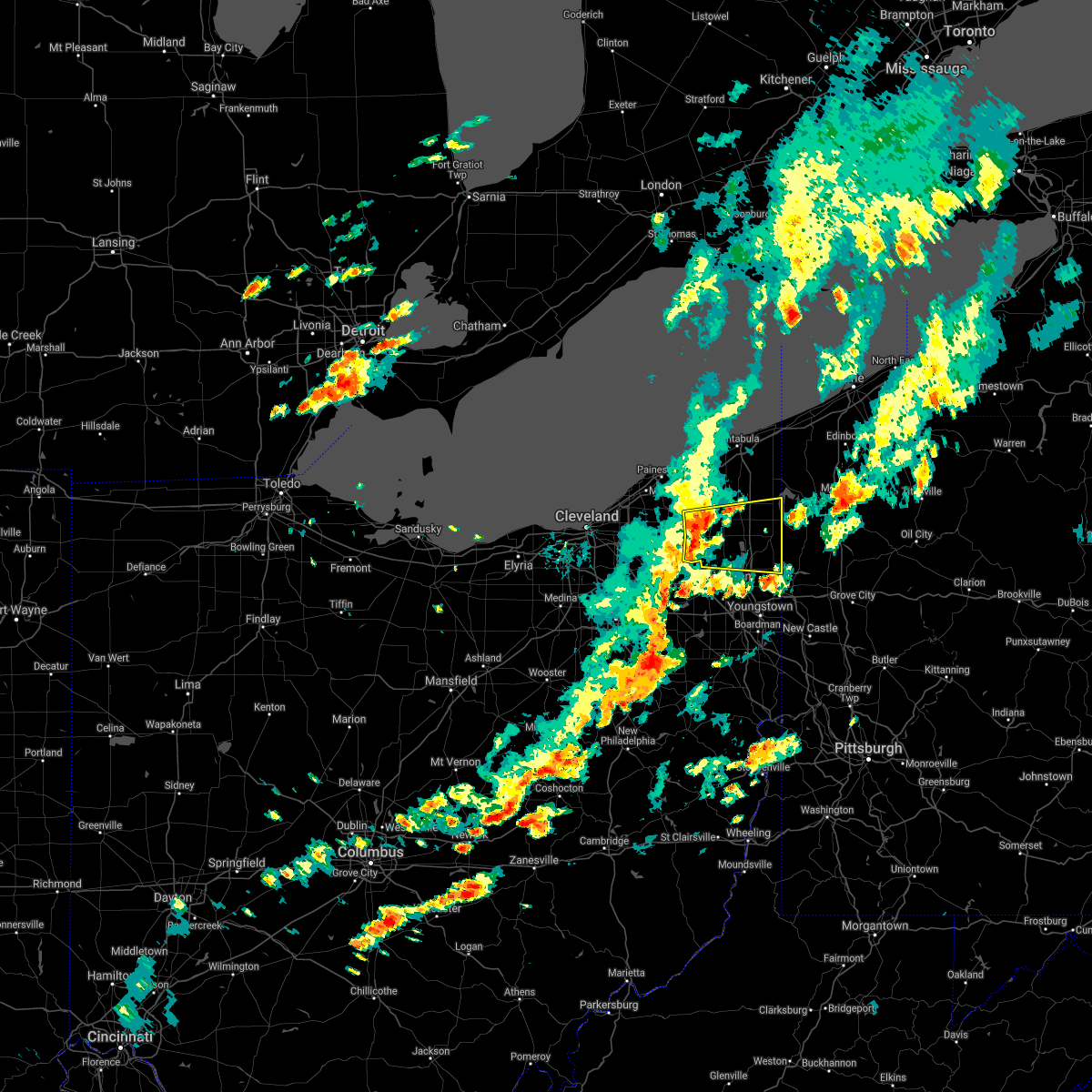 At 311 pm edt, a severe thunderstorm was located near north bloomfield, or 15 miles northwest of warren, moving east at 40 mph (radar indicated). Hazards include 60 mph wind gusts. expect damage to trees and power lines At 311 pm edt, a severe thunderstorm was located near north bloomfield, or 15 miles northwest of warren, moving east at 40 mph (radar indicated). Hazards include 60 mph wind gusts. expect damage to trees and power lines
|
| 6/21/2021 12:48 PM EDT |
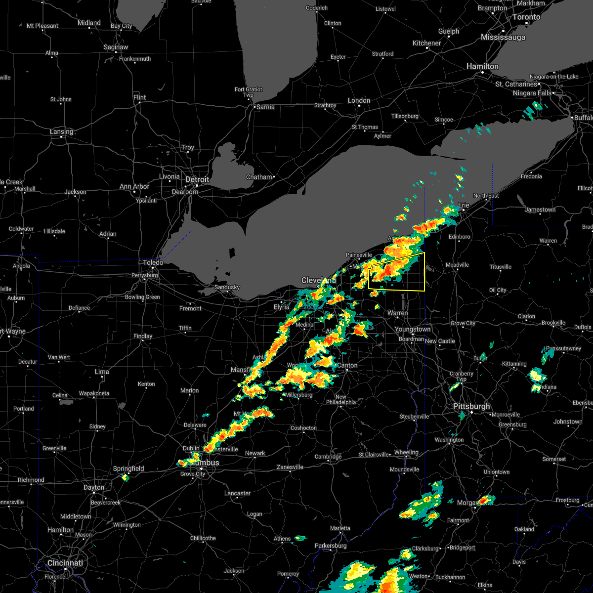 At 1248 pm edt, a severe thunderstorm was located 7 miles northwest of orwell, or 12 miles east of chardon, moving east at 35 mph (radar indicated). Hazards include 60 mph wind gusts and quarter size hail. Minor damage to vehicles is possible. Expect damage to trees and power lines. At 1248 pm edt, a severe thunderstorm was located 7 miles northwest of orwell, or 12 miles east of chardon, moving east at 35 mph (radar indicated). Hazards include 60 mph wind gusts and quarter size hail. Minor damage to vehicles is possible. Expect damage to trees and power lines.
|
| 6/21/2021 7:34 AM EDT |
 At 733 am edt, severe thunderstorms were located along a line extending from near pymatuning central to vienna center, moving east at 55 mph (radar indicated). Hazards include 60 mph wind gusts and quarter size hail. Minor damage to vehicles is possible. expect damage to trees and power lines. Locations impacted include, warren, niles, cortland, newton falls, lordstown, kinsman, andover, vienna center, leavittsburg, girard, vienna, mecca, johnston, orangeville, yankee lake, brookfield center, howland center, bolindale, west hill and champion heights. At 733 am edt, severe thunderstorms were located along a line extending from near pymatuning central to vienna center, moving east at 55 mph (radar indicated). Hazards include 60 mph wind gusts and quarter size hail. Minor damage to vehicles is possible. expect damage to trees and power lines. Locations impacted include, warren, niles, cortland, newton falls, lordstown, kinsman, andover, vienna center, leavittsburg, girard, vienna, mecca, johnston, orangeville, yankee lake, brookfield center, howland center, bolindale, west hill and champion heights.
|
| 6/21/2021 7:20 AM EDT |
 At 720 am edt, severe thunderstorms were located along a line extending from conneaut to 7 miles northwest of pymatuning north to near kinsman, moving east at 60 mph (radar indicated). Hazards include 60 mph wind gusts and quarter size hail. Minor damage to vehicles is possible. expect damage to trees and power lines. Locations impacted include, warren, conneaut, niles, cortland, newton falls, lordstown, north kingsville, kinsman, north bloomfield, orwell, andover, west farmington, vienna center, bristolville, leavittsburg, girard, vienna, mecca, johnston and kingsville. At 720 am edt, severe thunderstorms were located along a line extending from conneaut to 7 miles northwest of pymatuning north to near kinsman, moving east at 60 mph (radar indicated). Hazards include 60 mph wind gusts and quarter size hail. Minor damage to vehicles is possible. expect damage to trees and power lines. Locations impacted include, warren, conneaut, niles, cortland, newton falls, lordstown, north kingsville, kinsman, north bloomfield, orwell, andover, west farmington, vienna center, bristolville, leavittsburg, girard, vienna, mecca, johnston and kingsville.
|
| 6/21/2021 6:51 AM EDT |
 At 650 am edt, severe thunderstorms were located along a line extending from near madison to 8 miles east of chardon to 6 miles north of mantua, moving northeast at 50 mph (radar indicated). Hazards include 60 mph wind gusts and quarter size hail. Minor damage to vehicles is possible. Expect damage to trees and power lines. At 650 am edt, severe thunderstorms were located along a line extending from near madison to 8 miles east of chardon to 6 miles north of mantua, moving northeast at 50 mph (radar indicated). Hazards include 60 mph wind gusts and quarter size hail. Minor damage to vehicles is possible. Expect damage to trees and power lines.
|
| 11/15/2020 2:03 PM EST |
 At 203 pm est, severe thunderstorms were located along a line extending from near ashtabula to near sebring, moving northeast at 60 mph (radar indicated). Hazards include 70 mph wind gusts. Expect considerable tree damage. damage is likely to mobile homes, roofs, and outbuildings. Locations impacted include, erie, youngstown, warren, meadville, conneaut, salem, columbiana, boardman, niles, campbell, hubbard, canfield, cortland, corry, edinboro, titusville, north east, lordstown, union city and north kingsville. At 203 pm est, severe thunderstorms were located along a line extending from near ashtabula to near sebring, moving northeast at 60 mph (radar indicated). Hazards include 70 mph wind gusts. Expect considerable tree damage. damage is likely to mobile homes, roofs, and outbuildings. Locations impacted include, erie, youngstown, warren, meadville, conneaut, salem, columbiana, boardman, niles, campbell, hubbard, canfield, cortland, corry, edinboro, titusville, north east, lordstown, union city and north kingsville.
|
| 11/15/2020 1:50 PM EST |
 At 150 pm est, severe thunderstorms were located along a line extending from geneva-on-the-lake to near louisville, moving east at 60 mph (radar indicated). Hazards include 70 mph wind gusts. Expect considerable tree damage. damage is likely to mobile homes, roofs, and outbuildings. Locations impacted include, erie, youngstown, warren, ashtabula, meadville, conneaut, salem, columbiana, geneva-on-the-lake, boardman, niles, campbell, hubbard, canfield, cortland, corry, edinboro, titusville, newton falls and sebring. At 150 pm est, severe thunderstorms were located along a line extending from geneva-on-the-lake to near louisville, moving east at 60 mph (radar indicated). Hazards include 70 mph wind gusts. Expect considerable tree damage. damage is likely to mobile homes, roofs, and outbuildings. Locations impacted include, erie, youngstown, warren, ashtabula, meadville, conneaut, salem, columbiana, geneva-on-the-lake, boardman, niles, campbell, hubbard, canfield, cortland, corry, edinboro, titusville, newton falls and sebring.
|
| 11/15/2020 1:32 PM EST |
 At 132 pm est, severe thunderstorms were located along a line extending from painesville to near strasburg, moving northeast at 60 mph (radar indicated). Hazards include 70 mph wind gusts. Expect considerable tree damage. Damage is likely to mobile homes, roofs, and outbuildings. At 132 pm est, severe thunderstorms were located along a line extending from painesville to near strasburg, moving northeast at 60 mph (radar indicated). Hazards include 70 mph wind gusts. Expect considerable tree damage. Damage is likely to mobile homes, roofs, and outbuildings.
|
| 7/10/2020 6:10 PM EDT |
 At 610 pm edt, a severe thunderstorm was located near cortland, or 10 miles north of warren, moving northeast at 30 mph (radar indicated). Hazards include 60 mph wind gusts. Expect damage to trees and power lines. Locations impacted include, warren, niles, cortland, kinsman, north bloomfield, bristolville, vienna center, leavittsburg, girard, vienna, mcdonald, mecca, johnston, churchill, howland center, bolindale and champion heights. At 610 pm edt, a severe thunderstorm was located near cortland, or 10 miles north of warren, moving northeast at 30 mph (radar indicated). Hazards include 60 mph wind gusts. Expect damage to trees and power lines. Locations impacted include, warren, niles, cortland, kinsman, north bloomfield, bristolville, vienna center, leavittsburg, girard, vienna, mcdonald, mecca, johnston, churchill, howland center, bolindale and champion heights.
|
| 7/10/2020 5:54 PM EDT |
 At 554 pm edt, a severe thunderstorm was located near leavittsburg, or near warren, moving northeast at 30 mph (radar indicated). Hazards include 60 mph wind gusts. expect damage to trees and power lines At 554 pm edt, a severe thunderstorm was located near leavittsburg, or near warren, moving northeast at 30 mph (radar indicated). Hazards include 60 mph wind gusts. expect damage to trees and power lines
|
| 7/10/2020 1:31 PM EDT |
 At 131 pm edt, a severe thunderstorm was located over vienna center, or 8 miles northwest of sharon, moving north at 5 mph (radar indicated). Hazards include 60 mph wind gusts and quarter size hail. Minor damage to vehicles is possible. Expect damage to trees and power lines. At 131 pm edt, a severe thunderstorm was located over vienna center, or 8 miles northwest of sharon, moving north at 5 mph (radar indicated). Hazards include 60 mph wind gusts and quarter size hail. Minor damage to vehicles is possible. Expect damage to trees and power lines.
|
| 6/10/2020 9:44 PM EDT |
 At 944 pm edt, severe thunderstorms were located along a line extending from near andover to near greenville, moving northeast at 35 mph (radar indicated). Hazards include 60 mph wind gusts and penny size hail. expect damage to trees and power lines At 944 pm edt, severe thunderstorms were located along a line extending from near andover to near greenville, moving northeast at 35 mph (radar indicated). Hazards include 60 mph wind gusts and penny size hail. expect damage to trees and power lines
|
| 6/10/2020 9:38 PM EDT | Corrects previous tstm wnd dmg report from 8 nnw orangeville. numerous trees down north of route 305. corrected am to pm and changed sourc in trumbull county OH, 0.9 miles NNE of Kinsman Center, OH |
| 6/10/2020 9:23 PM EDT |
 At 923 pm edt, severe thunderstorms were located along a line extending from north kingsville to near hilltop, moving east at 45 mph (radar indicated). Hazards include 60 mph wind gusts and penny size hail. Expect damage to trees and power lines. Locations impacted include, youngstown, warren, ashtabula, conneaut, geneva-on-the-lake, niles, hubbard, cortland, geneva, newton falls, lordstown, north kingsville, kinsman, north bloomfield, orwell, andover, west farmington, vienna center, hilltop and maplewood park. At 923 pm edt, severe thunderstorms were located along a line extending from north kingsville to near hilltop, moving east at 45 mph (radar indicated). Hazards include 60 mph wind gusts and penny size hail. Expect damage to trees and power lines. Locations impacted include, youngstown, warren, ashtabula, conneaut, geneva-on-the-lake, niles, hubbard, cortland, geneva, newton falls, lordstown, north kingsville, kinsman, north bloomfield, orwell, andover, west farmington, vienna center, hilltop and maplewood park.
|
| 6/10/2020 8:59 PM EDT |
 The national weather service in cleveland has issued a * severe thunderstorm warning for. trumbull county in northeastern ohio. central portage county in northeastern ohio. geauga county in northeastern ohio. Northeastern lake county in northeastern ohio. The national weather service in cleveland has issued a * severe thunderstorm warning for. trumbull county in northeastern ohio. central portage county in northeastern ohio. geauga county in northeastern ohio. Northeastern lake county in northeastern ohio.
|
| 6/10/2020 9:38 AM EDT | Numerous trees down north of route 30 in trumbull county OH, 0.9 miles NNE of Kinsman Center, OH |
| 5/29/2020 2:51 PM EDT |
 The severe thunderstorm warning for northern trumbull county will expire at 300 pm edt, the storm which prompted the warning has weakened below severe limits, and has exited the warned area. therefore, the warning will be allowed to expire. The severe thunderstorm warning for northern trumbull county will expire at 300 pm edt, the storm which prompted the warning has weakened below severe limits, and has exited the warned area. therefore, the warning will be allowed to expire.
|
| 5/29/2020 2:38 PM EDT | One tree dow in trumbull county OH, 0.9 miles NNE of Kinsman Center, OH |
| 5/29/2020 2:29 PM EDT |
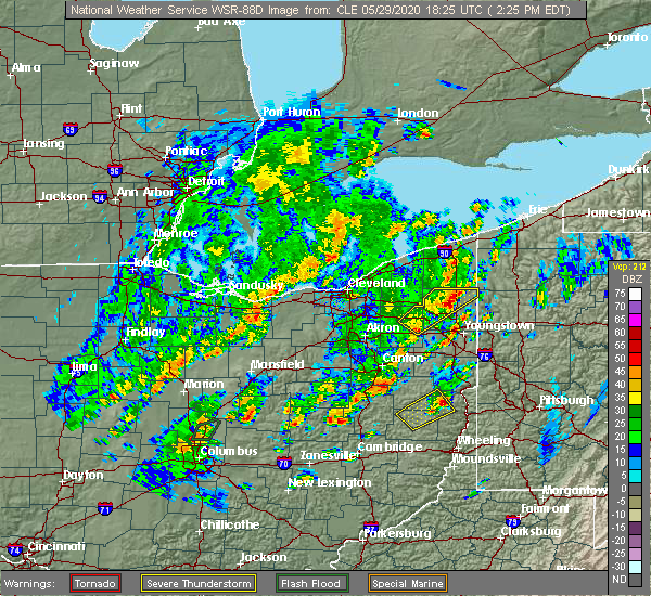 At 228 pm edt, a severe thunderstorm was located near cortland, or 11 miles north of warren, moving northeast at 55 mph (radar indicated). Hazards include 60 mph wind gusts and quarter size hail. Minor damage to vehicles is possible. expect damage to trees and power lines. Locations impacted include, cortland, kinsman, north bloomfield, west farmington, bristolville, mecca and johnston. At 228 pm edt, a severe thunderstorm was located near cortland, or 11 miles north of warren, moving northeast at 55 mph (radar indicated). Hazards include 60 mph wind gusts and quarter size hail. Minor damage to vehicles is possible. expect damage to trees and power lines. Locations impacted include, cortland, kinsman, north bloomfield, west farmington, bristolville, mecca and johnston.
|
| 5/29/2020 2:08 PM EDT |
 At 208 pm edt, a severe thunderstorm was located near garrettsville, or 10 miles northeast of ravenna, moving northeast at 40 mph (radar indicated). Hazards include 60 mph wind gusts and quarter size hail. Minor damage to vehicles is possible. Expect damage to trees and power lines. At 208 pm edt, a severe thunderstorm was located near garrettsville, or 10 miles northeast of ravenna, moving northeast at 40 mph (radar indicated). Hazards include 60 mph wind gusts and quarter size hail. Minor damage to vehicles is possible. Expect damage to trees and power lines.
|
| 4/8/2020 12:11 AM EDT |
 At 1211 am edt, severe thunderstorms were located along a line extending from near sharpsville to near hartville, moving southeast at 40 mph (radar indicated). Hazards include 70 mph wind gusts and quarter size hail. Minor damage to vehicles is possible. expect considerable tree damage. Wind damage is also likely to mobile homes, roofs, and outbuildings. At 1211 am edt, severe thunderstorms were located along a line extending from near sharpsville to near hartville, moving southeast at 40 mph (radar indicated). Hazards include 70 mph wind gusts and quarter size hail. Minor damage to vehicles is possible. expect considerable tree damage. Wind damage is also likely to mobile homes, roofs, and outbuildings.
|
| 4/7/2020 11:52 PM EDT |
 At 1152 pm edt, severe thunderstorms were located along a line extending from jamestown west to linesville, moving east at 100 mph (radar indicated). Hazards include 60 mph wind gusts and quarter size hail. Minor damage to vehicles is possible. expect damage to trees and power lines. Locations impacted include, warren, meadville, ravenna, chardon, kent, solon, hudson, niles, twinsburg, tallmadge, streetsboro, macedonia, cortland, newton falls, south russell, lordstown, middlefield, garrettsville, kinsman and north bloomfield. At 1152 pm edt, severe thunderstorms were located along a line extending from jamestown west to linesville, moving east at 100 mph (radar indicated). Hazards include 60 mph wind gusts and quarter size hail. Minor damage to vehicles is possible. expect damage to trees and power lines. Locations impacted include, warren, meadville, ravenna, chardon, kent, solon, hudson, niles, twinsburg, tallmadge, streetsboro, macedonia, cortland, newton falls, south russell, lordstown, middlefield, garrettsville, kinsman and north bloomfield.
|
| 4/7/2020 11:12 PM EDT |
 At 1112 pm edt, severe thunderstorms were located along a line extending from 11 miles north of conneaut to 9 miles northwest of euclid, moving southeast at 60 mph (radar indicated). Hazards include 60 mph wind gusts and quarter size hail. Minor damage to vehicles is possible. Expect damage to trees and power lines. At 1112 pm edt, severe thunderstorms were located along a line extending from 11 miles north of conneaut to 9 miles northwest of euclid, moving southeast at 60 mph (radar indicated). Hazards include 60 mph wind gusts and quarter size hail. Minor damage to vehicles is possible. Expect damage to trees and power lines.
|
| 3/20/2020 12:54 PM EDT |
 The severe thunderstorm warning for northern trumbull and southeastern ashtabula counties will expire at 100 pm edt, the storm which prompted the warning has weakened below severe limits, and no longer poses an immediate threat to life or property. therefore, the warning will be allowed to expire. The severe thunderstorm warning for northern trumbull and southeastern ashtabula counties will expire at 100 pm edt, the storm which prompted the warning has weakened below severe limits, and no longer poses an immediate threat to life or property. therefore, the warning will be allowed to expire.
|
| 3/20/2020 12:39 PM EDT |
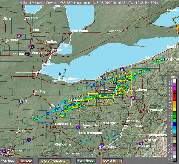 At 1239 pm edt, a severe thunderstorm was located near kinsman, or 16 miles north of warren, moving east at 70 mph (radar indicated). Hazards include 60 mph wind gusts. Expect damage to trees and power lines. Locations impacted include, kinsman, north bloomfield, orwell, andover, west farmington, mecca, johnston, roaming shores and cherry valley. At 1239 pm edt, a severe thunderstorm was located near kinsman, or 16 miles north of warren, moving east at 70 mph (radar indicated). Hazards include 60 mph wind gusts. Expect damage to trees and power lines. Locations impacted include, kinsman, north bloomfield, orwell, andover, west farmington, mecca, johnston, roaming shores and cherry valley.
|
| 3/20/2020 12:15 PM EDT |
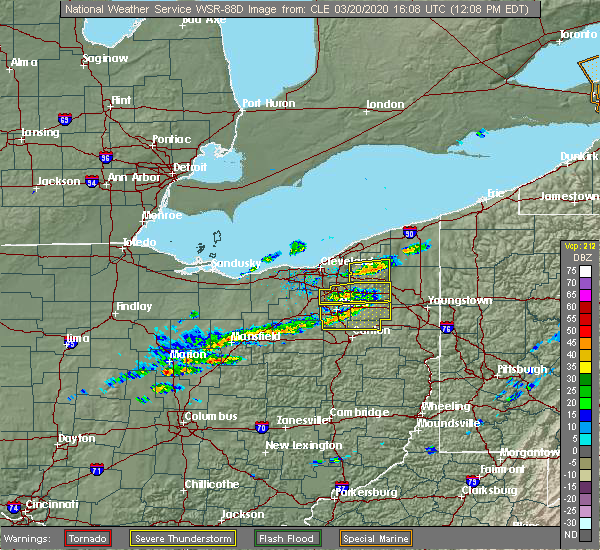 At 1215 pm edt, a severe thunderstorm was located over burton, or near chardon, moving east at 45 mph (radar indicated). Hazards include 60 mph wind gusts. expect damage to trees and power lines At 1215 pm edt, a severe thunderstorm was located over burton, or near chardon, moving east at 45 mph (radar indicated). Hazards include 60 mph wind gusts. expect damage to trees and power lines
|
| 9/13/2019 9:56 PM EDT |
 A severe thunderstorm warning remains in effect until 1030 pm edt for northern trumbull. ashtabula. southwestern erie and western crawford counties. At 955 pm edt, severe thunderstorms were located along a line extending from near conneaut to pymatuning north to near kinsman to north bloomfield, moving east at 45 mph. A severe thunderstorm warning remains in effect until 1030 pm edt for northern trumbull. ashtabula. southwestern erie and western crawford counties. At 955 pm edt, severe thunderstorms were located along a line extending from near conneaut to pymatuning north to near kinsman to north bloomfield, moving east at 45 mph.
|
| 9/13/2019 9:41 PM EDT |
 At 941 pm edt, severe thunderstorms were located along a line extending from 8 miles south of ashtabula to near andover to near orwell to near middlefield, moving east at 45 mph (radar indicated). Hazards include 70 mph wind gusts and quarter size hail. Minor damage to vehicles is possible. expect considerable tree damage. Wind damage is also likely to mobile homes, roofs, and outbuildings. At 941 pm edt, severe thunderstorms were located along a line extending from 8 miles south of ashtabula to near andover to near orwell to near middlefield, moving east at 45 mph (radar indicated). Hazards include 70 mph wind gusts and quarter size hail. Minor damage to vehicles is possible. expect considerable tree damage. Wind damage is also likely to mobile homes, roofs, and outbuildings.
|
| 9/13/2019 9:28 PM EDT |
 At 927 pm edt, severe thunderstorms were located along a line extending from near geneva to near orwell to near south russell, moving east at 50 mph (radar indicated). Hazards include 70 mph wind gusts and quarter size hail. Minor damage to vehicles is possible. expect considerable tree damage. wind damage is also likely to mobile homes, roofs, and outbuildings. Locations impacted include, chardon, cortland, geneva, south russell, madison, middlefield, kinsman, north bloomfield, orwell, burton, andover, west farmington, bristolville, parkman, huntsburg, claridon, mecca, austinburg, montville and johnston. At 927 pm edt, severe thunderstorms were located along a line extending from near geneva to near orwell to near south russell, moving east at 50 mph (radar indicated). Hazards include 70 mph wind gusts and quarter size hail. Minor damage to vehicles is possible. expect considerable tree damage. wind damage is also likely to mobile homes, roofs, and outbuildings. Locations impacted include, chardon, cortland, geneva, south russell, madison, middlefield, kinsman, north bloomfield, orwell, burton, andover, west farmington, bristolville, parkman, huntsburg, claridon, mecca, austinburg, montville and johnston.
|
| 9/13/2019 9:11 PM EDT |
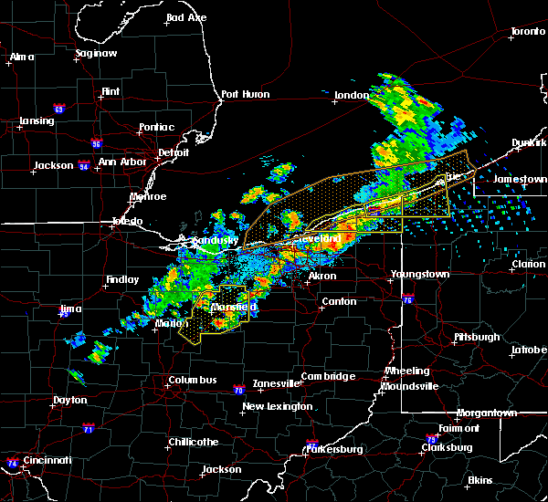 At 911 pm edt, severe thunderstorms were located along a line extending from 7 miles south of ashtabula to near south russell, moving east at 50 mph (radar indicated). Hazards include 70 mph wind gusts and penny size hail. Expect considerable tree damage. Damage is likely to mobile homes, roofs, and outbuildings. At 911 pm edt, severe thunderstorms were located along a line extending from 7 miles south of ashtabula to near south russell, moving east at 50 mph (radar indicated). Hazards include 70 mph wind gusts and penny size hail. Expect considerable tree damage. Damage is likely to mobile homes, roofs, and outbuildings.
|
| 9/11/2019 3:49 PM EDT |
 At 349 pm edt, a severe thunderstorm was located near cortland, or 9 miles north of warren, moving east at 30 mph (radar indicated). Hazards include 60 mph wind gusts and quarter size hail. Minor damage to vehicles is possible. expect damage to trees and power lines. Locations impacted include, warren, cortland, kinsman, north bloomfield, west farmington, bristolville, vienna center, leavittsburg, vienna, mecca, johnston, orangeville, yankee lake, brookfield center, howland center, west hill and champion heights. At 349 pm edt, a severe thunderstorm was located near cortland, or 9 miles north of warren, moving east at 30 mph (radar indicated). Hazards include 60 mph wind gusts and quarter size hail. Minor damage to vehicles is possible. expect damage to trees and power lines. Locations impacted include, warren, cortland, kinsman, north bloomfield, west farmington, bristolville, vienna center, leavittsburg, vienna, mecca, johnston, orangeville, yankee lake, brookfield center, howland center, west hill and champion heights.
|
| 9/11/2019 3:35 PM EDT | Several large trees branches down in gustavus near sr 193 and sr 8 in trumbull county OH, 4.5 miles E of Kinsman Center, OH |
| 9/11/2019 3:28 PM EDT |
 At 328 pm edt, a severe thunderstorm was located over west farmington, or 11 miles northwest of warren, moving east at 30 mph (radar indicated). Hazards include 60 mph wind gusts and quarter size hail. Minor damage to vehicles is possible. Expect damage to trees and power lines. At 328 pm edt, a severe thunderstorm was located over west farmington, or 11 miles northwest of warren, moving east at 30 mph (radar indicated). Hazards include 60 mph wind gusts and quarter size hail. Minor damage to vehicles is possible. Expect damage to trees and power lines.
|
| 8/18/2019 7:40 PM EDT |
 At 638 pm edt, a severe thunderstorm was located near garrettsville, or 7 miles northeast of ravenna, moving east at 25 mph (radar indicated). Hazards include 60 mph wind gusts and quarter size hail. Minor damage to vehicles is possible. Expect damage to trees and power lines. At 638 pm edt, a severe thunderstorm was located near garrettsville, or 7 miles northeast of ravenna, moving east at 25 mph (radar indicated). Hazards include 60 mph wind gusts and quarter size hail. Minor damage to vehicles is possible. Expect damage to trees and power lines.
|
| 8/18/2019 7:24 PM EDT |
 At 724 pm edt, a severe thunderstorm was located over hilltop, or near youngstown, moving east at 25 mph (radar indicated). Hazards include 60 mph wind gusts and quarter size hail. Minor damage to vehicles is possible. expect damage to trees and power lines. Locations impacted include, warren, niles, hubbard, cortland, lordstown, kinsman, vienna center, hilltop, maplewood park, leavittsburg, girard, vienna, mcdonald, johnston, orangeville, yankee lake, brookfield center, churchill, howland center and bolindale. At 724 pm edt, a severe thunderstorm was located over hilltop, or near youngstown, moving east at 25 mph (radar indicated). Hazards include 60 mph wind gusts and quarter size hail. Minor damage to vehicles is possible. expect damage to trees and power lines. Locations impacted include, warren, niles, hubbard, cortland, lordstown, kinsman, vienna center, hilltop, maplewood park, leavittsburg, girard, vienna, mcdonald, johnston, orangeville, yankee lake, brookfield center, churchill, howland center and bolindale.
|
| 8/18/2019 6:38 PM EDT |
 At 638 pm edt, a severe thunderstorm was located near garrettsville, or 7 miles northeast of ravenna, moving east at 25 mph (radar indicated). Hazards include 60 mph wind gusts and quarter size hail. Minor damage to vehicles is possible. Expect damage to trees and power lines. At 638 pm edt, a severe thunderstorm was located near garrettsville, or 7 miles northeast of ravenna, moving east at 25 mph (radar indicated). Hazards include 60 mph wind gusts and quarter size hail. Minor damage to vehicles is possible. Expect damage to trees and power lines.
|
| 8/18/2019 6:12 PM EDT |
 The severe thunderstorm warning for eastern trumbull county will expire at 615 pm edt. the storm which prompted the warning has moved out of the area. therefore, the warning will be allowed to expire. A severe thunderstorm watch remains in effect until 1000 pm edt for northeastern ohio. The severe thunderstorm warning for eastern trumbull county will expire at 615 pm edt. the storm which prompted the warning has moved out of the area. therefore, the warning will be allowed to expire. A severe thunderstorm watch remains in effect until 1000 pm edt for northeastern ohio.
|
| 8/18/2019 5:59 PM EDT |
 A severe thunderstorm warning remains in effect until 615 pm edt for eastern trumbull county. at 558 pm edt, a severe thunderstorm was located near cortland, or 11 miles northeast of warren, moving east at 30 mph. hazard. 60 mph wind gusts and quarter size hail. source. Radar indicated. A severe thunderstorm warning remains in effect until 615 pm edt for eastern trumbull county. at 558 pm edt, a severe thunderstorm was located near cortland, or 11 miles northeast of warren, moving east at 30 mph. hazard. 60 mph wind gusts and quarter size hail. source. Radar indicated.
|
| 8/18/2019 5:34 PM EDT |
 At 534 pm edt, a severe thunderstorm was located over west farmington, or 12 miles northwest of warren, moving east at 30 mph (radar indicated). Hazards include 60 mph wind gusts and quarter size hail. Minor damage to vehicles is possible. Expect damage to trees and power lines. At 534 pm edt, a severe thunderstorm was located over west farmington, or 12 miles northwest of warren, moving east at 30 mph (radar indicated). Hazards include 60 mph wind gusts and quarter size hail. Minor damage to vehicles is possible. Expect damage to trees and power lines.
|
| 8/17/2019 4:09 PM EDT |
 The severe thunderstorm warning for northeastern trumbull county will expire at 415 pm edt, the storm which prompted the warning has moved out of the area. therefore, the warning will be allowed to expire. The severe thunderstorm warning for northeastern trumbull county will expire at 415 pm edt, the storm which prompted the warning has moved out of the area. therefore, the warning will be allowed to expire.
|
| 8/17/2019 3:59 PM EDT | Half Dollar sized hail reported 1.8 miles E of Kinsman Center, OH, 8 inch diameter limb down also. |
| 8/17/2019 3:46 PM EDT | Quarter sized hail reported 0.5 miles SSW of Kinsman Center, OH |
| 8/17/2019 3:46 PM EDT |
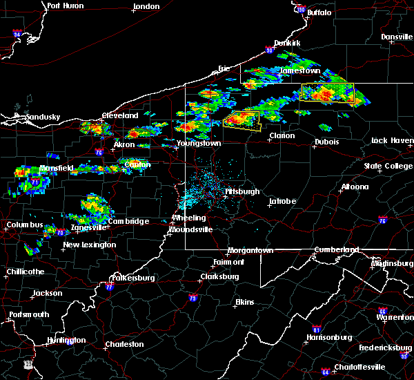 At 346 pm edt, a severe thunderstorm was located near kinsman, or 10 miles north of sharpsville, moving east at 20 mph (radar indicated). Hazards include 60 mph wind gusts and quarter size hail. Minor damage to vehicles is possible. expect damage to trees and power lines. Locations impacted include, orangeville. At 346 pm edt, a severe thunderstorm was located near kinsman, or 10 miles north of sharpsville, moving east at 20 mph (radar indicated). Hazards include 60 mph wind gusts and quarter size hail. Minor damage to vehicles is possible. expect damage to trees and power lines. Locations impacted include, orangeville.
|
| 8/17/2019 3:33 PM EDT |
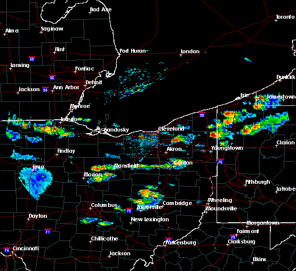 At 333 pm edt, a severe thunderstorm was located over kinsman, or 14 miles northwest of sharpsville, moving east at 25 mph (radar indicated). Hazards include 60 mph wind gusts and quarter size hail. Minor damage to vehicles is possible. Expect damage to trees and power lines. At 333 pm edt, a severe thunderstorm was located over kinsman, or 14 miles northwest of sharpsville, moving east at 25 mph (radar indicated). Hazards include 60 mph wind gusts and quarter size hail. Minor damage to vehicles is possible. Expect damage to trees and power lines.
|
| 8/6/2019 4:49 PM EDT |
 At 448 pm edt, severe thunderstorms were located along a line extending from 6 miles west of andover to cortland to near leavittsburg to near newton falls, moving northeast at 30 mph (radar indicated). Hazards include 60 mph wind gusts. Expect damage to trees and power lines. Locations impacted include, warren, niles, cortland, newton falls, lordstown, kinsman, north bloomfield, west farmington, vienna center, bristolville, leavittsburg, girard, vienna, mecca, edinburg, windham, johnston, craig beach, deerfield and orangeville. At 448 pm edt, severe thunderstorms were located along a line extending from 6 miles west of andover to cortland to near leavittsburg to near newton falls, moving northeast at 30 mph (radar indicated). Hazards include 60 mph wind gusts. Expect damage to trees and power lines. Locations impacted include, warren, niles, cortland, newton falls, lordstown, kinsman, north bloomfield, west farmington, vienna center, bristolville, leavittsburg, girard, vienna, mecca, edinburg, windham, johnston, craig beach, deerfield and orangeville.
|
| 8/6/2019 4:37 PM EDT |
 At 437 pm edt, severe thunderstorms were located along a line extending from 6 miles northeast of orwell to near warren to near leavittsburg to near ravenna, moving northeast at 30 mph (radar indicated). Hazards include 60 mph wind gusts. Expect damage to trees and power lines. Locations impacted include, warren, niles, cortland, newton falls, lordstown, middlefield, garrettsville, kinsman, north bloomfield, orwell, andover, west farmington, vienna center, bristolville, leavittsburg, girard, parkman, vienna, mecca and windham. At 437 pm edt, severe thunderstorms were located along a line extending from 6 miles northeast of orwell to near warren to near leavittsburg to near ravenna, moving northeast at 30 mph (radar indicated). Hazards include 60 mph wind gusts. Expect damage to trees and power lines. Locations impacted include, warren, niles, cortland, newton falls, lordstown, middlefield, garrettsville, kinsman, north bloomfield, orwell, andover, west farmington, vienna center, bristolville, leavittsburg, girard, parkman, vienna, mecca and windham.
|
| 8/6/2019 4:12 PM EDT |
 At 412 pm edt, severe thunderstorms were located along a line extending from near orwell to near newton falls to near ravenna to near mogadore, moving northeast at 30 mph (radar indicated). Hazards include 60 mph wind gusts and penny size hail. expect damage to trees and power lines At 412 pm edt, severe thunderstorms were located along a line extending from near orwell to near newton falls to near ravenna to near mogadore, moving northeast at 30 mph (radar indicated). Hazards include 60 mph wind gusts and penny size hail. expect damage to trees and power lines
|
| 8/6/2019 2:44 PM EDT |
 The national weather service in cleveland has issued a * severe thunderstorm warning for. trumbull county in northeastern ohio. ashtabula county in northeastern ohio. southwestern erie county in northwestern pennsylvania. Western crawford county in northwestern pennsylvania. The national weather service in cleveland has issued a * severe thunderstorm warning for. trumbull county in northeastern ohio. ashtabula county in northeastern ohio. southwestern erie county in northwestern pennsylvania. Western crawford county in northwestern pennsylvania.
|
| 8/6/2019 2:44 PM EDT |
 At 244 pm edt, severe thunderstorms were located along a line extending from 9 miles southeast of geneva to 6 miles east of cortland, moving northeast at 40 mph (radar indicated). Hazards include 60 mph wind gusts. expect damage to trees and power lines At 244 pm edt, severe thunderstorms were located along a line extending from 9 miles southeast of geneva to 6 miles east of cortland, moving northeast at 40 mph (radar indicated). Hazards include 60 mph wind gusts. expect damage to trees and power lines
|
| 7/20/2019 7:27 PM EDT |
 The severe thunderstorm warning for northern trumbull and southeastern ashtabula counties will expire at 730 pm edt, the storms which prompted the warning have weakened below severe limits, and have exited the warned area. therefore, the warning will be allowed to expire. however heavy rain is still possible with these thunderstorms. The severe thunderstorm warning for northern trumbull and southeastern ashtabula counties will expire at 730 pm edt, the storms which prompted the warning have weakened below severe limits, and have exited the warned area. therefore, the warning will be allowed to expire. however heavy rain is still possible with these thunderstorms.
|
| 7/20/2019 7:00 PM EDT |
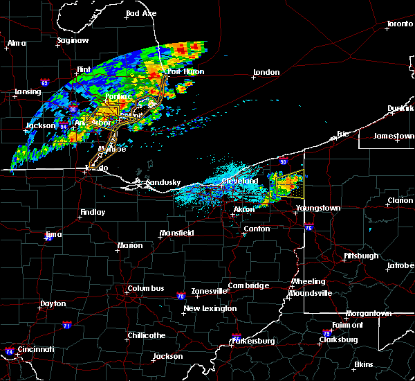 At 700 pm edt, severe thunderstorms were located along a line extending from near andover to near cortland, moving east at 25 mph (radar indicated). Hazards include 60 mph wind gusts. Expect damage to trees and power lines. Locations impacted include, cortland, kinsman, north bloomfield, orwell, andover, bristolville, mecca, johnston, roaming shores, cherry valley and orangeville. At 700 pm edt, severe thunderstorms were located along a line extending from near andover to near cortland, moving east at 25 mph (radar indicated). Hazards include 60 mph wind gusts. Expect damage to trees and power lines. Locations impacted include, cortland, kinsman, north bloomfield, orwell, andover, bristolville, mecca, johnston, roaming shores, cherry valley and orangeville.
|
| 7/20/2019 6:34 PM EDT |
 At 633 pm edt, severe thunderstorms were located along a line extending from near orwell to near bristolville, moving east at 25 mph (radar indicated). Hazards include 60 mph wind gusts. expect damage to trees and power lines At 633 pm edt, severe thunderstorms were located along a line extending from near orwell to near bristolville, moving east at 25 mph (radar indicated). Hazards include 60 mph wind gusts. expect damage to trees and power lines
|
| 6/1/2019 6:43 PM EDT |
 The national weather service in cleveland has issued a * severe thunderstorm warning for. trumbull county in northeastern ohio. portage county in northeastern ohio. mahoning county in northeastern ohio. Northern stark county in northeastern ohio. The national weather service in cleveland has issued a * severe thunderstorm warning for. trumbull county in northeastern ohio. portage county in northeastern ohio. mahoning county in northeastern ohio. Northern stark county in northeastern ohio.
|
| 6/1/2019 6:34 PM EDT |
 At 634 pm edt, severe thunderstorms were located along a line extending from near harmonsburg to near cortland, moving east at 45 mph (radar indicated). Hazards include 60 mph wind gusts and quarter size hail. Minor damage to vehicles is possible. expect damage to trees and power lines. Locations impacted include, warren, cortland, kinsman, west farmington, bristolville, vienna center, leavittsburg, vienna, mecca, johnston, orangeville, yankee lake, champion heights, howland center and brookfield center. At 634 pm edt, severe thunderstorms were located along a line extending from near harmonsburg to near cortland, moving east at 45 mph (radar indicated). Hazards include 60 mph wind gusts and quarter size hail. Minor damage to vehicles is possible. expect damage to trees and power lines. Locations impacted include, warren, cortland, kinsman, west farmington, bristolville, vienna center, leavittsburg, vienna, mecca, johnston, orangeville, yankee lake, champion heights, howland center and brookfield center.
|
| 6/1/2019 6:01 PM EDT |
 At 600 pm edt, severe thunderstorms were located along a line extending from 7 miles east of orwell to near mantua, moving east at 45 mph (radar indicated). Hazards include 60 mph wind gusts and quarter size hail. Minor damage to vehicles is possible. Expect damage to trees and power lines. At 600 pm edt, severe thunderstorms were located along a line extending from 7 miles east of orwell to near mantua, moving east at 45 mph (radar indicated). Hazards include 60 mph wind gusts and quarter size hail. Minor damage to vehicles is possible. Expect damage to trees and power lines.
|
| 6/1/2019 5:14 PM EDT |
 At 514 pm edt, severe thunderstorms were located along a line extending from near atlantic to north bloomfield, moving east at 20 mph (radar indicated). Hazards include ping pong ball size hail and 60 mph wind gusts. People and animals outdoors will be injured. expect hail damage to roofs, siding, windows, and vehicles. expect damage to trees and power lines. Locations impacted include, cortland, kinsman, north bloomfield, andover, west farmington, adamsville, pymatuning central, atlantic, mecca, johnston, cochranton, conneaut lake, jamestown, conneaut lakeshore, geneva and hartstown. At 514 pm edt, severe thunderstorms were located along a line extending from near atlantic to north bloomfield, moving east at 20 mph (radar indicated). Hazards include ping pong ball size hail and 60 mph wind gusts. People and animals outdoors will be injured. expect hail damage to roofs, siding, windows, and vehicles. expect damage to trees and power lines. Locations impacted include, cortland, kinsman, north bloomfield, andover, west farmington, adamsville, pymatuning central, atlantic, mecca, johnston, cochranton, conneaut lake, jamestown, conneaut lakeshore, geneva and hartstown.
|
| 6/1/2019 4:54 PM EDT |
 At 454 pm edt, severe thunderstorms were located along a line extending from adamsville to near middlefield, moving east at 20 mph (radar indicated). Hazards include 60 mph wind gusts and quarter size hail. Minor damage to vehicles is possible. Expect damage to trees and power lines. At 454 pm edt, severe thunderstorms were located along a line extending from adamsville to near middlefield, moving east at 20 mph (radar indicated). Hazards include 60 mph wind gusts and quarter size hail. Minor damage to vehicles is possible. Expect damage to trees and power lines.
|
| 6/1/2019 4:24 PM EDT | Quarter sized hail reported 0.3 miles NW of Kinsman Center, OH |
| 6/1/2019 4:14 PM EDT |
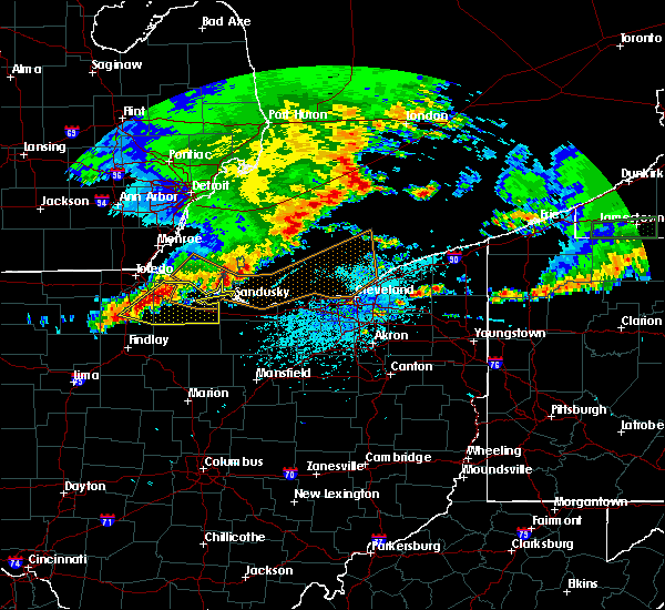 At 414 pm edt, severe thunderstorms were located along a line extending from near orwell to near south russell, moving east at 20 mph (radar indicated). Hazards include 60 mph wind gusts and quarter size hail. Minor damage to vehicles is possible. Expect damage to trees and power lines. At 414 pm edt, severe thunderstorms were located along a line extending from near orwell to near south russell, moving east at 20 mph (radar indicated). Hazards include 60 mph wind gusts and quarter size hail. Minor damage to vehicles is possible. Expect damage to trees and power lines.
|
| 5/25/2019 6:55 PM EDT |
 The severe thunderstorm warning for central trumbull and southeastern ashtabula counties will expire at 700 pm edt, the storm which prompted the warning has moved out of the area. therefore, the warning will be allowed to expire. a severe thunderstorm watch remains in effect until 900 pm edt for northeastern ohio. to report severe weather, contact your nearest law enforcement agency. they will relay your report to the national weather service cleveland. The severe thunderstorm warning for central trumbull and southeastern ashtabula counties will expire at 700 pm edt, the storm which prompted the warning has moved out of the area. therefore, the warning will be allowed to expire. a severe thunderstorm watch remains in effect until 900 pm edt for northeastern ohio. to report severe weather, contact your nearest law enforcement agency. they will relay your report to the national weather service cleveland.
|
| 5/25/2019 6:25 PM EDT |
 At 624 pm edt, a severe thunderstorm was located near cortland, or 11 miles northeast of warren, moving east at 45 mph (radar indicated). Hazards include 60 mph wind gusts. expect damage to trees and power lines At 624 pm edt, a severe thunderstorm was located near cortland, or 11 miles northeast of warren, moving east at 45 mph (radar indicated). Hazards include 60 mph wind gusts. expect damage to trees and power lines
|
| 5/25/2019 6:09 PM EDT |
 At 609 pm edt, a severe thunderstorm was located near andover, or 22 miles southeast of geneva-on-the-lake, moving northeast at 45 mph (radar indicated). Hazards include 60 mph wind gusts and penny size hail. Expect damage to trees and power lines. Locations impacted include, warren, niles, cortland, kinsman, north bloomfield, orwell, andover, west farmington, bristolville, vienna center, leavittsburg, girard, vienna, mecca, johnston, cherry valley, orangeville, yankee lake, brookfield center and howland center. At 609 pm edt, a severe thunderstorm was located near andover, or 22 miles southeast of geneva-on-the-lake, moving northeast at 45 mph (radar indicated). Hazards include 60 mph wind gusts and penny size hail. Expect damage to trees and power lines. Locations impacted include, warren, niles, cortland, kinsman, north bloomfield, orwell, andover, west farmington, bristolville, vienna center, leavittsburg, girard, vienna, mecca, johnston, cherry valley, orangeville, yankee lake, brookfield center and howland center.
|
| 5/25/2019 5:47 PM EDT |
 At 546 pm edt, a severe thunderstorm was located over west farmington northwest of warren, moving northeast at 45 mph (radar indicated). Hazards include 70 mph wind gusts and quarter size hail. Minor damage to vehicles is possible. expect considerable tree damage. Wind damage is also likely to mobile homes, roofs, and outbuildings. At 546 pm edt, a severe thunderstorm was located over west farmington northwest of warren, moving northeast at 45 mph (radar indicated). Hazards include 70 mph wind gusts and quarter size hail. Minor damage to vehicles is possible. expect considerable tree damage. Wind damage is also likely to mobile homes, roofs, and outbuildings.
|
| 5/23/2019 9:33 AM EDT |
 At 933 am edt, severe thunderstorms were located along a line extending from near girard to near pymatuning central, moving east at 65 mph (radar indicated). Hazards include 60 mph wind gusts. Expect damage to trees and power lines. Locations impacted include, youngstown, warren, boardman, niles, campbell, hubbard, canfield, sebring, lordstown, vienna center, hilltop, maplewood park, austintown, struthers, girard, vienna, mcdonald, poland, ellsworth and new middletown. At 933 am edt, severe thunderstorms were located along a line extending from near girard to near pymatuning central, moving east at 65 mph (radar indicated). Hazards include 60 mph wind gusts. Expect damage to trees and power lines. Locations impacted include, youngstown, warren, boardman, niles, campbell, hubbard, canfield, sebring, lordstown, vienna center, hilltop, maplewood park, austintown, struthers, girard, vienna, mcdonald, poland, ellsworth and new middletown.
|
| 5/23/2019 9:18 AM EDT |
 At 917 am edt, severe thunderstorms were located along a line extending from conneaut to near orwell, moving northeast at 65 mph (radar indicated). Hazards include 60 mph wind gusts. Expect damage to trees and power lines. Locations impacted include, canton, youngstown, warren, conneaut, boardman, alliance, niles, louisville, campbell, hubbard, canfield, cortland, newton falls, sebring, minerva, lordstown, north kingsville, kinsman, andover and waynesburg. At 917 am edt, severe thunderstorms were located along a line extending from conneaut to near orwell, moving northeast at 65 mph (radar indicated). Hazards include 60 mph wind gusts. Expect damage to trees and power lines. Locations impacted include, canton, youngstown, warren, conneaut, boardman, alliance, niles, louisville, campbell, hubbard, canfield, cortland, newton falls, sebring, minerva, lordstown, north kingsville, kinsman, andover and waynesburg.
|
| 5/23/2019 9:05 AM EDT |
 At 904 am edt, severe thunderstorms were located along a line extending from near ashtabula to west farmington, moving northeast at 65 mph (radar indicated). Hazards include 60 mph wind gusts. Expect damage to trees and power lines. Locations impacted include, canton, youngstown, warren, ashtabula, conneaut, ravenna, geneva-on-the-lake, boardman, massillon, alliance, niles, north canton, louisville, campbell, hubbard, canfield, cortland, geneva, newton falls and sebring. At 904 am edt, severe thunderstorms were located along a line extending from near ashtabula to west farmington, moving northeast at 65 mph (radar indicated). Hazards include 60 mph wind gusts. Expect damage to trees and power lines. Locations impacted include, canton, youngstown, warren, ashtabula, conneaut, ravenna, geneva-on-the-lake, boardman, massillon, alliance, niles, north canton, louisville, campbell, hubbard, canfield, cortland, geneva, newton falls and sebring.
|
| 5/23/2019 9:00 AM EDT |
 At 900 am edt, severe thunderstorms were located along a line extending from near ashtabula to near west farmington, moving northeast at 65 mph (radar indicated). Hazards include 60 mph wind gusts. Expect damage to trees and power lines. Locations impacted include, canton, youngstown, warren, ashtabula, conneaut, ravenna, geneva-on-the-lake, boardman, massillon, kent, green, alliance, hudson, niles, tallmadge, north canton, streetsboro, louisville, campbell and hubbard. At 900 am edt, severe thunderstorms were located along a line extending from near ashtabula to near west farmington, moving northeast at 65 mph (radar indicated). Hazards include 60 mph wind gusts. Expect damage to trees and power lines. Locations impacted include, canton, youngstown, warren, ashtabula, conneaut, ravenna, geneva-on-the-lake, boardman, massillon, kent, green, alliance, hudson, niles, tallmadge, north canton, streetsboro, louisville, campbell and hubbard.
|
| 5/23/2019 8:38 AM EDT |
 At 837 am edt, severe thunderstorms were located along a line extending from painesville to hudson, moving northeast at 60 mph (radar indicated). Hazards include 60 mph wind gusts. expect damage to trees and power lines At 837 am edt, severe thunderstorms were located along a line extending from painesville to hudson, moving northeast at 60 mph (radar indicated). Hazards include 60 mph wind gusts. expect damage to trees and power lines
|
| 4/14/2019 6:43 PM EDT |
 At 642 pm edt, severe thunderstorms were located along a line extending from near cortland to near lisbon, moving northeast at 40 mph (radar indicated). Hazards include 60 mph wind gusts and quarter size hail. Minor damage to vehicles is possible. Expect damage to trees and power lines. At 642 pm edt, severe thunderstorms were located along a line extending from near cortland to near lisbon, moving northeast at 40 mph (radar indicated). Hazards include 60 mph wind gusts and quarter size hail. Minor damage to vehicles is possible. Expect damage to trees and power lines.
|
| 4/14/2019 6:19 PM EDT |
 At 619 pm edt, severe thunderstorms capable of producing both tornadoes and extensive straight line wind damage were located along a line extending from near orwell to near cortland, moving northeast at 45 mph (radar indicated rotation). Hazards include tornado and quarter size hail. Flying debris will be dangerous to those caught without shelter. mobile homes will be damaged or destroyed. damage to roofs, windows, and vehicles will occur. Tree damage is likely. At 619 pm edt, severe thunderstorms capable of producing both tornadoes and extensive straight line wind damage were located along a line extending from near orwell to near cortland, moving northeast at 45 mph (radar indicated rotation). Hazards include tornado and quarter size hail. Flying debris will be dangerous to those caught without shelter. mobile homes will be damaged or destroyed. damage to roofs, windows, and vehicles will occur. Tree damage is likely.
|
| 4/14/2019 6:14 PM EDT |
 At 613 pm edt, severe thunderstorms were located along a line extending from near orwell to near lordstown, moving northeast at 40 mph (radar indicated). Hazards include 60 mph wind gusts and quarter size hail. Minor damage to vehicles is possible. expect damage to trees and power lines. Locations impacted include, warren, niles, hubbard, cortland, newton falls, lordstown, kinsman, north bloomfield, orwell, andover, west farmington, vienna center, hilltop, maplewood park, bristolville, leavittsburg, girard, vienna, mcdonald and mecca. At 613 pm edt, severe thunderstorms were located along a line extending from near orwell to near lordstown, moving northeast at 40 mph (radar indicated). Hazards include 60 mph wind gusts and quarter size hail. Minor damage to vehicles is possible. expect damage to trees and power lines. Locations impacted include, warren, niles, hubbard, cortland, newton falls, lordstown, kinsman, north bloomfield, orwell, andover, west farmington, vienna center, hilltop, maplewood park, bristolville, leavittsburg, girard, vienna, mcdonald and mecca.
|
| 4/14/2019 5:55 PM EDT |
 At 555 pm edt, severe thunderstorms were located along a line extending from middlefield to 6 miles southwest of newton falls, moving northeast at 45 mph (radar indicated). Hazards include 60 mph wind gusts and penny size hail. expect damage to trees and power lines At 555 pm edt, severe thunderstorms were located along a line extending from middlefield to 6 miles southwest of newton falls, moving northeast at 45 mph (radar indicated). Hazards include 60 mph wind gusts and penny size hail. expect damage to trees and power lines
|
| 1/8/2019 4:21 PM EST |
 The severe thunderstorm warning for northeastern trumbull county will expire at 430 pm est, the storm which prompted the warning has weakened below severe limits, and no longer poses an immediate threat to life or property. therefore, the warning will be allowed to expire. The severe thunderstorm warning for northeastern trumbull county will expire at 430 pm est, the storm which prompted the warning has weakened below severe limits, and no longer poses an immediate threat to life or property. therefore, the warning will be allowed to expire.
|
| 1/8/2019 4:11 PM EST |
 At 411 pm est, a severe thunderstorm was located near cortland, or 10 miles northwest of sharpsville, moving northeast at 45 mph (radar indicated). Hazards include 60 mph wind gusts and quarter size hail. Minor damage to vehicles is possible. expect damage to trees and power lines. Locations impacted include, cortland, kinsman, vienna center, mecca, johnston, orangeville, yankee lake and howland center. At 411 pm est, a severe thunderstorm was located near cortland, or 10 miles northwest of sharpsville, moving northeast at 45 mph (radar indicated). Hazards include 60 mph wind gusts and quarter size hail. Minor damage to vehicles is possible. expect damage to trees and power lines. Locations impacted include, cortland, kinsman, vienna center, mecca, johnston, orangeville, yankee lake and howland center.
|
| 1/8/2019 3:59 PM EST |
 At 358 pm est, a severe thunderstorm was located over cortland, or near warren, moving east at 40 mph (radar indicated). Hazards include 60 mph wind gusts and quarter size hail. Minor damage to vehicles is possible. expect damage to trees and power lines. Locations impacted include, warren, niles, cortland, lordstown, kinsman, bristolville, vienna center, leavittsburg, girard, vienna, mecca, johnston, orangeville, yankee lake, brookfield center, howland center, bolindale, west hill, turnpike interchange and champion heights. At 358 pm est, a severe thunderstorm was located over cortland, or near warren, moving east at 40 mph (radar indicated). Hazards include 60 mph wind gusts and quarter size hail. Minor damage to vehicles is possible. expect damage to trees and power lines. Locations impacted include, warren, niles, cortland, lordstown, kinsman, bristolville, vienna center, leavittsburg, girard, vienna, mecca, johnston, orangeville, yankee lake, brookfield center, howland center, bolindale, west hill, turnpike interchange and champion heights.
|
| 1/8/2019 3:39 PM EST |
 At 339 pm est, a severe thunderstorm was located near newton falls, or 8 miles west of warren, moving east at 40 mph (radar indicated). Hazards include 60 mph wind gusts and quarter size hail. Minor damage to vehicles is possible. Expect damage to trees and power lines. At 339 pm est, a severe thunderstorm was located near newton falls, or 8 miles west of warren, moving east at 40 mph (radar indicated). Hazards include 60 mph wind gusts and quarter size hail. Minor damage to vehicles is possible. Expect damage to trees and power lines.
|
| 12/2/2018 7:09 PM EST |
 At 708 pm est, severe thunderstorms were located along a line extending from near geneva to near west farmington, moving east at 35 mph (radar indicated). Hazards include 60 mph wind gusts. Expect damage to trees and power lines. Locations impacted include, warren, ashtabula, conneaut, geneva-on-the-lake, cortland, geneva, north kingsville, kinsman, north bloomfield, orwell, andover, west farmington, vienna center, bristolville, leavittsburg, vienna, mecca, austinburg, johnston and kingsville. At 708 pm est, severe thunderstorms were located along a line extending from near geneva to near west farmington, moving east at 35 mph (radar indicated). Hazards include 60 mph wind gusts. Expect damage to trees and power lines. Locations impacted include, warren, ashtabula, conneaut, geneva-on-the-lake, cortland, geneva, north kingsville, kinsman, north bloomfield, orwell, andover, west farmington, vienna center, bristolville, leavittsburg, vienna, mecca, austinburg, johnston and kingsville.
|
| 12/2/2018 6:54 PM EST |
 At 654 pm est, severe thunderstorms were located along a line extending from near madison to near middlefield, moving northeast at 50 mph (radar indicated. these showers and storms have had a history of producing 50 to 60 mph wind gusts). Hazards include 60 mph wind gusts. Expect damage to trees and power lines. Locations impacted include, warren, ashtabula, conneaut, chardon, geneva-on-the-lake, streetsboro, cortland, geneva, madison, north kingsville, middlefield, garrettsville, kinsman, north bloomfield, perry, orwell, burton, andover, mantua and west farmington. At 654 pm est, severe thunderstorms were located along a line extending from near madison to near middlefield, moving northeast at 50 mph (radar indicated. these showers and storms have had a history of producing 50 to 60 mph wind gusts). Hazards include 60 mph wind gusts. Expect damage to trees and power lines. Locations impacted include, warren, ashtabula, conneaut, chardon, geneva-on-the-lake, streetsboro, cortland, geneva, madison, north kingsville, middlefield, garrettsville, kinsman, north bloomfield, perry, orwell, burton, andover, mantua and west farmington.
|
| 12/2/2018 6:46 PM EST |
 At 645 pm est, severe thunderstorms were located along a line extending from near chardon to near burton, moving northeast at 50 mph (radar indicated). Hazards include 60 mph wind gusts. Expect damage to trees and power lines. Locations impacted include, warren, painesville, ashtabula, conneaut, chardon, fairport harbor, geneva-on-the-lake, streetsboro, cortland, geneva, south russell, madison, north kingsville, middlefield, garrettsville, kinsman, north bloomfield, perry, orwell and burton. At 645 pm est, severe thunderstorms were located along a line extending from near chardon to near burton, moving northeast at 50 mph (radar indicated). Hazards include 60 mph wind gusts. Expect damage to trees and power lines. Locations impacted include, warren, painesville, ashtabula, conneaut, chardon, fairport harbor, geneva-on-the-lake, streetsboro, cortland, geneva, south russell, madison, north kingsville, middlefield, garrettsville, kinsman, north bloomfield, perry, orwell and burton.
|
| 12/2/2018 6:36 PM EST |
 At 635 pm est, severe thunderstorms were located along a line extending from chardon to near south russell, moving northeast at 50 mph (radar indicated. there have been reports of minor wind damage with several trees and power lines blown down with these storms ). Hazards include 60 mph wind gusts. expect damage to trees and power lines At 635 pm est, severe thunderstorms were located along a line extending from chardon to near south russell, moving northeast at 50 mph (radar indicated. there have been reports of minor wind damage with several trees and power lines blown down with these storms ). Hazards include 60 mph wind gusts. expect damage to trees and power lines
|
| 7/5/2018 6:53 PM EDT |
 At 652 pm edt, severe thunderstorms were located along a line extending from near cortland to near vienna center, moving east at 10 mph (radar indicated). Hazards include 60 mph wind gusts. Expect damage to trees and power lines. Locations impacted include, warren, niles, cortland, kinsman, vienna center, girard, vienna, mecca, johnston, orangeville, yankee lake, brookfield center, howland center, bolindale, west hill and champion heights. At 652 pm edt, severe thunderstorms were located along a line extending from near cortland to near vienna center, moving east at 10 mph (radar indicated). Hazards include 60 mph wind gusts. Expect damage to trees and power lines. Locations impacted include, warren, niles, cortland, kinsman, vienna center, girard, vienna, mecca, johnston, orangeville, yankee lake, brookfield center, howland center, bolindale, west hill and champion heights.
|
| 7/5/2018 6:22 PM EDT |
 At 622 pm edt, severe thunderstorms were located along a line extending from near bristolville to near leavittsburg to near lordstown, moving east at 20 mph (radar indicated). Hazards include 60 mph wind gusts. expect damage to trees and power lines At 622 pm edt, severe thunderstorms were located along a line extending from near bristolville to near leavittsburg to near lordstown, moving east at 20 mph (radar indicated). Hazards include 60 mph wind gusts. expect damage to trees and power lines
|
| 6/3/2018 3:25 PM EDT |
 At 325 pm edt, a severe thunderstorm was located near warren, moving northeast at 30 mph (radar indicated). Hazards include 60 mph wind gusts. expect damage to trees and power lines At 325 pm edt, a severe thunderstorm was located near warren, moving northeast at 30 mph (radar indicated). Hazards include 60 mph wind gusts. expect damage to trees and power lines
|
| 5/22/2018 3:21 PM EDT |
 At 319 pm edt, severe thunderstorms were located near cortland, or 12 miles northeast of warren, moving east at 15 mph. in addition strong storms will be moving in from portage county to the west. these storms will cross southern trumbull county (radar indicated). Hazards include 60 mph wind gusts and quarter size hail. Minor damage to vehicles is possible. expect damage to trees and power lines. Locations impacted include, warren, niles, hubbard, cortland, lordstown, kinsman, vienna center, hilltop, maplewood park, girard, vienna, mcdonald, mecca, johnston, orangeville, yankee lake, brookfield center, churchill, howland center and bolindale. At 319 pm edt, severe thunderstorms were located near cortland, or 12 miles northeast of warren, moving east at 15 mph. in addition strong storms will be moving in from portage county to the west. these storms will cross southern trumbull county (radar indicated). Hazards include 60 mph wind gusts and quarter size hail. Minor damage to vehicles is possible. expect damage to trees and power lines. Locations impacted include, warren, niles, hubbard, cortland, lordstown, kinsman, vienna center, hilltop, maplewood park, girard, vienna, mcdonald, mecca, johnston, orangeville, yankee lake, brookfield center, churchill, howland center and bolindale.
|
| 5/22/2018 2:46 PM EDT |
 At 246 pm edt, a severe thunderstorm was located near bristolville, or 11 miles north of warren, moving east at 15 mph (radar indicated). Hazards include 60 mph wind gusts and quarter size hail. Minor damage to vehicles is possible. Expect damage to trees and power lines. At 246 pm edt, a severe thunderstorm was located near bristolville, or 11 miles north of warren, moving east at 15 mph (radar indicated). Hazards include 60 mph wind gusts and quarter size hail. Minor damage to vehicles is possible. Expect damage to trees and power lines.
|
| 5/4/2018 3:33 PM EDT |
 At 333 pm edt, a severe thunderstorm was located near bristolville, or near warren, moving northeast at 55 mph (radar indicated). Hazards include 60 mph wind gusts and quarter size hail. Minor damage to vehicles is possible. Expect damage to trees and power lines. At 333 pm edt, a severe thunderstorm was located near bristolville, or near warren, moving northeast at 55 mph (radar indicated). Hazards include 60 mph wind gusts and quarter size hail. Minor damage to vehicles is possible. Expect damage to trees and power lines.
|
| 4/27/2018 6:55 PM EDT |
 At 655 pm edt, a severe thunderstorm was located near kinsman, or 12 miles northwest of sharpsville, moving east at 35 mph (radar indicated). Hazards include 60 mph wind gusts. Expect damage to trees and power lines. Locations impacted include, hubbard, cortland, kinsman, andover, vienna center, maplewood park, girard, vienna, mecca, johnston, cherry valley, orangeville, yankee lake, brookfield center, churchill and west hill. At 655 pm edt, a severe thunderstorm was located near kinsman, or 12 miles northwest of sharpsville, moving east at 35 mph (radar indicated). Hazards include 60 mph wind gusts. Expect damage to trees and power lines. Locations impacted include, hubbard, cortland, kinsman, andover, vienna center, maplewood park, girard, vienna, mecca, johnston, cherry valley, orangeville, yankee lake, brookfield center, churchill and west hill.
|
| 4/27/2018 6:39 PM EDT |
 At 639 pm edt, a severe thunderstorm was located near bristolville, or 10 miles north of warren, moving east at 35 mph (radar indicated). Hazards include 60 mph wind gusts. expect damage to trees and power lines At 639 pm edt, a severe thunderstorm was located near bristolville, or 10 miles north of warren, moving east at 35 mph (radar indicated). Hazards include 60 mph wind gusts. expect damage to trees and power lines
|
| 11/5/2017 7:51 PM EDT |
 At 651 pm est, severe thunderstorms were located along a line extending from near conneaut to near niles, moving east at 75 mph (radar indicated). Hazards include 70 mph wind gusts. Expect considerable tree damage. damage is likely to mobile homes, roofs, and outbuildings. Locations impacted include, warren, conneaut, niles, hubbard, cortland, kinsman, andover, vienna center, hilltop, maplewood park, girard, vienna, mcdonald, mecca, johnston, pierpont, cherry valley, orangeville, yankee lake and churchill. At 651 pm est, severe thunderstorms were located along a line extending from near conneaut to near niles, moving east at 75 mph (radar indicated). Hazards include 70 mph wind gusts. Expect considerable tree damage. damage is likely to mobile homes, roofs, and outbuildings. Locations impacted include, warren, conneaut, niles, hubbard, cortland, kinsman, andover, vienna center, hilltop, maplewood park, girard, vienna, mcdonald, mecca, johnston, pierpont, cherry valley, orangeville, yankee lake and churchill.
|
| 11/5/2017 7:28 PM EDT |
 At 628 pm est, severe thunderstorms were located along a line extending from geneva-on-the-lake to near south russell, moving east at 65 mph (radar indicated). Hazards include 70 mph wind gusts. Expect considerable tree damage. Damage is likely to mobile homes, roofs, and outbuildings. At 628 pm est, severe thunderstorms were located along a line extending from geneva-on-the-lake to near south russell, moving east at 65 mph (radar indicated). Hazards include 70 mph wind gusts. Expect considerable tree damage. Damage is likely to mobile homes, roofs, and outbuildings.
|
| 8/17/2017 7:22 PM EDT |
 At 721 pm edt, a confirmed tornado was located east of cortland, or 9 miles northeast of warren, moving east at 20 mph. multiple sitings of the tornado have been received (weather spotters confirmed tornado). Hazards include damaging tornado. Flying debris will be dangerous to those caught without shelter. mobile homes will be damaged or destroyed. damage to roofs, windows, and vehicles will occur. tree damage is likely. this tornado will be near, kinsman around 730 pm edt. Other locations impacted by this tornadic thunderstorm include mecca, brookfield center, orangeville, vienna, yankee lake, johnston and west hill. At 721 pm edt, a confirmed tornado was located east of cortland, or 9 miles northeast of warren, moving east at 20 mph. multiple sitings of the tornado have been received (weather spotters confirmed tornado). Hazards include damaging tornado. Flying debris will be dangerous to those caught without shelter. mobile homes will be damaged or destroyed. damage to roofs, windows, and vehicles will occur. tree damage is likely. this tornado will be near, kinsman around 730 pm edt. Other locations impacted by this tornadic thunderstorm include mecca, brookfield center, orangeville, vienna, yankee lake, johnston and west hill.
|
| 8/17/2017 7:05 PM EDT |
 At 705 pm edt, a severe thunderstorm capable of producing a tornado was located near cortland, or near warren, moving east at 20 mph (radar indicated rotation). Hazards include tornado. Flying debris will be dangerous to those caught without shelter. mobile homes will be damaged or destroyed. damage to roofs, windows, and vehicles will occur. tree damage is likely. this dangerous storm will be near, cortland around 715 pm edt. vienna center around 720 pm edt. Other locations impacted by this tornadic thunderstorm include mecca, champion heights, brookfield center, orangeville, vienna, howland center, yankee lake, bolindale, johnston and west hill. At 705 pm edt, a severe thunderstorm capable of producing a tornado was located near cortland, or near warren, moving east at 20 mph (radar indicated rotation). Hazards include tornado. Flying debris will be dangerous to those caught without shelter. mobile homes will be damaged or destroyed. damage to roofs, windows, and vehicles will occur. tree damage is likely. this dangerous storm will be near, cortland around 715 pm edt. vienna center around 720 pm edt. Other locations impacted by this tornadic thunderstorm include mecca, champion heights, brookfield center, orangeville, vienna, howland center, yankee lake, bolindale, johnston and west hill.
|
| 8/4/2017 3:45 PM EDT |
 At 344 pm edt, severe thunderstorms were located along a line extending from 9 miles southeast of geneva to 6 miles southeast of orwell to lordstown, moving northeast at 50 mph (radar indicated). Hazards include 60 mph wind gusts. Expect damage to trees and power lines. Locations impacted include, youngstown, warren, boardman, niles, campbell, hubbard, canfield, cortland, geneva, newton falls, lordstown, kinsman, north bloomfield, orwell, vienna center, hilltop, maplewood park, bristolville, leavittsburg and austintown. At 344 pm edt, severe thunderstorms were located along a line extending from 9 miles southeast of geneva to 6 miles southeast of orwell to lordstown, moving northeast at 50 mph (radar indicated). Hazards include 60 mph wind gusts. Expect damage to trees and power lines. Locations impacted include, youngstown, warren, boardman, niles, campbell, hubbard, canfield, cortland, geneva, newton falls, lordstown, kinsman, north bloomfield, orwell, vienna center, hilltop, maplewood park, bristolville, leavittsburg and austintown.
|
| 8/4/2017 3:11 PM EDT |
 At 310 pm edt, severe thunderstorms were located along a line extending from near south russell to near mantua to near hartville, moving northeast at 50 mph (radar indicated). Hazards include 60 mph wind gusts. expect damage to trees and power lines At 310 pm edt, severe thunderstorms were located along a line extending from near south russell to near mantua to near hartville, moving northeast at 50 mph (radar indicated). Hazards include 60 mph wind gusts. expect damage to trees and power lines
|
| 8/4/2017 12:21 PM EDT |
 At 1221 pm edt, a severe thunderstorm was located near vienna center, or near sharpsville, moving northeast at 40 mph (radar indicated). Hazards include 60 mph wind gusts and quarter size hail. Minor damage to vehicles is possible. Expect damage to trees and power lines. At 1221 pm edt, a severe thunderstorm was located near vienna center, or near sharpsville, moving northeast at 40 mph (radar indicated). Hazards include 60 mph wind gusts and quarter size hail. Minor damage to vehicles is possible. Expect damage to trees and power lines.
|
| 6/18/2017 6:36 PM EDT |
 At 634 pm edt, a severe thunderstorm was located 7 miles north of andover, or 16 miles south of conneaut, moving northeast at 40 mph (radar indicated. in addition two trees were reported down in rome township in ashtabula county). Hazards include 60 mph wind gusts and quarter size hail. Minor damage to vehicles is possible. expect damage to trees and power lines. Locations impacted include, warren, conneaut, cortland, girard, north kingsville, kinsman, north bloomfield, orwell, albion, andover, linesville, west farmington, vienna center, adamsville, bristolville, harmonsburg, atlantic, leavittsburg, vienna and lake city. At 634 pm edt, a severe thunderstorm was located 7 miles north of andover, or 16 miles south of conneaut, moving northeast at 40 mph (radar indicated. in addition two trees were reported down in rome township in ashtabula county). Hazards include 60 mph wind gusts and quarter size hail. Minor damage to vehicles is possible. expect damage to trees and power lines. Locations impacted include, warren, conneaut, cortland, girard, north kingsville, kinsman, north bloomfield, orwell, albion, andover, linesville, west farmington, vienna center, adamsville, bristolville, harmonsburg, atlantic, leavittsburg, vienna and lake city.
|
| 6/18/2017 6:10 PM EDT |
 At 610 pm edt, a severe thunderstorm was located near orwell, or 18 miles east of chardon, moving northeast at 40 mph (radar indicated). Hazards include 60 mph wind gusts and quarter size hail. Minor damage to vehicles is possible. Expect damage to trees and power lines. At 610 pm edt, a severe thunderstorm was located near orwell, or 18 miles east of chardon, moving northeast at 40 mph (radar indicated). Hazards include 60 mph wind gusts and quarter size hail. Minor damage to vehicles is possible. Expect damage to trees and power lines.
|
| 6/18/2017 1:31 PM EDT |
 At 130 pm edt, a severe thunderstorm was located near kinsman, or 19 miles northwest of sharpsville, moving northeast at 35 mph (radar indicated). Hazards include 60 mph wind gusts and half dollar size hail. People and animals outdoors will be injured. expect hail damage to roofs, siding, windows, and vehicles. Expect damage to trees and power lines. At 130 pm edt, a severe thunderstorm was located near kinsman, or 19 miles northwest of sharpsville, moving northeast at 35 mph (radar indicated). Hazards include 60 mph wind gusts and half dollar size hail. People and animals outdoors will be injured. expect hail damage to roofs, siding, windows, and vehicles. Expect damage to trees and power lines.
|
| 5/28/2017 7:41 PM EDT |
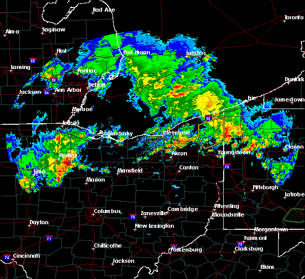 The severe thunderstorm warning for northern trumbull and ashtabula counties will expire at 745 pm edt, the storm which prompted the warning has weakened below severe limits, and has exited the warned area. therefore, the warning will be allowed to expire. a severe thunderstorm watch remains in effect until 800 pm edt for northeastern ohio. The severe thunderstorm warning for northern trumbull and ashtabula counties will expire at 745 pm edt, the storm which prompted the warning has weakened below severe limits, and has exited the warned area. therefore, the warning will be allowed to expire. a severe thunderstorm watch remains in effect until 800 pm edt for northeastern ohio.
|
| 5/28/2017 7:04 PM EDT |
 At 704 pm edt, a severe thunderstorm was located over bristolville, or 8 miles north of warren, moving northeast at 20 mph (radar indicated). Hazards include 60 mph wind gusts and quarter size hail. Minor damage to vehicles is possible. Expect damage to trees and power lines. At 704 pm edt, a severe thunderstorm was located over bristolville, or 8 miles north of warren, moving northeast at 20 mph (radar indicated). Hazards include 60 mph wind gusts and quarter size hail. Minor damage to vehicles is possible. Expect damage to trees and power lines.
|
| 5/1/2017 1:59 PM EDT |
 At 158 pm edt, severe thunderstorms were located along a line extending from near conneaut to near sharon, moving northeast at 40 mph (radar indicated). Hazards include 60 mph wind gusts. Expect damage to roofs, siding, and trees. locations impacted include, erie, meadville, conneaut, cortland, edinboro, girard, cambridge springs, kinsman, albion, andover, linesville, vienna center, adamsville, pymatuning central, harmonsburg, pymatuning north, atlantic, northwest harborcreek, vienna and lawrence park. A tornado watch remains in effect until 700 pm edt for northeastern ohio, and northwestern pennsylvania. At 158 pm edt, severe thunderstorms were located along a line extending from near conneaut to near sharon, moving northeast at 40 mph (radar indicated). Hazards include 60 mph wind gusts. Expect damage to roofs, siding, and trees. locations impacted include, erie, meadville, conneaut, cortland, edinboro, girard, cambridge springs, kinsman, albion, andover, linesville, vienna center, adamsville, pymatuning central, harmonsburg, pymatuning north, atlantic, northwest harborcreek, vienna and lawrence park. A tornado watch remains in effect until 700 pm edt for northeastern ohio, and northwestern pennsylvania.
|
| 5/1/2017 1:45 PM EDT |
 At 144 pm edt, a severe thunderstorm was located near andover, or 23 miles north of sharpsville, moving northeast at 45 mph (radar indicated). Hazards include 60 mph wind gusts. expect damage to roofs, siding, and trees At 144 pm edt, a severe thunderstorm was located near andover, or 23 miles north of sharpsville, moving northeast at 45 mph (radar indicated). Hazards include 60 mph wind gusts. expect damage to roofs, siding, and trees
|
| 3/1/2017 5:09 PM EST |
 The severe thunderstorm warning for northern trumbull and ashtabula counties will expire at 515 pm est, the storms which prompted the warning have moved out of the area. therefore the warning will be allowed to expire. The severe thunderstorm warning for northern trumbull and ashtabula counties will expire at 515 pm est, the storms which prompted the warning have moved out of the area. therefore the warning will be allowed to expire.
|
| 3/1/2017 4:45 PM EST |
 At 444 pm est, severe thunderstorms were located along a line extending from 10 miles north of conneaut to 8 miles southeast of north kingsville to 6 miles north of orwell, moving northeast at 50 mph (radar indicated). Hazards include 60 mph wind gusts. Expect damage to roofs, siding, and trees. Locations impacted include, ashtabula, conneaut, jefferson, north kingsville, kinsman, orwell, andover, mecca, johnston, kingsville, roaming shores, pierpont, cherry valley, rock creek, orangeville, plymouth center, kelloggsville and edgewood. At 444 pm est, severe thunderstorms were located along a line extending from 10 miles north of conneaut to 8 miles southeast of north kingsville to 6 miles north of orwell, moving northeast at 50 mph (radar indicated). Hazards include 60 mph wind gusts. Expect damage to roofs, siding, and trees. Locations impacted include, ashtabula, conneaut, jefferson, north kingsville, kinsman, orwell, andover, mecca, johnston, kingsville, roaming shores, pierpont, cherry valley, rock creek, orangeville, plymouth center, kelloggsville and edgewood.
|
| 3/1/2017 4:17 PM EST |
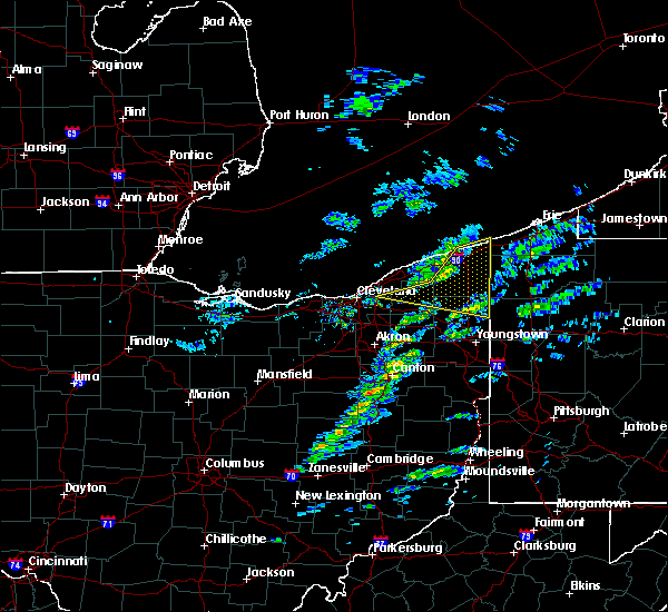 At 416 pm est, severe thunderstorms were located along a line extending from near ashtabula to 9 miles northwest of orwell to chesterland, moving northeast at 60 mph (radar indicated). Hazards include 60 mph wind gusts. expect damage to roofs, siding, and trees At 416 pm est, severe thunderstorms were located along a line extending from near ashtabula to 9 miles northwest of orwell to chesterland, moving northeast at 60 mph (radar indicated). Hazards include 60 mph wind gusts. expect damage to roofs, siding, and trees
|
| 3/1/2017 6:28 AM EST |
 At 628 am est, severe thunderstorms were located along a line extending from 8 miles north of harmonsburg to 7 miles north of alliance, moving east at 55 mph (radar indicated). Hazards include 60 mph wind gusts and quarter size hail. Hail damage to vehicles is expected. expect wind damage to roofs, siding, and trees. Locations impacted include, youngstown, warren, salem, columbiana, boardman, alliance, niles, campbell, hubbard, canfield, cortland, newton falls, sebring, lordstown, hartville, kinsman, vienna center, leavittsburg, hilltop and bristolville. At 628 am est, severe thunderstorms were located along a line extending from 8 miles north of harmonsburg to 7 miles north of alliance, moving east at 55 mph (radar indicated). Hazards include 60 mph wind gusts and quarter size hail. Hail damage to vehicles is expected. expect wind damage to roofs, siding, and trees. Locations impacted include, youngstown, warren, salem, columbiana, boardman, alliance, niles, campbell, hubbard, canfield, cortland, newton falls, sebring, lordstown, hartville, kinsman, vienna center, leavittsburg, hilltop and bristolville.
|
| 3/1/2017 6:05 AM EST |
 At 605 am est, severe thunderstorms were located along a line extending from 6 miles southeast of jefferson to near barberton, moving east at 65 mph (radar indicated). Hazards include 60 mph wind gusts and quarter size hail. Hail damage to vehicles is expected. Expect wind damage to roofs, siding, and trees. At 605 am est, severe thunderstorms were located along a line extending from 6 miles southeast of jefferson to near barberton, moving east at 65 mph (radar indicated). Hazards include 60 mph wind gusts and quarter size hail. Hail damage to vehicles is expected. Expect wind damage to roofs, siding, and trees.
|
| 3/1/2017 4:31 AM EST |
 At 431 am est, a severe thunderstorm was located near newton falls, or 11 miles southwest of warren, moving northeast at 35 mph (radar indicated). Hazards include 60 mph wind gusts. Expect damage to roofs, siding, and trees. Locations impacted include, akron, canton, youngstown, warren, ravenna, columbiana, boardman, kent, green, alliance, niles, tallmadge, north canton, streetsboro, louisville, campbell, hubbard, canfield, cortland and newton falls. At 431 am est, a severe thunderstorm was located near newton falls, or 11 miles southwest of warren, moving northeast at 35 mph (radar indicated). Hazards include 60 mph wind gusts. Expect damage to roofs, siding, and trees. Locations impacted include, akron, canton, youngstown, warren, ravenna, columbiana, boardman, kent, green, alliance, niles, tallmadge, north canton, streetsboro, louisville, campbell, hubbard, canfield, cortland and newton falls.
|
| 3/1/2017 4:01 AM EST |
 At 400 am est, a severe thunderstorm was located near alliance, or 12 miles northeast of canton, moving northeast at 35 mph (radar indicated). Hazards include 60 mph wind gusts. expect damage to roofs, siding, and trees At 400 am est, a severe thunderstorm was located near alliance, or 12 miles northeast of canton, moving northeast at 35 mph (radar indicated). Hazards include 60 mph wind gusts. expect damage to roofs, siding, and trees
|
| 3/1/2017 2:10 AM EST |
 At 209 am est, severe thunderstorms were located along a line extending from near cleveland heights to near middlefield to near newton falls, moving east at 80 mph (radar indicated). Hazards include 70 mph wind gusts. Expect considerable tree damage. Damage is likely to mobile homes, roofs, and outbuildings. At 209 am est, severe thunderstorms were located along a line extending from near cleveland heights to near middlefield to near newton falls, moving east at 80 mph (radar indicated). Hazards include 70 mph wind gusts. Expect considerable tree damage. Damage is likely to mobile homes, roofs, and outbuildings.
|
| 8/10/2016 4:21 PM EDT |
 At 420 pm edt, a severe thunderstorm was located near middlefield, or 13 miles south of chardon, moving east at 40 mph (radar indicated). Hazards include 60 mph wind gusts and quarter size hail. Hail damage to vehicles is expected. Expect wind damage to roofs, siding and trees. At 420 pm edt, a severe thunderstorm was located near middlefield, or 13 miles south of chardon, moving east at 40 mph (radar indicated). Hazards include 60 mph wind gusts and quarter size hail. Hail damage to vehicles is expected. Expect wind damage to roofs, siding and trees.
|
| 7/22/2016 9:23 AM EDT |
 At 922 am edt, a severe thunderstorm was located near cortland, or near warren, moving south at 15 mph (radar indicated). Hazards include 60 mph wind gusts and quarter size hail. Hail damage to vehicles is expected. Expect wind damage to roofs, siding and trees. At 922 am edt, a severe thunderstorm was located near cortland, or near warren, moving south at 15 mph (radar indicated). Hazards include 60 mph wind gusts and quarter size hail. Hail damage to vehicles is expected. Expect wind damage to roofs, siding and trees.
|
| 7/13/2016 11:07 PM EDT |
 At 1107 pm edt, severe thunderstorms were located along a line extending from near geneva to near orwell to near salem, moving northeast at 45 mph (radar indicated). Hazards include 60 mph wind gusts. Expect damage to roofs. siding and trees. Locations impacted include, youngstown, warren, ashtabula, conneaut, salem, columbiana, jefferson, geneva-on-the-lake, boardman, niles, campbell, hubbard, canfield, cortland, geneva, newton falls, sebring, lordstown, north kingsville and kinsman. At 1107 pm edt, severe thunderstorms were located along a line extending from near geneva to near orwell to near salem, moving northeast at 45 mph (radar indicated). Hazards include 60 mph wind gusts. Expect damage to roofs. siding and trees. Locations impacted include, youngstown, warren, ashtabula, conneaut, salem, columbiana, jefferson, geneva-on-the-lake, boardman, niles, campbell, hubbard, canfield, cortland, geneva, newton falls, sebring, lordstown, north kingsville and kinsman.
|
| 7/13/2016 10:45 PM EDT |
 At 1044 pm edt, severe thunderstorms were located along a line extending from near madison to near garrettsville to near waynesburg, moving northeast at 40 mph. seek shelter now inside a sturdy structure and stay away from windows (radar indicated). Hazards include 60 to 70 mph wind gusts. this storm has a history of damaging winds. Expect considerable tree damage. Damage is likely to mobile homes, roofs and outbuildings. At 1044 pm edt, severe thunderstorms were located along a line extending from near madison to near garrettsville to near waynesburg, moving northeast at 40 mph. seek shelter now inside a sturdy structure and stay away from windows (radar indicated). Hazards include 60 to 70 mph wind gusts. this storm has a history of damaging winds. Expect considerable tree damage. Damage is likely to mobile homes, roofs and outbuildings.
|
| 6/6/2016 10:26 PM EDT | The severe thunderstorm warning for trumbull and southeastern ashtabula counties will expire at 1030 pm edt, the storms which prompted the warning have moved out of the area. therefore the warning will be allowed to expire. however gusty winds are still possible with these thunderstorms. |
| 6/6/2016 10:07 PM EDT | Tree damage across much of kinsman and vernon townships between the ashtabula county line south to the intersection of ohio routes 7 and 88 in northeastern trumbull cou in trumbull county OH, 2.4 miles NNE of Kinsman Center, OH |
| 6/6/2016 10:07 PM EDT |
 At 1006 pm edt, severe thunderstorms were located along a line extending from near jefferson to near vienna center, moving east at 45 mph (radar indicated). Hazards include 60 mph wind gusts. Expect damage to roofs. siding and trees. Locations impacted include, warren, jefferson, niles, hubbard, cortland, lordstown, kinsman, orwell, andover, vienna center, girard, vienna, mcdonald, mecca, johnston, roaming shores, pierpont, cherry valley, rock creek and orangeville. At 1006 pm edt, severe thunderstorms were located along a line extending from near jefferson to near vienna center, moving east at 45 mph (radar indicated). Hazards include 60 mph wind gusts. Expect damage to roofs. siding and trees. Locations impacted include, warren, jefferson, niles, hubbard, cortland, lordstown, kinsman, orwell, andover, vienna center, girard, vienna, mcdonald, mecca, johnston, roaming shores, pierpont, cherry valley, rock creek and orangeville.
|
| 6/6/2016 9:45 PM EDT |
 At 945 pm edt, severe thunderstorms were located along a line extending from near orwell to newton falls, moving east at 40 mph (radar indicated). Hazards include 60 mph wind gusts. Expect damage to roofs. Siding and trees. At 945 pm edt, severe thunderstorms were located along a line extending from near orwell to newton falls, moving east at 40 mph (radar indicated). Hazards include 60 mph wind gusts. Expect damage to roofs. Siding and trees.
|
| 6/5/2016 4:41 PM EDT |
 The severe thunderstorm warning for trumbull and southeastern ashtabula counties will expire at 445 pm edt, the storm which prompted the warning has moved out of the area. therefore the warning will be allowed to expire. a severe thunderstorm watch remains in effect until 900 pm edt for northeastern ohio. The severe thunderstorm warning for trumbull and southeastern ashtabula counties will expire at 445 pm edt, the storm which prompted the warning has moved out of the area. therefore the warning will be allowed to expire. a severe thunderstorm watch remains in effect until 900 pm edt for northeastern ohio.
|
| 6/5/2016 4:37 PM EDT | Multiple trees down reported in west salem township in mercer county PA, 4.1 miles NW of Kinsman Center, OH |
| 6/5/2016 4:30 PM EDT | Multiple trees down reported in west salem township in mercer county PA, 4.1 miles NW of Kinsman Center, OH |
| 6/5/2016 4:21 PM EDT |
 At 420 pm edt, a severe thunderstorm was located over cortland, or 9 miles northeast of warren, moving east at 45 mph (radar indicated). Hazards include 60 mph wind gusts and quarter size hail. Hail damage to vehicles is expected. expect wind damage to roofs, siding and trees. Locations impacted include, warren, niles, cortland, newton falls, lordstown, kinsman, north bloomfield, orwell, west farmington, vienna center, bristolville, leavittsburg, girard, vienna, mecca, johnston, orangeville, yankee lake, west hill and howland center. At 420 pm edt, a severe thunderstorm was located over cortland, or 9 miles northeast of warren, moving east at 45 mph (radar indicated). Hazards include 60 mph wind gusts and quarter size hail. Hail damage to vehicles is expected. expect wind damage to roofs, siding and trees. Locations impacted include, warren, niles, cortland, newton falls, lordstown, kinsman, north bloomfield, orwell, west farmington, vienna center, bristolville, leavittsburg, girard, vienna, mecca, johnston, orangeville, yankee lake, west hill and howland center.
|
| 6/5/2016 3:59 PM EDT |
 At 358 pm edt, a severe thunderstorm was located near west farmington, or 15 miles northwest of warren, moving east at 40 mph (radar indicated). Hazards include 60 mph wind gusts and quarter size hail. Hail damage to vehicles is expected. Expect wind damage to roofs, siding and trees. At 358 pm edt, a severe thunderstorm was located near west farmington, or 15 miles northwest of warren, moving east at 40 mph (radar indicated). Hazards include 60 mph wind gusts and quarter size hail. Hail damage to vehicles is expected. Expect wind damage to roofs, siding and trees.
|
| 7/14/2015 2:41 PM EDT |
 At 240 pm edt, a severe thunderstorm was located near twinsburg, or 14 miles northwest of ravenna, moving west at 20 mph (radar indicated). Hazards include 60 mph wind gusts and quarter size hail. Hail damage to vehicles is expected. expect wind damage to roofs, siding and trees. heavy rain could cause local flooding. Locations impacted include, warren, solon, cortland, south russell, garrettsville, north bloomfield, mantua, west farmington, vienna center, bristolville, leavittsburg, aurora, bedford heights, parkman, vienna, reminderville, mecca, johnston, hiram and glenwillow. At 240 pm edt, a severe thunderstorm was located near twinsburg, or 14 miles northwest of ravenna, moving west at 20 mph (radar indicated). Hazards include 60 mph wind gusts and quarter size hail. Hail damage to vehicles is expected. expect wind damage to roofs, siding and trees. heavy rain could cause local flooding. Locations impacted include, warren, solon, cortland, south russell, garrettsville, north bloomfield, mantua, west farmington, vienna center, bristolville, leavittsburg, aurora, bedford heights, parkman, vienna, reminderville, mecca, johnston, hiram and glenwillow.
|
| 7/14/2015 2:16 PM EDT |
 At 215 pm edt, a severe thunderstorm was located over bristolville, or 11 miles north of warren, moving east at 20 mph. other potentially severe storms were in trumbull county and extreme eastern cuyahoga county (radar indicated). Hazards include 60 mph wind gusts and quarter size hail. Hail damage to vehicles is expected. Expect wind damage to roofs, siding and trees. At 215 pm edt, a severe thunderstorm was located over bristolville, or 11 miles north of warren, moving east at 20 mph. other potentially severe storms were in trumbull county and extreme eastern cuyahoga county (radar indicated). Hazards include 60 mph wind gusts and quarter size hail. Hail damage to vehicles is expected. Expect wind damage to roofs, siding and trees.
|
| 5/11/2015 8:17 PM EDT | At 808 pm edt, severe thunderstorms were located along a line extending from 6 miles north of cortland to 5 miles northwest of hubbard, and moving northeast at 35 mph (radar indicated). Hazards include 60 mph wind gusts and quarter size hail. Hail damage to vehicles is expected. expect wind damage to roofs, siding and trees. locations impacted include, yankee lake and orangeville. 1. 00in. |
| 5/11/2015 7:46 PM EDT | At 744 pm edt, severe thunderstorms were located along a line extending from 6 miles west of cortland to lordstown, and moving northeast at 55 mph (radar indicated). Hazards include 60 mph wind gusts and quarter size hail. Hail damage to vehicles is expected. Expect wind damage to roofs, siding and trees. |
| 5/9/2015 6:08 PM EDT | At 605 pm edt, a severe thunderstorm was located 8 miles southeast of cortland, and moving north at 20 mph (radar indicated). Hazards include 60 mph wind gusts and quarter size hail. Hail damage to vehicles is expected. Expect wind damage to roofs, siding and trees. |
| 7/27/2014 9:20 PM EDT | At least 4 trees were blown down in kinsman townshi in trumbull county OH, 0.8 miles ENE of Kinsman Center, OH |
| 5/21/2014 11:25 PM EDT | Ping Pong Ball sized hail reported 0.9 miles NNE of Kinsman Center, OH |
| 6/25/2013 4:55 PM EDT | Many trees and some utility poles knocked dow in trumbull county OH, 0.8 miles ENE of Kinsman Center, OH |
| 9/22/2012 5:15 PM EDT | A barn destroyed. four to five telepohone poles knocked down and two trees down around rte 193 and rte 8 in trumbull county OH, 5 miles E of Kinsman Center, OH |
| 7/26/2012 1:30 PM EDT | Numerous large branches dow in trumbull county OH, 0.8 miles ENE of Kinsman Center, OH |
| 7/26/2012 1:30 PM EDT | Numerous large limbs dow in trumbull county OH, 0.8 miles ENE of Kinsman Center, OH |
| 7/4/2012 9:43 PM EDT | Quarter sized hail reported 2.1 miles NE of Kinsman Center, OH |
| 1/1/0001 12:00 AM | Trees and powerlines dow in trumbull county OH, 0.8 miles ENE of Kinsman Center, OH |
| 1/1/0001 12:00 AM | Numerous trees in trumbull county OH, 4.5 miles NNE of Kinsman Center, OH |
Hail Maps for Kinsman Center, OH
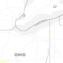
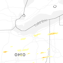


Connect with Interactive Hail Maps