

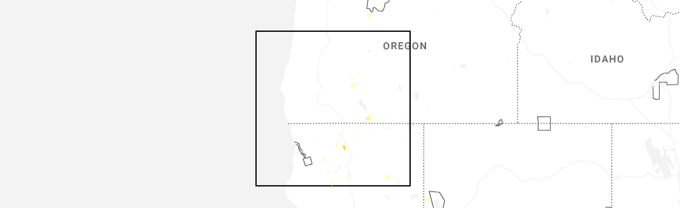
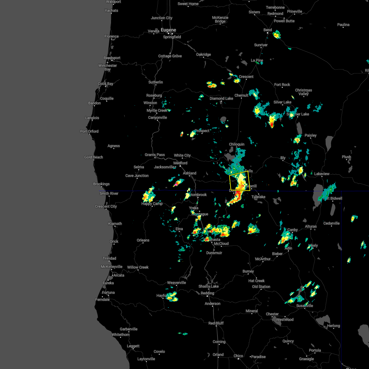
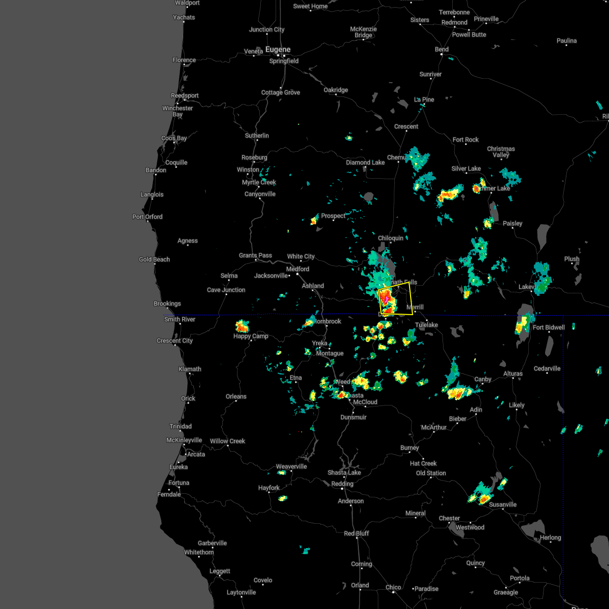
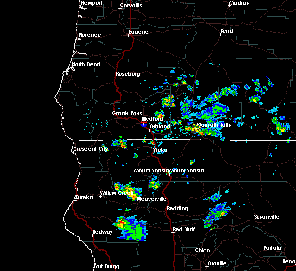
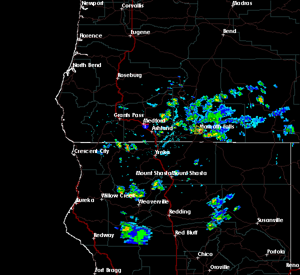
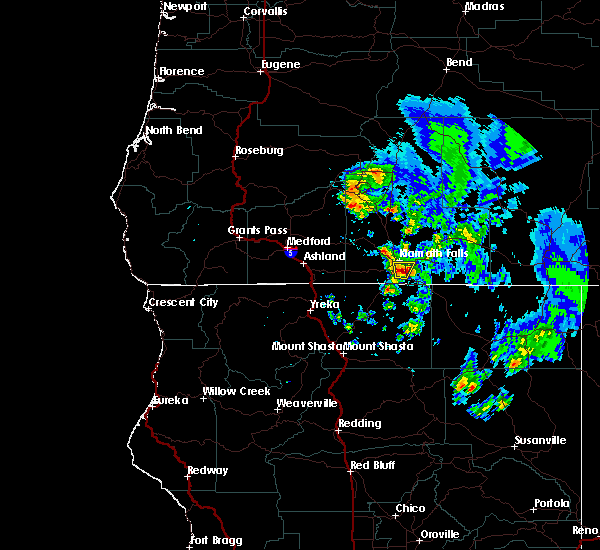
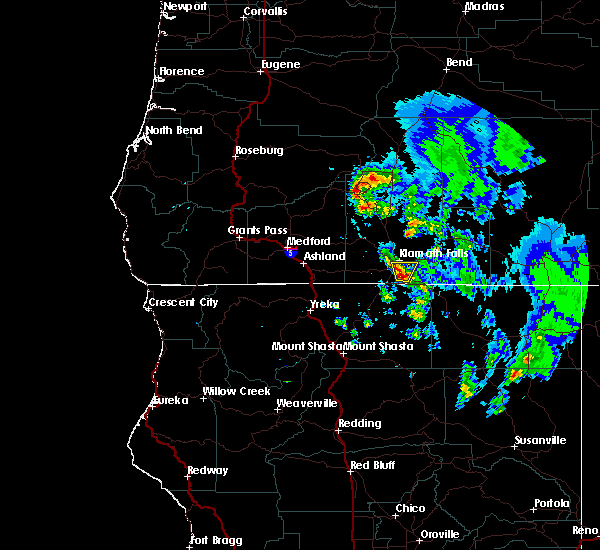
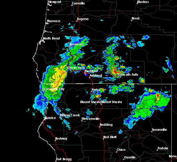
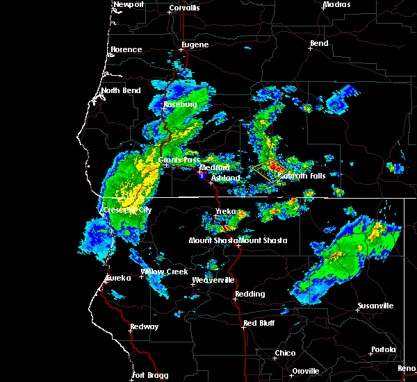
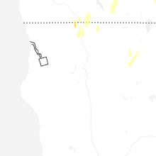
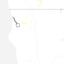
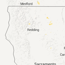
Hail Map for Klamath Falls, OR
The Klamath Falls, OR area has had 7 reports of on-the-ground hail by trained spotters, and has been under severe weather warnings 1 time during the past 12 months. Doppler radar has detected hail at or near Klamath Falls, OR on 9 occasions, including 3 occasions during the past year.
| Name: | Klamath Falls, OR |
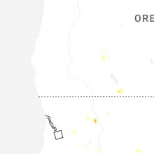
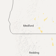
| Where Located: | 57.1 miles E of Medford, OR |
| Map: | Google Map for Klamath Falls, OR |
| Population: | 20840 |
| Housing Units: | 9595 |
| More Info: | Search Google for Klamath Falls, OR |
2
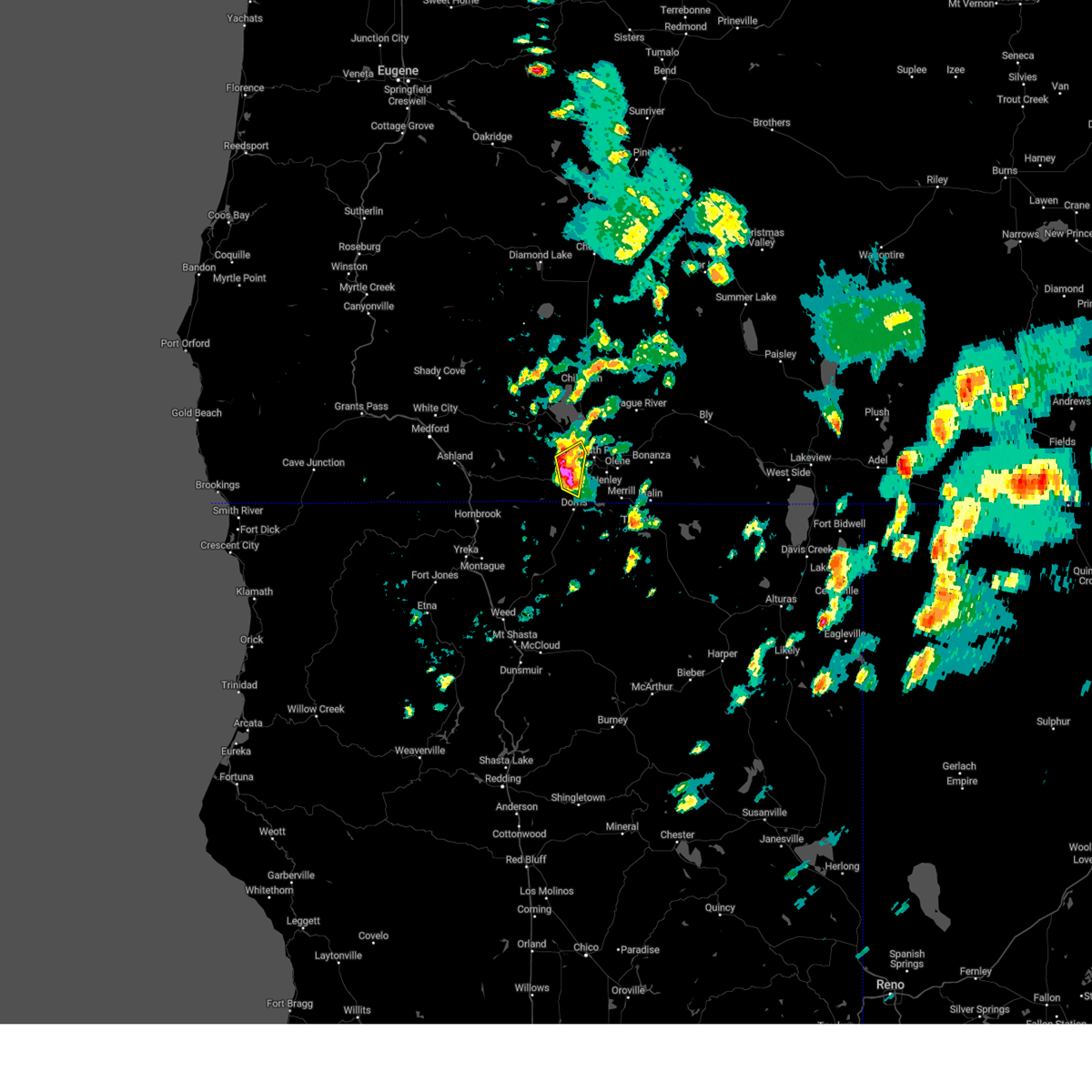
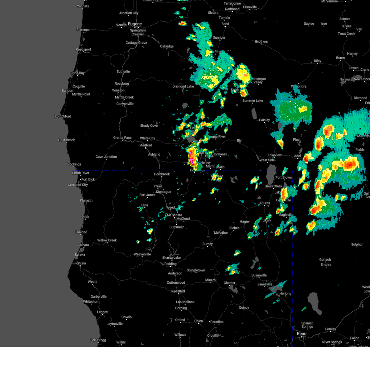
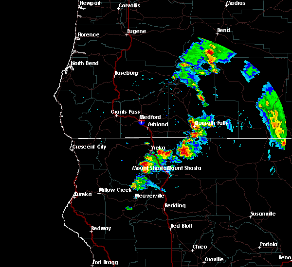
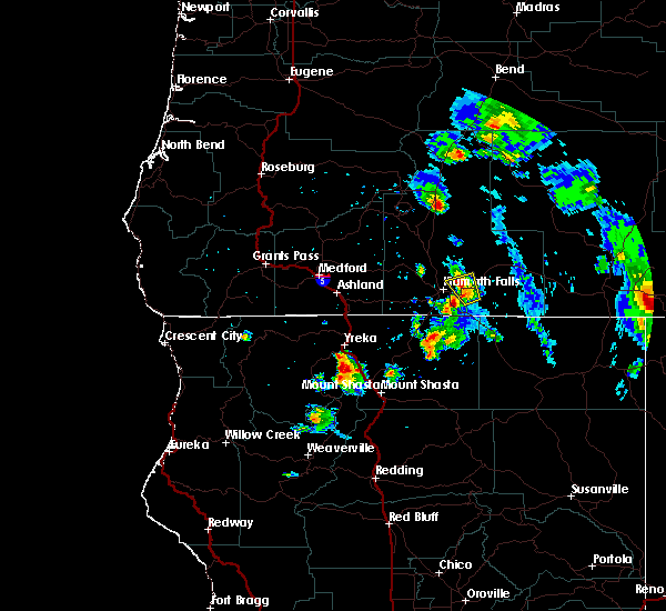
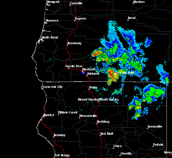
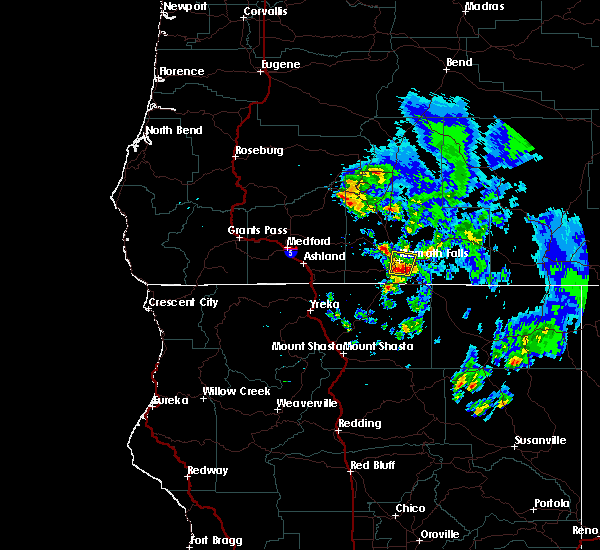
The Top Recent Hail Date for Klamath Falls, OR is Tuesday, July 1, 2025 (2nd out of 9)
Hail and Wind Damage Spotted near Klamath Falls, OR
| Date / Time | Report Details |
|---|---|
| 7/1/2025 6:44 PM PDT |
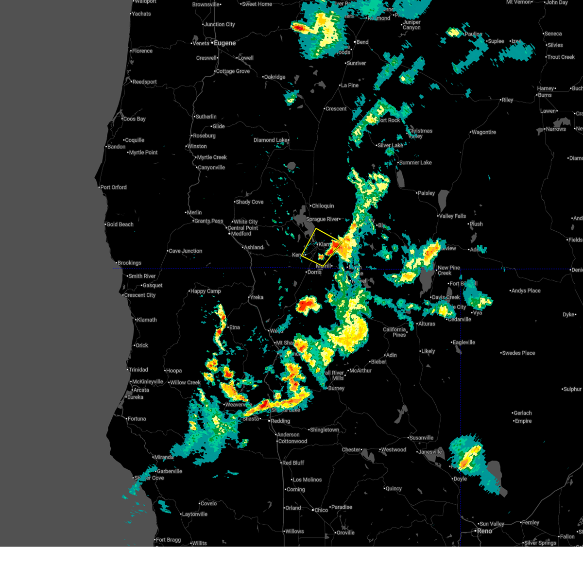 Svrmfr the national weather service in medford has issued a * severe thunderstorm warning for, south central klamath county in south central oregon, * until 730 pm pdt. * at 644 pm pdt, a severe thunderstorm was located near midland, or 7 miles south of klamath falls, moving northwest at 10 mph (radar indicated). Hazards include 60 mph wind gusts and quarter size hail. Hail damage to vehicles is expected. Expect wind damage to roofs, siding, and trees. Svrmfr the national weather service in medford has issued a * severe thunderstorm warning for, south central klamath county in south central oregon, * until 730 pm pdt. * at 644 pm pdt, a severe thunderstorm was located near midland, or 7 miles south of klamath falls, moving northwest at 10 mph (radar indicated). Hazards include 60 mph wind gusts and quarter size hail. Hail damage to vehicles is expected. Expect wind damage to roofs, siding, and trees.
|
| 8/4/2023 5:55 PM PDT | Quarter sized hail reported 24.7 miles SE of Klamath Falls, OR, quarter-sized hail reported by resort employee. |
| 8/4/2023 5:50 PM PDT | Ping Pong Ball sized hail reported 24.9 miles SE of Klamath Falls, OR, ping pong ball-sized hail and heavy rain reported by resort employee. |
| 8/4/2023 5:07 PM PDT |
 At 506 pm pdt, severe thunderstorms were located along a line extending from near howard bay park to near keno, moving north at 15 mph (radar indicated). Hazards include 60 mph wind gusts and quarter size hail. Hail damage to vehicles is expected. expect wind damage to roofs, siding, and trees. locations impacted include, keno. hail threat, radar indicated max hail size, 1. 00 in wind threat, radar indicated max wind gust, 60 mph. At 506 pm pdt, severe thunderstorms were located along a line extending from near howard bay park to near keno, moving north at 15 mph (radar indicated). Hazards include 60 mph wind gusts and quarter size hail. Hail damage to vehicles is expected. expect wind damage to roofs, siding, and trees. locations impacted include, keno. hail threat, radar indicated max hail size, 1. 00 in wind threat, radar indicated max wind gust, 60 mph.
|
| 8/4/2023 4:50 PM PDT |
 At 449 pm pdt, severe thunderstorms were located along a line extending from near howard bay park to near keno, moving north at 15 mph (radar indicated). Hazards include 60 mph wind gusts and quarter size hail. Hail damage to vehicles is expected. Expect wind damage to roofs, siding, and trees. At 449 pm pdt, severe thunderstorms were located along a line extending from near howard bay park to near keno, moving north at 15 mph (radar indicated). Hazards include 60 mph wind gusts and quarter size hail. Hail damage to vehicles is expected. Expect wind damage to roofs, siding, and trees.
|
| 8/2/2022 3:52 PM PDT |
 At 351 pm pdt, a severe thunderstorm was located near lower klamath wildlife refuge, or 11 miles south of klamath falls, moving east- southeast at 25 mph (radar indicated). Hazards include 60 mph wind gusts and quarter size hail. Hail damage to vehicles is expected. expect wind damage to roofs, siding, and trees. locations impacted include, klamath falls, miller island klamath wildlife area, midland, moore park, worden, keno and altamont. hail threat, radar indicated max hail size, 1. 00 in wind threat, radar indicated max wind gust, 60 mph. At 351 pm pdt, a severe thunderstorm was located near lower klamath wildlife refuge, or 11 miles south of klamath falls, moving east- southeast at 25 mph (radar indicated). Hazards include 60 mph wind gusts and quarter size hail. Hail damage to vehicles is expected. expect wind damage to roofs, siding, and trees. locations impacted include, klamath falls, miller island klamath wildlife area, midland, moore park, worden, keno and altamont. hail threat, radar indicated max hail size, 1. 00 in wind threat, radar indicated max wind gust, 60 mph.
|
| 8/2/2022 3:26 PM PDT |
 At 325 pm pdt, a severe thunderstorm was located over midland, or 8 miles southwest of klamath falls, moving east at 25 mph (radar indicated). Hazards include 60 mph wind gusts and quarter size hail. Hail damage to vehicles is expected. Expect wind damage to roofs, siding, and trees. At 325 pm pdt, a severe thunderstorm was located over midland, or 8 miles southwest of klamath falls, moving east at 25 mph (radar indicated). Hazards include 60 mph wind gusts and quarter size hail. Hail damage to vehicles is expected. Expect wind damage to roofs, siding, and trees.
|
| 8/5/2020 5:40 PM PDT | Quarter sized hail reported 1.7 miles SSE of Klamath Falls, OR, picture showing quarter sized hail... with followup confirmation. |
| 8/5/2020 5:03 PM PDT | Quarter sized hail reported 2.7 miles SSE of Klamath Falls, OR, picture of 1 inch hail taken next to a quarter to estimate the size. person reported melting had been occurring before they could take the picture. |
| 8/5/2020 4:42 PM PDT |
 At 441 pm pdt, a severe thunderstorm was located over klamath falls, and is nearly stationary (radar indicated). Hazards include quarter size hail. damage to vehicles is expected At 441 pm pdt, a severe thunderstorm was located over klamath falls, and is nearly stationary (radar indicated). Hazards include quarter size hail. damage to vehicles is expected
|
| 8/5/2020 3:59 PM PDT |
 At 358 pm pdt, a severe thunderstorm was located near olene, or 8 miles southeast of klamath falls, moving north at 10 mph (radar indicated). Hazards include quarter size hail. damage to vehicles is expected At 358 pm pdt, a severe thunderstorm was located near olene, or 8 miles southeast of klamath falls, moving north at 10 mph (radar indicated). Hazards include quarter size hail. damage to vehicles is expected
|
| 8/8/2017 4:06 PM PDT |
 The severe thunderstorm warning for south central klamath county will expire at 415 pm pdt, the storm which prompted the warning has weakened below severe limits, and no longer poses an immediate threat to life or property. therefore the warning will be allowed to expire. however small hail and heavy rain are still possible with this thunderstorm. The severe thunderstorm warning for south central klamath county will expire at 415 pm pdt, the storm which prompted the warning has weakened below severe limits, and no longer poses an immediate threat to life or property. therefore the warning will be allowed to expire. however small hail and heavy rain are still possible with this thunderstorm.
|
| 8/8/2017 3:49 PM PDT |
 At 349 pm pdt, a severe thunderstorm was located over klamath falls, moving west at 10 mph (trained weather spotters). Hazards include quarter size hail. damage to vehicles is expected At 349 pm pdt, a severe thunderstorm was located over klamath falls, moving west at 10 mph (trained weather spotters). Hazards include quarter size hail. damage to vehicles is expected
|
| 8/8/2017 3:48 PM PDT | Quarter sized hail reported 2.8 miles W of Klamath Falls, OR, the duration of the hail event was 10 minutes. |
| 7/24/2017 8:09 PM PDT |
 The severe thunderstorm warning for southern klamath county will expire at 815 pm pdt, the storm which prompted the warning has weakened below severe limits, and has exited the warned area. therefore, the warning will be allowed to expire. however, as other storms continue in the area, small hail, gusty winds and heavy rain are still possible. The severe thunderstorm warning for southern klamath county will expire at 815 pm pdt, the storm which prompted the warning has weakened below severe limits, and has exited the warned area. therefore, the warning will be allowed to expire. however, as other storms continue in the area, small hail, gusty winds and heavy rain are still possible.
|
| 7/24/2017 7:42 PM PDT |
 At 740 pm pdt, a severe thunderstorm was located near midland, or near klamath falls, moving north at 20 mph (radar indicated). Hazards include 60 mph wind gusts and quarter size hail. Hail damage to vehicles is expected. Expect wind damage to roofs, siding, and trees. At 740 pm pdt, a severe thunderstorm was located near midland, or near klamath falls, moving north at 20 mph (radar indicated). Hazards include 60 mph wind gusts and quarter size hail. Hail damage to vehicles is expected. Expect wind damage to roofs, siding, and trees.
|
| 7/24/2017 7:35 PM PDT |
 At 734 pm pdt, a severe thunderstorm was located near midland, or near klamath falls, moving north at 10 mph (radar indicated). Hazards include 60 mph wind gusts and quarter size hail. Hail damage to vehicles is expected. expect wind damage to roofs, siding, and trees. locations impacted include, klamath falls, olene and altamont. this includes the following highways, us 97 in oregon between mile markers 277 and 280. klamath-lakeview highway 140 in oregon between mile markers 6 and 9. Highway 66 in oregon near mile marker 59. At 734 pm pdt, a severe thunderstorm was located near midland, or near klamath falls, moving north at 10 mph (radar indicated). Hazards include 60 mph wind gusts and quarter size hail. Hail damage to vehicles is expected. expect wind damage to roofs, siding, and trees. locations impacted include, klamath falls, olene and altamont. this includes the following highways, us 97 in oregon between mile markers 277 and 280. klamath-lakeview highway 140 in oregon between mile markers 6 and 9. Highway 66 in oregon near mile marker 59.
|
| 7/24/2017 7:15 PM PDT |
 At 713 pm pdt, a severe thunderstorm was located near lower klamath wildlife refuge, or 10 miles south of klamath falls, moving north at 10 mph (radar indicated). Hazards include 60 mph wind gusts and quarter size hail. Hail damage to vehicles is expected. Expect wind damage to roofs, siding, and trees. At 713 pm pdt, a severe thunderstorm was located near lower klamath wildlife refuge, or 10 miles south of klamath falls, moving north at 10 mph (radar indicated). Hazards include 60 mph wind gusts and quarter size hail. Hail damage to vehicles is expected. Expect wind damage to roofs, siding, and trees.
|
| 7/9/2015 6:54 PM PDT |
 The severe thunderstorm warning for southwestern klamath county will expire at 700 pm pdt, the storm which prompted the warning has weakened below severe limits, and no longer poses an immediate threat to life or property. therefore the warning will be allowed to expire. however small hail and heavy rain are still possible with this thunderstorm. The severe thunderstorm warning for southwestern klamath county will expire at 700 pm pdt, the storm which prompted the warning has weakened below severe limits, and no longer poses an immediate threat to life or property. therefore the warning will be allowed to expire. however small hail and heavy rain are still possible with this thunderstorm.
|
| 7/9/2015 6:47 PM PDT |
 At 647 pm pdt, doppler radar continued to indicated a severe thunderstorm capable of producing quarter size hail and damaging winds in excess of 60 mph. this storm was located over hagelstein county park, or 9 miles north of klamath falls, moving southwest at 15 mph. locations impacted include, klamath falls, eagle ridge klamath county park, moore park, hagelstein county park, modoc point and howard bay park. At 647 pm pdt, doppler radar continued to indicated a severe thunderstorm capable of producing quarter size hail and damaging winds in excess of 60 mph. this storm was located over hagelstein county park, or 9 miles north of klamath falls, moving southwest at 15 mph. locations impacted include, klamath falls, eagle ridge klamath county park, moore park, hagelstein county park, modoc point and howard bay park.
|
| 7/9/2015 6:33 PM PDT |
 At 633 pm pdt, doppler radar indicated a severe thunderstorm capable of producing half dollar size hail and damaging winds in excess of 60 mph. this storm was located over hagelstein county park, or 11 miles north of klamath falls, and moving southwest at 15 mph. At 633 pm pdt, doppler radar indicated a severe thunderstorm capable of producing half dollar size hail and damaging winds in excess of 60 mph. this storm was located over hagelstein county park, or 11 miles north of klamath falls, and moving southwest at 15 mph.
|
| 8/5/2014 8:00 PM PDT | Quarter sized hail reported 5.9 miles ENE of Klamath Falls, OR, hail between 1/2" and 1" covered the ground to 1" deep. hail duration 10 minutes. observer location 4 miles sw of hwys 99 or 140 or 66 intersection. |
| 8/12/2013 7:20 PM PDT | Quarter sized hail reported 10.4 miles NE of Klamath Falls, OR, quarter size hail and locally hail has accumulated up to 3 inches deep. |
| 1/1/0001 12:00 AM | Fence knocked over in klamath county OR, 3.2 miles WSW of Klamath Falls, OR |
| 1/1/0001 12:00 AM | Garbage cans blown down street in klamath county OR, 2.9 miles WSW of Klamath Falls, OR |
| 1/1/0001 12:00 AM | Garbage cans blown down street in klamath county OR, 2.9 miles WSW of Klamath Falls, OR |
| 1/1/0001 12:00 AM | Fence knocked over in klamath county OR, 3.2 miles WSW of Klamath Falls, OR |
Hail Maps for Klamath Falls, OR


Connect with Interactive Hail Maps